

We’ve recently shipped powerful updates that put you in control. Whether you’re filtering properties for site selection, fine-tuning zoning data, or integrating FLUM tiles into your maps, these improvements are all about helping you move faster, stay accurate, and make intelligent decisions with less friction.
Here’s what’s new:
Easily remove unwanted properties from Site Selection results
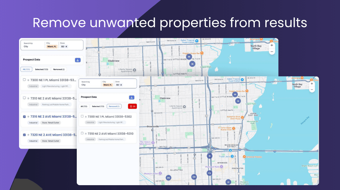
Say goodbye to cluttered search results. You can now quickly remove properties directly from the Prospect search pane. Simply select the properties you want to exclude, and they will be moved to the “removed” tab, giving you a clearer and more organized view of the properties in your search. Minimal extra steps, no confusion.
- Stay focused: Keep only relevant properties in view.
- Stay organized: Removed properties go to a dedicated “Removed” tab.
- Stay clean: Excluded properties are automatically left out of downloaded reports.
Why it matters: You get cleaner reports and faster decision-making without sorting through any low-interest properties.
Prospect Tool + Site Selection = One Unified Experience
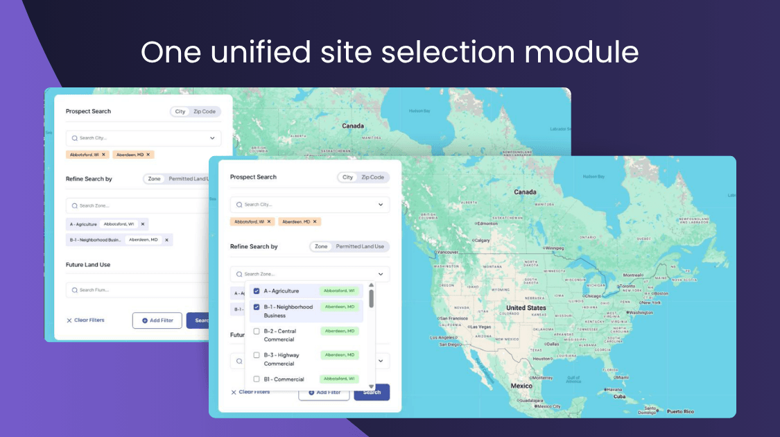
We’re saving you time and clicks by streamlining two powerful tools into a single, more efficient workflow. Introducing the unified experience, the prospect tool and site selection, all in one.
With this feature, you now get:
- Broad search: Search multiple cities or Zip codes in one go.
- Instant clarity: Tab titles now show record counts, e.g., All (100)
- Smarter dropdowns: Easily identify Zones and PLUs with the relevant city names next to them.
- Cleaner Options: We’ve removed the “As of Right” PLU for a simpler filter.
Why it matters: You can now manage complex searches across multiple regions with accuracy and ease.
More Zoning Data Transparency with Expanded Control Values (API v2)
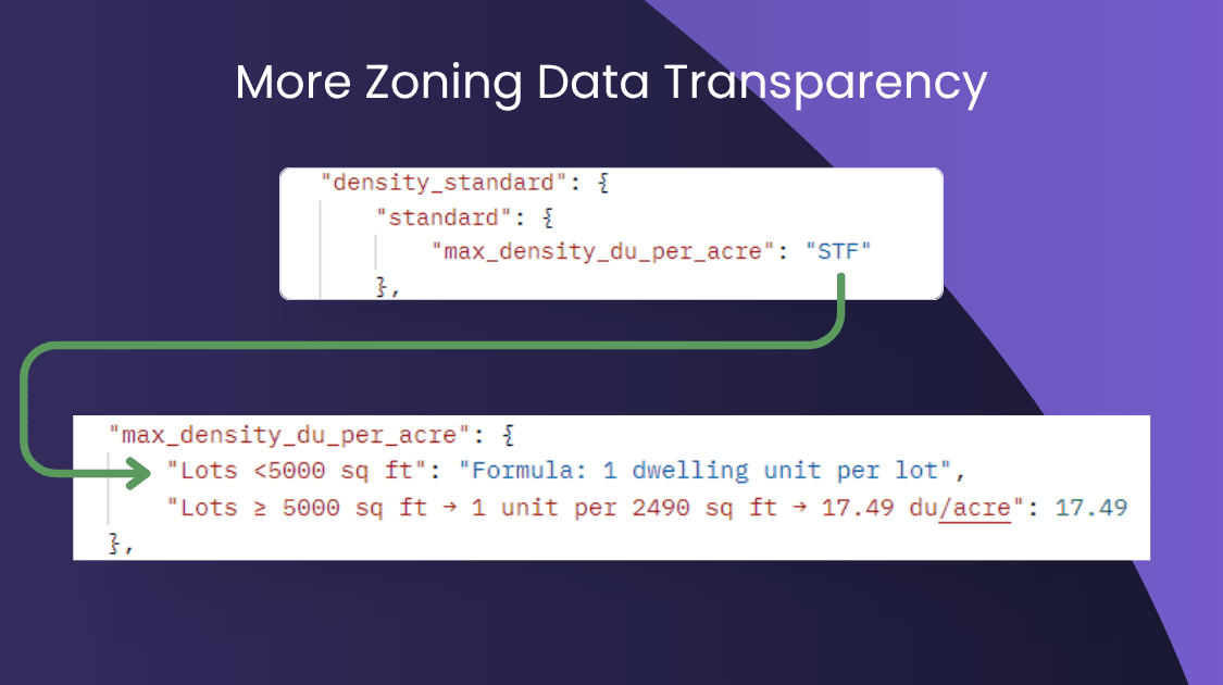
We’ve added a new conditional_control_values parameter to the v2 zoneDetail API. Set it to true and replace “STF” (See Text Field) entries with the actual control logic behind them.
Why it matters: You get clearer, more actionable zoning data without hunting for missing details.
Get Parcel Boundaries directly from the API
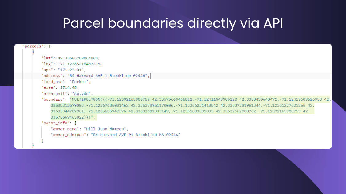
The point-based zoneDetail API now includes parcel boundary information when requested via the output_fields parameter.
Why it matters: You can now pull ready-to-use parcel boundaries directly with no separate steps or additional data joins needed.
New FLUM Tiles API: Launch Future Land Use Maps into your apps

We’re introducing the FLUM Tiling Service API for tile-based access to the Future Land Use Map (FLUM) data at zoom levels 15-22.
- Built for developers: Pull high-resolution tiles, ready for map overlays.
- Easily scalable: Zoom leels five you full control over detail.
- Test-ready: Available now on the Zoneomics API product page.
Why it matters: It has never been easier (or in some cases even possible before) to embed rich, dynamic FLUM data into your maps and tools.
Export filtered Zoning Data in one click
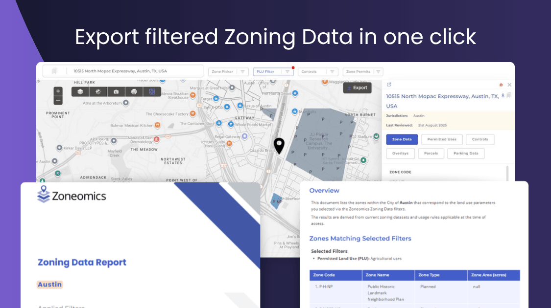
On the Zoning Data tab, you can now export a PDF report for zones filtered by PLU and Controls.
Why it matters: Shareable, print-ready reports about the zones filtered based on your chosen criteria. Great for stakeholder updates or internal documentation.
Every update in this release is designed to reduce complexity, remove friction, and give you even more control over your data and tools. Whether you’re managing zoning records, refining property searches, or building map-based apps, these improvements help you do it better. Dive in and explore the new features, and as always, let us know what you’d like to see next.