
Atmore City Zoning Code
ARTICLE II
- OFFICIAL PLANS AND MAPS
2.1. -
This Ordinance shall be implemented as a part of the City of Atmore Comprehensive Planning Program.
2.2. -
The Land Use Maps prepared as a part of the Comprehensive Planning Program shall serve as a guide for future development. To the extent practical, they shall be followed in the administration of this Ordinance.
2.3. -
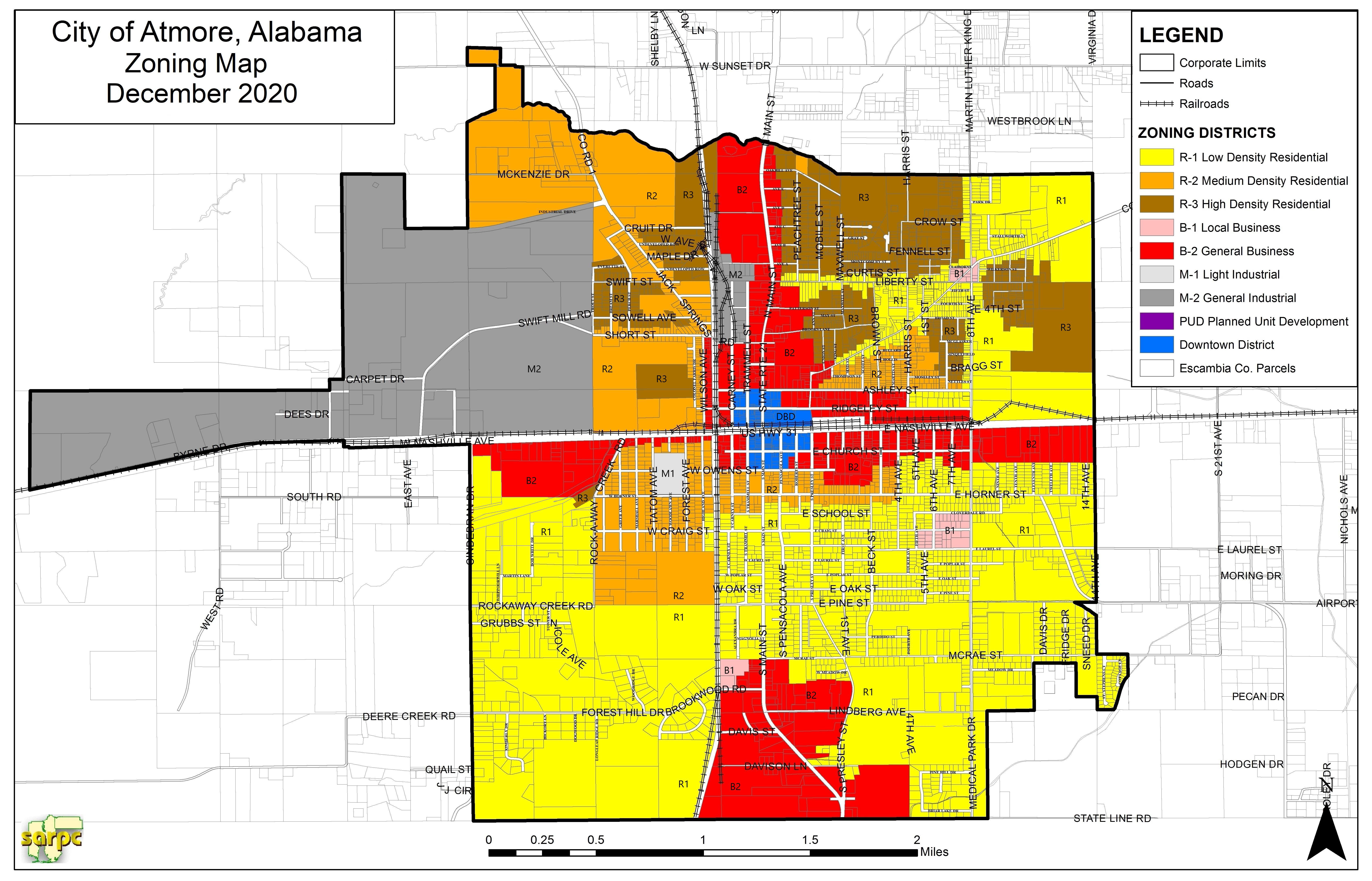
The Official Zoning Map approved by the Planning Commission and City Council is hereby adopted and made a part of this Ordinance. This map shall be signed by the Planning Commission Chairman and the Mayor. They shall be filed in the office of the City Clerk and shall show thereon the date of adoption of this Ordinance.
2.4. -
If, in accordance with the provisions of this Ordinance, changes are made to the Official Zoning Map, changes shall be made on the map as soon as possible after the amendment has been approved by the City Council. Unauthorized alterations of the Official Zoning Map shall be considered a violation of this Ordinance and subject to penalties as prescribed under Penalties.
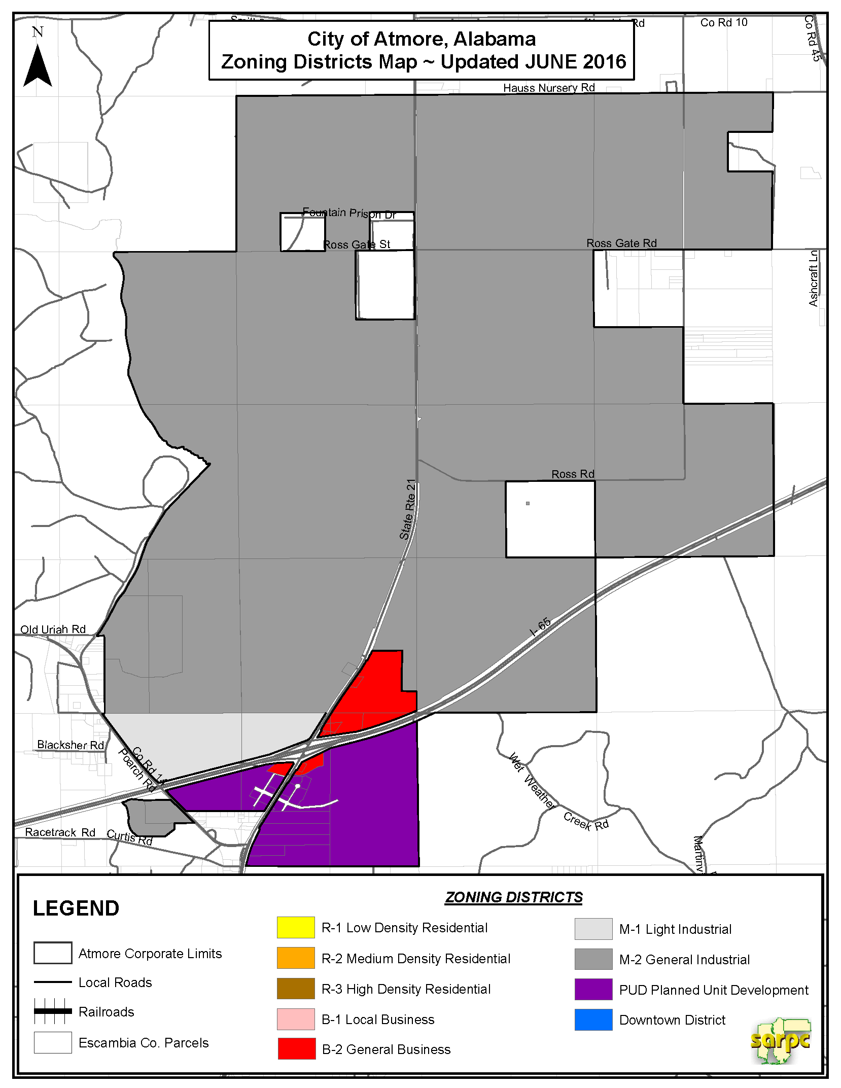
Editor's note— The Northern District Map has been included at the direction of the city.
(Ord. No. 01-2015, 1-26-15; Ord. No. 02-2015, 3-9-15; Ord. No. 03-2016, § 2(Att.), 6-27-2016; Ord. No. 2020-07 , 11-23-2020)