
Avondale City Zoning Code
ARTICLE 5
SPECIAL DISTRICTS; OVERLAYS
28-91 - The BLVD District.
(a)
Purpose. The BLVD Specific Plan ("The BSP") was created to implement the city council's vision of creating a vibrant, urban, mixed use environment that will become a premier destination for shopping, dining, entertainment, employment and various types of residential uses for the area of Avondale located between the Avondale Civic Center and Interstate Highway 10. The BLVD Zoning District (The BLVD District, or "The BLVDD") is intended to complete the vision expressed in The BSP by prescribing building form, site design and architectural standards for The BLVD area.
The BLVDD consists of two (2) components approved by the city council: (A) a legislatively approved base zone, the boundaries of which are consistent with Figure 2-1 of The BSP, containing the basic performance standards and regulations for the respective Subdistricts shown on Figure 2-1 of The BSP and (B) an administratively approved (by the city council), individualized Development Plan that selects the land uses from those allowed in the applicable Subdistrict and organizes such uses into a form-based development plan specific to a site. Accordingly, the Subdistrict categories set forth in section 28-91(c) below are intended to directly relate to and implement the provisions set forth in Section 2.0 of The BSP for the corresponding subdistrict category. The BLVDD is intended to be flexible to allow for a parcel of land to be entitled in a single step by combining the development plan with the base zone approval, much like a typical PAD rezoning, or to allow for the base zone to precede the development plan.
(b)
Applicability.
(1)
Only properties within The BSP boundary will be permitted to rezone to The BLVDD.
(2)
The development regulations related to each subdistrict and the boundaries thereof shall correspond to the descriptions of the subdistricts categories of the same name in Section 2.0 of The BSP and the boundaries and locations of the Subdistricts as shown on Figure 2-1 of The BSP.
(c)
Subdistricts. The BSP is divided into six (6) subdistricts. properties within each subdistrict shall comply with the land uses and development standards set forth in this section in accordance with the standards in The BSP for each such subdistrict. The six (6) subdistricts are described below:
(1)
Gateway District. The Gateway District, which features direct frontage on I-10 and offers significant visibility, is designed to accommodate development of commercial uses that will act as catalysts and spur demand for development in the remainder of The BLVD area. Commercial uses that would typically be classified as development catalysts include, but may not be limited to, post-secondary education campuses, medical campuses and/or hospital(s), resort hotels, and/or four-story or greater class-A corporate headquarters. In addition to catalyst type uses, dense urban form residential developments (minimum twenty-two (22) dwelling units per acre), 2-3-story mid-rise office, and urban form retail/restaurant uses are appropriate. Industrial uses, such as manufacturing and warehousing, are inappropriate in this district. All uses may be served by surface and/or structured parking. Building heights shall not exceed ten (10) stories. However, a building may be built up to sixteen (16) stories with city council approval as part of the development plan process.
(2)
Village District. The Village District, located west of Avondale Boulevard and north of Van Buren Street, is designed to accommodate more conventional retail, restaurant, office, employment, and urban-form multi-family uses (minimum eighteen (18) dwelling units per acre), all with a strong emphasis on pedestrian-orientation and contemporary, urban design that interfaces with and creates a presence on adjacent streets. Developments within the Village District should generate a diversity of activity to attract people to the area and support The BLVD area as a whole. Convenience uses that cater to automobiles, for example drive-through restaurants, are restricted in regards to quantity and feature design requirements intended to ensure they do not hinder walkability. Building heights shall not exceed ten (10) stories. However, a building may be built up to sixteen (16) stories as part of the development plan process.
(3)
Park Avenue District. The Park Avenue District, located east of Avondale Boulevard, north of Van Buren Street, is the planned core of The BLVD. Development within this District will be centered around a public gathering area that will accommodate events and activities that bring people into The BLVD, creating a vibrant, active street scene and, in turn, support local businesses. Permitted uses within the Park Avenue District include a mix of hotel, retail, restaurants, sports, entertainment, theater, cultural, multi-family residential (minimum twenty-two (22) dwelling units per acre), studios, offices, and post-secondary education, all of which must be designed to interface with adjacent streets in an urban manner and feature modern, contemporary design. Uses must also be designed immediately adjacent to usable open spaces, such as plazas, outdoor dining areas, and the like, with the intent of creating an active outdoor environment. Convenience uses that cater to automobiles, for example drive-through restaurants, are restricted in regards quantity and feature design requirements intended to ensure they do not hinder walkability. Building heights shall not exceed ten (10) stories. However, a building may be built up to sixteen (16) stories as part of the Development Plan process.
(4)
Residential District. The Residential District, located in the northwest quadrant of The BLVD, is designed to accommodate development of high-density housing in close proximity to the Park Avenue District core. A broad range of residential uses are permitted in this District to appeal to various lifestyle choices, including attached single-family, apartments, townhomes, and condominiums. In addition, small lot, single-family detached homes may be appropriate as a transitional use where the Residential District abuts existing single-family residential. All residential development will provide highly-amenitized luxury living in an urban form. Development standards for this District are designed to prevent development of "garden apartments" and other inwardly focused, suburban residential types and encourage development of urban rowhomes, townhomes, or other residential types that are more outwardly focused, strongly interfaced with adjacent streets, and that contribute to an overall sense of community within The BLVD at-large. The minimum required density in this district is eighteen (18) dwelling units per acre, though product types under the minimum density may occur as part of a master residential development that, as a whole, meets the minimum density requirement. Limited commercial uses are permitted if located on the ground floor of a multi-story building with residential uses above. Building heights shall not exceed six (6) stories; within three hundred (300) feet of single-family residential uses, building heights shall not exceed three (3) stories.
(5)
Neighborhood District. The Neighborhood District, located east of Avondale Boulevard, south of Van Buren Street and north of the Civic Center complex, is designed to accommodate development of detached single-family residential homes and/or attached townhomes with a density between four (4) and twelve (12) dwelling units per acre. Urban form development is not required, but is encouraged, in the Neighborhood District. Building heights shall not exceed two (2) stories or thirty (30) feet.
(6)
Promenade District. The Promenade District, located south of Van Buren Street west of Avondale Boulevard, allows for a variety of retail, restaurant, service and office uses which will support the daily needs for goods and services of residents of The BLVD and surrounding neighborhoods. The character and form of development in the Promenade District will be noticeably more suburban than in other portions of The BLVD, though pedestrian-orientation is still a priority. Auto-oriented uses that are heavily restricted in other districts, such as drive-throughs, are appropriate in the Promenade District. Building heights shall not exceed two (2) stories or thirty (30) feet.
(d)
Administration.
(1)
Establishment. The BLVDD zoning may be established on property within The BLVD area, as defined by The BSP Figure 2-1, according to the procedures outlined in section 28-10 of this zoning ordinance.
(2)
Required development plan. In addition to the approved The BLVD base zoning, a city council approved development plan is required prior to the application for a development permit within The BLVD.
(A)
Development plans may be filed for all or part of the property zoned or to be zoned The BLVDD. Development plans shall be submitted in accordance with section 28-6, site plan and design review; provided, however that the planning commission shall review, and city council shall review and approve, all development plans for properties zoned The BLVDD.
(B)
The ordinance approving the rezoning of a property to The BLVDD shall indicate, both by narrative text and a map, the location and boundaries of the Subdistricts that are included in the area to be rezoned.
(3)
Amendment. The zoning administrator or designee shall determine whether a proposed amendment to an approved development plan is a major or minor amendment. Major amendments shall require city council approval with a recommendation of the planning commission. Minor amendments shall require administrative approval by the zoning administrator or designee only.
(A)
Major amendment: Any one (1) of the following shall be considered a major amendment of a development plan:
i.
A significant change in boundary lines of the development. Minor and technical adjustments to the boundary lines within the development plan are permitted without a major amendment so long as (i) the area affected by the boundary change does not exceed fifteen (15) percent of the total area subject to the development plan, (ii) the adjustments do not significantly alter the traffic or pedestrian circulation system for the development plan and (iii) in the reasonable opinion of the zoning administrator, the overall character of the development plan, if modified, will remain in substantial conformance with the BSP and the development plan as originally approved. Any expansion or relocation of a boundary line not within the scope of this exception shall be considered a major amendment of the development plan. Such boundary line changes may also require an amendment to the BSP prior to any city council consideration of the change to the development plan.
ii.
Any change that could have significant negative impact on uses adjoining the development.
iii.
Any change that could have a significant impact on roadways adjacent or external to the development.
iv.
Any change that could have a significant negative impact on the amount of parking required or provided by the development.
v.
Any change to a phasing plan that could have a significant negative impact on adjacent or surrounding developments.
(B)
Minor amendment: All amendments to a development plan not determined by the zoning administrator to be major amendments according to the criteria set forth in subsection (a) above shall be minor amendments.
(e)
Land uses. Land uses for each subdistrict shall comply with the land use matrix set forth below. Uses not listed as a permitted, permitted with conditions, or conditional use shall be prohibited from the applicable zoning district. In the event a particular use is not listed in this section and such use is not otherwise prohibited by law, the zoning administrator or designee shall determine whether such use is analogous to other listed uses; the determination shall be made pursuant to section 28-5 of this ordinance.
G = Gateway District
PA = Park Avenue District
N = Neighborhood District
V = Village District
R = Residential District
P = Promenade District
P = Permitted
C = Conditional use
PC = Permitted with conditions
A = Accessory
FF = First floor w/residential above
- = Not allowed
(f)
Use-specific conditions. Land uses listed in the land use matrix above as permitted with conditions are permitted by right only if the conditions listed below for the individual uses are met. Land uses listed as conditional uses require planning commission approval of a conditional use permit in accordance with section 28-8 of this ordinance. Based on development plan review, staff may add additional conditions of approval deemed necessary to protect the health, safety and public welfare.
(1)
Bars are allowed in the Gateway, Village, Park Avenue, Residential (first-floor below residential only), and Promenade Subdistricts; provided, however, that (1) the exterior building wall of a bar shall not be located within one thousand three hundred twenty (1,320) feet of the exterior property lines of a public or private school, or church and (2) closing time for dance floors or other accessory uses to a bar shall coincide with the closing time for the bar.
(2)
In-home child care is permitted as an accessory use to the primary residential use of a dwelling in the Gateway, Village, Park Avenue, Residential, and Neighborhood Subdistricts. The in-home child care shall not provide care for five (5) or more children not related to the residents at any point in time.
(3)
Drive-through uses, including restaurants and financial institutions, are allowed in Gateway, Village, Park Avenue and Promenade Subdistricts subject to the following limitations:
(A)
Within the Gateway Subdistrict, no stand-alone drive-through uses shall be permitted
(B)
Within the Park Avenue Subdistrict, a maximum of one (1) stand-alone drive-through, limited to a coffee shop only, shall be permitted, set back at least two hundred (200) feet east of Avondale Boulevard.
(C)
Within the Village Subdistrict, a maximum of two (2) stand-alone drive-through uses shall be permitted, limited to one (1) coffee shop and one (1) restaurant, set back at least two hundred (200) feet west of Avondale Boulevard.
(D)
Within the Promenade Subdistrict, there shall be no limitation on the maximum number of drive-through uses permitted.
(E)
The limitations set forth in subsections 28-91(f)(1)(A), (B) and (C) above shall not apply to drive-through uses incorporated into the design of multi-tenant inline shop buildings.
(4)
Extended stay hotels are allowed in the Gateway, Village, and Park Avenue Subdistricts only pursuant to a development agreement approved by the city council in its sole and absolute discretion.
(5)
Farming is allowed in all subdistricts for a period not to exceed five (5) years from the date of rezoning; provided, however, that farming is limited to the cultivation and harvesting of crops and that no agricultural uses which utilize livestock (i.e. dairy farming), plant nurseries, or greenhouses shall be allowed. Farming and agricultural uses legally occurring on the property prior to rezoning to The BLVDD shall not be subject to this provision. After the initial time five-year time period has elapsed, such use may only continue under a conditional use permit.
(6)
Gas stations are allowed in the Village and Promenade Subdistricts only if the gas station is an accessory to a grocery use. A maximum of one (1) such gas station shall be permitted in each subdistrict. Any such gas station must front onto Van Buren Street and may not front on Avondale Boulevard or Corporate Drive.
(7)
Grocery stores exceeding thirty-six thousand (36,000) square feet in floor area are allowed in the Village and Promenade subdistricts, provided they include at least two (2) of the following components:
(A)
Indoor eateries.
(B)
Specialty beverage staff (such as a sommelier or cicerone) and/or a wine and/or craft beer bar.
(C)
Juice bar and/or coffee shop.
(D)
Specialty food counters, such as imported cheeses, a sushi bar, a salad bar, or similar products.
(8)
Home occupations are permitted as an accessory use to the primary residential use of a dwelling in the Gateway, Village, Park Avenue, Residential, and Neighborhood Subdistricts, subject to the requirements and restrictions listed in section 28-33(g) of this ordinance.
(9)
Liquor stores are allowed in the Gateway, Village, Park Avenue, and Promenade Subdistricts subject to approval of a conditional use permit, provided that there are no other liquor stores located within one thousand three hundred twenty (1,320) feet of another liquor store, measured in a straight line from the nearest property line of each property.
(10)
Night clubs and rooftop night clubs are allowed in Gateway, Village, and Park Avenue Subdistricts; provided, however, that: (1) the exterior building wall of a night club shall not be located within one thousand three hundred twenty (1,320) feet of the exterior property lines of a public or private school, or church, (2) closing time for dance floors or other accessory uses to a night club shall coincide with the closing time for the night club, and (3) with respect to the Gateway and Village Subdistricts only, exits and entrances to a night club shall not be located within three hundred (300) feet of a residence, excluding residences on upper floors above ground floor commercial.
(11)
Pet boarding and day care facilities are allowed in Village and Promenade Subdistricts subject to the requirements and restrictions listed in section 28-54 of this ordinance.
(12)
Public utility buildings, structures, uses, facilities and equipment are permitted in all subdistricts subject to the requirements and restrictions listed in section 28-54 of this ordinance.
(13)
Single-family attached residences, such as townhomes and condominiums, are allowed in the Gateway, Village, Park Avenue, Residential, and Neighborhood Subdistricts subject to the following:
(A)
Within the Gateway and Park Avenue Subdistricts, a minimum density of twenty-two (22) dwelling units per acre must be provided.
(B)
Within the Village and Residential Subdistricts, a minimum density of 18 dwelling units per acre must be provided. Within the Residential Subdistrict only, densities under eighteen (18) dwelling units per acre may be provided if the attached residences are part of a multi-faceted residential development that, as a whole, achieves a minimum density of eighteen (18) dwelling units per acre.
(C)
Within the Neighborhood Subdistrict, density shall be within a range of four (4) to twelve (12) dwelling units per acre.
(D)
Developments shall provide usable open space in the amount of fifteen (15) percent of the net site area. Indoor spaces for use by residents, such as clubhouses, gyms, movie theaters, and the like, shall be considered usable open space.
(14)
Single-family detached residences are allowed in the Residential and Neighborhood Subdistricts subject to the following:
(A)
Within the Residential Subdistricts, a minimum density of eighteen (18) dwelling units per acre must be provided, however, densities under eighteen (18) dwelling units per acre may be provided if the detached residences are part of a multi-faceted residential development that, as a whole, achieves a minimum density of 18 dwelling units per acre.
(B)
Within the Neighborhood Subdistrict, density shall be within a range of four (4) to twelve (12) dwelling units per acre.
(C)
Developments shall provide usable open space in the amount of fifteen (15) percent of the net site area. Indoor spaces for use by residents, such as clubhouses, gyms, movie theaters, and the like, shall be considered usable open space.
(15)
Multi-family residences are allowed in the Gateway, Village, Park Avenue, and Residential Subdistricts subject to the following:
(A)
Within the Gateway and Park Avenue Subdistricts, a minimum density of twenty-two (22) dwelling units per acre must be provided.
(B)
Within the Village and Residential Subdistricts, a minimum density of eighteen (18) dwelling units per acre must be provided. Within the Residential Subdistrict only, densities under eighteen (18) dwelling units per acre may be provided if the multi-family residences are part of a multi-faceted residential development that, as a whole, achieves a minimum density of eighteen (18) dwelling units per acre.
(C)
Developments shall provide usable open space in the amount of fifteen (15) percent of the net site area. Indoor spaces for use by residents, such as clubhouses, gyms, movie theaters, and the like, shall be considered usable open space.
(16)
Veterinary hospitals, offices and clinics, excluding animal boarding, is allowed in the Gateway, Village, Park Avenue and Promenade Subdistricts subject to the requirements and restrictions listed in section 28-54 of this ordinance.
(17)
Concert facilities, outdoor, and outdoor commercial recreation/entertainment uses, not otherwise listed, are allowed in the Gateway and Park Avenue Subdistricts, subject to the following:
(A)
Lighting shall comply with the outdoor recreational and other outdoor lighting standards in section 28-137 of this ordinance,
(B)
Music, live or recorded, may be played; however, no music or sound amplification systems shall be operated between the hours of 11:00 p.m. and 8:00 a.m.
(g)
Development standards. The following development standards shall apply to all development within The BLVDD.
(1)
Outdoor storage of goods and materials is prohibited.
(2)
Warehousing or indoor storage of goods or material beyond that normally incidental to permitted uses is prohibited.
(3)
Front porches, stoops, balconies, and bay windows may extend into required street setbacks in the Gateway, Village, Park Avenue, Residential and Promenade Subdistricts.
(4)
The following table outlines the minimum development standards within each Subdistrict. Standards in excess of these minimums may be required in accordance with the conditions required of Conditional Use Permits or uses permitted with conditions.
(h)
Design.
(1)
All developments shall comply with the development form design guidelines listed in Section 2.1 of The BSP. Any design issues not addressed in The BSP or in this zoning ordinance shall be subject to the design guidelines listed in the single-family residential design manual, multi-family residential design manual, or commercial and industrial design manual, whichever manual applies to the type of use proposed. While specific architectural themes, color palettes, and material palettes are not dictated by The BSP or this zoning ordinance, individual buildings shall feature contemporary design and be designed to complement, but not match, other buildings within The BLVD area.
(2)
All developments shall comply with the applicable street sections within The BSP (Figures 2-1 through 2-8, inclusive).
(3)
Exceptions and departures to the design form guidelines (The BSP Section 2.1) or street sections (The BSP Figures 2-1 through 2-8, inclusive) within a Development Plan may be forwarded to the planning commission for review and recommendation, and approved by the city council, which approval may be granted only if the city council finds in its sole and absolute discretion, that the project still achieves the overall intent, objectives, and guidelines of The BSP and the project design meets the basic requirements for traffic circulation, pedestrian orientation, shade, and design continuity.
(i)
Parking. Parking for each land use shall be provided by a combination of on-street parking, off-street surface parking and parking structures. The amount of required parking, parking dimensions, and other parking lot design requirements shall be governed by article 8 of this ordinance, except that:
(1)
The amount of required parking may be reduced by up to fifty (50) percent where it can be determined that the peak requirements of the several occupancies occur at different times and where a shared parking operations plan, approved by the zoning administrator or designee, shows that this reduction in parking will not cause conflicts among nearby uses. Such a shared parking analysis may be based on:
(A)
Intermittent non-conflicting uses. When required parking reductions are predicted as a result of sharing between intermittent uses with non-conflicting parking demands (e.g. a nightclub and a bank), then the reduction can be considered.
(B)
Parking occupancy rates. When the parking reduction has been shown to be feasible by using the demand calculations as determined by an analysis of typical local parking demand.
(C)
Existing parking surveys. When a study of existing parking shows parking occupancy rates of morning, afternoon and evening peaks on all seven (7) days of the week. The seven (7) days of observation may take place over the span of two (2) consecutive, typical weeks. A combination of similar circumstances may be necessary to cover all the proposed land uses. The approximate square footages of the various land uses of the specimen projects shall be compared to the proposed project to allow the ratios of uses to be rated accordingly.
(2)
On-street parking and/or city-owned and operated off-street surface parking lots and/or parking structures counted towards the required parking must be located within one thousand three hundred twenty (1,320) feet of the use, measured from the exterior wall of the use to the closest perimeter of the on-street parking, surface parking, or parking structure.
(j)
Necessary amendments. In the event that any of the provisions of The BSP referred to herein are amended, the zoning administrator shall concurrently give notice of and process an amendment to this article 5, in accordance with the procedures outlined in section 28-9 of this zoning ordinance.
(k)
City Center District. The City Center District (CCD) and the City Center Specific Plan (CCSP) were the precursors to The BLVDD and The BSP, respectively. Until all property owners within The BLVD Opt-In to The BLVDD District in accordance with the procedures outlined in section 28-91(d)(2) of this ordinance, the CCD regulations must be maintained. No new rezonings to CCD shall be considered. At such time that there are no properties zoned CCD, this subsection (k) will be deleted from the ordinance in accordance with the procedures outlined in section 28-9 of this zoning ordinance.
(1)
Purpose. The Avondale City Center Specific Plan, as amended (the "CCSP") was created to implement the city council's vision of creating a high-density, mixed use environment that will become a premier destination for shopping, dining, entertainment, employment and various types of residential uses for the area of Avondale located between the Avondale Civic Center and Interstate Highway 10, commonly referred to as the City Center. The City Center Zoning District (the "CCD") is intended to complete the vision expressed in the CCSP by prescribing building form, site design and architectural standards for the City Center. The CCD consists of two (2) components approved by the city council: (A) a legislatively approved base zone, the boundaries of which are consistent with Figure 3-1 of the CCSP, containing the basic performance standards and regulations for the respective Subdistricts shown on Figure 3-1 of the CCSP and (B) an administratively approved (by the city council), individualized development plan that selects the land uses from those allowed in the base zone sub districts and organizes such uses into a form-based Development Plan specific to a site. Accordingly, the Subdistrict categories set forth in section 28-91(k)(3) below are intended to directly relate to and implement the provisions set forth in Section 3.2 of the CCSP for the corresponding subdistrict category. The CCD is intended to be flexible to allow for a parcel of land to be entitled in a single step by combining the development plan with the base zone approval, much like a typical PAD rezoning, or to allow for the base zone to precede the development plan.
(2)
Applicability.
(A)
Only properties within the City Center boundary will be permitted to rezone to the CCD.
(B)
The development regulations related to each Subdistrict and the boundaries thereof shall correspond to the descriptions of the Land Use Categories of the same name in Section 3.2 of the CCSP and the boundaries and locations of the Land Use Categories as shown on Figure 3-1 of the CCSP.
(3)
Subdistricts. The CCD is divided into six (6) subdistricts. Properties within each subdistrict shall comply with the land uses and development standards set forth in this section in accordance with the standards in the CCSP for each such Subdistrict. The six (6) subdistricts are described below:
(A)
Gateway Employment. The Gateway Employment (GE) Subdistrict is designed to place primary land uses close to the freeway, to maximize opportunities for business exposure to the freeway and to ensure that residential uses are not located within six hundred (600) feet of freeway traffic. Primary uses in Gateway Employment Subdistrict include retail, office, and hotel. In this subdistrict, residential, industrial, manufacturing, and warehouse uses are not permitted. Uses may be served by surface and/or structured parking. Building heights shall not exceed ten (10) stories. However, a building may be built up to sixteen (16) stories with city council approval as part of the development plan process. A variety of Mid-rise and high-rise office, pedestrian-oriented retail, large floor plate uses and big box uses are permitted in the Gateway Employment Subdistrict, subject to an appropriate development plan.
(B)
Employment Mixed-Use. The Employment Mixed-Use (EMU) Subdistrict is designed to emphasize employment uses, including retail, professional office, hotel, and personal service uses. Residential units may be built on upper floors throughout the Employment Mixed-Use Subdistrict if built in conjunction with employment uses; provided, however, that residential units fronting on and/or adjacent to Park Avenue or 117 th Avenue may be built on the ground floor. The minimum ratio is one (1) square foot of employment use for every two (2) square feet of residential development, except for those properties fronting Park Avenue or 117 th Avenue south of Corporate Drive, which may be exclusively residential. The mix of uses may be provided horizontally or vertically, and may be distributed across multiple properties, subject to development plan approval. Residential units may be incorporated throughout the first floor when it can be shown that such units support and heighten the purpose of the district.
The Employment Mixed-Use Subdistrict is intended to include mid-rise and high-rise buildings of three (3) to ten (10) stories, predominantly served by structured parking. For a development project east of Avondale Boulevard, containing multiple buildings, the minimum average height shall be two (2) stories and the minimum floor area ratio shall be 0.5 at build out of all uses approved as part of the Development Plan, provided that the target floor area ratio should be 0.75—1.0. For a development project west of Avondale Boulevard containing multiple buildings, the average height shall be two (2) stories measured across multiple properties within a Development Plan, and the minimum floor area ratio shall be 0.25 at build out of all uses approved as part of the Development Plan, unless otherwise approved by the city council. Building heights shall not exceed ten (10) stories. However, a building may be built up to sixteen (16) stories along Avondale Boulevard north of Van Buren Street with city council approval as part of the development plan process.
(C)
Pedestrian Retail. The Pedestrian Retail (PR) Subdistrict includes all properties with frontage along pedestrian retail streets, as shown on Figure 3-1 of the CCSP. The land uses on the ground floor of buildings in the Pedestrian Retail Subdistrict shall be restricted to those types of active uses that create a lively street environment. Professional offices and residential uses are not permitted in these ground floor locations, but are permitted on upper floors; provided, however, that residential uses fronting Park Avenue are permitted on the ground floor.
The form of development shall be compact building footprints, with small street setbacks and wide sidewalks designed to facilitate pedestrian activity. Buildings with first floor restaurants shall include outdoor seating areas that do not conflict with pedestrian areas. For a development project containing multiple buildings, the minimum average height shall be two (2) stories and the minimum floor area ratio shall be 0.5 at build out of all uses approved as part of the Development Plan, provided that the target floor area ratio should be 0.75—1.0.
(D)
Neighborhood Commercial. The Neighborhood Commercial (NC) Subdistrict is designed to allow for a suburban-type of development on the fringe of the City Center area, while still contributing to the intent of the look and feel of the City Center. Buildings along arterial streets shall conform to specific setbacks to provide the intended streetscape for the City Center area, while buildings at the interior of a site may have larger street setbacks. Uses allowed in the Neighborhood Commercial Subdistrict are retail, restaurant, office, and personal service. Residential is appropriate on upper floors of multi-story buildings and may be approved as part of a development project containing multiple buildings.
(E)
Residential Mixed-Use. The Residential Mixed-Use (RMU) Subdistrict is designed to provide a transition between the Employment Mixed Use areas and residential neighborhoods. While residential is the primary land use, small office, retail, and personal service uses may be located on the ground floor of multi-story buildings. Non-residential uses such as small office buildings or boutique hotels may be permitted. Such non-residential uses shall be compatible in scale with nearby residential development and shall not adversely impact the quiet enjoyment of residential uses. Parking shall be located underneath or behind the units. Residential uses shall be developed at a minimum of fifteen (15) units per acre, and a maximum of forty-five (45) units per acre. Building heights shall range from two (2) to five (5) stories.
(F)
Townhouse Residential. The Townhouse Residential (TR) Subdistrict is designed to provide a transition between the Residential Mixed-Use Subdistrict and neighboring single-family residential development. Townhouse residential units shall be attached units with separate individual entrances fronting a public street and private open space attached to the individual unit in the form of patios or balconies. Parking shall be either attached or located on the same lot. Townhouse residential development may include interlocking units, but may not include buildings with common stairways serving multiple units. The minimum density shall be twelve (12) units per acre and the maximum density shall not exceed twenty (20) units per acre. Building heights are two (2) to three (3) stories.
(4)
Administration.
(A)
Establishment. CCD base zoning may be established on property within the City Center according to the procedures outlined in section 28-11 of this zoning ordinance. In addition to the approved CCD base zoning, a city council-approved development plan is required prior to any application for a development permit within the City Center area.
i.
Development plans may be filed for all or part of the property zoned or to be zoned CCD. Development Plans shall be submitted in accordance with section 28-6, site plan and design review; provided, however that the planning commission shall review, and the city council shall review and approve, all development Plans for properties zoned CCD.
ii.
The ordinance approving the rezoning of a property to CCD shall indicate, both by narrative text and a map, the location and boundaries of the subdistricts that are included in the area to be rezoned.
(B)
Amendment. The zoning administrator or designee shall determine whether a proposed amendment to an approved development plan is a major or minor amendment. Major amendments shall require city council approval with a recommendation of the planning commission. Minor amendments shall require administrative approval by the zoning administrator or designee only.
i.
Major amendment: Any one (1) of the following shall be considered a major amendment of a development plan:
A.
A significant change in boundary lines of the development. Minor and technical adjustments to the boundary lines within the development plan are permitted without a major amendment so long as (i) the adjustments do not divide zoning subdistricts, (ii) the area affected by the boundary change does not exceed fifteen (15) percent of the total area subject to the development plan, (iii) the adjustments do not significantly alter the traffic or pedestrian circulation system for the development plan and (iv) in the reasonable opinion of the zoning administrator, the overall character of the development plan, if modified, will remain in substantial conformance with the CCSP and the development plan as originally approved. Any expansion or relocation of a boundary line not within the scope of this exception shall be considered a major amendment of the development plan. Such boundary line changes may also require an amendment to the CCSP prior to any city council consideration of the change to the development plan.
B.
Any change that could have significant negative impact on uses adjoining the development.
C.
Any change that could have a significant impact on roadways adjacent or external to the development.
D.
Any change that could have a significant negative impact on the amount of parking required or provided by the development.
E.
Any change to a phasing plan that could have a significant negative impact on adjacent or surrounding developments.
ii.
Minor amendment: All amendments to a development plan not determined by the zoning administrator to be major amendments according to the criteria set forth in subsection (a) above shall be minor amendments.
(5)
Land uses. Land uses for each subdistrict shall comply with the land use matrix set forth below. Uses not listed as a permitted, permitted with conditions, or conditional use shall be prohibited from the applicable zoning district. In the event a particular use is not listed in this section and such use is not otherwise prohibited by law, the zoning administrator or designee shall determine whether such use is analogous to other listed uses; the determination shall be made pursuant to section 28-5 of this ordinance.
P = Permitted
C = Conditional use
PC = Permitted with conditions
FF = First floor only
A = Accessory
- = Not allowed
(6)
Land uses listed in the land use matrix above as permitted with conditions are permitted by right only if the conditions listed below for the individual uses are met. Based on development plan review, staff may add additional conditions of approval deemed necessary to protect the health, safety and public welfare.
(A)
A college or university is allowed in all CCD Subdistricts provided that, in RMU and TR Subdistricts, colleges and universities shall only be permitted if the buildings (1) are in scale with nearby residential development and (2) do not adversely impact current or future residential uses.
(B)
Drive-through uses, including restaurants and financial institutions, are allowed in GE, NC and EMU Subdistricts. However, in EMU Subdistricts, drive-through uses are subject to the following limitations:
i.
East of Avondale Boulevard, a maximum of one (1) stand-alone drive-through coffee shop use shall be permitted, set back at least two hundred (200) feet east of Avondale Boulevard.
ii.
West of Avondale Boulevard, a maximum of two (2) stand-alone drive-through uses shall be permitted, limited to one (1) coffee shop and one (1) restaurant, set back at least two hundred (200) feet of Avondale Boulevard and within a Development Plan of thirty (30) acres or more.
iii.
The limitations set forth in subsections 28-91(k)(7)(B)(1) and (2) above shall not apply to drive-through uses incorporated into the design of multi-tenant inline shop buildings.
(C)
A hotel, other than an extended stay hotel, is allowed in all CCD Subdistricts; provided, however, that in RMU and TR, hotels shall be limited to a maximum of fifty (50) rooms and shall be constructed so that the buildings are in scale with nearby residential development and do not adversely impact current or future residential uses. An extended stay hotel is allowed in all CCD Subdistricts only pursuant to a development agreement approved by the city council in its sole and absolute discretion.
(D)
Medical, dental or health offices, clinics and laboratories, excluding plasma centers, are allowed in the RMU Subdistrict; provided, however, that unless located entirely on the first floor of a mixed use building, medical office buildings shall be constructed so that the buildings are in scale with nearby residential development and do not adversely impact current or future residential uses.
(E)
A professional office is allowed in the RMU Subdistrict; provided, however, that unless located entirely on the first floor of a mixed use building, professional office buildings shall be constructed so that the buildings are in scale with nearby residential development and do not adversely impact current or future residential uses.
(F)
Bars are allowed in the GE and EMU Subdistricts; provided, however, that (1) the exterior building wall of a bar shall not be located within one thousand three hundred twenty (1,320) feet of the exterior property lines of a public or private school, church, other bar or night club, (2) closing time for dance floors or other accessory uses to a bar shall coincide with the closing time for the bar and (3) with respect to GE Subdistricts only, exits and entrances to a bar shall not be located within three hundred (300) feet of a residential district.
(G)
Night clubs are allowed in the GE and EMU Subdistricts; provided, however, that (1) the exterior building wall of a night club shall not be located within one thousand three hundred twenty (1,320) feet of the exterior property lines of a public or private school, church, bar or other night club, (2) closing time for dance floors or other accessory uses to a night club shall coincide with the closing time for the night club and (3) with respect to GE Subdistricts only, exits and entrances to a night club shall not be located within three hundred (300) feet of a residential district.
(H)
Residential Uses are allowed in EMU and PR Subdistricts as part of a mixed-use development that provides a minimum ratio of one (1) square foot of employment use for every two (2) square feet of residential use; provided, however, that, except for residential uses fronting on and/or adjacent to Park Avenue and 117 th Avenue south of Corporate Drive, such residential uses are only permitted on the upper floors. Construction of horizontally-integrated mixed use development does not need to occur in a single phase; vertically-integrated mixed use development must be completed in a single phase.
(I)
Farming is allowed in all CCD Subdistricts for a period not to exceed five (5) years from the date of rezoning; provided, however, that farming is limited to the cultivation and harvesting of crops and that no agricultural uses which utilize livestock (i.e. dairy farming), plant nurseries, or greenhouses shall be allowed. Farming and agricultural uses legally occurring on the property prior to rezoning to CCD shall not be subject to this provision. After the initial time five (5) year time period has elapsed, such use may only continue under a conditional use permit.
(J)
Gas stations are permitted by a conditional use permit in the EMU Subdistrict west of Avondale Boulevard where they are an accessory to a grocery use; provided, however, that such gas stations must front onto Van Buren Street and may not front on Avondale Boulevard or Corporate Drive.
(K)
Grocery stores exceeding thirty-six thousand (36,000) square feet in floor area are permitted by a conditional use permit in the GE, EMU, NC, and RMU Subdistricts, provided they include all of the following components:
i.
Indoor eateries.
ii.
Specialty beverage staff (such as a sommelier or cicerone) and/or a wine and/or craft beer bar.
iii.
Juice bar and/or coffee shop.
iv.
Specialty food counters, such as imported cheeses, a sushi bar, a salad bar, or similar products.
(7)
Development guidelines.
(A)
Properties within the Gateway Employment, Employment Mixed-Use, Residential Mixed-Use, and Townhouse Residential Subdistricts shall comply with the Development Guidelines as listed in Table 5-1 of the CCSP. The Pedestrian Retail Subdistrict shall comply with the development guidelines as listed for the Employment Mixed-Use Subdistrict, except to the extent such guidelines are determined by the zoning administrator to be inapplicable.
(B)
Properties within the Neighborhood Commercial Subdistrict shall comply with the development guidelines listed for the Gateway Employment Subdistrict, except as follows: (1) maximum building height: five (5) stories; (2) setbacks on Van Buren Street: minimum twenty (20) feet to buildings, thirty (30) feet to parking (maximum forty (40) feet); and (3) setbacks on Avondale Boulevard: minimum thirty (30) feet to building, forty (40) feet to parking (maximum sixty (60) feet).
(C)
Properties within the EMU Subdistrict west of Avondale Boulevard shall comply with the development guidelines listed in Table 5-1 of the CCSP; however, exceptions and departures to the development guidelines within a development plan may be forwarded to the planning commission for review and recommendation, and approved by city council, which approval may be granted only if the city council finds, in its sole and absolute discretion, that the project still achieves the overall intent, objectives, and guidelines of the CCSP, provides equal or greater design quality and public benefits than would be achieved under the guidelines, and does not cause greater adverse impact on adjoining properties.
(8)
Design guidelines.
(A)
Unless specifically modified herein, all CCD developments shall comply with the design guidelines listed in Section 5.4 of the CCSP and the streetscape design guidelines listed in Section 4.2 of the CCSP. Any design issues not addressed in the CCSP or in this zoning ordinance shall be subject to the design guidelines listed in the Commercial/Industrial/Multi-Family Design Manual. While specific architectural themes, color palettes, and material palettes are not dictated by the CCSP or this zoning ordinance, individual buildings shall be designed to complement other buildings within a block or subdistrict.
(B)
Properties within the EMU Subdistrict west of Avondale Boulevard shall comply with the design guidelines listed in Sections 4.2 and 5.4 of the CCSP; however, exceptions and departures to the design guidelines within a development plan may be forwarded to the planning commission for review and recommendation, and approved by the city council, which approval may be granted only if the city council finds in its sole and absolute discretion, that the project still achieves the overall intent, objectives, and guidelines of the CCSP and the project design meets the basic requirements for traffic circulation, pedestrian orientation, shade, and design continuity.
(9)
Parking. Parking for each land use shall be provided by a combination of on-street parking, off-street surface parking and parking structures based on the following:
(A)
A parking demand analysis prepared by a qualified parking or traffic consultant, a licensed architect, or civil engineer shall be submitted with each development plan. The parking demand analysis, as approved by the zoning administrator or designee, shall determine the number of parking spaces required for each use within the development plan.
(B)
The parking demand analysis shall analyze the needs of every proposed use in the development plan, using the required parking schedule in article 8 of the zoning ordinance as a starting point.
i.
Provided parking shall not exceed the one hundred ten (110) percent of the number listed in the parking schedule.
ii.
Provided parking for a single use may be up to twenty (20) percent less than the amount required by the parking schedule based on the parking analysis.
(C)
The amount of required parking may be reduced by up to fifty (50) percent where it can be determined that the peak requirements of the several occupancies occur at different times and where a shared parking operations plan, approved by the zoning administrator or designee, shows that this reduction in parking will not cause conflicts among nearby uses. Such a shared parking analysis may be based on:
i.
Intermittent non-conflicting uses. When required parking reductions are predicted as a result of sharing between intermittent uses with non-conflicting parking demands (e.g. a nightclub and a bank), then the reduction can be considered.
ii.
Parking occupancy rates. When the parking reduction has been shown to be feasible by using the demand calculations as determined by an analysis of typical local parking demand.
iii.
Existing parking surveys. When a study of existing parking shows parking occupancy rates of morning, afternoon and evening peaks on all seven (7) days of the week. The seven (7) days of observation may take place over the span of two (2) consecutive, typical weeks. A combination of similar circumstances may be necessary to cover all the proposed land uses. The approximate square footages of the various land uses of the specimen projects shall be compared to the proposed project to allow the ratios of uses to be rated accordingly.
(D)
Off-street surface parking and parking structures counted towards the required parking shall be within four hundred (400) feet of the use, measured from the exterior wall of the use to the closest perimeter of the surface parking or parking structure.
(E)
On-street parking counted towards the required parking shall be adjacent to the property for which the parking is intended.
(F)
The EMU Subdistrict west of Avondale Boulevard may include reduced parking space dimensions with a minimum size of nine and one-half (9.5) x eighteen (18) feet; additionally, a two-foot overhang may be counted towards the minimum parking space dimension if the overhang occurs over a landscape area with a depth of at least six (6) feet and if the overhang does not occur over a pedestrian sidewalk.
(10)
Necessary amendments. In the event that any of the provisions of the CCSP referred to herein are amended, the zoning administrator shall concurrently give notice of and process an amendment to this Section 5, in accordance with the procedures outlined in article 111 of this zoning ordinance.
(Ord. No. 2045-1220, § 8, 12-7-20; Ord. No. 2040-0623, § 8, 6-5-23; Ord. No. 2055-0823, § 15, 8-21-23; Ord. No. 2041-1125, § 3, 11-17-25)
28-92 - Major Sports and Entertainment District.
(a)
Purpose. The purpose of the Major Sports and Entertainment District (MSED) is to provide an appropriate Zoning District to accommodate the unique demands and impacts of (1) facilities used to conduct major sports and/or entertainment events and (2) mixed-use and/or destination entertainment developments related to and operated in conjunction with a major sports/entertainment venue. Due to the unique characteristics, form, and impact of these types of these large scale facilities, deviation from traditional zoning standards is necessary in this district.
(b)
Applicability.
(1)
MSED zoning may be established on property where a major sports and entertainment venue is located and directly abutting parcels, subject to the procedures outlined in article 1 of this zoning ordinance. The district may also be established on non-abutting parcels if those properties are located within one-quarter (¼) mile of a MSED zoned parcel and if said parcel is to be developed in accordance with the purpose of this zoning district. The district may be established on non-abutting parcels that are located over one-quarter (¼) mile of a MSED zoned parcel for shuttled event parking only if identified in a comprehensive parking plan for the major sports and entertainment venue.
(2)
In conjunction with a request to establish MSED zoning, a conceptual development plan (CDP) shall be submitted by the applicant for review and recommendation by the planning commission and review and approval by the city council. The conceptual development plan will generally guide development on the MSED zoned property and shall depict the general locations of existing uses and facilities and the general locations for future planned facilities, uses, open space, and parking areas. Additionally, in order to determine a proposed location will not have significant deleterious effects on the city's scenic corridors, a view corridor study/analysis will be required. The view corridor study will evaluate the height of a venue from multiple points (e.g., building elevations) from multiple views (e.g. perspectives), no more than five (5) miles away.
(A)
Major revisions to the Conceptual development plan shall be submitted to the zoning administrator to be approved administratively if the revised CDP is in conformance with the requirements of this section. Major revisions shall include:
i.
Any incorporation of a use(s) not previously approved or deletion of a previously approved use(s) with the original CDP.
ii.
A ten (10) percent change in the acreages devoted to any use.
iii.
Any change which could have a significant, adverse impact on areas adjoining the MSED property.
iv.
Any change which could have a significant traffic impact on roadways adjacent to the MSED property.
(B)
Any revision to the conceptual development plan made by the owner/developer not identified above as major shall be considered a minor revision and shall not require City approval. However, the property owner/developer shall be required to submit a copy of all minor revisions to the CDP to the department for inclusion in the zoning case file.
(c)
Permitted uses. The following uses shall be permitted in the MSED District:
(1)
Stadiums, racetracks, arenas, concert pavilions, amphitheaters, performing arts centers and other similar large-scale major sports and entertainment venues. (Including accessory uses which are customarily incidental, as identified in subsection 28-92(f)).
(2)
Farming and agricultural uses are permitted for an initial period of three (3) years after the establishment of the MSED and thereafter, such use may continue only under a conditional use permit as set forth in subsection 28-92(e) below. Dairy farms are prohibited within the MSED.
(3)
Amusement/theme park.
(4)
Museums, cultural centers, and car show facilities.
(5)
Aquariums.
(6)
Facilities customarily incidental but subordinate to the major sports and entertainment venue including, but not limited to, food preparation facilities, multimedia production studios, and storage.
(7)
Movie theaters, indoor.
(8)
Bars and nightclubs.
(9)
Restaurants, without drive-through.
(10)
Retail sales of new merchandise within enclosed buildings, excluding liquor stores.
(11)
Hotels, resorts, and conference centers which may incorporate restaurants, lounges, spas, gyms, golf courses, equestrian centers, banquet space, and meeting space for community and corporate events.
(12)
Multi-family residential units subject to the limitations set forth in subsection 28-92(j)(2) below.
(13)
Professional offices.
(14)
Banks and chartered financial institutions, including ATMs.
(15)
Business support services, including photocopy centers, retail office supply stores, and package delivery services.
(16)
Health and athletic clubs.
(17)
Hospitals and urgent-care centers.
(18)
Reserved.
(19)
Research, design, and development laboratories and parts manufacturing and assembly facilities relating to the major sports and entertainment venue. (Example: A facility where advancements in racecar technology are researched, designed, and built in close proximity to an auto racing track.)
(20)
Racing industry related auto body and engine repair shops, painting facilities, emissions testing, and similar uses operated in conjunction with an automobile race track.
(21)
Auto racing schools and motorsports clubs operated in conjunction with an automobile race track. Motorsports clubs may include member garage condos, club and event facilities, and concierge vehicle services, including vehicle testing and repair.
(22)
Vehicle testing and storage facilities, excluding dead vehicle storage.
(23)
Ecotourism and educational facilities including, but not limited to, multi-use trails containing kiosks displaying historical and/or educational information.
(24)
Green initiatives including structures and facilities for alternative energy sources including, but not limited to, solar, wind, and geothermal, architecturally integrated into a building or structure.
(25)
Event-related recreational vehicle and mobile camper camping and parking and related indoor and outdoor recreation amenities for such uses. Additionally, these uses will be permitted in a non-event setting only if located entirely within the major sports entertainment venue in conjunction with a venue-sponsored program and provided that the campers are limited to short-term stays that do not exceed fourteen (14) consecutive days.
(26)
Heliports.
(d)
Uses permitted with conditions. The following uses shall be permitted in the MSED District if they adhere to the specified conditions:
(1)
Drive-through facilities for allowed uses, subject to the conditions listed in zoning ordinance subsection 28-54(g).
(2)
Except as provided in subsection 28-52(f), pet boarding and day care facilities, without and with outdoor play areas, subject to the conditions listed in zoning ordinance subsection 28-54(k) and 304(l) respectively.
(3)
Permanent towers and antennae, subject to the provisions of zoning ordinance section 28-138.
(e)
Uses permitted subject to a conditional use permit. To ensure compatibility with surrounding uses and the natural environment, the following uses shall require approval of a conditional use permit, subject to the provisions of article 1, administration and procedures:
(1)
Green initiatives including structures and facilities for alternative energy sources including, but not limited to, solar, wind and geothermal as a separate standalone use not integrated into the design of buildings or structures permitted within the MSED.
(2)
Child care centers, except as provided in subsection 28-92(f).
(3)
Agricultural and farming uses.
(4)
Pharmacies, without drive-through.
(5)
Non-event related recreational vehicle and mobile camper parking and camping and tent camping located outside of the major sports and entertainment venue.
(f)
Accessory uses.
(1)
The following uses are permitted only as an accessory to the use of the primary major sports and entertainment facility on the grounds of the major sports and entertainment venue on event days, as defined by this ordinance:
(A)
Outdoor sales of merchandise from kiosks, trailers, tents and other mobile merchandising units.
(B)
Outdoor sales of food and beverages (including alcohol) from mobile vending units.
(C)
Family center, inclusive of a temporary day care facility, provided that the use of which is restricted to event personnel and their immediate family.
(D)
Temporary towers and antennae.
(2)
The following uses are permitted on a daily basis when located within a mixed-use, pedestrian oriented development in the MSED. These uses shall only be allowed if an approved site plan for the mixed use, pedestrian oriented development identifies approximate locations for these uses. A standard design for all kiosks will be approved with the site plan to ensure these uses do not detract from the aesthetics of the overall project:
(A)
Outdoor sales of merchandise from kiosks.
(B)
Sales of food and beverages (including alcohol) from kiosks.
(g)
Development standards. The following table outlines the minimum development standards for uses within the MSED. Yard, height, and area requirements may be required in accordance with conditions of conditional use permits or uses permitted with conditions.
(h)
Parking.
(1)
Parking for major sports and entertainment venues (including all subordinate accessory facilities) shall comply with zoning ordinance article 8, parking, except:
(A)
Remote (off-site) commercial parking facilities shall be permitted and be used to meet the minimum parking requirements.
(B)
Unimproved parking surfaces shall be permitted subject to dust abatement measures necessary to comply with dust pollution applicable dust pollution laws and regulations.
(C)
There shall be no limit on the maximum number of parking spaces provided for the MSE venue and the minimum number of spaces shall be one (1) space per four (4) stadium/venue seats.
(D)
Prior to the construction and/or expansion of new parking facilities, a comprehensive parking plan (CPP) establishing a detailed parking plan for the applicable portion of the major sports and entertainment facility may be submitted by the property owner to the city for review and approval by the zoning administrator. The CPP shall identify all parking facilities by location, size, access, fire safety equipment access, and shuttle service routes, and shall be designed to meet the parking needs for the stadium, racetrack, arena, or other MSE facility. Any amendments to the approved CPP that change the parking locations or total permitted parking area under the CPP shall also be approved by the zoning administrator.
(E)
Subsection 28-162(b) shall not apply and portions of the required parking may be located off-site as needed to meet minimum requirements.
(F)
Subsection 28-162(f) shall not apply and recreational vehicles may be parked for the purpose of loading, unloading, emergency service, patronizing a commercial use, and overnight parking.
(G)
Subsection 28-163(a) shall not apply as parking areas, which, subject to the CPP and this section, may contain surfaces other than masonry, concrete, or asphalt.
(H)
Subsection 28-163(b) shall not apply and parking/circulation areas shall be separated from landscaped areas according to approved landscape plans, as applicable.
(I)
Subsection 28-163(i) shall not apply and instead the provisions of subsection 28-92(k) shall govern.
(J)
Subsections 28-163(k) and 28-163(l) shall not apply.
(K)
Major sports and entertainment venues shall be exempt from subsection 28-164(c). Where a mix of uses is planned, shared parking requirements may be utilized pursuant to an approved CPP.
(L)
Subsection 28-165(a) shall not apply
(2)
Parking for all other uses allowed in the MSED shall comply with all requirements of zoning ordinance article 8, parking.
(i)
Site lighting.
(1)
Lighting for major sports and entertainment venues (including all subordinate accessory facilities) shall adhere to zoning ordinance section 28-137, outdoor lighting, except:
(A)
The maximum height of field/track/stage lighting within the MSED shall be two hundred thirty (230) feet.
(B)
Outdoor sports and entertainment venues within the MSED shall be allowed to use field/track/stage lighting so long as the venue is open.
(C)
Outdoor sports and entertainment venues within the MSED shall be allowed to mount field/track/stage lighting above parapets, roofs, or grandstands.
(D)
There shall be no limitation on the wattage/initial lumens of field/track/stage lighting for outdoor venues. However, shields shall be required to control external glare and minimize up-light to the greatest extent possible. Off-site light trespass from the venue shall not exceed one (1) foot candle at any residential property line.
(E)
The maximum height of pole mounted parking lot lighting for MSE venues shall not exceed a maximum height of one hundred ten (110) feet. In or within seventy-five (75) feet of any residential Zoning District, pole mounted lighting may not exceed sixteen (16) feet in height.
(F)
Temporary lighting shall be permitted for events when any permanent lighting available on the site of the MSE venue does not sufficiently illuminate the venue or parking area.
(G)
Permanent Lighting Standards contained in subsection 28-137(c) shall not apply to lighting within or affixed to the main structure of a major sports and entertainment venue. Permanent lighting elsewhere on a major sports and entertainment venue site shall comply with the following:
i.
Shields shall be provided to control external glare and minimize up-light and off-site light trespass. To the extent practicable and based on the purpose of the lighting, lights shall also be directed downward.
ii.
External lighting of the face of signs, where permitted, shall be placed in a manner that the illumination source is not visible from the public right-of-way.
(H)
Prior to the construction of any new outdoor lighting, an outdoor lighting plan specifying how the lighting for the site complies with the requirements contained herein shall be submitted and include a site plan indicating the locations and types of all fixtures on site, luminaire specifications, and a photometric plan indicating light levels across the property (measured in foot-candles). Outdoor lighting plans for major sports and entertainment venues shall be exempt from the requirements of section 28-137.
(I)
Temporary lighting requirements contained in subsection 28-137(e) shall not apply.
(J)
Nonstandard lighting requirements contained in subsection 28-137(f) shall not apply.
(2)
Lighting for all other uses allowed in the MSED shall adhere to all requirements of zoning ordinance section 28-137, outdoor lighting.
(j)
Architectural and design standards.
(1)
Standards and guidelines for large-scale sports and entertainment venues. The MSED recognizes the unique nature of large scale sports and entertainment venues and the ability of such facilities to create iconic facilities within a community. Therefore, typical design requirements like those specified in the city's design manuals are not applicable as the style of such a venue must be expressive of the primary activity occurring in the venue while also taking careful steps to complement the surrounding built and natural environments and achieve the aesthetic vision of the city. However, each development shall consider the natural surroundings and environment, and design accordingly. To the extent practicable and taking into account the use of the venue, the design should promote pedestrian connectivity, incorporating shaded refuge areas, and quality design materials. Additionally, applicable design requirements will only apply to the exterior of the facility and buildings internal to the venue and not visible from the public right-of-way are exempt.
(A)
Materials. The design style of the large scale sports and entertainment venues, including subordinate accessory uses within the MSED, will be defined by a palette of materials that are expressive of the nature of the major sports and entertainment venue while combining with materials are associated to the region. Materials should convey an honest expression and permanence while avoiding the look of being applied rather than integrated. Materials used shall be of high quality, durable and genuine and should be consistently expressed through all architectural elements including accessory structures, walls, entry monumentation, landscaping and signage.
Acceptable materials include, but are not limited to:
• Sandstone.
• Limestone.
• Native stone.
• Cultured or cast stone.
• Precast and cast in place concrete.
• Textured concrete.
• Sandblasted concrete.
• Exposed aggregate concrete.
• Sandblasted concrete block.
• Stucco.
• Glass.
• Tile (accent only).
• Wood.
• Corten steel.
• Stainless steel.
• Galvanized steel.
• Painted steel.
• Metal panel systems.
• Galvanized aluminum.
• Oxidized copper.
• Rammed earth.
Plaster or stucco finishes must be used in combination with other high quality materials and should not be the primary building material.
(B)
Building design, wall planes and roofs. Rich and varying materials are desirable on wall planes, roofs, and the ground plane and to the extent reasonable for the scale of a major sports entertainment venue, and large, blank wall surfaces should be avoided. Box-like structures without architectural relief should be avoided but flat roofs with membrane roofing materials are allowed.
(C)
Retention basins: Retention basins should be well landscaped to help add to the aesthetic quality of a site by providing variation to the surface plan. Retention basins should not have a slope steeper than a four to one (4:1) grade. Where basins are deeper than three (3) feet, a six to one (6:1) ratio is the maximum slope. Retention basins may be constructed along street frontages.
(D)
Parking structures: The façade of any parking structures shall incorporate the theming/design of the major sports and entertainment venue. Structures should be designed to screen vehicles and headlights from views off site. The ground level of the structure should never consist of a featureless length of a wall.
(2)
Standards and guidelines for other uses. The city's design manuals relevant to other uses within the MSED shall apply. Additionally, hotels, offices and multi-family developments within the MSED shall be oriented in a manner that protects the mountain view corridors, to the extent that such orientation is reasonably possible. Furthermore, multi-family uses must be designed as an integral part of the large-scale sports and entertainment venue and stand-alone multi-family uses are not permitted.
(k)
Landscaping, walls, and fences.
(1)
Landscaping, walls, and fences for major sports and entertainment venues (including all subordinate accessory facilities) shall comply with zoning ordinance article 12, landscaping, walls, and fences, but shall be exempt from all parking lot landscaping requirements including the following:
(A)
Subsection 28-293(b)(2)(A) shall not apply.
(B)
Subsection 28-293(b)(3) shall not apply.
(C)
Subsection 28-294(a)(1)(B) shall not apply.
(D)
Subsection 28-294(a)(3) shall not apply.
(E)
Subsection 28-294(a)(5) shall not apply.
(F)
Subsection 28-294(c)(1)(D) shall not apply.
(G)
Subsection 28-294(c)(2) shall not apply and instead, landscaping along public arterial rights-of-way contiguous to new development shall be phased and installed in conjunction with the new development. The installation of street trees within these areas shall be required in an amount equal to or greater than one (1) tree and five (5) shrubs for every thirty (30) feet of arterial street frontage. No trees shall be located within the established public utilities easement however shrubs and groundcover are permissible.
(H)
Subsection 28-294(c)(6)—(8) shall not apply.
(I)
Subsection 28-294(b)(2) shall not apply.
(J)
Subsection 28-297(b)(4)(B) shall not apply.
(K)
Except as provided elsewhere in this subsection 28-92(k), subsection 28-297(b)(8) shall not apply and any fencing existing as of December 31, 2010, shall be permitted to remain and be relocated in order to secure the site. New chain-link fencing beyond that date will be permitted (i) within a major sports and entertainment venue and (ii) external to the venue if temporary and race-related.
(L)
Subsection 28-297(f) shall not apply.
(M)
Subsection 28-297(g) shall not apply and instead, all new, non-event-related outdoor storage areas for materials, vehicles, trailers, equipment, trash or other similar items shall be enclosed and screened from public rights-of-way. For storage areas not visible from the public right-of-way only, screening may be accomplished by utilizing chain-link fencing, provided that privacy-slats, fabric or landscaping is also incorporated into the fencing system.
(N)
Subsection 28-297(h) shall not apply.
2.
Landscaping, walls, and fences all other uses allowed in the MSED shall comply with all requirements of zoning ordinance article 12, landscaping, walls, and fences.
L.
Signs. A comprehensive sign plan (CSP) shall be submitted by the property owner for property located within the MSED Zoning District for review and approval by the zoning administrator. The CSP shall identify all existing and proposed signs by general location and size. The CSP shall be consistent with the intent and purpose of this Section (MSED) and article 9 (sign ordinance) except as specifically provided below. A CSP may propose signage in excess of what is allowed by article 9 for C-3 uses; any CSP tied to the MSED that proposes signage that deviates from the densities, heights, sign area, and separation distances for C-3 uses, unless specifically exempted below, may be allowed at the city's discretion, subject to the following limitations: Administrative approval of up to twenty five (25) percent deviation from the maximum allowable sign densities, height, sign area, or sign separation is allowed; any proposed deviations greater than twenty five (25) percent from the applicable requirements must be submitted to city council for approval. The comprehensive sign plan may be submitted separately prior to or with submittal of construction drawings. Where a CSP does not address a particular subject, the Sign Ordinance shall control.
(1)
Major sports and entertainment venues (including all subordinate accessory facilities) are exempt from those requirements of article 9 of the zoning ordinance as provided below and alternative standards shall be determined according to the requirements herein as provided in the CSP:
(A)
Subsection 28-193(b) shall not apply.
(B)
Subsection 28-194(b) shall not apply, and instead an applicant may submit a CSP at any time. The CSP submittal package shall contain the information required in the Zoning Ordinance.
(C)
Subsection 28-195(a)(7) shall not apply and signs and sign structures may extend above a building's parapet.
(D)
Subsection 28-195(a)(8) shall not apply and permanent free-standing signs and sign structures may be located within five (5) feet of an interior property line.
(E)
Subsection 28-195(a)(10) shall not apply and temporary, event-related signs may be placed on, attached to, or hung from any permanent sign.
(F)
Subsection 28-195(a)(11) shall not apply and temporary signs and displays may be placed on the roof of any building or structure.
(G)
Subsection 28-195(c)(2) shall not apply during event-related activities.
(H)
Subsection 28-197(a)(1) shall not apply.
(I)
Subsection 28-197(b)(2) shall not apply. Permanent pole-mounted signs may be approved by the zoning administrator in accordance with a CSP if said signs do not advertise commercial uses but instead are used for directional or identification purposes. For example, pole-mounted signs may be used within parking lots to identify lot locations and to identify bus loading and ticket zones.
(J)
Subsection 28-197(b)(3) shall not apply.
(K)
Subsection 28-197(c)(1) shall apply only to those signs visible from public rights-of-way.
(L)
Subsection 28-197(c)(2) shall apply only to those signs visible from public rights-of-way.
(M)
Subsection 28-197(c)(3) shall not apply.
(N)
Subsection 28-197(c)(4) shall apply only to those signs visible from public rights-of-way.
(O)
Subsection 28-198(c) shall not apply, but attachments to temporary signs shall be provided with temporary sign permit.
(P)
Subsection 28-199(b) shall not apply, and instead, if any entity that utilizes a non-conforming sign ceases operation for a period of one (1) year, the nonconforming status of the sign shall be forfeited.
(Q)
Section 28-201 shall apply except that off-premise signs, variable message signs, and pole signs shall be permitted in accordance with an approved CSP. Vehicles for which the primary purpose is advertising shall be allowed during major venue events only.
(R)
Subsection 28-202(a)(6)(B) shall apply only to first-floor windows. For all other windows the total sign area for window signs may constitute one hundred (100) percent of the window area of each window.
(S)
Subsection 28-202(a)(7) shall apply, except that for non-illuminated directional and informational signs, the width of the sign at its base shall be determined according to the CSP.
(T)
Subsection 28-203(a), (b), and (c) shall not apply.
(U)
Subsection 28-203(d)(1)(A) shall apply, except that maximum sign area for primary and secondary elevations may be increased pursuant to the CSP. Signs not visible from public rights-of-way do not count toward maximum sign area.
(V)
Subsection 28-203(d)(1)(D) shall not apply.
(W)
The size and design of directory signs within major sports and entertainment venues shall comply with the size and design standards for the City Center and Old Town Avondale Business Districts found in subsection 28-203(d)(3)(B).
(X)
Subsection 28-203(d)(4)(A) shall not apply.
(Y)
Subsection 28-203(d)(4)(C) shall not apply, and instead, the maximum height and area for monument signs shall be determined through the CSP.
(Z)
Subsection 28-203(d)(4)(E) shall not apply and instead, multiple single-tenant signs may be permitted on the major sports and entertainment venue parcel where the separation of the uses on the parcels requires separate monument signs. Uses that are in close proximity to each other should be identified in the CSP on a multi-tenant monument sign.
(AA)
Subsection 28-203(d)(5)(A) shall not apply.
(BB)
Subsection 28-203(d)(5)(C) shall not apply, and instead, the maximum height and area for monument signs shall be determined through the CSP.
(CC)
Subsection 28-203(d)(6) shall apply to freeway pylons signs, except that freeway pylon signs may be located off site near freeways (in any commercial or industrial zoning district), on parcels solely dedicated to providing for such freeway pylon signs.
(DD)
Subsection 28-203(e)(1) shall not apply, and instead, a permanent off-premise sign may be provided for within the CSP only where the purpose of such sign is to advertise the major sports and entertainment venue.
(EE)
Subsection 28-204(b)(8) shall not apply to temporary signs erected in conjunction with events at the major sports and entertainment venues.
(Ord. No. 2055-0823, § 16, 8-21-23)
28-93 - Special use overlay.
(A)
Purpose and effect. The special use overlay is provided for certain specified land uses that do not conform to the broad use categories found in traditional zoning districts but one otherwise consistent with the General Plan. It allows these special uses to be established on any parcel of land in any zoning district if required findings are met taking into consideration the characteristics of the use, the site, the proposed development plan, and the surrounding area. Site-specific development standards and performance requirements are established at the time of the review and approval of the special use overlay.
(b)
Permitted uses. Only those uses specifically listed below will be eligible to be considered special uses within the meaning of this section 28-93.
(1)
Cemeteries, which may include mausoleums, columbarium, crematoriums, mortuaries and other related accessory uses.
(2)
Heliports, helipads, aircraft landing strips and airports.
(3)
Golf courses, which may include accessory uses such as driving ranges, pro shops, restaurants and cocktail lounges.
(4)
Outdoor commercial recreation facilities including, but not limited to, sport courts and fields, outdoor arenas, sports stadiums, amusement parks, golf driving ranges, miniature golf courses, water parks, paintball parks, shooting ranges, zoos and drive-in theatres.
(5)
Commercial racetracks and associated uses.
(6)
Resort hotels and accessory uses.
(7)
Sand and gravel extraction and related uses, including rock crushing and processing and batch plants.
(8)
Commercial radio and television broadcasting towers.
(9)
Electrical substations, generating plants and other public utilities when subject to municipal zoning authority.
(10)
Commercial campgrounds and recreational vehicle parks.
(11)
Motion picture production studios and accessory uses.
(12)
Sanitary landfills.
(c)
Required development plan.
(1)
A development plan must be approved to allow development according to the special use overlay.
(2)
All permitted uses, development standards and performance requirements for the special use shall be specified by the development plan.
(3)
All regulations and standards of the underlying Zoning District shall remain in full force and effect unless specifically addressed in the development plan.
(d)
Application requirements.
(1)
The application requirements and fees specified for zoning amendments in Section 28-10 of this ordinance shall apply.
(2)
The development plan shall consist of a conceptual land use plan and a narrative report. The level of detail required will depend upon the nature and scale of the use as determined by the zoning administrator.
(3)
Traffic studies, traffic management plans, preliminary drainage reports, utility master plans and other supporting information may also be required depending upon the scale and nature of the use as determined by the zoning administrator.
(4)
The conceptual land use plan shall show, at a minimum, the following information:
(A)
Location, boundaries and acreage of the property.
(B)
Existing and proposed public right-of-way and street improvements.
(C)
General location, size and use of buildings, structures, facilities and equipment.
(D)
Building setbacks, building heights and open space buffers.
(E)
Location and surface of parking and loading areas and the number of parking spaces to be provided.
(F)
Location and size of stormwater retention basins and any major drainage structures.
(G)
Amount of open space and general landscape concept.
(H)
Access and on-site circulation for vehicles and pedestrians.
(I)
General location, type, height and intensity of outdoor lighting.
(J)
Location, type and height of screen walls and fences.
(K)
Type, location, size and height of proposed signage.
(L)
Phasing of development.
(5)
The narrative shall provide at a minimum the following information:
(A)
Nature and scale of the use and how it will be operated.
(B)
Frequency of use and hours of operation.
(C)
Types and volume of traffic to be generated.
(D)
Adequacy of public infrastructure, services and facilities.
(E)
Proposed development standards including, but not limited to, building setbacks, building heights, open space, screening, parking and signage.
(F)
General design guidelines for buildings, structures, landscaping and signage.
(G)
Any potential off-site impacts and how such impacts will be mitigated including, but not limited to, noise, vibration, odor, dust, glare, obstructed views, stormwater drainage and traffic.
(H)
Any additional authorization that may be required by other government agencies.
(6)
Applications for sand and gravel extraction and sanitary landfills shall include a re-use plan, a closure plan and a financial guarantee.
(A)
The re-use plan shall include a conceptual plan for post-mining land use for excavated areas intended to be established upon abandonment of the site or cessation of the operation.
(B)
The closure plan shall indicate the time frame and methods to carry out the closure requirements upon cessation of the operation or the abandonment of the site. The proposed measures shall meet all standards required by the Maricopa County Flood Control District and the Arizona Revised Statutes for aggregate mining reclamation.
(C)
A financial security shall be provided prior to the effective date of the overlay zoning to ensure that operators abide by the closure plan and the proposed re-use plan. The form and amount of the security shall be reviewed by the finance director, the city engineer and the zoning administrator prior to city council approval of the overlay zoning.
(e)
Review procedures.
(1)
A request for a special use overlay development plan approval shall be submitted to the planning division on a form prescribed by the planning division with the required fee. A special use overlay development plan approval may be requested by the property owner of land proposed to be benefitted by the overlay or by the planning division, the zoning administrator, the planning commission or by the city council.
(2)
The applicant shall conduct a neighborhood meeting in accordance with section 28-12, above, and complete notifications in accordance with section 28-13, above.
(3)
A request for a special use overlay development plan approval shall first be heard by the planning commission, which shall hold a public hearing and transmit a recommendation to the city council containing reasons for such recommendation. Notifications must be completed pursuant to section 28-13, above.
(4)
The city council shall hold a public hearing and approve, approve with conditions, or deny the request for the amendment. Notifications must be completed pursuant to section 28-13, above.
(5)
In the event an application is denied by the city council or withdrawn after the planning commission hearing, the city council shall have the authority to refuse to accept another application for any amendment on the same property or part thereof, for a period of one (1) year from the date of denial.
(6)
The recommendation of approval of any amendment by the planning commission shall be void if the amendment has not been adopted by the city council within one (1) year of the planning commission action.
(7)
Major amendments to the development plan shall be processed in the same manner as the original application. Major amendment shall include any (a) change in the use or the intensity of the use or (b) significant increase in the off-site impacts of the use.
(8)
Minor amendments to the development plan, such as minor changes to the site layout or the site use characteristics that do not significantly change the nature or intensity of the use and will not adversely affect adjacent or nearby properties, may be approved by the zoning administrator.
(f)
Required findings. A special use overlay shall not be approved unless the applicant demonstrates that the following findings can be met.
(1)
The proposed use will further the objectives of the General Plan and not adversely affect the character of the community.
(2)
The proposed use will be compatible with other existing and planned, future land uses in the immediate area.
(3)
The proposed use will be adequately served by public infrastructure and services.
(4)
The proposed use will not create excessive truck traffic or ongoing traffic congestion.
(g)
Development review. The requirements of section 28-6 of this ordinance shall be satisfied prior to the issuance of any construction permits.
28-94 - Historic Avondale Infill Overlay.
(a)
Purpose.
(1)
The purpose of the Historic Avondale Infill Overlay (HAIO) is to promote and facilitate the development and redevelopment of vacant, underutilized, or abandoned properties within the city's revitalization area. It has been established as a method to address potentially incompatible development standards while maintaining the character of the surrounding area. The HAIO is intended to allow for alternative standards to be used when other tools available in the Zoning Ordinance will not work to address the development needs of the property. In order to utilize the alternative standards, a development plan must be approved according to this section 28-94. It is the intent of this district to:
(A)
Accommodate growth by encouraging and facilitating new development on vacant and underutilized land in areas that already have infrastructure, utilities, and public facilities.
(B)
Encourage the use of innovative approaches to development that utilize sustainable development practices and incorporate environmental performance standards.
(C)
Provide flexibility in development standards to facilitate infill development and redevelopment.
(D)
Encourage pedestrian-oriented design and development consistent with the historic character.
(E)
Promote a positive artistic environment within the district.
(b)
Applicability.
(1)
Any property within the HAIO is eligible to submit a development plan for approval of the alternative standards within the HAIO. Upon approval of a development plan as set forth in this section 28-94, the alternative standards shall be permitted in accordance with the development plan.
(2)
The boundaries of the HAIO district shall be limited to the area outlined on the following map:
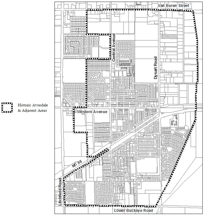
(c)
Required development plan.
(1)
A development plan must be approved to allow development according to the HAIO.
(2)
All regulations and standards of the underlying zoning district shall remain in full force and effect, unless specifically addressed in the development plan.
(3)
Lots that are two (2) acres or less may propose alternatives to the development standards set forth in the Avondale Zoning Ordinance as part of the HAIO request.
(d)
Application requirements.
(1)
The application requirements and fees specified for zoning amendments in section 28-10 of this ordinance shall apply.
(2)
The development plan shall consist of a conceptual development plan, landscape plan and a narrative report.
(3)
The conceptual development plan shall show at a minimum, if applicable, the following information:
(A)
Location, boundaries and acreage of the property.
(B)
Existing and proposed public right-of-way and street improvements.
(C)
General location, size and use of buildings, structures, facilities and equipment.
(D)
Required and proposed building setbacks, building heights and lot coverage.
(E)
Location and surface of parking and/or loading areas and the number of parking spaces to be provided.
(F)
Location and size of stormwater retention basins and any major drainage structures.
(G)
Access and on-site circulation for vehicles and pedestrians.
(H)
General location, type, height and intensity of outdoor lighting.
(4)
The narrative shall provide, at a minimum, the following information:
(A)
Overall description of the project, including the project theme and intended historic character of the development.
(B)
A description of the existing conditions of the proposed area, to include landscaping, parking, structures, and uses.
(C)
Justification for the need of the HAIO District.
(D)
A list of proposed development standards including, but not limited to, building setbacks, building heights, open space, screening, and parking., and a comparison to the standards in the underlying zoning district.
(E)
General design guidelines for buildings, structures, landscaping and parking that promote the historic character of the area.
(F)
Architectural elevations that resemble the historic character.
(e)
Review procedures.
(1)
Requests for HAIO development plan approval shall be submitted to the planning division on a form prescribed by the planning division with the required fee. A HAIO development plan approval may be requested by the property owner of land proposed to be rezoned or by the planning division, the zoning administrator, the planning commission or by the city council.
(2)
The applicant shall conduct a neighborhood meeting in accordance with section 28-12, below, and complete notifications in accordance with section 28-13, below.
(3)
A request for a HAIO development plan approval shall first be heard by the planning commission, which shall hold a public hearing and transmit a recommendation to the city council containing reasons for such recommendation. Notifications must be completed pursuant to section 28-13, below.
(4)
The city council shall hold a public hearing and approve, approve with conditions, or deny the request for the amendment. Notifications must be completed pursuant to section 28-13, below.
(5)
In the event an application is denied by the city council or withdrawn after the planning commission hearing, the city council shall have the authority to refuse to accept another application for any amendment on the same property or part thereof, for a period of one (1) year from the date of denial.
(6)
The recommendation of approval of any amendment by the planning commission shall be void if the amendment has not been adopted by the city council within one (1) year of the planning commission action.
(7)
Major amendments to the development plan shall be processed in the same manner as the original application. Major amendment shall include any (a) change in the use or the intensity of the use or (b) significant increase in the off-site impacts of the use.
(8)
Minor amendments to the development plan, such as minor changes to the site layout or the site use characteristics that do not significantly change the nature or intensity of the use and will not adversely affect adjacent or nearby properties, may be approved by the zoning administrator.
(f)
Required findings.
(1)
Application for the HAIO District must meet the following findings:
(A)
The project will further the objectives of the general plan and not adversely affect the historic character of the community.
(B)
Sufficient proof has been provided that other tools available in the zoning ordinance, such as administrative relief, will not work to address the site specific needs of the project.
(C)
The project provides a historic design that creates a pedestrian oriented environment.
(g)
Development review. The requirements of section 28-6 of this ordinance shall be satisfied prior to the issuance of any construction permits; provided, however, that undergrounding of power lines is not required within this district.
(Ord. No. 2055-0823, § 17, 8-21-23)