
Decatur City Zoning Code
ARTICLE I
- IN GENERAL
Sec. 25-1.- Short title, zoning map adopted.
This chapter shall be known as the "Zoning Ordinance of the City of Decatur, Alabama." The map herein referred to and identified by the title "City of Decatur Official Zoning Map", shall be further identified by the signature of the mayor, and attested by the city clerk. The zoning map being that map of the city herein adopted as an official record of the city and identified by the signature of the mayor and the city clerk. The same being adopted as a substitute for and amendment to the zoning map of the city heretofore existing, the same showing all amendments to said zoning map and zoning ordinance affecting said map, to and including August 4, 2003, said zoning map and all explanatory matters thereon being hereby adopted and made a part of this chapter by reference as if fully set out. Such map shall be filed in the office of the city clerk and shall show thereon the date of adoption of this section and from said date forward, shall be used in lieu of the official zoning map heretofore in use.
(Code 1956, § 27-1; Ord. No. 03-3764, § 1, 8-4-03)
Sec. 25-2. - Definitions.
For the purpose of this chapter words used in the present tense include the future, the singular number includes the plural, and the plural the singular. Words and terms are defined as follows:
(1)
Accessory structure. Any detached minor building in the rear of the main building consisting of masonry or frame walls and roof, one or two stories in height, necessary as an adjunct to the use or occupancy of a principal or main structure.
(2)
Alcoholic beverages. Any alcoholic, spirituous, vinous, fermented or other alcoholic beverage or combination of liquors and mixed liquor, a part of which is spirituous, vinous, fermented or otherwise alcoholic, and all drinks or drinkable liquids, preparations or mixtures intended for beverage purposes, which contain one half of one percent or more of alcohol by volume, and shall include liquor, beer and wine, both fortified and table wine.
(3)
Alteration and altered. The word "alteration" shall include any of the following:
(a)
Any addition to the height or depth of a building or structure;
(b)
Any change in the location of any of the exterior walls of a building or structure;
(c)
Any increase in the interior accommodations of a building or structure.
In addition to the foregoing, a building or structure shall be classified as altered when it is repaired, renovated, remodeled, or rebuilt at a cost in excess of fifty (50) percent of its value prior to the commencement of such repairs, renovation, remodeling or rebuilding.
(4)
Beer, malted or brewed beverages. Defined the same as defined in Code of Ala. 1975, section 28-3-1, as last amended.
(5)
Boarding house. A building other than a hotel, cafe, or restaurant where, for compensation, meals are provided for three or more persons.
(6)
Building area. The portion of the lot occupies by the main building, including porches, carports, accessory buildings, and other structures.
(6a)
Bus transit company: A company that contracts for or provides transportation by bus for people.
(6b)
Caterer, catering, or catering service. a person operating from a permitted food service establishment who contracts with one individual or firm to provide a predetermined menu and quantity of food at a specific site, off the premises of the food establishment, which is generally different for each event; the site or event not being open to the general public. Such person, business or service is not a home occupation, is in possession of a health department permit, has a permanent fixed location, and has obtained a city business license.
(6c)
Reserved.
(6d)
Charter busses. Any bus that is privately contracted for to provide transportation for a specific group with a specific itinerary. The agency contracting with the charter bus shall be responsible for providing off street loading and unloading of the vehicle and off street private parking for the bus passengers.
(7)
Club. An organization catering exclusively to members and their guests, including premises and buildings for social, recreational, athletic and other purposes of common interest, which are not conducted primarily for gain, and whose chief activity is not a service customarily carried on as a business.
(7a)
Commissary. A permitted food establishment to which a mobile food establishment or transportation vehicle returns daily for such things as discharging liquid or solid wastes, refilling water tanks and ice bins, and boarding food.
(8)
Drive-in restaurant. A restaurant or public eating business, so conducted that food, meals or refreshments are brought to the motor vehicles for consumption by the customer or patron.
(9)
Drive-in theater. A theater so arranged and conducted that the customer or patron may view the performance while being seated in a motor vehicle.
(10)
Dwelling. A house or other building used primarily as an abode for one or two families except that the word "dwelling" shall not include boarding or rooming houses, tents, tourist camps, hotels, trailers, trailer camps, or other structure designed or used primarily for transient residents.
(11)
Dwelling unit. Any portion of a building used, intended or designed as a separate abode for a family.
(11a)
Event venue. A public place where meals, food or refreshments are prepared and/or furnished upon premises. An event venue is only available for events on an occasional basis by contract, (e.g., showers, receptions, birthday parties, corporate meetings, and fund raisers or other similar events) with a designated onsite manager or the owner present during the event. Event venues shall not be used for any other purpose or use. If alcohol is desired event venues shall be duly licensed as a special retail licensee. Event venues are a permitted use in B1, B2, B3, B4, B5, and M1A zoning districts. Event venues will be a use permitted on appeal in AG1 and AG2 zoning districts. An event venue must meet all Building Code and Fire Code requirements along with all ABC (alcoholic beverage control board) requirements.
(12)
Family. One or more persons related by blood, marriage, adoption, or by some other legal custodial relationship, living as a single housekeeping unit in a dwelling unit, including persons who reside in the dwelling unit and are employed to care for family member; or three (3) unrelated individuals living as a single housekeeping unit in a dwelling unit. However, notwithstanding the preceding definition, a family shall also be deemed to include up to three (3) unrelated persons occupying a dwelling unit and living as a single, non-profit housekeeping unit, if any one or more of said three (3) unrelated occupants is handicapped as defined in Title VII of the Civil Rights Act of 1968 as amended by the Fair Housing Act Amendments of 1988 and the Alabama Fair Housing Law, section 24-8-1 et seq., Ala. Code 1975.
(13)
Fortified wine or vinous liquor. Any wine containing more than fourteen (14) percent alcohol by volume but not more than twenty-four (24) percent.
(14)
Front yard. The yard extending across the entire width of the lot between the main building including covered porches, and the front lot line, or if an official future street right-of-way line has been established, between the main buildings, including covered porches, porte-cocheres and carports and the right-of-way line.
(15)
Home occupation: Any use conducted in a residential zoning district which is defined and regulated by Article 6 of this chapter.
(16)
Hotel. Any building or portion thereof which contains at least ten (10) guest rooms intended for occupancy in individuals, for compensation whether paid directly or indirectly.
(16a)
Jobsite mobile food vending unit. A person, business or service that provides food only at the request of a land owner of a construction or manufacturing site, uses only commercially licensed vehicles equipped for the purpose of transporting or preparing food to be sold directly from such vehicle and only to those employees of the construction site or manufacturing site where the vehicle is located. The vehicle shall be located on the site and shall not sell from the public right-of-way without a franchise agreement from the City of Decatur. Such person, business, service is not a home occupation, is in compliance with all Morgan County Health Department requirements, has a permanent fixed location where the food is prepared, and has obtained a city business license.
(17)
Junk yard. Junk yards shall include any lot or parcel of land on which is kept, stored, bought or sold, articles commonly known as junk, including scrap metal, automobile bodies from which the motors have been removed, and automobiles and parts thereof which are valuable only as junk.
(18)
Liquor. Any alcoholic, spirituous, vinous, fermented, or other alcoholic beverage, or combination of liquors and mixed liquor, a part of which is spirituous, fermented, vinous or otherwise alcoholic, and all drinks and drinkable liquid, preparations or mixtures intended for beverage purposes which contain one-half of one percent or more of alcoholic by volume, except beer and table wine.
(19)
Lot. A piece, parcel, or plot of land occupied or intended to be occupied by one (1) main building, accessory buildings, uses customarily incidental to such main building and such open spaces as are provided in this chapter, or as are intended to be used with such piece, parcel or plot of land.
(20)
Manufactured home. A structure defined by and constructed in accordance with the National Manufactured Housing Construction and Safety Standards Act of 1974 as amended, 42 U.S.C. section 5401, et seq. The definition at the date of adoption of this part is as follows:
"Manufactured home" means a structure, transportable in one (1) or more sections, which in the traveling mode, is eight (8) body feet or more in width and forty (40) body feet or more in length, or when erected on site, is three hundred twenty (320) or more square feet, and which is built on a permanent chassis and designed to be used as a dwelling with or without a permanent foundation, when connected with required utilities, and includes the plumbing, heating, air-conditioning, and electrical systems contained therein; except that such term shall include any structure which meets all of the requirements and with respect to which the manufacturer voluntarily files a certification required by the secretary and complies with the standards established under this title.
References herein to manufactured home or manufactured houses shall refer solely to manufactured homes designed for occupancy by a single-family unit.
(20a)
Reserved.
(20b)
Mobile food vending site. A collection of one (1) or more mobile food vending units clustered together on a single lot or parcel of land under common ownership or control. Mobile food vending sites shall have a site coordinator who will maintain a list of licensed vendors with the City of Decatur Revenue Department. Mobile food vending sites may be allowed during a special event or as specified under the provisions of section 25-197 of the Code of Decatur Alabama.
(20c)
Mobile food vending unit. A trailer, pushcart, or motorized vehicle authorized by the Morgan County Health Department as a mobile food establishment, designed to be portable and not permanently attached to the ground from which only prepared food or beverages are peddled, vended, sold, offered for sale or given away. No other goods, wares, alcohol, controlled substances or other items may be sold.
(21)
Mobile home. A mobile home is a single-family structure constructed prior to June 15, 1976, designed for occupancy by a single-family unit complying in all respects with the definition of a manufactured home herein.
(22)
Modular home. A modular home is a single-family dwelling, factory fabricated and transportable as a building consisting of units designed to be incorporated at a building site on a permanent foundation into a permanent structure to be used for residential purposes and which bears a seal of compliance with the regulations of the Alabama Manufactured Housing Commission.
(23)
Motor court. A building or group of buildings containing one (1) or more guest rooms having separate outside entrances for each such room or suite of rooms and for each of which rooms or suites of rooms automobile parking space is provided.
(24)
Nonconforming use. A use of any structure or land which though originally lawful does not conform with the provisions of this chapter or any subsequent amendments thereto for the district in which it is located.
(25)
Offices. Space or rooms used for professional, administrative, clerical, and similar uses.
(26)
On premises and off premises. The terms "on premises sale," "off premises sale," and "on premises and off premises sale" shall mean and have the connotation given to them by the Alcoholic Beverage Licensing Code of the State of Alabama, and the rules and regulations of the Alabama Alcoholic Beverage Control Board, when such terms are used in reference to alcoholic beverages. Such terms shall apply only to holders of licenses for the sale of alcoholic beverages from the Alabama Alcoholic Beverage Control Board and from the City of Decatur.
(27)
Overlay district. A mapped zone that imposes a set of requirements over and in addition to those of the underlying zoning district it covers or overlaps. In an overlay district, land is placed simultaneously in two (2) zones, and it may be developed only under the requirements of both zones.
(27a)
Pushcart. A non-motorized, wheeled mobile food unit that is designed and intended to be moved manually by one (1) person. A pushcart can be used to prepare and serve only:
(i)
foods that are not time/temperature control for safety such as popcorn, lemonade, flavored ice; or
(ii)
foods pre-wrapped at the commissary and maintained at the required temperatures; or
(iii)
foods that meet the Morgan County Health Department's definition of "Priority Category 2."
(28)
Rear yard. The yard extending across the entire width of the lot between the main building, including covered porches, and the rear lot line.
(28A)
Restaurant; definition for restaurant retail liquor licensing purposes. Definition is the same as contained in section 2.5-1 of this Code.
(29)
Rooming house. Any building, or portion thereof, which contains no more than nine (9) guest rooms which are designed or intended to be used, let, or hired out for occupancy by transient guests for compensation; whether paid directly or indirectly, for a period of less than thirty (30) continuous days.
(29A)
Sidewalk café. The term "sidewalk café" shall mean the temporary location and use of tables and chairs and other associated equipment and furnishing on the public right-of-way for the purpose of serving food and/or drink to patrons and operated as an extension of and contiguous to a business in a district and which sidewalk café shall be an incidental activity of the business.
(30)
Side yard. The yard extending along a side lot line, from the front yard to the rear yard, between the main building, including covered porches, porte-cocheres and carports, and such lot line.
(30a)
Special event. A community event that is scheduled in a public or semi-public location whether indoors or outdoors that can reasonably be expected to generate a public gathering that is not part of the normal course of business at the location. A special event may be held on public property including streets and sidewalks, non-profit property, or non-residential property. A special event on public property may require additional permits (for example a street barricade permit) from the City of Decatur. Special events must be approved in writing by the property owner. The approval must be on file with the City of Decatur Revenue Department. A special event planned to last more than four days shall require a temporary occupancy approval from the board of zoning adjustment.
(30b)
Standard building code. For the purposes of this chapter where the term "standard building code" is used it shall refer to the currently adopted building code of the city.
(31)
Streets. Any public or private way set aside for common travel more than twenty-one (21) feet in width if such existed at the time of enactment of this chapter, or such right-of-way forty (40) feet or more in width if established thereafter.
(32)
Structure. Any combination of materials, including buildings, constructed or erected, the use of which requires location on the ground or attachment to anything having location on the ground, including among other things, signs, billboards, but not including telephone poles and overhead wires.
(33)
Table wine. Any wine containing not more than fourteen (14) per cent alcohol by volume.
(33a)
Temporary event, health department. As defined by the Alabama State Board of Health Bureau of Environmental Services: a special occurrence or celebration that is community wide, such as a fair, carnival, public exhibition, festival, or similar occasion that lasts no more than fourteen (14) days. A temporary event does not include ongoing commercial activities, such as a sale at a retail store.
(33b)
Temporary food kiosk. A stand designed to be transported and not permanently attached to the ground from which prepared food or beverages are peddled, vended, sold, displayed or offered for sale or given away. No other goods, wares, alcohol, controlled substances or other items may be sold. Temporary food kiosks are subject to all health department rules for temporary events, and must have a valid business license.
(34)
Trailer camp. Any site, lot, field, or tract of land privately or publicly owned or operated, upon which two (2) or more house trailers used for living, eating or sleeping quarters are, or are intended to be, located; such establishments being open and designated to the public as places where temporary residential accommodations are available, whether operated for or without compensation.
(34a)
Transit center/station: Any premises for the loading and unloading of passengers by a public or private bus transit company including the temporary parking of transit vehicles between routes or during stop overs and excluding overnight parking and storage and maintenance of transit vehicles. This definition shall not include school bus stops along rights-of-way, or MCATS transportation vehicles. Charter busses as defined by this ordinance hired by a local organization are not included. They shall only be allowed in M2 zones on lots with a minimum two hundred (200) feet on a state highway and a driveway length of two hundred (200) feet. Transit center/stations cannot be located within two hundred (200) feet of any residentially zoned property. They shall also be safely lit and provide indoor waiting areas. All drop off or pick up activity shall take place completely off the public right-of-way on private property.
(34b)
Usage. For the purpose of these regulations, certain numbers, abbreviations, terms, and words used herein shall be used, interpreted, and defined as set forth below.
Unless the context clearly indicates to the contrary, words used in the present tense include the future tense.
Words used in the plural number include the singular.
The word "herein" means "in these regulations".
The phrase "these regulations" means "Chapter 25 of the Code of the City of Decatur, Alabama".
The word "person" includes a corporation, a partnership, and an incorporated association of persons such as a club, or any other legal entity.
The word "shall" is always mandatory.
A "building" or "structure" includes any part thereof.
That which is "adjacent" may be separated by some intervening object.
That which is "adjoining" must touch in some part.
That which is "contiguous" must touch entirely on one (1) side.
(35)
Use. The purpose for which land or a building or other structure is designed, arranged, or intended, or for which it is or may be occupied or maintained.
(36)
Use permitted on appeal/special use. A use which may be permitted by the board of zoning adjustment. The use may be desirable for the general welfare of the community and its citizens and which is entirely appropriate and not essentially incompatible with the basic uses in the zone involved. The use may well create special problems and hazards if allowed to develop and locate as a matter of right in a particular zone. If the board of zoning adjustment decides to permit the proposed use, then it may impose such conditions and safeguards as necessary to protect the general health, safety, and welfare.
(37)
Wine. All beverages made from the fermentation of fruits, berries, or grapes, with or without added spirits, and produced in accordance with the laws and regulations of the United States, containing not more than twenty-four (24) percent alcohol by volume, and shall include all sparkling wines, carbonated wine, special natural wines, rectified wines, vermouths, vinous beverages, vinous liquors and like products.
(38)
Yard. An open space, on the lot with the main building, left open, unoccupied and unobstructed by buildings from the ground to the sky except as otherwise provided in this chapter.
(Code 1956, § 27-2; Ord. No. 85-2426, § 1, 2-4-85; Ord. No. 90-2942, § 1, 11-5-90; Ord. No. 93-3122, § 1, 5-3-93; Ord. No. 95-3269, § 1, 9-11-95; Ord. No. 97-3417, § 1, 1-5-98; Ord. No. 97-3418, § 2, 1-5-98; Ord. No. 98-3434, § 1—4, 3-2-98; Ord. No. 04-3806, § 3, 7-12-04; Ord. No. 11-4084, §§ 1, 2, 12-6-11; Ord. No. 14-4181, § 1, 5-12-14; Ord. No. 15-4218, § 2, 6-1-15; Ord. No. 15-4230, § 1, 8-3-15; Ord. No. 16-4250, §§ 1, 2, 3-7-16; Ord. No. 16-4273, § 1, 9-6-16; Ord. No. 18-4330, § 1, 12-4-18; Ord. No. 21-4441, §§ 2—4, 2-1-21; Ord. No. 24-4599, § 2, 12-16-24, eff. 1-1-25)
Editor's note— Ord. No. 85-2426, § 1, adopted Feb. 4, 1985, directed the Code publisher to alphabetize and renumber the above section.
Sec. 25-3. - Administration and enforcement, building inspector's right of entry.
The provisions of this chapter shall be administered and enforced by the building inspector of the city. This official shall have the right to enter upon any premises at any reasonable time prior to the issuance of certificate of occupancy for the purpose of making inspections of buildings or premises necessary to carry out his duties in the enforcement of this chapter.
(Code 1956, § 27-3)
Sec. 25-4. - Board of adjustment, appointment, duties, responsibilities, powers, procedures.
A board of adjustment is hereby established. The appointment, procedure, powers, and actions of said board of adjustment shall be governed and controlled by Code of Alabama 1975, section 11-52-80, as the same may be amended, which section is hereby made a part of this chapter as though actually incorporated herein.
(Code 1956, § 27-4)
Sec. 25-5. - Building permit—Required, application.
It shall be unlawful to commence the excavation for or the construction of any building or other structure, including accessory structures, or to store building materials or erect temporary field offices, or to commence the moving, alteration, or repair (except repairs, not changing the character of the structure and not exceeding one thousand dollars ($1,000.00) in cost, or painting or wallpapering) of any structure, including accessory structures, until the building inspector of the city has issued for such work a building permit including a statement that the plans, specifications and intended use of such structure in all respects conform with the provisions of this chapter. Application for a building permit shall be made to the building inspector of the city on forms provided for that purpose.
(Code 1956, § 27-5)
Sec. 25-6. - Same—Approval of plans prerequisite to issuance.
It shall be unlawful for the building inspector of the city to approve any plans or issue a building permit for any excavation or construction until he has inspected such plans in detail and found them in conformity with this chapter. To this end, the building inspector of the city shall require that every application for a building permit for excavation, construction, use of land, moving or alteration be accompanied by a plan or plat drawn to scale and showing the following in sufficient detail to enable the building inspector of the city to ascertain whether the proposed excavation, construction, use of land, moving or alteration is in conformance with this chapter.
(a)
The actual shape, proportion and dimensions of the lot to be built upon.
(b)
The shape, size and location of all buildings or other structures to be erected, altered or moved and of any buildings or other structures already on the lot.
(c)
The existing and intended use of all such buildings or other structures.
(d)
The setback and side lines of buildings on adjoining lots and such other information concerning the lot or adjoining lots as may be essential for determining whether the provisions of this chapter are being observed.
If the proposed excavation, construction, moving, or alteration as set forth in the application is in conformity with the provisions of this chapter, the building inspector of the city shall issue a building permit accordingly. If an application for a building permit is not approved, the building inspector of the city shall state in writing on the application the cause for such disapproval. Issuance of a building permit shall, in no case, be construed as waiving any provision of this chapter.
(Code 1956, § 27-6)
Sec. 25-7. - Certificate of occupancy required.
No land or building or other structure or part thereof hereafter erected, moved or altered in its use shall be used until the building inspector of the city shall have issued a certificate of occupancy stating that such land or structure or part thereof is found to be in conformity with the provisions of this chapter.
Within three (3) days after the owner or his agent has notified the building inspector of the city that a building or premises or part thereof is ready for occupancy or use, it shall be the duty of the building inspector of the city to make a final inspection thereof, and to issue a certificate of occupancy if the building or premises or part thereof is found to conform with the provisions of this chapter or, if such certificate is refused, to state the refusal in writing with the cause.
(Code 1956, § 27-7)
Sec. 25-8. - Districts—Designated.
For the purpose of this chapter the city is hereby divided into the types of districts designated as follows:
R-1 Residential District (Single-Family)
R-2 Residential District (Single-Family)
R-3 Residential District (Single-Family)
R-4 Residential District (Multifamily)
R-5 Residential District (Single-Family Patio Home)
R-6 Residential District (Single-Family Semi-Attached)
PRD-1 Planned Residential Development District
PRD-2 Planned Residential Development District
PRD-3 Planned Residential Development District
PRD-4 Planned Residential Development District
PRD-5 Planned Residential Development District
PRD-6 Planned Residential Development District
PRD-7 Planned Residential Development District
PRD-8 Planned Residential Development District
B-1 Business District (Local Shopping)
B-2 Business District (General Business)
B-3 Business District (Tourist Commercial)
B-3R Riverfront Commercial District
B-4 Business District (Regional Shopping)
B-5 Business District (Central Business District)
B-6 Business District (Office District)
MC Medical Center District
M-1 Industrial District (Light Industry)
M-1A Expressway Commercial District
M-2 Industrial District (General Industry)
AG-1 Agricultural District
AG-2 Agricultural District
I-D Institutional District.
(Code 1956, § 27-8; Ord. No. 85-2426, § 15, 2-4-85; Ord. No. 88-2770, § 2, 10-17-88; Ord. No. 97-3359, § 1, 5-5-97)
Sec. 25-9. - Same—Boundaries established; boundary disputes.
The boundaries of the above districts specified in section 25-8 are hereby established as shown on the zoning map of the city. Unless otherwise shown on said zoning map, the boundaries of districts are lot lines, the center lines of streets or alleys or such lines extended, railroad right-of-way lines, or the corporate limit lines as they existed at the time of enactment of this chapter. Questions concerning the exact location of district boundary lines shall be decided by the board of zoning adjustment.
(Code 1956, § 27-9)
Sec. 25-9.1. - Location near church or school.
Notwithstanding provisions to the contrary set forth in this chapter, subject to exceptions herein contained, no facility or property shall be authorized for on-premises sale or off-premises sale of alcoholic beverages where any part of the building in which the premises is located is less than five hundred (500) feet from any building in which there is a church, or a public or private elementary or secondary school. Provided, however, as regards:
(1)
Off-premises sale of beer and table wine; and
(2)
Except for premises licensed for on-premises sale of alcoholic beverages other than as a class 1 restaurant and located within a B5 (Central Business District) zoning district, on-premises sale of alcoholic beverages by licensees other than class I lounges not operated in conjunction with a licensed restaurant, hotel or motel, and off-premises sale of alcoholic beverages other than beer and table wine, where no part of the building in which the licensed premises are located is closer than two hundred (200) feet from any building in which there is a church, or a public or private elementary or secondary school the aforesaid distance restrictions shall not apply in the following enumerated cases:
a.
Where the licensed premises are separated from the church or school by a street or highway having four (4) or more traffic lanes;
b.
Where the licensed premises and the church or school front on different streets and do not have common exits or driveways providing access;
c.
Where the licensed premises and the church or school are separated by a permanent building, or topographical or man-made barrier, and the council or its duly delegated agent finds that the separation adequately screens and insulates the premises whereby the spirit of the separation requirement herein provided is substantially achieved; or
(3)
For premises located in a B-5 (Central Business District) zoning district, on-premises sale of alcoholic beverages by licensees other than class 1 restaurants and class I lounges not operated in conjunction with a licensed restaurant, hotel or motel, and off-premises sale of alcoholic beverages other than beer and table wine, where no part of the building in which the licensed premises are located is closer than twenty-five (25) feet from any building in which there is a church, or a public or private elementary or secondary school the aforesaid distance restrictions shall not apply. However, no alcoholic beverages can be served or consumed in the exterior part of the building adjacent to a church or school.
Furthermore, where the church or school was established after the licensed premises began operation and said operation has not been abandoned or discontinued for a period of six (6) months the above distance restrictions do not apply. When measuring from a church or a school, the closest exterior wall of the closest building in the church or school complex wherein an essential function or activity of the church or school is carried on shall constitute the beginning point for measurement. When measuring from the licensed premises, the closest point on the exterior wall of the building occupied by the licensee shall be used for measurement purposes if the building is occupied solely by the licensee, otherwise, such measurement shall be made from the closest point of the licensee's occupancy within the building in question.
(Ord. No. 85-2426, § 24, 2-4-85; Ord. No. 17-4308, § 1, 12-5-17; Ord. No. 18-4330, § 2, 12-4-18)
Sec. 25-9.2. - Nonconforming establishments.
There are no pre-existing, nonconforming establishments or uses which offer for sale alcoholic beverages. No permits, licenses or other authority shall be granted for on premises sale or off premises sale of alcoholic beverages where not specifically authorized by this chapter, and this notwithstanding the existing valid, nonconforming use of property for purposes not including the right to sell alcoholic beverages. Compliance with the provisions of this chapter is a prerequisite to the consideration by the city council and the Alabama Alcoholic Beverage Control Board for a license for the sale of alcoholic beverages by applicants; however, such compliance shall not be taken or construed as the grant of the consent and approval of the city for a particular license for the sale of alcoholic beverages, such being specifically reserved to the council for consideration upon individual application, in accordance with procedures established or to be established.
(Ord. No. 85-2426, § 25, 2-4-85)
Sec. 25-9.3. - Special events retail license.
Notwithstanding provisions to the contrary set forth in this chapter, a facility or property in any zoning classification except residential may be authorized for a special events retail liquor license, where the duration of the event is not more than two (2) days and the licensee is a nonprofit entity.
(Ord. No. 92-3065, § 1, 7-6-92; Ord. No. 98-3468, § 1, 8-3-98)
Sec. 25-10. - Residential district requirements.
There is hereby created an "R" Residential District (Residential) for those areas so designated by this chapter and the zoning map of the city, which "R" Districts shall allow: Accessory structures; gardens; playgrounds; parks; public buildings; including public schools and libraries. These uses shall also be permitted on appeal: Customary home occupations; public utilities, general hospitals for humans, except primary for mental cases; semi-public buildings; golf courses; municipal, county, state or federal use; clubs located on and embracing within its sole possessory right, one (1) tract or parcel of land not less than twenty (20) acres in size; and on premises and off premises sale of alcoholic beverage by clubs meeting the acreage requirements above when duly licensed as a class I or class II club by the city and the state alcoholic beverage control board under and pursuant to the Alcoholic Beverage Licensing Code.
(1)
General requirements.
a.
Off-street parking and vehicle access shall be provided as set forth in section 25-16 hereof.
b.
A carport, porte-cochere, porch or structure part thereto, attached to or situated within five (5) feet of the main structure as defined in section 25-2 thereof, shall be considered as a part of the main building and shall be subject to the setback and side yard requirements of the district in which it is located.
(2)
Specific requirements.
a.
Minimum lot area: None specified.
b.
Maximum building area: None specified.
c.
Minimum front yard setback:
1.
Public and semi-public structures: Thirty-five (35) feet.
d.
Minimum rear yard setback:
1.
Public and semi-public structures: Thirty-five (35) feet.
2.
Accessory structures: Five (5) feet.
e.
Minimum side yard setbacks:
1.
Public and semi-public structures: Thirty-five (35) feet.
2.
Accessory structures: Five (5) feet.
f.
Maximum building height: Forty-five (45) feet.
g.
Maximum height in stories: Three (3).
h.
Uses prohibited: Except as expressly permitted, or permitted on appeal, the following uses are prohibited in all residential districts, including without limitation planned residential development districts, specialty and restricted residential districts: ("R" Districts): All buildings, structures and units constructed off-site (except for modular homes as in section 25-2) without regard to whether or not such building, structures or units are designed and built in compliance with state or federal standards, including without limitation, mobile homes, manufactured homes, house trailers, and trailer coaches; trailer or manufactured home parks, courts or camps, and commercial and industrial uses, including parking lots and parking areas in connection with any of these uses, not specifically permitted.
(Ord. No. 98-3434, § 5, 3-2-98; Ord. No. 05-3835, § 1, 7-11-05)
Sec. 25-10.1. - Planned residential development districts.
(A)
Purpose. The purpose of this section is to permit flexibility in the development of substantial tracts of land by permitting a variety of residential uses in accordance with a specific plan for large scale developments. Planned residential developments are of such a nature as to require specific regulations separate and apart from those of general application to the other districts created in the zoning ordinance. Said planned residential developments are intended to permit exceptions and variations from standard zoning regulations to permit flexibility in the development of the real estate affected; which can result in; a maximum choice in the types of environment and living units open to the public; the preservation of open space, trees, and other natural features; the development of recreation areas; an efficient use of land resulting in smaller networks of utilities and streets; and the creation of an environment of a stable character in harmony with surrounding development.
(B)
Definition. A Planned Residential Development District is a tract of land consisting of five (5) or more acres, developed as a unit for residential use, which when completed will contain two (2) or more residential buildings. The density, lot size, bulk, yard sizes, and other nonuse standards within the district shall comply with the standards established by the planning commission for each specific planned residential development, subject to the minimum requirements of the particular PRD zone applicable to the area. The various PRD zones created are as set forth below.
(C)
Adoption of ordinance. A Planned Residential Development District of the number hereafter provided for may be created by the city council through the adoption of an ordinance in accordance with the normal procedures providing for the adoption of amendments to the zoning ordinance. Upon the adoption of such ordinance, the area within the district shall be designated on the "City of Decatur, Official Zoning Map" as a "PRD" district, with the PRD number so adopted, and an application for specific planned residential development may be made as hereinafter set forth.
(D)
Submission of development plan for concept approval. Any person seeking approval of a planned residential development within a Planned Residential Development (PRD) District shall submit three (3) copies of the PRD development plan, including all appropriate text, maps, and graphics, to the planning department for transmittal to the planning commission. Said documents shall include, but need not be limited to:
(1)
A land use plan, describing, and indicating the area to be developed for specific uses;
(2)
A master plan, consisting of appropriate text, maps, and graphics, describing the design concept and location of all structures and improvements to be constructed and of proposed streets, parks, other public ways, drainage, public utilities, and other public facilities, provided, however, that detailed engineering plans shall not be required for master plan approval;
(3)
A description, related to the land use and master plan, of the density, location and type of residential units and accessory uses and structures to be developed;
(4)
A developmental schedule which shall include the anticipated starting and completion dates of the total planned residential development; and
(5)
Proposed covenants;
(6)
Such other information as the planning commission shall require.
All documents relating to streets, parks, public ways, drainage, utilities, and other public facilities shall be submitted to the city engineer at the time of original application. The planning commission may provide for the submission of copies of relevant documents to other city departments and agencies at the time of application. The fee for filing an application for a planned residential development shall be one hundred dollars ($100.00). All plans and related information shall be sufficient detail to enable the planning commission and other city departments to evaluate the proposed development in accordance with the provisions of this section. Within forty-five (45) days after the filing of the proposed PRD development plan for a planned residential development, the city planning department shall transmit said development plan to the planning commission, together with the department's recommendations and comments.
(E)
Plan review. The planning commission shall investigate and ascertain that the plans for a planned residential development shall comply with the following conditions:
(1)
That the tract of land for the planned residential development comprises not less than five (5) acres. It shall be owned, leased or controlled by a single person or corporation, or by a group of individuals or corporations subject to common control. Conveyance of portions of the area is permissible after original approval of the plan concept by the planning commission.
(2)
That the establishment, maintenance and operation of the planned residential development will not be detrimental to or endanger the public health, safety, morals, comfort or general welfare.
(3)
That the establishment of the planned residential development will not impede the normal and orderly development and improvement or surrounding property for uses permitted in that zoning district.
(4)
That adequate utilities, access roads, drainage and/or other necessary facilities will be provided.
(5)
That adequate measures will be taken to provide ingress and egress so designed as to minimize traffic congestion in the public streets, and that the proposed planned residential development shall be accessible from public roads that are adequate to carry the traffic that will be imposed upon them.
(6)
That the uses contained in the planned residential development are residential in character, except for such accessory uses as the planning commission shall determine are desirable and appropriate with respect to the primary purpose of the development, and except for such uses specifically provided for herein.
To aid in the consideration of a planned residential development, the planning commission may request additional reports and information from the applicant, the city planning department, and any other city officer or department. The planning commission may impose such restrictions and conditions on the planned residential development which are in harmony with the general purpose and intent of this section. It may, upon its own initiative, hold public hearings and make such other investigations as it shall deem necessary.
(F)
Approval of planned residential development. Upon completion of its investigation, the planning commission may approve or reject the development plan as submitted or may approve said plan as modified.
Upon approval of the development plan a copy shall be filed among the records of the Decatur Building Department and the original thereof recorded in the office of the probate court of Morgan County and shall thereafter be binding upon the applicants, their heirs, successors, and assigns, shall limit and control the issuance and validity of permits and certificates, and shall restrict and limit the use and operation of all land and structures within the area designated in the development plan to all conditions and limitations specified in such plan and the approval thereof; provided, however, that the Decatur Building Department may, upon a showing of engineering or architectural necessity therefor, permit minor changes in the location of structures and site improvements, if such minor changes will not change the character of the development, or otherwise cause the development plan to fail to meet the conditions specified herein. Pursuant to the same procedure and subject to the same limitations and requirements by which a development plan was approved, filed and recorded, it may be amended or withdrawn, either partially or completely, if all land and structures remaining comply with all the conditions and limitations of the development plan and approval thereof and all land and structures withdrawn comply with all regulations established by all other subsections of this section.
After the approval and recording of the development plan, the developer may proceed with final engineering and construction plans which shall conform in all respects with the ordinances and subdivision regulations of the City of Decatur. Upon approval of the planning commission the planned residential development may be constructed in phases, provided that each phase shall meet the standards of a subdivision as set forth in the subdivision regulations of the City of Decatur and is in compliance with the approved development plan. The planning commission may enter into such agreements with the developer as may be necessary to effectuate the provisions of the development plan or any specific phase thereof, and may impose such conditions and restrictions upon the establishment, location, construction, maintenance and operation of the planned residential development which it may deem necessary for the protection of the public interest.
(G)
Use regulations.
(1)
Uses permitted. In a PRD District only the following uses are permitted:
(a)
Single-family detached, duplex, townhouses, multiple dwellings and apartments.
(b)
Other uses as permitted in all "R" Districts.
(c)
Neighborhood retail uses and other nonresidential uses limited to those enumerated in the B-1 District as may be specifically and selectively authorized in the approved development plan as to type and size only when integrated by design as an accessory element of the project, and only when located in an area that could be appropriately zoned for said use and approved as provided below, provided that the development is planned for more than four hundred (400) dwelling units.
(d)
Such other uses, including neighborhood retail and other nonresidential uses authorized in a B-1 District, as the planning commission finds to be directly related and necessary to the primary purpose of the development and which are limited to the sale, lease or furnishing of goods or services to residents of the development.
(H)
Use control.
(1)
The development of neighborhood retail uses in PRD Districts shall not be permitted until two hundred (200) or more dwelling units are under construction or completed; provided, however, that this subdivision shall not apply to uses which the planning commission has found to be directly related and necessary to the primary purpose of the development and which are limited to the sale, lease or furnishing of goods or services to residents of the development.
(2)
There shall be a minimum of ten (10) per cent of the total area of the PRD dedicated or reserved as usable common "open space" land. Common "open space" land shall be clearly designated on the plan as to the character of use and development but shall not include:
(a)
Areas reserved for the exclusive use or benefit of an individual tenant or owner, nor
(b)
Dedicated streets, alleys or other public rights-of-way, nor
(c)
Vehicular drives, parking, loading and storage areas.
(3)
Adequate guarantees must be provided to insure permanent retention and maintenance of "open space" land area, either by private reservation for the use of the residents within the PRD or by dedication to the public or a combination thereof.
(4)
Off-street parking shall be provided in accordance with section 25-16 of this [zoning] Ordinance.
(I)
PRD Districts, and layout and design requirements. PRD Districts together with applicable minimum yard, height, area coverage, and density requirements for each district are hereby established as follows:
In addition to the above building setback requirements, for buildings and structures exceeding fifteen (15) feet in height there shall be a distance equal to the required yard plus one additional foot for each foot of building height in excess of fifteen (15) feet, as measured from the exterior property lines of the PRD site.
(Code 1956, § 27-10.1)
Sec. 25-10.2. - R-6 Residential District.
There is hereby created an R-6 Residential District (single-family semi-attached) for those areas so designated by this chapter and the zoning map of the City of Decatur, Alabama, which R-6 Districts shall allow single-family semi-attached residences, subject to use regulations common to all "R" Districts as set forth in section 25-10 hereof, except that accessory structure side yard setback requirements shall be the same as required in section 25-10.2(2)(D) for the main structure, and the rear yard setbacks would remain at the minimum of five (5) feet for accessory structures, and further subject to the following requirements and conditions:
(1)
General requirements:
(A)
Single-family semi-attached dwellings shall not form long, unbroken lines of row housing. No more than eight (8) contiguous units shall be allowed.
(B)
Each single-family semi-attached dwelling unit shall be constructed on its own lot.
(C)
No unit located in an R-6 District shall be located closer than twenty (20) feet to a dedicated exterior street or exterior lot line on the perimeter of one district.
(D)
Maximum density (exclusive of public ROW) shall not exceed twelve (12) dwelling units per acre per development.
(E)
No unit within an R-6 District shall have direct access to an existing major thoroughfare as defined by the zoning ordinance or comprehensive plan; or a major thoroughfare as shall be defined by future plans adopted by the planning commission of the City of Decatur.
(2)
Specific requirements:
(A)
Minimum lot size: 2,000 square feet.
(B)
Minimum lot size at building line: 20 feet.
(C)
Minimum front yard setback: 25 feet.
(D)
Minimum side yard setbacks applicable only at unattached ends and to exterior lots of a development: 10 feet (one-story); 12 feet (two-story).
(E)
Minimum rear yard setback: 20 feet.
(F)
Maximum height in stories: 2½.
(G)
Maximum building height: 35 feet.
(H)
Off-street parking spaces per unit: 2.
(3)
Uses prohibited. Any use not permitted, or permitted on appeal, is prohibited.
(Code 1956, § 27-10.2; Ord. No. 90-2947, § 1, 11-5-90)
Sec. 25-10.3. - R-5 Residential District.
There is hereby created an R-5 Residential District (single-family patio home) for those areas so designated by this chapter and the zoning map of the City of Decatur, Alabama, which R-5 Districts shall allow single-family patio home residences subject to use regulations common to all "R" Districts as set forth in section 25-10 hereof, and further subject to the following requirements and conditions:
(1)
General requirements:
a.
Each dwelling unit shall be constructed on its own lot.
b.
No dwelling or lot within a R-5 District shall have vehicle access to an existing major thoroughfare (e.g., "collector street" or higher classified street) as defined by the zoning ordinance or comprehensive plan, or a major thoroughfare as defined by future plans adopted by the planning commission of the city.
c.
There shall be a minimum separation of thirteen (13) feet between structures on separate lots.
d.
All building setback lines shall be indicated on the preliminary and final plats.
e.
Perimeter setbacks:
1.
Reserved.
2.
Where R-5 lots adjoin (in any manner or configuration) a major thoroughfare (e.g. collector street or higher classification), then an additional twenty-foot setback shall be added to those setback requirements set forth hereinbelow in subsections (2)(d) through (2)(f), of this section and shall be measured from the lot line.
(2)
Specific requirements:
a.
Minimum lot area: Five thousand (5,000) square feet.
b.
Maximum building area: None specified.
c.
Minimum lot width at building line: Forty (40) feet.
d.
Minimum front yard setback (also see perimeter setbacks) (1)e: Twenty (20) feet.
e.
Minimum rear yard setback (also see perimeter setbacks) (1)e: Twenty (20) feet.
f.
Minimum side yard setbacks (also see perimeter setbacks) (1)e: Five (5) feet one side, eight (8) feet the other.
g.
Maximum building height: Thirty-five (35) feet.
h.
Off-street parking: Two (2) spaces per dwelling unit.
i.
Maximum density: Seven (7) dwelling units per gross acre.
j.
Uses prohibited: Any use not permitted, or permitted on appeal, is prohibited.
(Ord. No. 88-2770, § 1, 10-17-88; Ord. No. 89-2867, § 1, 11-6-89; Ord. No. 05-3835, § 8, 7-11-05)
Sec. 25-10.4. - R-MH Residential District.
There is hereby created an R-MH Residential District (single-family manufactured housing) for those areas so designated by this chapter and the zoning map of the city, which R-MH Districts shall allow single-family manufactured housing residences, subject to use regulations common to all "R" Districts as set forth in section 25-10 hereof, and further subject to the following requirements and conditions:
(1)
General requirements:
a.
Each manufactured home shall be installed on its own lot.
b.
No manufactured home or lot within a R-MH District shall have vehicle access to an existing major thoroughfare (e.g. "collector street" or higher classified street) as defined by the zoning ordinance or comprehensive plan, or a major thoroughfare as defined by future plans adopted by the planning commission of the city.
c.
There shall be a minimum separation of thirteen (13) feet between structures on separate lots.
d.
All building setback lines shall be indicated on the preliminary and final plats.
e.
Perimeter setbacks:
1.
Where R-MH lots adjoin (in any manner or configuration) a major thoroughfare (e.g. collector street or higher classification), then an additional twenty-foot setback shall be added to those setback requirements set forth hereinbelow and shall be measured from the lot line.
f.
A manufactured home installed on site, shall have a length not to exceed four (4) times its width, with the length measured along the longest axis and the width measured at the narrowest part of the other axis, with the minimum width not less than twenty-four (24) feet. This measurement shall only include the enclosed living area and shall not include garages, carports, decks or storage areas.
g.
All manufactured homes shall have and be attached to a permanent masonry underpinned foundation which extends from the ground to the bottom of the exterior wall and surrounds the entire dwelling, the underpinned foundation being either brick, block, rock, painted masonry painted the same color as the building, or other material approved by the building director.
h.
Each manufactured home shall be blocked and anchored in compliance with applicable law, rule or regulation.
i.
All towing devices, wheels, axles, hitches, and license plates shall be removed.
j.
All manufactured homes shall have permanent steps, porches or decks on all outside doorways, the supports for which shall be permanently anchored in the ground.
k.
All manufactured homes shall have at least a nominal 3:12 roof pitch and the roof shall have a surface of wood shake shingles, asphalt composition shingles, fiberglass shingles or metal tiles.
l.
Manufactured homes shall be installed as provided in the rules of the Alabama Manufactured Housing Commission Administrative Procedures Code.
(2)
Specific requirements:
a.
Minimum lot area: Five thousand (5,000) square feet.
b.
Maximum building area: None specified.
c.
Minimum lot width at building line: Fifty (50) feet.
d.
Minimum front yard setback (see also perimeter setbacks): Twenty (20) feet.
e.
Minimum rear yard setback (see also perimeter setbacks): Twenty (20) feet.
f.
Minimum side yard setback (see also perimeter setbacks): Five (5) feet one side, eight (8) feet the other.
g.
Maximum building height: Thirty-five (35) feet.
h.
Off-street parking: Two (2) spaces per dwelling unit.
i.
Maximum density: Seven (7) dwelling units per gross acre.
(3)
Uses prohibited: Any use not permitted or permitted on appeal, is prohibited.
(Ord. No. 98-3434, § 6, 3-2-98; Ord. No. 05-3835, § 9, 7-11-05)
Sec. 25-10.5. - R-5 Zero Residential District single-family patio home residential district requirements (zero lot line).
There is hereby created an R-5 Zero Residential District (single-family patio home) for those areas so designated by this chapter and the zoning map of the city, which R-5 Zero Districts shall allow single-family patio home residences subject to use regulations common to all R districts as set forth in section 25-10 hereof, and further subject to the following requirements and conditions.
(1)
General requirements.
a.
Each dwelling unit shall be constructed on its own lot except that a roof overhang of twenty-four (24) inches shall be permitted on the zero lot line.
b.
No dwelling unit within an R-5 Zero District shall have vehicle access to an existing major thoroughfare (e.g. collector street or higher classified street) as defined by the Zoning Ordinance or Comprehensive Plan, or a major thoroughfare as defined by future plans adopted by the planning commission of the city.
c.
Where a lot in an R-5 Zero District adjoins another zoning district on the side lot line there shall be a minimum side yard of ten (10) feet.
d.
All building setback lines shall be indicated on the preliminary and final plats.
e.
Perimeter setbacks:
1.
Reserved.
2.
Where R-5 Zero lots adjoin (in any manner or configuration) a major thoroughfare (e.g. collector street or higher classification), then an additional twenty-foot setback shall be added to those setback requirements set forth hereinbelow in subsections (2)d. through (2)f. of this section and shall be measured from the lot line.
(2)
Specific Requirements.
a.
Minimum lot area: Five thousand (5,000) square feet.
b.
Maximum building area: None specified.
c.
Minimum lot width at building line: Forty (40) feet.
d.
Minimum front yard setback (also see perimeter setbacks in subsection (1)e.): Twenty (20) feet.
e.
Minimum rear yard setback (also see perimeter setbacks in subsection (1)e.): Twenty (20) feet.
f.
Minimum side yard setbacks (also see perimeter setbacks in subsection (1)e.): Zero (0) feet one side, ten (10) feet the other side provided however that:
1.
A zero lot line cannot be used on the street sides of a corner lot or on the side of a lot adjacent to another zoning district. (See also section 25-14)
2.
A zero lot line can be used, provided that a perpetual drainage and maintenance easement of five (5) feet shall be provided on the lot adjacent to the zero lot line property line, which with the exception of fences, shall be kept clear of structures. The fence shall be maintained in its original color and treatment unless otherwise agreed to in writing by the two affected property owners. This easement shall be shown on the plat and incorporated into each deed transferring title to the property. The easement shall be approved by the city engineering department.
3.
Roof overhangs may penetrate the easement on the adjacent lot a maximum of twenty-four (24) inches, but the roof shall be so designed that water runoff from the dwelling placed on the lot line is contained within the easement and directed to the stormwater drainage system.
4.
The wall of the dwelling located on the zero lot line shall comply with the Standard Building Code and shall have no windows, doors, or appurtenances necessary to the dwelling provided, however that courts shall be permitted on the zero lot line side when the court is enclosed by three (3) walls of the dwelling unit and a solid wall of at least eight feet in height is provided on the zero lot line. The exterior of said wall shall be constructed of the same material as the exterior of the walls of the unit.
5.
The above subsection (2)f.2. required perpetual drainage and maintenance easement shall not be required if two (2) dwelling units adjoin each other on the "common" or zero lot line.
g.
Maximum building height: Thirty-five (35) feet.
h.
Off-street parking: Two (2) spaces per dwelling unit.
i.
Maximum density: Seven (7) dwelling units per gross acre.
j.
Uses prohibited: Any use not permitted, or permitted on appeal, is prohibited.
(Ord. No. 97-3351, § 1, 4-7-97; Ord. No. 05-3835, § 10, 7-11-05)
Sec. 25-10.6. - R-4 Zero Residential District multi-family residential district requirements (zero lot line).
There is hereby created an R-4 Zero Residential District (multi-family zero lot line) for those areas so designated by this chapter and the zoning map of the city, which R-4 Zero Districts shall allow multi-family dwellings and apartments. These uses shall also be permitted on appeal: Clubs, not conducted for profit; rooming and boarding houses, and those uses common to all "R" districts as set forth in section 25-10 hereof, and further subject to the following requirements and conditions. See also section 25-23 Site plan review - R-4 districts.
(1)
General requirements.
a.
No dwelling unit within an R-4 Zero District shall have vehicle access to an existing major thoroughfare (e.g. "collector street" or higher classified street) as defined by the zoning ordinance or comprehensive plan, or a major thoroughfare as defined by future plans adopted by the planning commission of the city.
b.
Off-street parking and vehicle access shall be provided as set forth in section 25-16 hereof.
c.
Where a lot in an R-4 Zero District adjoins another zoning district there shall be a minimum side yard setback of twelve (12) feet.
(2)
Specific requirements.
a.
Minimum lot area: For one- or two-family dwellings, seven thousand (7,000) square feet; and for each additional family unit add two thousand (2,000) square feet.
b.
Maximum building area: None specified.
c.
Minimum front yard setback: Twenty-five (25) feet.
d.
Minimum rear yard setback: Thirty (30) feet.
e.
Minimum side yard setbacks: Zero (0) feet one side and twelve (12) feet the other side. Provided, however, these standards are followed:
1.
A zero lot line cannot be used on the street side of a corner lot or on the side of a lot adjacent to another zoning district (see also section 25-14).
2.
A zero lot line can be used, provided that zero lot lines adjoin each other and that the buildings are semi-attached and comply with the Standard Building Code.
3.
The wall of the dwelling located on the zero lot line shall comply with the Standard Building Code and shall have no windows, doors, or appurtenances necessary to the dwelling.
f.
Maximum building height: Thirty-five (35) feet.
g.
Maximum height in stories: Three (3).
h.
Uses prohibited: Any use not permitted, or permitted on appeal, is prohibited.
(Ord. No. 97-3352, § 1, 4-7-97; Ord. No. 05-3835, § 6, 7-11-05)
Sec. 25-10.7 - R-1E Residential Estate District (large lot open space).
There is hereby created an R-1E Residential Estate District (large lot open space district) for those areas so designated by this chapter and the zoning map of the city, which R-1E districts shall allow single-family large lot or estate residences subject to use regulations common to all "R" zoning districts as set forth in section 25-10, and further subject to the following requirements and conditions.
(1)
Purpose. The R-1E district is intended to provide areas for single-family development in an open space setting or where topography, utility capacities and/or natural amenities limit the use of the land. Provisions are made for those uses necessary and incidental to single-family living.
(2)
Permitted uses. In addition to those uses permitted in section 25-10 the following uses shall be permitted:
a.
Church and parsonage.
b.
Horses shall be permitted on lots of five (5) acres or more at a rate of two for the first five (5) acres, and one (1) for each additional acre thereafter.
c.
Accessory buildings and uses including stables, corrals, barns, private garages, tack rooms, hay barns, a guest house with no kitchen facilities, and other buildings and uses customarily appurtenant to a permitted use.
(3)
Uses permitted on appeal. In addition to those uses permitted on appeal in section 25-10 a barn shall be permitted on appeal on tracts of five (5) acres or more where a residential structure is planned.
(4)
Area, yard and bulk requirements.
a.
Minimum lot area—One (1) acre, or five (5) acres if horses are to be kept.
b.
Minimum width front building line—One hundred fifty (150) feet.
c.
Minimum front yard setback—Fifty (50) feet.
d.
Minimum rear yard setback—Sixty (60) feet.
e.
Minimum side yard setback—Twenty-five (25) feet.
f.
Maximum height—Fifty (50) feet.
g.
Maximum stories—Two and a half (2½).
h.
Maximum coverage—None specified.
i.
Off-street parking—Two (2) spaces per dwelling unit.
j.
Barns or other buildings to house horses or the feed for horses shall be setback seventy-five (75) feet from any property line.
(5)
Uses prohibited. Any use not permitted or permitted on appeal, is prohibited.
(Ord. No. 98-3433, § 1, 3-2-98; Ord. No. 05-3835, § 7, 7-11-05; Ord. No. 07-3927, § 1, 1-7-08; Ord. No. 08-3948, § 1, 5-5-08)
Sec. 25-10.8. - R-1 Residential District requirements.
There is hereby created an R-1 Residential District for those areas so designated by this chapter and the zoning map of the city, which R-1 Districts shall allow: Single-family dwellings (See also regulations common to all "R" Districts, listed in section 25-10).
(1)
General requirements.
a.
Off-street parking and vehicle access shall be provided as set forth in section 25-16 hereof.
b.
A carport, porte-cochere, porch or structure part thereto, attached to or situated within five (5) feet of the main structure as defined in section 25-2 thereof, shall be considered as a part of the main building and shall be subject to the setback and side yard requirements of the district in which it is located.
(2)
Specific requirements.
a.
Minimum lot area: Fourteen thousand (14,000) square feet.
b.
Maximum building area: None specified.
c.
Minimum front yard setback: Forty (40) feet.
d.
Minimum rear yard setback: Forty-five (45) feet.
e.
Minimum side yard setbacks: Fifteen (15) feet.
f.
Minimum feet at building line: One-hundred (100) feet.
g.
Maximum building height: Thirty-five (35) feet.
h.
Maximum height in stories: Two and one-half (2½).
i.
Uses prohibited: Any use not permitted, or permitted on appeal, is prohibited.
(Ord. No. 05-3835, § 2, 7-11-05)
Sec. 25-10.9 - R-2 Residential District requirements.
There is hereby created an R-2 Residential District for those areas so designated by this chapter and the zoning map of the city, which R-2 Districts shall allow: Single-family dwellings (see also regulations common to all "R" Districts, listed in section 25-10).
(1)
General requirements.
a.
Off-street parking and vehicle access shall be provided as set forth in section 25-16 hereof.
b.
A carport, porte-cochere, porch or structure part thereto, attached to or situated within five (5) feet of the main structure as defined in section 25-2 thereof, shall be considered as a part of the main building and shall be subject to the setback and side yard requirements of the district in which it is located.
(2)
Specific requirements.
a.
Minimum lot area: Ten thousand (10,000) square feet.
b.
Maximum building area: None specified.
c.
Minimum front yard setback: Thirty-five (35) feet.
d.
Minimum rear yard setback: Forty (40) feet.
e.
Minimum side yard setbacks: Eight (8) feet.
f.
Minimum feet at building line: Seventy (70) feet.
g.
Maximum building height: Thirty-five (35) feet.
h.
Maximum height in stories: Two and one-half (2½).
i.
Uses prohibited: Any use not permitted, or permitted on appeal, is prohibited.
(Ord. No. 05-3835, § 3, 7-11-05)
Sec. 25-10.10 - R-3 Residential District requirements.
There is hereby created an R-3 Residential District for those areas so designated by this chapter and the zoning map of the city, which R-3 Districts shall allow: Single-family dwellings (see also regulations common to all "R" Districts, listed in section 25-10).
(1)
General requirements.
a.
Off-street parking and vehicle access shall be provided as set forth in section 25-16 hereof.
b.
A carport, porte-cochere, porch or structure part thereto, attached to or situated within five (5) feet of the main structure as defined in section 25-2 thereof, shall be considered as a part of the main building and shall be subject to the setback and side yard requirements of the district in which it is located.
(2)
Specific requirements.
a.
Minimum lot area: Seven thousand (7,000) square feet.
b.
Maximum building area: None specified.
c.
Minimum front yard setback: Thirty (30) feet.
d.
Minimum rear yard setback: Thirty-five (35) feet.
e.
Minimum side yard setbacks: One side eight (8) feet and the other side six (6) feet.
f.
Minimum feet at building line: Fifty (50) feet.
g.
Maximum building height: Thirty-five (35) feet.
h.
Maximum height in stories: Two and one-half (2½).
i.
Uses prohibited: Any use not permitted, or permitted on appeal, is prohibited.
(Ord. No. 05-3835, § 4, 7-11-05)
Sec. 25-10.11. - R-4 Multi-family Residential District requirements.
There is hereby created an R-4 Multi-family Residential District for those areas so designated by this chapter and the zoning map of the city, which R-4 Districts shall allow: Dwellings and apartments for any number of families. These uses shall also be permitted on appeal: Clubs, not conducted for profit; rooming and boarding houses, and those uses common to all "R" districts as set forth in section 25-10 hereof, and further subject to the following requirements and conditions. (See also regulations common to all "R" Districts, listed in section 25-10 and section 25-23 site plan review - R-4 Districts).
(1)
General requirements.
a.
Off-street parking and vehicle access shall be provided as set forth in section 25-16 hereof.
b.
A carport, porte-cochere, porch or structure part thereto, attached to or situated within five (5) feet of the main structure as defined in section 25-2 thereof, shall be considered as a part of the main building and shall be subject to the setback and side yard requirements of the district in which it is located.
(2)
Specific requirements.
a.
Minimum lot area: Seven thousand (7,000) square feet, and for each additional family unit add two thousand (2,000) square feet.
b.
Maximum building area: None specified.
c.
Minimum front yard setback: Twenty-five (25) feet.
d.
Minimum rear yard setback: Thirty (30) feet.
e.
Minimum side yard setbacks: One side eight (8) feet and the other side six (6) feet.
f.
Minimum feet at building line: Fifty (50) feet for a one- or two-family dwelling plus five (5) additional feet for each additional family unit.
g.
Maximum building height: Thirty-five (35) feet.
h.
Maximum height in stories: Two and one half (2½).
i.
Uses prohibited: Any use not permitted, or permitted on appeal, is prohibited.
(Ord. No. 05-3835, § 5, 7-11-05; Ord. No. 05-3849, § 1, 12-5-05; Ord. No. 06-3863, § 1, 5-1-06)
Sec. 25-11. - Business district requirements.
(Code 1956, § 27-11; Ord. No. 85-2426, §§ 3—9, 2-4-85; Ord. No. 85-2491, § 1, 9-9-85; Ord. No. 05-3830, § 1, 7-11-05; Ord. No. 08-3943, § 1, 4-7-08; Ord. No. 11-4083, § 1, 12-6-11; Ord. No. 12-4123, §§ 1, 2, 9-4-12;Ord. No. 13-4159, §§ 1, 2, 9-3-13; Ord. No. 14-4173, §§ 1—6, 4-7-14; Ord. No. 14-4181, §§ 2—5, 5-12-14; Ord. No. 18-4330, § 3, 12-4-18)
Sec. 25-11.1. - B-3R Riverfront Commercial District.
[The following regulations shall apply to the B-3R Riverfront Commercial District:]
(1)
Uses permitted: Clubs; on premises and off premises sale of alcoholic beverages; hotels, motels, restaurants, educational, cultural, or recreational uses, any retail business or service dependent on tourist trade or supportive of tourist activity; and any use permitted in a B-6, Office District and subject to all district requirements of said district as specified in section 25-11 hereof.
(2)
Uses permitted on appeal: Residential uses limited to R-4 multifamily; R-5 single-family patio homes; and R-6 single-family semi-attached townhomes; and private or public parking garages or facilities.
(3)
Uses prohibited: Any use not permitted or permitted on appeal.
(4)
Minimum lot size: It is the intent of this section that lots of sufficient size be used for any allowed use to provide adequate parking and loading space in addition to the space required for other normal operations of the enterprises.
(5)
Minimum yard size: Front, thirty-five (35) feet; rear, thirty-five (35) feet; side, not specified, except on a lot adjoining along its side lot line a lot which is in a residential district, there shall be a side yard not less than fifteen (15) feet wide.
(6)
Maximum height: Nonspecified, but must meet applicable building codes, especially with regard to fire protection.
(7)
Off-street parking: See section 25-16.
(8)
Off-street loading and unloading: Shall use required rear or side yard for loading and unloading.
(9)
Site plan review: A site plan shall be submitted to the planning commission for its review prior to a permit for development being granted in any B-3R zone or prior to any use permitted on appeal being granted by the board of zoning adjustment. The site plan shall include as a minimum, automobile ingress and egress to the property, parking, building location setback, landscaping, orientation and accessibility of development to riverfront and surrounding uses, and accessibility to the riverfront by pedestrian walkway and orientation of development to any public riverfront promenade as may be developed or extended in the future.
(Ord. No. 92-3034, § 1, 4-6-92; Ord. No. 98-3467, § 1, 8-3-98; Ord. No. 16-4260, § 1, 5-2-16)
Sec. 25-11.2. - Redevelopment District (RD).
(a)
Creation. A Redevelopment District will be created by the city council through the adoption of an ordinance in accordance with the normal procedures providing for the adoption of amendments to the zoning ordinance. Upon the adoption of this ordinance, the area within the district shall be designated on the "City of Decatur, Official Zoning Map" as a "RD" District, and an application for specific redevelopment may be made as hereinafter set forth.
(b)
Purpose. This RD (Redevelopment) District is a mixed-use zone designed to allow property owners to maximize the use of their property through flexible development standards (e.g. amended parking, lot line setbacks and lot coverage requirements) and without having to seek a zoning change from the planning commission and the city council.
(c)
Action taken. There is hereby created an RD Redevelopment District (mixed use district) for those areas designated by this chapter and the zoning map of the city. This RD District shall allow mixed land uses (residential, commercial, retail and light industry) subject to use regulations set forth in this chapter and subject to the following requirements and conditions:
(1)
Permitted uses.
a.
Residential dwellings, with the exception of mobile homes, those uses permitted in all "R" Districts, including loft apartments above lower floor commercial/retail buildings.
b.
Retail and commercial trade, including the following types: food, bakery, delicatessen, general merchandise, apparel, furniture, household and hardware, TV, drug and sundries, jewelry and gifts, florists, sporting goods, antiques, appliances, hobby supply, home medical equipment, office supply, bookstore, camera and photographic supplies, fabric store, music store and other uses of similar types.
c.
Service oriented facilities, including the following types: banks, barber or beauty salons, churches, professional clinics (dental or medical), computer stores, fire station, hotel/motel, interior decorating shops, neighborhood retail, professional offices, optician, photographic studio, picture framing, police substations, post office branch, public/private schools (preschool/elementary or secondary), TV sales, restaurants, shoe repair, music or dance studios, art studios, martial arts studios, public buildings, including libraries, public utilities, semi-public buildings including municipal, county, state and federal buildings, playgrounds and parks, art galleries and other uses of similar types.
d.
Light manufacturing, including light industrial operations, not obnoxious, offensive, or detrimental to neighborhood property by reason of dust, smoke, noise, odor or appearance, extended operating hours, or heavy truck traffic. Any retail or wholesale business not specifically restricted or prohibited in section 25-12 of the zoning ordinance.
e.
On- and off-premises sale of alcoholic beverages. Off-premises sale of beer and table wine; on-premises sale of alcoholic beverages by duly licensed restaurants; and on-premises sale of alcoholic beverages by lounges located in, and constituting an integral part of a restaurant licensed by the state alcoholic beverage control board to sell alcoholic beverages as a restaurant; and on-premises sale by a lounge located in, and constituting an integral part of a hotel or motel having fifty (50) or more rooms for rent to the public.
(2)
Uses prohibited. Lumber yards or mills, mobile home sales, mobile home parks, stockyard (live animal or poultry sales), junkyards, and sexually oriented businesses; businesses licensed under the Deferred Presentment Services Act and/or, Pawnshop Act and/or, Dealers in Gold or Precious Items Act; and other uses found to be of an objectionable nature or inconsistent with the general welfare of the district as determined by the chief building official.
(3)
Minimum lot size. It is the intent of this section that lots of sufficient size be used for any development to provide adequate parking and loading and unloading space in addition to the spaces required for normal operation and to meet the landscaping requirements of this section.
(4)
Minimum yard size.
a.
Front yard: None, except for lots facing Sixth Avenue (U.S. Hwy 31), there shall be a minimum twenty-five-foot setback.
b.
Rear yard: None.
c.
Side yard: None, except on a lot adjoining residential along its side lot line, there shall be a side yard of not less than eight (8) feet.
(5)
Maximum building area. The maximum building site coverage by all structures shall be fifty (50) percent.
(6)
Maximum height. Not specified.
(7)
Off-street parking. Not specified, but all parking must be contained on the property site, or on adjacent property (may be separated by an alley), or with a shared parking agreement with an adjoining property owner
(8)
Off-street loading. Shall provide space for loading and unloading on the property site.
(9)
Landscaping and lighting. Landscaping and lighting criteria are hereby established to protect and preserve the appearance, and value of surrounding properties.
a.
All development, with the exception of single-family residential, will be required to provide frontage landscaping (as defined in section 25-16(9)(f) of the zoning ordinance) or, at the option of the developer, foundation landscaping (as defined in section 25-16(9)(g) of the zoning ordinance).
b.
All commercial or industrial development adjacent to residential property shall provide perimeter landscaping within the property lines between the off-street parking area and adjoining properties of not less than five (5) feet in depth; or
c.
All commercial or industrial development adjacent to residential property shall provide a solid fence or wall. The fence shall be a minimum of six (6) feet high. Chain link or other wire fencing material is prohibited.
(10)
Lighting. Shall be in compliance with section 25-16(9)(o) of the zoning ordinance.
(11)
Signage. Signage requirements in the Redevelopment District on a principal arterial street or above, as designated in the transportation section of the comprehensive master plan, shall be subject to section 25-77(e) (Business Districts B-2 and B-3; Manufacturing Districts M-1 and M-2; and Expressway Commercial District M-1A) of the zoning ordinance of the city.
Signage on all other streets in the redevelopment district shall be subject to section 25-77(c) (Central Business District B-5) of the zoning ordinance of the city. However, signage for development adjoining an existing residential structure shall be a monument sign.
Monument signs shall not exceed thirty-six (36) square feet in area and forty-two (42) inches in height. Monument signs shall be setback a minimum of ten (10) feet behind the curb unless the sign will encroach on the right-of-way, then the sign will be placed behind the property line. Monument signs shall not obstruct the line of site for vehicles using the ingress or egress to an adjoining property.
If the property has a mixed use (e.g. commercial and residential) the more restrictive signage requirement shall apply.
(12)
Application and approval process.
a.
Approval required. Planning commission site plan approval is required for any new development or new construction and prior to the issuance of any related building permits in the redevelopment district.
b.
Content of application. Each application for development located in the redevelopment district shall be drawn by a registered civil engineer of the state and include the following information:
1.
The name, address & phone number of the property owner and applicant.
2.
The legal and general description of the tracts or lots on which review is sought.
3.
A statement of proposed use.
4.
A complete site development plan drawn to a scale of no less than one (1) inch equals fifty (50) feet indicating:
a)
Dimension and location of all existing or proposed buildings, existing utilities and easements, access drives, parking areas, loading and unloading areas, if applicable.
b)
Landscaping, fencing and lighting plans,
c)
Signage plans.
(Ord. No. 06-3861, § 1, 4-3-06; Ord. No. 06-3891, § 1, 2-5-07; Ord. No. 14-4173, § 7, 4-7-14)
Sec. 25-11.3. - Redevelopment District-2 (RD-2).
Upon the adoption of this ordinance, the area within the district boundaries shall be designated on the "City of Decatur, Official Zoning Map" as a "RD-2" District, and an application for specific redevelopment may be made as hereinafter set forth. This zoning district is applicable only to the east side of 6 th Avenue SE and the west side of 7 th Avenue SE beginning at a point where the centerline of 7 th Ave SE intersects the centerline of 5 th Street SE, said point being the true point of beginning of the proposed RD-2 zoning district; thence, from the true point of beginning south along the centerline of 7 th Avenue SE to the centerline of 11 th St SE; thence east along the said centerline of 11 th Street SE a distance of 520 feet more or less to a point; thence south along an existing alley east of the Decatur Shopping Center property a distance of 1,280 feet more or less to a point; thence west along the south property line of Tax Parcel No. 03 09 29 3 002 003.000 to the centerline of 6 th Avenue SE; thence north along the centerline of 6 th Avenue SE to the intersection with 5 th Street SE (if extended); thence east along the centerline of 5 th Street SE to the intersection with 7 th Avenue SE and the true point of beginning.
(a)
Purpose: This RD-2 (Redevelopment) District recognizes the need to redevelop the property that fronts the Sixth Ave. corridor on the east side. A majority of the area is directly across from an existing redevelopment district on the west side of 6 th Avenue that has already been through this process. This district will be a mixed-use zone designed to allow property owners to maximize the use of their property through flexible development standards (e.g. amended parking, lot line setbacks and lot coverage requirements) and without having to seek a zoning change from the planning commission and the city council.
(b)
Action taken: There is hereby created an RD-2 Redevelopment District (mixed use district) for those areas designated by this chapter and the zoning map of the City of Decatur, Alabama. This RD-2 district shall allow mixed land uses (residential, commercial, and retail) subject to use regulations set forth in this chapter and subject to the following requirements and conditions:
(1)
Permitted uses: Residential dwellings, with the exception of mobile homes, condominiums, and apartments, those uses permitted in all "R" districts.
Retail and commercial trade including the following types: food, bakery, delicatessen, general merchandise, apparel, furniture, household and hardware, electronic sales, drug and sundries, jewelry and gifts, florists, sporting goods, antiques, appliances, hobby supply, home medical equipment, office supply, bookstore, camera and photographic supplies, fabric store, music store and other uses of similar types.
Service oriented facilities including the following types: federally insured banks, credit unions, savings and loans; financial institutions licensed under Mini Code or the Small Loans Act; hair salons, professional clinics (dental or medical), computer stores, interior decorating shops, neighborhood retail, professional offices, opticians, photographic studio, picture framing, restaurants, fast food restaurants, shoe repair, dry cleaning and laundry pickup stations, and other uses of similar types.
On and off premise sale of alcoholic beverages: Off premises sale of beer and table wine; on premises sale of alcoholic beverages by duly licensed restaurants; and on premises sale of alcoholic beverages by lounges located in, and constituting an integral part of a restaurant licensed by the Alabama Alcoholic Beverage Control Board to sell alcoholic beverages as a restaurant.
(2)
Uses permitted on appeal: Churches, public buildings including libraries, public utilities; semi-public buildings including governmental offices, municipal, county, state and federal buildings; music, dance, art and martial art studios, public/private schools, parks and playgrounds, police and fire stations.
(3)
Uses Prohibited: Lumber yards or mills, mobile home sales, mobile home parks, stockyard (live animal or poultry sales), junkyards, sexually oriented businesses; hotels, motels, light manufacturing operations, mini storage and warehouse buildings, billboards, businesses licensed under the Deferred Presentment Services Act, Pawn Shops Act, Dealers in Gold or Precious Items Act and other uses found to be of an objectionable nature by reason of dust, smoke, vibration, noise, odor, extended operating hours, or inconsistent with the general welfare of the district as determined by the chief building official.
(4)
Minimum lot size: It is the intent of this ordinance that lots of sufficient size be used for any development to provide adequate parking and loading and unloading space in addition to the spaces required for normal operation and to meet the landscaping requirements of this section.
(5)
Minimum yard size:
Front yard: Lots facing Sixth Avenue (U.S. Hwy 31), shall be required to have a minimum twenty-five-foot setback.
Rear yard: None—Except a landscaping buffer berm, twenty (20) linear feet in width, (as described in section 25-11.3.(11).D) required for all properties contiguous with 7 th Avenue SE.
Side yard: Lots adjoining residential along its side lot line shall be required to have a side yard of not less than eight (8) feet. Lots contiguous with side streets shall provide frontage landscaping as defined in section 25-16(9)(f) of the Zoning Ordinance of the City of Decatur.
(6)
Maximum building area: The maximum building site coverage by all structures shall be fifty (50) percent.
(7)
Maximum height: Buildings heights close to 7 th Avenue SE should be 1 to 1-1/2 stories up to a maximum of 2 stories along 6 th Avenue SE.
(8)
Off-street parking: Not specified, but all parking must be contained on the property site, or on adjacent property (may be separated by an alley), or with a shared parking agreement with an adjoining property owner. All parking lots shall be paved and striped.
(9)
Off-street loading: Shall provide space for loading and unloading on the property site.
(10)
7thAvenue SE Access. There shall be no ingress from, or egress to, 7 th Avenue SE for any new development. All development shall be designed to front 6 th Avenue SE. Access for development to 6 th Avenue SE and adjoining side streets shall be limited based on ALDOT Access Management Guidelines and approved by the City of Decatur and ALDOT (the only exception will be for those properties on the west side of 7 th Avenue between 10 th and 11 th Streets SE. They shall be allowed access to 7 th Avenue for development if they do not include any property west of the existing alleyway or property contiguous to 6 th Avenue).
(11)
Landscaping and lighting: Landscaping and lighting criteria are hereby established to protect and preserve the appearance and value of surrounding properties. All landscaping plans shall be designed, stamped and sealed by a registered landscape architect of the State of Alabama.
a.
All development, with the exception of single family residential, will be required to provide frontage landscaping (as defined in section 25-16(9)(f) of the City of Decatur Zoning Ordinance), foundation landscaping and perimeter landscaping (as defined in section 25-16(9) (g) and (h) of the City of Decatur Zoning Ordinance). All development landscaping shall be irrigated with an irrigation system.
b.
All development adjacent to residential property shall provide perimeter landscaping within the property lines between the off-street parking area and adjoining properties of not less than five (5) feet in depth, or
c.
All development adjacent to residential property shall provide a solid fence or wall. The fence shall be a minimum of six (6) feet high. Chain link or other wire fencing material is prohibited.
d.
All development that has a property line contiguous with 7 th Avenue SE shall provide a rear landscaping buffer berm of not less than twenty (20) linear feet in width and four (4) linear feet in height as measured from the finished floor elevation of the proposed development. The buffer berm shall run the full length of the property along 7 th Avenue and shall be designed to create a continuous opaque screen within two (2) years of planting and should be planned for low maintenance. The buffer berm shall be a maximum 3:1 slope with a four-foot retaining wall and a minimum seven (7) linear foot planting area at the top of the berm. The buffer berm shall be designed and located as shown in the cross section of Figure A. The retaining wall shall be constructed for the full length of the property with one (1) column every fifty (50) linear foot. The retaining wall may be constructed from stone, brick, or any similar masonry material. Construction material for the retaining wall shall be shown on the landscaping plan. Wood materials are not permitted for construction of the retaining wall.
The buffer shall consist of a four-foot-tall berm with a minimum of one screening tree every ten (10) linear feet and one (1) evergreen shrub per two (2) linear feet. All required plants shall be arranged in such a manner so as to provide a variety of plant materials, locations and spacing. Staggered spacing, double rows, or alternating spacing may be adjusted to conform to the growth characteristics of a plant species, but spacing and selection shall result in a one hundred (100) percent opaque screen at a minimum eight (8) feet in height within two (2) years of planting. Single row spacing with one (1) tree species is not permitted. A quarter of the trees may be deciduous shade trees and the remainder shall be evergreen and reach a minimum height of fifteen (15) feet at maturity. Minimum evergreen trees at time of planting shall be at least six (6) feet in height and three (3) feet in crown width. Minimum deciduous tree size shall be ten (10) feet in height and two and one-half (2½) inches in diameter measured one-half (½) foot above grade at time of planting. Minimum size at time of planting of screening shrubs shall be two (2) feet in height and spread at time of installation. Appropriate ground cover plantings or erosion control netting shall be used for naturalizing and controlling soil erosion on the sloped berm.
If the lot is on a corner, the landscaping buffer berm shall be sloped and transition into the perimeter landscaping. Planting shall not interfere with the sight triangle at street intersections or ingress and egress to the property.
Where mature canopy/screening trees are located in the right-of-way of 7 th Avenue SE, the developer may be allowed to construct a minimum six (6) foot high buffer fence in lieu of, or in conjunction with, the twenty (20) linear foot buffer berm. The fence/berm shall be constructed for the full length of the property with one (1) column every fifty (50) linear feet where a buffer fence is in place. The fence shall be constructed from stone, brick, or other masonry material approved by the City of Decatur Planning Department. Wood materials are not permitted. The fence design, type and location, additional screening trees and shrubs shall be shown on the site plan and must be approved by the City of Decatur Planning Department. An arborist will be required to certify the health of the existing trees.
The purpose of the buffer berm is to create a continuous opaque screen along 7 th Avenue SE so that no parking lot, dumpster or loading area is visible from the adjoining properties.
The buffer berm shall be maintained by the property owner out to the street curb.
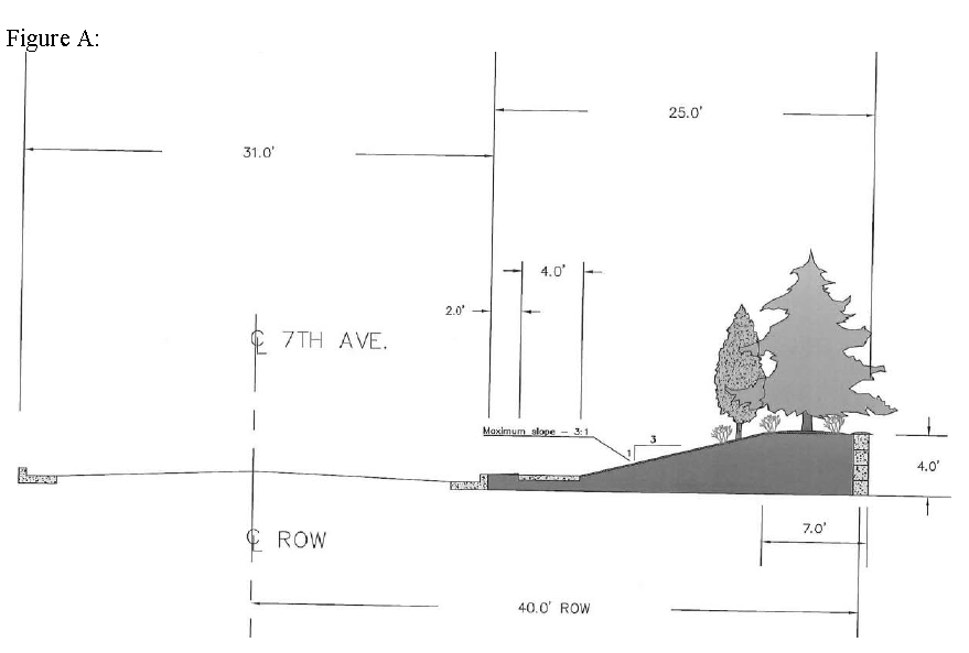
e.
All development that has property contiguous with side streets shall provide frontage landscaping as defined in the City of Decatur Zoning Ordinance section 25-16(9)(f).
f.
Sidewalks shall be constructed along all abutting streets and/or replaced if damaged during construction development.
(12)
Lighting. Shall be in compliance with section 25-16(9)(o) of the City of Decatur Zoning Ordinance or as deemed necessary for the welfare and safety of the citizens of Decatur. Lighting on 7 th Avenue frontage shall be limited in height to twenty (20) feet to reflect a more residential scale. Lighting shall be directed toward the building development in a way that does not adversely impact adjacent residential properties. Lighting should be consistent with building design.
(13)
Signage. All signage shall comply with section 25-77(f) of the Code of Decatur and shall be subject to review and approval by the city building department.
(14)
Application and approval process:
a.
Approval required. Planning commission site plan approval is required for all new development or new construction and prior to the issuance of any related building permits in the Redevelopment District.
b.
Content of application. Each application for development located in the Redevelopment District shall be drawn and stamped by a registered civil engineer of the State of Alabama and include the following information:
1.
The name, address and phone number of the property owner and applicant.
2.
The legal and general description of the tracts or lots on which review is sought.
3.
A statement of proposed use.
4.
A complete site development plan drawn to a scale of no less than 1" = 50' indicating:
a)
Dimension and footprint of all existing or proposed buildings, existing utilities and easements, access drives, parking areas, loading and unloading areas, if applicable.
b)
Dumpster location. All dumpsters shall be enclosed, covered, positioned and shown on the site plan for Planning Commission approval.
c)
Landscaping, fencing, lighting and irrigation plans, drawn and stamped by a registered Landscape Architect of the State of Alabama.
d)
Signage plans.
Note: When construction or demolition of a structure, excavation work, underground storage tank removal or other similar activities is planned in the RD-2 District, a permit from the City of Decatur Building department will be required. In addition, the submission of a written plan addressing public safety and construction documents showing compliance with the current adopted building code will be required.
(Ord. No. 14-4177, § 1, 5-12-14; Ord. No. 14-4192, §§ 1—3, 9-2-14)
Sec. 25-12. - Industrial district requirements.
(Code 1956, § 27-12; Ord. No. 85-2426, §§ 10—16, 2-4-85; Ord. No. 13-4160, §§ 1, 2, 9-3-13; Ord. No. 14-4173, §§ 8—10, 4-7-14; Ord. No. 15-4218, § 1, 6-1-15)
Sec. 25-12.1. - Agricultural district requirements.
(Code 1956, § 27-12.1; Ord. No. 85-2426, §§ 17, 18, 2-4-85; Ord. No. 86-2556, § 1, 4-7-86; Ord. No. 98-3446, § 1, 5-11-98; Ord. No. 14-4173, § 11, 4-7-14; Ord. No. 14-4181, §§ 6, 7, 5-12-14; Ord. No. 18-4331, § 1, 12-4-18)
Sec. 25-12.2. - Institutional district requirements.
(Code 1956, § 27-12.2; Ord. No. 85-2426, § 19, 2-4-85)
Sec. 25-12.3. - Historic District.
There is hereby created in accordance with Ordinance No. 90-2882A adopted by the city council on February 5, 1990, a Historic District which will be an overlay district for those areas so designated by this chapter and the zoning map of the City of Decatur, Alabama. Such zoning district shall be overlayed across an existing zoning boundary (e.g. R-3) which supplements the regulations of the underlying district classification. The zoning map shall reflect the designation of the Historic District by a boundary line and the letter H added as a suffix to the underlying zoning district (e.g. R-3H). This district shall be subject to the following requirements and conditions:
(1)
General requirements.
(a)
All regulations pertaining to use, area, bulk and height shall be determined by the underlying district classification (i.e. R-3).
(b)
All new construction and all alterations and demolition to existing structures and buildings and any material changes in the exterior appearance of such historic property, or structures, site, object or work of art within the Historic District, shall in addition to compliance with the above district requirements, (as set forth in the underlying zoning district), comply fully with the requirements of Ordinance No. 90-2882A [Chapter 18, Article II of this Code] and any amendments thereto.
(Ord. No. 90-2942, § 2, 11-5-90)
Editor's note— Section 2 of Ord. No. 90-2942, adopted Nov. 5, 1990, did not specifically amend this Code; hence, its inclusion as § 25-12.3 was at the discretion of the editor.
Sec. 25-13. - Uses, permitted and nonconforming.
In each district no other use other than the types specified as "permitted" or "permitted on appeal," shall be allowed. On-premises sale and off-premises sale of alcoholic beverages shall be allowed only in districts where such are expressly permitted or permitted on appeal, subject to any limitations or restrictions placed thereon; and this, notwithstanding general language herein which might otherwise be construed to allow such. Uses specified as "permitted" shall be permitted upon application to the building inspector. Uses specified as "permitted on appeal" are exceptions, and no permit shall be issued for such uses except with the written approval of the board of zoning adjustment, and subject to such conditions as said board may require to preserve and protect the character of the district.
Any use or structure existing at the time of enactment or of subsequent amendment to this chapter, but not in conformity with its provisions, may be continued with the following limitations. Any use or structure which does not conform to the provisions of this chapter shall not be:
(a)
Changed to another nonconforming use.
(b)
Re-established after discontinuance for one year.
(c)
Extended except in conformity to this chapter.
(d)
Rebuilt after fire or damage exceeding its full value above the foundation.
(Code 1956, § 27-13; Ord. No. 85-2426, § 26, 2-4-85)
Sec. 25-14. - Building lots, yards and open space.
In each district each structure erected or altered after June 3, 1958, shall be provided with the yard specified, and shall be on a lot of the area and width specified in sections 25-10 through 25-12, except as herein otherwise provided. No open space or lot required for a building or structure shall during its life be occupied by or counted as open space for another building or structure.
In all residential districts where a lot is located at the intersection of any two streets and where the lots are arranged so as to allow houses to face both streets, there shall be a setback requirement on both streets equal to the front yard setback. Where building lots are back to back in an arrangement which will not allow for houses to face the side street, there shall be a minimum side yard requirement on the side street of fifteen (15) feet.
In all residential districts where a house is oriented at an angle to abutting streets, the rear yard shall be determined by measuring the shortest distance perpendicular to the rear of the house to the closest property line and by then adding one-half the distance of the altitude of the remaining triangle. The sum of these two distances may not be less than the required rear yard as specified under the appropriate district in section 25-10, Residential District Requirements.
Exceptions to the district requirements for building lots and yards follow:
(a)
Where the owner of a lot of official record on June 3, 1958, or subsequent owner does not own sufficient adjacent land to enable him to conform to the yard and other requirements of this chapter, such lot may be used as a building site provided the yard space and other requirements conform as closely as possible in the opinion of the board of zoning adjustment to the requirements for the district in which it is located. However, no side yard shall be less than four (4) feet in width.
(b)
In all R-4 districts, any application to construct a single-family dwelling on a lot which was platted prior to June 3, 1958, and is forty (40) feet in width (minimum) and five thousand (5,000) square feet in area (minimum) so as not to meet the minimum requirements for area and lot width for a R-4 district, the building director shall be authorized at his discretion to grant permits for single-family dwellings provided that such construction be in harmony with the intent of this section, and further provided, that such construction shall meet all of the requirements of the R-4, Residential District except the building line width which shall not be less than forty (40) feet and total lot area shall not be less than five thousand (5,000) square feet.
(c)
No dwelling need be set back more than the average of the setbacks of the existing residences within one hundred (100) feet each side thereof.
Nothing herein shall alter the effect of section 25-20 of this Code upon structures and local business districts, or of Chapter 18 of this Code, dealing with billboards, and in every instance, where applicable, such provisions shall control where there is any conflict between the provisions herein contained and such section and article.
(Code 1956, § 27-14; Ord. No. 85-2426, § 23, 2-4-85; Ord. No. 87-2684, § 3, 9-12-88)
Sec. 25-15. - Height.
In each district each structure erected or altered after June 3, 1958, shall not exceed the heights specified in the district requirements provided in sections 25-10 through 25-12.
Height limitations shall not apply to church steeples, hospitals, sanitariums, schools, barns, silos, farm structures, chimneys, flag poles, public utility poles, radio and television towers, and aerials, cooling towers, water tanks; and industrial structures when required by manufacturing process but not to exceed twenty-five (25) per cent of the area of the lot.
(Code 1956, § 27-15)
Sec. 25-16. - Off-street parking.
In each zoning district, each structure shall be provided with off-street parking in accordance with the following:
(1)
Residential. In all cases of new structures, provision for the parking of two (2) vehicles shall be provided for the use of the occupants of each dwelling unit.
(2)
Nonresidential. In all cases of new structures or converted structures which are increased in capacity, facilities for the storage of vehicles for the use of the occupants, employees, and patrons of buildings hereafter erected, altered or increased in capacity, shall be provided and maintained on the premises in accordance with the requirements of each type of use as follows:
(a)
Schools: One (1) parking space for each four (4) seats in the main assembly room plus one (1) space for each classroom.
(b)
Churches, community buildings, auditoriums, and places of public assembly: One (1) parking space for each five (5) seats in the main assembly area, or in the case of general purpose rooms without fixed seats, there shall be one (1) parking space for each thirty-five (35) square feet of floor area.
(c)
Hotels: One (1) parking space for each two (2) guest rooms.
(d)
Motel, tourist court, tourist house, boardinghouse, rooming house: One (1) parking space for each room or unit offered for rent.
(e)
Clinics or professional offices: One (1) parking space for each professional plus one (1) parking space for each twenty-five (25) square feet of floor area in the reception room, plus one (1) parking space for each two (2) examining rooms.
(f)
Restaurant or eating place: One (1) parking space for each seventy-five (75) square feet of gross floor area.
(g)
Refreshment stands and drive-in restaurants: Six (6) parking spaces per one hundred (100) square feet of area occupied by the stand.
(h)
Office and office buildings: One (1) parking space for each four hundred (400) square feet of floor area.
(i)
Bowling alleys: Five (5) parking spaces for each alley.
(j)
Industrial uses: One (1) parking space for each one and one-half (1½) employees.
(k)
Trailer courts: One (1) parking space for each trailer.
(l)
Planned shopping center: One (1) space per two hundred fifty (250) square feet of gross leasable area.
(m)
Sanatorium or nursing home: One (1) parking space for each two (2) beds, plus one (1) parking space for each five (5) employees or fraction thereof.
(n)
Private club or lodge: One (1) parking space for each ten (10) members.
(o)
Food stores and markets: One (1) space per two hundred fifty (250) square feet of gross floor area.
(p)
Wholesale uses and storage buildings, warehouses, lumber or fuels business, truck terminals and similar uses: One (1) parking space for each one and one-half (1½) employees.
(q)
Any use not otherwise specified: One (1) space per two hundred fifty (250) square feet of gross floor area.
(r)
Whenever two (2) or more uses shall be made of the same property, the parking requirements for each shall apply.
(s)
Whenever a structure or use may qualify under two (2) or more classifications the one with the larger requirements shall govern.
(t)
Hospital: One (1) parking space for each one and one-half (1½) beds, plus one (1) parking space for each three (3) employees. Spaces reserved for other than a full-time employee shall not qualify under the requirements hereof.
(u)
Class I lounges, and clubs, one (1) parking space for each forty (40) square feet of gross floor area.
(v)
Store for off-premises sale of alcoholic beverages, one (1) parking space for each two hundred fifty (250) square feet of gross floor area.
(3)
Measurement of area. For the purpose of this section, "floor area" shall mean the gross floor area of all floors of a building or an addition to an existing building. The total area includes access drives within the actual parking area.
(4)
Existing parking. Any building which meets the parking requirements of this ordinance on the effective date hereof or at any subsequent time, shall continue to comply fully with all requirements thereof. Any existing building which partially meets the requirements of this ordinance on the effective date thereof or at any subsequent time shall thereafter continue to comply as nearly with these requirements as the highest degree of compliance reached.
(5)
General. No off-street parking required for a building or structure shall during its life be occupied by or counted as off-street parking for another building or structure but may be counted as yard space.
(6)
Parking space. An off-street space, enclosed or unenclosed must contain not less than one hundred eighty (180) square feet plus the appropriate driving isle for ingress and egress, consistent with current design standards, within the boundary lines of the property, with the exception of those parking spaces that have access from a public alley which must provide one hundred eighty (180) square feet for the automobile parking space.
(7)
Design. No parking space shall be so designed as to require the vehicle parked therein to back onto a public street, with the exception of single and two-family residences.
All parking areas shall be surfaced for all-weather use equivalent to at least four (4) inches of limestone.
(8)
Applicability of provisions. The provisions hereof shall not be in force and effect in any B-5 Central Business District now or hereafter created, or any other zoning district hereafter established where the regulations for such district set forth provisions for off-street vehicle storage and parking facilities or make provision in relation thereto.
(9)
Landscaping and lighting requirements for off-street parking areas. Off-street parking areas that fall within the scope of this chapter shall have landscaping and lighting in accordance with these regulations.
(a)
Purpose. This subsection is designed to establish the minimum criteria for the landscaping and lighting of off-street parking areas in order to protect and preserve the appearance, character and value of surrounding properties, and thereby promote the general welfare, safety and aesthetic quality of the city.
(b)
Scope of application. The provisions of this subsection shall apply to all off-street parking areas within the corporate limits of the city, except for those areas in any single-family residential district.
(c)
General requirements. Any off-street parking area (or system of off-street parking areas) providing space for at least fifteen (15) vehicles or containing at least five thousand (5,000) square feet or more on a single parcel of land must be constructed in accordance with the landscaping requirements contained within the regulations of this subsection.
In addition, any off-street parking area (or system of off-street parking areas) providing space for at least fifty (50) vehicles; containing at least twelve thousand (12,000) square feet or more on a single parcel of land; or adjoining any "R" designated district, including PRD, must be constructed in accordance with the landscaping and lighting requirements contained within the regulations of this subsection.
(i)
Minimum standards: The requirements of these regulations are minimum standards for compliance.
(ii)
Off-street parking areas:
1)
Off-street parking areas providing space for at least fifteen (15), but no more than forty-nine (49), vehicles or containing at least five thousand (5,000) square feet, but no more than eleven thousand nine hundred ninety-nine (11,999) square feet, shall provide frontage landscaping or, at the option of the developer, foundation landscaping.
2)
Off-street parking areas with fifty (50) or more spaces or at least twelve thousand (12,000) square feet shall provide perimeter, frontage, foundation and interior landscaping. Foundation landscaping as required under these regulations may be offset by adding an equal amount of area to the interior landscaping.
(iii)
Landscaping buffer areas: All landscaped buffer areas required under these regulations shall consist of a solid unbroken visual screen eight (8) feet high within two (2) years of planting and in sufficient density to effectively reduce the transmission of noise and to afford protection to the residential districts from glare of head lights, blowing paper, dust and debris, and visual encroachment.
1)
Developments having at least fifty (50) and no more than one hundred (100) spaces and adjoining any "R" designated district, including PRD, shall have a landscaped buffer area at least ten (10) feet in depth between the legal lot and the adjoining residentially zoned property.
2)
Developments having at least one hundred one (101) spaces and adjoining any "R" designated district, including PRD, shall have a landscaped buffer area at least twenty (20) feet in depth between the legal lot and the adjoining residentially zoned property.
3)
Where a buffer is required by this subsection, the perimeter landscape requirement will be waived along the properly buffered side of the property.
(iv)
Parking garages and underground off-street parking areas: Only perimeter landscaping is required for parking garages; landscaping requirements for adjoining off-street parking areas at or near the grade of surrounding land will be calculated separately. Wholly underground off-street parking areas are exempt from the landscaping requirements of these regulations but subject to the lighting requirements.
(v)
Existing paved or unpaved off-street parking area: When a lawful paved or unpaved off-street parking area already exists at the effective date of this article, such area may continue until the total gross floor area is increased or decreased by fifty (50) percent or until a new additional structure is constructed on the property. In the case of a new or additional structure the landscaping and lighting requirements of this subsection will apply only to the new structure and the paved area associated therewith.
(vi)
Industrial zoning districts: In all developments occurring in ID zoning districts, off-street parking areas containing at least fifty (50) spaces shall comply with these requirements. However, foundation and interior landscaping may be offset by the addition of an equal amount of area to perimeter and/or frontage landscaping. Any additional frontage or perimeter landscaping added pursuant to this exception shall comply with all requirements contained herein.
(d)
Definitions.
(i)
Usage: For the purpose of these regulations, certain numbers, abbreviations, terms, and words used herein shall be used, interpreted, and defined as set forth below.
1)
Unless the context clearly indicates to the contrary, words used in the present tense include the future tense.
2)
Words used in the plural number include the singular.
3)
The word "herein" means "in these regulations".
4)
The phrase "these regulations" means "Chapter 25 of the Code of the City of Decatur, Alabama".
5)
The word "person" includes a corporation, a partnership, and an incorporated association of persons such as a club, or any other legal entity.
6)
The word "subsection" refers to section 25-16(9), et seq.
7)
The word "shall" is always mandatory.
8)
A "building" or "structure" includes any part thereof.
9)
The words "used" or "occupied" as applied to any land or building shall be construed to include the word "intended, arranged, or designed to be used or occupied."
10)
That which is "adjacent" may be separated by some intervening object.
11)
That which is "adjoining" must touch in some part.
12)
That which is "contiguous" must touch entirely on one side.
(ii)
Terms defined.
Access way: One (1) or more driving lanes intended for use by vehicles entering or leaving an off-street parking area.
Approving authority: The city building director or his designated representative.
Berm: A planted or landscaped elevated ground area between two (2) other areas, generally designed to restrict view and to deflect or absorb noise. Berms with ground cover that necessitate mowing shall have a slope not greater than one (1) foot of rise per three (3) feet of run.
Caliper: Trunk diameter of a tree used in landscaping, measured six (6) inches above ground for trees up to four (4) inch caliper and twelve (12) inches above ground for larger trees.
Crown: The branches and leaves of a tree or shrub together with the associated upper trunk.
Deciduous plants: Those that shed their leaves during their dormant season and produce new leaves the following growing season.
Evergreen plants: Those that retain their leaves during their dormant season.
Foot candle: A measure of light striking a surface one (1) square foot in area on which one (1) unit of light (lumen) is uniformly distributed.
Foundation landscaping: Treatment of grade with ground cover, vegetation, ornamentation, etc., against the front of the primary structure.
Frontage landscaping: Treatment of grade with ground cover, vegetation, ornamentation, etc., between off-street parking area and adjacent street rights-of-way.
Ground cover: Plants, mulch, gravel and other landscape elements used to prevent soil erosion, compaction, etc.
Interior landscaping: Treatment of grade with ground cover, vegetation, ornamentation, etc., within an off-street parking area.
Island: An interior landscaping feature surrounded on all sides by driving and/or parking surfaces.
Landscape elements: A plant material (living or nonliving) or an ornamental material (river rock, brick, tile, statuary, etc.) differentiated from surrounding off-street parking area surfacing materials.
Luminaire: A complete lighting unit that consists of one (1) or more lamps and ballast, if needed, together with other parts designed to distribute light, position and protect lamps, and connect lamps to the power source.
Mulch: A material (pine straw, bark chips, wood chips, etc.) placed on the ground to stabilize soil, protect roots, limit weed growth and otherwise promote tree and shrub growth by simulating the role of natural forest leaf-litter.
Mulch bed: An area, generally bordered by a retaining device, with a covering of mulch over the soil.
Off-street parking area: An area, other than a public right-of-way, designated and/or used for the parking and movement of vehicles.
Organic landscaping materials: Plants or nonliving materials made from plants (pine straw, bark chips, etc.).
Ornamentation: Decorative features of a nonliving material used to enhance a landscaped area.
Parking garage: A structure used for parking of vehicles and having one (1) or more parking levels above the grade of surrounding land.
Parking space: An area marked for the parking of one (1) vehicle.
Peninsula: An interior landscaping feature attached on only one (1) side to perimeter landscaping, buildings, etc., and surrounded on all other sides by off-street parking areas.
Perimeter landscaping: Treatment of grade with ground cover vegetation and ornamentation, etc., between an off-street parking area and adjoining properties. Perimeter landscaping shall exclude landscaping between an off-street parking area and buildings on the same legal lot.
Shrub: A woody plant, generally multi-stemmed, of smaller stature than a tree.
Stem: See trunk.
Tree: A woody plant, generally with no more than one (1) or two (2) principal stems.
Trunk: A principal upright supporting structure of a tree or shrub.
Underground off-street parking area: A parking area completely covered by a structure or by grass or other landscaping elements.
Vegetation: Living plant material including grass, plants, ground covers, shrubs, trees, etc.
Visibility triangle: An area of critical visibility between the heights of two and one-half (2.5) feet and eight (8) feet above the street grade at an intersection in which landscaping is restricted in the interest of vehicular traffic safety. The visibility triangle will be determined by points twenty-five (25) feet from intersection right-of-way lines with a straight line connecting such points.
(e)
General off-street parking area landscaping requirements. A detailed landscaping plan shall be required for all off-street parking areas containing either at least fifty (50) spaces or at least twelve thousand (12,000) square feet of off-street parking. If required, said plan shall be submitted with the construction plans and be approved before issuance of a building permit. For off-street parking areas not of sufficient size to necessitate submission of a landscaping plan, compliance with the landscaping requirements of this subsection is still required. Such plan, when required, shall indicate and include the following:
(i)
The number of parking spaces;
(ii)
The overall amount of off-street parking area;
1)
A schedule of the dimensions and the total amount of square footage or linear footage of all foundation, frontage, perimeter and/or interior landscaping as detailed hereinbelow;
2)
General information, including:
a)
Date;
b)
North arrow;
c)
Scale of one (1) inch to no more than fifty (50) feet;
d)
All property lines;
e)
Locations of all existing and proposed easements and rights-of-way;
f)
Existing and proposed topography drawn at maximum contour interval of five (5) feet and indicating drainage channels;
g)
Zoning designations of the subject property and all adjoining properties;
h)
Names, addresses, and telephone numbers of developers, architects, and property owners for whom the plan is designed; and
i)
Name and business affiliation of the person preparing the landscape plan.
3)
Construction information, including:
a)
The locations of buildings and off-street parking areas;
b)
Utility fixtures, including light poles, power poles, above-ground pedestals (low voltage) and pad-mounted (high voltage) fixtures;
c)
Underground electrical communications and television cables and conduits;
d)
Location of hose bibs, sprinkler systems, meters, control boxes, etc.;
e)
Square footage of off-street parking areas;
f)
Intended surface types; and
g)
Landscaping details, including;
(iii)
Locations, dimensions and treatments of all perimeter and interior landscaping areas;
(iv)
A schedule and proposed location of all new and existing plants proposed for landscaping, including:
1)
Size (caliper and height, container size, etc.);
2)
Condition (bare-root, balled and burlapped, container-grown or pre-existing, etc.); and
3)
Common names and botanical names (genus, species, and variety) of trees, shrubs, and ground cover, and the type and amount of turf grass.
(f)
Frontage landscaping.
(i)
Frontage landscaping shall consist of a landscaped area or areas along all adjacent public rights-of-way. Frontage landscaping shall include a minimum of one (1) tree and six (6) shrubs and suitable groundcover per full fifty (50) linear feet of the frontage strip (less access ways); shrubs are optional in areas where a berm at least three (3) feet in height is used. Trees and shrubs shall be well-distributed, though not necessarily evenly spaced. The strip shall be protected by some barrier to prevent damage from vehicles and maintenance equipment.
(ii)
Frontage landscaping at driveways and street intersections shall have an area of visibility between the heights of two and one-half (2.5) feet and eight (8) feet above the street grade to afford a clear line of sight in the interest of vehicular traffic safety. This area at street intersections is a visibility triangle as defined hereinabove.
(iii)
In all other cases, frontage landscaping shall begin behind the edge of the public right-of-way rather than the edge of the pavement, unless they are the same.
(iv)
Frontage landscaping shall average five (5) feet in depth. The width of access ways may be subtracted from the frontage dimension used in determining the number of trees required. Access ways for sites must have specific approval from the city engineering department and, if fronted on a state highway, the state highway department.
(g)
Foundation landscaping. Foundation landscaping shall require a landscaped bed with an average depth of four (4) feet along the front of the primary structure. The bed shall contain shrubs or other greenery spaced properly for plant size at maturity. Additionally, the bed shall contain mulch or ground cover, other than turf grass, and be protected by some barrier to prevent damage from vehicles and maintenance equipment. Greenery shall be well distributed though not necessarily evenly spaced.
(h)
Perimeter landscaping. Perimeter landscaping shall be provided within the property lines between the off-street parking area and adjoining properties. Planting areas existing on adjoining property shall not count toward the required perimeter landscaping area. Adjacent plants should blend with the existing plantings so as not to detract from the existing plantings.
(i)
Perimeter landscaping areas shall be an average of five (5) feet in depth, excluding walkways, measured perpendicularly from the adjoining property to the back of curb.
(ii)
Excluded from this requirement are those perimeters bordering national or state owned wildlife preserves; navigable waterways; jurisdictional wetlands as defined by the U.S. Army Corps of Engineers; floodways; or other perimeters as approved by the planning commission on an individual basis.
(i)
Interior landscaping. Interior landscaping requirements shall be fulfilled in the form of planting islands and/or peninsulas and shall be in addition to frontage landscaping, foundation landscaping and/or perimeter landscaping.
(i)
For off-street parking areas containing fifty (50) to one hundred (100) spaces, interior landscaping shall be no less than two (2) percent of the total parking area.
(ii)
For off-street parking areas containing one hundred one (101) or more spaces, the minimum amount of interior landscaping shall be determined using the following formula:
(0.02 + (0.00005 × (number of spaces-100))) × 100.
However, the minimum amount required shall never be greater than four (4) percent of the total parking area. To count toward the total interior landscape requirements, each island or peninsula shall be at least one hundred (100) square feet in area; however, the maximum contribution of any individual island or peninsula to the total interior landscaping requirement shall be one thousand (1,000) square feet.
(iii)
Islands and peninsulas must be at least six (6) feet in their least dimension, measured from back of curb to back of curb.
(iv)
Islands and peninsulas in off-street parking areas shall be as uniformly distributed as practical in order to subdivide large expanses of parking areas; to regulate traffic flow; to protect pedestrians; and to permit access by emergency vehicles. When practical, islands and/or peninsulas shall be evenly distributed between the circulation drives and parking rows to channel traffic safely around the parking areas and to separate parking rows.
(v)
The interior landscaped area shall contain at least an average of one (1) tree and four (4) shrubs per two hundred (200) square feet of landscaped area. Each island or peninsula shall contain at least one (1) tree.
(j)
Credit for existing plant material. If all other landscaping requirements are met, each existing tree meeting the following criteria may count, at the option of the owner, for two (2) trees required in the same type of landscaping (i.e. interior, perimeter or frontage) if:
(i)
It has a minimum caliper of three (3) inches;
(ii)
It is not one of the following species hereby determined to be unacceptable for parking lot landscaping (these are to be considered nuisance trees):
Large Trees
Medium
Small Trees
(iii)
It is at least two (2) feet from the nearest planned curb and is within a planned planting of at least one hundred (100) square feet;
(iv)
It has a live crown at least thirty (30) percent of the total tree height and is free from serious root, trunk and crown injury.
(v)
It is indicated on the landscaping plan as a "tree to be saved"; and
(vi)
It is situated so that it can be incorporated into planned landscaping areas, islands or peninsulas with minimal grade cut or fill and/or compaction and it is protected during all phases of construction by a durable physical barrier preventing vehicles, equipment, materials and activities from disturbing the existing area that is to become part of the planned landscaping area.
(k)
Plant materials and installation requirements.
(i)
Trees and shrubs: In addition to any existing trees allowed under "existing plant materials", all trees and shrubs planted in required landscaped areas shall:
1)
Trees: Be of species other than those determined by these regulations as unacceptable for parking lot landscaping.
2)
Trees and shrubs: Conform to the minimum size standards based on the most recent American Standard for Nursery Stock, ANSI Z60.1—1996 draft, published by the American Association of Nurserymen and approved by the American National Standards Institute.
a)
Trees and shrubs: Be planted within a bed of mulch or ground cover other than turf grass, and be protected by a durable physical barrier preventing vehicles, equipment, materials and activities from damaging the plantings.
b)
Trees: Be spaced no closer than ten (10) feet apart to count toward the required ratio between perimeter and number of trees; such trees need not be evenly spaced along perimeter landscaping areas, and trees in excess of the minimum requirements may be closer than ten (10) feet apart.
(ii)
Grass and other permanent ground cover shall be installed and maintained on all parts of each landscaped area.
(iii)
Effective measures shall be taken to control erosion and storm water runoff through the use of mulches, ground cover plants, erosion-control netting, etc.
(iv)
Ground cover may include shrubs and low-growing plants such as liriope, English ivy (Hedera helix), periwinkle (Vinca minor) and similar materials. Ground cover may also include non-living organic materials such as bark or pine straw and inorganic material such as pebbles, crushed rock, brick, tile, and decorative blocks; however, inorganic materials shall not make up more than ten (10) percent of the landscaped area at maturity.
(l)
Installation requirements and recommendations.
(i)
Required landscaped areas adjacent to parking areas shall be protected by fixed vertical curbing along all sides exposed to parked or moving vehicles.
(ii)
When possible, trees should be located on extensions of parking stall lines to minimize bumper, exhaust, and engine heat damage to trees.
(iii)
The maximum recommended distance from any part of a required landscaped area to the nearest hose bib or other irrigation water supply fixture shall be one hundred fifty (150) feet, except where built-in irrigation systems are provided.
(iv)
Synthetic or artificial material in imitation of trees, shrubs, turf, ground covers, vines or other plants shall not be used in lieu of plant requirements in this ordinance.
(v)
Hedges, walls, and berms, though not required, are recommended to help minimize the visual impact of off-street parking areas. Berms with ground cover that necessitates mowing shall have a slope not greater than (1) one foot of rise per three (3) feet of run.
(vi)
The use of permanent broad-area mulch beds is recommended to increase absorption of surface water; retard erosion, runoff, and stream siltation; protect tree roots and stems; and foster tree health.
(vii)
Landscaping shall be designed at maturity to be compatible and not to interfere with existing and planned overhead and underground electrical, communications, and television cables and conduits; public water supply lines; and storm and sanitary sewer lines.
(viii)
Planting dates recommended by the city are shown in the following table:
Recommended Planting Dates
(m)
Guarantees of performance. No certificate of occupancy shall be issued until the provisions of these regulations have been met or a performance bond or an irrevocable letter of credit has been posted in lieu of thereof. When circumstances preclude immediate planting, a certificate of occupancy may be granted after:
(i)
The owner or developer has completed all curbing, irrigation systems and other construction preliminary to planting; and
(ii)
The property owner or developer posts a performance bond, or irrevocable letter of credit with the planning department in an amount equal to one hundred (100) percent of the cost of the total required planting, including labor. Surety shall be made payable to the city. Landscaping must be completed and approved within six (6) months (180 calendar days) after a certificate of occupancy is issued in order to redeem the bond.
(n)
Required maintenance. The owner, lessee, or his agent(s) shall be responsible for providing, maintaining and protecting all landscaping in a healthy and growing condition, and for keeping it free from refuse and debris. All unhealthy and dead materials shall be replaced during the next appropriate planting period.
(o)
General off-street parking area lighting requirements. A detailed lighting plan shall be required for all off-street parking areas contained within a legal lot adjoining any "R" designated district, including PRD; all off-street parking areas containing at least fifty (50) spaces; and all off-street parking areas containing at least twelve thousand (12,000) square feet of off-street parking. If required, said plan shall be submitted with the construction and landscape plans. For off-street parking areas not of sufficient size to necessitate submission of a lighting plan, compliance with the landscaping requirements of this subsection is still required. A lighting plan, when required, shall be prepared and submitted as follows:
(i)
The lighting plan shall be drawn on the border of the submitting professional and shall clearly define the property lines and the zoning classifications for all adjoining properties. The lighting plan shall provide the following information:
1)
The type of lamp to be used in each fixture, including the manufacturer's name and part number, lamp wattage, lumen output, and a copy of the manufacturer's lamp specifications;
2)
Fixture heights measured from grade and locations of the same;
3)
The type of fixtures, including the manufacturer's name and model number; wattage and light loss factor meeting the standards in these regulations; a picture of the fixture; and the IES file name;
4)
Point to point photometric calculations at intervals of not more than ten (10) feet at ground level demonstrating that the plan will provide a uniform intensity of lighting on vehicular surfaces in conformance with the requirements of these regulations;
5)
The area of each photometric calculation, including an extra calculation to identify the light level produced at the property line, and all data used in each calculation; and
6)
The seal of the qualified state registered design professional.
(ii)
All lighting requiring submission of a detailed plan shall be installed and approved prior to issuance of a certificate of occupancy. The registered design professional who sealed the plans shall certify by letter that the installation complies with the approved plans. The letter shall specify fixtures, wattages, heights of fixtures at the point of attachment to poles or other structures, and any special requirements such as rotation, angle, shielding or positioning of critical poles and fixtures at property lines.
(iii)
All exterior lighting fixtures shall be:
1)
Protected by a weather and vandal resistant covering;
2)
Located and fitted with appropriate cutoffs, if necessary, to prevent the light level on any adjoining roadway or residential property line from exceeding one (1) foot candle;
3)
When using flood lights, aimed so that they do not exceed an angle of forty-five (45) degrees out from the base of the pole or structure to which they are attached; and
4)
Installed thirty (30) feet or less in height unless the off-street parking area exceeds twenty-five thousand (25,000) square feet; in such cases, installations exceeding thirty (30) feet, as measured from the finished grade to the bottom of the fixture may be used if it is demonstrated that all the requirements of these regulations can be met.
(iv)
Off-street parking area lighting shall be designed and installed in compliance with the following standards:
1)
Illumination requirements for off-street parking areas as measured at ground level shall comply with the light levels and uniformity ratios set forth in the following table:
2)
The highest horizontal illuminance area divided by the lowest horizontal illuminance point or area should not be greater than the ratio shown. The maximum/minimum ratio must be calculated only for the area within the off-street parking area; maximum light level at all rights-of-way and at property lines shall also be shown.
3)
Off-street parking area lighting meeting the standards of these regulations shall be utilized during all hours of operation between dusk and dawn.
(p)
Inspections and notification of violations. The building director or his designated representative shall make inspections as necessary pursuant to these regulations and shall initiate appropriate action to bring about compliance therewith. Upon becoming aware of any violation of the provisions of these regulations, the building director or his designated representative shall serve written notice of such violation upon the person(s) responsible for compliance. No penalty shall be assessed until the expiration of the bond, if one has been posted, or otherwise until sixty (60) days after notification of violation(s).
(q)
Inspection checklist. A current checklist generally reflecting the requirements of these regulations shall be devised and used in reviewing landscaping plans. Said checklist shall be made available to interested parties as a supplement to administration of these regulations.
(Code 1956, § 27-16; Ord. No. 85-2426, §§ 20—22, 2-4-85; Ord. No. 88-2745, § 1, 7-11-88; 01-3640, § 1, 3-5-01; Ord. No. 02-3741, §§ 1, 2, 12-2-02; Ord. No. 04-3806, § 4, 7-12-04; Ord. No. 07-3926, § 1, 1-7-08)
Sec. 25-17. - Off-street loading and unloading.
In each business and industrial district each structure erected or altered after June 3, 1958, shall be provided with off-street loading and unloading facilities as specified in the district schedule set out in sections 25-10 through 25-12.
(Code 1956, § 27-17)
Sec. 25-18. - Structures, main and accessory; trailers prohibited; exception.
It is the intent of this chapter that there shall be but one main structure plus any permitted accessory structures on any lot used for residential purposes; also, the accessory structures shall not include living quarters except that, in all districts, protective shelters approved by the civil defense agency may provide temporary living quarters.
Trailers, buses, mobile homes, or any other structures so built to be, or give the reasonable appearance to be, mobile in character of its construction will not be permitted in any district for any use other than for the purpose of transportation or transportation enterprises; except that mobile homes may be utilized as residences when located within duly authorized mobile home parks, as offices for duly authorized mobile home parks, as offices for mobile home sales, and as temporary construction offices on job sites with uses incidental thereto, subject to the other codes and ordinances of the city pertaining thereto.
(Code 1956, § 27-18)
Sec. 25-19. - Lot area, reductions prohibited.
No lot shall be reduced in area so that yards and other open spaces total less than the minimum area required under this chapter.
(Code 1956, § 27-19)
Sec. 25-20. - Corner visibility in residence and local business districts.
In a residence or local business district no fence, wall, shrubbery, sign, marquee, or other obstruction to vision between the heights of three and one-half (3½) feet and fifteen (15) feet above street level shall be permitted within twenty (20) feet of the intersection of the right-of-way lines of two (2) streets or railroads or of a street and a railroad right-of-way line.
Accessory structures within twenty-five (25) feet of the rear lot line of a corner lot shall be set back the minimum front yard depth required on the side street.
(Code 1956, § 27-20)
Sec. 25-21. - Reserved.
Editor's note— Section 1 of Ord. No. 89-2847, adopted May 1, 1989, repealed former § 25-21 in its entirety. Such former section pertained to future street lines and derived from Code 1956, § 27-21.
Sec. 25-21.1. - Minimum setback, access point standards and design criteria; highways and major thoroughfares.
A minimum setback is hereby established for the following highways and major thoroughfares, and as the same may be extended, realigned or altered in any way, within the corporate limits of the city and within said limits as they may be extended or altered in any way.
(1)
Twenty-five (25) feet minimum setback.
a.
Fourth Avenue, S.E. (Moulton Street, E. to Fourteenth Street, S.E.);
b.
Sixth Avenue, S.E.,—U.S. 31 (northern corporate limits to southern corporate limits);
c.
Eighth Street (eastern corporate limits to western limits);
d.
Twelfth Avenue, N.W. (Church Street—Ala. 20 to Moulton Street, W.);
e.
Fourteenth Street—Albert Brewer Overpass (Sixth Avenue—U.S. 31 to Austinville Road, S.W.);
f.
Nineteenth Avenue, S.E., (Church Street, S.E. to Locust Street, S.E.);
g.
Austinville Road, S.W., (Central Parkway, proposed, to Carridale Street, S.W.);
h.
Carridale Street, S.W., (Austinville Road to Beltline Road);
i.
Central Avenue—Central Parkway, proposed (Second Street, S.W. to south corporate limits);
j.
Church Street (Wells Street, N.S., to Nineteenth Avenue, S.E.);
k.
Country Club Road, S.E., (Corsbie Street to Alabama 67);
l.
Danville Road—Memorial Drive (Fifth Street, N.W., to southern corporate limits);
m.
Modaus Road, S.W., (Central Avenue—Central Parkway, proposed, to west corporate limits);
n.
Moulton Street, west, (L & N Railroad to west corporate limits);
o.
Old Moulton Road (Moulton Street, W., to west corporate limits);
p.
Spring Avenue, S.W., (Carridale Street, S.W., to south corporate limits);
q.
Somerville Road (Church Street, N.E., to Corsbie Street, S.E.);
r.
Wilson Street (Sixth Avenue—U.S. 31 to west corporate limits).
(2)
Sixty (60) feet minimum setback.
Beltline Road—Alabama 67 from the east corporate limits to the west corporate limits, less and except that portion thereof lying between U.S. Highway 31, south, and the Wheeler Wildlife Refuge.
(3)
Minimum setback and design criteria Alabama Highway 20. The following setbacks and design criteria shall apply to Alabama Highway 20 between I-565 and U.S. Highway 31 in Limestone County.
a.
Development setback. Any development proposed on the north side of Alabama Highway 20 between I-565 and U.S. Highway 31 shall be located a minimum of one hundred fifty (150) feet from the existing northern most right-of-way line of Alabama Highway 20. No structure, parking field, access driveway or other type structure shall be placed in this one hundred fifty (150) feet. Any proposed development on properties adjacent to this roadway should be done so in close coordination with the city to ensure that planned setbacks for the development are appropriate for planned roadway realignments in the area.
Any development proposed on the south side of Alabama Highway 20 between I-565 and U.S. Highway 31 shall be located a minimum of sixty (60) feet from the existing southern most right-of-way line of Alabama Highway 20. Any proposed development on properties adjacent to this roadway should be done so in close coordination with the city to ensure that planned setbacks for the development are appropriate for planned roadway realignments in the area.
b.
Additional Alabama Highway 20 requirements for access point approval
Minimum intersection spacing—The introduction of any access point on to this section of Alabama Highway 20 described in subsection (3) above shall be considered as a new intersection. Requests for access to this section of Alabama Highway 20 shall meet or exceed the minimum requirements outlined in this section, the ";Highway 20 Access Management Plan" as adopted and made part of the master plan for the city by planning commission resolution number 001-2010, and shall require approval and permitting by the state department of transportation. Any request for access to this section of Alabama Highway 20 shall require review and approval of a traffic study conducted by the applicant desiring access to this section of Alabama Highway 20. Fully directional access to this section of Alabama Highway 20 shall be limited to two (2) points. One (1) fully directional access point shall be no less than two thousand (2,000) feet from the point that the exit ramp for I-65 separates from Alabama Highway 20 and the second fully directional access point shall be no less than a mile from the other fully directional access point. Right in and right out accesses may be considered between these fully directional access points provided they meet or exceed ALDOT standards and comply with all requirements that a traffic study and land use plan reveals. All requested accesses to this section of Alabama Highway 20 shall be approved and permitted by the state department of transportation.
c.
Additional general design standards for access to this section of Alabama Highway 20
1.
Turn lane requirements. Any development proposed adjacent to this section of Alabama Highway 20 as described in subsection (3) above shall provide for deceleration lanes for the appropriate turning movements and said deceleration lanes design shall be in compliance with state department of transportation guidelines and the Alabama Highway 20 Roadway Access Management Study. Proposed turn lanes shall be subject to submission of a traffic study conducted by the applicant.
2.
Traffic signal. Traffic signals to be installed along this section of Alabama Highway 20 shall require approval and permitting by the state department of transportation. Traffic signalization shall only be considered at the fully directional access points as outlined in section 25-21.1(3)b. of this Code. The installation of traffic signals shall only be considered upon completion of a traffic signal warrant study by the applicant and submittal to and approved by the city and the state department of transportation.
3.
Driveway throat lengths. Any private commercial development driveway that intersects this section of Alabama Highway 20 shall have a minimum driveway throat length of two hundred fifty (250) feet. Driveway throat length is the distance from the edge of the Alabama Highway 20 right-of-way to the nearest edge of the access point to the radius of the parking lot.
(4)
Where this section is in conflict with any other section or amendment of this chapter, as it may pertain to front, side or rear yards; the more restrictive provision shall govern.
(Code 1956, § 27-21.1; Ord. No. 11-4061, 3-7-11)
Sec. 25-22. - Abatement of noise, smoke, gas, vibration, fumes, dust, and fire and explosion hazard or nuisance.
The board of adjustment may require the conduct of any use, conforming or nonconforming, which results in unreasonable noise, smoke, gas, vibration, fumes, dust, fire, radio interference, or explosion hazard or nuisance to surrounding property to be modified or changed to abate such hazard to health, comfort, and convenience. The board of adjustment may direct the building inspector to issue an abatement order, but such order may be directed only after a public hearing by the said board, notice of which shall be sent by registered mail to the owners and/or operators of the property on which the use is conducted in addition to due notice by advertisement in a newspaper of general circulation. A hearing to consider issuance of an abatement order shall be held by the board of adjustment either upon petition signed by any person affected by the hazard or nuisance or upon the initiative of the board. An abatement order shall be directed by the board of adjustment only upon reasonable evidence of hazard or nuisance and such order shall specify the date by which the hazard or nuisance shall be abated.
(Code 1956, § 27-22)
Sec. 25-23. - Site plan review—R-4 districts.
(a)
In R-4 and R-4 Zero (residential zoning districts) plans for proposed multi-family dwelling projects or any subsequent addition thereto shall be presented to the planning commission for site plan review prior to obtaining a building permit when one or more of the following exist:
(1)
The project contains more than one (1) building;
(2)
The project contains more than a total of four (4) dwelling units; or
(3)
The project is located on a parcel of land not part of a platted subdivision.
(b)
The site plan review procedure and necessary application forms may be obtained from the planning department. Any amendment to a previously approved site plan shall be first resubmitted to the planning commission for approval and additional public hearing if necessary.
(c)
The site plan application shall be first reviewed by the subdivision committee whose recommendations shall be sent to the planning commission for their consideration.
(d)
The site plan shall contain, as a minimum: Location and number of dwellings; relationship and access to all surrounding public streets; both existing and final grading; drainage and utilities; parking; and open space; landscaping; and sanitation dumpster location.
(Code 1956, § 27-23; Ord. No. 95-3288, § 1, 1-8-96; Ord. No. 97-3350, § 1, 4-7-97; Ord. No. 00-3601, § 1, 6-5-00)
Sec. 25-24. - Remedies.
In case any building or other structure is erected, constructed, reconstructed, altered, repaired, converted, or maintained, or any building, structure or land is used in violation of this chapter, the building inspector of the city or any other appropriate authority or any adjacent or neighboring property owner who would be specially damaged by such violation, in addition to other remedies, may institute injunction, mandamus, or other appropriate action or proceeding to prevent such unlawful erection, construction, reconstruction, alteration, repair, conversion, maintenance or use, to correct or abate such violations or to prevent occupancy of such building, structure, or land.
(Code 1956, § 27-24)
Sec. 25-25. - Interpretation and application of provisions.
In their interpretation and application the provisions of this chapter shall be considered minimum requirements adopted for the promotion of the public health, safety, morals, convenience, order, prosperity, and general welfare of the community. Where other ordinances or regulations which may be adopted hereafter impose greater restrictions than those specified herein compliance with such other ordinances or regulations is mandatory. This chapter shall not lower the restrictions of plats, deeds, or private contracts if such are greater than the provisions of this chapter.
(Code 1956, § 27-25)
Sec. 25-26. - Violations and penalties therefor.
Any person violating any provision of this chapter shall be fined upon conviction not less than two dollars ($2.00) nor more than one hundred dollars ($100.00) and costs of court for each offense. Each day such violation continues shall constitute a separate offense.
(Code 1956, § 27-26)
Sec. 25-27. - Amendment procedure.
The regulations and the number, area, and boundaries of districts established by this chapter may be amended, supplemented, changed, modified, or repealed by the city council, but no amendment shall become effective unless it is first submitted to the city planning commission for its recommendation. The city planning commission upon its own initiative may hold public hearings, public notice of which shall be given, for the consideration of any proposed amendment to the provisions of this chapter or to the zoning map, and report its recommendations to the city government. The provisions of Title 37, Chapter 16, Article 2, Sections 778 and 779, Code of Alabama, 1940, as the same may be amended, shall apply to all changes and amendments.
(Code 1956, § 27-27)
Sec. 25-28. - Zoning map amendments.
Nothing in this Code or the ordinance adopting this Code shall affect any ordinance amending the zoning map adopted in section 25-1, and all such ordinances are hereby recognized as continuing in full force and effect to the same extent as if set out at length in this Code.
Sec. 25-28.1. - Wireless telecommunications facility regulations.
The placement, construction, modification and siting of wireless telecommunications facilities shall be regulated, governed, and determined by the provisions of Chapter 7 of this Code.
(Ord. No. 99-3530, § 1, 7-12-99)