
Erie City Zoning Code
CHAPTER 6
- DEVELOPMENT AND DESIGN STANDARDS6
Editor's note— Ord. No. 03-2022, § 1(Attch.), adopted Jan. 11, 2022, repealed ch. 6, §§ 10-6-1—10-6-14, and reenacted said chapter, §§ 10-6-1—10-6-14, as set out herein. Formerly, ch. 6 pertained to similar subject matter and derived from Ord. 13-2018, adopted March 27, 2018; Ord. No. 30-2019, § 1, adopted Oct. 8, 2019; Ord. No. 39-2019, § 3, adopted Nov. 12, 2019; Ord. 019-2020, §§ 8, 9, adopted March 24, 2020; and Ord. No. 41-2021, § 1, adopted Dec. 14, 2021.
10-6-1 - General provisions.
A.
Purpose: The standards in this chapter apply to the physical layout and design of development in the town. These provisions address the physical relationship between development and adjacent properties, public streets, neighborhoods, and the natural environment. The general intent is to implement the town's comprehensive plan vision of an attractive, efficient, and livable community that features stable neighborhoods and promotes a mix of uses in well-designed community focal points. The specific purposes of this chapter include:
1.
To encourage the proper use of the land by promoting an appropriate balance between the built environment and the preservation and protection of open space and natural resources;
2.
To protect public and private investment through preservation of open spaces, protection of natural resources including existing trees, providing buffers between incompatible uses and along roadways, and encouraging the planting of new trees and vegetation as deemed appropriate;
3.
To promote sound management of water quality and quantity through preservation of natural areas and by encouraging the use of native plant materials;
4.
To provide appropriate standards to ensure a high-quality appearance for the Town and promote good design while also allowing flexibility, individuality, creativity, and artistic expression;
5.
To strengthen and protect the image, identity, and unique character of the Town and thereby to enhance its business economy;
6.
To encourage high quality retail commercial businesses that provide positive sustainable revenue sources to the town;
7.
To protect and enhance residential neighborhoods, commercial districts, and other areas by encouraging physical development that is of high quality and is compatible with the character, scale, and function of its surrounding area; and
8.
To encourage developments that relate to adjoining public streets, open spaces, parks, trails, and neighborhoods with building orientation and physical connections that contribute to the surrounding network of streets and walkways.
B.
Applicability: This Chapter shall apply to all new development and any expansion to existing development in the Town except as explicitly exempted.
C.
Alternative equivalent compliance:
1.
Purpose: Alternative equivalent compliance is a procedure that allows development to occur where the intent of the design-related provisions of this chapter is met through an alternative design. It is not a general waiver of regulations. Rather, the procedure permits a site- specific plan that is equal to or better than the strict application of a design standard.
2.
Applicability: The alternative equivalent compliance procedure shall be available only for the following sections of this UDC:
a.
Section 10-6-4, Landscaping, Screening, and Fencing;
b.
Section 10-6-7, Residential Use Category Design Standards and the Town of Erie Development Design Standards;
c.
Section 10-6-8, Commercial and Public/Institutional Use Categories and, Mixed Use Districts Design Standards;
d.
Section 10-6-9, Aviation, Manufacturing, and Light Industrial Use Categories Design Standards; and
e.
Section 13.5, Wireless Communication Facilities Design Standards.
3.
Decision-making responsibility: Final approval of any alternative equivalent compliance proposed under this section shall be the responsibility of the decision-making body responsible for deciding upon the application. Use by-right projects proposing alternative equivalent compliance shall require only written approval of the alternative equivalent compliance from the director.
4.
Criteria: To grant approval for alternative equivalent compliance, the decision-making body shall find that all of the following criteria are met:
a.
The proposed alternative achieves the intent of the subject design standard to the same or better degree than the subject standard.
b.
The proposed alternative substantially achieves the goals and policies of the town's comprehensive plan to the same or better degree than the subject standard.
c.
The proposed alternative result's in benefits to the community that are equivalent to or better than compliance with the subject design standard.
5.
Effect of approval: Alternative equivalent compliance shall apply only to the specific site for which it is requested and shall not establish a precedent for assured approval of other requests.
(Ord. 03-2022, § 1(Attch.), 1-11-2022; Ord. No. 016-2024, § 6, 5-14-2024)
10-6-2 - Natural and scenic resource protection.
A.
General site design requirements to protect natural and scenic features:
1.
Purpose: The purpose of this section is to protect and enhance the natural and man-made features that contribute significantly to the town's scenic quality and small-town character, including the: varying topography and hillsides, reservoirs, stream corridors, floodplains, irrigation ditches, wetlands, native and specimen trees and vegetation, wildlife habitat and corridors, dramatic view corridors to the mountains, historic or cultural sites, and other significant features.
2.
Design standards:
a.
To the maximum extent reasonably practicable, where significant natural features or areas of historic or cultural value exist on a property or an adjacent property and have been identified on the required existing conditions map, an applicant shall give priority to their preservation through required public open space dedication or as common private open space.
b.
Priority for protection shall be given to the following features which are not listed in their order of significance:
i.
Wetlands;
ii.
Floodplains and natural drainage ways;
iii.
Reservoirs, stream corridors, and other bodies of water;
iv.
Native and specimen trees and vegetation;
v.
Slopes of greater than 20 percent;
vi.
Irrigation ditches integrated with existing or planned trail systems;
vii.
Historic, cultural, or archeological sites, buildings, or areas recognized by the town or other government agency as significant;
viii.
Significant wildlife corridors and habitat;
ix.
Sites with federally or state-recognized endangered species; and
x.
Other significant or unique features identified in the town's natural resources inventory plan or current Parks, Recreation, Open Space, and Trails Plan (PROST).
c.
To the maximum extent reasonably practicable, developments shall be designed in a manner that preserves the natural topography of the site and minimizes the use of cut and fill.
B.
Water courses and ditches:
1.
Preservation of existing main ditches: Existing irrigation ditches shall be incorporated in subdivision plats and preserved as open space areas to the maximum extent reasonably practicable. This requirement shall apply only to residential subdivision plats where a main ditch or any of its branches that receives water directly from a river or an original source of supply, not to lateral ditches leading from a main ditch. For the purpose of open space dedication, ditches shall not be considered a utility.
2.
Above-ground main ditches: All development shall be setback a minimum of 75 feet from the centerline of a main ditch on both sides (150 feet total width) unless the applicant submits a study demonstrating to the Town's satisfaction that by the nature of the use of the ditch, safety considerations, and other factors, the ditch should be covered, piped, or otherwise treated. The 150-foot setback shall be located in a non-buildable tract.
3.
Coal creek and boulder creek: All development shall be setback a minimum of 150 feet from the centerline of Boulder Creek or Coal Creek on both sides (300 feet total). The 300-foot setback shall be located in a non-buildable tract.
a.
Existing platted lots within 150 feet of the centerline of Boulder or Coal Creeks shall be exempt from complying with this setback requirement.
b.
Any development on airport property that is directly related to the functioning and operations of the airport shall be exempt from this setback requirement. However, commercial and industrial development on the airport not directly related to the functioning and operations of the airport shall not be exempt.
c.
Regardless of the minimum stream setbacks set forth above, all development shall be subject to the town's floodplain overlay district (FPO) regulations in section 10-2-6 C.
C.
Native and specimen tree and vegetation protection:
1.
Purpose: Protection of existing native and specimen tree and vegetation cover is intended to preserve the visual and aesthetic qualities of the town; to encourage site design techniques that preserve the natural environment and enhance the developed environment; to control erosion, slippage, and sediment run-off into streams and creeks; and to protect and increase the value of properties within the town.
2.
Exemptions: The following areas and activities shall be exempt from this subsection:
a.
Property occupied by a single-family detached, single-family attached, duplex, or townhouse dwelling unit, unless nonresidential uses are proposed for such property. However, any construction, paving, or other activity on the property that may damage trees on the public right-of-way shall comply with the standards of section 10-6-2 C.6.b.
b.
Single-family residential development on a legal lot within the Old Town area.
c.
The removal of dead or naturally fallen trees or vegetation, or trees or vegetation that are found by the town to be a threat to the public health, safety, or welfare.
d.
The removal of invasive or noxious species of trees and vegetation.
e.
The selective and limited removal of trees or vegetation necessary to obtain clear visibility at driveways or intersections.
f.
Property zoned agricultural and being actively used for agricultural purposes, except for trees and native vegetation located within 150 of the centerline of Boulder or Coal Creek.
3.
Native and specimen tree and vegetation survey and protection plan:
a.
When required: All proposed development subject to this section shall prepare and submit a native and specimen tree and vegetation survey and protection plan at the time of application for a site plan or preliminary plat.
b.
Contents: The native and specimen tree and vegetation survey and protection plan may be combined with the landscaping plan required by section 10-6-4, and any site plan required by this UDC, and shall contain sufficient detail to enable the town to verify compliance with this section. The native and specimen tree and vegetation survey and protection plan shall, at a minimum, include the following information:
i.
The range of height and caliper of the trees on the site;
ii.
The predominant species within an area;
iii.
The general appearance of the trees with regard to health;
iv.
Identification and location of individual trees that are healthy and have a diameter at breast height ("DBH") of four inches or greater for deciduous trees, three inches or greater for ornamental trees and eight feet high or greater for evergreen trees or that are otherwise noteworthy because of species, age, size, or rarity;
v.
The species, size, and health of shrubs; and
vi.
Areas of native and specimen trees and vegetation.
c.
Prepared by knowledgeable professional: Native and specimen tree and vegetation surveys and protection plans shall be prepared by persons such as arborists, foresters, or landscape architects, who have the competence and knowledge to satisfactorily develop plans required by this section.
4.
Relationship to landscaping requirements: Development shall meet the requirements of this section, in addition to the requirements of section 10-6-4. However, any existing trees or vegetation that are in appropriate locations, in sufficient quantities, and of acceptable quality to be utilized to fulfill landscaping or buffering requirements of this UDC shall be preserved to the maximum extent practicable and shall result in corresponding credit against any additional landscaping required.
5.
Standards for tree protection and replacement:
a.
Tree retention generally: All healthy trees having a diameter at breast height ("DBH") of four inches or greater for deciduous trees, three inches or greater for ornamental trees and eight feet high or greater for evergreen trees shall be preserved to the maximum extent reasonably practicable. Healthy trees that meet the size requirement shall be replaced by trees of no less than two-inch caliper, with the total gross caliper inches of the replacement trees being one and one-half times greater than the total caliper inches of those trees removed. This requirement shall not prevent the removal of unhealthy trees in conjunction with site development. Any required replacement tree shall not be planted within an area such that the mature canopy of the tree will interfere with overhead utility lines, or that the mature root zone of the tree interferes with underground public utility lines. Trees required to be added per the landscaping requirements in section 10-6-4 or by virtue of deed restrictions shall not be considered as replacement trees. If a property cannot physically meet the tree replacement requirement then at the town's discretion, a fee-in-lieu payment may be considered by the town. Final approval shall be with the entity identified for final approval of the application. The fee-in-lieu payment will be equal to the town's tree impact fee.
b.
Tree protection before and during construction: Before construction activities commence on the site, the following protection measures shall be observed in order to protect all trees that are not going to be removed. The protection measures shall be maintained until construction activities around the protected trees are complete.
i.
Prior to construction:
(A)
Tree flagging: All protected trees on the subject property within 40 feet of a construction area or surface improvements such as driveway, walks, etc., shall be flagged with bright fluorescent orange vinyl tape wrapped around the main trunk at a height of four feet or more such that the tape is visible to workers operating construction equipment. This shall not include the flagging of all protected trees adjacent to right-of-way within approved residential subdivisions during the construction of the roadway.
(B)
Open space flagging: All trees or groups of trees within areas intended to be saved as open space shall be enclosed with fluorescent orange tape along all areas of possible access or intrusion by construction equipment. Tape shall be supported at a maximum of 25-foot intervals by wrapping trees or by other approved methods. Single incident access for the purposes of clearing underbrush is permitted.
(C)
Protective fencing: Protective fencing shall be located at the drip lines of all protected trees that border the limits of construction. In situations where a protected tree is located within the immediate area of intended construction, protective fencing will be located at the drip line.
ii.
Permanent construction methods:
(A)
Boring: Boring of utilities under protected trees may be required in certain circumstances. When required, the length of the bore shall be the width of the critical root zone at a minimum and shall be a minimum depth of 48 inches.
(B)
Trenching: All trenching where possible shall be designed to avoid trenching across the critical root zone of any protected tree. This shall not inhibit the placement of necessary underground services such as electric, telephone, or gas.
(C)
Root pruning: It is recommended that all roots two inches or larger in diameter which are exposed as a result of trenching or other excavation be cut off square with a sharp medium tooth saw and covered with pruning compound within two hours of initial exposure.
iii.
Issuance of permit; conditions: No stormwater quality permit, public improvement permit or building permit shall be issued unless the applicant signs an application or permit request which states that all construction activities shall meet the requirements of this subsection. The town engineer shall make available to the applicant a copy of this section.
c.
Prohibited activities: The following activities shall be prohibited within the limits of the critical root zone of any protected tree:
i.
Material storage: No materials intended for use in construction or waste materials accumulated due to excavation or demolition shall be placed within the limits of the critical root zone of any protected tree.
ii.
Equipment cleaning; liquid disposal: No equipment shall be cleaned or other liquids deposited or permitted to flow overland within the limits of the critical root zone of a protected tree. This would include paint, oil, solvents, asphalt, concrete, mortar, or similar materials.
iii.
Tree attachments: No signs, wires, or other attachments, other than those of a protective nature, shall be attached to any protected tree.
iv.
Vehicular traffic: No vehicular or construction equipment traffic or parking shall take place within the limits of the critical root zone of any protected tree other than on an existing street pavement. This subsection does not apply to single incident access within a critical root zone for purposes of clearing underbrush, establishing the building pad and associated lot grading, vehicular traffic necessary for routine utility maintenance or emergency restoration of utility service or routine mowing operations.
v.
Grade changes: No grade changes (cut or fill) shall be permitted within the limits of the critical root zone of any protected tree unless adequate construction methods are approved by the director.
vi.
Impervious paving: No paving with asphalt, concrete or other impervious materials in a manner which may reasonably be expected to kill a tree shall be placed within the limits of the critical root zone of a protected tree.
6.
Tree pruning:
a.
Generally:
i.
Preserved trees shall be pruned to remove dead or hazardous branches to ensure the health of the tree and safety of the public.
ii.
No protected tree shall be pruned in such a manner that significantly disfigures the tree or in a manner that would reasonably lead to the death of a tree, except where such pruning is necessary for safety.
b.
Pruning standards: All pruning shall be in accordance with the National Arborist Association Standards for Pruning of Shade Trees.
7.
Maintenance or replacement: All trees shall be placed on a permanent irrigation system. For the construction phase of the development, the applicant may propose an alternative method of watering until the permanent irrigation system is installed.
If any of the trees required to be retained or trees planted as a part of this section should die within a period of two years after completion of the activities associated with construction, the owner of the property shall replace the trees within six months. Trees that are removed shall be replaced by trees of no less than two-inch caliper for deciduous, one and one-half for ornamental and eight feet for evergreen, with the total gross caliper inches of the replacement trees being equal to or greater that the total caliper inches of those trees removed.
8.
Incentive for additional tree protection: Applicants are strongly encouraged to save as much existing vegetation and tree cover on a development site as possible. A five to 20 percent reduction in the number of parking spaces required on the site may be granted for preservation of additional tree cover beyond that required by this section, so that the reduction in the amount of required pavement can help preserve existing healthy trees in an undisturbed, natural condition. The amount of reduction can be determined only after taking into consideration any unique site conditions and the impact of the reduction on parking needs for the use, and must be agreed upon by both the applicant and the director. This reduction is discretionary and subject to the approval of the director.
(Ord. 03-2022, § 1(Attch.), 1-11-2022; Ord. No. 016-2024, § 7, 5-14-2024)
10-6-3 - Parks, open space, and trails.
A.
Purpose: This section is intended to regulate the planning, development, construction, preservation, and maintenance of parks, open space, and trails throughout the town, to preserve natural areas and resources, preserve scenic views, provide access to open areas and recreational opportunities, create public health benefits, and generally enhance the quality of life for residents. Particular emphasis should be placed on providing a diversity of parks, trails, and open space opportunities that serve residents of all ages and abilities and that are accessible from a variety of locations within the community.
B.
Park land dedication, park construction and neighborhood park land and construction cost fee:
1.
Purpose: This section is intended to provide lands and construction of neighborhood parks or the neighborhood park land and construction cost fee for park demand generated by new residential subdivisions. In general, the dedicated lands shall be suitable for the development of neighborhood parks. Where no suitable land is available or is required by the town, based on section 10-6-3 B.4, a neighborhood park land and construction cost fee may be substituted at the town's discretion.
2.
Applicability: Any person offering a preliminary or final plat for development of any area zoned and to be used for residential purposes in the town shall be required to dedicate: (1) a portion of land toward a community goal of eight and one-half acres of park land per 1,000 residents; or (2) pay the neighborhood park land and construction cost fee pursuant to section 10-6-3 B.7.
3.
Amount of park land to be dedicated:
a.
The amount of park land dedicated shall not be less than 8.5 acres of park land per 1,000 residents of the development unless the town council makes an individualized finding that supports an alternate dedication requirement. Any such alternate dedication requirement shall be reasonably related to the impacts upon the town's parks and recreation system that will be generated by the residents and users of the subject development. The following formula shall be used for determining the amount of land to be dedicated:
8.5 acres X (number of dwelling units) X (persons per dwelling unit) = area to be
dedicated
1,000
b.
The distribution of this land should generally be as follows:
i.
Pocket parks: 0.5 acres/1,000 residents
ii.
Neighborhood parks: 3 acres/1,000 residents
iii.
Community parks: 5 acres/1,000 residents
The town council shall have discretion to re-allocate acreage within the above categories for the benefit of the community.
c.
The director shall determine the number of persons per dwelling unit based upon data compiled by the town, which shall be reviewed and adjusted by the town council as necessary to reflect current figures.
d.
The developer shall submit with each subdivision plat for multi-family residential development information concerning the number of dwelling units. Should the developer fail to do so, the director shall assume the highest density permitted in such multi-family residential district.
4.
Characteristics of park land to be dedicated and constructed:
a.
Standard criteria for pocket, neighborhood, and community parks: To the maximum extent reasonably practicable, park land to be dedicated shall be generally consistent with the standard characteristics of parks identified in the town's comprehensive master plan and the parks, recreation, open space, and trails ("PROST") master plan.
i.
Pocket parks: Pocket parks provide opportunities for passive outdoor recreation at a sub-neighborhood scale. Pocket parks shall be located within one-fourth mile of the residences they are intended to serve and may include lawn areas, picnic shelters and tables, play equipment, artwork or other amenities that are appropriate for the demographics and types of activities that the neighborhood may desire. Pocket parks shall be:
(A)
One-fourth acre to two acres in size;
(B)
Centrally located within neighborhoods served;
(C)
Bordered on at least one side by public streets (excluding collector and arterial streets) to provide easy public access, visual surveillance, and parking;
(D)
Accessible from the surrounding neighborhoods using sidewalks or trails;
(E)
Pocket parks shall be owned and maintained by an HOA or metropolitan district;
(F)
Pocket parks shall be platted with a dedicated public access easement; and
(G)
Pocket parks shall be constructed in accordance with the town standards and specifications for design and construction of public improvements.
ii.
Neighborhood parks: Neighborhood parks shall provide places for recreation and gathering places within approximately one-half mile from most residences being served. Neighborhood parks may include multi-use lawn areas, picnic areas, playground equipment, small court games, community gardens and playing fields and facilities as appropriate. Neighborhood parks shall be:
(A)
Of a size determined by section 10-6-3 B.3, but not less than a minimum size of seven acres;
(B)
Centrally located within or adjacent to the neighborhood(s) served;
(C)
Bordered on four sides by public street frontage (excluding major collectors and arterial streets), a private amenity (pool or clubhouse), school site, or future town owned open space to provide appealing public access, visual surveillance and on-street parking;
(D)
Accessible from surrounding neighborhoods by sidewalks or trails;
(E)
Designed and built according to the Town of Erie Neighborhood Park Policy; and
(F)
Maintenance of the neighborhood park shall be the responsibility of the applicant, developer, HOA, or metropolitan district until such time as the neighborhood park tract is conveyed to the town. A formal resolution shall be passed by the town council to specify the effective date for transfer of maintenance responsibility to the town unless otherwise specified in a contractual agreement.
iii.
Community parks: Community parks serve multiple neighborhoods and focus on the recreational needs of the whole community. They provide opportunities for organized recreational activities as well as community events and gatherings. Community parks shall be:
(A)
A minimum size of 30 acres;
(B)
Sited in an area level enough to accommodate play fields or recreational facilities as needed;
(C)
Maintain a balance between programmed sports facilities and other community activity areas, such as performance areas, festival spaces, gardens, water features, etc., that have broad appeal to the community;
(D)
Accessible from a collector or arterial street;
(E)
Integrated into the town's trail system;
(F)
Community parks shall be owned by the town. Maintenance of community park tract as identified on the final plat shall be the responsibility of the applicant, developer, HOA, or metropolitan district until such time as the town council resolves to design and construct the park. A formal resolution shall be passed by a majority of the town council to specify the effective date for transfer of maintenance responsibility to the town unless otherwise specified in a contractual agreement; and
(G)
The Town shall be responsible for design and construction of community parks. The Town shall designate what amenities shall be placed in the park and the maximum cost of the park improvements. The community park shall be constructed to UDC standards and the town "Standards and Specification for Design and Construction of Public Improvements."
b.
Additional criteria for park land dedications: Except as otherwise required by the planning commission at the time of preliminary plat approval or by the town council on acceptance of the dedication, all dedications of land under this section shall meet the following criteria. These criteria should be considered general guidelines to ensure that dedicated land is suitable for park development.
i.
Aggregate parcel: The dedicated park land shall form a single parcel of land, except where the town council determines that two or more parcels would be in the best interest of the public, given the type and distribution of open spaces needed to adequately serve the proposed development. In such cases, the town council may require that such parcels be connected by a dedicated strip of land at least 30 feet in width.
ii.
Usability: At least 75 percent of the dedicated land required by this section shall be well-drained, level, and suitable for playing fields and recreational facilities. No part of such 75 percent shall be within any designated flood plain or floodway of the town.
iii.
Connectivity: All dedicated land shall, to the maximum extent reasonably feasible, be linked to parks, open space, and trails or adjacent parcels to form a connected system throughout the town.
iv.
Environmental considerations: All parks should be located, designed, constructed, and maintained to minimize local, regional, and global environmental impacts as provided in the comprehensive plan.
v.
Water rights: Water rights sufficient to irrigate and serve the intended uses of the dedicated park land shall be transferred to the town prior to the recordation of the final plat.
vi.
Areas not eligible: Lands within the following areas shall not be accepted for park land dedication:
(A)
Private yards;
(B)
Public or private streets or rights-of-way not intended for park, open space, or trail-related purposes;
(C)
Open parking areas and driveways for dwelling units not intended for park, open space, or trail-related purposes;
(D)
Streetscape or landscape buffers and median strips;
(E)
Major utility easements over 30 feet wide;
(F)
Oil and gas well sites and setbacks;
(G)
Storm water detention and water quality ponds greater than five feet deep with slopes greater than 5:1;
(H)
Mine shafts and associated setbacks; and
(I)
Irrigation ditches and storm water channels.
5.
Procedure for dedication of park land: The dedication of park land shall be reviewed and approved as part of the preliminary plat. The developer shall designate on the preliminary plat and final plat the area or areas of land to be dedicated pursuant to this section.
6.
Submission of deed and title: Unless otherwise stipulated in a development agreement, the conveyance of dedicated land to the town shall be by warranty deed, and the title shall be free and clear of all liens and encumbrances, including real property taxes prorated to the time of conveyance. The owner shall provide the town with title insurance for the property. The deed shall be submitted no later than 30 days after the approval of a final plat, or as directed by the town.
7.
Payments of neighborhood park land and development construction cost fee:
a.
Applicability:
i.
In the event a developer of a development would not be required to dedicate and construct a neighborhood park pursuant to the terms of this section, the town in its discretion may instead require the developer to pay the neighborhood park land and construction cost fee.
ii.
When an area greater than seven acres is required to be dedicated in a part of Town that already has sufficient park land (as specified in the Town of Erie Comprehensive Master Plan and the Town of Erie Parks, Recreation, Trails and Open Space Master Plan), the planning commission or town council shall have the right to require payment of the neighborhood park land and construction cost fee rather than require a land dedication and construction of the park, in the interests of the public health, safety and welfare.
iii.
Redevelopment of properties that previously dedicated land, constructed a park, paid fees in lieu, or paid the neighborhood park land and construction cost fee are exempt from paying an additional neighborhood park land and construction cost fee or making additional land dedication.
b.
Payment into parks capital fund: In instances where payment of a neighborhood park land and construction cost fee is to be made in place of a required land dedication and park construction, the neighborhood park land and construction cost fee shall be paid into a Town parks capital fund. The neighborhood park land and construction cost fee payment shall be set by resolution of the Town Council.
c.
Administration of parks capital fund: The parks capital fund will be administered by the town to provide a demonstrable benefit to contributing developments, provided that the establishment of all public parks shall be within the discretion of the town council. The money paid by the developer will be expended exclusively to establish and construct park land that generally benefits the proposed development. The money shall be properly expended by the town or returned to the developer within seven years of the date of final plat recordation, unless there is a planned use for the funds through appropriation, the town's five-year capital improvement plan or other long- range capital planning process. The Town shall account for all money deposited to the fund, which may be expended for such purposes as acquisition of land, construction of improvements, and purchase of equipment for the relevant park.
C.
Open space and trail dedications and fees in-lieu:
1.
Intent: Broad views and rolling agricultural lands are abundant and contribute significantly to the town's character; however, many of these lands are planned for future development in the town's comprehensive master plan. In addition to providing land for trails, open space can help direct growth, maintain rural character, protect sensitive environmental areas, scenic views and historic resources, and provide opportunities for education, wildlife protection and observation, hiking, and other passive and active recreation activities for existing and future the town residents.
2.
Applicability: Any person filing a preliminary or final plat for development of any area zoned and to be used for single-family, duplex, or multi-family residential purposes in the town shall be required to dedicate: (1) a portion of land toward a community goal of 17 acres of open space per 1,000 residents; or (2) pay an in-lieu fee pursuant to section 10-6-3 C.6.
3.
Amount of open space to be dedicated:
a.
The amount of open space to be dedicated shall not be less than 17 acres of open space land per 1,000 ultimate residents of the development unless the town council makes an individualized finding that supports an alternate dedication requirement. Any such alternate dedication requirement shall be reasonably related to the impacts upon the town's parks and recreation system that will be generated by the residents and users of the subject development. The following formula shall be used for determining the amount of land to be dedicated:
17 acres X (number of dwelling units) X (persons per dwelling unit) = area to be dedicated
1,000
b.
The director shall determine the number of persons per dwelling unit based upon data compiled by the town from time-to-time in the update of its comprehensive master plans, which shall be reviewed and adjusted by the town council as necessary to reflect current figures.
c.
The developer shall submit with each subdivision plat for multi-family residential development information concerning the number of dwelling units. Should the developer fail to do so, the director shall assume the highest density permitted in such multi-family residential district.
4.
Characteristics of open space to be dedicated:
a.
Standard criteria for open space: Open space is characterized as undeveloped land that is permanently maintained in a natural or agricultural state. Open space land shall have the following characteristics:
i.
A minimum of ten contiguous acres;
ii.
A parcel that is no less than 300 feet at the narrowest width, unless the Town approves a lesser amount for a trail;
iii.
To the maximum extent reasonably feasible, a location that is contiguous with or connected to adjacent open space or parks;
iv.
Is, generally, unencumbered by utility lines, built structures, and paved surfaces;
v.
If the town has not approved the open space dedication for agricultural purposes, then the property shall be covered with native vegetation and generally free of weeds and other noxious plants and trees. If land being dedicated is not in a native condition acceptable to the Town, then applicant shall be responsible for restoration of the property to native vegetation before the town accepts it for maintenance; and
vi.
Typically, open space shall be owned and maintained by the town. The town may consider a conservation easement as an alternative. Approval of a conservation easement shall be at the discretion of the town approving body.
b.
Permissible functions/use: Open space shall serve one or more of the following functions:
i.
Preserving rural/agricultural land;
ii.
Producing crops for revenue;
iii.
Protecting significant archeological, historic and cultural resources;
iv.
Providing aquatic, wetland and riparian habitat and buffers;
v.
Providing hedgerows, feeding, cover, breeding, foraging and nesting habitat;
vi.
Preserving native wildlife habitat and their migration and travel corridors;
vii.
Creating and preserving pastoral-scenic views to mountains, plains, and agricultural lands;
viii.
Providing corridors and natural area destinations;
ix.
Providing passive recreational experiences and trails;
x.
Providing environmental education opportunities;
xi.
Shaping growth; protecting landmark topographic features; and
xii.
Protecting the public from natural and geologic hazards; providing visual and physical linkages between community resources.
Clearing of underbrush and debris and the provision of walks, fountains, fences, and other similar features are permitted within open space.
c.
Resource preservation: To the maximum extent reasonably feasible, where significant natural and scenic resource assets exist on a property, the subdivider, developer, or owner shall give priority to their preservation as open space. In reviewing the proposed location of open space areas, the director shall use all applicable plans, maps, and reports to determine whether significant resources exist on a proposed site that should be protected, with priority being given to the following areas (which are not listed in a particular order):
i.
Flood hazard areas;
ii.
Lakes, rivers, creeks, wetlands, stream/riparian corridors, and similar features;
iii.
Wildlife habitat and migration corridors; and
iv.
Native and specimen trees and plants.
d.
Design standards:
i.
Open space shall not consist solely of undevelopable or "left- over" pieces of the site, but shall be designed as an integral part of the overall development plan, incorporating identified environmentally and historically significant components of the site.
ii.
Open space shall be organized to create continuous, integrated systems that physically and visually connect with the following features dedicated or identified in the Town of Erie Parks, Recreation, Open Space and Trails Master Plan.
(A)
Parks or greenways;
(B)
School sites;
(C)
Historic, cultural, or archeological sites and features; or
(D)
Trail and open space systems.
iii.
Open space shall be unobstructed by utility lines, built structures, or paved areas (other than trails).
iv.
To maintain strong visual and physical linkages, to the maximum extent reasonably feasible open space shall not be less than 30 feet in width at the point of connection to adjacent lands or uses as described above. Where topography or other site features would prevent the above standard from being met, the point of connection may be reduced to less than 30 feet for short distances at the discretion of the town.
v.
Trail corridors outside of open space areas shall have a minimum corridor width of 30 feet.
e.
Water rights: Water rights sufficient to irrigate and serve the intended uses of the dedicated open space shall be transferred to the town prior to the recordation of the final plat.
f.
Environmental considerations: All open space and trails should be located, designed, and maintained to minimize local, regional, and global environmental impacts as provided in the Town of Erie Comprehensive Plan.
g.
Areas not eligible: Lands within the following areas shall not be counted towards required open space dedication:
i.
Private yards;
ii.
Public or private streets or rights-of-way not intended for open space- related purposes;
iii.
Open parking areas and driveways for dwelling units;
iv.
Pocket, neighborhood, and community parks;
v.
Land covered by structures not intended solely for recreational uses;
vi.
Streetscape or landscape buffers;
vii.
Median strips;
viii.
Oil and gas well sites and required buffers; and
ix.
Storm water channels, detention and water quality ponds greater than five feet deep with slopes greater than 5:1.
5.
Procedure for dedication of open space:
a.
The dedication of open space shall be reviewed and approved as part of the preliminary plat. The developer shall designate on the preliminary plat and final plat the area or areas of land to be dedicated pursuant to this section.
b.
The conveyance of dedicated land to the town shall be by warranty deed, or conservation easement agreement and the title shall be free and clear of all liens and encumbrances, including real property taxes prorated to the time of conveyance. The owner shall pay for and provide the town with title insurance for the property. The deed shall be submitted no later than 30 days after the approval of a final plat.
6.
Payments of fees in-lieu of land dedication:
a.
Applicability:
i.
Development of an area smaller than five acres for open space purposes usually is impractical from the town's perspective. If a development would be required under this section to dedicate less than five acres as open space, the town in its discretion may require the developer to pay cash in- lieu of land pursuant to this subsection.
ii.
When an area greater than five acres is required to be dedicated in a part of town that already has sufficient open space (as specified in the Town of Erie Comprehensive Master Plan and the Town of Erie Parks, Recreation, Open Space and Trails Master Plan), the town council shall have the right to require payment of cash in-lieu of land dedication in the interests of the public health, safety and welfare.
b.
Payment into trails & natural areas fund: In instances where payment of fee is to be made in-lieu of land dedication, the fee-in-lieu of land shall be paid into the trails and natural areas fund. The fee-in-lieu payment shall be set by resolution of the Town Council.
c.
Administration of trails & natural areas fund: The trails and natural areas fund shall be administered by the Town to provide a demonstrable benefit to contributing developments, provided that the establishment of all public open space or trail systems shall be within the discretion of the town council. The money paid by the developer will be expended to establish an open space site that generally benefits the proposed development. The money shall be properly expended by the town or returned to the developer within seven years of the date of final plat recordation. The town shall account for all money deposited to the trails and natural areas fund, which may be expended for such purposes as acquisition of land, construction of improvements, and purchase of equipment for the relevant park/open space area.
(Ord. 03-2022, § 1(Attch.), 1-11-2022; Ord. No. 031-2023, § 1, 11-28-2023; Ord. No. 006-2024, § 1, 2-27-2024)
10-6-4 - Landscaping, screening, and fencing.
A.
Purpose: This section is intended to ensure that new landscaping and the retention of existing vegetation is an integral part of all development and that it contributes added high quality to development, retains and increases property values, conserves water, and improves the environmental and aesthetic character of the community. It is also the intent of this section to provide flexible requirements that encourage and allow for creativity in landscape design.
B.
Landscape plan: All development applications shall be accompanied by a landscape plan meeting the requirements of this section. The landscape plans shall be submitted and reviewed as part of the site plan process. Installation of approved landscaping shall occur prior to issuance of a certificate of occupancy or during the first month of the planting season, whichever is sooner. If the landscaping installation does not occur before issuance of a certificate of occupancy, then the town will require a letter of credit or other guarantee for improvements not installed as detailed in section 10-6-4 F.7.
C.
Minimum landscaping requirements: The minimum landscaping requirements in this chapter are cumulative.
1.
Right-of-way: The property owner shall provide:
a.
One deciduous or ornamental street tree for every 40 linear feet of street frontage or portion thereof, with a minimum of two trees per lot for lots that have a minimum width of 60 feet. Street trees shall be planted within the tree lawn portion of the right-of-way with adequate spacing to allow for the mature spread of the trees. When a tree lawn is not provided, trees shall be planted within ten feet of the back of curb.
b.
Live groundcover as appropriate to the use and function of the area described in section 10-6-4 E.1.a, including grass, trees, flowers, or shrubs. In commercial areas, such area may be paved if it functions as pedestrian access to storefronts and is integrated into the overall design of the other improvements on the site.
c.
With the exception of the owners of single-family detached dwelling units, the property owner shall install an automatic irrigation system for all landscaping within public rights -of-ways.
d.
Highways and arterials. A minimum 30-foot landscaped buffer in an easement or tract shall be maintained on either side of the Parkway adjacent to the right-of-way. This buffer shall utilize a variety of live plant material and berming to provide year-round visual interest.
e.
Railroad rights-of-way. A minimum 30-foot landscaped buffer in an easement or tract shall be maintained on the side of the railroad right-of-way adjacent to the subdivision.
2.
Single-family and duplex dwelling units: In addition to the right-of-way landscaping described in section 10-6-4 E.1, the property owner shall:
a.
Provide permanent landscaping in the front yard of each home. There shall be a minimum of 75 percent of the gross front yard area, excluding driveways, landscaped with live plant materials. Mature tree and shrub canopies may count toward the 75 percent requirement.
b.
Install landscaping within the side and rear yard such that 50 percent of the combined (side and rear) yards is landscaped with live plant material.
c.
Maintain the landscaping within the adjacent street right-of-way.
3.
Multi-family dwelling units: In addition to the right-of-way landscaping described in section 10-6-4 E.1, the property owner shall:
a.
Install trees on-site, a minimum of one tree per 1,000 square feet of landscaped area, distributed on the site.
b.
Install a minimum of one shrub per 150 square feet of landscaped area. Shrubs shall be grouped and distributed throughout the site. Trees may be substituted for up to one-half of the required shrubs at the rate of one tree for ten shrubs and vice-versa, subject to town approval.
c.
Install groundcover, either irrigated turf maintained to appropriate standards for active recreation in active recreation areas, or where appropriate, native grass for areas that will not function as active recreation areas. Native grass shall be weed-free and maintained at an appropriate height according to species. Use of irrigated turf is discouraged and shall be minimized to the maximum extent reasonably practicable.
d.
Install parking lot landscaping as required in section 10-6-4 E.5.
e.
Provide a water-efficient irrigation system for all landscaped areas.
f.
Maintain the landscaping within the common open spaces and adjacent street right-of-way.
g.
Provide a minimum of 15 percent of the entire site with landscaping of live plant materials.
4.
Nonresidential:
a.
The property owner shall provide right-of-way landscaping pursuant to section 10-6-4 E.1.
b.
Landscape improvements shall be designed to enhance the overall appearance of the development and integrate the project with adjacent land uses and the surrounding neighborhood. A minimum of 15 percent of the gross site area shall be landscaped area.
c.
The property owner shall provide:
i.
A minimum of one tree per 1,000 square feet of landscaped area, distributed on the site.
ii.
A minimum of one shrub per 150 square feet of landscaped area. Shrubs shall be grouped and distributed throughout the site. Trees may be substituted for up to one-half of the required shrubs at the rate of one tree for ten shrubs, and vice-versa, subject to Town approval.
iii.
All landscaped areas shall be watered by a water-efficient irrigation system.
iv.
Parking lot landscaping as required in section 10-6-4 E.5.
d.
The property owner shall screen industrial and commercial loading areas, including vehicle loading areas, and service and storage areas visible from public rights-of-way or adjacent property, with an extension of the building architecture. Chain link fencing with slats, tires, or building materials shall not be used as screening materials.
e.
The property owner shall maintain the landscaping within the adjacent street right-of-way.
5.
Parking lots:
a.
Parking lot landscaping shall break up expanses of pavement, create shade, buffer views of parking lots from adjacent streets and development, and enhance the overall appearance of each project. All parking lots with ten spaces or more, on a single lot shall be subject to the requirements of this section. Parking lot landscaping requirements are in addition to any other landscaping that may be required for the site.
b.
Parking lots and drives located within 50 feet of an arterial right-of-way shall be screened using a combination of berming, walls, or fencing and landscaping. Berming, walls, or fencing shall have a minimum height of three feet and maximum height of four feet. Such berming or screening walls and fencing may be located within the landscaped buffer prescribed in this section. Parking, internal drives or streets may not extend into the landscape buffer.
c.
Live plant material intended as a buffer shall be planted at a density so as to provide effective screening within two years from the date of installation.
d.
All developments shall provide:
i.
A minimum of one tree per 15 parking spaces, to be placed in islands that are a minimum of ten feet wide, and shall use the landscaping to break up large expanses of pavement and to create a tree canopy for summer shade.
ii.
A minimum of one shrub per parking space, to be grouped in landscape islands or around the parking lot perimeter.
iii.
Shrubs and ornamental grasses in planting areas less than ten feet wide.
iv.
In the downtown, one of the following landscape options for a parking lot adjacent to the street right-of-way:
(A)
A perimeter landscaped area less than five feet wide but at least three feet wide with ornamental fencing or masonry walls and wheel stops or curbing in the parking lot that prevent any vehicle overhang into the landscaped areas; or
(B)
An ornamental fence or masonry wall without landscaping, provided that a planting strip exists between the sidewalk and the adjacent public streets and the planting strip is planted with trees to the minimum specifications of this section. This option shall not be available to parking lots that are a principal or temporary use on the site.
6.
Stormwater facilities:
a.
To the maximum extent reasonably feasible, stormwater facilities shall be located, designed, and managed for use as year-round neighborhood open space and passive recreation areas. Alternatively, appropriately designed stormwater facilities may be located, designed, and managed to serve as an entryway feature for a development.
b.
Stormwater facilities shall be designed to appear as an extension of the surrounding landscape, with a natural shape, natural slopes of 4:1 or less and naturalized landscape plantings. Stormwater facilities shall be designed to allow for naturalization with trees and woody plant materials.
c.
Berming to increase facility capacity shall be discouraged. If permitted, the maximum height of the berm shall be three feet with berming to be contoured to take on a naturalized shape.
d.
The use of concrete or other impervious materials in stormwater facilities shall be limited to areas necessary to prevent erosion that cannot be accomplished using other stormwater design or landscape techniques. Such erosion devices shall either be buried below live plant materials or designed in a naturalized manner.
e.
In commercial and industrial developments, a more structured facility that is designed to complement the architecture and site design will be considered by the town.
f.
Credit towards minimum park or open space requirements may be available for portions of detention ponds that are outside the area required to store water quality volume, provided they are designed according to sections 10-6-4 E.6.a and b, and are useable by residents as parks or open space. To be eligible for this credit, detention basins shall not be more than an average of three feet deep and shall also meet at least one of the use definitions of parks and open space. Average depth shall be measured from existing grade.
D.
Additional landscaping requirements and standards:
1.
Common open area: Landscaping shall be appropriate to the use and function of the area and include trees, shrubs, live plant groundcover, a water-efficient irrigation system for all landscaped areas, and paving.
2.
Water efficiency in landscape design: Landscape improvements shall be designed with water efficiency as a major goal. Landscape plans shall use the follow design treatments to facilitate water conservation:
a.
Appropriate turf selection to minimize the use of bluegrass;
b.
Use of mulch to maintain soil moisture and reduce evaporation;
c.
Zoning of plant materials according to their microclimate needs and water requirements;
d.
Improvement of the soil with organic matter if needed;
e.
Efficient irrigation systems;
f.
Proper maintenance and irrigation schedules; and
g.
Recirculation of water for decorative water features.
3.
Water efficiency in irrigation design: All required landscaping shall be irrigated as required for plant establishment and maintenance. Irrigation systems shall be designed to achieve water efficiency as a major goal.
4.
Artificial materials prohibited: Artificial plants, artificial grasses, and other artificial plant material are prohibited as a means of complying with these landscaping regulations. However, they may be used for athletic fields and similar uses as approved by the town, but shall not be used in any manner to satisfy the requirements of these landscape regulations.
5.
Plant quality: Xeriscape plant materials are strongly encouraged. All landscape materials shall be in compliance with the current standards recommended by the American Association of Nurserymen. Plants shall have a habit of growth that is normal for the species and shall be of good health, vigorous growth, and free from insect pests, diseases, and injuries. All plants shall equal or exceed the measurements specified on the landscape plan. Substitutions shall not be permitted without the written approval of the director.
6.
Plant measurements: In order to satisfy landscaping requirements of this section, all live plant materials shall meet or exceed the standards and specifications for design and construction of public improvements.
7.
Sight distance triangles: Landscaping shall comply with sight distance triangle requirements as described in the standards.
8.
Irrigation: All landscape areas shall be provided with an adequate and complete-coverage automatic water-efficient irrigation system as provided in section 10-6-4 E.3.
9.
Guarantee of installation: Required landscape improvements shall be installed prior to issuance of a certificate of occupancy for all structures. However, if the landscaping is not able to be installed prior to a certificate of occupancy being issued due to winter weather, the property owner shall post a financial guarantee for the improvements equal to 115 percent of the cost of improvements before the certificate of occupancy is issued. Installation shall then occur by June 30 of the following year. This guarantee shall be released upon acceptance by the town for the installation of the completed landscaping. This requirement is separate from those that may be found in the development agreement.
10.
Maintenance: Every property owner and any tenants shall maintain and keep their landscaped areas in a well-maintained, safe, clean, and attractive condition at all times. Such maintenance shall include without limitation the following:
a.
Landscaped areas shall be kept free of trash, litter, weeds, and other such materials or plants not part of the landscape.
b.
All live plant material shall be maintained in a healthy and growing condition, and must be replaced with live plant material of similar variety and size (size not to be smaller than the minimum required by this UDC at the time of replacement) if diseased, damaged, destroyed, or removed within two years of installation.
c.
The property owner or tenants shall provide all regular and normal maintenance of landscaping including weeding, irrigation, fertilization, pruning, and mowing necessary to comply with this section.
d.
Cleaning of abutting waterways and maintenance of landscaped areas in the public right-of-way adjacent to the property, unless such streets, waterways, or landscaped areas are expressly designed to be maintained by a designated governmental authority.
e.
The property owner shall not use live plant materials that exhibit evidence of insect, pest, or disease, and shall appropriately treat any and all damaged plants, and shall remove and replace any and all dead plant material with living plant materials.
E.
Screening:
1.
Purpose: Screening consists of landscaping, the retention of natural vegetation, or the use of physical structures to block views of specific activities or specific parts of a property or structure. Applicants are encouraged to locate the types of features listed in this section where they are not visible from off-site or public areas of a site, so that screening is unnecessary.
2.
Applicability: All uses shall provide screening as specified in this section to minimize the visual impacts on surrounding properties.
3.
Outdoor refuse/recycling collection and donation bin facilities: For purposes of this section, the term "refuse/recycling collection receptacles" includes dumpsters, garbage cans, trash compactors, recycling receptacles, donation bins, debris piles, or grease containers, but does not include trash or recycling receptacles for pedestrians or for temporary construction sites. This section also does not apply to refuse collection receptacles such as garbage cans and recycling receptacles that are stored indoors and brought outdoors on garbage pickup days.
In order to reduce the visual impacts of outdoor refuse/recycling collection receptacles, and to avoid problems with blown trash and pests, all outdoor refuse/recycling collection receptacles shall adhere to the following standards:
a.
Location: Outdoor refuse/recycling collection receptacles shall not be located in a required front setback, and should, depending on the size of the site and need for access by refuse/recycling collection vehicles, be set back from the front plane of the principal structure. Refuse/recycling collection receptacles shall not be located in any setback area or required landscaping area which abuts an adjacent residential use. Refuse/recycling collection receptacles shall not be located within any area used to meet the minimum landscaping or parking and loading area requirements of this UDC, or be located in a manner that obstructs or interferes with any designated vehicular or pedestrian circulation routes onsite.
b.
Screening enclosure: All outdoor refuse/recycling collection receptacles, other than those used by a single-family dwelling units, shall be screened from view on all sides by a durable sight-obscuring enclosure consisting of a solid fence or wall six feet in height that matches the building materials of the principal building that it serves. The access shall be screened with an opaque gate six feet in height. Donation bins are not required to provide screening for the public access areas of the facility. The enclosure shall be maintained in working order, and remain closed except during deposits and pick-ups.
c.
Maintenance of refuse/recycling collection receptacles and screening enclosures: Lids are required on all outdoor refuse/recycling collection receptacles in screening enclosures without roof structures. Lids shall remain closed between pick-ups, and shall be maintained in working order. Screening enclosures and gates shall be kept in good repair.
4.
Service and off-street loading areas: Service and off-street loading berths shall be designed and located to reduce the visual and acoustic impacts of these functions on adjacent properties and streets. Screening materials shall be the same as, or of equal quality to, the materials used for the primary building. Landscaping shall also be incorporated to aid in screening the non-enclosed service and off-street loading areas and softening the appearance of the screening wall or fence.
5.
Drive through service and stacking drives: Drive through service areas and stacking drives shall be designed and located to reduce the potential visual and acoustic impacts of these functions on adjacent residential property, public streets, and primary internal drive circulation routes in a multi-building complex.
a.
Drive through service ordering and pick-up window areas shall not be orientated toward residential property, arterial streets, and collector streets.
b.
The minimum landscape setback to drive through service areas and stacking drives from streets, and primary internal drive circulation routes in a multi-building complex shall be ten feet.
6.
Rooftop mechanical equipment: Rooftop mechanical equipment, including HVAC equipment and utility equipment that serves the structure, shall be screened. Screening shall be accomplished through the use of parapet walls or a sight-obscuring enclosure around the equipment constructed of one of the primary materials used on the primary facades of the structure, and that is an integral part of the building's architectural design. The parapet or screen shall completely surround the rooftop mechanical equipment to an elevation equal to or greater than the highest portion of the rooftop mechanical equipment being screened. In the event such parapet wall does not fully screen all rooftop equipment, then the rooftop equipment shall be enclosed by a screen constructed of one of the primary materials used on the primary facade of the building so as to achieve complete screening.
7.
Wall-mounted mechanical equipment and meters: Wall-mounted mechanical equipment shall not be placed on the front facade of a building or on a facade that faces a right-of-way to the maximum extent reasonably practicable. Wall-mounted mechanical equipment, including air conditioning or HVAC equipment and groups of multiple utility meters, that extends six inches or more from the outer building wall shall be screened from view from streets; from residential, public, and institutional properties; and from public areas of the site or adjacent sites through the use of (a) sight- obscuring enclosures constructed of one of the primary materials used on the primary facade of the structure, (b) sight-obscuring fences, or (c) trees or shrubs. Wall-mounted mechanical equipment that extends six inches or less from the outer building wall shall be designed to blend in with the color and architectural design of the subject building.
8.
Outdoor storage:
a.
Outdoor storage is an accessory use that shall meet the following design standards: Each outdoor storage area shall be incorporated into the overall site design and screening shall be complimentary in design to the primary structure on the site.
b.
Surfacing of the outdoor storage area shall be asphalt or concrete. Recycled asphalt, recycled concrete or equivalent may be considered for industrial uses, and the final approval of the alternative shall be the final decision maker for the application.
c.
If the outdoor storage area is covered, then the covering shall be designed to be complimentary to the principal structure.
d.
No materials may be stored in areas intended for required parking, vehicular or pedestrian circulation, loading zones and fire lanes.
e.
Outdoor storage shall be located behind the front façade of the principal structure.
f.
Outdoor storage areas shall be screened from view from all property lines and adjacent rights-of-way by a solid fence or wall between six and eight feet in height. The fence shall meet the following standards:
i.
The fence shall incorporate at least one of the predominant materials and one of the predominant colors used in the primary structure. However, the fencing material shall not be metal.
ii.
The fence may exceed eight feet in height where the difference in grade between the right-of-way and the outdoor storage area makes a taller fence necessary to effectively screen the area. Approval for fencing that exceeds eight feet in height shall be at the discretion of the final decision maker for the application.
iii.
Materials may not be stored higher than the height of the fence without an approval by special review use application. Vehicles may exceed the height of the fence. Trailers, semi-trailers, cargo containers, shipping containers, walk-in coolers or similar containers may exceed the height of the fence however, they shall not be stacked on top of each other in outdoor storage areas.
g.
A landscaped earth berm may be used instead of or in combination with a required fence or wall. The height of the screening with a berm shall meet the fencing requirement.
h.
A minimum 30-foot-wide planting area composed of screening landscaping is required when the site is adjacent to a residentially zoned property. The 30-foot-wide planting area shall be located along the exterior of the fencing on the side(s) adjacent to the residentially zoned property.
i.
A minimum 15-foot-wide planting area composed of screening landscaping is required when the outdoor storage is adjacent to a right-of-way, park, trail or open space.
9.
Ground-mounted mechanical equipment and utility fixtures: In addition to the requirements and standards set forth in section 10-5-4 J, ground- mounted above-grade mechanical equipment shall be screened by ornamental fences, screening enclosures, trees, or shrubs. Such equipment and fixtures shall not be installed:
a.
Within 100 feet of the intersection of two public streets to the maximum extent reasonably practicable as determined by the town engineer. The 100-foot setback shall be measured from the edge of the street right-of-way. When this standard is deemed impracticable an alternative placement shall be reviewed and determined by the town engineer.
b.
In any parkway or public street medians.
c.
On any sidewalk.
10.
Uses adjacent to auto wrecking, recycling and salvage yard/junkyard:
a.
A 30-foot-wide planting area composed of screening landscaping is required around the perimeter of the auto wrecking, recycling and salvage yard or junkyard when adjacent to a residentially zoned property, and 15-foot-wide planting area is required when adjacent to all other property. The planting area shall not be located within a public right-of-way.
b.
An auto wrecking, recycling and salvage yard or junkyard shall be screened by ornamental walls or fences so that they cannot be seen by a person standing at ground level at any place immediately adjacent to the property on which the operation is located.
11.
Cluster mailbox facilities:
a.
Cluster mailbox facilities shall be located on a concrete pad with concrete walk access to a sidewalk.
b.
Cluster mailbox facilities shall have low landscape materials such as shrubs, perennials or annuals that enhance the facility without creating access problems for mail delivery or safety vision issues.
F.
Fencing and walls:
1.
Purpose: The purposes of these fencing and wall standards are:
a.
To permit the construction of appropriate fences and walls while preventing the monotonous appearance of uninterrupted walls and fences from dominating the Town's streetscapes;
b.
To establish a generally consistent landscaped buffer along major roadways and community entrance corridors, in lieu of more typical fencing and walls, that provides an element of consistency between individual developments and enhances the rolling topography and rural character of the town; and
c.
To promote a more open character for development that visually integrates such development with the surrounding community.
2.
Fences, hedges, and walls permitted as accessory uses: Fences, hedges (serving as fences), and walls are permitted in the various zone districts as accessory uses in accordance with the limitations provided in this chapter.
3.
Location:
a.
Fences, hedges, and walls must be located within or on the property lines and maintained by the property owner.
b.
A fence, hedge, or wall located in rear yard areas that abut a side property line or rear property line of another property may be located within or on the property line; except, that if the rear property line is adjacent to a driveway, alley or street, the site distance triangle requirements shall apply.
c.
A fence, hedge, or wall located in side yard areas that abut a side property line or rear property line of another property may be located within or on the property line; except, that if the side property line is adjacent to a driveway, alley or street, the site distance triangle requirements shall apply.
d.
Fences adjacent to sidewalks must be placed at least 12 inches from the edge of the sidewalk. Gates adjacent to sidewalks shall open inward to the property.
4.
Height restrictions:
a.
A solid material fence, hedge, or wall located in a front yard area shall have a maximum height of three feet. A limited solid fence in a front yard area shall have a maximum height of four feet within the front yard setback.
b.
Solid fences or walls abutting open space, parks, and trails shall be limited to four feet in height. Fences or walls that are not more than 50 percent opaque may be extended up to five feet in height at the town's discretion. Open fencing styles may include wire mesh attached to the interior of the fence.
c.
No fence in any district shall exceed six feet in height; except:
i.
Fences adjacent to state highways may be up to eight feet in height.
ii.
Fences in the LI, AGH and AP districts may be up to eight feet in height; fences in the NMU (outside Old Town), CMU, B, CC and RC districts may be up to eight feet in height when approved as a special review use permit; fences in a PUD may be up to eight feet in height when approved as part of the PUD zoning approval.
iii.
Fences around a court (e.g., tennis, squash racquet, squash tennis or badminton) or around a publicly owned recreation area may exceed six feet in height if constructed of limited solid material.
5.
Construction standards for solid material fences:
a.
Compliance with building code: Solid material fences must be constructed to meet the wind design criteria of the adopted uniform building code using a basic wind speed of 80 miles per hour. All wood fence materials shall be treated wood or wood with natural resistance to decay, or equivalent. All wood shall be construction grade 2, or better.
b.
Alternative standards: As an alternative to a fence engineered to building code standards, fences may be built to the following minimum design standards:
i.
Solid wood fences less than six feet in height shall have four-inch by four-inch wood posts, or equivalent. Post spacing shall be arranged so that the surface area of the fence between posts does not exceed 36 square feet. Solid wood fences over six feet in height and less than eight feet in height shall have four-inch by four-inch wood posts, or equivalent, spaced five feet on center; or four-inch by six-inch wood posts, or equivalent, spaced eight feet on center.
ii.
For fences less than five feet in height, two horizontal two inch by four-inch wooden rails, or equivalent, are required. The lower rails shall be within 12 inches to ground level and the upper rails shall be 12 inches to the top of the posts.
iii.
For fences five feet to six feet in height, three horizontal two inch by four-inch wooden rails, or equivalent, are required, equally spaced from ground level to the top of the fence.
iv.
For fences over six feet in height, four horizontal two inch by four-inch wooden rails, or equivalent, are required, equally spaced from ground level to the top of the fence.
v.
All posts for fences of four feet to eight feet in height shall be set in concrete at a depth of not less than two feet into the ground. Diameter of the concrete required under this section shall not be less than ten inches for a four inch by four-inch wood post and 12 inches for a four inch by six-inch wood post. The post shall extend three inches from the bottom of the concrete pier into gravel or sandfill to allow moisture to escape.
vi.
Vertical wood, or equivalent, fence boards or pickets shall be a minimum of three-fourths-inch in thickness and shall be spaced such that a sphere four inches in diameter cannot pass through.
6.
Restrictions regarding certain materials:
a.
Fences in the RC, LI, PD, AGH and AP zone districts may include up to four strands of barbless wire, with the lowest strand at least six feet above ground level. The barbless wire may be placed vertically or at a 45-degree angle; provided, that it does not extend across the property line.
b.
Electric fences and barbed wire stock fences are permitted only in the AGH, AG/OS, PLI, RP1, RP2, RP3, ER, RR, and PD (when approved as part of the development guide) zone districts. Barbed wire may not be used adjacent to a residential zone.
c.
Fences constructed primarily of chicken wire, or wafer board, or particleboard, or plywood are prohibited along any property line or in any required building setback where visible from a public street.
7.
Fences, hedges and walls in districts adjacent to residential Districts:
a.
In the B, CC, RC, LI, PD, AGH and AP zone districts, a solid material fence or wall or a combination of earthen berms, fences and walls shall be constructed between land uses when adjacent to a residential zone or district. Outside storage in the nonresidential and multi-family districts shall be fully screened with a solid material wall or a combination of earthen berms, fences, walls and evergreen plant materials.
b.
All fences shall be kept in good repair. Fence posts and all vertical members of a fence shall be plumb.
8.
Perimeter fencing: Where perimeter fencing or walls are provided around a subdivision or development adjacent to a highway, arterial, or major collector street, such fences shall be subject to the following standards:
i.
Fences and walls shall be constructed of durable, easily maintained materials such as, but not limited to, stone or simulated stone, metal, brick, vinyl, or treated, stained or painted wood sections. Chain link, wire mesh, or other similar products shall be prohibited. In residential, light wire mesh may be attached to an open fence such as a wood three rail fence to keep pets and children from crossing through.
ii.
The "finished" side of the fence or wall shall face the adjacent street, trail, or open space.
iii.
Solid perimeter fencing shall include columns with a maximum spacing of 50 feet. Individual columns shall be a minimum of two feet by two feet, with a minimum of one foot projecting in front of the fence towards the street. Columns shall include a cap detail for visual interest.
iv.
A minimum eight-foot buffer shall be provided between the back of a sidewalk and a fence or wall. Landscaping, including trees, shall be incorporated within the buffer to soften the appearance of the wall or fence.
v.
Twenty-five percent of any street frontage occupied by a solid fence or wall shall provide openings in the fence or wall frontage to serve visually link intersecting streets, view corridors into and out of the development, pedestrian entryways, and parks or open space. The following may count toward the 25 percent requirement:
(A)
Non-fenced area, including street intersections;
(B)
Fences or walls that have a surface area less than 50 percent opaque; or
(C)
Any wall or fence lower than 42 inches.
vi.
The maximum length of a solid fence over 42 inches in height shall be 150 feet, unless a break in the plane of a fence or wall may be achieved by one of the following:
(A)
An offset of the wall or fence that is at least 50 feet in length and at least eight feet in depth;
(B)
Incorporating a planting pocket a minimum of four feet in depth and 50 feet long with open rail, wrought iron, or other fencing of no more than 50 percent opacity;
(C)
A non-fenced opening a minimum of 50 feet in length.
vii.
Fences or walls shall not exceed six feet in height.
viii.
When a primary entrance to the structure is oriented toward a perimeter street, the perimeter fencing along the street shall be limited to fences or walls that less than 50 percent opaque and do not exceed four feet in height. Fences or walls required to screen parking are not subject to this requirement.
ix.
A variety of landscaping shall be provided in combination with any of the above fencing options to incorporate seasonal color, plant variety, and berming to break up the visual mass of walls and fences. Landscaped berms shall not be used in the downtown or Old Town districts. In all other districts, landscaped berms may be used in lieu of fencing or walls, or in combination with fencing or walls shall meet the following standards:
(A)
Berms shall incorporate the curvilinear characteristics of natural landforms and shall not exceed four feet in height; and
(B)
For visual relief, berms shall incorporate a variety of plantings.
9.
Nonconforming fences, hedges and walls: Nonconforming fences, hedges, and walls in existence on the effective date of the ordinance codified in this chapter may continue to exist until such time as they are removed, or damaged such that the cost of repairs is greater than 50 percent of their value, at which time the fence, hedge or wall must be brought into full compliance with this UDC.
(Ord. 03-2022, § 1(Attch.), 1-11-2022; Ord. No. 016-2024, §§ 7, 8, 5-14-2024)
10-6-5 - Transportation and access.
A.
Purpose: The purpose of this section is to support the creation of a highly connected transportation system within the town to provide choices for drivers, bicyclists, and pedestrians; increase effectiveness of municipal service delivery; promote walking and bicycling; connect neighborhoods to each other and to local destinations such as employment, schools, parks, and shopping centers; reduce vehicle miles of travel and travel times; improve air quality; reduce emergency response times; mitigate the traffic impacts of new development, and free up arterial capacity to better serve regional long-distance travel needs.
B.
Traffic impact mitigation:
1.
Applicability of traffic impact analysis requirement: The transportation system for new development shall be capable of supporting the proposed development in addition to the existing and future uses in the area. Evaluation of system capacity shall be undertaken through a traffic impact analysis (TIA), which shall consider the following factors without limitation: street capacity and level of service; vehicle access and loading; on-street parking impacts; the availability of transit service and connections to transit; impacts on adjacent neighborhoods; and traffic safety including pedestrian safety. At a minimum, a TIA shall be required with applications for development review and approval when:
a.
Trip generation during any peak hour is expected to exceed 250 trips per day or more than 100 trips during any one-hour peak period, based on traffic generation estimates of the Institute of Transportation Engineers' Trip Generation Manual (or any successor publication);
b.
A TIA is required by the town, planning commission or town council as a condition of any land use application approved pursuant to the requirements of this UDC; and
i.
Any project that proposes access to a street with level of service "D" or below;
ii.
Any application for a rezoning, special review use, or site plan review;
iii.
Any case where the previous TIA for the property is more than two years old;
iv.
Any case where increased land use intensity will result in increased traffic generation; and
v.
Any case in which the director determines that a TIA should be required because of other traffic concerns than may be affected by the proposed development.
2.
Traffic impact analysis and development review process:
a.
A scoping meeting between the developer and the town engineer shall be required prior to the start of the TIA in order to determine its parameters.
b.
When access points are not defined or a site plan is not available at the time the TIA is prepared, additional studies may be required when a site plan becomes available or the access points are defined.
3.
Traffic mitigation measures: The applicant shall, as part of the TIA, recommend measures to minimize or mitigate the anticipated impacts and determine the adequacy of the development's planned access points. Mitigation measures shall be acceptable to the town engineer and may include, without limitation: an access management plan; transportation demand management measures; street improvements on or off the site; placement of pedestrian, bicycle or transit facilities on or off the site; or other capital improvement projects such as traffic calming infrastructure or capacity improvements.
C.
Streets and on-site vehicular circulation:
1.
Street standards: All streets shall meet the standards and requirements set forth in sections 10-5-4 G and H, the town transportation plan and the standards.
2.
Street connectivity:
a.
Purpose: Street and block patterns shall include a clear hierarchy of well-connected streets that distribute traffic over multiple streets and avoids traffic congestion on principal routes. Within each residential development, the access and circulation system shall accommodate the safe, efficient, and convenient movement of vehicles, bicycles, and pedestrians through the development, and provide ample opportunities for linking adjacent neighborhoods, properties, and land uses. Local neighborhood street systems are intended to provide multiple direct connections to and between local destinations such as parks, schools, and shopping. These connections should knit separate developments together, rather than forming barriers between them.
b.
Vehicular access to public streets: Any development of more than 100 residential dwelling units or additions to existing developments such that the total number of dwelling units exceeds 100 shall provide vehicular access to at least four public streets unless such provision is deemed impractical by the director due to topography, natural features, or the configuration of adjacent developments.
c.
Connections to vacant land: Where new development is adjacent to land likely to be developed or redeveloped in the future, all streets, bicycle paths, and access ways in the development's proposed street system shall continue through to the boundary lines of the area to provide for the orderly subdivision of such adjacent land or the transportation and access needs of the community. In addition, all redevelopment and street improvement projects shall take advantage of opportunities for retrofitting existing streets to provide increased vehicular and pedestrian connectivity.
d.
Access:
i.
All nonresidential development shall be designed to allow for cross-access to adjacent properties to encourage shared parking and shared access points on public or private streets. When cross-access is deemed impractical by the director on the basis of topography, the presence of natural features, or vehicular safety factors, this requirement may be waived provided that appropriate bicycle and pedestrian connections are provided between adjacent developments or land uses. A cross access easement shall be referenced as a note on a plat or be recorded prior to site plan approval for the development.
ii.
Whenever feasible, there shall be no direct driveway access (ingress or egress) from any single-family residential lots to any nonresidential collector street, arterial street or highway. Whenever feasible, all single- family residential lots shall have direct thoroughfare access only from residential collector and local residential streets.
e.
Cul-de-sacs and dead-end streets: The use of dead-end streets or cul-de-sacs shall be minimized unless their use is required by site constraints such as extreme topography or the preservation of natural features. Should they be incorporated, a view corridor, at the cul-de-sac head, a minimum of 35 feet in width shall be provided to maintain open views and pedestrian access. View corridors shall be created in a separate tract from buildable lots. View corridors shall contain a pedestrian walkway or trail connection whenever possible unless deemed unfeasible by the town. Width of the pedestrian walkway or trail connection shall be generally consistent with the comprehensive plan and the standards and specification for design and construction of public improvements.
f.
Neighborhood circulation: Street connections shall connect neighborhoods to each other and to local destinations such as schools, parks, greenbelt trail systems, and shopping centers, while minimizing neighborhood cut-through vehicle traffic movements that are non-local in nature. Configuration of local and internal streets and traffic calming measures shall be used to discourage use of the local street system for cut-through collector or arterial vehicular traffic.
g.
Gated communities prohibited: Gated communities that feature entry guardhouses, gates across access routes, or similar features are prohibited.
h.
Multi-family residential connectivity:
i.
Multi-family development sites greater than five acres shall include a minimum of two through-access drives. An exception may be made in the circumstance where a site is landlocked by existing development or other physical constraints, or where existing natural features on the site require the use of protective measures that would otherwise make a second access drive infeasible.
ii.
Where head-in parking is provided along a public or private street, attached sidewalks may be used in lieu of detached sidewalks.
i.
Residential streets:
i.
Residential streets shall be laid out so that use by through-traffic will be discouraged. Traffic-calming techniques such as diverters, neck-downs, street gardens, curvilinear alignments, etc., are encouraged to reduce speeds and cut-through traffic. Stop signs shall not be used to regulate or calm speeds.
ii.
Should topography or other constraints require the use of straight streets that extend more than 600 feet without being punctuated by cross streets, an oblong median, traffic-calming device or similar feature shall be used to slow traffic and break-up the "runway" appearance.
iii.
To the maximum extent reasonably practicable, streets shall be arranged to follow the natural contours of the site.
3.
Block standards:
a.
Purpose: Block standards are designed with the following intents:
i.
To help break-down the scale and size of developments into a series of smaller, more human-scale, and walkable blocks.
ii.
To ensure that blocks are organized in terms of both their orientation and size in a manner that limits disturbance of a site's natural features.
iii.
To ensure than residential developments incorporate a well-defined pattern of blocks that provide frequent connections and serve as a framework for a varied mix of residential uses.
b.
General design considerations: Generally, blocks shall be designed to:
i.
Provide for adequate building sites suitable to the special needs of the type of use contemplated;
ii.
Accommodate the requirements of this UDC for lot sizes and dimensions; and
iii.
Create convenient access and control, and safety of vehicular and pedestrian traffic circulation, and emergency vehicles.
c.
Maximum block lengths:
i.
In the downtown and Old Town residential districts, the maximum block length between intersecting streets shall be 600 feet. In all other districts, the maximum length of blocks between intersecting streets or tracts for landscaping, trails, open space, or parks of 50 feet or more in width shall be 1,200 feet.
ii.
The average block face across each development site shall be a maximum of 600 feet. Block lengths from street to street shall be used to calculate the average, not block depths.
iii.
In cases where physical barriers or property ownership creates conditions where it is appropriate that these standards be varied, the length may be increased or decreased to meet the existing conditions having due regard for connecting streets, circulation of traffic, and public safety. Such increases or decreases are subject to the review and recommendation of the town staff.
D.
Standards for emergency access:
1.
Emergency access points, required by the mountain view fire protection district, shall meet the following requirements:
a.
The roadway must be able to support the weight of emergency apparatus.
b.
The roadway must be a minimum of 15 feet wide and usually run in a fairly straight line.
c.
The roadway must be comprised of an all-weather surface.
d.
The roadway must be maintained and usable at all times during the year.
e.
The point of entry must be signed as an "Emergency Access Point - Emergency Vehicles Only".
f.
Any form of barricade shall be easily removed without a lot of effort, such as a barricade that can be laid down with a hydrant wrench.
E.
Standards for pedestrian facilities:
1.
Sidewalks:
a.
All sidewalks shall be designed to comply with the standards and specifications for design and construction of public improvements.
b.
Detached sidewalks shall be installed on both sides of all public streets.
c.
Detached sidewalks shall be provided for all public and private streets within a multi-family development, and shall meet the following standards:
i.
All sidewalks shall be detached from the adjacent street and comply with the Standards and Specifications for Design Construction of Public Improvements, as amended.
ii.
Tree lawns shall be landscaped according to section 10-6-4 E.
d.
When deemed appropriate by the public works director, pedestrian crossings shall be made safer for pedestrians by one of the following: by shortening crosswalk distance with curb extensions, reducing sidewalk curb radii, and eliminating free right-turn lanes. Signals that allow longer crossing times in commercial and mixed-use districts, mid-block crossings in high- pedestrian use areas (if well-marked and traffic speeds are low), and medians shall be provided as appropriate.
2.
On-site pedestrian walkways:
a.
Continuous pedestrian access: Pedestrian walkways shall form an on-site circulation system that minimizes conflict between pedestrians and traffic at all points of pedestrian access to streets, on-site parking and building entrances.
b.
On-site pedestrian connections: Site plans shall orient to pedestrian access points and connections to surrounding street and trails networks, to destinations such as schools or shopping, and to pedestrian linkage points on adjacent parcels, including building entrances, transit stops, walkways, and signalized street crossings. On-site pedestrian walkways shall connect (a) building entrances to one another and (b) from building entrances to public sidewalk connections and existing or planned transit stops. If buildings are not placed directly adjacent to the public sidewalk, then pedestrian walkways shall link the principal pedestrian site access to building entrances. All developments that contain more than one building shall provide walkways between the principal entrances of the buildings.
c.
Through-block connections: To the maximum extent reasonably practicable, for any block that is 900 feet or more in length, pedestrian ways, crosswalks, or multi-purpose trails no less than five feet in width, located within a tract a minimum of 30 feet in width, shall be constructed near the center and entirely through the blocks. These breaks do not split any block length, except as described in section 10-6-5 D.3.c.i.
d.
Cul-de-sacs and dead-end streets: Where residential developments have cul-de-sacs or dead-end streets, such streets shall be connected to the closest local or collector street or to cul-de-sacs in adjoining subdivisions via a sidewalk or multi-use path, except where deemed impractical by the director.
3.
Trails:
a.
Trails shall be located in general conformance with the town's comprehensive plan, Parks, Recreation, Trails and Open Space Master Plan and Section 10-6-3.
b.
Trails shall be constructed in conformance with the Parks, Recreation, Trails and Open Space Master Plan, the Standards and Specifications for Design and Construction of Public Improvements and American with Disabilities Act (ADA) requirements.
c.
Subdivisions shall provide trail connections to future adjacent development and existing adjacent trails.
d.
The minimum width for a trail corridor shall be 30 feet.
e.
If a trail is located on land not dedicated to the town, a public access easement shall be granted by identification on the plat and by plat note.
F.
Standards for bicycle facilities:
1.
Bicycle parking: All development shall provide bicycle parking areas that comply with the following standards:
a.
Location: Bicycle parking spaces shall be conveniently located, but in no case shall such facilities be located farther than 100 linear feet from the primary building entrance.
b.
Spaces required: Bicycle parking spaces shall be provided at the following rates:
i.
A minimum of two bicycle parking spaces or one bicycle parking space per 20 off-street parking spaces for all commercial and multi-family uses, whichever is greater.
ii.
All other uses or combination of uses shall provide a minimum of two bicycle parking spaces per building or one space per 10,000 square feet of building area, whichever is greater.
c.
Securing device: A rack or other structure shall be provided to secure parked bicycles.
2.
Bicycle lanes: Bicycle lanes are required for arterial and major collector streets, and encouraged in the design of local streets where low traffic speeds and volumes allow bicyclists and motorists to safely share the street.
(Ord. 03-2022, § 1(Attch.), 1-11-2022; Ord. No. 031-2023, § 1, 11-28-2023; Ord. No. 016-2024, § 7, 5-14-2024)
10-6-6 - Off-street parking and loading.
A.
Purpose: This section is intended to provide for the location and design of off-street parking areas to accommodate motor vehicles, while balancing the needs of pedestrians, bicyclists, and transit users. Parking areas are secondary and supportive to the primary land uses on the site and parking lot design should reduce the prominence of these areas while emphasizing the primary facade and orienting pedestrians toward the principal entranceways and walkways.
B.
Applicability:
1.
Generally:
a.
The off-street parking and loading standards of this section shall apply to all parking lots and parking structures accessory to any new building constructed and to any new or changed use in every district.
b.
The requirements of this section shall apply to all temporary parking lots and parking lots that are the principal use on a site.
2.
Expansions and enlargements: This section shall apply when an existing structure or use is expanded or enlarged.
C.
Parking lot layout and design plan (ten or more spaces):
1.
Minimum plan requirements:
a.
The parking lot layout and design plan shall be prepared by a design professional such as a certified land use planner, landscape architect, registered engineer or registered architect. Such plans shall not be prepared by land surveyors unless they are an otherwise qualified design professional.
b.
Provisions shall be made to minimize interference with street traffic flow and assure safe interior vehicular and pedestrian circulation, transit, and parking.
D.
Off-street parking requirements:
1.
Schedule A: Unless otherwise expressly stated in this UDC, off-street parking spaces shall be provided in accordance with table 6.6-1.
a.
Fleet parking shall be in addition to the minimum parking calculated from table 6.6-1. One fleet parking space shall be provided for each fleet vehicle. Parking of fleet vehicles outside of a building shall be classified as outdoor storage and shall be required to be screened in accordance with section 10-6-4 H.8.a.
b.
Development with zoning or development approvals that would permit a future change of use that will require additional parking to meet the standards of this section shall provide an undeveloped area on the site that can accommodate any future parking needs. However, such area for future parking need not be paved or improved, but shall be landscaped as required by this UDC.
c.
Off-street parking location:
i.
An off-street parking lot or area for residential uses shall be located within 200 feet of the primary building entrance of the primary building.
ii.
An off-street parking lot or area for nonresidential uses shall be located within 600 feet of the primary building entrance of the primary building.
iii.
Off-street parking shall be located on the same lot or parcel of land as the structure they are intended to serve unless off-site parking is approved through the process in section 10-6-6 E.2.
iv.
Off-street parking spaces for nonresidential uses shall not be located in front of garage doors.
v.
Off-street parking spaces for nonresidential uses may only be located adjacent to building doors when a pedestrian walkway is provided between the building and all parking spaces on that side of building.
vi.
Enclosed off-street parking spaces for nonresidential uses must demonstrate that they have public access for customers.
vii.
Outside of OTR, NMU-Old Town, and DT zone districts no more than 70 percent of the total off-street parking provided shall be located between the front facade of the principal entranceway and the principal adjacent street.
viii.
In OTR, NMU-Old Town and DT zone districts all off street parking shall be located to the rear or side of all primary buildings and not along primary street frontages.
ix.
The following shall count toward the minimum parking requirement:
(A)
Surface parking;
(B)
Accessible parking;
(C)
Vanpool and carpool parking; and
(D)
Structured parking, underground parking and parking within, above or beneath the building(s) it serves.
2.
Schedule B: Uses subject to off-street parking schedule "B" shall provide the following minimum number of off-street parking spaces, as set forth in table 6.6-2. Unless otherwise approved, lots containing more than one activity shall provide parking in an amount equal to the total of the requirements for each individual activity that composes the use as listed in the table. For a multi-tenant building, each individual business shall calculate their parking requirement individually, not as an aggregate.
Any development with zoning or development approvals that permit a future change of use that will require additional parking to meet the standards of this section shall provide an undeveloped area on the site that can accommodate any future parking needs. However, such area for future parking need not be paved or improved, but shall be landscaped as required by this UDC.
3.
Parking requirements for miscellaneous uses: Uses that reference this section have widely varying parking and loading demand characteristics, making it impossible to specify a single off-street parking or loading standard. Upon receiving a development application for a use subject to this section, the director shall apply the off-street parking and loading standard specified for the listed use that is deemed most similar to the proposed use or establish minimum off-street parking requirements on the basis of a parking and loading study prepared by the applicant. Such a study shall include estimates of parking demand based on recommendations of the Institute of Transportation Engineers (ITE), or other acceptable estimates as approved by the director, and should include other reliable data collected from uses or combinations of uses that are the same as or comparable with the proposed use. Comparability will be determined by density, scale, bulk, area, type of activity, and location. The study shall document the source of data used to develop the recommendations.
4.
Maximum number of spaces permitted:
a.
General maximum requirement: Off-street vehicle parking spaces shall not be provided in an amount that is more than 125 percent of the minimum requirements established in table 6.6-1,. The maximum number of allowable parking spaces may be adjusted by the director if the applicant provides written information documenting that the proposed use would not be economically viable without such adjustment.
b.
Exceptions:
i.
If application of the maximum parking standard would result in less than six parking spaces, the development shall be permitted six parking spaces.
ii.
Exceptions to the maximum parking requirement may be permitted in situations that meet the following criteria by the director:
(A)
The proposed development has unique or unusual characteristics such as high sales volume per floor area or low parking turnover, which create a parking demand that exceeds the maximum ratio and which typically does not apply to comparable uses;
(B)
The parking demand cannot be accommodated by on-street parking, shared parking with nearby uses, or by increasing the supply of spaces that are excepted from the maximum ratio; and
(C)
The request is the minimum necessary variation from the standards.
c.
Paving of excess parking: Where an exception is granted to the maximum number of spaces permitted on a site pursuant to this section, the excess parking area shall be covered with pervious paving acceptable to the town and shall be landscaped as required by this UDC.
d.
Calculation of maximum parking requirements: For the purpose of calculating parking requirements, the following types of parking spaces shall not count against the maximum parking requirement, but shall count toward the minimum requirement:
i.
Accessible parking;
ii.
Vanpool and carpool parking; and
iii.
Structured parking, underground parking, and parking within, above, or beneath the building(s) it serves.
E.
Parking alternatives+: The director may approve alternatives to providing the minimum number of off-street parking spaces in accordance with the following standards.
1.
Shared parking: The director may approve shared parking facilities for developments or uses with different operating hours or different peak business periods if the shared parking complies with all of the following standards:
a.
Location: Nonresidential shared parking spaces shall be located within 600 feet of an entrance, and residential shared parking spaces shall be located within 200 feet of an entrance unless approved by the director.
b.
Zoning classification: Shared parking areas shall be located on a site with the same or a more intensive zoning classification than required for the primary uses served.
c.
Shared parking study: Applicants proposing to use shared parking as a means of satisfying off-street parking requirements shall submit a shared parking analysis that clearly demonstrates the feasibility of shared parking. The study shall be provided in a form established by the director and shall be made available to the public. It shall address, at a minimum, the size and type of the proposed development, location of required parking, the composition of tenants, the anticipated rate of parking turnover, and the anticipated peak parking and traffic loads for all uses that will be sharing off-street parking spaces. The applicant shall also demonstrate that any parking reduction requested as part of the shared parking study will not result in the spillover of parking onto other properties.
d.
Agreement for shared parking: The parties involved in the joint use of off-street parking facilities shall submit a written agreement in a form to be recorded for such joint use, approved by the director as to form and content. The director may impose such conditions of approval as may be necessary to ensure the adequacy of parking in areas affected by such an agreement. Recordation of the agreement shall take place before issuance of a building permit for any use to be served by the shared parking area. A shared parking agreement may be revoked only if all required off-street parking spaces will be provided in accordance with the requirements of Off-Street Parking Schedule A.
2.
Off-site parking: The director may approve the location of required off-site parking spaces on a separate lot from the lot on which the principal use is located if the off-site parking complies with all of the following standards:
a.
Location: No off-site nonresidential parking space may be located more than 600 feet from an entrance and no residential parking space more than 200 feet (measured along the shortest legal pedestrian route) unless approved by the director. Off-site parking spaces shall be connected to the use by acceptable pedestrian facilities. Off-site parking spaces may not be separated from the use served by a street right-of-way with a width of more than 80 feet, unless a grade-separated pedestrian walkway, a traffic signal, a shuttle bus, or other traffic control is provided or other traffic control or remote parking shuttle bus service is provided.
b.
Zoning classification: Off-site parking areas shall have the same or a more intensive zoning classification applicable to the primary use served.
c.
Control of site: Required parking spaces for residential uses must be located on the site of the use or within a tract owned in common by all the owners of the properties that will use the tract.
d.
Ineligible activities:
i.
Required parking spaces for persons with disabilities may not be located off-site.
ii.
Off-site parking may not be used to satisfy the parking requirements for single-family residential uses.
e.
Agreement for off-site parking: In the event that an off-site parking area is not under the same ownership as the principal use served, a written agreement between the record owners shall be required. The agreement shall guarantee the use of the off-site parking area in perpetuity. An attested copy of the agreement between the owners of record shall be submitted to the town for recordation in a form established by the Town attorney. Recordation of the agreement shall take place before issuance of a building permit or certificate of occupancy for any use to be served by the off-site parking area. An off-site parking agreement may be revoked only if all required off-street parking spaces will be provided in accordance with the requirements of this UDC. No use shall be continued if the parking is removed unless substitute parking facilities are provided, and the director shall be notified at least 60 days prior to the termination of a lease for off-site parking.
f.
On-street parking: On-street parking spaces in the right-of-way adjacent to the property may be counted to satisfy the minimum off-street parking requirements, if approved by the director. In mixed-use districts, on-street parking meeting the above criteria shall be counted towards off-street parking requirements.
3.
Downtown district, NMU (Old Town)and OTR district parking:
a.
Commercial uses: There shall be no minimum off-street parking requirements for any commercial use in the downtown district and the NMU (Old Town) district.
b.
Residential uses:
i.
Off-street parking shall be required for any residential uses in the downtown district and the NMU (Old Town) district.
ii.
Applicants for development in the Old Town residential district are eligible for a parking reduction of 20 percent of the minimum parking requirements of this section.
4.
Parking reductions in mixed-use districts:
a.
Mixed-use districts: In the mixed-use districts, the total requirement for off-street parking facilities shall be the sum of the requirements for the various uses computed separately, subject to the modifications set forth below. The modifications are available cumulatively, but overall they may not reduce the minimum requirements by more than 20 percent.
i.
Each use within mixed-use districts is eligible for a five percent parking reduction to reflect the reduced automobile use associated with mixed-use developments.
ii.
A ten percent parking reduction for multi-family residential dwelling units may be permitted if the proposed use is located within 300 feet of a transit stop with midday service headways of 30 minutes or less in each direction.
iii.
For nonresidential uses, the minimum parking requirement may be reduced ten percent if the use incorporates a transit stop with midday service headways of 30 minutes or less in each direction. The transit stop design shall be compatible with the design and materials of the nonresidential use of which it is associated.
5.
District-wide parking: Minimum required off-street parking spaces may be waived or reduced for properties within the boundaries of a public parking or local improvement district that provides district-wide parking facilities, based on the projected parking demand to be addressed by the district- wide facility.
6.
Stacked, tandem, and valet parking: Stacked, tandem, or valet parking for nonresidential uses is permitted if an attendant is present to move vehicles. In addition, a guarantee acceptable to the town shall be filed with the Town ensuring that a valet parking attendant shall always be on duty when the parking lot is in operation.
7.
Structured parking:
a.
Maximum parking waiver: Where 75 percent or more of the parking accessory to a use is in structured parking, there shall be no maximum cap on the number of parking spaces.
b.
Floor area bonus for automated and underground parking in the commercial and mixed-use districts: A height or density bonus may be granted by the town for underground parking structures and automated parking structures in the commercial and mixed-use districts. The bonus shall be granted at a ratio of three-square feet of additional bonus area for each square foot of structured parking that is underground or within an automated parking structure.
8.
Other eligible alternatives: At the town's discretion, the director may approve any other alternative to providing off-street parking spaces on the site of the subject development if the applicant demonstrates to the satisfaction of the director that the proposed plan will protect surrounding neighborhoods, maintain traffic circulation patterns, and promote quality urban design to at least the same extent as would strict compliance with otherwise applicable off-street parking standards.
F.
Off-street loading requirements: No building or structure used for any commercial, business, industrial, or public/institutional use shall be erected, nor shall any such existing building or structure be altered so as to increase its gross floor area by 25 percent, without prior provision for off-street loading space in conformance with the following minimum requirements:
1.
Types of loading berths: Required off-street loading space shall be provided in berths that conform to the following minimum specifications:
a.
Type A berths shall be at least 60 feet long by ten feet wide by 14 feet six inches high, inside dimensions.
b.
Type B berths shall be at least 30 feet long by ten feet wide by 14 feet six inches high, inside dimensions.
2.
Number of spaces: The following numbers and types of berths shall be provided for the specified uses in table 6.6-3. The uses specified in this subsection shall include all structures designed, intended, or arranged for such use.
3.
Uses not specifically mentioned: In the case of a use not specifically mentioned in this section, the requirements for off-street loading facilities shall be the same as the use mentioned in this section which, in the opinion of the director, has most similar parking characteristics to the use mentioned in terms of loading classification.
4.
Concurrent different uses: When any proposed structure will be used concurrently for different purposes, final determination of loading requirements shall be made by the community development director, but in no event shall the loading requirements be less than the total requirements for each use based upon its aggregate gross floor area.
5.
Location of off-street loading facilities: Off-street loading facilities required under this section shall be in all cases on the same lot or parcel of land as the structure they are intended to serve. The required off-street loading space shall not be part of the area used to satisfy the off-street parking requirements unless approved by the director based on the adequacy of the site to accommodate both simultaneously. To the maximum extent reasonably feasible, loading areas shall be located to the rear of a site. To the maximum extent reasonably feasible, off-street loading facilities shall not face adjacent residential areas or in an area with a residential zoning classification. To the maximum extent reasonably feasible, off-street loading facilities shall be oriented away from views from the street. Mitigation techniques, including appropriate siting and site design measures, may be required by the director. The downtown district shall be excepted from this requirement.
6.
Manner of using loading areas: No space for loading or unloading of vehicles shall be so located that a vehicle using such loading space projects into any public street. Adequate access and turnaround area shall be provided on-site so that vehicles are not impeding streets. Loading space shall be provided with access to an alley, or, if no alley adjoins the lot, with access to a street. Any required side or rear yard may be used for loading unless otherwise prohibited by this UDC. Design and location of entrances and exits for required off-street loading areas shall be subject to the approval of the director based on consideration of the traffic flow and traffic safety. Service and off-street loading areas shall comply with the screening requirements for such areas.
G.
Computation of parking and loading requirements:
1.
Fractions: When measurements of the number of required spaces result in a fractional number, any fraction shall be rounded up to the next higher whole number.
2.
Multiple uses: Lots containing more than one use shall provide parking and loading in an amount equal to the total of the requirements for all uses, unless there is an agreement for off-site or shared parking.
3.
Area measurements: Unless otherwise specified, all square footage-based parking and loading standards shall be computed on the basis of gross floor area of the use in question. Structured parking within a building shall not be counted in such measurement.
4.
Computation of off-street parking: Required off-street loading space shall not be included as off-street parking space in computation of required off-street parking space.
5.
Parking for unlisted uses: Parking requirements for uses not specifically listed in table 6.6-1 shall be determined by the director based on the requirements for the closest comparable use, as well as on the particular parking demand and trip generation characteristics of the proposed use. The director may alternately require the submittal of a parking demand study that justifies estimates of parking demand based on the recommendations of the institute of transportation engineers, and includes relevant data collected from uses or combinations of uses that are the same or comparable to the proposed use in terms of density, scale, bulk, area, type of activity, and location.
H.
Dimensions of parking spaces: The parking configuration stated in the following table 6.6-4 shall apply to all required off-street parking.
1.
Recreational vehicle spaces: Parking spaces for recreational vehicles, if provided, shall be a maximum of ten feet by 40 feet.
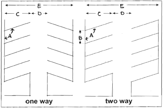
I.
Parking lot design standards:
1.
Purpose: The purpose statement for off-street parking requirements set forth in section 10-6-6 A. shall apply to the standards of this section.
2.
Limitations on parking spaces in front yards and setbacks: The parking limitations set forth in section 10-6-4 shall apply to the design standards of this section.
3.
Design and location of parking lots/vehicular stacking spaces:
a.
Design and maintenance:
i.
All parking lots/vehicular stacking spaces shall be designed, constructed, and drained in accordance with town ordinances and regulations.
ii.
Parking lots/vehicular stacking spaces shall be continually maintained in compliance with the approved site or subdivision plan.
iii.
Each parking lot/vehicular stacking spaces shall meet all applicable landscaping, screening, and buffering requirements in section 10-6-4 of this UDC.
iv.
Parking lots/vehicular stacking spaces designated to meet the minimum parking requirements shall be paved in concrete or asphalt. Recycled concrete, recycled asphalt or equivalent may be considered by the director for non-public storage areas.
v.
Two-way internal circulation drives without parking spaces shall have a minimum drive width of 24 feet. One-way internal circulation drives without parking shall have a minimum drive width of 12 feet.
b.
Vehicular circulation:
i.
All parking areas shall be located and designed so as to avoid undue interference with the use of public streets and alleys. Parking areas shall provide suitable maneuvering room so that all vehicles may enter an abutting street in a forward direction. The backing of a motor vehicle onto a public street from a parking lot shall be prohibited.
ii.
All stacking lanes for day care centers shall be located at least ten feet from the principal building with either an on-site turnaround or separate points for ingress and egress.
iii.
In the Old Town districts, pedestrian pathways shall be separated from auto circulation routes in parking areas.
c.
Buffering and screening:
i.
Outside the Old Town districts, all parking areas shall be separated at least ten feet from buildings, in order to allow room for sidewalks, landscaping, and other plantings between the building and the parking area. This separation may be eliminated in the rear of buildings in areas designed for unloading and loading of materials; this applies primarily to industrial and warehousing buildings.
ii.
Outside of the Old Town districts, a buffer shall be provided between the street and parking areas to screen parking from the street. A minimum 30 feet landscaped setback shall be provided from highway and arterial rights-of-way. A minimum 15 feet landscaped setback shall be provided from any other street rights-of-way. The minimum landscaped setback to parking lots from primary internal drive circulation routes in a multi-building complex shall be ten feet. On streets other than arterials, the setback may be reduced to ten feet if used in combination with a three to four-foot articulated masonry or stone decorative wall with trees and shrubs on both sides of the wall to soften its appearance.
iii.
In the Old Town districts, the visual impact and presence of vehicles shall be minimized by siting parking areas to the rear or interior of the property rather than along street frontage, or by providing underground and structured parking. Parking areas shall be screened from views both interior and exterior to the site.
d.
Location of parking structures: In Old Town districts, maximum frontage of parking structures along any one block shall be 200 feet.
4.
Stacking spaces for drive-through uses:
a.
In addition to meeting the off-street parking requirements of this section, drive-through facilities specified in table 6.6-5 shall comply with the following minimum stacking space standards:
b.
A stacking space shall be calculated to be a minimum of eight and one-half feet wide and 18 feet long.
5.
Parking for persons with disabilities:
a.
Residential uses: Parking for persons with disabilities for residential uses shall be provided at the rate of one space per each dwelling unit that is designed for occupancy by persons with disabilities.
b.
Nonresidential uses: Parking for persons with disabilities shall be provided for uses other than residential, at the rate shown in table 6.6-6. At least one space out of every eight parking spaces for persons with disabilities shall be designed as van accessible. A van accessible parking space is eight feet wide with an adjacent eight-foot access aisle.
J.
Prohibited occupation of parking spaces:
1.
Except for infrequent, special, temporary events not to exceed seven consecutive days, required parking spaces shall be available for the parking of operable passenger vehicles of residents, customers, patrons, and employees only, and shall not be used for the storage of vehicles or materials or for the parking of fleet vehicles used in conducting the business or use, for the purpose of displaying goods, or for the purpose of advertising.
2.
Parking for which a fee or other payment is paid or received shall be a principal use, not an accessory use unless approved as part of a special review use or planned unit development application.
(Ord. 03-2022, § 1(Attch.), 1-11-2022; Ord. No. 016-2024, §§ 9, 10, 5-14-2024)
10-6-7 - Residential use category design standards.
A.
Purpose: The standards of this section are intended to promote high-quality residential development and construction; protect property values; encourage visual variety and architectural compatibility; and promote an integrated character for the town's neighborhoods. Specifically, the standards shall:
1.
Promote new residential developments that are distinctive, have character, and relate and connect to established neighborhoods;
2.
Provide variety and visual interest in the exterior design of residential buildings;
3.
Provide for a variety of lot sizes and housing types for a range of households and age groups;
4.
Enhance the residential streetscape and diminish the prominence of garages and parking areas;
5.
Enhance public safety by preventing garages from obscuring main entrances or blocking views of the street from inside residences; and
6.
Improve the compatibility of attached and multi-family residential development with the residential character of surrounding neighborhoods.
B.
Applicability: This section applies to development of all uses classified as residential.
C.
Alternative equivalent compliance: The alternative equivalent compliance procedure in section 10-6-1 may be used to propose alternative means of complying with the intent of this section. The town council shall determine alternative equivalent compliance for mix of housing types in section 10-6-7 D.1.
D.
General standards for all residential development:
1.
Mix of housing types:
a.
Intent:
i.
To promote a more diverse community through the provision of a variety of housing types.
ii.
To encourage developments that are not dominated by a single type of home or dwelling unit, within a narrow range of price points and densities.
iii.
To encourage "neighborhood-oriented" multi-family developments that incorporate a variety of housing types, such as a combination of duplex, stacked tri-plex/quad-plex, manor homes, live-work units, townhomes, apartments, and single-family dwelling units in a range of sizes.
b.
Diversification standards:
i.
Diversification standards shall not apply to:
(A)
All zone districts that do not allow residential uses.
(B)
Residential zone districts RP1, RP2, RP3, RR, and ER.
(C)
Mixed-use zone districts DT, NMU and CMU.
ii.
Residential development parcels, including parcels part of a phased development, shall provide a minimum mix of housing, based on the size of the development as required in table 6.7-1:
iii.
Housing types that apply to table 6.7-1 include:
(A)
Duplex;
(B)
Stacked tri-plex/quad-plex;
(C)
Manor home;
(D)
Townhouse (single-family attached dwelling unit);
(E)
Apartment (multi-family dwelling unit);
(F)
Live-work units; and
(G)
Single-family detached.
iv.
Housing type variations that apply to table 6.7-1 include:
(A)
Duplex
a.
Front loaded
b.
Alley loaded
(B)
Stacked tri-plex/quad-plex
a.
Three dwelling units per building
b.
Four dwelling units per building
(C)
Manor home
a.
Variation in building length of 30 percent or more
b.
Variation in building footprint of 30 percent or more
(D)
Townhouse (single-family attached dwelling unit)
a.
Front loaded
b.
Alley loaded
(E)
Apartment (multi-family dwelling unit)
a.
Variation in building length of 30 percent or more
b.
Variation in building footprint of 30 percent or more
(F)
Live-work units
a.
Front loaded
b.
Alley loaded
(G)
Single-family detached
a.
Front loaded
b.
Alley loaded
c.
Lot size under 5,000 square feet
d.
Lot size 5,000 to 9,999 square feet
e.
Lot size 10,000 to 39,999 square feet
f.
Lot size 40,000 square feet or more
E.
Additional standards for single-family detached and duplex dwelling units: The development design standards shall apply to all new single-family detached and duplex dwelling units.
F.
Additional standards for attached dwelling units: The development design standards shall apply to all new residential development of three or more attached dwelling units.
(Ord. 03-2022, § 1(Attch.), 1-11-2022; Ord. No. 031-2023, § 1, 11-28-2023; Ord. No. 016-2024, §§ 9, 10, 5-14-2024)
10-6-8 - Commercial and public/institutional use categories, mixed-use design standards.
A.
Standards for the downtown (DT) and neighborhood mixed-use (NMU - Old Town) districts:
1.
Purpose: These standards are intended to provide guidance for all mixed-use, commercial and public/institutional infill and redevelopment within the DT and NMU Old Town districts and to ensure that new development respects the small-town scale and historic context of the area. The standards will assist investors in making design choices that will have a positive impact on both the historic and future character of the DT and NMU Old Town districts. Development in the DT and NMU Old Town districts shall respect the historic character and reinforce the image of the DT and NMU Old Town districts as an attractive, pedestrian-oriented district.
2.
Applicability: These standards shall apply to development in the DT and NMU Old Town districts of any structure categorized as a commercial or public/institutional use.
3.
Site layout:
a.
Parallel to lot lines: New construction shall be built parallel to lot lines to reflect the historical orientation of nonresidential structures. Structures shall not be oriented at an angle to lot lines.
b.
Building to sidewalk edge: In the DT district, a minimum of 80 percent of the primary building facade for new buildings shall be located adjacent to the sidewalk edge, unless the director determines an alternative percentage would be more appropriate.
c.
Orientation of primary facade: The primary facade of a structure shall be oriented to the street, not to an interior court.
4.
Building front width pattern:
a.
In the downtown district, historic commercial building front width pattern or spacing of façade bays shall be reinforced in new structures. Storefront-type development shall, to the maximum extent reasonably feasibly, be differentiated every 25 feet along the block.
b.
In the neighborhood mixed-use district, structures wider than 25 feet shall, to the maximum extent reasonably feasible, be divided into modules that reflect the traditional building widths of the adjacent properties or the standard 25-foot storefront type development.
c.
A single, large, dominant building mass on a building front shall be avoided. Buildings wider than 25 feet along a street shall design the building to appear as an aggregation of the historical design patterning for building widths found in Old Town that also integrate variation in height, texture, color and façade depth. All building facades shall have similar levels of architectural detailing.
5.
Building floor height: The appearance of floors of new buildings shall appear to be similar in height to those of existing historic buildings. The level of the first floor shall be at or near grade-level at the entrance.
6.
Building design:
a.
Historic building styles: New designs shall draw upon the common elements of historic buildings in the community (without copying them). Examples of common elements include similar fenestration, cornice lines, building widths, and other exterior features. This will allow new structures to be seen as products of their own time, yet compatible with their historic neighbors.
b.
Ground-floor pedestrian interest:
i.
The ground floor of a new building or addition to a building shall encourage pedestrian activity by providing the following elements along primary pedestrian ways:
(A)
A traditional storefront with large display windows, awnings, kick plates and transoms, or public art and landscaping; or decorative wall surfaces and trims for all applicable use categories, in table 3-1, other than commercial uses of retail sales and service; food and beverage service; and financial institution.
ii.
Buildings shall avoid blank walls along streets, primary pedestrian ways, and adjacent residential.
iii.
All primary entry doors to the building shall be oriented to the adjacent street. Primary entry doors and entry ways into buildings shall feature at least three of the numbered elements below:
(A)
Awnings;
(B)
Recesses or projections;
(C)
Arcades;
(D)
Outdoor patios;
(E)
Large display windows;
(F)
Decorative moldings that are integrated with other decorative moldings on the building; or
(G)
Accent landscaping beds.
c.
Upper-floor distinction: New buildings shall maintain the distinction between the upper floor and the street level.
i.
The distinction between the street level and upper levels shall be expressed through detailing, changes in materials, and fenestration.
ii.
Upper floors shall be perceived as being more opaque than the lower floor.
d.
Wall articulation:
i.
Structures having single wall planes exceeding 50 feet in length shall incorporate a minimum of three or more of the numbered choices below at least every 50 feet in length:
(A)
Changes in color, graphical patterning, texture or material;
(B)
Projections, recesses, and reveals, expressing structural bays or other aspects of the architecture with a minimum change of plane of 12 inches;
(C)
Windows and fenestration;
(D)
Awnings; or
(E)
Gable projections or other projecting architectural features.
ii.
Buildings shall avoid blank walls along streets, primary pedestrian ways, and adjacent residential.
e.
Roofs: In the DT district, the primary roof form for new buildings shall appear to be flat, as traditionally found on the town's downtown commercial structures. Additions to structures shall have similar roof forms and pitches.
f.
Building materials:
i.
No more than 25 percent of each façade of the building shall be finished with metal material. Metal materials used shall be compatible with the historic character of the DT and NMU Old Town district.
ii.
Façade building materials shall not create excessive glare. Mirrored glass shall not be permitted.
g.
Awnings: Fabric awnings are encouraged.
i.
Awnings shall be canvas with a matte finish. Awnings with high-gloss finishes shall not be used.
ii.
Operable awnings are encouraged.
iii.
Illuminated, plastic awnings are prohibited.
iv.
Awning colors shall be compatible with the overall color scheme of the façade. Solid colors or subtle striped patterns shall be used.
B.
Standards for the neighborhood mixed-use (NMU outside of Old Town), community mixed-use (CMU), community commercial (CC), regional commercial (RC), business (B), and public land and institutions (PLI)
1.
Purpose: This section is intended to promote high-quality building design, foster a more human scale and attractive street front in commercial, mixed-use and public land and institution districts, project a positive image to encourage economic development in the town, and protect property values both of the subject property and surrounding areas.
2.
Applicability: These standards apply to development outside DT and NMU Old Town districts to any use categorized as commercial, public/institutional or mixed-use.
3.
Building orientation:
a.
All principal buildings shall be oriented towards a public street. If any such building is on a double frontage or corner lot, or tract with frontage on a public park or open space, it shall have equally detailed façade, constructed of equally high-quality materials, facing such park or open space.
b.
If the proposed development consists of only one building, such building shall be oriented toward the primary abutting street.
c.
If the proposed development consists of more than one building, all primary and pad site buildings shall be arranged and grouped so that their primary orientation compliments adjacent, existing development and:
i.
Frames and encloses a pedestrian or vehicle access corridor within the development site; or
ii.
Frames and encloses on at least three sides parking areas, public spaces, or other site amenities.
d.
Building functions that do not directly serve the public, such as loading berths, and blank walls, shall not be placed directly along the street. Residential garages that face streets shall be recessed behind the façade of primary buildings.
4.
Building massing and façade:
a.
Building mass: A single, large, dominant building mass shall be avoided. Buildings shall be designed to integrate variations in height, texture, color, and façade depth. All building facades shall have similar levels of architectural detailing.
b.
Wall articulation: Primary structures having single walls exceeding 40 feet in length shall incorporate three or more of the following features at least every 40 feet in length:
i.
Changes in color, graphical patterning, changes in texture, or changes in material;
ii.
Projections, recesses, and reveals, expressing structural bays or other aspects of the architecture with a minimum change of plane of 12 inches;
iii.
Windows and fenestrations;
iv.
Awnings; or
v.
Gable projections or other projecting architectural features.
c.
Entrances: Each primary structure shall have a clearly defined main pedestrian entrance featuring at least three of the following elements:
i.
Canopies or porticos;
ii.
Overhangs;
iii.
Recesses or projections;
iv.
Arcades;
v.
Arches;
vi.
Peaked roof forms;
vii.
Outdoor patios;
viii.
Display windows;
ix.
Architectural tilework or moldings integrated into the building design; or
x.
Integrated planters or wing walls that incorporate landscaped areas or seating areas.
5.
Roofs:
a.
In the mixed-use districts sloping roofs containing top-floor dwelling units or top- floor commercial spaces such as offices are encouraged.
b.
Where flat roofs are used, a parapet wall at least 18 inches in height shall be used on all sides of the structure. The design or height of the parapet shall include at least one change in setback or height of at least three feet along each 60 lineal feet of façade.
c.
On all structures exceeding two stories in height, roofs shall internally drain, and external scuppers and wall drains shall be prohibited.
6.
Ground floor treatment: Buildings shall incorporate a human scale near ground level on commercial buildings and along street facades and entryways through the use of such scale elements as windows, doors, columns, and beams.
7.
Building materials:
a.
No more than 25 percent of each façade of the building shall be finished with metal material.
b.
Façade building materials shall not create excessive glare when viewed from any public street or from any residential area. Mirrored glass with a reflectance greater than 20 percent shall not cover more than ten percent of any exterior façade of a primary or accessory structure.
8.
Colors: Fluorescent colors shall not be used as the predominant color on any wall or roof of any primary or accessory structure. These colors may be used as building accent colors, but shall not constitute more than ten percent of the area of each elevation of a building. Permitted sign areas shall be excluded from this calculation.
C.
Additional standards for neighborhood mixed-use (NMU outside of Old Town) and community mixed-use (CMU) districts:
1.
Purpose: These standards are intended to supplement the standards in subsection 10-6-8 B. and provide guidance for mixed-use development and to promote high-quality building design, foster a more human scale and attractive street front in the mixed-use districts outside of Old Town.
2.
Applicability: These standards apply to development outside the Old Town area for the NMU and CMU zone districts.
3.
Required mix of uses: To ensure a balance of commercial, office, residential, and public/institutional primary use categories found in table 3-1, the requirements of table 6.8-1 shall apply to all development parcels greater than five acres in the community mixed-use (CMU) and neighborhood mixed use (NMU-outside Old Town) districts. Each required principal use shall occupy a minimum of 25 percent of the gross floor area of the entire CMU or NMU district development area.
4.
Design standards:
a.
Maximum front setback for a principal building shall be:
i.
Ten feet in NMU.
ii.
Twenty-five feet in CMU.
b.
A principal building shall occupy a minimum of 35 percent of a front lot line.
c.
The third story front facade of a principal building shall be setback a minimum of six feet from the lower story front facades.
d.
In the NMU district, residential dwelling units shall not occupy ground floors of buildings; however lobbies serving the upper residential floors may be located on the ground floor.
e.
Drive-through or up facilities shall be prohibited in the NMU district.
(Ord. 03-2022, § 1(Attch.), 1-11-2022)
10-6-9 - Aviation, manufacturing and light industrial use categories and design standards.
A.
Purpose: To encourage high-quality design appropriate for aviation, manufacturing and light industrial uses while promoting economic development, protecting adjacent uses and fostering a positive image for the community.
B.
Application: All development or any structure in aviation, manufacturing and light industrial use categories in chapter 3.
C.
Building orientation:
1.
At least one primary entrance for each principal use building shall be oriented towards a public street. If any such building is on a lot or tract with frontage on a public park or open space, or is adjacent to a property zoned or used for residential use, it shall have equally detailed facade, constructed of equally high-quality materials, facing such park or open space.
2.
If the proposed development consists of only one building, such building shall be oriented toward the primary abutting street.
3.
If the proposed development consists of more than one principal use building, all principal use buildings shall be arranged and grouped so that their primary orientation addresses all adjacent streets and complements adjacent, existing development. Internal to the site the building shall:
a.
Frame and enclose pedestrian or vehicle access corridors; or
b.
Frames and encloses on at least three sides parking areas, public spaces, or other site amenities.
4.
Building functions that do not directly serve the public, such as loading berths, and blank walls, shall not be placed directly along the street.
D.
Wall articulation: The standards and requirements set forth in section 10-6-8 B.4.b, shall apply to buildings in the aviation, manufacturing and light industrial use categories.
E.
Entrances: The standards and requirements set forth in section 10-6-8 B.4.c, shall apply to buildings in the aviation, manufacturing and light industrial use categories.
F.
Roofs: The standards and requirements set forth in section 10-6-8 B.5, shall apply to buildings in the aviation, manufacturing and light industrial use categories.
G.
Materials:
1.
No more than 25 percent of the facade(s) of any building facing a public street, trail, park, open space or any residential area shall be finished with metal material.
2.
Facade building materials shall not create excessive glare when viewed from any public street or from any residential area. Mirrored glass with a reflectance greater than 20 percent shall not cover more than ten percent of any exterior facade.
H.
Colors: The standards and requirements set forth in section 10-6-8 B.8, shall apply to buildings in the aviation, manufacturing and light industrial use categories.
I.
Screening: All outdoor activity and storage shall be screened from public view. See requirements in section 10-6-4 G.
(Ord. 03-2022, § 1(Attch.), 1-11-2022)
10-6-10 - Exterior lighting.
A.
Purpose: The general purpose of this section is to require outdoor lighting that is adequate for safety and convenience; in scale with the activity to be illuminated and its surroundings; directed to the surface or activity to be illuminated; and designed to clearly render people and objects and contribute to a pleasant nighttime environment. Additional specific purposes are to:
1.
Provide safety and personal security as well as convenience and utility in areas of public use or traverse, for uses where there is outdoor public activity during hours of darkness;
2.
Control glare and excessive brightness to improve visual performance, allow better visibility with relatively less light, and protect residents from nuisance and discomfort;
3.
Control trespass light onto neighboring properties to protect inhabitants from the consequences of stray light shining in inhabitants' eyes or onto neighboring properties;
4.
Result in cost and energy savings to establishments by carefully directing light at the surface area or activity to be illuminated, using only the amount of light necessary; and
5.
Control light pollution to minimize the negative effects of misdirected light and recapture views to the night sky.
B.
Applicability:
1.
Lighting plan requirement: All nonresidential developments, and all residential developments with more than five lots or dwelling units, shall submit a proposed exterior lighting plan. The plan must be submitted concurrently with the site plan or architectural review application. The exterior lighting plan shall include plans and specifications for streetlights, parking lot lights, and exterior building lights. The specifications shall include details of the pole, fixture height and design, lamp type, wattage, and spacing of lights.
2.
Exempted lighting: The following types of lighting are exempted from the requirements of this section.
a.
Public street and right-of-way lighting.
b.
Temporary decorative seasonal lighting provided that individual lamps have a light output of 60 watts or less.
c.
Temporary lighting for emergency or nighttime work and construction.
d.
Temporary lighting for theatrical, television, and performance areas, or for special public events.
e.
Lighting for a special district, street, or building that, according to an adopted municipal plan or ordinance, is determined to require special lighting aesthetics as part of its physical character.
f.
Lighting required and regulated by the Federal Aviation Administration.
g.
Lighting for outdoor recreational uses such as ball fields, playing fields, tennis courts, and similar uses, provided that such uses comply with the following standards:
i.
Maximum permitted light post height: 80 feet.
ii.
Maximum permitted illumination at the property line: two foot-candles.
iii.
Limits on hours of illumination: Exterior lighting shall be extinguished no later than 11:00 pm.
C.
General review standard: If installed, all exterior lighting shall meet the functional security needs of the proposed land use without adversely affecting adjacent properties or the community. For purposes of this section, properties that comply with the design standards of section 10-6-10 D shall be deemed to not adversely affect adjacent properties or the community.
D.
Design and illumination standards: Exterior lighting is not required except for purposes of public safety. However, if installed, all exterior lighting shall meet the following design standards:
1.
Any light source or lamp shall be concealed or shielded with an IESNA full cut-off style fixture with an angle not exceeding 90 degrees to minimize the potential for glare and unnecessary diffusion on adjacent property. For purposes of this standard, "cutoff angle" is defined as the angle formed by a line drawn from the direction of light rays at the light source and a line perpendicular to the ground from the light source above from which no light is emitted.
2.
All fixtures shall utilize one of the following bulb types: metal halide, induction lamp, compact fluorescent, incandescent (including tungsten-halogen), LED, or high-pressure sodium with a color rendering index above 70. The maximum height of any lighting pole serving a residential use shall be 20 feet. The maximum height serving any other type of use shall be 25 feet, except in parking lots larger than five acres, the maximum height shall be 35 feet if the pole is located at least 100 feet from any residential use.
3.
Maximum lighting level uniformity (maximum to minimum) for residential parking lots shall be 15:1 and for nonresidential 10:1.
4.
Parking lots and other background spaces shall be illuminated as unobtrusively as possible while meeting the functional needs of safe circulation and protection of people and property. Foreground spaces, such as building entrances and outside seating areas, shall utilize local lighting that defines the space without glare. Floodlights shall not be utilized to light all or any portion of a building facade between 10:00 p.m. and 6:00 a.m.
5.
Lighting on gas station and other outdoor canopies shall be fully recessed into the canopy and shall not protrude downward beyond the ceiling of the canopy.
6.
The style of light standards and fixtures shall be generally consistent with the style and character of architecture proposed on the site.
7.
In no case shall exterior lighting add more than one foot-candle to illumination levels at any point off-site.
8.
All outdoor light not necessary for security purposes shall be reduced, activated by motion sensor detectors, or turned off during non-operating hours.
9.
Light fixtures used to illuminate flags, statues, or any other objects mounted on a pole, pedestal, or platform shall use a narrow cone beam of light that will not extend beyond the illuminated object.
10.
For upward-directed architectural, landscape, and decorative lighting, direct light emissions shall not be visible above the building roofline.
11.
No flickering or flashing lights shall be permitted, except for temporary decorative seasonal lighting.
(Ord. 03-2022, § 1(Attch.), 1-11-2022; Ord. No. 016-2024, § 7, 5-14-2024)
10-6-11 - Operational Standards.
A.
Purpose: The purpose of these operational standards is to prevent land or buildings within the town from being used or occupied in any manner so as to create any dangerous, injurious, noxious, or otherwise objectionable conditions that would create adverse impacts on the residents, employees, or visitors on the property itself or on nearby properties.
B.
Standards:
1.
Vibration: No vibration shall be produced that is transmitted through the ground and is discernible without the aid of instruments at or at any point beyond the lot line.
2.
Air pollution: There shall not be discharged into the atmosphere any contaminant for which threshold limit values are listed for working atmosphere by the American Conference of Governmental Industrial Hygienists in such quantity that the concentration of the contaminant at ground level at any point beyond the boundary of the property shall at any time exceed the threshold limit. Visible emissions of any kind at ground level past the lot line of the property on which the source of the emissions is located are prohibited.
3.
Odors: Any condition or operation that results in the creation of odors, vapors, or gaseous emissions of such intensity and character as to be detrimental to the health and welfare of the public or that interferes unreasonably with the comfort of the public shall be removed, stopped, or so modified as to remove the odor.
4.
Electromagnetic radiation: It shall be unlawful to operate, or cause to be operated, any planned or intentional source of electromagnetic radiation for such purposes as communication, experimentation, entertainment, broadcasting, heating, navigation, therapy, vehicle velocity measurement, weather survey, aircraft detection, topographical survey, personal pleasure, or any other use directly or indirectly associated with these purposes that does not comply with the then-current regulations of the Federal Communications Commission regarding such sources of electromagnetic radiation.
5.
Materials and waste handling: No person shall cause or permit any materials to be handled, transported, or stored in a manner that allows particulate matter to become airborne or liquid matter to drain onto or into the ground. All materials or wastes that might cause fumes or dust or that constitute a fire hazard or that may be edible by or otherwise be attractive to wildlife or insects shall be stored outdoors only in closed, impermeable trash containers that are screened in accordance with this UDC. Toxic and hazardous materials and chemicals shall be stored, secured and maintained so that there is no contamination of ground, air, or water sources at or adjacent to the site. Notwithstanding anything contained herein, all treatment, storage, disposal, or transportation of hazardous waste shall be in conformance with all federal and state statutes, codes, and regulations. Provisions shall be provided so that all lubrication and fuel substances shall be prevented from leaking or draining onto the property.
(Ord. 03-2022, § 1(Attch.), 1-11-2022; Ord. No. 016-2024, § 7, 5-14-2024)
10-6-12 - Signs.
A.
Purpose: The intent of this section shall be to define the types of signs that will be permitted in the various zone districts and those that will be prohibited and the manner in which sign areas and dimensions will be measured, and to except certain types of signs from this section. It is further the intent of this section to encourage the erection of signs that are attractive and generally compatible with the adjacent property; that will preserve and enhance property values within the community; that will provide for the public convenience, health and welfare; and that will protect the public safety.
B.
General provisions:
1.
This section does not apply to the following:
a.
Signs of a duly constituted governmental body, required to be maintained by law or governmental order, rule or regulation, including without limitation traffic or similar regulatory devices, address numerals, legal notices, warnings at railroad crossings, and other instructional or regulatory signs concerning public health, safety and welfare provided, that the copy and size of the sign do not exceed the requirements of such law, order, rule or regulation; or
b.
Holiday decorations associated with any national, local, or religious holiday; provided, that such signs shall be displayed for not more than 60 days in any given year.
2.
Unless otherwise provided for in this title, signs may only be erected, altered, and maintained on the same lot as the permitted use(s) which the sign is appurtenant to.
3.
All signs shall be maintained and kept in good repair, including without limitation, the repair of glass, plastic or other sign face material that is missing, broken, damaged, or deteriorated; and the repair of any pole, frame support, or similar structure that is broken, damaged, or deteriorated.
4.
Any sign located or projecting into a private easement shall require authorization of the easement holder.
C.
Prohibited signs: The following signs are prohibited in the Town of Erie unless otherwise allowed in this section:
1.
Signs attached to a tree or utility pole whether on public or private property.
2.
Signs located within a public right-of-way.
3.
Signs located in the vision clearance triangle or at any location where it may obstruct, impair, obscure, interfere with the view of, or be confused with, any traffic control sign, signal or device, or where it may interfere with, mislead or confuse traffic.
4.
Signs mounted on a pitched roof or the deck of flat roof.
5.
Flashing signs, signs emitting sound, rotating or moving signs, animated signs, signs with moving lights or signs that create the illusion of movement, except a sign whereon the current time or temperature is shown by intermittent lighting shall not be deemed to be a flashing sign. A sign that changes copy or color no more than once every four hours shall not be considered a flashing or moving sign.
6.
Signs painted, attached to, or placed on a vehicle or the bed of a trailer, when the vehicle or trailer is parked on a public right-of-way or public property, or on private property so as to be visible from a public right-of-way, for the basic purpose of providing the advertisement of products or directing people to a business or activity on the same or nearby premises. This provision applies only where the primary purpose of a vehicle is for advertising purposes and is not intended to prohibit any form of vehicular signs, such as a sign attached to a truck or motor vehicle, which vehicle is primarily used for business purposes other than advertising.
7.
Riders or attachments to signs.
8.
Ground signs
D.
Permit requirements:
1.
Permit requirements. No sign shall be painted, constructed, erected, remodeled, relocated, expanded or have the copy of the sign changed or altered (unless the sign was approved to allow such modifications) until a sign permit for such sign has been obtained from the town; and a building permit is acquired if required by building code.
2.
Compliance with provisions. No permit shall be issued unless there is full compliance with the provisions of this section, and all signs must conform to the regulations and design standards of the adopted building and electrical codes.
3.
Maintenance and upkeep. The maintenance, renovation, or repair of a sign without structural alteration and without change of sign copy shall not require a new sign permit, but may require a building permit under the Town's adopted building code.
4.
Sign permit fees. A fee for a sign permit and if applicable for a building permit shall be required by municipal Code title 2.
5.
Exceptions from sign permit. The following signs shall be excepted from the requirement of obtaining a sign permit but shall comply with all other regulations imposed by this section:
a.
Small signs not exceeding four square feet in area displayed on private property;
b.
Scoreboards in athletic stadiums.
E.
Size and dimension standards:
1.
Permitted total sign area:
a.
The permitted total sign area for all signs on a property in each zone district shall be as follows:
i.
AG/OS, AGH, RP1, RP2, RP3, RR, ER, SR, LR, OTR, MR, HR Districts, and PD - Agricultural, open space and Residential land uses: The maximum allowable gross area is 32 square feet.
ii.
DT and NMU (inside of Old Town) districts: One square foot for each lineal foot of tenant frontage. The maximum allowable gross surface area for per individual sign shall be 32 square feet per face. Tenants with less than 32 linear feet of tenant frontage are permitted to have a maximum of 32 square feet of sign area. Vacant parcels shall be permitted a total sign area of 32 square feet.
iii.
NMU (outside of Old Town), CMU, PLI, LI, AP, CC, RC, B Districts, and PD - nonresidential land uses: One square foot for each lineal foot of tenant frontage. The maximum allowable gross surface area for a principal sign shall be 100 square feet. Secondary signs shall be limited to 32 square feet per face. Tenants with less than 32 linear feet of tenant frontage are permitted to have a maximum of 32 square feet of sign area. Vacant parcels shall be permitted a total sign area of 32 square feet.
2.
Measurement of gross surface area:
a.
The area of any sign having parts with or without backing shall be measured by determining the total area of all squares, rectangles, triangles, portions of a circle or any combination thereof constituting the smallest single continuous perimeter enclosing the extreme limits of any of the following combinations:
i.
The display surface or face of the sign including all frames, backing, faceplates, nonstructural trim or other component parts not otherwise used for support for parts of the sign; or
ii.
Each word, written representation (including any series of letters), emblems or figures of a similar character, and including all frames, faceplates, nonstructural trim or other component parts not otherwise used for support for parts of the sign.
iii.
All window signs shall be included in the total allowable sign area for the premises.
iv.
Any end panel of a wall or projecting sign shall be counted as a face of the sign and shall be included in the area of that sign if said end panel is more than one foot in width.
3.
Each building frontage that abuts a street, highway, private drive, or alley shall be considered a separate building frontage.
a.
Sign height. Sign height shall be measured from average ground level at the base of or below the sign to the highest element of the sign. The maximum height of a sign in each zone district shall be as follows:
i.
AG/OS, AGH, RP-1, RP-2, RP-3 PD - Agriculture, open space and residential land uses, RR, ER, SR, LR, OTR, MR, HR: six feet.
ii.
DT and NMU Old Town districts: Monument signs shall not exceed six feet in height.
iii.
NMU (outside of Old Town), CMU, PLI, RC, CC, B, LI, PD - nonresidential land uses and AP districts: Monument signs shall not exceed ten feet in height, except that monument signs adjacent to Erie Parkway shall have a maximum height of six feet.
F.
Number of signs permitted:
1.
The number of signs permitted per property in each zone district shall be as follows:
a.
AG/OS, AGH, RP-1, RP-2, RP-3, PD - agricultural, open space and residential land uses, RR, ER, SR, LR, OTR, MR, HR: two signs per street frontage.
b.
DT and NMU (inside of Old Town): three signs per tenant for each tenant building frontage, or two signs per street frontage for vacant parcels.
c.
NMU (outside of Old Town), CMU, CC, RC, B, LI, PLI, PD - nonresidential land uses and AP districts: five signs per tenant with a maximum of one principle sign and four secondary signs for each tenant building frontage, or two signs per street frontage for vacant parcels.
G.
Requirements for specific types of signs:
1.
Illuminated signs. Illuminated signs shall be internally illuminated or externally illuminated by a cutoff fixture. Illuminated signs shall not cast bright light upon property in any residential district or upon any public street, park, public facility, or hospital facility.
2.
Temporary signs. Temporary signs in any zone district shall be displayed only in accordance with the following conditions:
a.
Temporary signs shall not exceed 32 square feet in total surface area per use, and shall comply with the applicable height and setback regulations for the district in which they are located.
b.
Temporary signs shall not remain in place for more than 30 days; except, that the building official may, for good cause, extend the time up to 30 days upon written application. Only one temporary sign per applicant shall be permitted to exceed the 30-day limit in any calendar year.
3.
Projecting signs. A projecting sign or wall sign may project over public property a maximum of two feet beyond the property line when a minimum clearance of at least eight feet is provided between the sign and the ground. Projecting signs shall not exceed the height of the wall or façade to which the sign is attached.
4.
Monument signs. Monument signs shall be constructed from similar materials as the principal building. No more than one monument sign may be permitted on a lot.
5.
Wall signs. Wall signs shall not exceed the height of the wall or facade to which the sign is attached.
H.
Special provisions for signs at specific locations:
1.
Signs at residential subdivision entry. At each primary entrance to a residential subdivision, a maximum of two freestanding signs are permitted each with a maximum height of six feet and a maximum gross surface area 100 square feet. These signs shall be in addition to the signs permitted on the property under section 10-6-12 G.
2.
Signs on development sites. Signs located on sites where subdivision, development, redevelopment, initial construction or other major improvement of the property is under way shall be permitted additional signage to what is allowed in that zone district under section 10-6-12 G. of this Code, and shall comply with the following:
a.
Such signs shall be monument, ground, wall, or window signs, shall not exceed 64 square feet in total area with a maximum of 32 square feet per face, and maximum of eight feet in height. Signs shall be removed within 30 days from the time that 95 percent of the lots or dwelling units in the platted subdivision, or filing thereof, have been sold, or the construction project is completed, whichever occurs earlier.
b.
One such sign shall be permitted per street upon which the property either has frontage or has an entrance from a major thoroughfare; provided, that the minimum distance between signs on any single development shall be 1,000 feet.
3.
Monument signs on Erie Parkway. Monument signs located along Erie Parkway shall not be located in an easement or a landscaped tract.
I.
Legal nonconforming signs:
1.
Termination. A legal nonconforming sign shall immediately lose its legal nonconforming status, and therefore shall be brought into conformance with this chapter or removed, when any of the following occur:
a.
The size or shape of the sign is changed;
b.
The sign structure is altered, other than by repairs or maintenance;
c.
The primary structure on the property to which the sign is located is the subject of an application for a building permit for reconstruction, remodeling, expansion, or other improvements to the primary structure on such property, and the value of the proposed improvements total more than 25 percent of its replacement cost of such primary structure.
2.
Maintenance. Legal nonconforming signs shall continue to be maintained in safe condition pursuant to the building regulations of the town.
3.
Replacement. A legal nonconforming sign shall not be replaced unless the replacement sign is in full compliance with the provisions of this chapter.
4.
Reconstruction. If a sign or its support structure is damaged to the extent that the repair costs exceed 50 percent of the replacement cost of the sign, the sign shall be removed or brought into compliance with this chapter.
(Ord. 03-2022, § 1(Attch.), 1-11-2022)
10-6-13 - Abandoned mines.
A.
General provisions: All development with undermining or mine shafts shall provide the town with geological and geotechnical hazards reports prepared, signed and stamped by a professional in the field of undermining. The reports shall be referred to the Colorado Geological Survey for review and comment. Recommendations from the reports and Colorado Geological Survey shall be evaluated by the town when considering appropriate land uses, restrictions applicable to land development, and foundation design due to undermining constraints. Undermining and mine shafts shall be noted on sketch plans, preliminary plats, final plats and site plans.
B.
Mineshafts:
1.
All mineshafts shall be capped and monumented in accordance with state requirements, and accepted by the state before final plat or site plan approvals.
2.
Mineshafts shall not be located on a residential lot.
3.
Mineshafts may be located in a street right-of-way, tract, or in a nonresidential lot with an easement restricted for parking, open space or landscape use. Any modifications to this provision proposed by the applicant for town consideration shall be in compliance with recommendations from the geological and geotechnical hazards reports and the Colorado Geological Survey.
4.
Minimum dimensions for tracts/easements and minimum distances from abandoned mineshafts to residential lots and nonresidential structures shall be determined based on recommendations from the geological and geotechnical hazards reports and the Colorado Geological Survey.
C.
Mine tailings: If mine tailings are located on a property, the removal of mine tailings shall be addressed in a development agreement. The town shall require submittal of a professional certification that the mine tailings and hazard associated with the tailing has been removed and completed.
(Ord. 03-2022, § 1(Attch.), 1-11-2022)
10-6-14 - Development and design standards related to oil and gas facilities and locations.
A.
Definitions: For purposes of this section, the following terms shall have the following meanings; provided that where any term is not defined herein, it shall be as defined by the rules of the Colorado Oil and Gas Conservation Commission (the "COGCC"):
1.
Completion: As defined in section 10-12-1 of this Code.
2.
Oil and gas facility: Equipment or improvements used or installed at an oil and gas location for the exploration, production, withdrawal, treatment, or processing of crude oil, condensate, exploration and production waste, or gas.
3.
Oil and gas location: A definable area where an operator has disturbed or intends to disturb the land's surface in order to locate an oil and gas facility.
4.
Plugged and abandoned well: An oil and gas well that has been cemented and the associated production facilities have been removed in accordance with COGCC regulations.
5.
Flowline: A segment of pipe transferring oil, gas, or condensate between a wellhead and processing equipment to the load point or point of delivery to a U.S. Department of Transportation Pipeline and Hazardous Materials Safety Administration or Colorado Public Utilities Commission regulated gathering line or a segment of pipe transferring produced water between a wellhead and the point of disposal, discharge, or loading. This definition of flowline does not include a gathering line.
6.
Gathering line: A gathering pipeline or system as defined by the Colorado Public Utilities Commission, Regulation No. 4, 4 C.C.R. 723-4901, Part 4, or a pipeline regulated by the U.S. Department of Transportation Pipeline and Hazardous Materials Safety Administration ("PHMSA") pursuant to 49 C.F.R. §§ 195.2 or 192.8, 49 C.F.R. §§ 195.2 or 192.8, in existence as of the date of this regulation and does not include later amendments.
7.
Crude oil transfer line: A piping system that is not regulated or subject to regulation by the PHMSA pursuant to 49 C.F.R. § 195 Subpart A, and that transfers crude oil, crude oil emulsion or condensate from more than one well site or production facility to a production facility with permanent storage capacity greater than 25,000 barrels of crude oil or condensate, or a PHMSA gathering system.
8.
Working pad surface: The portion of an oil and gas location that has an improved surface upon which oil and gas operations take place.
B.
Applicability. This section shall apply to every subdivision for which a complete preliminary plat application is filed after the effective date of the ordinance codified in this section. This section shall not apply to: any final plat submitted for approval in compliance with a previously-approved preliminary plat; any subdivision for which a preliminary plat application was deemed complete prior to the effective date of the ordinance codified in this section; or any previously-approved planned development in which the development plan includes its own development standards for oil and gas facilities.
C.
Reciprocal setbacks.
1.
Oil and gas locations.
a.
Where a Form 2 or Form 2A has been submitted to the COGCC for an oil and gas location, but the oil and gas well has not reached completion, no external boundary of a new residential lot, structure that requires a certificate of occupancy, park, sports field, or playground shall be located less than 2,000 feet from the oil and gas working pad surface.
b.
No new residential lot, structure that requires a certificate of occupancy, park, sports field, or playground shall be located less than 500 feet from an existing oil and gas working pad surface.
c.
No street, sidewalk or trail shall be located less than 150 feet from an existing oil and gas working pad surface.
d.
Any structure that is not required to obtain a certificate of occupancy shall be located at least 25 feet from an existing oil and gas working pad surface.
2.
Flowlines, crude oil transfer lines, and gathering lines.
a.
No building that is required to obtain a certificate of occupancy shall be located less than 50 feet from an existing flowline or gathering line, whether known or discovered during construction. Measurements shall be taken from the centerline of the flowline or gathering line to the nearest outside wall of the building.
b.
Any structure that is not required to obtain a certificate of occupancy shall be located at least 25 feet from an existing flowline, crude oil transfer line, or gathering line.
3.
Plugged and abandoned wells.
a.
No new residential lot of less than one acre in size, structure that requires a certificate of occupancy, park, sports field, or playground shall be located less than 150 feet from a plugged and abandoned well.
b.
No building that is required to obtain a certificate of occupancy shall be located less than 150 feet from a plugged and abandoned well.
c.
Any structure that is not required to obtain a certificate of occupancy shall be located at least 25 feet from a plugged and abandoned well.
d.
No overhead or above-ground utility facilities, public or private, shall be installed within 50 feet of a plugged and abandoned well. No underground utility facilities, public or private, shall be located within 25 feet of a plugged and abandoned well except upon approval of the town engineer, if the town engineer finds such location to be safe.
e.
No new public right-of-way shall be located within 25 feet of a plugged or abandoned well.
f.
The reciprocal setbacks required in subsections a. and b. hereof may be reduced, on a case by case basis, if the town finds, based on information submitted by the applicant at the applicant's sole cost in a plugging and abandonment summary report, which shall include, to the extent available, the following information:
i.
The plugged and abandoned well has been located to a certainty not less than five feet horizontally;
ii.
A third party, approved by the town, has confirmed that there is no hydrocarbon contamination within the subject oil and gas location in which the plugged and abandoned well is located, or that such hydrocarbon contamination has been remediated to background levels, and
iii.
A report reviewing the records on file with the COGCC and certifying in writing that the well has been plugged in accordance with the COGCC Rules current at the time of the certification, or the well is re-plugged in accordance with the COGCC rules current at the time of the application;
iv.
Provided that, in no case shall a reduction in a reciprocal setback from a plugged and abandoned well result in less than a reciprocal setback in the form of a rectangle measuring 50 feet by 100 feet, with the plugged and abandoned well located at the center.
D.
Abandoned flowlines, crude oil transfer lines, and gathering lines. Every plat application shall include a plan for removal of all abandoned flowlines, crude oil transfer lines, and gathering lines known and discovered during construction. The plan shall include provisions for the removal and disposal of all fluids contained in such lines, and the remediation of all hydrocarbons or a showing that there is no hydrocarbon contamination.
E.
Required plat information.
1.
Each plat shall include a vicinity plat that shows the locations, API numbers where applicable, names, and general descriptions of all existing oil and gas facilities, oil and gas locations, plugged and abandoned wells, flowlines, gathering lines, and crude oil transfer lines (whether or not in service), and access roads and associated easements, which are on or within two thousand feet of the property.
2.
Each plat shall include the recording information for all surface use agreements.
3.
Where any lots will be located within two thousand feet of an oil and gas facility, an oil and gas location, or a plugged and abandoned well, the plat shall include a plat note stating that each seller of a lot shall disclose to the purchaser, in writing, not less than thirty days before closing, that an oil and gas facility, an oil and gas location, or a plugged and abandoned well is located within two thousand feet of the lot.
4.
Each plat shall dedicate easements for flowlines, gathering lines, or crude oil transfer lines that are a minimum of thirty feet wide, with at least fifteen feet on either side of the centerline of the flowlines, crude oil transfer lines, or gathering lines.
5.
Each final plat shall dedicate an access easement to the owner of each plugged and abandoned well, oil and gas location and oil and gas facility on the property, and to the town, from the outside perimeter of the property to the perimeter of each plugged and abandoned well, oil and gas location and oil and gas facility on the property. Such easement shall be a minimum of thirty feet in width and shall allow for the passage of equipment to maintain and repair oil and gas operations.
F.
Disclosure. Every seller of a lot that is located within two thousand feet of an oil and gas facility, an oil and gas location, or a plugged and abandoned well shall disclose to the purchaser, in writing, no less than thirty days before closing, the locations of all oil and gas facilities, oil and gas locations and plugged and abandoned wells located on or within two thousandfeet of the lot.
G.
Design requirements. To minimize the impact on streets and trails and tracking of debris onto streets and trails, subdivisions shall comply with the following:
1.
Subdivisions shall minimize the need for access roads to oil and gas locations that connect to streets with local street classifications.
2.
An access plan for each oil and gas location shall be submitted to the town identifying which local streets are impacted by access needs. The streets identified shall be designed to address the weight load requirements of the vehicles accessing the oil and gas facilities and oil and gas locations.
3.
When legally authorized, the access road to each oil and gas location from the point of connection to a street shall be improved, for a minimum distance of two hundred feet, as a hard surface (concrete or asphalt) for the first one hundred feet from the street, and then as a crushed surface (concrete or asphalt) for one hundred feet past the hard surface, in sufficient depth to support the weight load requirements of the vehicles accessing the oil and gas location. The town may require a gate or other restrictions on the access road (bollards or similar) to minimize unauthorized use of the access road. If an access road intersects with a trail, the access road shall be paved as a hard surface (concrete or asphalt), for one hundred feet on either side of the intersection with the trail, and if necessary, the trail shall be replaced to address the weight load requirements of the vehicles accessing the oil and gas location.
4.
Existing oil and gas facilities shall be fenced in conformance with the following:
a.
The fencing shall be wrought iron fencing, Ameristar Impasse, Stronghold fencing or equivalent fencing approved by the town.
b.
The fencing color shall be bronze unless the town approves black fencing, which shall only be approved if fencing or site furnishings in the adjacent developments are consistent with the black color.
5.
Properties with existing oil and gas facilities shall provide screening by installing berms with landscaping.
6.
Streets shall be platted so that flowlines or gathering lines cross at substantially a right angle to the street.
H.
Existing plugged and abandoned wells.
1.
With each final plat application, for all previously plugged and abandoned wells on or within five hundred feet of the property being platted. The applicant shall provide a written report, based on the most current information available from the COGCC, stating that the plugging, abandonment, and reclamation was performed in accordance with the COGCC rules in effect at the time of the plugging and abandoning, and that a site inspection of the property was performed within the most recent 6 months.
2.
If the report shows that insufficient documents exist to demonstrate that the plugged and abandoned well was adequately plugged and abandoned, the applicant shall schedule a meeting with the owner of the plugged and abandoned well, the town and the COGCC to determine how to remedy the deficiency. The town may deny or further condition the final plat if the deficiency is not satisfactorily remedied.
3.
Capped plugged and abandoned wells shall be identified by a concrete and brass monument on the surface of the ground.
(Ord. 41-2021, § 1, 12-14-2021; Ord. 03-2022, § 1(Attch.), 1-11-2022; Ord. 13-2022, § 1, 6-14-2022)
10-6-15 - Reserved.
Editor's note— Ord. No. 023-2025, § 1, adopted Aug. 12, 2025, repealed § 10-6-15, which pertained to alternative standards for affordable housing and derived from Ord. No. 017-2023, § 1, adopted July 25, 2023.