
Mandeville City Zoning Code
DIVISION II
BUILDING AND ZONING REGULATIONS
ARTICLE 10. - SIGN CODE[2]
Editor's note—Ord. No. 23-19, Exh. A, § 3, adopted June 8, 2023, repealed the former Art. 10, §§ 10.1—10.11, and enacted a new Art. 10 as set out herein. The former Art. 10 pertained to similar subject matter and derived from Ord. No. 15-11, §§ 1, 2, adopted June 25, 2015
4.1. - GENERAL BUILDING AND ZONING PROVISIONS.
4.1.1. Zoning Affects Every Structure and Use.
No structure or land shall hereafter be used and no structure or part thereof shall be erected, reconstructed, converted, moved, or structurally altered unless in conformity with the regulations as set forth in this Ordinance, except in the case of legally non-conforming building sites as provided in this Article.
No portion of the required area of a lot shall be used or considered as part of the required area for any other lot. No lot shall be reduced in area, width, or depth to less than the minimum requirements of this Ordinance.
No part of a yard, parking space, or other open space required for any building or use for the purpose of complying with the provisions of this Ordinance shall be included as part of a yard, parking space or open space required for another building under the provisions of this Ordinance.
4.1.4. Change in Zoning District Boundary.
Whenever the boundaries of a district shall be changed to transfer an area from one district to another district of a different classification, the following provisions for non-conforming lots, buildings, uses and signs shall also apply to any new non-conforming situations existing after the district modification.
4.2. - NON-CONFORMING PROVISIONS.
4.2.1. General Non-Conforming Provisions.
4.2.1.1.Purpose of Non-Conforming Provisions.
The purposes of these provisions are:
1.
To assure reasonable opportunity for use of legally created lots that do not meet current minimum requirements for the district in which they are located, subject to the provisions for contiguous substandard lots in single ownership.
2.
To assure reasonable opportunity for use, maintenance and improvement of legally constructed buildings, structures and site development features that do not comply with current minimum requirements for the district in which they are located.
3.
To assure reasonable opportunity for continuation of legally established uses that do not conform to current use regulations for the district in which they are located.
4.
To limit continuation and expansion and encourage eventual replacement of nonconforming uses having potentially undesirable impacts on surrounding conforming uses.
4.2.1.2. Restrictions Additive.
The regulations applicable to a non-conforming use are in addition to regulations applicable to a non-complying structure and, in the event of any conflict, the most restrictive provision shall apply.
4.2.1.3.Construction Establishes Use.
To avoid undue hardship, nothing in this Ordinance shall be deemed to require a change in the plans, construction or designated use of any building on which actual construction was lawfully begun prior to the effective date of adoption or amendment to this Ordinance and upon which actual building construction has been diligently carried on. Actual construction is hereby defined to include the placing of construction materials in permanent position and fastened in a permanent manner, and demolition, elimination, and removal of an existing structure in connection with such construction; provided, that actual construction shall be diligently carried on until such building is completed.
4.2.1.4.Types of Non-Conforming Situations.
For purposes of these regulations non-conforming situations shall be grouped into four categories:
1.
Legally Non-Conforming Uses;
2.
Legally Non-Conforming Sites;
3.
Legally Non-Conforming Structures;
4.
Legally Non-Conforming Lots.
4.2.2. Provisions for Legally Non-Conforming Uses.
4.2.2.1.Intent and Purpose.
1.
Intent. It is the intent of this Ordinance to permit legally non-conforming uses to continue, but not to encourage their survival. Such uses are declared by this Ordinance to be incompatible with permitted uses in the districts involved.
2.
Purpose. The purpose of this section 4.2 et seq. is to establish regulations and limitations on the continued existence of uses established prior to the effective date of this section which do not conform to the provisions of Article 7 Table of Permitted Uses. Many such non-conformities may continue, but the provisions of this section are designated to curtail substantial investment in such non-conformities and to bring about their eventual elimination, where appropriate, in order to preserve the integrity of the zoning districts and the regulations established by this Ordinance.
4.2.2.2.Continuation and Termination of Legally Non-Conforming Uses.
1.
Continuation - An existing non-conforming use may be continued, and structures associated with the use may be maintained, provided no non-conforming use shall be enlarged or expanded in terms of floor space utilized or site area occupied nor may any legally non-conforming use be changed to another non-conforming use of a different specific use classification as defined under the provisions of Article 6. Enlargement or expansion shall include:
a.
Extension of such use to any structure or land area other than that occupied by such non-conforming use on the effective date of this Ordinance, or any amendment hereto which causes such use to become non-conforming; or
b.
Extension of such use within a building or other structure to any portion of the floor area that was not occupied by such non-conforming use on the effective date of this Ordinance, or any amendment hereto which causes such use to become non-conforming.
c.
Attachments of signs to the building, placement of signs, or display material or goods or equipment on land outside of the building or the attachment of racks, balconies, or other projections from the building.
2.
Reestablishment. An existing non-conforming use may not be reestablished after the non-conforming use of the building or land has ceased for a continuous period of six (6) calendar months. If the lessee of any building or place used or occupied for non-conforming purposes under a bona fide lease shall at any time before the expiration of said lease cease to occupy or use said building or land, it shall not be considered vacant until the owner of said building or place shall again obtain legal control of its occupancy and use. This extension of the vacancy provision shall not apply if the lessor for any reason is legally entitled to regain possession and does not by legal or other effective means take prompt action to do so. Once changed to a conforming use, no building or use shall be permitted to revert to a non-conforming use. If a non-conforming use is changed to a conforming use, the non-conforming use shall not be resumed. However, the Zoning Commission may grant a one-time six (6) month extension to this period provided that the extension application is filed not later than six (6) weeks prior to the end of the initial six month period. Extension applications shall constitute a variance and be filed in accordance with the procedures for filing a variance as included herein.
3.
Damage or Destruction. Except as otherwise provided under the Provision of the Flood Damage Prevention Regulations of this Code, in the event that any structure that is devoted in whole or in part to a non-conforming use is damaged or destroyed, by any means, to the extent of more than seventy-five (75%) percent of the fair market value of such structure then, except in otherwise provided herein, that structure shall not be restored unless such structure and the use thereof shall thereafter conform to all regulations of the zoning district in which such structure and use are located. When such damage or destruction is seventy-five (75%) percent or less of the fair market value of the structure as it existed immediately prior to such damage, such structure may be repaired and reconstructed and used for the same purposes as it was before the damage or destruction, provided that such repair or reconstruction is commenced and completed within twelve (12) months of the date of such damage or destruction.
4.
Basis for Value. For purposes of these regulations the Building Inspector will accept the assessed value of the improvements as the fair market value or the value as determined by the Zoning Commission on appeal of the Building Inspector's determination. In the event that the damaged structure that is devoted to a non-conforming use is more than fifty (50) years old, that structure can be restored at the owner's option, regardless of the extent of the damage sustained, without the loss of the nonconforming use status. Such restoration must reasonably resemble the original structure and must be commenced within twelve (12) months of the date of such damage or destruction.
5.
Relocation. No structure that is devoted in whole or in part to a non-conforming use shall be relocated in whole or in part to any other location on the same or any other lot, unless the entire structure and the use thereof shall hereafter conform to all the regulations of the zoning district in which such structure and use are located after being so relocated. No non-conforming use of land shall be relocated in whole or in part to any other location on the same or any other lot, unless such use shall thereafter conform to all the regulations of the zoning district in which such use of land is located after being so relocated.
6.
Change in Use. A non-conforming use of land or of a structure shall not be changed to any use other than a use permitted in the zoning district in which such land or structure is located. When such non-conforming use has been changed to a permitted use, it shall only be used thereafter for a use permitted in the zoning district in which it is located. For purposes of this section, a use shall be deemed to have been so changed when an existing non-conforming use shall have been terminated and the permitted use shall have commenced and continued for a period of seven (7) days.
7.
Non-Conforming Signs. Provisions regarding the continuation and termination of legally non-conforming signs are included under Article 10 of these regulations.
4.2.2.3.Criteria for the Repair of Legally Non-Conforming Uses.
1.
Ordinary Repair Maintenance. Normal maintenance and incidental repair or replacement, and installation or relocation of non-bearing walls, non-bearing partitions, fixtures, wiring or plumbing, may be performed on any structure that is devoted in whole or in part to a non-conforming use; provided, that this section shall not be deemed to authorize any violation of this section 4.2 et seq.
2.
Exception for Repairs by Public Order. Nothing in this Ordinance shall be deemed to prevent the strengthening or restoring to a safe condition of any building or part thereof declared to be unsafe by any city official charged with protecting the public safety, upon order of such official. Repairs and alterations that restore a building to the same condition that existed prior to damage or deterioration, altering the building only in conformity with the provisions of this Ordinance in such a manner that does not extend or increase an existing nonconformity may be made with the same kind of materials as those of which the building is constructed.
4.2.3. Provisions for Legally Non-Conforming Development Sites.
1.
Background. This Code has modified previous zoning requirements and established specific site development standards. Consequently, many development sites do not meet current requirements for such items as parking lot standards, landscaping, and other open space specifications.
2.
Purpose. The intent of this section is to insure that such non-conforming development sites are brought into conformance with the site development standards prescribed by this Ordinance.
3.
Authority to Continue. Any lawfully existing non-conforming development site may be continued so long as it remains otherwise lawful subject to the provisions of this section.
4.
Non-Conforming Shopping Centers. Non-conforming shopping centers shall have nine (9) years from the effective date of this Ordinance either to bring the site into conformance with the provisions of the Ordinance or have a non-conforming development site variance approved for the site. All owners of record of commercially zoned properties shall be notified by the Building Inspector by first class mail of this provision prior to the end of the nine (9) year period.
5.
Annexation of Non-Conforming Development Sites. As a condition of annexation approval, the City Council shall required the owner of the subject property to provide a plan for bringing the annexed development site into conformance with the provisions of these regulations. The plan shall provide a schedule that outlines a timetable for bringing the non-conforming site into maximum conformance to the provisions of this Ordinance within five (5) years of the date of annexation approval.
6.
Extension. A conforming use located on a non-conforming development site shall not be expanded until the site is brought into conformance with the provisions of this Ordinance. However, single-family residential structures that are located on a legally non-conforming site with respect to required yard areas or height may be structurally altered or enlarged providing the portion of the building that is altered or enlarged conforms with the provisions of this Ordinance.
7.
Relocations. No structure shall be relocated to a non-conforming development site until the site is brought into conformance with the provisions of this Ordinance.
8.
Change in Use. No existing structure located on a non-conforming development site shall be changed from one use classification to another use classification as listed in Article 6, until the site is brought into conformance with the provisions of this Ordinance or a non-conforming development site variance has been approved by the Zoning Commission.
9.
Abandonment or Discontinuance. When the use of a non-conforming development site has been abandoned for a period of six (6) months, regardless of any reservation of intent not to abandon use of the site, such site shall not thereafter be used, developed or improved until it is brought into conformance with the provisions of this Ordinance. However, the Zoning Commission may grant a one-time six (6) month extension period for the purpose of bringing the site into conformance with the provisions of these regulations. Extension applications shall be filed in accordance with the procedures for site plan review for Special Use Permits included herein. For purposes of this Ordinance, rental payments or lease payments and taxes shall not be considered as a continued use and the disconnection of utilities shall constitute a means of establishing the commencement of the abandonment of the use of the development site.
10.
Inability to Meet Current Site Development Standards. Practical difficulties may exist which prevent the upgrading of certain non-conforming development sites to the standards imposed by this Ordinance. Consequently, a variance procedure has been established in this Article 4 both to allow a viable economic use of an existing structure and ensure that the non-conforming development sites are brought into compliance with the requirements of these regulations to the maximum extent deemed feasible by the Zoning Commission.
11.
Exception for Repairs Pursuant to Public Order. Nothing in this section shall be deemed to prevent the strengthening or restoration to a safe condition of a building or structure in accordance with an order of a public official who is charged with protecting the public safety and who declares such structure to be unsafe and orders it to restoration to a safe condition, provided such restoration is not otherwise in violation of the various provisions of this section prohibiting the repair or restoration of partially damaged or destroyed buildings or structures.
4.2.4. Provisions for Non-Conforming Structures/Buildings.
4.2.4.1.Continuation of Use of Non-Conforming Structures.
The use of a non-conforming structure may be continued and the structure may be enlarged, maintained, repaired or altered in accordance with the requirements of this Ordinance. Except as provided herein, no such enlargement, maintenance, repair or alteration shall either create an additional non-compliance or increase the degree of existing non-compliance of all or part of such structure. No building or structure shall be deemed to be non-conforming solely as a result of a change in the use, zoning or development of adjacent property.
4.2.4.2.Repair of Non-Conforming Structures.
1.
Percent of Repair Allowable under Normal Conditions. If, within any period of twelve (12) months, alterations or repairs are proposed to be made to a nonconforming building, and the aggregate cost of such alterations or repairs is in excess of fifty (50) percent of the Fair Market Value of the building at the time the alteration or repair is proposed, the building shall be made to conform to the requirements of this code for new buildings in the district in which it is located. Buildings that are located in fire districts shall conform to the provisions of International Building Code (IBC) and the International Residential Code (IRC).
2.
Percent of Repair Allowable under Emergency Conditions.
a.
If an existing non-conforming building is damaged by fire or other act of God and the building is thereafter proposed to be restored, altered or remodeled at cost in excess of fifty (50) percent of the Fair Market Value of the building before the damage was incurred, the building shall conform to the requirements for new buildings in the district in which it is located.
b.
If the cost of such alterations or repairs, or the amount of such damage is more than twenty-five (25) but not more than fifty (50) percent of the Fair Market Value of the building prior to damage of the building, nothing herein shall prevent the restoration of the building within a six (6) month period from the date the damage was sustained, and the portions of the building to be altered or repaired shall be made to conform to the requirements of these regulations for the district in which the building is located to the greatest extent possible.
c.
The preceding provisions of this section notwithstanding, in the event an existing non-conforming structure fifty (50) years old or older is damaged by fire or other act of God, it can be restored regardless of the extent of the damage sustained, at the owner's option, if it is restored to reasonably resemble the original structure. Restoration must be commenced within twelve (12) months of the date of such damage or destruction and so long as such restoration does not conflict with the Flood Damage Prevention Regulations of this code.
4.2.4.3.Loss of Non-Conforming Status with Change in Use.
If the use of an existing non-conforming building is partially or entirely changed to a use of a different classification as established in Article 6, the building shall be made to conform to the requirements of the district in which it is located. Any change in use that requires an increase in parking will terminate the legally non-conforming status of the property and require conformity with the requirements of the district in which it is located.
4.2.4.4.Criteria for the Repair of Non-Complying Structures.
The Building Inspector may order an unsafe, non-conforming structure to be restored to a safe condition. Any such order is subject to the requirements of the preceding provisions regarding the repair or restoration of partially damaged or destroyed non-conforming structures.
4.2.4.5.Provisions for Legally Non-Conforming Lots-of-Record.
1.
If lot dimensions do not meet minimum standards and the lot has been in separate ownership from adjacent property continuously since passage of this CLURO, such lot may be used as a building site for a permitted use in conformance with the requirements of district in which the site is located.
2.
When a substandard lot is used together with one or more contiguous lots for a single use or unified development, including lots used for off-street parking, all lots shall be considered a single lot for the purposes of these Land Use Regulations.
3.
If two (2) or more contiguous lots-of-record or parts thereof are in single ownership and all or part of the lots do not meet the requirements for lot width, area, or buildable area lying outside of areas of periodic inundation (defined in Article 3) as established herein, the lands involved shall be considered an undivided parcel for the purposes of this CLURO. No portion of said parcel shall be used or sold which does not meet the minimum lot width, depth and area requirements established herein, except as follows:
a.
The lot area of each lot meets the minimum area and buildable area requirements of the zoning district in which it is located; and
b.
The lot width is no less than 85% of the minimum lot width required in the zoning district in which it is located.
4.
When one or more lots abut one or more lots that do not meet minimum requirements, the lots may be reconfigured to increase the conformity of the substandard lots, provided that the remaining parcel or parcels conform to minimum standards.
4.3. - LEGISLATIVE AND ADMINISTRATIVE PROCEDURES.
4.3.1. Procedure and Fees for Zoning Amendments and Amendments to the Land Use Regulations.
4.3.1.1.Methods of Initiation of Amendment.
The City Council may, from time to time, amend, supplement, or change the regulations and restrictions of these regulations or district boundaries of the Official Zoning Map as adopted herein or subsequently established. Such amendments may be initiated according to the then current rules of procedure of the Planning or Zoning Commission and in the following manner:
1.
By action of the City Council by introduction of an ordinance.
2.
On petition by property owners, by filing with the secretary of the Planning and Zoning Commission a petition in writing which conforms with the standards and requirements of the Planning and Zoning Commission, provided that such petition is duly signed and acknowledged by the owners or authorized agents of not less than fifty (50) per cent of the area of land in which a change of classification is requested; or within a radius of five hundred (500) feet of such area of land.
3.
By initiative, subject to the procedures and limitations of the City Charter, and further provided that amendments initiated through the initiative shall not involve or seek the reclassification of property to a different zoning district or seek to alter or relocate the boundaries of an established zoning district.
4.
Upon resolution of the Zoning Commission duly adopted by the affirmative vote of not less than two-thirds (⅔) of its members at a duly called and convened meeting of its membership.
5.
Upon resolution of the Planning Commission, duly adopted by the affirmative vote of not less than two-thirds (⅔) of its members.
4.3.1.2.Procedure.
No amendment shall become effective until:
1.
Planning Commission Hearing Required. There shall have been held a public hearing in relation thereto before the Planning or Zoning Commission, as applicable, at which time interested citizens and parties shall have had an opportunity to be fully heard.
2.
Notice Required. Notice of the proposed change and of the time and place of the public hearing or hearings thereon shall be provided as follows:
a.
Published Notice. Published once a week for three (3) weeks in the City's official journal. At least fifteen (15) days shall elapse between the first publication and the date of the hearing or hearings to which said publication relates.
b.
Mailed Notice. At least ten (10) days prior to the hearing, a good faith attempt to notify the owner(s) of record of the properties to be zoned or rezoned shall be made by the sending of an official notice by regular mail. When more than 10 parcels are to be zoned or rezoned by enactment of a zoning ordinance, the advertisement in the official journal shall be adequate notice to the property owners.
c.
Posted Notice. Posted notice in bold type shall be posted for not less than ten (10) consecutive days prior to the public hearing on signs prepared, furnished, and placed by the Planning Department staff upon the principal and accessible rights-of-way adjoining the area proposed for rezoning. However, for comprehensive rezoning proposals initiated by the City, signs need only be placed in the general geographic area(s) affected by the proposed change and need not list all specific rezoning proposals. For all text changes amending or supplementing the regulations or restrictions of this Ordinance itself, no signs need be posted.
3.
Report and Recommendation. After the public hearing or hearings provided above, the Planning or Zoning Commission shall have submitted its report and recommendation on the proposed amendment to the Clerk of the City Council.
4.
City Council Action. A final yea or nay vote on the proposed amendment shall have been taken by the City Council within one hundred twenty (120) days, dated from the introduction of an ordinance in correct form by the City Council, the submittal to the City Council of the recommendation of the Planning Commission or Zoning Commission or from the final filing of the petition of the property owner or owners in correct form, whichever event is first to occur.
5.
Major Text or Map Amendments. The provisions of this section shall not apply in cases where there is a proposal to enact an entire land use ordinance, to change the text of the land use regulations ordinance as a whole, or to change all of the official zoning maps, or both, in which event the procedures set forth in Act 240 of 1926, as may be amended from time to time (Louisiana Revised Statutes of 1950 Title 33: Sections 4721, et seq.) shall be followed.
4.3.1.3.One Year Limitation.
Whenever a petition is filed requesting or proposing a change in or amendment to these regulations or Official Zoning Map and said petition has been finally acted on by the Council in accordance with the above outlined procedure, then the Council shall not consider any further petition requesting or proposing the same change or amendment for the same property within a period of one (1) calendar year from the date of the Council's final action on said petition.
4.3.1.4.Fees for Requests to Amend the Official Zoning Map.
1.
Before any action shall be taken as provided in this Article, the party or parties (other than the City Council or Zoning Commission) proposing or recommending a change in the official zoning map shall deposit with the City of Mandeville the amount set forth in Division 19 of Appendix C to the City of Mandeville Code of Ordinances
2.
In addition to the fees, the party or parties must reimburse the City for the cost of the legal advertisements necessary for legal notice of the request. Under no condition shall the fee or advertising cost reimbursement be refunded for the failure of such request to be granted or for the withdrawal of the request.
(Ord. No. 22-30, 12-15-22)
4.3.2. Procedures and Fees Special Use Permit Approvals.
4.3.2.1.Title and Purpose.
The procedures set forth herein for approval of Administrative and Special Use Permits shall be known as the Site Plan Review Procedure. The purpose of this procedure is to provide for review and evaluation of site development and design features of selected uses, and to afford a procedure for mitigation of potentially unfavorable effects on adjacent land uses.
4.3.2.2.Applicability and Jurisdiction.
The Zoning Commission shall be responsible for review, evaluation and action on all site plans submitted as required for Special Use Permits. Site plans required to be reviewed in conjunction with conditional use approvals and Planned District Zoning approvals shall be reviewed by the Planning Commission and a recommendation shall be provided prior to City Council action in accordance with the provisions of section 4.3.3 et seq.
4.3.2.3.Use Requiring Site Plan Review.
All uses as noted in the Table of Permitted Uses by Zoning Districts requiring Special Use Permits shall follow the procedure in this section. Uses requiring Special Use Permits shall automatically be forwarded by the Planning Director to the Zoning Commission for review at the first meeting following the required public notice as specified herein.
4.3.2.4.Application and Fee.
Applications for Special Use Permit approval shall be filed with the Planning Director. The application shall include the following unless material is determined to be unnecessary by the Planning Director.
1.
Completed application form provided to applicant by Department of Planning and Development.
2.
Name, signature and address of the owner and applicant, if agent of owner, on the application clearly stating the requested action.
3.
Address and legal description or boundary survey of proposed development site with bearing and distances of the property.
4.
If the applicant is not the legal owner of the property, a sworn statement of the owner that the applicant is the authorized agent of the owner.
5.
The municipal address or lot, square and subdivision, and the name and mailing address of the owner of each lot abutting or opposite the subject property.
6.
A brief description of the proposed use, including information pertinent to the review criteria and findings provisions of this section.
7.
A site plan and the number of copies required by the Zoning Commission's Rules of Procedure a minimum of 8.5" x 11" inches and a maximum of 24" x 36" inches, drawn to scale and sufficiently dimensioned as required to show the following:
a.
The date, scale, north point, title, name of owner, and name of person preparing the site plan.
b.
The location and dimensions of boundary lines, easements, and required yards and setbacks of all existing and proposed buildings and land development improvements.
c.
The location, height, and intended use of existing and proposed buildings on the site, and the approximate location of existing buildings on abutting sites within fifty (50) feet of the proposed development site.
d.
The location and dimensions of existing and proposed site improvements including parking and loading areas, pedestrian and vehicular access, utility or service areas, fencing and screening, and lighting.
e.
The center line of existing water course, drainage features and location and size of existing and proposed streets and alleys, the 100-year floodplain, and any areas of periodic inundation.
f.
The number of existing and proposed off-street parking and loading spaces, and a calculation of applicable minimum requirements.
g.
A conceptual drainage plan showing existing and proposed topography and grading and proposed subsurface drainage structures and retention and water quality enhancement facilities.
h.
The approximate location and size of proposed signs, if known, subject to regulations of Article 10 Sign Code.
i.
A conceptual landscape plan showing the location and size of the existing and proposed landscaped areas and the number and location of Class A and B trees proposed or required to be preserved.
j.
Application fee of the amount set forth in Division 19 of Appendix C of the City of Mandeville Code of Ordinances per acre site or fraction thereof shall be submitted in conjunction with an application for a Special Use Permit.
(Ord. No. 22-30, 12-15-22)
4.3.2.5.Public Notice for Special Use Permits.
Not fewer than five (5) days before the work session or twenty (20) days before a hearing at which the Zoning Commission will vote on a Special Use Permit, the Planning Director shall:
1.
Post the site as required for zoning amendments including the following information:
a.
A brief description of the nature of the application.
b.
A statement of how and where information regarding the application may be obtained.
2.
Provide notice regarding the application including the same information to be published in the official journal of the City at least seven (7) days prior to the meeting of the Zoning Commission.
4.3.2.6.Special Use Permit Action and Appeal.
1.
Not more than thirty (30) days after official acceptance of a complete application by the Planning Director, the Zoning Commission shall consider the application for a Special Use Permit at a regularly scheduled meeting and approve, approve with modifications or disapprove said application. Within ten (10) days of the decision of the Zoning Commission, the Planning Director shall prepare a report to the Building Inspector and the applicant regarding the approval, approval with modifications, or disapproval of the Special Use Permit and site plans by the Zoning Commission.
2.
Any person or persons, or any officer, department, board, bureau or any other agency of the community jointly or severally aggrieved by any decision of the Zoning Commission may present to the Civil District Court of the parish, within thirty (30) days after filing of the decision in the office of the Board, a writ of certiorari asking for such relief and under such rules and regulations as are provided for such matters in appropriate legislation of the State.
4.3.2.7.Review and Evaluation.
1.
Site plans for uses subject to the Special Use Criteria as provided in Article 8 shall be reviewed and evaluated for consistency with such standards.
2.
Site plans shall be reviewed and evaluated for consistency with all applicable regulations of this Comprehensive Land Use Regulations Ordinance.
3.
In the event that a proposed site plan does not satisfy the applicable criteria established for review by this Section, modifications to the site plan by the applicant that would result in increased compatibility or would mitigate unfavorable impacts or would cause the site plan to conform to applicable requirements may be considered.
4.
The Zoning Commission may require modification of a site plan as a condition for approval when required by the Special Use Criteria of Article 8 or Special District Criteria for the district in which the use is proposed, or other provisions of these regulations or other City, state or federal regulations; or, when the site plan is reviewed in connection with a special use permit application, they may recommend such modifications as may be reasonably necessary to achieve the purposes of these regulations. Such modifications may include, but shall not be limited to:
a.
Provision for special yards, open spaces, buffers, fences, walls, and screening; for installation and maintenance of landscaping and drainage control measures; improvements of access and circulations; rearrangements of structures, site improvements or activities within the site; location and character of signs; and such other site plan features as necessary to ensure compatibility with surrounding uses and to support the findings required by this Section.
b.
Required modifications may exceed the minimum standards established in these regulations to achieve these regulations' purposes.
4.3.2.8.Findings for Special Use Permit Approvals.
The Zoning Commission shall make the following findings before approving a Special Use Permit:
1.
The proposed plan is consistent with the Comprehensive Plan and the purposes of the applicable zoning district.
2.
That the Special Use Permit application and site plan comply with the standards of these Comprehensive Land Use Regulations.
3.
That any required modifications to the site plan are reasonable and are the minimum necessary to minimize potentially unfavorable impacts and protect the public health, safety and welfare as follows:
a.
That the proposed use and site development, together with any modifications applicable thereto, will be compatible with existing conforming or permitted uses on adjacent sites or sites across from the proposed development site in terms of building height, bulk, scale, setbacks, open spaces, lighting, signage, landscaping, parking, access and circulation.
b.
The site development provides for the safe and convenient circulation of pedestrians, motorists and bicyclists and adequately addresses the volume and traffic and other transportation impacts of the proposed development.
c.
Proposed parking is designed to minimize negative impacts on surrounding property and provide safe and convenient access to the site.
d.
The proposed design and use of the development adequately protects people and property from the negative impacts of erosion, flood or water damage, fire, odors, noise and glare anticipated to be generated by the proposed development.
4.3.2.9.Effective Date.
The decision of the Zoning Commission shall take effect immediately, unless appealed. The decision of the City Council shall be effective immediately subject to modification provisions of the site plan.
4.3.2.10.Lapse of Approval for Site Plans for Special Use Permits.
1.
Unless a longer time shall be specifically established as a condition of approval, a Special Use Permit approval shall lapse and become void one (1) year following the date on which such approval became effective, unless prior to the expiration of one (1) year a building permit is issued and construction is commenced and diligently pursued toward completion, or a Certificate of Occupancy is issued for the use, or the site is occupied if no building permit or Certificate of Occupancy is required.
2.
A Site Plan approval for a Special Use Permit that is subject to lapse may be renewed by the Zoning Commission for an additional period of one (1) year, provided that prior to the expiration date, a written request for renewal is filed with the Planning Director.
4.3.2.11.Amendments to Special Use Permit Approvals.
The procedural requirements for Special Use Permit Approval as specified in this Section 4.3 et seq. shall apply to an application for modification, expansion, or other change in an approved Site Plan, provided that minor revisions or modifications may be approved by the Planning Director if he determines that the circumstances or conditions applicable at the time of original approval remain valid, and that changes would not affect the findings prescribed in this Section. The Planning Director shall report to the Zoning Commission on a quarterly basis the number and kinds of modifications being approved.
4.3.2.12.Suspension and Revocation.
1.
Upon violation of any applicable provision of these regulations, or, if granted subject to conditions, upon failure to comply with conditions, a Special Use Permit approval shall be suspended upon notification by the Planning Director to the owner of a use or property subject to the Special Use Permit.
2.
The Zoning Commission shall give notice as required for Special Use Permits and hold a public hearing within forty (40) days of such notification, and upon a finding that the regulation, general provision, or condition is not being complied with, may revoke the Special Use Permit approval or take such action as the Zoning Commission deems necessary to ensure compliance with the regulation, general provision, or condition.
3.
The decision of the Zoning Commission to revoke a Site Plan approval shall be effective immediately.
4.3.2.13.New Applications.
Following the denial or revocation of a Special Use Permit by the Zoning Commission no application for Special Use Permit for the same or substantially the same Special Use on the same or substantially the same site shall be filed within one year from the date of denial or revocation.
4.3.2.14.Approval to Run with the Land.
The approved Special Use Permit shall be signed by the approving official and recorded with the Clerk of Court of the Parish. A Special Use Permit approval pursuant to these provisions shall run with the land and shall continue to be valid upon a change of ownership of the site or structure which was the subject of the application, subject to the lapse of approval provisions regarding lapse of approval provided herein. Cost of recordation shall be borne by the applicant.
4.3.2.15.Site Plans or Zoning Permits Approved under Prior Regulations.
A Site Plan or Zoning Permit approved pursuant to regulations in effect prior to the effective date of these provisions shall be deemed a pre-existing approved plan, and the use for which such site plan or Zoning Permit was approved shall be permitted to continue subject to any conditions prescribed at the time of site plan approval. A use subject to a pre-existing approved site plan shall be subject to these provisions with respect to lapse, modification, suspension or revocation.
4.3.3. Procedures and Fees for Conditional Use Permits and Planned District Zoning.
4.3.3.1.Title and Purpose.
This Section shall be known as the Conditional Use and Planned District Zoning Procedure. The purpose of this procedure is to provide for review and discretionary approval of uses or development sites typically having unusual site development features or unique operating characteristics requiring special consideration so that they may be located, designed, and operated compatibly with uses on surrounding properties and within the City at large. The Conditional Use Procedure and Planned District Zoning process is intended to encourage broad public review and evaluation of site development features and operating characteristics, and to ensure adequate mitigation of potentially unfavorable impacts.
4.3.3.2.Jurisdiction.
The Planning Director shall be responsible for administration of the Conditional Use Procedure, and the Planning Commission shall be responsible for review, evaluation, and action on all applications for a Conditional Use Permit.
4.3.3.3.Concurrent Applications.
Application for a Conditional Use Permit and for Rezoning or Planned District zoning for the same property may be made concurrently, subject to the fees applicable to a rezoning or Planned District zoning only. The Planning Commission and Zoning Commission may hold the public hearing on the Rezoning and the Conditional Use Permit at the same meeting and may combine the two hearings. The City Council likewise may hold the two public hearings in combination and may approve both the Conditional Use and rezoning or Planned District zoning by one ordinance.
4.3.3.4.Application and Fee.
Applications for Conditional Use Permits and Planned District zoning approvals shall be filed with the Planning Director. The application shall include the following:
1.
Name and address of the owner and applicant and sworn affidavit of ownership.
2.
Address, legal description and boundary survey of the property, including any existing structures.
3.
If the applicant is not the legal owner of the property, a sworn statement by the owner that the applicant is the authorized agent of the owner of the property.
4.
A statement describing the nature and operating characteristics of the proposed use, including any data pertinent to the findings required for approval of the application. For uses involving public assembly or industrial processing, or uses potentially generating high volumes of vehicular traffic, the Planning Director may require specific information relative to the anticipated peak loads and peak use periods, relative to industrial processes and the ability of the use to meet performance standards, or substantiating the adequacy of proposed parking, loading, and circulation facilities.
5.
Site plans, conceptual building elevations, conceptual improvement plans, and such additional maps and drawings, all sufficiently dimensioned as required to illustrate the following:
a.
The date, scale, north point, title, name of owner, and name of person preparing the site plan.
b.
The location and dimensions of boundary lines, with distances and bearings, easements, and required yards and setbacks, water courses, drainage features and location and size of existing and proposed streets and alleys, 100-year floodplains, as well as areas of periodic inundation.
c.
The location, height, bulk, percent of impervious site surface, general appearance, and intended use of existing and proposed buildings on the site, and the approximate location of existing buildings and their existing uses on abutting sites within fifty (50) feet.
d.
The location of existing and proposed site improvements including parking and loading areas, pedestrian and vehicular access, landscaped areas, utility or service areas, fencing and screening, signs, and lighting.
e.
A conceptual landscape plan showing the location and size of the existing and proposed landscaped areas and the number and location of Class A and B trees proposed or required to be preserved.
f.
The number of existing and proposed off-street parking and loading spaces, and a calculation of applicable minimum requirements.
g.
A conceptual drainage plan showing existing and proposed topography and grading and proposed drainage structures, retention ponds or water quality enhancement facilities.
h.
The relationship of the site and the proposed use to surrounding uses, including pedestrian and vehicular circulation, current use of nearby parcels, and any proposed off-site improvements to be made.
6.
In addition, Site Plans submitted in conjunction with Planned District zoning, shall include:
a.
The dwelling intensity of any residential areas and the lot sizes and locations of any other uses within the Planned Development.
b.
Areas proposed to be conveyed, dedicated or reserved for parks, parkways, playgrounds, school sites, public buildings and similar public and semipublic uses.
c.
A plan for the location of all public utilities.
d.
A copy of all agreements, provisions or covenants which are proposed to govern the use, maintenance and continued protection of the Planned Development and any of its common open space.
e.
A representation of the general use and character of land adjacent to the Planned Development area within two hundred (200) feet.
f.
A landscape plan along the boundary of a Planned Development to a depth of one hundred (100) horizontal feet. However, exact building locations need not be dimensioned on the site plan for a Planned Development so long as all areas within which buildings may be constructed or maintained are specifically delineated by building setback lines.
7.
Fees for Conditional Use Requests - To initiate any Conditional Use Permit request, the party or parties requesting the Conditional Use approval shall deposit a sum based on the fee set forth in Division 19 of Appendix C of the City of Mandeville Code of Ordinances. Under no condition shall the fee be refunded for the failure of the requested Conditional Use Permit to be granted or for the withdrawal of the request.
(Ord. No. 22-30, 12-15-22)
4.3.3.5.Public Hearing and Notice.
The Planning Commission shall hold a public hearing on each application for a Planned District zoning or amendment or for a Conditional Use Permit. Public notice shall be given as required for zoning amendments. At the public hearing, the Commission shall review the application and shall receive pertinent evidence concerning the proposed use and the proposed conditions under which it would be operated or maintained, with respect to the findings prescribed herein.
4.3.3.6.Report of the Planning Director.
The Planning Director or Designee shall review the application or proposal and shall prepare a report thereon which shall be filed with the Planning Commission and available to the applicant at least ten (10) days prior to the public hearing.
4.3.3.7.Action by the Planning Commission.
The Planning Commission shall act on the application not more than twenty (20) days following the closing of the public hearing on a Planned District zoning or Conditional Use Permit application. The Commission may recommend to grant a Conditional Use Permit or approve a Planned District zoning or amendment as applied for or in a modified form or subject to conditions, or may recommend denial of the application to the City Council. The Commission shall notify the applicant of its recommendation by mail.
4.3.3.8.Review and Evaluation Criteria.
The Planning Director, the Planning Commission and the City Council shall review and evaluate and make the following findings before granting a Conditional Use Permit or Planned District zoning using the following criteria:
1.
Comparison with applicable regulations and standards established by the Comprehensive Land Use Regulations applicable to the proposed use and site.
2.
Compatibility with existing or permitted uses on abutting sites, in terms of building height, bulk and scale, setbacks and open spaces, landscaping and site development, and access and circulation features.
3.
Potentially unfavorable effects or impacts on other existing conforming or permitted uses on abutting sites, to the extent such impacts exceed these which reasonably may result from use of the site by a permitted use.
4.
Modifications to the site plan which would result in increased compatibility, or would mitigate potentially unfavorable impacts, or would be necessary to conform to applicable regulations and standards and to protect the public health, safety, morals, and general welfare.
5.
Safety and convenience of vehicular and pedestrian circulation in the vicinity, including traffic reasonably expected to be generated by the proposed use and other uses reasonable and anticipated in the area considering existing zoning and land uses in the area.
6.
Protection of persons and property from erosion, flood or water damage, fire, noise, glare, and similar hazards or impacts.
7.
Location, lighting, and type of signs; and relation of signs to traffic control and adverse effect on adjacent properties.
8.
Adequacy and convenience of off-street parking and loading facilities and protection of adjacent property from glare of site lighting.
9.
Conformity with the objectives of these regulations and the purposes of the zone in which the site is located.
10.
Compatibility of the proposed use and site development, together with any modifications applicable thereto, with existing or permitted uses in the vicinity.
11.
That any conditions applicable to approval are the minimum necessary to minimize potentially unfavorable impacts on nearby uses and to ensure compatibility of the proposed use with existing or permitted uses in the same district and the surrounding area.
12.
That the proposed use, together with the conditions applicable thereto, will not be detrimental to the public health, safety, or welfare, or community aesthetics, or materially injurious to properties or improvements in the vicinity.
4.3.3.9.Conditions of Approval.
The Planning Commission may recommend and the City Council may establish conditions of approval. Conditions may include, but shall not be limited to, requirements for special yards, open spaces, buffers, fences, walls, and screening; requirements for installation and maintenance of landscaping and erosion control measures; requirements for street improvements and dedications, regulation of vehicular ingress and egress, and traffic circulation; regulation of signs; regulation of hours or other characteristics of operation; requirements for maintenance of landscaping and other improvements; establishment of development schedules or time limits for performance or completion; and such other conditions as the Commission or City Council may deem necessary to insure compatibility with surrounding uses to preserve the public health, safety, and welfare, and to enable the Commission to make the findings required by the preceding Section.
4.3.3.10.Planning Commission Recommendations to the City Council.
The recommendations of the Planning Commission shall be forwarded to the City Council within 10 days after the date on which action is announced.
4.3.3.11.Enactment by Ordinance.
The decision of the Planning Commission on an application for a Conditional Use Permit or Planned District shall be forwarded to the City Council as a recommendation to grant or deny after the Planning Commission holds a public hearing thereon. The City Council shall hold a public hearing on said application. Notice of the public hearings before the Planning Commission and City Council shall be given in the same manner as the notice required for zoning amendments. In the event the application for a Conditional Use Permit Planned District is made for property that is contiguous to property that is zoned R-1, Single-family Residential, then such ordinance approving the Conditional Use or Planned District shall not be passed except by an affirmative vote of four-fifths majority of the Council membership. In the event the decision of the Planning Commission on the application for a Planned District or Conditional Use Permit is adverse thereto, or in the event a protest against the proposed Planned District or Conditional Use Permit is presented, in writing, to the City Council, duly signed and acknowledged by the owners of at least twenty (20) percent of the property situated in the area bounded by lines two hundred (200) feet in each direction and one each side of the area included in such proposed Planned District, such ordinance approving the Planned District shall not be passed except by an affirmative vote of a four-fifths (4/5) majority of the members of the City Council.
4.3.3.12. Lapse of Conditional Use Permit or Uses Approved in Conjunction with Planned District Zoning.
1.
For the purposes of this subsection, a Conditional Use Permit shall be deemed to have been granted upon the final affirmative action on the matter by the City Council, notwithstanding the fact that the effectiveness of the Conditional Use Permit for any other purposes may have been stayed due to the necessity of meeting conditions lawfully placed on the granting of the Conditional Use Permit.
2.
Except as otherwise stated in these regulations, authority to issue construction or occupancy permits pursuant to an approved Conditional Use Permit shall expire two years following City Council approval unless during the two-year period, a construction permit is obtained. If a construction permit is obtained, the Conditional Use Permit shall continue in force and effect until (1) two years following the issuance of such construction permit, or (2) two years following the issuance of a Certificate of Occupancy, whichever is later, providing that construction is not stopped for a period of six months or more. If construction is stopped, the Conditional Use Permit shall expire (1) at the end of such six-month period, or (2) two years following the issuance of such construction permit, whichever is later.
3.
Where more than one building permit is covered by a Conditional Use Permit and when the Certificate of Occupancy has been obtained on the last building as set forth above (or when the time has been extended as set forth below), the developer shall have an additional two years during which to secure a second construction permit and so on until the project is completed. Otherwise, the Conditional Use Permit shall expire as set forth in these regulations.
4.
Construction permits obtained more than five years following the conditional use approval date shall comply with the rules, regulations and ordinances that have become effective since the approval date of the Conditional Use Permit. For the purposes of this subsection, a Conditional Use Permit shall be deemed approved upon the affirmative action of the City Council, notwithstanding the necessity of meeting conditions lawfully placed on the Conditional Use Permit approval.
5.
The City Council may, upon application of the developer, grant a one-year extension to any two-year time period during which a construction permit or Certificate of Occupancy may be issued when one or more of the following conditions have been met:
a.
Construction permits have been issued, materials have been acquired and the foundation of at least one building has been placed on the site.
b.
Where no construction is required, an occupancy permit has been issued and actual operation of the use has begun.
c.
The developer has made application to the City Council stating reasons, prior to the expiration date of the Conditional Use Permit.
6.
The Building Official shall report to the City Council the actual development accomplished as it relates to the approved Conditional Use Permit. The Council, before acting, shall hold a public hearing on the application.
7.
After the authority for the issuance of construction permits or certificates of occupancy has expired by default pursuant to an approved Conditional Use Permit, no construction permit or Certificate of Occupancy shall be issued except under a Conditional Use Permit approved upon a new application.
8.
Planned District sites having site plan approval or building permits issued prior to the effective date of this Ordinance shall be subject to the provisions of this section.
4.3.3.13.Modification of Planned District or Conditional Use Permit.
An application for modification, expansion, or other change in a Conditional Use Permit or Planned District approved shall be in accordance with the procedures of section 4.3.3, provided that minor revisions or modifications may be approved by the Planning Director upon determination that the circumstances or conditions applicable at the time of original approval remain valid, and that changes would not affect the findings prescribed in section 4.3.3.8.
4.3.3.14.Suspension and Revocation.
1.
Upon violation of any applicable provision of this Section, or, if granted subject to conditions, upon failure to comply with conditions, a Conditional Use Permit may be suspended upon notification by the City Clerk to the owner of the use or property subject to a Conditional Use Permit.
2.
The City Council shall hold a public hearing within forty (40) days of such notification, and upon a finding that the regulation, general provision, or condition may be necessary to ensure compliance with the regulation, general provision, or condition.
3.
The decision of the Council to revoke a Conditional Use Permit shall be effective immediately.
4.3.3.15.New Applications.
Following the denial or revocation of a Conditional Use Permit or Planned District zoning, no application for a Conditional Use Permit or Planned District zoning for the same or substantially the same use or conceptual plan, on the same or substantially the same site shall be filed within one (1) year from the date of denial or revocation.
4.3.3.16.Approval to Run with the Land.
The ordinance approving the Conditional Use or Planned District zoning and the plans approved in conjunction with the ordinance shall be recorded with the Clerk of Court in the Parish courthouse. A Conditional Use Permit or Planned District zoning granted pursuant to these provisions shall run with the land and shall continue to be valid upon a change of ownership of the site or structure which was the subject of the Conditional Use Permit application subject to the provisions regarding expiration of approval. Cost for recordation shall be borne by the applicant.
4.3.3.17.Prior Special Permits and Covenants.
1.
A use legally established pursuant to a Conditional Use Permit or a Planned District zoning prior to the date of adoption of these regulations shall be deemed a pre-existing conditional use or planned development and shall be permitted to continue, provided that it is operated and maintained in accord with any conditions prescribed at the time of its establishment.
2.
Alteration or expansion of a pre-existing conditional use or planned development shall be permitted only upon the granting of a Conditional Use Permit or an amendment to the Planned District Ordinance as prescribed in these regulations, except for alterations not exceeding $2,500.00 in value as determined by the Building Official.
3.
A Conditional Use Permit or Planned District amendment ordinance shall be required for the reconstruction of a structure primarily approved as a Conditional Use or planned development, if the structure is destroyed by fire or other calamity, by Act of God, or by the public enemy to a greater extent than fifty (50) percent of the repair to replacement cost. The extent of damage or partial destruction shall be based upon the ratio of the estimated cost of restoring the structure to its condition prior to such damage or partial destruction to the estimated cost of duplicating the entire structure as it existed prior thereto. Estimates for this purpose shall be made by or shall be reviewed and approved by the Building Inspector and shall be based on the minimum cost of construction in compliance with the Building Code.
4.3.4. Procedures and Fees for Filing Appeals, Requests for Variances and Exceptions to the Zoning Commission.
4.3.4.1.Procedures for Filing Appeals.
1.
Any person aggrieved by a decision of any of the officers, departments, or City staff that administer the provisions of these land use regulations may appeal to the Zoning Commission within thirty (30) days after the decision has been rendered. If a building or structure is believed by the Building Inspector to be unsafe or dangerous, the Planning Director may limit the time for such appeal to a shorter period with the consent of the Mayor.
2.
City officials or employees shall produce all papers, correspondence, and records requested by the Zoning Commission for any hearing or meeting held by the Board.
3.
An appeal stays all proceedings and furtherance of the action appealed from, unless the Building Inspector certifies to the Commission, after a notice of appeal shall have been filed with the Planning Director, by reason of facts stated in the certificate, that a stay would, in his opinion, cause imminent peril of life or property. In such cases, proceedings shall not be stayed other than by a restraining order which may be granted to the Zoning Commission by the District Court of the parish, and notice to the City Clerk and on due cause shown.
4.
The Zoning Commission shall adopt rules of procedure to fix a reasonable time for hearing appeals, give notice thereof, as well as due notice to the interested parties, and shall decide the appeal within a reasonable time and in accordance with the Adopted Rules and Procedures of the Zoning Commission. At the hearing, any party may appear in person or by an attorney.
4.3.4.2.Fees for Filing Appeals and Variance Requests.
1.
Fees for Appeals to the Zoning Commission - A fee in the amount set forth in Division 19 of Appendix C of the City of Mandeville Code of Ordinances shall be paid to the Secretary of the Zoning Commission at the time the notice of appeal is filed, which the Secretary shall transmit to the Director of Finance. Fees related to appeals shall be credited of the general revenue fund of the community.
2.
Fees for Variance Requests - To initiate any variance request, as permitted by this code or in conjunction with an appeal, the party or parties requesting the variance shall deposit with the Secretary of the Zoning Commission the amount set forth in Division 19 of Appendix C of the City of Mandeville Code of Ordinances for each variance requested. Under no circumstances shall the fee be refunded for the failure of such variance to be granted or for the withdrawal of the request by the applicant.
(Ord. No. 22-30, 12-15-22)
4.3.4.3.Conformity with Purpose of Land Use Regulations in Evaluation of Appeals.
In consideration of all appeals and all proposed exceptions or variances under the terms of this Ordinance the Zoning Commission shall, before making any exception or variance from the ordinance in a specific case, give due consideration to the general purposes of these regulations as stated in Article 1. In consideration of all appeals and all proposed exceptions or variances under the terms of this Ordinance the Board shall, before making any exception or variance from the ordinance in a specific case, first determine that it will not impair an adequate supply of air or light to adjacent property, or unreasonably increase the congestion in public streets, or danger of fire, or endanger the public safety, or unreasonably diminish or impair established property values within the surrounding area or in any other respect impair the public health, safety, morals, comfort, welfare or aesthetics of the inhabitants of the community.
4.3.4.4.Scope of Action by the Zoning Commission on Appeals.
1.
In exercising its powers, the Board may reverse or affirm, wholly or partly, or may modify the order, requirement, decision or determination appealed from, and may make such order, requirement, decision or determination as ought to be made, and to that end shall have all powers of the officers, departments, commissions, boards or bureaus that administer the provisions of these Land Use Regulations. In granting a variance, the Zoning Commission may establish conditions it deems advisable to further the purposes of this Ordinance.
2.
The concurring vote of four members of the Board shall be necessary to reverse any order, requirement, decision or determination of the officers, departments, commissions, boards or bureaus that administer the provisions of these regulations, or to decide in favor of the applicant on any matter upon which it is required to pass under this or any ordinance, or to effect any variance of this Ordinance under which it has the power to grant a variance.
4.3.4.5.Variance Procedures.
1.
Authority. The Zoning Commission may authorize a variance upon appeal of a decision of an official administering the provisions of this Ordinance when a property owner can show that a strict application of the terms of this Ordinance relating to the use, construction, or alteration of buildings or structures, or the use of land will impose upon him unusual and practical difficulties or particular hardship; but only when the Commission is satisfied that granting such variance will not merely serve as a convenience to the applicant, but will alleviate some demonstrable and unusual hardship or difficulty so great as to warrant a deviation from provisions established by this Ordinance and at the same time the surrounding property will be properly protected.
2.
Procedure. Variance requests shall accompany the application for appeal, shall clearly identify the section of the ordinance from which the variance is requested and shall be filed in accordance with the Rules of Procedure of the Zoning Commission. Variance requests shall not be considered by the Zoning Commission until:
a.
Initiation. The owner or person having a contractual interest, other than a lessee, in the property for which a variation is sought may initiate a request for a variance.
b.
Application. The application and the number of copies required by the Rules of Procedure of the Zoning Commission shall be submitted on forms provided by the Planning Director. The application shall include the following information:
(1)
Name, address, and telephone number of applicant.
(2)
Nature and extent of the applicant's interest in the property for which the variance is requested.
(3)
A survey drawn to scale indicating the existing dimensions and improvements of the property. Such plan shall be no smaller than 8.5" x 11" inches and no larger than 24" x 36" inches.
(4)
A site plan drawn to scale indicating the proposed site plan of the property. Such plan shall be no smaller than 8.5" x 11" inches and no larger than 24" x 36" inches.
(5)
A statement identifying the practical difficulties applicable to the variance request and, if applicable, the nature of the time variance requested.
c.
Planning Director Responsibilities.
(1)
The Planning Director shall have five (5) working days to determine if the application, as submitted, meets the requirements established herein. If an application is found to be incomplete, the Planning Director shall notify the applicant within five (5) working days of the reasons therefore and advise the applicant of the requirements for an acceptable application.
(2)
Upon receipt of an acceptable application the Planning Director shall place the application on the agenda of the next regularly scheduled Zoning Commission meeting for which the required advertising procedures can be met.
d.
Notice Required. Notice of the requested variance and of the time and place of the public hearing or hearings thereon shall be provided as follows:
(1)
Published Notice. Notice shall have been published once a week for three (3) weeks in the City's official journal. At least fifteen (15) days shall elapse between the first publication and the date of the hearing or hearings to which said publication relates.
(2)
Printed Notice. Printed notice in bold type shall be posted for not less than ten (10) consecutive days prior to the public hearings on signs prepared, furnished, and placed by the Department of Planning and Development staff upon the principal and accessible rights-of-way adjoining the site where the variance is requested.
(3)
Posted Notice. The property will be posted with a sign no smaller than 11" x 17" at least fifteen (15) days prior to the Public Hearing.
e.
Zoning Commission Hearing. There shall have been held a public hearing in relation thereto before the Zoning Commission at which time interested citizens and parties shall have had an opportunity to be fully heard.
f.
Zoning Commission Action. Within forty (40) days of the meeting at which the variance request is first eligible for decision, the Zoning Commission shall take one of the following actions or the request shall be deemed approved:
(1)
Approve the variance as requested;
(2)
Approve the variance subject to specific conditions;
(3)
Deny the variance request; or
(4)
Table at written request of the applicant.
3.
Conditions on Variance. The Board may set forth the conditions in granting a variance. Such conditions may include, but are not limited to the following:
a.
Limit the manner in which the use is conducted, including restrictions on the time an activity may take place and restraints to minimize such environmental effects as noise, vibration, discharge of pollutants, glare and odor.
b.
Establish a special yard or other open space or lot area or dimension.
c.
Limit the height, size or location of a building or other structure.
d.
Designate the size, number, location or nature of vehicle access points.
e.
Increase the amount of street dedication, roadway width, or improvements within the street right-of-way.
f.
Designate the size, location, screening, drainage, surfacing or other improvements of a parking or truck loading area.
g.
Limit or otherwise designate the number, size, location, height or lighting of signs.
h.
Limit the location and intensity of outdoor lighting or require its shielding.
i.
Require diking, screening, landscaping or another facility to protect adjacent or nearby property and designate standards for installation or maintenance of the facility.
j.
Designate the size, height, location or materials for a fence.
k.
Protect existing trees, vegetation, water resources, wildlife habitat or other significant natural resources.
l.
Specify other conditions to permit development of the site in conformity with the intent and purpose of the code.
4.
Tenure of Variance. Except for time variances as provided for above, variances are valid for an unlimited time, irrespective of ownership.
5.
Fee. An application fee of $75.00 as for other variances is hereby established.
6.
Non-Conforming Development Site Variances.
a.
Background. The non-conforming provisions of section 4.2 of these regulations establishes specific conditions under which non-conforming development sites must be upgraded to meet the standards established by this Code. Practical difficulties may exist which prevent the upgrading of certain non-conforming development sites to standards imposed by this Code.
b.
Purpose. This variance procedure has been established in order to provide a viable economic use of existing structures and to insure that non-conforming development sites are upgraded to the extent deemed possible by the Zoning Commission. Provision of adequate parking and access shall take precedent over other applicable sections of these regulations in evaluating applications for non-conforming development site variances.
c.
Occupancy of Non-Conforming Development Site.
(1)
Occupancy of a non-conforming site in conjunction with a change of use:
(a)
Comparable or less parking demand: If a proposed change of use does not increase the number of required off-street parking spaces by more than five (5) percent over the number of spaces required for the then present use, an applicant for a non-conforming development site variance may, at his own risk, occupy the site prior to approval of non-conforming development site variance.
(b)
Increase of parking demand: If the proposed change of use increases the number of required off-street parking spaces by more than five (5) percent over the number of spaces required for the then present use, alteration of the site to conform to this Ordinance or approval of a non-conforming development site variance is required prior to issuance of permits or occupancy of the site.
(2)
Non-Conforming Shopping Center - Subsequent to the loss of legally nonconforming status for reasons defined by this Ordinance alteration of the site to conform to this Ordinance or approval of a non-conforming development site variance is required prior to issuance of a development permit or occupancy of the site.
d.
Time Variance - The Zoning Commission may provide a one-time temporary variance for up to 365 days. In reviewing other than time variance requests, the Commission shall not approve variance requests without first finding that practical difficulties do exist.
e.
Practical Difficulties. For non-conforming development sites, practical difficulties shall be limited to those situations:
(1)
In which existing buildings would have to be relocated in order to meet the setbacks or landscaping requirements or other requirements prescribed by this Ordinance; or
(2)
In which inadequate parking or maneuvering areas would be created or rendered less in conformance if the landscaping prescribed by this Ordinance were implemented; or
(3)
In which other site conditions that would make conformance impossible. The cost incurred to remove concrete or other impervious surfaces to conform to the provisions of this Ordinance shall not constitute practical difficulties.
4.3.4.6.Procedures and Standards for Exceptions by the Zoning Commission.
The procedures for application, notice, hearing and approval of exceptions authorized by this CLURO for the Zoning Commission shall be the same as those for variances established in section 4.3.4.5, except that applicant does not need to demonstrate a hardship that is unique to the applicable property. The Planning Commission may approve an authorized exception upon finding that the exception advances the goals of the Comprehensive Plan and the purposes of this CLURO.
4.3.4.7.Scope of Civil Court Recourse.
Any person or persons, or any officer, department, board, bureau or any other agency of the community jointly or severally aggrieved by any decision of the Zoning Commission may present to the District Court of the parish, within thirty (30) days after filing of the decision in the office of the Board, a writ of certiorari asking for such relief and under such rules and regulations as are provided for such matters in appropriate legislation of the state.
4.3.4.8.Notification of Decisions of the Zoning Commission.
1.
Every appeal or variance decision of the Zoning Commission shall be recorded in the Board's official record and shall indicate the vote upon the decision. Every decision shall be promptly filed in the case file in the Office of the Department of Planning and Development and shall be open to public inspection. A copy shall be sent by mail or otherwise to the appellant and a copy shall be kept in the case file of the Office of the Department of Planning and Development for two (2) years after filing.
2.
The Zoning Commission shall in every case reach a decision without unreasonable or unnecessary delay.
3.
If a decision of the Zoning Commission reverses or modifies a decision of the Planning Director, Building Inspector, or Director of Public Works or varies the application of any provision of this Land Use Regulation Ordinance action shall be taken by the Planning Director or Building Inspector or Director of Public Works in accordance with such decision within a reasonable period of time.
4.3.5. Procedures and Standards for Issuance of Exceptions by the Planning Director.
4.3.5.1.Redevelopment or Expansion of Existing Development.
The Planning Director, after making required findings, may grant authorized exceptions for the redevelopment, remodeling or expansion of existing sites if the strict application of zoning district standards cannot be accomplished on the site and achieve the purpose of this ordinance. These provisions shall not apply to redevelopment of sites involving the removal of existing buildings.
1.
Required Findings. The Planning Director shall make all of the following findings prior to granting an exception:
a.
The applicant has provided sufficient information to evaluate the necessity of the exception and the impacts of the proposed design alternative; and
b.
Strict compliance with development standards is not physically feasible, due to existing trees, structures on the site, required parking and/or required setbacks; and
c.
The proposed exceptions are the minimum required to allow the proposed redevelopment, remodeling or expansion of the site; and
d.
The proposed design alternative and exceptions result in greater compliance with the landscape provisions, retention of specimen trees and greater compatibility with adjacent development than current development.
2.
Authorized Exceptions.
a.
The Planning Director may adjust landscaping, parking and setback requirements subject to the following limitations:
(1)
Total site landscaping shall not be reduced more than twenty (20) percent below the requirement for new development on the site, provided that landscaping is sufficient to accomplish the purposes of the City's landscaping requirements and that the landscape reduction is mitigated through contribution to the City's landscape mitigation fund.
(2)
Total number of parking spaces shall not be reduced by more than ten (10) percent of the required spaces and parking angles, parking space width and traffic flow are sufficient to provide for the safe reduction of parking aisle widths.
(3)
Parking space and loading zone space dimensions may be reduced, provided that aisle widths are increased to provide safe and convenient access.
(4)
Driveway widths may be reduced provided that parking space widths are increased to provide safe and convenient access.
(5)
Building setbacks shall not be reduced by more than thirty (30) percent pursuant to section 8.1.1.
b.
Exceptions may be granted by the Planning Director for the reconstruction, rehabilitation or restoration of structures without regard for the procedures set forth in Section 8.3 Flood Damage Prevention Regulation and that meet the following criteria:
(1)
Listed individually in the National Register of Historic Places (a listing maintained by the Department of Interior) or preliminarily determined by the Secretary of the Interior as meeting the requirements for individual listing on the National Register;
(2)
Certified or preliminarily determined by the Secretary of the Interior as contributing to the historical significance of a registered historic district or a district preliminarily determined by the Secretary to qualify as a registered historic district;
(3)
Individually listed on a state inventory of historic places in states with historic preservation programs which have been approved by the Secretary of the Interior; or
(4)
Individually listed on a local inventory of historic places in communities with historic preservation programs that have been certified either:
(a)
By an approved state program as determined by the Secretary of the Interior or;
(b)
Directly by the Secretary of the Interior in states without approved programs.
4.3.5.2.New Development.
For previously undeveloped sites and redevelopment projects involving the removal of existing buildings, the Planning Director may grant authorized exceptions after making the required findings.
1.
Required Findings.
a.
The applicant has provided sufficient information to evaluate the necessity of the exception and the impacts of the proposed design alternative; and
b.
Total landscaped area and vegetation on the site is greater than required by ordinance; and
c.
The proposed design alternative and exceptions result in greater compliance with the landscape provisions and greater compatibility with adjacent development than would be provided through strict compliance with adopted standards.
2.
Authorized Exceptions. The Planning Director may grant exceptions to landscaping, parking and setback requirements subject to the following limitations:
a.
Relocation of required landscaping on the site provides for protection of existing specimen trees and/or results in better site design.
b.
Total number of parking spaces shall not be reduced by more than ten (10) percent of the required spaces and parking angles, parking space width and traffic flow are sufficient to provide for the safe reduction of parking aisle widths.
c.
Parking space and loading zone space dimensions may be reduced, provided that aisle widths are increased to provide safe and convenient access.
d.
Driveway widths may be reduced provided that parking space widths are increased to provide safe and convenient access.
e.
Building setbacks shall not be reduced by more than thirty (30) percent.
4.3.6. Procedure and Fees for Issuance of a Home Occupation Permit.
An application for a home occupation permit shall be filed with the Building Inspector by any resident who wishes to establish a home occupation in a private residence. Said permit shall establish the extent and duration of the home occupation as well as grant permission for the proposed use. In addition, the home occupation permit will establish conditions of approval and procedures for revocation and renewal as follows:
1.
Application. Application for a home occupation permit shall be made to the Planning Director on a form provided by the Planning Director and shall be accompanied by a filing fee in the amount set forth in Division 19 of Appendix C of the City of Mandeville Code of Ordinances of fifteen dollars ($15.00). A decision on the application and notification to the applicant of that decision shall be made within fifteen (15) calendar days of the date a completed application is received.
2.
Scope. In cases where the application is deemed not to be within the scope of a home occupation as defined herein, the application will be denied.
3.
Time Limit. All home occupation permits shall be valid for a period of one year from initial date of approval.
4.
Voiding of Permit. The Planning Director may void any home occupation permit for noncompliance with the criteria set forth in this Section. Revocation may take place at any time prior to the expiration date of the permit. If the permit is revoked or is not renewed, it becomes null and void, and said use shall be terminated.
5.
Appeal to Zoning Commission. The decision of the Planning Director concerning approval or revocation shall be final unless a written appeal is filed with the Zoning Commission within thirty (30) calendar days of the decision.
6.
Inspection. Home occupation applicants shall permit a reasonable inspection of the premises by the Planning Department to determine compliance with this section.
7.
Renewal. Home occupation permits shall be renewed annually provided there has not been any violation of the provisions of this Chapter. Requests for renewals shall be submitted to the Planning Department in writing, accompanied by a ten dollar ($10.00) renewal fee, no later than one (1) month prior to expiration of the permit.
(Ord. No. 22-30, 12-15-22)
5.1. - GENERAL PROVISIONS.
5.1.1. Title.
The provisions of Article 5 shall be known and may be cited as "The Building Codes".
5.1.2. Building Inspector as Administrator.
The Building Inspector shall administer the provisions of Article 5 where needed in conjunction with other City personnel in accordance with the responsibilities assigned by the provisions of Article 2 of these regulations. In administering the provisions of Article 5 the Building Inspector shall interpret and enforce the provisions of the adopted codes of the International Building Code (IBC), International Residential Code (IRC), International Mechanical Code (IMC) and National Electrical Code (NEC), issue all permits and perform or cause to be performed all necessary inspections as provided.
This Article is hereby declared to be remedial and minimum and shall be construed to secure the beneficial interests and purposes thereof, which are public safety, health and general welfare, through structural strength, stability, sanitation, adequate light and ventilation, and safety to life and property from fire and other hazards incident to the construction, alteration, repair, removal, demolition, use and occupancy of buildings, structures, signs or premises.
The provisions of this Article shall apply to the use, occupancy or development of land, including but not necessarily limited to the construction, alteration, repair, equipment, plumbing, gas, piping and appliances, heating, air conditioning, excavation, grading, swimming pools, electrical installations, use and occupancy, location, maintenance, removal and demolition of every building or structure or any appurtenances connected or attached to such buildings or structures, including signs.
5.1.5. Rules and Procedures of Building Inspector.
The Building Inspector, through the Director of Planning, shall promulgate rules and procedures for the issuance of permits and certificates as prescribed in this Article and consistent therewith, it being the intent of this requirement that the standards of federal or state bureaus, national technical organizations or fire underwriters, as the same may be amended from time to time, shall serve as a guide in fixing the minimum rules of practice under this code. Rules promulgated as herein provided shall have the same force and effect as provisions of this Article.
1.
No existing or new building shall be occupied for any purpose that will cause the floors thereof to be loaded beyond their safe capacity. The Building Inspector shall permit occupancy of a building when he is satisfied that such capacity will not thereby be exceeded.
2.
It shall be the responsibility of the owner, agent, proprietor or occupant of Group F and G occupancies (as defined by the International Building Code (IBC)) or any occupancy where excessive floor loading is likely to occur, to employ a competent architect or engineer in computing the safe load capacity. All such computations shall be certified by the architect or engineer and state the safe allowable floor load on each floor in pounds per square foot uniformly distributed; which statement shall thereupon be filed as a permanent record of the Division of Permits and Inspections.
No permit shall be issued until the fees prescribed in this Article shall have been paid. Nor shall any amendment to the permit be approved until additional fees associated with an increase in the estimated cost of the building or structure have been paid.
5.1.8. Failure to Obtain a Permit.
If any person commences any work on a building or structure before obtaining the necessary permit from the City, such person shall be subject to the penalties prescribed by this Ordinance.
5.1.9. Penalty for Failure to Obtain a Permit or Required Inspections and Reinspection of Failed Systems.
1.
On all work commenced without first obtaining a permit as required by the provisions of this Article, the fees for the required permits shall be doubled. However, the payment of such double fee shall not relieve any person from fully complying with the requirements of this Article and all applicable provisions of this Land Use Regulations Ordinance in the execution of the work permitted.
2.
Failure to obtain an approved inspection prior to the pouring of a structural slab or footing shall result in a penalty in the amount set forth in Division 19 of Appendix C of the City of Mandeville Code of Ordinances.
3.
The required inspections shall be included as a part of the permit fees listed herein unless specified differently. However, if a permit holder calls for an inspection and the work inspected does not meet code or requires a second or subsequent inspection, a reinspection fee in accordance with the scale set forth in Division 19 of Appendix C of the City of Mandeville Code of Ordinances.
(Ord. No. 22-30, 12-15-22)
The Building Inspector shall enforce the provisions of this code and he, or his duly authorized representative, may enter any building, structure or premises in the City to perform any duty imposed upon him by this Article.
5.1.11. Posting Permit and Inspection Cards.
Work requiring a building permit shall not be commenced until a building permit card has been posted in a conspicuous place on the front of the premises. The permit and inspection card shall be protected from the weather and be posted at such location as to permit the Building Inspector to conveniently make the required entries thereon. This permit and inspection card shall be maintained in such location by the permit holder until the Certificate of Occupancy has been issued by the Building Inspector.
Upon notice to the owner or owner's agent from the Building Inspector that work on any building or structure is being done contrary to the provisions of this code or otherwise required by law or development agreement or is determined to be in a dangerous or unsafe manner, such work shall be immediately stopped by the owner or owner's agent. Notice to stop other than unsafe work shall be in writing and shall be given to the owner of the property or to his agent, or to the person doing the work to be stopped, and shall state the conditions under which work may be resumed. Where an emergency exists, verbal notice may be given by the Building Inspector to the owner and subsequently confirmed in writing.
5.1.13. Revocation of Permits.
The Building Inspector shall revoke a permit or approval issued under the provisions of this act, whenever he discovers there has been any false statement or misrepresentation as to a material fact in the application or plans on which the permit or approval was based.
5.1.14. Issuance of Permit Not a Waiver.
The issuance of a permit shall in no case be construed as a waiver of any of the provisions of this Ordinance or of any other ordinances or regulations of the City. No permit issued shall be deemed to constitute permission or authorization to perform unlawful work nor shall any permit issued constitute a defense in an action to abate unlawful work.
All buildings or structures which are unsafe, unsanitary, non-compliant with any ordinances or regulations of the city, or not provided with adequate egress, or which constitute a fire hazard, or are otherwise dangerous to general public, or which in relation to existing use constitute a hazard to safety or health to the public by reason of inadequate maintenance, dilapidation, obsolescence or abandonment, or are not severally in contemplation of this section are unsafe buildings. All such unsafe buildings are hereby declared illegal and shall be abated by repair, rehabilitation or by demolition in accordance with the following procedure:
1.
Whenever the building inspector shall find any building or structure or portion thereof to be unsafe as defined in this section, he shall give the owner, agent or person in control of such building or structure notice by certified mail stating the defects thereof. This notice shall require the owners within a stated time period either to make repair or improvement of the building or structure or to demolish and remove the building or structure or unsafe portion thereof.
2.
If necessary, such notice shall also require the building, structure or portion thereof to be vacated forthwith and not reoccupied until the specified repair or improvement is completed, inspected and approved by the building inspector. The building inspector shall cause to be posted at each entrance to such building a notice: "THIS BUILDING IS UNSAFE AND ITS USE OR OCCUPANCY HAS BEEN PROHIBITED BY THE BUILDING INSPECTOR." Such notice shall remain posted until the needed repairs are made or demolition is completed. It shall be unlawful for any person, firm or corporation or their agents or other servants, to remove such notice without written permission of the building inspector, or for any person to enter the building except for the purpose of making the required repairs or for demolishing same.
3.
The owner, agent or person in control of the building or structure shall have the right, except in cases of emergency, to appeal the decision of the building inspector, as provided hereinafter, and to appear before the zoning board at a specified time and place to show cause why the building or structure in question should not be declared unsafe.
4.
In case the owner, agent or person in control cannot be found within the stated time limit, or if such owner, agent or person in control shall fail, neglect or refuse to comply with notice to repair, rehabilitate or to demolish and remove said building or structure or portion thereof, the building inspector after having ascertained the cost, shall with the consent of the mayor cause said building or structure or portion thereof to be demolished, secured or required to remain vacant.
5.
The decision of the building inspector shall be final in cases of emergency which, in his opinion, involve imminent danger to human life or health. He shall promptly cause such building, structure or portion thereof to be made safe or removed. For this purpose he may at once enter such structure or land on which it stands, or abutting land or structures, with such assistance and at such cost as he may deem necessary. He may vacate adjacent structures and protect the public by an appropriate fence or such other means as may be necessary and for this purpose may close a public or private way.
6.
Costs incurred under paragraphs 4. and 5. above shall be charged to the owner of the premises involved and shall be collected in the manner provided by law.
1.
No existing or new building shall be occupied for any purpose which will cause the floors thereof to be loaded beyond their safe capacity. The Building Inspector shall permit occupancy of a building when he is satisfied that such capacity will not thereby be exceeded.
2.
It shall be the responsibility of the owner, agent, proprietor or occupant of Group F and G occupancies (as defined by the SBCCI), or any occupancy where excessive floor loading is likely to occur, to employ a competent architect or engineer in computing the safe load capacity. All such computations shall be certified by the architect or engineer and state the safe allowable floor load on each floor in pounds per square foot uniformly distributed; which statement shall thereupon be filed as a permanent record of the Division of Permits and Inspections.
5.1.17. Floor Load Signs Required.
In every building or part of a building used for business storage, industrial or hazardous purposes, the safe floor loads shall be marked on plates of approved design which shall be supplied and securely affixed by the owner of the building in a conspicuous place in each story to which they relate. Such plates shall not be removed or defaced, and if lost, removed or defaced, shall be replaced by the owner of the building.
5.1.18. Loads in Excess of Posted Capacity.
No such owner shall place or permit to be placed on any floor of a building a greater load than the safe load so determined and posted.
5.1.19. Establishing Guidelines for Potential Damage to City Streets, Rights-of-Way, and Drainage During New Construction or Major Renovation.
1.
Prior to the clearing of any property for construction, the responsible individual (usually the builder) must post a damage deposit of $500.00. The maximum deposit for an individual with multiple construction sites within a city block or the same subdivision is $1,500.00.
2.
Prior to the beginning of clearing for construction, an individual from the Permits Division and the responsible individual will inspect the adjoining City-Owner property to establish its preconstruction or preclearing condition. The City employee will schedule this inspection. The property to be inspected will normally be limited to a 100 foot perimeter around any portion of the construction site.
3.
A representative of the Permits Division and the responsible individual will perform a post-construction inspection of City streets, roadside or dedicated drainageways and rights-of-way for damage, and inspect the new construction for adherence to the approved plans and specifications prior to the issuance of an occupancy permit. Any damage or non-compliance found to be caused by the permittee or his subcontractors will be recorded and the permittee notified by certified mail.
4.
Damage deemed significant or minor by the Permits Division will result in denial of an occupancy permit until such time and corrective action has been taken by the permittee or his subcontractors.
5.2. - BUILDING CODES ADOPTED.
5.2.1. Building Codes Enforced.
This Article adopts and incorporates by reference into these regulations the building codes and parts thereof as mandated for enforcement by the Louisiana State Uniform Construction Code Council.
5.2.1.1.Codes for Buildings over 35' in Height.
All standards in the codes of the International Building Code (IBC), International Residential Code (IRC), Louisiana State Plumbing Code, International Mechanical Code (IMC) and the National Electrical Code (NEC) which apply to "high-rise buildings" shall apply to all buildings over thirty-five (35) feet in height within the City of Mandeville, in addition to the normal requirements of the adopted codes as mandated for enforcement by the Louisiana State Uniform Construction Code Council.
5.2.1.2.Requirements Not Covered By Code.
Any requirement necessary for the strength or stability of an existing or proposed building or structure or for the safety of the public or occupants, not specifically covered by this code shall be determined by the Building Inspector subject to appeal to the Zoning Commission.
5.2.1.3.Alternate Materials and Alternate Methods of Construction.
The provisions of this code are not intended to prevent the use of any material or method of construction not specifically prescribed by this code, provided any such alternate has been approved and its use authorized by the Building Inspector. The Building Inspector shall approve any such alternate provided he finds that the proposed design satisfactory and complies with the provisions of Chapter 16, "Structural Design" of the International Building Code and that the material, method or work offered is, for the purpose intended, at least the equivalent of that prescribed in the code in quality, strength, effectiveness, fire-resistance, durability and safety. The Building Inspector shall require that sufficient evidence or proof be submitted to substantiate any claims that may be made regarding its use. If, in the opinion of the Building Inspector, the evidence and proof are not sufficient to justify approval, the applicant may appeal the decision of the Building Inspector to the Zoning Commission. In order to secure benefits of new developments in the building industry for the public while insuring public safety, the Building Inspector shall make or cause to be made investigations or may accept duly authenticated reports from recognized sources of new materials or modes of construction which are intended for use in the construction of buildings or structures in this municipality and which are not provided for in this code. He shall promulgate rules setting forth the conditions under which such materials or modes of construction may be used.
5.2.1.4.Tests.
The Building Inspector may require tests or test reports as proof of compliance. Tests, if required, are to be made at the expense of the owner or his agent by an approved testing laboratory or other approved agency. Copies of such test reports or the results of all such tests shall be kept on file in the office of the Building Inspector.
5.2.2. National Electric Code.
1.
All electrical construction, materials and appliances used in connection with electrical work, and the operation of all electrical apparatus within the City of Mandeville shall conform to the rules and requirements of the National Fire Protection Association as set forth in the most recently adopted version of the National Electrical Code, or as mandated for enforcement by the Louisiana State Uniform Construction Code Council.
2.
All wiring done by any person on or outside of any building or other structure within the corporate limits of the City shall be in full compliance with the provisions and requirements of the National Electrical Code, as adopted and amended.
The following grading criteria shall be amended as indicated:
(Ord. No. 16-09, 10-13-16)
5.2.3.1.Generally.
This section establishes the standards for fill, construction of buildings, foundations, driveways, parking lots and accessory structures within the Drainage Overlay District, within fill sub-areas A and B as defined below, and in the remainder of the City of Mandeville. Where there is a conflict between any requirements set forth herein and the Southern Building Code Congress International Incorporated Standard Excavation and Grading Code, as amended, the most restrictive shall govern.
1.
Applicability. The standards shall apply to all development and redevelopment projects requiring a permit from the City of Mandeville. For purposes of fill and grading regulated by this section, the importation, excavation, removal or movement of more than four (4 cubic) yards of soil shall require a permit.
2.
Lot Grading. Minimum top soil may be provided for landscaping and surface drainage as detailed on the Drainage Plan to be approved by the Public Works Director or City Engineer. Soil with a clay content above 30% is prohibited for this purpose. Upon determining that a development site cannot be drained by surface or subsurface drainage in accordance with the provisions of this section, the City Engineer may authorize the use of the minimum amount of non-structural fill necessary to ensure positive drainage in accordance with State law.
3.
Drainage Plan. The Drainage Plan shall be prepared and stamped by a Louisiana Licensed Civil Engineer or a Louisiana Licensed Surveyor to be approved by the Public Works Director or City Engineer and include the following:
a.
Building and structure(s) finished floor elevations.
b.
Driveway elevations.
c.
Existing and proposed site elevations which shall be shown for predevelopment and post-development conditions in sufficient detail to demonstrate that the site will drain in accordance with site and City drainage requirements during and after construction. For purposes of making this determination the Director of Public Works or the City Engineer may require additional elevation data on and adjacent to the property being developed. Temporary drainage shall be installed and evaluated following placement of form boards, but prior to the installation of underground utilities.
d.
Natural drainage patterns, existing drainage outfalls, and proposed drainage features.
e.
Pictures of the site at each property line shall also be submitted with the Drainage Plan. Proposed drainage patterns shall result in adequate slopes draining to the outfall(s) as approved by the Public Works Director or City Engineer. If a structure is less than two hundred square feet and is a distance of ten feet or greater from the property line, a Drainage Plan is not required. Director of Public Works or City Engineer may require additional information prior to approval.
4.
Hydrologic Report. Refer to section 13.3.3.1 for hydrologic report requirements.
5.
Erosion and Sediment Controls for Construction Activities. Refer to CLURO section 13.1.9 for Control of Erosion and Sedimentation.
6.
Final Certificate. At completion, a final certificate from a Louisiana Licensed Civil Engineer or Louisiana Licensed Surveyor shall be furnished by the owner stating that the improvements were performed in accordance with the Drainage Plan and the CLURO, before occupancy is granted.
7.
Compliance with Civil Code. It is the intent of these provisions to be in harmony with Civil Code Articles 646, 655 and 656, which provide that landowners may not change the natural flow of drainage such that it adversely affects neighboring properties without a comprehensive drainage plan otherwise approved by the City of Mandeville.
5.2.3.2.Drainage Overlay District and Fill Sub-Area A.
The following standards shall apply to all development falling within the mapped boundaries of the drainage overlay district as established in section 7.6.1 of this CLURO and fill sub-area A, which includes the areas located between Monroe Street, Bayou Castain, Lakeshore Drive and Galvez Street. Where the DO district overlaps with other areas described in this section 5.2.3, the provisions of the DO district shall apply.
1.
Grading and Fill. No change in elevation from natural grades shall be allowed except follows:
a.
Up to six (6) inches of fill may be placed under the perimeter of the soffit or roof line of structures to achieve positive drainage from under the structure.
b.
Existing sites may be graded, or surface or subsurface conveyances may be established to meet the City's requirement to convey water to the City's stormwater management system.
c.
Grading changes shall not have an adverse impact on adjacent properties in accordance with State law.
d.
Fill shall not be allowed within the dripline of existing trees required to remain or any vegetative protection area.
e.
For lots and development sites in the DO district that are greater than 20,000 square feet in area and located outside Fill Sub-areas A and B, fill and chain wall construction may be used under a slab foundation and the area under the principal structure is not subject to the above fill limitations. Attached garages and driveways may be established pursuant to section 5.2.3.4.1.g.
2.
Foundations and Slabs.
a.
Pile construction shall be required in V zones.
b.
Pier or pile construction allowed in other locations as long as the tops of the footings or grade beams is located at or below natural grade elevation.
c.
Slabs may be established under structures and for non-habitable spaces, provided that the top of the slab is not greater than six (6) inches above natural grade at any point.
d.
Slab construction shall not be allowed for any habitable area.
3.
Driveways.
a.
Driveways shall be built at existing grade except that driveways may be elevated no more than six (6) inches if necessary to access a garage or parking areas beneath the building and to help convey water to the City's stormwater conveyance system.
b.
Driveways shall not be located closer to the side or rear property line than five (5) feet except as needed to provide access to authorized parking spaces behind the front building line. Such driveways shall channel water to the City's drainage system.
4.
Parking Lots. No paved parking lot is allowed within the DO district without approval of a Special Use Permit. No portion of the surface of a parking lot, regardless of whether the surface is aggregate or paved, shall be elevated more than six (6) inches above natural grade.
5.2.3.3.Fill Sub-Area B.
The following standards shall apply to all development falling within Fill Sub-Area B, which includes the area between Monroe Street, Galvez Street, Florida Street and Bayou Castain. Where the DO district overlaps with this area, the provisions of the DO district shall apply.
1.
Grading and Fill. In Fill Sub-Area B, no fill shall be placed on a lot except as follows:
a.
Up to two (2) feet of fill is allowed under the roofline or soffit area. If more than two (2) feet of fill is required to comply with finished floor elevation requirements then pier or pile construction shall be used. The provisions of this paragraph shall not apply to principal structures within the Town Center (TC) zoning district.
b.
Finished floors of attached garages may be no more than one (1) foot above existing grade.
c.
Fill must taper at a no greater than a 3:1 slope and extend no more than six (6) feet from the improvement.
d.
No fill shall be allowed outside the buildable area.
e.
No fill shall be allowed around existing trees required to remain or any vegetative protection area.
f.
Fill for driveways shall not exceed six (6) inches except within sixteen (16) feet of an attached garage entry as needed to provide access.
2.
Foundations and Slabs.
a.
The lowest finished floor shall be at least twelve (12) inches above the crown of the street or the current FEMA requirements, whichever is greater within Fill Sub-Area B.
b.
Where piers are used the tops of footings or beams shall be at or below grade.
c.
Pier, pile or slab construction is allowed subject to the fill requirements in paragraph 1.
3.
Slabs for Non-Habitable Areas. For Fill Sub-Area B, slabs may be established under structures and for non-habitable spaces, provided that the top of the slab is not greater than one (1) foot above natural grade for an attached garage or six (6) inches above natural grade at any point for any other slab.
4.
Driveways.
a.
Driveways shall be built at existing grade except that driveways may be elevated no more than six (6) inches if necessary to access a garage or parking areas beneath the building and to help convey water to the City's stormwater conveyance system.
b.
Driveways shall not be located closer to the side or rear property line than five (5) feet, except as needed to provide access to authorized parking spaces behind the front building line. Such driveways shall channel water to the City's drainage system. Driveways shall not be greater than six (6) inches above grade within ten (10) feet of a side or rear property line.
5.
Parking Lots. No portion of the surface of the parking lot, whether aggregate or paved shall be elevated more than six (6) inches above natural grade except as needed for ramps to provide ADA access.
5.2.3.4.Remainder of the City.
The following standards shall apply to all development located outside the DO district and outside the Fill Sub-Areas A and B.
1.
Grading, Fill and Driveways. No fill shall be placed outside the roof line and or soffit area of the principal building or accessory structure(s) including parking lots except as provided herein.
a.
A maximum of two (2) feet of fill material is allowed under the roof line and or soffit area of the principle building without retainer methods of construction. If more than two (2) feet of fill are used, retainer methods of construction shall be required beyond the initial twenty-four (24) inches allowed.
b.
When fill material is proposed for a garage that is attached to the principle building by common wall and the roof, the finished floor elevation shall be no greater than the greater of twenty-four (24) inches above existing grade or 9.5 ft. MSL.
c.
Fill for all structures (foundations, slabs, parking, drives, structures, playground equipment and all other improvements that require fill material) shall taper from the edge of the improvement at a slope of three horizontal feet for every one vertical foot (3:1). In any case, this fill shall not extend out from any improvement or foundation more than six (6) feet.
d.
No fill shall be placed within five (5) feet of the property line.
e.
No fill shall be allowed within the dripline of existing trees that are required to remain and no fill shall be allowed in any vegetative protection zone.
f.
Driveways and detached accessory structures shall be arranged on the site in a manner that minimizes the alteration or disturbance to existing grades and natural drainage patterns. Driveways shall not be located closer to the side or rear property line than five (5) feet, except as needed to provide access to authorized parking spaces behind the front building line. Such driveways shall channel water to the City's drainage system.
g.
For lots greater than or equal to 16,000 square feet and where driveways are located a minimum of fifteen (15) feet from the side property line, the finished floor elevation of an attached garage may be the greater of either thirty-two (32) inches above grade or 9.5' MSL provided the provisions in paragraphs 1.a. of this section are met.
2.
Foundations for Habitable Areas.
a.
The lowest finished floor shall be at least twelve (12) inches above the crown of the street or the current FEMA requirements, whichever is greater.
b.
Pier, pile or slab construction is allowed subject to the fill requirements in paragraph 1.
c.
For lots in the DO district platted prior to May 1, 2015 that are greater than 20,000 square feet in area and located outside fill Sub-Area A, fill and chain wall construction may be used under a slab foundation and the area under the principal structure is not subject to any fill limitations. Attached garages and driveways may be established pursuant to section 5.3.2.4.1.g.
3.
Slabs for Non-Habitable Areas. Slabs may be established under structures and for non-habitable spaces, provided that the top of the slab is not greater than two (2) feet above natural grade for an attached garage or twelve (12) inches above natural grade at any point for any other slab.
4.
Detached Garages, other Accessory Structures Within the Buildable Area.
a.
Detached garages and accessory structures, excluding parking lots, that are located within the buildable area of the site, may have a finished floor elevation of the greater of either twenty-four (24) inches above existing grade or 9.5' MSL.
b.
For lots 16,000 square feet or larger and where driveways are a minimum of fifteen (15) feet from the side property lines, detached garages and accessory structures, excluding parking lots, that are located within the buildable area of the site, may follow the same fill and slope requirements as stated in paragraph 1.g. of this section.
5.
Detached Garages, other Accessory Structures Outside of the Buildable Area.
a.
A maximum of one (1) foot of fill material is allowed under the roof line and or soffit area of a detached garage.
b.
The finished floor elevation of such structure shall not exceed eighteen (18) inches above existing grade.
c.
When fill is proposed under any other accessory structure, fill under the structure area shall not exceed six (6) inches above existing grade.
d.
Fill for all structures (foundations, slabs, parking, drives, accessory structures, playground equipment and all other improvements that require fill material) shall taper from the edge of the improvement at a slope of three (3) horizontal feet for every one vertical foot (3:1). In any case, this fill shall not extend out from any improvement or foundation more than six (6) feet.
e.
No fill shall be placed within five (5) feet of the property line.
6.
Parking Lots. No portion of a parking lot shall be elevated more than 6 inches above natural grade.
(Ord. No. 16-09, 10-13-16)
The following plumbing criteria will be required by one and two-family dwellings and where there is a conflict between any requirement set forth herein and the Louisiana State Plumbing Code. The use or installation of leaded pipe of any kind is strictly prohibited.
1.
All water closets shall be on a four-inch waste in the slab.
2.
All sewer lines shall be four-inch ABS, PVC, or ductile iron.
3.
All water closets shall have a three-inch vent through the roof.
4.
No fixtures shall be vented in front of any windows.
5.
All revents shall be increased through the roof.
6.
No ½-inch vents or wastes shall have more than ½-inch P trap.
7.
All fixtures shall be vented through the roof.
8.
No fixtures on the second floor shall be wasted over any fixtures except water closets.
9.
All revents shall be carried one foot above the fixtures.
10.
All arms for sink, lavatory, laundry tray, bar sink, etc., shall not exceed thirty (30") inches.
11.
One four-inch clean out shall be required on a four-inch trunk line extended to the outside of the slab.
12.
No sanitary tee shall be used on the flat in the slab.
13.
No more than one fixture shall be on any arm, unless back to back with a twin ninety-degree ell.
14.
No sewage shall be discharged in any place except into the City's sewerage lines.
15.
All air conditioning P traps shall have tight connections and also be vented.
16.
All restaurants, diners or any other place where food is served shall have the required grease traps.
17.
Water service from the meter to the house shall be of copper or polyethylene tubing.
18.
All water supply lines to house shall have a stop and waste.
19.
All hot water heaters shall have a stop on the cold water line not more than three (3) feet from the heater.
20.
All hot water relief valves must have a drain pipe to the outside of the building.
21.
All copper tubing shall be covered when it comes in contact with steel mesh or steel rods.
22.
All fixtures shall have air chambers.
23.
No slab shall be poured up until the plumbing inspector inspects underground following written request for said inspection.
5.2.5. Sewer and Water Supplement.
5.2.5.1.Required Connection to City Water Service.
The drilling, maintenance and use of private water wells for domestic use and human consumption within the City of Mandeville is hereby prohibited, except as provided in Chapter 17 of the Code of Ordinances.
5.2.5.2.Required Use of Public Sewers.
It is unlawful for any person to cause to be deposited in an unsanitary manner, upon public or private property, any human or animal excrement, garbage, or other objectionable waste matter. All buildings permitted under the provisions of Article 5 shall be required to install building sewers in accordance with the provisions of Chapter 17 of the Code of Ordinances.
5.2.5.3.Application for Building Sewer Permits and Connections.
It is unlawful to uncover, make any connection with or opening into, use, alter, or disturb any public sewer or appurtenance thereof without first obtaining a written permit from the sewer superintendent, as provided in Chapter 17 of the Code of Ordinances of the City.
5.2.5.4.Sewer and Water Impact Fees.
Sewer and water impact fees shall be paid prior to the issuance of a building permit, in accordance with the schedule set forth in Division 19 of Appendix C of the City of Mandeville Code of Ordinances. All additions to existing properties will be reviewed for sewer impact and will be assessed fees according to the aforementioned schedule. The City may waive the requirement for collection of sewer and water impact fees for all existing residences or residences permitted for construction as of August 11, 1988 connecting to the newly extended sewer lines constructed under Phase I of the Sewer Improvement Program begun in 1987.
(Ord. No. 22-30, 12-15-22)
5.2.5.5.Water and Sewer Connections Fees.
The following fees for connection to City water and sewer services shall be paid at the time of application for a building permit associated with such connections. These fees shall be paid in accordance with the schedule set forth in Division 19 of Appendix C of the City of Mandeville Code of Ordinances.
(Ord. No. 22-30, 12-15-22)
5.2.6. Storm Drainage Supplement.
No person, firm, corporation or other legal entity shall place or cause to be placed in any public subsurface drain, swale drainage ditch, or other drainageway, any material of any form, type or nature the placement of which would alter, impede, block or otherwise detrimentally affect the rate of flow of water through said drainageway except in conjunction with the issuance of a permit by the City in conjunction with the submission by the person or entity of a drainage plan, as defined in Article 3, which meets or exceeds the minimum requirements of all provisions of this Land Use Regulations Ordinance, and all requirements of any state or federal agencies having jurisdiction over such drainageway. Whoever is found guilty of obstructing a drainageway or of placement of non-approved culverts as described herein shall be subject to the enforcement provisions of Article 1 section 1.9 of this Land Use Regulations Ordinance.
5.2.6.1.Installation of Culverts.
1.
Any person who desires to install or have installed culverts in any public drainageways or servitudes of drain shall make application to the City of Mandeville for permission to install such culverts.
2.
The Public Works Director shall determine the appropriate culvert size which may be installed by the applicant. The culvert shall be installed in accordance with the material specifications, depth and grade requirements established by the Public Works Director.
3.
Culvert installation for both residential and commercial construction shall be the responsibility of the owner and performed by his/her representative. At completion of the permitted project, a final certificate from a Louisiana Licensed Civil Engineer is required stating the installation of the culvert(s) was performed not to impede upstream or downstream drainage before occupancy is granted. The certificate shall indicate MSL inverts for the installed culvert(s) and its location on the property.
4.
Installation shall be completed within sixty (60) days of City's approval of the culvert installation or the approval shall be null and void.
5.
No person shall construct any improvement on, across, over or through a public drainageway or public servitude of drain, or any part or parts thereof, unless and until the proposed construction is approved by the Building Inspector or his designee after review by the Public Works Director or City Engineer.
6.
In all instances in which concrete parking or access facilities (such as, by way of illustration only, parking spaces, walkways, or driveways) are constructed over, across, on or through a public drainageway or public servitude of drain, said construction shall include the provision of construction or expansion joints two and one-half (2.5) feet on each side of the center line of any culverts underlying said construction. In all cases in which there are no culverts either underlying the proposed construction or to be installed in connection therewith, said construction or expansion joints shall be located within one (1) foot of the boundaries of said public drainageway or servitude of drain. The provisions of this subsection (6) shall not apply to constructions comprised entirely of earthen, gravel or shell materials.
7.
The owner of the property accessed across culverts installed in public rights-of-way shall be required to maintain said culverts in good working order, clear of obstruction and shall be required to replace culverts damaged or deteriorated to the point of requiring replacement as determined by the Director of Public Works.
8.
Culverts shall be limited in subdivisions designed with "open ditches" to ensure proper surface drainage. No more than forty (40) feet of culverting shall be allowed for each lot of record without the express written authorization of the Public Works Director of his designee.
5.3. - GENERAL PERMITTING AND INSPECTION REQUIREMENTS.
5.3.1. When a Building Permit is Required.
Any owner, authorized agent or contractor who desires to develop land, construct, enlarge, alter, repair, move, or demolish a structure must apply for a development permit. A permit is also necessary to install, construct, enlarge, alter, repair or move parking or driveway areas, air conditioning and ventilating systems, electrical systems, plumbing and gas piping systems, sprinkler and fire extinguishing systems, elevators, signs, incinerators, furnaces and boilers or any and all appurtenances which are regulated by this Ordinance. Any person who causes any such work or installation to be done shall first make application to the Building Inspector and obtain the required permit for the project prior to beginning of any work other than preliminary site investigation that does not disturb regulated trees.
5.3.2. Special Approvals Required Prior to Permits.
Permit applications for uses requiring special approvals in conjunction with Administrative Permits, Special Use Permits, and Conditional Use Permits shall not be approved until the required special approvals have been obtained.
5.3.3. General Procedure for All Permit Applications.
Each application for a permit along with the required fees shall be filed with the Building Inspector on a form furnished by him, and shall contain a description of the proposed work and its location. The application shall be signed by the owner of the property on which the work is proposed or his authorized agent. Each application for a permit shall indicate the proposed occupancy of all parts of the building and of that portion of the site or lot, if any, not covered by the building or structure and shall contain such other information as may be required by the Building Inspector.
5.3.4. General Requirements for Development Permit Applications.
Plans and specifications sufficient to fully describe the work proposed in conjunction with an application for a development or other permit shall be required to be submitted for approval prior to the issuance of a development or other permit. A building permit shall not be issued unless these plan requirements are met.
1.
The required plans and specifications shall include the location of the proposed structure and any existing structure on the property.
2.
The site plan shall show the parking layout, including driveways and other vehicular use areas, subsurface and surface drainage facilities, finished floor grades and existing sanitary sewer and water and gas mains and all other information required by the provisions of Article 9.
3.
A boundary survey, prepared by a licensed surveyor, may also be required, as well as street center elevation and existing and proposed elevations of the perimeter of the structure.
4.
If planting is required as provided in Article 9 of these Regulations, the survey or site plan shall show the general location of all existing vegetation and the location of existing trees to be preserved and their size in diameter breast height (dbh). If planting is required, a detailed landscape plan as required by the provisions of Article 9 shall be submitted with specifications designating by name, size and location the plant material to be installed and/or the existing trees and plant material to be preserved in accordance with these regulations.
5.
Computations, strain and stress diagrams and other data prepared by a registered architect or a professional engineer necessary to show the correctness of the plans shall accompany the plans and specifications when required by the Building Inspector.
6.
Every reference to these regulations in specifications or on drawings shall be to the Article or sub-article applicable to the material to be used or to the method of construction proposed.
7.
Upon receipt of the required permit fees and a complete application, plans and specifications filed by an applicant for a permit, the Building Inspector shall review and call upon the required individuals to review the application as soon as possible. When such plans and specifications are found to be in conformity with the requirements of this Article and all other applicable laws or ordinances, the Building Inspector shall issue a permit for the specified construction.
8.
Design Civil Engineer/Architect/Landscape Architect who seals the plans for the site design (including drainage) shall certify at the end of construction that the project was built in conformance with the approved site plan, and complies with the provisions of the CLURO. A Certificate of Occupancy shall not be issued prior to the plan being certified.
9.
Design Guidelines Applicability: Design Guidelines shall apply to the new building construction, exterior renovations and modifications which require a building permit in B-1, B-2, B-3, B-4, I, O/R, PM-1, and PM-2 zoning districts.
5.3.5. Waiving of Requirement for Submittal of Plans.
If, in the opinion of the Building Inspector, the character of the work is sufficiently described in the application, he may waive the filing of plans provided the cost of such work does not exceed five thousand ($5,000.00) dollars. The whole building or group comprising a unified development plan shall be considered one project and the work cannot be broken into units under five thousand ($5,000.00) dollars to have each considered as a separate project to evade the provisions of this code.
5.3.6. Amendment of Permit Documents.
It shall be unlawful to erase, materially alter or modify any lines, figures, letters, works or coloring contained upon any such drawings, specifications or computations filed with or stamped by the Building Inspector. If during the process of the execution of such work it is desired to deviate in any manner from the terms of the applications, plans or specifications or statement of cost of work, which deviation would affect the construction or other essentials of the buildings, notice of such intention to alter or deviate shall be given in writing to the Building Inspector, and his written assent shall be obtained before such alterations or deviations may be made. If such change or deviation affects the construction of structural parts of the building or structure or its classification or its grade of occupancy, new plans of the structure shall be submitted to the Building Inspector for approval and, if necessary, an additional permit shall be secured.
5.3.7. Conditions Attached to a Building Permit.
1.
No permit of any kind shall be issued for any other related work involving new construction, additions or relocated buildings or structures until the original building permit is issued.
2.
The Building Inspector shall act upon an application for a permit with plans as filed, or as amended, without unreasonable or unnecessary delay. A permit issued shall be construed to be a license to proceed with the work and shall not be construed as authority to violate, cancel, alter or set aside any of the provisions of these regulations, nor shall a permit prevent the Building Inspector from requiring correction of errors in plans or in construction or violations of this code. The issuance of a permit should in no way be construed as a guarantee, warranty or otherwise that said construction, alterations, etc., will be or have been performed in conformance with the ordinances and regulations of the City of Mandeville, and no liability shall rest with the City to any applicant for said permit, owner, contractor or otherwise.
5.3.8. Abandonment and Extension of Building Permits.
If construction has not commenced, an application for a permit for any proposed work shall be deemed to have been abandoned ninety (90) days after issuance of the permit unless work under the permit has commenced or a written extension of thirty (30) days is obtained from the Building Inspector before the expiration of the 90 days following issuance of the permit, subject to a penalty and inspection fee of forty ($40.00) dollars. Extensions shall only be granted for good cause shown and no more than two (2) extensions shall be permitted. A permit shall become null and void twelve (12) months from the date of issuance unless substantial progress, as defined by this Article, has been made on the permitted work. Building permits can be canceled and refunds of application fees will be made if no work has been done on the property for which a permit has been requested, subject to a penalty and inspection fee of forty ($40.00) dollars. For long term projects, the Building Inspector shall define what progress should be made within a twelve-month period to constitute "substantial progress", to be attached as a condition of permit approval. For short-term projects expected to take less than twelve months to complete, permit expiration periods less than twelve (12) months in duration shall be defined according to and agreement with the applicant. If the drawings and specifications submitted with a permit application do not conform to the requirement of these regulations, the Building Inspector shall not issue a permit but shall return the drawings to the applicant with his refusal to issue such permit. If requested within fifteen (15) days of mailing of notice of refusal, the refusal shall be in writing, containing the reasons for refusal of the permit.
5.3.9. Adequate Waste Disposal for each Building Site During Construction.
1.
Adequate waste disposal must be provided for each building site starting with the commencement of construction, as determined by the Building Inspector.
2.
It shall be unlawful for any person to load or unload, pile or stack, any wood, logs and any building material upon the shoulder of any part of a City street or Right-of-Way, thereby obstructing in any manner the normal drainage or use of that street, without first receiving permission from the City's Planning Department.
5.3.10. Action on Application for a Building Permit.
A permit shall be issued if the Building Inspector is satisfied that the work described in the permit application and the drawings and specifications filed with the application conform to the requirements of these regulations and other pertinent laws and ordinances. When the Building Inspector issues a permit, all parties required to approve the permit shall endorse in writing or stamp the set of plans "Approved."
Inspections required under the provisions of this Article shall be made by the Building Inspector or a duly appointed assistant. The Building Inspector may accept reports of inspectors of recognized inspection services, after investigation of their qualifications and reliability. No certificate called for by any provision of this Article shall be issued on such reports unless the same are in writing and certified to by an authorized representative of such service.
The Building Inspector shall inspect or cause to be inspected at various intervals all construction or work for which a permit is required and a final inspection shall be made of every building or structure upon completion, prior to the issuance of the Certificate of Occupancy, as required in this Article.
5.3.13. Minimum Inspections Required.
The permit holder shall be required to notify the Building Inspector or request the required inspection at least twenty-four (24) hours in advance. (Holidays and weekends shall not be included in the 24-hour period.) The Building Inspector upon notification from the permit holder or his agent shall make the following inspections when applicable to the type of permit issued, and shall either approve that portion of the construction as completed or shall notify the permit holder or his agent wherein the same fails to comply with the law:
1.
Site Clearing Inspection. Prior to issuance of a Clearing Permit or Development Permit to inspect trees required to be preserved and required tree barriers.
2.
Foundation Inspections. When the foundation and basic plumbing is in place, and before a slab type foundation may be poured.
3.
Rough-In Inspection. When framing is complete and prior to closing walls.
4.
Sub Inspections. When plumbing extensions, electrical wiring, heating and cooling and other mechanical systems are roughed in.
5.
Paving Inspection. When forms are in place and prior to pouring vehicular use areas and flatwork (not required for single- and two-family residential).
6.
Landscaping Inspection. When required landscaping is installed (not required for single- and two-family residential).
7.
Final Inspection by State Fire Marshall. As required.
8.
Final Inspection. Completion of the structure and all work including electrical, plumbing, air-conditioning and heating is required prior to final inspection. Final Inspection and approval of all work by the Building Inspector is required prior to the issuance of a Certificate of Occupancy or occupancy of the structure inspected.
5.3.14. Inspection and Approval.
No work shall be done on any part of a building or structure beyond the point indicated in each successive inspection without first obtaining the approval of the Building Inspector. Such approval shall be recorded on the inspection card only after an inspection shall have been made of each successive step in the construction as indicated by each of the foregoing inspections.
5.3.15. Prohibition of Concealing in any Manner.
No reinforcing steel or structural frame work of any part of any building or structure shall be covered or concealed in any manner whatsoever without first obtaining the approval of the Building Inspector.
5.3.16. Approval to Apply Plaster.
In all buildings where plaster is used for fire protection purposes, the permit holder or his agent shall notify the Building Inspector after all lathing and backing is in place. No plaster shall be applied until the approval of the Building Inspector has been received.
5.4. - PERMITTING REQUIREMENTS BY PERMIT TYPE.
5.4.1. [Permits Required.]
There are nine (9) types of permits required to be issued for work covered by the provisions of this Land Use Regulations Ordinance as follows:
1.
Development Permit.
2.
Electrical Permit.
3.
Plumbing Permit.
4.
Mechanical Permit.
5.
Public Improvement Permit (Culverts, sidewalks, sewer and water extension).
6.
Sign Permit.
7.
Demolition Permit.
8.
Moving Permit.
9.
Special Permit.
1.
A development permit covers any man-made alterations to real estate or land and includes the following elements which are required to be addressed in the permit documents if applicable to the proposed development: (a) Clearing, (b) Grading and Paving, (c) Landscaping, (d) Building (and Building Renovations), and (e) Accessory Structures. One development permit may be issued, which includes all elements of development required to be permitted under the category of development permit, except for electrical, plumbing and mechanical work that requires a separate permit, or a separate permit may be obtained for each element of development requiring permitting. When the application for a development permit includes one or more of the types of development required to be separately permitted as listed below, all of the submittal documents and fees required for each of the types of development included and all inspections required for each of the individual development types will be included under the one development permit except for plumbing, electrical and mechanical work which shall be issued a separate permit.
2.
If work is proposed to be done, which was not included in an overall development permit or if, subsequent to the development of the site, additional work is proposed, a separate permit shall be required for each type of development work proposed. Clearing, Grading and Paving, Landscaping and Residential Accessory and Renovation permits shall not be issued except in conjunction with the issuance of a Building Permit for a principal structure or subsequent to the issuance of a permit for construction of the principal structure on the site, except in the case of a permit to construct a commercial or public parking lot on a site when such parking lot is to be the principal use of the site. Development permits for major renovations and non-residential accessory structures are required to meet all the applicable requirements of a building permit for new construction. Major renovations are renovations where the construction costs exceed five thousand ($5,000.00) dollars.
3.
Development permits for the construction of buildings fall within several Building Permit categories as follows:
5.4.3. Development Permit Application Requirements for Single-Family Residences and Two-Family Residences.
The following items must accompany any application for a permit for the construction of single-family or two-family residences or major renovations of such developments:
1.
Completed Permit Form.
2.
Survey. One (1) certified copy signed by a Registered Land Surveyor which depicts the dimensions of the site and identifies any utility servitudes or rights-of-way that may effect the building setback requirement. Any existing structures must be shown on the survey.
3.
Tree Preservation Plan. A depiction of the site identifying the location of all trees proposed and/or required to be preserved under the provisions of Article 9, infra.
4.
Site Plan. Fully dimensioned including all building setbacks, required parking spaces, and existing structures.
5.
Complete set of building plans. This includes, but is not limited to:
a.
Floor plans (square footage must be noted).
b.
Foundation plans.
c.
Roofing plan.
d.
Elevations of all sides.
e.
All details required to fully describe construction.
6.
Drainage Plan [see section 5.2.3].
7.
Any other information determined to be required by the Building Inspector, Public Works Director, or Planning Director in order to document compliance with the requirements of these regulations for the issuance of the requested permit.
8.
For construction in FEMA Flood Zones A or V, a flood elevation certificate is required before authorization for the provision of permanent electrical service will be issued for building.
9.
Permit and inspection fees as required.
10.
Plumbing, electrical and mechanical plans shall be submitted and shall be sufficient to describe all work. A separate permit shall be required for plumbing, electrical and mechanical work.
5.4.4. Development Permit Application Requirements for Non-Residential and Multi-Family Development.
The following items shall accompany any application for a permit for multi-family or non-residential construction such as commercial or industrial development, combined use developments and any major renovation to these facilities.
1.
Completed Permit Form.
2.
If the application requests a clearing permit - a plan showing all trees to be preserved on the site (See Article 9).
3.
Landscape Plan. A landscape plan is required if existing trees to be preserved are not sufficient to meet the requirements of these regulations or if any additional planting is required (see Article 9). Tree protection barriers protecting existing trees to be preserved must be in place prior to the issuance of the clearing or building permit, if clearing is done in conjunction with the construction of a building.
4.
Fire Marshal Approval (of building plans).
5.
Grading and Paving Plan.
6.
Boundary Survey of Site.
7.
Site Plan. Site plan shall be fully dimensioned and drawn to scale showing all applicable items as required (see Article 9 for parking and landscape requirements, Article 7 for district yard requirements and Article 8 for special use requirements when applicable).
8.
Complete set of Building Plans (approved by Fire Marshall) including:
a.
Foundation plan.
b.
Floor plans (square footage of area by use must be noted).
c.
Elevations of each side.
d.
Details and sections to fully describe construction of building.
e.
Specifications for construction.
9.
Drainage Plan. Drainage plans shall provide finished floor elevations, existing and proposed site elevations, defining direction of surface and sub-surface runoff, fully describing all proposed sub-surface drainage features and including any additional information required by the Public Works Director or the City Engineer. The drainage plan shall be approved by the Director of Public Works or a duly authorized designee. All development(s) over one (1) acre shall require a drainage plan and hydrologic report showing pre-development and post-development watershed calculations. (See section 5.2.3)
10.
Connections to City and other utility services. The utility plan shall be submitted for the approval of the Director of Public Works or an authorized designee.
11.
Fees. All applicable fees shall be paid prior to the issuance of the permit as provided in this Article.
12.
Any other information determined to be required by the Building Inspector, Director of Public Works, Planning Director or the City Engineer in order to document compliance with the requirements of these regulations for the issuance of a permit.
13.
If structure is located in a FEMA flood zone A or V, a flood certificate shall be submitted to insure proper elevation.
14.
Plumbing, Mechanical and Electrical Plans. Electrical, plumbing and mechanical plans shall be sufficient to describe all work and a separate permit shall be required to be obtained for plumbing, electrical and mechanical work.
15.
Sign Plan. A completed sign application with a signage plan designating the type and color of signage must be submitted for the entire site of all commercial developments. Individual tenant sign applications shall not be accepted until this requirement is met.
5.4.5. Application Requirements for Development Permits for Residential Renovations and Accessory Uses.
An application for a permit for minor residential renovations and residential accessory use on single- and two-family residential developments is required for the following:
1.
Construction of accessory buildings/structures including but not limited to:
a.
Garages and Carports.
b.
Greenhouses.
c.
Pools and Patios.
d.
Tennis courts.
e.
Play Structure.
f.
Fences (residential and non-residential).
2.
Remodeling or renovating when electrical wiring, plumbing or structural change of the building is effected. A structural change includes extending a foundation slab to build increasing square footage of living area or extending living area into previously open areas including, but not limited to:
a.
Garage enclosures.
b.
Patio or Porch enclosures.
c.
Addition to house or accessory buildings.
d.
Bay window, fireplaces or any extensions or protrusions of exterior walls.
e.
Decks, wooden or other.
3.
Required permit application items for the referenced construction:
a.
Boundary survey of the property with existing structures.
b.
Site plan depicting the existing and proposed structures and other site features in relation to property lines.
c.
Set of building plans showing proposed changes and additions to the extent necessary to fully describe the work being done and how it connects with any existing structures.
d.
Any other information determined to be required by the Building Inspector, Public Works Director or Planning Director in order to satisfy the requirements of these regulations for the issuance of a permit.
e.
Permit and inspection fees as required.
5.4.6. Requirements for Public Improvement Permits.
A public improvements permit shall be required, except when installed by the City, prior to the installation of public improvements such as culverts, sidewalks, and extensions of water and sewer lines. Plans adequate to fully describe the public improvements work shall be submitted to the Building Inspector and reviewed by the Director of Public Works prior to the issuance of a public improvements permit.
5.4.7. Requirements for Moving Permits.
A moving permit shall be required prior to the relocation of any principal building or accessory structure from an existing location. Plans adequate to fully describe the moving shall be submitted to the Building Inspector and reviewed by the Director of Public Works and the Chief of the Mandeville Police Department prior to the issuance of a moving permit. The following items shall accompany any application for a moving permit:
1.
Completed Permit Application.
2.
Approved building or renovation permit including a new foundation in the scope of work.
3.
Boundary surveys of the existing and proposed sites.
4.
Site Plan. Site plan shall be fully dimensioned and drawn to scale showing all structures and buildings and their existing and proposed locations.
5.
Travel route map. A detailed map of the proposed route of travel.
6.
Time schedule. A detailed time schedule stating the proposed beginning and ending times that the building or structure would be traveling on the public roadways.
7.
Estimated total weight of the moving apparatus including the weight of the structure or building.
8.
Any other information determined to be required by the Building Inspector, Director of Public Works, Planning Director, City Engineer or the Chief of Police in order to document compliance with the requirements of these regulations for the issuance of a permit.
5.5. - FEES FOR PERMIT APPLICATIONS.
5.5.1. General Structure of Fees for Development Permits for Buildings.
1.
Building permit fees shall be based upon the under-beam square footage of the construction, addition, repair or alteration unless the estimated construction cost is less than $5,000.00, in which case the fees shall be calculated using a forty ($40.00) dollar charge for each required inspection.
2.
There shall be a Plan Review Fee for all Building Permits, which shall be fixed at ten (10) percent of the Building Permit fee payable upon submission of the application for permit, and shall be non-refundable.
5.5.2. Fees for Development Permits.
Fees for all development permits shall be based on the under beam square footage or as stated above for building construction costs.
1.
A minimum permit fee shall be charged for any work governed by the requirements of these regulations. This fee is set in Division 19 of Appendix C of the City of Mandeville Code of Ordinances.
2.
For all such work, except minor renovations and accessory structures costing less than five thousand dollars ($5,000.00), the Building Permit fee shall be calculated as set forth in Division 19 of Appendix C of the City of Mandeville Code of Ordinances for single-, two-family, and townhome dwellings as defined by the currently enforced edition of the International Residential Code. The fee for commercial, multi-family, and combined use structures shall be calculated as set forth in Division 19 of Appendix C of the City of Mandeville Code of Ordinances.
3.
Demolition. The permit fee for demolition of any building or structure is set forth in Division 19 of Appendix C of the City of Mandeville Code of Ordinances.
4.
Moving Building. The permit fee for moving a building or structure across or along any street or streets, or alley or alleys, is set forth in Division 19 of Appendix C of the City of Mandeville Code of Ordinances.
5.
In addition to the above fee for moving, a penalty of one thousand ($1,000.00) dollars may be charged for each day the building being moved obstructs a street or alley. Also, additional fees may be charged by the Police Department and/or any public utility companies who might incur expenses as a result of the proposed move.
6.
The permit fee collected will be turned over by the Building Inspector to the Finance Director.
7.
Building Permit Fee Rebate Offered for Remediation of Tainted Drywall in Structures. On renovation work performed to remediate a structure of tainted drywall, as defined in section 3.3.246, a reduction of seventy-five (75) percent may be applied to the building permit fee required in Section 5.5.2(2) of the Comprehensive Land Use Regulations Ordinance (CLURO) of the City of Mandeville.
a.
In order to qualify for the above rebate, a copy of the submitted Assessment Review Form from the St. Tammany Assessor's Office shall be provided along with all of the supporting documentation required by the Assessor show the presence of tainted drywall in the structure.
b.
The provisions of this ordinance shall expire on December 31, 2011, or until additional action is taking by the City of Mandeville City Council regarding the subject hereof, whichever is sooner.
(Ord. No. 22-30, 12-15-22)
5.5.3. Required Building Permit Fees for Minor Remodeling and Renovation.
A permit is required for remodeling or renovating when electrical wiring, plumbing or structural change of the building is effected. A minimum fee as set forth in Division 19 of Appendix C of the City of Mandeville Code of Ordinances for each required inspection shall be charged when the value of such renovation is less than five thousand dollars ($5,000.00) in cost of construction. Separate permits shall be required for any electrical, mechanical, or plumbing work which may be performed. The Building Inspector shall perform such inspections as he may deem necessary to assure that work under the permit is constructed in accordance with the requirements of these regulations.
(Ord. No. 22-30, 12-15-22)
5.5.4. Required Fees for Sign Permits.
Required fees for sign permits shall be paid in accordance with the requirements of Article 10 Sign Code of this Ordinance.
5.5.5. Required Fees for Tree and Shrub Removal Permits for Other Than R-1, R-1X and R-2 Districts.
For each required inspection, permit fees for landscape installations and tree and shrub removal shall be set forth in Division 19 of Appendix C of the City of Mandeville Code of Ordinances. A minimum permit fee set forth in Division 19 of Appendix C of the City of Mandeville Code of Ordinances will be required to process applications for landscape installation, construction or tree and shrub removal. Landscaping inspections and inspection fees shall be in accordance with the provisions of Article 9.
(Ord. No. 22-30, 12-15-22)
5.5.6. Required Fee for Clearing Permit.
A permit fee set forth in Division 19 of Appendix C of the City of Mandeville Code of Ordinances shall be charged for a separate clearing permit or for the inspection of site clearing work when done in conjunction with a building permit, which may only be issued in conjunction with a development permit for construction of a building.
(Ord. No. 22-30, 12-15-22)
5.5.7. Required Fees for Single- and Two-Family Residential Accessory Use Permits.
The permit fee for single- and two-family residential accessory structure for work listed above shall be:
1.
The minimum fee for any accessory permit shall be set forth in Division 19 of Appendix C of the City of Mandeville Code of Ordinances forty dollars ($40.00).
2.
Fees for permits for accessory structures such as, but not limited to, pools, fences, or masonry walls; storage buildings and detached structures; fixed or movable marquees and awnings; the fee shall be set forth in Division 19 of Appendix C of the City of Mandeville Code of Ordinances for each required inspection.
(Ord. No. 22-30, 12-15-22)
5.5.8. Required Fees for Electrical, Mechanical, Plumbing, and Fuel Gas Permits and Inspections.
The required fees for electrical, mechanical, plumbing, and fuel gas permits shall be set forth in Division 19 of Appendix C of the City of Mandeville Code of Ordinances.
(Ord. No. 22-30, 12-15-22)
5.5.9. Fees for Public Improvement Permits.
Fees for all public improvement permits shall be set forth in Division 19 of Appendix C of the City of Mandeville Code of Ordinances.
(Ord. No. 22-30, 12-15-22)
5.6. - CERTIFICATES OF OCCUPANCY PROVISIONS.
5.6.1. Requirement for Certificate of Occupancy.
No new building shall be occupied and no change in the individual or entity occupying a building or part of a building shall occur until the Building Inspector and any other official required to inspect the building shall have conducted any required inspections and the Building Inspector has issued a Certificate of Occupancy approving occupancy of the structure.
5.6.2. Certificate of Occupancy for New Construction.
Upon completion of a building hereafter erected in accordance with approved plans, and after the final inspection herein referred to and upon application therefor, the Building Inspector shall issue a Certificate of Occupancy stating the nature of the occupancy permitted, and that the proposed use is found to be in conformity with the provisions of these regulations. Within three (3) days after notification that a building or premises or part thereof is ready for occupancy or use, it shall be the duty of the Building Inspector to make a final inspection thereof and to issue a Certificate of Occupancy if the building or part thereof, development site and the proposed use thereof are found to conform with the provisions of this Ordinance; or, if such certificate is refused, to state refusal in writing with the cause. No permanent utilities may be connected until a Certificate of Occupancy is issued.
5.6.3. Temporary Certificate of Occupancy.
A temporary Certificate of Occupancy may be issued for that portion of a building which may safely be occupied prior to final completion of the building or for the testing of mechanical and electrical equipment prior to occupancy. A temporary Certificate of Occupancy may be issued for a specific period of time not exceeding six (6) months and the expiration date of the certificate shall be noted clearly on the certificate.
5.6.4. Certificate of Occupancy for Existing Building.
A certificate for the occupancy of an existing building shall be obtained by applying to the Building Inspector and supplying the information and data necessary to determine compliance with these regulations and with the provisions of the International Building Code (IBC) and the International Residential Code (IRC) for the occupancy intended. Where necessary, in the opinion of the Building Inspector, one (1) set of detailed drawings or general or specific inspections or both may be required. When upon examination and inspection and receipt of payment for cost of inspection as specified herein, it is found that the building conforms to the provisions of these regulations for such occupancy, a Certificate of Occupancy shall be issued by the Building Inspector.
5.6.5. Records to be Maintained by Building Inspector.
A record of all Certificates of Occupancy, building permits, applications, sketches and plans shall be maintained in the office of the Building Inspector for a minimum of seven (7) years and maintained beyond that time for as long as space allows.
5.7. - CERTIFICATES OF COMPLETION.
Certificates of completion for the construction of signs shall be required in accordance with the provisions of Article 10.
5.8. - Required Licensing and Bonding of Contractors.
5.8.1. Registration of Contractors.
To the extent permitted by law, the Mayor and City Council shall have the power and authority to require the registration of persons who desire to engage in building or construction work, including the construction, alteration, repair of demolition of buildings or other structures, and the construction of landscape improvements upon such terms and conditions and upon payment of such fee therefore as the Mayor and City Council shall deem appropriate; and it shall be unlawful for any person to engage in such work until he has obtained the registration as required herein.
Application and Issuance. Applications for registration shall be made to the Building Inspector, on forms provided by the Building Inspector. If the application is accompanied by the appropriate fee and if there is no violation of any state law or City Ordinance in the application, the registration may be issued.
5.8.1.1.General Contractor/Subcontractor License Requirement.
1.
All persons and entities performing work as a general contractor or subcontractor in any trade or for any purpose including but not limited to residential and commercial construction, electrical, mechanical, plumbing, fuel gas, signage, and landscaping shall be licensed by the appropriate state agency governing the licensure of the specific trade for which the person or entity is engaging in work. This requirement for licensure shall have no minimum contract dollar amount, and the person or entity shall only claim exemption provided that the work being performed is on the primary residence of said person or entity. Each general contractor or subcontractor shall show proof of a current state license upon application for or renewal for a registration by the City and prior to engaging in work as a general contractor or subcontractor within the City of Mandeville.
2.
Any contractor having been continuously registered with the City of Mandeville for a period of one (1) year prior to the enactment of this ordinance, and having pulled at least five (5) permits during the 2009 calendar year, shall be allowed to renew their registration with the City for 2010, without holding a current state issued license. This exemption from state licensure shall cease for all individuals and entities on December 31, 2010.
5.8.1.2.Sign Contractor Registration Requirement.
1.
No person shall engage in any business or activity described in Article 10 without complying with the terms of the following requirements.
2.
Every person commercially engaged in constructing, erecting, installing, maintaining or operating outdoor advertising, advertising structures, advertising signs, painted signs on structures, signboards or similar devices, whether as a primary or incidental activity, and whether or not such person is otherwise registered by the City, shall obtain a sign contractor's registration and pay a fee as the Mayor and City Council shall deem appropriate.
3.
In addition to the general sign contractor's registration requirement, electrical signs may only be installed by an electrician registered with the City.
(Ord. No. 23-19, Exh. A, § 1, 6-8-23)
5.8.1.3.Landscape Contractors Registration.
Landscape contractors and landscape maintenance firms shall be required to be licensed in accordance with state laws and City Ordinance.
5.8.1.4.Self-Contractor.
All persons desiring to be a self-contractor shall be registered in accordance with City Ordinance. Self-contractors shall be allowed to claim exemption from state licensure by signing an affidavit supplied by the City stating that he/she understands that Louisiana law under R.S. 37:2150-2192 requires that for this proposed construction activity, that the work must be performed by a person possessing a contractors license issued by the State Contractors Licensing Board; however he/she is claiming to be exempted from the requirement of having this work performed by a licensed contractor based on one of the exemptions stated in the statute. These exemptions include the following:
1.
He/she will serve as the builder/contractor, will maintain the house as their personal residence, and he/she has not built another house within the past year.
2.
He/she will serve as the builder/contractor, will maintain the house as their personal residence, has built another house within the past year, but has had a legal change in his/her marital status within the same year.
3.
He/she will serve as the builder/contractor, will maintain the house as their personal residence, has built another house within the past year, but has had a change in employment, such that the distance between their former house and the place of employment is at least fifty (50) miles.
4.
He/she understands that if a Home Improvement Contractor is hired when the contract value exceeds $7,500.00, the contractor must have complied with the Home Improvement Registration Act.
5.
All persons or entities hired by a self-contractor to perform work on the subject property must be registered in accordance with City Ordinance as a contractor or subcontractor and as such must possess a current license issued by the appropriate state governing authority.
5.8.1.5.Fees and Renewal.
All registrations shall expire at 4:30 PM on December 31st, and any registrant shall have until 4:30 PM on January 31st to renew its registration without penalty. After 4:30 PM on January 31st, all registrations shall be considered to be initial registrations. The fees for registration shall be set forth in Division 19 of Appendix C of the City of Mandeville Code of Ordinances.
(Ord. No. 22-30, 12-15-22)
5.8.1.6.Revocation or Suspension of Registration.
1.
Each violation and each separate day a violation of this article continues shall be considered a separate and distinct offense. It shall be a violation of this article for any person, individual, partnership, corporation, firm, association or other entity to:
a.
Falsely hold himself or a business organization out as a registered contractor.
b.
Falsely impersonate a registered contractor.
c.
Falsely present himself as a registered contractor under another person's license or registration.
d.
Give false or forged evidence to the City of Mandeville, or other associated persons or groups, for the purpose of obtaining permits, certificates or registrations.
e.
Use or attempt to use a certificate, license or registration which has been suspended or revoked.
f.
Engage in business and/or act in the capacity of a contractor without being duly licensed or registered.
g.
Commence or perform work for which a building/zoning/landscaping/sign permit is required by local law without such permits being issued.
h.
Proceeding on any job without first obtaining applicable inspections.
i.
Knowingly hire or perform work for a person or organization that is not duly certified, registered or licensed to do contract work.
j.
Violating a "Stop Work" order.
2.
Before a registration may be revoked or suspended, the registrant shall have notice in writing enumerating the charge(s) against him and be entitled to a hearing by the City Council no sooner than ten (10) days from notice being sent by certified mail to the last known mailing address of the registrant. The registrant shall be given an opportunity to present testimony, oral or written. The decision of the City Council shall be based upon the evidence produced at the hearing and made part of the record thereof.
3.
It shall be the duty of the Building Inspector to report such violations to the City Council.
4.
When a registrant has been suspended two (2) times within a ten (10) year period, any subsequent action because of any of the violations listed in this section shall include revocation of such registration.
5.
Any person or persons, or any officer, department, board, bureau or any other agency of the community jointly or severally aggrieved by any decision of the City Council, regarding the suspension or revocation of a contractors registration through this process, may present to the Civil District Court of the parish, within thirty (30) days after filing of the decision of the Council with the Council Clerk, a writ of certiorari asking for such relief and under such rules and regulations as are provided for such matters in appropriate legislation of the State.
6.1. - PURPOSE AND GENERAL PROVISIONS OF USE CLASSIFICATIONS.
The purpose of this provision is to group land uses into a limited number of use types based on similarities and compatibility in functional characteristics and in impact on the surrounding properties, the environment and the community as a whole, thereby providing a basis for the regulation of uses in accordance with criteria which are directly relevant to the preservation of the health, safety and welfare of the public and the aesthetics of the community. All land uses in the City of Mandeville shall be classified into one of the following list of use classifications. These classifications shall apply throughout these Land Use Regulations.
6.1.1. Determination of Use Classifications.
In the event of any question as to the appropriate use classification of any existing or proposed use or activity, the Planning Director or Designee shall have the authority to determine the appropriate classification, subject to the right of appeal as provided elsewhere in these regulations. In making such determinations, the Zoning Commission shall consider the characteristics of the particular use in question, and shall consider any functional, product, service, or physical facility requirements common with or similar to uses cited as examples of use classifications.
6.1.2. List of Determinations.
The Zoning Commission shall maintain a list of all determinations made pursuant to the above section and shall annually recommend to the City Council additions, deletions, or revisions to the use classifications to reflect contemporary usage and terminology, and to minimize ambiguity.
6.1.3. Broad and Specific Use Classifications.
The list of use classifications is divided into seven broad use classification categories as follows: 6.2 Residential Use Classifications, 6.3 Civic Use Classification, 6.4 Commercial Use Classifications, 6.5 Industrial Use Classifications, 6.6 Agricultural Use Classifications, 6.7 Combined Use Classifications, and 6.8 Accessory Use Classifications. Within each broad use classification category are listed the specific use classifications within the broader categories.
6.1.4. Classifications of Use Combinations—Same Site.
When two or more individual establishments on the same site fall within the descriptions of different use classifications, each establishment shall be classified separately into its respective use type.
6.1.5. Classification of Use Combinations—Same Establishment.
When several principal uses falling within the descriptions of different use classifications are conducted by one individual establishment, management or institution on one development site all such principal uses shall be classified in the use type whose description most closely portrays the overall nature of the establishment.
A change of use shall occur when the nature of the use conducted on the site changes from a use described within one specific use classification to a use described within another specific use classification whether or not each of the two use classifications fall within the same or different broader use classification categories. A change of use shall occur whether or not the name or ownership of the establishment changes if the nature of the use conducted by the establishment changes from one specific use classification as described to another specific use classification as described. Furthermore, a change of use may not occur even when the occupancy of a structure changes from one establishment to another establishment if the description of the uses of both establishments falls within the description of the same specific use classification.
6.1.7. Definitions of Terms in Use Classifications.
The following is a list of words and terms utilized in the classification of uses provided herein:
6.1.7.1.Adult Arcade.
An establishment in which, for any form of consideration, adult material is presented to or is available for exclusive viewing by five or fewer persons.
6.1.7.2.Adult Bookstore.
An establishment that possesses adult material as more than five (5%) percent of its inventory or stock-in-trade and that offers such material for sale or rental for any form of consideration.
6.1.7.3.Adult Cabaret.
A nightclub, bar, restaurant, or similar establishment that regularly features, shows, presents or displays adult material on its premises.
6.1.7.4.Adult Encounter Establishment.
An establishment in which for any form of consideration, two or more persons may congregate, associate or consort for the purpose of engaging in an adult encounter service. This section shall not apply to any of the following:
1.
A hotel, motel or similar establishment offering public accommodations; or
2.
Any church or any recognized and established school, as defined under the provisions of La. R.S. 14:106; or
3.
Any medical clinic, hospital, or consulting or treatment offices of any physician, psychologist, psychiatrist or similar medical practitioner licensed by the State of Louisiana; or
4.
Any athletic club, health club, holistic health care center, gymnasium, reduction salon, spa or similar establishment in which massage or similar manipulation of the human body is offered as an incidental or accessory service.
6.1.7.5.Encounter Service.
Any practice or activity involving the exposure, touching or stimulation of the genitals, buttocks, or female breast of any person for any form of consideration. As used in these regulations, the term "adult encounter services" shall be applied to any activity that meets the definitions set forth in this section whether or not, as a matter of law, such activity is or could be classified as pornographic, obscene or as any other violation of law.
6.1.7.6.Adult Material.
As used in these land use regulations, adult material shall consist of movies, films, motion pictures, video tapes, video discs, slides, photographs, or other medium of visual representation; or live performances, exhibitions or presentations; or books, papers, pamphlets, magazines, periodicals or publications which are characterized by an emphasis upon the depiction or description of any of the conduct or activities set forth and described in the provisions of Louisiana Revised Statutes Title 14, Chapter 1, part VI, Sub-part C, and in that portion thereof designated as sub-paragraphs (2)(b) and (3) of paragraph A of Section 106 [La. R. S. 14:106 A (2)(b), (3)], or as such provisions may hereafter be amended, re-enacted or redesignated from time to time, or shall consist of any instruments, devices or paraphernalia that are designed or marketed for use in connection with any such conduct or activities. As used in these regulations, the term "adult material" shall be applied to any material that meets the definition set forth in this section whether or not, as a matter of law, such material is or could be classified as pornographic or obscene.
6.1.7.7.Adult Theater.
A theater, concert hall, auditorium, or similar establishment characterized by activities featuring adult material available for viewing by six or more persons.
6.1.7.8.Amusement Arcade.
A building or part of a building in which five or more pinball machines, video games, or other similar player-operated amusement devices are maintained.
6.1.7.9.Auto Salvage Yard.
The dismantling or wrecking of used motor vehicles or trailers, or the storage, sale, or dumping of dismantled or wrecked vehicles or their parts. The presence on any lot or parcel of land of two or more motor vehicles, which, for a period exceeding 30 days, have not been capable of operating under their own power and from which parts have been or are to be removed for reuse or sale, shall constitute prima-facie evidence of an auto salvage yard.
6.1.7.10.Boarding House.
Any dwelling in which more than three (3) persons but less than fifteen (15) persons are provided with sleeping facilities and where meals, served family-style without service or ordering of individual portions from a menu, or lodging and meals, are provided for compensation by previous arrangement.
6.1.7.11.Boatel.
A building or group of buildings which contains living or sleeping accommodations used primarily for transient occupancy and which is immediately accessible by boat.
6.1.7.12.Car Wash.
An area of land and/or a structure with machine or hand operated facilities used principally for the cleaning, washing, polishing, or waxing of light motor vehicles.
6.1.7.13.Child Care Center.
A building or structure where care, protection and supervision are provided, on a regular schedule, at least twice a week to more than six children.
6.1.7.14.Clinic.
A building designed and used for the medical, psychological or chiropractic diagnosis and treatment of human patients that does not include overnight care facilities.
6.1.7.15.Club or Lodge (Private).
The buildings and facilities owned and operated by a group of people organized for a common purpose to pursue common goals, interest or activities, usually characterized by certain membership qualifications, payment of fees and dues, regular meetings and a constitution and by-laws.
6.1.7.16.Conditional Use.
A land use that requires Council approval by ordinance in designated zoning districts and which is subject to the requirements of all applicable City and state regulations and any conditional requirements as deemed appropriate by the City Council in approval of the use.
6.1.7.17.Congregate Housing.
A building or buildings designed or used in whole or in part to provide, for compensation, the housing of persons desiring or in need of special services such as 24-hour emergency assistance. Such facilities may furnish services to their permanent residents similar to those services furnished by hotels, including accessory uses such as home health services, meals, maid and linen services, grocery and drug stores and banking services, provided such uses are located in and accessed from entirely within the facility with no direct entrance from the street nor visibility from the outside of the facility indicating the existence of these services. Congregate housing includes elderly housing.
6.1.7.18.Dockmaster Facility.
An accessory structure for a marina, which may be a caretaker facility for room and board or a day use facility to monitor the use of a marina.
6.1.7.19.Dormitory.
A building used as group living quarters for a student body or religious order as an accessory use for a college, university, boarding school, orphanage, convent, monastery or other similar institutional use.
6.1.7.20.Dry Cleaning Plant.
An industrial establishment providing dry cleaning services in volume for commercial establishments with personal service pick-up stations or other commercial establishments requiring the dry cleaning services, such as uniform services.
6.1.7.21.Dwelling Unit.
One or more rooms physically arranged so as to create an independent and separate housekeeping establishment for occupancy by one family with separate sleeping and toilet facilities and a single facility for cooking.
6.1.7.22.Elderly Housing.
Congregate housing facilities occupied by persons 62 years or older or in the case of multiple occupancy by spouses, where at least one of the spouses is 62 years of age or older with the exception of handicapped adults over 18 years of age whose disability requires the amenities and services of an elderly housing facility. Nursing, rest and convalescent homes providing personal care facilities to non-ambulatory patients are not considered congregate housing facilities.
6.1.7.23.Event Center.
A public facility for performances, displays, meetings, receptions and convocations.
6.1.7.24.Funeral Home.
A structure used and occupied by a professional licensed mortician for burial preparation and similar services.
6.1.7.25.Garden Center.
An establishment for the retail sale of plants, plant care and maintenance products and tools.
6.1.7.26.Group Home for the Handicapped.
A dwelling unit shared by four or more handicapped persons, including resident staff, who live together as a single housekeeping unit and in a long-term, family-like environment in which staff persons provide care, education, and participation in community activities for the residents with the primary goal of enabling the residents to live as independently as possible in order to reach their maximum potential. As used herein, the term "handicapped" shall mean having: 1) a physical or mental impairment that substantially limits one or more of such person's major life activities so that such person is incapable of living independently; 2) a record of having such an impairment; or 3) being regarded as having such an impairment. However, handicapped shall not include current illegal use of or addiction to a controlled substance, nor shall it include any person whose residency in the home would constitute a direct threat to the health and safety of other individuals or whose tenancy would result in physical damage to the property of others. The term "group home for the handicapped" shall not include an alcoholism or drug treatment center, work release facilities for convicts or ex-convicts, or other housing facilities serving as an alternative to incarceration.
6.1.7.27.Home Occupation.
Any business or commercial activity carried out for financial gain within a dwelling unit by the occupant of the dwelling unit, provided the activity (a) is clearly incidental and subordinate to the use of the dwelling unit as a residence; (b) is carried on solely within the main dwelling and does not alter or change the exterior character or appearances of the dwelling; (c) is located in a residential district; and (d) is in conformance with the regulations for home occupations as provided.
6.1.7.28.Home Occupation Permit.
A written agreement between the City and a resident who wishes to establish a home occupation at a private residence in accordance with the Special Use Criteria for Home Occupations as provided in Article 8. Said permit shall establish the extent and duration of the home occupation as well as grant permission for the proposed use.
6.1.7.29.HospitalorSanitarium.
A building for the care of mentally or physically ill or infirmed individuals in which lodging or board and lodging are provided and offered to the public for compensation and in which ingress and egress to and from all rooms is made through an inside lobby or office supervised by a person in charge at all hours.
6.1.7.30.Hotel.
A building or group of buildings designed for guestrooms or dwelling units intended primarily for automobile transients, each unit having a separate entrance opening out-of-doors or into a foyer, with parking space provided on the lot for use by guests of the hotel, operation of such hotels to be supervised by a person in charge at all hours. The definition of hotel includes auto-courts, motels, motor courts, motor hotels, and motor-inns.
6.1.7.31.Institution.
A building or group of buildings designed or used for non-profit, charitable or public service purposes. Institutions may provide board, lodging or health care for aged, indigent or infirmed persons, or may provide educational or religious services to the general public.
6.1.7.32.Junk.
Old, dilapidated, scrap or abandoned metal, paper, building materials and equipment, bottles, glass, appliances, furniture, beds and bedding, rags, rubber, motor vehicles and parts thereof or other waste that has been abandoned from its original use and may be used again in its present or in a new form.
6.1.7.33.Junkyard.
A parcel of land on which junk is collected, stored, salvaged, or sold.
6.1.7.34.Land Use, Commercial.
An occupation, employment, or enterprise that is carried on for profit by the owner, lessee, or licensee as opposed to the public land use and defined in Article 3 herein.
6.1.7.35.Light Vehicles.
Vehicles weighing no more than a standard pick-up truck.
6.1.7.36.Lodge, Fraternal Order or Club.
A hall or meeting place of a local branch or the members composing such a branch of a fraternal order or society, such as the Lions, Masons, Knights of Columbus, Moose, American Legion or other similar organization. Serving food is permitted, and the sale of alcoholic beverages is subject to review by the Zoning Commission and to all applicable federal, state and City regulations.
6.1.7.37.Manufacturing.
Establishments engaged in the mechanical or chemical transformation of materials or substances into new products, including the assembling of component parts, the manufacturing of products and the blending of materials such as oils, plastics, resins or liquors.
6.1.7.38.Nursing Home (see also Institutional Housing).
A home for the aged, chronically ill or incurable persons in which three or more persons not of the same immediate family are received, kept or provided with food and shelter for compensation, not including hospitals, clinics or similar institutions that are devoted to the diagnosis and treatment of the sick or injured.
6.1.7.39.Office.
A room or group of rooms used for conducting the day-to-day affairs of a business, profession, service, industry or government.
6.1.7.40.Permitted Use.
A land use that is classified in a specific zoning district without conditions for review by the zoning commission or by the City Council.
6.1.7.41.Plant Nursery.
Land or structures used to store flowers, shrubs and plants primarily in containers, and other gardening associated products, for sale in retail or wholesale trade.
6.1.7.42.Repair, Major.
Any alterations to the primary mechanical components or body parts of automotive or mechanical equipment.
6.1.7.43.Repair, Minor.
Those activities necessary for the routine maintenance of automotive or mechanical equipment.
6.1.7.44.School, Vocational-Technical, Trade or Industrial.
A public or private establishment offering training to students in the skills required for the practice of trades, technical enterprises and industrial occupations.
6.1.7.45.Ship's Store.
An accessory use in a marina, for the sale of articles for the operation and routine maintenance of private recreation boats.
6.1.7.46.Sorority/Fraternity Residence.
A dwelling or dwelling unit maintained exclusively for sorority or fraternity members and their guests or visitors, affiliated with an academic or professional college, university or other educational institution.
6.1.7.47.Reserved.
6.1.7.48.Reserved.
6.1.7.49.Theater.
A building or part of a building devoted to showing motion pictures or for dramatic, musical or other live performances before an audience.
6.1.7.50.Transit Depot.
Areas designated as primary transfer points in public transit routes or reserved for hired transportation.
6.1.7.51.Wholesale Trade.
Establishments that are primarily engaged in selling merchandise to retailers, to industrial, commercial, institutional or professional business users, or to other wholesalers, or acting as agents or brokers, buying merchandise for or selling merchandise to such individuals or companies.
6.2. - RESIDENTIAL USE CLASSIFICATIONS.
Residential use types include the occupancy of living accommodations on a wholly or primarily non-transient basis but exclude institutional living arrangements providing 24-hour skilled nursing or medical care and those providing forced residence, such as asylums and prisons.
6.2.1. Single-Family Residential.
The use of a site for only one (1) dwelling unit, other than a mobile or manufactured home.
A residential development where a reduction in individual residential lot area and dimensional requirements does not increase the density or total number of units permitted for the tract as a whole and where the remaining land area that results from grouping the dwellings is dedicated to common or public open space or the preservation of environmentally sensitive areas.
The use of a site for two dwelling units, other than a mobile homes, within a single building.
6.2.4. Two-Family Residential.
The use of a site for two dwelling units, other than mobile homes, each in a separate building.
The use of a site for two or more townhouse dwelling units, constructed with common or abutting walls and with each unit located on a separate subdivided parcel of ground within the total development site, providing for the individual ownership of each unit and the parcel of ground upon which it rests, as well as the direct or indirect ownership by all the unit owners on a proportional, undivided basis the common areas and facilities serving all dwelling units within the townhouse group.
6.2.6. Condominium Residential.
The use of a site for a building or group of buildings forming a series of attached dwelling units constructed with common or abutting walls and located on a commonly owned site, where the units are owned individually and the land, structure(s), common areas and facilities are owned directly or indirectly by all the unit owners on a proportional, undivided basis.
6.2.7. Multiple-Family Residential.
The use of a site for three (3) or more dwelling units, within one (1) or more buildings including condominium and cluster residential.
6.2.8. Congregate Living Residential.
The use of a site for three or more dwelling units within one or more buildings in conjunction with a communal kitchen/dining facility and other personal services provided for the convenience of the residents of the site only. Typical uses include congregate housing facilities such as elderly housing and group homes for handicapped and retirement communities with a communal kitchen/dining facility.
Congregate living developments may furnish services to their permanent residents similar to those services furnished by hotels, including accessory uses such as home health services, meals, maid and linen services, grocery and drug stores and banking services, provided such uses are located in and accessed from entirely within the facility with no direct entrance from the street nor visibility from the outside of the facility indicating the existence of these services.
The use of a site for the providing of residential living accommodations on a weekly or longer basis for individuals not in need of personal care facilities within a structure with one (1) communal kitchen/dining facility for groups of more than six (6) persons not defined as a family. Typical uses include fraternity or sorority houses, dormitories, residence halls, retirement homes, cooperatives, halfway houses or boarding houses. Community Residential developments may furnish services to its permanent residents similar to those services furnished by hotels, including accessory uses such as home health services, meals, maid and linen services, grocery and drug stores and banking services, provided such uses are located in and accessed from entirely within the facility with no direct entrance from the street nor visibility from the outside of the facility indicating the existence of these services.
6.2.10. Mobile Home Residential.
The use of a site for the residential occupancy of mobile home units. Typical uses include mobile home parks, mobile home subdivisions, or mobile home condominiums.
6.2.11. Accessory Residential.
A residential structure, other than a mobile home or a portable building, accessory to the principal commercial, institutional or industrial use on the same site. Typical uses include living quarters for the residential manager of a warehousing facility or the caretaker responsible for 24-hour supervision of a building or principal use.
6.3. - CIVIC USE CLASSIFICATIONS.
Civic use types include the performance of utility, educational, recreational, cultural, protective, governmental, and other services which are strongly vested with public or social importance.
6.3.1. Administrative Services.
The use of a site for offices, administrative, clerical or public contact services, together with incidental storage and maintenance of necessary vehicles. Typical uses include federal, state, parish and City offices.
Land used or intended to be used for the burial of the dead and dedicated for cemetery purposes including columbariums, crematoriums, mausoleums and mortuaries when operated in conjunction with and within the boundaries of such cemetery.
A use providing meeting, recreational, or social facilities for a private or non-profit association, primarily for use by members and guests. Typical uses include private social clubs and fraternal organizations but exclude any residential uses or sale of goods or services for profit.
6.3.4. College and University Facilities.
The use of land for an educational facility which offers a course of study associated with the issuance of a degree and typically including classroom and lab facilities, research services, housing facilities, parking facilities and recreational amenities.
6.3.5. Community Parking Facilities—Surface and Single-Story.
The use of a site for publicly owned or privately owned parking services including single-story parking garages and parking lots that serve the public at large and for which no fee is charged for use by the public.
6.3.6. Community Parking Facilities—Multi-Story Structures.
The use of a site for publicly owned or privately owned parking services within structures that accommodate two or more vertical levels of parking that serve the public at large and for which no fee is charged for use by the public.
The use of a site for public or private recreational, social, or multi-purpose uses typically associated with parks, playfields, golf courses, swimming and tennis facilities and community recreation buildings or public open space.
A use providing bed care and in-patient services for persons requiring regular medical attention, but excluding a facility providing surgical or emergency medical services, and excluding a facility providing care for alcoholism, drug addiction, mental disease, or communicable diseases.
A library, museum, performing arts center or similar registered non-profit organizational use performing or displaying, preserving and exhibiting objects of community and cultural interest in one or more of the arts and sciences.
6.3.10. Day Care Centers, Preschools, Nursery Schools (Public).
A state licensed and non-profit organization operating a facility providing supervisory or day care services to children or adults, excluding overnight care and public or private primary and/or secondary educational facilities. A day care center at a religious institution providing services at times other than in conjunction with the primary use (for religious purposes) of the site shall be considered a public day care center.
Uses which are necessary to support principal development and involve only minor structures such as lines and poles, phone booths, fire hydrants, bus stops, benches, mailboxes and other similar essential facilities.
A use providing counseling, guidance, recuperative, or similar services to persons requiring rehabilitation assistance as a result of mental illness, alcoholism, detention, drug addiction, or similar condition, on a daytime care basis.
6.3.13. Group Care Facilities.
The use of a site to provide living accommodations in facilities authorized, certified, or licensed by the state to provide room, board and personal care in a facility with one (1) communal kitchen/dining facility for more than six individuals not defined as a family who are unable to care for themselves due to physical disability, mental disorder or for dependent or neglected children, excluding those uses classified as Major Impact Services and Utilities. Typical uses include nursing homes, alcohol and drug rehabilitation facilities and intermediate care facilities.
6.3.14. Hospital Services (General).
A facility providing medical, psychiatric, or surgical services for sick or injured persons primarily on an in-patient basis, and including ancillary facilities for out-patient and emergency treatment, diagnostic services, training, research, administration, and services to patients, employees, or visitors.
6.3.15. Hospital Services (Limited).
A facility providing medical, psychiatric, or surgical services for sick or injured persons exclusively on an out-patient basis, including emergency treatment, diagnostic services, training, administration and services to out-patients, employees or visitors.
6.3.16. Major Impact Services and Utilities.
Municipal or private services and utilities which have substantial impact. Typical uses are sanitary landfills, airports, railroad lines, detention and correctional institutes, mass transit waiting stations or turnarounds, and included spectator sports and entertainment with a capacity for 300 or more, such as large exhibition halls or sports stadiums.
6.3.17. Minor Impact Utilities.
Municipal or private utilities which have a local impact on surrounding properties and are necessary to provide essential services. Typical uses are sewerage lift stations, electrical and gas distribution substations, and radio, microwave, and telephone transmitters.
6.3.18. Postal and Parcel Delivery Services.
Mailing services and processing as traditionally operated or leased by the United States Postal Service and includes United Parcel Service and other similar facilities.
6.3.19. Public and Private Primary Educational Facilities Including Kindergarten, Elementary, Middle and Junior High School.
A public, private or parochial school offering instruction at the kindergarten, elementary, middle, and junior high school level in the branches of learning and study required to be taught in the public schools of the state of Louisiana.
6.3.20. Public and Private Secondary Educational Facilities Including Senior High School.
A public, private or parochial school offering instructions at the senior high school levels in the branches of learning and study required to be taught in the public schools of the state of Louisiana.
6.3.21. Public Recreation and Park Services.
Publicly owned and operated parks, playgrounds, recreation facilities and open space.
6.4. - COMMERCIAL USE CLASSIFICATIONS.
Commercial use types include the sale, rental, servicing, and distribution of goods; and the provision of services other than those classified as Industrial or Civic Uses.
6.4.1. Administrative and Business Offices.
Offices or private firms or organizations which are primarily used for the provision of executive, management, or administrative services. Typical uses include administrative offices, and services including real estate, insurance, property management, investment, personnel, travel, secretarial services, telephone answering, photocopy and reproduction, and business offices of public utilities, organizations and associations, or other use classifications when the service rendered is that customarily associated with administrative office services.
Establishments in which adult materials constitute a substantial portion of the stock-in-trade, entertainment or performances or adult encounter establishments.
Inclusion in these land use regulations of a classification of adult uses is intended for the purpose of reasonable and proper regulation of land uses within the City of Mandeville. The inclusion of adult uses in this classification of land uses is not intended in any way to announce, establish or describe the contemporary standards of this community regarding any specific use which is defined herein as an adult use. Nothing herein shall in any way limit or prevent the City of Mandeville or any other governmental agency or unit with appropriate jurisdiction from regulating or prohibiting any adult uses to the extent permitted by law or from enforcing any laws or ordinances relative to any conduct or activity that may be defined by these regulations as an adult use.
6.4.3. Agricultural Sales and Services.
Establishments or places of business engaged in sale from the premises of feed, grain, fertilizers, pesticides and similar goods or in the provision of agriculturally related services with incidental storage on lots other than where the service is rendered. Typical uses include nurseries, hay, feed and grain stores, and tree service firms.
6.4.4. Art and Craft Studio (Limited).
A use involving the production of works of art by individuals and their assistants, not to exceed one (1) assistant per individual, and the incidental sale to consumers of these works produced on site. Such use shall be placed and operated in such a manner that the adjoining property owners or tenants are not inconvenienced by external noise, vibration, smoke, dust, odor, heat, glare, fumes, electrical interference or waste runoff.
6.4.5. Art and Craft Studio (General).
A use involving the production of works of art by individuals and the incidental sale to consumers of those works produced, limited to the use of hand tools or domestic mechanical equipment not exceeding two horsepower or a single kiln not exceeding 8 kilowatts.
Boarding and care services for dogs, cats and similar small animals. Typical uses include boarding kennels, pet motels and dog training centers.
6.4.7. Animal Sales and Services (Limited).
Retail sales, veterinary services, outdoor kennels, grooming, and boarding when totally within a building, of dogs, cats, birds, fish, and similar small animals customarily used as household pets. Typical uses include pet stores, small animal clinics, dog bathing and clipping salons, and pet grooming shops but excluding outdoor kennels and uses for livestock and large animals.
6.4.8. Animal Sales and Services (General).
Veterinary services and boarding for livestock, horses or large animals. Typical uses include boarding stables for horses not owned by the occupants of the premises, and veterinary hospitals for livestock and large animals.
6.4.9. Automotive and Equipment (A&E) Services—Washing.
Washing and cleaning of automobiles and related light equipment. Typical uses include auto laundries, car washes or auto detail services.
6.4.10. A & E Services—Fuel Station.
Fuel dispensing stations, primarily self-serve, with lubricants and associated automotive products for self dispensing. Typical uses include self-serve stations and fuel islands in conjunction with convenience stores.
6.4.11. A & E Services—Auto Service Station.
Any premises where fuel and other petroleum products are sold to light vehicles and/or light maintenance activities such as engine tune-ups, lubrication, motor repairs and carburetor cleaning are conducted. Service stations shall not include premises where heavy automobile maintenance activities such as engine overhauls, automobile painting, and body/fender work are conducted.
6.4.12. A & E Services—Truck Service Station.
Stations for the provision of fuel, lubricants and associated products, servicing and minor repairs, truck washing and driver related services such as food and lodging. Typical uses are truck stops.
6.4.13. A & E Services—Commercial Parking - Surface and Single-Story.
Parking of motor vehicles in parking lots or single-story parking structures on a temporary basis within a privately owned off-street parking facility, other than accessory to a principal use. Typical uses include commercial parking lots or parking garages for automobiles.
6.4.14. A & E Services—Commercial Parking—Multi-Story.
Parking of motor vehicles in structures that accommodate two (2) or more vertical levels of parking on a temporary basis within a privately owned off-street parking facility, other than accessory to a principal use.
6.4.15. A & E Services—Sales and Rentals.
Sale or rental of automobiles, non-commercial trucks or trailers, capable of being pulled by automobiles, motorcycles, recreational vehicles or boats, including incidental storage, maintenance and servicing. Typical uses include new and used car dealerships, motorcycle dealerships, boat, trailer and recreational vehicle dealerships, auto and trailer rental agencies and taxicab parking, dispatching and fleet storage.
6.4.16. A & E Services—Equipment Sales.
Sale or rental of trucks of one (1) ton or greater capacity, tractors, construction equipment, agricultural implements, mobile homes, and similar heavy equipment, including incidental storage, maintenance, and servicing. Typical uses include truck dealerships, construction equipment dealerships, and mobile home sales establishments.
6.4.17. A & E Services—Auto and Equipment Repair (Enclosed).
Repair of automobiles, trucks, motorcycles, motor homes, recreational vehicles, or boats, including the sale, installation, and servicing of equipment and parts in an enclosed area screened from view of any adjacent streets or property. Typical uses include muffler shops, auto repair garages, tire sales and installation, wheel and brake shops, body and fender shops, and similar repair and service activities, but excluding dismantling or salvage.
6.4.18. A & E Services—Repair.
Repair and storage of automobiles, motorcycles, recreational vehicles, boats, trucks, tractors, 134 construction equipment, agricultural implements, and similar heavy equipment. Typical uses include auto repair facilities in unenclosed areas, truck repair garages, tractor and farm implement repair services, and machine shops, but exclude dismantling and salvage.
6.4.19. A & E Services—Vehicle Storage (Enclosed).
Storage of operating or non-operating vehicles, recreation vehicles and boats in an enclosed area screened from view of any adjacent streets or property. Typical uses include storage of private parking tow-away or impound yards, short term storage of towed vehicles awaiting insurance claims adjustment, storage of recreation vehicles and boats, excluding dismantling or salvage.
6.4.20. Building Maintenance Services.
Establishments primarily engaged in the provision of maintenance and custodial services to firms rather than individuals. Typical uses include janitorial, landscape maintenance, or window cleaning services.
6.4.21. Business Support Services—General.
Establishments or places of business primarily engaged in the sale, rental or repair of equipment and supplies used by office, professional and service establishments to business firms (not individuals), but excludes automotive, construction and farm equipment. Typical uses include office equipment and supply firms, small business machine repair shops or hotel equipment and supply firms.
6.4.22. Business Support Services—Limited.
Establishments primarily engaged in the provision of services of a clerical, employment, protective, or minor processing nature to business firms rather than individuals, where the storage of goods other than samples is prohibited, no more than two (2) vehicles are stored overnight, where no more than six (6) vehicles are dispatched, and no vehicles greater than two (2) ton rated capacity shall be stored or dispatched. Typical uses include secretarial services, telephone answering services, or blueprint services.
6.4.23. Business or Trade School.
A use providing education or training in business, commerce, language, or other similar activity or occupational pursuit, and not otherwise defined as a home occupation, college or university, or public or private educational facility.
6.4.24. Commercial Recreation—Indoor Sports.
Establishments or places of business primarily engaged in the provision of sports, entertainment, or recreation for participants or spectators within an enclosed building. Typical uses include athletic clubs, bowling alleys, billiard parlors, ice and roller skating rinks, amusement arcades, electronic video games and indoor racquetball courts.
6.4.25. Commercial Recreation—Outdoor Sports.
Establishments or places of business primarily engaged in the provision of sports or recreation facilities in open, partially enclosed or screened facilities. Typical uses include driving ranges, miniature golf courses, golf courses, swimming pools, tennis courts, and outdoor racquetball courts.
6.4.26. Commercial Recreation—Indoor Entertainment.
Predominantly spectator and participant uses conducted within an enclosed building. Typical uses include motion picture theaters, meeting halls, bingo halls, event centers and dance and reception halls.
6.4.27. Commercial Recreation—Outdoor Entertainment.
Predominantly spectator uses conducted in open or partially enclosed or screened facilities. Typical uses include sports arenas, racing facilities, and amusement parks.
6.4.28. Communications Services.
Establishments primarily engaged in the provision of broadcasting and other information relay services accomplished through the use of electronic and telephonic mechanisms but excludes those classified as Major Impact Utilities. Typical uses include television studios, telecommunication service centers or telegraph service offices, and film and sound recording studios.
6.4.29. Construction Sales and Services.
Establishments or places of business primarily engaged in construction activities and incidental storage on lots other than construction sites as well as the retail or wholesale sale, from the premises, of materials used in the construction of buildings or other structures other than retail sale of paint, fixtures and hardware; but excludes those classified as one of the Automotive and Equipment Services use types. Typical uses include building materials stores, tool and equipment rental or sales, or building contractors.
6.4.30. Construction Sales and Services (Enclosed).
Construction sales and services uses as described herein conducted entirely within an enclosed area screened from view of any adjacent streets or property.
6.4.31. Consumer Repair Services.
Establishments primarily engaged in the provision of repair services, conducted entirely within an enclosed area, for individuals and households rather than firms, but excluding Automotive and Equipment Services use types. This use classification does not include any outdoor storage of appliances or equipment. Typical uses include small appliance and washer repair shops, watch or jewelry repair shops, or musical instrument repair shops.
A building or group of buildings in a controlled access compound consisting of individual, small, self-contained units that are leased or owned primarily for the storage of the personal effects and household goods of individuals and for storage of materials for the operation of businesses located elsewhere, excluding materials that are inflammable or explosive or that create hazardous or commonly recognized offensive conditions. Incidental uses in convenience storage facilities may include the repair and maintenance of stored materials, excluding automobiles or other vehicles, by the tenant but in no case may storage spaces function as an independent retail, wholesale, business or service use. In addition, spaces shall not be used for workshops, hobby shops, manufacturing, or similar uses and human occupancy of said space shall be limited to that required to transport, arrange, and maintain stored material. Typical uses include mini-warehousing.
6.4.33. Day Care Centers—Commercial.
Private for-profit businesses, whether licensed by the state or not to provide daytime care of children or adults, excluding overnight care and public or private primary and/or secondary educational facilities. Typical uses include child care centers.
6.4.34. Exterminating Services.
Services related to the eradication and control of rodents, insects, and other pests with incidental storage on lots other than where the service is rendered.
Institutions licensed, and regulated by state or federal regulations primarily engaged in providing financial and banking services. Typical uses include banks, homesteads, savings and loan institutions, stock and bond brokers, loan and lending activities, and similar services.
Establishments primarily engaged in the retail sale of food or household products for home consumption. Typical uses include grocery stores (including the sale of alcohol in containers for off-premises consumption) where (a) revenue from the sale of groceries comprises at least 51% of the gross income of the establishment, and (b) at least 51% of the total display or shelf space is devoted to products other than alcohol. Typical uses include grocery stores, delicatessens, meat markets, retail bakeries, and candy stores.
Establishments engaged in undertaking services such as preparing the human dead for burial and arranging and managing funerals. Typical uses include funeral homes or mortuaries.
6.4.38. General Retail Sales (Convenience).
An establishment for the sale or rental of commonly used goods and merchandise for personal or household use, but excludes those classified more specifically herein. Typical uses include apparel stores, or establishments providing the following products or services: household cleaning and maintenance products; drugs, cards, stationery, notions, books, tobacco products, cosmetics, and specialty items; apparel, jewelry, fabrics, and like items; cameras, photography services; household electronic equipment, records, sporting equipment, kitchen utensils, small home appliances, art supplies and framing, arts, antiques, interior decorating services, office supplies; and bicycles.
6.4.39. General Retail Sales (General).
An establishment for the sale or rental of commonly used goods and merchandise for personal or household use excluding those uses specifically classified herein. Typical uses include department stores, discount stores, or establishments providing the following products or services: paint, wallpaper, carpeting and floor covering; and automotive parts and accessories, excluding service and installation.
6.4.40. General Retail Sales (Bulk).
A general retail establishment engaging primarily in the sale or rental of large and/or bulky items such as household appliances or home furnishings which require a greater square footage of retail area for display of merchandise than general retail establishment.
6.4.41. Lodging (Transient)—Short-Term Rental.
Rental of all or any portion thereof of a residential dwelling unit for dwelling, lodging or sleeping purposes with duration of occupancy of less than thirty (30) consecutive days. Hotels, motels, and other land uses explicitly defined and regulated in this section separately from short-term rentals are not considered to be short-term rentals. A short-term rental is further defined as follows [in subsections 6.4.42—6.4.42.3].
(Ord. No. 19-34, 2-13-20)
Editor's note— Ord. No. 19-34, adopted Feb. 13, 2020, repealed the former § 6.4.41 and enacted a new § 6.4.41 as set out herein. The former § 6.4.41 pertained to bed and breakfast inn lodging (transient).
6.4.42. Lodging (Transient)—Bed and Breakfast Residence.
An owner-occupied dwelling unit having no more than one (1) culinary facility and no more than two guestrooms where short-term lodging with continental breakfast only is provided for compensation by the owner/operator of the residence.
6.4.42.1.Lodging (Transient)— Short-term Rental: Bed and Breakfast Residence.
An owner-occupied dwelling unit having no more than two (2) guestrooms where short-term lodging is provided for compensation by the owner/operator of the residence who shall be present during the guest's stay.
(Ord. No. 19-34, 2-13-20)
6.4.42.2.Lodging (Transient)—Short-term Rental: Bed and Breakfast Inn.
A dwelling unit, having no more than six (6) guestrooms for short-term lodging, provided for compensation and where the operator of the inn is a resident on the premises and shall be present during the guest's stay.
(Ord. No. 19-34, 2-13-20)
6.4.42.3.Lodging (Transient)—Short-term Rental: Whole House Rental.
A dwelling where short-term lodging is provided to one (1) party of guest for compensation by the owner of the residence where the owner's presence on the premises is not required during the guest's stay.
(Ord. No. 19-34, 2-13-20)
6.4.43. Lodging (Transient)—Campground.
Camping facilities providing camping or parking areas and incidental services for travelers in recreational vehicles or tents. Typical uses include recreation vehicle parks.
6.4.44. Lodging (Transient)—Hotel/Motel.
A facility offering transient lodging accommodations on a daily or weekly rate to the general public with or without providing additional services, such as restaurants, meeting rooms, and recreational facilities available to guests of the facility or the general public. Typical uses include hotels, motels, and transient boarding houses.
6.4.45. Laundry Services—Coin-Operated.
Establishments primarily engaged in the provision of coin-operated laundry machines to the general public with or without the incidental provision of laundry processing services for individuals by an attendant in the facility.
6.4.46. Laundry Services—Neighborhood.
Establishments primarily engaged in the provision of laundering and pressing services for individuals at the site of a laundry and dry cleaning pick-up station where dry cleaning services are provided at an off-premises dry cleaning plant.
6.4.47. Laundry Services—Commercial.
Establishments primarily engaged in the provision of laundering services for commercial establishments and for off-premises laundry pick-up stations. Typical uses include bulk laundry, diaper services, or linen supply services.
6.4.48. Marine Services—Boat Fuel Area.
An area for the storage and dispensing of oil and fuel for the servicing of recreational boats, which does not exceed 20,000 gallons in storage capacity and meets all state and federal safety guidelines.
6.4.49. Marine Services—Boat Sales/Service.
Establishments for the sale, rental, servicing and routine maintenance, including cleaning and minor topside painting only, of recreational boats and accessories for recreational purposes. Typical uses include boat sales and service facilities.
6.4.50. Marine Services—Boat Repairs.
Establishments for the repair of recreational boats including the painting of boat bottoms, entirely within an enclosed facility and including a boat lift not to exceed twenty-five (25) tons in capacity.
6.4.51. Marine Services—Commercial and Charter Fishing.
Private establishments providing facilities for the docking and departure of commercial and charter fishing, shrimping or crab boats including accessory parking facilities.
6.4.52. Marine Services—Incidental Storage.
Facilities, located on the same premises with marina facilities and utilizing 20% or less of the total premises, for the dry storage of recreational boats and the storage of personal effects of individuals when such facilities are provided as an incidental service to the tenants of marina boat slips.
6.4.53. Marine Services—Marinas.
A boat basin or harbor for renting to the general public of recreational boat moorings and the mooring of official craft, including incidental uses such as marine sanitation devices, sanitary restrooms and dock master facilities.
6.4.54. Marine Services—Retail.
Establishments for the retail sales of marine associated items including fresh seafood, bait and tackle, boat hardware and equipment, ice, soft drinks, foodstuffs and alcoholic beverages, subject to licensing requirements. Typical uses include ship's stores, chandlery, sail lofts, dockside convenience stores and retail seafood stores.
6.4.55. Marine Services—Restaurants/Transient Lodging.
Establishments providing for the preparation and service of food for on-premises consumption at tables and/or transient lodging, located adjacent to, and accessible to patrons by, a navigable waterway and including the provision of temporary mooring facilities for patrons arriving by boat as well as parking facilities for patrons arriving by vehicle and including the delivery of seafood for consumption on the site by means of the navigable waterway. Typical uses include boatels and waterfront restaurants.
6.4.56. Marine Services—Yacht Clubs.
A private community recreation facility accessible by water or associated with a marina facility either on the premises or in close proximity.
Establishments primarily engaged in the provision of personal health services ranging from prevention, diagnosis and treatment, or rehabilitation services provided by physicians, dentists, nurses and other health personnel, as well as the provision of medical testing and analysis services, but excluding those medical services classified as any civic or residential use. Typical uses include medical offices, dental laboratories, or health maintenance organizations.
6.4.58. Medical Laboratory and Non-patient Services.
Establishments conducting medical tests and providing other medical support services that do not involve on-site patient visits.
A use including residential and non-residential primary uses on a single lot or within a single development plan area. Primary uses are those that occupy a substantial percentage of the floor area, but not less than ten (10) percent, are viable without the other uses and independently accessible.
6.4.60. Personal Improvement Services.
Establishments primarily engaged in the provision of informational, instructional, personal improvements and similar services of a nonprofessional nature. Typical uses include secretarial schools, driving schools, health or physical fitness studios, reducing salons, dance studios, personal computer training, handicraft and hobby instruction.
Establishments or places of business primarily engaged in the provision of frequently or recurrently needed services of a personal nature. Typical uses include beauty and barber shops, seamstress, tailor, shoe repair shops, or dry cleaning and laundry pick-up stations.
Establishments primarily engaged in research of an industrial or scientific nature which is generally provided as a service or which is conducted by and for a private firm, but excludes medical testing and analysis and product testing. Typical uses include electronics research laboratories, environmental research and development firms, or pharmaceutical research labs.
A retail outlet where food or beverages are sold and served, to a substantial extent, for consumption by customers in parked motor vehicles and where the food order is placed from an individual station at the parked vehicle.
6.4.64.1. Restaurants—Limited Service with Drive Thru.
An establishment which offers quick food service, accomplished through a limited menu of items already prepared and held for service, or prepared, fried or griddled quickly, or heated in a device such as a microwave oven. Orders are not taken at a customers' table and food is generally served in disposable wrapping or containers. Drive through service delivers food or beverages to customers in motor vehicles through drive-up windows.
(Ord. No. 21-25, Exh. A, 12-16-21)
Editor's note— Ord. No. 21-25, Exh. A, adopted Dec. 16, 2021, repealed the former § 6.4.64 and created new §§ 6.4.64.1 and 6.4.64.2. The former § 6.4.64 pertained to "restaurants—fast-food" and derived from Ord. No. 15-11, §§ 1—3(Exh. A), adopted June 25, 2015.
6.4.64.2. Restaurants—Limited Service.
An establishment which offers quick food service, accomplished through a limited menu of items already prepared and held for service, or prepared, fried or griddled quickly, or heated in a device such as a microwave oven. Orders are not taken at a customers' table and food is generally served in disposable wrapping or containers. Establishments may not deliver food or beverages to customers in motor vehicles at drive-up windows.
(Ord. No. 21-25, Exh. A, 12-16-21)
Editor's note— (See editor's note at § 6.4.64.1)
6.4.65. Restaurants Limited Service—Outdoor.
A limited service restaurant establishment without indoor seating where prepared food is sold for consumption either off the premises or on the premises in outdoor seating areas provided by the establishment for the use of patrons. Typical uses include snow ball stands and sandwich shops.
(Ord. No. 21-25, Exh. A, 12-16-21)
A business establishment whose principal business is the selling of unpackaged food to the customer in a ready-to-consume state, in individual servings, or in non-disposable containers, where the customer consumes these foods while seated at tables or counters where alcoholic beverages may be served to dining patrons from a service bar (not accessible to patrons) and where there typically is not a rapid turnover of clientele. Special events center services considered to be allowed accessory uses to sit-down restaurants.
6.4.67. Restaurants—Sit-Down with Lounge.
A sit-down restaurant establishment utilizing up to 25% of area accessible to patrons as a lounge for the serving and consumption of alcoholic beverages.
The display, exchange, barter, or sale of new or used common household items or office equipment and furnishings, entirely within an enclosed structure or screened from view of any adjacent streets or property, on a regular basis. Typical uses include flea markets where clothing, personal effects, household furnishings, and household appliances are sold or otherwise exchanged.
6.4.69. Swap Meets—Unenclosed.
A swap meet conducted in an unenclosed area visible from the street right-of-way or adjacent property.
An integrated group of three (3) or more commercial establishments that are planned, owned and/or managed as a unit.
6.4.70.1.Shopping Center—Neighborhood.
A Shopping Center consisting of uses permitted within the district in which it is located and a maximum of 15,000 square feet of gross leasable area.
6.4.70.2.Shopping Center—Minor.
A Shopping Center consisting of uses permitted within the district in which it is located and between 15,000 and 100,000 square feet of gross leasable area.
6.4.70.3.Shopping Center—Major.
A Shopping Center consisting of uses permitted within the district in which it is located and greater than 100,000 square feet of gross leasable area, or a multi- or single-tenant commercial building with more than 100,000 square feet located with a Commercial Unit.
6.4.71. Special Events Center.
A privately owned building or site that is available to be rented, leased or commissioned to accommodate gatherings of people for events, including, but not limited to weddings, convocations, celebrations, fundraisers or wakes, whether conducted within, outside or both inside and outside a building as a principal or accessory use.
Any premises where the principle business is the sale of alcoholic beverages at retail for consumption on the premises, where minors are excluded therefrom by law, and where incidental service of food may or may not occur, provided an excess of 25% of the patron area is used for the consumption of alcoholic beverages. Typical uses include cocktail lounges and piano bars.
6.5. - INDUSTRIAL USE CLASSIFICATIONS.
6.5.1. Basic Industrial.
A use engaged in the basic processing and manufacturing of materials or products predominately from extracted or raw materials, or scrap and salvage operations engaged in the storage, sale, dismantling or other processing of used, source separated, or waste materials which are not intended for reuse in their original form, or a use engaged in storage of, or manufacturing processes utilizing flammable or explosive materials, or storage or manufacturing processes which potentially involve hazardous or commonly recognized offensive conditions. Typical uses include dry cleaning plants, auto salvage and junk yards.
Establishments, in an enclosed area without outside open storage of materials or equipment, primarily engaged in the on-site production of goods by hand manufacturing which involves only the use of hand tools or domestic mechanical equipment not exceeding two horsepower or a single kiln not exceeding 8 kilowatts and the incidental direct sale to consumers of only those goods produced on site. Typical uses include ceramic studios, woodworking and candle-making shops or custom jewelry manufacturing and instructional studios for similar arts and crafts.
6.5.3. Light Manufacturing (Enclosed).
A use, conducted entirely within an enclosed area and with any outside storage of materials or equipment screened entirely from view of any adjacent streets or property, engaged in the manufacture, predominantly from previously prepared materials, of finished products or parts, including processing, fabrication, assembly, treatment, and packaging of such products, and incidental storage, sales, and distribution of such products, but excluding basic industrial uses. Typical uses include millworks and automotive body shops.
6.5.4. Light Manufacturing (Open).
Light manufacturing establishments as described under Light Manufacturing (Enclosed) which are conducted outside of fully enclosed facilities.
6.5.5. Old Town Manufacturing.
Those light manufacturing uses similar to those listed below which do not create any danger to health and safety in surrounding areas and which do not create any offensive noise, vibration, smoke, dust, lint, odor, heat or glare, than that which is generally associated with light industries of the types specifically permitted below and which are engaged in the manufacture, predominantly from previous prepared materials, of finished projects or parts, including processing, fabrication, assembly, treatment, and packaging of such projects, and incidental storage, sales, and distribution of such projects, but excluding basic industrial uses and automotive body shops or automotive uses. Uses shall be conducted entirely within an enclosed area. Any outside storage of materials or equipment, including vehicles shall be screened from view of any adjacent streets or property.
1.
Manufacture of assembly and sale of medical and dental equipment, draft, optical, and musical instruments, watches, clocks, toys, games, and electrical or electronic apparatus.
2.
Beverage blending or bottling, bakery products, candy manufacture, dairy products, and ice cream, distilling of beverages but no fruit and vegetable processing and canning, packing and processing of fish, meat, and poultry products, or slaughtering of poultry or animals.
3.
Manufacture of furniture, boxes, cabinets, doors, windows, baskets, and other wood products of similar nature. Typical uses include millworks.
4.
Compounding of cosmetics, toiletries, drugs and pharmaceutical products.
6.5.6. Research Services—Hazardous.
Establishments engaged in research of an industrial or scientific nature which is generally provided as a service or which is conducted by and for a private firm, including medical testing and analysis, and product testing. Typical uses include bio-medical research and testing of materials that are hazardous or produce hazardous by-products.
A use involving the on-site extraction of surface or subsurface mineral products or natural resources. Typical extractive uses are quarries, borrow pits, sand and gravel operations, oil and gas extraction, and mining operations.
6.5.8. Wholesale, Storage and Distribution—Light.
Wholesaling, storage and warehousing services within enclosed structures. Typical uses include wholesale distributors of manufactured products and food products, including seafood; business and industrial storage warehouses or moving and storage firms.
6.6. - AGRICULTURAL USE CLASSIFICATIONS.
6.6.1. Animal Production.
The raising of animals or production of animal products such as eggs or dairy products, on an agricultural or commercial basis. Typical uses include raising and breeding of livestock, grazing, ranching, dairy farming and poultry farming for other than personal use.
6.6.2. Animal Waste Processing.
A use primarily involved in the processing of animal waste by-products, including but not limited to animal manure, animal bedding waste, and similar by-products of an animal raising agricultural operation, for use as a commercial fertilizer or soil amendment and including composting for commercial purposes.
Premises primarily devoted to aquacultural research and specialties and also including the raising of seafood including catfish and crawfish farms.
6.6.4. Horticulture—Cultivation.
Premises primarily devoted to the cultivation of plants such as flowers, shrubs and trees intended for ornamental or landscaping purposes and sold wholesale.
Premises primarily devoted to the storage of plants such as flowers, shrubs, and trees intended for ornamental or landscaping purposes, primarily in containers and sold wholesale only.
6.6.6. Horticulture—Storage (Enclosed).
Premises primarily devoted to the storage of plants such as flowers, shrubs, and trees intended for ornamental or landscaping purposes, primarily in containers for wholesale or retail trade, with all materials and equipment, other than the plants themselves, stored in areas fully enclosed or screened from view of any adjacent street or property.
6.6.7. Packing and Processing—Limited.
The packing or processing of agricultural crops, animals, and their by-products which were produced or grown on the premises and which entails more than picking, cutting, sorting, and boxing or rating, but does not include canning, rendering, tanning, or reduction of meat.
6.6.8. Packing and Processing—General.
The packing or processing of agricultural crops, animals, and their by-products regardless of where they were produced or grown and which entails more than picking, cutting, sorting, and boxing or rating, but does not include canning, rendering, tanning, or reduction of meat.
Premises primarily devoted to the cultivation of agricultural products grown in regular or scattered patterns such as vines, field, forage, and other plant crops intended to provide food or fibers.
6.7. - COMBINED USE CLASSIFICATIONS.
6.7.1. Combined Uses—Residential/Office.
A combination of those use classifications separately listed as permitted by right in the district and in accordance with the Special Use Criteria for Combined Uses as provided in Article 8.
6.7.2. Combined Uses—Residential/Commercial.
A combination of those use classifications separately listed as permitted by right in the district and in accordance with the Special Use Criteria for Combined Uses as provided in Article 8.
A combination of principal uses from the same or different broad use classifications categories located on the same site in a district planned for a combination of uses subject to a site plan review process. A typical planned combined use may be a combination of multi-family and single-family residential uses on a single development site in the Planned Combined-Use District or a combination of several different use classification types such as a marina and a boatel or a marina and residential duplexes on the same site in a Planned Marina District.
6.8. - ACCESSORY USE CLASSIFICATIONS.
6.8.1. Accessory Uses (General).
Accessory uses shall be those uses incidental to, and on the same lot as, a principal use as defined in Article 3 herein under Accessory Building or Use, and subject to all regulations for accessory uses provided in these regulations or any other regulations of the City or state. Accessory uses may only occur subsequent to the commencement of occupancy of the principal use on the same site.
6.8.2. Accessory Uses (Home Occupation).
The use of a residence for a home occupation as defined, within the guidelines of the requirements for the permitting of Special Use Criteria.
6.8.3. Accessory Uses—Residential.
The following activities are specifically regarded as accessory to residential principal uses and may only occur subsequent to the occupancy of the principal structure:
1.
Incidental storage of household items or yard maintenance equipment owned by the occupant of the principal structure.
2.
Offices or studios for personal use within an enclosed building and used by an occupant of a residence located on the same lot as such building to carry on personal business or artistic activities of a non-commercial nature, so long as such activities do not fall within the definition of a home occupation.
3.
Hobbies or recreational activities of a noncommercial nature.
4.
The renting out, on a monthly or longer basis, of one (1) room within a dwelling unit to not more than two persons who are not part of the family that resides in the dwelling unit, provided the room is not equipped with cooking facilities.
5.
Yard sales or garage sales, so long as such sales are not conducted on the same lot for more than three (3) days (whether consecutive or not) during any 90 day period.
(Ord. No. 23-19, Exh. A, § 2, 6-8-23)
6.8.4. Accessory Use—Outdoor Dining.
Outdoor seating and tables for a restaurant that is otherwise allowed within the applicable zoning district and complies with applicable district regulations.
(Ord. No. 23-19, Exh. A, § 2, 6-8-23)
Editor's note— Ord. No. 23-19, Exh. A, § 2, adopted June 8, 2023, repealed the former § 6.8.4 and enacted a new § 6.8.4 as set out herein. The former § 6.8.4 pertained to signs accessory uses—on premises and derived from Ord. No. 15-11, §§ 1, 2, adopted June 25, 2015.
Editor's note— Ord. No. 23-19, Exh. A, § 2, adopted June 8, 2023, repealed § 6.8.5, which pertained to signs accessory uses—off-premises signs and derived from Ord. No. 15-11, §§ 1, 2, adopted June 25, 2015.
Editor's note— Ord. No. 23-19, Exh. A, § 2, adopted June 8, 2023, repealed § 6.8.6, which pertained to signs accessory uses—outdoor dining and derived from Ord. No. 15-11, §§ 1, 2, adopted June 25, 2015.
7.1. - TITLE AND PURPOSE.
This Article shall be known as the District Regulations. The zoning districts are created in order to promote compatible patterns of land use in pursuit of the stated purposes of this Comprehensive Land Use Regulations Ordinance and to regulate the use and development of land within each district in a manner appropriate to the purposes of each district.
7.2. - ADOPTION, AMENDMENT AND INTERPRETATION OF ZONING DISTRICTS.
7.2.1. Creation of Zoning Districts.
1.
Base Zoning Districts. All land within the corporate limits of the City of Mandeville is hereby divided into the following Base Zoning Districts:
2.
Overlay Zoning Districts. Portions of land within the corporate limits of the City of Mandeville are included in the following Overlay Districts:
7.2.2. Application of Base and Overlay Districts.
1.
A base district designation shall apply to each lot, site or parcel within the City. Portions of a site may be classified within different base districts, provided only one base district designation shall apply to the same portion of any site.
2.
An overlay district designation may be applied to any lot or site or to any portion of a lot or site, in addition to its base district designation.
7.2.3. Ordinance Linkage with Official Zoning Map.
The boundaries of the created zoning districts shall be established in accordance with their designated location as shown on the map entitled "Official Zoning Map of the City of Mandeville, Louisiana" dated June 10, 1993 and subsequent revisions. The official zoning map shall be identified by the signature of the Mayor attested by the City Clerk and bearing the words, "This is to certify that this is the official zoning map referenced in Article 7, section 7.3 of the Comprehensive Land Use Regulations Ordinance of the City of Mandeville, Louisiana." This Official Zoning Map together with all legends, symbols and other information thereon shall be a part of this Comprehensive Land Use Regulations Ordinance and shall be maintained in a file in the Department of Planning and Development at City Hall and shall be in reproducible form from which prints or reproductions can be made.
7.2.4. Amendments to Official Zoning Map.
Amendments to the Official Zoning Map shall be made in accordance with the procedures and requirements for amendments to the Comprehensive Land Use Regulations Ordinance as provided in these regulations. It will be the responsibility of the Planning Director or his designee to update the Official Zoning Map with the adopted amendment within ten (10) working days of the effective date of the zoning district amendment and to record the number of the amending ordinance and the date of its passage on the amended Official Zoning Map. No unauthorized person may alter or modify the Official Zoning Map. The Department of Planning and Development shall keep a file of copies of all superseded versions of the official zoning map for historical reference.
7.2.5. Determination of District Boundaries.
The following rules shall apply in the determination of the boundaries of the districts shown on the Official Zoning Map:
1.
Unless otherwise indicated, the district boundaries are lot lines, the center lines of streets or roads, the rear lot lines of parcels of land fronting a street right-of-way of the same zoning district classification, or the corporate limit lines as they exist at the time of the enactment of this Ordinance or subsequent amendments.
2.
Where the district boundaries approximately coincide with lot lines, the lot lines shall be construed to be the district boundary lines unless otherwise indicated. Where district boundaries as shown on the zoning map do not coincide with street lines, alley lines or lot lines, and no dimensions are shown, the location of said district boundaries shall be determined by use of the scale of the zoning map.
3.
When a lot or site is divided by a district boundary, the regulations applicable within each district shall apply to each portion of the site situated in a separate district.
4.
Map codes indicating the district shall apply to the whole of the area within the district boundaries.
5.
Any areas under water within the corporate limits of the City that are not included within a zoning district on the Official Zoning Map shall be subject to all the regulations applying to the district adjacent to the water area. If the water area adjoins two (2) or more districts, the boundaries of each district shall be construed to extend into the water area to the centerline of the water area, which will then divide the two districts.
6.
Revocation of Public Rights-of-Way. Whenever any street, alley or other public right-of-way is revoked by ordinance, the zoning district adjoining each side of such street, alley or other public way shall automatically extend to the center of same, and the land area shall become subject to the regulations of the extended districts.
7.3. - DEFINITIONS APPLICABLE TO ZONING DISTRICT REGULATIONS.
General definitions applicable to this Article and the articles of Division II - Building and Zoning Regulations of this Comprehensive Land Use Regulations Ordinance shall be found in Division I - Article 3, General Definitions. Definitions specific to separate articles or subsections within articles shall be found in the separate article or subsection to which they apply, including the definitions for use classifications, which are to be found in Article 6, Land Use Classifications.
7.4. - GENERAL PROVISIONS OF THE ZONING DISTRICT REGULATIONS.
1.
Only structures and buildings of permanent materials, finished inside and out in a good and workmanship like manner, meeting all applicable building codes, qualifying under regular construction loan financing standards, and meeting all other applicable provisions of this Land Use Regulations Ordinance shall be allowed as both principle and accessory buildings within all districts, except as otherwise provided in the MH Mobile Homes District.
2.
No living vegetative matter shall be removed from any undeveloped site prior to, and in accordance with the provisions for, the issuance of the required clearing permit in conjunction with the issuance of a development permit, except as needed for the purposes of surveying or testing or to remove specific dead or diseased trees to protect the public health, safety or welfare. Areas cleared for surveying or testing shall be no greater than fifteen (15) feet wide and no tree three (3) inches dbh or greater shall be removed.
3.
Areas subject to periodic inundation shall not be included in the calculations of required lot area or required buildable area for purposes of subdivision of land or the issuance of a development permit, except in the case of legally non-conforming lots of record as provided in Article 4 or as provided in section 7.6.1. In addition, when determined by the Planning Commission or Zoning Commission in conjunction with a Subdivision or Resubdivision request, Special Use Permit or Conditional Use application areas identified as wetlands subject to Corps of Engineers determination may be treated as areas of periodic inundation for purposes of protecting the general health, safety and welfare of the public and adjacent property values.
4.
For purposes of these regulations, service areas shall include areas provided for the storage and removal of solid waste.
5.
Residential security lighting shall be designed to minimize light spill over into adjoining streets and nearby residential areas and shall be hooded or shielded so that the light shines downward and within the boundary of the premises being lighted and away from adjoining property and abutting streets in such a way as not to create a nuisance.
7.5. - BASE DISTRICT REGULATIONS BY ZONING DISTRICTS.
The regulations of this Article identify the purpose of each of the created zoning districts and shall be considered the minimum requirements, in addition to all other applicable regulations of this Comprehensive Land Use Regulations Ordinance or other laws of the City or state as provided, for the use and development of all land within the separate zoning districts in conjunction with the Table of Permitted Uses By Zoning District included in this Article.
7.5.1. R-1—Single-Family Residential District.
7.5.1.1.Purpose of the R-1 District.
The R-1 Single-Family Residential Zoning District shall be for the purpose of providing low-density residential neighborhoods where single families occupy single-family detached dwelling units on individual lots in a healthy, safe and peaceful environment in combination with accompanying accessory uses and community oriented recreation and service facilities while being protected from the adverse impacts of incompatible land uses which belong in non-residential areas.
7.5.1.2.R-1 Permitted Uses.
The uses permitted in this zoning district, including signage, shall be in accordance with those uses listed under this district in the Table of Permitted Uses By Zoning District found at the end of this Article and shall be subject to all applicable provisions of this Land Use Regulations Ordinance including any supplemental or special use criteria provided in Article 8 and the Sign Code in Article 10.
7.5.1.3.R-1 Site Development Regulations.
Each development site in the R-1 Single-Family Residential Zoning District shall be subject to the following site development regulations in addition to any regulations applicable under the provisions of Article 8. The Planning Director may grant exceptions to the following standards pursuant to section 4.3.5.
* The side yard setbacks of the site may be shifted into the opposite side yard by up to thirty (30) percent so long as the area lost in one (1) required side yard is provided in the opposite side yard and the total minimum setback of the site is provided.
(Ord. No. 18-09, 5-10-18)
7.5.1.4.Parking and Landscaping Requirements.
Parking and landscaping requirements for this district shall be in accordance with the provisions of Article 9 of this Land Use Regulations Ordinance.
7.5.2. R-1X—Single-Family Existing Residential District.
7.5.2.1.Purpose of the R-1X District.
The R-1X Single-Family Existing Residential district shall be for the purposes of bringing predominantly single-family neighborhoods existing at the time of adoption of these regulations, which are (a) zoned for multi-family uses, or (b) zoned R-1 but in which the majority of the home sites are on legally non-conforming sub-standard lots of record, into legally conforming status while protecting the character of the neighborhood as a single-family residential area and providing low to medium density neighborhoods for single-family detached dwelling units on individual lots where the predominant existing development consists of single-family residences on parcels of land less than ninety (90) feet in width in separate ownership from adjacent parcels, and which were subdivided into lots smaller than the minimum required R-1 lot size prior to the adoption of this Land Use Regulations Ordinance. In general the maximum density in R-1X districts shall be in accordance with the predominant density of the existing development in the area.
7.5.2.2.R-1X Permitted Uses.
The uses permitted in this zoning district, including signage, shall be in accordance with those uses listed under this district in the Table of Permitted Uses By Zoning District found at the end of this Article and shall be subject to all applicable provisions of this Land Use Regulations Ordinance including any supplemental or special use criteria provided in Article 8 and the Sign Code in Article 10.
7.5.2.3.R-1X Site Development Regulations.
Each development site in the R-1X Single-Family Existing Residential Zoning District shall be subject to the following site development regulations in addition to any regulations applicable under the provisions of Article 8. The minimum lot area and width requirement within each specific R-1X district shall be noted on the Official Zoning District map within the specific R-1X district and determined as provided herein but under no circumstances shall the minimum lot width requirement be less than fifty (50) feet or the minimum lot area requirement be less than five thousand (5,000) square feet. For purposes of the creation of R-1X districts, the minimum lot area and widths shall be determined by the size of the predominant number of parcels of land under separate ownership from adjacent property within the area defined as the R-1X zoning district. A parcel of land under the same ownership, whether consisting of one (1) or more lots of record, shall be considered a parcel of land in separate ownership from adjacent property owned by another individual or entity. Ownership shall be determined by tax rolls unless more recent information, recorded in the St. Tammany Parish Courthouse, is provided. The Planning Director may grant exceptions to the following standards pursuant to section 4.3.5.
* The side yard setbacks of the site may be shifted into the opposite side yard by up to thirty (30) percent so long as the area lost in one (1) required side yard is provided in the opposite side yard and the total minimum setback of the site is provided.
(Ord. No. 18-09, 5-10-18)
7.5.2.4.Parking and Landscaping Requirements.
Parking and landscaping requirements for this district shall be in accordance with the provisions of Article 9 of this Land Use Regulations Ordinance.
7.5.3. R-2—Two-Family Residential District.
7.5.3.1.Purpose of the R-2 Two-Family Residential District.
The purpose of the R-2 Two-Family Residential District is to provide an area for moderate density single-family residential uses and duplex uses with one structure on one lot while maintaining a single-family neighborhood character.
7.5.3.2.R-2 Permitted Uses.
The uses permitted in this zoning district, including signage, shall be in accordance with those uses listed under this district in the Table of Permitted Uses By Zoning District found at the end of this Article and shall be subject to all applicable provisions of this Land Use Regulations Ordinance including any supplemental or special use criteria provided in Article 8 and the Sign Code in Article 10.
7.5.3.3.R-2 Site Development Regulations.
Each development site in the R-2 Residential District shall be subject to the following site development regulations in addition to applicable regulations under the provisions of Article 8. The Planning Director may grant exceptions to the following standards pursuant to section 4.3.5.
* The side yard setbacks of the site may be shifted into the opposite side yard by up to thirty (30) percent so long as the area lost in one (1) required side yard is provided in the opposite side yard and the total minimum setback of the site is provided. (Ord. No. 18-09, 5-10-18)
7.5.3.4.Parking and Landscape Requirements.
Parking and landscaping requirements for this district shall be in accordance with the provisions of Article 9 of this Land Use Regulations Ordinance.
7.5.4. R-3—Multi-Family Residential District.
7.5.4.1.Purpose of the R-3 Multi-Family Residential District.
The purpose of the R-3 Multi-Family Residential district shall be to provide moderate to high density residential neighborhoods for individual buildings on individual lots or for more than one building on one lot. The R-3 district shall accommodate single-family attached dwellings that have common walls, including town houses, condominiums, congregate and cluster developments as well as multi-family structures ranging in type from triplexes to apartment buildings.
7.5.4.2.R-3 Permitted Uses.
The uses permitted in this zoning district, including signage, shall be in accordance with those uses listed under this district in the Table of Permitted Uses By Zoning District found at the end of this Article and shall be subject to all applicable provisions of this Land Use Regulations Ordinance including any supplemental or special use criteria provided in Article 8 and the Sign Code in Article 10.
7.5.4.3.R-3 Site Development Regulations.
Each development site in the R-3 Multi-Family Residential District shall be subject to the following site development regulations in addition to any regulations applicable under the provisions of Article 8. The Planning Director may grant exceptions to the following standards pursuant to section 4.3.5.
* The side yard setbacks of the site may be shifted into the opposite side yard by up to thirty (30) percent so long as the area lost in one (1) required side yard is provided in the opposite side yard and the total minimum setback of the site is provided.
(Ord. No. 18-09, 5-10-18)
7.5.4.4.Parking and Landscaping Requirements.
Parking and landscaping requirements for this district shall be in accordance with the provisions of Article 9 of this Land Use Regulations Ordinance and any additional requirements as specified in special district criteria below or Special Use Criteria as provided in Article 8.
7.5.4.5.R-3 District Criteria.
1.
Special Use Criteria for individual uses permitted within this district shall be in accordance with the regulations provided in Article 8.
2.
Parking lots shall be located in the rear of structures accessed by no more than one two-way drive or two one-way drives for every one hundred fifty (150) feet of greenbelt and out of view of the fronting street. When parking spaces are provided in conjunction with each unit, such as when garages or carports are provided for each unit instead of shared parking lots, the driveway access shall be from the rear of the units on a service access drive to minimize the number of paved accessways through the greenbelt along the street front and to screen the view of parking areas from the fronting street.
7.5.5. MH—Mobile Homes District.
7.5.5.1.Purpose of the MH District.
1.
The purpose of the Mobile Homes District is to provide locations for development of mobile home residential parks and mobile home subdivisions, with standards that ensure a residential environment and compatibility with adjoining residential neighborhoods.
2.
For purposes of regulations within this district the following definitions shall apply:
a.
Mobile Home Park. A unified development of twenty or more mobile home spaces for rent or lease, and which may include common areas and facilities for management, recreation, laundry and utility services, storage, and similar services for the convenience of residents of the mobile home park.
b.
Mobile Home Space. An area within a mobile home park that is designed for and designated as the location for a single mobile home and the exclusive use of its occupants.
c.
Mobile Home Stand. That portion of a mobile home space upon which the mobile home is placed.
7.5.5.2.MH Permitted Uses.
The uses permitted in this zoning district, including signage, shall be in accordance with those uses listed under this district in the Table of Permitted Uses By Zoning District found at the end of this Article and shall be subject to all applicable provisions of this Land Use Regulations Ordinance including any supplemental or special use criteria provided in Article 8 and the Sign Code in Article 10.
7.5.5.3.Site Development Regulations For Mobile Home Parks.
1.
The Planning Director may grant exceptions to the following standards pursuant to section 4.3.5:
2.
Mobile home parks shall be subject to the following site development regulations:
3.
The minimum number of mobile home spaces contained in any mobile home park shall be twenty (20) spaces, and the minimum site area shall be ninety thousand (90,000) square feet.
4.
The minimum mobile home park site area per dwelling unit shall be forty-five hundred (4,500) square feet.
5.
Each mobile home shall have a minimum front yard setback of twenty-five (25) feet and minimum interior side yard and rear yard of twenty (20) feet, respectively.
6.
The mobile home park shall have direct access to a street having a dedicated and accepted right-of-way of not less than sixty (60) feet.
7.
Interior vehicular circulation shall be provided by private internal streets paved to a width of not less than thirty (30) feet. Internal streets shall be continuous and connect with other internal streets or with public streets, or shall be provided with a paved cul-de-sac having a diameter of eighty (80) feet. No internal street ending in a cul-de-sac shall exceed four hundred (400) feet in length.
8.
Each mobile home space shall contain minimum area of twenty-five hundred (2,500) square feet adjacent to an internal street designed to permit movement of mobile homes to and from each space.
9.
Each mobile home park shall have a minimum of two (2) off-street parking spaces per dwelling unit, at least one of which shall be provided on each mobile home space. The balance of the required parking may be located in common parking areas distributed throughout the mobile home park in a manner that provides reasonable and convenient access to all mobile home spaces.
10.
Each mobile home and any attached accessory structures shall be separated from every other mobile home, building or structure by at least ten (10) feet.
11.
The minimum distance between a mobile home stand and the pavement of an internal street, common parking area, or other common areas shall be ten (10) feet.
12.
A landscaped buffer in accordance with the provisions of Article 9 including a solid wall or fence at least six (6) feet high shall be erected and thereafter properly maintained along all boundaries of the mobile home park, except:
a.
Where the boundary of the mobile home park abuts a public right-of-way, in which case the provisions of Article 9 regarding greenbelts shall apply.
b.
Where the boundary of the mobile home park abuts another mobile home development.
13.
The height of the mobile home chassis above the ground elevation, measured at 90 degrees to the frame, shall not exceed three feet at the low end, and the provisions of Article 8 Flood Damage Prevention Regulations shall apply.
14.
Required front yards shall be landscaped in accordance with the greenbelt requirements as provided in Article 9, excluding the necessary driveways and walkways providing access to the mobile home park.
15.
Each mobile home park shall provide for reasonable and safe pedestrian access to and among each mobile home space and all common facilities. Walks not designed in common with internal streets or parking areas shall have a minimum paved width of two (2) feet.
16.
Each mobile home park shall have a minimum of three hundred (300) square feet of open space per dwelling unit, with at least one hundred fifty (150) square feet being located on each mobile home space. The balance of the required open space may be located in common open space areas distributed throughout the mobile home park in a manner that provides reasonable and convenient access to all mobile home spaces.
17.
Maximum height shall be thirty-five (35) feet.
7.5.5.4. Site Development Regulations for Mobile Home Subdivisions.
Mobile home subdivisions designed for the placement of mobile home dwellings on individual subdivided lots with frontage on a public street shall be subject to the regulations of the R-2 Two-Family Residential District and the provisions of Division III Subdivision and Public Improvements Regulations of this Land Use Regulations Ordinance and any other applicable laws of the City, state or federal government, including but not limited to the Flood Damage Prevention Regulations of Article 8 herein.
7.5.5.5.Parking and Landscaping Requirements.
Parking and landscaping requirements for this district shall be in accordance with the provisions of Article 9 of this Land Use Regulations Ordinance and any additional requirements as specified in the special district criteria above or Special Use Criteria as provided in Article 8.
7.5.6. Institutional District.
7.5.6.1.Purpose of the Institutional District.
The purpose of the institutional district shall be to accommodate uses of a civic, religious, educational, institutional or public nature in areas that provide maximum accessibility for the public to utilize the facilities provided in the institutional district.
7.5.6.2.Institutional District Permitted Uses.
The uses permitted in this zoning district, including signage, shall be in accordance with those uses listed under this district in the Table of Permitted Uses By Zoning District found at the end of this Article and shall be subject to all applicable provisions of this Land Use Regulations Ordinance including any supplemental or special use criteria provided in Article 8 and the Sign Code in Article 10.
7.5.6.3.Site Development Regulations.
Each development site in the Institutional District shall be subject to the following site development regulations in addition to any other applicable regulations under the provisions of this Land Use Regulations Ordinance or any other laws of the City, state or federal government. The Planning Director may grant exceptions to the following standards pursuant to section 4.3.5.
7.5.6.4.Parking and Landscaping Requirements.
Parking and landscaping requirements for this district shall be in accordance with the provisions of Article 9 of this Land Use Regulations Ordinance and any additional requirements as specified in the special district criteria below or Special Use Criteria as provided in Article 8.
7.5.6.5.Special Institutional District Criteria.
1.
Access. Institutional districts shall be located with frontage on major arterial or collector streets or on local streets in locations that do not require travel through existing or proposed residential districts.
2.
Special Requirements Adjacent to Residential Districts. When a non-residential use abuts a lot or parcel in a R-1, R-1X, R-2, R-3 or MH district, hereinafter, "residentially zoned lot or parcel", the following provisions shall apply:
a.
Outdoor speakers for drive-through goods or services shall not face a residentially zoned lot or parcel located within 150 feet of the speaker unless the speaker is screened by a solid masonry wall measuring at least twelve (12) feet long by eight (8) feet tall and located within twelve (12) feet of the speaker.
b.
Other outdoor speakers are prohibited within 150 feet of a residentially zoned lot or parcel.
c.
Dumpsters shall be screened on all sides facing residentially zoned property in accordance with section 9.2.5.8 and shall not be located within thirty (30) feet of a residentially zoned lot or parcel.
d.
All outdoor lighting must be in accordance with section 8.1.10 Supplemental Regulations for Outdoor Lighting.
3.
Storage of Equipment and Materials. To the extent possible, materials and equipment used or employed in connection with an institutional use shall not be stored in any open area of an institutionally zoned site. In no event shall any equipment or materials be stored in any open area on any institutionally zoned site for a period of time in excess of 72 hours unless such material or equipment cannot be readily stored in an appropriate enclosure and is essential to the institutional use being conducted on the site.
4.
Applicability.
a.
Design Guidelines shall apply to the new building construction, exterior renovations and modifications that require a building permit.
b.
Provisions for Non-Conforming buildings are in accordance with section 4.2.4 of the CLURO.
c.
Prior to preparing design plans for any development, the applicant shall schedule a pre-application meeting with the Planning Director or designee to discuss the procedure for approval of design drawings and the development of properties within the I, Institutional District.
d.
Architectural Review shall be performed by the City's design consultants as designated by the Mayor, which shall make recommendations to the Planning Director prior to permits being issued.
5.
Building Elements.
a.
Building Design Elements.
(1)
Compatibility with the environment. Buildings shall exhibit the ability to provide protection from rain, sun, and high humidity.
(2)
Entrances. Each principle building shall have a clearly defined, inviting, highly visible customer entrance enhanced with distinguishing features such as canopies, galleries, and porticos.
(3)
Facades of buildings visible to the public shall maintain the same standard of design as the front facade, including:
(a)
Screening of utilities, equipment and building services.
(b)
Continuation of building design elements such as the quality of materials, galleries, cornices, and treatment of openings.
(4)
Disruption of horizontal planes with vertical elements are required. This may include significant interruption by change in plane, material, opening, or design element, such as a tower or gable.
(5)
Disciplined visible structural vocabulary must be maintained. Arcades, galleries, and roofs shall not appear to levitate in space, but shall have a visible means of support with columns and/or brackets. No overhangs in excess of 3' allowed without a visible means of support. Rafter tails are encouraged on smaller overhangs.
(6)
Consistent design vocabulary for multiple structures on one property will be employed. A unifying design element such as material, color, or form should be used for all structures. No building with an industrial appearance is allowed, such as a pre-engineered metal building with metal siding and devoid of historic context. Service bays shall be oriented away from the principal street or screened. Smaller buildings should reflect the design of the historic styles, and larger buildings should be divided into smaller elements in order to incorporate historic design context.
(7)
Buildings should maintain classic proportions. For example, smaller columns should be placed closer together for a more vertical proportion, and as the structure becomes more horizontal in scale the supports (columns) should have additional mass.
(8)
Fascia of buildings not to exceed 16" in depth, including gutters; except for fascia used as a unifying element for multi-tenant buildings and for placement of signage for tenants. No backlit fascia shall be allowed. For purposes of this ordinance, fascia is defined as the horizontal plane just below the roof or coping and above the wall and/or supports.
(9)
Mansard roofs used in conjunction with canopies, covered walkways and entries shall have a roof-like slope not greater than 12:12 or less than 4:12.
(10)
Building should have substance - design should include base, intermediate and cap. Changes in materials should have a clear line of demarcation either by offset, reveal, or border;
(11)
Shadows shall be considered as a design element.
6.
Materials. Materials shall be reviewed for compliance with historic context. The following materials have historic context:
a.
Walls: Wood, Brick, Cement Plaster (stucco).
b.
Roofing: Wood shakes, Slate/tile, Rigid Shingles with Ridge Tiles, Metal (Corrugated, V-crimp, and Standing Seam).
7.
Color. Colors shall be reviewed for compliance with historic context.
a.
Facade colors shall be low reflective and subtle. The use of primary, high intensity or metallic color is prohibited outside of the sign face.
b.
Any activity that involves changing color or refreshing color shall require a permit and shall be reviewed by the City's Design Consultants, who shall advise the Planning Director.
c.
Accurate color drawings with a list of paint numbers and elevations of every building will be required to be submitted prior to any modification.
8.
Canopies.
a.
Free (or semi-free) standing canopies, such as those used as shelters for pump islands in gas stations and porte cocheres, shall be of similar style and materials as the building. Canopies are not considered the principle structure.
b.
Unless site conditions preclude, canopies shall be attached to and made an integral part of the main building.
c.
Canopies shall have columns, beams, or brackets of sufficient scale to give a visible means of support.
d.
Clearance under canopies shall not exceed 16', and cantilevered overhangs shall not exceed 15 feet.
e.
Task lighting shall be utilized to reduce light spillage. Intense general lighting under canopies is not allowed.
f.
Fascia—refer to building design elements.
g.
Disrupt long horizontal planes with vertical elements.
7.5.7. O—Open Space/Recreational District.
7.5.7.1.Purpose of the Open Space/Recreational District.
The purpose of the open space/recreational district is to provide for open space, parks and recreational areas; for uses that are accessory thereto, as well as certain facilities that are generally associated with recreational uses; and for such other uses as are specifically permitted in this district under the provisions of these regulations.
7.5.7.2.Open Space/Recreational District Permitted Uses.
The uses permitted in this zoning district, including signage, shall be in accordance with those uses listed under this district in the Table of Permitted Uses By Zoning District found at the end of this Article and shall be subject to all applicable provisions of this Land Use Regulations Ordinance including any supplemental or special use criteria provided in Article 8 and the Sign Code in Article 10. Any other proposed use of property located in this district shall be reviewed and approved in accordance with the procedures set forth in these regulations for the review and approval of site plans for the proposed use or development of property located in a Planned District Zoning District. In addition to all factors and criteria required to be considered in connection with the review of a Planned District site plan under the provisions of these regulations, no site plan proposing additional use or uses of property located in an Open Space/Recreational District shall be approved unless the proposed use or uses as determined by the City Council to be in accordance with and to serve the stated purposes for which the Open Space/Recreational District has been established.
7.5.7.3.Open Space/Recreational Site Development Regulations.
Each development site in the Open Space/Recreational District shall be subject to the following site development regulations in addition to any regulations applicable under the provisions of Article 8. For purposes of these district regulations an open space lot shall be a parcel of land devoted exclusively to providing open space areas with possible pedestrian or bicycle amenities and without any buildings. A buildable lot shall be a lot established for one of the uses permitted within the Open Space/Recreational District. The Planning Director may grant exceptions to the following standards pursuant to section 4.3.5.
7.5.7.4.Parking and Landscaping Requirements.
Parking and landscaping requirements for this district shall be in accordance with the provisions of Article 9 of this Land Use Regulations Ordinance and any additional requirements as specified in the supplemental regulations or special use criteria as provided in Article 8.
7.5.8. B-1—Neighborhood Business District.
7.5.8.1.Purpose of the B-1 Neighborhood Business District.
The purpose of the B-1 neighborhood business district shall be to provide sites for small-scale service and retail establishments to support adjacent residential neighborhoods. This district includes personal service and retail or office establishments, which are 3,000 square feet or less, which conduct all business operations within an enclosed facility, and which do not present any adverse impact on the peace, appearance or value of adjacent residential areas.
7.5.8.2.B-1 Permitted Uses.
The uses permitted in this zoning district, including signage, shall be in accordance with those uses listed under this district in the Table of Permitted Uses By Zoning District found at the end of this Article and shall be subject to all applicable provisions of this Land Use Regulations Ordinance including any supplemental or special use criteria provided in Article 8 and the Sign Code in Article 10.
7.5.8.3.B-1 Site Development Regulations.
Each development site in the B-1 Neighborhood Business District shall be subject to the following site development regulations in addition to any other applicable regulations under the provisions of this Land Use Regulations Ordinance or any other laws of the City, state or federal government. The Planning Director may grant exceptions to the following standards pursuant to section 4.3.5.
7.5.8.4.Parking and Landscaping Requirements.
Parking and landscaping requirements for this district shall be in accordance with the provisions of Article 9 of this Land Use Regulations Ordinance and any additional requirements as specified in the special district criteria below or Special Use Criteria as provided in Article 8.
7.5.8.5.Special B-1 Neighborhood Business District Criteria.
1.
Access. B-1 districts shall be located with frontage on major arterial or collector streets or on local streets in locations that do not require travel through existing or proposed residential districts to access the B-1 district.
2.
Special Requirements Adjacent to Residential Districts.
When a non-residential use abuts a lot or parcel in a R-1, R-1X, R-2, R-3 or MH district, hereinafter, "residentially zoned lot or parcel", the following provisions shall apply:
a.
Outdoor speakers for drive-through goods or services shall not face a residentially zoned lot or parcel located within 150 feet of the speaker unless the speaker is screened by a solid masonry wall measuring at least twelve (12) feet long by eight (8) feet tall and located within twelve (12) feet of the speaker.
b.
Other outdoor speakers are prohibited within 150 feet of a residentially zoned lot or parcel.
c.
Dumpsters shall be screened on all sides facing residentially zoned property in accordance with section 9.2.5.8 and shall not be located within thirty (30) feet of a residentially zoned lot or parcel.
d.
All outdoor lighting must be in accordance with section 8.1.10 Supplemental Regulations for Outdoor Lighting.
e.
Outside Storage or Display. There shall be no display or storage of goods outside of the principal structure or any permitted accessory structures on the site.
3.
Applicability.
a.
Design Guidelines shall apply to the new building construction, exterior renovations and modifications that require a building permit.
b.
Provisions for Non-Conforming buildings are in accordance with section 4.2.4 of the CLURO.
c.
Prior to preparing design plans for any development, the applicant shall schedule a pre-application meeting with the Planning Director or designee to discuss the procedure for approval of design drawings and the development of properties within the B-1 Neighborhood Business District.
d.
Architectural Review shall be performed by the City's design consultants, which shall be designated by the Mayor, and which shall make recommendations to the Building Inspector prior to permits being issued.
4.
Building Design Elements.
a.
Compatibility with the environment. Buildings shall exhibit the ability to provide protection from rain, sun, and high humidity.
b.
Entrances. Each principle building shall have a clearly defined, inviting, highly visible customer entrance enhanced with distinguishing features such as canopies, galleries, and porticos.
c.
Facades of buildings visible to the public shall maintain the same standard of design as the front facade, including:
(1)
Screening of utilities, equipment, and building services.
(2)
Continuation of building design elements such as the quality of materials, galleries, cornices, and treatment of openings.
(3)
Disruption of horizontal planes with vertical elements is required. This may include significant interruption by change in plane, material, opening, or design element, such as a tower or gable.
d.
Disciplined visible structural vocabulary must be maintained. Arcades, galleries, and roofs shall not appear to levitate in space, but shall have a visible means of support with columns and/or brackets. No overhangs in excess of 3' allowed without a visible means of support. Rafter tails are encouraged on smaller overhangs.
e.
Consistent design vocabulary for multiple structures on one property will be employed. A unifying design element such as material, color, or form should be used for all structures.
f.
No building with an industrial appearance is allowed, such as a pre-engineered metal building with metal siding and devoid of historic context.
g.
Service bays shall be oriented away from the principal street or screened.
h.
Smaller buildings should reflect the design of the historic styles, and larger buildings should be divided into smaller elements in order to incorporate historic design context.
i.
Buildings should maintain classic proportions. For example, smaller columns should be placed closer together for a more vertical proportion, and as the structure becomes more horizontal in scale the supports (columns) should have additional mass.
j.
Fascia of buildings not to exceed 16" in depth, including gutters; except for fascias used as a unifying element for multi-tenant buildings and for placement of signage for tenants. No backlit fascia. For purposes of this ordinance, fascia is defined as the horizontal plane just below the roof or coping and above the wall and/or supports.
k.
Mansard roofs used in conjunction with canopies, covered walkways and entries shall have a roof-like slope not greater than 12:12 or less than 4:12. Building should have substance - design should include base, intermediate and cap. Changes in materials should have a clear line of demarcation either by offset, reveal, or border.
l.
Shadows shall be considered as a design element.
5.
Materials. Materials shall be reviewed for compliance with historic context. The following materials have historic context:
a.
Walls, Wood, Brick, Cement Plaster (stucco).
b.
Roofing: Wood shakes, Slate/tile, Rigid Shingles with Ridge Tiles, Metal (Corrugated, V-crimp, and Standing Seam).
6.
Color. Colors shall be reviewed for compliance with historic context.
a.
Facade colors shall be low reflective and subtle. The use of primary, high intensity or metallic color is prohibited outside of the sign face.
b.
Any activity that involves changing color or refreshing color shall require a permit and shall be reviewed by the City's Design Consultants, who shall advise the Planning Director.
c.
Accurate color drawings with a list of paint numbers and elevations of every building will be required to be submitted prior to any modification.
7.
Canopies.
a.
Free (or semi-free) standing canopies, such as those used as shelters for pump islands in gas stations and porte cocheres, shall be of similar style and materials as the building. Canopies are not considered the principle structure.
b.
Unless site conditions preclude, canopies shall be attached to and made an integral part of the main building.
c.
Canopies shall have columns, beams, or brackets of sufficient scale give a visible means of support.
d.
Clearance under canopies shall not exceed 16', and cantilevered overhangs shall not exceed 15 feet.
e.
Task lighting shall be utilized to reduce light spillage. Intense general lighting under canopies is not allowed.
f.
Fascia - refer to building design elements.
g.
Disrupt long horizontal planes with vertical elements.
7.5.9. B-2—Highway Business District.
7.5.9.1.Purpose of the B-2 Highway Business District.
The purpose of the B-2 Highway Business District shall be to provide sites for office, retail and service establishments to serve the needs of the community as a whole. This district includes both multi-tenant shopping centers and individual development sites located typically on major arterial and collector streets.
7.5.9.2.B-2 Permitted Uses.
The uses permitted in this zoning district, including signage, shall be in accordance with those uses listed under this district in the Table of Permitted Uses By Zoning District found at the end of this Article and shall be subject to all applicable provisions of this Land Use Regulations Ordinance including any supplemental or special use criteria provided in Article 8 and the Sign Code in Article 10.
7.5.9.3.B-2 Site Development Regulations.
Each development site in the B-2 Highway Business District shall be subject to the following site development regulations in addition to any other applicable regulations under the provisions of this Land Use Regulations Ordinance or any other laws of the City, state or federal government. The Planning Director may grant exceptions to the following standards pursuant to section 4.3.5.
7.5.9.4.Parking and Landscaping Requirements.
Parking and landscaping requirements for this district shall be in accordance with the provisions of Article 9 of this Land Use Regulations Ordinance and any additional requirements as specified in the special district criteria below or Special Use Criteria as provided in Article 8.
7.5.9.5.Special B-2 Highway Business District Criteria.
1.
Access. B-2 districts shall be located on lots with street frontage on major arterial or collector streets only and shall not require travel through existing or proposed residential districts to access the B-2 district. Because of the potential for traffic congestion created by uses within B-2 districts at major intersections Traffic Impact Analysis may be required by the Planning Director prior to the issuance of permits for major commercial developments in accordance with the provisions for Traffic Impact Analysis provided in Article 8.
2.
Special Requirements Adjacent to Residential Districts. When a non-residential use abuts a lot or parcel in a R-1, R-1X, R-2, R-3 or MH district, hereinafter, "residentially zoned lot or parcel", the following provisions shall apply:
a.
Outdoor speakers for drive-through goods or services shall not face a residentially zoned lot or parcel located within 150 feet of the speaker unless the speaker is screened by a solid masonry wall measuring at least twelve (12) feet long by eight (8) feet tall and located within twelve (12) feet of the speaker.
b.
Other outdoor speakers are prohibited within 150 feet of a residentially zoned lot or parcel.
c.
Dumpsters shall be screened on all sides facing residentially zoned property in accordance with section 9.2.5.8 and shall not be located within thirty (30) feet of a residentially zoned lot or parcel.
d.
Loading areas shall not be located within 100 feet of a residentially zoned lot or parcel, except that a loading zone may be located at least twenty-five (25) feet from a residentially zoned lot or parcel if screened by a solid masonry wall measuring at least eight (8) feet tall and extending the length of the required loading space.
e.
All outdoor lighting must be in accordance with section 8.1.10 Supplemental Regulations for Outdoor Lighting.
3.
Outside Storage or Display. There shall be no display or storage of goods outside of the principal structure or any permitted accessory structures on the site except as specifically provided by these regulations for such uses as auto trailer and boat sales or storage.
4.
Storage of Waste Materials. No waste materials that are the product of any research or testing activity may be stored on site.
5.
Applicability.
a.
Design Guidelines shall apply to the new building construction, exterior renovations and modifications that require a building permit.
b.
Provisions for Non-Conforming buildings are in accordance with section 4.2.4 of the CLURO.
c.
Prior to preparing design plans for any development, the applicant shall schedule a pre-application meeting with the Planning Director or designee to discuss the procedure for approval of design drawings and the development of properties within the B-2 Highway Business District.
6.
Architectural Review shall be performed by the City's design consultants, which are designated by the Mayor, and shall make recommendations to the Building Inspector prior to permits being issued.
7.
Building Elements.
a.
Compatibility with the environment. Buildings shall exhibit the ability to provide protection from rain, sun, and high humidity.
b.
Entrances. Each principle building shall have a clearly defined, inviting, highly visible customer entrance enhanced with distinguishing features such as canopies, galleries, and porticos.
c.
Facades of buildings visible to the public shall maintain the same standard of design as the front facade, including:
(1)
Screening of utilities, equipment, and building services.
(2)
Continuation of building design elements such as the quality of materials, galleries, cornices, and treatment of openings.
d.
Disruption of horizontal planes with vertical elements is required. This may include significant interruption by change in plane, material, opening, or design element, such as a tower or gable.
e.
Disciplined visible structural vocabulary must be maintained.
f.
Arcades, galleries, and roofs shall not appear to levitate in space, but shall have a visible means of support with columns and/or brackets. No overhangs in excess of 3' allowed without a visible means of support. Rafter tails are encouraged on smaller overhangs.
g.
Consistent design vocabulary for multiple structures on one property will be employed. A unifying design element such as material, color, or form should be used for all structures.
h.
No building with an industrial appearance is allowed, such as a pre-engineered metal building with metal siding and devoid of historic context.
i.
Service bays shall be oriented away from the principal street or screened.
j.
Smaller buildings should reflect the design of the historic styles, and larger buildings should be divided into smaller elements in order to incorporate historic design context.
k.
Buildings should maintain classic proportions. For example, smaller columns should be placed closer together for a more vertical proportion, and as the structure becomes more horizontal in scale the supports (columns) should have additional mass.
l.
Fascia of buildings not to exceed 16" in depth, including gutters; except for fascia used as a unifying element for multi-tenant buildings and for placement of signage for tenants. No backlit fascia. For purposes of this ordinance, fascia is defined as the horizontal plane just below the roof or coping and above the wall and/or supports.
m.
Mansard roofs used in conjunction with canopies, covered walkways and entries shall have a roof-like slope not greater than 12:12 or less than 4:12.
n.
Building should have substance. Design should include base, intermediate and cap. Changes in materials should have a clear line of demarcation either by offset, reveal, or border.
o.
Shadows shall be considered as a design element.
8.
Materials. Materials shall be reviewed for compliance with historic context. The following materials have historic context:
a.
Walls, Wood, Brick, Cement Plaster (stucco).
b.
Roofing. Wood shakes, Slate/tile, Rigid Shingles with Ridge Tiles, Metal (Corrugated, V-crimp, and Standing Seam)
9.
Color. Colors shall be reviewed for compliance with historic context.
a.
Facade colors shall be low reflective and subtle. The use of primary, high intensity or metallic color is prohibited outside of the sign face.
b.
Any activity that involves changing color or refreshing color shall require a permit and shall be reviewed by the Design Consultants, who shall advise the Planning Director.
c.
Accurate color drawings with a list of paint numbers and elevations of every building will be required to be submitted prior to any modification.
10.
Canopies.
a.
Free (or semi-free) standing canopies, such as those used as shelters for pump islands in gas stations and porte cocheres, shall be of similar style and materials as the building. Canopies are not considered the principle structure.
b.
Unless site conditions preclude, canopies shall be attached to and made an integral part of the main building.
c.
Canopies shall have columns, beams, or brackets of sufficient scale to give a visible means of support.
d.
Clearance under canopies shall not exceed 16', and cantilevered overhangs shall not exceed 15 feet.
e.
Task lighting shall be utilized to reduce light spillage. Intense general lighting under canopies is not allowed.
f.
Fascia - refer to building design elements.
g.
Disrupt long horizontal planes with vertical elements.
7.5.10. B-3—Old Mandeville Business District.
7.5.10.1.Purpose of the B-3 Old Mandeville Business District.
The purpose of the B-3 Old Mandeville Business District shall be to provide a district that acknowledges the historic character of the area and the pedestrian orientation of the neighborhood by continuing to combine a mix of small scale residential, civic, commercial, service and office establishments that are relatively compatible with residential uses within and abutting the district. Lot sizes, setbacks, parking and landscaping requirements shall be more flexible to address the unique characteristics of an area substantially developed as a commercial district with smaller lots and greater development densities than newer areas of the City. Tree preservation and appropriate plantings in public and private spaces are key objectives within the B-3 district.
7.5.10.2.B-3 Permitted Uses.
The uses permitted in this zoning district, including signage, shall be in accordance with those uses listed under this district in the Table of Permitted Uses By Zoning District found at the end of this Article and shall be subject to all applicable provisions of this Land Use Regulations Ordinance including any supplemental or special use criteria provided in Article 8 and the Sign Code in Article 10. Unless it is part of a mixed use development, no new townhouse, condominium, or other multi-family residence shall be established
1.
Attached Residences. Unless it is part of a mixed-use development, no new townhouse, condominium, or other multi-family residence shall be established:
a.
Within 120 feet of the north right-of-way of Lakeshore Drive (Lake Street), or
b.
On a corner lot within the B-3 district along Girod or Lafitte Streets.
2.
Outdoor Dining. Subject to compliance with the standards established in sections 7.5.10.5 and 8.2.3:
a.
On-site outdoor dining shall be allowed by right upon issuance of a Special Use Permit.
b.
Outdoor dining within the right-of-way may be allowed subject to approval of a Conditional Use Permit.
3.
Large-scale Buildings. The Zoning Commission may approve the establishment of buildings with ground floor areas greater than 5,000 square feet as an exception if it finds that:
a.
The scale of the building is appropriate for its intended use given the scale of similar structures located within the neighborhood;
b.
The building is designed to appear to be in-scale with surrounding development;
c.
Any new required parking spaces for the structure shall be provided in a manner that is not detrimental to the neighborhood character. For purposes of this section, detrimental parking includes parking that conflicts with the purposes of this district, is incompatible with abutting land uses, promotes blight, threatens the integrity of historic resources or reduces property values;
d.
Adequate transportation, drainage and other infrastructure exists or will be provided to meet the demands of the proposed development and its allowed uses; and
e.
For purposes of calculating ground floor area of elevated structures, the area shall include all square footage under the beam of the building, but exclude cantilevered porches, decks and other unenclosed areas.
7.5.10.3.B-3 Site Development Regulations.
Each development site in the B-3 Old Mandeville Business District shall be subject to the site development regulations established in Exhibit 7.5.10., in addition to any other applicable regulations under the provisions of this CLURO or any other laws of the City, state or federal government. Section 8.1 establishes additional rules for application of lot and area requirements. The Planning Director may grant exceptions to the following standards pursuant to section 4.3.5.
Exhibit 7.5.10: Site Development Regulations
* The side yard setbacks of the site may be shifted into the opposite side yard by up to thirty (30) percent so long as the area lost in one (1) required side yard is provided in the opposite side yard and the total minimum setback of the site is provided.
(Ord. No. 18-09, 5-10-18)
7.5.10.4.Parking and Landscaping Requirements.
Parking and landscaping requirements for this district shall be in accordance with the provisions of the B-3 district regulations (including section 2.4 of the B-3 design guidelines), Article 9 of this Land Use Regulations Ordinance, the Special Use Criteria as provided in Article 8 and the following provisions:
1.
Parking spaces shall be located behind the building or in a side yard behind the front building facade.
2.
Parking spaces may be located under the building, provided that the spaces are screened from the street and the entry is from the interior side yard or rear yard of the structure. For the purposes of this section, screening may be any combination of walls, lattice and landscaping that is at least four (4) feet tall and ninety (90) percent opaque. If landscaping is used, the required height and opacity shall be achieved within three (3) years of planting. The Planning Director may grant an exception to allow front entry garages for single-family residential structures upon finding that there is no reasonable alternative for side or rear entry garages. The Zoning Commission may grant an exception to allow for front entry garages for other structures upon finding that there is no reasonable alternative for side or rear entry garages and the design of the garage entry is compatible with the proposed use of the building.
3.
Garages may face any direction, provided that:
a.
Attached garages that face a street shall be located at least five (5) feet behind the building facade.
b.
Detached garages shall be located at least sixty (60) feet behind the front property line.
4.
All vehicular parking for multi-family or non-residential structures shall be screened per section 9.1.2.7 of this Code.
5.
For residential structures, all required parking shall be provided on site.
7.5.10.5.Special B-3—Old Mandeville Business District Criteria.
1.
Compliance with Design Guidelines. All new development and major work on existing structures shall comply with the City of Mandeville B-3 Old Mandeville Business District Area Plan: Design Regulations and Guidelines, which are hereby incorporated into the CLURO by reference.
2.
Deliveries. Deliveries shall be limited to the hours between 7:00 a.m. and 9:00 p.m.
3.
Special Requirements.
a.
Landscape Buffers Adjacent to Residential Districts. A vegetative buffer, as provided in Article 9, shall be provided in the required setback adjacent to all residential districts. If parking or service facilities abut R-1, R-1X or R-2 districts, the Planning Director may require the landscape buffer to be increased by up to fifty (50) percent to diminish the effects of the impact of lighting, noise, odors or other negative effects on adjacent residential developments.
b.
Landscape Buffers Elsewhere in District. A five (5) foot wide landscape buffer shall be required along the side and rear lot lines of all uses requiring conditional use or Special Use Permits, and:
(1)
A fence and landscaping are required to shield headlights and abate noise, and
(2)
Parking lot lighting shall not spill over onto adjacent properties.
c.
Lighting. All outdoor lighting must be directed toward ground and toward the property on which the lighting is located, be shielded from adjacent buildings and shall not adversely impact any adjacent use or traffic. (See section 8.1.10 Supplemental Regulations for Outdoor Lighting.)
d.
Hours of Operation and Noise. If night activities are conducted by the on-site use, such activities shall not interfere with the peace of any adjacent residential district or on-site residential use and shall conform to the requirements regarding noise and sound as set forth in the City's Code of Ordinances.
(1)
Outdoor operations for commercial activity located anywhere within the B-3 zoning district shall not be permitted after 10:00 p.m., except on Fridays and Saturdays, and the following holidays; New Year's Eve, the Sunday and Monday preceding Mardi Gras Day, Mardi Gras Day, evening of 3rd of July, 4th of July, Sunday proceeding Labor Day Monday, Halloween Night, Wednesday preceding Thanksgiving Day, and Christmas Eve, when outdoor operations shall be permitted until midnight.
(2)
Outdoor speakers and amplified sound shall comply with applicable noise ordinance requirements and are prohibited from 10:00 p.m. until 7:00 a.m. unless otherwise authorized through a Special Event permit.
(3)
Indoor music intended for principal entertainment purposes shall comply with applicable noise ordinance requirements and is prohibited from 10:00 p.m. until 7:00 a.m. weekdays (Sunday through Thursday) and midnight until 7:00 a.m. on weekends (Friday and Saturday) except as authorized in conjunction with a Special Events Permit. Music intended as background music shall be played at or below the sound level of normal human conversation.
e.
Signs shall comply with the standards established in Article 10.
f.
Other Special Requirements.
(1)
Drive-through facilities, goods or services shall not be allowed.
(2)
Dumpsters shall be screened on all sides facing residentially zoned property in accordance with Section 9.2.5.8.
(3)
In the B-3 district, such driveway access shall not be greater than twelve (12) feet in width except that this width may be increased by the Zoning Commission as an exception through the Special Use Permit process to allow driveway widths of twenty (20) feet for two-way access to a parking lot serving a development on two or more lots or parcels.
4.
Reductions in Required Parking.
a.
By Right Parking Reductions.
(1)
The minimum on-site parking requirement shall be two (2) spaces unless otherwise required by this section or Article 9 of this CLURO. No additional spaces shall be required for uses on any lot that generate the need for eight (8) or fewer spaces in the B-3 zoning district in accordance with the minimum parking space requirements of Article 9.
(2)
When on-street parallel parking is available in areas where shoulders are adequate for parking or when public on-street parking bays are available, the required number of off-street parking spaces for non-residential uses may be reduced by up to a number equal to the number of on-street spaces, abutting the lot or on the opposite side of Lakeshore Drive for sites that face the lake. No fraction of a space shall be counted when using this provision.
(3)
When only a portion of a building is being used for storage or business operations, the minimum required parking shall be based on areas to be used for business operations or storage, as documented by the on the site plan and subject to the applicant's agreement that additional parking will be provided prior to occupancy of the remaining space.
b.
Parking Reductions by Exception. In the B-3 District, parking requirements for non-residential uses may be reduced or waived by the Zoning Commission in conjunction with a Special Use Permit application and based on the findings of the Zoning Commission that the reduction or waiver does not adversely affect surrounding commercial or residential uses and:
(1)
Existing public parking within the area is sufficient to accommodate the proposed use; or
(2)
The person receiving an exception to reduce the number of spaces agrees to contribute to the Optional Parking Mitigation Fund established for the purpose of providing public parking and pedestrian amenities in accordance with a Master Plan of the B-3 District in accordance with section 9.3 of this Code; or
(3)
The person receiving the exception has agreed to provide public improvements that mitigate the parking reduction within six hundred (600) feet of where the proposed use is located and the installation of sidewalks or pedestrian ways between the parking and the site, in accordance with the provisions of section 5.2.6.
5.
Reductions in Required Landscaping. The Planning Director may approve the reduction in front yard landscaping requirements when a building is located closer than 15 feet from the property line when the placement of the existing building or the need for additional on-site parking makes landscaping impractical and the following conditions are met:
a.
The required greenbelt would be greater than the required building setback or an existing building or parking lot is less than fifteen (15) feet from a street right-of-way.
b.
When an existing building is within five (5) feet of a street right-of-way, class B trees to be substituted for class A trees. In this case, planter boxes may be used instead of in-the-ground installations so long as such planter boxes do not impede pedestrian circulation.
c.
When an existing building or a required setback is within ten (10) feet of a street right-of-way, the required greenbelt may be reduced as provided in (a) above provided that any open ditches in front of the site are culverted, and landscaping and sidewalks or pedestrian ways are installed in accordance with plans and requirements approved by the Director of Public Works to compensate for the diminished green space.
d.
The Planning Director may approve the shifting of required greenbelt plantings of class A trees to locations outside the greenbelt to avoid conflicts with utility lines.
6.
Outside Storage or Display. There shall be no display or storage of goods outside of the principal structure or any permitted accessory structures on the site except:
a.
Outdoor display of goods for sale during business hours.
b.
Outdoor display of unique goods that are customarily used outdoors. For the purposes of this provision, the term unique goods means a single item or set of items, such as a table with chairs, and does not include multiples of substantially similar items.
7.
Combined Uses. The combining of commercial and residential uses on one site shall be in accordance with the Special Use Criteria set forth in Article 8.
8.
Conversion of Residential Structures to Non-Residential Uses. The conversion of residential structures to non-residential uses shall be allowed in the B-3 District subject to the requirements for the establishment of non-residential uses in the district as provided herein and the provisions of Article 8 for the Conversion of Residential Structures to Non-Residential Uses.
9.
Conversion of Non-Residential Structures to Residential Uses. The conversion of non-residential structures to residential uses shall be allowed in the B-3 District subject to compliance with building codes.
10.
Commercial Vehicle Operations. Other than authorized deliveries or loading of goods necessary for the operation of the business, no commercial vehicles requiring a Class A, Class B, Class C or Class D commercial drivers license shall be parked on a site or operated in conjunction with a business in the B-3 zoning district.
7.5.10.6.B-3 Design Regulations and Guidelines.
The City of Mandeville B-3 Old Mandeville Business District Area Plan: Design Regulations and Guidelines are hereby adopted and incorporated into the CLURO by this reference.
1.
Purpose. The B-3 Design Regulations and Guidelines are intended to promote a sustainable mix of land uses that:
a.
Provide easily accessible retail and service uses for residents and visitors that are consistent with the historic character and scale of Old Mandeville;
b.
Establish a walkable neighborhood where residents living in or near the B-3 District have access to goods and services without having to rely on driving;
c.
Support public and private investments in the establishment of a Town Center;
d.
Enable development in the B-3 District to comply with FEMA flood elevation requirements without inducing blight or reducing the viability of residential or non-residential uses; and
e.
Retain or increase property values to protect private investments and ensure that the City has the fiscal resources to provide necessary public facilities and services to the residents of Old Mandeville.
2.
Applicability.
a.
The B-3 Design Regulations and Guidelines shall apply to new building construction, exterior renovations and building or site modifications that require a building permit.
b.
Provisions for Non-Conforming buildings shall comply with section 4.2.4 of the CLURO.
c.
Prior to preparing design plans for any development, the applicant shall schedule a pre-application meeting with the Planning Director to discuss the procedure for approval of design drawings and the development of properties within the B-3, Old Mandeville Business District.
d.
Architectural Review of all development applications shall be performed by the City's Design Consultants, which shall make recommendations to the Planning Director prior to permits being issued. Appeals to the subsequent actions by the Planning Director shall be reviewed by the Zoning Commission.
e.
Designs shall consider the neighborhood context. Applicants should demonstrate an understanding of the neighborhood context by providing photographic evidence showing the proposed design's relationship to existing facades in surrounding blocks.
f.
Except as otherwise noted, the standards and guidelines in this section apply to all development because each structure may transition to all other allowed land uses.
7.5.11. B-4—Major Crossroads Business District.
7.5.11.1.Purpose of the B-4 Major Crossroads Business District.
The purpose of the B-4 district shall be to provide sites for multi-purpose commercial centers to serve the community at large at the intersections of major arterial streets and to provide for additional height of buildings in such intensely commercial areas located an adequate distance from residential districts to protect residential uses from the impact of multi-story buildings.
7.5.11.2.B-4 Permitted Uses.
The uses permitted in this zoning district, including signage, shall be in accordance with those uses listed under this district in the Table of Permitted Uses By Zoning District found at the end of this Article and shall be subject to all applicable provisions of this Land Use Regulations Ordinance including any supplemental or special use criteria provided in Article 8 and the Sign Code in Article 10.
7.5.11.3.B-4 Site Development Regulations.
Each development site in the B-4 Major Crossroads Business District shall be subject to the following site development regulations in addition to any other applicable regulations under the provisions of this Land Use Regulations Ordinance or any other laws of the City, state or federal government. The Planning Director may grant exceptions to the following standards pursuant to Section 4.3.5.
2.
Site Development Regulations for Structures Greater than 35'.
a.
No structure other than buildings shall exceed thirty-five (35) feet in height under any conditions except as provided in Article 8, Supplemental Regulations.
b.
Buildings greater than thirty-five (35) feet in height and no greater than forty-nine (49) feet in height shall be permitted in B-4 districts but only under the following conditions:
(1)
The building is on a lot or parcel that is at least one hundred thousand (100,000) square feet in size.
(2)
The property on which the building is located is not within seven hundred fifty (750) feet or less of a residential zoning district within the City of Mandeville.
(3)
The building is set back at least one hundred (100) feet from every property line.
(4)
At least fifty (50) percent of the additional required yard area, over and above the yard requirements for sites with structures thirty-five (35) feet in height or less, shall be devoted to landscaping. This landscaped area shall be in addition to the normal landscaping requirements of the city and shall be landscaped with grass or other appropriate living ground cover, shrubs, and/or trees. This additional yard area may also be used to provide retention ponds or water quality enhancement features, which utilize hydric vegetation to filter stormwater.
(5)
Maximum impervious site coverage shall be seventy-five (75) percent.
7.5.11.4.Parking and Landscaping Requirements.
Parking and landscaping requirements for this district shall be in accordance with the provisions of Article 9 of this Land Use Regulations Ordinance and any additional requirements as specified in the special district criteria below or Special Use Criteria as provided in Article 8.
7.5.11.5.Special B-4 Major Crossroads Business District Criteria.
1.
Location. In order to preserve the character of the city in particular as it relates to the view of the city from the lake or the gateway corridors which provide a first impression of the character of the north shore as a whole to visitors arriving via the Causeway, B-4 districts shall be located a minimum of 10,000 feet from the shoreline of the lake and shall extend to a distance no greater than 2,500 feet in any direction from the intersection of the centerlines of two major arterial streets.
2.
Access. B-4 districts shall be located on lots with street frontage on major arterial streets only and shall not require travel through existing or proposed residential districts to access the B-4 district. Because of the potential for traffic congestion created by uses within B-4 districts at major intersections Traffic Impact Analysis may be required by the Planning Director prior to the issuance of permits for major commercial developments in accordance with the provisions for Traffic Impact Analysis provided in Article 8.
3.
Special Requirements Adjacent to Residential Districts. When a non-residential use abuts a lot or parcel in a R-1, R-1X, R-2, R-3 or MH district, hereinafter, "residentially zoned lot or parcel", the following provisions shall apply:
a.
Outdoor speakers for drive-through goods or services shall not face a residentially zoned lot or parcel located within 150 feet of the speaker unless the speaker is screened by a solid masonry wall measuring at least twelve (12) feet long by eight (8) feet tall and located within twelve (12) feet of the speaker.
b.
Other outdoor speakers are prohibited within 150 feet of a residentially zoned lot or parcel.
c.
Dumpsters shall be screened on all sides facing residentially zoned property in accordance with section 9.2.5.8 and shall not be located within thirty (30) feet of a residentially zoned lot or parcel.
d.
Loading areas shall not be located within 100 feet of a residentially zoned lot or parcel, except that a loading zone may be located at least twenty-five (25) feet from a residentially zoned lot or parcel if screened by a solid masonry wall measuring at least eight (8) feet tall and extending the length of the required loading space.
e.
All outdoor lighting must be in accordance with section 8.1.10 Supplemental Regulations for Outdoor Lighting.
4.
Outside Storage or Display. There shall be no display or storage of goods outside of the principal structure on the site except as specifically provided by these regulations for such uses as auto trailer and boat sales or storage and pursuant to section 7.5.11.7.3.f.
5.
Storage of Waste Materials. No waste materials that are the product of any research or testing activity may be stored on site.
6.
Applicability.
a.
Design Guidelines shall apply to the new building construction, exterior renovations and modifications that require a building permit.
b.
Provisions for Non-Conforming buildings are in accordance with section 4.2.4 of the CLURO.
c.
Prior to preparing design plans for any development, the applicant shall schedule a pre-application meeting with the Planning Director or designee to discuss the procedure for approval of design drawings and the development of properties within the B-4, Major Crossroads Business District.
7.5.11.6.Building Elements.
1.
Building Design Elements.
a.
Compatibility with the environment. Buildings shall exhibit the ability to provide protection from rain, sun, and high humidity.
b.
Entrances. Each principle building shall have a clearly defined, inviting, highly visible customer entrance enhanced with distinguishing features such as canopies, galleries, and porticos.
c.
Facades of buildings visible to the public shall maintain the same standard of design as the front facade, including:
(1)
Screening of utilities, equipment, and building services.
(2)
Continuation of building design elements such as the quality of materials, galleries, cornices, and treatment of openings.
d.
Disruption of horizontal planes with vertical elements is required. This may include significant interruption by change in plane, material, opening, or design element, such as a tower or gable.
e.
Disciplined visible structural vocabulary must be maintained. Arcades, galleries, and roofs shall not appear to levitate in space, but shall have a visible means of support with columns and/or brackets. No overhangs in excess of 3' allowed without a visible means of support. Rafter tails are encouraged on smaller overhangs.
f.
Consistent design vocabulary for multiple structures on one property will be employed. A unifying design element such as material, color, or form should be used for all structures.
g.
No building with an industrial appearance is allowed, such as a pre-engineered metal building with metal siding and devoid of historic context.
h.
Service bays shall be oriented away from the principal street or screened.
i.
Smaller buildings should reflect the design of the historic styles, and larger buildings should be divided into smaller elements in order to incorporate historic design context.
j.
Buildings should maintain classic proportions. For example, smaller columns should be placed closer together for a more vertical proportion, and as the structure becomes more horizontal in scale the supports (columns) should have additional mass.
k.
Fascia of buildings not to exceed 16" in depth, including gutters; except for fascia used as a unifying element for multi-tenant buildings and for placement of signage for tenants. No backlit fascia. For purposes of this ordinance, fascia is defined as the horizontal plane just below the roof or coping and above the wall and/or supports.
l.
Mansard roofs used in conjunction with canopies, covered walkways and entries shall have a roof-like slope not greater than 12:12 or less than 4:12.
m.
Building should have substance - design should include base, intermediate and cap. Changes in materials should have a clear line of demarcation either by offset, reveal, or border.
n.
Shadows shall be considered as a design element.
2.
Materials. Materials shall be reviewed for compliance with historic context. The following materials have historic context:
a.
Walls: Wood, Brick, Cement Plaster (stucco).
b.
Roofing: Wood shakes, Slate/tile, Rigid Shingles with Ridge Tiles, Metal (Corrugated, V-crimp, and Standing Seam).
3.
Color. Colors shall be reviewed for compliance with historic context
a.
Facade colors shall be low reflective and subtle. The use of primary, high intensity or metallic color is prohibited outside of the sign face.
b.
Any activity that involves changing color or refreshing color shall require a permit and shall be reviewed by the City's Design Consultants, who shall advise the Planning Director.
c.
Accurate color drawings with a list of paint numbers and elevations of every building will be required to be submitted prior to any modification.
4.
Canopies.
a.
Free (or semi-free) standing canopies, such as those used as shelters for pump islands in gas stations and porte cocheres, shall be of similar style and materials as the building. Canopies are not considered the principle structure.
b.
Unless site conditions preclude, canopies shall be attached to and made an integral part of the main building.
c.
Canopies shall have columns, beams, or brackets of sufficient scale to give a visible means of support.
d.
Clearance under canopies shall not exceed 16', and cantilevered overhangs shall not exceed 15 feet.
e.
Task lighting shall be utilized to reduce light spillage. Intense general lighting under canopies is not allowed.
f.
Fascia - refer to building design elements.
g.
Disrupt long horizontal planes with vertical elements.
7.5.11.7. Special Criteria for Major Shopping Centers and Retail Establishments Larger than 100,000 Square feet.
In addition to applicable requirements of sections 7.5.11.5 (B-4 Site Development Criteria), 7.6.2 (Gateway Overlay District) and 7.5.11.8 (Market Study) the following standards apply to Major Shopping Centers:
1.
Facades and Exterior Walls. The following standards, which apply to all building facades which are visible from adjoining public streets or properties, are intended to reduce the massive scale of large buildings which, without application of these standards would be incompatible with City's desired character.
a.
Facades greater than 150 feet in length, measured horizontally, shall incorporate wall plane projections or recesses having a depth of at least 3% of the length of the facade and extending at least 20% of the length of the facade. No uninterrupted length of any facade shall exceed 250 horizontal feet.
b.
Ground floor facades of retail businesses that face public streets shall have arcades, display windows, entry areas, awnings, or other such features along no less than 60% of their horizontal length, excepting side and rear facades.
2.
Entryways. Entryway design elements and variations should give orientation and aesthetically pleasing character to the building. The following standards identify desirable entryway design features:
a.
Large retail buildings shall feature multiple entrances that are separated by not more than 300 feet along any side of a building requiring customer entrances. (Comment: Multiple building entrances reduce walking distances from cars, facilitate pedestrian and bicycle access from public sidewalks, and provide convenience where certain entrances offer access to individual stores, or identified departments of a store. Multiple entrances also mitigate the effect of the unbroken walls and neglected areas that often characterize building facades that face bordering land uses.)
b.
All sides of a principal building that directly face an abutting public street shall feature at least one customer entrance. Where a principal building directly faces more than two abutting public streets, this requirement shall apply only to two sides of the building.
c.
When structures are adjacent to a residentially zoned district and separated from that district by either a public or private street, and where residential uses front or may reasonably be expected to front that street, the structure shall have at least one entryway facing that street.
3.
Site Design. All buildings and enclosures shall be designed to be compatible with the primary structure. Compatibility shall be measured in terms of architectural design, form, building materials and colors.
a.
Integration into the Street Network. Internal and new streets shall connect to existing streets or be designed to facilitate future connections to the maximum extent possible. Passenger drop-off/pick-up points shall be integrated with traffic patterns on the site.
b.
Community Spaces. Large retail developments shall provide outdoor spaces and amenities to enhance the building's function as a center of community activity. For example:
(1)
Patio/seating area;
(2)
Pedestrian plaza with benches;
(3)
Window shopping walkway;
(4)
Kiosk area;
(5)
Water feature, clock tower; or
(6)
Other focal features approved by the Planning Director.
c.
Landscaping. Landscaping shall be in accordance with Article 9, Landscaping.
d.
Pedestrian Circulation. This section sets forth standards for public sidewalks and internal pedestrian circulation systems that will provide user-friendly pedestrian access as well as pedestrian safety, shelter, and convenience. All buildings with more than 100,000 square feet of floor area shall provide the following:
(1)
Continuous internal pedestrian walkways, no less than four (4) feet in width, shall be provided from the public sidewalk or right-of-way to the principal customer entrance of all principal buildings on the site. At a minimum, walkways shall connect focal points of pedestrian activity such as, but not limited to, bicycle and pedestrian paths, transit stops, street crossings, building and store entry points, and shall feature adjoining landscaped areas that includes trees, shrubs, benches, flower beds, groundcover, or other such materials for no less than 50% of its length.
(2)
Sidewalks, no less than 6 feet in width, shall be provided along the full length of the building along any facade featuring a customer entrance, and along any facade abutting a public parking area.
e.
Parking Lot Orientation. Parking areas should provide safe, convenient, and efficient access. They should be distributed around large buildings in order to shorten the distance to other buildings and public sidewalks and to reduce the overall scale of the paved surface. When buildings are located closer to streets, pedestrian traffic is encouraged and architectural details take on added importance. To achieve this, for any retail building, no more than twenty (20) percent of the off-street parking area for the entire property shall be located between the principal building(s) and an arterial street, unless other buildings located between the principal building and the arterial street extend along at least fifty (50) percent of the frontage between the arterial and the principal building.
f.
Outdoor Display, Trash Collection and Loading Areas. The following standards are intended to reduce the impacts of, outdoor display, loading and operations areas on adjacent land uses:
(1)
Areas for truck parking and loading shall be screened by a combination of structures and evergreen landscaping to minimize visibility from adjacent streets and residential district lines.
(2)
Outdoor display, loading and operations areas shall be screened from adjacent parcels.
(3)
Outdoor display, trash collection and/or compaction, loading or other such uses shall be located in the rear of the lot. If because of lot configuration such placement is not feasible, then the side yard may be used, but in no case shall such area(s) be located within 20 feet of any public street, public sidewalk or on-site pedestrian way.
(4)
Areas for the display and sale of seasonal merchandise shall be permanently defined and screened with walls and/or fences.
(5)
Outdoor display shall not encroach on any portion of a walkway, drive aisle or required parking space. No areas for outdoor storage, trash collection or compaction, loading, or other such uses shall be located within 30 feet of any internal pedestrian way.
7.5.11.8.Market Study Required.
1.
Applicability and Contents. The applicant for a Special Use Permit for a retail development encompassing 100,000 square feet or more of retail floor area shall submit a market study indicating the following information:
a.
Square footage of retail space proposed.
b.
Types of retail goods to be sold (e.g., food, clothing, large appliances, small appliances, etc.).
c.
Projected retail sales of each type of good in the first and fifth year of operations.
d.
Market area of sales.
e.
Existing market volume for each type of good in the market area.
f.
Projected market volume for each type of good in the market area for five years from the date of application.
g.
Impact on existing retail establishments in terms of loss of retail sales, loss of employment or square feet of retail establishments to be vacated.
h.
Anticipated sales tax to be generated.
i.
Net sales tax revenue increase for the City resulting from the development in the first and fifth year of operations.
j.
Projected employment of the proposed development in the first and fifth year of operations.
k.
Net employment resulting from new jobs created within the proposed development and the loss of existing jobs within the City.
l.
Average wage rate anticipated by employees within the development.
m.
Factors and proposed measures to mitigate projected loss of jobs, decline in wage rates, loss of revenues and/or abandonment of existing retail buildings.
2.
Review and Action. The Planning Commission shall consider the market impacts and proposed mitigation measures in addition to other Special Use Permit criteria. The Planning Commission also shall review the market study for completeness, projected impacts of the development and the effectiveness of proposed mitigation measures in preventing the following:
a.
Net loss of employment;
b.
Decreases in prevailing wage rates;
c.
Loss of sales tax revenues; and
d.
Blight by abandonment.
7.5.12. O/R—Office/Residential District.
7.5.12.1.Purpose of the O/R Office/Residential District.
The purpose of the Office/Residential District shall be to provide sites for administrative, executive, professional and general offices which are compatible with medium to high density residential uses, but excluding all retail or service oriented commercial uses. This district provides a buffer between commercial and low density residential areas.
7.5.12.2.O/R Permitted Uses.
The uses permitted in this zoning district, including signage, shall be in accordance with those uses listed under this district in the Table of Permitted Uses By Zoning District found at the end of this Article and shall be subject to all applicable provisions of this Land Use Regulations Ordinance including any supplemental or special use criteria provided in Article 8 and the Sign Code in Article 10.
7.5.12.3.O/R Site Development Regulations.
Each development site in the O/R Office/Residential District shall be subject to the following site development regulations in addition to any other applicable regulations under the provisions of this Land Use Regulations Ordinance or any other laws of the City, state or federal government. The Planning Director may grant exceptions to the following standards pursuant to section 4.3.5.
* The side yard setbacks of the site may be shifted into the opposite side yard by up to thirty (30) percent so long as the area lost in one (1) required side yard is provided in the opposite side yard and the total minimum setback of the site is provided.
(Ord. No. 18-09, 5-10-18)
7.5.12.4.Parking and Landscaping Requirements.
Parking and landscaping requirements for this district shall be in accordance with the provisions of Article 9 of this Land Use Regulations Ordinance and any additional requirements as specified in the special district criteria below or Special Use Criteria as provided in Article 8.
7.5.12.5.Special O/R Office/Residential District Criteria.
1.
Access. O/R districts shall be located with frontage on major arterial or collector streets or on local streets in locations that do not require travel through existing or proposed residential districts to access the O/R district.
2.
Special Requirements Adjacent to Residential Districts. When a non-residential use abuts a lot or parcel in a R-1, R-1X, R-2, R-3 or MH district, hereinafter, "residentially zoned lot or parcel", the following provisions shall apply:
a.
Outdoor speakers for drive-through goods or services shall not face a residentially zoned lot or parcel located within 150 feet of the speaker unless the speaker is screened by a solid masonry wall measuring at least twelve (12) feet long by eight (8) feet tall and located within twelve (12) feet of the speaker.
b.
Other outdoor speakers are prohibited within 150 feet of a residentially zoned lot or parcel.
c.
Dumpsters shall be screened on all sides facing residentially zoned property in accordance with section 9.2.5.8 and shall not be located within thirty (30) feet of a residentially zoned lot or parcel.
d.
All outdoor lighting must be in accordance with section 8.1.10 Supplemental Regulations for Outdoor Lighting.
3.
Outside Storage or Display. There shall be no display or storage of goods outside of the principal structure or any permitted accessory structures on the site.
4.
Additional Parking Provisions.
a.
Parking provided in the O/R office residential district shall be sufficient to accommodate the peak season or peak hours of the business use and shall not adversely impact any residential use within or abutting the O/R district.
b.
When offices with hours of operation between 8:00 a.m. and 5:00 p.m. on Monday through Friday only occupy the same site as residential uses the required parking may be adjusted to provide for up to fifty (50) percent of the required residential parking to be accommodated on the required parking spaces of the office use under a shared parking agreement signed by the parties entering into such arrangement when a recorded copy of the agreement is submitted to the Planning Department for filling with the case file for the approval of the combined office/residential use by the Zoning Commission.
5.
Applicability.
a.
Design Guidelines shall apply to the new building construction, exterior renovations and modifications that require a building permit.
b.
Provisions for Non-Conforming buildings are in accordance with section 4.2.4 of the CLURO.
c.
Prior to preparing design plans for any development, the applicant shall schedule a pre-application meeting with the Planning Director or designee to discuss the procedure for approval of design drawings and the development of properties within the O/R, Office Residential Zoning District.
6.
Architectural Review shall be performed by the City's design consultants, which shall be designated by the Mayor, and which shall make recommendations to the Building Inspector prior to permits being issued.
7.
Building Elements.
a.
Compatibility with the environment. Buildings shall exhibit the ability to provide protection from rain, sun, and high humidity.
b.
Entrances. Each principle building shall have a clearly defined, inviting, highly visible customer entrance enhanced with distinguishing features such as canopies, galleries, and porticos.
c.
Facades of buildings visible to the public shall maintain the same standard of design as the front facade, including:
(1)
Screening of utilities, equipment, and building services.
(2)
Continuation of building design elements such as the quality of materials, galleries, cornices, and treatment of openings.
d.
Disruption of horizontal planes with vertical elements is required. This may include significant interruption by change in plane, material, opening, or design element, such as a tower or gable.
e.
Disciplined visible structural vocabulary must be maintained. Arcades, galleries, and roofs shall not appear to levitate in space, but shall have a visible means of support with columns and/or brackets. No overhangs in excess of 3' allowed without a visible means of support. Rafter tails are encouraged on smaller overhangs.
f.
Consistent design vocabulary for multiple structures on one property will be employed. A unifying design element such as material, color, or form should be used for all structures.
g.
No building with an industrial appearance is allowed, such as a pre-engineered metal building with metal siding and devoid of historic context.
h.
Service bays shall be oriented away from the principal street or screened.
i.
Smaller buildings should reflect the design of the historic styles, and larger buildings should be divided into smaller elements in order to incorporate historic design context.
j.
Buildings should maintain classic proportions. For example, smaller columns should be placed closer together for a more vertical proportion, and as the structure becomes more horizontal in scale the supports (columns) should have additional mass.
k.
Fascia of buildings not to exceed 16" in depth, including gutters; except for fascia used as a unifying element for multi-tenant buildings and for placement of signage for tenants. No backlit fascia. For purposes of this ordinance, fascia is defined as the horizontal plane just below the roof or coping and above the wall and/or supports.
l.
Mansard roofs used in conjunction with canopies, covered walkways and entries shall have a roof-like slope not greater than 12:12 or less than 4:12.
m.
Building should have substance - design should include base, intermediate and cap. Changes in materials should have a clear line of demarcation either by offset, reveal, or border.
n.
Shadows shall be considered as a design element.
8.
Materials. Materials shall be reviewed for compliance with historic context. The following materials have historic context:
a.
Walls: Wood, Brick, Cement Plaster (stucco).
b.
Roofing: Wood shakes, Slate/tile, Rigid Shingles with Ridge Tiles, Metal (Corrugated, V-crimp, and Standing Seam).
9.
Color. Colors shall be reviewed for compliance with historic context.
a.
Facade colors shall be low reflective and subtle. The use of primary, high intensity or metallic color is prohibited outside of the sign face.
b.
Any activity that involves changing color or refreshing color shall require a permit and shall be reviewed by the City's Design Consultants, who shall advise the Planning Director.
c.
Accurate color drawings with a list of paint numbers and elevations of every building will be required to be submitted prior to any modification.
10.
Canopies.
a.
Free (or semi-free) standing canopies, such as those used as shelters for pump islands in gas stations and porte cocheres, shall be of similar style and materials as the building. Canopies are not considered the principle structure.
b.
Unless site conditions preclude, canopies shall be attached to and made an integral part of the main building.
c.
Canopies shall have columns, beams, or brackets of sufficient scale to give a visible means of support.
d.
Clearance under canopies shall not exceed sixteen (16) feet, and cantilevered overhangs shall not exceed fifteen (15) feet.
e.
Task lighting shall be utilized to reduce light spillage. Intense general lighting under canopies is not allowed.
f.
Fascia - refer to building design elements.
g.
Disrupt long horizontal planes with vertical elements.
7.5.13. PM-1 Marina District—Waterfront Lots.
7.5.13.1.Purpose of the PM-1 Marina District.
This district includes all the land within previously subdivided lots, lots of record or parcels of land under the same ownership not previously subdivided into lots which front on Bayou Castain or on navigable bodies of water subject to tidal waters of Bayou Castain on the date of the adoption of this Comprehensive Land Use Regulations Ordinance. The purpose of this district is to provide for the utilization of waterfront lots in association with recreational boating uses and the preservation of critical wetland vegetation areas which provide for the filtering of stormwater runoff prior to its discharge into Lake Pontchartrain as well as floodplain areas during periods of high water to reduce the impact of flood waters on adjacent developed areas.
7.5.13.2.PM-1 Permitted Uses.
The uses permitted in this zoning district, including signage, shall be in accordance with those uses listed under this district in the Table of Permitted Uses By Zoning District found at the end of this Article and shall be subject to all applicable provisions of this Land Use Regulations Ordinance including any supplemental or special use criteria provided in Article 8 and the Sign Code in Article 10.
7.5.13.3.PM-1 Site Development Regulations.
Each development site in the PM-1 Marina District shall be subject to the following site development regulations in addition to any other applicable regulations under the provisions of this Land Use Regulations Ordinance or any other laws of the City, state or federal government. The Planning Director may grant exceptions to the following standards pursuant to section 4.3.5.
2.
Residential Site Development Regulations. Residential site development regulations shall be in accordance with the site development regulations of the R-2—Two-Family Residential District as provided under section 7.5.3.
7.5.13.4.Parking and Landscaping Requirements.
Parking and landscaping requirements for this district shall be in accordance with the provisions of Article 9 of this Land Use Regulations Ordinance and any additional requirements as specified in the special district criteria below or Special Use Criteria as provided in Article 8.
7.5.13.5.Special PM-1 Marina District Criteria.
1.
Standards for Marina and Marina Associated Uses. Standards for marina and marina associated uses shall be in accordance with the Special Marina Use Criteria provisions of Article 8.
2.
Standards for All Non-Residential Uses. When a non-residential use abuts a lot or parcel in a R-1, R-1X, R-2, R-3 or MH district, hereinafter, "residentially zoned lot or parcel," the following provisions shall apply:
a.
Outdoor speakers for drive-through goods or services shall not face a residentially zoned lot or parcel located within 150 feet of the speaker unless the speaker is screened by a solid masonry wall measuring at least twelve (12) feet long by eight (8) feet tall and located within twelve (12) feet of the speaker.
b.
Other outdoor speakers are prohibited within 150 feet of a residentially zoned lot or parcel.
c.
Dumpsters shall be screened on all sides facing residentially zoned property in accordance with section 9.2.5.8 and shall not be located within thirty (30) feet of a residentially zoned lot or parcel.
d.
All outdoor lighting must be in accordance with section 8.1.10 Supplemental Regulations for Outdoor Lighting.
e.
Outside Storage or Display. There shall be no display or storage of goods outside of the principal structure or outside any permitted accessory structures in conjunction with a non-residential use except as specifically provided by these regulations for such uses as auto trailer and boat sales or storage.
f.
Fuel Service Facilities. Fuel service facilities on Bayou Castain shall be located in areas south of the Madison Street right-of-way in order to prevent boat traffic congestion in the sharper turns of Bayou Castain north of Madison Street. In addition, access for fuel supply trucks shall be by way of Jackson Avenue to Madison Street to prevent the fuel trucks from traveling through the predominantly single-family residential streets of the area.
2.
Combined Uses. The combining of non-residential and residential uses on one site shall be in accordance with the applicable Special Use Criteria in Article 8 and shall be subject to the requirements for the approval of a Special Use Permit as described in Article 4.
3.
Applicability.
a.
Design Guidelines shall apply to the new building construction, exterior renovations and modifications that require a building permit.
b.
Provisions for Non-Conforming buildings are in accordance with section 4.2.4 of the CLURO.
c.
Prior to preparing design plans for any development, the applicant shall schedule a pre-application meeting with the Planning Director or designee to discuss the procedure for approval of design drawings and the development of properties within the PM-1, Marina District Criteria.
d.
Architectural Review shall be performed by City's design consultants, which shall make recommendations to the Planning Director prior to permits being issued.
7.5.13.6.Building Elements.
1.
Building Design Elements.
a.
Compatibility with the environment. Buildings shall exhibit the ability to provide protection from rain, sun, and high humidity.
b.
Entrances. Each principle building shall have a clearly defined, inviting, highly visible customer entrance enhanced with distinguishing features such as canopies, galleries, and portico.
c.
Facades of buildings visible to the public shall maintain the same standard of design as the front facade, including:
(1)
Screening of utilities, equipment, and building services.
(2)
Continuation of building design elements such as the quality of materials, galleries, cornices, and treatment of openings.
d.
Disruption of horizontal planes with vertical elements is required. This may include significant interruption by change in plane, material, opening, or design element, such as a tower or gable.
e.
Disciplined visible structural vocabulary must be maintained. Arcades, galleries, and roofs shall not appear to levitate in space, but shall have a visible means of support with columns and/or brackets. No overhangs in excess of 3' allowed without a visible means of support. Rafter tails are encouraged on smaller overhangs.
f.
Consistent design vocabulary for multiple structures on one property will be employed. A unifying design element such as material, color, or form should be used for all structures.
g.
No building with an industrial appearance is allowed, such as a pre-engineered metal building with metal siding and devoid of historic context.
h.
Service bays shall be oriented away from the principal street or screened.
i.
Smaller buildings should reflect the design of the historic styles, and larger buildings should be divided into smaller elements in order to incorporate historic design context.
j.
Buildings should maintain classic proportions. For example, smaller columns should be placed closer together for a more vertical proportion, and as the structure becomes more horizontal in scale the supports (columns) should have additional mass.
k.
Fascia of buildings not to exceed 16" in depth, including gutters; except for fascia used as a unifying element for multi-tenant buildings and for placement of signage for tenants. No backlit fascia. For purposes of this ordinance, fascia is defined as the horizontal plane just below the roof or coping and above the wall and/or supports.
l.
Mansard roofs used in conjunction with canopies, covered walkways and entries shall have a roof-like slope not greater than 12:12 or less than 4:12.
m.
Building should have substance - design should include base, intermediate and cap. Changes in materials should have a clear line of demarcation either by offset, reveal, or border.
n.
Shadows shall be considered as a design element.
2.
Materials. Materials shall be reviewed for compliance with historic context. The following materials have historic context:
a.
Walls: Wood, Brick, Cement Plaster (stucco).
b.
Roofing: Wood shakes, Slate/tile, Rigid Shingles with Ridge Tiles, Metal (Corrugated, V-crimp, and Standing Seam).
3.
Color. Colors shall be reviewed for compliance with historic context.
a.
Facade colors shall be low reflective and subtle. The use of primary, high intensity or metallic color is prohibited outside of the sign face.
b.
Any activity that involves changing color or refreshing color shall require a permit and shall be reviewed by the City's Design Consultants, who shall advise the Planning Director.
c.
Accurate color drawings with a list of paint numbers and elevations of every building will be required to be submitted prior to any modification.
4.
Canopies.
a.
Free (or semi-free) standing canopies, such as those used as shelters for pump islands in gas stations and porte cocheres, shall be of similar style and materials as the building. Canopies are not considered the principle structure.
b.
Unless site conditions preclude, canopies shall be attached to and made an integral part of the main building.
c.
Canopies shall have columns, beams, or brackets of sufficient scale to give a visible means of support.
d.
Clearance under canopies shall not exceed 16 feet, and cantilevered overhangs shall not exceed 15 feet.
e.
Task lighting shall be utilized to reduce light spillage. Intense general lighting under canopies is not allowed.
f.
Fascia - refer to building design elements.
g.
Disrupt long horizontal planes with vertical elements.
7.5.14. PM-2 Marina District—Non-Waterfront Lots.
7.5.14.1.Purpose of the PM-2 Marina District.
The purpose of the PM-2 Marina District for non-waterfront lots shall be to provide the opportunity for site plan review of developments, including a mixture of residential and non-residential uses, in close proximity to marina and other water oriented uses. Should an area be in an environmentally sensitive area that serves as the floodplain of Bayou Castain, site plan reviews are required in order to provide for the appropriate use of the lands within the district while protecting the existing residential character and important floodplain and water quality enhancement aspects of the district.
7.5.14.2.PM-2 Permitted Uses.
The uses permitted in this zoning district, including signage, shall be in accordance with those uses listed under this district in the Table of Permitted Uses By Zoning District found at the end of this Article and shall be subject to all applicable provisions of this Land Use Regulations Ordinance including any supplemental or special use criteria provided in Article 8 and the Sign Code in Article 10.
7.5.14.3.PM-2 Site Development Regulations.
Each development site in the PM-2 Marina District shall be subject to the following site development regulations in addition to any other applicable regulations under the provisions of this Land Use Regulations Ordinance or any other laws of the City, state or federal government. The Planning Director may grant exceptions to the following standards pursuant to section 4.3.5.
2.
Residential Site Development Regulations. Residential site development regulations shall be in accordance with the site development regulations of the R-2—Two-Family Residential District as provided under section 7.5.3.
7.5.14.4.Parking and Landscaping Requirements.
Parking and landscaping requirements for this district shall be in accordance with the provisions of Article 9 of this Land Use Regulations Ordinance and any additional requirements as specified in the special district criteria below or Special Use Criteria as provided in Article 8.
7.5.14.5.Special PM-2 Marina - Non-Waterfront Lots District Criteria.
1.
Access—Non-Residential Uses. No non-residential use which requires a Special Use Permit or requires regular deliveries by tractor/trailer trucks or vehicles which are of a load or size greater than the capacity of the streets or bridges or existing clearances of utilities or trees in the area shall be allowed in the PM-2 district.
2.
Non-Residential Use Requirements Adjacent to Residential. When a non-residential use abuts a lot or parcel in a R-1, R-1X, R-2, R-3 or MH district, hereinafter, "residentially zoned lot or parcel", the following provisions shall apply:
a.
Outdoor speakers for drive-through goods or services shall not face a residentially zoned lot or parcel located within 150 feet of the speaker unless the speaker is screened by a solid masonry wall measuring at least twelve (12) feet long by eight (8) feet tall and located within twelve (12) feet of the speaker.
b.
Other outdoor speakers are prohibited within 150 feet of a residentially zoned lot or parcel.
c.
Dumpsters shall be screened on all sides facing residentially zoned property in accordance with section 9.2.5.8 and shall not be located within thirty (30) feet of a residentially zoned lot or parcel.
d.
All outdoor lighting must be in accordance with section 8.1.10 Supplemental Regulations for Outdoor Lighting.
3.
Outside Storage or Display. There shall be no display or storage of goods outside of the principal structure or any permitted accessory structures in conjunction with a non-residential use except as specifically provided by these regulations for such uses as auto trailer and boat sales or storage.
4.
Combined Uses. The combining of non-residential and residential uses on one site shall be in accordance with Special Use Criteria in Article 8.
5.
Marina Associated Non-Residential Use Standards. Any non-residential use usually associated with marina uses located on a site in the PM-2 district shall be subject to the standards for such uses as provided under the Special District Criteria for the PM-1 District.
6.
Applicability.
a.
Design Guidelines shall apply to the new building construction, exterior renovations and modifications that require a building permit.
b.
Provisions for Non-Conforming buildings are in accordance with section 4.2.4 of the CLURO.
c.
Prior to preparing design plans for any development, the applicant shall schedule a pre-application meeting with the Planning Director or designee to discuss the procedure for approval of design drawings and the development of properties within the PM-2 Marina, Non-Waterfront District.
7.5.14.6.Building Elements.
1.
Building Design Elements.
a.
Compatibility with the environment. Buildings shall exhibit the ability to provide protection from rain, sun, and high humidity.
b.
Entrances. Each principle building shall have a clearly defined, inviting, highly visible customer entrance enhanced with distinguishing features such as canopies, galleries, and porticos.
c.
Facades of buildings visible to the public shall maintain the same standard of design as the front facade, including:
(1)
Screening of utilities, equipment, and building services.
(2)
Continuation of building design elements such as the quality of materials, galleries, cornices, and treatment of openings.
d.
Disruption of horizontal planes with vertical elements is required. This may include significant interruption by change in plane, material, opening, or design element, such as a tower or gable.
e.
Disciplined visible structural vocabulary must be maintained. Arcades, galleries, and roofs shall not appear to levitate in space, but shall have a visible means of support with columns and/or brackets. No overhangs in excess of three (3) feet shall be allowed without a visible means of support. Rafter tails are encouraged on smaller overhangs.
f.
Consistent design vocabulary for multiple structures on one property will be employed. A unifying design element such as material, color, or form should be used for all structures.
g.
No building with an industrial appearance is allowed, such as a pre-engineered metal building with metal siding and devoid of historic context.
h.
Service bays shall be oriented away from the principal street or screened.
i.
Smaller buildings should reflect the design of the historic styles, and larger buildings should be divided into smaller elements in order to incorporate historic design context.
j.
Buildings should maintain classic proportions. For example, smaller columns should be placed closer together for a more vertical proportion, and as the structure becomes more horizontal in scale the supports (columns) should have additional mass.
k.
Fascia of buildings not to exceed 16" in depth, including gutters; except for fascia used as a unifying element for multi-tenant buildings and for placement of signage for tenants. No backlit fascia. For purposes of this ordinance, fascia is defined as the horizontal plane just below the roof or coping and above the wall and/or supports.
l.
Mansard roofs used in conjunction with canopies, covered walkways and entries shall have a roof-like slope not greater than 12:12 or less than 4:12.
m.
Building should have substance. Design should include base, intermediate and cap. Changes in materials should have a clear line of demarcation either by offset, reveal, or border.
n.
Shadows shall be considered as a design element.
2.
Materials. Materials shall be reviewed for compliance with historic context. The following materials have historic context:
a.
Walls: Wood, Brick, Cement Plaster (stucco).
b.
Roofing: Wood shakes, Slate/tile, Rigid Shingles with Ridge Tiles, Metal (Corrugated, V-crimp, and Standing Seam).
3.
Color. Colors shall be reviewed for compliance with historic context.
a.
Facade colors shall be low reflective and subtle. The use of primary, high intensity or metallic color is prohibited outside of the sign face.
b.
Any activity that involves changing color or refreshing color shall require a permit and shall be reviewed by the City's Design Consultants, who shall advise the Planning Director.
c.
Accurate color drawings with a list of paint numbers and elevations of every building will be required to be submitted prior to any modification.
4.
Canopies.
a.
Free (or semi-free) standing canopies, such as those used as shelters for pump islands in gas stations and portes cochere, shall be of similar style and materials as the building. Canopies are not considered the principle structure.
b.
Unless site conditions preclude, canopies shall be attached to and made an integral part of the main building.
c.
Canopies shall have columns, beams, or brackets of sufficient scale to give a visible means of support.
d.
Clearance under canopies shall not exceed 16', and cantilevered overhangs shall not exceed 15 feet.
e.
Task lighting shall be utilized to reduce light spillage. Intense general lighting under canopies is not allowed.
f.
Fascia - refer to building design elements.
g.
Disrupt long horizontal planes with vertical elements.
7.5.15.1.Purpose of the Planned District.
The purpose of the Planned District shall be to provide for an improved level of aesthetics, safety and environmental sensitivity and design flexibility in conjunction with a site plan review procedure for the approval of residential, commercial, industrial or a combination of these uses on one unified development site by ordinance of the City Council subsequent to the recommendation of the Planning Commission. Development sites approved by ordinance under the site plan review procedures of a Planned District shall be approved as a Planned Residential District (PRD), a Planned Commercial District (PCD), a Planned Industrial District (PID) or a Planned Combined Use District (PCUD) in accordance with the classification of use or uses proposed and/or existing. Planned District applications shall contain a statement by the developer as to how the submitted plan departs from the existing requirements of this Land Use Regulations Ordinance and any other regulations applicable to the proposed use or uses for the district in which the proposed use could be established of right and how each departure improves what otherwise would be required under these regulations.
7.5.15.2.Planned District Permitted Uses.
All uses permitted in the Planned District are conditional uses and shall be subject to the procedural requirements for Conditional Use Permits and Planned District Zoning as provided in Article 4. The uses permitted in this zoning district, including signage, shall be in accordance with those uses listed under this district in the Table of Permitted Uses By Zoning District found at the end of this Article and shall be subject to all applicable provisions of this Land Use Regulations Ordinance including any supplemental or special use criteria provided in Article 8 and the Sign Code in Article 10.
7.5.15.3.Enactment By Ordinance.
The City Council approval of a Planned District development shall be by amendment to these regulations and the Official Zoning Map. Said amendment shall designate and define the boundaries of the Planned District and include such conditions as the City Council finds are necessary to secure and protect the public health, safety, and general welfare. The procedure for the approval or denial of a Planned District application shall be in accordance with the procedural guidelines for Planned District and Conditional Use Applications as provided in Article 4.
7.5.15.4.Flexible Site Planning.
When considering a Planned District application, the unique nature of each proposal may require, under proper circumstances, the departure from the strict enforcement of certain present codes and ordinances, included but not limited to the width and surfacing of streets and highways, alleyways and street lights, public parks and playgrounds, school sites, storm drainage, water supply and distribution, sanitary sewers, sewage collection and treatment, lot and area regulations, landscaping and parking requirements. Final approval of a Planned District Development by the City Council shall constitute authority for such flexible planning to the extent that the Planned District as approved, departs from existing codes and ordinances.
7.5.15.5.Review of Plan Based on Existing Regulations.
Review of the conceptual site plan submitted in conjunction with a request for Planned District zoning or amendment shall be based upon the requirements of this Land Use Regulations Ordinance for the proposed use, including any special use criteria provided in Article 8, and the requirements of the zoning district in which the use would be permitted by right. Unless specific regulations regarding lot area, lot area per unit, or building area are set forth in Article 8 of these regulations, requirements for lot area, lot area per unit, and building area for any proposed use shall be based upon any applicable site development regulations of the following designated zoning districts.
7.5.15.6.Preliminary Subdivision Plat.
A preliminary subdivision plat shall be submitted, in accordance with the requirements as specified in Division III of these Land Use Regulations, along with the site plan submitted for Planned District approval if any subdivision of land is proposed or public improvements are proposed to be installed to service the planned development.
7.5.15.7.Existing Planned Developments.
Planned District developments approved under procedures applicable prior to the date of adoption of these Land Use Regulations shall be deemed to be Planned Districts and shall continue to be governed by regulations and requirements previously applicable. Previously existing Planned Districts shall be shown on the Zoning Map as Planned Districts.
7.5.15.8.Existing Developments Zoned as Planned Districts by this Ordinance.
Planned Districts zoning enacted in conjunction with the adoption of this Land Use Regulations Ordinance and the Official Zoning Map shall be subject to the requirements of this Ordinance. Previously developed lots shall be approved as a Planned District under the provisions of this ordinance, in accordance with the site plan approved in conjunction with the issuance of the permit for the construction of the existing structures on the individual lot for which the permit was issued. However, previously issued permits shall be subject to the provisions regarding the expiration of Conditional Use Permits as provided in Article 4 under Procedures for Conditional Use Permits and Planned District Zoning and any proposed changes to the previously permitted plans shall be subject to the procedures for the amendment of a Planned District site plan.
7.5.15.9.Undeveloped Sites Zoned as Planned District by this Ordinance.
Previously undeveloped lots zoned Planned District by the adoption of this Comprehensive Land Use Regulations Ordinance and its accompanying Official Zoning Map shall be subject to site plan review in accordance with the Procedures for Conditional Use Permits and Planned District Zoning, as provided in Article 4, prior to the issuance of any development permit for any development or use of the previously undeveloped lot.
7.5.15.10.Change of Zoning Classification.
In the event any Planned District is changed by ordinance to another zoning district, the Planned District Site Plan and Preliminary Subdivision Plat, if applicable, shall become null and void on all portions thereof affected by such change.
7.5.15.11.Parking and Landscaping Requirements.
Parking and landscaping requirements for the Planned District shall be in accordance with the provisions of Article 9 and/or Special Use Criteria as provided in Article 8 of this Land Use Regulations Ordinance and any additional requirements or special exceptions as specified in the provisions for Planned Districts.
7.5.16. M-1 Light Manufacturing District.
7.5.16.1.Purpose of the M-1 Light Manufacturing District.
The purpose of the M-1 district shall be to accommodate enterprises engaged in the manufacturing, processing, creating, repairing, renovating, painting, cleaning or assembling of goods, merchandise or equipment, all within an enclosed structure and subject to the performance standards set forth in Article 8 of these regulations.
7.5.16.2.M-1 Permitted Uses.
The uses permitted in this zoning district, including signage, shall be in accordance with those uses listed under this district in the Table of Permitted Uses By Zoning District found at the end of this Article and shall be subject to all applicable provisions of this Land Use Regulations Ordinance including any supplemental or special use criteria provided in Article 8 and the Sign Code in Article 10.
7.5.16.3.M-1 Site Development Regulations.
Each development site in the M-1 Light Manufacturing District shall be subject to the following site development regulations in addition to any other applicable regulations under the provisions of this Ordinance or any other laws of the City, parish, state or federal government. The Planning Director may grant exceptions to the following standards pursuant to section 4.3.5.
7.5.16.4.Parking and Landscaping Requirements.
Parking and landscaping requirements for this district shall be in accordance with the provisions of Article 9 of this Land Use Regulations Ordinance and any additional requirements as specified in the special district criteria below or Special Use Criteria as provided in Article 8.
7.5.16.5.Special M-1 Light Manufacturing District Criteria.
1.
Access. M-1 districts shall be located on lots with street frontage on major arterial or collector streets only and shall not require travel through existing or proposed residential districts to access the M-1 district. Because of the potential for traffic congestion created by uses within M-1 districts, Traffic Impact Analysis may be required by the Planning Director prior to the issuance of permits for major commercial developments in accordance with the provisions for Traffic Impact Analysis provided in Article 8.
2.
Special Requirements Adjacent to Residential Districts. When a non-residential use abuts a lot or parcel in a R-1, R-1X, R-2, R-3 or MH district, hereinafter, "residentially zoned lot or parcel", the following provisions shall apply:
a.
Outdoor speakers for drive-through goods or services shall not face a residentially zoned lot or parcel located within 150 feet of the speaker unless the speaker is screened by a solid masonry wall measuring at least twelve (12) feet long by eight (8) feet tall and located within twelve (12) feet of the speaker.
b.
Other outdoor speakers are prohibited within 150 feet of a residentially zoned lot or parcel.
c.
Dumpsters shall be screened on all sides facing residentially zoned property in accordance with section 9.2.5.8 and shall not be located within thirty (30) feet of a residentially zoned lot or parcel.
d.
All outdoor lighting must be in accordance with section 8.1.10 Supplemental Regulations for Outdoor Lighting.
3.
Outside Storage or Display. There shall be no display or storage of goods outside of the principal structure or any permitted accessory structures on the site except as specifically provided by these regulations for such uses as auto trailer and boat sales or storage.
4.
Storage of Waste Materials. No waste materials that are the product of any research, testing or manufacturing activity may be stored on site.
7.5.17. M-2 General Manufacturing District.
7.5.17.1.Purpose of the M-2 General Manufacturing District.
The purpose of the M-2 district shall be to provide an area for industrial development that is compatible with the residential emphasis of the community. Industrial uses that will be permitted by right shall be safe and non-offensive to protect the natural character of the community and the integrity of surrounding residential districts. An industrial use that may adversely impact surrounding districts will be subject to the Special Use Permit or Conditional Use Permitting procedure as outlined in Article 4. Industrial uses, whether permitted conditionally or by right, will be subject to the performance standards of Article 8 of these regulations.
7.5.17.2.M-2 Permitted Uses.
The uses permitted in this zoning district, including signage, shall be in accordance with those uses listed under this district in the Table of Permitted Uses By Zoning District found at the end of this Article and shall be subject to all applicable provisions of this Land Use Regulations Ordinance including any supplemental or special use criteria provided in Article 8 and the Sign Code in Article 10.
7.5.17.3.M-2 Site Development Regulations.
Each development site in the M-2 General Manufacturing District shall be subject to the following site development regulations in addition to any other applicable regulations under the provisions of this Land Use Regulations Ordinance or any other laws of the City, state or federal government. The Planning Director may grant exceptions to the following standards pursuant to section 4.3.5.
7.5.17.4.Parking and Landscaping Requirements.
Parking and landscaping requirements for this district shall be in accordance with the provisions of Article 9 of this Land Use Regulations Ordinance and any additional requirements as specified in the special district criteria below or Special Use Criteria as provided in Article 8.
7.5.17.5.Special M-2 General Manufacturing District Criteria.
1.
Access. M-2 districts shall be located on lots with street frontage on major arterial or collector streets only and shall not require travel through existing or proposed residential districts to access the M-1 district. Because of the potential for traffic congestion created by uses within M-2 districts Traffic Impact Analysis may be required by the Planning Director prior to the issuance of permits for major commercial developments in accordance with the provisions for Traffic Impact Analysis provided in Article 8.
2.
Special Requirements Adjacent to Residential Districts. When a non-residential use abuts a lot or parcel in a R-1, R-1X, R-2, R-3 or MH district, hereinafter, "residentially zoned lot or parcel", the following provisions shall apply:
a.
Outdoor speakers for drive-through goods or services shall not face a residentially zoned lot or parcel located within 150 feet of the speaker unless the speaker is screened by a solid masonry wall measuring at least twelve (12) feet long by eight (8) feet tall and located within twelve (12) feet of the speaker.
b.
Other outdoor speakers are prohibited within 150 feet of a residentially zoned lot or parcel.
c.
Dumpsters shall be screened on all sides facing residentially zoned property in accordance with section 9.2.5.8 and shall not be located within thirty (30) feet of a residentially zoned lot or parcel.
d.
All outdoor lighting must be in accordance with section 8.1.10 Supplemental Regulations for Outdoor Lighting.
3.
Outside Storage or Display. There shall be no display or storage of goods outside of the principal structure or any permitted accessory structures on the site except when screened from view of any adjacent property or street rights-of-way and as specifically provided by these regulations for such uses as auto trailer and boat sales or storage.
4.
Storage of Waste Materials. No waste materials that are the product of any research, testing or manufacturing activity may be stored on site.
7.5.18.1.Purpose of the Town Center District.
1.
The purpose of the Town Center District (TC) is to develop an identifiable center of the City of Mandeville with the Trailhead as its nucleus. Its intent is to further define a sense of community and to promote and develop the culture, history, and environment of Mandeville for the betterment of the City. This fully realized Town Center will incorporate a planned and architecturally enhanced area, including, but not limited to, building orientation, scale and human relationship, streetscape, vehicular and pedestrian movement, services and utilities, and uses necessary to develop the overall fabric of a Town Center.
2.
The area encompassed by this district shall include not only that area adjacent to the Trailhead, but may include additional properties designated as critical to the integration of the Town Center into the community.
3.
The TC District standards shall apply to new building construction, renovations, and modifications that require a building permit and which are located within the designated boundaries of said district.
4.
In order to achieve an identifiable Town Center, the following objectives shall be addressed:
a.
Human scale, realized by building orientation, setback, height and articulation.
b.
Streetscape, including parking, sidewalks, lighting, signs, landscaping, utilities and amenities.
c.
Applicable elements of Old Mandeville and St. Tammany Parish will serve as a model for implementation to the district requirements and restrictions, as identified with the assistance of the City's Design Consultants.
7.5.18.2.Town Center Permitted Uses.
1.
Permitted Uses shall be in accordance with CLURO section 7.7 Table of Permitted Uses for the T-C, Town Center District
2.
Such uses shall be subject to all applicable provisions of this Land Use Regulations Ordinance including all supplemental or special use criteria provided in Article 8 and the Sign Code in Article 10.
3.
Residential use shall be prohibited on the ground floor frontage. However, residential units may front on an alley or may be authorized by Conditional Use Permit for properties located west of and not fronting on Lafitte Street subject to the finding that, in addition to the criteria established in section 4.3.3.8, the design, location and amount of ground floor residential development will not detract from the long-term commercial vitality of the district. Live-work units, access to residences on upper floors and mixed-use buildings may be established provided that no ground floor living space fronts on the above blocks.
7.5.18.3.Town Center Site Development Regulations.
Each development site in the Town Center District shall be subject to the site development regulations as outlined in the B-3 Zoning District, and B-3 Design Standards, as amended by the Visual Performance Standards for the Town Center District. For attached residential and mixed use development, there shall be a minimum of two thousand (2,000) square feet of gross lot area per dwelling unit. Where a conflict exists between the B-3 regulations and standards and the provisions of the Town Center, Overlay District, the provisions of the TCOD and Visual Performance Standards shall supersede the B-3 regulations and standards.
7.5.18.4.Parking Requirements.
Except as provided in this section, each development site in the Town Center District shall be subject to the parking requirements as outlined in the B-3 Zoning District. Where a conflict exists between the B-3 requirements and the provisions of the Town Center Overlay District, the provisions of the TCOD and Visual Performance Standards shall supersede the B-3 regulations and standards.
1.
All on-site parking shall be located to the rear of the structure, and should be designed to be shared with adjacent property with shared access.
2.
Access drives and alleyways shall be accessible to adjacent properties.
3.
All on-street parking (parallel or angle) immediately adjacent to the site can be counted by right.
4.
The owner shall provide the City with a servitude to provide for parking and pedestrian passage adjacent to any Street right-of-way of at least twelve feet (12') at ground level and not less than 12' structural height.
5.
Should the owner desire to provide the City with additional servitude to accommodate 60 degree angle parking, and the Planning Director, after conferring with the City's design consultants, agrees that this is compatible with parking on adjacent parcels, then the additional parking spaces can be counted towards the minimum parking requirement.
6.
The minimum required number of Parking spaces shall be in accordance with section 9.1.4 of the CLURO, section 6.4.70.1 Shopping Center, Neighborhood, for commercial uses and section 6.2 for Residential uses, except that no parking shall be required for the commercial component of any commercial or combined-use development that generates demand for eight (8) or fewer parking spaces.
7.
Reductions in Required Parking.
a.
By Right Parking Reductions
(1)
The minimum on-site parking requirement shall be two (2) spaces unless otherwise required by this section or Article 9 of this CLURO. No additional spaces shall be required for non-residential uses on any lot that generate the need for eight (8) or fewer spaces in the B-3 zoning district in accordance with the minimum parking space requirements of Article 9.
(2)
When on-street parallel parking is available in areas where shoulders are adequate for parking or when public on-street parking bays are available, the required number of off-street parking spaces for non-residential uses may be reduced by up to a number equal to the number of on-street spaces abutting the lot. No fraction of a space shall be counted when using this provision.
b.
Parking Reductions by Exception. In the T-C District, parking requirements for non-residential uses may be reduced or waived by the Zoning Commission in conjunction with a Special Use Permit application and based on the findings of the Zoning Commission that the reduction or waiver does not adversely affect surrounding commercial or residential uses and:
(1)
Existing public parking within the area is sufficient to accommodate the proposed use; or
(2)
The person receiving an exception to reduce the number of spaces agrees to contribute to the Optional Parking Mitigation Fund established for the purpose of providing public parking and pedestrian amenities in accordance with a Master Plan of the B-3 District in accordance with section 9.3 of this Code; or
(3)
The person receiving the exception has agreed to provide public improvements that mitigate the parking reduction within six hundred (600) feet of where the proposed use is located and the installation of sidewalks or pedestrian ways between the parking and the site.
8.
Outside Storage or Display. There shall be no display or storage of goods outside of the principal structure or any permitted accessory structures on the site except outdoor display of goods for sale during business hours.
7.5.18.5.Pedestrian and Streetscape Amenities.
1.
Purpose. The purpose of these standards is to promote and improve the pedestrian environment in the Town Center Overlay District through the provision of appropriate amenities.
2.
Applicability. The standards in this section are applicable to all actions proposed within the TCOD that are subject to site plan review. In addition to the materials regularly submitted for site plan review, the following items shall be incorporated into plans and specifications for a project located in the TCOD.
3.
Amenities.
a.
Amenities shall include, but not be limited to bike racks, seating, trash receptacles, lighting, landscaping, signage, sidewalks and fences.
b.
Amenities shall be required as part of the streetscape, shown on the site plan, and subject to review.
4.
Minimum Site Development Criteria. The following minimum site development criteria shall be utilized for Site designs within the Town Center Overlay District:
a.
Sidewalks. Minimum six (6') Sidewalks shall be made part of the Streetscape.
(1)
Surfaces for sidewalks shall be consistent with the criteria established by the Trailhead.
(2)
Owner shall provide the city with an adequate servitude to provide for pedestrian passage adjacent to the street right-of-way of at least twelve (12) feet at ground level and not less than twelve (12) structural height.
b.
Landscaping.
(1)
Landscaping shall be an architectural element and subject to review.
(2)
Landscaping will be utilized to the fullest extent possible as part of the streetscape elements.
(3)
Landscaping shall be placed in planter sections between the edge of street (curb) and the sidewalk. This landscape area shall be incorporated into the servitude of passage.
(4)
Required trees shall be planted in a minimum twenty-five (25) square feet, five (5) feet minimum on one side planter sections. The location of these sections will be subject to site plan review.
c.
Signs.
(1)
Signs shall be considered an architectural element and subject to review.
(2)
Signs shall be a maximum of fifteen (15) square feet; no interior lit signs; bottom of sign over sidewalk must have a minimum nine (9') foot clearance above the sidewalk.
d.
Lighting.
(1)
Lighting shall be considered an architectural element and subject to review.
(2)
Lighting shall comply with the style and specifications of the Trailhead, Gerard Street Corridor and comply with the CLURO.
e.
Alleys. Alleys meeting the minimum requirements of section 13.3.4.4 shall be provided extending from Girod to Carroll (or Lafitte) Streets in the block on the north side of General Pershing Street and the south side of Woodrow Street. As part of the Special Use Permit approval process, the Zoning Commission may authorize alternative designs that effectively provide access to the rear of proposed developments for sanitation services parking and other purposes, and include the dedication of necessary rights-of-way or servitudes.
7.5.18.6.Architectural Review Standards.
1.
Purpose. The purpose of these standards is to achieve an integrated design that provides an architectural and visual environment consistent with the town center concept.
2.
Applicability. This section is applicable to new building construction and building exterior renovations/modifications that require a building permit.
3.
Minimum performance criteria. In order to determine that new building construction or building exterior modifications contribute to a harmonious effect in the Town Center Overlay District and promote a cohesive architectural appearance, the following minimum performance criteria shall apply:
a.
Materials. Traditional materials are generally required in the Town Center; however, contemporary materials may be considered if they are treated in a manner complementary to the concept of the Town Center.
b.
Mechanical and electrical equipment. Mechanical equipment shall be screened, subject to review.
c.
Architectural features shall be in accordance with the Visual Performance Standards, which are attached hereto and are made a form of this ordinance.
d.
Visual Performance Standards shall include but not be limited to:
(1)
Building setbacks, including porches and balconies;
(2)
Building height (not to exceed 35' as per the CLURO);
(3)
Materials;
(4)
Amenities.
[See attached Visual Performance Standards]
7.5.18.7.Review Body.
Architectural Review shall be performed by the City's design consultants designated by the City of Mandeville.
7.5.18.8.Appeals.
1.
Application procedures shall comply with Article 5 of the CLURO for Filing Appeals.
2.
Appeals shall be in accordance with section 4.3.4 of the CLURO.
7.6. - OVERLAY ZONING DISTRICT REGULATIONS.
7.6.1. D-O Drainage Overlay District.
7.6.1.1.Purpose of the Drainage Overlay District.
The purpose of the drainage overlay district is to provide for the maintenance of existing natural drainage areas in a naturalistic state while protecting the public health, safety and welfare in order to provide for areas (1) to accommodate the spread of stormwaters during high water conditions, (2) to preserve the natural beauty and character of the community, (3) to provide natural habitat for native vegetation and for the preservation of wildlife in linear corridors which provide linkage between open space habitat parcels, and (4) to retain and filter stormwater as it flows to the lake in order to reduce the effects of runoff pollutants on the lake.
7.6.1.2.D-O Permitted Uses.
The permitted uses in the D-O District shall be in accordance with the uses permitted in the base zoning districts as listed in the Table of Permitted Uses By Zoning District found at the end of this Article.
7.6.1.3.Areas Within D-O Drainage Overlay Districts.
1.
Any lot, lot of record, or parcel of land made up of lots, lots of record or combination of lots and portions of lots in single ownership are considered to be a single parcel under the provisions of these regulations.
2.
The D-O district includes any area that is below six (6) feet MSL, is adjacent to or includes areas of periodic inundation (5 ft. MSL or lower) from the flood waters of a natural drainageway through the City of Mandeville including those areas adjacent to natural drainageways subject to the regulations of the State Coastal Management Division, subject to Section 10 of the Rivers and Harbors Act and subject to Section 404 of the Clean Water Act.
3.
For purposes of site development, the portion of the lot within the mapped boundaries of the D-O district shall be considered to be a parcel within the D-O District unless the applicant provides credible evidence that the natural grade of the area is above six (6) feet MSL.
4.
No new lot shall be created with a buildable area located below five (5) feet MSL, referred to hereafter as the area of periodic inundation, unless the Zoning Commission finds that the lot can be safely accessed and developed in accordance with the provisions of this CLURO.
7.6.1.4.D-O Site Development Regulations.
For the purposes stated in the creation of this overlay district, no fill shall be placed and the vegetative matter shall be preserved undisturbed in the mapped boundaries of the D-O District except in compliance with the provisions of this CLURO. Any development of land shall only occur in the buildable area of lots outside of the D-O District, except in cases where the remaining buildable area of the site is insufficient to meet the requirements of the district in which it is located and to construct a proposed building in which case the following provisions shall apply.
1.
Compliance with Grading, Fill and Foundation Supplement. In addition to the provisions of this section, development shall comply with the provisions of section 5.2.3.
2.
Construction in Buildable Area of Lot. When a previously subdivided or legally created lot of record or a single undivided parcel of land under the provisions of Article 4, Non-Conforming Lots, is deficient in required area or required buildable area due to areas of periodic inundation, as defined, or areas subject to state and federal jurisdiction as listed above, the owner may construct a single-family home in base residential districts or a non-residential building as permitted in the base zoning district on the non-conforming lot provided that the building is placed in such a way so as not to disturb the vegetation or require the placement of fill in the mapped boundaries of the D-O District; provided, however, that the proposed building site falls within the buildable area of the lot or lots under single ownership and meets all other requirements of the base district in which it is located.
3.
Construction in Mapped Boundaries of the D-O District. In those situations in which the buildable area is insufficient for the construction of a proposed building or structure, which in all other respects meets the requirements of the base zoning district in which it is to be located, the building or structure may be constructed within the D-O District, provided that:
a.
Grading, fill, foundations and driveways comply with the standards of section 5.2.3.2;
b.
The proposed building or structure is to the greatest extent possible located out of any area of periodic inundation; and
c.
Existing vegetation within areas of periodic inundation is disturbed by construction to the minimum extent possible and is restored to the extent possible to its condition prior to the commencement of construction as soon as is reasonably possible after construction is completed or abandoned; and
d.
No fill material shall be used to satisfy the floor elevation requirements of the National Flood Insurance Program for construction proposed for any lot or parcel of land located in an area designated as an "A" or "V" zone on the latest flood insurance rate map issued by or under the auspices of the Federal Emergency Management Agency.
4.
Permits Required Prior to Construction. No development within an area of periodic inundation shall occur until a development permit for the proposed activity has been approved and issued to the applicant by the Building Inspector. Nothing herein shall excuse an applicant who has obtained a development permit from the City for work or construction in the mapped boundaries of the D-O District that is subject to the jurisdiction of a state or federal permitting agency from any requirement to obtain all licenses or permits required by such agencies for the proposed work or construction. In those instances in which proposed development activity will be subject to the permitting authority of both the City of Mandeville and of one or more state or federal agencies, applicants are urged to first obtain all permits required by the City under the terms of these regulations.
5.
Construction of Parking. Any required parking spaces shall be located in areas outside of any areas of periodic inundation except in cases where such area is insufficient to provide the required parking spaces, in which case the minimum number of required parking spaces and an access drive may be provided in the areas of periodic inundation, provided they are located outside of any areas of periodic inundation to the greatest extent possible and no more than the minimum required area per parking space and access drive is constructed within any areas of periodic inundation.
6.
Culverting of Natural Drainageways. It shall be prohibited to culvert an area identified by the city as a natural drainageway unless determined by the City Council to be in the interest of the health, safety and welfare of the general public after holding a public hearing on the matter.
7.
Greenbelts Adjacent to Natural Drainageways.
a.
Areas of Periodic Inundation as Greenbelt. On parcels of land containing areas of periodic inundation adjacent to natural drainageways, the areas of periodic inundation, or an area a minimum depth of fifteen feet, whichever is greater, shall be maintained in its natural vegetative state except for one fifteen (15) foot accessway to the drainageway in every one hundred fifty (150) feet or major fraction thereof.
b.
Greenbelts Adjacent to Ridges, Bulkheads and/or Manmade Edges. When the edge of an area adjacent to a natural drainageway or navigable waterway is not subject to periodic inundation and does not fall within the jurisdiction of the state or federal agencies noted above due to a ridgeline, bulkheading, filling or other manmade alteration of the edge of the drainageway, or is the edge of a marina basin, such edge shall be required to preserve any existing vegetation within an area fifteen (15) feet in depth from the waters edge or any built edge adjacent to the water except for one fifteen (15) foot accessway to the waters edge every 150' or major fraction thereof. In addition, if such a greenbelt does not currently exist on a previously developed site, a fifteen (15) foot greenbelt meeting the requirements of the greenbelt provisions of Article 9 Landscaping Provisions shall be required to be installed in conjunction with the issuance of any development permits on the development site.
7.6.2. G-O Gateway Overlay District.
7.6.2.1.Purpose of the G-O Gateway Overlay District.
The purpose of the G-O Gateway Overlay District shall be to preserve the identified character of the City in the corridors identified as the gateways to the north shore.
7.6.2.2.Finding of Facts, Statement of Purpose and Need for Regulation.
1.
The Gateway Overlay District is identified as those corridors listed in section 7.6.2 of this Ordinance, and that all commercially zoned property within the City Limits adjacent to the above Gateway Corridors shall be subject to Design Guidelines.
2.
The need for the Gateway Overlay District including design guidelines is to create a sense of place for Mandeville and Western St. Tammany Parish has been identified by the citizenry of Mandeville.
3.
The City of Mandeville has a strong historic context with seven principle architectural styles, six of which were used to establish the design guidelines. Public comment indicated that the modern style, although identified was not desirable and does not fit into the image of historic context. Those styles are as follows:
a.
Creole Colonial: the earliest buildings in town, which generally can be linked to de Marigny. These houses have a central hall, porches front and back, and symmetrical plan. This style influenced the next two styles:
b.
Northshore: a cottage with porches on two or more sides, with rooms opening onto outside galleries, that has its roots in the need for rooms for tourists (boarding houses). It has a very vertical style with simple columns and railings (if any). Ornamentation was added to some for Victorian or Carpenter hybrids.
c.
Coastal Classical: a humble hybrid of the neo-classical with a center hall plan, and larger heavier columns with capital and base, and heavier railings on the front porch. Some more classical elements and details, such as a cornice were added. Symmetrical plan and front elevation was usually a single-family dwelling.
d.
Victorian (high, middle, and low): Characterized by vertical proportions, front facing gables, ornamentation, and a departure from symmetry. Frequently served as the basis for "modernizing" the earlier Creole and Northshore cottages.
e.
Carpenter Style: Reflects a period in Mandeville history when a large segment of the population was employed by the sawmill. Based on several other styles including the Coastal, Victorian, and Bungalow. Characterized by the use of jigsaw-cut boards for ornamentation, including railing pickets, rake trim, trellis, columns, etc. In the twenties and thirties, this style became the "modern" bungalow style, with tapered square columns supported by brick railing high piers. Several Creole cottages were "modernized" into this style. First Mandeville style to utilize longer spans and more horizontal proportions.
f.
Modern: Mechanical cooling and automobile accommodation mark the basis for this style. Usually stripped clean of detail, introverted, industrial in style, and simplistic use of material, and almost total rejection of classical discipline. This style was not recommended by the citizenry as a style to be used to establish historic context.
g.
Post-Modern: An attempt to make Modernism more humane with the incorporation of classical elements. Most better-designed shopping centers in the area are in this style.
4.
The use of the Gateway Corridors is one of local and commuter traffic at lower speed levels, without need to service large numbers of transients or interstate commerce, and therefore the current design vocabulary used by some national chains and franchises is typically not valid within these corridors.
5.
The proximity of residential zoning and uses to the Gateway Overlay District Corridors demands respectful design standards to be compatible with the character of residential development.
6.
Energy conservation will be enhanced by buildings being designed with respect for our environment.
7.
Gateway Overlay District should be more pedestrian friendly and integrate alternative transportation elements such as sidewalks, and bike paths.
8.
A format for businesses to be put on an even footing of cooperation rather than competition will be provided.
9.
The Gateway Overlay District has been historically developed and zoned "business" and not industrial and should reflect that image.
10.
The Design Guidelines complement the existing Landscape, Sign, and Lighting Ordinances.
11.
Agreements must be developed and enforced between St. Tammany Parish and the City of Mandeville to require that all Commercial properties within the Gateway Overlay District Corridors be treated according to the Guidelines applicable to both Parish and City Properties.
7.6.2.3.G-O Permitted Uses.
The permitted uses in the G-O District shall be in accordance with the uses permitted in the base zoning districts as listed in the Table of Permitted Uses By Zoning District found at the end of this Article, except in the case of proposed construction in areas of periodic inundation as provided below which require a Special Use Permit issued in conjunction with the approval of the Zoning Commission.
7.6.2.4.Pre-application Procedures For All Properties Within The Gateway Overlay District.
Prior to preparing a conceptual site plan for any development and before any construction, clearing or other ground work is undertaken, the applicant shall schedule a pre-application meeting with the Planning Director or Designee to discuss the procedure for approval of site plans and for the development and construction of properties in the Gateway Overlay District.
7.6.2.5.Area Within G-O Gateway Overlay District.
Any lot, lot of record, or parcel of land made up of lots, in single ownership, which are considered to be a single parcel under the provisions of these regulations including the provisions of Article 4, which has frontage on the following:
1.
LA Highway 22 from the western city limits eastward to its intersection with US Highway 190;
2.
US Highway 190, from its intersection with LA Highway 22 eastward to the eastern city limits at Bayou Castain;
3.
West Causeway Approach, and adjacent service roads, identified as Weldon Park Drive and Beau Rivage Village service road;
4.
East Causeway Approach;
5.
North Causeway Approach from the foot of the Lake Pontchartrain Causeway to its intersection with LA Highway 22 and adjacent service roads, including Lovers Lane and Elmwood Place.
7.6.2.6.G-O Site Development Regulations.
1.
Control of Access. Because of the high volume of traffic on the gateway corridors and their associated service roads, existing non-conforming development sites which do not conform to the controlled access provisions of Article 9 associated with parking and landscaping, shall be required to conform to the provisions of Article 9 at the end of a three year amortization period which begins at the time of the adoption of this Land Use Regulations Ordinance, or three years from the time they were included within the Gateway Overlay District.
2.
Landscaping. The appearance of the sites which front on the gateway corridors is critical to the image that the City of Mandeville and the north shore as a whole presents to visitors arriving by way of the Causeway. For this reason the landscaping requirements of Article 9 shall apply to all lots within the G-O District and existing non-conforming development sites which do not conform to the full provisions of the landscape requirements of Article 9, shall be required to conform at the end of a three year amortization period which begins at the time of the adoption of this Comprehensive Land Use Regulations Ordinance, or three years from the time they were included within the Gateway Overlay District, with the following additional criteria:
3.
Height. The height limitations of structures in the base zoning districts shall be strictly adhered to in the G-O District to preserve the identified character of the City which states that trees are and shall remain the dominant vertical element of the community. This provision applies to all structures including signs.
4.
Signs. Signs in the G-O District shall be in conformance with CLURO section 10.5.3 for the B-4 district.
5.
Periphery Greenbelt. A twenty-five foot (25') periphery landscape area, also known as the greenbelt area, shall be required to be located adjacent to the property line of the right-of-way of any road or street within the G-O District upon which the site fronts. That if undue hardship is created on any specific lot due to the increased depth of the greenbelt, then variance procedures as outlined in section 4.3.4.5 of the CLURO may be followed.
a.
The greenbelt throughout the Highway 190 Widening Project Corridor, (Highway 190 right-of-way from its intersection with Highway 22 to its intersection with the Mandeville City Limits at Bayou Castain), shall be defined as the area from the existing DOTD right-of-way line a distance of twenty-five (25') feet or from the existing DOTD right-of-way line to the new DOTD right-of-way line, whichever is greater; and
b.
All non-conforming development sites along the Highway 190 Widening Project Corridor shall follow section 4.2.3 provisions for legally non-conforming development sites as outlined under the CLURO.
6.
Minimum off-street parking requirements may be reduced by right in order to allow for the same density of development utilizing the following formula: (10 x frontage of property / 162).
7.
Shared Vehicular Access Interconnection of parking areas via access drives within and between adjacent lots is required. Written assurance and/or deed restriction, square feet satisfactory to the City Attorney, binding the owner and his/her successors and assignees to permit and maintain such internal access and circulation and interconnection of parking facilities.
8.
Shared Pedestrian Access. Interconnection of pedestrian accesses within and between adjacent lots and connection to existing pedestrian infrastructure is required. Written assurance and/or deed restriction, satisfactory to the City Attorney, binding the owner and his/her successors and assignees to permit and maintain such internal access and circulation and interconnection of parking facilities.
9.
Communication towers located within the Gateway Overlay District shall constructed in the form of a monopine (tree-like structure). All other Communication Tower Application Requirements as outlined under section 8.1.2.2 of the CLURO shall apply.
10.
Applicability.
a.
The Gateway Overlay District Design Guidelines shall apply to the new building construction, exterior renovations and modifications that require a building permit and which are located in the designated gateway overlay district.
b.
Provisions for Non-Conforming buildings are in accordance with section 4.2.4 of the CLURO.
c.
Prior to preparing design plans for any development, the applicant shall schedule a pre-application meeting with the Planning Director or designee to discuss the procedure for approval of design drawings and the development of properties within the Gateway Overlay District.
7.6.2.7.Architectural Review.
Architectural Review shall be performed by the City's design consultants, which shall be designated by the Mayor, and which shall make recommendations to the Building Inspector prior to permits being issued.
7.6.2.8.Building Elements.
Seven historic architectural styles for the City of Mandeville have been identified. These styles are: Creole Colonial, Northshore, Coastal Classical, Victorian, Carpenter Style, Modern, and Post-Modern. It is recognized that six of the above styles are hybrids of the pure historic Architectural styles, and the intrinsic common elements are used to form the basis for the following guidelines:
1.
Building Design Elements.
a.
Compatibility with the environment. Buildings shall exhibit the ability to provide protection from rain, sun, and high humidity.
b.
Entrances - each principle building shall have a clearly defined, inviting, highly visible customer entrance enhanced with distinguishing features such as canopies, galleries, and porticos.
c.
Facades of buildings visible to the public shall maintain the same standard of design as the front facade, including:
(1)
Screening of utilities, equipment, and building services.
(2)
Continuation of building design elements such as the quality of materials, galleries, cornices, and treatment of openings.
d.
Disruption of horizontal planes with vertical elements is required. This may include significant interruption by change in plane, material, opening, or design element, such as a tower or gable.
e.
Disciplined visible structural vocabulary must be maintained. Arcades, galleries, and roofs shall not appear to levitate in space, but shall have a visible means of support with columns and/or brackets. No overhangs in excess of 3' allowed without a visible means of support. Rafter tails are encouraged on smaller overhangs.
f.
Consistent design vocabulary for multiple structures on one property will be employed. A unifying design element such as material, color, or form should be used for all structures.
g.
No building with an industrial appearance is allowed, such as a pre-engineered metal building with metal siding and devoid of historic context.
h.
Service bays shall be oriented away from the principal street or screened.
i.
Smaller buildings should reflect the design of the historic styles, and larger buildings should be divided into smaller elements in order to incorporate historic design context.
j.
Buildings should maintain classic proportions. For example, smaller columns should be placed closer together for a more vertical proportion, and as the structure becomes more horizontal in scale the supports (columns) should have additional mass.
k.
Fascia of buildings not to exceed 16" in depth, including gutters; except for fascia used as a unifying element for multi-tenant buildings and for placement of signage for tenants. No backlit fascia. For purposes of this ordinance, fascia is defined as the horizontal plane just below the roof or coping and above the wall and/or supports.
l.
Mansard roofs used in conjunction with canopies, covered walkways and entries shall have a roof-like slope not greater than 12:12 or less than 4:12.
m.
Building should have substance. Design should include base, intermediate and cap. Changes in materials should have a clear line of demarcation either by offset, reveal, or border.
n.
Shadows shall be considered as a design element.
2.
Materials. Materials shall be reviewed for compliance with historic context. The following materials have historic context:
a.
Walls: Wood, Brick, Cement Plaster (stucco).
b.
Roofing: Wood shakes, Slate/tile, Rigid Shingles with Ridge Tiles, Metal (Corrugated, V-crimp, and Standing Seam).
3.
Color. Colors shall be reviewed for compliance with historic context.
a.
Facade colors shall be low reflective and subtle. The use of primary, high intensity or metallic color is prohibited outside of the sign face.
b.
Any activity that involves changing color or refreshing color shall require a permit and shall be reviewed by the City's Design Consultants, who shall advise the Planning Director.
c.
Accurate color drawings with a list of paint numbers and elevations of every building will be required to be submitted prior to any modification.
4.
Canopies.
a.
Free (or semi-free) standing canopies, such as those used as shelters for pump islands in gas stations and porte cocheres, shall be of similar style and materials as the building. Canopies are not considered the principle structure.
b.
Unless site conditions preclude, canopies shall be attached to and made an integral part of the main building.
c.
Canopies shall have columns, beams, or brackets of sufficient scale to give a visible means of support.
d.
Clearance under canopies shall not exceed 16', and cantilevered overhangs shall not exceed 15 feet.
e.
Task lighting shall be utilized to reduce light spillage. Intense general lighting under canopies is not allowed.
f.
Fascia - refer to building design elements.
g.
Disrupt long horizontal planes with vertical elements.
5.
Site Features.
a.
Fence or hedge of not less than 30" or more than 48" in height along property lines of each public street (not to interfere with sight triangles as established in section 8.1.1.8.) Fence shall be wood picket, or wrought iron pickets with masonry columns. Vehicular screening as required under section 9.2.5.5.2 of the CLURO may be waived if a fence is used.
b.
Sidewalks of not less than four feet in width connecting sidewalks in public right-of-way to sidewalks with the building entry.
c.
Sidewalks along the facade with a customer entrance and connecting parking areas and adjacent buildings in order to minimize pedestrian traffic within vehicular drives and parking areas.
d.
Distinguish internal pedestrian walkways from driving surfaces through the use of special materials.
e.
Screen Mechanical equipment, electrical service entries, dumpsters, and equipment (not used by the customer) from the public view. Screening may be by fence, landscaping, or building element, such as a parapet.
f.
Automobile and marine sales and displays shall follow the restrictions of parking areas in the CLURO and the landscaping, signage, and lighting requirements associated with parking lots and circulation. Areas used for storage or display of vehicles to be serviced shall be screened with opaque fencing and/or landscaping.
6.
Signage. Signage in the Gateway Overlay District shall be provided in accordance with Article 10, Sign Code.
(Ord. No. 23-19, Exh. A, § 2, 6-8-23)
7.6.2.9.Procedure for Filing Appeals.
Appeals shall be in accordance with section 4.3.4 of the CLURO.
7.6.3. L-O Lakefront Overlay District.
7.6.3.1.Purpose of the L-O Lakefront Overlay District.
The purpose of the L-O Lakefront Overlay District shall be to preserve the historic character of the area and the appearance that the lakefront presents to travelers of the Causeway at night.
7.6.3.2.L-O Permitted Uses.
The permitted uses in the L-O District shall be in accordance with the uses permitted in the base zoning districts as listed in the Table of Permitted Uses By Zoning District at the end of this Article, except where proposed construction is in areas of periodic inundation provided below which require a Special Use Permit issued in conjunction with the approval of the Zoning Commission.
7.6.3.3.Area Within L-O Lakefront Overlay Districts.
Any lot, lot of record, or parcel of land made up of lots, lots of record or combination of lots and portions of lots in single ownership, which are considered to be a single parcel under the provisions of these regulations including the provisions of Article 4, which is within or adjacent to any portion of the Open Space/Recreation district which follows the Lake Pontchartrain shoreline and includes the public harbor at Bayou Castain shall be considered to be a parcel within the L-O Lakefront Overlay District and shall be subject to the regulations of this district.
7.6.3.4.L-O Site Development Regulations.
1.
Front Yard Setback. The front yard setback requirement of sites within the L-O District shall be required to be the average of the existing front yard setbacks of the adjacent lots or a minimum of twenty-five (25) feet except in the B-3 base district, in which case the requirements of the base district shall apply.
2.
Lighting. In order to maintain the historic character of the night time view of the lakefront from Lake Pontchartrain and in order to preserve the view of the nighttime sky for evening strollers along the lakefront area, both high and low pressure sodium lights or any lights which produce a color spectrum, other than that produced by the existing incandescent lighting in the area, shall be prohibited.
7.6.4. Historic Preservation District.
7.6.4.1.Purpose of the Historic Preservation District.
The purpose of the District is to promote the educational, cultural, economic, and general welfare of the City pursuant to the provisions of Sections 731 to 745 Title 25 of the Louisiana Revised Statutes and other statutory and constitutional authority supplemental thereto. The regulations established in this chapter are intended to preserve and protect the historical architecturally worthy buildings, structures, sights, monuments, streetscapes, squares, and neighborhoods of the District. In particular, this District seeks:
1.
To maintain neighborhood character and integrity by focusing special attention on the maintenance of the built environment and the enhancement of physical, social and economic resources and the accommodation of desirable change.
2.
To promote reinvestment in the neighborhood by fostering stable property values and enhancing the economic viability of the District and the City as a whole.
3.
To preserve the mature architectural character of the District.
4.
To set standards for the maintenance of the eclectic architectural quality of the District by guiding new construction on parcels to be compatible with existing scale and architectural styles.
5.
To foster the harmonious, orderly, and efficient growth, development, and redevelopment of the District and City as whole.
7.6.4.2.Mandeville Historic Preservation District Commission Established.
The City Council of the City of Mandeville hereby creates a commission to be known as the Mandeville Historic Preservation District Commission (Commission), for the purpose of regulating historic districts and historic landmarks designated within the City of Mandeville pursuant to the State Constitution of 1974 and Louisiana Revised Statutes 25:731 et seq. and the provisions of this ordinance.
7.6.4.3.Mandeville Historic Preservation District Commission Provisions.
1.
Commission Structure.
a.
Membership/appointment. The Commission shall consist initially of seven (7) members who shall be of voting age appointed by the Mayor and shall be subject to approval by a majority vote of the City Council. At least three (3) members shall be officially domiciled in the District and all shall be residents of the City. At least one (1) member shall be a licensed architect and one (1) member shall have a degree in Architecture, Preservation Studies or related field.
b.
A chairman and vice-chairman shall be elected annually from the members of said Commission. The Commission may create and fill such other officers as it may determine necessary. The term of the Chairman and other officers shall be one year, with eligibility for re-election.
c.
Members shall serve without compensation.
d.
Vacancies shall be filled by appointment in the same manner as the original appointments.
2.
Terms of appointed members.
a.
Length of terms. Each of the members of the Commission shall be appointed for a term of four (4) years except initial membership as described below. The Commission members may be reappointed and serve consecutive terms.
b.
Staggered terms. Initial appointed members of the Commission shall be appointed for staggered terms as follows: one (1) member shall be appointed for a term of one (1) year; one (1) member shall be appointed for a term of two (2) years; one (1) member shall be appointed for a term of three (3) years; two (2) members shall be appointed for a term of four (4) years. Successors shall serve four (4) year terms thereafter.
3.
Qualifications for membership. The following characteristics or attributes shall serve as guidelines in making appointments to the Commission:
a.
Any person of voting age, interested in Mandeville's historical, cultural and architectural endowment environment.
b.
Architects, historic preservationists or others with a technical background in a related field.
c.
No member of the Commission shall also be an elected official of this state or any political subdivision thereof. In addition, no member of the Commission shall also be an employee of the City or a member of the City's Planning Commission or the Zoning Commission or a member of any other City board, commission or advisory group.
4.
Removal. The City Council may, by a vote of a majority of its members, remove any member of the Commission, after notice and public hearing, for inefficiency, neglect of duty or malfeasance in office.
5.
Rules and Records of Proceedings, Meetings and Quorum.
a.
The Commission shall adopt rules of procedure not in conflict with any applicable laws of this state or ordinances of this City. However, in no case shall a quorum be authorized which consists of less than a majority of the membership of the Commission. Action shall be taken only by a majority vote of the entire membership. Meetings of the Commission shall be held at the call of its Chairman and at such other times as the Commission may determine. Meetings of the Commission shall be open to the public, except for closed or executive sessions convened in accordance with law.
b.
The Commission shall keep minutes of its proceedings and shall keep records of its examinations and other official actions, all of which shall be filed and maintained in the office of the Planning Department and shall be public records. All testimony, objections thereto, and rulings thereon shall be recorded electronically and such recordation shall be further maintained in the offices of the City Planning Department in accordance with law.
c.
Members of the Commission shall establish a regular schedule for the hearings of the Commission. Two hearings shall be scheduled for each month unless no application for a Certificate of Appropriateness has been submitted.
d.
The Commission shall issue rules of procedure specifying in detail how a public hearing shall be conducted and when comments and information from different sources shall be heard.
6.
Commission Budget. Nominal expenses necessary to carry out the duties of the Commission shall be budgeted by the City Council. The expenditures of the Commission shall be within the amounts budgeted.
7.
Administration. The Director of Planning of the City shall serve as the administrator (Administrator) to the Commission and shall act as liaison between the Commission and the Office of the Mayor. The recording secretary for the Commission shall be designated by the Mayor, and files, records, and minutes of the Commission shall be maintained by the Planning Department. The City Attorney shall be the ex officio attorney for the Commission. The Commission shall also rely on other appropriate City Departments, Agencies and consultants in carrying out the aforementioned duties and responsibilities.
(Ord. No. 16-19, 4-13-17)
7.6.4.4.Applicability.
The regulations of the District shall apply to:
1.
Exterior architectural features related to those buildings or structures that are classified as Contributing, Significant, or Landmark on the Historic Preservation District Survey; and
2.
Demolition and relocation of buildings and structures that are 50 years old or older or buildings and structures that are classified as Contributing, Significant, or Landmark on the Mandeville Historic Preservation Survey; and
3.
Exterior architectural features related to new construction; and
4.
Elevation of any existing structure located within the District; and
5.
Exterior architectural features related to additions and renovations to those buildings or structures that are classified as Contributing, Significant, or Landmark on the Historic Preservation District Survey; and
6.
The installation of signage proposed to be affixed to any contributing or significant building or designated landmark within the District.
Landmarks and satellites located wheresoever in the City shall be subject to the jurisdiction of the Commission. Nothing in this ordinance shall be construed to prevent ordinary maintenance, repairs or other such activities that would involve the modification of, but not limited to, paint color, exterior hardware and light fixtures. Detached accessory buildings, as defined by the CLURO, shall be excluded from the regulations of the District unless specifically identified as Significant, Contributing or Landmark on the Historic Preservation District Survey.
(Ord. No. 16-19, 4-13-17; Ord. No. 23-19, Exh. A, § 2, 6-8-23)
7.6.4.5.Designation as Historic Landmarks Commission.
The Commission shall serve as the City's Landmarks Commission under the Laws of Louisiana.
7.6.4.6.Duties and Responsibilities.
The Commission shall be charged with the following duties and responsibilities:
1.
The Commission is authorized to conduct public hearings on matters provided for in this ordinance.
2.
The Commission shall hold public hearings to make recommendations to the City Council to adopt and amend the classifications of properties, including landmarks and the designation of satellites, which shall be designated on the Historic Survey.
3.
The Commission may recognize significant buildings, structures or landmarks as Historic and advise the owners of such properties of the physical and financial benefits of a historic designation.
4.
The Commission may recommend amendments to this ordinance to the City Council for the Council's adoption.
5.
The Commission shall have the power to vary or modify adherence to this Ordinance, providing such modification insures harmony with the general purposes hereof, and will not adversely affect the District as a whole.
7.6.4.7.Classification of Structures.
Within the District, including satellites, buildings, structures and landmarks shall be surveyed, classified and designated into one of the following classifications:
1.
Significant. A structure or landmark having the highest degree of architectural or historical merit and may also have national, statewide and/or local importance.
2.
Contributing. A structure or landmark that is not Significant in itself, but due to its position in the streetscape or neighborhood contributes to the overall character or ambiance of that area.
3.
Non-contributing. Those buildings and structures not classified as Significant, or Contributing, or Landmark and not contributing to the overall District character.
4.
Landmark. An unimproved parcel of ground (landmark site), or such parcel with improvements or such improvements without grounds (landmark), wheresoever located in the City, subject to the jurisdiction of the Commission.
7.6.4.8.Definitions.
1.
Administrator. The Director of the Department of Planning and Development.
2.
Applicant. The record owner of the site and/or buildings located thereon, or a person holding a "bona fide" contract to purchase same.
3.
Building. Any structure, or any other construction built for the shelter or enclosure of person, animals or chattels, or any part of such structure when subdivided by division walls or part walls extending to or above the roof and without openings in such separate walls. The term "a building" shall be construed as if followed by the words "or any part thereof."
4.
Certificate of Appropriateness. A document produced through administrative or Commission action evidencing applicable approval of work in the District proposed by an applicant.
5.
Commission. The Mandeville Historic Preservation District Commission.
6.
Construction. The erection of any building or structure on any parcel of ground located within an historic district or on a landmark site, whether the site is presently improved, unimproved, or hereafter becomes unimproved by "demolition," "demolition by neglect," destruction of the improvements located thereon by fire, windstorm, or other casualty, or otherwise.
7.
Demolition. The partial or complete removal of a building on or from any site.
8.
Exterior. All outside surfaces of any building.
9.
Historic. Any building or structure classified as Significant, Contributing or Landmark on the Historic Preservation District Survey.
10.
Mandeville Historic Preservation District (District). An area designated by the City Council of Mandeville as an historic preservation district and declared to be subject to jurisdiction of the Commission.
11.
Historic Preservation District Survey. A listing that catalogs and classifies buildings, structures and landmarks.
12.
Historic Preservation District Survey Map. A graphical depiction of the Historic Preservation District Survey.
13.
Landmark and Landmark Site. An unimproved parcel of ground (landmark site) or parcel with improvements, or such improvements without grounds (landmark), wheresoever located in the City of Mandeville, subject to the jurisdiction of the Commission, of particular historic, architectural, or cultural significance, such parcel or parcels, plus improvements, if any, (1) exemplify or reflect the broad cultural, political, economic, or social history of the nation, state or community; or (2) are identified with historic personages or with important events in national, state, or local history; or (3) embody distinguishing characteristics of an architectural type, specimen, inherently valuable for a study of a period, style, method of construction, or of indigenous materials or craftsmanship; or (4) are representative of the notable work of a master builder, designer, or architect whose individual ability has been recognized.
14.
Non-Substantive. The following shall be considered Non-Substantive changes if in compliance with the Mandeville Design Guidelines and standards outlined in this ordinance:
a.
New Construction under four thousand square feet 4,000 sf. Square footage shall be calculated as any construction that is regulated by the building code and shall include any covered space below the structure when the finished floor elevation exceeds 80" above grade.
b.
Elevations of structures located within the Mandeville Historic Preservation District but not designated as Contributing, Significant or Landmark.
15.
Ordinary Repairs and Maintenance. Work done on a building in order to correct any deterioration, decay of, or damage to, a building or any part thereof in order to restore same as nearly as is practical to its condition prior to such deterioration, decay or damage.
16.
Satellite. A Building, structure or landmark located outside the boundaries of the District that has been determined to come under the jurisdiction of the Commission.
(Ord. No. 16-19, 4-13-17)
7.6.4.9.Boundaries.
The boundaries of the District are the center lines of Galvez Street, Florida Street, Jackson Avenue to the northern right-of-way of Claiborne St, east to Bayou Castain, to the northern edge of Lake Pontchartrain. Properties that are deemed Historic or Landmarks and lie outside of the District boundaries may be included as District satellites and shall be considered to be within the District and shall be subject to the regulations of the District.
(Ord. No. 18-12, 6-28-18)
7.6.4.10.Administratively Approved Certificate of Appropriateness for Non-Substantive Changes.
Applications for Certificates of Appropriateness for a non-substantive change within the District or to a Satellite may be granted by the Administrator, who shall consult with any design professionals provided by the City for consulting services, after the review of the standard for a Certificate of Appropriateness listed below. Such approvals shall be granted under procedures established by and not in conflict with the ordinances of the City of Mandeville.
7.6.4.11.Certificate of Appropriateness Process.
1.
An application for a Certificate of Appropriateness may be handled concurrently with an application for a building permit.
2.
The Administrator shall refer applications for Certificates of Appropriateness to the Commission for approval except those applications meeting the definition of Non-Substantive.
3.
The Administrator shall have the authority to determine when a filed application is complete and contains all required information. An application deemed incomplete shall not be considered to have been filed for the purposes of this ordinance.
4.
The applicant shall have the right to a preliminary conference with the Administrator for the purpose of learning whether changes or adjustments to the application could make it more consistent with the standards for a Certificate of Appropriateness.
5.
The Administrator may refer any application that does not appear to meet the applicable standards required herein to the Commission for a decision on the issuance of a Certificate of Appropriateness after a preliminary conference as required herein, whereupon a public hearing shall be scheduled.
6.
Notice of the time and place of a scheduled public hearing on an application for a Certificate of Appropriateness which has been referred by the Administrator to the Commission shall be given by publication in a newspaper having general circulation in the City at least four (4) days before such hearing and by complying in all other ways with notification procedures and the open meeting laws of the State of Louisiana.
7.
At the scheduled public hearing, the applicant for a Certificate of Appropriateness shall have the right to present any relevant information pertaining to the application. Likewise, the City, the Commission and its staff, and members of the public shall have the right to present any additional relevant information pertaining to the application.
8.
The issuance of a Certificate of Appropriateness shall not relieve an applicant of the requirement to obtain a building permit, special use permit, variance, or other authorization from compliance with any other requirement or provision of any ordinances of the City concerning zoning, construction, repair, or demolition.
(Ord. No. 16-19, 4-13-17)
7.6.4.12Certificates of Appropriateness.
The owner of any property within the District shall apply for a Certificate of Appropriateness by the Commission before the commencement of any work as provided under Section 7.6.4.4 Applicability.
(Ord. No. 16-19, 4-13-17)
7.6.4.13.Standards for Certificate of Appropriateness.
1.
In evaluating Certificates of Appropriateness the following documents may provide guidance:
a.
The Secretary of the Interior's Standards for the Treatment of Historic Properties with Guidelines for Preserving, Rehabilitating, Restoring and Reconstructing Historic Buildings.
b.
Louisiana Speaks Pattern Book.
c.
Mandeville Design Guidelines.
2.
Standards for New Construction. Proposals for new construction in the District shall seek compatibility with existing structures through the appropriate use of site planning, materials, decorative details, architectural elements, and scale. A proposed new construction should not draw unnecessary attention to itself in any one of these characteristics. However, a new construction should not necessarily duplicate or copy historic styles and periods. The architectural context is of primary concern as described by the guidelines below.
a.
All new construction shall be visually compatible with the buildings and environment with which they are related.
b.
The general design, scale, gross volume, arrangement of site plan, texture, material and exterior architectural features of new construction shall be in harmony with its surroundings and shall not impair the collective character and function or "tout ensemble" of the neighborhood.
c.
No one architectural style shall be imposed, and individual expression should be encouraged.
d.
Quality and excellence in design should be the major determinants.
e.
Vehicular oriented design shall be discouraged.
3.
Standards for Preservation, Rehabilitation, Restoration, and Reconstruction.
a.
Preservation places a premium on the retention of historic fabric through conservation, maintenance and repair. Respect is shown to the building's continuum over time, through successive occupancies, and the respectful changes and alterations that have been made.
b.
Rehabilitation emphasizes the retention and repair of historic materials, with more latitude for replacement. Both Preservation and Rehabilitation standards focus attention on those materials, features, finishes, spaces, and special relationships that together give a property its historic character.
c.
Restoration focuses on the retention of materials from the most significant time in the properties history, while permitting the removal of materials from other periods.
d.
Reconstruction establishes limited opportunities to re-create a non-surviving structure, site, or object in all new materials.
e.
Relative importance in history and physical condition shall be the determining factor in which of the above treatments should be used on individual properties that are deemed "Significant" or "Contributing". Proposed use and mandated code requirements shall also be taken into consideration in determining the extent of preservation.
f.
"Significant" and "Contributing" properties that are to be elevated shall maintain as much of their historic context and architectural integrity as is reasonable, and compatible with buildings with which it is related.
g.
Additions to "Significant" and "Contributing" properties may be contemporary or may reference design motifs from the historic property, shall be clearly differentiated from the historic building and be compatible in terms of mass, materials, relationship of solids and voids, color, and texture. New additions shall not obscure, damage, or destroy character defining features of the historic building.
4.
Demolition, Elevation, or Relocation of Buildings Located Within the Mandeville Historic Preservation District.
a.
Demolition, or relocation of Landmarks, Significant and Contributing buildings, and structures as identified on the Mandeville Historic survey requires the approval of the Commission. In considering an application for the demolition or relocation of such building, landmark or structure in the District, the following shall be considered:
(1)
In general, the demolition or partial demolition of a building or structure that is of historic importance or adds to the overall character of the property or district is not allowed unless there is no prudent alternative. The Commission will adhere to the following guidelines:
(2)
Buildings or structures that are representative of a particular historical style, that retain their defining architectural and historic features, and/or that contribute to the overall character of the property or district, shall be preserved unless there is no prudent alternative.
(3)
Buildings or structures that are less well preserved but that remain representative of the features and character of the property or historic district shall be preserved unless there is no prudent alternative.
(4)
Buildings or structures of any age that lack or have lost their defining architectural or historical features, or contribute little to the character of the property or historic district may be considered for demolition or partial demolition.
b.
In evaluating applications for demolition or partial demolition the Commission will consider the following:
(1)
The historic and/or architectural significance of the building or structure.
(2)
The importance of the building to the collective character and function "tout ensemble" of the District.
(3)
The special character and aesthetic interest that the building adds to the District.
(4)
The difficulty or impossibility of reproducing such a building because of its design, texture, material or detail.
(5)
The future utilization of the site.
(6)
The degree to which the building or structure contributes to the character of the property and of the Mandeville Historic Preservation District
(7)
The condition and integrity of the defining historical and architectural features of the building or structure
(8)
In the case of a secondary building or structure, the significance of this building or structure to the principal building or structure and its importance and relationship to the site and/or to the Mandeville Historic Preservation District
(9)
The condition and structural viability of the building or structure
(10)
The economic feasibility of rehabilitating or upgrading the building or structure according to modern standards and codes
c.
The historic and aesthetic integrity of a building or structure is sometimes compromised by unsympathetic additions. The Commission will consider the demolition or partial demolition of such additions following the criteria outlined above. The replacement of such additions with new construction will likewise be considered bearing in mind the following:
(1)
All applications for replacement construction shall comply with Commission guidelines. A copy of which shall be made available in the Department of Planning & Development.
(2)
Applications for demolition and replacement construction will be considered in two phases: the appropriateness of demolition and the appropriateness of the new construction. Approval of demolition will be contingent upon approval of replacement construction.
d.
In the application for a Certificate of Appropriateness for demolition the applicant shall submit evidence that the following have been considered:
(1)
Expanding the building or structure with minimal damage to the original features
(2)
Moving it from its present location, (allowing for a new addition), and relocating it at another position on the site;
(3)
Disassembling and rebuilding on another property.
e.
In the case that demolition is approved, the Commission may request that the building or structure be documented prior to demolition with photographs, scale plans, and/or elevations with measurements.
5.
Demolition or relocation of Contributing buildings, structures and landmarks is discouraged and every effort should be made to restore historic context that might have been altered.
(Ord. No. 16-19, 4-13-17)
7.6.4.14.Appeals.
1.
Any person or persons aggrieved by any decision, act or proceedings of the Administrator shall have the right to appeal in writing to the Commission for reversal thereof; and the Chairman of the Commission shall have the right to stay all further actions until the Commission shall have had an opportunity to rule thereon. Any such appeal shall be taken no more than 10 days from the date of the written decision of the Administrator, and the Commission may consider said appeal at its next general or special meeting, but in any event, not more than 45 days thereafter. The Commission shall affirm, reverse, or modify any decision of the Administrator by a majority vote of all its members.
2.
Any person or persons aggrieved by any decision, act or proceedings of the Commission shall have a right to apply in writing to the City Council for reversal or modification thereof, to be heard under the rules and procedures established by the City Council. The Mayor shall have the right to stay all further action until the City Council shall have had an opportunity to rule thereon. Any such appeal shall be taken no more than ten days from date of the written decision, and the City Council may consider said appeal at its next general or special meeting, but in any event, not more than 45 days thereafter. The City Council may affirm a decision of the Commission by majority vote of all its members. The City Council shall affirm, reverse or modify any decision of the Commission by a majority vote of all its members.
3.
Any person or persons aggrieved by any decision of the City Council affecting the District shall have the right to file a civil suit within thirty days from date of decision in a court of competent jurisdiction under the usual rules of procedure governing same, with the right to stay order and injunctive relief provided the situation warrants it.
7.6.4.15.Demolition by Neglect.
1.
The owners of property in Mandeville shall preserve their buildings that are within the Mandeville Historic Preservation District (District) against decay, deterioration, unreasonable structural defects, and demolition by neglect. Demolition by neglect shall mean the neglect in the maintenance or repair of any building resulting in any one (1) or more of the following conditions:
a.
The deterioration of a building to the extent that it creates or permits a hazardous, unsafe, or blighted condition as determined by the Department of Planning and Development, the City Building Official/Inspector or City Engineer.
b.
A blighted or deteriorated building characterized by one (1) or more of the following:
(1)
A deteriorated or inadequate foundation.
(2)
A defective or deteriorated flooring or floor supports insufficient to carry imposed loads with safety.
(3)
Members of walls or other vertical supports that split, lean, list, or buckle.
(4)
Members of walls or other vertical supports that are insufficient to carry imposed loads with safety.
(5)
Members of ceilings, roofs, ceiling and roof supports, or other horizontal members which sag, split, or buckle.
(6)
Members of ceilings, roofs, ceiling and roof supports, or other horizontal members that are insufficient to carry imposed loads with safety.
(7)
Fireplaces or chimneys which list, bulge, or settle.
(8)
Deteriorated component parts of buildings which are dilapidated and dangerous to the point that they may fall and injure members of the public or property.
(9)
Facades which may fall and injure members of the public or property.
(10)
Any code violation or condition in the building as determined by the City Building Official/Inspector, the City Engineer, the Chief of St. Tammany Parish Fire Protection District No. 4, or the Louisiana State Fire Marshal which renders the building structurally unsafe, a fire hazard, or not properly watertight, including broken windows and doors.
2.
The above conditions constituting demolition by neglect shall be set forth in a written report prepared by the City Building Official/Inspector, the City Engineer, or the Administrator (the Director of the Department of Planning and Development) and provided to the Commission and the property owner(s).
3.
The written report required by Article 7.6.4.15.2 above shall contain information regarding the neglect of the property or the code violations with regards to the subject property and shall also set forth the date of a public hearing set no sooner than thirty (30) days from the postmark date on the certified mail or the date of personal service of the written notice. The notice of the time and place of a scheduled public hearing shall also be set consistent with the open meeting laws of the State of Louisiana and Article 7.6.4.11 above. Written notice to the property owner(s) shall be accomplished in any manner allowed under Louisiana law, including, but not limited to, La. R.S. 33:4762 as amended, and shall be served as follows:
a.
By certified or registered mail, return receipt requested, to the last known address of the property owner(s), as listed in the St. Tammany Parish Assessor's Office or the records of the City, and attached to the building or landmark in a conspicuous location; or
b.
Personally served, as documented by a signed return of service, on the property owner(s) or violator(s) by any police officer or sheriff having the jurisdiction and power to serve legal process wherever the owner(s) may be located in the State of Louisiana.
4.
After considering the written report required by this article, the evidence presented at the public hearing(s), and any other information presented to the Commission, the Commission shall issue findings or make recommendations, in writing, to the property owner(s) regarding the subject property. The written findings or recommendations shall be prepared within fifteen (15) days of the last public hearing. The property owner(s) shall be provided information on the general nature and extent of the repairs to be made, the defects or code violations to be corrected, and the time thereof for completion. Written notice shall be served in accordance with the above and Louisiana law, including, but not limited to, La. R.S. 33:4762 as amended. The Commission shall provide the owner(s) of the subject property at least thirty (30) days from the date of the postmark date on the certified mail or the date of personal service of the written notice.to commence the work recommended by the Commission.
5.
Upon the property owner(s)'s failure to commence work within the time specified by the Commission, the Administrator or the City Building Official/Inspector shall inform the Commission of the property owner(s) failure and notify the owner(s) in any manner allowed under Louisiana law that the City intends to enforce the Commission's rulings, findings, or determinations under this article. Enforcement of the Commission's rulings, findings, and determinations under this article shall include, but will not be limited to, the procedures set forth in La. R.S. 33:4761 et seq as amended.
6.
Consistent with Article 1.9 of the CLURO, failure to comply with the provisions of this article or the rules, findings, and procedures of the Commission shall constitute a violation hereof and may be punishable by a fine not exceeding five hundred dollars ($500.00) per day for each day that the violation continues.
7.
Consistent with La. R.S. 33:4761 et seq. as amended, in enforcing the Commission's findings and recommendations, the City, through its Council or code enforcement officers, may collect and assess costs and expenses against the landowner(s) for violations under this article; those costs and expenses include, but are not limited to:
a.
The City's direct cost for repairing, securing, remediating, or abating the property being demolished by neglect;
b.
The City's direct costs for repair or stabilization of the structure on the immovable property where the code violations occurred;
c.
City costs for equipment use or rental;
d.
Attorney's fees;
e.
Costs of engineering and other technical services and studies as may be required;
f.
Costs associated with maintenance of the property, including, but not limited to, grass cutting, weed abatement, and trash and garbage removal;
g.
Any other fee, cost, or expense reasonably and rationally related to the City's enforcement action(s) to bring violation(s) into compliance or to abate and/or correct a violation of local, state or federal law.
8.
The City will follow the procedures for collecting all fines, fees, penalties, costs, legal interest, and attorneys' fees as provided under Louisiana law, including, but not limited to, La. R.S. 33:4761 et seq. as amended. As provided by Louisiana law, including, but not limited to, La. R.S. 33:4766 and La. R.S. 33:4768 as amended, the City shall have a lien and privilege against the immovable property where the violation(s) occurred. The lien and privilege shall secure all fines, fees, costs, legal interest at a rate provided in La. R.S. 9:3500 or La. R.S. 13:4202, and penalties that are assessed by the City. The privilege and lien shall be preserved by the filing and recording of an affidavit signed by the Mayor in the Mortgage and Conveyance Records of St. Tammany Parish. The affidavit shall include a description of the property and a statement of facts listing all fines, costs, fees, and expenses assessed or incurred by the City. The privilege and lien may be enforced by ordinary process in the Twenty Second Judicial District Court within three (3) years after it is perfected. Alternatively, the privilege and lien may be enforced by assessing the amount of the privilege and lien against the immovable property as a tax against the immovable, to be enforced and collected as any ordinary property tax lien to be assessed against the property.
9.
Any improvements, repairs, modifications, or demolition to the subject property whether performed by the property owner(s) or the City or shall be done pursuant to a Certificate of Appropriateness issued by the Commission.
10.
Any person or persons aggrieved by any decision, act, or proceeding by the Commission shall have a right to apply in writing to the City Council for reversal or modification thereof as provided in Article 7.6.4.14, entitled Appeals.
11.
The regulations, procedures, and remedies established by this Article are nonexclusive and may be pursued independently of each other and in addition to other remedies provided by law.
12.
It is a violation of this Article for any property owner(s) to transfer a property that receives a notice from the Commission under this Article without first informing, in writing, the City Building Official/Inspector about the intent to transfer. Anyone found in violation of this Article shall be fined as provided in Article 1.9 of the CLURO.
(Ord. No. 19-37, 2-13-20)
7.6.5. H-P Historic Preservation Overlay District.
7.6.5.1.Purpose of the H-P Historic Preservation Overlay District.
The purpose of the H-P Historic Preservation Overlay District shall be to preserve and protect the historic character and promote the educational, cultural, and economic welfare of the area.
(Ord. No. 19-34, 2-13-20)
7.6.5.2.H-P Historic Preservation Overlay District Permitted Uses.
The permitted uses in the H-P District shall be in accordance with the uses permitted in the base zoning districts as listed in the Table of Permitted Uses By Zoning District at the end of this Article.
(Ord. No. 19-34, 2-13-20)
7.6.5.3.Area Within H-P Historic Preservation Overlay District.
Any lot, lot of record, or parcel of land made up of lots, lots of record or combination of lots and portions of lots in single ownership, which are considered to be a single parcel under the provisions of these regulations including the provisions of Article 4, which is within or adjacent to the center lines of Galvez Street, Florida Street, Jackson Avenue to the northern right-of-way of Claiborne St, east to Bayou Castain, to the northern edge of Lake Pontchartrain.
(Ord. No. 19-34, 2-13-20)
7.7. - TABLE OF PERMITTED USES BY ZONING DISTRICT.
7.7.1. Table of Permitted Uses By Zoning District.
The Table of Permitted Uses By Zoning District provides a listing of the specific use classifications and an indication of the zoning district in which each use is permitted by right, permitted with administrative approval, permitted in conjunction with the approval of the Zoning Commission or in which the use requires a Conditional Use Permit approved by the City Council by ordinance.
7.7.2. Use of Symbols in Table of Permitted Uses.
The following is a list of the symbols used in the Table of Permitted Uses to represent the procedure required for the placement of the use within the designated zoning district:
P - Permitted. A use as defined in Article 6 permitted by-right in the designated zoning district.
S - Special Use Permit. A use permitted-conditionally in the designated zoning district with issuance of a Special Use Permit by the Zoning Commission in accordance with procedures as provided in Article 4, based on standards applicable to the use and other conditions that the Zoning Commission finds are necessary to ensure compatibility between the proposed development and adjacent uses.
C - Conditional Use. A use permitted in the designated zoning district with the approval of the City Council by ordinance in accordance with the procedure for Conditional Use Permits and Planned Districts as provided in Article 4.
* - Special Development Criteria. Uses shown with an asterisk are uses that are permitted in accordance with the guidelines of the Special Use Criteria provided in Article 8 of this Land Use Regulations Ordinance and/or the applicable zoning district regulations for the regulation of the specific use.
*** - Bed and Breakfast Residences are only permitted within the R-1, Single Family Residential and R-1X, Single Family Residential districts where they are located within the Mandeville Historic Preservation District with approval of a Special Use Permit.
(Ord. No. 18-19, 8-23-18; Ord. No. 23-19, Exh. A, § 2, 6-8-23)
7.7.3. Zoning Commission Jurisdiction Over Administrative Use Permits.
Notwithstanding any other provisions of these regulations, whenever the Table of Permitted Uses provides that a use is permitted by right, Zoning Commission approval shall nevertheless be required if the Planning Director finds that the proposed use would have an extraordinarily adverse impact on neighboring properties or the general public. In making this determination, the Planning Director shall consider, among other factors, whether the use is proposed for an undeveloped or previously developed lot, whether the proposed use constitutes a change from one principal use classification to another, whether the use is proposed for a site that poses peculiar traffic or other hazards or difficulties, and whether the proposed use is substantially unique or is likely to have impacts that differ substantially from those presented by other uses that are permissible in the zoning district in question.
TABLE OF PERMITTED USES BY ZONING DISTRICTS.
(Ord. No. 18-19, 8-23-18; Ord. No. 19-34, 2-13-20; Ord. No. 21-25, Exh. B, 12-16-21; Ord. No. 23-19, Exh. A, § 2, 6-8-23)
8.1. - SUPPLEMENTAL REGULATIONS—GENERAL.
These provisions shall be considered as supplemental to all other provisions of the regulations established by this CLURO. In event of any conflict in provisions, the more restrictive provision shall apply, unless specifically indicated to the contrary.
8.1.1. Supplemental Site Development Regulations.
The dimensions may be modified by the provisions of this section or the applicable zoning district regulations.
8.1.1.1.Setbacks Required.
Except as specifically provided in this section, authorized as part of a variance or other development approval, no portion of any building, excluding eaves, decks, patios, steps and uncovered porches may be located on any lot closer to any lot line or to the street right-of-way line than is authorized in the applicable zoning district. Additional setbacks may be required to meet parking, landscaping, buffers or other standards specified in this CLURO.
8.1.1.2.Setback Measurement.
1.
Setback distances shall be the shortest distance measured from the property line or street right-of-way line to a point on the Lot that is directly below the nearest extension of any part of the building that is substantially a part of the building itself and not a mere appendage to it (such as a flagpole, etc.)
2.
All setbacks are subject to compliance with adopted Fire Code provisions.
8.1.1.3.Multiple Structures Allowed.
More than one (1) main institutional, public or semi-public or commercial or industrial building may be located upon a lot or tract in districts that permit such uses provided that no such building or portion thereof shall be located outside of the buildable area of the lot and no building shall be closer than ten (10) feet to any other building unless approved by the State Fire Marshall in conformance with applicable fire codes.
8.1.1.4.Allowed Setbacks Encroachments.
Every part of a required setback shall be open to the sky and unobstructed by accessory structures except:
1.
Accessory Buildings. Accessory buildings are permitted in a rear or side yard in accordance with the provisions of section 8.1.5, section 8.1.14, Article 4 and applicable zoning district regulations;
2.
Architectural Features. The ordinary projection of sills, belt courses, cornices, and ornamental features projecting into the required setback by no more than eighteen (18) inches; and
3.
Roof, Gutter, Eaves and Landings. A roof, gutter, eaves and raised landings not exceeding four (4) feet by six (6) feet in area, may project not more than four (4) feet into a required side setback if a minimum distance of three (3) feet remains open to the sky between the farthest projection of such roof, gutter, eaves or landing and any interior property line.
4.
Mechanical Equipment. Except as authorized for the elevation of existing structures, or where there is existing mechanical equipment located within the side setback, heating, ventilation, air conditioning, generators, or pool equipment shall not encroach into any required front or side setback.
5.
Canopies and Portes Cochere.
a.
An unenclosed canopy which is attached to the primary building and has no other support may project into a required side setback provided that every part of the projection of such carport is set back at least three (3) feet from the nearest side lot line and does not extend more than twenty-five (25) feet in length or more than thirteen (13) feet in height; and
b.
Canopies and portes cochere may be located in required front or side setbacks adjacent to streets on lots occupied by churches, schools, day care centers, hospitals, clinics, funeral parlors, hotels, public buildings and institutions of a philanthropic, educational, religious or eleemosynary nature and such canopies can be supported by other means than attached to the buildings.
6.
Open Porches. An open, unenclosed, uncovered porch or terrace not exceeding the ground elevation by more than thirty-two (32) inches, may project into a required front yard a distance not more than ten (10) feet, but in no case more than half the distance from the required building line to the front property line. This shall not be interpreted to include or permit fixed marquees or canopies except where otherwise provided herein.
7.
Tree Preservation. In R-1, R-1X, R-2 and B-3 districts, if significant and otherwise healthy trees or other desirable physical features of the site would be damaged or required to be removed by building within the buildable area of a site, the Planning Director may allow the buildable area of the site may be shifted into the front, rear or side yard by up to 30% as an exception so long as the area lost in one required yard is provided in the opposite yard and the total square footage of required yard and open space area of the site remains the same.
(Ord. No. 20-21, 11-19-20)
8.1.1.5.Servitude Protection.
No structure shall be constructed or placed within a utility servitude without prior written approval of the affected utilities. Approval may be withheld by any utility upon its determination that the proper size or location of the structure would adversely affect the operation, maintenance or function of the servitude. Approval of the construction by a utility shall create no obligation to repair or replace a structure damaged or removed by the utility in the course of its lawful use of the servitude.
8.1.1.6.Maximum Height Established.
Subject to the provisions of this section, buildings and structures shall not exceed the maximum heights established in the applicable zoning district regulations. The height of a building is the vertical distance measured from the highest point of the street in front of the building or structure to:
1.
For Pitched Roofs. The midpoint between the highest ridge and the lowest eave in the same roof plane as the highest ridge. For purposes of this provision, if one or more stories are located between the highest ridge and the lowest eave, height shall be measured at midpoint between the top plate of the highest finished floor, or ceiling if there is no top plate, and the highest ridge.
2.
For Mansard Roofs. The deck line, which is the line of the where the pitch changes above any windows or openings.
3.
For Flat or Gambrel Roofs. The highest point of the coping.
4.
For Roofs with Parapets. The highest point of the parapet.
| Illustrative Examples: Measuring Height of Pitched Roofs |
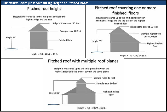 |
8.1.1.7.Exceptions to Height Provisions.
1.
No part of the roof or any architectural feature in a R, B-1, B-2, B-3 or PM district may exceed fifty (50) feet in height from the highest point of the street in front of the building or structure. For purposes of this section, architectural features include chimneys, church spires, cupolas, elevator shafts and similar ancillary architectural features that are not intended for occupancy or storage;
2.
In a R, B-1, B-2, B-3 or PM district, pitched roofs with a minimum 7:12 (rise/run) roof pitch with may be approved for a height of up to forty (40) feet pursuant to section 8.1.1.7 where the ground of the structure floor is required to be elevated more than six (6) feet above grade to comply with FEMA requirements and provided that no portion of the roof exceeds 50 feet in height measured from the highest point of the street in front of the building or structure.
3.
Flagpoles, fire towers, monuments, observation towers, smoke stacks, or water towers or other similar devices that exceed the maximum height allowed in a zoning district subject to issuance of a Special Use Permit after the Zoning Commission determines that the extension of such structures beyond the height elevations of the district will not create an adverse effect on the surrounding community or significantly affect the stated character of the City and such structures comply with FAA requirements for lighting.
4.
Heating and air conditioning equipment, solar collectors and similar equipment, fixtures and devices, when located on the roof of a building and not more than one-third of the roof area is consumed by such.
a.
Residences that comply with the maximum building height in R-1 districts located south and west of West Causeway approach may have maximum ridge height of not more than sixty (60) feet provided that:
(1)
The lot area is not less than 0.5 acres; and
(2)
Side setbacks are at least 20 feet.
8.1.1.8.Sight Triangles Required.
Visibility of and between pedestrians, bicyclists, and motorists shall be assured at all intersections in accordance with this section.
a.
Measurement of Sight Triangles. The legs of sight triangles involving arterial streets shall be measured from the projected intersection of curb lines or edges of pavement.
b.
Sight Triangles to be Free From Visual Obstructions. Sight visibility triangles shall be maintained free of visual obstructions to between the height of three (3) and seven (7) feet above street grade. No building, fence, wall, hedge or other structure or planting more than three (3) feet in height other than posts, columns or trees separated by not less than six (6) feet from each other, shall be erected, placed or maintained these areas.
c.
Dimensions of Sight Triangles. Sight triangles shall be based on the dimensions shown in Table 8-1-1 unless the City Engineer or Public Works Director finds that greater sight distances are called for due to traffic speeds or other intersection characteristics at intersections involving arterials.
Exhibit 8-1-1: Sight Triangle Design
| Intersection Type | Dimensions | Diagrams |
|---|---|---|
| Two Arterials | At least 25 feet along each arterial street | 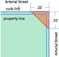 |
| Arterial and Collector or Local Street | At least 25 feet along the arterial street and 20 feet along the local or collector (minor) street | 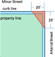 |
| All Other Street Intersections, including all intersections in the B-3 and T-C districts | Two overlapping triangles measuring 15 feet by 25 feet | 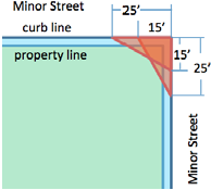 |
| Intersection of Alleys or Driveways with Streets | 25 feet along the minor street and 15 feet along the alley or driveway | 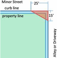 |
| Intersections of streets with driveways from multi-occupancy centers | To be determined by the Public Works Director based on projected traffic loads and intersection design | |
8.1.2. Supplemental Use Regulations.
8.1.2.1.Supplemental Regulations for Antennas, Aerials and Satellite Receiving Stations.
1.
No antennas, aerials or satellite receiving stations shall be constructed except as an accessory to an existing or concurrently constructed building.
2.
Antennas, aerials and satellite receiving structures shall be situated to the rear of the front building facade and shall be situated in such portion of the yard as to be screened from view of the Street right-of-way or shall be situated on such a portion of a roof as not to be visible from the Street.
3.
No antenna, aerial or satellite receiving station or any of its anchoring or supporting appurtenances, including guy wires, shall be constructed or located within ten (10) feet of any lot line.
4.
No more than one (1) satellite receiving station shall be constructed on any lot development site as defined in Article 3.
5.
Antennas, aerials or satellite receiving stations shall be constructed of non-reflective and noncombustible materials and shall be free of any lettering, slogans, logos or similar marks or messages.
6.
All antennas, aerials or satellite receiving stations shall be wired and grounded in conformity with the requirements of the National Electric Code.
7.
No antennas, aerials or satellite receiving station shall contain more than one (1) circular or parabolic collecting structure, which shall be no greater than twelve feet in diameter. No antennas, aerials or satellite receiving station, including its base, shall be constructed to a height in excess of the height limitations of the zoning district in which it is located.
8.
Any antennas, aerials or satellite receiving station constructed on any lot or parcel of ground which abuts residentially zoned property shall be screened along those sides visible from any such abutting residential property with living materials of such type and nature as shall grow to be a seventy-five (75) percent opaque barrier of a height not less than the actual height of the satellite receiving station being screened within two (2) years of the planting of such living screen except to the extent that screening would interfere with reception.
9.
All antennas, aerials or satellite receiving stations shall be filtered and/or shielded so as to prevent the emission from such stations of radio frequency energy that would cause any noticeable interference with the radio and/or television broadcasting or reception capabilities of adjacent properties. In the event that such interference is caused by any of the above subsequent to the granting of a building permit, the owner of such apparatus shall take prompt action to eliminate the interference. In addition to all other penalties which may be applicable to a violation of this section, any owner or user of such apparatus who fails to so filter or shield his apparatus may be required by order of any competent court, to disconnect and dismantle same.
10.
No antennas, aerials or satellite receiving station shall be constructed nearer than five (5) feet horizontal distance and ten (10) feet vertical distance from any overhead utility line.
11.
All antennas, aerials or satellite receiving stations shall be constructed in such a manner and of such materials as to withstand a ninety-mile per hour wind and the plans for any proposed apparatus shall be so certified by a civil engineer licensed to practice his profession in the state of Louisiana prior to the issuance of any building permit.
12.
No mobile or portable antennas, aerials or satellite receiving station shall be used or allowed in any district except on a temporary basis in connection with special events and civil emergencies.
13.
In the proposed placement of antennas, aerials or satellite receiving station, if it is required that a tree be removed as a result of the proposed placement, the applicant for the permit shall be required to show that there is no reasonable alternative or placement in another location that would allow preservation of the tree.
8.1.2.2.Communication Tower Application Requirements.
1.
Application Requirements. The applicant for an Administrative Permit for construction of a Communications Tower or placement of a Commercial Telecommunication Antenna on an existing structure other than a tower previously permitted must file an application accompanied by a fee as set by the fee schedule for Administrative and Special Use Permits under the CLURO and the following documents, if applicable:
a.
One copy of typical specifications for proposed structures and antennae, including description of design characteristics and material.
b.
A site plan drawn to scale showing property boundaries, tower location, tower height, guy wires and anchors, existing structures, photographs or elevation drawings depicting typical design of proposed structures, parking, fences, landscape plan, and existing land uses on adjacent property. A site plan is not required if antenna is to be mounted on an approved existing structure.
c.
A current map, or update for an existing map on file, showing locations of applicant's antennae, facilities, existing towers, and proposed towers serving any property within the City.
d.
A report from a structural engineer showing the tower antenna capacity by type and number, and a certification that the tower is designed to withstand winds in accordance with ANS/EIA/TIA 222, latest revision, standards.
e.
Identification of the owners of all antennae and equipment to be located on the site.
f.
Written authorization from the site owner allowing applicant to submit the application.
g.
Evidence that a valid FCC license for the proposed activity and site has been issued.
h.
A line of sight analysis, i.e. photo enhancement via graphic design, showing the potential visual and aesthetic impacts on adjacent residential districts or combined use districts.
i.
A written agreement to remove the tower and/or antenna within 180 days after cessation of use.
j.
Additional information as required to determine that all applicable zoning regulations are met.
k.
A tower is not allowed if technically suitable space can be found on an existing communications tower or other structure within the search area that the new site is to serve.
l.
Existing on-site vegetation shall be preserved to the maximum extent practicable. All towers shall be landscaped with at least one row of evergreen shrubs or trees and shrubs within 20 feet of the tower's base. Such plantings shall be in accordance with the minimum requirements of section 9.2.5.5.4 Buffer Zone Requirements of the CLURO.
m.
The entire facility must be aesthetically and architecturally compatible with its environment. The use of residentially compatible materials such as wood, brick, or stucco is required for associated support buildings, which shall be designed to architecturally match the exterior of residential structures within the neighborhood. In no case will metal buildings be allowed for accessory buildings.
n.
Walls or fences constructed of wood, brick, or masonry shall be used to secure the site and provide an opaque barrier. Such walls or fences may be used in combination with landscaping to provide security or increase the buffer to other land uses. Other types of fences shall be allowed only if used in conjunction with evergreen shrubs or hedges when upon maturity are equal to or greater than the height of the fence for the purposes of providing an opaque barrier.
o.
The cellular transmission tower, antennas, and support structures shall be constructed of a material with a neutral color and shall be designed to blend in with the surrounding landscape, buildings and uses.
2.
Conditions. Applicant must show that all applicable conditions are met.
a.
The proposed communications tower, antenna or accessory structure will be placed in a reasonably available location which will minimize the visual impact on the surrounding area and allow the facility to function in accordance with minimum standards imposed by applicable communications regulations and applicant's technical design requirements. Priority shall be given applications which desire locations on existing structure, property zoned for industrial use and public property.
b.
Applicant must show that a proposed antenna and equipment cannot be accommodated and function as required by applicable regulations and applicant's technical design requirement without unreasonable modifications on any existing structure or tower under the control of or reasonably available to the applicant.
c.
Applicant for a permit in a residential district must show that the area cannot be adequately served by a facility placed in a non-residential district for valid technical reasons.
d.
Prior to consideration of a permit for location on private property which must be acquired, applicant must show that available City owned sites, and available privately owned sites occupied by a compatible use, are unsuitable for operation of the facility under applicable communications regulations and applicant's technical design requirements.
e.
Applicant must show that a new tower is designed to accommodate additional antennae equal in number to applicant's present and future requirements. Applicant is encouraged to anticipate any co-location agreements that can be made with other users and design the tower to accommodate said users.
f.
Applicant must show that all applicable health, nuisance, noise, fire, building and safety code requirements are met.
g.
A permit for a proposed tower site within 1,000' of an existing tower shall not be issued unless the applicant certifies that the existing tower does not meet applicant's structural specifications and applicant's technical design requirements, or that a collocation agreement could not be obtained.
h.
Applicant must show by certificate from a registered engineer that the proposed facility will contain only equipment meeting FCC rules, and must file with the Department of Planning and Development a written indemnification of the municipality and proof of liability insurance or financial ability to respond to claims up to $1,000,000.00 in the aggregate which may arise from operation of the facility during its life, at no cost to the municipality, in form approved by the City Attorney.
i.
Site development regulations, visibility, fencing, screening, landscaping, parking access, lot size, exterior illumination, sign, storage and all other general zoning district regulations except setback and height, shall apply to the use. Setback and height conditions in this section apply.
3.
Abandonment. In the event the use of any communication tower has been discontinued for a period of 180 consecutive days, the tower shall be deemed to be abandoned. Determination of the date of abandonment shall be made by Director of Planning who shall have the right to request documentation and/or affidavits from the communication tower owner/operator regarding the issue of tower usage. Upon such abandonment, the owner/operator of the tower shall have an additional 180 days within which to: (1) reactivate the use of the tower or transfer the tower to another owner/operator who makes actual use of the tower, or (2) dismantle and remove the tower. At the earlier of 181 days from the date of abandonment without reactivation or upon completion of dismantling and removal, any special exception and/or variance approval or the tower shall automatically expire.
4.
Denial of permit. The Telecommunications Act of 1996 requires that a denial of a permit be supported by substantial evidence. The denial of any permit may be appealed under section 4.3.4.1 of the CLURO.
5.
Severability. If any of the terms or conditions of this ordinance shall for any reason be held to be invalid, illegal or unenforceable in any respect, such invalidity, illegality or unenforceability shall not affect the other provisions, and the provisions hereof shall thereafter be construed as if such invalid, illegal or unenforceable terms or conditions had never been contained herein.
8.1.3. Supplemental Fence and Wall Regulations.
1.
Fences in required setbacks.
a.
Except as provided in paragraph 1.b of this section, no fence or wall shall exceed four (4) feet in height if located between the front of a structure and the front property line.
b.
Decorative wrought iron fences may be allowed within required front setbacks and within required side and rear setbacks facing streets if they do not exceed five and one-half (5½) feet in height, supporting structure (columns) cannot exceed 6.5' in height and are no more than fifteen (15) percent opaque when measuring all fence components higher than two (20 feet above grade excluding support columns. Fence height shall be measured from average grade to the tallest component of the fence, excluding gates and lighting on the top of support columns that do not exceed seven and one-half (7½) feet in height. The Planning Director may approve the use of other materials that have a substantially similar appearance to wrought iron and are at least as durable.
c.
Fences or walls located in the rear or side yards shall not exceed seven feet (7') in height.
d.
No fence wall exceeding four feet (4') in height shall be erected or constructed within a required side or rear yard fronting a street, except as provided in paragraph 1.b of this section.
e.
Any fence or wall located on a street intersection shall conform to sight triangle requirements.
2.
Electrical fences in any form are prohibited.
3.
Barb wire for fences shall be prohibited in all districts except B-2, B-4, M-1 or M-2 and when allowed shall only be used on fences in an area higher than six (6) feet above ground.
4.
No fence or wall shall be constructed within a utility servitude without prior written approval of the affected utilities. Approval may be withheld by any utility upon its determination that the proper size or location of the fence or wall would adversely affect the operation, maintenance or function of the servitude. Approval of the construction by a utility shall create no obligation to repair or replace a fence or wall damaged or removed by the utility in the course of its lawful use of the servitude.
8.1.4. Supplemental Regulations for Temporary Buildings.
Mobile buildings and portable buildings shall not be used as principal buildings except in accordance with these regulations for temporary structures:
1.
Temporary Construction Buildings. Temporary buildings used in connection with construction work and only in conjunction with a valid development permit may be located in any district during the period of construction, but such temporary building shall be removed on completion of the construction work and prior to issuance of the permanent certificate of occupancy for the structure for which the permit was issued.
2.
Temporary Seasonal Buildings. Temporary buildings used in connection with the sale of Christmas trees may be placed on a site in conjunction with the issuance of a temporary development permit during the months of November and December only and shall be removed from the site during the remaining months of the year.
3.
Temporary Structures in Parking Lots. Temporary structures, such as those used for tent sales, may be placed no more frequently than twice annually for a maximum of seven (7) days on any development site in conjunction with the issuance of a temporary permit so long as not more than five (5) percent of the required parking spaces are affected by the placement of the structure.
4.
Seasonal Storage. Outdoor storage units may be placed within parking areas located behind the front building line during the months of November and December, provided that such storage units do not occupy more than 5% of the minimum required parking and that the units are not used for display or sale of goods.
5.
Temporary Portable Storage Units. The following regulations shall apply to the placement of temporary portable storage units upon lots in all zoning districts:
a.
A permit shall be obtained prior to setting the unit on any property used for residential purposes. The permit applicant must present substantial, competent evidence of the need for the issuance of a permit for a temporary storage unit.
b.
A site drawing shall be submitted showing the location on the property where the unit will be placed, size of the unit and distance to all applicable property lines and all other buildings or structures. This plan shall be reviewed and subject to approval by the Director of Planning.
c.
The property must be occupied by a principal building.
d.
The unit(s) shall be placed as close to the house as practical but a minimum distance of 10 feet from all property lines.
e.
No more than one permit may be secured within a 12-month period for any location used as residential property. A permit shall be issued initially for a period of 60 days and upon written request, may be extended another 30 days, not to exceed a total of 90 days.
f.
The size of all units combined shall not exceed 1300 cubic feet in size.
g.
Stacking of any materials on top of any portable storage unit shall be prohibited.
h.
All units shall be used for storage purposes only. There shall be no plumbing or electricity connected to the unit. Applicants using storage units for purposes other than storage, will have their permits revoked by the City.
i.
The City shall have the right to order the supplier to remove the storage unit by providing the supplier seventy-two (72) hours' notice of removal.
j.
In the event of a tropical storm or hurricane watch issued by the National Weather Service, the City shall have the right to order the supplier to remove the temporary storage unit by providing the supplier seventy-two (72) hours' notice of removal. In the event of a tropical storm or hurricane warning issued by the National Weather Service, the temporary storage unit shall be immediately removed by the supplier after the warning being issued (10) Final action by the Director of Planning with regard to issuance of a permit may be appealed to the Planning and Zoning Commission by an aggrieved party. An "aggrieved party" shall include: (a) the permit applicant; (b) the owner or occupant of real property located immediately adjacent to the property on which the unit shall be placed; (c) a person suffering greater injury than others in the community or suffering a different type of injury than other persons in the community. Appeals to the Planning and Zoning Commission shall be filed with the City Clerk within not more than ten (10) days after the rendition of a decision to approve or disapprove issuance of a permit by the Director of Planning.
8.1.5. Supplemental Regulation of Accessory Buildings and Structures.
For purposes of these regulations accessory buildings include but are not necessarily limited to accessory storage buildings, pool cabanas, detached covered porches or decks, playhouses, private studios or craft buildings, and greenhouses and shall be regulated as follows:
1.
Except on corner lots, any accessory building that is not a part of the main building may be built in a required side yard, provided such accessory building is not less than sixty (60) feet from the front lot line nor less than three (3) feet from the nearest interior side lot line and provided not more than one (1) accessory building covers any part of the required side yard.
2.
On corner lots, accessory buildings are not permitted in required side yards on the side Street side or within any portion of the rear yard area which lies between the side Street and the prolongation of the required side yard line into the rear yard area.
3.
Detached accessory buildings not exceeding one (1) story nor fourteen (14) feet in height may be built in required rear yards; provided, however, such accessory buildings shall not be located less than three (3) feet from either side or rear lot lines.
4.
The combined gross area of all accessory buildings or portions thereof located in required side and rear yards shall not exceed thirty percent of the required rear yard area.
5.
None of the provisions of this subsection shall apply to the use, construction or location of antennas, aerials or satellite receiving stations.
6.
Accessory recreational structures such as pools and tennis courts shall be subject to the locational requirements of this subsection.
7.
No accessory building or structure shall be constructed within a utility servitude without prior written approval of the affected utilities. Approval may be withheld by any utility upon its determination that the proper size or location of the accessory building or structure would adversely affect the operation, maintenance or function of the servitude. Approval of the construction by a utility shall create no obligation to repair or replace an accessory building or structure damaged or removed by the utility in the course of its lawful use of the servitude.
8.1.6. Supplemental Regulations for Manufactured Modular Buildings.
Manufactured modular buildings as defined in Article 3 may be used as principal buildings and shall be permitted and regulated in accordance with all provisions applicable to structures other than manufactured modular buildings.
8.1.7. Supplemental Regulations for Recreational Vehicles.
Recreational vehicles, as defined in Article 3 and specifically excluding mobile homes, mobile buildings or manufactured housing as defined, may be parked in any district in accordance with the following provisions:
1.
The site on which a recreational vehicle is parked shall be a previously developed site; recreational vehicles shall be prohibited from parking on vacant and undeveloped sites.
2.
Recreational vehicles parked on a developed site shall be for personal and private use of the occupants of the site and shall not be occupied as living quarters or for business purposes on a permanent or part-time basis except in the case of a temporary visitor to the permanent occupants of the site on which the vehicle is parked. In the case of a temporary visitor a recreational vehicle may be parked on a site and occupied by a visitor for a maximum of seventy-two (72) hours without an occupancy permit or for a maximum of two (2) weeks upon issuance of a temporary certificate of occupancy by the Building Inspector. Temporary occupants of recreational vehicles as provided above, however, when located in an R-1, R-1X or R-2 district shall be prohibited from operating generators or other noise producing mechanisms which may disturb the peace of the residential area.
3.
Recreational vehicles shall not be procured and parked on the site for sales purposes. However, personal recreational vehicles utilized by the occupants of the site on which the vehicle is parked may sell the vehicle from the site so long as no more than one sale of such a personally owned vehicle occurs in any six (6) month period.
4.
Recreational vehicles parked on a site shall be situated on the site outside of the required front yard area when the placement of structures on the site permits, however, under no circumstances shall a recreational vehicle be parked so that any part of the vehicle encroaches onto a Street right-of-way.
8.1.8. Standards For Temporary Residences on Construction Sites.
1.
A temporary permit for a mobile home, mobile building or recreational vehicle to be used as a temporary residence to be occupied during the construction, repair or renovation of a permanent non-residential building on a site may be approved as a conditional use by the City Council in accordance with procedures for Conditional Use Permits as provided in Article 4 for a period not to exceed six months from the date the temporary permit is issued.
2.
The temporary conditional use may be granted one extension of an additional period of not more than three months, by the building inspector if such extension is necessary to complete the construction, repair or renovation work.
3.
Temporary residences used on construction sites shall be removed immediately upon completion of the project and prior to the issuance of a certificate of occupancy for the building constructed on the site.
8.1.9. Construction of Buildings on Improved Streets Only.
Every building hereafter erected, reconstructed, converted, moved, or structurally altered shall be located on a lot of record that abuts at least one improved Street.
8.1.10. Supplemental Regulations for Outdoor Lighting.
8.1.10.1.Statement of Need and Purpose.
These regulations are intended to implement "dark skies" principles in the City of Mandeville. Good outdoor lighting at night benefits everyone. It increases safety, enhances the City's nighttime character, and helps provide security. New lighting technologies have produced lights that are extremely powerful, and these types of lights may be improperly installed so that they create problems of excessive glare, light trespass, and higher energy use. Excessive glare can be annoying and may cause safety problems. Light trespass reduces everyone's privacy, and higher energy use results in increased costs for everyone. Appropriately regulated, and properly installed, outdoor lighting will contribute to the safety and welfare of the residents of the City. It is intended to eliminate problems of glare, minimize light trespass, and help reduce the energy and financial costs of outdoor lighting, by establishing regulations which limit the area that certain kinds of outdoor-lighting fixtures can illuminate, and by limiting the total allowable illumination of lots located in the City of Mandeville. Luminaries on all properties, in all zoning districts, shall be installed with the idea of being a "good neighbor", with attempts to keep unnecessary direct light from shining onto abutting properties or streets.
8.1.10.2.Definitions.
For the purposes of this Ordinance, terms used shall be defined as follows:
1.
Direct Light. Light emitted directly from the lamp, off of the reflector or reflector diffuser, or through the refractor or diffuser lens, of a luminaire.
2.
Disability Glare. Glare resulting in reduced visual performance and visibility. It is often accompanied by discomfort.
3.
Fixture. The assembly that houses the lamp or lamps and can include all or some of the following parts: a housing, a mounting bracket or pole socket, a lamp holder, a ballast, a reflector or mirror, and/or a refractor or lens.
4.
Flat, Single-Plane Lens. A refractor of lens, mounted in the horizontal plane, which by design, allows direct light to be emitted only through the horizontal plane.
5.
Flood or Spot Light. Any light fixture or lamp that incorporates a reflector or a refractor to concentrate the light output into a directed beam in a particular direction.
6.
Foot-candle. A unit of measure for illuminance. A unit of illuminance on a surface that is everywhere one foot from a uniform point source of light of one candle and equal to one lumen per square foot.
7.
Full Cut-Off Type Fixture. A luminaire or light fixture that; by design of the housing, does not allow any light dispersion or direct glare to shine above a 90 degree, horizontal plane from the base of the fixture. Full cut-off fixtures must be installed in a horizontal position as designed, or the purpose of the design is defeated, and disability glare will result.
8.
Fully Shielded Fixture. A luminaire or fixture constructed in such a manner that an opaque shield extends, on all sides, below the lowest direct-light-emitting part (LDLEP) of the luminaire. The lowest edge of such a shield shall surround the LDLEP and be level with the horizontal plane, regardless of the orientation of the luminaire or fixture.
9.
Glare. Light emitting from a luminaire with an intensity great enough to reduce a viewer's ability to see, and in extreme cases causing momentary blindness.
10.
Grandfathered Luminaries. Luminaries not conforming to this code that were in place at the time this code was adopted into effect. When an ordinance "grandfathers" a luminaire, it means that such already-existing outdoor lighting does not need to be changed unless a specified period is specified for adherence to the code.
11.
Height of Luminaire. The height of a luminaire shall be the vertical distance from the ground directly below the centerline of the luminaire to the lowest direct-light-emitting part of the luminaire.
12.
Horizontal Illuminance. The measurement of brightness from a light source, usually measured in foot-candle or lumens, which is taken through a light meter's sensor at a horizontal position.
13.
Indirect Light. Direct light that has been reflected or has scattered off of other surfaces.
14.
Lamp. The component of a luminaire that produces the actual light.
15.
Lowest Direct-Light Emitting Part (LDLEP). The lowest part of either the lamp or lamps, the reflector or mirror, and/or refractor of lens.
16.
Light Trespass. The shining of light produced by a luminaire beyond the boundaries of the property on which it is located.
17.
Lumen. A unit of luminous flux. One foot-candle is one lumen per square foot. For the purposes of this Ordinance, the lumen-output values shall be the INITIAL lumen output ratings of a lamp.
18.
Luminaire. This is a complete lighting system, and includes a lamp or lamps and a fixture.
19.
Outdoor Lighting. The night-time illumination of an outside area or object by any man-made device located outdoors that produces light by any means.
20.
Temporary Outdoor Lighting. The specific illumination of an outside area of object by any manmade device located outdoors that produces light by any means for a period of less than 7 days, with at least 180 days passing before being used again.
21.
Uplighting. Any light source that distributes illumination above a 90 degree horizontal plane.
8.1.10.3.Regulations.
All public and private outdoor lighting installed in the City of Mandeville shall be in conformance with the requirements established by this Ordinance. All previous language in Mandeville bylaws and ordinances regarding outdoor lighting is replaced with this ordinance.
1.
Control of Glare—Luminaire Design Factors.
a.
Luminaire Design. Any luminaire with a lamp or lamps rated at an average of MORE than 3000 lumens shall be either:
(1)
Full Cut-off Type Fixture with a flat, single plane lens, or
(2)
Fully-Shielded Fixture.
b.
Luminaire Height.
(1)
Any luminaire with a lamp or lamps rated at an average of less than 3000 lumens may be mounted at any height.
(2)
Any luminaire with a lamp or lamps rated an average of more than 3000 lumens may be mounted up to a height of 35 feet in accordance with the following:
c.
Total foot-candles shall be in accordance with the following standards:
2.
Residential Applications.
a.
Spotlights and floodlights shall be angled so that the center of the beam will strike the ground within the said property line.
b.
Any exterior lighting that can be reasonably expected to create a nuisance to the adjacent neighboring properties is prohibited.
3.
Exceptions to Control of Glare.
a.
Luminaire Redirection. Any luminaire with a lamp or lamps rated at an average of 3000 lumens or LESS may be used without restriction to light distribution or mounting height, except that if any spot of flood luminaire rated 3000 lumens or LESS is aimed, directed, or focused such as to cause direct light from the luminaire to be directed toward residential buildings on adjacent or nearby land, or to create glare perceptible to persons operating motor vehicles on public ways, the luminaire shall be redirected or its light output controlled as necessary to eliminate such conditions.
b.
Public-Roadway Illumination. Luminaries used for public-roadway illumination shall be installed at a maximum height of 25 feet and shall be positioned at that height up to the edge of any bordering property.
c.
Police or Fire Departments or other Emergency Services. All temporary emergency lighting need by the Police or Fire Departments or other emergency services, as well as all vehicular luminaries, shall be exempt from the requirements of this article.
d.
Federal Regulatory Agencies. All hazard warning luminaries required by Federal regulatory agencies are exempt from the requirements of this article, except that all luminaries used must be red and must be shown to be as close as possible to the Federally required minimum lumen output requirement for the specific task.
e.
Law Governing Conflicts. Where any provision of federal, state, parish, or City statutes, codes, or laws conflicts with any provision of this code, the most restrictive shall govern unless otherwise regulated by law.
f.
Flags. Up-lighting for flags are exempt from the requirements of this article.
4.
Outdoor Advertising Signs.
a.
Top Mounted Fixtures. Top Mounted Fixtures Required. Lighting fixtures used to illuminate an outdoor advertising sign shall be mounted on the top of the sign structure. All such fixtures shall comply with the shielding requirements of section 8.1.10.3 with the exception of the portion of the luminaire parallel with the sign, provided this portion does not allow any light dispersion or direct glare to shine above a 90 degree horizontal plane.
b.
Translucent Outdoor Advertising Signs. Outdoor advertising signs of the type constructed of translucent materials and wholly illuminated from within do not require shielding. Dark backgrounds with light lettering or symbols are preferred, to minimize detrimental effects.
c.
Compliance Limit. Existing outdoor advertising structures shall be brought into conformance with this Code within five (5) years from the date of adoption of this provision.
d.
Prohibitions. Electrical illumination of outdoor advertising off-site signs between the hours of 11:00 p.m. and sunrise is prohibited.
5.
Recreational Facilities (Public and Private).
a.
Recreational field lighting, public or private, such as, football fields, soccer fields, baseball fields, and softball fields, shall be exempt to the height requirement of 25' and total lumen output provided all of the following conditions are met:
b.
Lighting for parking lots and other areas surrounding the playing field, court, or track shall comply with this Code for lighting in the specific area as defined in section 8.1.10.3.1 of this Code.
c.
All fixtures used for event lighting shall be fully shielded as defined in section 8.1.10.3.1 of this Code, or be designed or provided with sharp cutoff capability, so as to minimize up-light, spill-light, and glare.
d.
All events shall be scheduled so as to complete all activity before or as near to 10:30 p.m. as practical, but under no circumstances shall any illumination of the playing field, court, or track be permitted after 11:00 p.m. except to conclude a scheduled event that was in progress before 11:00 p.m. and circumstances prevented concluding before 11:00 p.m.
6.
Prohibitions.
a.
Laser Source Light. The use of laser source light or any similar high intensity light for outdoor advertising or entertainment, when projected above the horizontal is prohibited.
b.
Searchlights. The operation of searchlights for advertising purposes is prohibited.
c.
Outdoor Advertising Off-Site Signs. Electrical illumination of outdoor advertising off-site signs is prohibited between the hours of 11:00 p.m. and sunrise.
d.
Commercial landscape lighting may not be above the 90 degree plane to emit excessive light glare.
7.
Temporary Outdoor Lighting.
8.
Any temporary outdoor lighting that conforms to the requirements of this Ordinance shall be allowed.
9.
Nonconforming temporary outdoor lighting may be permitted by the Zoning Commission after considering:
a.
The public and/or private benefits that will result from the temporary lighting;
b.
Any annoyance or safety problems that may result from the use of the temporary lighting; and
c.
The duration of the temporary nonconforming lighting.
8.1.10.4.Effective Date and Grandfathering of Nonconforming Luminaries.
1.
Effective Date. This ordinance shall take effect immediately upon approval by the City Council of the City of Mandeville and shall supersede and replace all previous ordinances pertaining to outdoor lighting.
2.
Grandfathering Luminaries. All luminaires at a height of 35' and under shall be grandfathered for five years from date of Ordinance 00-13. All luminaires over 35' in height shall be grandfathered for five years from date of Ordinance 00-13, after which they shall be fully shielded 3" below LDLEP.
3.
Grandfathering Luminaries Causing Disability Glare. Grandfathered luminaries that direct light toward streets or parking lots that cause disability glare to motorists or cyclists should be either shielded or re-directed within 90 days of notification, so that the luminaries do not cause a potential hazard to motorists or cyclists.
8.1.10.5.New Construction.
1.
Submission Contents. The applicant for any permit required by any provision of the laws of this jurisdiction in connection with proposed work involving outdoor lighting fixtures shall submit (as part of the application for permit) evidence that the proposed work will comply with this Code. The submission shall contain but shall not necessarily be limited to the following, all or part of which may be part or in addition to the information required elsewhere in the laws of this jurisdiction upon application for the required permit:
a.
Plans indicating the location on the premises, and the type of illuminating devices, fixtures, lamps, supports, reflectors, and other devices;
b.
Description of the illuminating devices, fixtures, lamps, supports, reflectors, and other devices and the description may include, but is not limited to, catalog cuts by manufacturers and drawings (including sections where required);
c.
Photometric data, such as that furnished by manufacturers, or similar showing the angle of cut off or light emissions.
2.
Additional Submission. The above required plans, descriptions and data shall be sufficiently complete to enable the reviewer to readily determine whether compliance with the requirements of this Code will be secured. If such plans, descriptions and data cannot enable this ready determination, by reason of the nature or configuration of the devices, fixtures, or lamps proposed, the applicant shall additionally submit as evidence of compliance to enable such determination such certified reports of tests as will do so provided that these tests shall have been performed and certified by a recognized testing laboratory.
3.
Subdivision Plat Certification. If any subdivision proposes to have installed Street or other common or public area outdoor lighting, the preliminary and final plat shall contain a statement certifying that the applicable provisions of the City of Mandeville Outdoor Lighting Code will be adhered to.
4.
Lamp or Fixture Substitution. Should any outdoor light fixture, or the type of light source therein, be changed after the permit has been issued, a change request must be submitted to the building official for his approval, together with adequate information to assure compliance with this code, which must be received prior to substitution.
8.1.10.6.Notification Requirements.
1.
The City of Mandeville building permit shall include a statement asking whether the planned project will include any outdoor lighting.
2.
Within 30 days of the enactment of this ordinance, the Building Inspector or his designee shall send a copy of the Outdoor Lighting Ordinance, with cover letter to all local electricians and local electric utility (including at least those in the City of Mandeville, as listed in the Yellow Pages).
8.1.10.7.Violations, Legal Actions, and Penalties.
1.
Violation. It shall be a civil infraction for any person to violate any of the provisions of this Code. Each and every day during which the violation continues shall constitute a separate offense.
2.
Violations and Legal Actions. If, after investigation, the Building Inspector or his designee finds that any provision of the Ordinance is being violated, he shall give notice by hand delivery or by certified mail, return receipt requested, of such violation to the owner and/or to the occupant of such premises, demanding that violation be abated within thirty (30) days of the date of hand delivery or of the date of mailing of the notice. If the violation is not abated within the thirty-day period, the Building Inspector or his designee may institute actions and proceedings, either legal or equitable, to enjoin, restrain, or abate any violations of this Ordinance and to collect the penalties for such violations.
3.
Penalties. Any person violating any provision of these regulations shall be guilty of a misdemeanor, and deemed a public nuisance and upon conviction shall be punished for each separate offense by a fine not exceeding five hundred dollars ($500.00) or imprisonment for a term not exceeding sixty (60) days, or by both such fine and imprisonment, or as provided in section 1.9 of the Code of Ordinances of the City of Mandeville, whichever is greater. Each day any violation of any provision of these regulations shall continue shall constitute a separate offense.
8.1.12. Supplemental Regulations for Accessory Uses.
8.1.12.1.Vending Machines.
1.
Vending machines shall be located:
a.
Within a primary structure; or
b.
Within an accessory structure that is enclosed on at least three sides, which is oriented so that any open side faces the primary structure; or
c.
Within a breezeway or covered sidewalk area; provided that the faces of the vending machines are not visible from any public right-of-way.
2.
Vending machines shall not obstruct sidewalks or pedestrian walkways. For purposes of this section, a vending machine will be deemed to be an obstruction if it blocks more than 30 percent of a walkway or leaves less than 6 feet of walking area measured perpendicular to the face of the machine.
3.
Existing vending machines shall be brought into compliance with this provision within one year of adoption of this provision or shall be removed from the premises.
8.1.12.2.Newspaper Racks and Newspaper Vending Machines—Reserved.
8.1.14. Supplemental Regulations for Accessory Dwelling Units.
For purposes of these Land Use Regulations, an accessory dwelling unit shall be incidental to the primary residential use of a single-family residence and shall be subject to the following standards:
1.
Number of Units. Not more than one (1) accessory dwelling unit, attached or detached, may be allowed as an accessory use in conjunction with any single-family structure.
2.
Unit Types. Mobile homes, trailers or manufactured homes may not be used as accessory dwelling units.
3.
Owner Occupancy Required. Either the primary residence or the accessory unit must be occupied by an owner of the property.
4.
Subdivision Not Allowed. Accessory units shall not be subdivided or otherwise segregated in ownership from the principal building.
5.
Parking Required. There shall be two (2) off-street parking spaces designated for the accessory unit in addition to the spaces required for the primary dwelling unit. Said space may be in a carport, garage, or designated space provided for the accessory unit, but shall be located behind the front building line on the lot. All parking spaces must be independently accessible, allowing access to each required parking space on the lot without having to move vehicles parked in other spaces.
6.
Minimum Lot Size. Accessory units may only be located on lots meeting the following minimum lot area standards for attached and detached accessory dwelling units:
7.
Maximum Unit Size. Whether attached or detached, the square footage of the accessory unit shall not exceed one thousand 1,000 square feet, excluding any garage or patio area.
8.
Minimum Unit Size. The accessory unit shall contain no less than three hundred (300) square feet, excluding any related garage or patio area.
9.
Height. New accessory dwelling units shall be located on the ground floor and shall not include more than one story. Where required to be elevated, the lowest floor elevation shall not be more than one foot above the elevation required by adopted city standards, except that where buildings are required to be elevated at least five (5) feet above grade, they may be elevated to allow for creation of one or more eight (8) foot tall parking spaces. Building height shall not be more than 14 feet above the lowest floor elevation.
10.
Minimum Setbacks. Minimum building setbacks shall conform to those for the principal building whether the accessory dwelling unit is attached or detached.
11.
Required Facilities. All accessory dwelling units shall include: a kitchen sink, cooking appliance, refrigeration facilities; a separate bathroom containing a sink, toilet and bathtub or shower.
12.
Building Design. The architectural character of the single-family dwelling shall be preserved whether the accessory unit is detached or attached. Consistent design for multiple structures on the property will be employed. A unifying design element such as material, color, or form should be used for all structures.
13.
Entrance. A separate entrance for the accessory unit shall be provided. The accessory unit shall not result in a new garage door facing a street unless it is set back at least 60 feet from the property line. The accessory dwelling unit shall be located behind the front building line of the principal structure.
14.
Code Compliance Required. The accessory unit shall meet all technical code standards, including building, electrical, fire, plumbing and other applicable code requirements, including any additional CLURO requirements.
15.
Existing Accessory Units. Any accessory units established within a building envelope existing prior to the adoption of this ordinance shall not be required to meet the setbacks established herein.
8.2. - SPECIAL USES CRITERIA.
This section shall be known as Special Uses Criteria. These provisions shall apply to the indicated specific use classifications in Article 6. The Planning Commission may, by resolution, adopt guidelines or establish standard practice for appropriate and practical interpretation of special use criteria whenever a literal interpretation of such provisions is impractical.
The provisions of this section shall be in addition to all other applicable regulations established by this Code. In event of any conflict in provisions, the more restrictive provision shall apply unless specifically indicated to the contrary.
8.2.1. Special Residential Uses Criteria.
8.2.1.1.Cluster Residential Criteria.
1.
Purpose. It is the express intent of the scale and clustering requirements of this section to create a human scale development appropriate to low-density residential uses. These regulations are intended to prevent structures significantly more massive than those structures usually constructed in single-family districts and to allow for the creation of multi-family or other structures exhibiting a human scale and massing appropriate to low-density residential uses.
2.
Scale Limitations and Clustering Standards.
a.
The following requirements shall apply, and the appropriateness of individual projects in fulfilling these requirements shall be determined by the Planning Director, Planning Commission, Zoning Commission, or City Council, as the case may be according to approval being sought. The massing of the building(s) and appropriate scale relationships to each other can be accomplished in any of the following ways:
(1)
Avoiding unreasonably continuous and unbroken wall planes; or
(2)
The introduction of architectural elements or features that create a variety of scale relationships; or
(3)
The use of materials that are consistent throughout the project, and that are human in scale; or
(4)
The use of architectural elements that create the appearance or feeling of a more residential scale; or
(5)
The use of architectural elements or details that are sympathetic to structures on adjoining properties; or
(6)
Other design techniques or elements of design that will reasonably comply with the purpose stated in 8.2.1.1.1.
b.
Absent good reason, which may be evidenced by meritorious compliance with the above criteria, the first tier of structures in a multiple family or mixed use project subject to these standards shall be clustered in buildings no more than fifty (50) feet in width, measured on the side most parallel to the property line. The first tier of buildings shall be no more than two (2) units deep or sixty (60) feet deep. The structures shall be not less than twenty (20) feet apart measured from face of wall to face of wall.
c.
The overall density of a clustered residential development shall not exceed the maximum allowable density for the zoning district in which it is located or a minimum land area of three thousand (3,000) square feet per residential unit within a Planned District development.
3.
Buffering Requirements.
a.
Front building line setbacks shall be a minimum of twenty-five (25) feet from the right-of-way, provided that this requirement shall not apply when located in an B-3 district in which case the yard requirements of the district shall apply.
b.
Landscaping shall be provided according to the provisions of Article 9.
c.
Yards, fences, vegetative screening or berms shall be provided to screen adjacent more restrictive residential districts from views of off-street parking areas, mechanical equipment, storage areas and areas for refuse collection. If fences are selected for screening, the height shall be restricted to seven (7) feet.
4.
Regulations to Protect Natural Features of the Environment.
a.
Residential density shall be based on the gross site area and shall be in accordance with the density requirements of the district in which the residential development is located or a minimum of 3,000 square feet per residential unit in Planned Districts.
b.
Passive uses (i.e., parks, hike and bike trails, etc.), shall be allowed in areas of periodic inundation provided that the requirements of the Drainage Overlay Districts are met and provided that any required state or federal permits and license agreements as may be necessary to place such uses in a dedicated drainage easement are obtained.
5.
Miscellaneous Regulations.
a.
Each project shall be permitted a maximum of two identification signs. The sign or signs must be located at the principal entrance or entrances and shall be allowed in accordance with Article 10 regulations for signs at subdivision entrances.
b.
No sign shall be self-lit, but a sign may have an indirect lighting source.
c.
The noise level of mechanical equipment shall conform to the requirements regarding noise and sound as set for in the City's Code of Ordinances.
d.
All dumpsters and any permanently placed refuse receptacles shall be located a minimum of twenty (20) feet from any adjacent property zoned or used as R-1, R-1X, R-2 or used for a purpose permitted in such a district. The location of and access to dumpsters or any other refuse receptacles shall be reviewed and approved by the Zoning Commission.
e.
The use of highly reflective surfaces, such as reflective glass and reflective metal roofs, whose pitch is more than a run of seven (7) to a rise of twelve (12), shall be prohibited. This requirement shall not apply to solar panels and to copper, galvanized or painted metal roofs.
f.
No intensive recreational use (e.g. swimming pool, tennis court, ball court, or playground) shall be permitted within fifty (50) feet of an adjoining R-1X, R-1, or R-2 district.
g.
No parking or driveways shall be permitted within twenty-five (25) feet of a lot zoned or used as R-1X, R-1 or R-2.
8.2.1.2.Two-Family Residential Criteria.
Two-family residential developments shall not be eligible for a subdivision of the two residences into two separate development parcels unless each individual parcel and the building situated thereon meets all the site development regulations including lot dimensions and required yards of the district in which the development is located.
8.2.1.3.Townhouse Residential Criteria.
Townhouses, as defined in Article 3, shall be used for purposes of single-family residences only and shall be developed in accordance with the following regulations:
1.
Townhouse Lot and Area Regulations.
a.
A townhouse development parcel shall consist of land suitable to be subdivided into a minimum of two (2) townhouse sublots capable of meeting the minimum requirements of the district in which the development is located.
b.
Maximum Density. The minimum area of land per unit in a townhouse development shall be three thousand (3,000) square feet provided all other requirements of this Ordinance are met.
c.
Minimum Square Feet Per Unit. The minimum living space within a townhouse unit shall be nine hundred (900) square feet per unit, excluding utility spaces, heating rooms, porches, garages or carports.
d.
Minimum Sublot Width. The minimum width of a townhouse sublot shall be twenty-five (25) feet.
e.
Private Open Space. Each townhouse sublot shall provide at least nine hundred (900) square feet of private outdoor open space and no portion of this minimum open space shall be used for off-Street parking, common recreation areas or accessory buildings.
f.
Perimeter Yards. The minimum perimeter yard requirements of the R-3 Residential district shall apply to all townhouse developments except for the provisions of the required distance between structures listed below.
g.
Distance Between Structures. No portion of a townhouse building or accessory structure in or related to one townhouse building shall be closer than twenty-five (25) feet to any portion of another townhouse building or accessory structure related to another townhouse building or to any building outside the townhouse site.
2.
Townhouse Design Standards.
a.
A townhouse building shall not contain more than six (6) townhouse units built in a row.
b.
The facade of each unit shall be different from its adjacent facade with not more than two like facades appearing in any one townhouse building.
c.
No more than three (3) units in a series of six shall have the same front building setback line.
3.
Townhouse Fire Walls Required.
a.
Fire Walls Between Units. Fire walls between each townhouse unit shall be not less than two-hour rating and shall be constructed in conformance to the building codes of the City or the State Fire Marshal for structures built on property lines, whichever is more restrictive.
b.
Fire Walls Between Groups of Units. Each townhouse development shall be divided into groups of not more than four (4) units each with each group separated by a fire wall of not less than four-hour rating, constructed in conformance with the building codes of the city, extending three (3) feet above the roof and eighteen (18) inches beyond the outside face of the building or five (5) feet along the face of the building each side of the fire wall, except that roof and wall penetration by the fire wall may be omitted when units are off-set by not less than five (5) feet in each direction and facing materials are noncombustible.
4.
Townhouse Parking Regulations.
a.
The number of required parking spaces per unit shall be in accordance with the provisions of Article 9.
b.
A front yard which contains off-Street parking space shall be a minimum of forty (40) feet in depth from the front property line, shall conform to the provisions of Article 9 for parking in front yards and not more than one parking space shall be provided in the required front yard setback of a townhouse lot.
c.
Access to parking shall be provided in accordance with the requirements of Article 9 and shall be grouped in bays or, if attached to each separate unit, shall be located to the rear of units and in the interior of the development site. All parking facilities shall be adequately and properly drained and constructed to the standards for parking provided in Article 9.
5.
Townhouse Utility Services. Utility services shall be made available to each townhouse and shall be installed underground. Water, electrical, sewerage, storm drainage and telephone shall be considered utility services. In addition, cable TV and gas may also be provided and shall be required to be installed underground.
6.
Conversion of Existing Developments. Non-townhouse developments existing at the time of the passage of these regulations shall not qualify for conversion to townhouse conversion and subdivision of townhouse sublots unless constructed to meet the requirements of these regulations as they apply to required fire walls.
8.2.1.4.Congregate Living and Community Residential Criteria.
1.
Requirements for Approval. Congregate housing and community residential uses as defined in Article 6 shall be allowed in the Districts as noted in the Table of Permitted Uses by Zoning District in Article 7.
2.
Conditions of Approval. In reviewing a proposed application for congregate housing or community residential housing, the Zoning Commission shall determine from a review of a conceptual site plan and the projects program, the following:
a.
That the subject property is suitable for the type of development proposed and the proposed development will not be detrimental to the use, peaceful enjoyment, economic value or development of surrounding properties and the general neighborhood; and that
b.
If title restrictions exist that they are recorded in the Conveyance Records of the St. Tammany Parish restricting the use of the property to that approved by the Zoning Commission in accordance with the provisions of this section and such restrictions shall not be amended except with the approval of the Zoning Commission.
3.
Design Criteria for Congregate Living and Community Residential.
a.
Area Regulations. Congregate living residential facilities shall be required to be developed in accordance with the following minimum area requirements:
(1)
Minimum Lot Size - 30,000 sq. ft.
(2)
Minimum Land Area Per Unit - 1,500 sq. ft.
(3)
Minimum Unit Area - 325 sq. ft.
(4)
Minimum Building Common Space - 20%
(5)
Maximum Impervious Lot Coverage - 35%
(6)
Required Setbacks - Shall be in accordance with the site development standards of the R-3 Residential District.
b.
Parking Regulations.
(1)
The development must provide the following minimum parking spaces: 1.5 spaces per unit for the development, 0.75 spaces per unit shall be paved and 0.75 spaces per unit shall be shown as set aside in a landscaped parking bank.
(2)
Any documentation indicating an insufficient number of parking spaces, based on the above formula, shall be justification for the Building Inspector to give notice to the Owner and/or Operator of the facility to appear before the Zoning Board at a hearing to show cause why the parking facilities provided should not be increased by a number to be determined by the Board, if at all.
(3)
In the event the Zoning Commission requires additional spaces be removed from the previously approved landscaped parking bank and paved, the Owner and/or Operator shall submit documents showing in detail the construction drainage and landscaping of the new spaces for approval.
(4)
The Zoning Commission will set a reasonable time schedule for compliance.
4.
Affidavit of Conformity. A notarized affidavit of the Owner or Operator of the congregate or community housing facility stating that the facility meets the requirements and restrictions placed on the property by the Zoning Commission. A like affidavit shall be submitted annually thereafter to the Mayor or his designee.
5.
Conversion to Multi-family. Any proposed conversion to multi-family use shall be undertaken only in conjunction with the issuance of a special use permit by the Zoning Commission subsequent to a determination by the Zoning Commission that the conversion will be in reasonable conformance with the multi-family requirements of the R-3 residential zoning district.
6.
Submittal Requirements for Building Permit. Following approval by the Zoning Commission of a congregate housing or community residential development as stated in section 8.2.1.4 et seq., the applicant shall submit to the Planning Department all documentation listed in Article 4 necessary to obtain a building permit.
8.2.2. Special Civic Uses Criteria.
8.2.2.1.Donation Receptacles.
Donation receptacles as defined in section 3.3.64, including those existing at the time this Ordinance becomes effective, shall be located in accordance with the following requirements:
1.
The receptacle shall not be placed without a permit from the Building Inspector.
2.
To apply for a permit, the applicant must supply the following information:
a.
Articles of Incorporation or other verification that applicant is a non-profit and/or charitable organization.
b.
A drawing or rendering of proposed receptacle with dimensions.
c.
A plot plan showing where on a particular piece of property the receptacle is proposed to be located.
d.
Written permission from the property owner allowing receptacles to be located on the property.
e.
The kinds of items expected to be donated.
f.
Schedule of collections by applicant.
3.
No receptacle shall be located on City property without the approval of the City Council.
4.
No receptacle shall be located on any public Right-of-Way.
8.2.2.2.Group Care Facilities.
Group care facilities as defined in Article 6 shall be constructed in accordance with the following requirements:
1.
Site development requirements shall be in accordance with the area regulations of the R-3 Residential District.
2.
Parking facilities and landscaping shall be provided in accordance with the provisions of Article 9.
3.
Cooking and other meal preparation activities shall be restricted to common food service areas only with no kitchen facilities provided in individual resident rooms.
4.
Deliveries of foodstuffs and supplies and pick up of solid waste shall occur only between the hours of 6:00 a.m. and 6:00 p.m. on weekdays only.
5.
No solid waste shall be incinerated on site and all solid waste containers and access drives shall be located on the site to minimize the impact of such facilities on adjacent sites.
8.2.2.3.Major Impact Utilities.
Major impact utilities shall be allowed when approved in conjunction with the Conditional Use Permit application and shall be subject to the Industrial Use Performance Standards of this Article. Existing railroads may continue to be operated and maintained in residential and nonresidential districts.
8.2.2.4.Minor Impact Utilities.
Public Utilities including electric substations, sewer and water pumping stations, drainage pumping stations, water towers, and buildings and structures of a similar nature may be located in any district when authorized by the Zoning Commission and provided that such uses be placed and operated as to minimize any inconvenience to owners or tenants of adjoining premises by reason of the emission of odors, fumes, gases, dust, smoke, noise, vibration, light or glare or other nuisances.
8.2.2.5.Public and Private Primary and Secondary Schools.
Public and Private Primary and Secondary Schools shall be subject to the following limitations:
1.
Access. The site shall be located with frontage on an arterial or collector or on a local Street in a location which does not require travel through existing or proposed residential districts and the access Street shall have a paved width of not less than forty (40) feet at all points until it connects with another Street with a paving width of at least forty (40) feet.
2.
Parking and landscaping requirements shall be in accordance with the requirements of Article 9.
3.
Each public and private elementary or secondary school shall provide off-Street loading and unloading facilities for buses and students to be located wholly on the premises and to be of adequate size to prevent stacking of buses and cars on Street rights-of-way. A covered transfer station on a circular drive shall be provided.
4.
Accessory residential units on a school site, in excess of one unit, shall be subject to the residential use classification requirements of the district in which such residential use would be permitted by right.
5.
Schools in Open Space/Recreation Districts. When located in Open Space/Recreation districts in conjunction with a Special Use Permit, primary and secondary schools shall provide public access to recreational facilities such as basketball or tennis courts, play fields or playgrounds during non-school hours and summer months.
8.2.3. Special Commercial Uses Criteria.
8.2.3.1.Outdoor Dining.
Outdoor dining may be authorized subject to the conditions and procedures established in this section and any additional zoning district standards.
1.
Outdoor dining behind the front building setback may be allowed pursuant to approval of a Special Use Permit in the B-1, B-2, B-3 and B-4 zoning districts provided that:
a.
Outdoor dining seating and operations shall not obstruct sidewalks, building entries or driveways; and
b.
Outdoor dining shall not be located within the sight triangle designated for intersection and driveway visibility as established in section 8.1.1.8 of this CLURO.
2.
Outdoor dining may be allowed in required front setback areas within the B-3 zoning district subject to issuance of a Special Use Permit and compliance with the criteria in paragraph 1 and the B-3 district standards established in section 7.5.10.5 of this CLURO.
3.
Outdoor dining may be allowed within the public right-of-way subject to approval of a Conditional Use Permit that satisfies the criteria established in paragraphs 1 and 2 of this section, section 4.3.3.8 and the following criteria:
a.
Seating areas shall be located to minimize the risks from traffic on abutting streets through the use of on-street parking, plantings, planter boxes or other barriers between traffic lanes and seating areas;
b.
Operator enters into a cooperative endeavor agreement with the City that recognizes the true value of the right-of-way and adequately addresses indemnification of the City and the City's minimum insurance requirements.
8.2.3.2.Adult Uses Criteria.
1.
Findings and Objectives. This section is intended to regulate the noted uses based on the findings of the City Council:
a.
That the business establishments herein regulated including but not necessarily limited to Adult Arcades, Adult Book Stores, Adult Cabarets, Adult Theaters and Adult Encounter Establishments because of their very nature have serious objectionable operational characteristics and when several of them are concentrated under certain circumstances the result is a deleterious effect on both the area in which they are located and adjacent areas. The special regulations contained herein pertaining to these business establishments are necessary to ensure that these adverse effects will not contribute to the blighting or downgrading of the neighborhood in which these businesses are located or of adjacent neighborhoods.
b.
That the regulations contained herein neither have the purpose nor effect of imposing any content limitation on those who produce adult books, films or photographs or their ability to make them available to whom they desire and that these regulations neither have the purpose nor effect of restricting in any way the purpose or viewing of these materials by those who desire to view them.
c.
All businesses must comply with Mandeville City Code of Ordinances, Chapter 11, Article II, Section 11-70, entitled "Obscenity".
2.
Location of Adult Use.
a.
No adult use shall be located in any district on any lot within one thousand (1,000) feet of any lot on which there is located another adult use; or within one thousand (1,000) feet of any residential district; or on any lot on which there is located a church, public or private school, public park, playground, residential unit, recreational center, public library, public educational facility, or on any lot dedicated to a church, public or private school, public park, playground, residential unit, recreational unit, recreational center, public library, or educational facility.
b.
For purposes of this section, the following words have the meanings set forth below:
(1)
Church. Any structure used principally as a place wherein persons regularly assemble for religious worship, including sanctuaries, chapels and cathedrals and on-site buildings adjacent thereto, such as parsonages, friaries, convents, fellowship halls, Sunday Schools and rectories.
(2)
School. Any structure wherein systematic instruction in useful branches of knowledge is given to children, the majority of whom are between the ages of five years and eighteen years old, by methods common to institutions of learning.
3.
Display of Material. No display of adult materials shall be visible from any Street right-of-way or adjacent property.
4.
Adult Uses. Applicability of Other Laws. All other provisions of these Zoning Regulations and all other city ordinances pertaining to any Adult Use remain in full force and effect and the provisions of this section are in addition to said provisions and ordinances.
8.2.3.3.Automotive and Equipment—Fuel Service Criteria.
Fuel dispensing devices and fuel storage areas shall be located a minimum of one hundred (100) feet distance from any adjacent residential district or use.
8.2.3.4.Automotive and Equipment—Service, Sales and Rental Criteria.
1.
No automotive service, sales and rental use as defined in section 6.4.15 shall be established on a premises unless the site conforms to all building, parking, landscaping, sign and setback requirements of this CLURO regardless of whether the premises is a conforming or non-conforming site for another use. No vehicles or equipment may be placed, parked, displayed or stored in a greenbelt required by section 9.2.5.5.1. Newly established service bays shall not face public streets and shall be screened from abutting residential districts pursuant to section 9.2.5.5.3.
2.
Automotive service, sales and rental uses as defined in section 6.4.15 shall modify existing sites to conform with parking, landscaping sign and setback requirements of this CLURO by May 1, 2019 unless the applicant demonstrates and the Zoning Commission finds that:
a.
The applicant has made a substantial investment (including but not limited to lease obligations) in the property or structure on or in which the nonconforming use is conducted, such property or structure cannot be readily converted to another use, and such investment was made prior to the effective date of this section.
b.
The applicant will be unable to recoup said investment as of the date established for the termination of the use.
c.
The applicant has made good faith efforts to recoup the investment and to relocate the use to a location where the use is allowed.
d.
The applicant will be unable to recoup his investment in the business that was incurred prior to the May 1, 2019.
e.
No investment that was incurred after the effective date of this ordinance shall be considered.
f.
If the Zoning Commission finds that the owner is eligible for an extension of time, the Commission shall grant an extended termination date to the applicant that shall not be longer than is required to recoup the investment.
8.2.3.5.Lodging (Transient)—Short-Term Rentals.
1.
All of the required approvals shall be obtained prior to establishment of the use including a Special Use Permit and Conditional Use approval depending upon the district in which the use is proposed to be located. In addition, an occupational license and a certificate of occupancy for the proposed use shall be obtained from the City. Any additional requirements of the state shall also be required to be satisfied.
2.
Standards. Short-term rentals, as defined in Article 6, shall be subject to the following general requirements in addition to the parking requirements as provided in Article 9 and the district regulations for the district in which the facility is located:
a.
Short-term rentals shall meet all applicable building, health, fire, and related safety codes at all times as well as:
(1)
That the property has current, valid liability insurance of five hundred thousand dollars ($500,000.00) or more that covers use as a short-term rental property;
(2)
That each short-term rental has working smoke alarms in every bedroom, outside each sleeping area, and on all habitable floors. If the rental unit has either natural gas service, or a propane system for cooking or heating, the unit must also have working carbon monoxide alarms in each bedroom, outside each sleeping area, and on every habitable floor. Combination smoke/carbon monoxide alarms are acceptable; and
(3)
That each short-term rental has a properly maintained 2A10BC rated ABC type fire extinguisher in each short-term rental unit.
b.
Common bathroom facilities may be provided rather than private baths for each guestroom.
c.
Residence kitchens shall not be refitted to meet health department requirements for food preparation. Only continental breakfast food service, with foods purchased from a licensed food seller and served "as is" or only warmed at the bed and breakfast residence and/or inn may be allowed. No cooking facilities shall be permitted in the individual guestrooms.
d.
A common dining area may be provided but cannot be leased for social events.
e.
No exterior signage shall be permitted except in accordance with the regulations of Article 10 for the district in which the facility is located.
f.
Short-term rentals shall not be operated outdoors or in a recreational vehicle.
g.
Parking shall be provided in accordance with Article 9, and shall be provided in side or rear yards and shall not be located in front yards.
h.
Only one (1) party of guests shall be permitted per Whole House Rental. A "party" shall mean one (1) or more persons who as a single group rent a Whole House Rental pursuant to a single reservation and payment.
i.
The owner/operator of the Short-Term Rental: Bed & Breakfast Residence shall be present during the guest's stay.
j.
The operator of the Short-Term Rental: Bed & Breakfast Inn shall be present during the guest's stay.
3.
Operation.
a.
Use of the short-term rentals for commercial or social events shall be prohibited.
b.
The permitholder shall keep on file with the city the name, telephone number, cell phone number, and email address of a local contact person who shall be responsible for responding to questions or concerns regarding the operation of the short-term rental. This information shall be posted in a conspicuous location within the short-term rental dwelling. The local contact person shall be available twenty-four (24) hours a day to accept telephone calls and respond physically to the short-term rental within a reasonable time period, not to exceed three (3) hours when the short-term rental is rented and occupied.
c.
All advertising for any short-term rental, including electronic advertising on short-term rental websites, shall include the number of the short-term rental permit granted to the permitholder.
4.
Taxes.
a.
The permitholder shall timely remit all applicable local, state, and federal taxes and City fees owed in connection with the short-term rental.
b.
The permitholder shall maintain records of all short-term rental activity, including number of guests, booking dates, rental income, and taxes remitted, for three (3) years and shall be provided to the City upon request.
5.
Citywide cap for whole house rentals.
a.
The total number of short-term rental permits for Whole House Rentals shall not exceed ten (10) at any time.
b.
If no Whole House Rental permits are available pursuant to the limitation on Whole House Rentals, the interested property owner shall submit an application to the Planning Department, which will be placed on a waiting list in the order in which they were received. If a permit becomes available, applications shall be processed and reviewed in the order that they are listed on the waiting list.
6.
Short-term rental permit application.
a.
If the property is subject to Special Use or Conditional Use approval pursuant to Article 4, approval shall be obtained prior to the submission of an application for short-term rental permit.
b.
An applicant for a short-term rental permit shall submit to the following requirements and documentation:
(1)
The name, address, phone number and email contact information of the applicant.
(2)
Attest to the following and furnish the necessary documentation upon request of the planning director:
i.
That the property has current, valid liability insurance of five hundred thousand dollars ($500,000.00) or more with proof that such coverage includes use as a short-term rental property;
ii.
That each short-term rental has working smoke alarms in every bedroom, outside each sleeping area, and on all habitable floors. If the rental unit has either natural gas service, or a propane system for cooking or heating, the unit must also have working carbon monoxide alarms in each bedroom, outside each sleeping area, and on every habitable floor. Combination smoke/carbon monoxide alarms are acceptable. St. Tammany Parish Fire District 4 shall perform an inspection to confirm compliance.;
iii.
That each short-term rental has a properly maintained 2A10BC rated ABC type fire extinguisher in each short-term rental unit;
iv.
That in each short-term rental there is a posting that provides the name, telephone number, cell phone number, and email address of a local contact person who shall be responsible for responding to questions or concerns regarding the operation of the short-term rental, as well as a floor plan indicating fire exits and escape routes. Posting shall be displayed in a prominent location within the unit;
v.
That the property has no outstanding taxes or municipal code violation liens;
vi.
That the property is not subject to any contractual restrictions precluding its use as a short-term rental, including, but not limited to, homeowner association agreements, condominium bylaws, or restrictive covenants;
vii.
For Bed & Breakfast Residence: proof of residency via valid homestead exemption;
viii.
For Bed & Breakfast Inn: proof of occupancy via title or deed or operator's valid current lease;
ix.
For Whole House Rental: proof of ownership via title or deed.
(3)
A valid occupational license for the proposed use.
c.
Any fraud, material misrepresentations, or false statements contained in the attestations, required documentation, or correlating application materials shall be grounds for immediate revocation of a short-term rental permit. Furthermore, all requirements herein shall be continuously maintained throughout the duration of the permit.
7.
Short-term rental permit issuance.
a.
Upon satisfactory submission of the required attestations and requested documentation herein, the Planning Director may issue a short-term rental permit. Said permit shall contain:
(1)
The address of the short-term rental;
(2)
The short-term rental permit holder's name;
(3)
The type of short-term rental permit, permit number, and rental limitations, including bedroom limit and guest occupancy limit;
(4)
Contact information (name, cell phone and e-mail) for complaints by guests or neighbors, of a local contact person who shall be available twenty-four (24) hours a day to accept telephone calls and respond physically to the short-term rental within a reasonable time period, not to exceed three (3) hours when the short-term rental is rented and occupied;
(5)
Dates the short-term rental permit is valid.
b.
Any short-term rental permit issued pursuant to this article is non-transferable.
c.
All short-term rental permits issued pursuant to this article shall be valid for one (1) year from the date of issuance, and shall be reapplied for and renewed annually between January 1 and March 31 of each year.
d.
Short-term rental permit renewals shall be obtained in a substantially similar form and manner as the initial short-term rental permit, and shall also require:
(1)
A new attestation of all information as outlined in 6.a.(2);
(2)
An attestation that the applicant has not had a short-term rental permit revoked in the last twelve (12) months.
8.
Short-term rental permit fees. Short-term rental permit fees shall be set forth in Division 19 of Appendix C of the City of Mandeville Code of Ordinances.
9.
Violations. Any violation of this article and the correlating provisions in the Comprehensive Land Use Regulations Ordinance may subject a violator to any remedy, legal or equitable, available to the City. Violations include, but are not limited to: advertisement or rental of a short-term rental without proper short-term rental permitting, operation outside the scope of any of the applicable short-term rental regulations provided by law, failure to include the short-term rental permit number or property address of a short-term rental unit in any advertisement and advertising a short-term rental outside the permitted scope of a short-term rental permit. The Planning Director may suspend, revoke or not renew any short-term rental permit issued pursuant to this Article if the Planning Director determines that the permit holder has violated any provision of this Article two (2) or more times. Remedies include, but are not limited to: revocation of a short-term rental permit, daily fines, and property liens, as more fully provided in section 1.9 of this Code. Each day of violation shall be considered a separate offense. Nothing contained herein shall be construed to limit the legal remedies available to any other person for the correction of violations of this article and the correlating provisions in the Comprehensive Land Use Regulations Ordinance.
(Ord. No. 19-34, 2-13-20; Ord. No. 22-30, 12-15-22)
Editor's note— Ord. No. 19-34 adopted Feb. 13, 2020, amended § 8.2.3.5 in its entirety to read as herein set out. Former § 8.2.3.5 pertained to bed and breakfast inn lodging criteria.
8.2.3.6.Applicability.
No person shall use or maintain, nor shall any person advertise the use of any residential dwelling unit on any parcel in this city for short-term rental without a short-term rental permit.
Short-term rentals may only be allowed in accordance with the Table of Permitted Uses. Outside of the Table of Permitted Uses, all Short-term rentals are prohibited in this city. However, any legally established Bed and Breakfast Residence or Bed and Breakfast Inn prior to the adoption of this section, shall be allowed to continue operation subject to the provisions of the Comprehensive Land Use Regulations Ordinance Section 4.2., Nonconforming Provisions.
(Ord. No. 19-34, 2-13-20)
Editor's note— Ord. No. 19-34 adopted Feb. 13, 2020, amended § 8.2.3.6 in its entirety to read as herein set out. Former § 8.2.3.5 pertained to bed and breakfast residence lodging criteria.
8.2.3.7.Convenience Storage (Mini-Warehouses) Criteria.
Convenience storage or mini-warehouse facilities shall be constructed in accordance with the following criteria and in accordance with all other applicable regulations for the district in which the facility is located, including landscaping and signage.
1.
Maximum Impervious Surface. Maximum amount of impervious surface shall be no greater than one (1) acre.
2.
Driveways, Parking and Outdoor Storage of Vehicles.
a.
Driveways. Because interior driveways in mini-warehouse facilities serve as loading, parking and circulation spaces the following standards shall apply in the design of interior driveways:
(1)
All one-way driveways shall provide for one ten (10) foot parking lane and one fifteen (15) foot travel lane. Traffic direction and parking shall be designated by signing or painting.
(2)
All two-way driveways shall provide for one ten (10) foot parking lane and two twelve (12) foot travel lanes.
(3)
The parking lanes may be eliminated when the driveway does not serve storage cubicles.
b.
Parking. Parking spaces shall be provided in accordance with the following standards:
(1)
One space for each ten (10) storage cubicles, equally distributed throughout the storage area, which may be provided in the interior driveways as, provided above.
(2)
Any accessory residence provided for the manager of the facility shall require parking in accordance with Article 9.
(3)
One space for every 25 storage cubicles to be located at the facility office for prospective customers.
(4)
If office space for lease is constructed in accordance with city building codes as a feature of the facility, parking shall be provided in the area of the leased office space in accordance with the requirements of Article 9.
c.
Outdoor Storage.
(1)
No outdoor storage of goods shall be allowed except in M-2 districts and provided such areas are screened from view of all adjacent roadways or sites.
(2)
Outdoor storage of vehicles, recreation vehicles, trailers, campers and boats shall be in areas specifically provided for such storage and shall not be located on required parking spaces for the facility including those provided on interior driveways.
(3)
Outdoor storage areas for vehicles as described above shall be separated from storage buildings by at least twenty-five (25) feet, shall be located in the rear of the buildings and shall be screened from view of adjacent property or roadways with an opaque fence and, when adjacent to residential districts, with a vegetative buffer as provided in the regulations of Article 9.
3.
Lighting. Lighting shall comply with the standards for parking lot lighting as provided in Article 9.
4.
Accessory Uses.
a.
Accessory Residential. One accessory residence may be provided on the site for a resident manager.
b.
Accessory Office. Leasable office space constructed in accordance with city building codes may be permitted in conjunction with a mini-warehouse facility.
c.
Other Uses. Except for the uses allowed in accordance with the above provisions, mini-warehouse developments shall be limited to dead storage use only and no business activities other than the rental of storage units shall be conducted on the premises. No activities such as miscellaneous or garage sales shall be conducted on the premises. The servicing or repair of motor vehicles, boats, trailers, lawn mowers, and other similar equipment shall not be conducted on the premises. The operation of such a facility shall in no way be deemed to include a transfer and storage business where the use of vehicles for purposes of deliveries is part of such business.
5.
Storage. No hazardous materials or substances and no explosive or radioactive materials shall be stored on the premises.
8.2.3.8.Day Care Centers Criteria.
Day Care centers as defined in Article 6 shall be required to be established in accordance with the following criteria and in accordance with all other applicable regulations as provided in these Land Use Regulations and all other codes of the City or state. For purposes of these provisions activity area shall be defined as indoor space utilized for the activities of the participants in the day care program and shall not include any area utilized for administrative offices, kitchens, hallways, bathrooms or storage areas.
1.
Applicants for proposed Day care centers shall be required to submit a floor plan and site plan which conform to the following standards:
a.
A minimum of 35 square feet of indoor activity area for each participant enrolled in the day care facility during any one-time period or the minimum required for Class A state licensing, whichever is greater.
b.
In the case of day care centers for children, a minimum of seventy-five (75) square feet of outdoor play area for each participant enrolled in the day care facility during any one-time period.
c.
In the case of adult day care centers, an outdoor area for strolling and sitting of a minimum of five hundred (500) square feet for each ten (10) participants enrolled in the facility during any one-time period.
2.
An area for the transfer of participants from vehicles to the facility shall be provided with a queue area for at least four vehicles in an area on site and out of the right-of-way of any Street.
3.
In accordance with the buffer requirements of Article 9, day care centers in or adjacent to B-2, B-4, M-1 or M-2 districts shall provide a buffer of ten (10) feet adjacent to the property line of such district, or on the side and rear property lines if in the listed district.
4.
Parking shall be in accordance with the requirements of Article 9.
8.2.3.9.Special Marina Use Criteria.
1.
Definitions Applicable to the Marina Development.
a.
Marina Site. A marina site shall consist of a development site that includes a boat basin or harbor for private pleasure craft where boat moorings are available for rental to the general public. Official craft, i.e., USCG, harbor master, etc., may be permitted to moor in a marina site.
b.
Boat Slip. That area of wet storage bounded by four (4) pilings, including one-half of the adjacent catwalk/pier.
c.
Dock. A mooring that accommodates a craft lying along side a wharf, pier or bulkhead having the benefit of only single side ties to piling or dock cleats.
d.
Suitable Size Boat Slip. A slip, with reference to a specific type or design of boat, which can physically and safely accommodate such a boat as designated by the marina owner and/or supervisor, considering the safety of the vessel and of the property owned by the marina owner.
e.
Catwalk. The walkway constructed on pilings to provide pedestrian access to boat docks.
2.
Standards for Marina Design.
a.
Access to Boat Slips. Boat slips shall be accessible by at least one (1) catwalk.
b.
Repair of Non-Conforming Docking Structures. Provisions of section 4.2 Non-Conforming Provisions do not apply.
c.
Off-Street Parking. Each marina development site shall be required to provide a minimum of one off-Street vehicular parking space for each four (4) boat slips contained within the marina facility as shown on the development plan for the marina.
d.
Sanitation Requirements.
(1)
Marina development sites shall provide one on-site comfort station, which shall include minimally a lavatory and toilet facility connected to city utilities, for each fifty (50) boat slips or docks.
(2)
All boats associated with marina development sites shall comply with all USCG and EPA regulations regarding marine sanitation.
(3)
Marina owners shall be required to provide a marine sanitation device designed and tied into the City of Mandeville sewerage system which complies with all sanitation and health requirements of state and federal law for the use of boat tenants.
(4)
Regardless of the number of boat slips, no raw sewage, garbage, junk, waste, oil or any other substance whatsoever which might pollute or damage the aesthetics or the water quality shall be deposited or permitted to be deposited in the waters of Bayou Castain and/or Lake Pontchartrain or any harbor, canal or canals leading into same.
e.
Refuse Collection. Suitable trash containers shall be located on all marine development sites and provisions for the collection and removal of garbage and solid waste shall be provided by the marina owner.
f.
Residential Occupancy of Boats. Residential occupancy of boats within marina development sites shall be permitted provided not more than five (5) percent of the total number of boat slips or a total of five watercraft, whichever is greater, are utilized for residential occupancy and provided residential occupants shall use the marine sanitation device monthly or more frequently.
g.
Non-residential Commercial Occupancy of Boats. The use of boats or watercraft for non-residential occupancy in any marina shall be prohibited.
3.
Permits and Approvals for Marina Developments. Marina development sites proposed to be developed in areas subject to the jurisdiction of the U.S. Army Corps of Engineers and/or the Louisiana Coastal Zone Management authority shall be required to obtain all the necessary permits or approvals and to comply with all city, parish, state and federal regulatory requirements prior to the issuance of a permit from the City for construction of the marina.
4.
Standards for Marina Associated Uses.
a.
Dwellings. Dwellings constructed in conjunction with a marina site shall be constructed in accordance with the Site Development Regulations of the zoning district in which the marina site is located or, in the case of Planned Districts, in accordance with the density requirements for the type of residential usage proposed, if the use were located in the district where the proposed use would be permitted by right. Additionally, dwelling uses shall comply with any special use criteria established in Article 8 for the type of dwelling use proposed.
b.
Accessory Structures. Accessory structures shall be constructed in accordance with the requirements of Article 8, shall not be constructed in any required landscaped areas and, when constructed on catwalks shall be located a minimum distance of 30' between structures. When located on catwalks at the edge of navigable waterways no greater than 50% of the water frontage of the development lot shall be obstructed from view by accessory structures.
c.
Minor Boat Repairs. Repair, servicing, and routine maintenance of boats, including cleaning, in conjunction with a marina site or on a separate site, shall be in an area screened from view of any adjacent roadways or waterways. However, any sand blasting or spray painting shall be conducted in compliance with OSHA and EPA Regulations.
d.
Major Boat Repairs and Construction. Repairs and construction of boats for recreational and personal use, especially in conjunction with a boat lift shall be in an area surrounded by a twenty (20) foot buffer area with an opaque fence. In addition, any sand blasting or spray painting shall be conducted in compliance with OSHA and EPA Regulations.
e.
Dry Boat Storage Areas. Dry boat storage areas shall not exceed 20% of the land of a marina site, exclusive of front, side and rear yard setback.
f.
Fuel Dispensing Areas. Fuel dispensing areas for the storage of oil and fuel for the servicing of all craft may be located on marina development sites provided access to the site by fuel supply trucks shall be required to be by way of nonresidential streets only. There shall be no permanent docking within thirty (30) feet of fuel pumps or other fuel equipment. Fuel storage tanks shall not exceed 10,000 gallons in capacity, shall meet all state and federal safety guidelines and shall not be located within 100' of any residential use or district.
g.
Non-Residential Uses. Non-residential uses permitted in conjunction with a marina development site in the PM-1 District in accordance with the Table of Permitted Uses by Zoning District shall be constructed in accordance with the PM-1 site development regulations for non-residential uses and any other provisions applicable to the specific use.
h.
Parking. In addition to the required off-Street parking spaces for the marina use based on the number of boat slips or docks, off-Street parking for any residential or nonresidential use located on a marina development site shall be required to be provided in accordance with the provisions of Article 9 for the specific use.
i.
Temporary Boat Docking. Temporary boat docking facilities shall be required to be provided in conjunction with all commercial or transient lodging facilities which are accessible to and provide services to customers arriving by boat at a ratio of one boat slip for each three hundred (300) square feet of retail or restaurant patron area or one boat slip for each three (3) transient lodging units, up to a maximum of five (5).
j.
Laundry Service. Establishments owned and operated by the marina primarily engaged as an accessory use in the provision of coin-operated laundry machines with or without the incidental provision of laundry processing services for individuals by an attendant in the facility are permitted.
5.
Special Criteria for Boathouse Development.
a.
Applicants for boathouse developments shall be required to apply for major subdivision/resubdivision and comply with all application and procedure requirements as outlined in Article 12 of this Ordinance.
b.
The height of a boathouse shall not exceed 35' as required in this Ordinance.
c.
No boathouse shall be built beyond the established bulkhead line or waterway line or former property line before excavation for boat slips, whichever is greater. This line shall establish a lot depth line for the purposes of this Code.
d.
Detached boathouse developments shall comply with restrictions of PM-1 zoning district.
e.
Attached boathouse developments shall comply with restrictions of PM-1 zoning district and in addition to the following restrictions:
(1)
Each lot shall provide a minimum lot width of 25', a minimum lot depth of 75' and a minimum lot area of 1,875 square feet.
(2)
Each Boathouse shall not have less than 600 square feet of living area and shall not exceed 2,000 square feet under beam.
(3)
Front yard setback - 25'.
(4)
Side yard setback - 20'.
(5)
Minimum of 25' between structures.
(6)
There shall not be more than six (6) attached units in any one building.
f.
If deemed necessary by the Planning Commission, a servitude of sufficient width providing the common use of the adjacent waterway area(s) shall be provided to accommodate navigation and shall be indicated on the plan for subdivision.
g.
Individual utility systems shall be provided for each boathouse.
h.
Municipal sewerage services must be provided for each boathouse. (No septic tanks or other waste disposal systems may be installed.)
i.
Developer must comply with all applicable regulations of the U.S. Army Corps of Engineers, the Louisiana Coastal Zone Management and other governmental agencies with jurisdiction.
8.2.3.10.Special Events Center Criteria.
A special events center as defined in section 6.4.71 may be established as an principal use or as an accessory use to a commercial or institutional use subject to the following conditions:
1.
The use, whether conducted indoors or outdoors shall comply with all applicable zoning district requirements.
2.
Parking for special events centers that are principal uses shall be provided in accordance with section 9.1.1 and the applicable zoning district requirements.
3.
Outdoor special events facilities in the B-3 district and on premises within 100 feet of a residential zoning district shall comply with the following B-3 special requirements in section 7.5.10.5.3.
8.2.3.11.Tavern and Night Club Criteria.
In addition to all of the applicable regulations of the district in which the establishment is located, the requirements of Article 9 regarding landscaping and parking, all licensing requirements of the city and state, and any other applicable regulations of the city, taverns and night club uses shall be required to conform to the following standards:
1.
Taverns and night clubs shall not be located on lots which front on the principal access Street into a single-family residential district or within three hundred (300) feet of an R-1 or R-1X residential district.
2.
Taverns or nightclubs shall be located on lots with street frontage 1) on arterial streets, 2) on collector streets or 3) on local streets that do not require exclusive travel through existing or proposed residential districts to access the site.
3.
Sound levels will conform to the regulations of the City of Mandeville's Sound Ordinance.
8.2.4. Special Industrial Uses Criteria.
8.2.4.1.Industrial and Commercial Uses Performance Standards.
The following performance standards shall apply to all land uses in the City of Mandeville and particularly to those industrial uses allowed in the M-1 and M-2 districts, the Planned Industrial Districts and any other district where industrial uses may be allowed in accordance with the Table of Permitted Uses By Zoning District in Article 7 and are provided to insure protection of the environment and adjacent property by regulating direct impacts to air and water resources and by regulating indirect impacts from ambient pollution, radiation hazards, noise, fire and explosive hazards:
1.
Exhaust Emission. No use shall emit from any exhaust pipe or fire chimney any emission that shall be deemed harmful by the State Department of Environmental Quality. Every use shall be operated to prevent the emission of dust or other solid matter into the air that may cause damage to property or endanger the health of residents of the City.
2.
Odor. The emission of obnoxious odors of any kind beyond the property boundaries shall not be permitted, and particular industries may be required to present comprehensive statements of measures to be taken for elimination of obnoxious odors to the planning commission before the required building permits are granted. Odorous matter released from any operation or activity in an industrial district shall not exceed the odor threshold concentration established by applicable state agencies beyond lot lines, measured at ground level or habitable level.
3.
Water Quality. In compliance with the Federal Water Pollution Control Act, Louisiana Water Control Law, and the City of Mandeville sewer use ordinance no industry shall discharge harmful substances into a waterway or waste water collection or disposal system.
4.
Noise. Industrial uses in the M-1 or Planned Industrial Districts shall not emit noise at levels greater than the requirements regarding noise and sound as set forth in the City's Code of Ordinances and industrial uses in M-2 Districts shall not emit noise levels greater than the requirements regarding noise and sound as set forth in the City's Code of Ordinances at the lot boundary line measured at ground level or habitable elevation between the hours of seven in the morning and seven in the evening. During evening hours, the noise level for both districts must conform to the requirements regarding noise and sound as set forth in the City's Code of Ordinances. Applicable measurement standards shall be taken by an independent lab institute at the expense of the applicant or legal property owner. The council shall be the discretionary governing body to determine the frequency of decibel measurements taken annually.
5.
Radiation. No operation involving radiation hazards that violate the rules or regulations of Nuclear Energy and Radiation Control Law regulated by the Department of Environmental Quality shall be conducted in the City of Mandeville.
6.
Fire and Explosive Hazards. All industrial uses shall comply with applicable standards set forth in the rules and regulations of the State Fire Marshall.
7.
Electrical Disturbances. No use, activity or process shall be conducted which produces electromagnetic interference with normal radio or television reception in the city.
8.
Disposal of Liquid Wastes. No use may discharge any waste into the municipal sewerage system except in accordance with all city codes.
9.
Administration and Enforcement.
a.
State Jurisdiction. To the extent required by state Law, the Department of Environmental Quality will administer, monitor and enforce the requirements of this section that fall within its jurisdiction. Under the provisions of Article 7, special zoning district criteria may require mitigation measures such as larger buffer areas to protect adjacent property owners from adverse impacts.
b.
Requirement for Conditional Use Procedures. Any use not in full compliance with these standards shall automatically be classified as a Conditional Use and shall be subject to City Council approval prior to permitting. The council may require of the applicant any additional information as is reasonably necessary to protect the health, safety or welfare of the public and the preservation of the environmental quality and adjacent property values in conjunction with a Conditional Use Permit application for the proposed use of the property. Studies by independent experts may be required by the City Council to be conducted at the expense of the applicant or legal property owner requesting the use.
8.2.5. Special Combined Uses Criteria.
In considering an application for a combined use development site, all applicable provisions of this Ordinance and the district in which the site is located shall apply except as follows:
1.
When a residential and non-residential use are combined on one site the density requirements for the residential use for the district in which the site is located shall prevail, however, the yard setbacks applicable to the non-residential use may be applied so long as a minimum of four hundred (400) square feet of landscaped area per residential unit, in addition to the otherwise required landscape areas, shall be provided for the use of the residential occupants of the site.
2.
The parking required for each of the proposed uses on the development site may be adjusted by the approving authority in accordance with the Parking for Mixed Use Developments provisions of Article 9.
8.2.6. Special Accessory Uses Criteria.
8.2.6.1.Home Occupations Criteria.
Home occupations as defined in Article 6 shall be required to conform to the following standards:
1.
No person shall be employed on the premises who is not a bona fide resident of the dwelling and the individual primarily responsible for the home occupation shall live in the dwelling.
2.
The use of the dwelling unit for home occupation shall be clearly incidental (20) percent of the living area of the dwelling unit or four hundred (400) square feet, whichever is the lesser, shall be used in the conduct of home occupations; and no outdoor display or storage of equipment or supplies associated with the home occupation is permitted.
3.
There shall be no change in the exterior appearance of the building or premises as a result of such occupation or occupations, with the exception of a sign as provided in the sign code.
4.
No home occupation shall be conducted in any accessory building or attached garage exceeding four hundred (400) square feet.
5.
No mechanical equipment shall be used or stored on the premises except such that is normally used for purely domestic or household purposes, nor shall the home occupation create noise, vibration, glare, fumes, odors, dust, smoke, or heat detectable to the normal senses outside the dwelling unit. No equipment or process shall be used which creates visual or audible interference in any radio or television sets off the premises, or causes fluctuations in line voltage. There shall be no illegal discharge of any materials, fluids or gases into the sewer or drainage system or any other manner of discharging such items in violation of any applicable government code.
6.
No stock-in-trade shall be sold on the premises nor displayed or warehoused on the premises for sale or use elsewhere, provided that orders previously made by telephone, mail or at a sales party conducted off-premises may be filled on the premises and delivered.
7.
No traffic shall be generated by such home occupation in greater volume than three vehicles per 24 hour day in the residential neighborhood and any need for parking generated by the conduct of such home occupation shall be met off the Street and other than in the required front yard. Deliveries from commercial suppliers shall be made during daylight hours and shall not restrict circulation in the neighborhood.
8.
Personal services such as cosmetology, barber shops, beauty parlors, kennels, dog grooming; real estate and insurance offices; radio, television and appliance repair, cabinet making, boat building for others, auto servicing or rebuilding and repair for others; metal fabrications or cutting, employing welding or cutting torches, ambulance service, helium balloons, house painters and other uses similar in nature or in effect on the surrounding neighborhood shall not be allowed to be conducted as a home occupation.
9.
No more than one home occupation related vehicle, regardless of the number of home occupations, is permitted at any one premise, any such vehicle must be twenty (20) feet or less in overall length and not more than seven (7) feet in overall height and must be parked off any public right-of-way. All exterior storage of cargo, equipment or other material on the vehicle shall be shielded from view at all times when such vehicle is located on a residential lot.
10.
A home occupation that consists solely of the receiving of phone calls, mail, and keeping business records in connection with any profession or occupation, shall be known as an "address of convenience" and shall not require a home occupation permit. Any home occupation which receives clients or customers shall not be classified as an "address of convenience."
11.
When in compliance with the above requirements, a home occupation includes but is not limited to the following:
a.
Art studio;
b.
Child care for not more than six (6) children, including any children of the adult provider;
c.
Dressmaking and tailoring;
d.
Professional office of a lawyer, engineer, architect, accountant, salesman, or other similar occupation;
e.
Teaching or tutoring, including musical instruction and dance instruction, limited to not more than two (2) pupils at a time;
f.
Typing/word-processing service;
g.
Small-scale seafood harvesting with no more than one recreational type boat stored on the premises and without outside storage of equipment unless screened from view of the Street and adjacent property.
12.
Home occupations that are existing as legal uses shall not be allowed to continue once the occupants who have established the legal use status no longer occupy the premises.
13.
The Planning Director, or his designee, shall determine whether the home occupation meets the established criteria and shall issue a home occupation permit when such application is in compliance with the established criteria. Any person aggrieved by a decision of the Planning Director, or his designee, may appeal that decision to the Zoning Commission in accordance with the procedure for filing appeals to the Zoning Board as defined in Article 4.
8.3. - FLOOD DAMAGE PREVENTION REGULATIONS.
8.3.1. Statutory Authorization, Findings of Fact, Purpose and Methods.
8.3.1.1.Statutory Authorization.
The Legislature of the State of Louisiana has through R.S. 38:84 delegated the responsibility of local governmental units to adopt regulations designed to minimize flood losses. Therefore, the City Council of the City of Mandeville, Louisiana, does ordain as follows:
8.3.1.2.Findings of Fact.
1.
The flood hazard areas of the City of Mandeville are subject to periodic inundation, which results in loss of life and property, health and safety hazards, disruption of commerce and governmental services, and extraordinary public expenditures for flood protection and relief, all of which adversely affect the public health, safety and general welfare.
2.
These flood losses are created by the cumulative effect of obstructions in floodplains which cause an increase in flood heights and velocities, and by the occupancy of flood hazard areas by uses vulnerable to floods and hazardous to other lands because they are inadequately elevated, floodproofed or otherwise protected from flood damage.
8.3.1.3.Statement of Purpose.
It is the purpose of this ordinance to promote the public health, safety and general welfare and to minimize public and private losses due to flood conditions in specific areas by provisions designed to:
1.
Protect human life and health;
2.
Minimize expenditure of public money for costly flood control projects;
3.
Minimize the need for rescue and relief efforts associated with flooding and generally undertaken at the expense of the general public;
4.
Minimize prolonged business interruptions;
5.
Minimize damage to public facilities and utilities such as water and gas mains, electric, telephone and sewer lines, streets and bridges located in floodplains;
6.
Help maintain a stable tax base by providing for the sound use and development of flood-prone areas in such a manner as to minimize future flood blight areas; and
7.
Insure that potential buyers are notified that property is in a flood area.
8.3.1.4.Methods of Reducing Flood Losses.
In order to accomplish its purposes, this ordinance uses the following methods:
1.
Restrict or prohibit uses that are dangerous to health, safety or property in times of flood, or cause excessive increases in flood heights or velocities;
2.
Require that uses vulnerable to floods, including facilities which serve such uses, be protected against flood damage at the time of initial construction;
3.
Control the alteration of natural floodplains, stream channels, and natural protective barriers, which are involved in the accommodation of flood waters;
4.
Control filling, grading, dredging and other development which may increase flood damage;
5.
Prevent or regulate the construction of flood barriers which will unnaturally divert flood waters or which may increase flood hazards to other lands.
8.3.2. Definitions of Flood Damage Prevention Regulations.
Unless specifically defined below, words or phrases used in this ordinance shall be interpreted to give them the meaning they have in common usage and to give this ordinance its most reasonable application.
1.
ALLUVIAL FAN FLOODING means flooding occurring on the surface of an alluvial fan or similar landform which originates at the apex and is characterized by high-velocity flows; active processes of erosion, sediment transport, and deposition; and unpredictable flow paths.
2.
APEX means a point on an alluvial fan or similar landform below which the flow path of the major stream that formed the fan becomes unpredictable and alluvial fan flooding can occur.
3.
APPURTENANT STRUCTURE means a structure which is on the same parcel of property as the principal structure to be insured and the use of which is incidental to the use of the principal structure.
4.
AREA OF FUTURE CONDITIONS FLOOD HAZARD means the land area that would be inundated by the 1-percent annual chance (100 year) flood based on future conditions hydrology.
5.
AREA OF SHALLOW FLOODING means a designated AO, AH, AR/AO, AR/AH, or VO zone on a community's Flood Insurance Rate Map (FIRM) with a 1 percent or greater annual chance of flooding to an average depth of 1 to 3 feet where a clearly defined channel does not exist, where the path of flooding is unpredictable and where velocity flow may be evident. Such flooding is characterized by ponding or sheet flow.
6.
AREA OF SPECIAL FLOOD HAZARD is the land in the floodplain within a community subject to a 1 percent or greater chance of flooding in any given year. The area may be designated as Zone A on the Flood Hazard Boundary Map (FHBM). After detailed rate making has been completed in preparation for publication of the FIRM, Zone A usually is refined into Zones A, AO, AH, A1-30, AE, A99, AR, AR/A1-30, AR/AE, AR/AO, AR/AH, AR/A, VO, V1-30, VE or V.
7.
BASE FLOOD means the flood having a 1-percent chance of being equaled or exceeded in any given year.
8.
BASE FLOOD ELEVATION the elevation shown on the Flood Insurance Rate Map (FIRM) and found in the accompanying Flood Insurance Study (FIS) for Zones A, AE, AH, A1-A30, AR, V1-V30, or VE that indicates the water surface elevation resulting from the flood that has a 1-percent chance of equaling or exceeding that level in any given year - also called the Base Flood.
9.
BASEMENT means any area of the building having its floor subgrade (below ground level) on all sides.
10.
BREAKAWAY WALL means a wall that is not part of the structural support of the building and is intended through its design and construction to collapse under specific lateral loading forces, without causing damage to the elevated portion of the building or supporting foundation system.
11.
CRITICAL FEATURE means an integral and readily identifiable part of a flood protection system, without which the flood protection provided by the entire system would be compromised.
12.
DEVELOPMENT means any man-made change to improved and unimproved real estate, including but not limited to buildings or other structures, mining, dredging, filling, grading, paving, excavation or drilling operations or storage of equipment or materials.
13.
ELEVATED BUILDING means, for insurance purposes, a non-basement building, which has its lowest elevated floor, raised above ground level by foundation walls, shear walls, posts, piers, pilings, or columns.
14.
EXISTING CONSTRUCTION means for the purposes of determining rates, structures for which the "start of construction" commenced before the effective date of the FIRM or before January 1, 1975, for FIRMs effective before that date. "Existing construction" may also be referred to as "existing structures."
15.
EXISTING MANUFACTURED HOME PARK or SUBDIVISION means a manufactured home park or subdivision for which the construction of facilities for servicing the lots on which the manufactured homes are to be affixed (including, at a minimum, the installation of utilities, the construction of streets, and either final site grading or the pouring of concrete pads) is completed before the effective date of the floodplain management regulations adopted by a community.
16.
EXPANSION TO AN EXISTING MANUFACTURED HOME PARK or SUBDIVISION means the preparation of additional sites by the construction of facilities for servicing the lots on which the manufactured homes are to be affixed (including the installation of utilities, the construction of streets, and either final site grading or the pouring of concrete pads).
17.
FLOOD or FLOODING means a general and temporary condition of partial or complete inundation of normally dry land areas from:
a.
The overflow of inland or tidal waters.
b.
The unusual and rapid accumulation or runoff of surface waters from any source.
18.
FLOOD ELEVATION STUDY means an examination, evaluation and determination of flood hazards and, if appropriate, corresponding water surface elevations, or an examination, evaluation and determination of mudslide (i.e., mudflow) and/or flood-related erosion hazards.
19.
FLOOD INSURANCE RATE MAP (FIRM) means an official map of a community, on which the Federal Emergency Management Agency has delineated both the special flood hazard areas and the risk premium zones applicable to the community.
20.
FLOOD INSURANCE STUDY (FIS) see Flood Elevation Study
21.
FLOODPLAIN or FLOOD-PRONE AREA means any land area susceptible to being inundated by water from any source (see definition of flooding).
22.
FLOODPLAIN MANAGEMENT means the operation of an overall program of corrective and preventive measures for reducing flood damage, including but not limited to emergency preparedness plans, flood control works and floodplain management regulations.
23.
FLOODPLAIN MANAGEMENT REGULATIONS means zoning ordinances, subdivision regulations, building codes, health regulations, special purpose ordinances (such as a floodplain ordinance, grading ordinance and erosion control ordinance) and other applications of police power. The term describes such state or local regulations, in any combination thereof, which provide standards for the purpose of flood damage prevention and reduction.
24.
FLOOD PROTECTION SYSTEM means those physical structural works for which funds have been authorized, appropriated, and expended and which have been constructed specifically to modify flooding in order to reduce the extent of the area within a community subject to a "special flood hazard" and the extent of the depths of associated flooding. Such a system typically includes hurricane tidal barriers, dams, reservoirs, levees or dikes. These specialized flood modifying works are those constructed in conformance with sound engineering standards.
25.
FLOODPROOFING means any combination of structural and non-structural additions, changes, or adjustments to structures which reduce or eliminate flood damage to real estate or improved real property, water and sanitary facilities, structures and their contents.
26.
FLOODWAY see Regulatory Floodway.
27.
FUNCTIONALLY DEPENDENT USE means a use, which cannot perform its intended purpose unless it is located or carried out in close proximity to water. The term includes only docking facilities, port facilities that are necessary for the loading and unloading of cargo or passengers, and ship building and ship repair facilities, but does not include long-term storage or related manufacturing facilities.
28.
HIGHEST ADJACENT GRADE means the highest natural elevation of the ground surface prior to construction next to the proposed walls of a structure.
29.
HISTORIC STRUCTURE means any structure that is:
a.
Listed individually in the National Register of Historic Places (a listing maintained by the Department of Interior) or preliminarily determined by the Secretary of the Interior as meeting the requirements for individual listing on the National Register;
b.
Certified or preliminarily determined by the Secretary of the Interior as contributing to the historical significance of a registered historic district or a district preliminarily determined by the Secretary to qualify as a registered historic district;
c.
Individually listed on a state inventory of historic places in states with historic preservation programs which have been approved by the Secretary of the Interior; or
d.
Individually listed on a local inventory of historic places in communities with historic preservation programs that have been certified either:
(1)
By an approved state program as determined by the Secretary of the Interior; or
(2)
Directly by the Secretary of the Interior in states without approved programs.
30.
INCREASED COST OF COMPLIANCE (ICC) means under the standard flood insurance policy the cost to repair a substantially flood damaged building that exceeds the minimal repair cost and that is required to bring a substantially damaged building into compliance with the local flood damage prevention ordinance. Acceptable mitigation measures are floodproofing (nonresidential), relocation, elevation, demolition, or any combination thereof. All renewal and new policies with effective dates on or after June 1, 1997, include ICC coverage.
31.
LEVEE means a man-made structure, usually an earthen embankment, designed and constructed in accordance with sound engineering practices to contain, control, or divert the flow of water so as to provide protection from temporary flooding.
32.
LEVEE SYSTEM means a flood protection system which consists of a levee, or levees, and associated structures, such as closure and drainage devices, which are constructed and operated in accordance with sound engineering practices.
33.
LOWEST FLOOR means the lowest floor of the lowest enclosed area (including basement). An unfinished or flood resistant enclosure, usable solely for parking of vehicles, building access or storage in an area other than a basement area is not considered a building's lowest floor; provided that such enclosure is not built so as to render the structure in violation of the applicable non-elevation design requirement of Section 60.3 of the National Flood Insurance Program regulations.
34.
MANUFACTURED HOME means a structure transportable in one or more sections, which is built on a permanent chassis and is designed for use with or without a permanent foundation when connected to the required utilities. The term "manufactured home" does not include a "recreational vehicle".
35.
MANUFACTURED HOME PARK OR SUBDIVISION means a parcel (or contiguous parcels) of land divided into two or more manufactured home lots for rent or sale.
36.
MEAN SEA LEVEL means, for purposes of the National Flood Insurance Program, the North American Vertical Datum (NAVD) of 1988 or other datum, to which base flood elevations shown on a community's Flood Insurance Rate Map are referenced.
37.
NEW CONSTRUCTION means, for the purpose of determining insurance rates, structures for which the "start of construction" commenced on or after the effective date of an initial FIRM or after December 31, 1974, whichever is later, and includes any subsequent improvements to such structures. For floodplain management purposes, "new construction" means structures for which the "start of construction" commenced on or after the effective date of a floodplain management regulation adopted by a community and includes any subsequent improvements to such structures.
38.
NEW MANUFACTURED HOME PARK OR SUBDIVISION means a manufactured home park or subdivision for which the construction of facilities for servicing the lots on which the manufactured homes are to be affixed (including at a minimum, the installation of utilities, the construction of streets, and either final site grading or the pouring of concrete pads) is completed on or after the effective date of floodplain management regulations adopted by a community.
39.
PRIMARY FRONTAL DUNE means a continuous or nearly continuous mound or ridge of sand with relatively steep seaward and landward slopes immediately landward and adjacent to the beach and subject to erosion and overtopping from high tides and waves during major coastal storms. The inland limit of the primary frontal dune occurs at the point where there is a distinct change from a relatively steep slope to a relatively mild slope.
40.
RECREATIONAL VEHICLE means a vehicle which is (i) built on a single chassis; (ii) 400 square feet or less when measured at the largest horizontal projections; (iii) designed to be self-propelled or permanently towable by a light duty truck; and (iv) designed primarily not for use as a permanent dwelling but as temporary living quarters for recreational, camping, travel, or seasonal use.
41.
REGULATORY FLOODWAY means the channel of a river or other watercourse and the adjacent land areas that must be reserved in order to discharge the base flood without cumulatively increasing the water surface elevation more than a designated height.
42.
REPETITIVE LOSS means flood-related damages sustained by a structure on two separate occasions during a 10-year period for which the cost of repairs at the time of each such flood event, on average, equals or exceeds 25 percent of the market value of the structure before the damage occurred.
43.
REPETITIVE LOSS PROPERTY is any insurable building for which two or more claims of more than $1,000.00 were paid by the National Flood Insurance Program (NFIP) within any rolling 10-year period, since 1978. At least two of the claims must be more than ten days apart but, within ten years of each other. A Repetitive Loss Property may or may not be currently insured by the NFIP.
44.
RIVERINE means relating to, formed by, or resembling a river (including tributaries), stream, brook, etc.
45.
SAND DUNES mean naturally occurring accumulations of sand in ridges or mounds landward of the beach.
46.
SPECIAL FLOOD HAZARD AREA see Area of Special Flood Hazard.
47.
START OF CONSTRUCTION (For other than new construction or substantial improvements under the Coastal Barrier Resources Act (Pub. L. 97-348)), includes substantial improvement and means the date the building permit was issued, provided the actual start of construction, repair, reconstruction, rehabilitation, addition placement, or other improvement was within 180 days of the permit date. The actual start means either the first placement of permanent construction of a structure on a site, such as the pouring of slab or footings, the installation of piles, the construction of columns, or any work beyond the stage of excavation; or the placement of a manufactured home on a foundation. Permanent construction does not include land preparation, such as clearing, grading and filling; nor does it include the installation of streets and/or walkways; nor does it include excavation for basement, footings, piers or foundations or the erection of temporary forms; nor does it include the installation on the property of accessory buildings, such as garages or sheds not occupied as dwelling units or not part of the main structure. For a substantial improvement, the actual start of construction means the first alteration of any wall, ceiling, floor, or other structural part of a building, whether or not that alteration affects the external dimensions of the building.
48.
STRUCTURE means, for floodplain management purposes, a walled and roofed building, including a gas or liquid storage tank, that is principally above ground, as well as a manufactured home.
49.
SUBSTANTIAL DAMAGE means damage of any origin sustained by a structure whereby the cost of restoring the structure to its before damaged condition would equal or exceed 50 percent of the market value of the structure before the damage occurred. "Substantial Damage" also means flood-related damages sustained by a structure on two separate occasions during a 10-year period for which the cost of repairs at the time of each such flood event, on the average, equals or exceeds 25 percent of the market value of the structure before the damage occurred.
50.
SUBSTANTIAL IMPROVEMENT means any reconstruction, rehabilitation, addition, or other improvement of a structure, the cost of which equals or exceeds 50 percent of the market value of the structure before "start of construction" of the improvement. This term includes structures which have incurred "substantial damage", regardless of the actual repair work performed. The total cost of any and all repairs, reconstructions, or improvements shall be cumulative for a rolling period of ten (10) years. The term does not, however, include either: (1) Any project for improvement of a structure to correct existing violations of state or local health, sanitary, or safety code specifications which have been identified by the local code enforcement official and which are the minimum necessary to assure safe living conditions or (2) Any alteration of a "historic structure", provided that the alteration will not preclude the structure's continued designation as a "historic structure."
51.
VARIANCE means a grant of relief by a community from the terms of a floodplain management regulation. (For full requirements see Section 60.6 of the National Flood Insurance Program regulations.)
52.
VIOLATION means the failure of a structure or other development to be fully compliant with the community's floodplain management regulations. A structure or other development without the elevation certificate, other certifications, or other evidence of compliance required in Section 60.3(b)(5), (c)(4), (c)(10), (d)(3), (e)(2), (e)(4), or (e)(5) of the NFIP regulations is presumed to be in violation until such time as that documentation is provided.
53.
WATER SURFACE ELEVATION means the height, in relation to the North American Vertical Datum (NAVD) of 1988 (or other datum, where specified), of floods of various magnitudes and frequencies in the floodplains of coastal or riverine areas.
8.3.3.1.Lands to Which This Ordinance Applies.
The ordinance shall apply to all areas of special flood hazard within the jurisdiction of the City of Mandeville.
8.3.3.2.Basis for Establishing The Areas of Special Flood Hazard.
The areas of special flood hazard identified by the Federal Emergency Management Agency in the current scientific and engineering report entitled, "The Flood Insurance Study (FIS) for City of Mandeville, Louisiana," dated May 16, 2012, with accompanying Flood Insurance Rate Maps (FIRM) dated May 16, 2012, and any revisions thereto are hereby adopted by reference and declared to be a part of this ordinance.
8.3.3.3.Establishment of Development Permit.
A Floodplain Development Permit shall be required to ensure conformance with the provisions of this ordinance.
8.3.3.4.Compliance.
No structure or land shall hereafter be located, altered, or have its use changed without full compliance with the terms of this ordinance and other applicable regulations.
8.3.3.5.Abrogation and Greater Restrictions.
This ordinance is not intended to repeal, abrogate, or impair any existing easements, covenants, or deed restrictions. However, where this ordinance and another ordinance, easement, covenant, or deed restriction conflict or overlap, whichever imposes the more stringent restrictions shall prevail.
8.3.3.6.Interpretation.
In the interpretation and application of this ordinance, all provisions shall be; (1) considered as minimum requirements; (2) liberally construed in favor of the governing body; and (3) deemed neither to limit nor repeal any other powers granted under State statutes.
8.3.3.7.Warning and Disclaimer of Liability.
The degree of flood protection required by this ordinance is considered reasonable for regulatory purposes and is based on scientific and engineering considerations. On rare occasions greater floods can and will occur and flood heights may be increased by man-made or natural causes. This ordinance does not imply that land outside the areas of special flood hazards or uses permitted within such areas will be free from flooding or flood damages. This ordinance shall not create liability on the part of the community or any official or employee thereof for any flood damages that result from reliance on this ordinance or any administrative decision lawfully made hereunder.
8.3.4.1.Designation of the Floodplain Administrator.
The Building Inspector is hereby appointed the Floodplain Administrator to administer and implement the provisions of this ordinance and other appropriate sections of 44 CFR (Emergency Management and Assistance - National Flood Insurance Program Regulations) pertaining to floodplain management.
8.3.4.2.Duties and Responsibilities of the Floodplain Administrator.
Duties and responsibilities of the Floodplain Administrator shall include, but not be limited to, the following:
1.
Maintain and hold open for public inspection all records pertaining to the provisions of this ordinance.
2.
Review permit application to determine whether to ensure that the proposed building site project, including the placement of manufactured homes, will be reasonably safe from flooding.
3.
Review, approve or deny all applications for development permits required by adoption of this ordinance.
4.
Review permits for proposed development to assure that all necessary permits have been obtained from those Federal, State or local governmental agencies (including Section 404 of the Federal Water Pollution Control Act Amendments of 1972, 33 U.S.C. 1334) from which prior approval is required.
5.
Where interpretation is needed as to the exact location of the boundaries of the areas of special flood hazards (for example, where there appears to be a conflict between a mapped boundary and actual field conditions) the Floodplain Administrator shall make the necessary interpretation.
6.
Notify, in riverine situations, adjacent communities and the State Coordinating Agency, which is the Louisiana Department of Transportation and Development, prior to any alteration or relocation of a watercourse, and submit evidence of such notification to the Federal Emergency Management Agency.
7.
Assure that the flood-carrying capacity within the altered or relocated portion of any watercourse is maintained.
8.
When base flood elevation data has not been provided in accordance with section 8.3.3.2, the Floodplain Administrator shall obtain, review and reasonably utilize any base flood elevation data and floodway data available from a Federal, State or other source, in order to administer the provisions of section 8.3.5.
9.
When a regulatory floodway has not been designated, the Floodplain Administrator must require that no new construction, substantial improvements, or other development (including fill) shall be permitted within Zones A1-30 and AE on the community's FIRM, unless it is demonstrated that the cumulative effect of the proposed development, when combined with all other existing and anticipated development, will not increase the water surface elevation of the base flood more than one foot at any point within the community.
10.
Under the provisions of 44 CFR Chapter 1, Section 65.12, of the National Flood Insurance Program regulations, a community may approve certain development in Zones A1-30, AE, AH, on the community's FIRM which increases the water surface elevation of the base flood by more than 1 foot, provided that the community first completes all of the provisions required by Section 65.12.
8.3.4.3.Permit Procedures.
1.
Application for a Floodplain Development Permit shall be presented to the Floodplain Administrator on forms furnished by him/her and may include, but not be limited to, plans in duplicate drawn to scale showing the location, dimensions, and elevation of proposed landscape alterations, existing and proposed structures, including the placement of manufactured homes, and the location of the foregoing in relation to areas of special flood hazard. Additionally, the following information is required:
a.
Elevation (in relation to mean sea level), of the lowest floor (including basement) of all new and substantially improved structures;
b.
Elevation in relation to mean sea level to which any nonresidential structure shall be floodproofed;
c.
A certificate from a registered professional engineer or architect that the nonresidential floodproofed structure shall meet the floodproofing criteria of 8.3.5.2(2);
d.
Description of the extent to which any watercourse or natural drainage will be altered or relocated as a result of proposed development;
e.
Maintain a record of all such information in accordance with 8.3.4.2(1).
2.
Approval or denial of a Floodplain Development Permit by the Floodplain Administrator shall be based on all of the provisions of this ordinance and the following relevant factors:
a.
The danger to life and property due to flooding or erosion damage;
b.
The susceptibility of the proposed facility and its contents to flood damage and the effect of such damage on the individual owner;
c.
The danger that materials may be swept onto other lands to the injury of others;
d.
The compatibility of the proposed use with existing and anticipated development;
e.
The safety of access to the property in times of flood for ordinary and emergency vehicles;
f.
The costs of providing governmental services during and after flood conditions including maintenance and repair of streets and bridges, and public utilities and facilities such as sewer, gas, electrical and water systems;
g.
The expected heights, velocity, duration, rate of rise and sediment transport of the flood waters and the effects of wave action, if applicable, expected at the site;
h.
The necessity to the facility of a waterfront location, where applicable;
i.
The availability of alternative locations, not subject to flooding or erosion damage, for the proposed use;
j.
The relationship of the proposed use to the comprehensive plan and other provisions of this Comprehensive Land Use Regulations Ordinance for that area.
3.
In any lot or lots/areas that have been removed from the special flood hazard area via a Letter of Map Revision Based on Fill, and if the top of fill level is below the freeboard elevation, all new structures, additions to existing buildings or substantial improvement must meet the required community freeboard elevation.
8.3.4.4.Variance Procedures.
1.
The Zoning Commission, as established by the community, shall hear and render judgment on requests for variances from the requirements of this ordinance.
2.
The Zoning Commission shall hear and render judgment on an appeal only when it is alleged there is an error in any requirement, decision, or determination made by the Floodplain Administrator in the enforcement or administration of this ordinance.
3.
Any person or persons aggrieved by the decision of the Zoning Commission may appeal such decision in the courts of competent jurisdiction.
4.
The Floodplain Administrator shall maintain a record of all actions involving an appeal and shall report variances to the Federal Emergency Management Agency upon request.
5.
Variances may be issued for new construction and substantial improvements to be erected on a lot of ½ acre or less in size contiguous to and surrounded by lots with existing structures constructed below the base flood level, providing the relevant factors in 8.3.4.3(2) of this Article have been fully considered. As the lot size increases beyond the ½ acre, the technical justification required for issuing the variance increases.
6.
Upon consideration of the factors noted above and the intent of this ordinance, the Zoning Commission may attach such conditions to the granting of variances as it deems necessary to further the purpose and objectives of this ordinance (8.3.1.3).
7.
Variances shall not be issued within any designated floodway if any increase in flood levels during the base flood discharge would result.
8.
Prerequisites for granting variances:
a.
Variances shall only be issued upon a determination that the variance is the minimum necessary, considering the flood hazard, to afford relief.
b.
Variances shall only be issued upon:
(1)
Showing a good and sufficient cause;
(2)
A determination that failure to grant the variance would result in exceptional hardship to the applicant; and
(3)
A determination that the granting of a variance will not result in increased flood heights, additional threats to public safety, extraordinary public expense, create nuisances, cause fraud on or victimization of the public, or conflict with existing local laws or ordinances.
c.
Variances shall only be issued to construct the lowest flood elevation a maximum of two (2) feet below the base flood elevation.
d.
Any application to which a variance is granted shall be given written notice that the structure will be permitted to be built with the lowest floor elevation below the base flood elevation, and that the cost of flood insurance will be commensurate with the increased risk resulting from the reduced lowest floor elevation.
9.
Variances may be issued by a community for new construction and substantial improvements and for other development necessary for the conduct of a functionally dependent use provided that (i) the criteria outlined in 8.3.4.4(1)—(9) are met, and (ii) the structure or other development is protected by methods that minimize flood damages during the base flood and create no additional threats to public safety.
8.3.5. Provisions for Flood Hazard Reduction.
8.3.5.1.General Standards.
In all areas of special flood hazards the following provisions are required for all new construction and substantial improvements:
1.
All new construction or substantial improvements shall be designed (or modified) and adequately anchored to prevent flotation, collapse or lateral movement of the structure resulting from hydrodynamic and hydrostatic loads, including the effects of buoyancy;
2.
All new construction or substantial improvements shall be constructed by methods and practices that minimize flood damage;
3.
All new construction or substantial improvements shall be constructed with materials resistant to flood damage;
4.
All new and replacement electrical, heating, ventilation, plumbing, air conditioning equipment and other service facilities shall be designed and/or located so as to prevent water from entering or accumulating within the components during conditions of flooding, such facilities shall be located a minimum of 24" inches above the Base Flood Elevation.
5.
All new and replacement water supply systems shall be designed to minimize or eliminate infiltration of flood waters into the system;
6.
New and replacement sanitary sewage systems shall be designed to minimize or eliminate infiltration of flood waters into the system and discharge from the systems into flood waters; and
7.
On-site waste disposal systems shall be located to avoid impairment to them or contamination from them during flooding.
8.3.5.2.Specific Standards.
In all areas of special flood hazards where base flood elevation data has been provided as set forth in (i) 8.3.3.2, (ii) 8.3.4.2(8), or (iii) 8.3.5.3(3), the following provisions are required:
1.
Residential Construction. New construction and substantial improvement of any residential structure shall have the lowest floor (including basement), elevated to 24" inches above the base flood elevation. A registered professional engineer, architect, or land surveyor shall submit a certification to the Floodplain Administrator that the standard of this subsection as proposed in 8.3.4.3(1)(A), is satisfied.
2.
Nonresidential Construction. New construction and substantial improvements of any commercial, industrial or other nonresidential structure shall either have the lowest floor (including basement) elevated to 24" inches above the base flood level or together with attendant utility and sanitary facilities, be designed so that below 24" inches above the base flood level the structure is watertight with walls substantially impermeable to the passage of water and with structural components having the capability of resisting hydrostatic and hydrodynamic loads and effects of buoyancy. A registered professional engineer or architect shall develop and/or review structural design, specifications, and plans for the construction, and shall certify that the design and methods of construction are in accordance with accepted standards of practice as outlined in this subsection. A record of such certification which includes the specific elevation, a minimum of 24" inches above the base flood elevation (in relation to mean sea level) to which such structures are floodproofed shall be maintained by the Floodplain Administrator.
3.
Enclosures. New construction and substantial improvements, with fully enclosed areas below the lowest floor that are usable solely for parking of vehicles, building access or storage in an area other than a basement and which are subject to flooding shall be designed to automatically equalize hydrostatic flood forces on exterior walls by allowing for the entry and exit of flood waters. Designs for meeting this requirement must either be certified by a registered professional engineer or architect or meet or exceed the following minimum criteria:
a.
A minimum of two openings on separate walls having a total net area of not less than one square inch for every square foot of enclosed area subject to flooding shall be provided.
b.
The bottom of all openings shall be no higher than 1 foot above grade.
c.
Openings may be equipped with screens, louvers, valves, or other coverings or devices provided that they permit the automatic entry and exit of flood waters.
d.
Property owners shall be required to execute and record with the structure's deed a non-conversion agreement declaring that the area below the lowest floor of the structure or the detached accessory building shall not be improved, finished or otherwise converted; the community will have the right to inspect the enclosed area.
e.
Detached accessory structures shall have no more than 1,000 square feet of enclosed space.
4.
Manufactured Homes. Manufactured homes shall not be placed in the Special Flood Hazard Areas of the City of Mandeville.
a.
Require that all manufactured homes to be placed within Zone X on a community's FHBM or FIRM shall be installed using methods and practices which minimize flood damage. For the purposes of this requirement, manufactured homes must be elevated and anchored to resist flotation, collapse, or lateral movement. Methods of anchoring may include, but are not limited to, use of over-the-top or frame ties to ground anchors. This requirement is in addition to applicable State and local anchoring requirements for resisting wind forces.
b.
Require that manufactured homes that are placed or substantially improved within Zone X on the community's FIRM on sites (i) outside of a manufactured home park or subdivision, (ii) in a new manufactured home park or subdivision, (iii) in an expansion to an existing manufactured home park or subdivision, or (iv) in an existing manufactured home park or subdivision on which a manufactured home has incurred "substantial damage" as a result of a flood, be elevated on a permanent foundation such that the bottom of the longitudinal structural I-beam of the manufactured home is elevated to 24" inches above the base flood elevation and be securely anchored to an adequately anchored foundation system to resist flotation, collapse, and lateral movement.
5.
Recreational Vehicles. Require that recreational vehicles placed on sites within Zones A1-30, AH, and AE on the community's FIRM either (i) be on the site for fewer than 180 consecutive days, or (ii) be fully licensed and ready for highway use, or (iii) meet the permit requirements of 8.3.4.3(1), and the elevation and anchoring requirements for "manufactured homes" in paragraph (4) of this section. A recreational vehicle is ready for highway use if it is on its wheels or jacking system, is attached to the site only by quick disconnect type utilities and security devices, and has no permanently attached additions.
(Ord. No. 17-20, 8-10-17)
8.3.5.3.Standards for Subdivision Proposals.
1.
All subdivision proposals including the placement of manufactured home parks and subdivisions shall be consistent with 8.3.1.2, 8.3.1.3, and 8.3.1.4 of this ordinance.
2.
All proposals for the development of subdivisions including the placement of manufactured home parks and subdivisions shall meet Floodplain Development Permit requirements of 8.3.3.3; 8.3.4.3; and the provisions of 8.3.5 of this ordinance.
3.
Base flood elevation data shall be generated for subdivision proposals and other proposed development including the placement of manufactured home parks and subdivisions which is greater than 50 lots or 5 acres, whichever is lesser, if not otherwise provided pursuant to 8.3.3.2 or 8.3.4.2(8) of this ordinance.
4.
All subdivision proposals including the placement of manufactured home parks and subdivisions shall have adequate drainage provided to reduce exposure to flood hazards.
5.
All subdivision proposals including the placement of manufactured home parks and subdivisions shall have public utilities and facilities such as sewer, gas, electrical and water systems located and constructed to minimize or eliminate flood damage.
8.3.5.4.Floodways.
Floodways. located within areas of special flood hazard established in 8.3.3.2, are areas designated as floodways. Since the floodway is an extremely hazardous area due to the velocity of flood waters which carry debris, potential projectiles and erosion potential, the following provisions shall apply:
1.
Encroachments are prohibited, including fill, new construction, substantial improvements and other development within the adopted regulatory floodway unless it has been demonstrated through hydrologic and hydraulic analyses performed in accordance with standard engineering practice that the proposed encroachment would not result in any increase in flood levels within the community during the occurrence of the base flood discharge.
2.
If 8.3.5.4(1) above is satisfied, all new construction and substantial improvements comply with all applicable flood hazard reduction provisions of 8.3.5.
3.
Under the provisions of 44 CFR Chapter 1, Section 65.12, of the National Flood Insurance Program Regulations, a community may permit encroachments within the adopted regulatory floodway that would result in an increase in base flood elevations, provided that the community first completes all of the provisions required by Section 65.12 of the National Flood Insurance Program Regulations.
8.3.5.5.Coastal High Hazard Areas.
Located within the areas of special flood hazard established in 8.3.3.2, are areas designated as Coastal High Hazard Areas (Zones V1-30, VE, and/or V). These areas have special flood hazards associated with high velocity waters from tidal surges and hurricane wave wash; therefore, in addition to meeting all provisions outlined in this ordinance, the following provisions must also apply:
1.
Obtain the elevation (in relation to mean sea level) of the bottom of the lowest horizontal structural member of the lowest floor (excluding pilings and columns) of all new and substantially improved structures, and whether or not such structures contain a basement. The Floodplain Administrator shall maintain a record of all such information.
2.
All new construction shall be located landward of the reach of mean high tide.
3.
All new construction and substantial improvements shall be elevated on pilings and columns so that:
a.
The bottom of the lowest horizontal structural member of the lowest floor (excluding the pilings or columns) is elevated to 24" inches above the base flood level;
b.
The pile or column foundation and structure attached thereto is anchored to resist flotation, collapse and lateral movement due to the effects of wind and water loads acting simultaneously on all building components. Water loading values used shall be those associated with the base flood. Wind loading values used shall be those required by applicable State or local building standards. A registered professional engineer or architect shall develop or review the structural design, specifications and plans for the construction, and shall certify that the design and methods of construction to be used are in accordance with accepted standards of practice for meeting the provisions of (3)(A) and (B) of this section.
4.
Provide that all new construction and substantial improvements have the space below the lowest floor either free of obstruction or constructed with nonsupporting breakaway walls, open wood lattice-work, or insect screening intended to collapse under wind and water loads without causing collapse, displacement, or other structural damage to the elevated portion of the building or supporting foundation system. For the purpose of this section, a breakaway wall shall have a design safe loading resistance of not less than 10 and no more than 20 pounds per square foot. Use of breakaway walls which exceed a design safe loading resistance of 20 pounds per square foot (either by design or when so required by local or State codes) may be permitted only if a registered professional engineer or architect certifies that the designs proposed meet the following conditions:
a.
Breakaway wall collapse shall result from a water load less than that which would occur during the base flood; and
b.
The elevated portion of the building and supporting foundation system shall not be subject to collapse, displacement, or other structural damage due to the effects of wind and water loads acting simultaneously on all building components (structural and nonstructural). Water loading values used shall be those associated with the base flood. Wind loading values used shall be those required by applicable State or local building standards. Such enclosed space shall be useable solely for parking of vehicles, building access, or storage. Such space shall not be used for human habitation.
5.
Prohibit the use of fill for structural support of buildings.
6.
Prohibit man-made alteration of sand dunes and mangrove stands that increase potential flood damage.
7.
Recreational Vehicles Require that recreational vehicles placed on sites within Zones V1-30, V, and VE on the community's FIRM either (i) be on the site for fewer than 180 consecutive days, or (ii) be fully licensed and ready for highway use, or (iii) meet the requirements in 8.3.3.3 of this ordinance and paragraphs (1) through (6) of this section. A recreational vehicle is ready for highway use if it is on its wheels or jacking system, is attached to the site only by quick disconnect type utilities and security devices, and has no permanently attached additions.
8.3.5.6.Dumpsters, Drains and Grease Traps.
1.
Dumpsters and other refuse containers 1 cubic yard or larger shall be properly secured in a fixed position to withstand any storm surge or removed from site whenever a named tropical storm/hurricane is located in the Gulf of Mexico, within the area of the City of Mandeville bounded by, and including all parcels touching, Monroe Street on the North, Jackson Avenue on the East, Galvez Street on the West and Lake Pontchartrain on the South and shall conform to all of the following conditions:
a.
The dumpster or other refuse container is shall be enclosed within a fenced area in an approved location by the Planning Director or designee as shown on a site plan of the property.
b.
All dumpsters shall have a secured cover that is suited for such dumpsters.
c.
Any dumpster which is temporary in place for use less than thirty (30) days or if a dumpster is used in conjunction with construction, during the period of the building permit, shall be secured in a manner to withstand any storm.
d.
Any dumpsters in place as of the effective date of this ordinance shall be secured in such a manner that is approved by the Department of Planning and Development.
2.
All dumpsters used in the area designated above shall be registered with the City Department of Planning and Development. The registration shall include the name and address of the person responsible for the dumpster as well as any identifying information for the dumpster and the specific location of the dumpster.
8.3.5.7.Dumpster Enclosure Drains and Grease Traps.
Drains located within dumpster enclosures and grease traps required by the Louisiana Department of Health and Hospitals, Office of Public Health, may be permitted within areas of the City of Mandeville designated as either Special Flood Hazard Areas or Coastal High Hazard Areas only if all openings to the drains or grease traps located below base flood elevation are equipped with a cover or cap approved by the Director of the Department of Public Works that prevents the entry of flood waters into the sanitary sewer system. The required cap or cover shall remain in place while not in active use.
8.3.5.8.Severability.
If any section, clause, sentence, or phrase of this ordinance is held to be invalid or unconstitutional by any court of competent jurisdiction, then said holding shall in no way affect the validity of the remaining portion of this ordinance.
8.3.5.9.Penalties for Non-Compliance.
No structure or land shall hereafter be constructed, located, extended, converted, or altered without full compliance with the terms of this ordinance and other applicable regulations. Any person violating any provision of these regulations shall be guilty of a misdemeanor, and deemed a public nuisance and upon conviction shall be punished for each separate offense by a fine not exceeding five hundred dollars ($500.00) or imprisonment for a term not exceeding sixty (60) days, or by both such fine and imprisonment, or as provided in section 1.9 of the Code of Ordinances of the City of Mandeville, whichever is greater. Each day any violation of any provision of these regulations shall continue shall constitute a separate offense. In addition, the violator shall pay all costs and expenses involved in the case. Nothing herein contained shall prevent the City of Mandeville from taking such other lawful action as is necessary to prevent or remedy any violation.
8.4. - TRAFFIC IMPACT ANALYSIS PROVISIONS.
8.4.1. Title and Purpose.
This section shall be known as the Traffic Impact Analysis Requirements. The Traffic Impact Analysis Requirements acknowledge and respond to the relationships between land uses and the vehicular traffic generated by those uses on the public roadways. The purpose of these requirements is to adopt methods to assess and address the traffic related impacts at the time significant land use decisions are deliberated and made.
8.4.2. Traffic Impact Analysis.
A Traffic Impact Analysis (TIA) is a study that provides information on the projected traffic likely to be generated by a proposed development and assesses its impact on the roadways in the immediate proximity of a proposed development. The TIA shall be designed to identify any potential traffic operational problems or concerns and recommend appropriate actions to address such problems or concerns.
8.4.2.1.Threshold Conditions Requiring A Traffic Impact Analysis.
The purpose of this section is to describe the conditions under which a Traffic Impact Analysis 311 (TIA) shall be required. It shall be the responsibility of the applicant to submit the data needed to determine whether or not a TIA is required under the provisions of this section.
8.4.2.2.Definitions of Roadway Types.
1.
Arterial Streets shall be those roadways designated and classified as major arterials in the Mandeville Master Streets Plan.
2.
Local and Collector Streets. Any roadway not defined as an arterial Street shall be considered a local or collector Street. Local and collector streets shall be further differentiated by actual pavement widths and the predominant type of land use served.
8.4.2.3.Conditions Requiring a Traffic Impact Analysis Threshold and Operating Standards.
1.
Arterial Streets.
a.
Non-Residential Arterials. The following requirements shall apply to projects abutting a major arterial Street, along which less than seventy-five (75) percent of the frontage on the arterial Street is used or zoned as R-2 or more restrictive within five hundred (500) feet of the proposed project's property lines. A TIA shall be required if any of the following conditions exists:
(1)
The existing pavement width of the arterial Street is forty-four (44) feet or wider and the expected number of trips generated by the project exceeds two thousand (2,000) vehicle trips per day;
(2)
The existing pavement width of the arterial Street is forty (40) to less than forty-four (44) feet and the expected number of trips generated by the project exceed one thousand (1,000) vehicle trips per day; or
(3)
The existing pavement width of the arterial Street is less than 40 feet and the expected number of trips generated by the project exceeds 650 vehicle trips per day.
b.
Residential Arterials. The following requirements apply to projects abutting a minor arterial Street along which seventy-five (75) percent or more of the frontage of the arterial is used or zoned as R-2 or more restrictive within five hundred (500) feet of the project. A TIA shall be required if the following condition exists. Regardless of pavement width, the expected number of trips generated by the project exceeds three hundred (300) vehicle trips per day.
2.
Local and Collector Streets Serving Predominantly Single-Family Residential Land Uses. The following applies to projects abutting a local or collector Street along which fifty (50) percent or more of the frontage is used or zoned for R-2 or more restrictive within fifteen hundred (1500) feet of the project (or to the nearest arterial whichever is less). The following does not apply to projects abutting an arterial Street and which would use one or more driveways on the arterial Street for access and egress.
a.
For streets with a pavement width of less than thirty (30) feet. The desirable operating level is six hundred (600) vehicles per day. Traffic volume in excess of twelve hundred (1,200) vehicles per day is considered undesirable. A TIA is required if either of the following conditions exists:
(1)
The expected number of vehicle trips generated by the project exceeds 75 vehicle trips per day over the existing use; or
(2)
With the addition of the traffic generated by the project, the traffic volume on the Street would be expected to exceed nine hundred (900) vehicles per day.
b.
For streets with a pavement of thirty (30) to less than forty (40) feet: The desirable operating level is nine hundred (900) vehicles per day. Traffic volumes in excess of eighteen hundred (1,800) vehicles per day are considered undesirable. A TIA is required if either of the following conditions exists:
(1)
The expected number of vehicle trips generated by the project exceeds one hundred ten (110) vehicle trips per day over the existing use; or
(2)
With the addition of the traffic generated by the project, the traffic volume on the Street would be expected to exceed fourteen hundred (1,400) vehicles per day.
c.
For streets with a pavement width of forty (40) feet or more: The desirable operating level is two thousand (2,000) vehicles per day. Traffic volume in excess of four thousand (4000) vehicles per day is considered undesirable. A TIA is required if either of the following conditions exists:
(1)
The expected number of vehicle trips generated by the project exceeds four hundred (400) vehicle trips per day over the existing uses; or
(2)
With the addition of the traffic generated by the project, the traffic volume on the Street would be expected to exceed three thousand (3,000) vehicles per day.
3.
Family Residential. The following applies to projects abutting a local or collector Street along which less than fifty (50) percent of the frontage is used or zoned for R-2 or more restrictive within fifteen hundred (1,500) feet of the project (or to the nearest arterial, whichever is less). The following does not apply to projects abutting an arterial Street and which would use one or more driveways on the arterial Street for access and egress:
a.
For streets with a pavement width of less than forty (40) feet: A TIA is required if the expected number of vehicle trips generated by the project exceeds six hundred fifty (650) vehicle trips per day.
b.
For streets with a pavement width of forty (40) feet or more: A TIA is required if the expected number of vehicle trips generated by the project exceeds one thousand (1,000) vehicle trips per day.
8.4.3. Data Requirements of Applicants.
1.
It shall be the responsibility of the applicant to submit at the time of application all data needed to determine whether or not a TIA will be required under the provisions of this section. This data shall be certified by a Registered Professional Engineer or other qualified individual. The requirement that this data be provided at the time of application may be waived by the Planning Director if the applicant agrees to provide a TIA for the proposed project that complies with the provisions of the section.
2.
Estimates of the average number of vehicle trips per day expected to be generated by the project shall be based on the appropriate trip generation rate data provided in the latest edition of the Trip Generation Informational Report published by the Institute of Transportation Engineers (ITE). The data submitted by the applicant shall document the specific trip generation rate (or rates) used and the specific land use assumptions made in applying the trip generation rate (or rates) in developing the estimate of average number of vehicle trips per day expected to be generated by the project. If specific information is not available on the proposed land use, the trip generation estimate shall be based on the maximum allowable density for the most intensive use.
3.
If the provisions of conditions requiring a TIA for Local and Collector Streets Serving Predominantly Single-Family Residential Land Uses is applicable to a project, then it is the responsibility of the applicant to submit a 24-hour vehicle traffic count for the local or collector Street (or streets) on which the project abuts. This traffic count shall be collected as determined by the Director of Public Works. The 24-hour traffic count data shall be collected under the supervision of a Registered Traffic Engineer or other qualified individual.
8.4.4. Responsibility for Required Traffic Impact Analysis.
If a Traffic Impact Analysis (TIA) is required for a project, the performance of the required TIA shall be the responsibility of the applicant. The TIA must be performed under the supervision of a qualified Professional Registered Civil Engineer or other qualified individual such as a transportation planner or traffic engineer. A TIA report must be prepared documenting the study, the data used, the findings and the recommendations of the study consistent with sections 8.4.5 and 8.4.6. The TIA Report shall be signed by the Registered Professional Engineer or other qualified individual responsible for the supervision of the study and the preparation of the TIA report. The applicant shall submit twenty (20) copies of the TIA report at least two (2) weeks prior to the date on which the project is scheduled for consideration by the Planning Commission.
8.4.5. Scope of Traffic Impact Analysis and Study Area.
A Traffic Impact Analysis shall contain information addressing the factors listed below:
1.
Site Description. The report shall contain illustrations and narrative that describe the characteristics of the site and adjacent land uses as well as expected development in the vicinity that will influence future traffic conditions. A description of the proposed development including access plans, staging plans and an indication of land use and intensity shall be provided.
2.
Study Area. The analysis shall identify the geographic area under study and identify the roadway segments, critical intersections and access points to be analyzed. The focus shall be on intersections and access points adjacent to the site, roadways and intersections within ¼-mile of the site and any road or intersection for which the site is projected to generate 20% or more of peak hour traffic.
3.
Existing Traffic Conditions. The report shall contain a summary of the data used in the analysis of existing traffic conditions, including:
a.
Traffic count and turning movement information, including the source of and dates when traffic count information was collected;
b.
Correction factors that were used to convert collected traffic data into representative design hour traffic volumes;
c.
Roadway characteristics, including the design configuration of existing or proposed roadways, existing traffic control measures (speed limits, traffic signals, etc.) and existing driveways and turning movement conflicts in the vicinity of the site; and
d.
Existing levels of service for roadways and intersections without project development traffic using methods documented in the Special Report 209: Highway Capacity Manual, published by the Transportation Research Board, or comparable accepted methods of evaluation. Level of Service should be calculated for the weekday peak hour and, in the case of uses generating high levels of weekend traffic, the Saturday peak hour.
4.
Horizon Year(s) and Background Traffic Growth. The report shall project the existing traffic conditions for horizon year(s) that were analyzed in the study, the background traffic growth factors for each horizon year, and the method and assumptions used to develop the background traffic growth. Unless otherwise approved by the Public Works Director, the impact of development shall be analyzed for the year after the development is completed and 20 years after the development is completed.
5.
Traffic Assignment. The report shall identify projected design hour traffic volumes for roadway segments, intersections or driveways in the study area, with and without the proposed development, for the horizon year(s) of the study.
6.
Mitigation/Alternatives. In situations where projected traffic congestion is worse than the minimum level of service standards established in section 8.4.8, the report shall evaluate each of the following alternatives for achieving the traffic level of service standards:
a.
Identify where additional right-of-way is needed to implement mitigation strategies;
b.
Identify suggested phasing of improvements where needed to maintain compliance with traffic service standards; and
c.
Identify the anticipated cost of recommended improvements.
8.4.6. Traffic Data Requirements.
1.
Traffic count data used in the TIA or submitted as part of the application shall be collected using one or more of the following methods:
a.
Automatic twenty-four (24) hour counters.
b.
Traffic counts conducted manually.
2.
Vehicle trip generation estimates used in the study shall be based on the appropriate trip generation rate data provided in the latest edition of the Trip Generation Information Report published by the Institute of Transportation Engineers or using other trip generation rate data acceptable to the Urban Transportation Department. The TIA Report shall document the specific trip generation rates used and the specific land use assumptions used therein.
8.4.7. Application of Requirements.
1.
These TIA requirements shall apply to all land located in the City of Mandeville. Such TIA requirements shall become applicable as to each individual lot at such time an application on such lot is made for a zoning change, Conditional Use Permit, site plan approval, or building permit.
2.
These requirements shall not apply to the following:
a.
Building permits for single-family or duplex residences where only one such structure is constructed per lot.
b.
Building permits for substantial restoration within a period of twelve (12) months of a building which has been damaged by fire, explosion, flood, tornado, riot, act of the public enemy, or accident of any kind.
c.
Building permits for restoration of buildings with a historic designation.
d.
Building permits for remodeling as long as all exterior walls of the building remain in the same location.
8.4.8. Traffic Level of Service Standards.
The standards for traffic service that shall be used to evaluate the findings of traffic impact studies are:
1.
Capacity. A volume to capacity (V/C) ratio of 0.90 shall not be consistently exceeded on any arterial or collector street as designated on the Master Streets Plan. Consistently means that the V/C ratios are exceeded based on average daily peak hour traffic counts, projections or estimates.
2.
Level of Service. For local streets, a Level of Service C or better shall be maintained. On any arterial or collector street a Level of Service D or better shall be maintained. Where the existing Level of Service is below these standards, the traffic impact analysis shall identify those improvements needed to maintain the existing level of service, and additional improvements that would be needed to raise the level of service to the standards indicated. The subject development will not be required to bear the costs of improving the existing level of service.
3.
Number of Access Points and Sight Distances. The spacing of access points and minimum sight distances shall comply with ASHTO standards.
4.
Local Street Impact. Average Daily Traffic (ADT) on local streets shall be within the ranges spelled out in the Master Streets Plan for the class of street involved. No non-residential development shall increase the traffic on a local street carrying at least 300 average daily trips by more than 25%.
5.
Internal Circulation. On-site vehicle circulation and parking patterns shall not interfere with the flow of traffic on any public street and shall accommodate all anticipated types of on-site traffic.
8.4.9. Actions Based on the Results of a Traffic Impact Analysis.
If study finds that the proposed development will not meet applicable service level standards, staff shall recommend one or more of the following actions by the public or the applicant:
1.
Reduce the size, scale, scope or density of the development to reduce traffic generation;
2.
Divide the project into phases and authorize only one phase at a time until traffic capacity is adequate for the next phase of development;
3.
Dedicate right-of-way for needed street improvements;
4.
Construct new streets;
5.
Expand the capacity of existing streets;
6.
Redesign project ingress and/or egress points to reduce traffic conflicts;
7.
Alter the use and type of development to reduce peak hour traffic;
8.
Reduce background (existing) traffic;
9.
Eliminate the potential for additional traffic generation from undeveloped properties in the vicinity of the proposed development;
10.
Integrate non-vehicular design components (e.g., pedestrian and bicycle paths or transit improvements) to reduce trip generation;
11.
Implement traffic demand management strategies (e.g., car or van pool programs, flex time, staggered work hours, telecommuting, etc.) to reduce trip generation;
12.
Recommend denial of the application for development for which the traffic analysis is submitted.
8.5. - TRADITIONAL NEIGHBORHOOD DEVELOPMENT (TND).
8.5.1. General Provisions.
8.5.1.1.Purpose.
The purpose of this district is to facilitate development that is consistent with the design principles of traditional neighborhoods that:
1.
Are compact;
2.
Promote walking and human interaction that build healthy neighborhoods;
3.
Provide a mix of uses, including residential, commercial, civic, and open space uses in close proximity to one another within the neighborhood;
4.
Provide a mix of housing styles, types, and sizes to accommodate households of all ages, sizes, and incomes;
5.
Incorporate a system of relatively narrow, interconnected streets with sidewalks, bikeways, and transit that offer multiple routes for motorists, pedestrians, and bicyclists and provides for the connections of those streets to existing and future developments;
6.
Retain or construct buildings with historical features or architectural features that enhance the visual character of the community;
7.
Integrate sustainable passive and active open spaces into the design; and
8.
Are consistent with the comprehensive plan.
8.5.1.2.Applicability.
The traditional neighborhood development district includes an alternative set of standards for development that reflects the historic development patterns of Old Mandeville. A TND shall be developed within the City's Planned District. A TND shall encompass at least 40 acres of land unless the City Council finds that adjacent uses and development patterns are consistent with and supportive of proposed uses and development patterns within the proposed TND.
8.5.1.3.Application Procedure and Approval Process.
The TND approval process shall be consistent with the approval process for rezoning to and establishment of uses within a planned development district established in § 7.5.15 of the CLURO except as follows:
1.
Rezoning Required. As a condition of rezoning to a PD district in which a TND is proposed, the applicant shall submit a completed application that includes a conceptual plan providing the information listed in the PD rezoning application. (Note: The application describes concept plan contents, which shall include proposed land uses, intensities, street network, open space, architectural pattern book that addresses styles and building materials). The Zoning Commission may recommend and the Council may authorize deferral of the submittal of architectural pattern book and building materials, but no conditional use approval shall be granted until all the information required in the applications is submitted.
2.
Conditional Use Approval Required. Prior to establishing a use or building in the TND, the applicant shall obtain conditional use approval. The application for conditional use approval shall include the information listed in TND conditional use application. (Note: The application describes information requirements, which shall include proposed architectural standards and other information required to demonstrate compliance with this section)
3.
Minor Amendments Authorized. The Planning Director may authorize minor amendments to approved plans; major amendments shall require approval of the Zoning Commission. For purposes of this section, a minor amendment shall include any of the following changes; all other changes shall be considered major amendments, which shall be processed in accordance with the conditional use process referenced in the previous paragraph.
a.
Changes in location and species of landscaping and/or screening, as long as the approved character and intent is maintained.
b.
Changes in to parking lot, sidewalk or bike path locations and design, as long as the minimum number of spaces, buffering and setback requirements are maintained and the Planning Director finds that the proposed designs and alignments provide comparable function.
c.
Modification to architectural styles and building materials recommended by the City's Design Consultants.
d.
Changes to building separation or setbacks, as long as those changes do not exceed the standard by more than ten (10) percent and the Planning Director finds that they will not diminish compatibility between adjacent uses.
e.
Changes in the dimensions of open space areas as long as there is not a decrease in open space area and the Planning Director finds that the proposed open space achieves the design objectives of the approved open space.
f.
Shifts in parking space locations within a village center, as long as the Planning Director finds the proposed location adequately serves the same purposes as the approved location.
4.
Effect of PD Zoning Approval. The PD zoning approval:
a.
Shall specify the land uses and intensities, which may deviate from the uses and intensities specified in the underlying zoning district.
b.
Shall specify the design and responsibilities for construction of required public improvements.
c.
May address the terms of a development agreement.
d.
Shall address project design criteria or defer action until conditional use approval.
e.
May provide for the reversion of the rezoning if the applicant does not make significant progress on the development in accordance with an established phasing plan.
5.
Effect of Conditional Use Approval. (see § 4.3.3.12)
8.5.2. Traditional Neighborhood Development Design Standards.
8.5.2.1.Required Elements.
While design flexibility is encouraged within a TND, the following design elements are mandatory:
1.
Land Use Diversity. The development mix required in this section is based on developable acreage of the site, which excludes land that is below the five (5) ft. contour, wetlands and floodways. The development shall include a mix of residential and non-residential uses, with not less than twenty (20) percent of the net acreage comprised of lots for residential or mixed use buildings, not less than ten (10) percent of the net acreage comprised of non-residential uses, not less than five (5) percent of the net acreage comprised of civic uses and not less than twenty (20) percent of the gross site acreage reserved for open space as provided in § 8.5.2.3. Civic uses may include municipal offices, fire stations, libraries, museums, community meeting facilities, post offices, places of public assembly, educational facilities, and other uses approved by the City Council.
2.
Residential Density. Residential density shall be calculated by dividing the number of dwelling units by the residential acreage (excluding street rights-of-way). Densities shall be consistent with the comprehensive plan. For mixed use areas, the density shall be based on the following standards:
a.
Detached, single-family residential development shall not exceed eight (8) units per acre, excluding street rights-of-way.
b.
Attached residential development shall not exceed twenty-four (24) dwellings per acre, excluding street rights-of-way.
c.
Mixed use buildings shall not exceed sixteen (16) dwellings per acre.
d.
The minimum density of all residential properties shall be at least four (4) dwellings per acre, excluding street rights-of-way.
3.
Housing Diversity. The development shall include a mix of residential unit types and residential lot sizes. Except as otherwise recommended by the Zoning Commission and approved by the City Council, at least fifty (50) percent of residential units shall be single-family attached or detached units.
4.
Open Space. Open space shall comply with the standards established in § 8.5.2.3.
5.
Connectivity. To promote walkability and emergency access, streets shall be publicly dedicated and designed with sidewalks and be highly interconnected with blocks not exceeding six hundred (600) feet except where a pedestrian cross-walk is provided or a physical feature (e.g., water or wetlands) limits potential connectivity.
6.
Setbacks. The plan for a TND shall establish maximum setbacks that promote pedestrian access to non-residential and civic uses.
7.
Parking. Parking lots shall be located behind front building lines for all uses. Parking structures, where provided shall be accessed from side streets and shall have ground floor retail along sixty (60) percent of street frontage.
8.5.2.2.Optional Elements.
Optional design elements that are encouraged, but not required include:
1.
Alleys. Private alleys are encouraged to provide access to both residential and nonresidential uses.
2.
Mixed Use Buildings. Buildings with vertically mixed uses (e.g., residential over retail) and live-work units are encouraged.
3.
Village Center. TNDs of sufficient size should include a village center with mix of commercial, residential, civic or institutional, and open space uses as identified below. The village center may be located at the edge of the development to provide the business activity needed to sustain commercial and service uses, but should be located within a ten (10) minute walk (approximately one-half (½) mile from at least ninety (90) percent of residences in the development).
4.
Village Center Commercial Uses may include appropriately scaled food service, retail and service uses as follows:
a.
Food services (neighborhood grocery stores; butcher shops; bakeries; restaurants, not including drive-through services; cafes; coffee shops; neighborhood bars or pubs);
b.
Retail uses (florists or nurseries; hardware stores; stationery stores; book stores; studios and shops of artists and artisans);
c.
Services (day care centers; music, dance or exercise studios; offices, including professional and medical offices; barber; hair salon; dry cleaning);
d.
Accommodations (bed and breakfast establishments, small hotels or inns).
5.
Village Center Residential Uses shall include a mix of dwelling types, which shall include a combination of at least three (3) of the following, with all multi-family structures meeting the requirements for cluster development contained in section 8.2.1.1 unless otherwise approved through the conditional use process:
a.
Single-family attached dwellings, including duplexes, townhouses, row houses;
b.
Multifamily dwellings, including senior housing;
c.
Residential units located on upper floors above commercial uses or to the rear of storefronts;
d.
"Live/work" units that combine a residence and the resident's workplace;
e.
"Special needs" housing, such as community living arrangements and assisted living facilities.
6.
Village Center Open Space uses may include:
a.
Central square;
b.
Neighborhood parks;
c.
Playgrounds;
d.
Public plazas;
e.
Boulevard medians that are at least fifty (50) feet in width measured between the backs of curbs;
f.
Trails.
8.5.2.3.Open Space and Natural Areas.
At least twenty (20) percent of the gross area of the TND shall be designated and perpetually maintained as open space that meets the following requirements unless the City Council approves a reduction or off-site mitigation for an infill site:
1.
Open space areas may include environmental corridors; protected natural areas; parks; streams, ponds, and other water bodies; and stormwater detention/retention facilities that are designed with side slopes of at least 3:1 (horizontal to vertical change).
2.
Water bodies, wetlands, land below the five (5) foot elevation contour and other undevelopable areas may not account for more than fifty (50) percent of required open space.
3.
At least seventy-five (75) percent of the open space must be common open space, which may be used for passive or active parks, trails or other purposes recommended by the Zoning Commission and approved by the City Council.
4.
At least ninety (90) percent of the dwellings within the areas devoted to mixed or residential uses shall be within a one-quarter (¼)-mile or a five (5) minute walk from common open space, which may include trail access.
5.
Open space areas should be readily accessible and visible from streets.
6.
Medians measuring at least fifty (50) feet in width between the backs of curbs shall be credited towards required open space.
8.5.2.4.Lot and Block Standards.
1.
Block and Lot Size Diversity. Street layouts should provide for blocks that range from 300 to 600 feet in length, though perimeter blocks may be longer if they abut an arterial street, water body or other feature that precludes access. A variety of lot sizes shall be provided within each block to facilitate housing diversity and choice and meet the projected requirements of people with different housing needs. Larger lots should be provided at block corners.
2.
Building Setback, Front - Village Center Area. Structures in the Village Center have maximum, rather than minimum front setbacks that bring buildings forward to the edge of pedestrian amenities along the street. Commercial and civic or institutional buildings should abut the sidewalks in the village center area.
3.
Building Setback, Front - Non-Residential Uses Outside Village Center. Outside the village center, all non-residential uses shall have a maximum front setback of twenty (20) feet unless the structure is located along an arterial street.
4.
Building Setback, Front - Residential and Residential/Office Uses. Single-family detached residences shall have a building setback in the front of not more than twenty (20) feet. Single-family attached residences and multifamily residences shall have a building setback of not more than fifteen (15) feet. No front loading garage entrance shall be located within twenty-five (25) feet of a street other than an alley or closer than ten (10) feet behind the front building setback.
5.
Automobile-Oriented Uses. Automobile-oriented commercial uses are discouraged, but where allowed, gasoline pumps, garage doors, and other automobile-oriented design features shall be located in the rear of the building. Drive-through windows may be authorized at the rear or side of buildings, subject to the review of the City's Design Consultants and recommendation of the Planning Commission. No outdoor speaker shall face a residential property.
8.5.2.5.Circulation Standards.
TNDs shall be served by a publicly dedicated internal street system. The circulation system shall allow for different modes of transportation. The circulation system shall provide functional and visual links within the residential areas, mixed use area, and open space of the traditional neighborhood development and shall be connected to existing and proposed external development. The circulation system shall provide adequate traffic capacity, provide connected pedestrian and bicycle routes (especially off street bicycle or multi-use paths or bicycle lanes on the streets), control through traffic, limit lot access to streets of lower traffic volumes, and promote safe and efficient mobility through the traditional neighborhood development.
1.
Pedestrian Circulation. Pedestrian circulation systems that minimize pedestrian/motor vehicle conflicts shall be provided continuously throughout the TND. All streets, except for alleys, shall be bordered by sidewalks on both sides. The following provisions also apply:
a.
Sidewalks in residential areas. Clear and well-lighted sidewalks, at least four (4) feet in width shall connect all dwelling entrances to the adjacent public sidewalk.
b.
Sidewalks in mixed use areas. Clear and well-lighted walkways shall connect building entrances to the adjacent public sidewalk and to associated parking areas. Such walkways shall be a minimum of six (6) feet in width.
c.
Disabled Accessibility. Sidewalks shall comply with the applicable requirements of the Americans with Disabilities Act.
d.
Crosswalks shall be well lit and clearly marked with contrasting paving materials at the edges or with striping.
2.
Bicycle Circulation. Bicycle circulation shall be accommodated on streets and/or on dedicated bicycle paths.
3.
Motor Vehicle Circulation. Motor vehicle circulation shall be designed to minimize conflicts with pedestrians and bicycles. Traffic calming features such as curb extensions, traffic circles, and medians may be used to encourage slow traffic speeds.
4.
Street Layout. The traditional neighborhood development should maintain the existing street grid, where present, restore any disrupted street grid where feasible and establish a new internal grid, if not contiguous with other development. In addition:
a.
Intersections shall be at right angles whenever possible, but in no case less than seventy-five (75) degrees. Where more than two streets intersect or two streets intersect at angles less than seventy-five (75) degrees, traffic circles shall be used. Traffic circles are encouraged.
b.
Corner radii. The roadway edge at street intersections shall be rounded by a tangential arc with a maximum radius of fifteen (15) feet, except that maximum corner radii for parkways and boulevards shall be twenty (20) feet. The Director of Public Works may require the installation of rollover curbs at intersections to facilitate emergency service provision.
c.
Curb cuts for driveways to individual residential lots shall be prohibited along arterial streets. Curb cuts shall be limited to intersections with other streets or access drives to parking areas for commercial, civic or multifamily residential uses.
d.
The orientation of streets should enhance the visibility of common open spaces and prominent buildings. All streets shall terminate at other streets, civic uses or other public land, except that avenues and lanes streets may terminate at stub streets when such streets act as connections to future phases of the development.
5.
Parking Requirements. The following provisions supplement the parking standards established in Article 9. Where there is a conflict between the following standards and other standards the following standards shall prevail:
a.
In the mixed use area, any parking lot shall be located at the rear or side of a building. If located at the side, screening shall be provided.
b.
A parking garage entry or parking lot shall not be located within fifty (50) feet of a street intersection.
c.
In the Village Center, a commercial use shall provide at least one parking space for every 500 square feet of gross building area.
d.
Parking lots or garages shall provide not less than one bicycle parking space for every ten motor vehicle parking spaces.
e.
On-street parking may apply toward the minimum parking requirements of the buildings abutting the parking spaces.
f.
In the residential areas, parking shall be provided on site. For residences, at least two parking spaces shall be provided for each unit. At least one off-street parking space with unrestricted ingress and egress shall be provided for each secondary or accessory dwelling unit.
8.5.2.6.Architectural Standards.
A variety of architectural features and building materials is encouraged to give each building or group of buildings a distinct character. Architectural styles shall be consistent with the City's adopted pattern book or the pattern book adopted in conjunction with the TND approval unless otherwise recommended by the Planning Director.
1.
Height. New single-family residential structures within a TND shall comply with R-1 zoning district standards. Commercial, multifamily residential, or mixed use structures in the village center shall comply with the standards approved for the TND. The Zoning Commission may recommend and Council may approve buildings up to sixty-five (65) feet in height, but no more than forty (40) feet in height if located within two hundred feet of the project TND boundaries.
2.
Entries and Facades.
a.
The architectural features, materials, and the articulation of a facade of a building shall be continued on all sides visible from a public street.
b.
The front facade of the principal building on any lot in a TND shall face onto a public street.
c.
The front facade shall not be oriented to face directly toward a parking lot.
d.
Porches no less than four (4) feet in depth, roof overhangs, hooded front doors or other similar architectural elements shall define the front entrance to all residences.
e.
For commercial buildings, a minimum of fifty (50) percent of the front facade wall area on the ground floor shall be transparent, consisting of window or door openings allowing views into and out of the interior.
f.
New structures on opposite sides of the same street should follow similar design guidelines. This provision shall not apply to buildings bordering civic uses.
3.
Requirements for Garages and Secondary Dwelling Units. Garages and secondary dwelling units may be placed on a single-family detached residential lot within the principal building or an accessory building provided that:
a.
The secondary dwelling unit shall not exceed 800 square feet;
b.
The garage doors may not be located closer than twenty-five (25) feet to any street except an alley; and
c.
Detached structures shall be located in rear yard.
4.
Requirements for Exterior Signage. A comprehensive sign program is required for the entire Traditional Neighborhood Development. This program shall establish a uniform sign theme, with signs sharing a common style (e.g., size, shape, material). In the mixed use area, all signs shall be wall signs or cantilever signs. Cantilever signs shall be mounted perpendicular to the building face and shall not exceed 8 square feet.
8.5.2.7.Landscaping and Screening Standards.
Overall composition and location of landscaping shall complement the scale of the development and its surroundings. In general, larger, well-placed contiguous planting areas shall be preferred to smaller, disconnected areas. Where screening is required by this ordinance, it shall be at least three (3) feet in height, unless otherwise specified. Required screening shall be at least fifty (50) percent opaque throughout the year. Required screening shall be satisfied by one or some combination of: a decorative fence not less than fifty (50) percent opaque behind a continuous landscaped area, a masonry wall, or a hedge.
1.
Street Trees. A minimum of one deciduous canopy tree per forty (40) feet of street frontage, or fraction thereof, shall be required. Trees can be clustered and do not need to be evenly spaced. Trees should preferably be located between the sidewalk and the curb, within the landscaped area of a boulevard, or in tree wells installed in pavement or concrete. If placement of street trees within the right-of-way will interfere with utility lines, trees may be planted within the front yard setback adjacent to the sidewalk.
2.
Parking Area Landscaping and Screening.
a.
All parking and loading areas fronting public streets or sidewalks, and all parking and loading areas abutting residential districts or uses shall provide:
(1)
A landscaped area at least five (5) feet wide along the public street or sidewalk.
(2)
Screening at least three (3) feet in height and not less than 50 percent opaque.
(3)
One tree for each twenty-five (25) linear feet of parking lot frontage.
b.
Parking Area Interior Landscaping. The corners of parking lots, "islands," and all other areas not used for parking or vehicular circulation shall be landscaped. Vegetation can include turf grass, native grasses or other perennial flowering plants, vines, shrubs or trees. Such spaces may include architectural features such as benches, kiosks or bicycle parking.
c.
In large parking lots containing more than 200 spaces, an additional landscaped area of at least 300 square feet shall be provided for each 25 total spaces or fraction thereof, containing one canopy tree. The remainder shall be covered with turf grass, native grasses or other perennial flowering plants, vines or shrubs.
3.
Installation and Maintenance of Landscaping Materials. All landscape materials shall comply with the standards established in Article 9.
4.
Materials. All plant materials must meet the minimum standards for types and sizes established in Article 9.
8.5.2.8.Property Owners' Association Required.
1.
Conditions, covenants, and restrictions for all the property within a TND must be filed in the Parish records by the owner before a Lot is sold and/or a building permit is issued.
2.
In addition to other terms and conditions acceptable to the applicant, the conditions, covenants, and restrictions must create one (1) or more property owners associations with mandatory membership for each property owner, governed by articles of incorporation and bylaws, which shall:
a.
Be organized, funded and operated by the applicant before the sale of any Lots within the TND;
b.
Provide for the conditions and timing of transferring control and responsibilities of the Association from the applicant to the property owners;
c.
Be responsible for maintenance of insurance and taxes on all common open space, enforceable by liens placed on the association by the City, as provided in the association bylaws;
d.
At all times, cause all owners to have access to the common open space within the TND;
e.
Establish architectural standards that are in conformity with the requirements of this ordinance which shall be subject to review by the Planning Commission;
f.
Create an architectural control committee to review development for compliance with the architectural standards, to issue certificates of approval, and to review and approve the development's architect, designer, and/or other professionals contributing to the development;
g.
Provide for the ownership, development, management, and maintenance of private open space (except plazas owned by individual property owners), community parking facilities, community meeting hall, and other common areas;
h.
Provide for a maintenance program for all property within the TND, including landscaping and trees within the streetscape;
i.
Require the collection of assessments from members in an amount sufficient to pay for its functions; and
j.
Be effective for a term of not less than fifty (50) years.
9.1. - PARKING AND LOADING REGULATIONS.
9.1.1. General Provisions.
9.1.1.1.Off-Street Parking Required.
An area suitable for parking or storing automobiles in off-street locations in accordance with the regulations provided herein shall be required in all zoning districts at the time of the initial construction of any principal building or when a structural alteration or change in use produces an increase in the parking required to serve that use. Such required parking shall be required to be installed prior to the issuance of a Certificate of Occupancy for the use which it serves.
9.1.1.2.Applicability of this Article.
Except as provided in the B-3 district by section 7.5.10.5.4. of this CLURO, no land shall be used or occupied and no structure erected or used unless the off-street parking spaces required herein are provided. These regulations do not replace but act in concert with any other parking requirements under state or federal law, such as laws pertaining to providing parking for the handicapped.
1.
These parking regulations do not apply to any structure or use existing at the time of enactment of these regulations. However, existing off-street parking spaces and loading spaces shall not be reduced in number or encroached upon so that the minimum requirements of this Article would not be met. A reduction below the existing parking provisions may occur only when a change in use allows a corresponding reduction in the associated parking.
2.
If a building, structure, or use in existence at the time of enactment of these regulations is damaged or destroyed, and the building, structure, or use can otherwise be reestablished under the provisions of these regulations then any associated off-street parking or loading spaces which existed must be retained. If an enlargement or other change in use is proposed for an existing conforming use, which increases the number of parking, loading or unloading spaces required for the use under the provisions of this, all parking and loading spaces required for the enlargement or change shall be provided in accordance with this Article. If the use is non-conforming at the time of the proposed enlargement, it shall be subject to the provisions for non-conforming uses as provided in Article 4.
3.
Any time a use classification is changed or when a building or use is enlarged or increased, the parking and loading requirements for this Article shall apply to the enlargement or increase. A Certificate of Occupancy for the new use or area of enlargement shall not be issued until all required parking and loading spaces have been provided.
9.1.1.3.Use of Residential Parking Facilities.
No parking facilities accessory to residential structures shall be used for the storage of commercial vehicles prohibited by the regulations of the residential district in which the structure is located or for the parking of automobiles belonging to employees, owners, tenants, or customers of nearby non-residential uses.
9.1.1.4.Joint Parking Facilities.
Except as provided for mixed use developments pursuant to section 9.1.1.13 of this CLURO, off-street parking facilities for combinations of mixed buildings, structures, or uses may be provided collectively in any district, except residential districts, in which separate parking facilities for each separate building, structure, or use will be required. The total number of spaces provided shall equal the sum of the separate requirements for each non-residential use if computed separately.
9.1.1.5.Control of Off-street Parking Facilities.
When required accessory off-street parking facilities are provided elsewhere than on the lot in which the principal use served is located, the properties shall be in the same ownership or control as the property occupied by such principal use either by deed or lease the term of which approximates the expected life of the use to which the parking facilities are accessory. The owner of the principal use shall file with the Building Inspector a written act in a form suitable for recordation in the conveyance records of St. Tammany Parish the terms of which require the owner and his or her heirs and assigns to maintain the required number of off-street spaces throughout the existence of said principal use.
9.1.1.6.Use of Parking Area.
Any vehicle parking space shall be used for parking only. Any other use of such space, including use for open storage of goods, for storage of commercial vehicles, for the storage of vehicles for sale or rent, for storage of inoperable vehicles, for repair work or servicing of any kind other than in an emergency, or the requirement of any payment for the use of such space, shall be deemed to constitute a separate commercial use in violation of provisions of this Article.
9.1.1.7.No Building shall be Erected in Off-Street Parking Areas.
No building of any kind shall be erected in any off-street parking area, except a parking garage containing parking spaces conforming to the requirements set forth in this Article, or a shelter house for a parking attendant, providing the number of spaces required is not reduced.
9.1.1.8.Off-street Parking Area Shall not be Reduced.
The required parking area on any lot, as set forth and designated in this Article, shall not be reduced or encroached upon in any manner.
9.1.1.9.Compilation of Total Employment.
The number of employees shall be compiled on the basis of the number of persons employed on the premises at one time on an average day or average night, whichever is greater. Seasonal variations in employment may be recognized as determining an average day.
9.1.1.10.Parking Requirements for Uses not Specifically Listed.
For purposes of determining the required number of parking spaces associated with a use, the parking space requirements for a use not specifically listed in this Article shall be the same as for a listed use of similar characteristics of parking demand generation, as determined by the Planning Director.
9.1.1.11.Provisions for "Parking Bank".
Parking spaces otherwise required by this ordinance when varied by the Zoning Commission or Planning Commission in accordance with the provisions of this ordinance to allow for such parking spaces to be held in reserve as landscaped open space shall be known as a "parking bank". A parking bank shall not be used for the construction of any structure which would interfere with its intended use as future parking spaces.
9.1.1.12.Truck Parking in Residential Areas.
No motor vehicle over two-ton capacity or bearing a commercial license, and no commercially licensed trailer or commercial type truck trailer shall be parked or stored in a residential district or on a lot or parcel used for residential purposes except when loading, unloading, or rendering a service. This provision shall not apply to vehicles operated, parked or stored on the site of a legally non-conforming use, to recreation vehicles and pickups, or to temporary use of rental vehicles for non-commercial purposes. Recreational vehicles shall be subject to the provisions of Section 8.1.7 of this CLURO.
9.1.1.13.Parking for Mixed Use Developments.
1.
The Planning Commission or Zoning Commission, in conjunction with any approval or variance procedure applied for, may authorize an adjustment in the total parking requirement for separate uses located on the same site, or for separate uses located on adjoining sites and served by a common parking facility, pursuant to this section. A request for such adjustment shall require submission of a site plan and transportation engineering report addressing the following relevant factors:
a.
All parking spaces subject to adjustment under this section shall be located in a common, contiguous parking facility providing reasonably equivalent accessibility and usability to all uses which the parking is intended to serve.
b.
In determining whether to approve an adjustment for mixed use developments, the Planning Commission or Zoning Commission shall consider all relevant factors, 319 including:
(1)
The characteristics of each use and the differences in projected peak parking demand, including days or hours of operation.
(2)
Potential reduction in vehicle movements afforded by multi-purpose use of the parking facility by employees, customers, or residents of the uses served.
(3)
Potential improvements in parking facility design, circulation, and access afforded by a joint parking facility.
(4)
The report and recommendation of the Planning Director.
9.1.1.14.Handicapped Facilities.
Parking facilities shall comply with the applicable provisions of the American with Disabilities Act.
9.1.2. Construction Design Standards for Parking and Loading.
1.
Standards. Design standards are established by this section to set basic minimum dimensions and guidelines for design, construction, and maintenance of parking and loading facilities.
2.
Parking and Loading Space Dimensions. The following basic dimensions shall be observed for parking spaces and loading spaces.
a.
Each standard parking space shall consist of a rectangular area not less than 8.5 feet wide by 18.5 feet long. Each space shall have a vertical clearance of not less than 7.5 feet. Each space shall be independently accessible.
b.
Each parking space designated for use by the handicapped shall consist of a rectangular area not less than 12.5 feet wide by 18.5 feet long, with a vertical clearance of 7.5 feet, shall be located in an area not exceeding a 2 percent slope, and shall be located near and convenient to a level or ramped entrance accessible to handicapped persons. Parking spaces for the handicapped shall be signed and restricted for use by the handicapped only.
c.
Each off-street loading space shall consist of a rectangular area not less than 12 feet wide and 55 feet long, with a vertical clearance of not less than 15 feet exclusive of aisles, accessways or maneuvering space.
d.
Off-street parking spaces shall have access from driveways on the development site and not directly from the public streets. Each parking and loading space shall have adequate drives, aisles, and turning and maneuvering areas for access and usability, and shall at all times have adequate access to a public street.
(1)
In the B-1, B-2, B-4 and I districts, such access to a public street shall not be less than 20 feet nor exceed 35 feet in width for two-way access or be less than 12 feet not exceed 15 feet in width for a one-way access.
(2)
Driveways in the B-3 district shall comply with district standards in section 7.5.10.5.3.f.
3.
Parking Facility Design. Minimum parking facility design standards are illustrated in the following table. Additional supplemental guidelines and standards for parking facility design, internal layout, acceptable turning radii and pavement slope, vehicular and pedestrian circulation, and other design features may be adopted by resolution of the Planning Commission. Parking lots developed on contiguous parcels of property shall be designed to accomplish circulation between and among the parking lots without the use of public streets.
4.
Paving and Drainage. The following basic standards shall be observed:
a.
In all districts, all required loading facilities and driveway connections between the property line and the street pavement shall be surfaced and maintained with asphaltic, concrete, or other permanent hard surfacing material sufficient to prevent mud, dust, loose material, and other nuisances. Upon the favorable recommendation of the Public Works Director, the Planning Director may approve the use of pervious materials such as grass pavers.
b.
Loose aggregate surfacing of crushed limestone or other pervious material that the Public Works Director finds to be of comparable or greater durability shall be required for parking lots with up to eight (8) spaces in the B-3 district, provided that handicapped parking spaces shall be hard surfaced. These surfaces may be permitted for parking lots with up to eight spaces in other zoning districts.
c.
Loose aggregate surfacing of crushed limestone or other pervious material that the Public Works Director finds to be of comparable or greater durability for parking lots in other districts with eight (8) or more spaces is encouraged in the B-3 district provided the driveways are surfaced with asphalt, concrete, or other permanent surfacing material and that:
(1)
No base preparation will be allowed within the dripline of a tree.
(2)
Loose aggregate surfacing shall be contained by curbing. Curbing shall not sever roots two (2) inches in diameter or greater or penetrate natural grade greater than three (3) inches in depth within the dripline of a tree.
(3)
Dripline of trees encroached upon by parking shall be depicted on the site plan.
d.
Loose aggregate surfacing of crushed limestone or other pervious material that the Public Works Director finds to be of comparable or greater durability may be approved by exception in conjunction with a Special Use Permit for office and institutional uses in other zoning districts when the Zoning Commission finds that such surface will be compatible with the use.
e.
All parking and loading facilities shall be graded and provided with permanent storm drainage facilities, according to construction specifications approved by the Public Works Director. Surfacing, curbing, and drainage improvements shall be sufficient to preclude free flow of water onto adjacent properties or public streets or alleys, and to provide adequate drainage.
9.1.2 TABLE - MINIMUM PARKING FACILITY DESIGN STANDARDS.
5.
Safety Features. Parking and loading facilities shall meet the following standards:
a.
Safety barriers, protective bumpers or curbing, and directional markers shall be provided as needed to assure safety, prevent encroachment onto adjoining public or private property.
b.
Visibility of and between pedestrians, bicyclists, and motorists shall be assured when entering individual parking spaces, when circulating within a parking facility, and when entering and exiting a parking facility through compliance with the sight triangle standards established in section 8.1.1.8.
c.
Internal circulation patterns, and the location and traffic direction of all access drives, shall be designed and maintained in accordance with accepted principles of traffic engineering and traffic safety.
6.
Parking Lot Lighting. Parking lot lighting shall meet the following standards:
a.
Parking lot lighting design shall provide for the reasonable safety, comfort, and convenience of the parking of patrons and use of pedestrians.
b.
Parking lot lighting illumination design levels and visibility glare shall in general comply with the latest issue of IES Lighting Handbook Section on Parking Facilities Lighting.
c.
Parking lot and loading space lighting shall be designed to minimize light spill over into adjoining streets and nearby residential areas and shall be directed downward and away from adjoining property and abutting streets by shielding the light source from visibility from adjoining properties or streets in such a way as not to create a nuisance. All exterior lighting shall be hooded or shielded so that the light source is not visible from adjacent more restrictive residential districts.
d.
Parking lots developed on contiguous parcels of property shall be designed to accomplish circulation between and among the parking lots without the use of public streets.
7.
Fencing and Screening.
a.
A parking facility in any nonresidential district which adjoins or abuts property in a residential district shall have a wall or fence not less than 4 feet in height located for the length of the common boundary.
b.
A parking facility in any residential district which has more than 10 spaces and which adjoins or abuts other property in a residential district shall have a wall or fence or landscape screen not less than 4 feet in height located for the length of the common boundary.
8.
Noise. Areas used for primary circulation, for frequent idling of vehicle engines, or for loading activities shall be designed and located to minimize impacts on adjoining properties, including provisions for screening or sound baffling.
9.
Maintenance. All parking and loading facilities shall be maintained to assure desirability and usefulness of the facility. Such facilities shall be maintained free of refuse, debris, or other accumulated matter and shall at all times be available for the off-street parking or loading use for which they are required or intended.
10.
Adjustments. For a use of a site subject to Administrative or Special Use Permit Review or a Conditional Use Permit, the minimum requirements of this section may be adjusted in their application, provided such change is determined by the permitting authority, whichever is applicable, to provide improved design, usability, attractiveness, and protection to adjoining uses, in a manner equal to or greater than the specific requirements of this section.
9.1.3. Location and Maintenance.
9.1.3.1.General Location.
Off-street parking facilities required herein shall be located as follows:
1.
Required off-street parking spaces for mobile homes, and for one- and two-family dwellings, shall be located on the lot on which the principal use is located or an abutting lot under the same ownership.
2.
Required parking spaces for multiple-family dwellings shall be located within two hundred (200) feet of the main entrance to the principal building served. Such spaces may be located on another lot(s) not contiguous to the lot on which the principal use is located as long as the spaces are within two hundred (200) feet of the principal public entrance to the principal building served.
3.
Required parking spaces for civic, commercial and industrial uses shall be located within four hundred (400) feet of the main entrance to the principal use served. Such spaces may be located on another lot(s) not contiguous to the lot on which the principal use is located if the spaces are within four hundred (400) feet of a public entrance to the principal building served. In the B-3 district, parking spaces for commercial uses shall be located within six hundred (600) feet of the principal public entrance.
4.
Where required off-street parking is located on a lot other than the lot occupied by the use requiring it, site plan approval for both lots shall be required. Distances in paragraphs 2 and 3 shall be measured as the shortest distance from the nearest parking space to the nearest principal public entrance along sidewalks, pedestrian ways and the street.
5.
There shall be no off-street parking space within fifteen (15) feet of any street right-of-way except as specifically provided by this section.
6.
Access drives shall be no closer than five (5) feet to interior property lines and fifteen (15) feet to side street property lines on local streets and shall minimally meet the requirements of the State Department of Transportation and Development for collector and arterial streets.
9.1.3.2.Maintenance.
It shall be the joint and solidum responsibility of the operator and owner of the principal use, uses, and/or buildings to maintain, in a neat and serviceable manner, the parking spaces, access-ways, landscaping, fences and buffering materials serving such use or building.
9.1.4. Minimum Off-Street Parking Requirements by Use.
The use classifications of Article 6 are referenced to the parking requirements set forth in this Article. The uses listed are illustrative only; the provisions of the use classification system shall prevail for any use not specifically referenced.
USE CLASSIFICATION
6.2 RESIDENTIAL
6.3 CIVIC
6.4 COMMERCIAL
(Ord. No. 21-25, Exh. B, 12-16-21)
6.5 INDUSTRIAL
6.6 AGRICULTURAL
6.7 COMBINED
6.8 ACCESSORY USES
(Ord. No. 19-34, 2-13-20)
9.1.5. Off-street Loading and Unloading Areas.
Areas suitable for loading and unloading motor vehicles in off-street locations and specifically designated for this purpose shall hereafter be required at the time of initial construction, conver[sion] or alteration of any structure used or arranged to be used for commercial, industrial, institutional or multi-family residential purposes. Such off-street loading areas shall have access to a public street and shall be provided and maintained in accordance with the following requirements, the area of which shall not be included in the off-street parking requirements.
(Ord. No. 19-34, 2-13-20)
9.1.5.1.Location of Loading Areas.
All required loading berths shall be off-street and shall be located on the same lot as the building or use to be served except as otherwise provided. Loading areas shall not occupy the required front yard space and shall not be located in such a manner that parking spaces cannot be accessed when the loading space is occupied.
9.1.5.2.Access to Loading Areas.
Each required area shall be located with appropriate means of vehicular access to a street or public alley in a manner which will minimize interference with street and on-site traffic.
9.1.5.3.Size of Loading Areas.
A required loading area shall be not less than twelve (12) feet in width, forty (40) feet in length, and fourteen (14) feet in height, exclusive of aisles, accessways or maneuvering space.
9.1.5.4.Surface of Loading Areas.
All loading areas shall be constructed of asphalt, concrete, or other dust free surface as approved by the Building Inspector.
9.1.5.5.Alternate Use of Loading Areas Prohibited.
Any place allocated as a loading area or maneuvering space so as to comply with this Article shall be clean and free of obstructions at all times and shall not be used for the placement of accessory buildings, the storage of goods or inoperable vehicles, or be included as part of the space requirements necessary to meet the off-street parking area requirements.
9.1.5.6.Required Loading Areas.
1.
Any commercial or industrial building, structure, or use requiring on a regular basis the receipt or distribution of materials or merchandise by trucks or similar vehicles shall be provided off-street loading area(s).
2.
For those buildings, structures, or uses of ten thousand (10,000) square feet or less, the required loading area may be shared with an adjacent establishment, if the parking areas are also shared, or may be waived, subject to the approval of the Planning or Zoning Commission.
3.
The loading and unloading area must be of sufficient size and number to accommodate the numbers and types of vehicles that are likely to use this area, given the nature of the subject development. The Planning or Zoning Commission may require more or less area to safely accommodate all types of vehicular traffic using the following guidelines:
4.
All loading areas shall be such that all maneuvering takes place within the property line of the premises and does not hinder the free movement of the public over sidewalks, streets, roads, highways or public servitudes.
5.
Screening of off-street loading spaces from adjacent street Rights-of-Way and residentially zoned property is required and shall be the same as screening for parking lots.
Plans, fully dimensioned and drawn-to-scale for all parking, loading, and unloading facilities shall be submitted to the Planning Director for review and compliance with these requirements as part of the building permit review process or as otherwise required by the building code and these regulations. Such plans will clearly show all necessary information sufficient to demonstrate compliance with these regulations including the location and dimensions of all required parking spaces, loading spaces, and driveways accessing such spaces. In addition, the total square footage of vehicular use areas, which includes parking and loading spaces and driveways accessing such spaces shall be noted on the plan. All landscaped areas shall also be dimensioned and shown on the required parking plan. The Planning Commission and Zoning Commission may require changes in the design of the proposed parking plan as are necessary to meet all requirements and to assure the protection of public health, safety, and welfare by providing safe and adequate parking. Any amendment to a parking plan approved in conjunction with the issuance of a permit shall be submitted in writing and approved by the Planning Director prior to implementing such amendments.
9.2. - LANDSCAPE REGULATIONS.
9.2.1. Short Title.
Section 9.2 shall be known as the Landscape Regulations of the City of Mandeville.
It is the intent of the City of Mandeville to promote the health, safety and welfare of existing and future residents by establishing minimum standards for the protection of natural plant communities, natural features and the installation and continued maintenance of landscaping within the City of Mandeville for the following purposes:
1.
Water Conservation. To promote the conservation of potable and non-potable water by encouraging the preservation of existing plant communities, encouraging the planting of natural or uncultivated areas, encouraging the use of site specific plant materials, providing for natural water recharge, preventing excess off-site runoff, mitigating flood impacts downstream and in down pipe, establishing techniques for the installation and maintenance of landscape materials and irrigation systems.
2.
Aesthetics. To improve the aesthetic appearance of commercial, industrial, and residential areas through landscape design which incorporates living plant materials, appropriate non-living landscape materials and other site elements in open space development in ways that harmonize and enhance the natural and built environment in a way that is conducive to economic development.
3.
Environmental Quality. To improve environmental quality by recognizing the numerous beneficial effects of landscaping upon the environment including (1) improving air and water quality through such natural processes as photosynthesis, mineral uptake and chemical conversions that will promote oxygen production, carbon dioxide reduction and greenhouse effect mitigation; (2) maintaining permeable land areas essential to surface water management, aquifer recharge and the conservation of fresh water resources; (3) reducing and reversing air, noise, heat, and chemical pollution through the biological filtering capacities of trees and other vegetation; (4) promoting energy conservation through the creation of shade, reducing heat gain in or on buildings or paved areas; (5) providing habitat for urban wildlife, (6) reducing the temperature of the microclimate through the process of evaportranspiration; and (7) encouraging the conservation of topsoil resources through the use of site specific plants and various planting and maintenance techniques to prevent erosion and farm lands wastage.
4.
Land Values. To maintain and increase the value of land by requiring a minimum amount of landscaping to be incorporated into development, thus becoming by itself a valuable capital asset.
5.
Human Values. To provide direct and important physical benefits to human beings through the use of landscaping to reduce noise and glare, and to break up the monotony and soften the harsher aspects of urban development. To provide a sense of the countryside and nature in the City thereby promoting a psychological sense of place for citizens and visitors alike.
6.
Preservation and Addition of Vegetation. To preserve existing natural vegetation and encourage the incorporation of plant materials, especially native plants, plant communities and ecosystems into landscape design, where possible.
7.
Improved Community Design. To promote innovative and cost-conscious approaches to the design, installation and maintenance of landscaping.
9.2.3. Definitions of Landscape Regulation Terminology.
1.
Accessways. For purposes of landscape regulations, an accessway is an all weather surface for vehicular access to parking and loading spaces traversing a greenbelt area on a development site.
2.
Buffer Zone. A landscaped area between any building or vehicular use area and providing a visual screen of vegetation only or vegetation in conjunction with a non-living screening material for the purpose of providing a buffer between non-compatible land uses.
3.
Dripline. The outer edge of the foliage of a tree extending in all directions parallel to the ground.
4.
Ground Cover, Decorative. Any mulch material (vegetative or mineral) that is used to cover the surface of the ground to prevent erosion or retain moisture.
5.
Ground Cover, Vegetative. Plant material which reaches a maximum height of not more than twelve (12) inches at maturity, including turf.
6.
Interior Landscape Area. Any landscaped area within the interior of a development site and beyond the required periphery landscape area that is planted with trees, shrubs and ground covering material to provide for infiltration of runoff, shade of parking areas or aesthetic enhancement of the site.
7.
Landscaping Material. Material such as, but not limited to, living trees, shrubs, vines, turf, ground cover, landscape water features, and non-living, durable materials commonly used in landscaping including, but not limited to, rocks, pebbles, sands, decorative walls and fences, brick pavers, and earthen mounds, but excluding paving for vehicular use. Any chain link fence and opaque screening fences greater than four (4) feet in height shall not be considered as decorative walls and fences.
8.
Mulch. Any material that is used to cover the ground surface to prevent erosion, retain moisture and protect plant material.
9.
Periphery Landscape Area. An area of land between the property line adjacent to any street right-of-way and any vehicular use areas or building that is intended for the placement or preservation of landscape materials, which may also be referred to as the "greenbelt area".
10.
Plant Material. Any plant including trees, vines, shrubs, ground covers and annuals or vegetation of any size, species or description.
11.
Planting Area. An area suitable for the installation and maintenance of plant materials. Although small planting areas may be provided, any required planting areas shall be a minimum of one hundred (100) square feet with no side less than five (5) feet. Planting areas surrounding existing trees proposed or required to be preserved shall be a minimum of two-thirds (⅔) of the tree canopy.
12.
Tree Canopy. The area within the circumference of the dripline of a tree. For purposes of these regulations, the average canopy of a mature Class A tree, except for live oaks and pines, shall be 700 square feet and the average canopy of a mature Class B tree shall be 125 square feet, the average canopy of a live oak shall be calculated as 1,500 square feet and the average canopy of a pine shall be 200 square feet.
13.
Tree—Class A. Any self-supporting woody plant of a species which normally grows to an overall height of approximately fifty (50) feet, usually with one main stem or trunk although some species may have multiple trunks, and with many branches. A list of species considered to be Class A trees may be obtained in the office of the Department of Planning and Development.
14.
Tree—Class B. Any self-supporting woody plant of a species which normally grows to an overall height of approximately twenty-five (25) feet, with one or more main stem(s) or trunk(s) and many branches. A list of species considered to be Class B trees may be obtained in the office of the Department of Planning and Development.
15.
Under Story Plants. All shrubs and trees twenty-five (25) feet or less in height suitable for growth under the canopy of Class A trees.
16.
Vegetation Protection Zone. The area within the dripline of a tree required by this to be preserved.
17.
Visual Screen. An opaque barrier of living or non-living landscape material put in place for the purpose of separating and obscuring from view those areas so screened.
9.2.4. Provisions for Landscaping on Public Property.
9.2.4.1.Pruning and Removal of Public Trees.
It shall be unlawful for any person to prune, destroy, deface or cut down any public trees located in public rights-of-way or on other publicly owned land within the corporate limits of the City except in accordance with the Guidelines for the Pruning and Removal of Public Trees and Shrubs provided herein and the policies and standards of the adopted Community Tree Plan and with the express written approval of the Landscape Inspector.
9.2.4.2.Guidelines for the Pruning or Removal of Public Trees and Shrubs.
1.
Whenever a person or a utility provider shall present a request in writing to the City for the removal or pruning of primary or secondary limbs on a public tree over 1" dbh, or removal or pruning of any tree, limb or shrub planted by the City or in conjunction with a City project on public property, the Landscape Inspector shall investigate such request. If it is found as a fact by the Landscape Inspector that such trees, limbs or shrubs interfere with the safe and proper maintenance of public utilities or substantially interfere with the lawful use of private property so as to cause loss, damage or deprivation of the lawful use of such property to the owner or tenant thereof, then the City may permit the cutting, pruning or removal of such tree(s), limb(s) or shrub(s). The following conditions must be present but may not be sufficient grounds supporting approval of a request for tree or limb removal, upon investigation and findings by the Landscape Inspector:
a.
The tree or limb is a hazard to traffic, public utilities, buildings or structures; or
b.
The tree or limb, as determined by a licensed arborist in writing, is injured, diseased or insect-infested such that it is a hazard to people, structures or other trees; or
c.
The tree or limb prevents any and all access to a lot or parcel; or
d.
The proposed pruning is for the nurturing and health of the tree; or
e.
The tree will be properly transplanted to another public location in the City by the applicant with the consent of the Landscape Inspector; and
f.
Any tree removed pursuant to this section will be replaced with an equivalent shrub or tree that is:
(1)
Donated to the public; and
(2)
Planted by the applicant on public property in conformance with the provisions of section 9.2.4.6; and
(3)
Guaranteed by the applicant for one (1) year after planting.
2.
The following shall require disapproval of an application under this section:
a.
The species, size, historical importance and/or condition of the tree make it a unique or rare specimen; or
b.
The size or location of the public tree, limb or shrub make it easily accessible to public view and none of the reasons for removal listed above are present.
3.
Any person requesting the cutting, pruning or removal of a tree or shrub must first obtain written authorization from the Landscape Inspector, except for emergency situations as defined herein. All such requests for cutting, pruning or removal of a public tree or limb shall be accomplished by or under the supervision of a qualified arborist, as per the following provisions:
a.
Such requests shall give the City at least five (5) working days advance notice of the date and time contemplated for such work. No such cutting, pruning or removal of public trees or limbs shall be done without prior specific written permission of the City by the Landscape Inspector. Such notification and permission is to be returned to the applicant following inspection by agents of the City.
b.
All work shall be accomplished by qualified persons licensed under applicable state law. In no instance shall trees, limbs or shrubs be cut, pruned or removed contrary to the expressed stipulations of the City's permit nor shall work commence prior to the receipt of the permit by the applicant or his agent, even should the aforementioned five (5) working day period expire. The City further reserves the right and authority to inspect the work in progress and demand said work comply with best practices for arboricultural work as well as all applicable regulations and policy decisions of the City regulating such work. All qualified persons, firms or corporations engaged to cut, prune or remove public trees, limbs or shrubs shall be lawfully licensed and bonded under applicable state law under the jurisdiction of the Louisiana Horticulture Commission. Furthermore, all licensed arborists cutting, pruning or removing public trees or limbs shall furnish proof of a valid occupational license as issued by the City in addition to compliance with provisions of the state law regulating such work.
c.
No person, firm or corporation shall be permitted to personally cut, trim or remove a public tree, limb or shrub adjoining, adjacent to or abutting their real property without such license or bond unless specifically authorized by the Landscape Inspector in the permit.
d.
Any applicant who is aggrieved by the refusal of the Landscape Inspector to issue a permit to cut, prune or remove a public tree, limb or shrub may appeal within thirty (30) days from such decision to the Zoning Commission, which shall review the decision of the Landscape Inspector and either approve, disapprove or modify it.
e.
In emergencies (i.e., hurricanes, thunderstorms, ice storms or tornadoes) presenting apparent imminent threat to person or property, any person may cause removal of, or major maintenance to, a tree, limb or shrub provided that this action is reasonably calculated to dissipate the threat. Within five (5) days of such action, said person shall file a request for an after-the-fact approval by the Landscape Inspector. In such emergency situations, work on trees, limbs or shrubs endangering electric lines shall not require prior approval.
f.
Major Public Works projects and/or contracts which are subject to State Licensing Board for Contractors procedures (generally projects of $50,000.00 or more) shall be reviewed by the Landscape Inspector prior to commencing work to ensure that said work minimally impacts public tree or limbs and adjacent privately owned trees and conforms to the provisions of section 9.2.4 et seq. of this article and the Community Tree Plan. Daily maintenance or minor projects performed by City maintenance or Public Works crews that may affect major public tree or limbs shall be reviewed by the Landscape Inspector to ensure that said work minimally impacts public tree or limbs and adjacent privately owned trees and conforms to the provisions of this section 9.2.4 et seq. of this article and the Community Tree Plan. In emergency situations, prior approval is not required though every effort will be made to minimize the impact to adjacent trees.
9.2.4.3.Signs on Public Trees Prohibited.
It shall be unlawful for any person to nail, tack or otherwise affix signs or advertisements on any of the trees located on the public rights-of-way or other public places within the corporate limits of the City of Mandeville. Any violation of the provisions of this section is hereby declared to constitute a public nuisance and such nuisance may be abated by the City in accordance with the procedures set forth in section 1.9 of the City's Code of Ordinances. The abatement of any nuisance under the provisions of this Article shall in no way alter or affect the institution of any proceedings available to the City under this or other City codes and regulations.
9.2.4.4.Protection of Public Trees.
1.
On public rights-of-way and all public property no person shall:
a.
Cut, disturb or interfere in any way with the roots of any public tree or limb or adjacently privately owned tree, except in the area of approved accessways;
b.
Spray with chemicals, insecticides or other oils or whitewash or allow any gaseous liquid or solid substance harmful to tree or limbs to come in contact with any public tree or its root system;
c.
Place any wire, rope, sign, poster, barricade or other fixture on a public tree or limb or tree guard;
d.
Injure, misuse or remove any device placed to protect any public tree; or
e.
Deposit or place any material which may impede the free passage of water, air, or fertilizer to the roots of any public tree, except by written approval of the Landscape Inspector.
2.
No person shall use the neutral grounds, parks, sidewalks or public places to dump grass clippings, tree or limb trimmings, rocks or refuse of any nature.
3.
Unless approved for removal by the Landscape Inspector, all public trees near any excavation or construction activity shall be protected with a vegetation protection zone barrier prior to commencement of the excavation or construction activity. The barrier shall be constructed to protect the area within the dripline. All construction materials, equipment, dirt of other debris shall be kept outside the protective tree barrier.
9.2.4.5.Planting on Beach, Near or on Seawall.
It shall be unlawful for any person to plant any trees, flowers, hedges, turf or plants on the beach or neutral ground between Lakeshore Drive and the seawall, or on or attached to the seawall itself, without first having obtained permission therefore from the Landscape Inspector, acting in accordance with the Community Tree Plan.
9.2.4.6.Plantings on Public Property.
No shade or ornamental trees and shrubs shall be planted on any public rights-of-ways, or other public place of the City by any person without the approval of the Landscape Inspector, in accordance with the Community Tree Plan, and the written permission of the Landscape Inspector. Any tree, plant or shrub planted on public property by any person shall become the property of the City and the City may order such tree, shrub or other plant to be removed at the expense of the person who planted such tree or shrub. Any unauthorized private plantings on public property are subject to removal, relocation or pruning by the City if they interfere with utility maintenance.
9.2.4.7.Planting in Utility Servitudes.
No planting shall be installed within a utility servitude without prior written approval of the affected utility. Approval may be withheld by any utility upon its determination that the proposed type or location of vegetation would adversely affect the operation, maintenance or function of the utility. Approval of the installation of plant materials by a utility shall create no obligation to replace vegetation removed or damaged by the utility in the course of its lawful use of the servitude.
9.2.5. Provisions for Landscaping on Private Property.
9.2.5.1.Obstructions to Vision Prohibited.
No vegetation shall be allowed to obstruct vision at vehicle intersections in accordance with the requirements of section 8.1 Supplemental Regulations and section 9.1.2 Construction Design Standards for Parking and Loading.
9.2.5.2.Vegetation Protection Zones.
An area extending at least fifteen (15) feet in all directions from the trunk of any tree required or proposed to be preserved to meet the requirements of this or encompassing a minimum of two-thirds (⅔) of the entire canopy area of the tree, whichever is greater, shall be required to be maintained undisturbed under the provisions of this Article. This area is defined as the Vegetation Protection Zone. Exception: The Vegetation Protection Zone for live oaks will be a circle with a radius which is eighty-two (82) percent of the canopy of the tree, measured from the trunk to the dripline. A barrier shall be erected and maintained around this area at all times during construction. No soil deposits, construction materials, equipment, or other materials shall be temporarily or permanently stored in locations within or immediately adjacent to the Vegetation Protection Zone which would cause suffocation of root systems of trees required or proposed to be preserved. No paving with concrete, asphalt, or other impervious material shall be allowed within the Vegetation Protection Zone. No structure shall be placed or constructed at any time within the Vegetation Protection Zone.
9.2.5.3.Vegetation Protection Zone Barriers.
1.
The Vegetation Protection Zone barrier shall be continuous and at least two (2) feet above the ground. The material used to construct the barrier can be either rigid and semi-permanent (such as lumber) or orange "safety mesh" and must be specified on the landscape plan.
2.
The required tree barriers shall be properly installed and verification of such installation shall be made by the landscape inspector prior to the issuance of a development or clearing permit.
9.2.5.4.Landscape Requirements in Low-Density Residential Districts.
In the R-1, R-1X and R-2 districts, a minimum of 50 percent of all existing trees larger than three (3) inches dbh in the required yard setback areas shall be required to be preserved. The landscape inspector shall verify the preservation of all required trees before a Certificate of Occupancy will be issued for the structure. Trees required to be preserved shall be shown on the residential site plan approved in conjunction with the development permit. In addition, the provisions of the Live Oak Protection section 9.2.5.7 shall also apply in R-1, R-1X and R-2.
In addition to preserving a minimum of 50 percent of all existing trees larger than three (3) inches dbh, all lots shall have a minimum number of trees based on lot size that are either preserved or planted. Trees shall be evenly dispersed in each setback based on the following:
*On lots less than 10,800 square feet, the landscape inspector shall be authorized to reduce the number of required trees if site conditions do not allow for the required number of trees.
Underbrushing Permit Requirements
1.
General. Unless otherwise provided in this section, no person, corporation, association, public agency, or agent or employee thereof, shall effectively destroy or remove vegetation from any property within the City of Mandeville without first obtaining an underbrushing, clearing, or tree and shrub removal permit from the building official. Underbrushing means the removal of underbrush or vegetation from a lot, tract or parcel of land, that does not involve the removal or cutting of any tree or trees two inches in diameter or greater. Underbrushing shall not allow the use of a bulldozer. Underbrushing equipment is limited to mowing equipment and/or bush hogging equipment attached to a tracked tractor or bobcat. Underbrushing shall include the removal of fallen trees and limbs, lying on the ground.
2.
Objectives of underbrushing permit. The objectives of the requirement for the issuance of an underbrushing permit for the monitoring of land underbrushing.
a.
To limit the removal of valuable existing vegetation in advance of the planning and approval of land development plans,
b.
To limit the destruction of roots by limiting the equipment that can be used to perform under brushing.
3.
Requirements of issuance of underbrushing permit. Prior to the cutting, clearing, or removal of any tree or shrub two (2) inches d.b.h. or less on any lot(s) or parcel(s) of land on which there is no existing building, or which has an existing building and additional undeveloped portions of the lot not required to be preserved as landscaped area, a clearing permit for such activity shall be obtained from the building inspector. The submittal requirements are:
a.
An application for clearing permit must be submitted and approved.
b.
Required Documents: All documents as required in the permit application.
4.
Permit expiration. An underbrushing permit shall be valid for a period of 180 days from issuance.
(Ord. No. 17-34, 12-14-17)
9.2.5.5.Landscape Requirements in Districts Other than Low-Density Residential.
The requirements of this Article shall apply to all zoning districts other than R-1, R-1X and R-2 residential districts, with the exception of the Live Oak Protection requirements in section 9.2.5.7, which apply in all zoning districts. In all zoning districts other than R-1, R-1X and R-2, development sites shall be required to meet the minimum requirements as specified by this Article for Landscaping within the periphery landscape areas, interior planting areas and buffer areas. All required plant materials shall be installed or preserved in accordance with this Article and the landscape inspector shall inspect the required landscaping to verify adherence to code and the landscape plan approved in conjunction with the permit prior to the issuance of a Certificate of Occupancy.
1.
Periphery Landscape (Greenbelt) Requirements.
a.
Required Area of Greenbelt. In all zoning districts other than the R-1, R-1X and R-2 districts, a periphery landscape area, also known as the greenbelt area, shall be required to be located adjacent to the property line of the right-of-way of any public street, road, lane, or other public accessway (excluding an alley) upon which the site fronts. In calculating the required greenbelt area the area of any utility servitude, either existing or proposed as part of the development permit, shall not be included as a part of the greenbelt. The required area of the greenbelt shall be calculated as an area fifteen (15) feet in depth measured at right angles from the property line edge of the street right-of-way or from the interior edge of any utility servitude which is adjacent to and parallel with the street right-of-way less the maximum allowable accessways through the greenbelt. Except in accessways and as prohibited by the utility provider's use of the utility servitude, the servitude shall also be landscaped minimally with a vegetative or decorative ground cover. On corner or through lots 347 with more than one street frontage, the greenbelt shall be required adjacent to each street frontage. The periphery area shall contain trees and vegetative or decorative ground covering material, as specified herein.
b.
Flexibility of Greenbelt Depth. The required depth of the greenbelt may be articulated to provide for a depth of greater than or less than the minimum fifteen (15) foot depth so long as the required area of greenbelt on that street frontage is maintained. The depth may be reduced for a portion of the length of the greenbelt to a minimum of ten (10) feet provided that a depth greater than fifteen (15) feet is added to other areas of the greenbelt to maintain the overall required greenbelt area. In addition, the depth of the greenbelt may be reduced to five (5) feet for up to a maximum of twenty (20) percent of the length of the greenbelt so long as the overall required area of the greenbelt on that street frontage is maintained.
c.
Reduction in Greenbelt Area. When a utility servitude which occurs between the street right-of-way and the required greenbelt exceeds ten (10) feet in depth measured from the street right-of-way, the required depth of the adjacent greenbelt may be reduced by one (1) foot for every additional five (5) feet of servitude in excess of ten (10) feet.
d.
Access Through Greenbelts. For street frontage up to one hundred fifty (150) linear feet, no more than two (2) one-way accessways a maximum of 17.5 feet in width or one (1) two-way accessway a maximum of 35 feet in width shall be permitted through the greenbelt. For more than one hundred fifty (150) feet of street frontage, one (1) additional two-way accessway or two (2) additional one-way accessways of the maximum width specified may be permitted for each additional one hundred fifty (150) feet of frontage or major fraction (seventy-six [76] feet or greater) thereof.
e.
Preservation of Trees in Greenbelts. Except in access ways as described above, all trees and shrubs shall be preserved, or replaced if diseased or dead. In addition, if the number of trees six (6) inches or more dbh which are in the front periphery do not equal the required number of Class A and Class B trees (one (1) per twenty-five (25) linear feet), then Class A and Class B trees must be planted to the extent necessary to comply with the requirements of this Article. In addition to the above, the following additional requirements will apply:
(1)
Dead trees and shrubs may be removed and shall be replaced from the list of native plants that has been approved by the Zoning Commission and is available from the City of Mandeville Department of Planning and Development.
(2)
Invasive species may be removed subject to the approval from the Landscape Inspector.
f.
Planting in Greenbelts. Each required greenbelt shall contain a minimum of one (1) Class A tree (see definitions) and one (1) understory Class B tree for every twenty-five (25) linear feet of lot frontage or fraction thereof. In addition a ground covering material shall be established in the required greenbelt area. Vegetative ground covering material may include turf or other material that forms a consistent vegetative cover. Ground covering material may include pine straw or other mulches, including those of mineral composition.
g.
Applicability of Greenbelt Requirements. The periphery landscape requirements shall apply as a condition for the issuance of all new construction building permits in all zoning districts except the R-1, R-1X, and R-2 low density residential districts. These provisions also apply for existing structures or uses when there is a change in use classification which requires an increase in the number of off-street parking spaces from the number of such spaces required in connection with the preceding use of the development site, or when a new building permit is required for new or additional construction on the development site.
2.
Screening of Vehicular Use Areas. When a vehicular use area is visible from a public street right-of-way, the vehicular use area shall be screened from view from the adjacent street with an opaque vegetative screen as part of the interior planting requirements. The screen shall be of living material that is opaque from ground height to a height of three feet, with intermittent visual obstruction from above the opaque portion to a height of at least twenty (20) feet. This screen shall be planted in a prepared planting area no less than twenty-four inches wide immediately adjacent to the vehicular use area or may be located within the required greenbelt area. This requirement applies to all street frontages of lots if the vehicular use area is visible from the adjacent street.
3.
Site Interior Planting Regulations. Site interior planting is required in order to provide for groundwater recharge, to mitigate the effects of stormwater runoff over impervious surfaces in on-site vehicular use areas, to provide shade and reduce heat and glare reflected from paved areas, to purify the air in intensely developed areas, and to screen visibility of vehicular use areas from adjacent street corridors.
a.
Site interior landscaped area shall be provided in the interior of vehicular use areas larger than eight (8) parking spaces or 3,000 square feet. The total of all interior landscaped areas shall occupy a minimum of eight (8) percent of the vehicular use areas, including associated service drives and loading areas. For each two (2) percent of parking spaces provided in excess of the minimum off-street parking spaces required by use in accordance with section 9.1.4, the site interior landscape area shall be increased by one (1) percent.
b.
Although smaller areas may be provided, interior planting areas shall be a minimum of 100 square feet in size with a minimum side dimension of five (5) feet to count towards the eight (8) percent total. The minimum planting area for an interior tree is twenty-five (25) square feet per tree.
c.
The interior landscaped areas shall be raised and curbed with permanently anchored material at least six (6) inches in height. Curb material may be concrete, natural stone, asphalt, railroad ties or landscape timbers.
d.
A required site interior landscaped area may be connected with a required greenbelt or buffer area so long as the area of the interior planting area is in addition to the area of the required greenbelt or buffer.
e.
All interior landscaped areas must be planted with a vegetative ground covering material.
f.
Interior landscaped areas must be planted with trees according to the following ratios:
(1)
A minimum of one tree per 2,000 square feet (approximately 5.5 parking spaces) of vehicular use area shall be required to be preserved or planted within a site interior landscaped area provided the distance and shading requirements specified below are complied with by the selection of tree species.
(2)
The required trees shall be evenly distributed throughout the vehicular use area to maximize infiltration of stormwater and the beneficial effects of the shade provided. No parking space shall be located more than forty (40) feet from any tree within the periphery greenbelt or the interior landscape areas.
(3)
A minimum of 50 percent of the trees provided within the interior planting areas shall be "Class A" trees.
(4)
A minimum of thirty (30) percent of the vehicular use area must be shaded by tree canopies of trees located within the required interior landscape areas.
g.
Major Shopping Centers and buildings with more than 100,000 square feet of gross floor area shall provide the following landscaping:
(1)
A minimum of twelve (12) percent of the area within the boundaries of the parking lot shall be landscaped.
(2)
A landscape strip, located between the vehicular use area and the building, measuring a minimum depth of six (6) feet and extending along the entire length of the facade of the buildings shall be required. Pedestrian access points are allowed utilizing no more than twenty (20) percent of the total required landscape area.
h.
For buildings of 100,000 square feet or less of gross floor area, a landscape strip, located between the vehicular use area and the building, measuring a minimum depth of five (5) feet and extending along the entire length of the facade of the buildings shall be required. Pedestrian access points are allowed utilizing no more than twenty (20) percent of the total required landscape area.
4.
Buffer Zone Requirements.
a.
Requirements Within Required Buffer Zones.
(1)
The buffer zone shall contain one (1) Class A tree for each twenty-five (25) linear feet and one (1) Class B tree for each ten (10) linear feet of buffer zone.
(2)
The buffer zone shall contain a minimum six (6) foot high visual screen (see section 9.2.3.17) of living and/or non-living landscape material. If only living material is used, plantings shall be of a form, size, and type which will provide a seventy (70%) percent or more opaque screen within no longer than twelve (12) months of the date planted. Plantings shall be a minimum of four (4) feet in height from the ground immediately after planting.
(3)
If a six (6) foot high non-living opaque screen is used it shall be placed a minimum of two (2) feet from the property line and a minimum of one (1) shrub or vine for each ten (10) linear feet of screen shall be planted abutting the non-living screen on the side adjacent to the more restrictive zoning district. These need not be evenly spaced at ten (10) feet apart but may be grouped. They shall be planted along the outside of the non-living barrier unless they are of sufficient height at the time of planting to be readily visible over the top of such barrier. The remainder of the buffer zone shall be landscaped with turf and vegetative or decorative ground covering materials.
(4)
No vehicular parking, utility servitude or structure of any kind shall be allowed in the required buffer zone.
(5)
The buffer zone shall consist of an area not less than the required depth measured at right angles to the property line(s) along the entire length of and contiguous to the property line adjacent to the more restrictive zoning district.
(6)
The required depth of a buffer zone on a development site 200 feet in depth or greater, measured at right angles from the property line along which the buffer is required to be located, shall be expanded by an additional one (1) foot for each additional twenty (20) feet of site depth up to a maximum additional buffer of ten (10) feet.
(7)
The landscape buffer zone shall be required to be provided in conjunction with the issuance of a building permit for new construction on a development site or when a change in use classification from the preceding use of the site renders the development site subject to the provisions of the buffer zone requirements of this section.
(8)
Preservation of Trees and Vegetation in Buffers. Except in accessways as described above, all vegetation which is in the area of a required buffer shall be preserved. All trees shall be preserved or replaced if diseased or dead. In addition, if the number of trees three (3) inches or more DBH that are in the required buffer do not equal the required number of Class A trees (one (1) per twenty-five (25) linear feet), and Class B trees (one (1) for every (10) linear feet), then Class A and Class B trees must be planted to the extent necessary to comply with the requirements of this Article.
b.
When Buffer Zones are Required. Buffer zones shall be required between different uses and/or districts in accordance with Table 9.2.5.5.3(2). The table indicates the minimum width of required buffer zones between proposed development and existing development. The minimum width listed in the table indicates the total required buffer between the properties. Provision of the buffer is the sole responsibility of the applicant for the proposed development. A buffer is required on the site of the proposed development except when a written agreement, approved in form by the City Attorney, is provided that:
(1)
Establishes and/or maintains a buffer meeting the minimum requirements on the abutting property, or
(2)
Establishes a total buffer between the two properties that meets the minimum requirements.
Table 9.2.5.5.3(2)
Notes:
(1)
Numbers in parentheses in the column and row headings refer to the existing land use type within the listed district.
(2)
Depth requirements for this use are to include the required Greenbelt. Required landscaping for this area shall include the planting requirements of the Buffer Zone.
(Ord. No. 17-15, 5-11-17)
9.2.5.6.Landscape Maintenance and Replacement Provisions.
1.
Maintenance of Vegetation. All trees, required in R-1 and all trees, vegetation, and screening required for other than R-1, R-1X, and R-2 residential developments or buffer zones, periphery and interior landscaped areas shall be preserved and maintained. Any cutting, clearing, removal or land filling which does not preserve and maintain the required trees and vegetation is prohibited. Any required trees cut to meet flooding or drainage requirements shall be replaced to meet the provisions of Item 2 of this subsection.
a.
The owner shall be responsible for the maintenance of required landscaping in good condition so as to present a healthy, neat and orderly appearance; and said landscaped areas shall be kept free from refuse and debris.
b.
Plant beds shall be mulched to prevent weed growth and maintain soil moisture.
c.
Plant materials shall be pruned as required to maintain good health and character.
d.
Turf areas shall be mowed periodically.
e.
All roadways, curbs and sidewalks shall be edged when necessary in order to prevent encroachment from the adjacent grassed areas.
f.
Watering.
(1)
Operation of Automatic Irrigation Systems. Whenever possible, automatic irrigation systems should be operated between the hours of midnight and 6 A.M. Irrigating during these hours reduces fungus growth and loss of water due to evaporation.
(2)
Maintenance of Irrigation Systems. Irrigation systems shall be constantly maintained to eliminate waste of water due to seasonal change, loss of heads, broken pipes or misadjusted nozzles.
(3)
Manual Watering. When no irrigation system is provided, the owner of the property shall be responsible for the provision of adequate water to required plant materials.
g.
Fertilizers shall be used as necessary to maintain good plant health.
h.
Maintenance of Natural Plant Communities. Natural plant communities left intact on all site developments shall be maintained to promote good ecology.
2.
Replacement of Vegetation. Should any required tree, shrub or other landscape vegetation die or be removed, or a non-living screen need replacement, the tree, shrub, vegetation, or screen shall be replaced by a similar tree, type of vegetation, or screen meeting the requirements of this Article. Class A trees less than six (6) inches in diameter shall be required to be replaced with one (1) two (2) inch dbh Class A tree, a minimum of ten (10) feet in height per Class A tree removed. Class A trees six (6) inches dbh or greater which are required to be replaced shall be replaced with a two (2) inch dbh replacement tree a minimum of ten (10) feet in height for each six (6) inches dbh of tree removed. Replacement vegetation shall be required to be installed within twenty (20) days of written notice by the landscape inspector.
9.2.5.7.Live Oak Protection Requirements.
In all zoning districts, including the R-1, R-1X and R-2 districts, all live oak trees 6" dbh shall be protected as follows:
1.
A tree removal permit shall be obtained from the Building Inspector prior to cutting, clearing or removing any live oak tree.
2.
The applicant wishing to remove a live oak tree must state in writing that such activity will enhance the health, safety and welfare of the public, or otherwise benefit the public interest and the applicant must offer evidence to that effect. The Building Inspector is empowered to issue or deny the permit based on the application and the evidence. Prior to the issuance of a tree removal permit the applicant must submit a plan or written statement offering evidence of compliance with the tree replacement provisions of this Article.
3.
It shall be unlawful for any person to place soil in such a way that would cause live oaks to become diseased or die. If filling with soil is necessary to properly drain the land, all efforts should be made to protect the area within the dripline of a live oak from the impact of such activity. Should all efforts fail and a tree removal permit be issued for the removal of the live oak the provisions of these regulations regarding replacement of trees shall be required to be met.
4.
A tree removal permit will be required to prune the primary and secondary branches of any live oak tree 12" dbh or greater. Such pruning shall be required to be recommended in writing and supervised by a licensed arborist or a state forester.
9.2.5.8.Screening of Trash and Garbage Cans.
In all zoning districts, storage areas related to uses other than those allowed in the R-1 and R-2 districts, and containing three (3) or more refuse, garbage, or rubbish containers or one (1) or more dumpsters, shall be screened with a minimum six (6) foot high screen of living or non-living landscape material, or of a height sufficient to screen the objects from view. Living vegetation shall be evergreen, a minimum of four (4) feet at planting and 70% opaque within twelve (12) months.
9.2.5.9.Supplemental Planting and Plan Preparation Requirements.
1.
Minimum Planting Requirements. The following standards shall be considered the minimum requirements for the installation of all required landscaping within the City. Tree planting methods and overall care and maintenance shall conform to the standards contained in the Forestry Handbook, 2nd Edition, Karl Werger, Editor for the Society of American Foresters Sections 8 and 16, 1984, John Wiley & Sons, N.Y., N.Y.
a.
Installation Standards. All landscaping shall be installed in a sound workman-like manner by a person knowledgeable of proper horticultural practices (such as a licensed landscape contractor, horticulturalist or other persons having similar training and experience), and according to accepted and proper planting procedures with the quality of plant materials as hereinafter described.
b.
Plant Quality Standards. Plants installed pursuant to this shall conform to or exceed the minimum standards as promulgated by the American Association of Nurserymen or the Louisiana Horticulture Commission.
c.
Plant Ball Sizes. Ball sizes on all transplanted plant materials shall conform to or exceed the minimum standards as noted in the most current edition of "Grades and Standards for Nursery Plants," prepared by the American Association of Nurserymen.
d.
Use of Planting Soil. All required landscape materials shall be installed using planting soil of a type appropriate to the individual plant material and the soil conditions in which the planting is occurring.
e.
Use of Organic Mulches. The use of organic mulches reduces the growth of weeds and adds nutrients to the soil as well as retains moisture over the root zones of plant materials.
(1)
Application specifications. When appropriate, a minimum of 2" (3" preferred), of organic mulch shall be placed over all newly installed tree, shrub and ground cover planting areas.
(2)
Types of Mulch. The use of pine bark, rather than cypress (or other valuable species) mulch is encouraged. Pine straw from tree farming operations is acceptable.
f.
Size Standards. All trees required to be planted shall be a minimum of ten (10) feet in height and two inches dbh immediately after planting.
g.
Proximity to Accessways. Landscape material, except turf or ground cover, shall not be located closer than three (3) feet from the edge of any accessway pavement.
2.
Plan Preparation Requirements.
a.
Prior to the issuance of a landscape permit or a development permit for a site on which landscaping or tree preservation is required, a landscape plan shall be required to be submitted to, reviewed by, and approved by the Landscape Inspector. The landscape plan shall be accompanied by the required permit fee in accordance with the provisions in Article 5. If, in addition to the preservation of trees, plant materials are required to be installed the landscape plan shall include or be accompanied by a detailed planting plan.
(1)
Plans for Single-family or Duplex Residence. The tree plan submitted for an individual single-family or duplex residence on its own lot may be a plot plan or drawing prepared by the owner or his agent.
(2)
Plans for all Other Development. The landscape plan and any additional material required for the development shall be prepared by and bear the seal of a registered landscape architect registered in the State of Louisiana.
b.
Contents of Landscape Plans. The landscape plan shall be drawn to scale and fully dimensioned and include the following:
(1)
The location and dimensions of all structures and vehicular use areas and accessways and relative topographic elevations.
(2)
The dimensions of all planting areas and the location, type and size of all existing vegetation required or proposed to be preserved and all new vegetation proposed to be planted.
(3)
A legend clearly describing the required landscaping in comparison to the proposed landscaping including the number and type of vegetation and square foot area of landscaping area.
(4)
A detailed planting plan, if additional planting is required or proposed, including the size and type of plant materials proposed to be planted and including specifications and cross sections describing proper planting techniques in accordance with these regulations.
(5)
The name, address and telephone number of the person who drew the plan and the date, including any revision dates, that the plan was drawn.
(6)
The landscape and/or planting plan shall be sufficient to illustrate compliance with this; the Landscape Inspector may require additional information if needed to document compliance.
9.2.5.10.Emergencies.
In the case of emergencies, such as wind storms, ice storms, hurricanes, general pestilence or disease, or other disasters, the requirements of this section may be waived by the Building Inspector during the period of such emergencies so as not to hamper private or public work to restore order to the City. In the event of emergency situations such as hurricanes, thunderstorms, ice storms, tornadoes, work by public utilities on trees endangering electric lines shall not require prior approval.
9.2.5.11.List of Trees, Shrubs and Ground Covering Materials.
A list of examples of the acceptable types of Class A and Class B trees and shrubs approved by the Zoning Commission is available from the City of Mandeville Department of Planning and Development.
9.2.5.12.Landscape Permit Required.
A landscape permit shall be required to be issued by the Building Inspector for any proposed landscape construction in all zoning districts, except R-1, R-1X, and R-2, prior to commencement of landscape construction. Requirements and fees for the issuance of landscape permits are included in the provisions of Article 5.
9.2.5.13.Clearing Permit Required.
1.
General. Unless otherwise provided in this section, no person, corporation, association, public agency, or agent or employee thereof, shall effectively destroy or remove vegetation from any property within the City of Mandeville without first obtaining a clearing or tree and shrub removal permit from the building inspector.
2.
Objectives of Clearing Permit. The objectives of the requirement for the issuance of a clearing permit for the monitoring of land clearings are:
a.
To limit the removal of valuable existing vegetation in advance of the planning and approval of land development plans; and
b.
To limit the destruction of natural stormwater retention basins and water recharge zones by promoting the preservation of existing plant communities and natural areas on site.
3.
Requirements of Issuance of Clearing Permit. Prior to the cutting, clearing, or removal of any tree greater than two (2) inches dbh on any lot(s) or parcel(s) of land on which there is no existing building, or which has an existing building and additional undeveloped portions of the lot not required to be preserved as landscaped area, a clearing permit for such activity shall be obtained from the building inspector. No clearing permit shall be issued except in conjunction with a duly approved development plan for the site proposed for clearing and the issuance of a landscape permit and development permit or the authorization to proceed with the construction of public improvements in conjunction with the development of a subdivision. Prior to the issuance of a clearing permit the barriers for the protection of vegetation required to be preserved shall be erected and the landscape inspector shall inspect the site to determine compliance with the provisions of this article. The submittal requirements are:
a.
An application for clearing permit must be submitted and approved.
b.
Required Documents: All documents as required in the permit application.
4.
Permit expiration. Permits for a tree removal issued in connection with a building permit or site plan shall be valid for the period of the building permit's or site plan's validity. Permits for tree removal not issued in connection with a building permit or site plan shall become void 180 days after the issue date on the permit.
9.2.5.14.Tree and Shrub Pruning or Removal Permit Required.
1.
General. A tree and shrub pruning or removal permit shall be obtained from the building inspector when cutting, clearing, or removing any required Class A or Class B tree, or for pruning live oak trees as provided herein. A tree and shrub removal permit shall only be granted on
a.
Previously developed sites or for surveying, testing or removal of diseased or dead trees on undeveloped sites as provided in Article 7.
b.
In conjunction with the issuance of a new building permit.
c.
Or if the tree or shrub proposed to be removed would be required if a new building permit were being applied for on the site.
2.
This regulation applies to any lot or parcel on which there is a building that was constructed prior to the effective date of these regulations, and any lot for which a building permit was issued prior to the effective date of these regulations. The applicant for the permit must state in writing or submit a planting plan for the replacement of vegetation as required by the provisions of this article.
3.
Submittal requirements.
a.
Permit: An application for the tree and shrub pruning or removal must be submitted and approved prior to the removal or pruning.
b.
Required documents: All documents as required in the permit application.
9.2.5.15.Inspection of Landscape Installations.
Inspection of required landscape installation by a qualified landscape inspector employed by the City shall be required prior to the issuance of a Clearing Permit, a Tree or Shrub Removal Permit, prior to the pouring of pavement for vehicular use areas and prior to the issuance of a Certificate of Occupancy for a structure associated with the required landscaping to be inspected.
1.
Landscape Inspection Fee. A forty ($40.00) dollar fee shall be paid for each required landscape inspection.
2.
Landscape Reinspection Fee. Fees shall be in accordance with the reinspection sliding scale found in section 5.1.9.3.
9.2.5.16.Violations.
Each required tree, shrub. (nonliving screen,) or other plant matter cut, cleared, removed, caused to become diseased or die, or otherwise acted upon in violation of the provision of this article shall constitute a separate offense (subject to the provisions of section 1.9 of this [Code]. Each separate day on which a violation occurs or continues shall be considered a separate violation of this article.)
1.
Building Permit Denied. Should any tree(s), shrub(s), nonliving screen(s) or other plant matter be cut, cleared, removed, caused to become diseased or die, or otherwise acted upon in violation of this section prior to the issuance of a building permit, no such permit shall be issued until all fines resulting from the violation are paid.
2.
Building Permit Suspended. Should any tree(s), shrub(s), nonliving screen(s) or other plant matter be cut, cleared, removed, caused to become diseased or die, or otherwise acted upon in violation of this section after the issuance of a building permit, the permit shall automatically be suspended until all fines resulting from the violation are paid.
3.
Acceptance of Improvements. No acceptance of public improvements shall be authorized until all fines for violations of this section have been paid to the City or otherwise disposed of through the Mayor's Court. No acceptance of public improvements shall be authorized until all replacement trees have been planted or appropriate payments have been made to the Landscape Mitigation Fund.
4.
Certificate of Occupancy. No Certificate of Occupancy shall be issued until all fines for violations of this section have been paid to the City or otherwise disposed of through the Mayor's Court. No Certificate of Occupancy shall be issued until all replacement trees have been planted or appropriate payments have been made to the Landscape Mitigation Fund.
5.
Failure to maintain the required vegetation protection zone barrier during the construction process shall constitute a violation, shall automatically suspend the development permit for which the tree barrier was required to be erected and shall be subject to the maximum penalty of Section 1.9 of this [Code].
6.
Replacement Penalties. For each tree which is removed without a tree removal permit by the property owner, or the property owner's contractor, agent, employee or any individual or entity authorized to be on the property owner's property, the property owner shall plant new replacement trees in accordance with the following:
a.
Calculation of Replacement Trees. The total of the diameters of the replacement trees shall, at a minimum, equal the total of the diameters of the trees cut inch for inch. The diameter shall be measured on the trunk of a tree in inches five feet (5') above the ground.
b.
Minimum Size of Replacement Trees. All replacement trees shall have a minimum trunk size of two inches (2") in diameter and ten (10) feet tall when planted. At the discretion of the City, larger trees may be required.
c.
In the event the property owner is unable to plant the required number of replacement trees on the affected parcel, the owner has the option of one of the following:
(1)
The owner may plant the remaining number of required replacement trees, which will not be planted on the affected parcel at a site to be approved by the City.
(2)
The owner may contribute to the Landscape Mitigation Fund an amount equal to the cost associated with purchasing and planting the remaining replacement trees as outlined in (a) above.
d.
Pursuant to a notice of violation being issued, the City will prepare a Compliance Agreement for the owner of the affected parcel setting forth the terms of replacement penalties as set forth herein. If the owner fails to enter into the Compliance Agreement within twenty (20) days of the notice of violation, the City will take appropriate legal action, including a citation to Mayor's court and an injunction in the 22nd Judicial District Court.
e.
Fines. In addition to providing or paying for trees, violators of this section will be fined up to the amount set forth in Division 19 of Appendix C of the City of Mandeville Code of Ordinances.
f.
Enforcement. The Planning Department and the City Attorney shall administer the provisions of this section.
(Ord. No. 22-30, 12-15-22)
9.2.5.17.Landscape Mitigation Fund.
When authorized by these regulations, applicants may contribute to the hereby established Landscape Mitigation Fund in lieu of installing all required landscaping on site. The City may use contributions to the Landscape Mitigation Fund for the purchase and/or installation of landscaping within public rights-of-way or other public lands. If the City Council finds that there is sufficient public purpose, Landscape Mitigation Funds may be used on private property to mitigate existing land use conflicts or preserve unprotected landscaping of unique quality or significant environmental value that satisfies the purposes of these regulations. All funds shall be expended for landscaping in the planning area in which they were collected unless the City Council finds that the expenditure outside the planning area benefits the property from which the funds were collected.
9.3. - OPTIONAL PARKING MITIGATION FEE SECTION.
This section shall be known and may be cited as the Optional Parking Mitigation Fee Section.
9.3.1. Intent and Purpose of Section.
1.
This section is intended to be consistent with the requirements of Article 7 and Article 9 of this regulation, to ensure that adequate off-street parking is provided to support commercial property uses within the B-3 Old Mandeville Business District; that the cost of providing such parking is borne by the owners or occupants of commercial property whose use of such property necessitates the provision of off-street parking; and that provision of such parking not lead to the damage or destruction of the character of the Old Mandeville Business District.
2.
The purpose of this section is the implementation of a regulatory program that requires the owners or occupants of commercial property situated within the Old 361 Mandeville Business District to pay a parking impact fee that does not exceed the cost of acquiring and constructing public parking places of an equal number as that which are required under the provisions of Article 9 of this for the use for which the property will be used but which in the opinion of the Zoning Commission cannot reasonably be provided on premise. The opinion of the Zoning Commission required by this section shall be evidenced by the grant by the Zoning Commission of a variance requested by an owner or occupant of property from the provision of the otherwise required number of on-premises parking spaces.
9.3.2. Grant of Parking Variances in the B-3 Old Mandeville Business District.
1.
No building permits for property situated in the B-3 Old Mandeville Business District or, as a result of its proposed use, considered as a part of the Old Mandeville Business District, shall be issued by the Building Inspector unless the applicant for the permit can demonstrate to the satisfaction of the Building Inspector the existence of all off-street parking spaces required under the terms of this section to support the proposed use or the applicant has received from the Zoning Commission a variance excepting the applicant from the necessity of providing the number of off-street parking spaces which is deficient.
2.
In considering any request for a variance from the otherwise required number of off-street parking spaces submitted in connection with the use or proposed use of property located in or considered a part of the Old Mandeville Business District, if the Zoning Commission should determine that a substantial cause of the applicant's request for the variance is the presence on the property in question of an existing building or structure that the applicant intends to maintain in connection with his proposed use of the property, the Zoning Commission shall attach to any variance that it may grant to the applicant the condition that the applicant mitigate in a manner prescribed by this section all deficient parking spaces that are determined by the Zoning Commission to be attributable in whole or in part to the existence of the buildings or structures to be maintained on the site.
3.
The existence of structures or buildings on property situated in or considered a part of the Old Mandeville Business District which an applicant for a building permit is proposing to maintain in connection with the use of the property may constitute sufficient hardship or practical difficulty to support the grant of a variance to the provision of the otherwise required off-street parking spaces when the deficiency in such parking spaces can be attributed in whole or in part to the existence on the site of that building or structure.
4.
Regarding of the forgoing provisions of this section, the Zoning Commission may refuse to grant a variance from the provision of required off-street parking spaces, even if it is established that the deficiency in parking spaces is attributable to buildings or structures existing on the site, for any of the reasons set forth in this section.
9.3.3. Optional Parking Mitigation Fee; Use of Funds.
1.
Any person seeking a parking variance in connection with an existing or proposed use of property located in the Old Mandeville Business District on which there is located one or more existing building(s) or structure(s) the presence of which prevents the provision of the otherwise required number of on-premises parking spaces, shall pay to the City of Mandeville a sum of money equal to the cost to the City of providing an equal number of off-site parking spaces as cannot be located on site due to the presence of the existing building(s) or structure(s).
2.
The cost to the City for acquiring and improving public parking on or in public rights-of-way is hereby set and established at the sum of set forth in Division 19 of Appendix C of the City of Mandeville Code of Ordinances. The cost to the City for acquiring and improving public parking on property acquired by the City for that purpose shall be set at the City's actual cost per parking space for the most recent such project completed or planned for which costs are available.
3.
The funds realized under the provisions of this section shall be collected by the Building Inspector at the time of issuance of a building permit for any property affected by this section. The Building Inspector shall give due receipt for all such funds as are received by him. All such funds shall thereafter be paid over to the treasury of the City and there maintained in a special designated account. Funds deposited into or otherwise credited to that account and any interest accruing thereon shall thereafter be utilized solely for the purpose of acquiring public parking areas in the Old Mandeville Business District, whether by lease or ownership or other real right; of improving or constructing on-street or off-street public parking spaces in the Old Mandeville Business District; or of maintaining any parking spaces thus acquired, constructed or improved.
4.
Alternatively, but only in accordance with all applicable rules and regulations of the City and with the advance written consent of the City's Director of Public Works, the Zoning Commission may instead condition any parking variance that would otherwise be subject to the provisions of paragraph 1 of this section upon the applicant's construction, at his cost, of a like number of public on-street parking spaces in such portion or portions of the Old Mandeville Business District as may be proposed by the applicant.
5.
The City may enter into an agreement with the applicant agreement to contribute the funds pursuant to paragraphs 3 and 4 in four equal annual payments of one-fourth the total amount due to be paid each year at the time of the applicant's business license renewal. The agreement shall clearly indicate the applicant's willingness to voluntarily forgo business license renewal and suspend business operations for failure to make any of the agreed-upon payments.
6.
In the further alternative, the Zoning Commission may instead condition any parking variance that would otherwise be subject to the provisions of paragraph 1 of this section upon the dedication by the applicant to the City, in full ownership, of a parcel of land of sufficient size to accommodate the number of parking spaces for which the variance is granted, provided that all of the following conditions are satisfied:
a.
The offer to dedicate the property has first been proposed to the Zoning Commission by the applicant;
b.
The parcel of land in question is dedicated to the City in a form acceptable to the City Attorney and in such a manner as to convey to the City full, unencumbered and merchantable title to the property in question;
c.
The parcel to be dedicated is located in the Old Mandeville Business District;
d.
The parcel of land to be dedicated is located in a zoning district that includes the use of the parcel as a public parking area as a permitted use;
e.
The parcel of land to be dedicated fronts on an open public street;
f.
The parcel of land to be dedicated is presently available for use or improvement as a public parking area without further need of review or permitting by any agency, department or political subdivision of the Parish of St. Tammany, the State of Louisiana or the United States of America;
g.
The Zoning Commission finds that the dedication of the parcel to the City as a public parking area would serve to alleviate parking deficiencies in the Old Mandeville Business District; and
h.
The City Council finds the dedication to be in the best interests of the City and, in accordance with all applicable requirements of the City Charter, affirmatively accepts the proffered dedication.
7.
No building permit for the proposed use shall be issued by the Building Inspector until the applicant presents to him (1) a copy of the act effecting the dedication of the parcel of land to the City which has been certified as a correct copy of the duly recorded original act by the St. Tammany Parish Clerk of Court, and (2) mortgage and conveyance certificates issued or updated by the St. Tammany Parish Clerk of Court to a day and time subsequent to the recordation of the act of dedication in the St. Tammany Parish conveyance records which certificates reflect no evidence that the City has not received full, unencumbered and merchantable title to the property in question. All property thus acquired by the City shall be used solely as a public parking area; such property may be sold or exchanged by the City provided that the net proceeds or property received as a result of that transaction be used to provide public parking spaces in the Old Mandeville Business District.
8.
The Zoning Commission shall at least annually review the mitigation fee set pursuant to this section and make written recommendation to the City Council of any adjustments to that fee as are felt to be needed in order to carry out the intent of this section. After receipt of the recommendation of the Zoning Commission, the City Council may, by [ordinance], make such adjustments to the fee as the Council deems necessary.
(Ord. No. 22-30, 12-15-22)
9.3.4. Required Connection between Parking Deficiency and Existing Buildings or Structures.
Mitigation of parking deficiencies by compliance with the provisions of this section, et seq. shall be permitted only for deficiencies in required on-site parking spaces resulting in whole or in part from the presence of existing buildings or structures intended for use in connection with the proposed use of the site. On-site parking deficiencies resulting from other causes shall not be excused or permitted, or a variance granted therefor, upon the condition of mitigation in the manner set forth under the terms of this section.
9.3.5. Other Solutions to Parking Deficiencies not Prohibited.
Nothing contained herein shall be interpreted or applied in such a manner as would prevent the Zoning Commission from considering and granting parking variances for properties and uses otherwise applicable to the provisions of this section 9.3 et seq. without the otherwise required mitigation by the applicant upon the applicant's demonstration that the on-site parking deficiency has been addressed by the applicant by some other means acceptable to the Zoning Commission.
1.
If it is determined by the City Council that fee assessments collected pursuant to section 9.3 et seq. have not been spent or encumbered for expenditure by the end of the tenth (10th) fiscal year of the City after the end of the fiscal year in which the fee was received, the funds thus received shall be eligible for refund to the present owner of the property in accordance with the following procedures:
a.
The then present land owner must petition the City Council for the refund on or after the date from which the claimed refund is due.
b.
The petition for refund must contain or be accompanied by the following:
(1)
A notarized, sworn statement by the applicant that the applicant is the current owner of the property. If applicant is a corporation this statement shall be given by its President or by a duly authorized representative of the corporation and there shall be attached to the statement due proof of the appointment of the representative of the corporation. If the applicant is a joint venture, partnership, trust or other unincorporated entity or association this statement shall be given by the managing partner, trustee or other authorized representative of the entity or association. Evidence establishing such person's authority to act on behalf of the entity or association shall be attached to the statement;
(2)
A copy of the receipt issued by the City at the time the fee was paid;
(3)
A certified copy of the act establishing applicant's title to the property;
(4)
A copy of applicant's most recent statements for parish and municipal ad valorem taxes.
The City may thereafter require of applicant such other information as is reasonably necessary to ascertain applicant's current ownership of the property.
2.
Within sixty (60) days of the receipt by the City Council of the applicant's petition and supporting documents, the Mayor or his designee shall report to the City Council regarding the status of the fee for which a refund is requested. A copy of this report shall be forwarded to applicant at the same time that it is forwarded to the City Council. For the purpose of determining whether fees have been spent or encumbered, the City shall presume, in the absence of other compelling evidence to the contrary, that the first monies placed in the parking fund account were the first monies taken out of that account when withdrawals or encumbrances have been made.
3.
When the money for which a refund is requested is still in the parking fund account and has not been spent or encumbered as of the date that the petition for refund and all supporting documents were received by the City Council, the money shall be returned to the applicant with legal interest thereon from the date of payment of the fee. Such payment shall be withheld by the City, however, until such time as applicant has submitted and the City has reviewed and found acceptable any other information that is reasonably necessary to ascertain applicant's entitlement to the requested refund. The City's liability for interest on refunded sums shall be abated during such time as should elapse between the City's request for the additional information and 5:00 p.m. of the second business day following applicant's submittal of such information.
9.3.7. Change of Use; Credit for Prior Mitigation.
1.
Should property for which a parking variance is granted under the provisions of section 9.3 et seq. thereafter discontinue being used for the purpose for which the parking variance was granted, such discontinuance shall not entitle the owner of the property to a refund of any fees paid as mitigation for the parking deficiencies associated with that variance.
2.
Any subsequent use of the property for which there is granted a variance to the number of required on-site parking spaces due to the presence of existing buildings or structures, shall be entitled to credit toward satisfaction of any mitigation required under the provisions of this section as a condition of that variance, the number of parking spaces for which mitigation was provided in connection with any prior use of the property.
1.
Violators of the provisions of this section shall be guilty of a misdemeanor punishable in accordance with the provisions of section 1.9.5 of this CLURO. Each day of a continuing violation shall constitute and may be penalized as a separate offense.
2.
In addition to the penalty provided under the previous paragraph, the City may seek to enforce the provisions of this section by all applicable civil remedies provided by law including but not limited to recovery of monetary damages and injunctive relief.
9.4. - OPEN SPACE REGULATIONS.
9.4.1. Open Space Required.
In accordance with policy 7.1 of the comprehensive plan, all new multi-family and non-residential development shall retain at least six (6) percent of the site development area as permanent open space as defined in Article 3 of the CLURO. Required open space retention shall meet the following requirements:
1.
Purpose. Open space is intended to provide natural green areas for trees and other flora, wildlife and drainage. These areas are intended to provide visual relief from development and offer environmental benefits to air and water quality.
2.
Applicability. Open space shall be designated at the time of platting for single-family development and the time of site development for other development. New open space reservations shall not be required for remodeling, building additions or reconstruction of existing structures, except that additions involving 20,000 square feet or more shall reserve open space equivalent to six (6) percent of the area of the ground floor of the addition plus additional required parking area. Open space reservation requirements shall not be required for subdivisions creating four (4) or fewer new single-family residential lots or for any development within the B-3 or TC zoning districts. Open space shall not be required under this section for any development that provided open space through the subdivision process under section 13.1.8 of this CLURO.
3.
Standards for Open Space.
a.
Required building setback and greenbelt areas shall not be counted towards required open space area.
b.
Water bodies, including retention areas with landscaped perimeters and side slopes of at least three feet of run to one foot of rise may be used to satisfy up to fifty (50) percent of required open space area.
c.
Open space areas shall not include any buildings or improvements other than trails, benches and appurtenance for drainage as approved by the Public Works Director.
d.
To avoid creating long, narrow open spaces of limited benefit, unless otherwise approved by the City, open spaces shall be contiguous and shall not exceed a 3:1 depth to width ratio where, regardless of orientation, the depth is the longest dimension and the width is the narrower dimension measured perpendicular to the depth. For non-rectangular areas, the minimum depth to width ratio shall be maintained for at least fifty (50) percent of the depth.
10.1. - INTRODUCTION AND GENERAL STATEMENTS.
10.1.1. Findings.
The City Council, after due and careful study and deliberation, and in full consideration of comments received from interested members of the general public, hereby find and declare:
1.
That the people of the City have a primary interest in controlling the erection, location and maintenance of signs in a manner designed to protect the public health, safety, and welfare.
2.
That the rapid economic development of the City has resulted in a great increase in the number of businesses located in the City, with a marked increase in the number and size of signs advertising such business activities, creating conflicts between advertising signs themselves and between traffic regulating devices and advertising signs, which by their primary purpose draw attention to them potentially to the detriment of sound driving practices.
3.
That it is necessary to the public safety that official traffic regulating devices be easily visible and free from such nearby visual obstructions such as blinking signs, distracting signs, excessive number of signs, or signs in any way resembling public signs.
4.
That it is necessary to provide opportunities for both commercial and non-commercial speech in the form of signs.
5.
That the construction, erection, and maintenance of large outdoor signs, suspended from or placed on top of buildings, walls or other structures constitutes a direct danger to pedestrian traffic below such signs, especially during periods when winds of high velocity are prevalent.
6.
That the uncontrolled erection and maintenance of large or distracting signs seriously detracts from the enjoyment and pleasure of the natural scenic beauty of the Mandeville area.
7.
That brightly lit signs are inconsistent with the City's status as a dark skies community and the overall character of the City.
8.
That this Sign Code shall apply to the design, quality of materials, construction, location, electrification, illumination and maintenance of all signs and sign structures to be located within the City.
9.
That effective sign regulation should not restrict speech on the basis of its content, viewpoint, speaker, or message.
(Ord. No. 23-19, Exh. A, § 3, 6-8-23)
10.1.2. - Statement of Purpose and Intent.
The purposes of the Sign Code are hereby declared to be:
1.
The protection of the health, safety and welfare of the citizens of Mandeville;
2.
The exercise of free speech;
3.
The protection and preservation of property values and the promotion of economic well-being throughout the community; and
4.
The preservation and maintenance of the visual and aesthetic quality of the community in accord with the character of the City of Mandeville and the surrounding area through the establishment and enforcement of standards for the construction, location, and maintenance of all signs within the City.
(Ord. No. 23-19, Exh. A, § 3, 6-8-23)
10.1.3. Content Neutrality.
Any sign erected pursuant to the provisions of this Article or Sign Code may, at the option of the owner, contain a noncommercial message unrelated to the business located on the premises where the sign is erected. The noncommercial message may occupy the entire sign face or any portion thereof. The sign face may be changed from commercial to noncommercial messages, or from one noncommercial message to another, as frequently as desired by the owner of the sign, provided that the sign is not a prohibited sign and otherwise conforms to the provisions of this Sign Code.
(Ord. No. 23-19, Exh. A, § 3, 6-8-23)
10.2. - SIGN CODE ADMINISTRATION.
10.2.1. Interpretation.
1.
Intent. The provisions of this Article are intended to supplement and to be read and applied in pari material with all existing laws, ordinances and regulations of this City. The provisions of this Article shall not be deemed to have repealed or suspended any such existing law, ordinance or regulation of this City unless such result shall have been expressly stated or be clearly intended by the context and language of the provision in question.
2.
Conflicts. In the event of a conflict in any particular circumstances between the provisions or requirements of this Article and the provisions or requirements of any other law, ordinance or regulation of this City the more restrictive provision or requirement shall apply unless a contrary application thereof is expressly directed or clearly intended by the context and language of the laws, ordinances and regulations in question.
3.
No standard. Where the Sign Code is silent or where the rules of this Sign Code do not provide a basis for concluding that a sign is allowed, the sign in question will be prohibited.
4.
Building code. Unless otherwise provided, all signs must be constructed and erected in accordance with the building codes of the City.
5.
Message. This Article is not intended to and does not restrict speech based on content, viewpoint, speaker, or message. Any classification of signs in this Article that permits speech by reason of the type of sign, identity of the sign user, or otherwise, will be interpreted to allow noncommercial speech on the sign. To the extent that any provision of this Article is ambiguous, the term will be interpreted not to regulate based on the content or speaker of the message.
(Ord. No. 23-19, Exh. A, § 3, 6-8-23)
1.
In general. Except as provided in this Section, the requirements of this Article apply to all signs, sign structures, awnings, and other types of sign devices located in the City.
2.
Permit required. Except as provided for in Section 10.5 Exemptions, it is unlawful for any person to erect, relocate, or structurally alter any sign without first obtaining a sign permit in accordance with this Article.
(Ord. No. 23-19, Exh. A, § 3, 6-8-23)
1.
If any provision of the CLURO regulating signs is declared invalid by a court of competent jurisdiction, such decision shall not affect the validity of the remaining provisions of the CLURO regulating signs and all such provisions shall remain in full force and effect.
2.
If any article, section, subsection, sentence, clause, or phrase of these regulations is, for any reason, held unconstitutional or invalid, such decision or holding will not affect the validity of the remaining portions hereof. It being the intent of the City Council to enact each section and portion thereof, individually and each such section will stand alone, if necessary, and be in force not with the validity of any other article, section, subsection, sentence, clause, or phrase of these regulations.
(Ord. No. 23-19, Exh. A, § 3, 6-8-23)
10.3. - DEFINITIONS.
For the purposes of this Sign Code, and unless the context indicates clearly contradictory intent, words used in the present tense include the future, the singular number includes the plural, the word "shall" is mandatory and not discretionary, the word "building" includes "structures" except "sign structures."
Any word, term or phrase used in this Sign Code and not otherwise defined herein but defined elsewhere in any other ordinance or regulation of the City of Mandeville shall be defined in accordance with the definition set forth in such other ordinance or regulation unless the context in which such word, term or phrase is used in this Article indicates that the application of that definition would lead to a result which is inconsistent, unintended, or out of character with the purpose of this Sign Code and the plan of regulation set forth herein. All remaining terms of this Sign Code shall carry their usual and customary meanings. Terms indigenous to the industry shall be defined in accordance with their usual and customary understanding in the trade industry or profession to which they apply, unless such terms are otherwise defined herein.
1.
Abandoned Sign. A sign that has fallen into a state of disrepair or is otherwise deteriorated as a result of a lack of maintenance, repair or upkeep. Evidence of abandonment may include, but is not limited to, peeling paint or finish material; warped, bent or otherwise disfigured sign components; or a punctured or otherwise damaged sign face.
2.
A-frame sign. A sign, ordinarily in the shape of an "A" or some variation such as a "T" shape, made of metal, wood, chalkboard, or white board, located on the ground and generally oriented to pedestrians, not permanently attached, and easily movable.
Figure 10.3.1: A-Frame Sign Example.

3.
Address Sign. A sign that conveys the numeric address or identification of the premises on which it is located.
4.
Alteration. A change in a sign's size, shape, electrical display, position, location, construction or supporting structure.
5.
Animated sign. A sign that contains visible moving parts, flashing or osculating lights, visible mechanical movement of any description, or other apparent visible movement achieved by any means that move, change, flash, osculate or visibly alters in appearance.
6.
Attached Sign. An attached sign is any sign that is physically connected to and derives structural support from a building or building appurtenance, such as wall signs, blade signs, awning signs, canopy signs, and hanging signs.
7.
Audible Sign. An audible sign is any sign that is designed to, or which does produce sound discernable to, a person of normal hearing situated off the premises on which the sign is located.
8.
Awning. A shelter supported entirely from the exterior wall of a building.
9.
Awning sign. A sign that is attached to or painted onto an awning, canopy, or other fabric, plastic or structural protective cover over a door, entrance, window, or outdoor service area. For the purposes of this code, awning signs are considered equivalent to canopy signs.
Figure 10.3.2: Awning Sign Example.
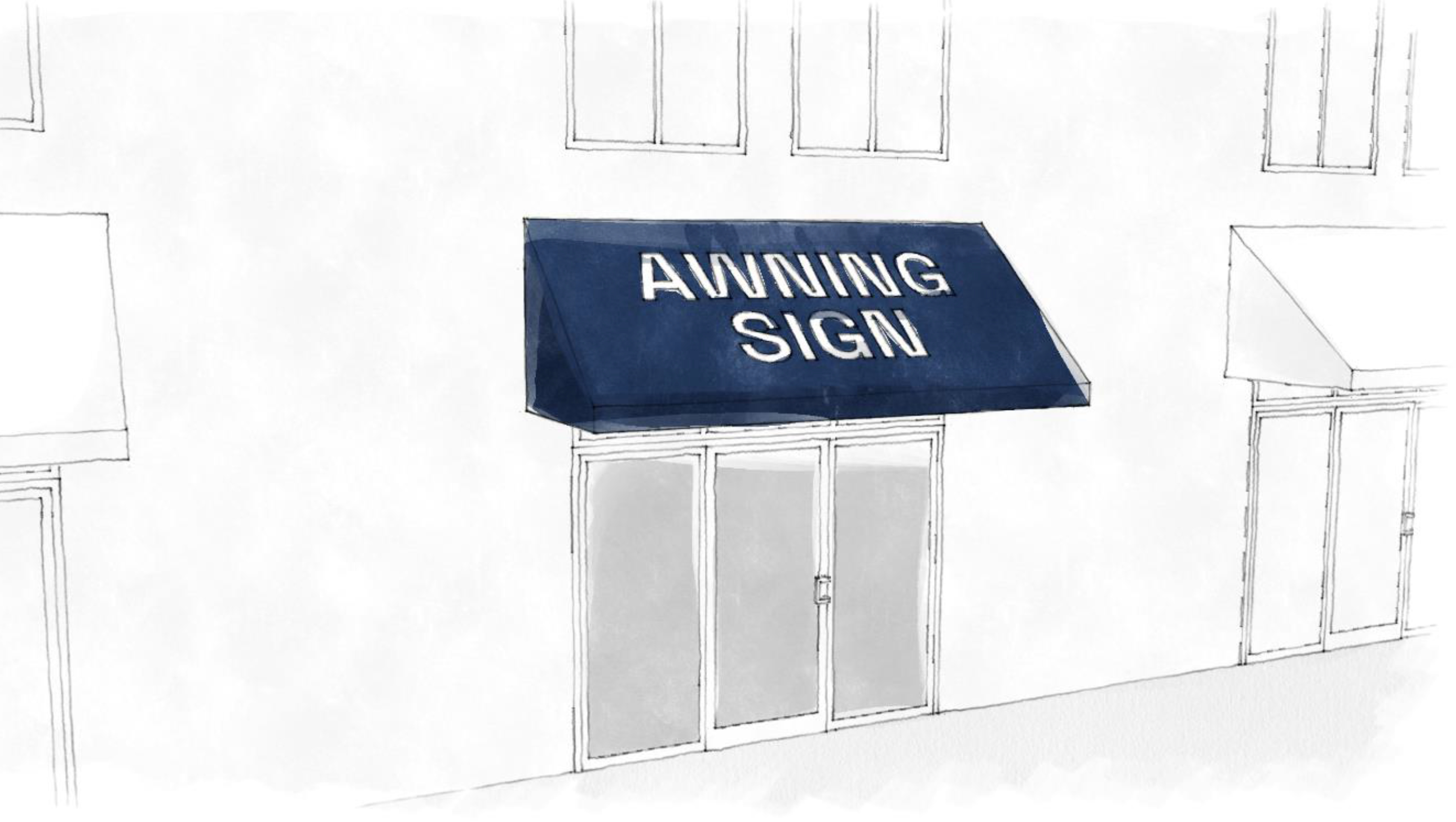
10.
Balloon sign. An inflatable circular or round object tethered in a fixed location that displays signage either on its surface or as an attachment.
Figure 10.3.3: Balloon Sign Example.

11.
Bench Sign. A bench sign is a sign on any portion of a bench or other non-mobile structure or device intended for public seating or convenience.
12.
Billboard. A billboard is a detached pole sign specifically oriented toward vehicular traffic on expressways, interstates, or highways.
Figure 10.3.4: Billboard Example.

13.
Blade sign. A sign affixed to a building or wall in such a manner that its leading edge extends beyond the surface of such building or wall.
Figure 10.3.5: Blade Sign Examples.
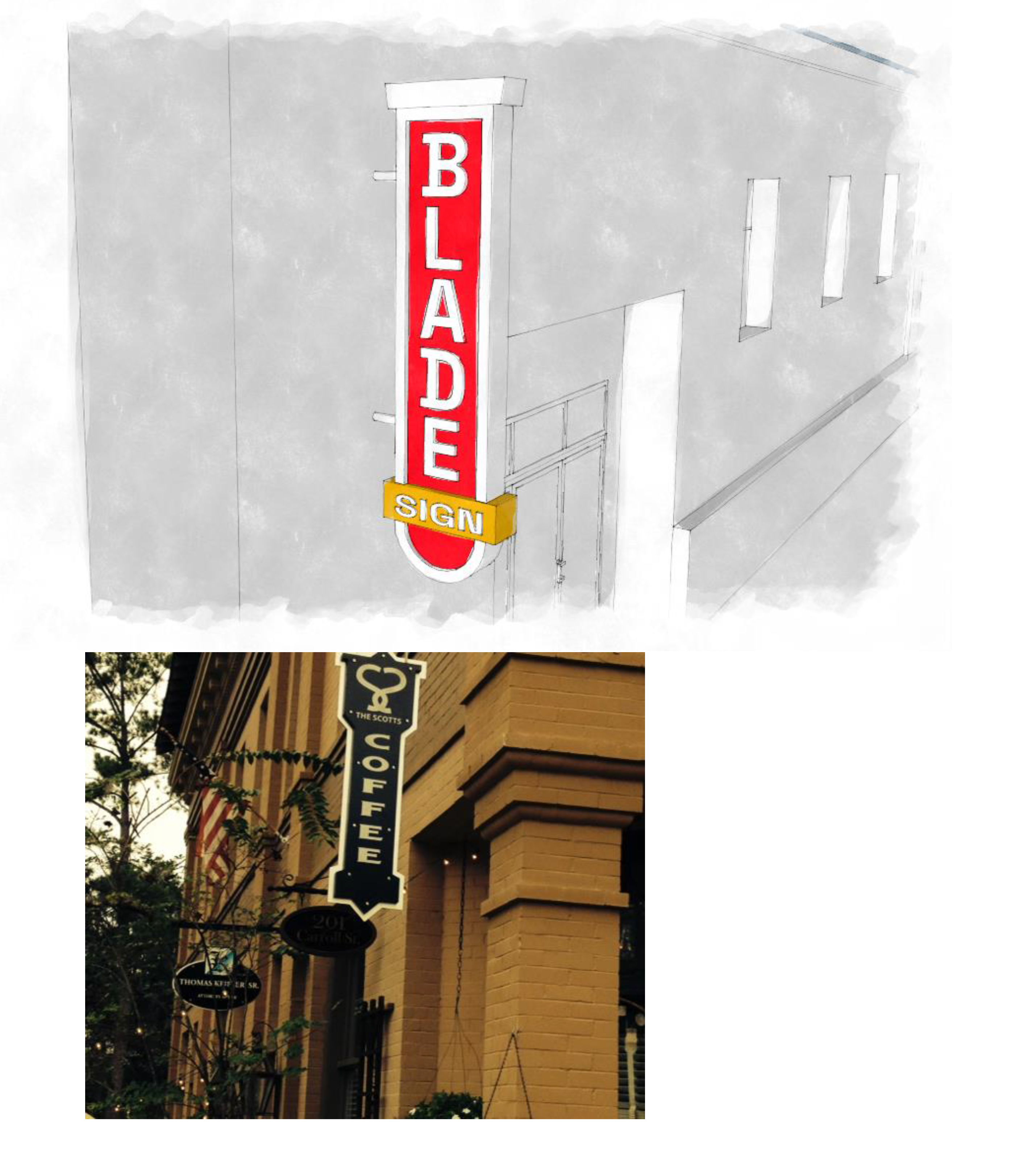
14.
Canopy. An overhead structure that provides weather protection for pedestrians. Awnings and marquees (defined herein) are different types of canopies.
15.
Canopy sign. A sign that is part of, or attached to, a canopy cover or canopy structure.
Figure 10.3.6: Canopy Sign Examples.
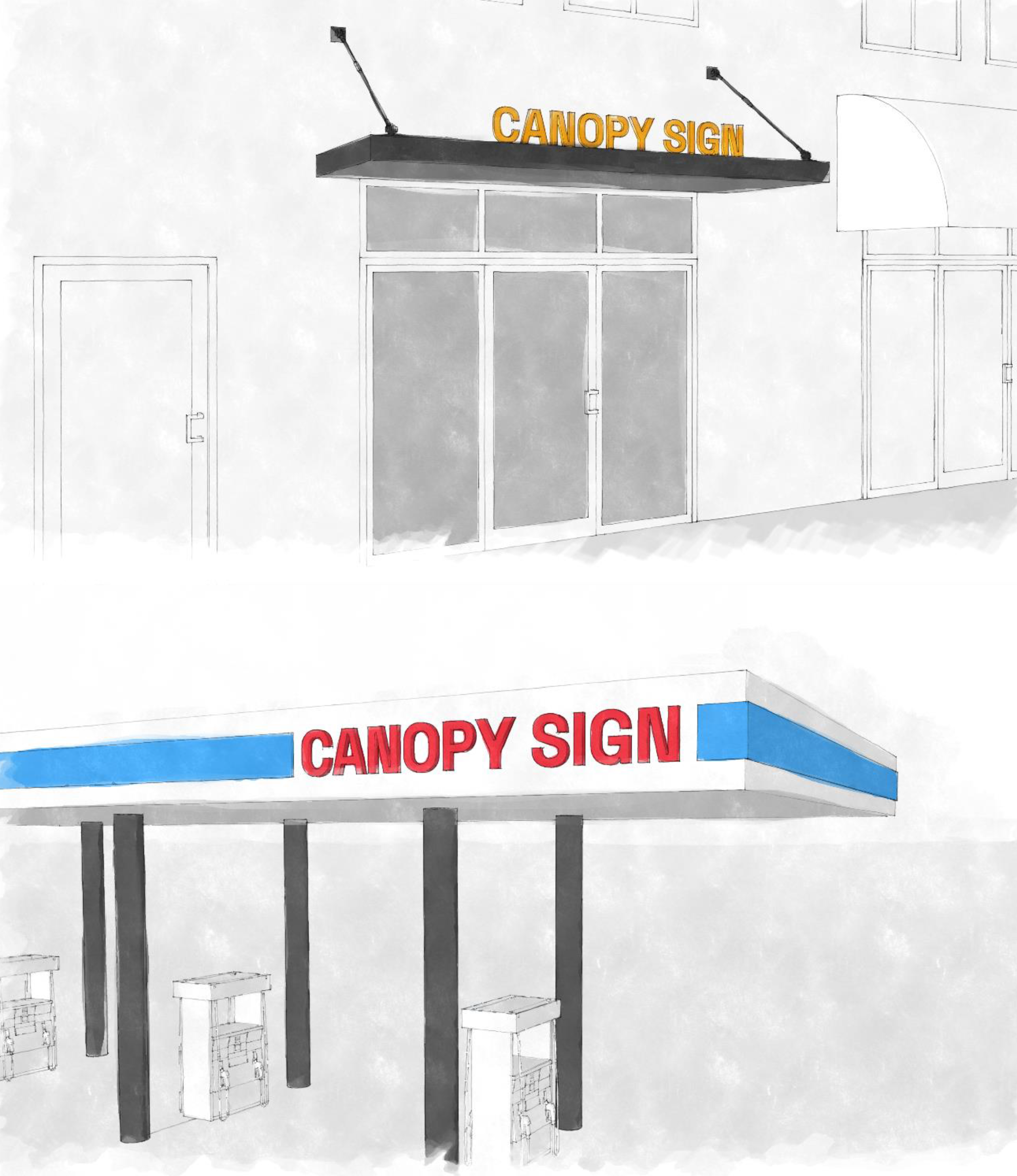
16.
Circulation Sign. A detached sign that is located within 50 feet of an access way that connects private property to a public street or a driveway or pedestrian walkway providing internal circulation within a development site.
17.
Conforming sign. A sign that is legally installed in conformance to all prevailing jurisdictional laws and ordinances.
18.
Copy. The graphic content or message of a sign.
19.
Detached sign. A sign that is not affixed or attached to a building. Detached sign may describe a pole, pylon, billboard, or monument sign.
20.
Drive-through sign. A sign that is specifically oriented toward vehicles within a drive-through queue and is not oriented toward traffic on a public right-of-way, regardless of sign content.
21.
Electrical Sign. An electrical sign is any sign containing a motor or wiring that is connected or attached, or intended to be connected or attached, to an electrical energy source.
22.
Electronic Message Centers (EMC), Electronic Variable Message (EVM) Signs, or Digital Signs. An electrically activated, changeable copy or message sign with a variable message and/or graphic presentation capability that can be electronically programmed by computer from a remote location or at the sign. Also known as an EMC or digital sign, these signs typically use arrays of LED lights to create an illuminated message.
23.
Externally illuminated sign. A sign that uses a light source external to the text or copy elements to improve visibility of the sign in low-light conditions.
Figure 10.3.7: Externally Illuminated Sign Example.
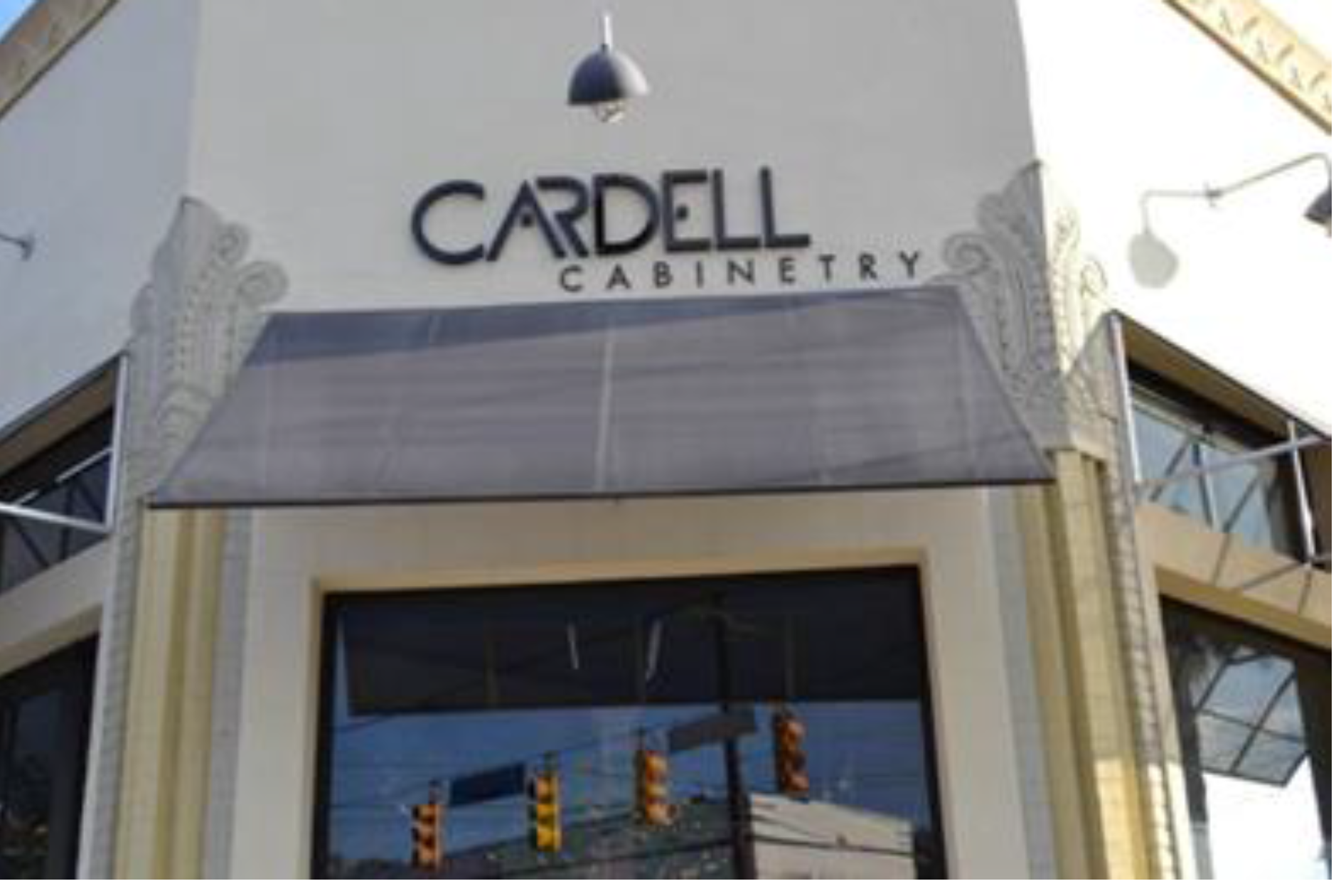
24.
Feather sign. A vertical portable sign that contains a harpoon-style pole or staff driven into the ground for support or supported by means of an individual stand.
Figure 10.3.8: Feather Sign Example.

25.
Flag. Fabric or bunting containing colors, patterns, symbols, or copy that can be raised and lowered on a flag pole. A photo, drawing or similar depiction of a flag on non-fabric material is not included in this definition. Feather signs, banners, or other signs elsewhere defined in this section are not flags.
26.
Flashing Sign. Any sign that conveys a message through one or more light sources turning off and on, which includes signs with animations, video, blinking lights or message changes on an electronic message center that exceed authorized frequencies.
27.
Freestanding Sign. A freestanding sign is a sign supported by a sign structure secured in the ground and which is wholly independent of any guy wire, support wire, building, fence, vehicle or object other than the sign structure, for support. A freestanding sign is synonymous to a detached sign.
28.
Grade or ground. The elevation or level of the street closest to a sign to which reference is made, as measured at the street's centerline, or the relative ground level in the immediate vicinity of the sign.
29.
Haloed letter signs. A sign using illumination set behind text to enhance visibility.
Figure 10.3.9: Haloed Letter Sign Example.

30.
Hanging sign. A sign that is hung perpendicular to a building facade beneath the underside of an awning, canopy, or other structural protective cover over a door, entrance, window, or outdoor service area.
Figure 10.3.10: Hanging Sign Examples.


31.
Illuminated Sign. An illuminated sign is any sign which has characters, letters, figures, designs or outlines illuminated by a light source which is designed to illuminate such signs.
32.
Incidental Sign. A sign that cannot be read from a public right-of-way. For purposes of this definition, incidental signs include sign faces that cannot be seen from a public right-of-way or private street, and signs consisting solely of lettering less than two and one half (2 ½) inches in height.
33.
Indoor Sign. Any sign, located within a building and directed towards people within the building, not including window signs.
34.
Inflatable Sign. An inflatable sign is any sign dependent in whole or in part for its structural integrity on the infusion into said sign of compressed air or other fluids, and specifically including balloons larger than two (2) feet in diameter or two (2) foot square in area or other gas or liquid filled figures.
Figure 10.3.11: Inflatable Sign Example.

35.
Internally illuminated sign. A sign that is illuminated by internal elements.
36.
Lights. Lights serving as signs include the following:
a.
Searchlight: A strong or bright light with a reflector in a swivel so that its beam may be sent or directed in various directions.
b.
Beacon: A strong or bright light focused or directed in one or more directions.
c.
Flashing Lights: Any light or light source or reflection of light source that is intermittent in duration, color, or intensity or which creates or is designed to create an illusion of intermittency in duration, color, or intensity.
d.
String of Lights: A string of electrical conductors containing two (2) or more lights or light sockets.
e.
Laser: A device emitting a narrow, intense beam of light waves that have been amplified and concentrated by stimulated atoms, or the light produced by such device.
f.
Neon or Tubular Signs: Signs with neon, argon or similar gas in a tube which is charged with electricity and used to create an illuminated tubular sign or an illuminated decorative element. The tubing may contain an alternative illumination technology, such as, but not limited to, light-emitting diodes (LEDs). Any nongaseous illumination technology, such as LEDs, must produce illumination that appears to be a continuous, uninterrupted line, similar to illumination produced by gaseous illumination technology. See Sign Standards for further requirements for the use of neon or tubular signage elements.
g.
LED Signs: See Electronic Message Centers
h.
Projected Sign. A projected sign is a sign or visual image created by the projection of light onto a surface.
37.
Marquee Sign. A marquee sign is any sign attached to and made part of a marquee. A marquee is defined as a permanent roof-like structure projecting beyond a building wall at an entrance to a building or extending along and projecting beyond the building's wall and generally designed and constructed to provide protection against the weather. Marquee signs are a type of attached sign.
Figure 10.3.12: Marquee Sign Example.
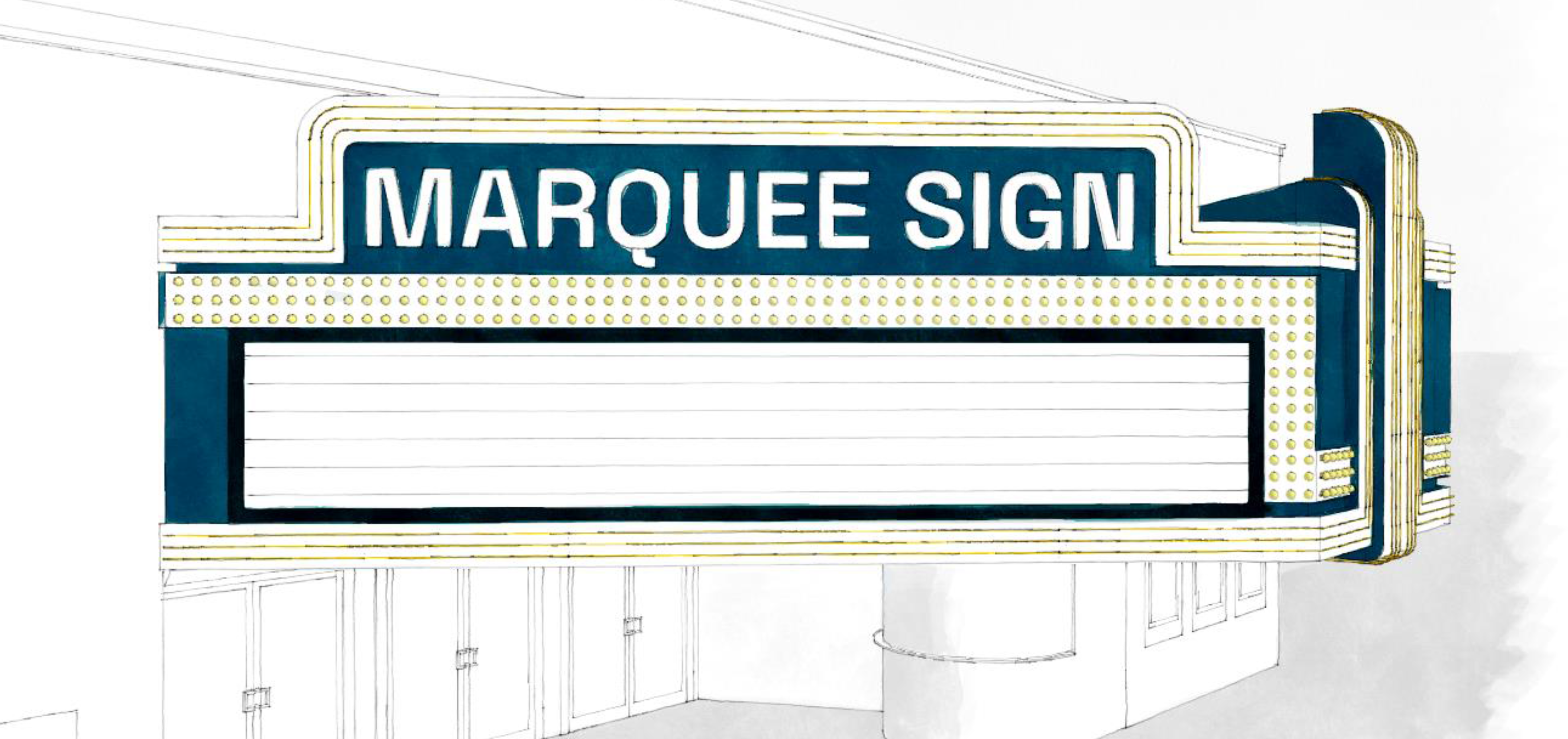
38.
Monument Sign. A monument sign is a detached, low, freestanding sign with the entire length of the sign in contact with the ground or a pedestal that rests upon the ground including the following construction types:
a.
The sign is constructed or connected directly on or to a sign support consisting of a concrete slab base or foundation or a base or foundation of similar type of construction; or
b.
Monolithic construction in which the sign's base or support is of uniform composition with the material comprising the sign area of said sign and the base or support of said sign is directly affixed in or to the ground.
A sign base, foundation or support consisting in whole or in part of above ground poles, piers, piling or similar types of supports that are not concealed by a continuous base that extends the full length and width of the sign shall not be considered a monument sign.
Figure 10.3.13: Monument Sign Example.
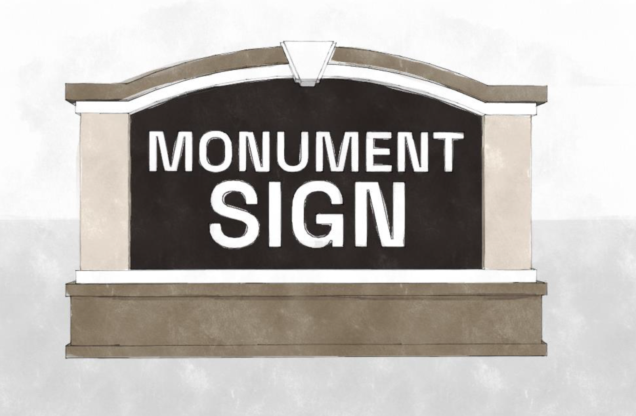
39.
Multi-Occupant Premises (Shopping Center/Campus), Complex Sites, and Large Site Development. Buildings with multiple separately leased units or large site developments having more than four hundred (400) feet of street frontage.
40.
Mural. An image that is painted directly on an exterior wall surface or uses a mosaic method of application. The definition of mural does not include applied vinyl cling wrap or similar techniques.
41.
Non-Conforming Sign. A non-conforming sign is any sign structure or sign which was lawfully erected and maintained prior to such time as it came within the purview of this code or any amendments thereto and which fails to conform to all applicable regulations and restrictions of this code.
42.
Pavement Sign. A sign painted on the pavement in an area with on-site traffic movement.
43.
Pole sign or pylon sign. A sign anchored directly to the ground or supported by one or more posts, columns, or other vertical structures or supports and not attached to or dependent for support from any building.
44.
Portable Sign. A portable sign is any sign other than a trailer or vehicle sign that is not permanently affixed to a building, structure or the ground or a sign designed to be moved from place to place. These signs primarily include, but are not limited to: signs mounted upon a trailer, wheeled carrier or other non-motorized mobile structure, with or without wheels.
45.
Public Information Sign. A sign owned and operated by the City, Parish, State or other agency of the state that is located in the public right-of-way and provides public safety or public service messages.
46.
Rear Door Sign. A sign on or at a rear door of a unit within a non-residential building.
47.
Repurposed Sign. A sign which features a portion of signage or architectural material that has been repurposed to be installed as an attached wall sign, hanging sign, or detached sign.
48.
Revolving or Rotating Sign. A revolving or rotating sign is any sign whose sign face is designed to move or turn on any axis.
49.
Roof Sign. A roof sign is any sign erected or painted upon, against or directly above a roof or on top of or above the parapet of a building. Any sign that extends above the lowest point of the highest roof plane is considered a roof sign.
Figure 10.3.14: Roof Sign Example.
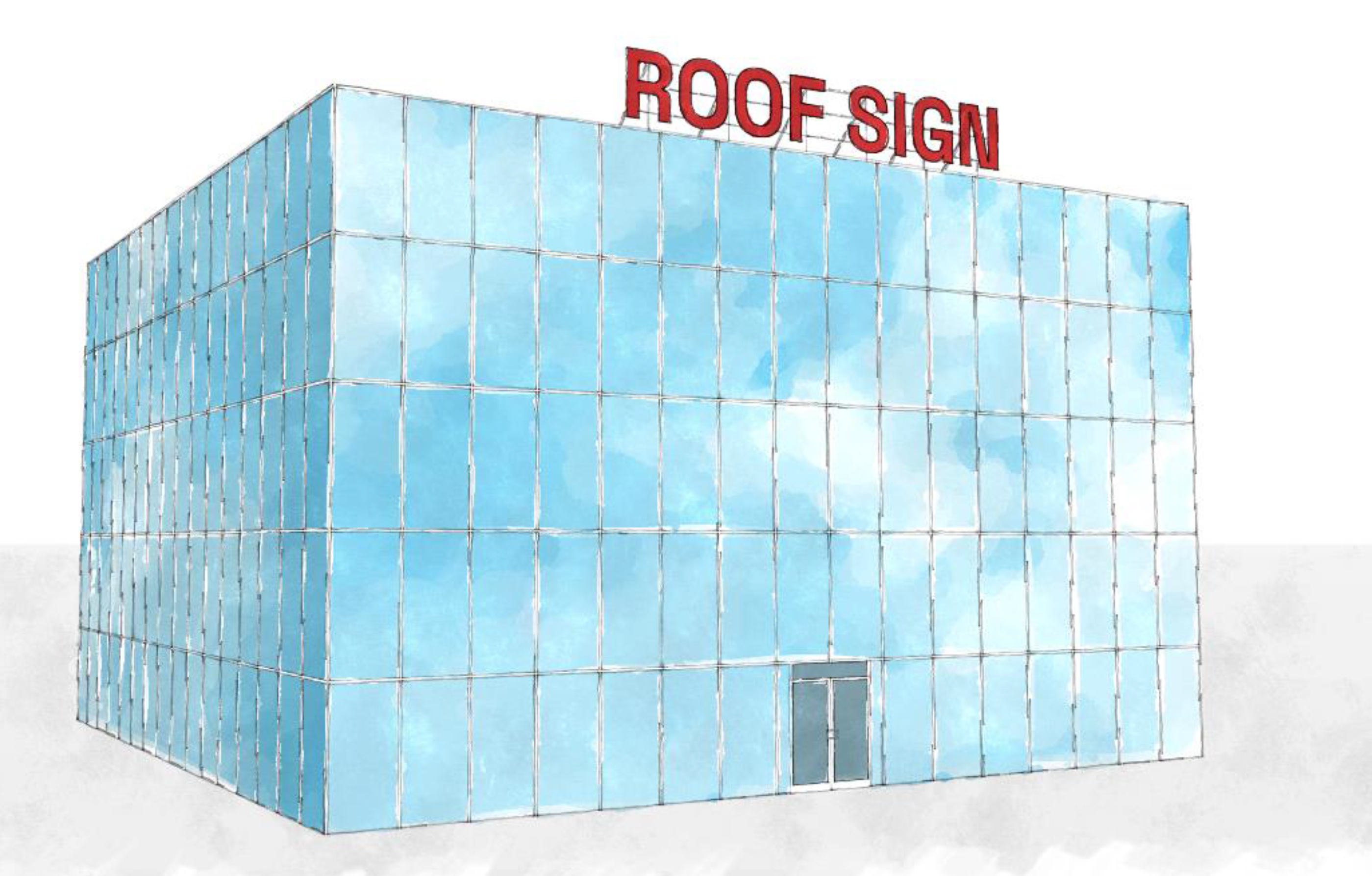
50.
Sign. "Sign" is defined as a medium of communication, including its structure and component parts, which is used or intended to be used to attract attention to its subject matter or location, including paint on the surface of a building.
51.
Sign Area. The entire area of a sign on which copy is to be placed calculated in accordance with this Article or Sign Code.
52.
Sign Face. Sign face is the part of the sign that is or can be used to identify, advertise, communicate, inform, or convey a visual representation or message.
53.
Sign Height. Sign height shall be defined as the vertical distance from the natural grade of the lot to the highest point of either the sign or sign structure, whichever is greater.
54.
Sign Premises. The contiguous land in the same ownership that is not divided by any highway, street, alley or right-of-way. For purposes of this Article a single premises:
a.
May include more than one lot of record when such lots are devoted to a single unity of use; or
b.
May consist of a separate structure on the same lot of record when, in the opinion of the Planning Director, such separate structure appears to be a separate premises.
55.
Sign Structure. A sign structure is the supporting structure upon which a sign or sign face is fastened, attached, or displayed or is intended to be fastened, attached, or displayed; provided however, this definition shall not include a building or fence. The base of a monument sign is part of the sign structure.
56.
Snipe Sign. A snipe sign is a sign that is tacked, nailed, posted, pasted, glued, or otherwise attached to poles, stakes, fences, or to other like objects.
57.
Subdivision Entrance Sign. A subdivision entrance sign is a sign located in close proximity to the entrance or exit of a residential subdivision.
58.
Temporary. A use, structure or activity characterized by an intentional limited duration, transitory nature, or is by design able to occur or exist for short periods of time.
59.
Temporary Sign. A nonpermanent sign that may include wooden stakes as a support structure, cloth, fabric (such as banners), plastic wallboard, or other like materials intended to be displayed for a limited time period.
60.
Trailer Sign. A trailer sign is any sign or sign structure attached to or composed in whole or in part of a trailer frame or chassis or skid or skid frame or body or of any materials which have ever previously constituted in whole or in part such a trailer, skid, frame, chassis, or body.
61.
Unsafe sign. Any sign which, because of its location, coloring, illumination, or animation, interferes with a motorist's perception of vehicular or pedestrian traffic, intersectional traffic, or traffic control devices, or traffic direction signs. Any sign which, because of its construction or state of repair, is likely to fall or blow down or cause possible injuries to passersby.
62.
Vehicle Sign. A vehicle sign is any sign displayed on or from any mode of transportation, including, but not limited to, cars, buses, trucks/trailers, trains, boats, or airplanes.
63.
Wall Sign. A wall sign is an attached sign which is painted on or which projects less than twelve (12) inches from the wall of a building, and is painted on, attached to, or erected against any exterior wall or window of a building or structure with the exposed face of the sign being in a plane parallel to the plane of said wall or window and not extending above the building.
64.
Window Sign. A window sign is any sign which is painted on, applied to, attached to or projected upon the exterior or interior of a building glass area, including doors, or located within one (1) foot of the interior of a building glass area, including doors, that can be perceived from any off-premises contiguous property or public right-of-way.
Figure 10.3.15: Window sign examples.
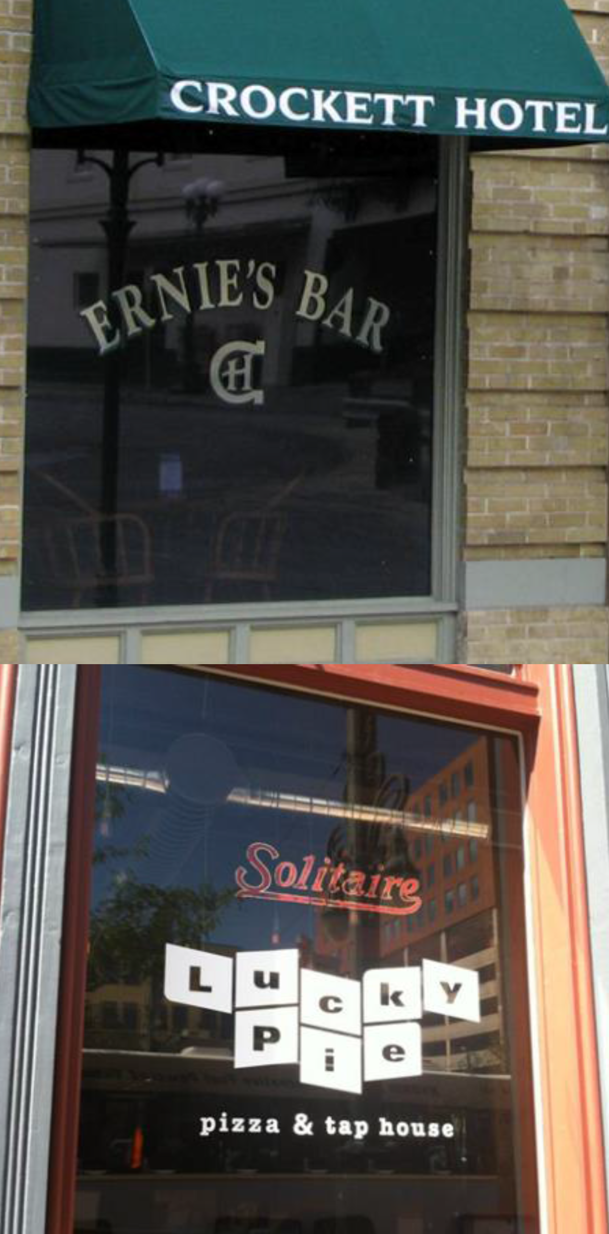
(Ord. No. 23-19, Exh. A, § 3, 6-8-23)
10.4. - PROHIBITED SIGNS.
10.4.1. Prohibited Sign Locations.
Except where specifically authorized by this Article, the following signs are prohibited in the locations set forth below.
1.
Any sign that prevents free ingress or egress from any door, window, or fire escape;
2.
Any sign attached to a standpipe or fire escape;
3.
Any sign that obstructs free and clear vision at any location where, by reason of position, it may interfere with or obstruct the view of traffic sign lines or traffic control devices; and
4.
Any sign attached to any public utility pole, structure or streetlight, tree, fence, fire hydrant, bridge, curb, sidewalk, park bench, statue, memorial, or other location on public property, except those signs constructed, approved, or permitted by the City. Nothing in this section will be construed to prohibit a person from holding a sign while located on public property, provided the person holding the sign is located on public property determined to be a traditional public forum and does not block ingress and egress from buildings or create a safety hazard by impeding travel on sidewalks, bike and vehicle lanes, and trails.
(Ord. No. 23-19, Exh. A, § 3, 6-8-23)
10.4.2. Prohibited Sign Types.
Prohibited signs are subject to removal (except legal nonconforming signs as defined by this Article) by the City at the sign owner's or user's expense. The following types of signs are prohibited within the City of Mandeville:
1.
Abandoned or unsafe signs.
2.
Audible signs.
3.
Beacons.
4.
Bench signs.
5.
Billboards.
6.
Electronic Message Centers (EMC) and electronic variable message (EVM) signs or digital signs. No new or existing signs may be converted to EMC or EVM signs.
7.
Feather signs.
8.
Flashing signs.
9.
Inflatable signs.
10.
Lasers.
11.
Portable signs, trailer signs, or signs mounted on vehicles, shipping containers, or similar items.
12.
Projected signs.
13.
Revolving or rotating signs.
14.
Roof signs or signs above the wall or parapet of a building except where specifically allowed in the Historic Preservation Overlay District.
15.
Signs attached to an un-reinforced masonry parapet.
16.
Search lights.
17.
Signs attached to trees, shrubs, or any living vegetative matter.
18.
Signs that encroach into a public right-of-way, other than public directional signs, public service signs, public information signs, subdivision entrance signs or official notices.
19.
Signs resembling traffic control devices or emergency devices.
20.
Freestanding signs that restrict or impair visibility at the intersection of the right-of-way lines of two streets, or of a street and a railroad right-of-way, or of a street and a pedestrian or bicycle right-of-way.
21.
Snipe signs.
22.
Strings of lights including LED strip or string lights incorporated into window or facade displays.
Exception for holiday lights: Strings of lights are allowed when used as holiday decorations during the period beginning the Sunday prior to Thanksgiving to the second Sunday in January of the succeeding year.
23.
Any sign not specifically defined and allowed by the provisions of this Article.
24.
Any sign that violates LA RS 14:106 or laws prohibiting obscene or offensive material.
(Ord. No. 23-19, Exh. A, § 3, 6-8-23)
10.5. - EXEMPTIONS.
1.
Exempt activities. When normal maintenance and repair of an existing conforming or legally nonconforming sign does not involve structural changes to the existing size, height, area, location; these activities do not require a permit and include, but are not limited to, activities such as painting, repainting, cleaning, or changing a sign face.
2.
Exempt signs. The following sign types do not require a permit:
Table 10.5.1: Signs Allowed Without a Permit.
| Sign Type | Maximum Number and/or Other Design Standards | Maximum Size | Permitted Zoning Districts |
|---|---|---|---|
| Incidental signs | Unlimited provided sign(s) not visible from the public right-of-way | 4 square feet |
I Institutional
B-1 Neighborhood Business District B-2 Highway Business District B-3 Old Mandeville Business District B-4 Major Crossroads Business District O/R Office/Residential District PD Planned District M-1 Light Manufacturing M-2 General Manufacturing TC Town Center |
| A-frame signs |
a) No more than four feet in height;
b) Displayed outdoors only during the hours of 7:00 a.m. to 10:00 p.m. and stored indoors at all other times; c) Limited to one sign per use; d) Separated by a minimum distance of 20 linear feet from the nearest A-frame sign; e) Located to avoid interference with pedestrian traffic and comply with standards of accessibility required by the ADA or other accessibility codes. | 6 square feet per sign face | |
| Indoor signs | Lighted indoor signs shall be located at least five (5) feet inside of any window visible from any street right-of-way or residential zoning district | No maximum | |
| Address signs | One address sign may be provided for each premises in addition to all other permitted signs. This sign may be illuminated. | Two (2) feet by three (3) feet. | All districts |
| Etched signs in windows, above a door, or integral to an architectural component of a building. | Limited to one per building. | No maximum. | All districts |
| Directional or informational signs erected by a public agency, including official notices | Unlimited. | No maximum | All districts |
| Integral decorative or architectural features of buildings |
Excludes painted images, text or copy, or any feature containing moving parts or moving
or flashing lights subject to Planning Director administrative determination. Examples
of an architectural feature of a building may be: a recessed portion of a facade that
includes decorative elements, or a logo embossed into building materials.
 Image credit: https://www.raisingcanes.com/locations/c48/
| No maximum | All districts |
| Temporary signs |
a) No illumination;
b) The sign may be located on a development site for a one-time period (per sign) of no more than ninety (90) days; c) Any temporary sign that exceeds any criteria listed herein must be proposed as a permanent sign and permitted in accordance with the detached sign regulations in of this Sign Code. |
Two signs allowed per site with a maximum cumulative area of 8 square feet in residential
and B-3 districts
One sign permitted per street frontage with a maximum area of 16 square feet per sign in all other districts | All districts |
| Flags, pennants, or other similar signage | Limited to three (3) per site. | Cumulative total of 60 square feet | All districts |
(Ord. No. 23-19, Exh. A, § 3, 6-8-23)
10.6. - SIGN PERMIT APPLICATION PROCEDURES.
10.6.1. Requirement to Obtain a Sign Permit.
1.
It shall be unlawful to construct, erect, repair, alter, relocate, or display with the City of Mandeville any sign without first obtaining a sign permit from the Planning Director and paying the fee set forth in Division 19 of Appendix C of the City of Mandeville Code of Ordinances, unless specifically excluded from the requirement of a permit by this Code.
2.
If a sign permit is required for any establishment that also will require a development permit for renovation, remodeling or new construction, the developer must apply for the sign permit at the same time as the development permit.
(Ord. No. 23-19, Exh. A, § 3, 6-8-23)
10.6.2. Application Requirements for Sign Permits.
1.
In applying to the Planning Director for the issuance of a sign permit the following shall be required:
a.
A completed sign permit application providing all applicable information required by the Building Inspector;
b.
Written consent of the owner of the property or his agent granting permission for the construction, maintenance and display of the sign or sign structure;
c.
Name, address and telephone number of the premises owner, the sign owner, the sign contractor and any designated contact person;
d.
A description of the size and location of all existing signs on the premises; and
e.
Such additional information as may be required by the Planning Director in furtherance of a determination that the provisions of this Ordinance and all other applicable laws and ordinances of the City of Mandeville are being complied with. Such additional information may include, but shall not be limited to:
(1)
Survey. A current survey by registered land surveyor of the premises in question that shall provide sufficient information to determine the allowable total sign area, based on linear footage of street frontage as required by this Code;
(2)
Dimensioned Site Plan of Premises. A required site plan of the premises shall:
(a)
Be drawn to scale and fully dimensioned indicating the location of all structures, including sign structures, both existing and proposed to be constructed, altered, or moved on the premises; and
(b)
Note in writing the existing and intended use of all buildings or structures; and
(c)
Depict the location and identity of all existing or proposed utility poles, lines, structures, servitudes, and rights-of-way; and(d) Depict and identify any applicable greenbelts or vegetation protection zones and the location, size, and type of all existing trees within said greenbelts or protection zones or located elsewhere on said premises if such tree is proposed to be cut, trimmed or removed in the construction or use of the proposed sign structure or any displays exhibited thereon. Tree size shall be shown both in overall height above the ground and trunk diameter at breast height (dbh).
(3)
Elevations and Details.
(a)
Sign elevations and details. Required elevations and details shall be drawn to scale and fully describe the dimensions, structural supports and all pertinent structural details, foundations, materials, method of attachment, conformance with wind pressure requirements and electrical wiring and components of all signs to be constructed, altered or moved sufficient to determine compliance with the provisions of this Sign Code.
(b)
Building elevations. In the case of an application for a permit for an attached sign, an elevation of the building shall provide the linear footage of the facade upon which the sign or signs are proposed to be placed as well as an accurate depiction of the location and size of the proposed sign(s) and all existing signs on the facade occupied by the applicant.
2.
The Planning Director shall have full discretion to determine the completeness of a sign permit application. Incomplete sign permit applications shall be deferred for action until all information required has been provided to enable informed action in conformance with this Code.
(Ord. No. 23-19, Exh. A, § 3, 6-8-23)
10.6.3. Sign Permit Review and Issuance.
1.
All applications for sign permits shall be reviewed by the Planning Director prior to the issuance of any permit.
2.
If the applicant's proposed sign is found by the Planning Director to comply with the provisions of the Sign Code and of all other laws, ordinances, and regulations of this City; the Planning Director shall approve the application and issue the permit.
3.
If the proposed sign is found by the Planning Director to violate any provisions of this Sign Code or of any other laws, ordinances or regulations of the City, the Planning Director shall advise the applicant in writing and the application shall be denied unless the applicant submits an amended application that complies with all applicable requirements within thirty (30) days of written notice of the denial.
4.
Sign measurement and review.
a.
Sign area.
(1)
Signs on a background. Measurement shall include the entire area of the background, including any material or color forming the sign face and the background used to differentiate the sign from the structure against which it is mounted. The area of a sign shall be defined as the square foot area enclosed within the perimeter of a single sign face with each face contributing to the aggregate area of any sign. In cases where there is no definable simple geometric shape, the simplest geometric shape or rectangle enclosing the outer edges of the advertising message shall determine the sign area. In cases of backlighted canopies or awnings with copy, the entire area of the awning shall be considered as the sign area.
(2)
Freestanding letters or logos. For signs consisting of freestanding letters or logos, sign area is calculated as the sum of the area of the squares or rectangles that encompass the text and/or logo(s) or, if available, the calculated total sum of the area of each freestanding letter or logo component.
(3)
Sculptural signs. The sign area of a three-dimensional, free-form, or sculptural (non-planar) sign is calculated as fifty (50) percent of the sum of the area of the four vertical sides of the smallest cube that will encompass the sign.
(4)
Monument signs. If the sign features a sign face mounted on an unadorned base, the base shall not be included in the total area of a monument sign. If the sign face covers the base of the sign, the whole sign face shall be included in the total area calculation.
(5)
Double faced signs. Signs may have copy or images on both sides, however the measurement of sign area for the purpose of administering this code is limited to the area of a single sign face.
(6)
Supports or bracing. Sign area does not include any supports or bracing.
b.
Sign height.
(1)
Generally. Sign height includes the entire structure, including decorative elements and base. For detached signs, height is calculated as the total vertical distance from the natural grade of the lot to the highest point of either the sign or sign structure, whichever is greater.
(2)
Monument signs. Measurement of monument sign height includes the sign structure and base, and does not include the height of an earthen berm located below the sign.
c.
Sign clearance. Sign clearance is calculated as the vertical distance measured from grade, or the base of the building, to the lowest point of the sign.
5.
Specific Review and Issuance Procedures for Signs for a special use or conditional use. The Zoning Commission may grant exceptions to the standards in this section for properties subject to the Special Use Permit process.
(Ord. No. 23-19, Exh. A, § 3, 6-8-23)
10.6.4. Required Fees for Sign Permits.
1.
At the time of submission of an application for a sign permit, a non-refundable plan review application fee shall be paid in accordance with the fee schedule established in Division 19 of Appendix C of the City of Mandeville Code of Ordinances.
2.
When application for a permit is approved and prior to the issuance of a permit, a permit fee shall be paid based on the schedule set forth in Division 19 of Appendix C of the City of Mandeville Code of Ordinances.
(Ord. No. 23-19, Exh. A, § 3, 6-8-23)
10.6.5. Inspection of Signs and Issuance of Certificate of Completion.
1.
Applicants are responsible for requesting inspections, including a preliminary sign inspection, wherein the Building Inspector will verify that sign location and area meet the requirements of the Code, as approved, before the start of construction.
2.
Upon twenty-four hour (24) advance notice by the permit holder, the following required inspections shall be made by the Planning Director or their designated agent:
a.
A foundation inspection prior to pouring concrete for any approved freestanding sign.
b.
Final electrical inspection for all electrical signs.
c.
Final inspection for completion of sign in accordance with approved plans.
3.
No permanent utilities may be permanently connected and no structure or sign, the construction of which necessitates the issuance of a permit under the provisions of this Sign Code, shall be used or displayed until the Planning Director shall have issued a certificate of completion stating that the construction and proposed display or other activity has been found to be in compliance with the permit issued therefor and with the provisions of this Article. If a requested certificate of completion is refused, the Planning Director shall state in writing the reasons for that refusal and deliver those written reasons to the applicant.
(Ord. No. 23-19, Exh. A, § 3, 6-8-23)
10.7. - DESIGN AND CONSTRUCTION STANDARDS FOR ALL SIGNS.
10.7.1. Compliance with Building Code and Licensing of Sign Contractors.
1.
No sign shall be constructed, erected, installed, structurally altered, changed or relocated before first securing a permit, except those signs specifically excluded from the requirement of a permit by this Sign Code.
2.
All new signs shall comply with the structural requirements of the International Building Code (IBC) and with the provisions of this Sign Code and any other codes of the City of Mandeville, whichever is more restrictive.
3.
No person shall engage in any business or activity described in this Sign Code without complying with the terms of this Sign Code.
4.
Every person commercially engaged in constructing, erecting, installing, maintaining or operating outdoor advertising, advertising structures, billboards, advertising signs, painted signs on structures, signboards or similar devices, whether as a primary or incidental activity, and whether or not such person is otherwise licensed by the City, shall obtain a sign contractor's license and pay a fee as set forth in Division 19 of Appendix C of the City of Mandeville Code of Ordinances.
5.
Application and Issuance. Applications for licenses shall be made to the City clerk, on forms to be provided by the clerk. If the application is accompanied by the fee provided in this Sign Code and if there is no violation of any state law or City Ordinance in the application, the license shall be issued.
6.
Public Liability Insurance Required. It shall be unlawful for any person to engage in the business of constructing, erecting, installing, maintaining or operating signs within the City, unless and until such person shall have filed with the City a certificate evidencing the existence of public liability and property damage insurance issued to such person by an insurance or bonding company authorized to do business in this state in a sum of not less than three hundred thousand dollars ($300,000.00) for bodily injury and not less than fifty thousand dollars ($50,000.00) for damage to property in any one occurrence.
(Ord. No. 23-19, Exh. A, § 3, 6-8-23)
10.7.2. Wind Pressure; Design Requirements and Working Stresses.
1.
Wind Pressure. In the design and erection of all signs, the effect of wind shall be carefully considered. All signs shall be constructed to withstand a wind pressure of thirty (30) pounds per square foot.
2.
Design Requirements. Before any permit required by this Sign Code shall be granted the applicant shall submit to the Building Inspector a design and stress diagram or plans and elevations containing the necessary information to enable the Building Inspector to determine that such sign complies with all the regulations of this code. When necessary to make such a determination, the Building Inspector may require engineering data certified and signed by a Louisiana registered structural engineer.
3.
Strength of Parapet or Wall. A parapet wall must be designed to have sufficient strength to support any sign which is attached thereto.
4.
Supports and Braces. Supports or braces shall be of metal and shall be adequate for wind loadings specified in subsection 1. "Wind Pressure" within this section. All metal, wire cable supports and braces and all bolts used to attach signs to brackets, or brackets and signs to the supporting building or structure, shall be of galvanized steel or of an equivalent material. All sign supports shall be an integral part of the sign design.
5.
Sign Anchoring. Signs shall be anchored to prevent any lateral movement that would cause wear on supporting members or connections.
6.
Marquee Signs. Marquee signs shall be constructed entirely of metal or non-combustible material and may be attached to, or hung from a marquee. Any such signs when hung from a marquee shall be at least nine (9) feet at its lowest level above the sidewalk or ground level, and further, such signs shall not extend outside the line of such marquee. Signs painted or sewn onto awnings or canopies, when considered as marquee signs, shall be exempt from the material provisions of this section.
7.
Working Stresses. In all signs, the allowable working stresses shall conform with the requirements of the International Building Code (IBC).
a.
The allowable working stresses for steel and wood shall be in accordance with the provisions of the International Building Code (IBC).
b.
The working strength of chains, cables, guys or steel rods shall not exceed one-fifth (1/5) of the ultimate strength of such chains, cables, guys or steel rods.
(Ord. No. 23-19, Exh. A, § 3, 6-8-23)
10.7.3. - Material Specifications.
Permitted signs shall be constructed only of the following materials:
1.
Incombustible Materials. Corrosion resistant metal or other incombustible materials;
2.
Fiberboard. Highly compressed fiberboard which weighs not less than sixty (60) pounds per cubic foot and is not less than one-eighth (1/8) inch in thickness;
3.
Plywood. Exterior grade plywood not less than three-eighths (3/8) inch in thickness and bearing the stamp of an approved testing agency;
4.
Approved Plastics. Of a thickness and shape necessary to withstand the loadings specified in section 10.7.2 of this Sign Code. Proper allowance or provision shall be made in connections to provide for thermal contraction and expansion. Notwithstanding any other provisions of this code, plastic materials which burn at a rate no faster than two and one-half (2.5) inches per minute when tested in accordance with American Standard of Testing Material D 635 shall be deemed approved plastics and may be used as the display surface material and for the letters, decorations and facings on signs.
5.
Glass. When glass is used for sign letters or transparent or translucent panes, it shall be at least double strength thickness for sign areas up to and including three hundred (300) square inches. When glass is used for sign letters or transparent or translucent panels for sign areas in excess of three hundred (300) square inches at lease one-quarter (0.25) inch wire glass shall be used and maximum span between supports shall be four (4) feet.
6.
Wood Structure. The framework or standards upon which the sign rests may be of wood. Any wooden portion of such structure in contact with the ground shall be either of redwood or any other wood which is a commercially available wood treated with an approved preservative. Sign supports may be no more than two (2) in number and shall be of sufficient strength and foundation to preclude the need for visible cross-bracing.
7.
Metal Structure. All signs of one hundred fifty (150) square feet or over shall be of metal construction and shall have no more than two (2) structural supports.
8.
Repurposed Sign. Any sign that uses repurposed sign materials as defined in this code shall be reviewed as the type of sign it is proposed to be repurposed within. An example of this would be: If a developer proposes to use an old pole sign as an attached wall sign, the proposal shall be reviewed as an attached wall sign.
(Ord. No. 23-19, Exh. A, § 3, 6-8-23)
10.7.4. Auxiliary Specifications.
1.
Obstruction to Exits. No sign shall be erected so as to obstruct any fire escape, required exit, window, or door opening intended as a means of egress.
2.
Obstruction to Ventilation. No sign shall be erected which interferes with any opening required for ventilation.
3.
Clearance from Electrical Power Lines and Communication Lines. Signs shall maintain all clearances from electrical conductors in accordance with the National Electric Code and all communications equipment or lines located within the City.
4.
Clearance from Surface and Underground Facilities. Signs and their supporting structures shall maintain clearance and non-interference with all surface and underground facilities and conduits for water, sewage, gas, electricity, or communications equipment or lines. Furthermore, placement shall not interfere with natural or artificial drainage of surface or underground water.
5.
Clearance of Projecting Signs. Signs projecting from a building or extending over public property shall maintain a clear height of nine (9) feet above the sidewalk and all such signs shall be at least eighteen (18) inches inside of the curbline as measured toward the building.
6.
Signs at Intersections. Freestanding signs shall not restrict or impair visibility at the intersection of the right-of-way lines of two (2) streets, or of a Street and a railroad.
(Ord. No. 23-19, Exh. A, § 3, 6-8-23)
10.7.5. Electrical Sign Regulations.
10.7.5.1.Building Code.
All electrical signs shall be built and installed in compliance with the National Electric Code and the Southern Building Code. All electrical wiring for signs shall be permanently installed and placed underground in metal conduits in accordance with the National Electrical Code.
(Ord. No. 23-19, Exh. A, § 3, 6-8-23)
10.7.5.2.Licensing.
Electrical signs may only be installed by an electrician licensed by the City of Mandeville.
(Ord. No. 23-19, Exh. A, § 3, 6-8-23)
10.7.5.3.Electrical Sign Permit.
The following shall be required prior to the issuance of an electrical permit in conjunction with the erection of an electrical sign:
1.
Wiring schematic or plan fully describing the electrical work to be done.
2.
Compliance with U.L. Standards for electrical work to be done.
(Ord. No. 23-19, Exh. A, § 3, 6-8-23)
10.7.5.4.Electrical Inspection Fees.
An electrical inspection shall be required in conjunction with the erection of an electrical sign. This fee is in addition to the permit fee required under section 10.6.4 "Required fees for sign permits." Such fees are hereby set forth in Division 19 of Appendix C of the City of Mandeville Code of Ordinances.
(Ord. No. 23-19, Exh. A, § 3, 6-8-23)
10.8. - SIGN STANDARDS.
10.8.1. General Requirements for all Districts.
10.8.1.1.Landscaping Requirements for Free-Standing Signs.
1.
Signs Requiring Tree Removal. If the application involves a freestanding sign, monument sign in the greenbelt or freestanding sign outside of the greenbelt or calls for the cutting or removal of any tree of a height in excess of twenty (20) feet or trunk diameter in excess of six (6) inches (dbh), the Planning Director shall not approve the application or issue the requested permit until a landscaping plan for the proposed activity is submitted to and approved by the Landscape Inspector.
2.
Application Requirements. Such landscaping plan shall consist of a design to transition from the monument sign structure to a decorative ground cover and low planting.
3.
Review Criteria. In reviewing such a plan, the Landscape Inspector shall consider such factors as the location, type, number and size of the trees to be removed or cut, any other vegetation which would be damaged or destroyed by the proposed activity, the size and nature of the proposed activity, the character of the premises on which the activity is proposed and of the area surrounding said premises, the obtrusiveness or non-obtrusiveness of the proposed activity on the surrounding area, and the avoidance of the creation or continuation of more or less denuded areas within view of adjacent properties or public ways.
4.
Live Oaks Protected. No permit shall be granted on any application or for any activity which would call for the cutting or removal of any live oak tree or which might damage or injure any live oak tree.
(Ord. No. 23-19, Exh. A, § 3, 6-8-23)
10.8.1.2.Encroachment on Utilities.
1.
Signs Encroaching on Utilities. If the applicant's proposed activity as set forth in his permit application is, upon review, found to involve work or construction on, over or under any existing or proposed utility poles, lines, structures, servitudes or rights-of-way, the applicant shall notify the affected utility or utilities in writing of proposed activities and advise each affected utility that any objections to the proposed activity must be submitted in writing to the Planning Director within thirty (30) days of the receipt of such notice.
2.
Permit Approval Withheld Pending Objections or Non-Response. The Planning Director shall not issue any permit until the applicant provides written permission from each affected utility for the sign placement. If an objection is submitted by an affected utility, the Planning Director shall not issue a permit until such time as the objection shall be withdrawn. If the Utility Company is non-responsive to the request, the Planning Director shall interpret such nonresponse as a "no" answer and shall not proceed with permitting.
10.8.1.3.Limited Use of Neon in Signage Design.
Neon elements may be permitted in signage design only if elements are an integral part of the sign's imagery or aesthetic design and integrated within the body of the sign. The use of neon or tubular elements in a sign exclusively for sign borders or lettering is prohibited.
(Ord. No. 23-19, Exh. A, § 3, 6-8-23)
10.8.2. Permitted Signs Allowed by District and Use.
10.8.2.1.Residential Zoning Districts and Uses.
(Ord. No. 23-19, Exh. A, § 3, 6-8-23)
10.8.2.2.Nonresidential Uses in Residential Zoning Districts.
(Ord. No. 23-19, Exh. A, § 3, 6-8-23)
10.8.2.3.All Land Uses in R-3 and MH Districts.
(Ord. No. 23-19, Exh. A, § 3, 6-8-23)
10.8.2.4.All Land Uses located in B-3 and TC Districts.
(Ord. No. 23-19, Exh. A, § 3, 6-8-23)
10.8.2.5.All Land Uses located in B-1, B-2, B-3, B-4, O/R, PM-1, PM-2, M-1, M-2, I, and TC Districts.
(Ord. No. 23-19, Exh. A, § 3, 6-8-23)
10.8.2.6.Land Uses located in B-1, B-2, B-4, O/R, PM-1, PM-2, M-1, and M-2 Districts.
(Ord. No. 23-19, Exh. A, § 3, 6-8-23)
10.8.3. Specific Sign Design Standards for the B-3 District.
1.
Purpose. The purpose of this section is to promote the establishment of signage within the B-3 district that is consistent with the area's historic character and pedestrian-oriented streetscapes. The Zoning Commission may grant exceptions to the standards in this section through the Special Use Permit process.
2.
Design Principles. The Planning Director and Zoning Commission shall consider the following design principles when reviewing signage requests in the B-3 District.
a.
Signs should reflect the historic character of Old Mandeville and should be compatible with the existing development in Old Mandeville regardless of sign content or message;
b.
Signs should appear aesthetically simple, easy to read and proportional to building design elements and in scale with the pedestrian environment;
c.
Signs should use material and colors that complement the primary building color and overall streetscape;
d.
Wall signs should be at a level that is easy to see for pedestrians passing along the sidewalk and in locations that do not obscure windows, doors, or significant architectural features; and
e.
Signs should use external downward directed lighting that produces an even glow on the sign and does not reflect or spill over onto the sidewalk or adjacent properties; and
f.
New signs should be compatible with historic signs.
3.
Design Requirements. The following design requirements shall apply in addition to standards in this Article and the B-3 zoning district standards.
a.
Materials. Wall and free-standing signs shall be constructed of metal, glass, stone, concrete brick, wood or other material that the Planning Director finds have a substantially similar appearance of one of these materials and equal or greater durability. Awning and canopy signs may be printed on the valance of the awning or canopy.
b.
Illumination. Signs shall be externally illuminated with the following exceptions:
(1)
Neon signs in building windows or on walls that are no larger than eight (8) square feet in area; or
(2)
Backlit or haloed letters or logos attached to building walls, where the lighting source is shielded so that the light source is not visible from above the sign.
(Ord. No. 23-19, Exh. A, § 3, 6-8-23)
10.8.4. Specific Sign Design Standards for the Historic Preservation Overlay District.
1.
Purpose. The purpose of this section is to promote signage in the Historic Preservation Overlay District that is compatible with historic structures and streetscapes. The allowances and procedures outlined below are intended to ensure that signage installed in this district has the flexibility to use designs that are historically authentic and compatible with historically significant signage in Mandeville.
2.
Design Allowances. Attached and monument signs are permitted in accordance with Section 10.8.2. Permitted Signs Allowed by District, however the following allowances shall be permitted in the Historic Preservation Overlay District, subject to review of the Historic Preservation District Commission. Signs installed in the Historic Preservation District Overlay shall be subject to the certificate of appropriateness review process if they fall into the categories listed in Appendix A, Division II, Article 7, Section 7.6.4.4. Applicability. Sign types allowed in this district include:
a.
Etched signs in windows, above a door, or integral to an architectural component of a building.
b.
Marquee signs.
c.
Roof signs, provided the sign design employs historically authentic methods or appearance and the sign is equal to or smaller than existing or historically documented roof signs in the immediate vicinity.
d.
Neon signs, provided the sign complies with 10.8.1.3. Limited Use of Neon in Signage Design.
e.
Murals, provided no more than five (5) percent of the mural's area is lettering.
(Ord. No. 23-19, Exh. A, § 3, 6-8-23)
10.9. - NONCONFORMING SIGNS.
10.9.1. Regulation of Legally Non-conforming Signs.
1.
Expansion prohibited. No legally non-conforming sign may be enlarged or altered in a way which would increase its nonconformity with the provisions of this Sign Code.
2.
Compliance required to increase on site signage. No conforming sign shall be permitted to be erected on the same lot with an existing non-conforming sign until the non-conforming sign has been removed or brought into conformance with the provisions of this Article.
3.
Signs Eligible for Characterization as "Legally Non-conforming." All signs that existed legally before the adoption of this Article or existed legally when constructed but were found to be noncompliant with a provision of this Article that was passed subsequent to their construction, and do not conform to its provisions will be permitted to remain in accordance with this section and be termed a legally nonconforming sign.
4.
Loss of Legally Non-conforming Status. A legally non-conforming sign shall immediately lose its legal non-conforming designation if:
a.
The sign is altered in any way, which tends to make the sign less in compliance with the requirements of this code than it was before the alternation;
b.
The sign structure is relocated;
c.
The site contains a use or development that has lost its legally non-conforming status (and is illegally nonconforming); or
d.
The site becomes vacant (building is demolished) or contains an unoccupied commercial or institutional building as evidenced by the expiration of an occupational license for the building.
On the happening of any (a) or (b), the sign shall be immediately brought into compliance with this code and a new permit secured thereof, or shall be removed.
5.
Damage or destruction. Legally nonconforming signs that are in whole or in part destroyed by force majeure or acts of public enemy may be restored in accordance with the conditions below:
a.
Should any legally non-conforming sign be damaged by any means to an extent of more than fifty (50) percent of its replacement cost at time of damage, it shall not be reconstructed except in conformity with the provisions of this Article.
b.
Should any legally non-conforming sign be damaged by any means to an extent of less than fifty (50) percent of its replacement cost at time of damage, it may be reconstructed provided the restoration is accomplished with no increase in height or area and in compliance with (c), (d), and (e) of this subsection.
c.
Such restoration of a legally nonconforming sign must commence within six (6) months after the nonconforming sign was damaged or destroyed. Said six-month period shall begin on the date that a state of emergency is lifted from the property in question or from the earliest date that the property can reasonably be accessed by the property owner following a disaster that prevents access. After this six month period has passed, if the sign has not been repaired the sign shall lose its legally nonconforming status.
d.
Commencement of restoration shall be evidenced by submittal of a complete application for a sign permit with the Planning Director.
e.
Restoration of legally nonconforming sign must be completed within the time frame prescribed by the building permit. Any extension to the requirements of this section must be approved by the Planning Director and evidenced by an extended building permit.
6.
Maintenance and Repair of Legally Non-conforming Signs.
a.
Nothing in this section shall relieve the owners or users of legally non-conforming signs or the owners of the property on which legally non-conforming signs are located from any provisions of this Sign Code regarding safety, maintenance and repair of signs provided, however, that any repainting, cleaning or other normal maintenance or repair of the sign or sign structure does not materially alter or modify the sign.
b.
The replacement of a sign face shall be permitted as a maintenance or repair action for a legally nonconforming sign, provided no changes are made to the sign structure and that the sign area and height does not increase.
(Ord. No. 23-19, Exh. A, § 3, 6-8-23)
10.10. - OTHER COMMON SIGN PROCEDURES.
10.10.1. Appeals.
A sign permit applicant shall have thirty (30) days from permit denial to submit to the Zoning Commission an appeal of the decision or a petition for other applicable relief from the provisions of the otherwise offended law, ordinance, or regulation. Timely application to the Zoning Commission shall stay the denial of the sign permit application for ninety (90) days. The application shall be denied after said ninety (90) days and the requested permit refused if the applicant cannot show that all necessary relief has been granted by the Zoning Commission.
(Ord. No. 23-19, Exh. A, § 3, 6-8-23)
10.10.2. Commencement of Work Under Sign Permit; Automatic Expiration.
1.
All permits issued under the terms of this Article 10 Sign Code shall expire automatically if the permitted activity or other work described in the application has not commenced within ninety (90) days from the date of the issuance of the permit and any construction or other work required under the terms of the application shall not be substantially completed within one hundred twenty (120) days of the date of issuance of the permit.
2.
The Planning Director may, for good cause shown, grant an applicant two (2) extensions, not to exceed a total of ninety (90) days of such periods.
3.
Any period in which progress on the completion of any work authorized by the permit is stayed by operation of law shall not be considered in the accrual of the periods of time for commencement and completion of permitted work.
(Ord. No. 23-19, Exh. A, § 3, 6-8-23)
10.10.3. Suspension or Revocation of Sign Permit.
The Planning Director may, in writing, suspend or revoke a sign permit issued based on a misstatement of material fact or fraud.
(Ord. No. 23-19, Exh. A, § 3, 6-8-23)
10.10.4. Maintenance of Signs and Premises.
1.
Sign Maintenance. Each sign that has been erected in accordance with the provisions of this Sign Code shall be maintained in substantially the same condition as when the final inspection was made and the sign inspection sticker was issued. Failure to maintain the sign, including exterior painting, shall constitute a violation of this Article. The Planning Director may after notice to the owner and hearing before the Zoning Commission order the removal of any sign that is not maintained in accordance with the provisions of this section. Such removal shall be at the expense of the owner or lessee.
2.
Premises Maintenance. All signs and the premises surrounding them shall be maintained by the owner thereof in a clean, sanitary, and inoffensive condition, and free and clear of all obnoxious substances, rubbish and weeds.
(Ord. No. 23-19, Exh. A, § 3, 6-8-23)
10.11. - ENFORCEMENT OF THE PROVISIONS OF THE SIGN CODE AND PENALTY FOR VIOLATION.
10.11.1. Enforcement and Sign Removal.
1.
Authority. The provisions of this Article shall be enforced by the police. The provisions of this Article shall be administered by the Planning Director. All such officers shall have the power and authority to make inspections of signs, sign structures or premises necessary to carry out their duties in the coordination and the enforcement of the provisions of this Article.
2.
Misrepresentation. The Planning Director may revoke any sign permit where there has been a violation of the provisions of this Article or misrepresentation of fact on the sign permit application.
3.
Authority to remove signs. The Planning Director or their designee is authorized to remove prohibited signs, unsafe signs, abandoned signs, signs constructed without a permit, and signs that have lost their legal nonconforming status as per this Code.
4.
Removal of unlawful signs.
a.
If the Planning Director shall find that any sign or other advertising structure regulated herein is unsafe or insecure, is a menace to the public, is abandoned or is maintained in a dilapidated condition, or has been constructed or erected or is being maintained in violation of the provisions of this Article, they shall give written notice to the permittee or owner thereof or, if he is unable to identify such persons, to the owner of the property on which the sign is located. If the person so notified fails to remove or alter the structure within one (1) month after conviction of violation or imposition of penalty so as to comply with the provisions of this Sign Code, such sign may be removed or altered immediately by the Planning Director at the expense of the permittee, sign owner, or owner of the property upon which it is located. The Planning Director shall refuse to issue a permit to any permittee or owner who refuses to pay costs so assessed. The Planning Director may cause any sign which is an immediate peril to persons or property to be removed summarily without notice.
b.
Signs upon public streets, sidewalks, right-of-way, or other public property may be immediately removed without prior notice.
c.
Any unlawful temporary or portable type sign located on private property that has not been removed after twenty-four (24) hours from notification may be removed by the City at the private property owner's expense. The City may dispose of the subject sign(s) immediately.
d.
Neither the City, nor any of its agents are liable for any damage to the sign when removed in accordance with this section.
e.
In addition to the penalties provided by these regulations, the provisions of this section may be enforced and violations thereof may be abated in accordance with the provisions and procedures set forth in sections 9-44 through 9-48 of Chapter 9 of the Code of Ordinances of the City of Mandeville.
(Ord. No. 23-19, Exh. A, § 3, 6-8-23)
1.
In case any sign structure or sign is erected or structurally altered or maintained or used in violation of the provisions of this Article, any proper City official or his or her duly authorized deputies or representatives may institute any appropriate action or proceedings to prevent such unlawful act or to prevent any illegal act, conduct or use in or about or concerning any such sign, sign structure or premises. Each day any such violation continues shall constitute a separate violation of this Article. The Planning Director may call upon the Chief of Police to furnish necessary personnel to carry out his orders.
2.
Any resident of the community who believes that a violation of any of the provisions of this Article is occurring may file a written complaint with the Planning Director. Such complaint shall fully set forth the acts or omissions constituting the alleged violation and the site or sites at which such violation or violations are alleged to be occurring. The Planning Director shall record properly such complaint, investigate the allegations underlying said complaint, and take action on such complaint and investigation as provided by this Article.
(Ord. No. 23-19, Exh. A, § 3, 6-8-23)
Any person violating any provision of this Article shall be guilty of a misdemeanor, and upon conviction shall be punished as provided in section 1.9 of these Land Use Regulations of the City of Mandeville.
(Ord. No. 23-19, Exh. A, § 3, 6-8-23)