Nash County Unincorporated
City Zoning Code
City Zoning Code
APPENDIX 4
PROCEDURAL FLOW CHARTS
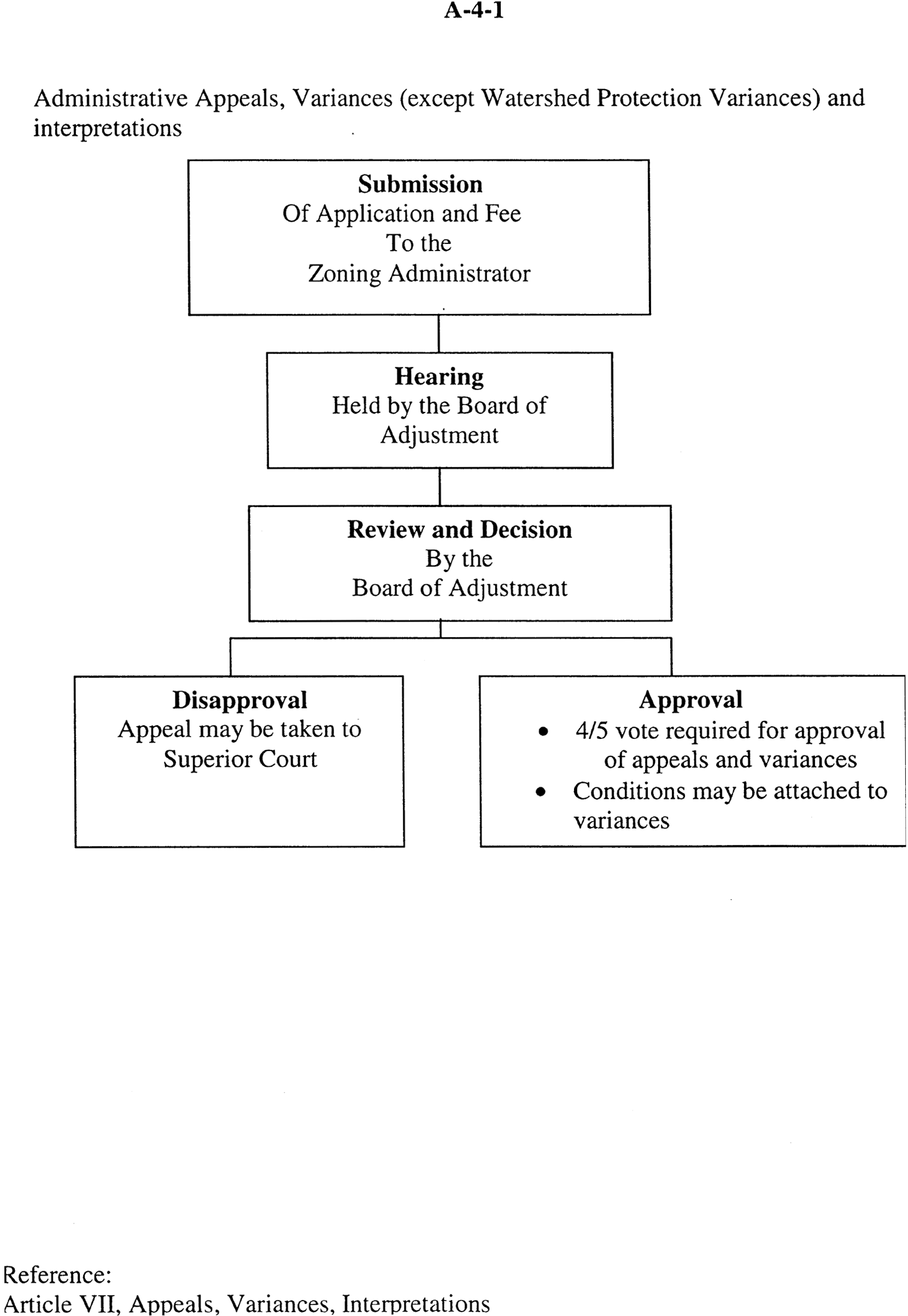
| Appendix A-4-1 | Administrative Appeals, Variances, (except Watershed) and Interpretations |
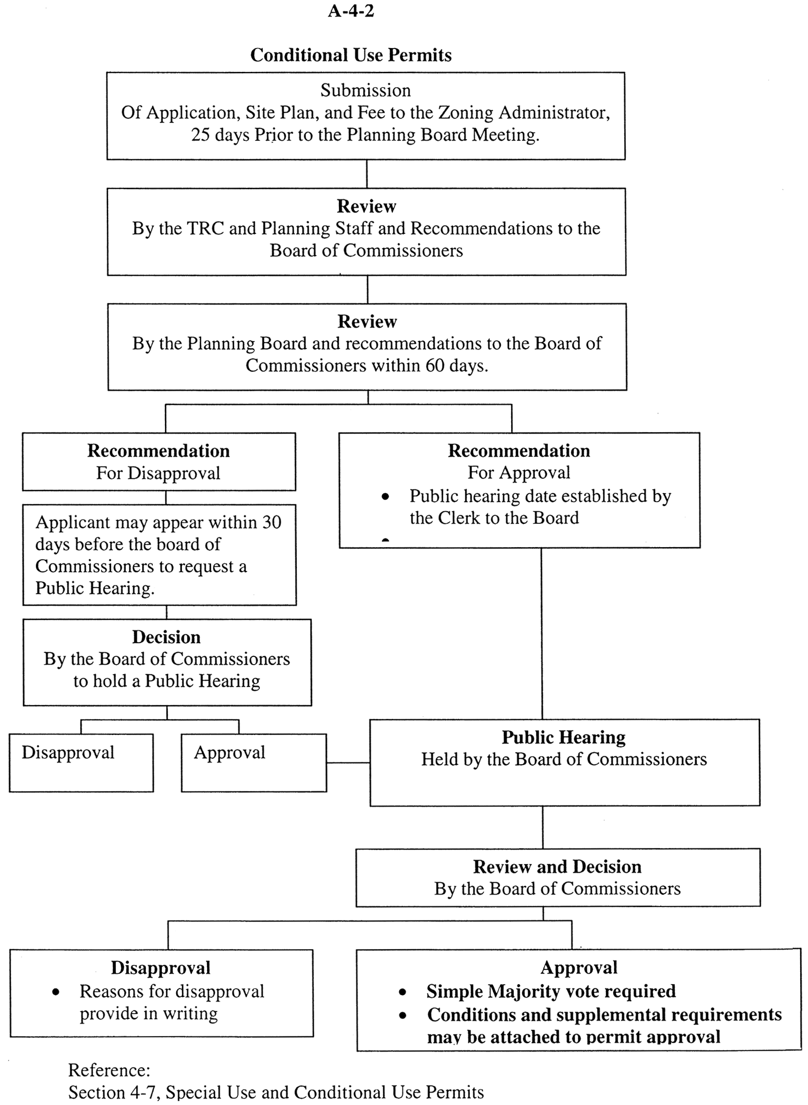
| Appendix A-4-2 | Conditional Use Permits |
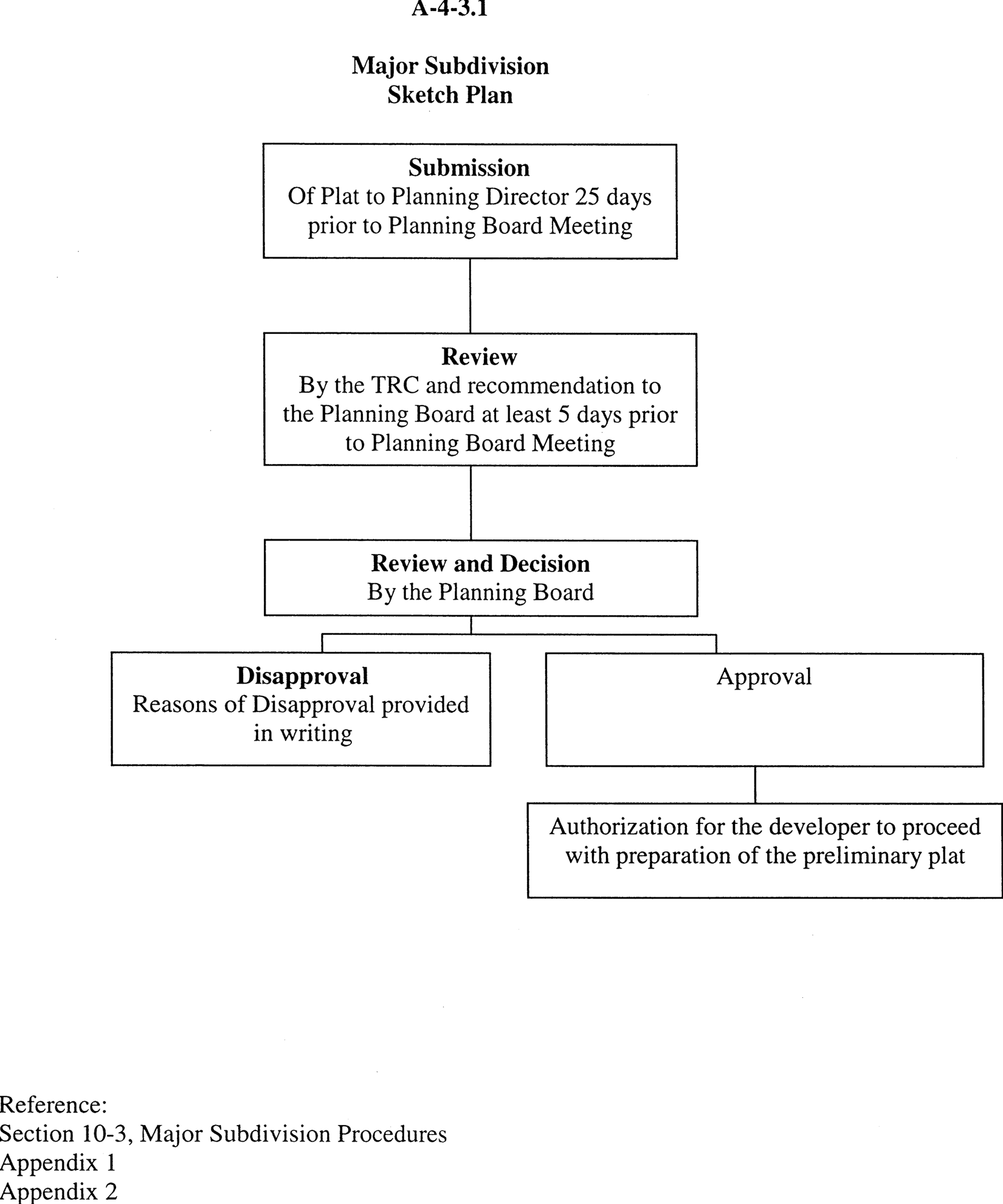
| Appendix A-4-3 | Major Subdivision, I Sketch Plan |
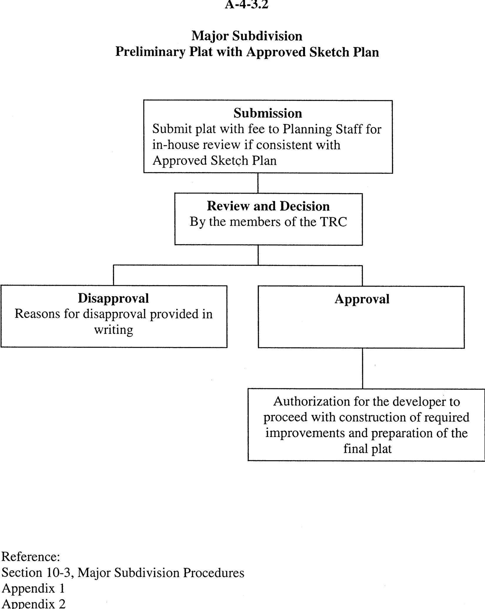
| Major Subdivision, II Preliminary Plat with Approved Sketch Plan | |
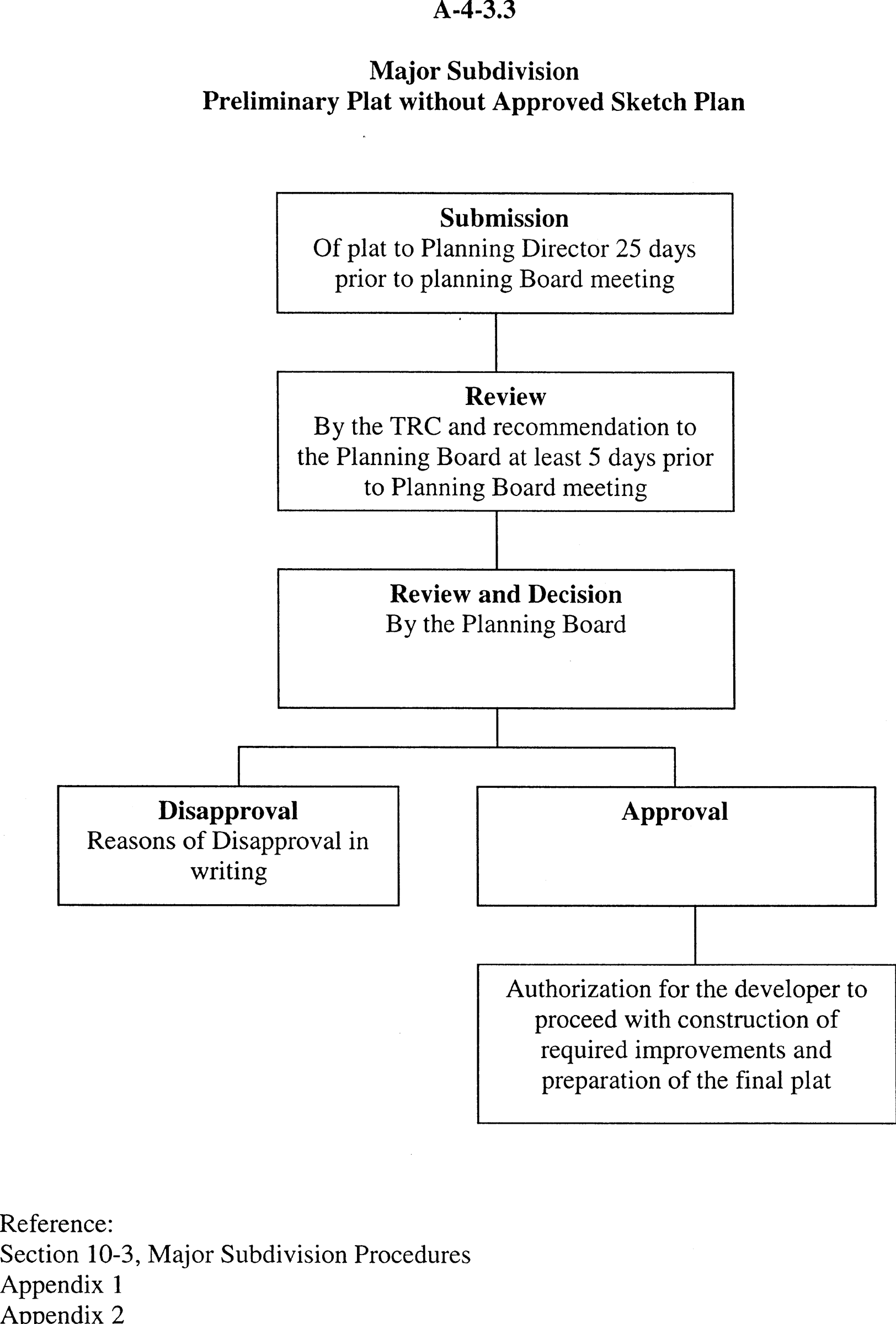
| Major Subdivision, III Preliminary Plat without Approved Sketch Plan | |
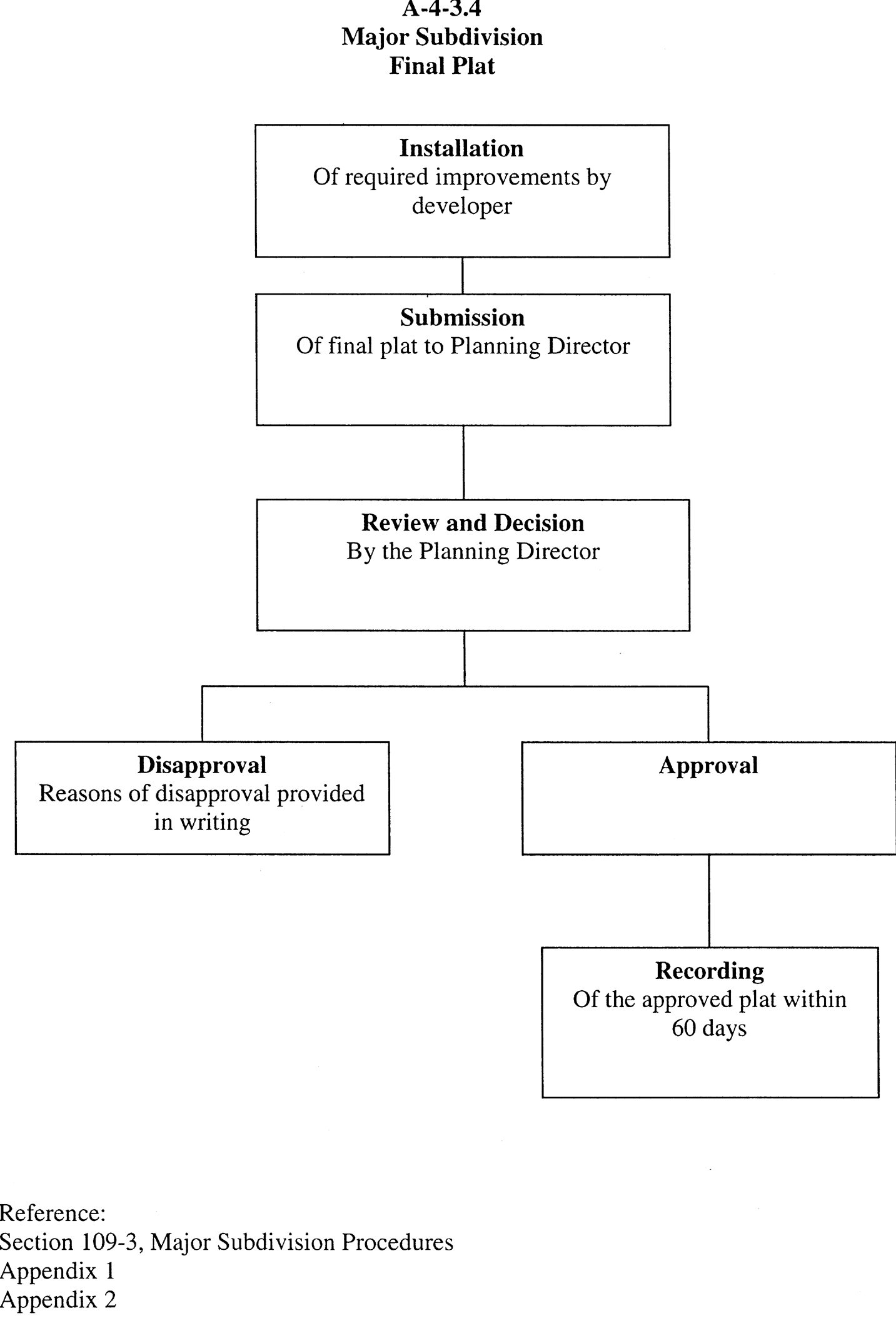
| Major Subdivision, IV Final Plat | |
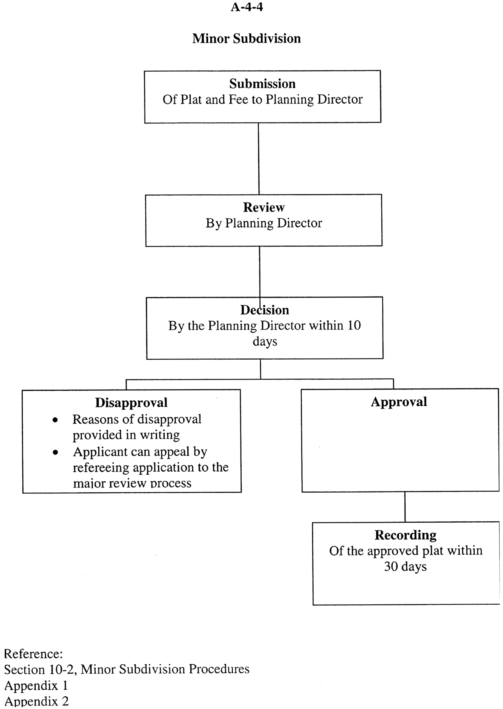
| Appendix A-4-4 | Minor Subdivisions |
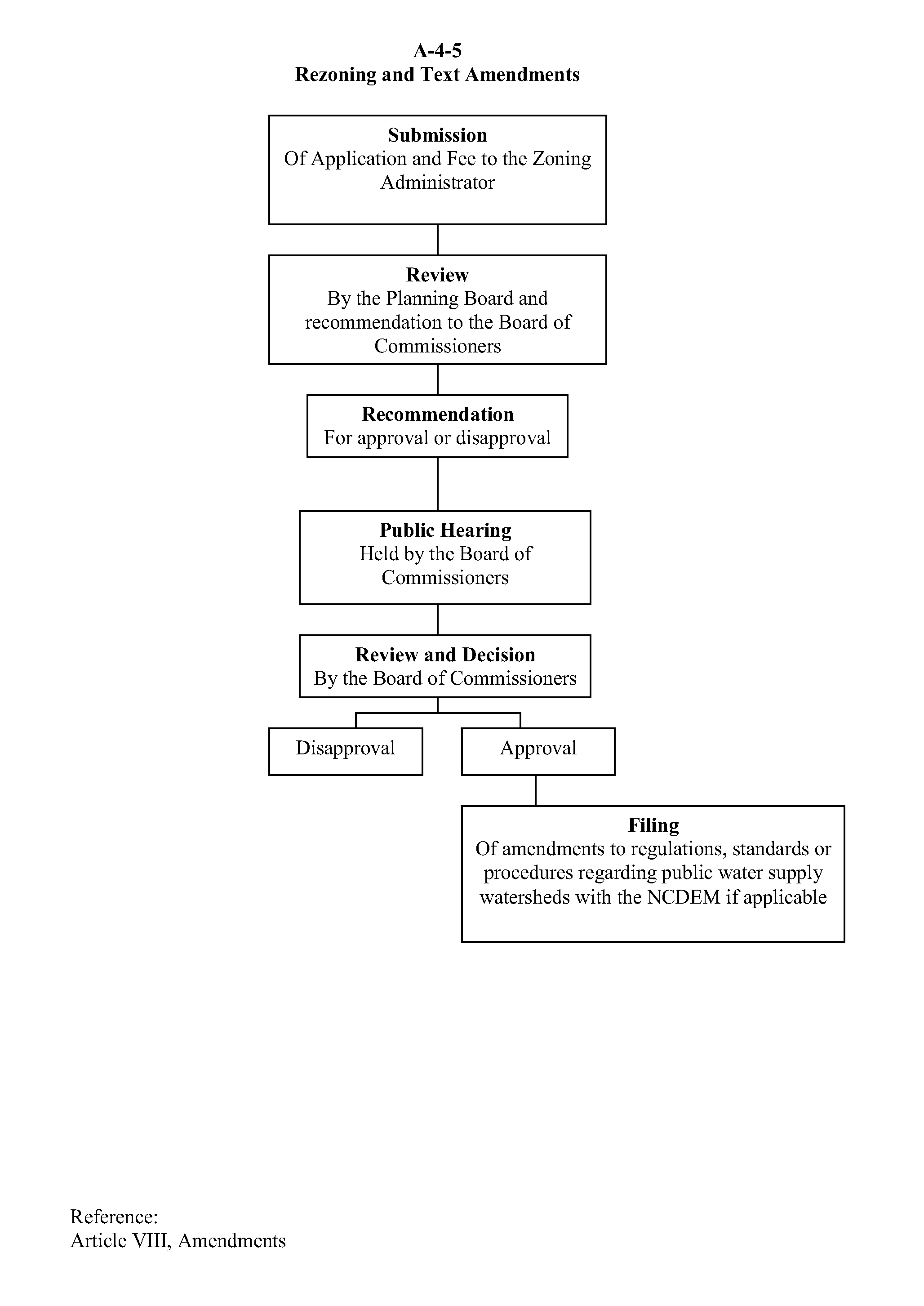
| Appendix A-4-5 | Rezonings and Text Amendments |
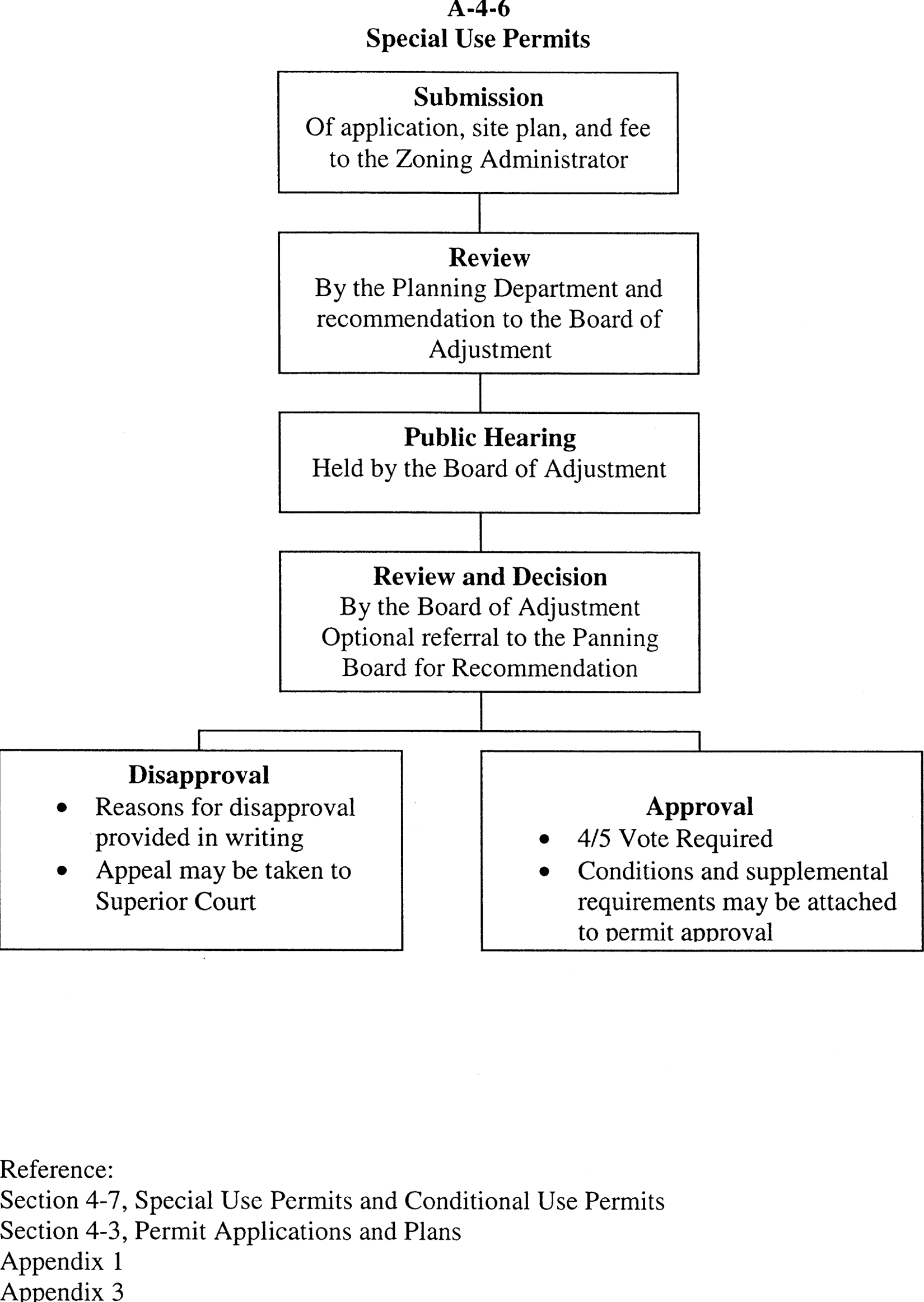
| Appendix A-4-6 | Special Use Permit |
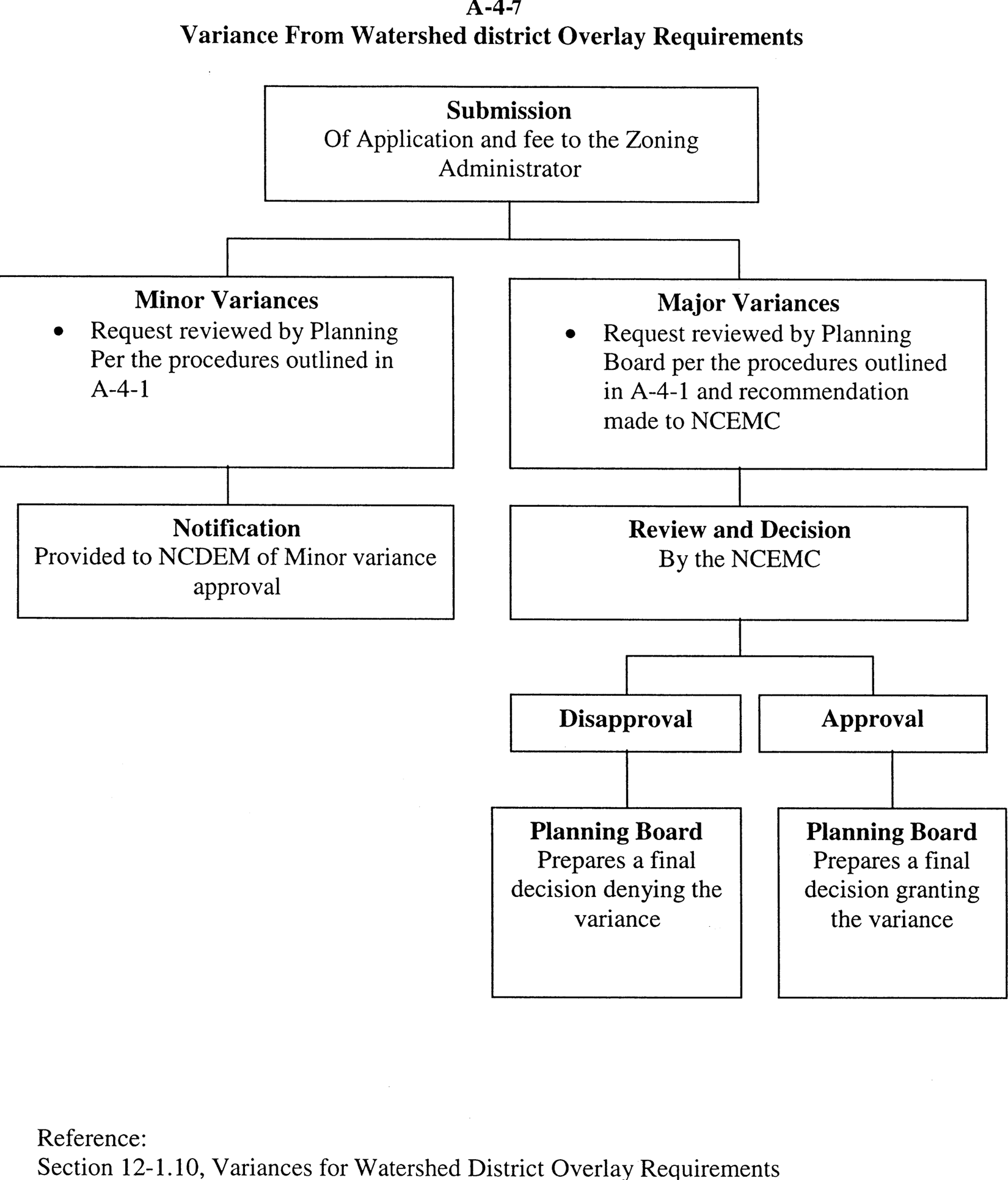
| Appendix A-4-7 | Variances from Watershed District Overlay Requirements |
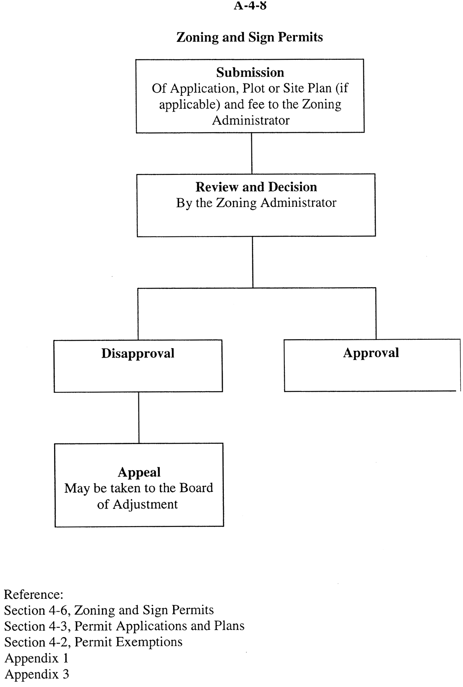
| Appendix A-4-8 | Zoning and Sign Permits |
(Ord. of 2-7-2011)