
Santa Catalina Island
City Zoning Code
City Zoning Code
Division 4
COMBINING ZONES AND SUPPLEMENTAL DISTRICTS
22.46.010 - Intent and Authority.
This Chapter is established to provide procedures for consideration of Specific Plans as authorized by Article 8, Chapter 3, Division 1, Title 7 and other applicable provisions of the California Government Code. It is also the intent to describe the relation between an adopted Specific Plan and the provisions of this Title 22.
(Ord. 2019-0004 § 1, 2019.)
22.46.020 - Procedure and Adoption.
Specific Plans, including any associated regulations, conditions, programs and proposed legislation shall be adopted by ordinance according to the procedures established in Article 8, Chapter 3, Division 1, Title 7 and other applicable provisions of the California Government Code. Any amendments to such Specific Plans or regulations shall also be adopted in accordance with the Government Code provisions mentioned above. No amendment to a Specific Plan certified as part of a Local Coastal Program shall be effective in the Coastal Zone until the amendments are certified by the California Coastal Commission pursuant to Section 30514 of the California Public Resources Code.
(Ord. 2019-0004 § 1, 2019.)
22.46.030 - Administration.
A.
Specific Plans and associated regulations shall be administered in accordance with Article 8, Chapter 3, Division 1, Title 7 and other applicable provisions of the California Government Code. Such plans and regulations may reference existing provisions and procedures of this Title 22 or they may develop different administrative procedures to use in the implementation of the Specific Plan. Except as otherwise expressively provided in a Specific Plan, property may be used for any purpose and subject to all of the standards and requirements of the basic zone. Where the regulations of a Specific Plan differ from the provisions of the basic zone, such regulations shall supersede the provisions of the basic zone as specified in the Specific Plan.
B.
Exceptions.
1.
Density Bonus or Inclusionary Housing. Notwithstanding any contrary provisions in this Chapter, any Specific Plan regulations specified in Subsection A, above, may be waived or modified through a Housing Permit (Chapter 22.166) pursuant to Chapter 22.120 (Density Bonus) or Chapter 22.121 (Inclusionary Housing).
2.
Compact Lot Subdivisions. Any Specific Plan provisions pertaining to a required yard shall apply to the equivalent perimeter yard of a compact lot subdivision pursuant to Section 22.140.585.F.18 (Yard Provisions in Specific Plans and Community Standards Districts).
3.
Accessory Dwelling Units and Junior Accessory Dwelling Units. Where the regulations in Section 22.140.640 (Accessory Dwelling Units and Junior Accessory Dwelling Units) are contrary to the provisions in a Specific Plan regulating the same matter, the provisions in the Specific Plan shall prevail, unless specified otherwise in Section 22.140.640 (Accessory Dwelling Units and Junior Accessory Dwelling Units).
(Ord. 2020-0064 § 8, 2020; Ord. 2020-0059 § 10, 2020; Ord. 2020-0032 § 18, 2020; Ord. 2019-0053 § 17, 2019; Ord. 2019-0020 § 8, 2019; Ord. 2019-0004 § 1, 2019.)
22.46.040 - List of Coastal Specific Plans.
The following Specific Plans are added by reference, together with all maps and provisions pertaining thereto:
(Ord. 2022-0008 § 22, 2022; Ord. 2019-0050 § 1, 2019: Ord. 2019-0024 § 1, 2019; Ord. 2019-0004 § 1, 2019.)
22.46.045 - Santa Catalina Specific Plan and Introduction.
22.46.050 - Purpose.
This Specific Plan constitutes the primary implementation mechanism for the Santa Catalina Island Land Use Plan (LUP) as certified by the California Coastal Commission in November, 1983. As such, it establishes regulations for the development, protection and management of the island's unique resources. The LUP constitutes the first part of the County's State-mandated local coastal program or LCP; the LIP is the second part of the LCP.
(Ord. 2019-0004 § 1, 2019; Ord. 89-0148 § 1 (part), 1989.)
22.46.060 - Relationship to the Los Angeles County General Plan.
A.
The Los Angeles County General Plan consists of those countywide chapters and elements mandated by the California Government Code, as well as a series of community and area plans setting forth more detailed growth and development policies for specific unincorporated communities.
B.
The countywide General Plan establishes, in a broad perspective, future land use, development and conservation policies for Santa Catalina Island.
C.
The Santa Catalina Island LUP serves as the community plan for the unincorporated portions of the island. The LUP essentially constitutes a refinement of General Plan policy and provides a basis for its ultimate implementation through application of this Specific Plan. The LUP contains background information on Catalina Island conditions and resources; the implementation of its policies will be assured in the coastal development permit process which requires a finding that any proposed development is consistent with the local coastal program.
(Ord. 2019-0004 § 1, 2019; Ord. 89-0148 § 1 (part), 1989.)
22.46.070 - Relationship to Zoning.
A.
The regulations and provisions of the Specific Plan work in conjunction with the Los Angeles County zoning ordinance. The Specific Plan provides land use regulations and standards that supersede those contained in the basic or underlying zone. Any provisions of the zoning ordinance that are used to administer or implement the Specific Plan, and are referenced in it, are included in Appendix E. Thus, the Specific Plan is a self-contained document that includes all of the provisions necessary to administer it.
B.
Amendments to the County Code that affect sections cited in this Specific Plan shall not apply to this Specific Plan until certified as amendments to the LCP. Until such changes are certified, only the versions of the County Code in Appendix E of this Specific Plan shall apply.
(Ord. 2019-0004 § 1, 2019; Ord. 89-0148 § 1 (part), 1989.)
22.46.080 - Organization and Content of Specific Plan.
The Specific Plan is organized into three main sections including: 1) land use regulations and development standards; 2) access and circulation; and 3) utilities/public facilities requirements. These sections are summarized below.
A.
Land Use Regulations and Development Standards. This Section sets forth the principal permitted uses and uses requiring other permits for five Specific Plan land use districts. These five districts are: Open Space/Conservation, Two Harbors Resort Village, Utilities and Industrial, Avalon Canyon Resort and Recreation, and Organized Camps and Special Facilities. This Section also contains development standards and conditions for each district. In addition, this Section contains standards which regulate architectural motifs, landscape materials and visual aesthetics.
B.
Access and Circulation. Vehicular and nonvehicular circulation on the island is addressed in this Section, as well as access to and use of the island's shoreline.
C.
Utilities/Public Facilities. This Section identifies infrastructure planning and improvements necessary to support future development on the island.
(Ord. 2019-0004 § 1, 2019; Ord. 89-0148 § 1 (part), 1989.)
22.46.090 - Organization.
A.
The Specific Plan works in conjunction with the zoning ordinance, Title 22 of the Los Angeles County Code, to define and control potential growth and development on the island. This is accomplished by the Specific Plan's land use districts which identify the principal permitted uses, uses requiring other review or permits (e.g., conditional use, surface mining, etc.) and development standards; these districts supersede the basic or underlying zones for their respective areas. The Specific Plan is also an integral part of the zoning ordinance and references many of the existing definitions, provisions and procedures contained in the zoning ordinance. Thus, the Specific Plan and various provisions of the zoning ordinance work together to provide the necessary detailed land use regulations and the appropriate administrative procedures to implement the goals and policies of the Santa Catalina Island Local Coastal Plan.
B.
Each land use district contains provisions which are applicable both district-wide and within specified geographic areas and is organized in the following fashion:
1.
Legal Description. This is a precise description of the boundaries of the district. (See Appendix D for maps of all geographic areas mentioned in the Specific Plan.)
2.
Intent. This is a statement of the purpose of the district with regard to the development and resource protection policies that are to be carried out in the particular district.
3.
Principal Permitted Uses. This is a listing of the uses which clearly implement the designated land uses and policies of the district. These uses require the approval of a coastal development permit unless they are specifically exempted or categorically excluded. Uses are grouped in two categories: those which are allowed throughout the district and those which are restricted to specific geographic areas. These uses are generally not appealable to the Coastal Commission unless they are located in one of the areas listed in Section 22.56.2450 where the Coastal Commission retains appeal jurisdiction. However, because unincorporated Santa Catalina Island does not have a public road within the meaning of the Coastal Act statute defining appeal jurisdiction, the entire island is an appealable area. Coastal development permits for uses which are appealable to the Coastal Commission shall have a public hearing in accordance with Section 22.56.2380.
4.
Accessory Uses. This is a listing of uses, including buildings and structures, which are customarily incidental to, related to and clearly subordinate to the main building, structure or use of land. Accessory uses are subject to the same permit requirements, including the filing of a coastal development permit, as the main uses or buildings to which they are subordinate. Accessory uses are subject to the same coastal commission appeal provisions as the main uses or buildings. Coastal development permits for uses which are appealable to the Coastal Commission shall have a public hearing in accordance with Section 22.56.2380.
5.
Uses Subject to Director's Review. This is a listing of uses that may implement the intent of the district but need review by the Director to determine that development standards have been met and to require conditions when necessary. These uses will require site plan approval in addition to approval of a coastal development permit. These uses are appealable to the Coastal Commission. Coastal development permits for uses which are appealable to the Coastal Commission shall have a public hearing in accordance with Section 22.56.2380.
6.
Uses Subject to Additional Permits. This is a listing of uses which may implement the intent of the district but only under certain circumstances or conditions. These uses may require the approval of conditional use, surface mining, temporary use or other permits in addition to a coastal development permit. Uses are grouped in two categories: those which are allowed throughout the district and those which are restricted to specific geographic areas. These uses are appealable to the Coastal Commission. Coastal development permits for uses which are appealable to the Coastal Commission shall have a public hearing in accordance with Section 22.56.2380.
7.
Development Standards. This is a listing of regulations that apply to development within a particular district. These regulations relate to such aspects as archeological resources, architectural quality, biotic resources, environmental hazards, height limits, landscaping, lot coverage, noise, parking, setbacks, signs, etc. Compliance with these standards will be substantiated through the issuance of coastal development permits.
(Ord. 2019-0004 § 1, 2019; Ord. 89-0148 § 1 (part), 1989.)
22.46.100 - Legal Description—Open Space/Conservation District.
All of the unincorporated area of Santa Catalina Island, except for the portion of Lot 2 of Tract No. 8911 recorded in M.B. 118 3-4 bounded on the northwest by the easterly boundary of the City of Avalon and on all other sides by Lot 1 of Los Angeles County Assessors (LACA) Map No. 59, including all off-shore rocks and islets, and all land as shown on LACA Map No. 59 recorded on February 28, 1952 in Assessors Maps, Book 1, Page 7, except that the property described below is not included in this district:
Lots 1; 3; 8; 9; 14; 64; 83; 85; 86; 88; 89; 99; the northerly portion of Lot 7 which is more particularly described as follows:
Beginning at a point in the westerly line of said Lot 7 which is 2600 feet north of the southwest corner of said Lot 7, thence EAST 280.00 feet, NORTH 420.00 feet, EAST 250.00 feet, South 52°00'00" East 220.00 feet, North 38°00'00" East 250.00 feet, North 20°00'00" West 800.00 feet, North 20°00'00" East 400.00 feet, South 70°00'00" East 300.00 feet, South 7°00'00" West 300.00 feet, South 38°00'00" East 300.00 feet, North 66°00'00" East 300.00 feet, South 24°00'00" East 410.00 feet, South 15°00'00" West 460.00 feet, South 75°00'00" East 280.00 feet, South 11°00'00" West 700.00 feet, and North 54°13'33" East 742.49 feet to a point in the easterly line of said Lot 7, distant thereon NORTH 2550.00 feet from the southeast corner of said Lot 7; thence NORTH along said easterly line of Lot 7 a distance of 1850.98 feet to the northeast corner of said Lot 7, thence North 52°31'25" West 2786.76 feet along the northerly line of said Lot 7 to the northwest corner of said Lot 7, thence SOUTH along the westerly line of said Lot 7 3496.54 feet to the True Point of Beginning;
And that portion of Lot 82 described as follows:
Beginning at a point in the westerly line of said Lot 82 which is 2200 feet NORTH of the southwest corner of said Lot 82, thence North 40°00'00" East to the mean high tide line of the sea, thence in a westerly direction along the mean high tide line of the sea to the westerly line of Lot 82, thence SOUTH to the point of beginning.
(Ord. 2019-0004 § 1, 2019; Ord. 89-0148 § 1 (part), 1989.)
22.46.110 - Intent.
This land use district is established to allow low intensity recreational use and enjoyment of the islands' resources while emphasizing preservation, protection and careful management of these resources. This district also recognizes a limited number of more intense visitor-serving uses in designated areas.
(Ord. 2019-0004 § 1, 2019; Ord. 89-0148 § 1 (part), 1989.)
22.46.120 - Principal Permitted Uses.
A.
The principal permitted use in the Open Space/Conservation District is the conservation of the natural resources together with low-intensity recreational uses which are compatible with resource protection.
B.
Property in the Open Space/Conservation District may be used for the following district-wide uses:
• Beaches and associated passive recreation uses.
• Campgrounds, primitive.
• Range management activities necessary for the maintenance and restoration of biotic and habitat communities; such activities shall include the grazing of buffalo (bison) at numbers which will not adversely affect the biota and regulating the numbers of goats and other herbivores to reduce their impact on native vegetation.
• Riding and hiking trails, excluding trails for motor vehicles.
• Watershed, water recharge and percolation areas.
• Wildlife, nature, forest, and marine preserves and sanctuaries.
C.
Property in the geographic areas listed below may also be used for the following resource compatible uses:
1.
Airport Hub—LACA Lot 71
• Displays: interpretive and informational.
• Restaurant.
2.
Ben Weston Beach—LACA Lots 43 and 44
• Parking area for primitive campground.
• Picnic area.
3.
Black Jack—LACA Lot 63
• Campground, equestrian; 15 PAOT capacity; lower cost public use.
• Campground, improved; 75 PAOT capacity; lower cost public use.
4.
Buffalo Corral—LACA Lot 84
• Campground, equestrian; 25 PAOT capacity.
5.
Buttonshell Beach—LACA Lot 65
• Pier, docks and similar facilities.
• Youth camp with related upland support facilities listed in Section 22.46.130; 450 PAOT capacity.
6.
Cherry Cove/Valley—LACA Lot 98
• Pier, docks and similar facilities.
• Youth camp with related upland support facilities listed in Section 22.46.130; 375 PAOT capacity.
7.
Cottonwood Cove—LACA Lot 58
• Interpretive signs and displays.
8.
Eagle's Nest—LACA Lot 42
• Campground, improved; 20 PAOT capacity; lower cost public use.
• Picnic area.
9.
Gallagher Beach—LACA Lot 17
• Pier, docks and similar facilities.
• Youth camp with related upland support facilities listed in Section 22.46.130; 210 PAOT capacity.
10.
Little Geiger Cove—LACA Lot 98
• Yacht club with upland support facilities for recreational boating listed in Section 22.46.130.
11.
Little Gibraltar Harbor (Steadman Cove)—LACA Lot 67
• Youth camp with related upland support facilities listed in Section 2.46.130; 27 PAOT capacity.
12.
Little Harbor—LACA Lot 59
• Campground, equestrian; 15 PAOT capacity.
• Campground, improved; 200 PAOT capacity; lower cost public use.
13.
Middle Ranch—LACA Lots 39, 40 and 41
• Crops: field, tree, bush, berry and row, including native plant nursery stock.
• Field station for scientific research.
• Raising, grazing, breeding and training of cattle, horses and other equine, including the supplementary feeding of such animals, provided that such grazing is not a part of, nor conducted in conjunction with, any dairy, livestock feed yard or livestock sales yard located on the same premises.
• Ranch.
• Riding academies and stables with the boarding of horses.
14.
Parson's Landing—LACA Lot 100
• Campground, improved; 200 PAOT capacity; lower cost public use.
15.
Rancho Escondido—LACA Lot 60
• Museum for display of Santa Catalina Island artifacts.
• Raising, grazing, breeding and training of cattle, horses and other equine, including the supplementary feeding of such animals, provided that such grazing is not a part of, nor conducted in conjunction with, any dairy, livestock feed yard or livestock sales yard located on the same premises.
• Ranch.
• Riding academies and stables with the boarding of horses.
16.
Ripper's Cove—LACA Lot 82
• Day use activities.
• Interpretive displays and signs.
17.
Shark Harbor—LACA Lot 59
• Campground, primitive; 20 PAOT capacity.
• Parking area.
18.
Starlight Beach—LACA Lot 104
• Campground, primitive; 10 PAOT capacity; boat-in facility.
• Interpretive displays and signs associated with the marine park.
19.
Echo Lake—LACA Lots 63, 66 and 69 (listed as Swain's Canyon in LUP)
• Memorial grove consisting of Santa Catalina Island endemic plants.
20.
Toyon Cove—LACA Lot 52
• Educational, recreational and/or conference facility for overnight use; 300 PAOT capacity.
• Pier, docks and similar facilities.
• Water taxi support facility.
21.
Toyon/Haypress Junction—LACA Lots 16, 18, and 19
• Arboretum or horticultural garden.
• Campground, improved; 100 PAOT capacity; lower cost public use.
• Entry gate kiosk.
• Interpretive displays and signs.
• Ranger station.
• Visitor center, 1,000 square feet floor area maximum.
22.
Johnson's Landing—LACA Lot 100
• Youth camp with related upland support facilities listed in Section 22.46.130; 375 PAOT total capacity combined with Lot 99.
(Ord. 2019-0004 § 1, 2019; Ord. 89-0148 § 1 (part), 1989.)
22.46.130 - Accessory Uses.
Property in the Open Space/Conservation District may be used for the following:
• Accessory buildings, structures and uses customarily used in conjunction with the main building or use of the property.
• Accessory uses and facilities incidental to equestrian campgrounds include, but are not limited to, corrals, tie-ups and water troughs for horses as well as improved campground facilities for riders and other similar facilities.
• Accessory uses and facilities incidental to improved campgrounds include, but are not limited to, authorized fire rings, graded road access, privies or water-operated toilets, cleared tent spaces, tables, interpretive and informational signs, drinking water, group camping areas and trash receptacles and other similar facilities.
• Accessory uses and facilities incidental to lodges, hotels or inns include, but are not limited to, bars, cafes, cocktail lounges, dining rooms, gift shops, restaurants, housing for lodge employees and visitor-serving retail.
• Accessory uses and facilities incidental to passive recreation uses include, but are not limited to, nature observation, photography, sunbathing and other similar uses.
• Accessory uses and facilities incidental to primitive campgrounds include, but are not limited to, authorized fire rings, trail access, limited vegetation removal, privies, small cleared sleeping areas and interpretive and informational signs and other similar facilities.
• Accessory uses and facilities incidental to yacht club upland support facilities include, but are not limited to:
• Active recreation facilities such as sand volleyball courts and swimming docks.
• Chemical toilets maintained in accordance with Chapter 11.38 of Title 11 of the Los Angeles County Code.
• Decks or platforms not more than 30 inches above grade with less than 400 square feet in area.
• Flag poles under 15 feet in height.
• Pergolas and other shade-providing structures with less than 400 square feet in area.
• Picnic areas including tables and outdoor cooking facilities.
• Improved campgrounds.
• Storage sheds having an area of less than 120 square feet.
• Accessory uses and facilities incidental to youth camp or educational institution upland support facilities include:
• Administration offices; camp supplies sales, craft shops, infirmaries and other similar ancillary facilities.
• Educational and recreational activities and facilities.
• Residential uses including tent platforms, dormitories for campers and staff, camp Director's dwelling unit and caretaker's dwelling unit; dining and service/maintenance areas and buildings.
• Water-related sports facilities.
• Animals, domestic and wild, maintained or kept as pets for personal use provided in Part 3 of Chapter 22.52.
• Building materials, storage of, used in the construction of a building project, during the construction and 30 days thereafter, including the contractor's temporary office, provided that any lot or parcel of land so used shall be a part of the building project, or on property adjoining the construction site.
• Signs.
(Ord. 2019-0004 § 1, 2019; Ord. 89-0148 § 1 (part), 1989.)
22.46.140 - Uses Subject to Director's Review and Approval.
If site plans are first submitted to and approved by the Director, property in the Open Space/Conservation District may be used for the following uses:
A.
District-wide.
• Grading, excavation or fill, not to exceed 500 cubic yards of material where necessary to prepare a site for a lawful use.
• Maintenance and minor expansion of existing facilities permitted in the open space/conservation district provided that such activities do not increase the floor area, height or bulk of the existing facility by more than 10 percent.
• Privies.
• Temporary housing for construction workers and other similar persons not permanently employed on Santa Catalina Island. Such housing may consist of a mobilehome or recreational vehicle which shall be removed from the site prior to the end of 12 months from the date of approval unless a request for an extension has been submitted to and granted by the Director. An extension, not to exceed an additional 12 months, may be granted if the Director finds that there is a documented need for continuation of the use and that there has been no adverse environmental impact associated with the use. Such housing shall be located at the actual construction or work site unless the Director finds that the site is unsuitable for temporary housing because it would require excessive site preparation or would have other significant adverse environmental impacts, in which case the closest alternate location may be used that is more protective of resources. Temporary housing may not displace campgrounds or hostels.
• Youth camps, increased capacities; as provided in Section 22.46.160.G.
B.
In addition to the uses listed in Subsection A of this Section, property in the following areas may also be used for the following uses specified for each of the following areas:
1.
Airport Hub—LACA Lot 71
• Dwelling units for persons employed and deriving a major portion of their income within the land use district, if occupied by such persons and their immediate families.
• Lodge, hotel or inn including associated commercial services; 50 guest room maximum.
• Youth hostel.
2.
Black Jack—LACA Lot 63
• Ranger station.
3.
Eagle's Nest—LACA Lot 42
• Dwelling units for persons employed and deriving a major portion of their income within the land use district, if occupied by such persons and their immediate families.
• Lodge, hotel or inn including associated commercial services; 50 guest room maximum.
4.
Little Harbor—LACA Lot 59
• Ranger station and dwelling units for campground and range management personnel.
5.
Middle Ranch—LACA Lot 39, 40 and 41
• Dwelling units for persons employed and deriving a major portion of their income within the land use district, if occupied by such persons and their immediate families.
• Lodge, hotel or inn including associated commercial services; 50 guest room maximum.
• Noncommercial rooming house for scientists, interns and guests.
6.
Rancho Escondido—LACA Lot 60
• Dwelling units for persons employed and deriving a major portion of their income within the land use district, if occupied by such persons and their immediate families.
• Dwelling units for the property owner.
• Lodge, hotel or inn including associated commercial services; 50 guest room maximum.
• Rodeos and similar special events.
7.
Toyon/Haypress Junction—LACA Lots 16, 18 and 19
• Dwelling units for persons employed and deriving a major portion of their income within the land use district, if occupied by such persons and their immediate families.
• Parking area.
(Ord. 2019-0004 § 1, 2019; Ord. 89-0148 § 1 (part), 1989.)
22.46.150 - Uses Subject to Additional Permits.
Property in the Open Space/Conservation District may be used for:
A.
The following uses in the areas specified, provided a conditional use permit has first been obtained as provided in Part 1 of Chapter 22.56, and while such permit is in full force and effect in conformity with the conditions of the permit for:
1.
District-wide.
• Borrow pits, provided the excavation does not cause adverse impacts on the environment and that the excavated material is used within the land use district and not sold for commercial purposes.
• Buildings, nonresidential, exceeding 400 square feet in floor area.
• Communication equipment buildings, with accessory antennas, subject to the provisions of Section 22.46.520 relating to view protection.
• Educational and scientific research facilities.
• Electric distribution and transmission substations, including microwave facilities used in conjunction therewith.
• Flood Control facilities.
• Grading, excavation or fill, exceeding 500 cubic yards of material where necessary to prepare a site for a lawful use.
• Publicly owned or operated uses necessary to the maintenance of the public health, convenience or general welfare in addition to those specifically listed in this Section.
• Telephone repeater stations.
• Water reservoirs, dams, treatment plants, gaging stations, pumping stations, tanks, wells, and any use normal and appurtenant to the storage and distribution of water, including water reclamation and desalinization facilities.
2.
In addition to the uses listed in Subsection A.1 of this Section, a conditional use permit may be applied for the uses specified in each of the following areas:
(a)
Airport Hub—LACA Lot 71
• Airport, and associated aircraft and passenger services, with a maximum capacity of 400 planes to be accommodated overnight.
(b)
Well's Beach Uplands—LACA Lot 97
• Waste disposal facility.
B.
The following uses provided the specified permit has first been obtained and while such permit is in full force and effect and in conformity with the conditions of such permit for:
• Temporary uses, as provided in Part 14 of Chapter 22.56.
(Ord. 2019-0004 § 1, 2019; Ord. 89-0148 § 1 (part), 1989.)
22.46.160 - Development Standards.
In addition to the standards applicable to all property on Santa Catalina Island, the following apply specifically to the open space/conservation district:
A.
Campgrounds.
• Campground designation for lower cost public use shall be available to all members of the general public, irrespective of group affiliation. A user fee shall be established to accommodate persons of lower income (80 percent or below median income of Los Angeles County); this fee may be modified annually based on changes in the consumer price index or other similar economic indicator for the Los Angeles metropolitan area.
• The PAOT capacities, which refer to persons staying overnight, for the campgrounds in this district may be exceeded no more than five days in any 30 day period subject to the approval of Parks and Recreation and the Santa Catalina Island Conservancy. Such approval shall be granted when findings are made that the use will not adversely affect public health, safety or the environmental resources of the area.
B.
Day-use only areas shall be restricted to use beginning one hour before sunrise and ending one hour after sunset. No overnight camping or other nighttime uses are allowed.
C.
Dwelling units for employees shall be limited to the existing units at each site unless the Director verifies a need for additional housing for essential on-site staff and finds that any additional dwelling units will not adversely affect the environment. The Director may approve up to five additional units over those existing in August 1989 as a use subject to Director's review, based on a verified need for essential on-site staff, available water and conformity with the resource provisions of this plan.
D.
Fencing to protect plant and animal habitats shall be designed to assure continued access along designated trails and roads.
E.
Lodges shall have an architectural style that achieves a rustic appearance through the use of rough-sawn wood, stonework, masonry, rough-finished plaster or similar exterior finishes which are compatible with a rural setting. The architectural style of the lodges, which shall not exceed a height of 35 feet, shall be compatible with the rural environment and existing buildings. A user fee shall be established to accommodate persons of low or moderate income (120 percent or below median income of Los Angeles County); this fee may be modified annually based on changes in the consumer price index or other similar economic indicator for the Los Angeles metropolitan area.
F.
Upland shoreline lease area support facilities.
• Development shall be located a minimum of 150 feet from the mean high tide line; if this standard is impractical because of topography or other environmental constraints, the Director may allow development to within 25 feet of the mean tide line or the inland extent of any beach, whichever is greater.
• Development shall be sited to be compatible with the public use of the beach or shoreline by preserving sufficient areas for public access and recreation.
• No structure shall be allowed on hillsides having a slope exceeding 30 percent.
• On hillsides having a slope exceeding 15 percent, all graded areas shall be planted and maintained for erosion control and visual enhancement purposes to screen or soften the visual impact of any cut and fill slopes. In addition, grading plans shall be revised to reduce visible height of cuts and fills and changes in cove geometry.
G.
Youth camp PAOT capacities for each site may be expanded if there is a verified need, if there are no adverse impacts on the island's resources and if the expansion would not require a substantial increase in water usage that would adversely impact the island's water supply. Such requests to increase youth camp capacities shall be accompanied by a master plan as described in Subsection H of Section 22.46.550 and shall be subject to review and approval of the Director.
H.
Ben Weston Beach—LACA Lots 43 and 44
• Campground, primitive; 50 PAOT capacity; lower cost public use.
• The sensitive sand dune plant community shall be protected by prohibiting all development within the sand dunes and other measures as may be necessary including, but not limited to fencing or erecting signs along the periphery of the dune area informing people that the dunes are not to be entered.
• The parking area shall be located at least 250 feet from the mean high tide line.
I.
Cottonwood Canyon—LACA Lots 59, 60, 61, 62 and 69
• Any development between 100 and 250 feet of the edge of the riparian vegetation shall mitigate possible adverse effects such as siltation, run-off and pollution.
• There shall be no new development, except water wells developed in conformance with Sections 22.46.470 and 22.46.730; within 100 feet of the edge of riparian vegetation.
J.
Cottonwood Cove—LACA Lot 58
• Use of this area shall be restricted to daylight hours only.
K.
Rancho Escondido—LACA Lot 60; Middle Ranch—LACA Lots 39, 40, and 41
• Agricultural operations shall not exceed 200 acres at any one time for LACA Lots 39, 40, and 60 combined.
L.
Sweetwater Canyon—LACA Lots 42, 43, 44, 45 and 46
• There shall be no new development, except water wells developed in conformance with Sections 22.46.470 and 22.46.730, within 100 feet of the edge of riparian vegetation.
• Any development between 100 and 250 feet of the edge of the riparian vegetation shall mitigate possible adverse effects such as siltation, run-off and pollution.
M.
Goat Harbor—LACA Lot 67
• Campground, primitive; 10 PAOT capacity; boat-in facility.
N.
Italian Gardens—LACA Lot 65
• Campground, primitive; 10 PAOT capacity; boat-in facility.
O.
Willow Cove—LACA Lot 52
• Campground, primitive; 10 PAOT capacity; boat-in facility.
P.
All off-shore rocks and islets
• Restricted to use as marine preserves and/or maintained for scientific research and education.
• Uses requiring a Director's review and approval or a conditional use permit listed in Section 22.46.140 and Section 22.46.150.A.1 are allowed only if they are compatible with the marine preserve designation.
Q.
State jurisdiction in specified area
• Piers, docks and any other development proposed or undertaken on any tidelands, submerged lands or on public trust lands, whether filled or unfilled, lying within the coastal zone require approval by the Coastal Commission. Such development which extends landward of the mean high tide line also requires the approval of the County.
(Ord. 2019-0004 § 1, 2019; Ord. 89-0148 § 1 (part), 1989.)
22.46.170 - Legal Description—Two Harbors Resort Village District.
Lots 88 and 89 of LACA Map No. 59.
(Ord. 2019-0004 § 1, 2019; Ord. 89-0148 § 1 (part), 1989.)
22.46.180 - Intent.
The Two Harbors Resort Village District is established to provide a planned service resort community that contains the commercial, marine and public services and facilities for tourists, recreational boaters, campers, residents, support/service employees and persons associated with marine education and scientific research. This district also recognizes the function of Two Harbors as a main entry point to Santa Catalina Island. The ultimate use in the Two Harbors Resort Village District is a planned mixed-use community. Within the District are specified subdistricts which provide the necessary locations and uses to implement a planned community. The majority of development will occur after compliance with the detailed requirements of Section 22.46.220.
(Ord. 2019-0004 § 1, 2019; Ord. 89-0148 § 1 (part), 1989.)
22.46.190 - Principal Permitted Uses.
A.
Property in the Two Harbors Resort Village District may be used for the following district-wide uses:
• Roads, pedestrian walkways and other accessways.
B.
Property in the subdistricts listed below may be used for the following planned community uses specified for each of the subdistricts, provided the required information, standards, conditions and procedures, with the exception of filing a conditional use permit, contained in Section 22.46.220.A are submitted with the development application:
1.
Conservation/recreation
• Beaches and associated active recreation uses.
• Pier, docks and similar facilities.
• Range management activities necessary for the maintenance and restoration of biotic and habitat communities.
• Recreational boating facilities including rental, storage and maintenance of boats, canoes, etc.
• Riding and hiking trails, excluding trails for motor vehicles.
• Watershed, water recharge and percolation areas.
• Wildlife, nature, forest and marine preserves and sanctuaries.
2.
Open space/recreation
(a)
Campground/hostel.
• Beaches and associated active recreation uses.
• Campgrounds, improved; 200 PAOT total capacity; Little Fisherman's Cove is designated lower cost public use.
• Picnic areas.
• Riding and hiking trails, excluding trails for motor vehicles.
• Youth hostels; 150 PAOT total capacity.
(b)
Recreational boating.
• Beaches and associated active recreation uses.
• Docks and similar facilities.
• Recreational boating facilities including rental, storage and maintenance of boats, canoes, etc.
(c)
Boat storage/launch area.
• Launching apparatus, including ramps.
• Piers, docks and similar facilities.
3.
View corridor
• Arboretum and horticultural gardens.
• Athletic fields.
• Beaches and associated active recreation uses.
• Comfort stations including accessory shower and laundry facilities.
• Historical monuments and cultural heritage sites.
• Parks, public places or squares and playgrounds with appurtenant facilities.
• Piers, docks and similar facilities.
• Riding and hiking trails, excluding trails for motor vehicles.
• Wildlife, nature, forest and marine preserves and sanctuaries.
4.
Resort/commercial
(a)
Lodges/inns.
• Lodges, hotels or inns and associated commercial services including gift shops, restaurants and bars; 500 guest rooms maximum.
(b)
Commercial.
• Commercial services.
• Offices, business and professional.
• Retail stores.
(c)
Marine commercial.
• Bait shops.
• Fishing equipment sales, rental and repair.
• Marine equipment, parts and accessories.
5.
Residential
• Apartment houses.
• Mobilehome parks.
• Residences, single-family.
• Residences, two-family.
• Townhouses.
6.
Industrial/transportation
• Barge ramp.
• Piers, docks and similar facilities.
• Transportation center including bus station, vehicle parking, vehicle repair and taxi stand.
7.
Utilities/services
• Electric distribution and transmission substation, including microwave facility used in conjunction therewith.
• Public works, corporate and utility maintenance and repair shops and storage yards.
(Ord. 2019-0004 § 1, 2019; Ord. 89-0148 § 1 (part), 1989.)
22.46.200 - Accessory Uses.
Property in the Two Harbors Resort Village District may be used for the following:
• Accessory buildings, structures and uses customarily used in conjunction with the main building or use of the property.
• Accessory uses and facilities associated with active recreation uses include, but are not limited to, passive recreation uses, picnic tables, sand volleyball courts, swimming docks and other similar facilities.
• Animals, domestic and wild, maintained or kept as pets for personal use provided in Part 3 of Chapter 22.52.
• Building materials, storage of, used in the construction of a building or building project, during the construction and 30 days thereafter, including the contractor's temporary office, provided that any lot or parcel of land so used shall be a part of the building project, or on property adjoining the construction site.
• Signs.
• Yacht club upland support facilities include the same uses listed in Section 22.46.130.
(Ord. 2019-0004 § 1, 2019; Ord. 89-0148 § 1 (part), 1989.)
22.46.210 - Uses Subject to Director's Review and Approval.
If site plans are first submitted to and approved by the Director, property in the Two Harbors Resort Village District may be used for the following uses:
• Grading, excavation or fill, not to exceed 500 cubic yards of material where necessary to prepare a site for a lawful use.
• Maintenance and minor expansion of existing facilities permitted in the Two Harbors Resort Village District, provided that such activities do not increase the floor area, height or bulk of the existing facility by more than 10 percent.
• Temporary housing for construction workers and other similar persons not permanently employed on Santa Catalina Island. Such housing may consist of a mobilehome or recreational vehicle which shall be removed from the site prior to the end of 12 months from the date of approval unless a request for an extension has been submitted to and granted by the Director. An extension, not to exceed an additional 12 months, may be granted if the Director finds that there is a documented need for continuation of the use and that there has been no adverse environmental impact associated with the use. Such housing shall be located at the actual construction or work site unless the Director finds that the site is unsuitable for temporary housing because it would require excessive site preparation or would have other significant adverse environmental impacts, in which case the closest alternate location may be used that is more protective of resources. Temporary housing may not displace campgrounds or hostels.
(Ord. 2019-0004 § 1, 2019; Ord. 89-0148 § 1 (part), 1989.)
22.46.220 - Uses Subject to Additional Permits.
Property in the Two Harbors Resort Village District may be used for:
A.
The uses listed in Subsection B of this Section for each of the specified land use categories, provided a conditional use permit has first been obtained as provided in Part 1 of Chapter 22.56 and while such permit is in full force and effect in conformity with the conditions of the permit. Exemption provisions contained in Section 22.56.215.C shall not apply. In addition to the requirements of Part 1 of Chapter 22.56, the permit shall also be subject to all of the following provisions:
1.
Access Requirements. In order to provide continued public access, retain open spaces for recreation uses and allow interim development as described in Subsection A.4, the property owner, lease holder, or other such person who proposes development within the Two Harbors Resort Village District shall comply with either the access dedication/reservation criteria contained in Sections 22.46.650 through 22.46.700 or the development agreement provisions listed below:
(a)
Prior to any new development, an application for a development agreement shall be filed pursuant to Part 4 of Chapter 22.16 of this Code. Construction of such development may not commence nor shall land division maps or waivers be filed in the Office of the County Recorder until the executed development agreement is recorded and the ordinance approving said agreement is effective. Such ordinance shall not become effective until it has been certified by the Coastal Commission as an amendment to the LCP.
(b)
In addition to the requirements of Sections 22.16.320 and 22.16.330, the development agreement shall contain a map, drawn to a scale of 1" = 200' or larger showing:
(i)
The location and width of all accessways, beaches, recreation areas and open spaces which are currently available to the public; and
(ii)
The location, floor area, height, use, and, where applicable, the occupant load of all existing and proposed structures.
(c)
The development agreement shall also contain a guarantee that the public will have the right to enter on and use the land identified in the map required by Subsection (i) above for recreational and open space uses. The owner, lease-holder or facility operator shall have the right to charge and impose reasonable fees for such entry and use and to impose reasonable conditions, limitations and restrictions that are necessary for the management and protection of the land; however, such actions shall not unduly or unreasonably impair the public entry and use of the land.
2.
Design Review. Architectural renderings and plans shall be submitted for review and approval by the County. Such materials shall include perspective drawings which show the visual impact on the area in general, with particular emphasis on the view corridor. In the design review process, the County shall ensure that the architectural style is compatible in scale and design with the natural features and existing approved development. The design review process shall also ensure that the project complies with relevant development standards contained in Section 22.46.230.
3.
Tentative Division of Land Map. A tentative map shall be filed when required by Title 21 of this Code. When a tentative map is not required, a plot plan shall be filed indicating the precise location, width and type of improvements for streets and pedestrian walks, and shall also indicate the use, location, size and height of all structures. The tentative map or plot plan shall also show the precise location of the boundary lines of all land use categories listed in Subsection B which are contained in the proposed development; the area of each category shall also be calculated and shown on the plan.
4.
Conditions Precedent to Development. In order to adequately assess and mitigate the impacts associated with proposed development at Two Harbors, the materials and information contained in this Subsection A.4 shall be submitted to and approved by the County as part of the coastal development permit process prior to issuing permits for new construction. However, interim development which does not exceed the following amounts is exempt from this requirement, except that any interim development within the watershed of Catalina Harbor shall comply with Subsection b below. Interim development shall be approved only if the Director finds that the development will not reduce access to the beach and shoreline that is presently available to the general public and it shall not prejudice the County's ability to develop the access and open space areas of the plan, develop a circulation plan, preserve Catalina Harbor, reduce incompatible development or otherwise carry out the LUP in Two Harbors.
• 20 resort dwelling units, 40 support (employee) dwelling units or any combination of the two not exceeding 40 units.
• 2,000 square feet of commercial floor area.
• 30 hostel beds, 50 PAOT campground and 80 lodge/inn rooms.
• Removal of existing nonconforming structures and relocation/reconstruction of such structures in authorized land use categories. The floor area of the relocated or reconstructed structures may be 25 percent greater than the floor area of the existing nonconforming structure.
The reports and studies required by this Subsection should be scaled to the amount and intensity of development proposed; additional supplemental reports shall be required as applications for subsequent development are submitted. Required actions or mitigation measures suggested by these studies and approved by the County shall be made conditions of approval of the coastal development permit. Except that the Catalina Harbor study shall be required only when development is proposed in any areas which drain into said harbor.
(a)
Bicycle and Pedestrian Circulation. A bicycle and pedestrian circulation plan shall be prepared which shows the location and design of bikeways and pedestrian walkways providing access to the Two Harbors area. This plan shall comply with applicable access and circulation provisions of Sections 22.46.580 through 22.46.700 of this Specific Plan.
(b)
Catalina Harbor. A formal study of the marine resources in Catalina Harbor shall be completed prior to commencement of the development of any areas which drain into Catalina Harbor. The general objectives and outline of the study shall be designed to accomplish the goals outlined in Appendix C, "A Study of the Marine Environment of Catalina Harbor, Santa Catalina Island, California, with Reference to a Proposed Residential-Recreational Development." The study shall establish criteria to guide construction and grading in a manner which protects the Catalina Harbor marine habitat. This study will identify appropriate mitigation measures, establish an impact monitoring program and determine under what circumstances harbor dredging can occur in order to maintain existing boat moorings while safeguarding the viability of the unique mudbottom habitat.
(c)
Existing Incompatible Development. The developer shall submit a schedule/plan which shows how existing development which is incompatible with the certified land use plan will be phased out as new development occurs. Development is considered incompatible if it is located in areas shown on the Two Harbors land use plan where the particular land use category does not permit the existing use; existing uses and structures which do not conform to applicable development standards are considered incompatible. Existing incompatible residential development shall not be removed until adequate compatible residential development has been completed and is available for occupancy. For the purposes of this Subsection, the Old Union Army Barracks or the Banning Residence and Cottages are not considered incompatible development.
(d)
Open Space. Appropriate areas designated as view-corridor and conservation/recreation on Maps 13A and 13B shall be identified on the tentative map or plot plan as reserved for public access or, in the hillside conservation recreation area, reserved for view and habitat protection. Reservation of the right of public access to these shoreline and trails areas and other open space areas shall be made a condition of approval of development. If the development is planned in phases, it shall be designed so that each successive phase will contain sufficient amounts of open space in the view corridor and conservation/recreation categories that is found to be necessary, pursuant to Sections 22.46.650 through 22.46.670 to mitigate the impacts associated with the development which is being considered by that particular phase. Beach and road areas currently in use by the general public shall be included in initial dedications or protected by interim agreements so that no development reduces areas open to the general public. Such reservation shall be secured in accordance with the procedures contained in Section 22.46.680 and shall be by public dedication, establishment of a maintenance district or other means satisfactory to the Director, to insure the permanent reservation of and, where appropriate, perpetual maintenance of the areas. If the development is determined to be a subdivision, open space areas shall be so identified by appropriate notation on the final map or by separate instrument in conjunction with a parcel map, or grant of waiver and certificate of compliance. The reservation of open space and public access shall be in an amount and utilize such methods (e.g., trails, roadway corridors, view and habitat protection areas, areas designated for density transfer, geologically unstable areas, etc.) which the County finds are necessary to maintain existing beach, road and recreation areas, to provide sufficient public areas for recreation, to carry out the purposes of the plan for concentration of development and other purposes to serve the proposed medium density community and major tourist attraction.
(e)
Operation and Maintenance Expenses. A report discussing the methods of financing the continued operation and maintenance of open space areas, streets and other similar facilities shall be prepared by the developer. In addition, the report shall review alternative programs to finance station facilities, equipment and staffing for fire and sheriff protection, emergency medical services and other urban services including library, sanitation, etc. shall be evaluated. Such programs may include benefit assessment districts, subdivision extractions and other development surcharges. Prior to commencement of development in the Isthmus/Two Harbors area, an appropriate financing mechanism shall be formulated and implemented so that necessary services will be available as development takes place. This program shall be adopted as an amendment to the Specific Plan.
(f)
Landscaping. A plan for landscaping all open areas including the view corridor shall be prepared by a licensed landscape architect. Such plans shall preserve existing trees and native vegetation when possible. Plant materials shall be used to integrate the manmade and natural environments, to screen or soften visual impacts of new developments and to provide diversity within developed areas. The landscaping plan shall be adopted as an amendment to the Specific Plan.
(g)
School Site. The developer shall provide a 3 1/2 acre school site for the Long Beach Unified School District in the area shown on Map #13A in Appendix D or other suitable alternative site approved by the school district and Director, when the district finds that such site is required to serve the educational needs of the Two Harbors area. The school site and the timing of the dedication shall be subject to approval by the Long Beach Unified School District and shall be adopted as an amendment to the Specific Plan.
(h)
Signs. A sign program shall be prepared by the developer which recognizes the pedestrian orientation and architectural style of the Two Harbors area. This program shall be sufficiently detailed to regulate the size, amount, height, spacing, lighting and types of signs allowed for commercial, directional and interpretive uses. The guiding principles of the sign program are that signs should be small, few in number, unlighted or of low intensity lighting and designed to be compatible with the surrounding development. The sign program shall be adopted as an amendment to the Specific Plan.
(i)
Transportation. A study shall be prepared by a traffic engineer which investigates the need for additional or improved transportation facilities between Avalon and Two Harbors. If the study indicates there is a need for enhanced access between the two communities, the possibility of improving Airport Road and Empire Landing Road to provide better access for emergency vehicles and to reduce traffic through Middle Canyon and other hiking areas should be evaluated. Such study should investigate alternate modes of transportation including, but not limited to, high occupancy motor vehicles, water transportation and helicopters. The study should also focus on ways to reduce the traffic between Two Harbors and, thus, reduce the need for additional roads in the interior of the island. The study shall make recommendations for improving the transportation linkages between Avalon and Two Harbors. Development at Two Harbors will be contingent upon the certification of an amendment to the Specific Plan containing a transportation plan and phased implementation of necessary transportation improvements.
(j)
Vehicle Control. A vehicle control ordinance shall be prepared by the developer which regulates the type, size and number of vehicles allowed in the Two Harbors area. The use of motor vehicles shall be minimized and shall be limited to emergency, service, group and public transportation uses. Residents shall be permitted one golf cart or similar small vehicle per dwelling unit. The provisions of this ordinance shall also address parking requirements for private "golf cart" type vehicles, service vehicles and transit vehicles. The ordinance shall be submitted to the County for review and certified as an amendment to the Specific Plan. Additional motor vehicles associated with new uses shall be regulated through the coastal development permit process until the permanent ordinance regulating vehicles is adopted.
(k)
Water and Utility. A water, waste disposal and utility service availability report shall be prepared by the developer that is consistent with the requirements of Sections 22.46.720, 22.46.730, 22.46.740, and 22.46.750. Prior to development, except as provided under the interim development standards of this plan, the detailed water, utility and waste disposal plan consistent with Section 13511 of the California Code of Regulations shall be certified as an amendment to the Specific Plan.
5.
Development Potential and Phasing Schedule. The maximum allowable development in the Two Harbors area shall be limited to the following area and capacity amounts and shall be developed according to the phasing schedule contained in this Subsection.
(a)
Land Use Category Area Restrictions.
(i)
(ii)
If portions of the 128 residential acres are found not to be developable, dwelling units may be transferred to three designated receiver areas shown on Map #14B in Appendix D provided that development does not occur on the donor areas and the total number of residential acres remains 128. Development in donor areas shall be prohibited by placing a note on the land division map dedicating construction rights to the County or by such other method approved by the Director that prevents development in the donor areas.
(b)
Residential and Commercial Capacities.
(i)
(ii)
The 650 employee dwelling units may be exceeded, but only if the number of resort dwelling units is reduced by the same number. The employee dwelling units shall be reserved for persons, including their immediate families, employed and deriving a major portion of their income on Santa Catalina Island. The term "employee housing" is used here in the same context as "support housing" is used in the LUP; "resort housing" refers to dwelling units that are not reserved for any special group of persons but are available to anyone.
(c)
Resort Residential-Visitor Serving Accommodations Phasing Schedule.
(i)
The following phasing schedule indicates the amounts of visitor-serving facilities that must be provided as the quarterly buildout thresholds are reached; this schedule does not imply that the resort residential development is required to be built in four equal phases:
(ii)
The resort dwelling units authorized by this schedule may not be occupied until all of the corresponding visitor-serving accommodations are constructed and available for use.
B.
Conditional use permit uses listed by land use category:
1.
Conservation/Recreation.
• Residential uses in designated receiver areas subject to all applicable provisions pertaining to residential uses in this district.
• Yacht clubs with upland support facilities for recreational boating listed in Section 22.46.130.
2.
Open Space/Recreation.
(a)
Recreational Boating.
• Docks and similar facilities.
• Recreational boating facilities including rental, storage and maintenance of boats, canoes, etc.
(b)
Boat Storage/Launch Area.
• Recreational boat storage yard including pigeon hole-type storage facility.
3.
View Corridor.
• Amphitheater.
• Community center including administrative offices, information center and interpretive displays.
• School.
• Sewage pumping station.
• Visitor information and passenger ticketing and staging facility; located near the Isthmus Cove pier.
4.
Resort/Commercial.
(a)
Lodges/Inns.
• Campgrounds, 50 PAOT capacity as an interim use not considered as one of the campgrounds required by the phasing schedule.
(b)
Commercial.
• Churches, temples or other places used exclusively for religious worship, including customary incidental educational and social activities in conjunction therewith.
(c)
Marine Commercial.
• Boat sales and service.
• Boat storage.
5.
Residential.
• Density controlled developments.
6.
Industrial/Transportation.
• Heliport.
• Seaplane landing and storage facility.
7.
Utilities/Services.
• Storage tanks for natural gas, LPG or similar fuels necessary for the Two Harbors Resort Village District.
• Water storage tanks and uses normal and appurtenant to the storage and distribution of water, including water reclamation and desalinization facilities.
• Wastewater treatment facilities including reclamation ponds.
8.
District-wide.
• Communication equipment buildings, with accessory antennas, subject to the provisions of Section 22.46.520 relating to view protection.
• Flood Control facilities.
• Grading, excavation or fill, exceeding 500 cubic yards of material where necessary to prepare a site for a lawful use.
• Publicly owned or operated uses necessary to the maintenance of the public health, convenience or general welfare in addition to those specifically listed in this Section.
• Sewage pumpout stations for use by recreational boaters; one each serving Catalina Harbor and Isthmus Cove.
C.
The following uses provided the specified permit has been obtained and while such permit is in full force and effect and in conformity with the conditions of such permit for:
• Temporary uses, as provided in Part 14 of Chapter 22.56.
(Ord. 2019-0004 § 1, 2019; Ord. 89-0148 § 1 (part), 1989.)
22.46.230 - Development Standards.
A.
In addition to the standards applicable to all property on Santa Catalina Island, the development standards contained in this Subsection apply specifically to the Two Harbors Resort Village District. In lieu of the architectural features contained in Subsections B.2 and C, the developer may submit a comprehensive architectural concept plan that will implement the intent of this Subsection. Such architectural concept plan shall be subject to the approval of the County and shall be based on a review of the intent provisions contained in Subsection B.1 and the LUP, not the specific architectural features contained in Subsection B.2 or C. The concept plan shall contain design guidelines and specifications for architectural accents, building materials, colors, fences and walls, height limits, landscaping, paving materials, roof treatments, styles and surface materials. This plan shall be sufficiently detailed to allow the County to thoroughly evaluate new development proposals in the design review process. After review and approval by the County, such guidelines and specifications shall be certified as an amendment to the Specific Plan.
B.
District-wide. These provisions shall apply to the entire District unless superceded by specific land use category standards which differ from these provisions.
1.
Intent.
(a)
Two Harbors will serve visitors as a major entry port to the island. In addition, it will be a medium density residential development with commercial and light industrial uses to serve the residents and visitors. The low-rise development will be harmonious with the terrain and enhanced by landscaping. The view corridor will provide an open area for enhanced views of the harbors.
(b)
The Two Harbors development will be clustered around an open public area. The village look will be enhanced by restricting motor vehicles and encouraging pedestrian traffic throughout the new development.
(c)
A limited variety of architectural styles will be permitted in the new development. Large impermeable paving surfaces are discouraged and loose paving, defining more informal paths, is advocated. Materials, color and forms must actually express what they are and not imitate other materials (such as tin, tile, wood, sheet metal, etc.). The use of wood as the basic building material is encouraged to achieve an overall harmonious architectural theme. In this hilly country, roofs will often be seen from above; the form and color of roofs are important to the aesthetics of the development.
(d)
These standards shall be applied to all development within the Two Harbors Resort Village District. Additional standards for individual land use categories are listed after the district wide standards. Illustrations and diagrams depicting examples of these standards are contained in Appendix F.
2.
Architectural Features. These features are intended as guidelines rather than absolute standards. They are included as suggestions to achieve a sense of architectural continuity and design harmony in Two Harbors.
(a)
Colors. Colors should be light in tone.
(b)
Continuous Walls. All exterior walls should contain turns, angles, indentations, recessed or projecting window frames, planters, tile work, etc., to prevent monotonous unbroken surfaces.
(c)
Paving Materials. Pedestrian paths, patios and driveways should be paved with brick, stone, shell, tile or individual concrete units separated by permeable spaces.
(d)
Permitted Styles. Permitted styles should be limited; the following styles, termed Mediterranean, Victorian, and Stone Rustic are suggested. Each of these styles have suggested surface materials. In addition, each style has recommended architectural details.
• Victorian style has a painted wooden clapboarding for walls. Roof shall be fire resistant shingles.
• Mediterranean style has stucco or plaster walls. Roofs shall be of red clay tile.
• Stone Rustic style to have walls primarily of rough stone indigenous to Catalina but walls may have some exposed wood. Roofs shall be fire resistant shingles.
(e)
Roof Angles. Pitched roofs are preferred; flat roofs may be used when designed for outdoor living space or roof gardens.
(f)
Roof Material. Shingles of a natural color or clay tile of an approved color are permitted and shall be fire resistant.
(g)
Surface Materials. Stone, stucco, and wood are permitted as dominant surface materials. Other materials may be permitted only when shown to be harmonious with the dominant prevailing surfaces and style.
3.
Building Restrictions.
(a)
Catalina Harbor. A 100 meter buffer zone shall be established around the perimeter of Catalina Harbor as shown on Map #13A in Appendix D. No new development shall be allowed within this buffer zone other than the land uses identified on the Two Harbors Land Use Map (Map #13A, Appendix D) and limited drainage control devices consistent with the hazard, marine and land environment policies of the LUP, provided that such devices cannot reasonably be located outside the buffer zone.
(b)
Drainage Courses. Drainage courses shall be left in their natural state. No building shall be permitted within 20 feet of the bank of the drainage course. The drainage course bank is considered that portion of the land at the top of the slope rising up from the streambed or that portion outside of the 50-year flood hazard area as determined by a registered civil engineer. Any road or trail which crosses a drainage course shall be constructed so as to not interfere with the flow of water.
(c)
Maximum Allowable Slopes. Development shall not occur on slopes of greater than 30 percent. Minor intrusions of 10 percent of the developable areas may be permitted in areas up to 40 percent slope provided development conforms to all other standards.
4.
Site Design Requirements.
(a)
Height Limits. Buildings shall not exceed 28 feet maximum height. Within 300 feet of mean high tide line, height will not exceed 14 feet.
(b)
Landscaping. Landscaping shall be integrated into the design of each development and continuously maintained. Plant materials shall be selected from the list contained in Appendix A. Alternate materials, including non-native ornamental plants adapted to a summer drought (Mediterranean) climate, may be used in areas developed with urban uses.
(c)
Lot Area: 5,000 square feet.
(d)
Lot Coverage: 50 percent.
(e)
Lot Width: 50 feet.
(f)
Parking. Parking requirements shall be based on the vehicle control ordinance prepared by the developer and approved by the County. In the absence of such an ordinance, the Hearing Officer shall determine the location and amount of parking spaces sufficient to accommodate residents, employees, customers and service vehicles.
(g)
Rooftop Drainage. Buildings shall be designed in such a fashion that rainwater will be collected and funneled to a common location away from developed sites in order to prevent absorption into hillside expansive soils. Drainage plans shall be submitted to and approved by Public Works.
(h)
Service Area Screening. Service areas shall have screen walls or combination landscaped berms and walls to screen the service area.
(i)
View Protection. Residences and other structures shall be sited to take advantage of the view and shall be designed to minimize the obstruction of special views from a neighboring dwelling and views to the shoreline or of special geographic features from the view corridor, public roads and pedestrian walks.
5.
State-Jurisdiction in Specified Areas.
• Piers, docks and any other development proposed or undertaken on any tidelands, submerged lands or on public trust lands, whether filled or unfilled, lying within the coastal zone require approval by the Coastal Commission. Such development which extends landward of the mean high tide line also requires the approval of the County.
C.
Land Use Categories. Where the specific standards for a particular land use category differ from the district-wide provisions, such standards shall supercede the district-wide provisions.
1.
Conservation/Recreation.
• All new landscaping materials introduced in this area shall be plants native to Santa Catalina Island.
• Yacht club upland shoreline lease area support facilities shall comply with the same development standards as listed in Section 22.46.160.F.
2.
Campground/Hostels.
• Little Fisherman's Cove campground shall comply with the provisions for lower cost public use facilities contained in Section 22.46.160.A.
3.
Recreational Boating.
• Any new yacht club building shall have either wood, stone or stucco surface.
• Building heights shall not exceed 14 feet if within 300 feet of the mean high tide line.
• Yacht club upland shoreline lease area support facilities shall comply with the same development standards as listed in Section 22.46.160.F.
4.
Boat Storage/Launch Area.
• Edges of boat storage areas shall use decorative walls, landscaping or berms for screening purposes.
5.
View Corridor.
• Fences. No fences shall be built except for non-view obscuring fences for security or safety. Open athletic fields are permitted in park.
• Landscaping. Trees shall be planted to screen views of new development adjacent to the corridor. Landscaping materials within the view corridor shall consist of groundcover and low (under three feet in height) growing shrubs; trees shall be species that have narrow trunks and foliage generally above seven feet in height. Landscaping shall be designed and maintained to enhance the views within the corridor and shall not block views of the harbors.
• Monuments. Monuments shall be ground level, consisting of a descriptive brass plate with a stone or concrete surround.
• Park Furniture. Park furniture (benches, trash cans, tables) must be uniform throughout park.
• Paving. Paving shall be constructed of small units, of stone, brick, rock, or concrete with permeable materials between each unit.
• Siting and Location of Structures. As part of the permit process, a site plan for all new buildings proposed in the view corridor shall be developed that shows "buildings framing a broad public open space view corridor." Buildings shall be located consistent with this siting requirement.
• Visitor Information Center. A visitor information center shall be located near the edge of the pier. The long side of this building shall be perpendicular to the mean high tide line.
6.
Lodges/Inns.
• Lot coverage shall not exceed 70 percent.
• 10 percent of net area shall be landscaped and maintained in good condition. Incidental walkways may be developed in landscaped area.
7.
Commercial.
• Coverage of a maximum of 90 percent of lot shall be permitted.
• Service and delivery areas shall be indicated on the required plot plans; all commercial buildings shall provide for employee parking, service vehicle access and trash disposal areas. Enclosures for appropriate size refuse receptacles or compactors shall be provided on-site for each commercial establishment.
• 10 percent of net area shall be landscaped and maintained in good condition. Incidental walkways may be developed in landscaped area.
8.
Marine Commercial.
• Boat yards need not be screened; however, if other yards or storage space exceeding 200 square feet in size are connected with the business, then the yard or storage space must be screened with landscaping. Development shall preserve views of the shoreline.
• Lot coverage and landscaping requirements shall be the same as the commercial category in Subsection C.7 above.
9.
Residential.
• Architectural Features. Factory-built, mobilehome, modular, pre-fabricated or similar type housing for employee dwelling units may have alternate architectural standards where the Director finds that such units are screened and incorporate appropriate design features to integrate them with other residential development in the district. Reflective, glossy, polished and/or roll-formed type metal roofing or siding shall not be permitted.
• Contours. All residential structures shall be built above the 10-foot contour line measured above the mean high tide line.
• Density. Residential land uses to the east and west of the Catalina Harbor buffer zone as shown on Map #14A in Appendix D shall have a density of not more than 19.0 d.u./net acre. Other designated residential areas shall have a density of not more than 22.0 d.u./net acre.
• Lighting. Exterior lighting for residential shall be indirect and incandescent.
• Lot Coverage. Maximum lot coverage shall be 50 percent. The floor area ratio for a lot or parcel of land shall not exceed 1.0.
• Privacy Walls and Fences. Residential walls shall be sited and designed to protect public views but shall be permitted for privacy, security and safety.
• Ridgeline Setbacks. No development will occur within 75 feet of major ridgelines as shown on Map #3 in Appendix D. This does not include roads and paths.
• Setbacks. Dwellings may be built with zero lot lines.
10.
Industrial/Transportation.
• A combination of decorative walls, earth berm and/or landscaping shall be placed around all sides of facilities. The berm and landscaping shall screen a minimum of 95 percent of the area enclosed.
• All paved areas over 40 feet in width shall have a five-foot-wide landscaped buffer where such paved area adjoins a more restrictive land use category.
11.
Utilities/Services.
• All buildings shall be colored to be compatible with the naturally occurring colors of the landscape within a 500-foot radius of the structure.
• All buildings shall be surrounded by a landscaped buffer 20 feet wide; the landscaping shall be similar to the size, type and density of vegetation located in a 1,000-foot radius from the facility.
• Screening of buildings, storage yards and maintenance areas shall be accomplished in a similar fashion as the industrial transportation category in Subsection C.10 above.
(Ord. 2019-0004 § 1, 2019; Ord. 89-0148 § 1 (part), 1989.)
22.46.240 - Legal Description—Utility and Industrial District.
Lots 1, 3 and 85 of LACA Map No. 59, and that portion of Lot 2 of Tract No. 8911 recorded in M.B. 118 3-4 bounded on the northwest by the easterly boundary of the City of Avalon and on all other sides by Lot 1 of said LACA Map No. 59.
(Ord. 2019-0004 § 1, 2019; Ord. 89-0148 § 1 (part), 1989.)
22.46.250 - Intent.
This land use district is established to allow for the continuation of existing utility and industrial facilities as well as the siting of new industrial uses, utility services and necessary support facilities for the island. This district also encourages quarry operations which provide important mineral resources for use on the island and on the mainland.
(Ord. 2019-0004 § 1, 2019; Ord. 89-0148 § 1 (part), 1989.)
22.46.260 - Principal Permitted Uses.
A.
The principal permitted use in the Utility and Industrial District is utility/industrial use.
B.
Property in the Utilities and Industrial District may be used for the following district-wide uses:
• Boat and mooring, maintenance and storage.
• Boat yards, including associated marine commercial services, storage and maintenance.
• Building materials and supplies, sales and storage.
• Desalinization operations for production of domestic water.
• Electric distribution and transmission substations and generating plants, including microwave facilities used in conjunction therewith.
• Piers, docks and similar facilities.
• Storage yards and buildings.
C.
Property in the Pebbly Beach area (LACA Lots 1 and 3) may also be used for the following more intensive industrial and utility uses:
• Blacksmith shops.
• Bulk fuel storage.
• Commercial amphibian airplane facilities and heliports, and associated aircraft and passenger services, including food and beverage services.
• Contractor's equipment, yards and shops.
• Freight barge ramp, terminals and storage facilities.
• Lumber yards.
• Machine shops.
• Maintenance and service facilities.
• Refuse to energy facility.
• Rental yards.
• Sewage treatment plant.
• Truck and bus storage and maintenance facilities.
• Utility station for LPG gas distribution plant.
• Warehousing.
• Welding shops.
(Ord. 2019-0004 § 1, 2019; Ord. 89-0148 § 1 (part), 1989.)
22.46.270 - Accessory Uses.
Property in the Utilities and Industrial District may be used for the following:
• Accessory buildings, structures and uses customarily used in conjunction with the main building or use of the property.
• Animals, domestic and wild, maintained or kept as pets for personal use provided in Part 3 of Chapter 22.52.
• Signs.
(Ord. 2019-0004 § 1, 2019; Ord. 89-0148 § 1 (part), 1989.)
22.46.280 - Uses Subject to Director's Review and Approval.
If site plans are first submitted to and approved by the Director, property in the Utilities and Industrial District may be used for the following uses:
• Dwelling units for persons employed and deriving a major portion of their income on Santa Catalina Island, if occupied by such persons and their immediate families.
• Grading, excavation or fill, not to exceed 500 cubic yards of material where necessary to prepare a site for a lawful use.
• Information kiosk and/or display.
• Maintenance and minor expansion of existing facilities permitted in the Utilities and Industrial District provided that such activities do not increase the floor area, height or bulk of the existing facility by more than 10 percent.
• Restaurants.
• Temporary housing for construction workers and other similar persons not permanently employed on Santa Catalina Island. Such housing may consist of a mobilehome or recreational vehicle which shall be removed from the site prior to the end of 12 months from the date of approval unless a request for an extension has been submitted to and granted by the Director. An extension, not to exceed an additional 12 months, may be granted if the Director finds that there is a documented need for continuation of the use and that there has been no adverse environmental impact associated with the use. Such housing shall be located at the actual construction or work site unless the Director finds that the site is unsuitable for temporary housing because it would require excessive site preparation or would have other significant adverse environmental impacts, in which case the closest alternate location may be used that is more protective of resources. Temporary housing may not displace campgrounds or hostels.
(Ord. 2019-0004 § 1, 2019; Ord. 89-0148 § 1 (part), 1989.)
22.46.290 - Uses Subject to Additional Permits.
Property in the Utilities and Industrial District may be used for:
A.
The following uses, provided a conditional use permit has first been obtained as provided in Part 1 of Chapter 22.56 and while such permit is in full force and effect in conformity with the conditions of the permit for:
1.
District-wide.
• Communication equipment buildings, with accessory antennas, subject to the provisions of Section 22.46.520 relating to view protection.
• Educational and scientific research facilities.
• Flood control facilities.
• Grading, excavation or fill, exceeding 500 cubic yards of material where necessary to prepare a site for a lawful use.
• Publicly owned or operated uses necessary to the maintenance of the public health, convenience or general welfare in addition to those specifically listed in this Section.
• Water tanks, wells and any use normal and appurtenant to the storage and distribution of water.
• Waste disposal facilities.
2.
Pebbly Beach.
• Breakwater, if required to serve a coastal dependent use or to protect existing structures from erosion.
• Heliport.
• Sea plane landing ramp.
B.
The following uses, provided the specified permit has first been obtained and while such permit is in full force and effect and in conformity with the conditions of such permit for:
• Surface mining operations, as provided in Part 9 of Chapter 22.56 of Title 22 of the Los Angeles County Code.
• Temporary uses as provided in Part 14 of Chapter 22.56.
(Ord. 2019-0004 § 1, 2019; Ord. 89-0148 § 1 (part), 1989.)
22.46.300 - Development Standards.
In addition to the standards applicable to all property on Santa Catalina Island, the following apply specifically to the Utilities and Industrial District:
A.
Dwelling units for employees.
• These shall be limited to those existing in August 1989, plus new units creating a total of 15 units at Empire Landing and 35 units at Pebbly Beach unless the Director verifies a need for additional housing for essential staff and finds that any additional dwelling units will not adversely affect the environment. However, in no case shall the Director approve additional units which would total more than 20 units at Empire Landing and 40 units at Pebbly Beach. Employee dwelling units shall be subject to the development standards, except for the density, in Section 22.46.370.
B.
Outside storage.
• Comply with the requirements of Part 7 of Chapter 22.52, except that storage area fences and/or walls between the first public road and the sea shall allow views of the shoreline and geographic features through and around the fences and/or walls.
C.
Parking.
• One vehicle parking space per dwelling unit.
• Parking requirements for non-residential uses are to be determined by the Hearing Officer in an amount sufficient to accommodate employee, customer and service vehicles.
D.
Public shoreline access.
• Appropriate signs and facilities to protect public safety in active quarry and industrial areas shall be specified in all plans for new development.
• No fences or structures reducing existing access from the road to the beach shall be constructed except where necessary to protect public safety.
E.
Perdition and Spouting Caves (west side of LACA Lot 85 southeast of Blue Cavern Point).
• Any development within 250 feet of this area shall be evaluated by a marine biologist to determine the impacts on the marine resources. Mitigation measures shall be imposed on development to ensure that there is no damage to the resources.
F.
State jurisdiction in specified areas.
• Piers, docks and any other development proposed or undertaken on any tidelands, submerged lands or on public trust lands, whether filled or unfilled, lying within the coastal zone require approval by the Coastal Commission. Such development which extends landward of the mean high tide line also requires the approval of the County.
G.
Replacement housing.
• Prior to the removal of any low/moderate income housing from this district, the same number of units of replacement low/moderate income housing shall be constructed in Avalon Canyon.
(Ord. 2019-0004 § 1, 2019; Ord. 89-0148 § 1 (part), 1989.)
22.46.310 - Legal Description—Avalon Canyon Resort and Recreation District.
Lots 8, 9, the unincorporated portion of Lot 14, and the northerly portion of Lot 7 of LACA Map No. 59, said northerly portion of Lot 7 which is more particularly described as follows:
Beginning at the southwest comer of said Lot 7, thence NORTH along the westerly line of said Lot 7 a distance of 2600.00 feet to the True Point of Beginning, thence EAST 280.00 feet, NORTH 420.00 feet, EAST 250.00 feet, South 52°00'00", East 220.00 feet, North 38°00'00", East 250.00 feet, North 20°00'00", West 800.00 feet, North 20°00'00" East 400.00 feet, South 70°00'00", East 300.00 feet, South 7°00'00", West 300.00 feet, South 38°00'00", East 300.00 feet, North 66°00'00", East 300.00 feet, South 24°00'00", East 410.00 feet, South 15°00'00", West 460.00 feet, South 75°00'00", East 280.00 feet, South 11°00'00", West 700.00 feet, and North 54°13'33" East 742.49 feet to a point in the easterly line of said Lot 7, distant thereon NORTH 2550.00 feet from the southeast corner of said Lot 7; thence NORTH along said easterly line of Lot 7 1850.98 feet to the northeast corner of said Lot 7, thence North 53°31'25" West 2786.76 feet along the northerly line of said Lot 7 to the northwest corner of said Lot 7, thence SOUTH along the westerly line of said Lot 7 3496.54 feet to the True Point of Beginning.
(Ord. 2019-0004 § 1, 2019; Ord. 89-0148 § 1 (part), 1989.)
22.46.320 - Intent.
This land use district is established to provide for outdoor recreation, residential and visitor-serving uses in keeping with adjoining development in the City of Avalon. The LUP established two categories of uses in this district: resort/recreation use in the non-hillside areas and residential/recreation in the hillside areas. This district also recognized educational uses and necessary public service facilities and contains standards to protect hillsides and areas of scenic and recreational value.
(Ord. 2019-0004 § 1, 2019; Ord. 89-0148 § 1 (part), 1989.)
22.46.330 - Principal Permitted Uses.
A.
The principal permitted use in the Avalon Canyon Resort and Recreation District is resort/recreation use in the nonhillside areas and residential with low-intensity compatible recreation in the hillside areas.
B.
Property in the Avalon Canyon Resort and Recreation District having a natural slope of less than 15 percent may be used for the following resort and recreation uses:
• Arboretums and horticultural gardens.
• Athletic fields, excluding stadiums.
• Campgrounds, improved; lower-cost public use.
• Employee housing, consisting of single- and two-family residences.
• Equestrian stables with training and riding facilities.
• Golf courses, including the customary clubhouse and appurtenant facilities.
• Interpretive displays.
• Parks and playgrounds with all appurtenant facilities customarily found in conjunction therewith.
• Riding and hiking trails, excluding trails for motor vehicles.
• Swimming pools.
• Tennis, volleyball, badminton, croquet, lawn bowling, similar courts.
• Visitor information centers, including displays, audio-visual viewing areas, library and related offices.
C.
Property in the Avalon Canyon Resort and Recreation District having a natural slope of 15 percent or more may be used for the following residential and low-intensity recreation uses:
• Botanical gardens.
• Parks designed for passive recreation uses.
• Residences, single-family.
• Riding and hiking trails, excluding trails for motor vehicles.
(Ord. 2019-0004 § 1, 2019; Ord. 89-0148 § 1 (part), 1989.)
22.46.340 - Accessory Uses.
Property in the Avalon Canyon Resort and Recreation District may be used for the following:
• Accessory buildings, structures and uses customarily used in conjunction with the main building or use of the property.
• Animals, domestic and wild, maintained or kept as pets for personal use provided in Part 3 of Chapter 22.52.
• Building materials, storage of, used in the construction of a building or building project, during the construction and 30 days thereafter, including the contractor's temporary office, provided that any lot or parcel of land so used shall be a part of the building project, or on property adjoining the construction site.
• Campgrounds, improved include graded road access, privies or water operated toilets, cleared tent spaces, tables, interpretive and informational signs, drinking water, group camping areas and trash receptacles.
• Signs.
(Ord. 2019-0004 § 1, 2019; Ord. 89-0148 § 1 (part), 1989.)
22.46.350 - Uses Subject to Director's Review and Approval.
If site plans are first submitted to and approved by the Director, property in the Avalon Canyon Resort and Recreation District may be used for the following uses:
A.
District-wide.
• Grading, excavation or fill, not to exceed 500 cubic yards of material where necessary to prepare a site for a lawful use.
• Maintenance and minor expansion of existing facilities permitted in the Avalon Canyon Resort and Recreation District provided that such activities do not increase the floor area, height or bulk of the existing facility by more than 10 percent.
• Temporary housing for construction workers and other similar persons not permanently employed on Santa Catalina Island. Such housing may consist of a mobilehome or recreational vehicle which shall be removed from the site prior to the end of 12 months from the date of approval unless a request for an extension has been submitted to and granted by the Director. An extension, not to exceed an additional 12 months, may be granted if the Director finds that there is a documented need for continuation of the use and that there has been no adverse environmental impact associated with the use. Such housing shall be located at the actual construction or work site unless the Director finds that the site is unsuitable for temporary housing because it would require excessive site preparation or would have other significant adverse environmental impacts, in which case the closest alternate location may be used that is more protective of resources. Temporary housing may not displace campgrounds or hostels.
B.
Areas having a natural slope of less than 15 percent.
• Bars and cocktail lounges, but excluding cabarets.
• Contractor's equipment, yards and shops where located within 200 feet of existing similar uses provided that the maximum floor area for buildings associated with an individual business does not exceed 400 square feet, that such uses are compatible with surrounding land uses, that outside storage areas are screened from view of any residential or visitor-serving use, that the establishment of such uses would not impair the ability to implement the land use plan, that such businesses shall be on renewable leases of no more than one year and that approval of such uses would be limited to three years.
• Employee housing, consisting of apartment houses and mobilehome parks.
• Health retreat.
• Hotels, including appurtenant uses such as restaurants and shops.
• Recreation clubs, including tennis, polo and swimming; where specifically designated a part of an approved coastal development permit, such use may include a pro-shop, restaurant, and bar as appurtenant uses.
• Restaurants and other eating establishments, including food take out.
• Retail sales, including gifts, groceries, and similar visitor-serving convenience items.
• Youth hostels.
(Ord. 2019-0004 § 1, 2019; Ord. 89-0148 § 1 (part), 1989.)
22.46.360 - Uses Subject to Additional Permits.
Property in the Avalon Canyon Resort and Recreational District may be used for:
A.
The following uses, in the areas specified, provided a conditional use permit has first been obtained as provided in Part 1 of Chapter 22.56, and while such permit is in full force and effect in conformity with the conditions of the permit for:
1.
District-wide.
• Flood Control facilities.
• Grading, excavation or fill, exceeding 500 cubic yards of material where necessary to prepare a site for a lawful use.
• Publicly owned or operated uses necessary to the maintenance of the public health, convenience or general welfare in addition to those specifically listed in this Section.
• Rifle, pistol, skeet and trap ranges.
• Water tanks, wells and any use normal and appurtenant to the storage and distribution of water.
2.
Areas having a natural slope of less than 15 percent.
• Child care centers.
• Churches, temples or other places used exclusively for religious worship, including customary incidental educational and social activities in conjunction therewith.
• Communication equipment buildings, with accessory antennas, subject to the provisions of Section 22.46.520 relating to view protection.
• Community center and associated facilities.
• Electrical distribution substations, including accessory microwave facilities.
• Employee housing, consisting of density-controlled developments and townhouses.
• Fire stations.
• Gas metering and control stations, public utility.
• Hospitals.
• Libraries.
• Museums.
• Police stations.
• Schools, through grade 12, accredited, including appurtenant facilities, which offer instruction required to be taught in the public schools by the Education Code of the State of California, in which no pupil is physically restrained, but excluding trade or commercial schools.
• Veterinary services, including boarding.
3.
Areas having a natural slope of 15 percent or more.
• Density controlled developments.
• Townhouses.
B.
The following uses, provided the specified permit has first been obtained and while such permit is in full force and effect and in conformity with the conditions of such permit for:
• Temporary uses as provided in Part 14 of Chapter 22.56.
(Ord. 2019-0004 § 1, 2019; Ord. 89-0148 § 1 (part), 1989.)
22.46.370 - Development standards.
In addition to the standards applicable to all property on Santa Catalina island, the following apply specifically to the Avalon Canyon Resort and Recreation District: (Note: Hillside areas are those having a slope of 15 percent or more.
A.
Density.
• 10 dwelling units per gross acre for hillside areas.
• 40 dwelling units per gross acre for low/moderate income employee housing. Employee housing shall be occupied by persons, including their immediate families, employed and deriving a major portion of their income on Santa Catalina Island.
• Residential development is not permitted in LACA Lot 14.
B.
Height limits.
• 28 feet in hillside areas and employee housing.
• 40 feet in non-hillside areas.
C.
Lot area.
• 2,000 square feet in non-hillside areas.
• 2,200 square feet for employee housing.
• 5,000 square feet in hillside areas.
D.
Lot coverage.
• 40 percent in hillside areas.
• 80 percent in non-hillside areas.
E.
Lot width.
• 25 feet for employee housing.
• 50 feet in hillside and non-hillside areas, excluding employee housing.
F.
Parking,
• One vehicle parking space per dwelling unit.
• Parking requirements for non-residential uses are to be determined by the Hearing Officer in an amount sufficient to accommodate employees, customers and service vehicles.
G.
Yard requirements.
• Each lot shall have a rear yard of three feet; no other yards are required in non-hillside areas.
• Each lot shall have a yard at least three feet on all lot lines for employee housing.
• Each lot shall have a yard at least 10 feet on all lot lines in hillside areas.
H.
Campground capacity and use requirements.
• 75 PAOT for the existing campground.
• 200 PAOT for the new campground.
• Campgrounds shall comply with the provisions for lower-cost public use facilities contained in Section 22.46.160.A.
I.
Ridgeline protection.
• All structures, except as provided in Section 22.46.520.A, shall be located at least 75 feet, measured horizontally downslope, from the top of major ridgelines as depicted in Map #11, Appendix D.
• No structure shall extend into a zone set at 10 feet below the major ridgelines depicted in Map #11.
J.
State jurisdiction in specified areas.
• Piers, docks and any other development proposed or undertaken on any tidelands, submerged lands or on public trust lands, whether filled or unfilled, lying within the coastal zone require approval by the Coastal Commission. Such development which extends landward of the mean high tide line requires the approval of the County.
(Ord. 2019-0004 § 1, 2019; Ord. 89-0148 § 1 (part), 1989.)
22.46.380 - Legal Description—Organized Camps and Special Facilities District.
Lots 64, 83, 86, 99 and the northwesterly portion of Lot 82 of LACA Map No. 59, said northwesterly portion of Lot 82 which is more particularly described as follows: Beginning at a point in the westerly line of said Lot 82 which is 2200 feet NORTH of the southwest corner of said Lot 82, thence North 40°00'00" East to the mean high tide line of the sea, thence in a westerly direction along the mean high tide line of the sea to the westerly line of Lot 82, thence SOUTH to the point of beginning.
(Ord. 2019-0004 § 1, 2019; Ord. 89-0148 § 1 (part), 1989.)
22.46.390 - Intent.
This land use district is established to provide for public access and recreation uses at the island's major leased coves and to provide for the educational and research activities at Big Fisherman's Harbor. This district will allow for the continuation and improvement of existing high intensity recreation/education facilities and activities while recognizing the importance of open space uses for resource conservation.
(Ord. 2019-0004 § 1, 2019; Ord. 89-0148 § 1 (part), 1989.)
22.46.400 - Principal Permitted Uses.
A.
The principal permitted use in the Organized Camps and Special Facilities District is high-intensity recreation/education use with compatible open space, resource conservation activities.
B.
Property in the Organized Camps and Special Facilities District may be used for the following district-wide open space and recreation uses:
• Beaches and associated passive recreation uses.
• Riding and hiking trails, excluding trails for motor vehicles.
• Wildlife, nature, plant and marine preserves and sanctuaries.
C.
Property in the geographic areas listed below may also be used for the following high-intensity recreational or educational uses.
1.
Big Fisherman's Cove—LACA Lot 86
• Marine education and research center including administrative facilities, classrooms, dormitories, dining facilities, faculty dwelling units, laboratories, museums, hyperbaric chamber, diving support area and aquariums.
• Pier, docks and similar facilities.
• Research activities associated with offshore oil drilling.
2.
Big Geiger Cove—LACA Lot 99
• Yacht club with upland support facilities for recreational boating listed in Section 22.46.410.
3.
Corsair Beach—LACA Lot 99
• Yacht club with upland support facilities for recreational boating listed in Section 22.46.410.
4.
Emerald Bay—LACA Lot 99
• Campground, primitive.
• Pier, docks and similar facilities.
5.
Empire Landing—LACA Lots 82 (portion) and 83
• Aquatic recreational facilities.
• Campground, improved; 150 PAOT.
• Pier, docks and similar facilities.
• Ranger station.
• Youth camp with related upland support facilities listed in Section 22.46.410; 150 PAOT capacity.
6.
Hen Rock—LACA Lot 64
• Yacht club with upland support facilities for recreational boating listed in Section 22.46.410.
7.
Howland's Landing—LACA Lot 99
• Pier, docks and similar facilities.
• Youth camp with related upland support facilities listed in Section 22.46.410; 270 PAOT capacity.
8.
Johnson's Landing—LACA Lot 99
• Pier, docks and similar facilities.
• Youth camp with related upland support facilities listed in Section 22.46.410; 375 PAOT capacity.
9.
Moonstone Beach—LACA Lot 64
• Pier, docks and similar facilities.
• Yacht club with upland support facilities for recreational boating listed in Section 22.46.410.
10.
Sullivan's Beach—LACA Lot 99
• Yacht club with upland support facilities for recreational boating listed in Section 22.46.410.
11.
White's Cove and Landing—LACA Lot 64
• Onshore recreation facilities.
• Pier, docks and similar facilities.
• Youth camp with related upland support facilities listed in Section 22.46.410; 180 PAOT capacity.
(Ord. 2019-0004 § 1, 2019; Ord. 89-0148 § 1 (part), 1989.)
22.46.410 - Accessory Uses.
Property in the Organized Camps and Special Facilities District may be used for the following:
• Accessory buildings, structures and uses customarily used in conjunction with the main building or use of the property.
• Accessory uses and facilities incidental to improved campgrounds include, but are not limited to, authorized fire rings, graded road access, privies or water-operated toilets, cleared tent spaces, tables, interpretive and informational signs, drinking water, group camping areas and trash receptacles and other similar facilities.
• Accessory uses and facilities incidental to lodges, hotels or inns include, but are not limited to, bars, cafes, cocktail lounges, dining rooms, gift shops, restaurants, housing for lodge employees and visitor-serving retail.
• Accessory uses and facilities incidental to passive recreation uses include, but are not limited to, nature observation, photography, sunbathing and other similar uses.
• Accessory uses and facilities incidental to primitive campgrounds include, but are not limited to, authorized fire rings, trail access, limited vegetation removal, privies, small cleared sleeping areas and interpretive and informational signs and other similar facilities.
• Accessory uses and facilities incidental to yacht club upland support facilities include, but are not limited to:
• Active recreation facilities such as sand volleyball courts and swimming docks.
• Chemical toilets maintained in accordance with Chapter 11.38 of Title 11 of the County Code.
• Decks or platforms not more than 30 inches above grade with less than 400 square feet in area.
• Flag poles under 15 feet in height.
• Pergolas and other shade-providing structures with less than 400 square feet in area.
• Picnic areas including tables and outdoor cooking facilities.
• Improved campgrounds.
• Storage sheds having an area of less than 120 square feet.
• Accessory uses and facilities incidental to youth camp or educational institution upland support facilities include:
• Administration offices, camp supplies stores, craft shops, infirmaries and other similar facilities.
• Educational and recreational activities.
• Residential uses including tent platforms, dormitories for campers and staff, camp Director's dwelling unit and caretaker's dwelling unit; dining and service/maintenance areas and buildings.
• Water related sports and facilities.
• Animals, domestic and wild, maintained or kept as pets for personal use provided in Part 3 of Chapter 22.52.
• Building materials, storage of, used in the construction of a building or building project, during the construction and 30 days thereafter, including the contractor's temporary office, provided that any lot or parcel of land so used shall be a part of the building project, or on property adjoining the construction site.
• Signs.
(Ord. 2019-0004 § 1, 2019; Ord. 89-0148 § 1 (part), 1989.)
22.46.420 - Uses Subject to Director's Review and Approval.
If site plans are first submitted to and approved by the Director, property in the Organized Camps and Special Facilities District may be used for the following uses:
A.
District-wide.
• Dwelling units for persons employed and deriving a major portion of their income within the land use district, if occupied by such persons and their immediate families.
• Grading, excavation or fill, not to exceed 500 cubic yards of material where necessary to prepare a site for a lawful use.
• Maintenance and minor expansion of existing facilities permitted in the Organized Camps and Special Facilities District provided that such activities do not increase the floor area, height or bulk of the existing facility by more than 10 percent.
• Privies.
• Temporary housing for construction workers and other similar persons not permanently employed on Santa Catalina Island. Such housing may consist of a mobilehome or recreational vehicle which shall be removed from the site prior to the end of 12 months from the date of approval unless a request for an extension has been submitted to and granted by the Director. An extension, not to exceed an additional 12 months, may be granted if the Director finds that there is a documented need for continuation of the use and that there has been no adverse environmental impact associated with the use. Such housing shall be located at the actual construction or work site unless the Director finds that the site is unsuitable for temporary housing because it would require excessive site preparation or would have other significant adverse environmental impacts, in which case the closest alternate location may be used that is more protective of resources. Temporary housing may not displace campgrounds or hostels.
• Youth camps, increased capacities; as provided in Section 22.46.440.E.
B.
In addition to the uses listed in Subsection A of this Section, property in the area listed below may also be used for the following uses:
• White's Cove and Landing—LACA 64.
• Lodge.
• Restaurant.
(Ord. 2019-0004 § 1, 2019; Ord. 89-0148 § 1 (part), 1989.)
22.46.430 - Uses Subject to Additional Permits.
Property in Organized Camps and Special Facilities District may be used for:
A.
The following uses, in the areas specified, provided a conditional use permit has first been obtained as provided in Part 1 of Chapter 22.56, and while such permit is in full force and effect in conformity with the conditions of the permit for:
1.
District-wide.
• Communication equipment buildings, with accessory antennas, subject to the provisions of Section 22.46.520 relating to view protection.
• Flood control facilities.
• Grading, excavation or fill, exceeding 500 cubic yards of material where necessary to prepare a site for a lawful use.
• Publicly owned or operated uses necessary to the maintenance of the public health, convenience or general welfare in addition to those specifically listed in this Section.
• Water tanks, wells and any use normal and appurtenant to the storage and distribution of water including desalinization facilities.
2.
In addition to the uses listed in Subsection A.1 of this Section, a conditional use permit may be applied for the uses specified in each of the following areas:
(a)
Big Fisherman's Cove
• Electric distribution and transmission substation, including microwave facility used in conjunction therewith.
• Heliport.
• Sewage treatment facility.
• Visitor center.
(b)
Emerald Bay/Howland's Landing/Big Geiger Cove
• Sewage treatment facility.
• Visitor-serving facilities and services.
(c)
Empire Landing
• Boat rentals, storage, supplies and maintenance.
• Sewage treatment facility.
• Visitor-serving facilities and services.
(d)
White's Cove and Landing
• Boat rentals, storage, supplies and maintenance.
• Sewage treatment facility.
• Visitor-serving facilities and services.
B.
The following uses, provided the specified permit has first been obtained and while such permit is in full force and effect and in conformity with the conditions of such permit for:
• Temporary uses as provided in Part 14 of Chapter 22.56.
(Ord. 2019-0004 § 1, 2019; Ord. 89-0148 § 1 (part), 1989.)
22.46.440 - Development Standards.
In addition to the standards applicable to all property on Santa Catalina Island, the following apply specifically to the Organized Camps and Special Facilities District:
A.
Density.
• 40 dwelling units per gross acre for employee housing.
B.
Dwelling units for employees shall be limited to the existing units at each site unless the Director verifies a need for additional housing for essential on-site staff and finds that any additional dwelling units will not adversely affect the environment. The Director may approve up to five additional units over those existing in August 1989 as a use subject to Director's review, based on a verified need for essential on-site staff available water and conformity with the resource provisions of this plan.
C.
Parking.
• One vehicle parking space per dwelling unit, except for dwellings without vehicular access.
• Parking requirements for non-residential uses are to be determined by the Hearing Officer in an amount sufficient to accommodate employees, customers and service vehicles.
D.
Upland shoreline lease area support facilities.
• Development shall be located a minimum of 150 feet from the mean high tide line; if this standard is impractical because of topography or other environmental constraints, the Director may allow development to within 25 feet of the mean high tide line or the inland extent of any beach, whichever is greatest.
• No structure shall be constructed on hillsides having a slope exceeding 30 percent.
• On hillsides having a slope exceeding 15 percent, all graded areas shall be planted and maintained for erosion control and visual enhancement purposes to screen or soften the visual impact of any cut and fill slopes. In addition, grading plans shall be revised to reduce visible height of cuts and fills and changes in cove geometry.
• Development shall be sited and designed to be compatible with the public use of the beach or shoreline by preserving sufficient areas for public access and recreation.
E.
Youth camp PAOT capacities for each site may be expanded if there is a verified need, if there are no adverse impacts on the island's resources and if the expansion would not require a substantial increase in water usage that would adversely impact the island's water supply. Such requests to increase youth camp capacities shall be accompanied by a master plan as described in Section 22.46.550.H and shall be subject to review and approval of the Director.
F.
Big Fisherman's Cove—LACA Lot 86. The residential and educational/research uses listed below for the marine science center are in addition to existing facilities:
• The physical sciences laboratory shall be limited to 12,000 square feet in floor area.
• Residential uses shall be reserved for employees, scientists, researchers, students, faculty and other personnel associated with the marine science center and shall be limited to 12 dwelling units, each with 1,200 square feet of floor area, and a 120-person dormitory.
• The Two Harbor residential receiver area shall be restricted to 10 acres located in the southwestern portion of Lot 86. Development of this area shall be subject to the standards and design guidelines contained in the Two Harbors Resort Village District.
G.
State-jurisdiction in specified areas.
• Piers, docks and any other development proposed or undertaken on any tidelands, submerged lands or on public trust lands, whether filled or unfilled, lying within the coastal zone require approval by the Coastal Commission. Such development which extends landward of the mean high tide line requires the approval of the County.
H.
Visitor serving facilities and services.
• The visitor-serving facilities and services listed below shall be designed and scaled to the particular site for which they are proposed. The following facilities and services shall be allowed if the Director finds that they will not have an adverse impact on the environment:
• Accommodations for visitors in all-weather cabins, dormitories, hostels, lodges or other similar buildings.
• Administration offices, infirmaries, maintenance and storage buildings.
• Food and beverage service, including dining halls.
• Retail sales of items to visitors.
(Ord. 2019-0004 § 1, 2019; Ord. 89-0148 § 1 (part), 1989.)
22.46.450 - Development Requirements.
Prior to future development on Santa Catalina Island, compliance with the following conditions, standards and environmental safeguards shall be required. These conditions and safeguards apply island-wide; other development standards which specifically apply to individual land use districts are contained in Sections 22.46.100 through 22.46.440. Where the land use district standards differ from the island-wide provisions, such standards shall supersede the island-wide provisions.
(Ord. 2019-0004 § 1, 2019; Ord. 89-0148 § 1 (part), 1989.)
22.46.460 - Archaeological and Historical Features.
A.
Prior to approval of a coastal development permit, the applicant shall submit an archaeology report for the entire project site prepared by a qualified archaeologist, and comply with mitigation measures suggested by the archaeologist, suggested during the review process and approved by the Department. Prior to approval of plan that includes excavation of a site or grading or disturbance located closer than 100 feet to a previously identified site, the preliminary report and the draft mitigation measures shall be circulated to persons requesting such notice including the State Office of Historical Preservation and individuals identified by the Native American Heritage Commission as approved resource people representing the Gabrielino Indians. Such notice shall be provided as part of the permit review process. The archaeology report shall comply with the guidelines of the State Office of Historical Preservation. Mitigation measures may include, but are not limited to, preserving the resources intact underground, fencing the site, redesigning or relocating the project to avoid impact on cultural resources or dedicating construction rights to the County. Other measures include requiring the presence of an archaeological monitor at the site during grading and excavation or using construction methods that prevent stockpiling and scraping, or storage of equipment from occurring on sensitive portions of the site. After testing and mapping by a qualified archaeologist, the site may be covered with a layer of fill of sufficient depth to prevent damage to the underlying resources for surface use as an open space area; alternately, the cultural resources may be excavated by a qualified archaeologist. For the purpose of this Specific Plan, a qualified archaeologist is a person who has been certified by the Society of Professional Archaeologists and who has a minimum of three years of experience investigating and interpreting sites in Southern California.
B.
As a condition of approval of a coastal development permit, the applicant shall agree to suspend construction in the vicinity of a cultural resource encountered during development of the site, and leave the resource in place until a qualified archaeologist can examine them and determine appropriate mitigation measures. The archaeological mitigation or recovery plan shall be approved by the Department as an amendment to the coastal development permit according to the provisions of Section 22.56.2530. The applicant shall agree to comply with mitigation measures recommended by the archaeologist and approved by the Department after public notice and comment. If human remains are discovered, the developer shall contact the Native American Heritage Commission for a list of approved resource people representing the Gabrielino Indians and shall retain someone from this list to monitor excavation activities.
C.
Historical Buildings. Existing buildings of a historical natural shall be preserved if feasible. Prior to any major renovation or removal, the developer proposing such activity shall retain the Los Angeles County Museum of Natural History to evaluate the Banning House, the Union Army Barracks and any building over 75 years old to determine their historical significance. If determined appropriate and feasible, these structures shall be preserved and any alteration or expansions shall only be done with the approval of the County.
(Ord. 2019-0004 § 1, 2019; Ord. 89-0148 § 1 (part), 1989.)
22.46.470 - Flora and Fauna.
A.
The applicant for a coastal development permit shall submit a site plan drawn to a scale satisfactory to, and in the number of copies prescribed by the Director, identifying the location and species of all vegetation on the subject property that is located within 100 feet of any construction, excavation, grading or other similar development; the height and diameter of all trees over six feet tall shall be plotted on the site plan. Where proposed development is linear in form and extends for more than 1,000 feet, the Director may waive the 100 foot requirement for vegetation mapping if adequate botanic information has been submitted which the Director can use to evaluate and mitigate potential adverse environmental impacts of the development. The site plan shall be prepared by qualified botanist except that in the case of development located more than 100 feet from undeveloped areas or riparian habitats, within the boundaries of a disturbed area, the Director may accept other verification of the type and distribution of the vegetation. The botanist or other qualified person shall also submit a report evaluating the impact of the proposed development on the vegetation and other wildlife and suggest appropriate mitigation measures to minimize the impact on the native vegetation. Such mitigation measures may include, but are not limited to, redesigning the proposed development, transplanting vegetation which may be disturbed and planting new vegetation of similar species to replace any vegetation which would be removed by the proposed development. The applicant shall comply with the mitigation measures suggested by the botanist or other qualified person and imposed by the Department on the basis of additional biological or range management information supplied to it by the time of the hearing.
B.
Development which would remove or damage any of the rare or endangered plant species contained in Appendix G shall be allowed only if relocating or reducing the scope of the development would deprive the applicant of all uses of his property, and if the applicant has complied with mitigation measures suggested by the botanist, range management agencies, other qualified reviewers and by the public during the hearing process and approved by the Department. Mitigation may including relocation of the development, reduction in scale, reservation of portions of the site, fencing during construction or other measures recommended during the permit process.
C.
Channelizations, dams or other substantial alterations of streambeds shall protect biotic resources by incorporating mitigation measures including, but not limited to, revegetating disturbed areas, using natural materials for stream bank protection, avoiding areas of biotic significance and leaving stream bottoms in a natural condition. Substantial alterations shall be limited to necessary water supply projects, flood protection projects where no feasible alternative exists for protecting life and property in the flood plain and projects whose primary function is the improvement of fish and wildlife habitat.
D.
Prior to alteration of any streambeds, the applicant shall enter into an agreement with the California State Department of Fish and Wildlife, pursuant to Chapter 6 of Division 2 of the State Fish and Game Code to protect fish or wildlife resources.
E.
Riparian vegetation consists of various trees, shrubs, vines and herbs that are found along permanent and semi-permanent streams. Characteristic riparian plants most commonly found on Santa Catalina Island are: Populus trichocarpa, Populus fremontii, Salix laevigata, Sambucus mexicana, Platanus racemosa, Baccharis spp., Rosa californica, Rubus ursinus, Salix lasiolepis, Symphoricarpos mollis, Toxicodendron radicans diversilobum, Clematis lingusticifolia, Keckiella cordifolia, Lonicera spp., Marah macrocarpa, Vitis girdiana, Ambrosia psilostachya, Artemisia douglasiana, Elymus spp., Satureja douglasii, Urtica dioica holosericea, Verbena robusta and Zanthium spp. Setbacks from riparian vegetation shall be measured from a line outside the driplines of the woody species listed above or where the plants listed above constitute less than 25 percent of the vegetation cover. The Director may establish an alternate line constituting the edge of riparian vegetation where a unique vegetation pattern exists, as documented by a botanist or wildlife biologist, and either creates practical difficulties or unnecessary hardships or would result in damage to habitat. Such alternate line shall be located to provide for the continued viability of the riparian habitat and shall not significantly reduce the area of riparian vegetation.
F.
All development, except water wells developed in conformance with Sections 22.46.470 and 22.46.730, and campground improvements approved under a camp master plan approved according to Section 22.46.550.H, shall be back a minimum of 100 feet from the edge of riparian vegetation. Greater setbacks shall be required if necessary to protect riparian communities.
G.
Development in those areas designated as significant ecological areas (SEAs) by the County General Plan, defined in Chapter 22.08 of this Code, and in Catalina Harbor, Cottonwood Canyon and Sweetwater Canyon shall be subject to all pertinent standards and conditions set forth in this Title 22, except that the exemption provisions contained in Section 22.56.215.C shall not apply. All vegetation removal or grading affecting an area of greater than 400 square feet within an acre of land or cumulatively, 800 square feet within an individual SEA shall also comply with these provisions. Rare plants shall be protected by a requirement to construct and maintain fences around them, to leave the areas undeveloped or to use other measures devised as a result of biological information prepared by the applicant, the Department of Fish and Wildlife or otherwise obtained during the permit process. The SEAs shown on the special management areas map of the General Plan are based on "Areas of Special Botanical Significance" prepared by Dr. R. F. Thorne for the Center for Natural Areas in 1976. These areas are shown on the maps contained in Appendix D; more precise boundaries will be obtained during the individual studies of the natural resources done by the applicant when development is proposed within an SEA.
H.
Development shall avoid conflicts with the reintroduction programs for the endangered bald eagle and peregrine falcon by coordinating with the State of California Department of Fish and Wildlife. Developers shall submit evidence that the Department of Fish and Wildlife has reviewed the site plans for the proposed development and has no objection to them. Applications for helistops and heliports shall also design the approach and departure routes to avoid conflicts with endangered and native bird populations.
(Ord. 2019-0004 § 1, 2019; Ord. 89-0148 § 1 (part), 1989.)
22.46.480 - Soils and Geology.
A.
A comprehensive geologic and soils report shall be prepared by a registered geologist for all areas to be developed or graded. The report shall identify and recommend mitigation measures regarding the following conditions:
• Geologic hazards, including seismic potential, subsidence, liquefaction and landslides.
• Soil creep and expansive soils.
• Sand beach processes, including sand supply from streams, wave action, beach erosion and sand transit in the surf zone.
• Runoff and adverse impacts, including sedimentation, siltation or alteration of currents that would degrade the quality of coastal waters.
B.
The mitigation measures suggested in the report shall eliminate or mitigate any hazards to proposed development, ensure safe construction practices, protect buildings, structures and utilities, and prevent degradation to surrounding property and sandy beaches. The applicant shall comply with all mitigation measures suggested in the report and approved by the County and with all requirements imposed by the State Water Resources Control Board.
C.
Prior to any development below the 10-foot contour line above mean high tide, the applicant shall submit a report which evaluates the potential hazard associated with tsunamis, storm generated waves and other similar events. The report shall contain mitigation measures to prevent loss of life and property. The applicant shall comply with all mitigation measures suggested in the report and approved by the County.
D.
All building, grading and excavation shall comply with Chapters 29 and 70 of Title 26 (Building Code) of the County Code. Required landscaping materials for graded slopes shall be selected from the list of appropriate plants contained in Appendix A. Where no suitable native species will sufficiently stabilize graded slopes, Public Works may approve non-native plants which are compatible with natural vegetation.
E.
Any grading or excavation, except for agricultural purposes or other activities specifically exempt from the requirements of tiling a grading permit pursuant to items 3, 4, 5, 7, and 12 of Section 7003 of Title 26 of the County Code, which amounts to a volume greater than 20 cubic yards shall submit grading plans drawn by a licensed civil engineer; such plans shall include terraces, downdrains, swales, berms, desilting basins, approved landscaping materials and other devices designed to prevent soil erosion. The applicant shall comply with all requirements recommended by the civil engineer and approved by the County. Certain grading exempted by the County Code is not exempt from this Specific Plan. Grading activities listed in items 1, 2, 6, 8, 9, 10 and 11 of Section 7003 of Title 26 of the County Code require a coastal development permit.
F.
The applicant shall submit a grading plan to a scale satisfactory to the Director, indicating all proposed grading, including the natural and finished elevations of all slopes to be graded.
G.
All development which includes grading activity shall be conditioned to require the developer to protect views and other resources by either relocating the development to reduce grading or by designing the finished graded slopes to conform to the characteristics of the surrounding natural topography. This shall be accomplished by using contour grading, avoiding geometric or angular slopes, replanting graded slopes with plants occurring in the adjacent area, etc.
H.
A drainage plan shall be prepared by a registered engineer which indicates how the development will be protected from flood hazard associated with streams and the sea. Appropriate mitigation measures including, but not limited to, building setbacks or elevating the floors of buildings above 50-year flood levels as determined by Public Works shall be suggested and imposed on the development.
(Ord. 2019-0004 § 1, 2019; Ord. 89-0148 § 1 (part), 1989.)
22.46.490 - Slopes.
A.
Plant species used to landscape sloping hillside areas shall be selected from the plants which require little or no watering listed in Appendices A or G. Alternate non-native plant materials may be approved by the Director with the concurrence of the Santa Catalina Island Conservancy where no suitable non-native species will sufficiently stabilize eroded areas. In these circumstances the applicant may use non-invasive non-native plants to control erosion, stabilize slopes or screen developed areas.
B.
Irrigation of landscaped slopes shall be done only when the development can show that this will not exacerbate expansive soil condition, soil creep conditions and/or potential landslide hazard.
C.
All development shall occur on slopes less than 30 percent, except as specifically provided for in the Isthmus/Two Harbors area.
D.
Residential development in areas having a slope of 25 percent or greater shall comply with the hillside management provisions of Chapter 22.56 of Title 22, except that the following Subsections of Section 22.56.215 shall not apply: A.2, D.2.b, and E.
(Ord. 2019-0004 § 1, 2019; Ord. 89-0148 § 1 (part), 1989.)
22.46.500 - Fire.
A.
The following conditions shall be imposed as part of coastal development permit approval:
1.
Automatic Fire Extinguishing System. An automatic fire extinguishing system shall be installed in all occupancies and locations as set forth below:
• NEW CONSTRUCTION. All occupancies except Group M.
• EXISTING BUILDINGS. In existing buildings if any modification exceeds 25 percent of the total floor area of the building in any 12-month period or if the existing building has a change of occupancy classification.
2.
Fire resistive building materials shall be utilized in all new construction. Wood shakes and wood shingle roofs are prohibited.
3.
Smoke detection shall comply with the County Fire Code and Part 2, Title 24, California Code of Regulations.
B.
The County Forester and Fire Warden, in conjunction with Parks and Recreation, the Department, the Santa Catalina Island Company and Island Conservancy, shall develop a brush fire response program. This program shall include the following components:
• A fire hazard awareness program, to include a brochure issued to campers, hikers and bicyclists when they obtain island interior entry permits. The brochure will contain information regarding fire-safe camping and hiking practices including appropriate regulations pertaining to camp-fires, as well as instructions relative to evacuation procedures in the event of a major brush fire.
• A procedure for limiting access to the interior of the island during periods of high fire hazard. No new camping/hiking/bicycling permits shall be issued in periods of extreme fire hazard, as defined by the County Forester and Fire Warden.
• An emergency response and evacuation procedure including clarification of the roles and responsibilities of involved agencies, a procedure for closure of interior island facilities during hazardous fire weather and the identification of tire safe evacuation areas.
(Ord. 2019-0004 § 1, 2019; Ord. 89-0148 § 1 (part), 1989.)
22.46.510 - Noise.
A.
All activities and uses occurring within the unincorporated area of Santa Catalina Island shall be subject to the County noise control ordinance (Los Angeles County Code, Title 12, Chapter 12.08).
B.
Prior to the expansion of the Airport-in-the-Sky on Santa Catalina Island, the developer shall prepare an environmental review and noise impact analysis of the project. Mitigation measures such as: limitations on hours of operation, restricting the types of aircraft using the facility and prohibiting the overflight of noise sensitive areas shall be considered.
C.
All proposed new helicopter landing facilities shall be subject to the policies, standards and criteria relating to the noise and land use compatibility established by the Los Angeles County Airport Land Use Commission (Appendix B).
(Ord. 2019-0004 § 1, 2019; Ord. 89-0148 § 1 (part), 1989.)
22.46.520 - View Protection.
(See Appendix F for diagrams of some of these standards.)
A.
All structures, except as provided in this Section, shall be located at least 75 feet, measured horizontally downslope, from the top of the ridgeline. Fire lookout stations, utility and communications facilities and other similar structures may be allowed within 75 feet of the top of the ridgeline only if there is no other suitable location; in such cases, the facility shall be sited, designed and scaled so that it minimizes any visual or environmental impacts.
B.
Communication facilities shall use existing antennas to minimize the visual impact of additional structures, unless joint antenna use is technologically infeasible. Existing communication facilities located at Airport-in-the-Sky (LACA Lot 71), Black Jack Mountain (LACA Lot 63), Dakin Peak (LACA Lots 16 and 19), East Mountain (LACA Lots 2, 3, and 5), KBRT Radio (LACA Lot 20), Mt. Orizaba (LACA Lot 55), Quartz Peak (LACA Lots 29, 30, 31 and 33), Tower Peak (LACA Lots 77, 84, 86 and 87) and West Peak (LACA Lots 101,102 and 103) shall continue as presently developed. Any expansion of communication buildings and/or addition of new antenna mounting structures at these sites shall be subject to permit approval and conditioned to minimize impacts on scenic resources. New communication sites shall be subject to permit and shall be allowed only if it can be demonstrated that they will have no significant adverse visual or environmental impacts.
C.
The applicant shall submit panoramic or composite photographs from all major corners of the subject property and from major elevated points within the property and, for coastal projects, from a point 250-500 feet offshore. The following types of features, identified by photographs or field observation, shall be protected from development: promontories, caves, rock outcropping and distinctive geologic formations.
D.
No building shall be constructed in a location or of such a height that it is silhouetted above the horizon when viewed from a distance of 100 feet offshore.
E.
Each development which can be viewed from the ocean shall have a consistent architectural design with respect to the size, shape, color, mass, materials or style of the buildings comprising the development. Conditions shall be imposed on new construction to promote the architectural consistency between existing and proposed buildings.
F.
No building will be permitted within 150 feet of mean high tide line unless the Director determines that no other location is feasible because of the small size of the cove, the narrowness of the developable area between the shoreline and the mountains or other similar circumstances. Certain buildings and structures which require a shoreline location, such as piers, boathouses, dive lockers, marine laboratories or housing for beach safety or cove security personnel, may be approved by the Director. Development on tidelands, submerged lands or public trust lands is subject to the permit requirements of the Coastal Commission as cited in Section 22.56.2360.
G.
Special attention shall be given to the scale of all new structures to insure that their size, height, length and/or bulk are compatible with the natural and manmade features in the surrounding area.
H.
To protect the coastal scenic resources and views of the shoreline from the water and, where applicable, from inland accessways or roads open to the public, development in cove areas must be designed to avoid building congestion and minimize alteration of significant views of the ocean, major ridgelines, distinctive geologic and topographic features, important stands of endemic native vegetation, natural streams and riparian habitats. The longstanding use of many of the leeward-facing coves for youth camps and educational facilities is recognized and encouraged to continue consistent with these provisions. The size and location of all structures shall be designed to achieve an uncluttered appearance, permit views into coastal canyons and valleys and create a sense of openness and harmony between the development and natural landscape. Recognizing the unique and distinctive character of various coastal locations, the developer shall choose one of the following methods to protect coastal views: (Note: These provisions do not apply to the Two Harbors Resort Village District.)
1.
Between 150-650 feet of mean high tide line will be designated "shoreline adjacent view enhancement" (SAVE) zone. For the purpose of this subsection, the term "developable area" refers to land having a natural slope of less than 30 percent. Any development within this SAVE zone will comply with the following standards:
(a)
The long axis of buildings shall be sited perpendicular to coast; adjustments may be approved by the Director to conform to local topographic conditions.
(b)
Maximum building width shall be 30 feet.
(c)
Maximum height of buildings shall be 14 feet.
(d)
Outside of SAVE zone, maximum height of buildings shall be 28 feet.
(e)
Minimum distance between buildings shall be 100 feet, except when a building is located directly behind another with respect to the shoreline, in such cases the distance shall be reduced to 10 feet minimum. Clustering of buildings may be approved by the Director where it will result in preservation of views into the cove.
(f)
Buildings which are located entirely within 50 feet of the edge of the developable area may be oriented parallel to the edge rather than perpendicular to the shoreline.
(g)
Landscaping using plant materials listed in Appendices A and G, shall be used to soften the view of the buildings from the shoreline but shall not block views of the interior natural landscape from the shoreline.
(h)
An open space area shall be reserved in each cove using one of the following methods:
(i)
Structural coverage shall not exceed 70 percent of the developable area of the SAVE zone. Open spaces shall be located to provide for the protection of scenic resources as viewed from the shore and interior public accessways.
(ii)
No buildings shall be built within an open space corridor having a width of 30 percent of the width of the developable area. Such corridor width shall be calculated by measuring the width of the developable area at 100 foot intervals beginning 150 feet from the mean high tide line. The Director shall approve an open space corridor extending inland from the ocean and located along any of the following lines:
• The median or center line of the developable area.
• The middle of a streambed located in the developable area.
• The center of a road or trail traversing the central portion of the developable area.
2.
In lieu of the method described in Subsection H.1 of this Section, the developer may prepare an alternate method to protect scenic and other resources in cove areas. Such alternative method shall consist of a master plan approved under Section 22.46.550 (H).
(Ord. 2019-0004 § 1, 2019; Ord. 89-0148 § 1 (part), 1989.)
22.46.530 - Signs.
A.
Signs shall not exceed an area of 10 square feet, with no more than one sign per business permitted.
B.
Signs shall be for the purpose of identification of the property or business which the sign is on or for direction.
C.
Signs shall not be lighted from within; rather signs shall be lighted indirectly.
D.
No roof signs shall be permitted.
E.
On ridgelines, maximum sign height shall be three feet.
F.
Freestanding signs shall not reach a height more than five feet from ground to top of sign, and freestanding signs shall have an area of no more than three square feet.
G.
Signs shall not be sited in such a way as to obstruct views.
H.
When possible, signs shall be made of wood and painted.
(Ord. 2019-0004 § 1, 2019; Ord. 89-0148 § 1 (part), 1989.)
22.46.540 - Variances.
Variances from the development standards contained in this Specific Plan may be applied for pursuant to the provisions of Part 2 of Chapter 22.56. In addition to the burden of proof contained in Section 22.56.290 of said Part 2, the applicant shall also prove:
A.
That the variance is consistent with the Local Coastal Program and the intent of the land use district of the Specific Plan.
B.
That there would be no adverse impact on the environment.
(Ord. 2019-0004 § 1, 2019; Ord. 89-0148 § 1 (part), 1989.)
22.46.550 - Site Design Requirements.
A.
Architectural Features. Factory built, mobilehome, modular, prefabricated or similar type housing for employee dwelling units shall have an architectural style approved by the Director. These units shall be screened and incorporate appropriate design features such as textured or rough wood siding, eaves, natural colors, etc. to integrate them with other development or the existing landscape in the area. Reflective, glossy, polished and/or roll-formed type metal roofing or siding shall not be permitted.
B.
Height Limits. Buildings shall not exceed 28 feet maximum height. Within 300 feet of mean high tide line, height will not exceed 14 feet.
C.
Lot Area: 5,000 square feet.
D.
Lot Coverage: 50 percent.
E.
Lot Width: 50 feet.
F.
Parking. The number and location of spaces shall be established by the Director in an amount sufficient to accommodate residents, guests, employees and service vehicles.
G.
Yards. The width of yards shall be determined by the Director to provide sufficient light, air, access and space between adjoining uses.
H.
Camp Master Plans. In order to balance the provisions of the public access, coastal recreation and resource protection policies in this Specific Plan, alternate methods of protection may be approved in a camp master plan. The camp master plan shall be approved through the coastal development permit process, identify all resources and safety constraints in the cove, visual character, the stream bed, the flood plain, known archaeological deposits, the habitat and the existing and logical routes for vertical and lateral access in the cove. The master plan shall provide for protection and enhancement of the natural resources of the camp, and reestablishment of vegetation in other portions of the camp or leasehold, and views and potential accessways to and along the shoreline. No new structures shall be erected and no existing structures shall be expanded unless they are in conformance with an approved master plan and all mitigation measures have been carried out. Approval of the master plan shall be based on the finding that the master plan enhances recreational use of the site and that the master plan provides as well or better for view and resource protection and enhancement than would be achieved by separate application of the resource provisions in Sections 22.46.450 through 22.46.520.
(Ord. 2019-0004 § 1, 2019; Ord. 89-0148 § 1 (part), 1989.)
22.46.560 - Nonconforming Uses, Buildings, and Structures.
All nonconforming uses, buildings and structures shall be subject to the provisions of Part 10, Chapter 22.56 except as provided below:
A.
Notwithstanding the development criteria relating to scenic resource protection in cove areas, the provision of Title 22 relating to additions, repairs and maintenance of nonconforming buildings and structures contained in Section 22.56.1510 and the amortization provisions contained in Section 22.56.1540 shall not apply to youth camps and educational facilities so long as the structure conforms to the following:
1.
The height of the structure is not increased.
2.
The original outside dimension or "footprint" of the structure are not expanded, in the case of a replacement structure.
3.
Any additions are located in such a fashion that scenic resources are not impaired.
B.
Additions may be made to nonconforming visitor serving structures in the Two Harbors Resort Village District provided the addition conforms to the following:
1.
The height of the structure is not increased.
2.
The addition is limited to 25 percent of the existing floor area.
3.
The addition shall not be construed to extend the termination of the subject nonconforming structure.
(Ord. 2019-0004 § 1, 2019; Ord. 89-0148 § 1 (part), 1989.)
22.46.570 - Additional Coastal Development Permit Requirements.
In addition to the requirements imposed by Part 17 of Chapter 22.56, all coastal development permits in the Santa Catalina Island coastal zone shall comply with the following:
A.
Additional Filing Requirements. In addition to the material required by Section 22.56.2310, an application for a coastal development permit shall contain the following information:
1.
The names and addresses of all lessees, sub-lessees or similar persons having the right to use the subject property.
2.
The names and addresses of all persons, public agencies, corporations or other similar entities owning an easement over all or a portion of the subject property.
3.
Topographic and resource information, including location of all streams, cliffs, mean high tide line, riparian vegetation and other resources identified in the LUP.
4.
Evidence that the Southern California Edison Company or other water purveyor is able to supply adequate and sufficient water and meet the requirements of Part IV of the Santa Catalina Island Specific Plan.
5.
Evidence that the applicant has the concurrence of Parks and Recreation for all lands located in the open space easement area.
6.
The Director may waive the filing of one or more of the above items if he finds the nature of the development is unrelated to the required item.
B.
Additional Notice Requirements. In addition to the procedures and requirements of Section 22.56.2400, the applicant shall post and maintain copies of the required notice during the specified time period at the following locations:
1.
Along the exterior boundary of the subject property and along roads, trails or other accessways traversing or bordering the subject property. Such notices shall be placed at intervals of no more than 500 feet.
2.
In the City of Avalon and the Two Harbors area, at places where such notices are commonly posted and would be conspicuous to members of the general public. Such location shall be approved by the Director.
(Ord. 2019-0004 § 1, 2019; Ord. 89-0148 § 1 (part), 1989.)
22.46.580 - Access Issues.
A.
The Santa Catalina Island LUP identifies three public access issues. These include:
1.
Access to both harbor and inland areas by all social and economic groups.
2.
Specialized access areas for handicapped persons.
3.
Protection of environmentally sensitive habitat areas and special use areas from unrestricted access.
B.
The following access and circulation requirements are designed to implement the above issues.
(Ord. 2019-0004 § 1, 2019; Ord. 89-0148 § 1 (part), 1989.)
22.46.590 - Access From the Mainland.
Major access to Catalina Island shall remain at Avalon and Two Harbors, while a third future access point may be developed in the Empire Landing area. A specific implementation plan for improved access in this area is to be designed by the Santa Catalina Island Company, working in conjunction with the Santa Catalina Island Conservancy, Parks and Recreation and the lessee. The plan shall be prepared when access at Avalon and Two Harbors becomes overcrowded or otherwise impaired. This plan shall limit and control public access around the existing quarry and the employee housing area to protect public safety and to preserve the privacy of the residents. The specific implementation plan and map for the Empire Landing access corridor shall be certified as amendments to the Specific Plan before any visitor-serving use is permitted in Empire Landing.
(Ord. 2019-0004 § 1, 2019; Ord. 89-0148 § 1 (part), 1989.)
22.46.600 - Interior Access.
A.
Inland roads and trails shall be available to the public for recreational, scientific, educational, scenic and other open space purposes to the greatest extent possible consistent with protection of the open space character of the land, including the protection and preservation of the natural habitat of wildlife and plants. This shall be accomplished by the continued use of a permit system or other method which regulates the maximum number of persons allowed in various areas of the island. Persons who have permitted access to interior trails in the easement area shall not be precluded by development from using beaches and trails in the easement area or in other areas which have been opened for public use. This shall apply to persons arriving by boat, at locations other than Avalon or Two Harbors, who want to use inland roads and trails. Parks and Recreation, the Santa Catalina Island Conservancy and, where applicable, the Santa Catalina Island Company shall base the maximum capacities for specific sites on resource limitations and the quality of visitor experience proposed. These numbers may be adjusted through mutual agreement of these organizations as additional information on resource impacts becomes available.
B.
Primary access to inland areas shall be by hiking. Additional access by horses, bicycles, common carrier affording access to the handicapped, shuttle buses and other means of conveyance may be allowed in those areas where such modes are compatible with safety, road or trail condition and resource protection.
(Ord. 2019-0004 § 1, 2019; Ord. 89-0148 § 1 (part), 1989.)
22.46.610 - Vehicular Access.
Authorized vehicles may be allowed into the island interior, on approved roads and subject to a permit system which requires insurance coverage and payment of fees. The total number of such permits may be limited to insure public safety and environmental protection. The Santa Catalina Island Conservancy shall consult in good faith with Parks and Recreation regarding the imposition of fees and limitations. Any fees or limitations shall be reasonable and shall not have the effect of unduly limiting or impairing the public's right of entry and use of the lands comprising the open space easement.
(Ord. 2019-0004 § 1, 2019; Ord. 89-0148 § l (part), 1989.)
22.46.620 - Access for Handicapped Persons.
To provide access for handicapped persons, each application for a coastal development permit shall be reviewed for compliance with Title 24 of the California Code of Regulations. Specific types of structural improvements will depend upon the specific conditions at a given site and shall be designed on a site specific basis.
(Ord. 2019-0004 § 1, 2019; Ord. 89-0148 § 1 (part), 1989.)
22.46.630 - Two Harbors Access.
A.
Public access shall be provided over those areas designated in the LUP as "view corridor" and "conservation/recreation" within the proposed Two Harbors development. Access shall be regulated for the interim development authorized by Section 22.46.220.A.4 by either the development agreement procedure described in Section 22.46.220 or on a case-by case basis according to the dedication/reservation criteria contained in Sections 22.46.650 through 22.46.700. After the allowed interim development, access shall be regulated by a bicycle and pedestrian circulation plan, which will be prepared according to the timing and dedication/reservation criteria contained in Sections 22.46.650 through 22.46.700 and Section 22.46.220.A.4. The plan will be developed by the major landowner and approved by Parks and Recreation and the Department. In order to assure adequate public access to the open space easement area the plan shall designate certain roadway corridors (see Map #13A and 8, Appendix D) as regulated entry points. The designated corridors listed below shall be available for hiking, but the use of bicycles or other modes of transportation may be restricted to protect public safety and natural resources.
• Banning House Road.
• Silver Peak Trail.
• Two Harbors Road.
• West End Road.
B.
The circulation system shall connect with existing and proposed hiking trails with the limitation that, in the shoreline area around the Ballast Point salina, access may be controlled but not restricted, in order to preserve the sensitive habitat area. The methods of controlling the access around the Ballast Point salina shall be identified in the circulation plan for the Two Harbors Resort Village District and shall contain the following features:
1.
A monitoring system in which a biologist periodically evaluates the salt marsh habitat to determine that the biotic resources have not been adversely impacted by people visiting the area.
2.
If adverse impacts on the habitat resources have been observed the following restrictions to pedestrian use of the area may be imposed:
• Curtailing the hours of daily use.
• Reducing the number of people using the site.
• Restricting access to sensitive areas such as nesting sites or breeding grounds.
• Limiting access to the use of designated trails.
• Allowing access under the supervision of a naturalist guide.
C.
The bicycle and pedestrian routes shall link with proposed residential areas, lodges, commercial development, piers and the proposed interpretive center. The pedestrian circulation system shall include routes accessible to wheelchairs or other conveyances for handicapped persons and may include the following elements:
• Appropriate lighting.
• Seating areas.
• Trash receptacles.
• Information boards/kiosks.
(Ord. 2019-0004 § 1, 2019; Ord. 89-0148 § 1 (part), 1989.)
22.46.640 - Limitation on Roadway Construction.
No new roadways shall be allowed in the Open Space/Conservation District. Existing roads may be repaired, improved or realigned to protect public safety; any adverse impacts on the environment associated with such projects shall be fully mitigated. New roads may be constructed in other land use districts where necessary to provide access to authorized developments; such projects shall fully mitigate any adverse environmental impacts.
(Ord. 2019-0004 § 1, 2019; Ord. 89-0148 § 1 (part), 1989.)
22.46.650 - Review of New Development.
New development along the coast shall be assessed during the coastal development permit process to identify the development's impacts and needs associated with the public's right to recreational access to and along the shore. The conditions imposed by the local agency upon such developments shall reasonably relate to the impacts and needs of the affected development and related development. The conditions shall be those which are necessary to alleviate the impacts and needs identified in the development assessment process. Therefore, the provisions in the land use plan relating to compulsory dedication of shoreline access shall be implemented only on a case-by-case basis, where appropriate written findings supported by substantial evidence may be adopted by the local agency to support such conditions. The conditions shall substantially advance a legitimate state interest, without denying an owner economically viable use of the land. Findings regarding public shoreline access are required even when it is not appropriate to require dedication.
(Ord. 2019-0004 § 1, 2019; Ord. 89-0148 § 1 (part), 1989.)
22.46.660 - Access Findings.
A.
To make the appropriate findings with regard to vertical or lateral access requirements, the County shall:
1.
Base all findings on factual evidence obtained at the public hearing, submitted by the applicant or interested parties, or discovered during the staff's investigation.
2.
Evaluate the impact of the proposed development on existing access to public tidelands, submerged lands or to other areas subject to public access rights and easements, or on land now open and in common use by the general public.
3.
Identify the access-related problems associated with the development. The following are examples of potential problems: the reduction of available sand supply to replenish beaches, the reduction of sand area, thereby diminishing public access along the shoreline and public recreation along the shoreline, increasing the intensity of use of public tidelands, creating the need for additional public access, reducing the availability and quality of areas currently subject to public access rights.
4.
Cite the specific Coastal Act provisions that are impacted by the development and state how the proposed development, as conditioned if applicable, is in conformity with the public access and public recreation policies of Chapter 3 of the act.
5.
Explain how the proposed conditions would solve the access problem created by the development.
6.
Consider alternate access which is already provided in the vicinity of the development within the cove or area identified in the access chart located in the Specific Plan following Section 22.46.670, or which, if provided as a condition of this development, would provide the vertical access required in the LUP for this portion of the coastline.
B.
The following are examples of situations that could result in the imposition of conditions requiring vertical and/or lateral access:
1.
Development of a new facility (e.g., campground, lodge or restaurant) which would generate additional visitors to an area where dedicated access to the beach does not presently exist.
2.
Expansion or additional development at a private or semi-public (group) facility which would restrict public access by intensifying the private or semi-public (group) use of the beach or by occupying areas subject to the public trust with a private or semi-public (group) facility such as a pier or dock.
3.
Construction or other development on a sandy beach or in an area that would restrict public access to the shoreline.
4.
Construction of structures or other improvements, including but not limited to shoreline protective devices, any building, road, pipe, flume, conduit, siphon or aqueduct, on a sandy beach or other area that would adversely affect the local shoreline sand supply or reduce the availability of sand to replenish public beaches.
5.
Divisions of land.
6.
Development of new hotel or private dwelling units where such development would increase competition for public beaches, burden transportation facilities or otherwise compete with the general public for beach access.
(Ord. 2019-0004 § 1, 2019; Ord. 89-0148 § 1 (part), 1989.)
22.46.670 - Access conditions.
Where new development is proposed in the areas listed in the chart below and the appropriate findings have been made regarding shoreline access, a condition requiring vertical and/or lateral access shall be imposed with a coastal development permit according to the chart on the following page.
*Boat-in access only due to rugged inland topography.
**Access by boat may be hazardous.
O—Lateral access only.
V—Vertical access to be developed only if dangerous topographical problems can be mitigated.
NOTES: Significant new development is not contemplated for Santa Verde or Silver Canyon. The use of this chart requires the appropriate findings discussed in Sections 22.46.650 through 22.46.670.
(Ord. 2019-0004 § 1, 2019; Ord. 89-0148 § 1 (part), 1989.)
22.46.680 - Methods of securing access.
The condition requiring lateral or vertical access shall specify that such access be secured by either of the following:
A.
The landowner shall execute and record a document, in a form and content acceptable to the Executive Director of the California Coastal Commission, irrevocably offering to dedicate to a public agency or private association approved by the Executive Director an easement for lateral public access and passive recreation along the shoreline or for vertical access to the shoreline. The document shall provide that the offer of dedication shall not be used or construed to allow anyone prior to acceptance of the offer, to interfere with any rights of public access acquired through use which may exist on the property. Such document shall state the precise location and width of the easement. The document shall be recorded free of prior liens which the Executive Director determines may affect the interest being conveyed, and free of any other encumbrances which may affect said interest. The offer shall run with the land in favor of the people of the State of California, binding successors and assignees of the landowner, and shall be irrevocable for a period of 21 years, such period running from the date of recording.
B.
An alternate method approved by the Director, County Counsel and Coastal Commission which would provide a similar guarantee of public access as afforded by the irrevocable offer described in Subsection A of this Section. Such method may be a binding agreement with the underlying property owner and shall be effective for the life of the use for which the access is required.
C.
Access agreements and recorded documents shall be reported to Coastal Commission consistent with the provisions of Section 13574 of Title 14 of the California Code of Regulations.
(Ord. 2019-0004 § 1, 2019; Ord. 89-0148 § 1 (part), 1989.)
22.46.690 - Shoreline accessways.
The following provisions pertain to shoreline accessways which are dedicated or otherwise guaranteed in conformance with the requirements of this Specific Plan and for which a public agency or private association, approved by the Executive Director, has accepted the responsibility for construction, maintenance and liability of said accessways:
A.
The agency or association which accepts responsibility for a dedicated or guaranteed accessway shall consult with Parks and Recreation within the open space easement area in the design of all shoreline access improvements.
B.
Vertical access easements shall be at least 10 feet in width and shall run from the nearest roadway or trail available for public use to the shoreline. Lateral access easements shall extend to the inland extent of the sandy or rocky beach.
C.
To protect private property rights and to insure that organized campground activities will not be disrupted, an access easement in a youth camp shall not be located within 20 feet of a residential building or an organized activity area, except that where topography restricts or would limit access, the 20 foot separation may be reduced, but in all cases the access provided shall not be less than 10 feet in width.
D.
Access easements shall be posted with identification signs located at the junction of the vertical easement with the shoreline and the connecting roadway or trait and along the inland extent of lateral easements.
E.
Access easements in areas of rugged topography, geologic instability or other similar hazardous conditions shall be controlled to protect public safety through the coastal development permit process. Permit conditions may include, but are not limited to, the following:
• Periodic easement maintenance to insure a safe accessway.
• Posting of warning signs which point out possible dangers and advise users on safety concerns.
• Erecting appropriate guard rails or other barriers.
• Limiting access during high fire danger, after heavy rains or following a major landslide or earthquake.
• Other measures deemed necessary by the authority supervising the site.
F.
The State of California Department of Fish and Wildlife shall review all new shoreline access locations to avoid conflicts with the reintroduction programs for the endangered bald eagle and peregrine falcon. Access sites must be thoroughly investigated because these birds are coastal cliff nesters and will not generally tolerate human disturbance.
(Ord. 2019-0004 § 1, 2019; Ord. 89-0148 § l (part), 1989.)
22.46.700 - Access restrictions.
A.
Public access may be restricted in the Pebbly Beach industrial area, the Pebbly Beach and Empire Landing quarry operations and the Big Fisherman's Cove helipad and mole areas to insure public safety. Necessary restrictions and management may consist of, but are not limited to, the following:
• Construction of fences, guard rails or other barriers to prevent the public from entering areas where hazardous activity is occurring.
• Limiting public access to certain hours of the day or days of the week when hazardous activities are not in operation.
• Posting of warning signs which notify the public of potential safety hazards.
• Relocation of the public access to ensure safety.
B.
Any restrictions deemed necessary by the authority supervising the site shall be reviewed for incorporation into the conditions of a coastal development permit for new development in these areas.
(Ord. 2019-0004 § 1, 2019; Ord. 89-0148 § 1 (part), 1989.)
22.46.710 - Land use plan.
The Santa Catalina Island LUP provides extensive information and policy regarding the existing and proposed distribution, location and extent of utilities and public facilities. These provisions address major components of public and private transportation, sewage, water, solid waste disposal, energy and other essential facilities needed to support the proposed land uses. This background material and policies are incorporated herein by reference.
(Ord. 2019-0004 § 1, 2019; Ord. 89-0148 § 1 (part), 1989.)
22.46.720 - Sewage.
A.
Detailed plans for liquid waste disposal shall be formulated and submitted for review and approval by the Department of Public Health in conjunction with development applications within the unincorporated portions of Santa Catalina Island. Approval of new development is dependent upon Public Works finding that there will be the satisfactory provision of sufficient liquid waste disposal facilities.
B.
Sewer outfalls are specifically prohibited in Catalina Harbor.
C.
The wastewater treatment plant for the proposed Two Harbors development shall be located adjacent to the existing wastewater reclamation pond ("Q") as shown on the adopted and certified Two Harbors land use map (see map #138, Appendix D). Approval by the Water Quality Control Board and the Department of Public Health shall be required.
D.
The City of Avalon sewage treatment plant, located upland of the Pebbly Beach area, shall be augmented with additional waste disposal capacity as needed.
(Ord. 2019-0004 § 1, 2019; Ord. 89-0148 § 1 (part), 1989.)
22.46.730 - Water.
A.
Adequate water resources shall be proven and delivery plans provided in conjunction with new development applications for Two Harbors and other LUP designated development areas. Approval of new development is dependent upon the satisfactory provision of domestic and fire flow water supplies. Development applications shall not be approved unless sufficient water is available as determined by the water supplier and, if applicable, the California Public Utilities Commission (PUC). In addition, water for new development shall be considered available only in an amount that will not significantly lower the water table or reduce the viability of the riparian vegetation as determined in Subsection E.2.a of this Section.
B.
Prior to any development which would increase the consumption of fresh water, the developer shall submit data, as part of the coastal development permit process, which shows that there is sufficient freshwater to accommodate the anticipated demand. In preparing this data, the developer shall use the standards contained in Subsection E of this Section to assure that the required water can be supplied without creating adverse impacts on Santa Catalina Island's natural resources. The applicant shall also address what measures will be taken to conserve water. Such measures may include such things as low-flow toilets, drip irrigation, showerhead restrictors, etc., subject to the approval of the County, and shall be made conditions of the coastal development permit for the proposed development.
C.
Limited Water Surplus.
1.
When existing surplus freshwater available for new development is limited, as determined by the water supplier and defined as less than two acre feet, existing or proposed public recreation and visitor serving land uses shall not be precluded by other development. In such instances, approval of development other than public recreation and visitor serving uses shall be supported by the following findings:
(a)
No visitor serving use has been closed or reduced in operation during the past two years for lack of water;
(b)
No visitor-serving use of the same or lesser water demand as the proposed development has been denied or, if approved, has been unable to develop during the past two years because of lack of water availability;
(c)
That the proposed use is necessary for the protection of public health, safety and general welfare; and
(d)
That the proposed use will substantially benefit island residents and visitors, and will contribute to maximum public use and enjoyment of existing recreation and visitor serving facilities.
2.
In the limited water situation described in Subsection C.1 of this Section, where a developer proposes to develop a new water resource to provide water for the development, the inability to make the finding of Subsection C.1.a or C.1.b will not preclude the approval of the development if the following occurs:
(a)
The findings of Subsections C.1.c and C.1.d are still made;
(b)
The new water development will be consistent with Subsection E of Section 22.46.730; and
(c)
The new development will not reduce water available for existing or potential low-cost visitor-serving uses and visitor-support uses, or if it would reduce water available for such uses, that the effects would be mitigated by appropriate means, including the development of additional water to serve such uses, consistent with Subsection E of Section 22.46.730 and the water supplier's PUC tariffs, if any.
3.
If PUC tariffs allow consideration of public need and necessity to determine water allocations by the water supplier, the development of publicly owned or operated lower cost visitor facilities shall be considered a public need and necessity and receive due priority.
D.
To preserve freshwater resources, new development at Two Harbors shall utilize dual plumbing, sea water/freshwater, and/or other water conservation methods (e.g., low-flow toilets) submitted to and approved by the Department of Public Health in order to conserve freshwater resources. This requirement does not exclude the possible use of desalinated water if feasible.
E.
Development of New Water Resources.
1.
Prior to the development of new water resources, including raising the level of existing reservoirs, constructing dams and new reservoirs, drilling of water wells, constructing cisterns or other water retention devices, etc., the water supplier shall prepare environmental documentation (e.g., initial study, negative declaration or environmental impact report) which addresses the following:
(a)
The impact on existing plants and animals.
(b)
The impact of decreased downstream water flow of perennial or intermittent streams which support riparian vegetation or habitats.
(c)
The impact of a lowered water table on existing springs, streams, vegetation and wildlife.
(d)
The impact of damming a stream on the replenishment of beach sand.
(e)
The impact of lowering the water table in coastal areas on the intrusion of salt water into the aquifer.
(f)
The impact of constructing new pipelines, tunnels, etc. on the biotic environment.
(g)
The impact on scenic coastal resources of constructing a desalinization facility.
(h)
The impact of the proposed facility on existing wells and water systems.
(i)
Any other impacts associated with the development of new water resources which are not specifically listed above.
2.
The applicant for a water development facility shall submit the following information in addition to that listed above:
(a)
Detailed data on the existing quality and characteristics of the aquatic, biotic and hydrologic environments that would be affected by the proposed projects, sufficient for the Department, in consultation with appropriate agencies, to estimate an annual yield of the water facility that will have no adverse environmental effects.
(b)
A periodic monitoring program, based on the data required by Subsection E.2.a above, which would carefully assess the impact of the facility on the existing environment and identify any degradation of the natural resources that may occur when the system is operational. Such program shall also monitor the amount of water removed by the proposed system and other existing systems within the same primary watershed.
(c)
Multi-year projections of water availability shall be of sufficient length to include both wet and dry cycles of precipitation; such projection shall estimate the amount of water expected to be removed in dry years and the impact of that removal on the environment.
(d)
Water availability data from the drilling of test wells on the site.
3.
Projects which are shown to have adverse environmental impacts which cannot be mitigated shall be denied. However, projects with any abatable adverse impacts on riparian vegetation, wildlife habitats, aquifers, beach sand replenishment, etc. shall be conditioned with mitigation measures recommended in the environmental documentation and any other measures deemed necessary which are approved by the County, after consultation with appropriate wildlife and range managers, responsible agencies, the water supplier, and the PUC. The mitigation measures adopted shall also include specific measures to be taken in the event that the monitoring program described in Subsection E.2.b above discloses adverse effects, specified in the permit conditions, at a later date. Such measures shall be designed to protect natural resources and allow provision of critical water service. Monitoring and the conditional imposition of mitigation measures based upon the monitoring shall be made conditions of approval of the required coastal development permit and may include but are not limited to the following examples:
(a)
Decreasing the amount of water withdrawn by the project.
(b)
Releasing stored water to replenish the environment.
(c)
In the case of a water development project which has not yet commenced service, removing, relocating or discontinuing the water development project.
F.
Parks and Recreation shall initiate negotiations with the City of Avalon and the Southern California Edison Company to establish a "Fair Share" allocation formula for new water resources developed at County expense. If required, the agreed-to formula shall be submitted to the PUC for final ratification.
(Ord. 2019-0004 § 1, 2019; Ord. 89-0148 § 1 (part), 1989.)
22.46.740 - Solid waste.
A.
Detailed plans for solid waste disposal shall be formulated by the applicant and submitted in conjunction with new development applications within the unincorporated portion of Santa Catalina Island. Such plan shall include provisions for recycling paper, metals, plastics and other salvageable materials. Approval of new development is dependent upon the satisfactory provision of sufficient solid waste facilities as determined by the County.
B.
The plan for solid waste disposal shall be consistent with the "County Solid Waste Management Plan Triennial Review" dated March 1984 and any subsequent revisions.
C.
Solid waste disposal shall be concentrated to the maximum extent feasible at the island's two existing solid waste dumps at Pebbly Beach and above Well's Beach in Two Harbors. When a third landfill becomes necessary because of capacity limitations at existing sites, increased solid waste generated by camp-grounds or other visitor-serving uses, or new development at Two Harbors, the owner/operator of the proposed waste facility shall submit an application for a new site located at an abandoned quarry area at Empire Landing in Lot 85 as shown on Maps 3 and 4 of Appendix D. The proposed landfill must meet the requirements of Title 23, California Code of Regulations, Subchapter 15 and be submitted to the Regional Water Quality Control Board to evaluate its suitability as a landfill site.
(Ord. 2019-0004 § 1, 2019; Ord. 89-0148 § 1 (part), 1989.)
22.46.750 - Energy.
A.
Approval of new development is dependent upon the satisfactory provision of sufficient electrical power.
B.
Pebbly Beach shall continue to serve as the focus of utility services for Avalon as well as the entire island. Energy facilities, including existing and experimental, shall expand at Pebbly Beach to the maximum extent feasible before being established elsewhere on the island. Any expansion of an existing electrical generation plant or construction of a new plant shall be consistent with applicable air quality standards.
(Ord. 2019-0004 § 1, 2019; Ord. 89-0148 § 1 (part), 1989.)
22.46.755 - Appendix.
22.46.890 - Marina del Rey Specific Plan and Introduction.
A.
The Marina del Rey Specific Plan is located in Section 22.46.900 (Purpose) through Section 22.46.1970 (Coastal improvement fund fee).
B.
The Marina del Rey Specific Plan was first certified by the California Coastal Commission on February 8, 1996.
C.
The Marina del Rey Specific Plan, as amended, was certified by the California Coastal Commission on February 8, 2012.
(Ord. 2019-0004 § 1, 2019.)
22.46.900 - Title for Citation.
The provisions of this Part 3 of Chapter 22.46 shall be known as, and may be cited as, the "Marina del Rey Specific Plan."
(Ord. 2019-0004 § 1, 2019; Ord. 95-0042 § 1 (part), 1995.)
22.46.1000 - Purpose.
A.
This Specific Plan constitutes the primary implementation mechanism for the Marina del Rey Land Use Plan as first certified by the California Coastal Commission in December 1986, and last certified, as amended, in February 2012.
B.
The objectives of the Specific Plan are fourfold:
• First, the plan documents various development, preservation and reconstruction strategies set forth in the certified Land Use Plan;
• Second, the plan establishes development standards and guidelines which are the regulatory basis for future development, preservation and reconstruction efforts in Marina del Rey;
• Third, the plan requires design concepts to guide reconstruction on individual parcels, to aid in the development of vacant land and to help preserve significant resources;
• Fourth, the plan establishes the governmental review process for new development proposals in Marina del Rey and describes the long-term implementation efforts necessary to accommodate future development.
C.
The Specific Plan may be summarized as follows:
• Communitywide Plan and Design Standards. These standards consist of area-wide design guidelines. Urban design, land use, circulation, parking, access, and infrastructure are discussed.
• Use Restrictions and Development Standards by Land Use Category. These sections contain the uses allowed and the development standards for each land use category in the Specific Plan. The use restrictions and development standards are comparable in form and purpose to the section of a zoning ordinance which defines uses allowed in a development zone, development standards, etc. The development potential for each development zone is also stated in these sections.
• Site-Specific Development Guidelines. The guidelines detail the development potential, development considerations, and required public improvements for each parcel, organized geographically by planning unit. On occasion, parcels are shown in more than one category, or several uses may be permitted on a particular parcel.
• Coastal Improvement Fund. This Section describes the basis and funding mechanism for the coastal improvement fund.
(Ord. 2019-0004 § 1, 2019; Ord. 2012-0016 § 2, 2012; Ord. 95-0042 § 1 (part), 1995: Ord. 90-0158 § 1 (part), 1990.)
22.46.1010 - Reserved.
(Ord. 2019-0004 § 1, 2019; Ord. 95-0042 § 1 (part), 1995: Ord. 91-0004 § 1, 1991: Ord. 90-0158 § 1 (part), 1990.)
22.46.1020 - Relationship to the Los Angeles County General Plan.
A.
A Los Angeles County General Plan was adopted on November 25, 1980. It consists of those countywide chapters and elements mandated by the California Government Code, as well as a series of communitywide plans which set forth more detailed growth and development policies for specific unincorporated communities.
B.
The Countywide General Plan establishes, in a broad perspective, future land use, development and conservation policies for the Marina del Rey area. The Plan further calls for the completion of the Marina Local Coastal Program (LCP), consisting of both a Land Use Plan and Local Implementation Program. The Marina LCP is integrated with the General Plan as a component of the Countywide Coastal Element.
C.
The Marina del Rey Land Use Plan was approved by the Los Angeles County Board of Supervisors on September 13, 1984, and was subsequently certified by the California Coastal Commission on October 11, 1984. The Plan was recertified in December 1986, after Areas B and C were annexed by the City of Los Angeles. An amendment to the Plan was approved by the Board of Supervisors on August 22, 1995 and subsequently certified by the California Coastal Commission on February 8, 1996. A further amendment to the Plan was approved by the Board of Supervisors on March 15, 2011 and subsequently certified by the California Coastal Commission on February 8, 2012. It now serves as the community plan for the Marina del Rey area. This Plan constitutes a refinement of General Plan Policy and provides a basis for its implementation.
D.
This Specific Plan is a key component of the Local Implementation Program for Marina del Rey. It is designed to implement the Marina del Rey Land Use Plan through the application of site-specific development standards and guidelines. The Specific Plan constitutes the most detailed interpretation of General Plan Policy.
(Ord. 2019-0004 § 1, 2019; Ord. 2012-0016 § 3, 2012; Ord. 95-0042 § 1 (part), 1995: Ord. 90-0158 § 1 (part), 1990.)
22.46.1030 - Relationship to the Los Angeles County Land Use Regulations.
A.
Where provisions of this Specific Plan are in conflict with other provisions of this Title 22, this Specific Plan shall prevail. For matters on which this Specific Plan is silent, other applicable provisions of Title 22 shall control.
B.
Notwithstanding the provisions of Section 22.46.030 of this Title 22, amendments to the County Code that affect sections cited in this Specific Plan shall not apply to this Specific Plan until certified as amendments to the LCP by the California Coastal Commission. Until such changes are certified, only the versions of the County Code previously certified by the Commission shall apply.
C.
Regulation of development in Marina del Rey will be accomplished by zoning the entire Marina as Specific Plan (SP), shown on Map 1. Development in the SP Zone will be guided by the certified Land Use Plan, as implemented by the development zones, land use categories and parcel-specific development standards and guidelines in the Marina del Rey Specific Plan. One zoning document, the Specific Plan, will be referred to for all development potential within each development zone, and for land use regulations and development standards for each parcel in Marina del Rey.
D.
Height and land use limitations found on pages 16 through 26 of the Specifications and Minimum Standards of Architectural Treatment and Construction (see Appendix C of this Specific Plan) shall not apply to new development approved under this LCP. Amendments to the Specifications and Minimum Standards of Architectural Treatment and Construction (hereafter known as the Manual of Architectural Standards) shall not apply to this Specific Plan until certified as an amendment to the LCP. Until such changes are certified, only the version of the Manual of Architectural Standards (October, 1989) in effect at the time of adoption of this Specific Plan, other than the above-identified height and land use limitations, shall apply.
(Ord. 2019-0004 § 1, 2019; Ord. 2012-0016 § 4, 2012; Ord. 95-0042 § 1 (part), 1995: Ord. 90-0158 § 1 (part), 1995.)
22.46.1040 - Urban Design Concept.
The urban design concept for Marina del Rey embodies a three-dimensional option that will give the study area a strong, definitive physical image and identity. Key features of the urban design concept include:
• A modified "bowl concept" consisting of a skyline of taller buildings around the outer and northern edges of the Marina, with lower buildings on the moles. The concept will enhance the image of the Marina and will ensure adequate sunlight and wind circulation over the water basin;
• A framework of "community identity elements" to provide a sense of place and establish the character of the area. Such identity elements serve to orient Marina visitors and provide a logical, coherent, unified network of movement, land use and activity;
• Design guidelines to coordinate the visual character of the Marina through the application of Marina-wide guidelines pertaining to landscaping, hardscape and street furniture, signs, quality site design and architectural treatment;
• View corridors to maintain and enhance public views of the harbor are a priority of this plan. Enhancing the ability of the public to experience and view the Marina waters shall be implemented by requiring view corridors in the design of all new or renovated development. Increased view corridors are called for when basic height standards are exceeded. This goal shall be achieved by placing conditions on permits for new development to enhance public viewing, to allow for greater public access, and to create view corridors to and along the waterfront.
(Ord. 2019-0004 § 1, 2019; Ord. 2012-0016 § 5, 2012; Ord. 95-0042 § 1 (part), 1995: Ord. 90-0158 § 1(part), 1990.)
22.46.1050 - Community Identity Elements.
A.
The identity and image of an area is established by many elements, including buildings, landscaping, signs and in the case of the Marina, by its water-related activities. Except for its marine-oriented activities, the Marina does not have a strong image or identity. Some of the physical elements in the Marina area such as fences, gates and signs inadvertently discourage public use and access. The prospect of reconstruction on certain moles, however, brings the potential for establishing a more unified visual environment and identity in Marina del Rey.
B.
Key community identity elements include:
• Marina Gateways and Entrances. These important entry points into the existing Marina from Lincoln, Culver Boulevard and Washington Street are where most people get their first orientation to the area. A combination of landscaping, signs and lighting orients motorists, bicycle riders and pedestrians to the Marina and specific destinations within it;
• The Parkway Edge. This is a heavily landscaped strip around the edge of the Marina to the north jetty of the Main Channel which creates a strong identity for the Marina;
• The Loop Road. Most allowable new high-rise and midrise development will be along Admiralty Way and Via Marina. This loop road has its own landscaped character, with signs, lighting, the pedestrian promenade and bicycle trail;
• Mole Roads and Intersections. Mole roads and intersections have special identity features, including signs identifying visitor-serving facilities or other attractions on each mole;
• Pedestrian Walkways and Bicycle Trails. The walkways and bicycle trails are a primary means for access to activities in the Marina. Design of these elements with safety and compatibility in mind is of utmost importance in facilitating public use and enjoyment of the Marina. All walkways must be accessible to the physically impaired. Outdoor eating patios are encouraged along the bicycle and pedestrian trails;
• View Areas. A view area shall be defined as a point for observation of boats, docks, Marina waters and regional surroundings. Facilities may include benches and telescopes. Other park-like facilities are not standard in view areas;
• View Corridors. A view corridor is an area located between the water and the first public road open to the sky and allowing uninterrupted views of the harbor from the road to the waterside, at ground level. The corridor may be combined with fire roads and public accessways.
(Ord. 2019-0004 § 1, 2019; Ord. 95-0042 § 1 (part), 1995: Ord. 90-0158 § 1 (part), 1990.)
22.46.1060 - Communitywide Design Guidelines.
Communitywide design guidelines concern several areas. These areas include landscaping, signs, site planning, and architectural treatment. These guidelines are considered to be mandatory when the word "shall" is used and are permissive when the word "may" is used. Developments shall be analyzed for conformance with this Specific Plan and with the identity and accessibility of the Marina as a public boating and recreational facility through the coastal development permit process. The analysis shall address, at a minimum, public access, height, circulation, massing, visual impact, views and view corridors, compatibility of uses in a mixed use project, and the visibility and convenience of public spaces as they pertain to the policies of this LCP. During the coastal development permit process, the Commission or Hearing Officer shall require modifications to development proposals where necessary to achieve consistency with the LCP.
A.
Landscaping. Landscaping shall include trees and shrubbery, with adequate ground cover to protect the soil. Landscaped borders used to shield obtrusive uses shall have a minimum width of eight feet and shall consist of vegetation of sufficient density to hide the use. Landscaping along site perimeters shall have a minimum width of eight feet and shall allow visual access into the lot, except where the landscaping is being used to screen an obtrusive use. These standards shall be implemented in a manner consistent with all other provisions of the certified LCP to encourage unique site design. Layout, components, and quantity of landscaping for development in the existing Marina shall be subject to approval by the Design Control Board.
B.
Lot Coverage. Lot coverage, by buildings, shall be limited as otherwise restricted in the Specific Plan, and shall not exceed 90 percent of the net lot area; a minimum of 10 percent of the net lot area shall be landscaped.
C.
Parking.
1.
Parking standards in Marina del Rey shall be as set forth in Part 11 of Chapter 22.52 and Appendix 3 of this Title 22.
2.
Applicants for office and commercial development are required to consult with the Department of Beaches and Harbors to determine how to locate and manage multiuse parking facilities. The Director must find that the multiuse facilities are consistent with the LCP, and that all uses will receive adequate parking. The intent of multiuse, otherwise known as dual or shared use, parking is to provide additional parking for shoreline access and recreational uses during peak visitation periods which coincide with nonpeak office/commercial working hours. All calculations for shared parking demand shall provide spaces for public access parking. Procedures for multiuse parking, deviation from the aforementioned parking requirements, including provisions for off-site parking, or any other parking variance shall be as set forth in Part 7 of Chapter 22.56 of this Title 22.
D.
Signs.
1.
Signs shall be as detailed as possible without becoming unreadable. The Design Control Board specifically regulates signs in the existing Marina through the application of standards set forth in the Board's Revised Permanent Sign Controls and Regulations, a section of the Manual for Architectural Standards, certified in 1990 as Appendix C.
2.
Signs shall also be regulated by the provisions of Part 10 of Chapter 22.52 of this Title 22 and the Design Control Board's Revised Permanent Sign Controls and Regulations of September 16, 1971 (Appendix C). In the event of a conflict between the Design Control Board's requirements and Title 22, the most restrictive standard shall prevail. Each land use category set out in this Specific Plan shall be subject to the sign standards for a comparable zone designated in Section 22.12.010 of this Title 22. Comparable zones shall be assigned according to the following chart, except that off-premises or outdoor advertising signs shall be prohibited:
E.
Site Planning and Architectural Design. Site planning and architectural design include such elements as structural height, bulk, spacing, on-site open space, facade design, materials, and colors.
1.
Site Planning. Planes of the exterior building walls should vary in depth and/or direction to avoid bulk and monotony, and should relate closely to the pedestrian promenade. Building placement and design shall avoid long, continuous blocking of water views.
2.
View Corridor Requirements. Parcels located between the water and the first public road shall provide a view corridor allowing uninterrupted views of the harbor from the road to the waterside, at ground level. The design, location and feasibility of view corridors shall be determined by the Director and shall be based on the distance from the first public road to the bulkhead, the parcel's land use category, configuration and the intensity of development allowed by the Specific Plan.
a.
Where a view corridor is physically feasible, the optimum width of such a view corridor shall be a minimum of 20 percent of the water frontage of the site.
b.
Where the Director finds an alternate method for providing a view corridor, the Director may apply credit toward the view corridor percentage standards.
c.
Where the Director finds that a view corridor cannot be physically located anywhere on the parcel to provide a view of the harbor from the road, the Director may waive the requirement.
3.
View Corridor Standards. View corridors shall be maintained so as to provide an unobstructed view of the bulkhead edge, masts and horizon for pedestrians and passing motorists. Unobstructed views are defined as views with no inhibition of visual access to the water. Parking lots may be depressed below grade such that views are possible over parked vehicles; the Director shall determine whether a parking lot designed as such warrants credit toward the view corridor requirement. A depression of two feet below grade shall be the minimum considered for view corridor credit through a parking lot. Additionally, landscaping shall be placed and maintained so as not to obstruct water views. Where the Director finds that such combination is appropriate, view corridors shall be combined with vertical accessways.
4.
Architectural Design. Among other important objectives, good architectural design is essential in maintaining compatibility among adjacent land uses and preserving important public amenities such as view corridors and scenic vistas. Balconies, terraces, and patios are encouraged. Outdoor dining facilities which do not interfere with public accessways are also encouraged to take advantage of water views and scenic vistas throughout Marina del Rey in those areas where restaurants are allowed by this Specific Plan; such facilities shall comply with the public view and public access provisions of this Specific Plan and the provisions of Subsection G of Section 22.28.070.
5.
Building Height Standards. Unique site design with respect to height and setbacks is encouraged on all parcels in Marina del Rey. Heights shall be limited according to the following standards: the development standards of each land use category and the Site-Specific Development Guidelines. Where the land use category height standards found in Section 22.46.1690 differ from the site-specific standards found in Sections 22.46.1790 through 22.46.1940, such site-specific standards noted in the applicable portion of Sections 22.46.1200 through 22.46.1690 shall control. Maximum heights may be reduced during the coastal development permit process to preserve public recreation, solar access to the beaches, parks and boat basins and wind for sailing or as otherwise required in all other policies of the certified Land Use Plan and this Specific Plan. In certain categories, the maximum height permitted is dependent on the size of the view corridor provided. Building heights in the Marina shall be restricted according to the following seven categories:
a.
Category 1: one story, 25 feet maximum;
b.
Category 2: 45 feet maximum;
c.
Category 3: 45 feet maximum when a 20 percent view corridor is provided ranging to 75 feet maximum when a 40 percent view corridor is provided. Height above 45 feet shall be permitted at the ratio of 1.5 feet in height for every one percent view corridor exceeding the 20 percent;
d.
Category 4: 140 feet maximum;
e.
Category 5: 140 feet maximum when a 20 percent view corridor is provided ranging to 225 feet maximum when a 40 percent view corridor is provided. Height above 140 feet shall be permitted at the ratio of 4.25 feet in height for every one percent view corridor exceeding the 20 percent standard;
f.
Category 6: 225 feet maximum;
g.
Category 7: other site-specific maximums;
6.
Communitywide design guidelines shall be followed by the Commission and Hearing Officer during the coastal development permit process. The Design Control Board shall continue to review architectural designs and site plans, and may make recommendations to the Commission and Hearing Officer for development projects in the existing Marina pursuant to Section 22.46.1110.
F.
Fire Safety Standards. The following standards shall apply to all new development and renovation or expansion of existing development, where applicable.
1.
Sprinklers. All new development shall be required to provide fire sprinklers consistent with the specifications of the Fire Department. Further, remodeling or expansion projects involving 50 percent or more of the existing floor area of said project shall be subject to review by the Fire Department for sprinkler requirements.
2.
Multi-story Buildings. Where a new building exceeds three stories or 35 feet in height, the following site design standards shall apply:
a.
Emergency access (or clear zones) on the lateral sides of all multi-story buildings shall be required to be a width of 28 feet, subject to Fire Department determination. A lesser width may be approved where the Fire Department finds such width provides sufficient emergency access; a greater width may be approved where the Fire Department finds such width to be necessary for the provision of adequate emergency access. This emergency access requirement may concurrently apply to 20-foot-wide pedestrian promenades consistent with subsection F.2.b of this Section. Where a building is not more than 10 feet from the edge of a road, the roadway may serve as the required access area for that side of the building. Clear zones provided on the sides of buildings may count toward any linear view corridor requirements for buildings located between the first public road and the sea; and
b.
The pedestrian promenade and Fire Department access road may be used for dual functions provided that the Fire Department maintains unimpeded access on no less than 20 feet of all pedestrian promenades at all times. These promenades shall be no less than 28 feet wide to allow benches, trash containers, shade structures, and other pedestrian amenities on the seaward-most eight feet of the promenade. The remainder of the promenade shall conform to fire access road requirements and shall be a minimum of 20 feet wide clear to the sky, with no benches, planters, or fixed objects. As an alternate configuration, the Director, in conjunction with the Fire Department, may approve a 20-foot-wide clear pedestrian/fire access road with a series of 10-foot-wide improved viewpoints no less than 150 feet apart. These viewpoints shall be located adjacent to the bulkhead line. In either configuration, turn radii shall be approved by the Fire Department.
G.
Residential Mitigation requirements.
1.
New residential development shall provide compensatory recreational facilities to offset local residential uses of existing Marina park and recreational facilities. Where feasible, such facilities, as identified in Subsection G.3 of this Section, shall be provided on site as a means of meeting this requirement. Alternatively, where an applicant demonstrates that it is not feasible to locate all, or only a portion of recreational facilities on site, then the applicant shall contribute, on a fair and equitable basis, to a Coastal Improvement Fund. Senior congregate care housing is exempt from this requirement.
2.
Residential Mitigation Standard. The public park land area requirement shall be based upon providing three acres of public park land for every 1,000 new residents, or portion thereof. Alternatively, a mitigation fee may satisfy the requirement. The fee shall be based upon the estimated cost of improving an equivalent amount of public park land on a public parcel within the Marina. An applicant may choose to meet the requirement by providing a combination of land area and fee.
3.
Mitigation Credit. On-site land area credits toward this requirement shall be given for the following facilities: clearly defined and exclusively reserved internal land area devoted to private recreation of the residents, public park land, that portion of the pedestrian promenade or view corridor not designated as a fire access road, and viewing parks at the end of the mole roads, or adjacent to the main channel.
(Ord. 2019-0004 § 1, 2019; Ord. 2012-0016 § 6, 2012; Ord. 2009-0004 § 1, 2009; Ord. 95-0042 § 1 (part), 1995: Ord. 90-0158 § 1 (part), 1990.)
22.46.1070 - Variance Procedures.
Variances from the development standards contained in this Specific Plan may be applied for pursuant to the provisions of Part 2 of Chapter 22.56. In addition to the burden of proof contained in Section 22.56.290 of said Part 2, the applicant shall also prove:
A.
That the variance is consistent with the Local Coastal Program including the land use category of the Specific Plan and the public access and recreation policies of the Coastal Act; and
B.
That there would be no adverse impact on the environment.
(Ord. 2019-0004 § 1, 2019; Ord. 95-0042 § 1 (part), 1995: Ord. 90-0158 § 1 (part), 1990.)
22.46.1080 - Land Use Plan.
The type, intensity, and distribution of existing and future land uses within Marina del Rey are shown on the Specific Plan Land Use Map (see Map 8 set out at the end of this Part 3). The land use categories delineated include:
• Residential III: Medium density, up to 35 dwelling units per net acre;
• Residential IV: Medium-high density, up to 45 dwelling units per net acre;
• Residential V: High-density, up to 75 dwelling units per net acre;
• Senior Facilities:
A.
Senior accommodations: Housing for persons age 62 or older who may or may not be retired, subject to the development standards set forth in Section 22.46.1338. A senior accommodations facility shall not be considered a residential use for purposes of allocating dwelling units when calculating density or for assessing affordable housing requirements or assessing transient occupancy taxes or fees; and
B.
Congregate care for seniors:
• Hotel: Hotels, motels, and youth hostels to provide overnight accommodations and attendant services for visitors to the Marina and nearby beaches;
• Visitor-Serving/Convenience Commercial: Dining facilities, retail, and personal services for visitors to the Marina and nearby beaches, as well as residents and employees of Marina del Rey;
• Offices: General offices, government offices, professional offices, and financial institutions;
• Marine Commercial: Coastal-related or coastal-dependent uses associated with operation, sales storage, and repair of boats and marine support facilities including wet slips, boating schools, dry storage and launch facilities, boat repair yards, yacht brokerages, and marine associated retail and office uses;
• Boat Storage: Storage of boats in wet slips, dry storage, boat repair, ancillary retail uses;
• Parking: Parking lots and structures open to the public, in most cases multi-use and fee-charging. Multi-use includes commercial and office parking lots made available during non-business hours, and also landscaped park areas improved to be also usable for parking during those weekends when parking demand for the Marina is at its peak;
• Public Facilities: Public infrastructural land uses other than roads, including libraries, harbor administration, public utilities, police, and fire facilities;
• Open Space: Recreational uses including open viewing areas, promenades, bikeways, beaches, parks, and water bodies for recreational use;
• Water: A category for recreational use, wet boat slips, dry stack storage facilities attached to a land side structure, launching, docking and fueling of boats, flood control and water quality, and light marine commercial;
• Mixed Use Overlay Zone: An overlay category applied to selected parcels in addition to the site's primary land use category. Permits the combination of above land use categories on a parcel and mixing of uses within a structure;
• Waterfront Overlay Zone (WOZ): An overlay category applied to all waterfront parcels in addition to the site's primary land use category. Encourages coastal-oriented and coastal-dependent uses on the waterfront, permits the combination of Hotel, Visitor-Serving Convenience/Commercial/Retail, Marine Commercial, and the site's primary land use, as well as mixing of uses within a structure.
(Ord. 2019-0004 § 1, 2019; Ord. 2012-0016 § 7, 2012; Ord. 95-0042 § 1 (part), 1995: Ord. 90-0158 § 1 (part), 1990.)
22.46.1090 - Land Use Monitoring and Phasing.
A.
The monitoring program implements the development limitations and phasing policies as established by the certified Marina del Rey Land Use Plan. Cumulative development and peak hour trips will be monitored and totaled for each development zone as projects are approved.
B.
Development in the existing Marina is classified as Phase II* (see Table 1 set out at the end of this Part 3). All new development in the existing Marina will be subject to the build-out limitations of each development zone, phasing restrictions, land use category, and the site-specific standards of this Specific Plan.
C.
Development Limitations and Phasing. Specific monitoring criteria for development phasing are described as follows:
1.
Development Monitoring. Additional development is limited to the buildout identified in Table 1 for each of the three Major Development Zones (MDZ). The total potential for additional units and amount of commercial and residential development allocated under this LCP will generate traffic which can be accommodated by the improvements listed in the Revised Set of Intersection Improvement Projects, as set forth in Section 22.46.1100.C of this Specific Plan.
Except for Parcel 9, all development in Major Development Zones 1 through 3 will involve redevelopment or remodeling of existing developed lots. A parcel may apply for development contained within the development zone where the parcel resides; the development applied for must be consistent with the land use category, overlay zone (if any), and site-specific standards of the parcel. Development will be monitored by development zone such that after a redevelopment project receives approval, the additional development granted as part of the approval over and above the level of existing development on the site shall be deducted from the development available in the parcel's zone. The balance will be the development available for future redevelopment projects in the zone. A zero development balance in a zone indicates that additional development has been exhausted in that zone; future development in the zone at that time is limited to recycling of uses with no expansions or increased trip generation.
2.
Residential Development. As residential development occurs, the total number of dwelling units shall be monitored and the net increase in any development zone shall not exceed the number of residential units allocated to that zone, less the number of units converted to a visitor-serving or coastal-oriented use, if any. Residential densities on mixed use parcels, where the floor area of the nonresidential use exceeds 10 percent of the total floor area, shall be figured using only the residential buildable area, not the buildable area for the entire parcel. The buildable area for the entire parcel may be used in residential density calculations where the floor area of the nonresidential use is 10 percent or less of the total floor area. The residential buildable area shall be determined by taking the parcel's buildable area, less the area devoted to all other land uses. Existing boat storage, public access, public parking, and boating support uses in residentially zoned areas in the WOZ shall be preserved, except as otherwise described in this Subsection. With the exception of existing boating facilities located on Parcels 1, 54, 55, and 56, as part of the application, these boating facilities may be relocated on the same parcel or to another parcel within the Marina, as long as the same or larger boating facilities are replaced within the Marina, and water and/or anchorage access necessary to allow the use to operate is preserved. With respect to Parcels 1, 54, 55, and 56, existing boating facilities shall be required to be preserved, but only if the use for such boating facilities is economically viable, and provided a commercial operator has interest in operating such use. The trips generated by such a use shall not be considered as additional development when calculating allowable new trips in the WOZ.
Subject to these limitations, residential projects in the WOZ may use land area devoted to visitor-serving, marine commercial, and other coastal-oriented uses in calculating the residential buildable area. In mixed-use developments involving several uses on different floors in a building, the residential area shall be determined on an overall percentage basis. Density may be transferred from one parcel to another as long as the parcels are adjacent, in the same development zone, under the same ownership, designated with the same land use category and consistent with the buildout allocations of each applicable development zone.
3.
Transportation Improvements. Expanded transportation facilities should accompany additional development in Marina del Rey and, approval of development projects in the Marina will be contingent upon the developers' fair share payment of trip fees to fund the improvements. Said trip fees will be dependent upon the number of additional p.m. peak-hour trips generated by the project and the established cost per trip.
4.
Applicants for any development project shall produce a traffic study to evaluate the traffic capacity in both the Marina del Rey internal system and the subregional highway system serving the Marina.
a.
The traffic study shall indicate the project's significant adverse traffic impacts, if any, on the internal Marina del Rey routes. The applicant shall pay a proportional fair share of necessary internal traffic improvements before a coastal development permit for the development is issued. Public Works shall establish the payment per p.m. peak-hour trips for these traffic impacts in the Marina.
b.
The traffic study shall also indicate the project's cumulative impacts, if any, on the major State highways and routes leading to the coast in the Marina area and provide information regarding the capacity of such routes. The applicant shall pay a proportional fair share of necessary subregional traffic improvements, resulting from such cumulative impacts, if any. Public Works shall determine the payment per p.m. peak-hour trips for these subregional traffic improvements.
5.
Recycling of Parcels. Parcels in the existing Marina may recycle existing uses, where allowed by the Specific Plan, as long as there is no net increase in vehicle trips in the applicable Development Zone. For purposes of this Section, "recycling" is defined as the renovation, demolition, or removal of existing structures and the subsequent reconstruction, construction, or replacement of new structures consistent with the other requirements of this Section. Recycling of parcels which does not involve a net increase in vehicle trips is development, but is not dependent on the phasing program described in Subsection 4 of this Section. No change of use or Phase II development will be allowed under this scheme.
6.
Conversion.
a.
WOZ. Existing and allocated residential and office development in Development Zones with the Waterfront Overlay may be converted to visitor-serving, hotel, open space, marine commercial, or other coastal-oriented development. Boat storage, public access, public parking, and boating support uses, including boater parking, shall be preserved, but as part of an application, these uses may be relocated on the same parcel or to another parcel within the Marina, as long as the size, ability to carry out the purpose of the facility, water access, and capacity of the facility remains the same. Subject to these limitations, existing and allocated visitor-serving, marine commercial, and coastal-oriented development may also be converted to other visitor-serving, marine commercial, and coastal-dependent uses. Conversion of development shall be consistent with Subsection C.6.c of this Section.
b.
Mixed Use Overlay Zone. Existing and allocated residential and office development in Development Zones with the Mixed Use Overlay may be converted to visitor-serving, marine commercial, or other coastal-oriented development. Conversion of allocated uses shall be limited to 10 percent of the residential units or office square footage allocated in the zone where the conversion occurs. Boat storage, public access, public parking, and boating support uses shall be preserved, but as part of an application, these uses may be relocated on the same parcel or to another parcel within the Marina, as long as the size, ability to carry out the use, and capacity of the facility remains the same. Subject to these limitations, existing visitor-serving, marine commercial, and coastal-oriented development may also be converted to other visitor-serving, marine commercial, and coastal uses. Conversion of development shall be consistent with Subsection C.6.c of this Section.
c.
The conversion units shall be p.m. peak-hour trip generation such that the number of p.m. peak-hour trips generated by the added development of the recipient use does not exceed the p.m. peak-hour trip generation of the donor use. Conversion of allocated development shall be monitored such that the development converted is deducted from the zone balance for the donor use and added to the zone balance for the recipient use. Conversion of existing development shall be similarly monitored to ensure no increase in trip generation occurs as a result of the conversion. Conversion is limited to development within a respective Development Zone; conversion shall not be construed to allow transfer of development between Development Zones.
d.
The site plans of converted or mixed uses shall be reviewed during the coastal development permit process to assure that the design will enhance compatibility of the uses with each other and with adjoining uses. The site plans shall show massing, public access and views, pedestrian and automobile traffic patterns, convenience of loading and trash hauling, and the separation of public and residential routes and entrances of the building as they relate to the project's consistency with the LCP. Design changes necessary to assure compliance with the access, visual quality, recreation, and other policies of this LCP shall be incorporated into the coastal development permit as conditions of development.
(Ord. 2019-0004 § 1, 2019; Ord. 2012-0016 § 8, 2012; Ord. 2009-0004 § 2, 2009; Ord. 2001-0010 § 3, 2001; Ord. 95-0042 § 1 (part), 1995: Ord. 90-0158 § 1 (part), 1990.)
*Phase I constitutes the existing level of development. Phase II represents the redevelopment of the Marina at greater densities; the numbers noted represent the additional residential units and other new development within each development zone.
22.46.1100 - Circulation System.
A.
The circulation system is the single most important infrastructure component in the Specific Plan Area. It is comprised of the following:
• Region-serving transportation facilities;
• Local roadway system (Map 16—Regional Circulation System Map);
• Local and regional bikeway network;
• Pedestrian promenades and walkways;
• Local and regional public transit services.
B.
An important component of the circulation system is the Transportation Demand Management (TDM) program which maximizes system-operating efficiency and thereby enhances access to and travel within the Marina area.
1.
Roadway System. Special roadway sections are anticipated to accommodate bikeways, non-vehicular circulation components, and landscaped areas.
2.
Pedestrian and Bicycle System.
a.
The pedestrian and bicycle system is an important component of the overall circulation system. The pedestrian promenade and bicycle path enhance shoreline access and implement a number of policies in the land use plan. The pedestrian promenade is illustrated on the Existing Shoreline Access Map (Map 4) (see Map 4, set out at the end of this Part 3).
b.
Pedestrian system physical features include:
• Identification striping, markers, and signs;
• Lighting;
• Smooth, continuous paving (handicap accessible);
• Directories, benches, and drinking fountains.
c.
Bicycle system features include:
• Connections to the Marvin Braude Bicycle Trail;
• Access around the entire Marina area, to all land uses, including visitor-serving facilities and beaches;
• Identification striping, markers, and signs;
• Smooth, continuous paving;
• Directories, bike racks, benches, drinking fountains, and storage lockers at all land uses;
• Connections to other travel modes (bus stops, park and ride, transit stations, bus transportability).
d.
The bicycle system should maximize access without compromising safety. Separate right-of-way, minimizing driveways that interfere with the route and compatible intersection design are desirable in a bicycle system.
C.
Proposed Circulation Improvements. The circulation system improvements in this LCP include the Revised Set of Intersection Improvement Projects for the Marina's internal roadways set forth in this Subsection C, and are expected to provide sufficient capacity in Marina del Rey to accommodate future development in the Marina as envisioned by this Specific Plan.
1.
The Revised Set of Intersection Improvement Projects within the Marina that would provide sufficient capacity for the Pipeline Projects, as defined in the Marina del Rey Land Use Plan, and for the Marina build-out, are as follows:
• Via Marina/Admiralty Way Intersection Alternatives:
a.
Alternative A—Providing a third westbound left-turn lane on Admiralty Way and a second southbound left-turn lane on Via Marina.
b.
Alternative B—Realigning this intersection to make Admiralty Way and the Via Marina Way segment south of Admiralty Way become a continuous east-west roadway and realigning Via Marina north of Admiralty Way to "T" intersect this roadway.
• Palawan Way/Admiralty Way Intersection. Providing a third through lane in the westbound direction of Admiralty Way.
• Admiralty Way/Bali Way Intersection. Providing a second southbound left-turn lane on Admiralty Way.
• Admiralty Way/Mindanao Way Intersection. Providing a second southbound left-turn lane on Admiralty Way and an additional lane on the eastbound approach of Mindanao Way.
The required internal improvements and final striping configuration at these intersections will be determined by Public Works. With respect to external improvements to the Regional Transportation System, such improvements are listed under Category 3 in Figure 11 of the Marina del Rey Land Use Plan. Moreover, Public Works may add other coastal access or public transportation improvements to this list of external improvements to mitigate significant adverse cumulative impacts of development on the Regional Transportation System.
2.
A water taxi and shuttle bus now operate during the summer months, and the water taxi makes stops at seven different locations in the Marina. Expansion of the summer shuttle bus to a year-round shuttle bus system would enhance public access to the Marina area and reduce impacts of residential, commercial, and hotel development on access facilities, including impacts on both Marina facilities and nearby beaches attributable to the growing Marina/Playa Vista population. When there is sufficient ridership demand, a year-round shuttle system would be most efficient and cost-effective if implemented in conjunction with a light rail transit system. A year-round shuttle system is not required for traffic mitigation but can be established in conjunction with developments in and around the Marina.
3.
No development shall be contingent on transportation improvements that must occur outside the County jurisdiction until such improvements have been adopted, cost estimates prepared, and the routes chosen by the agencies which have jurisdiction over the route. Any required mitigation of cumulative impacts may constitute contribution of a fair percentage share of traffic increases toward the total cost of completing the mitigation measure(s), based on the applicant's share of traffic increases in the subregional system. The County's ability to require such mitigation as a condition of development is contingent upon demonstration of a nexus between the proposed development's impact and the mitigation measure required, and that the required mitigation compensates for the impact warranting such mitigation.
(Ord. 2019-0004 § 1, 2019; Ord. 2012-0016 § 9, 2012; Ord. 95-0042 § 1 (part), 1995: Ord. 91-0004 § 2, 1991; Ord. 90-0158 § 1 (part), 1990.)
22.46.1110 - Review of New Development.
All development in Marina del Rey shall require a coastal development permit, processed in accordance with Part 17 of Chapter 22.56 of this Title 22. At the public hearing conducted by the Commission or Hearing Officer, any recommendations submitted by the Design Control Board pursuant to Subsection D shall be considered. Development shall be approved if a finding is made that the development conforms to the certified LCP, and for projects between the first public road and the sea, also conforms to the access and recreation policies of the California Coastal Act.
A.
Development in Marina del Rey shall be assessed during the coastal development permit process to identify the development's impacts and needs associated with the public's right to recreational access to and along the waterfront, including how on-site open space and project features facilitate public uses. The conditions imposed by the County upon such developments shall reasonably relate to the impacts and needs of the affected development and related development. The conditions shall be those which are necessary to alleviate all significant adverse direct and cumulative impacts including those needs identified in the development assessment process. Therefore, the provisions in the Specific Plan relating to compulsory dedication of shoreline access shall be implemented on a case-by-case basis, and appropriate findings supported by substantial evidence shall be adopted by the local agency to support such conditions. The conditions shall substantially advance a legitimate state interest, without denying a lessee or owner economically viable use of the land.
B.
In Marina del Rey, all land is owned by the County and all leaseholders hold leases subject to an obligation to provide for active public use, and maximum public enjoyment of the public recreational land. Private rights have been granted by contracts, which in some cases limit public use of the parcels. Existing public accessways are identified in Existing Shoreline Access Map (Map 4) of this Specific Plan (see Map 4 at the end of Part 3 of this Chapter), and it is the policy of the County that all development preserve existing access to the Marina, to its bulkhead walkways, and to its waters. Where development will increase the numbers of residents or guests on the parcel, this Specific Plan identifies additional bulkhead access and identifies that a public access corridor or other public accommodations in that location would benefit the public, said additional access, including vertical access, shall be guaranteed by the leaseholder of that parcel pursuant to Subsection A of this Section.
C.
Lease Extension. In the County-owned Marina del Rey, when lease extensions and/or changes in lease provisions are granted, the leases shall incorporate and be consistent with all requirements of this Specific Plan, including, but not limited to public access, view corridors, parking, impact fees, maintenance of view corridors and parks, protection of existing uses and design review.
D.
Design Control Board. The Design Control Board, appointed by the Board of Supervisors, shall review all new development proposals, including renovations, for consistency with the Specifications and Minimum Standards of Architectural Treatment and Construction, as amended on October 17, 1989; the Statement of Aims and Policies, dated February 17, 1987; and the Revised Permanent Sign Controls and Regulations, dated September 1971, found in Appendix C of the certified LIP.
1.
The Design Control Board shall conduct a conceptual review of all new development proposals, including renovations, concurrently with the coastal development permit process. The conceptual review shall analyze the architectural design (i.e., building and facade design) and site planning of the proposed development. Any recommendations, including a written report and/or marked plans, to illustrate its conclusions relating to the project's architectural design (i.e., building and facade design) and site planning shall be submitted by the Design Control Board to the Commission or Hearing Officer within 120 days of the filing of a coastal development permit application.
2.
Following the Commission's or Hearing Officer's action on coastal development permits, the Design Control Board will have final review of architectural design (i.e., building and facade design, materials, colors), landscaping, and signs based on the site plan approved by the Commission or Hearing Officer.
(Ord. 2019-0004 § 1, 2019; Ord. 2012-0016 § 10, 2012; Ord. 2009-0004 § 3, 2009; Ord. 95-0042 § 1 (part), 1995: Ord. 90-0158 § 1 (part), 1990.)
22.46.1120 - Access—Findings.
In order to make the appropriate findings to impose vertical or lateral access requirements, the County shall:
A.
Base all findings on factual evidence obtained at the public hearing, submitted by the applicant or interested parties, or discovered during the staff's investigation;
B.
Evaluate the individual and cumulative impacts of the proposed development on public access and recreation opportunities;
C.
Identify the access-related problems associated with the development;
D.
Cite the specific Coastal Act provisions that are impacted by the development;
E.
Explain how the proposed conditions would solve the access problem created by the development and are related in the nature and extent to the impacts of the development on the public's right to access the Marina.
(Ord. 2019-0004 § 1, 2019; Ord. 95-0042 § 1 (part), 1995: Ord. 90-0158 § 1 (part), 1990.)
22.46.1130 - Access—Conditions.
Where development is allowed by the Specific Plan, and access is required by the Site-Specific Development Guidelines for the parcel or is found to be necessary to provide access to and along the water, a condition requiring said access will be imposed with a coastal development permit if appropriate findings supporting the nature and extent of such access conditions have been made. Other open space or public access improvements required to ensure compliance with this Specific Plan shall also be made conditions of the project.
(Ord. 2019-0004 § 1, 2019; Ord. 95-0042 § 1 (part), 1995: Ord. 90-0158 § 1 (part), 1990.)
22.46.1140 - Methods of Securing Access.
The condition requiring lateral or vertical access shall specify that such access be secured by either of the following:
A.
The landowner shall execute and record a document, in a form and content acceptable to the Executive Director of the California Coastal Commission, irrevocably offering to dedicate to a public agency or private association approved by the Executive Director an easement for lateral public access and passive recreation along the shoreline or for vertical access to the shoreline. The document shall provide that the offer of dedication shall not be used or construed to allow anyone, prior to acceptance of the offer, to interfere with any rights of public access acquired through use which may exist on the property. Such document shall state the precise location and width of the easement. The document shall be recorded free of prior liens which the Executive Director determines may affect the interest being conveyed, and free of any other encumbrances which may affect said interest. The offer shall run with the land in favor of the people of the state of California, binding successors and assignees of the landowner, and shall be irrevocable for a period of 21 years, such period running from the date of recording.
B.
Lease Provisions. Lease provisions shall explicitly require provisions for access for the general public including promenades, view and open space areas, and access corridors consistent with the requirements of Chapter 3 of the Coastal Act and the certified LCP.
C.
When no changed lease provision is required, an alternate method approved by the Director, County Counsel, and the California Coastal Commission which would provide a similar guarantee of public access as afforded by the irrevocable offer described in Subsection A of this Section. Such method may be a binding agreement with the underlying leaseholder or property owner and shall be effective for the life of the use for which the access is required. In no event shall any party withhold its approval to feasible alternate methods.
(Ord. 2019-0004 § 1, 2019; Ord. 2012-0016 § 11, 2012; Ord. 95-0042 § 1 (part), 1995: Ord. 90-0158 § 1 (part), 1990.)
22.46.1150 - Shoreline Accessways.
The following provisions pertain to shoreline accessways which are dedicated or otherwise guaranteed in conformance with the requirements of this Specific Plan and for which a public agency or private association, approved by the Executive Director, has accepted the responsibility for construction, maintenance and liability of said accessways:
A.
Vertical access easements shall be combined with the Fire Department required vertical access and shall be at least 28 feet in width and shall run from the shoreline to the nearest roadway available for public use. Lateral access easements shall extend as required for the individual parcel in this Specific Plan. No development shall reduce existing access, formal or informal.
B.
Leaseholds developed with access easements shall provide, where feasible, for public recreation, public open space and improved public seating and viewing areas.
C.
Access easements shall be posted with identification signs located at the junction of the vertical easement with the shoreline and the connecting roadway and along the inland extent of lateral easements.
(Ord. 2019-0004 § 1, 2019; Ord. 95-0042 § 1 (part), 1995: Ord. 90-0158 § 1 (part), 1990.)
22.46.1160 - Access Restrictions.
A.
Public access may be restricted in certain locations around the Marina, such as in front of the Sheriff's station, U.S. Coast Guard facilities, and near boat yards, launch hoists, and dry stack storage areas in the interest of pedestrian safety. Necessary restrictions and management may consist of, but are not limited to, the following:
• Construction of fences, guard rails or other barriers to prevent the public from entering areas where hazardous activity is occurring;
• Limiting public access to certain hours of the day or days of the week when hazardous activities are not in operation;
• Posting of warning signs which notify the public of potential safety hazards;
• Relocation of the public access to ensure pedestrian safety.
B.
Any restrictions deemed necessary by the authority supervising a site determined to be hazardous shall be reviewed for incorporation into the conditions of a coastal development permit for new development in these areas.
C.
Where access standards of a different width or location are necessary to avoid demolition of existing structures, to set access ways back from existing development, or to avoid hoists and staging areas, the applicant may provide access ways of a different width or location that are sensitive to the development if such access provides continuous connection to other bulkhead access ways, as well as maximum public benefit. In no event shall access provided be less than ten feet in width.
(Ord. 2019-0004 § 1, 2019; Ord. 2012-0016 § 12, 2012; Ord. 95-0058 § 1, 1995: Ord. 95-0042 § 1 (part), 1995: Ord. 90-0158 § 1 (part), 1990.)
22.46.1170 - Infrastructure.
Beyond the circulation system, other major infrastructure systems serving the Specific Plan Area include sewer, water, storm drains, and utilities.
A.
Sewer. The County maintains a contractual agreement with the City of Los Angeles to provide sewer services for the Marina area. The purchase of flow rights includes the use of the sewers and pumping system as well as treatment at the Hyperion Plant near Imperial Highway. Maintenance of the sanitary sewers within the Marina is the responsibility of Public Works, Waterworks and Sewer Maintenance Division. There is currently sufficient sewage capacity to handle only a portion of the development permitted by this Specific Plan.
Appropriate phasing of new development may be necessary because of capacity limitations at the Hyperion Plant. Proof of adequate sewer and waste treatment capacity for new development will be required per the provisions of Subsection A.13 of Section 22.46.1180.
B.
Water. The Marina purchases its water from the Los Angeles County Waterworks District No. 29. Current water supplies may be adequate for existing and proposed developments in the existing Marina. As part of the application for development, the applicant shall provide evidence of compliance with all requirements of Public Works, including payment of all required fees and participation in all districts required at the time the application is filed. The required improvements will be determined when applications for development or subdivision are submitted to the Department and reviewed by Public Works and the Fire Department. The application for the coastal development permit shall include a method of funding and schedule of construction of any facilities required by Public Works and/or the Fire Department to serve the proposed development.
Water service may alternatively be provided by connection to facilities operated and maintained by the City of Los Angeles, Department of Water and Power. Proof of adequate water capacity for new development will be required in Subsection A.13 of Section 22.46.1180.
C.
Storm Drains.
1.
The existing Marina is served by storm drains which deposit flows into the Marina basin. The drains are expected to be adequate to accommodate future development. To reduce the amount of pollutants entering the Marina from Ballona Creek, Public Works will implement appropriate best management practices within the Ballona Creek watershed, as required by the County NPDES municipal stormwater permit.
2.
Unless otherwise required by the Regional Water Quality Control Board and the County Flood Control District, the storm drain emptying into Basin H will be capped and diverted into Ballona Creek or another area of the Marina.
D.
Solid Waste. Lessees in the existing Marina contract with five private companies for solid waste disposal. These companies use existing commercial landfills as available.
E.
Utilities.
1.
Electricity in the Marina area is provided by Southern California Edison. The present substation, located on Fiji Way, can accommodate moderate additional load. If development generates demand beyond capacity, a new substation will be required.
2.
Natural gas for the Marina is supplied by the Gas Company. Supplies for existing and future development are expected to be adequate.
3.
General Telephone and Electronics provides telephone service to the Marina. Central office lines are currently in place to serve the area, and they have sufficient capacity to serve future needs.
F.
Fire Safety Services. A new fire station and support facilities may be required in conjunction with development anticipated in this LCP. The size and location of new fire facilities shall be determined after Fire Department study and evaluation for optimal response and service. As part of the application for development, the applicant shall provide evidence of compliance with all design requirements of the Fire Department and evidence of participation in any special district established for fire protection.
(Ord. 2019-0004 § 1, 2019; Ord. 2012-0016 § 13, 2012; Ord. 95-0042 § 1 (part), 1995: Ord. 90-0158 § 1 (part), 1990.)
22.46.1180 - Filing Requirements.
A.
An application for new development shall contain the following information. In the case of an application for a coastal development permit, the information shall be in addition to the material required in Section 22.56.2310 relating to coastal development permits.
1.
Protection and Enhancement of Shoreline Access and Views. New development located between the first public roadway and both the existing and proposed bulkheads shall protect existing public access and views to the Marina. New development shall provide accessways, promenades, view parks and view corridors consistent with Chapter 3 of the Coastal Act and all requirements of the certified LCP. Minimum requirements for the protection and enhancement of shoreline access and views are found in the Site-Specific Development Guidelines in this Specific Plan. Development applications shall include information, including changes in the provisions of the lease, if the underlying project requires any changes in lease provisions, adequate to demonstrate compliance with these access/view requirements.
2.
A report prepared by a biologist subject to the criteria set forth in the Marina del Rey Land Use Plan, and approved by the Department, must be submitted. The report shall discuss the proposed development's impact on the biological productivity of the terrestrial and marine resources within and adjacent to Marina del Rey, and if any Sensitive Biological Resources, as defined in the Land Use Plan, are affected, the report shall set forth the precautionary measures to be taken for the protection of these resources, both during construction and for the long term. Mitigation measures must be proposed for any negative impacts. The following items must be considered when assessing impact:
• Effects of any additional pollutants due to increased runoff caused by new development;
• Potential changes in water temperature and biological productivity caused by outfalls, runoff, or decrease in light entering the water due to shadowing (new buildings);
• Effects of any new structures placed in the water;
• Effects, if any, on Sensitive Biological Resources, as defined in the Marina del Rey Land Use Plan;
• Construction effects from any development; and
• Wetland Delineation. Wetland shall be defined as land where the water table is at, near, or above the land surface long enough to promote the formation of hydric soils or to support the growth of hydrophytes, and shall also include those types of wetlands where vegetation is lacking and soil is poorly developed or absent as a result of frequent and drastic fluctuations of surface water levels, wave action, water flow, turbidity, or high concentrations of salts or other substances in the substrate. Such wetlands can be recognized by the presence of surface water or saturated substrate at some time during each year and their location within, or adjacent to, vegetated wetlands or deep-water habitats. (14 CCR Section 13577.)
3.
All new development shall fully mitigate significant adverse wind impacts on marina boating. Accordingly, a detailed wind study must be submitted with all applications for development for structures over 45 feet in height. The report must discuss the effects of the proposed construction and/or building placement on wind patterns within the Marina, loss of surface winds used by birds and sailboats and general air circulation. The wind study must include the following components:
• Analysis of available historical wind speed and direction data to establish a wind speed/direction relationship for the site;
• Performance and analysis of wind tunnel testing for the project using a model of proposed building(s) and surrounding structures. Wind tunnel testing shall be done for winds blowing from all predominant wind directions as established in analysis of historical data;
• Cumulative wind analysis, including evaluation of wind impacts attributable to existing structures and potential future development projects, including detailed data on the cumulative impacts of existing, proposed and expected development on winds in marina basin closest to the proposed development;
• Summary of findings identifying the project's wind impacts, if any;
• Summary of mitigation measures available to mitigate the project's adverse impacts on wind, including alternative massing, height and site design.
4.
Avoidance and Mitigation of Geologic/Geotechnical Hazards. Applicants and their engineers are responsible for determining and following all current requirements and recommendations of Public Works, the California Department of Conservation, and the California Seismic Safety Commission. New development shall utilize earthquake-resistant construction and engineering practices. All new development over three stories in height shall be designed to withstand a seismic event with a ground acceleration of no less than 0.5g. Accordingly, all development applications shall include a detailed geotechnical report completed by a certified engineering geologist and a registered civil engineer experienced in the field of soil mechanics, and approved by Public Works. A copy of the report, and its approval, shall be submitted. The report must include, but not be limited to:
• A comprehensive geologic/soils analysis showing underlying geology, soil type, and structure;
• Delineation and evaluation of areas prone to fault rupture, secondary effects of seismic shaking, such as lateral spreading, settlement, liquefaction, etc., and excessive ground motion, due to seismic wave amplification;
• Delineation of low-lying areas which may be inundated by tsunamis, floods or unusually high tides, sea level rise, or damaged by excessive wave action;
• Recommendations for development in geologically stable areas, and restriction of development in unstable or unmitigated areas.
Note: Additional requirements may be imposed in areas determined to be under the jurisdiction of the State of California Seismic Safety Commission or the California Department of Conservation.
5.
Protection of Cultural Heritage Resources. Cultural resources located shall be identified and protected. All applications that include disturbance of native soils or vegetation, including but not limited to excavation, pile driving, and grading shall include:
a.
Report by a qualified archaeologist. The archaeology report shall comply with the guidelines of the State Office of Historical Preservation. Mitigation measures suggested in the report, and approved by the Department, shall be undertaken. For the purpose of this report, a "qualified archaeologist" is a person who has been certified by the Society of Professional Archaeologists and who has a minimum of three years experience investigating and interpreting sites in Southern California. A copy of the report, signed by said qualified archaeologist, shall be submitted with the application. In accordance with the findings set forth in the archaeology report submitted with the development application, cultural resources shall be collected and maintained at the Los Angeles County Natural History Museum or other site acceptable to the State Historic Preservation Officer. The Department shall be notified if any resource is discovered during any phase of development.
b.
Notification of the Office of State Historic Preservation and the Native American Heritage Commission of the location of any proposed disturbance of native soils or vegetation. The notification shall include the proposed extent of the grading and dates on which the work is expected to take place.
c.
Acknowledgement of receipt of Section 7050.5 of the California Health and Safety Code, and Sections 5097.94, 5097.98, and 5097.99 of the California Public Resources Code. The applicant shall place a note on the project plans summarizing the procedures that apply in the event of discovery of Native American remains or grave goods.
The County shall approve archaeological recovery programs as permit amendments. The standard of review is the archaeological recovery program's consistency with this Specific Plan and with other provisions of State law.
6.
Avoidance and Mitigation of Flood Control Hazards and Control of Surface Runoff. Flood hazard and runoff management standards shall apply to all new development. To protect marine resources within the existing Marina, to manage runoff associated with proposed development, all development proposals shall assure that:
• The flood hazard due to new development is mitigated;
• Upstream and downstream property owners are not adversely affected;
• The drainage proposal complies with all County, State and federal statutes and ordinances;
• The drainage of roofs and parking lots conform to the best management practices contained in the County's nonpoint source NPDES permit, and the Santa Monica Bay Plan's requirements regarding new or marina development;
• Containment, safe storage and management of all paints, solvents and other toxic and potentially polluting substances used during construction, repair or maintenance of buildings or of boats and floats;
• Accessible pump out facilities, waste disposal, and rest rooms for all parks and anchorages.
Public Works shall be consulted for full flood-control requirements.
7.
Protection of the Gas Company Facilities. Land use decisions and permitted new development shall not interfere with the Gas Company's ability to continue operation of its storage facilities. Prior to any new development over a used or abandoned gas well the developer must submit proof of certification from the California Department of Conservation, Division of Oil and Gas showing that wells were abandoned according to current standards.
8.
Applicants for any proposed office and commercial development shall consult with the County Department of Beaches and Harbors to determine if multiuse parking facilities are appropriate. The applicant shall provide the department with the number of proposed spaces, the number available during weekends and holidays, and methods for control of the parking that would enhance public access to bulkheads, walkways and commercial attractions. The results of the consultation shall be submitted with the application.
9.
Direct Traffic Mitigation Payments. All developments shall pay fair-share fees to mitigate their impacts at intersections within the Marina and for other internal and regional circulation improvements. No development may commence without payment of a fair and proportionate share of the costs of the Revised Set of Intersection Improvement Projects, as set forth in Section 22.46.1100.C of this Specific Plan, and improvements to the Regional Transportation System, as shown on Map 16 of the Marina del Rey Land Use Plan. The applicant shall also demonstrate that funding of the necessary traffic improvements has been guaranteed.
10.
Mitigation of Cumulative Impacts on the Subregional Traffic System—Traffic Analysis and Mitigation Requirements. An applicant for development shall provide the following information regarding the project's anticipated traffic impacts on major highways leading into and around the Marina del Rey Specific Plan area:
a.
Exemptions Based on Initial Trip Evaluation. The applicant shall submit an accurate and detailed project description with an initial estimate of the number of the daily trips that will be generated by the project to Public Works. Subject to the approval of Public Works, the applicant may, in lieu of preparing a traffic report, pay its fair-share contribution of trip fees for the Revised Set of Intersection Improvement Projects within the Marina and for improvements to the Regional Transportation System.
b.
Traffic Impact Analysis Report. A detailed traffic impact analysis report, based on Public Works' Traffic Impact Analysis Report Guidelines, shall be submitted to Public Works at the time of the application for the coastal development permit which addresses the project's traffic impacts on various highway intersections that could experience significant impact as described in Subsection A.10.e of this Section. The study shall document: (1) the number of daily, a.m., and p.m. peak-hour trips which would be generated by the project, (2) the distribution of the trips upon the road system, (3) how specific transportation improvements would mitigate the impact of the project, and (4) such additional information as Public Works may require to properly evaluate the project's proportionate traffic impacts on the study intersections. The study shall compare levels of service for existing, ambient growth and with and without construction of the project, and cumulative traffic impacts with other known developments.
c.
Highway Intersections Required to be Studied. The study area shall include arterial highways, freeways, and intersections generally within a one-mile radius of the project site. These shall include, at a minimum, the Washington Boulevard/Lincoln Boulevard intersection, and the Route 90/Lincoln Boulevard intersections.
d.
Consultation. The applicant shall consult with Public Works on the preparation of the traffic study. Public Works will coordinate with the City of Los Angeles Department of Transportation (LADOT), and the California Department of Transportation (Caltrans), for their input and requirements. Public Works shall determine the types of mitigation measures and traffic improvements most appropriate to the project.
e.
Threshold. A determination of a significant impact shall be based on Public Works' Traffic Impact Analysis Guidelines, which are as follows: At LOS C, a development project causing a volume to capacity (V/C) increase of 0.04 or more shall be considered a significant impact. At LOS D, a V/C increase of 0.02 or more shall be considered a significant impact, and at LOS E/F, a V/C increase of 0.01 or more shall be considered a significant impact.
f.
Recommendations on Mitigation Requirements. All lessees within the Marina which propose new development pursuant to the LCP shall pay their fair-share of developer fees based on the number of trips the development generates to fund the Revised Set of Intersection Improvement Projects, and the transportation improvements to the Regional Transportation System. These mitigation measures are needed to address traffic demands by future development inside and outside the Marina. The Revised Set of Intersection Improvement Projects within the Marina and future improvements to the Regional Transportation System shall be developed in accordance with a schedule determined by the Director of Public Works in coordination with other jurisdictions or agencies, as needed. The Los Angeles County Metropolitan Transportation Authority (Metro), as part of its new Congestion Management Plan (CMP), is expected to develop County-wide developer trip fees by 2012. As it relates to the Marina, these trip fees will be used for improvements to help mitigate the impact of development on the Regional Transportation System. It is expected that the Metro-determined CMP trip fees will replace the Marina regional transportation trip fees. The trip fees for the Revised Set of Intersection Improvement Projects will remain separate fees. The types of mitigation measures available to satisfy these requirements are listed in Subsection A.10.g of this Section.
g.
Traffic mitigation measures:
• The Revised Set of Intersection Improvement Projects;
• Improvements to the Regional Transportation System;
• Reduction of traffic trips as may be accomplished through participation in transportation system management (TSM) and transportation demand management (TDM) programs;
• Reduction of traffic trips as may be accomplished through reduction in project size;
• Payment of an in lieu fee or "fair share" amount of a mitigation project where a fair share amount of the mitigation requirement has been determined, the project has been scheduled for construction, and the cost and benefits of the project have been determined;
• Other mitigation measure(s) mutually acceptable to Public Works, LADOT, and Caltrans.
h.
Timely Submittal of Required Studies and Evaluations. The studies, analyses, and evaluations required by this Subsection 10 shall be completed before filing a coastal development permit application with the Department. If the applicant requests that the traffic study be evaluated during the environmental review process, the applicant's coastal development permit shall not be filed or accepted until such time as the traffic study has been completed to the satisfaction of Public Works.
11.
Site Plans. All applications for development in the existing Marina shall include accurate, scaled site plans, and elevations, showing gross square footage of existing and proposed development, parking, and parking requirements, as well as access and view corridors required by this certified LCP.
a.
The Design Control Board shall receive site plans for its review pursuant to the provisions of Section 22.46.1110.
b.
Any applicant who is requesting a height incentive under the provisions of Subsection E.5 of Section 22.46.1060, or whose proposed development includes demolition of existing structures or whose development is located on an existing parking lot or other open area shall provide clear and accurate site plans and elevations that identify the view corridor, show accurately all adjacent development, and show the width and location of the view corridor and the length of the bulkhead frontage of the parcel.
12.
Documentation shall be submitted which shows that the proposed new development will not detract from or interfere with the use of existing or planned boating facilities or support facilities. Information shall include, but not be limited to:
• Number of boat slips lost or gained due to development (if any);
• The impact of the development in terms of competition for boating facility space, parking, etc.;
• Number of dry boat storage slots displaced or provided;
• Design and methods to preserve the availability of boating services such as loading and parking areas serving the slips, preservation of convenient distance from loading areas to gangway, slip rest room access, routes to docks, and boat security;
• Effects on boat rentals, fishing docks, beach or other lower-cost water-dependent facilities;
• Provision of adequate land area and/or parking spaces to provide parking for future slips allocated to the leasehold in this Specific Plan.
13.
Documentation shall be submitted which shows that sufficient water system, sewer system, and waste treatment capacity exists or will exist prior to occupancy of any new development.
14.
Fire Safety Plan.
a.
Applicants for new structures shall submit documentation in the form of a fire safety plan which verifies that the proposed project satisfies Fire Department safety standards including, but not limited to, fire flow, sprinklers, emergency access and evacuation plans;
b.
Applicants for new multistory buildings shall include in the fire safety plan how they are complying with the requirements of Subsection F of Section 22.46.1060 and, for multistory buildings on mole roads, applicants shall designate in their plan a safe refuge area for their occupants on an adjacent boat dock area;
c.
Applicants who choose to provide 10-foot by 10-foot square viewing nodes in place of an eight-foot-wide landscaped strip adjacent to the water way, shall provide evidence that they have provided nodes no less than 150 feet apart and that these nodes will not obstruct fire access.
15.
Evidence of the protection of existing recreational uses, and of the incorporation of lower cost overnight uses into any hotel project.
a.
Applicants for office, general commercial, or residential use shall provide evidence that existing boat storage, public access, public parking and boating support uses, including boat owner parking and parking required for any Marina expansion allowed in this LCP, in residentially and commercially designated areas have been preserved consistent with all provisions of the certified LCP. As part of any application to relocate these uses consistent with the certified LCP, the applicant shall provide a plan to relocate any such uses on the same parcel or to another parcel within the Marina, such that the intended use can continue to be carried out, the size and capacity of the accommodation remains the same, and necessary access to the water and boat slips is provided. The uses shall be replaced before commencement of the development project.
b.
Applicants for a hotel use shall designate no less than 25 percent of the land area of the site proposed for new hotel development for a lower cost overnight facility and provide plans and agree to construct the facility as part of the project. Such area may be reduced if a facility containing one-tenth of the number of beds as the hotel contains rooms can feasibly be provided is proposed on site. Such a facility may include a youth hostel, lower cost conference facility with overnight accommodations, or campground.
i.
Applicants for hotel or other overnight accommodations shall indicate on their site plan the land to be reserved for a lower cost overnight accommodation.
ii.
In lieu fee option—supporting material required. If the applicant believes that development of a lower cost facility on site is not feasible, and petitions in writing to pay a fee in lieu of providing an on-site provision for lower cost accommodation, the applicant shall provide evidence of the infeasibility of on-site provision of a lower cost facility and information regarding the applicant's calculation of the fair and reasonable share or the cost of acquisition and construction of a lower cost overnight facility.
iii.
Because of the fluctuating land market and cost of materials, the applicant's demonstration shall include evidence concerning the current cost of off-site provision of lower cost accommodations, and the manner in which the provisions of these off-site accommodations comply with the obligation to provide lower cost accommodations on-site in terms of affording access to the Marina and nearby beaches. The calculation shall include the prorated cost of necessary support, including parking, lobbies, sanitary facilities and food service areas.
iv.
The applicant shall contribute the one-tenth of the cost of one bed and appurtenant improvements in a lower cost accommodation for each market rate room provided. The amount of the fee shall be adjusted annually to reflect the consumer price index and current construction costs.
v.
Exemption. If the applicant demonstrates that a proposed hotel project of the same or lesser size on the same parcel paid said fee, or its equivalent, within 20 years of the date of application, the applicant shall be exempt from this obligation.
16.
Materials relating to review by the Design Control Board. The applicant must provide documentation that a complete application for the proposed development, consisting of schematic plans, drawings, fees, etc., as required by the Specifications and Minimum Standards of Architectural Treatment and Construction, has been submitted to the Department of Beaches and Harbors for expeditious delivery to, and conceptual review by, the Design Control Board.
B.
Any applicant who demonstrates that the impacts of his or her project on winds, archaeological resources, marine resources, public works, or geologic safety is not significant may not be required to submit the material required in Subsections A.2, A.3, A.4, or A.5 of this Section, as part of the application. The applicant must demonstrate how the proposed development is insignificant with regard to Subsections A.2, A.3, A.4, or A.5 of this Section and/or how the nature of the development is unrelated to the requirement imposed, or how the requirement has been previously addressed in a system-wide or area-wide development plan review such as a subdivision. As part of such request, the applicant shall agree to provide supplemental information in a timely manner if additional information is necessary to review the impacts of the proposed development on coastal access and/or resources.
(Ord. 2019-0004 § 1, 2019; Ord. 2012-0016 § 14, 2012; Ord. 2009-0004 § 4, 2009; Ord. 95-0058 § 2, 1995; Ord. 95-0042 § 1 (part), 1995: Ord. 90-0158 § 1 (part), 1990.)
22.46.1190 - Conditions of Approval.
A.
The following conditions shall be imposed, where applicable, for development in Marina del Rey.
1.
In accordance with the geologic information submitted with the application for development, development shall occur in geologically safe areas. Any structure affecting personal safety (e.g., gas lines) shall not transect geologically unstable areas.
2.
In accordance with the archaeology report submitted with the application for development, resources found in the area planned for development shall be collected and maintained at the nature center planned at the wetland preserve (Area D), or at the Los Angeles County Natural History Museum or as otherwise required by State law.
a.
The applicant shall notify the Office of State Historic Preservation and the Native American Heritage Commission of the location of the grading proposed, the proposed extent of the grading and the dates on which the work is expected to take place.
b.
The applicant shall notify the State Historic Preservation Office, and the Department if any resource is discovered during any phase of development, and the applicant shall submit a recovery program as an amendment to the permit.
c.
In the event of discovery of Native American remains or of grave goods, Section 7050.5 of the California Health and Safety Code, and Sections 5097.94, 5097.98, and 5097.99 of the California Public Resources Code apply.
3.
To fully mitigate traffic impacts, new developments may be required to establish a functional Transportation Demand Management (TDM) program, or to participate in an existing TDM program. Consolidation of numerous TDM programs is highly desirable. Viable TDM possibilities include, but shall not be limited to:
• Carpools;
• Ridesharing;
• Vanpools;
• Modified work schedules/flex time;
• Increase use of bicycles for transportation;
• Bicycle racks, lockers at places of employment;
• Preferential parking for TDM participants;
• Incentives for TDM participants; and
• Disincentives.
• Shared use programs shall be implemented for bicycles and vehicles (e.g., on site provision of bicycles and zipcars for tenant and employee use).
• Commercial property owners shall be encouraged to participate in the South Coast Air Quality Management District's Commute Reduction Program.
If required, an annual report on the effectiveness of the TDM program shall be submitted to the Department.
4.
Mitigation of All Direct Traffic Impacts. All lessees within the Marina which propose new development pursuant to the LCP shall pay their fair-share of developer fees based on the number of trips the development generates to fund the Revised Set of Intersection Improvement Projects, as set forth in Section 22.46.1100.C of this Specific Plan, and the transportation improvements to the Regional Transportation System, as shown on Map 16 of the Marina del Rey Land Use Plan. These mitigation measures are needed to address traffic demands by future development inside and outside the Marina. The Revised Set of Intersection Improvement Projects and future improvements to the Regional Transportation System shall be developed in accordance with a schedule determined by the Director of Public Works in coordination with other jurisdictions or agencies, as needed. Metro, as part of its new CMP, is expected to develop County-wide developer trip fees by 2012. As it relates to the Marina, these trip fees will be used for improvements to help mitigate the impact of development on the Regional Transportation System. It is expected that the Metro-determined CMP trip fees will replace Marina regional transportation trip fees. The trip fees for the Revised Set of Intersection Improvement Projects will remain separate fees. Public Works will establish and administer developer fees.
The fees shall be calculated for every development project based on the number of additional p.m. peak-hour trips generated by the project. Additional trips are defined as the p.m. peak-hour trips attributable to buildout of the new development allocated in the Specific Plan. All applicants shall pay the determined fees prior to obtaining any building permit for their development to mitigate all of the development's direct traffic impacts in the Marina and to pay for their fair-share improvements to the Regional Transportation System. That is, no development shall begin pursuant to a coastal development permit until all required developer fees have been paid.
5.
All proposed mitigation measures including, but not limited to, providing public access, establishing view or wind corridors, preserving of sunlight on the beaches, parks and boat slip areas, and participating in the funding of park improvements or of traffic mitigation measures shall be made conditions of approval. The applicant shall modify the design of the development to the extent necessary to comply with such conditions.
6.
All development shall participate in and contribute its fair share to funding of the mitigation measures described in the coastal improvement fund as specified in Section 22.46.1950 of this Specific Plan. The fees shall be calculated based on the improvement fund fee, and the number of additional residential units approved for the project.
7.
Lower cost visitor-serving facilities shall be protected and, to the extent feasible, new lower cost visitor-serving uses shall be encouraged and provided within the existing Marina.
a.
At a minimum, every new hotel development shall reserve and develop no less than 25 percent of the site as a lower cost overnight accommodation. A lower cost overnight accommodation includes a dormitory type accommodation such as a lower cost conference facility, or youth hostel, a campground, or other use that by its design and nature can be operated at low or moderate cost and that is accessible for individuals of less than the median income.
b.
If the applicant demonstrates that development of a lower cost accommodation on-site is not feasible, the applicant may instead contribute the cost of acquisition and construction of a lower cost overnight facility, including the prorated share of necessary support facilities including lounges, sanitary facilities and dining halls. The applicant shall contribute the one-tenth of the cost of one bed and the prorated share of appurtenant improvements of a lower cost accommodation for each market-rate room provided on the hotel site. The amount of the fee shall be adjusted annually to reflect the consumer price index and current construction costs.
i.
Because of the fluctuating market and cost of materials, the applicant's demonstration shall include evidence of the infeasibility of on-site provision of a lower cost facility, the current cost of off-site provision of lower cost accommodations alternatives, the manner in which the provision of these off-site accommodations complies with the obligation to provide lower cost accommodations on-site in terms of affording access to the marina and nearby beaches.
ii.
The amount of the fee shall be adjusted annually to reflect the consumer price index and current construction costs. If the applicant demonstrates that a hotel project proposed on the parcel paid said fee, or its equivalent, within 20 years of the date of application, the applicant shall be exempt from this obligation.
iii.
Said fee shall be placed in separate restricted interest-bearing trust account by the County that is identified only for use in developing lower cost overnight accommodations open to the public in Marina del Rey. Possible sites include parcels OT and 94. All monies shall be expended within five years of collection to build, subsidize or otherwise facilitate construction of a lower cost overnight facility such as youth hostels, low-cost motel, campground, or affordable conference center with overnight accommodations in the marina, or within two miles of its boundaries. If at the end of five years the fees have not been expended, an LCP amendment shall be processed to determine options of using the funds for lower cost overnight accommodations.
8.
New roads and infrastructure shall be designed and constructed in an environmentally sensitive manner, and shall follow the design and recreation policies of the certified LCP.
9.
The requirements for storm drain design and construction stated in this Specific Plan shall be followed.
10.
Developers shall pay their fair share for any additional mitigation measure necessary for the complete mitigation of significant adverse traffic impacts or of other significant adverse impacts caused by the development, including cumulative impacts. Said mitigation may include funding for subregional traffic improvements to be carried out in concert with other agencies.
11.
Based upon information provided in the fire safety plan, the Fire Department may review all applications for multi-story buildings and, at its discretion, may recommend an alternative height for the proposed multi-story buildings based upon their review and supported by factual findings. Such recommendations shall be considered in determining conditions of approval for the project.
12.
The applicant will be required to preserve coastal-dependent boating or boating support uses on site. If the essential functions of the Marina will not be harmed by temporarily closing the use, the project may, instead of preserving the facility, replace the facility with a similar facility of the same size and capacity within the Marina. If approved, such replacement shall occur before development of the use which displaces it may commence. Boating support uses include, but are not limited to: boat launch ramps, boat hoists, mast-up boat storage, gasoline docks and pump-out stations, small boat rentals, boating schools, personal watercraft launch areas and, in anchorages, passenger and equipment loading zones, dinghy docks, and navigational information centers.
13.
Residential and mixed use projects shall not reduce the amount of land area devoted to coastal-dependent boating uses in the development zone. Any project which relocates an existing coastal-dependent boating use, including but not limited to boat launching, boat storage, boater parking and access, shall be located within the development zone at a location that affords equal operational efficiency for the use. Construction of the replacement use shall be phased so that said use is replaced before development of the use which displaces it.
14.
All development shall contribute its fair and proportionate share of necessary mitigation of the development's impacts on the subregional transportation program as determined in Subsection A.9 of Section 22.46.1180.
a.
Thresholds. A determination of a significant impact shall be based on Public Works' Traffic Impact Analysis Report Guidelines, which are as follows: At LOS C, a development project causing a V/C increase of 0.04 or more shall be considered in a significant impact. At LOS D, a V/C increase of 0.02 or more shall be considered a significant impact, and at LOS E/F, a V/C increase of 0.01 or more shall be considered a significant impact.
b.
Recommendations on Mitigation Requirements. If Public Works determines that mitigation is required, the Department shall determine the type of mitigation measures most appropriate to the specific project. For mitigation measures outside the Marina, Public Works will coordinate with the other involved jurisdictions and/or agencies. The Department shall specifically determine how much an appropriate or projected mitigation measure would reduce the impacts of the project's peak-hour trips on the subregional transportation system, and shall submit a recommendation on a preferred mitigation measure or mitigation requirement. If a "fair share amount contribution" is determined to be appropriate, the Department shall determine the applicant's proportionate fair share of the project to which the mitigation will apply, and the construction schedule of the suggested improvement, and shall submit a recommendation on a preferred mitigation requirement. The types of mitigation measures available to satisfy this requirement are listed in Subsection A.14.c of this Section.
c.
Available traffic mitigation measures:
• Revised Set of Intersection Improvement Projects;
• Transportation improvements to the Regional Transportation System;
• Reduction of traffic trips as may be accomplished through participation in Transportation Demand Management (TDM) programs;
• Reduction of traffic trips as may be accomplished through reduction in project size;
• Payment of an in lieu fee or "fair share" amount of a mitigation project where a fair share amount of the mitigation requirement has been determined, the project has been scheduled for construction and the cost and benefits of the project have been determined; and
• Other mitigation measure(s) mutually acceptable to Public Works, LADOT, and Caltrans.
d.
Timely Submittal of Required Traffic Impact Analysis Studies and Evaluations. The studies, analysis, and evaluations required by this subsection 14 shall be required to be completed before filing a coastal development permit application with the Department. If the applicant requests that the traffic study be evaluated during the environmental review process, the applicant's coastal development permit shall not be filed or accepted until such time as the traffic study has been completed to the satisfaction of Public Works.
e.
Mitigation. Fees must be paid for all development to fully mitigate all significant peak-hour adverse traffic impacts.
15.
The Design Control Board will have final review of the architectural design (i.e., building and facade design, materials, colors), landscaping, and signs based on the site plan approved by the Commission or Hearing Officer.
16.
Bird-Safe Building Standards. All new buildings, and major renovations of existing buildings, shall be required to provide bird-safe building treatments for the facade, landscaping, and lighting consistent with the guidelines provided below:
Glazing treatments:
• Fritting, permanent stencils, frosted, non-reflective or angled glass, exterior screens, decorative latticework or grills, physical grids placed on the exterior of glazing, or UV patterns visible to birds shall be used to reduce the amount of untreated glass or glazing to less than 35 percent of the building facade.
• Where applicable vertical elements within the treatment pattern should be at least one-quarter inch (1/4") wide at a maximum of spacing of four inches (4") and horizontal elements should be at least one-eighth inch (1/8") wide at a maximum spacing of two inches (2").
• No glazing shall have a "Reflectivity Out" co-efficient exceeding 30 percent. That is, the fraction of radiant energy that is reflected from glass or glazed surfaces shall not exceed 30 percent.
• Equivalent treatments recommended by a qualified biologist may be used if approved by the County or the Coastal Commission.
Lighting Design:
• Nighttime lighting shall be minimized to levels necessary to provide pedestrian security.
• Buildings shall be designed to minimize light spillage and maximize light shielding to the maximum feasible extent.
• Building lighting shall be shielded and directed downward. Up-lighting is prohibited. Use of "event" searchlights or spotlights shall be prohibited.
• Landscape lighting shall be limited to low-intensity and low-wattage lights.
• Red lights shall be limited to only that necessary for security and safety warning purposes.
Landscaping:
• Trees and other vegetation shall be sited so that the plants are not reflected on building surfaces.
• In order to obscure reflections, trees and other vegetation planted adjacent to a reflective wall or window shall be planted close to (no further than three feet from) the reflective surface.
• For exterior courtyards and recessed areas, building edges shall be clearly defined by using opaque materials or non-reflective glass.
• Walkways constructed of clear glass shall be avoided.
Building Interiors:
• Light pollution from interior lighting shall be minimized through the utilization of automated on/off systems and motion detectors.
Lights Out for Birds:
• The County shall encourage building owners and operators to participate in "Lights Out for Birds" programs or similar initiatives by turning off lighting at night, particularly during bird migration periods.
B.
The conditions imposed pursuant to this Section 22.46.1190 shall run with the land and shall be binding on all lessees and sublessees of the parcel.
(Ord. 2019-0004 § 1, 2019; Ord. 2012-0016 § 15, 2012; Ord. 2009-0004 § 5, 2009; Ord. 95-0042 § 1 (part), 1995: Ord. 90-0158 § 1 (part), 1990.)
22.46.1200 - Land Use Category Use Restrictions and Development Standards—Purpose.
A.
The following use restrictions and development standards shall apply to land use categories in this Specific Plan area. All land use categories are subject to the design guidelines and phasing requirements provided for in Sections 22.46.1060 and 22.46.1090 of this Specific Plan. Land use categories extend beyond the parcel boundary line to the centerline of the street(s) bordering the parcel. Development on a parcel must also conform to the Site-Specific Development Guidelines of this Specific Plan. As used in these Land Use Restrictions and in the site-specific guidelines, the word "shall" means a requirement is mandatory whereas the word "may" means the standards are encouraged but not imperative. Where site-specific guidelines found in Section 22.46.1790 or the conditions of development found in Section 22.46.1190 differ from the regulations of these Land Use Restrictions and Development Standards, such site-specific standards and conditions of development shall supersede the land use category regulations listed below. If there is a conflict among these development standards, the more restrictive document shall control.
B.
Legal descriptions for parcels according to land use category may be found in Appendix A. Modifications of development standards for land use categories in Marina del Rey shall comply with the variance procedures found in Part 2, Chapter 22.56 of Title 22 and any findings required by the project's coastal development permit.
(Ord. 2019-0004 § 1, 2019; Ord. 2009-0004 § 6, 2009; Ord. 95-0042 § 1 (part), 1995: Ord. 90-0158 § 1 (part), 1990.)
22.46.1210 - Organization.
Each of the following land use categories contain restrictions and standards which shall apply on all parcels designated for that category. There are two types of land use categories: (1) primary land use category and (2) overlay land use category. All parcels have designated a primary land use category; selected parcels are assigned an overlay land use category as well. The standards and requirements for an overlay category shall be considered in conjunction with the requirements of the primary land use category. Land use categories are organized in the following fashion:
A.
Intent. This is a statement of purpose of the category with regard to the development and resource protection policies that are to be carried out in the particular category.
B.
Principal Permitted Uses. This is a listing of the uses which clearly implement the designated land uses and policies of the category. These uses require approval of a coastal development permit unless they are specifically exempted or categorically excluded. Each principal permitted uses section is divided into primary uses, which may stand alone, and uses allowed only in conjunction with a primary or conditionally permitted use. The principal permitted use is generally not appealable to the Coastal Commission unless it is located in one of the areas listed in Section 22.56.2450 where the Coastal Commission retains appeal jurisdiction. Secondary uses are uses which do not require a conditional use permit, but which are appealable to the Coastal Commission. Coastal development permits for uses which are appealable to the Coastal Commission shall have a public hearing in accordance with Section 22.56.2380.
C.
Uses Subject to Additional Permits. This is a listing of uses which may implement the intent of the category but only under certain circumstances or conditions. These uses may require the approval of conditional use, temporary use or other permits in addition to a coastal development permit or other development approval. The uses in this Section are appealable to the Coastal Commission. Coastal development permits for uses which are appealable to the Coastal Commission shall have a public hearing in accordance with Section 22.56.2380.
D.
Development Standards. This is a listing of regulations that apply to development within a particular land use category. These regulations relate to height limits, setbacks, lot coverages and densities. The development standards, including height, identified for each land use category are the maximums permitted in the land use category; standards are further restricted, where stated, on a parcel-specific basis according to Sections 22.46.1790 through 22.46.1940. Compliance with these standards will be substantiated through the issuance of coastal development permits. Where a range of height standards are given, the height over the minimum may be approved only if allowed on the site and under the conditions set forth in Subsection E of Section 22.46.1060, and only if allowed on the site by Sections 22.46.1790 through 22.46.1940.
(Ord. 2019-0004 § 1, 2019; Ord. 95-0042 § 1 (part), 1995: Ord. 90-0158 § 1 (part), 1990.)
22.46.1220 - Residential III—Intent.
Residential III is intended as a medium-density residential category permitting up to 35 dwelling units per net acre.
(Ord. 2019-0004 § 1, 2019; Ord. 95-0042 § 1 (part), 1995: Ord. 90-0158 § 1 (part), 1990.)
22.46.1230 - Residential III—Permitted Uses.
Property in the Residential III category may be used for:
A.
The following principal permitted use:
• Multiple-family structures no more than 35 units per net acre.
B.
The following permitted uses:
• Apartment houses;
• Bicycle and pedestrian path rights-of-way;
• Public parks and picnic areas;
• Townhouses.
C.
The following uses only when in conjunction with a primary use listed in Subsection A, a permitted use listed in Subsection B above, or with a use listed in Section 22.46.1240 below:
• Accessory buildings, structures and uses customarily used in conjunction with the primary building or use of the property;
• Animals, domestic and wild, maintained or kept as pets for personal use as provided in Part 3 of Chapter 22.52;
• Building materials, storage of, used in the construction of a building or building project, during the construction and 30 days thereafter, including the contractor's temporary office, provided that any lot or parcel of land so used shall be a part of the building project, or on property adjoining the construction site;
• Grading projects, off-site transport, where not more than 100,000 cubic yards of material are to be transported, subject to the conditions and limitations of Sections 22.56.1752 and 22.56.1753;
• Signs as provided in Part 10 of Chapter 22.52 and in Section 22.46.1060 of this Specific Plan.
(Ord. 2019-0004 § 1, 2019; Ord. 95-0042 § 1 (part), 1995: Ord. 90-0158 § 1 (part), 1990.)
22.46.1240 - Residential III—Uses Subject to Additional Permits.
Property in the Residential III category may be used for:
A.
The following uses provided a conditional use permit has first been obtained as provided in Part 1 of Chapter 22.56, and while such permit is in full force and effect in conformity with the conditions of such permit for:
• Access to property lawfully used for a purpose not permitted in Residential III, provided no other practical access to such property is available, and such access will not alter the character of the premises in respect to permitted uses in the Residential III category;
• Visitor- and neighborhood-serving commercial development not exceeding 1,000 square feet, cumulative, for the site, provided:
1.
That parking shall be provided for all uses in excess of 500 square feet,
2.
That such uses shall be open to the public and accessible from public roads, view corridors and/or walkways,
3.
That signage and hours of operation enhance compatibility with the residential development;
• Grading projects, off-site transport, where more than 100,000 cubic yards of material are to be transported, subject to the conditions and limitations of Sections 22.56.210 and 22.56.230;
• Grading projects, on-site;
• Oil or gas wells and observation facilities;
• Parking for boating-related uses;
• Parking lots, but excluding commercial parking lots where greater than 50 percent of the leasehold's income is from parking fees;
• Parks, playgrounds and beaches, with all appurtenant facilities customarily found in conjunction therewith;
• Publicly owned uses necessary to the maintenance of the public health, convenience or general welfare;
• Signs as provided in Part 10 of Chapter 22.52 and in Section 22.46.1060 of this Specific Plan;
• Visitor-serving commercial uses listed in Sections 22.46.1390 and 22.46.1400 when allowed by the site-specific development guidelines of this Specific Plan.
B.
The following uses, provided the specified permit has first been obtained, and while such permit is in full force and effect in conformity with the conditions of such permit for:
• Congregate care facilities;
• Temporary uses as provided in Part 14 of Chapter 22.56.
(Ord. 2019-0004 § 1, 2019; Ord. 2012-0016 § 16, 2012; Ord. 95-0042 § 1 (part), 1995: Ord. 90-0158 § 1 (part), 1990.)
22.46.1250 - Residential III—Development Standards.
These standards shall apply for all uses in the Residential III category:
• Building height is limited to a maximum of 75 feet;
• Dwelling unit density shall not exceed 35 units per net acre;
• Front and rear yard setbacks shall be a minimum of 10 feet, in addition to the required highway and promenade setback;
• Side yard setbacks shall be a minimum of five feet;
• View corridors, public open space areas and/or accessways required in this Specific Plan may be designed and integrated with the required front, side and rear yard setbacks or located elsewhere on the property if such design will enhance visual and physical access to the shoreline;
• The County shall encourage alternative forms of transportation in new or remodeled residential projects by considering the use of Zip Cars, and other similar non-personal automobile strategies when evaluating requests for parking permits.
• Residential and mixed use shall not reduce the amount of land area devoted to existing visitor-serving, boating, or marine commercial uses:
A.
With the exception of existing boating facilities located on Parcels 1, 54, 55, and 56, boating facilities may be relocated in conjunction with development so long as the same or larger boating facilities are replaced within the Marina, and water and/or anchorage access necessary to allow the use to operate is preserved. With respect to Parcels 1, 54, 55, and 56, existing boating facilities shall be required to be preserved, but only if the use for such boating facilities is economically viable, and provided a commercial operator has interest in operating such use;
B.
Any project which relocates an existing coastal-dependent boating use, including but not limited to boat launching, boat storage, boater parking and access, shall be phased so that said use is replaced within the Marina before the development which displaces it may commence;
C.
Visitor-serving uses shown on LUP Map 5, Existing/Proposed Visitor-Serving Facilities, shall be preserved or replaced on site, as part of redevelopment; and
D.
Other existing recreation, visitor-serving, and marine commercial facilities not shown on LUP Map 5 may be relocated in conjunction with development as long as the use is replaced within the Marina before the development which displaces it may commence.
(Ord. 2019-0004 § 1, 2019; Ord. 2012-0016 § 17, 2012; Ord. 95-0042 § 1 (part), 1995: Ord. 90-0158 § 1 (part), 1990.)
22.46.1260 - Residential IV—Intent.
Residential IV is intended as a medium-high density residential category permitting up to 45 dwelling units per net acre.
(Ord. 2019-0004 § 1, 2019; Ord. 95-0042 § 1 (part), 1995: Ord. 90-0158 § 1 (part), 1990.)
22.46.1270 - Residential IV—Permitted Uses.
Property in the residential IV category may be used for:
A.
The following principal permitted use:
• Multiple-family structures no more than 45 dwelling units per net acre.
B.
The following permitted uses:
• Apartment houses;
• Bicycle and pedestrian path rights-of-way;
• Public parks and picnic areas;
• Townhouses.
C.
The following uses only when in conjunction with a primary use listed in Subsection A, a permitted use listed in Subsection B above, or with a use listed in Section 22.46.1280 below, subject to the same limitations and conditions provided in Section 22.46.1230:
• Accessory buildings, structures and uses customarily used in conjunction with the primary building or use of the property;
• Animals, domestic and wild, maintained or kept as pets or for personal use as provided in Part 3 of Chapter 22.52;
• Building materials, storage of;
• Grading projects, off-site transport;
• Signs as provided in Part 10 of Chapter 22.52 and in Section 22.46.1060 of this Specific Plan.
(Ord. 2019-0004 § 1, 2019; Ord. 95-0042 § 1 (part), 1995: Ord. 90-0158 § 1 (part), 1990.)
22.46.1280 - Residential IV—Uses Subject to Additional Permits.
Property in the Residential IV category may be used for:
A.
The following uses, provided a conditional use permit has first been obtained as provided in Part 1 of Chapter 22.56, and while such permit is in full force and effect in conformity with the conditions of such permit for:
• Access to property lawfully used for a purpose not permitted in the Residential IV category;
• Congregate care facilities;
• Visitor- and neighborhood-serving commercial development not exceeding 1,000 square feet, cumulative, for the site, provided:
1.
That parking shall be provided for all uses in excess of 500 square feet;
2.
That such uses shall be open to the public and accessible from public roads, view corridors, and/or walkways;
3.
That signage and hours of operation enhance compatibility with the residential development:
• Grading projects, off-site transport, where more than 100,000 cubic yards of material are to be transported, subject to the conditions and limitations of Sections 22.56.210 and 22.56.230;
• Grading projects, on-site;
• Oil or gas wells and observation facilities;
• Parks, playgrounds and beaches, with all appurtenant facilities customarily found in conjunction therewith;
• Parking for boating-related uses;
• Parking lots, but excluding commercial parking lots;
• Publicly owned uses necessary to the maintenance of the public health, convenience or general welfare;
• Signs as provided in Part 10 of Chapter 22.52 and in Section 22.46.1060 of this Specific Plan;
• Visitor-serving commercial uses listed in Sections 22.46.1390 and 22.46.1400 when allowed by the Site-Specific Development Guidelines of this Specific Plan;
• Youth hostels.
B.
The following uses, provided the specified permit has first been obtained, and while such permit is in full force and effect in conformity with the conditions of such permit for:
• Temporary uses as provided in Part 14 of Chapter 22.56.
(Ord. 2019-0004 § 1, 2019; Ord. 2012-0016 § 18, 2012; Ord. 95-0042 § 1 (part), 1995: Ord. 90-0158 § 1 (part), 1990.)
22.46.1290 - Residential IV—Development Standards.
These standards shall apply for all uses in the Residential IV category:
• Building height is limited to a maximum of 140 feet;
• Dwelling unit density shall not exceed 45 units per net acre;
• Front and rear yard setbacks shall be a minimum of 10 feet, in addition to the required highway and promenade setbacks;
• Side yard setbacks shall be a minimum of five feet;
• View corridors, public open space areas, and/or accessways and emergency access corridors required in this Specific Plan may be designed and integrated with the required front, side, and rear-yard setbacks or located elsewhere on the property if such design will enhance visual and physical access to the shoreline;
• The County shall encourage alternative forms of transportation in new or remodeled residential projects by considering the use of Zip Cars and other similar non-personal automobile strategies when evaluating requests for parking permits.
• Residential and mixed use shall not reduce the amount of land area devoted to existing visitor-serving, boating, or marine commercial uses:
A.
With the exception of existing boating facilities located on Parcels 1, 54, 55, and 56, boating facilities may be relocated in conjunction with development so long as the same or larger boating facilities are replaced within the Marina, and water and/or anchorage access necessary to allow the use to operate is preserved. With respect to Parcels 1, 54, 55, and 56, existing boating facilities shall be required to be preserved, but only if the use for such boating facilities is economically viable, and provided a commercial operator has interest in operating such use;
B.
Any project which relocates an existing coastal-dependent boating use, including but not limited to boat launching, boat storage, boater parking, and access, shall be phased so that said use is replaced within the Marina before the development which displaces it may commence;
C.
Visitor-serving uses shown on LUP Map 5, Existing/Proposed Visitor-Serving Facilities, shall be preserved or replaced on site, as part of redevelopment; and
D.
Other existing recreation, visitor-serving, and marine commercial facilities not shown on LUP Map 5 may be relocated in conjunction with development as long as the use is replaced within the Marina before the development which displaces it may commence.
(Ord. 2019-0004 § 1, 2019; Ord. 2012-0016 § 19, 2012; Ord. 95-0042 § 1 (part), 1995: Ord. 90-0158 § 1 (part), 1990.)
22.46.1300 - Residential V—Intent.
Residential V is intended as a high-density residential category permitting up to 75 dwelling units per net acre.
(Ord. 2019-0004 § 1, 2019; Ord. 95-0042 § 1 (part), 1995: Ord. 90-0158 § 1 (part), 1990.)
22.46.1310 - Residential V—Permitted Uses.
Property in the Residential V category may be used for:
A.
The following principal permitted use:
• Multiple-family dwellings no more than 75 dwelling units per net acre.
B.
The following permitted uses:
• Apartment houses;
• Bicycle and pedestrian path rights-of-way;
• Public parks and picnic areas;
• Townhouses;
• Youth hostels.
C.
The following uses only when in conjunction with a primary use listed in Subsection A above, a permitted use listed in Subsection B above, or with a use listed in Section 22.46.1320 below, subject to the same limitations and conditions provided in Section 22.46.1230:
• Accessory buildings, structures and uses customarily used in conjunction with the primary building or use of the property;
• Animals, domestic and wild, maintained or kept as pets for personal use as provided in Part 3 of Chapter 22.52;
• Building materials, storage of;
• Grading projects, off-site transport;
• Signs as provided in Part 10 of Chapter 22.52 and in Section 22.46.1060 of this Specific Plan.
(Ord. 2019-0004 § 1, 2019; Ord. 95-0042 § 1 (part), 1995: Ord. 90-0158 § 1 (part), 1990.)
22.46.1320 - Residential V—Uses Subject to Additional Permits.
Property in the Residential V category may be used for:
A.
The following uses, provided a conditional use permit has first been obtained as provided in Part 1 of Chapter 22.56, and while such permit is in full force and effect in conformity with the conditions of such permit for:
• Access to property lawfully used for a purpose not permitted in the Residential V category;
• Congregate care facilities;
• Visitor- and neighborhood-serving commercial development not exceeding 1,000 square feet, cumulative, for the site, provided:
1.
That parking shall be provided for all uses in excess of 500 square feet;
2.
That such uses shall be open to the public and accessible from public roads, view corridors and/or walkways;
3.
That signage and hours of operation enhance compatibility with the residential development.
• Grading projects, off-site transport, where more than 100,000 cubic yards of material are to be transported, subject to the conditions and limitations of Sections 22.56.210 and 22.56.230;
• Grading projects, on-site;
• Oil or gas wells and observation facilities;
• Parking for boating-related uses;
• Parking lots, but excluding commercial parking lots;
• Parks, playgrounds and beaches, with all appurtenant facilities customarily found in conjunction therewith;
• Publicly owned uses necessary to the maintenance of the public health, convenience or general welfare;
• Signs as provided in Part 10 of Chapter 22.52 and in Section 22.46.1060 of this Specific Plan;
• Visitor-serving commercial uses listed in Sections 22.46.1390 and 22.46.1400 when allowed by the Site-Specific Development Guidelines of this Specific Plan.
B.
The following uses, provided the specified permit has first been obtained, and while such permit is in force and effect in conformity with the conditions of such permit for:
• Temporary uses as provided in Part 14 of Chapter 22.56.
(Ord. 2019-0004 § 1, 2019; Ord. 2012-0016 § 20, 2012; Ord. 95-0042 § 1 (part), 1995: Ord. 90-0158 § 1 (part), 1990.)
22.46.1330 - Residential V—Development Standards.
These standards shall apply for all uses in the Residential V category:
• Building height is limited to a maximum of 225 feet;
• Dwelling unit density shall not exceed 75 units per net acre;
• Front and rear yard setbacks shall be a minimum of 10 feet, in addition to the required highway and promenade setback;
• Side yard setbacks shall be a minimum of five feet;
• View corridors, public open space areas and/or accessways required in this Specific Plan may be designed and integrated with the required front, side and rear yard setbacks or located elsewhere on the property if such design will enhance visual and physical access to the shoreline;
• The County shall encourage alternative forms of transportation in new or remodeled residential projects by considering the use of Zip Cars and other similar non-personal automobile strategies when evaluating requests for parking permits.
• Residential and mixed use shall not reduce the amount of land area devoted to existing visitor-serving, boating, or marine commercial uses:
A.
With the exception of existing boating facilities located on Parcels 1, 54, 55, and 56, boating facilities may be relocated in conjunction with development so long as the same or larger boating facilities are replaced within the Marina, and water and/or anchorage access necessary to allow the use to operate is preserved. With respect to Parcels 1, 54, 55, and 56, existing boating facilities shall be required to be preserved, but only if the use for such boating facilities is economically viable, and provided a commercial operator has interest in operating such use;
B.
Any project which relocates an existing coastal-dependent boating use, including but not limited to boat launching, boat storage, boater parking, and access, shall be phased so that said use is replaced within the Marina before the development which displaces it may commence;
C.
Visitor-serving uses shown on LUP Map 5, Existing/Proposed Visitor-Serving Facilities, shall be preserved or replaced on site, as part of redevelopment; and
D.
Other existing recreation, visitor-serving, and marine commercial facilities not shown on LUP Map 5 may be relocated in conjunction with development as long as the use is replaced within the Marina before the development which displaces it may commence.
(Ord. 2019-0004 § 1, 2019; Ord. 2012-0016 § 21, 2012; Ord. 95-0042 § 1 (part), 1995: Ord. 90-0158 § 1 (part), 1990.)
22.46.1335 - Senior Accommodations—Intent.
Senior Accommodations is intended to provide housing for persons age 62 or older who may or may not be retired, subject to the development standards set forth in Section 22.46.1338. Units within a senior accommodations facility shall not be considered a residential use for purposes of allocating dwelling units when calculating density, or for assessing affordable housing requirements or assessing transient occupancy taxes or fees.
(Ord. 2019-0004 § 1, 2019; Ord. 2012-0016 § 22, 2012)
22.46.1336 - Senior Accommodations—Permitted Uses.
Property in the Senior Accommodations category may be used for:
A.
The following principal use:
• Senior accommodations facilities.
B.
The following permitted uses:
• Reserved.
(Ord. 2019-0004 § 1, 2019; Ord. 2012-0016 § 23, 2012)
22.46.1337 - Senior Accommodations—Uses Subject to Additional Permits.
Property in the Senior Accommodations category may be used for:
A.
The following uses, provided a conditional use permit has first been obtained as provided in Part 1 of Chapter 22.56, and while such permit is in full force and effect in conformity with the conditions of such permit for:
• Congregate care facilities for seniors.
(Ord. 2019-0004 § 1, 2019; Ord. 2012-0016 § 24, 2012)
22.46.1338 - Senior Accommodations—Development Standards.
These standards apply for all uses in the Senior Accommodations category:
• Each senior unit shall contain no more than two bedrooms and shall not provide a kitchen;
• Communal dining facilities shall be available on site;
• Services and/or facilities provided for residents on site may include, but not be limited to, concierge, dry cleaner, laundry, hair and beauty salon, spa (excluding massage), recreation room, lounge, shuttle/limousine, travel, maid, linen, and other similar personal services;
• Senior units in this category shall not be considered a residential use for purposes of allocating dwelling units, assessing affordable housing requirements, or assessing transient occupancy taxes or fees; and
• Building height is limited to 75 feet from finished floor, not including rooftop appurtenances.
(Ord. 2019-0004 § 1, 2019; Ord. 2012-0016 § 25, 2012)
22.46.1340 - Hotel—Intent.
Hotel is intended as an overnight accommodations/attendant services category.
(Ord. 2019-0004 § 1, 2019; Ord. 95-0042 § 1 (part), 1995: Ord. 90-0158 § 1 (part), 1990.)
22.46.1350 - Hotel—Permitted Uses.
Property in the Hotel category may be used for:
A.
The following principal permitted use:
• Hotel.
B.
The following permitted uses:
• Bicycle and pedestrian path rights-of-way;
• Certified farmers' market (temporary), as defined in the Marina del Rey Land Use Plan;
• Hotels;
• Public parks and picnic areas;
• Motels;
• Youth hostels.
C.
The following uses only when in conjunction with a primary use listed in Subsection A above, a permitted use in Subsection B above, or with a use listed in Section 22.46.1360 below, subject to the same limitations and conditions provided in Section 22.46.1230:
• Accessory buildings, structures and uses customarily used in conjunction with the primary building or use of the property;
• Bars and cocktail lounges, excluding cabarets;
• Building materials, storage of;
• Commercial service concessions offering newspapers, notions, grocery, bookstores, gift shops, florist shops, clothing stores or similar facilities in hotels or motels, where allowed by the Site-Specific Development Guidelines of this Specific Plan, provided:
1.
That such facilities are designed and operated for the convenience of the hotel and conference guests and visitors to the Marina and are no more extensive than is necessary to service such development, but in no event totaling more than 1,000 square feet cumulatively;
2.
That such uses shall be open to the public and accessible from public roads, plazas, view corridors, and/or walkways;
3.
That public entrances to such facilities are visible from public promenades, view corridors, plazas, and streets;
4.
That any such facilities that include more than 16 restaurant or fast food seats are considered when calculating the hotel's relationship to the phasing policies in Section 22.46.1090 and/or its parking requirements;
5.
That all signs, advertising or identifying such facilities, visible from the street or promenade outside the building shall be approved by the Design Control Board;
6.
That any commercial ice cream, coffee or food service development more than 750 square feet be considered when calculating the hotel's parking and/or phasing requirements:
• Conference, banquet and meeting rooms;
• Grading projects, off-site transport;
• Recreation services intended to serve hotel guests, including, but not limited to, pools, saunas, exercise rooms, tennis courts, etc.;
• Restaurants and other eating establishments, where allowed by the site-specific development standards of this Specific Plan;
• Signs as provided in Part 10 of Chapter 22.52 and in Section 22.46.1060 of this Specific Plan.
(Ord. 2019-0004 § 1, 2019; Ord. 2012-0016 § 26, 2012; Ord. 95-0042 § 1 (part), 1995: Ord. 90-0158 § 1 (part), 1990.)
22.46.1360 - Hotel—Uses Subject to Additional Permits.
Property in the Hotel category may be used for:
A.
The following uses provided a conditional use permit has first been obtained as provided in Part 1 of Chapter 22.56, and while such permit is in full force and effect in conformity with the conditions of such permit for:
• Access to property lawfully used for a purpose not permitted in the Hotel category;
• Cabarets, provided that, as a condition of use, such use shall not be located within a 1,000-foot radius of any other adult business, and subject to the provisions of Section 22.56.190;
• Grading projects, off-site transport, where more than 100,000 cubic yards of material are to be transported, subject to the conditions and limitations of Sections 22.56.210 and 22.56.230;
• Grading projects, on-site;
• Nightclubs;
• Oil or gas wells and observation facilities;
• Parking for boating-related uses;
• Parking lots and parking buildings;
• Publicly owned uses necessary to the maintenance of the public health, convenience or general welfare;
• Restaurants not operating in conjunction with a separate hotel or motel on the same parcel;
• Signs as provided in Part 10 of Chapter 22.52 and in Section 22.46.1060 of this Specific Plan;
• Visitor-serving commercial uses listed in Sections 22.46.1390 and 22.46.1400 when allowed by the Site-Specific Development Guidelines of this Specific Plan.
B.
The following uses, provided the specified permit has first been obtained, and while such permit is in full force and effect in conformity with the conditions of such permit for:
• Temporary uses as provided in Part 14 of Chapter 22.56.
(Ord. 2019-0004 § 1, 2019; Ord. 95-0042 § 1 (part), 1995: Ord. 90-0158 § 1 (part), 1990.)
22.46.1370 - Hotel—Development Standards.
These standards shall apply for all uses in the Hotel category:
• Building height is limited to a maximum of 225 feet;
• Front, rear, and side-yard setbacks shall be a minimum of 10 feet, in addition to the required highway and promenade setback. View corridors, public open space areas, and/or accessways or emergency access corridors required in this Specific Plan may be designed and integrated with the required front, side, and rear- yard setbacks or located elsewhere on the property if such design will enhance visual and physical access to the shoreline;
• Hotels shall establish a shuttle program to and from Los Angeles International Airport for guests. Hotels shall also provide, on demand, transit passes for those employees requesting the use of public transportation;
• Hotels shall not reduce the amount of land area devoted to existing public parks, boating, or coastal-dependent marine commercial uses:
A.
With the exception of existing boating facilities located on Parcels 1, 54, 55, and 56, boating facilities may be relocated in conjunction with development so long as the same or larger boating facilities are replaced within the Marina, and water and/or anchorage access necessary to allow the use to operate is preserved. With respect to Parcels 1, 54, 55, and 56, existing boating facilities shall be required to be preserved, but only if the use for such boating facilities is economically viable, and provided a commercial operator has interest in operating such use;
B.
Any project which relocates an existing coastal-dependent boating use, including but not limited to boat launching, boat storage, boater parking, and access, shall be phased so that said use is replaced within the Marina before the development which displaces it may commence;
C.
Visitor-serving uses shown on LUP Map 5, Existing/Proposed Visitor-Serving Facilities, shall be preserved or replaced on site, as part of redevelopment; and
D.
Other existing recreation, visitor-serving, and marine commercial facilities not shown on LUP Map 5 may be relocated in conjunction with development as long as the use is replaced within the Marina before the development which displaces it may commence.
(Ord. 2019-0004 § 1, 2019; Ord. 2012-0016 § 27, 2012; Ord. 95-0042 § 1 (part), 1995: Ord. 90-0158 § 1 (part), 1990.)
22.46.1380 - Visitor-Serving/Convenience Commercial—Intent.
Visitor-Serving/Convenience Commercial is intended as a service-oriented category providing dining facilities, retail sales and personal services for visitors, residents and employees of Marina del Rey.
(Ord. 2019-0004 § 1, 2019; Ord. 95-0042 § 1 (part), 1995: Ord. 90-0158 § 1 (part), 1990.)
22.46.1390 - Visitor-Serving/Convenience Commercial—Permitted Uses.
Property in the Visitor-Serving/Convenience Commercial category may be used for:
A.
The following principal permitted use:
• Visitor-serving and convenience retail stores as further defined in Subsection 1 below.
1.
Visitor-serving uses:
• Amusement rides and devices, including merry-go-rounds, ferris wheels, swings, toboggans, slides, rebound-tumbling and similar equipment operated at one particular location not longer than seven days in any six-month period,
• Aquariums,
• Arboretums and horticultural gardens,
• Arcades,
• Art galleries,
• Automobile rental and leasing agencies,
• Bait and tackle sales and rental,
• Bakeries,
• Bar and cocktail lounges, excluding cabarets,
• Bicycle and motor scooter rentals,
• Bicycle and pedestrian path rights-of-way,
• Boat charters,
• Boat rentals,
• Certified farmers' market (temporary), as defined in the Marina del Rey Land Use Plan,
• Comfort stations,
• Gift shops,
• Ice cream shops,
• Museums,
• Movable snack and souvenir carts,
• Parking lots and parking buildings,
• Parking for boating-related uses,
• Post office,
• Parks, playgrounds and beaches, with all appurtenant facilities customarily found in conjunction therewith,
• Restaurants and other eating establishments, including food takeout. Existing restaurant seats may be recycled according to Subsection C.5 of Section 22.46.1090. New restaurant seats may be constructed only where stated in the Site-Specific Development Guidelines;
• Skate sales and rentals,
• Stations, bus, railroad and taxi,
• Swimming pools,
• Tourist information centers,
• Youth hostels;
2.
Convenience commercial uses:
• Antique shops,
• Automobile service stations, including incidental repair, washing and rental of utility trailers subject to the provisions of Subsection B of Section 22.28.090,
• Bakery shops, including baking only when incidental to retail sales from the premises,
• Banks, savings and loans, credit unions and finance companies,
• Barbershops,
• Beauty shops,
• Bicycle shops,
• Bookstores,
• Ceramic shops, including manufacturing incidental to retail sales from the premises, provided the total volume of kiln space does not exceed eight cubic feet,
• Child care centers,
• Clothing stores,
• Community centers,
• Confectionery or candy stores, including making only when incidental to retail sales from the premises,
• Delicatessens,
• Dental clinics, including laboratories in conjunction therewith,
• Dress shops,
• Drugstores,
• Dry cleaning establishments, excluding wholesale dry cleaning plants, provided that the building is so constructed and the equipment is so conducted that all noise, vibration, dust, odor and all other objectionable factors will be confined or reduced to the extent that no annoyance or injury will result to persons or property in the vicinity,
• Florist shops,
• Health food stores,
• Hobby supply stores,
• Jewelry stores,
• Laundries, hand,
• Laundries, self-service,
• Leather goods stores,
• Liquor stores,
• Locksmith shops,
• Markets,
• Medical clinics, including laboratories in conjunction therewith,
• Music stores,
• Newsstands,
• Notion or novelty stores,
• Nurseries, including the growing of nursery stock,
• Pharmacies,
• Photographic equipment and supply stores,
• Photography studios,
• Public parks and picnic areas,
• Real estate offices,
• Retail stores,
• Shoe stores,
• Silver shops,
• Sporting goods stores,
• Stationery stores,
• Tailor shops,
• Tobacco shops,
• Toy stores,
• Yarn and yardage stores.
B.
The following uses only when in conjunction with a primary use listed in Subsection A above or with a use listed in Section 22.46.1400, subject to the same limitations and conditions provided in Section 22.46.1230:
• Accessory buildings, structures and uses customarily used in conjunction with the primary building or use of the property;
• Building materials, storage of;
• Grading projects, off-site transport;
• Live entertainment, accessory, in a legally established bar, cocktail lounge or restaurant having an occupant load of less than 200 people, where in full compliance with the conditions of Section 22.56.1754;
• On-premises or directional signs as provided in Part 10 of Chapter 22.52 and in Section 22.46.1060 of this Specific Plan, and as approved by the Design Control Board.
(Ord. 2019-0004 § 1, 2019; Ord. 2012-0016 § 28, 2012; Ord. 95-0058 § 3, 1995; Ord. 95-0042 § 1 (part), 1995: Ord. 90-0158 § 1 (part), 1990.)
22.46.1400 - Visitor-Serving/Convenience Commercial—Uses Subject to Additional Permits.
Property in the Visitor-Serving/Convenience Commercial category may be used for:
A.
The following uses, provided a conditional use permit has first been obtained as provided in Part 1 of Chapter 22.56, and while such permit is in full force and effect in conformity with the conditions of such permit for:
• Access to property lawfully used for a purpose not permitted in the Visitor-Serving/Convenience Commercial category;
• Amusement rides and devices, including merry-go-rounds, ferris wheels, swings, toboggans, slides, rebound-tumbling and similar equipment for longer than seven days;
• Cabarets, provided that, as a condition of use, such use shall not be located within a 1,000-foot radius of any other adult business, and subject to the provisions of Section 22.56.190;
• Churches, temples or other places used exclusively for religious worship, including customary incidental educational and social activities in conjunction therewith;
• Colleges and universities, including appurtenant facilities, giving advanced academic instruction approved by the State Board of Education or recognized accrediting agency, but excluding trade or commercial schools;
• Grading projects, off-site transport, where more than 100,000 cubic yards of material are to be transported, subject to the conditions and limitations of Sections 22.56.210 and 22.56.230;
• Grading projects, on-site;
• Health clubs or centers;
• Hospitals;
• Live entertainment, accessory, in a legally established bar, cocktail lounge or restaurant having an occupant load of less than 200 people where the conditions of Section 22.56.1754 have not or cannot be met. This provision shall not be construed to authorize the modification of development standards required for establishment of such bar, cocktail lounge or restaurant, except as otherwise provided by Part 2 of Chapter 22.56;
• Nightclubs;
• Oil or gas wells and observation facilities;
• Outdoor display, sales and storage;
• Publicly owned uses necessary to the maintenance of the public health, convenience or general welfare;
• Schools, through Grade 12, accredited, including appurtenant facilities, which offer instruction required to be taught in the public schools by the state of California, in which no pupil is physically restrained, but excluding trade schools;
• Signs as provided in Part 10 of Chapter 22.52 and in Section 22.46.1060 of this Specific Plan;
• Storage of personal and household items where allowed by the Site-Specific Development Guidelines of this Specific Plan;
• Theaters and other auditoriums.
B.
The following uses, provided the specified permit has first been obtained, and while such permit is in full force and effect in conformity with the conditions of such permit for:
• Temporary uses as provided in Part 14 of Chapter 22.56.
(Ord. 2019-0004 § 1, 2019; Ord. 95-0042 § 1 (part), 1995: Ord. 90-0158 § 1 (part), 1990.)
22.46.1410 - Visitor-Serving/Convenience Commercial—Development Standards.
These standards shall apply for all uses in the Visitor-Serving/Convenience Commercial category:
• Building height is limited to a maximum of 45 feet;
• Front, rear and side yard setbacks shall be a minimum of 10 feet in addition to the required highway setback. View corridors, public open space areas and/or accessways or emergency accessways required in this Specific Plan may be designed and integrated with the required front, side and rear yard setbacks or located elsewhere on the property if such design will enhance visual and physical access to the shoreline;
• Visitor-Serving/Convenience Commercial uses shall not reduce the amount of land area devoted to existing visitor-serving, boating, or coastal-dependent marine commercial uses, and visitor-serving uses may be integrated vertically with recreational boating uses where possible:
A.
With the exception of existing boating facilities located on Parcels 1, 54, 55, and 56, boating facilities may be relocated in conjunction with development so long as the same or larger boating facilities are replaced within the Marina, and water and/or anchorage access necessary to allow the use to operate is preserved. With respect to Parcels 1, 54, 55, and 56, existing boating facilities shall be required to be preserved, but only if the use for such boating facilities is economically viable, and provided a commercial operator has interest in operating such use;
B.
Any project which relocates an existing coastal-dependent boating use, including but not limited to boat launching, boat storage, boater parking, and access, shall be phased so that said use is replaced within the Marina before the development which displaces it may commence;
C.
Visitor-serving uses shown on Map 5 of the LUP, Existing/Proposed Visitor-Serving Facilities, shall be preserved or replaced on site, as part of redevelopment;
D.
Other existing recreation, visitor-serving, and marine commercial facilities not shown on Map 5 of the LUP may be relocated in conjunction with development as long as the use is replaced within the Marina before the development which displaces it may commence;
E.
With respect to Parcel 49, any redevelopment which increases the visitor-serving area shall include urban open space, the amount of which shall depend on whether the launch ramp remains on Parcel 49 or is moved to another location in the harbor. If the launch ramp remains on Parcel 49, a minimum of one acre of urban open space shall be provided; if the launch ramp is moved to another location, a minimum of 2 acres of urban open space shall be provided. The urban open space may consist of hardscape and/or landscape, and may be located above ground level to maximize views. Any project proposed for Parcel 49 shall demonstrate how such urban open space will be used by the public, and that such urban open space will not be displaced by a commercial use, such as outdoor dining; and
F.
With respect to the launch ramp on Parcel 49, if visitor-serving development is undertaken on that parcel, the launch facility must remain in operation on site or be transferred to another site. At no time may the launch ramp be closed except in times of national emergency, to provide staging for a local emergency, or in connection with other safety considerations.
(Ord. 2019-0004 § 1, 2019; Ord. 2012-0016 § 29, 2012; Ord. 95-0042 § 1 (part), 1995: Ord. 90-0158 § 1 (part), 1990.)
22.46.1420 - Marine Commercial—Intent.
Marine Commercial is intended as a category which will allow coastal-related and coastal-dependent land and water uses, including storage and repair of boats.
(Ord. 2019-0004 § 1, 2019; Ord. 95-0042 § 1 (part), 1995: Ord. 90-0158 § 1 (part), 1990.)
22.46.1430 - Marine Commercial—Permitted Uses.
Property in the Marine Commercial category may be used for:
A.
The following principal permitted use:
• Boat launching and open storage.
B.
The following permitted uses:
• Bait and tackle sales and rental;
• Bicycle and pedestrian path rights-of-way;
• Boat and marine sales and service;
• Boat launching;
• Boat operation, rental, charter and moorage;
• Boat repair, minor, including rigging, sanding, and tune-ups but excluding spray painting and major engine overhauls;
• Certified farmers' market (temporary), as defined in the Marina del Rey Land Use Plan;
• Dry boat storage within racks or structures less than 45 feet high;
• Ferries, water taxis, harbor cruises, and other scenic boating;
• Launch hoists;
• Marine gas sales and accessory retail;
• Moorage;
• Parking for boating-related uses;
• Public parks and fishing areas;
• Sales, rental and repair of marine supplies;
• Sale of food, beverages and sundries as a convenience to boaters;
• Schools for teaching boating, sailing and other marine-related activities;
• Transient boating visitor facilities, including docks, showers, restrooms and laundry, but excluding overnight accommodations;
• Wet slips.
C.
The following uses only when in conjunction with a primary use listed in Subsection A, a permitted use listed in Subsection B above or with a use listed in Section 22.46.1440 below, subject to the same limitations and conditions provided in Section 22.46.1230:
• Accessory buildings, structures and uses customarily used in conjunction with the primary building or use of the property;
• Building materials, storage of;
• Grading projects, off-site transport;
• Office uses related to on-site boating activities, including yacht brokerage, marine insurance, marine engineering and design services, provided that the area devoted to such use does not exceed 2,000 square feet, the business conducted in the building is marine or boating-related and accessory to the principal use on the parcel;
• Signs as provided in Part 10 of Chapter 22.52 and in Section 22.46.1060 of this Specific Plan and approved by the Design Control Board.
(Ord. 2019-0004 § 1, 2019; Ord. 2012-0016 § 30, 2012; Ord. 95-0042 § 1 (part), 1995: Ord. 90-0158 § 1 (part), 1990.)
22.46.1440 - Marine Commercial—Uses Subject to Additional Permits.
Property in the Marine Commercial category may be used for:
A.
The following uses, provided a conditional use permit has first been obtained as provided in Part 1 of Chapter 22.56, and while such permit is in full force and effect in conformity with the conditions of such permit for:
• Access to property lawfully used for a purpose not permitted in the Marine Commercial category;
• Boat repair, painting and limited manufacturing;
• Boathouses, rowing clubs and facilities associated with crew racing;
• Grading projects, off-site transport, where more than 100,000 cubic yards of material are to be transported, subject to the conditions and limitations of Sections 22.56.210 and 22.56.230;
• Grading projects, on-site;
• Office uses related to boating activities, including yacht brokerage, marine insurance, admiralty law, marine accountancy, marine engineering and design services, provided that no more than 25 percent of the site is devoted to such uses;
• Oil and gas wells and observation facilities;
• Parking lots and parking buildings;
• Publicly owned uses necessary to the maintenance of the public health, convenience or general welfare;
• Signs as provided in Part 10 of Chapter 22.52 and in Section 22.46.1060 of this Specific Plan and approved by the Design Control Board;
• Yacht clubs.
B.
The following uses, provided the specified permit has first been obtained, and while such permit is in full force and effect in conformity with the conditions of such permit for:
• Temporary uses as provided in Part 14 of Chapter 22.56.
(Ord. 2019-0004 § 1, 2019; Ord. 95-0042 § 1 (part), 1995: Ord. 90-0158 § 1 (part), 1990.)
22.46.1450 - Marine Commercial—Development Standards.
These standards shall apply for all uses in the Marine Commercial category:
• Building height is limited to a maximum of 45 feet, except that dry stack storage uses may be allowed a maximum of 75 feet when allowed by the Site-Specific Development Guidelines;
• Front, rear and side yard setbacks shall be a minimum of five feet, in addition to the required highway and promenade setbacks;
• View corridors, public open space areas and/or accessways required in this Specific Plan may be designed and integrated with the required front, side and rear yard setbacks or located elsewhere on the property if the Director finds that such design will enhance visual and physical access to the shoreline;
• Marine Commercial uses shall not reduce the amount of land area devoted to existing visitor-serving, boating or coastal-dependent marine commercial uses:
A.
With the exception of existing boating facilities located on Parcels 1, 54, 55, and 56, boating facilities may be relocated in conjunction with development so long as the same or larger boating facilities are replaced within the Marina, and water and/or anchorage access necessary to allow the use to operate is preserved. With respect to Parcels 1, 54, 55, and 56, existing boating facilities shall be required to be preserved, but only if the use for such boating facilities is economically viable, and provided a commercial operator has interest in operating such use;
B.
Any project which relocates an existing coastal-dependent boating use, including but not limited to boat launching, boat storage, boater parking, and access, shall be phased so that said use is replaced within the Marina before the development which displaces it may commence;
C.
Visitor-serving uses shown on Map 5 of the LUP, Existing/Proposed Visitor-Serving Facilities, shall be preserved or replaced on site, as part of redevelopment;
D.
Other existing recreation, visitor-serving, and marine commercial facilities not shown on Map 5 of the LUP may be relocated in conjunction with development as long as the use is replaced within the Marina before the development which displaces it may commence;
• Parcels developed with yacht clubs shall reserve a minimum of 50 percent of the land area for boat storage uses.
(Ord. 2019-0004 § 1, 2019; Ord. 2012-0016 § 31, 2012; Ord. 95-0042 § 1 (part), 1995: Ord. 90-0158 § 1 (part), 1990.)
22.46.1460 - Boat Storage—Intent.
Boat Storage is intended as a category allowing storage and repair of boats.
(Ord. 2019-0004 § 1, 2019; Ord. 95-0042 § 1 (part), 1995: Ord. 90-0158 § 1 (part), 1990.)
22.46.1470 - Boat Storage—Permitted Uses.
Property in the Boat Storage category may be used for:
A.
The following principal permitted use:
• Boat launching and open or enclosed storage of boats.
B.
The following permitted uses:
• Bicycle and pedestrian path rights-of-way;
• Boat repair, minor, including rigging, sanding, and tune-ups but excluding spray painting and major engine overhauls;
• Certified farmers' market (temporary), as defined in the Marina del Rey Land Use Plan;
• Launch hoist;
• Moorage;
• Parking for boating-related uses;
• Transient boating visitor facilities, including docks and showers;
• Wet slips.
C.
The following uses only when in conjunction with a primary use listed in Subsection A above, a permitted use listed in Subsection B above or with a use listed in Section 22.46.1480 below, subject to the same limitations and conditions provided in Section 22.46.1230:
• Accessory buildings, structures and uses customarily used in conjunction with the primary building or use of the property not exceeding a total of 1,000 square feet or 10 percent of the area of the property, whichever is lesser;
• Bait and tackle sales and rental not exceeding 500 square feet or 10 percent of the area of the property, whichever is lesser;
• Building materials, storage of;
• Grading projects, off-site transport;
• Sale of food, beverages and sundries as a convenience to boaters, not exceeding 500 square feet or 10 percent of the area of the property, whichever is lesser;
• Signs as provided in Part 10 of Chapter 22.52 and in Section 22.46.1060 of this Specific Plan, and approved by the Design Control Board.
(Ord. 2019-0004 § 1, 2019; Ord. 2012-0016 § 32, 2012; Ord. 95-0042 § 1 (part), 1995: Ord. 90-0158 § 1 (part), 1990.)
22.46.1480 - Boat Storage—Uses Subject to Additional Permits.
Property in the Boat Storage category may be used for:
A.
The following uses, provided a conditional use permit has first been obtained as provided in Part 1 of Chapter 22.56, and while such permit is in full force and effect in conformity with the conditions of such permit for:
• Access to property lawfully used for a purpose not permitted in the Boat Storage category;
• Boathouses, rowing clubs, and facilities associated with crew racing;
• Dry stack storage buildings;
• Grading projects, off-site transport, where more than 100,000 cubic yards of material are to be transported, subject to the conditions and limitations of Sections 22.56.210 and 22.56.230;
• Grading projects, on-site;
• Oil or gas wells and observation facilities;
• Parking lots and parking buildings;
• Publicly owned uses necessary to the maintenance of the public health, convenience or general welfare;
• Signs as provided in Part 10 of Chapter 22.52 and in Section 22.46.1060 of this Specific Plan.
B.
The following uses, provided the specified permit has first been obtained, and while such permit is in full force and effect in conformity with the conditions of such permit for:
• Temporary uses as provided in Part 14 of Chapter 22.56.
(Ord. 2019-0004 § 1, 2019; Ord. 95-0042 § 1 (part), 1995: Ord. 90-0158 § 1 (part), 1990.)
22.46.1490 - Boat Storage—Development Standards.
These standards shall apply for all uses in the Boat Storage category:
• Building height is limited to a maximum of 25 feet, except that dry stack storage uses may be allowed a maximum of 75 feet when allowed by Site-Specific Development Guidelines;
• Front, rear and side yard setbacks shall be a minimum of five feet, in addition to the required highway setback;
• View corridors, public open space areas and/or accessways required in this Specific Plan may be designed and integrated with the required front, side and rear yard setbacks or located elsewhere on the property if the Director finds that such design will enhance visual and physical access to the shoreline;
• Boat Storage uses shall not reduce the amount of land area devoted to the existing coastal-dependent boating use, including but not limited to boat launching, boat storage, boater parking and public access:
A.
With the exception of existing boating facilities located on Parcels 1, 54, 55, and 56, boating facilities may be relocated in conjunction with development so long as the same or larger boating facilities are replaced within the Marina, and water and/or anchorage access necessary to allow the use to operate is preserved. With respect to Parcels 1, 54, 55, and 56, existing boating facilities shall be required to be preserved, but only if the use for such boating facilities is economically viable, and provided a commercial operator has interest in operating such use;
B.
Any project which relocates an existing coastal-dependent boating use, including but not limited to boat launching, boat storage, boater parking and access, shall be phased so that said use is replaced within the Marina before the development which displaces it may commence;
C.
Visitor-serving uses shown on Map 5 of the LUP, Existing/Proposed Visitor-Serving Facilities, shall be preserved or replaced on site, as part of redevelopment; and
D.
Other existing recreation, visitor-serving, and marine commercial facilities not shown on Map 5 of the LUP may be relocated in conjunction with development as long as the use is replaced within the Marina before the development which displaces it may commence.
(Ord. 2019-0004 § 1, 2019; Ord. 2012-0016 § 33, 2012; Ord. 95-0042 § 1 (part), 1995: Ord. 90-0158 § 1 (part), 1990.)
22.46.1500 - Office—Intent.
The Office category is intended to authorize a variety of generalized offices.
(Ord. 2019-0004 § 1, 2019; Ord. 95-0042 § 1 (part), 1995: Ord. 90-0158 § 1 (part), 1990.)
22.46.1510 - Office—Permitted Uses.
Property in the Office category may be used for:
A.
The following principal permitted use:
• Office buildings.
B.
The following permitted uses:
• Banks, savings, and loans;
• Bicycle and pedestrian path rights-of-way;
• Certified farmers' market (temporary), as defined in the Marina del Rey Land Use Plan;
• Offices, business or professional;
• Public parks and picnic areas;
• Youth hostels.
C.
The following uses only when in conjunction with a primary use listed in Subsection A above, a permitted use listed in Subsection B above, or with a use listed in Section 22.46.1520 below, subject to the same limitations and conditions provided in Section 22.46.1230:
• Accessory buildings, structures and uses customarily used in conjunction with the primary building or use of the property;
• Building materials, storage of;
• Grading projects, off-site transport;
• Public parks and picnic areas;
• Retail commercial, restaurant, personal and business services located on the ground floor only;
• On-site signs as provided in Part 10 of Chapter 22.52 and in Section 22.46.1060 of this Specific Plan and approved by the Design Control Board.
(Ord. 2019-0004 § 1, 2019; Ord. 2012-0016 § 34, 2012; Ord. 95-0042 § 1 (part), 1995: Ord. 90-0158 § 1 (part), 1990.)
22.46.1520 - Office—Uses Subject to Additional Permits.
Property in Office category may be used for:
A.
The following uses, provided a conditional use permit has first been obtained as provided in Part 1 of Chapter 22.56, and while such permit is in full force and effect in conformity with the conditions of such permit for:
• Access to property lawfully used for a purpose not permitted in the Office category;
• Grading projects, off-site transport, where more than 100,000 cubic yards of material are to be transported, subject to the conditions and limitations of Sections 22.56.210 and 22.56.230;
• Grading projects, on-site;
• Oil or gas wells and observation facilities;
• Parking for boating-related uses;
• Parking lots and parking buildings;
• Publicly owned uses necessary to the maintenance of the public health, convenience or general welfare;
• Signs as provided in Part 10 of Chapter 22.52 and in Section 22.46.1060 of this Specific Plan.
B.
The following uses, provided the specified permit has first been obtained, and while such permit is in full force and effect in conformity with the conditions of such permit for:
• Temporary uses as provided in Part 14 of Chapter 22.56.
(Ord. 2019-0004 § 1, 2019; Ord. 95-0042 § 1 (part), 1995: Ord. 90-0158 § 1 (part), 1990.)
22.46.1530 - Office—Development Standards.
These standards shall apply for all uses in the Office category:
• Building height is limited to a maximum of 45 feet seaward of the loop roads and a maximum of 225 feet on all other parcels;
• Front, rear and side yard setbacks shall be a minimum of 10 feet in addition to the required highway, emergency access and promenade setback;
• View corridors, public open space areas and/or accessways required in this Specific Plan may be designed and integrated with the required front, side and rear yard setbacks or located elsewhere on the property if such design will enhance visual and physical access to the shoreline;
• Office project uses shall not reduce the amount of land area devoted to the existing visitor-serving, boating or marine commercial uses:
A.
With the exception of existing boating facilities located on Parcels 1, 54, 55, and 56, boating facilities may be relocated in conjunction with development so long as the same or larger boating facilities are replaced within the Marina, and water and/or anchorage access necessary to allow the use to operate is preserved. With respect to Parcels 1, 54, 55, and 56, existing boating facilities shall be required to be preserved, but only if the use for such boating facilities is economically viable, and provided a commercial operator has interest in operating such use;
B.
Any project which relocates an existing coastal-dependent boating use, including but not limited to boat launching, boat storage, boater parking and access, shall be phased so that said use is replaced within the Marina before the development which displaces it may commence;
C.
Visitor-serving uses shown on Map 5 of the LUP, Existing/Proposed Visitor-Serving Facilities, shall be preserved or replaced on site, as part of redevelopment;
D.
Other existing recreation, visitor-serving, and marine commercial facilities not shown on Map 5 of the LUP may be relocated in conjunction with development as long as the use is replaced within the Marina before the development which displaces it may commence.
(Ord. 2019-0004 § 1, 2019; Ord. 2012-0016 § 35, 2012; Ord. 95-0042 § 1 (part), 1995: Ord. 90-0158 § 1 (part), 1990.)
22.46.1540 - Parking—Intent.
Parking is intended as a category which will provide areas for public motor vehicle parking, particularly for visitors to Marina del Rey, and for special events for the benefit of the public.
(Ord. 2019-0004 § 1, 2019; Ord. 2012-0016 § 36, 2012; Ord. 95-0042 § 1 (part), 1995: Ord. 90-0158 § 1 (part), 1990.)
22.46.1550 - Parking—Permitted Uses.
Property in the Parking category may be used for:
A.
The following principal permitted use:
• Surface public parking lots.
B.
The following primary uses:
• Bicycle and pedestrian path rights-of-way;
• Boathouses, boat racks, and oarboxes for Parcel NR and IR;
• Certified farmers' markets (temporary), as defined in the Marina del Rey Land Use Plan;
• Information directories;
• Parking lots and parking buildings up to 45 feet high;
• Parking for boating-related uses;
• Public parks and picnic areas.
C.
The following uses only when in conjunction with a primary use listed in Subsection A, a permitted use listed in Subsection B above, or with a use listed in Section 22.46.1560 below, subject to the same limitations and conditions provided in Section 22.46.1230:
• Accessory buildings, structures and uses customarily used in conjunction with the primary building or use of the property;
• Building materials, storage of;
• Grading projects, off-site transport;
• Signs as provided in Part 10 of Chapter 22.52 and in Section 22.46.1060 of this Specific Plan and approved by the Design Control Board;
• Structures used for fee collection.
(Ord. 2019-0004 § 1, 2019; Ord. 2012-0016 § 37, 2012; Ord. 95-0042 § 1 (part), 1995: Ord. 90-0158 § 1 (part), 1990.)
22.46.1560 - Parking—Uses Subject to Additional Permits.
Property in the Parking category may be used for:
A.
The following uses, provided a conditional use permit has first been obtained as provided in Part 1 of Chapter 22.56, and while such permit is in full force and effect in conformity with the conditions of such permit for:
• Access to property lawfully used for a purpose not permitted in the Parking category;
• Grading projects, off-site transport, where more than 100,000 cubic yards of material are to be transported, subject to the conditions and limitations of Sections 22.56.210 and 22.56.230;
• Grading projects, on-site;
• Oil or gas wells and observation facilities;
• Publicly owned uses necessary to the maintenance of the public health, convenience or general welfare;
• Signs as provided in Part 10 of Chapter 22.52 and in Section 22.46.1060 of this Specific Plan and approved by the Design Control Board;
• Youth hostels.
B.
The following uses, provided the specified permit has first been obtained, and while such permit is in full force and effect in conformity with the conditions of such permit for:
• Temporary uses as provided in Part 14 of Chapter 22.56.
(Ord. 2019-0004 § 1, 2019; Ord. 95-0042 § 1 (part), 1995: Ord. 90-0158 § 1 (part), 1990.)
22.46.1570 - Parking—Development Standards.
These standards shall apply for all uses in the Parking category:
• Heights shall be limited according to parcel specific standards in Section 22.46.1780, in the Site-Specific Development Guidelines of this Specific Plan, but at a maximum, no more than 45 feet in height on moles and seaward of loop roads, and no more than 90 feet in height north of Admiralty Way or adjacent to Lincoln Boulevard;
• Standards shall be as set forth in Part 11, Chapter 22.52 of this Title 22;
• Parking lots shall not reduce the amount of land area devoted to the existing visitor-serving, boating, or marine commercial uses:
A.
With the exception of existing boating facilities located on Parcels 1, 54, 55, and 56, boating facilities may be relocated in conjunction with development so long as the same or larger boating facilities are replaced within the Marina, and water and/or anchorage access necessary to allow the use to operate is preserved. With respect to Parcels 1, 54, 55, and 56, existing boating facilities shall be required to be preserved, but only if the use for such boating facilities is economically viable, and provided a commercial operator has interest in operating such use;
B.
Any project which relocates an existing coastal-dependent boating use, including but not limited to boat launching, boat storage, boater parking, and access, shall be phased so that said use is replaced within the Marina before the development which displaces it may commence;
C.
Visitor-serving uses shown on Map 5 of the LUP, Existing/Proposed Visitor-Serving Facilities, shall be preserved or replaced on site, as part of redevelopment; and
D.
Other existing recreation, visitor-serving, and marine commercial facilities not shown on Map 5 of the LUP may be relocated in conjunction with development as long as the use is replaced within the Marina before the development which displaces it may commence.
(Ord. 2019-0004 § 1, 2019; Ord. 2012-0016 § 38, 2012; Ord. 95-0042 § 1 (part), 1995: Ord. 90-0158 § 1 (part), 1990.)
22.46.1580 - Public Facilities—Intent.
The Public Facilities category is intended to provide areas for public services and facilities other than public right-of-way, parking and open space.
(Ord. 2019-0004 § 1, 2019; Ord. 95-0042 § 1 (part), 1995: Ord. 90-0158 § 1 (part), 1990.)
22.46.1590 - Public Facilities—Permitted Uses.
Property in the Public Facilities category may be used for:
A.
The following principal permitted use:
• Publicly owned facilities.
B.
The following permitted uses:
• Administrative and government offices;
• Certified farmers' market (temporary), as defined in the Marina del Rey Land Use Plan;
• Fire stations;
• Libraries;
• Police stations;
• Public utility facilities;
• Public parks and picnic areas;
• Rights-of-way for bicycle and pedestrian paths.
C.
The following uses only when in conjunction with a primary use listed in Subsection A above, a permitted use listed in Subsection B above, or with a use listed in Section 22.46.1600 below, subject to the same limitations and conditions provided in Section 22.46.1230:
• Accessory buildings, structures and uses customarily used in conjunction with the primary building or use of the property;
• Building materials, storage of;
• Grading projects, off-site transport;
• Signs as provided in Part 10 of Chapter 22.52 and in Section 22.46.1060 of this Specific Plan.
(Ord. 2019-0004 § 1, 2019; Ord. 2012-0016 § 39, 2012; Ord. 95-0042 § 1 (part), 1995: Ord. 90-0158 § 1 (part), 1990.)
22.46.1600 - Public Facilities—Uses Subject to Additional Permits.
Property in the Public Facilities category may be used for:
A.
The following uses, provided a conditional use permit has first been obtained as provided in Part 1 of Chapter 22.56, and while such permit is in full force and effect in conformity with the conditions of such permit for:
• Access to property lawfully used for a purpose not permitted in the Public Facilities category;
• Grading projects, off-site transport, where more than 100,000 cubic yards of material are to be transported, subject to the conditions and limitations of Sections 22.56.210 and 22.56.230;
• Grading projects, on-site;
• Oil or gas wells and observation facilities;
• Parking for boating-related uses;
• Parking lots and parking buildings;
• Publicly owned uses necessary to the maintenance of the public health, convenience, or general welfare;
• Signs as provided in Part 10 of Chapter 22.52 and in Section 22.46.1060 of this Specific Plan;
• Visitor-serving commercial uses listed in Sections 22.46.1390 and 22.46.1400 when allowed by the Site-Specific Development Guidelines of this Specific Plan.
B.
The following uses, provided the specified permit has first been obtained, and while such permit is in full force and effect in conformity with the conditions of such permit for:
• Temporary uses as provided in Part 14 of Chapter 22.56.
(Ord. 2019-0004 § 1, 2019; Ord. 95-0042 § 1 (part), 1995: Ord. 90-0158 § 1 (part), 1990.)
22.46.1610 - Public Facilities—Development Standards.
These standards shall apply for all uses in the Public Facilities category:
• Building height is limited to a maximum of 45 feet except that theme towers may extend to a maximum of 140 feet unless otherwise restricted by the site-specific guidelines;
• Front, rear and side yard setbacks shall be a minimum of 10 feet in addition to the required highway and promenade setback.
(Ord. 2019-0004 § 1, 2019; Ord. 95-0042 § 1 (part), 1995: Ord. 90-0158 § 1 (part), 1990.)
22.46.1620 - Open Space—Intent.
The Open Space category is intended to provide urban, passive, and active recreational opportunities.
(Ord. 2019-0004 § 1, 2019; Ord. 2012-0016 § 40, 2012; Ord. 95-0042 § 1 (part), 1995: Ord. 90-0158 § 1 (part), 1990.)
22.46.1630 - Open Space—Permitted Uses.
Property in the Open Space category may be used for:
A.
The following principal permitted use:
• Public parks, public plazas, and picnic areas.
B.
The following permitted uses:
• Bicycle and pedestrian path rights-of-way;
• Campgrounds, on a lot or parcel of land having not less than one acre;
• Certified farmers' market (temporary), as defined in the Marina del Rey Land Use Plan;
• Parks, playgrounds and beaches, with all appurtenant facilities customarily found in conjunction therewith;
• Public promenades;
• Riding and hiking trails, excluding trails for motor vehicles;
• View parks and view areas;
• Visitor-serving concession operations, limited to no more than 500 square feet.
C.
The following uses only when in conjunction with a primary use listed in Subsection A above or with a use listed in Section 22.46.1640 below, subject to the same limitations and conditions provided in Section 22.46.1230:
• Accessory buildings, structures and uses customarily used in conjunction with the primary building or use of the property;
• Building materials, storage of;
• Grading projects, off-site transport;
• Signs as provided in Part 10 of Chapter 22.52 and in Section 22.46.1060 of this Specific Plan.
(Ord. 2019-0004 § 1, 2019; Ord. 2012-0016 § 41, 2012; Ord. 95-0042 § 1 (part), 1995: Ord. 90-0158 § 1 (part), 1990.)
22.46.1640 - Open Space—Uses Subject to Additional Permits.
Property in the Open Space category may be used for:
A.
The following uses, provided a conditional use permit has first been obtained as provided in Part 1 of Chapter 22.56, and while such permit is in full force and effect in conformity with the conditions of such permit for:
• Access to property lawfully used for a purpose not permitted in the Open Space category;
• Grading projects, off-site transport, where more than 100,000 cubic yards of material are to be transported, subject to the conditions and limitations of Sections 22.56.210 and 22.56.230;
• Grading projects, on-site;
• Oil or gas wells and observation facilities;
• Parking for boating-related uses;
• Parking lots, but excluding commercial parking lots;
• Publicly owned uses necessary to the maintenance of the public health, convenience or general welfare;
• Signs as provided in Part 10 of Chapter 22.52 and in Section 22.46.1060 of this Specific Plan;
• Special events (temporary) of the type described in Part 14 of Chapter 22.56 of this Title 22 related to temporary use permits, without the sponsorship requirements or frequency limitations of such Part 14; however, no temporary use permit shall be required;
• Youth hostels, where permitted by Site-Specific Development Guidelines.
B.
The following uses, provided the specified permit has first been obtained, and while such permit is in full force and effect in conformity with the conditions of such permit for:
• Temporary uses as provided in Part 14 of Chapter 22.56.
(Ord. 2019-0004 § 1, 2019; Ord. 2012-0016 § 42, 2012; Ord. 95-0042 § 1 (part), 1995: Ord. 90-0158 § 1 (part), 1990.)
22.46.1650 - Open Space—Development Standards.
These standards shall apply for all uses in the Open Space category.
• No structure over 25 feet in height shall be constructed, except that public facilities and buildings supportive of Chace Park and Marina Beach are allowed with a maximum height limit of 45 feet.
(Ord. 2019-0004 § 1, 2019; Ord. 2012-0016 § 43, 2012; Ord. 95-0042 § 1 (part), 1995: Ord. 90-0158 § 1 (part), 1990.)
22.46.1660 - Water—Intent.
Water is intended as a category for recreational use, docking and fueling of boats, flood control, and light marine commercial.
(Ord. 2019-0004 § 1, 2019; Ord. 95-0042 § 1 (part), 1995: Ord. 90-0158 § 1 (part), 1990.)
22.46.1670 - Water—Permitted Uses.
Property in the Water category may be used for:
A.
The following principal permitted use:
• Water-oriented recreational activities, including boating, fishing, rowing, sightseeing, wind surfing.
B.
The following permitted uses:
• Bicycle and pedestrian path rights-of-way;
• Boat docks, piers;
• Boating-related equipment storage;
• Dry stack storage facilities attached to a land side structure;
• Public view areas;
• Schools for boating, sailing and other marine-related activities in which teaching is done on the water;
• Wet slips.
C.
The following uses only when in conjunction with a primary use listed in Subsection A above, a permitted use listed in Subsection B above, or with a use listed in Section 22.46.1680 below, subject to the same limitations and conditions provided in Section 22.46.1230:
• Accessory buildings, structures and uses customarily used in conjunction with the primary building or use of the property;
• Signs as provided in Part 10 of Chapter 22.52 and in Section 22.46.1060 of this Specific Plan.
(Ord. 2019-0004 § 1, 2019; Ord. 2012-0016 § 44, 2012; Ord. 95-0042 § 1 (part), 1995: Ord. 90-0158 § 1 (part), 1990.)
22.46.1680 - Water—Uses Subject to Additional Permits.
Property in the Water category may be used for:
A.
The following uses, provided a conditional use permit has first been obtained as provided in Part 1 of Chapter 22.56, and while such permit is in full force and effect in conformity with the conditions of such permit for:
• Access to property lawfully used for a purpose not permitted in the Water category;
• Boat fuel docks;
• Boat-launching facilities;
• Boat repair docks;
• Boathouses, rowing clubs and facilities associated with crew racing;
• Docking facilities for charter boats, sightseeing tours, party boats, etc.;
• Oil and gas wells and observation facilities;
• Publicly owned uses necessary to the maintenance of the public health, convenience or general welfare;
• Signs as provided in Part 10 of Chapter 22.52 and in Section 22.46.1060 of this Specific Plan.
B.
The following uses, provided the specified permit has first been obtained, and while such permit is in full force and effect in conformity with the conditions of such permit for:
• Temporary uses as provided in Part 14 of Chapter 22.56.
(Ord. 2019-0004 § 1, 2019; Ord. 2012-0016 § 45, 2012; Ord. 95-0042 § 1 (part), 1995: Ord. 90-0158 § 1 (part), 1990.)
22.46.1690 - Water—Development Standards.
These standards shall apply for all uses in the Water category:
• Building height is limited to a maximum of 15 feet, except that dry stack storage facilities connected to a land side structure shall be allowed at the height permitted by the land use category on the land side of the parcel;
• Development of new boat slips must be accompanied by adequate parking and land-side facilities, including boater restrooms.
(Ord. 2019-0004 § 1, 2019; Ord. 2012-0016 § 46, 2012; Ord. 95-0042 § 1 (part), 1995: Ord. 90-0158 § 1 (part), 1990.)
22.46.1700 - Waterfront Overlay Zone—Intent.
Waterfront Overlay is intended as an overlay land use category applied as a permitted use to residentially and commercially designated waterfront parcels in addition to the other permitted land use category of the site. The overlay is designed to encourage coastal-related and coastal-dependent land uses while increasing development flexibility. The Waterfront Overlay permits the combination of Hotel, Visitor-Serving Convenience Commercial, and Marine Commercial land uses with the primary land use category of a site; mixing of these uses within a structure is also permitted.
(Ord. 2019-0004 § 1, 2019; Ord. 95-0042 § 1 (part), 1995.)
22.46.1710 - Waterfront Overlay Zone—Permitted Uses.
Property in the Waterfront Overlay Zone may be used for:
A.
The following principal permitted use:
• The use identified as the principal permitted use on the parcel, subject to the application as designated in the Site-Specific Development Guidelines for that parcel.
B.
The following permitted uses: Hotel, Visitor-Serving Convenience Commercial, Boat Storage, or Marine Commercial, or any use identified as a permitted use on the parcel, subject to the application of permitted land use categories which are designated in the Site-Specific Development Guidelines for that parcel.
C.
Any accessory use listed in Subsection C of permitted uses for any of the primary land use categories which are designated in the Site-Specific Development Guidelines for that parcel, provided the use is developed in conjunction with an allowed principal permitted use or permitted use, or an accessory use to a use allowed by Section 22.46.1720 below for which a conditional use permit has been granted.
(Ord. 2019-0004 § 1, 2019; Ord. 95-0042 § 1 (part), 1995.)
22.46.1720 - Waterfront Overlay Zone—Uses Subject to Additional Permits.
Property in the Waterfront Overlay Zone may be used for:
A.
Any use listed as a principal permitted use, permitted use, or uses subject to additional permits in the Hotel, Visitor-Serving/Convenience Commercial and Marine Commercial land use categories, provided a conditional use permit has first been obtained as provided in Part 1 of Chapter 22.56.
B.
The following uses, provided the specified permit has first been obtained, and while such permit is in full force and effect in conformity with the conditions of such permit for:
• Temporary uses as provided in Part 14 of Chapter 22.56.
(Ord. 2019-0004 § 1, 2019; Ord. 95-0042 § 1 (part), 1995.)
22.46.1730 - Waterfront Overlay Zone—Development Standards.
A.
Development standards in the Waterfront Overlay Zone shall be equivalent to the standards of the respective primary land use categories in this Chapter. Development permitted by the Waterfront Overlay Zone must be consistent with the development standards of the primary land use category which permits the use. The Site-Specific Development Guidelines shall also apply and shall supersede the land use category standards when the standards differ.
B.
A detailed plot plan shall be submitted which accurately shows the location and dimensions of all improvements including streets, walkways, water areas, buildings, parcel lines, landscaped areas, buildings, etc. Multistory buildings and areas of mixed uses shall be indicated. Where applicable, the plans shall indicate the boundary lines of the land use categories located on the subject property; the land area for each category shall be calculated and shown on the plan. A tentative map shall be filed when required by Title 21 of this Code. Information shall be submitted which indicates how the proposed development is consistent with the allocation of development in the Development Zone where the parcel resides, as specified in the Site-Specific Development Guidelines.
C.
All development shall be carried out consistent with a plot plan submitted with the initial application on the property. The plot plan shall be consistent with the Specific Plan. The plot plan shall cover the entire parcel, and if there is phasing of the project, shall show phasing consistent with the provisions of the Specific Plan.
• Approval of waterfront overlay zone projects shall be based on the findings that a proposed project will provide improved public shoreline access, public recreational use, public views and day use by the general public, without detracting from public recreation facilities, including boat slips;
• Mixed Use projects permitted by the Waterfront Overlay Zone shall not reduce the amount of land area devoted to existing visitor-serving, boating or marine commercial uses:
1.
With the exception of existing boating facilities located on Parcels 1, 54, 55, and 56, boating facilities may be relocated in conjunction with development so long as the same or larger boating facilities are replaced within the Marina, and water and/or anchorage access necessary to allow the use to operate is preserved. With respect to Parcels 1, 54, 55, and 56, existing boating facilities shall be required to be preserved, but only if the use for such boating facilities is economically viable, and provided a commercial operator has interest in operating such use;
2.
Any project which relocates an existing coastal-dependent boating use, including but not limited to boat launching, boat storage, boater parking, and access, shall be phased so that said use is replaced within the Marina before the development which displaces it may commence;
3.
Visitor-serving uses shown on Map 5 of the LUP, Existing/Proposed Visitor-Serving Facilities, shall be preserved or replaced on site, as part of redevelopment;
4.
Other existing recreation, visitor-serving, and marine commercial facilities not shown on Map 5 of the LUP may be relocated in conjunction with development as long as the use is replaced within the Marina before the development which displaces it may commence.
(Ord. 2019-0004 § 1, 2019; Ord. 2012-0016 § 47, 2012; Ord. 95-0042 § 1 (part), 1995.)
22.46.1740 - Mixed Use Overlay Zone—Intent.
Mixed Use Overlay is intended as an overlay land use category applied to selected parcels in addition to the primary land use category of the site. The overlay is designed to encourage mixed use projects and increase overall development flexibility. The Mixed Use Overlay permits the combination of any land use category with the primary land use category of a site; mixing of uses within a structure is also permitted.
(Ord. 2019-0004 § 1, 2019; Ord. 95-0042 § 1 (part), 1995.)
22.46.1750 - Mixed Use Overlay Zone—Permitted Uses.
Property in the Mixed Use Overlay Zone may be used for:
A.
The following principal permitted use:
• The use identified as the principal permitted use on the parcel subject to the application as designated in the Site-Specific Development Guidelines for that parcel.
B.
The following permitted uses:
• Any use identified as a permitted use on the parcel, subject to the application permitted land use categories which are designated in the Site-Specific Development Guidelines for that parcel.
C.
Any accessory use listed in Subsection B of permitted uses for any of the primary land use categories which are designated in the Site-Specific Development Guidelines for that parcel, provided the use is developed in conjunction with an allowed principal permitted use or permitted use, or an accessory use to a use allowed by Section 22.46.1760 below for which a conditional use permit has been granted.
(Ord. 2019-0004 § 1, 2019; Ord. 95-0042 § 1 (part), 1995.)
22.46.1760 - Mixed Use Overlay Zone—Uses Subject to Additional Permits.
Property in the Mixed Use Overlay Zone may be used for:
A.
Any use listed as a principal permitted use, permitted use or uses subject to additional permits in any land use category, provided a conditional use permit has first been obtained as provided in Part 1 of Chapter 22.56.
B.
The following uses, provided the specified permit has first been obtained, and while such permit is in full force and effect in conformity with the conditions of such permit for:
• Temporary uses as provided in Part 14 of Chapter 22.56.
(Ord. 2019-0004 § 1, 2019; Ord. 95-0042 § 1 (part), 1995.)
22.46.1770 - Mixed Use Overlay Zone—Development Standards.
A.
Development standards in the Mixed Use Overlay Zone shall be equivalent to the standards of the respective primary land use categories in this Chapter. Development permitted by the Mixed Use Overlay Zone must be consistent with the development standards of the primary land use category which permits the use. The Site-Specific Development Guidelines shall also apply and shall supersede the land use category standards when the standards differ.
B.
A detailed plot plan shall be submitted which accurately shows the location and dimensions of all improvements including streets, walkways, water areas, buildings, parcel lines, landscaped areas, buildings, etc. Multistory buildings and areas of mixed uses shall be indicated. Where applicable, the plans shall indicate the boundary lines of the land use categories located on the subject property; the land area for each category shall be calculated and shown on the plan. A tentative map shall be filed when required by Title 21 of this Code. Information shall be submitted which indicates how the proposed development is consistent with the allocation of development in the development zone where the parcel resides, as specified in the Site-Specific Development Guidelines.
C.
All development shall be carried out consistent with a plot plan submitted with the initial application on the property. The plot plan shall be consistent with the Specific Plan. The plot plan shall cover the entire parcel, and if there is phasing of the project, shall show phasing consistent with the provisions of the Specific Plan.
• Mixed Use projects permitted by the WOZ shall not reduce the amount of land area devoted to existing visitor-serving, boating, or marine commercial uses:
1.
With the exception of existing boating facilities located on Parcels 1, 54, 55, and 56, boating facilities may be relocated in conjunction with development so long as the same or larger boating facilities are replaced within the Marina, and water and/or anchorage access necessary to allow the use to operate is preserved. With respect to Parcels 1, 54, 55, and 56, existing boating facilities shall be required to be preserved, but only if the use for such boating facilities is economically viable, and provided a commercial operator has interest in operating such use;
2.
Any project which relocates an existing coastal-dependent boating use, including but not limited to boat launching, boat storage, boater parking, and access, shall be phased so that said use is replaced within the Marina before the development which displaces it may commence;
3.
Visitor-serving uses shown on Map 5 of the LUP, Existing/Proposed Visitor-Serving Facilities, shall be preserved or replaced on site, as part of redevelopment;
4.
Other existing recreation, visitor-serving, and marine commercial facilities not shown on Map 5 of the LUP may be relocated in conjunction with development as long as the use is replaced within the Marina before the development which displaces it may commence.
(Ord. 2019-0004 § 1, 2019; Ord. 2012-0016 § 48, 2012; Ord. 95-0042 § 1 (part), 1995.)
22.46.1780 - Site-Specific Development Guidelines—Purpose.
A.
These guidelines set forth site-specific development standards and guidelines for parcels within the existing Marina. As used in these site-specific guidelines, the word "shall" means a requirement is mandatory whereas the word "may" means the standards are encouraged but not imperative. Development Zones are identified in Map 10, Marina Development Zones (see Map 10 at the end of this Part 3). Maps 11 through 13 illustrate the various parcels within each development zone (see Maps 11 through 13 set out at the end of this Part 3). Parcel numbers for the existing Marina are those used in lease parcel identification by Los Angeles County. Category boundaries for parcels containing more than one category may be found on the maps included in these site-specific guidelines.
B.
Maximum buildouts and land uses are identified for each Development Zone. Certain existing or allocated development may be converted to other uses in the same development zone, consistent with Subsection C.6 of Section 22.46.1090 of this Specific Plan and the land use category(ies) of the affected parcel(s).
C.
Each parcel has an identified primary land use category, required public improvements (if any) and special development considerations. With the exception of Parcel 9, which is under the control of the County Department of Beaches and Harbors, all parcels in Marina del Rey are now developed, and their present use is indicated on pages 21 through 25 of Appendix C, Specifications and Minimum Standards of Architectural Treatment and Construction, of the certified LCP. The additional development potential of a parcel is dependent upon the land use category(ies) of the parcel and the development allocated to the zone in which the parcel resides. Development monitoring shall continuously track the amount of development available in every zone; after an expansion project is approved, the additional development granted as part of the approval shall be deducted from the development available in a project's development zone. The balance will be the development available for future projects in the zone. Once the buildout allocated to a development zone is depleted to a zero development balance, future development in the zone is limited to recycling of uses with no expansions or increased trip generation. Existing uses shall be maintained on parcels residing in zones with a zero development balance, except for development consistent with the conversion provisions of Subsection C.6 of Section 22.46.1090.
D.
Records. The Department shall maintain a public record, open for public review and inspection, of (1) the amount of redevelopment granted in each development zone, (2) the amount of redevelopment remaining in each zone, and (3) the amount of redevelopment proposed in pending applications in each zone. Copies of this public log shall be forwarded semiannually to the Department of Beaches and Harbors and the Coastal Commission.
E.
Definitions. "Maintenance of a use" means the existing or similar use, height, floor area or intensity and peak-hour trip generation of a parcel shall remain the same. Required public improvements are those improvements the parcel lessee will be required to make when new development or recycling of uses on the leasehold occurs. Special development considerations refer to special circumstances or conditions which shall be observed at the time of development.
F.
All parcels are subject to the phasing requirements outlined in Section 22.46.1090 of this Specific Plan. In addition, all parcels must conform to the Use Restrictions and Development Standards and to these site-specific guidelines. As used in these land use restrictions and in the site-specific guidelines, the word "shall" means a requirement is mandatory whereas the word "may" means the standards are encouraged but not imperative. Where site-specific guidelines found in Sections 22.46.1790 through 22.46.1940, or the conditions of approval found in Section 22.46.1190 differ from the land use category regulations and development standards listed in Section 22.46.1200, above, such site-specific standards and conditions of development shall supersede the land use category regulations. If there is a conflict among these development standards, the more restrictive document shall control.
G.
It is the intent of this Specific Plan to allow the development of public facility uses as needed to serve the visitors and residents of Marina del Rey. Such uses shall include, but are not limited to, parking, fire, sheriff, beach, library, park, public transportation and other emergency and nonemergency services required for the day-to-day operation of the Marina.
(Ord. 2019-0004 § 1, 2019; Ord. 2012-0016 § 49, 2012; Ord. 2009-0004 § 7, 2009; Ord. 95-0042 § 1 (part), 1995: Ord. 91-0004 § 5, 1991; Ord. 90-0158 § 1 (part), 1990.)
22.46.1785 - Major Development Zones with Associated Areas and Parcels.
(Ord. 2019-0004 § 1, 2019; Ord. 2012-0016 § 50, 2012.)
22.46.1789 - Major Development Zones with Associated Development Potential.
*Notwithstanding any other provision to the contrary, these dwelling units may only be used on Parcel 64 in Development Zone 3, converted to a higher priority use in Development Zone 3, or transferred to another Development Zone via LCP amendment.
(Ord. 2019-0004 § 1, 2019; Ord. 2012-0016 § 51, 2012.)
22.46.1790 - Site-Specific Development Guidelines—By Area.
The following site-specific guidelines shall apply to each respective area in Marina del Rey.
(Ord. 2019-0004 § 1, 2019; Ord. 2012-0016 § 52, 2012; Ord. 95-0042 § 1 (part), 1995: Ord. 91-0004 § 6, 1991; Ord. 90-0158 § 1 (part), 1990.)
22.46.1800 - Bora Bora Area (Map 11).
Parcels 1, 3, 112, 113, BR
Required public improvements:
• Development shall provide waterfront public pedestrian access consistent with Section 22.46.1150 of this Specific Plan.
• A continuous 28-foot-wide pedestrian promenade shall be provided and maintained along all bulkheads. Seating and landscaping shall be provided along the bulkheads consistent with Section 22.46.1060 of this Specific Plan. New development or intensification on Parcels 112 and 113 shall require reservation of public open space and the construction of a public pedestrian promenade consistent with the 28-foot-wide standard.
• Public vehicular access shall be maintained along Bora Bora Way. No fewer than 10 public parking spaces shall be provided in a landscaped parking area adjacent to the gas dock.
• A small waterfront viewing park not less than 500 square feet in area shall be provided on Parcel 112 in conjunction with Phase II development.
• A small waterfront viewing park not less than 500 square feet in area shall be provided on Parcel 113 on a platform over the bulkhead, in conjunction with Phase II development.
• Park and picnic facilities, including a restroom shall be installed in Parcel 3 in conjunction with new development in the Bora Bora development zone.
Special development considerations:
• New building construction on Parcel 112 shall relate to Bora Bora Way and landscaping shall be enhanced.
• Parcel 1, Parcel 3—Height category 1: Building height not to exceed 25 feet.
• Parcel 112, Parcel 113—Height category 6: Building height not to exceed 225 feet.
(Ord. 2019-0004 § 1, 2019; Ord. 2012-0016 § 53, 2012; Ord. 2001-0010 § 1, 2001: Ord. 95-0042 § 1 (part), 1995.)
22.46.1810 - Tahiti Area (Map 11).
Parcels 7, 8, 9, 111
Required public improvements:
• A continuous 28-foot-wide pedestrian promenade shall be provided and maintained along all bulkheads. Seating and landscaping shall be provided along the bulkheads consistent with Section 22.46.1060 of this Specific Plan.
Special development considerations:
• Parcel 7—Height category 2: Building height not to exceed 45 feet.
• Parcel 8, Parcel 111 (mole portion)—Height category 3: Building height not to exceed 45 feet, unless an expanded view corridor is provided in accordance with Section 22.46.1060 in which case the height shall not exceed a maximum of 75 feet.
• Parcel 9, Parcel 111 (western portion)—Height category 5: Building height not to exceed 140 feet, unless an expanded view corridor is provided in accordance with Section 22.46.1060 in which case the height shall not exceed a maximum of 225 feet.
• Parcel 9 wetland park—In order to maximize wildlife values, no trails or gathering areas (such as picnic tables, pavilions, etc.) shall be allowed in the wetland park between the Parcel 8 parking lot and the wetland, or on the marina side of the wetland.
• The developer (or responsible lessee) of Parcel FF(14) shall pay 50 percent of the cost for the restoration of the wetland and creation of an approximately 1.5 acre wetland park on Parcel 9, as well as transient slip accommodations on Parcel 9 for 9-11 boats.
(Ord. 2019-0004 § 1, 2019; Ord. 2012-0016 § 54, 2012; Ord. 95-0042 § 1 (part), 1995.)
22.46.1820 - Marquesas Area (Map 11).
Parcels 10, 12, 13, 14
Prior to issuance of a building permit for the project, the permittee shall, to the satisfaction of the Directors of Regional Planning and Beaches and Harbors, pay monies into the coastal improvement fund (specified in Section 22.46.1950 of the County Code) in the amount necessary to fund 50 percent of the design, permitting, and construction of a public wetland and upland park on the southerly approximately 1.46-acres of Marina Parcel 9U. The first to obtain a building permit of the permittees of the subject project and the hotel resort project on Parcel 9U shall construct such public wetland and upland park and shall be entitled to reimbursement of 50 percent of the design, permitting, and construction cost by the County. If such park is not developed by the permittee of the hotel resort, the subject permittee may enter onto Parcel 9U to perform such construction work. Development of said public wetland and upland park on the southerly portion of Parcel 9U shall be completed and the park shall be open to the public in advance of issuance of a Final Certificate of Occupancy for the subject approved apartment building on Parcel FF(14).
Required public improvements:
• A continuous 28-foot-wide pedestrian promenade shall be provided and maintained along all bulkheads. Seating and landscaping shall be provided along the bulkheads consistent with Section 22.46.1060 of this Specific Plan.
Special development considerations:
• Parcel 12 (mole terminus portion)—Height category 2: Building height not to exceed 45 feet.
• Parcel 10 (mole portion), Parcel 12 (western portion on mole), Parcel 13 (mole portion), Parcel 14 (mole portion)—Height category 3: Building height not to exceed 45 feet, unless an expanded view corridor is provided in accordance with Section 22.46.1060 in which case the height shall not exceed a maximum of 75 feet.
• Parcel 10 (non-mole portion). Building height not to exceed a maximum of 75 feet.
• Parcel 14—Height category 3.
• Parcel 14—Developer shall deposit into an account designated by the County an amount equal to the cost of replacing 101 parking spaces at Chace Park or at Marina Beach, amount to be determined by the County. The replacement parking spaces shall be available for public use within five (5) years of the issuance of the Certificate of Occupancy for redevelopment of Parcel 14.
• The developer (or responsible lessee) of Parcel 14 shall pay 50 percent of the cost of the restoration of the wetland and creation of an approximately 1.5 acre wetland park on Parcel 9, and shall also construct at no cost to the County transient docks at Parcel 9 accommodating 9-11 vessels. If Parcel 14 development commences prior to Parcel 9 development, Parcel 14 shall absorb 100 percent of the costs of the wetland park construction, subject to 50 percent reimbursement if Parcel 9 develops. The wetland park shall be constructed and open prior to the issuance of the Certificate of Occupancy for Parcel 14.
(Ord. 2019-0004 § 1, 2019; Ord. 2012-0016 § 55, 2012; Ord. 95-0042 § 1 (part), 1995.)
22.46.1830 - Panay Area (Map 11).
Parcels 15, 18, and 20
Required public improvements:
• A continuous 28-foot-wide pedestrian promenade shall be provided and maintained along all bulkheads. Seating and landscaping shall be provided along the bulkheads consistent with Section 22.46.1060 of this Specific Plan.
Special development considerations:
• Parcel 18 (mole terminus portion), Parcel GR—Height category 2: Building height not to exceed 45 feet.
• Parcel 15, Parcel 18 (western portion along mole), Parcel 20—Height category 3: Building height not to exceed 45 feet, unless an expanded view corridor is provided in accordance with Section 22.46.1060 in which case the height shall not exceed a maximum of 75 feet.
• Deck parking structures may be provided on Parcel GR, limited to 45 feet maximum, consistent with the view and site design standards and requirements of this Specific Plan, including the requirement that any development provide shadow studies indicating the proposed development will not shadow the public beach on Parcel H between the hours of 9:00 a.m. and 5:00 p.m. after April 15th and before September 15th.
(Ord. 2019-0004 § 1, 2019; Ord. 2012-0016 § 56, 2012; Ord. 2001-0010 § 2, 2001: Ord. 95-0042 § 1 (part), 1995.)
22.46.1835 - Via Marina Area (Map 11).
Parcels 95, 100, 101, 102, 103, 104, DS, LLS, AL-1, and K-6
Required public improvements:
• A continuous 28-foot-wide pedestrian promenade shall be provided and maintained along all bulkheads. Seating and landscaping shall be provided along the bulkheads consistent with Section 22.46.1060 of this Specific Plan.
Special development considerations:
• Parcel DS—Height category 1: Building height not to exceed 25 feet.
• Parcels AL-1, LLS—Height category 2: Building height not to exceed 45 feet.
• Parcels 100, 101, 102, 103, 104, and K-6—Height category 6: Building height not to exceed 225 feet.
• Parcel 95—Height category 7: Building height with Visitor-Serving/Convenience Commercial not to exceed 45 feet; with the Mixed Use Overlay Zone option, building height not to exceed 140 feet.
• Any development on Parcel 95 exceeding 45 feet in height shall include street level entrances on Washington Boulevard, open space in the interior of the Parcel, and commercial facilities.
• Any development on Parcel LLS shall include landscaping along Via Marina.
(Ord. 2019-0004 § 1, 2019; Ord. 2012-0016 § 57, 2012)
22.46.1840 - Palawan/Beach Area (Map 12).
Parcels 21, 22, 27, 28, 30, 33, 91, 97, 140, 141, 145, GR, HS, IR, JS, NR
Required public improvements:
• A continuous 28-foot-wide pedestrian promenade shall be provided and maintained along all bulkheads. Seating and landscaping shall be provided along the bulkheads consistent with Section 22.46.1060 of this Specific Plan. On Parcel 30, any expansion less than or equal to 10 percent of the floor area existing at the time of the certification of the LCP in 1990 shall require the construction of a public pedestrian promenade, consistent with the 28-foot wide standard, along 50 percent of the length of the bulkhead; any expansion greater than 10 percent of the floor area existing at the time of the certification of the LCP in 1990 shall require the construction of a public pedestrian promenade, consistent with the 28-foot wide standard, along 100 percent of the length of the bulkhead.
Special development considerations:
• Parcels 27, 28, 30, 33, 91, HS, IR, JS and N—Height category 2: Building height not to exceed 45 feet.
• Parcel 140—Height category 4: Building height not to exceed 140 feet.
• Parcels 141, 145—Height category 6: Building height not to exceed 225 feet.
• Parcel 97—Height category 7: Building height with Visitor-Serving/Convenience Commercial not to exceed 45 feet; with the Mixed Use Overlay Zone option, building height not to exceed 140 feet.
• New development shall preserve water views and avoid walling in the public beach. Redevelopment of the public beach parcels shall provide new views to the water from Admiralty Way and Via Marina.
• Parcels 97 and 140 may be developed together as a design unit. In lieu of view corridors, any development on these Parcels 97 and 140 that exceeds 45 feet in height shall provide articulation, landscaping and design details that (1) provide a gateway to the Marina, (2) step back heights adjacent to Washington Street to provide a softened edge next to Venice, and (3) provide street level commercial development adjacent to Washington Street.
• Development shall provide significant landscaping at ground level, particularly at the intersections of Admiralty Way with Palawan Way and Via Marina, to provide a park-like entry character to this high-intensity public use area.
• In no event shall the total area devoted to boat storage, including mast-up storage and dry-stack storage, be decreased within the Palawan/Beach development zone.
(Ord. 2019-0004 § 1, 2019; Ord. 2012-0016 § 58, 2012; Ord. 95-0042 § 1 (part), 1995.)
22.46.1850 - Oxford Area (Map 12).
Parcels 125, 128, 129, 147, P, Q, RR
Required public improvements:
• A continuous 28-foot-wide pedestrian promenade shall be provided and maintained along all bulkheads. Seating and landscaping shall be provided along the bulkheads consistent with Section 22.46.1060 of this Specific Plan.
• The regional bicycle trail shall be retained or reconstructed as part of any redevelopment affecting these parcels.
Special development considerations:
• Parcel 125 (western portion)—Height category 6: Building height not to exceed 225 feet.
• Parcels 125 (easternmost 300 feet), 129, P, Q, RR—Height category 7: Building height not to exceed 40 feet.
• Parcel 147—Building Height not to exceed 75 feet on Admiralty and 85 feet on Washington Boulevard.
• A public walkway with a minimum width of 20 feet shall be constructed consistent with County design requirements on Parcel 147 to connect Washington Boulevard and Admiralty Way at the sole expense of the developer of Parcel 147.
• In order to ensure the relocation of the existing public parking spaces from Parcel 147 to Parcel 21, prior to the commencement of development of Parcel 147, the lessee of Parcel 21 shall execute necessary documentation acceptable to the County surrendering approximately 206 linear feet of leasehold, as measured along the water frontage, starting from the northwest corner of Parcel 21, and including the entire depth of the parcel, for the total of approximately 30,900 square feet, to be joined with Parcel GR.
(Ord. 2019-0004 § 1, 2019; Ord. 2012-0016 § 59, 2012; Ord. 95-0042 § 1 (part), 1995.)
22.46.1860 - Admiralty Area (Map 13).
Parcels 40T, 94, 130, 131, 132, 133, 134, SS
Required public improvements:
• A continuous 28-foot-wide pedestrian promenade shall be provided and maintained along all bulkheads. Seating and landscaping shall be provided along the bulkheads consistent with Section 22.46.1060 of this Specific Plan.
• On Parcel 132, any redevelopment or expansion in excess of 10 percent of the floor area existing at the time of the certification of the LCP in 1990 shall require the construction of a pedestrian promenade, consistent with the 28-foot-wide standard, along 50 percent of the length of the bulkhead; expansion in excess of 20 percent of the floor area existing at the time of the certification of the LCP in 1990 shall require the construction of a public pedestrian promenade, consistent with the 28-foot-wide standard, along 100 percent of the length of the bulkhead.
• The regional bicycle trail shall be retained or reconstructed as part of any redevelopment affecting these parcels.
Special development considerations:
• Parcels 40T, 132 (mole portion)—Height category 2: Building height not to exceed 45 feet.
• Parcel 134—Height category 3: Building height not to exceed 45 feet, unless an expanded view corridor is provided in accordance with Section 22.46.1060 in which case the height shall not exceed a maximum of 75 feet.
• Parcels 132 (nonmole, nonpanhandle portion), 133—Height category 4: Building height not to exceed 140 feet.
• Parcels 130, 131, 132 (panhandle portion), SS—Height category 7: Building height not to exceed 40 feet.
(Ord. 2019-0004 § 1, 2019; Ord. 2012-0016 § 60, 2012; Ord. 95-0042 § 1 (part), 1995.)
22.46.1870 - Bali Area (Map 13).
Parcels 41, 42, 43, 44, 75, 76, 150, UR
Required public improvements:
• A continuous 28-foot-wide pedestrian promenade shall be provided and maintained along all bulkheads. Seating and landscaping shall be provided along the bulkheads consistent with Section 22.46.1060 of this Specific Plan.
• The regional bicycle trail shall be retained or reconstructed as part of any redevelopment affecting these parcels.
Special development considerations:
• Parcels 42, 43 (mole terminus portion)—Height category 2: Building height not to exceed 45 feet.
• Parcels 41, 43 (mole road portion), 44, UR—Height category 3: Building height not to exceed 45 feet, unless an expanded view corridor is provided in accordance with Section 22.46.1060 in which case the height shall not exceed a maximum of 75 feet.
• Parcels 75, 76, 150—Height category 6: Building height not to exceed 225 feet.
• On Parcel UR, development of uses other than public parking shall be conditioned to provide replacement public parking on-site or elsewhere in the Marina on a one-to-one basis such that there is no net reduction in public parking spaces. Turf block on-site can be considered for a portion of these spaces.
(Ord. 2019-0004 § 1, 2019; Ord. 2012-0016 § 61, 2012; Ord. 95-0042 § 1 (part), 1995.)
22.46.1880 - Mindanao Area (Map 13).
Parcels 47, 48, 49M, 49R, 49S, 50, 52, 53, 54, 77, EE
Required public improvements:
• A continuous 28-foot-wide pedestrian promenade shall be provided and maintained along all bulkheads.
• On Parcels 52, 53, and 54, said promenade shall only be constructed along the water if determined to be safe, and access to the waterfront shall be provided along the property line between Parcels 52 and 53. A view park shall be constructed in lieu of the promenade when it is determined that a promenade along the water is unsafe at that location. Seating and landscaping shall be provided along the bulkheads consistent with Section 22.46.1060 of this Specific Plan.
• In the event a dry stack boat storage facility is not constructed on Parcel 52, no other use may be established on the parcel until such time as a new site for a dry stack facility is designated in Marina del Rey.
• The regional bicycle trail shall be retained or reconstructed as part of any redevelopment affecting these parcels.
• Redevelopment on Parcel 47 shall be conditioned to require pedestrian access from Mindanao Way to the pedestrian promenade.
Special development considerations:
• Parcel EE—Height category 1: Building height not to exceed 25 feet.
• Parcels 47, 49M, 49R, 49S, 50, and 77—Height category 2: Building height not to exceed 45 feet.
• Parcels 49M, 49R, and 49S may be developed as a unit, with a blending of uses within and between the parcels. The launch ramp must be incorporated into any proposed project for these parcels. The current capacity of the launch ramp shall be protected and ramp and support facilities shall not be combined with other uses that would reduce the capacity or usability of the ramp by the boating public. Any proposal which adds Visitor-Serving/Convenience Commercial uses to these parcels must also add urban open space as required by Section 22.46.1410.E.
• Parcels 52, 53, and 54—Height category 3: Building height not to exceed 45 feet, unless an expanded view corridor is provided in accordance with Section 22.46.1060 in which case the height shall not exceed a maximum of 75 feet, except that boat hoists may exceed this height.
• In no event shall the total area devoted to boat storage, including mast-up storage and dry-stack storage, be decreased within the Mindanao Area.
• Parcel 52—Development of a dry stack storage facility shall not extend more than 100 feet seaward of the bulkhead and all associated docks shall not exceed the water lease line.
(Ord. 2019-0004 § 1, 2019; Ord. 2012-0016 § 62, 2012; Ord. 95-0042 § 1 (part), 1995.)
22.46.1890 - Fisherman's Village Area (Map 13).
Parcels 55, 56, 61, BB, W
Required public improvements:
• A continuous 28-foot-wide pedestrian promenade shall be provided and maintained along all bulkheads. Seating and landscaping shall be provided along the bulkheads consistent with Section 22.46.1060 of this Specific Plan.
• Development adjacent to the new channel entrance for the Area A boat basin shall provide view areas of the main channel and new Marina basin.
Special development considerations:
• Parcels 55, 61—Height category 2: Building height not to exceed 45 feet.
• Parcels 56, W—Height category 3: Building height not to exceed 45 feet, unless an expanded view corridor is provided in accordance with Section 22.46.1060 in which case the height shall not exceed a maximum of 75 feet.
• Parcels 56 and W may be developed as one unit, provided that public views are maintained and equivalent public parking is reserved and provided in addition to commercial parking.
(Ord. 2019-0004 § 1, 2019; Ord. 2012-0016 § 63, 2012; Ord. 95-0042 § 1 (part), 1995.)
22.46.1900 - Harbor Gateway Area (Map 13).
Parcels 62, 64, 65
Required public improvements:
• A continuous 28-foot-wide pedestrian promenade shall be provided and maintained along all bulkheads, except Parcel 62 for safety reasons where the accessway shall be routed inland of the Sheriff's station and boat hoists. Seating and landscaping shall be provided along the bulkheads consistent with Section 22.46.1060 of this Specific Plan.
Special development considerations:
• Parcels 62, 65—Height category 2: Building height not to exceed 45 feet.
• Parcel 64—Height category 4: Building height not to exceed 140 feet.
• Docking facilities may be provided as needed on Parcel 62 for harbor patrol and Coast Guard uses.
(Ord. 2019-0004 § 1, 2019; Ord. 2012-0016 § 64, 2012; Ord. 95-0042 § 1 (part), 1995.)
22.46.1910 - Reserved.
(Ord. 2019-0004 § 1, 2019; Ord. 2012-0016 §§ 65, 66, 2012.)
22.46.1920 - North Shore Area (Map 13).
Parcel XT
(Ord. 2019-0004 § 1, 2019; Ord. 2012-0016 § 67, 2012; Ord. 95-0042 § 1 (part), 1995.)
22.46.1930 - Fiji Way Area (Map 13).
Parcels 51, 200
Special development considerations:
• Parcels 51, 200—Height category 2: Building height not to exceed 45 feet.
(Ord. 2019-0004 § 1, 2019; Ord. 2012-0016 § 68, 2012; Ord. 95-0042 § 1 (part), 1995.)
22.46.1940 - Reserved.
(Ord. 2019-0004 § 1, 2019; Ord. 95-0042 § 1 (part), 1995.)
22.46.1950 - Coastal Improvement Fund.
A.
A coastal improvement fund is established to finance construction of local park facilities and non-motorized public boating facilities in the Marina del Rey area. New park and non-motorized public boating facilities will mitigate the impacts of new residential development on the regional recreational resources of the Marina and adjacent beaches. The fund will be generated by charging a fee per unit for new residential units in the existing Marina. Notwithstanding the application of this fee to residential units only, Senior Accommodations projects shall be required to pay this fee.
Each subsequent development application to construct new residential units in Marina del Rey shall contribute its calculated share to the coastal improvement fund to provide funds for construction of local park and non-motorized public boating facilities in Marina del Rey. The coastal improvement fund may be used for projects identified in Subsection C of this Section.
B.
Discussion. Additional residential development will place a burden on the regional recreational resources of the Marina and adjacent areas as new residents utilize these resources to fulfill local recreation needs. Creation and improvement of new park lands, public access areas, and non-motorized public boating facilities to serve the new residential population will mitigate the adverse impacts of additional residential development on regional facilities. The coastal improvement fund will provide a mechanism to collect fees to be used for the development of new park, public access, and non-motorized public boating facilities in the existing Marina.
The Specific Plan allocates a total of 2,420 additional dwelling units for the existing Marina. The average occupancy for apartment dwelling units in the Marina del Rey area is 1.5 residents per unit, according to the 1990 Census. Based on these figures, residential development is expected to add 3,630 residents to the existing Marina.
The Los Angeles County General Plan establishes a local park standard of four acres per 1,000 population. Application of this standard against the increased population results in a local park need of 14.5 acres in the existing Marina. These acreages are attributed to the new development only and do not include acreages which are part of the local park space deficit for existing development.
Improvement of Parcel P as a 10.27-acre open space area with public access will create 10.7 acres of new open space and public amenities in the existing Marina. Additionally, the County intends to add 7.1 acres to Chace Park, bringing the total added open space acreage to 17.8 acres.
Improvement of land for local park space will cost $100,000 per acre (adjust per CPI). This cost includes the improvements identified in Subsection C.1 of this Section. The cost of improvements, therefore, is calculated at the rate of $100,000 (adjust per CPI) per acre, yielding a total cost of $1,450,000 for improvement of 14.5 acres in the existing Marina.
The coastal improvement fund fee is determined as follows: $1,450,000 total funds needed spread over 2,420 residential units results in a cost of $600 per dwelling unit. The coastal improvement fund shall be adjusted annually for inflation based on the United States Bureau of Labor Statistics Consumer Price Index (CPI).
C.
Use of the Fund. The following uses of the coastal improvement fund will be allowed:
1.
Park and public access facilities, including, but not limited to:
• Bicycle paths;
• Community buildings;
• Drinking fountains;
• Interpretive displays;
• Irrigation;
• Jogging paths;
• Landscaping;
• Non-motorized low-cost boating;
• Non-motorized public boating facilities;
• Parking lots;
• Pedestrian promenades;
• Picnic tables and benches;
• Playgrounds;
• Recreation centers;
• Recreational fields;
• Restroom facilities;
• Turf;
• View decks and areas;
• Walkways.
2.
Acreage. Funds accumulated by payment of the coastal improvement fund fee from development in the existing Marina shall be used to construct any of the facilities identified in Subsection C.1 of this Section on 12.7 acres of local park land and public access area in the existing Marina identified in this Specific Plan respectively as Parcel FF and Parcel P.
D.
Project Credit. Development projects may be credited from payment of the calculated coastal improvement fund fee at the rate of $2.30 credit for every square foot of improved public open space provided on site. Improvements qualifying for credit shall be only those identified in Subsection C.1 of this Section. A contiguous 500 square feet shall be the minimum size open space area to receive credit under this project credit option. No credit shall be given for the walkway required pursuant to Section 22.46.1850 on Parcel 147.
E.
Reimbursement. Fee payments made at the rate established herein shall be subject to partial reimbursement, on a pro rata basis, in the event that ultimate park improvement costs fall below those presently calculated.
F.
The coastal improvement fund shall require the applicant to pay $1,200 per residential unit in such cases where a public parking lot is being replaced by a non-priority use such as an apartment complex or senior accommodations facility.
G.
An annual report on the amount and expenditures of the funds in the coastal improvement fund shall be submitted to the Department and a copy submitted to the Executive Director.
(Ord. 2019-0004 § 1, 2019; Ord. 2012-0016 § 69, 2012; Ord. 95-0042 § 1 (part), 1995.)
22.46.1960 - Youth Hostel Fund.
A.
A youth hostel fund will be established to encourage new low-cost overnight accommodations in the Marina del Rey area. The fund will be generated by charging a fee per unit for new hotel units in the existing Marina (Phase II).
Each subsequent development application to construct new hotel rooms in Marina del Rey shall participate in and contribute its fair calculated share to an appropriate financing program to provide funds for youth hostel construction in the Marina area. The youth hostel fund may be used for projects identified in Subsection E of this Section.
B.
Discussion. Low-cost visitor-serving accommodations in Marina del Rey are highly outnumbered by high-cost hotels, condominiums, and apartments. The certified LUP determined that these high-cost accommodations can be mitigated by providing funds to be used for creation of new, lower-cost overnight accommodations in the Marina area. The youth hostel fund responds to the LUP's recreation and visitor-serving facilities policy to provide these accommodations.
Hotel development allowed by Phase I in the existing Marina has already provided approximately $1,000,000 in funds for youth hostel accommodations, including contributions toward a youth hostel under construction in Santa Monica. However, the burden of mitigating high-cost accommodations should not be limited to Phase I development; Phase II hotels, therefore, are required to contribute to the youth hostel fund.
C.
Assessment. Each developer who opts to contribute to a youth hostel fund, in lieu of provision of low and moderate-cost overnight accommodations on-site, shall contribute the prorated share of the acquisition and construction of a moderate-cost facility. Said contribution shall be at a rate of one-tenth of the current cost of acquisition and construction of one bed and one bed's share of appurtenant supporting facilities including bathrooms and kitchens) per every 10 market rate hotel rooms constructed.
D.
Limitations. The fund shall be deposited in a separate interest-bearing account and shall be spent only for the purposes outlined in Subsection E of this Section. If after a period of five years, the monies have not been spent, the County shall return for an LCP amendment to determine alternative low and moderate cost accommodations.
E.
Use of the Fund. The fund shall be expended only on lower-cost overnight accommodations in the Marina del Rey area such as:
• Youth hostels;
• Elder hostels;
• Lower-cost group conference accommodations;
• Campgrounds.
(Ord. 2019-0004 § 1, 2019; Ord. 95-0042 § 1 (part), 1995.)
22.46.1970 - Coastal Improvement Fund Fee.
A.
Purpose. The Los Angeles County coastal improvement fund and fee is hereby established to finance construction of local park facilities in existing Marina del Rey. The fund implements recreation and visitor-serving facilities policies set forth in the Marina del Rey Land Use Plan. Implementation of the fund will mitigate the impacts of new residential development on coastal access, visitor-serving and coastal-dependent uses.
B.
Coastal Improvement Programs Specified. The Marina del Rey Specific Plan identifies specific facilities which may be financed through the coastal improvement fund to mitigate the impacts of residential development in the existing Marina. The facilities include:
1.
Park and public access facilities, including, but not limited to:
• Bicycle paths;
• Boathouses;
• Boat racks and oarboxes;
• Community buildings;
• Docks for low cost, non-motorized boating;
• Drinking fountains;
• Interpretive displays;
• Irrigation;
• Jogging paths;
• Landscaping;
• Parking lots;
• Pedestrian promenades;
• Picnic tables and benches;
• Playgrounds;
• Recreation centers;
• Recreational fields;
• Restroom facilities;
• Turf;
• View decks and areas;
• Walkways.
2.
Acreage. Funds accumulated by payment of the coastal improvement fund fee from development in the existing Marina shall be used to construct any of the facilities identified in Subsection A of this Section of local park land and public access area in the existing Marina.
C.
Establishment of Fund. The coastal improvement fund shall be established based upon fees charged for the construction of new residential units anywhere in existing Marina del Rey. Said fees shall be required as a condition of approval for development in the areas specified above; fees shall be collected prior to the issuance of building permits.
D.
Calculation of Fee. The coastal improvement fund fee shall be based on the calculation of the net increase in residential units. The fee in dollars shall be figured as follows:
Fee = Number of new residential units multiplied by 600.
E.
Use of the Fund. The fees collected shall be deposited in a separate, interest-bearing account constituting the County coastal improvement fund. Other money which may accrue to the fund from sources other than the fee will similarly be deposited in the County coastal improvement fund. The fund will be administered jointly by the Directors of the Department of Beaches and Harbors and the Department. The fund will be utilized exclusively for financing improvements listed in Section 2.
F.
Project Credit. Development projects may be credited from payment of the calculated coastal improvement fund fee at the rate of $2.30 credit for every square foot of improved public open space provided on-site. Improvements qualifying for credit shall be only those identified in Subsection A of Section 2. A contiguous 500 square feet shall be the minimum size open space area to receive credit under this project credit option.
G.
Reimbursement. Fee payments made at the rates established herein shall be subject to partial reimbursement, on a pro rata basis, in the event that ultimate park improvement costs fall below those presently calculated.
(Ord. 2019-0004 § 1, 2019; Ord. 2012-0016 § 70, 2012; Ord. 95-0042 § 1 (part), 1995.)
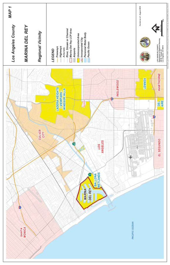
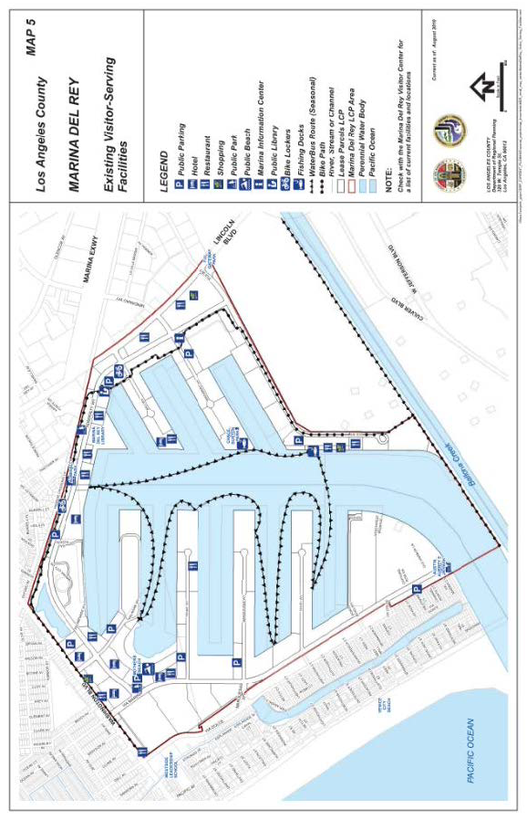
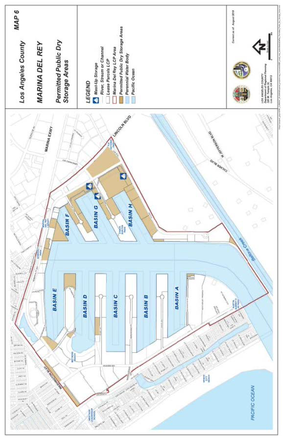
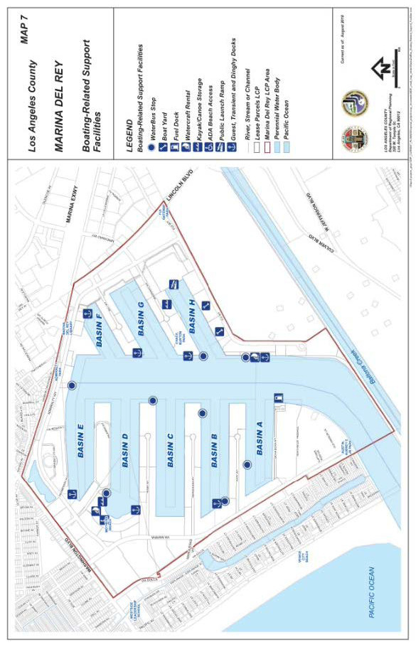
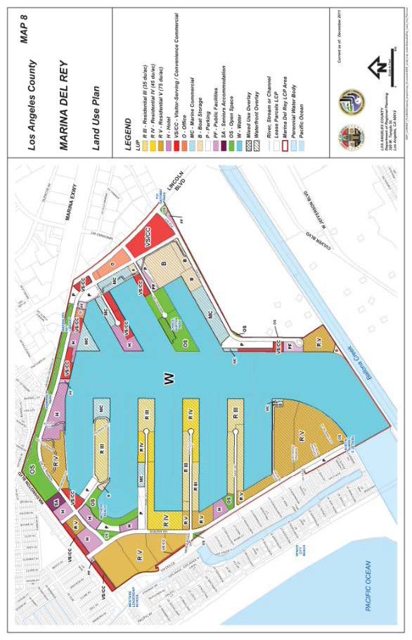
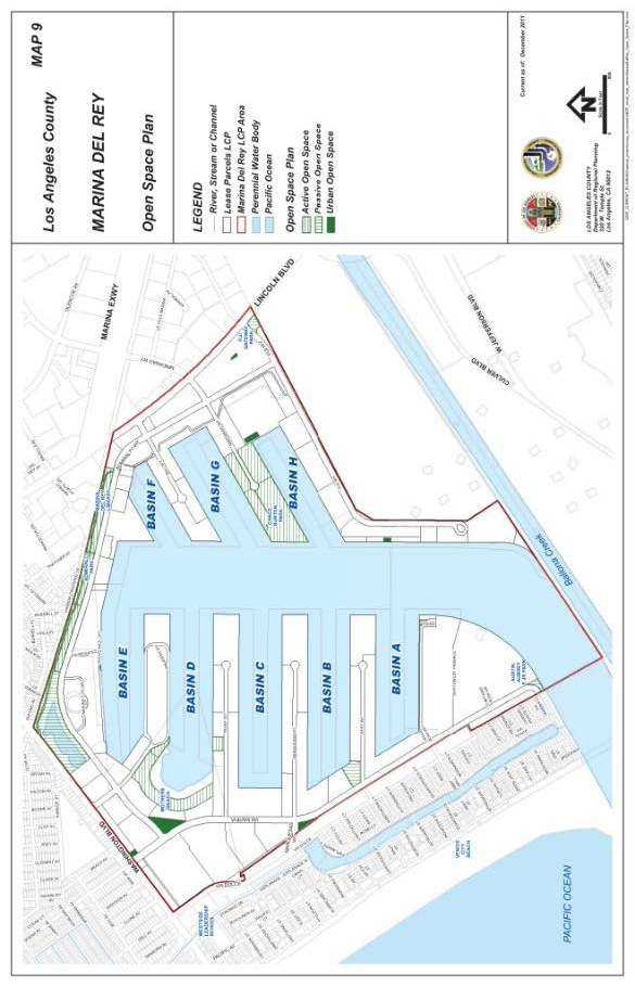
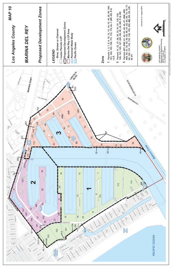
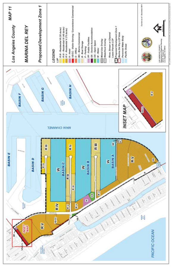
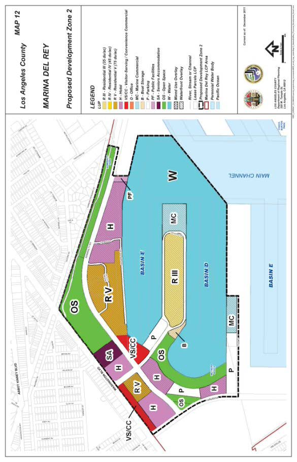
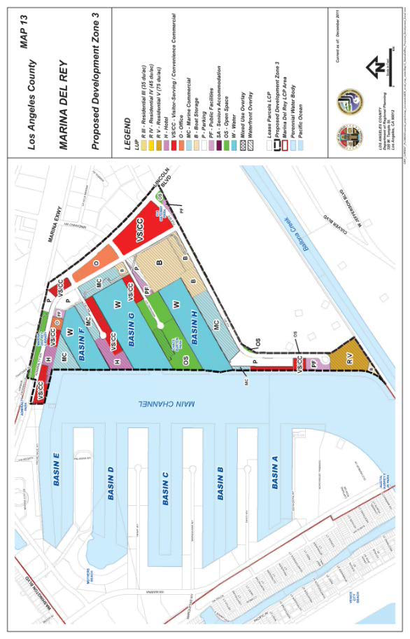
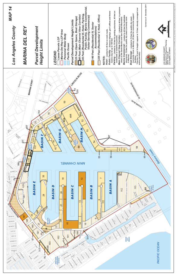
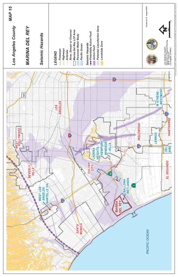
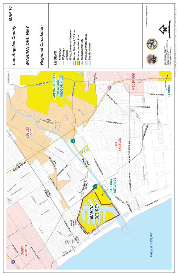
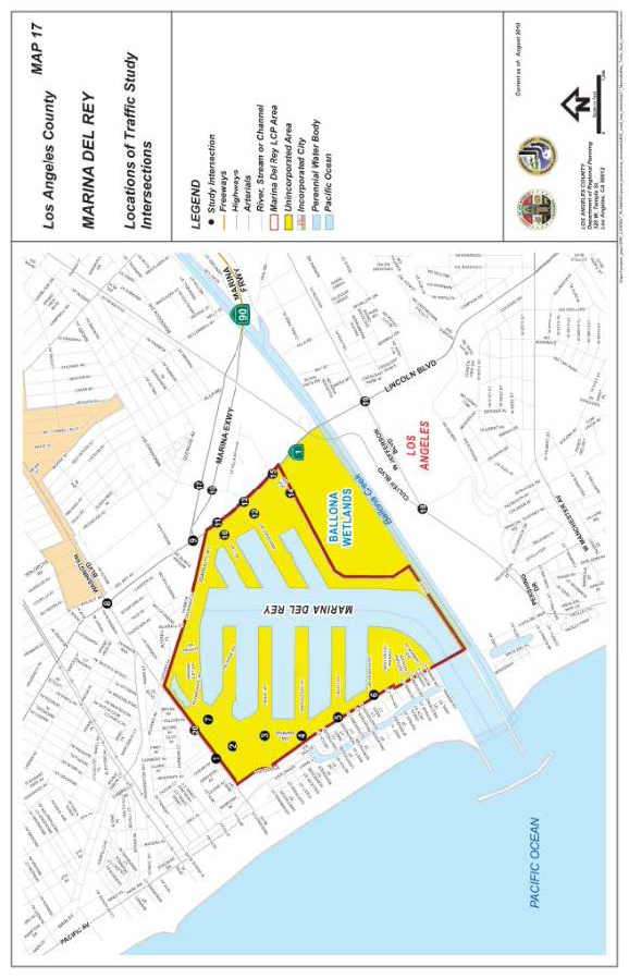
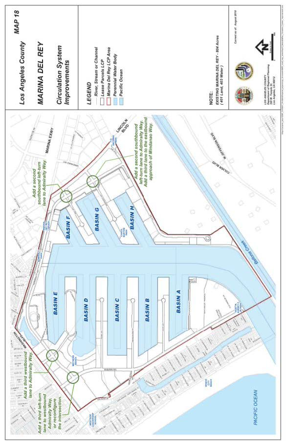
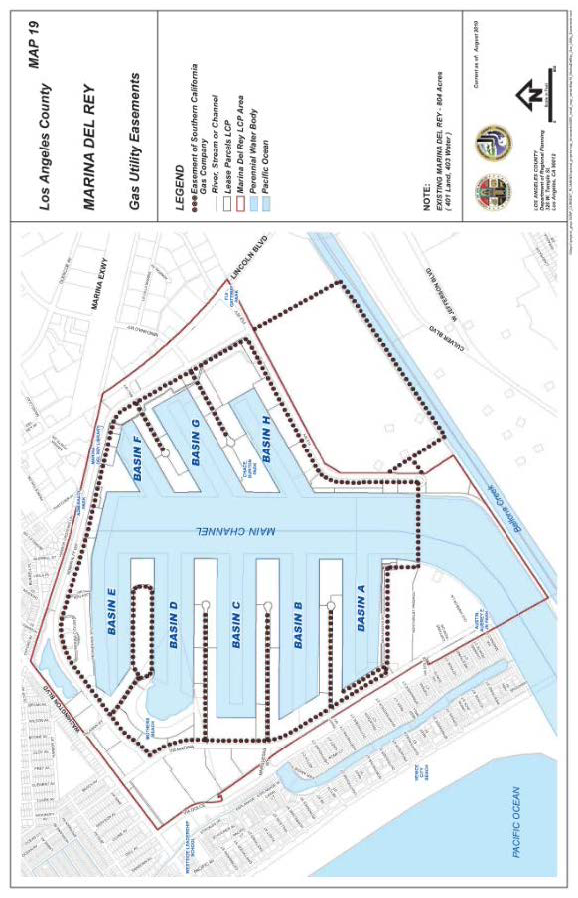
(Ord. 2019-0004 § 1, 2019.)
22.46.1975 - Appendix.
All references to Title 22 are to the version of Title 22 (Planning and Zoning Code) of the County Code in effect at the time of this Specific Plan's certification by the Coastal Commission. All sections of this Specific Plan added or amended before February 8, 2012 shall refer to Title 22 in effect as of February 8, 1996. All sections of this Specific Plan amended by Ordinance 2012-0016 shall refer to Title 22 in effect as of February 8, 2012.
(Ord. 2019-0004 § 1, 2019.)
Chapter 22.56 - COASTAL DEVELOPMENT PERMITS
This Chapter 22.56 shall not apply to the Santa Monica Mountains Coastal Zone, which instead shall refer to Section 22.44.600 et seq. (Santa Monica Mountains Local Implementation Program) of this Title 22. Unless where specified otherwise, all references used in this Chapter 22.56 are to Title 22 regulations in effect on December 29, 1989 when Ordinance No. 89-0147 became effective.
22.44.600 - Intent and Purpose.
The Santa Monica Mountains Local Implementation Program (LIP) constitutes the implementation mechanism for the Santa Monica Mountains Land Use Plan (LUP), including the following LUP maps:
• Planning Area
• Biological Resources
• Scenic Resources
• Recreation
• Hazards: Flood and Fire
• Hazards: Seismicity
• Rural Villages
• Land Use Policy
• Highway Plan
The associated Santa Monica Mountains Local Coastal Program Zoning Map is also a part of the LIP. As such, the LIP establishes regulations for new development and for the protection and management of the Santa Monica Mountains Coastal Zone's unique resources. Together, the LUP and the LIP constitute the County's State-mandated Local Coastal Program (LCP) for the Santa Monica Mountains segment of the County's coastal zone.
(Ord. 2019-0004 § 1, 2019.)
22.44.610 - Description of District.
The Santa Monica Mountains Coastal Zone District (Coastal Zone) is the unincorporated area bounded by the City of Los Angeles on the east, the Pacific Ocean and the City of Malibu on the south, Ventura County on the west, and the inland boundary of the Coastal Zone on the north. The inland boundary of the Coastal Zone is located approximately five miles inland of the Pacific Ocean. Coastal development at Pepperdine University is subject to the jurisdiction of the California Coastal Commission (Coastal Commission) pursuant to the University's existing Long Range Development Plan (LRDP), and, as such, the University property is not included in this district. The approximate boundaries of the Coastal Zone are shown on the Planning Area Map found within the LUP.
(Ord. 2019-0004 § 1, 2019.)
22.44.620 - Resolving Regulatory Conflicts.
A.
Protection of Significant Environmental Resource Areas (SERAs) (HI and H2 Habitats) and public access shall take priority over other LIP development standards.
B.
If provisions of this LIP are found to be in conflict with other provisions of this Title 22, this LIP shall prevail. For matters on which this LIP is silent, or where more restrictive standards than the ones in this LIP are subsequently adopted by the County Board of Supervisors, other applicable provisions of the County Code shall apply provided that no such provisions would be in conflict with the certified LCP or would result in significant adverse impacts to coastal resources.
C.
Amendments to the LIP approved pursuant to the provisions of Section 22.44.700, shall not be effective until certified as amendments to the LCP by the Coastal Commission and the certification has become final and effective pursuant to the Coastal Commission regulations. If the LIP relies on or incorporates a section of the County Code that is outside the LIP (hereinafter, an "extra LIP section"), and that extra-LIP section is altered, that change must be certified by the Coastal Commission as an LCP amendment in order to be effective for purposes of the LIP. Until a change to any such extra-LIP section is certified by the Coastal Commission, the LIP's cross-reference will be read as a reference to the version of that extra-LIP section as it existed as of the date of effective certification of this LIP.
(Ord. 2019-0004 § 1, 2019.)
22.44.630 - Definitions.
The definitions and acronyms listed in this section, along with the definitions appearing in the "Glossary" section of the LUP, apply throughout this LIP.
— "Accessory building or structure" means a detached subordinate building or structure, containing no kitchen or cooking facilities, the use of which is customarily incidental to that of the main building, to the principal use of the land, and which is located on the same lot or parcel of land with the principal building or use to which it is accessory.
— "Accessory use" means a use customarily incidental to, related and clearly subordinate to the principal use established on the same lot or parcel of land, which accessory use does not alter said principal use nor serve property other than the lot or parcel of land on which the principal use or other use is located.
— "Aggrieved Person" means any person who, in person or through a representative, appeared at a public hearing of the County in connection with the Coastal Development Permit decision or action appealed, or who, by other appropriate means prior to a hearing, informed the County of the nature of his/her concerns, or who for good cause was unable to do either.
— "Agricultural uses" include, but are not limited to: crops—field, tree, bush, berry, and row, including nursery stock; grazing of livestock; raising of livestock; dairy, livestock feed yard, and livestock sales yard operations.
— "Appealable Coastal Development Permit" means, after certification of the LCP, an action taken by the County on a coastal development permit application may be appealed to the California Coastal Commission for only the following types of developments:
(1)
Developments approved by the County between the sea and the first public road paralleling the sea or within 300 feet of the inland extent of any beach or the mean high tideline of the sea where there is no beach, whichever is the greater distance;
(2)
Developments approved by the County not included in paragraph 1 that are located on tidelands, submerged lands, public trust lands, within 100 feet of any wetland, estuary, or stream, or within 300 feet of the top of the seaward face of any coastal bluff;
(3)
Any development approved by the County that is not designated as the principal permitted use under the certified LCP; and
(4)
Any development that constitutes a major public works project or a major energy facility. The phrase "major public works" or a "major energy facility" as used in this section and in these regulations generally mean: any such project or facility as defined by section 13012 of the Coastal Commission Regulations and the Coastal Act.
— "Area, Gross" means the area of a site that includes dedicated streets and private easements.
— "Area, Net" means the portion of a site that can actually be built upon. The following generally are not included in the net acreage of a site: public or private road rights-of-way, dedicated open space, and floodways.
— "Best Management Practices (BMPs)" are the methods, measures, and practices designed and selected to reduce or eliminate pollutants in runoff and/or changes in runoff flow characteristics from development.
— "Bluff" is a high bank or bold headland with a broad, precipitous, sometimes rounded cliff face overlooking a plain or a body of water with at least 10 feet of vertical relief.
— "Bluff Edge"—For coastal and canyon bluffs, the bluff edge shall be defined as the upper termination of a bluff, cliff, or sea cliff. In cases where the top edge of the cliff is rounded away from the face of the cliff as a result of erosional processes related to the presence of the steep cliff, the bluff edge shall be defined as that point nearest the cliff beyond which the downward gradient of the surface increases more or less continuously until it reaches the general gradient of the cliff. In a case where there is a step-like feature at the top of the cliff face, the landward edge of the topmost riser shall be taken to be the bluff edge. Where a coastal bluff curves landward to become a canyon bluff, the termini of the coastal bluff edge, shall be defined as a point reached by bisecting the angle formed by a line coinciding with the general trend of the coastal bluff line along the seaward face of the bluff, and a line coinciding with the general trend of the bluff line along the canyon facing portion of the bluff. Five hundred feet shall be the minimum length of bluff line or edge to be used in making these determinations.
— "Buildable parcel" means a legally created lot or parcel which contains a site that may be lawfully accessed, has a well or municipal water system to serve as the potable water source, is served by public sewer or the rate of percolation will accommodate an approved on-site wastewater treatment system, is not located in an area of landslide or other geologic hazard, and upon which at least one structure can be built in conformity with all County policies and all County codes in effect at the time of a complete application for a development or building permit.
— "Building site" means the approved area of a project site that is or will be developed, including the building pad and all graded slopes, all structures, decks, patios, impervious surfaces, and parking areas. The following development may be excluded from the total building site area:
• The area of one access driveway or roadway that does not exceed 20 feet in width and is the minimum design necessary, as required by the County Fire Department;
• The The area of one approved Fire Department turnaround that is the minimum design necessary to ensure safety and comply with Los Angeles County Fire Department requirements and not located within the approved building pad; and
• Graded slopes exclusively associated with the access driveway or roadway and hammerhead safety turnaround indicated above, and grading necessary to correct an adverse geological condition.
Fuel modification area required by the County Fire Department for approved structures, and confined animal facilities approved pursuant to Section 22.44.1940 may extend beyond the limits of the approved building site area.
— "Campground" means a lot or parcel of land designed or used for tent camping other than a Low-Impact Campground, including appurtenant support facilities and picnic areas, but excluding any structures for permanent human occupancy, and which is used for temporary leisure or recreational purposes and provides opportunities for the enjoyment or appreciation of the natural environment. Fire pits or open fires of any kind are strictly prohibited.
— "Campground, low-impact" means an area of land designed or used for "carry-in, carry-out" tent camping accessed by foot or wheelchair, and may include associated support facilities in accordance with the standards in Subsection M.2.c of Section 22.44.1920 and excluding any structures for permanent human occupancy and excluding roads. Low-impact campgrounds constitutes a resource-dependent use.
— "Camping, carry-in, carry-out" means camping in which campers arrive at a campground by foot or other non-motor vehicle transportation from associated parking areas, ADA compliant drop-off areas, trails or bikeways, rely upon only that which can be carried to the site, and leave nothing behind at the campground upon departure.
— "CDP" means Coastal Development Permit.
— "Coastal Act" means the California Coastal Act of 1976, which is codified in Division 20 of the California Public Resources Code (section 30000, et seq.).
— "Coastal Bluff" is a bluff, as defined herein, whose toe is now or was historically (within the last 200 years) subject to marine erosion.
— "Coastal Commission" means the California Coastal Commission created and operating under the Coastal Act of 1976.
— "Coastal waters" means wetlands, streams, drainage courses, estuaries, marshes, and lakes within the Coastal Zone.
— "Coastal Zone" (or "Santa Monica Mountains Coastal Zone") means the area that meets all three of the following criteria:
(1)
It is within the coastal zone as defined in the Coastal Act (sections 30103 and 30150);
(2)
It is within unincorporated Los Angeles County; and
(3)
It is in the Santa Monica Mountains area. The boundaries of this area are described generally in Section 22.44.610.
— "Commission" means the Regional Planning Commission of the County.
— "Confined Animal Facilities" mean facilities built and used for the keeping of livestock and equines.
— "County Recorder" means the County Department of Registrar-Recorder/County Clerk.
— "Crops" means cultivated plants including field, tree, bush, berry, and row, including nursery stock.
— "Department" means the County Department of Regional Planning.
— "Development" means, on land, in or under water, the placement or erection of any solid material or structure; discharge or disposal of any dredged material or of any gaseous, liquid, solid, or thermal waste; grading, removing, dredging, mining, or extraction of any materials; change in density or intensity of use of land, including but not limited to, subdivision pursuant to the Subdivision Map Act (commencing with section 66410 of the California Government Code), and any other division of land, including lot splits, except where the land division is brought about in connection with the purchase of such land by a public agency for public recreational use; change in the intensity of use of water, or of access thereto; construction, reconstruction, demolition, or alteration of the size of any structure, including any facility of any private or public or municipal utility; and the removal or harvesting of major vegetation other than for agricultural purposes, kelp harvesting, and timber operations which are in accordance with a timber harvesting plan submitted pursuant to the provisions of the Z'berg-Nejedly Forest Practice Act of 1973 (commencing with section 4511 of the California Public Resources Code).
— "Demolition" means the deliberate removal or destruction of the frame or foundation of any portion of a building or structure for the purpose of preparing the site for new construction or use.
— "Director" means the Director of the Department of Regional Planning.
— "Donor areas" mean those buildable parcels where the development potential can be retired through the Transfer of Development Credit program detailed in Section 22.44.1230.
— "Drainage course" means a stream.
— "Dry-weather runoff" is the runoff from a site not attributed to rainfall; it typically includes, for example, irrigation water, wastewater from rinsing or pressure-washing pavements, and residential car wash water.
— "Dwelling unit" means one or more rooms in a building or portion thereof designed, intended to be used or used for occupancy by one family for living and sleeping quarters and containing only one kitchen. "Dwelling unit" also includes:
a.
One or more habitable rooms within a mobilehome which are designed to be occupied by one family with facilities for living, sleeping, cooking, eating and sanitation; and
b.
Any room used for sleeping accommodations which contains a bar sink and/or gas, electrical or water outlets designed, used, or intended to be used for cooking facilities.
— "Emergency preparedness and response facilities" means facilities that either:
a.
Increase readiness for a future emergency and are approved by the Los Angeles County Fire Department. Such facilities include but are not limited to: search and rescue headquarters, volunteer fire departments, and publicly owned and operated helicopter pads on public or private land where needed for emergency services and approved by the Fire Department, consistent with all applicable policies of the LCP, and located to limit noise impacts on residential areas and public parkland; or
b.
Structures which provide temporary protection to individuals from natural disasters such as wildfires. These facilities are intended to serve as a short-term refuge when evacuation to safer areas is not possible.
— "Feasible" means capable of being accomplished in a successful manner within a reasonable period of time, taking into account economic, environmental, social, and technological factors.
— "Fractional section" means a section, often irregularly shaped, located at the boundary of a rancho that was divided into numbered lots by the original government survey of public lands; considered an "undersized section" as defined below.
— "Habitable Accessory Structure" means detached accessory structure located on the same property as a single-family residence, for use by temporary guests of the occupants of the residence with sanitation, but without a kitchen or kitchen facilities.
— "Historical vehicle collection" means one or more vehicles of historic value, special interest vehicles, parts cars, or street rod vehicles as defined in the California Vehicle Code, which are collected, restored, or maintained for noncommercial hobby or historical purposes.
— "Hydromodification" is the physical effect on receiving water streams linked to the modification of the duration, volume, and intensity of runoff from development that influences sediment transport, erosion and depositional processes, and stream ecology.
— "Integrated Pest Management (IPM)" is the process used to manage pests or pest damage using current, comprehensive information on the life cycles of pests and their interaction with the environment, in combination with available pest control methods, with the least possible hazard to people, property, and the environment.
— "Land Division" or "Division of Land" means the division of improved or unimproved land, including subdivisions (through parcel map or tract map), and any other divisions of land including lot splits, lot line adjustments, redivisions, mergers, reversions to acreage, and legalization of lots purported to be created by a method that was not in compliance with applicable laws.
— "Land Use Plan" means the "Santa Monica Mountains Land Use Plan," which provides more focused policy for the regulation of development within the planning area as part of the overall County General Plan and indicates the kinds, locations, and intensities of allowable land uses, as well as specifying resource protection and development policies.
— "LCP" means the Local Coastal Program.
— "LIP" means the Local Implementation Program.
— "Local Coastal Program" means the County program developed to implement the Coastal Act within the Coastal Zone, pursuant to California Public Resources Code section 30500, and consisting of the combination of the Land Use Plan (or LUP) and the Local Implementation Program (or LIP).
— "Local Implementation Program" means the implementation mechanism for the Santa Monica Mountains Land Use Plan (LUP).
— "Lot line adjustment" means the modification of one or more lines that form the boundary(ies) between two or more adjacent parcels, where a greater number of parcels than originally existed is not thereby created.
— "Livestock" means any pig, pygmy pig, hog, cow, bull steer, sheep, goat, llama, alpaca, domestic fowl, or rabbit. For the purposes of this LIP, livestock keeping shall be considered an agricultural use.
— "Low Impact Development (LID)" is a development site design strategy with a goal of maintaining or reproducing the site's pre-development hydrologic functions of storage, infiltration, and groundwater recharge, as well as the volume and rate of stormwater discharges. LID strategies use small-scale integrated and distributed management practices, including minimizing impervious surfaces, infiltrating stormwater close to its source, and preservation of permeable soils and native vegetation.
— "LUP" means the "Land Use Plan."
— "Normal division of land" means a breakdown by quarters and/or halves which results in parcels of 320, 160, 80, 40, 20, or 10 acres, or an original numbered lot in a fractional section.
— "Open Coastal Commission Violation Case" means a case regarding a structure where, as of April 10, 2014, Coastal Commission staff had:
(i)
Conducted an investigation;
(ii)
On the basis of that investigation, determined that the allegations warranted creation of a violation file; and
(iii)
Created such a file and assigned the matter a violation file number.
— "Open space" means any parcel or area of land that is essentially unimproved, natural open landscape and is, or could be, devoted to open space uses such as the preservation of natural resources, passive outdoor recreation, or for public health and safety.
— "Person" means any individual, firm, partnership, joint venture, association, social club, fraternal organization, limited liability company, corporation, estate, trust, business trust, receiver, syndicate, this and any other county, city and county, municipality, district or other local or regional political subdivision, the state and any of its agencies, and to the extent permitted by federal law, the United States, or any of its agencies or political subdivisions, or any other group or combination acting as a unit.
— "Principal use/principal structure" means the primary use(s) or primary structure(s) on a lot to which other uses and structures are accessory. This term is unrelated to the definition of "principal-permitted use."
— "Principal-permitted use" means the primary use of land that clearly carries out the land use intent and purpose of a particular zone. Where a land use is identified as a principal-permitted use in the LCP, the County's approval of a coastal development permit for that development is not appealable to the Coastal Commission unless it otherwise meets the definition of "Appealable Coastal Development Permit."
— "Private living space" means the total gross structural area (GSA) calculated according to subsection A of Section 22.44.2140 (Development standards within Rural Villages), excluding 400 square feet of garage or carport area per unit.
— "Project" means the whole, and all phases, of a development on one or more parcels and including easements and entitlements to improve and use other properties in connection with the project.
— "Public Works Director" means the Director of the County Department of Public Works.
— "Resource-Dependent Uses" means uses that are dependent on sensitive environmental resource areas (SERA's) to function, Resource-dependent uses include nature observation, research/education, habitat restoration, and passive recreation, including horseback riding, low-impact campgrounds, and hiking trails, but excluding trails for motor vehicles. Residential or commercial uses are not resource-dependent uses.
— "Ridgeline" means the line formed by the meeting of the tops of sloping surfaces of land.
— "Riparian Habitat" means plant communities contiguous to and affected by surface and subsurface hydrologic features of perennial or intermittent water bodies (rivers, streams, lakes, or drainage ways). Riparian areas have one or both of the following characteristics: 1) distinctly different vegetative species than adjacent areas, and 2) species similar to adjacent areas but exhibiting more vigorous or robust growth forms. Riparian areas are usually transitional between wetland and upland.
— "Rural inn" means a facility containing guest rooms or cabins used for short-term rental accommodations, some or all of which have a separate entrance leading directly from the outside of the building, and which do not contain kitchen facilities.
— "Rural villages" means antiquated subdivisions in mountain areas, many of which were created in the 1920s and which often lack basic physical infrastructure meeting current development standards. In the Coastal Zone, these lots are shown on Map 7 of the LUP and are: El Nido, Fernwood, Las Flores Heights, Malibu Bowl, Malibu Highlands, Malibou Lake, Malibu Mar Vista, Malibu Vista, Monte Nido, Old Post Office Tract, Old Topanga, Topanga Oaks, Topanga Woods, Upper Latigo, and Vera Canyon.
— "Scenic Resources" ("Scenic Resource Areas" and "Scenic Areas") mean places on, along, within, or visible from scenic routes, public parklands, public trails, beaches, and State waters that offer scenic vistas of the mountains, canyons, coastline, beaches, and other unique natural features. Scenic resource areas also include the scenic resource areas identified on Map 3 of the LUP and consist of Scenic Elements, Significant Ridgelines, and Scenic Routes. Scenic Resource Areas do not include areas that are largely developed such as existing, predominantly built-out residential subdivisions.
— "Second Unit" means a particular type of accessory dwelling unit authorized by subsection C of Section 22.44.1370 that is either attached to or located on the same lot or parcel of land as an existing single-family residence.
— "Sensitive environmental resource areas (SERAs)" means H1 habitat and H2 habitat, including H2 "High Scrutiny" habitat, as described in Section 22.44.1810.
— "Significant ridgelines" means those ridgelines shown on the "Map 3 Scenic Resources" of the LUP that were designated by the Director based on one or more of the following criteria:
(a)
Topographic complexity: Ridges that have a significant difference in elevation from the valley or canyon floor, and are generally observable from any location on the valley floor, from a community or from a public road.
(b)
Near/far contrast: Ridges that are a part of a scene that includes a prominent landform in the foreground and a major backdrop ridge with an unbroken skyline; this includes a view into a valley from a public road or viewpoint located at a higher altitude such as along the valley rim or pass; often, layers of ridges are visible into the distance; this contrast can be experienced viewing an entire panorama or a portion of a panorama from an elevated point.
(c)
Cultural landmarks: Ridges that frame views of well-known locations, structures, or other places which are considered points of interest in the Coastal Zone.
(d)
Overall integrity of the surrounding and adjacent mountain system.
(e)
Uniqueness and character of a specific location: Peaks and their adjoining ridges; this is represented by ridges that frame rocky outcroppings, or other unique geological features.
(f)
Existing community boundaries and gateways: Ridges and surrounding terrain that provide the first view of predominantly natural, undeveloped land as a traveler emerges from the urban landscape introducing visitors to the visual experiences in the Coastal Zone.
(g)
The ridgeline frames a view of the ocean or large expanse of sky.
(h)
The ridgeline is visible from a Scenic Route.
(i)
The ridgeline is visible from an official public trail.
— "Significant watersheds" means relatively undisturbed watershed areas containing riparian and oak woodlands (or savannas) and recognized as important in contributing to the integrity of these woodlands.
— "Site Design Best Management Practices" are project design features that reduce the creation or severity of potential pollutant sources, or reduce the alteration of the project site's natural stormwater flow regime. Examples are minimizing impervious surfaces, preserving native vegetation, and minimizing grading.
— "Stream" means a topographic feature that at least periodically conveys water through a bed or channel having banks; this includes watercourses having a surface or subsurface flow that support or have supported riparian vegetation.
— "Source Control BMPs" are methods that reduce potential pollutants at their sources and/or avoid entrainment of pollutants in runoff, including schedules of activities, prohibitions of practices, maintenance procedures, managerial practices, or operational practices. Examples are covering outdoor storage areas, use of efficient irrigation, and minimizing the use of landscaping chemicals.
— "Temporary Event" is an activity or use that constitutes development as defined in this section but which is an activity or function which is or will be of limited duration and involves the placement of non-permanent structures such as bleachers, vendor tents/canopies, portable toilets, stages, film sets, and/or involves exclusive use of sandy beach, parkland, filled tidelands, water, streets, or parking areas in temporary facilities, public or private buildings or open spaces, or outside of buildings which are otherwise open and available for general public use.
— "Tailwater" means excess surface runoff draining from an irrigated field under cultivation.
— "Treatment Control BMPs" are systems designed to remove pollutants from stormwater, by simple gravity settling of particulate pollutants, filtration, biological uptake, media absorption, or any other physical, biological, or chemical process. Examples are vegetated swales, detention basins, and storm drain inlet filters.
— "Undersized section" means one that contains less than 640 acres as originally surveyed by the United States Geological Survey.
— "Urban land use category" means a density of more than one dwelling unit per net acre is allowed, as shown on the Land Use Policy Map.
— "Vacant Lot" means a lot or parcel that is not developed with any structures.
— "Watershed" means the entire land area, delineated by ridgelines, which collects precipitation and drains into a receiving body of water or point along a drainage course.
— "Wildlife-permeable fencing" means fencing that can be easily bypassed by all species of wildlife found within the Santa Monica Mountains, including but not limited to deer, coyotes, bobcats, mountain lions, ground rodents, amphibians, reptiles and birds, and shall be subject to the following standards:
A.
Fences shall be split-rail or flat-board with no more than three horizontal rails or boards.
B.
The bottom edge of the bottom horizontal rail or board shall be no lower than 18 inches from the ground.
C.
There shall be a minimum two-foot gap between each rail or board.
D.
Except where a different height is stated, the top edge of the topmost rail or board shall be no higher than 48 inches from the ground.
E.
Fence material shall be of wood or an alternative material that gives the appearance of wood, such as wood composite or recycled material or some other similar material that gives the appearance of wood.
F.
Fence posts shall not be hollow at the top or have holes drilled into them near the top.
G.
Fences shall not be barbed.
H.
The top of the fence shall not contain spikes of any manner.
(Ord. 2022-0062 § 1, 2022; Ord. 2019-0004 § 1, 2019.)
22.44.640 - Land Divisions.
A.
CDP shall be required to authorize that portion of any land division that lies within, in whole or in part, the boundaries of the Coastal Zone. Any CDP for a land division shall include the consideration of the proposed building site (including a building pad if necessary), access road, and the driveway (if necessary) for each proposed parcel (other than a parcel that is dedicated or restricted to open space uses) as well as all grading, whether on-site or off-site, necessary to construct the building site and road/driveway improvements. The County shall only approve a CDP for a land division where substantial evidence demonstrates that the land division meets all of the following requirements:
1.
All existing parcels proposed to be divided as part of a land division must be legal lots.
2.
The land division shall be consistent with all applicable LCP policies.
3.
The density proposed by the land division does not exceed the maximum density allowed for the property by the LIP zoning map and complies with the other policies of the LCP which may further limit the maximum allowable density.
4.
The land division does not create any parcels that are smaller than the average size of surrounding parcels.
5.
The land division clusters building sites, including building pads, if any, to maximize open space and minimize site disturbance, erosion, sedimentation and required fuel modification.
6.
The land division includes a safe, all-weather access road and driveway(s), if necessary, that comply with all applicable policies and provisions of the LCP and all applicable fire safety regulations, and does not locate the access road or driveway on slopes of 15 percent or more; and, does not result in grading on slopes of 15 percent or more.
7.
The land division does not divide an existing lot entirely designated as H1 habitat, H1 habitat buffer, and/or H2 high scrutiny habitat as defined in Section 22.44.1810.
8.
The land division does not create any lot the development of which would require construction of a road and/or driveway in H1 habitat area, in H1 habitat buffer, in H1 Quiet Zone, on a coastal bluff, or on a beach.
9.
The layout of the lots is designed to avoid or minimize impacts to visual resources consistent with all scenic and visual resources policies of the LUP, through measures which include, but are not limited to the following:
a.
Clustering the building sites to minimize site disturbance and maximize open space.
b.
Prohibiting building sites on ridgelines.
c.
Minimizing the length of access roads and driveways.
d.
Using shared driveways to access development on adjacent lots.
e.
Reducing the maximum allowable density in steeply sloping and visually sensitive areas.
f.
Minimizing grading and alteration of natural landforms.
10.
Each lot proposed to be created meets the following minimum standards:
a.
Is dedicated or restricted to open space uses through open space easement, deed restriction, or donation to a public agency for park purposes; or
b.
Contains an approved building site that can be developed consistent with all policies and standards of the LCP, and satisfies all of the following criteria:
i.
Is safe from flooding, erosion, geologic and extreme fire hazards;
ii.
Will not result in grading on slopes over 25 percent;
iii.
Has the legal rights that are necessary to use, improve, and/or construct an all-weather access road to the parcel from an existing, improved public road;
iv.
Is located in an area where adequate public services are or will be available and construction of structures will not have significant effects, either individually or cumulatively, on coastal resources;
v.
Has the appropriate conditions on-site for a properly functioning on-site wastewater treatment system and an adequate water supply for domestic use;
vi.
The feasible building site, and any necessary access road and/or driveway thereto, meets all of the following:
1)
Does not include any H1 habitat area, H1 habitat buffer, H1 habitat Quiet Zone, or H2 high scrutiny habitat;
2)
Would not require vegetation removal or thinning for fuel modification in an H1 habitat area, H1 habitat buffer, or H2 high scrutiny habitat; and
3)
Would not require irrigated fuel modification within an H1 Quiet Zone.
Creation of a new Open Space parcel shall be allowed within any habitat category or buffer, as long as the entire parcel is used exclusively as Open Space in perpetuity and the construction rights over the entire parcel are dedicated to the County;
vii.
Is located where a shoreline protection structure or bluff stabilization structure will not be necessary to protect development on the parcel from wave action, erosion or other hazards at any time during the full 100-year life of any structures;
viii.
If located on the beachfront, has sufficient area to site a dwelling or other principal structure, on-site wastewater treatment system, if necessary, and any other necessary facilities without development on sandy beaches or bluffs;
B.
In addition to the requirements of subsection A, land divisions in H2 habitat (excluding H2 High Scrutiny habitat) shall also demonstrate, based on substantial evidence, compliance with the following:
1.
The proposed parcels are configured and building sites are sited and designed to ensure that future structures will have overlapping fuel modification zones and in no case shall the proposed building sites be located more than 100 feet apart.
2.
The building site on each newly created parcel is located no more than 200 feet from an existing public roadway and is capable of being served by existing power and water service.
3.
The building site on each newly created parcel is located only on slopes of 3:1 or less.
4.
The proposed newly created parcels shall be within 1/4 mile of existing developed parcels.
5.
Land divisions on parcels adjacent to public parklands or parcels restricted as permanent open space are prohibited.
6.
The County can and does make a finding that the land division and associated transfer of development credit required pursuant to subsection G will result in the transfer and concentration of existing development rights to a location that results in the preservation of H2 habitat in a manner that is superior to the pre-land division lot configuration if developed.
7.
Where a lot proposed to be created in H2 Habitat is dedicated or restricted to open space uses (through an open space easement, deed restriction, or donation to a public agency for park purposes), no demonstration of compliance with the building site or access road standards of subsections 1 through 3 is required.
C.
A major CDP shall be required for a tract map, a minor CDP shall be required for a parcel map.
D.
Notwithstanding the requirements of Section 22.44.970(E), all proposed land divisions within the Coastal Zone shall be the subject of at least one public hearing before the Commission, or the Board of Supervisors in the case of a reversion to acreage. All public hearings held to consider a land division within the Coastal Zone shall comply with the notice requirements of Section 22.44.990.
E.
A Final Map is required for all land divisions, including reversions to acreage. A Final Map Waiver is not allowed.
F.
In addition to the other requirements of this Section 22.44.640, all land divisions proposed within the Coastal Zone shall meet the fee requirements, standards, and procedures found in the Subdivision Ordinance, Title 21 of the County Code. If any provisions of this Section 22.44.640 conflict with those of the Subdivision Ordinance, the provisions of the LIP shall take precedence.
G.
Conditions of Approval. Any CDP approved for a land division pursuant to this section shall include, at a minimum, the following conditions of approval:
1.
Future development of each new parcel shall conform to the location, design, and grading volumes of each building site and access road/driveway approved in the land division.
2.
For each new parcel authorized through a land division, the applicant shall retire one existing parcel through the transfer of development credit program, in compliance with the requirements of Section 22.44.1230. For each parcel authorized in H3 habitat, the applicant shall retire one TDC in accordance with Section 22.44.1230 (D). For each parcel authorized in H2 habitat, the applicant shall retire one TDC in accordance with Section 22.44.1230 (E).
(Ord. 2019-0004 § 1, 2019.)
22.44.650 - Reversion to Acreage.
A.
Establishment and purpose. This section establishes the procedures and standards for the reversion to acreage of subdivided real property as provided in California Government Code sections 66499.11 et seq., of the Subdivision Map Act. This section shall apply to tract and parcel maps. A minor CDP shall be required to authorize a reversion to acreage.
B.
Initiation. A reversion to acreage may be initiated by:
1.
The Board of Supervisors on its own motion by resolution; or
2.
A petition by all of the owners of record of the real property intended to be part of reversion within the subdivision.
C.
Contents of petition. When a reversion to acreage is initiated by all of the owners of record of the real property intended to be part of reversion within the subdivision, the petition shall contain, but shall not be limited to, the following:
1.
Evidence of title to the real property within the subdivision.
2.
Evidence that all owners of an interest in the real property within the subdivision have consented to the reversion.
3.
Evidence that none of the improvements required to be made have been made within two years from the date the tract or parcel map was filed for recordation, or within the time allowed by agreement for completion of the improvements, whichever is the later.
4.
Evidence that no lots shown on the tract or parcel map have been sold within five years from the date such map was filed for recordation.
5.
Copies of a tract or parcel map in the form and with the contents prescribed by Section 22.44.640, and which delineates dedications that will not be vacated and dedications that are a condition of reversion.
6.
Fees as required by Title 21.
7.
Such other information as may be required by the Director or Public Works Director.
8.
The Director may waive any of these items if they are not necessary to process the application.
D.
Submittal of petition. When a reversion to acreage is initiated by all of the owners of record of the real property intended to be part of reversion within the subdivision, the following shall apply:
1.
The petition, together with the final or parcel map for reversion, shall be submitted to the Department of Public Works for review and distribution.
2.
After consultation with the Department and upon finding that the petition meets all the requirements of this section, the Department of Public Works shall set the matter for public hearing before the Board of Supervisors in accordance with the provisions of Section 22.44.970. Where a petition for reversion has been submitted pertaining to four or fewer contiguous parcels under the same ownership, the Department of Public Works shall notify the Director who shall set the matter for public hearing before the Hearing Officer in accordance with the provisions of Section 22.44.970.
E.
Eligible lots or parcels. A request for reversion to acreage may apply when fewer than all lots or parcels within a subdivision are reverting, and where other lots or parcels (other than those reverting) within the subdivision may already be developed.
F.
Board of Supervisors or the Hearing Officer's decision.
1.
A public hearing shall be held by the Board of Supervisors or the Hearing Officer on all proposed reversions to acreage.
2.
The Board of Supervisors or the Hearing Officer may approve a reversion to acreage only if it finds:
a.
That dedications or offers of dedication to be vacated or abandoned by the reversion to acreage are unnecessary for present or prospective public purposes; and
b.
Either:
i.
All owners of an interest in the real property within the subdivision which are subject to the reversion petition have consented to the reversion;
ii.
None of the improvements required to be made on the subject property have been made within two years from the date the tract or parcel map was filed for recordation, or within the time allowed by agreement for completion of the improvements, whichever is the later; or
iii.
None of the lots shown on the tract or parcel map which are subject to the reversion petition have been sold within five years from the date such map was filed for recordation.
G.
Dedications. Dedication of land for public streets, highways, trails, ways, or easements may be accepted on a tract or parcel map submitted for the purpose of reverting to acreage land previously subdivided.
H.
Title sheet information. Upon the title sheet of each map filed for the purpose of reverting subdivided land to acreage, the subtitle shall consist of the words "A Reversion to Acreage of . . . (insert a legal description of the land being reverted)."
I.
Contiguous parcels under common ownership may be merged without reverting to acreage by filing a Request for Merger with the Department subject to standards and procedures for obtaining a certificate of compliance, including the fees required for issuance of a certificate of compliance. Following review and approval by the Director, a Notice of Merger and a covenant and agreement to hold property as one parcel shall be filed with the County Recorder for recordation. Any parcels within the Coastal Zone, as defined in section 30103 of the Public Resources Code, that have been merged through this procedure shall not be separated without an approved minor CDP. The merger procedure detailed in this subsection shall not be used to meet the requirement to merge two or more parcels pursuant to Section 22.44.1230 or Section 22.44.2140. The merger of two or more parcels as a means of reversing an illegal subdivision of property shall be accomplished consistent with Section 22.44.680.
(Ord. 2019-0004 § 1, 2019.)
22.44.660 - County Initiated Merger of Lots or Parcels.
A.
Purpose of section provisions. This section implements the provisions of California Government Code section 66451.10 et seq., (Article 1.5 of Chapter 3 of the Subdivision Map Act) pertaining to mergers of lots and parcels initiated by the Board of Supervisors. A minor CDP shall be required to authorize a merger.
B.
Merger requirements. The County may cause the merger of a lot or parcel to be merged with contiguous lots or parcels held by the same person if any one of the contiguous lots or parcels held by the same person does not conform to standards for minimum lot or parcel size under Title 22 applicable to the lots or parcels, and if all of the following requirements are satisfied:
1.
At least one of the affected lots or parcels is undeveloped by any structure for which a building permit was issued or for which a building permit was not required at the time of construction, or is developed only with an accessory structure or accessory structures, or is developed with a single structure, other than an accessory structure, that is also partially sited on a contiguous lot or parcel that would be part of the merger.
2.
With respect to any affected lot or parcel, one or more of the following conditions exists:
a.
Comprises less than 5,000 square feet in area at the time of the determination of merger;
b.
Was not created in compliance with applicable laws and ordinances in effect at the time of its creation;
c.
Does not meet current standards for sewage disposal and domestic water supply;
d.
Does not meet current standards for slope stability;
e.
Has no legal access which meets current standards for vehicular and safety equipment access and maneuverability;
f.
Its development would create health or safety hazards; or
g.
Is inconsistent with the applicable general plan, area plan, coastal plan, community plan, and any applicable specific plan, other than minimum lot size or density standards.
3.
The person who owns the affected parcels has been notified of the merger proposal pursuant to subsection D below and is afforded the opportunity for a hearing pursuant to subsection E. For purposes of this section, when determining whether contiguous lots or parcels are held by the same person, ownership shall be determined as of the date that notice of intention to determine status is recorded.
C.
Effective date of merger. A merger of lots or parcels becomes effective when the County causes a notice of merger to be filed for record with the County Recorder. A notice of merger shall specify the names of the record owners and shall particularly describe the real property.
D.
Notice of intent to determine status. Prior to recording a notice of merger, the Director shall cause to be mailed by certified mail to the then current record owner of the property a notice of intention to determine status, notifying the person that the affected lots or parcels may be merged pursuant to standards specified in subsection B, and advising the owner of the opportunity to request a hearing on determination of status and to present evidence at the hearing that the property does not meet the criteria for merger. The notice of intention to determine status shall be filed for record with the County Recorder on the date that the notice of merger is mailed to the property owner.
E.
Request for hearing. At any time within 30 days after recording of the notice of intention to determine status, the owner of the affected property may file with the Director a request for a hearing on determination of status.
F.
Hearing procedures.
1.
Upon receiving a request for a hearing on determination of status from the owner of the affected property pursuant to subsection E, the Director shall fix a time, date, and place for a hearing to be conducted by the Hearing Officer, and shall notify the property owner of that time, date, and place for the hearing by certified mail. The hearing shall be conducted not more than 60 days following the local agency's receipt of the property owner's request for the hearing, but may be postponed or continued with the mutual consent of the Planning Director and the property owner.
2.
At the hearing, the property owner shall be given the opportunity to present any evidence that the affected property does not meet the standards for merger specified in subsection B. At the conclusion of the hearing, the Hearing Officer shall make a determination that the affected lots or parcels are to be merged or are not to be merged and shall so notify the owner of his or her determination. A determination of merger shall be recorded within 30 days after conclusion of the hearing, as provided for in subsection C.
G.
Determination when no hearing is requested. If, within the 30-day period specified in subsection E, the person owning the property does not file a request for a hearing in accordance with subsection F, the Hearing Officer may, at any time thereafter, make a determination that the affected lots or parcels are to be merged or are not to be merged. A determination of merger shall be recorded as provided for in subsection C no later than 90 days following the mailing of notice required by subsection D.
H.
Determination of non-merger.
1.
A determination of non-merger may be made whether or not the affected property meets the standards for merger specified in subsection B if the Hearing Officer or Commission finds that development of the individual lots or parcels would not be contrary to the public health, safety, or welfare.
2.
If, in accordance with subsections F or G, the Hearing Officer or Commission determines that the subject property shall not be merged, the Director shall cause to be recorded in the manner specified in subsection C a release of the notice of intention to determine status, recorded pursuant to subsection D, and shall mail a clearance letter to the person who is the current owner of record.
I.
Appeals.
1.
A property owner dissatisfied with an action taken by the Hearing Officer may appeal to the Commission. All appeals shall be submitted and acted upon in the manner prescribed by Section 22.44.800 et seq.
2.
Upon filing an appeal the appellant shall pay a processing fee as required in Section 21.56.020 of Title 21.
(Ord. 2019-0004 § 1, 2019.)
22.44.670 - Lot Legalization.
A.
If the County issued, after the effective date of the Coastal Act of 1976 but before the certification of the LCP, a certificate of compliance for a parcel of land within the Coastal Zone that was initially defined as a separate lot via a process that did not comply with State law and/or local ordinances in effect at the time of that initial declaration as a separate lot, a minor CDP shall be required, except as noted in subsection E below, to legalize the land division for purposes of the Coastal Act. The determination that the parcel was not created in compliance with State law and/or local ordinances shall be based on substantial evidence, including, but not limited to, the evidence provided pursuant to subsection 0.3 of Section 22.44.840.
B.
Where, after the certification of this LCP, the County considers the approval of a certificate of compliance for a parcel(s) of land that was initially defined as a separate lot via a process that was not in compliance with State law and/or local ordinances in effect at the time of that lot's initial declaration as a separate lot, any such certificate shall be a conditional certificate of compliance and shall include as a condition that a minor CDP is required to legalize the land division for purposes of the Coastal Act. The determination that the parcel was not created in compliance with State law and/or local ordinances shall be based on substantial evidence including, but not limited to, the evidence provided pursuant to subsection 0.3 of Section 22.44.840. In such cases, the County may only approve a minor CDP when substantial evidence demonstrates compliance with the criteria in subsection C.
C.
Criteria. The County may only approve a minor coastal development permit to allow the legalization of a land division subject to subsection A or B above where substantial evidence demonstrates compliance with one of the following:
1.
The land division at issue complies with all policies and standards of the LCP; or
2.
All of the following shall apply:
a.
There is existing residential development on one or more of the parcels of land that were created from the same parent parcel as the parcel(s) in question; and 1) prior to effective date of the Coastal Act, the County approved all required local permits; or 2) after the effective date of the Coastal Act and prior to certification of the LCP, the Coastal Commission approved a coastal development permit, authorizing construction of the existing residential development;
b.
The owner of the parcel of land for which a minor CDP is required pursuant to this section to legalize the land division for purposes of the Coastal Act does not also own one or more of the developed parcel(s); and
c.
The owner of the parcel of land for which a minor CDP is required pursuant to this section to legalize the land division for purposes of the Coastal Act acquired it prior to certification of the LCP and is a good-faith, bona fide purchaser for value.
D.
Conditions of Approval. Any minor CDP approved pursuant to this section shall include the following conditions of approval:
1.
Construction of new development on the parcel in question is prohibited unless it complies with all policies and standards of the LCP, except the minimum parcel size.
2.
For each parcel legalized, the applicant shall retire one transfer of development credit, in compliance with the requirements of Section 22.44.1230. For each parcel authorized in H3 habitat, the applicant shall retire one TDC in accordance with Section 22.44.1230.D. For each parcel authorized in H2 habitat, the applicant shall retire one TDC in accordance with Section 22.44.1230.E.
E.
Exceptions.
1.
Where the parcel(s) of land was created in compliance with State law and local ordinances in effect at the time of its creation and the parcel(s) of land has not subsequently been merged or otherwise altered, the parcel shall not be subject to the provisions of this section. The applicant seeking a certificate of compliance on such a parcel shall demonstrate its creation complied with then-existing State law and local ordinances with substantial evidence, including but not limited to, a complete title history of the parcel sufficient to determine when and how it was created, identification of additional parcels created from the same parent parcel either at the same time, prior to and/or after creation of the parcel, and other grants, land divisions, mergers or transactions that occurred involving the parcel after its initial creation, and mapping or graphic depiction of the various lot configurations reflected in the legal descriptions from the deed or other transactions in the parcel's chain of title. If the information provided demonstrates that the parcel was created in compliance with all applicable laws, a Certificate of Compliance shall be issued consistent with the California Subdivision Map Act.
2.
A parcel created by a land division that was authorized through a valid coastal development permit issued by the Coastal Commission prior to certification of the LCP shall not be subject to the provisions of this section.
(Ord. 2019-0004 § 1, 2019.)
22.44.680 - Lot Line Adjustments.
A minor CDP shall be required to authorize a lot line adjustment. Any minor CDP for a lot line adjustment shall include, for each vacant parcel, the consideration of the proposed building site (including a building pad if necessary), access road, and the driveway (if necessary) for each proposed parcel (other than a parcel that is dedicated or restricted to open space uses) as well as all grading, whether on-site or off-site, necessary to construct the building site and road/driveway improvements. The County shall only approve a minor CDP for a lot line adjustment if substantial evidence demonstrates that the lot line adjustment meets the following requirements:
A.
Each parcel that is part of the lot line adjustment is a legal lot except as provided in subsection I.
B.
The proposed lot line adjustment complies with subsections A and B of Section 22.44.640 as well as all of the following:
1.
The lot configuration is arranged to avoid traffic congestion, provide for the safety and convenience of bicyclists and pedestrians, including children, senior citizens, and persons with disabilities, insure the protection of public health, safety and general welfare, prevent adverse effects on neighboring property and conforms with good zoning practice.
2.
The lot design, frontage, and access shall be consistent with all applicable provisions contained in this LIP.
3.
Any change in access, lot configuration or orientation of structures, easements or utilities to lot lines will not, in the opinion of the Director, result in any burden on public services or materially affect the property rights of any adjoining owners.
C.
If the existing, legally created parcels that are proposed to be reconfigured do not meet the requirements of subsection B and/or subsections A or B of Section 22.44.640, then the lot line adjustment may only be approved where it is demonstrated that the reconfigured parcels can accommodate development that more closely conforms with the LCP policies and standards than development on the existing parcels.
D.
If H2 habitat area is present on any of the parcels involved in the lot line adjustment, the lot line adjustment may only be approved where it is demonstrated that the reconfigured parcels will not increase the amount of H2 habitat area that would be removed or modified by development on any of the parcels, including any necessary road extensions, driveways, and required fuel modification, from what would have been necessary for development on the existing parcels.
E.
As a result of the lot line adjustment, future development on the reconfigured parcels will not increase the amount of landform alteration (including from any necessary road extensions or driveways) from what would have been necessary for development on the existing parcels, unless the increase in landform alteration is minimal and the lot configuration would substantially reduce impacts to H2 habitat.
F.
As a result of the lot line adjustment, future development on the reconfigured parcels will not have greater adverse visual impacts from a scenic road, public trail or trail easement, or public beach than what would have occurred from development on the existing parcels, unless the increase in visual impacts is minimal and the lot configuration would substantially reduce impacts to H2 habitat.
G.
Minor lot line adjustments between existing lawfully-developed parcels may be authorized provided the adjustment would not adversely impact H1 habitat, H1 habitat buffer, H2 habitat, or scenic resources.
H.
Contiguous parcels under common ownership may be merged by filing a Request for Merger with the Department subject to standards and procedures for obtaining a lot line adjustment, including the required fees.
I.
Notwithstanding the requirements of subsection A, lot line adjustments for the sole purpose of combining two or more parcels may also be authorized as a means of reversing a purported but illegal division of property.
J.
If the adjustment is approved, the Director shall record a certificate of compliance containing the descriptions of the parcels as they will exist after adjustment. If the request is denied, the Director shall report this in writing to the applicant, citing the reasons for denial.
K.
If approved, the lot line adjustment shall be reflected in a deed or record of survey which shall be recorded by the applicant.
(Ord. 2019-0004 § 1, 2019.)
22.44.690 - Coastal Zone Enforcement Procedures.
In addition to the enforcement provisions contained in this section, the provisions of Chapter 9 of Division 20 of the California Public Resources Code shall also apply with respect to violations and enforcement.
A.
Applicability. The procedures in this section shall apply as of the date of effective certification of this LCP.
B.
Purpose. This section establishes procedures for enforcement of the provisions of this LIP. These enforcement procedures are intended to assure due process of law in the abatement or correction of nuisances and violations of this LIP.
C.
General prohibitions.
1.
No structure shall be moved into an area, erected, reconstructed, added to, enlarged, advertised on, structurally altered or maintained, and no structure or land shall be used for any purpose, except as specifically provided and allowed by this LIP.
2.
No person shall use or permit to be used any structure or land, nor shall any person erect, structurally alter or enlarge any structure, or advertise on any structure, except in accordance with the provisions of this LIP.
3.
No permit or entitlement may be issued or renewed for any use, construction, improvement or other purpose unless specifically provided for, or permitted by, this LIP.
D.
Violations.
1.
Every person violating any condition or provision either of this LIP, or of any permit, nonconforming use and structure review, zoning exception case, variance or amendment thereto, is guilty of a misdemeanor, unless such violation is otherwise declared to be an infraction in subsection F below. Each violation is a separate offense for each and every day during any portion of which the violation is committed.
2.
Each violation determined to be an infraction by this LIP shall be punishable by a fine of $100 for the first violation. Subsequent violations of the same provision of this LIP shall be punishable by a fine of $200 for the second violation and $500 for the third violation in a 12-month period as provided by applicable law. The fourth and any further violations of the same provision of this LIP which are committed at any time within a 12-month period from the date of the commission of the first violation shall be deemed misdemeanors, regardless of the dates of conviction of the first three violations. The three infraction violations which are the basis for the fourth and any further violations being misdemeanors may be brought and tried together. The increased penalties set forth in this section for subsequent violations shall be applicable whether said subsequent violations are brought and tried together with the underlying previous violations or separately therefrom.
E.
Public nuisance. Any use of property contrary to the provisions of this LIP shall be, and the same is hereby declared to be unlawful and a public nuisance, and the authorized legal representative of the County may commence actions and proceedings for the abatement thereof, in any manner provided by law or equity, and may take such other steps and may apply to any court having jurisdiction to grant such relief as will abate or remove such use and restrain and enjoin any person from using any property contrary to the provisions of this LIP.
F.
Infractions. Violations of the provisions contained in the following list are deemed infractions:
— Automobile, truck or other motor vehicle repair conducted outside of an enclosed building.
— Commercial vehicles weighing more than 6,000 pounds unladen where parked or stored in violation of this LIP.
— Inoperative vehicle parking or storage.
— Keeping or parking of vehicles in violation of this LIP.
— Outside display and/or sales, except when authorized by and in accordance with a temporary use permit.
— Signs prohibited by this LIP.
G.
Injunction. The provisions of this LIP may also be enforced by injunction issued by any court having jurisdiction upon the suit of the owner or occupant of any real property affected by such violation or prospective violation.
H.
Enforcement. The Director, or any representative thereof designated by the Director, is hereby authorized to arrest any person without a warrant whenever the Director, or his representative, has reasonable cause to believe that the person to be arrested has committed a violation of this LIP in his presence.
I.
Cease and desist orders, notice, terms and conditions, time of effectiveness, duration.
1.
If the Director determines that any person has undertaken any activity within the Coastal Zone that: (1) requires a CDP from the County without first having obtained a CDP; or (2) may be inconsistent with any CDP previously issued by the County, the Director may issue an order directing that person to cease and desist.
2.
The cease and desist order shall be issued only if the person has failed to respond in a satisfactory manner to a written notice given by certified mail or hand delivered to the landowner or the person performing the activity. The notice shall include the following:
a.
A description of the activity which meets the criteria of subsection 1;
b.
A statement that the described activity constitutes development which is in violation of this LIP because it is not authorized by a valid CDP;
c.
A statement that the described activity be immediately stopped or the alleged violator may receive a cease and desist order, the violation of which may subject the violator to additional fines; and
d.
The name, address, and phone number of the Department staff member who is to be contacted for further information.
3.
The cease and desist order may be subject to such terms and conditions as the Director may determine are necessary to avoid irreparable injury to any area within the Coastal Zone pending action by the County.
4.
The cease and desist order shall be effective upon its issuance, and copies shall be served immediately by certified mail upon the person or governmental agency subject to the order.
5.
A cease and desist order issued pursuant to this section shall become null and void 90 calendar days after issuance. Consecutive cease and desist orders may be issued.
J.
Cease and desist orders issued after public hearing, terms and conditions, notice of hearing, finality, and effectiveness of order.
1.
If the Commission, after public hearing, determines that any person or governmental agency has undertaken any activity that: (1) requires a CDP from the County without first having obtained the permit; or (2) is inconsistent with any CDP previously issued by the County, the Commission may issue an order directing that person or governmental agency to cease and desist the activity.
2.
The cease and desist order may be subject to such terms and conditions as the Commission may determine are necessary to ensure compliance with this section, including immediate removal of any development or material or the setting of a schedule within which steps shall be taken to obtain a permit pursuant to Section 22.44.800 et seq.
3.
Notice of the public hearing on a proposed cease and desist order shall be given to all persons and agencies whose property or interest might be affected by the proposed cease and desist order and the order shall be final and effective upon the issuance of the order. Copies shall be served immediately by certified mail or in person, upon the person or governmental agency subject to the order and upon other affected persons and agencies who appeared at the hearing or requested a copy. The notice shall include a description of the civil remedy to a cease and desist order, authorized by State Public Resources Code section 30803.
K.
Restoration order; violations. In addition to any other authority to order restoration, the County may, after a public hearing, order restoration of a site if it finds that the development has occurred without a CDP from the County or the Coastal Commission, the development is inconsistent with the certified LCP, and the development is causing continuing damage to resources.
The elements of the term "continuing damage to resources," as such term is used in this subsection K, shall have the following meanings:
— "Resource" means any resource which is afforded protection under the policies of Chapter 3 of the Coastal Act, including but not limited to public access, marine and other aquatic resources, environmentally sensitive wildlife habitat, and the visual quality of coastal areas.
— "Damage" means any degradation or other reduction in quality, abundance, or other quantitative or qualitative characteristic of the resource as compared to the condition the resource was in before it was disturbed by unpermitted development.
— "Continuing," when used to describe "resource damage," means such damage which continues to occur as of the date of issuance of the restoration order.
L.
Commencement of Restoration Order Proceeding Before the Regional Planning Commission.
1.
If the Director determines that the results of an enforcement investigation so warrant, he or she shall commence a restoration order proceeding before the Commission by providing the property owner and any person whom he or she determines to have engaged in development activity as described in subsection K with notice of his or her intent to do so. Such notice of intent shall be given either as a provision of a staff report or by separate written communication delivered either: (1) by certified mail; (2) by regular mail receipt of which is confirmed by subsequent oral communication either in person or by telephone; or (3) by hand, and shall include, at minimum, the information specified in subsections Q.1, 2, and 3 together with an explanation of the basis of the Director's determination that the specified activity meets the criteria of subsection K. The notice of intent shall be accompanied by a 'statement of defense form.' The person(s) to whom such notice is given shall complete and return the statement of defense form to the Director by the date specified therein, which date shall be no earlier than 20 calendar days from transmittal of the notice of intent.
2.
The Director may at his or her discretion extend the time limit for submittal of the statement of defense form imposed by any notice of intent issued pursuant to subsection 1 above upon receipt within the time limit of a written request for such extension and a written demonstration of good cause. The extension shall be valid only to those specific items or matters that the Director identifies to the requesting party as being exempt from the submittal deadline and shall be valid only for such additional time as the Director allows.
M.
Distribution of Notice of Hearings on Proposed Restoration Order. At least 10 calendar days prior to a hearing on a proposed restoration order, the Director shall mail by regular mail a written notice of the date, time, and place of the initial hearing to the property owner and all alleged violators at their last known address and to all members of the public who have requested in writing that they receive such notice, provided that no notice need be mailed to the alleged violator if the alleged violator has already received notice of the hearing in a staff report prepared by the Director.
N.
Contents of a Director's Recommendation on Proposed Restoration Order.
1.
The Director shall prepare a recommendation on a proposed restoration order.
2.
The Director's recommendation shall be in writing and shall include, at minimum:
a.
A copy of any statement of defense form completed and returned to the Director by the alleged violators(s) pursuant to subsection L;
b.
A brief summary of: (a) any background to the alleged violation; (b) the allegations made by staff in its violation investigation; (c) a list of all allegations either admitted or not contested by the alleged violator(s); (d) all defenses and mitigating factors raised by the alleged violators(s); and (e) any rebuttal evidence raised by the staff to matters raised in the alleged violator's assertion of any defense or mitigating factor with references to supporting documents;
c.
A summary and analysis of all unresolved issues; and
d.
The proposed text of any restoration order that the Director recommends that the Commission approve for issuance.
O.
Distribution of Director's Recommendation. The Director's recommendation on a proposed restoration order shall be distributed by regular mail to the property owner, the alleged violator(s), and to all persons who specifically requested it.
P.
Public Hearing on Proposed Restoration Order. A hearing on a proposed restoration order shall be held by the Commission. After conclusion of the hearing, the Commission shall make a determination as to whether a restoration order should be issued by the Director, either in the form recommended by the Director or as amended by the Commission.
Q.
Contents of Restoration Orders. Restoration orders shall be signed by the Director and shall contain, at a minimum, the following:
1.
The names of the property owner and/or the person or persons who have undertaken the activity that is the subject of the order.
2.
Identification of the property where the activity has been undertaken.
3.
A description of the activity.
4.
The effective date of the order.
5.
Any terms, conditions, or other provisions authorized by subsection K. Any term or condition that the Commission may impose which requires removal of any development or material shall be for the purpose of restoring the property affected by the violation to the condition it was in before the violation occurred.
6.
Written findings that (a) explain the decision to issue the order and (b) provide the factual and legal basis for the issuance of the order.
7.
A statement of the obligation of the person(s) subject to the order to conform strictly to its terms and the consequences specified in subsection W below of the failure to do so.
R.
Rescission or Modification of Restoration Orders. The Commission, after public hearing, may rescind or modify a restoration order that the Director has issued. A proceeding for such a purpose may be commenced by (a) any person to whom the restoration order is directed; (b) the Director; or (c) a majority of the Commission. A person described in subsection (a) may commence a proceeding for the purpose of rescinding or modifying a restoration order only where the person demonstrates to the satisfaction of the Director that there has been a material change in the facts upon which the order was issued. Upon receipt of a request pursuant to this section for rescission or modification of a restoration order, a hearing on the request shall be held at the next regularly scheduled meeting of the Commission or as soon thereafter as is practicable after notice to all persons subject to the order or whom the Director otherwise has reason to know would be interested in the matter.
S.
Notice of violation.
1.
Whenever the Director has determined, based on substantial evidence, that real property in the Coastal Zone has been developed in violation of this LIP or any of the provisions of Title 22, the Director may cause a notification of intention to record a notice of violation to be mailed by regular and certified mail to the owner of the real property at issue, describing the real property, identifying the nature of the violation, naming the owners thereof, and stating that if the owner objects to the filing of a notice of violation, an opportunity will be given to the owner to present evidence on the issue of whether a violation has occurred.
2.
The notification specified above shall indicate that the owner is required to respond in writing, within 15 calendar days of the date the notification was mailed, to object to recording the notice of violation. The notification shall also state that if, within 15 calendar days of mailing of the notification, the owner of the real property at issue fails to inform the Director of the owner's objection to recording the notice of violation, the Director shall record the notice of violation in the office of the County Recorder.
3.
If the owner submits a timely objection to the proposed filing of the notice of violation, a public hearing shall be held at the next regularly scheduled Hearing Officer meeting for which adequate public notice can be provided, at which time the owner may present evidence to the Hearing Officer why the notice of violation should not be recorded. The hearing may be postponed for cause for not more than 90 calendar days after the date of the receipt of the objection to recordation of the notice of violation.
4.
If, after the Hearing Officer has completed his or her hearing and the owner has been given the opportunity to present evidence, the Hearing Officer finds that, based on substantial evidence, a violation has occurred, the Director shall record the notice of violation in the office of the County Recorder. If the Hearing Officer finds that no violation has occurred, the Director shall mail a clearance letter to the owner of the real property.
T.
Notice of violation; contents.
1.
The notice of violation shall be contained in a separate document prominently entitled "Notice of Violation of the Coastal Zone Provisions of Title 22 of the County Code." The notice of violation shall contain all of the following information:
a.
The names of the owners of record of the property affected by the notice;
b.
A legal description of the real property affected by the notice;
c.
A statement specifically identifying the nature of the alleged violation and the measures necessary to remediate the alleged violation;
d.
A name and telephone number of the staff member at the Department to contact concerning the alleged violation; and
e.
A County case number relating to the notice.
2.
The notice of violation, when properly recorded and indexed, shall be considered notice of the violation to all successors in interest in that property. This notice is for informational purposes only and is not a defect, lien, or encumbrance on the property.
U.
Notice of violation; clearance. Within 30 calendar days after the final resolution of a violation that is the subject of a recorded notice of violation, the Director shall mail a clearance letter to the owner of the real property and shall record a notice of rescission in the office of each County Recorder in which the notice of violation was filed, indicating that the notice of violation is no longer valid.
V.
Civil liability; violations; amount; factors.
1.
Any person who violates any provision of this LIP may be civilly liable in accordance with this subsection as follows:
a.
Civil liability may be imposed by the Superior Court in accordance with this section on any person who performs or undertakes development that is in violation of this LIP or any of the provisions of Title 22 or that is inconsistent with any CDP previously issued by the County, and on the owner of any lot or parcel of land on which such development has occurred, in an amount that shall not exceed thirty thousand dollars ($30,000) and shall not be less than five hundred dollars ($500); and
b.
Civil liability may be imposed for any violation of this LIP or any of the provisions of Title 22 other than that specified in subsection a above in an amount that shall not exceed $30,000.
2.
Any person who performs or undertakes development that is in violation of this LIP or that is inconsistent with any CDP previously issued by the County, when the person intentionally and knowingly performs or undertakes the development in violation of this section or inconsistent with any CDP previously issued by the County, may, in addition to any other penalties, be civilly liable in accordance with this subsection. Civil liability may be imposed by the Superior Court in accordance with this article for a violation as specified in this subsection in an amount which shall not be less than $1,000, nor more than $15,000, per day for each day in which the violation persists.
3.
In determining the amount of civil liability, the following factors shall be considered:
a.
The nature, circumstance, extent, and gravity of the violation;
b.
Whether the violation is susceptible to restoration or other remedial measures;
c.
The sensitivity of the resource affected by the violation;
d.
The cost to the County of bringing the action; and
e.
With respect to the violator, any voluntary restoration or remedial measures undertaken, any prior history of violations, the degree of culpability, economic profits, if any, resulting from, or expected to result as a consequence of, the violation, and such other matters as justice may require.
W.
Exemplary damages. Where a person has intentionally and knowingly violated any provision of this LIP or any of the provisions of Title 22 or any order issued pursuant to this LIP or any of the provisions of Title 22, the County may maintain an action for exemplary damages and may recover an award, the size of which is left to the discretion of the court. In exercising its discretion, the court shall consider the amount of liability necessary to deter further violations.
X.
Zoning enforcement order and noncompliance fee. [2]
1.
Final Zoning Enforcement Order.
a.
In the course of enforcing any provision of this LIP, the Director shall have the authority to issue a final zoning enforcement order concerning any property not in compliance with the provisions of this LIP. Such order shall state, in not less than 14 point type in substantially the following form, that "Failure of the owner or person in charge of the premises to comply with this order within 15 days after the compliance date specified herein, or any written extension thereof, shall subject the violator to a noncompliance fee in the amount of $704, unless an appeal from this order is filed within 15 days after the compliance date. Such appeal must comply with Section 22.44.1040 of this LIP. The Director's issuance of a final zoning enforcement order shall be final unless an appeal from the order has been filed as provided in this section; and
b.
Service of a final zoning enforcement order shall be upon: (a) the person in real or apparent charge and control of the premises involved; (b) the record owner; (c) the owner or holder of any lease of record; or (d) the record owner of any interest in or to the land or any building or structure located thereon. Service shall be by personal delivery or by registered or certified mail, return receipt requested, at the Director's election. In the event the Director, after reasonable effort, is unable to serve the order as specified above, proper service shall be by posting a copy of the order on the premises. The date of service is deemed to be the date of mailing, personal delivery or posting, as applicable.
2.
Noncompliance Fee.
a.
If a final zoning enforcement order has not been complied with within 15 days following the compliance date specified in the order, or any written extension thereof, and no appeal of such order has been timely filed as provided in this section, the Director shall have the authority to impose and collect a noncompliance fee in the amount of $704;
b.
The purpose of the noncompliance fee is to recover costs of zoning enforcement inspections and other efforts by the Director to secure substantial compliance with a zoning enforcement order. Not more than one such fee shall be collected for failure to comply with a zoning enforcement order. The noncompliance fee shall be in addition to any other fees required by the County Code; and
c.
The determination of the Director to impose and collect a zoning noncompliance fee shall be final, and it shall not be subject to further administrative appeal.
3.
Appeal of Final Zoning Enforcement Order.
a.
Any person upon whom a final zoning enforcement order has been served may appeal the order to the Hearing Officer within the time specified in subsection 1.a of this section. Such appeal shall contain any written evidence that the appellant wishes to be considered in connection with the appeal. If applicable, the appeal shall state that said person has applied for the appropriate permit or other administrative approval pursuant to this title; and
b.
The Hearing Officer shall consider such appeal within 45 days from the date that the appeal is filed and shall notify the appellant of the decision within a reasonable period of time thereafter in the manner described in this section for service of a final zoning enforcement order. The Hearing Officer may sustain, rescind or modify the final zoning enforcement order. The decision of the Hearing Officer shall be final and effective on the date of decision, and it shall not be subject to further administrative appeal.
4.
Imposition and Collection of the Noncompliance Fee.
a.
The Director shall notify the person against whom a noncompliance fee is imposed in the manner described in this section for service of a final zoning enforcement order. The Director may waive the imposition and collection of a noncompliance fee where the Director determines such waiver to be in the public interest; and
b.
The person against whom the noncompliance fee is imposed shall remit the fee to the Director within 15 days after the date of service of said notice.
5.
Penalty After Second Notice of Noncompliance Fee. If the person against whom a noncompliance fee has been imposed fails to pay such fee within 15 days of notification as provided above, the Director may send a second notice of noncompliance fee in the manner described in subsection X.1.b. for service of a final zoning enforcement order. If the fee has not been paid within 15 days after the date of service of the second notice of noncompliance fee, the County shall withhold the issuance of a building permit or other approval to such person until the noncompliance fee has been paid in full. An administrative penalty assessment equal to two times the noncompliance fee and a collection fee equal to 50 percent of the noncompliance fee shall also be imposed if the fee is not paid within 15 days after the date of service of the second notice. The administrative penalty assessment and collection fee, after notice, shall become part of the debt immediately due and owing to the County. The County thereafter shall have the right to institute legal action in any court of competent jurisdiction to collect the amount of the noncompliance fee, administrative penalty assessment and collection fee. In any suit brought by the County to enforce and collect the noncompliance fee, administrative penalty assessment and collection fee, in which the County prevails, the County shall be entitled to collect all costs and fees incurred in such proceedings.
Editor's note— Fee changes in this section include changes made by the Director of Planning due to increases in the Consumer Price Index and became effective March 1, 2013.
Y.
Enforcement and Special Compliance Program for Existing Confined Horse Facilities.
1.
Purpose. This subsection Y is intended to provide a special incentive to encourage people to bring existing confined horse facilities that were constructed without the requisite CDP into compliance with all of the LCP policies and regulations as soon as possible, and to increase the likelihood that such facilities will incorporate current water quality and other environmental protections standards at the soonest practicable date.
2.
Special Compliance Program Benefits and Term.
a.
For a period of two years beginning as of the date of effective certification of this LCP, no new enforcement action shall be commenced, nor shall any existing enforcement action be further carried out except as noted in subsection c, against any existing confined horse facility that meets all of the eligibility requirements set forth in paragraph 4 of this subsection Y.
b.
For an eligible facility to remain immune from enforcement beyond that two year period, the Special Compliance Program established by this subsection Y requires that a CDP application be submitted within the two-year period, to bring the facility into compliance with the substantive provisions of the LCP to the extent possible consistent with the terms set forth in paragraph 5 below, and that the applicant then continues through the permitting and permit compliance process consistent with the schedule listed in subsections 7 or 8 of this subsection Y, as applicable.
c.
For confined horse facilities that are the subject of an Open Coastal Commission Violation Case, as defined in Section 22.44.630, and that are eligible to participate in the Special Compliance Program as set forth in subsection (4) below, no existing enforcement action shall be further carried out for a period of one year beginning as of the date of effective certification of this LCP. For such an eligible facility to remain immune from enforcement beyond that one-year period, a complete CDP application must be submitted within the one-year period and the applicant must continue through the permitting and permit compliance process consistent with the schedule listed in subsections 5 and either 7 or 8, as applicable, of this subsection Y.
d.
Any facilities that do not meet all of the eligibility requirements in paragraph 4 remain subject to new and/or ongoing enforcement, and anyone subjected to such enforcement who believes the subject facility is eligible for this Special Compliance Program has the burden to demonstrate such eligibility.
3.
Program Outreach. During the periods set forth in subsection 2, above, the Director shall engage in a cooperative outreach and educational program designed to inform owners and operators of qualifying confined horse facilities (as defined in paragraph 4) about the availability of the Special Compliance Program set forth below and to encourage all horse owners and confined horse facility operators to voluntarily adopt modern best management practices. The outreach shall be accomplished by working collaboratively with local homeowners' organizations; equestrian organizations, which shall include but not be limited to ETI Corral 36 and Recreation and Equestrian Coalition; County agencies; equestrian services providers; and environmental organizations.
Within 60 days beginning as of the date of effective certification of this LCP, the Executive Director of the Coastal Commission shall send written notice to property owners, that are the subject of an Open Coastal Violation Case, involving a confined horse facility, that they may be eligible to participate in the Special Compliance Program.
4.
Special Compliance Program Eligibility. The Special Compliance Program set forth in paragraphs 5 et seq. of this subsection Y shall be available only to existing confined horse facilities, or those portions of existing confined horse facilities, that meet all of the following requirements. The Special Compliance Program only applies to individual structures, and any grading and vegetation removal that was necessary to install such structures, but not to any other structural development that may be unpermitted on the site, for which all of the following are true:
a.
The structure is located on a parcel of land greater than 15,000 square feet in size and located in a zone designation that allows such facilities, and both of those factors were true when the structure was built;
b.
The structure was constructed prior to January 1, 2001 and after the effective date of the Coastal Act (January 1, 1977), and documentation is provided to substantiate that fact;
c.
The structure was constructed without a valid CDP;
d.
The structure is not subject to a Coastal Commission granted CDP that authorized the structure after-the-fact, or required removal, re-design, or re-siting of the facility. This includes Coastal Commission granted CDPs where the horse facility was authorized as part of a larger development that included other structures or development on the property;
e.
The structure is not in violation of the terms of a CDP issued by the Coastal Commission or a deed restriction or easement required by a CDP issued prior to certification of the LCP; and
f.
The structure is not the subject of an Open Coastal Commission Violation Case that has been elevated to the Coastal Commission Headquarters Enforcement Unit for enforcement proceedings, as may be determined by the Executive Director.
5.
Application Submittal Requirements. In order for an existing structure that is eligible for this Special Compliance Program and not the subject of an Open Coastal Commission Violation Case to remain immune from enforcement beyond the initial two-year window, an application for a minor CDP to bring the structure into compliance with the substantive provisions of the LCP to the extent possible must be filed, with all materials necessary for the County to determine the application is complete, within the two-year period beginning as of the date of effective certification of this LCP. The Director may grant an additional 12 months to provide the materials necessary to complete an application for good cause, such as to accommodate required seasonal biological surveys. If an application is filed as complete by the deadlines established in this paragraph, the eligible structure remains immune from enforcement until the permit is issued as long as the applicant continues to proceed through the permitting process consistent with the schedule listed in subsections 7 or 8 of this subsection Y, as applicable, in good faith, including by not withdrawing the application or otherwise impeding in any way the permitting agency's action on the application.
Confined horse facilities that are the subject of an Open Coastal Commission Violation Case must submit a complete permit application within a 12-month period beginning as of the date of effective certification of this LCP to remain immune from enforcement beyond that initial one-year period. The Executive Director may extend this time for a period of up to 180 days for good cause.
In addition to the application submittal requirements of Section 22.44.840 and Section 22.44.1870, the following minimum additional information requirements shall be provided as part of a minor CDP application that is submitted pursuant to this section:
a.
Evidence of Special Compliance Program eligibility pursuant to paragraph 4 above.
b.
Detailed site plan of the existing confined horse facility, with a description of any changes made since 2001, and any associated as-built BMPs, drawn to scale with dimensions shown, showing existing topography and other physical site features, including but not limited to, existing vegetation and trees (including canopy/root zone), streams, drainages, wetlands, riparian canopy, access roads, and trails.
c.
A detailed analysis of all feasible confined horse facility siting, sizing, and design alternatives that would bring the facility into compliance with all resource protection policies and provisions of the LCP.
d.
Assessment and quantification of the native habitats and native trees likely to have occurred on the site prior to establishment of the confined horse facility based on historical records and habitat found in surrounding undisturbed areas. This shall be a component of the Biological Assessment report that is required pursuant to Section 22.44.1870.
e.
Any additional information that the Director deems necessary to process the application.
The CDP application shall not be deemed complete until the Director has determined that all of the permit application requirements have been submitted and are adequate for staff review and analysis. If the facility that is the subject of a CDP application does not meet the Special Compliance Program eligibility requirements of paragraph 4 above, the application may not be processed pursuant to this section.
6.
Review of Application. After a complete CDP application has been submitted to the satisfaction of the Director, the application materials shall be reviewed by the County to analyze the existing confined horse facility's conformance with the policies and provisions of the LCP, and to determine whether it is feasible for the facility to be brought into full conformity with the policies and provisions of the LCP. For purposes of determining feasibility pursuant to this subsection Y, economic factors shall not be taken into account.
7.
Compliance Process—Full Conformity (Legal Conforming).
a.
If the County determines, based on substantial evidence, that it is feasible for the eligible structure to be brought into full conformance with the substantive policies and provisions of the LCP, a CDP may be approved to authorize the eligible structure, but only if conditioned to require preparation and implementation of final plans and measures necessary to ensure full conformity with the LCP;
b.
Within 60 days of approval of the CDP, the applicant shall be required to comply with all CDP conditions that must be satisfied prior to issuance of the permit. This time may be extended an additional 60 days by the Director for good cause;
c.
Except as indicated in the next paragraph, within two years of the issuance of the CDP, the permittee shall be required to implement all conditions of the CDP to the satisfaction of the permitting entity. This time limit may be extended one time for up to an additional 180 days by the Director or, if the permit was granted by the Coastal Commission on appeal, by the Executive Director, for good cause, provided the extension application is submitted prior to the expiration of the initial two-year time period. Once the conditions are all satisfied, the eligible confined horse facility structures will assume legal conforming status;
Confined horse facilities that are the subject of an Open Coastal Commission Violation Case shall be required to implement all conditions of the CDP to the satisfaction of the permitting entity within a one-year period from the date of issuance of the CDP. The Director, in consultation with the Executive Director, may extend this time for 180 days for good cause, provided the extension application is submitted prior to the expiration of the initial one-year time period.
d.
The CDP shall include a condition indicating that the permit will expire at the end of the two years (or the two years and 180 days pursuant to subsection c or the one year or one year and 180 days for any property with an Open Coastal Commission Violation Case) if all of the conditions are not satisfied. Thus, if the permittee fails to comply with all conditions of the CDP within the time period allotted, the permit no longer exists, and the facility shall be considered unpermitted development and subject to enforcement as if the permit never existed; and
e.
After the County confirms that the permittee has satisfied the terms of the CDP and brought the facility into compliance with the LCP, the facility shall be extended legal, conforming status.
8.
Compliance Process—Phased Conformity (Legal Non-conforming).
a.
If the County determines, based on substantial evidence, that parcel size or on-site resources/constraints make it infeasible to re-site, re-size, and/or re-design the eligible structure in a manner that is in full conformity with the policies and provisions of the LCP, a CDP may be approved to authorize the eligible structure, but only if conditioned to require preparation and implementation of final plans and measures necessary to ensure the permittee complies with the following minimum requirements:
i.
The facility shall be set back to the maximum extent feasible from any stream, drainage, riparian, or wetland habitat and in no case less than 25 feet from the top of the bank of any stream, drainage, or wetland;
ii.
The facility shall be located on slopes of 3:1 or less steep;
iii.
The confined horse facility shall implement and properly maintain all of the best management practices required by Section 22.44.1450. All BMPs installed shall be properly maintained, and an annual monitoring report (beginning one year from permit issuance) shall be submitted to the Department of Regional Planning or, if the permit was granted by the Commission on appeal, to the Executive Director. This report shall contain information sufficient to demonstrate, on the basis of substantial evidence, that the approved BMPs have been properly installed and maintained. Any failures of installed BMPs, as evidenced in the annual monitoring report, or as observed by staff of the permitting entity, shall be promptly repaired to comply with the requirements of the permit;
iv.
The facility shall provide protective fencing 10 feet from the trunk of all native trees located within the facility to protect the trees from rubbing, chewing, soil compaction, or other direct impacts;
v.
Any portion(s) of the facility that must be removed to satisfy the minimum standards above shall be removed and the disturbed areas restored using native vegetation that is consistent with the surrounding native habitats, pursuant to an approved restoration plan consistent with subsection L of Section 22.44.1920; and
vi.
The facility shall comply, to the maximum extent feasible, with all other provisions of the LCP;
vii.
The CDP application shall include a detailed habitat mitigation plan for temporary impacts to H1 habitats consistent with subsection 8(g) below.
viii.
The permit shall also require that a deed restriction be recorded against the property to inform prospective purchasers and future property owners of these requirements. The permit shall require that the owner execute and record against the parcel governed by the permit a deed restriction, in a form and content acceptable to the permitting entity, free of prior encumbrances other than tax liens, indicating that, pursuant to this permit, the facility has been tentatively and temporarily authorized, subject to the terms and conditions that restrict the use and enjoyment of the property, and subject to the provisions in subsections (c) through (e) below. The deed restriction shall include a legal description of the subject facility and the entire parcel or parcels governed by the permit.
b.
Within 60 days of approval of the CDP, the applicant shall be required to comply with all CDP conditions that must be satisfied prior to issuance of the permit. This time may be extended an additional 60 days by the Planning Director for good cause.
c.
Except as indicated in the next paragraph, all of the above requirements and conditions of the permit, including, but not limited to, re-siting, re-design, or re-location of any facilities (or portion of any facilities), shall be fully accomplished within two years of the approval of the permit, except that all required BMPs shall be implemented within one year of issuance of the CDP. The Director or, if the permit was granted by the Coastal Commission on appeal, the Executive Director may extend this time period by an additional 180 days (one time) for good cause provided the extension application is submitted prior to the expiration of the initial time period. Once the conditions are all satisfied within the allotted timeframe, the eligible confined horse facility structures will assume legal non-conforming status, for the period indicated in subsection d, for the sole purpose of confining horses and may not be used to house livestock. If the permittee fails to comply with all conditions of the CDP within the time period allotted, the permit no longer exists, and the facility shall be considered unpermitted development and subject to enforcement as if the permit never existed.
Confined horse facilities that are the subject of an Open Coastal Commission Violation Case shall be required to implement all conditions of the approved CDP including, but not limited to, re-siting, re-design, or re-location of any facilities (or portion of any facilities), to the satisfaction of the permitting entity within a one-year period from the date of issuance of the CDP. The Director of Planning, in consultation with the Executive Director, may extend this time for a period of up to 180 days for good cause, provided the extension application is submitted prior to the expiration of the initial one-year time period. Once the conditions are all satisfied within the allotted timeframe, the eligible confined horse facility structures will assume legal non-conforming status, for the period indicated in subsection e, for the sole purpose of confining horses and may not be used to house livestock. If the permittee fails to comply with all conditions of the CDP within the time period allotted, the CDP no longer exists, and the facility shall be considered unpermitted development and subject to enforcement as if the permit never existed.
d.
The permit will include a condition indicating that the permit will expire at the end of the above timeframe if all of the conditions are not satisfied. Thus, if the facility is not brought into conformance with the requirements of the permit within the above timeframe, the permit no longer exists, and the eligible structures shall be considered unpermitted development and subject to enforcement as if the permit never existed.
e.
The eligible structures shall be considered legal, non-conforming upon full compliance with the terms of the CDP issued for the facility and this section for a period of eight years from the date of effective certification of this LCP. The approved legal, non-conforming facility may not be enlarged or expanded, and may not be re-established after removal or abandonment. The permittee may apply to the permitting entity for an extension of the eight-year period for up to an additional eight years, provided the application is submitted prior to the expiration of the first eight-year period. The permitting entity may deny such extension in its discretion, based on on-going inconsistencies with the provisions of this section, or may approve such an extension for good cause, provided that all conditions of the CDP have been satisfied continuously since approval, that all required findings above can still be made, and that all required restoration and habitat mitigation has been completed. Prior to the expiration of any revised deadline, the permittee may apply for one final extension of a period not to exceed eight years that would bring the total to 24 years from the date of effective certification of this LCP. In no event may a facility authorized under this subsection Y.8 be allowed to remain for more than 24 years from the date of effective certification of this LCP. Prior to any extension as described in this subsection, the permitting entity will re-evaluate the facility's BMPs and may require improved BMPs if necessary.
f.
The approved legal, non-conforming facility shall be removed and the disturbed areas restored using native vegetation that is consistent with the surrounding native habitats, pursuant to an approved restoration plan consistent with subsection L of Section 22.44.1920, no later than the expiration of the approved permit term and any extensions thereof pursuant to subsection (e) above, or for properties sold during the life of a permit pursuant to this section, the close of escrow upon sale or transfer of the property to a bona fide purchaser for value, whichever occurs sooner. The purchaser may apply for a permit pursuant to this section to retain the horse facility for a term not to exceed the remaining term of the facility's prior CDP plus eight additional years. In no case shall the cumulative term of the CDP extend beyond 16 years from the date of effective certification of this LCP and shall expire after the remaining term of the original CDP and eight additional years have passed or after 16 years from the date of effective certification of this LCP, whichever is sooner. Such permits may not be extended beyond that term.
g.
Temporary impacts to H-1 habitat(s) resulting from the provisional retention of a confined horse facility authorized pursuant to this subsection Y.8 shall be mitigated through the enhancement/restoration of an equivalent habitat either on-site or off-site, in the vicinity of the subject property, at a mitigation ration of 1:1 pursuant to detailed habitat enhancement/restoration plan submitted as a filing requirement for the CDP application. The habitat enhancement/restoration plan shall be reviewed and approved by the County Biologist and required as a condition of the CDP. The approved plan shall be implemented no later than the expiration of the first approved eight-year permit term.
9.
Monitoring. For each permit issued pursuant to the Special Compliance Program, the County shall track and monitor the facility's conformance with the conditions of the permit, including maintenance of required BMPs, on an annual basis. One year from the date of effective certification of this LCP, the Director shall provide a CDP condition compliance monitoring report to the Executive Director for confined horse facilities authorized under this program that are the subject of an Open Coastal Commission Violation Case. If an applicant/property owner that is the subject of an Open Coastal Commission Violation case is not in full compliance with the required terms and conditions of the County-issued CDP, the CDP no longer exists, and the facility shall be considered unpermitted development and subject to enforcement as if the permit never existed.
10.
Nothing in this subsection Y shall be construed to:
a.
Prevent or discourage the County from granting a CDP pursuant to any other provisions of the LCP, nor shall it be construed to diminish a property owner's rights otherwise provided for in this LCP, including a property owner's rights to due process, notices, correction periods, and opportunities to contest staff determinations.
b.
Limit the ability of a property owner to apply for a CDP for a confined horse facility under any other provision of this LCP.
Z.
When a cease and desist order, notice of violation, or CDP revocation has been issued or recorded for a property by the County or by the Coastal Commission, the Director may set the matter for a public hearing before the Commission to consider a five-year ban on filing any new application, or acting upon any application for the subject property. In such case, all procedures relative to notification, public hearing, and appeal shall be the same as for a CDP. Following a public hearing, the Commission may place up to a five-year ban on filing any applications, but may exempt emergency permits and/or permits deemed by the Director as necessary, for the subject property to address a violation, cease and desist order, or permit revocation on the property. The five-year period shall commence from the date of the hearing. The Director shall record such five-year ban in the office of the County Recorder. The Commission's action on a ban does not limit the Commission or Coastal Commission from taking enforcement action due to a LCP or Coastal Act violation(s) at the property subject to the ban.
(Ord. 2019-0004 § 1, 2019.)
Editor's note— Fee changes in this section include changes made by the Director of Planning due to increases in the Consumer Price Index and became effective March 1, 2013.
22.44.700 - Local Coastal Program Amendments.
Amendments to the certified local coastal program, including land use designation/zone changes and text amendments, may be initiated to change land use designations and/or zones, to alter the boundaries of land use categories and zones, to impose policies or regulations not previously imposed, to remove or modify any policy or regulation already imposed, or to add, update or modify any of the LUP maps whenever the Board of Supervisors finds that the public convenience, the general welfare, good planning practice, and consistency with the Coastal Act justifies such action. All such LCP amendments shall be made pursuant to the provisions of this section.
A.
Initiation of LCP Amendments. Hearings of LCP amendments may be initiated:
1.
If the Board of Supervisors instructs the Commission or the Director to set the matter for a hearing, report and recommendation; or
2.
Upon the initiative of the Commission; or
3.
Upon the filing of a petition by a landowner, as provided in subsections B through E.
B.
Filing the Petition for LCP Amendment. Any person owning or having such other interest in property where an amendment to the certified LCP is sought may file a petition for an LCP amendment with the Director, except that a person may not file, and the Director shall not accept, a petition which is the same as, or substantially the same as, a petition upon which final action has been taken either by the Commission or by the Board of Supervisors within one year prior thereto.
C.
Contents of the Petition for LCP Amendment.
1.
A petition for an LCP amendment shall contain the following information and such other information as requested by the Director. The Director may reject any petition that does not supply the information requested herein:
a.
The information required pursuant to Section 22.44.840;
b.
A detailed description of the LCP change proposed, including, but not limited to, changes to LUP policy language or LUP maps, changes to LIP provisions or standards, or in the case of a proposed zone change, the existing zone and the new zone requested;
c.
All policies, plans, standards, objectives, diagrams, drawings, maps, photographs, and supplementary data related to the LCP amendment in sufficient detail to allow review for conformity with the applicable standard of review (the policies of the Coastal Act are the standard for LUP amendments, and the policies of the certified LUP are the standard for LIP amendments);
d.
Indicate the conditions which warrant the LCP amendment;
e.
If the LCP amendment (land use designation/zone change) as requested will permit any uses prohibited by the existing land use designation or zoning;
f.
If such change will result in a need for a greater water supply for adequate fire protection and identification of the existing and/or proposed sources of such an adequate water supply;
g.
A discussion of the amendment's relationship to and effect on the other sections of the certified LCP;
h.
If the LCP amendment includes only a proposed change(s) to the Land Use Plan, an indication of the zoning measures or implementations that will be used to carry out the amendment; and
i.
Such other information as the Director may require.
2.
The accuracy of all information, maps, and lists submitted shall be the responsibility of the applicant.
D.
LCP Amendment Burden of Proof. In addition to the information required in the petition by subsection C, the applicant shall substantiate to the satisfaction of the Commission the following facts:
1.
That any proposed change to the LUP policies or maps is consistent with all applicable policies of the Coastal Act.
2.
That any proposed change to the LIP provisions or the LIP zoning map is consistent with the policies of the certified LUP.
3.
That modified conditions warrant a revision in the LCP as it pertains to the area or district under consideration.
4.
That a need for any proposed land use designation or zone exists within such area or district.
5.
That the particular property under consideration is a proper location for said land use designation or zone within such area or district.
6.
That placement of the proposed land use designation and/or zone at such location will be in the interest of public health, safety, and general welfare, and in conformity with good planning practice.
E.
LCP Amendment Petition Fee. Each petition for an amendment to the LCP shall be accompanied by the filing fee required by Section 22.44.870.
F.
Additional Area Included in LCP Amendment. Where a petition is filed requesting a change of land use designation and/or zone, the Director or the Commission may elect to include additional property within the boundaries of the area to be studied when, in his/its opinion, good planning practice justifies such action.
G.
Public Hearing by Commission. In all cases where an LCP amendment is initiated, the Commission shall hold a public hearing and shall give notice of such public hearing pursuant to the procedure provided by Section 22.44.970.
H.
Public Participation and Agency Coordination. Notice of the availability of review drafts of the proposed LCP amendment materials and transmittal of said documents pursuant to the noticing of this subsection and Section 22.44.970 shall be made as soon as such drafts are available, but at a minimum at least six (6) weeks prior to any final action on the documents by the Board of Supervisors. Review drafts shall also be made readily available for public perusal in local libraries, in the County administrative offices, and the Coastal Commission District office.
1.
At a minimum, all notices for public review sessions, availability of review drafts, studies, or other relevant documents or actions pertaining to the proposed amendment of the LCP shall be mailed to:
a.
Any member of the public who has so requested;
b.
Each local government contiguous with the area that is the subject of the LCP amendment;
c.
Local governments, special districts, or port or harbor districts that could be directly affected by or whose development plans should be considered in the LCP amendment;
d.
Regional, State, and federal agencies that may have an interest in or be affected by the LCP amendment;
e.
Local libraries and media; and
f.
The Coastal Commission.
Any reference in this section to "interested parties" or "public agency" shall include the aforementioned person or groups.
2.
Proposed LCP amendments documents including review of drafts shall be made available at no cost to relevant State agencies and to other interested persons and agencies upon request.
I.
Principles for Consideration of an LCP Amendment.
1.
In making its recommendation relative to a proposed LCP amendment, the Commission shall consider the following principles and standards:
a.
That any proposed change to the LUP policies or maps shall be consistent with all applicable policies of the Coastal Act;
b.
That any proposed change to the LIP provisions or the LIP zoning map shall be consistent with and adequate to carry out the policies of the certified LUP;
c.
That modified conditions warrant a revision in the zoning plan as it pertains to the area or district under consideration; and
d.
That a need for the proposed land use designation or zone exists within such area or district; and
e.
That the particular property under consideration is a proper location for said land use designation or zone within such area or district; and
f.
That placement of the proposed land use designation and/or zone at such location will be in the interest of public health, safety, and general welfare, and in conformity with good planning practice.
2.
The Commission shall recommend approval or denial where the information submitted by the applicant and/or presented at public hearings substantiates or fails to substantiate such findings to the satisfaction of the Commission.
J.
Water Supply Standards. In addition to the principles and standards enumerated in subsection I, the Commission, in determining its recommendation for an LCP amendment that includes a change of zone, shall consider whether or not the change of zone under consideration, if adopted, will result in a need for a greater water supply for adequate fire protection and, if so, what are the existing and proposed sources of such an adequate water supply. The Commission may request that the Forester and Fire Warden or County Engineer, or both, provide it with all facts, opinions, suggestions, and advice which may be material to reaching a decision on any or all matters mentioned in this section.
K.
Commission Resolution Requirements. A recommendation by the Commission relative to an LCP amendment shall lie by resolution carried by the affirmative vote or not less than three of its members. Such recommendation is final and conclusive and may not be reconsidered by the Commission except upon a referral by the Board of Supervisors.
L.
Notice of Commission Action. The Commission shall serve a notice of its action in the manner prescribed by subsection G of Section 22.44.970.
M.
Public Hearing by the Board of Supervisors (Board). After receipt of the Commission's recommendation, the Board shall hold a public hearing and shall give notice of such public hearing pursuant to the procedure set forth in Section 22.44.970; provided, however, that if the Commission has recommended against the approval of an LCP amendment other than a zone change, the Board shall not be required to take further action. In case of an LCP amendment that is a change of zone where the Commission has recommended denial, the action of the Commission shall become final unless an interested party requests a hearing by the Board by filing a written request with the Executive Officer-Clerk of the Board within five days after the Commission files its recommendations with the Board.
N.
Action by the Board of Supervisors.
1.
The Board may approve, modify, or disapprove the recommendation of the Commission involving an LCP amendment, provided that any modification of the proposed LCP amendment by the Board not previously considered by the Commission during its hearing, shall first be referred to the Commission for report and recommendation, but the Commission shall not be required to hold a public hearing thereon. Failure of the Commission to report within 40 days after the reference, or such longer period as may be designated by the Board, shall be deemed to be approval of the proposed modification.
2.
The Board shall take either or both of the following actions on the LCP amendment, as applicable:
a.
For amendments to the Land Use Plan, including the LUP maps, by resolution, approve, modify, or deny the proposed amendment.
b.
For amendments to the Local Implementation Program or Zoning Map, by adopting an ordinance approving or modifying the amendment or denying the LCP amendment proposal by adopting a resolution of denial.
O.
Notice of Action by the Board of Supervisors. The Board shall serve a notice of its action in the manner prescribed by subsection G of Section 22.44.970.
P.
Effective Certification. An amendment to the certified LCP shall not become effective after Board approval until the amendment is submitted pursuant to the requirements of section 13551 et seq., of the California Code of Regulations and is effectively certified by the Coastal Commission pursuant to Chapter 6, Article 2, of the California Coastal Act.
(Ord. 2019-0004 § 1, 2019.)
22.44.800 - Established—Purpose.
The CDP is established to ensure that any development, public or private, within the Coastal Zone conforms to the policies, provisions, and programs of the LCP in accordance with Division 20 of the California Public Resources Code.
(Ord. 2019-0004 § 1, 2019.)
22.44.810 - Permit Required.
A.
In addition to obtaining any other permits required by law, any person, as defined in Public Resources Code section 21066, wishing to perform or undertake any development in the Coastal Zone, other than a power facility subject to the provisions of California Public Resources Code section 25500, shall first obtain a CDP from the County, except as indicated in the remainder of this subsection A, in subsection C, and in Section 22.44.820. If the development is one specified in California Public Resources Code section 30519(b), a CDP shall be obtained from the Coastal Commission, rather than from the County. The applicant must also obtain a permit from the Coastal Commission if a County action on a CDP application is appealed to the Coastal Commission, and the Coastal Commission finds the appeal to raise a substantial issue(s).
B.
An initial determination on whether a development is exempt or has been categorically excluded from the CDP requirements shall be made by the Director at the time an application is submitted for development within the Coastal Zone. Any dispute arising from the Director's determination shall be resolved pursuant to the procedure described in Section 22.44.930.
C.
A person undertaking development included in a public works plan or long range development plan certified by the Coastal Commission is not required to obtain a CDP from the County for the same development. Other County permits may be required, though, and the person must follow the Coastal Act process of providing a notice of impending development to the Coastal Commission before commencing the development.
D.
Notwithstanding the above, limited types of development to restore coastal resources may also be authorized through enforcement actions, as provided in Section 22.44.690.
E.
Where a proposed development straddles the boundaries of the plan area and another local jurisdiction within the coastal zone, the applicant shall obtain separate CDPs from each jurisdiction.
F.
Where a proposed development straddles the boundaries of the County's CDP jurisdiction area and the Coastal Commission's retained jurisdiction area as defined by Public Resources Code section 30519(b), the applicant shall obtain separate CDPs from each agency. Alternatively, the applicant may apply for one consolidated CDP acted upon by the Coastal Commission if the applicant, the County, and the Coastal Commission consent to consolidate the CDP action and public participation is not substantially impaired by the review consolidation.
G.
Where a proposed development straddles the boundary of the Coastal Zone and the Santa Monica Mountains North Area, a CDP shall only be required for a development or those portions of a development actually located within the Coastal Zone. However, in the case of any development involving a structure or similar integrated physical construction, a CDP shall be required for any such structure or construction which is partially in and partially out of the Coastal Zone.
H.
Development that occurred after the effective date of the Coastal Act or its predecessor, the Coastal Zone Conservation Act, if applicable, that was not authorized in a CDP and not otherwise authorized under the Coastal Act, is not lawfully established or lawfully authorized development. No improvements, repair, modification, or additions to such existing development may be approved, unless the County first approves a CDP that authorizes the existing development retroactively. Such CDP(s) shall only be approved if the existing and proposed development, with any applicable conditions of approval, are consistent with the policies and standards of the LCP.
I.
The processing of a CDP shall be subject to the provisions of this LIP. Development undertaken pursuant to a CDP shall conform to the plans, specifications, terms, and conditions of the permit. The requirements for obtaining a CDP shall be in addition to requirements to obtain any other permits or approvals required by other County ordinances or codes or from any federal, State, regional, or local agency.
J.
1.
Where a use permit containing a termination date, such as a conditional use permit, is in effect at the time of this LCP's effective date, such permit shall continue to authorize the use until the permit expires if no new development, as defined in this LCP, is proposed.
2.
Where a use permit expires and new development is proposed, a CDP shall be required, and the CDP shall replace the previous permit.
3.
When a use permit expires, and the use remains unchanged from its previous approval, a replacement use permit of the same type with the same conditions may be granted only if both of the following apply:
a.
All development that was constructed on the site after the effective date of the Coastal Act was approved in a Coastal Commission-issued CDP (or the CDP requirement was waived by the Executive Director); and
b.
No new development is proposed, including, but not limited to, any change in intensity of use.
4.
A new use permit allowed pursuant to subsection 3 functions only to extend the previously-approved conditions and cannot be used to approve a use or other project components that are different from the original approval.
(Ord. 2019-0004 § 1, 2019.)
22.44.820 - Exemptions, Categorical Exclusions, and Waivers.
A.
Exemptions: The provisions of this LIP shall not apply to:
1.
a.
Improvements to existing lawfully-established single-family residence except as noted below in Subsection b. For purposes of this Section, the term "Existing lawfully-established single-family residence" includes all fixtures and structures directly attached to the residence and those structures normally associated with a single-family residence, such as garages, swimming pools, fences, storage sheds, and landscaping but specifically not including guest houses or accessory self-contained residential units;
b.
The exemption in Subsection a, above, shall not apply to the following classes of development which require a CDP because they involve a risk of adverse environmental impact:
i.
Improvements to a single-family structure if the structure or improvement is located: on a beach, in a wetland, seaward of the mean high tide line, in an H1 or H2 habitat area as defined in Section 22.44.1810, in an area designated as highly scenic in the LCP, or within 50 feet of the edge of a coastal bluff;
ii.
Any significant alteration of land forms including the movement of cut and/or fill material, removal or placement of vegetation, on a beach, wetland, or sand dune, or within 50 feet of the edge of a coastal bluff, or in H1 or H2 habitat areas;
iii.
The expansion or construction of water wells or septic systems, not including the repair or maintenance of an existing, lawfully established on-site wastewater treatment system;
iv.
On property not included in Subsection b.i, above, that is located between the sea and the first public road paralleling the sea or within 300 feet of the inland extent of any beach or of the mean high tide of the sea where there is no beach, whichever is the greater distance, or in a Scenic Resources Area as designated by the County, an improvement that would result in: (1) a cumulative (when combined with other such improvements that occurred previously pursuant to Public Resources Code section 30610(a) or this Subsection A.1) increase of 10 percent or more of internal floor area of an existing structure; or (2) a cumulative increase in height by more than 10 percent of an existing structure, and/or any significant non-attached structure, such as garages, fences, shoreline protective works, or docks;
v.
In areas which the County or Coastal Commission has previously declared by resolution after public hearing to have a critically short water supply that must be maintained for the protection of coastal resources or public recreational use, the construction of any specified major water using development not essential to residential use including but not limited to swimming pools, or the construction or extension of any landscaping irrigation system; and
vi.
Any improvement to a single-family residence where the CDP issued for the original structure by the Coastal Commission, regional Coastal Commission, or County indicated that any future improvements would require a CDP.
2.
a.
Improvements to any existing lawfully-established structure other than a single-family residence or public works facility, except as noted below in Subsection b. For purposes of this Section, the term "Existing lawfully-established structure other than a single-family residence or public works facility" includes all fixtures and other structures directly attached to the structure, and the landscaping on the lot;
b.
The exemption in Subsection a, above, shall not apply to the following classes of development which require a CDP because they involve a risk of adverse environmental effect, adversely affect public access, or involve a change in use contrary to the policy of Division 20 of the California Public Resources Code:
i.
Improvement to any structure if the structure or the improvement is located: on a beach; in a wetland, stream, or lake; seaward of the mean high tide line; in an area designated as highly scenic in the LUP; or within 50 feet of the edge of a coastal bluff;
ii.
Any significant alteration of land forms including removal or placement of vegetation, on a beach or sand dune; in a wetland or stream; within 100 feet of the edge of a coastal bluff, in a highly scenic area, or in an H1 or H2 habitat area;
iii.
The expansion or construction of water wells or septic systems;
iv.
On property not included in Subsection 2.b.i, above, that is located between the sea and the first public road paralleling the sea or within 300 feet of the inland extent of any beach or of the mean high tide of the sea where there is no beach, whichever is the greater distance, or in a Scenic Resource Area as designated by the County, or an improvement that would result in a cumulative (when combined with other such improvements that occurred previously pursuant to Public Resources Code section 30601(b) or this Subsection A.2) increase of 10 percent or more of internal floor area of the existing structure, and/or a cumulative increase in height by more than 10 percent of an existing structure;
v.
In areas which the County or Coastal Commission has previously declared by resolution after public hearing to have a critically short water supply that must be maintained for protection of coastal recreation or public recreational use, the construction of any specified major water using development including but not limited to swimming pools or the construction or extension of any landscaping irrigation system;
vi.
Any improvement to a structure in which the CDP issued for the original structure by the Coastal Commission, regional Coastal Commission, or County indicated that any future improvements would require a CDP;
vii.
Any improvement to a structure which changes the intensity of use of the structure; and
viii.
Any improvement made pursuant to a conversion of an existing structure from a multiple-unit rental use or visitor-serving commercial use to a use involving a fee ownership or long-term leasehold including but not limited to a condominium conversion, stock cooperative conversion or motel/hotel timesharing conversion.
3.
Repair and Maintenance Activities.
a.
Repair or maintenance activities that do not result in an addition to, or enlargement or expansion of, the object of those repair or maintenance activities or any other structure;
b.
The exemption in Subsection a, above, shall not apply to the following extraordinary methods of repair and maintenance which require a CDP because they involve a risk of substantial adverse environmental impact:
i.
Any method of repair or maintenance of a seawall, revetment, bluff retaining wall, breakwater, groin, shoreline culvert, outfall, or similar shoreline work that involves:
(A)
Repair or maintenance involving alteration of 20 percent or more of the foundation of the protective work including pilings and other surface or subsurface structures;
(B)
The placement, whether temporary or permanent, of rip-rap, artificial berms of sand or other beach materials, or any other forms of solid materials, on a beach or in coastal waters, streams, wetlands, estuaries and lakes or on a shoreline protective works;
(C)
The replacement of 20 percent or more of the materials of an existing structure with materials of a different kind; or
(D)
The presence, whether temporary or permanent, of mechanized construction equipment or construction materials on any sand area, bluff, or H1 or H2 habitat area, or within 20 feet of coastal waters or streams;
ii.
Any method of routine maintenance dredging that involves:
(A)
The dredging of 100,000 cubic yards or more within a twelve (12) month period;
(B)
The placement of dredged spoils of any quantity within an H1 or H2 habitat area, on any sand area, within 50 feet of the edge of a coastal bluff or H1 or H2 habitat area, or within 20 feet of coastal waters or streams; or
(C)
The removal, sale, or disposal of dredged spoils of any quantity that would be suitable for beach nourishment in an area the County or the Coastal Commission has declared by resolution to have a critically short sand supply that must be maintained for protection of structures, coastal access or public recreational use;
iii.
Any repair or maintenance to facilities or structures or work located in an H1 or H2 habitat area, any sand area, within 50 feet of the edge of a coastal bluff or H1 or H2 habitat area, or within 20 feet of coastal waters or streams that include:
(A)
The placement or removal, whether temporary or permanent, of rip-rap, rocks, sand or other beach materials or any other forms of solid materials;
(B)
The presence, whether temporary or permanent, of mechanized equipment or construction materials.
c.
All repair and maintenance activities governed by Subsection 3.b, above, shall be subject to the LCP permit regulations, including, but not limited to, the regulations governing administrative and emergency permits. The provisions of Subsection 3b, above, shall not be applicable to those activities specifically described in the document entitled "Repair, Maintenance and Utility Hookups," adopted by the Coastal Commission on September 5, 1978, unless a proposed activity will have a risk of substantial adverse impact on public access, H1 or H2 habitat area, wetlands, or public views to the ocean.
d.
Unless destroyed by natural disaster, the replacement of 50 percent or more of a single-family residence, (as measured by 50 percent of either the exterior walls or the building foundation), seawall, revetment, bluff retaining wall, breakwater, groin or any other structure is not repair and maintenance but instead constitutes a replacement structure requiring a CDP.
4.
Utility Connections. The installation, testing and placement in service or the replacement of any necessary utility connection between an existing service facility and any development that has a valid, unexpired CDP approved by the County or the Coastal Commission; provided, however, that the Director may, where necessary, require reasonable conditions to mitigate any adverse impacts on coastal resources, including scenic resources. All repair, maintenance and utility hookups specifically listed in the document adopted by the Coastal Commission on September 5, 1978, entitled "Repair, Maintenance and Utility Hook-up Exclusions from Permit Requirements," as qualifying for this exemption shall be considered exempt unless the proposed activity will have a risk of substantial adverse impact on public access, H1 or H2 habitat area, wetlands, or public views to the ocean.
5.
Disaster Replacement. As used in this Section, "disaster" means any situation in which the force or forces which destroyed the structure to be replaced were beyond the control of its owners; "bulk" means total interior cubic volume as measured from the exterior surface of the structure; and "structure" includes landscaping and any erosion control structure or device similar to that which existed prior to the occurrence of the disaster.
a.
The replacement of any structure, other than a public works facility, destroyed by a disaster shall conform to applicable existing zoning requirements; shall be for the same use as the destroyed structure; shall not exceed either the floor area, height, or bulk of the destroyed structure by more than 10 percent; and shall be sited in the same location on the affected property as the destroyed structure.
b.
An on-site wastewater treatment system (OWTS) that was damaged or destroyed by a disaster may be replaced, provided the replacement OWTS does not exceed the capacity of the damaged or destroyed OWTS by more than 10 percent to meet minimum County Code requirements.
c.
On-site water tanks that were damaged or destroyed by a disaster may be replaced, provided the replacement tanks do not exceed the aggregate capacity of the damaged or destroyed tanks by more than 10 percent. Replacement tanks may be comprised of a single tank or multiple tanks that aggregate to the minimum capacity necessary so long as they are located within the previously established building site.
d.
In addition to these requirements, a disaster replacement exemption shall provide the information required in Section 22.44.880.
6.
Any activity anywhere in the Coastal Zone that involves the conversion of any existing multiple-unit residential structure to a time-share project, estate or use, as defined in section 11212 of the California Business and Professions Code. If any improvement to an existing structure is otherwise exempt from the permit requirements of this LIP, no CDP shall be required for that improvement on the basis that it is to be made in connection with any conversion exempt pursuant to this subsection. The division of a multiple-unit residential structure into condominiums, as defined in section 783 of the California Civil Code, shall not be considered a time-share project, estate or use for the purposes of this subsection.
7.
Temporary events as described below.
a.
All temporary events except those which meet all of the following criteria:
i.
Are held between Memorial Day weekend and Labor Day;
ii.
Occupy any portion of a sandy beach area (unless it is located in a remote area with minimal demand for public use and there is no potential for adverse effect of sensitive coastal resources); and
iii.
Involve a charge for general public admission and/or seating where no fee is currently charged for use of the same area (unless any fee charge is for preferred seating only and more than 75 percent of the provided seating capacity is available free of charge for general public use);
b.
The Director may determine that a temporary event shall be subject to CDP review even if the criteria above are not met, if the Director determines that unique circumstances exist relative to a particular temporary event that have the potential for significant adverse impacts on coastal resources or public access;
c.
For purposes of this Subsection A.7, a temporary event is one that continues for no more than two weeks on a continual basis or that is intermittent for up to four months.
8.
Development authorized in a CDP approved by the Coastal Commission prior to certification of the LCP, provided that:
a.
The approval has not expired or been forfeited; and
b.
The development proposal diligently and accurately complies with what was authorized in the CDP approved by the Coastal Commission. Any substantial deviation from that prior approval shall be subject to the requirements of this LCP and may be subject to a CDP as required by this LIP.
B.
Record of Permit Exemptions. The Director shall maintain a record of all those developments within the Coastal Zone that have been authorized as being exempt from the requirement for a CDP pursuant to this Section. This record shall be available for review by members of the public and representatives of the Coastal Commission. The Record of Permit Exemptions shall include the name of the applicant, the location of the project, and a brief description of the project.
C.
Categorical Exclusions. Projects covered by a Categorical Exclusion Order certified by the Coastal Commission pursuant to California Public Resources Code 30610(e) and Subchapter 5 of Chapter 6 of the Coastal Commission's regulations (California Code Regulations, Title. 14, sections 13240-13249) after the date of effective certification of this LCP, are not subject to the provisions of this LIP.
D.
An initial determination on whether a development is exempt shall be made by the Director at the time an application for development within the Coastal Zone is submitted, or a request for a determination is made. Any dispute arising from the Director's determination shall be resolved pursuant to the procedure described in Section 22.44.930.
E.
De Minimis Waiver of Coastal Development Permit.
1.
A de minimis waiver may be issued by the Director for the items listed below, where the improvements are not otherwise exempt, pursuant to Section 22.44.820, and shall be subject to the following provisions:
a.
Improvement, Replacement, or Relocation of Undamaged On-Site Wastewater Treatment Systems. Improvements to, replacement of, or relocation of an undamaged OWTS within the building site or same general area serving a structure that was damaged or destroyed as a result of a disaster, where the improvements to the OWTS involve upgrading an existing system to an advanced system, installing a new system with the same or increased capacity to meet minimum County Code requirements, or relocating the system to a different location within the building site or same general area on the same lot.
b.
Replacement of Damaged On-Site Wastewater Treatment Systems, Not Exempt. Replacement of a damaged OWTS within the building site or same general area where the replacement OWTS is required to have a capacity that is more than 10 percent greater than the previous OWTS to meet minimum County Code requirements.
c.
Improvement, Replacement, or Relocation of Undamaged On-Site Water Tanks. Improvements to, replacement of, or relocation of undamaged on-site water tanks within the building site or same general area on the same lot serving a structure that was damaged or destroyed as a result of a disaster, where the improvements to the water tank involve installing a new tank or tanks with an aggregate capacity greater than the previous tank to meet minimum County Code requirements.
d.
Replacement of Damaged On-Site Water Tanks, Not Exempt. Replacement of damaged on-site water tanks within the building site or same general area where the replacement water tanks are required to have an aggregate capacity that is more than 10 percent greater than the previous tanks to meet minimum County Code requirements.
e.
Relocation of Structure Due to Debris Flow. The replacement or reconstruction of a structure damaged or destroyed as a result of a disaster at a different location on the same parcel where a significant change in topography or alteration of drainage features (e.g., creeks, streams, waterways, etc.) resulted from mudslides and other forms of debris flows located on or affecting the lot on which the replaced or reconstructed structure would be located.
f.
Improvements to Existing Driveways or Access Roads. Minor improvements to existing driveways or access roads required by the Fire Department, such as minor changes to the width or grade of driveways or access roads, located on the same lot as a structure that was damaged or destroyed by a disaster.
g.
Exploratory Testing. The evaluation of soil and/or hydrologic conditions, or geologic hazards, for a legally-established dwelling unit or commercial structure that was destroyed or rendered uninhabitable by a disaster.
2.
Findings. All decisions on de minimis waivers shall be accompanied by written findings that the development meets all of the following criteria that are applicable, based on substantial evidence:
a.
Not Appealable to California Coastal Commission. The development is not of a type or in a location where an action on the development would be appealable to the Coastal Commission. (For development appealable to the Coastal Commission, see Section 22.44.1050).
b.
No Adverse Coastal Resource Impacts. The development has no potential for adverse effects, either individually or cumulatively, on coastal resources; will not be located in H1 or H2 habitat; will not require removing or encroaching into the protected zone of any native tree; and will not adversely affect visual resources.
c.
Local Coastal Program Consistency. The development is consistent with the certified Santa Monica Mountains Local Coastal Program.
d.
On-Site Wastewater Treatment Systems.
i.
The improved, replaced, and/or relocated OWTS is necessary to meet minimum County Code requirement in service of the rebuilt structure damaged or destroyed by a disaster.
ii.
The improved, replaced, and/or relocated OWTS is necessary to better protect coastal resources, as determined by the Director in consultation with County Public Health officials.
iii.
The improved, replaced, and/or relocated OWTS does not have a capacity greater than that necessary to meet minimum County Code requirements for a rebuilt structure damaged or destroyed by a disaster.
e.
On-Site Water Tanks.
i.
The improved, replaced, and/or relocated on-site water tank(s) is necessary to meet minimum County Code requirements in service of the rebuilt structure damaged or destroyed by a disaster.
ii.
The improved, replaced, and/or relocated on-site water tank(s) is necessary to better protect coastal resources, as determined by the Director in consultation with Fire Department officials.
iii.
The improved, replaced, and/or relocated on-site water tank does not have a capacity greater than that necessary to meet minimum County Code requirements for a rebuilt structure damaged or destroyed by a disaster.
f.
Structure Relocation.
i.
The new location of the replacement or restored structure is necessary to better protect coastal resources.
ii.
The new location of the replacement or restored structure is necessary to comply with applicable setbacks from top-of-bank and to reduce flood hazards, as determined by the Director in consultation with the Flood Control District.
iii.
The restored or replaced structure does not exceed the floor area of the damaged or destroyed structure by more than 10 percent.
g.
Driveway or Access Road Improvements.
i.
The improvements are required by the Fire Department to meet current access standards for a rebuilt structure damaged or destroyed by a disaster.
ii.
The improvements are in the same general alignment and footprint as the existing road.
h.
Exploratory Testing.
i.
Exploratory testing is necessary to meet minimum County Code requirements in service of the rebuilt structure damaged or destroyed by a disaster.
ii.
Exploratory testing is conducted within the building site or same general area on the same lot.
iii.
Only existing access roads are utilized.
3.
Procedures.
a.
Concurrent Filing. Applications for a de minimis waiver(s) shall be filed and processed concurrently with the application for an exemption to replace or reconstruct the structure on the property that was damaged or destroyed as a result of a disaster.
b.
Site Posting. At the time the application is submitted for filing, the applicant must post, at a conspicuous place as close to the site as possible that is easily accessible by the public and approved by the County, notice, on a form approved by the County, that an application for a de minimis waiver has been submitted to the County. Such notice shall contain a general description of the nature of the proposed development.
c.
Environmental Review Board. Applications for a de minimis waiver are not subject to review by the Environmental Review Board.
d.
Determination and Notice. Determinations on de minimis waivers shall be made by the Director and shall not be effective until reported to the Commission. The Director's determination shall be provided to all known interested parties, including the Executive Director of the Coastal Commission, at least 10 days prior to the waiver determination being reported to the Commission.
e.
Reporting and Final Action. Determinations on de minimis waivers shall be reported to the Commission at the next regularly scheduled meeting. If, after consideration of the waiver, the Commission requests the waiver not be effective, then the applicant shall be advised that a Coastal Development Permit is required. Otherwise, the waiver is effective immediately after the Commission meeting where the matter is heard.
f.
Waiver Expiration. A de minimis waiver shall expire and be of no further force and effect if the authorized development is not commenced within two years of the effective date of the waiver. If expired, a Coastal Development Permit or another waiver shall be required. The Director may extend such time only once for a period not to exceed one year.
(Ord. 2025-0031 § 1, 2025; Ord. 2019-0004 § 1, 2019.)
22.44.830 - Application Filing and Withdrawal.
A.
Filing. Any person desiring a CDP required by or provided for in this LIP may file an application with the Director, except that no application shall be filed or accepted if final action has been taken within one year prior thereto by either the Hearing Officer, Commission or Board of Supervisors on an application requesting the same or substantially the same permit.
B.
Withdrawal of application or petition permitted when. An applicant or petitioner for any CDP, variance, or LCP amendment provided for in this LIP may withdraw the application at any time before hearing or before ex parte action by the Hearing Officer by filing with the Hearing Officer a request in writing signed by all persons who signed the original application or petition, or their successors in interest.
(Ord. 2019-0004 § 1, 2019.)
22.44.840 - Application—Information Required.
An application for a CDP shall contain, but is not limited to, the information listed in this section, accuracy of which is the responsibility of the applicant. Failure to provide truthful and accurate information necessary to review the permit application or to provide public notice as required by this LIP may delay processing the application or may constitute grounds for denial of the permit.
A.
Names and addresses of the applicant(s) and of all persons owning any or all of the property proposed to be used.
B.
Evidence that the applicant meets one of the following criteria:
1.
Is the owner of the property involved. If the applicant is a limited liability corporation (LLC) or limited partnership (LP, LLP, or LLLP), the Member or Partnership Agreement/Articles of Organization, and all other agreements between partners/members pertaining to management authority for the LLC that demonstrates which individual(s) is legally authorized to manage the entity's business affairs (to make decisions, accept conditions, etc.) must be provided.
2.
Has written permission of the owner or owners to make such application.
3.
In the case of a public agency, is or will be the plaintiff in an action in eminent domain to acquire the premises involved, or the portion thereof that will be subject to the development.
4.
In the case of a public agency, is negotiating to acquire a portion of the premises involved.
C.
Location of the subject property by assessor's parcel numbers, and address, or if no address is available, then by the closest intersection or "in the vicinity of...."
D.
Legal description of the property involved.
E.
Nature of the requested use, indicating the business, occupation, or purpose for which such building, structure or improvement is to be erected, constructed, altered, enlarged, moved, occupied, or used.
F.
Indication of the nature, condition and development of adjoining and adjacent uses, buildings and structures.
G.
A site plan drawn to a scale satisfactory to and in the number of copies prescribed by the Director indicating the following:
1.
The area and dimensions of the proposed site for the requested use.
2.
The location and dimensions, to include elevations, of all existing and proposed structures, yards, walls, fences, parking and loading facilities, landscaping, the location and type of all proposed outdoor lighting, demonstrating compliance with all applicable provisions of the LIP, and other development features.
3.
The dimensions and state of existing and proposed improvements of the adjoining streets, highways, driveways, access roads, and/or easements providing access to the proposed site of the requested use.
4.
Existing and/or proposed public access to and along the shoreline for projects proposed between the first through public road and the sea.
5.
Existing and proposed property lines on the site, including all dedications, easements or recorded offers to dedicate easements, deed restrictions over or adjacent to the site, and documentation for all such recorded instruments.
6.
Existing and proposed topography, at a contour interval appropriate to the size of the site to be developed, including elevations, based on a topographic map prepared by a licensed land surveyor. It may be necessary to provide a topographic survey of the entire site with an enlarged scale version of the topography in the immediate area of the development site to show sufficient detail. A plan, based on the topographic map, delineating all property having a natural slope of 0 to 14.99 percent, 15 to 24.99 percent, 25 to 32.99 percent, 33 to 49.99 percent, and a natural slope of 50 percent or more. For development in a Rural Village identified in Section 22.44.2120 (unless otherwise provided in subsection A.2 of Section 22.44.2140), gross structural area calculations for the project, based on the topographic survey.
7.
Major natural and manufactured landscape and water features, including location, type, size, and square footage or acreage of any trees or other natural vegetation to be planted or to be removed or made subject to thinning, irrigation, or other modification by the proposed project including building site and road/driveway areas.
8.
Location and amount of any fuel modification or brush clearance that would be required on the site and on adjoining properties to comply with fire safety requirements for the proposed development, based on a fuel modification plan that has received preliminary approval from the Fire Department Forestry Division. If the full 200-foot radius of fuel modification cannot be located completely on the project site, a plan shall be provided by the applicant that shows the area of the 200-foot brush clearance radius that would be located on adjoining parcels.
9.
Any hazard areas as identified in Section 22.44.2060 that are not to be developed shall be labeled on the site plans as "Hazard Areas" and shall be deed restricted to prevent any future development in those areas. The applicant shall provide the Director with a copy of the recorded deed prior to issuance of the CDP.
10.
Location, size, and type of all proposed confined animal facilities, including fencing, lighting, and all BMP facilities required to meet the standards of Section 22.44.1450 and 22.44.1940.
11.
Location, and size of any proposed crop or garden areas, including plant species, consistent with the requirements of Sections 22.44.1300 and 22.44.1930.
12.
Applications for a Development of Water Quality Concern (DWQC), as identified in subsection J of Section 22.44.1340, shall provide an estimate of the increases in pollutant loads and runoff flows resulting from the proposed development, and calculations.
H.
Architectural drawings showing the following:
1.
Elevations of all sides of building(s).
2.
Roof plan of proposed building(s).
3.
Indication of colors and materials for all exterior surfaces.
I.
A listing and copies of all other permits and approvals secured or to be secured in compliance with the provisions of the LIP and other applicable ordinances and laws, including the California Environmental Quality Act and the California Coastal Act.
J.
Maps in the number prescribed, and drawn to a scale specified by the Director, showing the location of all real property included in the request, the location of all highways, streets, alleys and the location and dimensions of all lots or parcels of land within a distance of 700 feet from the exterior boundaries of the parcel of land containing such proposed use. One copy of said map shall indicate the uses established on every lot and parcel of land shown within said 700-foot radius.
K.
A list, certified to be correct by affidavit or by a statement under penalty of perjury pursuant to section 2015.5 of the California Code of Civil Procedure, of the names and addresses of all persons who are shown on the latest available assessment roll of the County as owners of the subject property and as owning property within a distance of 1,000 feet from the exterior boundaries of the parcel of land on which the development is proposed. In addition, the list shall include the names and addresses of persons residing within 1,000 feet of said parcel; if the names of the residents are not known, they shall be listed as "occupants." One copy of the map described in subsection (J) of this section shall indicate where such ownerships and residents are located. If the 1,000-foot radius does not include a minimum of 15 parcels of real property, the radius shall be expanded until the owners and residents of at least 15 parcels are included.
L.
Proof satisfactory to the Director that water for fire protection will be available in quantities and pressures required by the Water Ordinance, set out at Division 1 of Title 20 of this Code, or by a variance granted pursuant to said Division 1. The Director may accept as such proof a certificate from the person who is to supply water that water can be supplied as required by said Division 1 of Title 20, also stating the amount and pressure, which certificate also shall be signed by the Forester and Fire Warden, or a certificate from the Department of Public Works or applicable Water District that such water will be available.
M.
Proof of water availability for new residential development or other new development that requires water use.
N.
Proof of legal access for any new development that is not accessed directly from a public roadway.
O.
For development on a vacant lot, evidence of the date and method by which the parcel was created, in one of the following cases:
1.
If the lot was created through the recordation of a final parcel map or tract map, this will consist of the lot and tract/parcel map identification number and evidence that the current lot configuration is consistent with the tract map or parcel map approval.
2.
If the lot was created through a minor land division (September 22, 1967-March 4, 1972), this will consist of the lot and certificate of exception identification number and evidence that the current lot configuration is consistent with the minor land division approval.
3.
In all other cases, this will consist of all of the following: (1) a copy of the certificate of compliance approved for the parcel, if any; (2) a complete title history, including all documentation necessary to determine when and how the parcel(s) was created; what additional parcels were created from the same parent parcel either at the same time, prior to and/or after creation of the parcel; and what other grants, land divisions, mergers or transactions occurred involving the parcel after the initial creation of the parcel; and (3) mapping or graphic depiction of the various lot configurations reflected in the legal descriptions from the deeds or other transactions in the chain of title.
4.
Where the Director determines that the lot was created after the effective date of the Coastal Act, or was created prior to the effective date of the Coastal Act but without complying with applicable state or local requirements, either evidence of a valid CDP authorizing the land division must be submitted prior to filing of any application for proposed development on the lot, or a request for after-the-fact legalization of the land division must be included as part of the application request to be deemed filed.
P.
For all new development located in, or within 200 feet of, H1, H2, or H2 "High Scrutiny" Habitat as mapped on the Biological Resources Map, a biological assessment report, prepared in accordance with Section 22.44.1870. For all other new development, a biological inventory, containing the following information:
1.
Biological survey and map (drawn to scale) of biological resources and physical site features on the project site.
2.
The plants, animals, and habitats found on the project site.
3.
The plants, animals, and habitats likely to occur on the project site based on a California Natural Diversity Database (CNDDB) query as well as local knowledge.
4.
On sites that have been subject to wildfire or unpermitted development, including but not limited to, vegetation removal or grading, the plants, animals, and habitats likely to have occurred on the site based on historical records and habitat found in surrounding undisturbed areas.
5.
Assessment of need for additional surveys due to timing/season of initial survey (potential for missing sensitive species) and assessment for need of protocol level species surveys (based on CNDDB query results and local knowledge).
6.
Proximity of the project site to locations of known sensitive resources within 200 feet.
7.
Photo documentation of the site that includes photos of all the respective habitats on site.
8.
Native tree survey and map (drawn to scale) if oak, sycamore, walnut, bay, or toyon trees are present on the project site. Sites containing native oak trees shall provide the information required in subsection E of Section 22.44.950.
Q.
For minor and major CDPs, a completed initial study environmental questionnaire.
R.
Pre-Application. Completion of a pre-application review to determine project impacts and conformance issues, coordinated by the Department and conducted by the County One-Stop interdepartmental land development counseling team. County Departments of Fire, Health Services, Public Works, and Regional Planning shall be represented at a scheduled pre-application review session, unless the project does not require approval from a specific department, in which case that department need not attend.
S.
For development relying on an on-site wastewater treatment system, a septic plot plan, prepared by a registered sanitarian, that shall include a percolation testing report and septic system design of adequate size, capacity, and design to serve the proposed development for the life of the project.
T.
Detailed grading plans for all grading, whether on-site or off-site, including grading for any necessary road construction or improvements that is prepared by a registered engineer. The amount of cut and fill material shall be identified, with totals listed separately, and breakdown of amounts for different components of the project (including but not limited to the access road, driveway, building pad, remedial grading). Representative grading cross sections shall be included. A LID/Hydromodification Plan shall be provided, if required pursuant to Section 22.44.1515.
U.
Landscape plan for all cut and fill slopes and other areas that would be disturbed by proposed construction activities, including areas that would be disturbed by required fuel modification or brush clearance, that meets the requirements of Section 22.44.1240.
V.
For applications for land divisions, these additional items:
1.
A report prepared by a California Professional Geologist, a California Certified Engineering Geologist, a California Registered Engineer, California Certified Hydrogeologist, or a California Registered Environmental Health Specialist that addresses the ability of each proposed building site to accommodate an on-site wastewater treatment system, if one is deemed necessary by the Department of Public Health, including an analysis of depth of groundwater that addresses seasonal and cyclical variations as well as the adequacy of percolation rates in post-grading conditions (cut or compacted fill).
2.
Evidence of water availability sufficient to provide service for each proposed parcel, supplied either by water well or municipal water system.
3.
Line-of-sight analysis showing the view of the project site, including each proposed building site from public viewing areas.
4.
Depiction of the proposed building site (including a building pad if part of the project) and access road/driveway to each proposed parcel with detailed grading plans for all grading, whether on-site or off-site, grading volumes (cut and fill), and representative cross sections.
5.
Easements required to access each proposed parcel from a public road.
6.
Conceptual fuel modification plan based on the anticipated location of future structures.
7.
Information regarding transfer of development credits, as required by Section 22.44.1230.
8.
In an application for a lot line adjustment, if any of the parcels to be adjusted are improved with a structure that required a building permit, the applicant shall provide an inspection report from the Building and Safety Division of the Department of Public Works certifying that changes in lot lines will not violate any ordinances or regulations administered by that department. The Department of Public Works shall collect any fees required for this service.
W.
For applications for water wells, a groundwater hydrological study that analyzes the individual and cumulative impacts the wells may have on groundwater supplies and the potential individual and cumulative impacts the wells may have on adjacent or nearby streams, springs, or seeps and their associated riparian habitat.
X.
For applications for development located in areas identified by the County or State as archaeologically sensitive, a site survey shall be performed by a qualified archaeologist, and an archaeology report, including alternatives that would avoid or minimize impacts to resources and recommended measures to mitigate impacts to resources, shall be prepared pursuant to Section 22.44.1570, unless waived by the Director.
Y.
Visual analysis of the subject property and proposed development, to assess potential impacts upon Scenic Resources Areas identified in Section 22.44.2000, including those items necessary to review the visual impact of proposed development listed in Section 22.44.1440.
Z.
Analysis of a sufficient number of feasible project alternatives (including, but not limited to, siting, design, size, height, and use alternatives) as determined by the Director to avoid adverse impacts to coastal resources, and all feasible mitigation measures available to minimize or reduce unavoidable impacts.
AA.
New development that includes construction within 25 feet of any drainage course shall be subject to a hazard analysis to identify invasive species or contaminants which may potentially be moved from or introduced into the drainage course, causing ecological damage and furthering the spread of unwanted species to new habitats.
1.
The Director shall determine the content and format of the hazard analysis, and make this determination available in writing to impacted applicants.
2.
The hazard analysis shall be prepared by the applicant and reviewed by the staff biologist.
3.
If it is determined that development activity presents a risk for spreading invasive species or contaminants, the applicant must submit a Hazard Analysis and Critical Control Points (HACCP) Plan designed to prevent the spread of invasive species and contaminants. The HACCP Plan will be reviewed by the department biologist, and development must follow the requirements of the approved HACCP Plan.
BB.
Plans, prepared in consultation with the Department of Public Works, demonstrating that the proposed development and improvements avoid or minimize potential degradation of water quality, and that meet the requirements of the applicable policies of the LCP and Low Impact Development standards as contained in Sections 22.44.1510 through 22.44.1516, as required by the Department of Public Works.
CC.
All applications for new development on a beach, beachfront or bluff-top property shall include the following, as applicable:
1.
An analysis of beach erosion, wave run-up, inundation and flood hazards prepared by a licensed civil engineer with expertise in coastal engineering. All applications for bluff-top development shall include a slope stability analysis, prepared by a licensed Certified Engineering Geologist and/or Geotechnical Engineer or Registered Civil Engineer with expertise in soils. These reports shall address and analyze the effects of said development in relation to the following:
a.
The profile of the beach;
b.
Surveyed locations of mean high tide lines acceptable to the State Lands Commission;
c.
The availability of public access to the beach;
d.
The area of the project site subject to design wave run-up, based on design conditions;
e.
Foundation design requirements;
f.
The need for a shoreline protection structure over the life of the project;
g.
Alternatives for protection of the septic system;
h.
The long-term effects of proposed development of sand supply;
i.
The FEMA Base Flood Elevation and other mapped areas (A, B, or V zones);
j.
Future projections in sea level rise;
k.
Project alternatives designed to avoid or minimize impacts to public access;
l.
Slope stability and bluff erosion rate determination performed as outlined in Section 22.44.2180.
2.
Applications for new beachfront or bluff-top development, including but not limited to shoreline protective structures, shall include a site map that shows all easements, deed restrictions, or "Offers to Dedicate" and/or other dedications for public access or open space and provides documentation for said easements or dedications. The approved development shall be located outside of and consistent with the provisions of such easement or offers.
3.
All applications for proposed development on a beach or along the shoreline, including a shoreline protection structure, shall contain written evidence of a review and determination from the State Lands Commission relative to the proposed project's location to or impact upon the boundary between public tidelands and private property. Such determination shall be a filing requirement for a CDP and any application filed without such determination shall be determined to be incomplete.
4.
For beachfront development that will be subject periodically to wave action, unless the State Lands Commission determines that there is no evidence that the proposed development will encroach on tidelands or other public trust interests, the County shall reject the application on the ground that it is within the original permit jurisdiction of the Coastal Commission, and shall direct the applicant to file his or her application with the Coastal Commission.
DD.
The Director may require the submission of additional information deemed necessary to process the application and permit, or waive the filing of one or more of the above items if the nature of the development is unrelated to the required item.
(Ord. 2019-0004 § 1, 2019.)
22.44.850 - Application—Burden of Proof.
In addition to the information required in the application by Section 22.44.840, the applicant shall substantiate to the satisfaction of the County the following facts:
A.
That the proposed development is in conformity with the certified local coastal program.
B.
That any development located between the nearest public road and the sea or shoreline of any body of water located within the Coastal Zone, is also in conformity with the public access and public recreation policies of Chapter 3 of Division 20 of the Public Resources Code.
(Ord. 2019-0004 § 1, 2019.)
22.44.860 - Application—Types of Coastal Development Permits and Review Procedures.
A.
The different types of CDPs in the Santa Monica Mountains are:
1.
Administrative CDP is required for development of a principal permitted use and certain other permitted uses as set forth in this LIP, and shall be processed pursuant to Section 22.44.940 and this LIP. An application for an administrative CDP shall be reviewed by the Director and the department biologist.
2.
Minor CDP is required for development of a principal permitted use where the provisions of subsection A of Section 22.44.940 do not apply, and establishment of certain uses other than a principal permitted use as set forth in this LIP, and shall be processed pursuant to this LIP, except that the Hearing Officer will conduct the public hearing. An application for a minor CDP shall be reviewed by the Director and Department biologist or Environmental Review Board.
3.
Major CDP is required for establishment of certain uses other than a principal permitted use as set forth in this LIP, and shall be processed pursuant to this LIP, except that the Commission will conduct the public hearing. An application for a major CDP shall be reviewed by the Director, the department biologist, and the Environmental Review Board.
4.
A CDP-oak tree (CDP-OT), a specific type of minor CDP, is also required to allow a person to cut, destroy, remove, relocate, inflict damage or encroach into a protected zone of any tree or shrub of the oak genus as specified in Section 22.44.950, and subject to the provisions of this LIP.
B.
Review procedures. Upon receipt of a complete application for a proposed development in the Coastal Zone that requires a CDP from the County, the Director shall determine which CDP is required for the proposed use. The Director shall utilize the following process to determine the type of permit required by determining the following:
1.
The permit required for the use by the underlying zone.
2.
The permit required based on the biological constraints of the site, pursuant to Section 22.44.1800 et seq., and a biological inventory review.
3.
The permit required for the amount of grading, pursuant to Section 22.44.1260.
4.
Whether the project involves a land division, pursuant to Sections 22.44.640, 22.44.650, 22.44.660, 22.44.670, or 22.44.680.
C.
Level of Review Required.
1.
Based on the different permits that may be required for the proposed development in subsection B above, the Director shall identify the permit that requires the highest level of review. An administrative CDP is the lowest level of review, a minor CDP is the medium level of review, and a major CDP is the highest level of review.
2.
The proposed development is subject to the highest level CDP identified in subsection 1. For example, if the grading requires a minor CDP, but the use requires an administrative CDP, the project is subject to a minor CDP.
D.
Appealability Determination.
1.
The Director shall determine whether the CDP is appealable to the Coastal Commission based on the uses proposed.
a.
If the proposed use is the principal permitted use or an accessory use that is considered to be customarily associated with the principal permitted use for the zone that applies to the project site, a CDP approving such use is not appealable to the Coastal Commission.
b.
A CDP approving any other use is appealable to the Coastal Commission.
c.
A CDP approving a use(s) that is not appealable in conjunction with a use that is appealable, is an appealable CDP.
2.
The Director shall determine if the CDP is appealable to the Coastal Commission based on the criteria of subsection A of Section 22.44.1050.
E.
All applications shall obtain a recommendation from the County Departments of Fire, Health Services, and Public Works, as required by Section 22.44.2100, except as waived by the Director.
F.
The Director shall determine whether the proposed development is:
1.
Subject to the requirement for a CDP or permit amendment from the Coastal Commission.
2.
Appealable to the Coastal Commission.
3.
Exempt from the Coastal Development Permit requirements pursuant to Section 22.44.820.
4.
Subject to the requirement of securing a Coastal Development Permit to be issued by the County.
(Ord. 2019-0004 § 1, 2019.)
22.44.870 - Application—Filing Fee.
For the purpose of defraying the expense involved in connection with any application or petition required or authorized by this LIP, the following fees shall accompany the application or petition:
Coastal Development Permit, Administrative, without public hearing—$2,073
Coastal Development Permit, Administrative, with public hearing—$10,471
Coastal Development Permit, Minor—$13,453
Coastal Development Permit, Major—$13,453
Coastal Development Permit, Time Extension—$1,615
Coastal Development Permit Amendment, with public hearing—$12,224
Coastal Development Permit Amendment, without public hearing—$1,520
Coastal Development Permit, Exemption—$1,623
Coastal Development Permit, Exemption, Time Extension—$368
Coastal Development Permit, Exemption Amendment—$705
Coastal Development Permit, Temporary Use Exemption—$283
Coastal Development Permit Appeal—No Fee
Coastal Development Permit Variance—$11,293
De Minimis Waiver?$1,623
Restoration Order—$12,571
Local Coastal Program Conformance Review—$669
Zoning Verification Letter—$206
Local Coastal Program Amendment—$5,000 minimum deposit from which actual planning costs shall be billed and deducted. Depending on the actual planning costs required to process the amendment, the applicant may be required to make additional deposit(s) as they are necessary. The applicant is entitled to a refund of the unused portion of the deposit(s) once the application is resolved.
Current fees for California Environmental Quality Act (CEQA) review may apply. Fees may be adjusted annually for inflation based on the United States Bureau of Labor Statistics Consumer Price Index (CPI).
(Ord. 2025-0031 § 2, 2025; Ord. 2019-0004 § 1, 2019.)
Editor's note— Fee changes in this section include changes made by the Director of Planning due to increases in the Consumer Price Index and are effective March 1, 2025.
22.44.880 - Application for a Disaster Replacement Exemption Determination—Information Required.
The Director may issue an exemption from the requirements of this LIP for structures damaged or destroyed by disaster, subject to the following provisions:
A.
A completed CDP application shall be submitted to the Director.
B.
In addition to the information required under this LIP, the application shall contain the following information:
1.
A report from the owner's insurance company substantiating the loss.
2.
Copies of the building permits originally issued for each structure to be repaired or replaced.
3.
Any CDP, variance, conditional use permit, or other permit issued that shows the damaged or destroyed development was lawfully established.
4.
Documentation for any remedial work performed prior to the issuance of the waiver that was necessary to protect public health and/or safety after the disaster.
C.
The development proposed by the application shall be subject to the provisions of subsection A.5 of Section 22.44.820.
D.
The Director may waive the requirement for any information required in subsections A or B above.
(Ord. 2019-0004 § 1, 2019.)
22.44.890 - Application—Denial for Lack of Information.
The Hearing Officer may deny, without a public hearing, an application for any CDP if such application does not contain the information required by Sections 22.44.840 and 22.44.850 and any other pertinent sections. The Hearing Officer may accept the original file with the supplementary information when re-filed by the applicant. An applicant that has had a project denied must wait one year after the denial before refiling an application for the proposed development.
(Ord. 2019-0004 § 1, 2019.)
22.44.900 - Application—Concurrent Filing.
A.
A CDP shall be considered concurrently with the granting of any other tentative maps or permits required by this LIP or other applicable ordinances and laws. Where a CDP is being considered concurrently with other permits or maps that do not have a public hearing requirement, a public hearing for such concurrent cases shall be held if the CDP is subject to Section 22.44.970.
B.
When an application for development is proposed that requires a CDP and an LCP amendment, the proposed LCP amendment must be approved by the Board consistent with Section 22.44.700, approved by the Coastal Commission, and effectively certified before the Hearing Officer or Commission can take action on the related CDP application. The proposed LCP amendment and CDP shall not be acted upon by the County concurrently.
(Ord. 2019-0004 § 1, 2019.)
22.44.910 - Determination of Jurisdiction.
A.
An initial determination on whether a CDP application is in the County's or Coastal Commission's jurisdiction shall be made by the Director at the time an application for a CDP has been submitted. The County's jurisdiction does not extend to CDP applications for development proposed on tidelands, submerged lands, or public trust lands, within certain ports, or within State university or State college lands as described in section 30519(b) of the Public Resources Code. In making such determination, the Director may refer to the "Post-LCP Certification Permit and Appeals Jurisdictional Map" adopted by the Coastal Commission. A CDP application within the County's jurisdiction shall be processed pursuant to the provisions of this LIP. Any CDP application not within the County's jurisdiction shall be referred to the Coastal Commission for processing.
B.
For a CDP application determined to be within the County's jurisdiction, the Director shall also determine if such permit is appealable to the Coastal Commission. In making this determination, the Director shall use the criteria contained in Section 22.44.1050. The Director may also use the "Post-LCP Certification Permit and Appeals Jurisdiction Map."
C.
Any dispute arising from the Director's determination of jurisdiction or appealability shall be resolved pursuant to the procedure described in Section 22.44.930.
D.
1.
The Coastal Commission retains authority over CDPs granted by the Coastal Commission, including condition compliance. Where either new development or a modification to existing development is proposed on a site where development was authorized in a Coastal Commission-granted CDP, either prior to certification of the LCP or through a de novo action on an appeal of a County-approved CDP and the permit has not expired or been forfeited, the applicant shall apply to the County for the CDP, except for:
a.
Requests for amendment, extension, reconsideration, and revocation of the Coastal Commission-granted permits.
b.
Development that would lessen or negate the purpose of any specific permit condition, any mitigation required by recorded documents, any recorded offer to dedicate or grant of easement or any restriction/limitation or other mitigation incorporated through the project description by the permittee, of a Coastal Commission-granted CDP.
2.
In either of the circumstances described in subsection 1.a or 1.b above, the applicant must file an application with the Coastal Commission for an amendment to the Coastal Commission-granted CDP and authorization for the proposed new development or modification to existing development. The Coastal Commission will determine whether the application for amendment shall be accepted for filing pursuant to the provisions of Title 14 California Code of Regulations, section 13166.
E.
Any proposed development within the Coastal Zone that is subject to the County's jurisdiction upon certification of the LCP and that the Director preliminarily approved (i.e., an "Approval in Concept") before effective certification of the LCP but for which a complete application has not been filed with the Coastal Commission for approval, shall be resubmitted to the County through an application pursuant to this LIP. The standard for review for such an application shall be the requirements of this certified LCP. The applicant may request an application fee refund from the Coastal Commission for any fees previously paid to the Coastal Commission and from the Director for any fees previously paid to the County.
F.
Any proposed development within the certified area which the County preliminarily approved (i.e., an "Approval in Concept") before the effective date of the LCP and for which a complete application has been filed with the Coastal Commission may, at the option of the applicant, remain with the Coastal Commission for completion of review. In such cases where the CDP will be obtained from the Coastal Commission, the CDP will remain under the jurisdiction of the Commission as set forth in subsection D above. Alternatively, the applicant may withdraw the application filed with the Coastal Commission and resubmit it to the County through an application pursuant to the requirements of the certified LCP. The standard of review for such an application shall be the requirements of the certified LCP.
G.
Upon certification of the LCP except as provided under subsections D and F of this section, no applications for development within the County's permit jurisdiction shall be accepted by the Coastal Commission for development within Coastal Zone.
(Ord. 2019-0004 § 1, 2019.)
22.44.920 - Determination of Status.
The following procedures shall establish whether a development is exempt, non-appealable, or appealable:
A.
The Director or his or her designee shall make a determination as to what type of development is being proposed (i.e., exempt, appealable, non-appealable) and shall inform the applicant of the notice and hearing requirements for the particular development.
B.
If the determination of the Director is challenged by the applicant or an interested person, or if the County wishes to have a Coastal Commission determination as to the appropriate designation, the Director shall notify the District Director of the South Central Coast District Office of the Coastal Commission by telephone or in writing of the dispute/question and shall request the Coastal Commission Executive Director's determination as to whether the development is exempt, categorically excluded, non-appealable, or appealable.
C.
The Executive Director of the Coastal Commission (Executive Director) shall, within two (2) working days of the receipt of the local government request (or upon completion of a site inspection where such inspection is warranted), transmit his or her determination as to whether the development is exempt, categorically excluded, non-appealable or appealable.
D.
Where, after the Executive Director's investigation, the Executive Director's determination is not in accordance with the Director's determination, the Coastal Commission shall hold a hearing for purposes of determining the appropriate designation for the area. The Coastal Commission shall schedule the hearing on the determination for the next Coastal Commission meeting (in the appropriate geographic region of the State) following the Executive Director's determination.
(Ord. 2019-0004 § 1, 2019.)
22.44.930 - Resolving Determination Disputes.
A.
If the Director's determination made pursuant to Sections 22.44.810, 22.44.820, or 22.44.910 is challenged by the applicant or interested person, or if the County wishes to have a Coastal Commission determination as to the appropriate determination, the Director shall notify the District Director of the South Central Coast District Office of the Coastal Commission by telephone or in writing of the dispute/question and shall request the Coastal Commission Executive Director's determination as to whether the development is exempt, categorically excluded, non-appealable, or appealable
B.
Processing of such CDP shall be suspended pending a final determination by the Executive Director or Coastal Commission.
(Ord. 2019-0004 § 1, 2019.)
22.44.940 - Administrative Coastal Development Permit.
A.
Applicability. The provisions of this section shall apply to the principal permitted use and other permitted uses for each zone as set forth in this LIP, that:
1.
Meet all development standards without the need for a discretionary permit such as a variance, minor or major CDP;
2.
Do not fall within an Environmental Review Board (ERB) review area or are exempt from ERB review pursuant to subsection C of Section 22.44.1860; and
3.
Do not disturb plants and/or animals found on the following resource lists, as updated:
a.
Inventory of Rare and Endangered Plants, by the California Native Plant Society; and
b.
Special Animals and Special Vascular Plants, Bryophytes and Lichens, by the California Department of Fish and Game.
B.
Limitations. The Director may not issue an administrative CDP if the proposed development:
1.
Lies within the Coastal Commission's continuing permit jurisdiction pursuant to the California Coastal Act, Public Resources Code section 30519.
2.
Involves a structure or similar integrated physical construction that lies partly within and partly outside the Coastal Commission's appeal area.
3.
Will have a significant adverse environmental impact, either individually or cumulatively, on sensitive coastal resources.
4.
Involves any division of land, including but not limited to subdivisions or minor land divisions pursuant to the Subdivision Map Act, or lot-line adjustments.
C.
Application. An applicant shall submit the materials and information required in Section 22.44.840.
D.
Application review. If the Director receives an application that does not qualify for an administrative CDP, the applicant will be notified within 10 days of filing the application that the application must comply with the processing procedures for either a minor or major CDP as set forth in Section 22.44.840. The Director, with the concurrence of the applicant, may accept the application for filing as a minor or major CDP and shall adjust the application fees accordingly.
E.
Decision by the Director or Hearing Officer. Administrative CDPs not appealable to the Coastal Commission shall be decided by the Director. Administrative CDPs that are appealable to the Coastal Commission shall be set for public hearing before and decided by the Hearing Officer.
F.
Notice. Notice shall be provided as follows:
1.
Notice shall be posted at the site of the proposed development in accordance with the procedures set forth in Section 22.44.970. The Director shall revoke the administrative CDP pursuant to the procedures set forth in Section 22.44.1140 if it is determined that the administrative CDP was granted without proper notice having been given, and that proper notice would have had the potential of altering the decision of the Director to act differently in issuing the permit.
2.
Notice shall be mailed to all owners of property located within 500 feet of the parcel(s) where development is proposed.
3.
Notice of administrative CDPs shall also be mailed by first class mail to any persons known to be interested in the proposed development and any persons who have informed the Director in writing that they wish to receive such notice.
4.
The applicant shall provide any additional notice to the public that the Director deems necessary.
G.
Action.
1.
The Director may deny, approve, or conditionally approve an administrative CDP on the same grounds as contained in Sections 22.44.850 and 22.44.1000, and may include terms and conditions necessary to bring the project into consistency with the certified LCP.
2.
The Hearing Officer may deny, approve or conditionally approve an administrative CDP on the same grounds as contained in subsection G.1 above, for a minor or major CDP application, and may include reasonable terms and conditions necessary to bring the project into consistency with the certified LCP.
3.
Administrative CDPs issued shall be governed by the procedures used in approving minor and major CDPs set forth in Sections 22.44.830 through 22.44.870, 22.44.890, 22.44.910 through 22.44.940, 22.44.970 through 22.44.1030, and 22.44.1090 through 22.44.1140.
H.
Appeals of administrative Coastal Development Permit applications.
1.
Not appealable to the Coastal Commission. The decision of the Director on an administrative CDP application may be appealed to the Hearing Officer within 14 calendar days following the date on the notice of action. The Hearing Officer may approve, deny or modify the decision of the Director.
2.
Appealable to the Coastal Commission.
a.
The decision of the Hearing Officer on an administrative CDP may be appealed to the Commission within 14 calendar days following the date on the notice of action. Upon appeal, the Commission may approve, deny, or modify the decision of the Hearing Officer; and
b.
The decision of the Commission concerning an appeal of the Hearing Officer's decision, may be appealed to the Coastal Commission by any aggrieved person, or any two members of the Coastal Commission, pursuant to the provisions of Section 22.44.1050.
I.
Report to the Regional Planning Commission.
1.
Any administrative CDP issued by the Director or Hearing Officer shall be reported in writing to the Commission at their first regularly scheduled meeting after the permit is approved and the appeal rights listed in subsection H have been exhausted. The Director shall prepare a development report to allow the Commission to understand the development to be undertaken. This report shall be available at the meeting and shall have been mailed to the Commission, to any person who requested to be on the mailing list for the project, and to all persons wishing to receive such notification, at the time of the regular mailing of notice for the Commission meeting.
2.
If one-third or more of the full membership of the Commission so request, the issuance of an administrative CDP shall not become effective, but shall, if the applicant wishes to pursue the application, be treated as a major CDP application subject to all provisions of this LIP.
3.
If a decision of the Hearing Officer on an administrative CDP is appealed to the Commission consistent with subsection H.2, then no report to the Commission is required.
J.
Effective date. A decision on an administrative CDP shall not be deemed final and effective until all the following have occurred:
1.
The Director or Hearing Officer has made a decision on the application.
2.
All rights of appeal have been exhausted.
3.
The Commission review of the administrative CDP is complete and the Commission did not object to the decision, as provided for in subsection 1.2 above.
4.
Notice of final decision prepared in accordance with Section 22.44.1030 has been received by the Coastal Commission, and, where applicable, the 10-working-day appeal period determined as set forth in subsection B of Section 22.44.1090 has passed without the filing of an appeal.
K.
Amendments.
1.
Amendments to administrative CDPs issued by the Director may be approved by the Director upon the same criteria and subject to the same reporting requirements as procedures, including public notice and appeals, as provided for in this section.
2.
Amendments to administrative CDPs issued by the Hearing Officer may be approved by the Hearing Officer upon the same criteria and subject to the same reporting requirements as procedures, including public notice and appeals, as provided for in this section.
3.
If any amendment would, in the opinion of either the Director or the Hearing Officer, as the case may be, change the nature of the approved project, or change or delete a previously-imposed condition of approval so that it no longer meets the criteria established for treating the application as an administrative CDP pursuant to this section, then the application shall thereafter be treated in the manner prescribed in Section 22.44.1130 dealing with amendments to CDPs.
4.
The Director or Hearing Officer shall not approve amendments to administrative CDPs issued by the Executive Director of the Coastal Commission.
(Ord. 2019-0004 § 1, 2019.)
22.44.950 - Coastal Development Permit—Oak Tree Requirements.
A.
Purpose. A Coastal Development Permit-oak tree (CDP-OT), a specific type of minor CDP, is required for oak tree removal or encroachment: (a) to recognize oak trees as significant historical, aesthetic and ecological resources, and as one of the most picturesque trees in the County, lending beauty and charm to the natural and manmade landscape, enhancing the value of property, and the character of the communities in which they exist; and (b) to create favorable conditions for the preservation and propagation of this unique, threatened plant heritage, particularly those trees which may be classified as heritage oak trees, for the benefit of current and future residents of the County. It is the intent of this section to maintain and enhance the general health, safety and welfare by assisting in counteracting air pollution and in minimizing soil erosion and other related environmental damage. This CDP-OT is also intended to preserve and enhance property values by conserving and adding to the distinctive and unique aesthetic character of many areas of the Coastal Zone in which oak trees are indigenous. The objective of the CDP-OT is to preserve and maintain healthy oak trees in the development process.
B.
Damaging or removing oak trees prohibited—Permit requirements.
1.
Except as otherwise provided in subsection C below, a person shall not cut, destroy, remove, relocate, inflict damage or encroach into a protected zone of any tree or shrub of the oak genus which is: (a) six inches or more in diameter, as measured four and one-half feet above mean natural grade; in the case of an oak with more than one trunk, (a combination of any two trunks measuring a total of eight inches or more in diameter), as measured four and one-half feet above mean natural grade, on any lot or parcel of land within the Coastal Zone; or (b) any tree that has been provided as a replacement tree, pursuant to subsection O below or pursuant to a condition required on a CDP granted by the Coastal Commission, on any lot or parcel of land within the Coastal Zone, unless a CDP-OT is first obtained as provided by this section.
2.
"Damage," as used in this section, includes any act causing or tending to cause injury to the root system or other parts of a tree, including, but not limited to, burning, application of toxic substances, operation of equipment or machinery, or by paving, changing the natural grade, trenching or excavating within the protected zone of an oak tree.
3.
"Protected zone," as used in this section, shall mean that area within the dripline of an oak tree and extending therefrom to a point at least five feet outside the dripline, or 15 feet from the trunks of a tree, whichever distance is greater.
C.
Exemptions. The provisions of this section shall not apply to:
1.
Any oak tree removal or encroachment for which there is a valid, unexpired Coastal Commission-granted CDP and a valid, unexpired oak tree permit, issued by the County pursuant to Part 16 of Chapter 22.56 prior to the date of effective certification of this LCP.
2.
Cases of emergency caused by an oak tree within 200 feet of an existing structure being in an immediately hazardous or dangerous condition or on a vacant parcel of land being a threat to the safety of public property or utilities or being irretrievably damaged or destroyed through a natural disaster such as flood, fire, wind or lightning, as determined after visual inspection by a licensed forester with the County Fire Department, Forestry Division, where the continuing presence of the tree is an immediate danger to public safety. The Director may consider cases of emergency due to infestation or disease that threaten surrounding trees, in consultation with the Department Biologist and the County Fire Department, Forestry Division.
3.
Emergency or routine maintenance by a public utility necessary to protect or maintain an electric power or communication line or other property of a public utility.
4.
Tree maintenance, limited to medium pruning of branches not to exceed two inches in diameter in accordance with guidelines published by the National Arborists Association, (see Class II), intended to insure the continued health of a protected tree.
5.
Trees planted, grown and/or held for sale by a licensed nursery.
6.
Trees within existing road rights-of-way where pruning is necessary to obtain adequate line-of-sight distances and/or to keep street and sidewalk easements clear of obstructions, or to remove or relocate trees causing damage to roadway improvements or other public facilities and infrastructure within existing road rights-of-way, as required by the Director of Public Works.
7.
The Director may require an administrative CDP, subject to the provisions of Section 22.44.940, instead of a minor CDP where a single tree is proposed to be removed in conjunction with the use of a single-family residence listed as a permitted use in the zone.
D.
Application—Filing—Repeated filings. Any person desiring a CDP-OT, as provided for in this section, may file an application with the Director, except that no application shall be filed or accepted if final action has been taken within one year prior thereto by the Hearing Officer, Director, or the Commission on an application requesting the same or substantially the same permit.
E.
Application—Information and documents required. An application for a CDP-OT shall include the following information and documents:
1.
The name and address of the applicant and of all persons owning any or all of the property proposed to be used.
2.
Evidence that the applicant:
a.
Is the owner of the premises involved; or
b.
Has written permission of the owner or owners to make such application;
3.
Location of subject property (address, APN number, or vicinity if address is unavailable).
4.
Legal description of the property involved.
5.
a.
A site plan drawn to a scale satisfactory to, and in the number of copies prescribed by the Director, indicating the location and dimension of all of the following existing and proposed features on the subject property:
i.
Lot lines;
ii.
Streets, highways, access and other major public or private easements;
iii.
Buildings and/or structures, delineating roof and other projections;
iv.
Yards;
v.
Walls and fences;
vi.
Parking and other paved areas;
vii.
Proposed areas to be landscaped and/or irrigated;
viii.
Proposed construction, excavation, grading and/or landfill. Where a change in grade is proposed, the change in grade within the protected zone of each plotted tree shall be specified;
ix.
The location of all oak trees subject to this section proposed to be subject to encroachments within the protected zone, removed and/or relocated, or within 200 feet of proposed construction, grading, landfill or other development activity. Each tree shall be assigned an identification number on the plan, and a corresponding permanent identifying tag shall be affixed to the north side of each tree in the manner prescribed by subsection O.6.e below. These identifications shall be utilized in the oak tree report and for physical identification on the property where required. The protected zone shall be shown for each plotted tree;
x.
Location and size of all proposed replacement trees;
xi.
Proposed and existing land uses;
xii.
Location of all surface drainage systems; and
xiii.
Other development features which the director deems necessary to process the application.
b.
Where a concurrent application for a CDP, variance, tentative map for a subdivision, including a minor land division or other approval, is filed providing all of the information required by this subsection E, the Director may waive such site plan where he deems it unnecessary to process the application;
6.
An oak tree report, prepared by an individual with expertise acceptable to the Director and County Forester and Fire Warden, and certified to be true and correct, which is acceptable to the Director and County Forester and Fire Warden, of each tree shown on the site plan required by this subsection E, which shall contain the following information:
a.
The name, address and telephone number during business hours of the preparer;
b.
Evaluation of the physical structure of each tree as follows:
i.
The circumference and diameter of the trunk, measured four and one-half feet above natural grade;
ii.
The diameter of the tree's canopy, plus five feet, establishing the protected zone;
iii.
Aesthetic assessment of the tree, considering factors such as but not limited to symmetry, broken branches, unbalanced crown, excessive horizontal branching;
iv.
Recommendations to remedy structural problems where required;
c.
Evaluation of the health of each tree as follows:
i.
Evidence of disease, such as slime flux, heart rot, crown rot, armillaria root fungus, exfoliation, leaf scorch and exudations;
ii.
Identification of insect pests, such as galls, twig girdler, borers, termites, pit scale and plant parasites;
iii.
Evaluation of vigor, such as new tip growth, leaf color, abnormal bark, deadwood and thinning of crown;
iv.
Health rating based on the archetype tree of the same species; and
v.
Recommendations to improve tree health, such as insect or disease control, pruning and fertilization;
d.
Evaluation of the applicant's proposal as it impacts each tree shown on the site plan, including suggested mitigation and/or future maintenance measures where required and the anticipated effectiveness thereof;
e.
Identification of those trees shown on the site plan which may be classified as heritage oak trees. Heritage oak trees are either of the following: any oak tree measuring 36 inches or more in diameter, measured four and one-half feet above the natural grade; any oak tree having significant historical or cultural importance to the community, notwithstanding that the tree diameter is less than 36 inches; and
f.
Identification of any oak tree officially identified by a County resource conservation district;
g.
All information required in subsection B.2.d of Section 22.44.1870.
7.
The applicant shall provide an oak tree information manual prepared by and available from the County Forester and Fire Warden to the purchasers and any homeowners' association.
F.
Application—Burden of proof.
1.
In addition to the information required in the application by subsection E above, the application shall substantiate to the satisfaction of the Director the following facts:
a.
That the proposed construction of proposed use will be accomplished without endangering the health of the remaining trees other than those proposed to be removed or encroached upon, that are subject to this section, if any, on the subject property;
b.
That the encroachment, removal, or relocation of the oak tree(s) proposed will not result in soil erosion through the diversion or increased flow of surface waters which cannot be satisfactorily mitigated;
c.
That the proposed removal or encroachment is consistent with the development standards detailed in subsection G of this section and all other applicable LIP standards; and
d.
That where oak tree removal or encroachment is not proposed concurrently with and to accommodate other new development, in addition to the above facts, at least one of the following findings apply:
i.
That the oak tree(s) proposed for encroachment, removal, or relocation interferes with utility services or streets and highways, either within or outside of the subject property, and no reasonable alternative to such interference exists other than encroachment or removal of the tree(s); or
ii.
That the condition of the oak tree(s) proposed for removal with reference to seriously debilitating disease or danger or falling is such that it cannot be remedied through reasonable preservation procedures and practices and the tree(s) is located in proximity to existing development, or in other areas where falling limbs or trunks would be a danger to public safety.
2.
For purposes of interpreting this section, it shall be specified that while relocation is not prohibited by this section, it is a voluntary alternative offering sufficient potential danger to the health of a tree as to require the same findings as for removal of an oak tree.
G.
Development Standards. Uses subject to a CDP-OT shall comply with the provisions of subsection K of Section 22.44.1920, in addition to all of the following:
1.
New development shall be sited and designed to preserve oak trees to the maximum extent feasible.
2.
Removal of oak trees shall be prohibited except where no other feasible alternative exists to allow a principal permitted use that is the minimum necessary to provide a reasonable economic use of the property.
3.
Development shall be sited to prevent any encroachment into the protected zone of individual oak trees to the maximum extent feasible.
4.
Removal of oak trees or encroachment in the protected zone shall be prohibited for accessory uses or structures.
5.
If there is no feasible alternative that can prevent tree removal or encroachment, then the alternative that would result in the fewest or least significant impacts shall be selected.
6.
Mitigation shall not substitute for implementation of the project alternative that would avoid impacts to oak trees.
7.
Adverse impacts to oak trees shall be fully mitigated, with priority given to on-site mitigation, consistent with subsection O of this section.
H.
Application—Filing fee. When an application for a CDP-OT is filed, it shall be accompanied by the appropriate minor CDP filing fee as required in Section 22.44.870. Where the applicant has applied for an associated CDP for development concurrent with their application for a CDP-OT, no additional fee for the CDP-OT shall be required unless the provisions herein trigger a public hearing if a public hearing was not required without a CDP-OT.
I.
Application—Denial for lack of information. The Director may deny without further action an application requesting a CDP-OT if such application does not contain the information required by this section. The Director may permit the applicant to amend the application.
J.
Application—Notice requirements. Notification pertaining to an application for CDP-OT shall be provided as follows:
1.
Where an application for a CDP, variance, or tentative map for a subdivision, including a minor land division, is concurrently filed, notice that an CDP-OT will also be considered shall be included in required legal notices for such CDP, variance or tentative subdivision map.
2.
a.
Where no concurrent application is filed as provided in subsection 1 of this section and except as otherwise expressly provided in subsection 3, the Director not less than 20 days before the date of public hearing shall cause notice of such filing to be published once in a newspaper of general circulation in the County of Los Angeles available in the community in which such CDP-OT is proposed;
b.
Such notices shall include the statement: "Notice of Coastal Development Permit-Oak Tree Filing." Also included shall be information indicating the location of the subject property (address or vicinity), legal description of the property involved, the applicant's request, and the time and place of the proposed public hearing. The notice shall also provide the address and telephone number of the Department of Regional Planning, and state that the Department may be contacted for further information;
3.
Notwithstanding the other provisions of this section, for a project subject to subsection C.7 of this section, notice shall be provided in accordance with the provisions of Section 22.44.940.
K.
Review of oak tree report by County Forester and Fire Warden.
1.
On receipt of an application for a CDP-OT, the Director shall refer a copy of the applicant's oak tree report as required by subsection E to the County Forester and Fire Warden. The County Forester and Fire Warden shall review said report for the accuracy of statements contained therein, and shall make inspections on the project site. Such inspections shall determine the health of all such trees on the project site and such other factors as may be necessary and proper to complete his or her review report, a copy of which shall be submitted in writing to the Director and/or Commission within 15 days after receipt from the Director.
2.
The County Forester and Fire Warden may at his/her option also suggest conditions for use by the Hearing Officer, the Director or Commission pursuant to subsection N below.
3.
When the County Forester determines that relocation on the project site of oak trees proposed for removal is inappropriate, the Forester may recommend to the Hearing Officer or Commission that the applicant pay into the Oak Forests Special Fund the amount equivalent to the oak resource value of the trees described in the oak tree report. The oak resource value shall be calculated by the applicant and approved by the County Forester according to the most current edition of the International Society of Arboriculture's "Guide to Establishing Values for Trees and Shrubs."
4.
Funds collected shall be used for the following purposes:
a.
Establishing and planting new trees on public lands in the Coastal Zone;
b.
Maintaining existing oak trees on public lands in the Coastal Zone;
c.
Purchasing prime oak woodlands in the Coastal Zone; and
d.
Purchasing sensitive oak trees of cultural or historic significance in the Coastal Zone.
5.
Not more than seven percent of the funds collected may be used to study and identify appropriate programs for accomplishing the preceding four purposes.
L.
Application—Commission consideration when concurrently filed. When an application for a CDP, variance, or tentative map for a subdivision, including a minor land division, is concurrently filed with an application for a CDP-OT as provided by this section, the Hearing Officer or the Commission shall consider and approve such application for a CDP-OT concurrently with such other approvals. The Hearing Officer or the Commission, in making their findings, shall consider each case individually as if separately filed.
M.
Application—Public hearing required when. Where no concurrent consideration is conducted by the Hearing Officer or the Commission pursuant to subsection L above, a public hearing shall be held pursuant to the procedure provided in Section 22.44.970 subject to the notice requirements of subsection J.2 of this section, provided, however, that a project subject to subsection C.7 of this section shall be subject to the hearing provisions of Section 22.44.940.
N.
Application—Grant or denial conditions. The Hearing Officer or Commission shall approve an application for a CDP-OT where the information submitted by the applicant and/or brought to their attention during public hearing, including the report of the County Forester and Fire Warden, substantiates that the burden of proof set forth in subsection F of this section has been met. The Hearing Officer or Commission shall deny such application where the information submitted fails to substantiate such findings.
O.
Additional conditions imposed when. The Hearing Officer or Commission, in approving an application for a CDP-OT, shall impose such conditions as are deemed necessary to insure that the permit will be in accord with the findings required by subsection F of this section, the development standards detailed in subsection G, and all other applicable provisions of the LIP. These conditions shall include, but are not limited to, the following:
1.
When unavoidable adverse impacts to oak trees will result from permitted development, the CDP shall be conditioned to require that impacts are mitigated through the planting of replacement oak trees of a suitable type, size, number, location and date of planting in accordance with the following standards:
2.
In determining whether the replacement plantings required by subsection O.1 of this section must be carried out on the project site, the Hearing Officer or Commission shall consider but is not limited to the following factors:
a.
The vegetative character of the surrounding area;
b.
The number of oak trees subject to this section which are proposed to be removed in relation to the number of such trees currently existing on the subject property;
c.
The anticipated effectiveness of the replacement of oak trees, as determined by the oak tree report submitted by the applicant and evaluated by the County Forester and Fire Warden;
d.
The development plans submitted by the applicant for the proposed construction or the proposed use of the subject property;
e.
The relocation of trees approved for removal shall not be deemed a mitigating factor in determining the need for replacement trees;
f.
If based on these considerations, it is determined that replacement plantings cannot feasibly be carried out on the project site, then subsection O.4 of this section shall apply.
3.
a.
The CDP shall be conditioned to require the applicant to submit an oak tree replacement planting program, prepared by a qualified biologist, arborist, or other resource specialist, which specifies replacement tree locations, tree or seedling size, planting specifications, and a monitoring program to ensure that the replacement planting program is successful, including performance standards for determining whether replacement trees are healthy and growing normally, and procedures for periodic monitoring and implementation of corrective measures in the event that the health of replacement trees decline.
b.
Required replacement trees shall consist exclusively of indigenous oak trees of the same type removed (e.g., Quercus agrifolia or Quercus lobata), and shall be in the ratio required in subsection O.1 of this section. Each replacement tree shall be at least a one-gallon size specimen and measure at least one inch in diameter one foot above the base. An acorn sourced from the Santa Monica Mountains shall be planted in the watering zone of all replacement trees. Planting of acorns shall be verified by the County Forester. The Hearing Officer or Commission may, in lieu of this requirement, require the substitution of one larger container specimen for each oak tree to be replaced, where, in its opinion, the substitution is feasible and conditions warrant such greater substitution;
c.
Replacement trees shall be properly cared for and maintained for a period of seven years and replaced by the applicant or permittee if mortality occurs within that period;
d.
Where feasible, replacement trees shall consist exclusively of indigenous oak trees and certified as being grown from a seed source collected in Los Angeles or Ventura Counties; and
e.
Replacement trees shall be planted and maintained on the subject property and, if feasible, in the same general area where the trees were removed. The process of replacement of oak trees shall be supervised in the field by a person who, in the opinion of the County Forester and Fire Warden, has expertise in the planting, care and maintenance of oak trees;
4.
Where on-site mitigation through planting replacement trees is not feasible, the CDP shall be conditioned to require off-site mitigation through planting of replacement trees in accordance with subsections O.1 and O.3 of this section to be provided at a suitable site in the Santa Monica Mountains coastal zone that is restricted from development or is public parkland. The off-site mitigation site shall also be located within the same watershed as the removed or encroached trees, where feasible. Any off-site mitigation not located within a site that is in the same watershed shall require an additional two mitigation trees per removed or encroached tree, above those required by subsection O.1 of this section.
5.
Where development encroaches into less than 30 percent of the protected zone of native trees, a condition of the CDP shall require that each affected tree shall be monitored annually for a period of not less than 10 years. An annual monitoring report shall be submitted to the Director for review by the County for each of the 10 years. Should any of these trees be lost or suffer worsened health or vigor as a result of the approved development, the applicant shall mitigate the impacts at a 10:1 ratio in accordance with subsections 2 through 4.
6.
The CDP shall include a condition requiring the submittal and implementation of a plan for protecting oak trees on the subject property during and after development, including, but not limited to, the following requirements:
a.
The installation of chain link fencing not less than four feet in height around the protected zone of trees shown on the site plan. Said fencing shall be in place and inspected by the Forester and Fire Warden prior to commencement of any activity on the subject property. Said fencing shall remain in place throughout the entire period of development and shall not be removed without written authorization from the Director or the Forester and Fire Warden;
b.
Where grading or any other similar activity is specifically approved within the protected zone, the applicant shall provide an individual with special expertise (independent biological consultant or arborist) acceptable to the Director to supervise all excavation or grading proposed within the protected zones and to further supervise, monitor and certify to the County Forester and Fire Warden the implementation of all conditions imposed in connection with the applicant's CDP-OT. Public agencies may utilize their own staff who have the appropriate classification. If any breach in the protective fencing occurs, all work shall be suspended until the fence is repaired or replaced;
c.
That any excavation or grading allowed within the protected zone or within 15 feet of the trunk of a tree, whichever distance is greater, be limited to hand tools or small hand-power equipment;
d.
That trees on other portions of the subject property not included within the site plan also be protected with chain link fencing thus restricting storage, machinery storage or access during construction;
e.
That the trees on the site plan be physically identified by number on a tag affixed to the north side of the tree in a manner preserving the health and viability of the tree. The tag shall be composed of a noncorrosive all-weather material and shall be permanently affixed to the tree. The tree shall be similarly designated on the site plan in a manner acceptable to the Director;
f.
That corrective measures for trees noted on the oak tree report as requiring remedial action be taken, including pest control, pruning, fertilizing and similar actions;
g.
That, to the extent feasible as determined by the Director, utility trenching shall avoid encroaching into the protected zone on its path to and from any structure; and
h.
At the start of grading operations and throughout the entire period of development, no person shall perform any work for which an CDP-OT is required unless a copy of the oak tree report, location map, fencing plans, and approved CDP-OT and conditions are in the possession of a responsible person and also available at the site.
7.
Where a CDP-OT is approved for the removal of an oak tree(s) to allow development approved in a separate CDP (whether or not the approvals are considered concurrently), the CDP-OT shall be conditioned to prohibit the approved tree removal until such time as the associated CDP as well as any other County permits required for the development have been issued.
P.
Notice of action-Method of service.
1.
The Director shall serve notice of action upon:
a.
The applicant, as required by law for the service of summons or by registered or certified mail, postage prepaid, return receipt requested; and
b.
All protestants testifying at the public hearing who have provided a mailing address, by first class mail, postage prepaid;
2.
Where the Hearing Officer or the Commission has concurrently considered a CDP, variance, or tentative map for a subdivision, including a minor land division, notice shall be included in the notice of action required for such concurrent actions.
Q.
Appeal—From Hearing Officer's decision—Procedures. Any person dissatisfied with the action of the Hearing Officer may file an appeal of such action with the secretary of the Commission within the time period set forth in, and subject to all of the other provisions of, Section 22.44.1040.
R.
Appeal—Hearing procedures. In all cases where the Commission sets the matter for public hearing, it shall be held pursuant to the procedure provided for public hearings in Section 22.44.970.
S.
Effective dates of decisions. The decision of:
1.
The Hearing Officer shall become final and effective as set forth in Section 22.44.1040 unless an appeal is timely filed pursuant to the provisions of said Section 22.44.1040.
2.
The Commission shall be final and effective on the date of decision. Appeal of a CDP-OT to the Board of Supervisors is only allowed where a CDP-OT is concurrently considered with a Major CDP or tentative map for a subdivision, and such CDP-OT shall be appealable only as a part of an appeal on the concurrent entitlement. Said appeal must be made within the applicable time period and shall be subject to the applicable procedures established for appealing the concurrent entitlement.
T.
Expiration date for unused permits. An approved CDP-OT which is not used within the time specified in the approval or, if no time is specified, within two years after the granting of such approval, becomes null and void and of no effect; except that, where an application requesting an extension is filed prior to such expiration date, the Director may extend such time once for a period of not to exceed one year.
U.
Enforcement. For the purposes of this section, each individual tree cut, destroyed, removed, relocated or damaged in violation of these provisions shall be deemed a separate offense.
(Ord. 2019-0004 § 1, 2019.)
22.44.960 - Emergency Projects.
A.
Emergency Project Requirements. In the event of an emergency within the County's jurisdiction, where an emergency is defined as a sudden, unexpected occurrence demanding immediate action to prevent or mitigate loss or damage to life, health, property, or essential public services, an application for an emergency CDP (emergency permit) may be made to the Director. The Director may issue an emergency permit in accordance with Coastal Act section 30624 and the following:
1.
Applications in cases of emergencies shall be made to the Director by letter, facsimile, or e-mail during business hours if time allows, by telephone or in person if time does not allow.
2.
The information to be included in the application shall include the following:
a.
The nature of the emergency.
b.
The cause of the emergency, insofar as this can be established.
c.
The location of the emergency.
d.
The remedial, protective, or preventative work required to deal with the emergency.
e.
The circumstances during the emergency that appeared to justify the course(s) of action taken, including the probable consequences of failing to take action.
3.
The Director shall verify the facts, including the existence and nature of the emergency, insofar as time allows. The Director shall document in writing the steps taken to verify the emergency and the conclusions based thereon.
4.
Prior to issuance of an emergency permit when feasible, the Director shall notify, and coordinate with, the South Central Coast District office of the Coastal Commission as to the nature of the emergency and the scope of the work to be performed.
5.
The Director shall provide public notice of the proposed emergency, with the extent and type of notice determined on the basis of the nature of the emergency itself. The Director may grant an emergency permit upon reasonable terms and conditions, which must include an expiration date and the requirement that the permittee submit a regular permit application later, consistent with Subsection 6.e, if the Director finds that:
a.
An emergency exists and requires action more quickly than permitted by the procedures for CDPs administered pursuant to the provisions of this Chapter and Public Resources Code section 30600.5 and the development can and will be completed within 30 days unless otherwise specified by the terms of the permit.
b.
Public comment on the proposed emergency action has been reviewed if time allows.
c.
The work proposed would be temporary and consistent with the requirements of the LCP.
d.
The work proposed is the minimum action necessary to address the emergency and, to the maximum extent feasible, is the least environmentally damaging temporary alternative for addressing the emergency.
e.
The Director shall not issue an emergency permit for any work that falls within the provisions of Public Resources Code section 30519(b) because a CDP application must be reviewed by the Coastal Commission pursuant to provisions of California Public Resources Code section 30600.5.
6.
The emergency permit shall be a written document that includes the following information:
a.
The date of issuance.
b.
The expiration date.
c.
The scope of work to be performed.
d.
Terms and conditions of the permit.
e.
A provision stating that within 90 days of issuance of the emergency permit, a complete application for a regular CDP shall be submitted and properly filed consistent with the requirements of this LIP.
f.
A provision stating that any development or structures constructed pursuant to an emergency permit shall be considered temporary until authorized by a follow-up regular CDP and that issuance of an emergency permit shall not constitute an entitlement to the erection of permanent development or structures.
g.
A provision that states that: The development authorized in the emergency permit must be removed unless a complete application for a regular CDP is filed within 90 days of approval of the emergency permit and said regular permit is approved. If a regular CDP authorizing permanent retention of the development is denied, then the development that was authorized in the emergency permit, or the denied portion of the development, must be removed. The Director may extend the length of time for the permittee to submit a complete application for a regular CDP, for good cause, if such an extension is requested and substantiated by the applicant.
7.
The emergency permit may contain conditions for removal of development or structures if they are not authorized in a regular CDP, or the emergency permit may require that a subsequent permit must be obtained to authorize the removal.
8.
The Director shall report in writing to the Commission at each meeting the emergency permits applied for or issued since the last report, with a description of the nature of the emergency and the work involved. Copies of this report shall be available at the meeting and shall have been mailed at the time that application summaries and staff recommendations are normally distributed to the Coastal Commission and all persons who have requested such notification in writing.
9.
All emergency permits issued after completion of the agenda for the meeting shall be briefly described by the Director at the meetings and the written report required by Subsection 8, above, shall be distributed prior to the next succeeding meeting.
10.
The report of the Director shall be informational only; the decision to issue the emergency permit is solely at the discretion of the Director.
B.
Temporary Housing Authorized. Temporary housing may be authorized in conjunction with the loss of a residential structure due to a disaster, which, in this Section, means any situation in which the force or forces which destroyed the structure were beyond the control of its owners. Temporary housing is subject to approval of an emergency permit, pursuant to this Subsection and subject to the following provisions:
1.
Eligibility. The following eligibility standards shall apply:
a.
Temporary housing structures include recreational vehicles, manufactured homes, and mobilehomes, as defined in the California Health and Safety Code, utilized for a legally-established dwelling unit that was destroyed or rendered uninhabitable by a disaster.
b.
Temporary housing shall be permitted only on a lot or parcel of land where a legally-established single-family residence, multi-family residence, or employee housing was irreparably damaged or destroyed by a disaster.
c.
Temporary housing shall be limited to the following eligible dwelling units: a single-family residence, an accessory dwelling unit, a caretaker's residence, or a farmworker dwelling unit.
d.
Temporary housing shall be limited to one unit per eligible dwelling unit. A maximum of two units of temporary housing may be placed on any lot.
e.
The Director shall not accept an application for temporary housing, unless the applicant lived in the dwelling unit on the lot within 12 months of the date of the disaster. The applicant shall substantiate their eligibility to file such an application by providing, to the satisfaction of the Director, a driver's license or other government-issued identification card, property tax bill, utility bill, or similar document.
f.
Where temporary housing is necessary to replace legally-established employee or multi-family housing destroyed by a disaster, the temporary housing shall accommodate no more than the number of individuals who legally lived on-site before the disaster.
g.
Temporary housing to replace legally-established employee housing destroyed by a disaster shall be limited to employees who work on-site.
h.
The Director shall not accept an application for temporary housing until, to the satisfaction of the County, the lot has been cleared of disaster-related debris, rubble, ash, hazardous waste, or other items that otherwise constitute a threat to the public health, safety, or general welfare.
i.
Temporary housing authorized pursuant to this Section shall not be considered a legally-established single-family residence.
j.
An emergency permit issued for temporary housing pursuant to this Section shall not be subject to Subsections 22.44.960.A.6.e and 22.44.960.A.6.g.
2.
Habitability. The following standards for temporary housing unit size and amenities shall apply:
a.
All combined temporary housing on the lot shall not exceed a maximum floor area of 1,500 square feet or the floor area of the eligible dwelling unit, whichever is smaller.
b.
One temporary storage structure, not to exceed 450 square feet and 10 feet in height, shall be permitted with each permitted unit of temporary housing.
c.
A minimum distance of six feet shall be required between temporary housing and any other structure on the same lot.
d.
Temporary housing shall not include any structural attachments.
e.
Temporary housing shall contain sleeping, cooking, bathing, and sanitary facilities.
f.
Temporary housing shall be connected to a permanent source of potable water approved by the County.
g.
Temporary housing shall be connected to a wastewater disposal system approved by the County.
h.
Temporary housing shall be connected to an electrical source approved by the County.
3.
Siting and Location. Temporary housing and temporary storage structures shall be located:
a.
Within the existing, legally-approved building site on which the eligible dwelling unit was located and as defined in the LIP; or
b.
On any flat area legally cleared of vegetation for development other than fuel modification located immediately adjacent to the approved building site; or
c.
Within the existing developed area for an eligible dwelling unit approved through a CDP before the certification of this LIP, approved through a CDP pursuant to this LIP, or within the existing legal development area constructed before the effective date of the Coastal Act. The legal development area shall include all of the site that was legally developed, including the building pad and all graded slopes, all structures, driveways, and parking areas. The placement of temporary housing shall not require grading or cause new impacts to biological resources.
4.
Timing. The following permit duration, extension, and expiration provisions shall apply:
a.
Any application filed in accordance with this Section shall be filed within two years of the date of the disaster.
b.
Any permit approved for temporary housing shall expire two years following the date of the disaster.
c.
The Director may grant up to three one-year extensions for approved emergency permits for temporary housing, for a maximum cumulative duration of five years, if the Director determines that additional time is necessary because of systemic delays beyond the control of the property owner have occurred affecting financing or construction.
d.
Temporary housing and temporary storage structures authorized pursuant to this Subsection shall be removed within 24 hours of the expiration date listed on the emergency permit.
e.
Temporary housing and temporary storage structures authorized pursuant to this Subsection shall be removed within 30 days after the issuance of the certificate of occupancy for the replacement of the eligible dwelling unit.
(Ord. 2025-0031 § 3, 2025; Ord. 2019-0004 § 1, 2019.)
22.44.970 - Public Hearing Procedures.
A.
Initiation of hearings. Hearings on CDPs, or variances may be initiated:
1.
If the Board of Supervisors instructs the Director, Hearing Officer, or Commission to set the matter for a public hearing in the case of a CDP, or variance.
2.
Upon the initiative of the Commission in the case of a CDP, or variance.
3.
Upon the determination that an application for a CDP is complete.
B.
Scheduling. Upon the filing of an application accompanied by the required fee and/or deposit, or other initiation pursuant to this section, the Director shall fix a time and place for a public hearing as required by this LIP.
C.
Required procedures described. Unless otherwise specified by this LIP, no less than 30 days prior to the date of any hearing, the Director shall:
1.
Cause a copy of a notice of the time and place of such hearing to be published as follows:
a.
Hearings on general LCP amendments shall be published once in a newspaper of general circulation in the County of Los Angeles;
b.
Hearings on CDPs, variances, development agreements, or LCP amendments shall be published once in a newspaper of general circulation in the County of Los Angeles available in the community in which the CDP, variance, LCP amendment, or agreement is proposed to be established. Such publications, if made in a daily newspaper, shall be for a period of not less than five consecutive publications of such newspaper, and if made in a weekly newspaper, shall be for a period of not less than two consecutive publications of such paper, the first publication in either case appearing not less than 30 days before the date of the hearing;
2.
Cause a notice to be mailed by first class mail, postage prepaid to:
a.
The applicant and all persons listed in the application or petition as owners of the property under consideration;
b.
All persons whose names and addresses appear on the verified lists of property owners required to be submitted by the applicant;
c.
Such other persons whose property might in the judgment of the Director be affected by such application or permit; and
d.
Any person who has filed a written request therefore with the Director. Such a request may be submitted at any time during the calendar year. The Director may establish a reasonable fee for persons on such list;
3.
Cause a notice of the time and place of such hearing to be sent to such public officers, departments, bureaus or agencies who, in the opinion of the Director, might be interested.
4.
If for a revocation, also serve upon every person in real or apparent charge and control of the premises involved, if any, the record owner, the holder of any mortgage, trust deed or other lien or encumbrance of record, the holder of any lease of record, the record holder of any other estate or interest in or to the premises or any part thereof, written notice of the time and place of such hearing, either in the manner required by law for the service of summons, or by registered mail, postage prepaid.
5.
The Director may, as an alternative to the mailed notice required by subsection 2.b of this subsection, provide an advertised notice in the time and manner specified in the California Government Code when authorized by that Code.
D.
Posting. Not less than 30 days prior to a public hearing scheduled pursuant to this LIP, the applicant shall post sign(s) according to the following specifications:
1.
Size. Dimension of sign(s) shall be two feet in width and three feet in length.
2.
Height. Sign(s) shall be placed not less than four feet above ground level.
3.
Materials. Sign(s) shall be cardboard with a plywood backing. Except for sign(s) located within structures, sign(s) shall be affixed to (a) wooden stake(s).
4.
Location. One sign shall be located on each public road frontage adjoining the proposed project, legible and accessible by foot from said public road(s). If the subject property is not visible from an existing public road, the signposting requirement may be waived by the Director.
5.
Colors. Black letters on white background.
6.
Content and Lettering. Major block-style letters three inches in height shall state: "NOTICE OF HEARING" Minor letters one and one-half inches in height shall specify the case number and the phone number to be called for information. A notice of hearing the same as that specified by subsection C.1.b above indicating the time, date, and location of the public hearing, the case number, a telephone number which may be called for information about the proposal, a description of the proposal, and a map showing the boundaries of the subject property in relation to the adjoining public roads, shall be securely affixed to the sign.
7.
Additional Requirements. Notwithstanding the specifications provided in subsections 1, 2, 3, and 6, above, the Director may at his discretion require any sign(s) to be larger and/or constructed of stronger materials to improve visibility and legibility at the posted location(s).
8.
Verification. At the time of the public hearing, the applicant shall provide the director with a photograph showing the sign(s) erected on the subject property. The applicant shall also sign an affidavit stating that the sign(s) have been placed on the subject property in conformity with the provisions of this section.
9.
Removal of Sign(s). The sign(s) may not be removed until after the hearing and shall be removed from the subject property within one week following the public hearing.
10.
Applicability. These provisions shall not apply to public hearings on matters initiated by the Board of Supervisors or the Commission, however, the Director may, in his discretion, cause signs for such public hearings to be posted at locations he deems appropriate.
E.
Conduct of hearings. When a verified application is filed for a CDP or variance and a hearing is required by this LIP, the Hearing Officer shall hold such hearing unless the Commission conducts a hearing. Public hearings shall be required for CDPs appealable to the Coastal Commission pursuant to Section 22.44.1050, as specified below, subject to the requirements of this section, unless otherwise provided in this LIP:
1.
For an administrative CDP that is appealable to the Coastal Commission or a minor CDP, a public hearing before the Hearing Officer.
2.
For a major CDP, a public hearing before the Commission.
F.
Continuance of hearings authorized when. If for any reason the testimony on any case set for public hearing cannot be completed on the appointed day, the chairperson of such hearing may, before adjournment or recess, publicly announce the time and place at which said hearing will be continued, and no further notice thereof shall be required. If the public hearing is continued to a date uncertain, new notice of the continued public hearing shall be provided in accordance with Section 22.44.990.
G.
Notification of action taken. At the close of the public hearing, the Hearing Officer or Commission, as the case may be, shall publicly announce the appeal period for filing an appeal of its action. In addition, the Hearing Officer, Commission, or Board of Supervisors, as the case may be, shall serve notice of its action upon:
1.
The applicant for a CDP, variance, development agreement or LCP amendment, or the person owning and/or operating a use for which the revocation of a CDP, or variance, is under consideration as required by law for the service of summons or by first-class mail, and by electronic mail where applicable.
2.
The following persons by first-class mail or electronic mail where applicable if address information has been provided:
a.
All protestants testifying or speaking at the public hearing;
b.
All persons testifying or speaking in favor of the proposal at a public hearing; and
c.
Any other persons testifying or speaking at a public hearing.
(Ord. 2019-0004 § 1, 2019.)
22.44.980 - Action on Non-appealable Permits.
A.
An administrative CDP which is not subject to appeal to the Coastal Commission shall be acted on by the Director who shall cause notices to be sent in accordance with Section 22.44.990. The Director's decision to approve or deny a permit shall be based on the findings contained in Section 22.44.1000. After the Director's decisions, notices shall be sent pursuant to Section 22.44.1020.
B.
A Minor CDP which is not subject to appeal to the Coastal Commission shall be acted on by the Hearing Officer, subject to the hearing procedures contained in Section 22.44.970 and the notice requirements of Section 22.44.990. The Hearing Officer's decision to approve or deny a permit shall be based on the findings contained in Section 22.44.1000. After the decision, notice shall be sent pursuant to Section 22.44.1020.
(Ord. 2019-0004 § 1, 2019.)
22.44.990 - Notice Requirements.
A.
The Director shall provide notice by first class mail for a CDP at least 30 calendar days prior to the public hearing or decision on the application to:
1.
The applicant, property owners and residents whose names and addresses appear on the verified list of persons required to be submitted by Section 22.44.840 and other pertinent sections.
2.
The Coastal Commission.
3.
Any person who has requested to be noticed of such permit.
B.
The notice for a CDP application shall contain the following information:
1.
A statement that the development is within the Coastal Zone.
2.
The date of filing and name of the applicant.
3.
The number assigned to the application.
4.
The location and description of the development.
5.
In addition, a notice for a CDP which requires a public hearing shall also contain the following:
a.
The date, time and place of the public hearing;
b.
A statement that written comments may be submitted to the Director prior to the hearing and that oral comments may be made or written material may be submitted at the public hearing;
c.
A brief description of the procedures concerning the conduct of the hearing, the action likely to occur and that notice will be given after the action; and
d.
A description of the procedure for filing an appeal with the County and, if appealable to the Coastal Commission, with the Coastal Commission.
6.
In addition, a notice for an administrative CDP which does not require a public hearing shall contain the following:
a.
The date the Director will make a decision on the application;
b.
A statement that written or oral comments may be submitted to the Director for a 30-day period between the time that the notice is mailed and the date of the Director's decision; this period would allow sufficient time for the submission of comments by mail prior to the Director's decision; and
c.
A description of the procedure for filing an appeal with the County.
(Ord. 2019-0004 § 1, 2019.)
22.44.1000 - Approval or Denial Findings.
A.
An application for a CDP shall be approved where the information submitted by the applicant, discovered during the staff investigation process and/or presented at a public hearing substantiates to the satisfaction of the County the following findings:
1.
That the proposed development is in conformity with the LCP; and
2.
That any development located between the nearest public road and the sea or shoreline of any body of water located within the Coastal Zone, is also in conformity with the public access and public recreation policies of Chapter 3 of Division 20 or the California Public Resources Code.
B.
An application shall be denied where the information submitted by the applicant, discovered during the staff investigation process, and/or presented at a public hearing fails to substantiate the above-mentioned findings to the satisfaction of the County.
(Ord. 2019-0004 § 1, 2019.)
22.44.1010 - Conditions of Approval.
A.
The County, in approving an application for a CDP, may impose such conditions as are deemed necessary to insure that the development will conform with the LCP and be in accord with the findings required by Sections 22.44.850 and 22.44.1000. The land owner and applicant shall record with the County Recorder an affidavit accepting and agreeing to implement all conditions of permit approval.
B.
All CDPs subject to conditions of approval pertaining to public access and open space or conservation easements shall be subject to either of the following procedures:
1.
The Executive Director of the Coastal Commission shall review and approve all legal documents specified in the conditions of approval of a CDP for public access and conservation/open space easements;
a.
Upon completion of permit review by the County and prior to the issuance of the permit, the County shall forward a copy of the permit conditions and findings of approval and copies of the legal documents to the executive director of the Coastal Commission for review and approval of the legal adequacy and consistency with the requirements of potential accepting agencies;
b.
The executive director of the Coastal Commission shall have 15 working days from receipt of the documents in which to complete the review and notify the applicant of recommended revisions if any;
c.
The County may issue the permit upon expiration of the 15 working day period if notification of inadequacy has not been received by the County within that time period;
d.
If the Executive Director of the Coastal Commission has recommended revisions to the applicant, the permit shall not be issued until the deficiencies have been resolved to the satisfaction of the executive director; or
2.
If the County requests, the Coastal Commission shall delegate the authority to process the recordation of the necessary legal documents to the County if the requirements of 14 California Code of Regulations, section 13574(b) are met. If this authority is delegated, upon completion of the recordation of the documents, the County shall forward a copy of the permit conditions and findings of approval and copies of the legal documents pertaining to the public access and open space conditions to the executive director of the Coastal Commission.
C.
Monitoring and inspection fees. For development that is approved subject to conditions which require monitoring or periodic inspection, any fees imposed to cover the cost of monitoring the requirements of those conditions or performing inspections must be paid to the Department prior to any development or the issuance of any building, demolition, grading, or similar permits.
(Ord. 2019-0004 § 1, 2019.)
22.44.1020 - Notice of Action and County Appeal Rights.
A.
The Director shall provide notice by first class mail to the following parties regarding the decision made on an application for a CDP and the parties' appeal rights: the applicant, any person who specifically requested notice of such action and any person who participated at the public hearing.
B.
The notice shall contain the following information:
1.
That an administrative CDP decided by the Director with no public hearing may be appealed by filing an appeal with the Hearing Officer, consistent with subsection H of Section 22.44.940.
2.
That a CDP decided by the Hearing Officer or Commission after a public hearing may be appealed or called for review by following the procedure contained in Section 22.44.1040.
C.
An appeal may be filed by any interested person dissatisfied with a decision on a CDP within:
1.
Fourteen calendar days following the date on the notice of action for a CDP.
2.
Ten business days from the date of receipt by the Executive Director of the Coastal Commission of the notice of the County's final action for a CDP that is appealable to the Coastal Commission.
(Ord. 2019-0004 § 1, 2019.)
22.44.1030 - Notice of Final Decision.
Within seven calendar days of a final decision on a CDP, the Director shall provide notice of such decision by first class mail to the applicant, the Coastal Commission and to any persons who specifically requested notice of such decision by submitting a self-addressed stamped envelope to the Department. A decision shall be considered final when all local appeals have been exhausted and the effective dates contained in Section 22.44.1040 and Section 22.44.1090 have been reached. Such notice shall include written findings, conditions of approval and the procedures for appeal of the decision, if applicable pursuant to Section 22.44.1050, to the Coastal Commission.
(Ord. 2019-0004 § 1, 2019.)
22.44.1040 - Appeal Procedures for Hearing Officers, Regional Planning Commission, and Board of Supervisors.
A.
Purpose and authorization.
1.
Appeals. To avoid results inconsistent with the purposes of this LIP, unless otherwise specified or limited by specific provisions of this LIP, decisions of the Director may be appealed to the Hearing Officer; decisions of the Hearing Officer may be appealed to the Commission; and decisions of the Commission may be appealed to the Board of Supervisors.
2.
Calls for Review. As an additional safeguard to avoid results inconsistent with the purposes of this LIP, decisions of the Hearing Officer may be called up for review by the Commission; and decisions of the Commission may be called up for review by the Board of Supervisors, unless otherwise specifically stated regarding a specific permit or review.
B.
Rights of appeal. Unless otherwise specified or limited by specific provisions of this LIP, any interested person dissatisfied with the action of the Director, Hearing Officer, or the Commission may file an appeal from such action.
C.
Time limits for appeals and calls for review. Appeals of decisions and calls for review shall be initiated prior to the effective date of the decision. However, if the deadline for initiation of an appeal or call for review falls on a non-business day for the relevant appellate body, then the deadline for an appeal or call for review is extended to the next business day and the effective date of the decision shall be the following day.
D.
Initiation of appeals and calls for review.
1.
Appeals.
a.
Filing. An appeal shall be filed with the secretary or clerk of the designated appellate body on the prescribed form and shall state specifically wherein a determination or interpretation is not in accord with the purposes of this LIP; wherein it is claimed that there was an error or abuse of discretion; wherein the record includes inaccurate information; or wherein a decision is not supported by the record;
b.
Information Required. An appeal shall contain the following information:
i.
The administrative file number (case number) identifying the matter which is being appealed;
ii.
The street address of the premises included in the action being appealed or if no street address, the legal description of the premises; and
iii.
Whether the appeal is:
(A)
An appeal of the denial of such application; or
(B)
An appeal of the approval of such application; or
(C)
An appeal of a condition or conditions of an approval (specifying the particular condition or conditions); and
iv.
Any other information that is requested on the appellate body's appeal form;
c.
Appeal Vacates Decision. The filing of an appeal vacates the decision from which the appeal is taken. Such decision is only reinstated if the appellate body fails to act, or affirms the decision in its action;
2.
Calls for Review.
a.
A call for review may be initiated by the affirmative vote of the majority of the members present of the designated review body. A call for review by a designated review body shall be made prior to the effective date of the decision being reviewed. No fee shall be required;
b.
When the Commission makes a recommendation to the Board of Supervisors on an LCP amendment, development agreement or other legislative action, any concurrent decision by the Commission on a CDP, variance, or other non-legislative land use application concerning, in whole or in part, the same lot or parcel of land shall be deemed to be timely called up for review by the Board of Supervisors. When an application for development is proposed that requires a CDP and an LCP amendment, the proposed LCP amendment must be approved by the Board of Supervisors consistent with Section 22.44.700, approved by the Coastal Commission, and effectively certified before the Hearing Officer or Commission can take action on the related CDP. The proposed LCP amendment and CDP shall not be acted upon by the County concurrently.
E.
Procedures for appeals and calls for review.
1.
Hearing Dates. The appellate body may delegate the setting of hearing dates to its secretary or clerk.
2.
Notice and Public Hearing. An appeal or review hearing shall be a public hearing. The appellate body shall consider the matter directly at its public hearing. Notice of public hearings shall be given in the manner required for the decision being appealed or reviewed.
3.
Plans and Materials.
a.
At an appeal or review hearing, the Appeal Body shall consider only the same application, plans and materials that were the subject of the original decision. Compliance with this provision shall be verified prior to or during the hearing by a representative of the person or body that made the original decision. As part of the decision, the Appeal Body may impose additional conditions on a project in granting approval to a modified project;
b.
If new plans and materials which differ substantially from the original are submitted, the applicant shall file a new application. Changes to the original submittal made to meet objections by the staff, the decision-maker or the opposition below need not be the subject of a new application.
4.
Hearing. At the hearing, the appellate body shall review the record of the decision and hear testimony of the appellant, the applicant, the party or body whose decision is being appealed or reviewed, and any other interested party.
5.
Decision and Notice. After the hearing, the appellate body shall affirm, modify, or reverse the original decision or refer the matter back for further review. When a decision is modified or reversed, the appellate body shall state the specific reasons for modification or reversal. Decisions on appeals or reviews shall be rendered within 30 days of the close of the hearing. The secretary or clerk of the appellate body shall mail notice of the decision within five working days after the date of the decision to the applicant, the appellant and any other persons required to be notified pursuant to Section 22.44.970.
6.
Failure to Act. If the appellate body fails to act upon an appeal within the time limits prescribed in subsection 5 of this section, the decision from which the appeal was taken shall be deemed affirmed.
F.
Additional procedures for appeals to the Board of Supervisors. Notwithstanding the foregoing procedures, upon receiving an appeal or initiating a call for review, the Board of Supervisors may take one of the following additional actions:
1.
Affirm the action of the Commission.
2.
Refer the matter back to the Commission for further proceedings with or without instructions.
3.
Require a transcript of the testimony and any other evidence relevant to the decision and take such action as in its opinion is indicated by the evidence. In such case, the Board of Supervisors' decision need not be limited to the points appealed, and may cover all phases of the matter, including the addition or deletion of any conditions.
G.
Effective dates. Unless otherwise specified in this LIP, the following effective dates shall apply to all CDPs and variances issued pursuant to this LIP.
1.
Except as set forth in subsection 2, below, the decision of the Director, Hearing Officer, or the Commission shall be effective on the 15th calendar day following the date of the decision, except and unless the decision is timely appealed or called up for review, where available. To be timely, an appeal or call for review must be initiated on or before the 14th calendar day following the date of the decision unless said 14th day falls on a non-business day of the applicable appellate body, in which case, the appeal deadline shall be extended to the next business day and the effective date of the decision shall be the following day.
2.
In all cases in which a project receives CDP approval pursuant to this LIP which includes a tentative map approval for a subdivision, the decision shall become effective on the first calendar day after expiration of the time limit established by section 66452.5 of the Government Code. If the last day of the appeal period provided for in section 66452.5 falls on a non-business day of the applicable appellate body, then the last day of such appeal period is extended to the next business day.
3.
Where an appeal to, or call for review by, the Board of Supervisors is filed relating to any CDP or variance, the date of decision by the Board of Supervisors of such appeal or review shall be deemed the date of grant in determining an expiration date.
(Ord. 2019-0004 § 1, 2019.)
22.44.1050 - Appeals to the California Coastal Commission.
A.
The following actions by the County on a CDP application may be appealed to the Coastal Commission for only the following types of development:
1.
Approvals of developments which are located between the sea and the first public road paralleling the sea or within 300 feet of the inland extent of any beach or of the mean high tide line of the sea where there is no beach, whichever is the greater distance. The approximate boundaries of the Coastal Commission's appeal jurisdiction that are based on these criteria, as of the date of effective certification of this LCP are shown on the "Post-LCP Certification Permit and Appeals Jurisdiction Map."
2.
Approvals of developments not included within subsection A.1 of this section that are located on tidelands, submerged lands, public trust lands, within 100 feet of any wetland, estuary, stream or within 300 feet of the top of the seaward face of any coastal bluff. The approximate boundaries of the Coastal Commission's appeal jurisdiction that are based on these criteria, as of the date of effective certification of this LCP are shown on the "Post-LCP Certification Permit and Appeals Jurisdiction Map."
3.
Approvals of developments that are not designated as principal permitted uses in this LIP.
4.
Any action on a proposed development which constitutes a major public works project or a major energy facility as defined by section 13012 of the Coastal Commission Regulations and the Coastal Act.
B.
The grounds for an appeal of an approval of development described in subsections A.1—A.4 above shall be limited to an allegation that the development does not conform to the policies or standards set forth in the County's certified local coastal program or the public access policies set forth in Chapter 3 of the California Coastal Act.
C.
The grounds for an appeal of a denial of a permit for a major public works project or a major energy facility shall be limited to an allegation that the development conforms to the policies and standards set forth in this certified local coastal program, and the public access policies set forth in Chapter 3 of the California Coastal Act.
D.
An appeal of one of the County actions on a CDP application that is listed in subsection A may be filed by an applicant or any aggrieved person who exhausted local appeals, or any two members of the Coastal Commission. The appeal must contain the following information:
1.
The name and address of the permit applicant and appellant.
2.
The nature and date of the local government action.
3.
A description of the development proposed and approved.
4.
The name of the governing body having jurisdiction over the project area.
5.
The names and addresses of all persons who submitted written comments or who spoke and left his or her name at any public hearing on the project, where such information is available.
6.
The names and address of all other persons known by the appellant to have an interest in the matter on appeal.
7.
The specific grounds for appeal.
8.
A statement of facts on which the appeal is based.
9.
A summary of the significant questions raised by the appeal. The filing of the notice of appeal shall also contain information which the local government has specifically requested or required.
E.
The appeal must be received in the Coastal Commission district office with jurisdiction over the local government on or before the 10th working day after receipt of the notice of the permit decision by the Executive Director of the Coastal Commission pursuant to Section 22.44.1030.
F.
The appellant shall notify the applicant, any persons known to be interested in the application and the local government of the filing of the appeal. Notification shall be by delivering a copy of the completed notice of appeal to the domicile, office, or mailing address of said parties. In any event, such notification shall be by such means as may reasonably advise said parties of the pendency of the appeal. Unwarranted failure to perform such notification may be grounds for dismissal of the appeal by the Commission.
(Ord. 2019-0004 § 1, 2019.)
22.44.1060 - Effect of Appeal to the Coastal Commission.
Upon receipt in the Coastal Commission office of a valid, timely appeal by an aggrieved person who has exhausted local appeals, the Executive Director of the Coastal Commission shall notify the permit applicant and the County that the operation and effect of the CDP has been stayed pending Coastal Commission action on the appeal. Upon receipt of a notice of appeal, the County shall refrain from issuing a development permit for the proposed development and shall within five working days, deliver to the Executive Director all relevant documents and materials used by the County in its consideration of the CDP application. If the Coastal Commission fails to receive the documents and materials, they shall set the matter for hearing and the hearing shall be left open until all relevant materials are received.
(Ord. 2019-0004 § 1, 2019.)
22.44.1070 - De Novo Review by the Coastal Commission.
Where the appellant has exhausted County appeals, a de novo review of the project by the Coastal Commission shall occur only after the County decision has become final.
(Ord. 2019-0004 § 1, 2019.)
22.44.1080 - Appeal by Two Coastal Commissioners.
Where a CDP is appealed by two Coastal Commissioners, such appeal shall be transmitted to the Director for review by the appropriate County appellate body, either the Commission or Board of Supervisors, who shall follow the procedures of this LIP. The Coastal Commission appeal process shall be suspended when the appeal is transmitted to the Director. The appeal shall remain suspended until the Director provides notice of one of the following actions on the appeal:
A.
If the appellate body declines to re-hear the CDP, the Director shall so notify the District Director of the Coastal Commission. When the notice is received, the appeal will no longer be suspended and the appeal will be considered by the Coastal Commission.
B.
Where review by all County appellate bodies has left the originally appealed CDP action unchanged, the Director will provide notice of this action to the District Director of the Coastal Commission. When the notice is received, the appeal will no longer be suspended and the appeal will be considered by the Coastal Commission.
C.
If the appellate body modifies or reverses the previous decision, the Director shall submit a new notice of final action that supersedes the original notice of final action to the Coastal Commission, and the Coastal Commissioners shall file a new appeal from the decision if they remain dissatisfied.
(Ord. 2019-0004 § 1, 2019.)
22.44.1090 - Effective Date of Permit.
A.
A CDP which is not appealable to the Coastal Commission shall have the following effective date:
1.
The decision of the Director on an administrative CDP shall become effective after all rights of appeal have been exhausted and the Commission review of the administrative CDP is complete pursuant to the provisions of Section 22.44.940.
2.
The decision of the Hearing Officer on a Minor CDP that is not appealable to the Coastal Commission shall become effective on the 15th calendar day following the date on the notice of action taken, unless timely appealed to the Commission pursuant to the provisions of Section 22.44.1040.
B.
1.
A CDP which is appealable to the Coastal Commission shall become effective at the close of business on the 10th business day following the date of receipt of the notice of the County's final action on the permit by the Executive Director of the Coastal Commission, unless either of the following occur:
a.
A valid appeal is filed prior to the effective date and time.
b.
The notice of final action does not meet the requirements of the LIP, including, but not limited to, the provisions of Section 22.44.1030.
2.
If a valid appeal has been filed, the operation and effect of the CDP shall be stayed pending Coastal Commission action on the appeal. The effective date of the Coastal Commission decision will be the date of decision by the Coastal Commission.
3.
If the notice of final action does not meet the requirements of the LIP, the Coastal Commission shall so notify the County within five days of the receipt of the notice. A revised notice of final action shall be transmitted to the Coastal Commission, in accordance with Section 22.44.1030.
(Ord. 2019-0004 § 1, 2019.)
22.44.1100 - Expiration of Unused Permits.
Unused CDPs shall expire based on the following schedule:
A.
A permit which is not used within the time specified in such permit, or, if no time is specified, within two years after the granting of the permit, becomes null and void and of no effect with the exception of the following:
1.
In all cases, the Hearing Officer may extend such time once only, for a period not to exceed one year, provided an application requesting such extension is filed prior to such expiration date. In the case of a non-profit corporation organized to provide low-income housing for the poor or elderly, the Hearing Officer may grant an additional one-year extension, provided that an application requesting such extension is filed prior to the expiration of the first such extension.
2.
In the case of a CDP heard concurrently with a land division or other permit authorized in this LIP, the Hearing Officer shall specify time limits and extensions to be concurrent and consistent with those of the land division or permits.
B.
A CDP shall be considered used, within the intent of this section, when the CDP is issued, all other required County permits have been issued, and construction or other development authorized by such permits has commenced that would be prohibited if no permits had been granted.
(Ord. 2019-0004 § 1, 2019.)
22.44.1110 - Expiration Following Cessation of Use.
A CDP granted by action of the Director, Hearing Officer, Planning Commission, or Board of Supervisors shall automatically cease to be of any force and effect if the use for which such CDP was granted has ceased or has been suspended for a consecutive period of two or more years, or as otherwise provided in the CDP.
(Ord. 2019-0004 § 1, 2019.)
22.44.1120 - Continuing Validity of Permit.
A CDP that is valid and in effect and was granted pursuant to the provisions of this LIP shall adhere to the land and continue to be valid upon change of ownership of the land or any existing building or structure on said land.
(Ord. 2019-0004 § 1, 2019.)
22.44.1130 - Amendments to Permits.
A.
An amendment may be made to a CDP previously approved by the County by filing a written application with the Director. Such application shall contain a description of the proposed amendment, the reason for the amendment, together with maps, drawings, or other material appropriate to the request. A filing fee as required by Section 22.44.870 shall accompany a request for an amendment.
B.
An application for an amendment shall be rejected if, in the Director's opinion, the proposed amendment would lessen or avoid the intended effect of an approved or conditionally-approved permit unless the applicant presents newly discovered material information which could not, with reasonable diligence, have been discovered and produced before the permit was granted.
C.
For those applications accepted, the Director shall determine whether the proposed amendment represents an immaterial or material change to the permit. If the Director determines that a proposed amendment has the potential for adverse impacts, either individually or cumulatively, on coastal resources or public access to and along the shoreline, the amendment shall be deemed a material amendment to the permit. Material amendments shall be processed in accordance with subsection D below.
1.
For applications representing immaterial changes, the Director shall prepare a written notice which contains the information required by subsection B of Section 22.44.990, a description of the proposed amendment and a statement informing persons of the opportunity to submit written objection of the determination to the Director within 10 days of the date the notices were posted at the subject property and mailed to interested persons. The Director shall cause notices paid for by the applicant to be posted conspicuously along the exterior property line of the proposed development, not more than 300 feet apart and at each change of direction of the property line. The Director shall also mail notices to all persons who testified at a public hearing on the permit or who submitted written testimony on the permit, and such other persons as the Director has reason to know may be interested in the application. If no written objection is received by the Director within 10 days of posting and mailing, the Director's determination shall be conclusive and the proposed amendment approved.
2.
For applications representing material changes, applications which have objections to determinations of immateriality or amendments to conditions affecting coastal resource protection or coastal access, the Director shall refer such applications to the Commission for a public hearing. The Director shall mail notices in accordance with the procedures of Section 22.44.990 to all persons who testified at the public hearing on the permit, who submitted written testimony on the permit, who objected to the Director's determination of immateriality, or such other persons as the Director has reason to know may be interested in the application.
D.
The Commission, unless the proposed amendment has been found to be immaterial, shall determine and make appropriate findings by a majority vote of the membership present whether the proposed development with the proposed amendment is consistent with this certified local coastal program.
E.
Amendments to CDPs shall not become effective until all noticing and appeals procedures for appealable actions are completed in compliance with the provisions of Sections 22.44.990 and 22.44.1040.
(Ord. 2019-0004 § 1, 2019.)
22.44.1140 - Revocation of Coastal Development Permits.
A.
Grounds for revocation of a permit. After a public hearing as provided for in this LIP, the Hearing Officer may revoke or modify any nonconforming use, or revoke or modify any permit, variance or other approval which has been granted by the Hearing Officer, the Board of Supervisors, or the Commission, pursuant to either the provisions of this LIP on any one or more of the following grounds:
1.
That such approval was obtained by fraud.
2.
That the use for which such approval was granted is not being exercised.
3.
That the use for which such approval was granted has ceased or has been suspended for one year or more.
4.
Except in case of a dedicated cemetery, that any person making use of or relying upon the permit, variance or other approval is violating or has violated any conditions of such permit, variance or other approval, or that the use for which the permit, variance or other approval was granted is being, or recently has been, exercised contrary to the terms or conditions of such approval, or in violation of any statute, ordinance, law, or regulation.
5.
Except in the case of a dedicated cemetery, that the use for which the approval was granted is so exercised as to be detrimental to the public health or safety, or so as to be as nuisance.
6.
Intentional inclusion of inaccurate, erroneous or incomplete information where the County finds that accurate and complete information would have caused additional or different conditions to be required on a permit or denial of an application.
7.
Failure to comply with the notice provisions of Section 22.44.990, where the views of the person not notified were not otherwise made known to the County and could have caused the County to require additional or different conditions on a permit or deny an application.
8.
In all cases where the Director determines that it is in the public interest or where requested by the Board of Supervisors, either individually or collectively, a public hearing shall be scheduled before the Commission. In such case, all procedures relative to notification, public hearing and appeal shall be the same as for a CDP. Following a public hearing, the Commission shall approve or deny the proposed modifications and/or revocation, based on the findings required by this section.
B.
Hearing—Initiation. Initiation of proceedings to revoke a permit may be made by:
1.
Any person who did not have an opportunity to fully participate in the original permit proceeding because of the reasons stated in subsection A of this section and who applies to the Director specifying the particular grounds for revocation. The Director shall review the stated grounds for revocation and, unless the request is patently frivolous and without merit, shall initiate revocation proceedings. The Director may initiate revocation proceedings when the grounds for revocation have been established.
2.
If the Board of Supervisors instructs the Hearing Officer or the Commission to set the matter for a public hearing.
3.
Upon the initiative of the Commission.
C.
Where the Director determines that grounds exist for revocation of a permit, the operation of the permit shall be automatically suspended until the denial of the request for revocation. The Director shall notify the permittee by mailing a copy of the request for revocation and a summary of the procedures contained in this section, to the address shown in the permit application. The Director shall advise the applicant in writing that any development undertaken during suspension of the permit may be in violation of the certified local coastal program and subject to the penalties contained therein.
D.
Notice of a public hearing on a revocation or modification shall be provided as follows:
1.
To the same persons and in the same manner as required for a public hearing before the Hearing Officer pursuant to Section 22.44.990.
2.
By such other additional means that the Hearing Officer deems necessary.
E.
Notice of the action taken by the Hearing Officer or Commission shall be provided in accordance with the provisions of subsection G of Section 22.44.970.
(Ord. 2019-0004 § 1, 2019.)
22.44.1150 - Variances.
A.
Purpose—Conditions for granting variances. The variance procedure is established to permit modification of development standards as they apply to particular uses when practical difficulties, unnecessary hardships, or results inconsistent with the general purposes of this LIP, develop through the strict literal interpretation and enforcement of such provisions. A variance may be granted to permit modification of:
1.
Building line setbacks, yards, open space and buffer areas.
2.
Height, lot coverage, density and bulk regulations.
3.
Off-street parking spaces, maneuvering areas and driveway width, and paving standards.
4.
Landscaping requirements.
5.
Wall, fencing and screening requirements.
6.
Street and highway dedication and improvement standards.
7.
Operating conditions such as hours or days of operation, number of employees, and equipment limitations.
8.
Sign regulations other than outdoor advertising.
9.
Distance-separation requirements.
10.
Access road maximum length requirement.
11.
Other such requirements within this LIP which specifically state that they may be modified by a variance.
B.
Application—Filing. Any person desiring any permit required by or provided for in this LIP may file an application therefor with the Director, except that no application shall be filed or accepted if final action has been taken within one year prior thereto by either the Hearing Officer, Commission, or Board of Supervisors on an application requesting the same or substantially the same permit.
C.
Application—Information required. An application for a variance shall contain the information required by Section 22.44.840.
D.
Application—Burden of proof. In addition to the information required in the application by subsection C of this section, the applicant shall substantiate to the satisfaction of the Hearing Officer the following facts:
1.
That there are special circumstances or exceptional characteristics applicable to the property involved, such as size, shape, topography, location or surroundings, which are not generally applicable to other properties in the same vicinity and under identical zoning classification.
2.
That such variance is necessary for the preservation of a substantial property right of the applicant such as that possessed by owners of other property in the same vicinity and zone.
3.
That the granting of the variance will not be materially detrimental to the public welfare or be injurious to other property or improvements in the same vicinity and zone.
4.
That the granting of the variance will not be materially detrimental to coastal resources.
E.
Application—Fee. When an application is filed, it shall be accompanied by the filing fee found in Section 22.44.870.
F.
Application—Denial for lack of information. The Hearing Officer may deny, without a public hearing, an application for a variance if such application does not contain the information required by subsection C and D of this section. The Hearing Officer may permit the applicant to amend such application.
G.
Application—Public hearing required. In all cases where an application is filed for a variance, the public hearing shall be held pursuant to the procedure provided by Section 22.44.970.
H.
Application—Grant or denial—Findings required.
1.
The Hearing Officer or Commission shall approve an application for a variance where the information submitted by the applicant and/or presented at public hearing substantiates the following findings:
a.
That because of special circumstances or exceptional characteristics applicable to the property, the strict application of the Code deprives such property of privileges enjoyed by other property in the vicinity and under identical zoning classification; and
b.
That the adjustment authorized will not constitute a grant of special privilege inconsistent with the limitations upon other properties in the vicinity and zone in which the property is situated; and
c.
That strict application of zoning regulations as they apply to such property will result in practical difficulties or unnecessary hardships inconsistent with the general purpose of such regulations and standards; and
d.
That such adjustment will not be materially detrimental to the public health, safety or general welfare, or to the use, enjoyment or valuation of property of other persons located in the vicinity; and
e.
That the granting of the variance will not be materially detrimental to coastal resources;
2.
The Hearing Officer or Commission shall deny the application where the information submitted by the applicant and/or presented at public hearing fails to substantiate such findings to the satisfaction of the Hearing Officer.
3.
The Hearing Officer or Commission shall deny an application for a variance sought for the adjustment of any development standard that protects H1 habitat from significant disruption of habitat values including, but not limited to, permitted uses within H1 habitat, and the width of the H1 habitat buffer and H1 Quiet Zone, except where consistent with all provisions of Section 22.44.1800 et. seq.
I.
Imposition of additional conditions authorized when. The Hearing Officer in approving an application for a variance, may impose such conditions as he deems necessary to insure that the adjustment will be in accord with the findings required by subsection H of this section. Conditions imposed by the Hearing Officer may involve any pertinent factors affecting the establishment, operation and maintenance of the use for which such variance is requested.
J.
All zone regulations apply unless a variance is granted. Unless specifically modified by a variance, all regulations prescribed in the zone in which such variance is granted shall apply.
K.
Adequate water supply—Criteria. If it appears that the variance requested will require a greater water supply for adequate fire protection than does either the existing use or any use permitted in the same zone without a variance, and will not comply with the provisions of Division 1 of Title 20 of this code, such facts shall be prima facie evidence that such requested variance will adversely affect and be materially detrimental to adjacent uses, buildings and structures and will not comply with the provisions of subsection H of this section.
L.
Continuing validity of variances. A variance that is valid and in effect, and was granted pursuant to the provisions of this section, shall adhere to the land and continue to be valid upon change of ownership of the land or any lawfully existing building or structure on said land.
M.
Expiration date of unused variances. A variance which is not used within the time specified in such variance, or, if no time is specified, within one year after the granting of the variance, becomes null and void and of no effect except that in all cases the Hearing Officer may extend such time once for a period not to exceed one year, provided an application requesting such extension is filed prior to such expiration date. In the case of a nonprofit corporation organized to provide low-income housing for the poor or elderly, the Hearing Officer may grant an additional one-year extension, provided that an application requesting such extension is filed prior to the expiration of the first such extension.
N.
Variance does not legalize nuisances. Neither the provisions of this section nor the granting of any permit provided for in this section authorizes or legalizes the maintenance of any public or private nuisance.
(Ord. 2019-0004 § 1, 2019.)
22.44.1160 - Development Agreements.
A development agreement approved by the Board of Supervisors for property located in the coastal zone shall not become effective until the development agreement has been certified as an amendment to the LCP in compliance with Section 22.44.700 in either of the following circumstances:
A.
Where the provisions of the development agreement propose to supersede or replace those of the LUP and/or LIP for a geographic area.
B.
Where the development agreement applies to a geographic area of the LCP, but the development agreement's provisions are not congruent with provisions of the LCP, including situations where (1) the development agreement's provisions as to the permitted land uses, density or intensity of use, maximum height and size of proposed buildings, and provisions for reservation or dedication of land for public purposes are different from those of the LCP, and (2) the development agreement includes additional provisions that conflict with or modify provisions of the LCP. For the purposes of this subsection A.2, "congruent" means "in agreement, corresponding; harmonious."
C.
In both of the above situations, the Development Agreement shall include a provision that the LCP is controlling as to matters not addressed by the development agreement.
22.44.1220 - Legal Non-conforming/Legal Conforming Uses, Buildings, and Structures.
A.
1.
Any existing and lawfully established or lawfully authorized building, structure, or use of land that conforms to the conditions on which it was legally established but is not fully consistent with the policies and development standards of the certified LCP, or any subsequent amendments thereto; and
2.
Development that is not exempt from the CDP requirements pursuant to Section 22.44.820 of the LIP.
B.
Legal non-conforming/legal conforming uses as defined by subsection A of Section 22.44.1220 above shall not be intensified, or expanded into additional locations or structures.
C.
Additions and/or improvements to legal non-conforming/legal conforming buildings or structures (including reconstruction), as defined by subsection A above, may be authorized, provided that the additions and/or improvements themselves comply with the current policies and standards of the LCP and do not increase any existing inconsistencies with the LCP, except as provided in subsection F of Section 22.44.1220.
D.
Legal non-conforming/legal conforming buildings or structures as defined by subsection A above may be repaired and maintained if it does not result in enlargement or expansion of the structure or increase the size or degree of inconsistency with the provisions of the LCP. However, demolition and/or reconstruction that results in replacement of 50 percent or more (as defined in subsection H below) of legal non-conforming/legal conforming buildings or structures, including all demolition and/or reconstruction that was undertaken after certification of the LCP, is not permitted unless such structures are brought into consistency with the policies and standards of the LCP. Additions that increase the square footage of existing legal non-conforming/legal conforming structures by 50 percent or more (as defined in subsection H below), including all additions that were undertaken after certification of the LCP, are not permitted unless such structures are brought into consistence with the policies and standards of the LCP.
E.
For legal non-conforming/legal conforming buildings or structures located on a blufftop or on the beach that do not comply with the setbacks required for new development on a blufftop or beach, additions that increase the size of the structure by 50 percent or more (as defined in subsection H below), including all additions that were undertaken after certification of the LCP, shall not be authorized unless such structures are brought into consistency with the policies and standards of the LCP.
F.
If a legal non-conforming/legal conforming structure as defined by subsection A above is damaged or destroyed by natural disaster, replacement shall be subject to the provisions of Section 22.44.820.A.5 of the LIP regarding structures destroyed by natural disaster.
G.
If any legal non-conforming/legal conforming use as defined by subsection A above is abandoned for a continuous period of not less than 12 months, any subsequent use of such land or the structure in which the use was located shall be in consistency with the regulations specified by the LCP for the district in which such land is located.
H.
For purposes of this section, 50 percent or more replacement and/or additions shall consist of 50 percent or more in any one of the following three categories, or where the sum of the percentages of each exceeds 50 percent:
1.
Exterior Wall Area. Demolition, removal and/or reconstruction of 50 percent or more of the total exterior wall area. A wall is considered to be demolished, removed, and/or reconstructed when any of the following occur either above or below grade:
a.
Both exterior cladding and framing systems are altered in a manner that requires removal and replacement of those cladding and framing systems;
b.
Existing support for the wall is temporarily or permanently removed such that any portion of the remaining floors, roof, ceiling or other building elements supported by the wall cannot remain freestanding without supplemental support;
c.
Additional reinforcement is needed for any remaining portions of the wall and cladding to provide structural support (e.g., addition of beams, addition of shear walls, placement of new studs whether alone or alongside the existing/retained studs);
2.
Foundations. Demolition, removal, reconstruction and/or reinforcement/enlargement of 50 percent or more of the existing foundation system (e.g., structural slabs, pier and posts, caissons and grade beams and/or perimeter foundations). This percentage shall be measured as follows: slab foundation by horizontal surface area; pier and posts/caissons or grade beam foundation by the number of piers, posts, caissons, and/or grade beams.
3.
Additions. One or more additions to an existing building or structure that increases the square footage of the existing building or structure by 50 percent or more. This shall not include roof coverings; filling in of existing window and door openings; replacement of glass in existing window openings, replacement of window and door framing when the size and location of the window or door remains unchanged; and/or repair of roofs or foundations without any change to structural supporting elements.
I.
Exceptions.
1.
Development that occurred after the effective date of the Coastal Act or its predecessor, the Coastal Zone Conservation Act, if applicable, that was not authorized by a CDP or otherwise authorized under the Coastal Act, is not lawfully established or lawfully authorized development, is not subject to the provisions of this section, but is subject to the provisions of Section 22.44.810.H of the LIP.
2.
The provisions of this section shall not apply to an existing, lawfully-established commercial arts and crafts use described in subsection A.3 of Section 22.44.1750 and located in an area described in subsection A.3.a of Section 22.44.1750. In case such a use is destroyed by disaster, replacement shall be subject to the provisions of Section 22.44.820.A.5.
(Ord. 2019-0004 § 1, 2019.)
22.44.1230 - Transfer of Development Credit Program.
A.
Establishment and Purpose. The Santa Monica Mountains contain thousands of undeveloped private parcels. Many of these parcels are undersized, have development constraints, and are located in sensitive environmental areas. Urban services in the Santa Monica Mountains, such as roads, water lines, and sewers, are limited and are not expected to expand. Continued development in the region will adversely impact the existing infrastructure and the environment; full build-out of all legal parcels would place unsustainable demands on these systems. The transfer of development credit program is established to mitigate the adverse cumulative effects of development in the Santa Monica Mountains by preventing an increase in the net amount of development that could occur, and by encouraging development in areas less constrained by small lot sizes, steep slopes, hazards, and sensitive resources. For each new lot created or legalized, and each new accessory dwelling unit, habitable accessory structure, or multi-family unit created, an existing qualifying lot(s) sufficient to provide one transfer of development credit must be retired. Lots proposed for retirement in satisfaction of the transfer of development credit requirement must meet the criteria detailed below and all development potential must be retired by one of the processes described below, as determined by the Director, for the credit to be secured.
B.
Lot retirement required.
1.
Land divisions.
a.
All land divisions as defined in Section 22.44.630 shall participate in the transfer of development credit program;
b.
One transfer of development credit shall be retired for each new parcel to be created or legalized (e.g., to divide one parcel into three parcels, two transfer of development credits must be retired; to divide a combination of three parcels into four parcels, one transfer of development credit must be retired), ensuring that there is no increase in the number of buildable lots. The size of the new parcels is not a factor for purposes of the calculation;
c.
One transfer of development credit shall be retired for each new residential unit created for a community apartment project or lease project.
2.
Multiple dwelling unit development;
a.
All two-family residences, and apartment houses shall participate in the lot retirement program;
b.
One transfer of development credit shall be retired for each new dwelling unit created minus the number of existing parcels that make up the project site (e.g., a six-unit project to be sited on two existing parcels requires four credits).
3.
Second units, senior citizen residences, and habitable accessory structures.
a.
All second units, senior citizen residences, and habitable accessory structures shall participate in the transfer of development credit program.
b.
One transfer of development credit shall be retired for each new second unit, senior citizen residence, and habitable accessory structure.
4.
All CDPs subject to subsection B shall be conditioned upon the applicant submitting evidence that the required number of transfer of development credits have been obtained prior to the issuance of the permit. The condition of approval shall specify the total number of credits required to mitigate the impacts of the approved development.
C.
Replacement of structures, other than public works facilities, destroyed by disaster. The replacement of existing lawful dwelling units which are destroyed by a disaster, if consistent with the provisions of subsection A.5 of Section 22.44.820, shall be exempt from the transfer of development credit program.
D.
Qualifying criteria for lots to be retired in donor areas as a condition of a CDP that includes the approval of: 1) a new lot(s) created in an H3 habitat area; 2) a multiple dwelling unit(s); or 3) a second residential dwelling. Lots may be retired only in the donor areas listed below and shall be required to follow the criteria specific to each donor area. These criteria shall not apply to developments subject to the slope intensity formula found in subsection A.1 of Section 22.44.2140. Lots subject to the slope intensity formula that have been used in a development to increase the maximum gross structural area in accordance with subsection A.3.d. of Section 22.44.2140 shall not also be eligible to be used as donor lots in the transfer of development credit program.
1.
Rural Villages. The criteria for establishing the lot retirement credit for lots in antiquated subdivisions are as follows:
a.
Primary areas.
i.
The rural villages listed below shall be considered primary donor areas:
(A)
Fernwood;
(B)
Malibu Bowl;
(C)
Malibou Lake;
(D)
Monte Nido (special language included below);
(E)
Topanga Oaks;
(F)
Malibu Vista;
(G)
Topanga Woods; and
(H)
Vera Canyon.
ii.
Criteria.
(A)
One transfer of development credit shall be given for the retirement of the development potential on each lawfully created buildable lot that is served by an existing road and water main, and is not located in an area of landslide or other geologic hazard, with a sum total credit area of at least 1,500 square feet as determined by the credit area formula, as follows:
(1)
Credit Area = (A/5) × (50-S)/35
Where:
A = the area of the small lot in square feet.
S = the average slope of the small lot in percent. All slope calculations are based on natural (not graded) conditions, as calculated by the formula:
S= I × L/A × 100
Where: S = average natural slope in percent.
I = contour interval in feet, at not greater than 25-foot intervals, resulting in at least five contour lines.
L = total accumulated length of all contour lines of interval "I" feet.
A = the area of the building site in square feet.
(2)
Prior to credit area calculation where there is any question of geologic stability, the applicant must submit a geologic assessment that determines that the lot is buildable.
(3)
A credit area of 1,500 square feet qualifies for one transfer of development credit. The applicant could receive fractional credit. For instance, a credit area of 750 square feet would qualify for one-half transfer of development credit. A lot smaller than one acre cannot qualify for greater than one transfer of development credit.
(4)
As an alternative to calculating the credit area formula, the required 1,500-square-foot credit area may be calculated on the basis of 500 square feet of credit area per rural village lot, provided that each lot exceeds 4,000 square feet in area, and is served by an existing road or water main within 300 feet of the property and is not located in an area of landslide or other geologic hazard.
(B)
One transfer of development credit shall be given for the retirement of the development potential on any combination of legal lots totaling at least one acre, regardless of current availability of road and water service to such lots.
(C)
Monte Nido.
(1)
One transfer of development credit shall be given for the retirement of the development potential on any two legal parcels in the Monte Nido antiquated subdivision (Zone R-C-10,000) that are contiguous and buildable (i.e., with road access and water main available).
(2)
One transfer of development credit shall be given for the retirement of the development potential on any five legal parcels in the Monte Nido antiquated subdivision (Zone R-C-10,000) that are not contiguous or are not buildable (i.e., do not have road access or water available).
b.
Secondary areas.
i.
The rural villages listed below shall be considered the secondary donor areas:
(A)
El Nido;
(B)
Las Flores Heights;
(C)
Malibu Highlands
(D)
Malibu Mar Vista; and
(E)
Old Topanga.
ii.
Criteria.
(A)
Transfer of development credits shall be granted in secondary areas only where two or more contiguous lots containing H1 and/or H2 habitat area will be retired.
(B)
The method of calculating lot retirement credits shall be the same as for primary donor areas except that provisions relating to Monte Nido shall not apply.
2.
Parcels, not located in a rural village, which contain H2 habitat area, or are adjoining or within 200 feet of H1 habitat areas or parklands. Existing, lawfully created parcels that meet the following criteria may be retired: one transfer of development credit shall be given for the retirement of the development potential on any parcel containing H2 habitat, up to and including 20 acres in size, where at least 50 percent of the parcel contains H2 habitat area (the remainder of the parcel may contain H1 habitat), or is adjoining or within 200 feet of H1 or public parkland. Parcels meeting this criteria that are larger than 20 acres shall be given one transfer of development credit for each 20 acres, including fractional credit for the area over 20 acres.
E.
Qualifying criteria for lots to be retired in donor areas as a condition of a CDP that includes the approval of a new lot(s) in H2 habitat areas. Existing, lawfully created lots that meet the following criteria may be retired: one transfer of development credit shall be given to any parcel, exceeding seven acres in size, where 100 percent of the parcel contains H2 habitat area (including H2 high scrutiny habitat).
F.
Procedure.
1.
All projects subject to the transfer of development credit program shall submit the following information as part of the CDP application:
a.
A calculation of the number of transfer of development credit that need to be retired to accommodate the proposed project, pursuant to subsection B of this section;
b.
A list by assessor's identification number of the donor lots proposed to be retired;
c.
A map showing the locations of the proposed donor lots;
d.
A discussion of how the donor lots meet the qualifying criteria for retiring lots in donor areas; and
e.
Maps of a scale generally not less than one inch equals 10 feet (1 "=10') showing the parcel and building site, existing topographic contours, and both slope and area calculations, prepared by a Licensed Surveyor or Registered Professional Civil Engineer.
2.
As part of processing a CDP application subject to the transfer of development credit program, the Director shall:
a.
Verify the applicant's calculations for the number of lots to be retired;
b.
Verify that the proposed donor lots meet the lot retirement criteria; and
c.
Include, as a condition identified in the CDP staff report, the precise number of lots to be retired should the permit be approved.
3.
Lot retirement process.
a.
The applicant must submit evidence of the purchase of the number of legal lots or parcels within the prescribed donor areas necessary to meet the transfer of development credits for the project. The applicant need not purchase the lots or parcels outright, but may instead acquire only the right to extinguish the development potential as described below. The applicant shall provide evidence that the property owner of the donor lots authorizes participation in the transfer of development credit program;
b.
To generate a transfer of development credit, the potential for development must be permanently extinguished on all lots or parcels used for each credit. The right to a transfer of development credit shall be granted by the Director's determination that the applicant has submitted sufficient evidence that all of the following steps have been completed for either one of the following two methods:
i.
Open Space Easement Dedication and the Merging of the Retired Lot(s) with One or More Adjacent Developed or Buildable Parcel(s);
(A)
The applicant shall provide evidence of the purchase of fee title or of development rights on one or more donor sites that have not been previously retired and recordation (free of prior liens, including tax liens, and encumbrances) of a valid dedication to a public entity of a permanent, irrevocable open space easement in favor of the People of the State of California over the entirety of the retired lot(s) that conveys an interest in the lot(s) and insures that future development on the lot(s) is prohibited and that restrictions can be enforced, the text of which has been approved by the Director. Recordation of said easement on the donor site shall be permanent; and
(B)
The combination of the donor lot(s) (used to generate the credit) with 1) an adjacent lot that is already developed, or has not been previously retired under the TDC program or for any other purpose, or 2) with multiple contiguous parcels, at least one of which is developed or has not been previously retired; and in either case, all parcels to be combined must be in the same tax rate area, in common ownership, and free of all tax liens. The retired lot(s) and adjacent parcel(s) shall be recombined and unified, and shall henceforth be considered and treated as a single parcel of land for all purposes with respect to the lands included therein, including but not limited to sale, conveyance, lease, development, taxation or encumbrance. The combination shall be accomplished by one of the following methods: 1) reversion to acreage pursuant to the provisions of Section 22.44.650, excluding subsection I; 2) or merger pursuant to the provisions of Section 22.44.660; or 3) merger through a lot line adjustment, in accordance with subsection H of Section 22.44.680. The permittee shall provide evidence that the combined parcels appear on a preliminary report issued by a licensed title insurance company as a single parcel (which may require the property owner re-conveying the combined property to him/her/itself, presumably via a quitclaim deed). The extinguishment of development potential and lot combination(s) shall be accurately reflected in the records of the County Tax Assessor.
ii.
Open Space Deed Restriction and Transfer in Fee Title to a Public Entity.
(A)
The applicant shall provide evidence of the purchase of fee title or development rights on one or more donor sites that have not been previously retired or otherwise restricted, and the recordation of an open space deed restriction, recorded free of prior liens including tax liens and encumbrances which the Director determines may affect the interest being conveyed, that applies to the entirety of the donor site(s), that insures that the future development on the lot(s) is prohibited and that restrictions are enforceable; and
(B)
Evidence that fee title to the donor site(s) has been successfully transferred to a public entity acceptable to the Director after the recordation of the deed restriction listed above and that the document effectuating the conveyance has been recorded with the Los Angeles County Recorder. The permittee shall provide evidence that the ownership transfer and the open space deed restriction appear on a preliminary report issued by a licensed title insurance company for the donor site(s);
c.
All of the above procedures must be approved by County Counsel for form and legal sufficiency to assure that the purposes intended are accomplished.
4.
Upon receiving notification from the applicant that the lot retirement procedures have been completed, the Director shall verify that the development potential on the lots has been retired, that any additional conditions have been satisfied, and that the transfer of development credit condition on the applicant's CDP has been satisfied.
(Ord. 2019-0004 § 1, 2019.)
22.44.1240 - Vegetation Management and Landscaping.
A.
Vegetation management.
1.
New development and associated fuel modification shall comply with all requirements found in Section 22.44.1800 et seq.
2.
At no time shall clearing to bare earth or discing be acceptable methods of vegetation removal and/or maintenance within fuel modification areas.
3.
The removal, trimming, thinning or other reduction of locally-indigenous vegetation, is prohibited except when required for construction of an approved development and/or for compliance with fuel modification requirements for approved or lawfully existing development.
4.
Vegetation that must be removed to repair or replace existing underground facilities such as plumbing, utilities, or on-site wastewater treatment systems may be replaced with vegetation equivalent to that which was removed so long as it is not an invasive species.
5.
Lawfully established turf removed for any reason may be replaced, but the total area covered by the turf shall not be increased.
6.
New development shall be sited and designed to avoid removal of locally-indigenous vegetation where feasible.
7.
Wildfire burn areas shall be allowed to revegetate naturally, except where re-seeding is necessary to minimize risks to public health or safety. Where necessary, re-seeding shall utilize a mix of locally-indigenous native plant seeds collected in a similar habitat within the Santa Monica Mountains. Wildfire burn areas that were previously subject to fuel modification or brush clearance for existing structures pursuant to the requirements of the Los Angeles County Fire Department may be revegetated to pre-fire conditions.
B.
Landscaping. These provisions, along with those found in Section 22.44.1800 et seq. shall apply to new developments and to existing developments in which landscaping is proposed or required.
1.
Landscape plans shall be submitted with an application for new development. The landscape plans shall be prepared by a licensed landscape architect or qualified resource specialist and include a scale map of the project site that shows the location, species, and size of each plant to be included in the site landscaping as well as a detailed depiction of the proposed irrigation system. The plan shall also identify existing invasive plant species on the site.
2.
All new development shall minimize removal of natural vegetation, including locally-indigenous vegetation to minimize erosion and sedimentation, impacts to scenic resources, and impacts to sensitive resources.
3.
All cut and fill slopes and other areas disturbed by construction activities (including areas disturbed by fuel modification or brush clearance) shall be landscaped or revegetated. Plantings within Fuel Modification Zones A and B shall consist of primarily locally-indigenous, drought-tolerant plant species and shall blend with the existing natural vegetation and natural habitats on the site. Non-locally-indigenous plants and gardens may be allowed within the building site area and in Fuel Modification Zones A and B, with associated irrigation. All vegetative species utilized in landscaping shall be consistent with Fire Department requirements and all efforts shall be made to conserve water. Plantings that may be required in Fuel Modification Zone C or outside fuel modification areas shall consist entirely of locally-indigenous, drought-tolerant plant species, and shall blend with the existing natural vegetation and natural habitats on the site. Invasive plant species are strictly prohibited.
4.
All cut and fill slopes shall be stabilized with landscaping prior to the start of the next rainy season. The building pad and all other graded or disturbed areas on the subject site shall be planted within sixty (60) days of receipt of the certificate of occupancy for the residence, except when the department biologist finds that delaying the planting would improve the long-term survivability of the plants.
5.
Landscaping or revegetation shall provide 90 percent coverage within five years, or that percentage of ground cover demonstrated locally appropriate for a healthy stand of the particular native vegetation type chosen for revegetation.
6.
The use of invasive plant species is prohibited. Existing invasive plant species within the development footprint on the site shall be removed.
7.
Landscape new or improved roadways and/or other public infrastructure projects only with locally-indigenous plant species that are site-appropriate and conform to the surrounding landscape. Appropriate species are listed in the Recommended Plant List for the Santa Monica Mountains (Plant List), maintained by the Director.
8.
All topsoil removed during the grading and development process shall be preserved and maintained on the project site only where the topsoil stockpile area(s) will not impact natural vegetation, will not contribute to geologic instability, and where the grading does not substantially alter the existing natural topography and blends with the surrounding area. If it is appropriate to preserve topsoil on-site, appropriate measures shall be taken to protect the preserved soil from erosion and runoff through such measures as tarping, silt fencing, and sandbagging soil, and the topsoil shall be reused in post-construction landscaping.
9.
Plantings shall be supplemented with a mycorrhizal inoculant, preferably oak leaf mulch or from clippings of locally-indigenous species lawfully removed from the site or from sites within the Santa Monica Mountains, at the time of planting to help establish plants.
10.
Landscape areas shall be designed to minimize water runoff.
11.
Irrigation water shall be used only for those species that require supplemental water. Whenever feasible, utilize drip irrigation systems. Low-volume and smart irrigation systems shall be used, and the rapid repair of broken sprinkler systems is required in all development projects.
12.
Plant species listed on the Plant List that are known to stabilize soils shall be used in all hillside areas where the slope is greater than 20 percent.
13.
The use of insecticides, herbicides, anti-coagulant rodenticides or any toxic chemical substance which has the potential to significantly degrade biological resources in the Santa Monica Mountains shall be prohibited, except where necessary to protect or enhance the habitat itself, such as for eradication of invasive plant species or habitat restoration, and where there are no feasible alternatives that would result in fewer adverse effects to the habitat value of the site.
14.
The landscape plan shall identify existing and proposed landscaping, shall specifically identify locally-indigenous vegetation, and shall list the type and describe the current condition of the existing locally-indigenous vegetation.
15.
Landscaping shall be installed and maintained so that it does not extend into utility lines or block access to roads, water supplies or other emergency facilities.
C.
Fuel Modification Zones.
1.
Fuel Modification Plans shall be submitted with all applications for new development, unless evidence is provided that a fuel modification plan is not required by the Fire Department.
2.
Fuel modification zones as defined by the Fire Department consist of:
a.
Fuel Modification Zone A, Setback Zone—Typically 20 feet offset from structures that require fuel modification as per the Fire Department;
b.
Fuel Modification Zone B, Irrigation/Transition Zone—Typically up to 80 feet offset from Zone A;
c.
Fuel Modification Zone C, Thinning Zone—Typically up to 100 feet offset from Zone B; and
d.
Roads—Typically up to 10 feet on each side of a public or private roadway.
3.
For impact analysis, if the full 200-foot radius of fuel modification cannot be located completely on the project site, a plan shall be provided by the applicant that shows the area of the 200-foot brush clearance radius that would be located on adjacent parcels.
4.
All new development shall be sited and designed to minimize required fuel modification and brushing to the maximum extent feasible to minimize habitat disturbance or destruction, removal or modification or natural vegetation, and irrigation of natural areas, while providing for fire safety. Alternative fuel modification measures, including but not limited to landscaping techniques to preserve and protect habitat areas, buffers, designated open space, or public parkland areas, may be approved by the Fire Department only where such measures are necessary to protect public safety.
5.
Development shall utilize fire resistant exterior materials, windows, and roofing; and eaves and vents that resist the intrusion of flame and burning embers.
6.
Removal of vegetation for the purpose of required fuel modification necessary to protect an approved structure(s) shall not commence until after issuance of a building or, grading permit that impacts the fuel modification area, and commencement of construction for the development approved pursuant to a CDP. Vegetation clearance for fuel modification purposes is prohibited, except where fuel modification or brush clearance is required by the County to minimize the risk of fire hazard on (1) existing development, or (2) new development with an approved CDP where all permits have been obtained and construction commenced.
7.
Revegetation of disturbed areas shall predominantly include locally-indigenous, drought-tolerant vegetation in accordance with specific standards outlined in the Fuel Modification Zones, and shall incorporate existing or salvaged locally-indigenous vegetation whenever feasible.
8.
Landscape materials for the various fuel modification zones shall be consistent with the designated Fuel Modification Zone, as determined by the Fire Department, as listed in the Plant List and consist of primarily locally-indigenous plant species:
a.
Fuel Modification Zone A, the Setback Zone, shall typically extend 20 feet from every structure, appendage or projection requiring fuel modification and shall be cleared of all vegetation except for irrigated ground cover, lawn, adequately-spaced low-growing plant species, or hardscape. Plant species used in Zone A may include non-invasive ornamental plant species, including turf, but shall maximize the use of those species appropriate for Fuel Modification Zone A, as outlined in the Plant List;
b.
Fuel Modification in Zone B, the Irrigation/Transition Zone, shall typically extend up to 80 feet from the outermost edge of Zone A and requires thinning and the removal of plant species constituting a high-fire risk to eliminate fuel ladders and excessive flashy fuels. Irrigation shall be provided to maintain healthy vegetation and increase fire resistance. Existing vegetation may be removed and replaced with irrigated fire resistant and drought resistant plant species. Thinning of species identified as having significant biological significance shall be minimized. Except for turf as allowed in subsection 10 below, plant species used in Zone B shall be restricted to locally-indigenous species, as specified in the Plant List; and
c.
Fuel Modification in Zone C, the Thinning Zone, shall typically extend up to 100 feet from the outermost edge of Zone B and is restricted to thinning the density of existing native vegetation and reducing the amount of fuel to slow the rate of fire spread, slow flame lengths, and reduce the intensity of fire before it reaches the irrigated zones. However, should additional revegetation be necessary, species used shall be limited to those locally-indigenous species in the Plant List. Other plant species may be allowed if limited to vegetation necessary for required BMPs, such as bioswales, that may be proposed as part of a confined animal facility allowed under the provisions of Section 22.44.1940. All such plant species shall be reviewed by the staff biologist.
9.
Species identified in the Plants to Avoid in the Santa Monica Mountains list, maintained by the Director, are prohibited.
10.
Irrigated lawn, turf, or groundcover shall be selected from the most drought-tolerant species, subspecies, or varieties and are limited to no more than 50 feet from the primary residence.
11.
Public improvement projects shall be landscaped with non-invasive locally-indigenous plant species, compatible with the surrounding area, and chosen from those species found in the Plant List.
12.
Landscaping on slopes 20 percent or greater shall be restricted to those species in the Plant List identified as having slope stabilizing capabilities. Low-growing succulents shall not be used on slopes greater than 20 percent.
13.
Structures that require fuel modification shall be set back at least 200 feet from designated open space and public parkland areas, where feasible, and designed to ensure that all required fuel modification is located within the project site boundaries and no brush clearance is required within the public parkland, to prevent impacts to the habitat and recreational resources. New development that requires unavoidable brush clearance in parklands shall only be approved to allow a reasonable economic use, brush clearance shall be minimized to the maximum extent feasible, and all resource impacts shall be fully mitigated. Structures that require fuel modification shall be set back 200 feet from adjoining vacant lands, where feasible. If it is not feasible to provide a 200 foot setback, then structures shall be set back to the maximum extent possible. However, a lesser setback may be approved where it will serve to cluster development, minimize fire hazards, or minimize impacts to coastal resources.
14.
Imported soil shall be free of exotic invasive plant species and shall come from a source local to the Santa Monica Mountains.
15.
Landscape planting on all areas disturbed by construction activities, or by fuel modification or brush clearance activities, shall be installed prior to the subsequent rainy season where feasible.
16.
Revegetation or restoration of habitat areas shall be installed just prior to the rainy season to minimize the need for supplemental watering and to allow vegetation to acclimate to natural conditions.
17.
Confined animal facilities may be allowed within the fuel modification zones of an approved primary structure, subject to the requirements found in Sections 22.44.1450 and 22.44.1940.
18.
Property owners shall adhere to the approved fuel modification plan for their property, and Fire Department personnel shall adhere to the approved fuel modification plan during annual field inspections for fuel modification and brush clearance and refrain from modifying the approved fuel modification plan in the field.
(Ord. 2019-0004 § 1, 2019.)
22.44.1250 - Height Limits.
A.
Intent and Purpose. The purpose of this section is to minimize impacts to scenic and visual resources. These standards reflect maximum allowances that shall be reduced where necessary to achieve this purpose and ensure consistency with Sections 22.44.1440 and 22.44.1990 et seq.
B.
Except as listed in this subsection B, every residence and every other building or structure in the Coastal Zone shall have a height not to exceed 30 feet above natural or finished grade, whichever is lower, excluding wireless telecommunication facilities, chimneys, rooftop solar panels, and rooftop antennas. Where an applicant can demonstrate that a taller structure would result in a smaller building footprint with less land alteration and fewer impacts to environmental resources, for example on a downslope development, a building or structure shall not exceed 35 feet above natural or finished grade, whichever is lower.
C.
Every residence and every other building or structure in a Scenic Resource Area, shall have a height not to exceed 18 feet above natural or finished grade, whichever is lower, excluding chimneys, rooftop solar panels and rooftop antennas.
D.
Chimneys, rooftop solar panels and rooftop antennas may extend a maximum six feet above the permitted height of the structure.
(Ord. 2019-0004 § 1, 2019.)
22.44.1260 - Grading.
A.
Intent and Purpose. The purpose of these regulations is to ensure that new development minimizes the visual and environmental resource impacts of grading and landform alteration.
B.
No grading permit shall be issued for development associated with a land division prior to issuance of a valid CDP and the recordation of the final land division map.
C.
A CDP as provided in Section 22.44.800 et seq. shall be required for grading on a lot or parcel of land, or in connection with any project, as follows:
1.
An administrative CDP:
a.
For amounts of 30 cubic yards or less of total cut plus total fill material that is located on a beach, wetland, or sand dune, in a H1 or H2 habitat area, or within 50 feet of the edge of a coastal bluff. Amounts of 30 cubic yards or less of total cut plus total fill material that is not located in one of the areas listed above may be exempt from a CDP pursuant to Section 22.44.820.
b.
For amounts greater than 30 and less than 50 cubic yards of total cut plus total fill material.
2.
A minor CDP if the project involves grading of amounts from and including 50 cubic yards to 5,000 cubic yards of total cut plus fill material.
3.
A major CDP if the project involves grading of amounts greater than 5,000 cubic yards of total cut plus total fill material.
4.
New development shall be sited and designed to minimize the amount of grading and the alteration of natural landforms.
5.
All grading shall be performed in a manner that minimizes disturbance to the natural landscape and terrain through design features for the project such as, but not limited to, conforming to the natural topography, locating the building pad in the area of the project site with the least slope to minimize flat pads on slopes, utilizing split-level or stepped pad designs on slopes, clustering structures, locating the project close to a paved street traveled by the public, reducing building footprints, and minimizing hardscape, the height and length of cut and fill slopes and retaining walls. Grading shall also be accompanied by other project features that maximize preservation of visual quality and rural community character through design features such as, but not limited to, use of landform grading techniques so that graded slopes blend with the existing natural terrain of the site and surrounding area, and use of locally-indigenous vegetation for concealment of the project. A list of locally-indigenous vegetation appropriate for the Coastal Zone shall be maintained by the Director.
D.
Cut and fill grading may be balanced on-site where the grading does not substantially alter the existing topography and blends with the surrounding area. Topsoil from graded areas may be utilized for site landscaping where it does not substantially alter the existing topography and blends with the surrounding area.
E.
The export of excess cut material may be required to preserve the natural topography of the project site or scenic resources. Cut material may only be exported to an appropriate landfill or a site permitted to accept the material. An approved haul route shall be required for the off-site transport of 1,000 cubic yards or more of cut or fill material, or any combination thereof, subject to the following requirements:
1.
A grading permit, when required, shall be obtained before the commencement of any grading project.
2.
The application shall contain statements setting forth the following information in addition to that demonstrating compliance with subsection C.5 above:
a.
The names and addresses of all persons owning all or any part of the property from which such material is proposed to be removed from and transported to;
b.
The names and addresses of the person or persons who will be conducting the operations proposed;
c.
The ultimate proposed use of the lot or parcel of land; and
d.
Such other information as the Director finds necessary to determine whether the application should be granted.
3.
The applicant shall submit a map showing in sufficient detail the location of the site from which such material is proposed to be removed, the proposed route over streets and highways, and the location to which such material is to be imported.
4.
All hauling as approved under this section shall be restricted to a route approved by the Public Works Director.
5.
Compliance shall be made with all applicable requirements of other County departments and other governmental agencies.
6.
If any condition of this section is violated, or if any law, statute or ordinance is violated, the privileges granted by an approval granted pursuant to this section herein shall lapse and such approval shall be suspended.
7.
Neither the provisions of this section nor approval provided for in this LIP authorizes or legalizes the maintenance of a public or private nuisance.
F.
Grading shall be prohibited during the rainy season, defined as October 15 of any year through April 15 of the subsequent year, unless permitted pursuant to provisions of subsections G or H below.
G.
Approved grading shall not be initiated unless there is sufficient time to complete grading operations before the rainy season. If grading operations are not completed before the rainy season begins due to unforeseen circumstances or delays, grading shall be halted and temporary erosion control measures shall be put into place to minimize erosion until grading resumes after April 15. However, the Director may permit grading to continue if it is determined that: (1) completion of grading would be more protective of sensitive environmental resources and would minimize erosion and sedimentation; and (2) BMP's designed to minimize or prevent erosion, sedimentation, and polluted runoff are being implemented to a degree that would prevent significant water quality impacts or any significant disruption of habitat values within an H1 or H2 habitat.
H.
Grading during the rainy season may be permitted to remediate hazardous geologic conditions that endanger public health and safety.
I.
Access for geologic testing (or percolation or well testing) shall use existing roads or track-mounted drill rigs where feasible. Where there is no feasible access, a temporary access road may be permitted when it is designed to minimize length, width and total grading to only that necessary to accommodate required equipment. All such temporary roads shall be restored to the maximum extent feasible, through grading to original contours, revegetating with native plant species indigenous to the project site, and monitoring to ensure successful restoration. All percolation testing shall take place out of any future planned road access. Grading for temporary roads necessary for geologic, hydrologic, or similar testing purposes shall be conditioned to restore and replant all graded areas to a natural condition if the site is not developed within one year of the issuance of the CDP for the grading.
J.
Grading in areas that have a slope of 50 percent or greater shall be prohibited, unless required for safety reasons or if it would be more protective of coastal resources. The remediation or stabilization of landslides or other slope instability that affect existing structures or that threaten public health or safety shall be allowed. Alternative remediation or stabilization techniques shall be analyzed to determine the least-environmentally-damaging alternative. Maximum feasible mitigation shall be incorporated into the project in order to minimize adverse impacts to natural resources.
K.
Any amount of legal grading that has occurred on a lot or parcel of land, or in conjunction with a project, prior to the date of effective certification of this LCP, shall not be counted toward the grading thresholds set forth in subsection C above. Proof that such grading was legal (received all necessary permits that were required at the time grading took place) shall be demonstrated to the Director as part of a CDP application that includes grading. Any grading that has occurred on a property where it cannot be demonstrated that the grading received all of the necessary permits that were required at the time the grading took place shall be considered unpermitted, and counted cumulatively in the proposed grading amount and grading thresholds set forth in subsection C above, and analyzed for consistency with all policies and provisions of the LCP as part of the proposed project.
L.
Grading shall utilize landform grading techniques to minimize alteration to natural landforms, minimize the visual transition from natural landforms to manufactured slopes, and present the appearance of a natural hillside. Cut and fill slopes shall be minimized by the use of retaining walls, where consistent with all other provisions of the LCP.
M.
The temporary storage of construction materials for public projects or landslide material on road shoulders shall be managed using the most current Best Management Practices to eliminate erosion into adjacent drainage courses, to protect air and water quality, and to minimize the spread of invasive plant species. Landslide material shall be deposited in permitted landfills or sites with valid permits to accept fill.
N.
The County will monitor grading projects to ensure that grading conforms to approved plans. County inspectors may only modify approved grading plans at project sites to that which is necessary to address unanticipated conditions and to protect public health and safety. In-field grading modifications shall be subject to a coastal development permit amendment to ensure that modifications will not create adverse impacts that were not considered during a project's environmental review.
(Ord. 2019-0004 § 1, 2019.)
22.44.1270 - Exterior Lighting.
Exterior lighting (except traffic lights, navigational lights, and other similar public safety lighting) shall be minimized, restricted to low-intensity features, shielded, and concealed to the maximum feasible extent using the best available dark skies technology to avoid or minimize impacts to biological resources and public views of the natural night sky and stars. Exterior lighting shall comply with the requirements and standards sets forth below.
A.
Purpose. The purpose of these exterior lighting standards is to promote and maintain dark skies for the health and enjoyment of individuals and wildlife within the Coastal Zone by:
1.
Avoiding and minimizing all forms of light pollution, including light trespass, glare, and sky glow, to the greatest extent possible, and preserving the nighttime environment;
2.
Permitting the use of outdoor lighting for nighttime safety, security, productivity, and enjoyment, while protecting the natural environment from the adverse effects of outdoor nighttime lighting from artificial sources;
3.
Conserving energy and resources;
4.
Prohibiting certain types of outdoor night lighting that would cause significant individual and cumulative adverse impacts on the scenic and biological resources of the area; and
5.
Requiring the best available dark skies night lighting technology in all new exterior lighting installations and the retrofit of existing exterior lighting installations.
B.
Definitions.
1.
Abandoned use. A use which has been discontinued and/or its structure has been abandoned and there is no indication that any use or occupancy of the structure will resume.
2.
Accurate color rendition. The accurate representation of colors provided by an artificial light source.
3.
Drop-down lens. A lens or diffuser that extends below a horizontal plane passing through the lowest point of the opaque portion of a light fixture.
4.
Foot-candle. A non-International System of Units (SI) unit of measurement for light intensity or illuminance falling on a surface, equal to that given by a light source of one candle at a distance of one foot. One foot candle is equal to one lumen per square foot or approximately 10 lux.
5.
Fully shielded. A light fixture is fully shielded when it emits no light in the area above a horizontal plane passing through the lowest point of the light fixture and no more than 10 percent of its light in the area between zero and 10 degrees below the horizontal plane. A full-cutoff light (flat glass lens) fixture is a fully shielded light fixture of a specific design, usually with a box or oval shape and a flat bottom.
6.
Light pollution. Any adverse effect of artificial lighting including glare, light trespass, obtrusive light, sky glow, or other lighting impacts on the nocturnal environment.
7.
Light fixture. Light fixture is the structure used to produce an artificial light source, including all of its necessary auxiliary components. Examples of a light structure include a lamp, pole, post, ballast, reflector, lens, diffuser, shielding, bulb, and related electrical wiring.
8.
Light trespass. The falling of light where it has adverse impacts, or is not wanted, such as light casting onto a H1 or H2 habitat area, H1 habitat buffer, or across a property line onto an adjoining lot or public right-of-way. The measurement of light trespass shall be determined by a photometer (employing the proper light analysis protocols), taken at the subject property line, at the area of unwanted light closest to the light source, and the outer extent of a H1 or H2 habitat area or H1 habitat area buffer, as applicable.
9.
Lumen (lm). A unit of light energy or the visual amount of light produced by a light fixture, calculated as a rating by the manufacturer (distinct from a watt, which measures power consumption). For example, a 40-watt incandescent lamp produces approximately 400 lumens, and a 35-watt, high-pressure sodium lamp produces 2,300 lumens.
10.
Lux. A SI-unit of illuminance or light emittance that measures luminous flux per unit area. It is equal to one lumen per square meter. One lux is approximately equal to 0.1 foot candle.
11.
Major addition. The cumulative addition of 10 percent or more of gross floor area, seating capacity, parking spaces, or number of dwelling units to any structures, buildings, or development shall constitute a major addition.
12.
Outdoor lighting. Lighting equipment or light fixtures used to provide illumination for outdoor areas, objects, or activities, including light fixtures attached to buildings or structures. Self-supporting structures to provide lighting for parking lots, walkways, building entrances, outdoor sales areas, recreational fields, or within landscaped areas shall all constitute outdoor lighting.
13.
Sky glow. The brightening of the nighttime sky from outdoor light directed toward the sky or reflected into the sky. Sky glow is exacerbated by a high percentage of water vapor (inclement weather) and/or dust particles in the atmosphere.
14.
Street Lights. Pole-mounted light fixtures used to illuminate public or private rights-of-way and to enhance the safe movement of vehicular and pedestrian traffic.
C.
Applicability.
1.
General Applicability. The provisions of this section shall apply within the entire Coastal Zone, to the following:
a.
Outdoor lighting for new land uses, structures, buildings, and/or developments;
b.
Outdoor lighting for all portions of any structure, building, or development following a major addition thereto;
c.
New street lights; and/or
d.
Outdoor lighting for abandoned uses that are resumed.
2.
Applicability to Existing Outdoor Lighting and Replacement Lighting. Except as otherwise provided in this subsection C, outdoor lighting, including street lights, that were lawfully existing as of the date of effective certification of this LCP may remain in their present condition for one year without complying with this Section 22.44.1270.
a.
Additions, upgrades, or replacements that are made to outdoor lighting, including street lights, that were lawfully existing at the time of effective certification of the LCP, shall comply with the applicable provisions of this section, except that until overall more than 50 percent of the outdoor lighting fixtures existing on a property as of the date of effective certification of this LCP are replaced for a commercial, industrial, or mixed use, subsection F.3 below shall not apply. For purposes of this provision, the term replacement shall include the replacement of outdoor lighting, including street lights, due to damage or destruction;
b.
Outdoor lighting, other than street lights, located on properties in a R-C, R-1, R-3, R-R, O-S or OS-P zone that was lawfully existing as of the date of effective certification of this LIP shall be removed or made to comply with this section within six months as of the date of effective certification of this LCP only if such outdoor lighting causes light trespass in a manner inconsistent with subsection E below, the determination of which shall be made by the Director, and in all other cases, shall be removed or made to comply with the applicable provisions of this section within one year as of the date of effective certification of this LCP; and
c.
Outdoor lighting, other than street lights, located on properties in a C-1, C-2, or IT zone that was lawfully existing as of the date of effective certification of this LCP shall be removed or made to comply with this section within six months as of the date of effective certification of this LCP if such outdoor lighting causes light trespass onto a property located in a R-C, R-1, R-3, R-R, O-S or OS-P zone, or in a manner that is inconsistent with subsection E below, or onto the improved portion of any public right-of-way, as such determination is made by the Director.
D.
Prohibited outdoor lighting. Subject to subsection C, the following types of outdoor lighting shall be prohibited within the Coastal Zone:
1.
Drop-down lenses.
2.
Mercury vapor lights.
3.
Ultraviolet lights.
4.
Searchlights, laser lights, or other outdoor lighting that flashes, blinks, alternates, or moves unless required by the Public Works Director or Caltrans for public safety.
5.
Lighting for sports courts or other private recreational facilities, except for minimal lighting for equestrian facilities as provided in subsection E below.
6.
Lighting for public or private athletic fields.
7.
Lighting around the perimeter of a parcel or for aesthetic purposes.
8.
Lighting of driveways or access roads.
9.
Lighting of equestrian pasture areas.
E.
General development standards. In addition to complying with the applicable provisions of the Building and Electrical Codes of the County and all other applicable provisions of the LCP, outdoor lighting within the Coastal Zone, other than street lights, shall be subject to the following requirements:
1.
Lighting allowance.
a.
Security lighting attached to the principally permitted structure and other permitted accessory structures that is controlled by motion detectors and shall have a manufacturer's maximum output rating of no greater than 60 watts (600 lumens), or the equivalent.
b.
The minimum lighting necessary shall be used to light walkways used for entry and exit to permitted structures, including parking areas, on the site. This lighting shall be limited to fixtures that do not exceed two feet in height, that are directed downward, and have a manufacturer's maximum output rating of no greater than 60 watts (600 lumens), or the equivalent.
c.
Lighting for permitted confined animal facilities shall be consistent with the requirements of Section 22.44.1920 and limited to:
i.
Necessary security lighting attached to a barn or storage structure that is controlled by motion detectors and has a manufacturer's maximum output rating of no greater than 60 watts (600 lumens), or the equivalent; and
ii.
Arena or round pen lighting by bollard or fence-mounted fixtures that do not exceed four feet in height and has the minimum output rating necessary to achieve the purpose while avoiding adverse impacts on scenic resources and illumination of H1 and H2 habitat (including H2 habitat buffer);
d.
For properties located in a R-C, R-1, R-3, R-R, O-S or OS-P zone, outdoor light fixtures installed more than 15 feet above finished grade shall have a manufacturer's maximum output rating of no greater than 40 watts (400 lumens).
2.
Light trespass. Outdoor lighting shall be minimized, directed toward the targeted area(s) only, and avoid light trespass onto non-target areas, including but not limited to H1 and H2 habitat areas and the H1 habitat area buffer. Lighting of equestrian arenas or round pens may only be allowed where it is demonstrated, pursuant to a site-specific evaluation and photometric analysis, that the lighting will cause no light trespass into any adjacent H1 and H2 habitat areas, including the 100-foot H1 habitat buffer.
3.
Shielding. Outdoor lighting shall be fully shielded, directed downward, and use best available dark skies technology.
4.
Maximum height.
a.
Outdoor light fixtures shall be the minimum height necessary to achieve the identified lighting design objective. The maximum height for an outdoor light fixture (whether attached to a structure or detached), as measured from the finished grade to the top of the fixture, shall be as follows:
i.
Twenty feet for a property located in a R-C, R-1, R-3, R-R, O-S or OS-P zone;
ii.
Thirty-five feet for a property located in a commercial (C-1, C-2) or institutional (IT) zone;
iii.
Two feet for lighting of walkways used for entry and exit to permitted structures, including parking areas; and
iv.
Four feet for equestrian arenas and round pens.
b.
Maintenance. Outdoor lighting shall be maintained in good repair and function as designed, with shielding securely attached to the outdoor lighting at all times.
F.
Additional standards for commercial, institutional, and mixed uses. In addition to complying with the applicable provisions of subsection D and E above, outdoor lighting located on a property with a commercial, institutional, or mixed use shall be subject to the following requirements:
1.
Building entrances. All building entrances shall have light fixtures providing light with an accurate color rendition so that persons entering or exiting the building can be easily recognized from the outside of the building.
2.
Hours of operation.
a.
Outdoor lighting shall be turned off within one hour after the use's operation ends for the day, and no later than between the hours of 10:00 p.m., and sunrise every day, unless the use on the involved property operates past 10:00 p.m., and then the outdoor lighting shall be turned off within one hour after the use's operation ends for the day. Notwithstanding the foregoing, if the use on the involved property requires outdoor lighting between 10:00 p.m., and sunrise every day for safety or security reasons, outdoor lighting shall be allowed during these hours, but only if:
i.
Fully-shielded motion sensors are used to turn the outdoor lighting on and these sensors turn the outdoor lighting off automatically no more than 10 minutes after the involved area has been vacated; or
ii.
Where the use is commercial or institutional, at least 50 percent of the total lumen levels for the outdoor lighting are reduced, or 50 percent of the total number of outdoor light fixtures are turned off, between 10:00 p.m., and sunrise;
b.
Exemption from hours of operation. Outdoor lighting shall be exempt from the hours of operation requirements of this subsection F.2 if such lighting:
i.
Is required by the County Building Code for steps, stairs, walkways, or points of ingress and egress to buildings; or
ii.
Is governed by a valid discretionary land use permit approved prior to the date of effective certification of this LCP, which specifically provides for different hours of operation.
3.
Automatic controls. Outdoor lighting shall use automatic control devices or systems to turn the outdoor lighting off so as to comply with the applicable hours of operation requirements of subsection F.2.a.i. These devices or systems shall have backup capabilities so that, if power is interrupted, the schedule programmed into the device or system is maintained for at least seven days.
G.
Additional standards for signage. In addition to complying with the applicable requirements of subsection E above, outdoor lighting for new signs, including outdoor advertising signs, business signs, and roof and freestanding signs, shall comply with the following:
1.
The outdoor lighting shall be fully shielded.
2.
When the signs use externally-mounted light fixtures, they shall be mounted to the top of the sign and shall be oriented downward.
3.
Externally-mounted bulbs or lighting tubes used for these signs shall not be visible from any portion of an adjoining property or public right-of-way.
H.
Street light standards. So as to maintain the dark skies characteristics of the Coastal Zone to the maximum extent possible, street lights in the Coastal Zone shall be prohibited except where necessary at urban cross sections with sidewalks, curbs, and gutters, or at intersections and driveways on County roads, where the Director of Public Works finds that street lights will alleviate traffic hazards, improve traffic flow, and/or promote safety and security of pedestrians and vehicles based on Public Works' highway safety lighting standards. Where street lights are installed in the Coastal Zone, they shall:
1.
Be placed at the maximum distance apart, with the minimum lumens allowable pursuant to Public Works' highway safety lighting standards, as determined by the Public Works Director.
2.
Utilize full-cutoff (flat glass lens) luminaries so as to deflect light away from adjacent parcels.
3.
Be designed to prevent off-street illumination and glare.
I.
Exemptions. The following outdoor lighting shall be exempt from the provisions of this section:
1.
Outdoor lighting for a public facility operated by the Sheriffs Department, Probation Department, or similar department or entity, that keeps incarcerated persons, provided such lighting is needed for the security and/or operation of the facility and it is the minimum lighting necessary for safety and security.
2.
Temporary events outdoor lighting, pursuant to Sections 22.44.820 and/or 22.44.1530.
3.
Outdoor lighting used in or around swimming pools or water features for safety purposes.
4.
Outdoor lighting required for compliance with the federal Americans with Disabilities Act.
J.
Prior to issuance of a CDP, the applicant shall be required to execute and record a deed restriction reflecting the above restrictions. Public agencies shall not be required to record a deed restriction but may be required to submit a written statement agreeing to any applicable restrictions above.
K.
Los Angeles County will periodically update the requirements of this section to ensure that the requirements are consistent with the most current Dark Skies science, technology, and best practices in the field, beginning five years as of the date of effective certification of this LCP.
(Ord. 2019-0004 § 1, 2019.)
22.44.1280 - Signs.
A.
Signs shall be unobtrusive and shall not adversely impact public views of Scenic Elements, Significant Ridgelines, parks, the ocean, or any other scenic resource. Signs shall be sited and designed to minimize impacts to visual and scenic resources to the maximum extent feasible.
B.
If external lighting is used, in addition to the requirements of subsection G of Section 22.44.1270, all lighting fixtures shall be designed to direct all light onto the sign and shall be turned off no more than 30 minutes after the close of business. No light used to illuminate a sign shall extend above the plane of the top of the sign.
C.
Maximum Area. The cumulative total of all wall signs located on a single-tenant property shall not exceed a maximum of 1.5 square feet in sign area for each one linear foot of building frontage, up to a cumulative maximum of 50 square feet. The cumulative total of all freestanding signs on a property, excluding on-site directional signs, shall not exceed 50 square feet in area. Only one side of a double-faced (back to back) sign shall be included when calculating sign area. Sign area calculations shall include architectural treatments and support structures.
D.
Signs used as part of a multi-tenant commercial development shall be part of a coordinated sign program incorporated into the design of the project and shall be subject to the height and area-per-linear foot limitations contained in subsection C above and all other applicable development standards and prohibitions contained in this section.
E.
The following signs shall be prohibited:
1.
Signs which contain or utilize:
a.
Any exposed incandescent lamp with a rated wattage in excess of 40 watts;
b.
Any exposed incandescent lamp with an internal metallic reflector;
c.
Any exposed incandescent lamp with an external metallic reflector;
d.
Any revolving beacon light;
e.
Any continuous or sequential flashing operation, other than signs required by the Public Works Department or Caltrans for public safety, or signs displaying time of day, atmospheric temperature or having programmable electronic messages, in which:
i.
More than one-third of the lights are turned on or off at one time, or
ii.
The operation is located less than 100 feet on the same side of the street or highway from residentially or open space zoned property;
f.
Any system for display of time of day, atmospheric temperature or programmable electronic messages in which:
i.
The proposed display has any illumination which is in continuous motion or which appears to be continuous motion; or
ii.
The message is changed at a rate faster than one message every four seconds; or
iii.
The interval between messages is less than one second; or
iv.
The intensity of illumination changes; or
v.
The display is located less than 100 feet on the same side of the street or highway from residentially or open space zoned property;
2.
Revolving signs, all or any portion of which rotate at a speed exceeding six revolutions per minute.
3.
Signs advertising or displaying any unlawful act, business or purpose.
4.
Devices dispensing bubbles and free-floating particles of matter.
5.
Any private notice, placard, bill, card, poster, sticker, banner, sign, advertising or other device calculated to attract the attention of the public which any person posts, prints, sticks, stamps, tacks or otherwise affixes, or causes the same to be done to or upon any street, right-of-way, public sidewalk, crosswalk, curb, lamppost, hydrant, tree, telephone pole or lighting system, or upon any fixture of the police or fire alarm system of the County.
6.
Any strings of pennants, banners or streamers, clusters of flags, strings of twirlers or propellers, flares, balloons, and similar attention-getting devices, including noise-emitting devices, with the exception of the following:
a.
National, state, local governmental, institutional or corporate flags, properly displayed; and
b.
Holiday decorations, in season, used for an aggregate period of 60 days in any one calendar year.
7.
Devices projecting or otherwise reproducing the image of a sign or message on any surface or object.
8.
Signs emitting or amplifying sounds for the purpose of attracting attention.
9.
Portable signs, except as otherwise specifically permitted by this LIP.
10.
Temporary signs, except as otherwise specifically permitted by this LIP.
11.
Outdoor advertising displays, structures, or signs.
12.
Billboards.
13.
Exposed neon, flashing, or scintillating signs, except for public service time and temperature signs, which shall not be flashing, animated, or revolving in nature.
14.
Revolving signs.
15.
Any private placard, bill, card, poster, sticker, banner, sign, advertising, or other device affixed or attached to or upon any public street, walkway, crosswalk, other rights-of-way, curb, lamppost, hydrant, tree, telephone booth, utility pole, or lighting system.
16.
Automatic changing signs or electronic message center signs, except for public service time and temperature signs, and public safety signs such as changeable traffic message signs.
17.
A portable freestanding sign or any sign placed within, affixed, or attached to any vehicle or trailer on a public right-of-way, or on public or private property, for the purpose of advertising an event or attracting people to a place of business, unless the vehicles or trailer is used in its normal business capacity and not for the primary purpose of advertising an event or attracting people to a place of business.
18.
Signs or sign structures which by color, wording, or locations resemble or conflict with traffic control signs or devices.
19.
Signs that create a safety hazard by obstructing the line of sight of pedestrian or vehicular traffic.
20.
Signs for the purpose of commercial advertising created by the arrangement of vegetation, rocks, or other objects such as on a hillside visible to pedestrians or motorists.
21.
Internally lighted signs.
22.
Freestanding signs, except for on-site directional signs, that have either or both of the following characteristics:
a.
The sign face or base on the ground is more than 12 inches above the adjacent grade or base of the sign; and
b.
The highest point of the sign or supporting structure is higher than 6 feet above the adjacent grade.
23.
Signs mounted on the roof of a building, or which are dependent upon a building for support, and which project above the highest point of a building with a flat roof, the eave line of building with a gambrel, gable, or hip roof, or the deck line of a building with a mansard roof.
(Ord. 2019-0004 § 1, 2019.)
22.44.1290 - Schools.
In addition to all other applicable policies and provisions of the LCP, all schools, including private schools, public schools, trade schools, and institutions of higher learning, shall be subject to the following standards:
A.
A major CDP shall be required for all schools, grade K through 12, accredited, including appurtenant facilities, which offer instruction required to be taught in the public schools by the Education Code of the State of California, in which no pupil is physically restrained.
B.
For established school sites, new construction shall be allowed within the existing disturbed area so long as it does not require the expansion of the existing fuel modification area into any H1 or H2 habitat areas or H1 habitat buffer or quiet zone.
C.
For new school sites involving new construction, the building site for the facility shall be no more than 20 percent of the net area of the lot or parcel of land containing the facility, unless otherwise restricted pursuant to section 22.44.1910 and any other applicable provisions of the LIP.
D.
In addition to the provisions of Section 22.44.800 et seq., the following conditions shall be required for all schools:
1.
In addition to the information required in the application by Sections 22.44.840, 22.44.850, and 22.44.860, the applicant shall submit an evacuation/emergency plan for approval of the Sheriff and Fire Department. No CDP for a school shall be issued without an evacuation/emergency plan approved by the Sheriff and Fire Departments.
2.
The school shall be located on a major or secondary highway or a parkway unless the Fire Department approves the location on a street of sufficient right-of-way and pavement width that connects to a highway or parkway. Schools that are located on a street, rather than on a highway or parkway, shall have a second route of access to a highway or parkway, if required by the Fire Department, that is approved by the Fire Department.
3.
The school's design, siting, buffering from adjoining properties, scale, and enrollment shall be such that it will integrate the use with the existing uses in the surrounding area.
4.
No amplified sound shall be generated between the hours of 8:00 p.m. and 8:00 a.m. All school bells shall be placed so that they face away from residential areas. School bells shall not sound on Saturdays and Sundays.
5.
Night lighting shall be limited to the minimum necessary for safety and security and comply with the requirements of Section 22.44.1270. All exterior lighting shall be shielded and directed away from neighboring residences to prevent direct illumination and glare. All light standards visible to the general public shall be consistent with the overall architectural style of the school with respect to design, materials, and color. Athletic field lighting is not permitted.
6.
All required parking shall be kept clear and open at all times for staff, students, and guests.
7.
The staggering of morning drop-off and afternoon pick-up hours of operation shall be coordinated with the operating hours and drop-off and pick-up hours of nearby schools.
8.
An on-site pick-up and drop-off area shall be of sufficient size to prevent vehicles from backing up onto and blocking the roadway.
9.
Landscaping shall be maintained in a neat, clean, and healthful condition, including proper pruning, weeding, removal of litter, and fertilizing, and replacement of plants when necessary. Watering facilities shall consist of a permanent water-efficient irrigation system, such as "bubblers" or drip irrigation, for irrigation of all landscaped areas except where there is turf or other ground cover.
10.
Hazardous materials shall not be stored or use on the subject property, except for typical household materials.
11.
All sound-producing and view-impacting outdoor equipment such as air conditioners and other roof or ground-mounted operating equipment shall be screened and insulated to minimize noise and viewshed impacts to adjacent properties. Coloring shall blend with the surrounding facilities.
12.
The Department shall be provided with a copy of a valid state license to operate the facility, or proof of exemption from such license, prior to the issuance of the CDP.
13.
The Department shall be provided with a copy of the accreditation documentation when such accreditation is obtained. For the CDP to be in full force, the school shall continue to be accredited and offer instruction required to be taught in the public schools by the Education Code of the State of California.
(Ord. 2019-0004 § 1, 2019.)
22.44.1300 - Crops.
Crop-based agriculture may be allowed, provided that a CDP is obtained and the development complies with the following minimum requirements and measures identified below, in addition to all other applicable requirements of the LIP, including Section 22.44.1800 et seq. For purposes of this LCP, the term "crops" shall mean a plant or plant product that can be grown and harvested for profit or subsistence.
A.
New crop-based, private and commercial agricultural uses shall only be allowed if it is demonstrated that they will be consistent with all other LCP policies and will meet all of the following criteria:
1.
The new agricultural uses are limited to one of the following areas:
a.
The building site area allowed in H2 habitat areas by Section 22.44.1910(I), and in Fuel Modification Zones A and B of the approved principal permitted use, only on natural slopes of 3:1 or less steep;
b.
In H3 habitat areas, only on natural slopes of 3:1 or less steep; or
c.
Areas currently in legal agricultural use.
2.
New vineyards are prohibited.
3.
Organic or Biodynamic farming practices are followed, consistent with the minimum requirements in subsection E below.
B.
Existing, legally-established agricultural uses shall be allowed to continue but may only be expanded consistent with the criteria in subsection A above.
C.
Gardens located within the approved building site area of both residential and non-residential uses, or Fuel Modification Zones A and B of permitted structures, may be allowed, consistent with Fire Department fuel modification requirements. The use of invasive plants is strictly prohibited.
D.
Existing, legally-established, economically-viable crop-based agricultural uses on lands suitable for agricultural use shall not be converted to non-agricultural use unless (1) continued or renewed agricultural use is not feasible, or (2) such conversion would preserve prime agricultural land or concentrate development.
E.
New and existing crop-based agriculture allowed in subsection A-C above shall comply with all of the following minimum best management practices, limitations, and conditions:
1.
The use of pesticides, rodenticides, fumigants, and other synthetic substances are prohibited. Synthetic substances are those that are formulated or manufactured by a chemical process or by a process that chemically changes a substance extracted from naturally occurring plant, animal, or mineral sources, except that such term shall not apply to substances created by naturally occurring biological processes.
2.
Integrated Pest Management (IPM) techniques shall be used to prevent and control pests in a manner that avoids harm to other organisms, air, soil, and water quality. The following biological, cultural, and mechanical/physical controls may be used to prevent crop pests, weeds, and diseases:
a.
Crop rotation and soil and crop nutrient management practices;
b.
Sanitation measures to remove disease vectors, weed seeds, and habitat for pest organisms;
c.
Cultural practices that enhance crop health, including selection of plant species and varieties with regard to suitability to site-specific conditions and resistance to prevalent pests, weeds, and diseases;
d.
Application of non-synthetic biological, botanical, or mineral inputs;
e.
Augmentation or introduction of predators or parasites of the pest species;
f.
Development of habitat for natural enemies of pests;
g.
Non-synthetic controls such as lures, traps, and repellents;
h.
Mulching with fully biodegradable materials; and
i.
Mowing of weeds or hand weeding and mechanical cultivation.
3.
Only drip irrigation or similar types of non-aeration irrigation shall be used. The use of reclaimed water for any approved agricultural use is required where feasible. The development shall conserve water, reduce water loss to evaporation, deep percolation and runoff, remove leachate efficiently, and minimize erosion from applied water by implementing a managed irrigation system that includes all of the following components:
a.
Irrigation scheduling.
b.
Efficient application of irrigation water.
c.
Efficient transport of irrigation water.
d.
Use of runoff and re-use of tailwater.
e.
Management of drainage water.
4.
If fencing is installed, only wildlife-permeable fencing shall be used around the perimeter of the area on which crops are grown. Such fencing shall be consistent with the development standards found in Section 22.44.1310 and in the definition for wildlife-permeable fencing contained in Section 22.44.630.
5.
Tillage practices shall be limited to those that maintain or improve the physical, chemical, and biological condition of soil, prevent soil compaction, and minimize soil erosion to the maximum extent feasible. To minimize soil disturbance, soil compaction, and dust pollution, plowing or harrowing the land, also known as tillage, shall be avoided to the maximum extent feasible. If tillage is necessary, a tillage plan shall be developed that incorporates measures to minimize soil disturbance and loss of organic matter.
6.
Cultivation practices shall be limited to those that maintain or improve the physical, chemical, and biological condition of soil using organic systems and biologically-created inputs instead of synthetic inputs. Crop nutrients and soil fertility shall be managed through crop rotations, cover crops, and the appropriate application of plant and animal materials. The application of plant and animal materials shall not contribute to contamination of crops, soil, or water by plant nutrients, pathogenic organisms, heavy metals, or synthetic residues.
7.
Crop areas shall be designed utilizing the principles of low-impact development pursuant to Section 22.44.1340 and 22.44.1510 et seq., so that runoff from the crop area, from both irrigation and stormwater, is maintained on-site.
8.
Site development shall implement measures to minimize runoff and transport of sediment. Measures include, but are not limited to, bioretention facilities, dry wells, filter/buffer strips, bioswales, cisterns, and infiltration trenches. Where filter or buffer strips cannot absorb sheet flow runoff volumes, vegetated swales shall be designed to convey runoff to selected water retention facilities. For example, a filter strip can be positioned across a slope between sections of crops to reduce sediment movement by sheet flow, or a vegetated swale can intercept runoff at a break in slope at the bottom of a hillside and attenuate and filter the flow before it reaches a stream or drainage course.
9.
Runoff shall be diverted, with a berm or other such measure, around the storage or disposal area for waste, crop residues, waste by-products, fertilizers, oils, soil amendments, and any other agricultural products or materials utilized in the planting and growing of crops to prevent contamination of surface waters.
10.
Stockpiled soils shall be protected from erosion by using tarps and jute netting to cover the pile.
11.
Permanent or no-till cover vegetation shall be planted between crop rows. The species of ground cover shall foster cycling of resources, promote ecological balance, conserve biodiversity, and control pests by providing for flowering plants, habitat, and shelter for pollinators, insects, other arthropods, spiders, bats, raptors and other pest predators. The species of ground cover shall also be appropriate to the site, found on the Plant List for the Santa Monica Mountains maintained by the Director, and non-invasive. The grower shall seek advice from an appropriate cover crop specialist for site-specific recommendations.
12.
Anti-dust strategies that do not rely on water applications or increase the amount of impervious surface shall be implemented. Strategies include planting wind barriers such as trees and hedgerows comprised of locally-indigenous vegetation, planting locally-indigenous perennial grasses and shrubs along roadsides and ditch banks, utilizing mulches and/or compost beneath the crop, vegetating non-crop areas with locally-indigenous species, and applying appropriate non-toxic materials along roadways, such as gravel, sand, porous paving materials and mulches.
13.
Waste and waste byproducts must be contained on the area on which crops are grown, and disposed of in a manner that does not negatively impact coastal resources.
14.
Waste, compost, oils, non-synthetic chemicals, manure, fertilizers, and other similar materials shall be stored in a sealed area, either inside a structure or in a covered container with an impervious bottom surface
15.
Waste, compost, oils, non-synthetic chemicals, manure, fertilizers, and other similar materials shall be stored at least 200 feet away from any H1 habitat area, stream/natural drainage course, or any underground water source used for human consumption.
(Ord. 2019-0004 § 1, 2019.)
22.44.1310 - Fences, Gates, and Walls.
New fences, gates, and walls shall be subject to the following standards and may be erected and maintained subject to the requirements specified herein:
A.
Front Yards. Fences and walls within a required front yard shall not exceed a height of three and one-half feet.
B.
Corner Side Yards. Fences and walls within a required corner side yard shall not exceed three and one-half feet in height where closer than five feet to the highway line, nor exceed six feet in height where five feet or more from said highway line.
C.
Interior Side and Rear Yards. Fences and walls within a required interior side or rear yard shall not exceed six feet in height; provided, however, that on the street or highway side of a corner lot such fence or wall shall be subject to the same requirements as for a corner side yard.
D.
Retaining Walls. Retaining walls not to exceed six feet in height are permitted in all yards.
E.
Retaining Walls Topped with Walls or Fences.
1.
Where a retaining wall protects a cut below the natural grade and is located on a front, side or rear lot line, such retaining wall may be topped by a fence or wall of the same height that would otherwise be permitted at the location if no retaining wall existed. Where such retaining wall contains a fill, the height of the retaining wall built to retain the fill shall be considered as contributing to the permissible height of a fence or wall; providing, however, that in any event an open-work non-view-obscuring fence of three and one-half feet may be erected at the top of the retaining wall for safety.
2.
Where a wall or fence is located in the required yard adjacent to a retaining wall containing a fill, such wall or fence shall be set back from said retaining wall a distance of one foot for each one foot in height, to a maximum distance of five feet; provided, however, that this does not permit a wall or fence in required yards higher than permitted by this section. The area between such wall or fence and said retaining wall shall be landscaped and such landscaping continuously maintained in good condition.
F.
Fences and walls required for the security and/or operation of a public facility operated by the Sheriff's Department, Probation Department, or similar department or entity that keeps incarcerated persons, shall be exempt from the provisions of this section.
G.
Measurement of Fence and Wall Height. The height of a fence or wall shall be measured at the highest average ground level within three feet of either side of said wall or fence. To allow for variation in topography, the height of a required fence or wall may vary an amount not to exceed six inches; provided, however, that in no event shall the average height of such fence or wall exceed the maximum height specified.
H.
Notwithstanding the other provisions of this section, the director may permit fences or walls within any required yard on flag lots to a height not to exceed six feet.
I.
Fencing that is non-wildlife permeable may surround the immediate development and extend no further than the outer extent of Fuel Modification Zone A (typically 20 feet from structures that require fuel modification), and shall be solely for safety purposes. Fencing shall be no more than six feet in height. Fencing that is wildlife permeable may extend no further than the outer extent of Fuel Modification Zone B (100 feet from structures that require fuel modification).
J.
Except as otherwise provided, for animal containment facilities, such as corrals and stables, and facilities such as riding rings, fencing shall meet all requirements of this section and be wildlife permeable. However, non-wildlife permeable fencing for animal containment facilities may be allowed only where it is demonstrated pursuant to a site-specific biological evaluation, that the layout and extent of the fencing will not significantly impede wildlife movement through a property or through the surrounding area.
K.
Perimeter fencing of a parcel is prohibited.
L.
All fencing shall be sited and designed to not restrict wildlife movement, except where temporary fencing is required to keep wildlife away from habitat restoration areas.
M.
Fencing, gates, or walls within H1 habitat area, or within 100 feet of H1 habitat area, is prohibited, except where necessary for public safety or habitat protection or restoration. Development permitted within H2 habitat may include fencing consistent with the requirements of Section 22.44.1800 et seq.
N.
Fences and walls shall not be constructed of or topped with spikes, wire, barbs, razors, or any other similar material. Barbed-wire and chainlink fencing is prohibited.
O.
Fences, gates, and walls shall minimize impacts to public views of scenic areas and shall be compatible with the character of the area.
P.
Walls more than 10 feet in length shall be divided into sections and made of materials similar in appearance to surrounding natural elements.
Q.
Walls shall be placed so they do not obscure public views of Scenic Resources as shown on Map 3 of the Land Use Plan.
R.
Slopes utilizing retaining walls shall be terraced and landscaped with locally-indigenous and site-appropriate landscape species. Such revegetation efforts shall be completed before the rainy season, which is October 15 through April 15 of the subsequent year. Landscaping shall screen the wall.
S.
Gates, walls, fences, guardhouses, barriers, or other structures designed to regulate or restrict pedestrian access within private street easements where they have the potential to limit, deter, or prevent public pedestrian access to the shoreline, trails, or parklands are prohibited.
T.
Gates, walls, fences, guardhouses, barriers, or other structures that prevent the movement of wildlife through developed areas to access adjacent open space resources are prohibited.
U.
Gates must be wildlife-permeable, and shall only be allowed on roads or driveways that provide access to one property except where such gate is necessary to prohibit vehicular access to public parkland.
V.
Modifications Authorized. Any modifications to the maximum height standards for any fence, wall, and landscaping standards contained in this section may be granted as part of the administrative CDP procedure identified in Section 22.44.940 and shall also include findings that the proposed modifications will not create a safety hazard, and will not impair public views of scenic resources, and will not adversely impact wildlife movement, H1 or H2 habitats, or existing or potential public access. In addition to the information required under Section 22.44.840, an application for an administrative CDP requesting a modification under this subsection shall contain the following information:
1.
A scaled site plan showing the proposed landscaping, fence, or wall location, setbacks, and fence or wall height measurements.
2.
A scaled elevation drawing of the proposed landscaping, fence, or wall showing measurements of all fence or wall elements, including fence or wall height, and all proposed materials and colors.
(Ord. 2019-0004 § 1, 2019.)
22.44.1320 - Construction Colors, Materials, and Design.
Building construction and site design shall be subject to the following standards:
A.
Clustering of structures and lots shall be required to site new construction in areas of least visibility, unless to do so would cause substantial habitat damage and destruction.
B.
Minimize the apparent size of exterior wall surfaces visible from off-site by using landscaping and/or other means of horizontal and vertical articulation to create changing shadow lines and break up the appearance of massive forms. Avoidance of impacts to visual resources through site selection and design alternatives is the preferred method over landscape screening. Landscape screening, as mitigation of visual impacts, shall not substitute for project alternatives including resiting or reducing the height or bulk of structures.
C.
Reflective, glossy, or polished metal siding shall be prohibited.
D.
Reflective, glossy, or polished metal roofing shall be prohibited.
E.
Colors and exterior materials used for new development shall be compatible with the surrounding landscape. Acceptable colors shall be limited to earth tones that blend with the surrounding environment, including shades of green, brown, and gray, and no white or light shades, and no bright tones.
F.
Structures shall conform to the natural topography. On hillsides having a natural slope of 15 percent or more:
1.
Structures shall not extend more than six feet beyond (i.e., out from) the downslope edge of the natural slope or have an understory that exceeds a height of six feet from the bottom of the natural slope.
2.
Structures shall be set into the slope utilizing a stepped or split-level design.
3.
Structures shall be sited so that their higher elements are located toward the center or uphill portions of the building site, to minimize the visual impact of the structure.
G.
The use of highly reflective materials is prohibited, except for solar energy devices which shall be placed to minimize adverse impacts to public views to the maximum extent feasible.
H.
All windows shall be comprised of non-glare/non-reflective glass.
I.
The walking surface of a deck with underpinnings visible from outside the parcel shall not exceed a height of six feet above grade. Decks shall be integrated into the architecture of the house.
J.
The vertical distance between the lowest point where the foundation meets grade and the lowest floor line of the structure shall be the minimum necessary for safety purposes.
(Ord. 2019-0004 § 1, 2019.)
22.44.1330 - Wireless and Other Telecommunication Facilities.
New wireless telecommunication facilities shall be subject to the following standards, in addition to all of the other standards of the LCP.
A.
All new wireless and other telecommunication facilities shall require a minor CDP.
B.
All new wireless and other telecommunication facilities shall be subject to environmental review by the staff biologist. The Director may require such a facility to receive further review by the Environmental Review Board (ERB) described in Section 22.44.1850.
C.
Site equipment shall be limited to the housing of radio, electronic, and related equipment necessary to that site and not used for storage of equipment. All equipment for new wireless and other telecommunication facilities, including but not limited to cables and equipment boxes, shall be located underground where feasible, except where it would present or contribute to geologic hazards, cause more negative environmental impacts than if placed above-ground, or would be damaging to native trees so that the antenna and support structure are the only portions of the facility above ground. If undergrounding is not possible, all ground-placed wireless and other telecommunication facilities shall be screened with vegetation or natural-appearing materials, and pole-mounted facilities shall blend with the surroundings, to the fullest extent possible, and be located to minimize visibility from surrounding areas and right-of-ways.
D.
Existing communication transmission lines are encouraged to be relocated underground when they are replaced and when funding for undergrounding is available.
E.
Facilities shall be sited and designed to avoid or minimize their visibility from scenic resource and public viewing areas, and to preserve the character of the surrounding area. If there is no feasible alternative that can eliminate all impacts, then the alternative that would result in the fewest or least significant impacts shall be selected. Colors and designs must be integrated and compatible with existing on-site and surrounding buildings and/or uses in the area. The use of colors and facility designs shall be compatible with surrounding vegetation or buildings and shall prevent the facility from dominating the surrounding area. New facilities, where it is infeasible to co-locate pursuant to subsection N below, may be disguised as trees of a species that would likely be found in the surrounding area and that blend with the natural landscape. Facilities shall be sited to avoid or minimize, to the extent feasible, obstruction of views from adjacent properties.
F.
Facilities shall be sited, designed, and operated to avoid H1 habitat areas and H1 habitat buffer and quiet zone, and avoid or minimize impacts to H2 habitat areas and native trees, consistent with all provisions of the LCP. If there is no feasible alternative that can eliminate all impacts, then the alternative that would result in the fewest or least significant impacts shall be selected. Existing locally-indigenous vegetation shall be preserved where feasible, and disturbance of the existing topography of the site shall be minimized.
G.
All wireless and other telecommunication facilities shall be unlit, unless co-located with an existing lighted pole.
H.
All equipment, antennas, non-wooden poles, or towers shall have a non-reflective finish and shall be painted or otherwise treated to minimize visual impacts.
I.
All wireless and other telecommunication facilities shall be designed so as to be resistant to and minimize opportunities for unauthorized access, climbing, vandalism, graffiti, and other conditions that would result in hazardous conditions, visual blight, or nuisances.
J.
All wireless and other telecommunication facilities shall be maintained on a regular basis. Maintenance shall include painting and the care and replacement of dead or diseased landscaping planted in conjunction with the facility.
K.
All equipment, antennas, poles, towers, artificial screens, or any other equipment related to the operation of the wireless or other telecommunication facility shall be removed and the site restored to its original pre-installation condition by the service provider/permittee within 30 days after the facility is no longer in operation or is abandoned.
L.
All new wireless and other telecommunication facilities shall be sited as far from residences as possible, while maintaining adequate signal strength.
M.
Newly installed monopoles and lattice towers shall be constructed so as to physically and structurally allow co-location of at least one other wireless facility.
N.
Wireless and other facilities shall be co-located with one or more existing, authorized wireless facility, wherever the Director determines it is feasible to do so. Except where a proposed facility is proposed to be co-located, the applicant shall provide:
1.
An inventory of existing and approved wireless facilities that reflects a good-faith effort to document all such facilities located within a one-quarter mile radius of the proposed facility, including the location, type, height, and design of each facility.
2.
A sworn statement describing the good-faith efforts on the applicant's part to co-locate the proposed wireless facility on the site of another such facility, including coverage/interference analysis, capacity analysis, and any other reasons that co-location is claimed to be infeasible.
(Ord. 2019-0004 § 1, 2019.)
22.44.1340 - Water Resources.
This section implements applicable provisions of the LCP for ensuring the protection of the quality of coastal waters by providing standards for the review and authorization of development consistent with the requirements of the California Coastal Act. All proposed development shall be evaluated for potential adverse impacts to water quality and water resources. In addition to the requirements of this section, current National Pollutant Discharge Elimination System (NPDES) standards from the Regional or State Water Quality Board shall apply.
A.
Stream/Drainage course protection.
1.
New development shall provide a buffer of at least 100 feet in width from the outer edge of the canopy of riparian vegetation associated with a stream/drainage course. Where riparian vegetation is not present, the buffer shall be measured from the outer edge of the bank of the subject stream.
a.
In no case shall the buffer be less than 100 feet, except when it is infeasible to provide the 100-foot buffer in one of the following circumstances: (1) to provide access to development approved in a coastal development permit on a legal parcel where no other alternative is feasible; (2) for public works projects required to repair or protect existing public roads when there is no feasible alternative; (3) for a development on a legal parcel that is the minimum development necessary to provide a reasonable economic use of the property and where there is no feasible alternative; or (4) resource-dependent uses consistent with subsection M of Section 22.44.1920.
b.
Water quality BMPs required for new development shall be located outside the 100-foot buffer, except for non-structural BMPs (e.g., vegetated berms/swales, bioengineered velocity reducers). Water quality BMPs proposed to improve the water quality of runoff from existing development without adequate BMPs shall be located outside the 100-foot buffer to the maximum extent feasible.
2.
Site grading shall be accomplished in accordance with the stream protection and erosion provisions of this Section 22.44.1340 and all other provisions of this LIP.
3.
Channelizations and other substantial alterations of streams shall be prohibited except for: (1) necessary water supply projects where no feasible alternative exists; (2) flood protection for existing development where there is no other feasible alternative; or (3) development where the primary function is the improvement of fish and wildlife habitat. Any channelization or stream alteration permitted for one of these three purposes shall minimize impacts to coastal resources, including the depletion of groundwater, and shall include maximum feasible mitigation measures to mitigate unavoidable impacts, including the water quality protection requirements of this section and the biological resource mitigation requirements of Section 22.44.1950.
a.
If channelization of a drainage course is necessary for flood protection purposes, bioengineered options (such as brush-layering, brush matting, or pole-planted reinforced slope protection) shall be the preferred alternative instead of "hard" solutions such as concrete or riprap channels. If bioengineering methods are demonstrated to be infeasible, then other alternatives may be considered. Where rock rip-rap revetments are determined necessary within streams or on stream banks, the rock shall be laid back to the maximum extent feasible and vegetated where feasible by incorporating geotextile filter fabric, live willow stakes and planting with other riparian plant species in the construction design. The use of rock rip-rap in energy-dissipating devices or revetments within or adjacent to streams shall be ungrouted. The portion of the stream and associated riparian habitat that is displaced as a result of the stream alteration development shall require restoration as a condition of approval of the subject permit, consistent with the restoration mitigation requirements and ratios of Section 22.44.1950;
b.
Public works projects that involve necessary repair and/or maintenance of drainage devices and road-side slopes within and adjacent to streams, riparian habitat, or any H1 or H2 habitat to protect existing public roads may be approved only where consistent with subsection F of Section 22.44.1920;
c.
The alteration of streams/drainage courses for the purpose of creating stream road crossings shall be prohibited unless there is no other feasible alternative to provide access to public recreation areas or lawfully-established development on legal parcels, and the stream crossing is accomplished by bridging. Bridge columns shall be located outside streambeds and banks. Wherever possible, shared bridges shall be used for providing access to multiple home sites;
d.
Culverts may be utilized for the crossing of minor drainages that lack bed, bank, and riparian vegetation and where the culvert is sized and designed to not restrict movement of fish and other aquatic wildlife. Such crossings shall not have higher water velocity, shallower water depth, or different drainage elevations than those of the natural minor drainage. Blockages and erosion at inlets and outlets are prohibited;
e.
An in-stream road crossing, such as an "Arizona crossing," shall be modified to a soft-bottom crossing or replaced by a bridge, when major maintenance or major repair activities on the crossing are undertaken. Culverts shall be modified to a soft-bottom underpass, where feasible, when major maintenance or major repair activities are undertaken on the crossing;
f.
Any channelization or stream alteration permitted for one of the allowed purposes shall occur at times of low flow, with construction time and equipment location kept to a minimum, and shall utilize current BMPs as required by the Department of Public Works and this section to protect water quality, sensitive resources and to prevent construction discharges and sediment, particularly fine sediment, from entering streambeds. In addition, these projects shall undergo Hazard Analysis and Critical Control Point planning, as required by the Director, to prevent the spread of aquatic invasive species and contaminants;
g.
Fill used in construction of stream crossings shall be obtained from appropriate and authorized sources, free of invasive plant and animal species. Any new surface areas created with fill must be planted with locally indigenous vegetation;
h.
The design elements of permitted stream road crossings shall maximize preservation of rural community character and minimize visual impacts, consistent with Section 22.44.1320. All materials, textures and colors used for stream crossings shall be permanent, non-reflective and similar in color to the surrounding landscape. Examples of permanent materials include colored concrete, weathered metal, stone and wood. Non-permanent design elements are defined as aesthetic elements that require renewal more often than the overall structure of the stream crossing itself, such as paint. Drainage, railings, and other accessory structures located on the stream crossing shall be visually permeable and compatible with the scenic and rural character of the area to the maximum extent feasible; and
i.
The total area of stream crossings shall be minimized to the greatest extent possible by ensuring that the width of the crossing is the minimum required to meet Fire Department access requirements.
B.
Water wells, geologic testing, and on-site wastewater treatment systems (OWTS).
1.
Access for geologic testing (or percolation or well testing) shall use existing roads or track-mounted drill rigs where feasible. Where there is no feasible access, a temporary access road may be permitted when it is designed to minimize length, width and total grading to only that necessary to accommodate required equipment. All such temporary roads shall be restored to the maximum extent feasible, through grading to original contours, revegetating with native plant species indigenous to the project site, and monitoring to ensure successful restoration. All percolation testing shall take place out of any future planned road access.
2.
When a water well is proposed to serve a project, the applicant shall demonstrate, to the satisfaction of the County, that the proposed well will not have significant adverse individual or cumulative impacts on groundwater, streams, or natural resources. For a well location in close proximity of a stream, drainage courses, and similar surface water conveyance, a groundwater assessment must be performed by a qualified professional to ensure surface water will not adversely impact groundwater quality. The applicant shall be required to do a test well and provide data relative to depth of water, geologic structure, production capacities, degree of drawdown. To approve a well the County must find, based on substantial evidence, that it will not cause significant adverse impacts, either individually or cumulatively, on coastal resources.
3.
New OWTS shall comply with all current County Environmental Health OWTS standards and Water Resources Control Board requirements. Coastal development permit applications for OWTS installation and expansion, where groundwater, nearby surface drainages or slope stability are likely to be adversely impacted as a result of the projected effluent input to the subsurface, shall include a study prepared by a California Certified Engineering Geologist or Registered Geotechnical Engineer that analyzes the cumulative impact of the proposed OWTS on groundwater level, quality of nearby surface drainages, and slope stability. Where it is shown that the OWTS will negatively impact groundwater, nearby surface waters, or slope stability, the OWTS shall not be allowed.
a.
New OWTS shall be sited so that impacts to sensitive environmental resources are minimized, including grading, site disturbance, and the introduction of increased amounts of water. To the extent feasible, OWTS shall be sited within the approved building site area and/or the associated irrigated fuel modification zones, and in an area that can be accessed from existing or approved roads for maintenance purposes;
b.
New OWTS shall be of appropriate and adequate size, capacity, and design to serve only the intended development. In areas with constraints to OWTS, including but not limited to, substandard, Rural Villages and geologic hazard areas, the County may permit innovative and alternative methods of wastewater treatment and disposal provided that installation, operation, and maintenance of such systems minimize impacts to public health, water quality and natural resources, and are acceptable to the County and to the Regional Water Quality Control Board; and
c.
Adequate setbacks and/or buffers shall be required to protect H1 habitat area and surface waters from lateral seepage from the sewage effluent dispersal systems and, on or adjacent to beaches, to preclude the need for bulkheads, seawalls or revetments to protect the OWTS from coastal erosion, flooding and inundation, initially or as a result of sea level rise. Leachfields shall be located at least 100 feet and seepage pits shall be located at least 150 feet from any stream, as measured from the outer edge of riparian canopy, or from the stream bank where no riparian vegetation is present, and at least 50 feet outside the dripline of existing oak, sycamore, walnut, bay, and other native trees.
C.
Pools and spas shall comply with the following:
1.
Alternative sanitization methods shall be used, which may include no-chlorine or low-chlorine sanitization methods.
2.
The discharge of chlorinated pool water into a street, storm drain, creek, canyon, drainage channel, or other location where it could enter receiving waters shall be prohibited.
D.
The proposed extension of water, sewer, or utility infrastructure to serve new development shall be located within legally existing roadways and road rights-of-way in a manner that avoids adverse impacts to coastal resources to the maximum extent feasible. Where adverse impacts cannot be avoided, alternatives shall be analyzed to ensure that the method for providing water, sewer, or utility service to a development avoids or minimizes adverse impacts to the maximum extent feasible. Such infrastructure shall be sized and otherwise designed to provide only for the approved development to avoid growth-inducing impacts. Proposed development projects shall obtain approval of design and financial arrangements from the local water purveyor for the construction of water and, if applicable, sewer facilities prior to issuance of a coastal development permit for new development. The use of hauled water as a source of potable water for new development shall be prohibited.
E.
Where BMPs are required, BMPs shall be selected that have been shown to be effective in reducing the pollutants typically generated by the proposed land use. The selection of the BMPs shall be prioritized in the following order: 1) site design BMPs (e.g., minimizing the project's impervious footprint or using pervious pavements), 2) source control BMPs (e.g., revegetate using a plant palette that has low fertilizer/pesticide requirements), and 3) treatment control BMPs (e.g., use vegetated swales). When the combination of site design and source control BMPs is not sufficient to protect water quality, treatment control BMPs shall be required, in addition to site design and source control measures. The design of BMPs shall be guided by the current edition of the California Stormwater Quality Association (CASQA) Stormwater BMP Handbooks, or an equivalent BMP manual that describes the type, location, size, implementation, and maintenance of BMPs suitable to address the pollutants generated by the development, and specific to a climate similar to the Santa Monica Mountains.
F.
The following Development-Specific BMPs shall be required.
1.
Loading dock areas have the potential for material spills to be quickly transported to the stormwater conveyance system, and shall be covered, and designed to minimize run-on and runoff of stormwater. Direct connections to storm drains from depressed loading docks (e.g., truck wells) are prohibited.
2.
Repair/maintenance bays must be indoors or designed in such a way that does not allow oil and grease, solvents, car battery acid, coolant, and gasoline from contacting stormwater runoff, and shall be designed to capture all wash-water, leaks, and spills. Repair/maintenance bay drains shall connect to a sump for collection and disposal; direct connection of the repair/maintenance bays to the storm drain system is prohibited. An Industrial Waste Discharge Permit shall be obtained if required.
3.
Areas designated for washing/steam cleaning of vehicles and equipment must be: (1) enclosed in a structure and/or covered; (2) equipped with a clarifier or other pre-treatment facility; and (3) properly connected to a sanitary sewer to avoid metals, oil and grease, solvents, and phosphates from entering the storm drain system or coastal waters.
4.
Surface parking lots larger than 5,000 square feet in area shall be designed to minimize impervious surfaces, and to treat and/or infiltrate runoff before it reaches the storm drain system so that heavy metals, oil and grease, and polycyclic aromatic hydrocarbons deposited on parking lot surfaces will not be transported to surface waters. The design of landscaped areas for parking lots shall consider, and may, where appropriate, be required to include provisions for the on-site detention, retention, and/or infiltration of stormwater runoff, which reduces and slows runoff, and provides pollutant cleansing and groundwater recharge. Where landscaped areas are designed for detention, retention, and/or infiltration of stormwater runoff from the parking lot, recessed landscaped areas (below the surface of the pavement) shall be required. Curb cuts shall be placed in curbs bordering landscaped areas, or else curbs shall not be installed, to allow stormwater runoff to flow from the parking lot into landscaped areas. All surface parking areas shall provide a permeable buffer between the parking area and adjoining streets and properties. Accumulations of particulates contaminated by oil, grease, or other water-insoluble hydrocarbons from vehicle leaks shall be removed from heavily used parking lots (e.g., lots with 25 or more parking spaces, sports event parking lots if any, shopping malls, and grocery stores) by dry vacuuming or equivalent techniques. Filter treatment systems, particularly for hydrocarbon removal BMPs, shall be adequately maintained.
5.
Restaurants shall be designed to eliminate runoff of oil and grease, solvents, phosphates, and suspended solids to the storm drain system. Equipment washing/steam cleaning areas must be equipped with a grease trap, and properly connected to a sanitary sewer or approved On-site Wastewater Treatment System (OWTS). If the wash area is to be located outdoors, it must be covered, paved, have secondary containment, and be connected to the sanitary sewer. Dumpster areas must have secondary containment.
6.
Vehicle Service Facilities (gasoline stations, car washes, and automotive repair facilities) shall cover fuel dispensing areas with an overhanging roof structure or canopy. The canopy must not drain onto the fuel dispensing area, and the canopy downspouts must be routed to prevent drainage across the fueling area. Fuel dispensing areas shall be paved with Portland cement concrete (or an equivalent smooth, impervious surface-the use of asphalt concrete shall be prohibited), shall have a two percent to four percent slope to prevent ponding, and must be separated from the rest of the site by a grade break that prevents run-off of stormwater. Repair bays shall be indoors or designed in such a way that does not allow stormwater run-on or contact with stormwater runoff, and shall have a drainage system that captures all wash-water, leaks, and spills and connects to a sump for collection and disposal. Direct connection of the repair/maintenance bays to the storm drain system is prohibited. An Industrial Waste Discharge Permit shall be obtained if required.
7.
Outdoor storage areas for material with the potential to pollute stormwater (e.g., toxic compounds, oil and grease, heavy metals, nutrients, suspended solids, and other pollutants) must be: (1) protected by secondary containment structures such as berms, dikes, or curbs; (2) sufficiently impervious to contain leaks and spills; and (3) must have a roof or awning to minimize collection of stormwater within the secondary containment area.
8.
Commercial, industrial, and multi-unit residential trash storage areas must have drainage from adjoining roofs and pavement diverted around the area, must be screened or walled to prevent off-site transport of trash, and shall be inspected and cleaned regularly.
G.
Site design using Low Impact Development (LID) techniques pursuant to Section 22.44.1510 et seq. shall receive preferential consideration to minimize runoff quality and quantity impacts from development. Alternative management practices shall be substituted where the Department of Public Works has determined that infiltration BMPs may result in adverse impacts, including but not limited to, where saturated soils may lead to geologic instability, where infiltration may contribute to flooding, or where regulations to protect groundwater may be violated. In addition to the LID requirements of Section 22.44.1510 et seq., minimum LID techniques to consider for all development includes, but is not limited to, the following:
1.
Development shall be sited and designed to minimize the impact of development on the infiltration, purification, detention, and retention functions of natural drainage systems that exist on the site.
2.
Development shall minimize the creation of impervious surfaces (including pavement, sidewalks, driveways, patios, parking areas, streets, and roof-tops), especially directly-connected impervious areas. Directly-connected impervious areas include areas covered by a building, impermeable pavement, and/or other impervious surfaces that drain directly into the storm drain system without first flowing across permeable areas (e.g., vegetative landscaping or permeable pavement).
3.
Development shall maintain, or enhance where appropriate and feasible, on-site infiltration of runoff and capture and use to preserve natural hydrologic conditions, recharge groundwater, attenuate runoff flow, retain dry-weather runoff on-site, and minimize transport of pollutants.
4.
Development that creates new impervious surfaces shall divert runoff flowing from these surfaces into permeable areas to maintain, or enhance where appropriate and feasible, on-site infiltration capacity.
5.
Where pavement is required, development shall prioritize the use of permeable pavement (e.g., interlocking paver blocks, porous asphalt, permeable concrete, decomposed granite or gravel), where feasible, to reduce runoff. Permeable pavements shall be designed so that runoff infiltrates into the underlying soil or engineered substrate, filtering pollutants, buffering runoff generation, and recharging groundwater.
H.
An Erosion and Sediment Control Plan (ESCP) is required for all development projects that involve on-site construction to address the control of construction-phase erosion, sedimentation, and polluted runoff. This plan shall specify the temporary BMPs that will be implemented to minimize erosion and sedimentation during construction, and minimize pollution of runoff by construction chemicals and materials. The ESCP shall demonstrate that:
1.
During construction, development shall minimize site runoff and erosion through the use of temporary BMPs (including, but not limited to, soil stabilization measures), and shall minimize the discharge of sediment and other potential pollutants resulting from construction activities (e.g., chemicals, vehicle fluids, asphalt and cement compounds, debris, and trash).
2.
Clearing and grading shall be limited to the minimal footprint necessary and for the shortest time necessary to avoid increased erosion and sedimentation. Soil compaction due to construction activities shall be minimized to retain the infiltration capacity of the soil.
3.
Construction shall minimize the disturbance of plant cover (including trees, native vegetation, and root structures), which is important for preventing erosion and sedimentation.
4.
Development shall implement soil stabilization BMPs, including but not limited to re-vegetation, on graded or disturbed areas as soon as feasible and prior to the rainy season. Revegetation shall use locally-indigenous plant species and avoid non-native invasive plant species.
5.
Wildlife-friendly, plastic-free netting shall be used in erosion and sediment control products.
6.
Grading operations shall not be conducted during the rainy season (from October 15 to April 15), except in response to an emergency such as to remediate hazardous geologic conditions that endanger public health and safety. Approved grading shall not be commenced unless there is sufficient time to complete grading operations before the rainy season. If grading operations are commenced but due to unforeseen delays not completed before the rainy season begins, grading shall be halted and temporary erosion control measures shall be put into place to minimize erosion until grading resumes after April 15, unless the County determines that completion of grading would be more protective of sensitive environmental resources and would minimize erosion and sedimentation. Only in such cases, the County Department of Public Works may grant an extension for a specific length of time, based on an inspection of the site, and a determination that conditions at the project site are suitable, that the likelihood of significant precipitation is low, and that adequate erosion and sedimentation control measures will be maintained during the activity. Erosion control measures shall be required for any ongoing grading project or any completed grading project that is still undeveloped.
7.
The ESCP shall be submitted with the final construction drawings. The plan shall include, at a minimum, a narrative report and map that describe all temporary polluted runoff, sedimentation, and erosion control measures to be implemented during construction, including:
a.
Controls to be implemented on the amount and timing of grading;
b.
BMPs to be implemented for staging, storage, and disposal of excavated materials;
c.
Design specifications for Treatment Control BMPs, such as sedimentation basins;
d.
Re-vegetation or landscaping plans for graded or disturbed areas;
e.
Other soil stabilization BMPs to be implemented;
f.
Measures to infiltrate or treat runoff prior to conveyance off-site during construction;
g.
Measures to eliminate or reduce the discharge of pollutants resulting from construction activities (including, but not limited to, paints, solvents, vehicle fluids, asphalt and cement compounds, and debris) into runoff;
h.
BMPs to be implemented for staging, storage, and disposal of construction chemicals and materials;
i.
Proposed methods for minimizing land disturbance activities, soil compaction, and disturbance of natural vegetation;
j.
A map showing the location of all temporary erosion control measures;
k.
A schedule for installation and removal of temporary erosion control measures, and identification of temporary BMPs that will be converted to permanent post-construction BMPs; and
l.
A list of "good housekeeping" provisions, including but not limited to, an inventory of products and chemicals used on-site, plans for the cleanup of spills and leaks.
I.
A grading plan and a drainage report is required for all development that involves on-site construction or changes in land use (e.g., subdivisions of land) if the development has the potential to degrade water quality or increase runoff rates and volume, flow rate, timing, or duration. The plan and report shall include:
1.
A map specifying the distance from the proposed development to the nearest coastal waters, and any features to be implemented on-site listed in subsection 2, below.
2.
Proposed Site Design and Source Control Best Management Practices (BMPs) to minimize post-construction polluted runoff and impacts to water quality, including:
a.
Proposed Site Design and Source Control BMPs that will be implemented to minimize post-construction polluted runoff;
b.
Proposed drainage improvements (including locations of infiltration basins, and diversions/ conveyances for upstream runoff);
c.
Measures to convey runoff from impervious surfaces into permeable areas of the property in a non-erosive manner;
d.
Measures to maximize the ability of native substrates to retain and infiltrate runoff including directing rooftop runoff to permeable areas;
e.
Measures to maximize the area of on-site permeable surfaces and to limit directly-connected impervious areas to increase infiltration of runoff; and
f.
Preferential consideration of Low Impact Development (LID) techniques, and justification if LID techniques are not selected.
J.
Certain categories of development have a greater potential for adverse coastal water quality impacts, due to the development size, type of land use, or proximity to coastal waters. A development or redevelopment in one or more of the following categories shall be considered a Development of Water Quality Concern (DWQC), and shall be subject to additional requirements (see section K, below) to protect coastal water quality. DWQCs include the following:
1.
Residential development consisting of five or more units.
2.
Any development where 75 percent or more of the parcel area will comprise impervious surface.
3.
All new development projects involving one acre or greater of disturbed area.
4.
All new development projects with more than 10,000 square feet of impervious surface area.
5.
New institutional facilities with 10,000 square feet or more of surface area.
6.
New commercial centers with 10,000 square feet or more of surface area.
7.
New retail gasoline outlets.
8.
New restaurants (SIC 5812) with 5,000 square feet or more of surface area.
9.
New parking lots with 5,000 square feet or more of impervious surface area, or with 25 or more parking spaces.
10.
New automotive service facilities (SIC 5013, 5014, 5511, 5541, 7532 7534 and 7536-7539).
11.
New development discharging directly to a H1 or H2 habitat area, or within 100 feet of an H1 habitat area, as defined in Section 22.44.1810, and creates two thousand five hundred (2,500) square feet or more of impervious surface area.
12.
Redevelopment Projects. Development that results in the creation or addition or replacement of either: (i) five thousand (5,000) square feet or more of impervious surface area on a site that has been previously developed as described in subsections 1-8, above; or (ii) ten thousand (10,000) square feet or more of impervious surface area on a site that has been previously developed with a single-family home.
a.
Where more than 50 percent of impervious surfaces of a previously-developed site is proposed to be altered, and the previous development project was not subject to post-construction stormwater quality control requirements, the entire development site (i.e., both the existing development and the proposed alteration) shall comply with the provisions of subsection C of Section 22.44.1513;
b.
Where less than 50 percent of impervious surfaces of a previously developed site are proposed to be altered, and the previous development project was not subject to post-construction stormwater quality control requirements, only the proposed alteration shall comply with the provisions of subsection C of Section 22.44.1513, and not the entire development site;
c.
Redevelopment does not include routine maintenance activities that are conducted to maintain original line and grade, hydraulic capacity, original purpose of facility or emergency redevelopment activity required to protect public health and safety. Impervious surface replacement, such as the reconstruction of parking lots and roadways which does not disturb additional area and maintains the original grade and alignment, is considered a routine maintenance activity. Redevelopment does not include the repaving of existing roads to maintain original line and grade.
13.
Street, road, and highway facilities that will add an area of 5,000 square feet or more of impervious surface.
14.
All hillside development that will occur on slopes greater than 15 percent, located in areas with erodible soils.
15.
Any other development determined by the Department of Public Works to be a DWQC.
K.
A DWQC as identified in subsection J, above, shall be subject to the following additional requirements to protect coastal water quality:
1.
Low Impact Development and Hydromodification requirements that apply to the developments categories listed in subsection J of Section 22.44.140, above, and pursuant to Section 22.44.1510 et seq.
2.
If the combination of Site Design and Source Control BMPs proposed for a DWQC is not sufficient to protect water quality and coastal waters, Treatment Control BMPs shall also be required. Treatment control BMPs (or suites of BMPs) that are required for a DWQC shall be designed, constructed, and maintained so that they treat, infiltrate, or filter the Stormwater Quality Design Volume (SQDV), defined as the runoff from the 0.75-inch, 24-hour storm event, or the 85th percentile, 24-hour storm event, as determined from the County 85th percentile precipitation isohyetal map, whichever is greater.
3.
The applicant for a DWQC shall be required to submit a Water Quality and Hydrology Plan (WQHP), certified by a California Registered Civil Engineer, Professional Geologist, Certified Engineering Geologist, or Certified Hydrogeologist qualified to complete this work. In the application and initial planning process, the applicant shall be required to submit for approval a preliminary WQHP and, prior to issuance of a building permit, the applicant shall submit a final WQHP for approval by the Department of Public Works.
4.
The WQHP shall contain the following:
a.
All of the information required in subsection I of Section 22.44.1340;
b.
Any additional information necessary to design and implement LID BMPs and hydromodification controls pursuant to Section 22.44.1510 et seq. (e.g., calculation of SQDV, 95th percentile runoff design volumes, 2-year to 10-year, 24-hour runoff volumes, pre and post development runoff hydrographs, structural BMP infiltration rates or water quality flows, retention facility design, off site ground water recharge programs, Erosion Potential ratings of receiving waters, etc.);
c.
Measures to infiltrate or treat runoff from impervious surfaces (including roads, driveways, parking structures, building pads, roofs, and patios) on the site, and to discharge the runoff in a manner that avoids potential adverse impacts. Such measures may include, but are not limited to, Treatment Control BMPs including biofilters, grassy swales, on-site de-silting basins, detention ponds, or dry wells;
d.
Site Design, Source Control, and, if necessary, Treatment Control BMPs that will be implemented to minimize post-construction water quality and/or hydrology impacts;
e.
Appropriate post-construction Treatment Control BMPs selected to remove the specific runoff pollutants generated by the development, using processes such as gravity settling, filtration, biological uptake, media adsorption, or any other physical, chemical, or biological processes;
f.
If Treatment Control BMPs are required in addition to Site Design and Source Control BMPs to protect water quality and control stormwater runoff, a description of how Treatment Control BMPs (or suites of BMPs) have been designed to infiltrate and/or treat the amount of runoff produced by all storms up to and including the 85th percentile, 24-hour storm event for volume-based BMPs, and/or the 85th percentile, one-hour storm event (with an appropriate safety factor of two or greater) for flow-based BMPs;
g.
A long-term plan for the scheduling, completion, monitoring, updating, and maintenance of all BMPs, as appropriate, to ensure protection of water quality for the life of the development. All structural BMPs shall be inspected, cleaned, and repaired as necessary to ensure their effective operation for the life of the development. Owners of these devices shall be responsible for ensuring that they continue to function properly, and additional inspections shall occur after storms throughout the rainy season, and maintenance done as needed. Repairs, modifications, or installation of additional BMPs, as needed, shall be carried out prior to the next rainy season; and
h.
If the applicant asserts that LID techniques, Treatment Control BMPs, or hydromodification requirements are not feasible for the proposed development, the WQHP shall document the site-specific engineering restraints and/or physical conditions that render these requirements to be infeasible for the development. In the event that LID, Treatment Control BMPs, and/or hydromodification controls are not proposed for the development, a detailed and specific account of the alternative management practices to be used shall be provided, explaining how each facet of the alternative water quality practice will effectively substitute for the required plan element.
L.
Pollution caused by the keeping of livestock/equines shall be controlled by the strict adherence to the livestock and equine management requirements found in Section 22.44.1450.
M.
Pollution caused by the growing of crops shall be controlled by the strict adherence to the crop best management practices found in Section 22.44.1300.
(Ord. 2019-0004 § 1, 2019.)
22.44.1350 - Hillside Management.
A.
New development shall be prohibited on slopes of 50 percent or greater, unless required for safety reasons or if allowing such development would be more protective of biological resources and natural topography than prohibiting it. Public trails are exempt from this prohibition.
B.
To minimize the impacts of development in hillside areas, the following measures shall apply to all property containing any area with a slope of 15 percent or more:
1.
Building sites and new development shall be oriented and designed to maximize the preservation of natural topography and groundcover, protect natural features and minimize removal of locally indigenous vegetation.
2.
Building sites, streets, and driveways shall be sited and designed to minimize grading and landform alteration and mimic the natural contours of the hillsides.
3.
Ensure that development conforms to the natural landform and blends with the natural landscape in site, design, shape, materials, and colors. Building or building pads on sloping sites or complex areas shall be constructed on multilevel pads, where feasible, to minimize grading and disturbance of biological resources unless another design would require less land alteration.
4.
Cantilevers shall be designed so that they appear to blend into the environment as seen from Scenic Routes as identified in the LUP.
5.
Terrace drains required in cut-and-fill slopes shall be paved with colored concrete to blend with the natural soil or shall be concealed with berms.
6.
Terraced slopes resulting from grading shall be landscaped with locally-indigenous plants of varying types, density, and form.
7.
New water tanks in scenic areas visible from scenic roads or public viewing areas shall be designed to be partially below grade, where feasible. The above-ground portion shall be painted with colors that are similar to the surrounding landscape, including shades of green, brown, and gray. Landscape screening may also be required in areas of high scenic value.
8.
Development shall be sited and designed in a manner that minimizes visual impacts to existing trails and recreational facilities.
9.
Support structures for gates must be natural in appearance (e.g., rock or wood).
10.
Hillside development shall incorporate gutters, downspouts, or other appropriate means of roof drainage designed to direct water to a retention basin or a collector system.
11.
Hillside development shall be sited and designed to protect public views of scenic areas and to be subordinate to the character of its setting.
12.
Landscaping permitted on a hillside for restoration, revegetation, or erosion control purposes shall consist of locally-indigenous, drought-tolerant plant species as found on the Recommended Plant List for the Santa Monica Mountains.
13.
For permitted grading operations on hillsides, the smallest practical area of land shall be exposed at any one time during development, and the length of exposure shall be kept to the shortest practicable amount of time. All measures for removing sediments and stabilizing slopes shall be in place prior to or concurrent with any on-site grading activities.
14.
All structures on lots in hillside areas shall be clustered if clustering is shown to minimize site disturbance and grading. Development within a subdivision shall be clustered and utilize shared driveways.
15.
In locating building pads, public safety, and biological resource protection shall have priority over scenic resource preservation.
16.
New development shall be sited and designed to minimize the height and length of manufactured cut and fill slopes, and minimize the height and length of retaining walls. Graded slopes shall blend with the natural contours of the land.
17.
Soils shall be stabilized and infiltration practices incorporated during the development of roads, bridges, culverts, and outfalls to prevent stream bank or hillside erosion. Project plans must include the following BMPs to decrease the potential of slopes and/or channels to erode and impact stormwater runoff:
a.
Convey runoff safely from the tops of slopes into natural drainages. Artificial drainage outlets shall not discharge onto slopes;
b.
Utilize natural drainage systems to the maximum extent feasible;
c.
Stabilize permanent stream crossings;
d.
Vegetate slopes with locally-indigenous, drought-tolerant vegetation; and
e.
No erosion shall occur at the outlets of new storm drains, culverts, conduits, or channels that enter unlined channels. Vegetation, such as willow trees, shall be utilized as the primary erosion-control device.
18.
Additional measures to prevent downstream erosion, such as contour drainage outlets that disperse water back to sheet flow, shall be implemented for projects discharging onto slopes greater than 10 percent.
19.
Development on slopes over 15 percent, with low permeability soil conditions, or where saturated soils can lead to geologic instability, as determined by the Department of Public Works, shall incorporate BMPs that do not rely on or increase infiltration.
(Ord. 2019-0004 § 1, 2019.)
22.44.1360 - Low- and Moderate-income Housing.
A.
To receive approval for a demolition or conversion permit, all proposed projects shall comply with California Government Code sections 65590 and 65590.1, commonly known as the 1982 Mello Act. The Mello Act is a statewide law which seeks to preserve housing for persons and families with low and moderate incomes in California's Coastal Zone.
B.
As a condition of project approval, the applicant for demolition of housing occupied by low- and moderate- income households shall be required to replace each of the affordable housing units pursuant to the requirements of California Government Code section 65590. As such, the applicant shall obtain the necessary permits, including building permits, for the replacement units prior to issuance of the demolition permit.
C.
As a condition of project approval, the applicant shall record a deed restriction stating that the replacement unit(s) shall be sold, let, or leased only to those households which qualify as low or moderate income. Conversion, re-sale, or sub-letting of the units shall not alter this restriction.
(Ord. 2019-0004 § 1, 2019.)
22.44.1370 - Accessory Dwelling Units and Habitable Accessory Structures.
A.
The purpose of this section is to provide for accessory dwelling units and other habitable accessory structures. Only one such accessory dwelling unit or habitable accessory structure shall be allowed on a property.
B.
All proposed accessory dwelling units and habitable accessory structures shall be required to retire one transfer of development credit pursuant to Section 22.44.1230. Caretaker's dwelling units (caretaker's residences and mobilehomes), as described in this section, shall be exempt from this requirement.
C.
Accessory Dwelling Units.
1.
The following accessory dwelling units may be permitted in the Coastal Zone subject to the following requirements. All accessory dwelling units shall:
a.
Contain no more than 750 square feet of floor area;
b.
Be clearly subordinate to the primary use or dwelling on the property, and shall be clustered on the same building site area as the primary use or residence;
c.
Be compatible in terms of external appearance with existing residences in the vicinity of the lot or parcel of land on which it is proposed to be constructed;
d.
Have an on-site wastewater treatment system (OWTS) approved by the Departments of Public Health and Public Works that is separate from the OWTS for the primary structure(s) if applicable;
e.
Have a maximum height consistent with the standard in Section 22.44.1250;
f.
Not be considered a principal permitted use; and
g.
Be prohibited in H1 habitat, H1 Buffer, and the Quiet Zone.
2.
Caretaker's dwelling unit. A caretaker's dwelling unit shall:
a.
Be either a residence or a mobilehome;
b.
Be prohibited on property containing a single-family residence, and shall be prohibited on a property already containing a caretaker's residence or caretaker's mobilehome;
c.
Only be used by a caretaker and his/her immediate family. A caretaker is a person residing on the premises of an employer and who is receiving meaningful compensation to assume the primary responsibility for the necessary repair, maintenance, supervision or security of the real or personal property of the employer which is located on the same or contiguous lots or parcels of land.
d.
Caretaker's mobilehomes shall be removed from the site prior to the end of five years, unless a different time period is specified by the hearing officer or Commission.
3.
Senior citizen's residence. Senior citizen's residences are attached or detached from the primary residence for the use of senior citizens, subject to the following requirements:
a.
A senior citizen's residence shall only be permitted on a property containing a single-family residence as the primary use, and shall not be allowed on a property containing a second unit or a guest house;
b.
Not more than two persons, one of whom is not less than 62 years of age or is a person with a disability, shall live in the senior citizen residence at any one time;
c.
The property owner shall furnish and record an agreement in the office of the County Recorder of Los Angeles County, as a covenant running with the land for the benefit of the County of Los Angeles, providing that should the senior citizen residence be occupied in a manner not in conformity with subsection C.3.b of this section, the building or portion thereof shall be removed;
d.
Every five years following the effective date of the permit, the applicant(s) or his successor(s) in interest shall without individual notice or demand from Regional Planning provide the Director with an affidavit, made under penalty of perjury, indicating that conditions regarding restrictions on occupancy have been complied with. Said affidavit shall indicate the name(s) and age(s) of the occupant(s) of the senior citizen residence. Said affidavit shall be signed by the applicant(s) or his successor(s) in interest, and by the subject resident(s). If an affidavit is not provided within one month of the due date, the permit shall be null and void, and the residence shall be removed;
e.
An attached senior citizen residence shall not exceed 30 percent of the existing floor area of the primary residence or 750 square feet, whichever is less;
4.
Second units.
a.
A second unit is a particular type of accessory dwelling unit. The provisions of this section shall apply if a second unit's building site, as defined in Section 22.44.630, is located:
i.
Inside a Very High Fire Hazard Severity Zone, as designated pursuant to Government Code section 51178 or 51179;
ii.
Within an area not served by a public sewer system; or
iii.
Within an area not served by a public water system.
b.
Second units shall be subject to the following requirements:
i.
The applicant shall obtain a major CDP, as provided in Section 22.44.800 et seq.;
ii.
A second unit shall only be permitted on a property containing a single-family residence as the primary use, and shall not be allowed on a property containing an accessory dwelling unit or habitable accessory structure;
iii.
Single-Family Residence Standards. A second unit shall comply with the development standards for a single-family residence set forth in the applicable zone in which the structure is located;
iv.
Street Access. The lot or parcel of land on which the second unit is located shall take vehicular access from a street or highway with a right-of-way of at least 60 feet in width;
v.
Parking. A second unit with fewer than two bedrooms shall have one uncovered standard parking space; a second unit with two or more bedrooms shall have two uncovered standard parking spaces. A parking space provided for a second unit may be located in tandem with a parking space for the single-family residence only if such design is necessary to provide the required number of parking spaces for both units, and either space may be accessed from the driveway without moving an automobile parked in the other space;
vi.
Floor Area. The minimum floor area shall be 220 square feet, and the maximum floor area shall be 750 square feet;
vii.
Minimum Lot Size. The minimum lot size for a second unit shall be a gross area of one acre;
viii.
Required Yards. In rural areas, each lot or parcel of land on which a second unit is developed shall have front, side, and rear yards of not less than 35 feet in depth;
ix.
The second unit shall be clustered with the main residence within the same building site and may be attached to the main residence where all other requirements herein can be met. An attached second unit shall not be connected internally to the main residence;
x.
A proposed second unit in a Very High Fire Hazard Severity Zone that uses a shared driveway or that is located on a flag lot shall have conceptual approval of the suitability of its access by the Fire Department; the actual access road shall be at least 20 feet in width and shall be improved with all-weather surfacing; and
xi.
Second units shall be prohibited in the following areas:
(A)
Land located more than 2,500 feet from Pacific Coastal Highway, except for the five lots required to contain second units pursuant to the conditions of approval for Tentative Tract Map 46277; and
(B)
On land with a natural slope of 25 percent or more.
D.
Habitable accessory structures. Guest houses may be permitted in the Coastal Zone as habitable accessory structures located on the same property as a single-family residence, for use by temporary guests of the occupants of the residence, subject to the following requirements. All such accessory structures shall:
1.
Not contain a kitchen or kitchen facilities (including, but not limited to, wet bars, microwaves, stoves, ovens, and kitchen sinks).
2.
Be clustered with the main residence on the building site area.
3.
Have an open floor plan without any interior partitions except for a bathroom.
4.
Not be rented or otherwise used as a separate dwelling.
5.
Comply with all required yards of the zone.
6.
Have a maximum height consistent with the standard in Section 22.44.1250.
7.
Only have plumbing for the purpose of supplying water to and disposing of waste from a toilet or bathroom.
8.
Have an on-site wastewater treatment system separate from the primary residence.
9.
Not be allowed on a property containing an accessory dwelling unit.
10.
Be prohibited in H1 habitat, H1 Buffer, and the Quiet Zone.
11.
Only be established on a lot or parcel of land having not less than one and one-half times the required area, except that said quarters may be established on any lot or parcel of land containing 10,000 square feet or more.
12.
Contain no more than 750 square feet of floor area.
E.
Variances. The yard development standards for accessory dwelling units and habitable accessory structures may be modified by variance in accordance with the provisions of 22.44.1150.
(Ord. 2019-0004 § 1, 2019.)
22.44.1375 - Yards.
A.
Establishment—Purpose. To provide for adequate open spaces and the admission thereto of light and air, and to provide adequate visibility to the operators of motor and other vehicles along streets, highways and parkways, and at the intersection thereof, the yards provided in this LIP are created and established as part of a comprehensive system of yard and highway lines covering the unincorporated territory of the County.
B.
Use restrictions. A person shall not use any building, structure, equipment or obstruction within any yard or highway line except as specifically permitted in this LIP, and subject to all regulations and conditions enumerated herein.
C.
Applicability. Where a different yard requirement is established elsewhere in this LIP, it shall supersede the yard requirements contained in this section.
D.
Yard and lot line location-Determined by Director when. On corner lots, through lots with three or more frontages, flag lots, and irregularly-shaped lots where the provisions of this LIP do not clearly establish the location of yards and lot lines, the Director shall make such determination.
E.
Flag lots. Front, side and rear yards required by this LIP shall be established on the main portion of a flag lot exclusive of the access strip; provided, however, that in lieu of such yards, a uniform distance of 10 feet from all lot lines may be substituted. This uniform distance must not conflict with or be a shorter distance than any yard required elsewhere in this LIP. In addition, the access strip shall be maintained clear except for driveways, landscaping, fences or walls, which shall be subject to the same requirements specified for yards on adjoining properties fronting on the same parkway, highway or street.
F.
Front yards—On partially-developed blocks. Where some lots or parcels of land in a block are improved or partially improved with buildings, each lot or parcel of land in said block may have a front yard of not less than the average depth of the front yards of the land adjoining on either side. A vacant lot or parcel of land, or a lot or parcel of land having more than the front yard required in the zone, shall be considered for this purpose as having a front yard of the required depth.
G.
Front yards—On key lots. The depth of a required front yard on key lots or parcels of land shall not be less than the average depth of the required front yard of the adjoining interior lot or parcel of land and the required side yard of the adjoining reversed corner lot or parcel of land.
H.
Front yards—On sloping terrain. The required front yard of a lot or parcel of land need not exceed 50 percent of the depth required in a zone where the difference in elevation between the curb level and the natural ground at a point 50 feet from the highway line, measured midway between the side lot lines, is 10 feet or more; or, if there is no curb, where a slope of 20 percent or more exists from the highway line to a point on natural ground 50 feet from said highway line. Measurement in all cases shall be made from a point midway between the side lot lines.
I.
Side yards on reversed corner lots adjoining key lots. Where the front yard of a key lot adjoining a reversed corner lot is less than 10 feet in depth, such reversed corner lot may have a corner side yard of the same depth but not less than five feet.
J.
Interior side yards on narrow lots. Where a lot or parcel of land is less than 50 feet in width, such lot or parcel of land may have interior side yards equal to 10 percent of the average width, but in no event less than three feet in width.
K.
Rear yards on shallow lots. Where a lot or parcel of land is less than 75 feet in depth, such lot or parcel of land may have a rear yard equal to 20 percent of the average depth, but in no event less than 10 feet in depth.
L.
Yard requirements—Limited secondary highways.
1.
A supplemental yard eight feet wide shall be established in all zones along and contiguous to the highway lines of limited secondary highways; any other yard requirements established in this LIP shall be in addition to this requirement.
2.
A person shall not use any building or structure within this supplemental yard except for openwork railings or fences which do not exceed six feet in height and except as permitted within a yard by subsections O.1 and O.4 of this section. If the limited secondary highway is also a Scenic Route as designated in the Santa Monica Mountains LUP, fences and walls within the supplemental yard shall comply with subsection C of Section 22.44.2040.
3.
The supplemental yard requirement established by this section may be modified only by the Director through an administrative CDP as provided in Section 22.44.940, where topographic features, subdivision plans or other conditions create an unnecessary hardship or unreasonable regulation or make it obviously impractical to require compliance with this requirement. The Director shall request a recommendation from the Public Works Director prior to modifying the supplemental yard requirement contained in this section. A yard modification shall not be approved unless the written concurrence of the Public Works Director has been received.
M.
Projections into yards—Conditions and limitations. The following projections are permitted in required yards subject to the provisions of this LIP and of the County Building Code set out at Title 26 of this code. Projections specified are permitted only where also authorized by said Building Code.
1.
Eaves and cantilevered roofs may project a maximum distance of two and one-half feet into any required yard, provided:
a.
That such eaves or cantilevered roofs are not closer than two and one-half feet to any lot or highway line; and
b.
That no portion of such eaves or cantilevered roofs are less than eight feet above grade; and
c.
That there are no vertical supports or members within the required yard.
2.
Fireplace structures, not wider than eight feet measured in the general direction of the wall of which it is a part, buttresses and wing walls may project a maximum distance of two and one-half feet into any required yard, provided:
a.
That such structures are not closer than two and one-half feet to any lot or highway line; and
b.
That such structures shall not be utilized to provide closets or otherwise increase usable floor area.
3.
Uncovered porches, platforms, landings and decks, including access stairs thereto, exceeding an average height of one foot which do not extend above the level of the first floor may project a maximum distance of three feet into required interior side yards, and a maximum distance of five feet into required front, rear and corner side yards, provided:
a.
That such porches, platforms, landings and decks shall not be closer than two feet to any lot or highway line;
b.
That such porches, platforms, landings and decks are open and unenclosed; provided, however, that an openwork railing not to exceed three and one-half feet in height may be installed; and
c.
That such porches, platforms, landings and decks comply with the provisions of subsection E of Section 22.44.1320.
4.
Rain conductors, spouts, utility-service risers, shut-off valves, water tables, sills, capitals, bases, cornices and belt courses may project a maximum distance of one foot into any required yard.
5.
Awnings or canopies may project a maximum distance of two and one-half feet into required interior side yard and five feet into required front, rear and corner side yard, provided:
a.
That such awnings or canopies are not closer than two and one-half feet to any lot or highway line; and
b.
That such awnings or canopies have no vertical support within such yard; and
c.
That such awnings or canopies extend only over the windows or doors to be protected, and for not more than one foot on either side thereof.
6.
Water heaters, water softeners and gas or electric meters, including service conduits and pipes, enclosed or in the open, may project a maximum distance of two and one-half feet into a required interior side or rear yard, provided that such structures or equipment are not closer than two and one-half feet to any lot line. Gas meters, if enclosed or adequately screened from view by a structure permitted in the yard, may project a maximum distance of two and one-half feet into a required front or corner side yard, provided that such equipment is not closer than two and one-half feet to any lot or highway line.
7.
Stairways and balconies above the level of the first floor may project a maximum distance of two feet into a required interior or corner side yard, or four feet into a required front or rear yard, provided:
a.
That such stairways and balconies shall not be closer than three feet to any lot or highway line; and
b.
That such stairways and balconies are open and unenclosed; and
c.
That such stairways and balconies are not covered by a roof or canopy except as otherwise provided by subsection 5 of this section.
8.
a.
Covered patios, attached to a dwelling unit, may project into a required rear yard, provided:
i.
That such patio is not closer than five feet to any lot line; and
ii.
That not to exceed 50 percent of the required rear yard shall be covered by buildings or other roofed structures except as otherwise provided by subsection O.4 of this section; and
iii.
That such patio shall remain permanently unenclosed on at least two sides. This provision, however, shall not preclude the placement of detachable screens.
b.
A freestanding patio shall be subject to the same requirements as accessory buildings in rear yards as provided by subsection O of this section.
9.
Wall- and window-mounted air conditioners, coolers, and fans may be used in any required yard, provided that such equipment is not closer than two and one-half feet to any lot line.
N.
Distance between buildings.
1.
Where more than one building is placed on a lot or parcel of land, the following minimum distances shall apply in any zone where front, side and rear yards are required by this LIP:
a.
Distance Between Main Buildings. A minimum distance of 10 feet shall be required between all main residential buildings established on the same lot or parcel of land;
b.
Distance Between Accessory and Main Buildings. Except where a greater distance is otherwise required by this LIP, a minimum distance of six feet shall be required between any main residential building and an accessory building established on the same lot or parcel of land;
c.
Projections Permitted Between Buildings on the Same Lot or Parcel of Land. The following projections are permitted within the required distance between buildings, provided they are developed subject to the same standards as and not closer to a line midway between such buildings than is permitted in relation to a side lot line within a required interior side yard:
i.
Eaves and cantilevered roofs;
ii.
Fireplace structures, buttresses and wing walls;
iii.
Rain conductors and spouts, water tables, sills, capitals, cornices, and belt courses;
iv.
Awnings and canopies;
v.
Water heaters, water softeners, gas or electric meters, including service conductors and pipes;
vi.
Stairways and balconies above the level of the first floor.
2.
Uncovered porches, platforms, landings and decks, including access stairs thereto, which do not extend above the first floor are permitted within the required distance between buildings without distance restriction.
O.
Accessory buildings—Location and types permitted. The following accessory buildings are permitted in required yards as provided herein:
1.
Garages or Carports Within Front Yards on Sloping Terrain. A one-story attached or detached garage or carport may be used within a required front yard on sloping terrain, provided:
a.
That the difference in elevation between the curb level and the natural ground at a point 25 feet from the highway line is five feet or more; or where there is no curb, that a slope of 20 percent or more from the highway line to a point on natural ground 25 feet from said highway line exists. Measurement in all cases shall be made from a point midway between the side lot lines; and
b.
That such garage or carport is located not closer than five feet to a highway line or closer to a side lot line than is permitted for a main building on such lot or parcel of land; and
c.
That such garage or carport does not exceed a height of 15 feet above the level of the centerline of the adjoining street or highway.
2.
Garages and Carports in Rear and Side Yards. One-story detached garages and carports may be used within a required interior side and rear yard, provided:
a.
That such detached garages and carports are located 75 feet or more from the front lot line; and
b.
That where such garages or carports have direct vehicular access to an alley, they shall be located a distance of not less than 26 feet from the opposite right-of-way line of such alley; and
c.
That on a corner or reversed corner lot, such garage or carport is located not closer to the highway line than a distance equal to the corner side yard; and
d.
That provision is made for all roof drainage to be taken care of on the same property; and
e.
That not to exceed 50 percent of the required rear yard shall be covered by buildings or other roofed structures, except as otherwise provided by subsection 4 of this section.
3.
Other Accessory Buildings in Rear Yards. Other one-story accessory buildings permitted in the zone, but excluding detached living quarters, living quarters for servants, or any other building designed or used for living or sleeping purposes, may be used within a required rear yard, provided:
a.
That such buildings are not placed within a required side yard; and
b.
That such buildings are placed not closer than five feet to any lot line; and
c.
That not to exceed 50 percent of the required rear yard shall be covered by buildings or other roofed structures except as otherwise provided by subsection 4 of this section.
4.
Replacement of Open Space. The Director may approve buildings or other roofed structures covering in excess of 50 percent of a required rear yard where an equivalent area replacing that area used in excess of 50 percent is substituted elsewhere on the property, provided:
a.
That the Director determines that the equivalent area substituted is equally satisfactory with regard to usability and location; and
b.
That such equivalent area does not exceed 10 percent in grade and has a minimum dimension of not less than 15 feet. Such dimension may include area contained in the required rear or side yard but required yards shall not be included in computing such equivalent replacement area; and
c.
An administrative CDP shall be obtained pursuant to the provisions of Section 22.44.940.
P.
Accessory structures and equipment—Location and types permitted. The following structures may be used in required yards subject to the requirements specified herein:
1.
Planter boxes and masonry planters are permitted in all required yards not to exceed a height of three and one-half feet.
2.
A swimming pool is permitted in a required rear yard provided it is not closer than five feet to any lot line.
3.
Guard railings or fences for safety protection around depressed ramps may be placed in any yard, provided:
a.
That an open-work railing or fence is used; and
b.
That such railing or fence does not exceed a height of three and one-half feet.
4.
Driveways, walkways, patio slabs and other areas constructed of concrete, asphalt or similar materials, and wooden decks, may be used in any required yard provided that such structures do not exceed one foot above ground level. This provision shall not exclude the use of steps providing access between areas of different elevation on the same property.
5.
Ground-mounted air conditioners, swimming pool pumps, heaters, filters, and fans may be used in required rear yards, provided:
a.
That such structures or equipment are not closer than two and one-half feet to any lot line; and
b.
That such structures or equipment do not exceed a height of six feet measured from the base of the unit.
6.
Trash enclosures, movable dog houses and children's play equipment may be used in a required rear yard.
7.
Temporary signs advertising the sale, lease or hire of the premises on which the sign is located may be placed within the front or corner side yard if not less than 10 feet from the highway line. All said signs shall comply with the other provisions contained in this LIP.
8.
On-site signs permitted by this LIP and attached to a lawfully-existing building may extend a maximum of 18 inches into the front or corner side yard, where consistent with other provisions of this LIP. This does not authorize the projection of such signs beyond the right-of-way line established by the highway line.
9.
Freestanding signs in Zone C-1 may be placed in the front yard subject to the other provisions of this LIP.
Q.
Fences and walls. Fences and walls may be erected and maintained in required yards subject to the requirements of Section 22.44.1310, and subject to Section 22.44.2040. Trees, shrubs, flowers, and plants may be placed in any required yard, provided that all height restrictions applying to fences and walls shall also apply to hedges planted within yards and forming a barrier serving the same purpose as a fence or wall.
R.
Trees, shrubs, flowers, and other landscaping. Trees, shrubs, flowers, and plants may be placed in any required yard subject to the provisions of Section 22.44.1240, provided that all height restrictions applying to fences and walls shall also apply to hedges planted within yards and forming a barrier serving the same purpose as a fence or wall.
S.
Modifications authorized. The Director, without notice or hearing, may grant a modification to yard or setback regulations required by this LIP where topographic features, subdivision plans or other conditions create an unnecessary hardship or unreasonable regulation or make it obviously impractical to require compliance with the yard requirements or setback line, except for the supplemental yards established contiguous to limited secondary highways which only may be modified in accordance with subsection L of this section.
T.
Modifications—For public sites. The Commission, without notice of hearing, may grant a modification of yard and setback regulations for public sites unless such modification would be incompatible with adjoining development or inconsistent with the resource-protection provisions of this LIP.
(Ord. 2019-0004 § 1, 2019.)
22.44.1380 - Yard Modifications Authorized.
A.
Any person desiring a modification to yard or setback regulations may file an application for an administrative CDP, except that no application shall be filed or accepted if final action has been taken within one year prior thereto by the Director, Hearing Officer, or Commission on an application requesting the same, or substantially the same modification. This subsection applies only to yard requirements. A request for a modification to yard or setback regulations in the Malibou Lake Area shall be subject to the provisions of subsection D.2 of Section 22.44.2150.
B.
The Director or Hearing Officer shall consider a request for modification to yard or setback regulations subject to the requirements of Section 22.44.800 et seq.
(Ord. 2019-0004 § 1, 2019.)
22.44.1390 - Public Access and Trail Requirements.
As part of the CDP process, the decision-making body shall review the proposed development to ensure protection of trails and public access to the maximum extent feasible under State and federal law, consistent with public safety needs, and the need to protect public rights, rights of private property owners, and natural resources from overuse. A decision to impose public access protection requirements and/or methods shall be based on a nexus between the project and its impacts on access and recreation opportunities. If the decision-making body determines such a nexus exists, the access-protection requirements and/or methods employed shall be proportional to the impacts of the project on the resources. These public access provisions shall be implemented in a manner that takes into account the need to regulate the time, place, and manner of public access depending on the facts and circumstances in each case including, but not limited to, topographic and geologic site characteristics and the capacity of the site to sustain use and at what level of intensity.
A.
Determination of historic public use. Substantial evidence of the existence of public prescriptive rights over trails or accessways shall be determined based on evidence of all of the following:
1.
The public must have used the land for a period of five years or more as if it were public land.
a.
Without asking for or receiving permission from the owner.
b.
With the actual or presumed knowledge of the owner.
c.
Without significant objection or bona fide attempts by the owner to prevent or halt the use.
2.
The use must be substantial, rather than minimal.
3.
The applicant must not have demonstrated that the law has prevented the property from being impliedly dedicated.
B.
Access and recreation protection methods. Where an issue as to the existence of public prescriptive rights has been raised during the course of reviewing a CDP application, one of the following findings shall be made:
1.
Substantial evidence does not warrant the conclusion that public prescriptive rights exist.
2.
There is substantial evidence of the existence of public prescriptive rights, but development will not interfere with those rights.
3.
There is substantial evidence of the existence of public prescriptive rights which requires denial of a CDP because of interference with those rights.
4.
There is substantial evidence of the existence of public prescriptive rights, but a condition requiring dedication of public access protects the rights of the public and is equivalent in time, place and manner to any prescriptive rights which may exist.
5.
There is substantial evidence of the existence of public prescriptive rights, but a condition requiring siting development away from the area used by the public protects the rights of the public.
C.
Mapped Trails or Recorded Trail Easements. An extensive public trail system has been developed across the Santa Monica Mountains that provides public coastal access and recreation opportunities. This system includes trails located within public parklands as well as those which cross private property. Existing and proposed public trails are shown on Map 4- Recreation of the LUP. New development shall be reviewed to determine the most appropriate means to protect, and enhance where appropriate, existing and proposed public trails. Depending on the size, location, impacts, and intensity of the proposed development with respect to trails depicted on Map 4 Recreation of the LUP, one of the following shall be required to avoid or minimize impacts to access and recreation:
1.
The location of the trail may be revised if: the proposed project site contains H1 or H2 habitat, there is no feasible alternative siting location for the development that would avoid or minimize habitat impacts; and if the revised trail alignment offers equal or greater access and recreation opportunities and can feasibly be constructed. The County Department of Parks and Recreation and the easement holder (where there is an existing recorded trail easement) shall be consulted prior to any such revision.
2.
The development is required by a condition of the CDP to provide an adequate set back from the trail to avoid any impact to public access or recreation opportunity.
3.
A trail easement (offer-to-dedicate or grant of easement) is required, through a condition of the CDP, over the portion of the mapped trail located on the project site.
D.
Trails and other Public Accessways. A condition to require public trail access or a lateral or vertical public accessway as a condition of approval of a CDP shall provide the public with the permanent right of access and active recreational use (or passive recreational use along the shoreline where applicable), (1) along a designated alignment of a coastal recreational path or trail in specific locations identified in the LUP for implementation of trail access (proposed trail alignments on LUP "Map 4 Recreation" are not intended to be precise and the best and most feasible route shall be determined based on physical or biological factors, parcel boundaries and off-site trail alignments during review of a CDP application), or (2) in locations where it has been determined that a trail or other accessway is required to provide public access along the shoreline, link recreational areas to the shoreline or provide alternative recreation and access opportunities pursuant to the access and recreation policies of the LUP and Coastal Act.
E.
Legal description of a trail/accessway segment and recordation. A trail access dedication (offer to dedicate or grant of easement) required as a condition of a CDP shall be described, in the condition of approval of the permit in a manner that provides the public, the property owner, and the accepting agency with the maximum amount of certainty as to the location of the trail segment.
1.
Prior to the issuance of the CDP, the landowner shall execute and record a document in a form and content acceptable to the Executive Director of the Coastal Commission [or the County if authorized pursuant to 14 California Code of Regulations section 13574(b)], consistent with provisions of subsections E2 and E3 below, irrevocably offering to dedicate (or grant an easement), to a qualified public agency or land conservation organization operating outdoor recreation facilities in the Santa Monica Mountains, an easement for public hiking and equestrian access that is 25 feet in width along the length of the trail alignment located within the project site. Trail easements may be up to 50 feet in width where steep terrain or other constraints require more siting flexibility. The easement for lateral public access along the shore shall be along the entire width of the property from the mean high tide line landward to a point fixed at the most seaward extent of development (as applicable), such as the toe of the bluff, the intersection of sand with the toe of revetment, the vertical face of seawall, the ambulatory seaward-most limit of dune vegetation, or the dripline of a deck. The easement for vertical public access to the shore shall extend from the road to the mean high tide line (or bluff edge) and shall be a minimum of 10 feet wide whenever feasible.
2.
The recorded document shall provide that: (1) the terms and conditions of the permit do not authorize any interference with prescriptive rights in the area subject to the easement prior to acceptance of the offer and; (2) development or obstruction in the trail/accessway prior to acceptance of the offer is prohibited.
3.
The recorded document shall include legal descriptions and a map drawn to scale of both the applicant's entire parcel and the easement area. The offer or grant shall be recorded free of prior liens and any other encumbrances which the Executive Director of the Coastal Commission [or County if authorized by the Commission pursuant to 14 Cal. Admin. Code section 13574(b)] determines may affect the interest being conveyed. The offer to dedicate or grant of easement shall run with the land in favor of the People of the State of California, binding all successors and assignees, and the offer shall be irrevocable for a period of 21 years, such period running from the date of recording.
F.
Implementation. For any project where the LIP requires an offer to dedicate an easement for a trail or accessway, a grant of easement may be recorded instead of an offer to dedicate an easement, if a qualified public agency, or land conservation organization operating outdoor recreation facilities in the Santa Monica Mountains, is willing to accept the grant of easement and is willing to operate and maintain the trail/accessway.
1.
A dedicated trail or accessway shall not be required to be opened to public use until a public agency agrees to accept responsibility for maintenance and liability of the trail/accessway, except in cases where immediate public access is implemented through a deed restriction. New offers to dedicate trail or other access easements shall include an interim deed restriction that: (1) states that the terms and conditions of the permit do not authorize any interference with prescriptive rights, in the area subject to the easement prior to acceptance of the offer; and (2) prohibits any development or obstruction in the easement area prior to acceptance of the offer.
2.
Access facilities constructed on trail easements (e.g., walkways, paved paths, boardwalks, etc.) shall be as wide as necessary to accommodate the numbers and types of users that can reasonably be expected. Width of facilities can vary for ramps or paved walkways, depending on site factors.
3.
For all offers to dedicate or to grant a trail/access easement that are required as conditions of CDPs approved by the County, the County has the authority to allow a public agency to accept the offer or the grant of easement. Any government agency may accept an offer to dedicate or grant of an easement if the agency is willing to operate and maintain the easement. For all offers to dedicate or grant of a trail/access easement that were required as conditions of CDPs approved by the Coastal Commission, the Executive Director of the Coastal Commission retains the authority to approve a government agency that seeks to accept the offer or grant of easement.
4.
The appropriate agency or organization to accept and develop trail/access dedication offers or grants of easement resulting from County-issued CDPs shall be determined through coordination, where applicable, with the National Park Service, the State Department of Parks and Recreation, the State Coastal Conservancy, the Santa Monica Mountains Conservancy, the Mountains Recreation and Conservation Authority, the Santa Monica Mountains Trails Council, and nonprofit land trusts or associations. Public agencies which may be appropriate to accept offers to dedicate include, but shall not be limited to, the State Coastal Conservancy, the State Department of Parks and Recreation, the State Lands Commission, Mountain Recreation and Conservation Authority, and the Santa Monica Mountains Conservancy.
5.
Offers to dedicate or grants of public trail and accessway easements shall be accepted for the express purpose of opening, operating, and maintaining the trail for public use. Unless there are unusual circumstances, the trail shall be opened within five years of acceptance. If the trail is not opened within this period, and if another public agency expressly requests ownership of the easement to open it to the public, the easement holder shall transfer the easement to that entity within six months of the written request. A CDP that includes an offer to dedicate or grant an easement for public trail as a term or condition shall require the recorded offer to dedicate to include the requirement that the easement holder shall transfer the easement to another public agency that requests such transfer, if the easement holder has not opened the trail to the public within five years of accepting the offer.
6.
Facilities to complement trails and accessways shall be permitted where feasible and appropriate. This may include parking areas, restrooms, picnic tables, or other improvements. No facilities or amenities, including, but not limited to, those referenced above, shall be required as a prerequisite to the approval of any trail offer to dedicate (OTD) or grant of easement or as a precondition to the opening or construction of the trail. Where there is an existing, but unaccepted and/or unopened public access OTD, easement, or deed restriction for trail access or related support facilities, necessary access improvements shall be permitted to be constructed, opened and operated for the intended public use.
7.
Any trail or accessway which the managing agency or organization determines cannot be maintained or operated in a condition suitable for public use shall be offered to another public agency that agrees to open and maintain the trail in a condition suitable for public use.
8.
All public access mitigation conditions or terms required by a CDP shall include, as a compliance component, a requirement that the permittee submit a detailed and surveyed map, drawn to scale, locating any proposed or required easements or deed restricted areas.
9.
Title information. As a requirement for any trail or other public access condition, prior to the issuance of the permit or other authorization for development, the applicant shall be required to furnish a title report and all necessary subordination agreements. All offers or grants shall be made free of all encumbrances which the approving authority determines may affect the interest being conveyed. If any such interest exists which could extinguish the access easement, it must be subordinated through a written and recorded agreement.
G.
Review of Recorded Access Documents. Upon final approval of a CDP or other authorization for development, and where issuance of the permit or authorization is conditioned upon the applicant recording a legal document which restricts the use of real property or which offers to dedicate or grant an interest or easement in land for public use, a copy of the permit conditions, findings of approval and drafts of any legal documents proposed to implement the conditions shall be forwarded to the Coastal Commission for review and approval prior to the issuance of the permit consistent with Section 22.44.1010 and 14 California Code of Regulations section 13574.
H.
California Coastal Trail (CCT). The CCT shall be identified and defined as a continuous trail system traversing the length of the State's coastline and designed and sited as a continuous lateral trail traversing the length of the coastal zone and connecting with contiguous trail links in adjacent coastal jurisdictions. The CCT shall be designed and implemented to achieve the following objectives:
1.
Provide a continuous walking and hiking trail as close to the ocean as possible.
2.
Provide maximum access for a variety of non-motorized uses by utilizing alternative trail segments where feasible.
3.
Maximize connections to existing and proposed local trail systems.
4.
Ensure that all segments of the trail have vertical access connections at reasonable intervals.
5.
Maximize ocean views and scenic coastal vistas.
6.
Plan to relocate or replace trail segments so that the CCT can adapt to rising sea level.
7.
Provide an educational experience where feasible through interpretive facilities.
I.
Map 4 Recreation, found within the LUP, shall be reviewed and updated periodically to reflect up-to-date information regarding existing and proposed trail alignments, including the CCT, in consultation with the National Park Service, the California Department of Parks and Recreation, the State Coastal Conservancy, Caltrans, the City of Malibu, the Santa Monica Mountains Trails Council, the Mountains Recreation and Conservation Authority, and the Santa Monica Mountains Conservancy. Revisions to the map shall be treated as LCP amendments, pursuant to the provisions of Section 22.44.700, and shall be subject to the approval of the Coastal Commission.
(Ord. 2019-0004 § 1, 2019.)
22.44.1400 - Parks, Trails, Playgrounds, and Beaches.
A.
The beaches, parklands and trails located within the Coastal Zone provide a wide range of recreational opportunities for the public in natural settings which include hiking, equestrian activities, bicycling, camping, educational study, picnicking, and coastal access. These recreational opportunities shall be protected, and where feasible, expanded or enhanced as a resource of regional, State and national importance, and allowed to migrate when feasible with rising sea level. Property in any zone may be used for parks, trails, trail heads, playgrounds, and beaches, with all appurtenant facilities and uses customarily found in conjunction therewith, subject to the provisions of this section and all other applicable provisions of the LIP, provided that a CDP has first been obtained for development of such uses as provided in Section 22.44.800 et seq., and while such permit is in full force and effect in conformity with the conditions of such permit, unless an exemption has been granted pursuant to Section 22.44.820. In addition to the exemptions provided for in Section 22.44.820, a CDP shall not be required for parks, trails, trail heads, playgrounds and beaches consisting of development that is limited to the following appurtenant facilities and uses customarily found in conjunction therewith, provided that no grading, removal of locally-indigenous vegetation, or streambed alteration is necessary, and as long as there are no negative impacts to sensitive habitat as determined by the staff biologist:
— Existing, lawfully-established single-family residence utilized as a residence and/or office for rangers or other staff.
— Existing, lawfully-established structures utilized by park personnel where no change in the intensity of use or physical development is occurring.
— Parking on existing paved or unpaved areas, up to 10 spaces.
— Portable toilets.
— Sign, one, less than five square feet in total area, identifying the facility, and subject to the provisions of Section 22.44.1280.
— Traffic control and park regulatory signs.
— Trash receptacles.
— Temporary uses open to the public for activities that are resource-dependent or intended to enhance the resource, including but not limited to events for trail maintenance, litter removal, and invasive vegetation removal, as long as the uses meet the following conditions:
1.
Sufficient parking for the temporary use is available on site. On-site parking shall be of sufficient size to prevent vehicles from parking on the roadway or in habitat areas.
2.
No outdoor amplified sound shall be generated between the hours of 8:00 p.m. and 8:00 a.m.
3.
The temporary use is conducted for no more than six weekends or seven days during any 12-month period except when a longer time period is approved though an application for an administrative CDP pursuant to Section 22.44.940. "Weekend" means Saturday and Sunday, but national holidays observed on a Friday or Monday may be included.
— Temporary vehicular pipe gates or post and chain gates on public parkland necessary to prohibit unauthorized vehicular access to public parkland within previously disturbed habitat. Such temporary gates may remain in place for a period not to exceed 180 days, while authorization for permanent retention of the gates is obtained pursuant to a CDP.
— Native plant nursery for public park agency use in habitat restoration on public parklands, where no structures, vegetation removal, or grading are proposed.
B.
All parks, trails, trail heads, playgrounds, and beaches shall be sited and designed to:
1.
Be responsive to the surrounding environment.
2.
Minimize impacts to biological resources.
3.
Minimize grading.
4.
Minimize impacts to visual resources.
C.
Uses subject to administrative CDPs. The following uses and facilities associated with parks, trails, trail heads, playgrounds, and beaches shall require an administrative CDP.
— Gates and fences.
— Public equestrian facilities, including corrals and stables, utilized by public safety personnel and to support educational programs dependent on equestrian activities, subject to the provisions of Sections 22.44.1450 and 22.44.1940.
— Native habitat restoration on existing parkland conducted by Park agencies that involves no soil disturbance by machinery (e.g., augers, bobcats) and no destruction of live native plants, but which allows planting of native plant species, installation of herbivory enclosures (e.g., gopher cages), and removal of non-native species utilizing minimally intrusive methods.
— Parking on paved or unpaved areas from 11 up to 24 spaces.
— Public trail construction in habitat areas designated H2 or H3.
— Resource dependent uses, subject to the requirements of subsection M of Section 22.44.1920.
— Signs and informational kiosks.
D.
Uses subject to minor CDPs. The following uses and facilities associated with parks, trails, trail heads, playgrounds, and beaches shall require a minor CDP:
— Parking on paved or unpaved areas 25 or more spaces.
— Parking on new paved areas, fewer than 25 spaces.
— Private, recurring, for-fee temporary events that increase the intensity of use and have the potential for adverse impacts on public access or coastal resources, and which are not otherwise exempt from a CDP pursuant to Section 22.44.820.
— Structures, new, less than 3,000 square feet of gross area.
E.
Uses subject to major CDPs. The following uses and facilities associated with parks, trails, trail heads, playgrounds, and beaches shall require a major CDP:
— Parking on new paved areas, 25 or more spaces.
— Structures, new, with 3,000 square feet or more of gross area.
F.
A full range of recreational experiences to serve local, regional and national visitors with diverse backgrounds, interests, ages, and abilities, including the transit-dependent and the physically challenged, are encouraged. Wherever appropriate and feasible, public facilities, including parking areas or facilities, shall be distributed throughout an area to mitigate against the impacts, social and otherwise, of overcrowding or overuse by the public of any single area.
G.
Priority shall be given to the development of visitor-serving commercial and/or recreational uses that complement public recreation areas or supply recreational opportunities not currently available in public parks or beaches. Visitor-serving commercial and/or recreational uses may be located near public park and recreation areas only if the scale and intensity of the visitor-serving commercial recreational uses is compatible with the character of the nearby parkland and all applicable provisions of the LCP.
H.
The use of private lands suitable for visitor-serving commercial recreational facilities designed to enhance public opportunities for coastal recreation shall be given priority over private residential, general industrial, or general commercial development, but not over agriculture or coastal-dependent industry. Visitor-serving commercial recreational uses may be allowed near public parklands and recreation areas only if the development does not overload nearby recreation areas. This shall be determined by the scale and intensity of the proposed use and the compatibility with the character of the nearby parkland and recreation area. Development of visitor-serving commercial recreational facilities shall be located at sites that provide convenient public access, adequate infrastructure, sufficient and safe parking, and that are designed to enhance public opportunities for recreation.
I.
In addition to all other applicable provisions of the LIP, parks, trails, playgrounds, and beaches shall comply with the following:
1.
Park and recreation uses shall be consistent with the visitor carrying capacity of specific areas, taking into consideration available support facilities, opportunities to develop new support facilities, accessibility, protection of biological, scenic, and other resources, public safety issues, and neighborhood compatibility. Facilities necessary for information, first aid, orientation, recreation, interpretation, education, and recreation area maintenance and operations, shall be sited and designed to minimize impacts to coastal resources in harmony with the surrounding natural landscape.
2.
At the periphery of areas devoted to recreation, provide sufficient staging and parking areas at trail access points, including space to accommodate horse trailers where needed and appropriate; to ensure adequate access to the trails system, campgrounds, roadside rest, and picnic areas where suitable; to provide visitor information; and to establish day-use facilities, where the facilities are developed and operated in a manner consistent with the LCP and compatible with surrounding land uses.
3.
Overnight campgrounds, including "low-impact" campgrounds, are permitted uses in parklands and are encouraged within park boundaries for public use to provide a wider range of recreational opportunities and low-cost visitor-serving opportunities for visitors of diverse abilities, where impacts to coastal resources are minimized and where such sites can be designed within site constraints and to adequately address public safety issues. These campgrounds help provide recreational opportunities and low-cost visitor-serving opportunities for visitors. Low-impact campgrounds constitute a resource-dependent use. Access to low-impact campgrounds shall be supported by parking areas and designated ADA drop-offs that may be located in H2 or H3 habitat areas, where it is infeasible to site such facilities in non-habitat areas.
4.
In selected areas where physical constraints of natural park areas limit access opportunities for people with disabilities, park support facilities and amenities shall be developed and maintained, where consistent with public safety needs and resource protection policies to provide access opportunities for people with disabilities, and thematically link nature study, education and recreation via specialized public programs and events.
5.
Upland areas necessary to support coastal recreational uses shall be reserved for such uses, where feasible.
6.
Parking.
a.
Adequate parking to serve recreation uses shall be provided. Existing parking areas serving recreational uses shall not be displaced unless a comparable replacement area is provided.
b.
New development shall provide off-street parking sufficient to serve the approved use in order to minimize impacts to public street parking available for coastal access and recreation. Off-street parking for private use shall be adequate for the use, but may be reasonably restricted to protect existing uses or public safety where it is demonstrated that the proximity to a public area with a parking fee is causing the private area to be used for parking instead of the public parking area.
c.
The implementation of restrictions on public parking, which would impede or restrict public access to beaches, trails or parklands, (including, but not limited to, the posting of "no parking" signs, red curbing, physical barriers, imposition of maximum parking time periods, and preferential parking programs) shall be prohibited except where such restrictions are needed to protect public safety and where no other feasible alternative exists to provide public safety. Where feasible, an equivalent number of public parking spaces shall be provided nearby as mitigation for impacts to coastal access and recreation.
7.
Gates, guardhouses, barriers, or other structures designed to regulate or restrict access shall not be permitted within private street easements where they have the potential to limit, deter, or prevent public access to the shoreline, inland trails, or parklands where there is substantial evidence that prescriptive rights exist.
8.
Provide safe and accessible bikeways on existing roadways (see LUP Map 4 Recreation) and support related facilities, where feasible, through the implementation of the adopted Bikeways Plan in the County General Plan. The extension of public transit facilities and services, including shuttle programs, to maximize public access and recreation opportunities shall be encouraged, where feasible.
9.
Los Angeles County shall consult in the preparation of regional trail and parkland planning efforts, such as the Trail Management Plan (TMP) that is being prepared by the National Park Service, the California Department of Parks and Recreation, and the Santa Monica Mountains Conservancy/Mountains Recreation and Conservation Authority to establish the overall, coordinated, long-range direction of future management and development and completion of the trail network throughout Santa Monica Mountains National Recreation Area. The TMP will prescribe actions to support interagency management of the trail network throughout the national recreation area, and will include a trail map depicting the planned trail network use designation and management actions. The LCP and LUP Map 4 Recreation shall be updated as applicable to reflect the final trail routes.
10.
LUP Map 4 Recreation shall be reviewed and updated periodically to reflect up-to-date information regarding public parkland and open space areas, public campgrounds, and existing and proposed trail alignments, including the CCT, in consultation with the National Park Service, the California Department of Parks and Recreation, the State Coastal Conservancy, Caltrans, the City of Malibu, the Santa Monica Mountains Trails Council, the Mountains Recreation and Conservation Authority, and the Santa Monica Mountains Conservancy. Revisions to the map shall be treated as LCP amendments, pursuant to the provisions of Section 22.44.700, and shall be subject to the approval of the Coastal Commission.
11.
Public beaches and parks shall maintain lower-cost user fees and parking fees and maximize affordable public access and recreation opportunities to the extent possible. Limitations on time of use, the imposition or substantial increase in use fees or parking fees, which affect the intensity of use or of access to public access and recreation areas, shall be subject to a coastal development permit. For purposes of this provision, substantial increase shall mean any fee increase of 25 percent or more in any given year or 50 percent or more on a cumulative basis over any three consecutive year period. A coastal development permit shall not be required where the Director determines that a proposed user or parking fee increase does not represent a substantial increase as defined above.
12.
The County will coordinate with the National Park Service, the California Department of Parks and Recreation, the State Coastal Conservancy, Caltrans, the City of Malibu, the Mountains Recreation and Conservation Authority, and the Santa Monica Mountains Conservancy to provide a comprehensive signage program to identify public parks, trails and accessways. Said signage program should be designed to minimize conflicts between public and private property uses.
13.
Public accessways, trails, and trail facilities, including parking areas, shall be sited in a manner that preserves natural resources, including scenic values, wildlife habitats and corridors, and water quality and that ensures maximum adaptive capacity to address sea level rise. Public accessways and trails are resource dependent and allowed in all habitat categories. Where necessary (determined by consideration of supporting evidence), limited or controlled methods of access and/or mitigation designed to eliminate or minimize impacts to H1 and H2 habitat areas shall be utilized.
14.
Motorized off-road vehicle use is prohibited on the area trails system, except for authorized government or emergency vehicles. Mountain bike use is restricted to designated multi-use trails specifically designed and identified for bicycles and where conflict with equestrian and hiking uses would not occur.
(Ord. 2019-0004 § 1, 2019.)
22.44.1410 - Vehicle Parking Space.
A.
Purpose. It is the purpose of this section 1410 to establish comprehensive parking provisions to effectively regulate the design of parking facilities and equitably establish the number of parking spaces required for various uses. The standards for parking facilities are intended to promote vehicular and pedestrian safety and efficient land use. They are also intended to promote compatibility between parking facilities and surrounding neighborhoods and protect property values by providing such amenities as landscaping, walls and setbacks. Parking requirements are established to assure that an adequate number of spaces are available to accommodate anticipated demand to lessen traffic congestion and adverse impacts on surrounding properties, as well as to avoid impacts to on-street parking that is available for public access.
B.
Applicability.
1.
The provisions of this section shall apply to:
a.
Vehicle parking at the time that a building or structure is erected, altered, or enlarged to increase floor space, numbers of dwelling units or guestrooms, or the use or occupant load of a building or structure is changed. Alterations, enlargements, increases, additions, modifications, or any similar changes to uses, buildings, or structures nonconforming due to parking shall also comply with Section 22.44.1220; and
b.
Bicycle parking at the time that any new building or structure is erected, altered, or enlarged to increase floor area, where in the case of increased floor area, the alteration or enlargement results in the addition of at least 15,000 square feet of gross floor area.
2.
In the case of mixed uses, the total number of parking spaces required shall be the sum of the requirements for the various uses computed separately. Required parking spaces for one use shall not be considered as providing required parking spaces for any other use unless allowed by a parking permit approved in accordance with Section 22.44.1415.
3.
Parking spaces established by this section shall be improved as required by this section prior to occupancy of new buildings or structures, or occupancy of a new use in the case of an existing building or structure which has been altered or enlarged in accordance with subsection A of this section.
4.
The provisions of this section shall not apply to temporary parking facilities authorized by an approved temporary use permit, except where specifically required by the Director.
5.
The development standards contained in this section shall be superseded where this LIP provides different standards.
C.
Permanent maintenance required. Parking facilities required by this section shall be conveniently accessible and permanently maintained as such unless and until substituted for in full compliance with the provisions of this LIP.
D.
Ownership of required space.
1.
Except as provided in subsection 2 below, space required by this section for parking shall either be owned by the owner of the premises because of the use of which the parking space is required, or the owner of such premises shall have the right to use such space for parking by virtue of a recorded lease for a term of not less than 20 years. Such lease shall require that upon expiration or cancellation, the party using the parking spaces provided by such lease, prior to the effective date of such expiration or cancellation, shall notify the Director of such event. If the lease is cancelled, expires or is otherwise voided, other parking shall be provided in accordance with this section. If the required parking is not provided for any use covered by the former lease, such use shall be immediately terminated.
2.
Ownership, or a 20-year lease of required parking space, is not necessary if another alternative is specifically allowed by a parking permit approved in accordance with Section 22.44.1415.
E.
Width, paving, and slope or driveways. Access to one or more parking spaces required by this section which serve three or more dwelling units shall be developed in accordance with the following:
1.
Driveways shall be not less than 10 feet wide.
2.
Where this section requires that such access be paved, the pavement shall be not less than 10 feet in width throughout, except that a center strip over which the wheels of a vehicle will not pass in normal use need not be paved.
3.
Unless modified by the Director or Public Works Director because of topographical or other conditions, no portion of a driveway providing access to parking spaces shall exceed a slope of 20 percent. Where there is a change in the slope of driveway providing such access, it must be demonstrated that vehicles will be able to pass over such change in slope without interference with their undercarriages.
F.
Difficult or impossible access to parking space—Alternate requirements. Where vehicular access to any parking space on the same lot or parcel of land as the residential structure to which it would be accessory is not possible from any highway or street due to topographical or other conditions, or is so difficult that to require such access is unreasonable in the opinion of the Director or Public Works Director, such parking space is not required if:
1.
Alternate parking facilities approved by either the Director or Public Works Director are provided.
2.
The Director or Public Works Director finds that alternate parking facilities are not feasible.
G.
Specifications for Development of Parking Facilities. All land used for parking, other than a lot or parcel of land having a gross area of one acre or more per dwelling unit used, designed, or intended to be used for residential purposes shall be developed and used as follows:
1.
Paving. Where access to a parking space or spaces is from a highway, street or alley which is paved with asphaltic or concrete surfacing, such parking areas, as well as the maneuvering areas and driveways used for access thereto, shall be paved with one of the following:
a.
Concrete surfacing to a minimum thickness of three and one-half inches, with expansion joints as necessary; or
b.
Asphalt surfacing, rolled to a smooth, hard surface having a minimum thickness of one and one-half inches after compaction, and laid over a base of crushed rock, gravel or other similar material compacted to a minimum thickness of four inches. The requirement for said base may be modified if:
i.
A qualified engineer, retained to furnish a job-site soil analysis, finds that said base is unnecessary to insure a firm and unyielding subgrade, equal, from the standpoint of the service, life and appearance of the asphaltic surfacing, to that provided if said base were required, and so states in writing, together with a copy of his findings and certification to such effect; or
ii.
Other available information provides similar evidence; or
c.
Other alternative material that will provide at least the equivalent in service, life and appearance of the materials and standards which would be employed for development pursuant to subsection 1.a or 1.b of this section;
2.
The Public Works Director, at the request of the Director, shall review and report on the adequacy of paving where modification of base is proposed under subsection 1.b, or where alternative materials are proposed under subsection 1.c. The Public Works Director may approve such modification or such alternative materials if, in her opinion, the evidence indicates compliance with subsection 1.b or 1.c as the case may be.
3.
a.
Marking of Spaces. Each parking space shall be clearly marked with paint or other similar distinguishable material, except spaces established in a garage or carport having not more than three spaces.
b.
Striping for parking spaces may be modified by the Director where there is a dual use of the parking facility or where an alternate paving material as described in subsection 1.c above is used. In approving such modification by site plan, the Director shall require suitable alternate means of marking the space to insure the required number of spaces is provided.
c.
Each compact automobile parking space shall be clearly marked with the words "Compact Only."
4.
Wheel Stops. Wheel stops shall be provided for parking lots with a slope of more than three percent, except that the installation of wheel stops is optional for parking stalls oriented at right angles to the direction of slope. Wheel stops are also required on the perimeter of parking lots which are adjacent to walls, fences or pedestrian walkways.
5.
Walls.
a.
Front Yards. Where parking facilities are located adjacent to the front lot lines, a solid masonry wall not less than 30 inches nor more than 42 inches in height, shall be established parallel to and not nearer than five feet to the front lot line except that:
i.
The wall required shall not be nearer to the front lot line than the adjoining required front or side yard of property in a residential or open space zone for a distance of 50 feet from the common boundary line;
ii.
Where adjoining and adjacent property is in zones other than a residential or open space zone, the Director may permit the establishment of the required wall:
(A)
Closer than five feet to the front property line; and/or
(B)
To a height not exceeding six feet except where a yard is required in the zone;
b.
Side and Rear Yards. Where parking facilities are located on land adjoining a residential or open space zone, a solid masonry wall not less than five feet nor more than six feet in height shall be established along the side and rear lot lines adjoining said zones except that:
i.
Where such wall is located within 10 feet of any street, highway or alley and would interfere with the line-of-sight of the driver of a motor vehicle leaving the property on a driveway, or moving past a corner at the intersection of two streets or highways, said wall shall not exceed a height of 42 inches; and
ii.
Such wall shall not be less than four feet in height above the surface of the adjoining property. If said wall is more than six feet in height above said adjoining property, it shall be set back from the adjoining property line a distance of one foot for each one foot in height above six feet;
c.
The Director may approve substitution of a decorative fence or wall, or landscaped berm where, in his opinion, such fence, wall or landscaped berm will adequately comply with the intent of this section pursuant to Section 22.44.940.
6.
Landscaping.
a.
Where a wall is required to be set back from a lot line, the area between said lot line and such wall shall be landscaped with a lawn, shrubbery, trees and/or flowers, and shall be continuously maintained in good condition;
b.
Where more than 20 automobile parking spaces exist on a lot or parcel of land, areas not used for vehicle parking or maneuvering, or for the movement of pedestrians to and from vehicles, shall be used for landscaping. At least two percent of the gross area of the parking lot shall be landscaped. Landscaping shall be distributed throughout the parking lot, so as to maximize the aesthetic effect and compatibility with adjoining uses. This regulation shall not apply to parking areas on the roofs of buildings, nor to parking areas within a building;
c.
Where an improved curbed walkway is provided within a parking lot, a landscaped strip a minimum of four feet in width shall be required adjoining such walkway. Within the landscaped strip, one tree shall be planted every 25 linear feet of walkway, and shall be at least seven feet in height measured from the base of the tree to the bottom of the tree canopy at the time of planting;
d.
All landscaping materials and sprinkler systems shall be clearly indicated on the required site plans;
7.
Lighting. Lighting shall comply with the provisions of Section 22.44.1270.
8.
Slope. Parking lots shall not have a slope exceeding five percent, except for access ramps or driveways which shall not exceed a slope of 20 percent.
9.
Design. Parking lots shall be designed so as to preclude the backing of vehicles over a sidewalk, public street, alley or highway. Parked vehicles shall not encroach on nor extend over any sidewalk. Parking spaces shall be designed and striped as shown in the diagrams below. Modifications to these diagrams may be approved by the Director provided that such modifications are compatible with the design criteria contained in subsection 9 below.
10.
Parking diagrams. Minimum dimensions for parking stalls-not to scale. (See parking diagrams for subsection G.9 of Section 22.44.1410 on following pages.)
11.
Site Plans. A site plan shall be submitted to the Director to insure that said use will properly comply with the provisions of this LIP as provided in the CDP provisions.
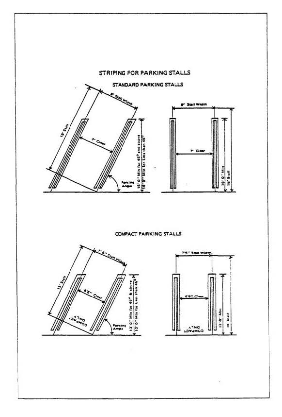
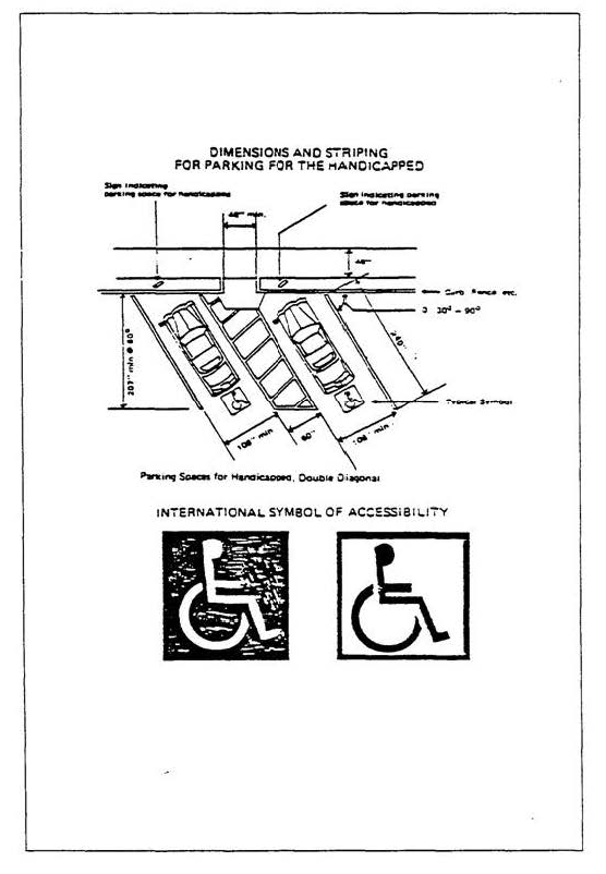
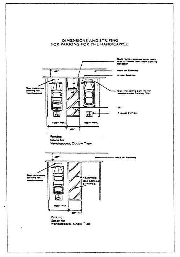
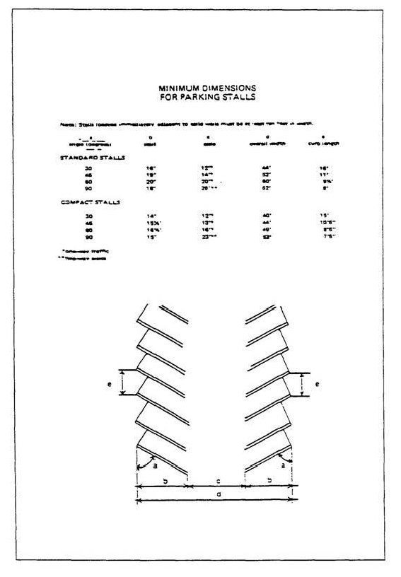
H.
Accessible parking for persons with disabilities.
1.
Number required. All nonresidential parking lots accessible to the public, with the exception of parking lots providing 100 percent valet parking with an approved parking permit, shall provide accessible parking spaces designated for use by persons with disabilities, in the number indicated by the following table:
2.
Location. Accessible parking spaces for persons with disabilities shall be located as near as practical to a primary entrance. If only one space is provided, it shall be 14 feet wide and striped to provide a nine-foot parking area and a five-foot loading and unloading area. When more than one space is provided, in lieu of providing a 14-foot wide space for each parking space, two spaces can be provided within a 23-foot wide area striped to provide a nine-foot parking area on each side of a five-foot loading and unloading area in the center. The minimum length of each parking space shall be 18 feet. These parking spaces shall be designed substantially in conformance with the illustration in the parking diagrams of this LIP.
3.
Encroachment. In each parking area, a wheel stop or curb shall be provided and located to prevent encroachment of cars over the required width of walkways. Also, the space shall be so located such that persons with disabilities are not compelled to wheel or walk behind parked cars other than their own. Pedestrian ways which are accessible to persons with disabilities shall be provided from each such parking space to related facilities, including curb cuts or ramps as needed. Ramps shall not encroach into any parking space. However, ramps located at the front of accessible parking spaces for persons with disabilities may encroach into the length of such spaces when such encroachment does not limit the capability of a person with disabilities to leave or enter their vehicle.
4.
Slopes. Surface slopes of accessible parking spaces for persons with disabilities shall be the minimum possible and shall not exceed one-quarter inch per foot (2.083 percent slope) in any direction.
5.
Marking. The surface of each parking space shall have a surface identification sign duplicating the symbol of accessibility in blue paint, at least three square feet in size.
6.
Vertical Clearance. Entrances to and vertical clearances within parking structures shall have a minimum vertical clearance of eight feet two inches where required for accessibility to accessible parking spaces for persons with disabilities.
I.
Number of Spaces Required—Fractions. When the application of this section requires a fractional part of a vehicle or bicycle parking space, any such fraction equal to or greater than one-half shall be construed as a whole and fractions less than one-half shall be eliminated.
J.
Reduction in Required Vehicle Parking Spaces When Bicycle Parking Provided.
1.
Eligibility requirements for a parking reduction. A reduction in vehicle parking spaces required by this section shall be granted pursuant to this section, when:
a.
The project provides more than the minimum number of bicycle parking spaces required by this section; and
b.
The project is located:
i.
On or adjoining a lot or lots containing an existing or proposed bicycle path, lane, route, or boulevard, as so designated in the County Bicycle Master Plan; and
ii.
Within one-half mile of a transit stop for a fixed rail or bus rapid transit or local bus system along a major or secondary highway.
2.
Reduction calculation. For every two bicycle parking spaces provided above the minimum number of such spaces required by this section, the required number of vehicle parking spaces required may be reduced by one, with a maximum reduction in vehicle parking spaces of five percent of the total number of such spaces otherwise required by this section.
K.
Compact automobile parking spaces. Except as otherwise provided in this section, not more than 40 percent of the required number of parking spaces, and any parking spaces in excess of the required number, may be compact automobile parking spaces. Spaces for compacts shall be distributed throughout the parking area.
L.
On-site parking. Except as otherwise provided in this section, specifically approved by the Commission in a density controlled development, or unless expressly allowed by a parking permit approved pursuant to Section 22.44.1415, every use shall provide the required number of parking spaces on the same lot or parcel of land on which the use is located. For the purposes of this section, transitional parking spaces separated only by an alley from the use shall be considered to be located on the same lot or parcel.
M.
Loading areas. Every nonresidential use shall provide and maintain on-site loading and unloading space as provided herein.
1.
2.
Minimum specifications for loading space:
3.
Loading spaces shall be located so that commercial vehicles shall not back onto a public street or alley.
4.
All maneuvering operations shall be conducted on-site but not within required vehicle parking spaces.
5.
The number of loading spaces required may be modified but not waived by the Director in special circumstances involving, but not necessarily limited to, the nature of the use and the design of the project. In no event, however, shall the Director require less than one loading space on the subject property.
6.
Office and commercial uses with a gross floor area of less than 5,000 square feet may be required to provide one Type A loading space where the Director deems it appropriate to prevent traffic congestion in the parking lot or adjacent streets and highways.
N.
Churches, temples and other places of worship. Every church, temple or other similar place used in whole or in part for the gathering together of persons for worship, deliberation or meditation shall provide, within 500 feet thereof, one parking space for each five persons based on the occupant load of the largest assembly area as determined by the Public Works Director.
O.
Commercial areas. Except as otherwise provided in this section, every lot or parcel of land, except an electrical substation or similar public utility in which there are no offices or other places visited by the public, shall provide an area of sufficient size so that it contains one automobile parking space plus adequate access thereto for each 250 square feet of floor area of any building or structure so used. Except for medical offices, the preceding provisions shall not apply to business and professional offices, which shall instead provide an area of sufficient size so that it contains one automobile parking space plus adequate access thereto for each 400 square feet of floor area of any building or structure so used.
P.
Day care facilities.
1.
Every adult day care facility and child care center shall have one parking space for each staff member and any motor vehicle used directly in conducting such use.
2.
In addition to the parking required in subsection 1 above, each child care center shall have one parking space for each 20 children for whom a license has been issued by the State of California. Every child care center shall have a specific area designated and marked for off-street drop-off and pickup of the children.
Q.
Entertainment, assembly, and dining.
1.
Except as otherwise provided in this section, every structure used for amusement, assembly, drinking, eating, or entertainment shall provide one or more automobile parking spaces:
a.
For each three persons based on the occupant load as determined by the Public Works Director. These uses include but are not limited to:
i.
Conference rooms;
ii.
Dining rooms, cafes, cafeterias, coffee shops, nightclubs, restaurants, and other similar uses;
iii.
Drinking establishments, bars, cocktail lounges, nightclubs, soda fountains, tasting rooms, taverns, and other similar uses;
iv.
Exhibit rooms, stages, lounges, and other similar uses;
v.
Theaters, auditoriums, lodge rooms, stadiums or other places of amusement and entertainment, not otherwise enumerated in this section;
vi.
Mortuaries;
vii.
Dancehalls, skating rinks, and gymnasiums; and
viii.
Health clubs and centers.
b.
For each 250 square feet for an eating establishment selling food for off-site consumption and having no seating or other areas for on-site eating where approved by the Director in accordance with Section 22.44.940.
2.
A business establishment, other than that described in subsection 1.b of this subsection Q, containing a use or uses enumerated in this section shall be subject to a minimum of 10 automobile parking spaces.
3.
The parking requirement for that portion of a business described in subsection 1 of this subsection Q that is conducted outside of a building shall be calculated in accordance with the method of determining the occupant load contained in the Building Code (Title 26 of this code).
R.
Golf courses. Every golf course shall provide 10 parking spaces per hole plus additional parking for all other buildings with the exclusion of the starter offices, comfort stations and locker-shower rooms. Miniature golf courses are excluded from this subsection.
S.
Hospitals, convalescent hospitals, adult residential facilities and group homes for children.
1.
Every hospital shall have two automobile parking spaces, plus adequate access thereto, for each patient bed. The parking may be within 500 feet of the exterior boundary of the lot or parcel containing the main use. At least 25 percent of the required parking shall be reserved and marked for the use of employees only.
2.
Outpatient clinics, laboratories, pharmacies, and other similar uses shall have one parking space for each 250 square feet of floor area when established in conjunction with a hospital.
3.
Every convalescent hospital shall have an amount of automobile parking spaces not less than the number of residents permitted by any license or permit which allows the maintenance of such facility. If employee dwelling units are provided on the premises there shall be, in addition to the automobile parking spaces required for the principal use, the number of automobile parking spaces required by this section for residential uses.
4.
Every adult residential facility and group home for children shall have one automobile parking space for each staff member on the largest shift and one parking space for each vehicle used directly in conducting such use.
T.
For scientific research or experimental development uses, one parking space shall be provided for each 300 square feet of gross floor area, but not less than three spaces for each four employees.
U.
Joint live and work units. Each joint live and work unit shall have a minimum of two uncovered standard parking spaces.
V.
Mobilehome parks.
1.
Every mobilehome site shall have two standard automobile parking spaces, plus adequate access thereto. Such spaces, if developed in tandem, shall be a minimum of eight feet wide and a total of 36 feet long.
2.
In addition, guest parking spaces shall be provided at the ratio of one standard size automobile parking space for each four mobilehome sites.
3.
Required parking spaces may be covered or uncovered.
W.
Private parks. Private parks shall have the same parking requirements and be subject to the same modification provisions as public parks pursuant to subsection X of this section.
X.
Public parks.
1.
Every publicly owned park shall have automobile parking spaces plus adequate access thereto, calculated as follows:
a.
For parks of not more than 50 acres:
i.
One automobile parking space for each 45 square feet of floor area in the largest assembly area in each building used for public assembly except gymnasiums; plus
ii.
One automobile parking space for each 100 square feet of floor area in the largest room in each gymnasium; plus
iii.
One automobile parking space for each 400 square feet of floor area in the remaining area of each building in the park, excluding parking structures, maintenance and utility buildings, and other structures not open to the public; plus
iv.
One automobile parking space for each one-half acre of developed park area up to 15 acres; plus
v.
One automobile parking space for each additional acre of developed park area in excess of 15 acres.
b.
For parks of more than 50 acres in area, the number of required parking spaces shall be based on the occupant load of each facility constructed, as determined by the Public Works Director using established standards where applicable. Where said standards are not available, the Director shall make such determination based on the recommendation of the Director of the Department of Parks and Recreation.
2.
The Director may, without public hearing, approve a modification in the number of automobile parking spaces required by this section, where he/she finds:
a.
That the Director of the Department of Parks and Recreation has determined that due to location, size or other factors, anticipated client usage would indicate that a lesser parking requirement is adequate and so recommends; and
b.
That elimination of parking spaces in the number proposed will not result in traffic congestion, excessive off-site parking, or unauthorized use of parking facilities developed to serve surrounding property; and
c.
That no written protest to the proposed reduction in parking spaces has been received within 15 working days following the date of mailing by the Director, of notice of the proposed modification by first class mail, postage prepaid, to all persons whose names and addresses appear on the latest available assessment roll of the County of Los Angeles as owning property within a distance of 500 feet from the exterior boundaries of such park. Such notice shall also indicate that any person opposed to the granting of such modification may express such opposition by written protest to the Director within the prescribed 15-day period; and
d.
That sufficient land area is reserved to insure that the parking requirements of this section may be complied with should such additional parking be required in the future due to changes in client usage.
3.
In all cases where a written protest has been received, a public hearing shall be scheduled before the Commission. All procedures relative to notification, public hearing and appeal shall be the same as for a CDP. Following a public hearing the Commission shall approve or deny the proposed modification, based on the findings required by this section for approval by the Director exclusive of written protest.
Y.
Residential uses.
1.
Except as otherwise provided in subsection B of Section 22.44.2140, every single-family residence, two-family residence, apartment house, and other structure designed for or intended to be used as a dwelling on a lot or parcel of land having an area of less than one acre per dwelling unit shall have automobile parking as specified herein:
a.
Each single-family residence, two covered standard automobile parking spaces per dwelling unit. Each two-family residence, one and one-half covered, plus one-half uncovered standard parking spaces;
b.
Each bachelor apartment, one covered parking space per dwelling unit; each efficiency or one-bedroom apartment, one and one-half covered parking spaces per dwelling unit; and, each apartment having two or more bedrooms, one and one-half covered, plus one-half uncovered parking spaces. In addition, parking for apartment houses shall comply with the following provisions:
i.
Parking spaces for apartment houses shall be standard size unless compact size spaces are allowed by a parking permit approved pursuant to Section 22.44.1415;
ii.
Guest parking shall be provided for all apartment houses containing 10 or more units at a ratio of one standard parking space for every four dwelling units. These spaces, which may be uncovered, shall be designated, marked and used only for guest parking;
iii.
At least one accessible parking space shall be assigned to each dwelling unit.
2.
Where two spaces are required or reserved for a dwelling unit such spaces may be developed in tandem. The minimum dimensions for such tandem spaces are eight feet wide and a total of 36 feet long for standard spaces and seven and one-half feet wide and a total of 30 feet long for compact spaces.
3.
Parking spaces which are required to be covered shall be provided in a garage, carport or other suitable structure located in a place where the erection of such structures is permitted. Uncovered parking spaces, in addition to those specifically allowed by this section, may be developed where specifically allowed by a parking permit approved pursuant to Section 22.44.1415.
4.
Where a senior citizen residence is to be constructed, one standard-size automobile parking space, which may be uncovered, shall be created to serve such residence. Such parking space shall not be located in the front or side yards, but may be developed in tandem with parking spaces required to serve the primary residence.
5.
An accessory dwelling unit or habitable accessory structure with fewer than two bedrooms shall have one uncovered standard parking space; a second unit with two or more bedrooms shall have two uncovered standard parking spaces. A parking space provided for a second unit may be located in tandem with a parking space for the single-family residence only if such design is necessary to provide the required number of parking spaces for both units, and either space may be accessed from the driveway without moving an automobile parked in the other space. Notwithstanding subsection 1.a of this subsection, if tandem parking is provided, one of the parking spaces for the single-family residence may be uncovered.
Z.
Schools.
1.
Every building used in whole or in part for an elementary school having no grade above the sixth, shall have, within 500 feet thereof, one automobile parking space for each classroom.
2.
Every other building used as a school auditorium of a school in which any pupil is in a grade higher than the sixth shall have, within 500 feet thereof, one automobile parking space for each five persons, based on the occupant load of the largest auditorium or room used for public assembly, as determined by the Public Works Director.
AA.
Tasting rooms and remote tasting rooms. The parking requirement for a tasting room or remote tasting room shall be one parking space for every 100 square feet of floor area, including any outdoor floor area.
BB.
Wineries. The parking requirement for a winery shall be one parking space for every 500 square feet of enclosed floor area.
CC.
Uses not specified-Number of spaces required. Where parking requirements for any use are not specified, parking shall be provided in an amount which the Director finds adequate to prevent traffic congestion and excessive on-street parking. Whenever practical, such determination shall be based upon the requirements for the most comparable use specified in this section.
DD.
Bicycle Parking and Related Facilities.
1.
Definitions.
a.
"Bicycle parking space" means an area at least six feet in length by at least two feet in width to accommodate secured storage for one bicycle;
b.
"Bicycle rack" means a fixture on which one or more bicycles can be secured;
c.
"Long-term bicycle parking" means bicycle parking intended for a period of two hours or longer, appropriate for residents, employees, transit users, and visitors to hotels in the nearby area; and
d.
"Short-term bicycle parking" means bicycle parking intended for a period of two hours or less, appropriate for persons making short visits to commercial establishments such as grocery and convenience stores, restaurants, coffee shops, bars and clubs, and offices such as medical, dental, and post offices.
2.
Number of bicycle parking spaces required. The minimum number of bicycle parking spaces for a particular use shall be provided in accordance with the chart below. For a combination of uses on a single lot, the number of required bicycle parking spaces shall be equal to the combined total of the required bicycle parking spaces for each of the individual uses. For purposes of this calculation, when floor area is used, all calculations for the specific use shall be based on gross floor area, including the gross floor area of any proposed addition to the involved structure or site.
3.
Showers and changing facilities. Showers and changing facilities of a size and at a location deemed appropriate by the Director, shall be provided in all new commercial buildings with 75,000 or more square feet of gross floor area and shall, at a minimum, be accessible to employees.
4.
Development standards for bicycle parking spaces.
a.
General Requirements. All bicycle parking spaces shall be:
i.
Directly adjacent to a bicycle rack or within a secure, single bicycle locker and shall allow for convenient, unobstructed access to such bicycle rack or locker; and
ii.
Located so as to not block pedestrian entrances, walkways, or circulation patterns in or around nearby facilities or structures;
b.
Bicycle racks. When using bicycle racks, they shall be:
i.
Located and installed to support an entire bicycle, including its frame and wheels, so that the frame and wheels can be locked without damage when using a customary, heavy-duty cable or u-shaped bicycle lock;
ii.
Securely anchored to a permanent surface; and
iii.
Installed to allow bicycles to remain upright when locked, without the use of a kickstand;
c.
Bicycle Lockers. When using bicycle lockers, they shall be:
i.
Of sufficient size to hold an entire bicycle; and
ii.
Securely anchored to a permanent surface;
d.
Location of Bicycle Parking Spaces.
i.
Short-term bicycle parking spaces. Short-term bicycle parking spaces shall be:
(A)
Located to be visible from public areas such as public streets, store fronts, walkway and plazas, and to be convenient to the target users of the bicycle parking to the maximum extent feasible;
(B)
Installed as close to a structure's main entrance as feasible; and
(C)
Separated with a barrier from areas where vehicles park, such as with a curb or wheel stop;
ii.
Long-term bicycle parking. Long-term bicycle parking shall be:
(A)
Located in a secure, and covered area;
(B)
Accessible to and from nearby public streets for the target users of the bicycle parking, who may or may not include the general public;
(C)
Located at surface levels near main pedestrian entrance(s) to nearby facilities or structures, or in the parking garages of such facilities or structures;
(D)
Accessible only to residents and owners, operators, and managers of a residential facility when the involved use is residential; and
(E)
Accessible only to employees, tenants, and owners of a commercial structure or facility when the involved use is commercial.
e.
Signage. For projects that include long-term bicycle parking, signage identifying the location of such bicycle parking shall be included in the project design. Preferred signage locations for this purpose shall be building access ways, street and sidewalk approaches, and nearby bicycle paths or facilities.
EE.
Additional Parking Requirements.
1.
Adequate parking to serve recreation uses shall be provided. Existing parking areas serving recreational uses shall not be displaced unless a comparable replacement area is provided.
2.
New development shall provide off-street parking sufficient to serve the approved use to minimize impacts to public street parking available for coastal access and recreation. Off-street parking for private use shall be adequate for the use, but may be reasonably restricted to protect existing uses or public safety where it is demonstrated that the proximity to a public area with a parking fee is causing the private area to be used for parking instead of the public parking area.
3.
The implementation of restrictions on public parking (including, but not limited to, the posting of "no parking" signs, red curbing, physical barriers, imposition of maximum parking time periods, and preferential parking programs) is development that requires a CDP. Any public parking restrictions that would impede or restrict public access to beaches, trails or parklands, shall be prohibited except where such restrictions are needed to protect public safety and where no other feasible alternative exists to provide public safety. Where feasible, an equivalent number of public parking spaces shall be provided nearby as mitigation for impacts to coastal access and recreation.
(Ord. 2019-0004 § 1, 2019.)
22.44.1415 - Parking Permits.
A.
Establishment—Purpose.
1.
The parking permit procedure is established to provide an alternative to the parking requirements of Section 22.44.1410 in the event that a particular use does not have the need for such requirements. Such permit shall be processed concurrently and in the same manner as the CDP authorizing the development that requires parking. A parking permit can be applied for independently from a CDP where no development, as defined in Section 22.44.630, including but not limited to, a change in the density or intensity of use for either the parcel containing the use requiring the permit or any identified location for off-site parking, is proposed.
2.
It is the intent to provide more flexibility in the design of particular uses that have special characteristics by reducing the number of parking spaces otherwise required for such uses including:
a.
Housing developments for senior citizens and persons with disabilities where few of the residents will own their own automobiles;
b.
Certain uses where parking requirements are based upon floor area of a structure, but bear no relationship to the number of employees, customers, or other persons using the facilities, on the premises or the trade conducted;
c.
Businesses which provide their employees, customers, or others with positive incentives to use means of transportation other than the automobile.
3.
It is the intent to conserve land and promote efficient land use by allowing:
a.
The dual or shared use of parking facilities by two or more uses;
b.
Tandem parking for nonresidential uses;
c.
Compact parking spaces for apartment houses.
4.
It is the intent to provide greater flexibility and opportunity to meet the parking requirements by allowing:
a.
Off-site parking facilities;
b.
The short-term leasing of required parking spaces;
c.
Transitional parking for parcels with rear lot lines abutting commercial zones;
d.
Uncovered parking for low- and moderate-income housing.
B.
Application—Filing time. Any persons desiring a parking permit provided for in this section may file an application with the Director; provided, that no application shall be filed or accepted if final action has been taken within one year prior thereto by the Director, Commission or Board of Supervisors on an application requesting the same or substantially the same, permit.
C.
Application—Information Required. Application for a parking permit shall contain the following information:
1.
Name and address of the applicant and of all persons owning any or all of the property purposed to be used.
2.
Evidence that the applicant:
a.
Is the owner of the premises involved, or
b.
Has written permission of the owner or owners to make such application, or
c.
Is or will be the plaintiff in an action of eminent domain to acquire the premises involved or any portion thereof, or
d.
In the case of a public agency, is negotiating to acquire a portion of the premises involved;
3.
Location of the subject property (address or vicinity).
4.
Legal description of the property involved.
5.
The nature of the requested use, indicating the business, occupation or purpose for which such building, structure or improvement is to be occupied or used.
6.
The nature, condition and development of adjacent uses, buildings and structures.
7.
Two site plans, drawn to a scale satisfactory to and in the number of copies prescribed by the Director, indicating:
a.
The area and dimensions of the proposed site for the requested use;
b.
On the first site plan, the location and dimensions of all structures, yards, walls, fences, bicycle and vehicle parking and loading facilities, landscaping, pedestrian facilities, and other development features, as if no parking permit is applied for; and
c.
On the second site plan, the location and dimensions of all structures, yards, walls, fences, parking and loading facilities, landscaping, and other development features, including any land area reserved to satisfy normal parking requirements should the use or occupancies change, as if the parking permit were granted;
8.
The dimensions and state of improvement of the adjoining streets and highways providing access to the proposed site of the requested use.
9.
Other permits and approvals secured in compliance with the provisions of other applicable ordinances.
10.
With each application the applicant shall also file:
a.
Maps, in the number prescribed and drawn to a scale specified by the Director, showing the location of all property included in the request, the location of all highways, streets, alleys and the location and dimensions of all lots or parcels of land within a distance of 500 feet from the exterior boundaries of the subject parcel of land; and
b.
One copy of said map shall indicate the uses established on every lot and parcel of land shown within said 500-foot radius; and
c.
A list, certified to be correct by affidavit or by a statement under penalty of perjury pursuant to section 2015.5 of the Code of Civil Procedure, of the names and addresses of all persons who are shown on the latest available assessment roll of the County of Los Angeles as owners of the subject parcel of land and as owning property within a distance of 500 feet from the exterior boundaries of the parcel of land to be occupied by the use. One copy of said map shall indicate where such ownerships are located.
11.
A description of the unique characteristics of the proposed use and/or special programs which are proposed which reduce the need for the required number of parking spaces or warrant modification of the parking requirements of Section 22.44.1410.
12.
A vicinity map showing the location of transit lines, park-and-ride facilities, people-movers, bikeways or other similar facilities which provide alternate transportation modes.
13.
When a parking permit is proposed for off-site parking, the filing requirements listed in this section shall apply to all parcels under consideration. In addition, the Director shall provide notice of the permit and of any public hearing required for such proposal for all parcels independently using the procedures contained in this section and in Section 22.44.970; and
14.
Such other information as the Director may require.
15.
The Director may waive the filing of one or more of the above items.
16.
The accuracy of all information, maps and lists submitted shall be the responsibility of the applicant.
D.
Application—Burden of Proof. In addition to the information required in the application by subsection C of this section, the applicant shall substantiate the following facts:
1.
That there will be no need for the number of vehicle parking spaces required by Section 22.44.1410 because:
a.
The age and/or physical condition of the residents is such that the use of automobile is unlikely; or
b.
The nature of the use is such that there is a reduced occupancy; or
c.
The business or use has established a viable transportation program for its employees and/or customers to use transportation modes other than the single-occupant automobile. Such a program shall include positive incentives such as van pools, transit fare subsidies, commuter travel allowances, car pools or bicycle commuter facilities. Where appropriate, proximity to freeways with high-occupancy vehicle (HOV) lanes, bus routes, park-and-ride facilities, people-movers, rapid transit stations, bikeways, or other similar facilities shall be a factor in this consideration; or
d.
Sufficient land area is reserved or an alternative arrangement is approved to insure that the parking requirements may be complied with should the use, occupancy, or transportation program change. Such reservation or alternative may be waived for certain housing developments for senior citizens and persons with disabilities, where the Director finds that it is unnecessary because of the anticipated permanent nature of such use. If required, the reserved land area shall be so located and developed in such a manner that it can be feasibly converted to parking if needed; or
e.
The reduction in the number of vehicle parking spaces will be offset by the provision of bicycle parking spaces, at a minimum ratio of two bicycle spaces for every one vehicle parking space above the minimum number of bicycle parking spaces otherwise required under subsection DD of Section 22.44.1410.
2.
That there will be no conflicts arising from special parking arrangements allowing shared vehicle parking facilities, tandem spaces, or compact spaces because:
a.
Uses sharing vehicle parking facilities operate at different times of the day or days of the week; or
b.
Vehicle parking facilities using tandem spaces will employ valets or will utilize other means to insure a workable plan; or
c.
Apartment houses using compact spaces for a portion of the required parking have a management program or homeowners' association to assure an efficient distribution of all parking spaces;
3.
That off-site facilities, leases of less than 20 years, rear lot transitional parking lots and uncovered residential vehicle parking spaces will provide the required parking for uses because:
a.
Such off-site facilities are controlled through ownership, leasing or other arrangement by the owner of the use for which the site serves and are conveniently accessible to the main use; or
b.
Such leases are written in such a way as to prevent multiple leasing of the same spaces or cancellation without providing alternate spaces; such leases shall contain other guarantees assuring continued availability of the spaces; or
c.
Such transitional lots are designed to minimize adverse effects on surrounding properties; or
d.
Uncovered parking for low- and moderate-income residential developments will be appropriately screened and compatible with the surrounding neighborhood.
4.
That the requested parking permit at the location proposed will not adversely impact public street parking that is available for public access and recreation, will preserve public health, safety, and welfare, and will not result in traffic congestion, excessive off-site parking, or unauthorized use of parking facilities developed to serve surrounding property.
5.
That the proposed site is adequate in size and shape to accommodate the yards, walls, fences, loading facilities, landscaping, and other development features prescribed in this LIP.
E.
Application—Fee and deposit. When an application is filed, it shall be accompanied by the filing fee and deposit as required in Section 22.44.870 for a minor CDP.
F.
Application—Notice requirements.
1.
In all cases where an application is filed, the Director shall cause a notice indicating the applicant's request at the location specified to be forwarded by first-class mail, postage prepaid, to:
a.
All persons whose names and addresses appear on the latest available assessment roll of the County as owning property within a distance of 500 feet from the exterior boundaries of the property on which the permit is filed. A notice shall also be sent in a similar manner to "occupant" at the site address in those cases where the mailing address of any owner of property required to be notified under the provisions of this subsection differs from the site address of such property. In the case of an apartment house, a notice addressed to "occupant" shall be mailed to each dwelling unit; and
b.
Such other persons or groups whose property or interests might, in his judgment, be affected by such application or permit.
2.
Such notice shall also indicate that any person, opposed to the granting of such permit may express such opposition by written protest to the Director within 14 calendar days following the date on the notice.
G.
Application—Findings and decision.
1.
The application for a parking permit may be approved where the following findings are made:
a.
That the applicant has met the burden of proof set forth in subsection D of this section; and
b.
That no written protest to the proposed parking permit has been received within 14 calendar days following the date on the notice sent by the Director pursuant to subsection F of this section.
2.
The application shall be denied where the information submitted by the applicant fails to substantiate the burden of proof set forth in subsection D of this section.
3.
The application for a parking permit shall be processed concurrently and in the same manner as the CDP authorizing the development that requires parking.
H.
Appeal procedures. Any person dissatisfied with the action of the Director or the Hearing Officer, as applicable, may file an appeal of such action with the Commission, and any person dissatisfied with the decision of the Commission may file an appeal with the Board of Supervisors. All such appeals shall be filed within the time period set forth in, and shall be subject to all of the other provisions of Section 22.44.1040.
I.
Request for further review. In addition to the procedure for initiation of appeals pursuant to Section 22.44.1040, within the appeal period, one or more members of the Board of Supervisors may request further review by the Board of Supervisors of a Commission action on a parking permit.
J.
Agreement to develop following termination or approved use.
1.
Where a parking permit is approved, the owner of the land shall furnish and record an agreement in the office of the County Recorder, as a covenant running with the land for the benefit of the County, providing that, should such parking permit terminate, the owner or his successor in interest will develop the parking spaces needed to bring the new use or occupancy into conformance with the requirements of Section 22.44.1410 at the time such new use or occupancy is established.
2.
Where a parking permit is approved for off-site parking, the agreement shall be recorded on both the lot or parcel of land containing the principal use as well as the lot or parcel of land developed for off-site parking.
3.
All agreements shall be reviewed and approved by the Director and County Counsel prior to recordation.
K.
Decision—Effective date. The effective date of a decision made on a permit under this section shall be as set forth in Section 22.44.1090.
L.
Date of grant when an appeal is filed. Where an appeal is filed to any parking permit, and the permit is ultimately granted, the date of the decision by the Commission or the Board of Supervisors of such appeal, whichever is later, shall be deemed the date of grant in determining the expiration date.
M.
All regulations apply unless permit is granted. Unless specifically modified by a parking permit, all regulations prescribed in Section 22.44.1410 shall apply.
N.
Imposition of additional conditions.
1.
In approving an application for a parking permit, additional conditions may be imposed as deemed necessary to insure that the permit will be in accord with the findings required by subsection G of this section. Conditions imposed may include:
a.
Special yards, open spaces and buffer areas;
b.
Fences and walls;
c.
Parking facilities, including vehicular ingress and egress and the surfacing or parking areas and driveways to specified standards;
d.
Street and highway dedications and improvements, including sidewalks, curbs and gutters;
e.
Water supply and fire protection in accordance with the provisions of Division 1 of Title 20 of this code;
f.
Landscaping and maintenance of grounds;
g.
Regulation of nuisance factors such as noise, vibrations, smoke, dust, dirt, odors, gases, noxious matter, heat, glare, electromagnetic disturbances and radiation;
h.
Regulation of operating hours for activities affecting normal neighborhood schedules and functions;
i.
Regulation of signs, including outdoor advertising;
j.
A specified validation period limiting the time in which development may begin;
k.
Provisions for a bond or other surety that the proposed project will be removed on or before a specified date;
l.
A site plan indicating all details and data as prescribed in Section 22.44.800 et seq.; and
m.
Such other conditions as will make possible the development of the proposed project in an orderly and efficient manner and in general accord with all elements of the certified LCP.
2.
In addition, the following conditions shall be imposed, where applicable, unless specifically waived or modified:
a.
The required parking spaces for senior citizens and persons with disabilities may be reduced to not less than one space for each four dwelling units;
b.
Where reduced occupancy is a primary consideration in the approval of a parking permit, the maximum occupant load for such use shall be established;
c.
Where special programs are proposed to reduce the parking requirement, they shall be reviewed annually to determine their effectiveness. In the event that such programs are terminated or unsuccessful, the property owner shall supply the required parking;
d.
The required parking spaces for all uses other than a housing development for senior citizens and persons with disabilities may be reduced to not less than 50 percent of the parking spaces required by Section 22.44.1410;
e.
Where land is required to be reserved to insure that sufficient area is available to meet the parking requirements, restrictions shall be imposed on such land so that it can feasibly be converted to parking if needed;
f.
Where shared parking facilities are approved, operating conditions such as hours or days of operation shall be established for each use sharing the facility;
g.
Where tandem parking is proposed for nonresidential uses, there shall be valets or other persons employed to assist in the parking of automobiles. The ratio of valets to parking spaces shall be established. The parking of automobiles by valets on public streets shall be prohibited. Each tandem parking space shall be eight feet wide; the length of the space shall be 18 feet for each automobile parked in tandem. Parking bays shall contain only two parking spaces where access is available from only one end. Bays of four parking spaces may be permitted where access is available from both ends;
h.
Where compact parking is proposed for apartments, no more than 40 percent of the required spaces shall be for compact automobiles. A program to manage the distribution of parking spaces shall be approved and operated by the apartment management or a homeowners' association;
i.
If off-site automobile parking facilities are proposed, such facilities must be within 400 feet from any entrance of the use to which they are accessory. Parking for employees shall be located within 1,320 feet from the entrance to such use. Directions to such facilities shall be clearly posted at the principal use;
j.
Where leasing of parking facilities is proposed for any period less than 20 years, the applicant shall guarantee that the leased spaces are available for his sole use, the lease shall be recorded in the office of the County Recorder, and the applicant shall demonstrate that he has the ability to provide the required number of spaces should the lease be cancelled or terminated. Except for the term of the lease, the provisions of subsection D of Section 22.44.1410 relating to leases shall apply. A copy of such lease shall be submitted to the Director and County Counsel for review and approval. Other conditions including, but not limited to, requiring title reports, covenants and bonding may also be imposed where necessary to insure the continued availability of leased parking spaces;
k.
Where transitional parking is proposed for lots whose rear lot line adjoins or is separated only by an alley from a commercial zone, no access is permitted from the parking facility to the street on which the lot fronts. The parking facility shall be developed in accordance with the standards of Section 22.44.1410 and the following standards, unless specifically waived or modified by the parking permit. The hours and days of operation shall be established to prevent conflicts with adjoining less restrictive uses, and the facility shall be secured to prevent unauthorized use during times when the facility is closed;
i.
That the area used for parking adjoins or is separated only by an alley from property in a Commercial zone; and
ii.
That parking shall be limited to an area within 100 feet from the boundary of the qualifying commercial zone; and
iii.
That an area developed with parking shall have direct vehicular access to an improved public street, highway, alley or to the qualifying commercial zone; and
iv.
That the lot or parcel of land developed with parking including access, shall:
(A)
Have a side lot line adjoining, or separated only by an alley, for a distance of not less than 50 feet, from property in the qualifying commercial zone, or
(B)
Have a rear lot line adjoining or separated only by an alley from property in the qualifying commercial or zone; provided, that a parking permit has been approved pursuant to this section;
(C)
Where the lot or parcel of land referred to in item iv.(A) of this subsection has a width less than 100 feet, additional lots or parcels of land may be considered for parking provided:
(1)
That they have successive contiguity on side lot lines with the first lot or parcel of land described in item iv.(A) of this subsection, and
(2)
That in no event shall the total area developed for parking extend more than 100 feet from the qualifying commercial or zone, and
(3)
That all area extending from the qualifying commercial or zone is developed for parking; and
v.
That the side lot line of the lot or parcel of land developed with parking shall not exceed the length of the lot line common to said commercial zone. The Director may modify this provision to the extent permitted in item k.ii. of this subsection; and
vi.
That any remaining portion of a lot or parcel of land developed with parking shall contain not less than the required area or width; and
vii.
That parking shall be developed in accordance with the provisions of subsections G and H of Section 22.44.1410, except that a landscaped front yard setback equal to that of the zone in which it is located shall be provided; and
viii.
That parking shall be limited to motor vehicle parking lots exclusively, but shall exclude vehicles over two tons rated capacity; and
ix.
That a site plan shall be submitted to the Director, indicating compliance with the provision of this section and the standards of development of the zone in which it is located.
l.
Where uncovered parking is proposed for low- and moderate-income housing, the following setback and screening provisions shall be complied with:
i.
Uncovered parking spaces shall not be located in the required front, side, corner side or rear yards except in those places where garages or carports are permitted in accordance with other provisions of this LIP;
ii.
Uncovered parking spaces shall be screened by a six-foot high solid fence or wall or by a three-foot wide planting strip along the sides of the parking space if the space is located within 10 feet of any property line:
(A)
Landscaping material in the planting strip shall consist of evergreen trees and/or shrubs from the Plant List for the Santa Monica Mountains maintained by the Director, of such size, spacing and character that they form an opaque screen five to six feet high within two years of planting. This landscaping must be continuously maintained;
(B)
Such buffering by walls, fences or landscaping is optional where the lots or parcels of land adjoining the uncovered parking area are developed with parking facilities, either covered or uncovered;
iii.
Uncovered parking spaces will be permitted only for those units actually designated for low- or moderate-income housing.
m.
In the event that any applicant and/or property owner is unable to comply with the provisions of the parking permit, the use for which permit has been granted shall be terminated, reduced, or removed unless some other alternative method to provide the required parking is approved by the Director; and
n.
The parking permit shall be granted for a specified term where deemed appropriate.
O.
Continuing validity of permit. A parking permit that is valid and in effect, and was granted pursuant to the provisions of this LIP, shall adhere to the land and continue to be valid upon change of ownership of the land or any lawfully existing building or structure on said land.
P.
Termination on cessation of use or occupancy. An approved parking permit shall terminate and cease to be in effect at the same time the principal use or occupancy for which such permit is granted terminates.
Q.
Permit does not legalize nuisances. Neither the provisions of this section nor the granting of any permit provided for in this section authorizes or legalizes the maintenance of any public or private nuisance.
(Ord. 2019-0004 § 1, 2019.)
22.44.1420 - Incentive Program for Certain Development Actions.
A.
Purpose and intent. The purpose of offering incentives for certain actions associated with development in the Coastal Zone is to encourage voluntary actions that further the goals of the LCP.
B.
The action taken by the applicant must be voluntary, and not required as part of a project alternative or mitigation measure necessary for a proposed project to achieve consistency with the certified LCP, and formalized as a condition of approval for a CDP.
C.
Action by Applicant. Subject to the approval of the Director, actions that qualify for participation in the incentive program are:
1.
Retirement of all development rights on one or more lawfully-created, buildable parcel(s) that total at least five acres in size, contain habitat designated as H2 (may also contain H1 habitat, but shall primarily contain H2 habitat), and located in the Coastal Zone. A parcel retired as part of the transfer of development credit program contained in Section 22.44.1230 cannot also be used for this incentive program. The development rights of the eligible parcel(s) shall be retired subject to one of the two lot retirement methods detailed in subsection F.3 of Section 22.44.1230 except that the retired parcels shall be considered the donor parcels for purposes of implementation.
2.
Dedication of an irrevocable, nonexclusive ingress and egress easement for the purpose of providing access to publicly-owned open space, accepted by a receiving land conservation agency.
3.
Dedication of a trail or trail easement across a segment of a public riding and hiking trail identified either on Map 4 Recreation of the LUP or by the National Park Service trail map, and accepted by the County Parks and Recreation Department; or by a State or federal park and/or recreation agency; that submits a plan that indicates that the organization will open, operate, and maintain the easement in accordance with terms of the recorded trail easement. Recordation of the trail easement shall be required as a condition of approval of the CDP and shall be implemented in accordance with Section 22.44.1390.
D.
Incentive. Any one incentive listed below may be chosen for any one qualifying action, except as specified below. Only one incentive may be taken.
1.
An increase in the threshold for submitting a major CDP application from 5,000 cubic yards to 7,000 cubic yards of grading.
2.
The maximum approvable building site is increased from 10,000-square feet to a 15,000-square-foot building site in H2 or H3 habitat. This incentive is only available when an applicant voluntarily proposes and implements the retirement of all development rights on one or more lawfully-created, buildable parcel(s) located in the Santa Monica Mountains Coastal Zone that is at least 5 acres in size and contains habitat designated as H2 (may also contain H1 habitat but shall primarily contain H2 habitat).
E.
Multiple incentives. If an applicant takes the action of retiring development rights and also takes any other qualifying action as provided in subsection C above, the applicant may choose two incentives as provided in D above.
F.
Any action taken by applicant as provided in subsection C above must be recorded by the County Recorder and reported to the Assessor's office. Copies of the recorded documents, including any documents verifying that a dedication or easement has been received by a land conservation agency, shall be provided to the Director before a CDP will be issued.
G.
Not all actions may be commensurate with each incentive. Therefore, the Director may reduce the incentive(s) chosen by the applicant to ensure that the public benefit obtained from a proposed action is commensurate with the incentive(s) conveyed to the applicant. However, in no case shall the incentive(s) exceed the maximums allowed in subsection D above. Criteria to be used in the Director's evaluation of the benefit obtained from a proposed action shall include, but not be limited to:
1.
For subsection C.1 above, greater benefit shall be given to the retirement of lots containing H1 and/or H2 habitat that is contiguous with publicly-owned open space or already-protected H1 and/or H2 habitat, and not isolated from other H1 and/or H2 habitat.
2.
For subsection C.2 above, greater benefit shall be given to an easement that provides access to an existing public trail, an existing public beach, or an existing public campground.
3.
For subsection C.3 above, greater benefit shall be given to a trail dedication or trail easement that helps to complete the publicly-owned or accessible alignment of an already-existing public trail.
(Ord. 2019-0004 § 1, 2019.)
22.44.1430 - Exploratory Testing.
"Exploratory testing" means any excavation for the purpose of evaluating soil and/or hydrologic conditions, or geologic hazards. This includes exploratory test holes for water wells, percolation testing for on-site wastewater treatment systems, the access road to the test site, and any other activity associated with evaluating a site for development. Property in any zone may be used for exploratory testing, provided that a minor CDP has first been obtained as provided in Section 22.44.800 et seq., and while such permit is in full force and effect in conformity with the conditions of such permit.
A.
Access for exploratory testing shall use existing roads, or track-mounted drill rigs, where feasible. Where there is no feasible access, a temporary access road may be permitted when it is designed to minimize length, width, and total grading to that necessary to accommodate required equipment. All such temporary roads shall be restored to the maximum extent feasible, through grading to original contours, re-vegetating with locally-indigenous vegetation to the project site, and monitoring to ensure successful restoration.
B.
Any disturbances incurred to soil or locally-indigenous vegetation as a result of exploratory testing shall be mitigated and restored according to subsections A and B of Section 22.44.1240 and subsection I of Section 22.44.1260, and according to any requirements of the Department of Public Works.
C.
Within 90 days from completion of exploratory testing, all disturbed areas shall be stabilized with temporary erosion control measures and seeded with locally-indigenous grass species to prevent erosion and instability. Full remediation of disturbed soil or locally-indigenous vegetation shall commence one year from the date of the issuance of the CDP, if further development of the disturbed site in conjunction with an approved project has not occurred.
D.
Any required vegetation removal activities shall be implemented in a manner that will protect existing vegetative root stock to the maximum extent feasible to facilitate revegetation of the disturbed areas.
(Ord. 2019-0004 § 1, 2019.)
22.44.1440 - Visual Resource Protection.
This LIP is intended to protect the Coastal Zone's notable scenic resources, including specifically mapped resources, such as Significant Ridgelines and Scenic Elements, other designated areas, and wherever scenic resources are determined based on site-specific analysis. Because the public enjoys views of scenic resources from scenic highways and public areas, including public parkland and trails, throughout the Coastal Zone both the foreground and background views of scenic highways and public areas are of significant value and shall be protected to the maximum extent feasible. To further protect the Coastal Zone's visual resources, all new development within the Coastal Zone shall meet the following requirements, in addition to those contained in Section 22.44.1990 et seq., to protect the area's unique visual resources, and protect and, where feasible, enhance the quality of scenic resources:
A.
All applications for a CDP shall be reviewed through site-specific investigation by County staff prior to any public hearing to determine whether the proposed project has the potential to cause adverse impacts upon scenic resources, as defined in Section 22.44.2000. Development shall be sited and designed to minimize impacts on scenic resources to the maximum extent feasible through measures that may include, but not be limited to: siting development in the portion of the site least visible from public viewing areas as defined in the LCP; breaking up the mass of new structures; restricting building size and height; designing the structure to blend into its setting; clustering development; minimizing grading; incorporating landscape screening elements; and, berming where such berming would be appropriate. As part of the visual analysis required by subsection Y of Section 22.44.840 for all CDP applications, applicants shall accomplish all of the following: proposed structures shall be accurately indicated as to footprint, height and rooflines by story poles to delineate the height, bulk, and footprint of the proposed development; all proposed grading and the proposed location of access roads or driveways, including the centerline top of cut and toe of fill, shall be accurately indicated by stakes; and, both poles and stakes shall remain in place for the duration of the approval process. The applicant may also be required to provide other visual aids such as photographs with superimposed structures. These requirements may be waived by the Director if it is determined through on-site investigation, evaluation of topographic maps or photographic evidence, or by other means that there is no possibility that the proposed development will create or contribute to adverse impacts upon Scenic Resource Areas. The installation of story poles shall comply with the following requirements:
1.
If not already in place, story poles shall be erected at least 30 calendar days prior to the hearing date. The applicant shall submit photographic evidence of the story poles along with the verification and affidavit required by subsection D.8 of Section 22.44.970.
2.
Story poles shall remain in place until the project has been reviewed and the appeal period(s) has ended. If the project is appealed, the poles shall remain until the appeal(s) has been acted upon.
3.
Story poles associated with an application that has been inactive for three months shall be removed until the application review returns to an active status.
4.
Story poles shall be removed within seven calendar days after a final decision on a CDP has been made and the appeal process has been exhausted.
5.
Story poles shall be constructed of two-inch by four-inch lumber or other sturdy material. The poles must be able to withstand weather, and to this purpose, guy wires, support beams or other support measures may be used. Guy wires shall be strung with bright red or orange tape, one foot in length, spaced every six feet along the length of the wire to the ground to improve visibility of the wires.
6.
Story poles shall be erected to delineate the most distant corners of a structure, roof ridgelines, chimneys, balconies, and accessory buildings.
7.
The height of story poles shall indicate the final height of the building. Grading shall be accounted for in the height of the poles. The top two feet of poles shall be painted red or orange to better identify the height of the proposed structure. Bright red or orange tape shall be strung between poles at the top of the painted area to aid visibility.
8.
An applicant shall submit a signed written statement by a licensed architect, engineer, or surveyor that the locations and heights of the poles are true and correct representations of the proposed structure.
9.
All story poles shall be erected safely and without putting the public at risk. If the story poles become unsafe at any time, they shall be repaired or removed immediately. The poles shall be removed immediately if determined by the County to be a public safety risk. The applicant shall notify the Department when the frame is in place.
B.
All applications for a CDP shall submit panoramic or composite photographs from all corners of the subject property looking into the property; looking out from major elevated points within the property; and looking toward the property from all public viewing areas in the vicinity.
C.
Such other information as the Director determines to be necessary for adequate evaluation. The Director may waive the filing of one or more of the above items if any item is deemed unnecessary for processing the application.
D.
A depiction of the type and location of all proposed lighting on the site demonstrating compliance with all provisions of this LCP.
E.
All new development shall be sited and designed to accomplish all of the following:
1.
Preserve topographic features, including canyon walls, geologic formations, creeks, ridgelines, and waterfalls.
2.
Minimize adverse visual impacts to the existing trails, recreational facilities, and scenic resources to the maximum extent feasible.
3.
Ensure that development is subordinate to the natural setting and character of the area, and all impacts on scenic resources are eliminated to the maximum extent feasible, consistent with all biological resource protection policies of the LUP.
F.
Avoidance of impacts to scenic resources through site selection and design alternatives is the preferred method over landscape or building material screening. Screening shall not substitute for project alternatives, including re-siting and/or reducing the height and bulk of structures.
(Ord. 2019-0004 § 1, 2019.)
22.44.1450 - Livestock and Equine Management.
New and/or expanded confined animal facilities/animal containment facilities shall require an Administrative CDP as long as the development is in compliance with all applicable provisions of the LIP, including Section 22.44.1800 et seq. Property in Zones R-C and R-R allow for the raising and keeping of horses and other equine, cattle, sheep, goats, llamas, and alpacas, and boarding of horses and other equine, provided that a CDP is obtained and the proposed confined animal facilities comply with the following minimum permit conditions, including all of the following requirements and measures identified below and all other applicable requirements of the LIP, including Section 22.44.1800 et seq.:
A.
Animal containment facilities and any accessory structures are prohibited within H1 habitat, streams/drainage courses, wetlands, and minor drainages that lack bed, bank, and riparian vegetation.
B.
Animal containment facilities, such as corrals and barns, and accessory structures shall be a minimum of 100 feet from H1 habitat areas. These facilities shall be a minimum of 100 feet from the outer edge of any riparian habitat or a natural drainage course that is not designated H1, consistent with the buffer requirements of Sections 22.44.1340 and 22.44.1800 et seq.
C.
The siting and design of animal containment facilities shall be consistent with the slope and habitat protection requirements of Section 22.44.1800 et seq.
D.
Fencing for all confined animal facilities such as stalls, stables, corrals, riding rings, paddocks and grazing areas, shall be no more than six feet in height and shall be consistent with the provisions of Section 22.44.1940 and Section 22.44.1310. All fencing shall be wildlife permeable, however, fencing for the direct containment of animals, such as stalls, may be non-wildlife permeable only where it is demonstrated, pursuant to a site-specific evaluation, that the layout and extent of the fencing will not significantly impede wildlife movement through a property or through the surrounding area.
E.
The following Best Management Practices shall be incorporated into animal containment facilities to minimize direct loading of animal waste, fertilizers, chemicals, and other agricultural products, runoff, and sediments:
1.
Runoff shall be diverted, with a berm or other such measure, around holding pens and the storage or disposal area for waste, compost, fertilizer, amended soil products, and any other byproducts of livestock activities or developed areas to the extent possible.
2.
Runoff, waste, and waste byproducts from animal containment facilities must be regularly collected, contained on the parcel and disposed of in an approved manner.
3.
Animal containment facilities shall not discharge sediment, animal waste, or polluted runoff onto any public road, adjoining property, or into or near any H1 habitat or stream/drainage course.
4.
Oak trees situated within existing animal containment facilities shall be protected from rubbing, chewing, or scratching by the contained animals. New or expanded confined animal facilities shall be sited outside of the protected zone of individual oak trees or other native trees, consistent with Section 22.44.1920.K.
5.
Stockpiled dirt shall be protected from wind and water erosion by using tarps and jute netting to cover the pile.
6.
Manure, waste, oils, chemicals, fertilizers, and other such materials shall be stored in a sealed area, inside a structure, or in a covered container with an impervious bottom surface.
7.
Manure, waste, oils, chemicals, fertilizers, and other such materials shall be stored at least 100 feet away from any H1 habitat area. These materials shall be stored at least 50 feet away from any underground water source used for human consumption.
8.
Filter strips, natural vegetation, gravel, sand, or other similar materials shall be used along the periphery of corrals, pens, animal showers, and waste containment areas to absorb and treat runoff from animal facilities.
9.
Sediment holding ponds may incorporate phytoremediation techniques.
(Ord. 2019-0004 § 1, 2019.)
22.44.1460 - Bed-and-breakfast Establishments.
"Bed-and-breakfast establishment" means a single-family residence containing guest rooms used for short-term rental accommodations, which provides breakfast for guests of the facility. Property in Zones R-C and R-R may be used for bed-and-breakfast establishments, provided a major CDP has first been obtained as provided in Section 22.44.800 et seq., and while such permit is in full force and effect in conformity with the conditions of such permit, and with the following conditions:
A.
The lot or parcel of land containing the facility shall have, as a condition of use, an area of not less than one net acre.
B.
The facility must maintain a residential character.
C.
The facility shall be operated and maintained by the owner or lessee of the property, and it shall constitute the primary residence of the owner or lessee.
D.
The facility shall contain no more than five guest rooms available for paying guests, and the rooms shall be located only within the primary residence.
E.
Stays for any paying guest shall not exceed 14 consecutive days and shall not be more than 30 days for such guest in any calendar year.
F.
Kitchens and other cooking facilities shall be prohibited in any guest room within the facility.
G.
There shall be one on-site parking space, which may be uncovered, served by an all-weather driveway, for each guest room available for paying guests.
H.
Serving or consumption of food or beverages, including alcoholic beverages, shall be restricted to residents and guests of the facility. No restaurant or similar activity that is open to the general public shall be permitted.
I.
One wall-mounted or freestanding sign shall be permitted, provided that such sign does not exceed six square feet in sign area or 12 square feet in total sign area, and when installed does not exceed a height of 42 inches measured vertically from ground level at the base of the sign to the top of the sign.
(Ord. 2019-0004 § 1, 2019.)
22.44.1470 - Rural Inns.
Property in Zones R-C and R-R may be used for rural inns provided a major CDP has first been obtained as provided in Section 22.44.800 et seq., and while such permit is in full force and effect in conformity with the conditions of such permit, and with the following conditions:
A.
The lot or parcel of land containing the facility has, as a condition of use, an area of at least five net acres.
B.
The facility maintains a rural appearance consistent with the outdoor character of the Santa Monica Mountains.
C.
The facility does not exceed one guest room or cabin per acre, with a maximum limit of 40 guest rooms or cabins available for paying guests.
D.
Stays for any paying guest do not exceed 14 consecutive days and do not exceed 30 days for such guest in any calendar year.
E.
Guest rooms or cabins within the facility do not contain kitchens and other cooking facilities.
F.
Each guest room or cabin available for paying guests has one on-site parking space, which may be uncovered, that is served by an all-weather driveway.
G.
Serving or consumption of food or beverages, including alcoholic beverages, is restricted to guests of the facility. No restaurant or similar activity that is open to the general public is permitted.
H.
The building site for the facility is no more than 20 percent of the net area of the lot or parcel of land containing the facility, unless the building site area is otherwise restricted pursuant to other applicable provisions of the LIP.
I.
The facility does not contain conference facilities.
J.
The facility has only one wall-mounted or freestanding sign, provided that such sign does not exceed six square feet in sign area or 12 square feet in total sign area, and when installed does not exceed a height of 42 inches measured vertically from ground level at the base of the sign.
K.
In addition to the information required in the application by Sections 22.44.840, 22.44.850, and 22.44.860, the applicant shall submit an evacuation/emergency plan for approval by the Fire and Sheriff Departments. No CDP for a rural inn shall be issued without an evacuation/emergency plan approved by the Sheriff and Fire Departments.
L.
Rural inns shall not be located within a one-mile radius of each other. The mile is measured beginning from the structure which serves to register guests for the rural inn.
(Ord. 2019-0004 § 1, 2019.)
22.44.1480 - Animals as Pets.
A.
Purpose. Regulations governing animals as pets or for the personal use of the family residing on the premises are established to provide for the keeping of domestic and wild animals where accessory to the residential use of property, as opposed to maintenance for commercial purposes. Such regulations presume a reasonable effort on the part of the animal owner to recognize the rights of surrounding neighbors by maintaining and controlling his animals in a safe and healthy manner at a reasonable location, and neither authorize nor legalize the maintenance of any private or public nuisance.
B.
Keeping animals permitted when. A person shall not keep or maintain any animal for personal use in any zone except as specifically permitted in this section and subject to all regulations and conditions enumerated in this LIP.
C.
Livestock/equines kept as pets.
1.
All livestock/equines kept or maintained as pets within the Coastal Zone shall be kept or maintained as pets for the personal use of members of the family residing on the premises subject to the following restrictions, except where expressly allowed by the provisions of Section 22.44.1450. All such livestock and equine keeping facilities shall meet the requirements of Sections 22.44.1450 and 22.44.1940.
2.
Except as otherwise required elsewhere in this LIP, lots or parcels of land having, as a condition of use, a minimum area of 15,000 square feet per dwelling unit may keep or maintain the animals listed herein in the numbers specified, not to exceed one animal per 5,000 square feet:
a.
Horses, donkeys, mules and other equine, and cattle: One over nine months of age for each 5,000 square feet of lot area;
b.
Sheep and goats: One over six months of age for each 5,000 square feet of lot area; and
c.
Alpacas and llamas: One over six months of age for each 5,000 square feet of lot area.
D.
Other animals permitted as pets—Permit required. Animals other than those listed in this section may be kept or maintained for personal use or as pets provided that a variance has first been obtained as provided in Section 22.44.1150.
E.
A person shall not keep or maintain any wild animal of any age within the Coastal Zone, whether such wild animal is kept or maintained for the personal use of the occupant or otherwise, except that for each dwelling unit the occupant may keep for his or her personal use:
1.
The following wild animals:
— Tropical fish excluding caribe.
— White mice and rats.
2.
The following wild animals, but in no event more than three such animals in any combination on a lot or parcel of land having an area of less than 10,000 square feet per dwelling unit:
— Canaries.
— Chinchillas.
— Chipmunks.
— Finches.
— Gopher snakes.
— Guinea pigs.
— Hamsters.
— Hawks.
— King snakes.
— Marmoset monkeys.
— Mynah birds.
— Parrots, parakeets, amazons, cockateels, cockatoos, lories, lorikeets, love birds, macaws, and similar birds of the psittacine family.
— Pigeons.
— Ravens.
— Squirrel monkeys.
— Steppe legal eagles.
— Toucans.
— Turtles.
— White doves.
3.
Other similar animals which, in the opinion of the Director, are neither more obnoxious or detrimental to the public welfare than the animals enumerated in this section unless prohibited by State or federal law. Such animals shall be kept or maintained at a place where the keeping of domestic animals is permitted.
F.
Dogs. Dogs may be kept or maintained within the Coastal Zone as follows:
1.
A person shall not keep or maintain more than three dogs over the age of four months per dwelling unit in any residential zone, whether kept or maintained for the personal use of such person or otherwise.
2.
A service dog shall not be counted toward the number of dogs authorized to be kept or maintained pursuant to subsection F.1 of this section. A service dog shall be defined as a guide dog or seeing-eye dog which was trained by a person licensed under Chapter 9.5 (commencing with section 7200) of Division 3 of the Business and Professions Code, a signal dog or other dog individually trained to do work or perform tasks for the benefit of an individual with a disability, including, but not limited to, guiding individuals with impaired vision, alerting individuals with impaired hearing to intruders or sounds, providing minimal protection or rescue work, pulling a wheelchair, or fetching dropped items.
(Ord. 2019-0004 § 1, 2019.)
22.44.1490 - Home-based Occupations.
A.
Regulations. Home-based occupations may be established so that a resident may carry on a business activity which is clearly incidental and subordinate to a dwelling unit in a residential zone. The establishment of a home-based occupation shall be compatible with the surrounding neighborhood and uses, and shall not adversely change the character of the dwelling unit or detract from the character of the surrounding neighborhood. Every home-based occupation shall be subject to the following standards:
1.
The home-based occupation shall be demonstrably secondary and incidental to the primary dwelling unit and shall not change the character and appearance of the dwelling unit.
2.
The home-based occupation shall not be conducted in any attached or unattached structure intended for the parking of automobiles.
3.
The home-based occupation shall not create or cause noise, dust, vibration, odor, gas, fumes, smoke, glare, electrical interferences, hazards or nuisances. There shall be no storage or use of toxic or hazardous materials other than the types and quantities customarily found in connection with a dwelling unit, as permitted by this Title 22. No noise or sound shall be created which exceeds the levels contained in Chapter 12.08 (Noise Control) of the County Code.
4.
There shall be only one home-based occupation per dwelling unit.
5.
The use shall be conducted only by persons residing within the dwelling unit, except that no more than one person not residing on the premises may be employed, either for pay or as a volunteer, to work on the premises as part of the home-based occupation carried on in the dwelling unit. One on-site standard sized parking space shall be provided for such employee or volunteer in addition to other required parking set forth in this LIP.
6.
Signage, in any form, that indicates, advertises, or otherwise draws attention to the home-based occupation is prohibited.
7.
No stock in trade, inventory or display of goods or materials shall be kept or maintained on the premises, except for incidental storage kept entirely within the dwelling unit.
8.
No mechanical equipment is permitted in connection with the home-based occupation, other than light business machines, such as computers, facsimile transmitting devices and copying machines.
9.
The home-based occupation shall not involve the use of commercial vehicles for delivery of materials and products to or from the premises in excess of that which is customary for a dwelling unit or which has a disruptive effect on the neighborhood. Such delivery services can include, but are not limited to, United States mail, express mail and messenger services. No tractor trailer or similar heavy duty delivery or pickup shall be permitted in connection with the home-based business.
10.
Activities conducted and equipment or material used shall not change the type of construction of the residential occupancy and shall be subject to all required permits.
11.
The home-based occupation shall not generate pedestrian or vehicular traffic in excess of that which is customary for a dwelling unit, or which would have a disruptive effect on the neighborhood.
12.
No more than one client visit or one client vehicle per hour shall be permitted, and only from 8:00 a.m. to 8:00 p.m., Monday through Friday, in connection with the home-based occupation.
13.
The home-based occupation shall cease when the use becomes detrimental to the public health, safety and welfare, or constitutes a nuisance, or when the use is in violation of any statute, ordinance, law or regulation.
B.
The following uses are prohibited:
— Adult entertainment.
— Ambulance service.
— Animal training.
— Automotive repair, painting, body/fender work, upholstering, detailing, washing, including motorcycles, trucks, trailers and boats.
— Beautician or barber.
— Body piercing.
— Dentist, except as a secondary office which is not used for the general practice of dentistry, but may be used for consultation and emergency treatment as an adjunct to a principal office located elsewhere.
— Funeral chapel or home.
— Firearms manufacturing or sales.
— Garment manufacturing.
— Gunsmith.
— Massage therapist, unless the therapist has procured a massage technician's business license and a massage parlor business license, as needed.
— Medical physician (nonpsychiatric), except as a secondary office which is not used for the general practice of medicine, but may be used for consultation and emergency treatment as an adjunct to a principal office located elsewhere.
— Photography lab, other than for occupant's own use.
— Recording/motion picture/video production studio, except for editing or pre-recorded material.
— Restaurant.
— Retail sales.
— Tattoo studio.
— Upholstery.
— Tow truck service.
— Veterinary services and other uses which entail the harboring, training, care, breeding, raising or grooming of dogs, cats, birds, or other domestic animals on the premises, except those which are permitted by this article (other than those owned by the resident).
— Welding or machine shop.
— Yoga/spa retreat center.
— Any other use which disrupts and is inconsistent with the residential character of the neighborhood is prohibited.
(Ord. 2019-0004 § 1, 2019.)
22.44.1495 - Historic Vehicle Collection.
A.
In addition to the principles and standards contained in Section 22.44.940, an application for a historic vehicle collection shall also comply with all of the following standards and conditions:
1.
That a historic vehicle collection shall only be allowed as an accessory use on a lot or parcel containing an approved principal permitted use.
2.
That all such vehicles and parts kept or maintained on the premises constitute an historic vehicle collection as defined in Section 22.44.630.
3.
That all such vehicles and parts are legally owned by the applicant proposing to keep or maintain an historic vehicle collection.
4.
That the area proposed on the lot or parcel of land for the collection of such vehicles occupies or constitutes less than 10 percent of the total area of said lot or parcel of land, unless otherwise restricted pursuant to other applicable provisions of the LIP.
5.
That said collection is kept or maintained so as not to constitute a health or safety hazard.
6.
That said collection is fully screened from ordinary public view by means of a fence, trees, shrubbery or opaque covering determined to be suitable by the Director, or by other appropriate means determined to be suitable by the Director.
7.
That no portion of an historic vehicle collection is located within five feet of any building or structure, or within any required yard area, unless otherwise permitted by the Director.
8.
That site plans for the keeping and maintenance of the historic vehicle collection have been submitted to and approved by the Director. Development proposed for the keeping and maintenance of any historic vehicle collection shall receive all necessary permits, including a CDP, and shall be consistent with all applicable provisions of the LCP.
9.
That the person proposing to keep or maintain an historic vehicle collection has signed a covenant and agreement indicating that he or she has read and understands the standards and conditions enumerated above and such other conditions that the Director may impose, and will abide by each and every one of said standards and conditions.
B.
In those cases where the site plans submitted by the applicant desiring to establish an historic vehicle collection indicate that said plans are not, or cannot be, in full compliance with subsection A of this section, the Director shall deny such application and shall inform the applicant in writing of such action.
(Ord. 2019-0004 § 1, 2019.)
22.44.1500 - Wineries—General.
A.
Purpose. The purpose of this section is to provide comprehensive standards for wineries, tasting rooms, and remote tasting rooms, to allow the development of such agriculturally-supportive businesses, while at the same time to minimize their potential impacts to surrounding uses.
B.
Definitions. For the purposes of this section, the following definitions shall apply:
1.
Net area. That portion of a lot, or parcel of land which is:
a.
Not subject to any easement or included as a proposed public or private facility such as an alley, highway or street except as provided in subsection 3 below, or other necessary public site within a proposed development project;
b.
Subject to an easement where the owner of the underlying fee has the right to use the entire surface except that portion where the owner of the easement may place utility poles or minor utility structures;
c.
Subject to that portion of a highway easement or private street easement shown on an alternate cross-section;
d.
That portion of a corner lot or corner parcel of land not to exceed five percent of the net area within a corner cutoff;
e.
And has a slope of less than 25 percent; and
f.
Except as provided above, portions of a lot or parcel of land subject to a highway easement or any other private or public easement shall not be counted as a part of the net area.
2.
Remote Tasting Room. Remote tasting room means an area or facility for sale and sampling of alcoholic beverages that is operated in conjunction with a separate alcoholic beverage production facility licensed under a Type 02 license issued by the California Department of Alcoholic Beverage Control, where the sale and sampling facility is located on a different lot or parcel of land than the production facility.
3.
Wineries. Facilities used for processing grapes or other agricultural products into wine, including mobile bottling or crushing facilities, operated under a Type 02 license issued by the California Department of Alcoholic Beverage Control, where processing involves the fermentation, crushing, bottling, testing, or aging of wine.
4.
Winery facilities. Winery facilities shall mean all structures and accessory structures used by a winery, as defined in subsection B.3 above, including the paved parking areas required by this LIP for mobile bottling or crushing facilities, but shall exclude vineyards and any tasting room area or structure.
5.
Wine events. Wine events shall mean events intended to provide instruction regarding the production and consumption of wine, and shall include private group wine tastings, property tours of a winery, and winery presentations regarding proper wine and food combinations and/or the preparation of such food.
6.
Incidental merchandise. Incidental merchandise shall mean small retail products related to the use and consumption of wine, such as wine glasses, corkscrews, or other small products such as accessory clothing, key chains, and pens, which raise awareness of a winery's brand.
(Ord. 2019-0004 § 1, 2019.)
22.44.1501 - Wineries—Development Standards.
A.
Wineries shall comply with the development standards of the zone in which they are located and all other requirements of the LCP, except as follows:
1.
The parking requirement for a winery shall be one parking space for every 500 square feet of enclosed floor area.
2.
Within the Coastal Zone:
a.
Wineries shall be permitted only:
i.
On a lot or parcel of land containing existing agricultural products under cultivation for the purpose of wine production; or
ii.
On a lot or parcel of land adjoining a lot or parcel as described in subsection 2.a.i., above, that is owned or leased by the same person owning or leasing such adjoining property, provided that the owner or lessee records a covenant in the office of the County Recorder, as approved by the Director prior to recordation, agreeing to continue to own or lease the adjoining lot or parcel of land for as long as the winery remains in operation, with any violation of said covenant being subject to the enforcement procedures of Section 22.44.690.
b.
The lot or parcel of land on which the winery is located shall have a minimum net area of two acres;
c.
Wineries shall provide access to the nearest public roadway to the satisfaction of the County Departments of Public Works and Fire, and such access shall be a minimum of 28 feet in width;
d.
In addition to any other parking requirement under this section, a winery shall provide a minimum paved parking area of 12 feet by 35 feet for any mobile bottling or crushing facility used by the winery;
e.
The lot coverage of the winery facilities shall be a maximum of 25 percent of the net area of the lot or parcel of land on which the winery is located or 50,000 square feet, whichever is less, unless otherwise restricted pursuant to other applicable provisions of the LIP; and
f.
All of the winery facilities, parking areas, and private waste disposal systems shall provide a buffer from H1 habitat areas and streams/drainages, consistent with the requirements of Sections 22.44.1340 and 22.44.1920.
B.
Modification of any development standard in this section, except subsections A.2.e—f above, may be approved through a variance pursuant to Section 22.44.1150.
(Ord. 2019-0004 § 1, 2019.)
22.44.1502 - Wineries—Operating Regulations.
A.
In addition to the other activities authorized by this section, wineries may sell wine to licensed wholesalers and retailers both on- and off-site, and may ship wine directly to the general public if such shipping is the result of a wine sale transaction made at an off-site event or via an order made by United States mail, telephone, or the internet.
B.
Wineries may only operate between the hours of 7:00 a.m. and 7:00 p.m. every day.
C.
All wineries shall comply with all applicable noise control provisions.
D.
Wineries may host wine events, as defined in subsection B.5 of Section 22.44.1500, if an Administrative CDP is first obtained pursuant to 22.44.940. Wine events may be hosted by the winery for its own financial gain, or for the financial gain of a private non-profit organization, as that term is defined in section 23356.1 of the California Business and Professions Code.
E.
Wineries shall dispose of winery waste and wastewater in accordance with the requirements of the Los Angeles Regional Water Quality Control Board for a winery use and shall keep and maintain the records showing compliance with these requirements on their premises. Such records shall be made available upon request to the Department.
F.
Modification of any operating regulation in this section shall require a variance pursuant to Section 22.44.1150.
(Ord. 2019-0004 § 1, 2019.)
22.44.1503 - Wineries Permit Requirements.
A.
Wineries shall obtain a major CDP pursuant to Sections 22.44.800 et seq.
B.
Conditions of approval. In addition to any other condition imposed by the Commission, the development standards and operating regulations set forth in Sections 22.44.1501 and 22.44.1502 and all other applicable sections of this LIP shall be made conditions of approval for any winery CDP.
C.
Application. An application for a winery CDP shall contain the following information in addition to the information required by Sections 22.44.840, 22.44.850, and 22.44.860:
1.
A map showing the existing topography of the subject lot or parcel of land, delineating all portions of such lot or parcel of land with a slope of 25 percent or greater.
2.
Site plans showing the location and area of the subject lot or parcel of land, or the adjoining lot or parcel of land, as applicable, where the existing agricultural products that are under cultivation for the purpose of wine production are situated. Photographic evidence of such products shall also be submitted.
3.
A site plan showing the location and area of any existing or proposed paved parking areas for on-site mobile bottling and/or crushing facilities.
(Ord. 2019-0004 § 1, 2019.)
22.44.1504 - Tasting Rooms—Development Standards.
A.
Tasting rooms shall comply with the development standards of the zone in which they are located and all other requirements of the LCP, except as follows:
1.
A tasting room shall occupy no more than 20 percent of the total floor area of the associated winery facilities, as defined in Section 22.44.1500 B.3, or 10,000 square feet of floor area, whichever is less.
2.
The parking requirement for a tasting room or remote tasting room shall be one parking space for every 100 square feet of floor area, including any outdoor floor area.
B.
Modification of any development standard in this section shall require a variance pursuant to Section 22.44.1150.
(Ord. 2019-0004 § 1, 2019.)
22.44.1505 - Tasting Rooms—Operating Regulations.
A.
Tasting rooms are subject to the following operating regulations:
1.
A tasting room shall comply with all applicable noise control provisions.
2.
Within 90 days following their hiring, all tasting room employees who serve or sell alcoholic beverages in the tasting room shall complete a responsible beverage service training program meeting the requirements of the California Alcoholic Beverage Control Act. Records of such employee training shall be kept and maintained on the tasting room premises and shall be made available upon request by the Department or the Sheriff's Department.
3.
A tasting room shall serve a wine-tasting customer no more than three ounces of wine per day.
4.
Tasting rooms may offer complimentary food items to wine-tasting customers along with the tasting room's wine, including but not limited to, fruit slices, cheese, and crackers, provided that:
a.
No advertisements for such food items are placed on any signage for the associated winery; and
b.
The food items are prepared and offered in accordance with any and all regulations and/or requirements of the applicable government agencies regarding the preparation, licensing, and inspection of such food items.
5.
Tasting rooms may engage in the retail sale of packaged food for off-site consumption, including but not limited to, jam, jellies, and olive oil, provided that:
a.
The packaged food is produced from agricultural products grown on lots or parcels of land owned or leased by the holder of a Type 02 license issued by the California Department of Alcoholic Beverage Control;
b.
The associated winery's logo is permanently and prominently affixed to all such packaged food sold; and
c.
The packaged food is prepared and offered in accordance with any and all regulations and/or requirements of the applicable government agencies regarding the preparation, licensing, and inspection of such packaged food.
6.
Tasting rooms may engage in the retail sale of incidental merchandise, as defined in subsection B.6 of Section 22.44.1500, provided that the associated winery's logo is permanently and prominently affixed to all such items sold.
7.
Tasting rooms may host wine events pursuant to the same operating regulations as set forth in subsection D of Section 22.44.1502 for wineries.
8.
Tasting rooms may operate only between the hours of 10:00 a.m. and 7:00 p.m. every day.
9.
A tasting room shall produce no external amplified sounds. Live music, both inside and outside the tasting room, is prohibited.
B.
Modification of any operating regulation in this section shall require a variance pursuant to Section 22.44.1150.
(Ord. 2019-0004 § 1, 2019.)
22.44.1506 - Tasting Rooms—Permit Requirements.
A.
Tasting rooms shall obtain a major CDP pursuant to Sections 22.44.800 et seq.
B.
Conditions of approval. In addition to any other condition imposed by the Commission, the development standards and operating regulations set forth in Sections 22.44.1504 and 22.44.1505 and all other applicable LIP sections shall be made conditions of approval for any tasting room CDP.
C.
Concurrent approvals. If an applicant seeks the concurrent approval of both a winery and an associated tasting room, the applicant may file one application for both uses and pay one fee for the CDP. In all other circumstances, separate approvals shall be required for a winery and an associated tasting room.
D.
Application. An application for a tasting room CDP, shall contain the information required by Sections 22.44.800 et seq.
(Ord. 2019-0004 § 1, 2019.)
22.44.1507 - Remote Tasting Rooms—Development Standards.
A.
Remote tasting rooms shall comply with the development standards of the zone in which they are located and all other requirements of the LCP except as otherwise required by this section.
B.
Remote tasting rooms shall provide parking in accordance with subsection A.2 of Section 22.44.1504.
C.
Remote tasting rooms shall comply with the following:
1.
The lot or parcel of land on which the remote tasting room is located shall have a minimum net area of two acres.
2.
Remote tasting rooms shall be permitted only:
a.
On a lot or parcel of land containing existing agricultural products under cultivation for the purpose of wine production, provided that such agricultural products cover at least 50 percent of the net area of such lot or parcel of land; or
b.
On a lot or parcel of land adjoining a lot or parcel of land as described in subsection 2.a., above, that is owned or leased by the same person owning or leasing such adjoining property, provided that the owner or lessee records a covenant in the office of the County Department of Registrar-Recorder/County Clerk, as approved by the Director prior to recordation, agreeing to continue to own or lease the adjoining lot or parcel of land for as long as the remote tasting room remains in operation, with any violation of said covenant being subject to the enforcement procedures of Section 22.44.690.
3.
For purposes of subsections C.1 and C.2 of this section, net area shall exclude any H1 habitat area in addition to those areas excluded from the definition of net area in subsection B.1 of Section 22.44.1500.
4.
Remote tasting rooms shall provide access to the nearest public roadway to the satisfaction of the County Departments of Public Works and Fire, and such access shall have a minimum width of 28 feet.
5.
The lot coverage of a remote tasting room shall be a maximum of 15 percent of the net area of the lot or parcel of land on which it is located or 15,000 square feet, whichever is less, unless otherwise restricted pursuant to other applicable provisions of the LIP.
D.
Modification of any development standard in this section shall require a variance pursuant to Section 22.44.1150.
(Ord. 2019-0004 § 1, 2019.)
22.44.1508 - Remote Tasting Rooms—Operating Regulations.
A.
Remote tasting rooms shall comply with the operating regulations for tasting rooms set forth in 22.44.1505.
B.
In Zones C-1 and C-2, remote tasting rooms shall comply with the operating regulations for tasting rooms set forth in 22.44.1505, except that they may hold a wine event, as defined in Section 22.44.1500.B.4, without an Administrative CDP, provided that:
1.
The wine event is limited to a maximum of 25 guests or customers.
2.
The remote tasting room holds no more than 20 wine events in any 12-month period.
3.
A record of each wine event is maintained on the premises of the remote tasting room and is made available upon request by the County Sheriff's Department or County Department of Regional Planning.
C.
Modification of any operating regulation in this section shall require a variance pursuant to Section 22.44.1150.
(Ord. 2019-0004 § 1, 2019.)
22.44.1509 - Remote Tasting Rooms—Permit Requirements.
A.
Remote tasting rooms shall obtain a major CDP pursuant to Sections 22.44.800 et seq.
B.
Conditions of approval. In addition to any other condition imposed by the Commission, the development standards and operating regulations set forth in Sections 22.44.1507 and 22.44.1508 and all other applicable LIP sections shall be made conditions of approval for any remote tasting room CDP.
C.
Application. An application for a remote tasting room CDP, shall contain the following information, in addition to the information required by Sections 22.44.800 et seq.:
1.
Maps showing the existing topography of the subject lot or parcel of land on which the remote tasting room is located, delineating all portions of such lot or parcel of land with a slope of 25 percent or greater.
2.
Site plans showing the location and area of the subject lot or parcel of land, or the adjoining lot or parcel of land, as applicable, where the existing agricultural products that are under cultivation for the purpose of wine production are situated. Photographic evidence of such products shall also be submitted.
(Ord. 2019-0004 § 1, 2019.)
22.44.1510 - Purpose.
The purposes of these provisions are as follows:
A.
Lessen the adverse impacts of stormwater runoff from development and urban runoff on natural drainage systems, receiving waters and other water bodies.
B.
Minimize pollutant loadings from impervious surfaces by requiring development projects to incorporate property-designed, technically-appropriate BMPs and other low-impact development (LID) strategies.
C.
Minimize erosion and other hydrologic impacts on natural drainage systems by requiring development projects to incorporate properly-designed, technically-appropriate hydromodification control development principles and technologies.
D.
Integrate water quality and flow reduction management strategies and development requirements.
E.
Emphasize the management of stormwater close to its source, using small-scale integrated site design and management practices to mimic or maintain the site's natural hydrologic conditions.
F.
These LID and Hydromodification provisions are the minimum requirements to be applied, however, where any other county, State, or federal ordinance, statute, regulation, or other requirement governing the same or related matter are more restrictive, such other ordinance, statute, regulation, or requirement, shall augment the LIP provisions and apply to the extent permitted by law.
(Ord. 2019-0004 § 1, 2019.)
22.44.1511 - Definitions.
The following definitions shall apply to the LID section of this LIP, which includes Sections 22.44.1510 through 22.44.1516.
— "Basin Plan" means the Water Quality Control Plan, Los Angeles Region, Basin Plan for Coastal Watersheds of Los Angeles and Ventura Counties, adopted by the Regional Water Board on June 13, 1994 and subsequent amendments.
— "Beneficial Use" means the existing or potential use of receiving waters as designated by the Los Angeles or Lahontan Regional Water Quality Control Boards in their respective basin plans for the County.
— "Best Management Practices ("BMPs")" are practices or physical devices or systems designed to prevent or reduce pollutant loading from stormwater or non-stormwater discharges to receiving waters, or designed to reduce the volume of stormwater or non-stormwater discharged to the receiving water.
— "Capital Flood" means the runoff produced by a fifty (50) year frequency design storm falling on a saturated watershed (soil moisture at field capacity). A fifty (50) year frequency design storm has a probability of 1/50 of being equaled or exceeded in any year.
— "County" means the County of Los Angeles.
— "Designated Project" means any development project described in subsection A of Section 22.44.1512.
— "Development" is defined in Section 22.44.630.
— "Director" means the Director of Public Works.
— "Erosion Potential (Ep)" means the total effective work done on the channel boundary derived and used as a metric to predict the likelihood of channel adjustment given watershed and stream hydrologic and geomorphic variables.
— "Excess Volume" means the additional volume of stormwater caused by development; excess volume is determined by calculating the difference in the volume of runoff under undeveloped and post-developed conditions, using the water quality design storm event.
— "Hardscape" means any durable, pervious or impervious surface material, including paving for pedestrians and vehicles.
— "Hydromodification" means the alteration of a natural drainage system through a change in the system's flow characteristics.
— "Low Impact Development ("LID")" means technologies and practices that are part of a sustainable stormwater management strategy that controls stormwater and urban runoff on site using small-scale, integrated site design and management practices to preserve or mimic the site's natural hydrologic balance through infiltration, evapotranspiration, filtration, detention, and retention of runoff.
— "Natural Drainage System" means any unlined or unimproved (not engineered) creek, stream, river, or similar waterway.
— "Non-designated Project" means any development project that is not included in subsection A of Section 22.44.1512.
— "Pollutants of Concern" means chemical, physical, or biological components of stormwater that impair the beneficial uses of receiving waters, including those defined in the Federal Clean Water Act section 502(6) (33 United States Code section 1362(6)), and incorporated by reference into California Water Code section 13373.
— "Public Works" means the Los Angeles County Department of Public Works.
— "Receiving Water" means a "water of the United States" (as defined in 33 C.F.R. section 328.3(a)(7)) into which waste and/or pollutants are or may be discharged.
— "Regional Water Board" means the California Regional Water Quality Control Board, Los Angeles Region.
— "Softscape" means the horticultural elements of a landscape, such as soil and plants.
— "Standard Industrial Classification (SIC)" means a classification pursuant to the current edition of the Standard Industrial Classification Manual issued by the Executive Office of the President of the United States, Office of Management and Budget, and as the same may be periodically revised.
— "Stormwater" means runoff that occurs as the result of rainfall.
— "Stormwater Quality Design Volume ("SQDV")" means the runoff generated by a 0.75-inch, 24-hour storm event, or the 85th percentile, 24-hour storm event, as determined from the County 85th percentile precipitation isohyetal map, whichever is greater.
— "Urban Runoff" means surface flows, other than stormwater, emanating from development.
— "Water Quality Design Storm Event" means any of the volumetric or flow rate based design storm events for water quality BMPs identified in the National Pollutant Discharge Elimination System Municipal Stormwater Permit for the County of Los Angeles.
(Ord. 2019-0004 § 1, 2019.)
22.44.1512 - Applicability.
A.
The following Designated Projects shall comply with the provisions of subsection C of Section 22.44.1513:
1.
Residential development consisting of five or more units.
2.
Any development where 75 percent or more of the parcel area will comprise impervious surface.
3.
All new development projects involving one acre or greater of disturbed area.
4.
All new development projects with more than 10,000 square feet of impervious surface area.
5.
New institutional facilities with 10,000 square feet or more of surface area.
6.
New commercial centers with 10,000 square feet or more of surface area.
7.
New retail gasoline outlets.
8.
New restaurants (SIC 5812) with 5,000 square feet or more of surface area.
9.
New parking lots with 5,000 square feet or more of impervious surface area, or with 25 or more parking spaces.
10.
New automotive service facilities (SIC 5013, 5014, 5511, 5541, 7532 7534 and 7536-7539).
11.
New development discharging directly to a H1 or H2 habitat area, or within 100 feet of an H1 habitat area, as defined in Section 22.44.1810, and creates two thousand five hundred (2,500) square feet or more of impervious surface area.
12.
All hillside development that will occur on slopes greater than 15 percent, located in areas with erodible soils.
13.
Street, road, and highway facilities that will add an area of 5,000 square feet or more of impervious surface.
14.
Redevelopment Projects. Development that results in the creation or addition or replacement of either: (i) five thousand (5,000) square feet or more of impervious surface area on a site that has been previously developed as described in subsections 1-8, above; or (ii) ten thousand (10,000) square feet or more of impervious surface area on a site that has been previously developed with a single-family home.
a.
Where more than 50 percent of impervious surfaces of a previously-developed site is proposed to be altered, and the previous development project was not subject to post-construction stormwater quality control requirements, the entire development site (i.e., both the existing development and the proposed alteration) shall comply with the provisions of subsection C of Section 22.44.1513;
b.
Where less than 50 percent of impervious surfaces of a previously developed site are proposed to be altered, and the previous development project was not subject to post-construction stormwater quality control requirements, only the proposed alteration shall comply with the provisions of subsection C of Section 22.44.1513, and not the entire development site; and
c.
Redevelopment does not include routine maintenance activities that are conducted to maintain original line and grade, hydraulic capacity, original purpose of facility or emergency redevelopment activity required to protect public health and safety. Impervious surface replacement, such as the reconstruction of parking lots and roadways which does not disturb additional area, does not remove impervious materials and expose the underlying soil or pervious subgrade, and maintains the original grade and alignment, is considered a routine maintenance activity. Redevelopment does not include the repaving of existing roads to maintain original line and grade.
B.
Non-designated Projects. Any development project that is not included in subsection A, shall comply with the provisions of subsection D of Section 22.44.1513, as follows:
1.
Where the development project involves a previously undeveloped site or results in an addition or alteration of at least 50 percent of the impervious surfaces of an existing developed site, the entire site shall be brought into compliance with the provisions of subsection D of Section 22.44.1513.
2.
Where the development project results in an addition or alteration of less than 50 percent of the impervious surfaces of an existing developed site, only such incremental development shall comply with the provisions of subsection D of Section 22.44.1513.
C.
Street and Road Construction.
1.
In addition to complying with all other applicable provisions of Section 22.44.1513, development projects involving street and road construction of ten thousand (10,000) square feet or more of impervious surface area shall follow US Environmental Protection Agency guidance regarding "Managing Wet Weather with Green Infrastructure: Green Streets 26" (December 2008 EPA-833-F-08-009) to the maximum extent practicable. This subsection applies to standalone streets, roads, highways, and freeway projects, and also applies to streets within larger projects.
2.
Street and Road Cross-Sections. Streets and roads shall be developed consistent with the following cross-section diagrams, except that depicted widths may be reduced by the Public Works Director to minimize grading and alteration of the natural topography.
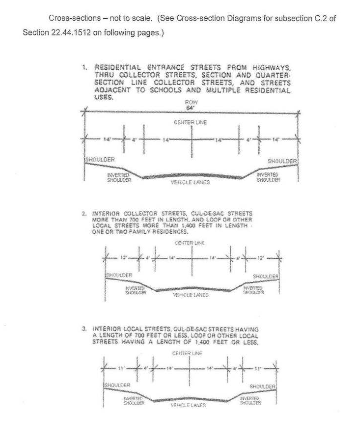
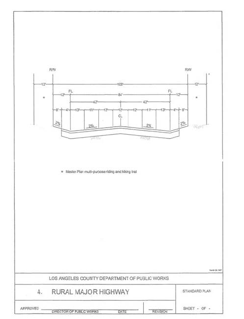
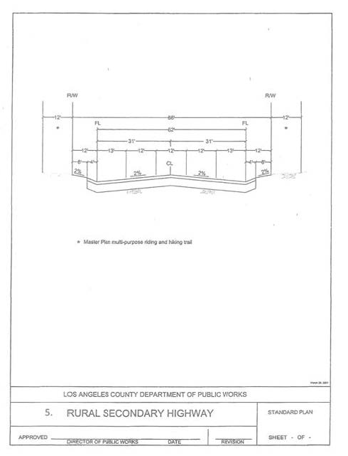
D.
Single-Family Hillside Homes. In addition to complying with all other applicable provisions of Section 22.44.1513, development projects involving the construction of a single-family home in a hillside management area (as defined in Section 22.44.1350) shall implement the following measures:
1.
Conserve natural areas.
2.
Protect slopes and channels.
3.
Provide storm drain system stenciling and signage.
4.
Divert roof runoff to vegetated areas before discharge, unless the diversion would result in slope instability.
5.
Direct surface flow to vegetated areas before discharge unless the diversion would result in slope instability.
E.
Exemptions. The LID and Hydromodification provisions of Section 22.44.1510 et seq. shall not apply to any of the following development projects:
1.
Any Non-designated Project that results in an addition or alteration of less than 50 percent of the impervious surfaces of an existing developed site consisting of four or fewer residential units.
2.
Any development project for which a complete discretionary or non-discretionary permit application was filed with the Department, and the Department of Public Works, or any County-controlled design control board, prior to January 1, 2009.
(Ord. 2019-0004 § 1, 2019.)
22.44.1513 - Low-Impact Development Standards.
A.
The LID standards contained in Sections 22.44.1510 through 22.44.1516:
1.
Mimic undeveloped stormwater runoff rates and volumes in any storm event up to and including the Capital Flood.
2.
Prevent pollutants of concern from leaving the development site in stormwater as the result of storms, up to and including a Water Quality Design Storm Event.
3.
Minimize hydromodification impacts to natural drainage systems.
B.
The Public Works Director shall prepare, maintain, and update, as deemed necessary and appropriate, a manual (LID Standards Manual), which shall include urban and stormwater runoff quantity and quality control development principles and technologies for achieving compliance with the provisions of this section. The LID Standards Manual shall also include technical feasibility and implementation parameters, as well as other rules, requirements, and procedures as the Public Works Director deems necessary, for implementing the provisions of this LID portion of the LIP. The contents of the LID Standards Manual may be used to help implement the requirements of this section, but is not incorporated into the LCP. In the case of any conflict between the provisions of the LID Standards Manual and the LCP, the provisions of the LCP shall be binding.
C.
Designated Projects. To meet the standards described in subsection A of this section, development projects described in subsection A of Section 22.44.1512 shall comply with the following requirements:
1.
The project shall retain one hundred percent of the Stormwater Quality Design Volume (SQDV) on-site, through infiltration, evapotranspiration, rainfall harvest and use, or a combination thereof, unless the Public Works Director determines that it would be technically infeasible to do so.
2.
If the Public Director determines that it would be technically infeasible to retain 100 percent of the SQDV on-site, the project shall comply with one of the following alternative compliance measures:
a.
The project shall provide for on-site biofiltration of one and one-half times the portion of the SQDV that is not retained on-site;
b.
The project shall include infiltration or bioretention BMPs to intercept the portion of the SQDV that is not retained on-site at an off-site location, as approved by the Public Works Director. The project shall also provide for treatment of the portion of the SQDV discharged from the project site, as approved by the Public Works Director;
c.
The project shall provide for the replenishment of groundwater supplies that have a designated beneficial use in the Basin Plan:
(i)
Groundwater replenishment projects shall include infiltration, or bioretention BMPs to intercept the portion of the SQDV that is not retained on-site at an off-site location, as approved by the Public Works Director;
(ii)
Groundwater replenishment projects shall also provide for treatment of the portion of the SQDV discharged from the project site, as approved by the Public Works Director;
d.
The project shall include infiltration, bioretention, or rainfall harvest and use BMPs to retrofit an existing development, with similar land uses as the project, to intercept the portion of the SQDV that is not retained on-site; or
D.
Non-designated Projects. To meet the standards described in subsection A of this section, any development project described in subsection B of Section 22.44.1512, above, shall comply with subsection G of Section 22.44.1340 and with the following requirements:
1.
A development project consisting of four or fewer residential units shall integrate LID principles in the design of the development to the maximum extent feasible, and shall implement at least two LID BMP alternatives which include, but are not limited to, disconnecting impervious surfaces, using porous pavement, downspout routing, a dry well, and landscaping and irrigation requirements.
a.
The runoff from the water quality design storm event associated with the developed site hydrology must be treated to the satisfaction of the Public Works Director before discharge.
(Ord. 2019-0004 § 1, 2019.)
22.44.1514 - Hydromodification Control.
A.
Exemptions. The Public Works Director may grant exemptions from the provisions of this Section 22.44.1512 for the following types of development projects where the Public Works Director determines that downstream channel conditions and proposed discharge hydrology indicate that adverse hydromodification effects to beneficial uses of natural drainage systems are unlikely:
1.
The replacement, maintenance or repair of existing, publicly-maintained flood control facilities, storm drains, or transportation networks;
2.
Redevelopment of a previously-developed site in an urbanized area that does not increase the effective impervious area or decrease the infiltration capacity of pervious areas compared to the pre-project conditions.
3.
Projects that have any increased discharge directly or through a storm drain to a sump, lake, area under tidal influence, into a waterway that has an estimated 100-year peak flow of 25,000 cubic feet per second (c.f.s.) or more, or other receiving water that is not susceptible to hydromodification impacts.
4.
Projects that discharge directly or through a storm drain into concrete or other engineered channels (e.g., channelized or armored with rip rap, shotcrete, etc.), which, in turn, discharge into receiving water that is not susceptible to hydromodification impacts.
5.
Non-designated projects disturbing an area less than one acre or creating less than 10,000 square feet of new impervious area.
6.
Single-family homes that incorporate LID BMPs in accordance with the LID Standards Manual.
B.
The LID Standards Manual shall include hydromodification control development principles and technologies for achieving compliance with the provisions of Section 22.44.1510 et seq. as well as other rules, requirements and procedures as the Public Works Director deems necessary, for implementing the provisions of this LIP.
C.
Unless excluded by subsection A, above, or excused pursuant to subsection D, below, development projects must fully mitigate off-site drainage impacts caused by hydromodification and changes in water quality, flow velocity, flow volume, and depth/width of flow, as determined by the Public Works Director, in accordance with the requirements and provisions specified in the LID Standards Manual. Sediment transport analysis shall be required when the project is tributary to any natural drainage system with a Capital Flood flow rate greater than 5,000 c.f.s.
D.
If the Public Works Director determines that it would be infeasible for a development project to comply with the provisions of subsection C of this section, and the project disturbs an area less than 50 acres, written consent to the unmitigated impacts shall be obtained from the owner of every impacted downstream property. In addition, the development project shall comply with one of the following alternative requirements:
1.
The project shall retain on-site, 100 percent of the stormwater volume from the runoff of the 95th percentile, 24-hour rainfall event, through infiltration, evapotranspiration, and/or harvest and use.
2.
The runoff flow rate, volume, velocity, and duration for the project's post-development condition shall not exceed the pre-development condition for the two year, 24 hour rainfall event.
3.
The Erosion Potential (Ep) in the receiving water channel shall approximate one (1), as demonstrated by a hydromodification analysis study approved by the Public Works Director.
E.
If the Public Works Director determines that it would be infeasible for a development project to comply with the provisions of subsection C of this section, and the project disturbs an area 50 acres or more, written consent to the unmitigated impacts shall be obtained from the owner of every impacted downstream property. In addition, the development project shall comply with one of the following alternative requirements:
1.
The project shall infiltrate on-site at least the runoff from a two-year, 24-hour rainfall event.
2.
The runoff flow rate, volume, velocity, and duration for the project's post-development condition shall not exceed the pre-development condition for the two-year, 24-hour rainfall events.
3.
The Ep in the receiving water channel shall approximate one, as demonstrated by a hydromodification analysis study approved by the Public Works Director.
F.
If the Public Works Director determines that it would be infeasible for a development project to comply with the provisions of subsection C of this section, and the project adds or replaces 22,500 square feet or more of impervious surface, written consent to the unmitigated impacts shall be obtained from the owner of every impacted downstream property. In addition, the development project shall comply with one of the following alternative requirements:
1.
The project shall retain on-site, at least the runoff from a two year, 24-hour rainfall event, through infiltration, evapotranspiration, and/or harvest and use.
2.
The peak flows for the project's post-development condition shall not exceed the pre-development condition for the 2 through the 10-year, 24-hour rainfall event.
3.
The Ep in the receiving water channel shall approximate one, as demonstrated by a hydromodification analysis study approved by the Public Works Director.
(Ord. 2019-0004 § 1, 2019.)
22.44.1515 - LID/Hydromodification Plan Review.
A.
Compliance with the LID and hydromodification control standards of this LID portion of the LIP shall be shown through a LID plan review described in subsection B, below.
B.
The applicant for any development project that involves a land division or on-site construction and may alter post-construction runoff shall submit an LID/Hydromodification plan to the Public Works Director for review and approval that provides a comprehensive, technical discussion of how the development project will comply with Section 22.44.1510 et seq. A deposit and fee to recover the costs associated with LID/Hydromodification Plan review shall be required. The time for obtaining LID/Hydromodification Plan approval shall be as follows:
1.
For any development project or land division requiring a CDP, the LID/Hydromodification Plan shall be submitted as part of the CDP application, and subsequently reviewed and approved by the County as part of any such CDP. Plan revisions required by the County must be reviewed and approved by the County prior to issuance of a CDP.
2.
For all other development projects, the LID/Hydromodification Plan shall be approved prior to issuance of a grading permit for such development project, or when no grading permit is required, prior to the issuance of a building permit for such development project, or when no grading or building permit is required, prior to the commencement of any development activity or as otherwise indicated in the non-discretionary land use approval.
(Ord. 2019-0004 § 1, 2019.)
22.44.1516 - Additional Requirements.
Compliance with this LID/Hydromodification portion of the LIP shall also require a development project to satisfy the following:
A.
All grading and/or site drainage plans for the development shall incorporate the features of the approved LID/Hydromodification Plan described in subsection B of Section 22.44.1515.
B.
Ongoing Maintenance.
1.
The development project's LID and hydromodification control features shall be maintained and shall remain operable at all times and shall not be removed from the project site unless and until such features have been replaced with other LID or hydromodification control features in accordance with this LID portion of the LIP.
2.
Unless excused by the Public Works Director in his or her discretion, the owner of the subject development project site shall prepare and obtain the Public Works Director's approval of an operation and maintenance plan and monitoring plan for all LID practices and LID and hydromodification control features incorporated into the project.
3.
The owner of the subject development project site shall record a covenant or agreement, approved as to form and content by the Public Works Director, in the office of the County Recorder indicating that the owner of the subject development project site is aware of and agrees to the requirements in this subsection B. The covenant or agreement shall also include a diagram of the development project site indicating the location and type of each LID and hydromodification control feature incorporated into the development project. The time to record such covenant or agreement shall be as follows:
a.
For any subdivision, prior to final map approval; and
b.
For any other development project, prior to issuance of a grading plan approval for the development project, and when no grading plan approval is required, prior to the issuance of building plan approval for the development project.
(Ord. 2019-0004 § 1, 2019.)
22.44.1520 - Purpose.
The purpose of these provisions is to facilitate the establishment and operation of farmers' markets and to ensure their compatibility with surrounding uses by establishing development standards.
(Ord. 2019-0004 § 1, 2019.)
22.44.1521 - Permitted Areas.
A.
Subject to the provisions of subsection B of this section and any applicable requirements of this LIP, farmers' markets shall be allowed in Zones R-1, R-3, R-C, C-1, C-2, R-R, OS-P and O-S, provided the applicant obtains:
1.
For Zones C-1 and C-2, an administrative CDP shall be required as provided in Section 22.44.800 et seq.
2.
For Zones R-1, R-3, R-C, R-R, OS-P, or O-S, a minor CDP shall be required, as provided in Section 22.44.800 et seq.
B.
No farmers' market or any portion thereof shall be allowed within H1 habitat area or the 100-foot H1 buffer area or to the quiet zone, as defined in Section 22.44.1800 et seq.
(Ord. 2019-0004 § 1, 2019.)
22.44.1522 - General Provisions.
The following provisions shall apply to all farmers' markets in addition to all other applicable provisions of the LIP:
A.
Hours of operation. A farmers' market shall operate no earlier than 8:00 a.m. and no later than 8:00 p.m. on any day, excluding the time needed for set-up and clean-up. Set-up and clean-up for a farmer's market must occur on the same day as the farmers' market.
B.
Noise. No amplified sound or music of any kind shall be allowed at any farmers' market.
C.
Trash. All trash shall be removed from the farmers' market site and the site shall be restored to a pre-market and neat condition no later than midnight of the day the farmers' market operates.
D.
Prohibited accessory uses. Farmers' markets shall not be allowed to include petting zoos.
E.
Inspections. Farmers' markets may be subject to inspection(s) at the Director's discretion to verify compliance with this LIP and any other applicable provisions.
F.
Forms of payment. Farmers' markets shall accept CalFresh benefits via electronic benefit transfer ("EBT") card in addition to accepting other forms of payment.
G.
Farmers' market manager. All farmers' markets shall have a designated farmers' market manager on-site at all times during the event, which manager shall ensure, among other things, that:
1.
Prior to commencement of the farmers' market, the Department has been provided proof that the farmers' market has been certified by the County Agricultural Commissioner, and has been issued a valid United States Department of Agriculture Food and Nutrition Service ("FNS") number, demonstrating the farmers' market's ability to accept CalFresh benefits.
2.
The farmers' market is conducted in accordance with all applicable requirements of this LIP, including the terms of the applicable grant or approval on file with the Department.
3.
A copy of the applicable Department grant or approval is clearly posted and visible at each farmers' market event.
4.
All applicable inspection fees are paid when due.
(Ord. 2019-0004 § 1, 2019.)
22.44.1523 - Parking Requirements.
A.
General Requirement. A farmers' market shall have sufficient land area to allow, at a minimum, one vehicle parking space for each vendor, plus one vehicle parking space for each vendor stall.
B.
Reduction in Parking Allowed. The parking requirement in subsection A may be reduced by up to 50 percent if the Director determines that the number of parking spaces provided will accommodate the number of vendors and customers expected at the farmers' market without any undue adverse impact to the surrounding community, and also if the farmers' market is located within one-half mile of a transit stop for:
1.
A bus that travels along a major or secondary highway or that is part of a bus rapid transit system.
2.
A rail line within a fixed rail system.
C.
No Other Permit Required. Any alternative parking arrangement for a farmers' market approved by the Director pursuant to subsection B of this section shall not require a separate parking permit, deviation, or variance.
(Ord. 2019-0004 § 1, 2019.)
22.44.1524 - Application for Approval.
In addition to any other information required by this LIP to be included in an application for an administrative CDP or minor CDP, an application for a farmers' market, shall include:
A.
The name and address of the owner and applicant.
B.
The name and address of the farmers' market manager, if different than the owner and/or applicant.
C.
Evidence that the applicant is either the owner of the premises involved or has written permission of the owner to make such application.
D.
A schedule, with proposed dates and times for operation of the farmers' market at the location proposed in the application during that calendar year, which schedule shall be updated annually during the life of the grant or approval.
E.
A site plan depicting the boundaries of the subject property to be used for the farmers' market, the location of all highways, streets, and alleys in relation to the subject property, the boundaries of the farmers' market, the location and dimension of all vendor stalls, and the area for required vehicle parking.
F.
When the applicant/owner proposes alternative parking arrangements:
1.
A description of the unique characteristics of the farmers' market and/or special programs which are proposed which will reduce the need for the otherwise required number of vehicle parking spaces.
2.
When off-site parking is proposed, evidence that the applicant/owner has written permission from the owner or owners of such off-site property.
3.
Such other information as the Director may require.
G.
In cases where non-agricultural products will be sold at a site adjacent to, and under the management of, the farmers' market:
1.
A site plan depicting the location and dimension of the area intended to be used for these sales.
2.
The respective percentages of the area intended to be used for the sale of non-agricultural products and the area intended to be used for the farmers' market.
(Ord. 2019-0004 § 1, 2019.)
22.44.1525 - Covenant and Agreement.
Prior to obtaining any approval to conduct a farmers' market pursuant to this LIP, the applicant shall provide to the Director a suitable covenant for recordation in the office of the County Registrar-Recorder/County Clerk that runs with the land for the benefit of the County, signed by the owner of the premises, declaring that:
A.
The farmers' market shall be maintained in accordance with the information provided in the application and the development standards as required by Sections 22.44.1522 and 22.44.1523.
B.
The applicant shall obtain all necessary federal, State, and local approvals to conduct a farmer's market, including the applicable certification from the County Agricultural Commissioner for a valid FNS number, prior to commencing operation.
C.
Any violation of the covenant and agreement required by this section shall be subject to the enforcement procedures of Section 22.44.690.
(Ord. 2019-0004 § 1, 2019.)
22.44.1530 - Purpose.
The purpose of these provisions is to recognize that certain temporary activities may be appropriate at specific locations but would be inappropriate on a permanent basis. The intent in establishing the administrative CDP for a temporary use procedure is to provide a mechanism to regulate specified short-term land use activities to avoid or mitigate adverse effects or incompatibility between such short-term land uses activities and the surrounding area where these temporary activities are proposed. In no case shall an administrative CDP for a temporary use be required if the proposed temporary use does not meet the definition for development in Section 22.44.630 or if the temporary use constitutes a temporary event that is exempt from the requirements of a CDP pursuant to Section 22.44.820.A.7.
(Ord. 2019-0004 § 1, 2019.)
22.44.1531 - List of Temporary Uses.
The following temporary uses may be established with a valid administrative CDP for a temporary use:
— Carnivals, exhibitions, fairs, short-term farmers' markets not otherwise governed by Section 22.44.1520 et seq., festivals, pageants, and religious observances conducted for no more than six weekends or seven days during any 12-month period except where a longer time period is approved pursuant to Section 22.44.1537. "Weekend" means Saturday and Sunday, but national holidays observed on a Friday or Monday may be included. This provision shall not include outdoor festivals and tent revival meetings.
— Outside display or sales of goods, equipment, merchandise or exhibits, in a commercial zone, conducted not more than once during any 30-day period nor more than four times during any 12-month period with each time not exceeding one weekend or three consecutive calendar days, provided that all goods, equipment and merchandise are the same as those sold or held for sale within the business on the lot or parcel of land where the outside display and sales are proposed. This provision shall not permit the outside storage of goods, equipment, merchandise or exhibits except as otherwise may be provided by this LIP.
(Ord. 2019-0004 § 1, 2019.)
22.44.1532 - Application—Filing.
Any person desiring an administrative CDP for a temporary use as provided for in this LIP may file an application with the Director, except that no application shall be filed or accepted if final action has been taken within six months prior thereto by either the Director or the Hearing Officer to deny an application for the same or substantially the same permit.
(Ord. 2019-0004 § 1, 2019.)
22.44.1533 - Application—Contents.
A.
An application for an administrative CDP for a temporary use shall include the following information and documents:
1.
The name and address of the applicant and the operator of the temporary use, if different, and of any persons designated by the applicant as his agents for service of process.
2.
The name and address of all persons owning a possessory interest in any or all of the property to be used for the temporary use.
3.
Evidence that the applicant of an administrative CDP for a temporary use:
a.
Is the owner of the lot or parcel of land involved; or
b.
Has written permission of the owner or owners to make such application;
4.
The location of the subject property (Assessor's identification number, address, if there is no address, then the closest intersection or "in the vicinity of").
5.
The legal description of the property involved.
6.
The legal name of the organization that is conducting or sponsoring such temporary use and such other material as may be necessary to determine eligibility to file.
7.
The precise nature of the temporary use requested.
8.
A site plan of the proposed temporary use drawn to a scale satisfactory to, and in the number of copies prescribed by the director, indicating:
a.
The area and dimensions of the proposed temporary use site;
b.
The location, area and hours of operation for each activity associated with the temporary use permit;
c.
The locations and dimensions of all existing and proposed temporary buildings and structures including roads, streets, highways, parking and loading facilities, and signs, on the site where the temporary use is requested;
d.
The location of all existing roads intended to provide access to major or secondary highways and parkways;
e.
The location and method of computation of the total sign area for all temporary signage proposed; and
f.
Where necessary to process an application, the location of alternative parking.
9.
The operating practices proposed to be used by the operator to mitigate noise, dust, air, contaminants, garbage, and vibration associated with and as a result of the proposed temporary use.
10.
Evidence that other permits and approvals required in compliance with the provisions of other applicable ordinances have been applied for or secured.
11.
Such other information as the Director may require.
B.
An application for an administrative CDP for a temporary use filed pursuant to Section 22.44.1537 shall include, in addition to the information required by subsection A above, the following material:
1.
A map showing all property ownership within a 500-foot radius from the boundaries of the parcel of land proposed to be used.
2.
Two sets of mailing labels for all ownerships shown on the map required above and for all occupants, as necessary to comply with subsection A.1.b of Section 22.44.1537.
3.
A map showing all land uses within a 500-foot radius from the boundaries of the parcel of land proposed to be used.
C.
The director may waive the filing of one or more of the above items where unnecessary to process the application of an administrative CDP for a temporary use.
(Ord. 2019-0004 § 1, 2019.)
22.44.1534 - Burden of Proof.
In addition to the information required in the application by Section 22.44.1533, the applicant of an administrative CDP for a temporary use shall substantiate to the satisfaction of the Director the following facts:
A.
That the operation of the requested use at the location proposed and within the time period specified will not jeopardize, endanger or otherwise constitute a menace to the public health, safety, or general welfare.
B.
That the proposed site is adequate in size and shape to accommodate such temporary use without material detriment to the use, enjoyment, or valuation of the property of other persons located in the vicinity of the site.
C.
That the proposed site is adequately served by bicycle facilities and/or streets or highways having sufficient width and improvements to accommodate the kind and quantity of vehicle and bicycle traffic that such temporary use will or could reasonably generate.
D.
That, with respect to an application for outside display or sales, all goods, equipment and merchandise shall be the same as those sold or held for sale within the business on the lot or parcel of land where the outside display and sales are proposed.
E.
That the operation of the requested use at the location proposed and within the time period specified will not adversely impact coastal resources or access to them, and is consistent with all applicable provisions of the LCP.
(Ord. 2019-0004 § 1, 2019.)
22.44.1535 - Fees Required.
When an administrative CDP for a temporary use application is filed, it shall be accompanied by the filing fee as required in Section 22.44.870.
(Ord. 2019-0004 § 1, 2019.)
22.44.1536 - Findings and Determination.
A.
An application for an administrative CDP for a temporary use shall be processed in accordance with Section 22.44.940 and shall not be approved unless the hearing officer finds that the burden of proof set forth in Section 22.44.1534 has been met by the applicant. In addition, the hearing officer shall also find:
1.
That adequate temporary parking to accommodate vehicular traffic to be generated by such use will be available either on-site or at alternate locations acceptable to the hearing officer in any case where such temporary use is proposed for a period longer than one weekend or three consecutive days.
2.
That approval of an administrative CDP for a temporary use will not result in the use of a lot or parcel of land for a cumulative time period in excess of the maximum time period such temporary use may be authorized during any 12-month period, except where a longer period is specifically approved in accordance with the provisions of Section 22.44.1537.
3.
That, with respect to an application for the outside display or sales of goods, equipment, merchandise or exhibits, not more than 20 percent of the area designated for parking required by this LIP for the established business shall be used in connection with the outside display or sales.
4.
That the temporary use is consistent with all applicable provisions of the LCP.
B.
Public notice shall be given online when an administrative CDP for a temporary use is approved.
C.
The hearing officer shall deny an application for an administrative CDP for a temporary use where the information submitted by the applicant and/or obtained by investigation of the staff fails to substantiate such findings.
(Ord. 2019-0004 § 1, 2019.)
22.44.1537 - Procedure for Extended Time Periods.
Where an application for an administrative CDP for a temporary use for an extended time period is filed, these procedures shall be followed:
A.
Notification.
1.
The Director shall cause a notice indicating the applicant's request at the location specified to be forwarded to:
a.
The applicant by registered or certified mail, postage prepaid, return receipt requested;
b.
All persons whose names and addresses appear on the latest available assessment roll of the County as owning property within a distance of 500 feet from the exterior boundaries of the parcel of land for which the application is filed, by first class mail, postage prepaid. A notice shall also be sent in a similar manner to "occupant" at the site address in those cases where the mailing address of any owner of property required to be notified under the provisions of this subsection differs from the site address of such property; and
c.
Such other persons whose property might, in his judgment, be affected by such application or permit if granted, by first class mail, postage prepaid.
2.
Such notice shall also indicate that any individual opposed to the granting of such permit may file a written protest with the Director within 15 days after the date of the mailing of the notice.
B.
Action.
1.
An application for an administrative CDP for a temporary use may be approved for an extended time period when:
a.
The applicant has met the burden of proof set forth in Section 22.44.1534 and the findings required by Section 22.44.1536 can be made; and
b.
No written protest has been received, or one or more written protests to the proposed temporary use permit has been received within 14 days after the date of mailing the notice, and it is determined that the concerns raised in such protest(s) are not of general community interest and can be adequately mitigated through the imposition of conditions.
2.
The hearing officer shall deny the application where the information submitted by the applicant fails to substantiate the burden of proof and the required findings.
3.
The decision shall become final and effective unless an appeal is timely filed consistent with Section 22.44.1040.
C.
Appeal. Any person dissatisfied with the action of the Director or Hearing Officer, may file an appeal with the Commission within the time period set forth in, and subject to all the other provisions of Section 22.44.1040.
D.
Date of Grant. Where an appeal is filed on an administrative CDP for a temporary use for an extended time period, and the permit is ultimately granted, the date of decision by the Commission on such appeal shall be deemed the date of grant in determining the expiration date.
E.
Notwithstanding the above provisions, an administrative CDP for a temporary use for the outside display or sales of goods, equipment, merchandise or exhibits in commercial zones shall not be authorized for an extended time period.
(Ord. 2019-0004 § 1, 2019.)
22.44.1538 - Conditions of Issuance.
A.
In approving an application for an administrative CDP for a temporary use, the decision-maker may impose such conditions as are deemed necessary to insure that the permit will be in accord with the findings required by Sections 22.44.1534 and 22.44.1536. These conditions may involve any pertinent factors affecting the operation of such temporary event or use including but not limited to:
1.
Requirement of temporary parking facilities including vehicular access and egress.
2.
Regulation of nuisance factors such as but not limited to prevention of glare or direct illumination of adjacent properties, noise, vibrations, smoke, dust, dirt, odors, gases, garbage and heat.
3.
Regulation of temporary buildings, structures and facilities including placement, height and size, limitations on commercial rides or other equipment permitted, the location of open spaces including buffer areas and other yards, and signs.
4.
Regulation of operating hours and days including limitation of the duration of such temporary use to a shorter or longer time period than the maximum period authorized.
5.
Requirement of a performance bond or other surety device to assure that any temporary facilities or structures used for such proposed temporary use will be removed from the site within one week following such event and the property restored to a neat condition. The Director may designate a different time period and/or require clean up of additional surrounding property at his discretion.
6.
Requirement of a site plan indicating all details and data as prescribed in this LIP.
7.
Requirement that the approval of the requested temporary use permit is contingent upon compliance with applicable provisions of this LIP and any other applicable ordinances.
8.
Such other conditions as will make possible the operation of the proposed temporary use in an orderly and efficient manner and in accord with the intent and purpose of this title.
B.
In addition to such other conditions may be imposed, it shall also be deemed a condition of every temporary use permit, whether such condition is set forth in the temporary use permit or not, that such approval shall not authorize the construction, establishment, alteration, moving onto or enlargement of any permanent building, structure or facility.
C.
Notwithstanding provisions in this LIP to the contrary, the decision-maker in approving an administrative CDP for a temporary use for the outside display or sales of goods, equipment, merchandise or exhibits may permit a temporary banner limited in time for the duration granted in the permit at any location on the subject property deemed appropriate, but in no event shall the decision-maker authorize a banner that exceeds 40 square feet of total sign area.
(Ord. 2019-0004 § 1, 2019.)
22.44.1539 - Parking Facilities—Conditions.
A.
In the granting of an administrative CDP for a temporary use, the decision-maker may authorize temporary use of parking and related facilities established to serve permanent uses as follows; provided, that such temporary usage is specifically recognized in the permit:
1.
Joint usage of required automobile parking facilities established to serve a permanent use, provided the owner or occupant of the permanent use or his authorized legal representative submits written consent, and it is determined by the decision-maker that such joint utilization will not have a substantially detrimental effect on the surrounding area.
2.
Temporary occupation by a temporary use of a portion of parking facilities or structures established to serve a permanent use provided the owner or occupant of such use or his authorized legal representative submits written consent, and it is determined that such joint utilization will not have a substantially detrimental effect on the surrounding area.
B.
The temporary reduction in required parking for such permanent use shall not be construed to require a variance with respect to parking requirements of this LIP.
(Ord. 2019-0004 § 1, 2019.)
22.44.1540 - Notice Service Procedure.
For applications other than those processed in accordance with Section 22.44.1537, the decision-maker shall serve notice of his action upon the applicant as required by law for the service of summons, or by registered or certified mail, postage prepaid, return receipt requested. Such notification may also be hand-delivered to the applicant, when appropriate, at the decision maker's discretion.
(Ord. 2019-0004 § 1, 2019.)
22.44.1550 - Lower Cost Visitor—Serving Facilities.
A.
Lower cost visitor-serving and recreational facilities, including overnight accommodations, shall be protected, encouraged, and, where feasible, provided within the Coastal Zone. Developments providing public recreational opportunities are preferred. Priority shall be given to the development of visitor-serving commercial and/or recreational uses that complement public recreation areas or supply recreational opportunities not currently available in public parks or beaches. Visitor-serving commercial and/or recreational uses may be located near public park and recreation areas only if the scale and intensity of the visitor-serving commercial recreational uses is compatible with the character of the nearby parkland and all applicable provisions of the LCP.
B.
The use of private lands suitable for visitor-serving commercial recreational facilities designed to enhance public opportunities for coastal recreation shall be given priority over private residential, general industrial, or general commercial development, but not over agriculture or coastal-dependent industry. New visitor-serving commercial uses shall not displace existing low-cost visitor-serving commercial recreational uses unless a comparable replacement low-cost visitor-serving commercial recreational use is provided.
(Ord. 2019-0004 § 1, 2019.)
22.44.1560 - Alternative Energy.
A.
Windmills/wind energy systems are prohibited within the Coastal Zone.
B.
Ground-mounted and roof-mounted solar panels are allowed in all zones, accessory to a principal use/structure, in compliance with the provisions of that zone, and shall:
1.
Comply with all applicable provisions of the LCP.
2.
Solar energy devices/panels shall be sited on the rooftops of permitted structures, where feasible. If roof-mounted systems are infeasible, ground-mounted systems may be allowed only if sited within the building site area of permitted development. Roof-mounted solar energy devices/panels may be permitted to extend above the allowable height of the structure, but in no case shall extend more than six feet above the maximum allowable height.
(Ord. 2019-0004 § 1, 2019.)
22.44.1570 - Archaeological/Paleontological/Historic Cultural Resources.
A.
Purpose. The intent of these provisions is protect and preserve archaeological, historical, and paleontological resources from destruction, and avoid impacts to such resources where feasible. Where avoidance is not feasible, impacts to resources shall be minimized to the maximum extent feasible.
B.
Definitions. The following definitions shall only apply to this section:
— "CEQA" means the California Environmental Quality Act which shall be the statutory reference for those portions of this LIP drawn therefrom.
— "Important Cultural Resource" may include, but not be limited to, the following criteria:
1.
Has a special quality such as oldest, best example, largest, or last surviving example of its kind.
2.
Is at least 100 years old.
3.
Significant to Chumash prehistory or history.
4.
Contains burial or other significant artifacts.
5.
Is an archeologically undisturbed site.
6.
Has important archeological significance.
7.
Relates to significant events or persons.
8.
Of specific local importance.
9.
Contains traditional sacred ground (including traditional ceremonial material gathering site).
10.
Contains burials.
11.
Contains sacred and/or significant artifacts.
12.
Where a property meets the terms of the definitions in section 21084.1 of the CEQA Statute and section 15064.5 of the CEQA Guidelines.
— "Project" means any earth moving requiring a planning clearance, development permit, geological/geotechnical exploratory excavation permit, sewer permit, building permit, or grading permit. The term shall include government-initiated or funded works except those projects necessary for emergency purposes.
— "Qualified Archaeologist" means a professional archaeologist included as a person qualified by or on the registry of Professional Archeologist of the Society for American Archeology who has a minimum of three years at the supervisory level, or a professional archaeologist whose qualifications exceed this level, as determined by the Director.
— "Qualified Chumash Cultural Resources Monitor" means a Native American of Chumash descent who:
1.
Submits verifiable evidence, approved by the Director, that he/she is of Chumash descent or is a Native American member of the Chumash community. Being listed as Chumash "most likely descendent" by the California Native American Heritage Commission may satisfy these criteria.
2.
Submits verifiable evidence, approved by the Director, indicating that he/she has a minimum of thirty (30) days of on site experience monitoring Chumash cultural resource sites.
— "Regional Historical Resources Information Center" shall mean the South Central Coastal Information Center, at the California State University, Fullerton.
C.
Applicability. A Cultural Resource Review pursuant to this section shall be required for all projects prior to the issuance of a planning approval, coastal development permit, geological/geotechnical exploratory excavation permit, sewer permit, building permit, grading permit, or prior to the commencement of government-initiated or funded works except those projects necessary for emergency purposes.
D.
Cultural Resource Review.
1.
In each phase of the Cultural Resource Review required under subsections 2, 3, 4, and 5 of this subsection D below, the Director shall consult verbally and in writing with the Native American Heritage Commission (NAHC), State Historic Preservation Officer (SHPO), the County Native American Cultural Resources Advisory Committee (NACRAC), the County Native American Cultural Resource Manager (NACRM), and the Most Likely Descendent (MLD). In addition: (a) in each phase that requires the selection of an archaeologist, the archaeologist shall be selected from a list acceptable to the NAHC, NACRAC, NACRM, and MLD; and (b) in each phase that requires the selection of a monitor, the selection of that monitor shall be made in written and verbal consultation with the NACRAC, NACRM, MLD, and NAHC. Comments received shall be considered in the review of coastal development permits for new development. Furthermore, all reports and associated photographs, maps, and catalogs resulting from Phase I, Phase II, or Phase III shall be submitted, electronically and in hard copy, to the Regional Information Center.
2.
Preliminary Review. The Director shall conduct a preliminary review of all projects to determine whether the project may have an adverse impact (or "substantial adverse change" as defined by CEQA) on an important cultural resource. The Director shall utilize the criteria contained in the definition of "Important Cultural Resource," found in subsection B above, in determining an important cultural resource. It shall be determined if the project will result in earth disturbance. Where the Director determines that the project will not have an adverse impact or result in a substantial adverse change to an important cultural resource, no further Cultural Resources Review shall be required.
3.
Phase I Inventory. Where, following the Preliminary Review, the Director determines that the project may have an adverse impact on an important cultural resource, the Director shall require that a Phase I Inventory of cultural resources be prepared. The project applicant shall submit a Phase I Inventory conducted by a qualified archaeologist hired by the project applicant. All Phase I Inventories that involve any excavation or monitoring shall be conducted in consultation with a qualified Chumash Cultural Resources Monitor.
a.
Phase I Inventories shall include:
i.
A records search through the regional historical resources information center;
ii.
An archival search of historic records;
iii.
A field survey; and
iv.
A written report which describes how the survey was conducted and the result of the survey.
b.
If on the basis of the Phase I Inventory described above, one or more significant cultural resources is found, a Phase I Inventory may be required to include:
i.
An evaluation of limited shovel test pits to determine whether a subsurface deposit is present and a negative declaration shall be prepared;
ii.
Recommendations for Phase II. Evaluations and a negative declaration, mitigated negative declaration, focused environmental impact report or an environmental impact report shall be prepared; or
iii.
Monitoring programs pursuant to subsection 5 of Section 22.44.1570 and a mitigated negative declaration shall be prepared.
4.
Phase II Evaluation.
a.
Applicability. Where, as a result of the Phase I Inventory, the Director determines that the project may have an adverse impact on cultural resources, a Phase II Evaluation of cultural resources shall be required and a negative declaration, mitigated negative declaration, focused environmental impact report, or an environmental impact report shall be prepared. All Phase II Evaluations shall be conducted by a qualified archaeologist and, where the Phase I Inventory indicates the presence of prehistoric or ethnohistoric Chumash cultural resources, the evaluation shall also be conducted in consultation with a qualified Chumash cultural resources monitor.
b.
Definition. Phase II Evaluations are investigations intended to gather any additional data necessary to assess the importance of the cultural resources identified in Phase I Inventories, to define site boundaries of the cultural resources, to assess the site's integrity, to evaluate the project's potential adverse impacts on cultural resources, and to develop measures to mitigate potential adverse impacts. Phase II Evaluation proposals shall be designed on a project-specific basis and must be guided by a research design/work plan that clearly identifies the study goals and articulates the proposed methods of data collection and analysis with the goals. Data collection methods may include a number of subsurface exploration techniques, including excavation of auger holes, test pits, or trenches. All Phase II Evaluations shall be conducted in consultation with a qualified Chumash Cultural Resources Monitor.
c.
County Review and Approval. The Director shall review and approve all Phase II design/work plans prior to any testing or excavations. The Director shall also review and approve all reports resulting from Phase II Evaluations. Where, as a result of the Phase II Evaluation, the Director determines that the project will not have an adverse impact on important cultural resources, no further cultural resource review of the project shall be required.
d.
Notwithstanding the foregoing provisions, the Director may waive the preparation of a Phase II Evaluation and prepare a mitigated negative declaration where the Phase I Inventory indicates the following conditions:
i.
Based upon substantial evidence, the Director determines that there is the presence of prehistoric or ethnohistoric Chumash cultural resources and it appears unlikely that the project site will contain important cultural resources (as for example, where the site is in an area of low density of artifacts or other remains, the suspected amount of the site deposit to be disturbed is small, or where it appears the artifacts or other remains have been historically redeposited); and
ii.
Project applicant agrees to provide monitoring of all excavation or trenching by a qualified Chumash cultural resource monitor, chosen in consultation with the Native American Heritage Commission, State Historic Preservation Officer, and the County Native American Cultural Resources Advisory Committee, and the most likely descendent.
e.
In the event that any potentially important cultural resources are found in the course of excavation or trenching, work shall immediately cease until the qualified archaeologist can provide an evaluation of the nature and significance of the resources and until the Director can review this information. All artifacts found shall be curated. Where, as a result of this evaluation, the Director determines that the project may have an adverse impact on cultural resources, a Phase II Evaluation of cultural resources shall be required. The limitations on mitigation as described in subsection D.6 below shall not be applicable to monitoring programs described in subsection D.5 below.
5.
Phase III Mitigation Programs.
a.
Applicability. Where, as a result of the Phase II Evaluation the Director determines that the project may adversely affect important cultural resources, a Phase III Mitigation Program shall be required. All Phase III Mitigation Programs shall be conducted by a qualified archaeologist and, where the Phase II Evaluation indicates the presence of important prehistoric cultural resources or ethnohistoric Chumash cultural resources, the evaluation shall also be conducted in consultation with a qualified Chumash cultural resource monitor.
b.
Purpose. Phase III Mitigation Programs are intended to mitigate adverse impacts upon important cultural resources. These programs shall be designed on a project-specific basis to meet the particular needs of each project and shall be guided by a research design/work plan that clearly articulates the scope of mitigation based on the recommendations developed in the prior Phase II Evaluation of the affected site.
c.
Cultural Resource Impact Mitigation. Measures to mitigate potential impacts may include, but shall not be limited to, the following:
i.
In-situ preservation of the important cultural resource site (This is the preferred mitigation measure where feasible).
ii.
Avoiding damage to the important cultural resource site through the following approaches:
(A)
Planning construction to miss important cultural resource sites.
(B)
Planning parks or other open space to incorporate important cultural resource sites.
(C)
"Capping" or covering important cultural resource sites with a layer of soil before building tennis courts, parking lots, or similar facilities. Capping may be utilized if all the following conditions are satisfied:
(1)
The soils to be covered will not suffer serious compaction;
(2)
The covering materials are not chemically active;
(3)
The site is one in which the natural processes of deterioration have been effectively arrested; and
(4)
The site has been recorded.
(D)
Deeding important cultural resource sites into permanent conservation easements.
(E)
Scientific data recovery of an appropriate sample of the important cultural resource(s) via surface collection and archaeological excavation as provided for under this section, where in-situ preservation is not feasible.
iii.
Curation of all recovered artifacts shall be required.
6.
Limitations on Mitigation. The limitations on mitigating adverse impacts on important cultural resources shall apply as provided in the California Environmental Quality Act as may be amended from time to time.
7.
Review and Approval. All Phase III Mitigation Programs shall be submitted to a qualified Chumash Cultural Resources Monitor for review and comment. The Director shall review and approve all design/work plans for Phase III Mitigation Programs and reports which detail the evaluative techniques and results.
E.
Cataloging and Filing of Information.
1.
All reports resulting from the conduct of any cultural resource review described in this section shall be filed with the Regional Historical Resources Information Center.
2.
All artifacts discovered in connection with any cultural resource review shall be curated and shall be recorded in the manner required by the State of California. All site records, field notes, maps, photographs, notes by Native American monitors, reports by consulting archaeologists, and other records resulting from the conduct of any cultural resource review described in this section shall be cataloged in accordance with the United States Department of the Interior Guidelines.
F.
Archaeological Discoveries. Any person who discovers important cultural resources during the course of construction for a project shall notify the Director of the discovery. Once important cultural resources are discovered, no further excavation shall be permitted without approval of the Director.
(Ord. 2019-0004 § 1, 2019.)
22.44.1580 - Additional Community-wide Development Standards.
A.
Extension of services. The extension of water, sewer, or utility infrastructure to serve development shall be located within legally existing roadways and road rights-of-way in a manner that avoids adverse impacts to coastal resources to the maximum extent feasible. Such infrastructure shall be sized and otherwise designed to provide only for the approved development, to avoid growth-inducing impacts.
B.
Removal of vegetation from, or other minor road improvements to, a lawfully-established road on private property which has not been maintained for a period of five years, shall require a coastal development permit.
(Ord. 2019-0004 § 1, 2019.)
22.44.1590 - Circulation.
A.
Roadway capacity and demand management.
1.
The capacity and operational efficiency of highways should be maximized, consistent with environmental protection and neighborhood preservation, without widening roadways to increase capacity.
2.
All roadway maintenance and improvements shall be accomplished in a manner protective of adjacent SERAs, streams, drainage courses, wildlife corridors, and other sensitive areas that may be impacted by such activity. Where feasible, roadway improvement projects should include drainage improvements to reduce erosion and polluted runoff.
3.
The roadway system's capacity shall only be expanded where environmental resources (habitats/linkages, viewsheds, SERAs, trails, etc.), residential neighborhoods, and rural communities are adequately protected, and the least environmentally damaging feasible alternative is selected. Roadway widening to increase capacity, as opposed to safety, shall be prohibited.
4.
Side casting surplus fill material from road construction, maintenance, or repair is prohibited. In emergencies, public agencies may temporarily store excess cut material on graded surfaces within rights-of-way using the most current Best Management Practices to eliminate erosion into adjacent drainage courses. Ensure that landslide material is deposited in permitted landfills or sites with valid permits to accept fill.
5.
The capacity of existing major and secondary highways may be increased where appropriate through the application of transportation system management technology within established rights-of-way and roadway widths by:
a.
Minimizing the number of driveway access points by consolidating driveways and exploring other options to reduce uncontrolled access;
b.
Minimizing or eliminating conflicting turning movements on links or at intersections;
c.
Restricting on-street parking during peak travel periods where such restrictions will not adversely impact public access to beaches and/or parks; and
d.
Employing traffic signal synchronization technology.
6.
Within the Coastal Zone, roadway efficiency and highway access should be improved through redesign of road intersections and establishment of periodic passing, turnout, and acceleration/deceleration lanes, where appropriate.
7.
Other transportation system management solutions should be emphasized, including improved public transit and non-motorized transportation, such as bicycles.
8.
The County shall ensure that all recreational easements and other recreational resources are protected, maintained, and repaired during and after roadway construction, maintenance, and repair.
9.
The County shall maintain appropriate rural and mountain road standards, consistent with public safety requirements, for the rural portions of the Santa Monica Mountains. The rural cross section found in subsection C.2 of Section 22.44.1512 is the default standard in the Coastal Zone.
10.
The County should encourage the routing of through-traffic onto highways and designated arterial streets, while discouraging through-traffic in residential neighborhoods.
11.
New projects that generate substantial amounts of "off-peak" traffic shall be required to provide mitigation for the traffic impacts from such projects.
12.
The County shall limit the requirement for curbs, gutters, sidewalks, and streetlights to the higher-density Residential land use categories contained within Sunset Mesa (as further described herein), unless required by public safety considerations or to maintain an existing neighborhood pattern. Curbs, gutters, sidewalks, and streetlights shall only be the default standard within the Sunset Mesa neighborhood, which lies between Topanga State Park to the north, the Pacific Coast Highway to the south, the City of Los Angeles to the east, and Topanga Canyon Boulevard to the west.
13.
The County shall only allow road and driveway improvements where they provide legal access to: 1) existing, lawfully-developed parcels; or 2) legal parcels with an approved coastal development permit and all other required permits.
14.
The County should support Caltrans efforts to improve traffic flow and safety on Pacific Coast Highway, the 101 Freeway, the 405 Freeway, and on other State routes, consistent with the policies and provisions of the LCP.
15.
Maintain, and potentially enhance, the concentration of business and commercial uses in existing locations that continue to serve the local communities and reduce the length of vehicle trips.
16.
Provide opportunities, such as park-and-ride lots, for local residents to car- or bus-pool to work thereby reducing the number of single-occupant vehicle trips generated in the Coastal Zone.
17.
Provide other opportunities, such as centralized learning centers with computer access, to reduce the need to commute long distances to colleges and universities.
18.
Improve roadways as appropriate to accommodate planned development and anticipated increases in recreational activities. Curbs, gutters, and sidewalks should only be used where deemed necessary for the safety of pedestrian and vehicular traffic by the Department of Public Works, and shall only be the default standard within the Sunset Mesa neighborhood, as described in subsection A.12 above.
19.
Limit the density and intensity of development in rural and mountainous areas to a level that can be accommodated by existing road capacity and without creating significant adverse impacts. Avoid any development in rural and mountainous areas that would require roadway widening to increase capacity. Road widening shall be allowed where determined necessary by the Public Works Director to protect public safety.
20.
Analyze the traffic impacts of a proposed development by considering the project's system-wide effects, including effects on transportation alternatives and the potential for bottlenecks in the area's roadway system.
21.
Require each new development causing cumulative circulation impacts to construct or fund its fair share of any necessary circulation system improvements or additions as determined by the Public Works Director.
22.
Where funding sources prove inadequate, establish assessment districts, impact fees and/or other equitable funding mechanisms to augment roadway funds.
B.
Promote transportation alternatives to the single-occupant automobile by encouraging:
1.
Transportation alternatives, including public transit service, staging areas, and park-and-ride lots, both within the region and from metropolitan Los Angeles to the area's major parks and recreation areas.
2.
The extension of public transit facilities and services, including shuttle programs, to maximize public access and recreation opportunities, where feasible.
3.
The augmentation of the system of beach buses to insure that opportunities are available year-round to access both beach and inland recreational sites and parks as demand increases.
4.
The use of locally-based contractors, service providers, and laborers rather than those that need to travel long distances to work sites in the Coastal Zone.
5.
Local employers to transport employees from homes and worksites in the Santa Monica Mountains, thereby reducing the need for additional vehicle trips.
6.
Surrounding cities and transit service providers to offer commuter bus services between inland communities and the City of Malibu.
7.
New development to provide for public transportation needs on existing roadways, where appropriate, when acquisition and improvement activities occur. Cooperate with adjacent jurisdictions to develop and incorporate this and other public transit-friendly design features into new projects and other discretionary project applications.
8.
The incorporation of bike lanes and/or bike use signage into local road designs wherever feasible and safe.
9.
Bicycling and trail use by ensuring that improvements to any roadway or trail containing a bikeway and/or trail do not adversely affect the provision of bicycle or trail use.
10.
The region-wide expansion of alternative transportation methods, including rail lines, transitways, bike paths, and rapid bus systems, where consistent with the LCP.
(Ord. 2019-0004 § 1, 2019.)
22.44.1600 - Public Facilities.
A.
Water Supplies and Water and Sewage Disposal Systems.
1.
New development of a sewage treatment plant or improvements to an existing plant shall be sited and designed to avoid impacts to coastal resources and minimize risks from coastal erosion, inundation and flooding due to rising sea level.
2.
Proposed development projects shall gain approval of design and financial arrangements from the appropriate water purveyor for construction of water and sewer facilities prior to recordation of tract or parcel maps, or issuance of grading or building permits, if tract or parcel maps are not involved. A will-serve letter from a water purveyor shall be required for all proposed development projects that require potable water, to demonstrate that there is adequate water and sewer infrastructure available to serve existing and planned development, without negatively impacting supplies and services for existing development.
3.
The County should reduce potable water consumption and the need for new water supplies through required and active water conservation programs.
4.
The County shall encourage advance treatment (tertiary) of wastewater or an equivalent standard.
5.
The County should expand potential uses for existing and future recycled water resources.
6.
The County should encourage and maximize the use of recycled water and thereby reduce the need for exploiting domestic water supplies when potable water is not required.
7.
The use of recycled water is required for commercial and public uses and facilities, such as golf courses, landscape irrigation, maintenance of public lands, and other approved purposes where this resource can be feasibly provided.
8.
The capacities of any existing community sewer systems may be expanded where there is demonstrated need, but shall be scaled to meet the level of anticipated growth consistent with the Land Use Policy Map, but shall not be oversized so as to induce growth.
9.
The formation of On-site Wastewater Disposal Zones pursuant to section 6950 et seq. of the California Health and Safety Code should be investigated and considered by the County Department of Public Health and/or the Department of Public Works in appropriate areas.
10.
The use of hauled water as a source of potable water for new development shall be prohibited.
B.
Public Schools. The County shall ensure adequate public school facilities to meet projected growth by:
1.
Requiring development projects to pay the maximum school impact fees permitted by law;
2.
Maintaining a flexible policy toward school impact mitigation, accepting land dedication, facilities construction, and payment of fees, with appropriate mitigation as determined by the applicable school district;
3.
Cooperating with school districts to:
a.
Encourage the State legislature to maintain and amend as necessary, legislation that supports the financing of new school construction as needed for a growing population;
b.
Identify the impacts of population and demographic changes, which may affect the need for new schools, may lead to school closures, may require the re-opening of closed schools or may lead to the decision that existing school sites be preserved for meeting future needs;
c.
Provide all State-required cooperative educational services to residents;
d.
Reduce new school construction costs through cooperative agreements for the development of joint use school/park sites, joint school/community facilities, and joint school/library facilities; and
e.
Support the joint use of school/park sites and, where the law permits, use a portion of local park funds to purchase and construct the recreational portions of these joint sites.
4.
Requiring that new development of school facilities comply with Section 22.44.1290 and all other applicable provisions of the LIP.
C.
Police Services.
1.
The Department of Regional Planning should continue to consult and coordinate with the Sheriff's Department and the California Highway Patrol as part of the environmental review process for projects subject to CEQA.
2.
The County should support existing programs such as Neighborhood Watch and encourage expanded or new programs that focus on the elimination of crime, such as anti-graffiti programs.
3.
The County should support efforts to eliminate street racing activities, including the seizure and forfeiture of vehicles used in speed contests or in exhibitions of speed, to address the nuisance and unsafe conditions created by the use of vehicles in such activities.
D.
Solid Waste Services. Adequate solid waste services shall be provided to meet existing and future demands without degrading the quality of the natural environment by:
1.
Requiring that all new buildings be designed with proper facilities for solid waste storage, handling, and collection pickup.
2.
Prohibiting new commercial and industrial land uses which generate large volumes of solid waste.
3.
Requiring existing commercial and industrial uses that use hazardous materials to demonstrate proper transport, storage, and disposal of such materials in accordance with all local, State, and federal regulations.
4.
Supporting measures for recycling of materials and financing mechanisms for solid waste reduction programs.
(Ord. 2019-0004 § 1, 2019.)
22.44.1610 - Noise.
A.
New development shall demonstrate that no adverse noise effects on adjacent uses will occur from the project. New development or land uses within any natural area or sensitive land use shall not increase the ambient noise levels by more than 3 dBA CNEL. If infeasible, noise impacts shall be mitigated. All residential structures, including those within 600 feet of major and secondary highways, must be constructed to comply with the Universal Building Code limit for interior noise of 45 dB CNEL.
B.
Locate noise-tolerant uses within developed areas. Encourage sensitive building orientation, placing the most noise-tolerant portions of a project between sensitive portions and the noise source, and architectural design as the noise management strategies preferred over constructing noise barriers.
C.
Noise impacts shall be considered in transportation system design, and require that roadway extensions and capacity enhancement projects mitigate related noise impacts to acceptable levels.
D.
Publicly-owned and operated helicopter pads and stops may be allowed on public or private land where needed for emergency services, and consistent with all applicable policies of the LCP. Any new public helicopter pads shall be located in a manner that limits noise impacts on residential areas and public parklands.
(Ord. 2019-0004 § 1, 2019.)
22.44.1700 - Organization.
The discussion of specific zones in this LIP is organized as follows:
A.
Uses subject to an administrative Coastal Development Permit (CDP).
1.
Principal permitted use. A principal permitted uses is identified for each zone. The principal permitted use, as defined in Section 22.44.630, is the primary use of land that carries out the land use intent and purpose of a particular zone. Approval of a CDP for a principal-permitted use development is not appealable to the Coastal Commission unless it otherwise meets the definition of "Appealable Coastal Development Permit" in Section 22.44.630.
2.
Uses and structures accessory to the principal permitted use. Accessory uses and structures that are considered to be customarily associated with and integrally related to the principal permitted use are not appealable to the Coastal Commission unless they otherwise meet the definition of "Appealable Coastal Development Permit" in Section 22.44.630.
3.
Other and additional permitted uses as identified in each zone. The County's approval of a CDP for any other or additional permitted use is appealable to the Coastal Commission since such other permitted uses do not constitute the principal permitted use.
B.
Accessory uses and structures subject to an administrative CDP. These are uses and structures, as defined in Section 22.44.630, which are related to, and clearly subordinate to the main building, structure, and/or use of land. When an accessory use is sought concurrently with such a use, only one fee and one permit, either a major, minor, or administrative CDP, as applicable, shall be required for all proposed uses/structures. If any proposed use requires a major CDP, all proposed uses shall be covered by that major CDP. Unless an accessory use or structure is identified as one that is customarily associated with and integrally related to the principal permitted use in the subject zone, approval of a CDP for an accessory structure or use is appealable to the Coastal Commission.
C.
Uses subject to a minor CDP. These are uses which may conform to the intent of the zone, but have the potential for minor impacts to the surrounding human and/or natural environment. Unless an accessory use or structure is identified as one that is customarily associated with and integrally related to the principal permitted use in the subject zone, approval of a CDP for a use subject to a minor CDP is appealable to the Coastal Commission.
D.
Uses subject to a major CDP. These are uses which may conform to the intent of the zone, but have the potential for major impacts to the surrounding human and/or natural environment. Approval of a major CDP is appealable to the Coastal Commission.
E.
Development standards. These are provisions which, in addition to other provisions of this LIP, apply to development within a particular zone. These provisions relate to such aspects as height limits, landscaping, lot coverage, parking, and setbacks. Compliance with these standards will be substantiated through the issuance of a CDP and/or other zoning permits or review.
(Ord. 2019-0004 § 1, 2019.)
22.44.1710 - R-1 Single-family Residence Zone.
A.
Uses subject to administrative CDPs, unless otherwise specified. Property in Zone R-1 may be used for the following, provided an administrative CDP has first been obtained as provided in Section 22.44.940, and while such permit is in full force and effect in conformity with the conditions of such permit:
1.
Principal Permitted Use:
— Residences, single-family.
2.
Uses and structures accessory to the principal permitted use. Accessory uses and structures that are considered to be customarily associated with and integrally related to the principal permitted use (single-family residences) include the following:
— Access road.
— Animals, domestic and wild, maintained or kept as pets or for personal use as provided in Section 22.44.1480.
— Carport.
— Garage.
— Grading (up to 5,000 cubic yards of total cut plus total fill material), subject to minor CDP if involves 50 to 5,000 cubic yards of total grading.
— Home-based occupations, subject to the limitations, standards and conditions contained in Section 22.44.1490.
— Landscaping features and gardens.
— On-site wastewater treatment system.
— Patio/deck, hardscape, fences/walls.
— Solar energy arrays/devices (roof-mounted or ground-mounted).
— Storage sheds.
— Swimming pool and/or spa.
— Temporary mobilehome used as a residence during construction of an approved permanent residence, subject to minor CDP.
— Turnaround required by the Fire Department.
— Water storage tank.
— Water well, permanent, to serve the principal permitted use.
3.
Other and additional permitted uses. Property in Zone R-1 may be used for any of the following uses subject to the provisions of this LIP:
— Adult residential facilities, limited to six or fewer persons.
— Community gardens.
— Emergency preparedness and response facilities approved by the Fire Department.
— Family child care homes, small.
— Group homes, children, limited to six or fewer persons.
— Grading projects meeting the requirements of subsection C.1 of Section 22.44.1260, and consistent with all requirements of Section 22.44.1260.
— Pool house accessory structure, located on the same property as a single-family residence and a pool, and shall not include sleeping quarters or kitchen facilities.
— Senior citizen's residence, pursuant to Section 22.44.1370.
— Resource-dependent uses, subject to the requirements of subsection M of Section 22.44.1920.
— Small family homes, children.
— Uses associated with parks, trails, trail heads, playgrounds, and beaches as set forth in subsection C of Section 22.44.1400.
B.
Accessory uses and structures subject to an administrative CDP. Property in Zone R-1 may be used for any accessory use or structure listed below, subject to the provisions of this LIP. Property in Zone R-1 may be used for the following accessory uses and structures provided an administrative CDP has first been obtained, when required, as provided in Section 22.44.940, and while such permit is in full force and effect in conformity with the conditions of such permit:
— Accessory uses and structures customarily used in conjunction therewith.
— Building materials, storage of, use in the construction of a building or building project, during the construction and 30 days thereafter, including the contractor's temporary office, provided that any lot or parcel of land so used shall be a part of the building project, or on property adjoining the construction site.
— Historic vehicle collection, subject to the standards and conditions contained in Section 22.44.1500.
— Rooms in a single-family residence may be rented to four or fewer residents, with or without table board, unless the residence is also used as an adult residential facility, licensed group home for children or home for the aged, in which case the capacity can be no more than six persons.
— Water wells, permanent, to serve other than the principal permitted use.
C.
Uses subject to minor CDPs. Property in Zone R-1 may be used for the uses listed below, provided a minor CDP has first been obtained as provided in Section 22.44.800 et seq., and while such permit is in full force and effect in conformity with the conditions of such permit. Uses subject to minor CDPs:
— Access roads, new, that cross one or more vacant parcels, where "new" is defined as any access road not previously existing on the ground or any existing access road requiring improvement to meet Fire Department and/or Department of Public Works requirements.
— Access roads to property lawfully used for a purpose not permitted in the zone in which the access road is located, provided no other practical access to such property is available, and such access will not alter the character of the premises in respect to permitted uses within the zone.
— Exploratory testing, subject to the provisions of Section 22.44.1430.
— Farmers' Markets, subject to the requirements found in Section 22.44.1520 et seq.
— Grading that meets the requirements of subsection 22.44.1260 C.2, and consistent with all requirements of Section 22.44.1260.
— Guest houses, pursuant to Section 22.44.1370.
— Mobilehomes used as a residence of the owner and his family during the construction by such owner of a permanent residence, but only while a building permit for the construction of such residence is in full force and effect and provided:
1.
That the site plan submitted shall demonstrate a reasonable, practical and economically feasible means of removing the mobilehome following completion of construction.
2.
That such mobilehome shall contain not more than one dwelling unit not to exceed 12 feet in width and with no structural attachments.
3.
That such mobilehome shall be removed from the site within 90 days from the date of issuance of a certificate of occupancy for the permanent residence.
— Uses associated with parks, trails, playgrounds, and beaches as set forth in subsection D of Section 22.44.1400.
D.
Uses subject to major CDPs. Property in Zone R-1 may be used for the uses listed below, provided a major CDP has first been obtained as provided in Section 22.44.800 et seq., and while such permit is in full force and effect in conformity with the conditions of such permit.
— Adult day care facilities.
— Arboretums and horticultural gardens.
— Child care centers.
— Churches, temples or other places used exclusively for religious worship, including customary, incidental educational and social activities in conjunction therewith.
— Communication equipment buildings.
— Convents and monasteries where on the same lot or parcel as a legally established church or school.
— Electrical distribution substations, including microwave facilities used in conjunction therewith.
— Fire stations.
— Gas metering and control stations, public utility.
— Grading that meets the requirements of subsection C.3 of Section 22.44.1260, and consistent with all requirements of Section 22.44.1260.
— Parks, playgrounds and beaches, with all appurtenant facilities customarily found in conjunction therewith.
— Publicly-owned uses necessary to the maintenance of the public health, convenience or general welfare in addition to those specifically listed in this section.
— Recreation facilities, neighborhood, not accessory to a principal use, including tennis, polo and swimming, where operated as a nonprofit corporation for the use of the surrounding residents. This provision shall not be interpreted to permit commercial enterprises.
— Second units, pursuant to Section 22.44.1340.
— Storage, temporary, of materials and construction equipment used in construction or maintenance of streets and highways, sewers, storm drains, underground conduits, flood control works, pipelines and similar uses for a period not to exceed one year.
— Telecommunication facilities subject to the requirements of Section 22.44.1330.
— Water reservoirs, dams, treatment plants, gauging stations, pumping stations, wells and tanks, except those wells and tanks related to a shared water well, and any other use normal and appurtenant to the storage and distribution of water.
— Uses associated with parks, trails, trail heads, playgrounds, and beaches as set forth in subsection E of Section 22.44.1400.
E.
Development standards.
1.
All single-family residences shall be subject to the following development standards:
a.
Every single-family residence shall have a roof constructed with fire-proof roofing material, except that reflective, glossy, polished, and/or roll-formed type metal roofing is prohibited, consistent with the requirements of Section 22.44.1320;
b.
Every single-family residence shall have an exterior siding of fire-proof material, except that reflective, glossy, polished, and/or roll-formed type metal siding is prohibited, consistent with the requirements of Section 22.44.1320;
2.
Yard requirements. Premises in Zone R-1 shall be subject to the yard requirements provided herein:
a.
Front Yards. Each lot or parcel of land shall have a front yard of not less than 20 feet in depth;
b.
Corner Side Yards. Each lot or parcel of land situated on a corner shall have corner side yards of not less than:
i.
Ten feet on a reversed corner lot; or
ii.
Five feet on other corner lots;
c.
Interior Side Yards. Each lot or parcel of land shall have interior side yards of not less than five feet;
d.
Rear Yards. Each lot or parcel of land shall have a rear yard of not less than 15 feet in depth;
3.
The proposed project shall meet all applicable development standards within this LIP, including the Community-Wide Development Standards in Section 22.44.1220 et seq., and any of the applicable Area-Specific Development Standards in Section 22.44.1800 et seq.
4.
Parking. Premises in Zone R-1 shall provide two covered parking spaces per dwelling unit, as specified in Section 22.44.1410, unless otherwise required by Section 22.44.2140.
5.
Required area. Premises in Zone R-1 shall provide at least 750 square feet of floor area.
6.
Variances. The standards listed in this section may be modified pursuant to the procedures of Section 22.44.1150.
(Ord. 2019-0004 § 1, 2019.)
22.44.1720 - R-3 Limited Multiple Residence Zone.
A.
Uses subject to administrative CDPs. Property in Zone R-3 may be used for the following, provided an administrative CDP is first obtained as provided in Section 22.44.940, and while such permit is in full force and effect in conformity with the conditions of such permit:
1.
Principal Permitted Use:
— Apartment houses.
2.
Uses and structures accessory to the principal permitted use. Except as otherwise provided, property in Zone R-3 may be used for any use listed in subsection A.2 of Section 22.44.1710.
3.
Other and additional Permitted Uses. Except as otherwise provided, property in Zone R-3 may be used for any use listed as a permitted use in subsection A.3 of Section 22.44.1710. Property in Zone R-3 may also be used for:
— Duplexes.
— Single-family residences, subject to the standards found in Section 22.44.1710 E.
— Temporary uses, as provided in Section 22.44.1530 et seq., and while such permit is in full force and effect in conformity with the conditions of such permit.
— Town houses.
B.
Accessory uses and structures subject to an administrative CDP. Property in Zone R-3 may be used for any accessory use or structure listed in subsection B of Section 22.44.1710. In addition, property in Zone R-3 may be used for the following accessory use and structure:
— Room rentals.
C.
Uses subject to minor CDPs. Except as otherwise provided, property in Zone R-3 may be used for the uses listed in subsection C of Section 22.44.1710, provided a minor CDP has first been obtained as provided Section 22.44.800 et seq., and while such permit is in full force and effect. The following uses shall also be allowed in Zone R-3 with a minor CDP:
— Child care centers serving more than 50 children.
— Christmas trees and wreaths, the sale of, between December 1st and December 25th, both dates inclusive, to the extent permitted by other statutory and ordinance provisions. Any structures, facilities and materials used for the sale of trees and wreaths shall be removed from the premises by December 31st of the same calendar year, and the property restored to a neat condition.
— Churches, temples and other places used exclusively for religious worship, including customary incidental, educational and social activities in conjunction therewith. Such provision shall not be deemed to authorize activities otherwise specifically classified in this zone.
— Convents and monasteries.
D.
Uses subject to major Coastal Development Permits.
1.
Except as otherwise provided, property in Zone R-3 may be used for the uses listed in subsection D of Section 22.44.1710, provided a major CDP has first been obtained as provided in Section 22.44.800 et seq., and while such permit is in full force and effect. The following uses shall also be allowed with a major CDP in the R-3 Zone:
— Community centers where developed as an integral part of a building project, and operated on a nonprofit basis for the use of surrounding residents. This provision shall not be interpreted to permit commercial enterprises.
— Rooming and boarding houses.
— Telephone repeater stations.
E.
Development standards.
1.
The required area per dwelling unit for property in Zone R-3 shall not result in a density of more than 20 units per net acre.
2.
Yard requirements. Premises in Zone R-3 shall be subject to the yard requirements provided herein:
a.
Front Yards. Each lot or parcel of land shall have a front yard of not less than 15 feet in depth;
b.
Corner Side Yards. Each lot or parcel of land shall have corner side yards of not less than:
i.
Seven and one-half feet on a reversed corner lot; or
ii.
Five feet on other corner lots;
c.
Interior Side Yards. Each lot or parcel of land shall have interior side yards of not less than five feet; and
d.
Rear Yards. Each lot or parcel of land shall have a rear yard of not less than 15 feet in depth.
3.
Yards required by this zone are also subject to the general provisions and exceptions contained in Section 22.44.1375, which shall apply as specified.
4.
Variances. The standards listed in this section may be modified pursuant to the procedures of Section 22.44.1150.
(Ord. 2019-0004 § 1, 2019.)
22.44.1730 - C-1 Restricted Business Zone.
A.
Uses subject to administrative CDP. Property in Zone C-1 may be used for the following, provided an administrative CDP is first obtained as provided in Section 22.44.940, and while such permit is in full force and effect in conformity with the conditions of such permit:
1.
Principal Permitted Use:
— Local-serving retail and service stores.
2.
Uses and structures accessory to the principal permitted use. Accessory uses and structures that are considered to be customarily associated with and integrally related to the principal permitted use (local-serving retail and service stores) include the following:
— Accessory buildings and structures customarily used in conjunction therewith.
— Signs, as provided in Section 22.44.1280.
— Water well, permanent, to serve the principal permitted use.
3.
Other and additional Permitted Uses. Property in Zone C-1 may be used for the uses listed below:
a.
The following commercial uses, provided all sales are retail and all goods sold, except genuine antiques, are new:
i.
Sales.
— Antique shops, genuine antiques only.
— Appliance stores, household.
— Art galleries.
— Art supply stores.
— Automobile sales, sale of new motor vehicles, and including incidental repair and washing.
— Automobile supply stores, including incidental installation of parts.
— Bakery shops, including baking only when incidental to retail sales from the premises.
— Bicycle shops.
— Boat and other marine sales.
— Bookstores.
— Ceramic shops, excluding a kiln or manufacture.
— Clothing stores.
— Confectionery or candy stores, including making only when incidental to retail sales from the premises.
— Delicatessens.
— Department stores.
— Dress shops.
— Drugstores.
— Florist shops.
— Furniture stores.
— Furrier shops.
— Gift shops.
— Glass and mirror sales, including automobile glass installation only when conducted within an enclosed building.
— Grocery stores.
— Hardware stores.
— Health food stores.
— Hobby supply stores.
— Ice cream shops.
— Jewelry stores.
— Leather goods stores.
— Mail order houses.
— Meat markets, excluding slaughtering.
— Millinery shops.
— Music stores.
— Notion or novelty stores.
— Office machines and equipment sales.
— Paint and wallpaper stores.
— Pet supply stores, excluding the sale of pets other than tropical fish or goldfish.
— Photographic equipment and supply stores.
— Radio and television stores.
— Retail stores.
— Shoe stores.
— Silver shops.
— Sporting goods stores.
— Stamp redemption centers.
— Stationery stores.
— Tobacco shops.
— Toy stores.
— Yarn and yardage stores.
ii.
Services.
— Air pollution sampling stations.
— Arboretums and horticultural gardens.
— Automobile service stations, including incidental repair, washing and rental of utility trailers.
— Banks, savings and loans, credit unions and finance companies.
— Barber shops.
— Beauty shops.
— Bicycle rentals.
— Child care centers.
— Churches, temples or other places used exclusively for religious worship, including customary incidental educational and social activities in conjunction therewith.
— Comfort stations.
— Communications equipment buildings.
— Dental clinics, including laboratories in conjunction therewith.
— Dry cleaning establishments, excluding wholesale dry cleaning plants, provided that the building is so constructed and the equipment is so installed and maintained and the activity is so conducted that all noise, vibration, dust, odor and all other objectionable factors will be confined or reduced to the extent that no annoyance or injury will result to persons or property in the vicinity.
— Electric distribution substations, including microwave facilities provided:
(A)
That all such installations are completely surrounded by a masonry wall set back four feet from the property line, and to a height of not less than eight feet; and
(B)
That the area between the wall and the property line is landscaped and maintained while such use exists.
— Emergency preparedness and response facilities approved by the Fire Department.
— Employment agencies.
— Family child care homes, small.
— Farmers' markets, subject to the provisions of Section 22.44.1520 et seq.
— Fire stations.
— Foster family homes.
— Gas metering and control stations, public utility.
— Interior decorating studios.
— Laundries, hand.
— Laundries, self service.
— Laundry agencies.
— Libraries.
— Locksmith shops.
— Lodge halls.
— Medical clinics, including laboratories in conjunction therewith.
— Microwave stations.
— Museums.
— Observatories.
— Offices, business or professional.
— Parking lots and parking buildings.
— Photography studios.
— Police stations.
— Post offices.
— Public utility service centers.
— Real estate offices.
— Restaurants and other eating establishments including food take-out.
— Shoe repair shops.
— Shoeshine stands.
— Small family homes, children.
— Stations: Bus, railroad and taxi.
— Telephone repeater stations.
— Tourist information centers.
— Union halls.
— Watch repair shops.
iii.
Recreation and Amusement.
(a)
Parks, playgrounds and beaches, with all appurtenant facilities.
(b)
Riding and hiking trails, excluding trails for motor vehicles.
(c)
Swimming pools.
(d)
Uses associated with parks, trails, trail heads, playgrounds, and beaches as set forth in subsection C of Section 22.44.1400.
(e)
Temporary uses, as provided in Section 22.44.1530 et seq., and while such permit is in full force and effect in conformity with the conditions of such permit.
b.
Grading that meets the requirements of subsection C.1 of Section 22.44.1260, and consistent with all requirements of Section 22.44.1260.
B.
Accessory uses and structures subject to an administrative CDP. Property in Zone C-1 may be used for any accessory use or structure listed below. No permit shall be required if the use does not meet the definition of development in Section 22.44.630.
— Accessory uses and structures customarily used in conjunction therewith.
— Automobile repair and parts installation incidental to the sale of new automobiles, automobile service stations and automobile supply stores, provided:
1.
That such automobile repair activities do not include body and fender work, painting, major engine overhaul, or transmission repair.
2.
That all repair and installation activities are conducted within an enclosed building only.
3.
That a masonry wall is established and maintained along an abutting boundary with property in a residential or combining zone.
4.
That landscaping comprises an area of not less than two percent of the gross area developed for the primary use.
5.
That all required parking spaces are clearly marked with paint or other easily distinguishable material.
6.
That all repair or installation activities are confined to the hours between 7:00 a.m. and 9:00 p.m. daily.
7.
That no automobile awaiting repair or installation service shall be parked or stored for a period exceeding 24 hours except within an enclosed building.
— Automobile washing, waxing and polishing, accessory only to the sale of new automobiles and automobile service stations, provided:
1.
That all such services are done by hand only.
2.
That all such services are conducted within an area not greater than 500 square feet.
— Building materials, storage of, used in the construction of a building or building project, during the construction and 30 days thereafter, including the contractor's temporary office, provided that any lot or parcel of land so used shall be part of the building project, or on property adjoining the construction site.
— Rental, leasing and repair of articles sold on the premises, incidental to retail sales.
— Trailer rentals, box and utility only, accessory only to automobile service stations, provided:
1.
That such trailer beds are not larger than 10 feet.
2.
That such rental activity is conducted within an area not exceeding 10 percent of the total area of such automobile service station.
— Used merchandise, retail sale of, taken as trade-in on the sale of new merchandise when such new merchandise is sold from the premises.
— Signs for other than the principal permitted use, as provided in Section 22.44.1280.
— Water wells to serve other than the principal permitted use.
C.
Uses subject to minor Coastal Development Permits. Property in Zone C-1 may be used for the uses listed below provided a minor CDP has first been obtained as provided in Section 22.44.800 et seq., and while such permit is in full force and effect in conformity with the conditions of such permit:
— Access to property lawfully used for a purpose not permitted in the zone.
— Christmas trees and wreaths, the sale of.
— Domestic violence shelters.
— Exploratory testing, subject to the provisions of Section 22.44.1430.
— Grading that meets the requirements of subsection C.2 of Section 22.44.1260, and consistent with all requirements of Section 22.44.1260.
— Grading projects, off-site transport.
— Group homes, children, limited to six or fewer persons.
— Homeless shelters.
— Joint live and work units.
— Live entertainment, accessory, in a legally established bar, cocktail lounge or restaurant having an occupant load of less than 200 people.
— Mobilehome used as a residence during construction.
— Telecommunications facilities subject to the requirements of Section 22.44.1330.
— Uses associated with parks, trails, playgrounds, and beaches as set forth in subsection D of Section 22.44.1400.
D.
Uses subject to major Coastal Development Permits. Property in Zone C-1 may be used for the following uses, provided a major CDP has first been obtained as provided in Section 22.44.800 et seq., and while such permit is in full force and effect in conformity with the conditions of such permit:
— Adult day care facilities.
— Alcoholic beverages, the sale of, for either on-site or off-site consumption.
— Apartment houses.
— Archery ranges.
— Athletic fields, excluding stadiums.
— Bars and cocktail lounges, but excluding cabarets.
— Beer and wine, the concurrent sale of, with motor vehicle fuel.
— Car washes, coin-operated and hand wash.
— Caretaker's dwelling unit, pursuant to Section 22.44.1370.
— Colleges and universities, including appurtenant facilities giving advanced academic instruction approved by the State Board of Education or other recognized accrediting agency, but excluding trade schools.
— Convents and monasteries.
— Correctional institutions, including jails, farms and camps.
— Disability rehabilitation and training centers, on a lot or parcel having an area of not less than one acre, where sheltered employment or industrial-type training is conducted.
— Electric transmission substations and generating plants, including microwave facilities used in conjunction with any one thereof.
— Fraternity and sorority houses.
— Grading meeting the requirements of subsection C.3 of Section 22.44.1260, and consistent with all requirements of 22.44.1260.
— Group homes, children.
— Hospitals.
— Ice sales, excluding ice plants.
— Juvenile halls.
— Miniature golf courses.
— Outdoor dining.
— Pet grooming, excluding boarding.
— Pet stores, within an enclosed building only.
— Publicly-owned uses necessary to the maintenance of the public health, convenience or general welfare in addition to those specifically listed in this section.
— Recording studios.
— Recreation clubs, commercial, including tennis, polo, swimming and similar outdoor recreational activities, together with appurtenant clubhouse.
— Residences, single-family, subject to the standards of subsection E of Section 22.44.1710.
— Schools through grade 12, accredited, including appurtenant facilities, which offer instruction required to be taught in the public schools by the state of California, in which no pupil is physically restrained, but excluding trade schools.
— Schools, business and professional, including art, barber, beauty, dance, drama and music, but not including any school specializing in manual training, shop work, or in the repair and maintenance of machinery or mechanical equipment.
— Steam or sauna baths.
— Storage, temporary, of materials and construction equipment used in construction or maintenance of streets and highways, sewers, storm drains, underground conduits, flood control works, pipelines and similar uses, for a period of not to exceed one year.
— Tasting rooms, remote, subject to the applicable provisions of Section 22.44.1507 et seq.
— Tennis, volleyball, badminton, croquet, lawn bowling and similar courts.
— Theaters and other auditoriums.
— Theaters, drive-in.
— Travel trailer parks.
— Uses associated with parks, trails, trail heads, playgrounds, and beaches as set forth in subsection E of Section 22.44.1400.
— Veterinary clinics, small animal.
— Water reservoirs, dams, treatment plants, gauging stations, pumping stations, tanks, wells, and any use normal or appurtenant to the storage and distribution of water.
— Youth hostels.
E.
Development standards. Property in Zone C-1 shall be subject to the development standards below:
1.
That front and/or corner side yards be provided equal to a distance of:
a.
Twenty feet where property adjoins a parkway, major or secondary highway; and
b.
Equal to the front or corner side yard required on any contiguous residential zone where property adjoins a street;
c.
Yards required by this zone are also subject to the general provisions and exemptions in Section 22.44.1375.
2.
The maximum floor-area ratio (FAR) for all commercial buildings on a parcel of land shall not exceed 0.5. Parking floor space with necessary interior driveways and ramps thereto, or space within a roof structure penthouse for the housing of operating equipment or machinery shall not be included in determining the FAR.
3.
The proposed project shall meet all applicable development standards within this LIP, including the Community-Wide Development Standards in Section 22.44.1220 et seq., and any of the applicable Area-Specific Development Standards in Section 22.44.1800 et seq.
4.
Variances. The standards listed in this section may be modified pursuant to the procedures of Section 22.44.1150.
(Ord. 2019-0004 § 1, 2019.)
22.44.1740 - C-2 Neighborhood Business Zone.
A.
Uses subject to administrative Coastal Development Permit. Property in Zone C-2 may be used for the following, provided an administrative CDP is first obtained as provided in Section 22.44.940, and while such permit is in full force and effect in conformity with the conditions of such permit.
1.
Principal Permitted Use:
— Local-serving retail and service stores.
2.
Uses and structures accessory to the principal permitted use. Property in Zone C-2 may be used for the uses listed in subsection A.2 of Section 22.44.1730, provided an administrative CDP is first obtained as provided in Section 22.44.940, and while such permit is in full force and effect in conformity with the conditions of such permit.
3.
Other and additional Permitted Uses. Property in Zone C-2 may be used for the uses listed in subsection A.3 of Section 22.44.1730.
B.
Accessory uses and structures. Property in Zone C-2 may be used for any accessory use or structure listed in subsection B of Section 22.44.1730, provided an administrative CDP is first obtained as provided in Section 22.44.940, and while such permit is in full force and effect in conformity with the conditions of such permit.
C.
Uses subject to minor Coastal Development Permit. Property in Zone C-2 may be used for the uses listed in subsection C of Section 22.44.1730, provided a minor CDP has first been obtained as provided in Section 22.44.800 et seq., and while such permit is in full force and effect in conformity with the conditions of such permit.
D.
Uses subject to major Coastal Development Permits. Property in Zone C-2 may be used for the following, provided a major CDP has first been obtained as provided in Section 22.44.800 et seq., and while such permit is in full force and effect in conformity with the conditions of such permit:
1.
The uses listed in Section 22.44.1730.D.
2.
The following uses:
— Arcades, game or movie.
— Billiard halls.
— Bowling alleys.
— Blacksmith shop.
— Butane and propane service stations.
— Concrete batching, provided that the mixer is limited to one cubic yard capacity.
— Contractor's equipment storage, limited to construction equipment such as dump trucks, bulldozers, and accessory material.
— Feed store.
— Games of skill.
— Lumberyards, except the storage of boxes, crates or pallets.
— Nightclubs.
— Pool halls.
— Plumbing shops and plumbing contractor's shops.
— Roofing contractor's establishments.
— Septic tank and cesspool repairing, pumping, cleaning, and draining.
— Scientific research or experimental development of materials, methods, or products, including engineering and laboratory research, together with all administrative and other related activities and facilities in conjunction therewith. Such products may be initiated, developed, or completed on the premises but no part of the products may be manufactured on the premises.
— Veterinary hospital.
E.
Development standards.
1.
Property in Zone C-2 shall be subject to the development standards contained in subsection 22.44.1730.E.
2.
Variances. The standards listed in this section may be modified pursuant to the procedures of Section 22.44.1150.
(Ord. 2019-0004 § 1, 2019.)
22.44.1750 - R-C Rural-Coastal Zone.
Establishment—Intent and purpose. Zone R-C is established to allow for residential development that is consistent with the goals of preserving the rural character and scenic quality of the Coastal Zone, and to minimize the impacts of future development on the region's coastal and environmental resources.
A.
Uses subject to administrative CDPs, unless otherwise specified. Property in Zone R-C may be used for the following provided that an Administrative CDP has first been obtained as provided in Section 22.44.940:
1.
Principal Permitted Use:
— Residences, single-family.
2.
Uses and structures accessory to the principal permitted use. Accessory uses and structures that are considered to be customarily associated with and integrally related to the principal permitted use (single-family residences) include the following:
— Access road.
— Animals, domestic and wild, maintained or kept as pets or for personal use as provided in Section 22.44.1480.
— Carport.
— Garage.
— Grading (up to 5,000 cubic yards of total cut plus total fill material), subject to minor CDP if involves 50 to 5,000 cubic yards of total grading.
— Home-based occupations, subject to the limitations, standards and conditions contained in Section 22.44.1490.
— Landscaping features and gardens.
— On-site wastewater treatment system.
— Patio/deck, hardscape, fences/walls.
— Solar energy arrays/devices (roof-mounted or ground-mounted);
— Storage sheds.
— Swimming pool and/or spa.
— Temporary mobilehome used as a residence during construction of an approved permanent residence, subject to minor CDP.
— Turnaround required by the Fire Department.
— Water storage tank.
— Water well, permanent, to serve the principal permitted use.
3.
Other and additional Permitted Uses.
— Adult residential facilities, limited to six or fewer persons.
— Emergency preparedness and response facilities approved by the Fire Department.
— Family child care homes, small.
— Grading that meets the requirements of subsection C.1 of Section 22.44.1260 and consistent with all requirements of Section 22.44.1260.
— Group homes, children, limited to six or fewer persons.
— Mobilehome used as a residence of the owner and his or her family during the construction by such owner of a permanent residence, but only while a building permit for the construction of such residence is in full force and effect and provided:
a.
That the site plan submitted shall demonstrate a reasonable, practical and economically feasible means of removing the mobilehome following completion of construction;
b.
That such mobilehome shall contain no more than one dwelling unit, not to exceed 12 feet in width and with no structural attachments; and
c.
That such mobilehome shall be removed from the site within 90 days from the date of issuance of a certificate of occupancy for the permanent residence unless extended up to 12 additional months with an administrative CDP.
— Pool house accessory structure, located on the same property as a single-family residence and a pool, and shall not include sleeping quarters or kitchen facilities;
— Resource-dependent uses, subject to the requirements of subsection M of Section 22.44.1920.
— Senior citizen's residence, pursuant to Section 22.44.1370.
— Small family homes, children.
— Arts and crafts uses providing limited commercial and production activities on the premises where the property owner resides, as listed below:
— Antiques. Restoration and sale of genuine antiques.
— Architecture and building design.
— Art needlework.
— Art studio, including painting and sculpturing.
— Basket weaving.
— Block printing.
— Bookbinding.
— Cartooning and animation.
— Ceramics, the making of.
— Clothing, the design and sewing of.
— Commercial art.
— Costume designing.
— Dance and drama studios, not including recitals or any dance requiring a business license.
— Engraving of metal products.
— Fine arts gallery.
— Furniture, the crafting and assembly of, including custom upholstering.
— Glass, the hand production of, including glass blowing, glass, crystal, and art novelties, and the assembly of stained art glass.
— Graphic design and display studio.
— Interior decorating.
— Jewelry, the creation of.
— Lapidary.
— Leatherwork, using previously tanned leather.
— Music, composing of.
— Music, the teaching of.
— Musical instruments, the creation and assembly of.
— Ornamental metal, provided that there are no forging works or any process used in bending or shaping which produces an annoying or disagreeable noise.
— Photography studio.
— Picture mounting and framing.
— Pottery, the throwing of.
— Printing and publishing.
— Recording studios.
— Shoes, footwear, the fabrication of.
— Signs, as provided in Section 22.44.1280.
— Silk screen processing.
— Taxidermy.
— Textile weaving, hand looms only.
— Toys, the production of.
— Transcription studios.
— Watchmaking.
— Woodcarving.
— Wood products, the crafting of.
— Writing, professional studio.
— Other similar arts and crafts uses which, in the opinion of the Hearing Officer are consistent with the intent and purpose of the zone, and are neither more obnoxious nor detrimental to the public welfare than those uses listed in this section under arts and crafts.
Furthermore, all such arts and crafts uses shall be subject to the following development standards:
a.
The premises must lie on the portion of the following Old Topanga Rural Village lots that contained C-3 zoning as of the date of effective certification of this LCP:
i.
Lots 46 through 56 of Tract No. 6131, within 180 feet of the centerline of Old Topanga Canyon Road; and
ii.
Lots 59 through 71, 77, and 114 of Tract No. 6131, within 200 feet of the centerline of Old Topanga Canyon Road.
b.
The use shall be consistent with the following standards:
i.
That there be sufficient automobile parking space;
ii.
That the lot or parcel contain at least 5,000 square feet of gross area;
iii.
A residence shall exist or shall be constructed on the premises prior to the establishment of an arts and crafts use;
iv.
Materials and products shall be stored within an enclosed building or buildings;
v.
The total volume of kiln space shall not exceed 16 cubic feet, and no individual kiln shall exceed eight cubic feet;
vi.
The combined floor area of the premises used for the production and sale shall not be more than 1,000 square feet;
vii.
Not more than two persons, other than residents occupying the dwelling on such premises, shall be employed on the site;
viii.
Loading platforms shall be located and screened in such a way so as to not adversely affect surrounding residents;
ix.
The sale of any item, except antiques, shall be limited to those lawfully produced on the premises;
x.
Power shall be limited to electrically operated motors of not more than two horsepower each. The total capacity shall not exceed 10 horsepower, excluding portable hand tools;
xi.
No offensive noise, vibration, smoke, dust, odor, heat or glare shall be produced which is detectable at any point on adjacent property so as to produce a nuisance or hazard; and
xii.
Except as otherwise provided in this section, any building established or premises maintained in conjunction with an arts and crafts use shall be so conducted that the use of such lot or parcel of land shall be in harmony with the rural character of the area.
c.
The arts and crafts use shall not be conducted in any attached or unattached structure intended for the parking of automobiles;
d.
There shall be only one arts and crafts use per parcel or lot of land;
e.
Signs as provided in Section 22.44.1280;
f.
The arts and crafts use shall not involve the use of commercial vehicles for delivery of materials and products to or from the premises in excess of that which is customary for a dwelling unit or which has a disruptive effect on the neighborhood. No tractor-trailer or similar heavy-duty equipment shall be used for delivery or pickup of materials in connection with the commercial or production activities;
g.
Pedestrian or vehicular traffic generated by such use shall cumulatively not exceed 10 trips or visits per day, in addition to trips generated by the residence, and shall not have a disruptive effect on the neighborhood;
h.
The arts and crafts use shall cease when the use becomes detrimental to the public health, safety and welfare, or constitutes a nuisance, or when the use is in violation of any statue, ordinance, law or regulation;
— Family child care homes, large, having no more than 14 persons, subject to the following procedures and standards:
a.
Drop-off/pick up areas, such as curb spaces and driveway areas, which are of sufficient size and are located to avoid interference with traffic and to insure the safety of children must be identified; and
b.
The proposed facility shall not be located:
i.
Within two lots of an existing large family child care home on the same side of the street; and
ii.
On the lot directly across the street from an existing large family child care home, or on either of the lots adjoining such lot on the same side of the street.
c.
In those cases where lot sizes or configurations, such as corner lots, do not conform to those described in subsection b above concerning where the proposed facility shall not be located, the proposed facility shall not be located on any lot determined by the Director to be as close to an existing large family child care home as the lots described in subsection b above;
— Horse boarding, private, which means the maintenance, keeping, and/or training of horses and other equines owned by persons who are not owners or lessees of the lot or parcel of land upon which such actions are undertaken, accessory to a primary residential use, subject to the provisions specified in Sections 22.44.1450 and 22.44.1940, and subject to the following provisions:
a.
All buildings or structures used in conjunction therewith shall be located not less than 50 feet from any street or highway or from any building used for human habitation;
b.
The number of boarded horses which may be kept on a parcel shall not be in addition to the number of animals allowed to be kept as pets under Section 22.44.1480. A maximum of eight animals per acre is allowed, and this number may be any combination of pets and boarded horses, but shall not exceed eight animals per acre. The maximum number of boarded horses which may be maintained is 24, even if the parcel is greater than three acres in size;
c.
The lot or parcel of land shall have a minimum area of 15,000 square feet per dwelling unit, and is allowed one horse or other equine over nine months of age for each 5,000 square feet of lot area;
— Crop-based agricultural uses and confined animal facility uses listed below, subject to the provisions of Sections 22.44.1300, 22.44.1450, 22.44.1930, and 22.44.1940, and provided that all buildings or structures used in conjunction therewith shall be located not less than 50 feet from any street or highway or from any building used for human habitation:
a.
Confined animal facilities, including equestrian pasture, for the raising, grazing, and keeping of horses and other equine, cattle, sheep, goats, alpacas, and llamas, including the breeding and training of such animals, on a lot or parcel of land having an area of not less than one acre and provided that not more than eight such animals per acre of the ground area available for use be kept or maintained in conjunction with such use, provided;
i.
That such grazing is not a part of nor conducted in conjunction with any dairy, livestock feed yard, livestock sales yard, or commercial riding academy located on the same premises;
ii.
That no buildings, structures, pens, or corrals designed or intended to be used for the housing or concentrated feeding of such stock be used on the premises for such grazing other than racks for supplementary feeding, troughs for watering, or incidental fencing;
b.
Crop-based agriculture (excluding vineyards) on a lot or parcel of land having an area of not less than one acre;
c.
Greenhouses on a lot or parcel of land having, as a condition of use, an area of not less than one acre;
d.
Raising of poultry, fowl, birds, fish, bees, earthworms, and other similar animals of comparable nature, form, and size, including hatching, fattening, marketing, sale, slaughtering, dressing, processing, and packing, and including eggs, honey or similar products derived therefrom, on a lot or parcel of land having, as a condition of use, an area of not less than one acre;
— Temporary uses, as provided in Section 22.44.1530 et seq.
— Uses associated with parks, trails, trail heads, playgrounds, and beaches as set forth in subsection C of Section 22.44.1400.
B.
Accessory uses and structures requiring an administrative CDP. Property in Zone R-C may be used for the following uses or structures accessory to the principal use allowed. No permit shall be required if the use does not meet the definition of development in Section 22.44.630.
— Accessory uses and structures customarily used in conjunction therewith.
— Animals, domestic, maintained or kept as pets or for personal use as provided in Section 22.44.1480.
— Building materials, storage of, used in the construction of a building or building project, during the construction and 30 days thereafter, including the contractor's temporary office, provided that any lot or parcel of land so used shall be a part of the building project, or on property adjoining the construction site.
— Family child care homes, large, having no more than 14 persons, subject to the following procedures and standards:
a.
Drop-off/pick up areas, such as curb spaces and driveway areas, which are of sufficient size and are located to avoid interference with traffic and to insure the safety of children must be identified; and
b.
The proposed facility shall not be located:
i.
Within two lots of an existing large family child care home on the same side of the street; and
ii.
On the lot directly across the street from an existing large family child care home, or on either of the lots adjoining such lot on the same side of the street.
c.
In those cases where lot sizes or configurations, such as corner lots, do not conform to those described in subsection b above concerning where the proposed facility shall not be located, the proposed facility shall not be located on any lot determined by the Director to be as close to an existing large family child care home as the lots described in subsection b above;
— Rooms in a single-family residence may be rented to four or fewer residents, with or without table board, unless the residence is also used as an adult residential facility or a group home for children and either use has a capacity of more than six persons.
— Water wells, permanent, to serve other than the principal permitted use.
C.
Uses subject to minor Coastal Development Permits. Property in Zone R-C may be used for the following uses, provided that a Minor CDP has first been obtained as provided in Section 22.44.800 et seq., and while such permit is in full force and effect in conformity with the conditions of such permit for:
— Access roads, new, that cross one or more vacant parcels, where "new" is defined as any access road not previously existing on the ground or any existing access road requiring improvement to meet Fire Department and/or Department of Public Works requirements.
— Access to property lawfully used for a purpose not permitted in Zone R-C, provided no other practical access to such property is available, and such access will not alter the character of the premises in respect to permitted uses in Zone R-C.
— Arts and crafts uses providing limited commercial and production activities on the premises where the property owner resides, which are similar to and are neither more obnoxious nor detrimental to the public welfare than those uses listed in subsection A.3 of Section 22.44.1750, and subject to the development standards listed in subsection A.3.b. of Section 22.44.1750.
— Exploratory testing, subject to the provisions of Section 22.44.1430.
— Farmers' Markets, subject to the provisions of Section 22.44.1520 et seq.
— Grading that meets the requirements of subsection C.2 of Section 22.44.1260 and consistent with all requirements of Section 22.44.1260.
— Guest houses, pursuant to Section 22.44.1370.
— Motion picture sets, permanent, including the temporary use of domestic and wild animals in motion picture and television production, provided that wild animals are kept or maintained pursuant to all regulations of the County Department of Animal Care and Control, and are not retained on the premises for a period exceeding 60 days. The Director may extend such time period for not to exceed 30 additional days.
— Uses associated with parks, trails, trail heads, playgrounds, and beaches as set forth in subsection D of Section 22.44.1400.
— Wireless telecommunication facilities, subject to the provisions of Section 22.44.1330.
D.
Uses subject to major Coastal Development Permits. Property in Zone R-C may be used for the following uses, provided that a Major CDP has first been obtained as provided in Section 22.44.800 et seq., and while such permit is in full force and effect in conformity with the conditions of such permit for:
— Adult day care facilities, having no more than 14 persons.
— Bed-and-breakfast establishments, pursuant to the provisions specified in Section 22.44.1460.
— Caretaker's dwelling unit, pursuant to Section 22.44.1370.
— Child care centers.
— Churches, temples, or other places used exclusively for religious worship, including customary, incidental educational and social activities in conjunction therewith.
— Communication equipment buildings.
— Continuance of an existing mobilehome park.
— Electrical distribution substations and electric transmission substations, including microwave facilities used in conjunction with either.
— Fire stations.
— Gas metering and controlling stations, public utility.
— Grading that meets the requirements of subsection C.3 of Section 22.44.1260 and consistent with all requirements of Section 22.44.1260.
— Historic vehicle collection, subject to the standards and conditions contained in Section 22.44.1500.
— Plant nursery, retail.
— Publicly-owned uses necessary to the maintenance of public health, convenience or general welfare in addition to those specifically listed in this section.
— Riding academies, and/or the backyard boarding of more than 24 horses, and/or commercial stables, on a lot or parcel of land having, as a condition of use, an area of not less than five acres.
— Rural inns, subject to the standards provided in Section 22.44.1470.
— Schools, through grade 12, accredited, subject to the procedures and standards provided in Section 22.44.1290, including appurtenant facilities, which offer instruction required to be taught in the public schools by the Education Code of the state of California, in which no pupil is physically restrained, but excluding trade or commercial schools.
— Second units, subject to the provisions of Section 22.44.1370.
— Storage, temporary, of materials and construction equipment used in construction or maintenance of streets and highways, sewers, storm drains, underground conduits, flood control works, pipelines, and similar uses for a period not to exceed one year.
— Uses associated with parks, trails, trail heads, playgrounds, and beaches as set forth in subsection E of Section 22.44.1400.
— Uses normal and appurtenant to the storage and distribution of water.
— Water reservoirs, dams, treatment plants, gauging stations, pumping stations, wells, and tanks, except those wells and tanks related to development of one single-family residence, and any other use normal and appurtenant to the storage and distribution of water.
— Wineries, subject to the provisions of Section 22.44.1500 et seq.
E.
Development standards.
1.
Property in Zone R-C shall be subject to the development standards contained in subsection E of Section 22.44.1710.
2.
Variances. The standards listed in this section may be modified pursuant to the procedures of Section 22.44.1150.
(Ord. 2019-0004 § 1, 2019.)
22.44.1760 - R-R Resort and Recreation Zone.
A.
Uses subject to administrative Coastal Development Permits. Property in Zone R-R may be used for the following, provided an Administrative CDP is first obtained as provided in 22.44.940, and while such permit is in full force and effect in conformity with the conditions of such permit:
1.
Principal Permitted Use:
— Low-intensity, visitor-serving Campgrounds, including low-impact campgrounds, on a lot or parcel of land having, as a condition of use, an area of not less than one acre.
2.
Uses and structures accessory to the principal permitted use. Accessory uses and structures that are considered to be customarily associated and integrally related to the principal permitted use (low-intensity, visitor serving campgrounds) include the following:
— Access road and parking areas;
— Camp host facilities;
— Campgrounds, including low-impact campgrounds;
— Equestrian parking and staging areas;
— Fire-proof cooking stations;
— Grading, up to 5,000 cubic yards of total cut plus total fill material, subject to a minor CDP if involves 50-5,000 cubic yards of total grading;
— On-site wastewater treatment system;
— Patio/deck, hardscape, fences/walls;
— Picnic areas and tables;
— Potable water distribution system and storage tank(s);
— Portable fire suppression apparatus;
— Resource dependent uses, including riding and hiking trails, excluding trails for motor vehicles;
— Restroom facilities;
— Solar energy arrays/devices (roof-mounted or ground-mounted);
— Storage sheds;
— Swimming pool and/or spa;
— Turnaround required by the Fire Department;
— Visitor kiosk/information center;
— Water storage tank;
— Water well, permanent, to serve the principal permitted use.
3.
Other and additional Permitted Uses.
a.
Recreation and Amusement.
— Archery ranges on a lot or parcel of land having, as a condition of use, an area of not less than one acre.
— Athletic fields, excluding stadiums, on a lot or parcel of land having, as a condition of use, an area of not less than one acre.
— Boat rentals, on a lot or parcel of land having, as a condition of use, an area of not less than one acre.
— Parks, playgrounds and beaches, publicly owned, with all appurtenant facilities customarily found in conjunction therewith.
— Resource-dependent uses.
— Riding and hiking trails, excluding trails for motor vehicles.
— Riding academies and stables, and/or the boarding of horses, on a lot or parcel of land having, as a condition of use, an area of not less than five acres and subject to the provisions of Sections 22.44.1450 and 22.44.1940.
— Swimming pools.
— Tennis, volleyball, badminton, croquet, lawn bowling and similar courts, on a lot or parcel of land having, as a condition of use, an area of not less than one acre.
b.
Services.
— Arboretums and horticultural gardens.
— Comfort stations.
— Family child care homes, small.
— Crop-based agricultural uses and confined animal facility uses listed below, subject to the provisions of Sections 22.44.1300, 22.44.1450, 22.44.1930, and 22.44.1940, and provided that all buildings or structures used in conjunction therewith shall be located not less than 50 feet from any street or highway or from any building used for human habitation:
(A)
Confined animal facilities, including equestrian pasture, for the raising, grazing, and keeping of horses and other equine, cattle, sheep, goats, alpacas, and llamas, including the breeding and training of such animals, on a lot or parcel of land having an area of not less than one acre and provided that not more than eight such animals per acre of the ground area available for use be kept or maintained in conjunction with such use, provided;
(1)
That such grazing is not a part of nor conducted in conjunction with any dairy, livestock feed yard, livestock sales yard, or commercial riding academy located on the same premises;
(2)
That no buildings, structures, pens, or corrals designed or intended to be used for the housing or concentrated feeding of such stock be used on the premises for such grazing other than racks for supplementary feeding, troughs for watering, or incidental fencing;
(B)
Crop-based agriculture (excluding vineyards) on a lot or parcel of land having an area of not less than one acre.
(C)
Greenhouses on a lot or parcel of land having, as a condition of use, an area of not less than one acre;
(D)
Raising of poultry, fowl, birds, fish, bees, earthworms, and other similar animals of comparable nature, form, and size, including hatching, fattening, marketing, sale, slaughtering, dressing, processing, and packing, and including eggs, honey or similar products derived therefrom, on a lot or parcel of land having, as a condition of use, an area of not less than one acre.
— Modifications (other than minor repair and maintenance) to, or replacement of, golf courses first established prior to the date of effective certification of this LCP, including any clubhouse and appurtenant facilities, shall be subject to a major CDP as set forth below.
— Motion picture sets, permanent, including the temporary use of domestic and wild animals in motion picture and television production on a lot or parcel of land having, as a condition of use, an area of not less than one acre, provided said animals are kept and maintained pursuant to all regulations of the County Department of Animal Care and Control, and are not retained on the premises for a period exceeding 60 days. The Director may extend such time period for not to exceed 30 additional days.
— Museums.
— Observatories.
— Riding academies, stables, and horse boarding facilities shall require an animal waste management plan and an emergency preparedness plan.
— Small family homes, children.
— Temporary uses, as provided in Section 22.44.1530 et seq.
— Tourist information centers.
c.
In addition to the uses listed in subsection a and b above, property in Zone R-R may be used for the following:
— Emergency preparedness and response facilities approved by the Fire Department.
— Grading meeting the requirements of subsection C.1 of Section 22.44.1260 and consistent with all requirements of Section 22.44.1260.
— Uses associated with parks, trails, trail heads, playgrounds, and beaches as set forth in subsection C of Section 22.44.1400.
B.
Accessory uses and structures subject to an administrative CDP. Property in Zone R-R may be used for any accessory use listed below.
— Accessory buildings and structures customarily used in conjunction therewith.
— Building materials, storage of, used in the construction of a building or building project, during the construction and 30 days thereafter, including the contractor's temporary office, provided that any lot or parcel of land so used shall be a part of the building project, or on property adjoining the construction site.
— Signs, as provided in Section 22.44.1280.
— Water wells, to serve other than the principal permitted use.
C.
Uses subject to minor Coastal Development Permits. Property in Zone R-R may be used for the following uses, provided a Minor CDP has first been obtained as provided in Section 22.44.800 et seq., and while such permit is in full force and effect in conformity with the conditions of such permit:
— Access roads, new, that cross one or more vacant parcels.
— Access to property lawfully used for a purpose not permitted in Zone R-R, provided no other practical access to such property is available, and such access will not alter the character of the premises in respect to permitted uses in Zone R-R.
— Bed-and-breakfast establishments, pursuant to the provisions specified in Section 22.44.1460.
— Christmas trees and wreaths, the sale of, between December 1st and December 25th both dates inclusive, to the extent permitted by other statutory and ordinance provisions. Any structures, facilities and materials used for the sale of trees and wreaths shall be removed from the premises by December 31st of the same calendar year, and the property restored to a neat condition.
— Exploratory testing, subject to the provisions of Section 22.44.1430.
— Farmers' Markets, subject to the provisions of Section 22.44.1520 et seq.
— Grading meeting the requirements of subsection C.2 of Section 22.44.1260 and consistent with all requirements of Section 22.44.1260.
— Live entertainment, accessory, in a legally established bar, cocktail lounge or restaurant having an occupant load of less than 200 people.
— Mobilehome used as a residence of the owner and his family during the construction by such owner of a permanent residence, but only while a building permit for the construction of such residence is in full force and effect, and provided:
i.
That the site plan submitted shall demonstrate a reasonable, practical and economically feasible means of removing the mobilehome following completion of construction; and
ii.
That such mobilehome shall contain not more than one dwelling unit not to exceed 12 feet in width, and with no structural attachments; and
iii.
That such mobilehome shall be removed from the site within 90 days from the date of issuance of a certificate of occupancy unless a CDP has first been obtained.
— Refreshment stands, operated in conjunction with and intended to serve the patrons of a use permitted in Zone R-R, but not as a separate enterprise.
— Uses associated with parks, trails, trail heads, playgrounds, and beaches as set forth in subsection D of Section 22.44.1400.
— Telecommunications facilities subject to the requirements of Section 22.44.1330.
D.
Uses subject to major Coastal Development Permits. Property in Zone R-R may be used for the following, provided a major CDP has first been obtained as provided in Section 22.44.800 et seq., and while such permit is in full force and effect in conformity with the conditions of such permit:
1.
The following uses require a major Coastal Development Permit:
— Adult day care facilities.
— Cabins.
— Caretaker's dwelling unit, pursuant to Section 22.44.1370.
— Camps, youth.
— Child care centers.
— Churches, temples or other places used exclusively for religious worship, including customary incidental educational and social activities in conjunction therewith.
— Communication equipment buildings.
— Continuance of an existing mobilehome park.
— Convents and monasteries.
— Electric distribution substations and electric transmission substations and generating plants, including microwave facilities used in conjunction with any one thereof.
— Fire stations.
— Gas metering and control stations, public utility.
— Grading projects, off-site transport, where more than 100,000 cubic yards of material is to be transported, subject to the conditions and limitations of Sections 22.44.1260.
— Grading meeting the requirements of subsection C.3 of Section 22.44.1260 and consistent with all requirements of Section 22.44.1260.
— Group homes, children.
— Health retreats, on a lot or parcel of land having, as a condition of use, a minimum area of not less than two acres.
— Modifications to, or replacement of, golf courses first established prior to the certification of the LCP, and any new or replacement clubhouse, meeting, seminar, dining, and other appurtenant facilities. Any new accessory visitor-serving overnight accommodations shall only be permitted if not less than 10 acres of open space area is dedicated to a public agency per each individually keyed guest room or guest bungalow permitted.
— Outdoor festivals.
— Plant nursery, retail.
— Publicly-owned uses necessary to the maintenance of the public health, convenience or general welfare in addition to those specifically listed in this section.
— Recreation clubs, private, including tennis, polo and swimming. Such use may include a pro shop, restaurant and bar as appurtenant uses.
— Recreational trailer parks on a lot or parcel of land having as a condition of use an area of not less than five acres.
— Road construction maintenance yards.
— Rural inns, subject to the requirements of Section 22.44.1470.
— Stations, bus, railroad and taxi.
— Storage, temporary, of materials and construction equipment used in construction or maintenance of streets and highways, sewers, storm drains, underground conduits, flood control works, pipelines and similar uses for a period not to exceed one year.
— Tasting rooms, subject to the applicable provisions of Section 22.44.1504 et seq.
— Tasting rooms, remote, subject to the applicable provisions of Section 22.44.1507 et seq.
— Uses associated with parks, trails, playgrounds, and beaches as set forth in subsection E of Section 22.44.1400.
— Water reservoirs, dams, treatment plants, gauging stations, pumping stations, tanks, wells, and any use normal and appurtenant to the storage and distribution of water.
— Wineries, subject to the applicable provisions of Section 22.44.1500 et seq.
2.
The following uses, provided such uses are on a lot or parcel of land having an area of not less than one acre and are within 600 feet of a recreational use permitted in the zone:
— Amphitheaters.
— Automobile service stations.
— Bait and tackle shops.
— Barbershops.
— Bars and cocktail lounges.
— Beauty shops.
— Bicycle and motor scooter rentals.
— First aid stations.
— Grocery stores.
— Laundries, self-service.
— Menageries, zoos, animal exhibitions or other similar facilities for the keeping or maintaining of wild animals.
— Miniature golf courses.
— Restaurants and other eating establishments, including food take-out.
— Souvenir shops.
— Wild animals, the keeping of, either individually or collectively for private or commercial purposes.
— Youth hostels.
E.
Development standards. Property in Zone R-R shall be subject to the following development standards:
1.
Design. The arrangement of buildings, architectural design and types of uses shall be such so as to minimize adverse impacts on adjoining properties. These impacts include, but are not limited to: noise, odors, fuel modification, maintenance of community character, and views.
2.
Access. Adequate provisions for vehicular access and loading shall be provided to prevent undue congestion on adjoining streets and highways, particularly on local streets.
3.
Development Features. The development plan shall include yards, walls, walks, landscaping, and such other features as may be needed to make the development attractive, adequately buffered from adjoining more restrictive uses and compatible with the character of the surrounding area. Additional walls or landscaping may be required by staff to mitigate project impacts.
4.
Yard requirements. Property in Zone R-R shall be subject to the development standards in subsection E.3 of Section 22.44.1710.
5.
Yards required by this zone are also subject to the general provisions and exemptions in Section 22.44.1375, which shall apply as specified.
6.
The maximum floor-area ratio (FAR) for all buildings on a parcel of land shall not exceed 0.3. Parking floor space with necessary interior driveways and ramps thereto, or space within a roof structure penthouse for the housing of operating equipment or machinery shall not be included in determining the FAR.
7.
The proposed project shall meet all applicable development standards within this LIP, including the Community-Wide Development Standards in Section 22.44.1220 et seq., and any of the applicable Area-Specific Development Standards in Section 22.44.1800 et seq.
8.
Variances. The standards listed in this section may be modified pursuant to the procedures of Section 22.44.1150.
(Ord. 2019-0004 § 1, 2019.)
22.44.1770 - O-S Open-Space Zone.
A.
Uses subject to administrative Coastal Development Permits, unless otherwise specified. Property in Zone O-S may be used for the following, provided an administrative CDP has first been obtained as provided in 22.44.940, and while such permit is in full force and effect in conformity with the conditions of such permit:
1.
Principal Permitted Use:
a.
In the Open Space category:
— Habitat preservation and passive recreation.
b.
In the Open Space-Parks category:
— Habitat preservation and public recreation, including public parks, playgrounds, and beaches, with all appurtenant facilities customarily found in conjunction therewith.
c.
In the Open Space-Deed Restricted category:
— Habitat preservation and permanent open space, consistent with the limitations established for the site by the terms of the applicable easement or deed restriction.
2.
Uses, facilities, and structures accessory to the principal permitted use. Accessory uses and structures that are considered to be customarily associated with and integrally related to the principal permitted use are limited to the following:
a.
In the Open Space category:
— Habitat restoration and other resource dependent uses;
— Grading, up to 30 cubic yards of total cut plus total fill material.
b.
In the Open Space-Parks category:
— Access road and parking areas;
— Camp host facilities;
— Campgrounds, including low-impact campgrounds;
— Cooking stations, fire-proof;
— Equestrian parking and staging areas;
— Grading, up to 5,000 cubic yards of total cut plus total fill material, subject to a minor CDP if involves 50-5,000 cubic yards of total grading.
— Habitat restoration;
— Landscaping features, fences, and shade trees;
— On-site wastewater treatment systems;
— Picnic areas and tables;
— Shade structures, not to exceed 400 sq. ft.;
— Solar energy arrays/devices (roof-mounted or ground-mounted);
— Portable fire suppression apparatus;
— Potable water distribution system and storage tank(s);
— Resource-dependent uses, including riding and hiking trails, excluding trails for motor vehicles;
— Restroom facilities;
— Storage sheds;
— Turnaround required by the Fire Department;
— Visitor kiosk/information center;
— Water well, permanent, to serve the principal permitted use.
3.
Other and additional Permitted Uses. Property in the Open Space and Open Space—Parks zone categories may be used for the following:
— Grading meeting the requirements of subsection C.1 of Section 22.44.1260 and consistent with all requirements of Section 22.44.1260;
— Public park administration offices/buildings.
— Refreshment stands operated in conjunction with and intended to serve the patrons of a use permitted in Zone O-S, but not as a separate enterprise.
— Temporary uses, as provided in Section 22.44.1530 et seq.
— Uses associated with parks, trails, trail heads, playgrounds, and beaches as set forth in subsection C of Section 22.44.1400.
— Watershed, water recharge and percolation areas.
— Wildlife, nature, forest, and marine preserves and sanctuaries.
B.
Accessory uses and structures subject to an administrative CDP. Property in the Open Space and Open Space—Parks zone categories may be used for the following accessory use and structure.
— Accessory uses and structures customarily used in conjunction therewith.
— Apiaries, limited to hives only;
— Community gardens;
— Emergency preparedness and response facilities approved by the Fire Department.
— Water wells, permanent.
C.
Uses subject to minor Coastal Development Permits. Property in the Open Space and Open Space—Parks zone categories may be used for any use listed below, provided a minor CDP has first been obtained as provided in Section 22.44.800 et seq., and while such permit is in full force and effect in conformity with the provisions of such permit.
— Access to property lawfully used outside of Open Space and Open Space—Parks zone categories, provided no other practical access to such property is available.
— Buildings, accessory, but not including buildings for permanent human occupancy.
— Comfort stations.
— Exploratory testing, subject to the provisions of Section 22.44.1430.
— Farmers' markets, subject to the provisions of Section 22.44.1520 et seq.
— Grading, meeting the requirements of subsection C.2 of Section 22.44.1260, and consistent with all requirements of 22.44.1260.
— Parking lots accessory to a principal use, but excluding commercial parking lots.
— Scenic turnouts, vista points and interpretive displays.
— Signs, as provided in Section 22.44.1280.
— Uses associated with parks, trails, trail heads, playgrounds, and beaches as set forth in subsection D of Section 22.44.1400.
D.
Uses subject to major Coastal Development Permits. Property in the Open Space and Open Space—Parks zone categories may be used for the following, provided a major CDP has first been obtained as provided in Section 22.44.800 et seq., and while such permit is in full force and effect in conformity with the conditions of such permit:
— Amphitheaters on a lot or parcel of land having an area of not less than one acre and within 600 feet of an approved vehicle parking area or campground, or within the fuel modification zone of an approved building permitted in the zone, and containing fewer than 100 seats.
— Arboretums and horticultural gardens.
— Camps, youth.
— Caretaker's dwelling unit, pursuant to Section 22.44.1370.
— Communication equipment buildings.
— Electric distribution and transmission substations, including microwave facilities used in conjunction therewith.
— Gas metering and control stations, public utility.
— Grading, meeting the requirements of subsection C.3 of Section 22.44.1260 and consistent with all requirements of 22.44.1260.
— Menageries, zoos, animal exhibitions or other facilities for the keeping or maintaining of wild animals.
— Microwave stations.
— Motion picture sets, permanent, accessory use of domestic and wild animals.
— Museums.
— Observatories.
— Publicly-owned uses necessary to the maintenance of the public health, convenience or general welfare in addition to those specifically listed in this section.
— Recreational equipment rentals where in conjunction with and intended to serve patrons of a recreational use permitted in the Open Space and Open Space—Parks zone categories.
— Recreational trailer parks on a lot or parcel of land having as a condition of use an area of not less than five acres.
— Riding academies and/or commercial stables, and/or the boarding of horses on a lot or parcel of land having as a condition of use an area of not less than five acres.
— Storage, temporary, of materials and construction equipment used in construction or maintenance of streets and highways, sewers, storm drains, underground conduits, flood control works, pipelines and similar uses for a period not to exceed one year.
— Telecommunications facilities subject to the requirements of Section 22.44.1330.
— Uses associated with parks, trails, playgrounds, and beaches as set forth in subsection E of Section 22.44.1400.
— Water reservoirs, dams, treatment plants, gauging stations, pumping stations, tanks, wells and any use normal and appurtenant to the storage and distribution of water, including water reclamation facilities.
— Youth hostels.
E.
Development standards. Property in Open Space and Open Space—Parks zone categories shall be subject to the following development standards:
1.
Design. The arrangement of buildings, architectural design and types of uses shall be such so as to minimize adverse impacts on adjoining properties. These impacts include, but are not limited to: noise, odors, fuel modification, maintenance of community character, and views.
2.
Access. Adequate provisions for vehicular access and loading shall be provided to prevent undue congestion on adjoining streets and highways, particularly on local streets.
3.
Development Features. The development plan shall include yards, walls, walks, landscaping, and such other features as may be needed to make the development attractive, adequately buffered from adjoining more restrictive uses and compatible with the character of the surrounding area.
4.
The proposed project shall meet all applicable development standards within this LIP, including the Community-Wide Development Standards in Section 22.44.1220 et seq., and any of the applicable Area-Specific Development Standards in Section 22.44.1800 et seq.
5.
Yard requirements. Property in Open Space and Open Space—Parks zone categories shall be subject to the development standards in subsection E.3 of Section 22.44.1710.
6.
Yards required by this zone are also subject to the general provisions and exemptions contained in Section 22.44.1375 which shall apply as specified.
7.
Variances. The standards listed in this section may be modified pursuant to the procedures of Section 22.44.1150.
(Ord. 2019-0004 § 1, 2019.)
22.44.1780 - IT Institutional Zone.
A.
Uses subject to administrative Coastal Development Permits, unless otherwise specified. Property in Zone IT may be used for the following, provided an administrative CDP has first been obtained as provided in Section 22.44.940, and while such permit is in full force and effect in conformity with such permit:
1.
Principal Permitted Use:
— Government offices and services.
2.
Uses and structures accessory to the principal permitted use. Accessory uses and structures that are considered to be customarily associated with and integrally related to the principal permitted use (government offices and services) include the following:
— Accessory buildings and structures customarily used in conjunction therewith.
— Grading, up to 5,000 cubic yards of total cut plus total fill, subject to a minor CDP if involves 50 to 5,000 cubic yards of total grading.
— Signs, as provided in Section 22.44.1280.
— Water well, permanent, to serve the principal permitted use.
3.
Other and additional Permitted Uses:
— Emergency preparedness and response facilities approved by the Fire Department.
— Grading meeting the requirements of subsection C.1 of Section 22.44.1260 and consistent with all requirements of Section 22.44.1260.
— Uses associated with parks, trails, playgrounds, and beaches as set forth in subsection C of Section 22.44.1400.
B.
Accessory uses and structures subject to an administrative CDP.
1.
Property in Zone IT may be used for any accessory use listed below:
— Accessory uses and structures customarily used in conjunction therewith.
— Building materials, storage of, used in the construction of a building or building project, during the construction and 30 days thereafter, including the contractor's temporary office, provided that any lot or parcel of land so used shall be part of the building project, or on property adjoining the construction site.
— Signs, to serve other than the principal permitted use, as provided in Section 22.44.1280.
— Resource dependent uses.
— Water wells, permanent, to serve other than the principal permitted use.
C.
Uses subject to minor Coastal Development Permits. Property in Zone IT may be used for the following uses, provided a minor CDP has first been obtained as provided in Section 22.44.800 et seq., and while such permit is in full force and effect in conformity with the conditions of such permit.
— Access to property lawfully used for a purpose not permitted in Zone IT, provided no other practical access to such property is available and such access will not alter the character of the premises in respect to permitted uses in Zone IT.
— Exploratory testing, subject to the provisions of Section 22.44.1430.
— Grading meeting the requirements of subsection C.2 of Section 22.44.1260 and consistent with all requirements of Section 22.44.1260.
— Telecommunications facilities subject to the requirements of Section 22.44.1330.
— Uses associated with parks, trails, playgrounds, and beaches as set forth in subsection D of Section 22.44.1400.
D.
Uses subject to major Coastal Development Permits. Property in Zone IT may be used for the following, provided a major CDP has first been obtained as provided in Section 22.44.800 et seq., and while such permit is in full force and effect in conformity with the conditions of such permit:
— Caretaker's dwelling unit, pursuant to Section 22.44.1370.
— Educational institutions, either publicly or privately owned.
— Fire stations.
— Grading meeting the requirements of subsection C.3 of Section 22.44.1260 and consistent with all requirements of Section 22.44.1260.
— Hospitals, publicly and privately owned.
— Libraries.
— Parks, playgrounds and beaches.
— Police stations.
— Post offices.
— Probation camps.
— Publicly-owned uses necessary to the maintenance of the public health, convenience, or general welfare in addition to those specifically listed in this section.
— Temporary uses, subject to the requirements of Section 22.44.1530.
— Uses associated with parks, trails, playgrounds, and beaches as set forth in subsection E of Section 22.44.1400.
E.
Development standards. Property in Zone IT shall be subject to the following development standards:
1.
Design. The arrangement of buildings, architectural design and types of uses shall be such so as to minimize adverse impacts on adjoining properties. These impacts include, but are not limited to: noise, odors, fuel modification, maintenance of community character, and views.
2.
The proposed project shall meet all applicable development standards within this LIP, including the Community-Wide Development Standards in Section 22.44.1220 et seq., and any of the applicable Area-Specific Development Standards in Section 22.44.1800 et seq.
3.
Yard requirements. Property in Zone IT shall be subject to the development standards in subsection E.1 of Section 22.44.1730.
4.
Yards required by this zone are also subject to the provisions and exemptions in Section 22.44.1375 which shall apply as specified.
5.
All buildings on a parcel of land shall comply with the floor-area ratio provisions as specified in subsection E.4 of Section 22.44.1760.
6.
The standards listed in this section may be modified pursuant to the procedures of Section 22.44.1150.
(Ord. 2019-0004 § 1, 2019.)
22.44.1790 - Prohibited Uses.
All uses not specifically allowed in a particular zone shall also be prohibited in that zone.
(Ord. 2019-0004 § 1, 2019.)
22.44.1800 - Purpose.
Throughout the Santa Monica Mountains are invaluable natural resources including mountains, streams, vegetation, and wildlife that require protection. Some resources require a greater level of protection because of their special characteristics and/or vulnerability. The provisions in this Biological Resources Chapter establish habitat categories and land use regulations and procedures that will protect these important resources. All H1 and H2 areas shall be considered "Significant Environmental Resource Areas" (SERA) pursuant to Section 22.44.630.
The LCP protects coastal habitat resources through a system of resource-based categories, with development standards for each category. All development in the Coastal Zone shall conform to these standards, unless otherwise provided in subsection C of Section 22.44.1860.
(Ord. 2019-0004 § 1, 2019.)
22.44.1810 - Description of Habitat Categories.
Map 2 Biological Resources of the LUP depicts the general distribution of habitat categories as of the date of effective certification of this LCP. However, the precise boundaries of the various habitat categories discussed below shall be determined on a site-specific basis, based upon substantial evidence and a site specific biological inventory and/or assessment required by Sections 22.44.840 and/or 22.44.1870.
A.
The habitat categories are as follows:
1.
H1 Habitat—This category consists of habitats of highest biological significance, rarity, and sensitivity—alluvial scrub, coastal bluff scrub, dunes, wetland, native grassland and scrub with a strong component of native grasses or forbs, riparian, native oak, sycamore, walnut and bay woodlands, and rock outcrop habitat types. In the Coastal Zone, alluvial scrub is dominated by scalebroom (Lepidospartum squmatum) and coastal bluff scrub is characterized by either giant coreopsis (Coreopsis gigantea) or bush sunflower (Encelia californica). Native grassland and scrub vegetation are those areas characterized by native grasses and native shrubs. Areas where native grasses are associated with trees or large shrubs (e.g., Toyon) are typically not considered native grasslands. An important exception is where native grasses are associated with coast live or valley oak which is indicative of oak savannah habitat. Native grassland often supports numerous native forbs and some areas of native grassland will include a large percent of non-native annual grasses. Riparian habitat includes all vegetation (canopy and understory species) associated with a creek or stream including, but not limited to, sycamore, coast live oak, black walnut, white alder, Fremont cottonwood, black cottonwood, mulefat, arroyo willow, red willow, blackberry, mugwort, and Mexican elderberry. In the Coastal Zone, where chaparral and/or coastal sage scrub occur within or adjacent to creeks or streams and function as riparian habitat, these areas are considered to be H1 riparian habitat. Wetlands, including creeks, streams, marshes, seeps and springs, are included as H1 habitat. Coast live and valley oak, sycamore, walnut, and bay woodlands are all included in H1 habitat. Rock outcrops comprised of either volcanic or sedimentary/sandstone rocks are frequently associated with a unique community of rare annual plants and lichens and are therefore H1 habitat. H1 habitat also includes populations of plant and animal species (1) listed by the State or federal government as rare, threatened or endangered, assigned a Global or State conservation status rank of 1, 2, or 3 by CDFW, per the methodology developed by NatureServe, and identified as California Species of Special Concern, and/or (2) CNPS-listed 1B and 2 plant species, normally associated with H1 habitats, where they are found within H2 or H3 habitat areas.
Areas where components of H1 are found in urbanized or otherwise disturbed areas, such as oak trees within or adjacent to developed parcels, will be protected where feasible, as set forth in this LIP.
2.
H2 Habitat—This category consists of habitats of high biological significance, rarity, and sensitivity that are important for the ecological vitality and diversity of the Santa Monica Mountains Mediterranean Ecosystem. Connectivity among habitats within an ecosystem and connectivity among ecosystems is important for the preservation of species and ecosystem integrity. Large contiguous blocks of relatively pristine habitat facilitate natural ecosystem patterns, processes and functions such as water filtration, nutrient cycling, predator/prey relationships, plant and animal dispersal and animal migration, habitat and species diversity and abundance, and population and community dynamics (e.g., birth/death rates, food web structure, succession patterns). H2 Habitat includes large, contiguous areas of coastal sage scrub and chaparral-dominated habitats. Coastal sage scrub is dominated by soft-leaved, generally low-growing aromatic shrubs such as California sagebrush (Artemesia californica), purple sage (Salvia leucophylla), and black sage (Salvia apiana) and chaparral is dominated by taller, deeper-rooted evergreen shrubs with hard, waxy leaves such as manzanita (Arctostaphylos sp.) and ceanothus (Ceanothus sp.). H2 habitat also contains: (1) CNDDB-identified rare natural communities; (2) plant and animal species listed by the State or federal government as rare, threatened, or endangered; assigned a Global or State conservation status rank of 1, 2, or 3 by CDFW, per the methodology developed by NatureServe, and identified as California Species of Special Concern; and/or (3) CNPS-listed 1B and 2 plant species, normally associated with H2 habitats.
3.
H2 "High Scrutiny" Habitat—A subcategory of H2 Habitat is H2 "High Scrutiny" Habitat, which comprises extra-sensitive H2 Habitat species/habitats that should be given avoidance priority over other H2 habitat. H2 High Scrutiny Habitat also includes areas that support species listed by federal and state government as threatened or endangered, California Native Plant Society (CNPS) "1B" and "2" listed plant species, and California Species of Special Concern. H2 "High Scrutiny" habitat includes (1) plant and animal species listed by the State or federal government as rare, threatened or endangered, assigned a Global or State conservation status rank of 1, 2, or 3 by CDFW, per the methodology developed by NatureServe, and identified as California Species of Special Concern, and/or (2) CNPS-listed 1B and 2 plant species, normally associated with H1 habitats, where they are found as individuals (not a population) in H2 habitat. The mapped "H2 High Scrutiny" habitat areas on the Biological Resource Map are intended to notify County staff, the public, and decision-makers of the general areas where there is a high likelihood of these species' occurrence so that more scrutiny can be paid to them with detailed site-specific inventories conducted to determine actual occurrence and extent. However, if the criteria listed above are satisfied in locations not identified on the Biological Resource Map, any such locations will also qualify for this designation.
4.
H3 Habitat—This category consists of areas that would otherwise be designated as H2 Habitat, but the native vegetation communities have been significantly disturbed or removed as part of lawfully-established development. This category also includes areas of native vegetation that are not significantly disturbed and would otherwise be categorized as H2 habitat, but have been substantially fragmented or isolated by existing, legal development and are no longer connected to large, contiguous areas of coastal sage scrub and/or chaparral-dominated habitats. This category includes lawfully developed areas and lawfully disturbed areas dominated by non-native plants such as disturbed roadside slopes, stands of non-native trees and grasses, and fuel modification areas around existing development (unless established illegally in an H2 or H1 area). This category further includes isolated and/or disturbed stands of native tree species (oak, sycamore, walnut, and bay) that do not form a larger woodland or savannah habitat. These habitat areas provide important biological functions that warrant specific development standards for the siting and design of new development.
B.
Effect of Fire. Fire is a natural and essential part of the life cycle of the plant communities of the Santa Monica Mountains. The plant communities are highly diverse as a result of the shifting mosaic of habitats created by repeated fires. Chaparral habitat impacted by fire is still present in the form of root crowns that will re-sprout and a fire-adapted seed bank (a number of chaparral species drop seeds that require fire for germination) that will generate new growth following the rainy seasons. Therefore, areas burned by wildfire where there is evidence that the areas consisted of a habitat meeting the definition of H1, H2, H2 "High Scrutiny," or H3 Habitat before the fire shall be afforded the protections of the applicable habitat category.
C.
Effect of Natural Disaster or Illegal Development. Any area mapped as H1, H2, H2 "High Scrutiny," or H3 Habitat shall not be deprived of protection as that habitat category, as required by the policies and provisions of the LCP, on the basis that habitat has been damaged or eliminated by natural disaster (e.g., landslide, flooding, etc.), or impacted by illegal development or other illegal or inappropriate means, including removal, degradation, or elimination of species that are rare or especially valuable because of their nature or role in an ecosystem.
D.
Any area not designated as a habitat category on the Biological Resources Map that meets the criteria of a habitat category shall be accorded all the protection provided for that habitat category in the LCP.
E.
The areas occupied by existing, legally established structures, agricultural uses, and confined animal facilities do not meet the criteria of the H1 or H2 Habitat categories. Additionally, the fuel modification areas required by the County Fire Department for existing, lawfully established structures do not meet the criteria of the H1 or H2 habitat categories, with the exception of the areas subject to the minimal fuel modification measures that are required in riparian or woodland habitats (e.g., removal of deadwood). In the latter areas, the habitat maintains its biological significance, rarity, and sensitivity and shall be accorded all the protection provided for the H1 habitat category in the LCP.
(Ord. 2019-0004 § 1, 2019.)
22.44.1820 - Biological Review.
This section provides the process for review of the site-specific biological Inventory submitted in accordance with Section 22.44.840 and/or the site-specific biological assessment submitted in accordance with Section 22.44.1870.
A.
Review of Biological Inventory. The Department's staff biologist shall analyze the biological inventory required as part of a CDP application. The form and content of such information shall be to the satisfaction of the department biologist and the requirements of Section 22.44.840. For sites that contain existing development or disturbed areas, the department biologist shall coordinate with other Department staff to review and analyze aerial photos, historic records, and permit records to determine when development or site disturbance (if any) occurred and if it was approved with all permits required at the time of construction. The department biologist shall prepare a written report to be forwarded to the Director, containing an analysis of the information and any recommendations. If the biological inventory identifies biological resources that meet the definition of H1, H2 "High Scrutiny," or H2 Habitat (or would have if unpermitted development had not occurred), the Director shall require the submittal of a biological assessment consistent with the requirements of Section 22.44.1870 and subject to review under this Section 22.44.1820.
B.
Review of Biological Assessment. The Department's staff biologist shall analyze the biological assessment required as part of a CDP application. The form and content of such information shall be to the satisfaction of the staff biologist and the requirements of Section 22.44.1870. For sites that contain existing development or disturbed areas, the department biologist shall coordinate with other Department staff to review and analyze aerial photos, historic records, and permit records to determine when development or site disturbance (if any) occurred and if it was approved with all permits required at the time of construction. The department biologist shall prepare a written report containing an analysis of the information and any recommendations. The department biologist's report will be forwarded to the ERB for development subject to subsection A of Section 22.44.1860. The department biologist's report will be forwarded to the Director for development subject to subsection B of Section 22.44.1860, and shall be included in the staff report for the CDP. The staff biologist, for development subject to subsection B of Section 22.44.1860 and the ERB, for development subject to subsection A of Section 22.44.1860, shall review biological assessment reports based on the following criteria:
1.
Does the biological assessment include all the necessary information to deem it complete (see biological assessment criteria and checklist in section 22.44.1870)?
2.
Was the biological assessment performed during the right time of year or season?
3.
Were additional surveys conducted? Are additional surveys necessary?
4.
Is there enough habitat and species information to determine what habitats and species occur on the site?
5.
If so, has the consulting biologist properly characterized the habitats on-site according to the habitat categories described in Section 22.44.1810.
6.
Were sensitive species and/or habitats identified on site? If so, were protocol-level surveys completed?
7.
Does the biological assessment include a detailed habitat category map with the habitat category boundaries delineated?
8.
Does the biological assessment include a comparison of the on-the-ground conditions to the habitat categories designated on the Biological Resources Map? If so, how does the on-the ground conditions compare to the Biological Resources Map? Are map adjustments (additions or deletions) necessary?
9.
Are the biological assessment conclusions in keeping with the applicant-submitted report results?
10.
Does the biological assessment provide sufficient information for project recommendations to be made, including those for sensitive environmental resource impact avoidance, minimization, and mitigation?
C.
If the department biologist or ERB determine that the biological assessment does not meet the requirements of Section 22.44.1870 or that additional information is required to determine the project's consistency with the LCP, the Director may require additional information.
(Ord. 2019-0004 § 1, 2019.)
22.44.1830 - Process for Evaluating and Designating On-site Habitat Categories.
A.
The Habitat Categories as depicted on the Biological Resources Map may be adjusted based upon substantial biological evidence and independent review by the ERB as set forth in this section. Based on substantial evidence, a resource on any site may be classified or reclassified from one category to a higher or lower category. Any area that meets the definition of a habitat category (H1, H2, H2 High Scrutiny, H3) described in Section 22.44.1810 shall be accorded all the protection provided for that habitat category in the LCP. As part of the CDP process, the County shall determine the physical extent of habitats on the project site that meet the definition of any of the habitat categories of Section 22.44.1810, based on a site-specific biological inventory and/or biological assessment, available independent evidence, and review by the department biologist and ERB, as required in Section 22.44.1830.
B.
Any area mapped as H1, H2, H2 High Scrutiny, or H3 Habitat shall not be deprived of protection as that habitat category, as required by the policies and provisions of the LCP, on the basis that habitat has been: damaged or eliminated by natural disaster; illegally or inappropriately removed; illegally or inappropriately degraded; and/or species that are rare or especially valuable because of their nature or role in an ecosystem have been eliminated by unpermitted development. Where the County finds that the physical extent of habitats on a project site are different than those indicated on the Biological Resources Map, the County shall make findings as part of the CDP regarding the physical extent of the habitat categories and detailed justification for any classification or reclassification of habitat categories at the project site based on substantial evidence.
C.
Where the County finds that the physical extent of habitats on a project site are different than those indicated on the Biological Resources Map, the Biological Resources Map of the LUP shall be modified accordingly, as part of a map update indicated below, and such a modification shall be considered an LCP amendment, pursuant to the provisions of Section 22.44.700, and subject to approval by the Coastal Commission. The County may take action on the CDP, applying the appropriate LCP policies and standards for protection of the habitat categories present, even if the Biological Resources Map of the LUP has not yet been amended.
D.
The Biological Resources Map shall be reviewed and updated every five years to reflect current information, including up-to-date information on rare, threatened, or endangered species or habitats, and the modifications made in CDP decisions pursuant to the above. Areas acquired by the County or resource agencies for habitat protection, or areas subject to habitat restoration projects, shall also be considered for designation as H1 or H2 habitat. Where a map change is proposed which has not been the subject of a CDP process, the ERB shall review the map change. The five-year map update shall be treated as an LCP amendment, pursuant to the provisions of Section 22.44.700, and shall be subject to the approval of the Coastal Commission.
(Ord. 2019-0004 § 1, 2019.)
22.44.1840 - Development Consistency Review.
All new development shall be reviewed for consistency with the biological resources policies and provisions of the LCP. This review shall be based on the habitat categories applicable to the project site, which have been determined pursuant to Sections 22.44.1820 and 22.44.1830 (if applicable), the biological assessment report, and all relevant plans, reports, and other evidence necessary to analyze the proposal for conformity with the biological resource protection policies of the LUP and the applicable development standards of this LIP. Where multiple SERA protection standards and/or permitted uses are applicable, the development standards and permitted uses that are most restrictive and protective of the habitat resource shall regulate development.
A.
The department biologist shall evaluate new development based on the following criteria.
1.
Whether the proposed development is a use permitted within the habitat category(ies) delineated on the site in accordance with Section 22.44.1810.
2.
Whether the proposed development is sited and designed to avoid impacts to biological resources, and/or minimize impacts where avoidance is not feasible, consistent with all applicable provisions of the LCP, including but not limited to, the development standards in Sections 22.44.1910 and 22.44.1920.
3.
Whether sufficient feasible project alternatives have been considered and all feasible mitigation measures have been included in the development to minimize or reduce all project impacts that cannot be avoided, including, but not limited to, all required provisions of Section 22.44.1910 and 22.44.1950.
B.
The Department biologist's report regarding the consistency of the project with the biological resource protection policies and provisions will be forwarded to the Director and shall be included in the staff report for the CDP.
C.
The ERB's recommendations shall be provided to the decision-maker.
D.
The decision-maker shall make findings that address the following:
1.
The physical extent of habitats that meet the criteria of the habitat categories based on substantial evidence and detailed justification for any classification or reclassification of habitat categories on the project site.
2.
The project's conformance with the biological resource protection policies and provisions of the LCP.
3.
The project's conformance with the recommendations of the Department biologist and/or the ERB, or if the project does not conform with the recommendations, findings explaining why the recommendations are not feasible or warranted.
4.
Substantiation of the Burden of Proof requirements of subsection I.3.a of Section 22.44.1850.
(Ord. 2019-0004 § 1, 2019.)
22.44.1850 - Environmental Review Board (ERB).
A.
The ERB serves to ensure that development projects in biologically sensitive areas are reviewed by an independent body of qualified professionals. New development proposed in the Coastal Zone shall be reviewed for effects on biological resources utilizing the ERB's expertise for those projects involving habitat categories H1 and/or H2.
B.
Composition. The ERB shall consist of nine qualified professionals with technical expertise in resource management. The Director shall appoint members who have such expertise from among the following list of professions including, but not limited to, aquatic biologist, archaeologist, architect, biogeographer, botanist, certified arborist, civil engineer, coastal geologist, conservation biologist, ecologist, forester, freshwater biologist, geomorphologist, horticulturist, hydrologist, landscape architect, marine biologist, marine microbiologist, planner, soils specialist, trails expert, water quality specialist, and wildlife biologist.
1.
No more than three members shall be County employees.
2.
No fewer than three ERB members (including no more than one County employee) with technical expertise in terrestrial, marine, or aquatic biology, botany, or ecology shall be present when recommendations are considered and made regarding the adjustment of habitat category boundaries, pursuant to Section 22.44.1830.
C.
Duties. The ERB shall evaluate proposals for all development sited within the Coastal Zone that is subject to subsection A of Section 22.44.1860. The duties of the ERB shall include the following:
1.
Review of biological assessment reports for adequacy and conformance with the requirements of Section 22.44.1820.
2.
Evaluation and designation of on-site resources, including modification of the Biological Resources Map, consistent with Section 22.44.1830.
3.
Review of development proposals for conformity with all applicable resource protection policies and provisions of the LCP, including, but not limited to, the development standards set forth in Sections 22.44.1910 and 22.44.1920.
D.
Meetings. Meetings of the ERB shall be open and public. Notice of ERB meetings shall be delivered personally or by first class mail, postage prepaid, at least 21 days prior to the meeting to any person who has filed a written request therefore with the Director.
E.
Rules and procedure. The Director shall adopt rules and procedures necessary or convenient for the conduct of the ERB's business.
F.
Application. Development proposals that require ERB evaluation shall be processed through the CDP procedure or concurrently with any other application as required by this LIP. The ERB recommendation shall be included in the staff report provided to and considered by the decision-making body.
G.
Concurrent filings. Development proposals initially requiring a decision by the Hearing Officer or Commission, including, but not limited to, variances, land divisions, local coastal program amendments, shall be processed as required by the applicable regulations.
H.
Additional contents of application. In addition to the biological inventory specified in Section 22.44.840 and the biological assessment specified in Section 22.44.1870, an application for a CDP shall contain such other material as may be required by the Director to determine compliance with the provisions of this LIP Upon the submission of an application and the appropriate filing materials and fees, the Director shall forward a copy of the material to the ERB for its review and recommendation.
I.
ERB recommendation. The ERB shall evaluate the development proposal and submit its written recommendation(s) regarding the adequacy of the applicant's biological assessment, modifications to the Biological Resources map, and the project's consistency with the resource protection policies and provisions of the LCP, including any suggested mitigation measures, as applicable, directly to the decision-making body. The ERB shall provide the decision-making body with:
1.
Its recommendation on the project's conformance or lack thereof to the resource protection policies and standards of the LCP.
2.
All feasible mitigation measures designed to avoid and minimize adverse impacts on coastal resources.
3.
Those mitigation measures necessary to protect the integrity of identified resources and meet the burden of proof described below:
a.
Burden of Proof. The application for a CDP in biological resource areas as shown on the Biological Resources map, or as determined to be a habitat category through the process found in Sections 22.44.1820 and 22.44.1830, shall substantiate to the decision-making body the following facts:
i.
That the requested development is sited and designed to avoid H1 Habitat and areas within 100 feet of H1 Habitat except as permitted by Sections 22.44.1800 through 22.44.1950; and
ii.
That the requested development is sited and designed to avoid the 100-foot Quiet Zone except as set forth herein; and
iii.
That the requested development is sited and designed to avoid H2 "High Scrutiny" and H2 Habitat to the maximum extent feasible. Where avoidance is not feasible and it is necessary to allow the owner a reasonable economic use of the property, the requested development is sited and designed to minimize and mitigate significant adverse impacts in conformance with the policies and provisions of the LCP; and
iv.
That the requested development is sited and designed to avoid wildlife movement corridors (migratory paths) to the maximum extent feasible to ensure these areas are left in an undisturbed and natural state. Where avoidance is not feasible and it is necessary to allow the owner a reasonable economic use of the property, the requested development is sited and designed to minimize significant adverse impacts in conformance with the policies and provisions of the LCP; and
v.
That roads and utilities serving the proposed development are located and designed so as to avoid H1 Habitat, H1 buffer, and to avoid or minimize significant adverse impacts to H2 "High Scrutiny," and H2 Habitat, and migratory paths.
4.
The ERB shall recommend denial of any project or use which cannot substantiate all of the required findings.
(Ord. 2019-0004 § 1, 2019.)
22.44.1860 - Development Review Required.
A.
Development Subject to ERB Review. Development proposed in the following areas shall be reviewed by the ERB, unless exempted pursuant to subsection C below:
1.
In H1 Habitat or within 200 feet of H1 Habitat.
2.
In H2 Habitat or within 200 feet of H2 Habitat, including H2 "High Scrutiny" Habitat.
3.
Rural Villages. Any development within the Las Flores Heights, Malibu Mar Vista, Malibu Vista, and Vera Canyon Rural Villages.
The Director may waive the ERB review requirement for development proposals included in subsections A.1 and A.2 of Section 22.44.820 if the department biologist determines that the impact of the development on coastal resources is less than significant; however, any such waiver shall not be effective until it is reported to the Commission at a regularly scheduled meeting. If the Commission objects to the waiver, no development may be undertaken without review by the ERB.
B.
Development Subject to Review by the Department biologist. Development proposed in the following areas shall be reviewed by the staff biologist, unless exempted pursuant to subsection C below:
1.
Proposed actions that would impact only Habitat Category H3, and which would not encroach within 200 feet of designated H1, H2 "High Scrutiny," or H2 Habitat may be reviewed solely by the department biologist unless the Director determines that review by the ERB is warranted.
2.
Developments within the Rural Villages of El Nido, Fernwood, Malibu Bowl, Malibou Lake, Monte Nido, Old Post Office, Old Topanga, Topanga Canyon, Topanga Oaks, Topanga Woods, and Upper Latigo, which shall be evaluated by the department biologist. The Director may require a development in these Rural Villages to be further reviewed by the ERB if he or she determines there are coastal resources that may be negatively impacted by the development.
3.
Demolition of an existing structure and construction of a new structure within the existing building pad area where the building pad is not within 200 feet of H1 Habitat and no additional fuel modification is required.
4.
New structures and landscaping proposed within the permitted graded pad or permitted building site area if there is no graded pad, authorized in a previously-approved CDP or lawfully established prior to the effective date of the Coastal Act, where the pad or building site area is not within 200 feet of H1 Habitat and no additional fuel modification is required.
C.
Exemptions. The following types of development are exempted from the review by the ERB or Department biologist for consistency with the biological resources provisions of the LIP:
1.
Development exempt under Section 22.44.820, unless the Director determines that review by the department biologist is necessary to evaluate the presence and location of H1 or H2 Habitat on the project site for the purposes of the Director's determination whether the development is exempt.
2.
Development that is not exempt under Section 22.44.820, that is in one of the following categories:
a.
Remodeling an existing structure that does not extend the existing structure footprint; and
b.
Additions to existing legal structures that are within the lawfully-established graded pad area, or the existing developed/landscaped area if there is no graded pad, that are not within 200 feet of H1 Habitat, that do not raise the height of the structure to the point that it would impact vegetation or protected public views, and that do not require additional fuel modification.
c.
Minor modifications and improvements to properties that contain existing development approved pursuant to a valid, unexpired CDP(s), where the modifications and improvements themselves are in conformity with the provisions of the LCP, are within the lawfully-established building site area or landscaped area, do not require additional fuel modification in H1 or H2 habitats, and are not in violation of the conditions of an approved CDP(s).
(Ord. 2019-0004 § 1, 2019.)
22.44.1870 - Supplemental Application Requirements.
A.
The LCP requires scientific review for new development to provide the biological information necessary for the decision maker to ensure compliance with the biological resource policies and provisions of the LCP. Applications for development that contains property: (1) within mapped H1, H2, or H2 High Scrutiny Habitat; (2) within 200 feet of mapped H1, H2, and/or H2 "High Scrutiny" Habitat; or (3) where the initial biological inventory (required by Section 22.44.840) indicates the presence or potential for sensitive species or habitat, shall include a detailed biological assessment, prepared by a qualified biologist, or resource specialist.
B.
Biological Assessment Requirements. The biological assessment shall contain the following parts.
1.
A site-specific investigation carried out by a qualified biologist or resource specialist is required to identify, characterize, and delineate the habitat types present as well as any special status plant or animal species. This investigation shall include at least one field visit for all parcels that are part of the proposed development. This visit shall be completed in spring, unless a different and/or additional time of year is recommended by the department biologist based on the likelihood of finding particular sensitive habitats or species. The department biologist may visit the subject site to better determine whether a survey during a particular time of year is required. The department biologist shall determine whether a survey during a particular time of year is necessary by examining the circumstances in each case presented and applying the following criteria.
a.
Results of a CNDDB query indicating the potential presence of sensitive plants, animals, or habitat on site;
b.
Potential for the site to support a plant/bryophyte community, such as rare native annuals, that would likely only be visible during a particular time of year (typically spring) or only during a year following normal/high winter rainfall;
c.
Presence of a seep or spring that would likely only be running in late winter, and might support a unique flora/fauna;
d.
Presence of year-round water (i.e., surface water in late summer/fall) capable of providing habitat for the Coast Range newt or southwestern pond turtle;
e.
Potential for the site to support special-status nesting birds that would be possible to evaluate only during spring/early summer (e.g., yellow warbler);
f.
Potential for the site to support wintering raptors to use the site as a foraging area, such as northern harrier;
g.
Potential for the site to support a rare invertebrate community, such as certain butterflies, that depend on either spring- or fall-blooming flowers;
2.
Biological Assessment Report. At a minimum, the biological assessment report must include the following elements. Site-specific conditions may dictate that additional study is required, such as protocol level surveys for listed species.
a.
Introduction. The introduction shall describe the proposed project, include historical and current aerial photographs and maps that provide both a regional context and local detail, and provide photographic documentation of the existing condition of the proposed development site. The introduction must also contain a discussion of the physical characteristics of the site, including, topography (e.g., slope orientation), soil types, habitat and/or wildlife migration corridors, and microclimate;
b.
List of Potential Sensitive Species/Habitats. A list of sensitive species and habitats that could occur on the site must be included as an appendix to the report. This list can be generated from the California Natural Diversity Database, California Native Plant Society, Santa Monica Mountains NPS Vegetation Map , discussion with SMMNRA natural resource experts, and other reliable source(s). Sensitive species include rare, threatened, or endangered species that are designated or are candidates for listing under State or Federal Law, California Native Plant Society "1B" or "2" listed species, those species identified as State "fully protected species" or "species of special concern," and any other species for which there is compelling evidence of rarity. The consulting biologist must then examine the site and determine whether the various species are present at the time of the survey or whether they are likely to be present at other times based on a habitat analysis and professional opinion. Those species that are present or likely to be present shall be discussed in the body of the report. Constraints on the accuracy of the report (e.g., wrong season, time-of-day) shall be explicitly discussed;
c.
Results of Field Surveys.
i.
Biological surveys must consist of field survey methods appropriate to the species or habitat being surveyed. Protocol-level surveys (consult California Department of Fish and Wildlife (DFW), U.S. Fish and Wildlife Service (USFWS), National Marine Fisheries Service (NMFS), etc.) are required for those sensitive species likely to occur on the proposed development site;
ii.
The biological report must contain a discussion of all field methods actually employed, including the methods for formal protocol surveys. The detailed survey protocols for particular sensitive habitats or species may be placed in an appendix, but simply referencing another document is not acceptable;
iii.
The consulting biologist must identify and map within polygons all the vegetation community types present on the property and generally indicate the location of the vegetation communities on adjacent properties. The location of observed sensitive plant or animal species shall also be shown on the map. The consulting biologist must then prepare a Habitat Category map using the Habitat Category definitions in Section 22.44.1810 (e.g., H1, H2 high scrutiny, H2); that is the consulting biologist must prepare a Habitat Category delineation map for the proposed development site. The Habitat Category boundaries shall be digitized using GPS for uploading to a GIS system. The consulting biologist must then compare the Habitat Category delineation map to the biological resource map and determine whether the maps are within a five percent plus-or-minus margin of error. If the Habitat Category delineation map does not conform to the Biological Resource map based on the plus-or-minus five percent criteria, the consulting biologist must report the respective habitat category (s) where differences between the maps occur, the difference in area (increases or decreases) measured in square feet, and the exact location (s) of the increase or decrease in the respective habitat category (s). With this information, the consulting biologist must make a Biological Resource map adjustment recommendation;
iv.
Where trees suitable for nesting or roosting or significant foraging habitat are present, the consulting biologist shall search for evidence of sensitive bird species and raptor use. If there is independent evidence of significant sensitive bird species or raptor use on or near the property, formal protocol survey (s) must be conducted;
v.
Potential wetland areas, as defined by Section 22.44.1880, must be identified and mapped as part of the biological assessment. These areas must be subjected to a formal, technical wetland delineation following the methods in the 1987 Army Corps of Engineers Wetland Delineation Manual and the 2008 Arid West Supplement;
d.
If oak trees are present on the property and are within 25 feet of the proposed development, an oak tree report and associated survey map shall be prepared by a qualified arborist or resource specialist that identifies and describes all existing oak trees on the subject property. The oak tree report must identify the existing health of each oak tree, potential impacts of development on each oak tree, including whether each oak tree is proposed to be removed, to have a substantial encroachment into its protected zone, or a minor encroachment. The report shall contain recommendations for avoiding, minimizing, and/or mitigating oak tree impacts, consistent with the requirements of subsection K of Section 22.44.1920. Oak tree canopy delineations must be conducted by a licensed surveyor, a qualified arborist, or other resource specialist with the expertise to accurately depict the dripline and the protected zone (five feet from the dripline or 15 feet from the trunk(s), whichever is larger) for each oak tree on the survey map. The oak tree canopy delineations must be current (conducted within one year prior to the submittal of the permit application), though project impacts will be addressed based on on-the-ground conditions at the time the application is considered. Include a site plan that shows the development in relation to all oak tree driplines/protected zones that are within 25 feet of any structure or other development and show setback(s) from the proposed development to the protected zones.
e.
In addition to an oak tree report, if sycamore, walnut, bay, or any other species of native trees are present on the project site, a native tree report and associated survey map, prepared by a qualified arborist or resource specialist that identifies and describes all existing native trees on the subject property, must be prepared. The report must identify the existing health of each native tree, potential impacts of development on each native tree, and whether each native tree is proposed to be removed, to have substantial encroachment into its protected zone, or minor encroachment. The report shall contain recommendations for avoiding, minimizing, and/or mitigating native tree impacts, consistent with the requirements of subsection K of Section 22.44.1920.
f.
The biological assessment must include a description of the general biological context of the project site and a description of the actual wildlife use at the time of the assessment and an estimate of probable additional wildlife use. This description will result from the consulting biologist's visual and auditory search for birds and mammals or their sign and a search of leaf litter and under rocks for amphibians or reptiles.
C.
Discussion.
1.
The biological assessment must contain a map that shows the biological features of the site with an overlay of the proposed project. The consulting biologist must identify and analyze the potential biological impacts of the proposed development and distinguish between permanent and temporary impacts. The duration of temporary impacts must be specified. Possible cumulative biological impacts must also be discussed.
2.
The report must identify any apparent unauthorized development, including grading or vegetation removal, that may have contributed to degradation or elimination of habitat area or species that would otherwise be present on the proposed development site if the site was in healthy condition.
3.
The report shall include an analysis of the frequency of wildfires affecting the proposed development site, the length of time since the last burn, and the impact of fire on the natural habitat on site.
4.
Finally, the report must discuss the steps that will be taken to avoid and minimize impacts to sensitive resources, and present a plan to mitigate permissible unavoidable impacts.
5.
Biological Assessment Checklist. The following checklist shall be completed by the consulting biologist and submitted with the biological assessment report:
(Ord. 2019-0004 § 1, 2019.)
22.44.1880 - Wetlands.
A.
Where the biological assessment required by Section 22.44.1870 or the initial biological inventory required by subsection N of Section 22.44.840 indicates the presence or potential for wetland species or indicators, the applicant shall additionally submit a delineation of all wetland areas on the project site. Wetland delineations shall be based on the definitions contained in Section 13577(b) of Title 14 of the California Code of Regulations.
B.
Wetland delineations will be conducted according to the definitions of wetland boundaries contained in Section 13577(b) of Title 14 of the California Code of Regulations. A preponderance of hydric soils or a preponderance of wetland plant indicator species will be considered presumptive evidence of wetland conditions. The delineation report will include at a minimum: (1) a map at a scale of one-inch to 200 feet or larger with polygons delineating all wetland areas, polygons delineating all areas of vegetation with a preponderance of wetland indicator species, and the location of sampling points; and (2) a description of the surface indicators used for delineating the wetland polygons. Paired sample points will be placed inside and outside of vegetation polygons and wetland polygons identified by the consultant doing the delineation.
(Ord. 2019-0004 § 1, 2019.)
22.44.1890 - Permitted uses.
Development is prohibited in the following habitats, with the exception of the permitted uses listed below. Notwithstanding the allowable uses detailed in Sections 22.44.1700 through 22.44.1780, only the following uses may be permitted within each of the following habitat areas.
A.
Wetlands. The diking, filling, or dredging of open coastal waters, wetlands, and estuaries only where it has been demonstrated that there is no feasible less-environmentally-damaging alternative, where feasible mitigation measures have been provided to minimize adverse environmental effects, and limited to the following uses:
1.
Wetlands-related scientific research, wetlands-related educational uses, nature study, aquaculture, or other similar resource-dependent activities.
2.
Incidental public service purposes, including but not limited to, burying cables and pipes.
3.
Wetland restoration projects when the primary purpose is restoration of the habitat.
B.
Streams.
1.
Necessary water supply projects.
2.
Flood protection where no other method for protecting existing structures in the floodplain is feasible and where such protection is necessary for public safety or to protect existing development. Flood control measures shall not diminish or change any of the following: stream channel morphology, flow or infiltration capacity, or habitat values, including but not limited to fish passage. Channel redirection or hardening may be permitted only if all less-intrusive flood control efforts have been considered and have been found to be infeasible, in accordance with subsection G of Section 22.44.1920. Such less-intrusive measures shall include, but not be limited to, biostructures, vegetation, and soil bioengineering.
3.
Developments and restoration projects which have as the primary function the improvement of fish and wildlife habitat.
4.
Access road, consistent with subsection C of Section 22.44.1920 and subsection A of Section 22.44.1340, to a lawfully-permitted use, only where all of the following apply:
i.
There is no other feasible alternative to provide access to public recreation areas or approved development on a legal parcel;
ii.
The stream crossing is accomplished by bridging;
iii.
The bridge columns are located as far outside streambeds and banks as feasible;
iv.
Shared bridges are used for providing access to multiple development sites;
v.
Removal or other impacts to riparian vegetation are minimized to the greatest extent feasible; and
vi.
All feasible mitigation measures have been provided to minimize adverse environmental effects to the stream, riparian habitat, and water quality. Mitigation for the removal or permanent impacts to riparian habitat shall include, but not be limited to restoration/enhancement of like habitat, in accordance with subsections C, D, and E of Section 22.44.1950.
vii.
Culverts may be utilized for the crossing of minor drainages lacking all of the following: streambed; streambanks; and riparian vegetation, and where the culvert is sized and designed to not restrict movement of fish or other aquatic wildlife.
C.
H1 Habitat Area.
1.
Resource-dependent uses in accordance with Section 22.44.1920.M, including the following:
a.
Public accessways and trails, including directional signs.
b.
Interpretive signage designed to provide information about the value and protection of the resources.
c.
Restoration projects where the primary purpose is restoration of the habitat.
d.
Invasive species eradication projects if they are designed to protect and enhance habitat values.
e.
Low-impact campgrounds, where no significant impacts to H1 Habitat resources will occur.
2.
Non-resource-dependent uses, limited to the following:
a.
Public works projects to repair or protect existing public roads, consistent with subsection F of Section 22.44.1920.
b.
Access road consistent with subsection C of Section 22.44.1920 to a lawfully-permitted use only where all of the following apply:
i.
There is no other feasible alternative to provide access to public recreation areas or development on a legal parcel;
ii.
Removal of H1 habitat area is avoided to the maximum extent feasible;
iii.
Any stream crossing within H1 is accomplished by bridging with the bridge columns located as far outside streambeds and banks as feasible, shared bridges are used for providing access to multiple development sites, and removal or other impacts to riparian vegetation is minimized to the greatest extent feasible;
iv.
Removal or encroachment into the protected zones or driplines of oak, sycamore, walnut, bay, or other native trees are avoided: if encroachment into the protected zones or driplines of such trees is unavoidable, root bridges shall be incorporated into the road design to avoid impacts to tree roots; and,
v.
All feasible mitigation measures have been provided to avoid significant disruption of H1 habitat values. Mitigation for the removal or permanent impacts to H1 habitat shall include, but not be limited to restoration/enhancement of like habitat, in accordance with subsections C, D, and E of Section 22.44.1950.
3.
All development approved within woodland or savannah habitat shall protect native trees in accordance with subsection K of Section 22.44.1920.
4.
No development of any non-resource-dependent use other than the two listed here shall be approved within H1 habitat, unless such use has first been considered in an LCP amendment, pursuant to the provisions of Section 22.44.700, that is certified by the Coastal Commission.
D.
H1 Habitat Buffer (all land within 100 feet of H1).
1.
Public accessways and trails, including directional signs.
2.
Interpretive signage designed to provide information about the value and protection of the resources.
3.
Restoration projects where the primary purpose is restoration of the habitat.
4.
Invasive species eradication projects if they are designed to protect and enhance habitat values.
5.
Low-impact campgrounds.
6.
Public works projects to repair or protect existing public roads, consistent with subsection F of Section 22.44.1920.
7.
Access road, consistent with subsection C of Section 22.44.1920, to a lawfully-permitted use only where all of the following apply:
a.
There is no other feasible alternative to provide access to public recreation areas or development on a legal parcel;
b.
The road is sited and designed to prevent impacts which would significantly degrade H1 Habitat;
c.
The road is compatible with the continuance of H1 Habitat; and
d.
All feasible mitigation measures have been provided to minimize adverse environmental effects.
8.
A development not permitted in H1 Habitat Buffer may be approved only where all of the following apply:
a.
The project site is on a lawfully created parcel;
b.
The development is the minimum necessary to provide the landowner a reasonable economic use of the property, and in no case shall it exceed the maximum standards provided in Sections 22.44.1910 and 22.44.1920;
c.
There is no other feasible alternative building site location that can avoid the H1 Habitat Buffer;
d.
The maximum feasible buffer width is provided between the development and the H1 Habitat area;
e.
The development is sited and designed to prevent impacts that would significantly degrade H1 Habitat; and,
f.
All feasible mitigation measures have been provided to minimize adverse environmental effects.
E.
H1 Quiet Zone (all land within 100 feet of H1 Habitat Buffer).
1.
Non-irrigated fuel modification required by the Fire Department for lawfully-established structures.
2.
Public accessways and trails, including directional signs.
3.
Interpretive signage designed to provide information about the value and protection of the resources.
4.
Restoration projects where the primary purpose is restoration of the habitat.
5.
Invasive species eradication projects if they are designed to protect and enhance habitat values.
6.
Campgrounds, low-impact.
7.
Public works projects to repair or protect existing public roads, consistent with subsection F of Section 22.44.1920.
8.
Access road, consistent with subsection C of Section 22.44.1920, to a lawfully-permitted use only where all of the following apply: there is no other feasible alternative to provide access to public recreation areas or development on a legal parcel; no fuel modification required by the Fire Department would extend into the H1 Habitat Buffer; the road is sited and designed to prevent impacts which would significantly degrade H1; and all feasible mitigation measures have been provided to minimize adverse environmental effects.
9.
Equestrian pasture outside of the fuel modification area for the principal permitted use, consistent with subsection E and F of Section 22.44.1940, only where all of the following apply: the development is sited and designed to ensure that no Fire Department required fuel modification extends into H1 Habitat or H1 Habitat Buffer, it will not significantly degrade H1 habitat, and will not adversely affect wildlife usage, including movement patterns, of the local area or region.
10.
Confined animal facilities, consistent with Section 22.44.1950, only if existing fuel modification for the principal permitted use is located within the Quiet Zone, the facilities are located on slopes of 3:1 or less, the facilities will not require fuel modification to extend into H1 habitat or the H1 habitat buffer, and subject to the recommendation of the ERB.
11.
Public recreation facilities, only if the Quiet Zone area is developed and/or disturbed by an historic, legally established use.
12.
A development not permitted in H1 Habitat Quiet Zone may be approved only where all of the following apply:
a.
The project site is on a lawfully created parcel;
b.
The development is the minimum necessary to provide the landowner a reasonable economic use of the property, and in no case shall it exceed the maximum standards provided in Sections 22.44.1910 and 22.44.1920;
c.
There is no other feasible alternative building site location that can avoid the H1 Quiet Zone;
d.
The maximum feasible Quiet Zone width is provided between the development and the H1 Habitat Buffer;
e.
The development is sited and designed to prevent impacts that would significantly degrade H1 Habitat; and
f.
All feasible mitigation measures have been provided to minimize adverse environmental effects.
13.
If an area designated as the Quiet Zone contains areas of other mapped Habitat Categories (e.g., H2, H3) and the proposed development includes more than one habitat category, the development standards, including the permitted uses, that are most restrictive shall regulate the entire development of the area.
(Ord. 2019-0004 § 1, 2019.)
22.44.1900 - Buffers.
New development adjacent to H1 habitat shall provide native vegetation buffer areas to serve as transitional habitat and provide distance and physical barriers to human intrusion. Buffers shall be of a sufficient size to ensure the biological integrity and preservation of the habitat they are designed to protect. Vegetation removal, vegetation thinning, or planting of non-native or invasive vegetation shall not be permitted within buffers.
A.
H1 Habitat Buffer. New non-resource dependent development shall provide a buffer of no less than 100 feet from H1 Habitat, unless otherwise provided in subsection D of Section 22.44.1890.
1.
Streams and riparian habitat.
a.
For streams and riparian habitat, the buffer shall be measured from the outer edge of the canopy of riparian vegetation;
b.
Where riparian vegetation is not present, the buffer shall be measured from the outer edge of the bank of the subject stream;
c.
Water quality improvement BMPs required for new development shall be located outside the 100-foot H1 habitat buffer, except for non-structural BMPs (e.g., vegetated berms/swales, bioengineered velocity reducers);
d.
Water quality BMPs proposed to improve the water quality of runoff from existing development without adequate BMPs shall be located outside the 100-foot buffer to the maximum extent feasible; and
e.
Where an applicant proposes or is required to restore a stream that had been previously channelized or otherwise altered, existing legally-established development within the required 100-foot buffer of such a restored stream shall be considered a lawfully non-conforming use subject to the non-conforming development provisions of the LCP.
2.
For woodland habitat, the buffer shall be measured from the outer edge of the woodland tree canopy.
3.
For coastal bluff habitat, the buffer shall be measured from the bluff edge.
4.
For wetlands, the buffer shall be measured from the upland limit of the wetland.
5.
For all other H1 habitat, the buffer shall be measured from the outer extent of the vegetation that makes up the habitat.
B.
H1 Habitat Quiet Zone. New development shall also provide an additional 100-foot "Quiet Zone" from H1 Habitat where feasible (measured from the outer edge of the 100 foot H1 Habitat buffer required above), unless otherwise provided in subsection E of Section 22.44.1890.
C.
Parkland Buffer. New development adjoining parklands, where the purpose of the park is to protect the natural environment and SERAs, shall be sited and designed to minimize impacts to habitat and recreational opportunities to the maximum extent feasible. Natural vegetation buffer areas shall be provided around parklands. Buffers shall be of a sufficient size to prevent impacts to parkland resources, but in no case shall they be less than 100 feet in width.
(Ord. 2019-0004 § 1, 2019.)
22.44.1910 - Land Planning and Development Standards.
A.
New non-resource-dependent development shall be prohibited in areas designated H1 Habitat to protect these most sensitive environmental resource areas from disruption of habitat values, unless otherwise provided in Section 22.44.1890 and subject to the standards of this section, Section 22.44.1920, and Section 22.44.1950.
B.
New development shall avoid H2 Habitat (including H2 High Scrutiny Habitat), where feasible, to protect these sensitive environmental resource areas from disruption of habitat values, subject to the standards of this section, Section 22.44.1920, and Section 22.44.1950. H2 High Scrutiny Habitat is considered a rare and extra sensitive H2 Habitat subcategory that shall be given protection priority over other H2 habitat and shall be avoided to the maximum extent feasible.
C.
New development shall be sited in a manner that avoids the most biologically-sensitive habitat on site where feasible, in the following order of priority H1, H2 High Scrutiny, H2, H3— while not conflicting with other LCP policies. Priority shall be given to siting development in H3 Habitat, but outside of areas that contain undisturbed native vegetation that is not part of a larger contiguous habitat area. If infeasible, priority shall be given to siting new development in such H3 Habitat. If it is infeasible to site development in H3 habitat areas, development may be sited in H2 Habitat. New development shall only be allowed in H2 Habitat if it is demonstrated to be infeasible to avoid H2 Habitat to provide a reasonable economic use of the property, and if it is consistent with the development standards of this section and all other provisions of the LCP or to provide public access and/or necessary park management and park safety measures. New non-resource-dependent development is prohibited in H1 habitat unless otherwise provided in Section 22.44.1890, and subject to the requirements of Section 22.44.1890.
D.
Protection of H1 and H2 habitat and public access shall take priority over other development standards, and if there is any conflict between the biological resource and/or public access protection standards and other development standards, the standards that are most protective of H1 and H2 habitat and public access, as determined by the County, shall have precedence.
E.
Where it is infeasible to avoid H2 habitat, new development shall be sited and designed to minimize impacts to H2 Habitat. If there is no feasible alternative that can eliminate all impacts to H2 habitat, then the alternative that would result in the fewest or least significant impacts to H2 habitat shall be selected. Impacts to H2 habitat that cannot be avoided through the implementation of siting and design alternatives shall be fully mitigated through measures including, but not limited to the Resource Conservation Program (RCP), in accordance with Section 22.44.1950.
F.
New development shall be clustered on site to the maximum extent feasible and the building site shall be limited, as required by subsection I, to minimize impacts to H2 habitat areas. The maximum number of structures for residential development shall be limited to one main residence, one second residential structure, and accessory structures. All structures must be clustered within the approved building site area, except for confined animal facilities allowed consistent with Section 22.44.1940. The Director may determine that fewer structures are appropriate for a given site.
G.
New development shall be located as close as possible to existing roadways, services and other developments to minimize impacts to H2 habitat areas.
H.
New development shall minimize impacts to H3 habitat by clustering structures and limiting the building site area to that provided in subsection I below. The maximum number of structures for residential development shall be limited to one main residence, one second residential structure, and accessory structures. All structures must be clustered within the approved building site area, except for confined animal facilities allowed consistent with Section 22.44.1940. The Director may determine that fewer structures are appropriate for a given site.
I.
Where new development is approved in H2 habitat, the maximum allowable building site area (as defined in Section 22.44.630) shall be 10,000 square feet, or 25 percent of the parcel size, whichever is less. Where new residential development is permitted in H3 habitat, the maximum allowable residential building site area shall be 10,000 square feet, or 25 percent of the parcel size, whichever is less. The restriction of the building site area to less than the maximum may be required if the Director determines that a smaller building site area would serve to avoid impacts to H1 habitat areas, substantially minimize grading associated with the project, reduce the need for manufactured slopes, or reduce the need for retaining features (e.g., walls) visible from scenic areas, public trails, and public lands. Other provisions of this LIP, including but not limited to the native tree protection requirements of subsection K of Section 22.44.1920 may also require a smaller building site area. The allowable building site area may be increased for projects that qualify for participation in the incentive program set forth in Section 22.44.1420. The allowable building site area may also be increased for projects that comprise two adjoining legal lots, if the existing lots are merged into one lot and one consolidated building site is provided with one access road or driveway. The allowable building site area shall not exceed the total of the building site areas allowed for each individual parcel.
J.
In Rural Villages, new development shall be sited and designed to avoid adverse impacts to all oak woodland habitat (either disturbed or undisturbed), while conforming to all other policies of the LCP. Where there is no feasible alternative to avoid oak woodland habitat that is not H1 habitat to provide a reasonable economic use of the property, ensure public health and safety, or fulfill ADA requirements for reasonable accommodation, removal of oak woodland habitat within Rural Villages may be allowed if limited to the minimum area necessary to achieve the purpose allowed and in compliance with the maximum structure size allowed by Section 22.44.2140. In no case shall the removal of oak woodland habitat exceed 10 percent of the total oak woodland area on the subject property. Where removal of oak woodland is allowed, oak tree mitigation shall be required pursuant to subsection K of Section 22.44.1920.
K.
New development proposed in H2 habitat on a parcel with existing, legally-established development shall be limited to the existing developed footprint of the parcel including fuel modification areas as set forth herein, and shall not increase fuel modification areas required by the Fire Department for the existing legal development, unless otherwise provided in subsection L or M of Section 22.44.1910.
L.
Confined animal facilities may be established in H2 habitat subject to an administrative CDP within any fuel modification zone on slopes of 3:1 or less, subject to the limitations and requirements of Section 22.44.1940.
M.
Equestrian pasture may be allowed in H2 Habitat outside the fuel modification zone for the principal permitted use, on slopes of 4:1 or less, subject to a major CDP and the limitations and requirements of Section 22.44.1940.
N.
Land divisions and lot line adjustments may only be approved in accordance with Sections 22.44.640 and 22.44.680, respectively.
(Ord. 2019-0004 § 1, 2019.)
22.44.1920 - Development Standards.
A.
Grading and vegetation removal.
1.
New development in H2 and H3 habitat areas shall be sited and designed to minimize removal of native vegetation and required fuel modification and brushing to the maximum extent feasible to minimize habitat disturbance or destruction, removal or modification of natural vegetation, and irrigation of natural areas, while providing for fire safety, consistent with Section 22.44.1240. Where clearance to mineral soil is not required by the Fire Department, fuel load shall be reduced through thinning or mowing, rather than complete removal of vegetation. All vegetation removal, thinning and mowing required for new development must avoid disturbance of wildlife and special-status species, including nesting birds. Where vegetation removal and/or construction is proposed in potentially suitable habitat areas for nesting birds during bird nesting season (typically late February through August), nesting bird surveys shall be conducted 30 days prior to construction to detect any active bird nests in the vegetation to be removed and any other such habitat within 500 feet of the construction area to avoid take of a nesting bird, as required under State and federal law. The last survey shall be conducted three days prior to the initiation of clearance/construction. If an active songbird nest is located, clearing/construction within 300 feet shall be postponed until the nest(s) is vacated and juveniles have fledged and there is no evidence of a second attempt at nesting. If an active raptor, rare, threatened, endangered, or species of concern nest is found, clearing/construction within 500 feet shall be postponed until the nest(s) is vacated and juveniles have fledged and there is no evidence of a second attempt at nesting. Limits of construction to avoid a nest shall be established in the field with flagging and stakes or construction fencing. Construction personnel shall be instructed on the sensitivity of the area. The project biologist shall record the results of the protective measures described above to document compliance with applicable State and federal laws pertaining to protection of nesting birds.
2.
Alternative fuel modification measures, such as firewalls and landscaping techniques, to mitigate for fuel modification requirements in habitat areas, buffers, designated open space, or public parkland areas shall be prohibited.
3.
New development shall be sited and designed to minimize the amount of grading, consistent with the standards of Section 22.44.1260. Cut and fill slopes shall be minimized by the use of retaining walls, when consistent with all other provisions of the LCP.
B.
Fencing.
1.
Fencing within H1 habitat, or within 100 feet of H1 habitat, is prohibited, except where necessary for public safety or habitat protection or restoration. Permitted fencing shall be wildlife-permeable, except where temporary fencing is required to keep wildlife from habitat restoration areas. Barbed-wire and chainlink fencing are prohibited.
2.
Development permitted within H2 or H3 habitat may include fencing, if necessary for safety, that is limited to the immediate building site area and shall extend no further than the outer extent of Fuel Modification Zone B (100 feet from structures that require fuel modification). Fencing shall be no more than six feet in height and shall be wildlife-permeable. Perimeter fencing of a parcel, and barbed-wire and chainlink fencing, are prohibited.
3.
Where confined animal facilities are allowed pursuant to these Biological Resources provisions, fencing may be allowed for pasture, corrals, stables, and riding rings if such fencing is consistent with Sections 22.44.1310 and 22.44.1450.
C.
Access roads and trails.
1.
These provisions apply to access roads that are wholly new, incorporate any portion of an existing access road, or require the widening, improvement or modification of an existing, lawfully constructed road to comply with County Fire Department access development standards:
a.
No more than one access road or driveway with one hammerhead-type turnaround area providing access to the one approved development area may be permitted as part of a development permitted in H2 Habitat or H2 "High Scrutiny" Habitat unless the Fire Department determines that a secondary means of access is necessary to protect public safety;
b.
An access road or driveway shall only be permitted concurrently with the use it is intended to serve, except for the approval of geologic testing roads pursuant to Section 22.44.1430;
c.
Grading, landform alteration, and vegetation removal for access roads and driveways shall be minimized to the greatest extent feasible. The length of the one access road or driveway shall be the minimum necessary to provide access to the one approved building site area on a legal parcel. The alignment and design of the access road or driveway shall avoid impacts to H1 and H2 habitat, or if avoidance is not feasible, shall minimize such impacts. In no case shall new on-site or off-site access roads or driveways exceed a maximum of 300 feet or one-third the parcel depth, whichever is less, unless the County finds, based on substantial evidence, that a variance of this standard is warranted, in accordance with the requirements of subsection D of Section 22.44.1150. In addition to the required findings set forth in subsection H of Section 22.44.1150, findings shall be made that alternative building sites/access road or driveway locations within the property or project have been considered and eliminated from consideration because each alternative was found to be physically infeasible, less protective of scenic resources, H1 and/or H2 habitat, areas or other coastal resources, or has the potential for substantial habitat destruction if any such alternative site or driveway location is used;
d.
The width and grade of an access road or driveway and the size of the hammerhead turnaround approved shall be the minimum required by the Fire Department for that development project; and
e.
For all Habitat Categories, or any area of high potential erosion hazard as identified by ERB, a minor CDP is required if the access road for a development goes through at least one vacant parcel.
2.
Public Accessways, Trails, Campgrounds, and other recreational facilities. Public accessways, trails, and low-impact campgrounds shall be an allowed use in H1 and H2 habitat areas. Accessways to and along the shoreline shall be sited, designed, and managed to avoid and/or protect marine mammal hauling grounds, seabird nesting and roosting sites, sensitive rocky points and intertidal areas, and coastal dunes. New recreational facilities or structures on beaches shall be designed and located to minimize or avoid impacts to H1 habitat and marine resources. Inland public trails and low-impact campgrounds shall be located, designed, and maintained to avoid or minimize impacts to H1 or H2 Habitat areas and other coastal resources by utilizing established trail corridors, following natural contours to minimize grading, and avoiding naturally vegetated areas with significant native plant species to the maximum extent feasible. Trails shall be constructed in a manner that minimizes grading and runoff.
D.
Leachfields shall be located at least 100 feet and seepage pits shall be located at least 150 feet from any stream, as measured from the outer edge of riparian canopy, or from the stream bank where no riparian vegetation is present, and at least 50 feet outside the dripline of existing oak, sycamore, walnut, bay, and other native trees.
E.
Lighting. The lighting requirements of this section shall apply in addition to the standards of Section 22.44.1270. Exterior lighting (except traffic lights, navigational lights, and other similar safety lighting) shall be minimized, restricted to low-intensity features, shielded, and cause no light to trespass into native habitat to minimize impacts on wildlife. Night lighting for development allowed in H2 or H3 Habitat may be permitted when subject to the following standards.
1.
The minimum lighting necessary shall be used to light walkways used for entry and exit to the structures, including parking areas, on the site. This lighting shall be limited to fixtures that do not exceed two feet in height, that are directed downward, and use bulbs that do not exceed 60 watts, or the equivalent. Lighting of driveways or access roads is prohibited.
2.
Security lighting attached to the residence or permitted accessory structures that is controlled by motion detectors and is limited to 60 watts, or the equivalent is allowed.
3.
Night lighting for confined animal facilities, shall be permitted if it can be demonstrated on the basis of substantial evidence that the lighting is shielded, directed downward, and confined to the immediate area of illumination, without upward glow or spillage, and limited to the following, consistent with all other LCP policies:
a.
Necessary security lighting attached to a barn or storage structure that is controlled by motion detectors and limited to 60 watts or equivalent; and
b.
Arena or round pen lighting by bollards or lights affixed to the arena fence not to exceed four feet in height in either case, and that uses best available Dark Skies technology. Such lighting shall only be allowed where it is demonstrated, pursuant to a site-specific evaluation, that the lighting will avoid adverse impacts to scenic resources and avoid illumination of H1 and H2 habitat areas, including the H1 habitat buffer.
4.
Night lighting for sports courts or other private recreational facilities shall be prohibited, with the exception of lighting for confined animal facilities allowed in subsection 3.
5.
Lighting is prohibited around the perimeter of the parcel and anywhere on the parcel for aesthetic purposes.
6.
Prior to issuance of a CDP, the applicant shall be required to execute and record a deed restriction reflecting the above restrictions. Public agencies shall not be required to record a deed restriction, but may be required to submit a written statement agreeing to any applicable restrictions contained in this subsection.
F.
Public works projects. For public works projects that involve necessary repair and/or maintenance of drainage devices and road-side slopes within and adjacent to streams, riparian habitat, or any H1 or H2 habitat to protect existing public roads, a minor CDP is required. Such repair and maintenance projects that are located outside the road right-of-way or the "roadway prism" as defined by the Public Works Department, or are located within a H1 or H2 habitat, are not exempt development under subsection A.3 of Section 22.44.820 and require a permit. In addition to all other provisions of the LCP, the following requirements shall apply to these projects:
1.
The development shall be the minimum design necessary to protect existing development, to minimize adverse impacts to coastal resources.
2.
The development shall avoid encroachment into H1 Habitat, H1 Habitat buffers, and H2 Habitat to the maximum extent feasible. Where it is determined to be infeasible to avoid habitat areas, removal of habitat shall be minimized to the extent feasible and all feasible mitigation measures shall be provided, including the habitat impact mitigation requirements of Section 22.44.1950.
3.
Habitat areas temporarily disturbed by grading and construction activities shall be revegetated with native plant species appropriate for the type of habitat impacted, pursuant to a restoration plan that is required as a condition of approval and meets the requirements of subsection L of Section 22.44.1920.
4.
The adverse impacts to biological resources resulting from H1 habitat areas that are permanently removed or impacted shall be mitigated through either on-site or off-site restoration as a condition of approval, consistent with the habitat restoration mitigation requirements and ratios of subsections C, D, and E of Section 22.44.1950.
5.
The adverse impacts to biological resources resulting from H2 habitat areas that are permanently removed or impacted shall be mitigated through either the RCP pursuant to Section 22.44.1950 or on-site or off-site restoration pursuant to subsections C, D, and E of Section 22.44.1950, as a condition of approval.
6.
As a condition of approval of the subject permit, bird surveys shall be conducted 30 days prior to construction to detect any active bird nests in the vegetation to be removed and any other such habitat within 500 feet of the construction area. The last survey shall be conducted three days prior to the initiation of clearance/construction. If an active songbird nest is located, clearing/construction within 300 feet shall be postponed until the nest(s) is vacated and juveniles have fledged and there is no evidence of a second attempt at nesting. If an active raptor, rare, threatened, endangered, or species of concern nest is found, clearing/construction within 500 feet shall be postponed until the nest(s) is vacated and juveniles have fledged and there is no evidence of a second attempt at nesting. Limits of construction to avoid a nest shall be established in the field with flagging and stakes or construction fencing. Construction personnel shall be instructed on the sensitivity of the area. The project biologist shall record the results of the protective measures described above to document compliance with applicable State and federal laws pertaining to protection of nesting birds.
G.
Flood Control. Alterations to streams may be allowed only when required for flood control projects where no other less damaging alternative is feasible, when necessary to protect public safety or existing development, and if the best mitigation measures feasible are incorporated. Bioengineering methods or "soft solutions" shall be utilized first before considering use of rock rip-rap revetments, vertical retaining walls or other "hard structures." If bioengineering methods are demonstrated to be infeasible, then other alternatives may be considered. Where rock rip-rap revetments are determined necessary within streams or on stream banks, the rock shall be laid back to the maximum extent feasible and vegetated where feasible by incorporating geotextile filter fabric, live willow stakes and planting with other riparian plant species in the construction design. The use of rock rip-rap in energy-dissipating devices or revetments within or adjacent to streams shall be ungrouted. The portion of the stream and associated riparian habitat that is displaced as a result of the stream alteration development shall require restoration as a condition of approval of the subject permit, consistent with the restoration mitigation requirements and ratios of subsections C, D, and E of Section 22.44.1950.
H.
Chemicals and Mosquito Abatement.
1.
The use of insecticides, herbicides, anti-coagulant rodenticides, and any other toxic chemical substance which has the potential to significantly degrade biological resources in the Coastal Zone, shall be prohibited, except where necessary to protect or enhance the habitat itself, such as for eradication of invasive plant species or habitat restoration, and where there are no feasible alternatives that would result in fewer adverse effects to the habitat value of the site. Application of such chemical substances shall not take place during the winter season or when rain is predicted within a week of application. Herbicide application necessary to prevent regrowth of highly invasive exotic vegetation such as giant reed/cane (Arundo donax) shall be restricted to the best available and least toxic product and method to minimize adverse impacts to wildlife and the potential for introduction of herbicide into the aquatic environment or onto adjacent non-targeted vegetation. In no instance shall herbicide application occur if wind speeds on site are greater than five miles per hour or 48 hours prior to predicted rain. In the event that rain does occur, herbicide application shall not resume until 72 hours after rain has stopped.
2.
Mosquito abatement within or adjoining H1 habitat shall be limited to the implementation of the minimum measures necessary to protect human health, and shall be accomplished by the use of larvacides that are specific to mosquito larvae and will not have any adverse impacts to non-target species, including fish, frogs, turtles, birds, or other insects and invertebrates.
I.
Future Improvements. Any CDP that includes the approval of structures within 200 feet of H1, H2 "High Scrutiny," or H2 Habitat shall be conditioned to require that any future improvements to the approved development will require an amendment or new CDP. The CDP shall specify that the exemptions otherwise provided in subsections A.1 or A.2 of Section 22.44.820 shall not apply to the development approved therein. The condition shall require the applicant to provide evidence of the recordation of a deed restriction against the property, free of prior liens, including tax liens and encumbrances which the Director determines may affect the interest being conveyed, the text of which has been approved by the Director, reflecting the future improvements restriction. The deed restriction shall apply to the entirety of the project site, and shall insure that any future structures, future improvements, or change of use to the permitted structures authorized by the CDP, including but not limited to, any grading, clearing or other disturbance of vegetation shall require the approval of an amendment to the CDP or the approval of an additional CDP, and that the exemptions otherwise provided in subsections A.1 or A.2 of Section 22.44.820 shall not apply. The permittee shall provide evidence that the deed restriction appears on a preliminary report issued by a licensed title insurance company for the project site.
J.
Open Space Requirement. All CDPs that include the approval of structures within H2 "High Scrutiny" Habitat or H2 Habitat, adjacent to H1 habitat, or adjacent to parklands, shall be conditioned to require the preservation in perpetuity of the remaining H1 habitat, H2 habitat, H1 habitat buffer, or parkland buffer on-site. On a parcel that includes steep lands (lands over 50 percent slope), all CDPs that include the approval of structures shall be conditioned to require the permanent preservation of the steep lands on-site.
1.
All portions of the project site outside of the Fire Department required irrigated fuel modification area (Zones A and B) shall be designated as an Open Space Conservation Easement Area to be held by the County on behalf of the People of the State of California or another public entity acceptable to the Director. The permit condition, and the easement shall indicate that no development, as defined in Section 22.44.630, grazing, or agricultural activities shall occur within the Open Space Conservation Easement Area, with the exception of the following:
a.
Fuel modification required by the County Fire Department undertaken in accordance with the final approved fuel modification plan for the permitted development and/or required brush clearance required by the County Fire Department for existing development on adjoining properties;
b.
Drainage and polluted runoff control activities required and approved by the County for the permitted development;
c.
If approved by the County as an amendment to the CDP or a new CDP:
i.
Planting of native vegetation and other restoration activities;
ii.
Construction and maintenance of public hiking trails;
iii.
Construction and maintenance of roads, trails, and utilities consistent with easements in existence prior to approval of the permit; and
iv.
Confined animal facilities only where consistent with Section 22.44.1940.
2.
The applicant shall provide evidence of the recordation of a valid dedication to the County (and acceptance by the County) or to another public entity acceptable to the Director, and acceptance by said public entity, of a permanent, irrevocable open space conservation easement in favor of the People of the State of California over the Open Space Conservation Easement Area for the purpose of habitat protection, the text of which has been approved by the Director. The recorded easement document shall include a formal legal description of the entire property and a metes and bounds legal description and graphic depiction, prepared by a licensed surveyor, of the open space conservation easement area; and it shall be recorded free of prior liens, including tax liens, and encumbrances. The recorded document shall reflect that no development shall occur within the open space conservation easement area except as otherwise set forth in the CDP condition, consistent with the exceptions detailed in this section. Recordation of said easement on the project site shall be permanent.
3.
Open Space Deed Restriction and Transfer in Fee Title to a Public Entity. Where appropriate, the CDP open space condition may provide that, as an alternative to the recordation of an open space conservation easement, the applicant may record an open space deed restriction over the required open space conservation area and dedicate the lot or the open space portion of the lot in fee title to a public entity acceptable to the Director.
a.
The applicant shall provide evidence of the recordation of an open space deed restriction, free of prior liens, including tax liens and encumbrances which the Director determines may affect the interest being conveyed, that applies to the entirety of the open space conservation area, that insures that no development, as defined in Section 22.44.630, grazing, or agricultural activities shall occur within the Open Space Conservation Area and that restrictions are enforceable; and
b.
Evidence that fee title to the open space conservation site(s) has been successfully transferred to a public entity acceptable to the Director after the recordation of the deed restriction listed in subsection a above and that the document effectuating the conveyance has been recorded with the Los Angeles County Recorder. The permittee shall provide evidence that the ownership transfer and the open space deed restriction appear on a preliminary report issued by a licensed title insurance company for the site.
4.
All of the procedures detailed in this subsection J must be approved by County Counsel for form and legal sufficiency to assure that the purposes intended are accomplished.
5.
Prior to recordation of the easement required in subsection 1 and 2 or the fee title dedication required in subsection 3 above, the applicant shall pay for and provide to the County a title report, no more than three months old, for any parcel containing an open space conservation area that will be protected through an open space conservation easement, or fee title dedication.
K.
Native Tree Protection. New development shall be sited and designed to preserve native oak, walnut, sycamore, bay, or other native trees, that have at least one trunk measuring six inches or more in diameter, or a combination of any two trunks measuring a total of eight inches or more in diameter, measured at four and one-half feet above natural grade, to the maximum extent feasible. Removal of native trees shall be prohibited except where no other feasible alternative exists to allow a principal permitted use that is the minimum necessary to provide a reasonable economic use of the property. Development shall be sited to prevent any encroachment into the protected zone of individual native trees to the maximum extent feasible. Protected Zone means that area within the dripline of the tree and extending at least five feet beyond the dripline, or 15 feet from the trunk of the tree, whichever is greater. Removal of native trees or encroachment in the protected zone shall be prohibited for accessory uses or structures. If there is no feasible alternative that can prevent tree removal or encroachment, then the alternative that would result in the fewest or least significant impacts shall be selected. Adverse impacts to native trees shall be fully mitigated, with priority given to on-site mitigation. Mitigation shall not substitute for implementation of the project alternative that would avoid impacts to sensitive resources. The permit shall include the mitigation requirements as conditions of approval.
1.
Mitigation. When unavoidable adverse impacts to native trees may result from permitted development, the impacts must be mitigated in accordance with the following standards:
Where development encroaches into less than 30 percent of the protected zone of native trees, each affected tree shall be monitored annually for a period of not less than 10 years. An annual monitoring report shall be submitted for review by the County for each of the 10 years. Should any of these trees be lost or suffer worsened health or vigor as a result of the proposed development, the applicant shall mitigate the impacts at a 10:1 ratio with seedling-sized trees.
Any CDP that includes native tree removal or encroachment requiring mitigation above, shall include as a condition the requirement that the applicant shall submit a native tree replacement planting program, prepared by a qualified biologist, arborist, or other resource specialist, which specifies replacement tree locations, tree or seedling size, planting specifications, and a monitoring program to ensure that the replacement planting program is successful, including performance standards for determining whether replacement trees are healthy and growing normally, and procedures for periodic monitoring and implementation of corrective measures in the event that the health of replacement trees declines. The applicant shall plant seedlings, less than one year old on an area of the project site where there is suitable habitat. In the case of oak trees, the seedlings shall be grown from acorns collected in the area and an acorn derived from a local Santa Monica Mountains source of the same species as the seedling shall be planted within the irrigation zone of the seedling. Where on-site mitigation through planting replacement trees is not feasible, off-site mitigation shall be provided at a suitable site that is restricted from development or is public parkland. The applicant shall plant seedlings, less than one year old in an area where there is suitable habitat. In the case of oak trees, the seedlings shall be grown from acorns collected in the area. In addition, an acorn derived from a local Santa Monica Mountains source of the same species as the seedling shall be planted within the irrigation zone of the seedling.
2.
Tree Protection Measures.
a.
Protective fencing shall be used around the outermost limits of the protected zones of the native trees within or adjacent to the construction area that may be disturbed during construction or grading activities. Before the commencement of any clearing, grading, or other construction activities, protective fencing shall be placed around each applicable tree. Fencing shall be maintained in place for the duration of all construction. No construction, grading, staging, or materials storage shall be allowed within the fenced exclusion areas, or within the protected zones of any on site native trees;
b.
Any approved development, including grading or excavation, that encroaches into the protected zone of a native tree shall be constructed using only hand-held tools;
c.
The applicants shall retain the services of a qualified independent biological consultant or arborist, approved by the Director to monitor native trees that are within or adjacent to the construction area. Public agencies may utilize their own staff who have the appropriate classification. If any breach in the protective fencing occurs, all work shall be suspended until the fence is repaired or replaced;
d.
The permit shall include these requirements as conditions of approval.
L.
Restoration. Any CDP for development that includes impacts to H1, H2 "High Scrutiny" or H2 Habitat that are required to be reduced through habitat restoration and/or enhancement shall include a condition requiring the preparation and implementation of a detailed habitat restoration/enhancement plan that, at a minimum, includes all of the following:
1.
A detailed restoration or enhancement plan. The habitat restoration area shall be delineated on a detailed site plan, to scale, that illustrates the parcel boundaries, topography, existing habitat types, species, size, and location of all native plant materials to be planted. The habitat restoration plan shall be prepared by a qualified resource specialist or biologist familiar with the ecology of the Coastal Zone and shall be designed to restore the area in question for habitat function, species diversity and vegetation cover appropriate for the type of habitat in question. The restoration plan shall include an evaluation of existing habitat quality, statement of goals and performance standards, revegetation and restoration methodology, and maintenance and monitoring provisions.
2.
The habitat restoration/enhancement plan shall specify that habitat restoration and/or enhancement shall be monitored for a period of no less than five years following completion. Specific restoration objectives and performance standards shall be designed to measure the success of the restoration and/or enhancement. Mid-course corrections shall be implemented if necessary. Monitoring reports shall be provided to the County annually and at the conclusion of the five-year monitoring period that document the success or failure of the restoration. If performance standards are not met by the end of five years, the monitoring period shall be extended until the standards are met. The restoration will be considered successful after the success criteria have been met for a period of at least two years without any maintenance or remedial activities other than exotic species control. At the County's discretion, final performance monitoring will be conducted by an independent monitor or County staff with the appropriate classification, supervised by the staff biologist and paid for by the applicant. If success criteria are not met within 10 years, the applicant shall submit an amendment proposing alternative restoration.
M.
Resource-dependent Uses. Resource-dependent uses are uses that are dependent on SERAs to function. Resource-dependent uses include: nature observation, research/education, habitat restoration, interpretive signage, and passive recreation, including horseback riding, low-impact campgrounds, picnic areas, public accessways, and hiking trails, but excluding trails for motor vehicles. Residential or commercial uses are not resource-dependent uses.
1.
Resource-dependent uses are allowed in H1 habitat, H2 habitat, and H3 habitat, including H1 habitat buffer and H1 habitat quiet zone buffer, where sited and designed to avoid significant disruption of habitat values, consistent with the following development standards and all other applicable standards of the LIP.
2.
Development Standards.
a.
Resource-dependent uses shall be sited and designed to avoid significant disruption of habitat values in H1 and H2 habitats and to minimize all impacts to other habitat to the maximum extent feasible. The development shall be the minimum design necessary to accommodate the use and avoid significant disruption of habitat value in order to minimize adverse impacts to H1 and H2 habitat;
b.
Accessways to and along the shoreline that are located in H1 or H2 habitat shall be sited, designed, and managed to avoid significant disruption of habitat values, including by protecting marine mammal hauling grounds, seabird nesting and roosting sites, sensitive rocky points and intertidal areas, and coastal dunes. Inland public trails shall be located, designed, and maintained to avoid significant disruption of habitat values in H1 and H2 habitat areas and to protect other coastal resources, by utilizing established trail corridors or other disturbed areas, following natural contours to minimize grading, and avoiding naturally vegetated areas with significant native plant species to the maximum extent feasible. Trails shall be constructed in a manner that minimizes grading and runoff;
c.
Low-impact campgrounds shall be located, designed, and maintained to avoid significant disruption of habitat values in H1 and H2 habitat areas, and must also avoid or minimize impacts to other coastal resources Such campgrounds shall utilize established disturbed areas where feasible, follow natural contours to minimize grading, and avoid naturally vegetated areas with significant native plant species to the maximum extent feasible. Such campgrounds shall be located a minimum of 50 feet from the top bank of all streams or from the outer edge of riparian vegetation, whichever is the most protective of biological resources as determined by the staff biologist or the ERB unless those areas are developed and/or disturbed by historic uses (e.g., recreation). Access to low-impact campgrounds may be supported by parking areas and designated ADA drop-offs that may be located in H2 habitat areas, where it is infeasible to site such facilities in H3 habitat areas;
i.
Development and Operational Standards. Low-impact campgrounds shall comply with all of the following:
(a)
In addition to the locational criteria above, campsites shall be sited near or along existing or proposed trails or access routes to supporting parking areas.
(b)
Firepits, fires, flammable devices, and smoking shall be prohibited at all low-impact campgrounds.
(c)
Pets shall be prohibited in low-impact campgrounds.
(d)
Low-impact campground capacity shall be based on site-specific evidence and, if located in H1 or H2 habitat areas, shall in no event exceed four tents and shall be limited to no more than 12 persons.
(e)
Camping is prohibited when hazardous conditions exist (e.g. when "red-flag" wildfire warnings or flash flood warnings are issued by the National Weather Service).
(f)
Campers are limited to a maximum length of stay of 14 days.
ii.
Where the following support facilities for low-impact campgrounds are proposed in H1 or H2 habitat areas, they must be consistent with the included standards:
(a)
Parking and Drop-Off Areas. Parking areas and designated ADA drop-offs shall be located in H3 habitat areas, where feasible, but may be established in H2 habitat areas, where it is infeasible to site such facilities in H3 habitat areas. Parking areas and designated ADA drop-offs are prohibited in H1 habitat areas. Trash receptacles may be provided in parking or drop-off areas.
(b)
Restroom Facilities. Restroom facilities shall be single stall, self-contained, and of a chemical or composting type. They shall be located no closer than 100 feet from streams as measured from the outer edge of riparian vegetation or from the top of bank, if there is no riparian vegetation present. They shall not be permanently affixed to a foundation or the ground and cannot have associated plumbing infrastructure. These limitations shall not apply to restroom facilities located outside of H1 and H2 habitat areas. All waste materials shall be disposed of off-site. All restroom facilities shall be consistent with the height, colors, and materials required by this LIP. No more than one such facility is allowed per low-impact campground.
(c)
Fencing. All fencing shall be wildlife permeable (see definition in Section 22.44.630). Placement of fencing is limited to the perimeter of the campground or where necessary to protect nearby sensitive habitat.
(d)
Water Storage. Water storage tanks for use in fire suppression shall be located within the boundaries of an established low-impact campground. Water storage tanks for use as an on-site potable water supply may be located within the boundaries of an established low-impact campground. Said storage tanks within a campground shall not be permanently affixed to the ground or other permanent structure and shall be easily moved and emptied and filled outside of the campsite or H1 habitat areas. Water storage tanks within a campground shall be limited to no more than three 55-gallon containers. There shall be no plumbing infrastructure built or associated with water dispensing facilities. These limitations shall not apply to water storage facilities located outside of H1 and H2 habitat areas.
(e)
Signage. Informational and interpretative signage that identifies the low-impact campground, directs hikers to nearby trail(s), or identifies local floral/fauna is allowed. The signage must be located within the perimeter of an authorized low-impact campground or along an authorized trail near a low-impact campground. Signs shall not be attached to a permanent foundation.
(f)
Fireproof Cooking Stations. Fireproof cooking stations may be installed for use at low-impact campgrounds, but are limited to one per tent site, and full instructions for their operation shall be provided. Campers would be required to utilize only designated fireproof cooking stations provided at each approved campsite, which shall be designed of nonflammable materials and capable of being enclosed vertically on three sides (leaving one side open for cooking operations). Only cold-camping apparatus with no open flames, such as flame-less cook-stoves and lanterns, are allowed. Use of any type of liquid fuel (alcohol, kerosene, unleaded gasoline, white gas, mentholated spirit, etc.), canister fuel (propane, butane, etc.), wood, wax, or any other type of combustible material for cooking or lighting shall be expressly prohibited. Prospective campers shall be informed of the "no flame" policy upon reserving and/or registering for use of low-impact camping facilities and shall be put on notice that unauthorized use of fire-related camping and cooking apparatus specifically prohibited by the "no flame" policy will be cause for confiscation of such devices and/or expulsion of visitors from low-impact camp facilities. Signs shall be posted to explain the "no flame" policy, and low-impact campgrounds will be periodically patrolled to enforce the policy.
(g)
Fire extinguishers or other portable fire suppression equipment may be stored within a low-impact campground and shall not be attached to a permanent foundation.
iii.
All coastal development permits for low-impact campgrounds shall include the following conditions of approval:
(a)
Permittee shall prepare a drainage and runoff pollution control plan for the low-impact campground and associated support facilities. Said plan shall be provided to the Directors of Regional Planning and Public Works for their review and sign off prior to the operation of the low-impact campground.
(b)
Permittee shall prepare a reservation/registration and operations/maintenance plan for the low-impact campground. Said plan shall include, at a minimum, details regarding the reservation system to be used for the campground, a requirement that campers register prior to using campground facilities, a log of each camper's contact and travel information, and campground monitoring and maintenance parameters. The plan shall include a campground-specific inspection plan with criteria for how frequently campground management staff shall inspect the campground and shall include a system to determine when camping will be prohibited in relation to "red-flag" wildfire warning days or other emergency conditions. The camper log shall include the name, phone number, arrival date, and departure date (length of stay), and a log of each camper's origin before reaching the campground and their destination upon leaving the campground. The plan shall include provisions for informing prospective campers of the "no flame" policy upon reserving and/or registering for use of low-impact camping facilities and putting them on notice that unauthorized use of fire-related camping and cooking apparatus specifically prohibited by the "no flame" policy will be cause for confiscation of such devices and/or expulsion of visitors from low-impact camp facilities. The maintenance parameters shall detail the disposal and refilling of potable water storage facilities, the maintenance of on-site restroom facilities, and strategies for securing support facility elements from vandalism or theft. The plan shall be submitted to the Director for review and approval prior to the operation of the low-impact campground.
(c)
Permittee shall prepare an emergency management plan. Said plan shall include, at a minimum, a camper notification system and campground evacuation procedures in the event of an emergency. Said plan shall also include details, such as the nearest evacuation shelter and evacuation route(s). The plan shall be submitted to the Director for review and sign off prior to the operation of the low-impact campground.
d.
Measures, including but not limited to, signage, placement of boardwalks, utilizing established trail corridors, following natural contours to minimize grading, and limited fencing shall be implemented as determined necessary by the staff biologist or ERB to protect H1 and H2 habitat;
e.
Habitat areas temporarily disturbed by construction activities shall be revegetated with native plant species appropriate for the type of habitat impacted, pursuant to a restoration plan that is required as a condition of approval and meets the requirements of subsection L of Section 22.44.1920;
f.
H1 habitat areas that are permanently removed or impacted as a result of approved resource-dependent development shall be mitigated through either on-site or off-site restoration as a condition of approval, consistent with the habitat restoration mitigation requirements and ratios of subsections C, D, and E of Section 22.44.1950; and
g.
H2 habitat areas that are permanently removed or impacted as a result of approved resource-dependent development shall be mitigated through either the RCP pursuant to Section 22.44.1950 or on-site or off-site restoration pursuant to subsections C, D, and E of Section 22.44.1950, as a condition of approval.
N.
Variances. Modifications to development standards that are not directly related to H1 and H2 protection (e.g., required yards, height limits, etc.) shall be permitted where necessary to avoid impacts to H1 habitat and to avoid or minimize impacts to H2 habitat. All such variance requests shall include the required findings of approval or denial found in Section 22.44.1150.
(Ord. 2022-0062 § 2, 2022; Ord. 2019-0004 § 1, 2019.)
22.44.1930 - Crop Uses.
A.
New crop-based agriculture shall be prohibited within H1 habitat.
B.
Within H2 and H3 habitat, new crop-based, private and commercial agricultural uses shall only be allowed if it is demonstrated that they will be consistent with all other LCP policies and will meet all of the following criteria:
1.
The new agricultural uses are limited to one of the following areas:
a.
The building site area allowed by subsection I of Section 22.44.1910 and Fuel Modification Zones A and B on natural slopes of 3:1 or less steep;
b.
On natural slopes 3:1 or less steep in H3 habitat areas; and
c.
Areas currently in legal agricultural use.
2.
New vineyards are prohibited.
3.
Organic or Biodynamic farming practices are followed, consistent with the minimum requirements of subsection E of Section 22.44.1300.
C.
Existing, legally-established agricultural uses shall be allowed to continue but may only be expanded consistent with the criteria contained in subsections A and B above.
D.
Gardens located within the approved building site area of both residential and non-residential uses, or Fuel Modification Zones A and B, of permitted structures may be allowed, consistent with Fire Department fuel modification requirements. The use of invasive plants is strictly prohibited.
E.
New and existing crop-based agriculture allowed in this section shall meet all of the limitations and conditions found in subsection E of Section 22.44.1300.
F.
Existing, legally-established, economically-viable crop-based agricultural uses on lands suitable for agricultural use shall not be converted to non-agricultural use unless (1) continued or renewed agricultural use is not feasible, or (2) such conversion would preserve prime agricultural land or concentrate development.
(Ord. 2019-0004 § 1, 2019.)
22.44.1940 - Confined Animal Facilities.
A.
Development permitted within the required fuel modification for the principal permitted use in H2 or H3 Habitat may include accessory confined animal facilities limited to stables, barns, shelters, tack rooms, corrals, turnout pens, hay storage structures, loafing sheds, non-irrigated arenas and pens, manure management facilities, water troughs, horse trailer storage, covered equipment storage, non-irrigated pastures, wash rack, mounting blocks, tie racks, and fencing associated with any of the above, in accordance with this section and Section 22.44.1450. Night lighting for these facilities may be permitted, only as set forth in Section 22.44.1270 and subsection E.3 of Section 22.44.1920.
B.
Within H3 Habitat areas, accessory equestrian facilities allowed by subsection A above may be located within or outside of the fuel modification area required by the Fire Department for the principal permitted use, subject to all provisions of this LIP, including Sections 22.44.1270, 22.44.1450 and 22.44.1910, and all required water quality BMPs consistent with subsection E of Section 22.44.1450.
C.
In areas of H2 habitat, accessory confined animal facilities allowed by subsection A above may be allowed only within the fuel modification area that is required by the Los Angeles County Fire Department (Zones A, B, and/or C if required) for the principal permitted use structure(s), in addition to the building site. Such uses may be located only on natural slopes of 3:1 (horizontal:vertical) or less steep, and may include the minimum grading necessary to establish such facilities. All such facilities must be constructed of non-flammable materials. These facilities shall be established subject to the approval of an administrative CDP unless another form of CDP is required due to other provisions of this LIP. Facilities shall be clustered to the maximum extent feasible to minimize the area disturbed and to avoid or minimize expansion of the required fuel modification area for the principal permitted use.
D.
Expansion to the required fuel modification area beyond what is required for the principal permitted use as a result of accessory confined animal facilities constructed within that area shall be avoided where feasible in the H2 Habitat area, but may be permitted if approved pursuant to a major CDP. However, the additional fuel modification area required shall not exceed a maximum of five percent of the total parcel size, or two acres, whichever is less. The CDP approving development subject to this section shall include a condition requiring habitat impact mitigation for the additional fuel modification area, in accordance with subsection B of Section 22.44.1950.
E.
1.
In areas of H2 Habitat or H1 Quiet Zone outside of the fuel modification zone for the principal permitted use, equestrian pasture comprised of only fenced areas for turnout, water troughs, and other minor improvements for which the Fire Department does not require fuel modification may be permitted outside of the fuel modification area required for the principal permitted use, if approved pursuant to a major CDP, only when all of the following are met:
a.
There is no feasible area within the fuel modification zones of the principal permitted use that meets the 3:1 slope requirement pursuant to subsection C above;
b.
There is no feasible area of H3 habitat on natural slopes of 4:1 or less steep; and
c.
The pasture area is located on slopes no steeper than 4:1.
2.
Such pasture facilities shall not exceed an area more than five percent of the total parcel size, or two acres, whichever is less.
3.
Lighting and irrigation are not allowed in these areas.
4.
No locally-indigenous vegetation may be removed except as incidental and necessary to the setting of posts for fencing, fencing and gates.
5.
Such pasture facilities shall not require additional or expanded roads.
6.
The CDP approving development subject to this section shall include a condition requiring habitat impact mitigation, in accordance with subsection B of Section 22.44.1950.
F.
The maximum area of impacts to H2 Habitat outside of the fuel modification area required by the Fire Department for the approved structures comprising the principal permitted use for confined animal facilities shall be five percent of the total parcel size, or two acres, whichever is less, and this maximum shall be cumulative for facilities allowed by subsections D and E above.
G.
Where confined animal facilities are approved as the only use of a parcel in H2 Habitat, instead of a principal permitted use, said use and its required fuel modification, if any, shall not exceed three contiguous acres, including graded areas, if any, and shall be restricted to slopes of 3:1 or less.
(Ord. 2019-0004 § 1, 2019.)
22.44.1950 - Mitigation.
New development shall be sited and designed to avoid any impacts to H1 Habitat, with the exception of uses permitted within H1 Habitat and H1 Habitat Buffer, consistent with Section 22.44.1890. New development shall be sited and designed to avoid any impacts to H2 "High Scrutiny" Habitat and H2 Habitat, if feasible. If there is no feasible alternative that can avoid all impacts to H2 "High Scrutiny" Habitat and H2 Habitat, or if development is permitted within H1 Habitat or H1 Habitat Buffer, then the alternative that would result in the fewest or least significant impacts shall be selected, consistent with Sections 22.44.1910 and 22.44.1920. The CDP shall include conditions that require implementation of all feasible mitigation measures that would significantly reduce adverse impacts of the development. Mitigation shall not substitute for the implementation of the project alternative that would avoid impacts. In addition to other mitigation measures required by the LCP, the following mitigation is required for unavoidable impacts to H1 Habitat and H2 Habitat.
A.
Resource Conservation Program. Unavoidable impacts to H1 Habitat from the provision of less than a 100-foot H1 Habitat Buffer, and/or to H2 Habitat from direct removal or modification, shall, at a minimum, be compensated pursuant to a Resource Conservation Program ("RCP"), as set forth below. At its sole election, the County may require restoration as mitigation instead of reliance on the RCP.
1.
The County will administer the RCP. The RCP shall consist of the expenditure of funds to be used for the acquisition and permanent preservation of land in the Santa Monica Mountains Coastal Zone containing substantial areas of H1 Habitat and/or H2 Habitat. The County commits to expend no less than $2,000,000 over a 10-year period. The RCP shall demonstrate that the lands preserved are, at a minimum, in the Santa Monica Mountains Coastal Zone and proportional to the habitats impacted from permitted development in area (acreage or partial acreage) and habitat value/function.
2.
No CDPs that involve impacts to H1 Habitat from the provision of less than a 100-foot H1 Habitat Buffer and/or to H2 Habitat from direct removal or modification may be processed until a Habitat Impact Fee is incorporated into this LCP through an LCP amendment, subject to the provisions of Section 22.44.700, that is certified by the Coastal Commission.
3.
The County shall track and prepare an annual monitoring report at the end of each calendar year the RCP is in operation. The report for the calendar year shall itemize all acquisitions made that year, in addition to all of the following information:
a.
An overview of each prospective year's acquisition priorities and approach;
b.
A statement of the prior year's efforts in coordination with other agencies to enhance acquisition, preservation, protection, and connectivity of habitat and open space;
c.
A summary of the land acquisitions made for that calendar year, including a breakdown of the location, area, habitat composition/classifications, and preservation mechanisms utilized for each acquisition;
d.
The number of CDPs issued: in the previous year, and cumulatively since the starting date of the RCP;
e.
The number of acres of each sensitive habitat classification allowed to be developed or otherwise impacted from issued CDPs in the previous year, and cumulatively since the starting date of the RCP;
f.
The amount of the Habitat Impact Fee that shall be applied to each CDP, as appropriate, in accordance with the following and Subsection B of this Section 22.44.1950. The Habitat Impact Fee shall be calculated using the In-lieu Fee amount set forth in Subsection i, below, which amount shall be updated and adjusted for inflation annually, pursuant to Subsection ii, below.
i.
In-lieu Fee, Baseline: During the first year following the effective date of this ordinance, the In-lieu Fee amounts are:
(A)
$83,478 per acre for the approved building site area, driveway/access roads and turnarounds areas, any required irrigated fuel modification zones, and required off-site brush clearance areas (assuming a 200-foot radius from all structures);
(B)
$20,870 per acre for non-irrigated fuel modification areas (on-site);
ii.
Updated In-lieu Fee: Beginning one year after the effective date of this ordinance, the amount of the In-lieu Fee shall be adjusted for inflation annually. Annual adjustments for inflation to the In-lieu Fee shall not require an amendment to the LCP.
g.
A table or tables depicting the cumulative acreage of impact from issued CDPs in relation to the acreage acquired and preserved pursuant to the RCP, the cumulative amount of the Habitat Impact Fee that would otherwise have been required for the issued CDPs, and monies spent and monies remaining under the RCP. All acres of habitat shall be categorized by the number of acres of each sensitive habitat classification impacted/acquired;
h.
A summary of other restoration or enhancement efforts in the Coastal Zone, such as TDCs, donation of other property, and grants for further funding of the RCP.
4.
The County shall review each annual monitoring report to analyze progress achieved in relation to the habitat impacts of CDPs approved by the County. The County shall provide a copy of the annual monitoring report for the review of the Executive Director of the Coastal Commission.
5.
If, as a result of this annual review anytime during the ten-year period, the County determines that the RCP has not met the goals of providing adequate and proportional compensation for impacts to H1 Habitat and/or H2 Habitat; that the cumulative amount of the Habitat Impact Fee required pursuant to issued CDPs exceeds the minimum $2,000,000; or that the County has elected to discontinue the RCP, the County shall initiate an LCP amendment, pursuant to the provisions of Section 22.44.700, to modify this policy, in coordination with Coastal Commission staff.
6.
If, at the end of the ten year period, the County implements an extension of the RCP, or a similar program, the terms of such a program shall be incorporated into this section through an LCP amendment, subject to the provisions of Section 22.44.700, and certified by the Coastal Commission. Any expenditures exceeding $2,000,000 for the purchase and preservation of habitat over the ten-year period shall be credited proportionately to the new RCP term.
B.
Habitat Impact Fee. Unavoidable impacts to H1 Habitat from the provision of less than a 100-foot H1 Habitat Buffer and/or to H2 Habitat from direct removal or modification, shall be compensated by the provision of a required Habitat Impact Fee, as a condition of approval of individual projects (CDP's), in either of the cases described in Subsection 1 or 2, below:
1.
When the earliest of the following events occurs: a) the ten-year period of the RCP ends; or b) the cumulative amount of the Habitat Impact Fee required for issued CDPs exceeds $2,000,000; or c) at such time as the County elects to discontinue the RCP.
2.
When approved confined animal facilities result in the expansion of the required fuel modification area of the principal permitted use and/or equestrian pasture is approved outside the required fuel modification area of the principal permitted use on a property, pursuant to Subsection D or E of Section 22.44.1940.
3.
The amount of the Habitat Impact Fee, on a per-acre basis, shall be set forth in the annual monitoring report, pursuant to Subsection A.3.f of this Section 22.44.1950. No CDPs that involve impacts to H1 Habitat from the provision of less than a 100-foot H1 Habitat Buffer and/or to H2 Habitat from direct removal or modification may be processed until a Habitat Impact Fee is incorporated into this LCP through an LCP amendment, subject to the provisions of Section 22.44.700, that is certified by the Coastal Commission.
4.
A determination of the total area of H1 Habitat and/or H2 Habitat impacted by a project and the total Habitat Impact Fee amount required (based on the fee per acre multiplied by the total area of habitat impacted) shall be included in the findings of every CDP approved for development that is subject to the provisions of this policy. A condition of approval on each CDP for development subject to the provisions of this Subsection shall require the payment of the Habitat Impact Fee into the "Habitat Impact Fund - Santa Monica Mountains Coastal Zone" administered by the County for use in the Santa Monica Mountains Coastal Zone. The proceeds of the "Habitat Impact Fund - Santa Monica Mountains Coastal Zone" shall be used by the County to purchase and permanently preserve properties that contain substantial areas of H1 Habitat and/or H2 Habitat in the Santa Monica Mountains Coastal Zone.
C.
Mitigation for unavoidable permanent impacts to H1 Habitat for one of the non-resource dependent uses allowed by this LCP shall be provided, at a minimum, through the restoration and/or enhancement of like habitat type, at the ratio of 4:1 (acres of restored habitat to each acre of impacted H1 Habitat) for wetland habitat, or the ratio of 3:1 (acres of restored habitat to each acre of impacted H1 Habitat) for all other H1 Habitat types. Priority shall be given to on-site restoration or enhancement, unless there is not sufficient area of disturbed habitat on the project site, in which case off-site mitigation may be allowed. The County shall coordinate with other public agencies and/or qualified non-profit land preservation organizations to establish priorities for off-site restoration and enhancement efforts, where appropriate, for proposed development projects lacking adequate on-site mitigation opportunities.
D.
If the restoration site is off-site, written evidence that the property owner has irrevocably agreed to allow the restoration work, maintenance and monitoring required by this condition and not to disturb any native vegetation in the restoration area. The area of habitat to be restored shall be permanently preserved through the recordation of an open space deed restriction that applies to the entire restored area. The open space deed restriction shall be recorded free of prior encumbrances other than tax liens, prior to issuance of the CDP.
E.
The habitat restoration or enhancement shall be carried out prior to or concurrently with construction of the development project. In any case, installation of vegetation and irrigation for the restoration project shall be complete prior to the issuance of certificate(s) of occupancy for any structure(s) approved in the CDP.
(Ord. 2024-0014 § 1, 2024; Ord. 2019-0004 § 1, 2019.)
22.44.1990 - Establishment and Purpose.
The Coastal Zone is a highly scenic area of regional and national importance. Scenic Resource Areas (also referred to as "scenic resources" and "scenic areas" throughout this LCP) are established to protect and enhance the scenic and visual qualities of the Santa Monica Mountains. Scenic Resource Areas include the scenic features identified in Section 22.44.2000. However, the entire Coastal Zone is visually sensitive, and therefore regulated herein.
(Ord. 2019-0004 § 1, 2019.)
22.44.2000 - Identification of Scenic Resource Areas.
The Scenic Resource Areas consist of the following:
A.
Any of the following features designated on the Scenic Resources map (Map 3) of the LUP as:
— Scenic Elements;
— Significant Ridgelines;
— Scenic Routes, and all property within 200 feet of the edge of the right-of-way for Scenic Routes.
B.
All places on, along, within or visible from Scenic Routes, public parklands, trails, beaches, or State waters that offer scenic vistas of the mountains, canyons, coastline, beaches, or other unique natural features.
C.
Public parkland and recreation areas identified on the Recreation map (Map 4) of the LUP.
(Ord. 2019-0004 § 1, 2019.)
22.44.2010 - Review of Development.
A.
All CDP applications shall be governed by these Scenic Resource provisions in addition to any other provisions of the certified LCP which may apply. Where applicable, CDPs shall be conditioned to require compliance with any provision contained herein.
B.
Filing requirements. In addition to the information required in Sections 22.44.840 and 22.44.1440, the following information shall be provided with an application for a CDP, to determine whether the development site is within a scenic resource area and to analyze potential adverse impacts to scenic resources.
1.
Maps showing the existing topography of the subject property and project area, including all off-site improvement areas associated with the project, consistent with the requirements of subsection G of Section 22.44.840. The following copies shall be submitted:
a.
One copy of such map shall identify the locations of all drainage patterns, drainage courses and any other physical features which are customarily found on topographical maps prepared by the United States Geological Survey, and
b.
A separate copy shall delineate all property having a natural slope of 0 to 14.99 percent, 15 to 24.99 percent, 25 to 32.99 percent, 33 to 49.99 percent, and a natural slope of 50 percent or more.
2.
A grading plan to a scale satisfactory to the Director indicating all proposed grading, including the natural and finished elevations of all slopes to be graded, consistent with subsection R of Section 22.44.840.
3.
Such other information as the Director determines to be necessary for adequate evaluation. The Director may waive the filing of one or more of the above items if any item is deemed unnecessary for processing the application, as required by subsection CC of Section 22.44.840.
(Ord. 2019-0004 § 1, 2019.)
22.44.2030 - Uses.
Property in Scenic Resource Areas may be used for any permitted use subject to the same limitations and conditions of the underlying zone, if consistent with these Scenic Resource Area provisions, as well as all other applicable provisions of the LCP.
(Ord. 2019-0004 § 1, 2019.)
22.44.2040 - Development standards.
Property in Scenic Resource Areas shall be subject to the following development standards:
A.
All Scenic Resource Areas:
1.
View protection. New development shall be sited and designed to protect public views within Scenic Resource Areas and to minimize adverse impacts on scenic resources to the maximum extent feasible. If there is no feasible building site location on the proposed project site where development would not be visible from a scenic resource area, then the development shall be sited and designed to minimize impacts on scenic areas through measures that may include, but not be limited to, siting development in the least visible portion of the site, breaking up the mass of new structures, designing structures to blend into the natural hillside setting, restricting the building maximum size, reducing maximum height, clustering development, minimizing grading, incorporating landscape and building material screening elements, and where appropriate, berming.
2.
Avoidance of impacts to scenic resources through site selection and design alternatives is the preferred method over landscape or building material screening. Landscape or building material screening shall not substitute for project alternatives including re-siting or reducing the height or bulk of structures.
3.
New development shall incorporate colors and exterior materials that are compatible with the surrounding landscape. The use of highly-reflective materials shall be prohibited, with the exception of solar panels. Solar energy devices/panels shall be sited on the rooftops of permitted structures, where feasible. If roof-mounted systems are infeasible, ground-mounted systems may be allowed only if sited within the building site area of permitted development. Wind energy systems are prohibited.
4.
Public works projects, including but not limited to retaining walls, abutments, bridges, and culverts, shall be constructed of materials, textures, veneers, and colors compatible with the surrounding natural landscape and in keeping with a rural character.
5.
Utilities shall be constructed underground where feasible.
6.
All new access roads shall be paved with colored concrete to blend with the natural soil. The length of roads or driveways shall be minimized, except where a longer road or driveway would allow for an alternative building site location that would be more protective of scenic resources, H1 and H2 habitat areas, or other coastal resources. Driveway slopes shall be designed to follow the natural topography, unless otherwise required by the Fire Department. Driveways that are within or visible from a scenic resource shall be a neutral color that blends with the surrounding landforms and vegetation.
7.
Only wood, wire, or wrought-iron style or similar open-type fences shall be permitted.
8.
Outdoor lighting shall preserve the visibility of the natural night sky and stars, to the extent feasible and consistent with public safety, consistent with the requirements of Section 22.44.1270.
9.
Fences, gates, walls, and landscaping shall minimize impacts to public views of scenic areas, and shall be compatible with the character of the area. Fences, gates, and walls shall be designed to incorporate veneers, texturing, and/or colors that blend in with the surrounding natural landscape, and shall not present the appearance of a bare wall.
10.
Signs shall be sited and designed to minimize impacts to scenic resources. The placement of signs (except traffic control signs), utilities, and accessory equipment that would adversely impact public views to the ocean, parks, and scenic resources are prohibited.
11.
Grading. Alteration of natural landforms shall be minimized by conforming to natural topography and using contour grading, and shall comply with the following standards:
a.
The height and length of manufactured cut and fill slopes shall be minimized. A graded slope shall not exceed a height of 15 feet;
b.
Graded pads on hillsides having a natural slope of 15 percent or more shall be split-level or stepped pad designs. Cantilevers and understories shall be minimized and covered with materials that blend with the surrounding landscape;
c.
The height and length of retaining walls shall be minimized. Retaining walls shall not exceed six feet in height and shall be constructed of materials, textures, veneers, and colors that are compatible with the surrounding landscape. Where feasible, long contiguous walls shall be broken into sections or shall include undulations to provide visual relief. Where more than one retaining wall is necessary, they shall be separated by a minimum three-foot horizontal distance; the area in front of and separating retaining walls shall be landscaped to screen them, unless otherwise screened by buildings;
d.
Development located on the inland side of Pacific Coast Highway shall be designed to minimize cutting into the base of the bluff to avoid grading and the use of retaining walls;
12.
Preserve and, where feasible, restore and enhance individual native trees and native tree communities in areas containing suitable native tree habitat—especially oak, walnut, and sycamore woodlands and savannas—as important elements of the area's scenic character.
13.
Large areas of natural open space of high scenic value shall be preserved by clustering development and siting development in and near existing developed areas.
B.
Significant Ridgelines and other ridgelines.
1.
Significant Ridgelines are designated by the Director as those which in general are highly visible and dominate the landscape. New development is prohibited on Significant Ridgelines, as depicted on Map 3 Scenic Resources, of the Land Use Plan. Structures shall be located sufficiently below Significant Ridgelines pursuant to subsection B.3 below.
2.
All ridgelines other than Significant Ridgelines that are visible from a Scenic Route, public parkland, trails, or a beach shall be protected by siting new development below the ridgeline to avoid intrusions into the skyline where feasible. Where there are no feasible alternative building sites below the ridgeline or where the only alternative building site would result in unavoidable adverse impacts to H1 or H2 habitat areas, structures shall be limited to 18 feet in height to minimize visual impacts and preserve the quality of the scenic area.
3.
The highest point of a structure shall be located at least 50 vertical feet and 50 horizontal feet from a Significant Ridgeline. The replacement of failing, below-grade septic tanks for an existing residential home may be allowed within 50 vertical feet and 50 horizontal feet of a Significant Ridgeline.
4.
Where structures on a lot or parcel of land cannot meet the standards prescribed by subsection B.3. above, a variance is required as provided in Section 22.44.1150. In addition to the variance requirements of Section 22.44.1150, findings shall be made that (1) alternative sites within the property or project have been considered and eliminated from consideration based on physical infeasibility or the potential for substantial habitat damage and destruction, and (2) the proposed development is limited to 18 feet in height above existing or finished grade (whichever is lower) and maintains the maximum view of the related Significant Ridgeline through the use of design features that include, but are not limited to reduced building footprint area, clustered structures, shape, materials, and color which allow the structure to blend in with the natural setting, minimized grading, and locally-indigenous vegetation to soften the view of development from the identified public viewing areas. The Director shall maintain a list of appropriate landscaping materials required to satisfy this provision. Avoidance of impacts to scenic resources through site selection and design alternatives is the preferred method over landscape or building material screening. Landscape or building material screening shall not substitute for project alternatives including re-siting or reducing the height or bulk of structures.
5.
No part of a proposed structure shall block the view of a Significant Ridgeline from a Scenic Route.
C.
Scenic Routes. The following roadways are considered Scenic Routes, as indicated on Map 3 of the LUP:
Mulholland Scenic Corridor and County Scenic Highway
Pacific Coast Highway (SR-1)
Malibu Canyon/Las Virgenes Road County Scenic Highway
Kanan Dume Road
Topanga Canyon Boulevard (SR-27)
Old Topanga Canyon Road
Saddle Peak Road/Schueren Road
Piuma Road
Encinal Canyon Road
Tuna Canyon Road
Rambla Pacifico Road
Las Flores Canyon Road
Corral Canyon Road
Latigo Canyon Road
Little Sycamore Canyon Road
Decker Road
1.
Structures shall not occupy more than 50 percent of the linear frontage of a parcel fronting on a Scenic Route.
2.
Roof-mounted equipment shall not be visible from a Scenic Route, excluding solar energy devices. If there is no alternative location possible for the location of such equipment, such equipment shall be screened with materials that blend with the roof or background landscape.
3.
Landscape screening shall be required for structures that will be unavoidably visible from a Scenic Route, to help diffuse the visual impact of the structure. However, landscape screening shall not substitute for project alternatives including re-siting or reducing the height or bulk of structures on properties visible from a Scenic Route.
4.
Trees, shrubs, flowers, and other landscaping that form a hedge or similar barrier serving the purpose of a wall shall not be placed so that they obscure views from Scenic Routes and shall comply with the height restrictions applying to fences and walls in Section 22.44.1310.
5.
Structures on the downslopes along Scenic Routes shall be set below road grade whenever feasible.
6.
Structures located on the ocean side of Pacific Coast Highway shall occupy no more than 80 percent of the linear frontage of the parcel. The remaining 20 percent of the linear frontage of the parcel shall be maintained as one contiguous view corridor. If projects include more than one adjoining parcel, structures may occupy 100 percent of the linear frontage of any one parcel, even if the project crosses a parcel line, provided that the development does not occupy more than 80 percent of the total lineal frontage of the overall project site and that the remaining 20 percent is maintained as one contiguous view corridor to allow unobstructed views of the ocean. Any structure built on bluffs on the ocean side of Pacific Coast Highway shall not impair views of the bluff from the beach.
7.
Signs. The provisions of Section 22.44.1280 shall be modified as follows for signs along Scenic Routes: Notwithstanding any other provision of this section, no pole sign may be replaced if it is removed, damaged, or destroyed for any reason. Prohibit placing new and phase out any existing off-site advertising signs and on-site pole signs upon change of use, along designated scenic routes.
8.
Fences and walls.
a.
Solid fences and walls, except for retaining walls, shall be prohibited along the frontage of a Scenic Route;
b.
Fences and walls located along the frontage of a Scenic Route shall comply with the provisions of Section 22.44.1310 with respect to height and with the provisions of subsections E.2 through E.4 of Section 22.44.2140.
(Ord. 2019-0004 § 1, 2019.)
22.44.2050 - Establishment and Purpose.
The Hazards Area is established to protect public health and safety by reducing and mitigating hazards associated with fire, geologic and soil conditions, earthquakes, and flooding that could affect development proposals in the Coastal Zone. These provisions are intended to supplement related requirements contained in State law including the Seismic Hazards Mapping Act and the Alquist-Priolo Earthquake Fault Zoning Act.
(Ord. 2019-0004 § 1, 2019.)
22.44.2060 - Identification of Hazards Area.
A.
The provisions of the Hazards Area shall apply to any of the following types of hazards designated on the Hazards Maps of the LUP:
— Very High Fire Hazard Severity Zone;
— Liquefaction Areas;
— Earthquake-Induced Landslides;
— Fault Zones; and
— Floodprone Areas. The LUP Hazards Maps shall be reviewed and updated periodically to reflect up-to-date information, including any official Earthquake Fault Zone, Seismic Hazard Zone, or Tsunami Inundation maps that are published by the California Geological Survey. Revisions to the maps shall be treated as LCP amendments, subject to the provisions of Section 22.44.700, and shall be subject to the approval of the Coastal Commission.
B.
The provisions of the Hazard Area shall also apply to the following areas:
— Areas with low slope stability and/or high potential for landslide, rockfall, or debris flow, and hillside areas that have the potential to slide, fail, or collapse. Some areas potentially subject to earthquake-induced landslides are identified on the official Seismic Hazard Zone maps released by the California Geological Survey, but areas not shown on these maps may also be subject to earthquake-induced landslides.
— Wave Action: shoreline areas subject to damage from wave activity during storms.
— Tsunamis: areas that are subject to inundation during tsunamis, whether seismically- or landslide-induced.
C.
The Hazards Maps may not identify all places that have potential for the hazards listed in subsection A. Property that lies outside of a mapped hazard area is not necessarily free from hazards. Property outside of any mapped hazard area may be affected by hazards on adjacent or nearby sites, or by unidentified hazards. The information in the Hazards Maps serves as a guide, and does not substitute for any necessary detailed site investigations that may be required prior to construction.
D.
Any development proposed in areas similar to the hazards mentioned in subsection A above and which are identified on a site during the development process shall comply with the provisions of the Hazards Area.
E.
All CDP applications shall be governed by these provisions in addition to any other applicable provisions of the LCP. Where any policy or standard provided in this chapter conflicts with any other policy or standard contained in the County's General Plan or other County-adopted plan, resolution or ordinance not included in the certified LCP, and it is not possible for the development to comply with both this LCP and other plan, resolution or ordinance, the policies, standards or provisions contained herein shall take precedence.
(Ord. 2019-0004 § 1, 2019.)
22.44.2070 - Review of Development.
Prior to the issuance of any CDP for development, as defined in Section 22.44.630, within an area described in subsection A-D of Section 22.44.2060, the development proposal shall comply with the provisions of the Hazards Area.
(Ord. 2019-0004 § 1, 2019.)
22.44.2090 - Uses.
Property in the Hazards Area may be used for any permitted use subject to the same limitations and conditions of the underlying zone, if consistent with these provisions, as well as all other applicable provisions of the LCP.
(Ord. 2019-0004 § 1, 2019.)
22.44.2100 - Hazards Evaluation.
The reports, site plans, and public agency consultations required in this section shall be completed prior to the filing of a CDP application.
A.
The applicant shall submit a site-specific report geologic/soils/geotechnical study report and/or a coastal engineering report, as applicable, prepared by a person authorized by State Law to practice in the applicable field) that evaluates the nature of all hazards affecting the proposed development and shall identify the portions of the project site containing the hazards. If the hazard area(s) on the project site are part of a larger hazard area extending off-site, analysis shall be included regarding the extent of the hazard and how it affects the project site. The applicant shall address, but shall not limit any evaluation to, the hazard areas described in Section 22.44.2060.
1.
The report shall indicate how the proposed development avoids the hazard(s), protects the proposed development from the hazard(s) or reduces the hazard(s) to an acceptable level.
2.
The report shall include a description of all mitigation measures recommended and required by the public agencies that were consulted, and all on- or off-site mitigation measures proposed as part of the project.
3.
The report shall identify any known off-site hazards that could adversely affect the site and any effect that the proposed development may have on off-site property.
4.
The requirement to prepare a site-specific report or address a particular hazard may be waived by the Director if the applicable public agency identified in subsection B below finds that a report is not necessary and informs the Director in writing.
B.
The applicant shall consult with the following public agencies for the hazard types listed below to preliminarily determine if proposed mitigation measures are consistent with the agency's requirements and/or standards and the standards of the LCP.
1.
The County Department of Public Works:
a.
For all property in the following areas, the consultation shall evaluate, but not be limited to, loose debris, slopewash, mud flows, landslide, settlement, and slippage:
— Liquefaction Areas;
— Earthquake-Induced Landslides;
— Fault Zones;
— Floodprone Areas; and
— Any other areas where the Public Works Director determines such consultation is essential.
b.
For all property in the following areas, the consultation shall address, but not be limited to, an evaluation of inundation, overflow, erosion, deposition of debris, evaluation of peak flows utilizing the natural vegetated conditions, and impact on development downstream; 100-year floodplain level, contributory drainage, pre-development, and post-project flows; impermeable surfaces, erosion, and sedimentation:
— Liquefaction Areas;
— Floodprone Areas; and
— Any other areas where the Public Works Director determines such consultation is essential.
2.
The County Fire Department for all property within a Very High Fire Hazard Severity Zone. The consultation shall address, but not be limited to, an evaluation of slope, aspect, fire topography, fire history/potential, habitat, adjacent properties (existing structures, fuel modification, habitat, parkland status), existing vegetation, fuel modification, type of plants to be planted on site, fire hydrant locations and fire flows, and access standards (e.g., width, grade, slope, paving, overhead clearance).
C.
After consulting with the Departments of Public Works and/or Fire, the applicant shall prepare all necessary plans, including but not limited to a site plan for the proposed project that includes all mitigation measures necessary to comply with the recommendations and requirements of the consulted public agencies. The site plan shall show all aspects of development including, but not limited to, grading, construction of retaining walls or flood control devices, fuel modification areas, accessways, water lines, and irrigation systems necessary to mitigate any hazards on the property.
(Ord. 2019-0004 § 1, 2019.)
22.44.2101 - Required Findings and Analysis.
A.
Written findings of fact, analysis and conclusions addressing geologic, flood, and fire hazards, structural integrity or other potential hazard must be included in support of all approvals, denials or conditional approvals of development located on a site or in an area where it is determined that the proposed project may be adversely affected by or has the potential to create adverse impacts upon site stability on or off the subject site or structural integrity. Such findings shall address the specific project impacts relative to the applicable development standards identified in Section 22.44.2102. The findings shall explain the basis for the conclusions and decisions of the County and shall be supported by substantial evidence in the record. Findings for approval or conditional approval shall conclude that the project as proposed, or as conditioned, conforms to the LCP. A CDP for the proposed development shall only be granted if the County's decision-making body is able to find that:
1.
The project, as proposed, will neither be subject to nor increase instability on or off the subject site and will be designed to ensure structural integrity from geologic, flood, or fire hazards due to project design, location on the site or other reasons.
2.
The project, as conditioned, will not have significant adverse impacts on site stability on or off the subject site and will ensure structural integrity from geologic, flood, or fire hazards due to required project modifications, landscaping or other conditions.
3.
The project, as proposed or as conditioned, is the least environmentally damaging alternative.
4.
There are no alternatives to development that would avoid or substantially lessen impacts on site stability or structural integrity.
5.
Development in a specific location on the site may have adverse impacts but will eliminate, minimize or otherwise contribute to conformance to sensitive resource protection policies contained in the LUP.
B.
If found to be necessary to conform to the development standards contained in this LIP or any other applicable policy or standard of the LCP, the proposed development shall be modified, by special condition, relative to height, size, design, or location on the site and may be required to incorporate other methods to avoid or minimize the adverse impacts on site stability or structural integrity of the proposed development. If special conditions of approval are required to bring the project into conformance with the LCP, the findings shall explain how the special condition(s) alleviate or mitigate the adverse effects which have been identified. Mitigation shall not be permitted to substitute for implementation of a feasible project alternative that would lessen or avoid impacts to site stability or structural integrity.
(Ord. 2019-0004 § 1, 2019.)
22.44.2102 - Development Standards.
A.
All new development shall be sized, sited, and designed to minimize risks to life and property from geologic, flood, and fire hazard, considering changes to inundation and flood zones caused by rising sea level.
B.
New development shall assure stability and structural integrity, and neither create nor contribute significantly to erosion, geologic instability, or destruction of the site or surrounding area or in any way require the construction of protective devices that would substantially alter natural landforms along bluffs and cliffs.
C.
All proposed new development located in or near an area subject to geologic hazards shall be required to submit a geologic/soils/geotechnical study report prepared by a licensed Certified Engineering Geologist (CEG), Geotechnical Engineer (GE), Civil Engineer, or other qualified licensed professional who is authorized by State Law to prepare the required study, that adheres to the County Department of Public Works' geology and geotechnical requirements and identifies any geologic hazards affecting the proposed development site and any necessary mitigation measures. The report shall include a statement by the consulting licensed professional that the project site is suitable for the proposed development, that the development will be safe from geologic hazard, and that the development will in no way contribute to instability on or off the subject site. Such reports shall be subject to the review and approval of the County's geology and geotechnical staff.
D.
All recommendations of the consulting licensed professional and/or the County geotechnical staff shall be incorporated into all final design and construction including foundations, grading, sewage disposal, and drainage. Final plans must be reviewed and approved for compliance with geologic recommendations by the consulting licensed professional and the County geotechnical staff. Final plans approved by the consulting licensed professional and the County geotechnical staff shall be in substantial conformance with the plans approved by the final County decision-making body relative to construction, grading, sewage disposal and drainage. Any substantial changes in the proposed development approved by the County which may be required by the project consultants or County geotechnical staff shall require an amendment to the permit or a new CDP.
E.
New development proposed on landslides, steep slopes, unstable or weak soils or any other identified geologic hazard area, shall be permitted only where a factor of safety of 1.5 (static) and a factor of safety of 1.1 (pseudostatic) can be provided. Quantitative slope stability analyses shall be undertaken as follows:
1.
The analyses shall demonstrate a factor of safety greater than or equal to 1.5 for the static condition and greater than or equal to 1.1 for the seismic condition. Seismic analyses may be performed by the pseudostatic method, but in any case shall demonstrate a permanent displacement of less than 50 mm.
2.
Slope stability analyses shall be undertaken through cross-sections modeling worst case geologic and slope gradient conditions. Analyses shall include postulated failure surfaces such that both the overall stability of the slope and the stability of the surficial units is examined.
3.
The effects of earthquakes on slope stability (seismic stability) may be addressed through pseudostatic slope analyses assuming a horizontal seismic coefficient of 0.15g, and should be evaluated in conformance with the guidelines published by the American Society of Civil Engineers, Los Angeles Section (ASCE/SCEC), "Recommended Practices for Implementation of DMS Special Publication 117, Conditions for Analyzing and Mitigating Landslide Hazards in California."
4.
All slope analyses shall be performed using shear strength parameters (friction angle and cohesion), and unit weights determined from relatively undisturbed samples collected at the site. The choice of shear strength parameters shall be supported by direct shear tests, triaxial shear test, or literature references.
5.
All slope stability analyses shall be undertaken with water table or potentiometric surfaces for the highest potential ground water conditions.
6.
If anisotropic conditions are assumed for any geologic unit, strike and dip of weakness planes shall be provided, and shear strength parameters for each orientation shall be supported by reference to pertinent direct sheer tests, triaxial shear test, or literature.
7.
When planes of weakness are oriented normal to the slope or dip into the slope, or when the strength of materials is considered homogenous, circular failure surfaces shall be sought through a search routine to analyze the factor of safety along postulated critical failure surfaces. In general, methods that satisfy both force and moment equilibrium (e.g., Spencer, Morgenstern-Price, and General Limit Equilibrium) are preferred. Methods based on moment equilibrium alone (e.g., Bishop's Method) also are acceptable. In general, methods that solve only for force equilibrium (e.g., Janbu's method) are discouraged due to their sensitivity to the ratio of normal to shear forces between slices.
8.
If anisotropic conditions are assumed for units containing critical failure surfaces determined above, and when planes of weakness are inclined at angles ranging from nearly parallel to the slope to dipping out of slope, factors of safety for translational failure surfaces shall also be calculated. The use of a block failure model shall be supported by geologic evidence for anisotropy in rock or soil strength. Shear strength parameters for such weak surfaces shall be supported through direct shear tests, triaxial shear test, or literature references.
9.
The selection of shear strength values is a critical component to the evaluation of slope stability. Reference should be made to the ASCE/SCEC guidelines when selecting shear strength parameters and the selection should be based on these guidelines.
F.
Measures to remediate or stabilize landslides or unstable slopes that endanger existing structures or threaten public health shall be designed to be the least environmentally damaging feasible alternative, to minimize landform alteration, and to be visually compatible with the surrounding natural environment to the maximum feasible extent. Maximum feasible mitigation measures shall be incorporated into the design and construction of slope stabilization projects to minimize adverse impacts to sensitive resources to the maximum feasible extent.
G.
New development, including construction, grading, and landscaping shall be designed to incorporate drainage and erosion control measures prepared by a qualified licensed professional that incorporate structural and non-structural Best Management Practices (BMPs) to control the volume, velocity and pollutant load of stormwater runoff in compliance with the LID requirements of this LIP.
H.
Floodway zones are defined as areas subject to relatively deep and high velocity floodwater, and designated "Floodway Areas in Zone AE" on a Flood Hazard Boundary Map (FHBM) or Flood Insurance Rate Map (FIRM) released by the Federal Insurance Administration (FIA) of the Federal Emergency Management Agency (FEMA) or as a County Adopted Floodway. The following uses are allowed in a floodway zone provided that the use does not otherwise violate federal, State, or local floodplain regulations:
1.
Open recreation uses, such as public parks;
2.
Other uses such that:
a.
Said use does not constitute an unreasonable, unnecessary, undesirable or dangerous impediment to the flow of floodwaters, or cause a cumulative increase in the water surface elevation of the base flood of more than one foot at any point, where base flood shall mean a flood having a one percent chance of being equaled or exceeded in every year (a 100-year flood);
b.
Said use does not increase the need for construction of flood control facilities; and
c.
Said use does not interfere with the protection of the health, safety, and general welfare of persons and property located within and adjacent to the floodway; or
3.
Bridges, such that their construction is consistent with subsection A.3 of Section 22.44.1340.
I.
Where feasible, development shall be sited outside of special flood hazard areas or County Floodways. Special flood hazard areas are defined as areas identified by the FIA of the FEMA as having special flood or flood-related erosion hazards, and designated on a FHBM or FIRM as Zones A, AO, AE, A99, AH, V, VE, or V. If it is not feasible to site development outside of flood hazard areas new development shall conform to the following:
1.
New development shall prevent flotation, collapse, or lateral movement of the structure resulting from hydrodynamic and hydrostatic loads, including the effects of buoyancy.
2.
New development shall be constructed with materials and utility equipment resistant to flood damage.
3.
New development shall use methods and practices that minimize flood damage.
4.
For residential structures in Zones A, AE, or AH on a FIRM, the lowest floor (including basement) shall be elevated at least one (1) foot above the base flood elevation, where base flood shall mean a flood having a one percent chance of being equaled or exceeded in every year (a 100-year flood).
5.
For mobile or manufactures homes, the structure shall be elevated on a permanent foundation such that the lowest floor is at least one (1) foot above the base flood elevation and is securely anchored to an adequately anchored foundation system.
6.
For non-residential structures, the lowest floor (including basement) shall be elevated to or above the base flood level.
7.
For structures in an area of shallow flooding (Zone AO on a FIRM), the lowest floor (including basement) shall be elevated at least one (1) foot above the depth number indicated on the most current FIRM; or if there is no depth number on the most current FIRM, the structure shall be elevated at least three feet above the highest adjacent grade.
8.
For structures in Zones AO and AH on a FIRM, adequate drainage paths shall exist around structures situated on sloping ground, to guide floodwaters around and away from said structures.
9.
All new and replacement water supply systems shall be designed to minimize or eliminate infiltration of flood waters into the system and discharge from the system into flood waters.
10.
All on-site waste disposal systems shall be located to avoid impairment to them, or contamination from them, during flooding.
11.
All electrical, heating, ventilation, plumbing, and air conditioning equipment and other service facilities shall be designed and/or located so as to prevent water from entering or accumulating within the components during flooding.
12.
All fully enclosed areas below the lowest floor that are subject to flooding shall be designed to automatically equalize hydrostatic flood forces on exterior walls by allowing for the entry and exit of floodwaters with designs certified by a registered professional engineer or architect; or will have at least two openings no more than one foot above grade with a total net area of at least one square inch per square foot of flooded area.
13.
New development shall not adversely affect the carrying capacity of areas where base flood elevations have been determined but a floodway has not been established. For purposes of this section, "adversely affects" shall mean that the cumulative effect of the proposed development, when combined with all other existing and anticipated development, will increase the water surface elevation of the base flood elevation more than one foot at any point.
14.
New development shall not be sited and designed so as to require the construction or installation of flood protective works, including bank protection or channelization. Highway projects shall comply to the maximum extent feasible.
15.
Channelizations, dams, or other substantial alterations of rivers and streams shall be limited to (1) necessary water supply projects, (2) flood control projects where no other method for protecting existing principal structures constructed in the floodplain prior to certification of the LCP is feasible and where such protection is necessary for public safety or to protect existing development, or (3) developments where the primary function is the improvement of fish and wildlife habitat. All such substantial alterations of rivers and streams shall incorporate the best mitigation measures feasible.
16.
Construction or substantial improvement shall not involve the use of fill for structural support of buildings.
17.
New construction or substantial improvements shall be elevated on pilings or columns such that:
a.
The bottom of the lowest horizontal structural member of the lowest floor (excluding piling or columns) is elevated at or above the base flood elevation; or
b.
The pile of column foundation and the attached structure is anchored to resist flotation, collapse, or lateral movement due to the effect of wind and water loads having a one percent chance of being equaled or exceeded in any given year, acting simultaneously on all building components.
18.
New construction or substantial improvement shall have the space below the lowest floor, if said floor is elevated above grade, free of obstruction or constructed with non-supporting breakaway walls, open wood lattice work or insect screening intended to collapse under wind and water load without causing collapse, displacement, or other structural damage to the elevated portion of the building or supporting foundation system. Such enclosed space is not useable for other than parking of vehicles, building access, or storage.
19.
The following restrictions shall apply for properties located in areas designated as being located within a Flood Hazard Area pursuant to the provisions of this Chapter:
a.
It shall be prohibited to store or process materials that, in a time of flooding, may become buoyant, flammable, explosive, or could be injurious to human, animal, or plant life; and
b.
The storage of other material or equipment may be allowed if the storage area will not be subject to major damage by floods and if the stored material is firmly anchored to prevent flotation or is readily removable from the area within the time available after a flood warning.
J.
In addition, all new development shall adhere to the following requirements:
1.
All development that lies within, or partially within, a designated Earthquake Fault Zone as identified by the Alquist-Priolo Earthquake Fault Zoning Act for protection from fault rupture hazard shall demonstrate compliance with all requirements of the Act prior to issuance of any use permit, building permit, or other entitlement.
2.
All development that lies within, or partially within, a zone of required investigation for liquefaction or earthquake-induced landslides as identified by the Seismic Hazard Zone Mapping Act for protection from liquefaction and earthquake induced-landslide hazard shall demonstrate compliance with all requirements of the Act prior to issuance of any use permit, building permit, or other entitlement.
3.
Where feasible, development shall be sited outside of potential tsunami inundation zones. Tsunami inundation zones shall be defined as those areas identified as such on maps released by the California Geological Survey, as they become available. If no such map is available, a Registered Civil Engineer with coastal experience shall make a determination whether the site may reasonably be expected to be subject to inundation during a tsunami. If it is not feasible to site development outside of a tsunami inundation zone, new development shall be in conformance with all of the provisions set forth in this chapter with regard to Flood Hazard Zones. In addition, development shall be constructed to resist lateral movement due to the effect of water loading from the maximum expected tsunami, to the greatest extent feasible.
4.
All swimming pools shall contain double-wall construction with drains and leak detection systems capable of sensing a leak of the inner wall.
5.
New development shall be required to utilize design and construction techniques and materials that minimize risks to life and property from fire hazard. Structures shall be constructed with appropriate features and building materials, including but not limited to: fire-resistant exterior materials, windows and roofing; and eaves and vents that resist the intrusion of flame and burning embers. Require that development sites and structures: be located off ridgelines and other dangerous topographic features such as chimneys, steep draws, and saddles; be adjacent to existing development perimeters; be located close to public roads; and, avoid over-long driveways.
6.
New development shall incorporate fuel modification and brush clearance techniques and shall be designed and carried out to minimize clearance of natural vegetation and reduce impacts to sensitive natural habitat to the maximum feasible extent.
7.
New development shall provide for emergency vehicle access and adequate fire-flow water supply in compliance with applicable fire safety regulations. Development in areas with insufficient access, water pressure, fire flows, or other accepted means for adequate fire protection shall be prohibited.
8.
Prior to CDP approval, all new development shall demonstrate the availability of an adequate water supply for fire protection in compliance with applicable fire safety regulations. Where feasible, alternative water resources for fire-fighting purposes shall be maintained on development sites. Water tanks shall be sized consistent with County minimum requirements, clustered with approved structures, and sited to minimize impacts to coastal resources.
9.
Residential structures shall be clustered to provide for more localized and effective fire protection measures such as consolidation of required fuel modification and brush clearance, fire break maintenance, firefighting equipment access, and water service. Structures shall also be located along a certified all-weather accessible road, which in some cases may consist of permeable surfaces, in a manner that provides firefighters adequate vehicle turnaround space on private properties. Where feasible, require that new development be accessed from existing roads.
10.
Reduce fire hazards by:
• Reviewing new development for adequate water supply and pressure, fire hydrants, and access to structures by firefighting equipment and personnel;
• Requiring, where appropriate, on-site fire suppression systems for all new residential and commercial development to reduce the dependence on Fire Department equipment and personnel;
• Limiting the length of private access roads to reduce the amount of time necessary for the Fire Department to reach residences and to minimize risk to firefighters;
• Requiring project design to provide clearly visible (during the day and night) address signs for easy identification during emergencies;
• Cooperating with the Fire Department to ensure compliance with the Fire Code; and
• Facilitating the formation of volunteer Fire Departments and volunteer EMS providers such as the Malibu Search and Rescue Team.
11.
Should the County Fire Department policies regarding fuel management and fire protection conflict with the policies and provisions of the LUP, personnel from the Fire and Regional Planning Departments shall meet and agree on measures to balance the need for fire protection for structures with the need to protect environmental resources. If resolution of issues cannot be achieved and there are no feasible solutions that would permit meeting the provisions of the LCP, the County Fire Guidelines, and the State Fire Code, shall take precedence. Any such modification of LCP policies or provisions must be approved in an LCP amendment pursuant to the provisions of Section 22.44.700 and certified by the Coastal Commission.
K.
As a condition of approval of new development within or adjacent to an area subject to flooding, land or mudslide, or other high geologic hazard, prior to issuance of the Coastal Development Permit, the property owner shall be required to execute and record a deed restriction which acknowledges and assumes said risks and waives any future claims of damage or liability against the County and agrees to indemnify the County against any liability, claims, damages, or expenses arising from any injury or damage due to such hazards.
L.
As a condition of approval of new development within or adjacent to an area subject to high wildfire hazards, prior to issuance of the Coastal Development Permit, the property owner shall be required to submit a signed document which shall indemnify and hold harmless the County, its officers, agents, and employees against any and all claims, demands, damages, costs, and expenses of liability arising out of the acquisition, design, construction, operation, maintenance, existence, or failure of the permitted project in an area where an extraordinary potential for damage or destruction from wildfire exists as an inherent risk to life and property.
(Ord. 2019-0004 § 1, 2019.)
22.44.2110 - Establishment and Purpose.
These Rural Villages provisions are established to implement certain policies related to Rural Villages contained in the LUP. This section establishes development standards in Rural Villages to address issues associated with inadequate infrastructure, limited access, antiquated subdivision patterns, and the potential hazards of fire, flood, and geologic instability.
(Ord. 2019-0004 § 1, 2019.)
22.44.2120 - Identification of Rural Villages.
The following communities, the location and boundaries of which are as shown on Map 6 of the LUP, are designated as Rural Villages: El Nido, Fernwood, Las Flores Heights, Malibu Bowl, Malibu Highlands, Malibou Lake, Malibu Mar Vista, Malibu Vista, Monte Nido, Old Post Office, Old Topanga, Topanga Oaks, Topanga Woods, Upper Latigo, and Vera Canyon.
(Ord. 2019-0004 § 1, 2019.)
22.44.2130 - Review of Development.
Prior to the issuance of any CDP; approval of a lot line adjustment, or the commencement of any development, as defined in Section 22.44.630, within an area identified in Section 22.44.2120 the development proposal shall comply with the provisions of the Rural Villages Area, unless specifically exempted below.
(Ord. 2019-0004 § 1, 2019.)
22.44.2140 - Development Standards.
The following provisions apply to all land within Rural Villages as identified in Section 22.44.2120.
A.
Slope Intensity Formula.
1.
Establishment and purpose. The slope intensity formula is established to implement certain policies related to residential developments in antiquated subdivisions and on small parcels subject to the LUP. The formula establishes development standards in hillside and other areas to limit the impact of development in these areas. Preservation of important coastal resources and scenic features will also be accomplished through the use of this formula.
2.
Applicability. Construction of residential units or accessory uses on any lot or parcel of land within any Rural Village identified in Section 22.44.2120, with the exception of Upper Latigo, shall be subject to the provisions of this subsection.
3.
Calculation of gross structural area.
a.
The maximum allowable gross structural area of a residential unit to be constructed on a lot shall be determined by the following formula:
GSA = (A/5) × [(50-S)/35] + 500
Where: GSA = the allowable gross structural area of the permitted development in square feet. The GSA shall include the total floor area of all enclosed residential and storage areas, but does not include vent shafts or the first 400 square feet of garages or carports designed for the storage of autos.
A = the area of the building site in square feet. The building site is delineated by the applicant and may consist of all or a designated portion of the one or more lots comprising the project location. All permitted development, including but not limited to, all structures, roads, driveways, septic systems, water wells, water tanks, patios, and decks must be located within the designated building site.
S = the average slope of the building site in percent as calculated by the formula:
S = I × L/A × 100
Where: S = average natural slope in percent.
I = contour interval in feet, at not greater than 25-foot intervals, resulting in at least five contour lines.
L = total accumulated length of all contours lines of interval "I" in feet.
A = the area of the building site in square feet.
b.
All slope calculations shall be based on natural, not graded conditions. Maps of a scale generally not less than one inch equals 10 feet (1"=10'), showing the building site and existing slopes, prepared by a licensed surveyor or registered professional civil engineer, shall be submitted with the application. If slope is greater than 50 percent, enter 50 for S in the GSA formula.
c.
If the approved GSA is based on a building site that includes portions of more than one existing parcel, the applicant shall merge the parcels into one lot. The CDP shall include a condition requiring that all parcels shall be recombined and unified, and shall henceforth be considered and treated as a single parcel of land for all purposes with respect to the lands included therein, including but not limited to sale, conveyance, lease, development, taxation or encumbrance. The combination shall be accomplished by one of the following methods: 1) reversion to acreage pursuant to the provisions of Section 22.44.650, excluding subsection I; 2) merger pursuant to the provisions of Section 22.44.660; or merger through a lot line adjustment, pursuant to the provisions in subsection H of Section 22.44.680. The permittee shall provide evidence that the combined parcels appear on a preliminary report issued by a licensed title insurance company as a single parcel and that the County Assessor Parcel maps are updated accordingly.
d.
The maximum allowable GSA as calculated above may be increased as follows:
i.
Add 500 square feet or 12.5 percent of the total lot area, whichever is less, for each vacant lot which is contiguous to the designated building site, provided that such lot(s): was (were) not previously retired; is (are) combined with the building site; and all potential for residential development on such lot(s) is permanently extinguished, as required in subsection d.iv;
ii.
Add 300 square feet or 7.5 percent of the total lot area, whichever is less, for each vacant lot in the same Rural Village but not contiguous with the designated building site, provided that such lot(s): was (were) not previously retired; is (are) combined with other developed or developable building sites; and all potential for residential development on such lot(s) is permanently extinguished, as required in subsection d.iv;
iii.
Lots may be considered contiguous as long as at least one lot touches the lot containing the designated building site and all lots touch at least one other lot that is being retired. For example, three lots in a row may be considered contiguous to the designated building site as long as one lot touches the designated building site and all three are having their potential residential development permanently extinguished;
iv.
Any CDP that includes an increase to the maximum allowable GSA pursuant to subsections d.i or d.ii shall include a condition requiring the applicant to submit sufficient evidence that all of the following steps have been completed for either one of the following two methods:
(A)
Open Space Easement Dedication and the Merging of the Retired Lot(s) with One or More Adjacent Developed or Buildable Parcel(s).
(1)
The applicant shall provide evidence of the purchase of fee title or of development rights on one or more sites that have not been previously retired and recordation (free of prior liens, including tax liens, and encumbrances) of a valid dedication to a public entity of a permanent, irrevocable open space easement in favor of the People of the State of California over the entirety of the retired lot(s) that conveys an interest in the lot(s) and insures that future development on the lot(s) is prohibited and that restrictions can be enforced, the text of which has been approved consistent with the procedures in Section 22.44.1230. Recordation of said easement on the site(s) shall be permanent; and
(2)
The combination of the lot(s) used to increase the GSA either with the project site (if it is a contiguous parcel) or with 1) an adjacent lot that is already-developed, or that has not been previously retired to increase the GSA or for any other purpose, or 2) with multiple contiguous parcels, at least one of which is developed or has not been previously retired and in either case, all parcels to be combined are in the same tax rate area, in common ownership, and free of all tax liens. The retired lot and adjacent parcel(s) shall be recombined and unified, and shall henceforth be considered and treated as a single parcel of land for all purposes with respect to the lands included therein, including but not limited to sale, conveyance, lease, development, taxation or encumbrance. The combination shall be accomplished by one of the following methods: 1) reversion to acreage pursuant to the provisions of Section 22.44.650, excluding subsection I; 2) merger pursuant to the provisions of Section 22.44.660; or 3) merger through a lot line adjustment, in accordance with subsection H of Section 22.44.680. The permittee shall provide evidence that the combined parcels appear on a preliminary report issued by a licensed title insurance company as a single parcel (which may require the property owner re-conveying the combined property to him/her/itself, presumably via a quitclaim deed). The extinguishment of development potential and lot combination(s) shall be accurately reflected in the records of the County Tax Assessor.
(B)
Open Space Deed Restriction and Transfer in Fee Title to a Public Entity;
(1)
The applicant shall provide evidence of the purchase of fee title or development rights on one or more sites that have not been previously retired or otherwise restricted, and the recordation of an open space deed restriction, recorded free of prior liens including tax liens and encumbrances which the Director determines may affect the interest being conveyed, that applies to the entirety of the site(s) used to increase the GSA, that insures that the future development on the lot(s) is prohibited and that restrictions are enforceable; and
(2)
Evidence that fee title to the site(s) used to increase the GSA has been successfully transferred to a public entity after the recordation of the deed restriction listed in subsection (B)(1) above and that the document effectuating the conveyance has been recorded with the County Recorder. The permittee shall provide evidence that the ownership transfer and the open space deed restriction appear on a preliminary report issued by a licensed title insurance company for the site(s) used to increase the GSA.
e.
All of the above procedures must be approved by County Counsel for form and legal sufficiency to assure that the purposes intended are accomplished.
f.
Only those floor-area requirements for single-family residences contained in this LIP shall apply.
g.
Any CDP approved for the construction of a structure(s) in a Rural Village shall include a condition requiring that any future improvements to the approved development will require an amendment or new CDP. The condition shall require the applicant to record a deed restriction free of prior liens, including tax liens and encumbrances which the Director determines may affect the interest being conveyed that applies to the entirety of the project site(s), that states that any future structures, future improvements, or change of use to the permitted structures shall be subject to a minor CDP, including but not limited to, any grading, clearing or other disturbance of vegetation shall require the approval of an amendment to the CDP or the approval of an additional CDP, and that the exemptions otherwise provided in subsections A.1 or A.2 of Section 22.44.820 shall not apply and that the entirety of the development on the site shall be limited by the GSA. The permittee shall provide evidence that the deed restriction appears on a preliminary report issued by a licensed title insurance company for the project site.
h.
The GSA cannot be modified other than through subsection c above.
4.
Lots used in a development to increase the maximum allowable GSA shall not also be used for the transfer of development credit program identified in Section 22.44.1230.
B.
Off-Street Parking.
1.
Each dwelling unit shall have automobile parking spaces as follows:
a.
At least two covered, standard-size automobile parking spaces, the maximum size of the structure which shall be 400 square feet; and,
b.
At least two uncovered, standard-size automobile parking spaces, where feasible. Where the provision of uncovered parking space would increase required grading by more than 200 cubic yards, the Director may waive this requirement. These spaces may be located in required front, side, and rear yards only if they constitute a driveway to the covered parking.
2.
All required parking spaces shall be conveniently accessible to the street and to the dwelling unit served.
C.
Street Access. All access easements through or abutting the property shall be certified all-weather access a minimum of 10 feet from the centerline or, if no centerline exists, from the frontage of the property, constructed to the satisfaction of the Department of Public Works.
D.
Land Divisions. Subdivisions in Rural Villages shall be prohibited. Mergers and lot line adjustments are permitted.
E.
Fences and walls. The construction and/or replacement of fences and walls exceeding three and one-half feet in height which are located either within required front yards, or within required corner side or required rear yards where closer than five feet to any highway line is authorized subject to obtaining an administrative CDP without a public hearing pursuant to Section 22.44.940 and subject to the following standards.
1.
Height. No fence or wall shall exceed six feet in height, inclusive of any architectural feature, fixture, and/or support element attached to, or part of, the fence or wall.
2.
Transparency. At least 70 percent of the fence or wall area above three and one-half feet in height shall be open and non-view obscuring. The open and non-view-obscuring area above said three and one-half feet must be evenly distributed horizontally along the entire length of the fence or wall and comply with all of the following provisions:
a.
No slats or other view-obscuring materials may be inserted into, placed in front of or behind, or affixed to such fences and walls;
b.
Vertical support elements shall be a minimum of five feet apart; and
c.
Non-support vertical or horizontal fence elements shall have a maximum diameter of two inches.
3.
Materials. All portions of new or replacement yard fences and walls shall be constructed of stone, brick, rock, block, concrete, wood, stucco, tubular steel, wrought iron, or a combination of these materials. Either recycled or composite materials, each with the appearance and texture of wood, may also be used. Chain link, wire, and highly reflective materials are prohibited. Fence and wall materials shall have at least one of the following features:
a.
Non-combustible construction;
b.
Ignition-resistant construction meeting the requirements of State Fire Marshall section 12-7A-4 parts A and B;
c.
Heavy timber construction; or
d.
Exterior fire-retardant treated wood construction.
4.
Colors. Only earth-tone or neutral colors that are similar to the surrounding natural landscape shall be used.
F.
Landscaping. Trees, shrubs, vines, flowers, and other landscaping forming a barrier or obstructing views in the same manner as a fence or wall shall not exceed three and one-half feet in height if located within 10 feet of any highway line.
G.
Fences and walls located between five feet from the highway line and the interior boundary of the required corner side yard or required rear yard, and retaining walls wherever located are subject to the provisions of 22.44.1310.
H.
Modifications authorized. Any modifications to the fence, wall, and landscaping standards contained in subsections E and F above may be granted as part of the administrative CDP procedure identified in subsection E and shall also include findings that the proposed modifications will not create a safety hazard and will not impair views of scenic resources. In addition to the information required by Section 22.44.1380, an application for an administrative CDP requesting a yard modification under this subsection shall contain the following information:
1.
A scaled site plan showing the proposed landscaping, fence, or wall location, setbacks, and fence or wall height measurements.
2.
A scaled elevation drawing of the proposed landscaping, fence, or wall showing measurements of all fence or wall elements, including fence or wall height, and all proposed materials and colors.
(Ord. 2019-0004 § 1, 2019.)
22.44.2150 - Malibou Lake Area.
A.
Intent and Purpose. The Malibou Lake area-specific development standards are established as a means to mitigate the problems of cumulative residential development on existing historical lots with limited street access in a Very High Fire Hazard Severity Zone.
B.
Area Boundary. The boundaries of the area are as shown on the map following this section.
C.
Development standards. If an administrative CDP is first applied for and approved, premises may be used for single-unit dwellings and accessory uses, subject to the following development standards and in addition to the standards contained elsewhere in this LIP:
1.
Lot Coverage. Buildings and structures shall cover no more than 25 percent of the area of a lot, provided that regardless of lot size a single-family residence of at least 800 square feet of floor area is allowed.
2.
Street Access. A minimum 20 feet of paved roadway width to Crags Drive shall be provided to the premises, constructed to the satisfaction of the Department of Public Works, or to a lesser width as determined by the Forester and Fire Warden.
3.
Yards and Setbacks. New construction shall provide a minimum yard setback of five feet from all sides, unless the applicant demonstrates and the Director finds that site constraints prevent the use of the property commensurate with the neighboring properties. In such a case the Director may reduce the required minimum yard setback to less than five feet, where such a reduction is satisfactory to the Public Works and Fire Departments.
4.
Application. The development standards contained in subsection B of Section 22.44.2140 concerning off-street parking, and subsections 1 and 2 above concerning lot coverage and street access, shall apply to any new construction of dwelling units, as well as to additions made to existing dwelling units where the cumulative area of all additions made to the units after February 28, 1993, adds at least 200 square feet to the GSA as defined in Section 22.44.2140 A.3. "GSA" means the floor area of the permitted development expressed in square feet, and existing on February 28, 1993.
5.
The Forester and Fire Warden shall investigate each application for a CDP and submit written comments and recommendations thereon to the Director.
D.
Modifications.
1.
Any modification of the development standards contained in subsection B of Sections 22.44.2120 concerning off-street parking and subsection C above concerning lot coverage and street access, shall be considered through the major CDP procedure described in Section 22.44.860, and shall be further subject to the following provisions:
a.
The Forester and Fire Warden shall investigate each application for a CDP and submit written comments and recommendations thereon to the Hearing Officer;
b.
In making a determination upon an application for a CDP pursuant to this subsection, the Hearing Officer or Commission shall find that:
i.
The grant is necessary for the preservation and enjoyment of a substantial property right possessed by owners of other property in the same community;
ii.
The modification of the development standards will not create an adverse safety impact in the surrounding community;
iii.
The structure will not be materially detrimental or injurious to the property or improvements in the vicinity of the premises; and
iv.
The modification of the development standards will not adversely affect or be in conflict with the General Plan, including the LUP.
2.
The Hearing Officer may grant a modification to yard or setback requirements required by this section. The Forester and Fire Warden shall investigate each application for a yard modification and submit written comments and recommendations thereon to the Director.
a.
Application—Filing. Any person desiring a modification to yard or setback regulations may file an application for a minor CDP, except that no application shall be filed or accepted if final action has been taken within one year prior thereto by the Director, Hearing Officer, Commission, or Board of Supervisors on an application requesting the same, or substantially the same modification.
b.
Application—Information Required. An application for a yard modification shall submit the information required in Section 22.44.840.
c.
Application—Burden of Proof. In addition to the information required in the application, the applicant shall substantiate to the satisfaction of the decision-maker that the findings specified in subsection 1.b above can be made.
d.
Application—Fee. When an application is filed it shall be accompanied by the filing fee as required in Section 22.44.870.
e.
Application—Notice Requirements. In all cases where an application for a modification is filed, the Director shall cause a notice indicating the applicant's request and the location specified to be forwarded by first class mail, postage prepaid to:
i.
All persons whose names and addresses appear on the latest available assessment roll of the County as owning property adjacent to the exterior boundaries of the property in question;
ii.
"Occupant" or "occupants" in all cases where the mailing address of any owner of property required to be notified under the provisions of subsection i. above is different than the address of such adjacent property;
iii.
Such other persons whose property might in the Director's judgment be affected by such modification; and
iv.
Such notice shall also indicate that any individual opposed to the granting of such permit may express such opposition by written protest to the Director within 14 days after the mailing date of such notice.
f.
Application—Approval or Denial—Conditions. The Hearing Officer shall approve a modification where no protest to the granting of such permit is received within the specified protest period and the applicant has met the burden of proof set forth in subsection 1.b above. The Hearing Officer shall deny an application in all cases where the information received from the applicant or the Forester and Fire Warden fails to substantiate the burden of proof set forth in subsection 1 .b above to the satisfaction of the Director.
g.
In all cases where a written protest has been received, a public hearing shall be scheduled relative to such matter before the Hearing Officer. In such case, all procedures relative to notification, public hearing, and appeal shall be the same as for a minor CDP. Following a public hearing, the Hearing Officer shall approve or deny the proposed modification based on the findings required by subsection 1.b above for approval by the Director exclusive of written protest.
h.
Imposition of additional conditions authorized. The Hearing Officer or Commission in approving an application for a modification may impose such conditions as are deemed necessary to ensure that the modification will be in accord with the findings required for approval.
i.
Appeal Procedures. Any person dissatisfied with the action of the Hearing Officer may file an appeal of such action with the Commission. Upon receiving a notice of appeal, the Commission shall take one of the following actions:
i.
Affirm the action of the Hearing Officer; or
ii.
Refer the matter back to the Hearing Officer for further review with or without instructions; or
iii.
Set the matter for public hearing before itself. In such case, the Commission's decisions may cover all phases of the matter, including the addition or deletion of any condition.
3.
Effective Date of Modification. The decision of:
a.
The Hearing Officer shall become final and effective 15 days following the date of decision, provided no appeal of the action taken has been filed with the Commission within such 15 days following the decision; or
b.
The Commission shall become final and effective 15 days following the date of decision, provided no appeal of the action taken has been filed with the executive officer-clerk of the Board of Supervisors.
4.
Expiration Date of Unused Yard Modifications. A yard modification which is not used within the time specified in such yard modification, or, if no time is specified, within one year after the granting of the yard modification, becomes null and void and of no effect except that the Director may extend such time for a period not to exceed one year, provided an application requesting such extension is filed prior to such expiration date.
E.
Accessory uses. The following new accessory uses are prohibited:
1.
Detached living quarters on the same premises as the primary dwelling unit, for the use of guests and domestic staff.
2.
Attached living quarters for the use of domestic staff.
3.
Rooms for rent in dwelling units.
(Ord. 2019-0004 § 1, 2019.)
22.44.2160 - Applicability.
All development requiring a coastal development permit on any parcel of land that is located on or along the shoreline, a coastal bluff or bluff-top fronting the shoreline shall be governed by the policies, standards and provisions of these sections 22.44.2170—22.44.2190 in addition to any other policies or standards contained elsewhere in the certified LCP which may apply.
(Ord. 2019-0004 § 1, 2019.)
22.44.2170 - Required Findings and Analysis.
A.
Written findings of fact, analysis and conclusions addressing coastal resources including public access and shoreline sand supply must be included in support of all approvals, denials or conditional approvals of development located on a site along the shoreline or a coastal bluff where it is determined that the proposed project causes the potential to create adverse impacts upon said resources. Such findings shall address the specific project impacts relative to the applicable development standards identified in Section 22.44.2180. The findings shall explain the basis for the conclusions and decisions of the County and shall be supported by substantial evidence in the record. Findings for approval or conditional approval shall conclude that the project as proposed, or as conditioned, conforms to the certified LCP. A coastal development permit for the proposed development shall be granted only if the County's decision making body is able to find that:
1.
The project will have no significant adverse impacts on public access, shoreline sand supply or other resources due to project design, location on the site/parcel, required project modifications or conditions, or other reasons.
2.
The project, as proposed or as conditioned, is the least environmentally damaging alternative.
3.
There are no alternatives to the proposed development that would avoid or substantially lessen impacts on public access, shoreline sand supply or other resources.
4.
The project, as proposed or as conditioned, is consistent with the applicable requirements of Sections 22.44.2180 and 22.44.2190.
B.
If found to be necessary to conform to the development standards contained in these sections or any other applicable policy or standard of the certified LCP the proposed development shall be modified, by special condition, relative to height, setback, size, design, or location on the site and may be required to incorporate other methods to avoid or minimize the adverse impacts of the proposed development. If special conditions of approval are required to bring the project into conformance with the certified LCP, the findings shall explain how the special condition(s) alleviate or mitigate the adverse effects which have been identified. Mitigation shall not be permitted to substitute for implementation of a feasible project alternative that would lessen or avoid impacts to coastal resources or public access.
(Ord. 2019-0004 § 1, 2019.)
22.44.2180 - Development Standards.
A.
Siting and design of new shoreline development and shoreline protective devices shall take into account anticipated future changes in sea level. In particular, an acceleration of the historic rate of sea level rise shall be considered and its potential impact on beach erosion, shoreline retreat, and bluff erosion rates shall be evaluated. Development shall be set back a sufficient distance landward and elevated to a sufficient finished floor height to eliminate or minimize to the maximum extent feasible those hazards associated with anticipated sea level rise over the expected 100-year economic life of the structure.
B.
New development on a beach or oceanfront bluff shall be sited outside areas subject to hazards (beach or bluff erosion, inundation, wave run-up) at any time during the full projected 100-year economic life of the development. If complete avoidance of hazard areas is not feasible, all new beach or oceanfront bluff development shall be elevated above the base Flood Elevation (as defined by the Federal Emergency Management Agency) and sited as far landward as possible to the maximum extent practicable.
C.
Development on or near sandy beach or bluffs, including the construction of a shoreline protection device, shall include measures to insure that:
1.
No stockpiling of dirt or construction materials shall occur on the beach.
2.
All grading shall be properly covered and sandbags, ditches, or other Best Management Practices (BMPs) shall be used to prevent runoff and siltation.
3.
Measures to control erosion, runoff, and siltation shall be implemented at the end of each day's work.
4.
No machinery shall be allowed in the intertidal zone at any time unless authorized in the coastal development permit.
5.
All construction debris shall be removed from the beach daily and at the completion of development. Such measures shall be implemented as conditions of approval for a coastal development permit.
D.
All new development located on a bluff top shall be setback from the bluff edge a sufficient distance to ensure that it will not be endangered by erosion or threatened by slope instability for a projected 100-year economic life of the structure. In no case shall development be set back less than 100 feet. This distance may be reduced to 50 feet if the County geotechnical staff determines that either of the conditions below can be met with a lesser setback. This requirement shall apply to the principal structure and accessory or ancillary structures such as guesthouses, pools, tennis courts, cabanas, and on-site wastewater treatment systems etc. Ancillary structures such as decks, patios and walkways that do not require structural foundations may extend into the setback area but in no case shall be sited closer than 15 feet from the bluff edge. Ancillary structures shall be removed or relocated landward when threatened by erosion. Slope stability analyses and erosion rate estimates shall be performed by a licensed Certified Engineering Geologist and/or Geotechnical Engineer, or a Registered Civil Engineer with experience in soil engineering. Generally, one of two conditions will exist:
1.
If the bluff exhibits a factor of safety of less than 1.5 for either gross or surficial landsliding, then the location on the bluff top at which a 1.5 factor of safety exists shall be determined. Development shall be set back a minimum distance equal to the distance from the bluff edge to the 1.5 factor-of-safety-line, plus the distance that the bluff might reasonably be expected to erode over 100 years. These determinations, to be made by a State-licensed Certified Engineer Geologist, Registered Civil Engineer, or Geotechnical Engineer, shall be based on a site-specific evaluation of the long-term bluff retreat rate at this site and shall include an allowance for possible acceleration of historic bluff retreat rates due to sea level rise.
2.
If the bluff exhibits both a gross and surficial factor of safety against landsliding of greater than 1.5, then development shall be set back a minimum distance equal to the distance that the bluff might reasonably be expected to erode over 100 years plus a 10 foot buffer to ensure that foundation elements are not actually undermined at the end of this period. The determination of the distance that the bluff might be expected to erode over 100 years is to be made by a State-licensed Certified Engineer Geologist, Registered Civil Engineer or Geotechnical Engineer, and shall be based on a site-specific evaluation of the long-term bluff retreat rate at the site and shall include an allowance for possible acceleration of historic bluff retreat rates due to sea level rise.
For the purpose of this section, quantitative slope stability analyses shall be undertaken as follows:
a.
The analyses shall demonstrate a factor of safety greater than or equal to 1.5 for the static condition and greater than or equal to 1.1 for the seismic condition. Seismic analyses may be performed by the pseudostatic method, but in any case shall demonstrate a permanent displacement of less than 50 mm.
b.
Slope stability analyses shall be undertaken through cross-sections modeling worst case geologic and slope gradient conditions. Analyses shall include postulated failure surfaces such that both the overall stability of the slope and the stability of the surficial units are examined.
c.
The effects of earthquakes on slope stability (seismic stability) may be addressed through pseudostatic slope analyses assuming a horizontal seismic coefficient of 0.15g, and should be evaluated in conformance with the guidelines published by the American Society of Civil Engineers, Los Angeles Section (ASCE/SCEC), "Recommended Practices for Implementation of DMS Special Publication 117, Conditions for Analyzing and Mitigating Landslide Hazards in California."
d.
All slope analyses shall be performed using shear strength parameters (friction angle and cohesion), and unit weights determined from relatively undisturbed samples collected at the site. The choice of shear strength parameters shall be supported by direct shear tests, triaxial shear test, or literature references.
e.
All slope stability analyses shall be undertaken with water table or potentiometric surfaces for the highest potential ground water conditions.
f.
If anisotropic conditions are assumed for any geologic unit, strike and dip of weakness planes shall be provided, and shear strength parameters for each orientation shall be supported by reference to pertinent direct sheer tests, triaxial shear test, or literature.
g.
When planes of weakness are oriented normal to the slope or dip into the slope, or when the strength of materials is considered homogenous, circular failure surfaces shall be sought through a search routine to analyze the factor of safety along postulated critical failure surfaces. In general, methods that satisfy both force and moment equilibrium (e.g., Spencer, Morgenstern-Price, and General Limit Equilibrium) are preferred. Methods based on moment equilibrium alone (e.g., Bishop's Method) also are acceptable. In general, methods that solve only for force equilibrium (e.g., Janbu's method) are discouraged due to their sensitivity to the ratio of normal to shear forces between slices.
h.
If anisotropic conditions are assumed for units containing critical failure surfaces determined above, and when planes of weakness are inclined at angles ranging from nearly parallel to the slope to dipping out of slope, factors of safety for translational failure surfaces shall also be calculated. The use of a block failure model shall be supported by geologic evidence for anisotropy in rock or soil strength. Shear strength parameters for such weak surfaces shall be supported through direct shear tests, triaxial shear test, or literature references.
9.
The selection of shear strength values is a critical component to the evaluation of slope stability. Reference should be made to Los Angeles County Department of Public Works' "Manual for Preparation of Geotechnical Reports," dated July 1, 2013, and to the ASCE/SCEC guidelines when selecting shear strength parameters and the selection should be based on these guidelines.
For the purpose of this section, the long-term average bluff retreat rate shall be determined by the examination of historic records, surveys, aerial photographs, published or unpublished studies, or other evidence that unequivocally show the location of the bluff edge through time. The long-term bluff retreat rate is an historic average that accounts both for periods of exceptionally high bluff retreat, such as during extreme storm events, and for long periods of relatively little or no bluff retreat. Accordingly, the time span used to calculate a site-specific long-term bluff retreat rate shall be as long as possible, but in no case less than 50 years. Further, the time interval examined shall include the strong El Niño winters of 1982-1983, 1994-1995 and 1997-1998.
E.
No permanent structures shall be permitted on a bluff face, except for engineered stairways or accessways to provide public beach access where no feasible alternative means of public access exists. Drainage devices constructed to conform to applicable Best Management Practices shall be installed in such cases. Such structures shall be constructed and designed to not contribute to further erosion of the bluff face and to be visually compatible with the surrounding area to the maximum extent feasible.
F.
All new beachfront and bluff-top development shall be sized, sited and designed to minimize risk from wave run-up, flooding and beach and bluff erosion hazards without requiring a shoreline protection structure at any time during the life of the development.
G.
All new beachfront development shall be required to utilize a foundation system adequate to protect the structure from wave and erosion hazard without necessitating the construction of a shoreline protection structure.
H.
New development shall include, at a minimum, the use of secondary treatment waste disposal systems and shall site these new systems as far landward as possible in order to avoid the need for protective devices to the maximum extent feasible.
I.
Shoreline protective devices including revetments, breakwaters, groins, harbor channels, seawalls, cliff retaining walls, and other such construction that alters natural shoreline processes shall be permitted only when required to serve coastal-dependent uses or to protect existing structures or public beaches in danger from erosion, and when designed to eliminate or mitigate adverse impacts on local shoreline sand supply, including but not limited to locating any such shoreline protective device as far landward as feasible. Shoreline and bluff protection structures shall not be permitted to protect new development. Construction of new shoreline and bluff protection structures may be permitted to protect existing structures that were legally constructed prior to the effective date of the Coastal Act, or that were permitted prior to certification of the LCP only when it can be demonstrated that existing structures are at risk from identified hazards, that the proposed protective device is the least environmentally damaging alternative and is designed to eliminate or mitigate adverse impacts to local shoreline sand supply, public access and recreation. Alternatives analysis shall include the relocation of existing development landward as well as the removal of portions of existing development.
J.
No shoreline protection structure shall be permitted for the sole purpose of protecting an ancillary or accessory structure. Such accessory structures shall be removed if it is determined that the structure is in danger from erosion, flooding or wave run-up. Such structures shall be considered threatened if the bluff edge encroaches to within 10 feet of the structure as a result of erosion, landslide or other form of bluff collapse. Accessory structures, including but not limited to, patios, stairs, recreational facilities, landscaping features, and similar design elements shall be constructed and designed to be removed or relocated in the event of threat from erosion, bluff failure or wave hazards.
K.
All shoreline protection structures shall be sited as far landward as feasible regardless of the location of protective devices on adjacent lots.
L.
On any beach found to be appropriate, alternative "soft solutions" to the placement of shoreline protection structures shall be required to protect existing development. Soft solutions shall include dune restoration, sand nourishment, and design criteria emphasizing maximum landward setbacks and raised foundations.
M.
The placement of sediments removed from erosion control or flood control facilities at appropriate points along the shoreline shall be permitted for the purpose of beach nourishment, provided that such sediments meet the U.S. Army Corps of Engineers criteria for grain size, color, and contamination. Any beach nourishment program for sediment deposition shall be designed to minimize adverse impacts to beach, intertidal and offshore resources, shall incorporate appropriate mitigation measures, and shall consider the method, location and timing of placement. Sediment removed from catchment basins may be disposed of in the littoral system if it is tested and is found to be of suitable grain size and type. Any program shall identify and designate appropriate beaches or offshore feeder sites in the littoral system for placement of suitable materials from catchment basins.
N.
Lagoon breaching or water level modification shall not be permitted, unless it can be demonstrated that there is a health or safety emergency, there is no feasible less environmentally damaging alternative, and all feasible mitigation measures will be implemented to minimize adverse environmental effects.
O.
Habitat Protection.
1.
Development in areas adjacent to sensitive marine and beach habitats shall be sited and designed to prevent impacts that could significantly degrade the environmentally sensitive habitats. All proposed uses shall be compatible with maintaining the biological productivity and integrity of such habitats.
2.
Protect and restore the biological productivity of marsh-wetland habitats where possible, and ensure adaptive capacity to address rising sea level.
3.
Preserve and, where feasible, enhance nearshore shallow water fish habitats.
4.
The alteration or disturbance of marine mammal habitats and other sensitive resources, including haul-out areas, by recreational or any other new land uses shall be prohibited.
5.
New recreational facilities or structures on beaches shall be designed and located to avoid impacts to H1 habitat and marine resources.
6.
To protect seabird-nesting areas, no pedestrian access shall be provided on bluff faces except along existing, formal trails or stairways. New structures shall be prohibited on bluff faces, except for stairs or accessways to provide public beach access.
P.
Access.
1.
Development shall not interfere with the public's right of access to the sea where acquired through use or legislative authorization, including but not limited to, the use of dry sand and rocky coastal beaches to the first line of terrestrial vegetation.
2.
Public access from the nearest public roadway to the shoreline (vertical public access) and along the coast (lateral public access) shall be provided in new development projects except where: (1) it is inconsistent with public safety, military security needs, or the protection of fragile coastal resources; (2) adequate access exists nearby; or (3) agriculture would be adversely affected. Dedicated accessways shall not be required to be opened to public use until a public agency or private association agrees to accept responsibility for maintenance and liability of the accessway. New shoreline armoring projects, or substantial additions to existing shoreline protective structures that would extend the protective armoring seaward of the existing structure, necessary to protect existing public facilities, highways/roadways and infrastructure from erosion, wave action and high tides shall be sited and designed as far landward as feasible to avoid encroachment onto sandy or rocky beach areas. Public vertical beach accessways shall be incorporated into the design of these protective structures at intervals of no less than 300 linear feet. Where feasible disabled accessible public lateral accessways shall be constructed on the landward side of the shoreline protective work and/or disabled accessible scenic overlooks shall be incorporated into the design of the protective structure.
3.
Accessways to and along the shoreline shall be sited, designed, and managed to avoid and/or protect marine mammal hauling grounds, seabird nesting and roosting sites, sensitive rocky points and intertidal areas, and coastal dunes.
Q.
Oceanfront land suitable for recreational use shall be protected for recreational use and development unless present and future foreseeable demand for public or commercial recreational activities that could be accommodated on the property is already adequately provided for in the area. Coastal areas suited for water-oriented recreational activities that cannot readily be provided at inland water areas shall be protected for such uses.
R.
Swimming pools and spas shall be located landward of the structural setback requirements as outlined in this section. In addition, all swimming pools and spas shall be of double wall construction with subdrains between the walls and leak detection systems.
S.
As a condition of approval of new private development on a coastal bluff, beach or shoreline that is subject to wave action, erosion, flooding, landslides, or other hazards associated with development on a beach or bluff, the property owner shall be required to execute and record a deed restriction which acknowledges and assumes said risks and waives any future claims of damage or liability against the permitting agency and agrees to indemnify the permitting agency against any liability, claims, damages or expenses arising from any injury or damage due to such hazards.
T.
As a condition of approval of a shoreline protection structure, or repairs or additions to a shoreline protection structure on private property, the property owner shall be required to acknowledge, by the recordation of a deed restriction, that no future repair or maintenance, enhancement, reinforcement, or any other activity affecting the shoreline protection structure which extends the seaward footprint of the subject structure shall be undertaken and that he/she expressly waives any right to such activities that may exist under Coastal Act section 30235. The restrictions also shall acknowledge that the intended purpose of the subject structure is solely to protect structures currently existing at the site, in their present condition and location, including the on-site wastewater treatment system (OWTS) and that any future development on the subject site landward of the subject shoreline protection structure including changes to the foundation, major remodels, relocation or upgrade of the OWTS, or demolition and construction of a new structure shall be subject to a requirement that a new coastal development permit be obtained for the shoreline protection structure unless the County determines that such activities are minor in nature or otherwise do not affect the need for a shoreline protection structure.
U.
As a condition of approval of new private development on a vacant beachfront or bluff-top lot, or where demolition and rebuilding is proposed, where geologic or engineering evaluations conclude that the development can be sited and designed so as to not require a shoreline protection structure as part of the proposed development or at any time during the projected life of the development, the property owner shall be required to record a deed restriction against the property that ensures that no shoreline protection structure shall be proposed or constructed to protect the development approved and which expressly waives any future right to construct such devices that may exist pursuant to Public Resources Code section 30235.
(Ord. 2019-0004 § 1, 2019.)
22.44.2190 - Sea-level Rise.
A.
New development shall be sited and designed to ensure that it is not adversely affected by impacts from climate change, including the potential impacts from continued and accelerated sea level rise and increased storm surge effects over the expected design life of the new development. Bioengineered options ("soft solutions" which include, but are not limited to, dune restoration, sand nourishment, and design criteria emphasizing maximum landward setbacks and raised foundations) shall be the first choice instead of concrete or rip-rap when considering methods to protect existing development from erosion and wave action.
B.
Los Angeles County shall study the potential impacts of continued and accelerated sea level rise and flooding of water ways on the existing or proposed structures within all development zones, including impacts to development zones, traffic flow, public access, natural areas and water quality. The County should delineate low lying areas which may be inundated by tsunamis, floods or unusually high tides and/or may be damaged by excessive wave action, and changes to inundation and high damage areas due to continued and accelerated sea level rise. The County shall continue to gather information on the effects of sea level rise on the shoreline, including identifying the most vulnerable areas, structures, facilities, and resources; specifically areas with priority uses such as beaches, public access and recreation resources, including the California Coastal Trail, Highway 1, significant H1 habitat such as wetlands or wetland restoration areas and riverine areas, open space areas where future wetland migration would be possible, and existing and planned sites for critical infrastructure.
C.
The County shall periodically review tsunami preparation and response policies/practices to reflect current and predicted future sea level trends, development conditions, and available tools and information for preparedness and response.
D.
The County shall participate, as possible, in regional assessments of sea level rise vulnerability, risk and adaption planning efforts to ensure compatible treatment for sea level rise across jurisdictional boundaries. Any vulnerability assessment shall use best available science and multiple scenarios including best available scientific estimates of expected sea level rise, such as by the Ocean Protection Council [e.g., 2011 OPC Guidance on Sea Level Rise], National Research Council, Intergovernmental Panel on Climate Change, and the West Coast Governors Alliance.
E.
Best Available Science on sea level rise shall be updated, in keeping with regional policy efforts, as new, peer-reviewed studies on sea level rise become available and as agencies such as the OPC or the CCC issue updates to their guidance reports.
F.
The County shall prepare a sea level rise vulnerability assessment, or cooperate in a regional or multi-jurisdictional assessment, or the Federal Emergency Management Agency multi-hazard assessment, and give special attention to the vulnerable areas and coastal resources highlighted in this section.
G.
Based on information gathered over time, the County shall develop additional policies and other actions for inclusion in the LCP, as appropriate, to address the impacts of sea level rise. As applicable, recommendations may include such actions as:
1.
Relocation of existing or planned development to safer locations, working with entities, such as Caltrans, that plan or operate infrastructure.
2.
Changes to LCP land uses, and siting and design standards for new development, to avoid and minimize risks.
3.
Changes to standards for wetland, H1 habitat, and stream buffers and setbacks.
4.
Modifications to the LCP to ensure long-term protection of the function and connectivity of existing public access and recreation resources.
5.
Modifications to the Regional Transportation Plan.

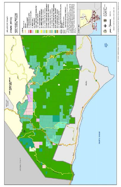
(Ord. 2019-0004 § 1, 2019.)
22.48.010 - Purpose and Applicability.
Combining Zones, established in Section 22.06.030 (Combining Zones), carry out specific purposes by regulating specific uses and imposing requirements that apply in designated geographic areas.
(Ord. 2019-0004 § 1, 2019.)
22.48.020 - Establishment of Combining Zones.
A.
New Combining Zones and delineation of Combining Zones on the Zoning Map may be established by the Board or Commission, in compliance with Section 22.244 (Ordinance Amendments).
B.
Delineation of Combining Zones on the Zoning Map may be established by filing an application in compliance with Chapter 22.198 (Zone Changes).
C.
New Combining Zones may be established without being delineated on the Zoning Map.
(Ord. 2019-0004 § 1, 2019.)
22.48.030 - Basic Zones and Combining Zones.
The zone designated prior to the letters of any Combining Zone shall be known as the "basic zone." For example, where Zone R-3 is combined with Zone ( )-P, Zone R-3 is considered the basic zone and the combined zones shall appear on the Zoning Map as Zone R-3-P.
(Ord. 2019-0004 § 1, 2019.)
22.50.010 - Purpose.
The Billboard Exclusion Zone, Zone ( )-BE, is established to exclude new outdoor advertising signs in designated commercial and industrial areas within the County where such signs could cause hazards to pedestrians and motorists, or detract from the appearance or character of such areas, or be detrimental to an important aspect of the economic base of such areas. Content or subject matter on an existing or potential outdoor advertising sign shall not be used as a criterion for establishment of Zone ( )-BE.
(Ord. 2019-0004 § 1, 2019.)
22.50.020 - Applicability.
Zone ( )-BE may be combined with Zones C-2, C-3, C-M, M-1, M-1.5, M-2, M-2.5, and M-3. When Zone ( )-BE is combined with a basic zone, the letters "BE" shall be added to the basic zone; for example, Zone C-2-BE.
(Ord. 2019-0004 § 1, 2019.)
22.50.030 - Land Use Regulations.
Zone ( )-BE may be used for any use permitted in the basic zone, subject to the same standards and limitations, except that outdoor advertising signs are prohibited.
(Ord. 2019-0004 § 1, 2019.)
22.52.010 - Purpose.
The Development Program Zone, Zone ( )-DP, is established to provide a zone in which development occurring after a property has been rezoned, will conform to plans and exhibits submitted by the applicant in instances where such plans and exhibits constitute a critical factor in the decision to rezone. Adherence to such developmental plans is assured by the requirement of submission and approval of a Conditional Use Permit (Chapter 22.158) incorporating a development program by the applicant providing necessary safeguards to insure completion as specified.
(Ord. 2019-0004 § 1, 2019.)
22.52.020 - Applicability.
Zone ( )-DP may be combined with any zone. When Zone ( )-DP is combined with a basic zone, the letters "DP" shall be added to the basic zone; for example, Zone C-1-DP. Zone ( )-DP may be combined with another zone only when used in combination with a Zone Change (Chapter 22.198) application.
(Ord. 2019-0004 § 1, 2019.)
22.52.030 - Land Use Regulations.
Property in Zone ( )-DP may be used for any use permitted in the basic zone, subject to the following:
A.
Non-Residential Uses.
1.
Non-residential uses permitted in the basic zone are permitted in Zone ( )-DP, subject to limitations and conditions of the approved Conditional Use Permit (Chapter 22.158) that incorporates an approved development program.
2.
Any future non-residential development in an established Zone ( )-DP shall require a Conditional Use Permit application with a proposed development program in conformance with this Chapter.
B.
Residential Uses.
1.
Residential uses permitted in the basic zone are permitted in Zone ( )-DP, subject to limitations and conditions of the approved Conditional Use Permit (Chapter 22.158) that incorporates an approved development program.
2.
Notwithstanding Subsection B.1. above, the same permit or review application and standards of the basic zone shall apply if the subject lot is:
a.
Outside of a Very High Fire Hazard Severity Zone, as depicted in the General Plan, in its entirety;
b.
Outside of the Coastal Zone, as defined in Division 2 (Definitions) of Title 22, in its entirety;
c.
Outside of a Significant Ecological Area, as depicted in the General Plan, in its entirety;
d.
Outside of a Hillside Management Area, as depicted in the General Plan, in its entirety; and
e.
Outside of the 70 or above decibel Community Noise Equivalent Level (dB CNEL) noise contour of an Airport Influence Area, as depicted in the General Plan, in its entirety;
f.
Served by a public water system;
g.
Served by a public sewer system; and
h.
Fronting a highway or a public street.
(Ord. 2021-0010 § 16, 2021; Ord. 2019-0004 § 1, 2019.)
22.52.040 - Development Program.
A Conditional Use Permit (Chapter 22.158) application in Zone ( )-DP shall include a proposed development program submittal in compliance with Subsection A, below, and shall be subject to additional findings in accordance with Subsection B, below.
A.
Development Program Submittal Requirements:
1.
A site plan showing the location of all proposed structures, the alteration or demolition of any existing structures, and the height, bulk, arrangement, color, and appearance of buildings and structures. The site plan shall show development features, including grading, yards, walls, walks, landscaping, and signs. In addition, the site plan shall show any other features necessary to make the development attractive, adequately buffered from adjacent uses, and in keeping with the character of the surrounding area; and
2.
A progress schedule, which includes all phases of development shown on a site plan in compliance with Subsection A.1, above. Each phase of development shall include the sequence and time period for the demolition, grading, and construction of the described improvements.
B.
Additional Findings. Approval of any development program must include a finding that the development program provides necessary safeguards to ensure completion of the proposed development by the applicant, and it does not allow for substitution of a lesser type of development that is contrary to the public convenience, welfare, or development needs of the area.
(Ord. 2019-0004 § 1, 2019.)
22.52.050 - Permit Conditions.
A.
Conditions of Approval. The following shall be required conditions of every development program approved with the application, whether such conditions are set forth in the approved Conditional Use Permit (Chapter 22.158) or not, unless otherwise specified as part of such development program:
1.
No building or structure of any kind, except a temporary structure used only in the developing of the lot according to the development program, shall be built, erected, or moved onto any part of the lot;
2.
No existing building or structure which under the program is to be demolished shall be used;
3.
No existing building or structure which, under the program, is to be altered shall be used until such building or structure has been so altered;
4.
All improvements shall be completed prior to the occupancy of any structures; and
5.
Where one or more buildings in the projected development are designated as primary buildings, building permits for structures other than those so designated shall not be issued until the foundations have been constructed for such primary building or buildings.
B.
Where specifically indicated in approval of the development program, the schedule may permit development to be completed in phases. In interpreting Subsections A.4 and A.5, above, each separately designated phase shall be considered a separate development program.
(Ord. 2019-0004 § 1, 2019.)
22.52.060 - Review of Zone Classification.
A.
Upon expiration of an unused Conditional Use Permit in Zone ( )-DP, or if no Conditional Use Permit (Chapter 22.158) application has been filed within two years following the effective date of an ordinance placing lots in Zone ( )-DP, the Commission or Hearing Officer may investigate the circumstances resulting in failure to apply for or use such Conditional Use Permit.
B.
In all cases, the Commission or Hearing Officer may extend such time for a period not to exceed one year, in compliance with Section 22.222.270.B.
C.
If neither the applicant nor the owner can substantiate to the satisfaction of the Commission or Hearing Officer that additional time should be granted for the filing or resubmittal of a Conditional Use Permit (Chapter 22.158) application, the Commission or Hearing Officer may institute proceedings to rezone such lots back to the previous zone prior to the adoption of a Zone ( )-DP designation or rezone to such other zone as deemed appropriate.
D.
If the additional time granted by the Commission or Hearing Officer expires before a Conditional Use Permit (Chapter 22.158) application has been filed or if a second Conditional Use Permit has expired unused, the Commission or Hearing Officer may initiate proceedings to rezone such lots as provided in Subsection C, above.
(Ord. 2019-0004 § 1, 2019.)
22.54.010 - Purpose.
The Parking Zone, Zone ( )-P, is established to create supplemental off-street parking facilities in areas where additional parking is needed. Development standards are imposed to provide for vehicle parking areas with a functional design that will be harmoniously integrated with adjacent land uses.
(Ord. 2019-0004 § 1, 2019.)
22.54.020 - Applicability.
Zone ( )-P may be combined with any basic zone. When Zone ( )-P is combined with a basic zone, the letters "P" shall be added to the basic zone; for example, Zone M-1-P.
(Ord. 2019-0004 § 1, 2019.)
22.54.030 - Land Use Regulations.
Property in Zone ( )-P may be used for the following uses:
A.
Any permitted use or use subject to permit in the basic zone, subject to the same permit or review application and standards; and
B.
Parking facilities, in compliance with this Subsection B:
1.
A Ministerial Site Plan Review (Chapter 22.186) application may approve:
a.
Parking lots that provide supplemental parking for motor vehicles having a rated capacity of not more than two tons. Such parking lots shall be incidental to a lawfully established agricultural, residential, commercial, industrial, or special purpose use. Such parking facilities may, but need not, be confined to use by the owners, proprietors, clients, or customers of the lawful principal use. This Subsection B.1.a shall not permit a parking building or structure; and
b.
A parking attendant structure not to exceed 30 square feet in floor area.
2.
A Conditional Use Permit (Chapter 22.158) application may approve: Parking buildings, when used for supplemental parking as provided in Subsection B.1.a, above.
(Ord. 2019-0004 § 1, 2019.)
22.54.040 - Development Standards.
Premises in Zone ( )-P shall be subject to the following development standards:
A.
When developed with parking as the principal use, as provided in Section 22.54.030.B.1, property in Zone ( )-P shall be subject to Section 22.112.080 (Parking Design).
B.
When developed as a principal use permitted in the basic zone, property in Zone ( )-P shall be subject to the development standards of the basic zone.
(Ord. 2019-0004 § 1, 2019.)
22.56.2270 - Established—Purpose.
The coastal development permit is established to ensure that any development, public or private, within the coastal zone conforms to the policies and programs of the County of Los Angeles local coastal program land use plans and implementation programs in accordance with Division 20 of the California Public Resources Code. As used in this Chapter, the word "Commission" by itself refers to the County of Los Angeles Regional Planning Commission; references to the State of California Coastal Commission are indicated by the words "Coastal Commission."
(Ord. 2022-0008 § 76, 2022; Ord. 2019-0004 § 1, 2019.)
22.56.2280 - Permit Required.
A.
In addition to obtaining any other permits required by law, any person wishing to perform or undertake any development in the coastal zone, other than either a power facility subject to the provisions of California Public Resources Code Section 25500, a development subject to the provisions of California Public Resources Code Section 30519(b) or a development specifically exempted by Part 17 of Chapter 22.56, shall obtain a coastal development permit.
B.
A determination on whether a development is exempt or has been categorically excluded from the coastal development permit requirements shall be made by the Director at the time an application is submitted for development within the coastal zone. Any dispute arising from the Director's determination shall be resolved pursuant to the procedure described in Section 22.56.2370.
C.
The processing of a coastal development permit shall be subject to the provisions of Chapter 4.5 (Section 65920 et seq.) Division I, Title 7 of the California Government Code.
(Ord. 2019-0004 § 1, 2019.)
22.56.2290 - Exemptions and Categorical Exclusions.
A.
Exemptions: The provisions of this Part 17 shall not apply to:
1.
Additions to single-family residences consistent with the provisions of Section 13250, Title 14, California Code of Regulations.
2.
Improvements to any structure other than a single family residence or Public Works facility consistent with the provisions of Section 13253, Title 14, California Code of Regulations.
3.
Repair or maintenance activities that are consistent with the provisions of Section 13252, Title 14, California Code of Regulations.
4.
The installation, testing and placement in service or the replacement of any necessary utility connection between an existing service facility and any development approved pursuant to Division 20, the California Coastal Act, of the California Public Resources Code; provided, however, that the Director may, where necessary, require reasonable conditions to mitigate any adverse impacts on coastal resources, including scenic resources. All repair, maintenance and utility hookups shall be consistent with the provisions adopted by the Coastal Commission on September 5, 1978.
5.
The replacement of any structure, other than a Public Works facility, destroyed by a disaster. The replacement structure shall conform to applicable existing zoning requirements; shall be for the same use as the destroyed structure, shall not exceed either the floor area, height or bulk of the destroyed structure by more than 10 percent; and shall be sited in the same location on the affected property as the destroyed structure.
6.
Any activity anywhere in the coastal zone that involves the conversion of any existing multiple-unit residential structure to a time-share project, estate or use, as defined in Section 11003.5 of the California Business and Professions Code. If any improvement to an existing structure is otherwise exempt from the permit requirements of this Chapter, no coastal development permit shall be required for that improvement on the basis that it is to be made in connection with any conversion exempt pursuant to this Subsection. The division of a multiple-unit residential structure into condominiums, as defined in Section 783 of the California Civil Code, shall not be considered a time-share project, estate or use for the purposes of this Subsection.
7.
Maintenance dredging of existing navigation channels or moving dredged material from those channels to a disposal area outside the coastal zone, pursuant to a permit from the United States Army Corps of Engineers.
B.
Categorical Exclusions. (Reserved)
C.
As used in this Section, "disaster" means any situation in which the force or forces which destroyed the structure to be replaced were beyond the control of its owners; "bulk" means total interior cubic volume as measured from the exterior surface of the structure; and "structure" includes landscaping and any erosion control structure or device which is similar to that which existed prior to the occurrence of the disaster.
D.
A determination on whether a development is exempt shall be made by the Director at the time an application for development within the coastal zone is submitted. Any dispute arising from the Director's determination shall be resolved pursuant to the procedure described in Section 22.56.2370.
(Ord. 2019-0004 § 1, 2019.)
22.56.2300 - Application—Filing.
Any person desiring a coastal development permit required or provided for in this Title 22 may file an application with the Director, except that no application shall be filed or accepted if final action has been taken within one year prior thereto by either the Hearing Officer, Commission or Board of Supervisors on an application requesting the same or substantially the same permit.
(Ord. 2019-0004 § 1, 2019.)
22.56.2310 - Application—Information Required.
An application for a coastal development permit shall contain the following information, accuracy of which is the responsibility of the applicant:
A.
Names and addresses of the applicant and of all persons owning any or all of the property proposed to be used.
B.
Evidence that the applicant meets the following criteria:
1.
Is the owner of the premises involved; or
2.
Has written permission of the owner or owners to make such application; or
3.
Is or will be the plaintiff in an action in eminent domain to acquire the premises involved, or any portion thereof; or
4.
In the case of a public agency, is negotiating to acquire a portion of the premises involved.
C.
Location of the subject property by address and/or vicinity.
D.
Legal description of the property involved.
E.
Nature of the requested use, indicating the business, occupation or purpose for which such building, structure or improvement is to be erected, constructed, altered, enlarged, moved, occupied or used.
F.
Indication of the nature, condition and development of adjacent uses, buildings and structures.
G.
A site plan drawn to a scale satisfactory to and in the number of copies prescribed by the Director indicating the following:
1.
The area and dimensions of the proposed site for the requested use.
2.
The location and dimensions of all existing and proposed structures, yards, walls, fences, parking and loading facilities, landscaping and other development features.
3.
The dimensions and state of improvement of the adjoining streets and highways providing access to the proposed site of the requested use.
4.
Existing and/or proposed public access to and along the shoreline for projects proposed between the first through public road and the sea.
H.
Architectural drawings showing the following:
1.
Elevations of all sides of building(s).
2.
Roof plan of proposed building(s).
3.
Indication of colors and materials for all exterior surfaces.
I.
Indication of other permits and approvals secured or to be secured in compliance with the provisions of Title 22 and other applicable ordinances and laws, including CEQA.
J.
Maps in the number prescribed, and drawn to a scale specified by the Director, showing the location of all property included in the request, the location of all highways, streets, alleys and the location and dimensions of all lots or parcels of land within a distance of 700 feet from the exterior boundaries of such proposed use. One copy of said map shall indicate the uses established on every lot and parcel of land shown within said 700-foot radius.
K.
A list, certified to be correct by affidavit or by a statement under penalty of perjury pursuant to Section 2015.5 of the California Code of Civil Procedure, of the names and addresses of all persons who are shown on the latest available assessment roll of the County as owners of the subject property and as owning property within a distance of 500 feet from the exterior boundaries of the parcel of land on which the development is proposed. In addition, the list shall include the names and addresses of persons residing within 100 feet of said parcel; if the names of the residents are not known, they shall be listed as "occupants." One copy of the map described in Subsection J of this Section shall indicate where such ownerships and residents are located.
L.
Proof satisfactory to the Director that water for fire protection will be available in quantities and pressures required by the Water Ordinance, set out at Division 1 of Title 20 of the County Code, or by a variance granted pursuant to said Division 1. The Director may accept as such proof a certificate from the person who is to supply water that water can be supplied as required by said Division 1 of Title 20, also stating the amount and pressure, which certificate also shall be signed by the Forester and Fire Warden, or a certificate from Public Works that such water will be available.
M.
The Director may waive the filing of one or more of the above items if the Director finds that the nature of the development is unrelated to the required item and may require additional information.
(Ord. 2019-0004 § 1, 2019.)
22.56.2320 - Application—Burden of Proof.
In addition to the information required in the application by Section 22.56.2310, the applicant shall substantiate to the satisfaction of the County the following facts:
A.
That the proposed development is in conformity with the certified local coastal program; and, where applicable,
B.
That any development, located between the nearest public road and the sea or shoreline of any body of water located within the coastal zone, is in conformity with the public access and public recreation policies of Chapter 3 of Division 20 of the California Public Resources Code.
(Ord. 2019-0004 § 1, 2019.)
22.56.2330 - Application—Filing Fee.
When an application for a coastal development permit is filed, it shall be accompanied by the filing fee as required in Section 22.60.100.
(Ord. 2019-0004 § 1, 2019.)
22.56.2340 - Application—Denial for Lack of Information.
The Hearing Officer may deny, without a public hearing, an application for a coastal development permit if such application does not contain the information required by Sections 22.56.2310 and 22.56.2320 and any other pertinent sections. The Hearing Officer may accept the original file with the supplementary information when refiled by the applicant.
(Ord. 2019-0004 § 1, 2019.)
22.56.2350 - Application—Concurrent Filing.
A coastal development permit shall be considered concurrently with the granting of any other tentative maps or permits required by Titles 21 or 22 of the County Code. A coastal development permit shall be considered subsequent to the granting of required tentative maps or other permits which were approved prior to the effective date of this Section. Where a coastal development permit is being considered concurrently with other permits or maps that do not have a public hearing requirement, a public hearing for such concurrent cases shall be held if the coastal development permit is subject to Section 22.56.2380.
(Ord. 2019-0004 § 1, 2019.)
22.56.2360 - Determination of Jurisdiction.
A.
A determination on whether a coastal development permit is in the County's or Coastal Commission's jurisdiction shall be made by the Director at the time an application for a coastal development permit has been submitted. The County's jurisdiction over coastal development permits does not include tidelands, submerged lands, public trust lands, certain ports, State university, or State college lands as described in Section 30519 of the California Public Resources Code. In making such determination the Director may refer to the "Post-LCP Certification Permit and Appeals Jurisdictional Map" adopted by the Coastal Commission. A coastal development permit within the County's jurisdiction shall be processed pursuant to the provisions of Part 17 of Chapter 22.56 and applicable provisions of the Coastal Act. Any such permit not within the County's jurisdiction shall be referred to the Coastal Commission for processing.
B.
For a coastal development permit within the County's jurisdiction, the Director shall also determine if such permit is appealable to the Coastal Commission. In making this determination, the Director shall use the criteria contained in Section 22.56.2450. The Director may also use the "Post-LCP Certification Permit and Appeals Jurisdictional Map."
C.
Any dispute arising from the Director's determination of jurisdiction or appealability shall be resolved pursuant to the procedure described in Section 22.56.2370.
(Ord. 2019-0004 § 1, 2019.)
22.56.2370 - Resolving Determination Disputes.
A.
If the Director's determination made pursuant to Sections 22.56.2280, 22.56.2290, or 22.56.2360 is challenged by the applicant or interested person, or if the local government wishes to have a Coastal Commission determination as to the appropriate determination, the Director shall notify the Coastal Commission by telephone of the dispute and shall request an opinion of the Coastal Commission's Executive Director.
B.
Processing of such coastal development permit shall be suspended pending a final determination by the Executive Director or Coastal Commission.
(Ord. 2019-0004 § 1, 2019.)
22.56.2380 - Public Hearings.
A.
A coastal development permit which may be appealed to the Coastal Commission pursuant to Section 22.56.2450 shall have a public hearing before the Hearing Officer or Commission.
B.
A public hearing for a coastal development permit may be continued to another day pursuant to Section 22.60.178. If the public hearing is continued to a date uncertain, new notice of the continued public hearing shall be provided in accordance with Section 22.56.2400.
(Ord. 2019-0004 § 1, 2019.)
22.56.2390 - Director's Action on Non-Appealable Permits.
A coastal development permit which is not subject to appeal to the Coastal Commission shall be acted on by the Director who shall cause notices to be sent in accordance with Section 22.56.2400. The Director's decision to approve or deny a permit shall be based on the findings contained in Section 22.56.2410. After the Director's decisions, notices shall be sent pursuant to Section 22.56.2430.
(Ord. 2019-0004 § 1, 2019.)
22.56.2400 - Notice Requirements.
A.
The Director shall provide notice by first class mail for a coastal development permit at least 20 calendar days prior to the public hearing or decision on the application to:
1.
The applicant, property owners and residents whose names and addresses appear on the verified list of persons required to be submitted by Section 22.56.2310 and other pertinent sections;
2.
The California Coastal Commission; and
3.
Any person who has requested to be noticed of such permit.
B.
The notice for a coastal development permit shall contain the following information:
1.
A statement that the development is within the coastal zone;
2.
The date of filing and name of the applicant;
3.
The number assigned to the application;
4.
The location and description of the development; and
5.
In addition, a notice for a coastal development permit which requires a public hearing shall also contain the following:
a.
The date, time and place of the public hearing;
b.
A statement that written comments may be submitted to the Director prior to the hearing and that oral comments may be made or written material may be submitted at the public hearing;
c.
A brief description of the procedures concerning the conduct of the hearing, the action likely to occur and that the notice will be given after the action; and
d.
A description of the procedure for filing an appeal with the County and California Coastal Commission.
6.
In addition, a notice for a coastal development permit which does not require a public hearing shall contain the following:
a.
The date the Director will make a decision on the application;
b.
A statement that written or oral comments may be submitted to the Director during the 20-day period between the time that the notice is mailed and the date of the Director's decision, which would allow sufficient time for the submission of comments by mail prior to the Director's decision; and
c.
A description of the procedure for filing an appeal with the County.
(Ord. 2019-0004 § 1, 2019.)
22.56.2410 - Approval or Denial Findings.
A.
An application for a coastal development permit shall be approved where the information submitted by the applicant, discovered during the staff investigation process and/or presented at a public hearing substantiates to the satisfaction of the County the following findings:
1.
That the proposed development is in conformity with the certified local coastal program; and, where applicable,
2.
That any development, located between the nearest public road and the sea or shoreline of any body of water located within the coastal zone, is in conformity with the public access and public recreation policies of Chapter 3 of Division 20 or the California Public Resources Code.
B.
An application shall be denied where the information submitted by the applicant and/or presented at a public hearing fails to substantiate the above-mentioned findings to the satisfaction of the County.
(Ord. 2019-0004 § 1, 2019.)
22.56.2420 - Condition of Approval.
The County, in approving an application for a coastal development permit, may impose such conditions as are deemed necessary to insure that such use will be in accord with the findings required by Sections 22.56.2320 and 22.56.2410. The land owner and applicant shall record with the office of the Registrar-Recorder/County Clerk an affidavit accepting and agreeing to implement all conditions of permit approval.
(Ord. 2019-0004 § 1, 2019.)
22.56.2430 - Notice of Action and County Appeal Rights.
A.
The Director shall notify by first class mail the applicant, any person who specifically required notice of such action of the decision made on an application for a coastal development permit and any person who participated at the public hearing.
B.
The notice shall contain the following information:
1.
That a coastal development permit decided by the Director with no public hearing may be appealed by filing an appeal with the secretary of the Commission. The decision of the Commission shall be based on the findings of Section 22.56.2410 and shall be final.
2.
That a coastal development permit decided by the Hearing Officer or Commission after a public hearing may be appealed or called for review by following the procedure contained in Part 5 of Chapter 22.60.
C.
An appeal may be filed by any interested person dissatisfied with a decision on a coastal development permit within:
1.
14 calendar days following the date on the notice of action for a coastal development permit that is not appealable to the Coastal Commission;
2.
10 business days from the date of receipt by the Executive Director of the Coastal Commission of the notice of the County's final action for a coastal development permit that is appealable to the Coastal Commission.
(Ord. 2019-0004 § 1, 2019.)
22.56.2440 - Notice of Final Decision.
Within seven calendar days of a final decision on a coastal development permit, the Director shall provide notice of such decision by first class mail to the applicant, the Coastal Commission and to any persons who specifically requested notice of such decision by submitting a self-addressed stamped envelope to the Department. A decision shall be considered final when all local appeals have been exhausted and the effective dates contained in Sections 22.60.260 and 22.56.2490 have been reached. Such notice shall include written findings, conditions of approval and the procedures for appeal of the decision, if applicable pursuant to Section 22.56.2450, to the Coastal Commission.
(Ord. 2019-0004 § 1, 2019.)
22.56.2450 - Appeals to the Coastal Commission.
A.
A coastal development permit may be appealed to the Coastal Commission for only the following types of development:
1.
Approvals of developments which are located between the sea and the first public road paralleling the sea or within 300 feet of the inland extent of any beach or of the mean high tide line of the sea where there is no beach, whichever is the greater distance. The appeal jurisdiction described in Section 30603 of the California Public Resources Code is shown on the "Post-LCP Certification Permit and Appeals Jurisdiction Map";
2.
Approvals of developments not included within Subsection A.1 of this Section that are located on tidelands, submerged lands, public trust lands, within 100 feet of any wetland, estuary, stream or within 300 feet of the top of the seaward face of any coastal bluff. The appeal jurisdiction described in Section 30603 of the California Public Resources Code is shown on the "Post-LCP Certification Permit and Appeals Jurisdiction Map";
3.
Approvals of developments that are not designated as principal permitted uses in this Title 22; and
4.
Any development which constitutes a major Public Works project or a major energy facility. The phrase "major Public Works project or a major energy facility" shall mean facilities that cost more than $100,000. An energy facility means any public or private processing, producing, generating, storing, transmitting or recovering facility for electricity, natural gas, petroleum, coal or other source of energy.
B.
The grounds for an appeal of a development described in Subsection A.1 shall be limited to one or more of the following allegations:
1.
The development fails to provide adequate physical access or public or private commercial use or interferes with such uses.
2.
The development fails to protect public views from any public road or from a recreational area to and along the coast.
3.
The development is not compatible with the established physical scale of the area.
4.
The development may significantly alter existing natural landforms.
5.
The development does not comply with shoreline erosion and geologic setback requirements.
C.
The grounds for an appeal of a development described in Subsections A.2, A.3, or A.4 shall be limited to an allegation that the development does not conform to the certified local program.
D.
An appeal of the County's decision on a coastal development permit application may be filed by an applicant or any aggrieved person who exhausted local appeals or any two members of the Coastal Commission. The appeal must contain the following information:
1.
The name and address of the permit applicant and appellant;
2.
The date of the local government action;
3.
A description of the development;
4.
The name of the governing body having jurisdiction over the project area;
5.
The names and addresses of all persons who submitted written comments or who spoke and left his or her name at any public hearing on the project, where such information is available;
6.
The names and address of all other persons known by the appellant to have an interest in the matter on appeal;
7.
The specific grounds for appeal;
8.
A statement of facts on which the appeal is based;
9.
A summary of the significant questions raised by the appeal. The filing of the notice of appeal should also contain information which the local government has specifically requested or required.
E.
The appeal must be received in the Coastal Commission district office with jurisdiction over the local government on or before the 10th working day after receipt of the notice of the permit decision by the Executive Director.
F.
The appellant shall notify the applicant, any persons known to be interested in the application and the local government of the filing of the appeal. Notification shall be by delivering a copy of the completed notice of appeal to the domicile, office or mailing address of said parties. In any event, such notification shall be by such means as may reasonably advise said parties of the pendency of the appeal. Unwarranted failure to perform such notification may be grounds for dismissal of the appeal by the Commission.
(Ord. 2019-0004 § 1, 2019.)
22.56.2460 - Effect of Appeal to the Coastal Commission.
Upon receipt in the Coastal Commission office of a timely appeal by a qualified appellant, the Executive Director shall notify the permit applicant and the County that the operation and effect of the development permit has been stayed pending Coastal Commission action on the appeal. Upon receipt of a notice of appeal, the County shall refrain from issuing a development permit for the proposed development and shall within five working days, deliver to the Executive Director all relevant documents and materials used by the County in its consideration of the coastal development permit application. If the Coastal Commission fails to receive the documents and materials, they shall set the matter for hearing and the hearing shall be left open until all relevant materials are received.
(Ord. 2019-0004 § 1, 2019.)
22.56.2470 - De Novo Review by the Coastal Commission.
Where the appellant has exhausted County appeals a de novo review of the project by the Coastal Commission shall occur only after the County decision has become final.
(Ord. 2019-0004 § 1, 2019.)
22.56.2480 - Appeal by Two Coastal Commissioners.
A.
Where a coastal development permit is appealed by two Coastal Commissioners, such appeal shall be transmitted to the appropriate County appellate body, either the Commission or Board of Supervisors, who shall follow the procedures of Part 5 of Chapter 22.60 and Part 17 of Chapter 22.56. If the appellate body modifies or reverses the previous decision, the Coastal Commissioners shall file a new appeal from the decision if they are still dissatisfied. During the period of County appellate body review, the Coastal Commissioners' appeal will be suspended from the Coastal Commission appeal process pursuant to Section 13573 of the California Coastal Commission administrative regulations.
B.
Where review by all County appellate bodies has left the originally appealed action unchanged, the Coastal Commissioners' appeal will be no longer suspended and the appeal may then be brought before the Coastal Commission.
(Ord. 2019-0004 § 1, 2019.)
22.56.2490 - Effective Date of Permit.
A.
A coastal development permit which is not appealable to the Coastal Commission shall have the following effective dates:
1.
The decision of the Director shall become effective on the 15th calendar day following the date on the notice of action taken, unless timely appealed to the Commission pursuant to the provisions of Part 5 of Chapter 22.60.
2.
The decision of the Commission is final and shall become effective on the date of its decision.
B.
A coastal development permit which is appealable to the Coastal Commission shall become effective at the close of business on the 10th business day following the date of receipt of the notice of the County's final action on the permit by the Executive Director of the Coastal Commission, unless an appeal is filed prior to the effective date and time. If an appeal has been filed, the operation and effect of the coastal development permit shall be stayed pending Coastal Commission action on the appeal. The effective date of the Coastal Commission decision will be the date of decision by the Coastal Commission.
(Ord. 2019-0004 § 1, 2019.)
22.56.2500 - Expiration of Unused Permits.
Unused coastal development permits shall expire based on the following schedule:
A.
A permit which is not used within the time specified in such permit, or, if no time is specified, within two years after the granting of the permit, becomes null and void and of no effect with the exception of the following:
1.
In all cases, the Hearing Officer may extend such time for a period of not to exceed one year, provided an application requesting such extension is filed prior to such expiration date. In the case of a non-profit corporation organized to provide low-income housing for the poor or elderly, the Hearing Officer may grant an additional one-year extension, provided that an application requesting such extension is filed prior to the expiration of the first such extension.
2.
In the case of a coastal development permit heard concurrently with a land division, Conditional Use Permit, variance or other permit authorized in this Title 22, the Hearing Officer shall specify time limits and extensions to be concurrent and consistent with those of the land division, variance or permits.
B.
A coastal development permit shall be considered used, within the intent of this Section, when construction or other development authorized by such permit has commenced that would be prohibited if no permit had been granted.
(Ord. 2019-0004 § 1, 2019.)
22.56.2510 - Expiration Following Cessation of Use.
A coastal development permit granted by action of the Hearing Officer, Commission or Board of Supervisors shall automatically cease to be of any force and effect if the use for which such coastal development permit was granted has ceased or has been suspended for a consecutive period of two or more years.
(Ord. 2019-0004 § 1, 2019.)
22.56.2520 - Continuing Validity of Permit.
A coastal development permit that is valid and in effect and was granted pursuant to the provisions of this Chapter shall adhere to the land and continue to be valid upon change of ownership of the land or any existing building or structure on said land.
(Ord. 2019-0004 § 1, 2019.)
22.56.2530 - Amendments to Permits.
A.
An amendment may be made to a coastal development permit previously approved by the County by filing a written application with the Director. Such application shall contain a description of the proposed amendment, the reason for the amendment, together with maps, drawings or other material appropriate to the request. A filing fee as required by Section 22.60.100 shall accompany a request for an amendment.
B.
An application for an amendment shall be rejected if, in the Director's opinion, the proposed amendment would lessen or void the effect of the permit unless the applicant presents newly discovered material information which could not, with reasonable diligence, have been discovered and produced before the permit was granted.
C.
For those applications accepted, the Director shall determine whether the proposed amendment represents an immaterial or material change to the permit.
1.
For applications representing immaterial changes, the Director shall prepare a written notice which contains the information required by Subsection B of Section 22.56.2400, a description of the proposed amendment and a statement informing persons of the opportunity to submit written objection of the determination to the Director within 10 days of the date the notices were posted at the subject property and mailed to interested persons. The Director shall cause notices to be posted conspicuously along the exterior property line of the proposed development, not more than 300 feet apart and at each change of direction of the property line. The Director shall also mail notices to all persons who testified at a public hearing on the permit or who submitted written testimony on the permit, and such other persons as the Director has reason to know may be interested in the application. If no written objection is received by the Director within 10 days of posting and mailing, the Director's determination shall be conclusive and the proposed amendment approved.
2.
For applications representing material changes, applications which have objects to determinations of immateriality, or amendments to conditions affecting coastal resource protection or coastal access, the Director shall refer such applications to the Commission for a public hearing. The Director shall mail notices in accordance with the procedures of Section 22.56.2400 to all persons who testified at the public hearing on the permit, who submitted written testimony on the permit, who objected to the Director's determination of immateriality, or such other persons as the Director has reason to know may be interested in the application.
3.
The Commission, unless the proposed amendment has been found to be immaterial, shall determine and make appropriate findings by a majority vote of the membership present whether the proposed development with the proposed amendment is consistent with the California Coastal Act and the certified local coastal program.
(Ord. 2019-0004 § 1, 2019.)
22.56.2540 - Revocation of Coastal Development Permits.
In addition to the provisions pertaining to revocations contained in Part 13 of Chapter 22.56, the following shall apply to coastal development permits:
A.
Grounds for revocation of a permit may also include:
1.
Intentional inclusion of inaccurate, erroneous or incomplete information where the County finds that accurate and complete information would have caused additional or different conditions to be required on a permit or denial of an application:
2.
Failure to comply with the notice provisions of Section 22.56.2400, where the views of the person not notified were not otherwise made known to the County and could have caused the County to require additional or different conditions on a permit or deny an application.
B.
Initiation of proceedings to revoke a permit may be made by any person who did not have an opportunity to fully participate in the original permit proceeding because of the reasons stated in Subsection A of this Section and who applies to the Director specifying the particular grounds for revocation. The Director shall review the stated grounds for revocation and, unless the request is patently frivolous and without merit, shall initiate revocation proceedings. The Director may initiate revocation proceedings when the grounds for revocation have been established.
C.
Where the Director determines that grounds exist for revocation of a permit, the operation of the permit shall be automatically suspended until the denial of the request for revocation. The Director shall notify the permittee by mailing a copy of the request for revocation and a summary of the procedures contained in this Section and in Part 13 of Chapter 22.56, to the address shown in the permit application. The Director shall advise the applicant in writing that any development undertaken during suspension of the permit may be in violation of the California Coastal Act and subject to the penalties contained therein.
(Ord. 2019-0004 § 1, 2019.)
22.56.2550 - Enforcement.
In addition to the enforcement provisions contained in this Title 22, the provisions of Chapter 9 of Division 20 of the California Public Resources Code shall also apply with respect to violations and enforcement.
(Ord. 2019-0004 § 1, 2019.)
22.60.010 - Purpose.
The Industrial Preservation Zone, Zone ( )-IP, is intended to preserve industrially-zoned properties specifically for current and future industrial uses, labor-intensive activities, wholesale sales of goods manufactured on-site, major centers of employment, and limited employee-serving commercial uses. The Combining Zone serves to expressively prohibit uses that do not align with the purpose of this zone.
(Ord. 2019-0004 § 1, 2019.)
22.60.020 - Applicability.
Zone ( )-IP may be combined with Zone M-1, M-1.5, M-2, M-2.5, M-3, MPD, B-1, B-2, and P-R properties. When Zone ( )-IP is combined with a basic zone, the letters "IP" shall be added to the basic zone; for example, Zone M-1-IP.
(Ord. 2019-0004 § 1, 2019.)
22.60.030 - Prohibited Uses.
In addition to uses listed in Section 22.22.030.E (Prohibited Uses), premises in Zone ( )-IP shall not be used for the following uses listed in Table 22.60.030-A, below:
(Ord. 2023-0060 § 14, 2023; Ord. 2021-0011 § 11, 2021; Ord. 2020-0008 § 50, 2020; Ord. 2019-0004 § 1, 2019.)
22.68.010 - Purpose and Applicability.
Supplemental Districts, established in Section 22.06.040 (Supplemental Districts), are established to carry out specific purposes by regulating specific uses and imposing requirements that apply in designated geographic areas.
(Ord. 2019-0004 § 1, 2019.)
22.68.020 - Establishment, Expansion, and Repeal.
A.
New Supplemental Districts and the delineation, expansion, or repeal of Supplemental Districts may be established by the Board or Commission, in compliance with Chapter 22.244 (Ordinance Amendments).
B.
Delineation, expansion, or repeal of Supplemental Districts may be established by filing an application in compliance with Chapter 22.198 (Zone Changes). In addition, the application shall include evidence that the applicant:
1.
Is an owner of the property involved; or
2.
Has written permission of an owner of all or a portion of the property involved.
C.
New Supplemental Districts may be established without being delineated on the Zoning Map.
(Ord. 2019-0004 § 1, 2019.)
22.70.010 - Purpose.
Equestrian Districts are established to recognize areas where the keeping of horses and other large domestic animals for residents' personal use has become or is intended to become integral to the character of the area. An Equestrian District (EQD) permits the keeping of horses and other large domestic animals as accessory to residential uses and is subject to development standards intended to ensure compatibility with surrounding areas and within the EQD itself while also taking the individual characteristics of the particular area under consideration.
(Ord. 2019-0004 § 1, 2019.)
22.70.020 - Applicability and Land Use Regulations.
Property in an EQD may be used for any use permitted in the basic zone, subject to the same standards of that zone. This Chapter shall supersede provisions in this Title 22 which regulate the keeping of horses and other large domestic animals (animals), including other equine, cattle, sheep, and goats, as accessory to a residential use.
(Ord. 2019-0004 § 1, 2019.)
22.70.030 - Establishment, Expansion, or Repeal of Equestrian Districts.
A.
Establishment, Expansion, or Repeal. In addition to Section 22.68.020.B, no petition for the establishment, expansion, or repeal of an EQD shall be accepted unless signed by at least 75 percent of the property owners within the area under consideration.
B.
Requirements for Establishment or Expansion. An EQD may be established or expanded where the proposed district will comply with the following requirements:
1.
Area. The proposed EQD shall contain a minimum area of five acres. The expansion of an existing EQD may be considered on less than five acres, where it is an orderly and contiguous extension of an existing EQD.
2.
Buffer Area.
a.
Animals regulated by the proposed EQD shall be separated by a buffer area from any lot which is used for residential purposes or located in a Residential Zone or Zone A-1 having the potential for residential development and not within the EQD. Such buffer area shall consist of:
i.
A designated setback of not less than 25 feet, located contiguous to and within the boundaries of the proposed EQD. Such setback shall provide a permanently established buffer within which animals regulated by such district will not be kept or maintained; or
ii.
A physical separation in lieu of such setback located contiguous to and either outside or inside of the boundary of the proposed EQD, which provides an equivalent setback or satisfactorily eliminates the need for such setback, within the intent of this Section. Such physical separation may consist of, but is not limited to, a public street, highway, riding trail or other public or private easement, or an appropriate topographical separation.
b.
Where animals to be regulated within the proposed EQD are permitted in the same or greater numbers on property contiguous to its boundary, the Commission may recommend, and the Board may waive, such setback along the common boundary in adopting the District.
3.
Findings. In addition to the findings in Section 22.198.050 (Findings and Decision), the Commission may recommend approval of a petition requesting the establishment of an EQD where the information submitted or presented at the public hearing substantiates the following findings:
a.
That the requested animals within the proposed EQD will not jeopardize, endanger, or otherwise constitute a menace to the public health, safety, or general welfare; and
b.
That the properties in the EQD are adequate in size and shape to accommodate the requested animals without material detriment to the use, enjoyment, or valuation of property of other persons located in the vicinity of the EQD.
4.
Conditions of Approval. The Commission may recommend, and the Board may impose conditions as deemed necessary to ensure that animals permitted in an EQD will be kept in compliance with the findings required by Subsection B.3, above. Conditions imposed may involve any pertinent factors affecting the establishment, operation, and maintenance of the requested EQD, including, but not limited to:
a.
The number and location of animals permitted;
b.
The type, and construction of corrals, stables, or other structures used for the housing of such animals;
c.
Fencing requirements;
d.
Required setbacks; or
e.
The inclusion of riding areas or equestrian trails within the EQD.
(Ord. 2019-0004 § 1, 2019.)
22.70.040 - Established Equestrian Districts.
Established EQDs are listed in Table 22.70.040-A, below. These EQDs are shown on the Zoning Map and are incorporated with all provisions specified in each respective ordinance of adoption.
(Ord. 2024-0029 § 2, 2024; Ord. 2019-0004 § 1, 2019.)
22.70.050 - Development Standards.
A.
General Development Standards.
1.
Maintenance. All animals authorized to be kept in an EQD shall be maintained in a safe and healthy manner, in compliance with all applicable regulations provided in any other statute or ordinance.
2.
Stable and Corral.
a.
Animals shall be kept in a stable or fenced corral.
b.
No part of any stable or corral shall be located within 35 feet from any existing habitable structure except for an accessory dwelling unit or junior accessory dwelling unit regulated by Section 22.140.640 (Accessory Dwelling Units and Junior Accessory Dwelling Units).
c.
No part of any stable or corral shall be located within 100 feet of an existing school building or hospital building.
B.
Agency Review. As part of the review of an application for a project in an EQD, the Director shall notify and request reports from the Departments of Animal Care and Control and Public Health regarding the ability of the applicant to maintain such animals properly as indicated in the application and site plan.
C.
Equestrian District Specific Development Standards.
1.
Rancho Potrero De Felipe Lugo. The maximum number of animals in EQD-1: Rancho Potrero De Felipe Lugo shall comply with Table 22.70.050-A and Figure 22.70.050-A: Rancho Potrero De Felipe Lugo, below.
FIGURE 22.70.050-A: RANCHO POTRERO DE FELIPE LUGO
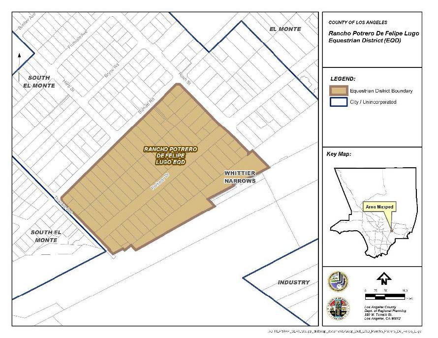
2.
West Altadena. The maximum number of animals in EQD-2: West Altadena shall comply with Table 22.70.050-B and Figure 22.70.050-B: West Altadena, below.
FIGURE 22.70.050-B: WEST ALTADENA
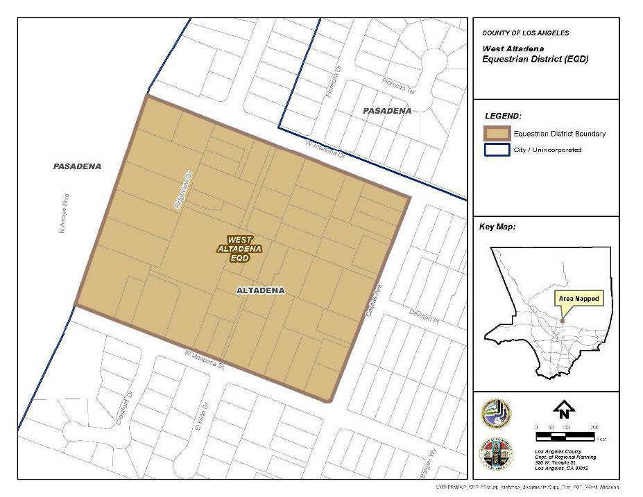
3.
Pellissier Village. The maximum number of animals in EQD-3: Pellissier Village shall comply with Table 22.70.050-C and Figure 22.70.050-C: Pellissier Village, below.
FIGURE 22.70.050-C: PELLISSIER VILLAGE
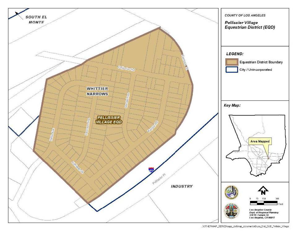
4.
Kinneloa Mesa. The maximum number of animals in EQD-4: Kinneloa Mesa shall comply with Table 22.70.050-D and Figure 22.70.050-D: Kinneloa Mesa, below.
FIGURE 22.70.050-D: KINNELOA MESA
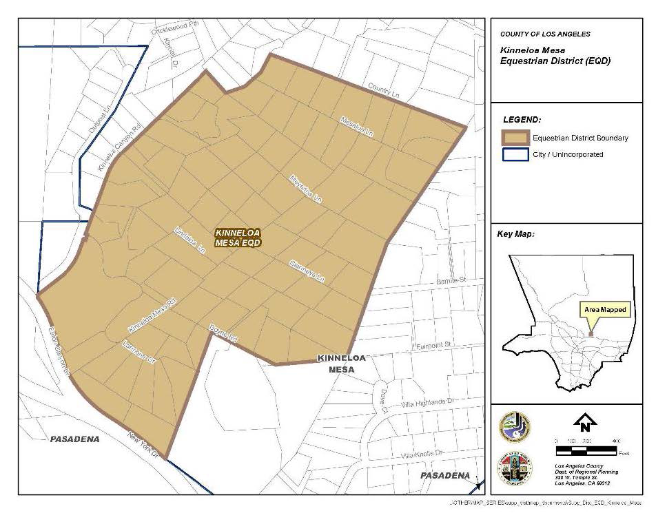
5.
Beverly Acres. The maximum number of animals in EQD-6: Beverly Acres shall comply with Table 22.70.050-F and Figure 22.70.050-F: Beverly Acres, below.
FIGURE 22.70.050-F: BEVERLY ACRES
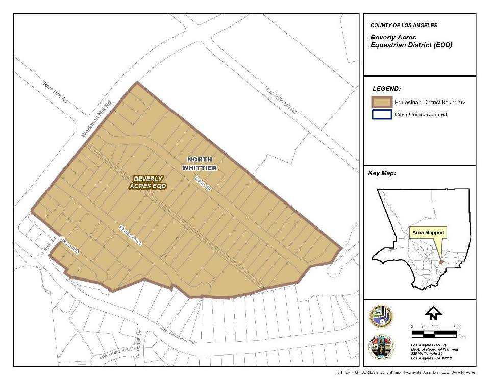
6.
Avocado Heights. EQD-7: Avocado Heights shall comply with this Subsection C.7.
a.
Number of Animals. The maximum number of animals shall comply with Table 22.70.050-G and Figure 22.70.050-G: Avocado Heights, below.
b.
Additional Regulations. In Zone B-1:
i.
Animals shall not be maintained; and
ii.
Trails shall not be established.
FIGURE 22.70.050-G: AVOCADO HEIGHTS
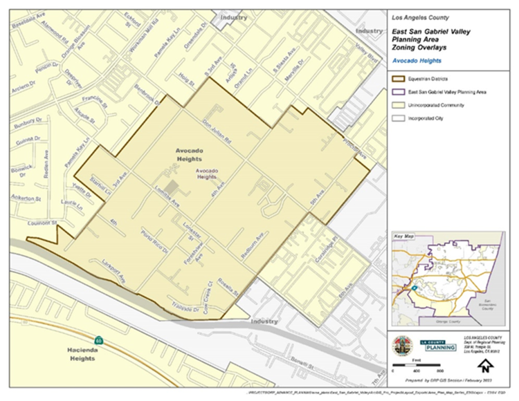
(Ord. 2025-0029 § 4, 2025; Ord. 2024-0029 § 3, 2024; Ord. 2019-0004 § 1, 2019.)
22.72.010 - Purpose.
Setback Districts are established to develop properties with minimum building setbacks in designated yards:
A.
This Chapter shall supersede other provisions in this Title 22 that require building setbacks in designated yards.
B.
The required front yard specified in a Setback District shall apply to the yard that is parallel to the front lot line of the perimeter of a compact lot subdivision.
(Ord. 2020-0032 § 19, 2020; Ord. 2019-0004 § 1, 2019.)
22.72.020 - Front Yard Setback Districts.
Established Front Yard Setback Districts are listed in Table 22.72.020-A, below. Front Yard Setback Districts are shown on the Zoning Map and are incorporated with all provisions specified in each respective ordinance of adoption.
(Ord. 2025-0010 § 1, 2025; Ord. 2024-0032 § 14, 2024; Ord. 2024-0029 § 4, 2024; Ord. 2019-0004 § 1, 2019.)
22.72.030 - District Maps.
The boundaries of the Setback Districts are shown on Figures 22.72.030-A through P, at the end of this Chapter.
(Ord. 2025-0010 § 2, 2025; Ord. 2024-0032 § 15, 2024; Ord. 2024-0029 § 5, 2024; Ord. 2019-0004 § 1, 2019.)
22.72.040 - Modification of Setback Requirements.
Every lot in a Setback District shall conform to the building setbacks established by this Chapter, except where a subject lot adjoins another lot that fronts on the same highway, parkway, or street that has a lesser setback or yard, the building setback shall be the average of the building setbacks or yards of the adjacent lots on both sides of the subject lot. Otherwise, the setback shall conform to the distance established for the lot in this Title 22.
(Ord. 2024-0032 § 16, 2024; Ord. 2019-0004 § 1, 2019.)
DISTRICT MAPS (FIGURES)
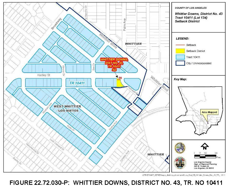
(Ord. 2025-0010 § 2, 2025; Ord. 2024-0032 § 16, 2024; Ord. 2019-0004 § 1, 2019.)
22.74.010 - Purpose.
Flood Protection Districts are established to regulate properties within areas designated by Public Works as subject to substantial flood hazard. These districts include both the existing washes or channels and additional areas as necessary to provide reasonable protection from overflow of floodwaters, bank erosion, and debris deposition. The regulations contained in the district are supplemental to other flood protection regulations of this Title 22.
(Ord. 2019-0004 § 1, 2019.)
22.74.020 - Development Standards.
A.
No building or structure shall be used, erected, constructed, or moved onto a lot within the boundaries of a Flood Protection District, except for the following structures:
1.
Accessory buildings and structures that will not substantially impede the flow of water, including sewer, gas, electrical, and water systems, approved by Public Works pursuant to Title 26 (Building Code) of the County Code;
2.
Parking lots or buildings incidental to a lawfully established use; and
3.
Flood-control structures approved by Public Works.
B.
No building or structure shall be altered, modified, enlarged, or reconstructed on a lot within the boundaries of a Flood Protection District, except for nonconforming buildings and structures, subject to Sections 22.172.020.B (Additions to a Nonconforming Use or a Building or Structure Nonconforming Due to Use and/or Standards) and 22.172.020.C (Additions to a Building or Structure Nonconforming Due to Standards).
(Ord. 2019-0004 § 1, 2019.)
22.74.030 - List of Districts.
Established Flood Protection Districts are listed in Table 22.74.030-A, below. Flood Protection Districts are shown on the Zoning Map and are incorporated with all provisions specified in each respective ordinance of adoption.
(Ord. 2019-0004 § 1, 2019.)
22.76.010 - Intent and Purpose.
The Noise Insulation Program is intended to safeguard the public health and safety by establishing minimum building requirements for residential occupancies in the vicinity of Los Angeles International Airport. These requirements are not intended to supersede any health or safety provisions required under any applicable codes or ordinances. These requirements shall apply to all construction, additions, alterations, improvements, and repairs of Group R buildings, as defined by Title 26 (Building Code) of the County Code, in the 65 decibel Community Noise Equivalent Level (CNEL) and above noise zones of the Los Angeles International Airport.
(Ord. 2019-0004 § 1, 2019.)
22.76.020 - Description of Noise Zone Boundaries.
The location and boundaries of the 65 decibel CNEL and above noise zones are shown and delineated on the most recent Fourth Quarter Los Angeles World Airports Quarterly Report Noise Contour Map, as required by Title 21 of the California Code of Regulations.
(Ord. 2022-0008 § 77, 2022; Ord. 2019-0004 § 1, 2019.)
22.76.030 - Community-Wide Development Standards.
Proposed construction, additions, alterations, improvements and repairs requiring a building permit within the 65 decibel CNEL and above noise zones depicted on the most recent Quarterly Report Noise Contour Map, shall comply with such building requirements as may be specified for these zones in Title 26 (Building Code) of the County Code. No building permit shall be issued within these zones unless the covered work is in compliance with the specified Building Code requirements to the satisfaction of Public Works, Building and Safety Division. Deviations from the specified building requirements are permissible only if all deviations are certified, by a person experienced in the field of acoustical engineering retained by the permit applicant, to comply with and achieve the 45 decibel standard for every habitable room constructed or modified.
(Ord. 2019-0004 § 1, 2019.)
22.80.010 - Purpose.
The Rural Outdoor Lighting District (ROLD) is established as a supplemental district for the rural areas of the County to promote and maintain dark skies for the health and enjoyment of individuals and wildlife by:
A.
Curtailing light pollution and preserving the nighttime environment.
B.
Permitting reasonable uses of outdoor lighting for nighttime safety, security, productivity, and enjoyment, while protecting the natural environment from the adverse effects of excessive outdoor nighttime lighting from artificial sources.
C.
Conserving energy and resources.
D.
Minimizing adverse offsite impacts of outdoor lighting, such as light trespass.
(Ord. 2019-0004 § 1, 2019.)
22.80.020 - Definitions.
Specific terms used in this Chapter are defined in Section 22.14.180(R) of Division 2 (Definitions), under "Rural Outdoor Lighting District."
(Ord. 2022-0008 § 78, 2022; Ord. 2019-0004 § 1, 2019.)
22.80.030 - Applicability.
A.
General Applicability. This Chapter shall apply within the ROLD, as depicted on Figure 22.80.030-A: Rural Outdoor Lighting District, located at the end of this Chapter, to the following:
1.
Outdoor lighting for new land uses, structures, buildings, or developments.
2.
Outdoor lighting for all portions of any structure, building, or development following a major addition thereto.
3.
New street lights.
4.
Abandoned uses that are resumed.
B.
Applicability to Existing Outdoor Lighting and Replacement Lighting.
1.
Except as otherwise provided in this Subsection B, outdoor lighting, including street lights that were lawfully existing on December 13, 2012, the effective date of this Chapter, may remain in their present condition without complying with this Chapter.
2.
Additions, upgrades, or replacements that are made to outdoor lighting, including street lights, that were lawfully existing on December 13, 2012, shall comply this Chapter, where applicable, except that when less than 50 percent of the outdoor lighting fixtures on a property are replaced for a commercial, industrial, or mixed use, Section 22.80.060.C (Automatic Controls) shall not apply. For purposes of this provision, the term replacement shall include the replacement of outdoor lighting, including street lights, due to damage or destruction.
3.
Outdoor lighting, other than street lights, located on properties in a Residential or Agricultural Zone that was lawfully existing at the time this Chapter became effective shall be removed or made to comply with this Chapter within six months after December 13, 2012, if such outdoor lighting causes light trespass, the determination of which shall be made by the Director, and in all other cases, shall be removed or made to comply with the applicable provisions of this Chapter within three years after the effective date of this Chapter.
4.
Outdoor lighting, other than street lights, located on properties in a zone other than a Residential or Agricultural Zone that was lawfully existing at the time this Chapter became effective shall be removed or made to comply with this Chapter within six months after December 13, 2012, if such outdoor lighting causes light trespass onto a property located in a Residential, Agricultural or Open Space Zone or onto the improved portion of any public right-of-way, as such determination is made by the Director.
(Ord. 2019-0004 § 1, 2019.)
22.80.040 - Prohibited Outdoor Lighting.
Subject to Section 22.80.030 (Applicability), the following types of outdoor lighting shall be prohibited within ROLD:
A.
Drop-down lenses.
B.
Mercury vapor lights.
C.
Ultraviolet lights.
D.
Searchlights, laser lights, or other outdoor lighting that flashes, blinks, alternates, or moves.
(Ord. 2019-0004 § 1, 2019.)
22.80.050 - General Development Standards.
In addition to complying with the applicable provisions of Title 26 (Building Code) and Title 27 (Electrical Code) of the County Code, outdoor lighting within the ROLD, other than street lights, shall be subject to the following requirements:
A.
Lighting Allowance. For properties located in a Residential, Agricultural, Open Space, or Watershed Zone, outdoor light fixtures installed above 15 feet in height shall have a manufacturer's maximum output rating of no greater than 400 lumens.
B.
Light Trespass. Outdoor lighting shall cause no unacceptable light trespass.
C.
Shielding. Outdoor lighting shall be fully shielded.
D.
Maximum Height.
1.
The maximum height for an outdoor light fixture, as measured from the finished grade to the top of the fixture, shall be as follows:
a.
20 feet for a property located in a Residential, Agricultural, Open Space, or Watershed Zone.
b.
35 feet for a property located in an Industrial Zone.
c.
30 feet for property located in any other zone.
2.
Notwithstanding Subsection D.1, above, the height of any new outdoor light fixture used for an outdoor recreational activity area, regardless of the zone, shall be the minimum height necessary to illuminate the activity area, but in no event shall exceed 75 feet; and
3.
Notwithstanding Subsections D.1 and D.2, above, the Director may approve an outdoor light fixture with a height higher than as otherwise permitted by these subsections through a Ministerial Site Plan Review (Chapter 22.186) application, if the applicant demonstrates that a higher light fixture would reduce the total number of light fixtures needed at the involved site, or would reduce the light trespass of the outdoor lighting.
E.
Maintenance. Outdoor lighting shall be maintained in good repair and function as designed, with shielding securely attached to the outdoor lighting.
(Ord. 2019-0004 § 1, 2019.)
22.80.060 - Additional Standards for Commercial, Industrial, and Mixed Uses.
In addition to complying with the applicable provisions of Section 22.80.050 (General Development Standards) outdoor lighting located on a property with a commercial, industrial, or mixed use shall be subject to the following requirements:
A.
Building Entrances. All building entrances shall have light fixtures providing light with an accurate color rendition so that persons entering or exiting the building can be easily recognized from the outside of the building.
B.
Hours of Operation.
1.
Outdoor lighting shall be turned off between the hours of 10:00 p.m. and sunrise every day, unless the use on the involved property operates past 10:00 p.m., and then the outdoor lighting shall be turned off within one hour after the use's operation ends for the day. Notwithstanding the foregoing, if the use on the involved property requires outdoor lighting between 10:00 p.m. and sunrise every day for safety or security reasons, outdoor lighting shall be allowed during these hours, but only if:
a.
Fully-shielded motion sensors are used to turn the outdoor lighting on after 10:00 p.m., and these sensors turn the outdoor lighting off automatically no more than 10 minutes after the involved area has been vacated; or
b.
Where the use is commercial or industrial, at least 50 percent of the total lumen levels for the outdoor lighting are reduced, or 50 percent of the total number of outdoor light fixtures are turned off, between 10:00 p.m. and sunrise.
2.
Exemption from Hours of Operation. Outdoor lighting shall be exempt from the hours of operation requirements of Subsection B.1, above, if such lighting:
a.
Is required by Title 26 (Building Code) for steps, stairs, walkways, or points of ingress and egress to buildings; or
b.
Is governed by an approved discretionary permit which specifically provides for different hours of operation.
C.
Automatic Controls. Outdoor lighting shall use automatic control devices or systems to turn the outdoor lighting off so as to comply with the applicable hours of operation requirements of Subsection B.1, above. These devices or systems shall have backup capabilities so that, if power is interrupted, the schedule programmed into the device or system is maintained for at least seven days.
(Ord. 2019-0004 § 1, 2019.)
22.80.070 - Additional Standards for Outdoor Recreational Activity Areas.
In addition to complying with the applicable requirements of Section 22.80.050 (General Development Standards), outdoor light fixtures, when used to illuminate outdoor recreational activity areas, shall be mounted, aimed, and fully shielded so that their light beams fall onto said areas in such a way so as to prevent unacceptable light trespass onto surrounding areas or properties, and shall use high pressure sodium or metal halide lamps as their preferred lighting source.
(Ord. 2019-0004 § 1, 2019.)
22.80.080 - Additional Standards for Signage.
In addition to complying with the applicable requirements of Section 22.80.050 (General Development Standards) outdoor lighting for new signs, including outdoor advertising signs, business signs, and roof and freestanding signs, shall comply with the following:
A.
The outdoor lighting shall be fully shielded;
B.
When the signs use externally-mounted light fixtures, they shall be mounted to the top of the sign and shall be oriented downward; and
C.
Externally-mounted bulbs or lighting tubes used for these signs shall not be visible from any portion of an adjoining property or public right-of-way unless such bulbs or tubes are filled with neon, argon, krypton, or other self-illuminating substance.
(Ord. 2019-0004 § 1, 2019.)
22.80.090 - Street Light Standards.
So as to maintain the dark skies characteristics of the ROLD to the maximum extent possible, street lights in the district shall be prohibited except where necessary at urban cross sections with sidewalks, curbs, and gutters or at intersections and driveways on County roads, where the Director of Public Works finds that street lights will alleviate traffic hazards, improve traffic flow, and/or promote safety and security of pedestrians and vehicles based on Public Works' highway safety lighting standards. Where street lights are installed in the district, they shall:
A.
Be placed at the maximum distance apart, with the minimum lumens allowable pursuant to Public Works' highway safety lighting standards, as determined by the Director of Public Works;
B.
Utilize full-cutoff (flat glass lens) luminaries so as to deflect light away from adjacent parcels; and
C.
Be designed to prevent off-street illumination and glare.
(Ord. 2019-0004 § 1, 2019.)
22.80.100 - Exemptions.
The following outdoor lighting shall be exempt from the provisions of this Chapter:
A.
Outdoor lighting for a public facility operated by the Sheriff's Department, Probation Department, or similar department or entity that keeps incarcerated persons, provided such lighting is needed for the security or operation of the facility.
B.
Temporary outdoor lighting, which is outdoor lighting that does not persist beyond 60 consecutive days or more than 120 days per year.
C.
Outdoor lighting used in or around swimming pools or water features for safety purposes.
D.
Outdoor lighting required for compliance with the federal Americans with Disabilities Act.
E.
Outdoor lighting for industrial facilities and sites, including but not limited to, rail yards, maritime shipyards and docks, piers and marinas, chemical and petroleum processing plants, and aviation facilities, where such lighting is needed for safety reasons.
F.
Outdoor lighting for outdoor theme parks, fairs, or carnivals.
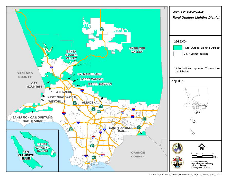
FIGURE 22.80.030-A: RURAL OUTDOOR LIGHTING DISTRICT
(Ord. 2019-0004 § 1, 2019.)
22.82.010 - Purpose.
Historic districts are established as supplemental districts to:
A.
Implement special development standards to promote, protect, enhance, perpetuate, and preserve property of historic importance within the unincorporated areas of the County for the educational, cultural, economic, and general welfare of the public;
B.
Implement the General Plan by ensuring development consistent with the General Plan's policies concerning urban design, neighborhood enhancement, housing, land use, and historic and cultural resources;
C.
Deter the demolition, destruction, alteration, misuse, or neglect of historically significant buildings and structures which constitute an important link to the County's past;
D.
Stimulate the economic health and residential quality of unincorporated County communities and stabilize and enhance the value of property in those communities; and
E.
Encourage development tailored to the character and significance of each historic district.
(Ord. 2019-0004 § 1, 2019.)
22.82.020 - Establishment of an Historic District.
An historic district shall be established or amended by ordinance adopted in accordance with the procedures set forth in Chapter 22.124 (Historic Preservation).
(Ord. 2019-0004 § 1, 2019.)
22.82.030 - Development Restrictions.
A.
Property within the boundaries of an historic district may be used for any purpose permitted in the basic zone to which the historic district is added, subject to all applicable provisions of this Title 22, including but not limited to Chapter 22.124 (Historic Preservation), and any development standards, limitations, conditions, or other regulations applicable to the historic district as may be set forth in the ordinance establishing or amending the historic district.
B.
Notwithstanding Section 22.300.020 (Application of Community Standards Districts to Property), where an ordinance establishing or amending a historic district imposes development standards, limitations, conditions or regulations which are inconsistent with those otherwise imposed by this Title 22, the development standards, limitations, conditions, and regulations set forth in the ordinance establishing or amending the historic district shall supersede any inconsistent provisions in this Title 22.
(Ord. 2019-0004 § 1, 2019.)
22.82.040 - Zoning Map Designation.
Established historic districts are listed in Table 22.82.040-A, below. These historic districts are shown on the Zoning Map and are incorporated with all provisions specified in each respective ordinance of adoption.
(Ord. 2019-0004 § 1, 2019.)
22.82.050 - District Maps.
(Reserved)
22.84.010 - Purpose.
The Green Zone, Zone ( )-GZ, is a Combining Zone established to identify industrially-zoned parcels, including those in a Specific Plan, that are within a 500-foot radius of a lot containing a sensitive use, and therefore, subject to specific land use regulations set forth in this Chapter. The Green Zone promotes environmental justice in communities that are disproportionately affected by toxic pollutants and contaminants generated from various land uses over time. This Chapter provides regulations and procedures for new and existing land uses to ensure that such land uses will be operated in consideration of the surrounding sensitive uses as defined in Chapter 22.14 (Definitions), minimizing potential adverse health and safety impacts, and promoting clean industrial uses.
(Ord. 2024-0028 § 8, 2024; Ord. 2022-0023 § 25, 2022.)
22.84.020 - Applicability.
A.
General Applicability. Except as specified otherwise in this Title 22, this Chapter applies to parcels that are zoned ( )-GZ and contain a new or legally-established existing use that is one of the following:
1.
Listed under the Industrial Uses category, with the exception of uses under the Airport-related sub-category, in Table 22.22.030-B (Principal Use Regulations for Industrial Zones);
2.
Listed under Recycling and Solid Waste Uses category in Table 22.22.030-B (Principal Use Regulations for Industrial Zones);
3.
Listed under the Vehicle-related Uses, with the exception of uses under the Vehicle Sales and Rentals sub-category, in Table 22.22.030-B (Principal Use Regulations for Industrial Zones). Supply stores under Vehicle Services sub-category that are within fully enclosed buildings are also not subject to this Chapter;
4.
A new drive-through establishment, drive-through facility, or drive-through service, established on or after July 14, 2022; or
5.
A new automobile service station or a new CNG fueling station, established on or after July 14, 2022.
B.
Applicability of Schedule for Compliance. Existing, legally-established uses, structures, or development subject to this Chapter shall comply with all applicable provisions in Section 22.84.050 (Schedule for Compliance for Existing, Legally-Established Uses).
C.
Exceptions. Notwithstanding Subsections A and B, above:
1.
This Chapter shall not apply to any existing industrial, recycling or solid waste, or vehicle-related uses, legally established prior to the establishment of a new sensitive use on or after July 14, 2022, on an adjacent or adjoining lot, pursuant to Chapter 22.134, if such sensitive use is the only sensitive use that is within a 500-foot radius of the lot containing the existing industrial, recycling or solid waste, or vehicle-related uses.
2.
When in conflict with other provisions of this Title 22, the more restrictive requirements shall apply.
3.
When a use is subject to a Conditional Use Permit (Chapter 22.158) or a Minor Conditional Use Permit (Chapter 22.160) pursuant to this Title 22, the Commission or Hearing Officer may impose a condition of approval that differs from a development standard, a performance standard, or the schedule for compliance prescribed in this Chapter.
D.
Improvements Pursuant to this Chapter. Improvements made pursuant to this Chapter shall not be considered nonconforming pursuant to Chapter 22.172 (Nonconforming Uses, Buildings, and Structures), even if there is subsequently a more restrictive requirement in this Title 22 governing the same matter.
(Ord. 2024-0028 § 8, 2024; Ord. 2022-0023 § 25, 2022.)
22.84.030 - Prohibited Uses.
The following uses are prohibited in Zone ( )-GZ, except where noted:
A.
Acid manufacture.
B.
Anaerobic digestion facility, except as an accessory to a legally-established use that processes waste generated on-site only.
C.
Auto dismantling (outdoor operation).
D.
Cement, lime, gypsum, or plaster of Paris manufacture.
E.
Chipping and grinding.
F.
Combustion or non-combustion biomass conversion facility, except for a non-combustion biomass conversion facility that processes waste generated on-site only.
G.
Composting facility, except for green waste composting only.
H.
Compressed natural gas manufacture.
I.
Construction and demolition facility, recycling.
J.
Conversion technology facility, recycling, or solid waste.
K.
Distillation of bones.
L.
Drop hammers.
M.
Explosives.
N.
Forging works.
O.
Fertilizer manufacture, except accessory composting of on-site generated waste associated with a legally-established commercial or agricultural use.
P.
Gas manufacture, except accessory anaerobic digestion of on-site generated waste associated with a legally-established commercial or agricultural use.
Q.
Glue manufacture.
R.
Inert Debris landfills.
S.
Inert Debris processing facilities, recycling.
T.
Materials recovery facilities, new.
U.
Metal plating (prohibited within a 1,000-foot radius of a lot containing a sensitive use).
V.
Polymer plastics and foam manufacture.
W.
Scrap metal yards (outdoor operation).
X.
Smelting of tin, copper, zinc or iron ores.
Y.
Solid waste landfills.
Z.
Tannery or the curing or storage of raw hides.
AA.
Transfer stations.
(Ord. 2024-0028 § 8, 2024.)
22.84.040 - Standards and Requirements for Specific Uses.
A.
Application Requirements.
1.
The following uses shall be subject to a Conditional Use Permit (Chapter 22.158) in Zone ( )-GZ.
a.
Drive-through establishments, drive-through facilities, and drive-through services, new.
b.
Industrial Uses.
i.
Assembly, manufacture, packaging, and storage of finished or prepared materials, including on-site manufacture of raw, natural, or synthesized flammable or toxic chemicals:
(a)
Earthen products, including ceramics, sand, and stone, but excluding brick, terra cotta, and tile manufacture.
(b)
Precious and semi-precious metal products, including jewelry and lapidary.
ii.
Assembly, manufacture, packaging, and storage of finished or prepared materials, provided that no manufacturing of raw natural or synthesized materials, including flammable or toxic chemicals, is conducted on-site. Metal products and parts; including the fabricating, engraving, spinning, storing, plating, and finishing of, where the use prohibits snap riveting and any process used in bending or shaping, which produces any audible nuisance or disagreeable noise, is prohibited. Use of perchloric acid is prohibited. Use excludes foundries and forging works.
iii.
Food processing:
(a)
Breweries.
(b)
Dairy products depots.
(c)
Slaughtering, dressing, processing, packing, and sale of poultry, fowl, rabbits, and other similar animals of comparable nature, form, and size.
(d)
Starch mixing and bottling.
iv.
Laundries and cleaning services, such as rug and carpet cleaning plants.
v.
Manufacturing:
(a)
Blacksmith shops.
(b)
Boat building.
(c)
Concrete batching plants, mixers of one cubic yard capacity or smaller.
(d)
Engraving, machine metal engraving.
(e)
Fabricating.
(f)
Ice manufacturing, distribution, and storage.
(g)
Lubricating oil canning and packaging, limited to 100 barrels stored aboveground at a time.
(h)
Lumberyard.
(i)
Machine shops.
(j)
Paint mixing, excluding lacquers and synthetic enamels.
(k)
Presses, hydraulic presses for the molding of plastics.
(l)
Refrigeration plants.
(m)
Sand, the washing of sand to be used in sandblasting.
(n)
Sheet metal shops.
(o)
Stone, marble and granite; including grinding, dressing, and cutting.
vi.
Recycling and Solid Waste uses, including auto dismantling/recycling (indoor operation), and scrap metal (indoor operation).
vii.
Storage:
(a)
Acetylene and oxygen storage in tanks. Oxygen shall be stored in a room separate from acetylene, and such rooms shall be separated by a not less than one-hour fire-resistant wall.
(b)
Boat storage.
(c)
Building materials.
(d)
Bus storage.
(e)
Car barns for buses and streetcars.
(f)
Cold storage plants.
(g)
Contractor's equipment yards, including farm and building trade equipment.
(h)
Distributing plants.
(i)
Draying yards or terminals.
(j)
Fuel yards.
(k)
Machinery storage yards.
(l)
Moving van storage or operating yards.
(m)
Plaster storage.
(n)
Produce yards and terminals.
(o)
Storage and rental of plows, tractors, buses, contractor's equipment, and cement mixers.
(p)
Truck and RV storage, including container storage.
(q)
Warehouses, including storage warehouses, which have a gross floor area of 100,000 square feet or greater.
(r)
Waste hauler vehicle or waste hauler container storage.
(s)
Wood yards.
viii.
Tire retreading or recapping.
ix.
Valves, storage and repair of; including oil well valves.
x.
Welding.
c.
Vehicle-related Uses:
i.
Automobile washing, automatic car wash.
ii.
Automobile washing, coin-operated, or hand wash.
iii.
Vehicle services, automobile body and fender repair, and paint shops.
iv.
Vehicle services, automobile impound, and tow yards.
v.
Vehicle services, automobile painting, and upholstering shops.
vi.
Vehicle services, any automobile repair garages.
vii.
Vehicle services, new automobile service stations.
viii.
Vehicle services, automobile supply stores (outdoor only).
ix.
Vehicle services, new CNG fueling stations.
d.
New development, change of use, or major improvements which increase either the floor area of a structure or the number of parking spaces, proposed on a site that is partially or entirely located within a half-mile radius of the boundaries of Superfund Sites, as identified in the United States Environmental Protection Agency ("U.S. EPA") National Priorities List. For these uses, an environmental site assessment (Phase 1 Study) shall be submitted.
2.
Projects that propose grading. Where grading is proposed for a project subject to a Conditional Use Permit, such projects must comply with all federal, State, and local laws with regard to protection of Tribal Cultural Resources.
3.
All other types of industrial or vehicle-related uses subject to this Chapter shall require a Ministerial Site Plan Review (Chapter 22.186) or Minor Conditional Use Permit (Chapter 22.160) application in compliance with this Section.
4.
All uses subject to a Conditional Use Permit may be required to submit a noise evaluation report and control plans for odor, dust, and vibration prepared by a licensed professional at the request of Public Health. Mitigation measures, if required, shall be approved by Public Health prior to the permit being finalized.
5.
Hazardous Sites. The following application materials shall be required for all permitted and conditionally permitted uses subject to this Chapter that are located on hazardous sites:
a.
An appropriate federal, State, or local agency clearance letter where the project site is known to be a hazardous property or listed on the Cortese List maintained by the California Environmental Protection Agency ("Cal-EPA"); and
b.
A Phase 1 study to demonstrate that the site is clear of contamination if it is known to have a previous use that potentially generated hazardous materials.
B.
Additional Findings. When a Conditional Use Permit (Chapter 22.158) is required by this Section, or a Minor Conditional Use Permit (Chapter 22.160) is required by Title 22, the following additional findings must be made in addition to the Conditional Use Permit findings required in Section 22.158.050.B (Findings and Decision) or Minor Conditional Use Permit findings in Section 22.160.050 (Findings and Decision):
1.
The proposed use, development of land, and application of development standards are arranged to prevent adverse effects related to odor, noise, aesthetic, soil contamination, and air quality on neighboring property;
2.
The proposed use and development of land employ appropriate environmental impact mitigation strategies, such as physical design characteristics, mechanical safeguards, or best practice strategies, including placement of construction equipment as far away from sensitive uses as possible, use of construction equipment that has properly operating and maintained mufflers, use of Zero Emissions construction equipment where feasible, orienting public address systems on-site away from nearby sensitive uses and setting system volume at a level not readily audible past the property line as feasible, and minimizes impacts on nearby sensitive uses; and
3.
The proposed use and development of land protects public health and safety and promotes environmental sustainability.
C.
Development Standards.
1.
Development Standards for All Permitted and Conditionally Permitted Uses Subject to this Chapter.
a.
Solid walls.
i.
The following uses shall provide solid walls along the street frontage and any other lot lines adjoining a lot containing sensitive uses:
(a)
Boat storage.
(b)
Bus storage.
(c)
Organic waste facilities.
(d)
Pallet yards.
(e)
Recycling collection facilities.
(f)
Recycling processing facilities.
(g)
Truck and RV storage.
(h)
Uses that have accessory uses or secondary, related activities other than parking occurring outdoors.
ii.
Required solid walls shall meet the following standards:
(a)
Be of a uniform height between eight and 12 feet;
(b)
Be of a minimum thickness of six inches;
(c)
Be a neutral color; and
(d)
Be constructed in workmanlike manner and consist of materials such as concrete masonry unit ("CMU") or masonry, brick, etc.
iii.
Any type of fencing or wire is prohibited, except that metal gates may be permitted for the purpose of vehicular access.
b.
Landscaping on Street Frontage. Required solid walls along street frontages shall be set back by landscaping of a minimum of five feet in depth, as described below, unless the landscaping encroaches into the required existing parking spaces and associated maneuvering areas, or existing building or structures. The landscaping shall be verified on a landscaping plan submitted to the Department and consist of the following:
i.
One 15-gallon tree for every 100 square feet of landscaped area shall be planted and spaced 10 feet apart. The remaining area shall also be landscaped with grass, shrubs, or bushes, etc. All plants provided for required landscaping shall be drought-tolerant and include only non-invasive plant species.
ii.
The landscaping shall be maintained in a healthy condition with appropriate watering, pruning, weeding, fertilizing, and litter removal. Trees shall be planted in locations that maintain the required lines of sight for safe pedestrian and vehicular movement and shall not cause root damage to the sidewalk or other public infrastructure, to the satisfaction of Public Works.
iii.
Trees planted near buildings or fire lanes shall be placed in locations that do not adversely impact the Fire Department operations or response times, to the satisfaction of the Fire Department.
iv.
Trees shall be selected from the Tree Species List maintained by the Director.
v.
Landscaping equipment used for maintenance, such as lawn mowers and leaf blowers, shall be electric and non-combustion powered.
vi.
Notwithstanding Chapter 12.84 (Low Impact Development Standards) of the County Code, parcels subject to this Chapter 22.84 (Green Zone Districts) and less than one acre in size shall not be exempt from Low Impact Development requirements.
c.
Storage of Materials, Vehicles, or Equipment.
i.
Any materials, vehicles, or equipment that are stored outdoors shall not be visible beyond the surrounding wall from a line of sight from the public right-of-way or nearby sensitive use, shall be fully contained within the property boundaries, and shall not spill over onto public rights-of-way.
ii.
Stored materials shall be set back at least 10 feet from the wall or the length equal to the wall height, whichever is greater.
iii.
The area between the stored materials and the wall may be landscaped.
d.
Enclosures.
i.
Any area used for storage or handling of hazardous materials, including above-ground storage tanks, shall be within an enclosure and fully screened from the public right-of-way;
ii.
A completely enclosed building shall be provided for the following, unless another regulatory agency requires natural ventilation as part of the regulatory code:
(a)
Any area where manufacturing or repair work occurs, such as assembly or disassembly of parts, repairs, processing of materials, or operation of equipment that emits or generates dust, smoke, gas, fumes, cinder, or waste; or
(b)
Recycling processing facilities, including auto dismantling activity, and scrap metal crushing and shredding.
(1)
Auto dismantling activity, and scrap metal crushing and shredding, shall be placed furthest away from nearby sensitive uses as possible and be fully enclosed within a building.
(2)
The garage door or opening of the enclosed building for auto dismantling activity, and scrap metal crushing and shredding, shall face the opposite direction of the nearest sensitive use and may be kept open during operation for ventilation.
(3)
Ancillary operations, storage, and parking, aside from auto dismantling activity, and scrap metal crushing and shredding, may be conducted outdoors, provided that it is fully contained within the property boundaries and no storage or operation occurs on adjacent public rights-of-way or neighboring properties.
e.
Surfacing. Areas designated for vehicle parking, vehicle circulation, or storage of materials or equipment shall be paved with impervious materials such as an asphalt or an oil and aggregate mixture, use light color pavement, and be maintained to the satisfaction of the Director. Paved areas shall be clustered to maximize pervious area. Alternative paving materials may be permitted to the satisfaction of the Director and Public Works.
i.
All areas of broken concrete or asphalt, including, but not limited to, divots, cracks, potholes, and spalling of concrete or asphalt in the raw material receiving area of a recycling processing facility, or any portion of the facility where waste materials are unloaded and touch the ground outside of an enclosure, shall be patched, repaired, or repaved as necessary to prevent standing water or puddles with a surface area greater than one square foot from accumulating.
f.
Recycling and Solid Waste Storage. Any trash receptacles or storage areas for recycling and solid waste shall meet the requirements set forth in Chapter 22.132 (Storage Enclosure Requirements for Recycling and Solid Waste).
g.
Vehicular Access and On-site Circulation for Cars and Trucks. For new uses, driveway entrances and exits shall be located as far away from sensitive uses as feasible, and on-site vehicular circulation and truck loading and unloading areas, including truck loading docks, shall be located in the rear or on the side of structures, or as far away from the nearest sensitive use as feasible, to the satisfaction of the Director. Queuing and check-in points for trucks must be located on-site and furthest away from any property lines that are closest to any nearby sensitive use, when feasible. In cases of infeasibility for uses subject to a Conditional Use Permit, an additional finding must be made to justify why this may not be possible.
h.
"No Idling" Sign Required. Where loading spaces are provided, the loading area shall include at least one sign stating that vehicle idling shall be limited to five minutes. Graphics related to the vehicle idle limitation are permitted on said sign. Said sign shall be a minimum size of 12 inches wide by 18 inches in height and shall be prominently displayed and visible from the loading spaces/area. Said sign may contain language such as "5-minute idle limit," "spare the air," "please turn off engine when stopped," or similar language.
i.
Accessory Structures and Utilities. A site that contains an outdoor operation with an office shall permanently affix the building to the ground and provide one toilet that is served by public water and sewer, or otherwise approved by the Director, as well as by Public Health and Public Works.
j.
Perimeter Identification Signs. In addition to the signs permitted by Chapter 22.114 (Signs), and notwithstanding any contrary provisions in Division 10 (Community Standards Districts) in Title 22, each facility or site shall provide a perimeter identification sign that complies with the following:
i.
A perimeter identification sign shall be permanently affixed on a building or wall that is visible, and with text that is legible from the public right-of-way for pedestrians, and no higher than eight feet from the ground measured vertically from the base of the sign. Freestanding signs or portable signs are prohibited as a perimeter identification sign.
ii.
A perimeter identification sign shall have a minimum sign area of four square feet and a maximum of nine square feet. The area for a perimeter identification sign shall not be accounted for in the area permitted for business signs specified in Chapter 22.114 (Signs).
iii.
The perimeter identification sign shall permanently display hours of operation, telephone number of the facility representative, and emergency contact information for reporting any problems which may occur related to the operation of the facility 24 hours a day, seven days a week. The sign shall also include the business name unless the property also contains a separate business sign that is clearly visible from the public right-of-way. The sign shall also include instructions for reporting violations to the Department and Air Quality Management District (AQMD), where a use is also regulated by AQMD. Information for reporting violations shall include the following text, or as updated by the Department or South Coast Air Quality Management District (SCAQMD):
(a)
"To report a violation to the Los Angeles County Department of Regional Planning, call 213-974-6453 Monday—Thursday, 7 a.m. - 6 p.m., dial 2-1-1 at any time or email zoningenforcement@planning.lacounty.gov;" and
(b)
"To report a violation to South Coast Air Quality Management District (SCAQMD), call 1-800-CUTSMOG or visit www.aqmd.gov."
iv.
Multi-tenant buildings or sites may provide one such sign containing the information for all tenants listed in Subsection C.1.iii, above, provided that each tenant has its own business identification sign that is clearly visible from the public right-of-way.
2.
New Development or Proposed Expansions to Existing, Legally- Established Uses Adjacent to or Adjoining Sensitive Uses.
a.
Building setback. A minimum of a 10-foot setback shall be provided along the property lines adjacent to or adjoining sensitive uses. Any proposed additions above the ground floor of existing, legally-established uses adjacent to or adjoining sensitive uses shall also be set back 10 feet from the nearest property line.
b.
Building height. Any new building or structures, or any portion proposed for additions, excluding chimneys, rooftop antennas, roof-mounted solar panels, or other rooftop equipment including HVAC units, air purifiers, etc., shall set back the portion of the building or structure one additional foot for every foot above 35 feet in height, up to a maximum height of 45 feet.
3.
Standards for Specific Uses. In addition to Subsection C.1 and C.2, above, the following standards shall apply to the uses listed below, unless otherwise specified.
a.
Automobile and vehicle repair shops. No open vehicle hood is permitted outside of the building.
b.
New automobile service stations or new CNG fueling stations:
i.
Are exempt from Subsection C.1, above.
ii.
Shall locate the gasoline or fuel dispensing areas at least 50 feet from the nearest sensitive uses.
c.
Warehouses. The following standards apply to new warehouses. The following standards, except for Subsection vi, below, apply to existing warehouses, and shall be met by July 14, 2027.
i.
Utilize electric or alternatively fueled sweepers with HEPA filters.
ii.
Utilize Energy Star heating, cooling, and lighting devices, and appliances.
iii.
Off-road Equipment. All off-road equipment (non-street legal), such as forklifts and other machinery, used on-site for warehouse operations shall be powered by alternative fuels, electrical batteries, or other alternative/non-diesel fuels (e.g., propane) that do not emit diesel particulate matter, and that are zero or low-emission.
iv.
Landscaping Equipment. All landscaping equipment, such as lawn mowers and leaf blowers used on-site shall be electrically powered.
v.
Zero-emission or Near-zero Emission Trucks. Warehouses with a minimum gross floor area of 100,000 square feet in a single building shall comply with AQMD Rule 2305 or current standards.
vi.
New warehouses shall have a minimum 100-foot buffer consisting of office space, employee parking, and/or landscaping between primary operation and lot lines that are closest to nearby sensitive uses.
d.
New drive-through establishments, drive-through facilities, and drive-through services. The following standards shall apply to new drive-through establishments, drive-through facilities, and drive-through services only:
i.
Compliance with the requirements set forth in Subsection C.2.a, above.
ii.
A maintenance plan shall be submitted as part of the Conditional Use Permit application, to the satisfaction of the Director, and the drive-through establishment shall comply with the maintenance plan.
iii.
The location of the drive-through area, including cashier microphone, speakers, and drive-through lane, shall be located at least 20 feet from the property line of any adjoining residentially-zoned lot, and speakers and lighted menus shall be oriented away from such lots.
iv.
Hours of operation for the drive-through area shall be no earlier than 6:00 a.m. and no later than 12:00 a.m.
v.
A buffer, which may include a six-foot solid wall, as depicted on the site plan, shall be provided to reduce noise trespass from the drive-through area to any adjoining residentially-zoned lot.
vi.
The required trash bin shall be enclosed by a decorative wall measuring at least five feet tall, but not more than six feet tall, and shall have solid doors.
D.
Modification.
1.
A modification may be requested through a Minor Conditional Use Permit (Chapter 22.160) application if the use is subject to a Minor Conditional Use Permit or Site Plan Review (Chapter 22.186), or through a Conditional Use Permit (Chapter 22.158) application if the use requires a Conditional Use Permit, for the development standards listed below:
a.
Solid walls (Subsection C.1.a.ii).
b.
Landscaping (Subsection C.1.b.i).
c.
Accessory Structures and Utilities (Subsection C.1.i).
d.
Signs (Subsection C.1.j.ii).
e.
Warehouses (Subsections C.3.c.iii, iv, v, and vi).
2.
When a modification is requested for any development standards listed in Subsection D.1, above, the following findings must be made in addition to the findings required in Subsection B (Additional Findings), above:
a.
Due to topographic or physical features of the site, strict compliance with all the required development standards would substantially and unreasonably interfere with the establishment of the proposed project or continuation of the existing operation on the subject property; and
b.
The requested modification provides alternative means to prevent adverse effects on environment and public health of the community.
E.
Performance Standards for All Permitted and Conditionally Permitted Uses Subject to This Chapter.
1.
Hours of Outdoor Operation. No outdoor operation or activities shall be conducted between 6:00 p.m. and 8:00 a.m., daily, with the exception of truck loading and unloading into an enclosed building only.
2.
Storage of Materials and Waste. All materials or waste shall be stored in designated receptacles, bins, or pallets, and located on a paved impermeable surface on site, or within an enclosed building.
3.
Site Maintenance. Other than for the collection or receipt of items related to the principal use, exterior areas of the premises shall be maintained free of garbage, trash, debris, or junk and salvage except as stored in designated trash collection containers and enclosures.
F.
Fees. When a Conditional Use Permit (Chapter 22.158) is required, fees may be assessed to offset the costs associated with the project mitigation, enforcement activities, operational impact mitigation studies, community benefit programs, and other costs related to the Project's impacts on the surrounding communities.
(Ord. 2024-0028 § 8, 2024; Ord. 2022-0023 § 25, 2022.)
22.84.050 - Schedule for Compliance for Existing, Legally-Established Uses.
A.
Except as specified otherwise, existing, legally-established uses that are not listed in Section 22.84.030 (Prohibited Uses) shall be brought into compliance with all applicable requirements of this Chapter according to the schedule identified in Table 22.84.050-A, below. The number of years to comply shall be accounted from July 14, 2022. Requests to further delay the required permit attainment or improvements in accordance with all applicable development or performance standards shall not be accepted.
1.
Existing uses that are entirely or partially within a 100-foot radius of a lot containing a sensitive use in a permitted zone and:
a.
Subject to a Ministerial Site Plan (Chapter 22.186), pursuant to this Chapter for the requirements specified in Subsection C.1.b (Landscaping on Street Frontage) or C.1.j (Perimeter Identification Signs) of Section 22.84.040, only and no other improvements required, three years;
b.
Subject to a Ministerial Site Plan (Chapter 22.186), pursuant to this Chapter for any one or combination of the requirements specified in Subsections C.1.a through C.1.j of Section 22.84.040, except Subsection C.1.b (Landscaping on Street Frontage) or C.1.j (Perimeter Identification Signs) alone or in combination, and except for Subsection C.1.d (Enclosures), five years;
c.
Subject to a Ministerial Site Plan (Chapter 22.186), pursuant to this Chapter for the requirements specified in Subsection C.3.c (Warehouses) of Section 22.84.040, five years;
d.
Subject to a Ministerial Site Plan (Chapter 22.186), pursuant to this Chapter for the requirements specified in Subsection C.1.d (Enclosures) only, or Subsection C.1.d along with any other requirements of Section 22.84.040, seven years;
e.
Subject to a Conditional Use Permit (Chapter 22.158), pursuant to this Chapter for the requirements specified in Subsections C.1.a (Solid Walls), C.1.b (Landscaping on Street Frontage), C.1.j (Perimeter Identification Signs), or C.3.c (Warehouses) only, of Section 22.84.040, five years; or
f.
Subject to a Conditional Use Permit (Chapter 22.158), pursuant to this Chapter for all other requirements, seven years.
2.
Existing uses that are entirely or partially located between a 101-foot radius and a 500-foot radius of any lot containing a sensitive use and:
a.
Subject to a Ministerial Site Plan (Chapter 22.186), pursuant to this Chapter for the requirements specified in Subsections C.1.a through C.1.j, except for C.1.d (Enclosures) or subject to Subsection C.3.c (Warehouses) of Section 22.84.040, five years;
b.
Subject to a Ministerial Site Plan (Chapter 22.186), pursuant to this Chapter for the requirements specified in Subsection C.1.d (Enclosures) along with or without any other requirements of Section 22.84.040, seven years; or
c.
Subject to a Conditional Use Permit (Chapter 22.158), pursuant to this Chapter, seven years. Uses that are subject to a Conditional Use Permit, pursuant to this Chapter shall be brought into full compliance with all applicable requirements of this Chapter, no later than July 14, 2029, or cease operations.
3.
Compliance shall be defined solely for this Chapter as the required permit is attained, the required improvements are constructed or installed, or the site is maintained and operated in accordance with all applicable development or performance standards of this Chapter within the timeframe identified in Table 22.84.050-A, above. For properties subject to multiple compliance years for improvements, the longest timeline shall apply to all improvements, including compliance with all applicable performance standards.
B.
Notwithstanding any contrary provisions in this Section, if an existing use not listed in Section 22.84.030 (Prohibited Uses) was established by a discretionary permit valid on or after July 14, 2022:
1.
If the discretionary permit contains a grant term, full compliance with all applicable development or performance standards of this Chapter, including any site improvements, shall be required at the end of the grant term when renewal of the permit or a new discretionary permit is required; or
2.
If the discretionary permit does not contain a grant term, full compliance with all applicable development or performance standards of this Chapter, including any site improvements, shall be required by July 14, 2042, when renewal of the permit or a new discretionary permit is required.
C.
Nonconforming Uses.
1.
Time Limits.
a.
Nonconforming uses pursuant to Section 22.84.030 (Prohibited Uses) shall be subject to the time limits in Section 22.172.050.B.3 (Green Zone).
b.
If a use listed in Subsections A.1, A.2, or A.3 of Section 22.84.020 is nonconforming due to the prohibition in the basic zone, the use shall be subject to the time limits in Section 22.172.050.B.3 (Green Zone), even if it is not prohibited, pursuant to Section 22.84.030 (Prohibited Uses).
2.
Maintenance and Operation. Nonconforming uses described in Subsection C.1, above, shall be maintained and operated pursuant to Section 22.172.020.I (Maintenance and Operation of Nonconforming Uses in Green Zone).
(Ord. 2024-0028 § 8, 2024; Ord. 2022-0023 § 25, 2022.)