
Shrewsbury City Zoning Code
SECTION VII
DEVELOPMENT OF SITES AND LOCATION OF BUILDINGS AND STRUCTURES
A. - Height Regulations:
1.
The height of any building or structure shall not exceed those specified on Table II in either feet or stories for the applicable districts.
No one (1) exposure of a building or structure is to contain more than the maximum height in feet or stories for the applicable district.
2.
Limitations of height shall not apply to spires, domes, steeples, radio towers, chimneys, broadcasting and television antennae, bulkheads, cooling towers, ventilators and other appurtenances usually carried above the roof, or to farm buildings, churches, municipal or institutional buildings, provided that, if the use requires a permit, one has been granted.
3.
Heights permitted in paragraphs 1 and 2 above shall not exceed the limits permitted by Chapter 90, Section 35 A-D of the General Laws and any more restrictive amendments thereto.
B. - Area, Frontages, Yard and Lot Coverage Requirements:
No building or structure shall be erected upon a lot of land unless the lot area and frontage, yards and lot coverages to be provided are in conformity with the requirements on Table II.
1.
Eaves, sills, steps, chimneys, bulkheads, cornices, belt cornices, fences or walls, and similar features may project into the specified yards.
2.
On a corner lot, in order to provide visibility unobstructed at intersections, no sign, fence, wall, tree, hedge or other vegetation, and no building or other structure more than three (3) feet above the established street grades, measured from a plane through the curb grades on the height of the crown of the street, shall be erected, placed or maintained within the area formed by the intersecting street lot lines and a straight line joining said street lot lines at points which are twenty-five (25) feet distant from the point of intersection, measured along said street lot line.
3.
No yard, lot area or other open space required for a building by this Bylaw shall, during the existence of such building, be occupied by or counted as open space for another such building. No lot area shall be so reduced or diminished so that the yards or other open space shall be smaller than prescribed by this Bylaw.
4.
No lot shall be created in violation of the Planning Board's Subdivision Rules and Regulations in effect at the time.
5.
When more than one (1) main structure is built upon a single lot in the Multi-Family Residential, Apartment, Limited Business, Commercial-Business, Limited Commercial Business, or Limited Industrial Districts, they shall be separated by a distance of at least 20 feet. (amended 5/19/04, 5/16/2011)
6.
In the Town Center District, when more than one (1) principal structure is built upon a single lot or on adjacent lots, and where they are separated by less than twenty (20) feet, life safety systems shall be in conformance with local, state and federal statute. (added 8/8/2020)
7.
In Rural AA, Rural A, Rural B, and Residential A, B-1 and B-2 districts no lot shall be less than fifty (50) feet in width to a depth of one hundred (100) feet from the front lot line of the street along which the required frontage exists. (amended 5/20/98, 11/1/99, 5/16/2011)
8.
The direction of side lot lines shall be as close as possible to perpendicular to the street right of way or to its tangent at the point of intersection of the side lot line. In no case shall the direction of the side lot line form an angle of less than seventy-five (75) degrees with the street right of way or the aforesaid tangent. This angle must be maintained for a distance of twenty-five (25) feet. (amended 5/17/2017)
9.
Rear Lots (amended 5/20/1998, 11/1/1999, 5/19/2011, 9/26/2011, 5/29/2013, 5/17/2017)
a.
In Rural AA, Rural A, Rural B, and Residential A, B-1 and B-2 districts, a minimum frontage of fifty (50) feet may be permitted, provided that:
1.
The area of the lot is at least three (3) times the minimum lot area for the district in which the lot is located. For lots divided by a zoning boundary line, the minimum lot area for the district with the larger minimum lot area shall be used in determining the minimum lot area of the rear lot. For those lots located in the Rural AA, Rural A, Rural B and Residence A Districts, seventy-five percent (75%) of the minimum lot area required for zoning compliance or 45,000 square feet, shall be upland. (amended 11/1/1999, 5/16/2011)
2.
The minimum width of the access strip, measured between two side lot lines parallel to the street, shall not be less than fifty (50) feet for its entire length. (amended 5/17/2017)
3.
The lot must be capable of containing an area of land equal to a circle with diameter equal to the frontage required in the district, but in no case shall the diameter be less than one hundred (100) feet. Any dwelling unit constructed on the lot must be within the area of the circle. The minimum lot width must be 50 feet from the front lot line which the required frontage exists to the circle.
4.
No more than two rear lots may obtain their access from one common driveway. A special permit from the Planning Board shall be required for any such common driveway. (amended 5/17/2017)
5.
A special permit from the Planning Board shall be required for the creation of more than two abutting rear lots or access strips, or the creation of any access strip longer than 300 feet. (amended 5/17/2017)
6.
All other dimensional requirements of the district in which the lot is located shall apply. (added 5/17/2017)
b.
In Limited Business, Commercial-Business, Neighborhood Business, Office-Research, Limited Office Research and Limited Commercial-Business districts, a minimum frontage of fifty (50) feet may be permitted provided that:
1.
The building envelope contains an area equal to the minimum lot area of the district. For lots divided by a zoning boundary line, the minimum lot area for the district with the larger minimum lot area shall be used in determining the minimum lot area for the rear lot. For lots located in the districts, seventy-five percent (75%) of the minimum lot area required for zoning compliance shall be upland.
2.
The minimum width of the access strip, measured between two side lot lines parallel to the street, shall not be less than fifty (50) feet.
3.
The minimum width of the access strip, measured between two side lot lines parallel to the street, shall not be less than twenty (20) feet when the property is serviced by a common driveway.
4.
The lot must be capable of containing an area of land equal to a circle with a diameter equal to the frontage requirement in the district. A portion of the building on the lot shall be located in this circle.
5.
No more than five (5) rear lots may obtain their access from one (1) common driveway. A special permit from the Planning Board shall be required for any such common driveway.
6.
All other dimensional requirements of the district in which the lot is located shall apply.
10.
No lot in a residential zoning district shall be created to be so irregularly shaped or extended that it has a "Lot Shape Factor" less than ".45". In determining the Lot Shape Factor for Rear Lots, the formula shall not include the perimeter or area of the access strip. The access strip shall be defined as that section of a lot which connects the buildable area of a rear lot with its frontage. For the purposes of determining a Lot Shape Factor, access strips shall be measured from where the side lot lines meet the frontage line and end where the side lot lines widen to the minimum required frontage width of the zoning district in which the lot is located.
The lot shape factor is defined as the lot area multiplied by 16 and divided by the square of the lot perimeter.
Lot Shape Factor Formula: P = lot perimeter and A = lot area
Lot Shape Factor = 16(A)
P2
11.
Two-family dwelling units shall have a Floor Area Ratio less than or equal to 0.30. The Floor Area Ratio is defined as the gross floor area of all buildings on a lot divided by the lot's size. The Planning Board may issue a special permit for a two-family dwelling that exceeds the maximum Floor Area Ratio by no more than ten percent (10%) if the Board finds that the increase would not be detrimental to the character of the neighborhood.
FAR = Gross floor area of all buildings on a lot
Lot Size
FOOTNOTES
1)
Measured along the street lot line, except that a lot which conforms to all other requirements and which is on a turning radius less than 100 feet shall have a minimum of eighty (80) feet of street frontage and shall have a distance measured from side lot line to side lot line through the center of the building equal to the required frontage for the district in which it is located.
2)
Provided that any residential front yard need only be the average of the depths of the front yards on the abutting yards of the abutting lots, considering the front yards of abutting vacant lots or streets as having a minimum permitted. In no case shall a structure be located within fifty (50) feet of the centerline of the street upon which it fronts.
3)
Except that in the case of a lot having frontage on two (2) or more streets, the applicable front yard requirements shall apply from each street lot line.
4)
Except fifty (50) feet when fronting on Route 20. (amended 5/19/2004)
5)
Additional area required per dwelling unit in excess of two (2).
6)
The first twenty (20) feet of the required front yard shall contain plant materials, in various patterns, designed to provide a continuous landscaped edge to the property in question, except for points of entry and exit. Said landscaping shall be in accordance with section VII.D.2.d.(1). If no public sidewalk exists across the entire frontage of the lot, a paved sidewalk of at least 4 feet in width shall be provided at the discretion of the Planning Board through Site Plan Approval within the 20-foot landscaped area or the public right-of-way, and as much as possible said sidewalk shall be designed to create a continuous pedestrian walkway with the abutting properties. (amended 5/18/1987, 3/24/2003, 5/20/2015)
7)
Where the rear property line abuts or is located within a residential district, a buffer zone of at least ten feet in width shall be provided along the entire rear yard. Within said buffer, no commercial building or parking areas shall be permitted. Said landscaping shall be in accordance with Section VII.D.2.d.(2). (amended 5/18/1987, 3/24/2003)
8)
Where Office Research and Limited Office-Research borders land zoned for single family purposes as of the effective date of this amendment, there shall be a buffer zone extending two hundred feet from such bordering lands, within which no commercial buildings, driveways or parking area shall be permitted. (amended 5/28/1991, 9/9/2002)
9)
On a lot in the Commercial-Business district created by joining two (2) abutting lots and which resulting lot abuts a public way on three (3) or more sides, the front yard requirement of Table II of Section VII will apply to only one yard of the new lot abutting a public way, which yard shall be selected by the lot owner, and the other yards of the new lot which abut a public way shall be a minimum of 50 feet; except that no structure may be erected in any front yard abutting Route 9 or Route 20 unless the minimum 40 feet front yard requirement of the bylaw is satisfied. (amended 12/9/1991, 3/24/2003)
10)
Not less than seventy-five percent (75%) of the minimum lot area required shall be contiguous land (upland) not encumbered by areas subject to protection under the Wetlands Protection Act, as defined in M.G.L. c.131 §40 and 310 CMR 10.00, excluding the riverfront area. This provision shall apply only to those lots located within the Rural A, Rural B and Residence A Districts where a minimum of 15,000 square feet of each lot must be contiguous upland. (amended 11/1/1999)
11)
If parking for at least 100 cars is provided at grade but under a building the overall height of the building may be increased up to 60 feet and five stories, with the parking facility constituting one story. (amended 9/9/2002)
12)
For developments subject to Section VII.K, see Table K-A, Compensatory Dimensional and Density Regulations for Developments with Inclusion Units. (10/11/2005)
13)
A special permit shall be required for any hotel, motel, apartment hotel, extended stay hotel or lodging house, which contains two (2) or more stories or exceeds thirty-five (35) feet in height. No hotel, motel, apartment hotel, extended stay hotel or lodging house, located within one hundred (100) feet of a residential district, shall exceed three (3) stories or forty (40) feet in height. (added 5/22/2008)
14)
Where the rear or side property line of a hotel, motel, apartment hotel, or extended stay hotel abuts or is located within a residential district, a buffer zone of at least twenty-five (25) feet in width shall be provided along the rear and side yard of said property abutting or within said residential district. Within said buffer, no structure, driveway, parking area, or any accessory use shall be permitted. Where existing vegetation is insufficient to provide visual screening from abutting properties, a continuous densely planted landscape strip of at least fifteen (15) feet in width shall be planted within said buffer. Said landscape strip shall be densely planted with shrubs, which are at least four (4) feet high at the time of planting and of a type which may be expected to form a year-round dense screen at least six (6) feet high within three years. Additionally trees, with a minimum caliper of 2 ½ inches and minimum height of ten (10) feet, shall be planted at a maximum distance of ten (10) feet on center along said lot lines. (added 5/22/2008)
15)
The minimum tract size for a Continuing Care Retirement Center, Country Club, or Day or Overnight Camp shall be five (5) acres, and each such tract shall have a minimum of one hundred (100) feet of frontage. (added 5/16/2011)
16)
Building height shall be determined in accordance with Section VII(A). (added 5/16/2011)
17)
When more than one principal building is located on a lot in the Rural AA district, no building shall be closer than its height to any other building except in a Planned Residential Development, where building setbacks shall be in accordance with Section VII(Q). (added 5/16/2011)
18)
A two-family detached dwelling (duplex) shall have an external appearance and footprint compatible in terms of design with those of single family dwellings in the surrounding neighborhood. The Planning Board may allow by Special Permit a side-by-side two-family dwelling where the two units do or do not share a common wall abutting habitable space provided the two units are at minimum connected structurally and continuously by a shared foundation, walls and roof. The Planning Board may grant such a Special Permit only upon a determination that the design of the proposed duplex dwelling is compatible with the mass and height of other residential buildings in the surrounding neighborhood. (added 5/23/2018)
19)
The Planning Board may grant a Special Permit to allow for a building height greater than fifty (50) feet to seventy-five (75) feet within the Limited Industrial Zoning District. (added 5/21/2022)
C. - Accessory Uses:
1.
Buildings and Structures
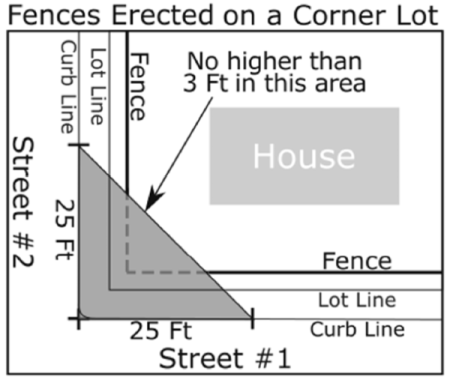
Diagram 1: Fences Erected on a Corner Lot
2.
Swimming Pools
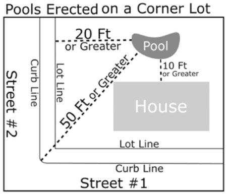
Diagram 2: Pools Erected on a Corner Lot
D. - Off-Street Parking and Loading Areas:
1.
The following provisions for the minimum number of parking spaces related to individual uses shall not apply to new development or new uses in the Town Center District. Upon submission of an application to the Planning Board, adequate parking within the Town Center District shall be determined through the submission of a Parking Report pursuant to Section U. Where a new use is proposed in an existing building in the Town Center District, but where there are no proposed physical changes to the building, an updated parking report shall be submitted to the Planning Department and Engineering Division at the same time as the submission of a building permit for a change in use in order to determine the adequacy of the amended parking report. (added 8/8/2020)
2.
Off-street parking and loading spaces shall be required as follows:
a.
Dwellings and apartments:
One and one-half (1½) parking spaces for each dwelling unit therein and sufficient off-street parking for visitors and employees, provided that, in the case of apartments constructed for the exclusive use of elderly persons upon approval of the Board of Appeals, as provided in Section IX C2 one (1) parking space for each two (2) dwelling units therein shall be sufficient.
b.
Permitted home occupations and professional offices in a residence and funeral parlors:
One (1) parking space for each forty (40) square feet of building floor area devoted to such use.
c.
Places of public assembly:
One (1) parking space for each three (3) seats therein or one (1) space for each sixty (60) inches of bleachers or benches, plus one (1) space for every two (2) employees thereof.
d.
Schools:
One (1) parking space for each classroom and office therein, or one (1) parking space for each three (3) seats in the auditorium whichever is greater. In addition to the foregoing, schools above high school level shall provide one (1) space for every two (2) students enrolled.
e.
Hotels, motels and other places providing overnight accommodations: (amended 5/27/2009)
One (1) parking space for each room accommodation therein, plus one (1) space for each two (2) employees, and adequate spaces for delivery vehicles. Where applicable additional parking as required in Section VII D, 1, f. The Planning Board may grant a Special Permit to allow the reduction of off street parking requirements related to conference rooms and/or ancillary spaces therein.
f.
Hospitals, sanitariums, convalescent or nursing homes and continuing/continuum care retirement communities:
One (1) parking space for each two (2) beds, plus one (1) additional space for each two (2) employees based on the numerically largest shift.
In accordance with Section IX, the Board of Appeals may grant a Special Permit to allow conditionally one (1) parking space for each four (4) beds, plus one (1) additional space for each two (2) employees, based on the numerically largest shift, for nursing homes or continuing/continuum care retirement communities.
g.
Medical or dental offices: (amended 11/13/2001)
One (1) space for each two hundred (200) square feet of gross floor area.
h.
Theaters, clubs, membership clubs and places of assembly, amusement and recreation:
One (1) parking space for each four (4) seats, plus one (1) additional space for each two (2) employees.
i.
Retail stores and personal service shops: (amended 11/13/2001)
One (1) parking space for each two hundred and fifty (250) square feet of gross floor area exclusive of basement storage. Structures with a gross floor area in excess of 500,000 square feet shall provide one (1) parking space for each two hundred forty (240) square feet of gross floor area.
Home furnishing stores that require a large amount of showroom space (for example major appliance stores, furniture stores, carpet stores) shall provide one (1) parking space for each three hundred and fifty (350) square feet of gross floor area. Retail stores that also provide fast food or take-out service shall provide an additional five (5) spaces for each interior take-out station. Car washes and similar facilities that provide service to customers from vehicles in queues shall provide a vehicle storage lane for storing a minimum of ten (10) vehicles per station.
j.
Restaurants, lounges, bars, night clubs and meeting rooms: (amended 11/13/2001)
Two and a half (2.5) parking spaces for each four (4) seats of seating capacity. Food court areas shall provide one (1) parking space for each 240 square feet of gross floor area devoted to food preparation and seating. Fast food restaurants or other places for serving food not confined to service within the structure shall provide two and a half (2.5) parking spaces for each four (4) seats for seating capacity plus five (5) parking spaces for each interior takeout station. In addition, a vehicle storage lane shall be provided for storing a minimum of ten (10) vehicles for each drive-up window.
k.
Offices:
One (1) parking space for each four hundred (400) square feet of gross floor area, plus space for all company vehicles, space for visitors and loading space for all deliveries and shipping.
l.
Warehouses:
One (1) parking space for each fifteen hundred (1500) square feet of gross floor area.
m.
Banks and Banking Machines:
Four (4) spaces shall be provided for each interior teller window and each interior service desk; in addition thereto a vehicle storage lane shall be provided for each vehicular automatic teller machine and exterior service window providing storage for a minimum of six (6) vehicles.
Three (3) spaces shall be provided for each automatic teller machine not accessible from a vehicle. This requirement shall apply to all such machines wherever they are located. Isolated banking machines accessible from a vehicle shall have a vehicle storage lane providing storage for six (6) vehicles.
n.
All other non-residential establishments, except agricultural, one (1) parking space for each one thousand (1,000) square feet of gross floor area exclusive of storage areas, or one (1) parking space for each two (2) employees, whichever is greater. Adequate loading space shall be provided in addition to the parking requirements.
o.
Day Care Centers:
One and one-half (1.5) parking spaces per classroom or one (1) parking space for every two (2) employees, whichever is greater. To allow for the safe pickup and delivery of children, there shall also be provided either a vehicle storage lane, or an area for short-term parking, for storing or parking a minimum of one vehicle for every ten (10) children.
p.
Self-Service Storage: (added 5/23/2018)
Parking for single story facilities shall be at the rate of 1 space for every 100 storage cubicles or fraction thereof, located in the vicinity of the leasing office. A minimum of 4 such spaces shall be provided. Parking for multi-storied facilities shall be at the rate of 2 spaces for every 100 storage cubicles or a fraction thereof and adequate loading spaces shall be provided in the vicinity of elevators and other points of access into the facility.
3.
Design of Off-Street Parking and Loading Spaces:
a.
Parking areas containing more than five (5) required parking spaces shall comply with the standards specified below. Site plans prepared pursuant to Section VII F shall be submitted sufficient for the Building Inspector, Planning Board, or Board of Appeals to determine if the proposed layout properly complies with these standards.
(1)
Space width shall be at least nine (9) feet.
(2)
Space depth shall be at least nineteen (19) feet for all angle and 90° parking and twenty-two (22) feet for parallel parking.
(3)
Aisle width shall be twenty-four (24) feet for two-way circulation.
(4)
Parking spaces shall be provided and designed to safely accommodate commercial vehicles servicing the site.
(5)
Parking lots shall be designed to permit each motor vehicle to proceed to and from all unoccupied parking spaces without requiring the moving of any other parked motor vehicle. Spaces shall be designed to prevent motor vehicles from backing onto a public street in order to leave the lot. Parking areas shall be designed utilizing channelization devices to prevent short-circuiting of traffic. The net standing and maneuvering areas shall have a maximum grade of 6% in any direction. This maximum grade does not apply to access drives. All required parking spaces shall be provided with unobstructed access to and from a street and shall be properly maintained in such a manner as to permit them to be used at all times.
All required parking spaces shall be located on the same lot as the use with which such spaces are connected except that two (2) or more businesses may jointly provide the required spaces on one (1) or more of their lots contiguous to each other. The number of spaces in any such joint facilities shall at least equal the total number required under the provisions of this section for their individual uses.
Subject to a Special Permit from the Planning Board unenclosed parking spaces may be located remote from the site but within 200 feet therefrom.
Said off-site parking shall be secured by an appropriate deed restriction.
b.
Each required loading space shall be at least ten (10) feet wide, forty (40) feet long and fourteen (14) feet high.
c.
All off-street parking and loading areas, permitted and/or required, except for dwellings, which are located within or adjacent to a Residence A, B-1 or B-2 District, Garden-Type Apartment or Apartment Districts (whether on the side or rear) shall be screened from all adjoining lots in said district by either:
(1)
A strip four (4) feet wide, densely planted with shrubs or trees, which are at least four (4) feet high at the time of planting and of a type which may be expected to form a year-round dense screen at least six (6) feet high within three (3) years or
(2)
A solid wall or fence not less than five (5) feet high.
A masonry or bituminous concrete curbing of at least six (6) inches in height shall terminate the edges of all pavements in rear and side yards to prevent drainage therefrom to adjacent properties.
d.
Parking Lot Landscaping: (amended 11/1/1999)
All parking areas shall be properly screened and landscaped to protect adjacent property from undesirable effects of parking lots and to preserve the appearance and character of the surrounding neighborhoods. The visibility of parking and service areas from public streets shall be minimized through facility location and the use of topography and vegetation.
(1)
A landscaped buffer strip at least fifteen (15) feet wide, continuous except for approved driveways, shall be provided adjacent to public ways to visually separate parking and other uses from the road. The buffer strip shall be planted with grass, low shrubs, and shade trees with a minimum 2" caliper, with one tree planted for every fifty (50) feet of road frontage. (amended 11/1/1999)
(2)
Along other property lines, there shall be provided a landscaped strip at least five (5) feet in width, planted with grass, low shrubs, and shade trees with a minimum 2" diameter caliper, with one tree planted for every fifty (50) feet of perimeter length. This requirement shall not apply to site development proposals that contain multiple lots developed in a coordinated fashion, where site circulation, the development of utilities, or other site design issues would be made impractical by such buffers. Nor shall this requirement apply to property lines between two or more lots with industrial uses and that are entirely within the Limited Industrial Zoning District. (amended 11/1/1999) (amended 8/8/2020) (amended 5/21/2022)
(3)
For parking lots containing twenty-five (25) or more spaces, a minimum of five (5) percent of the interior of the lot shall be maintained with landscaping. The total amount of landscaping shall be separated into smaller areas to break up the expanse of pavement. (amended 11/1/1999)
(4)
Exposed storage areas, dumpsters, machinery, service areas, truck loading areas, utility buildings, and other unsightly uses shall be screened from view from neighboring properties and streets through the use of walls or fences complemented with landscaping. (amended 11/1/1999)
e.
Required off-street parking and loading spaces shall not thereafter be reduced, nor shall one be counted as or substituted for the other. (amended 11/1/1999)
f.
Required off-street loading spaces shall have adequate vehicular access to the street, which, along with the areas themselves, must be approved on a site plan in the case of business or industrial uses, see Section VII F. (amended 11/1/1999)
g.
Except in the case of parking spaces provided for dwellings, off-street parking and loading areas shall be paved to the current specifications required under the Planning Board's Subdivision Rules and Regulations. (amended 11/1/1999)
h.
Except in the case of parking spaces provided for dwellings, off-street parking and loading areas used after sundown shall be illuminated, with illumination so arranged as not to shine on abutting properties or on streets. (amended 11/1/1999)
i.
In the Office Research District up to 25% of all off-street parking spaces may be designed for small cars. For said spaces the parking bay shall be 8 by 16 feet; all other parking and parking design criteria in Section VII subsection D shall apply. (amended 9/9/2002)
4.
Reserve Parking Spaces (amended 11/1/1999)
Under a site plan review, the Planning Board may authorize a decrease in the number of parking spaces required under §VII (D), in accordance with the following.
a.
The Planning Board may authorize a decrease in the number of parking spaces required under §VII (D), provided that:
1)
The decrease in the number of parking spaces is no more than twenty-five percent (25%) of the total number of spaces required under §VII (D) (1). The waived parking spaces shall not be used for building area. The waived spaces shall be labeled as "Reserved Parking" on the site plan.
2)
Any such decrease in the number of parking spaces shall be based upon documentation of the special nature of a use of a building.
3)
The parking spaces labeled "Reserve Parking" on the site plan shall be properly designed as an integral part of the overall parking development and in no case located within areas counted as buffer, parking setback or open space.
4)
The decrease in the number of required spaces will not create undue congestion or traffic hazards.
5)
Such relief may be granted without substantial detriment to the neighborhood and without derogating from the intent and purpose of this section.
b.
If, after one (1) year after the issuance of a certificate of occupancy, the Planning Board find that all or any of the increased reserved spaces are needed, the Planning Board may require that all or any portion of the spaces identified as increased reserve spaces on the site plan be constructed within a reasonable time period as specified by the Planning Board. A written notice of such a decision shall be sent to the applicant within seven (7) days before the matter is next discussed at a Planning Board meeting.
c.
In the opinion of the Planning Board, allowing less stringent conformance with §VII (F) will in no way avoid the purpose of site plan review.
E. - Signs:
1.
The following signs are permitted in any district:
a.
One (1) sign displaying the street number or name of the occupant of the premises or both, not exceeding one (1) square foot in area. The sign may be attached to the building or may be on a rod or post and shall be located at least three (3) feet from the street lot line.
b.
One (1) sign for announcing professional or home occupations, or membership of the occupant not exceeding three (3) square feet in area.
c.
One (1) bulletin or announcement board or identification sign for a permitted use, not exceeding ten (10) square feet in area.
d.
For churches and institutions two (2) bulletin or announcement boards or identification signs are permitted for each building, one (1) which may not exceed twenty (20) square feet in area, and one (1) of which may not exceed ten (10) square feet in area.
e.
One (1) temporary "For Sale", "For Rent" or "Sold" sign, not exceeding six (6) square feet in area and advertising only the premises on which the sign is located.
f.
Building contractor's signs may be maintained on the site while the structure or structures are actually under construction, but shall not exceed twenty (20) square feet in area.
2.
Additional signs are permitted in the Multi-Family Residential Districts, Apartment, Limited Business Districts, Town Center District, and Neighborhood Business District, as follows: (amended 11/1/1999)(amended 8/8/2020)
a.
Individual signs less than twenty (20) square feet in area.
b.
In the case of multiple signs, the aggregate area shall not exceed one (1) square foot for each foot of lot frontage along the street lot line on which it faces.
c.
The top of any sign shall not be more than thirty (30) feet above ground level.
d.
Temporary signs not exceeding 100 square feet in area, subject to a special permit from the Board of Appeals.
3.
All other signage in the Town Center District shall be governed by the signage standards and guidelines in Section VII.U (added 8/8/2020)
4.
Additional signs are permitted in the Commercial-Business, Limited Commercial-Business, and Limited Industrial Districts, as follows: (amended 5/16/2011)
a.
Signs as permitted in Section VII 2.
b.
Individual signs less than two hundred (200) square feet in area.
c.
In the case of multiple signs, the aggregate area shall not exceed two (2) square feet for each foot of lot frontage along the street lot line on which it faces.
d.
The top of any sign shall not be more than thirty-five (35) feet above ground level.
5.
All signs shall be subject to the following conditions:
a.
No sign may be located nearer to a street lot line than one-half (1/2) the depth of the required front yard unless otherwise stated above.
b.
All signs and advertising devices shall be stationary and may not contain any visible moving parts.
c.
Any lighting of a sign or advertising device shall be continuous, indirect and installed in such a manner that it will prevent direct light from shining onto any street or adjacent property.
d.
No sign or other advertising device attached to a building shall project more than twelve (12) inches above the roof or parapet line, nor more than twelve (12) inches out from the wall to which it is attached.
e.
Signs shall conform to all applicable regulations for the district in which they are to be located.
f.
Signs being an accessory use shall be located on the same lot as the main use which it is advertising.
F. - Site Plan:
For the purpose of assuring minimum environmental, social, traffic and infrastructure impacts, proper drainage, safe access, siting of structures, and administering the provisions of this Bylaw, a site plan shall be submitted as follows:
1.
For Administrative Site Plan Review: (amended 8/8/2020)
a.
All the uses for which off-street parking areas are mandatory except one and two-family dwellings.
b.
All structures, off-street parking and loading areas permitted in Multi-Family Residential, Apartment, Limited Business, Commercial-Business, Limited Commercial-Business, Town Center District, or Limited Industrial Districts. (amended 5/16/2011)(amended 8/8/2020)
c.
Three (3) paper copies and one digital copy of the site plan shall be submitted to the Building Inspector, who shall give the applicant a dated receipt and act upon said plan after forwarding it to the Planning Board for its review and comments. A written decision will be rendered by the Building Inspector within thirty-five (35) days from the date of receipt. (amended 11/1/1999)(amended 8/8/2020)
2.
For Site Plan Approval by Special Permit:
a.
By Board of Appeals - Earth Removal
b.
Ten (10) copies of the site plan shall be filed with the application for Special Permit at the time of filing with the Town Clerk. Applications will be processed in accordance with the procedural requirements of G.L. c. 40A §§9 and 11. (amended 11/1/1999)
3.
For Site Plan Approval by the Planning Board:
a.
The following are subject to Site Plan Approval by the Planning Board
1)
All Multi-family developments/buildings
2)
Any two family dwellings
3)
Any drive-up window
4)
Any outdoor display area
5)
Any vertical or horizontal mixed-use (added 8/8/2020)
6)
Any proposed development that contains buildings or structures with combined gross floor areas (old and new) exceeding 7,500 square feet in the Town Center District. (added 8/8/2020)
7)
Any non-residential use which requires twenty (20) or more parking spaces in accordance with Section VII.D, or if the proposed development contains buildings/structures with gross floor areas exceeding ten thousand (10,000) square feet, or the expansion of existing structures and uses exceeding in total (old and new) twenty (20) parking spaces or ten thousand (10,000) square feet of floor area (amended 5/17/2017) (amended 8/8/2020)
8)
A Large Scale Ground Mounted Solar Photovoltaic Installation is subject to Site Plan Review in accordance with Section VII.F.3 and Section VII.R (added 5/24/12) (amended 5/20/2015, 5/18/2016) (amended 8/8/2020)
9)
Any Marijuana Establishment (added 4/23/2018) (amended 8/8/2020)
10)
Disturbing or creating any slope with a grade of 2 to 1 (50%) or steeper and a height of ten feet (10') or greater. (added 5/21/2022)
b.
The Planning Board's final action shall consist of either (1) disapproval of the site plan if the applicant fails to furnish adequate information required by this bylaw; or (2) approval of the site plan subject to any conditions, modifications and restrictions required by the Planning Board which will insure that the site plan meets the standard of this bylaw.
c.
Criteria for Site Plan Approval (amended 10/22/2018)
The Planning Board shall approve a site plan only upon determination of the following:
1)
Internal circulation, queuing, and egress are such that vehicular and pedestrian safety is protected within the site.
2)
Adequate parking and loading spaces are provided.
3)
Curb cuts and driveway openings are convenient and safe in relation to the adjacent street network and access via minor streets servicing single-family homes is minimized.
4)
Reasonable use is made of building location, grading and vegetation buffers to reduce visibility and noise of structures and uses, off street parking areas, outside storage or other outdoor service areas (e.g. waste storage) from abutting properties.
5)
Lighting of structures and parking area avoids illumination on adjoining properties.
6)
Adequate access to each structure for fire and service equipment is provided.
7)
Utilities, drainage and fire-protection provisions serving the site provide functional service to each structure and paved areas in the same manner as required for lots within a subdivision.
8)
The use will not create a nuisance of noise, odor, smoke, vibration, traffic generated, unsightliness or other conditions detrimental to the public good.
9)
The site plan as designed will not cause substantial or irrevocable damage to sensitive environmental and/or cultural resources, which damage could be avoided or ameliorated through an alternative development plan.
10)
Adequate provision for controlling surface water runoff to minimize impacts on neighboring properties and streets and to prevent soil and sedimentation of the Town's surface waters.
11)
Measures taken to minimize contamination of ground water from sewage disposal and operations involving the use, storage, handling, or containment of hazardous substances.
12)
All other requirements of the Zoning Bylaw are satisfied.
d.
Persons aggrieved by his or her inability to obtain site plan approval by the Planning Board or any final action by the Planning Board in connection with any site plan shall have the right to appeal to the Zoning Board of Appeals in accordance with the procedures set forth in Section 8 of chapter 40A of Massachusetts General Law and the Zoning Board of Appeals shall have the right to hear such appeals.
e.
Site Plan Requirements (amended 10/22/2018)
1)
Site Plan submittals shall be in accordance with the Planning Board's current Rules and Regulations Governing Special Permits & Site Plan Review.
2)
Impact Reports for each development shall be required to accompany site plans in accordance with the Planning Board's current Rules and Regulations Governing Special Permits & Site Plan Review as applicable.
3)
Site plans shall include any additional requirements as provided under Section VI - Use Regulations.
4)
Site improvements shall be in accordance with the Planning Board's current Subdivision Rules and Regulations as applicable.
f.
Waivers (amended 10/22/2018)
The Planning Board or Board of Appeals, as applicable, based on a preliminary assessment of the scale and type of development proposed, may waive or modify the requirements for submission of any of the elements provided in this subsection VII F. Such waiver shall be issued in writing with supporting reasons.
G. - Prohibited Uses:
The following uses shall not be allowed in any district in the Town:
1.
Trailer or mobile home occupied for sleeping, cooking or for carrying on a business for more than thirty (30) days in any year, except that the Building Inspector may grant a temporary permit for the use of a trailer or mobile home for business purposes as an accessory use to a bona fide construction operation.
2.
Racetracks, including those for automobiles, motorcycles, bicycles, horses and dogs.
3.
Abattoir, stockyard or slaughter house except incidental to retail poultry business.
4.
Trailer coach parks as defined by Chapter l40, Section 32F of the General Laws.
5.
The occupancy for residential purposes or human habitation for more than two (2) years of building of which only the cellar or basement has been constructed.
6.
Business, commercial or industrial uses which would be injurious, obnoxious, offensive or hazardous to a neighborhood by reason of vibration, noise, smoke, cinders, dust, gas, fumes, chemicals, excessively bright light or refuse matter. Uses hazardous because of danger of flooding, inadequate drainage, or inaccessibility to fire fighting apparatus or other protective service.
7.
On-site stripping and/or stockpiling of topsoil, loam, sand, gravel, or other forms of earth from areas in excess of 5,000 square feet on any one (1) lot except as allowed under Section VII H 1.
H. - Earth Removal:
1.
Allowable Earth Removal:
The removal of earth including soil, loam, sand, gravel, clay, stone, quarried rock or other sub-surface products except water, will be allowed as follows:
a.
When entirely incidental to or in connection with the construction of any structure for which a building permit has been issued.
b.
When entirely incidental to subdivisions which have been approved by the Planning Board under Chapter 41 of the General Laws, and on which the Town Treasurer holds a bond with adequate surety to cover the areas in question.
c.
When entirely incidental to utility construction in public and private ways and private property.
d.
All other earth removal shall be subject to a special permit from the Board of Appeals.
2.
Special Permit—Board of Appeals:
The Board of Appeals, when acting upon the powers granted in Section 14 of Chapter 40A of the General Laws, may issue a special permit for the removal of earth subject to the following conditions:
a.
Site Plan approval under Section VII F and sub-section 3 below.
b.
Establishment of a time period to complete the removal operations.
c.
Approved removal areas to be limited to ten (10) acre tracts of land with subsequent approvals on larger tracts subject to satisfactory performance on the preceding sections.
d.
Existing topsoil not to be removed from the site until the area from which it was removed has been restored.
e.
Satisfactory dust control provisions have been agreed upon.
f.
Only one entrance-exit shall be allowed onto any one (1) street.
g.
A twenty (20) foot strip shall be left in its existing condition behind the abutting property and street lines as a buffer zone. This strip may be waived if a solid type fencing five (5) feet in height is installed in lieu thereof.
h.
Excavated slopes shall not exceed a pitch of one (1) foot vertical to two (2) feet horizontal.
i.
Excavation below the grade of existing streets will not be allowed unless drainage and vehicular access is satisfactorily provided for in the final grading.
j.
The final grading, upon completion of the gravel removal operations, must provide an aesthetically pleasing relationship to the abutting properties and grades which will provide adequate drainage (0.5% minimum) to an approved outlet.
k.
In restoring the excavated areas, the existing topsoil shall be spread to a depth of four (4) inches upon which the owner shall develop a satisfactory growth of vegetation.
3.
Additional Site Plan Requirements:
In addition to the requirements of Section VII F, the following requirements shall be incorporated into the site plans for earth removal:
a.
Existing and proposed contours shall be shown at an elevation interval of two (2) feet.
b.
All existing structures and current removal operations shall be shown.
c.
Estimated volume of earth removal shall be indicated.
d.
Ground water levels shall be indicated.
4.
Bonding Requirements:
a.
The Board of Appeals shall require a bond with adequate surety to be deposited with the Treasurer of the Town. Said bond shall be in a form approved by the Town Counsel, and shall not expire until all conditions of the special permit have been met.
b.
The bond shall be for an amount estimated by the Town Engineer to be adequate to meet the conditions of the special permit in the event the earth removal operations are abandoned.
I. - Flood Plains:
Land found to be subject to seasonal or periodic flooding as described herein shall not be developed or altered in such a manner as to endanger the health, safety or welfare of the inhabitants or occupants thereof or of the public generally or of real property from the hazards of flood inundation nor shall such development adversely affect the water table or water recharge areas within the Town so as to present a threat to the present or potential water supplies for the use of the Town for public health or safety facilities. Whenever development of such an area can be performed in a manner not detrimental to the safety or welfare of the inhabitants or occupants or property within such an area or the public generally, said development or construction shall be conducted in accordance with the following:
1.
The District includes all special flood hazard areas within the Town of Shrewsbury
designated as Zone A and AE on the Worcester County Flood Insurance Rate Map (FIRM)
issued by the Federal Emergency Management Agency (FEMA) for the administration of
the National Flood Insurance Program. The map panels of the Worcester County FIRM
that are wholly or partially within the Town of Shrewsbury are panel numbers 25027C0610E,
25027C0620E, 25027C0636E, 25027C0638E, 25027C0826E and 25027C0827E dated July 4, 2011;
and 25027C0628F, 25027C0629F, 25027C0633F, 25027C0637F, 25027C0639F, 25027C0641F,
and 25027C0643F, dated July 16, 2014. The exact boundaries of the District may be
defined by the 100-year base flood elevations shown on the FIRM and further defined
by the Worcester County Flood Insurance Study (FIS) report dated July 16, 2014. The
FIRM and FIS report are incorporated herein by reference and are on file with the
Town Clerk, Engineering Department and Inspector of Buildings."
(amended 5/16/2011, 5/21/2014)
2.
The use of land located within a flood hazard area shall be governed by the provisions of Section VI, Subsection A-J, of this Bylaw relative to the district in which it lies and further, said use shall be subject to all other applicable regulations contained within this Bylaw.
3.
All development within a Zone A as shown on the Flood Insurance Rate maps shall be
subject to the Massachusetts State Building Code relative to elevation or flood-proofing
requirements. Where the base flood elevation is not provided on the Rate Maps, the
applicant shall obtain any existing base flood elevation data and it shall be reviewed
by the Building Inspector for its reasonable utilization towards meeting the elevation
of flood proofing standards of the Massachusetts State Building Code.
(amended 5/16/2011, 5/21/2014)
4.
Within a floodway, as designated on the Worcester County Flood Insurance Rate Maps, all encroachments including fill, new construction, substantial improvements to existing structures and other development are prohibited unless certification by a registered professional engineer is provided by the applicant demonstrating that such encroachment shall not result in any increase in flood levels during the occurrence of a 100-year flood.
In any Zone A which is situated along a watercourse that has not had a regulatory floodway designated, the best available federal, state, local or other floodway data shall be used to prohibit encroachments in a floodway which would result in any increase in flood levels within Shrewsbury during the occurrence of the base flood discharge. Base flood elevation data is required for any proposed subdivision or other development located within an unnumbered A Zone which consists of either more than 50 lots or is greater than 5 acres in area." (amended 5/16/2011, 5/21/2014)
5.
All construction within a floodway shall be in accordance with the Massachusetts State Building Code relative to elevation or flood proofing requirements as well as Chapter 131, Section 40, of the Massachusetts General Laws and the Wetlands Protection Regulations, the Inland Wetlands Restriction, and the Minimum Requirements for the Subsurface Disposal of Sanitary Sewage, of the Massachusetts Department of Environmental Protection.
6.
Where, in a riverine situation, an alteration or relocation of a watercourse is proposed, the applicant shall notify, in writing, all communities adjacent to Shrewsbury, the National Flood Insurance Program State Coordinator and the National Flood Insurance Program Federal Program Specialist.
7.
All subdivision proposals must be designed to assure that: (added 5/16/2011)
a)
such proposals minimize flood damage;
b)
all public utilities and facilities are located and constructed to minimize or eliminate flood damage; and
c)
adequate drainage is provided to reduce exposure to flood hazards.
J. - Cluster Development:
1.
Purpose
a.
Intended as an alternative to conventional subdivision.
b.
To provide for the public interest by the preservation of open space and natural landscape features in perpetuity.
c.
To promote variety in single-family and multi-family residential housing patterns.
d.
To encourage development designed to accommodate a site's physical characteristics such as: topography, vegetation, water bodies, wetlands, open spaces such as farmlands and meadows, major scenic views and wildlife habitats.
e.
To encourage the preservation of important site features.
f.
Not intended to make undevelopable land developable.
2.
Definition
Cluster Development: A division of land into lots used, or available for use, as building sites where said lots are clustered together into one or more groups, separated from adjacent property and other groups of lots by intervening "common" land.
3.
Application
In all residential zoning districts the Planning Board may grant a special permit for any tract of land of not less than five (5) acres or more to be subdivided as a cluster development, for single family detached dwellings and multi-family dwellings, subject to the requirements and conditions of this section. Each application for the preliminary plan, definitive plan and special permit for a Cluster Development shall be filed with the Town Clerk along with 10 copies of required plans and supporting information. The Planning Board shall submit the plans and information with other boards and individuals of its choosing, and any such board or individual shall submit such recommendation as it deems appropriate to the Planning Board.
4.
Submission Requirements
a.
Step One: Preliminary Plan
The preliminary plan shall consist of:
1.
A description of the overall development plan.
2.
A Sketch Plan shall show development of the parcel as a conventional subdivision.
3.
Must be prepared by a registered Landscape Architect and a Professional Engineer.
4.
Show existing landscape features (including steep topography, wetlands and water resources, rock outcroppings, boulder fields, stone walls, cliffs, forest glades, drumlins, high points, hill tops and ridges).
5.
Show existing open areas (including farm fields, meadows, and major long views).
6.
Shows important natural, cultural and scenic features. This plan shall analyze the site's relation to adjacent land, such as the potential for linkages or public access.
b.
Step Two: Definitive Plan
7.
The plan must be in accordance with the Shrewsbury Subdivision Rules and Regulations.
8.
The applicant can request waivers from the Subdivision Rules and Regulations if such an action is in the public interest and is consistent with the intent and purposes of the Cluster Bylaw.
9.
A public hearing is held (the second) for the Definitive Plan and Special Permit.
10.
There shall be no substantial variation from the Preliminary Plan, except as authorized or recommended by the Planning Board.
A public hearing is held for the Preliminary Plan. After the Planning Board renders a decision based upon the Preliminary Plan, the applicant shall then file both a Special Permit application and a Definitive Plan application.
c.
Decision: The Planning Board shall hold a public hearing within 65 days after the filing of the Definitive Plan and render its decision within 90 days following the close of the public hearing in conformity with the provisions of M.G.L. Ch. 40A, §§ 9 and 11. In order to facilitate processing, the Planning Board may adopt Rules and Regulations, insofar as practicable, combining procedures which satisfy this section and the Board's regulations under the Subdivision Control Law.
5.
Number of Dwelling Units Permitted
The number of dwelling units permitted shall be the lesser of the two following methods; but in no case less than the number of lots developable on a subdivision under the Subdivision Rules and Regulations.
1.
The number of lots developable on the definitive plan under the Subdivision Rules and Regulations plus fifteen (15) percent.
2.
The maximum number of dwelling units permitted shall equal the "Net Usable Land Area" within the tract divided by the minimum lot area requirement specified in Table II for the existing zoning district in which the tract is located. Net Usable Land Area shall equal the lesser of:
a.
70% of the gross tract area, or
b.
75% of the gross tract area, minus 100% of all water bodies; and 75% of the land lying below the one hundred year flood elevation, land subject to M.G.L. Ch. 131 § 40 (wetlands), and land having slopes in excess of 15%.
These calculations shall be submitted with the request for the Special Permit.
6.
Minimum Lot Area and Frontage
Cluster developments shall be permissible in all residential zoning districts and all lots therein shall have a minimum lot area of 12,500 square feet and a minimum lot frontage of 80 feet.
Lots located on the turnaround of a dead-end street shall have a minimum of fifty (50) feet of street frontage providing a front building line is designated on the Plan for such a lot and the width of the lot at this building line is at least equal to the frontage requirement above.
7.
Yard Requirements
a.
Front yards may be staggered to provide a variety in the size of such yards. The minimum average of all front yards shall be twenty-four (24) feet; however, no front yard shall be less than eighteen (18) feet.
b.
Side yards shall be a minimum of ten (10) feet each.
c.
Rear yards shall be a minimum of thirty (30) feet, except along the boundaries of the tract, the rear yard shall not be less than the minimum requirement for the district.
d.
The front, side and rear setback lines shall be shown on the definitive subdivision plan.
8.
Open Space Criteria, Ownership and Management
a.
At least 40 percent of the total area of the tract shall be designated as common land, and except as provided below, shall not be covered with buildings, roads, driveways, or parking areas. No more than twenty-five (25) percent of the common land shall be wetland or land lying below the one hundred year flood elevation.
b.
The common land shall consist of contiguous parcels of land that have the maximum value for wildlife habitat, aquifer recharge, riparian protection, scenic value, historic & cultural value and where possible, shall provide a connection to adjacent open space. Furthermore, the common land shall consist in the form of one or more contiguous open spaces and not several small fragments of land. The Town shall not maintain the landscaping and signage at the subdivision's entrances. Any improvements to the subdivision entrances that are located within the right-of-way, open space or common land, that includes signage, lighting, landscaping and street furniture, shall be removed prior to acceptance by the Town.
c.
All open space must be conveyed to:
1.
The Town and accepted for park or open space use;
2.
To a non-profit corporation whose principal purpose is the conservation of open space;
3.
The corporation or trust owned by the lot owners within the development, ownership shall pass with the conveyance of the lot.
Land not conveyed to the town:
1.
Must be placed under a conservation restriction enforceable by the Town;
2.
The applicant shall include as part of the covenant, a provision that the common open space will be deeded as approved by the Planning Board; and,
3.
The applicant must include in their Cluster application a program describing how the common open space will be maintained in perpetuity, including an agreement empowering the Town to perform maintenance (paid for by the lot owners) in the event of failure to comply with the program.
d.
A maximum of twenty (20) percent of the common land may be devoted to paved areas and structures used for, or accessory to, active recreational uses provided such uses are located and operated in such a manner as not to disturb the neighborhood.
e.
All entryways into the Common Land shall be designated with an appropriate sign that shows the shape and outline of the area.
f.
At least twenty-five (25) percent of the required common land shall be of a shape, slope, location and condition as are suitable for use as an informal field for group play or sport.
g.
Perimeter buffer strips shall not be counted towards the required open space calculation.
9.
Findings of the Planning Board
The Planning Board may grant a special permit for a Cluster Development only if the Board finds that:
a.
The development helps to preserve open space, conserve important ecological features, and minimizes environmental disruption of the land.
b.
Diversity and originality in lot layout and street systems achieves an harmonious relationship between the development and the land.
c.
The common land is of such shape and character as to be well-suited for its intended use, and is appropriately located in relation to topography and places of residence as to be easily accessible to all residents of the development.
d.
The proposed use will not have a substantial or undue adverse effect upon adjacent property, the character of the neighborhood, utility facilities, and other matters affecting the public health, safety and welfare.
10.
Revision of Lot Lines
Subsequent to granting of the special permit and approval of a Definitive Plan of a subdivision, the Planning Board may permit relocation of lot lines within the development. However, any change in the number of lots, lines of streets, common land, its ownership or use, or any other conditions stated in the original special permit shall require a new special permit.
11.
Design Guidelines
In evaluating the layout of lots and common land, the following criteria will be considered by the Planning Board as indicating design appropriate to the natural landscape and meeting the purpose of cluster development.
Development Standards for the Preliminary Plan
•
The pedestrian circulation system is designed to assure that pedestrians can move safely and easily on the site and between properties and activities within the site and neighborhood.
•
The street system provides for the safe and convenient movement of vehicles on and off the site and is designed to contribute to the overall aesthetic quality of the Development.
•
The maximum number of house lots compatible with good design abut the common land, and all house lots have reasonable access to the common land.
•
Landscaping screens areas of low visual interest, such as utility boxes, trash containers, and parking areas, and treats pedestrian systems and open space areas in a manner which contributes to their use and visual appearance.
•
The elements of the site plan (buildings, circulation, common land, landscaping, etc.) are arranged favorably with existing natural topography, streams, and water bodies.
Development Standards for the Definitive Plan
•
Extensive topographic changes necessitating vegetation and tree removal are minimized. The site design shall preserve and, where possible, enhance the natural features of the property, including scenic views, by adapting the location and placement of structures, if any are approved, and ways to the existing topography in order to minimize the amount of soil removal, tree cutting and general disturbance to the landscape and surrounding properties.
Open Space Use and Design Standards
Standards and requirements for the land that is to remain undeveloped address:
•
The maintenance and improvements to naturally-existing woods, fields, meadows and wetlands;
•
The size and shape of common open space parcel(s)
•
The percentage of impervious surface allowed
•
Allowed uses
•
The location of retention/detention ponds
•
The perimeter buffer - size, shape, composition, allowed no-cut easements
•
The Developer shall develop at least one active recreation area. Active recreational areas are suitably located and accessible to the residential units and adequate screening ensures privacy and quiet for neighboring residents. Said area(s) shall not have grades exceeding 2%. At least one such area shall be large enough to provide for facilities such as: football, soccer and baseball.
•
Common land is arranged to protect valuable natural environments such as stream valleys, outstanding vegetation, or scenic views, and to avoid development on hazardous areas such as flood plains and steep slopes.
12.
Way, Interior Drives, and Utilities
The construction of all ways, interior drives and utilities shall be in accordance with the standards specified in the Planning Board's Rules and Regulations Governing the Subdivision of Land. The Planning Board may waive the Subdivision Rules and Regulations if it determines that adequate access will be provided to all lots in the development by ways that will be safe and convenient for travel.
K. - Inclusionary Housing
1.
Purposes and Intent
The purposes of the Inclusionary Housing Bylaw are to:
a.
Create and preserve housing affordable to low- or moderate-income households.
b.
Encourage developers to include affordable housing in all new residential and mixed-use developments.
c.
Promote geographic distribution of affordable housing units throughout the town and avoid over-concentration.
d.
Assist the Town in creating units eligible for the Chapter 40B Subsidized Housing Inventory through means other than a comprehensive permit.
2.
Applicability
a.
This section applies to all developments involving the creation of five (5) or more dwelling units or five (5) or more lots for residential use in the following zoning districts: Town Center District, Rural AA, Rural A, Rural B, Residence A, Residence B-1, Residence B-2, Multi-Family or Apartment. (amended 5/16/2011, 10/18/2021)
b.
Developments shall not be segmented to avoid compliance with the Inclusionary Housing requirement. For purposes of this section, "segmentation" shall mean divisions of land that would cumulatively result in an increase by five or more residential lots above the number existing on a parcel of land or contiguous parcels in common ownership twenty-four months prior to the application. Where such segmentation occurs, it shall be subject to the Inclusionary Housing requirement. A subdivision or division of land shall mean any subdivision as defined in the Subdivision Control Law, G.L. c.41, Sections 81K-81 GG, or any division of land under G.L. c.41, Section 81P, into lots for residential use.
c.
Exemption: This Section does not apply to the rehabilitation of any building or structure, all of or substantially all of which is destroyed or damaged by fire or other casualty or act of God; provided, however, no rehabilitation nor repair shall increase the density, bulk or size of any such building or structure which previously existed prior to the damage or destruction thereof without triggering the requirements of this Section.
3.
Definitions
For the purpose of administering this Section, certain terms and words are herein defined as follows:
Affordable Housing Restriction: A contract, mortgage agreement, deed restriction, or other legal instrument, acceptable in form and substance to the Town of Shrewsbury, that effectively restricts occupancy of an affordable housing unit to qualified purchaser or qualified renter, and which provides for administration, monitoring and enforcement of the restriction during the term of affordability. An affordable housing restriction shall run with the land in perpetuity or for the maximum period of time allowed by law, and be enforceable under the provisions of G.L. c.184, Sections 26 or 31-32.
Affordable Housing Trust Fund: A fund account established by the Town for the purpose of creating or preserving affordable housing in the Town of Shrewsbury.
Affordable Housing Unit: A dwelling unit that is affordable to and occupied by a low- or moderate-income household and meets the requirements of the Local Initiative Program for inclusion on the Chapter 40B Subsidized Housing Inventory. For purposes of the Inclusionary Housing Bylaw, a living unit in an Assisted Living Residence shall not be considered a dwelling unit.
Area Median Income: means the median family income for the Worcester metropolitan area or other metropolitan area that includes the Town of Shrewsbury, as defined in the annual schedule of low- and moderate-income limits published by the U.S. Department of Housing and Urban Development, and adjusted for household size.
Inclusion Unit: an affordable housing unit built on the same locus as a development with market-rate units under Section VII.K of this Bylaw.
Local Initiative Program: A program administered by the Massachusetts Department of Housing and Community Development (DHCD) pursuant to 760 CMR 56.00 to develop and implement local housing initiatives that produce low- and moderate-income housing. (amended 5/20/2015)
Low- or Moderate-Income Household: A household with income at or below 80% of area median income, adjusted for household size, for the metropolitan area that includes the Town of Shrewsbury, as determined annually by the United States Department of Housing and Urban Development (HUD).
Market-Rate Dwelling Units: all dwelling units in a development subject to this Section that are not affordable housing units as defined herein.
Maximum Affordable Purchase Price or Rent: For homeownership units, a purchase price that is affordable to a low- or moderate-income household paying no more than 30% of gross monthly income for a mortgage payment, property taxes, insurance and condominium fees where applicable; and for rental units, a monthly rent that is affordable to a low- or moderate-income household paying no more than 30% of its gross monthly income for rent and utilities. The household income used to compute the maximum affordable purchase price or rent shall be adjusted for household size, considering the household size for which a proposed affordable unit would be suitable under guidelines of the Local Initiative Program or, where no such guidelines exist under regulations adopted by the Planning Board.
Qualified Household: A low- or moderate-income household that purchases or rents an affordable housing unit as its principal residence.
Subsidized Housing Inventory: The Department of Housing and Community Development Chapter 40B Subsidized Housing Inventory as provided in 760 CMR 56.00. (amended 5/20/2015)
4.
Methods of Providing Affordable Housing
Any development not exempted herein shall provide affordable housing through one or more of the following methods, or any combination thereof.
a.
Inclusion Units: affordable housing units constructed on the locus of the development. This is the preferred method of complying with the Inclusionary Housing requirement.
b.
Alternative Methods: The Planning Board may grant a Special Permit to allow alternative methods of compliance in accordance with Section K(6).
5.
Development Regulations for Inclusion Units
Including affordable units in new development serves an important public purpose and meets the growth management objectives of the Shrewsbury Master Plan. The Town of Shrewsbury has valid planning reasons to establish use, dimensional and density regulations that apply particularly to developments with Inclusion Units: to promote efficient use of land, to encourage mixed-income neighborhoods, to achieve a diverse and balanced community with housing available for households of all income levels as a matter of basic fairness, to provide reasonable cost offsets to developers who provide new affordable units, and to increase the supply of affordable housing at a rate sustainable for the Town. In addition, the Town has an interest in assuring that all residential development assists with meeting state requirements for the provision of affordable housing and that such housing is geographically distributed throughout the community. Furthermore, the Town has an interest in assuring that suitable mechanisms exist to preserve the affordability of housing built for low- or moderate-income people, and that affordable housing is made available to qualified purchasers or qualified renters in a manner that complies with federal and state fair housing laws. Toward these ends, the requirements for a development with Inclusion Units shall be as follows.
a.
Permitted Uses
1)
In the Rural AA, Rural A, Rural B, Residence A and Residence B-1 Districts, the following are permitted uses in a development with Inclusion Units: (amended 5/16/2011)
a)
Detached single-family dwelling.
b)
Two-family dwelling, provided that two-family units comprise not more than 20% percent of the total number of dwelling units in the development and the two-family dwellings comply with the location, comparability and design requirements set forth in K(5)(f) and K(5)(g) below.
2)
In the Town Center District, Residence B-2, Multi-Family and Apartment Districts, the permitted uses in a development with Inclusion Units shall be as set forth in Section VI Table I. (amended 10/18/2021)
b.
Uses Allowed by Special Permit
1)
The Planning Board may grant a Special Permit to increase the percentage of two-family dwellings in a development with Inclusion Units in the Rural A, Rural B, Residence A or Residence B-1 District, up to a maximum of 25%.
2)
A residential use requiring a Special Permit under Section VI Table I shall also require a Special Permit for a development with Inclusion Units.
c.
Dimensional and Density Requirements. The requirements of Section VII Table II and any notes thereto shall apply to a development with Inclusion Units except as modified by the provisions of Table K-A.
d.
Affordable Housing Requirement
A development with Inclusion Units shall provide affordable housing in accordance with the minimum requirements below. Where the requirement results in a fraction of a lot or dwelling unit, the fraction shall be rounded up to the nearest whole number, such that a development of five (5) dwelling units shall include one (1) affordable unit, a development of eleven (11) dwelling units shall include two (2) affordable units, and so on.
1)
In the Rural AA, Rural A, Rural B and Residence A Districts: a minimum of 10%. (amended 5/16/2011)
2)
In the Town Center District, Residence B-1 and B-2 Districts: a minimum of 12.5%. (amended 10/18/2021)
3)
In the Multi-Family District: a minimum of 12.5% for developments of single-family or two-family dwellings, and a minimum of 15% for MF-1 or MF-2 developments.
4)
In the Apartment District: a minimum of 25%.
5)
In any district where Senior Housing is permitted or allowed by Special permit, a minimum of 15% for Senior Housing developments.
e.
Application Procedures
1)
A subdivision of land shall be submitted to the Planning Board in accordance with the Planning Board's Rules and Regulations for the Subdivision of Land.
2)
A development that does not involve a subdivision of land shall be submitted pursuant to G.L. c.41, Section 81P or Section VII-F of this Bylaw, as applicable.
3)
For MF-1, MF-2 or Senior Housing, the Special Permit application procedures, review and decision criteria shall be in accordance with Section IX of this Bylaw, as applicable. The Planning Board shall be the Special Permit Granting Authority for special permits issued under this Subsection K.
4)
The Planning Board may adopt supplemental submission requirements and procedures for any development with Inclusion Units. Such procedures may include but are not limited to submission of a Site Plan under Section VII-F.1 for the purpose of determining compliance with Section K(5)(f) and K(5)(g) below, and a development phasing plan to determine compliance with Section K(5)(h).
f.
Location of Inclusion Units. Inclusion Units shall be dispersed throughout a development. The applicant may locate Inclusion Units in two-family dwellings in lieu of designating detached single-family dwellings as affordable housing, provided that the two-family dwellings are not concentrated in one part of the development and they conform to Section K(5)(g) below. For MF-1 or MF-2 multi-family developments, Inclusion Units shall be dispersed throughout the buildings and the floors of each building such that no single building or floor therein has a disproportionate percentage of Inclusion Units. For Senior Housing, location requirements for Inclusion Units shall be based on the residential use types provided in the development.
g.
Comparability of Inclusion Units
1)
Inclusion Units shall be comparable to market-rate units in exterior building materials and finishes; overall construction quality; and energy efficiency, including mechanical equipment and plumbing, insulation, windows, and heating and cooling systems. To be comparable in exterior appearance, single-family or two-family Inclusion Units shall be designed to comply with the following requirements, as applicable:
a)
When the Inclusion Units are detached single-family dwellings, they shall be similar in size to market-rate detached single-family dwellings in the development unless the Planning Board grants a Special Permit to authorize smaller units.
b)
Inclusion Units may be in two-family dwellings in which each unit has a ground-level floor and the units are separated by a common wall, with an at-grade entrance to one unit on the front facade and at-grade entrance to the second unit on the side, such that when viewed from the road, the dwelling appears to be a detached single-family dwelling. When a two-family dwelling provides Inclusion Units, the building shall be at least equal in gross floor area to a typical market-rate, detached single-family dwelling in the development in order to achieve general comparability of scale and built form.
2)
Inclusion Units may differ from Market-Rate Units in gross floor area provided that the bedroom mix in Inclusion Units shall be generally proportional to the bedroom mix in Market-Rate Units unless the Planning Board authorizes a different mix by Special Permit.
h.
Timing of Construction
Unless a different schedule is approved by the Planning Board, Inclusion Units shall be constructed in proportion to market-rate units. Compliance with this requirement shall be determined on the basis of building permits issued for Inclusion Units and market-rate units, or lot releases, as applicable. Inclusion Units shall not be the last units to be built in any development covered by this Section.
i.
Selection of Qualified Purchasers or Renters
1)
The Selection of qualified purchasers or renters shall be carried out under an affirmative marketing plan approved by the Planning Board. The affirmative marketing plan shall describe how the applicant will accommodate local preference requirements, if any, established by the Board of Selectmen.
2)
The applicant may sell Inclusion Units to the Town of Shrewsbury, the Shrewsbury Housing Authority, or to any non-profit development organization that serves the Town of Shrewsbury, in order that such entity may carry out the steps required to market the Inclusion Units and manage the selection of buyers.
j.
Preservation of Affordability
1)
Any Inclusion Unit shall be subject to an affordable housing restriction that contains limitations on use, resale and rents. The affordable housing restriction shall meet the requirements of the Town and the DHCD Local Initiative Program, and shall be in force in perpetuity or for the maximum period allowed by law.
2)
The affordable housing restriction shall be enforceable under the provisions of G.L. c.184, Sections 26 or 31-32, as amended.
3)
The developer shall be responsible for preparing and complying with any documentation that may be required by DHCD to qualify Inclusion Units for listing on the Chapter 40B Subsidized Housing Inventory.
4)
No building permit shall be issued for a rental development with Inclusion Units until a regulatory agreement signed by the applicant, the Town and DHCD has been recorded at the Registry of Deeds.
5)
A Certificate of Occupancy for a homeownership Inclusion Unit shall not be issued until the applicant submits documentation to the Building Inspector that an affordable housing restriction has been approved by the Planning Board and signed by the Inclusion Unit homebuyer.
6.
Regulations for Alternative Methods of Providing Affordable Units
a.
In its discretion, the Planning Board may grant a Special Permit for an alternative method listed below, subject to the following requirements:
1)
Off-Site Units. The applicant may propose to provide equivalent affordable units in another location in Shrewsbury. The off-site affordable units may include existing dwelling units acquired and renovated, as necessary, or new-construction units, in either case sold to qualified purchasers or conveyed to the Shrewsbury Housing Authority or another non-profit development organization for affordable rental housing. The location and quality of off-site affordable units shall be subject to approval by the Planning Board during the development review process. A schedule for providing the off-site units shall be incorporated into the Special Permit through conditions imposed by the Planning Board. Off-site affordable units shall comply with the comparability requirements for Inclusion Units under K(5)(g) and the Preservation of Affordability requirements of Section K(5)(j).
2)
Land Donation. The applicant may propose to donate buildable land to the Town of Shrewsbury, the Shrewsbury Housing Authority, or a non-profit housing development organization serving the Town of Shrewsbury, subject to approval by the Planning Board. Any land donated under the provisions of this section shall be subject to a restriction assuring its use for affordable housing. Prior to approving a land donation as satisfaction of the Inclusionary Housing requirement, the Planning Board shall require the applicant to submit an appraisal or other evidence to show that the land is suitable for an equivalent number of affordable housing units. Donations of land in lieu of creating affordable units shall be made prior to the issuance of any building permits for the development unless the Planning Board approves a different schedule.
3)
Fee in Lieu of Units. The applicant may propose to pay a fee in lieu of creating affordable units. For each affordable unit provided through this method, the cash payment per unit shall be equal to the difference between the median single-family home or condominium sale price in Shrewsbury for the most recent three fiscal years, as determined by the Board of Assessors, and the price affordable to a qualified purchaser as determined by the Planning Board's regulations and any applicable guidelines of the Massachusetts Department of Housing and Community Development (DHCD), Local Initiative Program (LIP). If the Planning Board issues a Special Permit to authorize a fee in lieu of units, the fee shall be paid to the Town's Affordable Housing Trust Fund prior to the issuance of any building permits for the development. This alternative method shall apply only to homeownership developments.
b.
Special Permit application procedures, review and decision criteria shall be in accordance with Section IX of this Bylaw.
c.
Any development that provides affordable units through an alternative method shall conform to the requirements of Section VI, Use Regulations and Section VII Table II. The Provisions of Table K-A apply only to a development with Inclusion Units.
7.
Exemption
a.
The Planning Board may grant a Special Permit to exempt a development from the Inclusionary Housing requirements of this Bylaw, provided that:
1)
No lot in the development shall have less than 1.5 times the minimum frontage nor less than two (2) times the minimum lot area for the district in which the lot is located. For lots divided by a zoning boundary line, the minimum lot area for the district with the larger minimum lot area shall be used in determining the applicable minimum lot area. For lots located in the Rural AA, Rural A, Rural B or Residence A District, at least 75% of the minimum lot area required for zoning compliance, or a minimum of 30,000 square feet, shall be contiguous upland. (amended 5/16/2011)
2)
All other dimensional requirements of the district in which the lot is located shall apply.
3)
For an application to exempt rear lots created under Section VII.B(7), no lot shall have less than four (4) times the minimum lot area for the district in which the lot is located, nor less than 100 feet of frontage.
b.
Special Permit application procedures, review and decision criteria shall be in accordance with Section IX of this Bylaw.
8.
Severability
If any portion of this Bylaw is declared to be invalid, the remainder shall continue to be in full force and effect.
FOOTNOTES TO TABLE K-A
(1)
The requirements of Table K-A apply to any development that provides inclusion Units. However, where Table K-A is silent on a requirement set forth in Section VII Table II and its associated footnotes, said Table II shall govern.
(2)
The side yard setback shall be reduced to zero for zero-lot-line two-family dwellings.
(3)
Additional area required per dwelling unit in excess of two.
(4)
If the required percentage of affordable units results in an odd number and the inclusion units are in two-family dwellings, the number of affordable shall be increased by one in order to provide for the creation of a two-family dwelling with two affordable units.
(5)
Subject to Section VI Table I, Footnote 5.
(6)
Subject to Section VI Table I, Footnote 6.
L. - Common Driveways
1.
The Planning Board may grant a Special Permit to allow the use of common driveways.
Common driveways may be permitted to allow for more efficient traffic flow, to reduce traffic hazards from numerous individual driveways, to consolidate access to lots across wetland resources, and otherwise where, in the Planning Board's judgement, such an arrangement will be more advantageous to the neighborhood than separate driveways.
2.
Common driveways shall meet the following standards:
Footnotes:
1
The paved surface shall consist of a 2-inch binder, a 1-inch top and a 12-inch gravel base.
2
The paved surface shall consist of a 3-inch binder, a 1-1/2-inch top and an 18-inch gravel base.
3
The driveway shall be designed based upon low impact development techniques. The Planning Board shall have the discretion to require curbing or gravel shoulders where appropriate.
4
And within fifty (50) feet of the street line, six percent (6%).
5
And within fifty (50) feet of the street line, two percent (2%).
6
Longer sight distance may be required based upon the road type the common driveway enters on.
3.
The design of common driveways shall assure adequate safety for emergency vehicles, water service, if available, including hydrants, and adequate drainage of surface waters and provision for turnaround for use in all seasons by emergency vehicles.
a.
For commercial and industrial development, turnarounds shall be located along the driveway, subject to Planning Board approval.
b.
For commercial and industrial development, adequate lighting shall be provided along the common driveway subject to Planning Board approval.
4.
A declaration of covenants, easements and restrictions for the use and maintenance of said common drives may be required by the Board and shall include arrangements satisfactory to the Board concerning: roadway maintenance, snowplowing, rubbish collection, utilities and potential future use as a public way.
5.
For all common driveways, the rate of a post-development runoff shall not exceed the rate of pre-development runoff. The Town Engineer and the Planning Board shall approve the drainage system.
6.
No occupancy permit for a building to be served by a common driveway shall be issued until the Planning Board certifies in writing that the common driveway has been completed in accordance with the standards of this section.
7.
No common driveway may ever be used to satisfy zoning frontage requirements.
8.
Addresses of all buildings accessed off the common driveway shall be posted on a sign at the entrance of the driveway that is visible for residents, employees, visitors and public safety officials.
9.
A Common driveway serving commercial or industrial uses shall be located entirely within a commercial or industrial zoning district and shall at no point be located within a residentially zoned district. (added 5/21/2022)
M. - LAKEWAY OVERLAY DISTRICT
1.
Purposes.
The Town shall have a Lakeway Overlay District (LOD) as shown on the Zoning Map entitled, "LAKEWAY OVERLAY DISTRICT, TOWN OF SHREWSBURY," as amended, on file in the office of the Town Clerk. The purposes of the Lakeway Overlay District are to:
a.
Encourage a mix of commercial, residential, institutional and civic uses in a physical arrangement that is safe for vehicular, pedestrian and bicycle traffic;
b.
Provide viable alternatives to conventional commercial sprawl, thereby assisting the Town in creating and maintaining a vibrant, walkable commercial area;
c.
Promote shared access and appropriate links to adjoining properties, thereby lessening the need for curb openings on Route 9.
Toward these ends, the Planning Board is authorized to apply design guidelines, flexible dimensional regulations and site standards to the review of site plans and special permits in the Lakeway Overlay District, as set forth below.
2.
Applicability.
The Lakeway Overlay District is an overlay district that applies to portions of the Commercial Business and Limited Business Districts along Route 9, as shown on the LAKEWAY OVERLAY DISTRICT map dated as amended. As an overlay district, it provides development options that do not exist in the underlying zoning districts. Except as provided below, all use, dimensional and development regulations of the Commercial Business and Limited Business Districts remain in effect and are not altered by this Bylaw.
3.
Relationship to Site Plan Review.
All permitted and special permitted uses in the Lakeway Overlay District are subject to Article VII, Section F: Site Plan.
4.
Definitions.
a.
Mixed-Use Development: Vertical Mix. An integration of commercial and multi-family residential uses in a single structure in which the residential uses are located above the ground floor.
b.
Mixed-Use Development: Horizontal Mix. An integration of commercial and multifamily residential uses in a development comprised of two or more structures on the same lot or on more than one lot. The multi-family residential uses may be located above the ground floor of a commercial structure, in separate structures on the same lot or on more than one lot, or a combination thereof.
5.
Permitted Uses and Structures.
a.
Mixed-Use Development: Vertical Mix. Uses permitted (Y) in the Commercial Business District or Limited Business District, when integrated with one or more of the following uses in a single structure:
1.
Dwelling units above the ground floor of a commercial building.
2.
Live-and-work space, e.g. artist's residence and studio.
3.
In a vertical mixed-use development, permitted commercial uses shall constitute at least 30% of the total gross floor area of the structure.
b.
Conversion of a one-family or two family dwelling for a permitted retail or office use, or for a combination of permitted retail, office and residential uses. (amended 5/19/2005)
c.
Nano Brewery. (added 5/21/2024)
d.
Brew Pub. (added 5/21/2024)
e.
No use listed as a prohibited use under Section M.7 of this Bylaw may be included in a vertical mixed-use development or a one-family conversion.
6.
Uses and Structures Permitted by Special Permit.
a.
Mixed-Use Development by Special Permit: Horizontal Mix. In the Lakeway Overlay District, the Planning Board may issue a special permit for a development that includes more than one structure on the same lot or on more than one lot and integrates permitted or special permitted uses in the Commercial Business District or Limited Business District with the following additional uses:
1.
Multi-family garden-type apartments (SP-PB), subject to a new footnote to Table I:
(28) Multi-family use is allowed as part of a mixed-use development subject to the requirements of Section VII-M. Lakeway Overlay District. Multi-family units may be located above the ground floor of a commercial building, accessed by an entrance separate and distinct from commercial uses, in a multi-family building, or a combination thereof. Multi-family building disposition (placement) in relation to the principal commercial structures shall be subject to the approval of the Planning Board.
2.
Multi-family townhouse-type structures (SP-PB), subject to a new footnote to Table I:
(29) Use allowed by special permit subject to the requirements of Section VII-M. Lakeway Overlay District.
b.
Marinas.
c.
Micro Brewery. (added 5/21/2024)
d.
No use listed as a prohibited use under Section M.7 of this Bylaw may be included in a horizontal mixed-use development.
7.
Prohibited Uses.
a.
Single-family detached dwelling.
b.
Hospital or sanitarium.
c.
Automatic teller machines (ATM) that provide public access from a drive-up window.
d.
Gasoline service stations.
e.
Garage and repair shops.
f.
Salesrooms for Automobiles and Motor Cycles
g.
Mortuaries or crematories
h.
Auditoriums, skating rinks, clubs and other places of amusement or assembly where activities are conducted outside the structure.
i.
Adult bookstore, adult motion picture theater, adult paraphernalia store, adult video store, or establishment which displays live nudity for its patrons [2]
j.
Any use which will produce a nuisance or hazard from fire or explosion, toxic or corrosive fumes, gas, smoke, odors, obnoxious dust or vapor, harmful radioactivity, offensive noise or vibration, flashes, objectionable effluent or electrical interference which may affect or impair the normal use and peaceful enjoyment of any property, structure or dwelling in the Town.
k.
Multi-Family Townhouse Dwellings
Multi-family townhouse dwellings may be allowed by special permit from the Planning Board when part of a Mixed Use Development: Horizontal in the Route 20 Overlay District, subject to the following requirements or modifications:
1.
Multi-family townhouse-type structures and structures for dwellings containing not more than three (3) stories may be allowed in separate buildings. Building disposition (placement) shall be subject to the approval of the Planning Board.
2.
The separation between multi-family townhouse structures shall be determined by special permit granted by the Planning Board.
3.
Multi-family townhouse-type structures must provide affordable housing in accordance with Section VII.K. of the Zoning Bylaw.
l.
Any use not explicitly provided for in this Bylaw.
8.
Dimensional, Setback and Intensity Regulations.
Uses in the Lakeway Overlay District shall meet the following requirements, subject to the following footnotes to Section VII, Table II:
Footnotes to Table II:
(16)
Where the underlying district is less than 300 feet in depth, the minimum lot size for uses in the Lakeway Overlay District shall be 20,000 square feet and the minimum frontage, 100 feet.
(17)
The front yard setback in the Lakeway Overlay District is a maximum setback that the Planning Board may waive by special permit only for a development that consists of more than one structure on the same lot or on more than one lot.
(18)
Except 50 feet when abutting a Rural or Residence district.
(19)
Except 50 feet when abutting a Rural or Residence district.
(20)
The Planning Board may, by special permit, authorize a maximum height up of 60 feet and five stories for development that consists of more than one structure, provided the structures with the taller elevations are predominantly residential. The Planning Board may impose conditions on the special permit to require at-grade parking under a structure of 60 feet and five stories, with the parking facility constituting one story.
(21)
Footnote 9 to Section VII, Table II shall not apply to uses in the Lakeway Overlay District.
9.
Development Regulations for the Lakeway Overlay District.
Development, redevelopment and reuse will generally be deemed consistent with the purposes of the Lakeway Overlay District when it meets the following objectives: (a) provides appropriate scale, design, operation and visual character for a New England downtown or central business district, (b) avoids "big box" development, (c) consolidates and minimizes curb cuts, subordinates the location of parking to buildings, and provides exemplary architectural design, (d) strengthens the local economy, (e) encourages pedestrian and bicycle access along major and side streets, and between commercial or mixed-use properties, and (f) encourages people to live, work and shop in Shrewsbury by providing a planned mix of uses.
a.
Multi-Family Dwellings
Multi-family garden-type apartments and multi-family townhouse dwellings may be allowed by special permit from the Planning Board when part of a horizontal mixed-use development in the Lakeway Overlay District, subject to the following requirements:
1.
Multi-family garden-type apartments may be located above the ground floor of a building.
2.
Multi-family garden-type apartments may be allowed in separate buildings. Multi-family building disposition (placement) in relation to the principal commercial structures shall be subject to the approval of the Planning Board.
3.
Multi-family townhouse-type structures may be allowed in separate buildings. Building disposition (placement) in relation to the principal commercial structures shall be subject to the approval of the Planning Board.
4.
Multi-family garden-type apartments and multi-family townhouse-type structures must provide affordable housing in accordance with Community Benefits (see Section M.9.f of the By-Law).
5.
The maximum number of garden-type apartments or townhouse-type units allowed in a single development project shall not exceed 270 units.
6.
Not more than 3% of the total number of units in a project shall be three bedroom. Units greater than three bedroom shall not be permitted.
b.
Site Development; Location of Buildings and Structures
In addition to the requirements of Section VII of this bylaw, the following development regulations apply in the Lakeway Overlay District.
1.
Multiple buildings on a single lot. By special permit from the Planning Board, a lot in the Lakeway Overlay District may contain more than one structure with a principal use, but the total amount of development on any lot shall not exceed a gross floor area ratio of 1.5. The Planning Board may grant approval for two or more structures on one lot only upon making a determination that the proposed development:
a)
Project contains a mix of commercial and residential uses.
b)
Meets Lakeway Overlay District Design Guidelines
c)
Addresses the criteria under Community Benefits
c.
Site Plan Submission Requirements
All uses in the Lakeway Overlay District shall be subject to site plan review or site plan approval, as applicable, by the Planning Board. Applications and procedures shall be in accordance with Section VII-F and the following additional requirements for Site Plan Content:
1.
Elevations of all proposed buildings, prepared and stamped by a registered professional architect.
2.
A landscaping plan showing the location, name, number and size of plant types, and the locations and elevation and/or height of planting beds, fences, walls, steps and paths, prepared by a registered landscape architect.
d.
Site Plan Approval Criteria
The Planning Board shall approve a site plan only upon a determination that the plan meets the requirements of Section VII-F.h and the following additional design criteria for the Lakeway Overlay District. Specifically, the Planning Board shall find that the site plan:
1.
Promotes public safety by avoiding pedestrian or vehicular hazards within the site or egressing from it, facilitating access by emergency vehicles and facilitating visual surveillance by occupants, neighbors and passersby.
2.
Minimizes curb cuts on existing public ways. Wherever feasible, access to lots in the Lakeway Overlay District shall be provided through one of the following methods: (a) through a cul-de-sac or loop road or common driveway shared by adjacent lots or premises, (b) through joint and cross access between the lot and adjacent uses, (c) through an existing side or rear street, (d) through a cul-de-sac or loop road shared by adjacent lots or premises.
3.
Contributes to a visually attractive, pedestrian- and bicycle-oriented image throughout the Lakeway Overlay District by providing appropriate landscaping and walkways along Route 9 and between adjoining properties. In addition:
a)
The front yard area should provide pedestrian amenities, such as an accessible patio or sitting plaza, and a continuous landscaped edge to the property in question, except for points of entry and exit. Visual relief from buildings and hard materials shall be accomplished with landscape treatment such as shrubs, trees, flower boxes and other greenery around buildings or in recessed places.
b)
If no public sidewalk exists across the frontage of the lot, to the maximum extent possible a paved sidewalk of at least six feet in width shall be provided within the front yard setback and the sidewalk shall be designed to create a continuous pedestrian walkway with the abutting properties.
c)
For buildings abutting Route 9, parking shall be located to the rear of a building and may be located to the side, provided that no off-street parking is located within 20 feet of the front elevation facing Route 9.
d)
Parking areas shall include appropriate, visible facilities for the parking of bicycles.
4.
Enhances the natural environment by preserving mature trees where they exist, reducing the volume of earth materials cut or filled, reducing soil erosion during and after construction and reducing the extent of alteration in the amount, timing and location of stormwater runoff from the site.
5.
To the maximum extent practical, addresses the Lakeway Overlay District Design Guidelines given the size of the proposed development, its mix of uses, and its relationship to abutting properties.
e.
Lakeway Overlay District Design Guidelines
The following design guidelines apply to all uses and structures in the Lakeway Overlay District and should be addressed, to the maximum extent practical, in applications for site plan review or site plan approval, as applicable.
1.
General. The elements on a building's elevations are crucial to its overall architectural quality, its presence and contribution to the surrounding area. A two-to two-and-one-half story elevation is preferred for structures facing Route 9, but a one story or three-story elevation is also acceptable. The Planning Board may approve taller elevations for structures. In addition, a pleasing, symmetrical arrangement of windows, entrances, trim, shutters and other details, and proportionality of these features, creates a rhythm that will accomplish the town's objectives for the Lakeway Overlay District. Generally, buildings should contribute to a sense of continuity and coherence for all who visit, shop or work there. Architectural diversity is encouraged as long as individual design solutions are compatible with the purposes of the Lakeway Overlay District as a compact, mixed-use area with a strong visual definition.
2.
Site context. Recognizing that major visual exposure comes not only from the building front, applicants must give full attention to the treatment of sidewalks, landscaping, parking areas and the building wall at the rear and sides.
3.
Orientation. Buildings should face the street or may be oriented around a courtyard or respond in design to a prominent feature, such as a corner location. Buildings and site design should provide an inviting entry orientation.
4.
Size, mass, facades and exterior features. No single structure may exceed 80,000 gross square feet. A single building with a width of more than 60 feet facing the street should be divided visually into sub-elements which, where appropriate, express the functional diversity within the building. In addition, all buildings should:
a)
Provide continuous visual interest, emphasizing such design features as bay windows, recessed doorways, pilasters, columns, horizontal and vertical offsets, material and color variations, decorative cornices, awnings or canopies.
b)
Avoid unarticulated and monotonous building facades and window placements, regular spacings, and building placements that will be viewed from the street as continuous walls.
c)
Provide human-scale features, especially for pedestrians and at lower levels and from a pedestrian viewing distance.
5.
Accommodation of taller buildings. Taller buildings should be located away from Route 9.
6.
Exterior materials. Exterior materials may include painted clapboard, wood shingles, brick or materials of comparable appearance, subject to approval by the Planning Board. Neutral or earth-tone colors are appropriate, but brighter colors may be applied to building trim with approval of the Planning Board. Variation in materials, appropriate colors and textures is encouraged when they contribute to the purposes of the Lakeway Overlay District. Rough, imitation or reflective materials such as unpainted wood, field stone, stucco, smooth-face concrete, exposed metal, imitation materials, mirror glass, porcelain enamel or polished stone are prohibited unless authorized by special permit from the Planning Board.
7.
Rooflines and roof features. A flat or nearly flat roof is prohibited on any building facing the street in the Lakeway Overlay District, except as provided below.
a)
Structures facing Route 9 should have a simple gable roof with an average slope of 6 over 12. A structure that fronts on and faces a side street should have a simple gable roof with a pitch of at least 8 over 12, or a gambrel or a hip roof. The roof trim should have depth and projection of details.
b)
The Planning Board may grant a special permit to authorize a flat-roof design on a structure facing Route 9, provided that a flat roof structure shall be capped by an articulated parapet design that acts as a structural expression of the building façade and its materials.
c)
For other structures, roof features should complement the character of adjoining development and meet the purposes of the Lakeway Overlay District. Roofs shall, at a minimum, have articulated parapets concealing flat roofs and rooftop equipment, (such as HVAC units) which are visible from adjoining public streets or properties. Parapets or facades shall be designed to give the appearance of three or more roof slope planes.
8.
Environmental design. Applicants are encouraged to use green building technologies and materials, wherever possible, to limit environmental impacts.
9.
Large retail development. Large retail developments of more than 50,000 square feet of floor area should provide outdoor spaces and amenities to link structures with surrounding areas in the Lakeway Overlay District. Passenger drop-off/pick-up points shall be integrated with traffic patterns on the site. Special design features shall enhance the buildings' function as a center of activity within the District. Unless waived by the Planning Board, each large retail development shall provide at least one of the following design features, which shall be constructed of materials that match the principal structure and linked by sidewalks to the principal structure:
(a)
Patio/seating area.
(b)
Pedestrian plaza with benches.
(c)
Window shopping walkway.
(d)
Play areas.
(e)
Kiosk area.
(f)
Water feature or clock tower.
(g)
Other focal feature approved by the Planning Board.
f.
Community Benefits
The Planning Board may grant a special permit for a mixed-use development that includes multi-family garden-type apartments or multi-family townhouse-type structures when the development provides community benefits. For purposes of this bylaw, "community benefits" shall include low- or moderate-income affordable housing and one of the additional benefits described below.
1.
Low-income affordable housing. A mixed-use development shall provide 10% of the dwelling units as affordable in perpetuity to households with incomes at or below 80% of area median income as determined by the U.S. Department of Housing and Urban Development (HUD). "Affordable" shall account for adjustments to income based on household size/s suitable for the proposed dwelling units, as presented in the formula for below-market housing.
2.
For mixed-use developments that receive a special permit conditions of the decision shall be:
a.
An affordable housing use restriction or regulatory agreement approved by the DHCD Local Initiative Program (760 CMR 56.00) shall be recorded at the Registry of Deeds. (amended 5/20/2015)
b.
Applicant shall provide evidence acceptable to the town that the unit(s) has/have been approved by the DHCD Local Initiative Program (760 CMR 56.00) for listing on the Chapter 40B Subsidized Housing Inventory. (amended 5/20/2015)
3.
Neighborhood or community facility. A mixed-use development shall also provide a neighborhood or community facility, i.e., a facility open and available to residents of nearby neighborhoods or the town, and meets community needs as determined by the Planning Board. A neighborhood or community facility may include:
(a)
A small public park with furnishings and pathways accessible to persons with disabilities.
(b)
A tot lot or small neighborhood playground, with furnishings and pathways accessible to persons with disabilities.
(c)
A bandstand.
(d)
A fee in lieu of neighborhood or community facilities paid to the Lakeway Overlay District Fund. The fund shall be the town's use to provide streetlights, sidewalks, trash receptacles, parking and public realm improvements in the Lakeway Overlay District, in accordance with a fee schedule approved by the Planning Board.
10.
Special Permits in the Lakeway Overlay District.
The special permit Granting Authority (SPGA) for uses and structures in the Lakeway Overlay District shall be the Planning Board.
a.
Requirements. An application for a special permit in the Lakeway Overlay District shall include a written description of the proposal for which a special permit is requested and a Site Plan prepared by a Registered Professional Engineer and/or Registered Land Surveyor at an appropriate scale to clearly show dimensions, legend, and all other information deemed necessary to describe the site and its conditions. The application and accompanying plan(s) shall be of size, form, number and contents specified in the Lakeway Overlay District Submission Requirements and Procedures, adopted by the Planning Board and filed with the Town Clerk. After adoption of this Bylaw, the Planning Board shall prepare and adopt the Lakeway Overlay District Submission Requirements and Procedures following a public hearing.
b.
Site Plan Approval. The site plan approval requirements of Section VII.F(3) of this Bylaw shall apply to special permitted uses in the Lakeway Overlay District. For uses allowed by special permit, site plan review shall be conducted concurrently with the special permit application, review and determination procedures.
c.
Special Permit Granting Criteria. The Planning Board may approve a special permit for proposed uses or structures upon finding that the application complies with the purposes of this Bylaw, to the degree consistent with a reasonable use of the site for the purpose permitted within the Lakeway Overlay District. In making its decision, the Planning Board shall consider the following criteria:
1.
Compliance with the Shrewsbury Zoning Bylaw
2.
Consistency with the most current Shrewsbury Master Plan.
3.
The degree to which the development meets the "Lakeway Overlay District Design Guidelines" in Section 9.e of this Bylaw.
4.
The degree to which the applicant has preserved and enhanced a historically significant building or other historic or cultural resource, where applicable.
5.
The degree to which the applicant's proposal provides logical, safe pedestrian connections to other uses nearby.
6.
Protection of adjoining premises against detrimental or offensive uses on the site.
7.
Adequacy of space for vehicular access to the site and off-street parking and loading/unloading on the site.
8.
Convenience and safety of vehicular and pedestrian movement within the site and in relation to adjacent ways and land.
9.
Adequacy of water supplies and distribution for domestic use fire protection.
10.
Adequacy of the methods of storage and disposal for sewage, refuse and other wastes resulting from the uses permitted on the site and the methods of drainage or retention of surface water.
d.
Applicants may seek relief from compliance with the Dimensional, Setback and Intensity Regulations and the Development Regulations for the Lakeway Overlay District by obtaining a special permit from the Planning Board.
11.
Off-Street Parking.
a.
Off-street parking shall be provided in accordance with Section VII.D, Off-Street Parking and Loading Regulations, except that in the Lakeway Overlay District, applicants may seek relief from compliance with the off-street parking requirements of this Bylaw by obtaining a special permit from the Planning Board.
b.
The Planning Board may grant relief by issuing a special permit to:
1.
Reduce the number, dimensions and location of required parking spaces.
2.
Accept from the applicant a payment in lieu of parking spaces to the Lakeway Overlay District Fund.
3.
Authorize a combination thereof.
12.
Use Variances.
Use Variances are not permitted in the Lakeway Overlay District.
13.
Additional Requirements
The Planning Board may adopt rules and regulations necessary to implement this Bylaw after holding a public hearing. Rules and regulations adopted by the Planning Board shall be filed with the Town Clerk.
14.
Exceptions
A contiguous area of land may be considered as one lot and under one ownership for the purposes of compliance with the Dimensional, Setback and Intensity Regulations, Development Regulations, Off-Street Parking and other requirements of this Section M of the Zoning By-Law where there is management, lease or ownership control that will provide evidence sufficient in the written opinion of the Building Inspector that a grouping of contiguous tracts of real estate is designed, constructed and will continue to be operated and maintained as a single unit. For purposes of this section M.14 of the By-Law, tracts of land shall be considered contiguous despite the presence of private and/or public streets and/or rights of way.
Note— Use prohibited in the Lakeway Overlay District and in any portion of a district underlying the LOD.
N. - ROUTE 20 OVERLAY DISTRICT
1.
Purposes and Intent
The purposes of the Route 20 Overlay District are to:
a.
Encourage development that provides economic and fiscal benefits to the Town;
b.
Provide flexibility to develop an organized mix of office, retail, and compatible light industrial and other uses in a manner that is aesthetically pleasing from the vantage points of Route 20, adjacent uses and surrounding neighborhoods;
c.
Promote distinctive, non-formulaic architecture and site designs along Route 20;
d.
Reasonably regulate big box development and its impacts. (amended 5/18/2017)
e.
Facilitate shared access and appropriate links to adjoining properties, thereby reducing the need for curb cuts and improving traffic safety on Route 20; and
f.
Encourage landscape designs and landscape treatments that create a parkway effect and functionally contribute to traffic calming along Route 20.
2.
Applicability
The Route 20 Overlay District applies to the Commercial Business and Limited Industrial Districts along Route 20, as shown on the ROUTE 20 OVERLAY DISTRICT map dated August 31, 2005, on file with the Town Clerk. The Route 20 Overlay District Map amends and is hereby made part of the Official Zoning Map of the Town of Shrewsbury. As an overlay, it provides for flexible development options that do not exist in the underlying districts.
3.
Use Regulations
a.
The following uses are permitted in the Route 20 Overlay District, provided they comply with Section N(7):
1)
Business or professional office.
2)
Banks.
3)
Banking machines, where public access is only available from within a building and is operated in connection with other uses in the same building.
4)
Retail store or service establishment, up to 15,000 square feet of gross floor area.
5)
Restaurant or other place for serving food within the structure, excluding drive-through service.
6)
Charitable institutions, and non-profit research laboratories and accessory uses thereto.
7)
Commercial Equipment Rental. (added 5/15/2023)
8)
Nano Brewery. (added 5/21/2024)
9)
Brew Pub. (added 5/21/2024)
10)
Accessory uses customarily incidental to a permitted use.
b.
Uses and Structures Allowed by Special Permit:
The Planning Board may grant a Special Permit for the following uses in accordance with Section N(6).
1)
Large retail development (any retail establishment exceeding 15,000 square feet of gross floor area), subject to Section N(9).
2)
Cinema or Theatre.
3)
Gasoline Service Stations, or Gasoline Service Stations with Related Uses, located not more than 500 feet from a signalized intersection; subject to Table 1, footnote 9.
4)
Auditoriums, athletic facilities, health clubs, and other places of amusement or public assembly where activities take place inside the building.
5)
Medical clinic or veterinary clinic.
6)
Assisted living residence.
7)
Campus-style office or light industrial development, excluding warehouse except as an accessory use.
8)
Manufacturing and accessory retail.
9)
Drive-through food service establishment.
10)
Micro Brewery. (added 5/21/2024)
11)
Accessory uses customarily incidental to a Special Permitted use.
12)
Mixed Use Development: Horizontal Mix. In the Route 20 Overlay District, the Planning Board may issue a Special Permit for a development that includes more than one (1) structure on the same lot or on more than one (1) lot and integrates permitted or specially permitted uses in the Commercial Business District, the Limited Business District or the Route 20 Overlay District with the following additional uses: (added 5/18/2017)
A.
Multi-family townhouse type structure as part of a mixed use development pursuant to the requirements of Section VII.N. (Route 20 Overlay District). (added 5/18/2017)
B.
Structures for dwelling units containing not more than three (3) stories or having a height in excess of forty-five (45) feet, provided in all events each dwelling unit shall have at least one (1) exposure. (added 5/18/2017)
c.
Prohibited Uses:
The following uses are prohibited in the Route 20 Overlay District and any underlying districts, notwithstanding the provisions of Section VI Table I of this Bylaw:
1)
Adult bookstore, adult motion picture theater, adult paraphernalia store, adult video store, or establishment which displays live nudity for its patrons.
2)
Any use which will produce a nuisance or hazard from fire or explosion, toxic or corrosive fumes, gas, smoke, odors, obnoxious dust or vapor, harmful radioactivity, offensive noise or vibration, flashes, objectionable effluent or electrical interference which may affect or impair the normal use and peaceful enjoyment of any property, structure or dwelling in the Town.
3)
Any use not explicitly provided for in this Bylaw.
d.
Use variances shall not be granted in the Route 20 Overlay District.
4.
Site Plan Approval
Section VII.F(3) of this Bylaw shall apply to all uses in the Route 20 Overlay District. In addition to the approval criteria under Section VII.F(3)(h), the Planning Board shall base its decision on the degree to which a proposed development conforms to the Route 20 Overlay District Development Regulations in N(7) hereunder.
5.
Dimensional and Intensity Regulations
a)
Uses in the Route 20 Overlay District shall comply with the following requirements:
b)
Permitted Alternatives
The following alternatives to N(5)(a) may be permitted, subject to Site Plan Approval:
1)
A reduction in the minimum side yard setback to 0 feet on common interior lots in order to accommodate zero lot line design. Equivalent open land equal to the area required to comply with the minimum side yard setback shall be provided elsewhere on the site in locations approved by the Planning Board.
2)
An increase in maximum impervious coverage to 70% provided that the side or rear yard buffer is increased by two feet for every 1% increase in coverage.
3)
A reduction in frontage to not less than 50 feet for a development that provides consolidated or shared access to Route 20 for three or more adjoining parcels.
c)
Alternatives Allowed by Special Permit
The Planning Board may grant a Special Permit for the following alternatives to N(5)(a):
1)
An increase in the maximum front yard setback to the extent necessary to accommodate Best Management Practices for sustainable stormwater management and no other commercially reasonable option exists on the site.
2)
An increase in height for a campus-style office or light industrial development up to 55 feet. In granting a Special Permit for this purpose, the Planning Board may require additional setbacks, stepping-down of building elevations, visual buffering, screening, and/or other appropriate measures to provide a height transition between the development and adjacent uses. The Planning Board may also require the applicant to provide off-street parking below grade.
3)
An increase in the maximum floor area of an individual retail establishment from 15,000 to not more than 80,000 square feet of floor area, provided that the structure in which it is located contains two or more establishments, at least two occupiable full stories, and not more than 65,000 square feet of floor area on any one floor.
4)
A change in coverage or height requirements when necessary and appropriate to accommodate one or more renewable energy sources in the development.
6.
Special Permits in the Route 20 Overlay District
a.
The Special Permit Granting Authority (SPGA) in the Route 20 Overlay District shall be the Planning Board. The application, review, decision and appeal procedures shall be in accordance with G.L. c.40A, Section 9 and Section IX of this Bylaw, and applicable regulations of the Planning Board.
b.
Special Permit Granting Criteria. The Planning Board may grant a Special Permit upon finding that the application complies with the purposes of this Section, to the degree consistent with a reasonable use of the site. In making its decision, the Planning Board shall not issue a Special Permit unless it determines that the proposed development:
1)
Conforms to all requirements of the Zoning Bylaw;
2)
Provides adequate space for vehicular access to the site and off-street parking and loading/unloading on the site;
3)
Provides adequate water supply and distribution for domestic use and fire protection;
4)
Provides adequate methods of storage and disposal for sewage, refuse and other wastes resulting from the uses permitted on the site and the methods of drainage or retention of surface water; and
5)
Could not reasonably be altered to:
(a)
Achieve greater consistency with the Route 20 Overlay District Design Standards in Section N(8) of this Bylaw;
(b)
Improve protection for adjoining premises against detrimental or offensive uses on the site;
(c)
Improve safety for vehicular and pedestrian movement within the site and in relation to adjacent ways and land;
(d)
Reduce stormwater runoff through best management practices or increase groundwater recharge; and
(e)
Improve water conservation.
6)
For Large Retail Development, the Planning Board shall further find that the proposed development complies with Section N(9).
7.
Development Regulations
To achieve the purposes of this Section, development in the Route 20 Overlay District shall comply with the following regulations unless waived by Special Permit from the Planning Board.
a.
Location and orientation of principal buildings. The front facade of any building with a principal use on a lot with frontage on Route 20 shall be oriented toward Route 20. For developments of two or more buildings or for development on interior lots, buildings shall face the access road that serves them. Buildings may also be oriented around a courtyard or respond in design to a prominent feature, such as a corner location, subject to approval by the Planning Board.
b.
Front yard treatment. The front yard area facing Route 20 shall provide a continuous landscaped edge to the property in question, except for points of entry and exit. Minimum front yard landscaping shall include not less than one canopy tree per 25 linear feet of frontage, located not more than ten feet from the right of way, and shrubs or bushes at a minimum ratio of 12 per tree. Where appropriate and feasible, canopy and ornamental trees, shrubs, planters and groundcover at the edge of Route 20 shall be arranged in groupings that reduce the optical width of the road. However, no landscaping treatments shall be permitted to obstruct clear sight distance.
c.
Multiple buildings on a single lot. The Planning Board may grant a Special Permit for a lot in the Route 20 Overlay District to contain more than one building with a principal use, provided that the development meets the Route 20 Overlay District Design Standards.
d.
Off-street parking. All off-street parking shall be located to the rear of a building or may be located to the side, provided that no off-street parking is located within 20 feet of the front elevation facing Route 20 except as provided herein. The Planning Board may grant a Special Permit to locate not more than 15% of the required off-street parking spaces within the front yard of a principal building and Route 20 and authorize a change in the maximum front yard setback where essential to accommodate such parking. In granting a Special Permit for this purpose, the Planning Board may impose design, surface treatment, landscaping, lighting and other requirements to mitigate the visual impact of parking areas on views from Route 20, and may regulate the location of the remaining parking as necessary to achieve the purposes of this Section.
e.
Pedestrian safety. Continuous internal pedestrian walkways at least six feet in width shall be provided from the sidewalk, parking lot, public right-of-way or interior access road to the public entrance of all principal buildings on a site. At a minimum, walkways shall connect focal points of pedestrian activity such as, but not limited to building and store entry points, and shall feature adjoining landscaped areas that include trees, shrubs, benches, flower beds, ground covers, or other such materials for no less than 50 percent of their length.
f.
Outdoor storage. Outdoor storage, trash collection or compaction, loading, or other such uses are prohibited within 50 feet of any public or street, public sidewalk, or internal pedestrian way.
g.
Access Management. Wherever feasible, access to lots in the Route 20 Overlay District shall be designed to minimize curb cuts on existing public ways. Shared access may be provided through one or more of the following methods: (a) a cul-de-sac or loop road or common driveway shared by adjacent lots or premises, (b) joint and cross access between the lot and adjacent uses, (c) an existing side or rear street, (d) a cul-de-sac or loop road shared by adjacent lots or premises.
h.
Site plan submission requirements. Site plan applications and procedures shall be in accordance with Section VII.F and the following additional requirements for Site Plan Content:
1)
Elevations of all proposed buildings, prepared and stamped by a registered professional architect.
2)
A landscaping plan showing the location, name, number and size of plant types, and the locations and elevation and/or height of planting beds, fences, walls, steps and paths, prepared by a registered landscape architect.
i.
Site plan approval criteria. The Planning Board shall approve a Site Plan only upon a determination that the plan meets the requirements of Section VII.F(h) and the following additional criteria:
1)
Complies with the Route 20 Overlay District Development Regulations under this Section N(7).
2)
Enhances the natural environment by preserving mature trees where they exist, reducing the volume of earth materials cut or filled, reducing soil erosion during and after construction and reducing the extent of alteration in the amount, timing and location of stormwater runoff from the site.
3)
Contributes to a visually attractive parkway image along Route 20 by providing appropriate front yard landscaping and landscaping between adjoining properties.
4)
Complies to the maximum feasible extent with the Route 20 Design Standards in Section N(8).
j.
Landscaping standards. Landscaping shall be comprised primarily of non-invasive, drought-resistant plantings that include trees, flowers, shrubs, succulents and ornamental grasses. High-water use turf shall not exceed 20% of all landscaped areas or open space on the site. Outdoor watering may be achieved by drip irrigation or low-energy spray irrigation, or a comparable water-conserving irrigation system, but sprinkler systems are prohibited unless the applicant can demonstrate to the Planning Board's satisfaction that the proposed system meets acceptable water conservation standards. All outdoor irrigation systems shall be served by a private water supply.
k.
Multi-Family Townhouse Dwellings. Multi-family townhouse dwellings may be allowed by special permit from the Planning Board when part of a Mixed Use Development: Horizontal in the Route 20 Overlay District, subject to the following requirements or modifications: (added 5/18/2017)
1.
Multi-family townhouse-type structures and structures for dwellings containing not more than three (3) stories may be allowed in separate buildings. Building disposition (placement) shall be subject to the approval of the Planning Board.
2.
The separation between multi-family townhouse structures shall be determined by special permit granted by the Planning Board.
3.
Multi-family townhouse-type structures must provide affordable housing in accordance with Section VII.K. of the Zoning Bylaw.
l.
Maximum Number of Units. Notwithstanding any other provision in this Bylaw to the contrary the maximum number of residential dwelling units in a Mixed-Use Development: Horizontal Mix shall not exceed two hundred fifty (250) units being a mix of one (1) and two (2) bedroom units. Units greater than two (2) bedrooms are prohibited. (added 5/18/2017)
m.
Site Development; Location of Buildings and Structures. In addition to the requirements of Section VII of this Bylaw, the following development regulations apply in the Route 20 Overlay District. (added 5/18/2017)
1.
Multiple buildings on a single lot. By special permit from the Planning Board, a lot in the Route 20 Overlay District may contain more than one structure with a principal use, but the total amount of development on any lot shall not exceed a gross floor area ratio of 1.5. The Planning Board may grant approval for two or more structures on one lot only upon making a determination that the proposed development:
a.
Contains a mix of commercial and residential uses.
b.
Meets Route 20 Overlay District Design Guidelines.
8.
Design Standards
The following design standards apply to development in the Route 20 Overlay District and should be addressed in an application for Site Plan Approval.
a.
General. Buildings and landscape treatments, not parking, should serve as the focal points for development along Route 20. They should contribute to a sense of continuity and coherence from Route 20 and distant vantage points.
b.
Size, mass, facades and exterior features. Windows should be recessed and include visually prominent sills, shutters, or similar forms of framing. Windowless buildings with standardized facade treatments are explicitly prohibited. No building shall have more than 100 linear feet of unbroken wall area.
c.
Exterior materials. Exterior materials may include painted clapboard, wood shingles, brick or materials of comparable appearance. Neutral or earth-tone colors are appropriate, but brighter colors may be applied to building trim with approval of the Planning Board. Variations in materials, colors and textures are encouraged when they contribute to the purposes of the Route 20 Overlay District.
d.
Rooflines and roof features. Gabled, stepped, and peaked roofs add variety and interest to buildings and should be incorporated in large developments. A flat or nearly flat roof is prohibited on any building facing Route 20, except that the Planning Board authorize a flat roof that includes green roof technology with green roof plants suited for the local climate.
e.
Environmental design. Applicants are encouraged to use green building technologies and materials, wherever possible, to limit environmental impacts.
9.
Large Retail Development Standards
Any development with 15,000 square feet or more of retail use shall meet the following in addition to subsections (a) through (g) of Section N(8) above.
a.
Articulation, exterior materials and patterns. A building with a facade of 100 feet or more in linear length shall incorporate wall projections or recesses at least three feet in depth and a minimum of 20 contiguous feet within each 100 feet of facade length, and shall extend over 20 percent of the facade. Animating features such as arcades, display windows, entry areas, or awnings shall be used along at least 60 percent of the facade. Variation in materials, colors and textures is required. Blank walls are explicitly prohibited.
b.
Windows. Windows must be at least 40 percent of the length and 20 percent of the ground level wall area. Ground level walls include all exterior wall areas up to 9 feet above the finished grade. In a development with more than one retail establishment, each served by a separate building entrance, the ground level facade of such stores shall be transparent between the height of three feet and eight feet above the walkway grade for no less than 60 percent of the horizontal length of the building facade.
c.
Roof. Roof lines shall be varied with a change in height every 100 linear feet in the building length. Parapets, mansard roofs, gable roofs, hip roofs, or dormers shall be used to conceal roof top equipment. The Planning Board may accept alternating lengths and designs where appropriate.
d.
Outdoor amenities. Retail developments shall provide outdoor spaces and amenities such as a patio/seating area, pedestrian plaza with benches, kiosk area, play areas.
e.
Architectural focal points. Each principal building on a site shall have clearly defined, highly visible customer entrances featuring no less than three of the following:
1)
Canopies or porticos
2)
Overhangs
3)
Recesses/projections
4)
Arcades
5)
Raised corniced parapets over the door
6)
Peaked roof forms
7)
Arches
8)
Outdoor patios
9)
Display windows
10)
Architectural details such as tile work and moldings which are integrated into the building structure and design
11)
Planters or wing walls that incorporate landscaped areas and/or places for sitting
f.
Landscaping. Visual relief from buildings and hard materials shall be accomplished with landscape treatments such as shrubs, trees, flower boxes and other greenery around buildings.
10.
Mixed-Use Development: Horizontal Mix. Any development seeking a special permit for a Mixed-Use Development: Horizontal Mix shall meet the following: (added 5/18/2017)
a.
Mixed-Use Development: Horizontal Mix shall be originally developed upon land not less than twenty-five (25) acres in size.
b.
Articulation, exterior materials and patterns. A building with a façade of one hundred (100) feet or more in linear length shall incorporate wall projections or recesses at least three (3) feet in depth and a minimum of twenty (20) contiguous feet within each one hundred (100) feet of façade length, and shall extend over twenty (20%) percent of the façade. For commercial or retail buildings animating features such as arcades, display windows, entry areas, or awning shall be used along at least sixty (60%) percent of the façade. Variation in materials, colors and textures is required. Blank walls are explicitly prohibited.
c.
Windows. Windows must be at least forty (40%) percent of the length and twenty (20%) percent of the front ground level wall area. Ground level walls include all exterior wall areas up to nine (9) feet above the finished grade. In a development with more than one (1) retail establishment, each served by a separate building entrance, the ground level façade of such stores shall be transparent between the height of three (3) feet and eight (8) feet above the walkway grade for no less than sixty (60%) percent of the horizontal length of the building façade.
d.
Roof. Roof lines shall be varied with a change in height every one hundred (100) linear feet in the building length. Parapets, mansard roofs, gable roofs, hip roofs, or dormers shall be used to conceal roof top equipment. The Planning Board may accept alternating lengths and designs where appropriate.
e.
Notwithstanding the provisions of Section VII.N.7.d. of the Shrewsbury Zoning Bylaw, off-street parking for a Mixed-Use Development:
Horizontal Mix may be located in the front yard and a Mixed-Use Development:
Horizontal Mix Use shall not be subject to the provisions of Section VII.N.5. establishing a maximum front yard setback.
f.
Outdoor Amenities. Retail developments shall provide outdoor spaces and amenities such as a patio/seating area, pedestrian plaza with benches, kiosk area and/or play areas.
g.
Architectural Focal Points. Each principal building used for commercial or retail purposes on a site shall have clearly-defined highly-visible customer entrances featuring no less than three (3) of the following:
(i)
Canopies or porticos
(ii)
Overhangs
(iii)
Recesses/projections
(iv)
Arcades
(v)
Raised corniced parapets over the door
(vi)
Peaked roof forms
(vii)
Arches
(viii)
Outdoor patios
(ix)
Display windows
(x)
Architectural details such as tile work and moldings that are integrated into the building structure and design
(xi)
Planters or wing walls that incorporate landscaped areas and/or places for sitting
h.
Landscaping. Visual relief from buildings and hard materials shall be accomplished with landscape treatments such as shrubs, trees, flower boxes and other greenery around buildings.
i.
Low-income affordable housing. A Mixed-use Development: Horizontal Mix that includes structures for dwelling units of not more than three (3) stories and/or multi-family townhouse type structures shall provide ten (10%) percent of the dwelling units as affordable in perpetuity to households with incomes at or below eighty (80%) percent of area median income as determined by the U.S. Department of Housing and Urban Development (HUD). "Affordable" shall account for adjustments to income based on household size/s suitable for the proposed dwelling units, as presented in the formula for below-market housing.
For mixed-use developments that receive a special permit, a condition of the decision shall be:
(i)
An affordable housing use restriction or regulatory agreement approved by the DHCD Local Initiative Program (760 CMR 56.00) shall be recorded at the Registry of Deeds.
(ii)
Applicant shall provide evidence acceptable to the town that the unit(s) has/have been approved by the DHCD Local Initiative Program (760CMR 56.00) for listing on the Chapter 40B Subsidized Housing Inventory.
11.
Exceptions. A contiguous area of land may be considered as one (1) lot and under one (1) ownership for the purposes of compliance with the Dimensional, Setback and Intensity Regulations, Development Regulations, Off-Street Parking and other requirements of this Section VII.N. of the Zoning Bylaw where there is management, lease or ownership control that will provide evidence sufficient in the written opinion of the Building Inspector that a grouping of contiguous tracts of real estate is designed, constructed and will continue to be operated and maintained as a single unit. For purposes of this Section VII.N.11. of the Bylaw, tracts of land shall be considered contiguous despite the presence of private and/or public streets and/or rights of way. (added 5/18/2017)
O. - EDGEMERE VILLAGE OVERLAY DISTRICT
1)
Purposes and Intent
The purpose of the Edgemere Village Overlay District is to provide for neighborhood business and residential uses at a scale appropriate for a small village area.
2)
Applicability
The Edgemere Village Overlay District applies to the Limited Business District on Route 20, as shown on the EDGEMERE VILLAGE OVERLAY DISTRICT map dated August 31, 2005, on file with the Town Clerk. The Edgemere Village Overlay District Map amends and is hereby made part of the Official Zoning Map of the Town of Shrewsbury. As an overlay, it provides for flexible development options that do not exist in the underlying district.
3)
Use Regulations
a)
The following uses are permitted in the Edgemere Village Overlay District:
1.
All uses permitted in the Limited Business District
2.
Dwelling units accessory to a commercial use, subject to O(5) below
3.
Accessory commercial uses
4.
Brew Pub (added 5/21/2024)
b)
Uses and Structures Allowed by Special Permit:
The Planning Board may grant a Special Permit for the following uses:
1.
All uses allowed by Special Permit in the Limited Business District, except where prohibited in Section O(3)(c) below
2.
Nano Brewery (added 5/21/2024)
3.
Accessory uses customarily incidental to a Special Permitted use
c)
Prohibited Uses:
1.
All uses prohibited in the Limited Business District
2.
Banking machines, as stand-alone structures or where public access is available via drive-up windows or from outside a building
3.
Funeral homes
4.
Building materials salesrooms
5.
Overnight storage, parking, or garaging of commercial vehicles of more than 14,000 pounds gross vehicle weight
6.
Any use not explicitly provided for in this Bylaw
d)
Use variances shall not be granted in the Edgemere Village Overlay District
4)
Dimensional and Intensity Regulations
a.
Uses in the Edgemere Village Overlay District shall comply with the following requirements:
5)
Development Regulations
a)
Dwelling units accessory to a commercial use are allowed above the ground floor of a building occupied by a principal commercial use, provided that the building is located on a lot of at least 16,000 square feet and at least 65% of the ground floor net leasable area is used for commercial purposes. The dwellings must be accessed by an entrance separate and distinct from commercial uses. The maximum number of dwelling units accessory to a commercial use shall not exceed 1 unit per 3,000 square feet of lot area.
b)
No off-street parking shall be permitted in the front yard setback or in front of any building on a lot with frontage on Route 20, except that for additions or alterations to a building existing on the effective date of this bylaw, the Planning Board may grant a Special Permit to retain use of an existing off-street parking area that does not comply. At least 15 feet of the front yard setback shall be landscaped with indigenous, non-invasive species suited for highway exposure, as determined by the Planning Board. Further, five feet of the required setback shall be designed as a paved sidewalk if no sidewalk exists or if no space for a sidewalk can be accommodated within the existing public right of way.
c)
If parking for at least 20 vehicles is provided at grade, but under the second story of the principal building and the said parking is located so as not to be visible from the front facade of the building and at least 25 feet of the sides of said building, the maximum height permitted shall be 45 feet and 3 ½ stories.
P. - FLEXIBLE DEVELOPMENT OVERLAY DISTRICT
1.
Purposes and Intent.
The purposes of the Flexible Development Overlay District are to:
a.
Encourage planned developments that provide employment and fiscal benefits to the Town;
b.
Provide flexibility to develop office, research, health care, light industrial, and accessory uses;
c.
Consolidate development review and permitting procedures, as appropriate, for a Priority Development Site designated by the Town under the provisions of G.L. c. 43D; and
d.
Facilitate shared access and appropriate links to adjoining properties, thereby reducing the need for curb cuts and improving traffic safety on Route 20.
2.
Applicability.
The Flexible Development Overlay District applies to land located within the Office/Research District on South Street and Route 20, as shown on the Flexible Development Overlay District map dated March 17, 2009, on file with the Town Clerk. The Flexible Development Overlay District Map amends and is hereby made part of the Official Zoning Map of the Town of Shrewsbury.
In the Flexible Development Overlay District, all requirements of the underlying district shall remain in effect except where these provisions provide an alternative to such requirements, in which case these provisions shall supersede. In the event that a applicant wishes to develop in accordance with the regulations hereunder, the rules and regulations of the Flexible Development Overlay District shall apply, and by filing an application for a Special Permit, site plan review or building permit under this Section VII.P, the owner shall be deemed to accept and agree to them. In such event, where the provisions of the Flexible Development Overlay District are silent on a zoning regulation that applies in the underlying district, the requirements of the underlying district shall apply.
If the applicant elects to proceed under the zoning provisions of the underlying district, the zoning bylaws applicable in the underlying district shall control and the provisions of the Flexible Development Overlay District shall not apply.
3.
Use Regulations
a.
The following uses are permitted in the Flexible Development Overlay District:
1)
All uses permitted in the Office-Research District.
2)
Accessory uses customarily incidental to a permitted use.
3)
Uses exempt under G. L. c. 40A, s. 3.
b.
Uses and Structures Allowed by Special Permit. The Planning Board may grant a Special Permit for the following uses in accordance with Section VII.P(6):
1)
In Subdistrict A:
a)
Uses allowed by Special Permit in the Office-Research District.
b)
Manufacturing enterprise, which may include up to 15 percent accessory retail, measured by gross floor area, and warehouse space as an accessory use.
c)
Health care facility, such as a medical office building, medical clinic, ambulatory surgery facility, or hospital.
d)
Assisted living residence or continuing care retirement community, which may include an adult day care facility.
e)
Corporate conference or training center with reception areas, meeting rooms or meeting halls equipped for conferences and training programs, and which may include accessory uses such as a function hall, guest dining facilities, and guest rooms for overnight occupancy. As used in this bylaw, corporate conference or training center shall not be construed to mean a hotel or motel, an apartment hotel or extended stay hotel, or a lodging house.
f)
For-profit educational use. As used in this bylaw, for-profit educational use means an educational use that is not exempt under G.L. c. 40A, s. 3.
g)
Campus Master Plan Development on ten (1) or more acres of land, in accordance with Section VII.P(7).
h)
Other accessory uses customarily incidental to a Special Permitted use.
2)
In Subdistrict B:
a)
Any use allowed by Special Permit in Subdistrict A.
b)
Warehousing and distribution.
c)
Restaurant, with food service limited to the interior of the building, except that an outdoor dining area directly adjacent to the building may be allowed as an accessory use.
d)
Indoor athletic facility or health club as a principal use.
c.
Use variances shall not be granted in the Flexible Development Overlay District.
4.
Dimensional and Intensity Regulations
a.
Uses in the Flexible Development Overlay District shall comply with the following requirements except as provided under subsection 4(b) below:
b.
Alternatives Allowed by Special Permit. The Planning Board may grant a Special Permit for the following alternatives to VII.P(4)(a):
1)
A minimum lot frontage of 100 feet for a development that provides consolidated or shared access for two or more adjoining parcels.
2)
For a Campus Master Plan Development: An increase in height up to 60 feet and five stories, provided that the Planning Board may require an increase in yard setbacks, stepping-down of building elevations, visual buffering, screening, or other appropriate measures to provide a height transition between the development and adjacent uses. Such increase in height shall not be approved except for a proposed building that meets one or both of the following conditions:
a)
A building with parking for at least 100 cars to be located at grade under the building, with the parking facility constituting one story; or
b)
If the increase in building height is necessary to accommodate one or more renewable energy sources or manufacturing processes.
5.
Site Plan Approval
Section VII.F of this Bylaw shall apply to all uses in the Flexible Development Overlay District. For uses requiring a Special Permit from the Planning Board, Site Plan Approval under Section VII.F(3) shall be combined with the Special Permit application and the Special Permit decision shall include any Site Plan conditions or modifications imposed by the Planning Board. In such cases, the public hearing, review and decision timeline for Site Plan Approval shall be in accordance with G.L. c.40A, s. 9 and Section IX of this Bylaw.
6.
Special Permits in the Flexible Development Overlay District
a.
The Special Permit Granting Authority (SPGA) in the Flexible Development Overlay District shall be the Planning Board. The application, review, decision and appeal procedures shall be in accordance with G.L. c.40A, Section 9 and Section IX of this Bylaw, and the rules and regulations of the Planning Board.
b.
Special Permit Granting Criteria. The Planning Board may grant a Special Permit in the Flexible Development Overlay District only upon finding that the proposed development:
1)
Complies with all applicable requirements of the Zoning Bylaw;
2)
Provides adequate space for vehicular access to the site and off-street parking and loading/unloading on the site;
3)
Provides adequate water supply and distribution for domestic use and fire protection;
4)
Complies with DEP and Town of Shrewsbury stormwater management requirements;
5)
Provides adequate methods of storage and disposal for sewage, refuse and other wastes resulting from the uses permitted on the site; and
6)
Provides for water conservation by incorporating low-impact development techniques in the design of the site and buildings, to the maximum feasible extent given the development's location, size, and proposed use(s).
7)
For a Campus Master Plan Development, the Planning Board shall further find that the proposed development complies with Section VII.P(7)(d) below.
c.
Uses requiring a Special Permit shall be subject to this Section VII.P(6). However, if such uses are proposed for ten (10) or more acres of land, the applicant may elect to apply under the provisions of Section VII.P(7), Campus Master Plan Development.
7.
Campus Master Plan Development.
a.
Purposes and Intent. The purposes of this Campus Master Plan Development provision are to encourage planned, unified developments that make efficient use of land; to protect abutting properties and natural resources; to increase employment in the Town of Shrewsbury; and to establish a process for reviewing and permitting major developments that will be constructed in phases. For a Campus Master Plan Development, the Planning Board may grant a Special Permit for a concept plan subject to the provisions of this Section VII.P(7), and shall be the issuing authority for Site Plan Approval as provided below.
b.
Campus Master Plan Special Permit; Procedures.
1)
The applicant is strongly encouraged to meet with the Planning Board prior to submitting a Campus Master Plan Development Special Permit application. The purpose of the pre-application meeting is to provide an opportunity for the applicant to discuss plans for the site with the Planning Board and to receive feedback and guidance from the Planning Board at an early stage in the development process. The Planning Board shall invite other boards with issuing authority to participate in the meeting and shall conduct the meeting as a scoping session.
2)
The applicant shall submit a Campus Master Plan Special Permit application to the Planning Board. The Special Permit application shall be in accordance with Section IX of this Bylaw and the rules and regulations of the Planning Board, and shall include a concept plan for the proposed development. The concept plan may be prepared from existing data, such as deed information, USGS topographical maps, FEMA floodplain maps, assessor's maps, orthophotographs, soil maps, and Department of Environmental Protection (DEP) Wetlands Conservancy Program maps, unless the applicant has already obtained approval of a resource area delineation from the Shrewsbury Conservation Commission under G.L. c.131 Section 40.
3)
The concept plan shall be prepared by a registered civil engineer and a registered landscape architect, and shall include all of the following:
a)
A title block with the name of the owner of record, name of applicant, address of the property, the assessors' map and lot number; name of the individual or firm preparing the plan, address and phone number, and date of plan;
b)
The location of the proposed development;
c)
The size of the site in acres;
d)
The proposed use(s) of the site;
e)
The total number and approximate locations of the proposed buildings, the approximate size of each building in square feet, the approximate height of each building, and schematic elevation drawings;
f)
The approximate delineation of areas that will be used for buildings, access, and parking, including calculation of the required and proposed number of off-street parking spaces;
g)
The areas and approximate acres to be reserved as open space;
h)
A preliminary landscaping plan;
i)
A general description of how stormwater and drainage will be handled, and the general area of the site to be used for stormwater management facilities;
j)
A narrative submission that describes existing conditions on the site, the applicant's water and energy conservation plans for the development, and a description of how the proposed development addresses or will be designed to address the Development Standards in Section VII.P(7)(d); and
k)
A traffic impact analysis, unless waived by the Planning Board.
4)
The Planning Board shall hold a public hearing within 65 days of receipt of a complete Campus Master Plan Development Special Permit application. Notice of the public hearing shall be in accordance with G.L. c.40A, s. 11.
5)
The Planning Board shall invite other boards, commissions, or departments of the Town with authority to issue permits for any aspect of the proposed development to attend the public hearing. In addition, the Planning Board may conduct its public hearing process jointly with any other permitting authority that also is required to conduct a public hearing.
6)
The Planning Board shall issue a written decision no later than 90 days from the close of the public hearing. For a site designated as a Priority Development Site under G.L. c.43D, the Planning Board shall make every reasonable effort to expedite its decision process.
7)
The Planning Board may grant a Campus Master Plan Special Permit, subject to any conditions or limitations it deems appropriate, or deny the Special Permit in accordance with the decision criteria in Section VII.P(6) and Section IX of this Bylaw.
8)
The Campus Master Plan Special Permit shall lapse no later than two years from the date of issuance if a substantial use thereof has not commenced sooner, except for good cause. For a Priority Development Site, the Special Permit shall lapse in accordance with the provisions of G.L. c. 43D. The issuance of a building permit or commencement of any construction activity in the development shall be deemed to constitute substantial use of rights under the Campus Master Plan Special Permit.
c.
Special Permit Amendments. The applicant may propose to amend, modify or supplement a Campus Development Master Plan Special Permit in order to bring the plan into conformity with changed circumstances, ongoing development, and information disclosed through detailed study and engineering of particular development sites within the Campus Master Plan Development. The Planning Board may approve such amendments and shall hold a public hearing, with notice given under G.L. c.40A, s. 11, if it deems the proposed modification to be substantial.
d.
Relationship to Subdivision Control. For any project requiring subdivision approval, the applicant shall submit a subdivision plan to the Planning Board under the Planning Board's Subdivision Rules and Regulations. A decision on the Special Permit shall not constitute a decision on the subdivision plan.
e.
Site Plan Approval; Procedures.
1)
No building permit shall be issued for a Campus Master Plan Development unless a Site Plan has been approved by the Planning Board in accordance with the provisions of this section.
2)
For Site Plans submitted under an approved Campus Development Master Plan Special Permit, the submission requirements shall be the same as for Site Plan Approval under Section VII.F(3). In addition, the applicant shall provide written statements that the project for which a building permit is sought complies with (a) the Campus Development Master Plan Special Permit, and (b) all requirements of this Section P, and shall provide such plans, information, analyses, computations and other data as are reasonably necessary to document such statements.
3)
The Planning Board shall review the Site Plan within 45 days of the date of submission.
4)
The Planning Board shall approve the Site Plan, subject to any conditions or modifications it deems appropriate, or disapprove the site plan if (a) the applicant fails to furnish adequate information for the Planning Board to render a decision or (b) if the Site Plan does not comply with the Campus Development Master Plan Special Permit. The Board's decision shall be based on the criteria in Section VII.F(3) and this Section P.
5)
If no action is taken on the Site Plan within sixty (60) days of the date of submission, the application shall be deemed approved as submitted except where the Planning Board and the applicant have agreed in writing to extend the review period and such extension has been filed with the Town Clerk.
f.
Campus Master Plan Development Standards. A Campus Master Plan Development shall address the following standards:
1)
Overall unity of site design and attention to the public realm, including coordinated patterns for streets, ways and pedestrian paths; distributed open space, appropriate landscaping; aesthetic harmony of features including building architecture, street furniture, pedestrian amenities and signage.
2)
Preservation and integration of open spaces, wetlands, mature trees and other features of environmental significance into the design of the site.
3)
Drainage systems that protect and appropriately employ open spaces and wetlands, utilizing best management practices and other measures to manage stormwater runoff in accordance with the Town of Shrewsbury's stormwater management bylaw and requirements of the Massachusetts Department of Environmental Protection (DEP).
4)
Underground utilities, except for existing above ground electric and telephone lines.
5)
Mitigation of the adverse effects of development on traffic circulation and street capacity; air quality; noise (including that generated by traffic); stormwater runoff on adjacent and downstream surface water bodies; flooding, erosion, sedimentation, changes in water tables; wildlife, wildlife habitat, rare or endangered plant or animal species; water supply, including adverse impacts on aquifers and the public water distribution system; and adverse effects of sewage disposal on ground water, aquifers, surface water and, where applicable, the municipal sewer system.
6)
Compatibility with uses of abutting properties, including aesthetic compatibility; or appropriate separation and buffers from such abutting property by plantings or terrain.
7)
Availability of public services and impacts on municipal services, including but not limited to police and fire services, public road maintenance, traffic control and solid waste disposal.
8)
Facilities for meeting transportation needs, and planning for control and reduction of vehicle trips by means such as ride sharing, car pooling or use of vans or shuttles.
9)
Organizational and management arrangements and documents pursuant to which the master plan will be implemented and common facilities will be maintained, including provisions for architectural review and control, enforcement of applicable restrictions, and the planning with respect to transportation.
8.
Severability.
If any portion of this Bylaw is declared to be invalid, the remainder shall continue to be in full force and effect.
Q. - PLANNED RESIDENTIAL DEVELOPMENT
1.
Purposes and Intent. The purpose of Planned Residential Development (PRD) is to encourage creatively designed residential development that maximizes the amount of land reserved for open space, wildlife habitat, passive recreation, and agricultural, horticultural, and forestry uses.
2.
Applicability. The Planning Board may grant a special permit for a PRD in the Rural AA district subject to the provisions of this Section Q.
3.
Use Regulations.
a.
Residential Uses. A PRD may contain any of the following residential uses, provided that no single residential use type shall comprise more than 60 percent of the total number of units in the PRD. The maximum number of bedrooms in any unit in a PRD shall be two, except that up to 25 percent of the total number of units in a PRD may be three-bedroom units if approved by the Planning Board.
1)
Detached dwellings
2)
Duplexes
3)
Townhouses, with not more than five (5) units per building
4)
Multi-family garden-style units, with not more than twelve (12) units per building
5)
Accessory uses subordinate and customarily incidental to the above-listed residential uses, such as but not limited to a community center and other amenities for residents of the PRD
b.
Nonresidential Uses. A PRD may contain any of the following nonresidential uses, provided that not more than 5 percent of the total gross floor area in the PRD shall be used for nonresidential purposes.
1)
Professional office
2)
Retail not exceeding 1,200 sq. ft. of floor area, only in a PRD with more than 100 units and only in a building with other nonresidential uses
c.
Conservation, recreation, or agricultural uses.
4.
Density and Dimensional Regulations.
1.
The minimum tract size for a PRD shall be ten (10) acres.
2.
The maximum number of dwelling units shall be determined as follows:
3.
The minimum lot area, minimum lot frontage, minimum open space, and maximum lot coverage requirements in Section VII, Table II shall not apply to lots in a PRD.
4.
For interior lots in a PRD, the minimum setback from any property line shall be ten (10) feet, and no principal building within the PRD shall be closer than twenty (20) feet to any other principal building. When a PRD lot abuts a lot with an existing single-family dwelling, the minimum setback shall be fifty (50) feet.
5.
All other requirements in Section VII, Table II shall apply to lots and structures in a PRD.
5.
Open Space Requirement.
a.
Minimum Requirement. At least 60 percent of the land in a PRD shall be preserved as permanent open space. The applicant may propose to set aside a greater percentage of the site as open space in exchange for additional dwelling units, and the Planning Board may approve the same subject to any conditions it seems appropriate. All land to be protected must be shown on the approved plans for the PRD, and all such land shall be subject to the same requirements that apply to the minimum open space required under this section.
b.
Shape and Location. The preserved open space shall be contiguous to the greatest extent practicable. Where the protection of conservation areas will be achieved best with pockets of unconnected open space, the applicant shall attempt to create connections between resources areas by providing trails or vegetated corridors. Open space will be considered contiguous if it is separated by a shared driveway, roadway, or an accessory amenity (such as a barn, paved pathway or trail, or shed for the storage of recreational equipment).
c.
Permitted Uses of Open Space. The open space in a PRD shall be kept perpetually in an open state, preserved for the purposes set forth herein and maintained in a manner to ensure its suitability for its intended purposes. Proposed use(s) of the open space consistent with this section shall be specified in the application.
1)
The open space shall be used for wildlife habitat and conservation and the following additional purposes: historic preservation, outdoor education, passive recreation, aquifer protection, agriculture, horticulture, forestry, or a combination of these uses, and shall be served by suitable access for such purposes.
2)
Subject to approval by the Planning Board, up to 10% of the open space may be altered and used for active recreation purposes such as playing fields or community gardens.
3)
The Planning Board may authorize up to 5% of the open space to be paved or built upon, preferably using permeable pavement and other means of retaining natural hydrology, for structures accessory to the use or uses of such open space, e.g., farm structures, parking to support public access for passive recreation, or bike paths, as long as the conservation values of the open space are not compromised.
4)
Stormwater management systems consistent with Low Impact Development (LID) that serve the PRD may be located within a portion of the open space, not to exceed 15%. Conventional surface systems, such as detention or retention ponds, shall not qualify toward the minimum open space required, but treated stormwater from such systems may be discharged into the open space.
d.
Ownership. The open space shall be owned by:
1)
The Shrewsbury Conservation Commission;
2)
A non-profit organization, the principal purpose of which is the conservation of open space for any of the purposes set forth herein;
3)
A private owner for agricultural, horticultural, forestry or any other purpose not inconsistent with the conservation restriction; or
4)
A homeowners association (HOA) as defined in herein owned jointly or in common by the owners of lots or units within the project. Under this option, the requirements of Section Q(6) shall apply.
e.
Restriction Required.
1)
Any land set aside as open space shall be protected in perpetuity under Article 97 of the Constitution of the Commonwealth of Massachusetts or a perpetual restriction under G.L. c. 184, § 32. Unless conveyed to the Shrewsbury Conservation Commission, the required open space shall be subject to a permanent conservation or agricultural preservation restriction that meets the standards of the Massachusetts Executive Office of Environmental Affairs, Division of Conservation Services, or Department of Agricultural Resources in accordance with G.L. c. 184,§ 31, approved by the Planning Board and Board of Selectmen, and held by the Town of Shrewsbury, the Commonwealth of Massachusetts, or a non-profit conservation organization qualified to hold conservation restrictions under G.L. c. 184, § 31. Any proposed open space that does not qualify for inclusion in a conservation restriction or agricultural preservation restriction or that is rejected from inclusion in these programs by the Commonwealth of Massachusetts shall be subject to a restrictive covenant under G.L. c. 184, §§ 26-30, which shall be approved by the Planning Board and Board of Selectmen and enforceable by the Town of Shrewsbury.
2)
The restriction shall specify the permitted uses of the restricted land, and shall permit public access or access by residents of the development to the protected land.
3)
Any restriction or other legal document necessary to conserve open space in perpetuity as required herein shall be recorded before lots are released or building permits are issued, whichever comes first.
6.
Homeowners Association.
a.
Each PRD shall have a Homeowners Association (HOA), which shall be responsible for maintenance of roadways, stormwater management systems, utilities, shared or common wastewater disposal facilities, and any open space conveyed to the HOA. The HOA must be created and recorded before final approval of the PRD, comply with all applicable provisions of state law, and pass with conveyance of the lots or units in perpetuity. Each individual deed, and the deed, trust, or articles of incorporation, shall include language designed to effect these provisions.
b.
Membership must be mandatory for each property owner, who must be required by recorded covenants and restrictions to pay fees to the HOA for taxes, insurance, and maintenance of common open space, private roads, and other common facilities.
c.
The HOA shall be responsible in perpetuity for liability insurance, property taxes, the maintenance of recreational and other facilities, private roads, and any shared driveways.
d.
Property owners must pay their pro rata share of the costs in subsection (c) above, and the assessment levied by the HOA must be able to become a lien on the property.
e.
The HOA must be able to adjust the assessment to meet changing needs.
f.
The applicant shall make a conditional offer of dedication to the Town, binding upon the HOA for all open space to be conveyed to the HOA. Such offer may be accepted by the Town at the discretion of the Board of Selectmen, upon the failure of the HOA to take title to the open space from the applicant or other current owner, upon dissolution of the association at any future time, or upon failure of the HOA to fulfill its maintenance obligations hereunder or to pay its real property taxes.
g.
Ownership shall be structured in such a manner that real property taxing authorities may satisfy property tax claims against the open space lands by proceeding against individual owners in the HOA and the dwelling units they each own.
h.
The Planning Board shall find that the HOA documents satisfy the conditions in subsections (a) through (g) above, and such other conditions as the Planning Board deems necessary.
7.
Maintenance. Ongoing maintenance standards shall be established as a condition of development approval to ensure that utilities are properly maintained and the open space land is not used for storage or dumping of refuse, junk, or other offensive or hazardous materials. Such standards shall be enforceable by the Town against any owner in the PRD, including an HOA. If the Board of Selectmen finds that the maintenance provisions are being violated to the extent that the condition of the utilities or the open land constitutes a public nuisance, it may, upon thirty (30) days written notice to the owner, enter the premises for necessary maintenance, and the cost of such maintenance by the Town shall be assessed ratably against the landowner or, in the case of an HOA, the owners of properties within the development, and shall, if unpaid, become a property tax lien on such property or properties.
8.
Procedures and Submission Requirements.
a.
The special permit procedures for a PRD shall be in accordance with G.L. c. 40A, § 9, and Section IX(C) of this Bylaw.
b.
Application for a PRD special permit shall be made in accordance with the Planning Board's rules and regulations and shall include a site plan that conforms to Section VII(F) of this Bylaw and the Planning Board's site plan submission requirements.
c.
The special permit application shall include, in addition to the Planning Board's usual submission requirements:
1)
A conservation analysis of the site proposed for a PRD. The conservation analysis shall identify and delineate primary conservation areas, such as wetlands, riverfront areas, and floodplains regulated by state or federal law. Development shall be prohibited within primary conservation areas. The analysis shall also identify secondary conservation areas, including unprotected elements of the natural landscape such as steep slopes, mature woodlands, prime farmland, meadows, wildlife habitats, and cultural features such as historic and archaeological sites and scenic views. Land outside the primary and secondary conservation areas identified in the analysis shall be the potentially developable area of the site. It shall be the applicant's burden to demonstrate that the proposed locations of buildings and roads are within the potentially developable area of the site.
2)
Plans, data, analysis, narrative submissions, proposed HOA documents, and other information sufficient to demonstrate to the Planning Board's satisfaction that the PRD complies with the Design Standards in Section Q(9).
d.
The Planning Board, in consultation with the Conservation Commission shall study the conservation analysis, may conduct field visits, and shall formally determine which land should be preserved and where development may be located. The Planning Board's special permit decision shall contain findings supporting this determination.
e.
No later than ninety (90) days from the date of the public hearing, the Planning Board shall take final action on the PRD special permit application. The Planning Board may approve, approve with any conditions it deems appropriate, or deny the special permit.
f.
The Planning Board shall not approve any PRD special permit application that lacks sufficient information to make conservation findings, that deviates from the requirements of this section, or that does not preserve land that the Planning Board determines should be preserved from development as a result of the conservation analysis and findings.
g.
A subdivision is not required for a PRD, but a PRD that involves a subdivision shall be submitted to the Planning Board in accordance with the Shrewsbury Subdivision Regulations.
9.
PRD Design Standards. The following standards shall apply to all PRDs and govern the design and development process:
a.
Disturbed Areas. To maximize the amount and contiguity of preserved open space, every effort shall be made to minimize and concentrate the amount of disturbed area, i.e., any land not left in its natural vegetated state, by minimizing tree and soil removal. Grade changes shall be in keeping with the general appearance of the neighboring developed areas. The orientation of individual building sites shall be such as to maintain maximum natural topography and cover. Topography, tree cover, surface water buffers, and natural drainage ways shall be treated as fixed determinants of road and lot configuration rather than as malleable elements that can be changed to follow a preferred development scheme.
b.
Ways. Streets shall be located and designed in such a manner as to maintain and preserve natural topography, significant landmarks, and trees; to minimize cut and fill; and to preserve and enhance views and vistas on or off the subject parcel. The Planning Board may modify the applicable road construction requirements for new roads within a PRD as provided in the Shrewsbury Subdivision Regulations if it finds that such modifications will be consistent with the purposes of this Section.
c.
Aesthetics. Development shall be related harmoniously to the terrain and the use, scale, and architecture of existing buildings in the vicinity that have functional or visual relationship to the proposed buildings. All open space (landscaped and usable) shall be designed to add to the visual amenities of the area by maximizing its visibility for persons passing the site or overlooking it from nearby properties.
d.
Cultural Resources. The removal or disruption of historic, traditional, or significant uses, structures, or architectural elements shall be minimized insofar as practicable, whether these exist on the site or on adjacent properties.
e.
Landscaping. The PRD shall be enhanced and complemented by a coordinated approach to landscape design, including landscaping of structures, parking areas, driveways, and pedestrian facilities. The landscaping plan shall incorporate key features of the site, such as mature trees, stone walls, rocks, and other natural elements, and stress simplicity in form. Further, the landscaping plan shall emphasize the use of native plant materials and landscape elements that require low maintenance, are resistant to insect infestations, drought, disease, roadside salt, urban conditions, and auto emissions, and are suitable for growing conditions in Shrewsbury. Attention shall be given to integrating buildings into the landscape through techniques such as masses or drifts that emphasize colors and texture in order to soften edges, especially around larger buildings. Landscaping shall be coordinated with the location of underground and above ground utilities and light fixtures.
f.
Low-Impact Development Techniques. The use of Low Impact Development techniques, i.e., practices that limit off-site stormwater runoff (both peak and non-peak flows) to levels substantially similar to natural hydrology by emphasizing decentralized management practices and the protection of on-site natural features, is required. Drainage design shall be in accordance with the most recent edition of the Massachusetts Stormwater Management Policy standards.
g.
Hard Stormwater Management Facilities. All structural surface stormwater management facilities shall be accompanied by a conceptual landscape plan.
h.
Utilities. Each dwelling unit in the PRD shall be provided with access, drainage, and utilities that are functionally equivalent to the requirements set under the Shrewsbury Subdivision Regulations.
i.
On-site Pedestrian and Bicycle Circulation. Walkways, trails and bicycle paths shall be provided to link residences with recreation facilities (including parkland and open space) and adjacent land uses where appropriate.
R. - Large-Scale Ground-Mounted Solar Photovoltaic Installations and Battery Energy Storage Facilities
1.0
Purpose
The purpose of this bylaw is to promote the creation of properly sited new Large-Scale Ground-Mounted Solar Photovoltaic Installations and properly sited Battery Energy Storage Facilities by providing standards for the placement, design, construction, operation, monitoring, modification and removal of such installations to address public safety, minimize impacts on scenic, natural and historic resources, and provide adequate financial assurance for the eventual decommissioning of such installations.
The provisions set forth in this section shall apply to the construction, operation, and/or repair of Large-Scale Ground-Mounted Solar Photovoltaic Installations and Battery Energy Storage Facilities.
1.1
Applicability
This section shall apply to Large-Scale Ground-Mounted Photovoltaic Installations and Battery Energy Storage Facilities proposed for construction after the effective date of this section. This section shall also pertain to physical modifications that materially alter the type, configuration, or size of these installations or related equipment.
2.0
Definitions
2.1
As-of-Right Siting: As-of-Right Siting shall mean that development may proceed without the need for a special permit, variance, amendment, waiver, or other discretionary approval. As-of-Right development may be subject to Large Scale Solar Review and Battery Energy Storage Facilities Review to determine conformance with local zoning ordinances or bylaws. Projects subject to Large Scale Solar Review or Battery Energy Storage Facilities Review cannot be prohibited, but can be reasonably regulated by the Building Inspector.
2.2
Battery Energy Storage Facility or Battery Energy Storage Facilities: A physical container providing secondary containment to one or more battery cells for storing electrical energy that is equipped with cooling, ventilation, fire suppression, and an electronic battery management system. It may be a primary use or accessory to a Large Scale Ground Mounted Solar Photovoltaic Installation, power generation facility, an electrical substation or other similar uses. All Battery Energy Storage Facilities shall be owned and operated by either the Town of Shrewsbury or the Shrewsbury Electric and Cable Operation (SELCO) or by an entity which shall be under a Power Purchase Agreement with SELCO. Exceptions to this ownership provision shall be at the discretion of SELCO for the purposes of backup power sources.
2.3
Designated Location: The location[s] designated by the Zoning Bylaw, in accordance with Massachusetts General Laws Chapter 40A, Section 5, where Large-Scale Ground-Mounted Solar Photovoltaic Installations may be sited As-of Right.
2.4
Large-Scale Ground-Mounted Solar Photovoltaic Installation: A solar photovoltaic system that is structurally mounted on the ground and is not roof-mounted, and has a minimum nameplate capacity of 250 kW DC. All Large-Scale Ground-Mounted Solar Photovoltaic Installations shall be owned and operated by either the Town of Shrewsbury or the Shrewsbury Electric and Cable Operation (SELCO) or by an entity which shall be under a Power Purchase Agreement with SELCO.
2.5
Large Scale Solar Review: Site Plan Review by the Planning Board to determine conformance with local zoning ordinances or bylaws.
2.6
On-Site Solar Photovoltaic Installation: A solar photovoltaic installation that is constructed at a location where other uses occur at the underlying property.
2.7
Nameplate Capacity: The maximum rated output of the electric power production of the photovoltaic system in Direct Current (DC).
2.8
Small Scale Battery Energy Storage System: A battery storage system that is ancillary to a residential, commercial, or industrial use and demonstrates compliance with NFPA 855. For the purpose of this Bylaw, the aggregate rating of the Small Scale Battery Energy Storage System shall not exceed 280kWh.
2.9
Solar Photovoltaic Array: an arrangement of solar photovoltaic panels.
3.0
General Requirements for all Large Scale Solar Power Generation Installations and Battery Energy Storage Facilities
3.1
Compliance with Laws, Bylaws and Regulations
The construction and operation of all Large-Scale Ground-Mounted Solar Photovoltaic Installations and/or Battery Energy Storage Facility shall be consistent with all applicable local, state and federal requirements, including but not limited to all applicable safety, construction, electrical, and communications requirements. All buildings and fixtures forming part of the installation shall be constructed in accordance with the State Building Code.
3.2
Building Permit and Building Inspection
No Large Scale Solar Photovoltaic Installation or Battery Energy Storage Facilities shall be constructed, installed or modified as provided in this section without first obtaining a building permit.
3.3
Fees
The application for a building permit for large scale solar photovoltaic installation and/or Battery Energy Storage Facility must be accompanied by the fee required for the building permit.
3.4
Site Plan Review
Ground-mounted large scale solar photovoltaic installations with 250 kW or larger of rated nameplate capacity and any Battery Energy Storage Facility shall undergo Site Plan Review with the Planning Board prior to construction.
3.4.1
General
All plans and maps shall be prepared, stamped and signed by a Professional Engineer licensed in Massachusetts.
3.4.2
Required Documents
Pursuant to the Site Plan Review process, the project proponent shall submit the following documents to the Planning Board through the Town Clerk:
a.
Elements required in Article VI, Section 1 of the Planning Board Rules and Regulations for Special Permit and Site Plan Review.
b.
Site Plans shall additionally include:
1.
Property lines and physical features, including roads, for the project site.
2.
Proposed changes to the landscape of the site, grading, vegetation clearing and planting, exterior lighting, screening vegetation or structures.
3.
Drawings of the solar photovoltaic installation showing the proposed layout of the system and any potential shading from nearby properties.
4.
One or three line electrical diagram detailing the solar photovoltaic installation and/or Battery Energy Storage Facilities, associated components, and electrical interconnection method, with all National Electrical Code compliant disconnects and overcurrent devices.
5.
Documentation of the major system components to be used, including the PV panels, mounting system, and inverter.
6.
Name, address, phone number and email for proposed system installer.
c.
Three (3) copies of the following documents shall be submitted:
1.
Documentation of actual or prospective access and control of the project site (see Section 3.5).
2.
An operation and maintenance plan (see Section 3.6).
3.
Zoning district designation for the parcel(s) of land comprising the project site (submission of a copy of a zoning map with the parcel(s) identified is suitable for this purpose).
4.
Proof of liability insurance;
5.
For a Large Scale Ground Mounted Solar Photovoltaic Installation and/or Battery Energy Storage Facility, proof of SELCO involvement.
6.
Description of financial surety that satisfies Section 3.12.3.
The Planning Board may waive documentary requirements as it deems appropriate.
3.5
Site Control
The project proponent shall submit documentation of actual or prospective access and control of the project site sufficient to allow for construction and operation of the proposed solar photovoltaic installation.
3.6
Operation & Maintenance Plan
The project proponent shall submit a plan for the operation and maintenance of the Large-Scale Ground-Mounted Solar Photovoltaic Installation, which shall include measures for maintaining safe access to the installation, storm water controls, as well as general procedures for operational maintenance of the installation.
3.7
Utility Notification
No Large-Scale Ground -Mounted Solar Photovoltaic Installation nor Battery Energy Storage Facility shall be constructed until a signed Interconnection Agreement with SELCO has been given to the Planning Board. Off-grid systems shall be exempt from this requirement.
3.8
Dimensional and Density Requirements
3.8.1
Setbacks
For large-scale, ground-mounted solar photovoltaic installations, front, side and rear setbacks shall be as follows:
In all Commercial and Industrial Zoning Districts the setbacks are as follows:
Front yard: The front yard depth shall be at least 10 feet
Side yard: The side yard depth shall be at least 15 feet
Rear yard: The rear yard depth shall be at least 25 feet
If the project abuts a Residential Zoning District, the front, side and rear setbacks shall be not less than 50 feet.
For Battery Energy Storage Facilities the front, side and rear setbacks shall be as follows:
Front yard: The front yard depth shall be at least 30 feet
Side yard: The side yard depth shall be at least 15 feet
Rear yard: The rear yard depth shall be at least 25 feet
If the project abuts a Residential Zoning District, the setbacks adjacent to such Residential Zoning District shall be not less than 50 feet.
3.8.2
Appurtenant Structures
All appurtenant structures to Large-Scale Ground-Mounted Solar Photovoltaic Installations and/or Battery Energy Storage Facilities shall be subject to reasonable regulations concerning the bulk and height of structures, lot area, setbacks, open space, parking and building coverage requirements. All such appurtenant structures, including but not limited to, equipment shelters, storage facilities, transformers, and substations, shall be architecturally compatible with each other. Whenever reasonable, structures should be shaded from view by vegetation and/or joined or clustered to avoid adverse visual impacts.
3.9
Design Standards
3.9.1
Lighting
Lighting of Large-Scale Ground-Mounted Solar Photovoltaic Installations and Battery Energy Storage Facilities shall be consistent with local, state and federal law. Lighting of other parts of the installation, such as appurtenant structures, shall be limited to that required for safety and operational purposes, and shall be reasonably shielded from abutting properties. Where feasible, lighting of the Large-Scale Ground-Mounted Solar Photovoltaic Installation and Battery Energy Storage Facilities shall be directed downward and shall incorporate full cut-off fixtures to reduce light pollution.
3.9.2
Signage
Signs on Large-Scale Ground-Mounted Solar Photovoltaic Installations and Battery Energy Storage Facilities shall comply with Section VII.E Signs of the Shrewsbury Zoning Bylaw. A sign that identifies the owner and provides a 24-hour emergency contact phone number shall be required. Large-Scale Ground-Mounted Solar Photovoltaic Installations and Battery Energy Storage Facilities shall not be used for displaying any advertising except for reasonable identification of the manufacturer or operator of the installation.
3.9.3
Utility Connections
Reasonable efforts, as determined by the Planning Board, shall be made to place all utility connections for the Large-Scale Ground-Mounted Solar Photovoltaic Installation and Battery Energy Storage Facilities underground on-site, depending on appropriate soil conditions, shape, and topography of the site and any requirements of the utility provider. Electrical transformers for utility interconnections may be above ground if required by the utility provider.
3.10
Safety and Environmental Standards
3.10.1
Emergency Services
The Large-Scale Ground-Mounted Solar Photovoltaic Installation owner or operator or, if applicable, the Battery Energy Storage Facilities owner or operator shall provide a copy of the project summary, electrical schematic, and site plan to the Shrewsbury Fire Chief. Upon request, the owner or operator shall cooperate with local emergency services in developing an emergency response plan. All means of shutting down the installation shall be clearly marked. The owner or operator shall identify a responsible person for public inquiries throughout the life of the installation.
3.10.2
Land Clearing, Soil Erosion and Habitat Impacts
Clearing of natural vegetation shall be limited to what is necessary for the construction, operation and maintenance of the Large-Scale Ground-Mounted Solar Photovoltaic Installation and Battery Energy Storage Facilities or otherwise prescribed by applicable laws, regulations, and bylaws.
3.11
Monitoring and Maintenance
3.11.1
Solar Photovoltaic Installation and Battery Energy Storage Facilities Conditions
The Large-Scale Ground-Mounted Solar Photovoltaic Installation or Battery Energy Storage Facility owner or operator and any Battery Energy Storage Facility owner or operator shall maintain the facility in good condition. Maintenance shall include, but not be limited to, painting, structural repairs, and integrity of security measures. Site access shall be maintained to a level acceptable to the Shrewsbury Fire Chief and Police Chief. The owner or operator shall be responsible for the cost of maintaining the installation and any access road(s), unless accepted as a public way.
3.11.2
Modifications
All material modifications to a Large-Scale Ground-Mounted Solar Photovoltaic Installation and Battery Energy Storage Facilities made after issuance of the required building permit shall require approval by the Planning Board
3.12
Abandonment or Decommissioning
3.12.1
Removal Requirements
Any Large-Scale Ground-Mounted Solar Photovoltaic Installation or Battery Energy Storage Facility which has reached the end of its useful life or has been abandoned consistent with Section 3.12.2 shall be removed. The owner or operator shall physically remove the installation no more than 150 days after the date of discontinued operations. The owner or operator shall notify the Planning Board by certified mail of the proposed date of discontinued operations and plans for removal.
Decommissioning shall consist of:
a.
Physical removal of all Large-Scale Ground-Mounted Solar Photovoltaic installations or Battery Energy Storage Facility, structures, equipment, security barriers, transmission lines and utility lines (cable, phone, etc.) from the site.
b.
Disposal of all solid and hazardous waste in accordance with local, state, and federal waste disposal regulations.
c.
Stabilization or re-vegetation of the site as necessary to minimize erosion. The Planning Board may allow the owner or operator to leave landscaping or designated below-grade foundations in order to minimize erosion and disruption to vegetation.
3.12.2
Abandonment
Absent notice of a proposed date of decommissioning or written notice of extenuating circumstances, the solar photovoltaic installation or Battery Energy Storage Facility shall be considered abandoned when it fails to operate for more than one year without the written consent of the Planning Board. If the owner or operator of the large-scale, ground-mounted solar photovoltaic installation fails to remove the installation in accordance with the requirements of this section within 150 days of abandonment or the proposed date of decommissioning, the Town may enter the property and physically remove the installation with the Financial Surety described in Section 3.12.3.
3.12.3
Financial Surety
Proponents of Large-Scale Ground-Mounted Solar Photovoltaic or Battery Energy Storage Facility projects shall provide a form of surety, either through escrow account, bond or otherwise, to cover the cost of removal in the event the town must remove the installation and remediate the landscape, in an amount and form determined to be reasonable by Planning Board, but in no event to exceed more than 125 percent of the cost of removal and compliance with the additional requirements set forth herein, as determined by the project proponent. Such surety will not be required for municipally- or state-owned facilities. The project proponent shall submit a fully inclusive estimate of the costs associated with removal, prepared by a qualified engineer. The amount shall include a mechanism for calculating increased removal costs due to inflation.
3.12.4
Small Scale Battery Energy Storage System
Small Scale Battery Energy Storage Systems that are ancillary to and located within or adjacent to a commercial, residential, or industrial use and demonstrate compliance with NFPA 855 are allowed by right.
(Added 5/24/2012; amended 5/15/2023)
S. - Clear-Cutting
With the exception of the issuance of a building permit, definitive subdivision approval or site plan approval, clear-cutting, defined as the removal of all trees in a woodland, of over 20,000 square feet of woodlands, as defined as land covered with trees and bushes, in any 12 month period is prohibited.
Limited site clearing only, as defined herein, shall be allowed. As used herein, "limited site clearing" is defined as the removal of that number and amount of trees and topsoil reasonably necessary for:
1.
Pre-development work before or following:
a.
The endorsement by the Planning Board of a subdivision plan or
b.
The endorsement by the Planning Board of a Site Plan Approval and/or Special Permit Plan.
Limited to, creating site access and digging test pits, borings, pursuant to accepted engineering practices, or
2.
Implementing an approved Forest Cutting Plan, Forest Management Plan or Habitat Plan approved by the Massachusetts Department of Conservation and Recreation.
All other site clearing is prohibited.
3.
Enforcement
a.
The Town may take any or all of the enforcement actions prescribed in this Bylaw to ensure compliance with, and/or remedy a violation of this Bylaw; and/or when immediate danger exists to the public or adjacent property, as determined by the Zoning Enforcement Officer.
b.
The Building Inspector may post the site with a Stop Work order directing that all vegetation clearing not authorized cease immediately. The issuance of a Stop Work order may include remediation or other requirements which must be met before clearing activities may resume.
c.
No person shall continue clearing in an area covered by a Stop Work order, except work required to correct an imminent safety hazard as prescribed by the Town.
The bylaw may also be enforced pursuant to M.G.L. c.40A §7.
T. - Marijuana Establishments
1.
Authority, Purpose and Intent
These provisions are enacted pursuant to the Home Rule Amendment to the Massachusetts Constitution, M.G.L. c. 40A, § 5, and M.G.L. c. 94G, § 3(a), the majority of voters in the Town of Shrewsbury having voted in the negative on Question 4 on the 2016 State Election Ballot entitled "Legalization, Regulation, and Taxation of Marijuana."
It is recognized that the nature of the substance cultivated, processed, and/or sold by Marijuana Establishments may have objectionable operational characteristics and should be located in such a way as to ensure the health, safety, and general well-being of the public as well as customers seeking to purchase marijuana for recreational use. This Section VII.T - Marijuana Establishments, is necessary to advance these purposes.
2.
Special Permit Requirements
a.
The Planning Board shall be the Special Permit Granting Authority for any Marijuana Establishment. The application requirements and procedures shall be in accordance with this Section, Section IX of the Zoning Bylaw, and the Planning Board's Rules and Regulations Governing Special Permits & Site Plan Review.
b.
It shall be unlawful for any person to operate a Marijuana Establishment without obtaining a Special Permit to operate pursuant to the requirements of this Section of the Zoning Bylaw.
c.
A Special Permit granted under this Section shall run with the applicant and shall be non-transferrable to another owner or operator without an amendment to the Special Permit following a noticed public hearing in accordance with M.G.L. c. 40A and this Zoning Bylaw.
3.
Application Requirements
In addition to the standard application requirements for Site Plans and Special Permits, an application for a special permit to allow a Marijuana Establishment use under this Section shall include the following:
a.
The name and address of each owner of the proposed facility/operation;
b.
For marijuana retailers, a description of the proposed operating hours, including opening and closing times for customers, delivery days and hours, and a trash and recycling schedule;
c.
Copies of documentation demonstrating a pending application or a license from the state Cannabis Control Commission;
d.
Evidence that the applicant has site control and the right to use the site for a facility in the form of a deed or valid purchase and sale agreement, or, in the case of a lease, a notarized statement from the property owner and a copy of the lease agreement;
e.
A Security Plan in accordance with the security regulations of the Cannabis Control Commission that includes the details of all exterior proposed security measures for the premises, lighting, fencing, gates and alarms, etc. and for the transportation of marijuana and marijuana products to and from off-site premises to ensure the safety of employees, patrons, and the public and to protect the premises from theft or other criminal activity;
f.
Where operations are co-located, a plan for separating the operations of a Registered Marijuana Dispensary (medical) and the operations of the proposed Marijuana Establishment (recreational); and
g.
Written Operating Procedures in accordance with Cannabis Control Commission's requirements, including but not limited to the following: fire prevention, sanitation requirements, waste disposal procedures, electrical system overview, proposed energy demand, proposed ventilation system and air quality control, proposed water system.
Upon written request from the applicant, the Special Permit Granting Authority may waive the submission of such information, or parts thereof, as may not be necessary for the consideration of the application. The Special Permit Granting Authority's waiver decision shall be set forth in the written Special Permit decision.
4.
Restrictions and Prohibitions
In addition to the following, Marijuana Establishments shall comply with all regulations that may be promulgated by the Cannabis Control Commission.
a.
Marijuana Establishments shall not be located within five hundred (500) feet of the following uses, said distance to be measured in a straight line from the nearest property line of the proposed Marijuana Establishment to the nearest property line of a lot containing:
i.
A public or private school providing education in kindergarten through grade 12
ii.
A licensed and/or registered daycare or preschool
iii.
A public library
iv.
A public playground or park
b.
All aspects of a Marijuana Establishment relative to the acquisition, cultivation, possession, processing, sales, distribution, dispensing, or administration of marijuana, products containing marijuana, related supplies, or educational materials must take place at a fixed location within a fully enclosed building and shall not be visible from the exterior of the building.
c.
No outside storage of marijuana, related supplies, or educational materials is permitted.
d.
Ventilation — all Marijuana Establishments shall be ventilated in such a manner that:
i.
No pesticides, insecticides or other chemicals or products used in the cultivation or processing are dispersed into the outside atmosphere; and
ii.
No odor from marijuana or its processing can be detected by a person with an unimpaired and otherwise normal sense of smell at the exterior of the Marijuana Establishment or at any adjoining use or property.
e.
No smoking, burning, consumption, or use of marijuana or any product containing marijuana shall be permitted on the premises of a Marijuana Establishment.
5.
Limitation on number of Marijuana Retailers
Pursuant to M.G.L. c. 94G, § 3(a)(2)(ii), the number of Marijuana Retailers in the Town of Shrewsbury shall be limited to two (2), with said limitation applying to any Registered Marijuana Dispensary converting to a Marijuana Retailer.
6.
Severability
If any provision of this Section is held to be invalid by a court of competent jurisdiction then such provision shall be considered separately and apart from the remaining provisions, which shall remain in full force and effect.
U. - Town Center District
1.
The purpose of the Town Center District is to:
a.
Foster the development of a traditional New England village center that features a vibrant mix of civic, commercial, institutional, residential, and open space uses within close proximity to each other to create attractive, walkable neighborhoods, where people can live, shop, eat, conduct business, and enjoy arts and cultural activities;
b.
Encourage adaptive reuse of abandoned, vacant, or underutilized buildings or structures where consistent with the character, massing, and density of the neighborhood as defined through this bylaw;
c.
Increase the town's tax base by creating a thriving small business environment, attracting new investment and promoting economic development;
d.
Allow for a mix of land uses that are appropriate to both the needs of the community and the scale of structures in the surrounding neighborhoods;
e.
Maintain a consistently high level of design quality in terms of physical design, scale, mixes of uses, and visual characteristics.
f.
Minimize impacts on public services through the efficient use of private land and public infrastructure.
2.
Criteria for Special Permits in the Town Center District
The Special Permit Granting Authority (SPGA) for uses and structures in the Town Center District shall be the Planning Board.
The Planning Board may approve a special permit for proposed uses or structures upon finding that the application complies with the purposes of this Section of the Zoning Bylaw and Section IX.E. In making its determination, the Planning Board shall include consideration of each of the following criteria:
a.
The social, economic, or community needs which are served by the proposed development;
b.
The potential fiscal impact, including impact on town services, tax base, and employment by the proposed development;
c.
The degree to which the proposed development complies with the goals of the most recent Shrewsbury Master Plan;
d.
The degree to which the proposed development constitutes a high quality development with regards to construction materials, architectural design, and site design, which will enhance the downtown and the immediate neighborhood and provide significant benefit to the residents of the Town of Shrewsbury;
e.
Degree to which the proposed development improves the functioning of the town center by at least one of the following means:
1)
Provides a significant improvement to the pedestrian experience in the town center;
2)
Provides a significant improvement to the effectiveness of the parking space allocation of the downtown area;
3)
Provides a significant improvement to the usage and/or number of public parking spaces in the downtown area;
4)
Provides a significant improvement to the overall function of the town center area.
f.
Where the proposal would make existing conditions more detrimental relative to the criteria above, the SPGA may require alterations to the proposal that mitigate or eliminate those effects and may condition approval upon compliance with those measures.
3.
Prohibited and Permitted Uses and Structures
Uses that are permitted by-right, by special permit, or are prohibited in the Town Center District are listed in Section VI, Table I - Use Regulation Schedule.
4.
Dimensional and Intensity Regulations
Uses in the Town Center District shall comply with the following requirements:
5.
Design Standards and Guidelines.
The following standards and guidelines are provided so that the Town Center District can achieve its intent as articulated in Section VII.U.1. Where a standard is required through the use of the word "shall," this standard requires strict compliance. Deviation from any such standard shall require a Special Permit from the Planning Board. Where a requirement uses the words "should" or "could," this requirement is a guideline and compliance with this language is a strong preference for the Town. The design standards described in this section are intended to guide the applicant in the development of site and building design as well as the Planning Board in its review of proposed actions.
Architectural elevations, street-side renderings and/or photographs shall be submitted to the Planning Board for review as part of any Administrative Site Plan Review, Site Plan Approval or Special Permit Application. Elevations shall include all sides of a building for new construction. Elevations for renovations shall include all sides affected. The purpose of these materials is to allow the Planning Board to clearly determine compliance with these design standards.
a.
Circulation
Where pedestrian walkways are provided:
1)
Pedestrian connections between two buildings or between sidewalks and buildings, shall be designed to be safe, broad, and easily identifiable.
2)
Alleyways that connect the sidewalk or front of a building with the rear of a building shall include design elements such as decorative lighting and alternative surfaces to create a safe and welcoming pedestrian passageway (see Figure 1).
3)
Pedestrian connections that cross parking lots shall be designed to clearly show that the space is primarily dedicated to pedestrian traffic using raised or alternative surfaces, colors, signage, or raised landscaped islands that serve as a safe resting area for pedestrians between automobile travel lanes.
4)
Where sidewalks or other pedestrian or bicycle ways intersect with automobile driveways or lanes, distinct raised surfaces and/or durable, decorative alternatives to conventional pavement shall be used to connect sidewalks or bicycle ways from one side of the driveway or lane to the other. Striping alone across the asphalt used for an automobile lane to connect sidewalks or walkways is not adequate to achieve this goal (see Figure 2).
b.
Property Frontage
Principal Buildings shall be located along the property frontage and shall be located and oriented to engage pedestrians that may pass along the frontage of the property (see Figure 3).
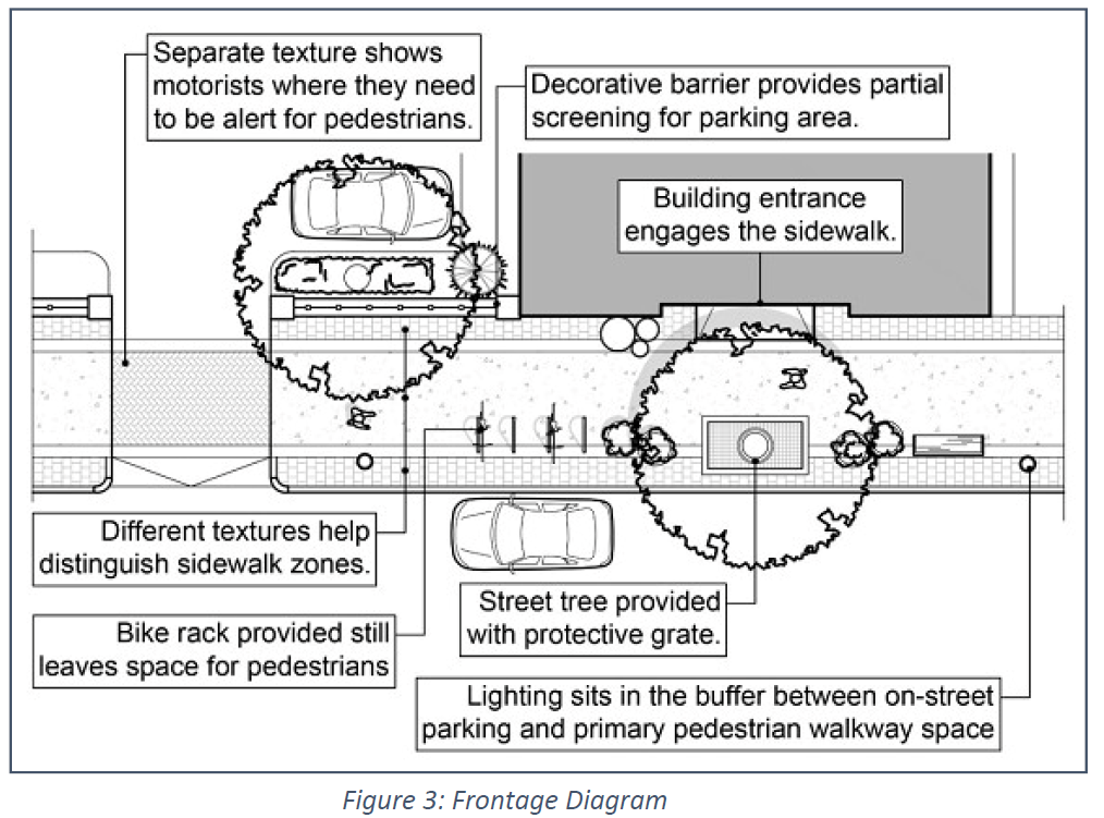
1)
Principal buildings, whether newly constructed or re-used, shall be connected to the right-of-way in a manner that facilitates pedestrian and bicycle access activity. The areas between the front facade of principal buildings and the right-of-way shall accommodate pedestrian and bicyclist space and associated amenities.
2)
Frontage sidewalks shall have a minimum width of eight (8) feet and shall run the length of the property frontage. Where the distance between the edge of pavement in the street and the building facade allows, sidewalks shall be greater than eight (8) feet wide and ideally a minimum of ten (10) feet wide where possible. Where the building is not set back from the property line, the sidewalk shall be constructed between the building facade and the edge of the curb. Where a building is setback from the property line, the area between the building's front facade and the edge of the sidewalk shall include such elements as alternative surfaces, raised flower beds, benches or other street ornaments, in order to create a small outdoor courtyard or "room" that draws passersby to the front entranceway and windows.
3)
An adequate buffer shall be provided between the curb of the street and the primary pedestrian walkway in order to supply enough space for benches, lighting, landscaping, street trees, trash receptacles or other amenities. Site Plans shall identify which amenities the applicant is committed to providing.
4)
The constructed sidewalk may be located within the public right of way, on private property, or may include both public and private property depending on pre-existing conditions and other opportunities or constraints associated with roadway geometry, location of utilities, and other elements of the built environment.
5)
Where a corner lot's legal frontage is on a side street, the frontage sidewalk shall be considered the sidewalk along the main pedestrian thoroughfare. Sidewalks on side streets shall have a minimum width of six (6) feet.
6)
Sidewalks should be reinforced concrete, however, the Planning Board may approve varied finishes for the concrete or a mix of materials consistent with the purposes of the Town Center District including, but not limited to: brick, pavers, slate, or cobblestone in order to provide visual interest and to delineate sidewalk areas that may be used for other functions such as outdoor seating. Standard asphalt coverage is not appropriate for sidewalk areas.
7)
Travel lanes for automobiles shall not be located in the front yard except where access driveways are approved.
8)
Sidewalk designs shall meet or exceed any sidewalk standards adopted by the Shrewsbury Department of Public Works, the Massachusetts Department of Transportation and the American with Disabilities Act. Sidewalks shall be constructed within the road right of way where possible.
9)
Owners and developers shall work with Shrewsbury Electric and Cable Operations to incorporate electrical and broadband infrastructure to meet the aesthetic intent of the Town Center Zoning District, including furthering the goal of undergrounding new and existing utilities.
c.
Landscaping
1)
Applicants shall provide a landscape plan and maintenance agreement that includes, but is not limited to, a combination of fixed and/or moveable planters, street trees, decorative plantings (see Figure 4). Where feasible, street trees should be spaced along the sidewalk at an average frequency of one tree for every thirty (30) feet of frontage.
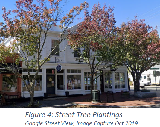
2)
All areas of a site that are not rendered impervious through the development of structures, parking features, circulation features, or other hardscape features should be landscaped with vegetation.
3)
Native species shall should be used wherever possible in landscaped areas and shall be Asian Longhorned Beetle Resistant.
4)
Landscaping, trees, and plants must be planted in a growing condition according to accepted horticultural best practices and shall be maintained in a healthy growing condition. Where applicable, ANSI A300 Standards for Tree Care Operations, as revised, shall apply. All landscaping shown on plans shall be maintained by the owner and any dead or dying vegetation shall be replaced, no later than the following growing season, as long as the site plan remains valid.
5)
Landscaped areas should be designed to remain functional and attractive during all seasons through a thoughtful selection of deciduous, evergreen, berrying, and flowering plant varieties. Caliper of trees shall ultimately be determined by the species chosen.
6)
Turf is discouraged and, where it is used, must not be planted in strips less than five (5) feet wide. Turf seed mixes should be drought resistant. To achieve a high level of drought tolerance, turf seed mixes may include, but shall not be limited to, a predominance of fine fescues.
7)
Plant varieties should be selected for cold-hardiness as well as resistance to drought, moisture, salt, urban conditions, or insects and other pests depending on the location of landscaping and the specific stressors anticipated for different areas of the site.
8)
Plants should be selected so that landscaping can be maintained with minimal care and the need for irrigation, pesticides, or fertilizers can be minimized or eliminated.
d.
Screening
1)
All solid waste enclosures, service areas, mechanical equipment, and utilities must be screened from public view through the use of fencing and/or landscaping that is effectively opaque.
2)
Chain link fencing is prohibited in front and side yards within the Town Center District unless it is necessary for security standards unique to the individual use, is vinyl coated, and is screened using evergreen trees (minimum six (6) feet in height) and/or shrubs.
e.
Building Form (see Figures 9 and 10)
1)
Multi-story buildings shall clearly articulate the base, middle (where applicable), and top of the building using cornices, borders of distinct material, or other articulating features on every visible surface of the building.
2)
In new non-residential or mixed-use construction, ground floors in the Town Center District should be a minimum of eleven (11) feet from floor to ceiling to enhance the pedestrian streetscape, regardless of the overall building height (see Figures 9 and 10).
3)
Buildings with facades longer than forty (40) feet shall articulate the facade with features common to traditional New England architecture that create visual interest. Features shall include a combination of two or more of the following: varied rooflines, distinct signage for multiple tenants, awnings, arcades, pilasters, columns, recessed spaces and/or entrances, and any other features that serve to add texture to these longer facades.
4)
A complex of smaller scale buildings is preferable to a single large structure because the varied massing provides visual interest and human scale (see Figure 5).
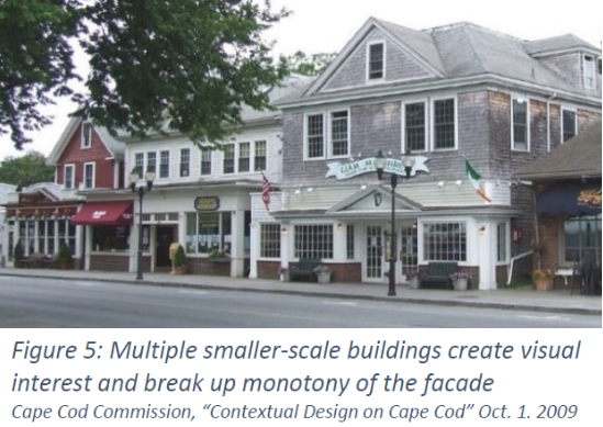
5)
Where a large principal building is proposed, consideration should be given to incorporating several smaller tenant spaces and "storefronts" that front the roadway and main pedestrian thoroughfare and add to the variety on the building facade. These smaller tenant spaces could be used to screen unadorned large business that do not typically incorporate pedestrian-oriented features on their own facades (see Figure 6).
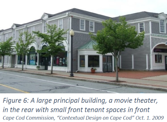
6)
Secondary facades, a building's walls that either do not face a public right-of-way or are not readily viewed from a public way, may be less detailed than the primary facade, but shall be characterized by design treatments that are generally consistent and comparable with the front facade's architectural style.
f.
Building Entranceways and Orientation (see Figures 9 and 10)
1)
All buildings shall have a principal facade and entry (with operable doors) facing a street or other area dedicated to pedestrian circulation. Buildings may have more than one principal facade and/or entry. Primary entrances not facing the property frontage should open onto sidewalks or other designated pedestrian areas that are at least eight (8) feet in width. The street facade must be designed to appear to be a principal point of entry for the building.
2)
Buildings shall be oriented parallel with the front setback line to establish and preserve a consistent building line to maintain, where applicable, a consistent street wall/pedestrian face, where the building fronts need not be directly in line but maintain a consistent corridor along the frontage of the commercial/residential spaces.
3)
Main entrances shall incorporate architectural and/or sidewalk features that draw attention to the entrance. These features shall include at minimum one or more of the following: covered porches, distinct sidewalk surfacing, porticos, recessed doorways, and awnings.
g.
Roofline Form
1)
The roof design for new buildings shall provide a variety of building heights and varied roofline articulation reflecting traditional New England architecture. These roof shapes include gables, gambrels, flat roofs, mansards and any jointed configuration of these styles. Decorative spires or towers may also be used to articulate rooflines and to provide focal points within a complex of principal buildings. (see Figures 5 and 9)
2)
Flat roofs shall include decorative design elements such as parapets or cornices that shield all views of any mechanical systems located on the roof from the street or from windows at a lower elevation in adjacent buildings.
3)
For new buildings or replacement roofing, industrial style metal materials visible from the street shall not be permitted. Metal roofing materials that use decorative finishes and textures for visual accent may be allowed. Visible metal materials necessary for structural integrity, fastening, sealing or other essential purpose are also allowed.
4)
Downspouts shall match or be complementary to gutters in material and finish.
5)
Utilities and protuberances through or on the front facing roofs are highly discouraged and should generally be shielded from view.
h.
Dormers (see Figure 7)
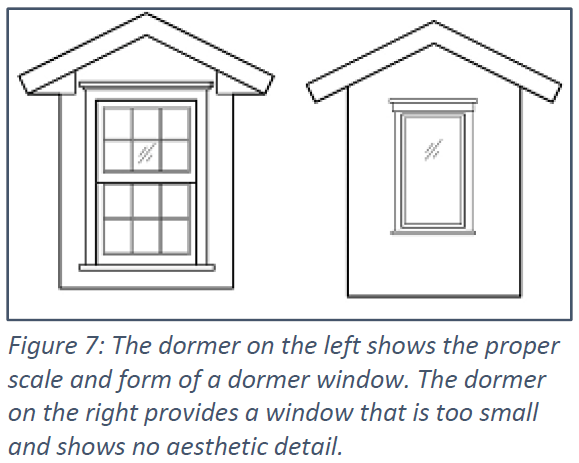
1)
On pitched rooflines, dormers shall be used to break up roof surfaces and shall be provided at a minimum frequency of one per thirty (30) horizontal feet or fraction thereof.
2)
Dormer styles may include doghouse, eyebrow, or shed dormers.
3)
Windows shall fill the face wall of the dormer to the maximum extent practicable and match the windows in the rest of the building.
i.
Fenestration
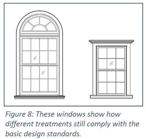
1)
Window bays in facades above the first floor (above street level) shall have a minimum width-to-height ratio of 1:2. Multiple bays may be placed immediately adjacent to one another in order to create larger window areas. This does not apply to dormers (see subsection "h").
2)
Mullion pattern and thickness shall reflect traditional New England design with broad decorative surfaces between windows. Mullion finishes that would be highly reflective or industrial in nature are not allowed.
3)
Windows on the ground floor shall begin no lower than two (2) feet above street level and shall extend at a minimum height of seven (7) feet from street level.
4)
Street level facades shall have a transparency of at least fifty (50) percent with transparent doors and windows.
5)
Clear, non-reflective glass with minimal tinting shall be used at street level to allow unobstructed views of window displays and/or the interior of the building, reinforced with interior lighting.
j.
Building Materials
1)
Materials and building treatments shall be used that reduce the visibility of buildings from distant vantage points and shall be consistent and compatible with traditional New England design and construction.
2)
Where more than one material is used for siding, traditionally heavier materials (stone, brick, concrete with stucco, etc.) shall be located below lighter materials (wood, fiber cement board, siding, etc.). The change in material shall occur along a horizontal line, preferably at the floor level.
3)
For finished siding and foundations, natural materials such as brick, stone, wood/concrete clapboards and shingles, and slate are allowed. Asphalt shingles or similar materials for roofing are allowed. High-quality cement-fiber siding designed to preserve the traditional aesthetic character of the district is also allowed. Vinyl siding shall be prohibited.
4)
Finish colors should be used to differentiate between important features (e.g., foundations, entranceways, windows, decorative borders, etc.) and can be used to differentiate between building stories. Generally, it is preferable to use two or three colors inclusive of masonry. The main color(s) on a building should generally be nature blending, earth tone, neutral, or pastel in character. Bright colors should be limited to accent features and/or entranceways. High intensity colors, metallic colors, or fluorescent colors should not be used.
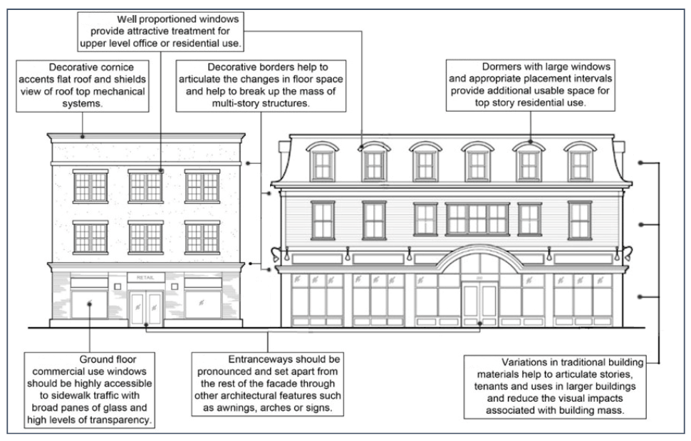
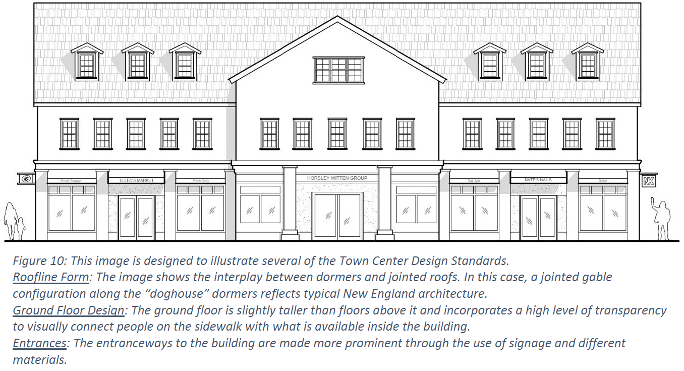
k.
Lighting
1)
Lighting for streets, parking areas, and civic/gathering spaces shall be decorative in shape, scale, and finish, with detailed, articulated treatments for the base, post, fixture, and crown. Where decorative street lighting is already installed, the design of proposed lighting standards and fixtures shall be consistent with or complementary to said lighting (see Figure 11).
2)
Light poles and fixtures shall not exceed 20 feet in height. Height is measured from the base of the standard to the highest point of the structure. Structural features used to anchor light standards (e.g., concrete pilings) are not counted toward the maximum height but shall not protrude more than six (6) inches from the ground (see Figure 11).
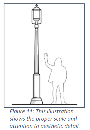
3)
All exterior lights on private property shall be dark-sky compliant with full cut off or fully shielded/recessed lights, and designed, located, installed, and directed in such a manner as to minimize light trespass onto adjacent properties unless such trespass is intentional and meets the purposes of this district. Lighting fixtures for building security or display purposes shall similarly be top downward (not upward or sideways), and full cut off or fully shielded/recessed.
4)
Lighting could be directed upwards as part of a landscaping scheme used to highlight important features including, but not limited to: steps, walkways, art installations, and the edge of buildings. Any proposal for upward lighting shall be accompanied by renderings and other visuals demonstrating the impact and effect of the lighting scheme on the building and its surroundings.
l.
Signage
In addition to the requirements under Section VII.E.2. VII.E.1, the following standards and guidelines shall apply:
1)
Permitted Signage
(a)
Externally Illuminated or Front-lit Signs shall have downward-directed, steady, stationary light only, with fully-shielded decorative lamps that do not obscure the sign's graphics.
(b)
Reverse Lit or Halo Lit Signs, illuminated by white light only. The source of light shall be completely concealed.
(c)
Wall Mounted Signs and Projected Signs (a.k.a. Blade or Hanging Signs): One sign of each type shall be allowed per tenant on each elevation of a building with a customer entrance. The sign should be located no lower than 7'6" above the ground floor, but not higher than the top of the first floor. Each projected sign may be externally illuminated with two integrated lights (one light for each sign face or panel). The size of the projected sign shall not exceed six (6) square feet in area as measured on one face of the sign. Signs should not obscure architectural features or windows and should be integrated with the design of the building (see Figure 12).
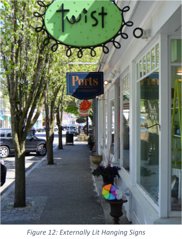
(d)
Window Signs shall not cover more than twenty-five percent (25%) of the window area.
(e)
Awning signage is permitted only on the apron portion of the awning.
(f)
Free-standing monument or structured signs not taller than five (5) feet above grade that incorporate design details, materials, and colors of the associated building(s). The base or support elements of freestanding signs should be integrated with the surrounding environment and should incorporate ornamental landscaping where possible.
(g)
Sign colors should be selected to enhance sign legibility for both day and nighttime viewing. Contrasting colors can be used effectively to increase clarity. Sign colors and finishes should be compatible with the color of the building or development. Sign materials should be of high quality and compatible with the design of the building and facade on which they are placed.
(h)
Temporary banners provided they are only used for a period of thirty (30) days prior to and following the opening of a business or other establishment.
(i)
Sandwich board signs no greater than six (6) square feet that do not interrupt the safe flow of pedestrian, cyclist or automobile traffic.
(j)
The Planning Board may issue a Special Permit to allow for a Digital Message Board Sign provided that the individual letters or numbers on the message board do not change more than once per hour and shall not include flashing or moving lights.
2)
Prohibited Signage
(a)
Free-standing signs with clearance above the ground that is more than two feet above grade.
(b)
Internally illuminated signs of any kind and signs made of plastic or vinyl.
(c)
Illuminated signs with exposed neon tubing or exposed LEDs such as, for example, open face channel letters.
(d)
Box style cabinet signs or "can signs" with illuminated, translucent background and silhouette, translucent or acrylic letters.
(e)
Signs attached to any utility pole, vegetation, rocks, hydrants, or fences.
(f)
Roof Signs or any sign projecting above the roof or parapet line.
(g)
Off premise signs: All signs shall be located on the same lot as the main use which it is advertising.
(h)
Signs or advertising devices that are animated, flash, make noise, or contain any visible moving parts, including, but not limited to, commercial balloon devices, high powered search lights, and L.E.D. signage. Indicators of time or temperature may move.
6.
Parking Standards
a.
Parking Report
Administrative Site Plan Review, Site Plan Approval applications, or a change in use in the Town Center District shall be accompanied by a Parking Report that demonstrates reasonable access to parking spaces on-site or a combination of on-site and off-site. The Parking Report shall include:
1)
Size and type of all existing and proposed uses or activities on the property.
2)
Proposed total number of parking spaces on-site and off-site.
3)
Parking demand, including peak demand, shall include a calculation of the on-site uses as determined by the Zoning Bylaw and, where different, through the most recent estimates provided by the Institute of Transportation Engineers (ITE).
4)
If applicable, a feasibility study of shared parking among different on-site uses demonstrating that there will be adequate parking for the combined uses at all times. The feasibility study shall incorporate analysis of peak parking demand that shows which uses will occur at different times of the day and on different days of the week.
5)
Availability of alternative methods of travel to the site, including public transportation, and bike and pedestrian access.
6)
Narrative explanation of how the demand analysis and proposed strategies justify the proposed total number of parking spaces.
b.
Off-Street Parking
1)
Parking shall be located behind principal buildings on the property and shall not be located on the side of a building or between the front facade of a building and a street or a public way.
2)
The Planning Board may issue a Special Permit to allow for parking that is to the side of principle buildings due to unusual site constraints provided that parking is not located within the maximum front setback or between the front plane of a building and a street or public way. Where a proposed surface parking area is adjacent to a sidewalk, internal walkway, or other pedestrian space, the applicant shall provide a landscaped buffer between the parking area and the pedestrian space as follows:
i.
At a minimum, the landscaped buffer shall include a decorative barrier, which may be designed as brick or stone walls, decorative fencing, or a combination of these treatments (see Figure 13).
ii.
In addition to and inclusive of a decorative barrier, to the extent practicable, the landscaped buffer shall include planted areas designed to provide separation between the surface parking area and the pedestrian space while allowing pedestrians to maintain visual awareness between the two areas (see Figure 13).
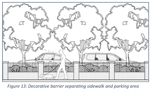
3)
For developments with proposed surface parking areas of ten (10) spaces or more, a minimum of ten percent (10%) of the designated parking area shall be landscaped. This calculation may include any landscaped borders surrounding the parking lot where the landscaped borders are predominantly ornamental vegetation and/or are specifically designed to provide stormwater treatment. Borders that are predominantly stone, turf, fencing, or screening shall not be counted toward this requirement.
4)
The ends of parking aisles in surface lots that are more than fifteen (15) spaces in length must incorporate landscape islands at either end of the row. Each island shall include at least one tree that is two (2) inches in caliper at the time of planting. Where the length of a parking aisle exceeds twenty-five (25) spaces, additional landscaped islands must be installed at regular intervals. This interval must not be more than every thirteen (13) spaces.
c.
Remote or Off-Site Parking
Parking for business and commercial uses may be located off-site to substitute for some or all of the required on-site parking spaces, provided the following criteria are met:
1)
The off-site parking is located within 800 feet of the subject property line.
2)
A safe and clearly defined pedestrian route between the off-site parking and the subject property is provided.
3)
Any proposed on-site parking shall include parking spaces for people with disabilities in accordance with ADA standards.
4)
Where off-site parking is proposed, a binding parking agreement and sufficient legal documentation providing access to, use of, and management of the designated off-site parking spaces shall be submitted to the Town as part of the Parking Report.
d.
Shared Driveways and "Combined" Parking Lots
1)
Abutting property owners are encouraged to coordinate parking layouts, including combining and connecting with adjacent parking lots, and coordinating access to their parking lots, including utilizing common curb-cuts and driveways under reciprocal easements. The Planning Board may permit such shared driveways, curb-cuts and combined parking lots if the applicant can demonstrate that the proposed design improves on-site or off-site circulation and/or results in a smaller parking area (see Figure 14).
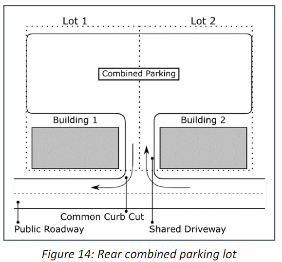
V. - Wireless Communications Antenna, Wireless Telecommunications Tower and Facility, and Small Wireless Facility
The purpose of this section is to preserve the aesthetic character of the Town; to safeguard public safety, health and welfare; to protect against intangible public harm resulting from unsightly or out-of-character deployments; and to protect public infrastructure investments.
A.
Wireless Telecommunications Tower and Facility
1)
Wireless Telecommunications Tower and Facility Administrative Site Plan Review
a.
In accordance with 47 U.S.C. § 1455(1), any request for modification to an existing Wireless Telecommunications Tower and Facility that involves: (a) collocation of new transmission equipment; (b) removal of transmission equipment; or (c) replacement of transmission equipment; shall be considered an eligible facilities request and subject to Administrative Review only.
2)
Site Plan Approval
a.
Site Plan Approval by the Planning Board is required for the siting and construction of all Wireless Telecommunications Towers and Facilities. The information required for Site Plan Approval as set forth in the Planning Board's Rules and Regulations as may be amended.
3)
Special Permit
a.
The Shrewsbury Planning Board is hereby designated the Special Permit Granting Authority (SPGA) to grant Special Permits for Wireless Telecommunications Towers and Facilities and Wireless Communications Antenna.
b.
A Special Permit granted under this Zoning Bylaw shall expire within five years from the date the Special Permit Decision is filed in the Town Clerk's office.
4)
Special Permit Requirements
a.
Any proposed Wireless Telecommunications Tower and Facility or Wireless Communications Antenna shall be located in accordance with the Federal Communications Commission (FCC) and the Federal Aviation Administration (FAA) Regulations in effect at the time of the proposed construction. The operation of the Wireless Telecommunications Tower and Facility or Wireless Communications Antenna shall comply with all requirements of these agencies during the entire period of operation.
b.
Any proposed Wireless Telecommunications Tower shall be located as follows:
i.
To the extent feasible all service providers shall co-locate on a single tower. Towers and accessory buildings shall be designed to structurally accommodate the maximum number of users.
ii.
Tower height shall not exceed 150 feet measured from the base of the tower to the highest point of the tower or its projection.
iii.
Fencing shall be provided to control access to the base of the tower which fencing shall be compatible with the scenic character of the Town and shall not be of barbed wire or razor wire.
iv.
The applicant shall demonstrate to the satisfaction of the Planning Board that the location of the tower is necessary and that the size and height is the minimum necessary for the purpose of the facility.
v.
There shall be no signs, except for announcement signs, no trespassing signs and a required sign giving a phone number where the owner can be reached on a twenty-four-hour basis. All signs shall conform with the sign requirements of this bylaw.
vi.
To the extent feasible all network interconnections from the communications site shall be installed underground.
vii.
The tower shall minimize, to the extent feasible, adverse visual effect on the environment. The Planning Board may impose reasonable conditions to ensure this result, including painting, lighting standards and screening.
viii.
Removal of Abandoned Wireless Telecommunications Towers and Facilities. Any tower or facility that is not operated for a continuous period of 12 months shall be considered abandoned, and the owner of such tower and facility shall remove same within 90 days of receipt of notice from the governing authority notifying the owner of such abandonment. If such tower or facility is not removed within said 90 days, the Town may cause such tower or facility to be removed at the owner's expense. If there are two or more users of a single tower, then this provision shall not become effective until all users cease using the tower.
5)
Performance Guarantees
a.
The Planning Board may require, as a condition of approval of a Special Permit issued pursuant to this Bylaw, that the applicant and/or its successor post an initial cash bond in a reasonable amount, as determined and approved by the Planning Board, to secure the removal of the tower and facility when discontinued or obsolete.
b.
The Planning Board may require, as a condition of approval of a Special Permit issued pursuant to this Bylaw, that the applicant and/or its successor post a maintenance bond, to secure the maintenance of an access road, site and tower(s), in amounts approved by the Planning Board.
c.
Any security required pursuant to the paragraphs above shall be held by the Town Treasurer.
B.
Small Wireless Facilities
1)
Located within Public Right-of-Way
a.
All Small Wireless Facilities located within a Public Right-of-Way are allowed as of right. However, proponents shall be aware that proposed installation of Small Wireless Facilities in the Public Right-of-Way may be subject to regulations of the Shrewsbury Electric Light and Cable Operations (SELCO).
2)
Located Outside of Public Right-of-Way
a.
All Small Wireless Facilities located outside of a Public Right-of-Way shall require a Special Permit from the Planning Board. All such facilities shall comply with the Technical and Aesthetic Standards for Small Cell Siting published by the Shrewsbury Electric Light and Cable Operations (SELCO) as amended from time to time.
W. - SENIOR VILLAGE OVERLAY
1.
Purpose and Intent: The purpose of the Senior Village Overlay District is to encourage development of Senior Housing where such use is supported by the underlying District. The Overlay District allows for a greater variety of uses and building types at a higher density than would normally be allowed, and allows greater flexibility in site design. It is intended that a Senior Village development provide a range of housing types and facilities that are responsive to the socio-cultural, health care, and recreational needs of seniors. Design standards should be supportive of a New England character, with a cohesive center and community space.
2.
Definition: A Senior Village shall be a planned development constructed on a parcel or on contiguous parcels of land totaling at least five (5) acres in size, which contains a mixture of allowable uses specifically designed to promote the socio-cultural, health care, and recreational needs of seniors.
3.
Applicability: The Senior Village Overlay District applies to portions of land located within the Rural AA, Rural A, Rural B, Residence A, Residence B-1, Residence B-2, Multifamily 1, Multifamily 2, Apartment, Town Center District and Limited Commercial Business Districts, as shown, located, defined and bounded on the digital map entitled "Official Zoning Map of the Town of Shrewsbury, Massachusetts," dated May 23, 2018 and on file in the office of the Town Clerk. The Senior Village Overlay District Map amends and is hereby made part of the Official Zoning Map of the Town of Shrewsbury.
In the Senior Village Overlay District, all requirements of the underlying district shall remain in effect except where the Senior Village Overlay provisions provide an alternative to such requirements, in which case these provisions shall supersede. In the event that an applicant wishes to develop in accordance with the regulations hereunder, the rules and regulations of the Senior Village Overlay District shall apply, and by filing an application for a Special Permit, site plan review or building permit under this Section VII.W, the owner shall be deemed to accept and agree to them. In such an event, where the provisions of the Senior Village Overlay District are silent on a zoning regulation that applies in the underlying district, the requirements of the underlying district shall apply.
If the applicant elects to proceed under the zoning provisions of the underlying district, the zoning bylaws applicable in the underlying district shall control and the provisions of the Senior Village Overlay District shall not apply.
4.
General Requirements:
a.
All dwellings in a Senior Village shall be subject to Inclusionary Housing requirements as defined in Section VII.K.
b.
All dwellings in a Senior Village shall be subject to an age restriction described in a deed/deed rider, or restrictive covenant, and shall be reviewed by Town Counsel and approved by the Board, recorded at the Registry of Deeds and/or the Land Court. The age restriction shall limit the dwelling units to occupancy of seniors, age 55 or older; or their spouses of any age; or other persons dependent upon a senior, age 55 or older, if medical need can be established to the satisfaction of the association approved by the Board. The Restriction may provide for reasonable time-limited guest visitation rights; and may authorize special exceptions that allow persons of all ages to live in a dwelling unit together with a senior resident, if the Board so approves and specifies this in its Special Permit. The Special Permit and the age restriction described above shall run with the land and shall be enforceable by any owner(s) of dwelling units in the Senior Village and/or the Building Inspector Board of the Town of Shrewsbury.
c.
Proposed developments greater than thirty (30) units shall include, at minimum, a Senior Village Community Center which is intended for use and benefit of the Senior Village residents, provided that such use(s) shall be a minimum of one thousand (1,000) square feet and provided the Planning Board finds that adequate assurances and covenants exist, to ensure proper maintenance of such facilities by the residents, owners or their agents.
5.
Density: Allowable density of development in the Senior Village Overlay shall not exceed 1 living unit/10,000 square feet of land area and single developments shall not exceed 75 living units. The Planning Board may waive this requirement to provide a density increase where the proposal provides one of the following community benefits:
a.
Additional Affordable Housing. For projects greater than ten (10) units, in addition to the minimum affordable housing requirements defined by Section VII, Section K, the Planning Board may allow a density increase where the proposal provides greater than 25% affordable units or restricts units to less than 50% AMI. The density increase permitted under this provision shall not exceed 1 living unit/5,000 square feet or 125 units whichever is less.
For the purposes of this section, affordable housing shall be defined as dwelling units that are rented or sold to, and occupied by households earning up to 80% of the median area household income as defined by the United States Department of Housing and Urban Development (HUD), and which have been deemed eligible for listing on the State's Subsidized Housing Inventory (SHI) as maintained by the Executive Office of Housing and Livable Communities (EOHLC). Affordable rental units shall be "rent restricted," as such term is defined in the Federal Low-Income Housing Tax Credit Program, Internal Revenue Code Section 42(g)(2), such that rents, including utilities, are set at no more than 30% of the income limit. Affordable units shall, by deed restriction, remain affordable in perpetuity. Affordable units shall be dispersed throughout the Senior Village and shall be externally indistinguishable from the market rate units both internally and externally. If the affordable units are part of a condominium, the condominium documents shall, at a minimum, ensure that the owners of the affordable units will not be required to pay for capital improvements they cannot afford and that they will have fair and sufficient voting rights. The property owner shall seek referrals for the affordable units from the Shrewsbury Housing Authority and shall submit an annual report to the Shrewsbury Housing Authority and Planning Board, detailing compliance with the affordable housing provisions of the Senior Village approval and the requirements of the Executive Office of Housing and Livable Communities (EOHLC). The property owner shall be responsible for monitoring the long-term affordability of the units and shall report any deviations from these provisions to the Building Inspector and the Planning Board.
b.
Additional Open Space: In addition to the minimum required Open Space, the Planning Board may allow a density increase where the applicant provides additional land as dedicated Open Space. All Open Space shall be in conformance with the Open Space standards of this section. This Open Space may be on or off site. Documents demonstrating the preservation of the Open Space shall be submitted to the Board prior to the issuance of any building permit.
The amount of density increase shall be calculated as follows:
i.
For each acre (with the total acreage rounded to the nearest whole number) of on-site preserved Open Space, three additional housing units may be permitted up to the maximum permitted under this section.
ii.
For each 1,000 feet of trail that becomes publicly accessible, one additional housing unit may be permitted up to the maximum permitted under this section. The Planning Board shall request a letter of recommendation from the Trails Committee regarding the quality of the proposed trail network. Only if a proposed trail has been deemed to be acceptable by the Planning Board, as serving the interests of this Bylaw, shall the trail be counted for purposes of this Subsection (ii).
iii.
The density increase permitted under this provision shall not exceed 1 living unit/5,000 square feet of on-site preserved Open Space or 125 units whichever is less, except upon the determination of the Planning Board and the written recommendation of the Trails Committee or Conservation Commission, the Planning Board may grant up to 10 additional housing units over and above the maximum permitted, for the preservation of critical Open Space. For the purposes of this section, Critical Open Space shall be defined as open space which provides habitat or significant ecological benefit to an identified native species or other natural resource.
c.
Rehabilitation of existing buildings: The Planning Board may allow a density increase where the applicant rehabilitates or renovates existing buildings within the Senior Village Overlay District. Where there are buildings and structures on the site that have been certified by the Historical Commission, or the Board's historic consultant as having historic and/or architectural significance, all of said buildings and structures shall be rehabilitated or renovated in order to receive a density bonus under this section. The Board shall refer to the Secretary of the Interior's Standards for Rehabilitation and Guidelines for Rehabilitating Historic Buildings for guidance when reviewing the buildings and structures, which have been, or are proposed to be, rehabilitated or renovated. The amount of density increase shall be calculated as follows:
i.
For every 500 square feet of gross floor space in noncertified buildings and structures to be rehabilitated or renovated, one additional housing unit may be permitted up to the maximum permitted under this section.
ii.
For every 250 square feet of gross floor space in certified buildings and structures to be rehabilitated or renovated, one additional housing unit may be permitted up to the maximum permitted under this section.
iii.
The density increase permitted under this provision shall not exceed 1 living unit/5,000 square feet or 125 units whichever is less, except upon the determination of the Board and the written recommendation of the Historical Commission that the proposed density is necessary for the preservation of critical historic resource(s).
6.
Senior Village Open Space standards: In addition to the minimum open space requirements of the underlying zoning district, the following standards shall apply to Senior Village Open Space land area:
a.
General Standards:
i.
The following shall not be counted as part of the required Senior Village Open Space: community buildings or other buildings housing common facilities, median strips, and landscaped areas within parking lots, constructed stormwater management facilities including retention basins, or wetlands.
ii.
A minimum of 25% and maximum of 40% of the required Senior Village Open Space must be deemed by the Planning Board, in its sole discretion, as suitable for use for active recreational purposes. Active recreational purposes may include village greens, commons, or similar outdoor features that encourage informal congregation of residents. The remaining Open Space must be deemed by the Planning Board, in its sole discretion, as suitable for passive recreational purposes. The Planning Board may waive strict compliance with this requirement where an existing or proposed on-site trail network connects to an existing or proposed off-site trail network. For the purposes of determining a suitable trail network connection, the on-site and off-site portions of trail may cumulatively utilize no more than two hundred feet (200') of on-street infrastructure (e.g. sidewalks, access drives, etc.).
iii.
The Board may waive strict compliance the requirement in Section 6.a.i only if the Board finds that such inclusion will result in better design or improved protection of natural and scenic resources, and will otherwise comply with this bylaw. In no case shall the amount of wetlands exceed 50% of the required Open Space.
iv.
Unless otherwise approved by the Planning Board in its Special Permit decision, passive Open Space shall be maintained in its pre-development state. Maintaining such land in its pre-development state shall mean that the land shall remain in its natural state without the removal or disturbance of trees, vegetation or earth. Neither temporary site access nor temporary structures shall be permitted on reserved passive Open Space, nor shall passive Open Space be used as staging areas during construction.
v.
The required Senior Village Open Space shall be contiguous, unless the Planning Board finds that it is not practical for all the Open Space to be contiguous due to the particular shape or topography of the Senior Village site or, for the same reasons, that it is advantageous to allow separated Open Space areas in order to best protect natural features of the site.
vi.
The Senior Village plan should take into account any Town of Shrewsbury or other public agency plans for preservation or improvements to public Open Space adjacent to the Senior Village site, so as to provide potential for linkage and access to said adjacent public Open Space. As a condition of issuance of the Special Permit for a Senior Village or Planned Residential Community, the Board may require the Senior Village applicant to provide paths, walkways, or other appropriate physical connections to adjacent Open Spaces or public lands.
vii.
Where the boundaries of the Open Space are not readily observable in the field, the Board may require placement of surveyed bounds sufficient to identify the location of the Open Space.
b.
Ownership of Open Space: At the developer's option and subject to approval by the Planning Board, all areas to be protected as Open Space shall be subject to at least one of the following:
i.
Conveyed to the Town in fee, to be placed under the care, custody and control of the Conservation Commission, and be accepted by it for a park or Open Space use. Land conveyed to the Town should be open for public use;
ii.
Conveyed to a qualified nonprofit organization, the principal purpose of which is the conservation or preservation of Open Space, with a Conservation Restriction as specified in Subsection 6(d) below. Such organization must first be deemed acceptable by the Planning Board as a bona fide conservation organization;
iii.
Conveyed to a corporation or trust owned or to be owned by the owners of lots or residential units within the development (i.e. homeowners' association) and placed under Conservation Restriction as specified in Subsection 6(d) below. If such a corporation or trust is utilized, as indicated herein, ownership thereof shall pass with conveyance of the lots or residential units. The developer is responsible for the maintenance of the Open Space and other facilities to be held in common until such time as the homeowners' association is capable of assuming such responsibility. Thereafter, the members of the association shall share the cost of maintaining the Open Space. The Planning Board shall require the applicant to provide documentation that the homeowners' association is an automatic (mandatory) association that has been created prior to the issuance of any building permit.
c.
Encumbrances: All areas to be set aside as Open Space shall be conveyed as described in subparagraph (6), above, free of any mortgage interest, security interest, liens or other encumbrances.
d.
Permanent restriction: In any case where Open Space is not conveyed to the Town, a permanent conservation or agricultural preservation restriction in accordance with MGL c. 184, § 31, approved by the Planning Board and Selectboard and enforceable by the Town, conforming to the standards of the Massachusetts Executive Office of Environmental Affairs, Division of Conservation Services, shall be recorded to ensure that such land shall be kept in an open or natural state and not be built upon for residential use or developed for accessory uses such as parking or roadways except as permitted by this bylaw and approved by the Planning Board. Restrictions shall provide for periodic inspection of the Open Space by the Town. Such restriction shall be submitted to the Planning Board prior to approval of the Special Permit and recorded at the Registry of Deeds/Land Court. A management plan shall be required and submitted to the Planning Board in accordance with subsection 6(e) below, which describes how existing woods, fields, meadows or other natural areas shall be maintained in accordance with good conservation practices.
e.
Maintenance of Open Space: In any case where Open Space is not conveyed to the Town, the Town shall be granted an easement over such land sufficient to ensure its perpetual maintenance as conservation or recreation land.
i.
The applicant shall, at the time of application, provide a plan for management of Open Space in accordance with the following requirements:
1.
The plan shall define ownership.
2.
The plan shall establish necessary, regular, and periodic operation and maintenance responsibilities for the various types of Open Space (i.e., forest, meadow, playing field, crop land, etc.).
3.
The plan shall define the means for funding the management of the LANDSCAPED (playing field, etc.) Senior Village Open Space in perpetuity.
4.
The owner/applicant shall be required to establish a management fund to ensure the long-term management of the landscaped Open Space. The nature and amount of said fund shall be fair and reasonable and be approved by the Planning Board.
5.
The Conservation Commission and the Planning Board shall be notified in writing of any proposed changes in the management plan which shall be subject to the Planning Board's review and approval.
7.
Senior Village Site Development standards: Site development shall be in accordance with the applicable provisions of the Planning Board's current Subdivision Rules and Regulations regarding utilities, drainage, parking areas and roadways, with the exception that the Planning Board may allow exceptions for vertical, horizontal curves and roadway radii as may be appropriate to the lower speeds in a senior community when traffic calming measures are incorporated in the design (i.e. speed bumps, raised crosswalks)
The following site development standards shall apply to all Senior Village developments:
a.
Dimensional standards:
The lot or combination of more than one contiguous lot upon which a Senior Village is located shall meet the minimum lot dimensions found in the Schedule of Lot, Area, Frontage, Yard, and Height Requirements for the underlying Zoning District. The Planning Board may waive these requirements only if the Board finds that such reduction will result in better design, improved protection of natural and scenic resources, and will otherwise comply with this bylaw.
i.
Each building in the Senior Village shall be set back a minimum of twenty-five (25) feet from the Senior Village's perimeter lot line(s). This minimum setback shall be increased by five feet for each foot the proposed building is over 30 feet in height. The maximum height of any structure in a Senior Village shall be no greater than 40 feet. The setback area shall be maintained as natural Open Space or as a densely planted landscaped buffer. The Board may waive these requirements only if the Board finds that such reduction will result in better design or improved protection of natural and/ or scenic resources, and will otherwise comply with this bylaw.
ii.
Buildings, excluding detached accessory structures, shall be separated by at least fifty (50) feet, except that structures equipped throughout with an approved automatic sprinkler system may be separated by a minimum distance of twenty (20) feet.
iii.
Construction within a Senior Village residential subdivision shall comply with the Town of Shrewsbury Subdivision Rules and Regulations. Where the requirements of this section differ from or conflict with the requirements in the Town of Shrewsbury Subdivision Rules and Regulations, in the opinion of the Planning Board, the requirements of this section shall prevail.
iv.
Individual living units in the Senior Village shall be a minimum of five hundred (500) gross square feet and a maximum of thirty-two hundred (3,200) gross square feet.
b.
Design and construction standards
i.
The landscape shall be preserved in its natural state, insofar as practicable, by minimizing tree and soil removal. Any grade changes shall be in keeping with the general appearance of the neighboring developed areas. The orientation of individual building sites shall be such as to maintain maximum natural topography and cover. Topography, tree cover, and natural drainage ways shall be treated as fixed determinants of road and building configuration rather than as malleable elements that can be changed to follow a preferred development scheme.
ii.
Streets, parking areas, and building sites shall be designed and located in such a manner as to maintain and preserve natural topography, significant landmarks and natural systems, and trees; to minimize cut and fill; and to preserve and enhance views and vistas on or off the subject parcel(s).
iii.
The removal or disturbance of historic, traditional or significant uses, structures, or architectural elements shall be minimized insofar as practical, whether these exist on the site or on adjacent properties.
c.
Off-street Parking:
Off street parking shall be provided in accordance with Section VII.D of the Shrewsbury Zoning Bylaw with the following additional requirements:
i.
Except where a garage space is provided, driveway lengths shall be a minimum of 22 feet in length.
ii.
The Planning Board may, as a condition of granting a Special Permit for the Senior Village, require additional off-street parking areas be provided for use in common by dwelling unit owners, employees of the facility, and guests
iii.
Parking areas shall be oriented for pedestrian traffic through the use of raised crosswalks, usable landscaped islands, benches, and abundant shade trees among other design attributes. Parking facilities shall be adequately buffered and shaded using native vegetation. Parking lots containing three or more spaces shall be planted with at least two trees per three spaces, each tree being surrounded by no less than 20 square feet of permeable, unpaved, landscaped area and each tree providing shade to the parking area. Only trees providing shade to the parking area shall be counted as meeting this requirement. Shade trees shall have at least minimum 2.5 inches in diameter at breast height caliper when planted. Species shall be selected from the list of approved street trees as published by the Town of Shrewsbury Conservation Commission.
d.
Landscaping, shade trees and infrastructure.
i.
All roadways and driveways serving more than one dwelling shall be a minimum paved width of 22 feet. Common driveways in excess of 100' shall include a hammerhead or similar turnaround feature acceptable to the fire-department.
ii.
The Planning Board shall encourage the use of soft (nonstructural) natural stormwater management techniques (such as vegetated swales, constructed wetlands) and other drainage techniques that reduce impervious surface and enable infiltration where appropriate. Low-impact development practices as described in the National Low Impact Development Guidebook shall be utilized to the greatest extent possible.
iii.
All roadways, driveways, and parking areas within the Senior Village shall be maintained by the applicant, developer of the Senior Village, its assigns, or owners or their agents in perpetuity. Deed restrictions and/or covenants to this effect shall be presented to the Planning Board prior to the issuance of any building permits for the Senior Village.
iv.
Landscape design shall give preference to the maintenance of existing healthy trees and ground cover. Landscape design shall give preference to indigenous species and shall enhance the wildlife habitat value of the site. The development of large lawn areas shall be minimized.
v.
Street trees shall be planted on each side of public and private ways. Street trees shall be at least 2.5 inches in diameter at breast height when planted, and shall be spaced at intervals no greater than 30 feet along both sides of the street(s). Species shall be selected from the list of approved street trees as published by the Town of Shrewsbury Tree Warden.
vi.
Snow storage areas shall be provided and located on the site plan. A snow management plan must be in place before the issuance of a building permit.
vii.
All utilities shall be underground.
viii.
Solid waste storage, air conditioners, loading areas and the like shall be shielded from view by walls, dense vegetation, or fences.
ix.
All solid waste removal, snow plowing, and other maintenance within the Senior Village shall be the responsibility of the residents, owners or their agents in perpetuity, and they shall bear all expenses related hereto. Deed restrictions and/or covenants to this effect shall be presented to the Planning Board prior to the issuance of any building permits for the Senior Village.
8.
Review Criteria and Compliance:
Site development shall be in accordance with the applicable provisions of the Planning Board's current Subdivision Rules and Regulations regarding utilities, drainage, parking areas and roadways, with the exception that the Planning Board may allow exceptions for vertical, horizontal curves and roadway radii as may be appropriate to the lower speeds in a senior community when traffic calming measures are incorporated in the design (i.e. speed bumps, raised crosswalks)
a.
All access ways to and from the site shall be privately maintained.
b.
Special Permits in the Senior Village Overlay District:
All uses and structures permitted under the Senior Village Overlay shall require a Special Permit. The special permit Granting Authority (SPGA) for uses and structures in the Senior Village Overlay District shall be the Planning Board. The application, review, decision and appeal procedures shall be in accordance with G.L. c.40A, Section 9 and Section IX of this Bylaw, and applicable regulations of the Planning Board.
In addition to applying the general Special Permit criteria as set forth in Section IX of this Bylaw and Subdivision Regulations, the Planning Board shall review the Senior Village Special Permit application in accordance with the following review criterion:
i.
That the Senior Village is designed in a comprehensive, landscape sensitive manner, according to the process outlined in the conceptual plan.
ii.
That the Senior Village is consistent with all Senior Village Open Space standards, Senior Village development standards, affordable unit restrictions, and all applicable standards and requirements set forth in this bylaw, unless otherwise waived by the Planning Board.
iii.
That the proposed Senior Village will, by its design and layout, succeed in (a) preserving Open Space for conservation and/or recreation purposes, and providing appropriate public access to the Open Space; (b) protecting natural and cultural features of the site which are important to the character and health of the Town; and (c) creating a true village setting with a pedestrian orientation and character consistent with the historic development patterns of the Town of Shrewsbury.
c.
Permit conditions:
i.
The Planning Board shall, as a condition of any Special Permit for a Senior Village, require that the land area on which the Senior Village is located be permanently maintained as one undivided lot and that, from and after the date of the issuance of the building permit for said Senior Village or any portion thereof, no subdivision of said lot shall be allowed without the express approval of the Planning Board. However, the recording of a condominium master deed and the conveyance of condominium units within the area covered by said deed shall be allowed.
ii.
No Special Permit shall be issued without appropriate restrictions to ensure that the provisions of this section are made binding upon the applicant and his successors and heirs.
iii.
No Special Permit shall be issued without an entity approved by the Planning Board and EOHLC being designated and authorized as the agency responsible for monitoring the affordable housing component of the proposal.
iv.
No certificate of occupancy, temporary or permanent, shall be issued for any unit in a Senior Village until all deed restrictions, covenants, easements, transactions, and/or other documents necessary to ensure compliance by the applicant with the requirements of this section have been submitted and executed.
d.
Site Plan Approval:
Section VII.F(3) of this Bylaw shall apply to all uses in the Senior Village Overlay District. In addition to the approval criteria under Section VII.F(3)(h), the Planning Board shall base its decision on the degree to which a proposed development conforms to this Senior Village Overlay District Development Bylaw, including in W(5—8) hereunder.
X. - TOD OVERLAY
1.
Purpose and Intent: The purpose of the Transit Oriented Development (TOD) Overlay District is to encourage additional smart growth development in accordance with the purposes of MGL c. 40 A Section 3A, and to foster a variety of middle housing opportunities, to be proposed in a distinctive and attractive site development program that promotes compact design, preservation of open space, and a variety of transportation options while increasing the production of a range of housing units to meet existing and anticipated housing needs.
The TOD Overlay District is further intended to foster transit oriented development which focuses on providing a variety' of infrastructure and amenities directed towards multi-modal transit and mode shift opportunities, a variety of uses and services within walking distance and design centered around complete streets principals, Proposals should evaluate the site context and connection to local and regional transit network opportunities as well as nearby commercial retail and employment opportunities. Site designs should focus on a higher density core centered on a mobility hub or transit station in a manner that maintains the visual character and architectural scale of existing development within the district while minimizing visual and functional conflicts between residential and non residential uses within and abutting the district, varying height and bulk of structures towards the property boundaries in a manner that connects the site to existing conditions of abutting property's infrastructure, design and density.
Allowing flexibility of denser development, the TOD Overlay District is intended to foster development which is sensitive to the environmental and open space opportunities of the existing site conditions and preserves and enhances usable open space to the maximum extent practicable. Additional flexibility to building height is provided in order to accommodate minimization of lot coverage. Site design should use existing and proposed open space features to provide a natural buffer. Larger redevelopment projects should evaluate opportunities for historical preservation efforts through adaptive reuse of existing structures, consideration of architecturally or historically significant elements, documentation of site history, or incorporation of architecturally similar elements where feasible.
2.
Definitions:
Residential, Commercial or Mixed Use Wrap: A Residential, Commercial or Mixed Use Wrap is a structure which features an attached, above ground parking structure of one story or more, with such parking structure located in the interior of the main structure, the residential, commercial or mixed use components of which wrap around the exterior of the parking structure, thereby reducing the visibility of the parking facilities to the maximum extent practical.
The definition of "Family", as set forth in Section II, shall not apply to developments under the TOD Overlay District.
3.
Applicability: The TOD Overlay District applies to portions of land located within the Rural B, Apartment, Office Research and Limited Industrial Districts, as shown on the TOD Overlay District map on file with the Town Clerk. The TOD Overlay District Map amends and is hereby made part of the Official Zoning Map of the Town of Shrewsbury.
In the TOD Overlay District, all requirements of the underlying district shall remain in effect except where these provisions provide an alternative to such requirements, in which case these provisions shall supersede. In the event that an applicant wishes to develop property in accordance with the regulations hereunder, the rules and regulations of the TOD Overlay District shall apply, and by filing an application for a Special Permit, site plan review or building permit under this Section VII.X, the owner shall be deemed to accept and agree to them. In such an event, where the provisions of the TOD Overlay District are silent on a zoning regulation that applies in the underlying district, the requirements of the underlying district shall apply.
If the applicant elects to proceed under the zoning provisions of the underlying district, the zoning bylaws applicable in the underlying district shall control and the provisions of the TOD Overlay District shall not apply. It is recommended that Applicants for projects proposed in the TOD Overlay District consult with Town departments and officials prior to the submission of an application under this bylaw.
4.
General Requirements:
a.
All permitted and special permitted uses in the TOD Overlay District are subject to Article VII, Section F: Site Plan.
b.
The Shrewsbury Planning Board shall be the Special Permit Granting Authority (SPGA) for the purposes of issuing special permits under this TOD overlay bylaw.
c.
Where a Special permit is required, the Planning Board may impose conditions on the special permit to require at-grade parking under a structure of 45 feet and three and a half stories with the parking facility constituting a half story. For development that provides an attached above grade parking structure of one or more stories the Planning Board may additionally impose conditions requiring the parking facility to be designed as a residential, commercial or mixed use wrap which shall not be visible from the public right of way.
d.
All developments involving the creation of five (5) or more dwelling units or five (5) or more lots for residential use in the TOD Overlay Districts shall be subject to Inclusionary Housing requirements as defined in Section VII.K and shall provide 15% of the dwelling units as affordable in perpetuity to households with incomes at or below 80% of area median income as determined by the U.S. Department of Housing and Urban Development (HUD). "Affordable" shall account for adjustments to income based on household size/s suitable for the proposed dwelling units, as presented in the formula for below-market housing. Affordable Units shall comply with requirements of Massachusetts Executive Office of Housing and Livable Communities requirements for counting towards the Town's Subsidized Housing Inventory.
e.
Mixed use developments proposed shall contain a minimum of 33% gross square foot of cumulative development dedicated to allowable commercial uses. The Planning Board, in its discretion, may waive this requirement to allow a reduced square footage requirement upon determining that such reduction will result in a more balanced mix of residential and commercial uses which will improve the overall operation of the site or result in a more favorable design. In no case shall the Planning Board allow a gross square foot of cumulative development dedicated to allowable commercial uses of less than 5%.
5.
Permitted Uses:
a.
The following uses shall be permitted by right in the TOD Overlay District:
i.
All uses permitted by right in the underlying zoning district
ii.
Multi-family developments which include, in total, fifteen residential units per acre (15 du/ac) or less.
iii.
Vertical Mixed Use Developments which include, in total, fifteen residential units per gross acre (15 du/ac) or less.
iv.
Brewpub
v.
Nano Brewery
b.
The following uses may be permitted in the TOD Overlay District with the issuance of a Special Permit. The Special Permit Granting Authority for uses under this section shall be the Planning Board.
i.
All uses permitted by Special Permit in the underlying zoning district
ii.
Horizontal Mixed Use Developments which include, in total, fifteen residential units per gross acre (15 du/ac) or less.
iii.
Boutique Hotel
iv.
Micro Brewery
v.
Brewery
c.
Residential Density Standards: Maximum gross residential density of development in the TOD Overlay District shall be fifteen dwelling units per acre (15 du/ac) unless a greater density is allowed through the issuance of a Special Permit via the Planning Board pursuant to Section IX. Developments which include, in total, greater than fifteen units per acre (15 du/ac) may be permitted subject to a Special Permit via the Planning Board, Site Plan Approval in accordance with Section VII.F, and the following:.
i.
Through the grant of a special permit, the Planning Board may authorize dimensional or density bonuses or a combination of both when it finds that a project will have substantial public benefits or implement the goals of a plan adopted by the Town of Shrewsbury.
ii.
The Planning Board may authorize some, or all, of the following dimensional and density bonuses:
1.
Up to one additional story,
2.
Up to ten (10) additional feet of building height,
3.
Up to 5 additional units per acre,
iii.
The extent of dimensional and/or density bonuses that are authorized shall be based on a written finding from the Planning Board that the dimensional or density bonus or combination of both is commensurate with the public benefits provided. The following public benefits are encouraged:
1.
Additional publicly accessible open space and/or trails, and/or improvements to open spaces, trails, or facilities beyond what the Zoning Bylaw requires. This public benefit may be located on or off-site.
2.
Affordable housing. Provision of more affordable units, and/or provision of a deeper level of affordability than is required by this Bylaw. To qualify for this bonus, affordable units must qualify for inclusion on the subsidized housing inventory (SHI).
3.
Community Housing, Workforce Housing or a combination of both. Provision of a significant number of dwelling units that are dedicated for Community Housing or Workforce Housing. The units considered under this provision shall be separate from those satisfying the affordability requirements of this Section.
4.
Sustainability. Some or all of the following is provided: the energy efficiency of buildings and/or mechanical systems exceeds the requirements of the building code currently in effect in Shrewsbury; mechanical systems are all-electric, including cold-climate heat pumps for climate control; buildings are pre-wired for electrification for any remaining fossil-fuel based systems; electric vehicle charging stations beyond those required by this Zoning Bylaw or the building code currently in effect in Shrewsbury; roof design enables maximum solar photovoltaic (PV) coverage; mechanical equipment on roofs is consolidated to maximize PV area; buildings are orientated with roofs facing south for optimal solar PV; a higher window-wall ratio on southfacing façades relative to north, east, and west orientations to yield favorable outcomes for heating and cooling loads and solar control; solar canopies over parking areas.
5.
Community Feature. Provides or significantly enhances a neighborhood or community feature where possible, i.e., a facility open and available to residents of nearby neighborhoods or the town, and meets community needs as determined by the Planning Board. A neighborhood or community feature may be provided on site or off site and may include:
1.
A small public park with furnishings and pathways accessible to persons with disabilities.
2.
A tot lot or small neighborhood playground, with furnishings and pathways accessible to persons with disabilities.
3.
A bandstand.
4.
A community garden or public greenhouse.
6.
Incorporating commercial uses that encourage the Purposes of this Section.
iv.
Approval of Density Bonuses. The Planning Board shall be under no obligation to grant a density bonus and may determine, in its sole discretion, whether the offered improvements are sufficient in nature, scope, cost, and benefit to justify such a bonus. In order for the Planning Board to make this determination, the following are required:
1.
The applicant shall provide the Planning Board with a written description of the intended improvements, the public benefit provided, significance to the Town, provision for maintenance if required, cost estimate for the improvement, anticipated increase in Return on Investment (ROI) from additional building area or dwelling units, and a plan showing the location and type, size and extent of improvements.
2.
A specific time frame for the completion of all required off-site public benefit improvements shall be incorporated as a condition of approval of the Planning Board.
3.
The applicant shall provide a list of all permits and approvals required relating to any proposed Public Benefit Improvements with the application. These approvals shall be obtained prior to approval of the development, unless an exception for good cause is explicitly authorized by the Planning Board.
v.
The Planning Board may require a bond to cover the cost of any Public Benefit Improvements that will be constructed, or a binding agreement approved by Town Counsel, to remain in place until the improvements are completed to the satisfaction of the Town. The amount of said bond shall be determined by the Planning Board in its sole discretion but may rely upon estimates by the Town's Department of Public Works or a third party peer review consultant. Estimates provided shall include a minimum of 20% contingency on total cost.
6.
Dimensional and Intensity Regulations:
a.
Uses in the TOD Overlay District shall comply with the following requirements:
(1)
Maximum Building Height and Maximum Number of Stories shall not apply to pre-existing portions of an existing structure subject to rehabilitation.
(2)
Residential structures or residential units of a mixed use structure shall be setback a minimum of 50 feet from State controlled highways.
7.
Off Street Parking Standards:
The following standards are included to ensure that new and renovated off-street parking areas are constructed in accordance with the district's desired design character, the provisions of this bylaw, and other Town bylaws pertaining to parking.
a.
Off-street parking shall be provided in accordance with Section VII.D, Off- Street Parking and Loading Regulations, except that multi-family developments shall be required to provide a minimum of 1.5 parking spaces per dwelling unit. The following additional standards shall apply to all parking proposed within this district:
i.
Parking lots for new construction shall be located to the side and rear of the lot unless such a location is not feasible. For buildings abutting the public Right of Way, parking shall be located to the rear of a building and may be located to the side, provided that no off-street parking is located within 20 feet of the front elevation facing the Public Right of Way. Parking is prohibited within the front yard.
ii.
Parking lots that abut public rights of way or grade parking under the building shall be screened with one or a combination of the following:
1.
A low wall made of concrete, masonry or other suitable material not exceeding a height of 3 feet.
2.
Raised planters planted with primarily evergreen shrubs.
3.
Dense landscaping consisting of a mix of trees and shrubs including a mixture of evergreen and deciduous species.
iii.
Where possible, parking areas shall be interconnected in a manner that allows the unobstructed flow of pedestrians between uses and parking areas.
iv.
Parking areas shall include appropriate, visible facilities for the parking of bicycles. In large parking lots (20 or more spaces) provision for bicycle racks shall be provided in locations that are safely segregated from automobile traffic and parking.
v.
Passenger drop-off/pick-up points shall be provided at a ratio of at least one (1) space per structure on site and integrated with traffic patterns on the site.
vi.
Applicants may seek relief from compliance with the off-street parking requirements of this Bylaw by obtaining a special permit from the Planning Board. The Planning Board may grant relief by issuing a special permit to:
1.
Adjust the number of required parking spaces provided such adjustment shall be in accordance with the most current version of Institute of Traffic Engineers (ITE) standards or other accepted methodologies.
2.
Change the required dimensions of parking spaces for up to 80% of total required parking spaces.
3.
Change the required location of parking spaces.
b.
Bicycle storage: For a development of fifty (50) units or more, covered parking bicycle parking spaces shall be integrated into the structure of the building(s) at a minimum ratio of ten (10) spaces for every 50 units.
c.
Proposed buildings designed as a residential, commercial or mixed use wrap shall provide an interior parking structure incorporated into the main structure of the building. A minimum of 90% of required parking shall be located within the interior parking structure.
8.
Landscape, Screening & Site Design Standards:
a.
Where the rear or side property line of a proposed multi-family or mixed-use development abuts a residential district, a buffer zone of at least twenty five (25) feet in width shall be provided along the rear and side yards of said property abutting said residential district. Within said buffer, no structure, driveway, parking area, or any accessory use shall be permitted. Where existing vegetation is insufficient to provide visual screening from abutting properties, a continuous densely planted landscape strip of at least fifteen (15) feet in width shall be planted within said buffer. Said landscape strip shall be densely planted with shrubs, which are at least four (4) feet high at the time of planting and of a type which may be expected to form a year-round dense screen at least six (6) feet high within three years. Additionally trees, with a minimum caliper of 2½ inches and minimum height of ten (10) feet, shall be planted at a maximum distance of ten (10) feet on center along said lot lines.
b.
Existing trees on site shall be retained to the extent practicable where grading and site work is minimal and along the proposed limit of work.
c.
Mechanical equipment at ground level shall be screened by a combination of fencing and plantings. Rooftop mechanical equipment shall be screened if visible from a public right-of-way.
d.
Dumpsters shall be screened by a combination of fencing and plantings. Where possible, dumpsters or other trash and recycling collection points shall be located within the building.
9.
Site Plan Submission Requirements:
All uses in the TOD Overlay District shall be subject to site plan review or site plan approval, as applicable, by the Planning Board. Applications and procedures shall be in accordance with Section VII-F.
10.
Site Plan Approval Criteria:
The Planning Board shall approve a site plan upon a determination that the plan meets the requirements of Section VII-F and the following additional design criteria for the TOD Overlay District. Specifically, the Planning Board shall approve a site plan upon a finding that the site plan:
a.
Promotes public safety by avoiding pedestrian or vehicular hazards within the site or egressing from it, facilitating access by emergency vehicles and facilitating visual surveillance by occupants, neighbors and passersby.
b.
Minimizes curb cuts on existing public ways. Wherever feasible, access to lots in the TOD Overlay District shall be provided through one of the following methods:
i.
through a cul-de-sac or loop road or common driveway shared by adjacent lots or premises
ii.
through joint and cross access between the lot and adjacent uses
iii.
through an existing side or rear street
c.
Contributes to a visually attractive, pedestrian- and bicycle-oriented image throughout the TOD Overlay District by providing landscaping and walkways along municipal right of ways and interior access roads and between adjoining properties. In addition:
i.
The front yard area should provide a minimum of one (1) pedestrian amenity, such as an accessible patio or sitting plaza, and a continuous landscaped edge to the property in question, except for points of entry and exit. Visual relief from buildings and hard materials shall be accomplished with landscape treatment such as shrubs, trees, flower boxes and other greenery around buildings or in recessed places.
ii.
If no public sidewalk exists across the frontage of the lot, to the maximum extent possible a paved sidewalk of at least six feet in width shall be provided within the front yard setback and the sidewalk shall be designed to create a continuous pedestrian walkway with the abutting properties.
d.
Enhances the natural environment in preserving mature trees where they exist and where grading changes are minimal, reducing the volume of earth materials cut or filled, reducing soil erosion during and after construction and meet the requirements of the Stormwater Bylaw, or the purposes of this bylaw a "mature tree" shall be considered a tree 25 inches diameter or greater
e.
To the maximum extent practical, addresses the TOD Overlay District Design Guidelines given the size of the proposed development, its mix of uses, and its relationship to abutting properties.
11.
TOD Overlay District Design Guidelines:
The following design guidelines apply to all uses and structures in the TOD Overlay District and should be addressed, to the maximum extent practical, in applications for site plan review or site plan approval, as applicable.
a.
General. The elements on a building's elevations are crucial to its overall architectural quality, its presence and contribution to the surrounding area. A two-to two-and-one-half story elevation is preferred for structures facing the Public Right of Way, but a one story or three-story elevation is also acceptable. The Planning Board may approve taller elevations for structures, In addition, a pleasing, symmetrical arrangement of windows, entrances, trim, shutters and other details, and proportionality of these features, creates a rhythm that will accomplish the Town's objectives for the TOD Overlay District. Generally, buildings should contribute to a sense of continuity and coherence for all who visit, shop or work there. Architectural diversity is encouraged as long as individual design solutions are compatible with the purposes of the TOD Overlay District and applicable subdistrict as a compact, mixed-use area with a strong visual definition.
b.
Site context. Recognizing that major visual exposure comes not only from the building front, applicants must give full attention to the treatment of sidewalks, landscaping, parking areas and the building wall at the rear and sides,
c.
Orientation. Buildings should face the street or may be oriented around a courtyard or respond in design to a prominent feature, such as a corner location. The orientation of multiple buildings on a lot should reinforce the relationships among the buildings. All building façade(s) shall be treated with the same care and attention in terms of entries, fenestration, and materials. Buildings and site design should provide an inviting entry orientation.
d.
Size, mass, facades and exterior features. No single structure may exceed 80,000 gross square feet. A single building with a width of more than 60 feet facing the street should be divided visually into sub-elements which, where appropriate, express the functional diversity within the building. In addition, all buildings should:
e.
Provide continuous visual interest, emphasizing such design features as bay windows, recessed doorways, pilasters, columns, horizontal and vertical offsets, material and color variations, decorative cornices, awnings or canopies.
f.
Avoid unarticulated and monotonous building facades and window placements, regular spacings, and building placements that will be viewed from the street as continuous walls.
g.
Provide human-scale features, especially for pedestrians and at lower levels and from a pedestrian viewing distance.
h.
Accommodation of taller buildings. Taller buildings should be located away from lower density residential districts. Buildings may be stepped back in height or terraced to provide for articulation and architectural variation. Inclusion of balconies and rooftop amenities are encouraged where appropriate.
i.
Exterior materials. Choice of exterior materials and color scheme should be consistent with a survey of existing nearby properties. Exterior materials may include painted clapboard, wood shingles, brick or materials of comparable appearance, subject to approval by the Planning Board. Variation in materials, appropriate colors and textures is encouraged when they contribute to the purposes of the TOD Overlay District. Materials such as smooth-face concrete, exposed metal, imitation materials, mirror glass or porcelain enamel are prohibited unless authorized by special permit from the Planning Board. Walls, fencing and architectural details should complement the materials of adjacent architectural styles.
j.
Rooflines and roof features. A flat or nearly flat roof is prohibited on any building facing the street in the TOD Overlay District, except as provided below. Gambrel, mansard, hip and gable roofs are preferred.
k.
Exposures fronting on and facing a State controlled highway should have a roof pitch with an average slope of 6 over 12. A structure that fronts on and faces a side street should have a simple gable roof with a pitch of at least 8 over 12. The roof trim should have depth and projection of details.
l.
The Planning Board may grant a special permit to authorize a flat-roof design on a structure facing the Public Right of Way, provided that a flat roof structure shall be capped by an articulated parapet design that acts as a structural expression of the building façade and its materials.
m.
For other structures, roof features should complement the character of adjoining development and meet the purposes of the TOD Overlay. Roofs shall, at a minimum, have articulated parapets concealing flat roofs and rooftop equipment, (such as HVAC units) which are visible from adjoining public streets or properties. Parapets or facades shall be designed to give the appearance of three or more roof slope planes.
n.
Environmental design. Applicants are encouraged to use green building technologies and materials, wherever possible, to limit environmental impacts.
o.
Large retail development. Large retail developments of more than 50,000 square feet of floor area should provide outdoor spaces and amenities to link structures with surrounding areas in the TOD Overlay District. Special design features shall enhance the buildings' function as a center of activity within the District. Unless waived by the Planning Board, each large retail development shall provide at least one of the following design features, which shall be constructed of materials that match the principal structure and linked by sidewalks to the principal structure:
i.
Patio/seating area.
ii.
Pedestrian plaza with benches.
iii.
Window shopping walkway.
iv.
Play areas.
v.
Kiosk area.
vi.
Water feature, clock tower or monument.
vii.
Other focal features approved by the Planning Board.
12.
Special Permits in the TOD Overlay District.
The special permit Granting Authority (SPGA) for uses and structures in the TOD Overlay District shall be the Planning Board.
a.
Requirements. An application for a special permit in the TOD Overlay District shall include a written description of the proposal for which a special permit is requested and a Site Plan prepared by a Registered Professional Engineer and/or Registered Land Surveyor at an appropriate scale to clearly show dimensions, legend, and all other information deemed necessary to describe the site and its conditions. The application and accompanying plan(s) shall be of size, form, number and contents specified in the TOD Overlay District Submission Requirements and Procedures, adopted by the Planning Board and filed with the Town Clerk. After adoption of this Bylaw, the Planning Board shall prepare and adopt the TOD Overlay District Submission Requirements and Procedures following a public hearing.
b.
Site Plan Approval. The site plan approval requirements of Section VII.F(3) of this Bylaw shall apply to special permitted uses in the TOD Overlay District. For uses allowed by special permit, site plan review shall be conducted concurrently with the special permit application, review and determination procedures.
c.
Special Permit Granting Criteria. The Planning Board may approve a special permit for proposed uses or structures upon finding that the application complies with the purposes of this Bylaw, to the degree consistent with a reasonable use of the site for the purpose permitted within the TOD Overlay District. In making its decision, the Planning Board shall consider the following criteria:
i.
Compliance with the Zoning Bylaw
ii.
Consistency with the most current Shrewsbury Master Plan.
iii.
The degree to which the development meets the "TOD Overlay District Design Guidelines" in Section 11 of this Bylaw.
iv.
The degree to which the applicant has preserved and enhanced a historically significant building or other historic or cultural resource, where applicable.
v.
The degree to which the applicant's proposal provides logical, safe pedestrian connections to other uses nearby.
vi.
Protection of ad joining premises against detrimental or offensive uses on the site.
vii.
Adequacy of space for vehicular access to the site and off-street parking and loading/unloading on the site.
viii.
Convenience and safety of vehicular and pedestrian movement within the site and in relation to adjacent ways and land.
ix.
Adequacy of water supplies and distribution for domestic use fire protection.
x.
Adequacy of the methods of storage and disposal for sewage, refuse and other wastes resulting from the uses permitted on the site and the methods of drainage or retention of surface water.
d.
Applicants may seek relief from strict compliance with the Dimensional and Intensity Regulations or Landscaping & Site Design Standards for the TOI) Overlay District by obtaining a special permit from the Planning Board.
13.
Exceptions:
A contiguous area of land may be considered as one lot and under one ownership for the purposes of compliance with the Dimensional, Setback and Intensity Regulations, Development Regulations, Off-Street Parking and other requirements of this Section M of the Zoning By-Law where there is management, lease or ownership control that will provide evidence sufficient in the written opinion of the Building Inspector that a grouping of contiguous tracts of real estate is designed, constructed and will continue to be operated and maintained as a single unit. For purposes of this section, tracts of land shall be considered contiguous despite the presence of private and/or public streets and/or rights of way.
Development shall not be segmented or phased in such a way as to derogate from the purposes and intent of this bylaw. For the purposes of interpreting segmentation, the Planning Board shall consider developments on directly abutting parcels or permits issued utilizing the TOD Overlay District within the past five (5) years.
Y. - Accessory Dwelling Units
Accessory dwelling units in all Residential Zoning Districts shall be subject to the following standards and requirements:
A.
There shall be not more than one accessory dwelling unit on a lot. Additional ADUs may be allowed only upon grant of a Special Permit through the Shrewsbury Planning Board.
B.
The gross floor area of the accessory dwelling unit shall not exceed the lesser of fifty percent of the gross floor area of the principal unit or 900 square feet, whichever is less.
C.
The accessory dwelling unit shall maintain a separate entrance, either directly from the outside or through an entry hall or corridor shared with the Principal Dwelling sufficient to meet the requirements of the state building code for safe egress.
D.
There shall be not more than one driveway or curb cut providing access to the accessory dwelling unit, except for half circular or horseshoe driveways.
E.
One parking space shall be provided for the accessory dwelling unit unless it is within a half mile from a transit station.
F.
The accessory dwelling unit shall be located on the same lot as the building with the principal dwelling unit whether attached or detached.
G.
A lot containing a building with a principal unit and an accessory dwelling unit within a detached building shall not be further divided resulting in the separation of the principal unit and the accessory dwelling unit, unless both resulting lots and the buildings thereon meet all minimum area, frontage, width and yard requirements of the applicable zoning district.
H.
The accessory dwelling unit in a detached building shall only be located in the side and rear yard.
I.
No accessory dwelling unit permitted under this Section shall be constructed and occupied without Building and Occupancy Permits issued by the Building Commissioner.