
Tolleson City Zoning Code
ARTICLE 12
4: - ZONING
§ 12-4-1 - TITLE.
(A)
This article shall be known as the Zoning Ordinance of the City of Tolleson.
(B)
The boundaries of use districts established in this zoning code shall be designated on the Tolleson zoning map, hereby declared to be part of this article.
(Ord. 274, passed 7-28-1987)
§ 12-4-2 - PURPOSE.
The purpose of this article and the intent of its application is the promotion of the public interest, health, comfort, convenience, safety and general welfare; and to provide for adequate light and air, safety from fire, panic and other dangers and the avoidance of over-crowding of land and undue concentrations of population; and to provide for the separation of land uses to prevent undue discomfort and hazard.
(Ord. 274, passed 7-28-1987)
§ 12-4-3 - INTERPRETATION.
(A)
This zoning ordinance hereby establishes the Tolleson Zoning Administrator, whose office shall be filled by the Tolleson City Manager or his or her designated appointee.
(B)
The Zoning Administrator shall be authorized to determine the appropriateness of land uses and zoning district boundaries for the use district, hereby established, when doubt or disagreement occurs; the Zoning Administrator may request determination of the cases from the Tolleson Planning and Zoning Commission.
(C)
Use district boundary lines are intended, generally, to follow existing property lines, center lines of streets, alleys or other public rights-of-way, or as may be indicated on the Tolleson zoning map; determination of exact location of use district boundaries shall be made as mentioned herein.
(D)
When a use is not specifically listed in the sections designated as "Permitted Uses," it shall be assumed that the uses are hereby expressly prohibited unless the Tolleson City Council determines that the use is similar to and not more objectionable than the uses already listed. When any use is listed in a less restrictive district, the use may not be permitted in a more restricted district without amendment of this article.
(Ord. 274, passed 7-28-1987)
§ 12-4-4 - EFFECT.
(A)
Except as hereinafter provided, no buildings, structures or premises shall hereinafter be used and no building or structure or part thereof shall be constructed, erected, reconstructed, extended, moved, enlarged or materially altered except in conformity with the provisions of this article for the district in which it is located.
(B)
Nothing herein contained shall require any change in the plans, construction, size or designated use of any building, structure or part thereof for which a building permit has been granted before the enactment of this article and the construction of which, from the plans, shall have been started within 60 days of the date of the enactment of this article.
(Ord. 274, passed 7-28-1987)
§ 12-4-5 - ENFORCEMENT.
(A)
This zoning ordinance shall be enforced by the Zoning Administrator who shall, in no case, grant any permit for the construction or alteration of any building or structure if the building or structure, as proposed to be constructed, reconstructed or altered would be in violation of any of the provisions of this article.
(B)
The Zoning Administrator may authorize, upon application and hearing, variances from the terms of this article per the requirements set forth herein. The Zoning Administrator may refer, without a decision or recommendation, variance applications to the Board of Adjustment for review and hearing.
(C)
The Zoning Administrator may not:
(1)
Make any changes in the uses permitted in the zoning classification or zoning district, or make any changes in the terms of the zoning ordinance; provided, the restriction in this division shall not affect the authority to grant variances; and
(2)
Grant a variance if the special circumstance applicable to the property are self-imposed by the property owner.
(D)
The Zoning Administrator shall fix a reasonable time for hearing any request for variance and shall give notice of hearing by both publication in the newspaper of general circulation in the City of Tolleson and posting notice in conspicuous places on the property affected at least 15 days prior to the hearing. An applicant for a variance shall provide notice of the application by letter to all property owners of the property within 150 feet of the property that is subject of the variance request.
(Ord. 274, passed 7-28-1987; Am. Ord. 409, N.S., passed 9-9-2003)
§ 12-4-6 - VIOLATION AND PENALTIES.
Compliance with the zoning ordinance shall be enforced pursuant to § 12-1-23.
(Ord. 274, passed 7-28-1987; Am. Ord. 485, N.S., passed 4-14-2009)
§ 12-4-7 - REPEAL.
All ordinances or parts of ordinances in conflict herewith are hereby repealed.
(Ord. 274, passed 7-28-1987)
§ 12-4-8 - SEVERABILITY.
Should any portion or provision of this ordinance be decided by the courts to be unconstitutional or invalid, the decision shall not effect the validity of the remaining portions of this article.
(Ord. 274, passed 7-28-1987)
§ 12-4-9 - DEFINITIONS AND TERMS.
(A)
For the purpose of this zoning ordinance, certain terms and words are hereby defined as follows. Words used in the present tense include the future; words in the singular number include the plural and words in the plural include the singular number; the word SHALL is mandatory and not permissive; the word PERSON includes individuals, partnerships, corporations, clubs or associations. The following words and terms, when applied in this zoning ordinance, shall carry full force when used interchangeably: Lot, plot, parcel or premises; used, arranged, occupied or maintained; sold or dispensed; construct, reconstruct; erect, alter, structurally or otherwise, but not the term "maintain" or any form thereof. The term CITY shall mean the City of Tolleson. The term BOARD shall mean the Tolleson Board of Adjustment. COMMISSION shall mean Tolleson City Planning and Zoning Commission. CITY COUNCIL shall mean Tolleson City Council.
(B)
For the purpose of this article, the following definitions shall apply unless the context clearly indicates or requires a different meaning.
ABUTTING. Contact at boundary with street or alley.
ACCESSORY BUILDING OR USE. A subordinate building or use which is located on the same lot on which the main building or use is situated and which is reasonably necessary and incidental to the conduct of the primary use of the building or main use.
ACCESSIBLE PARKING SPACES. A parking space reserved for use by vehicles showing disabled insignia or license plates
ADDITIONAL OFF-STREET PARKING. Off-street parking in addition to that required by the zoning ordinance or city code.
ADJACENT. Nearby, but not necessarily touching.
ADJOINING. Touching at some point.
ADULT ARCADE. Any place to which the public is permitted or invited wherein coin-operated, slug-operated, or for any form of consideration, or electronically, electrically, or mechanically controlled still or motion picture machines, projectors, video or laser disc players, or other image-producing devices are maintained to show images to five or fewer persons per machine at any one time, and where the images so displayed are distinguished, or characterized by the depicting or describing of specified sexual activities or specified anatomical areas.
ADULT BOOKSTORE, ADULT NOVELTY STORE orADULT VIDEO STORE.
(a)
A commercial establishment, having as a substantial portion of its stock in trade, books, magazines, and other periodicals depicting, describing, or relating to "specified sexual activities" or which are characterized by their emphasis on matters depicting, describing, or relating to "specified anatomical areas."
(b)
A commercial establishment which, as one of its principal purposes, offers for sale or rental for any form of consideration any one or more of the following:
1.
Books, magazines, periodicals or other printed matter, or photographs, films, motion pictures, video cassettes or video reproductions, slides, or other visual representations which are characterized by the depiction or description of specified sexual activities or specified anatomical areas; or
2.
Instruments, devices, or paraphernalia which are designed for use in connection with specified sexual activities.
(c)
A commercial establishment may have other principal business purposes that do not involve the offering for sale or rental of material depicting or describing specified sexual activities or specified anatomical areas and still be categorized as adult bookstore, adult novelty store, or adult video store. Other business purposes will not serve to exempt commercial establishments from being categorized as an adult bookstore, adult novelty store, or adult video store so long as one of its principal business purposes is the offering for sale or rental for consideration the specified materials which are characterized by the depiction or description of specified sexual activities or specified anatomical areas.
ADULT CABARET. A nightclub, bar, restaurant, or similar commercial establishment which regularly features:
(a)
Persons who appear in a state of nudity or semi-nude;
(b)
Live performances which are characterized by the exposure of specified anatomical areas or by specified sexual activities; or
(c)
Films, motion pictures, video cassettes, slides or other photographic reproductions which are characterized by the depiction or description of specified sexual activities or specified anatomical areas.
ADULT LIVE ENTERTAINMENT ESTABLISHMENT. A business that offers any of the following entertainment during any part of any two or more days within any continuous 30 day period:
(a)
Topless or bottomless dancers, male or female striptease dancers or male or female go-go dancers whose clothing less than completely and opaquely covers:
1.
Human genitals and pubic region;
2.
Buttocks; and
3.
Entire female breast below a point immediately above the tip of the areola.
(b)
Nude models or models where costuming is as described in division (a) above.
(c)
MUD WRESTLING, WET T-SHIRT OR OTHER SIMILAR ENTERTAINMENT. Nothing in the definition of ADULT LIVE ENTERTAINMENT ESTABLISHMENT shall be construed to apply to the presentation, showing, or performance of any play, drama, or ballet in any theater, concert hall, fine arts academy, school, institution of higher education, or other similar establishment as a form of expression of opinion or communication of ideas or information, as differentiated from the promotion or exploitation of nudity for the purpose of advancing the economic welfare of a commercial or business enterprise.
ADULT MOTEL. A hotel, motel or similar commercial establishment which:
(a)
Offers accommodations to the public for any form of consideration; provides patrons with closed-circuit television transmissions, films, motion pictures, video cassettes, slides, or other photographic reproductions which are characterized by the depiction or description of specified sexual activities or specified anatomical areas; and has a sign visible from the public right-of-way which advertises the availability of this adult type of photographic reproductions;
(b)
Offers a sleeping room for rent for a period of time that is less than ten hours; or
(c)
Allows a tenant or occupant of a sleeping room to subrent the room for a period of time that is less than ten hours.
ADULT MOTION PICTURE THEATER. A commercial establishment where, for any form of consideration, films, motion pictures, video cassettes, slides, or similar photographic reproductions are regularly shown which are characterized by the depiction or description of specified sexual activities or specified anatomical areas.
ADULT NOVELTY STORE. A commercial establishment which:
(a)
As one of its principal business purposes, offers for sale or rental, for any form of consideration, any one or more of the following:
1.
Books, magazines, periodicals or other printed matter which depict or describe "specified sexual activities" or "specified anatomical areas";
2.
Instruments, devices, or paraphernalia which are designed for use in connection with "specified sexual activities," excluding condoms and other birth control and disease prevention products; or
3.
A commercial establishment may have other principal business purposes that do not involve the offering for sale or rental of the above-listed items and still be categorized as an ADULT NOVELTY STORE. Other business purposes will not serve to exempt the commercial establishment from being categorized as an ADULT NOVELTY STORE so long as one of its principal business purposes is offering for sale or rental for consideration the above listed items; or
ADULT THEATER. An open-air drive-in theater or an enclosed building open to the public, not including private guest quarters of hotels and motels: regularly used for presenting any film or plate negative, film or plate positive film or tape designed to be projected on a screen for exhibition, or films, glass slides or transparencies, either in negative or positive form, designed for exhibition by projection on a screen, or images from an on-site or off-site electronic or magnetic storage medium, including but not limited to any hard disk, floppy disk, diskette, disk pack, cd rom, hologram, magnetic tape, or cards, or any other device capable of creating a display on a screen or other viewing media, depicting, describing or relating to "specified sexual activities or characterized by an emphasis on matter depicting, describing, or relating to "specified anatomical areas" for observation by patrons, customers, or members therein.
"ADULT USE MARIJUANA DISPENSARY." A single location at which an entity holding a marijuana establishment license from the Arizona Department of Health Services may sell marijuana and marijuana products to consumers.
"ADULT USE MARIJUANA CULTIVATION LOCATION." Any facility, building, or location that grows, cultivates or processes marijuana or marijuana products by an entity holding a marijuana establishment license from the Arizona Department of Health Services, including, but not limited to, the following:
(a)
An adult use marijuana dispensary that cultivates marijuana on its site.
(b)
An off-site cultivation location for an adult use marijuana dispensary at which the licensee may cultivate marijuana, process marijuana and manufacture marijuana products, but from which marijuana may not be transferred or sold to consumers.
(c)
An off-site location for an adult use marijuana dispensary at which the licensee may manufacture marijuana products and package and store marijuana products, but from which marijuana and marijuana products may not be transferred or sold to consumer.
ALCOHOL. A colorless, volatile flammable liquid C2H6O that is the intoxicating agent in fermented and distilled liquors. (See Ord. 328, N.S., passed 4-26-1994)
ALLEY. A public thoroughfare which affords only a secondary means of access to abutting property.
ANNEXED LAND. Any land annexed to the City of Tolleson.
APARTMENT. A room or suite of rooms which is arranged, designed, used or intended to be used as a housekeeping unit for a single family. Each APARTMENT shall be considered a dwelling unit.
ATTACHED BUILDING. A building which has any part of its exterior or bearing wall in common with another building or which is connected to another building by a roof.
AUTO COURT. Same as HOTEL.
AUTOMOBILE SERVICE STATION. A place of business having pumps and storage tanks from which liquid fuel is dispensed at retail directly into the motor vehicle, and the servicing of motor vehicles, including tire and tube repairing, battery charging, storage of merchandise and supplies relating to the servicing of motor vehicles, sale of lubricants, automobile washing and grease racks. When incidental to the conduct of a public garage, the premises shall be classified as a public garage.
AUTOMOBILE WRECKING YARD. See JUNK YARD.
AWNING. A structure attached to a building or other permanent structure in a fixed position with a flexible or rigid covering, including structures which are internally illuminated by fluorescent or other light sources.
BANNER. A temporary sign composed of fabric, pliable plastic, paper, or other light material not enclosed in a rigid frame, and secured or mounted so as to allow the movement of the atmosphere to move the sign.
BAR. An establishment the main use of which is to serve spirituous liquors to be consumed on the premises. Food may or may not be served. Usually a counter and stools are present.
BEAUTY SHOP. An establishment that provides a variety of beauty and personal care services such as hair cutting, styling and treatment, manicures, pedicures, facials, body waxing, nail sculpturing, body wraps, eyebrow and eyelash tinting, makeup application, massage, permanent hair removal, other similar services and retail sales of hair and beauty products.
BILLBOARD. An off-premise advertising sign that is not a digital billboard.
BLOCK. That property abutting one side of a street and lying between the two nearest intersecting streets, or nearest intersecting street and railroad right-of-way, un-subdivided acreage, waterways, but not an alley of such size as to interrupt the continuity of development of both sides thereof.
BOARDINGHOUSE. A dwelling in which not more than five rooms are occupied as guest rooms and in which food may be served to the occupants thereof. Any dwelling in which more than five rooms are occupied as guest rooms shall be deemed as a hotel. The term BOARDINGHOUSE does not include institutions for persons requiring physical or mental care by reason of age, infirmity or disease. (See FAMILY.)
BUILDING. A structure having a roof supported by columns or walls for the shelter, support, or enclosure of persons, animals, or chattel.
BUILDING AREA. The total areas taken on a horizontal plane at the mean grade level of the principal buildings and all accessory buildings, exclusive of uncovered porches, steps, roof overhangs, and balconies.
BUILDING ENVELOPE. The area defined on a lot in which all improvements must be made, including grading and alterations to existing landscaping. These include, but are not limited to house, accessory buildings, pool, patios, driveways, visitor parking, fencing, or walls. The BUILDING ENVELOPE defines the maximum allowable construction/improvement area on the lot. The BUILDING ENVELOPE must be identified on all design review submittals.
BUILDING FAÇADE. The face or elevation of a building.
BUILDING HEIGHT. The vertical distance measured from the natural grade level to the highest level of the roof surface of flat roofs, to the deck line of mansard roofs, or to the mean height between eaves and ridge of gable, gambrel or hip roofs.
BUILDING, MAIN. A building in which is conducted the principal use of the lot on which it is situated. In any residential district, any dwelling shall be deemed to be a main building.
BUILDING FRONT LINE. Those portions of any building on a lot which are parallel with or most parallel with the front property line and create the total front profile of the building, excluding projections such as awnings, open fire balconies, fire escape stairs, open canopies not used for coverage and storage of chattel; see YARD definitions.
BUILDING PERMIT. An authorization to construct a structure as issued by the Development Services Department.
CANOPY. A structure attached to a building or other rigid structure in a fixed position with a flexible or rigid covering, including structures which are internally illuminated by fluorescent or other light sources.
CARPORT. An open building the principal use of which is the storage of motor vehicles, at least two sides of which shall be at least 50% open.
CENTER. A group of three or more businesses associated by common agreement or under common ownership, with common parking facilities.
CLINIC. A place for group medical services not involving overnight housing of patients.
CLUB. An association of persons, whether or not incorporated, religious or otherwise, for social purposes, but not including groups which are organized primarily to render a service carried on as a business for profit.
COMMERCIAL USE. A use operated for profit or compensation.
COMMON AREA. Land in a residential development held in common and/or single ownership and not reserved for the exclusive use or benefit of an individual tenant or owner.
COMMUNITY BUILDING. A public building designed or used for community activities of an educational, recreational or public service nature.
CONDOMINIUM. Ownership of real property wherein the interest in the underlying land is undivided.
CONSTRUCTION PROJECT. The erection, installation, remodeling, or alteration of durable facilities upon, under, or over the ground. This shall include, but is not limited to, buildings, roadways, and utility pipes, lines, poles, or other structures.
CONTIGUOUS. In contact with.
CONVENIENCE MARKET. A small scale retail establishment the primary purpose of which is the sale of fresh and packaged food, dry goods, and nonprescription medicine primarily to customers from the immediate area. A CONVENIENCE MARKET may include sale of gasoline and package liquor. A CONVENIENCE MARKET shall not exceed 5,000 square feet of gross floor area.
COOKING FACILITIES. An area of a dwelling unit or guest house which includes a sink and a significant cooking appliance, including, but not limited to, a range, oven or microwave oven.
CONVALESCENT HOME. Same as REST HOME.
COURT. An open, unoccupied space, other than a yard on the same lot with a building or group of buildings, and bounded on two or more sides by buildings.
COVERAGE. That portion of a lot or building site which is occupied by any building or structure, regardless of whether the building or structure is intended for human occupancy.
CUL-DE-SAC. The turn-around at the end of a dead end street.
DAY CARE CENTER/FACILITY. A facility that regularly provides day care for persons for less than 24 hours. Dependent care solely includes childcare.
DETENTION BASIN. A facility for the temporary storage of storm water runoff.
DIGITAL BILLBOARD. An off-premise advertising sign which displays electronic or digital static images that are changed via electronic means and control.
DIRECT ACCESS TO OFF-STREET PARKING. The provisions of direct access, without the necessity of using the public sidewalk, between the building and an off-street parking facility either within the building or adjacent to it. The parking facilities must be available to the tenants or customers of the building.
DORMITORY. A building or that portion thereof other than a hotel, motel, boarding house, fraternity house, or sorority house containing three or more rooming units or guest rooms or sleeping facilities for more than five persons. The rooming units or guest rooms shall be for residential purposes only.
DRIVE-IN / DRIVE-THROUGH RESTAURANT. Any establishment where food or beverages are dispensed and where food or beverages are consumed either on or off the premises.
DRIVE-IN THEATER. An open-air theater designed for viewing by the audience from motor vehicles.
DRIVEWAY. A private, vehicular access connecting a house, carport, parking area, garage, or other buildings with the street.
DWELLING or DWELLING UNIT. A room or group of rooms within a building containing cooking accommodations and occupied exclusively by one family.
DWELLING GROUP. Two or more buildings on the same lot each containing one or more dwelling units.
DWELLING, MULTI-FAMILY. A building or buildings attached to each other and containing two or more dwelling units. The term MULTI-FAMILY DWELLING is intended to apply to dwelling types as triplex, fourplex, and apartments where any dwellings have their primary access to a common hallway or corridor.
DWELLING, SINGLE-FAMILY. A detached building containing only one family unit.
EASEMENT. A grant of one or more of the property rights by the property owner to and/or for the use by the public, a corporation, or another person or entity.
EXTERIOR WALL. Any wall that defines the exterior boundaries of a building or site.
EMPLOYEE. As used in the context pertaining to sexually oriented businesses, a person who performs any service on the premises of a sexually oriented business on a full-time, part-time or contract basis, whether or not the person is denominated an employee, independent contractor, agent or otherwise and whether or not the person is paid a salary, wage or other compensation by the operator of the business. EMPLOYEE does not include a person exclusively on the premises for repair or maintenance of the premises or equipment on the premises, or for the delivery of goods to the premises.
ESCORT. A person who, for consideration, agrees or offers to act as a companion, guide, or date for another person, or who agrees or offers to privately model lingerie or to privately perform a striptease for another person.
ESCORT AGENCY. A person or business association who furnishes, offers to furnish, or advertises to furnish escorts as one of its primary business purposes for a fee, tip, or other consideration.
ESTABLISHMENT or ESTABLISHED. Means and includes any of the following:
(a)
The opening or commencement of any sexually oriented business as a new business;
(b)
The conversion of an existing business, whether or not a sexually oriented business, to any sexually oriented business;
(c)
The additions of any sexually oriented business to any other existing sexually oriented business; or
(d)
The relocation of any sexually oriented business.
FAMILY. An individual or two or more persons related by blood, marriage or adoption, including legal wards of the individuals and usual servants, living together as a single-housekeeping unit in a dwelling; or a group of not more than five persons, who need not be related, living together as a single housekeeping unit in a dwelling; or a group of not more than six unrelated, developmentally disabled persons living together as a single housekeeping unit with operators and staff, not to exceed eight total residents, in a dwelling if care is provided on a 24-hour basis and licensed, operated and supported and supervised by the State of Arizona.
FLOODPLAIN. The channel and the relatively flat area adjoining the channel or a natural stream or river that has been covered by the floodwater of a 100 year frequency storm.
FLOOR AREA. For purposes of determining the required number of off-street parking spaces for businesses not part of an office or retail center, floor area is the total area within a building and/or open land area used for service to the public as customers, patrons, clients or patients, including the area occupied by fixtures and equipment used for display or sale of merchandise. It shall not include floors or parts of floors used principally for non-public purposes such as storage, automobile parking, incidental repair, processing or packing of merchandise, show windows; or rest rooms or powder rooms; or offices incidental to the management or maintenance of stores or the building.
GARAGE, DETACHED. A traditional method of garage treatment typically locating the garage at the rear of a property with single lane access to the structure and separating the garage structure from the primary structure by a minimum of five feet. Also see §§ 12-4-150 through 12-4-153.
GARAGE, PRIVATE. An attached or detached accessory building for the storage of not more than three vehicles, of which not more than one may be a commercial vehicle of less than two tons and no vehicle shall exceed two tons.
GARAGE, PUBLIC. A building other than a private garage used for the care, repair or equipment of automobiles, or where the vehicles are parked or stored for remuneration, hire or sale within the structure.
GRADE. The average elevation of the ground adjoining the structure or building upon which the sign is erected.
GROSS BUILDING AREA. The sum of the gross floor area of all buildings located on the premises, including the thickness of walls separating the interior from the exterior of all such buildings.
GROUP HOME. A residential facility for six or more unrelated persons providing living facilities, sleeping rooms, and meals and which shall have a permit issued by the appropriate government agency as a boarding home.
GUEST HOUSE. A structure for human habitation, containing one or more rooms with bath and toilet facilities, but not including a kitchen or cooking facilities which would provide a complete housekeeping unit.
GUEST ROOM. A room occupied by one or more persons not members of the family, in which no cooking facilities are provided.
HOME OCCUPATION. An occupation, profession, activity or use which is clearly a customary, incidental and secondary use of a residential dwelling unit and which does not alter the exterior of the property or affect the residential character of the neighborhood; and which is conducted totally within the dwelling unit and accessory buildings on the premises by members of the family residing in the dwelling unit. The activity emits no offensive noise, vibration, smoke, dust, odors, heat or glare beyond the premises and is limited to hours of operation between 7:00 a.m. and 10:00 p.m.
HOME OCCUPATION does not include barber and beauty shops, commercial stables, veterinary offices, clinics, kennels or hospitals, real estate offices, nor restaurants, bars or other eating and drinking establishments.
HOTEL. A building designed for occupancy as the more or less temporary abiding place for individuals who are lodged with or without meals, in which there are six or more guest rooms or apartments and in which provisions are made for automobile parking on the premises.
HOSPITAL. A place for the treatment or care of human aliments and shall include sanitarium, preventorium and maternity home.
JUNK YARD. The use of any lot, whether inside or outside a building, for the dismantling or wrecking of automobiles or other motor vehicles or machinery; or for the storage or keeping for sale of parts and equipment resulting from the dismantling or wrecking; or for the storage or keeping of junk including scrap metal or other scrap materials.
KENNEL. Any lot or premises on which four or more dogs, at least six months old, are kept.
LANDSCAPE. Areas including trees, shrubs, ground covers, vines, walkways, ponds, fountains, sculptures and other organic or inorganic materials used for creating an attractive appearance, excluding those areas used for vehicular access.
LICENSEE. A person, under Tolleson Ordinance Nos. 365, 366 and 368 in whose name a license to operate a sexually oriented business has been issued, as well as the individual listed as an applicant on the application for a license; and in the case of an employee, a person in whose name a license has been issued authorizing employment in a sexually oriented business.
LOADING SPACE. An off-street space or berth on the same lot with a building, or contiguous to a group of buildings, for the temporary parking of a commercial vehicle while loading or unloading merchandise or materials, and which abuts upon a street, alley or other appropriate means of access.
LODGING HOUSE. Same as BOARDINGHOUSE.
LOT. A parcel of land, or two or more contiguous parcels to be used as a unit under the provisions of this article as shown in the records of the Maricopa County Assessor's office, and having its principal frontage on a street. In any district where a half street has been dedicated, lots facing on the half street shall be deemed to have frontage on a street.
LOT, AREA. The total horizontal area within the property lines of a lot or parcel of land including land over which easements have been granted, but not including any land within the limits of a street or alley upon which the lot abuts.
LOT, CORNER. A parcel of land located at the intersection of two or more streets. The front of a corner lot shall be considered to be on that street in which the lot fronts by reason of adjacent buildings or it shall be considered the more narrow of the lot's two street frontages.
LOT COVERAGE. The total structural coverage provided on a lot or site inclusive of all roofed areas or structures capable of supporting a roof divided by the net area of the lot or size. The first three feet of roof overhang or projection shall not be included in the lot coverage.
LOT, INTERIOR. A lot other than a corner lot.
LOT, THROUGH. A lot with two street frontages other than a corner lot; both street frontages shall be considered the lot's frontage.
MAINTENANCE. The replacing, repairing or upkeep of a part or parts of a building, parking facility or site landscaping which have been made unusable or un-functional by ordinary wear or tear, by the weather or by overgrowth. For purposes of signage, maintenance shall mean the replacing, repairing, or repainting of a portion of a sign structure; periodic changing of bulletin board panels; or renewing copy which has been made unusable by ordinary wear and tear, weather, or accident. The replacing or repairing of a sign or sign structure or the repainting of a painted wall sign when 50% or more of the total area has been damaged or is to be renovated, as determined by the Building Official, shall not be considered maintenance.
MASONRY WALL. The wall shall be constructed of standard eight inch by eight inch by 16 inch and shall be in conformance with ASTM C90 for load bearing concrete masonry unit. See Ord. 380 for the wall and requirements.
MEDICAL MARIJUANA. "Marijuana" for "Medical Use" as those terms are defined in A.R.S. § 36-2801.
MEDICAL MARIJUANA CULTIVATION LOCATION. Any facility, building, or location that grows, cultivates or processes medical marijuana, including, but not limited to the following:
(a)
A medical marijuana dispensary that cultivates medical marijuana on its site;
(b)
The one additional location, if any, duly identified pursuant to A.R.S. § 36-2806(E) during the process of registering a medical marijuana dispensary where marijuana will be cultivated for sale at a medical marijuana dispensary;
(c)
Any location for the cultivation of marijuana by a qualifying patient or designated caregiver permitted under A.R.S. § 36-2801et seq.; and
(d)
Includes a facility that incorporates or processes medical marijuana into a consumable or edible product.
MEDICAL MARIJUANA DISPENSARY. A nonprofit medical marijuana dispensary as defined in A.R.S. § 36-2801 and duly registered and certified pursuant to A.R.S. § 36-2804.
MOBILE FOOD VENDING UNIT. Mobile food vending unit: any motorized or non-motorized vehicle, trailer, kiosk, pushcart, stand, display, blanket, ground covering or other device designed to be portable and not permanently attached to the ground from which only food is peddled, vended, sold, served, displayed, offered for sale or given away.
MOBILE FOOD VENDOR. A person who sells, serves, offers for sale, or gives away only food from a mobile food vending unit which is parked or located on a parcel of private.
MOBILE HOME. A movable or portable dwelling over 32 feet in length and over eight feet wide, constructed to be towed on its own chassis and designed so as to be installed with or without a permanent foundation for human occupancy as a residence, or two or more units separately towable, but designed to be joined into one integral unit, as well as, a portable dwelling composed of a single unit except that it does not include recreational vehicle as defined in this section, hereinafter.
MOBILE HOME PARK. Any plot of ground used or offered for use, in whole or in part, for the parking of two or more mobile homes occupied for dwelling or sleeping purposes, regardless of whether or not a charge is made for the accommodation.
MOBILE HOME SUBDIVISION. A subdivision designed and intended exclusively for the residential use of one mobile home per lot.
MOTEL. A building or group of buildings containing apartments, and/or rooming units, each of which maintains a separate outside entrance. The building or group of buildings being designed, intended, or used primarily for the accommodation of automobile travelers, and providing automobile parking conveniently located on the premises; see HOTEL.
NEIGHBORHOOD. An area of a community with characteristics that distinguish it from other areas and which may include distinct ethnic or economic characteristics, housing types, schools or boundaries defined by physical barriers, such as major highways and railroads or natural features such as rivers or canals.
NIT. A unit of measurement of luminance, or illuminative brightness equal to one candela per square meter.
NON-CONFORMING BUILDING. A building or portion thereof lawfully existing at the time this article became effective and which was designed, erected or structurally altered for a use which does not conform to the use of the district in which it is located, or which does not comply with all the height and area regulations of the district in which it is located.
NON-CONFORMING USE. A use of a building or land lawfully existing at the time of the adoption of this article which does not conform to the regulations for the district in which it is located, as set forth in this article.
NUDE MODEL STUDIO. Any place where a person who appears semi-nude, in a state of nudity, or who displays specified anatomical areas and is provided to be observed, sketched, drawn, painted, sculptured, photographed, or similarly depicted by other persons who pay money or any form of consideration. NUDE MODEL STUDIO shall not include a proprietary school licensed by the State of Arizona or a college, junior college or university supported entirely or in part by public taxation; a private college or university which maintains and operates educational programs in which credits are transferable to a college, junior college, or university supported entirely or partly by taxation; or in a structure:
(a)
That has no sign visible from the exterior of the structure and no other advertising that indicates a nude or semi-nude person is available for viewing;
(b)
Where in order to participate in a class a student must enroll at least three days in advance of the class; and
(c)
Where no more than one nude or semi-nude model is on the premises at any one time.
NUDE, NUDITY or A STATE OF NUDITY. The showing of the human male or female genitals, pubic area, vulva, anus, anal cleft or cleavage with less than a fully opaque covering, the showing of the female breast with less than a fully opaque covering of any part of the nipple, or the showing of the covered male genitals in a discernibly turgid state.
NURSERY SCHOOL. An institution for the care of five or more children of preschool age, the activity of which shall be conducted between the hours or 7:00 a.m. and 7:00 p.m. Even though some instruction may be offered in connection with such care, the institution shall not be considered a school within the meaning of this article. A NURSERY SCHOOL shall be licensed by the appropriate government agency.
NURSING HOME. A health care institution other than a hospital or personal care home which is licensed by the Arizona State Department of Health Services as a skilled nursing facility for two or more unrelated persons; same as REST HOME.
OFF-PREMISE ADVERTISING SIGN. A sign displaying advertising copy or information that pertains to a business, person, organization, activity, event, place, service or product not located, remanufactured, or sold on the premises on which the sign is located.
OWNER. A person recorded as such on the records of the City Assessor, including his or her duly authorized agent or attorney, a purchaser, devisee, fiduciary, and a person having a vested or contingent interest in the property in question.
PARCEL. One or more pieces of land separated from other pieces by description as in a subdivision or by metes and bounds as shown on records in the County Assessor's office.
PERMITTED USE. A use specifically permitted or analogous to those specifically permitted.
PERSON. An individual, proprietorship, partnership, corporation, association, or other legal entity.
PERSONAL WIRELESS SERVICE FACILITY (PWSF). An unmanned facility for the provision of personal wireless services as defined by the Telecommunications Act of 1996, and any amendments thereto. Personal wireless service facilities are composed of three or more of the following components: (A) antennae; (B) mount; (C) cables; (D) support structure; (E) equipment cabinet/shelter; and (F) wall or security barrier. A PWSF is also commonly referred to as a "cell tower."
PERSONAL WIRELESS SERVICE FACILITY, ALTERNATIVE STRUCTURE. A PWSF which is either:
A.
Virtually invisible to the casual observer, such as an antenna behind louvers on a building, or located inside a clock tower, steeple or similar structure; or
B.
Camouflaged with stealth design to blend in with surroundings to the extent that it is indistinguishable by the casual observer from the structure on which it is placed or the surroundings in which it is located, such as structures commonly referred to as "monopalms," "monopines" or "flag pole" designs.
PERSONAL WIRELESS SERVICE FACILITY, FREESTANDING. A self-supported structure, to include monopoles, lattice cell towers and alternative structures, designed for use as a PWSF. For the purpose of this zoning ordinance, guyed PWSFs shall also be considered freestanding.
PERSONAL WIRELESS SERVICE FACILITY, GUYED. A cell tower that is supported by the use of cables (guy wires) that are permanently anchored to the ground and designed to support PWSF antennas. Guyed PWSFs shall not be considered alternative structures for the purpose of this zoning ordinance.
PERSONAL WIRELESS SERVICE FACILITY, LATTICE. A tower that is self-supporting with multiple legs and cross-bracing of structural steel, designed to support PWSF antennas. Lattice PWSFs shall not be considered alternative structures for the purpose of this zoning ordinance.
PERSONAL WIRELESS SERVICE FACILITY, MONOPOLE. A single, upright pole, engineered to be self-supporting and requiring no guy wires or lateral cross-members, designed to support PWSF antennas. Monopoles shall not be considered alternative structures for the purpose of this zoning ordinance.
PLANNED AREA DEVELOPMENT. A development encouraging innovations in residential, commercial and industrial development designed to accomplish a more efficient, aesthetic, and desirable urban landscape for all citizens and residents of Tolleson.
PLANNED COMMUNITY DEVELOPMENT. A master planned area which predetermines development standards related to streets, water and sewer services, drainage considerations, trails and open space, lighting, and landscaping construction and an area which is usually controlled by a master developer and maintained by a master homeowners association.
PLANNED RESIDENTIAL DEVELOPMENT. A group of dwelling units with common areas which are designed as an integrated functional unit and with the permissibility of potential bonus density and considerable flexibility in the selection of building setbacks, lot areas and street configuration as long as the public health, safety and welfare are maintained.
PLAT. An engineered map representing a tract of land showing the boundaries and location of individual properties and streets.
PROFESSIONAL USE. The rendering of services of a professional nature and/or registered by the State of Arizona:
(a)
Architects, engineers, and surveyor;
(b)
Doctors of medicine, osteopathy, dentistry, and optometry;
(c)
Lawyers;
(d)
Accountants;
(e)
Consultants and practitioners who are recognized by the appropriate above licensed professions;
(f)
Chiropractors, chiropodists, and naturopaths; and
(g)
Dispensing opticians.
PROHIBITED USE. A use which is not specifically permitted or analogous to those specifically permitted.
RECREATIONAL VEHICLE. A vehicular type unit 32 feet or less in length and eight feet or less in width primarily designed as temporary living quarters for recreational, camping or travel use which either has its own motive power or is mounted on or drawn by another vehicle; the term includes trailer, trailer houses, boats and other types of recreational vehicles.
RECREATIONAL VEHICLE PARK. Any lot, tract or parcel of land used or offered for use in whole or in part with or without charge for the parking of occupied recreational vehicles, tents or similar devices used for temporary living or sleeping quarters for recreational camping or travel purposes.
RELIGIOUS INSTITUTION. Any permanently located building wherein persons regularly assemble for religious worship and which is maintained and controlled by a religious body to sustain public worship and religion related uses; the term includes churches, temples, mosques and other commonly used worship facilities.
RESIDENTIAL CONVENIENCE MARKET.
(a)
A business the principal purpose of which is the sale of goods, products, or materials and provision of services directly to residents of the multiple family development in which it is located, this includes, but is not limited to, the following: laundry and dry cleaning drop off and pick up; sale of food, beverages, household supplies, toiletries; package drop off and pick up; postal substation; and videotape sale and rental.
(b)
RESIDENTIAL CONVENIENCE MARKET shall not include:
1.
Any use which is considered an adult use under this article;
2.
Automobile servicing or sale of fuel; or
3.
Sale of alcoholic beverages.
RESIDENTIAL DENSITY. The number of dwelling units divided by the gross acres of the legally described development area.
RESIDENTIAL USE. Habitation by individuals, families or groups, including single-family and multiple dwellings, dwelling groups, mobile homes, mobile home parks and recreational vehicle parks.
REST HOME. Premises used for the housing of and caring for the ambulatory, aged or infirm. There shall be only incidental convalescent care not involving surgery, physical therapy or other similar activities, such as is customarily provided in sanitariums and hospitals.
RESTAURANT. An establishment other than a boarding house where meals which are prepared therein may be secured by the public.
RIGHT-OF-WAY. A strip of land acquired by reservation, dedication, forced dedication, prescription, or condemnation and intended to be occupied by a road, crosswalk, railroad, electric transmission lines, or similar exclusive public use.
ROOMING HOUSE. Same as BOARDINGHOUSE.
SCREENING. A device or materials used to conceal one element of a development from other elements or from adjacent or contiguous development. SCREENING may include one or a combination of the following materials of sufficient mass to be opaque or which shall become opaque after 12 months and which shall be maintained in an opaque condition: walls, berms or plantings.
SCHOOL. A place of general instruction, including grades kindergarten through 12 and college, but not including business colleges, nursery schools, dancing schools, riding academies or specialized trade or vocational schools.
SEMI-NUDE or IN A SEMI-NUDE CONDITION. The showing of the female breast below a horizontal line across the top of the areola at its highest point or the showing of the male or female buttocks. This definition shall include the entire lower portion of the human female breast, but shall not include any portion of the cleavage of the human female breast, exhibited by a dress, blouse, skirt, leotard, bathing suit, or other wearing apparel provided the areola is not exposed in whole or in part.
SERVICE STATION. Same as AUTOMOBILE SERVICE STATION.
SETBACK. The required minimum distance between the building line and the related front, side, or rear lot line and over which no part of any building may extend, except as otherwise provided. When the property abuts a dedicated right-of-way, the distance shall be measured from the dedicated right-of-way line or future right-of-way line as shown on the street classification map. When the property abuts a private street, the distance shall be measured from the back of the tract or easement used for the private accessway.
SEXUAL ENCOUNTER CENTER. A business or commercial enterprise that, as one of its principal business purposes, offers for any form of consideration:
(a)
Physical contact in the form of wrestling or tumbling between persons of the opposite sex; or
(b)
Activities between male and female persons and/or persons of the same sex when one or more of the persons is in a state of nudity or semi-nude.
SEXUALLY ORIENTED BUSINESS. An adult arcade, adult bookstore, adult novelty store, adult video store, adult cabaret, adult motel, adult motion picture theater, adult theater, escort agency, nude model studio, or sexual encounter center.
SIGN. Any device or display of any letters, words, numerals, figures, graphics, emblems, pictures or any parts or combination of, for the purpose of providing identification, advertising or directional information for a specific business, service, product, person, organization, place or building; included in this term are any attention-attracting media such as banners, logo sculptures and obtrusively colored fascia and architectural elements which are visible beyond the boundaries of the lot on which the same is made.
SLEEPING ROOM. A room, other than a guest room, in which no cooking facilities are provided.
SPECIFIED ANATOMICAL AREAS.
(a)
The human male genitals in a discernibly turgid state, even if completely and opaquely covered; or
(b)
Less than completely and opaquely covered human genitals, pubic region, buttocks or a female breast below a point immediately above the top of the areola.
SPECIFIED CRIMINAL ACTIVITY. Any of the following offenses:
(a)
Prostitution or promotion of prostitution; dissemination of obscenity; sale, distribution or display of harmful material to a minor; sexual performance by a child; possession or distribution of child pornography; public lewdness; indecent exposure; indecency with a child; engaging in organized criminal activity; sexual assault; molestation of a child; gambling; or distribution of a controlled substance; or any similar offenses to those described above under the criminal or penal code of other states or countries;
(b)
For which:
1.
Less than two years have elapsed since the date of conviction or the date of release from confinement imposed for the conviction, whichever is the later date, if the conviction is of a misdemeanor offense;
2.
Less than five years have elapsed since the date of conviction or the date of release from confinement for the conviction, whichever is the later date, if the conviction is of a felony offense; or
3.
Less than five years have elapsed since the date of the last conviction or the date of release from confinement for the last conviction, whichever is the later date, if the convictions are of two or more misdemeanor offenses or combination of misdemeanor offenses occurring within any 24-month period.
(c)
The fact that a conviction is being appealed shall have no effect on the disqualification of the applicant or a person residing with the applicant.
SPECIFIED SEXUAL ACTIVITIES. Any of the following:
(a)
The fondling or other erotic touching of human genitals, pubic region, buttocks, anus, or female breasts;
(b)
Sex acts, actual or simulated, including intercourse, oral copulation, masturbation, or sodomy; or
(c)
Excretory functions as part of or in connection with any of the activities set forth in (a) through (b) above.
STORY. A space in a building between the surface of any floor and the surface of the floor next above, or if there be no floor above, then the space between the floor and the ceiling next above it. A basement ceiling which is less than four feet above the average grade level shall not be considered a STORY. A mezzanine floor shall be considered a STORY if it exceeds 40% of the area of the floor next below it.
STREET. A public or private thoroughfare, including road, highway, drive, lane, avenue, place, boulevard and any other thoroughfare which affords the principal means of access to abutting property.
STRUCTURAL ALTERATION. Any change in the supporting members of a building, such as bearing walls, columns, beams or girders.
STRUCTURE. Anything constructed or erected, which requires location on the ground or attached to something having location on the ground.
STRUCTURE HEIGHT. The vertical distance measured from the natural grade level to the highest level of the structure.
SUBSTANTIAL ENLARGEMENT. Of a sexually oriented business means the increase in floor areas occupied by the business by more than 25%, as the floor areas exist on the effective date of Ordinance 432.
TEMPORARY FENCE. Structure used to enclose an outdoor activity or use for a period as set forth in Section 703.C that is contained fully above ground and includes no permanently implanted or affixed footing.
TOURIST COURT. Same as HOTEL.
TRAFFIC STUDY. A study and/or analysis of the movement of people and goods at a specific location or within a specified area over a given period of time.
TOWNHOUSE. An estate in real property consisting of an undivided interest in common in a portion of a parcel of real property together with a separate interest in a subdivided lot.
TRAILER or TRAILER HOUSE. Same as RECREATIONAL VEHICLE.
TRAILER PARK or TRAILER CAMP. Same as RECREATIONAL VEHICLE PARK.
TRANSFER OF OWNERSHIP OR CONTROL. Of a sexually oriented business means and includes any of the following:
(a)
The sale, lease, or sublease of the business;
(b)
The transfer of securities which constitute a controlling interest in the business, whether by sale, exchange, or similar means; or
(c)
The establishment of a trust, gift, or other similar legal device which transfers the ownership or control of the business, except for transfer by bequest or other operation of law upon the death of the person possessing the ownership or control.
USE. The purpose for which land or a building thereon is designed, arranged or intended, or for which it is occupied or maintained, let or leased.
USE PERMIT. An authorization to conduct a use or activity when the authorization is required by this article and when established according to the procedures in §§ 12-4-165 through 12-4-170.
VARIANCE. A deviation from any term or standard contained in this article and authorized according to the procedures in §§ 12-4-165 through 12-4-170.
YARD. A required space, other than a court, on a lot unoccupied by a structure or unobstructed from the ground upward except as otherwise provided herein, and measured as the minimum horizontal distance from a main building to the property line opposite the building line, excepting those projections of a main building permitted elsewhere hereinafter.
YARD, FRONT. A yard extending across, the full width of the lot and lying between the front lot line abutting a street and the nearest point of the main building. On a corner lot, the front yard is the yard measured along the least lot line width abutting a street.
YARD, REAR. A yard extending across the full width of the lot and lying between the rear line of the lot and the nearest point of the main building.
YARD, SIDE. A yard extending across the full length of a lot and lying between the side line of the lot and the nearest point of the main building extending from the front yard to the rear yard, or in the absence of either of the yards, from the front to the rear lot lines, respectively.
YARD, STREET SIDE. Same as SIDE YARD on a corner lot abutting more than one street, other than the front yard.
(Ord. 274, passed 7-28-1987; Am. Ord. 432, N.S., passed 9-27-2005; Am. Ord. 477, N.S., passed 11-18-2008; Am. Ord. 503, N.S., passed 2-22-2011; Am. Ord. 550, N.S., passed 1-13-2015; Am. Ord. 612, N.S., § 2(Exh. A), passed 11-12-2024)
§ 12-4-20 - SINGLE-FAMILY RESIDENTIAL DISTRICTS.
(A)
Purpose and intent.
(1)
The single-family residential districts are intended to provide for low-density, single-family residential uses on varying lot sizes to accommodate the differing lifestyles of the citizens of Tolleson from rural to urban residential to mobile home residential lot ownership.
(2)
The single-family residential districts are comprised of the following use districts:
(a)
Residential 1-35 District (R1-35): family housing district with larger size lots, allowing outdoor enjoyment, privacy and amenities as per division (B)(6) of this section;
(b)
Residential 1-18 District (R1-18): family housing district with semi-large size lots, allowing outdoor enjoyment, privacy and amenities as per division (B)(6) of this section;
(c)
Residential 1-7 District (R1-7): family housing with moderate lot sizes, allowing outdoor enjoyment and privacy; and
(d)
Residential Mobile Home District (R1-MH).
(B)
Permitted uses.
(1)
One single-family site-built, detached dwelling per lot;
(2)
Public community buildings and parks;
(3)
Temporary construction offices and model homes in conjunction with a construction project, and only for the duration of the project, not to exceed 12 months, unless a time extension is granted by use permit;
(4)
Accessory uses and structures customarily incidental to residential uses, such as the keeping of fewer than four domesticated dogs or cats, the construction of fences, pools, private garages and storage sheds; provided that, the use does not include any activity commonly conducted as a business;
(5)
In the R1-MH District, one mobile home per lot is required in lieu of a site-built residence, as the primary, single-family detached dwelling; and
(6)
In the R1-18 and R1-35 Districts, private stables and corrals, barns, livestock shelters or storage sheds, not used as a dwelling, nor for the raising and/or breeding of livestock, poultry or other animals for commercial or income purposes are permitted as follows:
(a)
Not more than 18 fowl may be kept, held or maintained; roosters are prohibited; and
(b)
No structure housing or protecting livestock, fowl or other animals shall be erected within 50 feet of any dwelling unit.
(C)
Uses subject to use permit. Only specific uses are designated as uses permitted subject to a use permit in each zoning use if approved by the Tolleson City Council at a public meeting as per §§ 12-4-165 through 12-4-170, Procedures.
(1)
Public and quasi-public buildings and uses for public utilities, schools and religious institutions; however, storage, repair and corporation yards, warehouses and similar uses are prohibited.
(2)
Customary home occupations and professional offices conducted within the home.
(3)
Public and private, non-commercial recreational areas, such as golf courses, country clubs and community swimming pools.
(4)
One guest house per lot, accessory to the main dwelling, and not used for compensation. See definitions of guest house and the requirements.
(D)
Prohibited uses.
(1)
Commercial and industrial uses;
(2)
Multiple dwellings and dwelling groups; and
(3)
Mobile homes, except as permitted in the R1-MH District; travel trailers and recreational vehicles are prohibited as dwelling units in all single-family residential districts.
(E)
Yard, height and area requirements.
(F)
Minimum lot area. For property zoned R1-7 prior to 1987, the minimum lot area required is 6,000 square feet. The minimum yard-building setback for the property are:
(1)
Front: 22 feet;
(2)
Side: four feet;
(3)
Street side: eight feet; and
(4)
Rear: 13 feet.
(G)
Encroachment into pre-1987 R1-7 minimum front yard-building setback. For existing legal non-conforming single-family site-built, detached dwelling structures which encroach into the minimum front yard-building setback, any building addition which further encroaches into the front yard-building setback is only allowed if permitted by the City Council through the approval of a use permit application.
(Ord. 274, passed 7-28-1987; Am. Ord. 561, N.S., § 1, passed 12-8-2015)
§ 12-4-21 - MULTI-FAMILY RESIDENTIAL, MOBILE HOME PARK, AND RECREATION VEHICLE PARK DISTRICTS.
(A)
Purpose and intent.
(1)
The multi-family residential district, mobile home park and recreational vehicle park districts are intended to provide for medium to higher residential densities. These districts allow for rental apartments, townhouses and condominiums and other cluster-type dwellings, as well as, for rental mobile home spaces and tourist-oriented recreational vehicle parks.
(2)
The multi-family residential, mobile home park and recreational vehicle park districts are comprised of the following use districts:
(a)
Residential Multi-Family District (R-2): residential zone intended to provide for and encourage the orderly development of principally two-family residence in area appropriate for medium density development;
(b)
Residential Mobile Home Park District (R-MHP): district for the accommodation of manufactured or mobile home living on individually sectioned lots within the park; and
(c)
Recreational Vehicle Park District (RVP): district provides for suitable park for placement and occupancy of recreational vehicles on rented spaces.
(B)
Permitted uses.
(1)
In the R-2 District, the following site built uses are permitted:
(a)
All uses permitted in the R1-7 District;
(b)
Multiple dwellings;
(c)
Dwelling groups;
(d)
Boarding houses;
(e)
Private clubs and lodges, wherein the chief activity of such is not customarily carried on as a business;
(f)
Home occupations;
(g)
Nursery schools and day care centers;
(h)
Religious institutions;
(i)
Schools;
(j)
Schools and academies for the teaching of fine arts;
(k)
Public and quasi-public buildings and uses for public utilities and governmental entities; storage, repair and corporate yards, warehouses and similar uses are, however, prohibited;
(l)
Public and private non-commercial recreational areas, such as golf courses, country clubs and swimming pools; and
(m)
Parking lots appurtenant to the permitted use.
(2)
In the R1-MHP District, the following uses are permitted:
(a)
Mobile home parks;
(b)
One mobile home per park space in accordance with the density, size and setbacks stipulated in this section;
(c)
Accessory uses, buildings and structures, customarily incidental to residential uses of a mobile home park, including common laundry, toilet and bathing facilities, recreation areas and amenities. See §§ 12-4-150 through 12-4-153 for detached accessory buildings.
(d)
One park manager's residence and office, which may be housed in site-built buildings.
(3)
In the RVP District, the following are permitted:
(a)
Recreation vehicles and travel trailer parks;
(b)
One recreation vehicle, travel trailer or tent per park space in accordance with the density, size and setbacks stipulated in this section;
(c)
Accessory uses, buildings and structures, customarily incidental to residential uses of a recreation vehicle park, including common laundry, toilet and bathing facilities, recreational areas and amenities and minor retailing of household commodities for use of park occupants only. See §§ 12-4-150 through 12-4-153 for detached accessory buildings.
(d)
One park manager's residence and office, which may be housed in site-built buildings.
(C)
Uses subject to use permit. Only specific uses are designated as uses permitted subject to a use permit in each zoning use if approved by the Tolleson City Council at a public meeting as per §§ 12-4-165 through 12-4-170, Procedures:
(1)
In the R-2 District:
(a)
Professional offices; and
(b)
Research and medical laboratories wherein no sales, manufacturing or storage of products shall be permitted on the premises.
(2)
In the R-MHP District, spaces for recreational vehicles, travel trailers and tents; the uses shall be limited to not more than 10% of the total spaces for both mobile homes and recreational vehicles in the park.
(D)
Prohibited uses.
(1)
Commercial and industrial uses, except for residential rentals and those permitted in division (C)(1) above; and
(2)
Site-built dwellings in the R-MHP and RVP Districts, except as permitted for park manager's residence.
(E)
Yard, height and area requirements.
(F)
Minimum lot area. For property zoned R-2 prior to 1987, the minimum lot area required is 6,000 square feet. The minimum yard-building setback for the property are:
(1)
Front: 22 feet;
(2)
Side: five feet;
(3)
Street side: ten feet; and
(4)
Rear: 13 feet.
(G)
Encroachment into pre-1987 R-2 minimum front yard-building setback. For existing legal non-conforming dwelling structures which encroach into the minimum front yard-building setback, any building addition which further encroaches into the front yard-building setback is only allowed if permitted by the City Council through the approval of a use permit application.
(Ord. 274, passed 7-28-1987; Am. Ord. 561, N.S., § 2, passed 12-8-2015)
§ 12-4-22 - LANDSCAPE AND SCREENING REGULATIONS.
Refer to §§ 12-4-100 through 12-4-102 for landscape and screening requirements for all use districts.
(Ord. 274, passed 7-28-1987)
§ 12-4-23 - OFF-STREET PARKING REGULATIONS.
Refer to §§ 12-4-115 through 12-4-119 for off-street parking requirements for all use districts.
(Ord. 274, passed 7-28-1987)
§ 12-4-24 - SIGN REGULATIONS.
Refer to §§ 12-4-130 through 12-4-135 for signage requirements for all use districts.
(Ord. 274, passed 7-28-1987)
§ 12-4-25 - ADDITIONAL REGULATIONS.
Refer to §§ 12-4-150 through 12-4-153 for additional regulations, exceptions and encroachments which may be applicable.
(Ord. 274, passed 7-28-1987)
§ 12-4-40 - PURPOSE AND INTENT.
(A)
The commercial districts are intended to provide for the various types of business activities and needs of the citizens of Tolleson. The commercial districts are separated into classifications ranging from neighborhood service and retailing to city-wide general retailing and entertainment to downtown urban mixed use enterprises.
(B)
The commercial districts are comprised of the following use districts:
(1)
Neighborhood Commercial - 1 District (C-1): Uses intended to provide limited retailing, services, and offices, generally on small parcels serving the residential neighborhoods;
(2)
General Commercial - 2 District (C-2): Uses of general retail, services, offices, major master planned retail shopping centers in respondence to the community's demand for goods and services; and
(3)
Commercial Office Residential Entertainment (CORE) District: Refer to §§ 12-4-90 through 12-4-99 for CORE District requirements.
(Ord. 274, passed 7-28-1987; Am. Ord. 557, N.S., § 2, passed 6-9-2015)
§ 12-4-41 - PERMITTED USES.
(A)
In the C-1 District, the following uses are permitted in enclosed buildings with exterior walls and roof systems of materials approved and accepted by the International Building Code:
(1)
Retail stores, department stores, sales rooms;
(2)
Banks and financial institutions, excluding those that are non-chartered;
(3)
Professional and general offices;
(4)
Tailor, dressmaker and alteration shops;
(5)
Small and household appliance repair stores;
(6)
Beauty and barber shops;
(7)
Bakery shops;
(8)
Grocery and convenience stores, markets;
(9)
Pharmacies and drug stores;
(10)
Restaurants, cafés and cafeterias, excluding dancing and entertainment;
(11)
Radio and television stations, telephone exchanges; and
(12)
All uses permitted in the R-2 District subject to all R-2 zoning requirements if a multifamily dwelling and subject to all R1-7 zoning requirements if a single family dwelling; and
(B)
In the C-2 District, the following additional uses including the above uses in division (A) 1-11, excepting R-2 uses, are permitted in buildings with exterior walls and roof systems of materials approved and accepted by the International Building Code:
(1)
General retailing with incidental wholesaling and assembly;
(2)
Printing shops;
(3)
Trade, business, dancing and music schools, except those of a primarily industrial character such as welding schools;
(4)
Drive-in and drive-through restaurants;
(5)
Bars, without live entertainment;
(6)
Miniature golf and driving ranges;
(7)
Skating rinks and bowling alleys;
(8)
Movie theaters;
(9)
Swimming pools, tennis and health clubs and other similar commercial recreational facilities;
(10)
Hotels and motels;
(11)
Veterinarian clinics and offices, outdoor kennels prohibited;
(12)
Second hand and antique stores not including pawnbrokers, dealers of precious items, scrap-metal dealers, and jewelry auctions; and
(13)
Electronic data processing.
(14)
Medical marijuana dispensary, subject to the requirements of §12-4-154.
(Ord. 274, passed 7-28-1987; Am. Ord. 347, N.S., passed 5-28-1996; Am. Ord. 472, N.S., passed 5-13-2008; Am. Ord. 526, N.S., passed 7-24-2012; Am. Ord. 557, N.S., § 2, passed 6-9-2015; Am. Ord. 560, N.S., § 1, passed 12-8-2015; Am. Ord. 566, N.S., passed 9-27-2016; Am. Ord. 577, N.S., § 1, passed 11-14-2017)
§ 12-4-42 - USES SUBJECT TO USE PERMIT.
(A)
In the C-1 District. Only specific uses are designated as use permitted subject to a use permit. All use permits must be approved by the Tolleson City Council at a public meeting as per §§ 12-4-165 through 12-4-170, Procedures:
(1)
Dry cleaning and laundry stores, including self-service, for clothing and small household items;
(2)
Commercial buildings constructed of metal siding;
(3)
Civic administration and facilities;
(4)
Clinics, rest homes, philanthropic and charitable institutions; and
(5)
Other uses determined by the Zoning Administrator and City Council to be similar to those permitted hereinabove and not detrimental to the purpose of the C-1 District, nor to the public safety and welfare.
(B)
In the C-2 District. In the C-2 District, the following additional uses including the above uses in division (A) above are designated as use permitted subject to a use permit. All use permits must be approved by the Tolleson City Council at a public meeting as per §§ 12-4-165 through 12-4-170, Procedures:
(1)
Establishments providing live entertainment, including bars, night clubs and dance halls;
(2)
Pool and billiard halls;
(3)
Sales of automobiles, trucks, recreational vehicles, boats, planes, and motorcycles;
(4)
Mini-storage warehouses;
(5)
Bus terminals and taxi dispatch stations;
(6)
Outdoor retailing;
(7)
Commercial game arcades within 300 feet of any school as defined herein;
(8)
Automotive repair shops dedicated to performing repairs on passenger vehicles (See Ord. 347, N.S., passed 5-28-1996);
(9)
Commercial cleaning and dyeing plants for the cleaning of carpets, rugs and other large items;
(10)
R-2 Multi-Family Residential uses;
(11)
Digital billboards, subject to approval pursuant to the requirements of § 12-4-132(H);
(12)
Funeral service establishments, mausoleums and cemeteries;
(13)
Public garages (See Ord. 357, N.S., passed 5-28-1996);
(14)
Parking lots, private and public;
(15)
Hospitals, clinics and sanitariums;
(16)
Laboratories: testing and research; and
(17)
Other uses determined by the Zoning Administrator and City Council to be similar to those permitted herein above and not detrimental to the purpose of the C-2 District, nor to the public safety and welfare.
(Ord. 274, passed 7-28-1987; Am. Ord. 347, N.S., passed 5-28-1996; Am. Ord. 477, N.S., passed 12-18-2008; Am. Ord. 526, N.S., passed 7-24-2012; Am. Ord. 557, N.S., § 2, passed 6-9-2015)
§ 12-4-43 - PROHIBITED USES.
(A)
In the C-1 District, any use conducted outdoors.
(B)
In the C-1 and C-2 Districts, all manufacturing, industrial and general warehousing uses.
(C)
Billboards in C-1 and C-2, except digital billboards in the C-2 District subject to approval pursuant to the requirements of § 12-4-132(H).
(D)
In the C-1 and C-2 Districts, any sexually oriented businesses.
(E)
In the C-1 and C-2 Districts, any outdoor storage exceeding six (6) feet in height.
(F)
Mobile homes, travel trailers and recreational vehicles are prohibited as dwelling units in all C-1 and C-2 Districts.
(Ord. 274, passed 7-28-1987; Am. Ord. 557, N.S., § 2, passed 6-9-2015; Am. Ord. 560, N.S., § 2, passed 12-8-2015)
§ 12-4-44 - YARD, HEIGHT, AND AREA REQUIREMENTS.
(Ord. 274, passed 7-28-1987; Am. Ord. 451, N.S., passed 3-13-2007; Am. Ord. 557, N.S., § 2, passed 6-9-2015)
§ 12-4-45 - LANDSCAPE AND SCREENING REGULATIONS.
Refer to §§ 12-4-100 through 12-4-102 for landscaping and screening requirements for all use districts.
(Ord. 274, passed 7-28-1987; Am. Ord. 557, N.S., § 2, passed 6-9-2015)
§ 12-4-46 - OFF-STREET PARKING REGULATIONS.
Refer to §§ 12-4-115 through 12-4-119 for off-street parking requirements for all use districts.
(Ord. 274, passed 7-28-1987; Am. Ord. 557, N.S., § 2, passed 6-9-2015)
§ 12-4-47 - SIGN REGULATIONS.
Refer to §§ 12-4-130 through 12-4-135 for signage requirements for all use districts.
(Ord. 274, passed 7-28-1987; Am. Ord. 557, N.S., § 2, passed 6-9-2015)
§ 12-4-48 - ADDITIONAL REGULATIONS.
Refer to §§ 12-4-150 through 12-4-153 for additional regulations, exceptions and encroachments which may be applicable.
(Ord. 274, passed 7-28-1987; Am. Ord. 557, N.S., § 2, passed 6-9-2015)
§ 12-4-60 - PURPOSE AND INTENT.
(A)
The industrial districts are intended to provide for industrial businesses, including research and development, warehousing, wholesaling, manufacturing and assembling. The industrial districts are divided into two classifications to allow for light garden industrial parks and for general, heavy industrial uses.
(B)
The industrial districts are comprised of the following use districts:
(1)
Light Industrial Park District (I-1): promote and protect light manufacturing, warehouses, research and development industries, to cluster industries into planned industrial parks, to minimize incompatibility of industrial uses with adjacent land uses, provide sufficient space in appropriate locations for businesses and manufacturing firms free from offensive land uses in modern, landscaped buildings and surroundings; and
(2)
General Industrial District (I-2): promote and protect large and intensive industrial manufacturing plants and their appurtenant uses, to provide attractive and well maintained planned industrial parks for the location of the activities.
(Ord. 274, passed 7-28-1987)
§ 12-4-61 - PERMITTED USES.
(A)
The I-1 Light Industrial District, is intended to provide a mixture of uses including light manufacturing, warehousing, wholesaling, research and development, office and support retail services. Permitted uses shall not create any offensive noise, vibration, smoke, dust, odor, gas, fumes, soot, heat, glare or explosions. In the I-1 District the following uses are permitted in enclosed buildings with exterior walls and roof systems of materials approved and accepted by the International Building Code including walls made out of brick, stone, masonry, concrete or concrete block.
(1)
Commercial uses limited to the following:
(a)
Restaurants, cafés and cafeterias;
(b)
Office supply stores;
(c)
Office equipment repair shops; and
(d)
Other retail commercial operations directly related to and in support of the primary industrial use.
(2)
Industrial, scientific laboratories development and testing offices or business laboratories research offices;
(3)
Medical and dental laboratories, equipment manufacturing, offices and clinics;
(4)
General office buildings and financial services, bakeries, electronic offices;
(5)
Computer centers construction and agricultural machinery centers;
(6)
Manufacturing or assembly of finished products or subcomponents, excluding the basic processing of raw materials, engines, rebuilding furniture;
(7)
Motion picture, television and video taping studios and production-related facilities; printing, publishing upholstering;
(8)
Temporary construction offices and sheds, appurtenant signs and storage incidental to a construction project, only for the duration of construction not to exceed 12 months;
(9)
One caretaker's residence;
(10)
Wholesaling and warehousing, but excluding dead vehicle storage, trucking companies, and moving/storage companies;
(11)
Outdoor storage only if screened by a six-foot high solid wall with stored items not to exceed eight feet;
(12)
Construction offices and repair shops such as carpentry, plumbing, electrical, upholstery and appliance repair;
(13)
Plant nurseries;
(14)
Other uses similar to those permitted under the I-1 District as determined by the Zoning Administrator, and subject to the approval of a use permit pursuant to §§ 12-4-168 through 12-4-170;
(15)
Medical marijuana dispensary and adult use marijuana dispensary, subject to the requirements of Sections 12-4-154 and 12-4-154-1.
(B)
In the I-2 District, the following uses are permitted:
(1)
All uses permitted in the I-1 District, except that commercial uses in division (A)(1)(a) above are prohibited;
(2)
General warehousing and storage yards;
(3)
Wholesaling;
(4)
Any fabrication, assembling, bottling, manufacturing, packaging or processing uses, except as restricted hereinafter in this section;
(5)
Heavy equipment sales, rental, repair and storage;
(6)
Public utility equipment storage yards;
(7)
Freight depots, express companies, dispatch and distribution centers;
(8)
Animal kennels and hospitals;
(9)
Other uses similar to those permitted under the I-2 District, subject to the approval of a use permit pursuant to §§ 12-4-168 through 12-4-170.
(Ord. 274, passed 7-28-1987; Am. Ord. 472, N.S., passed 5-13-2008; Am. Ord. 484, N.S., passed 3-10-2009; Am. Ord. 503, N.S., passed 2-22-2011; Am. Ord. 557, N.S., § 3, passed 6-9-2015; Am. Ord. 560, N.S., § 3, passed 12-8-2015; Am. Ord. 564, N.S., passed July 12, 2016; Am. Ord. 612, N.S., § 2(Exh. A), passed 11-12-2024)
§ 12-4-62 - USES SUBJECT TO USE PERMIT.
(A)
In the I-1 District. Only specific uses are designated as uses permitted subject to a use permit in each zoning use if approved by the Tolleson City Council at a public meeting as per §§ 12-4-165 through 12-4-170, Procedures:
(1)
Hospitals and other resident health care facilities;
(2)
Public utility buildings, structures and appurtenances;
(3)
Antennas in excess of 25 feet in height; and
(4)
Bottling of non-alcoholic beverages, including, but not limited to milk, soft drinks and iced tea, coffee and other similar drinks and beverages. (See Ord. 328, N.S., passed 4-26-1994)
(5)
Dancing and entertainment where in conjunction with a hotel facility.
(6)
Hotels, motels.
(7)
Digital billboard, subject to approval pursuant to the requirements of § 12-4-132(H).
(8)
Pawnbrokers, dealers of precious items, scrap-metal dealers, jewelry auctions and related uses.
(9)
Other uses determined by the Zoning Administrator and City Council to be similar to those permitted and not detrimental to the purpose of the I-1 District, nor to the public safety and welfare.
(10)
Storage of gasoline and petroleum products for emergency power of generation or for refueling of commercial vehicles as an accessory use to wholesaling or warehousing facility permitted under § 12-4-61(A)(10).
(11)
Medical marijuana cultivation location and adult use marijuana cultivation location, subject to the requirements of §§ 12-4-154 and 12-4-154-1.
(B)
In the I-2 District.
(1)
Public utility plants and storage;
(2)
Manufacturing or storage of chemicals, ice, gases, gasoline and petroleum products, paints and varnishes;
(3)
Manufacturing or processing of powder, flour, grains, glue, fertilizers and feeds;
(4)
Tanneries, meat packing and smoking plants;
(5)
Animal slaughter houses;
(6)
Junk yards, salvage and wrecking yards; screen of use with minimum eight foot screen masonry wall as per Ordinance 380;
(7)
Outdoor entertainment and activity uses, including stadiums, circus, carnival, religious revival, music and dance festivals, swap meets, fairs, races and auctioneer grounds;
(8)
Foundries and metal fabrication plants;
(9)
Other uses determined by the Zoning Administrator and City Council to be similar to those permitted and not detrimental to the purpose of the I-2 District, nor to the public safety and welfare;
(10)
Medical marijuana cultivation location and adult use marijuana cultivation location, subject to the requirements of § 12-4-154 and 12-4-154-1.
(C)
In the I-2 District with a minimum 1,000 foot separation from other similar uses, sexually orientated businesses are allowed under the provisions of Ordinance 432, N.S., Ordinance 365, N.S. and Ordinance 366, N.S.
(D)
In the I-2 District, digital billboards, subject to approval pursuant to the requirements of § 12-4-132(H).
(Ord. 274, passed 7-28-1987; Am. Ord. 477, N.S., passed 11-18-2008; Am. Ord. 484, N.S., passed 3-10-2009; Am. Ord. 526, N.S., passed 7-24-2012; Am. Ord. 560, N.S., § 4, passed 12-8-2015; Am. Ord. 564, N.S., passed July 12, 2016; Am. Ord. 612, N.S., § 2(Exh. A), passed 11-12-2024)
§ 12-4-63 - PROHIBITED USES.
(A)
All residential and commercial uses, except as specifically noted herein.
(B)
Any use which emits offensive odors, dust, noxious gas, noise, vibration, smoke, heat or glare beyond the zoned lot boundaries on which the use is located.
(C)
Any outdoor use or storage areas which are not screened from public streets and adjacent properties in compliance with §§ 12-4-100 through 12-4-102, as amended by Ordinance 380, § 1 for these regulations.
(D)
Billboards.
(E)
Any use which does not comply with screening, as amended by Ordinance 380, and landscaping requirements of §§ 12-4-100 through 12-4-102, including the screening of loading areas, parking, mechanical equipment, storage and refuse.
(F)
Any use which the City Council finds detrimental to the public health, safety and welfare.
(Ord. 274, passed 7-28-1987)
§ 12-4-64 - YARD, HEIGHT AND AREA REQUIREMENTS.
(Ord. 274, passed 7-28-1987; Am. Ord. 451, N.S., passed 3-13-2007; Am. Ord. 484, N.S., passed 3-10-2009; Am. Ord. 485, N.S., passed 4-14-2009)
§ 12-4-80 - PLANNED AREA DEVELOPMENT.
A development encouraging innovations in residential, commercial, and industrial development designed to accomplish a more efficient, aesthetic and desirable urban landscape for all citizens and residents of Tolleson.
(Ord. 274, passed 7-28-1987; Am. Ord. 415 A, N.S., passed 9-28-2004)
§ 12-4-81 - PLANNED AREA DEVELOPMENT DISTRICT.
(A)
There is herewith established a Planned Area Development District (P.A.D.) which is intended to provide an alternative zoning district to the conventional zoning and development approaches and processes in the City of Tolleson, Arizona in order that within this designated District the following goals may be achieved:
(1)
To enhance the city's development growth in order that the public health, safety and general welfare be enhanced as Tolleson sees increased urban development;
(2)
To encourage innovations in residential, commercial and industrial development so that greater opportunities for better housing, recreation, shopping and employment may extend to all citizens and residents of Tolleson;
(3)
To reflect changes in the technology of land development;
(4)
To encourage a more creative approach in the utilization of land in order to accomplish a more efficient, aesthetic and desirable development which may be characterized by special features of the geography, topography, size or shape of a particular property; and
(5)
To provide a compatible and stable development environment, in harmony with that of the surrounding area.
(B)
The P.A.D. may include any development having one or more principal uses or structures on a single parcel of ground or contiguous parcels. The P.A.D. shall consist of harmonious selection of uses and groupings of buildings, parking areas, circulation and open spaces, and shall be designed as an integrated unit, in a manner as to constitute a safe, efficient and convenient urban area development.
(Ord. 274, passed 7-28-1987; Am. Ord. 415 A, N.S., passed 9-28-2004)
§ 12-4-82 - GENERAL REQUIREMENTS AND STANDARDS.
(A)
Conformance with general plan. The land uses and design of the proposed P.A.D. shall be consistent with the Tolleson general plan.
(B)
P.A.D. regulations.
(1)
The minimum total P.A.D. shall be no less than five acres unless the applicant can show that the minimum P.A.D. requirements should be waived because the waiver would be in the public interest and that one or more of the following conditions exist:
(a)
Unusual physical feature of the property itself or of the surrounding area are such that development under the standard provisions of this article would not be appropriate in order to conserve a physical or terrain feature of importance to the neighborhood or community;
(b)
The property is adjacent to or across the street or alley from property which has been developed under the provisions of this section and will contribute to the amenities of the area; and
(c)
The use of the P.A.D. concept will encourage the use of otherwise undevelopable property, particularly in the case of small undeveloped parcels surrounded or partially surrounded by developed property.
(2)
Waiver of the five-acre minimum requirement may be recommended by the Planning and Zoning Commission upon a finding that one or more of the above conditions enumerated herein exist.
(C)
Uses in a P.A.D. Any use or combination of uses may be allowed in a P.A.D. provided it conforms to and is consistent with the Tolleson general plan and provided the uses are specifically identified as permitted uses upon approval of the P.A.D. If a use is not specifically identified in an approved P.A.D., such use is not permitted.
(D)
Residential density in P.A.D.s.
(1)
Residential development in a P.A.D. may be provide for a variety of housing types allowed in any one of the basic residential zoning districts. In addition, the number of dwelling units allowed may be flexible relative to the number of dwelling unit per acre that would be permitted by the zoning regulations otherwise applicable to the site. However, the total number of dwelling units and the resulting density allowed in a P.A.D. shall be consistent with the land use plan of the city's general plan.
(2)
In determining the reasonableness of the densities in a P.A.D., the Planning and Zoning Commission and City Council shall consider increased efficiency in the provision of public facilities and services based in part, upon:
(a)
The location, amount and proposed use of common open space;
(b)
The location, design and type of dwelling units;
(c)
The physical characteristics of the site; and
(d)
Particular distinctiveness and excellence in siting, design and landscaping.
(E)
Building height and setback regulations.
(1)
Building setbacks from all property lines which form the perimeter of the P.A.D. shall be no less than 20 feet, unless otherwise approved by City Council in the P.A.D. approval.
(2)
Building heights, setbacks and separations shall be reviewed and approved based upon compatibility with adjacent land uses. Minimum front, side and rear yard setbacks for interior property lines shall be 25-foot front, four- and eight-foot side and 20-foot rear for single-family and multi-family residential uses, 20-foot front, 15-foot sides and 30-foot rear for commercial and industrial uses. A P.A.D. may provide alternate setbacks if approved by the City Council in P.A.D., and if the alternative setbacks are found to further specific purposes of the P.A.D. District and if it is found that such alternative setbacks will not be detrimental to surrounding properties.
(F)
More than one building per lot. More than one building may be placed on one platted or recorded lot in any P.A.D. Areas for single-family detached dwellings or other housing types providing privately-owned lots must comply with the city's subdivision regulations in all respects.
(G)
One housing type not inconsistent with intent. A P.A.D. which only involves one housing type such as all detached or all attached units shall not be considered inconsistent with the stated purposes and objectives of this section and shall not be the sole basis for denial or approval.
(H)
Architectural style, appearance. Architectural style of buildings shall not solely be a basis for denial or approval of a plan. However, the overall appearance and compatibility of individual buildings to site elements or to surrounding development will be primary a consideration during P.A.D. review by the Planning and Zoning Commission and Council.
(I)
Phasing of development.
(1)
Any P.A.D. plan proposed to be constructed in phases shall include full details relating thereto and the City Council may approve or modify, where necessary, any proposals.
(2)
The phasing shall include the time for beginning and completion of each phase. The timing may be modified by the City on the showing of good cause by the developer.
(3)
The land owner or developer shall make such easements, covenants, and other arrangements and shall furnish such financial or other guarantees as may be determined by the city to be reasonably required to assure performance in accordance with the plan and to protect the public.
(J)
Street utilities, services and public facilities. The uniqueness of each proposal for a P.A.D. may allow specifications and standards for streets, utilities and services to be subject to minor modifications of the specifications and standards established in this and other city ordinances. The plans and profiles of all streets, utilities and services shall be reviewed by the City Engineer prior to final approval of the P.A.D.
(K)
Open space provision.
(1)
(a) There shall be a minimum amount of land area dedicated or reserved as useable open space in each planned area development as set forth in the following table.
(b)
If a planned area development includes a mixture of land uses, the percentage of useable open space required shall be the average based on the percentage of each land use as to the total acreage.
(2)
Useable open space shall clearly designated on the preliminary and final development plans as to the use and improvements and may include the following:
(a)
Dedicated park sites;
(b)
A dedicated separate right-of-way for bike paths, equestrian and hiking trails;
(c)
Private park and recreation areas;
(d)
Floodway areas; and
(e)
Retention basins required to comply with the 100-year, two-hour storm standards, that meet the landscape requirements of §§ 12-4-100 through 12-4-102 shall be counted as useable open space when improved with multi-use trials, picnic areas, game courts, play equipment or other passive and active recreation improvements.
(3)
Useable open space shall not include any of the following:
(a)
Dedicated streets, alleys and other public rights-of-ways;
(b)
Vehicular drives, parking, loading and storage areas;
(c)
Required setback areas at the perimeter boundaries of the planned area development, except open space shall include perimeter landscaping for a motor vehicle dealership;
(d)
Golf courses;
(e)
Reservation of park and school sites for which the city or school district shall be required to purchase;
(f)
Areas reserved exclusively for the uses or benefit of an individual owner or tenant; and
(g)
Concrete or rock lined areas designed primarily as a drainage channel.
(4)
Adequate guarantees must be provided by the applicant to insure permanent retention of the useable open space resulting from the application of these regulations, either by private reservation for the use of the resident within the development or by dedication to public or a combination thereof.
(5)
The City Council may require the formation of a homeowner association or a maintenance improvement district. The city will not be responsible for the maintenance of part or all of the useable open space unless the useable open space is dedicated and accepted for public use by the City Council.
(6)
In considering a proposed P.A.D. project, the Planning and Zoning Commission may recommend and the City Council may specify a modification or waiver of any or part of the exclusions set forth in division (K)(3) above, upon showing that the modification or waiver will not modify the intent of the division.
(L)
Operating and maintenance requirements for planned area development. In the event that certain land areas or structures are provided within the P.A.D. for private recreational use or as service facilities, the owner of the land and buildings shall establish an arrangement to assure a continued standard of maintenance consistent with the conditions of P.A.D. approval.
(M)
Landscaping. Fencing and/or landscaping in accordance with the provisions of §§ 12-4-100 through 12-4-102 shall be provided according to a plan approved by the city.
(N)
Parking. Parking provided in a P.A.D. shall meet the requirements of §§ 12-4-115 through 12-4-119, unless any deviations therefore further the goals of the P.A.D. District and are approved by the City Council on approval of the P.A.D.
(O)
Utilities. All electric utility lines less than 69kv shall be installed underground.
(P)
Additional standards. Development within a P.A.D. shall conform to all conditions and standards agreed upon by applicant and the city at time of P.A.D. approval.
(Q)
Placement of certain facilities. Each P.A.D. standards and guidelines submittal consistent with the definitions and standards in this code shall address the placement of community residential setting facilities, group homes and group care facilities in a manner consistent with state law and the Federal Fair Housing Act amendments of 1988.
(Ord. 274, passed 7-28-1987; Am. Ord. 415 A, N.S., passed 9-28-2004; Am. Ord. 536, N.S., passed 12-10-2013)
§ 12-4-83 - APPLICATION.
(A)
The applicant is encouraged to meet with appropriate city staff prior to making application for P.A.D. approval to discuss the development concept, the review and approval process and the submittal requirements.
(B)
The applicant shall obtain the necessary application forms from the Planning and Zoning Director. Application forms properly completed and accompanied by the required fee shall be submitted to the City Manager. Concept plan exhibits shall accompany the application. The concept plans shall be submitted at least 15 days prior to meeting with city staff.
(C)
The concept plan shall indicate proposed land uses, general circulation patterns, and property boundaries, existing land uses on adjacent properties, special site conditions or problems. A computation table showing proposed land use allocations in acres and percent of total site area shall be included on the concept plan. Following review of the concept plan, city staff will provide overall comments and guidance for preparation of the preliminary development plan.
(D)
Preliminary development plan:
(1)
Submittal requirements. Based on comments received regarding the concept plan, the applicant shall prepare a preliminary development plan. A preliminary development plan shall be submitted at least 30 days prior to the Planning and Zoning Commission meeting, at which it will first be heard. The following information shall be submitted to the City Manager (unless waived by the City Manager):
(a)
Legal description of property and indication of gross area;
(b)
Nature of the applicant's interest in the land to be developed;
(c)
All persons owning or having interest therein, including easements, tenants, licenses, lien holders or other interest; and
(d)
A generalized location map showing surrounding land use, zoning and traffic circulation patterns.
(2)
Site condition. An analysis of the existing site conditions which indicates at a minimum:
(a)
Topographic contours with intervals of no more than two feet, to a distance of 100 feet beyond property boundary;
(b)
Location and extent of major vegetative cover (if any);
(c)
Location and extent of perennial or intermittent streams and water ponding areas;
(d)
Existing drainage and irrigation patterns; and
(e)
Other information considered relevant by the applicant or city staff.
(3)
Proposed allocations of land use expressed as a percentage of total area, as well as in acres. Uses indicated include:
(a)
Arterial streets;
(b)
Open space (public);
(c)
Open space (private);
(d)
Residential (if appropriate);
(e)
A stratification of residential uses in terms of single family detached units, patio homes, townhouses, garden apartments and the like;
(f)
Commercial (if appropriate); and
(g)
Industrial (if appropriate).
(4)
Land use plan. A land use plan at a scale not smaller than one inch equals 100 feet, indicating land uses, acres and development densities of each land use and the most nearly equivalent zoning categories; all arterial and collector street circulation elements, pedestrian and/or bicycle circulation elements, exact perimeter locations of any/all arterial streets and major collector streets, open spaces and recreational areas.
(5)
Waterlines and the like. Plans indicating the approximate alignment and sizing of waterlines, sanitary sewers, and storm sewers (if any), as well as easements for all utilities, if necessary. Also indicated should be proposed surface drainage patterns.
(6)
Architectural renderings. Conceptual architectural renderings indicating the elevations and exterior wall finishes of proposed building types.
(7)
Landscaping plans. Conceptional landscaping plans in accordance with the provisions of §§ 12-4-100 through 12-4-102.
(8)
Traffic analysis report. A traffic analysis report, if deemed necessary by the city.
(9)
Phasing plan. Phasing plan, if development is to take more than two years.
(E)
Final development plan. Final P.A.D. development plan approval and the issuance of a building permit for any portion of a P.A.D. shall occur only when:
(1)
A reproducible copy of the approved preliminary development plan with appropriate signatures has been submitted by the developer;
(2)
The design and construction plans for all utilities, grading and street improvements have been approved by the City Engineer;
(3)
A site plan, subject to the requirements of § 12-4-169 for the specific portion of the P.A.D. in question has been submitted and has been approved, as in conformance with the preliminary development plan. (Upon approval of the site plan, a reproducible copy shall be submitted.)
(4)
Appeal from a decision on the final development plan may be filed in accordance with procedures set forth in § 12-4-169 Site Plan Review and Building Permits.
(5)
Architectural elevations of the buildings, with materials lists, are submitted and approved by the Planning and Zoning Commission pursuant to the Design Review Ordinance.
(6)
A landscaping plan prepared in accordance to §§ 12-4-100 through 12-4-102 and approved by the Planning and Zoning Commission.
(7)
A performance bond, cash escrow agreement or other acceptable instrument has been deposited with the city in an amount as set by the City Council based upon the Engineer's recommendation. The performance guarantee shall be in a form acceptable to the City Manager and City Attorney. This financial guarantee shall be used to ensure the full completion, as specified of:
(a)
Public and private streets and utilities;
(b)
Landscaping;
(c)
Privately-owned and maintained recreational facilities; and
(d)
Other items as agreed upon between the city and developer.
(8)
Any land dedication agreements made as part of the preliminary development plan approval are fulfilled.
(Ord. 274, passed 7-28-1987; Am. Ord. 415 A, N.S., passed 9-28-2004)
§ 12-4-84 - AMENDMENTS TO APPROVED FINAL DEVELOPMENT PLAN.
(A)
General. Amendments to an approved P.A.D. Final development plan may be requested by the applicant or its successor.
(B)
Applicability. Amendments to the approved final development plan may be limited to one or more "development units" and any proposed change will not affect development units not included in the proposed amendment.
(C)
Major or minor amendments. Amendments to the approved final development plan shall be delineated as a major or minor amendments. Upon receipt of an amendment application to the Planning Division, the City Manager shall determine if the proposed amendment constitutes a major or minor amendment. Major amendments shall be subject to the same process as an original P.A.D. application, including any filing and administrative fees charged by the city for original P.A.D. applications.
(D)
Major amendments. If the City Manager determines the amendment to be a major amendment, the amendment request shall be processed in the manner set forth in division (B) above. An amendment shall be deemed major if it involves any one of the following:
(1)
A change in the overall P.A.D. district boundary;
(2)
An increase in the total number of approved dwelling units or gross leasable area (GLA) for the overall P.A.D. District;
(3)
A significant change to the approximate boundary of one or more development units from that approved in the P.A.D. District, as determined by the Zoning Administrator. A change to an individual development unit generally shall be deemed to be significant if it represents a 10% increase to the approximate gross area of the development unit as approved for the P.A.D.;
(4)
An increase of 10% or more of the approved number of projected dwelling units or gross leasable area (GLA) for an individual development unit;
(5)
Any change in land use or density that is likely to negatively impact or burden public facilities and utilities infrastructure as determined by the City Engineer;
(6)
Any change in land use or density that is likely to negatively impact or burden circulation adjacent to the P.A.D. or to the overall major street system as determined by the City Engineer; and
(7)
Any other proposed change to the final development plan that substantively alters one or more components of the P.A.D. as determined by the City Manager.
(E)
Minor amendments. Amendments not meeting one or more of the criteria listed above in division (D) above shall be considered minor. If the City Manager determines the amendment to be minor, the City Manager may administratively act on the amendment and attach stipulations or conditions of approval of approval thereto, to protect the public, health, safety and welfare.
(1)
Notice.
(a)
Map. If the amendment proposes a change to the map for the final development plan, notice of the proposed minor amendment shall be mailed to each owner of the property as last disclosed by the County Assessor records, situated wholly or partly within 300 feet of the affected development unit(s) to which the amendment relates. For purposes of giving mailed notice, the City Manager shall require the applicant to finish the names and addresses and stamped/addressed envelopes of all affected property owners as determined above.
(b)
Other. If the amendment proposes any other change to the final development plan, including but not limited to, text changes or changes to the development standards, notice of the minor amendment shall be published in a newspaper of general circulation.
(2)
Protest.
(a)
Protest received. If written protest to any minor amendment is received from any notified property owner within ten days of the notification mailing date in the case of mailed notice, or within ten days of the final date of advertising in the case of published notification, and such protest cannot be resolved, then the Minor Amendment shall be reclassified as a Major Amendment. No additional application shall be required; however, all provisions governing Major Amendments shall then apply.
(b)
Protest not received. If written protest is not received as described above, the City Manager shall render a decision on the minor amendment request. The Planning Division decision shall be final unless appealed under division (F), "Appeals," set forth below. The City Manager or assigned designee shall send copies of the decision to the applicant, interested parties of record, and members of the Planning and Zoning Commission.
(F)
Appeals.
(1)
Appeal of Planning Division decision to Planning and Zoning Commission. An action or decision by the Planning Division on minor amendments may be appealed by the applicant within seven days from the date of the Manager's decision.
(a)
Appeals shall be in writing on a form provided by the Planning Division and shall include only the specific items being appealed.
(b)
The Planning Division will submit a report and any background material regarding the appeal to the Planning and Zoning Commission for its next scheduled meeting. Any person associated with the action being appealed shall be informed by the Planning Division of the date, time and location of the appeal hearing.
(c)
The Planning and Zoning Commission's decision on the appeal will be sent out, in writing, to the applicant. The decision of the Planning and Zoning Commission will be final, unless the applicant initiates an appeal to the City Council.
(2)
Appeal of the Planning and Zoning Commission decision to Council. An action or decision by the Planning and Zoning Commission on minor amendments may be appealed by the applicant within seven calendar days after the date of the Commission decision.
(a)
Appeals shall be in writing on a form provided by the Planning Division and shall include the specific items being appealed and the nature upon which the decision was in error.
(b)
The Planning Division shall transmit to the City Council a transcript, with exhibits, of the Planning and Zoning Commission's hearing. The City Council shall review the transcript and exhibits and may, at its discretion, hear further oral or written comments.
(c)
The City Council may affirm the decision of the Planning and Zoning Commission; or remand the matter for further proceedings before the Planning and Zoning Commission; or reverse or modify the Planning and Zoning Commission's decision.
(Ord. 274, passed 7-28-1987; Am. Ord. 415 A, N.S., passed 9-28-2004)
§ 12-4-90 - PURPOSE AND INTENT.
The Downtown Tolleson Commercial, Office, Residential, and Entertainment (CORE) Zoning District was created to implement the city's vision for a pedestrian-oriented, mixed-use environment that encourages a range of compatible uses in downtown Tolleson. The purpose of the CORE District is to facilitate revitalization of downtown Tolleson by increasing the number and variety of retail, office and entertainment establishments, increasing the number of housing units and residents within the downtown area, stimulating development on vacant infill and under-utilized properties, and improving public infrastructure, facilities, and services to support new development.
The CORE District is intended to complete the city's vision by prescribing building forms, site design and development standards that permit increased development intensity and density through greater allowed floor area and an increased number of residential units per parcel than other zoning districts. These components will encourage an increase in the mix of uses and level of activity in the area while providing for development that maintains a sense of human scale and pedestrian-oriented character, consistent with the goals, objectives, and policies of the General Plan.
The CORE District is intended to:
•
Promote an active and lively mixed-use district through the permissive allowance of compatible uses and creative, forward-thinking design and development standards;
•
Promote a healthy community by encouraging development and redevelopment of pedestrian-focused businesses;
•
Reduce the dominance of the automobile by encouraging the use of shared parking areas, such as on-street parking, public surface lots, and public parking structures, and by providing a pedestrian and bicycle-friendly environment and encouraging use of mass transit;
•
Create a destination for unique retail, restaurant, entertainment and service uses that increase revenues and strengthen the city's tax base, drawing local, regional and national visitors;
•
Increase the number of residents in downtown Tolleson;
•
Provide adequate public open spaces; and
•
Preserve and enhance the aesthetic quality of the city.
(Ord. 531, N.S., passed 10-22-2013)
§ 12-4-91 - APPLICABILITY.
The Downtown Tolleson CORE District covers the area generally known as downtown Tolleson.
The location and boundaries of the CORE District are established as shown on the map entitled "Downtown CORE Zoning District" as amended, a copy of which is on file in the offices of the City Clerk and the City Engineer.
(A)
Transition provisions.
(1)
Except with respect to properties for which a waiver has been granted in accordance with subsection (2) of this section, (i) the CORE District shall be the zoning designation for all property within the CORE District and (ii) all development of property in the CORE District must proceed in compliance with CORE District regulations. Prior zoning on properties within the CORE District shall have effect only if, and to the extent that, a waiver is granted in accordance with subsection (2).
(2)
Exemption from CORE District regulations.
(a)
During the transition period, the owner of a parcel within the CORE District may file an application to request the CORE District regulations be waived for the parcel in question. The waiver request shall be submitted to the Zoning Administrator on a form prescribed by the city. As part of the application, the owner shall acknowledge that, if a waiver is granted, development of the property is allowed "as of right" but further development shall not include any requests for discretionary land use approval.
(b)
If the Zoning Administrator grants a waiver pursuant to this subsection, any further development on the parcel must proceed in accordance with the zoning designation that applied to the parcel immediately prior to the effective date of the CORE District.
(3)
Property 207 Waiver.
(a)
Waiver by the owner of potential claim under A.R.S. § 12-1134. During the transition period, the owner must, as a condition precedent to any request for a discretionary land use approval, execute a waiver on a form prescribed by the city. The property owner will waive all potential claims under A.R.S. § 12-1134(I) for diminution in value arising from application of the CORE District regulations.
(b)
Nothing herein shall be construed to limit the city's rights and options under Arizona law.
(B)
Conflicting provisions.
(1)
Within the area designated on the zoning district map as the CORE District, the regulations of this section shall apply in addition to any other applicable section of this title. To the extent that a specific standard or requirement set forth in this section establishes a standard or requirement which conflicts with a standard or requirement set forth in any other section of the Tolleson Zoning Ordinance, the specific requirement of this section shall control, to the extent permitted by state statute or federal law.
(C)
New development.
(1)
Except as provided in § 12-4-91(E) below, upon the effective date of the CORE District or any subsequent amendment, any new building or other structure or any use of land must be constructed or developed in accordance with all applicable provisions of the CORE District.
(2)
No excavation or filling of land or construction of any public or private improvements may take place or commence except in conformity with the CORE District.
(D)
Existing development.
(1)
Except as provided in § 12-4-91(E) below, any existing use, lot, building or other structure legally established prior to the effective date of the CORE District that does not comply with any provision of the CORE District is subject to the provisions of § 12-4-151, Non-Conforming Uses and Buildings.
(2)
Except as provided in § 12-4-91(E) below, any existing use, lot, building or other structure not legally established prior to the effective date of the CORE District shall be deemed illegal and subject to the enforcement of the code.
(3)
Every individual parcel of land existing within the CORE District on the effective date of the adoption of the district shall be deemed to be its own, one lot and shall be subject to all property development standards of the CORE District.
(4)
No lot or parcel of land existing on the effective date of the adoption of the CORE District may be reduced in any manner below the minimum standards for lot area established for the CORE District.
(5)
No lot area may be reduced or diminished so that the yard areas or other open spaces will be less than that prescribed by this CORE District.
(6)
The occupancy of a lot or parcel of land may not be increased in any manner except in conformance with the regulations prescribed by this CORE District.
(E)
Previously issued permits, pending applications.
(1)
Any building permit issued before the effective date of the CORE District or subsequent amendment remains in effect.
(2)
The provisions of the CORE District do not apply to zoning and subdivision applications that are complete and pending at the effective date of this code.
(3)
Pending applications will be processed in accordance with and decided pursuant to the law existing on the date the application was filed.
(Ord. 531, N.S., passed 10-22-2013; Am. Ord. 560, N.S., § 5, passed 12-8-2015)
§ 12-4-92 - DEFINITIONS.
(A)
Accessory building means a building, part of building or structure which is subordinate to the use of the main building, structure or use on the same lot.
(B)
Accessory use means a use that is incidental, to the main use of the lot or building.
(C)
Alley means a public access way at the rear or side of property, permanently reserved as a means of secondary vehicular access to a public street or abutting property.
(D)
Awning refers to either a fabric covered appendage or a temporary collapsible shelter of noncombustible materials supported entirely from the exterior wall of a building.
(E)
Building shall mean a structure built for the shelter, housing or enclosure of persons, animals, chattels, property or substances of any kind, excluding fences. Each portion of a building separated by dividing wall or walls without openings may be deemed a separate building for the purpose of issuing building permits.
(F)
Building height shall mean the vertical distance measured from the average top of curb grade of the street or streets adjacent to the property to the highest point on the roof surface.
(G)
Community garden is a private or public facility for the cultivation of fruits, vegetables, flowers and ornamental plants by more than one person.
(H)
Encroachment shall mean any building-mounted and freestanding mechanical equipment, or architectural feature, structure or structural element, such as a gallery, fence, dooryard, garden wall, porch, stoop, balcony, awning, bay window, terrace or deck, that breaks the plane of a vertical or horizontal regulatory limit extending into any setback, public frontage, or above a height limit.
(I)
FAR (floor area ratio) is the ratio of the total floor area of buildings of a certain location to the size of the land at that location (i.e., total building floor area square footage/net lot area square footage).
(J)
Farmer's market shall mean a market held in an open area or in a structure where groups of individual sellers offer for sale to the public such items as fresh produce, seasonal fruits, fresh flowers, locally produced arts and crafts items (but not to include second-hand goods).
(K)
Floor area shall mean the area of a building floor, measured from the exterior walls or from the center lines of common walls separating two buildings outside walls of a building (or portion thereof) including habitable tenant houses and attic space, and basements, but not including equipment spaces, mechanical rooms, vent shafts, courts or similar uninhabitable areas below ground level or in attics.
(L)
Grade (ground level) means the average of the finished grade surface elevation measured at the highest and lowest exterior corners of a structure.
(M)
Lot coverage means the percentage of the total lot area available for bulk or buildings covered by the floor area of the first floor of the building(s).
(N)
Non-chartered financial institution shall mean a business other than a state or federally chartered bank, credit union, mortgage lender or savings and loan association that offers check cashing services and loans for payment of a percentage fee. Specifically included are check-cashing businesses that charge a percentage fee for cashing a check or negotiable instrument, "payday loan" businesses that make loans upon assignments of wages to be received, businesses that provide loans secured by title of a vehicle unless the loan is made for the purpose of purchasing the vehicle, and businesses that function as deferred presentment business. A deferred presentment business is a business that makes transactions pursuant to a written agreement in which the licensee accepts a check and agrees to hold the check for at least three days before presentment for a payment or deposit.
(O)
Outdoor storage shall mean merchandise or material in boxes, in crates, on pallets or in shipping containers, overnight outdoor storage of vehicles awaiting repair, RVs and boats, garden supplies, building supplies, plants, fleet vehicles and other similar merchandise, material, vehicles, or equipment.
(P)
Public floor area shall mean for the purpose of determining parking requirements, all areas of a building that are used by the public excluding public rest rooms.
(Q)
Shared parking. Any parking spaces assigned to more than one use, where persons utilizing the spaces are unlikely to need the spaces at the same time of day.
(R)
Sign. Sign shall mean:
(1)
Any device for visual communication that is used for the purpose of bringing the subject thereof to the attention of the public, but not including any flag, badge or insignia of any local, state or United States governmental agency, or of any civic, charitable, religious, patriotic, fraternal or similar organization.
(2)
The term "sign" shall mean and include any display of any letter, numeral, figure, emblem, picture, outline, character, spectacle, delineation, announcement or anything in part or in combination by any means whereby the same are made visible to the eye and for the purpose of attracting attention outdoors to make anything known, whether such display be made on, attached to or as a part of a structure erected for the purpose, or on, attached to or as a part of any other structure, surface or thing, including but not limited to, the ground or any rock, tree or other natural object, which display is visible beyond the boundaries of the lot or parcel of property on or over which the same is made.
(S)
Structure means anything constructed or erected with a fixed location from the ground above grade, but does not include poles, lines, cables, or other transmission or other distribution facilities of public utilities.
(T)
Transition period means the three-year period following the effective date of the CORE District regulations.
(U)
Vending kiosk means a free-standing structure in a public space which is no more than ten feet to the eaves; no greater than 150 square feet in area; and constructed predominantly of materials such as glass, wood, plastic, metal or fabric. Any area occupied by a kiosk shall not be used in the calculation of floor area ratio.
(Ord. 531, N.S., passed 10-22-2013)
§ 12-4-93 - LAND USE.
(A)
Matrix. The land use matrix identifies the uses allowed by right, uses permitted with conditions, the uses requiring a use permit and uses that are not allowed. Determination over specific uses that are not referenced in the matrix below shall be made by the Zoning Administrator based on fulfillment of meeting the District's intent and professional judgment. An interpretation of the Zoning Administrator's decision may be filed in accordance with § 12-4-3 of this ordinance.
P = Permitted
C = Permitted with Conditions
U = Use Permit
A = Permitted as an Accessory Use
X = Prohibited Use
(B)
Uses subject to use permit. The following uses may be permitted subject the approval of a use permit pursuant to §§ 12-4-168 through 12-4-170.
(1)
Convention and conference facilities, privately owned and operated:
(a)
Facilities, exhibit booths and/or non-permanent staging shall comply with all applicable ADA guidelines with regard to both seeing and mobility impaired persons; and
(b)
Such facilities shall be required to file a use permit and site plan, in accordance with §§ 12-4-168 and 12-4-169, respectively, of this Zoning Code.
(2)
Public parking facilities may be permitted provided that:
(a)
Such facilities shall be required to file a use permit and site plan, in accordance with §§ 12-4-168 and 12-4-169, respectively, of this Zoning Code.
(C)
Uses permitted with conditions. The following land uses are listed in the CORE land use matrix as permitted with conditions. These uses are permitted by right only if the conditions listed below for the individual uses are met. Based on site plan and/or tenant improvement plan review, additional conditions of approval deemed necessary to protect the health, safety, and public welfare may be added.
(1)
Bakeries/panaderia; dry cleaning; mailbox service; massage and day spas; medical, dental and optometrist clinics or health offices and labs; nail salons; pharmacy/hieberia; tailor, clothing alteration or custom dressmaking; ticket, travel and recreational activity agencies provided that:
(a)
The business shall not be open to customers between the hours of 10:00 p.m. and 6:00 a.m.
(b)
The floor area devoted to the business shall not exceed 3,000 square feet.
(c)
The business shall not receive more than three commercial deliveries in a 24-hour period.
(d)
Outdoor storage or display shall be prohibited.
(2)
Bar, lounge or tavern. A bar, lounge or tavern is permitted subject to the following regulations:
(a)
Music or entertainment is limited to recorded music or one entertainer. Other live entertainment shall be permitted only upon securing a use permit in accordance with § 12-4-168 respectively, of this Zoning Code.
(b)
Patron dancing within the hours of state-regulated liquor sales shall be permitted as a right within a building or suite in which the bar, lounge or tavern is located. Patron dancing beyond those hours shall be permitted only upon securing a use permit in accordance with § 12-4-168 respectively, of this Zoning Code.
(c)
Outdoor recreation uses, outdoor alcoholic beverage consumption and associated lighting shall be permitted of right as accessory uses if the closing time of the outdoor uses does not extend past the closing time of the bar. If the closing time standard cannot be satisfied, the outdoor uses shall be permitted only upon securing a use permit in accordance with § 12-4-168 respectively, of this Zoning Code.
(3)
Bed and breakfast inns are allowed provided that:
(a)
The bed and breakfast inn shall be owner-occupied. The guest rooms shall be part of the primary residence.
(b)
The bed and breakfast inn shall not have more than three commercial deliveries or outside service in a 24-hour period.
(c)
Meals shall only be served to overnight guests and residents.
(d)
The bed and breakfast inn shall not be used for the hosting of receptions, private parties or similar events.
(e)
A fire escape plan shall be developed and graphically displayed in each guest room. Such plan shall be filed with and approved by the City of Tolleson Fire Department.
(4)
Community gardens.
(a)
It is recommended that community gardens grow fruits and vegetables that are organically produced, using no synthetic fertilizers or pesticides. These methods pose the least risk to personal and environmental health. The use of pesticides is governed by the U.S. Environmental Protection Agency (EPA) and the Arizona Department of Agriculture.
(b)
All fences for community gardens are optional, but shall following the guidelines below:
i.
Fences within the front yard setback are limited to 40 inches in height.
ii.
Fences behind the required front yard setback line are limited to six feet unless a use permit is granted.
(c)
Fence materials:
i.
For safety reasons, it is recommended that the portion of fence visible from a street be constructed of a material that provides visibility of the garden from the street.
ii.
Chain link fence is not permitted.
(d)
Security lighting:
i.
All lighting must be shielded so that all lighting is focused down on the subject site and shielded so that it is not directly visible from adjacent properties. No illumination in excess of one-foot candle is permitted across the boundary of any residential property, public street or alley.
ii.
Low-profile solar lighting that does not connect to an electrical circuit/junction box is permitted without a building/electrical permit.
(e)
Structures: Accessory structures are prohibited.
(f)
Temporary portable toilets are prohibited.
(g)
Raising of animals is prohibited.
(h)
On-site storage is prohibited.
(i)
Storage of hazardous materials is prohibited.
(j)
Composting on site is prohibited.
(k)
Maintenance of site. Property shall be maintained free of high grass, weeds, or other debris. Trash and debris should be removed at least once a week or anytime necessary to keep the property looking well maintained and in compliance with applicable codes and regulations.
(l)
Drainage. The site must be designed and maintained to prevent water from irrigation, storm water and/or other activities and/or fertilizer from draining onto adjacent property or right-of-way, such as berming around the edges of the property. The site will be designed and maintained to prevent the ponding of water that could contribute to the breeding of mosquitoes.
(m)
Sale of products on-site.
i.
Sale of produce grown on-site is allowed within ten days of harvesting on the garden site as long as it will not hamper traffic flow or negatively impact the neighbors.
ii.
Sale of value-added products (i.e. salsa made from vegetables) not permitted.
iii.
Sale days and hours of operation will be specified and limited as part of the application review and approval process.
iv.
Additional parking may be required as part of the application review and approval process.
v.
Sales of produce from gardens owned by the same nonprofit entity are permissible.
(n)
Parking: No off-street parking required.
(5)
Grocery store/carniceria (neighborhood).
(a)
Minimum gross floor area of at least 6,000 square feet and a maximum of 30,000 square feet.
(b)
The store's selling area must be used for a general line of food and other grocery products, such as bakery, dairy, canned and frozen foods, fresh fruits and vegetables, fresh and prepared meats, fish and poultry, and non-food products, all intended for home preparation, consumption and use.
(c)
At least 50 percent of that selling area must be used for the sale of a general line of food products.
(d)
At least 30 percent of such selling area must be set aside for the sale of perishable goods, such as fresh produce, bakery, dairy and frozen foods (which may include fresh meats, poultry and fish), of which at least 500 square feet must be used for the sale of fresh meat, fruits and vegetables.
(e)
Security gates on the store front are required to be at least 75 percent transparent.
(6)
Outdoor dining is allowed as an accessory to a restaurant provided that:
(a)
The outdoor dining area shall only be allowed if located on the same property as the restaurant; or if located adjacent to and connected to the same property as a restaurant within Van Buren Street public right-of-way as an encroachment.
(b)
The outdoor dining area shall not exceed 1,000 square feet or 25 percent of the restaurant gross floor area, whichever is greater.
(c)
Music or entertainment is limited to recorded music or one entertainer. Other live entertainment shall be permitted only upon securing a use permit and site plan approval in accordance with §§ 12-4-168 and 12-4-169, respectively, of this Zoning Code.
(d)
Patron dancing shall be prohibited.
(e)
Outdoor dining areas should be placed away from off-site uses that are sensitive to noise and night-time activity. Restaurant seating in the pedestrian portion of the public right-of-way is encouraged and may be conditionally permitted. Where space allows, outdoor dining areas should be used to help synergize plazas, courtyards, and street frontages.
(7)
Outdoor sales and display shall mean the outdoor display of products actively available for sale, such as, but not limited to the placement of propane gas storage racks, ice storage bins, and soft drink or similar vending machines.
(a)
Visible outdoor storage of merchandise or business inventory in boxes, crates, on pallets or other kinds of shipping containers, inoperable and/or unlicensed vehicles, automobile parts, loose rubbish, garbage, junk, or building materials on the lot is prohibited (see outdoor storage definition in § 12-4-92).
(b)
Outdoor sales and displays shall feature products sold and displayed in the primary business conducted in the adjacent permanent building and shall be subordinate to the indoor sales occurring in the adjacent permanent building.
(c)
Displays shall not impede pedestrian access ways, handicapped access ways, fire lanes, parking spaces, driveways, entryways, street intersections or landscape areas, and shall not interfere with traffic visibility.
(d)
Outdoor display is permitted adjacent to the primary façade with the principal customer entrance, but cannot extend more than eight feet from the façade and occupy no more than 30 percent of the horizontal length of the façade.
(e)
Outdoor display must be removed and placed inside a fully-enclosed building at the end of each business day, except ice storage bins, soft drink or similar vending machines may remain outside overnight.
(8)
Seasonal holiday sales events are permitted subject to the following:
(a)
Except as to a fireworks stand, which shall be specifically excluded from the provisions of this section, the operation, maintenance and location of which having been fully addressed in the Tolleson City Code, the following events shall qualify as a seasonal outdoor sales event:
i.
Christmas tree sales;
ii.
Garden sales;
iii.
Produce stands;
iv.
Pumpkin sales; and
v.
Ice cream/frozen treat stands.
(b)
Seasonal outdoor sales events shall not occur within required parking spaces. Events held within a parking lot area may only occur on those properties having an excess of parking spaces, and the sales area may only utilize the excess parking area.
(c)
No temporary seasonal sales shall occupy any part of a public right-of-way.
(d)
Any signs utilized for the seasonal outdoor sales event shall comply with § 12-4-98 and the following restrictions:
i.
If a temporary building is utilized up to two wall signs are permitted on the building.
ii.
Only one temporary event sign is permitted for the business. The temporary event sign shall not be placed or located to be visible for display or advertising when the business is not open.
iii.
The temporary event sign is not limited to the 30-day time limitation placed on temporary signs.
(e)
No recreational vehicle, trailer, or similar vehicle shall be utilized, stored, or parked as part of the seasonal outdoor sales event. A temporary building or structure such as a shed, canopy or tent may be utilized.
(f)
There shall be no commercial trash receptacle placed at or near the seasonal outdoor sales event. One residential receptacle may be placed at or near the event location.
(g)
No portable toilet facility shall be placed at or near the seasonal outdoor sales event location.
(h)
No storage containers, crates, boxes, or similar containers for products to be sold or displayed shall be placed or stored at or near the seasonal outdoor sales event location.
(i)
Any water or electrical connections that are made shall be inspected and must be approved by the Tolleson Building Official prior to commencing business.
(j)
Written authorization of the property owner to conduct the seasonal outdoor sales event on the property shall be obtained and shall be submitted to the city prior to commencement of the sales event.
(k)
Temporary structures, equipment, and all inventory in connection with temporary seasonal sales shall be removed from the premises within ten days after the cessation of sales.
(9)
Sidewalk cafés are allowed in the CORE provided that:
(a)
Sidewalk cafés shall comply with the conditions listed in § 12-4-93(C)(5) above, and be located directly adjacent to and abutting an indoor restaurant.
(b)
A sidewalk café shall be allowed only where the sidewalk or porch is wide enough to adequately accommodate both pedestrian traffic in the area and the operation of the proposed café. There shall be a minimum of 48 inches of clear distance free of all obstructions in order to allow adequate pedestrian movement.
(c)
Overhead architectural shade coverage or retractable awning that is affixed to the building wall is encouraged.
(d)
All outdoor dining furniture, including tables, chairs, umbrellas and planters, shall be moveable. Umbrellas must be secured with a minimum base of not less than 60 pounds. All furniture used in the operation of the café, including any barriers required as a condition of a liquor license must be removed from the sidewalk and stored indoors whenever the restaurant is closed, unless part of a permanent barrier allowed by a use permit.
(e)
There shall be no railing, structure or other form of barrier, unless determined necessary by the City Building Official or authorized designee, for public safety. The designs must reflect the architecture of the restaurant building façade. The barrier must be removed from the sidewalk and stored indoors whenever the restaurant is closed, unless part of a permanent barrier allowed by a use permit.
(f)
A sidewalk café shall only serve food and beverages prepared or stocked for sale at the adjoining indoor restaurant, provided that an extension of premises for the service of alcoholic beverages for on-site consumption has been authorized by the City of Tolleson and the State of Arizona.
(g)
Hours of operation for a sidewalk café shall be the same as those of the adjoining indoor restaurant, or less, but in no event shall the sidewalk café be open when the main restaurant is not.
(h)
The city shall have the right to prohibit the operation of the sidewalk café at any time because of anticipated or actual problems or conflicts in the use of the public sidewalk. Such problems and conflicts may arise from, but are not limited to, scheduled festivals and similar events, parades, repairs to the street or sidewalk or emergencies occurring in the area. To the extent possible, the business will be given prior written notice of any time period during which the operation of the sidewalk café will be prohibited by the city.
(i)
The sidewalk café shall not require the provision of additional parking.
(10)
Reserved.
(11)
Vending kiosks: The purpose of this subsection is to provide for flexible, site-specific, opportunities to encourage and enliven pedestrian activity within the streetscape and provide for an eclectic mix of small businesses and community information in the CORE District.
a.
The placement of kiosks should promote public use and enjoyment of the open area and should complement permitted uses in the surrounding area.
b.
City-owned and city placed kiosks may be leased by the city to businesses, if applicants can demonstrate compliance with all operational standards as set forth within the lease agreement.
c.
Kiosk use: Kiosks may be occupied by uses such as news or magazine stands, takeout food stands, candy stands, flower stands, information booths, ticket sales or other similar uses as determined by the Zoning Administrator.
(Ord. 531, N.S., passed 10-22-2013; Am. Ord. 556, N.S., passed 8-25-2015; Am. Ord. No. 603, N.S., passed 6-14-2022)
§ 12-4-94 - DEVELOPMENT STANDARDS.
The downtown CORE zoning district is seen as a perfect opportunity to encourage a live/work environment and to promote reduced automobile dependence by encouraging people to walk short distances to work, shop or recreate.
(A)
General development standards. The combination of the private and public frontage, travel and pedestrian ways, and the associated edging elements, defines the character of the street. Applicants should describe how proposed development within the CORE District satisfies the intent and desired character of the community. In particular, careful attention should be paid to the following development standards:
(1)
Public frontage is area located between the face of curb and the property line. The city will be improving the public frontage such as increasing pedestrian walkways and installing amenities along Van Buren Street as part of the downtown improvements project. New development and redevelopment of existing sites should address how the proposal compliments the character and are compatible with adjacent improvements.
(2)
Private frontage regulates both form and use. It is the front portion of a site that extends from the property line up to a depth of 30 feet, parallel to the property line. The character of the private frontage is defined by the architectural treatment and use of the ground floor, dimensional depth of the visible yard and the combination of the frontage edging elements. Applicants should adequately describe how the proposed architectural treatment of the new development or redevelopment is addressed within the public frontage area.
(3)
Edging elements are those structures or walls along the edges of public spaces and the public area that define and enclose the public realm. Applicants are encouraged to activate the surrounding street adjacent to the development and carefully select only those edging elements that contribute to character and objectives of the district.
(4)
Travel and pedestrian ways: A travel way is the portion of the street between the curbs that is available for use by vehicles, and bicycles. Pedestrian ways are the outdoor pedestrian walkways providing access between buildings, streets, civic spaces, and parking areas. Applications for new development and redevelopment of a site should describe which principles and methods are utilized to keep pedestrian and travel ways separate, while promoting a pedestrian and bike-friendly environment.
(5)
Significant corner: Corner lots on located on Van Buren Street and a secondary street shall have its primary building façade and primary entrance on Van Buren Street.
(6)
Storefronts: Storefronts are primarily for retail use and shall occupy the full depth of the private frontage and when located on corner sites shall wrap the corner for a minimum of 30 feet.
(7)
Parking areas: Refer to §§ 12-4-94 and 12-4-97 or parking area requirements.
(B)
Building standards. The development standards set forth in the CORE District are intended to provide site design flexibility and a mix of uses. The standards listed below are intended to regulate building placement, height, floor area ratio, lot size, residential density, setbacks, parking and lot frontage requirements within the CORE District.
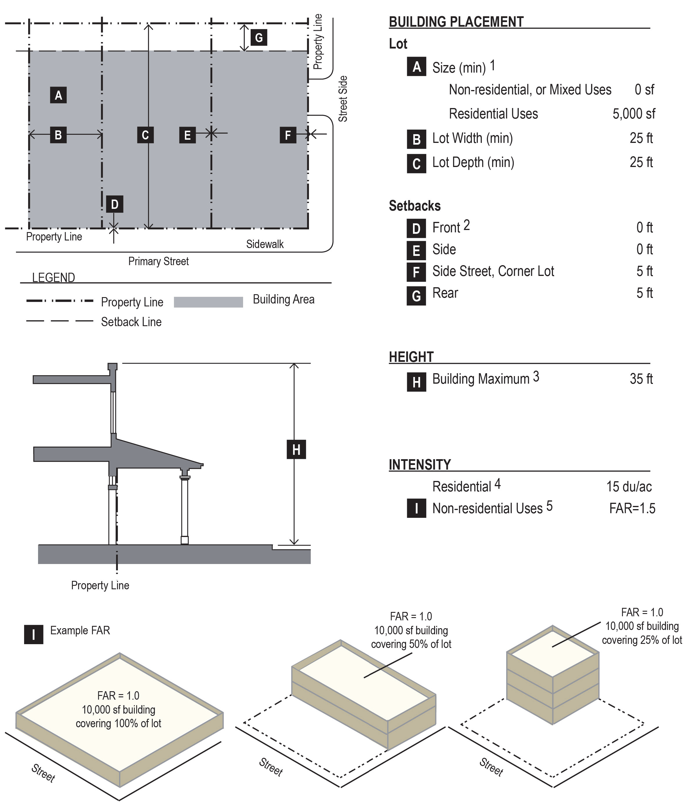
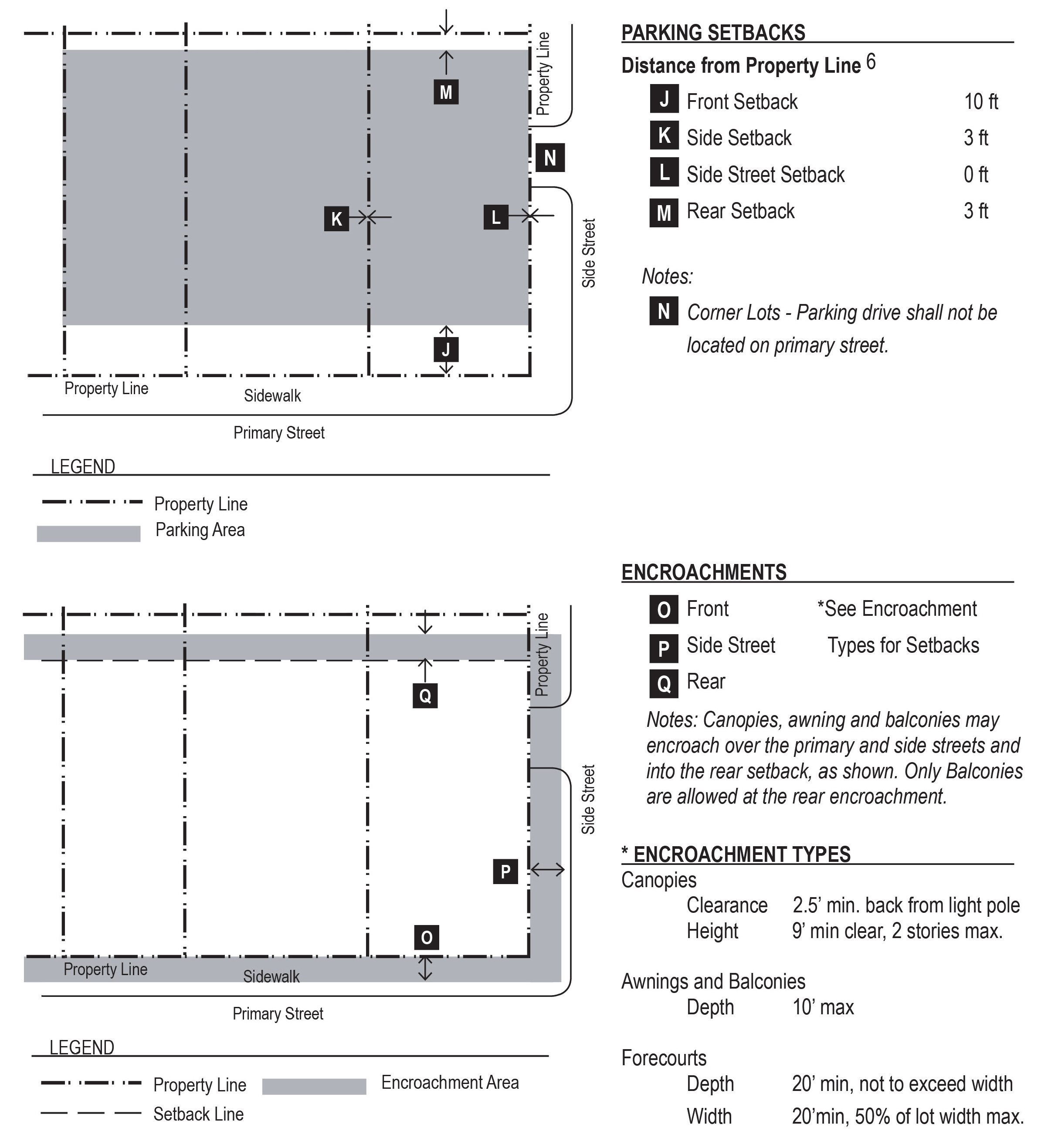
Notes:
1.
Lot size: There are no minimum lot size requirements for property being used exclusively for businesses, work/live units, or mixed use residential activity in the CORE District.
2.
Front setback: There is no minimum front building setback within the CORE District, except that the building face shall be set back as needed to achieve a minimum 15.5 feet sidewalk width to face of curb (where required).
3.
Building maximum: Building height shall be measured as defined by § 12-4-92.
4.
Residential intensity: Residential intensity shall be based on the total number of dwelling units per net acre of land. Net acreage excludes federally patented easements and public right-of-way.
5.
Non-residential intensity: Mixed use development shall allow a combination of the maximum FAR for non-residential development and the maximum density for residential development. Floor area ratio (FAR) as defined in § 12-4-92 shall apply to non-residential development only. Residential development intensity shall be based on residential density standards.
6.
Parking setback: Parking areas are encouraged to be located behind a building and/or screened by landscaping to reduce visibility from Van Buren Street, to the fullest extent possible. Where parking areas cannot be located behind a building, the minimum ten-foot front parking setback is intended to promote parking areas to be located on the side or rear of the buildings, as close to the rear of the property as possible. The three-foot side and rear parking setback may be waived by the City Engineer or designee if located adjacent to shared parking on adjoining lots.
(Ord. 531, N.S., passed 10-22-2013)
§ 12-4-95 - ARCHITECTURAL AND SITE DESIGN GUIDELINES.
(A)
General. The architectural design guidelines have been developed to ensure high standards of design are maintained in development and construction within the CORE District. Generally, these guidelines apply to both residential and non-residential projects, unless an individual guideline specifies a more narrow scope of application. Goals in this area are to provide a more human-scaled and pedestrian environment; to give more attention to details such as size, bulk and scale of buildings as well as the use of exterior site elements such as paseos and courtyards to provide more interest and feeling while encouraging mixed-use development to accommodate the mix of uses already existing in the area.
(B)
Review and approval. Architectural and site design within the CORE District shall be subject to site plan approval in accordance with § 12-4-169 of the Zoning Ordinance.
(C)
Design character. The architectural theme to be followed within the CORE District is a Santa Barbara-based Mission Revival style that blends the architecture of the Mediterranean, Italian, and Spanish traditions, with the architecture of the California Missions. This design emphasizes a handmade quality in its overall design and details, resulting in simple forms articulated by design orientation relative to strong sunlight. The buildings exhibit broad expanses of stucco surfaces, deep reveals, porches, and arcades. Buildings also have weather protecting colonnades and wall extensions to enclose garden spaces.
(D)
Materials and colors. Prominent features of the style included red clay tile roofs, use of balconies, smooth-stuccoed exterior walls usually painted white or off-white with arched openings, colorful accents such as tile work and landscaping.
(1)
Building materials generally consist of: adobe, stone, smooth stucco exterior wall surfaces, terra-cotta floor and roof tiles, and a limited use of milled lumber. Color selection for exposed wood trim should be dark stain.
(2)
Other features include low-key traditional colors, exposed stone and woodwork, Spanish/Mediterranean inspired ironwork, canvas, benches, fountains, arbors, signage, lighting, and traditional paving and landscaping.
(E)
Site and surrounding area.
(1)
Site planning is often characterized by enclosed patios and interior courtyards with somewhat formal planting. Pools, ponds, and fountains of traditional plan and form often have axial relationships to the structures and/or the fenestration of the building. The design of parking lots and various utilitarian structures (including trash enclosures) should reflect the Spanish tradition.
(2)
Relation to site. Where possible, buildings and additions should be designed to relate to the site's existing structures and to present an integrated appearance.
(3)
Area compatibility. In areas which possess examples of distinctive architecture, structures and additions should present a harmonious character to not clash or exhibit discord with the particular surrounding area in which they are placed. Structure elements should be consistent with the best elements that distinguish the particular area in which they are proposed. These elements include, but are not limited to: volume, size, massing, proportion, scale, bulk, rooflines, colors, textures and materials.
(F)
Roofs and walls.
(1)
Parapet walls and Spanish tile roofs are both acceptable. In any case, roof mounted equipment shall be screened on all four sides.
(2)
Walls are important to articulate building form. When no building setback is utilized from the property line, the wall plane adjacent to the property line shall provide visual interest. This may be accomplished by the use of arcades and niches. Niches can have either planters or seating. Seating with overhead pergola or vine can create pedestrian space.
(3)
Openings in walls for doors and windows should be deeply recessed and can be framed with plaster moldings and/or tile.
(G)
Architectural details.
(1)
Traditional details such as, but not limited to, decorative moldings, iron work, balconies and light fixtures are important to provide contrast to the wall surface.
(2)
Tile, brick and other similar accents can add additional pedestrian scale accents to building and site wall elevations.
(3)
Green screens/trellis may be permitted on private property if regularly maintained and repaired.
(H)
Paving.
(1)
Hard surface material may be masonry, brick, tile or concrete that is divided into smaller units. Decomposed granite or natural colored gravel are acceptable alternatives with banding and trim. Concrete unit pavers are acceptable if utilized in a scheme that compliments the aesthetic character.
(I)
Private art. Private art may be permitted, provided the following conditions are met:
(1)
Use permit and site plan approval in accordance with §§ 12-4-168 and 12-4-169, respectively, of this Zoning Code.
(2)
Artwork should complement the architectural design character and theme of the CORE District.
(3)
Property owners shall be responsible for maintenance and repair of the artwork in a timely manner.
(J)
Reserved.
(K)
Trash and refuse collection areas.
(1)
Trash and refuse collection, trash compaction, and recycling collection areas shall be screened so as to not be visible from a public street or parking area.
(2)
Latching gates shall be provided to screen refuse from street and/or public parking areas.
(3)
Openings should be oriented away from public right-of-way, where possible.
(4)
The gate and adjoining walls must be maintained in good working order and must remain closed except when trash pick-ups occur.
(5)
Service areas that are fully integrated into a building must be screened with a roll down door or other opaque screen.
(6)
Solid waste and recycling areas shall be consolidated to minimize the number of collection sites and located so as to reasonably equalize the distance from the building spaces they serve.
(7)
Storage areas shall be located so that the trucks and equipment used by the City of Tolleson have sufficient maneuvering areas.
(L)
Roof-mounted equipment.
(1)
Roof-mounted equipment must be screened from ground level view from adjacent property or adjacent public street right-of-way (not including an alley).
(2)
New buildings must provide a parapet wall or other architectural element that screens roof-mounted equipment from ground level view.
(3)
Existing buildings with no or low parapet walls must provide an opaque screen that screens roof-mounted equipment from ground level.
(M)
Wall-mounted equipment.
(1)
Wall-mounted equipment cannot be located on any surface that directly faces a public right-of-way (not including an alley).
(2)
Wall-mounted equipment located on any surface that is visible from a public right-of-way (not including an alley) must be fully screened by landscaping or an opaque screen.
(N)
Ground-mounted equipment. Ground-mounted mechanical equipment that is visible from a public right-of-way (not including an alley) must be fully screened by landscaping or an opaque screen.
(O)
Outdoor sales and display. Outdoor sales and display should enhance the pedestrian environment through the creative use of outdoor spaces by providing businesses the opportunity to display a sample of their products and to sell food and beverages in a manner that enhances the public space by creating an interesting and comfortable shopping and dining experience.
(Ord. 531, N.S., passed 10-22-2013; Am. Ord. No. 605, N.S., passed 8-23-2022)
§ 12-4-96 - LANDSCAPE, WALLS AND FENCES.
(A)
General applicability. Except as provided herein and within § 12-4-97, landscape, walls and fences shall comply with the following requirements as outlined below.
(B)
Landscape.
(1)
Plant materials shall be consistent with the plant materials for the downtown redevelopment project, a copy of which is on file in the offices of the Zoning Administrator.
(2)
The required front yard and street side-yard setbacks shall be entirely landscaped, except for driveway access areas.
(3)
In the front yard and street side-yard setback areas, at least one tree of 15-gallon minimum size, and three shrubs of five-gallon minimum size shall be installed for every 30 feet of street frontage along front and street side yards.
(4)
In a required side yard and rear yard setbacks, at least one tree of 15-gallon minimum size and one shrub of five-gallon minimum size shall be installed 20 feet on-center along adjacent residential property lines.
(5)
Any areas not landscaped with trees and shrubs shall be landscaped with ground cover or other approved landscape materials.
(6)
The property owner and/or lessee shall install and maintain all landscaped materials in accordance with the above standards, including the installation of an irrigation system to all landscaping areas containing living plant and vegetative material, unless otherwise approved.
(7)
The installation of drought tolerant, low-water consuming plants and vegetation, as designated by the Department of Water Resources and the following, is strongly encouraged.
(8)
Landscape materials and amenities shall be installed prior to issuance of any occupancy permits.
(9)
Lack of maintenance of any landscaped areas and materials shall constitute a violation of the Zoning Code.
(C)
Walls.
(1)
Walls must be constructed of high quality materials including one or a combination of the following: decorative blocks; brick; stone; caststone; split-faced block; stucco over standard concrete masonry blocks; glass block; or similar materials approved by the Zoning Administrator.
(2)
No walls containing more than 50% exposed standard concrete masonry blocks are allowed, whether painted or not.
(3)
No wall can be located within any required drainage or utility easement.
(D)
Fences.
(1)
Fences must be closed and be constructed of high quality materials including one or a combination of the following: wood, composite fencing, PVC vinyl, or other material approved by the Zoning Administrator.
(2)
The finished face of any fence must be located towards the adjacent property.
(3)
No fence can be located within any required drainage or utility easement.
(Ord. 531, N.S., passed 10-22-2013)
§ 12-4-97 - PARKING REGULATIONS.
To minimize the aesthetic and transportation related impacts of parking in downtown, the CORE District allows alternatives that reduce off-street and surface parking requirements. These alternatives ensure that parking facilities minimally affect the pedestrian environment. The intent of these parking regulations is to encourage a balance between compact, multi-modal pedestrian-oriented development and necessary car storage. The goal is to construct neither more nor less parking than is needed.
(A)
Applicability.
(1)
General.
(a)
No permit for reconstruction or repair of any building, or structure may be issued until parking has been provided by a combination of on-site parking, on-street parking, approved parking reduction by the Zoning Administrator, in accordance with the requirements of this Code.
(b)
No certificate of occupancy may be issued for any new construction, alteration, extension, or use of land, or any part thereof until parking has been provided by a combination of on-site parking, on-street parking, approved parking reduction by the Zoning Administrator, in accordance with the requirements of this Code.
(2)
Additions.
(a)
A building or site may be renovated or repaired without providing additional parking, provided there is no increase in floor area or improved site area.
(b)
When a building, use or site is increased in floor area or improved site area, parking is required for the additional floor or site area only.
(c)
When the floor area or improved site area is increased by more than 50% cumulatively, both the existing use and the additional floor or site area must conform to the parking requirements of this Code.
(3)
Change in use.
(a)
A change in use must comply with the parking requirements unless the use has the same or a lesser parking demand than the previous use.
(b)
Where required parking spaces for the new use exceed the required parking spaces for the existing use, additional parking is only required for the difference between the current parking spaces required and the parking spaces required for the new use.
(B)
Vehicle parking ratios. The following minimum parking spaces are required unless an alternative rate is approved by the Zoning Administrator:
(C)
Uses not specified. The parking requirements for any permitted or conditional use not listed in §§ 12-4-93 and 12-4-97(B) shall be determined by the Zoning Administrator based upon the requirements for the most similar comparable use, the particular characteristics of the proposed use, and any other relevant data regarding parking demand. In order to make this determination, the Zoning Administrator may require the applicant to submit a parking demand study or other information, at the applicant's cost.
(D)
Location of parking. Parking for each land use shall be provided by a combination of on-site parking, and off-site parking based on the following:
(1)
The Zoning Administrator, or designee may permit all or a portion of the required off-street parking spaces to be located on a remote and separate lot from the lot on which the principal use is located, subject to the standards of this section.
(a)
No off-site parking space may be located more than 300 feet from the principal use, measured from the edge of property to the closest perimeter of the surface parking or parking structure. This distance may be waived by the Zoning Administrator if adequate assurances are offered that van or shuttle service will be operated between the off-site parking areas and the principal use.
(b)
An agreement providing for the use of off-site parking, executed by the parties involved, must be filed with the Zoning Administrator in an approved form. Off-site parking privileges will continue in effect only as long as the agreement, binding on all parties, remains in force. The agreement(s) must guarantee long-term availability of the parking, commensurate with the use served by the parking, and shall be recorded with the County Recorder's Office. Should the off-site parking agreement(s) lapse or no longer be valid, then parking must be provided as otherwise required by this section.
(2)
On-street parking spaces located immediately adjacent to the frontage of the property may be counted towards required off-street parking for non-residential uses. One on-street space may be substituted for each required off-site space. This provision shall only apply to street frontages where on-street parking is allowed and provided. The parking space credit shall be determined at the time of site plan approval.
(3)
No parking spaces are required for accessory structures that are 500 square feet or less.
(4)
Shared drives are encouraged between adjacent lots to minimize curb cuts along the street.
(5)
Vehicles parked off-site may not encroach on a sidewalk.
(6)
Parking, loading and maneuvering areas shall not be within the front yard setback, but may be permitted in the street side-yard by the Zoning Administrator.
(E)
Accessible parking.
(1)
Accessible parking for non-residential developments shall be provided in conformance with the Americans with Disabilities Act (ADA), Arizonans with Disabilities Act (AZDA) and International Building Code (IBC), as amended.
(2)
Accessible parking for multiple-family residential developments shall be provided in conformance with the Americans with Disabilities Act (ADA), Federal Fair Housing Amendments Act (FFHAA) and International Building Code (IBC), as amended.
(F)
Parking reductions. The city may allow a variation from the required number of parking spaces if supported by a parking demand analysis, completed in conformance with the procedures as outlined below:
(1)
Application, review, and approval process.
(a)
For new developments where the number of parking spaces being proposed does not meet the city's minimum requirements, a parking demand analysis shall be submitted as part of the applicant's building permit submittal.
(b)
For existing developments where a change in the use of a building or site would result in fewer parking spaces being provided than the minimum requirement allows, a parking demand analysis is required to be submitted concurrently with tenant improvement plans.
(c)
The Zoning Administrator may approve a request to modify the required number of parking spaces in accordance with the process outlined in this section.
(2)
The parking demand analysis shall be prepared by a qualified parking or traffic consultant, a licensed architect, or a civil engineer.
(3)
The parking demand analysis as approved by the Zoning Administrator or designee, shall analyze the needs of every proposed use in the project, using the vehicle parking ratios within § 12-4-97(B).
(4)
The parking demand analysis shall provide a quantitative analysis justifying any proposed reduction in parking. Decreases in the number of parking spaces may be granted when any of the following applies:
(a)
A business currently employs more people per square foot (or less people per square foot) than the accepted industry standard for that use, and is able to demonstrate this variation from the mean through a statistical comparison.
(b)
Lowered parking demand can be predicted as a result of sharing parking between intermittent uses, occurring on the same property, with non-conflicting parking demands (e.g. a nightclub and a bank).
(c)
A development is designed to take advantage of adjacent public transit opportunities.
(5)
The amount of required parking may be reduced by up to 30% where it can be determined that the peak requirements of the several occupancies occur at different times and where a shared parking operations plan, approved by the Zoning Administrator or designee, shows that this reduction in parking will not cause conflicts among nearby uses. Such a shared parking analysis may be based on:
(a)
Intermittent non-conflicting uses. When required parking reductions are predicted as a result of sharing between intermittent uses with non-conflicting parking demands (e.g. a nightclub and a bank), then the reduction can be considered.
(b)
Parking occupancy rates. When the parking reduction has been shown to be feasible by using the demand calculations as determined by an analysis of typical local parking demand.
(6)
Existing parking surveys. When a study of existing parking shows parking occupancy rates of morning, afternoon and evening peaks on all seven days of the week. The seven days of observation may take place over the span of two consecutive, typical weeks. A combination of similar circumstances may be necessary to cover all the proposed land uses. The approximate square footages of the various land uses of the specimen projects shall be compared to the proposed project to allow the ratios of uses to be rated accordingly.
(G)
Approval criteria.
(1)
Requests for parking reductions. In order to approve any request to reduce parking below minimum requirements, all of the following criteria must be met:
(a)
The reduction in parking will not cause fewer off-street parking spaces to be provided for the proposed use than the number of such spaces necessary to accommodate all vehicles attributable to such use under the normal and reasonably foreseeable conditions of operation of such use.
(b)
The reduction in parking will not increase the demand for parking spaces upon the public streets and adjacent property in the immediate vicinity of the proposed use.
(H)
Parking lot landscaping.
(1)
Applicability.
(a)
This section applies to all on-site surface parking lots with more than ten spaces created after the effective date of this Code, except as provided under paragraph (b) below. For purposes of this section, multiple platted lots contained on a single site plan and any separate parking areas connected with drive aisles are considered a single parking area.
(b)
An existing parking lot may be renovated or repaired without providing additional landscaping, provided there is no increase in the size of the parking lot.
(c)
When an existing parking lot is increased landscaping is required for the additional parking area only.
(d)
When an existing parking lot is increased by more than 10% cumulatively, landscaping is required for both the existing parking lot and the new parking area.
(2)
Perimeter screening. All surface parking lots with frontage on any portion of a street right-of-way (not including an alley) must be screened with the following:
(a)
A minimum eight-foot-wide, landscaped area with a continuous row of shrubs must be provided between the street and parking lot.
(b)
Shrubs must be a minimum of 18 inches in height when planted and must reach a minimum size of 36 inches in height within three years of planting.
(c)
A 36-inch wall in a minimum five-foot planting strip may be substituted for the continuous row of shrubs. The wall shall be in character with the building at the right-of-way (ROW).
(d)
Breaks for pedestrian and vehicle access are allowed.
(3)
Median islands.
(a)
A landscaped median island must be provided every ten parking spaces and shall include one 24-inch box tree per required island. Median islands must be distributed evenly throughout the parking area, and shall be same size as adjacent parking spaces. Stormwater harvesting in planting zones is encouraged.
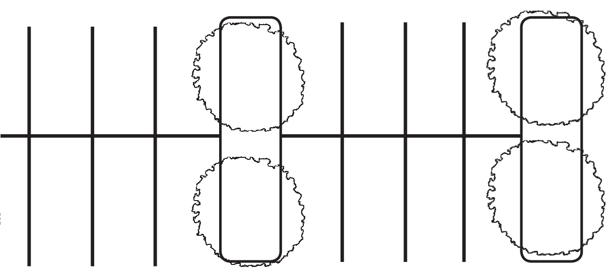
(b)
An interior or terminal median island must be a minimum of five feet in width and 300 square feet in area.
(c)
All rows of parking must terminate with a landscaped terminal island. No more than 30 parking spaces may be located between drive aisles.
(d)
Median islands may be consolidated or intervals may be expanded in order to preserve existing trees.
(e)
Median islands must be installed at-grade of the parking lot surface to allow for stormwater harvesting.
(f)
A median island may also serve as the location for a sidewalk. In such case, the sidewalk must be a minimum of four feet wide, and the remaining planting area must be no less than six feet wide on either side of sidewalk.
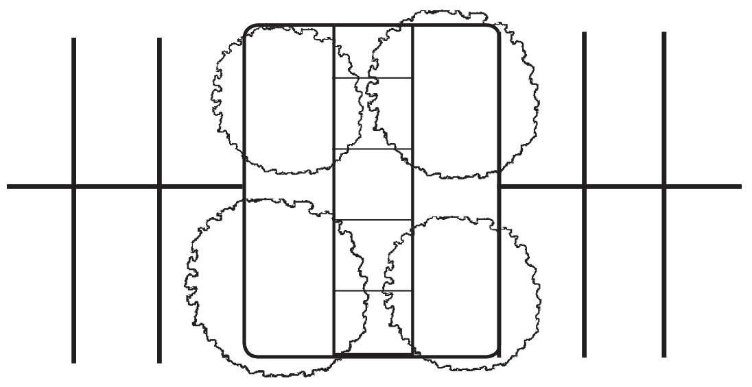
(4)
Tree coverage.
(a)
Each median island (and terminal interior island) must include at least one 24-inch box shade tree per row of parking as shown in § 12-4-97(H)(3)(a).
(b)
In no case can there be less than one tree for every 3,000 square feet of parking area.
(I)
Surfaces.
(1)
Impervious materials. Where on-site facilities are provided for parking or any other vehicular use areas, they must be surfaced with asphalt bituminous, concrete or other type of dustless material approved by the City Engineer and maintained in a smooth, well-graded condition.
(2)
Pervious materials. Pervious or semi-pervious parking area surfacing materials may be approved by the City Engineer. Permitted materials may include but are not limited to grass, "grasscrete," ring and grid systems used in porous or grid pavers, or recycled materials such as glass, rubber, used asphalt, brick, unit pavers, block, concrete, or roller-compacted or stabilized decomposed granite. Stormwater harvesting in landscape areas is encouraged.
(3)
Curbs and drainage.
(a)
All surface parking areas must be graded and drained to collect, retain, and infiltrate surface water accumulation on-site to the greatest extent practicable.
(b)
Curbs or parking blocks are required at the edges of perimeter and interior landscaped areas. Curbing must have openings to allow drainage to enter and percolate through the landscaped area.
(J)
Vehicle loading areas.
(1)
Loading not required. If determined necessary by the City Engineer, adequate space must be made available on-site for the unloading and loading of goods, materials, items or stock for delivery and shipping.
(2)
Location. If a loading area is provided, it must meet the following standards:
(a)
The loading area must be located on the same lot occupied by the use served and must be accessible from a public street or alley.
(b)
The loading area must be located to the side or rear of buildings. Loading areas may not be placed between the street and the associated building.
(c)
With the exception of areas specifically designated by the city, loading and unloading activities are not permitted in the public right-of-way.
(d)
Loading and unloading activities may not encroach on or interfere with the use of sidewalks, drive aisles, queuing areas and parking areas by vehicles or pedestrians.
(Ord. 531, N.S., passed 10-22-2013)
§ 12-4-98 - SIGNAGE REGULATIONS.
(A)
Applicability. No sign may be erected, altered, refurbished or otherwise modified after the effective date of this Code except in accordance with the requirements of this section.
(B)
Nonconforming signs.
(1)
An existing sign may change the face or panel of the sign that does not meet the area or height standards within this section. However, in no instance must there be an increase in the degree of nonconformity. All new panels shall conform to all current illumination standards.
(2)
A sign must be brought into compliance with the provisions of this section if at any time the sign is altered, repaired, restored or rebuilt to the extent that the cost exceeds 50% of the estimated replacement cost of the sign (in current dollar value). All sign permits within any six consecutive calendar months will be aggregated for purposes of measuring the 50% standard.
(3)
If the repair is caused by involuntary damage or casualty, the sign may be repaired to any extent.
(C)
Common sign plan. A common sign plan must be filed with the Zoning Administrator for all sites occupied by more than one tenant or requesting digital signage. After the filing of a common sign plan, all tenant signs must meet the requirements of the common sign plan. The applicant must indicate the standards of consistency of all signs on the subject property with regard to:
(1)
Lighting;
(2)
Colors;
(3)
Letter/graphics style;
(4)
Location of each sign;
(5)
Materials used in sign construction; and
(6)
Maximum dimensions and proportion.
(D)
Sign types.
(1)
Signs types allowed in the CORE District are shown below. Specific sign requirements for each type are provided in subsequent sections. Additional types may be permitted by the Zoning Administrator if they are deemed to meet the District's intent and code requirements.
(a)
Wall sign.
(b)
Awning sign.
(c)
Canopy sign.
(d)
Projecting sign.
(e)
Shingle sign.
(f)
Window sign.
(g)
Monument sign.
(h)
Bracket sign.
(i)
Sidewalk sign.
(2)
Digital signs may be permitted by the City Council through the approval of a use permit application if deemed appropriate to the character and intent of the District. A common sign plan depicting all digital and non-digital signage for the property shall be filed with the Zoning Administrator and meet the requirements of § 12-4-98(C).
(3)
Temporary signs are permitted as provided below:
(a)
Includes, but not limited to, grand opening or special event banners, flags, tents, canopies or other similar displays.
(b)
Temporary signs, except human directional (billboards) and sign spinners, may be permitted subject to the approval of a use permit pursuant to §§ 12-4-168 through 12-4-170 for a maximum of 30 days, which may be used consecutively, within a six-month period. One administrative extension may be granted, within the same semi-annual period, after written request by the applicant to the Zoning Administrator.
(c)
Temporary displays shall consist of durable materials and of a quality in keeping with the intent of the CORE District. Frayed or worn materials or displays shall be prohibited.
(d)
Tents, canopies and similar structures shall be reviewed and approved by the Fire Department.
(4)
Inflatable signs, sign walkers, human directional (billboards) and sign spinners are prohibited within the CORE District.
(E)
Allocation of sign area. The maximum allowed sign area that may be utilized with any combination and any number of signs within each category is provided below:
(1)
Building signs:
(a)
For wall signs, awnings, canopies and projecting signs, the maximum sign area is one square foot per one linear foot of street-facing building façade.
(b)
Shingle sign maximum sign area is nine square feet.
(c)
Window sign maximum sign area is 30 percent of window area.
(2)
Ground signs:
(a)
Bracket sign maximum sign area is nine square feet.
(b)
Sidewalk sign maximum sign area is six square feet.
(F)
Wall sign. Wall sign is building sign placed against a building and attached to the exterior front, rear or side wall, extending no more than 12 inches, so that the display surface is parallel to the plane of the wall. Signs painted on an exterior of a wall are considered wall signs.
(1)
No portion of a wall sign may extend above the roof line or above a parapet wall of a building with a flat roof.
(2)
No portion of a wall sign may extend above the lower eave line of a building with a pitched roof.
(3)
A wall sign cannot cover windows or architectural details.
(4)
A wall sign can be externally or internally illuminated in accordance with § 12-4-98(O), Sign Illumination.
(5)
Refer to § 12-4-98(E) for maximum sign area allocation.
(6)
Maximum projection shall be 12 inches.
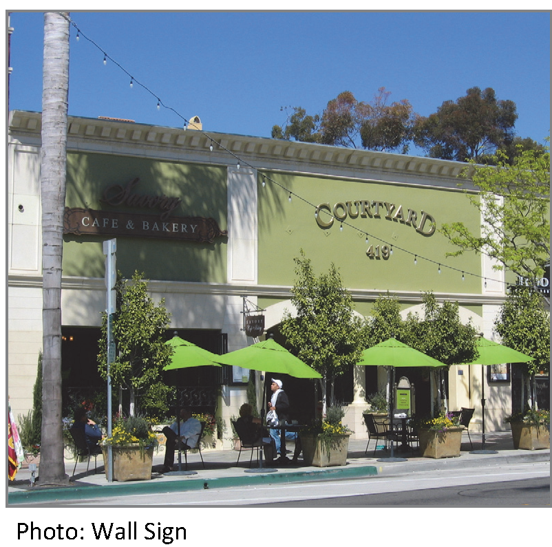
(G)
Awning sign. Awning sign is a building sign where graphics or symbols are painted, sewn, or otherwise adhered to the awning material as an integrated part of the awning itself.
(1)
An awning sign cannot extend outside the awning.
(2)
Only awnings on ground floor doors or windows may contain signs.
(3)
A maximum of one sign is allowed per awning face.
(4)
An awning sign may only be externally illuminated in accordance with § 12-4-98(O), Sign Illumination.
(5)
Refer to § 12-4-98(E) for maximum sign area allocation.
(6)
Maximum width or percentage of awning width to depth ratio is 75%.
(7)
Maximum height of text and graphics on valance is two feet.
(8)
Maximum area of sloping plane covered by sign is 25%.
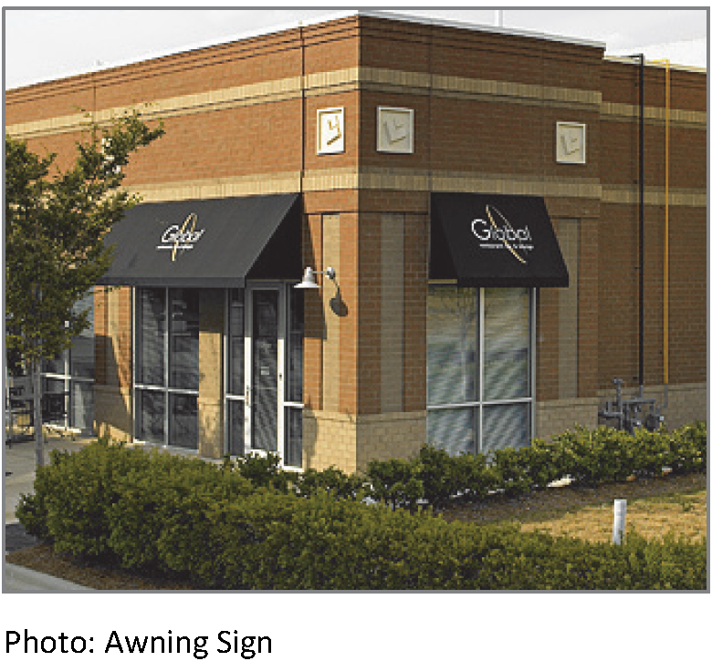
(H)
Canopy sign. Canopy sign is a building sign placed on a canopy so that the display surface is parallel to the plane of the wall.
(1)
A canopy sign cannot extend outside the overall length or width of the canopy. However, a canopy sign may extend above or below the canopy provided the sign meets the standards below.
(2)
A maximum of one sign is allowed per canopy face.
(3)
Raceways are permitted for signs extending below or above the canopy. Otherwise, raceways are not permitted and the sign must be flush with the canopy face.
(4)
A canopy sign can be externally or internally illuminated in accordance with § 12-4-98(O), Sign Illumination.
(5)
Refer to § 12-4-98(E) for maximum sign area allocation.
(6)
Maximum percentage of canopy width is 75%.
(7)
Maximum height of text and graphics is two feet.
(8)
Minimum clear height above sidewalk is ten feet.
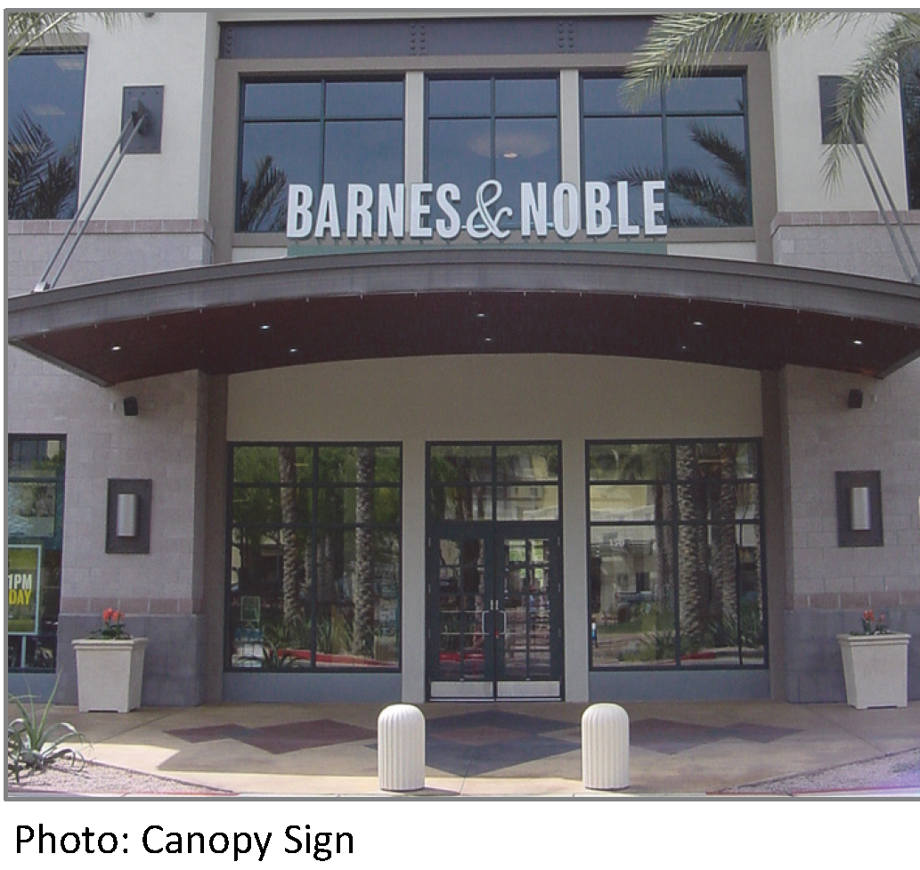
(I)
Projecting sign. Projecting sign is a building sign attached to the building façade at a 90-degree angle, extending more than 12 inches. A projecting sign may be two- or three-dimensional.
(1)
A projecting sign must be located at least 25 feet from any other projecting sign.
(2)
A projecting sign may be erected on a building corner when the building corner adjoins the intersection of two streets. Allocation of sign area from both streets may be used; however, in no case can the sign exceed the maximum height and width standards.
(3)
The top of a projecting sign can be no higher than the top of the building. However, on one story buildings, the top of a projecting sign may have a maximum of 20% of the sign height above the top of the building.
(4)
A projecting sign can be externally or internally illuminated in accordance with § 12-4-98(O), Sign Illumination.
(5)
Refer to § 12-4-98(E) for maximum sign area allocation.
(6)
Maximum sign area height is ten feet for a one story building, and 14 feet for a two-story building.
(7)
Minimum spacing from building façade is one foot.
(8)
Maximum projection width is six feet.
(9)
Maximum depth is one foot.
(10)
Minimum clear height above sidewalk is ten feet.
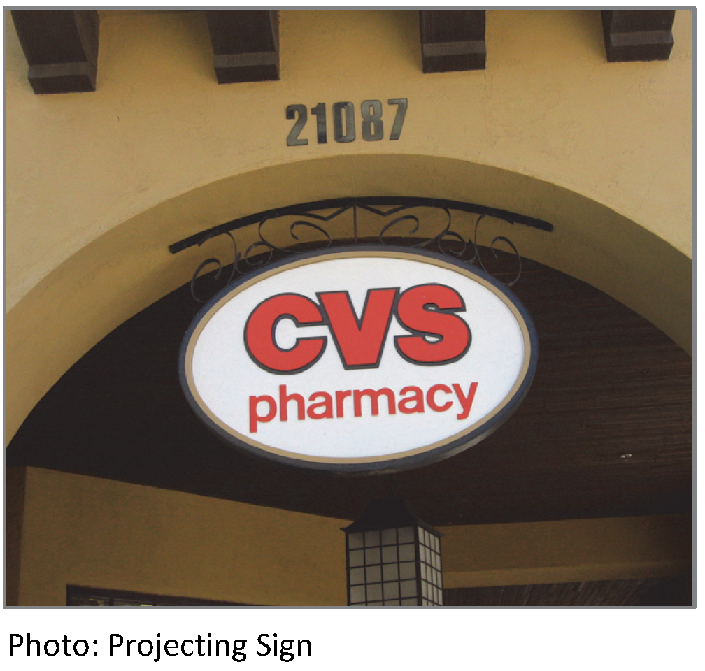
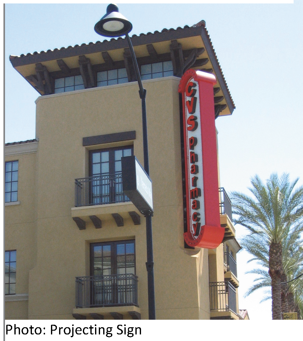
(J)
Shingle sign. Shingle sign is a small projecting sign that hangs from a bracket or support and is located over or near a building entrance.
(1)
A shingle sign must be located within five feet of an accessible building entrance.
(2)
The hanging bracket must be an integral part of the sign design.
(3)
A shingle sign must be located below the window sills of the second story on a multi-story building or below the roof line on a single-story building.
(4)
A shingle sign cannot be illuminated.
(5)
Maximum sign area per sign is nine square feet.
(6)
Maximum sign area height is three feet.
(7)
Minimum spacing from building façade is six inches.
(8)
Maximum projection width is three and one-half feet.
(9)
Maximum depth is six feet.
(10)
Minimum clear height above sidewalk is ten feet.
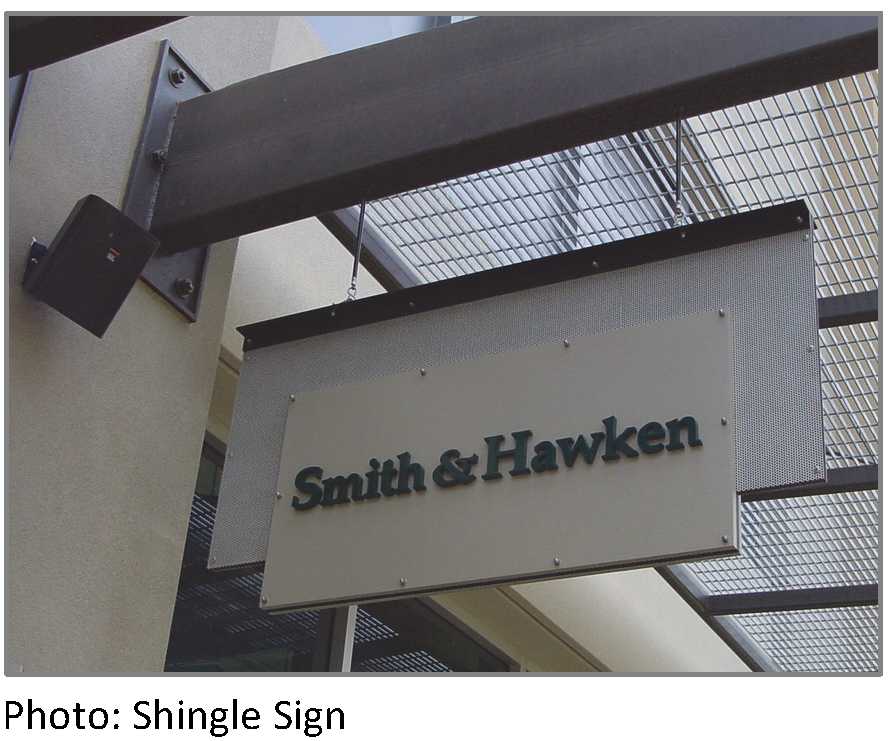
(K)
Window sign. Window sign is a building sign affixed to the inside of a window or door, or a sign placed within a building so as to be plainly visible and legible through a window or door.
(1)
Window signs are only allowed on ground floor windows.
(2)
A window sign can only be internally illuminated in accordance with § 12-4-98(O), Sign Illumination.
(3)
The maximum area of all ground floor windows covered by signs is 30%.
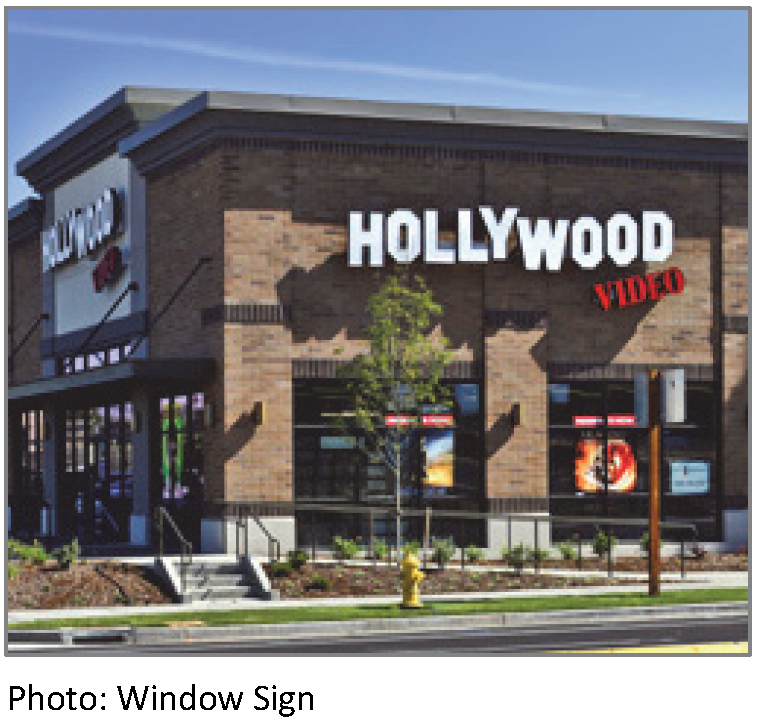
(L)
Monument sign. Monument sign is a freestanding sign attached along its entire length to a continuous pedestal that is no higher than six feet. A monument sign is horizontally oriented or is square.
(1)
One monument sign is allowed per street frontage, except that one additional monument sign is allowed for properties with 200 feet or more of street frontage. Where more than one monument sign is permitted, signs along the same street frontage must be spaced a minimum of 150 feet apart.
(2)
A monument sign must be set back at least five feet from the front property line and ten feet from a side property line.
(3)
A sign erected on a retaining wall is required to meet the standards for a monument sign. The height of the wall is included in the overall height calculation.
(4)
A monument sign can be externally or internally illuminated in accordance with § 12-4-98(O), Sign Illumination.
(5)
Maximum sign area per sign is 36 square feet.
(6)
Maximum sign area height is six feet.
(7)
Maximum depth is 18 feet.
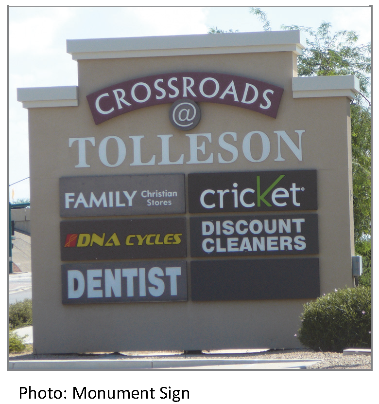
(M)
Bracket sign. Bracket sign is a freestanding sign attached to the ground by one or more support structures that is not higher than five feet and hangs from a bracket or support.
(1)
Only one bracket sign is allowed per building.
(2)
A bracket sign must be located at least 25 feet from any other bracket sign.
(3)
The hanging bracket must be an integral part of the sign design.
(4)
A bracket sign can only be externally illuminated in accordance with § 12-4-98(O), Sign Illumination.
(5)
Maximum sign area per sign is nine square feet.
(6)
Maximum sign structure height is five feet.
(7)
Maximum sign area height is three feet.
(8)
Maximum width is three feet.
(9)
Maximum structure to area depth is six feet.
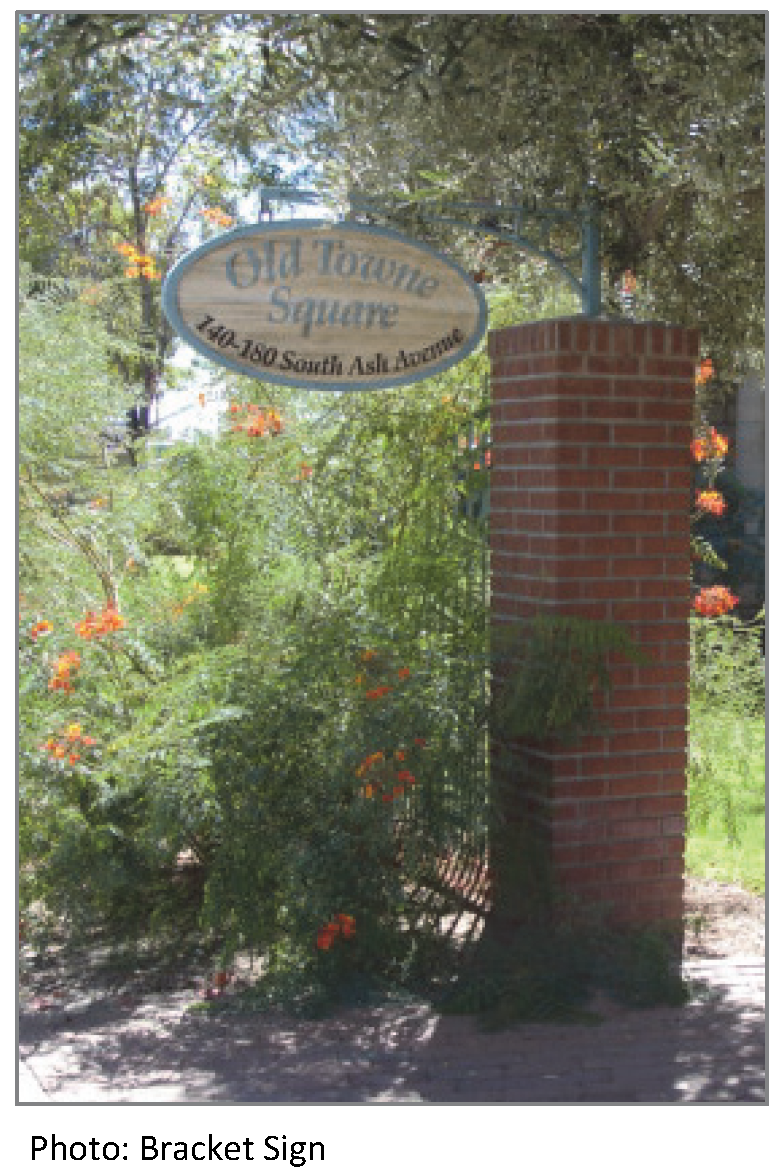
(N)
Sidewalk sign. Sidewalk sign is a moveable freestanding sign not secured or attached to the ground or surface upon which it is located and is subject to review and approval by the Zoning Administrator.
(1)
Sidewalk signs should be designed to attract pedestrians, not passing motorists.
(2)
Each ground floor tenant can have one sidewalk sign that must be located adjacent to the business that it advertises.
(3)
Sidewalk signs must be removed and placed indoors at the close of business each day.
(4)
Sidewalk signs cannot obstruct vehicular, bicycle or pedestrian traffic. A minimum three feet access way, or larger as required by ADA regulations must be maintained.
(5)
Sign materials shall be sturdy and not subject to fading or damage from weather. The use of paper or cloth is not permitted unless located within a glass or plastic enclosure.
(6)
A sidewalk sign cannot be illuminated.
(7)
Maximum sign area per sign is six square feet.
(8)
Maximum height is three feet.
(9)
Maximum width is two feet.
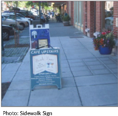
(O)
Sign illumination. Illumination of signs must be in accordance with the following requirements:
(1)
External illumination.
(a)
External light sources must be placed close to, and directed onto, the sign and shielded to minimize glare into the street, sidewalks or onto adjacent properties.
(b)
Projecting light fixtures used for externally illuminated signs shall be simple and unobtrusive in appearance. They should not obscure the sign.
(2)
Internal illumination.
(a)
Channel letters may be internally lit or back-lit.
(b)
For cabinet signs, the background must be opaque or a darker color than the message of the sign.
(c)
Exposed neon may be used for lettering or as an accent.
(3)
Prohibited light sources. The following light sources are not allowed:
(a)
Blinking, flashing and chasing; and
(b)
Bare bulb illumination, excludes decorative or festoon lighting.
(4)
Raceways and transformers.
(a)
If a raceway is necessary, it cannot extend in width or height beyond the area of the sign.
(b)
A raceway must be finished to match the background wall or canopy, or integrated into the overall design of the sign.
(c)
Visible transformers are not allowed.
(P)
All signs located in the CORE District shall be subject to the maintenance requirements of § 12-4-134 and prohibited signs under § 12-4-135.
(Ord. 531, N.S., passed 10-22-2013; Am. Ord. 560, N.S., § 6, passed 12-8-2015)
§ 12-4-99 - SITE LIGHTING REGULATIONS.
(A)
Applicability.
(1)
No permit for the construction, reconstruction, extension, repair, or alteration of any building, structure, or use of land, and no building or land, or any part of any building or land, may be occupied or used until lighting has been provided in accordance with the requirements of this Code.
(2)
The installation of site lighting, replacement of site lighting, and changes to existing light fixture wattage, type of fixture, mounting, or fixture location must be made in compliance with this Code. Routine maintenance, including changing the lamp, ballast, starter, photo control, fixture housing, lens and other required components, is allowed for all existing fixtures.
(3)
This section does not apply to lighting installed in the public right-of-way.
(4)
Additions:
(a)
When a building or site is renovated or repaired, any new or replaced outdoor light or lighting fixture must conform to the requirements of this Code.
(b)
When the gross floor area or improved site area is increased, the additional floor or site area must conform to the lighting requirements of this Code.
(c)
When the gross floor area or improved site area is increased by more than 50% cumulatively, both the existing use and the additional floor or site area must conform to the lighting requirements of this Code.
(5)
Change in use. A change in use does not trigger application of this section except when there is a specific use standard requiring lighting for a new use.
(6)
Light level measuring:
(a)
Light levels are specified, calculated and measured in footcandles. All footcandle values are maintained footcandles.
(b)
Measurements are to be made at ground level, with the light-registering portion of the meter held parallel to the ground pointing up.
(7)
Prohibited sources. The following light fixtures and sources cannot be used:
(a)
Cobra-head-type fixtures having dished or drop lenses or refractors;
(b)
Temporary searchlights and other high-intensity narrow-beam fixtures; and
(c)
Light sources that lack color correction or do not allow for uniform site lighting.
(8)
Design and installation requirements:
(a)
The maximum light level of any light fixture cannot exceed one-half footcandles measured at the property line of any protected district and two footcandles measured at the right-of-way line of a street.
(b)
Lighting must not be oriented onto adjacent properties, streets or sidewalks.
(c)
Service connections for all freestanding lighting fixtures must be installed underground.
(d)
Energy-efficient LED lighting is highly encouraged for parking and pedestrian areas.
(9)
Parking and pedestrian areas:
(a)
Light fixtures within parking areas may be no higher than 30 feet.
(b)
Light fixtures within pedestrian areas may be no higher than 15 feet.
(c)
Light fixtures located within 50 feet of the property line of a protected district may be no higher than 15 feet.
(d)
All light fixtures must be full cutoff.
(10)
Flood lights and flood lamps:
(a)
Flood light fixtures must either be aimed down at least 45 degrees from horizontal, or the front of the fixture shielded so that no portion of the light bulb extends below the bottom edge of the shield.
(b)
Any flood light fixture located within 50 feet of a street right-of-way must be mounted and aimed perpendicular to the right-of-way, with a side-to-side horizontal aiming tolerance not to exceed 15 degrees.
(Ord. 531, N.S., passed 10-22-2013)
§ 12-4-100 - PURPOSE AND INTENT.
(A)
The landscape and screening regulations are intended to provide standards for installation of landscape materials, including trees, shrubs, and ground covers to promote the general welfare of the city by creating an attractive appearance, facilitated control of erosion, reduce glare and dust and provide shade.
(B)
The landscape and screening regulations are intended to provide standards for the erecting of screening devices, including walls, fences and other structures to allow for the separation of incongruous uses, effectuation of privacy and the screening of unattractive uses.
(Ord. 274, passed 7-28-1987)
§ 12-4-101 - LANDSCAPE REGULATIONS.
(A)
The landscape standards of this section apply to all new buildings and uses and expansions of buildings and uses in all zoning use districts. Single family residences not being developed as a P.A.D. are excepted from these regulations.
(B)
Landscaping shall be designed and installed in compliance with the following standards.
(1)
Portions of street right-of-way not used for pavement, curbs, gutters, and sidewalks shall be entirely landscaped with trees, shrubs or gardens, except for driveway access, in addition to minimum on-site landscape requirements.
(2)
The required front yard and street side-yard setbacks shall be entirely landscaped, except for driveway access areas. Parking, loading and maneuvering areas shall not be within the front yard or street side-yard setbacks.
(a)
In the front yard and street side-yard setback areas, at least one tree of 15 gallon minimum size, and three shrubs of five-gallon minimum size shall be installed for every 30 feet of street frontage along front and street side yards.
(b)
Any areas not landscaped with trees and shrubs shall be landscaped with ground cover or other approved landscape materials.
(3)
The required interior side-yard and rear yard setbacks of any lot being developed for multi-family, mobile home park, recreational vehicle park, commercial or industrial uses shall be entirely landscaped when adjacent to or separated only by an alley from a residential use district or residential use.
(a)
In a required side yard and rear yard setbacks, at least one tree of 15-gallon minimum size and one shrub of five-gallon minimum size shall be installed 20 feet on-center along adjacent residential property lines.
(b)
Any areas not landscaped with trees and shrubs shall be landscaped with ground cover or other approved landscape materials.
(4)
In all residential developments, other than single family, interior, common open-space areas, excluding required yard setbacks, shall be landscaped and amenities installed, including at least one shade tree and two shrubs per dwelling unit.
(5)
In any common parking area, at least one shade tree and one shrub shall be installed for every ten parking spaces provided within the interior of the parking area.
(C)
The property owner and/or lessee shall install and maintain all landscaped materials in accordance with the above standards, including the installation of an irrigation system to all landscaping areas containing living plant and vegetative material, unless otherwise approved.
(D)
The installation of drought tolerant, low-water consuming plants and vegetation, as designated by the Department of Water Resources and the following, is strongly encouraged.
(1)
The use of cactus and/or other succulents indigenous to arid regions may be substituted for up to 50% of the required shrubs.
(2)
Cactus and other arid region plants with a minimum height of six feet at installation may be substituted for up to 50% of the required trees, except for those required abutting residential uses and districts along the side and rear lot lines.
(3)
Irrigation systems may be deleted where cactus, succulents, and other indigenous arid-region plants and vegetation are used, if alternate watering plans for the establishment of the plants is approved.
(E)
Landscape materials and amenities shall be installed prior to issuance of any occupancy permits.
(F)
Lack of maintenance of any landscaped areas and materials shall constitute a violation of the zoning code.
(Ord. 274, passed 7-28-1987)
§ 12-4-102 - SCREENING REGULATIONS.
(A)
The screening standards of this section apply to all new buildings and uses and to expansions of buildings and uses in all zoning districts and the P.A.D. District. Single-family residences not being developed as a P.A.D. are excepted from these requirements unless hereinafter specified.
(B)
Screening devices and structures shall be installed in compliance with the following standards for all residential uses including single family residences.
(1)
In all residential districts or residential developments, the maximum height of any opaque or wall constructed in any portion of the required front-yard setback shall not exceed three feet six inches.
(2)
In all residential districts and residential developments, the maximum height of fences and walls in required side and rear yard setbacks shall not exceed six feet.
(3)
No fence, wall, hedge or shrub planting which obstructs lines of visibility at elevations between three feet and six feet above the street grade shall be placed or permitted to remain on any corner lot within the triangular area formed by the street property lines and a line connecting them at points 25 feet from the intersection of the street property lines extended, nor on any lot within the triangular area formed by the street property lines and the side boundaries of any driveway and a line connecting them at a point ten feet from the intersection of a street property line with the edge of a driveway. No tree shall be permitted to remain within the distances or the intersections unless the foliage line is maintained at sufficient height to prevent obstruction of the lines of visibility.
(4)
In those residential districts which permit the keeping of livestock, fences shall be constructed of metal rail or wood rail and be limited to a maximum height of five feet.
(5)
Fences or walls shall be constructed around swimming pools having a minimum height of five feet and maximum height of six feet to provide inaccessibility to small children; the fences or walls, if constructed of open-type materials, shall have no more than four-inch apertures between structural elements in any vertical or horizontal direction from the ground to the top of the structure, and shall have self-closing gates with self-latching latches located at minimum 54 inches above the ground. Also see Tolleson Swimming Pool Procedures and Standards.
(C)
In residential, commercial and industrial developments, excluding single family not part of a P.A.D., the following is required.
(1)
All outdoor storage areas for materials, trash, mechanical equipment, vehicles or other similar items shall be screened from view by a minimum six-foot high wall constructed of or finished with materials to match the main building of the site.
(2)
Parking areas shall be screened from street view to a minimum height of three feet above the highest finished grade of the parking area.
(a)
Industrial lots not adjacent to an arterial street shall be screened by the use of walls, berms, landscaping or any combination of the three.
(b)
All other areas shall be screened by the use of walls, berms or combination of the two. The screening may be supplemented by up to 25% intermittent landscaping.
(3)
All loading, delivery and service bays shall be screened from street view by a wood, brick, slump block, masonry wall with stucco or mortar wash, or compatible alternatives approved by the Zoning Administrator and the screen shall be six feet in height. See Masonry Wall or division (5)(c) below.
(4)
Roof-mounted mechanical equipment shall be screened by parapet walls or other screening devices to be no lower in height than six inches below the height of the mechanical equipment on side, front or rear walls, whichever is adjacent to public streets or residential districts.
(5)
A brick, slump block or masonry wall with stucco or mortar wash finish, or compatible alternative approved by the Zoning Administrator (collectively, the "Wall") shall be constructed as follows. (See Ord. 380, N.S., passed 3-23-1999)
(a)
To a height of six feet on a lot used for commercial, mobile home park or multi-family use along any lot line abutting against, in common with, or separated only by an alley from, a residence or residential district. (See Ord. 380, N.S., passed 3-23-1999)
(b)
To a height of six feet on a lot used for industrial use along all lot lines other than those lot lines abutting against or in common with the public rights-of-way that the property use for ingress and egress (the "Frontage Lot Lines"). Notwithstanding the foregoing, the city may require a wall to be constructed to a height not to exceed six feet along all or part of the frontage lot line as may be deemed necessary by the Zoning Administrator to shield the property's activities from the public. (See Ord. 380, N.S., passed 3-23-1999)
(c)
Definition. MASONRY WALL. The "Wall" shall be constructed of standard eight inches by eight inches by 16 inches and shall be in conformance with ASTM C90 for load bearing concrete masonry unit. See Ordinance 380 N.S. for the "Wall."
(6)
All outdoor lighting shall be directed down and screened away from adjacent properties and streets.
(7)
In Commercial and I-1 and I-2 Industrial Districts, the walls may be constructed to a maximum of eight feet around the boundary of the uses unless the wall(s) are also exterior building walls in which case the wall height is subject to the building height limitation for the zoning district. (See Ord. 380, N.S., passed 3-23-1999)
(8)
No hazardous materials may be used or located on the top of a required or permitted wall in any district. (See Ord. 380, N.S., passed 3-23-1999)
(9)
In all districts, fences constructed of chain link wire, wire mesh, multiple strands of wire and the like are prohibited unless the fence is completely screened from public view, from any public rights-of-way or any adjacent property by landscaped berms, masonry walls, or compatible opaque alternatives approved by the Zoning Administrator.
(10)
In Commercial and Industrial Districts, wrought iron or tubular steel fences which are visible from either public rights-of-way or adjacent property are allowed in lieu of screening materials otherwise required by this section, only if approved by the City Council in conjunction with a new or amended site plan application.
(Ord. 274, passed 7-28-1987; Am. Ord. 380, passed 3-23-1999; Am. Ord. 558, N.S., § 1, passed 12-8-2015)
§ 12-4-115 - PURPOSE AND INTENT.
The parking regulations are intended to provide minimum standards for adequate parking and loading space for various uses permitted in this zoning code.
(Ord. 274, passed 7-28-1987)
§ 12-4-116 - PARKING STANDARDS.
(A)
Off-street parking and loading spaces shall be provided for all new buildings and uses and the expansion or addition of existing buildings and uses.
(B)
All off-street parking spaces shall be located in the lot upon which the use is located or upon another lot within 300 feet.
(C)
Required off-street parking and loading spaces shall not be located within the required front-yard and street-side yard setbacks in any use district.
(D)
All required off-street parking spaces shall be paved, striped, and properly drained and be constructed to a minimum size of eight and one-half feet by 18 feet, exclusive of driveway aisles and maneuvering area.
(E)
All off-street parking and loading spaces shall be connected to a street or alley by a paved driveway.
(F)
Parking areas shall be landscaped, screened and lighted in accordance with §§ 12-4-100 through 12-4-102.
(G)
Parking and loading spaces and driveways shall be so arranged as to permit ingress and egress from the lot to a street or alley by forward motion of the vehicle only.
(H)
All off-street parking spaces shall be arranged with adequate maneuvering areas as specified in the following diagram and table:
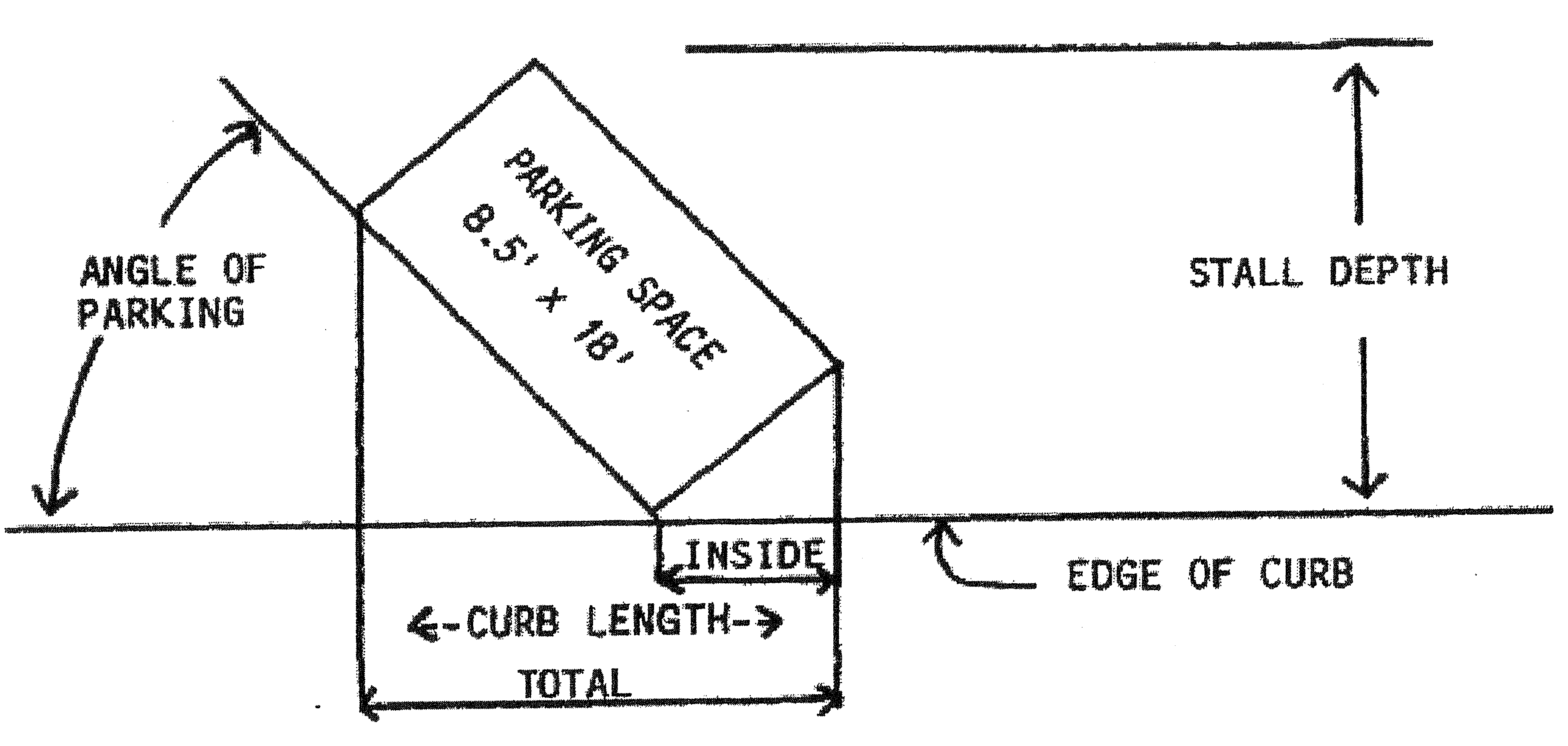
(Ord. 274, passed 7-28-1987)
§ 12-4-117 - OFF-STREET PARKING SPACE REQUIREMENT SCHEDULE.
Off-street parking spaces are required in accordance with the parking schedule below, determined by uses and their usable floor areas. Usable floor area is the space devoted to the specified use and does not include areas such as kitchens, rest rooms, fitting and dressing rooms, hallways, employee lounges, and areas used principally for storage, incidental repair, processing or packaging of merchandise or areas occupied by fixtures and equipment for display purposes.
(Ord. 274, passed 7-28-1987)
§ 12-4-118 - NON-RESIDENT PARKING ON STREETS.
(A)
The Police Chief may designate, subject to City Council approval, a residential area including streets or portions of streets on which parking of motor vehicles may be restricted in whole or in part to motor vehicles owned or operated by residents of the area so designated, where the Police Chief finds that parking in the area is significantly impacted by the parking of motor vehicles owned by nonresidents of the designated area.
(B)
Following City Council approval of a residential parking area, the Police Chief shall direct the erection of parking signs in the area. The signs shall indicate the time and conditions under which parking shall be "Residential Parking Only."
(C)
It shall be unlawful for any person, other than a resident with a vehicle or trailer registered to that address or proximity, to park any motor vehicle or trailer, upon a street designated as "Residential Parking Only."
(D)
This section exempts service and delivery vehicles parked for the purpose of providing a service or delivery in the residential parking permit area. The vehicle must be clearly identified with company name or logo.
(E)
It shall be a defense if a person parking the vehicle is visiting the resident, or has a bona fide service call or delivery to a resident in the area.
(F)
Any person violating this section shall be liable for a civil sanction not to exceed $50.
(G)
The registered owner(s) of any vehicle which has been parked in violation of the provisions of this section shall be prima facie responsible for the violation and subject to penalty therefore.
(H)
Whenever a vehicle without a driver is found parked in violation of the provisions of this section, any police officer or employee of the city designated to give the notices as a part of their official duties shall take the vehicle's registration number, and may take any other information displayed on the vehicle which may identify its user, and shall conspicuously attach to the vehicle a notice of parking violation on a form supplied by the Police Department. The notice of parking violation shall include the date, time and location of the violation, the vehicle registration number, reference to the city code provisions violated, and a warning that failure either to pay the fine indicated on the notice or to appear at the location indicated on the notice of parking violation and otherwise dispose of the charge within seven calendar days from the date on which the notice was issued may result in a judgment by default being entered against the registered owner of the vehicle, and that the vehicle may thereafter be subject to immobilization by the installation of a wheel clamp and to towing and impoundment. The notice of parking violations attached to the vehicle pursuant to this section shall be deemed constructive notice to the registered owner that the vehicle may be immobilized and impounded.
(I)
All funds generated from payment of civil sanctions for violations of this section shall be dedicated to defraying the costs of creating and enforcing the "Residential Parking Only" areas created under this section.
(Ord. 410, N.S., passed 10-14-2003)
§ 12-4-119 - LOADING SPACE REQUIREMENTS SCHEDULE.
In any zoning district which allows commercial or industrial uses which receive or distribute materials or merchandise by motor vehicle, loading spaces, in addition to required parking spaces, are to be paved and in the rear yard or in a side yard which abuts an alley, in accordance with the following table.
(Ord. 274, passed 7-28-1987)
§ 12-4-130 - PURPOSE AND INTENT.
(A)
The sign regulations are intended to provide standards which will promote the effectiveness of signs by preventing over-concentration, improper placement and excessive size.
(B)
The sign regulations are intended to provide an improved visual appearance along street frontages while providing equitable sign standards for the various uses permitted in the zoning code.
(Ord. 274, passed 7-28-1987)
§ 12-4-131 - GENERAL REGULATIONS.
(A)
This section shall not apply to the display of flags of any nations or political subdivisions or of any religious institution, school or other public and quasi-public agency, nor to non-illuminated, temporary signs, under six square feet in area, for the purpose of sale or lease of the property upon which it is located, nor to signs not visible beyond the boundary of the property upon which located.
(B)
All permitted signs shall identify the premises and activity upon which it is displayed; signs shall not be used for the selling of commodities on or off premises.
(C)
All structural alterations to existing signs and the erection of new signs shall comply with the regulations of this section.
(1)
Whenever the name of a business changes, the signs on the premises shall be modified to bring them into conformance with these regulations, even though the intended change is a change of sign copy only.
(2)
Whenever a vacant parcel develops, all existing signs and billboards shall be removed prior to issuance of a building permit; only signs identifying the new development in compliance with this article are permitted.
(Ord. 274, passed 7-28-1987)
§ 12-4-132 - SIGN AREA, HEIGHT, ILLUMINATION AND LOCATION.
(A)
Sign areas. Sign areas are measured by drawing the smallest rectangle, square, circle or triangle around the words and work which convey the sign's message:
(1)
The area of individually-mounted letter signs is measured by including the lettering and the vertical and horizontal spacings between letters and including other design elements of the sign copy and mounting surface.
(2)
The area of internally illuminated and painted signs is measured by including the entire illuminated or painted surface which contains the sign copy.
(3)
The area of a two-faced sign with parallel faces or "V"-type signs having an interior angle of less than 45 degrees is considered a single face area including other multi-faced or paneled signs. (See diagram on Exhibit A).
(4)
The area of a parallel faces or "V"-type signs having an interior angle of more than 45 degrees including multi-face or paneled signs shall be measured as a cumulative total of all the faces and panels. (See diagram on Exhibit B).
(Am. Ord 425, N.S., passed 4-26-2005; Am. Ord. 440, N.S., passed 7-11-2006)
(B)
Free-standing signs. All identification signs which are erected of or mounted upon their own self-supporting permanent structure, detached from the supporting elements of the main building which they identify, shall be permitted in conformance with the following and other provisions of this article:
(1)
The signs shall have a maximum height of 12 feet, as measured from the grade of roadway or curb to top of any sign structure, and shall have a maximum area of 36 square feet, or as hereinafter provided.
(2)
The signs shall have a landscaped area located at the base of the signs provided at a minimum ratio of three square feet of landscaping for each square foot of sign area.
(3)
Corner parcels, with more than 100 feet of street frontage on both adjacent street, may have a single sign with a maximum height of 16 feet, as measured from the grade of the roadway or curb to the top of the sign structure, and a maximum area of 48 square feet.
(C)
Center identification signs. Free-standing signs identifying a commercial or industrial center, as defined in this article, shall be permitted in conformance with the following and other provisions of this article:
(1)
The signs shall identify the name of the center only, except as hereinafter provided.
(2)
The signs, identifying industrial subdivision parks may also identify up to four individual businesses in addition to the industrial center identification when the signs are located on a monument-type structure.
(3)
All center identification signs shall comply with the area, height and landscape requirements as specified above.
(D)
Illuminated signs. Illuminated signs may be internally light, in commercial and industrial districts. The source of illumination of any sign is to be shielded so that it is not visible from or causes glare or reflection onto adjacent properties and streets.
(E)
Sign locations. Sign locations are to be within the property which contains the activity or business which the sign is identifying, except as provided in division (H) below.
(1)
Signs may be freestanding or mounted on walls, fascias, mansards, parapets or canopies, or mounted projecting from walls, but shall not be roof mounted or extend above the roof line of the building upon which it is mounted.
(2)
No part of any sign or sign structure is to be located in or overhanging a roadway, driveway, right-of-way line or property line.
(3)
No part of any freestanding or projecting sign or sign structure is to be located closer than ten feet to an abutting lot, except that canopy signs may be attached to the face of a building which exceeds this limitation by other provisions of this article.
(4)
Signs may not be located where they would obstruct doors, windows, fire escapes or where they would create a safety hazard.
(F)
Freeway monument signs. A freeway monument is a free standing single user or multi-tenant sign identifying an on-premise use, on property abutting or part of a complex/center abutting a free right-of-way, oriented to and intended to be read from the freeway right-of way.
(1)
General requirements.
(a)
Freeway monument signs shall only be allowed on the properties zoned for commercial or industrial uses.
(b)
For every 1,000 linear feet of freeway frontage, one freeway monument sign shall be allowed per site, development, project or center with a maximum of three freeway monument sign per site, development project or center. The signs shall not be located off-premises. Except that a multi-tenant complex/center located on separate parcels.
(c)
Buildings in excess of three stories shall identified only by a freeway monument sign or a building mounted wall sign and shall not be eligible for the construction of or inclusion of both signs.
(d)
For the purposes of this section, the height of all freeway monument signs shall be measured as the vertical distance from the finished grade of the site to the highest point of the sign structure.
(e)
Freeway monument signs shall not be counted as a portion of the total sign area allowed hereunder.
(f)
All freeway monument signs shall provide an architecturally enhanced treatment for the sign base, pole cover and supports compatible with the individual business or the complex/center. Pole covers and sign base shall be a minimum of 35% of the full sign width.
(g)
All freeway monument signs shall require a landscaped area equal to three square feet of the landscaping for each square foot of sign area and shall be located around the base of the sign.
(h)
For the purpose of this section, a freeway monument sign shall only identify the name of the business, the center/complex, or the place for which the sign is intended. The sign shall not include any advertising copy.
(i)
The sign may be illuminated by externally illuminated indirect or internal lighting.
(j)
Freeway monument signs shall not be allowed within a natural or manmade watercourse.
(k)
Freeway monument signs shall be subject to all applicable Arizona Department of Transportation sign regulation standards.
(2)
Single tenant signs. In addition to division (F)(1) above, the following additional requirements shall apply to freeway monument signs that identify a single tenant or business on the site, complex or center:
(a)
The sign shall not exceed 60 feet in height and 200 square feet in sign area:
(b)
All signs shall maintain a minimum of 200-foot spacing from any other freeway monument sign:
(c)
All freeway monument signs shall be located a minimum of 50 feet from any non-freeway lot line and a minimum of 100 feet from any residential zoned property.
(d)
All signs shall be allowed an extra three feet in height for architectural embellishments where architectural embellishment are defined as elements of a sign incorporating architectural features of the associated building or development. Embellishments shall not include any feature, figure or emblem conveying a commercial message and may not constitute more than 20% of sign area.
(3)
Multi-tenant signs. In addition to division (F)(1) above, the following additional requirements shall apply to freeway monument signs that identify more than one tenant or business on the site, complex or center.
(a)
Freeway monument sign shall not exceed 70 feet in height and 400 square feet in total sign area.
(b)
For the purpose of this section, multi-tenant freeway monument signs shall be allowed an extra 20% of sign area for the identification of the center/complex.
(c)
All multi-tenant signs shall maintain a minimum of 200-foot spacing from any other freeway monument sign.
(d)
All multi-tenant freeway monument signs shall be located a minimum of 50 feet from any non-freeway lot line and minimum of 200 feet from any residentially zoned property.
(e)
All multi-tenant freeway monument signs shall be allowed an extra three feet in height for architectural embellishments where architecture embellishments are defined as elements of a sign incorporating architectural features of the associated building or development. Embellishments shall not include any feature, figure or emblem conveying a commercial message and may not constitute more than 20% of the sign area.
(G)
Building-mounted wall sign. A building-mounted wall sign is a permanent sign attached to, painted on or erected against the wall or fascia of a building with the exposed face of the sign in a plane parallel with the face of the wall of fascia.
(1)
Building-mounted wall signs shall be placed only in the top 33% of the wall to which it is attached and shall not project above the roofline.
(2)
Signs are permitted on three sides of a four or more sided building. The sign area allowed for each sign shall not exceed one square foot for each linear foot of business wall elevation along the street frontage on which the sign is displayed. The total area of one sign identifying an individual business shall not exceed 250 square feet.
(3)
The signs may identify the individual business, building or building complex only by name, logo or by name and principle service where the name does not identify the principle services offered.
(4)
Buildings in excess of three stories shall only be identified by the building name or the name or logo of the business or company occupying the building.
(5)
Advertising copy shall be permitted only to describe the general nature of the business. In no case shall there be more than six words, symbols or characters used as advertising copy.
(6)
The signs shall not project more than 14 inches from the wall or fascia.
(7)
The sign may be erected on a parapet wall or fascia that is on three sides of a four or more sided building. The signs shall be erected on the buildings with one parapet wall only if the building exists above the top of the parapet or fascia.
(8)
The signs may be illuminated only by internal or externally indirect lighting.
(9)
The average height of all sign characters shall not exceed six feet with no individual characters exceeding eight feet in height.
(H)
Digital billboards.
(1)
A digital billboard shall only be permitted via the approval of a use permit, and compliance with the requirements set forth in this zoning ordinance and this division (H).
(2)
All digital billboard use permit applications shall include:
(a)
A vicinity map showing the locations and measurements to any existing digital billboards, freeway monument signs, and residential zoning districts and uses.
(b)
A detailed rendered elevation of the proposed digital billboard, including proposed height and sign dimensions.
(c)
Documentation certifying NIT measurements and settings of the proposed digital billboard.
(d)
The deed, lease, or other agreement by which the applicant has the right to erect, use or maintain the proposed sign at the stated location.
(3)
Location requirements:
(a)
Digital billboards are only allowed to be approved in locations within 100 feet of Interstate 10, including frontage roads thereto.
(b)
Digital billboards may not be located closer than 2,000 linear feet to any other digital billboard.
(c)
Digital billboards may not be located closer than 500 feet to any freeway monument sign unless both signs are located on the same property.
(d)
Digital billboards may not be located closer than 200 feet to any residential zoning district or residential use.
(4)
General requirements:
(a)
Digital billboards shall not be counted as a portion of the total sign area for a property allowed under § 12-4-133 of this zoning ordinance.
(b)
Digital billboards shall not be erected upon the roof of any building, nor shall any digital billboard be partially or totally supported by the roof or roof structure of any building.
(c)
Digital billboards shall be subject to all applicable Arizona Department of Transportation sign regulation standards.
(d)
Following approval of a use permit for a digital billboard, structural plans shall be submitted to the Building Department for review for compliance with the Tolleson City Code.
(e)
Digital billboards shall be programmed so that the message or image on the sign changes no more often than once every eight seconds.
(f)
There shall be no video, effects of movement, blinking, animation, scrolling, flashing, or similar effects in the individual static digital images on a digital billboard.
(g)
Changes of image shall be instantaneous as seen by the human eye, and shall not use blinking, fading, rolling, shading, dissolving, or similar effects as part of the change.
(h)
Digital billboards shall use automatic level controls to reduce light levels at night and under cloudy and other darkened conditions, in accordance with the following:
1.
Digital billboards shall have installed ambient light monitors, and shall at all times allow such monitors to automatically adjust the brightness level of the sign based on ambient light conditions.
2.
Maximum brightness levels for digital billboards shall not exceed 6000 nits when measured from the signs face at its maximum brightness, during daylight hours.
3.
Maximum brightness levels for digital billboards shall not exceed 500 nits when measured from the sign's face at its maximum brightness, between sunset and sunrise, as those times are determined by the National Weather Service.
4.
Written certification from the sign manufacturer must be provided at the time of application for a building permit certifying that the light intensity of the sign has been preset not to exceed the illumination levels established by this section, and that the preset intensity level is protected from end user manipulation by password protected software or other approved method.
(i)
Digital billboards shall contain a default design that will freeze the device and message in one position with no more than a maximum illumination of 500 nits if a malfunction occurs.
(j)
Any digital billboard that malfunctions, fails or ceases to operate in its usual or normal programmed manner, causing motion, movement, flashing or any similar effects shall have the motion, movement, flashing or similar effects corrected, and repair to the sign begun within 24 hours of the malfunction.
(5)
Design requirements:
(a)
A digital billboard, including all structural elements, shall be no taller than 65 feet. The height of all digital billboards shall be measured as the vertical distance from the finished grade of the site at the base of the sign structure to the highest point of the sign structure.
(b)
Digital billboards shall include no more than two faces, which are not permitted to be vertically stacked. Digital billboards may have a double-face or "V" shape, which shall be considered a single structure.
(c)
The sign faces of all digital billboards shall face Interstate 10, either directly or at an angle appropriate for the visibility of Interstate 10 vehicle traffic in the case of "V" shaped signs.
(d)
Total sign area of a digital billboard will be reviewed on a case-by-case basis through the use permit process. However, in no instance shall the maximum area of a digital billboard sign face exceed 672 square feet.
(e)
Access ladders to maintenance platforms shall be constructed or maintained in such a position as not to project beyond a visual envelope established by structural elements or projections of the sign face and trim to the ground as viewed from a plane parallel to the face of the sign.
(f)
Some form of City of Tolleson identification is required on all digital billboards. This can be achieved by the use of city branding elements (i.e. colors, logo) on the digital billboard structure and/or providing regular rotating digital panels for city use. The appropriate application and amount of city identification is subject to city approval via the use permit process.
(6)
If a use permit for digital billboard is approved, such approval is subject to a monthly "Off-Premise Sign Advertising Permit Fee" in the amount of $3,000 per month for a double face digital billboard and $1,500 per month for a single face digital billboard, payable to the City of Tolleson. Failure to pay the monthly fee shall be a violation of the zoning ordinance and the city may take action to revoke the use permit.
(7)
Notwithstanding any other applicable requirement related to digital billboards, the maximum number of digital billboards that are allowed to be permitted in the City of Tolleson shall be four.
(I)
Political signs. Political signs are permitted in all zones, subject to the limitations in § 12-4-133 and provided the sign is not placed in a location that is hazardous to public safety, obstructs clear vision in the area or interferes with the requirements of the Americans with Disabilities Act (42 United States Code sections 12101 through 12213 and 47 United States Code sections 225 and 611).
(Ord. 274, passed 7-28-1987; Am. Ord. 417, N.S., passed 10-12-2004; Am. Ord. 425, N.S., passed 4-26-2005; Am. Ord. 425, N.S., passed 4-26-2005; Am. Ord. 440, N.S., passed 7-11-2006; Am. Ord. 477., N.S., passed 11-18-2008; Am. Ord. 485, N.S., passed 4-14-2009; Am. Ord. 530, N.S., 10-23-2012; Am. Ord. 559, N.S., § 1, passed 12-8-2015; Am. Ord. 568, N.S., passed 2-28-2017; Am. Ord. 592, N.S., §§ 1—3, passed 10-13-2020)
§ 12-4-133 - SCHEDULE OF PERMITTED SIGNS.
(A)
Signs are permitted in accordance with the zoning use district and type of activity which the sign identifies, as specified, in the following chart:
(B)
Temporary signs are limited to the following time periods:
1.
Subdivision advertising signs: sell out of subdivision or maximum of two years.
2.
Construction/development signs: completion of development plus 30 days.
3.
Grand opening signs/pennants: 30 days. One time permit for this 30 day event.
4.
Political signs: shall not be displayed more than 60 days before a primary election and shall be removed within 15 days after election.
5.
Sandwich or portable signs - permit required - $15 for a maximum 3 days per week, maximum 3 square feet, and signs must be removed at the end of that day. Failure to remove the sign shall result in citation by enforcement officer of the Code Enforcement Department.
6.
Yard sale signs - permit required - $5 for 2 signs for a 2-day yard sale, maximum 2 square feet, signs shall be removed at the end of that day. Failure to remove shall result in citation by enforcement officer of the Code Enforcement Department.
(Ord. 274, passed 7-28-1987; Am. Ord. 417, N.S., passed 10-12-2004; Am. Ord. 530, N.S., 10-23-2012)
§ 12-4-134 - SIGN MAINTENANCE.
(A)
Signs are to be maintained in good order and repair.
(B)
If any sign becomes a hazard to the public or becomes deteriorated or abandoned, the property owner or sign-owner will be notified to remove or repair the sign; non-compliance within ten days will result in the Zoning Administrator having the sign removed and the cost assessed to the property owner.
(C)
Once a sign has been removed, it cannot be relocated or reconstructed unless it complies with all provisions of the Tolleson zoning code and building code.
(Ord. 274, passed 7-28-1987)
§ 12-4-135 - PROHIBITED SIGNS.
(A)
Electronic message display (EMD) or digital signs unless permitted by the City Council through the approval of a use permit application. EMD signs are not allowed in residential districts or with residential uses within any district.
(B)
Signs with audible devices.
(C)
Signs which interfere with or confuse traffic or present a traffic hazard.
(D)
Reserved.
(E)
Signs mounted on roofs or projected above the highest point of a building.
(F)
Signs attached, mounted or painted on motorized or non-motorized vehicles when used for advertising at or near a business or activity, other than for identification of a business.
(G)
Signs projecting more than 30 inches from the perpendicular wall to which they are attached, except projecting signs which are entirely under an awning, canopy or roof overhang.
(H)
Signs announcing the proposed development of property prior to issuance of a building permit or after issuance of certificate of occupancy.
(Ord. 274, passed 7-28-1987; Am. Ord. 559, N.S., § 2, passed 12-8-2015)
§ 12-4-150 - PURPOSE AND INTENT.
(A)
It is the intent of this section to make clear that nothing in this zoning ordinance is intended to be in conflict with other codes and accepted standards listed in this section; and, it is intended that this section hereby notifies the general public and the residents of Tolleson that all new buildings, uses and developments shall comply with the following additional codes and regulations and others adopted by the City of Tolleson and the State of Arizona in the future:
(1)
International Building Code;
(2)
International Mechanical Code;
(3)
International Plumbing Code;
(4)
National Electrical Code;
(5)
International Fire Code;
(6)
Maricopa Association of Governments Specifications, the latest version as it is published;
(7)
Arizona Department of Water Resources Conservation Regulations;
(8)
Flood plain Regulations as adopted by Maricopa County and the City of Tolleson, including Ord. 128;
(9)
Subdivision regulations of the State of Arizona and the City of Tolleson Ord. 210, N.S.;
(10)
City Code of Tolleson, 2008 Edition; and
(11)
Implementation Guide for City of Tolleson Land Use Plan, 2005.
(B)
It is the intent of this section to provide specific regulations for special considerations, including non-conforming uses and buildings, exceptions to building height and lot area limitations and encroachments into required yard setbacks.
(Ord. 274, passed 7-28-1987)
§ 12-4-151 - NON-CONFORMING USES AND BUILDINGS.
(A)
Any building, structure or use lawfully existing at the time of enactment of this article, or its time of effect on newly annexed territory to the city, or any amendment thereto, shall be declared to be non-conforming and the use shall be permitted to continue, even though the building, structure or use does not conform with the regulations for the district in which it is located.
(B)
No structural alteration shall be made to non-conforming buildings, except those required by law or ordinance; normal maintenance and repair are excepted.
(C)
No extension or expansion shall be made of buildings, structures or uses unless the extension shall conform to the regulations specified for the district in which it is located. However, a non-conforming use may be extended throughout those parts of an existing building or structure which were manifestly arranged or designed for the use prior to the time of the enactment of this article.
(D)
Any non-conforming building or structure which has been damaged by fire, flood, explosion, earthquake, war or riot may be restored if completed within 12 months of the calamity if the area restored does not exceed the square foot area as it existed at the time of the calamity.
(E)
No building, structure or land in or on which a non-conforming use is abandoned or ceases to be carried on for a period exceeding six months shall again be used for any use other than those which comply with the regulations of the use district in which the building, structure or land is located as designated in this article.
(Ord. 274, passed 7-28-1987)
§ 12-4-152 - ADDITIONAL PROVISIONS AND EXCEPTIONS.
(A)
Lots.
(1)
All lots, premises, buildings and structures shall be used, constructed, altered, repaired, improved, moved, removed, erected, demolished or materially altered in conformity with these provisions and the provision of the zone in which it is located.
(2)
A lot or parcel may not be divided to create a lot that is not in conformance with all regulations of this article; no space needed to meet the minimum width, yard, area, coverage, parking or other requirements of this article for a lot, building or use may be sold, leased or encroached upon.
(3)
Any parcel of land having an area less than that required by the provisions of this zoning code for a lot in the use district in which the parcel is situated and which parcel was legally established at the time it came under the provisions of this zoning code, shall be deemed to be a lot and may be used as a building site; provided, however, that, all other regulations for the use district shall be complied with.
(B)
Reconstruction. Any building damaged by fire or other causes to over 50% of its reproductive value will not be repaired or rebuilt unless its repair and rebuilding is in complete conformity with all regulations of this article.
(C)
Yard encroachments. Every part of a required yard shall be open to the sky and unobstructed, except as follows:
(1)
Ordinary architectural details such as canopies, cornices, eaves, chimneys, sills, leaders, belt courses and other similar features and including window or wall-mounted refrigeration, cooling or heating devices may project three feet over any required yard, provided that they are not closer than three feet to any lot line.
(2)
Awnings, unenclosed balconies, terraces, decks, stairs and landings and other similar features may project up to six feet into any required yard, provided that they are not closer than three feet to any lot line.
(3)
Detached accessory buildings and swimming pools may encroach into required side yards and rear yards, provided they are at least five feet from the main structure and at least five feet from the rear and interior side lot lines and provided they maintain the same required side-yard setback from the street side-lot line as the main building.
(a)
Detached accessory buildings may not occupy more than 25% of a rear or side yard area. See §§ 12-4-20(E) and 12-4-21(E); building lot coverage.
(b)
Attached accessory buildings are considered an integral part of the main building for purposes of determining yard, lot and area requirements and lot coverage.
(c)
Solar heating and cooling units, greenhouses and associated apparatus may be located in a rear or side yard provided the units and apparatus do not occupy more than 25% of the side or rear yard and are not closer than three feet from a lot line.
(D)
Height exemptions. All buildings and structures shall be erected, reconstructed or structurally altered in conformance with the height regulations designated for the zone in which the building or structure is located, except as follows:
(1)
Attached church spires, belfries, cupolas, domes and penthouses not for human occupancy and flagpoles, clock towers, chimneys, bulk heads, monuments, crosses, sculptures and ornamentation, water tanks, skylights, ventilators, heating and cooling and other mechanical equipment and antennas and other similar attached features may exceed the height limitations for the zone in which they are located; provided, however, that if the structure should collapse, its reclining length would still be contained on the property on which it was constructed.
(2)
Commercial and industrial antennas and broadcasting devices, smokestacks, derricks, conveyors, grain elevators or similar structures may exceed the height limitations of the zone in which it is located; provided, however, that, if the structure should collapse, its reclining length would still be contained on the property on which it was constructed.
(3)
Freestanding windmills, antennas, solar heating or cooling apparatus may exceed the height limitations of the zone in which it is located with the approval of plans by the Zoning Administrator.
(Ord. 274, passed 7-28-1987)
§ 12-4-153 - SEXUALLY ORIENTED BUSINESSES; LOCATION.
(A)
Location of sexually oriented businesses.
(1)
The following regulations apply to all zoning districts in the City of Tolleson.
(a)
A sexually oriented business is prohibited from being established, located, operated, or licensed in any City of Tolleson zoning district other than the General Industrial District (I-2), as defined and described in §§ 12-4-60 through 12-4-64, and as indicated on the City of Tolleson zoning map, subject to the following location requirements.
(b)
1. A sexually oriented business is prohibited from being established, operating, caused to be operated, located or licensed for business within 1,000 feet of:
a.
A church, synagogue, mosque, temple or building which is used primarily for religious worship and related religious activities;
b.
A public or private educational facility including but not limited to child day care facilities, nursery schools, preschools, kindergartens, elementary schools, private schools, intermediate schools, junior high schools, middle schools, high schools, vocational schools, secondary schools, continuation schools, special education schools, junior colleges, and universities; school includes the school grounds, but does not include facilities used primarily for another purpose and only incidentally as a school;
c.
A boundary of a residential zoning district as defined in the Tolleson zoning ordinance;
d.
A public park or recreational area which has been designated for park or recreational activities including but not limited to a park, playground, nature trails, swimming pool, reservoir, athletic field, basketball or tennis courts, pedestrian/bicycle paths, wilderness areas, or other similar public land within the city which is under the control, operation, or management of the city;
e.
The property line of a lot devoted to a residential use as defined in the Tolleson zoning ordinance;
f.
An entertainment business which is oriented primarily towards children or family entertainment;
g.
A business having an Arizona spirituous liquor license with any of the following classifications: Bar (Series 06); Beer and Wine Bar (Series 07); or the equivalent of those licenses; and
h.
Another sexually oriented business.
2.
The 1,000 feet minimum distance requirement herein replaces the minimum distance requirements set forth previously.
(B)
Penalty.
(1)
In addition to the civil fines that may be enforced by the City of Tolleson for violations of the zoning ordinance under the Tolleson Code and Arizona law, a person commits a misdemeanor if that person operates, causes to be operated, causes or permits the operation, establishment, substantial enlargement, or transfer of ownership or control of a sexually oriented business within a zoning district other than the General Industrial District (I-2) or within 1,000 feet of those uses set forth in division (A)(1)(b).
(2)
A person commits a misdemeanor if that person causes or permits the operation, establishment, or maintenance of more than one sexually oriented business in the same building, structure, or portion thereof, or the increase of floor area of any sexually oriented business in any building, structure, or portion thereof containing another sexually oriented business.
(C)
Measurement. For the purpose of divisions (A)(1)(b) and (h) of this section, measurement shall be made in a straight line, without regard to intervening structures or objects, from the nearest portion of the building or structure used as the part of the premises where a sexually oriented business is conducted, to the nearest property line of the premises of a use listed in division (A)(1)(b). Presence of a city, county or other political subdivision boundary shall be irrelevant for purposes of calculating and applying the distance requirements of this section.
(D)
Legal non-conforming use. Any sexually oriented business lawfully operating as of the effective date of this division that is in violation of divisions (A) through (D) of this section shall be deemed a legal non-conforming use. The legal non-conforming use is permitted to continue, unless sooner terminated for any reason or voluntarily discontinued for a period of 30 days or more. These non-conforming uses shall not be substantially enlarged, extended, or more than reasonably repaired or altered except that the use may be changed to a conforming use.
(E)
Operating as a conforming use. A sexually oriented business lawfully operating as a conforming use is not rendered a non-conforming use by the location, subsequent to the grant or renewal of the sexually oriented business license, of a use listed in division (A)(1)(b) of this section within 1,000 feet of the sexually oriented business. This provision applies only to the renewal of a valid license, and does not apply when an application for a license is submitted after a license has expired or been revoked.
(F)
Minimum setback. Sexually oriented businesses are subject to the setback requirements under the I-1 Zoning District.
(G)
Variances. No variance may be granted from the 1,000 foot minimum distance requirement set forth in this section.
(H)
Remedies.
(1)
A person who causes, operates or causes the establishment of a sexually oriented business without a valid license, or in violation of this section, is subject to a suit for an injunction, civil penalties and prosecution for criminal violations.
(2)
Violations shall be punishable by a fine of a minimum of $100 up to $1,000 or 20 days imprisonment, for each offense.
(3)
Each day a sexually oriented business so operates is a separate offense or violation.
(Ord. 432, N.S., passed 9-27-2005)
Cross reference— For licensing of sexually oriented businesses, see Sexually Oriented Businesses, Article 5-6
§ 12-4-154 - MEDICAL MARIJUANA USES.
The following minimum requirements shall apply to all medical marijuana dispensary and medical marijuana cultivation location uses permitted under A.R.S. § 36-2801 et seq. (the "Act") and § 12-4-61:
(A)
In addition to any other application requirements, an applicant for any medical marijuana dispensary or medical marijuana cultivation location use shall provide the following:
(1)
A notarized authorization, executed by the property owner, acknowledging and consenting to the proposed use of the property as a medical marijuana dispensary or a medical marijuana cultivation location.
(2)
The legal name of the medical marijuana dispensary or medical marijuana cultivation location.
(3)
If the application is for a medical marijuana cultivation location, the name and location of the medical marijuana dispensary with which it is associated, and, in addition, in the case of designated caregivers or qualifying patients, the names of qualifying patients for which the medical marijuana is being cultivated.
(4)
The name, address and birth date of each officer and board member of the nonprofit medical marijuana dispensary agent.
(5)
The name, address, birth date and valid registry identification card number of:
(a)
Each medical marijuana dispensary agent if the application is related to a medical marijuana dispensary or a related medical marijuana cultivation location; and
(b)
Each designated caregiver and qualifying patient if the application is related to a medical marijuana cultivation location associated with such qualifying patient and designated caregiver.
(6)
A copy of the operating procedures adopted in compliance with A.R.S. § 36-2804(B)(l)(c).
(7)
A notarized certification that none of the medical marijuana dispensary officers or board members has been convicted of any of the following offenses:
(a)
A violent crime, as defined in A.R.S. § 13-901.03(B), that was classified as a felony in the jurisdiction where the person was convicted.
(b)
A violation of state or federal controlled substance law that was classified as a felony in the jurisdiction where the person was convicted except an offense for which the sentence, including any term of probation, incarceration or supervised release, was completed ten or more years earlier or an offense involving conduct that would be immune from arrest, prosecution or penalty under A.R.S. § 36-2811 except that the conduct occurred before the effective date of that statute or was prosecuted by an authority other than the state of Arizona.
(8)
A notarized certification that none of the medical marijuana dispensary officers or board members has served as an officer or board member for a medical marijuana dispensary that has had its registration certificate revoked.
(9)
A floor plan showing the location, dimensions and type of security measures demonstrating that the medial marijuana dispensary or medical marijuana cultivation location will be secured, enclosed and locked as required by law.
(10)
A scale drawing depicting the property lines and the separations from the nearest property boundary of the parcel containing the medical marijuana dispensary or medical marijuana cultivation location to the property boundary of the parcel containing any existing uses listed in § 12-4-154(C) below. If any of the uses are located within 50 feet of the minimum separation, the drawing, showing actual surveyed separations, shall be prepared by a registered land surveyor.
(B)
A medical marijuana dispensary shall have operating hours not earlier that 7:00 a.m. and not later than 9:00 p.m.
(C)
A medical marijuana dispensary or medical marijuana cultivation location shall meet the following minimum separation requirements, measured in a straight line from the closest boundary of the parcel containing the medical marijuana dispensary or medical marijuana cultivation location to the closest property boundary of the parcel containing any existing uses listed below:
(1)
One mile from any other medical marijuana dispensary, medical marijuana cultivation location, adult use marijuana dispensary or adult use marijuana cultivation location. To permit the colocation of marijuana uses, no separation shall be required from marijuana facilities that are located on the same parcel owned by the same property owner.
(2)
1,000 feet from a residential substance abuse diagnostic and treatment facility or other residential drug or alcohol rehabilitation facility.
(3)
1,000 feet from a public, private, parochial, charter, dramatic, dancing or music school, a learning center, or other similar school or educational facility that caters to children.
(4)
1,000 feet from any residential zoning district or residential use.
(5)
1,000 feet from a childcare center.
(6)
1,000 feet from a public library or public park.
(7)
1,000 feet from a religious institution.
(D)
Pursuant to the application requirements and provisions under A.R.S. §§ 36-2804 and 2806, and except as provided under the Act for qualifying patients and designated caregivers, a medical marijuana cultivation location may only cultivate, process, supply, sell or otherwise provide medical marijuana to medical marijuana dispensaries located in Arizona, and only one medical marijuana cultivation location shall be permitted for the single Arizona medical marijuana dispensary with which it is associated.
(E)
The following size limitations shall apply to any medical marijuana dispensary:
(1)
The total maximum floor area of a medical marijuana dispensary, inclusive of any secure storage area, shall not exceed 5,000 square feet.
(2)
The secure storage area for the medical marijuana stored at the medical marijuana dispensary shall not exceed 1,000 square feet.
(F)
Reserved.
(G)
A medical marijuana dispensary or medical marijuana cultivation location shall:
(1)
Be located in a permanent building and may not be located in a trailer, cargo container, mobile or modular unit, mobile home, recreational vehicle or other mobile vehicle. The facility shall include fire protection measures, including sprinklers, as required by the Tolleson Fire Code.
(2)
Install lighting to illuminate the exterior and interior of the building and all entrances and exits to the facility. Exterior lighting shall be five foot candles, measured at ground level, and shall remain on during all hours between sunset and sunrise each day and the medical marijuana dispensary or cultivation location shall illuminate all areas of the premises, including adjacent public sidewalks so that the areas are readily visible by law enforcement personnel. Twenty-four hours each day, the medical marijuana dispensary or cultivation location shall illuminate the entire interior of the building, with particular emphasis on the locations of any counter, safe, storage area and any location where people are prone to congregate. The lighting must be of sufficient brightness to ensure that the interior is readily visible from the exterior of the building from a distance of 100 feet.
(3)
Not have a drive-through service.
(4)
Not emit dust, fumes, vapors or odors into the environment.
(5)
Not provide offsite delivery of medical marijuana, except to a medical marijuana dispensary served by the medical marijuana cultivation location.
(6)
Have no on-site sales of alcohol or tobacco, and no on-site consumption of food, alcohol, tobacco or medical marijuana.
(7)
Not have outdoor seating areas.
(8)
Display a current city business license, and a state tax identification letter.
(9)
Provide law enforcement and all interested neighbors with the name and phone number of an on-site community relations staff person to notify if there are operational problems with the establishment.
(10)
The exterior appearance of the structure shall be compatible with structures already constructed or under construction within the immediate neighborhood, to ensure against blight, deterioration, or substantial diminishment or impairment of property values in the vicinity.
(11)
City code enforcement officers, police officers or other agents or employees of the city requesting admission for the purpose of determining compliance with these standards shall be given unrestricted access.
(12)
Comply with all other applicable property development and design standards of the city.
(H)
In addition to the requirements set forth in division (G) above, and to ensure that the operations of medical marijuana dispensaries are in compliance with state law and to mitigate the adverse secondary effects from operations of dispensaries, medical marijuana dispensaries shall operate in compliance with the following additional standards:
(1)
Security guards shall be provided during all hours of operation or detailed internal security measures will be identified and maintained after consultation with and approval by the Police Department. For the purposes of this section, SECURITY GUARD shall mean licensed and duly bonded security personnel registered pursuant to A.R.S. § 32-2601 et seq. Prior to opening for business, the medical marijuana dispensary shall provide all property owners with a 500 foot radius of the medical marijuana dispensary location with written notification via first class U.S. mail of the security company responsible for providing its security services.
(2)
If determined necessary by the City Manager at any time, medical marijuana dispensaries shall provide a neighborhood security guard patrol for a two-block radius surrounding the medical marijuana dispensary during all or specified hours of operation.
(3)
No doctor shall issue a written certification on-site for medical marijuana.
(4)
Medical marijuana dispensaries shall only dispense medical marijuana to qualified patients and their designated caregivers as defined in the Act.
(5)
Medical marijuana dispensaries shall notify patrons of the following verbally and through posting of a sign in a conspicuous location at the medical marijuana dispensary:
(a)
Use of medical marijuana shall be limited to the patient identified on the doctor's written certification. Secondary sale, barter or distribution of medical marijuana is a crime and can lead to arrest.
(b)
Patrons must immediately leave the site and not consume medical marijuana until at home or in an equivalent private location. Medical marijuana dispensary staff shall monitor the site and vicinity to ensure compliance.
(6)
Medical marijuana dispensaries shall not provide marijuana to any individual in an amount not consistent with personal medical use, or in violation of state law and regulations related to medical marijuana use.
(7)
Medical marijuana dispensaries shall not store more than $200 in cash overnight on the premises.
(8)
Any qualifying patient under 18 years of age shall be accompanied by a parent or legal guardian. Except for such parent or legal guardian, no persons other than qualifying patients and designated caregivers shall be permitted within a medical marijuana dispensary premises.
(9)
No signs, advertising, or any other advertising matter used in connection with the medical marijuana dispensary shall be of any offensive nature and shall in no way be contrary to the city code, or obstruct the view of the interior of the premises viewed from the outside.
(Ord. 503, N.S., passed 2-22-2011; Am. Ord. 564, N.S., passed 7-12-2016; Am. Ord. 577, N.S., § 2, passed 11-14-2017; Am. Ord. 612, N.S., § 2(Exh. A), passed 11-12-2024)
§ 12-4-154-1 - ADULT-USE MARIJUANA ESTABLISHMENT USES.
The following minimum requirements shall apply to all adult use marijuana dispensary and adult use marijuana cultivation location uses permitted under A.R.S. §§ 36-2850 et seq., and 12-4-61:
(a)
In addition to any other application requirements, an applicant for any adult use marijuana dispensary or adult use marijuana cultivation location use shall provide the following:
(1)
A notarized authorization, executed by the property owner, acknowledging and consenting to the proposed use of the property as an adult use marijuana dispensary or adult use marijuana cultivation location.
(2)
The legal name of the adult use marijuana dispensary or adult use marijuana cultivation location.
(3)
If the application is for an adult use marijuana cultivation location, the name and location of the adult use marijuana dispensary with which it is associated.
(4)
The name, address and birth date of each officer and board member of the adult use marijuana dispensary or adult use marijuana cultivation location, except any of the foregoing who are entitled to a share of less than ten percent (10%) of the profits thereof and the applicant is a publicly traded corporation.
(5)
The name, address, birth date and valid registry identification card number of each marijuana agent if the application is related to an adult use marijuana dispensary, or adult use marijuana cultivation location.
(6)
A copy of the operating procedures consistent with department rules for oversight of the adult use marijuana dispensary and adult use marijuana cultivation location, including procedures to ensure accurate record-keeping and adequate security measures.
(7)
A notarized certification that none of the adult use marijuana dispensary, or adult use marijuana cultivation location officers or board members has been convicted of any of the following offenses:
(a)
A violent crime, as defined in A.R.S. § 13-901.03(b), that was classified as a felony in the jurisdiction where the person was convicted.
(b)
A violation of state or federal controlled substance law that was classified as a felony in the jurisdiction where the person was convicted except an offense for which the sentence, including any term of probation, incarceration or supervised release, was completed ten (10) or more years earlier or an offense involving conduct that would be immune from arrest, prosecution or penalty under the adult use act except that the conduct occurred before the effective date of that statute or was prosecuted by an authority other than the State of Arizona.
(8)
A notarized certification that none of the adult use marijuana dispensary or adult use marijuana cultivation location officers or board members has served as an officer or board member for an adult use marijuana dispensary or adult use marijuana cultivation location that has had its registration certificate revoked.
(9)
A floor plan showing the location, dimensions and type of security measures demonstrating that the adult use marijuana dispensary and adult use marijuana cultivation location will be secured, enclosed and locked as required by law.
(10)
A scale drawing depicting the property lines and the separations from the nearest property boundary of the parcel containing the adult use marijuana dispensary or adult use marijuana cultivation location to the property boundary of the parcel containing any existing uses listed in §12-4-154(c) below. If any of the uses are located within 50 feet of the minimum separation, the drawing, showing actual surveyed separations, shall be prepared by a registered land surveyor.
(b)
An adult use marijuana dispensary or adult use marijuana cultivation location shall have operating hours not earlier than 7:00 a.m. and not later than 9:00 p.m.
(c)
An adult use marijuana dispensary or adult use marijuana cultivation location shall meet the following minimum separation requirements, measured in a straight line from the closest boundary of the parcel containing the adult use marijuana dispensary or adult use marijuana cultivation location to the closest property boundary of the parcel containing any existing uses listed below:
(1)
One mile from any other adult use marijuana dispensary, adult use marijuana cultivation location, medical marijuana dispensary or medical marijuana cultivation location. To permit the colocation of marijuana uses, no separation shall be required from marijuana facilities that are located on the same parcel.
(2)
One thousand feet from a residential substance abuse diagnostic and treatment facility or other residential drug or alcohol rehabilitation facility.
(3)
One thousand feet from a public, private, parochial, charter, dramatic, dancing or music school, a learning center, or other similar school or educational facility that caters to children.
(4)
1,000 feet from any residential zoning district or residential use.
(5)
1,000 feet from a childcare center.
(6)
1,000 feet from a public library or public park.
(7)
1,000 feet from a religious institution.
(d)
Pursuant to the adult use act an adult use marijuana dispensary and adult use marijuana cultivation location may only cultivate, process, supply, sell or otherwise provide marijuana to adult use marijuana dispensaries.
(e)
The following size limitations shall apply to any adult use marijuana dispensary:
(1)
The total maximum floor area of an adult use marijuana dispensary, inclusive of any secure storage area, shall not exceed 5,000 square feet.
(2)
The secure storage area for the marijuana stored at the adult use marijuana dispensary shall not exceed 1,000 square feet.
(f)
An adult use marijuana dispensary or adult use marijuana cultivation location shall:
(1)
Be located in a permanent building and may not be located in a trailer, cargo container, mobile or modular unit, mobile home, recreational vehicle or other mobile vehicle. The facility shall include fire protection measures, including sprinklers, as required by the Tolleson Fire Code.
(2)
Install lighting to illuminate the exterior and interior of the building and all entrances and exits to the facility. Exterior lighting shall be five foot candles, measured at ground level, and shall remain on during all hours between sunset and sunrise each day and the adult use marijuana dispensary and adult use marijuana cultivation location shall illuminate all areas of the premises, including adjacent public sidewalks so that the areas are readily visible by law enforcement personnel. Twenty-four hours each day, the adult use marijuana dispensary or adult use marijuana cultivation location shall illuminate the entire interior of the building, with particular emphasis on the locations of any counter, safe, storage area and any location where people are prone to congregate. The lighting must be of sufficient brightness to ensure that the interior is readily visible from the exterior of the building from a distance of 100 feet.
(3)
Not have a drive-through service.
(4)
Not emit dust, fumes, vapors or odors into the environment.
(5)
Not provide offsite delivery of marijuana, except to an adult use marijuana dispensary served by the adult use marijuana cultivation location.
(6)
Have no on-site sales of alcohol or tobacco, and no on-site consumption of food, alcohol, tobacco, or marijuana.
(7)
Not have outdoor seating areas.
(8)
Display a current city business license, and a state tax identification letter.
(9)
Provide law enforcement and all interested neighbors with the name and phone number of an on-site community relations staff person to notify if there are operational problems with the establishment.
(10)
The exterior appearance of the structure shall be compatible with structures already constructed or under construction within the immediate neighborhood, to ensure against blight, deterioration, or substantial diminishment or impairment of property values in the vicinity.
(11)
City Code Enforcement Officers, police officers or other agents or employees of the city requesting admission for the purpose of determining compliance with these standards shall be given unrestricted access.
(12)
Comply with all other applicable property development and design standards of the city.
(g)
In addition to the requirements set forth in division (f) above, and to ensure that the operations of adult use marijuana dispensaries are in compliance with state law and to mitigate the adverse secondary effects from operations of adult use marijuana dispensaries, adult use marijuana dispensaries shall operate in compliance with the following additional standards:
(1)
Security guards shall be provided during all hours of operation or detailed internal security measures will be identified and maintained after consultation with and approval by the police department. For the purposes of this section, security guard shall mean licensed and duly bonded security personnel registered pursuant to A.R.S. § 32-2601 et seq. Prior to opening for business, the adult use marijuana dispensary shall provide all property owners with a 500 foot radius of the adult use marijuana dispensary with written notification via first class U.S. mail of the security company responsible for providing its security services.
(2)
If determined necessary by the City Manager at any time, adult use marijuana dispensaries shall provide a neighborhood security guard patrol for a two-block radius surrounding the adult use marijuana dispensary during all or specified hours of operation.
(3)
Adult use marijuana dispensaries shall only dispense marijuana to persons at or over 21 years of age.
(4)
Patrons must immediately leave the site and not consume marijuana until at home or in an equivalent private location. Adult use marijuana dispensary staff shall monitor the site and vicinity to ensure compliance.
(5)
Adult use marijuana dispensaries shall not provide marijuana to any individual in violation of state law and regulations related to marijuana use.
(6)
Adult use marijuana dispensaries shall not store more than $200.00 in cash overnight on the premises.
(7)
No signs, advertising, or any other advertising matter used in connection with the adult use marijuana dispensary shall be of any offensive nature and shall in no way be contrary to the City Code or obstruct the view of the interior of the premises viewed from the outside.
(Ord. 612, N.S., § 2(Exh. A), passed 11-12-2024)
§ 12-4-155 - PERSONAL WIRELESS SERVICE FACILITIES.
A.
General requirements.
1.
The site of a personal wireless safety facility ("PWSF") must provide paved access and at least one parking space designed to applicable city standards which parking space may be incorporated as part of the maneuvering areas and access drives. This requirement can be waived by the Zoning Administrator when hard surfaced adjacent or nearby parking already exists, or when the Zoning Administrator concludes that the goals of the city are better served by modifying the parking requirement.
2.
Applicants shall be responsible for registering all qualifying PWSFs with the Federal Aviation Administration (FAA) and Federal Communications Commission (FCC).
3.
Signs warning against trespassing and climbing support structures shall be posted near all scalable PWSFs located outside of secured areas. Step pegs shall not be placed lower than 15 feet from grade.
4.
If a PWSF ceases operation, the PWSF and related equipment shall be removed by the provider or the provider's representative within six months of the shut down date.
5.
Associated ground equipment shall be completely screened by a masonry enclosure that meets the requirements of § 12-4-102 of this zoning ordinance. Equipment enclosures/cabinets which exceed four feet in height shall not be located within the required building setback area for the zoning district in which the facility is located. Setback and screening requirements may be waived by the Zoning Administrator in instances where ground equipment is placed inside an existing, walled electrical substation or similar facility which encroaches into a required setback. In no instance shall ground equipment be located within the public right-of-way.
6.
To the extent possible and in addition to any specific requirements set forth below, all components of a PWSF shall be finished or painted so as to minimize the visual obtrusiveness of the structure and shall not be illuminated unless otherwise required by state or federal regulations. Arrays and associated cables shall be painted to match the PWSF to reduce visual impact.
B.
Personal wireless service facilities.
1.
Freestanding PWSFs.
a.
Freestanding PWSFs under 35 feet in height are permitted in all zoning districts subject to administrative approval. Freestanding PWSFs 35 feet or greater in height are permitted in all zoning districts subject to conditional use permit approval.
b.
Prior to approval, the applicant must demonstrate an inability, or technical rationale, for not co-locating the PWSF on an existing vertical element. The applicant must provide the following information for city review:
1)
A comprehensive list of all existing vertical elements of within a ½ mile radius of the proposed site which are: (a) of sufficient height to be used for PWSF co-location and (b) eligible for co-location under city requirements.
2)
A written narrative statement explaining why co-location on the existing vertical elements identified according to subsection 12-4-155(B)(1)(b)(1) above was not pursued, or is not a viable alternative to the proposed site.
3)
Map exhibits displaying: (a) the existing gap in signal coverage the new PWSF will remediate and, (b) the projected signal coverage of the new PWSF.
c.
Freestanding PWSFs shall be set back from all property lines a minimum distance of one foot for each one foot of the PWSF's height above finished grade except that freestanding PWSFs located within electrical substations, receiving stations, or government facilities shall be exempt from setback requirements.
d.
Freestanding PWSFs shall be alternative structure designs, (otherwise referred to as "stealth designs") in character with the surrounding area (i.e. a flagpole at a public building, a palm tree in an area with mature palm trees, a pine tree in an area with mature evergreen trees or a saguaro cactus in an area with other, mature saguaro cactus); provided, however, that monopole, lattice tower or guyed tower designs may be permitted without alternative structure designs, if the applicant provides the Zoning Administrator with such information as necessary to determine that the PWSF will only be visible from permanently unoccupied areas or that the character of the proposed tower will blend in with the surrounding area (i.e. within the confines of an electrical substation containing other structures of similar height).
2.
Building mounted PWSFs.
a.
PWSFs mounted on buildings are permitted in all zoning districts subject to administrative approval.
b.
PWSFs mounted on buildings shall be alternative structures integrated into the design of the building as an integral architectural element or roof mounted and completely screened by the height of the parapet. All wireless communications equipment, including associated ground equipment, shall be completely concealed from view.
c.
Architectural features used to conceal PWSFs mounted on buildings shall not extend above the roof more than twice the height of the building. For example, a building with a height of 30 feet may incorporate a PWSF within a 30-foot bell tower (for a total height from finished grade of 60 feet) if all other conditions of this zoning ordinance are met.
3.
Location of PWSFs on existing vertical elements.
a.
PWSFs may be mounted on the following existing vertical elements subject to administrative approval:
1)
Pre-existing or planned electrical "transmission line" poles (as defined by § 12-1-90) not subject to City of Tolleson undergrounding requirements.
2)
Pre-existing monopoles, guyed towers or lattice towers.
3)
Athletic field lighting towers.
4)
Other existing vertical elements on which the mounting of antennas will not significantly alter the function and character of the structure as determined by the Zoning Administrator.
b.
PWSFs mounted on existing vertical elements shall not cause the height of the element to increase, except that PWSFs mounted on electrical transmission line poles may extend up to 15 feet above the existing height of the electrical transmission line pole.
c.
PWSFs mounted on existing elements shall utilize the smallest antenna and array sizes technically and reasonably feasible.
d.
To the extent possible, all visible components of a PWSF shall be finished or painted to match the existing vertical element, to minimize visual obtrusiveness, and shall not be illuminated unless otherwise required by state or federal regulations.
(Ord. 550, N.S., passed 1-13-2015)
12-4-156 - Small wireless facilities
(A)
Intent. It is the intent of this section to promote the use of appropriate wireless communication facilities while encouraging co-location and design techniques that minimize the impacts of the facilities on the community. The city encourages providers to explore all co-location options, locations on existing municipal facilities or locations on existing vertical structures prior to applying for a new facility. The city further encourages applicants to explore all camouflaging and screening options available to reduce the visual and environmental impacts of the facilities on the community.
(B)
General provisions.
(1)
Wireless communication facilities, as defined in this chapter, shall be a conditionally permitted use in all zones.
(2)
Wireless communication facilities shall be subject to the limitations contained in this section and as otherwise set forth in city codes.
(C)
Definitions. The definitions set forth in A.R.S. § 9-591 are incorporated herein by reference.
(D)
General requirements. All wireless communication facilities (hereinafter referred to as facility) shall meet the following general requirements.
(1)
Inventory of existing sites. Each applicant for a facility shall provide to the city an inventory of its existing facilities or sites approved for facilities that are located either within the city or within any city zoning district. In addition to showing all existing and approved sites, inventories shall show all other wireless communication sites located within one mile of the proposed site, regardless of jurisdictional location. Each inventory shall include general information about the location, height, and design of each tower. The city may share this information with other applicants applying for conditional use permits under this section or other organizations seeking to locate antennas within the city; provided however, that the city is not, by sharing the information, in any way representing or warranting that the information is accurate, and that sites are available or suitable.
(2)
State or federal requirements. All facilities must meet or exceed current standards and regulations of the Federal Aviation Administration (FAA), the Federal Communications Commission (FCC), and any other agency of the state or federal government with the authority to regulate towers and antennas. If the standards and regulations are changed, then the owners of the towers and antennas governed by this section shall bring the towers and antennas into compliance with the revised standards and regulations, unless a different compliance schedule is mandated by the controlling state or federal agency. Failure to bring facilities and antennas into compliance with the revised standards and regulations shall constitute grounds for removal of the tower or antenna at the owner's expense.
(3)
Building code safety standards. To ensure the structural integrity of towers, the owner of a tower shall ensure that it is maintained in compliance with standards contained in applicable state and local building codes and the applicable standards for towers that are published by the Electronic Industries Association, as amended from time to time. If, upon inspection, the city concludes that a tower fails to comply with the codes and standards and constitutes a danger to persons or property, then upon notice being provided to the owner of the tower, the owner shall have 30 days to bring the tower into compliance with the standards. Failure to bring the tower into compliance within 30 days shall constitute grounds for the removal of the tower or antenna at the owner's expense.
(4)
Measurement. For the purpose of determining separation distances, distances from property lines or districts, and setback distances, distance shall be measured from the closest portion of the pole or structure to the property line, district, pole, or structure in question. Tower setbacks and separation distances shall be calculated and applied to facilities located in the city, irrespective of municipal and county jurisdictional boundaries. Minimum setbacks for equipment shall conform to the International Building Code.
(5)
Franchises and licenses. Owners and/or operators of wireless facilities shall certify that all franchises or licenses required by law for the construction and/or operation of a wireless communication system in the city have been obtained and shall file a copy of all required franchises or licenses with the city.
(6)
Pre-existing towers. Pre-existing towers shall be allowed to continue their usage as they presently exist. Routine maintenance (routine maintenance does not include replacement with a new tower of like construction and height) and construction related to the use of the pole or structure for the purposes of adding additional carriers shall be permitted on the pre-existing towers. New construction, including replacement of an existing tower, other than routine maintenance on a preexisting tower, shall comply with the requirements of this section.
(7)
Rebuilding damaged or destroyed non-conforming towers or antennas. Notwithstanding this chapter, bona fide non-conforming towers or antennas that are damaged to the extent that repairs constitute 50% of the value of the undamaged tower or antennas or destroyed shall not be rebuilt without first obtaining a conditional use permit and meeting separation requirements specified in this section. The type, height, and location of the tower onsite shall be of the same type and of no greater intensity than the original facility approval. Building permits to rebuild the facility shall comply with the then-applicable building codes and shall be obtained within 180 days from the date the facility is damaged or destroyed. If no permit is obtained, or if the permit expires, the tower or antenna shall be deemed abandoned as specified in this chapter.
(8)
Abandonment of towers or facilities. A facility shall be deemed abandoned when the facility is not in use for a period of six consecutive months. The owner of the facility shall remove the facility within 90 days of receipt of notice from the city notifying the owner of the abandonment. Failure to remove an abandoned antenna or tower within the 90 days shall be grounds to remove the tower or antenna at the owner's expense. If there are two or more users of a single tower, then this provision shall not become effective until users cease using the tower.
(9)
Federal, state, and local government exemption. Wireless communication facilities owned by the federal, state, or city government shall be exempt from the provisions of this section.
(10)
City Council approval. All installation or modification of wireless support structures, utility poles, or wireless communication facilities is required to go to City Council for approval after being presented to the Planning and Zoning Commission except:
(a)
The installation or modification of a utility pole in a right-of-way unless the utility pole exceeds the greater of 40 feet in height, or ten feet taller than the tallest existing utility pole under 50 feet in height that is within 500 feet of the new or modified utility pole; or
(b)
Collocation of a small cell wireless facility to a wireless support structure.
a.
In a right-of-way; or
b.
Not exceeding ten feet above the wireless support structure and 50 feet above ground level.
(E)
Conditionally permitted use. A wireless support structure, utility pole, or wireless communication facility that is a conditionally permitted use shall be processed in accordance with § 12-4-155 of this chapter. All conditionally permitted wireless communication facility uses shall meet the following minimum development standards.
(1)
The maximum height of the facility, except for rooftop or wall mounted facilities, facilities co-locating on an existing wireless communication facility, facilities locating on existing utility poles, or facilities located on existing vertical structures on school or municipal property, shall be 80 feet, provided, however, if the facility is located in any residential district or within 75 feet of the property line of residential use or district, the maximum height shall be 65 feet.
(2)
An installation co-locating on an existing facility shall not increase the overall pole or tower height by more than 15 feet, and the antennas shall not exceed a maximum height of 95 feet or 65 feet in any residential district. Installations co-locating on existing utility poles may increase the height of the pole by not more than 15 feet. Installations locating on existing vertical structures on school or municipal property shall follow the non-residential height requirements.
(3)
The facility replacing an existing pole on school or park grounds does not increase the original pole circumference by more than is necessary to accommodate the additional structural requirements.
(4)
The pole or tower shall be set back from all adjacent residential zoning districts or residential land use property lines a minimum of 110% of the height of the tower or pole. The pole shall be set back from all non-residential zoning district or non-residential property lines a minimum of five feet and shall be set back from all street property lines equal to or greater than the building setback for the district in which the pole or tower is located.
(5)
Facilities co-locating on utility poles, facilities within the right-of-way, or facilities located on school or city property shall not be required to meet the setback requirements set forth above.
(6)
Tower and monopole facilities visible from off-site residential or business district view shall be camouflaged using an alternative design tower as defined in this chapter.
(7)
A rooftop or wall mounted facility shall be hidden from off-site views and shall be camouflaged and screened to the extent possible by screen walls and/or the building parapet.
(8)
A rooftop mounted facility shall be 15 feet or less in height as measured from the surrounding rooftop height to the top of all appurtenances.
(9)
A wall-mounted facility shall be 12 feet or less in height. Wall-mounted facilities shall be mounted so as not to extend above the roofline of the building and shall not project more than 12 inches from the building face.
(10)
The colors and texture of the facility shall be compatible with the surrounding environment as determined by the city, except as otherwise required by the FAA.
(11)
No commercial advertising or signage shall be allowed on-site; however, each facility shall have an identification plaque no larger than 12 inches high by 24 inches wide permanently affixed which clearly identifies the name, address, and emergency phone number of the provider.
(12)
A facility shall have at least one parking space designed to city standards. This requirement shall also include maneuvering areas and access drives. This requirement shall be waived when sufficient hard surface parking exists.
(13)
The facility shall not be artificially lighted, unless required by the FAA or other applicable authority.
(14)
A facility may not be allowed within 1,320 feet of a city or state designated historical site.
(15)
The minimum separation between facilities, except for approved alternate tower structures, rooftop or wall mounted facilities, facilities located within the industrial zoning districts, and facilities located on existing vertical structures on school or municipal property, shall be 1,000 feet, unless otherwise approved by the City Council.
(16)
Security fencing is required and shall not exceed eight feet in height. Fencing shall be effectively screened from view by the use of landscaping.
(17)
Anti-climbing features shall be incorporated in the wireless communication facility, as needed, to reduce potential for trespass and injury.
(18)
Co-location of city or other public safety agency wireless communication facilities shall be permitted at no cost to the public on private wireless communication facilities approved in accordance with this section.
(F)
Design standards. Wireless communication facilities shall be designed and constructed in conformity with and/or architecturally integrated with surrounding building designs or natural settings to minimize the adverse visual impact and ensure the facility is compatible with the environment in which it is located. Methods of camouflage design include:
(1)
Canister, facilities under 45 feet in height shall conceal antennas with a canister or approved equal.
(2)
Monopine, facilities over 45 feet, less than 65 feet in height shall conceal the antennas with a monopine pole or approved equal.
(3)
Monopalm, facilities over 65 feet in height shall conceal the antennas with a monopalm pole or approved equal.
(4)
Screening, ground equipment shall be screened with landscaping plantings or a material approved by the City Engineer or designee.
(5)
Color, facilities poles and ground equipment color shall match the surrounding existing poles or a color approved by the City Engineer or designee.
(Ord. 580, N.S., passed May 8, 2018; Am. Ord. 589, N.S., passed 10-22-2019)
§ 12-4-165 - PURPOSE AND INTENT.
(A)
The "Procedures" subarticle of this article is intended to provide information of the various processes permitted for the following:
(1)
Amendments to both this article and the zoning map of the City of Tolleson;
(2)
Variances to the terms of this article;
(3)
Use permits as specified in this article;
(4)
Site plan submissions; and
(5)
Appeals of the Zoning Administrator's decisions regarding interpretation and enforcement of this article.
(B)
The documents and fees required for each of these various procedures is also provided in this subarticle.
(Ord. 274, passed 7-28-1987)
§ 12-4-166 - AMENDMENTS AND THE PLANNING AND ZONING COMMISSION.
(A)
Changes in district boundaries and zoning ordinances.
(1)
The City Council may from time to time amend, supplement, modify, or change by ordinance the boundaries of districts established on the zoning map or the regulations set forth in this article.
(2)
Any proposed amendment or supplement or change shall first be transmitted to the Commission created hereinafter by this article for its recommendations and reports.
(B)
Planning and Zoning Commission.
(1)
The Planning and Zoning Commission of the City of Tolleson is hereby established, appointed by the City Council, and composed of five members, who shall be residents of the City of Tolleson. Each appointed Commissioner shall serve a three-year term. In the event of death or resignation of a member, the vacancy may be filled for the unexpired term. The term of all members shall extend until their successors are qualified. The Tolleson City Council at their discretion may remove a member of the Commission by majority vote. Planning and Zoning Commissioners shall receive a monthly stipend as adopted by Council via resolution from time to time and in the sole discretion of the Council.
(2)
Members of the Commission may be reimbursed for actual expenses incurred by the Commission upon approval of the expenditures by the City Council.
(3)
The Commission shall elect a Chairperson and Vice-Chairperson from among its own members, who shall serve for one year and until their successors are elected and qualified. The Chairperson shall preside at all meetings and exercise all the usual rights and dues and prerogatives of the head of any similar organization. The Chairperson shall have the power to administer oaths and to take evidence. The Vice-Chairperson shall perform the duties of the Chairperson in the latter's absence or disability. Vacancies created by any cause shall be filled for the unexpired term by a new election.
(4)
It shall be the duty of the Commission to formulate, create and administer any lawful plan duly adopted by the governing body for the present and future growth of the City of Tolleson pertaining to the use of land and buildings for any purpose, together with all incidental activities usually associated therewith and commonly known as "Planning and Zoning;" to make or cause to be made a continuous study of the best present and future use to which land and buildings shall be put within the City of Tolleson and in cooperation with adjacent areas; to recommend to the governing body revisions in the plans which, in the opinion of the Commission are for the best interest of the citizens of the City of Tolleson; to promulgate rules of procedure and to supervise the enforcement of rules so promulgated by the Commission and approved by the City Council.
(5)
The Commission shall provide in its rules for regular meetings; provided, however, that special meetings may be called by the Chairperson or in his or her absence the Vice-Chairperson. In addition, any three members of the Commission may make written request of the Chairperson for a special meeting and in the event a meeting is not called, the members may call the special meetings.
(6)
Three members shall constitute a quorum. The affirmative vote of three members shall be required for passage of any matter and recommendation before the Commission. A member may abstain from voting only upon a declaration that he or she has a conflict of interest, in which case the member shall take no part in the deliberations on the matter in question.
(C)
Notice of hearings and actions.
(1)
Before submitting its recommendations and reports to the City Council, the Commission shall hold a public hearing on the proposed amendments, supplement, or change. It shall give at least 15 days notice of the time and place of the hearing by publication at least one time in any official papers or newspaper of general circulation and by mailing notices to all governmental agencies and property owners who, in the opinion of the Commission may be affected by the amendment, supplement or change and in accordance with the rules or procedure as maybe established hereinafter.
(2)
No amendment, supplement or change in any of the provisions of this article or in the boundaries of any of the districts established there under shall become effective until 30 days after a public hearing and approved by the City Council in relation thereto, at which parties in interest and citizens shall have an opportunity to be heard. At least 15 days notice of the time and place of the hearing shall be published in an official paper or a paper of general circulation.
(3)
The Commission shall recommend and the City Council shall take final action by any of the following actions on any amendment request:
(a)
Approve;
(b)
Approve with conditions;
(c)
Deny; or
(d)
Table for further study or future action.
(D)
Protest.
(1)
In case of a protest filed in writing against a proposed amendment or change in the boundaries of a district signed by the owners of 20% or more of:
(a)
The area of the lots included in the proposed changes.
(b)
Those adjacent in the rear or side thereof and extending 150 feet there from.
(c)
Those directly opposite thereto and extending 150 feet from the street frontage of the opposite lots. The amendment or change shall not become effective except by the favorable vote of three- fourths of all the members of the City Council.
(2)
Petitions in opposition to the application shall be presented to the City Clerk at least 24 hours before the hearing on the matter. The applicant shall have a right to inspect and copy all petitions submitted in opposition to his or her application and to contact and confirm the opposition.
(3)
The failure to notify an individual property owner or owners as hereinbefore provided shall not invalidate an ordinance; provided, the failure was not intentional, in the opinion of the Commission, and that the intention of this section is to provide a notice to persons substantially interested in the proposed change, that an ordinance is pending, proposed to be amended, supplemented, or changes to the boundaries of the districts established on the zoning map, were made so far as may be possible.
(E)
Annexed territory. Territory to be annexed into the corporate limits of the City of Tolleson shall be annexed in accordance with A.R.S. § 9-471 or subsequent statutes; the annexed territory shall be classified in zoning use districts which permit densities and uses no greater than those permitted by Maricopa County immediately before annexation. Subsequent changes in zoning use district classification of the annexed territory shall be made in accordance with the regulations of this section, previously specified.
(Ord. 274, passed 7-28-1987; Am. Ord. 596, N.S., passed April 27, 2021)
§ 12-4-167 - VARIANCES, APPEALS AND BOARD OF ADJUSTMENT.
(A)
Variances and appeals.
(1)
From time to time, variances from the terms of this zoning code may be applied for, because of special circumstances applicable to a property, including its size, shape, topography, location or surroundings in which case the strict application of this zoning code would deprive the property of privileges enjoyed by other property of the same classification in the same zoning use district.
(a)
In connection with any variance, the conditions as may be deemed necessary in order to fully carry out the provisions and intent of this article may be imposed.
(b)
The variances as are granted shall be void, if the use is not commenced, or, if a building permit has not been obtained within 180 days of the granting or within the time stipulated by the granting.
(2)
From time to time, appeals from the decisions of the Zoning Administrator may be taken when it is alleged that an error in an order, requirement or decision in the enforcement of the zoning code has been made.
(a)
Appeals may be taken by persons aggrieved or by any officer, department, board or bureau of the municipality affected by a decision of the Zoning Administrator. To appeal a decision, a notice of appeal specifying the grounds for appeal must be filed within 30 days of the date of the decision of the Zoning Administrator and the Board of Adjustment. The Zoning Administrator shall immediately transmit all records pertaining to the action appealed to the Board of Adjustment.
(b)
An appeal stays all proceedings in the matter appealed from, unless the Zoning Administrator certifies to the Board that, in his or her opinion by the facts stated in the certificate, a stay would cause imminent peril to life or property. Upon the certification, proceedings shall not be stayed, except by restraining order granted by the Board or by a court of record on application and notice to the Zoning Administrator.
(3)
Appeals from the decisions of the Zoning Administrator and requests for variances referred without decision or recommendation by the Zoning Administrator to the Board of Adjustment shall be heard in a public hearing of the Tolleson Board of Adjustment as created in the following section of this article.
(B)
Board of Adjustment.
(1)
The Board of Adjustment is hereby created which shall be composed of five members who shall be residents and taxpayers of the city, and who shall serve without pay. The members of the Board shall be appointed by the City Council; the appointment to be for a period of three years each, except that, in the event of the death or resignation of a member, the vacancy may be filled by the City Council for the unexpired term. The Board shall elect the Chairperson from among its own members who shall have power to administer oaths and to take evidence. The City Council shall perform functions of the Board of Adjustment under this article until the time as the City Council determines it is appropriate to appoint and constitute the Board of Adjustment as a separate body per the terms of this division.
(2)
Meetings of the Board shall be open to the public. The minutes of its proceedings, showing the vote of each member and record of its examinations and other official actions, shall be kept and filed in the office of the City Clerk as a public record. Written notice of every meeting or hearing of the Board shall be given to the City Manager at least five days prior to the date the meeting shall be held, which notice shall specify the matters to be considered at the meeting. No final action shall be taken on any matter not specified in the notice, nor in the required publication specified hereinafter.
(3)
The Board shall adopt rules of procedure not inconsistent with the provisions of this article for the conduct of its business and procedure.
(4)
Three members shall constitute a quorum. The concurring vote of three of the members of the Board shall be necessary to reverse any order or decision of an administrative official; or to decide in favor of the applicant on any matter upon which it is required to pass or to affect any variation from the terms and conditions of this article.
(C)
Notice of hearings and actions.
(1)
The Board shall fix a reasonable time for hearing the appeal or request for variance and shall give notice of hearing by both publication in a newspaper or general circulation and posting the notice in conspicuous places close to the property affected, at least 15 days prior to the hearing.
(2)
The Board shall perform the following:
(a)
Hear and decide appeals in which it is alleged there is an error in an order, requirement or decision made by the Zoning Administrator in the enforcement of a zoning code adopted pursuant to this article.
(b)
Hear and decide appeals for variances from the terms of the zoning ordinance and approve variances if they meet the following four criteria.
1.
There are special circumstances or conditions applying to the land or building on the property that do not apply to other similar properties in the same zoning district. These special circumstances can relate to the size, shape, topography, location or surrounding of the property.
2.
The special circumstances or conditions described above were not created or self-imposed by the applicant or owner of the property.
3.
The variance approval cannot constitute a grant of special privileges inconsistent with limitations upon other properties in the vicinity and zone in which the property is located.
4.
The variance approval is necessary in order for the owner or applicant to enjoy the privileges of property rights enjoyed by the owners of other properties in the same zoning district. Any variance granted is subject to such conditions as will assure that the adjustment authorized shall not grant special privileges to the applicant or property owner who requests a variance from the terms of the zoning regulations in which the property is located.
(c)
Reverse or affirm, whole or partly, or modify the order, requirement or decision of the Zoning Administrator appealed from, and make the order, requirement, decision or determination as necessary.
(3)
The Board may not perform any of the following:
(a)
Make any changes in the uses permitted in the zoning classification or zoning district, or make any changes in the terms of the zoning code provided the restriction in this division shall not affect the authority to grant variances pursuant to this article.
(b)
Grant a variance if the special circumstances applicable to the property are self-imposed by the property owner.
(Ord. 274, passed 7-28-1987; Am. Ord. 409, N.S., passed 9-9-2003; Am. Ord. 442, N.S., passed 7-25-2006)
§ 12-4-168 - USE PERMITS.
(A)
Only specific uses designated as "Uses Permitted Subject to Use Permit" in each zoning use district may be permitted in the zoning use district, wherein it is designated, if approved by the City Council at a public hearing.
(B)
The City Council shall notice and hear requests for use permits in conformance with the regulations prescribed, heretofore for amendments herein.
(C)
The City Council may approve or deny the request for a use permit in its findings pertaining to the following and other aspects:
(1)
Whether or not the use requested will substantially or permanently injure existing or proposed uses or values of nearby properties;
(2)
Whether or not the use requested will substantially alter the essential character of the nearby area;
(3)
Whether or not the use requested will weaken the purpose and intent of the zoning use district in which the property under request is located; and
(4)
Whether or not physical aspects, such as increased traffic, noise, lighting and activity will negatively impact adjacent properties.
(D)
The City Council may prescribe the conditions as deemed necessary in order to fully carry out the provisions and intent of this article.
(E)
The use permits are granted at the sole discretion of the City Council, no inherent rights of use are hereby granted for use permits by their designation in this article.
(F)
Use permits granted by the City Council shall be void if the use is not commenced, or, if a building permit has not been obtained within 180 days of the granting or within the time stipulated by the City Council.
(G)
Use permits granted by the City Council shall be void if the use is abandoned or ceased to be carried on for a period exceeding 180 calendar days. After the expiration of 180 days, the City Council, after notification by certified mail to the owner of the property, shall schedule a public hearing to take administrative action to void the use permit and cause the property to revert to its former zoning classification.
(Ord. 274, passed 7-28-1987; Am. Ord. 441, N.S., passed 7-11-2006; Am. Ord. 562, N.S., passed 3-22-2016)
§ 12-4-169 - SITE PLAN REVIEW AND BUILDING PERMITS.
(A)
Applicability.
(1)
All development in the City of Tolleson, except detached or attached single-family units on individual lots, shall be subject to site plan review as provided in this article.
(2)
All applications for rezoning, except those involving a detached or attached single-family units on individual lots, shall be accompanied by a site plan prepared in accordance with this section; the site plans shall be submitted together with the rezoning application.
(B)
Submittal requirements. The applicant is encouraged to meet with appropriate city staff prior to making application for site plan approval to discuss the development concept, the review and approval process, and the submittal requirements. An application for site plan review shall be submitted to the Development Services Department on an official form provided by the department together with the appropriate fees as set forth in the city's fee schedule. The application shall contain sufficient information for the city to determine whether the proposed development meets the requirements of the city. Said information shall include, but is not limited to, the following:
(1)
Site plan, inclusive of the following, as applicable:
(a)
Name of project.
(b)
Legal description.
(c)
Address or location.
(d)
Assessor's parcel number(s).
(e)
Zoning of subject property and adjacent properties.
(f)
Vicinity map showing location of parcel.
(g)
North arrow.
(h)
Legend.
(i)
Scale (of a standard engineering scale not less than 1" = 50').
(j)
Title block indicating the person(s) and/or firm(s) that prepared the plan, address, phone number, and email along with date of original preparation and date(s) of subsequent revision(s).
(k)
Owner and developer information including contact person, address, email and phone number.
(1)
Property dimensions and area.
(m)
Required setbacks.
(n)
Existing and proposed structures and land uses on-site and immediately adjacent to the site.
(o)
Proposed density in units per acre and/or buildings per lot.
(p)
Parking (required and proposed including ADA spaces) and circulation and fire lanes.
(q)
Any other pertinent features proposed for the site such as monument or freestanding signs, screening or perimeter walls and fences, etc.
(2)
Building elevations, colored and depicting each side of each building;
(3)
Preliminary grading and drainage plan, inclusive of retention basin calculations and FEMA floodplains, as applicable;
(4)
Preliminary utility plan; and
(5)
Preliminary landscaping plan.
(C)
Site plans review.
(1)
The Development Services Department shall review all submitted site plan applications. If the Department determines that the proposed site plan:
(a)
Is consistent with the health, safety and welfare of the community; and
(b)
Is in harmony with the purposes and intent of this article, the general plan, the zoning code and any other applicable plan for the area, then the Department may recommend site plan approval to the Zoning Administrator and may recommend the conditions and safeguards as the Department deems necessary to satisfy the provisions in this article, the general plan and zoning code.
(2)
The Department may determine that the conditions required for approval do not exist and, thereupon, recommend site plan denial to the Zoning Administrator.
(D)
Building and engineering permits based upon approved site plan.
(1)
For all development subject to site plan review, an approved site plan and proper zoning are required prior to the commencement of any construction or development on the site.
(2)
The applicant shall obtain the necessary building, engineering and/or construction permits within 180 days of the date of approval of the site plan. If a building, engineering and/or construction permit is not obtained within the 180-day time frame, the applicant may, prior to the date of expiration, file a request for an extension, whereupon the Zoning Administrator may authorize a one-time, 180-day extension. If the time frame has expired, the applicant shall submit a new site plan, together with the applicable documents and fees as stipulated in the above provisions.
(3)
All applications for a building permit shall be made on forms provided by the city and shall be accompanied by a digital copy of plans, as specified by the Development Services Department, with all commercial, industrial, multi-family development or subdivision plans sealed by an Arizona registered architect or engineer, drawn to scale, showing the location and actual shape and dimension of the lot to be built upon; the exact size and locations on the lot of any existing buildings, the lines within which the proposed building shall be erected or altered, the intended use of new buildings and their total square footage.
(E)
Amendments to approved site plans. Any change or modification to an approved site plan shall be considered an amendment to the site plan. For all site plan amendments, revised site plans incorporating the changes shall be submitted to the Development Services Department. Site plan amendments shall be classified as major or minor and processed accordingly.
(1)
Criteria for major amendments. Any modification which, as determined by the Development Services Department, substantially changes the approved site plan, shall be considered a major site plan amendment. The Department shall consider all amendments that would increase project gross land area, building square footage, or residential densities by more than 10%; materially change project land use; or alter traffic or pedestrian circulation patterns, to be major site plan amendments.
(2)
Criteria for minor amendments. Any modification which, as determined by the Development Services Department, does not substantially change the approved site plan, shall be considered a minor site plan amendment. The Department shall consider changes such as minor dimensional building configuration and landscape changes, as well as the addition of shade structures, to be minor site plan amendments.
(3)
Approval of major amendments. If the Development Services Department determines that an application meets the criteria for a major site plan amendment, a new application form together with the revised site plan, associated materials, and the application fee shall be submitted to the Development Services Department and shall be subject to the application and site plan review processes as herein set forth.
(4)
Approval of minor amendments. If the Development Services Department determines that an application meets the criteria for a minor site plan amendment, the Department shall approve or deny the application through the permit process.
(Ord. 274, passed 7-28-1987; Am. Ord. 441, N.S., passed 7-11-2006; Am. Ord. 552, N.S., passed 2-24-2015; Am. Ord. 560, N.S., § 7, passed 12-8-2015; Am. Ord. No. 615 N.S., § 6(Exh. A), passed 3-25-2025; Am. Ord. No. 626 N.S , § 1, passed 8-26-2025)
§ 12-4-170 - FILING PROCEDURE AND FEE SCHEDULE.
(A)
In addition to the documents required for site plan review above, an applicant requesting a zoning amendment, use permit or variance shall file the appropriate application, provided by the Zoning Administrator, a legal description and a current title report of the property under request.
(B)
(1) Each and every request for zoning amendments, variances, use permits and site plan review shall be accompanied by a non-returnable/non-refundable per application review fee in accordance with the fee schedule adopted by the City of Tolleson.
(2)
The City of Tolleson zoning code requires that for every request for zoning amendments, variances, use permits and site plan review fee be accompanied by, among other things, a non-returnable/non-refundable per page review fee in an amount adopted by City Council by resolution and set forth in the citywide fee schedule.
(Ord. 274, passed 7-28-1987; Am. Ord. 346, N.S., passed 5-28-1996; Am. Ord. 415 A, N.S., passed 9-28-2004; Am. Ord. 560, N.S., § 8, passed 12-8-2015; Am. Ord. No. 615 N.S., § 6(Exh. A), passed 3-25-2025.