


At Zoneomics, we’re continuously evolving our platform to help professionals like yourself make smarter zoning decisions, faster. Over the last couple of months we have rolled out new features, upgrades and resources to improve your interactions with zoning data and our solutions, from in-app tours to enhanced export options and powerful API upgrades.
These updates make it easier to spot zoning opportunities, tailor searches to fit your data needs, create zoning snapshots for your projects, and tap into future land use map data - plus so much more.
Here’s a rundown of what’s new:
Interactive Guided Tours: Get Up to Speed Instantly
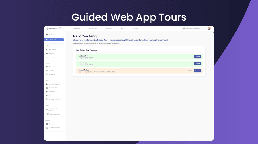
We’ve launched interactive guided tours for key sections of Zoneomics. These step-by-step tours walk you through important features, filters, and tools so you can utilize Zoneomics more efficiently.
Interactive tours are now live on:
- Dashboard: Understand your dashboard, including usage stats, report credits, and zone coverage at a glance.
- Zoning Data Page: Discover how to get started with a zoning search, apply filters, explore zoning layers, and generate reports with precision.
Zone Screenshot API now supports Latitude & Longitude
Our Zone Screenshot API just got a major upgrade for even greater precision.
You can now specify a location by:
- Address, or
- Latitude and Longitude
This enhancement makes it easier for developers to generate visual zoning snapshots with pinpoint accuracy: perfect for integrations, mapping tools, and reporting workflows. For more information, refer to the API documentation or contact info@zoneomics.com for assistance.
PLU Filter Export: Download permitted land use results
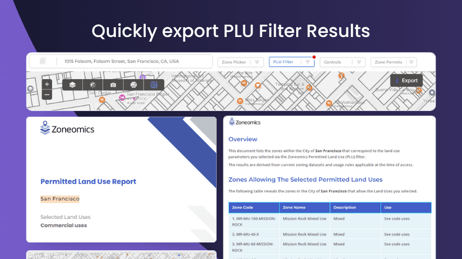
The Permitted Land Use (PLU) filter just got a lot more powerful.
You can now run a search in an area and apply a variety of land uses and then export your filtered PLU results as a PDF report, directly from the Zoning Data page. After applying a PLU filter, an Export button will appear to download a formatted, shareable PDF that summarizes your zoning findings.
Introducing the FLUM API: Future Land Use, now accessible
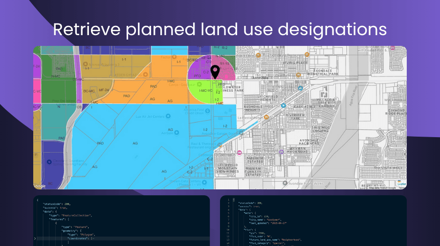
Our new FLUM (Future Land Use Map) API lets you retrieve insights about planned land use designations, even when current zoning hasn’t changed.
Whether you're a developer, planner, or appraiser, this new API supports:
- Point-based access (via address or coordinates)
- Area-based access (via radius, boundary, geometry, or ZIP)
It’s the easiest way to understand how today’s land will be used tomorrow.
FLUM – Bulk API enhancements
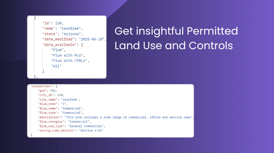
To expand the capabilities of our Future Land Use Map (FLUM) API, we’ve launched two powerful new endpoints: flum/jurisdiction and flum/jurisdictionDetails. These additions allow users to pull comprehensive, jurisdiction-level data on permitted land uses (PLU) and local development controls.
Whether you're comparing cities, analyzing trends, or conducting large-scale planning, these endpoints offer a clearer view into how land is being allocated and regulated across different regions, all in bulk, and all in one place.
Centralized FAQs
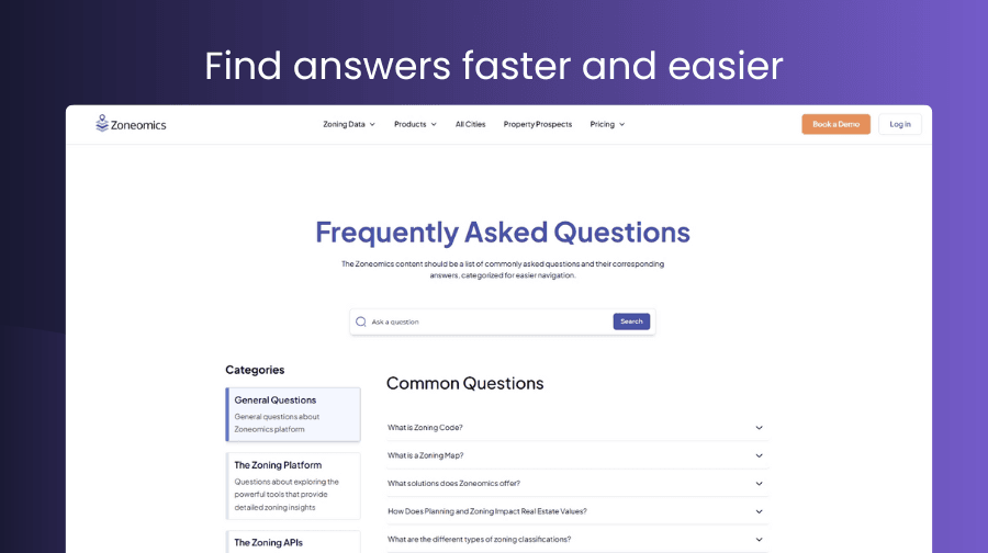
We’ve launched a new centralized FAQ page to make finding answers faster and easier.
Now all your most common questions are in one place.
Site Selection
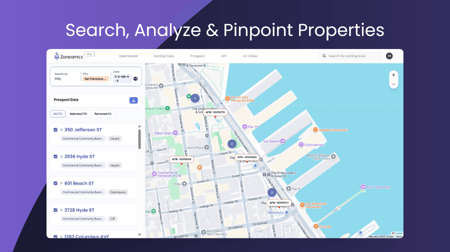
Our new Site Selection feature makes it easier to search, analyze, and pinpoint the ideal properties for your needs.
Start with a city or ZIP code, then refine your search using advanced filters like zone type, permitted uses, and Future Land Use Map (FLUM) categories.
It’s a smarter, more targeted way to discover properties that match your criteria quickly and precisely.
These updates reflect our mission: to turn zoning data into an accessible, actionable resource for every professional shaping the built environment. Whether using Zoneomics through our web platform, ordering reports, or integrating our APIs into your workflows, our latest updates and tools are designed to save you time, reduce risk, and expand what's possible.
Feel free to reach out if you have specific questions—or if you’re curious how Zoneomics can help your team work more efficiently with easy access to zoning data. We’d love to connect
✉️ Contact Us