
Arden City Zoning Code
ARTICLE 25
- DESIGN
Division 40.25.000.- Purpose.
A.
This Article addresses the design standards to be applied to specific uses and general subdivisions. It also provides regulations to ensure the quality of development and prevent monotony. Villages, hamlets, and the Traditional Neighborhood (TN) District all require special design controls if they are to be successful.
B.
In traditional communities and neighborhoods around the nation as well as in the County, buildings were built incrementally in small numbers so blocks developed over an extended period. The result is a great diversity in scale, style, and detail. Modern development practices often result in large numbers of mass produced housing that is often monotonous and has given large areas of the County a less than desirable character. Article 25 addresses the design issues of various developments.
(Ord. No. 97-172, § 3(ch. 13, div. 25.000), 12-31-1997)
Division 40.25.100. - Hamlet and village design.[14]
Editor's note— Ord. No. 09-037, § 1, adopted October 13, 2009, amended Division 40.25.100 in its entirety to read as herein set out. Formerly, Division 40.25.100, §§ 40.25.110—40.25.170 pertained to similar subject matter, and derived from Ord. No. 97-172, § 3(ch. 13, §§ 25.110—25.170), adopted December 31, 1997, and Ord. No. 98-080, § 1(ch. 13, § 25.130), adopted September 22, 1998.
Sec. 40.25.105. - Purpose.
The 2007 New Castle County Comprehensive Development Plan Update recognized that while the UDC has made great strides to improving the quality of development and the protection of natural resources in New Castle County since its adoption in December 1997, the ability of the hamlet and village options as written to incorporate and embrace the core principle focus of smart growth development was lacking. The standards and design criteria in this Division now support and sustain the following ten (10) principles of smart growth development.
A.
Provide and encourage for a variety of transportation choices.
B.
Encourage and create mixed land use.
C.
Create a range of housing choices and opportunities.
D.
Create walkable neighborhoods.
E.
Encourage community and stakeholder collaboration.
F.
Foster distinctive, attractive communities with a strong sense of place.
G.
Make development decisions predictable, fair and cost effective.
H.
Preserve open space, farmland, natural beauty and critical environmental areas.
I.
Strengthen and direct development towards existing communities.
J.
Take advantage of compact building design and efficient transportation design.
(Ord. No. 09-037, § 1, 10-13-2009)
Sec. 40.25.111. - Applicability.
A.
Provisions in this Division are activated by "shall" when required and "should" when recommended.
B.
The provisions of this Division, when in conflict, shall take precedence over other Divisions and Sections in this Code.
C.
This Code shall continue to be applicable to standards and regulations not covered by this Division. The nonresidential standards in Table 40.10.010 pertaining to resource protection levels shall apply to village and hamlet development.
D.
Section 40.25.150 contains regulatory language that is integral to this Division. Those terms not defined in either Section 40.25.150 or Article 33 shall be accorded their commonly accepted meanings. In the event of conflicts between these definitions and those used elsewhere in this Code, those of this Division shall take precedence.
E.
All Tables referenced in this Division are located in Section 40.25.140.
(Ord. No. 09-037, § 1, 10-13-2009; Ord. No. 10-113, § 1(Exh. A), 1-18-2011)
Sec. 40.25.112. - Process.
All plans submitted in accordance of this Division shall be processed pursuant to Article 31 and Appendix 1 of this Chapter.
(Ord. No. 09-037, § 1, 10-13-2009; Ord. No. 10-113, § 1(Exh. A), 1-18-2011)
Sec. 40.25.113. - Waivers and variances.
A.
There shall be two (2) types of deviation from the requirements of this Division: waivers and variances.
B.
A waiver is a ruling that would permit a practice that is not consistent with a specific provision of this Division but is justified by purpose of this Division. The Department shall have the authority to approve or disapprove administratively a request for a waiver pursuant to standards promulgated by the Department. When a particular standard is waived or the requirements are reduced, the Department shall require that a note be placed on the record plan identifying the reasons why a particular standard was reduced or waived.
C.
A variance is any ruling on a deviation other than a waiver. Variance applications shall be heard by the Planning Board pursuant to the standards and processes of Section 40.31.452 through Section 40.31.455.
1.
During the processing of the plan and prior to recordation or during a resubdivision to change or modify the design of the project all variances shall be considered a subdivision variance and shall be heard and decided by the Planning Board.
2.
Any dimensional variance requests subsequent to recordation of the plan for an individual lot by a property owner shall be considered a zoning variance and heard and decided by the Board of Adjustment.
D.
The request for a waiver or variance shall not subject the entire application to public hearing, but only that portion necessary to rule on the specific issue requiring the relief.
E.
The following standards and requirements shall not be available for waivers:
1.
The required provision of rear alleys and rear lanes.
2.
The permission to build accessory buildings.
3.
The minimum requirements for parking.
(Ord. No. 09-037, § 1, 10-13-2009; Ord. No. 10-113, § 1(Exh. A), 1-18-2011; Ord. No. 13-055, § 1, 12-17-2013)
Sec. 40.25.121. - Instructions.
A.
The use of this Division for new projects containing at least fifty (50) contiguous acres shall be available by right.
B.
Projects proposed in this Division must be zoned Suburban (S) and be served or planned to be served by public sewer in the Comprehensive Development Plan.
C.
Section 40.25.120 plans must include a regulating plan consisting of one (1) or more maps showing the following, in compliance with the standards described in this Division:
1.
Transect zones.
2.
Civic areas.
3.
Thoroughfare network.
4.
Special requirements, if any.
5.
Requested waivers or variances, if any.
D.
Section 40.25.120 plans must comply with the Traditional Neighborhood Housing Program provisions of Division 40.07.500, which are incorporated herein by reference.
E.
Any other density bonus established by this Chapter is not available for this development option.
F.
Prior to Section 40.25.120 plan approval, the developer shall establish or identify the appropriate organization that shall be responsible for owning, maintaining and managing all civic areas that are intended to be shared among multiple communities. Cross-access and maintenance agreements for shared civic areas shall be established as required by the Department. Article 27 shall apply to this development option to the extent practicable. However, due to the unique design features of the village and hamlet development option, the Department may approve alternative ownership and maintenance arrangements for the civic areas. All forms shall be approved by the Department and the Office of Law prior to recordation.
G.
The project must propose access to transit services. Access to transit services shall mean:
1.
Any proposed development or portion thereof within a one-quarter (¼) mile walking distance to the nearest bus stop; or
2.
Any proposed development or portion thereof within a two (2) mile radius of an existing transit park and ride facility or one that is proposed and constructed prior to the issuance of the first certificate of occupancy.
H.
Proposed revisions to recorded land development plans must be approved by County Council.
(Ord. No. 09-037, § 1, 10-13-2009; Ord. No. 10-113, § 1(Exh. A), 1-18-2011; Ord. No. 13-055, § 2, 12-17-2013; Ord. No. 23-084, § 1, 1-9-2024)
Sec. 40.25.122. - Sequence of community design.
A.
The site shall be structured using one (1) or several pedestrian sheds, responding to existing conditions, adjacent developments, connecting thoroughfares, and natural features. The site or any community within it may be smaller than its pedestrian shed.
B.
The pedestrian sheds shall determine the approximate boundaries and centers of the community types.
C.
Transect zones shall be allocated by pedestrian shed according to the applicable community type in Section 40.25.123.
D.
Civic areas shall be assigned according to Section 40.25.125.
E.
The thoroughfare network shall be laid out according to Section 40.25.126.
F.
Density shall be calculated according to Section 40.25.127.
G.
Remnants of the site outside the pedestrian sheds shall be assigned to transect zones or civic space.
(Ord. No. 09-037, § 1, 10-13-2009; Ord. No. 13-055, § 3, 12-17-2013)
Sec. 40.25.123. - Community types.
A.
Hamlet.
1.
A hamlet shall be structured by a minimum of one (1) standard pedestrian shed and shall consist of no fewer than fifty (50) acres and no more than one hundred (100) acres.
2.
A hamlet shall include transect zones as allocated on Table 14. A minimum of thirty-five (35) percent of the community shall be permanently allocated to a T1 Natural Zone and/or T2 Rural Zone.
B.
Village.
1.
A village shall be structured by one (1) or more standard or linear pedestrian sheds and shall be no fewer than one hundred (100) acres.
2.
A village shall include transect zones as allocated on Table 14.
3.
Larger sites shall be designed and developed as multiple communities, each subject to the individual transect zone requirements for its type as allocated on Table 14. The simultaneous planning of adjacent parcels is encouraged.
4.
In the T-4 General Urban Zone, a minimum residential mix of three (3) building disposition types (none less than twenty (20) percent) shall be required, selected from Table 9.
(Ord. No. 09-037, § 1, 10-13-2009)
Sec. 40.25.124. - Transect zones.
A.
Transect zones shall be assigned and mapped on each Section 40.25.120 plan according to the percentages allocated on Table 14.
B.
A transect zone may include any of the elements indicated for its T-Zone number throughout this Division, in accordance with the metric standards summarized in Table 14.
C.
Transect zones are not zoning districts, but are applicable only to the Section 40.25.120 development plan. The underlying New Castle County zoning districts will continue to be applicable to standards and regulations not addressed by the development plan.
(Ord. No. 09-037, § 1, 10-13-2009)
Sec. 40.25.125. - Civic areas.
A.
General. Civic areas dedicated for community or public use shall be required for each community and designated on the Section 40.25.120 plan as civic spaces (CS), civic buildings (CB) and civic parking (CP) areas.
1.
Civic spaces are sites permanently dedicated to open space.
2.
Civic building areas are sites dedicated for buildings generally operated by governmental or not-for-profit organizations dedicated to culture, education, religion, government, recreation, transit and municipal parking, or for other similar uses approved by the Department.
3.
Civic parking areas are off-street and off-lot parking areas or structures available for use by the general public.
4.
Civic buildings and civic parking areas shall be designated on the Section 40.25.120 plan.
5.
All civic areas shall have an underlying transect zone, and the acreage of civic areas shall be calculated as part of the allocation of pedestrian sheds required by Section 40.25.140 Table 14 (a).
B.
Civic areas specific to T1 and T2 zones. Civic buildings and civic spaces within T1 natural and T2 rural zones shall be permitted pursuant to Table 40.10.210.
C.
Civic areas specific to T3-T5 zones.
1.
Each pedestrian shed shall assign at least five (5) percent of its urbanized area to civic spaces and/or civic building areas. Thoroughfares and civic parking areas shall not be included within this calculation.
2.
Civic spaces shall be designed as generally described in Table 40.25.140 13a-13e distributed throughout transect zones as described in Table 40.25.104 14.
3.
Each pedestrian shed shall contain at least one (1) main civic space. The main civic space shall be within eight hundred (800) feet of the geographic center of each pedestrian shed, unless topographic conditions, pre-existing thoroughfare alignments or other existing circumstances prevent such location. A main civic space shall conform to one (1) of the types specified in Table 13b, 13c, or 13d.
4.
Each civic space shall have a minimum of fifty (50) percent of its perimeter enfronting a thoroughfare, except for playgrounds and rambles.
5.
Parks may be permitted in transect zones T4 and T5.
6.
Rambles shall be permitted as civic spaces, but only if the five (5) percent minimum civic space is satisfied by other types in Section 40.25.140, Table 40.25.140 13.
D.
Civic building areas specific to T3-T5 zones.
1.
Civic building areas shall not occupy more than twenty (20) percent of the area of each pedestrian shed.
2.
Civic building areas should be located within or adjacent to a civic space, or at the axial termination of a significant thoroughfare.
3.
Civic building areas shall be designed as generally described in Table 40.25.140 13f.
(Ord. No. 09-037, § 1, 10-13-2009; Ord. No. 10-113, § 1(Exh. A), 1-18-2011; Ord. No. 13-055, § 4, 12-17-2013)
Editor's note— Ord. No. 13-055, § 4, adopted December 17, 2013, changed the title of Section 40.25.125 from "Civic zones" to "Civic areas." The historical notation has been preserved for reference purposes.
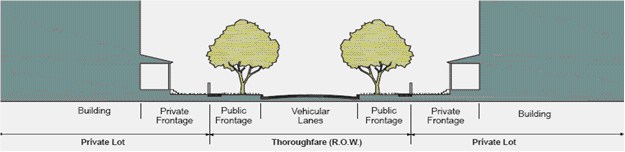
Sec. 40.25.126. - Thoroughfare standards.
The purpose of these thoroughfare standards is to serve as a guide for the design of the hamlet and/or village plan. Final thoroughfare standards shall be as approved by DelDOT. Items that are not in the right-of-way are subject to County approval.
A.
General.
1.
Thoroughfares are intended for use by vehicular, bicycle and pedestrian traffic and to provide access to lots and open spaces.
2.
Thoroughfares shall generally consist of vehicular lanes and public frontages.
3.
Thoroughfares shall be designed in context with the urban form and desired design speed of the transect zones through which they pass. The public frontages of thoroughfares that pass from one (1) transect zone to another shall be adjusted accordingly or, alternatively, the transect zone may follow the alignment of the thoroughfare to the depth of one (1) lot, retaining a single public frontage throughout its trajectory.
4.
Within the most rural zones (T1 and T2) pedestrian comfort shall be a secondary consideration of the thoroughfare. Design conflict between vehicular and pedestrian generally shall be decided in favor of the vehicle. Within the more urban transect zones (T3 through T5) pedestrian comfort shall be a primary consideration of the thoroughfare. Design conflict between vehicular and pedestrian movement generally shall be decided in favor of the pedestrian.
5.
The thoroughfare network shall be designed to define blocks not exceeding the size prescribed in Table 14. The perimeter shall be measured as the sum of lot frontage lines.
6.
All thoroughfares shall terminate at other thoroughfares, forming a network. Internal thoroughfares shall connect when feasible to those on adjacent sites. Culs-de-sac may be permitted to accommodate specific site conditions only.
7.
Each lot shall enfront a vehicular thoroughfare, except that twenty (20) percent of the lots within each transect zone may enfront a passage or sidewalk.
8.
Thoroughfares along a designated B-grid may be exempted by waiver from one (1) or more of the specified public frontage or private frontage requirements.
9.
Standards for paths and bicycle trails shall be a minimum of five (5) foot paved surface. For multi-use paths, the Department may require wider paths.
B.
Vehicular lanes.
1.
Thoroughfares may include vehicular lanes in a variety of widths for parked and for moving vehicles, including bicycles.
2.
A bicycle network consisting of bicycle trails, bicycle routes, bicycle lanes and bike racks at regular intervals shall be provided throughout as defined in Section 40.25.150. The community bicycle network shall be connected to existing or proposed regional networks wherever possible.
C.
Public frontages.
1.
General to all zones T1, T2, T3, T4, T5.
a.
The public frontage contributes to the character of the transect zone, and includes the types of sidewalk, curb, planter, bike lanes and street trees.
b.
Public frontages shall be designed as shown in Table 4A and Table 4B.
c.
Within the public frontages, the prescribed types of public planting and public lighting shall be as shown in Table 4A and Table 4B, and in Section 40.04.111. The spacing for street trees may be adjusted to accommodate specific site conditions.
2.
Specific to zones T1, T2, T3.
a.
The public frontage shall include trees of various species, naturalistically clustered, as well as understory.
b.
The introduced landscape shall consist primarily of native species requiring minimal irrigation, fertilization and maintenance.
3.
Specific to zones T4, T5. The introduced landscape shall consist primarily of durable species tolerant of soil compaction.
a.
Rear lanes or rear alleys shall be required in T4 and T5.
b.
The provisions of Section 40.04.240 shall not be applicable to T4 and T5 transect zones.
4.
Specific to zone T4. The public frontage shall include trees planted in a regularly-spaced allee pattern of single or alternated species with shade canopies of a height that, at maturity, clears at least one (1) story.
5.
Specific to zone T5. The public frontage shall include trees planted in a regularly-spaced allee pattern of single species with shade canopies of a height that, at maturity, clears at least one (1) story. At retail frontages, the spacing of the trees may be irregular, to avoid visually obscuring the shopfronts.
(Ord. No. 09-037, § 1, 10-13-2009; Ord. No. 10-113, § 1(Exh. A), 1-18-2011; Ord. No. 13-055, § 5, 12-17-2013)
Sec. 40.25.127. - Density calculations.
A.
All areas of the Section 40.25.120 plan site that are not part of T-1 shall be considered cumulatively the net site area. The net site area shall be allocated to the various transect zones according to the parameters specified in Table 14a. All protected resources from Article 10 shall be included in T-1.
B.
Density shall be expressed in terms of housing units per acre as specified for the area of each transect zone by Table 14b. For purposes of density calculation, the transect zones include the thoroughfares.
C.
Reserved.
D.
Within the percentage range shown on Table 14b for other functions, the housing units specified on Table 14b shall be exchanged at the following rates:
1.
For lodging: Two (2) bedrooms for each unit of net site area density.
2.
For office or retail: One thousand three hundred (1,300) square feet for each unit of net site area density.
E.
The housing and other functions for each transect zone shall be subject to further adjustment at the building scale as limited by Table 10 and Table 11 and Section 40.25.130.
(Ord. No. 09-037, § 1, 10-13-2009; Ord. No. 10-113, § 1(Exh. A), 1-18-2011)
Sec. 40.25.128. - Special requirements.
A.
A Section 40.25.120 plan shall designate any of the following special requirements:
1.
A differentiation of the thoroughfares as A-grid and B-grid. Buildings along the A-grid shall be held to the highest standard of this Code in support of pedestrian activity. Buildings along the B-grid may be designed for more automobile-oriented standards. The frontages assigned to the B-grid shall not exceed thirty (30) percent of the total length of frontages within a pedestrian shed.
2.
Designations for mandatory and/or recommended retail frontage requiring or advising that a building provide a shopfront at sidewalk level along the entire length of its private frontage. The shopfront shall be no less than seventy (70) percent glazed in clear glass and shaded by an awning overlapping the sidewalk as generally illustrated in Table 7. The first floor shall be confined to retail use through the depth of the second layer.
3.
Designations for mandatory and/or recommended gallery frontage, requiring or advising that a building provide a permanent cover over the sidewalk, either cantilevered or supported by columns. The gallery frontage designation may be combined with a retail frontage designation.
4.
Reserved.
5.
Reserved.
6.
Designations for mandatory and/or recommended terminated vista locations, requiring or advising that the building be provided with architectural articulation of a type and character that responds visually to the location, as approved by the Department.
7.
A designation for cross block passages, requiring that a minimum eight-foot wide pedestrian access be reserved between buildings.
(Ord. No. 09-037, § 1, 10-13-2009)
Sec. 40.25.131. - Instructions.
Lots and buildings located within Section 40.25.120 plans subject to this Division shall be subject to the requirements of Sections 40.25.132 through 40.25.139.
(Ord. No. 09-037, § 1, 10-13-2009)
Sec. 40.25.133. - Building disposition.
A.
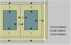
Specific to zone T2. Building disposition setback shall be a minimum of thirty-six (36) feet off the public frontage. Side yard setbacks shall be a minimum of twenty-four (24) feet and rear yard setbacks shall be a minimum of twenty-four (24) feet.
B.
Specific to zones T3, T4, T5.
1.
Newly platted lots shall be dimensioned according to Table 14f and Table 15.
2.
Building disposition types shall be as shown in Table 9.
3.
Buildings shall be disposed in relation to the boundaries of their lots according to Table 14g and Table 15.
4.
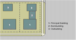
One (1) principal building at the frontage, and one (1) outbuilding to the rear of the principal building, may be built on each lot.
5.
Lot coverage by building shall not exceed that recorded in Table 14f and Table 15.
6.
Facades shall be built parallel to a rectilinear principal frontage line or to the tangent of a curved principal frontage line, and along a minimum percentage of the frontage length at the setback, as specified on Table 14g and Table 15.
7.
Setbacks for principal buildings shall be as shown in Table 14g and Table 15.
8.
Rear setbacks for outbuildings shall be a minimum of twelve (12) feet measured from the centerline of the rear alley or rear lane easement. in the absence of rear alley or rear lane, the rear setback shall be as shown in Table 14h and Table 15.
9.
Encroachments shall not project into a ROW, except to the extent permitted by DelDOT.
C.
Specific to zone T4. A minimum residential housing mix of three (3) types (none less than twenty (20) percent) shall be required in the T4 zone.
D.
Specific to zone T5. The principal entrance shall be on a frontage line.
(Ord. No. 09-037, § 1, 10-13-2009)
Sec. 40.25.134. - Building configuration.
A.
General to zones T2, T3, T4, T5.
1.
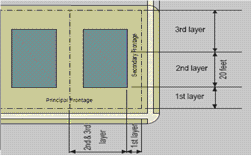
The private frontage of buildings shall conform to and be allocated in accordance with Table 7 and Table 14i.
2.
Buildings on corner lots shall have two (2) private frontages. Prescriptions for the parking layers (Tables 15 and 16) pertain only to the principal frontage. Prescriptions for the first layer pertain to both frontages.
3.
Building heights and stepbacks shall conform to Table 8 and Table 14j.
4.
Stories may not exceed fourteen (14) feet in height from finished floor to finished ceiling, except for a first floor commercial function, which shall be a minimum of eleven (11) feet, with a maximum of twenty-five (25) feet. A single floor level exceeding fourteen (14) feet, or twenty-five (25) feet at ground level, shall be counted as two (2) stories. Mezzanines extending beyond thirty-three (33) percent of the floor area shall be counted as an additional story. Established residential uses may be converted to a commercial use without meeting the minimum eleven (11) foot first floor height standard.
5.
In a parking structure or garage, each level counts as a single story regardless of its relationship to habitable stories.
6.
Height limits do not apply to attics or raised basements, masts, belfries, clock towers, chimney flues, water tanks, or elevator bulkheads.
7.
Encroachments shall not project into a ROW, except to the extent permitted by DelDOT.
B.
Specific to zones T2, T3, T4, T5. The minimum size of a dwelling within a principal building shall be three hundred (300) square feet in interior space. Outbuildings may be any size.
C.
Specific to zone T3.
1.
No portion of the private frontage may encroach the sidewalk, unless permitted by DelDOT.
2.
Open porches may encroach the first layer fifty (50) percent of its depth.
3.
Balconies and bay windows may encroach the first layer twenty-five (25) percent of its depth.
D.
Specific to zone T4.
1.
Balconies, open porches and bay windows may encroach the first layer fifty (50) percent of its depth.
2.
To the extent permitted by DelDOT, awnings may encroach the sidewalk to within two (2) feet of the curb but must clear the sidewalk vertically by at least eight (8) feet.
E.
Specific to zone T5.
1.
To the extent permitted by DelDOT, awnings, arcades, and galleries may encroach the sidewalk to no closer than two (2) feet of the curb but must clear the sidewalk vertically by at least eight (8) feet.
2.
Stoops, lightwells, balconies, bay windows, and terraces may encroach the first layer one hundred (100) percent of its depth. To the extent permitted by DelDOT, balconies and bay windows may encroach the sidewalk twenty-five (25) percent of its depth.
3.
Loading docks shall not be permitted on frontages.
4.
In the absence of a building facade along any part of a frontage line, a streetscreen shall be built coplanar with the facade.
5.
Streetscreens should be between three and one-half (3.5) and eight (8) feet in height. The streetscreen may be replaced by a hedge. Streetscreens shall have openings no larger than necessary to allow automobile and pedestrian access.
(Ord. No. 09-037, § 1, 10-13-2009; Ord. No. 13-055, § 6, 12-17-2013)
Sec. 40.25.135. - Building function.
A.
General to zones T2, T3, T4, T5. Buildings in each transect zone shall conform to the functions on Table 10 and Table 12 and Table 14k. Uses not permitted by Table 12, may be permitted if the underlying zoning district permits such use as a permitted, limited use, or special use and subject to the same standards and limitations.
B.
Specific to zones T2, T3. Accessory functions of restricted lodging or restricted office shall be permitted within an outbuilding. See Table 10.
C.
Specific to zones T4, T5. Accessory functions of limited lodging or limited office shall be permitted within an outbuilding. See Table 10.
D.
Specific to zone T5.
1.
First story commercial functions shall be permitted.
2.
Reserved.
(Ord. No. 09-037, § 1, 10-13-2009)
Sec. 40.25.136. - Parking and density calculations.
A.
Specific to zones T2, T3. Buildable density on a lot shall be determined by the actual parking provided within the lot as applied to the functions permitted in Table 10.
B.
Specific to zones T4, T5.
1.
Buildable density on a lot shall be determined by the sum of the actual parking calculated as that provided: (1) within the lot; (2) along the parking lane corresponding to the lot frontage; and, (3) by purchase or lease from a civic parking reserve within the pedestrian shed, if available.
2.
The actual parking may be adjusted upward according to the shared parking factor of Table 11 to determine the effective parking. The shared parking factor is available for any two (2) functions within any pair of adjacent blocks.
3.
Based on the effective parking available, the density of the projected function may be determined according to Table 10.
4.
Reserved.
5.
The total density within each transect zone shall not exceed that specified by an approved Section 40.25.120 plan.
6.
Accessory units do not count toward density calculations.
7.
Liner buildings less than thirty (30) feet deep and no more than two (2) stories shall be exempt from parking requirements.
C.
Parking space maximums for any transect zone. Table 11 provides a limit to the maximum number of parking spaces that may be provided on-site.
(Ord. No. 09-037, § 1, 10-13-2009)
Sec. 40.25.137. - Parking location standards.
A.
General to zones T2, T3, T4, T5.
1.
Parking shall be accessed by rear alleys or rear lanes, when such are available on the regulating plan.
2.
Open parking areas shall be masked from the frontage by a building or streetscreen.
B.
Specific to zones T2, T3.
1.
Open parking areas shall be located at the second and third lot layers, except that driveways, drop-offs and unpaved parking areas may be located at the first lot layer.
2.
Garages shall be located at the third lot layer except that side- or rear-entry types may be allowed in the first or second lot layer by waiver.
3.
Reserved.
C.
Specific to zones T3, T4. Driveways at frontages shall be no wider than ten (10) feet in the first layer.
D.
Specific to zone T4. All parking areas and garages shall be located at the second or third layer.
E.
Specific to zone T5.
1.
All parking lots, garages, and parking structures shall be located at the second or third lot layer.
2.
Vehicular entrances to parking lots, garages, and parking structures shall be no wider than twenty-four (24) feet at the frontage.
3.
Pedestrian exits from all parking lots, garages, and parking structures shall be directly to a frontage line and may include direct access to a building.
4.
Parking structures on A-grids shall have liner buildings lining the first and second stories.
5.
Bicycle parking shall be provided pursuant to Section 40.03.527 and as part of the public streetscape at locations approved by the Department.
(Ord. No. 09-037, § 1, 10-13-2009; Ord. No. 10-113, § 1(Exh. A), 1-18-2011)
Sec. 40.25.138. - Landscape standards.
A.
General to zones T2, T3, T4, T5.
1.
Impermeable surface shall be confined to the ratio of lot coverage specified in Table 14f.
2.
Perimeter buffers of three-tenths (0.3) opacity shall be established except where like developments exist. An additional one-tenth (0.1) opacity parking buffer is also required.
B.
Specific to zones T2, T3.
1.
The first layer may not be paved, with the exception of driveways as specified in Section 40.25.137.
2.
Landscaping standards shall be pursuant to Section 40.04.111.
C.
Specific to T4. A minimum of one (1) tree shall be planted within the first layer for each thirty (30) feet of frontage line or portion thereof.
D.
Reserved.
E.
Specific to zone T5. Landscaping shall be required for all parking lots and shall require a four-foot high masonry wall, fence, or landscape screen.
(Ord. No. 09-037, § 1, 10-13-2009; Ord. No. 10-113, § 1(Exh. A), 1-18-2011)
Sec. 40.25.140. - Standards and tables.
Table 1. Transect Zone Descriptions
Table 2. Reserved. (Sector/Community Allocation)
Table 3A. Reserved. (Vehicular Lane Dimensions)
Table 3B. Reserved. (Vehicular Lane and Parking Assemblies)
Table 3C. Reserved. (Thoroughfare Assemblies)
Table 4A. Public Frontages—General
Table 4B. Public Frontages—Specific
Table 5. Reserved. (Public Lighting)
Table 6. Reserved. (Public Planting)
Table 7. Private Frontages
Table 8. Building Configuration
Table 9. Building Disposition
Table 10. Building Function—General
Table 11. Parking Calculations
Table 12. Specific Function and Use
Table 13. Civic Areas
Table 14. Smart Code Summary
Table 15A. Form Based Code Graphics—T3 Transect Zone
Table 15B. Form Based Code Graphics—T4 Transect Zone
Table 15C. Form Based Code Graphics—T5 Transect Zone
Table 16. Reserved. (Special District Standards)
Table 17. Definitions Illustrated
Table 1. Transect Zone Descriptions
(This table describes the intent of each transect zone.)
| Transect Zone | Picture | Description Type | |
|---|---|---|---|
| T1—Natural | 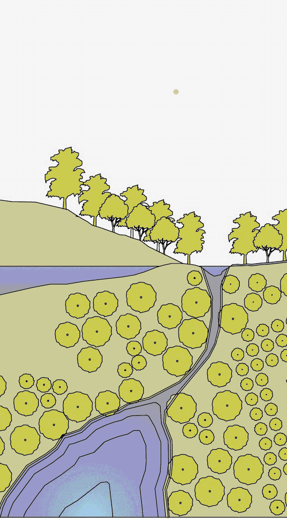 | General character | Natural landscape with some agricultural use |
| Building placement | Not applicable | ||
| Frontage types | Not applicable | ||
| Typical building height | Not applicable | ||
| Type of civic space | Parks, greenways | ||
| T2—Rural | 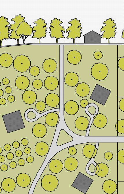 | General character |
Primarily agricultural with woodland and scattered
buildings |
| Building placement | Variable setbacks | ||
| Frontage types | Not applicable | ||
| Typical building height | 1 to 2 story | ||
| Type of civic space | Parks, greenways | ||
| T3—Suburban |  | General character | Lawns, and landscaped yards surrounding detached single-family houses; pedestrians occasionally |
| Building placement | Large and variable front and side yard setbacks | ||
| Frontage types | Porches, fences, naturalistic tree planting | ||
| Typical building height | 1 to 2 story with some 3 story | ||
| Type of civic space | Parks, greenways | ||
|
T4—General
Urban |  | General character |
Mix of houses, townhouses and small apartment
buildings, with scattered commercial activity; balance landscape and buildings; presence of pedestrians |
| Building placement | Shallow to medium front and rear yard setbacks | ||
| Frontage types | Porches, fences, dooryards | ||
| Typical building height | 2 to 3 story with a few taller mixed use buildings | ||
| Type of civic space | Squares, greens | ||
|
T5—Urban
Center | 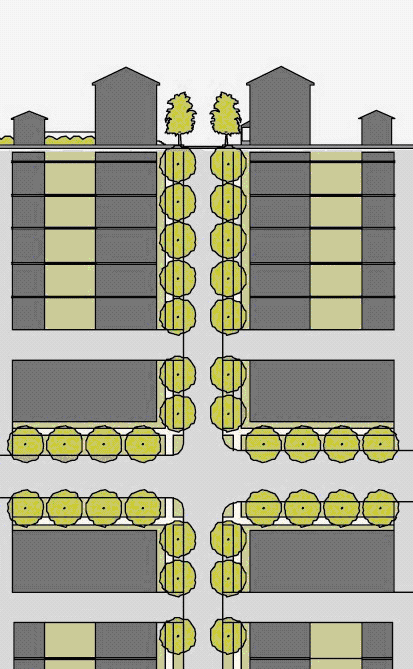 | General character | Shops mixed with townhouses, larger apartment houses, offices workplaces, and civic buildings; predominantly attached buildings; trees within the public right-of-way; substantial pedestrian activity |
| Building placement | Shallow setbacks or none; building oriented to street defining a street wall | ||
| Frontage types | Stoops, shopfronts, galleries | ||
| Typical building height | 2 to 5 story with some single story limited to 20% of nonresidential GFA. Subject to Department approval, to ensure that the design elements and facade contribute to the viability of the urban center. | ||
| Type of civic space | Parks, plazas and squares, median landscaping | ||
Table 2. Reserved. (Sector/Community Allocation)
Table 3A. Reserved. (Vehicular Lane Dimensions)
Table 3B. Reserved. (Vehicular Lane and Parking Assemblies)
Table 3C. Reserved. (Thoroughfare Assemblies)
Table 4A. Public Frontages—General
(The public frontage is the area between the private lot line and the edge of the
vehicular lands. Dimensions are given in Table 4B.)
|
Transect
Zones | Thoroughfare Types | Plan | |||
|---|---|---|---|---|---|
| Lot | ⇒ | ⇐ | R.O.W. | ||
|
Private
Frontage | ⇒ | ⇐ |
Public
Frontage | ||
|
T1
T2 T3 | a. Highway (HW): This frontage has open swales drained by percolation, bicycle trials and no parking. The landscaping consists of the natural condition or multiple species arrayed in naturalistic clusters. Buildings are buffered by distance or berms. |  | |||
|
T1
T2 T3 | b. Road (RD): This frontage has open swales drained by percolation and a walking path or bicycle trail alone one (1) or both sides and yield parking. The landscaping consists of multiple species arrayed in naturalistic clusters. |  | |||
|
T3
T4 T5 | c. (ST) for street: This frontage has raised curbs drained by inlets and sidewalks separated from the vehicular lanes by individual or continuous planters, with parking on one (1) or both sides. The landscaping consists of street trees or a single or alternating species aligned in a regularly spaced allee. | 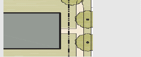 | |||
|
T3
T4 T5 | d. (DR) for drive: This frontage has raised curbs drained by inlets and a wide sidewalk or paved path along one (1) side, related to greenway or waterfront. It is separated from the vehicular lanes by individual or continuous planters. The landscaping consists of street trees of a single or alternating species aligned in a regularly spaced allee. |  | |||
|
T3
T4 T5 | e. (AV) for avenue: This frontage has raised curbs drained by inlets and wide sidewalks separated from the vehicular lanes by a narrow continuous planter with parking on both sides. The landscaping consists of a single tree species aligned in a regularly spaced allee. |  | |||
| T5 | f. (CS) (AV) for commercial street or avenue: This frontage has raised curbs drained by inlets and very wide sidewalks along both sides separated from the vehicular lanes by separate tree wells with grates and parking on both sides. The landscaping consists of a single tree aligned with regular spacing where possible but clears the storefront entrances. | 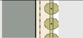 | |||
|
T3
T4 T5 | g. (BV) for boulevard: This frontage has slip roads on both dies. It consists of raised curbs drained by inlets and sidewalks along both sides, separated from the vehicular lanes by planters. The landscaping consists of double rows of a single tree species aligned in a regularly spaced allee. |  | |||
Table 4B. Public Frontages—Specific
(This table assembles prescriptions and dimensions for the public frontage elements
- curbs, walkways and planters - relative to specific thoroughfare types within transect
zones.
Locally appropriate planting species should be filled in to the calibrated code.)
For illustrative purposes only. Subject to DelDOT approval.
|
Transect
Zone | T1, T2, T3 | T1, T2, T3 | T3, T4 | T4, T5 | T5 | T5 |
|---|---|---|---|---|---|---|
|
Public
Frontage Type | HW and RD | RD and ST | ST, DR, and AV |
ST, DR, AV,
and BV |
CS, DR, AV,
and BV |
CS, DR, AV,
and BV |
| Assembly: The principal variables are the type and dimension of curbs, walkways, planters and landscape. | 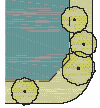 | 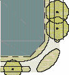 | 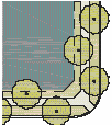 | 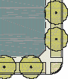 | 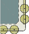 |  |
| Total width | 16—24 feet | 12—24 feet | 12—18 feet | 12—18 feet | 18—24 feet | 18—30 feet |
| Curb: The detailing of the edge of the vehicular pavement, incorporating drainage. |  |  |  |  |  |  |
| Type | open swale | open swale | raised curb | raised curb | raised curb | raised curb |
| Radius | 10—30 feet | 10—30 feet | 5—20 feet | 5—20 feet | 5—20 feet | 5—20 feet |
| Walkway: The pavement dedicated exclusively to pedestrian activity. |  | 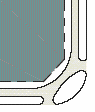 |  |  |  |  |
| Type | path optional | path | sidewalk | sidewalk | sidewalk | sidewalk |
| Width | n/a | 4—8 feet | 4—8 feet | 4—8 feet | 12—20 feet | 12—30 feet |
| Planter: The layer which accommodates street trees and other landscaping. |  |  |  |  |  |  |
| Arrangement | clustered | clustered | regular | regular | regular | opportunistic |
| Species | multiple | multiple | alternating | single | single | single |
| Planter type | continuous swale | continuous swale |
continuous
planter |
continuous
planter |
continuous
planter | tree well |
| Planter width | 8—16 feet | 8—16 feet | 8—12 feet | 8—12 feet | 4-6 feet | 4—6 feet |
| Landscape: See Section 40.25.138 for landscaping standards. | ||||||
| Lighting: See Section 40.04.111 for lighting standards. | ||||||
Table 5. Reserved. (Public Lighting)
Table 6. Reserved. (Public Planting)
Table 7. Private Frontages
(The private frontage is the area between the building facades and the lot lines.
Encroachments shall not project into a ROW, except to the extent permitted by DelDOT.)
|
Transect
Zones | Private frontage character | Section | Plan | ||||||
|---|---|---|---|---|---|---|---|---|---|
| Lot | ⇒ | ⇐ | ROW | Lot | ⇒ | ⇐ | ROW | ||
|
Private
frontage | ⇒ | ⇐ |
Public
frontage |
Private
frontage | ⇒ | ⇐ |
Public
frontage | ||
|
T2
T3 | Common yard: A planted frontage wherein the facade is set back substantially from the frontage line. The front yard created remains unfenced and is visually continuous with adjacent yards, supporting a common landscape. The deep setback provides a buffer from the higher speed thoroughfares. | 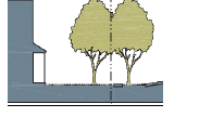 | 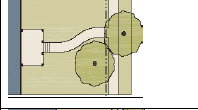 | ||||||
|
T3
T4 T5 | Porch and fence: A planted frontage wherein the facade is set back from the frontage line with an attached porch permitted to encroach. A fence at the frontage line maintains street spatial definition. Porches shall be no less than eight (8) feet deep. |  | 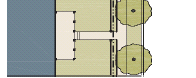 | ||||||
|
T4
T5 | Terrace or lightwell: A frontage wherein the facade is set back from the frontage line by an elevated terrace or a sunken lightwell. This type buffers residential uses from urban sidewalks and removes the private yard from public encroachment. Terraces are suitable for conversion to outdoor cafes. (Syn.: dooryard). | 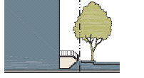 | 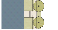 | ||||||
|
T4
T5 | Forecourt: A frontage wherein a portion of the facade is close to the frontage line and the central portion is setback. The forecourt created is suitable for vehicular. This type should be allocated in conjunction with other frontage types. Large trees within the forecourt may overhang the sidewalks. |  | 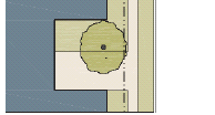 | ||||||
|
T4
T5 | Stoop: A frontage wherein the facade is aligned close to the frontage line with the first story elevated from the sidewalk sufficiently to secure privacy for the windows. The entrance is usually an exterior stair and landing. This type is recommended for ground floor residential use. |  |  | ||||||
|
T4
T5 | Shopfront: A frontage wherein the facade is aligned close to the frontage line with the building entrance at sidewalk grade. This type is conventional for retail use. It has a substantial glazing on the sidewalk level and an awning that should overlap the sidewalk to within two (2) feet of the curb. Syn.: retail frontage. | 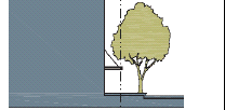 | 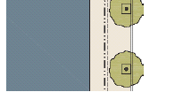 | ||||||
|
T4
T5 | Gallery: A frontage wherein the facade is aligned close to the frontage line with an attached cantilevered shed or a lightweight colonnade overlapping the sidewalk. This type is conventional for retail use. The gallery shall be no less than ten (10) feet wide and should overlap the sidewalk to within two (2) feet of the curb. | 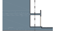 |  | ||||||
Table 8. Building Configuration
(This table shows the configurations for different building heights for each Transect
Zone. Recess lines and expression lines shall occur on higher buildings as shown.
N = maximum height as specified in Table 14K.)
| T2 and T3 Transect Zones | T4 Transect Zone | T5 Transect Zone |
|---|---|---|
 |  |  |
| 1. Building height shall be measured in number of stories, excluding attics and raised basements. Height limits also do not apply to masts, belfries, clock towers, chimney flues, water tanks, elevator bulkheads and similar structures. | ||
| 2. Stories may not exceed fourteen (14) feet in height from finished floor to finished ceiling, except for a first floor commercial function, which shall be a minimum of eleven (11) feet, with a maximum of twenty-five (25) feet. | ||
| 3. Height shall be measured from the average enfronting sidewalk grade to the uppermost eave of a main pitched roof (not of a dormer), or to the uppermost roof deck (not the top of parapet) of a flat roof. | ||
Table 9. Building Disposition
(This table approximates the location of the structure relative to the boundaries of each individual lot, establishing suitable basic building types for each Transect zone)
|
Transect
Zone | Yard | Illustration |
|---|---|---|
|
T2
T3 T4 T5 | a. EDGEYARD: Specific types—Single family house, cottage, villa, estate house, urban villa. A building that occupies the center of its lot with setbacks on all sides. This is the least urban of types as the front yard sets it back from the frontage, while the side yards weaken the spatial definition of the public thoroughfare space. The front yard is intended to be visually continuous with the yards of adjacent buildings. The rear yard can be secured for privacy by fences and a well-placed backbuilding and/or outbuilding. |  |
|
T4
T5 | b. SIDEYARD: Specific types—Charleston single house, double house, zero lot line house, twin. A building that occupies one (1) side of the lot with the setback to the other side. A shallow frontage setback defines a more urban condition, If the adjacent building is similar with a blank party wall, the yard can be quite private. This type permits systematic climatic orientation in response to the sun or the breeze. If a sideyard house abuts a neighboring sideyard house, the type is known as a twin or double house. Energy costs, and sometimes noise, are reduced by sharing a party wall in this disposition. |  |
|
T4
T5 | c. REARYARD: Specific types—Townhouse, rowhouse, live-work unit, loft building, apartment house, mixed use block, flex building, perimeter block. A building that occupies the full frontage, leaving the rear of the lot as the sole yard. This is a very urban type as the continuous facade steadily defines the public thoroughfare. The rear elevations may be articulated for functional purposes. In its residential form, this type is the rowhouse. For its commercial form, the rear yard can accommodate substantial parking. |  |
| T5 | d. COURTYARD: Specific types—Patio house. A building that occupies the boundaries of its lot while internally defining one (1) or more private patios. This it eh most urban of types, as it is able to shield the private realm from all sides while strongly defining the public thoroughfare. Because of its ability to accommodate incompatible activities, masking them from all sides, it is recommended for workshops, lodging and schools. The high security provided by the continuous enclosure is useful for crime-prone areas. |  |
Table 10. Building Function—General
(This table categorizes building functions within transect zones. Parking requirements are correlated to function intensity. For specific function and use permitted by right, see Table 12)
Table 12. Specific Function and Use
(This table expands the categories of Table 10 to delegate specific functions and uses within Transect Zones)
■ - permitted by right
Table 13. Civic Areas
|
T1
T2 T3 | a. Park: A natural preserve available for unstructured recreation. A park may be independent of surrounding building frontages. Its landscape shall consist of paths and trails, meadows, waterbodies, woodland and open shelters, all naturalistically disposed. Parks may be lineal, following the trajectories of natural corridors. The minimum size shall be eight (8) acres. Larger parks may be approved by waiver as special districts in all zones | 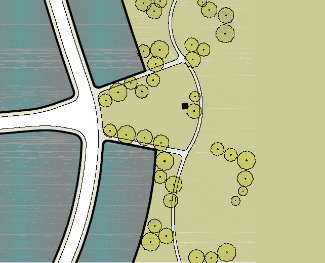 |
|
T3
T4 T5 | b. Green: An open space available for unstructured recreation. A green may be spatially defined by landscaping rather than building frontages. Its landscape shall consist of lawn and trees, naturalistically disposed. The minimum size shall be one-fourth (¼) acre and the maximum size shall be eight (8) acres. | 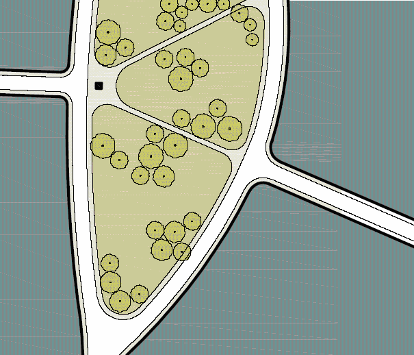 |
|
T4
T5 | c. Square: An open space available for unstructured recreation and civic purposes. A square is spatially defined by building frontage. Its landscape shall consist of paths, lawns and trees, formally disposed. Squares shall be located at the intersection of important thoroughfares. The minimum size shall be one-fourth (¼) acre and the maximum size shall be five (5) acres. | 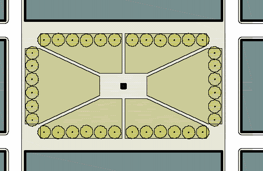 |
| T5 | d. Plaza: An open space available for civic purposes and commercial activities. A plaza shall be spatially defined by building frontages. Its landscape shall consist primarily of pavement. Trees are optional. Plazas should be located at the intersection of important streets. The minimum size shall be one-half (½) acre and the maximum size shall be two (2) acres. | 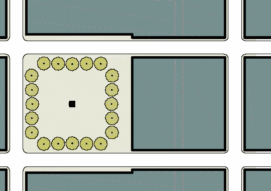 |
|
T1
T2 T3 T4 T5 | e. Playground: An open space designed and equipped for the recreation of children. A playground should be fenced and may include an open shelter. Playgrounds shall be interspersed within residential areas and may be placed within a block. Playgrounds may be included within parks and greens. There shall be no minimum or maximum size. | 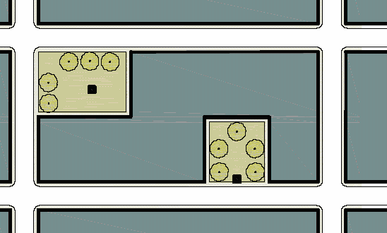 |
| T5 | f. Civic building area: A civic area containing a building or structure permitted in accordance with Section 40.25.125 A 3. A civic building area shall comply with all limitations, requirements, and metrics of its underlying transect with the exceptions that (1) the maximum lot size shall be ten (10) acres; (2) rear lanes and/or rear alleys are not mandatory unless required by the Department; (3) there shall be no maximum lot width; (4) there shall be no maximum front setback requirement in the T4 and T5 transects; and (5) there shall be no minimum frontage buildout requirement in the T4 and T5 transects. Civic buildings must be designed to contribute to and enhance the urban design of the built environment. |
Table 14. Smart Code Summary
 |  |  |  |  | |
|---|---|---|---|---|---|
| T1 - Natural Zone | T2 - Rural zone |
T3 - Suburban
zone |
T4 - General
urban zone | T5 - Urban center zone | |
| a. Allocation of zones per pedestrian shed | |||||
| Hamlet requires | 35% | No minimum | 10—30% | 20—40% | 0—5% |
| Village requires | No minimum | No minimum | 10—30% | 30—60% | 10—30% |
| b. Maximum residential density, see Section 40.25.127 | |||||
| By right | Not applicable | 1 unit/20 ac. avg. | 6 units/ac. gross | 12 units/ac. gross | 27 units/ac. gross |
| (Reserved) | |||||
| Other functions | By variance | By variance | 15% max. | 30% max. | 50% max. |
| c. Block size | |||||
| Block perimeter | No maximum | No maximum | 3,000 ft. max. | 2,400 ft. max. | 2,000 ft. max. |
| d. Thoroughfares (reserved, requires DelDOT review and approval) | |||||
| e. Civic spaces, see Table 13 | |||||
| Park | permitted | permitted | permitted | not permitted | not permitted |
| Green/Ramble | not permitted | not permitted | permitted | permitted | permitted |
| Square | not permitted | not permitted | not permitted | permitted | permitted |
| Plaza | not permitted | not permitted | not permitted | not permitted | permitted |
| Playground | permitted | permitted | permitted | permitted | permitted |
| f. Lot occupation (building disposition) | |||||
| Lot width | Not applicable | Not applicable | 72' min. 120'max. | 18' min. 96' max. | 15' min. 180' max. |
| Building coverage | Not applicable | Not applicable | 60% max. | 70% max. | 80% max. |
| g. Setbacks - principal building (building disposition) | |||||
|
Front setback
(principal) | Not applicable | 36' min. | 24' min. | 6' min. 20' max. | 0' min. 20' max. |
|
Front setback
(secondary) | Not applicable | 24' min | 16' min. | 6' min. 20' max. | 0' min. 20' max. |
| Side setback | Not applicable | 24' min | 10' total | 0' min. | 0' min. 24' max. |
| Rear setback | Not applicable | 24' min. | 12' min. | 3' min. | 3' min. |
| Frontage buildout | Not applicable | Not applicable | 40% min. | 60% min. | 80% min. |
| h. Setbacks - outbuilding (building disposition) | |||||
| Front setback | Not applicable | 40' min. + bldg. setback | 20' min. + bldg. setback | 24' min. + bldg. setback | 40' max. from rear property line |
| Side setback | Not applicable | 12' min. | 3' or 6' | 0' min. or 3' | 0' min. |
| Rear setback | Not applicable | 12' min. | 3' min. | 3' | 3' max. |
| i. Building disposition, see Table 9 | |||||
| Edgeyard | permitted | permitted | permitted | permitted | permitted |
| Sideyard | Not permitted | Not permitted | Not permitted | permitted | permitted |
| Rearyard | Not permitted | Not permitted | Not permitted | permitted | permitted |
| Courtyard | Not permitted | Not permitted | Not permitted | Not permitted | permitted |
| j. Private frontages, see Table 7 (building configuration) | |||||
| Common yard | Not applicable | permitted | permitted | Not permitted | Not permitted |
| Porch and fence | Not applicable | Not permitted | permitted | permitted | permitted |
| Terrance or L.C. | Not applicable | Not permitted | Not permitted | permitted | permitted |
| Forecourt | Not applicable | Not permitted | Not permitted | permitted | permitted |
| Stoop | Not applicable | Not permitted | Not permitted | permitted | permitted |
|
Shopfront and
Awning | Not applicable | Not permitted | Not permitted | permitted | permitted |
| Gallery | Not applicable | Not permitted | Not permitted | permitted | permitted |
| Arcade | Not applicable | Not permitted | Not permitted | Not permitted | permitted |
| k. Building configuration, see Table 8 | |||||
| Principal building | Not applicable | 2 stories max. | 2 stories max. | 3 stories max. | 5 stories max. |
| Outbuilding | Not applicable | 2 stories max. | 2 stories max. | 2 stories max. | 2 stories max. |
| l. Building function, see Table 10 and Table 12 | |||||
| Residential | Not applicable | Restricted use | Restricted use | Limited use | Open use |
| Lodging | Not applicable | Restricted use | Restricted use | Limited use | Open use |
| Office | Not applicable | Restricted use | Restricted use | Limited use | Open use |
| Retail | Not applicable | Restricted use | Restricted use | Limited use | Open use |
Table 15A. Form Based Code Graphics—T3 Transect Zone
 | Building Configuration • Building height shall be measured in number of stories, excluding attics and raised basements. • Stories may not exceed fourteen (14) feet in height from finished floor to finished ceiling, except for a first floor commercial function which shall be a minimum of eleven (11) ft. with a maximum of twenty-five (25) feet. • Height shall be measured to the eave or roof deck as specified on Table 8. | 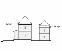 | |
| Building Function (see Table 10 and Table 12) | |||
| residential | Restricted use | Setbacks—Principal Building • The facades and elevations of principal buildings shall be distanced from the lot lines as shown. • Facades shall be built along the principal frontage to the minimum specified width in the table. | 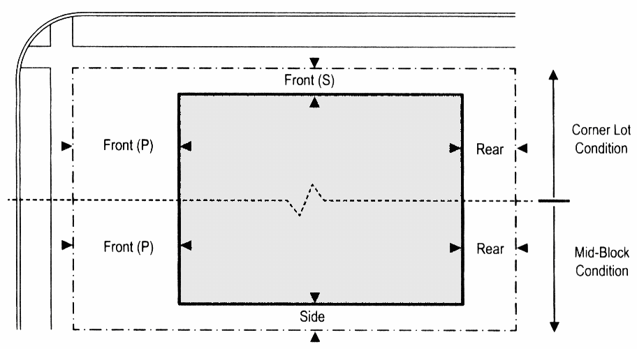 |
| lodging | Restricted use | ||
| office | Restricted use | ||
| retail | Restricted use | ||
| Building configuration (see table 8) | |||
| principal building | 2 stories max. | ||
| outbuilding | 2 stories max. | ||
| Lot occupation | |||
| Lot width | 72' min. 120' max. | ||
| Building coverage | 60% max. | ||
| Building disposition (see Table 9) | Setbacks—Outbuilding • The elevation of the outbuilding shall be distanced from the lot lines as shown. |  | |
| Edgeyard | Permitted | ||
| Sideyard | Not permitted | ||
| Rearyard | Not permitted | ||
| Courtyard | Not permitted | ||
| Setbacks—Principal building | |||
| Front setback (P) | 24' min. | ||
| Front setback (S) | 16' min. | ||
| Side setback | 10' total | ||
| Rear Setback | 12' min.* | ||
| Frontage buildout | 40% min. at setback | ||
| Setbacks—Outbuilding | |||
| Front setback | 20' min. + bldg. setback | ||
| Side setback | 3' or 6' | Parking Placement • Uncovered parking spaces may be provided within the 2 nd and 3 rd layer as shown in the diagram (see Table 17). • Covered parking shall be provided within the 3 rd layer as shown in the diagram (see Table 17). • Trash containers shall be stored within the 3 rd layer. |  |
| Rear setback | 3' min. | ||
| Private frontages (see Table 7) | |||
| Common lawn | permitted | ||
| Porch and fence | permitted | ||
| Terrace or L. C. | Not permitted | ||
| Forecourt | Not permitted | ||
| Stoop | Not permitted | ||
| Shopfront and awning | Not permitted | ||
| Gallery | Not permitted | ||
|
* or 15' from center line of alley.
Graphics are illustrative only. Refer to metrics for setback and height information. | |||
Table 15B. Form Based Code Graphics—T4 Transect Zone
 | Building Configuration • Building height shall be measured in number of stories, excluding attics and raised basements. • Stories may not exceed fourteen (14) feet in height from finished floor to finished ceiling, except for a first floor commercial function which shall be a minimum of eleven (11) ft. with a maximum of twenty-five (25) feet. • Height shall be measured to the eave or roof deck as specified on Table 8. |  | |
| Building Function (see Table 10 and Table 12) | |||
| residential | Limited use | ||
| lodging | Limited use | ||
| office | Limited use | ||
| retail | Limited use | Setbacks—Principal Building • The facades and elevations of principal buildings shall be distanced from the lot lines as shown. • Facades shall be built along the principal frontage to the minimum specified width in the table. |  |
| Building configuration (see table 8) | |||
| principal building | 3 stories max., 2 min | ||
| outbuilding | 2 stories max. | ||
| Lot occupation | |||
| Lot width | 18' min. 96' max. | ||
| Building coverage | 70% max. | Setbacks—Outbuilding • The elevation of the outbuilding shall be distanced from the lot lines as shown |  |
| Building disposition (see Table 9) | |||
| Edgeyard | Permitted | ||
| Sideyard | Permitted | ||
| Rearyard | Permitted | ||
| Courtyard | Not permitted | ||
| Setbacks—Principal building | |||
| Front setback (P) | 6' min, 20' max | ||
| Front setback (S) | 6' min, 20' max | ||
| Side setback | 0' min | ||
| Rear Setback | 3' min.* | ||
| Frontage buildout | 60% min. at setback | Parking Placement • Uncovered parking spaces may be provided within the 2 nd and 3 rd layer as shown in the diagram (see Table 17). • Covered parking shall be provided within the 3 rd layer as shown in the diagram (see Table 17). • Trash containers shall be stored within the 3 rd layer. |  |
| Setbacks—Outbuilding | |||
| Front setback | 24' min. + bldg. setback | ||
| Side setback | 0' min or 3' | ||
| Rear setback | 3' min. | ||
| Private frontages (see Table 7) | |||
| Common lawn | not permitted | ||
| Porch and fence | permitted | ||
| Terrace or L. C. | permitted | ||
| Forecourt | permitted | ||
| Stoop | permitted | ||
| Shopfront and awning | permitted | ||
| Gallery | Not permitted | ||
|
* or 15' from center line of alley.
Graphics are illustrative only. Refer to metrics for setback and height information. | |||
Table 15C. Form Based Code Graphics—T5 Transect Zone
 | Building Configuration • Building height shall be measured in number of stories, excluding attics and raised basements. • Stories may not exceed fourteen (14) feet in height from finished floor to finished ceiling, except for a first floor commercial function which shall be a minimum of eleven (11) ft. with a maximum of twenty-five (25) feet. • Height shall be measured to the eave or roof deck as specified on Table 8. • Expression lines shall be as shown on Table 8 | 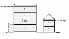 | |
| Building Function (see Table 10 and Table 12) | |||
| residential | Open use | ||
| lodging | Open use | ||
| office | Open use | ||
| retail | Open use | Setbacks—Principal Building • The facades and elevations of principal buildings shall be distanced from the lot lines as shown. • Facades shall be built along the principal frontage to the minimum specified width in the table. | 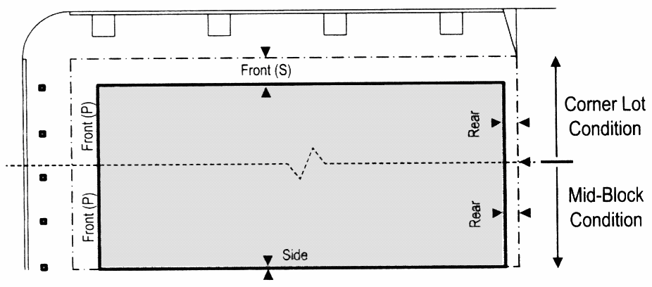 |
| Building configuration (see table 8) | |||
| principal building | 5 stories max. | ||
| outbuilding | 2 stories max. | ||
| Lot occupation | |||
| Lot width | 18' min. 180' max. | ||
| Building coverage | 80% max. | Setbacks—Outbuilding • The elevation of the outbuilding shall be distanced from the lot lines as shown | 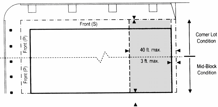 |
| Building disposition (see Table 9) | |||
| Edgeyard | Permitted | ||
| Sideyard | Permitted | ||
| Rearyard | Permitted | ||
| Courtyard | Permitted | ||
| Setbacks—Principal building | |||
| Front setback (P) | 0' min, 20' max | ||
| Front setback (S) | 0' min, 20' max | ||
| Side setback | 0' min, 24' max | ||
| Rear Setback | 3' min. * | ||
| Frontage buildout | 80% min. at setback | Parking Placement • Uncovered parking spaces may be provided within the 3 rd layer as shown in the diagram (see Table 17). • Covered parking shall be provided within the 3 rd layer as shown in the diagram (see Table 17). • Trash containers shall be stored within the 3 rd layer. | 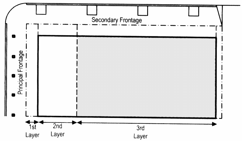 |
| Setbacks—Outbuilding | |||
| Front setback | 40' min from rear prop. | ||
| Side setback | 0' min | ||
| Rear setback | 3' max. | ||
| Private frontages (see Table 7) | |||
| Common lawn | not permitted | ||
| Porch and fence | permitted | ||
| Terrace or L. C. | permitted | ||
| Forecourt | permitted | ||
| Stoop | permitted | ||
| Shopfront and awning | permitted | ||
| Gallery | permitted | ||
| Arcade | Permitted | ||
|
* or 15' from center line of alley.
Graphics are illustrative only. Refer to metrics for setback and height information. | |||
Table 16. Reserved. (Special District Standards)
Table 17. Definitions Illustrated
| Thoroughfare and Frontages | |
 | |
| Turning Radius | Building Disposition |
 |  |
| Lot Layers | Frontage and Lot Lines |
 |  |
| Setback Designations | Network Pedestrian Shed |
 |  |
(Ord. No. 13-055, § 7, 12-17-2013)
Sec. 40.25.145. - Application of Division 40.06.000 Applicability, Sign Regulations for hamlet and village developments.
A.
Zoning district sign standards for development approved pursuant to the hamlet and village design standards of Division 40.25.100.
1.
Commercial uses in hamlets and villages shall be subject to the sign standards for CN districts.
2.
Office uses in hamlets and villages shall be subject to the sign standards in ON districts.
3.
Residential and institutional uses shall be subject to the sign standards for residential uses.
4.
All signs in hamlets and villages may be limited more strictly pursuant to the design guidelines which are required as part of the plan approval process in order to meet the character of the area.
5.
For multiple-use in multi-story buildings within hamlet and village developments, commercial and office building signs shall be no higher than the sill line of the second floor windows. Where a wall of such building contains no windows, signs may be placed anywhere upon that facade.
B.
Comprehensive Village and Hamlet Signage Plan. The purpose of the Comprehensive Signage Plan is to encourage village and hamlet developments to remove the clutter and unorganized signage that has historically occurred in this County and to establish consistent, logical, and equitable signage for the development. As an alternative to the generic assignment of institutional, commercial, and office use sign to certain zoning districts per subparagraph A above, the owner or developer of the hamlet and village development may choose to design and submit a Master or Common Signage Plan for the entire development.
1.
The signage plan shall specify standards for consistency among all signs to be erected on the property and shall include standards related to: color scheme, lettering or graphic style, lighting, location of each sign on the building(s), material, sign proportions, setbacks, height limits, numbers of permitted signs per building, lot or use. The signage plan shall apply to all property within the proposed village and hamlet development. No lot or area within the confines of the development may be excluded or exempt.
2.
Upon approval by the Department, the comprehensive signage plan shall be considered a part of the record plan for the village and hamlet development. It may be amended only upon approval of the Department.
(Ord. No. 13-055, § 8, 12-17-2013)
Sec. 40.25.150. - Definitions.
This Section provides definitions for terms in this Division that are technical in nature or that otherwise may not reflect a common usage of the term. All definitions appearing in Article 33 shall be applicable to this Article, except to the extent of inconsistency with any definitions appearing in this Section.
A-grid. Cumulatively, those thoroughfares that by virtue of their pre-existing pedestrian-supportive qualities, or their future importance to pedestrian connectivity, are held to the highest standards prescribed by this Code. (See B-grid).
Allee. A regularly spaced and aligned row of trees usually planted along a thoroughfare or path.
Arcade. A private frontage conventional for retail use wherein the facade is a colonnade that overlaps the sidewalk, while the facade at sidewalk level remains at the frontage line.
Attic. The interior part of a building contained within its roof structure.
Avenue (AV). A thoroughfare of high vehicular capacity and low to moderate speed, acting as a short distance connector between urban centers, and usually equipped with a landscaped median.
B-grid. Cumulatively, those thoroughfares that by virtue of their use, location, or absence of pre-existing pedestrian-supportive qualities, may meet a standard lower than that of the A-grid.
Backbuilding. A single-story structure connecting a principal building to an outbuilding.
Base density. The number of dwelling units per acre before adjustment for other functions. (See Density.)
Bicycle lane (BL). A dedicated lane for cycling within a moderate-speed vehicular thoroughfare, demarcated by striping.
Bicycle route (BR). A thoroughfare suitable for the shared use of bicycles and automobiles moving at low speeds.
Bicycle trail (BT). A bicycle way running independently of a vehicular thoroughfare.
Block. The aggregate of private lots, passages, rear alleys and rear lanes, circumscribed by thoroughfares.
Block face. The aggregate of all the building facades on one (1) side of a block.
Boulevard (BV). A thoroughfare designed for high vehicular capacity and moderate speed, traversing an urbanized area. Boulevards are usually equipped with slip roads buffering sidewalks and buildings.
Civic. A term defining not-for-profit organizations dedicated to arts, culture, education, recreation, government, transit, and municipal parking.
Civic building. A building operated by governmental or not-for-profit organizations dedicated to arts, culture, education, religion, recreation, government, transit, and municipal parking, or for other similar uses as determined by the Department.
Civic building area (CB). Sites dedicated for civic buildings.
Civic parking area (CP). Parking structure or parking lot within a quarter-mile of the site that it serves. These off-street and off-lot parking areas or structures shall be available for use by the general public.
Civic space (CS). An outdoor area devoted for community or public use. Civic space types are defined by the combination of certain physical constants including the relationships among their intended use, their size, their landscaping and their enfronting buildings. See Table 13.
Commercial. The term collectively defining workplace, office, retail, and lodging functions.
Common destination. An area of focused community activity, usually defining the approximate center of a pedestrian shed. It may include without limitation one (1) or more of the following: a civic space, a civic building, a commercial center, or a transit station, and may act as the social center of a neighborhood.
Common yard. A planted private frontage wherein the facade is set back from the frontage line. It is visually continuous with adjacent yards. See Table 7.
Community type. A regulatory category defining the physical form, density, and extent of a settlement. The two (2) community types addressed in this Code are hamlet and village.
Configuration. The form of a building, based on its massing, private frontage, and height.
Corridor. A lineal geographic system incorporating transportation and/or greenway trajectories. A transportation corridor may be a lineal transect zone.
Cottage. An edgeyard building type. A single-family dwelling, on a regular lot, often shared with an accessory building in the back yard.
Courtyard building. A building that occupies the boundaries of its lot while internally defining one (1) or more private patios. See Table 9.
Curb. The edge of the vehicular pavement that may be raised or flush to a swale. It usually incorporates the drainage system. See Table 4A and Table 4B.
Density. The number of dwelling units within a standard measure of land area.
Design speed. The velocity at which a thoroughfare tends to be driven without the constraints of signage or enforcement. There are four (4) ranges of speed: very low—below twenty (20) MPH; low—twenty (20) to twenty-five (25) MPH; moderate—twenty-five (25) to thirty-five (35) MPH; high—above thirty-five (35) MPH. Lane width is determined by desired design speed. See Table 3A.
Developable areas. Lands other than those in T-1.
Disposition. The placement of a building on its lot. See Table 9.
Dooryard. A private frontage type with a shallow setback and front garden or patio, usually with a low wall at the frontage line. See Table 7.
Drive. A thoroughfare along the boundary between an urbanized and a natural condition, usually along a waterfront, park, or promontory. One (1) side has the urban character of a thoroughfare, with sidewalk and building, while the other has the qualities of a road or parkway, with naturalistic planting and rural details.
Driveway. A vehicular lane within a lot, often leading to a garage.
Edgeyard building. A building that occupies the center of its lot with setbacks on all sides. See Table 9.
Effective parking. The amount of parking required for mixed use after adjustment by the shared parking factor. See Table 11.
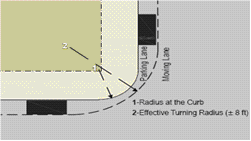
Effective turning radius. The measurement of the inside turning radius taking parked cars into account.
Elevation. An exterior wall of a building not along a frontage line.
Encroachment. Any structural element that breaks the plane of a vertical or horizontal regulatory limit, extending into a setback, or above a height limit.
Enfront. To place an element along a frontage, as in "porches enfront the street."
Estate house. An edgeyard building type. A single-family dwelling on a very large lot of rural character, often shared by one (1) or more accessory buildings.
Expression line. A line prescribed at a certain level of a building for the major part of the width of a facade, expressed by a variation in material or by a limited projection such as a molding or balcony. See Table 8.
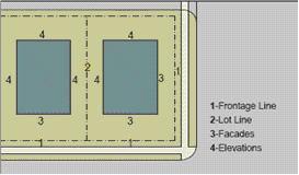
Facade. The exterior wall of a building that is set along a frontage line.
Forecourt. A private frontage wherein a portion of the facade is close to the frontage line and the central portion is set back. See Table 7.
Frontage. The area between a building facade and the vehicular lanes, inclusive of it's built and planted components. Frontage is divided into private frontage and public frontage. See Table 4A and Table 7.
Frontage line. A lot line bordering a public frontage. Facades facing frontage lines define the public realm and are therefore more regulated than the elevations facing other lot lines. See Table 17.
Function. The use or uses accommodated by a building and its lot, categorized as restricted, limited, or open, according to the intensity of the use. See Table 10 and Table 12.
Gallery. A private frontage conventional for retail use wherein the facade is aligned close to the frontage line with an attached cantilevered shed or lightweight colonnade overlapping the sidewalk. See Table 7.
Green. A civic space type for unstructured recreation, spatially defined by landscaping rather than building frontages. See Table 13.
Greenway. An open space corridor in largely natural conditions which may include trails for bicycles and pedestrians.
Hamlet. A community type structured by a standard pedestrian shed oriented toward a common destination such as a general store, meeting hall, schoolhouse, or church.
Highway. A rural and suburban thoroughfare of high vehicular speed and capacity. This type is allocated to the more rural transect zones (T1, T2 and T3).
Layer. A range of depth of a lot within which certain elements are permitted.
Lightwell. A private frontage type that is a below-grade entrance or recess designed to allow light into basements. See Table 7.
Liner building. A building specifically designed to mask a parking lot or a parking structure from a frontage.
Live-work. A mixed use unit consisting of a commercial and residential function. The commercial function may be anywhere in the unit. It is intended to be occupied by a business operator who lives in the same structure that contains the commercial activity or industry.
Lot width. the length of the principal frontage line of a lot.
Main civic space. The primary outdoor gathering place for a community. The main civic space is often, but not always, associated with an important civic building.
Manufacturing. Premises available for the creation, assemblage and/or repair of artifacts, using table-mounted electrical machinery or artisanal equipment, and including their retail sale.
Mixed use. Multiple functions within the same building through superimposition or adjacency, or in multiple buildings within the same area by adjacency.
Net site area. All developable land within a site including thoroughfares but excluding land allocated as civic zones.
Network pedestrian shed. A pedestrian shed adjusted for average walk times along thoroughfares.
Open space. Land intended to remain undeveloped; it may be reserved for civic space.
Park. A civic space type that is a natural preserve available for unstructured recreation. See Table 13.
Parking structure. A building containing one (1) or more stories of parking above grade.
Passage (PS). A pedestrian connector, open or roofed, that passes between buildings to provide shortcuts through long blocks and connect rear parking areas to frontages.
Path (PT). A pedestrian way traversing a park or rural area, with landscape matching the contiguous open space, ideally connecting directly with the urban sidewalk network.
Pedestrian shed. An area that is centered on a common destination. Its size is related to average walking distances for the applicable community type. Pedestrian sheds are applied to structure communities.
Pedestrian shed, linear. A pedestrian shed that is elongated along an important mixed use corridor such as a main street. A linear pedestrian shed extends approximately one-quarter (¼) mile from each side of the corridor for the length of its mixed use portion. The resulting area is shaped like a lozenge.
Pedestrian shed, long. A pedestrian shed that is an average one-half (½) mile radius or two thousand six hundred forty (2,640) feet, used when a transit stop (bus or rail) is present or proposed as the common destination. A long pedestrian shed represents approximately a ten (10) minute walk at a leisurely pace.
Pedestrian shed, standard. A pedestrian shed that is an average one-quarter (¼) mile radius or one thousand three hundred twenty (1,320) feet and represents approximately a five (5) minute walk at a leisurely pace.
Planter. The element of the public frontage which accommodates street trees, whether continuous or individual.
Plaza. A civic space type designed for civic purposes and commercial activities in the more urban transect zones, generally paved and spatially defined by building frontages.
Principal building. The main building on a lot, usually located toward the frontage.
Principal entrance. The main point of access for pedestrians into a building.
Principal frontage. On corner lots, the private frontage designated to bear the address and principal entrance to the building, and the measure of minimum lot width. Prescriptions for the parking layers pertain only to the principal frontage. Prescriptions for the first layer pertain to both frontages of a corner lot.
Private frontage. The privately held layer between the frontage line and the principal building facade. See Table 7.
Public frontage. The area between the curb of the vehicular lanes and the frontage line. See Table 4A and Table 4B.
Ramble. A civic space type for unstructured recreation, and occurring mid-block. A ramble is spatially defined by rear lanes or alleys and the rear yard of the perimeter buildings. The minimum size is one-quarter (¼) and the maximum size is five (5) acres.
Rear alley (RA). A vehicular way located to the rear of lots providing access to service areas, parking, and outbuildings and containing utility easements. Rear alleys should be paved from building face to building face, with drainage by inverted crown at the center or with roll curbs at the edges.
Rear lane (RL). A vehicular way located to the rear of lots providing access to service areas, parking, and outbuildings and containing utility easements. Rear lanes may be paved lightly to driveway standards. The streetscape consists of gravel or landscaped edges, has no raised curb, and is drained by percolation.
Rearyard building. A building that occupies the full frontage line, leaving the rear of the lot as the sole yard. See Table 9.
Recess line. A line prescribed for the full width of a facade, above which there is a stepback of a minimum distance, such that the height to this line (not the overall building height) effectively defines the enclosure of the enfronting public space. See Table 8.
Regulating plan. A map or set of maps that shows the transect zones, civic zones, and special requirements if any, of areas subject to, or potentially subject to, regulation by the hamlet/village in this Division.
Retail frontage. Frontage designated on a regulating plan that requires or recommends the provision of a shopfront, encouraging the ground level to be available for retail use.
Road. A local, rural and suburban thoroughfare of low-to-moderate vehicular speed and capacity. This type is allocated to the more rural transect zones (T1, T2, and T3).
Rowhouse. A single-family dwelling that shares a party wall with another of the same type and occupies the full frontage line.
Secondary frontage. On corner lots, the private frontage that is not the principal frontage. As it affects the public realm, its first layer is regulated.
Setback. The area of a lot measured from the lot line to a building facade or elevation that is maintained clear of permanent structures.
Shared parking factor. An accounting for parking spaces that are available to more than one (1) function. See Table 11.
Shopfront. A private frontage conventional for retail use, with substantial glazing and an awning, wherein the facade is aligned close to the frontage line with the building entrance at sidewalk grade. See Table 7.
Sidewalk. The paved section of the public frontage dedicated exclusively to pedestrian activity.
Sideyard building. A building that occupies one (1) side of the lot with a setback on the other side. This type can be a single or twin depending on whether it abuts the neighboring house. See Table 9.
Slip road. An outer vehicular lane or lanes of a thoroughfare, designed for slow speeds while inner lanes carry higher speed traffic, and separated from them by a planted median.
Specialized building. A building that is not subject to residential, commercial, or lodging classification. See Table 9.
Square. A civic space type designed for unstructured recreation and civic purposes, spatially defined by building frontages and consisting of paths, lawns and trees, formally disposed. See Table 13.
Stepback. A building setback of a specified distance that occurs at a prescribed number of stories above the ground. See Table 8.
Stoop. A private frontage wherein the facade is aligned close to the frontage line with the first story elevated from the sidewalk for privacy, with an exterior stair and landing at the entrance. See Table 7.
Story. A habitable level within a building, excluding an attic or raised basement.
Street. A local urban thoroughfare of low speed and capacity.
Streetscreen. A freestanding wall built along the frontage line, or coplanar with the facade. It may mask a parking lot from the thoroughfare, provide privacy to a side yard, and/or strengthen the spatial definition of the public realm.
Substantial modification. An alteration to a building that is valued at more than fifty (50) percent of the replacement cost of the entire building, if new.
Terminated vista. A location at the axial conclusion of a thoroughfare. A building located at a terminated vista designated on a regulating plan is required or recommended to be designed in response to the axis.
Thoroughfare. A way for use by vehicular and pedestrian traffic to provide access to lots and open spaces, consisting of vehicular lanes and the public frontage.
Townhouse. See Rearyard building.
Transect. A cross-section of the environment showing a range of different habitats. The rural-urban transect of the human environment used in the hamlet/village code is divided into five (5) transect zones. These zones describe the physical form and character of a place, according to the density and intensity of its land use and urbanism.
Transect zone (T-Zone). One (1) of five (5) zones on a land development plan regulated by the hamlet and village provisions of Division 40.25.100. Transect zones are administratively similar to the land use zones in conventional codes, except that in addition to the usual building use, density, height, and setback requirements, other elements of the intended habitat are integrated, including those of the private lot and building and public frontage.
Turning radius. The curved edge of a thoroughfare at an intersection, measured at the inside edge of the vehicular tracking. The smaller the turning radius, the smaller the pedestrian crossing distance and the more slowly the vehicle is forced to make the turn.
Work-live. A mixed use unit consisting of a commercial and residential function. It typically has a substantial commercial component that may accommodate employees and walk-in trade. The unit is intended to function predominantly as work space with incidental residential accommodations that meet basic habitability requirements.
Yield. Characterizing a thoroughfare that has two-way traffic but only one (1) effective travel lane because of parked cars, necessitating slow movement and driver negotiation.
(Ord. No. 09-037, § 1, 10-13-2009; Ord. No. 10-113, § 1(Exh. A), 1-18-2011; Ord. No. 13-055, § 9, 12-17-2013)
Sec. 40.25.210. - Traditional neighborhood standards.
In traditional neighborhood plans, a concept plan including design guidelines shall be submitted at the exploratory plan stage and the design standards in Sections 40.25.220 to 40.25.240 shall be met.
(Ord. No. 97-172, § 3(ch. 13, § 25.210), 12-31-1997)
Sec. 40.25.220. - Nonresidential uses.
Uses permitted by Table 40.03.110 as limited uses shall be permitted provided they meet the following:
A.
Location. They shall be permitted only in developments having a minimum of four hundred (400) dwelling units or where specified in Countywide or neighborhood plans adopted by County Council.
B.
Road access. All nonresidential uses shall be located on collector or arterial roads.
C.
Design. The structures shall be built to the sidewalk line unless another build-to line is approved for the entire development. All buildings shall be two (2) or three (3) stories high. Either commercial apartments shall be located above the commercial space, or the buildings shall meet the requirements of mixed use structures. The buildings shall be designed to harmonize with the surrounding residential areas.
D.
Parking. Parking shall be located behind and to the side of the building with the majority to the rear. The County will support the use of on-street parking where the plan and design permits this to be done safely.
(Ord. No. 97-172, § 3(ch. 13, § 25.220), 12-31-1997)
Sec. 40.25.230. - Residential design.
The residential development is intended to provide the character of an urban neighborhood having rather formal open spaces serving as focal points. The residential development shall meet the following design criteria:
A.
Roads and subdivision layout. Where topography, site size and shape permits, the site should be developed using a grid or other formal pattern. The vehicular access to units should be via alleys. This permits the rather narrow building fronts to be free from driveways and garage doors. Where this is impossible, the following shall be used to reduce the impact of drives and garages (See Figure 40.25.140):
1.
Garages located to side and rear with a drive of no more than ten (10) feet in width providing access.
2.
Side-load front garages shall be used on at least forty (40) percent of lots where the garage is not to the rear of the lot.
3.
Hour-glass driveway design with one (1) plant unit per driveway shall be used on all other front loading garages.
B.
Open space. The open space in traditional neighborhoods is primarily a formal open space of squares, greens, or other formal open spaces.
1.
Greens. Greens are internal central spaces surrounded on at least three (3) sides by the development area. The minimum area in this type shall be twelve thousand (12,000) square feet with a minimum dimension of sixty (60) feet. Such areas shall be designed to permit recreational and/or social use by the community.
2.
Parkway. A divided street with open space in the center is considered a parkway. The minimum dimension of such areas shall be forty (40) feet, with a minimum area of ten thousand (10,000) square feet. Such areas shall be designed to permit passive recreational use by the community. Active recreation shall be permitted only where the area and traffic flows are such that it may safely be used for that purpose. Smaller parkways, islands, and cul-de-sac islands may count towards the open space provided they cumulatively do not constitute more than ten (10) percent of the total community open space.
3.
Resource corridors. Resource corridors are open space areas along a natural feature such as a stream, vegetation, or topographic feature. Passive recreational use and trails shall be provided in such areas as a minimum.
4.
Parks. Park areas shall be designed to provide a range of active and passive recreational opportunities for the development's residents. The minimum area shall be at least four (4) acres. These facilities often do not have the ability to structure a traditional neighborhood. The County may opt to accept a fee in lieu of land if the proposed park does not enhance the design of the residential area. Note that tot lots and some courts can be integrated into parkways or greens so the type of open space may need to be tailored to those compatible with the design of the community.
5.
Structures. Formal activity areas should be built into open spaces. These include fountains, formal gardens and sitting areas, gazebos or similar facilities. These should serve the residents and provide a sense of identity to the various open spaces.
C.
Block layout. Where such developments are along an arterial or collector street one (1) of the following design treatments should be used:
1.
The units should have side yards oriented to the arterial as shown in Figure 40.25.230C. Landscaping of the side yards shall include fence, wall, or hedges as required in Article 23 as buffers to orient the homes away from high traffic volumes.
2.
Where the units are intended to front onto the arterial or collector street, the lot size and front yard setbacks should be increased. The dimensions shall be chosen to ensure that the homes are set back and protected from the noise and pollution of these streets. This can also include larger street rights-of-way and greater setbacks for sidewalks and increased street trees.
Figure 40.25.230C
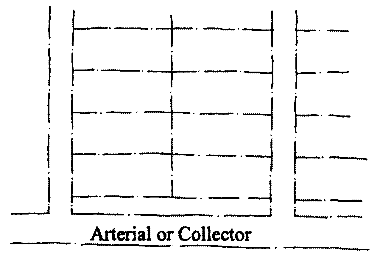
(Ord. No. 97-172, § 3(ch. 13, § 25.230), 12-31-1997; Ord. No. 09-037, § 1, 10-13-2009)
Sec. 40.25.240. - Dwelling design.
The units shall be designed in a manner that creates a unified design for the neighborhood. The design guidelines shall indicate style(s) to be used to ensure that the development has an overall unity or design without appearing monotonous. Units shall have front porches or stoops or other design features that orient the home to an active street.
(Ord. No. 97-172, § 3(ch. 13, § 25.240), 12-31-1997)
Division 40.25.300. - Character standards.
This Division controls the character of buildings to ensure that the overall character of the communities is not eroded by poor design that is either monotonous or cluttered. The residential standards are contained in Sections 40.25.321 through 40.25.332. Nonresidential uses are governed by the standards of Sections 40.25.220 and 40.25.340 through 40.25.342.
(Ord. No. 97-172, § 3(ch. 13, div. 25.300), 12-31-1997; Ord. No. 06-060, § 1(Exh. A), 9-26-2006)
Sec. 40.25.310. - Measures.
The following measures are used to evaluate developments and prevent monotony. Figure 40.25.310 illustrates the following points:
A.
Floor plan. The floor plan defines the arrangement of the building's form, arrangement of rooms, windows, and doors. Identical floor plans can lead to monotony. Floor plans that present different front facades are essential, so floor plans that do not have differing fronts do not count towards floor plan distinction.
B.
Orientation. This describes the orientation of building floor plan(s). A building rotated ninety (90) degrees will not appear identical even when the floor plans are identical. Similarly, flipping or reversing the floor plan creates a different look.
C.
Roof lines. Rotating the orientation of the roof peak, or otherwise altering the roof line in a significant manner can alter the appearance completely.
D.
Materials. Brick; stone; natural-stained wood vertical siding; horizontal siding in wood, fiberglass, or metal; stucco or Dri-vet; and shingles are all considered different exterior materials. Material differences should be over at least sixty (60) percent of the buildings front and should also extend in a logical fashion to the sides of buildings.
E.
Architectural features. The addition of a front porch, tower, or balcony are architectural features that change the facade sufficiently to create a difference.
F.
Color. Color can be used to provide a unifying sense to a development; it can create monotony; or it can create conflicts. Except in unusual conditions, color will not be used to distinguish units.
G.
Building width. The width of a building is important. Buildings that differ in width will provide differing design opportunities.
H.
Facade articulation. The articulation of a facade can create interest and diversity even when other elements, doors, windows, or building width are similar.
I.
Richness in detail. The traditional architecture is often defined with the richness of detail while some modern units look like boxes. Roof lines and architectural details of chimneys, doors, windows, or other architectural elements make for greater interest.
J.
Roof overhangs. Buildings without roof overhangs are too box-like, unless they are accurate representations of an historic style that had no roof overhangs.
(Ord. No. 97-172, § 3(ch. 13, § 25.310), 12-31-1997)
Figure 40.25.310
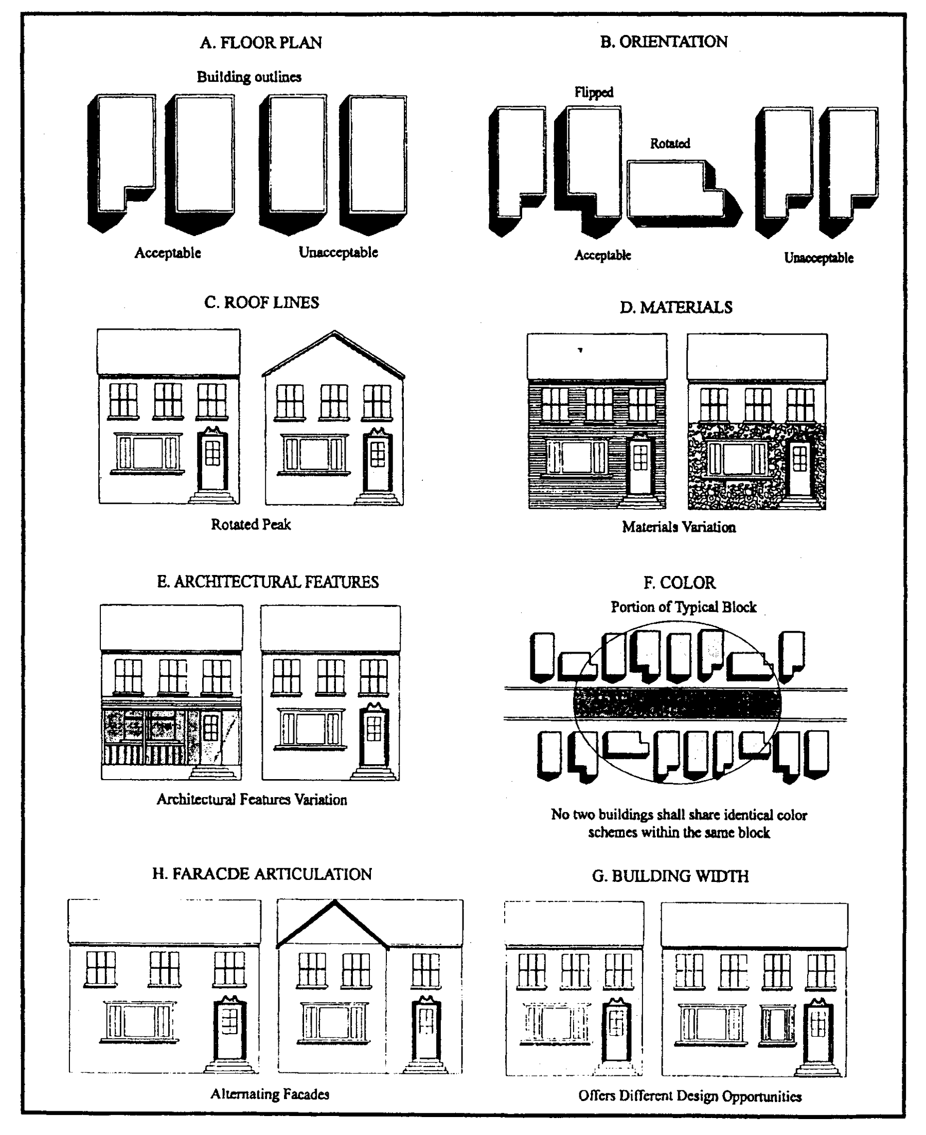
Sec. 40.25.320. - Standards.
(Ord. No. 97-172, § 3(ch. 13, § 25.320), 12-31-1997)
Sec. 40.25.321. - Single family.
The following anti-monotony standards shall be used to ensure that there is adequate diversity in the dwelling units to avoid monotony and provide an interesting neighborhood character. These standards shall be evaluated using the descriptions in Section 40.25.310 and Figure 40.25.310.
A.
No two (2) dwellings units on a street face (both sides) shall be identical in floor plan unless there are at least two (2) intervening lots separating the units, or they are on a street not visible from the one (1) unit or are differing by at least three (3) of the following (See Figure 40.25.310.):
1.
The dwelling unit floor plans are rotated or reversed on the lot orientation.
2.
The dwelling units have different roof configuration or orientation.
3.
The dwelling units have different materials or exterior walls. A mix of materials may be used on buildings. For example: stone and shingle, or brick and horizontal siding. Except in unusual conditions, color shall not be used to distinguish units.
4.
The addition of architectural features such as full porches, entrance features, or bay windows that alter the appearance.
5.
Architectural styles are used for different models with the styles having significantly distinctive standard details, windows, doors, trim, roof lines and overhangs, or special features.
6.
Facade articulations of at least eight (8) feet to break-up and alter the facade of a building.
7.
Other measures in Section 40.25.310 and Figure 40.25.310 are used that are acceptable to the Department as qualifying for anti-monotony.
B.
Design review. In some cases, as with attached units or subdivisions which seek to replicate a historic theme or themes, greater unity of design may actually enhance the character of the area. Such plans shall be permitted only where the developer submits architectural, landscaping, and sign reviews and receives Department approval.
(Ord. No. 97-172, § 3(ch. 13, § 25.321), 12-31-1997; Ord. No. 06-060, § 1(Exh. A), 9-26-2006)
Sec. 40.25.322. - Reserved.
(Ord. No. 97-172, § 3(ch. 13, § 25.322), 12-31-1997; Ord. No. 06-060, § 1(Exh. A), 9-26-2006)
Sec. 40.25.330. - Patio, attached, and multi-family standards.
These units pose a very different problem in that they tend to present a long street face that is composed of many units. Thus, trying to make each individual unit different as in a single-family project is likely to lead to a chaotic building. The length of the attached units is an element as is the richness of the design in detailing and street face texture of the buildings. Some degree of unity is desired. Repetitions of the same building design throughout a development is also a negative design factor. Sections 40.25.321 to 40.25.332 address these concerns for different dwelling types.
(Ord. No. 97-172, § 3(ch. 13, § 25.330), 12-31-1997; Ord. No. 06-060, § 1(Exh. A), 9-26-2006)
Sec. 40.25.331. - Patio and atrium homes.
Walls are the standard definition of the fronts of these units. The street face is thus a wall rather than the fronts of the actual house as seen across a front yard. The primary means of providing interest is in the provision of enough diversity to break up the street lined by a wall appearance. This is accomplished by the use of distinctive elements listed below and shown in Figure 40.26.231.
A.
Large vegetative mass. This may be the preservation of an existing tree having a DBH of at least twelve (12) inches that is located within eight (8) feet of the property line and where the wall is used to set this tree off so that it breaks the vista down the street.
B.
Fountain or public space that changes the character or the streetscape.
C.
A break in the wall of at least two (2) lots, with at least one (1) plant unit per lot being planted in the yard to create a distinctive change in texture.
D.
A break in the wall where a decorative fence or hedge is used.
(Ord. No. 97-172, § 3(ch. 13, § 25.331), 12-31-1997)
Sec. 40.25.332. - Other attached units.
There are four (4) basic approaches to making interesting multi-family or attached units. The first approach is to limit the number of units in a row to prevent the group or building from becoming too long with no change in character. The second approach is to have sufficient changes in setback, roof lines, and architectural detail to break up the linear appearance of the building or group of buildings. In both these approaches there is the replication problem in other buildings or groups. The third approach is to use the building design, streetscape and open space to create a unique and interesting environment where the overall massing of the buildings and their relationship to the open space is powerful enough so that similar units are not monotonous. The fourth approach is to use quality materials and special unique detailing. The following standards shall be followed to create interesting multi-family or attached units:
A.
All multi-family and attached units shall meet the following:
1.
Trim details shall be the same on all sides of the building.
2.
The overall scale of the project in total numbers of units shall also be considered in evaluating Subsections B through D, with greater requirements on the larger developments.
B.
Where the limit on the length that is specified in Table 40.04.112 to separate buildings, developers shall utilize at least three (3) of the following to achieve variety (See Figure 40.25.332):
1.
Have different configurations of units; that is, different unit widths, location, and total building length.
2.
The individual dwelling units shall be articulated by architectural details such as porches or entry features, bay windows, or similar features.
3.
Architectural materials and detail features shall be different. This includes using different combinations of materials and using the materials in different ways on the units.
4.
The setbacks of individual units within a building shall be staggered to change the building's appearance with offsets of a minimum of six (6) feet.
5.
The floor plans differ to create articulation with changes of a minimum of four (4) feet.
6.
Different buildings shall have different combinations of the setbacks in Subsections B.1, B.2 and B.3.
Figure 40.25.332
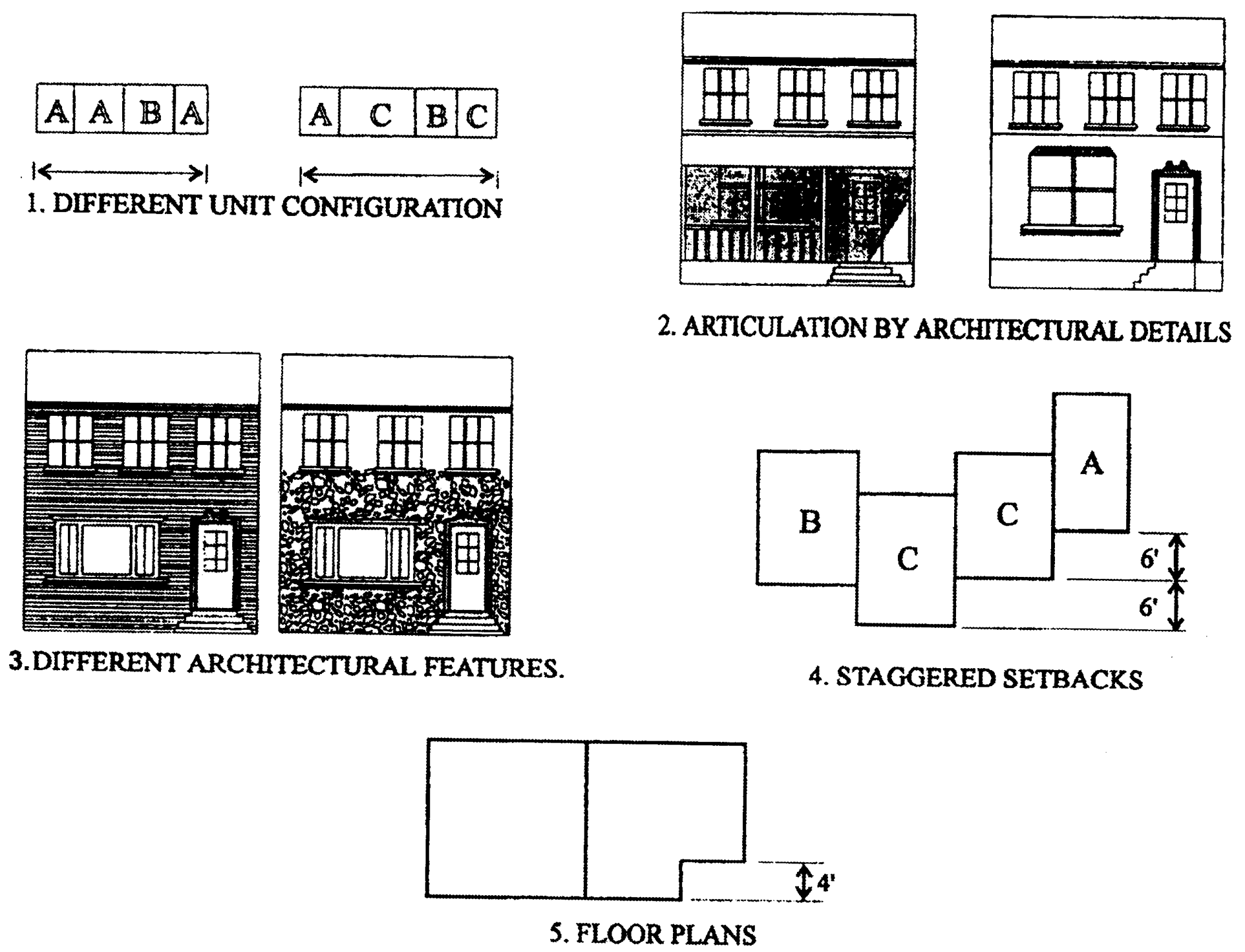
C.
Where the combination of street, open space, and building design is used to create strongly differentiated building shapes and configurations (that create a common theme for the development, but a sharp differentiation between units) more units in a building may be allowed provided:
1.
The development is designed to have a strong architectural design that provides cohesiveness throughout the project, and
2.
There are strong and distinctive details in architectural features such as porches, stoops, entryways, or other features that creates visual interest while maintaining a unity of design.
D.
The degree of differentiation in style and materials is not as essential where the materials used are quality materials, such as brick or stone that have long life and low maintenance demands provided:
1.
The development is designed to have a strong architectural design that provides cohesiveness throughout the project, and
2.
There are strong and distinctive details in architectural features such as porches, stoops, entryways, or other features that creates visual interest while maintaining a unity of design.
3.
The detailing of windows and doors also provides a strong image of quality architecture.
(Ord. No. 97-172, § 3(ch. 13, § 25.332), 12-31-1997; Ord. No. 06-060, § 1(Exh. A), 9-26-2006; Ord. No. 10-113, § 1(Exh. A), 1-18-2011)
Sec. 40.25.333 - Pocket neighborhoods.
Pocket neighborhoods are groups of smaller detached housing units, oriented around a common open space such as a courtyard, garden, or walkway. This development option is intended to create community-oriented, smaller scale housing that is an effective infill option for single family neighborhoods through context sensitive design with respect to the surrounding community aesthetics. In addition to the standards in Article 3 and Article 4 of this Chapter, the following standards apply:
A.
Pocket neighborhoods may only include single-family detached dwellings on village lots and small single-family detached dwelling units on small single-family detached dwelling unit lots.
B.
The maximum gross floor area for any dwelling unit in a pocket neighborhood is one thousand six hundred (1,600) square feet. An additional three hundred (300) square foot garage is permissible on lots with road or alley frontage.
C.
The maximum total GFA permitted for freestanding accessory structures on lots within a pocket neighborhood is the lesser of either three hundred (300) square feet of GFA or one-half (½) of the footprint of the principle dwelling.
D.
Accessory dwelling units are not permitted within a pocket neighborhood.
E.
Lots within a pocket neighborhood are exempt from the requirements of Section 40.23.121.
F.
Private swimming pools are not permitted on small single-family detached dwelling unit lots within a pocket neighborhood.
G.
Pocket neighborhoods greater than one hundred (100) dwelling units in size are only permitted on land designated as an Investment Level 1 Area by the State of Delaware, in the suburban, suburban transition, or traditional neighborhood zoning districts.
H.
Pocket neighborhood developments may either be developed as fee simple or leasable lots. Land development plans for leasable lots must depict small single-family dwelling or village lot lines to ensure appropriate building spacing and setbacks are met.
I.
No dwelling unit within a pocket neighborhood may be located within two hundred (200) feet of a parcel with an industrial use (Section 40.33.270) and may not be located within one-half (0.5) mile of heavy industry zoned land.
J.
Dwelling units within pocket neighborhoods must be reviewed pursuant to Section 40.25.410.
K.
Pocket neighborhoods must avoid monotony by varying at least three (3) of the measures from Section 40.25.310. The Department will review the proposed dwelling unit and may require specific measures from Section 40.25.310 to avoid monotony within a development.
L.
Pocket neighborhoods must include dumpsters for communal trash and recycling service. All dumpsters must be fully enclosed with a wood fence, masonry wall, berm or enclosure made of other durable low maintenance materials, subject to approval by the Department.
M.
In pocket neighborhoods, small single-family detached dwelling lots must provide a minimum of one and one-half (1.5) parking spaces per dwelling unit and village lots must provide a minimum of two (2.0) parking spaces per dwelling unit. Parking may be provided either on-site or in a shared community parking lot.
(Ord. No. 24-137, § 6, 12-10-2024)
Sec. 40.25.340. - Nonresidential uses.
Nonresidential uses are often built along a roadway as single buildings on individual lots over a period of years. The diversity of styles, colors, materials, shapes, and other architectural features that are often done to attract attention results in chaotic streetscapes. Other uses are unified (shopping centers for example), where the unified building has greater potential for good design, but has not always achieved this, and is still interspersed with other uses along the highway. The design review is intended to ensure that the degree of differentiation is not so great as to result in a cluttered streetscape, for the individual building or unified developments.
(Ord. No. 97-172, § 3(ch. 13, § 25.340), 12-31-1997)
Sec. 40.25.341. - Individual buildings.
Where individual buildings are to be built, the review will look for the following:
A.
Buildings that use common materials, styles, or colors to create a strong sense of compatibility in the street face.
B.
Buildings that use roofs that unify the street face.
C.
Elimination or toning down of formula buildings.
D.
Differentiation should be encouraged through building shape (footprint), architectural details, and varied rooflines.
(Ord. No. 97-172, § 3(ch. 13, § 25.341), 12-31-1997)
Sec. 40.25.342. - Complexes.
Where the development is a complex of buildings as a shopping center or an office or industrial park with its own design guidelines, the complex should have a strong sense of place and unity of design. The complex should not be out of keeping with the surrounding buildings, but may clearly establish its own identity. The following shall be used in evaluating the complex:
A.
The complex shall have a sense of place. This should be accomplished by several elements:
1.
Commonality of materials and style.
2.
A uniform sign package that limits style of letters, colors, and has rules for size based on building importance in the complex.
3.
An element or elements that provide a strong identifying image. The strength of the image should be related to the scale of the development. A small project should have an image that is more closely related to neighbors, while a large regional facility should have greater differentiation from its neighbors. Entrance features, including the use of architectural features like a clock tower or corner building that has a strong image, are ways in which a strong identity may be created.
(Ord. No. 97-172, § 3(ch. 13, § 25.342), 12-31-1997)
Division 40.25.400. - Design review.
The design review shall be applied to the use of certain use types under Divisions 40.25.100 and 40.25.200 and monotony standards of Division 40.25.300. The Department shall conduct a design review as part of the plan approval process for a plan or site plan at the request of the developer.
(Ord. No. 97-172, § 3(ch. 13, div. 25.400), 12-31-1997)
Sec. 40.25.410. - Design review standards.
In conducting the design review, the Department shall evaluate the plan against the following criteria. Approval requires that the criteria have been met or are inapplicable to the specific project and that the development is significantly superior to one that simply meets the Code requirements.
A.
The project is compatible with surrounding uses in terms of scale and adherence to the traditional architectural styles and materials of the County architecture.
B.
The architecture, project layout, landscaping, and signs contribute to a harmonious and diverse character that has a strong sense of unity.
C.
Monotony is avoided and the plan provides an environment that has interest and diversity without becoming chaotic or discordant.
D.
The buildings are designed to be part of individual communities or streetscapes, rather than a plan or character that can be applied to similar uses across the nation. Formula buildings and color schemes are undesirable.
E.
The streetscape protects or enhances the entrances to distinct areas of the County, making them different from similar land uses in other communities.
F.
The combination of architecture, signs, and landscaping creates a sense of place for those developments having many buildings, or which contribute to an overall sense of unity if the development is a single building.
G.
The streetscape and building design reduces the apparent building mass of large buildings to match the nearby residential areas.
(Ord. No. 97-172, § 3(ch. 13, § 25.410), 12-31-1997)
Sec. 40.25.510. - Purpose.
The purpose of universal design standards is to attempt to meet the short and long term housing needs of every segment of the population in the County. By encouraging the integration of universal design standards into new or substantially renovated housing stock, many of these needs may be achieved with the inclusion of minor design changes and improvements. This division encourages designers and builders to integrate universal design standards into every housing type to ensure availability of this housing in the County.
(Ord. No. 12-057, § 1, 1-8-2013)
Sec. 40.25.520. - Design standard options.
A.
All dwelling units that are designed to universal design standards shall be in compliance with the applicable sections of Chapter 6.
B.
For any new age-restricted community, the developer shall present each buyer with the option to have the unit designed utilizing universal design standards, including, but not limited, to the following items:
1.
Step-less main entry;
2.
Offset tub/shower controls with adjacent clear floor space;
3.
Wide blocking installed in walls around tub/shower and toilet for future grab bars;
4.
Lever type door handles;
5.
Single lever faucets; and
6.
Utilization of minimum and maximum heights for switches and outlets.
C.
For non-age restricted communities, projects are encouraged to include universal design standards as enumerated in Subsection B.
(Ord. No. 12-057, § 1, 1-8-2013)