
Azusa City Zoning Code
ARTICLE 2
- URBAN STANDARDS
This article provides standards and guidelines for development that affect the overall character of the city and its pattern of land uses. This article establishes the zoning areas within the city, determines how the zoning areas are applied to property by the Zoning Map, and establishes permit requirements for new land uses and development. The standards and guidelines established by this Development Code for planning of individual development projects are found in Article 3 (Design Standards) and Article 4 (Standards for Specific Land Uses).
CHAPTER 88.22. - NEIGHBORHOODS
The purpose of this chapter is to outline the general plan goals and development guidelines within the Neighborhoods of Azusa. It is a guideline to assist present and future residents, developers and city staff in evaluating the evolving character and potential of each Neighborhood.
The neighborhood is the basic unit of town planning. It is a compact, urbanized area containing a balanced range of human activities within pedestrian range from each family that lives there. A neighborhood standing alone is a hamlet or village. A cluster of neighborhoods becomes a town. A cluster of many neighborhoods becomes a city. In all cases a neighborhood population can vary depending on local conditions yet, depending on its context, it should always contain a balanced mix of dwellings, workplaces, shops, civic places and parks.
CHAPTER 88.24. - DISTRICTS
The purpose of this chapter is to outline the general plan goals and development guidelines within the districts of Azusa. It is a guideline to assist present and future residents, developers and city staff in evaluating the evolving character and potential of each district.
Districts are urbanized areas of two kinds: specialized around a predominant activity or composed of many activities that are either mixed vertically or adjacent horizontally. The structure of a district should parallel that of the neighborhood: it should have an identifiable focus that encourages orientation and identity and it should have clear boundaries that facilitate the formation of special management organizations such as business groups and associations. Districts should encourage the intelligent sharing of uses and parking resources. Links or pedestrian and vehicular paths with adjacent neighborhoods encourages pedestrian access. Districts benefit from access to transit systems, and should be located within a regional transportation framework.
CHAPTER 88.26. - CORRIDORS
The purpose of this chapter is to outline the general plan goals and development guidelines for the corridors in Azusa. It is a guideline to assist present and future developers, city staff, and citizens in evaluating the evolving character and potential of each corridor.
Corridors are the boundaries of neighborhoods and their connectors to adjacent areas. Light rail and streetcar corridors may occur at boulevards at the edges of neighborhoods. As such they are detailed for pedestrian use and to accommodate building sites. Bus corridors may pass into neighborhoods on streets. The corridor may also be a continuous parkway, providing long distance walking and bicycle trails and natural habitat. The natural corridors are formed by the systematic accretion of natural, agricultural and recreational open spaces, such as parks, schoolyards and golf courses. These continuous spaces can be part of a larger network, connecting the urban open spaces to the countryside.
88.20.010. - Purpose of Chapter.
This chapter establishes several planning areas within the city, based on the time periods and types of development and land uses that characterize each area. This chapter also establishes site planning and design standards for each area to ensure that proposed projects are designed to enhance and maintain the most desirable development and environmental characteristics of each unique area of the city. The planning areas are described in terms of three sub-types - neighborhoods, districts, and corridors - depending upon their function, their geography and the range of land uses within them.
(Ord. No. 2017-05, § 4, 7-17-17)
88.20.020. - Planning Areas Established.
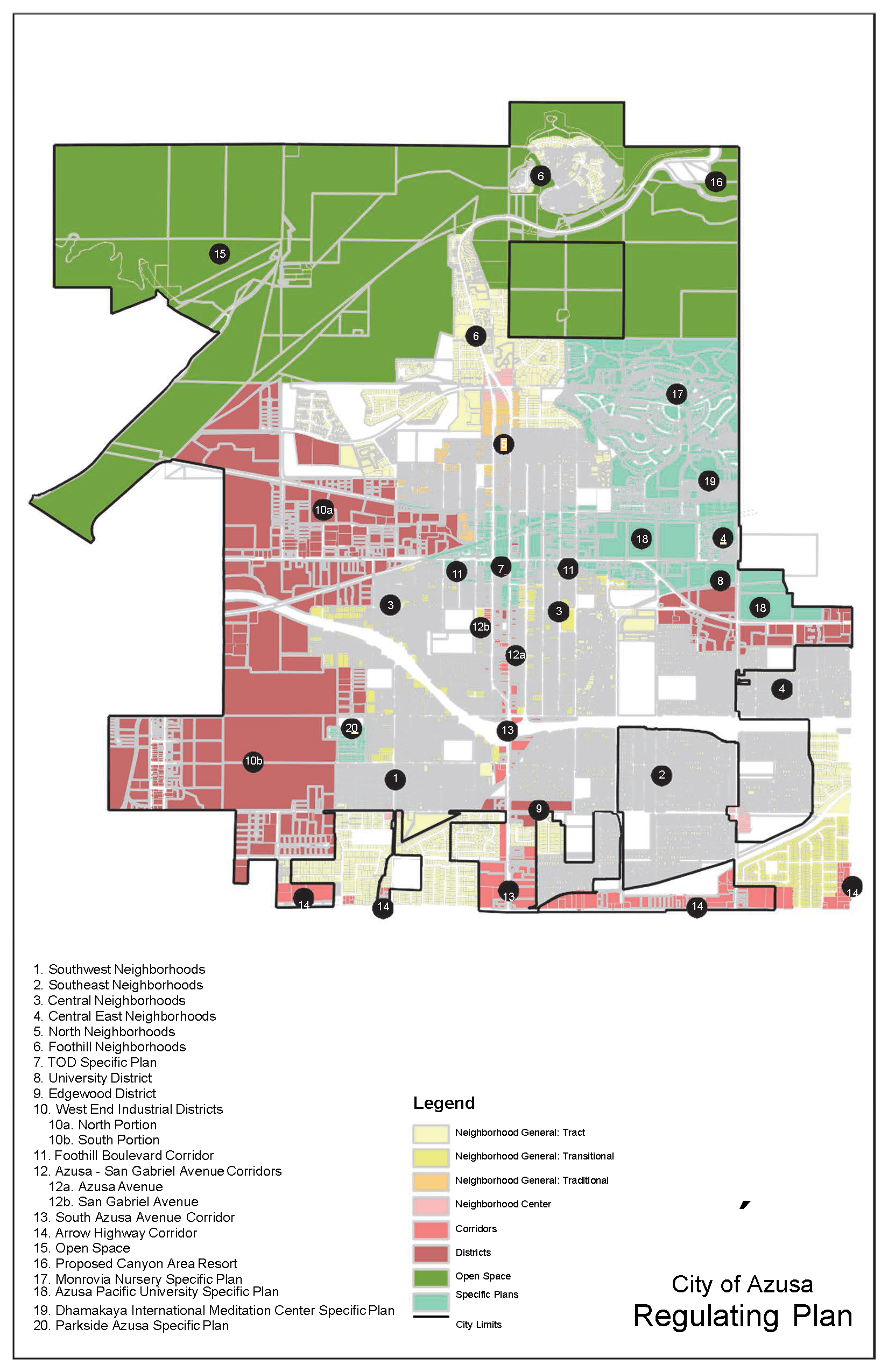
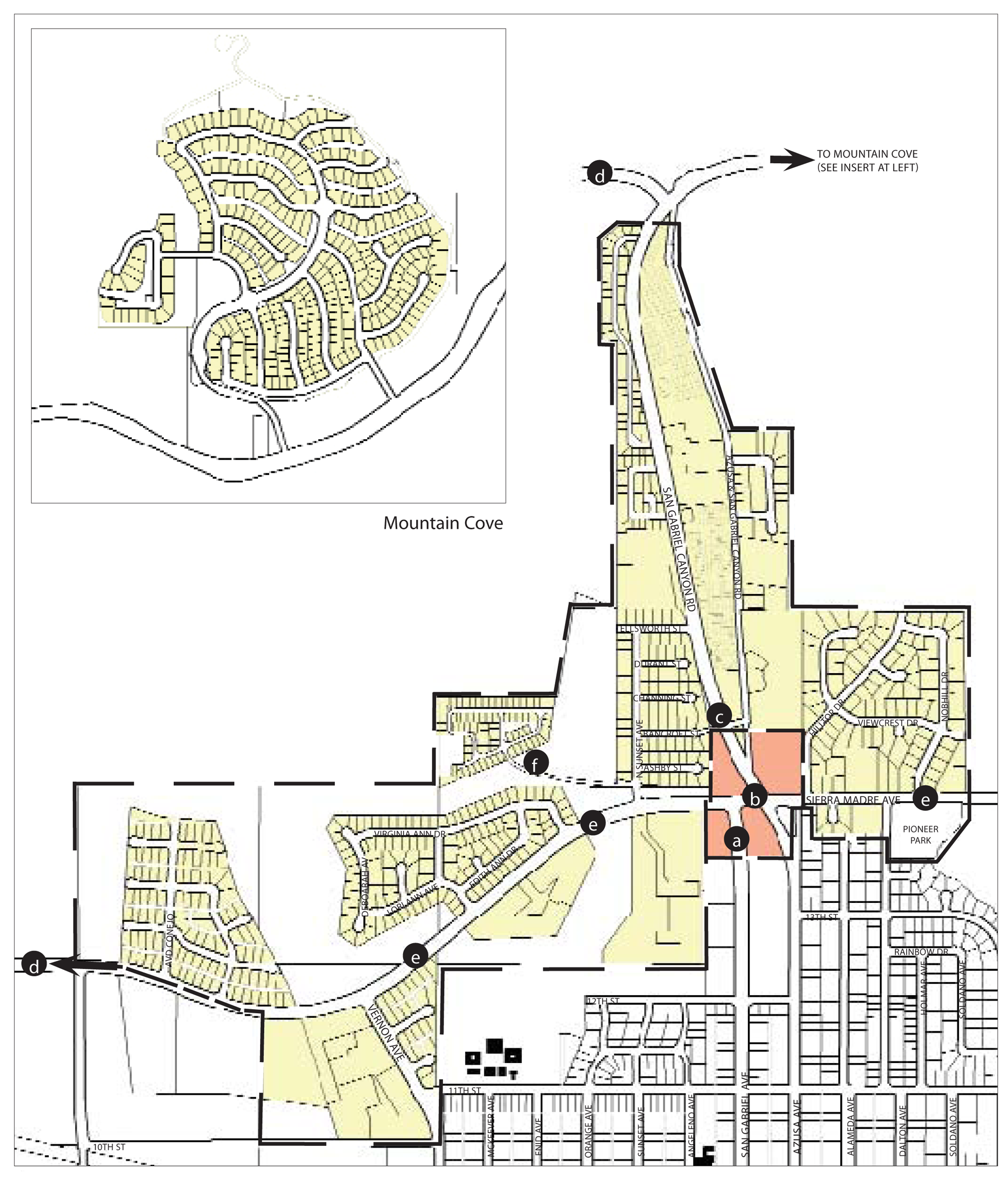
The provisions of this section are applicable to specific sites within the city based on the area where the site is located. A locational diagram of the planning areas is depicted in Figure 1 and the specific boundaries of each area are shown in Figure 2.
88.20.030. - Organization and Intent of Planning Area Chapters.
The community design policies of the Azusa General Plan, and the regulations in the following chapters of this Development Code, express the city's intentions for the physical form and character of the community, including the types of development and land uses that may occur in specific locations throughout the city. These General Plan and Development Code provisions look at the present form and character of each area of the city, and describe whether and how each area will be encouraged to change, both during the ten-year term of the plan, and beyond.
The community's intentions for physical change within the city vary by specific area. This plan anticipates that some areas should change relatively little over time, because of their attractive and distinctive design character and high quality maintenance. At the same time, other areas will be encouraged to change significantly in the type, character, and quality of private buildings and public spaces, and in terms of their current land uses. In all cases, planned change, or the preservation of existing character, are based on the community's overall goals for becoming a city that more effectively provides a wide range of opportunities and choices in housing, jobs, shopping, education, recreation, other cultural pursuits; and that is more pedestrian-oriented, and visually attractive.
The regulations of this Development Code for the planning areas shown in Figure 1 are based upon principles of traditional city form that are reflected in the layout and design of Azusa's downtown and its pre-World War II neighborhoods. These principles encourage development that is designed to:
•
Contribute to compact urban form;
•
Provide a mixture of land uses that facilitates walking and less dependence on automobiles;
•
Provide a mixture of housing types to accommodate households in all economic groups;
•
Improve accessibility to public facilities and open space; and
•
Work together with development on adjoining properties to create streetscapes of distinctive and appealing character.
The planning areas described in the following chapters identify different geographic areas of Azusa in terms of Neighborhoods, Districts, and Corridors. The areas identified as neighborhoods are now mostly developed with individual homes. However, several of the neighborhoods have the potential to, over time, become places where additional types and sizes of housing are available, and where residents will have the option of a convenient walk to reach stores, other businesses and public facilities that cater to their daily needs, instead of needing a car for all such trips. The grouping of various neighborhoods on the Regulating Plan (for example, the Southwest Neighborhoods, and Foothill Neighborhoods) reflects similarities in their history and current character, and the city's intent that Development Code requirements have similar positive effects within each group of neighborhoods as individual lot development and re-development occur over time.
The districts shown on the Regulating Plan identify areas now occupied primarily by non-residential land uses and activities. Each of the districts is intended to have important, but different long-term roles within the community. The intent of each district is described in the "Purpose" subsection of each district section in Chapter 88.24.
The corridors shown on the Regulating Plan identify major roadway segments that are intended to become both more attractive intra- and inter-city vehicle and pedestrian routes, and areas characterized by a mixture of land uses, including retail, office, and residential.
In each case, the specific regulations of this Development Code Article for each neighborhood, district, and corridor, are intended to provide for an appropriate mixture of land uses that function compatibly with one another, and development that is oriented at least as much to the needs of pedestrians as those of the automobile.
This approach differs from conventional zoning codes that typically divide cities into zones that rigidly segregate residential, commercial, industrial, and institutional land uses into separate areas of a city, and thereby require residents to drive or use public transportation for nearly all daily activities. The use of neighborhoods, districts, and corridors as the spatial basis for regulating development instead of land use zones, directly reflects the functions of, and interrelationships between each area of the city. This approach is also more effective than conventional zoning in expressing the city's urban design objectives for each area of the city, and thereby establishing and maintaining attractive distinctions between the different areas of the various parts of the city.
Each of the following chapters includes the following components:
A.
Location and Existing Conditions. These sections describe the current physical character of each neighborhood, district, and corridor.
B.
Desired Future and Proposed Changes. These non-regulatory sections identify the types of evolutionary changes that the city would like to see in each area as existing developed parcels are re-developed over time, and the city constructs various improvements to the existing street rights-of-way and other public spaces. These sections thereby explain the basis for the development regulations found in the following sections.
C.
Site Planning and Building Design. These sections provide Development Code regulations applicable to proposed development and new land uses within each neighborhood, district, and corridor, covering the topics of allowable land uses, standards for building placement and height limits, how new buildings must address the street in terms of their facade design, and how and where off-street parking may be located on a site.
(Ord. No. 2017-05, § 4, 7-17-17)
88.20.040. - Allowable Land Uses and Planning Permit Requirements.
This section lists the land uses that may be allowed within the zones established by Chapter 88.20.020 (Regulating Plan), and determines the type of planning permit/approval required for each use.
A.
Allowable Land Uses. The land uses allowed by this Development Code in each zoning district are listed in Chapter 88.22.065, Chapter 88.24.005, and Chapter 88.26.005 together with the type of planning permit required for each use. All uses and storage shall be conducted within a totally enclosed building with the exception those uses that are customarily conducted outdoors, including plant nurseries, automobile display, equestrian facilities, commercial recreational facilities and other similar outdoor uses as determined by the director. Each listed land use is defined in Article 7 (Glossary).
1.
Establishment of an Allowable Use.
a.
Any one or more land uses identified by Chapter 88.22.065, Chapter 88.24.005, and Chapter 88.26.005 as being allowable within a specific zoning district may be established on any parcel within that zoning district, subject to the planning permit requirement listed in the tables, and in compliance with all applicable requirements of this Development Code.
b.
Where a single parcel is proposed for development with two or more of the land uses listed in the tables at the same time, the overall project shall be subject to the highest permit level required by the tables for any individual use. For example, a new multi-use building proposed with a permitted use on the second floor and a use requiring use permit approval on the ground floor would require use permit approval for the entire project.
2.
Use Not Listed.
a.
A land use that is not listed in Chapter 88.22.065, Chapter 88.24.005, and Chapter 88.26.005, and is determined by the director to not be included in Article 9 (Glossary) under the definition of a listed land use, is not allowed within the city, except as otherwise provided in subsection A.3, or Section 88.10.060 (Exemptions from Planning Permit Requirements).
b.
A land use that is not listed in the tables within a particular zoning district is not allowed within that zoning district, except as otherwise provided subsection A.3, or Section 88.10.060 (Exemptions from Planning Permit Requirements).
3.
Similar and Compatible Use May Be Allowed. The zoning administrator may determine that a proposed use not listed in this chapter is allowable as follows:
a.
Required Findings. The zoning administrator may determine that a proposed use is similar to, and compatible with a listed use and may be allowed, only after first making all of the following findings:
(1)
The characteristics of, and activities associated with the use are similar to one or more of the listed uses, and will not involve greater impacts than the uses listed in the district;
(2)
The use will be consistent with the purposes of the applicable zoning district;
(3)
The use will be consistent with the general plan and any applicable specific plan;
(4)
The use will be compatible with the other uses allowed in the district; and
(5)
The use is not listed as allowable in another zoning district.
(6)
The use is not similar to a use otherwise not allowed in the zoning district.
A determination that a use qualifies as a "similar use" and the findings supporting the determination shall be in writing.
b.
Applicable Standards and Permit Requirements. When the zoning administrator determines that a proposed, but unlisted, use is similar to a listed use, the proposed use will be treated in the same manner as the listed use in determining where it is allowed, what permits are required, and what other standards and requirements of this Development Code apply.
c.
Referral for Determination. The zoning administrator may refer the question of whether a proposed use qualifies as a similar and compatible use directly to the commission for a determination at a public meeting.
d.
Appeal. A determination of similar and compatible use may be appealed in compliance with Chapter 88.56 (Appeals).
B.
Additional City Approval Requirements. Any land use identified as allowable by Section 88.22.065, Section 88.24.005, and Section 88.26.005 may require site plan review and/or a building permit in compliance with the Municipal Code, in addition to the required planning permit.
C.
Standards for Specific Land Uses. Where the last column in the tables ("Specific Use Regulations") includes a section number, the regulations in the referenced section apply to the use. Provisions in other sections of this Development Code may also apply.
(Ord. No. 06-O6, § 1B, 8-7-06; Ord. No. 2017-05, § 4, 7-17-17; Ord. No. 2020-02, § 4(Exh. A), 2-3-20)
88.21.010. - Purpose of Chapter.
This chapter establishes the regulating authority for the specific plans located in the areas highlighted in the Regulating Plan (Figure 2) in Section 88.20.040. The areas located in the specific plan are regulated by their respective development standards, parking requirements, allowable land uses, incentives, and any other applicable standards. In cases where the Specific Plan conflicts with the Development Code, the Specific Plan will take precedence. Where the Specific Plan is silent on a topic(s), the Development Code and/or General Plan will remain in effect.
(Ord. No. 2020-02, § 3, 2-3-20)
88.21.020. - Parkside Azusa Specific Plan.
A.
Purpose. The purpose of the Parkside Azusa Specific Plan is to allow comprehensive development of the site while implementing the City of Azusa's General Plan goals as they relate to development of the Specific Plan areas. The Specific Plan is prepared pursuant to California Code Section 65450 et. seq., as described in Section 1.5 of the Specific Plan. The Specific Plan serves as the direct link between the General Plan's policies and the design of the proposed residential development project, and assures that, as the two development phases of the Specific Plan are approved, they are and will remain consistent with the General Plan.
B.
Allowable Uses. Refer to the Parkside Azusa Specific Plan.
C.
Site Planning and Building Design. Refer to the Parkside Azusa Specific Plan.
(Ord. No. 2020-02, § 3, 2-3-20)
88.21.030. - Monrovia Nursery Specific Plan.
A.
Purpose. The purpose of the Monrovia Nursery Specific Plan is to create a master planned community that embodies time-tested planning principles and architectural styles and promotes the heritage and values of Azusa. This new community will be part of and enhance the existing community of Azusa while implementing the Guiding Principles of the General Plan.
B.
Allowable Uses. Refer to the Monrovia Nursery Specific Plan.
C.
Site Planning and Building Design. Refer to the Monrovia Nursery Specific Plan.
(Ord. No. 2020-02, § 3, 2-3-20)
88.21.040. - Azusa Pacific University Specific Plan.
A.
Purpose. The Azusa Pacific University Specific Plan is a comprehensive guide to defining the character of future physical development for the main campus of Azusa Pacific University (APU). The campus is located on two nearby sites (East Campus and West Campus) in Azusa, California. This plan does not address other properties owned or leased by APU in Southern California.
B.
Allowable Uses. Refer to the Azusa Pacific University Specific Plan.
C.
Site Planning and Building Design. Refer to the Azusa Pacific University Specific Plan.
(Ord. No. 2020-02, § 3, 2-3-20)
88.21.050. - Dhammakaya International Meditation Center Specific Plan.
A.
Purpose. The Dhammakaya International Meditation Center (DIMC) Specific Plan is a comprehensive guide to defining future improvements to, and use of, the DIMC Property. Typically, Specific Plans are used for large, multiple phase developments that incorporate many different types of land uses. In this particular case, the DIMC Property is unique due to its history and the relatively few special events that occur on the Property. Therefore, a Specific Plan can provide the City more clarity in regulating the phasing of physical improvements and the on-going use of the Property.
B.
Allowable Uses. Refer to the Dhammakaya International Meditation Center Specific Plan.
C.
Site Planning and Building Design. Refer to the Dhammakaya International Meditation Center Specific Plan.
(Ord. No. 2020-02, § 3, 2-3-20)
88.21.060. - Azusa TOD Specific Plan.
A.
Purpose. The Azusa Transit-Oriented Development (TOD) General Plan/Development Code Update and Specific Plan (herein referred to as the Azusa TOD Specific Plan, or, simply Specific Plan) is a comprehensive document that will implement the vision for the Specific Plan Area as established by the City of Azusa planning process.
B.
Allowable Uses. Refer to the Azusa TOD Specific Plan.
C.
Site Planning and Building Design. Refer to the Azusa TOD Specific Plan.
(Ord. No. 2020-02, § 3, 2-3-20)
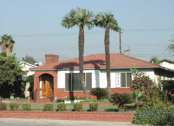
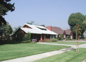
88.22.010. - Southwest Neighborhoods.
The purpose of this chapter is to outline the general plan goals and development guidelines within the Southwest Neighborhoods of Azusa. It is a guideline to assist present and future residents, developers and city staff in evaluating the evolving character and potential of these neighborhoods.
A.
Location and Existing Conditions. The Southwest Neighborhoods of Azusa are located south of the 210 Freeway, west of Azusa Avenue, and north of Arrow Highway. To the west are the city's industrial districts. The Little Dalton Wash flood control channel runs through the southeast portion of these neighborhoods. The wash area is fenced off on both sides and has no landscaping along its edges. High voltage power lines also bisect the Southwest Neighborhoods. The power line right-of-way is used for plant storage by a local nursery. Much of the area isolated by these two regional features is located in unincorporated Los Angeles County. These neighborhoods are directly adjacent to the southern industrial districts, and suffers from the dust and noise produced by quarries, landfills and other land-intensive uses.
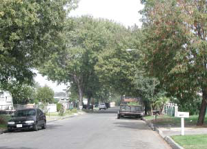
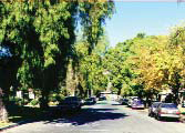
Existing Neighborhood Street
Streets and Landscape. Streets in the Southwest Neighborhoods generally run north-south, creating rectangular blocks. Throughout the neighborhoods, public landscape is inconsistent - street trees do occur they are often different species, sizes, and shapes. The trees that do exist are typically large and mature. Within the center of the southwest neighborhoods is an interconnected street grid of character and familiarity, which decentralizes traffic. This street grid breaks down to the north and south - only Zachary Padilla Avenue and Vernon Avenue cross the 210 Freeway, and areas in county jurisdiction contain cul-de-sac developments. Although several streets can be entered from Arrow Highway to the south, there is only one street entry from the east and west and no entry from Gladstone Street to the north. This lack of access concentrates traffic in and out of the neighborhoods onto a few streets and intersections.
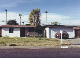
Typical Neighborhood House
Civic and Commercial Features. Three elementary schools are located in the southwest neighborhoods: Mountain View School, Paramount School, and Valleydale School. These schools and playfields could potentially become the social and civic center, but they have few trees. Zacatecas and Valleydale Parks are also centrally located in these neighborhoods, and are heavily used. Retail in these neighborhoods is predominately strip development on Azusa Avenue, with a church and local retail at the corner of Vernon Avenue and First Street.
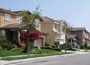
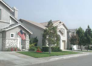
Typical Houses at Parkside
Building Fabric. The typical buildings in the southwest neighborhoods are one-story, single-family residential with attached garages. These houses were constructed between 1950s and 1970s, and are of simple wood construction with a stucco finish and wood trim. Some residences have brick masonry details incorporated into the front elevations. The notable exception is the recent Parkside single-family development. There is some multi-family apartment housing located west of Vernon Avenue. Additionally, a large mobile home park is located near Vernon Avenue, between Gladstone Street and Little Dalton Wash.
B.
Desired Future and Proposed Changes. The general objectives for this area is to preserve and enhance the existing quality and fabric of the residential neighborhoods.
1.
Specific Recommendations.
a.
Promote a mixed-use, pedestrian-oriented neighborhood center at the intersection of Vernon Avenue and Gladstone Street that enhances existing retail. Improvements should include enhanced crosswalks at the intersection, and a shared parking program for commercial and retail uses.
b.
Remove the 210 Freeway on/offramps at Vernon Avenue.
c.
Construct new freeway on/offramps at Zachary Padilla Avenue.
d.
Connect 1st Street with an extended Vincent/Todd Avenue and Irwindale Avenue.
e.
Implement traffic calming measures such as narrowing of streets; bulb-outs at intersections; raised intersections; medians; and traffic signals. Specific measures should focus on Gladstone Street and Vernon Avenue.
f.
Landscape flood control washes and canals. Work with the appropriate flood control agencies to access canal rights-of-way as recreational corridors, such as bikepaths and trails.
g.
Convert the existing light and water property into a public park.
2.
General Recommendations.
a.
Pursue joint-use agreements with Azusa Unified School District to promote school sites as accessible neighborhood parks.
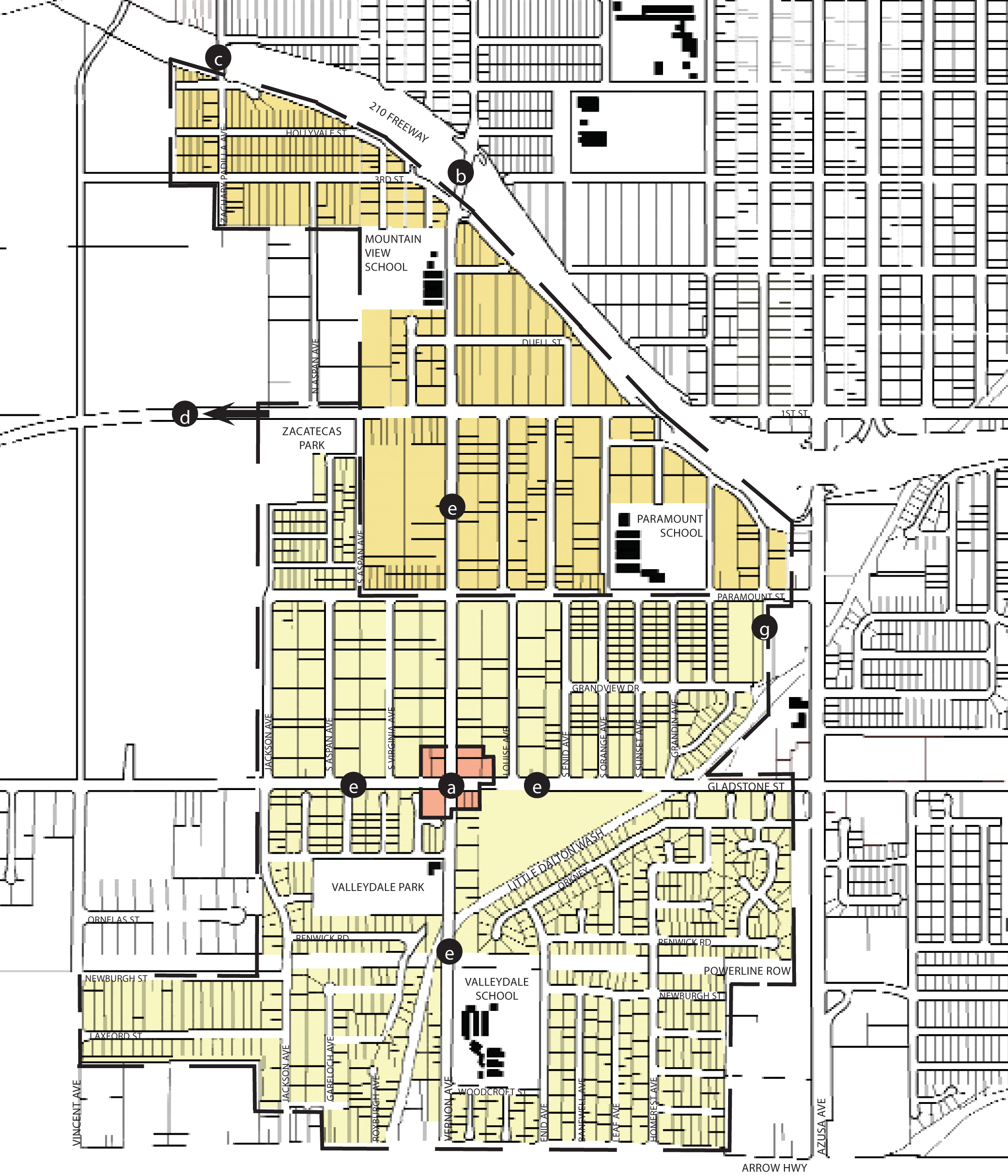
Regulating Plan (at time of adoption)
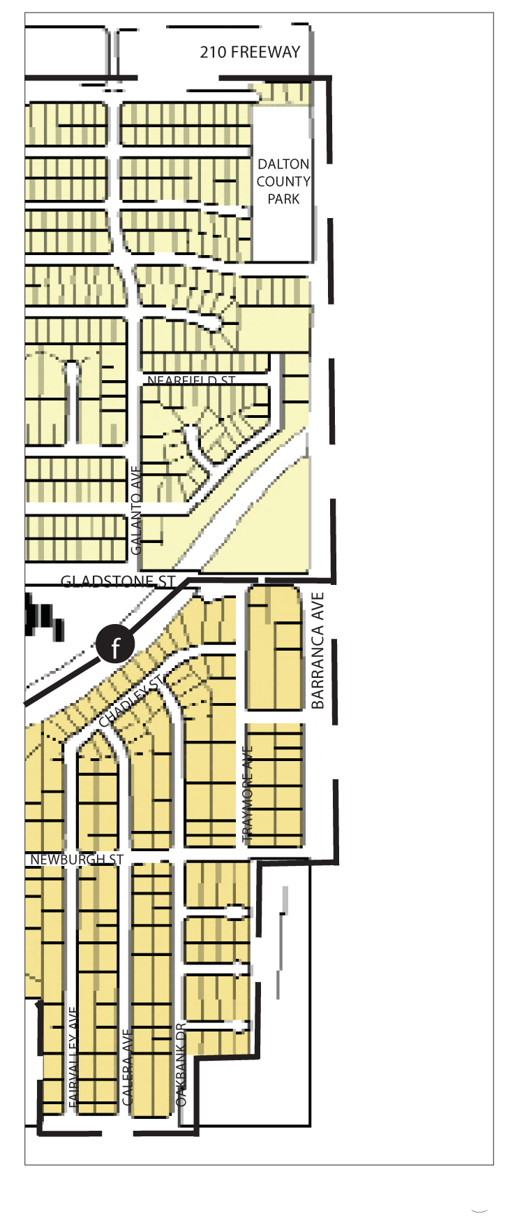
88.22.020. - Southeast Neighborhoods.
The purpose of this chapter is to outline the general plan goals and development guidelines within the Southeast Neighborhoods of Azusa. It is a guideline to assist present and future residents, developers and city staff in evaluating the evolving character and potential of these neighborhoods.
A.
Location and Existing Conditions. The Southeast Neighborhoods are located north of Arrow Highway, east of Azusa Avenue, south of the 210 Freeway, and west of Barranca Avenue. Pedestrian bridges cross the freeway at Galanto and Rockvale Avenues. The Big Dalton flood control channel runs through the southeastern corner of these neighborhoods. It is wide, fenced off and devoid of any landscape. High voltage electrical lines bisect these neighborhoods, and the right-of-way is used for plant storage by a local nursery. Much of this area is in unincorporated county land, within of the City of Azusa's sphere of influence.
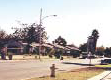
Typical Neighborhood Street
Streets and Landscape. The southeast neighborhoods consist of long, rectangular blocks, which generally measure over 800 feet and sometimes approach 1,500 feet in length. Additionally, the neighborhoods have few streets that access the arterials. Access to these thru-ways is prevented by block walls, chain link fences, or frontage roads. Streets within the neighborhoods are of a uniform dimension and thus lack hierarchy. Within the neighborhood there is very little public landscape of any quality, and only sporadic street trees. The trees that do exist throughout the neighborhood on private yards are typically large and mature.
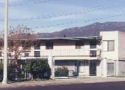
Typical Apartment Building
Civic and Commercial Features. Gladstone Park is located in the southeast neighborhoods. Gladstone Park is a well-used and beautiful amenity, but faces private yards and fences on the north and east sides. The west and south sides face public streets, and are lined with large mature street trees that help to define the public space. Schools in the southeast neighborhoods include Gladstone Street Elementary, Clifford D. Murray Elementary, Magnolia Elementary, and Center Middle School. The Azusa Unified School District offices are also here. Commercial and retail uses in these neighborhoods are distributed along Gladstone Street in strip-type development. Retail and commercial uses are concentrated at the intersections of Azusa, Barranca and Citrus Avenues. The Azusa Avenue/Gladstone Street intersection is the center of the adjacent Edgewood District.
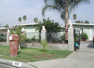
Typical House
Building Fabric. The building fabric of the neighborhood is predominantly one-story, single-family residential with attached garages set at the front or recessed from the front of the houses. Most of the houses were constructed between the 1950s to 1970s and are of simple wood construction with a stucco finish and wood trim. Some of the residences have brick masonry details incorporated into the front elevations.
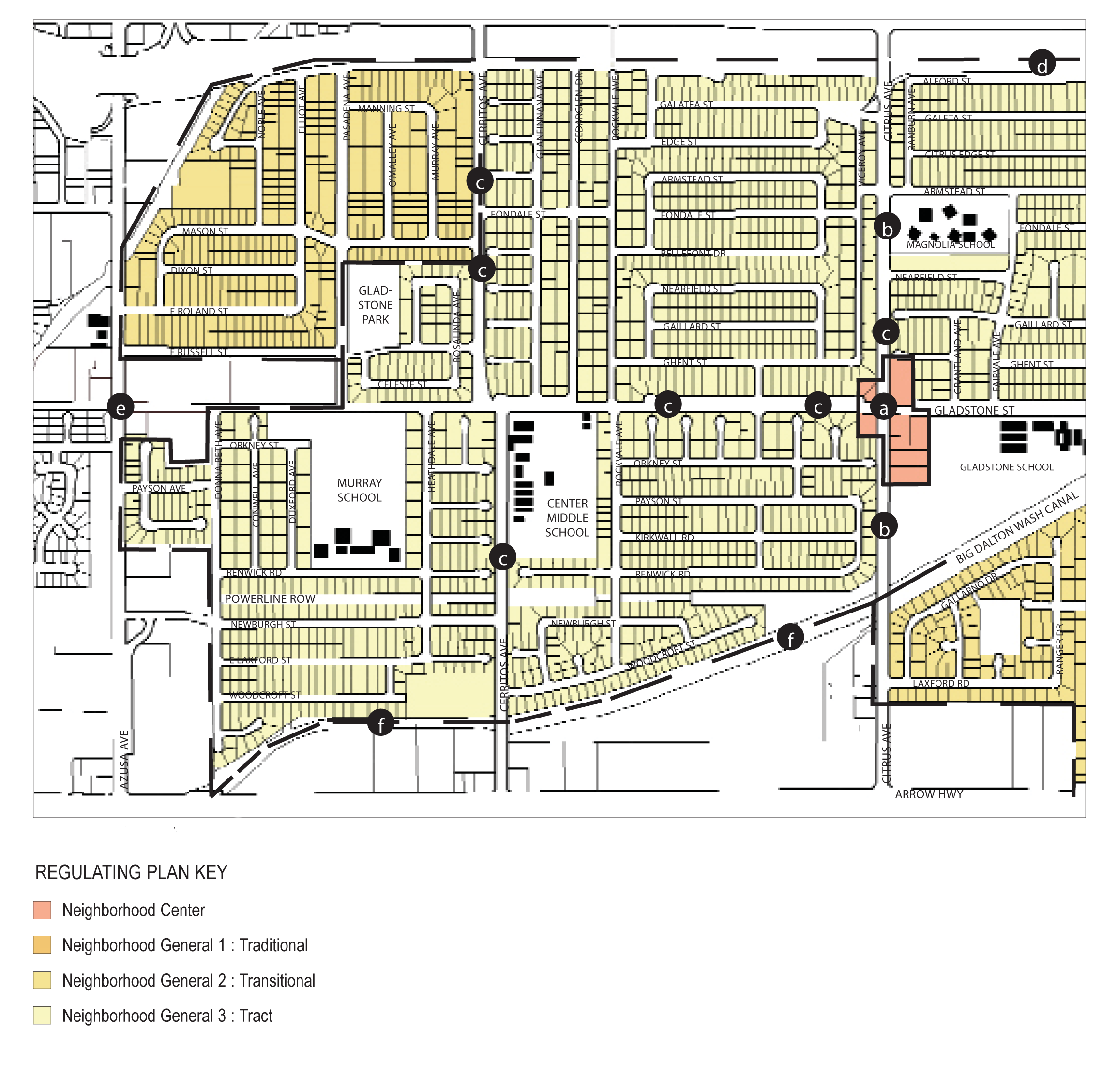
88.22.020 Regulating Plan Map
B.
Desired Future and Proposed Changes. The general objectives for this area is to preserve and enhance the existing quality and fabric of the residential neighborhoods.
1" = 1,000'
1.
Specific Recommendations.
a.
Promote a pedestrian-oriented neighborhood center at Gladstone Street and Citrus Avenue that enhances existing retail. Improvements should include enhanced crosswalks at the intersection, sidewalks, and a shared parking program for commercial and retail uses.
b.
Install landscaped medians and parkways on Citrus Avenue.
c.
Establish pedestrian and vehicular connections to primary streets from existing cul-de-sac streets.
d.
Landscape street edges facing the 210 Freeway.
e.
Promote a pedestrian connections such as paseos, courtyards and other passageways to the Edgewood District at Gladstone Street and Azusa Avenue (also see Edgewood District).
f.
Landscape flood control washes and canals. Work with the appropriate flood control agencies to access canal rights-of-way as recreational corridors, such as bikepaths.
2.
General Recommendations.
a.
Pursue joint-use agreements with Azusa Unified School District to promote school sites as accessible neighborhood parks; and
b.
Pursue landscaping improvements for the blank walls adjacent to Citrus Avenue.
88.22.030. - Central Neighborhoods.
The purpose of this chapter is to outline the general plan goals and development guidelines within the central neighborhoods of Azusa. It is a guideline to assist present and future residents, developers and city staff in evaluating the evolving character and potential of these neighborhoods.
A.
Location and Existing Conditions. The central neighborhoods of Azusa are defined by the 210 Freeway to the south and southwest, the rail lines to the northwest, Foothill Boulevard to the north, and Cerritos Avenue to the east. These neighborhoods are bisected by the TOD Specific Plan and Azusa/San Gabriel Avenue Corridor (described separately). The Little Dalton Wash flood control channel cuts through the southeast corner of the neighborhoods.
Typical Neighborhood House
Streets and Landscape. The neighborhoods surrounding downtown primarily consist of rectangular blocks oriented north-south, with adjustments surrounding the Little Dalton Wash channel. There is an understandable hierarchy to the street pattern within the neighborhood: the north-south streets are the widest and the east-west streets are narrower. Within these neighborhoods are scattered street trees although many have either died or been removed. These neighborhoods are well integrated into the rest of the city. To the north, west and south the neighborhoods abut the major regional routes of the 210 Freeway and Burlington Northern Santa Fe rail lines. Only Foothill Boulevard and Vernon Avenue cross these barriers.
Typical Neighborhood Street
Civic and Commercial Features. The central neighborhoods are rich with community facilities, including the Azusa Community Center and Memorial Park playfields, which are the city's recreational center. Slauson Middle School is located in these neighborhoods, and Azusa High School and Foothill Middle School are adjacent to the east. The high school fields are used as a regional playfield for high school sports, and little league soccer and football games. The neighborhoods have relatively few retail, commercial and professional office uses - as these are located in adjacent Districts and Corridors along Azusa Avenue and Foothill Boulevard. Several gas stations, motels, and other freeway-oriented uses are located on Baseline Road in the adjacent South Azusa Avenue Corridor.
Building Fabric. The building fabric of the neighborhoods is predominantly one and two-story, single-family houses with detached garages located behind the houses. Many of the houses were built in the 1930s to 1980s. Most are wood construction with stucco, shingle or clapboard wood siding with wood details. Some of the houses have low wrought iron, concrete block or chain link fences facing the street. There are several multi-family housing projects scattered throughout these neighborhoods. Most of this housing is two-story single and double loaded (apartments on each side of a corridor) apartments or multi-plex type housing with entrances centered at the stairways. There is also some row house development within the neighborhood. The largest multi-family apartment project is a full block of senior-housing north of Fourth Street at Soldano Avenue.
B.
Desired Future and Proposed Changes. The general objectives for this area is to preserve and enhance the existing quality and fabric of the residential neighborhoods.
1.
Specific Recommendations.
a.
Replace the 210 Freeway on/off ramps at Vernon Avenue with ramps at Zachary Padilla Avenue.
b.
Install a traffic light at the intersection of Sixth Street and Virginia Avenue to improve traffic safety near the blind railroad crossing.
c.
Reduce the apparent street width of Alameda Avenue with landscape bulb-out boxes that alternate with on-street parking.
d.
Promote the use of Slauson School and Memorial Park as a community center.
e.
Landscape flood control washes and canals. Work with the appropriate flood control agencies to access canal rights-of-way as recreational corridors, such as bikepaths.
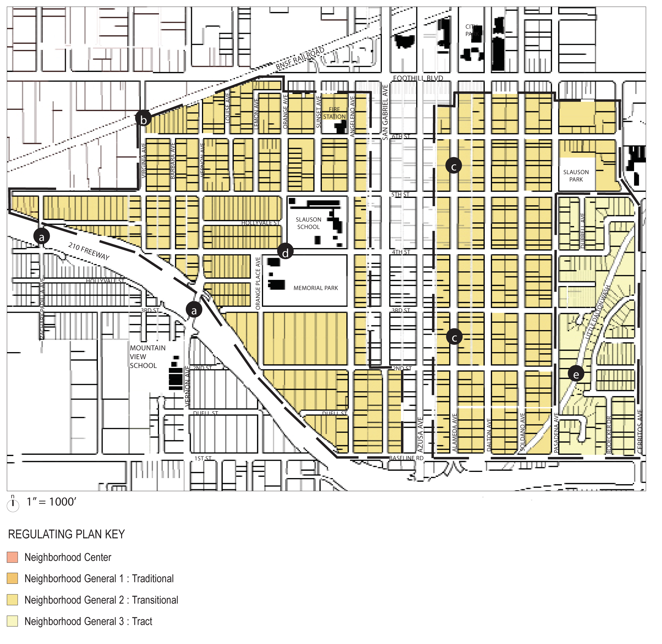
Regulating Plan (at time of adoption)
(Ord. No. 2017-05, § 4, 7-17-17; Ord. No. 2020-02, § 3, 2-3-20)
88.22.040. - Central East Neighborhoods.
The purpose of this chapter is to outline the general plan goals and development guidelines within the central-east neighborhoods of Azusa. It is a guideline to assist present and future residents, developers and city staff in evaluating the evolving character and potential of these neighborhoods.
A.
Location and Existing Conditions. The central east neighborhoods of Azusa are defined by the 210 Freeway to the south, Alosta Avenue and Azusa Pacific University to the north, Barranca Avenue to the east and Cerritos Avenue to the west. These neighborhoods adjoin the University District (described separately). The Little Dalton Wash flood control channel cuts through the northwest corner of these neighborhoods. An additional portion of the central east neighborhoods is located north of Azusa Pacific University Campus, at Foothill Boulevard and Citrus Avenue.
Streets and Landscape. The primary blocks in these neighborhoods range from 600- to 1,250-foot long. Many of the streets in these eastern most neighborhoods are dead-end streets, and there are few neighborhood streets that connect to the primary roads of Citrus or Barranca Avenues and Baseline Road. Streets are uniform in size and thus lack any hierarchy. There are only sporadic street trees and little public landscape of any quality, particularly at the school. However, adjacent to the high school the streets have wide sidewalks, street trees and many of the houses have front porches with recessed garages. These streets are pleasant to walk and drive.
Civic and Commercial Features. Azusa High School, Foothill Middle School, Lee School, and Powell Elementary School are located in these neighborhoods. The high school fields are used as a regional playfield by high school sports and also little league, soccer, and football games. The primary retail, commercial and professional office uses are located along Foothill Boulevard, Citrus Avenue and Alosta Avenue in the adjacent University District.
Building Fabric. The building fabric of the neighborhood is predominantly one-story, single-family residential with attached garages in front of the houses. All of the houses were constructed in the 1960s to 1980s, and are of simple wood construction with a stucco finish and wood trim. Many houses have low wrought iron, concrete block or chain link fences facing the street. There is a large amount of multi-family apartment housing north of the high school. Most of this housing is two-story apartments accessed via one-sided exterior balcony or hallway. There is also rowhouse development along Fifth Street.
B.
Desired Future and Proposed Changes. The general objectives for this area is to preserve and enhance the existing quality and fabric of the residential neighborhoods.
1.
Specific Recommendations.
a.
Install landscaped parkways on Citrus Avenue.
b.
Establish pedestrian and vehicular connections to primary streets from existing cul-de-sac streets.
c.
Realign the intersection of Foothill Boulevard, Alosta Avenue, and Rockvale Avenue to promote vehicular and pedestrian safety (also see University District).
d.
Explore connecting Fenmore Avenue with future development at Foothill Center (also see University District).
e.
Landscape flood control washes and canals. Work with the appropriate flood control agencies to access canal rights-of-way as recreational corridors, such as bikepaths.
f.
Explore strategies to rehabilitate or redevelop the Atlantis Gardens apartments.
2.
General Recommendations.
a.
Pursue joint-use agreements with Azusa Unified School District to promote school sites as accessible neighborhood parks; and
b.
Pursue landscaping improvements for the blank walls adjacent to Citrus Avenue.
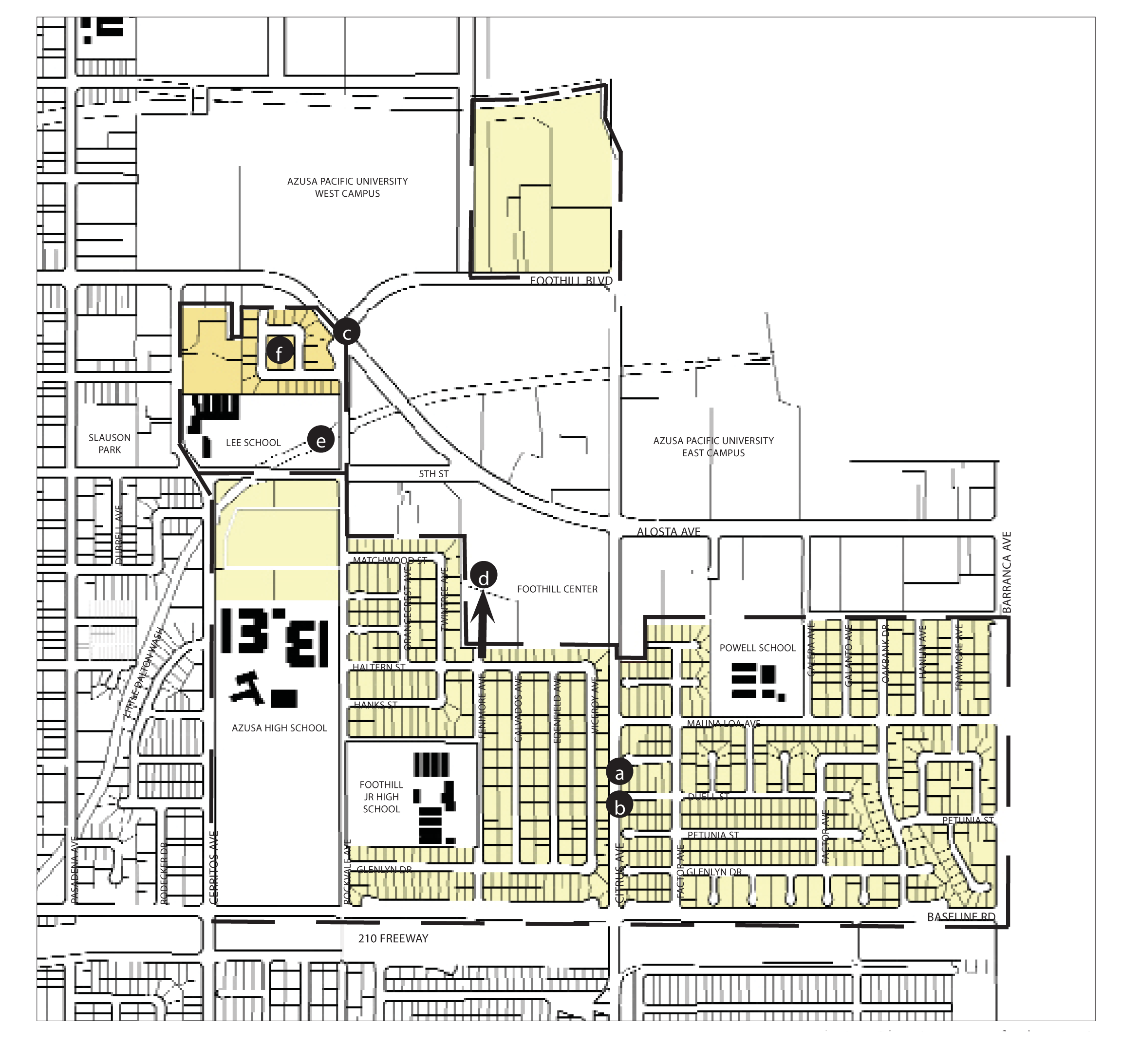
Regulating Plan (at time of adoption)
(Ord. No. 06-O6, § 1B, 8-7-06)
88.22.050. - North Neighborhoods.
The purpose of this chapter is to outline the general plan goals and development guidelines within the north neighborhoods of Azusa. It is a guideline to assist present and future residents, developers and city staff in evaluating the evolving character and potential of these Neighborhoods.
A.
Location and Existing Conditions. The northern neighborhoods of Azusa are bounded by Twelfth Street and Sierra Madre Avenue to the north, Foothill Boulevard on the south, and Vernon Avenue to the west. The Monrovia Nursery site is the eastern boundary of this portion of the city.
Typical Neighborhood Streetscape
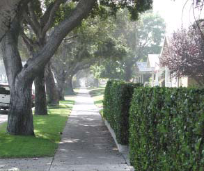
Streets and Landscape. Most blocks in the northern neighborhoods are small, rectangular and north-south in direction, and most blocks contain alleys. There is an understandable hierarchy to the street pattern within the neighborhood - the north-south streets are the widest and the east-west streets are narrower. The neighborhood is well integrated into the fabric of the city to the north, south and west. Within the Vista Bonita area north of Eleventh Street and east of Northside Park, the streets are more curved and free form and all are 30 feet wide. Almost all streets have street trees, although on several of the streets many trees have either died or been removed over the years. Azusa and Sierra Madre Avenues are the primary streets that connect this neighborhood with its surroundings.
Typical Neighborhood Houses
Civic and Commercial Features. Victor Hodge Elementary School and Northside Park are at the northwestern corner of these neighborhoods. The park has ball fields, playground equipment and bathroom facilities, and are well used. Longfellow School is also located nearby. Henry Dalton Elementary School and Pioneer Park are located on the neighborhoods' eastern edge. A neighborhood center of commercial and retail uses is located at the intersection of Azusa Avenue and Tenth Street. A similar neighborhood center is located at Sierra Madre Avenue and San Gabriel Canyon Road, which is shared by the both North and Foothill Neighborhoods. There are also some warehouse uses located along Ninth Street adjacent to the train tracks. Some of these warehouses are old citrus packing houses that are potential candidates for historic designation.
Typical Neighborhood House
Building Fabric. The building fabric of the neighborhood is predominantly one and two-story, single-family residences with detached garages located behind the houses. Many of the residences in this neighborhood are of a traditional form built in the early part of the twentieth century, are historically significant and have been well maintained. Most of these houses are wood or masonry construction with masonry, stucco or clapboard wood siding. The Vista Bonita area within this neighborhood is the best example of the type of housing and streets desired for the city. There are several multi-family housing projects scattered throughout the northern neighborhoods, primarily along Azusa Avenue and the eastern terminus of Tenth Street. Some of this housing is quadplexes, but most is two-story single loaded corridor apartments, multiplex type housing with entrances centered at the stairways, or row house development with parking lanes behind.
B.
Desired Future and Proposed Changes. The general objectives for this area is to preserve and enhance the existing quality and fabric of the residential neighborhoods.
1.
Specific Recommendations.
a.
Promote a pedestrian-oriented neighborhood center at Azusa and Sierra Madre Avenues that enhances existing retail. Improvements should include enhanced crosswalks at the intersection, and a shared parking program for commercial and retail uses. (also see Foothill Neighborhoods)
b.
Promote the existing neighborhood center at Azusa Avenue and Tenth Street that enhances existing retail. Improvements should include enhanced crosswalks at the intersection, and a shared parking program for commercial and retail uses.
c.
Establish street connections with the Monrovia Nursery development
d.
Study the conversion of Azusa Avenue to two-way traffic
e.
Study the conversion of San Gabriel Avenue to two-way traffic, incorporating a landscaped median, widened sidewalks, with one lane of traffic in each direction and parallel parking on both sides, and the use of the street for Golden Days parades.
f.
Reclaim the railroad right-of-way adjacent to 9th Street for parkland and/or residential use.
g.
Reduce the apparent street width of Alameda Avenue with landscape bulb-out boxes that alternate with on-street parking or a center median.
2.
General Recommendations.
a.
Pursue joint-use agreements with Azusa Unified School District to promote school sites as accessible neighborhood parks.
Regulating Plan (at time of adoption)
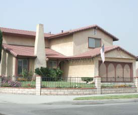
88.22.060. - Foothill Neighborhoods.
The purpose of this chapter is to outline the general plan goals and development guidelines within the foothill neighborhoods of Azusa. It is a guideline to assist present and future residents, developers and city staff in evaluating the evolving character and potential of these neighborhoods.
A.
Location and Existing Conditions. The Foothill Neighborhoods are primarily a series of subdivisions north of Sierra Madre Avenue, built since the 1960s. A few subdivisions are located on a hill overlooking the city and the valley to the south. Others are framed and woven into the layout of the golf course. The northern edge of these neighborhoods overlook the San Gabriel River and two reservoirs. To the south is the golf course and Northside Park, and to the west are the Colorama nursery, quarrying and other industrial uses.
Streets and Landscape. Most of the streets within the foothill neighborhoods are circuitous roads, that wrap around the golf course or end in culs-de-sac.
Typical Neighborhood Streetscape
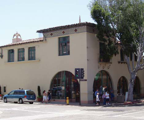
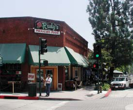
Civic and Commercial Features. There are no civic features in the foothill neighborhoods other than the golf course and a small public park at the intersection of San Gabriel Avenue and Sierra Madre Avenue. There is also limited retail at this intersection, which could form the basis for a neighborhood center.
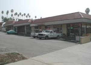
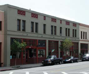
Existing Foothill Neighborhood Center
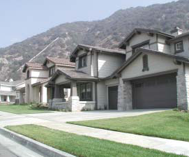
Building Fabric. Houses are typical of suburban residential development of the 1960's and 70's. The northern subdivisions built since 1980 consist of primarily rowhouse and townhouse types, duplexes and small-lot single-family residences. The buildings are all one and two stories in height and are built in wood construction with either stucco or an imitation clapboard wood siding. Mountain Cove, a recent subdivision from the 2000s, is located at the mouth of the San Gabriel Canyon, and is not continuous with the rest of the foothill neighborhoods.
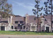
Typical Neighborhood Streetscape
B.
Desired Future and Proposed Changes. The general objectives for this area is to preserve and enhance the existing quality and fabric of the residential neighborhoods.
1.
Specific Recommendations.
a.
Promote a pedestrian-oriented Neighborhood Center at San Gabriel Canyon Road and Sierra Madre Avenue that enhances existing retail. Improvements should include enhanced crosswalks at the intersection, and a shared parking program for commercial and retail uses.
b.
Reconfigure the intersection of Sierra Madre Avenue and San Gabriel Canyon Road to accommodate two-way traffic on San Gabriel and Azusa Avenues. Consider installing a roundabout at this intersection.
c.
Establish pedestrian and vehicular connections to primary streets from existing cul-de-sac streets.
d.
Study the construction of a River Parkway between Sierra Madre Avenue and San Gabriel Canyon Road.
e.
Install landscaped median and parkways on Sierra Madre Avenue.
f.
Reclaim vacant lot as a neighborhood park.
Regulating Plan (at time of adoption)
88.22.065. - Allowable Uses in Neighborhoods.
A.
Permit requirements. Tables 2-1, 2-2, 2-3, and 2-4 provide land uses that are:
1.
Permitted subject to compliance with all applicable provisions of this Development Code, subject to first obtaining a zoning clearance (Section 88.51.020). These are shown as "P" uses in the tables;
2.
Allowed subject to the approval of a minor use permit (Section 88.51.040), and shown as "MUP" uses in the tables;
3.
Allowed subject to the approval of a use permit (Section 88.51.040), and shown as "UP" uses in the tables;
4.
Allowed subject to the type of city approval required by a specific provision of Chapter 88.42 (Standards for Specific Land Uses), and shown as "S" uses in the tables; and
5.
Not allowed in particular zones, and shown as a "—" in the tables.
;sz=8q; Key to Zone Symbols
;sz=8q; Notes:
(1)
A definition of each listed use type is in Article 7 (Glossary).
(2)
This is a critical, sensitive, or high occupancy facility, subject to the hazard mitigation requirements of Section 88.30.030.
(3)
Allowed only within the boundaries of an electric utility easement for high voltage transmission lines.
;sz=8q; Key to Zone Symbols
;sz=8q; Notes:
(1)
A definition of each listed use type is in Article 6 (Glossary).
(2)
This is a critical, sensitive, or high occupancy facility, subject to the hazard mitigation requirements of Section 88.30.030.
(3)
Allowed only within the boundaries of an electric utility easement for high voltage transmission lines.
(Ord. No. 06-O6, § 1B, 8-7-06; Ord. No. 14-O4, § 2, 7-21-14; Ord. No. 2017-14, § 4, 12-18-17; Ord. No. 2020-02, § 3, 2-3-20; Ord. No. 2021-01, § 3, 2-1-21; Ord. No. 2023-04, § 3(Exh. A), 10-2-23)
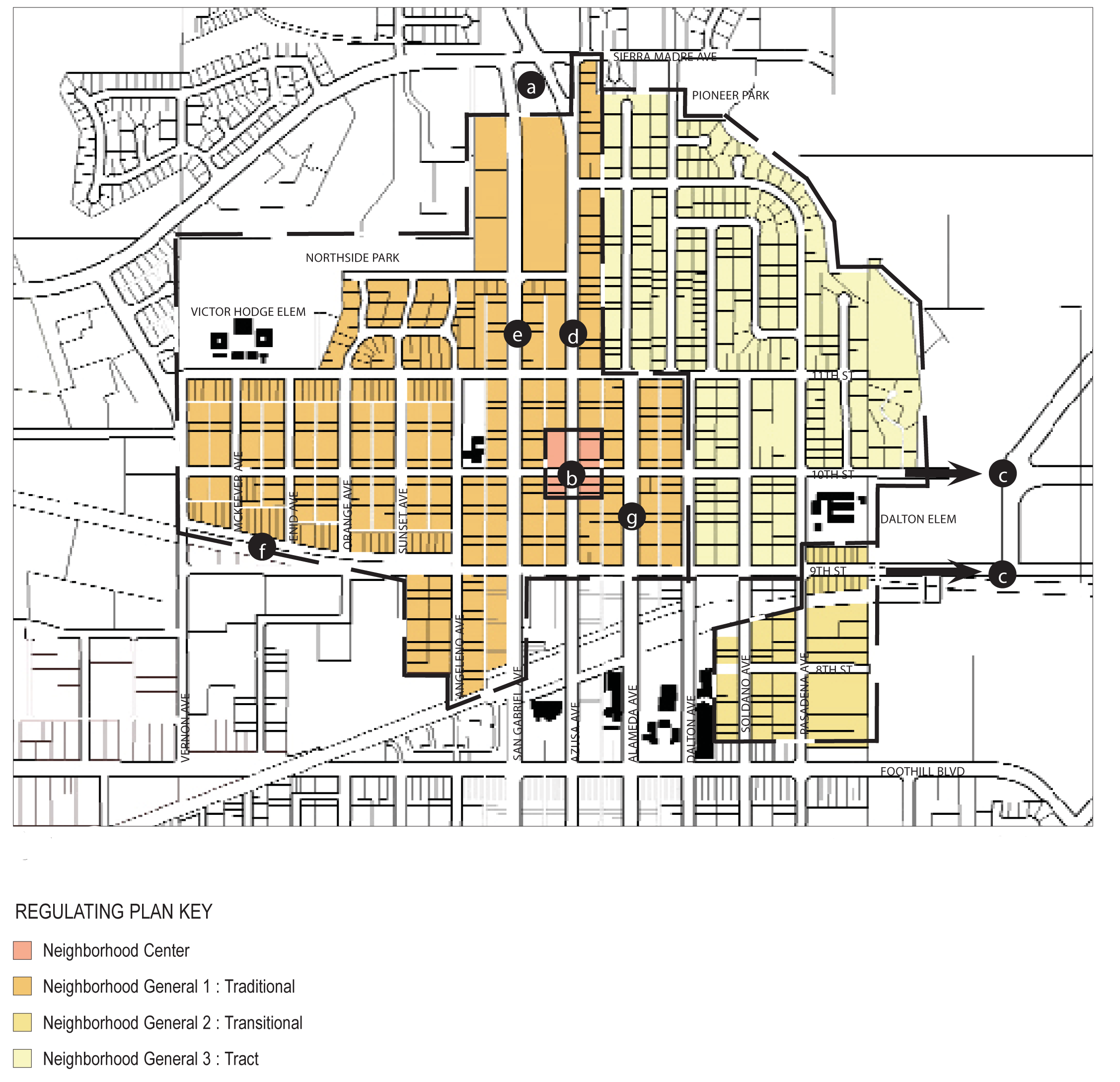
88.22.070. - Neighborhood Site Planning and Building Design.
The purpose of this section is to outline the site planning and building design standards for the neighborhoods of Azusa.
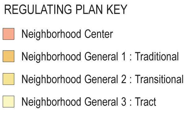
Parcels within neighborhoods fall within one of four categories:
•
Neighborhood Centers
•
Neighborhood General 1: Traditional Neighborhoods
•
Neighborhood General 2: Transitional Neighborhoods
•
Neighborhood General 3: Tract Neighborhoods
A.
Neighborhood Centers.
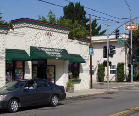
Possible Neighborhood Center
1.
Purpose.
The Neighborhood Center (NC) zone is applied to areas of the city that are intended to serve as mixed use focal points for surrounding residential areas. The NC zone provides opportunities for convenience shopping, personal services, and neighborhood cafes within walking distance of most homes in the adjacent neighborhoods. The NC zone is also intended to provide housing opportunities as part of mixed use developments.
2.
Desired Future and Proposed Changes.
The neighborhood centers in Azusa are typically minor commercial centers, comprised of small-scale strip malls, liquor stores, and gas stations. They are usually located at the intersection of major arterials, within an average five-minute walk of most houses within the adjoining neighborhoods. The Plan and Development Code is designed to encourage the transformation of neighborhood centers from auto-oriented mini-malls into pedestrian-friendly storefronts facing well landscaped streets and sidewalks. The Plan and Code also allows for the mixed-use development to occur within the neighborhood centers - two story buildings with ground floor retail and upper level offices or apartments are desirable.
Possible Neighborhood Center
a.
General Recommendations - Public Realm.
(1)
Improve existing street standards, and implement selected improvements. Improvements to be considered include:
i.
Plant street trees consistent with the street hierarchy suggested by the mobility element of the general plan, such that primary and secondary neighborhood streets are distinguished by a unique pattern and type(s) of tree. A palette of street trees should be developed in coordination with environmental goals of the general plan and city maintenance. Historic patterns of street trees that distinguish particular streets should be maintained. Consider implementing an unique landscape program for each neighborhood center, so that each has a unique character. For example, plant a secondary pattern of conifer trees at Neighborhood Center 1; a pattern of jacarandas at Neighborhood Center 2; and palms at Neighborhood Center 3.
Possible Neighborhood Center
ii.
Install and/or repair sidewalks. New sidewalks should be separated from the street by a planting strip.
iii.
Install street lighting where necessary. The design of the light fixtures should be distinctive to Azusa. In the neighborhood centers, particular attention should also be paid to sidewalk lighting.
iv.
Create pedestrian-friendly crosswalks at the principle intersections of neighborhood centers.
(2)
Implement traffic calming measures and encourage pedestrian safety at intersections. Measures to be considered include:
i.
narrowing of streets;
ii.
bulb-outs at intersections;
iii.
raised intersections;
iv.
medians;
v.
traffic signals;
vi.
textured pedestrian crosswalks; and
vii.
safety lighting at crosswalks.
Possible Neighborhood Center
(3)
Establish a unique signage/banner/graphic program for each neighborhood center, similar to - but more modest than - the existing program downtown.
b.
General Recommendations - Private Property.
Most existing buildings in the neighborhood centers are one-story mini-malls or drive-through facilities. While the businesses that inhabit these buildings - small markets, film developers, cafes - are appropriate to neighborhood centers, the structures do not establish a sense of "center" or place.
(1)
Encourage mixed-use buildings in neighborhood centers.
3.
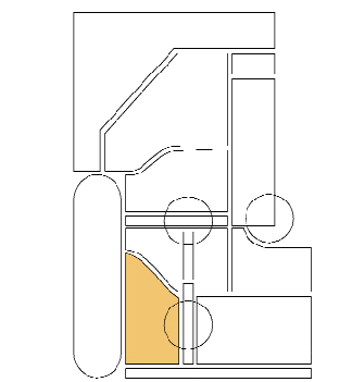
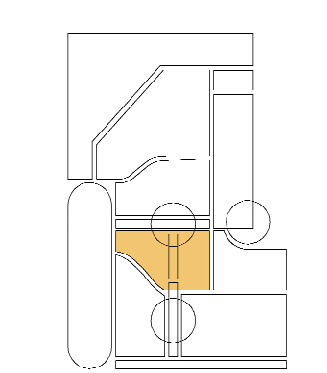
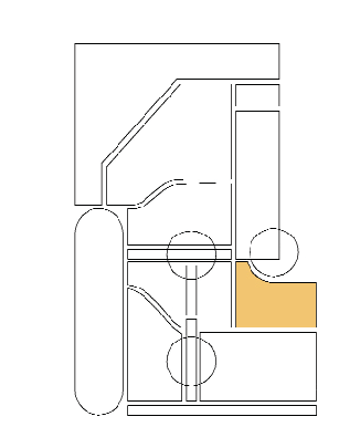
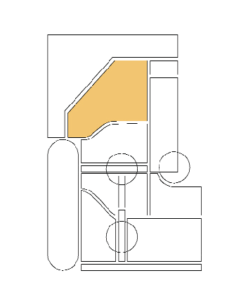
Site Planning and Building Design Standards - Neighborhood Centers.
a.
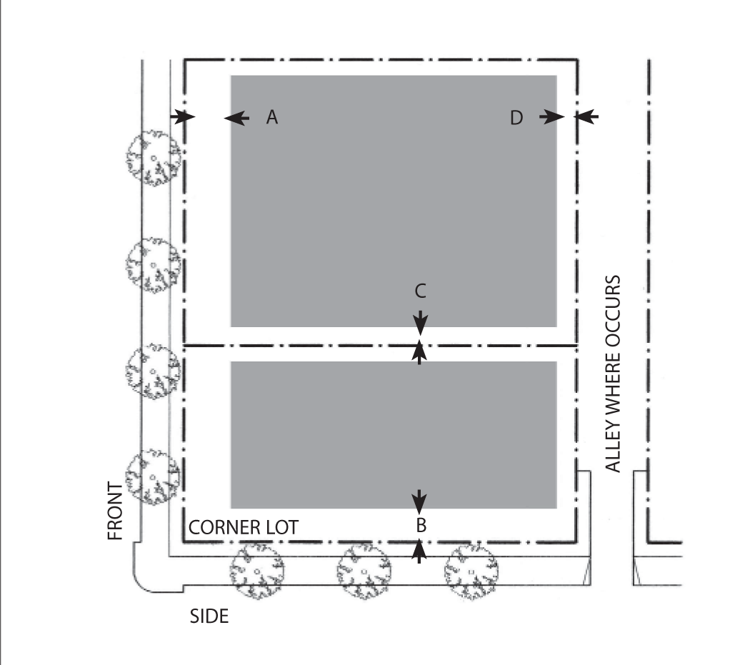
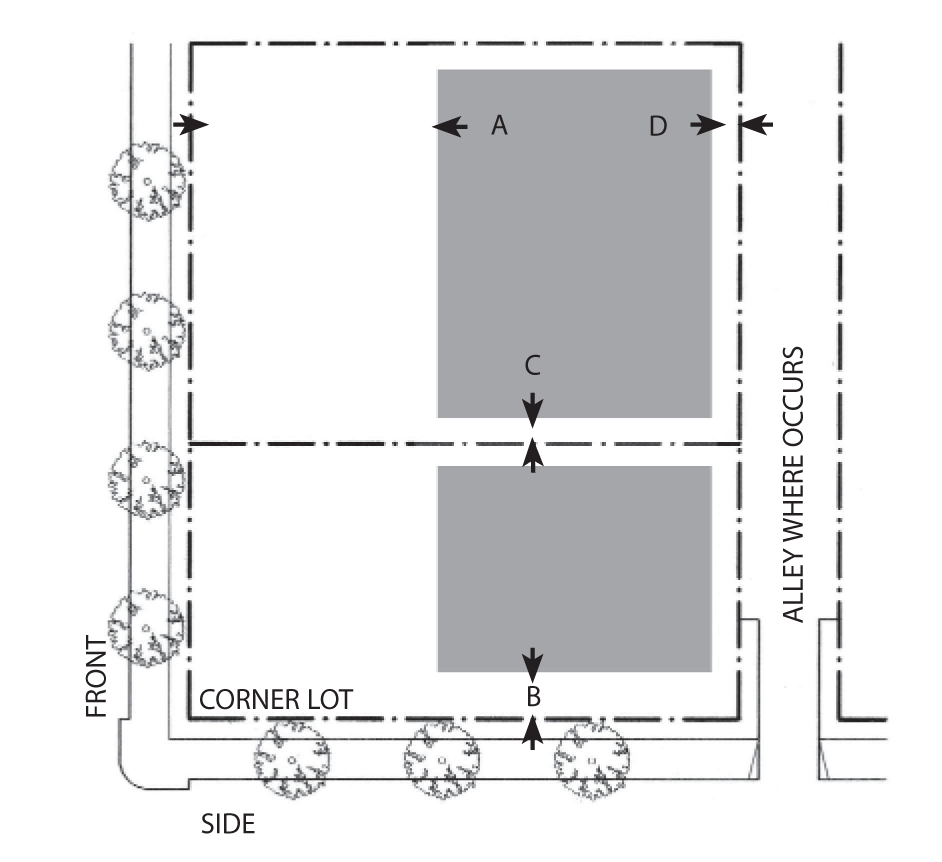
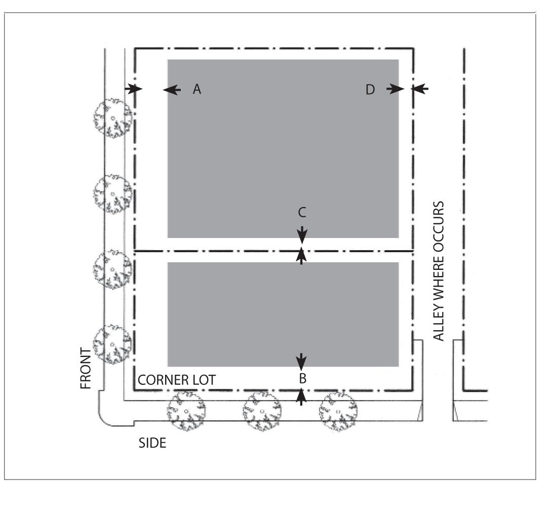
Building Placement.
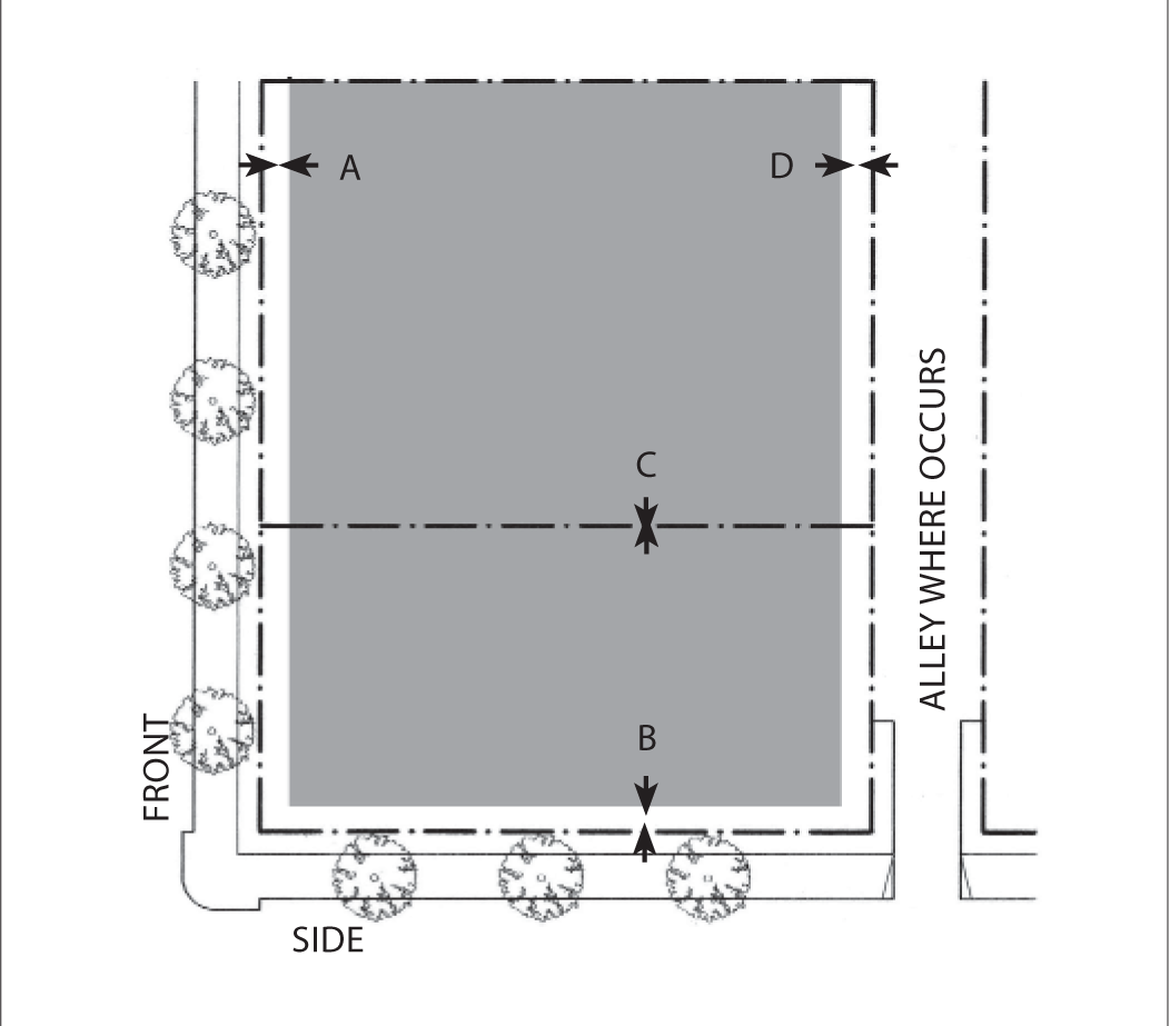
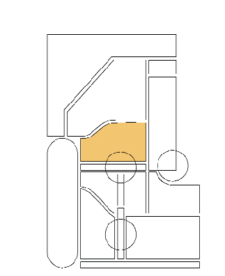
Plan Diagram
Buildings shall be placed within the shaded area as shown.
(1)
Front setback: Zero feet; five feet maximum for 80 percent minimum of lot frontage.
(2)
Side street setback: Zero feet; five feet maximum for 80 percent minimum of lot frontage.
(3)
Sideyard setback: Zero feet; ten feet next to residential.
(4)
Rear setback: 20 feet minimum.
See Chapter 88.31.060 for definitions and design standards.
Notes:
The percentage of building frontage for front and side street setbacks may be reduced by the review authority to accommodate pedestrian plazas located between the street(s) and the building.
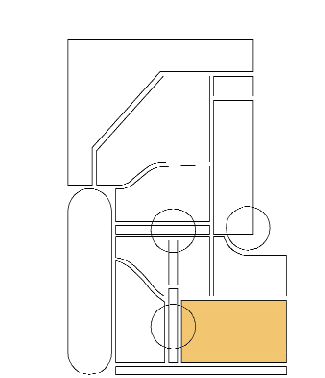
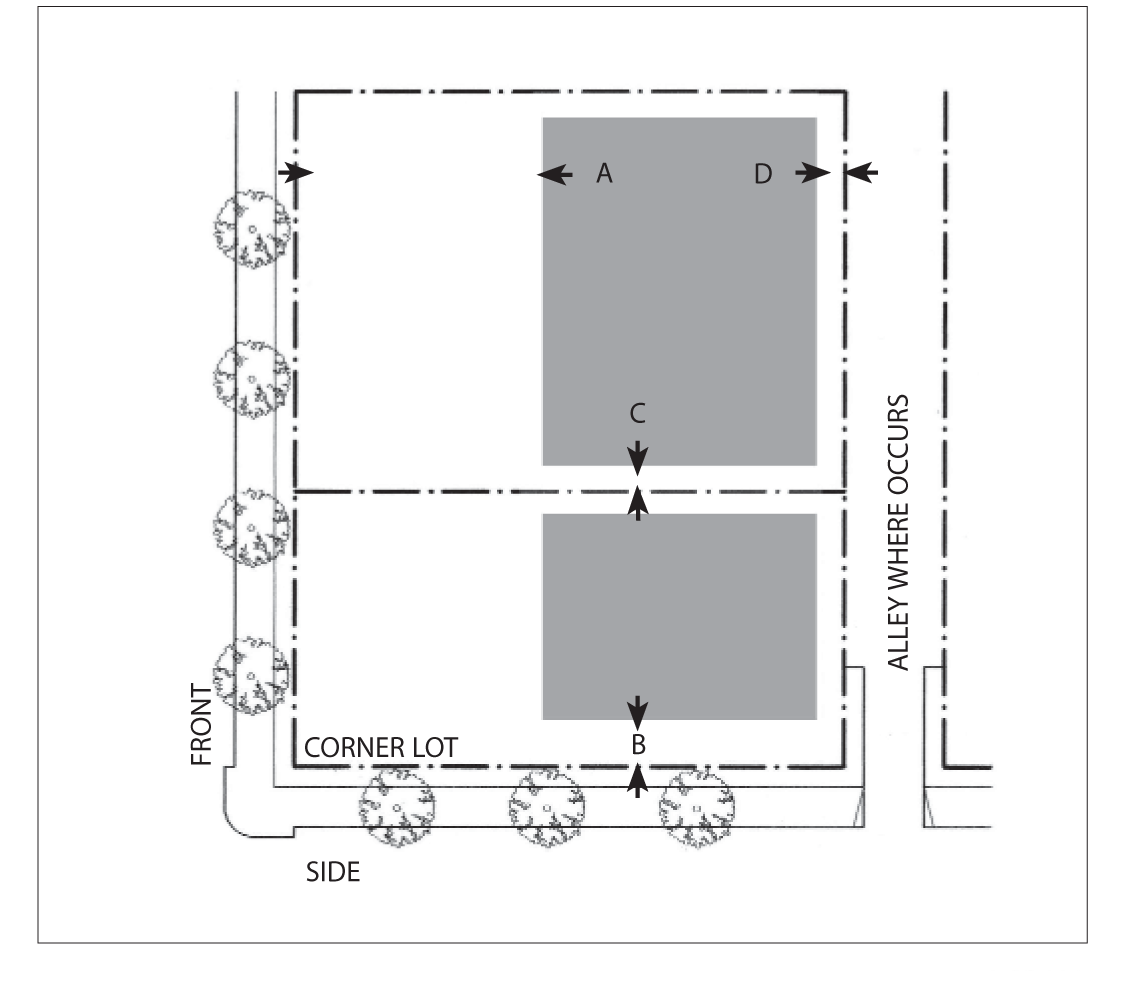
b.
Parking Placement.
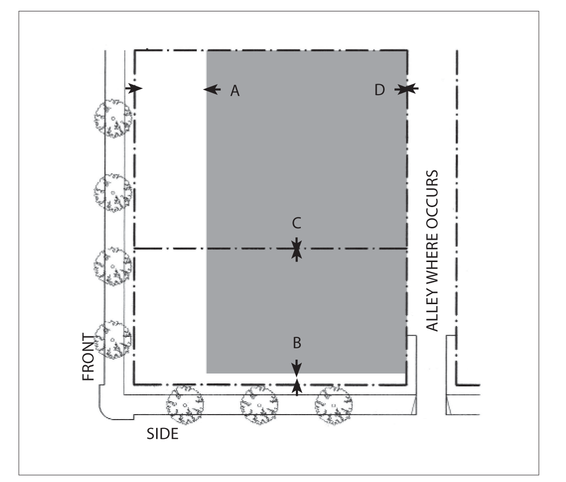
Plan Diagram
Parking not enclosed by a structure is allowed only in the shaded area as shown
(1)
Front setback: 40 percent lot depth minimum.
(2)
Side street setback: 10 feet minimum.
(3)
Side setback: Not required
(4)
Rear setback: Not required
Parking shall be provided according to Chapter 88.36
See Chapter 88.34 for definitions and design standards
c.
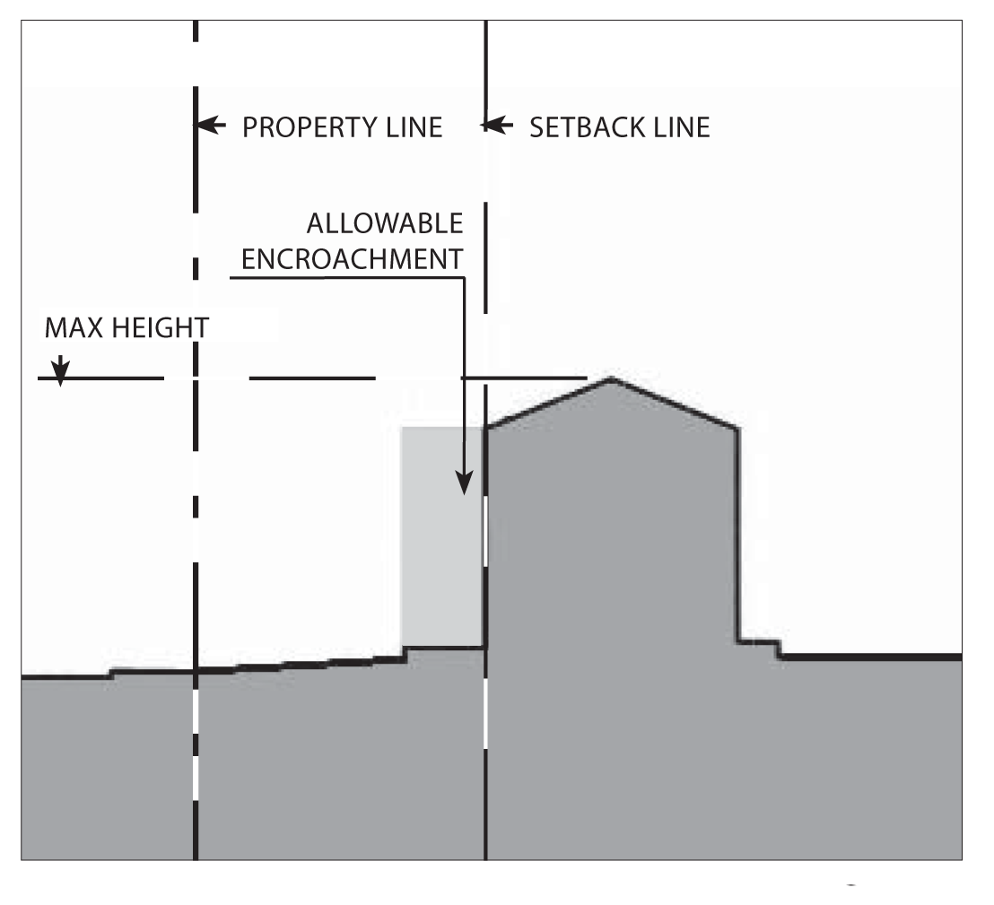
Building Height and Profile.
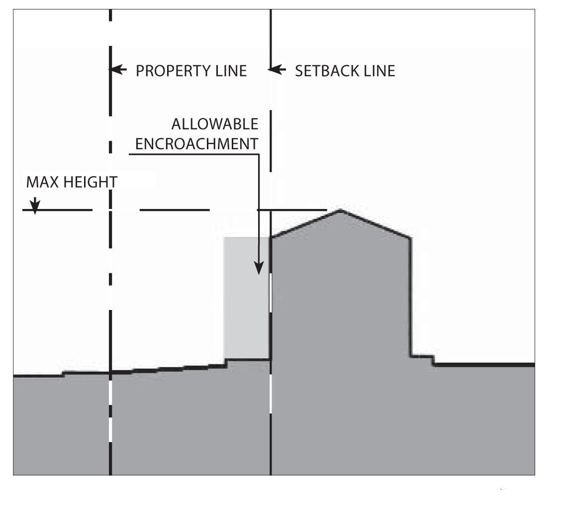
Section Diagram
(1)
Height
i.
Maximum: Three stories or 35 feet for single use buildings, which ever is less, three stories or 40 feet, whichever is less for mixed use buildings.
ii.
An area equal to 20 percent of the building's ground floor footprint may exceed the maximum height by an additional story or 15 feet.
See Chapter 88.30.040 for definitions and exceptions
(2)
Encroachments
Galleries, arcades, and awnings may encroach into the setback as shown in the above diagrams, but shall be limited to:
i.
Front encroachment: Five feet maximum.
ii.
Side Street encroachment: Five feet maximum.
iii.
Side encroachment: Five feet maximum.
iv.
Rear encroachment: Five feet maximum
v.
Maximum encroachment height is two stories or 30 feet.
vi.
Porches may encroach to within five feet of the front or side street property line.
(3)
Allowable frontage types.
Arcade, shopfront, stoop, forecourt
See Chapter 88.29 for definitions and design standards
d.
Residential Density Standards.
Each subdivision and residential development shall comply with the minimum parcel size and density requirements show in the above table, except that an allowed commercial condominium, or a residential condominium or townhouse, or other common interest project may be subdivided with smaller parcels for ownership purposes. In these cases, the minimum lot area shall be determined through subdivision review, provided that the overall development site complies with the minimum parcel size.
Notes:
(1)
Parcel depth shall be no less than the parcel width; and no more than three times the parcel width.
(2)
Net area. In a residential subdivision, corner lots and reversed corner lots shall have an area of at least ten percent greater than that of the minimum lot area required.
B.
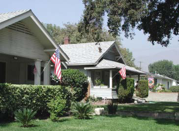
Neighborhood General 1: Traditional.
Typical bungalow with front porch
1.
Purpose.
The Neighborhood General 1 (NG1) zone is applied to areas of the city that are characterized by older neighborhoods of detached single-family homes along traditional streetscapes. The standards of the NG1 zone are intended to maintain and enhance existing neighborhood character. Three subcategories of the NG1 zone are provided by this Development Code (NG1-L, NG1-MED, and NG1-MOD) based on the low, medium, and moderate residential densities allowed in different areas by the general plan, and therefore allows multi-family housing, although the emphasis is on single-family dwellings.
Typical bungalow with front porch
2.
Desired Future and Proposed Changes.
"Traditional" neighborhoods are the pre-World War II subdivisions of the city. Because of the historic development of the city, this neighborhood type is located near downtown, principally to the north. Some of these neighborhoods have historic value, whereas others - owing to the smaller size of homes - are no longer economically viable. The general objectives for these areas to preserve and enhance the existing quality and character of the neighborhoods. Upgrades and renovations within "Traditional" neighborhoods should respect and reflect the historic character and styles of the neighborhood pattern.
A.
General Recommendations - Public Realm.
Typical Spanish-style house
(1)
Maintain existing street standards, and implement selected improvements. Improvements to be considered include:
i.
Plant street trees consistent with the street hierarchy suggested by the mobility element of the general plan, such that primary and secondary neighborhood streets are distinguished by a unique pattern and type(s) of tree. A palette of street trees should be developed in coordination with environmental goals of the general plan and city maintenance. Historic patterns of street trees that distinguish particular streets should be maintained.
ii.
Install and/or repair sidewalks. New sidewalks should be separated from the street by a planting strip.
Shaded and landscaped sidewalks
iii.
Install street lighting where necessary. The design of the light fixtures should be appropriate to the historic neighborhoods, and distinctive to Azusa.
(2)
Implement traffic calming measures. Measures to be considered include:
i.
narrowing of streets;
ii.
bulb-outs at intersections;
iii.
raised intersections;
iv.
medians; and
v.
traffic signals.
B.
General Recommendations - Private Property.
Buildings within "traditional" neighborhoods are generally distinguished by their historic architectural character. Maintenance and renovation of these houses should respect this unique quality and seek to enhance it.
(1)
Improve the public-private threshold at the sidewalk edge:
i.
Encourage the installation of higher quality fences. Replace chain-link fence with wrought-iron, wood or masonry fences or screen chain-link fencing with hedges and landscape.
ii.
Hedges, flowers and bushes planted in rows along the property edge in lieu of or to screen fences establishes the private domain of the front yard and creates a more pleasant street environment than fencing.
(2)
Ensure that maintenance of buildings respects their historic character:
i.
Encourage the use of period colors as buildings are repainted.
ii.
Encourage the use of historic building materials - such as wood siding, wood details/moldings, clay tile roofs, and real arroyo stone - in renovations and general maintenance.
iii.
Encourage the use of wood windows and doors as these are replaced.
3.
Design Standards - Neighborhood General 1 - Traditional.
a.
Building Placement.
Plan Diagram
Buildings shall be placed within the shaded area as shown.
(1)
Front Setback: 20 feet minimum.
(2)
Side Street Setback: Ten feet minimum.
(3)
Sideyard Setback: Five feet minimum.
(4)
Rear Setback: 20 feet minimum.
See Chapter 88.31.060 for definitions and design standards.
b.
Parking Placement.
Plan Diagram
Garages and parking accommodations other than driveways are allowed only in the shaded area as shown.
(1)
Front setback: 15 feet minimum behind front facade of primary structure.
(2)
Side street setback: Five [feet] minimum (unless driveway exits to street, then 18 [feet] minimum with sectional garage door, or 20 feet with non-sectional garage door).
(3)
Side setback: Five feet minimum for the first 75 feet of lot depth; three feet minimum for detached garages when setback more than 75 feet from the front property line.
(4)
Rear setback: Five feet min with alley; three feet min no alley.
Parking shall be provided according to Chapter 88.36
See Chapter 88.34 for definitions and design standards
c.
Building Height and Profile.
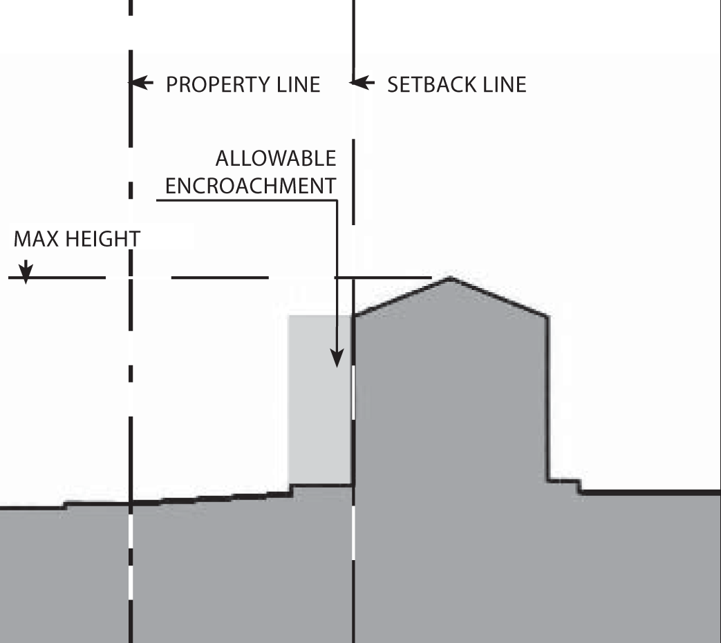
Section Diagram
(1)
Height: Maximum: Two and one-half stories or 35 feet, whichever is less.
(2)
Encroachments.
Porches, patios, cantilevered bay windows, and balconies may encroach into the setback, but shall be limited to:
i.
Front encroachment: Eight feet maximum.
ii.
Side Street encroachment: Five feet maximum.
iii.
Side encroachment: Two feet maximum.
iv.
Rear encroachment: Five feet maximum.
v.
Maximum encroachment height: Two stories or 24 feet.
See Chapter 88.30.040 for definitions and exceptions
(3)
Allowable frontage types.
Stoop, porch, common yard.
See Chapter 88.29 for definitions and design standards
d.
Residential Density Standards.
Each subdivision and residential development shall comply with the minimum parcel size and density requirements show in the above table, except that an allowed commercial condominium, or a residential condominium or townhouse, or other common interest project may be subdivided with smaller parcels for ownership purposes. In these cases, the minimum lot area shall be determined through subdivision review, provided that the overall development site complies with the minimum parcel size.
Notes:
(1)
Parcel depth shall be no less than the parcel width; and no more than three times the parcel width.
(2)
Net area. In a residential subdivision, corner lots and reversed corner lots shall have an area of at least ten percent greater than that of the minimum lot area required.
(3)
Subdivisions shall be designed so that all lots or parcels shall have adequate street frontage, as determined by the review authority, for direct access to a public or private street improved to city standards.
C.
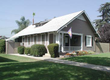
Neighborhood General 2 - Transitional.
Typical bungalow
1.
Purpose.
The Neighborhood General 2 (NG2) zone is applied to areas of the city that are characterized by housing developed after 1945, where the general plan anticipates neighborhood character evolving over time to provide a more diverse mixture of housing types. Three subcategories of the NG2 zone are provided by this Development Code (NG2-L, NG2-MED, and NG2-MOD) based on the low, medium, and moderate residential densities allowed in different areas by the general plan, and therefore allows multi-family housing, although the emphasis is on single-family dwellings.
2.
Desired Future and Proposed Changes.
Typical bungalow
Special attention is given to the "transitional" neighborhoods to restore stability and reinforce neighborhood character and pride. "Transitional" neighborhoods are generally those built shortly after World War Two, but before extensive subdivision and tract housing production typical since the 1960s. Houses in these neighborhoods are typically one story, and smaller than average and of more modest construction than other homes in Azusa. Consequently, some of these neighborhoods have been affected by dissimilar development, poor maintenance and rapid turn-over. However, the structure of the "transitional" neighborhoods and houses allows them to easily adapt the physical characteristics of "traditional" neighborhoods - garages located to the back of lots, front porches facing the sidewalk, street-friendly front facades. The Development Code is designed to encourage the reinvestment of these neighborhoods through traditional elements like porches, sidewalks, parkways, street trees and neighborhood centers.
Typical bungalow
a.
General Recommendations - Public Realm.
(1)
Improve street standards, and implement selected improvements. Improvements to be considered include:
i.
Plant street trees consistent with the street hierarchy suggested by the mobility element of the general plan, such that primary and secondary neighborhood streets are distinguished by a unique pattern and type(s) of tree. A palette of street trees should be developed in coordination with environmental goals of the general plan and city maintenance. Historic tree patterns that distinguish particular streets should be maintained.
ii.
Install and/or repair sidewalks. New sidewalks should be separated from the street by a planting strip.
iii.
Install street lighting where necessary. The design of the light fixtures should be distinctive to Azusa.
(2)
Implement traffic calming measures. Measures to be considered include:
i.
narrowing of streets;
ii.
bulb-outs at intersections;
iii.
raised intersections;
iv.
medians; and
v.
traffic signals.
b.
General Recommendations - Private Property.
Buildings within "transitional" neighborhoods are typically modest houses of modest construction. However, in terms of the location of garages, front doors, and public rooms, these houses are similar to "traditional" neighborhoods. As such, improvements to these houses should appropriate elements of "traditional" homes as much as possible.
(1)
Improve the public-private threshold at the sidewalk edge:
i.
Encourage the installation of higher quality fences. Replace chain-link fence with wrought-iron, wood or masonry fences or screen chain-link fencing with hedges and landscape.
ii.
Hedges, flowers and bushes planted in rows along the property edge in lieu of or to screen fences establishes the private domain of the front yard and creates a more pleasant street environment than fencing.
iii.
Do not encourage the use of front yard fences where they do not currently exist.
(2)
Ensure that maintenance of buildings enhances the neighborhood character:
i.
Encourage the use of period colors as buildings are repainted.
ii.
Encourage the use of historic building materials - such as wood siding, wood details/moldings, clay tile roofs, and real arroyo stone - in renovations and general maintenance.
iii.
Encourage the use of wood windows and doors as these are replaced.
(3)
Add "Traditional" elements to renovated/enlarged houses:
i.
Locate garages towards the back of the lot.
ii.
Add front porches.
iii.
Encourage the use of wood windows and doors.
3.
Design Standards - Neighborhood General 2 - Transitional.
a.
Building Placement.
Plan Diagram
Buildings shall be placed within the shaded area as shown.
(1)
Front Setback: 25 feet minimum.
(2)
Side Street Setback: Ten feet minimum.
(3)
Sideyard Setback: Five feet minimum.
(4)
Rear Setback: 25 feet minimum.
See Chapter 88.30.060 for definitions and design standards.
b.
Parking Placement.
Plan Diagram
Garages and parking accommodations other than driveways are allowed only in the shaded area as shown.
(1)
Front setback: Ten feet minimum behind front facade of primary structure.
(2)
Side street setback: Five [feet] minimum (unless driveway exits to street, then 18 [feet] minimum with sectional garage door, or 20 feet with non-sectional garage door).
(3)
Side setback: Five feet minimum for the first 75 feet of lot depth; three feet minimum for detached garages when setback more than 75 feet from the front property line.
(4)
Rear setback: Five feet minimum with alley; three feet minimum no alley.
Parking shall be provided according to Chapter 88.36
See Chapter 88.34 for definitions and design standards
c.
Building Height and Profile.
Section Diagram
(1)
Height: Maximum: Two and one-half stories or 35 feet, which ever is less.
(2)
Encroachments.
Porches, patios, cantilevered bay windows, and balconies may encroach into the setback, but shall be limited to:
i.
Front encroachment: Eight feet maximum.
ii.
Side Street encroachment: Five feet maximum.
iii.
Side encroachment: Two feet maximum.
iv.
Rear encroachment: Five feet maximum.
v.
Maximum encroachment height: Two stories or 24 feet.
See Chapter 88.30.040 for definitions and exceptions
(3)
Allowable frontage types.
Stoop, porch, common yard.
See Chapter 88.29 for definitions and design standards
d.
Residential Density Standards.
Each subdivision and residential development shall comply with the minimum parcel size and density requirements show in the above table, except that an allowed commercial condominium, or a residential condominium or townhouse, or other common interest project may be subdivided with smaller parcels for ownership purposes. In these cases, the minimum lot area shall be determined through subdivision review, provided that the overall development site complies with the minimum parcel size.
Notes:
(1)
Parcel depth shall be no less than the parcel width; and no more than three times the parcel width.
(2)
Net area. In a residential subdivision, corner lots and reversed corner lots shall have an area of at least ten percent greater than that of the minimum lot area required.
(3)
Subdivisions shall be designed so that all lots or parcels shall have adequate street frontage, as determined by the review authority, for direct access to a public or private street improved to city standards.
D.
Neighborhood General 3 - Tract.
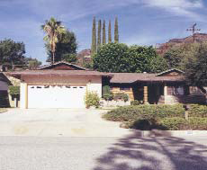
Typical ranch house with forward garage
1.
Purpose.
The Neighborhood General 3 (NG3) zone is applied to areas of the city that are characterized by neighborhoods of detached single-family homes primarily developed after 1960, and where the general plan anticipates maintaining and enhancing the existing character without significant changes to existing form. Three subcategories of the NG3 zone are provided by this Development Code (NG3-L, NG3-MED, and NG3-MOD) based on the low, medium, and moderate residential densities allowed in different areas by the general plan, and therefore allows multi-family housing, although the emphasis is on single-family dwellings.
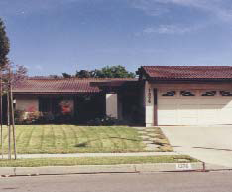
Typical ranch house with forward garage
2.
Desired Future and Proposed Changes.
The "tract" neighborhoods are mainly those residential areas built from the 1960s onward. The front facade and street appearance of houses in these neighborhoods is generally dominated by garage doors. The plan seeks to enhance these neighborhoods by adding traditional elements like porches, sidewalks, parkways, street trees and neighborhood centers.
a.
General Recommendations - Public Realm.
(1)
Improve street standards, and implement selected improvements. Improvements to be considered include:
i.
Plant street trees consistent with the street hierarchy suggested by the mobility element of the general plan, such that primary and secondary neighborhood streets are distinguished by a unique pattern and type(s) of tree. A palette of street trees should be developed in coordination with environmental goals of the general plan and city maintenance. Historic tree patterns that distinguish particular streets should be maintained.
Typical two-story house
ii.
Install and/or repair sidewalks. New sidewalks should be separated from the street by a planting strip.
iii.
Install street lighting where necessary. The design of the light fixtures should be distinctive to Azusa.
(2)
Implement traffic calming measures. Measures to be considered include:
i.
narrowing of streets;
New tract houses (Azusa Ridge)
ii.
bulb-outs at intersections;
iii.
raised intersections;
iv.
medians; and
v.
traffic signals.
b.
General Recommendations - Private Property.
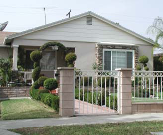
Buildings within "tract" neighborhoods are typically houses or condominiums from the post-war period of suburban expansion of Southern California. Older homes tend to be one-story ranch houses on wide lots; newer homes tend to be two-story structures on narrower lots. The exterior finish of most homes tend to be predominately stucco, with some details in stone, brick and/or wood. Many of the residences built in the last 20 years are located within planned-unit developments, and have architectural or planning features that are unique and specific to that development.
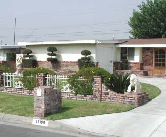
Quality front yard fencing and landscape
(1)
Improve the public-private threshold at the sidewalk edge:
i.
Encourage the installation of higher quality fences. Replace chain-link fence with wrought-iron, wood or masonry fences or screen chain-link fencing with hedges and landscape.
ii.
Hedges, flowers and bushes planted in rows along the property edge in lieu of or to screen fences establishes the private domain of the front yard and creates a more pleasant street environment than fencing.
(2)
Improve the private landscape:
i.
Lawn sculpture such as fountains, garden art, or decorative and enhanced mailboxes establish a unique character to each house and signifies the resident's pride and care.
Quality front yard fencing and landscape
ii.
Topiary and other unique landscape patterns in the front yard indicate resident's pride and care in their property and establish a unique character to each house.
(3)
Where possible, add "traditional" elements to renovated/enlarged houses:
i.
Locate garages towards the back of the lot.
ii.
Add front porches.
iii.
Encourage the use of wood windows and doors.
Plan Diagram
3.
Design Standards - Neighborhood General 3 - Tract.
a.
Building Placement.
Buildings shall be placed within the shaded area as shown.
(1)
Front Setback: 25 feet minimum.
(2)
Side Street Setback: Ten feet minimum.
(3)
Sideyard Setback: Five feet minimum.
(4)
Rear Setback: 25 feet minimum.
See Chapter 88.31.060 for definitions and design standards.
b.
Parking Placement.
Plan Diagram
Garages and parking accommodations other than driveways are allowed only in the shaded area as shown.
(1)
Front setback: 25 feet minimum.
(2)
Side street setback: five [feet] minimum (unless driveway exits to street, then 18 [feet] minimum with sectional garage door, or 20 feet with non-sectional garage door).
(3)
Side setback: Five feet minimum for the first 75 feet of lot depth; three feet minimum for detached garages when setback more than 75 feet from the front property line.
(4)
Rear setback: Five feet minimum with alley; three feet minimum no alley.
Parking shall be provided according to Chapter 88.36
See Chapter 88.34 for definitions and design standards
c.
Building Height and Profile.
Section Diagram
(1)
Height: Maximum: Two and one-half stories or 35 feet, which ever is less.
(2)
Encroachments.
Porches, patios, cantilevered bay windows, and balconies may encroach into the setback, but shall be limited to:
i.
Front encroachment: Eight feet maximum.
ii.
Side Street encroachment: Five feet maximum.
iii.
Side encroachment: Two feet maximum.
iv.
Rear encroachment: Five feet maximum.
v.
Maximum encroachment height: Two stories or 24 feet.
See Chapter 88.30.040 for definitions and exceptions
(3)
Allowable frontage types.
Stoop, porch, common yard.
See Chapter 88.29 for definitions and design standards
d.
Residential Density Standards.
Each subdivision and residential development shall comply with the minimum parcel size and density requirements show in the above table, except that an allowed commercial condominium, or a residential condominium or townhouse, or other common interest project may be subdivided with smaller parcels for ownership purposes. In these cases, the minimum lot area shall be determined through subdivision review, provided that the overall development site complies with the minimum parcel size.
Notes:
(1)
Parcel depth shall be no less than the parcel width; and no more than three times the parcel width.
(2)
Net area. In a residential subdivision, corner lots and reversed corner lots shall have an area of at least ten percent greater than that of the minimum lot area required.
(3)
Subdivisions shall be designed so that all lots or parcels shall have adequate street frontage, as determined by the review authority, for direct access to a public or private street improved to city standards.
(Ord. No. 06-O6, § 1B, 8-7-06; Ord. No. 2020-02, § 3, 2-3-20)
88.24.005. - Allowable Uses in Districts.
A.
Permit Requirements. Tables 2-2, 2-3, and 2-4 provide for land uses that are:
1.
Permitted subject to compliance with all applicable provisions of this Development Code, subject to first obtaining a zoning clearance (Section 5.22.020). These are shown as "P" uses in the tables;
2.
Allowed subject to the approval of a minor use permit (Section 5.12.050), and shown as "MUP" uses in the tables;
3.
Allowed subject to the approval of a use permit (Section 5.12.050), and shown as "UP" uses in the tables;
4.
Allowed subject to the type of city approval required by a specific provision of Chapter 4.12 (Standards for Specific Land Uses), and shown as "S" uses in the tables; and
5.
Not allowed in particular zones, and shown as a "—" in the tables.
6.
For sub-districts located within the TOD Specific Plan District, (DG, DD, DX, DR, DT, and DC) refer to Chapter 2 of the City of Azusa TOD Specific Plan for allowable uses.
Key to Zone Symbols
;sz=8q; Notes:
(1)
A definition of each listed use type is in Article 7 (Glossary).
(2)
Allowed on a second or upper floor only.
(3)
This is a critical, sensitive, or high occupancy facility, subject to the hazard mitigation requirements of Section 88.30.030.
(4)
Allowed only in the area designated "recreation/landfill mixed use" by the general plan.
(5)
Allowed only in the area designated "hotel/conference center" by the general plan.
(6)
Allowed only within the boundaries of an electric utility easement for high voltage transmission lines.
;sz=8q; Key to Zone Symbols
;sz=8q; Notes:
(1)
A definition of each listed use type is in Article 6 (Glossary).
(2)
Allowed on a second or upper floor only.
(3)
This is a critical, sensitive, or high occupancy facility, subject to the hazard mitigation requirements of Section 88.30.030.
(4)
Allowed only in the area designated "recreation/landfill mixed use" by the general plan.
(5)
Allowed only in the area designated "hotel/conference center" by the general plan.
(6)
Allowed on a second or upper floor only, except for uses existing on March 25, 2005, which shall be considered conforming uses.
(7)
No new uses allowed, use existing on March 25, 2005 shall be considered conforming uses.
;sz=8q; Key to Zone Symbols
;sz=8q; Notes:
(1)
A definition of each listed use type is in Article 6 (Glossary).
(2)
Office—Processing permitted on a second or upper floor only
(2*)
Office—Professional permitted; except for on Azusa Avenue and San Gabriel Avenue where it is allowed on a second or upper floor only.
(3)
This is a critical, sensitive, or high occupancy facility, subject to the hazard mitigation requirements of Section 88.30.030.
(4)
Allowed only in the area designated "recreation/landfill mixed use" by the general plan.
(5)
Allowed only in the area designated "hotel/conference center" by the general plan.
(6)
Allowed on second or upper floor only, except for uses existing on March 25, 2005, which shall be considered conforming uses.
;sz=8q; Key to Zone Symbols
;sz=8q; Notes:
(1)
A definition of each listed use type is in Article 6 (Glossary).
(2)
Allowed on a second or upper floor only.
(3)
This is a critical, sensitive, or high occupancy facility, subject to the hazard mitigation requirements of Section 88.30.030.
(4)
Allowed only in the area designated "recreation/landfill mixed use" by the general plan.
(5)
Allowed only in the area designated "hotel/conference center" by the general plan.
(6)
Allowed on a second or upper floor only, except for uses existing on March 25, 2005, which shall be considered conforming uses.
(7)
No new uses allowed, use existing on March 25, 2005 shall be considered conforming uses.
(8)
Facilities shall be designated so that no service bays are visible from Foothill Boulevard.
;sz=8q; Key to Zone Symbols
;sz=8q; Notes:
(1)
A definition of each listed use type is in Article 6 (Glossary).
(2)
Allowed on a second or upper floor only.
(3)
This is a critical, sensitive, or high occupancy facility, subject to the hazard mitigation requirements of Section 88.30.030.
;sz=8q; Key to Zone Symbols
;sz=8q; Notes:
(1)
A definition of each listed use type is in Article 6 (Glossary).
(2)
Allowed on a second or upper floor only.
(3)
This is a critical, sensitive, or high occupancy facility, subject to the hazard mitigation requirements of Section 88.30.030.
;sz=8q; Key to Zone Symbols
;sz=8q; Notes:
(1)
A definition of each listed use type is in Article 6 (Glossary).
(2)
Allowed on a second or upper floor only.
(3)
This is a critical, sensitive, or high occupancy facility, subject to the hazard mitigation requirements of Section 88.30.030.
;sz=8q; Key to Zone Symbols
;sz=8q; Notes:
(1)
A definition of each listed use type is in Article 6 (Glossary).
(2)
Allowed on a second or upper floor only.
(3)
This is a critical, sensitive, or high occupancy facility, subject to the hazard mitigation requirements of Section 88.30.030.
(Ord. No. 06-O6, § 1B, 8-7-06; Ord. No. 07-O6, § 1, 6-18-07; Ord. No. 10-O1, §§ 2, 3, 3-1-10; Ord. No. 11-O3, § 2, 4-18-11; Ord. No. 11-O4, § 2, 4-18-11; Ord. No. 11-O13, § 4(Exh. A), 7-18-11; Ord. No. 11-O16, § 2, 10-24-11; Ord. No. 14-O4, § 2, 7-21-14; Ord. No. 2017-03, § 4, 6-19-17; Ord. No. 2017-05, § 4, 7-17-17; Ord. No. 2020-02, § 3, 2-3-20; Ord. No. 2021-01, § 3, 2-1-21; Ord. No. 2023-04, § 3(Exh. A), 10-2-23)
88.24.010. - Reserved.
Editor's note— Ord. No. 2017-05, § 4, adopted July 17, 2017, repealed § 88.24.010, which pertained to Downtown and derived from Ord. No. 06-O6, § 1B, adopted Aug. 7, 2006.
88.24.020. - University District.
The purpose of this chapter is to outline the general plan goals and development guidelines within the University District of Azusa. It is a guideline to assist present and future developers, city staff, and citizens in evaluating the evolving character and potential of the University District.
A.
Purpose. The University District (DU) is applied to the campus of Azusa Pacific University and the retail and residential areas surrounding the campus, with its central focus the intersection of Citrus and Alosta Avenues. The zone is intended to provide for housing and supporting retail for the student population as well as the larger community, in a pedestrian-oriented setting, while linking with Citrus College.
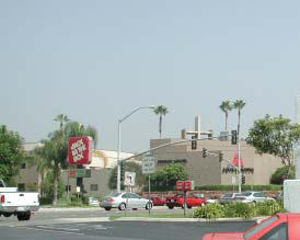
Existing gateway to APU
B.
Location and Existing Conditions.
Streets and Landscape: Foothill Boulevard/Alosta Avenue is the dominant street within the district. Several trees along the boulevard have either died or been removed over the years. The north-south streets in the district are Cerritos, Rockvale, Citrus and Barranca Avenues, and Palm Drive. Most other streets within this district are private drives and lack any significant public landscape, other than the beautiful tree lined Palm Drive. Many of the streets at the edge of this district dead-end and are inaccessible to the district itself. This has caused the creation of very large blocks that have no discernable circulation pattern through them.
Civic and Commercial Features: The University and surrounding district is a cultural, educational, social, economic and entertainment node of the city. On the APU Campus are athletic and event centers, the University bookstore, the graduate library, an auditorium, and of course meeting spaces, offices, classroom facilities and student housing. The district also includes the former, vacant Edwards drive-in theater and an adjacent site that APU has converted to soccer and softball facilities and surface parking. Foothill Boulevard/Alosta Avenue is lined with strip retail uses located behind parking lots, two-story office uses, and drive-through restaurants. The Lindley-Scott house and banquet facilities are also within the University District.
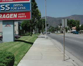
Existing Citrus Ave streetscape
Building Fabric: The building fabric of the district is predominantly one- and two-story, commercial buildings, one-story single-family residential, and one- and two-story multi-family apartments and condominium developments. The multi-family housing buildings are typically double-loaded corridor developments (with units on both sides of the corridor) with detached garages set behind and/or in front of the housing. The University housing and academic buildings are one to four stories, and located within the campus.
C.
Desired Future and Proposed Changes. The University District is based on the assumption that the APU campus and its immediate vicinity can coalesce into a town-gown precinct that transcends the current incompleteness of the campus and the strip commercial character of all the surrounding retail activities. Citrus Avenue will become the principal focus of activity in the district, as it connects the neighborhoods to the south with retail and mixed-use uses near the intersection of Alosta Avenue (at the Foothill Center site), northward to APU campus and the proposed Gold Line stop and neighborhood center at the proposed Monrovia Nursery development. The seamless connection of districts with surrounding neighborhoods is a sign of maturity and quality in a district, and should be expected of a university district, in particular.
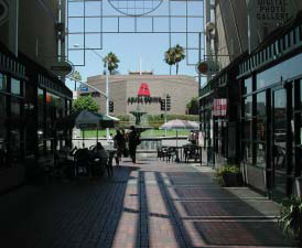
Proposed gateway to APU
The development of the APU campus and student housing within the University District presents distinct planning challenges and opportunities which do not lend themselves to regulation in the same manner as other uses within the University District. Accordingly, it is the intention of the city to adopt a specific plan for the Azusa Pacific University which will supersede the development regulations contained in Articles 2 through 4 of this Development Code for those development regulations discussed in the specific plan and will control all development of the Azusa Pacific University property within the area covered by the specific plan.
1.
Specific Recommendations.
a.
Realign the intersection of Foothill Boulevard, Alosta Avenue, and Rockvale Avenue to promote vehicular and pedestrian safety.
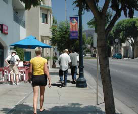
Proposed Citrus Ave streetscape
b.
Connect Citrus Avenues, Palm Drive and 9th Street with future development at Monrovia Nursery.
c.
Explore connections at Fenmore Avenue with future development at Foothill Center (also see Central East Neighborhoods)
d.
Promote pedestrian-oriented, mixed-use development at Foothill Center.
e.
Future Gold Line light rail stop.
f.
Install landscape medians and parkways on Citrus Avenue, and work with APU to establish regular, safe pedestrian crossings.
g.
Enhance the pedestrian nature of the Citrus/Alosta Avenue intersection with improved and safe street crossings.
h.
Install landscaped medians and parkways on Foothill Boulevard and Alosta Avenue, consistent with the TOD Specific Plan.
i.
Create a gateway monument or landscape at the Alosta/Barranca Avenue intersection to mark the eastern entry of the city.
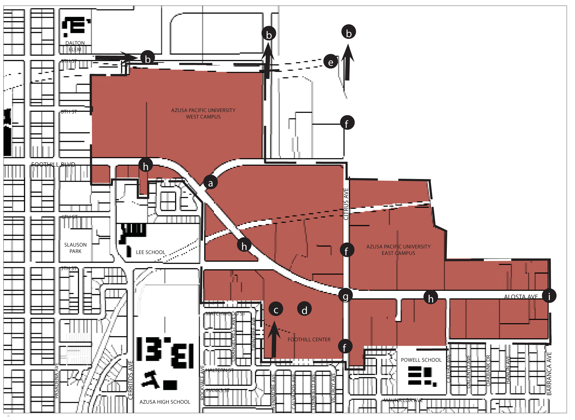
District Plan
2.
General Recommendations.
a.
Establish a unique signage/banner/landscape program for the University District, similar to the existing program downtown. This program should address the gateways to the district.
b.
Establish a shared parking program for the district.
3.
Requirements.
a.
Promote the creation (and restoration) of neon signage along historic Route 66 (Foothill Boulevard and Alosta Avenue).
(1)
Require installation of neon tube/LED freestanding/monument and wall signage on parcels fronting onto Route 66, as outlined in the Route 66 Themed Signage section on Page 2-59 of the TOD Specific Plan.
D.
Site Planning and Building Design.
1.
Building Placement.
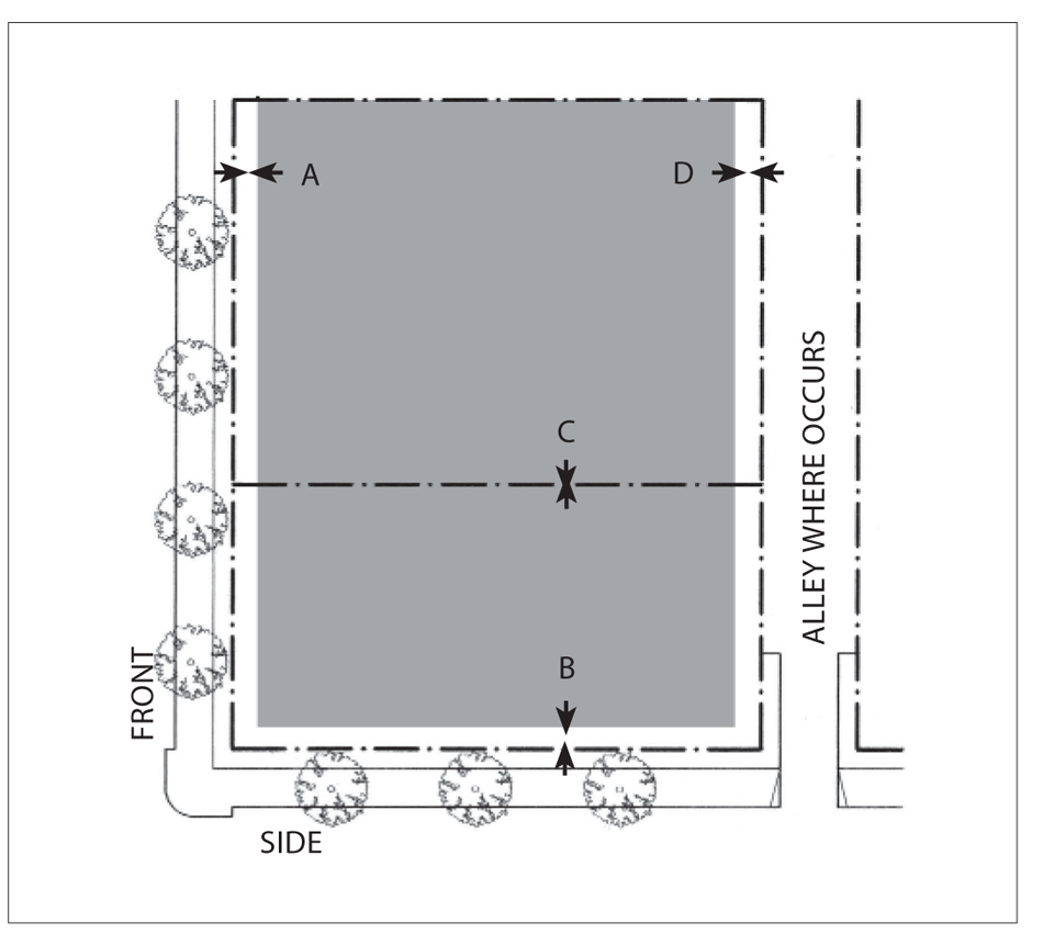
Plan Diagram
Buildings shall be placed within the shaded area as shown in the above diagram.
a.
Front Setback: Five feet minimum for shopfronts and arcades; ten feet minimum for other frontage types; 20 feet maximum for 75 percent minimum of lot frontage.
b.
Side Street Setback: Ten feet minimum; 20 feet maximum for 75 percent minimum of lot frontage.
c.
Sideyard Setback: Zero feet; 15 feet minimum for residential.
d.
Rear Setback: Zero feet; 15 feet minimum for residential.
See Chapter 88.30.060 for definitions and design standards.
Notes:
The percentage of building frontage for front and side street setbacks may be reduced
by the review authority to accommodate pedestrian plazas located between the street(s)
and the building.
2.
Parking Placement.

Plan Diagram
Parking is allowed off-site in park once districts.
Parking not enclosed by a structure is allowed only in the shaded area as shown.
a.
Front Setback: 40 percent of lot depth minimum.
b.
Side Street Setback: Ten feet minimum.
c.
Side Setback: Not required.
d.
Rear Setback: Not required.
Parking shall be provided according to Chapter 88.36
See Chapter 88.34 for definitions and design standards
3.
Building Height and Profile.
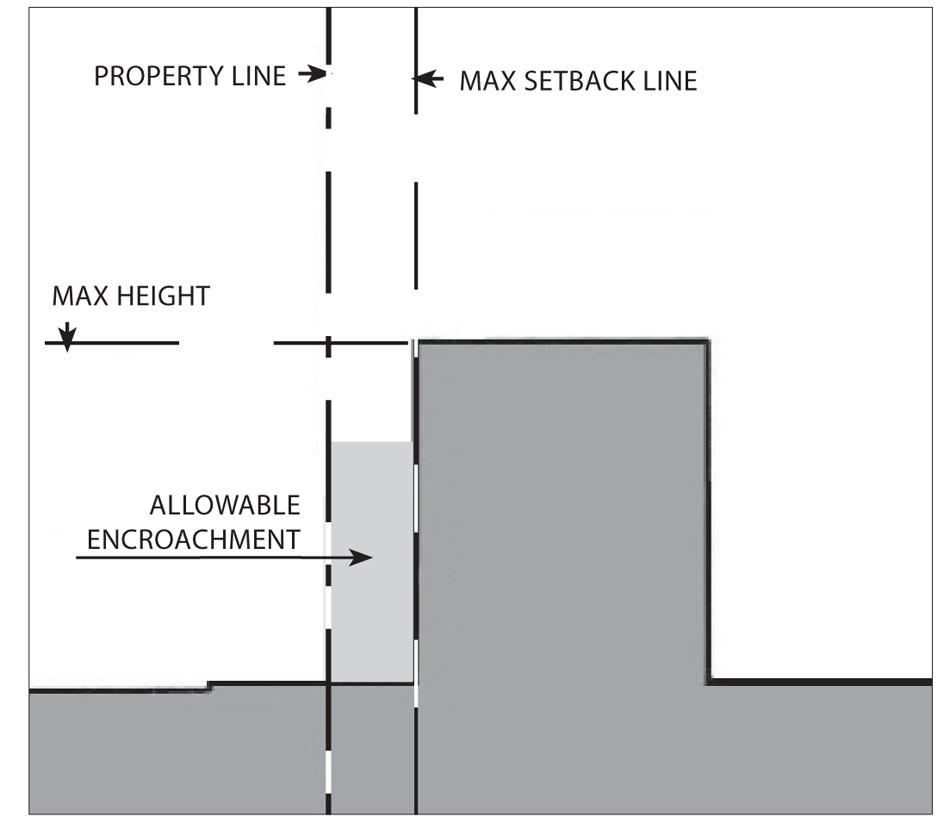
Section Diagram
a.
Height.
(1)
Maximum: Three stories or 35 feet, whichever is less for single use buildings; three stories or 40 feet, whichever is less for mixed-use buildings.
(2)
Exceptions: An area equal to 20 percent of the building's ground floor footprint may exceed the maximum height by an additional story or 15 feet, whichever is less.
b.
Encroachments.
Gallery/arcades, awnings, balconies, porches, patios, and outside dining furniture may encroach into the setback and public right-of-way, and shall be limited to:
(1)
Front encroachment: Ten feet maximum.
(2)
Side Street encroachment: Ten feet maximum.
(3)
Side encroachment: Two feet maximum.
(4)
Rear encroachment: Five feet maximum
(5)
Maximum encroachment height is two stories.
(6)
Porches may encroach to within five feet of the front or side street property line.
See Chapter 88.30.040 for definitions and exceptions
c.
Allowable frontage types.
Arcade, shopfront, forecourt, stoop, porch.
See Chapter 88.29 for definitions and design standards
4.
Parcel and Residential Density Standards.
Each subdivision and residential development shall comply with the minimum parcel size and density requirements show in the above table, except that an allowed commercial condominium, or a residential condominium or townhouse, or other common interest project may be subdivided with smaller parcels for ownership purposes. In these cases, the minimum lot area shall be determined through subdivision review, provided that the overall development site complies with the minimum parcel size.
Notes:
(1)
Parcel depth shall be no less than the parcel width; and no more than three times the parcel width.
(2)
Net area. In a residential subdivision, corner lots and reversed corner lots shall have an area of at least ten percent greater than that of the minimum lot area required.
(Ord. No. 06-O6, § 1B, 8-7-06; Ord. No. 2017-05, § 4, 7-17-17; Ord. No. 2020-02, § 3, 2-3-20)
88.24.030. - Edgewood District.
The purpose of this chapter is to outline the general plan goals and development guidelines within the Edgewood District of Azusa. It is a guideline to assist present and future developers, city staff, and citizens in evaluating the evolving character and potential of the Edgewood District.
A.
Purpose. The Edgewood District (DE) is applied to existing commercially developed properties adjacent to the intersection of South Azusa Avenue and Gladstone Street, which collectively serve as the commercial center for the southern half of the city. The standards for this zone are intended to, over time, result in a more pedestrian oriented district, with stronger relationships between buildings, the sidewalks and abutting streets. The land use standards for the zone anticipate an emphasis on commercial development, with upper floor mixed use components.
B.
Location and Existing Conditions.
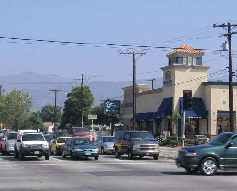
Edgewood District
Streets and Landscape. South Azusa Avenue and Gladstone Street are the only streets in the district. Both are wide arterials with little landscaping.
Civic and Commercial Features. Edgewood District is defined by commercial uses. A private elementary school is also located within the district, on west side of South Azusa Avenue, just north of Gladstone Street.
Building Fabric. Most of the buildings in Edgewood District are strip malls with street-facing parking lots. The Edgewood Center, at the northeast corner of South Azusa and Gladstone, is a particularly long strip mall — more than 1,000 feet in length. A recent addition to this strip mall complex, the Sketchers store at the intersection, represent a more desirable building placement and design for this district.
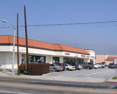
Edgewood District
C.
Desired Future and Proposed Changes. Although currently a collection of conventional suburban strip malls, the city foresees a pedestrian-oriented "village center" at this intersection. Two and three-story mixed-use buildings will define the architecture of this district. The ground level of these buildings will be "sidewalk friendly", with ample storefronts for retail functions. Lofts for commercial offices, apartments and condos will be located on the upper levels of buildings. Some rowhouses will be allowed in the district as well. Streets and sidewalks will be orientated towards the pedestrian. It is anticipated that this transformation is not likely to happen incrementally, but will probably occur upon a comprehensive redevelopment of the Edgewood Center shopping mall.
1.
Specific Recommendations.
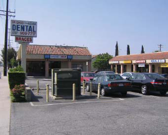
Edgewood District
a.
Create pedestrian-friendly crossings at the intersection of Azusa Avenue and Gladstone Street. Promote significant commercial or mixed-use buildings at each corner of the intersection to establish a create a "sense of place" at this principle intersection.
b.
Promote pedestrian connections such as paseos, courtyards and other passageways at Russell Street between the district and the adjacent neighborhoods.
c.
Landscape flood control washes and canals. Work with the appropriate flood control agencies to access canal rights-of-way as recreational corridors, such as bikepaths.
Buildings appropriate for corner sites
d.
Consider creating pedestrian friendly crossings from the senior center to the Edgewood Shopping Center across Azusa Avenue.
e.
Promote sidewalks located near the street in the Edgewood Center.
2.
General Recommendations.
a.
Establish a unique signage/banner/landscape program for the Edgewood District, similar to the existing program downtown. This program should address the gateways to the district.
b.
Establish a shared parking program for the District.
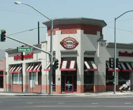
Building appropriate for corner sites
Regulating Plan (at time of adoption)
D.
Site Planning and Building Design.
1.
Building Placement.
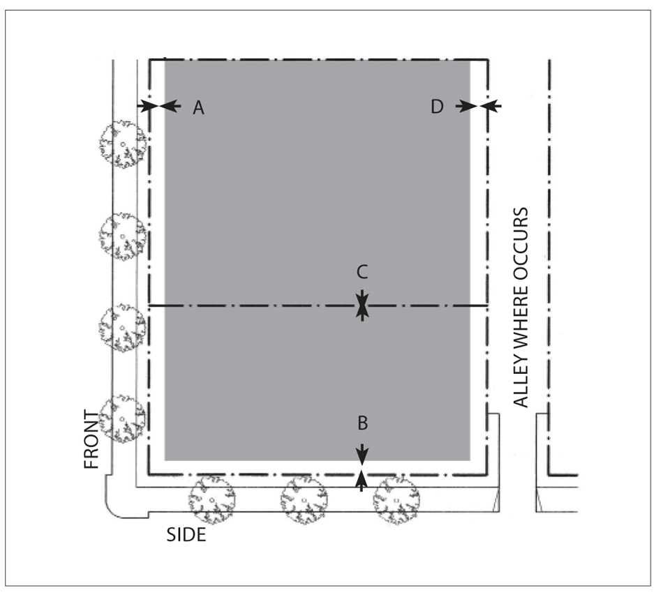
Plan Diagram
Buildings shall be placed within the shaded area as shown in the above diagram.
a.
Front Setback:
(1)
within 150 feet of Azusa/Gladstone intersection: five feet minimum for shopfronts and arcades; 10 feet minimum for other frontage types; 20 feet maximum for 75 percent minimum of lot frontage.
(2)
elsewhere: Five feet minimum for shopfronts and arcades; ten feet minimum for other lot width types.
b.
Side Street Setback:
(1)
within 150 feet of Azusa/Gladstone intersection: five feet minimum for shopfronts and arcades; ten feet minimum for other frontage types; 20 feet maximum for 75 percent minimum of lot frontage.
(2)
elsewhere: Ten feet minimum; 20 feet maximum for 75 percent minimum of lot frontage.
c.
Sideyard Setback: Zero feet; 15 feet minimum for residential.
d.
Rear Setback: Zero feet; 15 feet minimum for residential.
See Chapter 88.30.060 for definitions and design standards.
Notes:
The percentage of building frontage for front and side street setbacks may be reduced
by the review authority to accommodate pedestrian plazas located between the street(s)
and the building.
2.
Parking Placement.
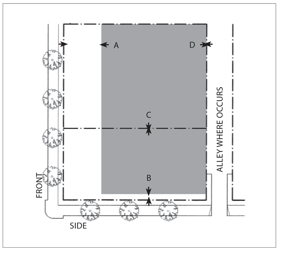
Plan Diagram
Parking is allowed off-site in park once districts.
Parking not enclosed by a structure is allowed only in the shaded area as shown.
a.
Front Setback: 40 percent of lot depth minimum.
b.
Side Street Setback: Ten feet minimum.
c.
Side Setback: Not required.
d.
Rear Setback: Not required.
Parking shall be provided according to Chapter 88.36
See Chapter 88.34 for definitions and design standards
3.
Building Height and Profile.
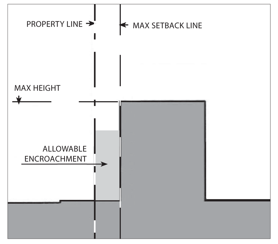
Section Diagram
a.
Height.
(1)
Maximum: Three stories or 35 feet, whichever is less for single use buildings; three stories or 40 feet, whichever is less for mixed-use buildings.
(2)
Exceptions: An area equal to 20 percent of the building's ground floor footprint may exceed the maximum height by an additional story or 15 feet, whichever is less.
b.
Encroachments.
Gallery/arcades, awnings, balconies, and outside dining furniture may encroach into the setback and public right-of-way, and shall be limited to:
(1)
Front encroachment: Ten feet maximum.
(2)
Side Street encroachment: Ten feet maximum.
(3)
Side encroachment: Ten feet maximum.
(4)
Rear encroachment: Five feet maximum
(5)
Maximum encroachment height is two stories.
See Chapter 88.30.040 for definitions and exceptions.
c.
Allowable frontage types:
Arcade, shopfront, forecourt, stoop.
See Chapter 88.29 for definitions and design standards
4.
Residential Density Standards.
Each subdivision and residential development shall comply with the minimum parcel size and density requirements show in the above table, except that an allowed commercial condominium, or a residential condominium or townhouse, or other common interest project may be subdivided with smaller parcels for ownership purposes. In these cases, the minimum lot area shall be determined through subdivision review, provided that the overall development site complies with the minimum parcel size.
Notes:
(1)
Parcel depth shall be no less than the parcel width; and no more than three times the parcel width.
(2)
Net area. In a residential subdivision, corner lots and reversed corner lots shall have an area of at least ten percent greater than that of the minimum lot area required.
(Ord. No. 06-O6, § 1B, 8-7-06; Ord. No. 2020-02, § 3, 2-3-20)
88.24.040. - West End Industrial Districts.
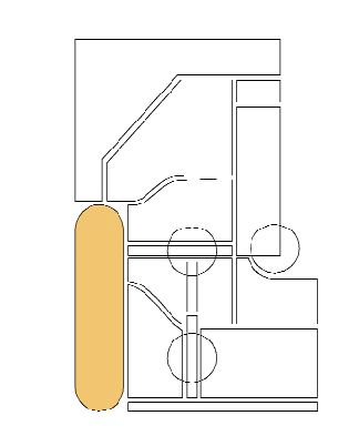
The purpose of this chapter is to outline the general plan goals and development guidelines within the West End Industrial District of Azusa. It is a guideline to assist present and future developers, city staff, and citizens in evaluating the evolving character and potential of the Industrial District.
A.
Purpose. The West End Industrial District (DW) is applied to areas of the city appropriate for a variety of manufacturing, industrial, and heavy commercial activities. The DW district extends from the San Gabriel River and Sierra Madre Avenue to the north, to the Arrow Highway, south of the 210 Freeway; and is also bounded by Vernon Avenue on the east and the City of Irwindale on the west. The standards for this district are intended to accommodate a full range of light and medium-intensity manufacturing and industrial activities, automotive services, and the existing Azusa Landfill and gravel mining operations. Permanent residential uses are limited to caretaker's quarters and live-work units.
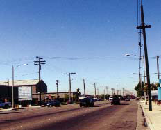
North District
B.
Location and Existing Conditions.
Streets and Landscape. In the north Industrial District, Vernon and Todd Avenues are the primary north-south streets with connections to Foothill Boulevard and Sierra Madre Avenue. In the south Industrial District, the primary access routes from the 210 Freeway are the Irwindale Avenue exit and the Vernon Avenue exit. Irwindale and Vernon Avenues are the primary north-south streets, yet have no east-west connections between them, except for Gladstone Street and Arrow Highway, which are the principal east-west corridors. Jackson Avenue borders the district on the east, where there is a minimal landscape buffer around the Azusa landfill.
Civic and Commercial Features. The dominant uses in the Industrial District are industrial and office uses, including a large sand and gravel mining operation, a wholesale nursery and the landfill. There are no civic uses of note. Costco, the city's largest retailer, is located in this district on Foothill Boulevard.
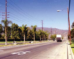
South District
Building Fabric. The building fabric of these district is predominantly one to four-story retail, office and industrial buildings of steel construction or tilt-up concrete construction. Most buildings are located behind surface parking lots, except at Irwindale Avenue, where buildings have a zero setback from the property line and all of the parking is either on the street or behind, accessed by an alley.
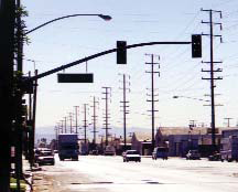
South District
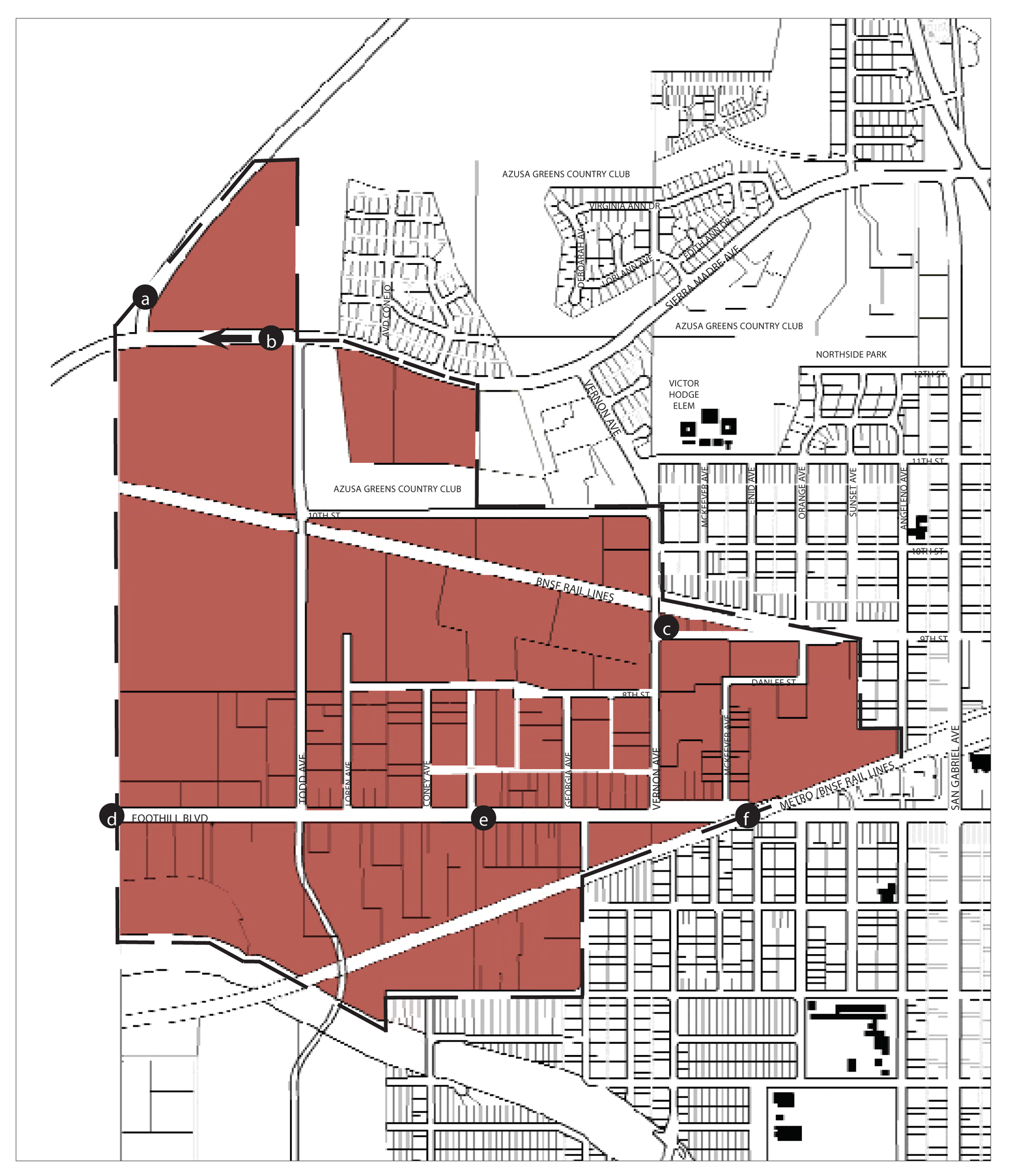
Regulating Plan-North District (at time of adoption)
C-1.
Desired Future and Proposed Changes (North District). The general objectives for this area is to maintain the character of this district as a light industrial area.
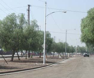
Ideal infill development site at underused railroad right-of-way
1.
Specific Recommendations.
a.
Connect Sierra Madre Avenue and San Gabriel Canyon Road with the River Parkway.
b.
Extend Sierra Madre Avenue west to connect with the proposed River Parkway.
c.
Reclaim railroad right-of-way for parkland and/or residential use (also see North Neighborhoods).
d.
Create a gateway monument or landscape at Foothill Boulevard to mark the western entry of the city.
e.
Enhance the character of Foothill Boulevard through landscaped medians and parkways, and distinctive lighting treatment, consistent with the TOD Specific Plan and University Districts.
f.
Enhance the current gateway at the railroad viaduct into the residential and pedestrian-oriented districts of the city.
g.
Reclaim mining areas for future recreation or light industrial use.
2.
General Recommendations.
a.
Implement streetscape improvements. Improvements include:
(1)
Install and/or repair sidewalks.
(2)
Install street lighting, of a design distinctive and consistent throughout the city.
b.
Improve landscaping.
(1)
Encourage drought tolerant plants.
(2)
Plant shade trees on southern and western exposures to reduce cooling loads on buildings.
c.
Buildings should be built facing onto the street creating a public, pedestrian character with the parking and truck access behind facing the obstructed views and noisy uses.
3.
Requirements.
a.
Promote the creation (and restoration) of neon signage along historic Route 66 (Foothill Boulevard and Alosta Avenue).
(1)
Require installation of neon tube/LED freestanding/monument and wall signage on parcels fronting onto Route 66, as outlined in the Route 66 Themed Signage section on Page 2-59 of the TOD Specific Plan.
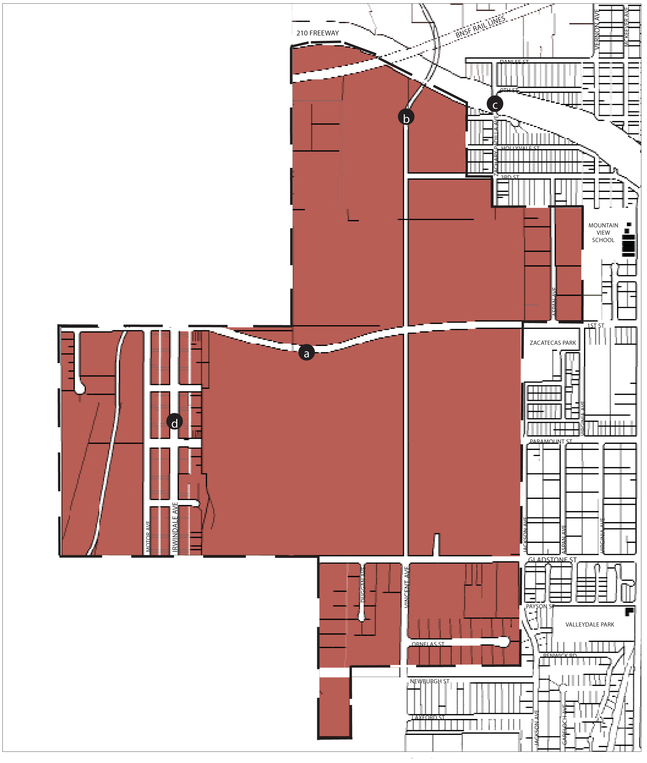
Regulating Plan-South District (at time of adoption)
C-2.
Desired Future and Proposed Changes (South District). The general objectives for this area is to maintain the character of this district as a light industrial area.
1.
Specific Recommendations.
a.
Connect Vincent and Todd Avenues.
b.
Connect 1st Street between Jackson and Irwindale Avenues.
c.
Create new on/offramps at the 210 Freeway and Zachary Padilla Avenue.
d.
Establish street beautification program and landscape standards for Irwindale Avenue consistent with surrounding communities.
2.
General Recommendations.
a.
Implement streetscape improvements. Improvements include:
(1)
Install and/or repair sidewalks.
(2)
Install street lighting, of a design distinctive and consistent throughout the city.
b.
Improve landscaping.
(1)
Encourage drought tolerant plants.
(2)
Plant shade trees on southern and western exposures to reduce cooling loads on buildings.
c.
Buildings should be built facing onto the street creating a public, pedestrian character with the parking and truck access behind facing the obstructed views and noisy uses.
D.
Site Planning and Building Design.
1.
Building Placement.
Plan Diagram
Buildings shall be placed within the shaded area as shown in the above diagram.
a.
Front Setback: Ten feet minimum.
b.
Side Street Setback: Ten feet minimum.
c.
Sideyard Setback : Zero feet; 20 feet next to residential.
d.
Rear Setback: Zero feet; 20 feet next to residential.
See Chapter 88.30.060 for definitions and design standards.
2.
Parking Placement.
Plan Diagram
Parking not enclosed by a structure is allowed only in the shaded area as shown.
a.
Front setback: Not required up to 50 percent of frontage.
b.
Side street setback: Ten feet minimum.
c.
Side setback: Not required.
d.
Rear setback: Not required.
Parking shall be provided according to Chapter 88.36
See Chapter 88.34 for definitions and design standards
3.
Building Height and Profile.
Section Diagram
a.
Height: Maximum: 55 feet.
b.
Encroachments.
Gallery/arcades, awnings, balconies, and outdoor dining furniture may encroach into the setback and public right-of-way.
(1)
Front encroachment: Ten feet maximum.
(2)
Side Street encroachment: Ten feet maximum.
(3)
Side encroachment: Ten feet maximum.
(4)
Rear encroachment: Five feet maximum
(5)
Maximum encroachment height is two stories or 40 feet.
See Chapter 88.30.040 for definitions and exceptions
c.
Allowable frontage types.
Gallery/arcade, shopfront, stoop, forecourt.
See Chapter 88.29 for definitions and design standards.
4.
Parcel and Residential Density Standards.
Each subdivision and residential development shall comply with the minimum parcel size and density requirements show in the above table, except that an allowed commercial condominium, or a residential condominium or townhouse, or other common interest project may be subdivided with smaller parcels for ownership purposes. In these cases, the minimum lot area shall be determined through subdivision review, provided that the overall development site complies with the minimum parcel size.
Notes:
(1)
Parcel depth shall be no less than the parcel width; and no more than three times the parcel width.
(2)
Net area. In a residential subdivision, corner lots and reversed corner lots shall have an area of at least ten percent greater than that of the minimum lot area required.
(Ord. No. 06-O6, § 1B, 8-7-06; Ord. No. 2017-05, § 4, 7-17-17; Ord. No. 2020-02, § 3, 2-3-20)
88.24.050 - Reserved.
88.26.005. - Allowable Uses in Corridors.
A.
Permit Requirements. Tables 2-1, 2-2, 2-3, and 2-4 provide land uses that are:
1.
Permitted subject to compliance with all applicable provisions of this Development Code, subject to first obtaining a zoning clearance (Section 88.51.020). These are shown as "P" uses in the tables;
2.
Allowed subject to the approval of a minor use permit (Section 88.51.040), and shown as "MUP" uses in the tables;
3.
Allowed subject to the approval of a use permit (Section 88.51.040), and shown as "UP" uses in the tables;
4.
Allowed subject to the type of city approval required by a specific provision of Chapter 88.42 (Standards for Specific Land Uses), and shown as "S" uses in the tables;
5.
Not allowed in particular zones, and shown as a "—" in the tables.
;sz=8q; Key to Zone Symbols
;sz=8q; Notes:
(1)
A definition of each listed use type is in Article 6 (Glossary).
(2)
This is a critical, sensitive, or high occupancy facility, subject to the hazard mitigation requirement of Section 88.30.030
(3)
Allowed only within the boundaries of an electric utility easement for high voltage transmission lines.
;sz=8q; Key to Zone Symbols
;sz=8q; Notes:
(1)
A definition of each listed use type is in Article 7 (Glossary).
(2)
Any property proposed for auto and vehicle sales and rental use should be at least 40,000 square feet in area.
(3)
This is a critical, sensitive, or high occupancy facility, subject to the hazard mitigation requirement of Section 88.30.030
;sz=8q; Key to Zone Symbols
;sz=8q; Notes:
(1)
A definition of each listed use type is in Article 6 (Glossary).
(2)
This is a critical, sensitive, or high occupancy facility, subject to the hazard mitigation requirement of Section 88.30.030
(Ord. No. 06-O6, § 1B, 8-7-06; Ord. No. 07-O6, § 1, 6-18-07; Ord. No. 10-O1, §§ 3, 4, 3-1-10; Ord. No. 14-O4, § 2, 7-21-14; Ord. No. 2017-03, § 5, 6-19-17; Ord. No. 2020-02, § 3, 2-3-20; Ord. No. 2021-01, § 3, 2-1-21; Ord. No. 2023-04, § 3(Exh. A), 10-2-23)
88.26.010. - Foothill Boulevard Corridor.
The purpose of this chapter is to outline the general plan goals and development guidelines for the Foothill Boulevard Corridor of Azusa. It is a guideline to assist present and future developers, city staff, and citizens in evaluating the evolving character and potential of the corridor.
A.
Purpose. The Foothill Boulevard Corridor (CFB) zone is applied to areas along Foothill Boulevard west of the TOD Specific Plan. This corridor zone is intended to accommodate a wide range of retail commercial uses, offices, and services, with all types of residential units allowed.
B.
Location and Existing conditions. Formerly the historic Route 66 from Chicago to Los Angeles, Foothill Boulevard is the principal east-west street in Azusa north of the 210 Freeway. Consequently, the intersection of Foothill Boulevard and Azusa Avenue constitutes the center of the Downtown. West of the TOD Specific Plan, the designation applies to properties facing Foothill Boulevard from San Gabriel Avenue to the railroad viaduct. East of Downtown, the designation applies to properties facing Foothill Boulevard from just west of Soldano Avenue to approximately Cerritos Avenue.
Streets and Landscape. Foothill Boulevard is a two-way, four lane arterial with street parking on both sides of the road. A median is located in the center of the street. Street trees and landscaping is inconsistent throughout the corridor.
Civic and Commercial Features. There are no government buildings on Foothill Boulevard within the Corridor designation (although City Hall faces Foothill within the Downtown District). A church is located at the intersection with Soldano Avenue. A number of commercial retailers do front Foothill Boulevard. Most of these are strip-oriented retail, focused on access by car either with street-facing parking lots or drive-throughs.
Building Fabric. A mixed range of building types front the Foothill Boulevard Corridor. They include small, one-story strip malls; drive-through restaurants; churches; townhouses; and single-family homes (some converted to retail or office uses).
C.
Desired Future and Proposed Changes. The general objective for this corridor is to transform the character of Foothill Boulevard from a commercial strip to a predominately residential, but mixed-use pedestrian friendly street.
1.
Specific Recommendations.
a.
Install landscaped medians and parkways on Foothill Boulevard, consistent with the Downtown and University Districts.
b.
Enhance the current gateway at the railroad viaduct into the residential and pedestrian-oriented districts of the city.
D.
Site Planning and Building Design.
1.
Building Placement.

Plan Diagram
Buildings shall be placed within the shaded area as shown in the above diagram.
a.
Front Setback: Ten feet minimum; 20 feet maximum for 60 percent minimum of lot width.
b.
Side Street Setback: Ten feet minimum.
c.
Sideyard Setback: Zero feet or ten feet minimum for residential, or when adjacent to residential.
d.
Rear Setback: Zero feet or ten feet minimum for residential, or when adjacent to residential.
See Chapter 88.30.060 for definitions and design standards.
Notes:
The percentage of building frontage for front and side street setbacks may be reduced
by the review authority to accommodate pedestrian plazas located between the street(s)
and the building.
2.
Parking Placement.
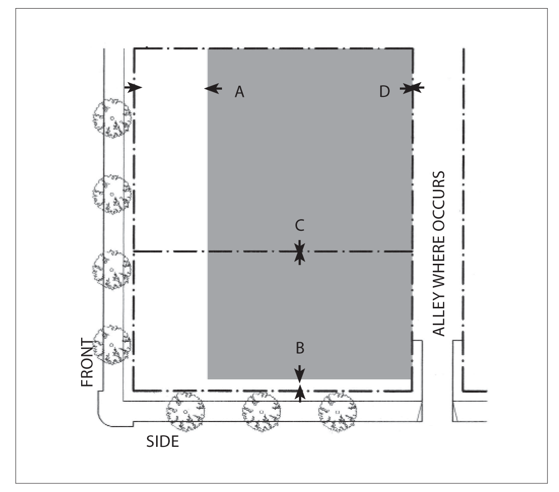
Plan Diagram
Parking not enclosed by a structure is allowed only in the shaded area as shown.
a.
Front Setback: 50 percent of lot depth maximum.
b.
Side Street Setback: Ten feet minimum.
c.
Side Setback: Not required.
d.
Rear Setback: Not required.
Parking shall be provided according to Chapter 88.36
See Chapter 88.34 for definitions and design standards
3.
Building Height and Profile.

Section Diagram
a.
Height.
(1)
Maximum: Three stories or 35 feet, whichever is less for single-use buildings; three stories or 40 feet, whichever is less for mixed-use buildings.
(2)
Exception: An area equal to 20 percent of the building's ground floor footprint may exceed the maximum height by an additional story or 15 feet, whichever is less.
b.
Encroachments.
Gallery/arcades, awnings, balconies, porches and outdoor dining furniture may encroach into the setback and public right-of-way and shall be limited to:
(1)
Front encroachment: Ten feet maximum.
(2)
Side Street encroachment: Ten feet maximum.
(3)
Side encroachment: Two feet maximum.
(4)
Rear encroachment: Five feet maximum.
(5)
Maximum encroachment height is two stories or 25 feet.
(6)
Porches may encroach to within five feet of the front or side street property line.
See Chapter 88.30.040 for definitions and exceptions
c.
Allowable frontage types.
Arcade, shopfront, stoop, forecourt, porch, common yard.
See Chapter 88.29 for definitions and design standards.
4.
Residential Density Standards.
Each subdivision and residential development shall comply with the minimum parcel size and density requirements show in the above table, except that an allowed commercial condominium, or a residential condominium or townhouse, or other common interest project may be subdivided with smaller parcels for ownership purposes. In these cases, the minimum lot area shall be determined through subdivision review, provided that the overall development site complies with the minimum parcel size.
Notes:
(1)
Parcel depth shall be no less than the parcel width; and no more than three times the parcel width.
(2)
Net area. In a residential subdivision, corner lots and reversed corner lots shall have an area of at least ten percent greater than that of the minimum lot area required.
(Ord. No. 06-O6, § 1B, 8-7-06; Ord. No. 2017-05, § 4, 7-17-17; Ord. No. 2020-02, § 3, 2-3-20; Ord. No. 2023-04, § 3(Exh. A), 10-2-23)
88.26.020. - Azusa/San Gabriel Avenue Corridors.
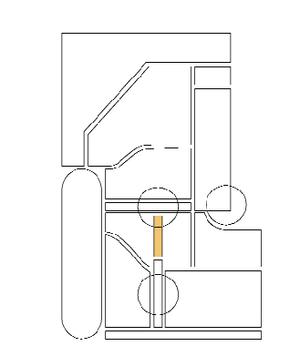
The purpose of this chapter is to outline the general plan goals and development guidelines for the Azusa/San Gabriel Avenue Corridors of Azusa. It is a guideline to assist present and future developers, city staff, and citizens in evaluating the evolving character and potential of the corridors.
A.
Purpose.
1.
CAZ (Azusa Avenue) Corridor. The Azusa Avenue Corridor (CAZ) zone is applied to the Azusa Avenue portion of the Azusa Avenue/San Gabriel Avenue couplet immediately south of the TOD Specific Plan . This zone is intended to accommodate a range of lower intensity retail, offices and other low intensity commercial uses, together with all types of residential units.
2.
CSG (San Gabriel Avenue) Corridor. The San Gabriel Avenue Corridor (CSG) zone is applied to the San Gabriel Avenue portion of the Azusa Avenue/San Gabriel Avenue couplet immediately south of the TOD Specific Plan . This zone is intended to emphasize residential rather than commercial development, but with offices and other low very intensity commercial uses, excluding most retail. All types of residential units are allowed.
B.
Location and Existing Conditions. The Azusa/San Gabriel Avenue couplet is the primary north-south corridor in the city north of the 210 Freeway. Azusa Avenue is the principal street in the Downtown, where it crosses Foothill Boulevard. North of Downtown, Azusa Avenue merges with San Gabriel Canyon Road at Sierra Madre Avenue, providing access to the Angeles National Forest. South of the 210 Freeway, Azusa Avenue is a two-way street, and is the primary entrance and exit to the city from the highway system.
Streets and Landscape. Azusa Avenue is a one-way, north-bound street from First Street to Sierra Madre Avenue. North of the freeway to Sierra Madre Avenue, San Gabriel Avenue acts as the one-way, south-bound street coupled with Azusa Avenue. South of Fourth Street the corridor has an inconsistent line of street trees on either side.
Civic and Commercial Features. Azusa Avenue is fronted by a mixture of under-performing commercial uses and poor quality multi-family residences. San Gabriel Avenue is fronted by distinguished houses, most of which remain residences, although some have been transformed into commercial uses. Except in the TOD Specific Plan District, neither avenue is the location of civic uses.
Building Fabric. There are essentially three types of buildings facing Azusa Avenue. The first is principally located in the TOD Specific Plan District, but is also found in some locations south of downtown. This is a one to two-story building abutting the property line adjacent to the sidewalk and street. The second type also is a one or two-story residential or commercial building, which is set back approximately ten to 20 feet from the sidewalk and property line, creating a front yard. This setback is typically landscaped with a path to the residence or office. The third type is a one or two-story building set back 40 or more feet from the street. The setback at this type is used for surface parking for typically a retail or drive through use.
C.
Desired Future and Proposed Changes. The general objectives for these corridors is to transform the character of Azusa Avenue from a commercial strip to predominately residential, but mixed-use pedestrian friendly street, and enhance the residential character of San Gabriel Avenue.
1.
Specific Recommendations.
a.
Convert both Azusa and San Gabriel Avenues to two-way traffic. Install a landscaped median on San Gabriel Avenue.
b.
Study the possibility of removing the San Gabriel Avenue connection to Azusa Avenue, and reclaiming the land as a potential development site for residential, retail or recreational use.
2.
General Recommendations.
a.
Plant unique street trees on both Azusa and San Gabriel Avenue, such that each is distinguished by a particular landscape pattern. Consider extending the pattern of tall palm trees on north Azusa Avenue to the southern section of the road.
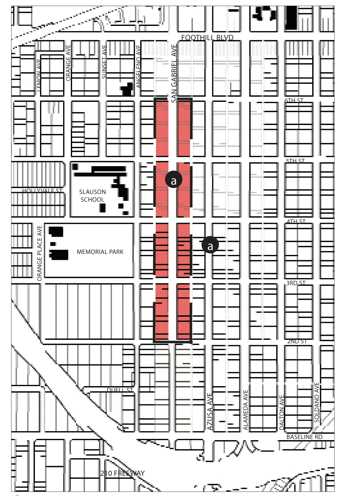
Regulating Plan-San Gabriel Ave Corridor
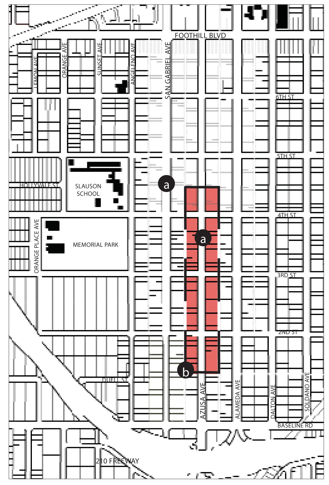
Regulating Plan-Azusa Ave Corridor
D.
Site Planning and Building Design - Azusa Avenue.
1.
Building Placement.
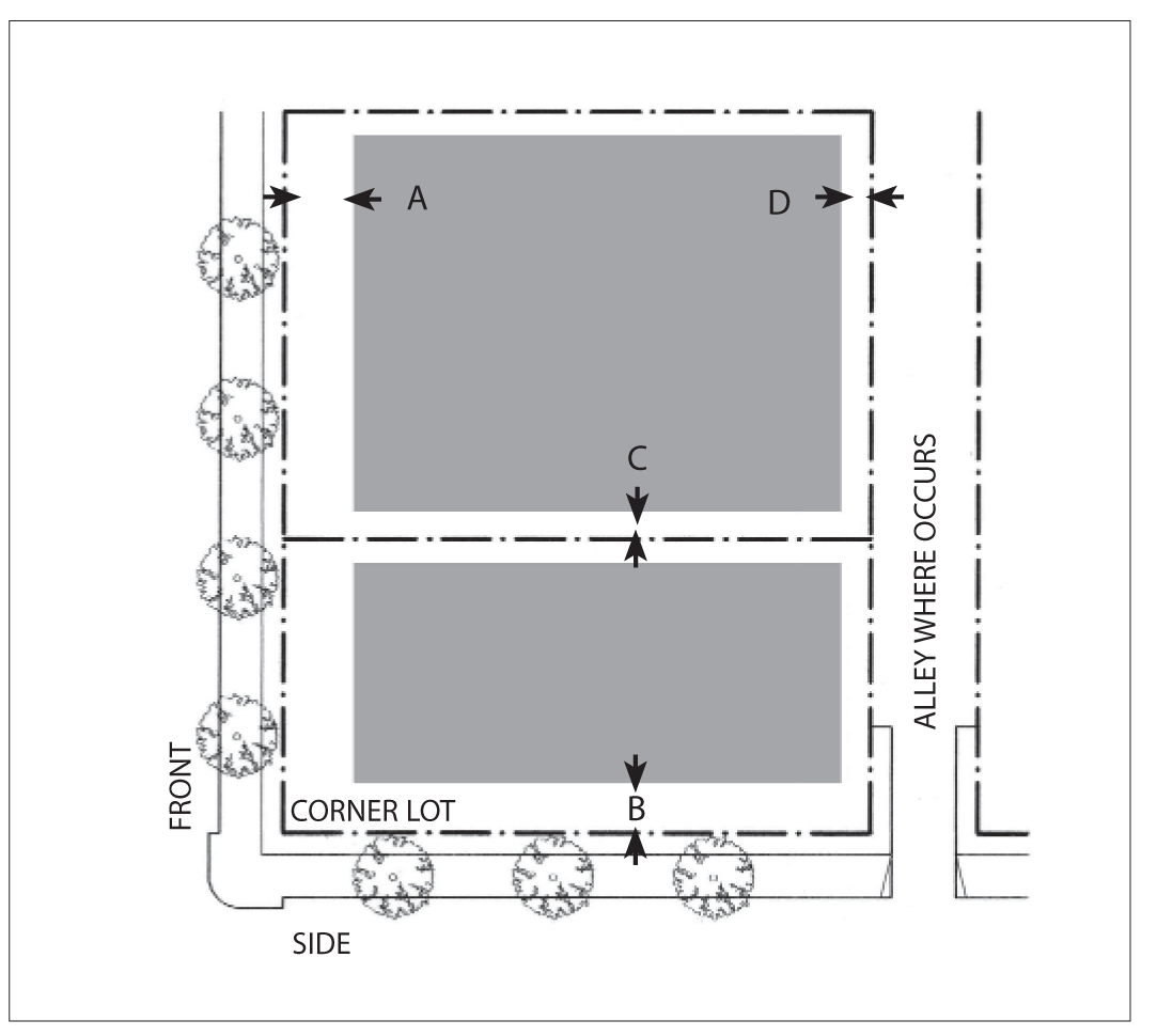
Plan Diagram
Buildings shall be placed within the shaded area as shown in the above diagram.
a.
Front Setback: Ten feet minimum; 20 feet maximum for 60 percent minimum of lot width.
b.
Side Street Setback: Ten feet minimum.
c.
Sideyard Setback: Zero feet; five feet minimum for residential, or when adjacent to residential.
d.
Rear Setback: Zero feet; five feet minimum for residential, or when adjacent to residential.
See Chapter 88.30.060 for definitions and design standards.
Notes:
The percentage of building frontage for front and side street setbacks may be reduced
by the review authority to accommodate pedestrian plazas located between the street(s)
and the building.
2.
Parking Placement.
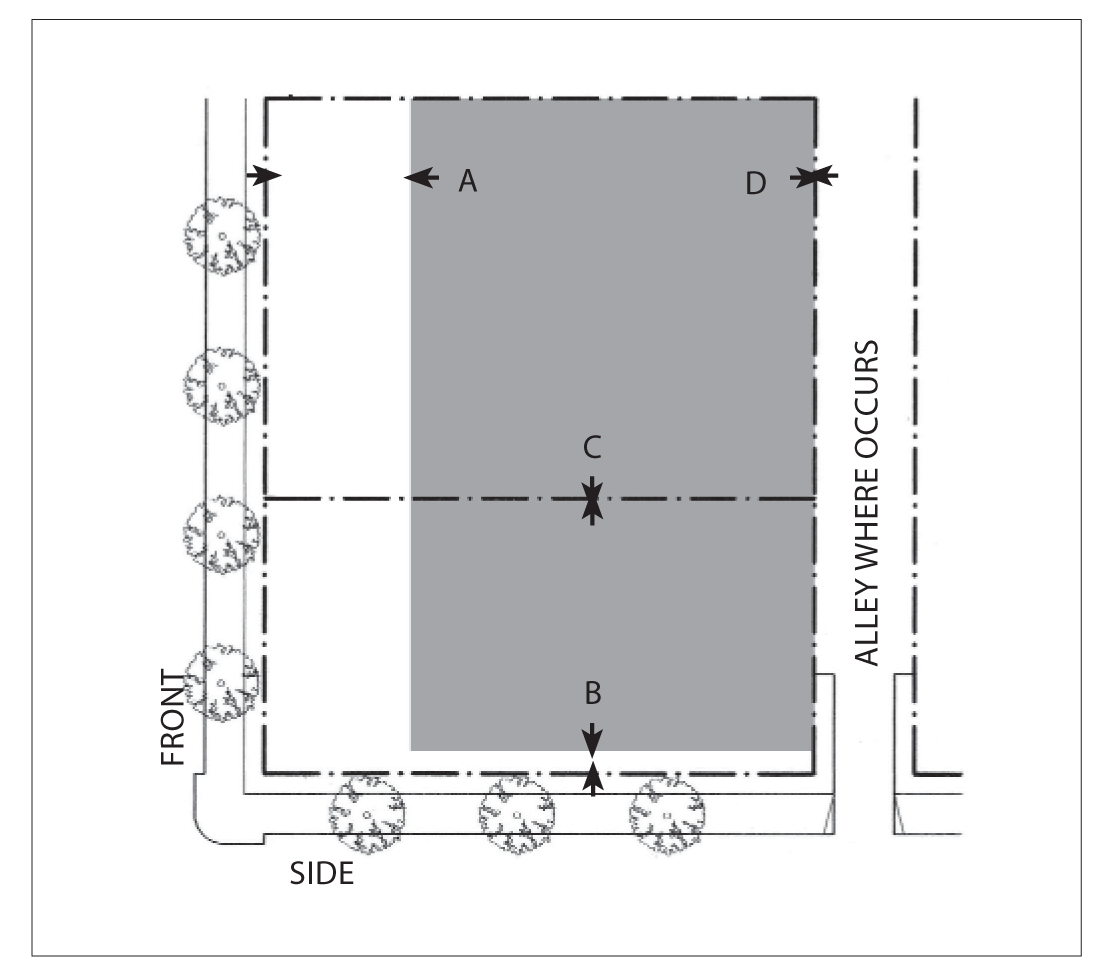
Plan Diagram
Parking not enclosed by a structure is allowed only in the shaded area as shown.
a.
Front Setback: 50 percent of lot depth maximum.
b.
Side Street Setback: Ten feet minimum.
c.
Side Setback: Not required.
d.
Rear Setback: Not required.
Parking shall be provided according to Chapter 88.36
See Chapter 88.34 for definitions and design standards
3.
Building Height and Profile.
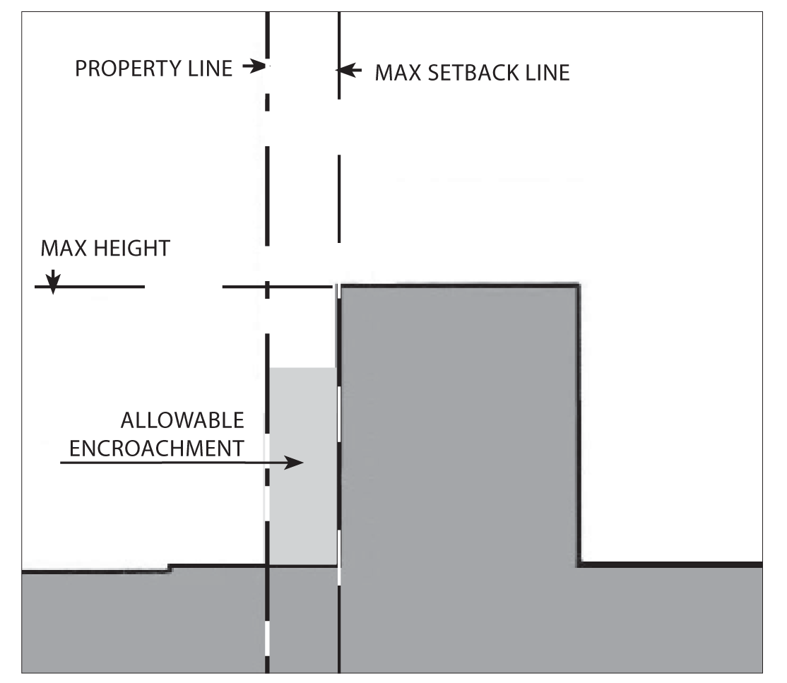
Section Diagram
a.
Height.
(1)
Maximum: Three or 35 feet, whichever is less for single-use buildings; three stories or 40 feet, whichever is less for mixed-use buildings.
(2)
Exception: An area equal to 20 percent of the building's ground floor footprint may exceed the maximum height by an additional story or 15 feet, whichever is less.
b.
Encroachments.
Gallery/arcades, awnings, balconies, porches, and outdoor dining furniture may encroach into the setback and public right-of-way and shall be limited to:
(1)
Front encroachment: Ten feet maximum.
(2)
Side Street encroachment: Ten feet maximum.
(3)
Side encroachment: Two feet maximum.
(4)
Rear encroachment: Five feet maximum.
(5)
Maximum encroachment height is two stories or 25 feet.
(6)
Porches may encroach to within five feet of the front or side street property line.
See Chapter 88.30.040 for definitions and exceptions
c.
Allowable frontage types.
Arcade, shopfront, stoop, forecourt, frontyard
See Chapter 88.29 for definitions and design standards.
4.
Residential Density Standards.
Each subdivision and residential development shall comply with the minimum parcel size and density requirements show in the above table, except that an allowed commercial condominium, or a residential condominium or townhouse, or other common interest project may be subdivided with smaller parcels for ownership purposes. In these cases, the minimum lot area shall be determined through subdivision review, provided that the overall development site complies with the minimum parcel size.
Notes:
(1)
Parcel depth shall be no less than the parcel width; and no more than three times the parcel width.
(2)
Net area. In a residential subdivision, corner lots and reversed corner lots shall have an area of at least ten percent greater than that of the minimum lot area required.
E.
Site Planning and Building Design - San Gabriel Avenue.
1.
Building Placement.

Plan Diagram
Buildings shall be placed within the shaded area as shown in the above diagram.
a.
Front Setback: Ten feet minimum; 20 feet maximum for 60 percent minimum of lot width.
b.
Side Street Setback: Ten feet minimum.
c.
Sideyard Setback: Zero feet; five feet minimum for residential, or when adjacent to residential.
d.
Rear Setback: Zero feet; five feet minimum for residential, or when adjacent to residential.
See Chapter 88.30.060 for definitions and design standards.
Notes:
The percentage of building frontage for front and side street setbacks may be reduced
by the review authority to accommodate pedestrian plazas located between the street(s)
and the building.
2.
Parking Placement.
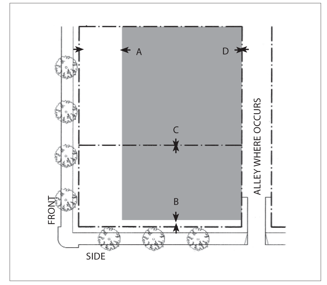
Plan Diagram
Parking not enclosed by a structure is allowed only in the shaded area as shown.
a.
Front Setback: 50 percent of lot depth maximum.
b.
Side Street Setback: Ten feet minimum.
c.
Side Setback: Not required.
d.
Rear Setback: Not required.
Parking shall be provided according to Chapter 88.36
See Chapter 88.34 for definitions and design standards
3.
Building Height and Profile.
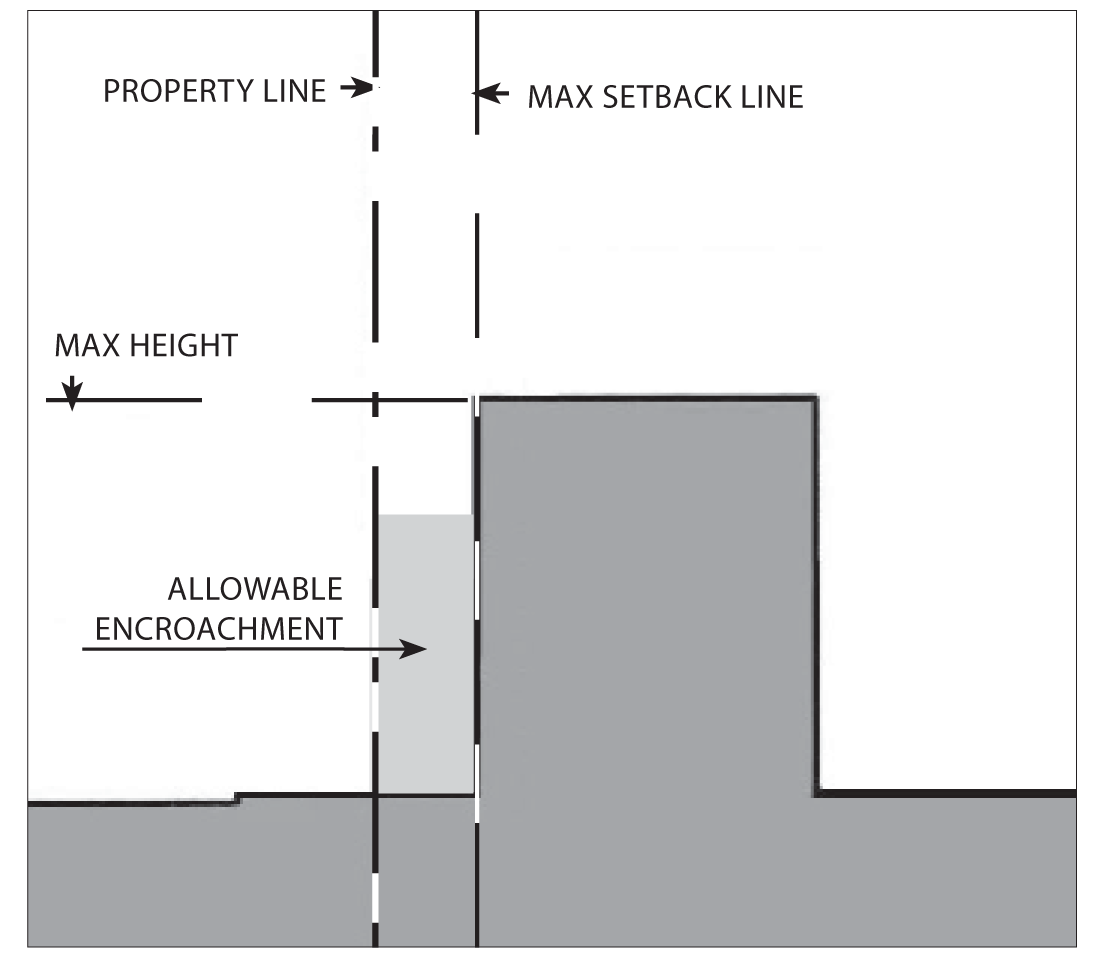
Section Diagram
a.
Height.
(1)
Maximum: Three or 35 feet, whichever is less for single-use buildings; three stories or 40 feet, whichever is less for mixed-use buildings.
(2)
An area equal to 20 percent of the building's ground floor footprint may exceed the maximum height by an additional story or 15 feet, whichever is less.
b.
Encroachments.
Gallery/arcades, awnings, balconies, porches, and outdoor dining furniture may encroach into the setback and public right-of-way and shall be limited to:
(1)
Front encroachment: Ten feet maximum.
(2)
Side Street encroachment: Ten feet maximum.
(3)
Side encroachment: Two feet maximum.
(4)
Maximum encroachment height is two stories or 25 feet.
(5)
Porches may encroach to within five feet of the front or side street property line.
See Chapter 88.30.040 for definitions and exceptions
c.
Allowable Frontage Types:
Stoop, forecourt, porch, common yard.
See Chapter 88.29 for definitions and design standards.
4.
Residential Density Standards.
Each subdivision and residential development shall comply with the minimum parcel size and density requirements show in the above table, except that an allowed commercial condominium, or a residential condominium or townhouse, or other common interest project may be subdivided with smaller parcels for ownership purposes. In these cases, the minimum lot area shall be determined through subdivision review, provided that the overall development site complies with the minimum parcel size.
Notes:
(1)
Parcel depth shall be no less than the parcel width; and no more than three times the parcel width.
(2)
Net area. In a residential subdivision, corner lots and reversed corner lots shall have an area of at least ten percent greater than that of the minimum lot area required.
(Ord. No. 06-O6, § 1B, 8-7-06; Ord. No. 2017-05, § 4, 7-17-17; Ord. No. 2020-02, § 3, 2-3-20; Ord. No. 2023-04, § 3(Exh. A), 10-2-23)
88.26.030. - South Azusa Avenue Corridor.
The purpose of this chapter is to outline the general plan goals and development guidelines for the South Azusa Avenue Corridor of Azusa. It is a guideline to assist present and future developers, city staff, and citizens in evaluating the evolving character and potential of the Corridor.
A.
Purpose. The South Azusa Avenue Corridor (CSA) zone is applied to portions of Azusa Avenue adjacent to and south of the 210 Freeway. This corridor zone is intended to accommodate a range of retail and office uses, together with residential units primarily in the form of courtyard housing and row houses.
B.
Location and Existing Conditions. Azusa Avenue is the primary north-south corridor in the city south of the 210 Freeway. South of the 210 Freeway, Azusa Avenue is a two-way street, and is the primary entrance and exit to the city from the highway system and provides a direct link to the City of Covina. North of the Freeway, Azusa Avenue is the principal street in the Downtown, and with San Gabriel Avenue, provides access to the Los Angeles National Forest. Azusa Avenue throughout its entire length crosses all of the primary east-west corridors.
Streets and Landscape. South Azusa Avenue is a wide, two-way street with little landscape character.
Civic and Commercial Features. There are no civic features of note on South Azusa Avenue. The corridor is lined with commercial strip type retail and businesses. Edgewood Center at the intersection of Gladstone Street is a concentrated retail center that has the potential to become a pedestrian-oriented center for the surrounding neighborhoods.
Building Fabric. There are essentially two types of buildings facing Azusa Avenue. The first is a one- or two-story residential or commercial building, which is set back approximately ten to 20 feet from the sidewalk and property line, creating a front yard. This setback is typically landscaped with a path to the residence or office. The second type is also a one- or two-story building set back 40 or more feet from the street. The setback at this type is used for surface parking for typically a retail or drive through use. South of the Freeway, properties are occupied by strip retail uses, multi-family apartments, gas stations, churches, a car wash and the backs of several single-family residential units.
C.
Desired Future and Proposed Changes. The general objective for this area is to transform the character of this corridor from a commercial strip to mix of pedestrian-friendly commercial uses, located in nodes, interspersed with various forms of housing.
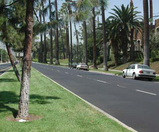
Possible landscape of S Azusa Ave
1.
Specific Recommendations.
a.
Study the possibility of removing the San Gabriel Avenue connection to Azusa Avenue, and reclaiming the land as a potential development site.
b.
Promote the Edgewood Center at Azusa Avenue and Gladstone Street as a pedestrian-oriented center to serve adjoining neighborhoods (also see Edgewood District).
c.
Enhance the existing gateway monuments and landscape at Azusa Avenue and Arrow Highway and Azusa Avenue and the 210 Freeway.
d.
Reconfigure the intersection of Azusa Avenue and Newburgh Street to reduce roadway pavement and increase development parcels.
e.
Convert the existing light and water property into a public park.
2.
General Recommendations.
a.
Install landscaped medians and parkways on Azusa Avenue. Consider extending the street tree pattern of tall palms that distinguish North Azusa Avenue to South Azusa Avenue (interspersed with shade trees).
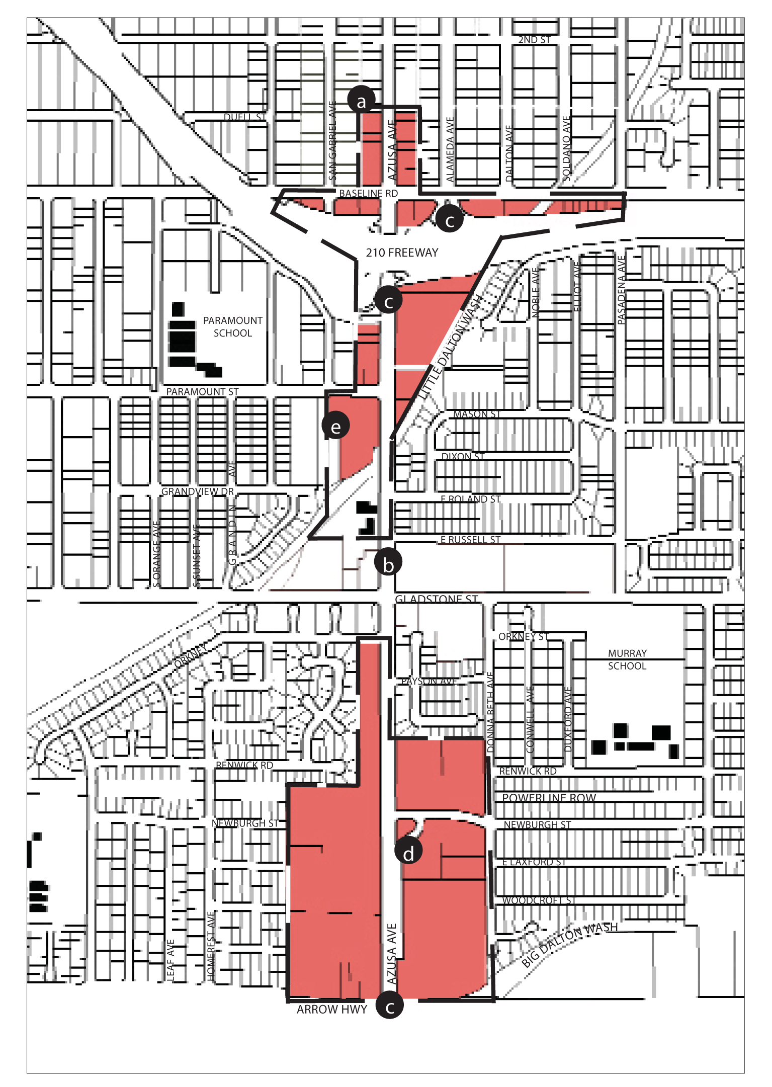
Regulating Plan (at time of adoption)
D.
Site Planning and Building Design.
1.
Building Placement.

Plan Diagram
Buildings shall be placed within the shaded area as shown in the above diagram.
a.
Front Setback: Zero feet for shopfronts; 15 feet minimum; 20 feet maximum for 60 percent minimum of lot width.
b.
Side Street Setback: Ten feet minimum; 20 feet maximum for 60 percent minimum of lot width.
c.
Sideyard Setback: Zero feet; ten feet minimum for residential, or when adjacent to residential.
d.
Rear Setback: Zero feet; ten feet minimum for residential, or when adjacent to residential.
See Chapter 88.30.060 for definitions and design standards.
Notes:
The percentage of building frontage for front and side street setbacks may be reduced
by the review authority to accommodate pedestrian plazas located between the street(s)
and the building.
2.
Parking Placement.
Plan Diagram
Parking not enclosed by a structure is allowed only in the shaded area as shown.
a.
Front Setback: Not required up to 50 percent of frontage
b.
Side Street Setback: Ten feet minimum.
c.
Side Setback: Not required.
d.
Rear Setback: Not required.
Parking shall be provided according to Chapter 88.36
See Chapter 88.34 for definitions and design standards
3.
Building Height and Profile.
Section Diagram
a.
Height.
(1)
Maximum: Three stories or 35 feet for single-use buildings, whichever is less; three stories or 40 feet, whichever is less for mixed-use buildings
(2)
Exception: An area equal to 20 percent of the building's ground floor footprint may exceed the maximum height by an additional story or 15 feet, whichever is less.
b.
Encroachments.
Gallery/arcades, awnings, balconies, porches, and outdoor dining furniture may encroach into the setback and public right-of-way:
(1)
Front encroachment: Ten feet maximum.
(2)
Side Street encroachment: Ten feet maximum.
(3)
Side encroachment: Two feet maximum.
(4)
Rear encroachment: Five feet maximum.
(5)
Maximum encroachment height is two stories or 25 feet.
(6)
Porches may encroach to within five feet of the front or side street property line.
See Chapter 88.30.040 for definitions and exceptions
c.
Allowable frontage types.
Gallery, arcade, shopfront, stoop, forecourt.
See Chapter 88.29 for definitions and design standards.
4.
Residential Density Standards.
Each subdivision and residential development shall comply with the minimum parcel size and density requirements show in the above table, except that an allowed commercial condominium, or a residential condominium or townhouse, or other common interest project may be subdivided with smaller parcels for ownership purposes. In these cases, the minimum lot area shall be determined through subdivision review, provided that the overall development site complies with the minimum parcel size.
Notes:
(1)
Parcel depth shall be no less than the parcel width; and no more than three times the parcel width.
(2)
Net area. In a residential subdivision, corner lots and reversed corner lots shall have an area of at least ten percent greater than that of the minimum lot area required.
(Ord. No. 06-O6, § 1B, 8-7-06; Ord. No. 2020-02, § 3, 2-3-20)
88.26.040. - Arrow Highway Corridor.
The purpose of this chapter is to outline the general plan goals and development guidelines for the Arrow Highway Corridor of Azusa. It is a guideline to assist present and future developers, city staff, and citizens in evaluating the evolving character and potential of the corridor.
A.
Purpose. The Arrow Highway Corridor (CAH) zone is applied to properties along the north side of the Arrow Highway from its intersection with the Big Dalton Wash Canal to Barranca Avenue. This corridor zone is intended to accommodate a wider range of retail and office uses than the other corridor designations, including automotive service uses. Multi-family residential and condo developments are allowed in the form of courtyard housing and row houses.
B.
Location and Existing Conditions. Arrow Highway is one of the two primary east-west regional corridors south of the 210 Freeway in Azusa. It is approximately one mile south of the freeway and, in many areas, it is the southern border of Azusa.
Arrow Highway
Streets and Landscape. For the entire length of the corridor, Arrow Highway is a wide, fast moving arterial street with limited connections to adjacent neighborhoods. Most of the accessible uses to this street are industrial, office or retail in nature. There is no organized public landscape or street trees along Arrow Highway's entire length.
Civic and Commercial Features. There are strip drive-in retail uses, residential neighborhoods set behind parallel frontage roads, single and multi-family buildings and motels, and a community shopping center and a high school on the Covina side of the street. Several small churches are also located along the corridor. Most of the large retail, institutional and industrial uses along this corridor are located in the City of Irwindale. There are no public institutions located on the City of Azusa's side of this corridor.
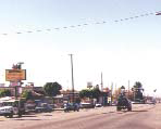
Arrow Highway
Building Fabric. There is an almost equal mix of single-family and multi-family housing and motels on Arrow Highway. However, most buildings face parallel to local streets and turn their sides or backs to Arrow Highway. There are drive-through uses such as fast food outlets and gas stations at several of the cross street intersections.
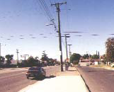
Arrow Highway
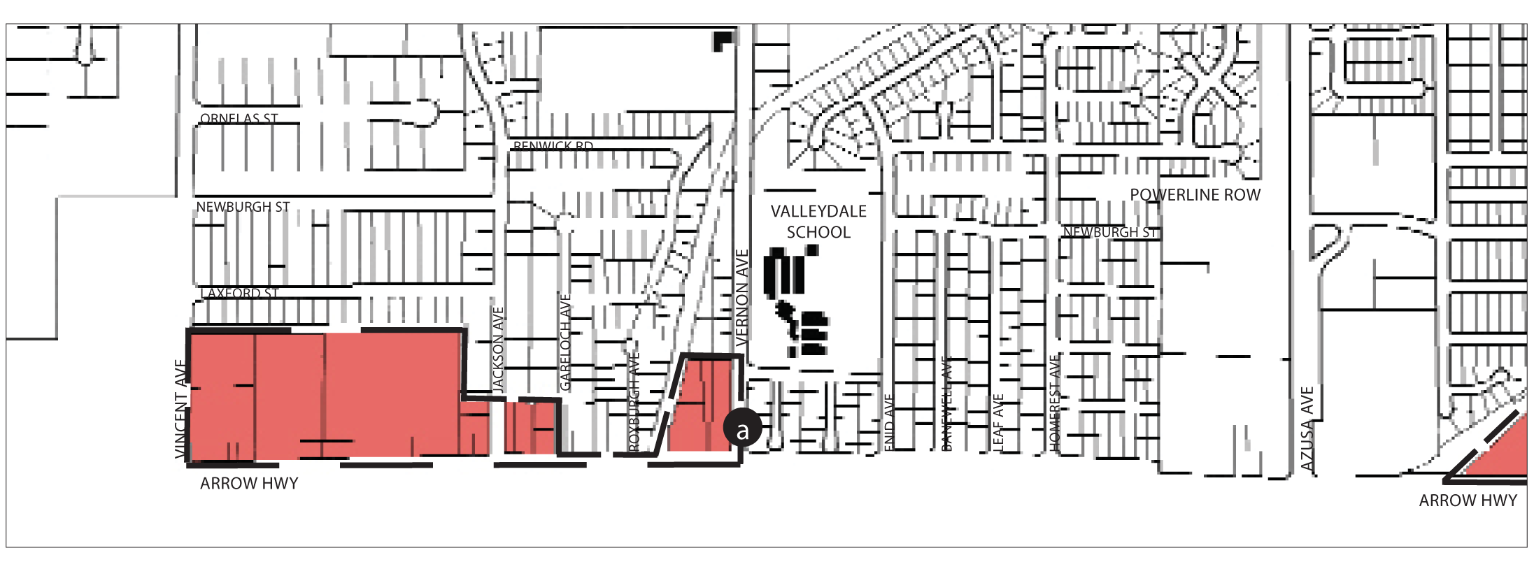
Regulating Plan-East Portion (at time of adoption)
C.
Desired Future and Proposed Changes. The general objective for this area is to improve and maintain the character of this corridor as a commercial strip designated for automobile-oriented uses while providing for improved landscaping, enhanced pedestrian safety, and improved aesthetics.
1.
Specific Recommendations.
Create a gateway monument or landscape at Vernon, Citrus and Cerritos Avenues to mark the southern entry of the city.
2.
General Recommendations.
Work with Los Angeles County and the City of Covina to design and install streetscape improvements such as a landscape median on Arrow Highway, and coordinate compatible land uses and design standards.
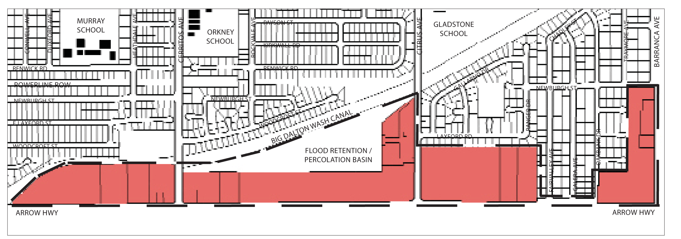
Regulating Plan-West Portion (at time of adoption)
D.
Site Planning and Building Design.
1.
Building Placement.
Plan Diagram
Buildings shall be placed within the shaded area as shown in the above diagram.
a.
Front Setback: Fifteen feet minimum; 25 feet maximum for 60 percent minimum of lot width.
b.
Side Street Setback: 15 feet minimum; 25 feet maximum for 60 percent minimum of lot width.
c.
Sideyard Setback: Zero feet, ten feet minimum for residential, or when adjacent to residential.
e.
Rear Setback: 25 feet minimum; 50 feet next to residential.
See Chapter 88.30.060 for definitions and design standards.
2.
Parking Placement.
Plan Diagram
Parking not enclosed by a structure is allowed only in the shaded area as shown.
a.
Front Setback: Not required up to 50 percent of frontage.
b.
Side Street Setback: Ten feet minimum.
c.
Side Setback: Not required.
d.
Rear Setback: Not required.
Parking shall be provided according to Chapter 88.36
See Chapter 88.34 for definitions and design standards
3.
Building Height and Profile.
Section Diagram
a.
Height.
(1)
Maximum: Three stories or 35 feet for single use buildings, which ever is less; three stories or 40 feet, whichever is less for mixed use buildings.
(2)
Exceptions: An area equal to 20 percent of the building's ground floor footprint may exceed the maximum height by an additional story or 15 feet, whichever is less.
b.
Encroachments.
Gallery/arcades, awnings, balconies, porches, and outdoor dining furniture may encroach into the setback and public right-of-way.
(1)
Front encroachment: Ten feet maximum.
(2)
Side Street encroachment: Ten feet maximum.
(3)
Side encroachment: Two feet maximum.
(4)
Rear encroachment: Five feet maximum.
(5)
Maximum encroachment height is two stories or 40 feet.
(6)
Porches may encroach to within five feet of the front or side street property line.
See Chapter 88.30.040 for definitions and exceptions.
c.
Allowable frontage types.
Gallery, arcade, shopfront, stoop, forecourt.
See Chapter 88.30.040 for definitions and design standards.
4.
Residential Density Standards.
Each subdivision and residential development shall comply with the minimum parcel size and density requirements show in the above table, except that an allowed commercial condominium, or a residential condominium or townhouse, or other common interest project may be subdivided with smaller parcels for ownership purposes. In these cases, the minimum lot area shall be determined through subdivision review, provided that the overall development site complies with the minimum parcel size.
Notes:
(1)
Parcel depth shall be no less than the parcel width; and no more than three times the parcel width.
(2)
Net area. In a residential subdivision, corner lots and reversed corner lots shall have an area of at least ten percent greater than that of the minimum lot area required.
(Ord. No. 06-O6, § 1B, 8-7-06; Ord. No. 2020-02, § 3, 2-3-20)
88.27.040. - Foothill Center Overlay.
A.
Purpose and Intent. The Foothill Center (FC) Overlay Zone is established to allow for the transformation over time of the strip commercial retail shopping center at the south-west corner of Foothill Boulevard and Alosta Avenue into a mixed use center which incorporates the design principles of the Urban Form Element of the General Plan.
B.
An application for a zone change to permit the establishment of an (FC) zone shall include and be accompanied by a master phasing plan for the entire property.
C.
Development Standards. The development standards required by the underlying base district shall apply. In addition, the following shall apply:
1.
Frontage Types. Residential buildings are exempt from Chapter 88.29 - Architectural Standards if the review authority determines that alternative frontage types will result in a compatible building to street relationship.
2.
Setbacks for residential buildings.
a.
The minimum setbacks adjacent to Fennimore Avenue shall be ten feet with no further encroachment.
b.
The minimum setbacks adjacent to retail parcels shall be seven feet with no further encroachment.
3.
Outdoor Lighting. Existing parking areas serving retail buildings may be maintained without complying with the maximum height limit for outdoor lighting fixtures.
4.
Parking.
a.
Landscaping of Commercial Parking Areas. Existing parking areas serving retail buildings may be maintained without complying with the parking lot landscaping standards.
b.
Tandem Parking Stalls. 36 percent tandem parking shall be allowed for residential garages.
c.
Compact Parking, if provided, shall compromise no more than ten percent of the total parking spaces provided, and shall be located only on one side of an aisle.
d.
Guest Parking for the residential units may be provided along the portion of Fenimore Street within the boundaries of the townhomes.
5.
Signs.
a.
A Master Sign Plan is required for the commercial component. It may be processed separately from any planning permit required by the city for the development of the parcel.
b.
Three monument signs, not to exceed ten feet in height and 30 square feet in sign face area each, are permitted for the townhome development.
c.
Existing nonconforming freestanding signs may be structurally altered, but not enlarged.
d.
Exemptions from Sign Permit Requirements. Symbols, pictures, patterns, lettering, and illumination approved as architectural ornamentation or decoration by the review authority are allowed without sign permit or master sign plan approval.
6.
Walls.
a.
Residential perimeter walls may exceed six feet.
7.
Private Open Space.
a.
Private Open Space may be provided through balconies, exterior decks and front patios.
8.
Permitted Uses. General Retail stores greater than 50,000 square feet may be permitted with a Use Permit.
(Ord. No. 07-O6, § 1, 6-18-07)
88.27.60. - Downtown North II—Target Overlay.
A.
Purpose and Intent. The Downtown North II—Target (DNT) Overlay Zone is established to allow for the transformation of the existing retail site at the intersections of Azusa Avenue, Ninth Street and San Gabriel Avenue into a retail destination that incorporates the intent of the design principles of the Built Environment Element of the General Plan and the Transit Oriented Development (TOD) Urban Standards of the Development Code.
B.
Development Standards. The development standards required by the underlying base district shall apply, except where the following shall apply:
1.
88.24.010.F.1 Building Placement.
a.
Front Setback: 0 foot.
b.
Side Street Setback: 0 foot.
c.
Sideyard Setback: 0 foot.
d.
Rear Setback: 0 foot.
2.
88.24.010.F.3 Building Height and Profile.
a.
Maximum: Three stories or 50 feet for single use building, three stories or 55 feet for mixed-use buildings.
b.
Exceptions: an area equal to 20 percent of the building's ground floor footprint may exceed the maximum height by an additional story or 20 feet.
3.
88.30.020 - Fences, Walls, Hedges and Screening.
3.
Height Limits. Rear setback (along Metro Gold Line property boundary) as required by Metro Gold Line Authority and as approved by the director of economic and community development.
4.
88.30.060—Setback Requirements and Exceptions. Allowed encroachments into setbacks: Architectural features (e.g. cornice, sill, trellis, signs approved through a Master Sign Plan) are allowed by approval of the Director of Economic and Community Development and the Director of Public Works Department.
5.
88.31.020.C.4 Limitation on truck deliveries. Truck deliveries to a commercial parcel adjacent to a conforming residential use shall be limited to the hours between 4:00 a.m. and 12:00 a.m.
6.
88.34.050—Landscape location requirements. Parking areas - structure parking areas are exempt from interior landscape requirements; exterior landscaping shall include exterior irrigated wall landscape areas with trellises for vines per the requirements of the community services department landscape review.
7.
88.36—Parking and loading.
88.36.080: Stall size: Nine feet by 18 feet.
88.36.080: Structured parking: The exterior facades of the parking structure shall be designed to approximate and be compatible with the appearance of the commercial structure, as determined by the review authority.
(Ord. No. 08-O10, § 2, 9-2-08)
88.28.010. - Purpose.
This chapter lists the land uses that may be allowed within the Institutional (INS), Open Space (OS), and Recreation (REC) zones, determines the type of land use permit/approval required for each use, and provides standards for site layout and building form.
88.28.020. - Intent of Special Purpose Zones.
The individual special purpose zones are intended to be applied as follows.
A.
INS (Institutional) Zone. The INS zone is applied to sites within the city that are occupied by or reserved for public facilities and utilities, meeting facilities, public and private schools, libraries, government offices, etc. The INS zone is consistent with and implements the institutional land use classification of the general plan.
B.
OS (Open Space) Zone. The Open Space zone is intended to protect its important natural resources by limiting building within the mountains, foothills, and river channels. The primary allowable land uses are: public recreation; limited residential development on legal lots of record with adequate access, buildable areas, and infrastructure; limited agricultural uses; and, where authorized by the general plan lodging, resort, and conference center facilities and related activities. Certain areas within the OS zone may be subject to long-term preservation through land conservancy arrangements.
Surface mining operations may also be allowed where they were established prior to the effective date of this Development Code, recognizing the community's strong interest in improving and accelerating reclamation and reducing the environmental impacts of existing vested mining, with consideration of trade-offs affecting vested mining operations and future operations adjacent and contiguous to vested operations. Future operations adjacent and contiguous to vested operations may be considered through a formal development agreement based on public participation and environmental review. For the purposes of this Development Code, vested mining rights shall mean that valid use permits have been issued by the city, or that mining is otherwise considered vested pursuant to other applicable laws.
C.
REC (Recreation) Zone. The REC zone is applied to public park and recreation sites and areas within the city. The REC zoning district is consistent with and implements the recreation land use classification of the general plan.
88.28.030. - Special Purpose Zone Land Uses and Permit Requirements.
A.
General Permit Requirements. Table 2-4 identifies the uses of land allowed by this Development Code in the special purpose zones, and the planning permit required to establish each use, in compliance with Section 88.10.050 (Approval Requirements for Development and New Land Uses). Table 2-4 provides for land uses that are:
1.
Permitted subject to compliance with all applicable provisions of this Development Code, subject to first obtaining a zoning clearance (Section 88.51.020). These are shown as "P" uses in the tables;
2.
Allowed subject to the approval of a minor use permit (Section 88.51.040), and shown as "MUP" uses in the tables;
3.
Allowed subject to the approval of a use permit (Section 88.51.040), and shown as "UP" uses in the tables;
4.
Allowed subject to the type of city approval required by a specific provision of Chapter 88.42 (Standards for Specific Land Uses), and shown as "S" uses in the tables; and
5.
Not allowed in particular zones, and shown as a "—" in the tables.
B.
Permit Requirements for Certain Specific Land Uses. Where the last column in Table 2-4 ("Specific Use Regulations") includes a section number, the referenced section determines whether the use requires a zoning clearance, minor use permit, or use permit. The referenced section may also establish other requirements and standards applicable to the use.
;sz=8q; Key to Zone Symbols
Notes:
(1)
A definition of each listed use type is in Article 7 (Glossary).
(2)
This is a critical, sensitive, or high occupancy facility, subject to the hazard mitigation requirements of Section 88.30.030.
(3)
This land use shall require the approval of both a use permit and a development agreement.
(4)
Allowed only in the area designated "hotel/conference center" by the general plan.
(Ord. No. 07-O6, § 1, 6-18-07; Ord. No. 10-O1, § 2, 3-1-10; Ord. No. 14-O4, § 2, 7-21-14; Ord. No. 2020-02, § 3, 2-3-20)
88.28.040. - Special Purpose Zone Site Planning and Building Design Requirements.
Subdivisions, new land uses and structures, and alterations to existing land uses and structures, shall be designed, constructed, and established in compliance with the requirements in Table 2-5, in addition to the applicable standards (e.g., landscaping, parking and loading, etc.) in Article 3 of this Development Code.
TABLE 2-5 - SPECIAL PURPOSE ZONE DEVELOPMENT STANDARDS
88.29.010. - Purpose.
This Chapter lists the land uses that may be allowed within the zones established by Chapter 88.20 (Regulating Plan), and determines the type of planning permit/approval required for each use.
88.29.020. - Frontage Type Requirements.
The street facing facade of each proposed building shall be designed as one of the building frontage types allowed within the applicable zone. Each allowed frontage type shall be designed in compliance with the following standards. Building frontage placement on the site shall comply with the setback requirements of the applicable zone.
_____
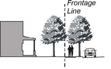
A.
Common Yard. The building facade is substantially set back from the front property line. The resulting front yard may be fenced in compliance with Section 88.30.020 (Fences, Walls, and Screening). A front porch is optional, but is preferred in neighborhoods designated by Article 2, and may be required by the review authority.
_____
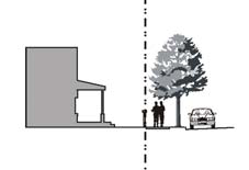
B.
Porch. The building facade is set back from the front property line behind a porch, which may encroach into a required front setback as allowed by the applicable zone. A low fence or wall at the property line may be used to define the private space of the yard. A variety of porch designs are acceptable, provided that a porch has a minimum depth of eight feet.
_____
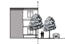
C.
Forecourt. The building facade is aligned close to the front property line with a portion of the facade set back. The resulting forecourt is suitable for gardens, restaurant seating, or an entry plaza. This type should be used sparingly and in conjunction with the types in subsections D. through G. of this Section, as an extensive setback deters pedestrians. Trees within forecourts should be placed to have their canopies overhang the street sidewalk. A short wall may also be placed at the property line. If a forecourt is no more than 20 feet wide, it does not count against the building placement requirements of Article 2 that require a percentage of the building frontage at the back of the sidewalk.
_____
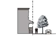
D.
Stoop. The building facade is placed close to the front property line with the ground floor elevated a minimum of 24 inches above the sidewalk. This type is suitable for ground-floor residential use with a minimal front setback.
_____
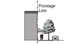
E.
Shopfront. This building façade is intended for retail use and is commonly equipped with an awning, when located adjacent to the property line. An awning that extends over the sidewalk requires an encroachment permit.
_____
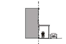
F.
Gallery. The building facade is placed at or close to the front property line with an attached cantilevered shed or lightweight colonade overlapping the sidewalk. This type is appropriate for retail use. The gallery shall be at least ten feet wide and shall overlap the entire width of the sidewalk to within two feet of the curb. The gallery shall be at least 12 feet in clear height above the sidewalk. Any portion of a building that extends over the sidewalk shall require an encroachment permit from the city.
_____
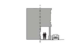
G.
Arcade. The building facade is above a colonade that overlaps the sidewalk, while the sidewalk level remains at the front property line. This type is appropriate for retail use. The arcade shall be at least 12 feet wide and shall overlap the entire width of the sidewalk to within two feet of the curb. The arcade shall provide at least 12 feet of clear height above the sidewalk. Any portion of a building that extends over a public right-of-way shall require encroachment permit approval.
_____
(Ord. No. 11-O16, § 3, 10-24-11)