
Beloit City Zoning Code
ARTICLE V
- OVERLAY AND SPECIAL PURPOSE DISTRICTS Rn. #3344
5-100 - PLI, PUBLIC LANDS AND INSTITUTIONS DISTRICT.
5-101
DESCRIPTION. Although large public and institutional uses are intended to be zoned "PLI," some public and quasi-public uses are allowed within residential, commercial and industrial zoning districts. The PLI, Public Lands and Institutions district is a special purpose district that is intended to accommodate major public and quasi-public uses. (Am. #3719)
5-102
ALLOWED USES.
a.
Uses Permitted By-Right. The following uses shall be permitted by-right in the PLI district:
1.
Arboretums.
2.
Boat launching areas and ramps.
3.
Cemeteries.
4.
Greenbelts.
5.
Museums, libraries, zoos, historic and cultural exhibits.
6.
Other public buildings, such as fire and police stations and municipal buildings.
7.
Parks, playgrounds, playfields, swimming pools, golf courses and open spaces.
8.
Public and nonprofit quasi-public institutions, such as colleges, elementary, middle and senior high schools, and hospitals. (Am. #3719)
9.
Recreation (public) buildings.
10.
Religious Institutions.
11.
Post offices.
12.
Accessory buildings and uses.
13.
Veterans of Foreign Wars (VFW) Facilities owned or leased by any local VFW Post affiliated and in good standing with the Veterans of Foreign Wars of the United States.
14.
Wireless communications (only alternative tower structures, antenna support structures and equipment facilities).
15.
Day care centers and community service uses. (Cr. #3518, Am. #3708)
b.
Conditional Uses. (Am. #3365) The following conditional uses shall be allowed in the PLI district only if reviewed and approved in accordance with the Conditional Use Permit procedures of Section 2-500:
1.
Public utility facilities.
(a)
Electrical substations.
(b)
Gas regulator stations.
(c)
Radio and television towers.
(d)
Telephone exchanges, telephone transmission equipment buildings and microwave relay towers.
(e)
Water towers and pumping stations.
(f)
Sewage treatment plants (community.)
2.
Public and quasipublic transportation facilities.
(a)
Bus terminals.
(b)
Airports.
3.
Band shells and auditoriums.
4.
Wireless communications towers.
5.
Liquor sales in conjunction with a use that is allowed in the PLI district.
5-103
DENSITY/INTENSITY AND DIMENSIONAL STANDARDS. (Am. #3518) Development in the PLI district shall be subject to the Density/Intensity and Dimensional Standards applicable in the most restrictive adjacent district.
5-200 - DH, DEVELOPMENT HOLDING DISTRICT.
5-201
DESCRIPTION. (Am. #3365) The DH, Development Holding district is a special purpose district that is intended to provide a suitable zoning classification for areas that are not yet suitable for urban or suburban intensity development because of the lack of public facilities and services in the general area. Use of the DH classification will allow the City to avoid premature or inappropriate development that cannot be provided with utility service, and permit only very low-density development until such time that utility services and community services can be provided. When facilities and services are adequate to provide necessary services to the subject area, the DH classification may be removed and the property may be rezoned in accordance with the Zoning Map Amendment procedures of Section 2-300.
5-202
ALLOWED USES.
a.
Uses Permitted By-Right. The following uses shall be permitted by-right in the DH district:
1.
Agriculture.
2.
Golf courses.
3.
Greenhouses and nurseries.
4.
Public and quasipublic parks, playgrounds, and other open recreation areas.
5.
Forest preserves and reservations.
6.
Single-family dwellings.
7.
Wireless communications (alternative tower structures, antenna support structures, and equipment facilities).
b.
Conditional Uses. (Am. #3365) The following uses shall be allowed only if reviewed and approved in accordance with the procedures of Section 2-500:
1.
Baseball or softball fields.
2.
Golf driving ranges.
3.
Pitch and putt ranges.
4.
Archery ranges.
5.
Riding stables.
6.
Skeet and trap shooting areas.
7.
Tennis courts.
8.
Croquet courts.
9.
Miniature golf courses.
10.
Wireless communications towers.
11.
Contractor offices and storage yards. (Cr. #3524)
5-203
DENSITY/INTENSITY AND DIMENSIONAL STANDARDS. Development in the DH district shall be subject to the following Density/Intensity and Dimensional standards:
5-204
ADDITIONAL REGULATIONS. Livestock, as defined in Section 7.243(1) of the Code of General Ordinances, may be kept in the DH, Development Holding District, provided that all required permits are obtained. A minimum lot area of 5 acres shall be required for the keeping of any livestock. A maximum of one animal unit shall be allowed per full acre of land area. One animal unit shall be the equivalent of: one horse or pony, steer, bull, cow, heifer or calf; or 5 swine; or 10 sheep or goats; or 20 chickens, ducks, turkeys or pheasants.
5-300 - PUD, PLANNED UNIT DEVELOPMENT DISTRICT.
5-301
DESCRIPTION. The PUD, Planned Unit Development district is a special purpose zoning district that permits greater flexibility of land planning and site design than conventional zoning districts. PUD zoning districts are used to:
a.
Provide flexibility in architectural design, placement, and clustering of buildings; use of open areas and outdoor living areas; provision of circulation facilities and parking; and related site and design considerations;
b.
Encourage the conservation of natural features;
c.
Provide for efficient use of public services and improvements;
d.
Encourage and preserve opportunities for energy efficient development;
e.
Promote attractive and functional business environments in nonresidential zones that are compatible with surrounding development;
f.
Promote an attractive and safe living environment in residential zones; and
g.
Accommodate well-planned, mixed-use developments through a site planning process.
5-302
APPLICABILITY. A PUD district may be approved only when the applicant demonstrates to the satisfaction of the City Council that a proposed PUD district and site plan would result in a greater benefit to the City than would development under conventional (base) zoning district regulations.
5-303
DEVELOPER'S STATEMENT OF INTENT. Each application for PUD zoning and Master Land Use Plan approval must include a comparison of the proposed development with the otherwise applicable zoning standards. Applications must also include a statement by the applicant describing how the proposed development provides greater benefits to the City than would a development carried out in accordance with otherwise applicable regulations of this chapter.
5-304
EFFECT OF OTHER ZONING DISTRICT STANDARDS. (Am. #3365) Except as expressly authorized by the regulations of this section and approved as part of a PUD plan in accordance with the procedures of Section 2-400, all of the standards of this chapter apply to development within a PUD.
5-305
STANDARDS TO BE ESTABLISHED. The following standards shall be established by the City Council during the PUD Master Land Use Plan approval process:
a.
Allowed Uses. The City Council shall establish a list of uses allowed in the subject PUD zoning district at the time of PUD Master Land Use Plan approval.
b.
Density/Intensity and Lot Size. The City Council shall establish maximum density/intensity and lot size standards at the time of PUD Master Land Use Plan approval.
c.
Setbacks. The City Council shall establish the minimum setback standards at the time of PUD Master Land Use Plan approval. Unless otherwise expressly approved during the PUD review and approval process, buildings located on the periphery of the PUD must be setback a minimum of 30 feet from the PUD district boundary.
d.
Height. The City Council shall establish maximum height limits at the time of PUD Master Land Use Plan approval.
e.
Building Coverage. The City Council shall establish maximum building coverage limits at the time of PUD Master Land Use Plan approval.
5-306
ADDITIONAL REQUIREMENTS AND STANDARDS.
a.
Approval Procedures. (Am. #3365) PUDs must be reviewed and approved in accordance with the procedures of Section 2-400. The approved PUD Final Plan shall control development within a PUD.
b.
Roadway Access. (Am. #3365) Unless otherwise expressly approved during the PUD approval process of Section 2-400, principal vehicular access to PUDs must be from Collector and higher classification streets. Any PUD containing over 25 dwelling units or 24,000 square feet of nonresidential floor space must provide at least 2 access points.
c.
Open Space. At least 15 percent of the gross land area in PUDs must consist of open space.
d.
Preservation of Natural Features. Mature trees, vegetative cover, watercourses and other natural site features must be preserved to the maximum extent possible.
e.
Additional Conditions. As part of the PUD approval process, the Plan Commission may recommend and the City Council shall be authorized to impose such other conditions as are necessary to accomplish the purposes of this chapter.
5-400 - FLOODPLAIN ZONING DISTRICTS. (Rep. & recr. #3557)
DIVISION 1. STATUTORY AUTHORIZATION, FINDING OF FACT, STATEMENT OF PURPOSE, TITLE AND GENERAL PROVISIONS
5-401
STATUTORY AUTHORIZATION. This section is adopted pursuant to the authorization in §62.23, Wis. Stats., and the requirements in §87.30, Wis. Stats.
5-402
FINDING OF FACT. Uncontrolled development and use of the floodplains and rivers of the City of Beloit would impair the public health, safety, convenience, general welfare and tax base.
5-403
STATEMENT OF PURPOSE. This section is intended to regulate floodplain development to:
a.
Protect life, health and property;
b.
Minimize expenditures of public funds for flood control projects;
c.
Minimize rescue and relief efforts undertaken at the expense of the taxpayers;
d.
Minimize business interruptions and other economic disruptions;
e.
Minimize damage to public facilities in the floodplain;
f.
Minimize the occurrence of future flood blight areas in the floodplain;
g.
Discourage the victimization of unwary land and homebuyers;
h.
Prevent increases in flood heights that could increase flood damage and result in conflicts between property owners; and
i.
Discourage development in a floodplain if there is any practicable alternative to locate the activity, use or structure outside of the floodplain.
5-404
TITLE. This section shall be known as the Floodplain Zoning Ordinance for the City of Beloit, Wisconsin.
5-405
GENERAL PROVISIONS.
a.
Areas to be Regulated. This section regulates all areas that would be covered by the regional flood or base flood as shown on the flood insurance rate map (FIRM) or other maps approved by the Department of Natural Resources (DNR). Base flood elevations are derived from the flood profiles in the flood insurance study (FIS) and are shown as AE, A1-30, and AH zones on the FIRM. Other regulatory zones are displayed as A and AO zones. Regional flood elevations (RFE) may be derived from other studies. If more than one map or revision is referenced, the most restrictive information shall apply.
b.
Official Maps and Revisions. The boundaries of all floodplain districts are designated as A, AE, AH, AO or A1-30 on the maps based on the flood insurance study (FIS) listed below. Any change to the base flood elevations (BFE) or any changes to the boundaries of the floodplain or floodway in the FIS or on the flood insurance rate map (FIRM) must be reviewed and approved by the DNR and FEMA through the Letter of Map Change process (see Division 8, Amendments ) before it is effective. No changes to RFEs on non-FEMA maps shall be effective until approved by the DNR. These maps and revisions are on file in the office of the City Engineer for the City of Beloit. If more than one map or revision is referenced, the most restrictive information shall apply.
Flood insurance rate map (FIRM), panel numbers 55105C0308E, 55105C0309E, 55105C0312E, 55105C0314E, 55105C0316E, 55105C0317E, 55105C0318E, 55105C0319E, 55105C0336E, 55105C0337E, 55105C0338E, 55105C0339E, 55105C0430E, 55105C0431E, 55105C0432E, and 55105C0455E, dated September 16, 2015; with corresponding profiles that are based on the flood insurance study (FIS) dated September 16, 2015, volume numbers 55105CV001B and 55105CV002B.
c.
Establishment of Floodplain Zoning Districts. The regional floodplain areas are divided into 3 districts as follows:
1.
The floodway district (FW) is the channel of a river or stream and those portions of the floodplain adjoining the channel required to carry the regional floodwaters and are contained within AE zones as shown on the FIRM.
2.
The floodfringe district (FF) is that portion between the regional flood limits and the floodway and displayed as AE zones on the FIRM.
3.
The general floodplain district (GFP) is those areas that may be covered by floodwater during the regional flood and does not have a BFE or floodway boundary determined, including A, AH and AO zones on the FIRM.
d.
Locating Floodplain Boundaries. Discrepancies between boundaries on the official floodplain zoning map and actual field conditions shall be resolved using the criteria in paragraphs (1) and (2) below. If a significant difference exists, the map shall be amended according to Division 8 , Amendments. The Zoning Officer can rely on a boundary derived from a profile elevation to grant or deny a land use permit, whether or not a map amendment is required. The Zoning Officer shall be responsible for documenting actual pre-development field conditions and the basis upon which the district boundary was determined and for initiating any map amendments required under this section. Disputes between the Zoning Officer and an applicant over the district boundary line shall be settled according to section 5-426(c) and the criteria in paragraphs (1) and (2) below. Where the flood profiles are based on established base flood elevations from a FIRM, FEMA must approve any map amendment or revision pursuant to Division 8 , Amendments.
1.
If flood profiles exist, the map scale and the profile elevations shall determine the district boundary. The regional or base flood elevations shall govern if there are any discrepancies.
2.
Where flood profiles do not exist for projects, the location of the boundary shall be determined by the map scale.
e.
Removal of Lands from Floodplain. Compliance with the provisions of this section shall not be grounds for removing land from the floodplain unless it is filled at least 2 feet above the regional or base flood elevation, the fill is contiguous to land outside the floodplain, and the map is amended pursuant to Division 8, Amendments .
f.
Compliance. Any development or use within the areas regulated by this section shall be in compliance with the terms of this section, and other applicable local, state, and federal regulations.
g.
Municipalities and State Agencies Regulated. Unless specifically exempted by law, all cities, villages, towns, and counties are required to comply with this section and obtain all necessary permits. State agencies are required to comply if §13.48(13), Wis. Stats., applies. The construction, reconstruction, maintenance and repair of state highways and bridges by the Wisconsin Department of Transportation are exempt when §30.2022, Wis. Stats., applies.
h.
Abrogation and Greater Restrictions.
1.
This section supersedes all the provisions of any municipal zoning ordinance enacted under §62.23, Wis. Stats., or §87.30, Wis. Stats., which relate to floodplains. A more restrictive ordinance shall continue in full force and effect to the extent of the greater restrictions, but not otherwise.
2.
This section is not intended to repeal, abrogate or impair any existing deed restrictions, covenants or easements. If this section imposes greater restrictions, the provisions of this section shall prevail.
i.
Interpretation. In their interpretation and application, the provisions of this section are the minimum requirements liberally construed in favor of the City and are not a limitation on or repeal of any other powers granted by the Wisconsin Statutes. If a provision of this section, required by Ch. NR 116, Wis. Adm. Code, is unclear, the provision shall be interpreted in light of the standards in effect on the date of the adoption of this section or in effect on the date of the most recent text amendment to this section.
j.
Warning and Disclaimer of Liability. The flood protection standards in this section are based on engineering experience and research. Larger floods may occur or the flood height may be increased by man-made or natural causes. This section does not imply or guarantee that non-floodplain areas or permitted floodplain uses will be free from flooding and flood damages. This section does not create liability on the part of, or a cause of action against, the City of Beloit or any officer or employee thereof for any flood damage that may result from reliance on this section.
k.
Severability. Should any portion of this section be declared unconstitutional or invalid by a court of competent jurisdiction, the remainder of this section shall not be affected.
l.
Annexed Areas. The Rock County floodplain zoning provisions in effect on the date of annexation shall remain in effect and shall be enforced by the City of Beloit for all annexed areas until the City of Beloit adopts and enforces an ordinance which meets the requirements of Ch. NR 116, Wis. Adm. Code, and 44 CFR 59-72, National Flood Insurance Program (NFIP). These annexed lands are described on the City of Beloit's official zoning map. County floodplain zoning provisions are incorporated by reference for the purpose of administering this section and are on file in the office of the Department of Community Development. All plats or maps of annexation shall show the regional flood elevation and the floodway location.
m.
General Development Standards. The City shall review all permit applications to determine whether proposed building sites will be reasonably safe from flooding. If a proposed building site is in a flood-prone area, all new construction and substantial improvements shall be designed and anchored to prevent flotation, collapse, or lateral movement of the structure resulting from hydrodynamic and hydrostatic loads; be constructed with flood-resistant materials; be constructed to minimize flood damages and to ensure that utility and mechanical equipment is designed and/or located so as to prevent water from entering or accumulating within the equipment during conditions of flooding. Subdivisions shall be reviewed for compliance with the above standards. All subdivision proposals (including manufactured home parks) shall include regional flood elevation and floodway data for any development that meets the subdivision definition of this section and all other requirements in Section 5-424(b). Adequate drainage shall be provided to reduce exposure to flood hazards and all public utilities and facilities, such as sewer, gas, electrical, and water systems are located and constructed to minimize or eliminate flood damages.
DIVISION 2. GENERAL STANDARDS APPLICABLE TO ALL FLOODPLAIN DISTRICTS
5-406
HYDRAULIC AND HYDROLOGIC ANALYSES.
a.
No floodplain development shall:
1.
Obstruct flow, defined as development which blocks the conveyance of floodwaters by itself or with other development, causing any increase in the regional flood height; or
2.
Cause any increase in the regional flood height due to floodplain storage area lost.
b.
The Zoning Officer shall deny permits if it is determined the proposed development will obstruct flow or cause any increase in the regional flood height, based on the officially adopted FIRM or other adopted map, unless the provisions of Division 8, Amendments are met.
5-407
WATERCOURSE ALTERATIONS.
a.
No land use permit to alter or relocate a watercourse in a mapped floodplain shall be issued until the local official has notified in writing all adjacent municipalities, the Department and FEMA regional offices, and required the applicant to secure all necessary state and federal permits. The standards of Section 5-406 must be met and the flood carrying capacity of any altered or relocated watercourse shall be maintained.
b.
As soon as is practicable, but not later than 6 months after the date of the watercourse alteration or relocation, and pursuant to Division 8, Amendments , the City of Beloit shall apply for a letter of map revision (LOMR) from FEMA. Any such alterations must be reviewed and approved by FEMA and the DNR through the letter of map change (LOMC) process.
5-408
CHAPTERS 30, 31, WIS. STATS., DEVELOPMENT . Development which requires a permit from the Department, under Chs. 30 and 31, Wis. Stats., such as docks, piers, wharves, bridges, culverts, dams and navigational aids, may be allowed if the necessary permits are obtained and amendments to the floodplain zoning ordinance are made according to Division 8, Amendments .
5-409
PUBLIC OR PRIVATE CAMPGROUNDS. Public or private campgrounds shall have a low flood damage potential and shall meet the following provisions:
a.
The campground is approved by the Department of Health Services;
b.
A land use permit for the campground is issued by the Zoning Officer;
c.
The character of the river system and the campground elevation is such that a 72-hour warning of an impending flood can be given to all campground occupants;
d.
There is an adequate flood warning procedure for the campground that offers the minimum notice required under this section to all persons in the campground. This procedure shall include a written agreement between the campground owner, the municipal emergency government coordinator and the chief law enforcement official which specifies the flood elevation at which evacuation shall occur, personnel responsible for monitoring flood elevations, types of warning systems to be used and the procedures for notifying at-risk parties, and the methods and personnel responsible for conducting the evacuation;
e.
This agreement shall be for no more than one calendar year, at which time the agreement shall be reviewed and updated by the officials identified in Section 5-409(d) to remain in compliance with all applicable regulations, including those of the state Department of Health Services and all other applicable regulations;
f.
Only camping units that are fully licensed, if required, and ready for highway use are allowed;
g.
The camping units shall not occupy any site in the campground for more than 180 consecutive days, at which time the camping unit must be removed from the floodplain for a minimum of 24 hours;
h.
All camping units that remain on site for more than 30 days shall be issued a limited authorization by the campground operator, a written copy of which is kept on file at the campground. Such authorization shall allow placement of a camping unit for a period not to exceed 180 days and shall ensure compliance with all the provisions of this section;
i.
The City of Beloit shall monitor the limited authorizations issued by the campground operator to assure compliance with the terms of this section;
j.
All camping units that remain in place for more than 180 consecutive days must meet the applicable requirements in either Division 3, Floodway District; Division 4, Floodfringe District; or Division 5, General Floodplain District for the floodplain district in which the structure is located;
k.
The campground shall have signs clearly posted at all entrances warning of the flood hazard and the procedures for evacuation when a flood warning is issued; and
l.
All service facilities, including but not limited to refuse collection, electrical service, gas lines, propane tanks, sewage systems and wells shall be properly anchored and placed at or floodproofed to the flood protection elevation.
DIVISION 3. FLOODWAY DISTRICT (FW)
5-410
APPLICABILITY. This section applies to all floodway areas on the floodplain zoning maps and those identified pursuant to Section 5-420.
5-411
PERMITTED USES. The following open space uses are allowed in the floodway district and the floodway areas of the general floodplain district, if:
•
They are not prohibited by any other ordinance;
•
They meet the standards in Section 5-412 and Section 5-413; and
•
All permits or certificates have been issued according to Section 5-424:
a.
Agricultural uses, such as: farming, outdoor plant nurseries, horticulture, viticulture and wild crop harvesting.
b.
Nonstructural industrial and commercial uses, such as loading areas, parking areas and airport landing strips.
c.
Nonstructural recreational uses, such as golf courses, tennis courts, archery ranges, picnic grounds, boat ramps, swimming areas, parks, wildlife and nature preserves, game farms, fish hatcheries, shooting, trap and skeet activities, hunting and fishing areas and hiking and horseback riding trails, subject to the fill limitations of Section 5-412(d).
d.
Uses or structures accessory to open space uses, or classified as historic structures that comply with Section 5-412 and Section 5-413.
e.
Extraction of sand, gravel or other materials that comply with Section 5-412(d).
f.
Functionally water-dependent uses, such as docks, piers or wharves, dams, flowage areas, culverts, navigational aids and river crossings of transmission lines, and pipelines that comply with Chs. 30 and 31, Wis. Stats.
g.
Public utilities, streets and bridges that comply with Section 5-412(c).
5-412
STANDARDS FOR DEVELOPMENTS IN THE FLOODWAY.
a.
General.
1.
Any development in the floodway shall comply with Division 2, General Standards Applicable to All Floodplain Districts , and have a low flood damage potential.
2.
Applicants shall provide the following data to determine the effects of the proposal according to Section 5-406 and Section 5-424(b)(3):
(a)
A cross section elevation view of the proposal, perpendicular to the watercourse, showing if the proposed development will obstruct flow; or
(b)
An analysis calculating the effects of this proposal on regional flood height.
3.
The Zoning Officer shall deny the permit application if the project will cause any increase in the flood elevations upstream or downstream, based on the data submitted for paragraph (2) above.
b.
Structures. Structures accessory to permanent open space uses or functionally dependent on a waterfront location may be allowed by permit if the structures comply with the following criteria:
1.
Not designed for human habitation, does not have a high flood damage potential and is constructed to minimize flood damage;
2.
Shall have a minimum of two openings on different walls having a total net area not less than one square inch for every square foot of enclosed area, and the bottom of all such openings being no higher than one foot above grade. The openings shall be equipped with screens, louvers, or other coverings or devices, provided that they permit the automatic entry and exit of floodwaters;
3.
Must be anchored to resist flotation, collapse, and lateral movement;
4.
Mechanical and utility equipment must be elevated or flood proofed to or above the flood protection elevation; and
5.
It must not obstruct flow of floodwaters or cause any increase in flood levels during the occurrence of the regional flood.
c.
Public Utilities, Streets and Bridges. Public utilities, streets and bridges may be allowed by permit, if:
1.
Adequate floodproofing measures are provided to the flood protection elevation; and
2.
Construction meets the development standards of Section 5-406.
d.
Fills or Deposition of Materials. Fills or deposition of materials may be allowed by permit, if:
1.
The requirements of Section 5-406 are met;
2.
No material is deposited in navigable waters unless a permit is issued by the Department pursuant to Ch. 30, Wis. Stats., and a permit pursuant to § 404 of the Federal Water Pollution Control Act, Amendments of 1972, 33 U.S.C. 1344 has been issued, if applicable, and all other requirements have been met;
3.
The fill or other materials will be protected against erosion by riprap, vegetative cover, sheet piling or bulkheading; and
4.
The fill is not classified as a solid or hazardous material.
5-413
PROHIBITED USES. All uses not listed as permitted uses in Section 5-411 are prohibited, including the following uses:
a.
Habitable structures, structures with high flood damage potential, or those not associated with permanent open space uses;
b.
Storing materials that are buoyant, flammable, explosive, injurious to property, water quality, or human, animal, plant, fish or other aquatic life;
c.
Uses not in harmony with or detrimental to uses permitted in the adjoining districts;
d.
Any private or public sewage systems, except portable latrines that are removed prior to flooding and systems associated with recreational areas and department-approved campgrounds that meet the applicable provisions of local ordinances and Ch. SPS 383, Wis. Adm. Code;
e.
Any public or private wells which are used to obtain potable water, except those for recreational areas that meet the requirements of local ordinances and Chs. NR 811 and NR 812, Wis. Adm. Code;
f.
Any solid or hazardous waste disposal sites;
g.
Any wastewater treatment ponds or facilities, except those permitted under §NR 110.15(3)(b), Wis. Adm. Code; and
h.
Any sanitary sewer or water supply lines, except those to service existing or proposed development located outside the floodway which complies with the regulations for the floodplain area occupied.
DIVISION 4. FLOODFRINGE DISTRICT (FF)
5-414
APPLICABILITY. This section applies to all floodfringe areas shown on the floodplain zoning maps and those identified pursuant to Section 5-420.
5-415
PERMITTED USES. Any structure, land use, or development is allowed in the floodfringe district if the standards in Section 5-416 are met, the use is not prohibited by this or any other ordinance or regulation and all permits or certificates specified in Section 5-424 have been issued.
5-416
STANDARDS FOR DEVELOPMENT IN THE FLOODFRINGE. Section 5-406 shall apply in addition to the following requirements according to the use requested. Any existing structure in the floodfringe must meet the requirements of Division 6, Nonconforming Uses .
a.
Residential Uses. Any structure, including a manufactured home, which is to be newly constructed or moved into the floodfringe, shall meet or exceed the following standards. Any existing structure in the floodfringe must meet the requirements of Division 6, Nonconforming Uses .
1.
The elevation of the lowest floor shall be at or above the flood protection elevation on fill unless the requirements of Section 5-416(a)(2) can be met. The fill shall be one foot or more above the regional flood elevation extending at least 15 feet beyond the limits of the structure.
2.
The basement or crawlway floor may be placed at the regional flood elevation if it is dry floodproofed to the flood protection elevation. No basement or crawlway floor is allowed below the regional flood elevation.
3.
Contiguous dryland access shall be provided from a structure to land outside of the floodplain, except as provided in paragraph (4).
4.
In developments where existing street or sewer line elevations make compliance with paragraph (3) impractical, the City of Beloit may permit new development and substantial improvements where roads are below the regional flood elevation, if:
(a)
The City of Beloit has written assurance from police, fire and emergency services that rescue and relief will be provided to the structure(s) by wheeled vehicles during a regional flood event; or
(b)
The City of Beloit has a DNR-approved emergency evacuation plan.
b.
Accessory Structures or Uses. Accessory structures shall be constructed on fill with the lowest floor at or above the regional flood elevation.
c.
Commercial Uses. Any commercial structure which is erected, altered or moved into the floodfringe shall meet the requirements of Section 5-416(a). Subject to the requirements of Section 5-416(e), storage yards, surface parking lots and other such uses may be placed at lower elevations if an adequate warning system exists to protect life and property.
d.
Manufacturing and Industrial Uses. Any manufacturing or industrial structure which is erected, altered or moved into the floodfringe shall have the lowest floor elevated to or above the flood protection elevation or meet the floodproofing standards in Section 5-428. Subject to the requirements of Section 5-416(e), storage yards, surface parking lots and other such uses may be placed at lower elevations if an adequate warning system exists to protect life and property.
e.
Storage of Materials. Materials that are buoyant, flammable, explosive, or injurious to property, water quality or human, animal, plant, fish or aquatic life shall be stored at or above the flood protection elevation or floodproofed in compliance with Section 5-428. Adequate measures shall be taken to ensure that such materials will not enter the water body during flooding.
f.
Public Utilities, Streets and Bridges. All utilities, streets and bridges shall be designed to be compatible with comprehensive floodplain development plans.
1.
When failure of public utilities, streets and bridges would endanger public health or safety, or where such facilities are deemed essential, construction or repair of such facilities shall only be permitted if they are designed to comply with Section 5-428.
2.
Minor roads or nonessential utilities may be constructed at lower elevations if they are designed to withstand flood forces to the regional flood elevation.
g.
Sewage Systems. All sewage disposal systems shall be designed to minimize or eliminate infiltration of floodwater into the system, pursuant to Section 5-428(c), to the flood protection elevation and meet the provisions of all local ordinances and Ch. SPS 383, Wis. Adm. Code.
h.
Wells. All wells shall be designed to minimize or eliminate infiltration of floodwaters into the system, pursuant to Section 5-428(c), to the flood protection elevation and shall meet the provisions of Chs. NR 811 and NR 812, Wis. Adm. Code.
i.
Solid Waste Disposal Sites. Disposal of solid or hazardous waste is prohibited in floodfringe areas.
j.
Deposition of Materials. Any deposited material must meet all the provisions of this section.
k.
Manufactured Homes.
1.
Owners or operators of all manufactured home parks and subdivisions shall provide adequate surface drainage to minimize flood damage, and prepare, secure approval and file an evacuation plan, indicating vehicular access and escape routes, with local emergency management authorities.
2.
In existing manufactured home parks, all new homes, replacement homes on existing pads, and substantially improved homes shall:
(a)
have the lowest floor elevated to the flood protection elevation; and
(b)
be anchored so they do not float, collapse or move laterally during a flood.
3.
Outside of existing manufactured home parks, including new manufactured home parks and all single units outside of existing parks, all new, replacement and substantially improved manufactured homes shall meet the residential development standards for the floodfringe in Section 5-416(a).
l.
Mobile Recreational Vehicles. All mobile recreational vehicles that are on site for 180 consecutive days or more or are not fully licensed and ready for highway use shall meet the elevation and anchoring requirements in Section 5-416(k)(2) and (3). A mobile recreational vehicle is ready for highway use if it is on its wheels or jacking system, is attached to the site only by quick-disconnect utilities and security devices and has no permanently attached additions.
DIVISION 5. GENERAL FLOODPLAIN DISTRICT (GFP)
5-417
APPLICABILITY. The provisions for this district shall apply to all floodplains mapped as A, AO or AH zones.
5-418
PERMITTED USES. Pursuant to Section 5-420, it shall be determined whether the proposed use is located within the floodway or floodfringe. Those uses permitted in the Floodway (Section 5-411) and Floodfringe (Section 5-415) Districts are allowed within the general floodplain district, according to the standards of Section 5-419, provided that all permits or certificates required under Section 5-424 have been issued.
5-419
STANDARDS FOR DEVELOPMENT IN THE GENERAL FLOODPLAIN DISTRICT. Division 3, Floodway District applies to floodway areas and Division 4, Floodfringe District applies to floodfringe areas. The rest of this section applies to either district.
a.
In AO/AH zones, the structure's lowest floor must meet one of the conditions listed below, whichever is higher:
1.
At or above the flood protection elevation; or
2.
Two feet above the highest adjacent grade around the structure; or
3.
The depth as shown on the FIRM.
b.
In AO/AH zones, provide plans showing adequate drainage paths to guide floodwaters around structures.
5-420
DETERMINING FLOODWAY AND FLOODFRINGE LIMITS. Upon receiving an application for development within the general floodplain district, the Zoning Officer shall:
a.
Require the applicant to submit 2 copies of an aerial photograph or a plan which shows the proposed development with respect to the general floodplain district limits, stream channel, and existing floodplain developments, along with a legal description of the property, fill limits and elevations, building floor elevations and flood proofing measures; and the flood zone as shown on the FIRM.
b.
Require the applicant to furnish any of the following information deemed necessary by the department to evaluate the effects of the proposal upon flood height and flood flows, regional flood elevation and to determine floodway boundaries:
1.
A hydrologic and hydraulic study as specified in Section 5-424(b)(3).
2.
Plan (surface view) showing elevations or contours of the ground; pertinent structure, fill or storage elevations; size, location and layout of all proposed and existing structures on the site; location and elevations of streets, water supply, and sanitary facilities; soil types and other pertinent information.
3.
Specifications for building construction and materials, floodproofing, filling, dredging, channel improvement, storage, water supply and sanitary facilities.
DIVISION 6. NONCONFORMING USES
5-421
GENERAL.
a.
Applicability. If these standards conform with §62.23(7)(h), Wis. Stats., they shall apply to all modifications or additions to any nonconforming use or structure and to the use of any structure or premises which was lawful before the passage of this ordinance or any amendment thereto.
b.
The existing lawful use of a structure or its accessory use which is not in conformity with the provisions of this section may continue subject to the following conditions:
1.
No modifications or additions to a nonconforming use or structure shall be permitted unless they comply with this section. The words "modification" and "addition" include, but are not limited to, any alteration, addition, modification, structural repair, rebuilding or replacement of any such existing use, structure or accessory structure or use. Maintenance is not considered a modification. This includes painting, decorating, paneling and other nonstructural components and the maintenance, repair or replacement of existing private sewage or water supply systems or connections to public utilities. Any costs associated with the repair of a damaged structure are not considered maintenance.
The construction of a deck that does not exceed 200 square feet and that is adjacent to the exterior wall of a principal structure is not an extension, modification or addition. The roof of the structure may extend over a portion of the deck in order to provide safe ingress and egress to the principal structure.
2.
If a nonconforming use or the use of a nonconforming structure is discontinued for 12 consecutive months, it is no longer permitted and any future use of the property, and any structure or building thereon shall conform to the applicable requirements of this section.
3.
The City of Beloit shall keep a record which lists all nonconforming uses and nonconforming structures, their present equalized assessed value, the cost of all modifications or additions which have been permitted, and the percentage of the structure's total current value those modifications represent.
4.
No modification or addition to any nonconforming structure or any structure with a nonconforming use, which over the life of the structure would equal or exceed 50 percent of its present equalized assessed value, shall be allowed unless the entire structure is permanently changed to a conforming structure with a conforming use in compliance with the applicable requirements of this ordinance. Contiguous dryland access must be provided for residential and commercial uses in compliance with Section 5-416(a). The costs of elevating the lowest floor of a nonconforming building or a building with a nonconforming use to the flood protection elevation are excluded from the 50 percent provisions of this paragraph.
5.
No maintenance to any nonconforming structure or any structure with a nonconforming use, the cost of which would equal or exceed 50 percent of its present equalized assessed value, shall be allowed unless the entire structure is permanently changed to a conforming structure with a conforming use in compliance with the applicable requirements of this ordinance. Contiguous dryland access must be provided for residential and commercial uses in compliance with Section 5-416(a).
6.
If on a per event basis the total value of the work being done under paragraphs 4 and 5 equals or exceeds 50 percent of the present equalized assessed value, the work shall not be permitted unless the entire structure is permanently changed to a conforming structure with a conforming use in compliance with the applicable requirements of this section. Contiguous dryland access must be provided for residential and commercial uses in compliance with Section 5-416(a).
7.
Except as provided in paragraph 8, if any nonconforming structure or any structure with a nonconforming use is destroyed or is substantially damaged, it cannot be replaced, reconstructed or rebuilt unless the use and the structure meet the current ordinance requirements. A structure is considered substantially damaged if the total cost to restore the structure to its pre-damaged condition equals or exceeds 50 percent of the structure's present equalized assessed value.
8.
For nonconforming buildings that are substantially damaged or destroyed by a nonflood disaster, the repair or reconstruction of any such nonconforming building shall be permitted in order to restore it to the size and use in effect prior to the damage event, provided that the minimum federal code requirements below are met and all required permits have been granted prior to the start of construction.
(a)
Residential Structures.
(1)
Shall have the lowest floor, including basement, elevated to or above the base flood elevation using fill, pilings, columns, posts or perimeter walls. Perimeter walls must meet the requirements of Section 5-428b.
(2)
Shall be anchored to prevent flotation, collapse, or lateral movement of the structure resulting from hydrodynamic and hydrostatic loads, including the effects of buoyancy and shall be constructed with methods and materials resistant to flood damage.
(3)
Shall be constructed with electrical, heating, ventilation, plumbing and air conditioning equipment and other service facilities that are designed and/or elevated so as to prevent water from entering or accumulating within the components during conditions of flooding.
(4)
In A zones, obtain, review and utilize any flood data available from a federal, state or other source.
(5)
In AO zones with no elevations specified, shall have the lowest floor, including basement, meet the standards in Section 5-419.
(6)
In AO zones, shall have adequate drainage paths around structures on slopes to guide floodwaters around and away from the structure.
(b)
Nonresidential Structures.
(1)
Shall meet the requirements of Section 5-421(b)(8)(a)(1-6).
(2)
Shall either have the lowest floor, including basement, elevated to or above the regional flood elevation; or, together with attendant utility and sanitary facilities, shall meet the standards in Section 5-428(a) or Section 5-428(b).
(3)
In AO zones with no elevations specified, shall have the lowest floor, including basement, meet the standards in Section 5-419(a).
c.
A nonconforming historic structure may be altered if the alteration will not preclude the structure's continued designation as a historic structure, the alteration will comply with Section 5-412(a), flood-resistant materials are used, and construction practices and floodproofing methods that comply with Section 5-428 are used. Repair or rehabilitation of historic structures shall be exempt from the development standards of Section 5-421(b)(8)(a) if it is determined that the proposed repair or rehabilitation will not preclude the structure's continued designation as a historic structure and is the minimum necessary to preserve the historic character and design of the structure.
5-422
FLOODWAY DISTRICT.
a.
No modification or addition shall be allowed to any nonconforming structure or any structure with a nonconforming use in the floodway district, unless such modification or addition:
1.
Has been granted a permit or variance which meets all ordinance requirements;
2.
Meets the requirements of Section 5-421;
3.
Shall not increase the obstruction to flood flows or regional flood height;
4.
Any addition to the existing structure shall be floodproofed, pursuant to Section 5-428, by means other than the use of fill, to the flood protection elevation; and
5.
If any part of the foundation below the flood protection elevation is enclosed, the following standards shall apply:
(a)
The enclosed area shall be designed by a registered architect or engineer to allow for the efficient entry and exit of floodwaters without human intervention. A minimum of 2 openings must be provided with a minimum net area of at least one square inch for every one square foot of the enclosed area. The lowest part of the opening can be no more than 12 inches above the adjacent grade;
(b)
The parts of the foundation located below the flood protection elevation must be constructed of flood-resistant materials;
(c)
Mechanical and utility equipment must be elevated or floodproofed to or above the flood protection elevation; and
(d)
The use must be limited to parking, building access or limited storage.
b.
No new on-site sewage disposal system, or addition to an existing on-site sewage disposal system, except where an addition has been ordered by a government agency to correct a hazard to public health, shall be allowed in the floodway district. Any replacement, repair or maintenance of an existing on-site sewage disposal system in a floodway area shall meet the applicable requirements of all municipal ordinances, Section 5-428(c) and Ch. SPS 383, Wis. Adm. Code.
c.
No new well or modification to an existing well used to obtain potable water shall be allowed in the floodway district. Any replacement, repair or maintenance of an existing well in the floodway district shall meet the applicable requirements of all municipal ordinances, Section 5-428(c) and Chs. NR 811 and NR 812, Wis. Adm. Code.
5-423
FLOODFRINGE DISTRICT.
a.
No modification or addition shall be allowed to any nonconforming structure or any structure with a nonconforming use unless such modification or addition has been granted a permit or variance by the City of Beloit, and meets the requirements of Section 5-416 except where Section 5-423(b) is applicable.
b.
Where compliance with the provisions of Section 5-423(a) would result in unnecessary hardship and only where the structure will not be used for human habitation or be associated with a high flood damage potential, the Board of Appeals, using the procedures established in Section 5-426, may grant a variance from those provisions of Section 5-423(a) for modifications or additions using the criteria listed below. Modifications or additions which are protected to elevations lower than the flood protection elevation may be permitted if:
1.
No floor is allowed below the regional flood elevation for residential or commercial structures;
2.
Human lives are not endangered;
3.
Public facilities, such as water or sewer, shall not be installed;
4.
Flood depths shall not exceed 2 feet;
5.
Flood velocities shall not exceed 2 feet per second; and
6.
The structure shall not be used for storage of materials as described in Section 5-416(e).
c.
All new private sewage disposal systems, or addition to, replacement, repair or maintenance of a private sewage disposal system shall meet all the applicable provisions of all local ordinances, Section 5-428(c) and Ch. SPS 383, Wis. Adm. Code.
d.
All new wells, or addition to, replacement, repair or maintenance of a well shall meet the applicable provisions of this section, Section 5-428(c) and Ch. NR 811 and NR 812, Wis. Adm. Code.
DIVISION 7. ADMINISTRATION
Where a Zoning Officer, Planning Agency or a Board of Adjustment/Appeals has already been appointed to administer a zoning ordinance adopted under §59.69, 59.692 or 62.23(7), Wis. Stats., these officials shall also administer this section.
5-424
ZONING OFFICER.
a.
Duties and Powers. The Zoning Officer is authorized to administer this section and shall have the following duties and powers:
1.
Advise applicants of the section provisions, assist in preparing permit applications and appeals, and assure that the regional flood elevation for the proposed development is shown on all permit applications.
2.
Issue permits and inspect properties for compliance with provisions of this section and issue certificates of compliance where appropriate.
3.
Inspect and assess all damaged floodplain structures to determine if substantial damage to the structures has occurred.
4.
Keep records of all official actions such as:
(a)
All permits issued, inspections made, and work approved.
(b)
Documentation of certified lowest floor and regional flood elevations.
(c)
Floodproofing certificates.
(d)
Water surface profiles, floodplain zoning maps and ordinances, nonconforming uses and structures including changes, appeals, variances and amendments.
(e)
All substantial damage assessment reports for floodplain structures.
(f)
List of nonconforming structures and uses.
5.
Submit copies of the following items to the Department Regional Office:
(a)
Within 10 days of the decision, a copy of any decisions on variances, appeals for map or text interpretations, and map or text amendments;
(b)
Copies of case-by-case analyses and other required information including an annual summary of floodplain zoning actions taken.
(c)
Copies of substantial damage assessments performed and all related correspondence concerning the assessments.
6.
Investigate, prepare reports, and report violations of this section to the City Attorney for prosecution. Copies of the reports shall also be sent to the Department Regional Office.
7.
Submit copies of amendments to the FEMA Regional Office.
b.
Land Use Permit. A land use permit shall be obtained before any new development; repair, modification or addition to an existing structure; or change in the use of a building or structure, including sewer and water facilities, may be initiated. Application to the Zoning Officer shall include:
1.
General Information.
(a)
Name and address of the applicant, property owner and contractor;
(b)
Legal description, proposed use, and whether it is new construction or a modification;
2.
Site Development Plan. A site plan drawn to scale shall be submitted with the permit application form and shall contain:
(a)
Location, dimensions, area and elevation of the lot;
(b)
Location of the ordinary highwater mark of any abutting navigable waterways;
(c)
Location of any structures with distances measured from the lot lines and street center lines;
(d)
Location of any existing or proposed on-site sewage systems or private water supply systems;
(e)
Location and elevation of existing or future access roads;
(f)
Location of floodplain and floodway limits as determined from the official floodplain zoning maps;
(g)
The elevation of the lowest floor of proposed buildings and any fill using the vertical datum from the adopted study - either National Geodetic Vertical Datum (NGVD) or North American Vertical Datum (NAVD);
(h)
Data sufficient to determine the regional flood elevation in NGVD or NAVD at the location of the development and to determine whether or not the requirements of Division 3, Floodway District and Division 4, Floodfringe District are met; and
(i)
Data to determine if the proposed development will cause an obstruction to flow or an increase in regional flood height or discharge according to Section 5-406. This may include any of the information noted in Section 5-412(a).
3.
Hydraulic and Hydrologic Studies to Analyze Development. All hydraulic and hydrologic studies shall be completed under the direct supervision of a professional engineer registered in the state. The study contractor shall be responsible for the technical adequacy of the study. All studies shall be reviewed and approved by the department.
(a)
Zone A Floodplains.
(1)
Hydrology. The appropriate method shall be based on the standards in §NR 116.07(3), Wis. Adm. Code, Hydrologic Analysis: Determination of Regional Flood Discharge.
(2)
Hydraulic Modeling. The regional flood elevation shall be based on the standards in §NR 116.07(4), Wis. Adm. Code, Hydraulic Analysis: Determination of Regional Flood Elevation and the following:
a.
Determination of the required limits of the hydraulic model shall be based on detailed study information for downstream structures (dam, bridge, culvert) to determine adequate starting WSEL for the study.
b.
Channel sections must be surveyed.
c.
Minimum 4-foot contour data in the overbanks shall be used for the development of cross section overbank and floodplain mapping.
d.
A maximum distance of 500 feet between cross sections is allowed in developed areas with additional intermediate cross sections required at transitions in channel bottom slope including a survey of the channel at each location.
e.
The most current version of HEC-RAS shall be used.
f.
A survey of bridge and culvert openings and the top of road is required at each structure.
g.
Additional cross sections are required at the downstream and upstream limits of the proposed development and any necessary intermediate locations based on the length of the reach if greater than 500 feet.
h.
Standard accepted engineering practices shall be used when assigning parameters for the base model such as flow, Manning's N values, expansion and contraction coefficients or effective flow limits. The base model shall be calibrated to past flooding data such as high water marks to determine the reasonableness of the model results. If no historical data is available, adequate justification shall be provided for any parameters outside standard accepted engineering practices.
i.
The model must extend past the upstream limit of the difference in the existing and proposed flood profiles in order to provide a tie-in to existing studies. The height difference between the proposed flood profile and the existing study profiles shall be no more than 0.00 feet.
(3)
Mapping. A work map of the reach studied shall be provided, showing all cross section locations, floodway/floodplain limits based on best available topographic data, geographic limits of the proposed development and whether the proposed development is located in the floodway.
a.
If the proposed development is located outside of the floodway, then it is determined to have no impact on the regional flood elevation.
b.
If any part of the proposed development is in the floodway, it must be added to the base model to show the difference between existing and proposed conditions. The study must ensure that all coefficients remain the same as in the existing model, unless adequate justification based on standard accepted engineering practices is provided.
(b)
Zone AE Floodplains.
(1)
Hydrology. If the proposed hydrology will change the existing study, the appropriate method to be used shall be based on §NR 116.07(3), Wis. Adm. Code, Hydrologic Analysis: Determination of Regional Flood Discharge.
(2)
Hydraulic Model. The regional flood elevation shall be based on the standards in §NR 116.07(4), Wis. Adm. Code, Hydraulic Analysis: Determination of Regional Flood Elevation and the following:
a.
Duplicate Effective Model. The effective model shall be reproduced to ensure correct transference of the model data and to allow integration of the revised data to provide a continuous FIS model upstream and downstream of the revised reach. If data from the effective model is available, models shall be generated that duplicate the FIS profiles and the elevations shown in the Floodway Data Table in the FIS report to within 0.1 foot.
b.
Corrected Effective Model. The corrected effective model shall not include any man-made physical changes since the effective model date, but shall import the model into the most current version of HEC-RAS for department review.
c.
Existing (Pre-Project Conditions) Model. The existing model shall be required to support conclusions about the actual impacts of the project associated with the revised (post-project) model or to establish more up-to-date models on which to base the revised (post-project) model.
d.
Revised (Post-Project Conditions) Model. The revised (post-project conditions) model shall incorporate the existing model and any proposed changes to the topography caused by the proposed development. This model shall reflect proposed conditions.
e.
All changes to the duplicate effective model and subsequent models must be supported by certified topographic information, bridge plans, construction plans and survey notes.
f.
Changes to the hydraulic models shall be limited to the stream reach for which the revision is being requested. Cross sections upstream and downstream of the revised reach shall be identical to those in the effective model and result in water surface elevations and topwidths computed by the revised models matching those in the effective models upstream and downstream of the revised reach as required. The effective model shall not be truncated.
(3)
Mapping. Maps and associated engineering data shall be submitted to the department for review which meet the following conditions:
a.
Consistency between the revised hydraulic models, the revised floodplain and floodway delineations, the revised flood profiles, topographic work map, annotated FIRMs and/or flood boundary floodway maps (FBFMs), construction plans, bridge plans.
b.
Certified topographic map of suitable scale, contour interval, and a planimetric map showing the applicable items. If a digital version of the map is available, it may be submitted in order that the FIRM may be more easily revised.
c.
Annotated FIRM panel showing the revised one percent and 0.2 percent annual chance floodplains and floodway boundaries.
d.
If an annotated FIRM and/or FBFM and digital mapping data (GIS or CADD) are used then all supporting documentation or metadata must be included with the data submission along with the Universal Transverse Mercator (UTM) projection and State Plane Coordinate System in accordance with FEMA mapping specifications.
e.
The revised floodplain boundaries shall tie into the effective floodplain boundaries.
f.
All cross sections from the effective model shall be labeled in accordance with the effective map and a cross section lookup table shall be included to relate to the model input numbering scheme.
g.
Both the current and proposed floodways shall be shown on the map.
h.
The stream centerline, or profile baseline used to measure stream distances in the model shall be visible on the map.
4.
Expiration. All permits issued under the authority of this section shall expire no more than 180 days after issuance. The permit may be extended for a maximum of 180 days for good and sufficient cause.
c.
Certificate of Compliance. No land shall be occupied or used, and no building which is hereafter constructed, altered, added to, modified, repaired, rebuilt or replaced shall be occupied until a certificate of compliance is issued by the Zoning Officer, except where no permit is required, subject to the following provisions:
1.
The certificate of compliance shall show that the building or premises or part thereof, and the proposed use, conform to the provisions of this section;
2.
Application for such certificate shall be concurrent with the application for a permit;
3.
If all section provisions are met, the certificate of compliance shall be issued within 10 days after written notification that the permitted work is completed;
4.
The applicant shall submit a certification signed by a registered professional engineer, architect or land surveyor that the fill, lowest floor and floodproofing elevations are in compliance with the permit issued. Floodproofing measures also require certification by a registered professional engineer or architect that the requirements of Section 5-428 are met.
d.
Other Permits. Prior to obtaining a floodplain development permit the applicant must secure all necessary permits from federal, state, and local agencies, including but not limited to those required by the U.S. Army Corps of Engineers under §404 of the Federal Water Pollution Control Act, Amendments of 1972, 33 U.S.C. 1344.
5-425
ZONING AGENCY.
a.
The Department of Community Development shall:
1.
Oversee the functions of the office of the Zoning Officer; and
2.
Review and advise the City Council on all proposed amendments to this section, maps and text.
b.
The Department of Community Development shall not:
1.
Grant variances to the terms of the section in place of action by the Board of Appeals; or
2.
Amend the text or zoning maps in place of official action by the City Council.
5-426
BOARD OF APPEALS. The Board of Appeals, created under §62.23(7)(e), Wis. Stats., is hereby authorized or shall be appointed to act for the purposes of this section. The board shall exercise the powers conferred by Wisconsin Statutes and adopt rules for the conduct of business. The Zoning Officer shall not be the secretary of the board.
a.
Powers and Duties. The Board of Appeals shall:
1.
Appeals. Hear and decide appeals where it is alleged there is an error in any order, requirement, decision or determination made by an administrative official in the enforcement or administration of this section;
2.
Boundary Disputes. Hear and decide disputes concerning the district boundaries shown on the official floodplain zoning map; and
3.
Variances. Hear and decide, upon appeal, variances from the section standards.
b.
Appeals to the Board.
1.
Appeals to the board may be taken by any person aggrieved, or by any officer or department of the City of Beloit affected by any decision of the Zoning Officer or other administrative officer. Such appeal shall be taken within 30 days unless otherwise provided by the rules of the board, by filing with the official whose decision is in question, and with the board, a notice of appeal specifying the reasons for the appeal. The official whose decision is in question shall transmit to the board all records regarding the matter appealed.
2.
Notice and Hearing for Appeals including Variances.
(a)
Notice. The board shall:
(1)
Fix a reasonable time for the hearing;
(2)
Publish adequate notice pursuant to Wisconsin Statutes, specifying the date, time, place and subject of the hearing; and
(3)
Assure that notice shall be mailed to the parties in interest and the Department Regional Office at least 10 days in advance of the hearing.
(b)
Hearing. Any party may appear in person or by agent. The board shall:
(1)
Resolve boundary disputes according to Section 5-426(c);
(2)
Decide variance applications according to Section 5-426(d); and
(3)
Decide appeals of permit denials according to Section 5-427.
3.
Decision. The final decision regarding the appeal or variance application shall:
(a)
Be made within a reasonable time;
(b)
Be sent to the Department Regional Office within 10 days of the decision;
(c)
Be a written determination signed by the chairman or secretary of the board;
(d)
State the specific facts which are the basis for the board's decision;
(e)
Either affirm, reverse, vary or modify the order, requirement, decision or determination appealed, in whole or in part, dismiss the appeal for lack of jurisdiction or grant or deny the variance application; and
(f)
Include the reasons for granting an appeal, describing the hardship demonstrated by the applicant in the case of a variance, clearly stated in the recorded minutes of the board proceedings.
c.
Boundary Disputes. The following procedure shall be used by the board in hearing disputes concerning floodplain district boundaries:
1.
If a floodplain district boundary is established by approximate or detailed floodplain studies, the flood elevations or profiles shall prevail in locating the boundary. If none exist, other evidence may be examined;
2.
The person contesting the boundary location shall be given a reasonable opportunity to present arguments and technical evidence to the Board; and
3.
If the boundary is incorrectly mapped, the board should inform the zoning committee or the person contesting the boundary location to petition the City Council for a map amendment according to Division 8, Amendments .
d.
Variance.
1.
The board may, upon appeal, grant a variance from the standards of this section if an applicant convincingly demonstrates that:
(a)
Literal enforcement of the section will cause unnecessary hardship;
(b)
The hardship is due to adoption of the floodplain section and unique property conditions, not common to adjacent lots or premises. In such case the section or map must be amended;
(c)
The variance is not contrary to the public interest; and
(d)
The variance is consistent with the purpose of this section in Section 5-403.
2.
In addition to the criteria in paragraph (1), to qualify for a variance under FEMA regulations, the following criteria must be met:
(a)
The variance shall not cause any increase in the regional flood elevation;
(b)
Variances can only be granted for lots that are less than one-half acre and are contiguous to existing structures constructed below the RFE; and
(c)
Variances shall only be granted upon a showing of good and sufficient cause, shall be the minimum relief necessary, shall not cause increased risks to public safety or nuisances, shall not increase costs for rescue and relief efforts and shall not be contrary to the purpose of the section.
3.
A variance shall not:
(a)
Grant, extend or increase any use prohibited in the zoning district;
(b)
Be granted for a hardship based solely on an economic gain or loss;
(c)
Be granted for a hardship which is self-created.
(d)
Damage the rights or property values of other persons in the area;
(e)
Allow actions without the amendments to this section or map(s) required in Division 8, Amendments ; and
(f)
Allow any alteration of an historic structure, including its use, which would preclude its continued designation as an historic structure.
4.
When a floodplain variance is granted, the board shall notify the applicant in writing that it may increase risks to life and property and flood insurance premiums could increase up to $25 per $100 of coverage. A copy shall be maintained with the variance record.
5-427
APPEALS OF PERMIT DENIALS.
a.
The Board of Appeals shall review all data related to the appeal. This may include:
1.
Permit application data listed in Section 5-424(b);
2.
Floodway/floodfringe determination data in Section 5-420;
3.
Data listed in Section 5-412(a)(2) where the applicant has not submitted this information to the Zoning Officer; and
4.
Other data submitted with the application, or submitted to the board with the appeal.
b.
For appeals of all denied permits, the board shall:
1.
Follow the procedures of Section 5-426;
2.
Consider zoning agency recommendations; and
3.
Either uphold the denial or grant the appeal.
c.
For appeals concerning increases in regional flood elevation, the board shall:
1.
Uphold the denial where the board agrees with the data showing an increase in flood elevation. Increases may only be allowed after amending the flood profile and map and all appropriate legal arrangements are made with all adversely affected property owners as per the requirements of Division 8, Amendments ; and
2.
Grant the appeal where the board agrees that the data properly demonstrates that the project does not cause an increase provided no other reasons for denial exist.
5-428
FLOODPROOFING STANDARDS FOR NONCONFORMING STRUCTURES OR USES.
a.
No permit or variance shall be issued for a nonresidential structure designed to be watertight below the regional flood elevation until the applicant submits a plan certified by a registered professional engineer or architect that the floodproofing measures will protect the structure or development to the flood protection elevation and submits a FEMA floodproofing certificate.
b.
For a structure designed to allow the entry of floodwaters, no permit or variance shall be issued until the applicant submits a plan either:
1.
Certified by a registered professional engineer or architect; or
2.
Meets or exceeds the following standards:
(a)
A minimum of two openings having a total net area of not less than one square inch for every square foot of enclosed area subject to flooding;
(b)
The bottom of all openings shall be no higher than one foot above grade; and
(c)
Openings may be equipped with screens, louvers, valves, or other coverings or devices provided that they permit the automatic entry and exit of floodwaters.
c.
Floodproofing measures shall be designed, as appropriate, to:
1.
Withstand flood pressures, depths, velocities, uplift and impact forces and other regional flood factors;
2.
Protect structures to the flood protection elevation;
3.
Anchor structures to foundations to resist flotation and lateral movement;
4.
Minimize or eliminate infiltration of floodwaters; and
5.
Minimize or eliminate discharges into floodwaters.
5-429
PUBLIC INFORMATION.
a.
Place marks on structures to show the depth of inundation during the regional flood.
b.
All maps, engineering data and regulations shall be available and widely distributed.
c.
Real estate transfers should show what floodplain district any real property is in.
DIVISION 8. AMENDMENTS
Obstructions or increases may only be permitted if amendments are made to this section, the official floodplain zoning maps, floodway lines and water surface profiles, in accordance with Section 5-430.
a.
In AE zones with a mapped floodway, no obstructions or increases shall be permitted unless the applicant receives a conditional letter of map revision from FEMA and amendments are made to this section, the official floodplain zoning maps, floodway lines and water surface profiles, in accordance with Section 5-430. Any such alterations must be reviewed and approved by FEMA and the DNR.
b.
In A zones, increases equal to or greater than one foot may only be permitted if the applicant receives a conditional letter of map revision from FEMA and amendments are made to this section, the official floodplain maps, floodway lines, and water surface profiles, in accordance with Section 5-430.
5-430
GENERAL. The City Council shall change or supplement the floodplain zoning district boundaries and this section in the manner outlined in Section 5-431 below. Actions which require an amendment to the ordinance and/or submittal of a letter of map change (LOMC) include, but are not limited to, the following:
a.
Any fill or floodway encroachment that obstructs flow causing any increase in the regional flood height;
b.
Any change to the floodplain boundaries and/or watercourse alterations on the FIRM;
c.
Any changes to any other officially adopted floodplain maps listed in Section 5-405(b)(2);
d.
Any floodplain fill which raises the elevation of the filled area to a height at or above the flood protection elevation and is contiguous to land lying outside the floodplain;
e.
Correction of discrepancies between the water surface profiles and floodplain maps;
f.
Any upgrade to a floodplain zoning ordinance text required by §NR 116.05, Wis. Adm. Code, or otherwise required by law, or for changes by the City of Beloit; and
g.
All channel relocations and changes to the maps to alter floodway lines or to remove an area from the floodway or the floodfringe that are based on a base flood elevation from a FIRM requires prior approval by FEMA.
5-431
PROCEDURES. Section amendments may be made upon petition of any party according to the provisions of §62.23, Wis. Stats. The petitions shall include all data required by Section 5-420 and Section 5-424(b). The land use permit shall not be issued until a letter of map revision is issued by FEMA for the proposed changes.
a.
The proposed amendment shall be referred to the Plan Commission for a public hearing and recommendation to the City Council. The amendment and notice of public hearing shall be submitted to the Department Regional Office for review prior to the hearing. The amendment procedure shall comply with the provisions of §62.23, Wis. Stats.
b.
No amendments shall become effective until reviewed and approved by the department.
c.
All persons petitioning for a map amendment that obstructs flow, causing any increase in the regional flood height, shall obtain flooding easements or other appropriate legal arrangements from all adversely affected property owners and notify local units of government before the amendment can be approved by the City Council.
DIVISION 9. ENFORCEMENT AND PENALTIES
5-432
ENFORCEMENT AND PENALTIES. Any violation of this section shall be enforced pursuant to Article 10 of Chapter 19 of the General Code of Ordinances for the City of Beloit. Every violation of this section is a public nuisance and the creation may be enjoined and the maintenance may be abated by action at suit of the City of Beloit, the state, or any citizen thereof pursuant to §87.30, Wis. Stats.
DIVISION 10. DEFINITIONS
5-433
DEFINITIONS. Unless specifically defined, words and phrases in this section shall have their common law meaning and shall be applied in accordance with their common usage. Words used in the present tense include the future, the singular number includes the plural and the plural number includes the singular. The word "may" is permissive, "shall" is mandatory and is not discretionary.
a.
A Zones. Those areas shown on the Official Floodplain Zoning Map which would be inundated by the regional flood. These areas may be numbered or unnumbered A zones. The A zones may or may not be reflective of flood profiles, depending on the availability of data for a given area.
b.
AH Zone. See "Area of Shallow Flooding."
c.
AO Zone. See "Area of Shallow Flooding."
d.
Accessory Structure or Use. A facility, structure, building or use which is accessory or incidental to the principal use of a property, structure or building.
e.
Alteration. An enhancement, upgrading or substantial change or modifications other than an addition or repair to a dwelling or to electrical, plumbing, heating, ventilating, air conditioning and other systems within a structure.
f.
Area of Shallow Flooding. A designated AO, AH, AR/AO, AR/AH, or VO zone on a community's flood insurance rate map (FIRM) with a one percent or greater annual chance of flooding to an average depth of one to 3 feet where a clearly defined channel does not exist, where the path of flooding is unpredictable, and where velocity flood may be evident. Such flooding is characterized by ponding or sheet flow.
g.
Base Flood. Means the flood having a one percent chance of being equaled or exceeded in any given year, as published by FEMA as part of a FIS and depicted on a FIRM.
h.
Basement. Any enclosed area of a building having its floor subgrade, i.e., below ground level, on all sides.
i.
Building. See "Structure."
j.
Bulkhead Line. A geographic line along a reach of navigable water that has been adopted by a municipal ordinance and approved by the Department pursuant to §30.11, Wis. Stats., and which allows limited filling between this bulkhead line and the original ordinary highwater mark, except where such filling is prohibited by the floodway provisions of this section.
k.
Campground. Any parcel of land which is designed, maintained, intended or used for the purpose of providing sites for nonpermanent overnight use by 4 or more camping units, or which is advertised or represented as a camping area.
l.
Camping Unit. Any portable device, no more than 400 square feet in area, used as a temporary shelter, including but not limited to a camping trailer, motor home, bus, van, pick-up truck, or tent that is fully licensed, if required, and ready for highway use.
m.
Certificate of Compliance. A certification that the construction and the use of land or a building, the elevation of fill or the lowest floor of a structure is in compliance with all of the provisions of this section.
n.
Channel. A natural or artificial watercourse with definite bed and banks to confine and conduct normal flow of water.
o.
Crawlways or Crawl Space. An enclosed area below the first usable floor of a building, generally less than 5 feet in height, used for access to plumbing and electrical utilities.
p.
Deck. An unenclosed exterior structure that has no roof or sides, but has a permeable floor which allows the infiltration of precipitation.
q.
Department. The Wisconsin Department of Natural Resources.
r.
Development. Any artificial change to improved or unimproved real estate, including, but not limited to, the construction of buildings, structures or accessory structures; the construction of additions or alterations to buildings, structures or accessory structures; the repair of any damaged structure or the improvement or renovation of any structure, regardless of percentage of damage or improvement; the placement of buildings or structures; subdivision layout and site preparation; mining, dredging, filling, grading, paving, excavation or drilling operations; the storage, deposition or extraction of materials or equipment; and the installation, repair or removal of public or private sewage disposal systems or water supply facilities.
s.
Dryland Access. A vehicular access route which is above the regional flood elevation and which connects land located in the floodplain to land outside the floodplain, such as a road with its surface above regional flood elevation and wide enough for wheeled rescue and relief vehicles.
t.
Encroachment. Any fill, structure, equipment, use or development in the floodway.
u.
Federal Emergency Management Agency (FEMA). The federal agency that administers the National Flood Insurance Program.
v.
Flood Insurance Rate Map (FIRM). A map of a community on which the Federal Insurance Administration has delineated both the floodplain and the risk premium zones applicable to the community. This map can only be amended by the Federal Emergency Management Agency.
w.
Flood or Flooding. A general and temporary condition of partial or complete inundation of normally dryland areas caused by one of the following conditions:
1.
The overflow or rise of inland waters;
2.
The rapid accumulation or runoff of surface waters from any source;
3.
The inundation caused by waves or currents of water exceeding anticipated cyclical levels along the shore of Lake Michigan or Lake Superior; or
4.
The sudden increase caused by an unusually high water level in a natural body of water, accompanied by a severe storm, or by an unanticipated force of nature, such as a seiche, or by some similarly unusual event.
x.
Flood Frequency. The probability of a flood occurrence which is determined from statistical analyses. The frequency of a particular flood event is usually expressed as occurring, on the average once in a specified number of years or as a percent chance of occurring in any given year.
y.
Floodfringe. That portion of the floodplain outside of the floodway which is covered by floodwaters during the regional flood and associated with standing water rather than flowing water.
z.
Flood Hazard Boundary Map. A map designating approximate flood hazard areas. Flood hazard areas are designated as unnumbered A zones and do not contain floodway lines or regional flood elevations. This map forms the basis for both the regulatory and insurance aspects of the National Flood Insurance Program (NFIP) until superseded by a flood insurance study and a flood insurance rate map.
aa.
Flood Insurance Study. A technical engineering examination, evaluation, and determination of the local flood hazard areas. It provides maps designating those areas affected by the regional flood and provides both flood insurance rate zones and base flood elevations and may provide floodway lines. The flood hazard areas are designated as numbered and unnumbered A zones. Flood insurance rate maps that accompany the flood insurance study form the basis for both the regulatory and the insurance aspects of the National Flood Insurance Program.
bb.
Floodplain. Land which has been or may be covered by floodwater during the regional flood. It includes the floodway and the floodfringe, and may include other designated floodplain areas for regulatory purposes.
cc.
Floodplain Island. A natural geologic land formation within the floodplain that is surrounded, but not covered, by floodwater during the regional flood.
dd.
Floodplain Management. Policy and procedures to ensure wise use of floodplains, including mapping and engineering, mitigation, education, and administration and enforcement of floodplain regulations.
ee.
Flood Profile. A graph or a longitudinal profile line showing the relationship of the water surface elevation of a flood event to locations of land surface elevations along a stream or river.
ff.
Floodproofing. Any combination of structural provisions, changes or adjustments to properties and structures, water and sanitary facilities and contents of buildings subject to flooding, for the purpose of reducing or eliminating flood damage.
gg.
Flood Protection Elevation. An elevation of 2 feet of freeboard above the water surface profile elevation designated for the regional flood. Also see "Freeboard."
hh.
Flood Storage. Those floodplain areas where storage of floodwaters has been taken into account during analysis in reducing the regional flood discharge.
ii.
Floodway. The channel of a river or stream and those portions of the floodplain adjoining the channel required to carry the regional flood discharge.
jj.
Freeboard. A safety factor expressed in terms of a specified number of feet above a calculated flood level. Freeboard compensates for any factors that cause flood heights greater than those calculated, including ice jams, debris accumulation, wave action, obstruction of bridge openings and floodways, the effects of watershed urbanization, loss of flood storage areas due to development and aggregation of the river or stream bed.
kk.
Habitable Structure. Any structure or portion thereof used or designed for human habitation.
ll.
Hearing Notice. Publication or posting meeting the requirements of Ch. 985, Wis. Stats. For appeals, a Class 1 notice, published once at least one week (7 days) before the hearing, is required. For all zoning ordinances and amendments, a Class 2 notice, published twice, once each week consecutively, the last at least a week (7 days) before the hearing. Local ordinances or bylaws may require additional notice, exceeding these minimums.
mm.
High Flood Damage Potential. Damage that could result from flooding that includes any danger to life or health or any significant economic loss to a structure or building and its contents.
nn.
Highest Adjacent Grade. The highest natural elevation of the ground surface prior to construction next to the proposed walls of a structure.
oo.
Historic Structure. Any structure that is either:
1.
Listed individually in the National Register of Historic Places or preliminarily determined by the Secretary of the Interior as meeting the requirements for individual listing on the National Register;
2.
Certified or preliminarily determined by the Secretary of the Interior as contributing to the historical significance of a registered historic district or a district preliminarily determined by the Secretary to qualify as a registered historic district;
3.
Individually listed on a state inventory of historic places in states with historic preservation programs which have been approved by the Secretary of the Interior; or
4.
Individually listed on a local inventory of historic places in communities with historic preservation programs that have been certified either by an approved state program, as determined by the Secretary of the Interior; or by the Secretary of the Interior in states without approved programs.
pp.
Increase in Regional Flood Height. A calculated upward rise in the regional flood elevation, greater than 0.00 foot, based on a comparison of existing conditions and proposed conditions, which is directly attributable to development in the floodplain but not attributable to manipulation of mathematical variables such as roughness factors, expansion and contraction coefficients and discharge.
qq.
Land Use. Any nonstructural use made of unimproved or improved real estate. Also see "Development."
rr.
Lowest Adjacent Grade. Elevation of the lowest ground surface that touches any of the exterior walls of a building.
ss.
Lowest Floor. The lowest floor of the lowest enclosed area (including basement). An unfinished or flood-resistant enclosure, usable solely for parking of vehicles, building access or storage in an area other than a basement area is not considered a building's lowest floor; provided that such enclosure is not built so as to render the structure in violation of the applicable non-elevation design requirements of 44 CFR 60.3.
tt.
Maintenance. The act or process of restoring to original soundness, including redecorating, refinishing, non-structural repairs, or the replacement of existing fixtures, systems or equipment with equivalent fixtures, systems or structures.
uu.
Manufactured Home. A structure transportable in one or more sections, which is built on a permanent chassis and designed to be used with or without a permanent foundation when connected to required utilities. The term "manufactured home" includes a mobile home but does not include a "mobile recreational vehicle."
vv.
Mobile/Manufactured Home Park or Subdivision. A parcel (or contiguous parcels) of land, divided into 2 or more manufactured home lots for rent or sale.
ww.
Mobile/Manufactured Home Park or Subdivision, Existing. A parcel of land, divided into 2 or more manufactured home lots for rent or sale, on which the construction of facilities for servicing the lots is completed before the effective date of this ordinance. At a minimum, this would include the installation of utilities, the construction of streets and either final site grading or the pouring of concrete pads.
xx.
Mobile/Manufactured Home Park, Expansion to Existing. The preparation of additional sites by the construction of facilities for servicing the lots on which the manufactured homes are to be affixed. This includes installation of utilities, construction of streets and either final site grading, or the pouring if concrete pads.
yy.
Mobile Recreational Vehicle. A vehicle which is built on a single chassis, 400 square feet or less when measured at the largest horizontal projection, designed to be self-propelled, carried or permanently towable by a licensed, light-duty vehicle, is licensed for highway use if registration is required and is designed primarily not for use as a permanent dwelling, but as temporary living quarters for recreational, camping, travel or seasonal use. Manufactured homes that are towed or carried onto a parcel of land, but do not remain capable of being towed or carried, including park model homes, do not fall within the definition of "mobile recreational vehicles."
zz.
Model, Corrected Effective. A hydraulic engineering model that corrects any errors that occur in the duplicate effective model, adds any additional cross sections to the duplicate effective model, or incorporates more detailed topographic information than that used in the current effective model.
aaa.
Model, Duplicate Effective. A copy of the hydraulic analysis used in the effective flood insurance study and referred to as the effective model.
bbb.
Model, Effective. The hydraulic engineering model that was used to produce the current effective flood insurance study.
ccc.
Model, Existing (Pre-Project). A modification of the duplicate effective model or corrected effective model to reflect any man-made modifications that have occurred within the floodplain since the date of the effective model but prior to the construction of the project for which the revision is being requested. If no modification has occurred since the date of the effective model, then this model would be identical to the corrected effective model or duplicate effective model.
ddd.
Model, Revised (Post-Project). A modification of the Existing or pre-project conditions model, duplicate effective model or corrected effective model to reflect revised or post-project conditions.
eee.
Municipality or Municipal. The county, city or village governmental units enacting, administering and enforcing this flood zoning ordinance.
fff.
NAVD or North American Vertical Datum. Elevations referenced to mean sea level datum, 1988 adjustment.
ggg.
NGVD or National Geodetic Vertical Datum. Elevations referenced to mean sea level datum, 1929 adjustment.
hhh.
New Construction. For floodplain management purposes, "new construction" means structures for which the start of construction commenced on or after the effective date of floodplain zoning regulations adopted by the City Council and includes any subsequent improvements to such structures. For the purpose of determining flood insurance rates, it includes any structures for which the start of construction commenced on or after the effective date of an initial FIRM or after December 31, 1974, whichever is later, and includes any subsequent improvements to such structures.
iii.
Nonconforming Structure. An existing lawful structure or building which is not in conformity with the dimensional or structural requirements of this section for the area of the floodplain which it occupies. (For example, an existing residential structure in the floodfringe district is a conforming use. However, if the lowest floor is lower than the flood protection elevation, the structure is nonconforming.)
jjj.
Nonconforming Use. An existing lawful use or accessory use of a structure or building which is not in conformity with the provisions of this section for the area of the floodplain which it occupies. (Such as a residence in the floodway.)
kkk.
Obstruction to Flow. Any development which blocks the conveyance of floodwaters such that this development alone or together with any future development will cause an increase in regional flood height.
lll.
Official Floodplain Zoning Map. That map, adopted and made part of this section, as described in Section 5-405(b), which has been approved by the department and FEMA.
mmm.
Open Space Use. Those uses having a relatively low flood damage potential and not involving structures.
nnn.
Ordinary Highwater Mark. The point on the bank or shore up to which the presence and action of surface water is so continuous as to leave a distinctive mark such as by erosion, destruction or prevention of terrestrial vegetation, predominance of aquatic vegetation, or other easily recognized characteristic.
ooo.
Person. An individual, or group of individuals, corporation, partnership, association, municipality or state agency.
ppp.
Private Sewage System. A sewage treatment and disposal system serving one structure with a septic tank and soil absorption field located on the same parcel as the structure. It also means an alternative sewage system approved by the Department of Safety and Professional Services, including a substitute for the septic tank or soil absorption field, a holding tank, a system serving more than one structure or a system located on a different parcel than the structure.
qqq.
Public Utilities. Those utilities using underground or overhead transmission lines such as electric, telephone and telegraph, and distribution and collection systems such as water, sanitary sewer and storm sewer.
rrr.
Reasonably Safe from Flooding. Means base floodwaters will not inundate the land or damage structures to be removed from the floodplain and that any subsurface waters related to the base flood will not damage existing or proposed buildings.
sss.
Regional Flood. A flood determined to be representative of large floods known to have occurred in Wisconsin. A regional flood is a flood with a one percent chance of being equaled or exceeded in any given year, and if depicted on the FIRM, the RFE is equivalent to the BFE.
ttt.
Start of Construction. The date the building permit was issued, provided the actual start of construction, repair, reconstruction, rehabilitation, addition, placement, or other improvement was within 180 days of the permit date. The actual start means either the first placement of permanent construction on a site, such as the pouring of slab or footings, the installation of piles, the construction of columns, or any work beyond initial excavation, or the placement of a manufactured home on a foundation. Permanent construction does not include land preparation, such as clearing, grading and filling, nor does it include the installation of streets and/or walkways, nor does it include excavation for a basement, footings, piers or foundations or the erection of temporary forms, nor does it include the installation on the property of accessory buildings, such as garages or sheds not occupied as dwelling units or not part of the main structure. For an alteration, the actual start of construction means the first alteration of any wall, ceiling, floor or other structural part of a building, whether or not that alteration affects the external dimensions of the building.
uuu.
Structure. Any man-made object with form, shape and utility, either permanently or temporarily attached to, placed upon or set into the ground, stream bed or lake bed, including, but not limited to, roofed and walled buildings, gas or liquid storage tanks, bridges, dams and culverts.
vvv.
Subdivision. Has the meaning given in §236.02(12), Wis. Stats.
www.
Substantial Damage. Damage of any origin sustained by a structure, whereby the cost of restoring the structure to its pre-damaged condition would equal or exceed 50 percent of the equalized assessed value of the structure before the damage occurred.
xxx.
Substantial Improvement. Any repair, reconstruction, rehabilitation, addition or improvement of a building or structure, the cost of which equals or exceeds 50 percent of the equalized assessed value of the structure before the improvement or repair is started. If the structure has sustained substantial damage, any repairs are considered substantial improvement regardless of the work performed. The term does not, however, include either any project for the improvement of a building required to correct existing health, sanitary or safety code violations identified by the building official and that are the minimum necessary to assure safe living conditions; or any alteration of a historic structure provided that the alteration will not preclude the structure's continued designation as a historic structure.
yyy.
Unnecessary Hardship. Where special conditions affecting a particular property, which were not self-created, have made strict conformity with restrictions governing areas, setbacks, frontage, height or density unnecessarily burdensome or unreasonable in light of the purposes of the ordinance.
zzz.
Variance. An authorization by the Board of Appeals for the construction or maintenance of a building or structure in a manner which is inconsistent with dimensional standards (not uses) contained in the floodplain zoning ordinance.
aaaa.
Violation. The failure of a structure or other development to be fully compliant with the floodplain zoning ordinance. A structure or other development without required permits, lowest floor elevation documentation, floodproofing certificates or required floodway encroachment calculations is presumed to be in violation until such time as that documentation is provided.
bbbb.
Watershed. The entire region contributing runoff or surface water to a watercourse or body of water.
cccc.
Water Surface Profile. A graphical representation showing the elevation of the water surface of a watercourse for each position along a reach of river or stream at a certain flood flow. A water surface profile of the regional flood is used in regulating floodplain areas.
dddd.
Well. Means an excavation opening in the ground made by digging, boring, drilling, driving or other methods, to obtain groundwater regardless of its intended use.
5-500 - SW, SHORELAND-WETLAND ZONING DISTRICT.
5-501
GENERAL.
a.
Statutory Authorization. The SW, Shoreland-Wetland zoning district provisions of this section are adopted pursuant to the authorization in §§62.23, 62.231, 87.30, and 144.26, Wis. Stats.
b.
Findings. The City Council finds that uncontrolled use of wetlands and pollution of the navigable waters of the City would adversely affect the public health, safety, convenience, and general welfare, and impair the tax base. The Legislature of Wisconsin has delegated responsibility to all municipalities to further the maintenance of safe and healthful conditions; prevent and control water pollution; protect spawning grounds, fish and aquatic life; control building sites, placement of structures and land uses; and preserve shore cover and natural beauty.
c.
Description. The SW, Shoreland-Wetland zoning district is intended to promote the public health, safety, convenience, and general welfare and specifically to:
1.
Maintain the flood and stormwater capacity of wetlands;
2.
Prevent and control water pollution by preserving wetlands that filter or store sediments, nutrients, heavy metals, or organic compounds that would otherwise drain into navigable waters;
3.
Protect fish spawning grounds, fish, aquatic life, and wildlife by preserving wetlands and other fish and aquatic habitat;
4.
Prohibit certain uses detrimental to the SW district; and
5.
Preserve shore cover and natural beauty by restricting the removal of natural shoreland cover and controlling shoreland/wetland excavation, filling, and other earth moving activities.
d.
Compliance. The use of wetlands, and the alteration of wetlands within the shoreland area of the City shall be in full compliance with the terms of this chapter and other applicable local, state, or federal regulations. All development and wetland alteration described in Section 5-504(c) shall require the issuance of a zoning permit unless otherwise expressly stated in this chapter.
e.
Applicability. Unless expressly exempted by law, all private development and cities, villages, towns, and counties are required to comply with this chapter and obtain all necessary permits. State agencies are required to comply if §13.48(13), Wis. Stats., applies. The construction, reconstruction, maintenance and repair of state highways and bridges by the Wisconsin Department of Transportation are exempt when §30.12(4)(a), Wis. Stats., applies.
f.
Exemptions.
1.
Filled Wetlands. Wetlands that were filled prior to June 17, 1994, are not subject to this section.
2.
Wetlands Landward of a Bulkhead Line. Wetlands located between the original ordinary high water mark and a bulkhead line established prior to May 7, 1982, under §30.11, Wis. Stats., are not subject to this section.
3.
Farm Drainage Structures. This section does not apply to lands adjacent to farm drainage ditches if:
(a)
Such lands are not adjacent to a natural navigable stream or river;
(b)
Those parts of such drainage ditches adjacent to such lands were not navigable streams before ditching; and
(c)
Such lands are maintained in nonstructural agricultural use.
g.
Annexed Areas. Any shoreland property annexed to the City after May 7, 1982, shall be subject to the provisions of the Rock County shoreland zoning ordinance in effect on the date of annexation. The City shall describe those lands on the City's official zoning map and shall administer the Rock County shoreland zoning applicable to the annexed property. The Rock County shoreland zoning ordinance applicable to property annexed to the City after May 7, 1982, are incorporated into this section by reference. A copy of the applicable Rock County shoreland zoning ordinances are on file in the office of the City Zoning Administrator.
h.
Abrogation.
1.
The regulations of this section supersede all other ordinances which relate to floodplains, shorelands and wetlands, except that any ordinance that is more restrictive than this section shall continue in full force and effect to the extent of the greater restrictions, but not otherwise.
2.
This section does not repeal, abrogate or impair any existing deed restrictions, covenants or easements. However, where this section imposes greater restrictions, the provisions of this section shall prevail.
5-502
MAPS. The following maps are hereby adopted and made a part of this chapter for the purpose of determining SW district boundaries and are on file in the office of the City Clerk:
a.
Department of Natural Resources Wetland Inventory maps stamped "FINAL" on June 17, 1994, revised on April 11, 1996;
b.
The floodplain zoning maps;
c.
United States Geological Survey maps for the Beloit and Shopiere quadrangles, the most recent revisions; and
d.
Zoning maps titled "City of Beloit Zoning District Map" dated September 17, 2001, and any subsequent amendments thereto.
5-503
BOUNDARIES.
a.
Defined. The shoreland-wetland zoning district includes all wetlands in the City that are 5 acres or more in area and are shown on the final Wetland Inventory Map that has been adopted and made a part of this section and which are:
1.
Within 1,000 feet of the ordinary high-water mark of navigable lakes, ponds or flowages. Lakes, ponds or flowages in the City shall be presumed to be navigable if they are shown on the maps, which have been incorporated by reference and made a part of this section.
2.
Within 300 feet of the ordinary high-water mark of navigable rivers or streams, or to the landward side of the floodplain, whichever distance is greater. Rivers and streams shall be presumed to be navigable if they are designated as either continuous or intermittent waterways on the maps, which have been incorporated by reference and made a part of this section. Floodplain zoning maps adopted in Section 5-400 shall be used to determine the extent of floodplain areas.
b.
Determinations of Navigability and Ordinary High-Water Mark Location. Determinations of navigability and ordinary high-water mark location shall initially be made by the zoning administrator. When questions arise, the zoning administrator shall contact the appropriate district office of the Wisconsin Department of Natural Resources for a final determination of navigability or ordinary high-water mark.
c.
Boundary/Map Discrepancies. When an apparent discrepancy exists between the SW district boundary shown on the official zoning maps and actual field conditions at the time the maps were adopted, the zoning administrator shall contact the appropriate district office of the Wisconsin Department of Natural Resources to determine if the SW district boundary as mapped, is in error. If Wisconsin Department of Natural Resources staff concur with the zoning administrator that a particular area was incorrectly mapped as a wetland, the zoning administrator shall have the authority to immediately grant or deny a zoning permit in accordance with the regulations applicable to the correct zoning district. In order to correct wetland mapping errors or acknowledge exempted wetlands designated in Section 5-501(f), the zoning administrator shall be responsible for initiating a map amendment within a reasonable period.
5-504
ALLOWED USES. The following uses shall be permitted subject to the provisions of Chs. 30 and 31, Wis. Stats., and all applicable provisions of other local, State and Federal laws.
a.
The following uses shall be allowed without the issuance of a zoning permit, provided that the use does not include wetland alteration:
1.
Hiking, fishing, trapping, swimming, snowmobiling and boating;
2.
The harvesting of wild crops, such as marsh hay, ferns, moss, wild rice, berries, tree fruits and tree seeds, in a manner that is not injurious to the natural reproduction of such crops;
3.
The practice of silviculture, including the planting, thinning and harvesting of timber;
4.
The pasturing of livestock;
5.
The cultivation of agricultural crops; and
6.
The construction and maintenance of duck blinds.
b.
The following uses shall be allowed without the issuance of a zoning permit, provided that wetland alterations shall be allowed only to the extent expressly provided below:
1.
Temporary water level stabilization measures, which are necessary to alleviate abnormally wet or dry conditions that would have an adverse impact on the conduct of silvicultural activities if not corrected;
2.
Flooding, dike and dam construction and ditching for the purpose of growing and harvesting cranberries;
3.
The maintenance and repair of existing drainage systems to restore preexisting levels of drainage, including the minimum amount of filling necessary to dispose of dredged spoil, provided that the filling is otherwise permissible and that dredged spoil is placed on existing spoil banks where possible;
4.
Limited excavating and filling necessary for the construction and maintenance of fences for the pasturing of livestock;
5.
The construction and maintenance of piers, docks, walkways, observation decks and trail bridges built on pilings, including limited excavating and filling necessary for the installation of piling;
6.
The installation and maintenance of sealed tiles for the purpose of draining lands outside the SW zoning district provided that such installation or maintenance is done in a manner designed to minimize adverse impacts upon the natural functions of the shoreland/wetland;
7.
The maintenance, repair, replacement and reconstruction of existing highways and bridges, including limited excavating and filling necessary for such maintenance, repair, replacement or reconstruction.
c.
The following uses shall be allowed only upon the issuance of a zoning permit, and provided further that wetland alterations shall be allowed only to the extent expressly provided below:
1.
The construction and maintenance of roads necessary for the continuity of the City street system, the provision of essential utility and emergency services or to provide access to uses permitted under this section, provided that:
(a)
The road cannot, as a practical matter, be located outside the wetland;
(b)
The road is designed and constructed to minimize adverse impacts upon the natural functions of the wetland;
(c)
The road is designed and constructed with the minimum cross-sectional area practical to serve the intended use;
(d)
Road construction activities are carried out in the immediate area of the roadbed only; and
(e)
Any wetland alteration must be necessary for the construction or maintenance of the road.
2.
The construction and maintenance of nonresidential buildings provided that:
(a)
The building is used solely in conjunction with a use permitted in the SW district or for the raising of waterfowl, minnows or other wetland or aquatic animals;
(b)
The building cannot, as a practical matter, be located outside the wetland;
(c)
The building does not exceed 500 square feet in floor area; and
(d)
Only limited filling and excavating necessary to provide structural support for the building is allowed.
3.
The establishment and development of public and private parks and recreation areas, outdoor education areas, historic, natural and scientific areas, game refuges and closed areas, fish and wildlife habitat improvement projects, game bird and animal farms, wildlife preserves and public boat launching ramps, provided that:
(a)
Any private development allowed under this paragraph shall be used exclusively for the permitted purpose;
(b)
Only limited filling and excavating necessary for the development of public boat launching ramps, swimming beaches or the construction of park shelters or similar structures is allowed;
(c)
The construction and maintenance of roads necessary for the uses permitted under this paragraph are allowed only where such construction and maintenance meets the criteria in Section 5-504(c)(1); and
(d)
Wetland alterations in game refuges and closed areas, fish and wildlife habitat improvement projects, game bird and animal farms and wildlife preserves shall be for the purpose of improving wildlife habitat or to otherwise enhance wetland values.
4.
The construction and maintenance of electric and telephone transmission lines, water and gas distribution lines, sewage collection lines and related facilities, and railroad lines provided that:
(a)
The utility transmission and distribution facilities and railroad lines cannot, as a practical matter, be located outside the wetland;
(b)
Only limited filling or excavating necessary for such construction or maintenance is allowed; and
(c)
Such construction or maintenance is done in a manner designed to minimize adverse impacts upon the natural functions of the wetland.
5-505
PROHIBITED USES.
a.
Any use not listed in Section 5-504 is prohibited in a SW zoning district.
b.
The use of a boathouse for human habitation and the construction or placement of a boathouse or fixed houseboat below the ordinary high-water mark of any navigable waters are prohibited.
5-506
NONCONFORMITIES.
a.
The nonconformity provisions of this subsection shall apply only to uses and structures in the SW district. If the provisions of this subsection conflict with applicable provisions of Article IX, the provisions of this subsection shall govern.
b.
The lawful use of a structure or property, which existed at the time this section was enacted or amended, and which is not in conformity with the SW district provisions of this section, including the routine maintenance of such a building or structure, may be continued, subject to the following conditions:
1.
The provisions of this section shall not prohibit the repair, reconstruction, renovation, remodeling or expansion of a nonconforming structure in existence on the effective date of the SW district provisions this section, or of any environmental control facility in existence on May 7, 1982, related to such a structure.
2.
If a legal nonconforming use of a nonconforming structure is discontinued for 12 consecutive months, any future use of the structure shall conform to this section.
3.
Any legal nonconforming use of property, which does not involve the use of a structure and which existed at the time of the adoption or subsequent amendment of this section may be continued although such use does not conform with the provisions of this zoning ordinance. However, such nonconforming use may not be extended or expanded.
4.
The maintenance and repair of legal nonconforming boathouses, which are located below the ordinary high-water mark of any navigable waters shall comply with the requirements of §30.121, Wis. Stats.
5.
Uses, which are nuisances under common law, shall not be permitted to continue.
5-507
ADMINISTRATION.
a.
Zoning Permits.
1.
When Required. Unless another section of this section specifically exempts certain types of development from this requirement, a zoning permit shall be obtained from the zoning administrator before the start of any new "development," as defined in Section 5-501(i); any "wetland alteration," as defined in Section 5-501(i); or any change in the use of an existing building or structure.
2.
Application. An application for a zoning permit shall be made to the zoning administrator upon forms furnished by the City and shall include the following information:
(a)
General Information.
(1)
Name, address, and telephone number of applicant, property owner and contractor, where applicable.
(2)
Legal description of the property and a general description of the proposed use or development.
(3)
Whether or not a private water supply or sewage system is to be installed.
(b)
Site Development Plan. The site development plan shall be submitted as a part of the permit application and shall contain the following information drawn to scale:
(1)
Dimensions and area of the lot;
(2)
Location of any structures with distances measured from the lot lines and center line of all abutting streets or highways;
(3)
Description of any existing or proposed on-site sewage systems or private water supply systems;
(4)
Location of the ordinary high-water mark of any abutting navigable waterways;
(5)
Boundaries of all wetlands;
(6)
Existing and proposed topographic and drainage features and vegetative cover;
(7)
Location of floodplain and floodway limits on the property as determined from floodplain zoning maps;
(8)
Location of existing or future access roads; and
(9)
Specifications and dimensions for areas of proposed wetland alteration.
3.
Expiration. All zoning permits issued under the authority of this section shall expire 12 months from the date of issuance.
b.
Certificates of Compliance.
1.
Except where no zoning permit is required, no land shall be used, and no building which is hereafter constructed, altered, added to, modified, rebuilt or replaced shall be occupied, until a certificate of compliance is issued by the zoning administrator subject to the following provisions:
(a)
The certificate of compliance shall show that the building or premises or part thereof, and the proposed use thereof, conform to the provisions of this chapter, including this section.
(b)
Application for a certificate of compliance shall be concurrent with the application for a zoning permit.
(c)
The certificate of compliance shall be issued within 10 days after notification of the completion of the work specified in the zoning permit, providing the building or premises and proposed use thereof conform with all the provisions of this chapter, including this section.
2.
The Zoning Administrator may issue a temporary certificate of compliance for a building, premises or part thereof.
3.
Upon written request from the owner, the Zoning Administrator shall issue a certificate of compliance for any building or premises existing at the time this section is enacted or amended, certifying after inspection, the extent and type of use made of the building or premises and that such use conforms to the provisions of this section.
c.
Amendments.
1.
SW district boundaries or the text of this section may be amended in accordance with Section 2-200 or 2-300; §62.23(7)(d)2., Wis. Stats.; and §NR 117.05(4), Wis. Adm. Code. (Am. #3365)
(a)
A copy of each proposed text or map amendment shall be submitted to the appropriate district office of the Wisconsin Department of Natural Resources within 5 days of the submission of the proposed amendment to the Plan Commission;
(b)
All proposed text and map amendments to the SW zoning regulations shall be referred to the Plan Commission, and a public hearing shall be held after class II notice as required by §62.23(7)(d)2., Wis. Stats., The appropriate district office of the Wisconsin Department of Natural Resources shall be provided with written notice of the public hearing at least 10 days prior to such hearing.
(c)
In order to ensure that this section will remain consistent with the shoreland protection objectives of §144.26, Wis. Stats., the City Council may not rezone a wetland in a SW zoning district, or any portion thereof, where the proposed rezoning may result in a significant adverse impact upon any of the following wetland functions:
(1)
Storm and floodwater storage capacity;
(2)
Maintenance of dry season stream flow or the discharge of groundwater to a wetland, the recharge of groundwater from a wetland to another area or the flow of groundwater through a wetland;
(3)
Filtering or storage of sediments, nutrients, heavy metals or organic compounds that would otherwise drain into navigable waters;
(4)
Shoreline protection against erosion;
(5)
Fish spawning, breeding, nursery or feeding grounds;
(6)
Wildlife habitat; or
(7)
Areas of special recreational, scenic or scientific interest, including scarce wetland types and habitat of endangered species.
2.
Where the district office of the Wisconsin Department of Natural Resources determines that a proposed rezoning may have a significant adverse impact upon any of the wetland functions described in the preceding paragraph, the Wisconsin Department of Natural Resources shall notify the City of its determination either prior to or during the public hearing held on the proposed amendment.
3.
The appropriate district office of the Wisconsin Department of Natural Resources shall be provided with:
(a)
A copy of the recommendation and report, if any, of the Plan Commission on a proposed text or map amendment, within 10 days after the submission of those recommendations to the City Council.
(b)
Written notice of the City Council's action on the proposed text or map amendment within 10 days after the action is taken.
4.
If the Wisconsin Department of Natural Resources notifies the Plan Commission in writing that a proposed amendment may have a significant adverse impact upon any of wetland functions listed in paragraph c.1.(c) of this subsection, that proposed amendment, if approved by the City Council, shall not become effective until more than 30 days have elapsed since written notice of the municipal approval was mailed to the Wisconsin Department of Natural Resources. If within the 30-day period, the Wisconsin Department of Natural Resources notifies the City that the Wisconsin Department of Natural Resources intends to adopt a superseding SW zoning ordinance for the City as provided by §62.231(6), Wis. Stats., the proposed amendment shall not become effective until the zoning ordinance adoption procedure under §62.231(6), Wis. Stats., is completed or otherwise terminated.
5-600 - MRO, MILWAUKEE ROAD OVERLAY DISTRICT.
5-601
DESCRIPTION. The MRO, Milwaukee Road Overlay district, is intended to protect the aesthetic and visual character of land adjacent to Milwaukee Road and to provide for and promote orderly development and redevelopment of the Milwaukee Road corridor. The specific purposes of the overlay district are as follows:
a.
To encourage and better articulate positive visual experiences along Milwaukee Road, which serves as a major gateway to the City;
b.
To provide for the continued safe and efficient use of Milwaukee Road; and
c.
To minimize the number of driveways and vehicle access points along Milwaukee Road as a means of maintaining acceptable (transportation) levels of service along the roadway.
5-602
APPLICABILITY. The MRO district regulations apply in combination with all other applicable standards and requirements of this chapter. When standards of the MRO district conflict with the regulations of the underlying base zoning district, or when they conflict with other standards of this chapter, the regulations of the MRO district shall always control. When no MRO district standards are specified, all otherwise applicable regulations of the underlying zoning district and this chapter shall apply.
5-603
USE REGULATIONS. Uses shall be allowed in accordance with the use regulations of the underlying zoning district (see Article VI), except that the following uses shall be expressly prohibited:
a.
Equipment storage yards;
b.
Truck terminals; and
c.
Truck washes.
5-604
DENSITY AND DIMENSIONAL STANDARDS. Development in the MRO district shall be subject to the density/intensity and dimensional standards of the underlying zoning district.
5-605
DEVELOPMENT PLAN REVIEW.
a.
When Required. No building permits shall be issued for development in the MRO district until the Zoning Officer has approved a Development Plan for the project.
b.
Application Submittal. Development Plan applications shall be submitted to the Zoning Officer.
c.
Zoning Officer's Review and Action. (Am. #3365) Within 30 days of receipt of a complete application for Development Plan review, the Zoning Officer shall review and act to approve, approve with conditions or deny the Development Plan application based on whether the application complies with all applicable standards of this chapter, including the MRO district standards of this section. Failure to act within the required time frame shall be deemed an approval of the Development Plan. Appeals of decisions on Development Plan review matters shall be taken to the Board of Appeals in accordance with the procedures of Section 2-1000.
d.
Lapse of Approval. An MRO district Development Plan approval shall lapse and have no further effect one year after its approval unless a building permit has been issued and construction diligently pursued. A Development Plan shall also lapse upon termination of the development or expiration of a building permit.
5-606
ARCHITECTURAL AND SITE DESIGN GUIDELINES. The architectural and site design of development is of critical importance within the MRO district. The intent of these architectural and site design guidelines is not to stifle innovation in design, but to reduce incompatible and adverse impacts on the visual experience of the roadway. To accomplish this, the following general standards shall be used when reviewing proposed development within the MRO district:
a.
Prohibited Building Materials. The following materials shall not be used as exterior building materials and shall be prohibited on all exterior walls that are visible from public rights-of-way or residential zoning districts:
1.
Concrete finishes or precast concrete panels (tilt-wall) that are not exposed aggregate, hammered, sandblasted or covered with a cement-based acrylic coating shall be prohibited;
2.
Metal panels with a depth of less than one inch or a thickness less than U.S. Standard 26 gauge shall be prohibited; and
3.
Mirrored glass with a reflectance greater than 40 percent shall be prohibited from covering more than 40 percent of the exterior walls of any building.
b.
Building Color. Color shades shall be used to unify the development, and no more than 4 different colors shall be used on any building. White, black and different shades of the same color shall be considered separate colors.
c.
Multiple-Building Developments. Each individual building within a development shall feature predominant characteristics including, but not limited to, consistent rooflines, use of compatible proportions in building mass and outdoor spaces, complementary relationships to the street, similar window and door patterns, and the use of complementary building materials in terms of color, shades, and textures. Monotony of design in multiple building projects shall be avoided. Variation of detail, form, and siting shall be used to provide visual interest. The use of different textures, complementary colors, shadow lines and contrasting shapes may also be used to provide visual interest.
d.
Massing. Single, large building masses shall be avoided. Structures with walls of more than 1,500 square feet must incorporate fascias, canopies, arcades, building setbacks of 3 feet or more or other multidimensional design features to break up large wall surfaces on their street facing elevations. Wall surfaces must visually be divided by such features into areas of 750 square feet or less.
e.
Garage Doors and Bays. Large work area doors or open bays shall not be allowed to open toward or face Milwaukee Road unless reviewed and approved in accordance with the Conditional Use Permit procedures of this zoning ordinance.
f.
Equipment and Storage Area Screening. All outdoor storage areas; heating, ventilating, and air conditioning equipment; duct work; air compressors and other machinery; dumpsters; utility meters; aboveground tanks; satellite dishes; and similar equipment shall be completely screened from view of Milwaukee Road.
g.
Lighting. Architectural lighting shall be recessed under roof overhangs or generated from concealed source, low-level light fixtures.
h.
Signs.
1.
Design Integration. Signs shall be designed as an integral part of the total building or project.
2.
Colors. Signs shall contain no more than 4 different colors. White, black and different shades of the same color shall be considered separate colors.
3.
Multitenant Projects. All signs in shopping centers, industrial parks and other multitenant projects shall have a uniform background in terms of color, illumination and material and fabrication.
4.
Illumination.
(a)
Light sources used to illuminate signs shall not be visible from any street right-of-way or adjacent lot.
(b)
No backlighting of awning or canopy signs shall be allowed.
5-607
LANDSCAPING AND BUFFERING. Development in the MRO district shall be subject to the Landscaping and Buffering standards of this chapter.
5-608
DRIVEWAYS AND ROADWAY ACCESS. The following standards shall apply to all driveways providing access to multifamily or nonresidential uses within the MRO district.
a.
General Standards.
1.
Off-street parking spaces shall be arranged so that no vehicle will back directly onto a street. All private parking areas and circulation drives shall be located outside road street right-of-way.
2.
Access to property shall be allowed only by way of driveways, and no other portion of the lot frontage shall be used for ingress or egress.
3.
Developments shall provide sufficient on-site vehicle storage to accommodate queued vehicles waiting to park or exit, without interfering with street traffic.
4.
Provisions for circulation between adjacent parcels should be provided through coordinated or joint parking systems.
5.
Driveways shall be designed to ensure that vehicles entering the driveway from the street will not encroach upon the exit lane of a two-way driveway. Designs shall also ensure that a right-turning exiting vehicle will be able to use only the first through-traffic lane available without encroaching into the adjacent through-lane.
b.
Right Turn Lanes and Tapers. Right turn lanes and tapers shall be required when:
1.
Expected right-turn ingress movements meet or exceed 50 vehicles per hour during a weekday peak hour;
2.
Driveway volumes are expected to meet or exceed 1,000 vehicles per day calculated using Institute of Transportation Engineers site generated traffic standards for closest matching land use category as set forth in the most recent edition of the (ITE) Trip Generation Manual; or when
3.
The Zoning Officer determines, based on a traffic analysis, that such treatment is necessary to avoid congestion or unsafe conditions on the adjacent street.
c.
Driveway Grade. The grade of a two-way, one-way or divided driveway shall not exceed 2 percent for a minimum distance of 25 feet from the edge of the pavement.
d.
Driveway Spacing. Direct driveway access to Milwaukee Road shall not be permitted unless subject property has no other reasonable access to the public street system and only if the Zoning Officer determines that the proposed access point onto Milwaukee Road can be accommodated safely. When direct access to Milwaukee Road is approved by the Zoning Officer pursuant to the requirements of this section, the following standards shall apply.
1.
Spacing From Signalized Intersections. All driveways providing access to Milwaukee Road shall be constructed so that the point of tangency of the curb return radius closest to a signalized or stop sign-controlled intersection is at least 250 feet from the perpendicular curb face of the intersecting street. In the event that this standard cannot be met because of an unusually narrow or shallow lot size, the Zoning Officer may reduce the spacing so long as the reduction does not result in an unsafe traffic condition.
2.
Spacing From Other (Nonsignalized) Access Points. All driveways providing access to Milwaukee Road shall be constructed so that the point of tangency of the curb return radius closest to all nonsignalized street or driveway intersections is at least 200 feet from the perpendicular curb face of the intersecting street or driveway. In the event that this standard cannot be met because of an unusually narrow or shallow lot size, the Zoning Officer may reduce the spacing so long as the reduction does not result in an unsafe traffic condition.
3.
Driveway Width. Except for dual driveways approved by the Zoning Officer, driveway throats shall not exceed 30 feet in width.
5-700 - TRADITIONAL NEIGHBORHOOD DEVELOPMENT DISTRICT.
5-701
GENERAL PROVISIONS.
a.
Statutory Authorization. This section is adopted pursuant to the authority contained in §§62.23 and 66.1027, Wis. Stats.
b.
Purpose. The purpose of this section is to allow the optional development and redevelopment of land in the City of Beloit consistent with the design principles of traditional neighborhoods. A traditional neighborhood:
1.
Is compact;
2.
Is designed for the human scale;
3.
Provides a mix of uses, including residential, commercial, civic, and open space uses in close proximity to one another within the neighborhood;
4.
Provides a mix of housing styles, types, and sizes to accommodate households of all ages, sizes, and incomes;
5.
Incorporates a system of relatively narrow, interconnected streets with sidewalks, bikeways, and transit that offer multiple routes for motorists, pedestrians, and bicyclists and provides for the connections of those streets to existing and future developments;
6.
Retains existing buildings with historical features or architectural features that enhance the visual character of the community;
7.
Incorporates significant environmental features into the design;
8.
Is consistent with the City's Comprehensive Plan.
c.
Applicability. The Traditional Neighborhood Development Ordinance is an alternative set of standards for development within the City for new development of 15 acres or more contiguous to existing development, redevelopment or infill development of 10 acres or more.
d.
Fees. The City Council may, by resolution, establish fees for the administration of this ordinance.
5-702
DEFINITIONS. The following definitions shall be observed and applied, except when the context clearly indicates otherwise. Words used in the present tense shall include the future tense. Words used in the singular form shall include the plural form. Words used in the plural form shall include the singular. The word "shall" is mandatory and the word "may" is permissive.
a.
ADT. Average daily traffic volumes of vehicles on a street.
b.
Affordable Housing. Housing in which mortgage, amortization, taxes, insurance, and condominium and association fees, if any, constitute no more than 28 percent of gross household income for a household of the size which may occupy the unit. In the case of dwelling units for rent, housing that is affordable means housing for which the rent and utilities constitute no more than 30 percent of gross annual household income for a household of the size, which may occupy the unit.
c.
Arterial. A major street for carrying a large volume of through traffic in the area, normally controlled by traffic signs and signals.
d.
BUILDING SCALE. The relationship between the mass of a building and its surroundings, including the width of street, open space, and mass of surrounding buildings. Mass is determined by the three-dimensional bulk of a structure; height, width, and depth.
e.
Collector. A street designed to carry moderate volumes of traffic from local streets to arterial streets or from arterial to arterial.
f.
Common Open Space. Squares, greens, neighborhood parks, City parks, and linear environmental corridors.
g.
Curb Radius. The curved edge of streets at an intersection measured at the outer edge of the street curb or of the parking lane.
h.
Principal Building. A building in which the primary use of the lot on which the building is located is conducted.
i.
Queuing. The use of one travel lane on local streets with parking (usually an intermittent parking pattern) on both sides.
j.
Secondary Dwelling Unit. An additional dwelling unit located within the principal dwelling on the lot or above a residential garage.
k.
Traditional Neighborhood. A compact, mixed-use neighborhood where residential, commercial and civic buildings are within close proximity to each other.
5-703
TRADITIONAL NEIGHBORHOOD DEVELOPMENT DESIGN STANDARDS.
a.
Neighborhood Uses. In order to achieve the proximity necessary to make neighborhoods walkable, it is important to mix land uses. A traditional neighborhood development should consist of a mix of residential uses, a mixed use area, and open space as provided below:
1.
A mix of residential uses of the following types can occur anywhere in the traditional neighborhood development. For infill development, the mix of residential uses may be satisfied by existing residential uses within approximately one-quarter mile of the Traditional Neighborhood Development.
(a)
Single-family detached dwellings, including manufactured homes;
(b)
Single-family attached dwellings, including duplexes, townhouses, row houses;
(c)
Multifamily dwellings, including senior housing;
(d)
Secondary dwelling units;
(e)
"Special needs" housing, such as community living arrangements and assisted living facilities.
2.
A mixed-use area of commercial, residential, civic or institutional, and open space uses as identified below must be included in the development. All residents should be within approximately one-quarter mile or a 5-minute walk from existing or proposed commercial, civic, and open space areas. Individual businesses should not exceed 4,000 square feet in size. No conditional use permit can allow a building to exceed 4,000 square feet in a Traditional Neighborhood Development.
(a)
Commercial uses:
(1)
Food services. Neighborhood grocery stores; butcher shops; bakeries; restaurants (not including drive-throughs); cafes; coffee shops; neighborhood bars or pubs.
(2)
Retail uses. Florists or nurseries; hardware stores; stationery stores; bookstores; studios and shops of artists and artisans.
(3)
Services. Day care centers; music, dance or exercise studios; offices, including professional and medical offices; barber; hair salon; dry cleaning.
(4)
Accommodations. Bed and breakfast establishments, small hotels or inns.
Neighborhood Commercial Service Areas
Figure 1. Plan-view conceptual diagrams of neighborhood commercial "service areas" (hexagons). Each hexagon represents a neighborhood with a mixed-use center (dot) that is within a 5 minutes walking distance of the neighborhood's edge. Clusters of neighborhoods (larger hexagon) can support more extensive commercial development than individual neighborhoods. The appropriate amount of commercial uses within a traditional neighborhood development depends on the location, or community context, of the new development (darker shaded hexagon).
(b)
Residential uses:
(1)
Single-family attached dwellings, including duplexes, townhouses, row houses.
(2)
Multifamily dwellings, including senior housing.
(3)
Residential units located on upper floors above commercial uses or to the rear of storefronts.
(4)
"Live/work" units that combine a residence and the resident's workplace.
(5)
"Special needs" housing, such as community living arrangements and assisted living facilities.
(c)
Civic or institutional uses:
(1)
Municipal offices, fire stations, libraries, museums, community meeting facilities, and post offices.
(2)
Transit shelters.
(3)
Places of worship.
(4)
Educational facilities.
(d)
Open space uses:
(1)
Central square.
(2)
Neighborhood park.
(3)
Playground.
Streetscape
Figure 2. Elevation sketch of a typical "streetscape" within a mixed-use area. Architectural design, street furniture, and landscaping all contribute to an attractive, human-scaled environment with a distinct visual character.
3.
Open space uses identified below should be incorporated in the traditional neighborhood development as appropriate. Large outdoor recreation areas should be located at the periphery of neighborhoods rather than central locations.
(a)
Environmental corridors.
(b)
Protected natural areas.
(c)
Community parks.
(d)
Streams, ponds, and other water bodies.
(e)
Stormwater detention/retention facilities.
Planning Public Open Space
Figure 3. Plan-view diagram illustrating the importance of context in planning public open space. Large, contiguous open spaces are community-wide resources with environmental, aesthetic, recreational, and educational benefits. Smaller parks and open spaces (asterisk) should be located in neighborhoods (hexagons) that are not within easy walking distance of community parks and open space.
b.
Development Units. The number of residential dwelling units and the amount of nonresidential development (excluding open spaces) shall be determined as follows:
1.
In areas devoted to mixed residential uses:
(a)
The number of single-family attached and detached units permitted shall be between 5.0 and 15.00 dwelling units per acre.
(b)
The number of multifamily units shall be between 15.00 and 50.00 dwelling units per acre.
(c)
Secondary dwelling units shall be permissible in addition to the number of dwelling units authorized under this section. However, the total number of secondary dwelling units shall not be more than 10 percent of the total number of single-family attached and detached units.
(d)
For each affordable housing unit provided under this section, one additional dwelling unit shall be permitted, up to a maximum 15 percent increase in dwelling units.
2.
In mixed use areas:
(a)
The number of single-family and multifamily dwelling units permitted shall be calculated the same as above plus an additional number of units not to exceed 10 percent of the amount permitted above.
(b)
All dwelling units constructed above commercial uses shall be permissible in addition to the number of dwelling units authorized under this section. However, the total number of dwelling units shall not be increased by more than 10 dwelling units or 10 percent, whichever is greater.
(c)
The total ground floor area of nonresidential development uses, including off-street parking areas, shall not exceed 25 percent of the Traditional Neighborhood Development.
c.
Open Space. At least 20 percent of the gross acreage of the Traditional Neighborhood Development must be open space. Open space may include undevelopable areas such as steep slopes and wetlands, and stormwater detention and retention basins. At least 25 percent of the open space must be public open space for parkland. Ninety percent of the lots within the areas devoted to mixed residential uses shall be within a one-quarter mile or a 5-minute walk from public open space.
d.
Stormwater Management. The design and development of the Traditional Neighborhood Development should minimize off-site stormwater runoff, promote on-site filtration, and minimize the discharge of pollutants to ground and surface water. Natural topography and existing land cover should be maintained/protected to the maximum extent practicable. New development and redevelopment shall meet the following requirements:
1.
Untreated, direct stormwater discharges to wetlands or surface waters are not allowed.
2.
Post development peak discharge rates should not exceed predevelopment peak rates.
3.
Erosion and sediment controls must be implemented to remove 80 percent of the average annual load of total suspended solids.
4.
Areas for snow storage should be provided unless the applicant provides an acceptable snow removal plan.
5.
Redevelopment stormwater management systems should improve existing conditions and meet standards to the extent practicable.
6.
All treatment systems or BMPs must have operation and maintenance plans to ensure that systems function as designed.
e.
Lot and Block Standards.
1.
Block and Lot Size Diversity. Street layouts should provide for perimeter blocks that are generally in the range of 200 to 400 feet deep by 400 to 800 feet long. A variety of lot sizes should be provided to facilitate housing diversity and choice and meet the projected requirements of people with different housing needs.
Street Grid
Figure 4. Plan-view diagram of a street grid showing a diversity of lot (parcel) sizes.
2.
Lot Widths. Lot widths should create a relatively symmetrical street cross section that reinforces the public space of the street as a simple, unified public space.
3.
Building Setback, Front-Mixed Use Area. Structures in the mixed-use area have no minimum setback. Commercial and civic or institutional buildings should abut the sidewalks in the mixed-use area.
Building Setbacks
Figure 5. Plan-view diagrams showing 2 alternatives for building setbacks from the street right-of-way in mixed-use areas. Relatively uniform setbacks (a) are preferable to widely varying building setbacks (b).
4.
Buildings Setback, Front—Areas of Mixed Residential Uses. Single-family residences shall have a minimum building setback in the front of 20 feet.
5.
Building Setback, Rear—Areas of Mixed Residential. The principal building on lots devoted to single-family detached residences shall be set back no less than 30 feet from the rear lot line.
6.
Side Setbacks. Provision for zero lot-line development should be made, provided that a reciprocal access easement is recorded for both lots, and provided that all structures have pedestrian access to the rear yard through means other than the principal structure.
Zero Lot-Lines
Figure 6. Plan-view diagram of the "zero lot-line" concept. A large side-yard on each parcel is created by uniformly eliminating one of the side-yard setbacks.
f.
Circulation Standards. The circulation system shall allow for different modes of transportation. The circulation system shall provide functional and visual links within the residential areas, mixed-use areas, and open space of the Traditional Neighborhood Development and shall be connected to existing and proposed external development. The circulation system shall provide adequate traffic capacity, provide connected pedestrian and bicycle routes (especially off-street bicycle or multiuse paths or bicycle lanes on the streets), control through traffic, limit lot access to streets of lower traffic volumes, and promote safe and efficient mobility through the Traditional Neighborhood Development.
1.
Pedestrian Circulation. Convenient pedestrian circulation systems that minimize pedestrian-motor vehicle conflicts shall be provided continuously throughout the Traditional Neighborhood Development. Where feasible, any existing pedestrian routes through the site shall be preserved and enhanced. All streets, except for alleys, shall be bordered by sidewalks on both sides in accordance with the specifications listed in Table 1.
Table 1. Attributes of Streets in a Traditional
Neighborhood Development
The following provisions also apply:
(a)
Sidewalks in residential areas. Clear and well-lighted sidewalks, 5 feet in width, shall connect all dwelling entrances to the adjacent public sidewalk.
(b)
Sidewalks in mixed-use areas. Clear and well-lighted walkways shall connect building entrances to the adjacent public sidewalk and to associated parking areas. Such walkways shall be a minimum of 5 feet in width.
(c)
Disabled accessibility. Sidewalks shall comply with the applicable requirements of the Americans with Disabilities Act.
(d)
Crosswalks. Intersections of sidewalks with streets shall be designed with clearly defined edges. Crosswalks shall be well lit and clearly marked with contrasting paving materials at the edges or with striping.
2.
Bicycle Circulation. Bicycle circulation shall be accommodated on streets and/or on dedicated bicycle paths. Where feasible, any existing bicycle routes through the site shall be preserved and enhanced. Facilities for bicycle travel may include off-street bicycle paths (generally shared with pedestrians and other nonmotorized users) and separate, striped, 4-foot bicycle lanes on streets. If a bicycle lane is combined with a lane for parking, the combined width should be 14 feet.
3.
Public Transit Access. Where public transit service is available or planned, convenient access to transit stops shall be provided. Where transit shelters are provided, they shall be placed in highly visible locations that promote security through surveillance, and shall be well lighted.
4.
Motor Vehicle Circulation. Motor vehicle circulation shall be designed to minimize conflicts with pedestrians and bicycles. Traffic calming features such as "queuing streets," curb extensions, traffic circles, and medians may be used to encourage slow traffic speeds.
(a)
Street Hierarchy. Each street within a Traditional Neighborhood Development shall be classified according to the following (arterial streets should not bisect a Traditional Neighborhood Development):
(1)
Collector. This street provides access to commercial or mixed-use buildings, but it is also part of the City's major street network. On-street parking, whether diagonal or parallel, helps to slow traffic. Additional parking is provided in lots to the side or rear of buildings.
(2)
Subcollector. This street provides primary access to individual residential properties and connects streets of lower and higher function. Design speed is 30 mph.
(3)
Local Street. This street provides primary access to individual residential properties. Traffic volumes are relatively low, with a design speed of 30 mph.
(4)
Alley. These streets provide secondary access to residential properties where street frontages are narrow, where the street is designed with a narrow width to provide limited on-street parking, or where alley access development is desired to increase residential densities. Alleys may also provide delivery access or alternate parking access to commercial properties.
Local Street Cross-Section
Figure 7a. Schematic sketch of a typical local street cross-section. Table 1 lists the recommended dimensions of each component: a) building setback from street right-of-way; b) walkway; c) planting area; f) travel lane.
Sub-Collector Street Cross-Section
Figure 7b. Schematic sketch of a typical sub-collector street cross-section. Table 1 lists the recommended dimensions of each component: a) building setback from street right-of-way; b) walkway; c) planting area; e) bicycle lane; f) travel lane.
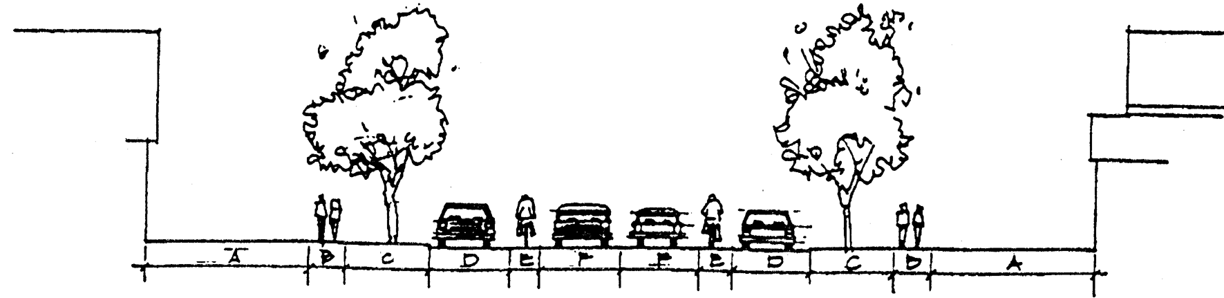
Collector Street Cross-Section
Figure 7c. Schematic sketch of a typical collector street cross-section. Table 1 lists the recommended dimensions of each component: a) building setback from street right-of-way; b) walkway; c) planting area; d) parking lane; e) bicycle lane; f) travel lane.
(b)
Street Layout. The Traditional Neighborhood Development should maintain the existing street grid, where present, and restore any disrupted street grid where feasible. In addition:
(1)
Intersections shall be at right angles whenever possible, but in no case less than 75 degrees. Low volume streets may form three-way intersections creating an inherent right-of-way assignment (the through street receives precedence) which significantly reduces accidents without the use of traffic controls.
(2)
Corner radii. The roadway edge at street intersections shall be rounded by a tangential arc with a maximum radius of 15 feet for local streets and 20 feet for intersections involving collector or arterial streets.
(3)
Curb cuts for driveways to individual residential lots shall be prohibited along arterial streets. Curb cuts shall be limited to intersections with other streets or access drives to parking areas for commercial, civic or multifamily residential uses. Clear sight triangles shall be maintained at intersections, as specified in Section 8-400 of this Zoning Code. (Am. #3355)
(4)
The orientation of streets should enhance the visual impact of common open spaces and prominent buildings, create lots that facilitate passive solar design, and minimize street gradients. All streets shall terminate at other streets or at public land, except local streets may terminate in stub streets when such streets act as connections to future phases of the development. Local streets may terminate other than at other streets or public land when there is a connection to the pedestrian and bicycle path network at the terminus.
Street Intersection
Figure 8. Plan-view diagram of a street intersection. Reducing the radius of street corners slows turning vehicle traffic and shortens pedestrian crosswalks.
(c)
Parking Requirements. All proposed traditional neighborhood developments shall comply with the off-street parking and loading requirements of this Zoning Ordinance. In addition, the following requirements apply to all proposed traditional neighborhood developments.
(1)
In the mixed-use area, any parking lot shall be located at the rear or side of a building. If located at the side, screening shall be provided as specified in Section 5-704(h).
(2)
A parking lot or garage may not be adjacent to or opposite a street intersection.
(3)
Parking lots or garages must provide not less than one bicycle parking space for every 10 motor vehicle parking spaces.
(4)
Adjacent on-street parking may apply toward the minimum parking requirements.
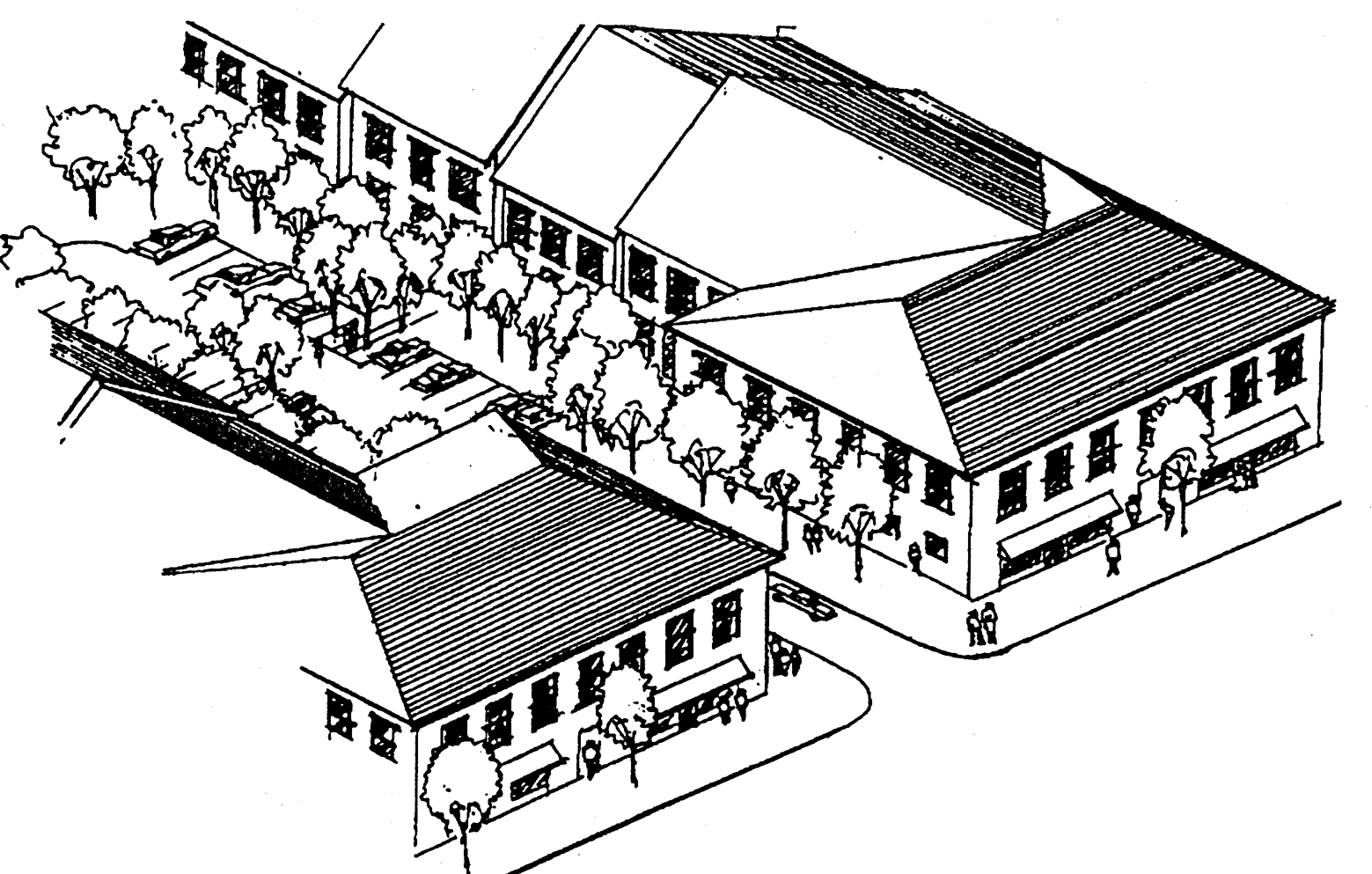
Mixed Use Area Arial Perspective
Figure 9. Aerial perspective sketch of a mixed-use area integrating commercial (ground floor) and residential (second story) uses. A relatively narrow gap in the continuous "street wall" (created by the mixed-use buildings) provides access from the street to a landscaped, "pedestrian-friendly" parking lot.
(d)
Service Access. Access for service vehicles should provide a direct route to service and loading dock areas while avoiding movement through parking areas.
(e)
Paving. Reduction of impervious surfaces through the use of interlocking pavers is strongly encouraged for areas such as remote parking lots and parking areas for periodic uses.
g.
Architectural Standards. A variety of architectural features and building materials is encouraged to give each building or group of buildings a distinct character.
1.
Guidelines for Existing Structures.
(a)
Existing structures, shall be protected from encroachment by incompatible structures or landscape development. In addition, existing structures which are individually landmarked or located in a designated historic district shall comply with the City of Beloit's Historic Preservation Ordinance.
(b)
The U.S. Secretary of the Interior's Standards for Rehabilitation of Historic Properties shall be used as the criteria for renovating historic or architecturally significant structures.
2.
Guidelines for New Structures.
(a)
Height. New structures within a Traditional Neighborhood Development shall be no more than 3 stories for single-family residential, or 5 stories for commercial, multifamily residential, or mixed use.
Mixed-Use Streetscape
Figure 10. Schematic elevation sketch of a mixed-use "streetscape." To create a visually unified "streetwall," buildings should be no more than 30 percent taller or 30 percent shorter than the average building height on the block.
(b)
Entries and Facades.
(1)
The architectural features, materials, and the articulation of a facade of a building shall be continued on all sides visible from a public street.
(2)
The front facade of the principal building on any lot in a Traditional Neighborhood Development shall face onto a public street.
(3)
The front facade shall not be oriented to face directly toward a parking lot.
(4)
Porches, pent roofs, roof overhangs, hooded front doors or other similar architectural elements shall define the front entrance to all residences.
(5)
For commercial buildings, a minimum of 50 percent of the front facade on the ground floor shall be transparent, consisting of window or door openings allowing views into and out of the interior.
(6)
New structures on opposite sides of the same street should follow similar design guidelines. This provision shall not apply to buildings bordering civic uses.
Multistoried Buildings Schematic Elevation
Figure 11. Schematic elevation sketches of 2 multistoried buildings with equal heights and widths. Architectural details such as porches, windows, and roof dormers "articulate" a building's facade (right) which enhances visual quality and contributes to a human-scaled development.
3.
Guidelines for Garages and Secondary Dwelling Units. Garages and secondary dwelling units may be placed on a single-family detached residential lot within the principal building or an accessory building provided that the secondary dwelling unit shall not exceed 800 square feet.
Single-Family Housing Garage Locations
Figure 12. Plan-view diagrams of 4 alternative garage locations on a single-family housing lot: a. Detached garage, is accessed from an alley; b. and c. Attached garage, is accessed from the local street; d. Detached garage behind the house, is accessed from the local street.
4.
Guidelines for Exterior Signage. A comprehensive sign program is required for the entire Traditional Neighborhood Development which establishes a uniform sign theme. Signs shall share a common style (e.g., size, shape, material). In the mixed-use area, all signs shall be wall signs or cantilever signs. Cantilever signs shall be mounted perpendicular to the building face and shall not exceed 10 square feet.
5.
Guidelines for Lighting.
(a)
Street lighting shall be provided along all streets. Generally, more smaller lights, as opposed to fewer, high-intensity lights, should be used.
(b)
Streetlights shall be installed on both sides of the street at intervals of no greater than 75 feet. Street lighting design shall meet the minimum standards developed by the Illumination Engineering Society.
(c)
Exterior lighting shall be directed downward in order to reduce glare onto adjacent properties.
h.
Landscaping and Screening Standards. All proposed traditional neighborhood developments shall comply with the landscaping and screening requirements of this ordinance.
5-800 - WELLHEAD PROTECTION. (Cr. #3483)
5-801
PURPOSE AND AUTHORITY.
a.
Purpose. The residents of the City of Beloit depend on groundwater for a safe drinking water supply. Certain land use practices and activities can seriously threaten or degrade groundwater quality. The purpose of this Wellhead Protection Ordinance is to institute land use regulations and restrictions protecting the municipal water supply of the City of Beloit ("City") and promote the public health, safety and general welfare of the residents.
b.
Authority. Statutory authority of the City to enact these regulations was established by the Wisconsin legislature in §62.23(7)(a) and (c), Wis. Stats. Under these statutes, the City has the authority to enact this ordinance to encourage the protection of groundwater resources.
5-802
APPLICATION OF REGULATIONS. The regulations specified in this Wellhead Protection Ordinance shall apply to those areas of the City that lie within the Five-Year Time of Travel recharge area for municipal water supply wells as defined in Section 5-805, and are in addition to the requirements in the underlying zoning district, if any. If there is a conflict between this ordinance and the underlying zoning ordinance, the more restrictive provision shall apply.
5-803
DEFINITIONS.
a.
Aquifer. A saturated, permeable geologic formation that contains and will yield significant quantities of water.
b.
Cone of Depression. The area around a well, where the water table dips down forming a "v" or cone shape causing the water level to be lowered at least one-tenth of a foot due to pumping a well.
c.
Facilities. A general term referring to land uses, business operations, activities, developed property, or material stored.
d.
Five-Year Time of Travel. The recharge area upgradient of the cone of depression, the outer boundary of which it is determined or estimated that groundwater will take 5 years to reach a pumping well.
e.
Municipal Water Supply. The municipal water supply of the City of Beloit.
f.
Person. An individual, partnership, association, corporation, municipality or state agency, or other legal entity.
g.
Recharge Area. The area which encompasses all areas or features that, by surface infiltration of water that reaches the zone of saturation of an aquifer, supplies groundwater to a well.
h.
Well Field. A piece of land used primarily for the purpose of locating wells to supply a municipal water system.
i.
Well. A boring into the earth for the purpose of extracting groundwater for supply to the municipal water supply.
j.
Zone of Saturation. The area of unconsolidated, fractured or porous material that is saturated with water and constitutes groundwater.
5-804
WELLHEAD TECHNICAL REVIEW COMMITTEE.
a.
The Wellhead Technical Review Committee shall consist of all of the following:
1.
The City's Director of Planning and Building Services;
2.
The City's Public Works Director;
3.
The City's Engineer;
4.
The City's Fire Chief; and
5.
The City's Director of Water Resources.
b.
The purpose of the Wellhead Technical Review Committee is to provide objective and scientific technical review of requests for conditional use permits and to make recommendations to the Plan Commission and City Council, if applicable, to grant or deny conditional use permits based upon the facts discovered in those reviews, to make recommendations on any and all conditions placed on a conditional use permit, and to give advice on matters concerning groundwater. (Am. #3761)
c.
Professional Services. If staff cannot review for technical reasons, the City may retain the services of professional consultants (including engineers, environmental specialists, hydrologists, and other experts) to assist the City in the City's review of a proposal or submittal coming before the Wellhead Technical Review Committee. The submittal of a proposal by a petitioner shall be construed as an agreement to pay for such professional review services applicable to the proposal. The City may apply the charges for these services to the petitioner along with an administrative fee. Review fees, which are due the City from the petitioner, but which are not paid, may be assigned by the City as a special charge to the subject property.
5-805
WELLHEAD PROTECTION OVERLAY DISTRICT. The Wellhead Protection Overlay District hereby created is intended to institute land use regulations and restrictions within a defined area which contributes water directly to a municipal water supply and thus promotes public health, safety, and welfare. The Wellhead Protection Overlay District is intended to protect the Five-Year Time of Travel recharge area for the existing or future municipal water supply from contamination.
5-806
SUPREMACY OF THIS DISTRICT. The regulations of an overlay district will apply in addition to all other regulations which occupy the same geographic area. The provisions of any zoning districts that underlay this overlay district will apply except when provisions of the Wellhead Protection Overlay District are more stringent.
5-807
WELLHEAD PROTECTION OVERLAY DISTRICTS BOUNDARIES. The Wellhead Protection Overlay Districts shall be part of the City of Beloit Zoning District Map and the locations and boundaries of the Wellhead Protection Overlay Districts established by this ordinance are incorporated herein and hereby made a part of this ordinance. Said map, together with everything shown thereon and all amendments thereto, shall be as much a part of this ordinance as though fully set forth and described herein.
5-808
PERMITTED USES IN WELLHEAD PROTECTION OVERLAY DISTRICTS.
a.
Subject to the conditions for existing uses listed in Section 5-812, the following are the only permitted uses within the Wellhead Protection Overlay District:
1.
Public and private parks, and playgrounds, provided there are no on-site wastewater disposal systems or holding tanks;
2.
Wildlife and natural and woodland areas;
3.
Biking, hiking, skiing, nature, equestrian and fitness trails;
4.
Residential which is municipally sewered and free of flammable and combustible liquid underground storage tanks;
5.
Single-family residences on a minimum lot of 20,000 square feet with a private on-site sewage treatment system receiving less than 8,000 gallons per day, which meets the county and state health standards for the effluent, and free of flammable or combustible liquid underground storage tanks;
6.
Agricultural uses in accordance with the county soil conservation department's best management practices guidelines;
7.
Commercial, institutional, industrial or office establishments which are municipally sewered, subject to the prohibited and conditional uses listed in Sections 5-810 and 5-811.
5-809
SEPARATION DISTANCE REQUIREMENTS IN WELLHEAD PROTECTION OVERLAY DISTRICTS.
a.
The following separation distances shall be maintained. Measurements shall be from the wellhead to the specified structure, facility, edge of landfill or storage area as described in items 1. through 6., below.
1.
Fifty feet between a public water supply well and a stormwater sewer main or any sanitary sewer main constructed of water main materials and joints which is pressure tested in place to meet current AWWA 600 specifications. NOTE: Current AWWA 600 specifications are available for inspection at the office of the Wisconsin Department of Natural Resources and the Secretary of State's office.
2.
Two hundred feet between a public water supply well and any sanitary sewer main not meeting the above specifications, any sanitary sewer lift station or single-family residential fuel oil tank.
3.
Four hundred feet between a public water supply well and a septic system receiving less than 8,000 gallons per day, or a stormwater detention, retention, infiltration or drainage basin.
4.
Six hundred feet between a well and any gasoline or fuel oil storage tank installation that have received written approval from the Wisconsin Department of Safety and Professional Services or its designated Local Program Operator under §SPS 310.110, Wis. Adm. Code, or another state agency of the State of Wisconsin with authority to issue such written approval.
5.
One thousand feet between a well and land application of municipal, commercial or industrial waste; industrial, commercial or municipal waste water lagoons or storage structures; manure stacks or storage structures; and septic tanks or soil adsorption units receiving 8,000 gallons per day or more.
6.
Twelve hundred feet between a well and any solid waste storage, transportation, transfer, incineration, air curtain destructor, processing, wood burning, one time disposal or small demolition facility; sanitary landfill; coal storage area; salt or deicing material storage area; gasoline or fuel oil storage tanks that have not received written approval from the Wisconsin Department of Safety and Professional Services or its designated Local Program Operator under §SPS 310.110, Wis. Adm. Code, or another state agency of the State of Wisconsin with authority to issue such written approval; bulk fuel storage facilities; and pesticide or fertilizer handling or storage facilities.
5-810
PROHIBITED USES IN WELLHEAD PROTECTION OVERLAY DISTRICTS.
a.
The following uses are prohibited:
1.
Buried hydrocarbon, petroleum or hazardous chemical storage tanks. (Hazardous chemicals are identified by OSHA criteria under 40 CFR Part 370.)
2.
Radioactive waste facilities.
3.
Coal storage.
4.
Industrial lagoons, pits or natural or manmade containment structures primarily of earthen materials used for storage or treatment of wastewater, fermentation leachates or sludge.
5.
Landfills and any other solid waste facility, except post-consumer recycling.
6.
Manure and animal waste storage except animal waste storage facilities regulated by the county.
7.
Pesticide and fertilizer dealer.
8.
Railroad yards and maintenance stations.
9.
Rendering plants and slaughterhouses.
10.
Salt or deicing material storage for the purpose of distribution.
11.
Septage or sludge spreading.
12.
Septage, wastewater, or sewage lagoons.
13.
Motor vehicular filling stations.
14.
Wood preserving operations.
5-811
CONDITIONAL USES.
a.
Any person may request a conditional use permit, as provided for in Article II, Section 2-500, for certain uses, activities and structures within the Wellhead Protection Overlay District not prohibited in Section 5-810.
b.
The uses, activities, and structures that may be conditionally allowed are:
1.
Commercial, institutional, or industrial establishments utilizing a private on-site wastewater treatment system.
2.
Chemical manufacturers (Standard Industrial Classification Major Group 28).
3.
Nonmetallic earthen materials extraction or sand and gravel pits.
4.
Salvage or junk yards.
5.
Stockyards and feedlots.
6.
Exposed hydrocarbon, petroleum or hazardous chemical storage tanks. (Hazardous chemicals are identified by OSHA criteria under 40 CFR Part 370.) This shall not apply to residential LP gas tanks.
7.
Storage or processing of extremely hazardous substances, radioactive materials or substances listed in APPENDIX I TO TABLE 1 PUBLIC HEALTH GROUNDWATER QUALITY STANDARDS, Ch. NR 140, Wis. Adm. Code (Extremely hazardous substances are identified by SARA/EPCRA criteria under 40 CFR Parts 302 and 355.)
8.
Septage or sludge storage or treatment.
c.
All applications for a conditional use permit shall be submitted in writing to the City Planning and Zoning Department, using such forms as are made available for that purpose by said Department, and shall include all of the following:
1.
A site plan map with all building and structure footprints, driveways, sidewalks, parking lots, stormwater management structures, groundwater monitoring wells, and 2-foot ground elevation contours.
2.
A business plan and/or other documentation which describes in detail the use, activities, and structures proposed.
3.
If determined necessary by the Wellhead Technical Review Committee, an environmental assessment report shall be prepared by a licensed environmental engineer, which details the risk to, and potential impact of, the proposed use, activities, and structures on groundwater quality.
4.
An operational safety plan, which details the operational procedures for material processes and containment, best management practices, stormwater runoff management, and groundwater monitoring.
5.
A contingency plan which addresses in detail the actions that will be taken should a contamination event caused by the proposed use, activities, or structures occur.
d.
All applicants submitting a request for a conditional use permit shall pay the established fee set by City Council resolution.
e.
All conditional use permits granted shall be subject to conditions that will include environmental and safety monitoring determined necessary to afford adequate protection of the public water supply. These conditions shall include all of the following:
1.
Provide current copies of all federal, state and local facility operation approval or certificates and on-going environmental monitoring results to the City.
2.
Establish environmental or safety structures/monitoring to include an operational safety plan, material processes and containment, operations monitoring, best management practices, stormwater runoff management, and groundwater monitoring.
3.
Replace equipment or expand in a manner that improves the environmental and safety technologies in existence.
4.
Prepare, file and maintain a current contingency plan which details the response to any emergency which occurs at the facility, including notifying municipal, county and state officials. Provide a current copy to the City.
f.
The City Council shall decide upon a request for a conditional use permit only after full consideration of the recommendations made by the Wellhead Technical Review Committee. Any conditions above and beyond those specified in Conditional Uses, subsection (e) herein, that are recommended by the Wellhead Technical Review Committee may be applied to the granting of the conditional use permit.
5-812
REQUIREMENTS FOR EXISTING FACILITIES REQUIRING A CONDITIONAL USE OR LISTED AS A PROHIBITED USE.
a.
Existing facilities within the Wellhead Protection Overlay District at the time of enactment of such district which require a conditional use or are listed as a prohibited use in Section 5-811 or Section 5-810 are subject to the following provisions:
1.
The owners or operators of facilities described in subsection 5-812 (a), which facilities exist within the district at the time of enactment, shall, within 60 days of enactment, provide copies of all current, and within 30 days of receipt, revised or new federal, state and local facility operation approvals, permits or certificates; operational safety plan and on-going environmental monitoring results to the City.
2.
The owners or operators of facilities described in subsection 5-812 (a), which facilities exist within the district at the time of enactment of a district, shall have the responsibility of filing and maintaining with the City, a current Spill Control Prevention Plan on forms provided by the City, which details how they intend to respond to any emergency which may cause or threaten to cause environmental pollution that occurs at their facility, including notifying municipal, county and state officials.
3.
In the event of casualty loss causing damage or destruction to building improvements exceeding 50 percent of the assessed valuation thereof, or the desire to expand or enlarge facilities, then the owners or operators of such facilities may be granted a conditional use permit, in accordance with this Code, and section 5-811 above, to repair, rebuild, or expand such facilities, provided that the conditions imposed shall generally require that:
(a)
To the extent feasible, based upon Best Management Practices and economic factors, the building improvements shall be repaired, restored or rebuilt employing designs and technologies that diminish the potential for wellhead contamination; and
(b)
To the extent feasible, based upon Best Management Practices and economic factors, the replacement or augmentation of equipment and machinery and the installation thereof shall be done in a manner which diminishes potential for wellhead contamination. This section does not apply to normal maintenance or minor repairs.
5-813
ENFORCEMENT AND PENALTY.
a.
Penalty. Any person who violates, neglects or refuses to comply with any of the provisions of this ordinance shall be subject to a penalty as provided in Section 25.04 of this Code.
b.
Injunction. The City of Beloit may, in addition to any other remedy, seek injunction or restraining order against the party alleged to have violated the provisions herein, the cost of which shall be charged to the defendant in such action.
c.
Cleanup Costs. As a substitute for, and in addition to any other action, the City of Beloit may commence legal action against both the person who releases the contaminants and the owner of the facility whereupon the contaminants were released to recover the costs, together with the costs of prosecution. Any person who causes the release of any contaminants which may endanger or contaminate the municipal water supply system associated with a Wellhead Protection Overlay District shall immediately cease such discharge and immediately initiate cleanup satisfactory to the City and the other state and federal regulatory agencies.
The person who releases such contaminants and the person who owns the facility whereon the contaminants have been released shall be jointly and severally responsible for the cost of cleanup, consultant, or other contractor fees, including all administrative costs for oversight, review and documentation, including the City employees, equipment, and mileage.
5-814
CONFLICT, INTERPRETATION AND SEVERABILITY.
a.
Conflict and Interpretation of Provisions. If the provisions of the different chapters of this Code conflict with or contravene each other, the provisions of each chapter shall prevail as to all matters and questions arising out of the subject matter of such chapter. In their interpretation and application, the provisions of this ordinance shall be held to be the minimum and are not deemed a limitation or repeal of any other power granted by Wisconsin Statutes. Where any terms or requirements of this ordinance may be inconsistent or conflicting, the most restrictive requirements or interpretations shall apply.
b.
Severability of Code Provisions. If any section, subsection, sentence, clause or phrase of the Code is for any reason held to be invalid or unconstitutional by reason of any decision of any court of competent jurisdiction, such decision shall not affect the validity of any other section, subsection, sentence, clause or phrase or portion thereof. The City Council hereby declares that they would have passed this Code and each section, subsection, sentence, clause, phrase or portion thereof irrespective of the fact that any one or more sections, subsections, sentences, clauses, phrases or portions may be declared invalid or unconstitutional.
c.
Amendments Adopted. Where the Wisconsin Statutes or the administrative regulations and codes of Wisconsin or the United States are adopted by reference in this Section 5-800, such adoptions shall include any subsequent amendments or replacement citations thereto, which are hereby adopted by reference and incorporated herein as if they were fully set forth and made a part hereof.