
Cedar Falls City Zoning Code
ARTICLE III
DISTRICTS AND DISTRICT REGULATIONS
Sec. 26-117. - Districts established.
In order to classify, regulate and restrict the location of trades and industries and the location of buildings designed for specified uses, to regulate and limit the height and bulk of buildings erected or altered, to regulate and limit the intensity of the use of lot areas and to regulate and determine the area of yards, courts and other open spaces within and surrounding such buildings, the city is hereby divided into districts. The districts shall be known as:
(Ord. No. 2922, § 1(29-106), 5-7-2018; Ord. No. 2994, § 2, 11-1-2021)
Sec. 26-118. - District boundaries.
(a)
Zoning maps.
(1)
General zoning map. The boundaries of the districts established by this article are indicated upon the zoning map of the city, which map is made a part of this article by reference. The zoning map of the city and all the notations, references and other matters shown thereon shall be as much a part of this article as if the notations, references and other matters set forth by the map were all fully described in this article. The zoning map is on file in the office of the city planner, at the city hall. It shall be the responsibility of the city planner to see that the zoning map is kept current at all times.
(2)
Digital zoning map. An electronic computerized version of the zoning map that displays the boundaries of the districts established by this article are indicated upon the digital zoning map of the city, which map is made a part of this article by reference. The digital zoning map of the city and all the notations, references and other matters shown thereon shall be as much a part of this article as if the notations, references and other matters set forth by the map were all fully described in this article. The digital zoning map is on file in the office of the city planner, at the city hall. It shall be the responsibility of the city planner to see that the digital zoning map is kept current at all times.
(3)
Resolving inconsistencies between zoning maps. To the extent there is any inconsistency between the zoning map referenced in subsection (a)(1) of this section and the digital zoning map referenced in subsection (a)(2) of this section, the digital zoning map shall take precedence.
(4)
Character district regulating plans. The boundaries of each character district shall be indicated on the zoning map of the city and shall be governed by the associated regulating plan, which shall be the zoning map for each said character district and shall be made a part of this article by reference. Each regulating plan is on file in the office of the city planner in hard copy and as a digital file, at the city hall. It shall be the responsibility of the city planner to see that the regulating plan is kept current at all times. To the extent there is any inconsistency between the regulating plan held on file in the office of the city planner and the digital regulating plan, the digital regulating plan shall take precedence.
(b)
Interpretation of boundaries. Where uncertainty exists with respect to the boundaries of the various districts as shown on the map accompanying and made a part of this article, the following rules apply:
(1)
The district boundaries are either street lines or alley lines unless otherwise shown, and where the districts designated on the map accompanying and made a part of this article are bounded approximately by street lines or alley lines, the street lines or alley lines shall be construed to be the boundary of the district. Street and alley rights-of-way are not included in zoned areas, except within character districts, as shown on the subject regulating plan.
(2)
In unsubdivided property, the district boundary lines on the map accompanying and made a part of this article shall be determined by use of the scale appearing on the map.
(3)
Publication of the legal description of property zoned or rezoned shall constitute an official amendment to the official zoning map, and, as such, the map or portion of the map need not be published.
(Ord. No. 2922, § 1(29-107), 5-7-2018; Ord. No. 2994, §§ 3, 4, 11-1-2021)
Editor's note— The map referred to in the preceding section is on file in the city clerk's office and may be seen by the general public.
Sec. 26-119. - Establishment of floodplain districts.
(a)
Statutory authorization. The legislature of the state has, in Iowa Code ch. 414, delegated the responsibility to cities to enact zoning regulations to secure safety from flood and to promote health and the general welfare.
(b)
Findings of fact.
(1)
The flood hazard areas of the city are subject to periodic inundation which can result in loss of life and property, health and safety hazards, disruption of commerce and governmental services, extraordinary public expenditures for flood protection and relief, and impairment of the tax base, all of which adversely affect the health, safety and general welfare of the community.
(2)
Such losses, hazards and related adverse effects are caused by:
a.
The occupancy of flood hazard areas by uses vulnerable to flood damages which create hazardous conditions as a result of being inadequately elevated or otherwise protected from flood; and
b.
The cumulative effect of floodplain construction on flood flows, which causes increases in flood heights and floodwater velocities.
(3)
This article relies upon engineering methodology for analyzing flood hazards which is consistent with the standards established by the department of natural resources.
(c)
Classes of districts. In order to classify, regulate and restrict the location of trades and industries and the location of buildings designed for specific uses, to regulate and limit the height and bulk of buildings erected or altered, to regulate and limit the intensity of the use of lot areas and to regulate and determine the area of yards, courts and other open spaces within and surrounding such buildings within established floodprone areas, the city is hereby divided into three classes of floodplain districts. The use, height and area regulations are uniform in each class of district, and the districts shall be divided into the following:
(1)
Floodway (overlay) district (F-W)—Those areas identified as floodway on the official floodplain zoning map;
(2)
Floodway fringe (overlay) district (F-F)—Those areas identified as Zone AE and the adjoining shaded Zone X on the official floodplain zoning map but excluding those areas identified as floodway; and;
(3)
General floodplain (overlay) district (F-P)—Those areas identified as Zone A and the adjoining shaded Zone X on the official floodplain zoning map.
(d)
Purpose of districts. It is the purpose of the floodplain districts to promote the public health, safety and general welfare and to minimize public and private damages due to flood conditions in specific areas by provisions designed to:
(1)
Protect human life and health.
(2)
Minimize expenditure of public money for costly flood control projects.
(3)
Minimize the need for rescue and relief efforts associated with flooding and generally undertaken at the expense of the general public.
(4)
Minimize prolonged business interruptions.
(5)
Minimize damage to public facilities and utilities such as water and gas mains, electric, telephone and sewer lines, streets and bridges located in areas of special flood hazard.
(6)
Help maintain a stable tax base by providing for the sound use and development of areas of special flood hazard so as to minimize flood blight areas.
(7)
Ensure that potential buyers are notified that property is in an area of special flood hazard.
(8)
Ensure that those who occupy the areas of special flood hazard assume responsibility for their actions.
(9)
Reserve sufficient floodplain area for the conveyance of flood flows so that flood heights and velocities will not be increased substantially.
(10)
Ensure that eligibility is maintained for property owners in the community to purchase flood insurance through the National Flood Insurance Program.
(Ord. No. 2922, § 1(29-108), 5-7-2018; Ord. No. 3051, § 7, 4-15-2024)
Sec. 26-120. - Boundaries of floodplain districts.
(a)
The areas of special flood hazard identified by the Federal Insurance Administration in a scientific and engineering report entitled flood insurance study for the city, dated February 1, 1985, with accompanying flood insurance rate maps and flood boundary and floodway maps, are hereby adopted by reference and declared to be a part of this article. The maps shall be referenced in this article as the official floodplain zoning map. The boundaries of the floodway, floodway fringe and general floodplain districts shall be determined by scaling distances on the official floodplain zoning map. When an interpretation is needed as to the exact location of the boundaries, the zoning administrator or his official designee shall make the necessary interpretation. Any person contesting the location of the district boundary shall be given a reasonable opportunity to present his case and submit technical evidence.
(b)
There shall be established and maintained by the zoning administrator of the city the official floodplain zoning map, which shall indicate thereon or encompass the boundaries of the floodway, floodway fringe and general floodplain districts provided for by this article. The floodplain management regulations found within this article shall apply only within the floodway, floodway fringe and general floodplain districts and shall be null and void and of no effect in areas not being mapped as being included in such districts. It is not intended by this article to repeal, abrogate, or impair any existing easements, covenants or deed restrictions. However, where this article imposes greater restrictions, the provisions of this article shall prevail.
(Ord. No. 2922, § 1(29-109), 5-7-2018)
Sec. 26-121. - Classification of territory annexed to city.
All territory which may hereafter be annexed to the city shall automatically be classed as lying in the A-1 agricultural district unless the city council, having a recommendation from the city planning and zoning commission at the time of its annexation proceedings, determines that a different zoning classification is more appropriate.
(Ord. No. 2922, § 1(29-110), 5-7-2018)
Sec. 26-122. - Compliance with district regulations.
Except as specified in this article, no building or structure shall be erected, converted, enlarged, reconstructed, moved or structurally altered, nor shall any building or land be used, which does not comply with all of the district regulations established by this article for the district in which the building or land is located.
(Ord. No. 2922, § 1(29-111), 5-7-2018)
Sec. 26-123. - Nonconforming uses.
(a)
Continuation of existing uses. The use of a building existing at the time of the enactment of the ordinance from which this article is derived may be continued even though such use may not conform with the regulations of this article for the district in which it is located. Any use in existence at the adoption of the ordinance from which this article is derived which was not an authorized nonconforming use under previous zoning chapters shall not be authorized to continue as a nonconforming use pursuant to this article or amendments thereto.
(b)
Nonconforming uses or buildings in A and R districts. No existing building or premises devoted to a use not permitted by this article in a residence district in which such building or premises is located, except when required by law, shall be enlarged, extended, reconstructed, substituted or structurally altered, unless the use thereof is changed to a use permitted in the district in which such building or premises is located, except as follows:
(1)
Substitution. If no structural alterations are made, a nonconforming use of a building may be changed to another nonconforming use of the same or of a more restricted classification. Whenever a nonconforming use has been changed to a more restricted use or to a conforming use, such use shall not thereafter be changed to a less restricted use.
(2)
Discontinuance. If a nonconforming use of any building or premises is discontinued for a period of one year, the use of the building or premises shall conform thereafter to the uses permitted in the district in which it is located.
(3)
Additions. If the existing building or premises is devoted to a use permitted in the district but the structure is nonconforming by virtue of inadequate yard area, such structure may be enlarged:
a.
Into those yard areas exceeding yard requirements of this article, provided the addition meets the requirements of this article as these apply to the new construction and yard area in which construction takes place; and
b.
Into those yard areas not meeting yard requirements only to the extent the addition does not exceed the building lines established by already existing walls of the structure or building. The term "existing walls" shall not include fences, independent walls on or near the property line or other such similar structures independent from principal use structures.
In neither case shall this construction infringe upon the sight distance requirements for corner or triangular lots as set out in this article.
(c)
Nonconforming uses or buildings in districts other than A and R districts.
(1)
Structural alterations and enlargements. Any buildings in any district other than an R district devoted to a use made nonconforming by this article may be structurally altered or enlarged in conformity with the lot area, lot frontage, yard and height requirements of the district in which situated, provided such construction shall be limited to buildings on land owned of record by the owner of the land devoted to the nonconforming use prior to the effective date of the ordinance from which this article is derived. In the event of such structural alteration or enlargement of buildings, the premises involved may not be used for any nonconforming use other than the use existing on the effective date of the ordinance from which this article is derived, other provisions of this article notwithstanding.
(2)
Discontinuance. If a nonconforming use of any building or premises is discontinued for a period of one year, the use of the building or premises shall conform thereafter to the uses permitted in the district in which it is located.
(d)
Replacement of damaged buildings. Any nonconforming building or structure damaged to an extent 50 percent or more of its fair market value at the time of damage of any origin, including, but not limited to, fire, flood, tornado, storm, explosion, war, riot or act of God shall not be restored or reconstructed and used as before such happening unless restored or reconstructed in compliance with this article, provided that such restoration or reconstruction work is started within six months of such happening. Any pre-existing residential use established in a district where such use is not permitted shall be allowed to be restored or reconstructed, provided such property is not located in a designated floodway or floodway fringe district. If the building or structure is less than 50 percent damaged, it may be restored, reconstructed or used as before, provided that such restoration or reconstruction work is started within six months of such happening. Restoration or reconstruction of nonconforming buildings or structures located in the floodplain that are damaged by flood is further governed by sections 26-176 and 26-177.
(Ord. No. 2922, § 1(29-112), 5-7-2018)
Sec. 26-124. - Construction under existing building permit.
Nothing contained in this article shall require any change in the overall layout, plans, construction, size or designated use of any building, or part thereof, for which approvals and required building permits have been granted before the enactment of this article, the construction of which conforms with such plans, when construction has been started prior to the effective date of the ordinance from which this article is derived and completion thereof carried on in a normal manner and not discontinued for reasons other than those beyond the builder's control.
(Ord. No. 2922, § 1(29-113), 5-7-2018)
Sec. 26-125. - Access to public street for residential buildings.
Residential lots may be established for building purposes within existing residential neighborhoods on residentially zoned properties where said lots provide less than 40 feet public street frontage under the following conditions:
(1)
The property must contain at least one acre of land area prior to subdivision.
(2)
A subdivision plat must be submitted for review and approval by the planning and zoning commission and city council in conformance with normal subdivision platting requirements with regards to the provision of basic utility easements and sanitary sewer service. No such lot may be created without connection to municipal sanitary sewer service. Private septic sewerage systems are prohibited.
(3)
The lots being created must provide lot area that is in conformance with prevailing neighborhood lot area standards. Proposed lots must be as large as and no smaller than lots immediately abutting the property. Data must be submitted with the plat application that illustrates the size and location of all immediately adjacent properties along with the property owners' names and addresses for those immediately abutting properties. In addition, the names and addresses of all property owners for all properties within 200 feet of the proposed subdivision area must be submitted.
(4)
In lieu of public street frontage of at least 40 feet width, access and utility easements must be provided to the proposed lots, said easements intended to provide a route of vehicular and pedestrian access and also a route for the establishment/extension of utility services, municipal sanitary sewers and other necessary public infrastructure. Said easements must be at least 25-foot width servicing one single-unit dwelling and 50 foot-width for two single-unit dwellings or for a duplex dwelling or multi-unit dwellings.
(5)
No duplex residence or multi-unit dwellings (three units or more) shall be established on such lots in neighborhoods where at least 50 percent of the abutting properties are occupied by single-unit dwellings or where the prevailing use of properties on the same block (50 percent or more of all properties) are single-unit residential dwellings. In those cases where it is appropriate to establish a lot for an allowable duplex or multi-unit use, an access easement measuring at least 50 feet wide shall be provided to not more than one duplex or one multi-unit dwelling (three units or more).
(6)
No driveway access to any new lots shall be located closer than five feet from an adjacent property line. Screen fencing measuring at least four feet height and in conformance with general fencing requirements of the zoning chapter (section 26-93) shall be installed when a new driveway created for this purpose is located closer than 20 feet from an abutting residential structure on an adjacent property.
(7)
Driveway width shall be at least ten feet for one single-unit residential structure. A driveway measuring at least 20 feet width to permit two-way traffic shall be provided for lots where two single-unit dwellings are being created or where a duplex residential dwelling or multi-unit dwelling (three or more units) is being established. All driveways must be hard surfaced with either concrete or asphalt surface. Permeable hard surfacing will be permitted, not to include gravel or granular surfaced driveways.
(8)
A pedestrian sidewalk measuring at least four feet in width extending from the public sidewalk or public right-of-way to the dwellings on newly created lots must be established within the access easement area in those situations where more than one single-unit dwelling is established (i.e., for multiple dwellings, duplex or multi-unit dwelling).
(9)
A lighting plan must be submitted in conjunction with new building construction that illustrates the placement of any external lights and their potential impact upon nearby residences. No yard light, spotlight, landscaping light or any other similar external light shall create any glare or disturbance to any pre-existing residential dwelling occupants.
(10)
Any building construction or land alteration activities on such lots must comply with all stormwater management ordinances of the city. No project may create added stormwater runoff upon adjacent properties compared to pre-construction runoff rates. No landscaping, berming or other land alterations shall direct the flow of stormwater towards a neighboring property. In addition, normal water runoff generated by sump pumps, drainage spouts or other typical sources of water discharge shall not be directed towards or encroach upon adjacent properties.
(Ord. No. 2922, § 1(29-114), 5-7-2018)
Sec. 26-126. - Detached accessory structures.
Accessory structures shall be permitted in all zoning districts, subject to the floodplain regulations contained in this article, where applicable, in accordance with the following provisions. If any of said provisions conflict with a provision or provisions in a character district, as determined by the zoning administrator, the character district provision(s) shall apply.
(1)
Such detached accessory structures shall not be closer to a side lot line than ten percent of the width of the lot, unless the front line of such accessory structure is situated at least 18 feet behind the front line of the principal structure, in which case the accessory structure may be two feet from the side lot line, except on corner lots, and two feet from the rear lot line. In any case, when the rear lot line abuts an alley, the structure may be built within one foot of the rear property line. However, no portion of the accessory structure, including roof eaves, shall extend across the private property line. On corner lots, accessory structures shall be no closer to the side property line abutting the longer street side of the property than the rear of the required side yard setback in that district, or no closer to the longer street side than the building line of the principal structure, whichever setback is greater. No detached accessory structure shall be allowed in the required front yard of any district.
(2)
Regardless of its location, an unattached accessory structure shall maintain a clearance of eight feet, wall-to-wall, between structures on a single lot.
(3)
An accessory structure serving principal single-unit or two-unit residences shall not exceed 1,024 square feet in area, nor 45 percent of the required rear yard, whichever is less. An accessory structure serving a commercial, professional office, industrial or institutional use, including religious, educational, government, hospital, or nursing homes or convalescent centers shall not exceed 1,200 square feet in area. The maximum allowable square footage of the floor area of accessory structures serving residential uses shall be calculated in the following manner: lot width times required rear yard times 45 percent (LW × RY × 0.45 = maximum allowable square footage). The total allowable square footage calculation shall be based upon the area of the base or "footprint" of the structure.
(4)
In agricultural zoning districts, accessory structures serving principal agricultural uses on properties larger than 20 acres in area shall not be subject to the size or height limitations specified herein. However, on those properties in agricultural districts which contain less than 20 acres in area and where the principal use is residential, the regulations specified herein for residential uses shall apply.
(5)
a.
An accessory building serving a commercial, professional office, industrial or institutional use including religious, educational, government, hospital, nursing homes, or convalescent centers shall not exceed 20 feet in height as measured from the slab floor of the structure to the top of the roof ridge. For all residential uses, including single-unit, duplex, and multi-unit residences, the maximum height of detached accessory structures shall be 18 feet as measured from the slab floor to the top of the roof ridge.
b.
However, on properties containing principal residential structures exceeding one story in height, the residential accessory structure may exceed the 18-foot overall height limitation provided that the structure does not exceed the following components:
1.
Maximum allowable wall height for two opposite walls as measured from the slab floor to the top of the wall is 18 feet.
2.
The maximum overall height of the detached structure, as measured from the slab floor to the roof ridge, shall not exceed 30 feet.
3.
The overall height of the detached structure shall not exceed the height of the principal residence on the property. The height of the principal residential structure shall be determined from the natural grade immediately adjacent to the residential structure to the highest point of the roof ridge of the structure. The natural grade adjacent to the principal residential structure shall be considered to be at a point that represents the prevailing or average grade surrounding the structure excluding the at-grade elevation of an exterior basement entryway.
4.
There shall be no more than two floors, including the base or main floor of the structure, within any detached accessory structure.
(6)
When more than one accessory structure is constructed on a lot, the total floor area of all accessory structures on the lot shall not exceed the area requirements specified in this section.
(7)
In all districts, when additions are made to accessory structures, the entire structure shall thereafter meet all the requirements specified in this section.
(8)
No accessory structure is permitted on any lot unless such lot has a principal permitted use located thereon.
(9)
No portion of an accessory structure shall be allowed to encroach into a public utility easement.
(10)
An accessory structure used in conjunction with a multi-unit residence (three or more dwelling units) shall not exceed a total size of more than 576 square feet in area per dwelling unit, or 45 percent of the total required rear yard, whichever is less.
(11)
The exception to size limitations for detached accessory structures set out in this section shall apply to any lot which measures at least one acre in area, but not more than 20 acres in area, and which contains a principal permitted use located thereon. All detached accessory structures must be located on the same lot where the principal permitted use is located. For any lot which measures one acre or more in area, but not more than 20 acres in area, the maximum allowable sizes of detached accessory structures, as measured by the combined base floor area of all detached accessory structures which are located on the property, shall be limited as follows:
Each detached accessory structure which measures 1,200 square feet or more in base floor area on any property containing a residential or commercial principal permitted use shall be located on the property at least 18 feet behind the front line of the structure which comprises the principal permitted use on the property. Furthermore, there shall be established a minimum separation of eight feet, as measured wall-to-wall, between each detached accessory structure of any size and each principal structure, and between each such detached accessory structure and any other detached accessory structure of any size located on the property. In addition, each detached accessory structure measuring more than 1,200 square feet in base floor area must satisfy minimum required side yard and minimum required rear yard setback requirements as specified for the zoning district within which the principal permitted use on the property is located. No detached accessory structure of any size shall be allowed within the required front yard area of any property in any district. Building height limitations as specified in this section shall apply to each detached accessory structure, regardless of base floor area dimension.
(12)
a.
Each detached structure which measures 600 square feet or more in base floor area on any property containing a residential principal permitted use shall be located on the property at least 18 feet behind the front line of the structure which comprises the principal permitted use on the property. Furthermore, there shall be established a minimum separation of eight feet as measured wall to wall, between each detached structure of any size and each principal structure and between each such detached accessory structure and any other detached accessory structure of any size located on the property. In addition, each detached accessory structure measuring 600 square feet or larger in base floor area must provide minimum building setbacks of ten feet as measured from the rear yard property boundaries to the base of the detached accessory structure and a side yard setback of ten percent of the lot width as measured from the side property line to the base of the detached structure. In residential districts no detached accessory structure of any size shall be placed in the front yard area of any residential structure. This provision shall not recognize the "required front yard," but shall recognize any portion of the front area of the lot extending from the front lot line and extending to the front line of the principal residential structure.
b.
All pre-existing detached accessory structures that are damaged or destroyed more than 50 percent of their value by fire, flood, tornado, storm, explosion, war, riot, or act of God shall be allowed to be re-established on the same building footprint as previously existed before the damage occurred.
(13)
All detached accessory structures measuring at least 600 square feet in base floor area but no larger than 1,200 square feet in base floor area, which are established in residential zoning districts in compliance with the regulations set forth in this article, shall be consistent with the architectural style of the principal residential structure located on the property at the time such detached accessory structure is established, and shall be required to adhere to the following design guidelines:
a.
The detached accessory structure must utilize similar exterior wall siding materials as then exist on the principal residential structure on the property. Siding panels must approximate the size and dimensions of those siding materials on the principal residential structure. No corrugated metal coverings or siding materials shall be established on the detached accessory structure. No vertical siding materials shall be established unless similar vertical siding materials are then established on the principal residential structure. No steel siding materials shall be permitted unless the principal residential structure then utilizes steel siding materials. In the case of residential structures utilizing brick siding materials, similar brick or masonry materials must be used on the front portion of the exterior walls of the detached accessory structure. Masonry or brick "accents" or trim elements matching similar components on the principal residence are acceptable to complement a residence constructed with brick siding materials. For the remainder of the accessory structure located on a lot with a brick residence, siding materials must resemble siding materials utilized on at least one other non-brick residential structure found on an adjacent property or on the same block in the residential neighborhood if any. In cases where the preceding option is unclear, the proposed structure shall be referred to the planning and zoning commission in conformance with subsection f of this section.
b.
The color and texture of exterior wall materials used on the detached accessory structure must be similar to the color and texture of exterior wall materials on the principal residential structure.
c.
Roof lines and angles on the detached accessory structure must resemble or be similar to the roof lines and angles of the principal residential structure on the property. No flat roofs shall be permitted on the detached structure unless the main residential structure then has a flat roof covering more than half of the residence, excluding a garage or carport flat roof feature attached to the principal residential structure.
d.
Other architectural features of the detached accessory structure must resemble or be similar to features found on the principal residential structure including the size and dimensions of windows. Windows shall be established on at least two walls of detached accessory structures.
e.
Roofing materials utilized on the detached accessory structure must be similar to roofing materials used on the principal residential structure. Metal roofing materials may be utilized only if the principal residential structure on the property then utilizes metal roofing materials.
f.
For preexisting structures that are enlarged or improved resulting in a structure size 600 square feet in base floor area or larger, the entire enlarged or improved structure shall comply with the design and architectural requirements stated herein.
g.
Every property owner applying for a detached accessory structure in a residential zoning district measuring at least 600 square feet in base floor area but no larger than 1,200 square feet in base floor area shall submit to the city planning division office renderings illustrating materials and design characteristics on all four sides of the proposed detached accessory structure, along with then-current photographs of all four sides of the principal residential structure on the property, and a description of the siding and roofing materials and colors of those materials along with a description of the roof pitch on the principal residential structure and how those features compare with the proposed detached accessory structure. City planning division staff shall evaluate the architectural consistency between the proposed detached accessory structure and the principal residential structure based upon the guidelines set forth in this subsection, before issuing a land use permit. In the case of a dispute or uncertainty between city planning division staff and the property owner relating to architectural details or features, or in the event the planning division staff does not approve the architectural/design plans submitted by the property owner, the application for the proposed detached accessory structure shall be submitted to the city planning and zoning commission followed by referral to the city council for architectural/design review purposes.
(Ord. No. 2922, § 1(29-115), 5-7-2018; Ord. No. 2994, § 6, 11-1-2021)
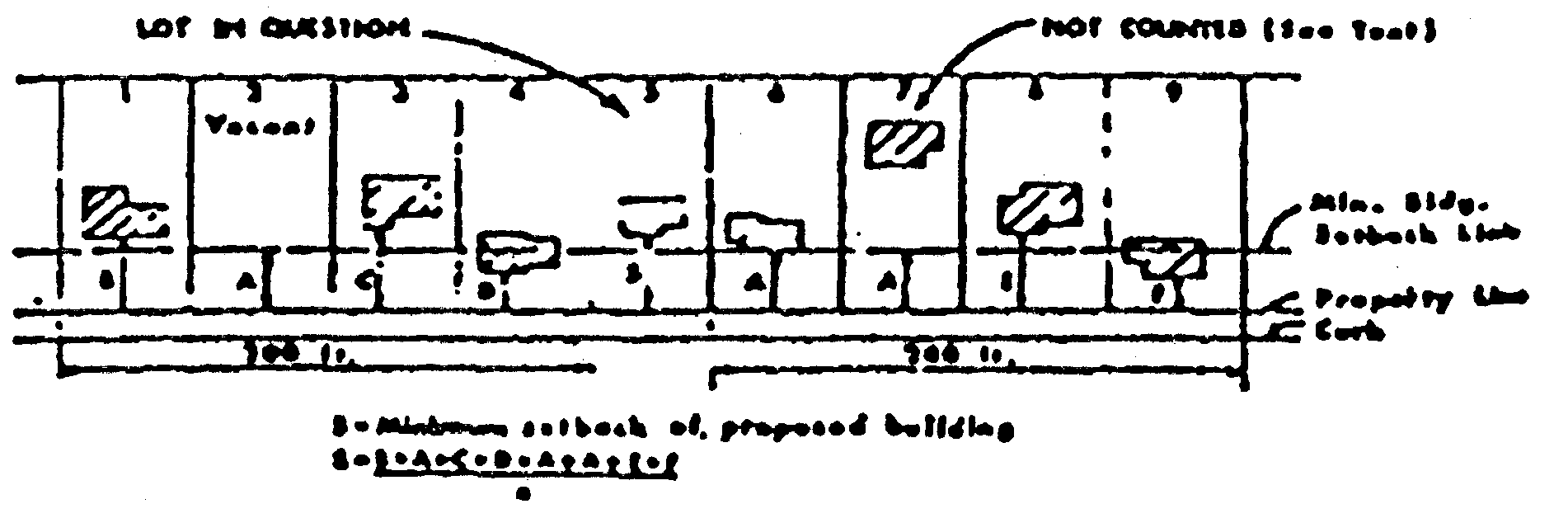
Sec. 26-127. - Setbacks for corner lots.
This section does not apply in character districts.
(a)
For corner lots platted after the effective date of the ordinance from which this article is derived, the street side yard shall be equal in width to the setback regulation of the lots to the rear having frontage on the intersecting street.
(b)
On corner lots platted and of record at the time of the effective date of the ordinance from which this article is derived, the side yard regulation shall apply to the longer street side of the lot, except in the case of reverse frontage where the corner lot faces an intersecting street. In this case there shall be a side yard on the longer street side of the corner lot of not less than 50 percent of the setback required on the lots to the rear of such corner lot, and no accessory building on the corner lot shall project beyond the setback line of the lots in the rear, provided that this regulation shall not be so interpreted as to reduce the buildable width of the corner lot facing an intersecting street and of record, or as shown by existing contract of purchase at the time of the effective date of the ordinance from which this article is derived, to less than 28 feet, nor to prohibit the erection of an accessory building.
(c)
On corner lots, frontage may be considered on either street, provided that, if front and rear yards are parallel to the lot line having the longer dimension, then setbacks along both streets shall conform to the front yard requirements of the district in which the lot is located.
Corner Lot Setback
(Ord. No. 2922, § 1(29-116), 5-7-2018; Ord. No. 2994, § 7, 11-1-2021)
Sec. 26-128. - Front yard setback for developed blocks in R districts.
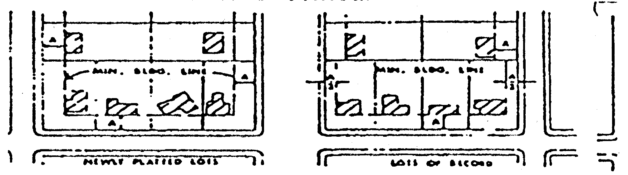
In any R district, there shall be a minimum front yard required as stated in the yard requirements for that particular district; provided, however, that where lots comprising 30 percent or more of the frontage within 200 feet of either side lot line are developed with buildings at a greater setback, the average of these building setbacks shall be established. The required front yard setback shall be the average setback line plus ten feet towards the front yard. In no case, however, shall a setback line established in this manner be less restrictive than the minimum setback required for that district. In computing the average setback line, buildings located on reversed corner lots or entirely on the rear half of lots shall not be counted.
METHOD OF COMPUTING
BUILDING SETBACK IN A DEVELOPED BLOCK
Front Yard Setback
(Ord. No. 2922, § 1(29-117), 5-7-2018)
Sec. 26-129. - Reduction of required yards.
No lot shall be reduced in area so as to make any yard or any other open space less than the minimum required by this article. No part of a yard or other open space provided about any building or structure, for the purpose of complying with the provisions of this article, shall be included as part of a yard or other open space required under this article for another building or structure. Off-street parking and loading areas may occupy all or part of any required yard or open space except as otherwise specified in this article.
(Ord. No. 2922, § 1(29-118), 5-7-2018)
Sec. 26-130. - Encroachment into required setback area.
Any principal use as defined in chapter 26, as amended, in existence as of the date of the final passage of Ordinance No. 1975 for which a building permit had been obtained as required by the city as of the date of passage is hereby declared to meet and conform to all front, side, and rear yard requirements of chapter 26, as amended, if said principal use does not encroach into the required setback area more than ten percent of said required setback.
(Ord. No. 2922, § 1(29-119.1), 5-7-2018)
Sec. 26-131. - Minimum dimension of dwellings.
The minimum dimension of the main body of a dwelling shall not be less than 20 feet.
(Ord. No. 2922, § 1(29-120), 5-7-2018)
Sec. 26-132. - Bi-attached dwellings.
(a)
All bi-attached dwelling units in existence on March 9, 1981, which do not contain a one-hour fire-resistive wall between units shall become a bi-attached dwelling equipped with smoke detectors, the detectors to be placed in corridors used in common, the nominal spacing of which shall not exceed 30 feet. All bi-attached dwellings constructed after March 9, 1981, shall be separated vertically and horizontally from each other and from corridors used in common by not less than one-hour fire-resistive construction.
(b)
No dwelling shall be entitled to the status of a bi-attached dwelling unless the owner thereof obtains approval of such status by the zoning administrator and executes a covenant and easement agreement regarding the dwelling. The owner shall submit to the zoning administrator for review and approval the information required in section 26-163, including a copy of the proposed covenant and easement agreement.
(Ord. No. 2922, § 1(29-121), 5-7-2018)
Sec. 26-133. - Bed and breakfast establishments.
(a)
Bed and breakfast establishments shall consist of bed and breakfast enterprises and bed and breakfast inns.
(b)
Bed and breakfast enterprises shall be permitted as an accessory use within a single-unit residence where such residence is occupied by the owner or the owner's designee.
(c)
Bed and breakfast establishments shall not be permitted in R-1 SF districts.
(d)
Bed and breakfast enterprises are permitted in R-1, R-2, and R-5 zoning districts if the bed and breakfast enterprises meet the following minimum guidelines:
(1)
Provide minimum living area as defined by the city minimum rental housing code: 220 square feet for the first person; 200 square feet for each additional person. Minimum living area requirements shall be calculated for the entire structure (except garage, porches and decks) in relation to the number of resident families plus the potential number of overnight lodging guests. Potential lodging guests shall be assumed to be two persons per lodging room.
(2)
The principal residence shall meet minimum lot area and lot width requirements of the respective zoning district.
(3)
One sign may be erected on the property and shall be limited in size to six square feet in sign area. The sign may be illuminated.
(e)
No minimum off-street parking area shall be required of a bed and breakfast enterprise.
(f)
Bed and breakfast enterprises containing no more than five guest rooms may be established in other zoning districts, provided such enterprises meet the following minimum requirements.
(Ord. No. 2922, § 1(29-122), 5-7-2018)
Sec. 26-134. - Communication towers.
(a)
Purpose. The provisions of this section are intended to regulate and guide the location of new communication towers, antennas and related accessory structures. The goals of this article are to:
(1)
Protect residential areas and land uses from potential adverse impacts of towers and antennas;
(2)
Encourage the location of towers in nonresidential areas;
(3)
Minimize the total number of towers throughout the community;
(4)
Strongly encourage the joint use or co-location of new and existing tower sites as a primary option rather than construction of additional single-use towers;
(5)
Encourage users of towers and antennas to locate them, to the extent possible, in areas where the adverse impact on the community is minimal;
(6)
Encourage users of towers and antennas to configure them in a way that minimizes the adverse visual impact of the towers and antennas through careful design, siting, landscape screening, and innovative camouflaging techniques;
(7)
Enhance the ability of the providers of telecommunications services to provide such services to the community quickly, effectively, and efficiently;
(8)
Consider the public health and safety of communication towers; and
(9)
Avoid potential damage to adjacent properties from tower failure through engineering and careful siting of tower structures.
In furtherance of these goals, the city shall give due consideration to the city's comprehensive plan, zoning map, existing land uses, and environmentally sensitive areas in approving sites for the location of towers and antennas.
(b)
Definitions. The following words, terms and phrases, when used in this section, shall have the meanings ascribed to them in this subsection, except where the context clearly indicates a different meaning:
Antenna means any exterior transmitting or receiving device mounted on a tower, building or structure and used in communications that radiate or capture electromagnetic waves, digital signals, analog signals, radio frequencies (excluding radar signals), wireless telecommunications signals or other communication signals.
Backhaul network means the lines that connect a provider's towers/cell sites to one or more cellular telephone switching offices, and/or long distance providers, or the public switched telephone network.
Camouflage design describes a communication tower or communications facility which takes on the appearance of a piece of art or of some natural feature, or of an architectural structural component or other similar element and which blends in naturally and aesthetically with the surrounding building environment. Examples of camouflage design include, but are not limited to, flagpoles, trees, vegetation, clock towers, monuments, and church steeples, but only if situated in an appropriate location or setting. Camouflage design also applies in the architectural integration of communication facilities (i.e., antennas) onto existing buildings, sports field's lights, highway signs, water towers, or other existing structures.
Co-location of communication equipment. In an effort to reduce the proliferation of multiple communication towers throughout the city, existing communication towers and other structures to the greatest extent practicable shall be utilized for mounting or locating communication antennas or related communication equipment.
Communication tower structure means any tower or any other elevated structure that supports antennas, as defined herein.
Communication tower structure site means a tract or parcel of land that contains the wireless communication tower structure, accessory support buildings, and on-site parking, and which may include other uses associated with the normal operations of wireless communications and transmissions.
Monopole construction means a tower consisting of a single vertical structure not supported by radiating guy wires or a support structure. A monopole tower shall be distinctive from a two-legged or multi-legged, lattice constructed tower structure.
Private radio operator of communication towers means personal, amateur or hobby radio operators and communication equipment, including towers and antennas necessary to conduct personal, amateur or hobby radio operations.
Tower means any structure that is designed and constructed primarily for the purpose of supporting one or more antennas for telephone, radio and similar communication purposes, including self-supporting lattice towers, guyed towers, or monopole towers. The term "tower" includes radio and television transmission towers, microwave towers, common-carrier towers, cellular telephone towers, and the like. The term "tower" includes the structure and any support thereto.
Tower height measurement means the distance between the base of the tower (ground level) and the top of the tower or the top of the highest appurtenance mounted on the tower, whichever measurement is greater.
(c)
Applicable documents and agencies. The following documents and agencies referenced herein are applicable to the extent specified:
(1)
EIA-222. Electronics Industries Association, Standard 222 Structural Standards for steel antenna towers and antenna support structures.
(2)
FAA. Federal Aviation Administration.
(3)
FCC. Federal Communications Commission.
(4)
ANSI-95.1. The most recently adopted standard of the American National Standards Institute which establishes guidelines for human exposure to non-ionizing electromagnetic radiation.
(d)
General requirements.
(1)
Principal or accessory use. Antennas and towers may be considered either principal or accessory uses, but shall in any event comply with all of the requirements of this section and of this article relating to principal and/or accessory uses. A different existing use of an existing structure on the same lot shall not preclude the installation of an antenna or tower on such lot.
(2)
Lot size. For purposes of determining whether the installation of a tower or antenna complies with zoning district development regulations, including, but not limited to, setback requirements, lot coverage requirements, and other such requirements, the dimensions of the entire lot shall control, even though the antennas or towers may be located on leased parcels within such lot.
(3)
Inventory of existing sites. Each applicant for an antenna and/or tower shall provide to the city planner an inventory of its existing towers, antennas, or sites approved for towers or antennas, that are either within the jurisdiction of the city, or within one mile of the border thereof, including specific information about the location, height, and design of each tower. The city planner may share such information with other applicants applying for a land use permit under this section or other organizations seeking to locate antennas within the jurisdiction of the city; provided, however, that the city planner is not, by sharing such information, in any way representing or warranting that such sites are available or suitable.
(4)
Exemption for certain towers of governmental bodies. Communications towers and/or antennas erected by city, county or state governmental bodies for public safety or other essential public purposes shall be exempt from the provisions of this section.
(e)
Regulation of all communication towers.
(1)
General requirements.
a.
State or federal requirements. All towers must meet or exceed current standards and regulations of the FAA, the FCC, and any other agency of the state or federal government with the authority to regulate towers and antennas. If such standards and regulations are changed, then the owners of the towers and antennas governed by this section shall bring such towers and antennas into compliance with such revised standards and regulations within six months of the effective date of such standards and regulations, unless a different compliance schedule is mandated by the controlling state or federal agency. Failure to bring all towers and antennas into compliance with such revised standards and regulations shall constitute grounds for the city to require the removal of the tower or antenna at the owner's expense.
b.
NIER. The NIER (non-ionizing electromagnetic radiation) emitted from a communications tower or associated equipment shall not exceed the most recently adopted standard of the American National Standards Institute (ANSI-95.1).
c.
Height. Towers (including top-mounted appurtenances) shall not exceed the overall height recommended by the FAA or the FCC or as limited herein.
d.
Precedence. Where regulations and requirements of this section conflict with those of the FAA or FCC, the federal requirements shall take precedence.
e.
Advertising. Advertising on communication towers shall be prohibited. Commercial signage or other type of sign messaging on towers, other than specific tower site signage such as safety messaging, ownership signs or no trespassing signs, shall also be prohibited.
f.
Building codes; safety standards. To ensure the structural integrity of towers, the owner of a tower shall ensure that it is maintained in compliance with standards contained in applicable state or local building codes and the applicable standards for towers that are published by the Electronic Industries Association, as amended from time to time. If, upon inspection, the city concludes that a tower fails to comply with such codes and standards and constitutes a danger to persons or property, then upon notice being provided to the owner of the tower, the owner shall have a period of 30 days to bring such tower into compliance with such codes and standards. Failure to bring such tower into compliance within said 30 day period shall constitute grounds for the city to require the removal of the tower or antenna at the owner's expense.
g.
Not essential services. Towers and antennas shall be regulated and permitted pursuant to this section and shall not be regulated or permitted as essential services, public utilities, or private utilities.
h.
Tower removal. The tower owner and/or operator shall notify the city inspection services division when a tower is removed, no longer in use, or is knocked down, or blown down, or damaged to such an extent that major structural repairs are required. If a tower is removed, knocked down, blown down, or damaged to such an extent that major structural repairs are required, said tower shall not be reconstructed or replaced without prior review and approval by the planning and zoning commission and city council. If said damaged tower is abandoned or inoperable with no intention by the owner to replace said tower, the tower shall be removed in a timely fashion at the expense of the tower owner or the property owner where the tower is located, as directed by the city planner. Any antenna or tower that is not operated for a continuous period of 12 months shall be considered abandoned, and the owner of such antenna or tower shall remove the same within 90 days of receipt of notice from the city notifying both the tower owner and the owner of the property on which the tower is located, of such abandonment. Failure of the tower owner or property owner to remove an abandoned antenna or tower within said 90 days shall be grounds for the city to require removal of the tower or antenna at the expense of the tower owner or property owner. If there are two or more users of a single tower, then this provision shall not become effective until all users cease using the tower. If the city is required to remove a tower at the expense of the tower owner or property owner, the costs of removal, if not paid by the tower owner, or by the owner of the property on which the tower is located, within 30 days of the city's written demand for payment, shall be reported to the city clerk, who shall levy the cost thereof as an assessment, which shall be a lien on the real estate on which the tower is located. The city clerk shall certify such assessments to the county auditor to be paid by the owner of the property on which the tower is located, in installments in the same manner as property taxes, as provided by law.
i.
Interference. Any signal interference complaints associated with communication towers or related equipment shall be addressed in accordance with FCC rules and procedures.
j.
Lighting. No towers shall be artificially lighted unless required by the FAA or other federal or state authority. If lighting is required, the lighting alternatives and design chosen must cause the least disturbance to the surrounding views and/or the surrounding or abutting properties.
k.
Coloration. Towers, accessory structures, and other related components shall use paint or coloration which blends in, to the maximum extent possible, with the surrounding environment and surrounding buildings.
l.
Aesthetics. Towers and antennas shall meet the following requirements:
1.
Towers shall either maintain a galvanized steel finish or, subject to any applicable standards of the FAA, be painted a neutral color so as to reduce visual obtrusiveness to the maximum extent possible.
2.
At a tower site, the design of the buildings and related structures shall, to the maximum extent possible, use materials, colors, textures, screening, and landscaping that will blend them into the natural setting and surrounding buildings.
3.
If an antenna is installed on a structure other than a tower, the antenna and supporting electrical and mechanical equipment must be of a neutral color that is identical to, or closely compatible with, the color of the supporting structure so as to make the antenna and related equipment as visually unobtrusive as possible.
m.
Property owner information. It shall be the responsibility of the tower owner to furnish to the city any change in name or address of the owner of the property upon which the tower is situated.
n.
Tower separation requirements.
1.
If any tower is removed from a site within the city for any reason, including, without limitation, a tower that is knocked down, blown down, or damaged to such an extent that major structural repairs are required, or if the tower is removed for any other reason, and if a new or replacement tower is proposed on the same property and at the same location, such new or replacement tower may be considered for erection at the same location on the same property, subject to compliance with the review process and standards contained in this section. Any such application shall be subject to review and approval by the planning and zoning commission and city council.
2.
The tower separation requirements of this section shall not, in and of themselves, necessarily serve as a basis for denial of such an application. The planning and zoning commission and city council may waive the tower separation requirements with respect to said application if, after considering all relevant circumstances, including whether the applicant has clearly demonstrated to the satisfaction of the commission and the council that all practical and feasible co-location alternatives have been investigated, considered and appropriately rejected, and, based upon all other relevant factors and circumstances, the commission and council determine that approval of the application shall serve the interests of the community.
o.
Tower design. In furtherance of the goal set forth in subsection (a)(4) of this section, to strongly encourage co-location of communication antennas on existing towers or other existing structures, each applicant proposing to construct a new communications tower shall be required to design the proposed new tower so as to accommodate the co-location of the antenna arrays of at least three additional telecommunications carriers or providers, in addition to the antenna requirements of the applicant proposing to construct the new tower.
(2)
Tower application. Prior to the installation of any communication tower within the city, the owner/operator shall submit to the city planner an application for a land use permit. Said application shall include, at a minimum, the following information and/or documentation:
a.
Detailed, scaled site plan illustrating property location and address, including a location map, property dimensions, tower location, tower height, and adjacent land uses and zoning districts within 200 feet of the tower site, on site land uses and zoning classification of the property under consideration, adjacent roadways, proposed means of access, setbacks from property lines, elevation drawings of the proposed tower and any other structures, topography, parking, and any other information the city planner deems to be necessary to determine compliance with this section. Names and addresses of property owners within 200 feet of the property on which the tower is proposed to be located shall be shown on the site plan.
b.
Description of tower usage and ownership including name of tower company and principal company contact person, including telephone number and address.
c.
Name and address of owner of the property where the tower facility is proposed to be located together with a description of the terms of the proposed lease between the tower owner and property owner, including, but not limited to, duration of lease, renewal provisions, liability provisions and tower removal arrangements in the event of tower failure, lease expiration, or antenna or tower abandonment. The application shall be accompanied by a written consent of the property owner that provides that if the application is granted, the property owner acknowledges the provisions regarding tower removal contained in this section, and agrees to be responsible for removal of the tower, or payment of the costs of removal, on the terms and conditions set forth in subsection (e)(1)h of this section.
d.
Landscaping plan, with a description of exterior fencing, and finished color and, if applicable, the method of camouflage and illumination, and a description of on-site landscaping along with the description of related communication tower facilities that may be established in adjacent structures on the communication tower site.
e.
Copies of FAA and/or FCC permits.
f.
Structural specifications as verified by a licensed professional engineer relating to: structural materials, soils information, method of installation and erection, list of types of antennas, cables and other appurtenances, a statement that the structure is designed in accordance with current EIA 222 structural standards, and wind load/ice load specifications.
g.
Description of camouflage design options and opportunities for the proposed facility. The applicant must give a description, including photographs or illustrations, of the proposed tower design and general appearance, including coloration details, and comment upon whether or not camouflage options have been considered or are practical to apply.
h.
Description of co-location efforts in accordance with the requirements of subsection (f) of this section, including list of companies and tower sites within the city that were investigated, and the reasons why co-location is not possible. Technical data shall be submitted to support this explanation. Information must be submitted to city staff in order to verify that co-location inquiries have been made with other existing tower facility owners. Furthermore, a description of future co-location opportunities on the proposed tower must also be presented in conjunction with the proposed tower structure, as provided for in subsection (f) of this section.
i.
Safety narrative. Submittal of a written description of tower structural components, including basic construction methods, weight or load capacity, durability in terms of wind and ice loads, structural failure probability and predicted fall zones, and other relevant data requested by the city planner, all certified by the applicant's engineer.
j.
A nonrefundable fee as established by resolution of the city council from time to time to reimburse the city for the costs of reviewing the application.
k.
All information of an engineering nature that the applicant submits to the city in connection with the application, whether civil, mechanical, or electrical, shall be certified as true, correct and complete by a licensed professional engineer who is qualified to make such certification with respect to that field of engineering.
l.
Legal description and street address of the tract of land and of the leased parcel, if applicable, on which the tower will be located.
m.
A notarized statement by the applicant's engineer as to whether construction of the tower will accommodate co-location of additional antennas for future users, and if so, how many and what size and type of such antennas.
n.
Identification of the entities providing the backhaul network for the tower described in the application, and for other tower sites owned or operated by the applicant in the city.
o.
A description of the suitability of the use of existing towers, other structures or alternative technology not requiring the use of towers or structures, including co-location on an existing tower or other structure, to provide the services to be provided through the use of the proposed tower, accompanied by a certification thereof from the applicant's engineer.
p.
The distance between the proposed tower and the nearest residential unit, platted residentially zoned properties, and unplatted residentially zoned properties.
q.
The separation distance from other towers described in the inventory of existing sites submitted pursuant to subsection (d)(3) of this section shall be shown on an updated site plan or map. The applicant shall also identify the type of construction of the existing towers and the owner/operator of the existing towers, if known.
r.
The separation distance between the location of the proposed new tower and all other existing communications towers located within 5,000 feet of the proposed tower, together with the specific location, type of construction, and name of owner/operator of each such existing tower, and whether such existing tower is structurally and technologically capable of accommodating any additional antennas on such tower, and if so, how many and what type of antennas may be accommodated on each such other existing tower.
s.
A description of the feasible location of future towers or antennas within the city based upon existing physical, engineering, technological or geographical limitations in the event the proposed tower is erected.
t.
A description of any artificial lighting proposed with respect to the applicant's tower, including a description of how such lighting will impact the surrounding views and the surrounding or abutting properties.
u.
Information and documentation which demonstrates that the applicant complies with all of the provisions of this section, and all applicable federal, state and other local laws.
v.
The inventory of existing sites as required in subsection (d)(3) of this section.
w.
Description of vehicular access route to the proposed tower site, including proposed curb cuts, subject to review and approval by the city engineer.
x.
Such other information and documentation as may be requested by the city planner to evaluate the application and to determine whether it satisfies the requirements of this section.
(3)
Request for tower construction. Following receipt of all completed materials and documentation the city planner shall, if appropriate, refer the request for tower construction to the planning and zoning commission and the city council for further review.
(4)
Applications for tower installation. The planning and zoning commission and city council shall review such applications for tower installation to assure that the structure meets all safety requirements, is properly engineered, is compatible with surrounding land uses, will have no adverse impact upon nearby properties, and complies with the requirements of this section.
(5)
Antenna application. Prior to the installation of any antenna on an existing communication tower, building, or other structure of any kind, the owner/operator of the antenna shall submit to the city planner an application for an antenna/land use permit. Said application shall include at a minimum the following information and/or documentation:
a.
A description of the number, size, and type of antennas proposed to be installed.
b.
A description of the structure to which the proposed antennas will be affixed, whether communication tower, building or other structure, including the street address, legal description, location map and other information that will assist the city planner in determining where the antennas will be installed, together with the name, including principal contact person, telephone number and address of the owner of the tower, building or other structure upon which the antennas will be installed, and the written consent of such owner to the installation of the antennas.
c.
Structural specifications as verified by a licensed professional engineer, that the installation of the antennas on the tower or other structure will meet the structural specifications contained in this section.
d.
Any other information and documentation as may be requested by the city planner to evaluate the application and to determine whether it satisfies the requirements of this section and of applicable federal, state and other local laws.
e.
A nonrefundable fee, if any, as established by resolution of the city council from time to time to reimburse the city for the costs of reviewing the antenna application.
f.
A description of the accessory cabinet, structure or building that will serve the proposed antennas, together with documentation demonstrating that such accessory structure complies with the requirements of all applicable city ordinances, including applicable local building codes and ordinances.
Following receipt of all completed materials and documentation, the city planner shall either approve the application, if the city planner determines that the application complies with all requirements of this section or, in the discretion of the city planner, the application may be referred to the planning and zoning commission and city council for further review. The planning and zoning commission and city council shall review any antenna applications referred by the city planner to assure that the proposed antennas meet all safety requirements, are properly engineered, and otherwise comply with the requirements of this section and all applicable federal, state and other local laws.
(f)
Factors considered in granting land use permits for towers. The planning and zoning commission and city council shall consider the following factors in determining whether to issue a land use permit, although the planning and zoning commission and city council may waive or reduce the burden on the applicant of one or more of these criteria if the planning and zoning commission and city council conclude that the goals of this chapter are better served thereby:
(1)
Height of the proposed tower;
(2)
Proximity of the tower to residential structures and residential district boundaries;
(3)
Nature of uses on adjacent and nearby properties;
(4)
Surrounding topography;
(5)
Surrounding tree coverage and foliage;
(6)
Design of the tower, with particular reference to design characteristics that have the effect of reducing or eliminating visual obtrusiveness. This consideration shall involve evaluation of any proposed camouflage design options and whether any such camouflage options are in character with the surrounding area and that the proposed design achieves the desired camouflage effect.
(7)
Proposed ingress and egress; and
(8)
Availability of suitable existing towers, other structures, or alternative technologies not requiring the use of towers or structures.
(g)
Availability of suitable existing towers, other structures, or alternative technology. No new tower shall be permitted unless the applicant demonstrates to the reasonable satisfaction of the planning and zoning commission and city council that no existing tower, structure or alternative technology that does not require the use of towers or structures can accommodate the applicant's proposed tower structure and/or antennas. An applicant shall submit information requested by the city planner related to the availability of suitable existing towers, other structures or alternative technology. Evidence submitted to demonstrate that no existing tower, structure or alternative technology can accommodate the applicant's proposed antenna may consist of any of the following:
(1)
No existing towers or structures are located within the geographic area which meet the applicant's reasonable and technologically sound engineering requirements.
(2)
Existing towers or structures are not of sufficient height to meet the applicant's reasonable and technologically sound engineering requirements.
(3)
Existing towers or structures do not have sufficient structural strength to support the applicant's proposed antenna and related equipment, and still meet applicable structural requirements described in this section.
(4)
The applicant's proposed antenna would cause electromagnetic interference with the antenna on the existing towers or structures, or the antenna on the existing towers or structures would cause interference with the applicant's proposed antenna such that the applicant's antenna would not be technologically feasible.
(5)
The fees, costs, or contractual provisions required by the owner in order to share an existing tower or structure or to adapt an existing tower or structure for sharing are unreasonable. Costs exceeding new tower development are presumed to be unreasonable, based on reasonable technological and/or engineering criteria.
(6)
The applicant demonstrates that there are other limiting factors that render existing towers and structures unsuitable, based on reasonable technological and/or engineering criteria.
(7)
The applicant demonstrates that an alternative technology that does not require the use of towers or structures, such as a cable microcell network using multiple low-powered transmitters/receivers attached to a wire line system, is unsuitable, based on reasonable technological and/or engineering criteria. Costs of alternative technology that exceed new tower or antenna development shall not be presumed to render the technology unsuitable.
(h)
Setbacks. The following setback requirements shall apply to all towers for which a land use permit is required:
(1)
Towers must satisfy the minimum zoning district setback requirements that are applicable to principal uses on the property where the proposed tower will be situated.
(2)
Guy wire and other structural support elements and accessory buildings must satisfy the minimum zoning district setback requirements that are applicable to principal uses on the property where the proposed tower will be situated.
(3)
If towers are established on properties located adjacent to a freeway, state highway, a major or minor arterial street/roadway or collector street, all such streets and roadways indicated on the city major thoroughfare map, the tower structure must be located at least the height of said tower in distance from the adjacent said public right-of-way.
(i)
Location and installation.
(1)
Residential districts. Communication towers intended to serve personal and amateur radio operators, including hobby radio operators (i.e., private radio operators) shall be permitted within any residential zoning district as an accessory use to a principal permitted residential use, subject to the following requirements:
a.
Said private radio communication towers in residential districts shall not be located in front of any residence and not within any required side or rear yard areas. If the tower is supported with guy anchors or other radiating support structure, said anchors or support structure shall not be allowed within five feet of a rear or side property line. Said anchors or support structure shall not be allowed within a required front yard.
b.
The maximum allowable height of a fixed tower including antennas and appurtenances serving private radio operators and also including roof-mounted communication antennas within a residential zoning district serving private radio communication towers shall be 80 feet. Said maximum height shall be measured from the average natural grade of the property immediately adjacent to the tower.
c.
Prior to the installation of any private radio communication tower in a residential zoning district, the owner/operator shall submit to the city planner an application for a land use permit as outlined in subsection (e)(1) of this section. For those proposed towers or roof-mounted antennas that have an overall height of less than 40 feet as measured from the natural grade, the city planner may issue a land use permit without any further review by the planning and zoning commission or the city council.
d.
If the overall height of the proposed private radio communication tower or antenna exceeds 40 feet above the natural grade, the request shall be reviewed by the planning and zoning commission and the city council. The owner/applicant shall submit evidence that the tower and, if roof-mounted, the tower and building to which it is attached, are constructed to specifications of tower industry standards. The owner/applicant shall be responsible for providing a statement from an independent structural engineer that the proposed tower or antenna structural specifications satisfy basic industry safety standards as described in this section.
(2)
Communication tower structures intended for use for commercial purposes or by any entity other than a private radio operator shall be strongly discouraged within the city in any zoning district that allows residential uses as a principal permitted use. However, in those instances where an applicant demonstrates to the satisfaction of the planning and zoning commission and the city council that the interests of the community will be served by the installation of a tower in any such residential zoning district, such application may be granted, provided that said proposed tower must be of an acceptable camouflage design and shall not exceed 80 feet in overall height. The planning and zoning commission and city council shall determine whether the proposal to place the tower in any such residential zoning district is in conformity with the purposes set forth in subsection (a) of this section, and otherwise meets all of the applicable requirements of this section. No two-legged or multi-legged lattice structure or guy wire supported towers shall be permitted in any residential zoning district under any circumstances. Commercial and private communication equipment, including antennas and accessory support facilities (i.e., small detached structures) may be permitted within any such residential zoning district only when all of the following requirements are met:
a.
It is proposed to affix communication antennas to a camouflaged tower, existing structure such as a church steeple, water tower, telephone or electric pole, or other acceptable camouflage design;
b.
The antenna and accessory communication equipment are camouflaged or heavily screened so as to be as unobtrusive and unnoticeable within the neighborhood as possible;
c.
The applicant demonstrates compliance with all of the applicable requirements of this section; and
d.
Subject to review and approval by the planning and zoning commission and the city council, if applicable under subsection (e)(5) of this section.
(3)
Commercial districts. Communication towers intended for use for commercial purposes or by any entity other than a private hobby radio operator shall be permitted as a principal permitted use in the following zoning districts: A-1, except as limited herein, C-2, PC-2, C-3, M-1 or M-2, upon site plan review and approval by the planning and zoning commission and the city council. Said communication towers shall not be allowed as principal permitted uses in the following zoning districts: C-1, MPC, S-1, PO-1, BR, MU, HWY-1, HWY-20 districts or within the HCG Highway Corridor and Greenbelt Overlay Zoning District.
(j)
Towers as principal permitted or accessory uses.
(1)
Towers that are proposed as principal permitted uses or accessory uses shall be subject to the following standards:
a.
Towers proposed to be established as principal permitted or accessory uses in the A-1 agriculture zoning district shall be guided by the city's schematic land use map. There are many A-1 agriculture zoning districts within the city which are located adjacent to residential zoning districts and which have not yet been rezoned for development purposes. Therefore, in order to discourage the establishment of commercial communication towers immediately adjacent to or within existing residential neighborhoods, the city's schematic land use map shall be utilized as a guide in evaluating which properties are designated as future residential development areas. It is the intent of this section that towers proposed to be established in the A-1 agriculture zoning district must be located in those areas intended for future commercial or industrial development areas and shall not be permitted in those areas designated for future residential development as indicated on the city's schematic land use map, except as otherwise expressly provided in subsection (i)(2) of this section. Said towers will be governed by the following standards outlined herein.
b.
Towers proposed to be established as principal permitted or accessory uses in A-1, M-1 or M-2 districts shall be limited to an overall height, as measured from natural grade, of 250 feet. All such towers that are 150 feet or less in overall tower height must be of monopole construction.
c.
Towers proposed to be established as principal permitted or accessory uses in C-2, PC-2 or C-3 zoning districts shall be limited in overall height to 120 feet. All such towers must be of monopole construction.
d.
All towers proposed to be established as principal permitted or accessory uses shall be located on the lot so that the distance from the base of the tower to any adjoining property line, or leased property boundary, meets the minimum building setback requirement for the zoning district in which the tower is located.
e.
Guy wires or radiating tower support structures, if utilized in conjunction with a tower, shall maintain a setback from the property line equal to the building setback requirement in the zoning district in which it is located.
f.
All towers proposed to be established as principal permitted or accessory uses shall be certified by a registered engineer stating that the tower structure will withstand wind pressures of 80 miles per hour with one-half inch ice load. If said tower is roof-mounted the same engineering certification shall be provided for both the tower and the building to which it is attached.
g.
Camouflage design options for the tower structure and related facilities must be evaluated based upon the requirements of this section. It is the intent of this regulation to seek out and pursue camouflage design options to the maximum extent possible.
h.
Security fencing, measuring at least six feet in height, shall be required around the base of the tower and also around guy anchors of any tower, and shall also be equipped with an appropriate anti-climbing device, unless waived by the city council, as it deems appropriate.
i.
Landscaping. The following requirements shall govern the landscaping surrounding towers for which a land use permit is required; provided, however, that the city council may waive such requirements if the goals of this article would be better served thereby.
1.
Tower facilities shall be landscaped with a buffer of plant materials that effectively screens the view of the tower compound from property used for residences. The standard buffer shall consist of a landscaped strip at least four feet wide and six feet high at the time of planting, located outside the perimeter of the compound.
2.
In locations where the visual impact of the tower would be minimal, the landscaping requirement may be reduced or waived by the commission and city council.
3.
Existing mature tree growth and natural land forms on the site shall be preserved to the maximum extent possible. In some cases, such as towers sited on large, wooded lots, natural growth around the property perimeter may be considered a sufficient buffer.
j.
Upon completion of tower site construction, a placard containing the name, address and telephone number of the principal owner or operator of the tower structure shall be affixed in a location so that it is clearly visible at the perimeter of the site. Said placard shall not exceed three square feet in area. The pertinent ownership information on the placard shall be kept current and updated as needed.
k.
Separation distances between towers. Separation distances between towers shall be applicable for and measured between the proposed tower and preexisting towers. The separation distances shall be measured by drawing or following a straight line between the base of the existing tower and the proposed tower base, pursuant to a site plan, of the proposed tower. The separation distances (listed in linear feet) shall be as shown in table 1 as follows:
Table 1. Existing Towers; Types
(2)
Other zoning districts. Other zoning districts where tower structures are generally prohibited may be considered for the installation of towers and related communication equipment, including antennas and accessory support facilities under the same guidelines as outlined in section (h)(1) of this section, residential districts, provided that said consideration does not conflict with any other requirements of this article .
(3)
a.
Roof-mounted towers shall be permitted in any allowable commercial or industrial zoning district as specified herein subject to the standards set forth in subsection (j)(3)b of this section.
b.
Maximum height of the tower shall be 40 feet above the roof upon which the tower is established, but not more than 120 feet above ground level.
(k)
Additional requirements of application. Every application for a land use permit to install a communication tower or antenna in the city must comply with all provisions of this section, all provisions of this article, including, but not limited to, compliance with all on-site parking requirements including driveway/aisle access requirements of this article applicable to the site on which the communication tower or antenna will be installed, and all other provisions of this code which are applicable to the site, the installation of the tower or antenna, and all other provisions of this code which are in any way applicable to said application.
(l)
Additional conditions on approval of application. In granting a land use permit under this section, the planning and zoning commission and city council may impose reasonable conditions to the extent such conditions are deemed necessary to satisfy the purposes of this section and in order to minimize any adverse effect or impact of the proposed tower on adjoining properties.
(Ord. No. 2922, § 1(29-123), 5-7-2018)
Sec. 26-135. - Adult entertainment establishments; general regulations.
(a)
General statement of intent. Adult entertainment establishments, because of their special characteristics, are recognized as having potential deleterious impacts on surrounding establishments and areas, thereby contributing to creation of blight and to the decline of the neighborhoods. These negative impacts appear to increase significantly if several adult entertainment establishments concentrate in one area. Recognized also is the need to protect lawful rights of expression and use of property and to not unduly restrain general public access. Therefore, it is the intent of these regulations to prevent concentrations of adult entertainment establishments in all areas, to more severely limit their locations in areas where minors would be expected to live or congregate and to otherwise regulate their locations in order to protect and preserve the welfare of the community. It is the intent also to provide for sufficient locations for such establishments to protect basic legal rights of expression and public access. These regulations have been enacted with full consideration of the legal and constitutional issues heretofore adjudicated.
(b)
Definitions. The following words, terms and phrases, when used in this section, shall have the meanings ascribed to them in this subsection, except where the context clearly indicates a different meaning:
Adult artist-body painting studio means an establishment or business which provides the services of applying paint or other substance whether transparent or nontransparent to or on the human body distinguished or characterized by an emphasis on specified sexual activities or specified anatomical areas (as defined herein).
Adult bookstore means an establishment having at least 25 percent of the retail floor space presently being used by said business or at least 25 percent of the gross business income derived from or attributable to printed matter, pictures, slides, records, audio tapes, videotapes or motion picture films, which are distinguished or characterized by an emphasis on matter depicting, describing or relating to "specified sexual activities" or "specified anatomical areas," as hereinafter defined.
Adult cabaret means any place holding a liquor license or beer permit, or combination permit for consumption of beer or liquor, or both, on the premises wherein entertainment is characterized by emphasis on matters depicting, describing or relating to specified sexual activities or specified anatomical areas (as described herein).
Adult conversation/rap parlor means any establishment which excludes minors by reason of age and which provides the service of engaging in or listening to conversation, talk or discussion, if such service is distinguished or characterized by an emphasis on specified sexual activities or specified anatomical areas, as herein defined.
Adult entertainment establishment means any other establishment not otherwise defined herein, but of the same general classification as the other establishments herein defined, having as a substantial or significant portion of its business, stock in trade of materials, scenes, or other presentations characterized by emphasis on depiction or description of specified sexual activities or specified anatomical areas, as herein defined.
Adult health/sport club means a health/sport club which excludes minors by reason of age and is distinguished or characterized by an emphasis on specified sexual activities or specified anatomical areas, as herein defined.
Adult massage parlor means any place of business which restricts minors by reason of age, wherein any method of pressure on or friction against, or rubbing, stroking, kneading, tapping, pounding or vibrating the external parts of the body with the hand or any body parts, or by a mechanical or electrical instrument, under such circumstances that is reasonably expected that the individual to whom the treatment is provided or some third person on his or her behalf will pay money or give other consideration or gratuity therefor, wherein the massage is distinguished or characterized by an emphasis on specified sexual activities, or involving specified anatomical areas, as defined herein.
Adult mini-motion picture theater means an enclosed building with a capacity for less than 50 persons used for presenting material distinguished or characterized by an emphasis on matter depicting, describing or relating to specified sexual activities or specified anatomical areas, as defined herein, for observation by patrons therein.
Adult motion picture theater means a building or portion of a building with a capacity of 50 or more persons used for presenting material if such building or portion of a building as a prevailing practice excludes minors by virtue of age, or if such material is distinguished or characterized by an emphasis on the depiction or description of specified sexual activities or specified anatomical areas, as defined herein, for observation by patrons therein.
Adult modeling studio means an establishment or business which provides the services of modeling for the purposes of reproducing the human body by any means of photography, painting, sketching, drawing or otherwise wherein the activity is distinguishing or characterized by an emphasis on specified sexual activities or specified anatomical areas, as defined herein.
Adult sexual encounter center means:
(1)
An enclosed building with a capacity of 50 or more persons used for presenting material distinguished or characterized by an emphasis on matter depicting, describing or relating to specified sexual activities or specified anatomical areas, as defined herein, for observation by patrons therein.
(2)
Any business, agency or persons who, for any form of consideration or gratuity, provide a place for three or more persons, not all members of the same family, to congregate, assemble or associate for the purpose of performing activities distinguished or characterized by an emphasis on specified sexual activities or specified anatomical areas, as defined herein.
Adult steam room/bathhouse facility means a building or portion of a building used for providing a steam bath or heat bath room used for the purpose of pleasure, bathing, relaxation, reducing, utilizing steam or hot air as a cleaning, relaxing or reducing agent if such a building or portion of a building restricts minors by reason of age or if the service provided by the steam room/bathhouse facility is distinguished or characterized by an emphasis on specified sexual activities or specified anatomical areas, as defined herein.
Adult theater means a motion picture theater or stage show theater or combination thereof used for presenting materials distinguished or characterized by an emphasis on matters depicting, describing, or relating to specified sexual activities or specified anatomical areas, as defined herein, for observation by patrons therein.
Adult uses mean and include, but are not limited to, adult bookstores, adult motion picture theaters, adult mini-motion picture theaters, adult massage parlors, adult steam room/bathhouse facilities, adult rap/conversation parlors, adult health/sport clubs, adult cabarets and other premises, enterprises, businesses, private clubs/establishments or places open to some or all members of the public, at or in which there is an emphasis on the presentation, display, depiction or description of specified sexual activities or specified anatomical areas, as defined herein, which are capable of being seen by members of the public.
Protected uses mean and include a building in which at least 25 percent of the gross floor area is used for residential purposes; a day care center where such day care center is a principal use; a house of worship; a public library; an elementary, junior high or high school (public, parochial or private); public park; public recreation center or public specialized recreation facility as identified in the parks and recreation element of the Cedar Falls Long Range Plan; a civic/convention center; a community residential facility; a mission. However, this definition shall not apply if the protected use is a legal nonconforming use.
Specified anatomical areas include the following:
(1)
Less than completely and opaquely covered:
a.
Human genitals, pubic region;
b.
Buttock; and
c.
Female breast below a point immediately above the top of the areola; and
(2)
Human male genitals in a discernibly turgid state, even if completely and opaquely covered.
Specified sexual activities include the following:
(1)
Human genitals in a state of sexual stimulation or arousal.
(2)
Acts of human masturbation, sexual intercourse or sodomy.
(3)
Fondling or other erotic touching of human genitals, pubic region, buttock, or female breast.
(c)
Regulations governing the location of adult entertainment establishment.
(1)
Zoning districts where allowed. All adult bookstores, adult motion picture theaters, adult mini motion picture theaters, adult massage parlors, adult theaters, adult artist-body painting studios, adult modeling studios, adult sexual encounter centers, adult cabaret, and all other adult entertainment establishments shall be allowed in the C-2 and C-3 zoning districts as a principle permitted use. Said uses shall not be allowed in any other zoning district.
(2)
Minimum separation requirements.
a.
No such adult entertainment establishment described in subsection (c)(1) of this section shall be located within 600 feet of any other such establishment.
b.
No such adult entertainment establishment described in subsection (c)(1) of this section shall be established within 600 feet from any residential (R) zoning district or within 600 feet from any protected use as defined herein which distance shall be measured in a straight line from the closest point of the property line on which the adult use is located to the closest point of the property line on which is located an aforementioned protected use. If a protected use is a legal nonconforming use, this provision shall not apply.
(Ord. No. 2922, § 1(29-124), 5-7-2018)
Sec. 26-136. - Addition or expansion of attached garage to principal residential structure.
Any proposed garage addition or expansion of an existing attached garage to an existing principal residential structure shall satisfy the following requirements:
(1)
All minimum building setback or yard requirements shall be satisfied as specified for principal permitted uses within the zoning district where the structure is located;
(2)
The garage addition/expansion must be connected to the principal residential structure or existing attached garage by a continuous footing/foundation and must also be connected to the principal residential structure or existing attached garage by wall and roof structural connections;
(3)
The garage addition/expansion must be constructed utilizing the same or similar external finish building materials and the same or similar coloration of said materials as found on the principal residential structure;
(4)
The garage addition/expansion must establish similar roof pitch with similar or same roof materials and coloration of said roof materials as exist on the principal residential structure;
(5)
The garage addition/expansion shall not exceed the existing height of the principal residential structure;
(6)
The expanded, completed garage addition/expansion shall not exceed in base floor area the total base floor area or ground floor area of the existing principal residential structure, excluding porches, deck areas and excluding any existing attached garage floor area.
(Ord. No. 2922, § 1(29-125), 5-7-2018)
Sec. 26-137. - Temporary storage containers.
(a)
Except as otherwise expressly provided in subsection (b) or (c) of this section, temporary storage containers, including, but not limited to, truck trailers, storage box shipping containers, storage moving "pods," or any other similar portable storage containers, whether with or without wheels, and whether with or without a chassis, may only be placed upon a property for a period not to exceed 60 days in any consecutive 12-month period. No more than one such temporary container can be placed on a property during any 12-month period. The owner or tenant in possession of the property must first obtain a temporary land use permit from the city planner prior to the placement of any such temporary portable storage containers on the property. The provisions of this subsection shall be applicable in all zoning districts in the city except as otherwise expressly provided for in subsection (c) of this section. The foregoing provisions shall also apply to tents or similar temporary enclosures that are established for purposes of storage. This section shall not apply to pre-fabricated garden sheds or similar structures specifically designed and intended for use on properties for storage purposes and which comply with all city ordinances applicable to detached accessory structures.
(b)
The city planner shall have the discretion to permit the placement of temporary storage containers on a property for a period longer than 60 days in any consecutive 12-month period if the placement of such temporary storage container on the property is reasonably required in order to accommodate the storage of construction equipment during a construction or reconstruction project on the property. The owner of the property and the owner's contractor, if any, shall apply for the land use permit for the temporary storage container as part of the application for a building permit for the construction or reconstruction project. The land use permit for the temporary storage container shall only be allowed for such period as is reasonably necessary for, and only with demonstrated progress towards, completion of such construction or reconstruction project, all as determined in the discretion of the city planner and the city building official, and in any event, shall expire no later than the time the building permit for the construction or reconstruction project expires. Such temporary portable storage containers shall meet all requirements of this article, including, but not limited to, the location and setback requirements specified in section 26-125 for detached accessory structures.
(c)
The owner or tenant in possession of property located in a commercial or industrial zoning district upon which is located the principal permitted use of a trucking business or a similar transportation or warehousing business, may place temporary storage containers, including, but not limited to, truck trailers, storage box shipping containers, storage moving "pods" or any other similar portable storage containers, whether with or without wheels, and whether with or without a chassis, on such property for periods longer than 60 days and without obtaining a land use permit as otherwise provided for in subsection (a) of this section. For all other properties located in commercial or industrial zoning districts, the placement of such temporary storage containers on any property is expressly prohibited except as provided for in subsection (a) of this section.
(d)
Any temporary storage container existing on any property in the city on the date of enactment of the ordinance from which this section is derived shall either be removed from such property, or brought into compliance with the provisions of this section, within 60 days of the date of enactment of the ordinance from which this section is derived.
(Ord. No. 2922, § 1(29-126), 5-7-2018)
Sec. 26-138. - Wind energy facilities.
(a)
Applicability.
(1)
The requirements of this section shall apply to all wind energy facilities (large and small) for which an application for a special permit or building permit has been submitted to the city after the effective date of the ordinance from which this section is derived.
(2)
Wind energy facilities for which a required permit has been properly issued prior to the effective date of the ordinance from which this section is derived shall not be required to meet the requirements of this section; provided, however, that any such preexisting wind energy facility which is discontinued or does not provide energy for a continuous period of 12 months shall meet the requirements of this section prior to recommencing production of energy. However, no modification or alteration to an existing wind energy facility shall be allowed unless in compliance with this section.
(b)
Purpose. The purpose of this section is to provide a regulatory means for controlling the construction and operation of large and small wind energy facilities in the city, with the use of reasonable restrictions, which will preserve the public health, safety, and welfare. The city adopts these provisions to promote the effective and efficient use of the city's wind energy resource.
(c)
Findings. The city council finds and declares that:
(1)
Wind energy is an abundant, renewable and nonpolluting energy resource for the city and its conversion to electricity may reduce dependence on nonrenewable energy sources and decrease the air and water pollution that results from the use of conventional energy sources.
(2)
The generation of electricity from properly sited wind energy facilities can be cost effective and can reduce consumption of traditional energy sources and in many cases existing power distribution systems can be used to transmit electricity from wind-generating systems to utilities or other electric power users.
(3)
Regulation of the siting and installation of wind energy facilities is necessary for the purpose of protecting the health, safety, and welfare of neighboring property owners and the general public.
(4)
Wind energy facilities represent significant potential aesthetic and environmental impacts because of their potential size, lighting, noise generation, ice shedding and shadow "flicker" effects, if not properly sited and planned.
(5)
If not properly sited, wind energy facilities may present risks to the property values of adjoining property owners.
(6)
Without proper planning, construction of large wind energy facilities can create traffic problems and damage local roads.
(7)
If not properly sited, wind energy facilities can interfere with various types of communications or otherwise interfere with electromagnetic waves.
(d)
Definitions. The following words, terms and phrases, when used in this section, shall have the meanings ascribed to them in this subsection, except where the context clearly indicates a different meaning:
Decommissioning means the process of use termination and removal of all or part of a large or small wind energy facility by the owner of the wind energy facility.
FAA means the Federal Aviation Administration.
Facility owner means the property owner, entity or entities having an equity interest in the wind energy facility.
FCC means the Federal Communications Commission.
Hub height, when referring to a wind turbine, means the distance measured from ground level to the center of the turbine hub.
MET tower means a meteorological tower used for the measurement of wind speed.
Site means the parcel of land where a wind energy facility is to be placed. The site can be publicly or privately owned by an individual or group of individuals controlling single or adjacent properties. Where multiple lots are in joint ownership or control, the combined lots shall be considered as one for purposes of applying setback requirements.
Total height means, when referring to a wind energy facility, the distance measured from ground level to the windmill blade or similar wind-capture device mounted on the facility extended at its highest point.
Use termination means the point in time at which a wind energy facility owner provides notice to the city that the wind energy facility is no longer used to produce electricity unless due to a temporary shutdown for repairs. Such notice of use termination shall occur no less than 30 days after actual use termination.
Wind energy facility, large, means a facility that includes a tower structure, wind turbine and other related fixtures and facilities that generates electricity or performs other work consisting of one or more wind turbines under common ownership or operating control, and includes substations, MET towers, cables/wires and other buildings accessory to such facility, whose main purpose is to supply electricity to off-site customers. The power output of such facility shall exceed 100 kilowatts (kw). It also includes any wind energy facility not falling under the definition of a small wind energy facility.
Wind energy facility, small, means a facility that may include a tower structure, wind turbine and other related fixtures and facilities that generates electricity or performs other work, has a total height of 120 feet or less or is affixed to an existing structure, has a power output rated capacity of 100 kilowatts (kw) or less, and is intended to primarily reduce the on-site consumption of electricity of the principal use on the property. Small wind energy systems may include roof-mounted facilities. Any wind energy facilities not falling under this definition shall be deemed large wind energy facilities.
Wind farm means two or more large wind energy facilities under common ownership or control.
Wind turbine means a wind energy conversion system which converts wind energy into electricity through the use of a wind turbine generator, and includes the turbine, blade, or other wind-capturing device, tower, base, and pad. Turbines may be of a horizontal or vertical design.
(e)
Regulatory framework.
(1)
Large wind energy facilities exceeding 120 feet in overall tower height and not to exceed 250 feet in overall tower height may only be constructed in areas that are zoned A1 Agricultural District, M-1 Light Industrial, M-P Planned Industrial or M-2 Heavy Industrial Districts subject to review and approval of a special exception permit by the city planning and zoning commission and city council.
(2)
Small wind energy facilities that are less than 120 feet in overall height and generate less than 100 kw of power may be constructed in any C commercial district or planned commercial district or within mixed use residential districts as either a principal or accessory use subject to approval of a special exception permit by the planning and zoning commission and the city council. Taller tower structures, not to exceed 150 feet in overall height, may be allowed in C commercial districts, planned commercial districts or within mixed use residential districts subject to careful review of special conditions and circumstances that justify increased tower structure height by the commission and city council. Taller tower structures allowed within mixed use residential districts or within larger multiple unit residential development areas shall be established for the benefit of multiple users, dwellings or businesses within the facility project area. More than one wind energy facility may be considered with larger commercial or residential development projects.
(3)
Small wind energy facilities intended for use in R residential districts shall be guided by the recommendation that wind energy facilities or tower structures should generally conform to the maximum height limits in that residential district, but shall not exceed 60 feet in overall height. The commission may recommend and the city council may consider allowance of taller tower structures up to 80 feet in height in special circumstances where the natural topography of the property under consideration is substantially lower than the natural topography of immediately abutting properties. The presence of taller trees or buildings on or near the property under consideration shall not be sufficient justification for a taller tower structure. A single tower structure will be permitted for each single residential property. Additional wind-generating mechanisms may be permitted, such as roof-mounted mechanisms on individual residential properties where a tower structure already exists. However, the roof-mounted mechanisms may not extend more than 15 feet above the height of the residential structure in all cases.
(4)
Roof-mounted wind energy systems shall be permitted in all districts. It is anticipated that these types of systems will be designed for smaller scale, single-site power generating applications. Roof-mounted systems must be reviewed and approved in the same fashion as tower-mounted wind energy system proposals. Setback requirements for roof-mounted systems may be less than the setback required for tower structures; however, an analysis of the height of the mechanism along with considerations of "ice-throw" distances will establish a safe setback distance for roof-mounted mechanisms.
(5)
Application for a special exception permit for a large or small wind energy facility including tower structures or roof-mounted structures shall be submitted with the following information:
a.
A signed petition by the property owner detailing the request for one or more large or small wind energy system on a single property including address and legal description of the property, name of the managing company or interest in the wind energy facility and general description of the proposed facility or tower or roof-mounted facility, such as number of tower structures, number of energy-generating turbines, height of the proposed tower structure, general characteristics, etc. Any related lease agreement with an outside party relating to establishment or maintenance of the wind energy facility must also be submitted with the name and address of the leasing party clearly presented. A proposed time line for installation and operation of the proposed system must be described.
b.
A signed statement indicating that the applicant or leasing party has legal authority to construct, operate, and develop the wind energy facilities under state, federal and local laws and regulations, including Federal Aviation Administration (FAA), Federal Communications Commission (FCC), and state and local building codes.
c.
A description of the number and kind of wind energy facilities to be installed along with a description of the key structural components such as type of tower structure with illustrations provided. In addition, any proposed accessory structures to be installed in conjunction with the wind energy system need to be described with illustrations and description of building materials and building design.
d.
Submittal of a professionally prepared detailed site plan illustrating the specific location of the proposed wind energy facilities or tower structure, showing property boundaries, existing utility easements or other types of easements across the property, topography of the site at two-feet increments, proposed setbacks from the property boundary and also showing all other structures and facilities on the property including other accessory structures, parking lots and nearby streets. Multiple wind energy facilities, if part of an overall project plan, may be portrayed on the submitted site plan with a "phasing plan" clearly delineated. The proposed wind energy facility must not eliminate or interfere with any on-site parking stalls or driveway access to parking areas on the property. In addition, properties within 200 feet of the property where the wind energy facilities or tower structures are to be located need to be illustrated with names and addresses of all property owners of those properties shown on the site plan application. The site plan must also illustrate all structures on abutting properties and the distance between those structures and the proposed wind energy facilities or tower structure. Nearby streets and roadways, including the entire public right-of-way located closest to the proposed wind energy facility also needs to be clearly illustrated. All aboveground utility structures, including, but not limited to, overhead electric lines need to be illustrated on the site plan.
e.
A diagram illustrating the potential "fall zone" (i.e., in the event of catastrophic collapse of the tower structure of the wind energy system and/or tower structures with property boundaries, building structures and public rights-of-way clearly illustrated within the potential "fall zone."
f.
A diagram illustrating the estimation of "ice throw" distances that can be anticipated from the wind energy facility during operation.
g.
A diagram illustrating anticipated prevailing wind directions and how those prevailing winds will serve the proposed wind energy system. Trees, building structures or other impediments to prevailing wind flows on or off the property must be delineated. No off site trees, hills, structures, or other facilities not located on the property under review may be trimmed, graded, altered or removed to benefit the wind circulation serving the proposed wind energy facility without approval from the city council and the owner of the off-site property.
h.
A description of the large or small wind energy facility's height and design, including cross sections, elevation, and diagram of how the wind energy facility will be anchored to the ground or structures, prepared by a professional engineer licensed in the state. A description of the facility's function must also be described (i.e., whether a horizontal or vertical turbine) and general direction of rotation with a description of anticipated noise generation by a properly maintained mechanism. An illustration of ice shedding or "ice throw" areas and any affected building structures or nearby properties also need to be clearly illustrated by a professional engineer.
i.
A statement from the applicant that all wind energy facilities will be installed in compliance with manufacturer's specifications, and a copy of those manufacturer's specifications must be provided with particular attention to wind load capacity and other details regarding structural integrity. Other details relating to matters such as "ice throw" distances, shadow "flicker" or noise generation must also be provided.
j.
A signed statement from the landowner of the site stating that he will abide by all applicable terms and conditions of this section particularly with respect to responsibility for proper maintenance of the wind energy facility and responsibility for removal of the wind energy facility including tower structure in the event of severe damage, disuse or abandonment.
k.
A statement indicating what hazardous materials will be used or stored on the site in conjunction with the wind energy facility or tower structure or its operation.
l.
A statement indicating how the wind energy facility will be illuminated, if applicable, with demonstration that any such required illumination will not affect nearby properties. Illumination of or on wind energy systems or tower structures shall be prohibited unless required by the FCC or FAA.
m.
A statement by an appropriate authority with regard to any potential electromagnetic interference with radio, television or cellular communication air waves in the vicinity of the proposed wind energy facility.
n.
A description of noise levels anticipated to be generated by the wind energy facility.
o.
A statement from the city electric utility that the proposed wind energy facility is compatible with the local energy grid system and that the proposal is acceptable to the local electric power utility. A description of electrical generation and use of "excess" power must be provided. Any proposed wind energy facility to be installed with the intent to distribute electricity directly to Cedar Falls Utilities (CFU) or any other electrical distributor or to a facility with electric service from CFU must meet CFU safety and interconnection requirements and receive pre-approval from CFU or any other local electrical utility.
p.
For large and small wind energy facilities, including roof-mounted facilities, photo exhibits illustrating the proposed wind energy facilities and/or tower structures shall be provided to illustrate the finished product.
q.
Each application shall contain an indemnification provision which meets the requirements of subsection (f)(2)i of this section.
(6)
Submittal of a plan for site grading, erosion control, stormwater drainage, and stormwater pollution prevention plan (SWPPP) shall be submitted to the city engineer for review and approval prior to granting building permits.
(7)
All other permits, including building permits and permits for work done in public rights-of-way, shall be applied for by the applicant to the appropriate agency prior to construction.
(8)
Wind energy facilities shall not include offices, vehicle storage, or other outdoor storage unless permitted by the special exception permit. Accessory storage building may be permitted for large wind energy facilities at the discretion of the planning and zoning commission and the city council. The size and location of any proposed accessory building shall be shown on the site plan. No other structure or buildings accessory to the wind energy facility are permitted unless used for the express purpose of the generation of electricity or performing other work related to the wind energy facility.
(9)
No grading, filling, or construction shall begin until a building permit is issued. A separate building permit shall be required for each individual wind energy facility including tower structures and appurtenant facilities prior to construction of each wind turbine tower and appurtenant facilities to be constructed.
(10)
A wind energy facility authorized by special exception permit shall be started within 12 months of special permit issuance and completed within 36 months of special permit issuance, or in accordance with a timeline approved by the planning and zoning commission and city council.
(11)
For large wind energy facilities, the applicant shall submit a copy of all "as built plans" prepared by a professional engineer licensed in the state including structural engineering and electrical plans for all facilities following construction to the city to use for removal of large wind energy facilities, if the large wind energy facility owner fails to meet the requirements of this section or the special permit.
(12)
The planning and zoning commission and city council may require additional conditions as deemed necessary upon the proposed wind energy facility or tower structure to ensure public health, safety, and welfare.
(13)
Wind energy facilities that are constructed and installed in accordance with the provisions of this section shall not be deemed to constitute the expansion of a nonconforming use or structure.
(14)
Nothing in this section shall be deemed to give any applicant the right to cut down surrounding trees and vegetation on any property not on the applicant's site for the purpose of reducing wind flow turbulence or increasing wind flow to the wind energy facility. Nothing in this section shall be deemed a guarantee against any future construction or city approvals of future construction that may in any way impact the wind flow to any wind energy facility.
(f)
General requirements.
(1)
Standards.
a.
No television, radio or other communication antennas may be affixed or otherwise made part of a wind energy facility, except pursuant to the regulations for wireless communication towers. Applications may be jointly submitted for wind energy facilities and wireless communication facilities.
b.
Wind energy facilities shall utilize measures to reduce the visual impact of the facility to the extent practicable. Facilities with multiple tower structures shall be constructed with an appearance that is similar throughout the site, to provide reasonable uniformity in overall size, geometry, and rotational speeds. No signage, lettering, company insignia, advertising, or graphics shall be established on any part of the wind energy facility including tower structure, blades or any other component of the system.
c.
For small wind energy facilities constructed as an accessory use to a residential use, only one small wind energy tower per site shall be allowed. In addition to a single tower structure, more than one roof-mounted wind mechanism may be installed provided the height of the roof-mounted facility is no more than 15 feet above the height of the residential structure.
d.
For larger multi-unit or "mixed use" residential/commercial complexes, more than one small wind energy facility may be permitted to serve the needs of the on-site complex subject to review and approval by the commission and city council.
e.
Small wind energy facilities shall be used primarily to reduce the on-site consumption of electricity by the principal use located thereon.
f.
At least one warning or notice sign shall be posted on the wind energy facility or tower structure at a height of no more than five feet above natural grade warning of electrical shock or high voltage, harm from revolving machinery, and the hazard of falling ice. The name, address and contact information for the primary operator of the wind energy facility must be posted in a location clearly visible from adjacent property, said sign to be no more than six square feet in area and located no higher than five feet above natural grade. This contact information may be waived in the case of small residential wind energy systems clearly serving an existing residential structure.
g.
Wind energy facilities including tower structures exceeding 60 feet in height and located on commercial or industrial properties shall be constructed to provide one of the following means of access control:
1.
Tower-climbing apparatus mounted on the tower located no closer than 12 feet from the ground.
2.
A locked anti-climb device installed on the tower structure.
3.
A locked, protective fence at least six feet in height that encloses the tower structure.
h.
Monopole tower construction is recommended for wind energy facility tower structures exceeding 60 feet in height. Lattice-designed towers are to be discouraged, but may be permitted upon site plan review and approval of safety considerations by the planning and zoning commission and city council. Guy wires or other external stabilizing components shall be discouraged in all cases. However, for small wind energy facilities serving residential properties, limited guy wire support systems may be allowed subject to review and approval by the commission and city council.
(2)
Design and installation.
a.
Wind energy facilities shall be painted a nonreflective, non-obtrusive color, such as grey, white, or off-white.
b.
At large wind energy facility sites, the design of any allowed accessory buildings and related building structures shall, to the extent possible, use materials, colors, textures, screening, and landscaping that will blend the large wind energy facility to the natural setting and existing environment.
c.
Minimum lighting necessary for safety and security purposes shall be permitted. Techniques shall be implemented to prevent casting glare from the site, except as otherwise required by the FAA or other applicable authority.
d.
No form of advertising including signs, banners, balloons or pennants shall be allowed on the wind energy facility including tower structure, wind turbine, blades, or other buildings or facilities associated with the facility, except for reasonable identification of the manufacturer or contact information of the operator of the wind energy facility as noted in subsection (f)(1)f of this section.
e.
All wind energy facilities shall be equipped with a redundant braking system for the rotating mechanism. This includes both aerodynamic over-speed controls (including variable pitch, tip, and other similar systems) and mechanical brakes. Mechanical brakes shall be operated in a failsafe mode. Stall regulation shall not be considered a sufficient braking system for over-speed protection.
f.
All wind energy facilities shall comply with all applicable city building codes and standards.
g.
Electrical controls, control wiring, and power lines shall utilize wireless or underground service connections except where wiring is brought together for connection to the transmission or distribution network, adjacent to that network. This provision may be waived by the commission and city council for any wind energy facility approved by special permit if deemed appropriate.
h.
All electrical components of the wind energy facility shall conform to relevant and applicable local, state, and national electrical codes, and relevant and applicable international standards.
i.
The owner of a wind energy facility shall defend, indemnify, and hold harmless the city and its officials from and against any and all claims, demands, losses, suits, causes of action, damages, injuries, costs, expenses, and liabilities whatsoever including attorney fees arising out of the acts or omissions of the operator or the operator's contractors concerning the construction or operation of the wind energy facility without limitation, whether said liability is premised on contract or tort. Owner's submittal for a building permit for a wind energy facility shall constitute agreement to defend, indemnify, and hold harmless the city and its officials.
j.
The owner of a large wind energy facility shall reimburse the city and/or the county for any and all repairs and reconstruction to the public roads, culverts, and natural drainageways resulting directly from the construction of the large wind energy facility.
k.
Where wind energy facility construction cuts through a private or public drain tile field, the drain tile must be repaired and reconnected to properly drain the site to the satisfaction of the city engineer.
l.
Any recorded access easement across private lands to a wind energy facility shall in addition to naming the wind energy facility owner as having access to the easement shall also name the city as having access to the easement for purposes of inspection or decommissioning. If no such access easement exists, approval of the special exception permit for a wind energy facility shall constitute granting to the city a right to access the wind energy facility for purposes of inspection or decommissioning.
m.
Any wind energy facility that does not produce energy for a continuous period of 12 months shall be considered abandoned and shall be removed in accordance with the removal provisions of this section. Failure to abide by and faithfully comply with this section or with any and all conditions that may be attached to the granting of any building permit for a wind energy facility shall constitute grounds for the revocation of the permit by the city.
n.
A large wind energy facility owner and operator shall maintain a telephone number and identify a responsible person for the public to contact with inquiries and complaints throughout the life of the project, and shall provide updated information on such to the city planning division.
(g)
Setbacks. The following setbacks and separation requirements shall apply to all wind energy facilities:
(1)
Each wind turbine associated with a large wind energy facility shall be set back from the nearest nonparticipating landowner's property line and from any other wind turbine a distance of no less than 1.5 times its total height.
(2)
Each wind turbine associated with a small wind energy facility shall be set back from the nearest property line a distance of no less than 1.0 times its total height, except that a wind turbine associated with a small wind energy facility may be located closer than 1.0 times its total height if approved provided it is demonstrated that such a setback will not have an adverse impact on the adjoining properties. The planning and zoning commission and city council may grant a waiver to the setback requirements where strict enforcement would not serve the public interest and where it is demonstrated that such a setback will not have an adverse impact on the adjoining properties, however the setback shall generally not be less than 0.5 times the total height of the tower structure or any support element of the structure including poles and guy wires.
(3)
Wind energy facilities must satisfy all utility setbacks and/or easement separations. The owner of the wind energy facility is responsible for contacting the appropriate utility entities to determine the location of all aboveground and underground utility lines on the site including, but not limited to, electricity, natural gas, cable television, communication, fiber optic/communications, etc.
(h)
Noise and vibration.
(1)
Except during short-term events including severe windstorms, audible noise due to wind energy facility operations shall not exceed maximum allowable noise decibel levels, when measured at the site property lines. If audible noise exceeds maximum allowable decibel levels as specified in the applicable provisions of this Code relating to nuisance and/or noise the offending wind turbine must be inoperable until repairs are completed.
(2)
Wind energy facilities shall not create an audible steady, pure tone such as a whine, screech, hum, or vibration.
(i)
Minimum ground clearance.
(1)
For small wind energy facilities, the minimum distance between the ground and any part of the rotor or blade system shall be 15 feet.
(2)
For large wind energy facilities, the minimum distance between the ground and any part of the rotor or blade system shall be 30 feet.
(j)
Signal interference. The wind energy facility owner shall mitigate any interference with electromagnetic communications, such as radio, telephone, computers, communication devices, or television signals, including any public agency radio systems, caused by any wind energy facility. However, in no case shall a wind energy facility be located within the microwave path of an emergency communication tower.
(k)
Shadow flicker. The wind energy facility owner shall attempt to avoid shadow flicker from the facility affecting any off site residences. The wind energy facility owner and/or operator shall make reasonable efforts to minimize or mitigate shadow flicker to any off site residence to the reasonable determination of the city planner.
(l)
Ice shedding. The wind energy facility owner and/or operator shall ensure that ice from the wind turbine blades does not impact any off site property.
(m)
Waste management. All hazardous waste generated by the operation and maintenance of the facility, including, but not limited to lubricating materials, shall be handled in a manner consistent with all local, state, and federal rules and regulations.
(n)
Removal.
(1)
Wind energy facility or tower removal. The tower owner and/or operator shall notify the city inspection services division when a tower is removed, no longer in use, or is knocked down, or blown down, or damaged to such an extent that major structural repairs are required. If a tower is removed, knocked down, blown down, or damaged to such an extent that major structural repairs are required, said tower shall not be reconstructed or replaced without prior review and approval by the planning and zoning commission and city council. If said damaged wind energy facility or tower is abandoned or inoperable with no intention by the owner to replace said facility, the facility or tower shall be removed in a timely fashion at the expense of the facility or tower owner or the property owner where the facility is located, as directed by the city planner. Any wind energy facility or tower that is not operated for a continuous period of 12 months shall be considered abandoned, and the owner of such wind energy facility or tower shall remove the same within 90 days of receipt of notice from the city notifying both the wind facility owner and the owner of the property on which the wind facility or tower is located, of such abandonment. Failure of the owner or property owner to remove an abandoned wind energy facility or tower within said 90 days shall be grounds for the city to require removal of the facility or tower at the expense of the facility owner or property owner. If there are two or more users of a single facility, then this provision shall not become effective until all users cease using the wind energy facility. If the city is required to remove a facility at the expense of the owner or property owner, the costs of removal, if not paid by the wind energy facility owner, or by the owner of the property on which the tower is located, within 30 days of the city's written demand for payment, shall be reported to the city clerk, who shall levy the cost thereof as an assessment, which shall be a lien on the real estate on which the wind energy facility or tower is located. The city clerk shall certify such assessments to the county auditor to be paid by the owner of the property on which the facility is located, in installments in the same manner as property taxes, as provided by law.
(2)
The wind energy facility site shall be stabilized, graded, and cleared of any debris by the owner of the facility or its assigns. If the site is not to be used for agricultural practices following removal, the site shall be seeded to prevent soil erosion.
(3)
Any foundation of the wind energy facility shall be removed to a minimum depth of four feet below grade, or to the level of the bedrock if less than four feet below grade, by the owner of the facility or its assigns. Following removal, the location of any remaining wind energy facility foundation shall be identified on a map as such and recorded with the deed to the property with the office of the county recorder.
(4)
Any access roads to the wind energy facility shall be removed, cleared, and graded by the owner of the facility, unless the property owner wants to keep the access road. The city will not be assumed to take ownership of any access road unless through official action of the city council.
(5)
Any expenses related to the decommissioning and removal of a wind energy facility shall be the responsibility of the wind energy facility owner, including any expenses related to releasing any easements.
(6)
Removal of the wind energy facility shall conform to the contract between the property owner and the owner/operator of a wind energy facility, in addition to the requirements set forth in this section.
(o)
Violation and permit revocation.
(1)
All wind energy facilities shall be maintained in operational condition at all times, subject to reasonable maintenance and repair outages. Operational condition includes meeting all noise requirements and other permit conditions. Should a wind energy facility become inoperable, or should any part of the wind energy facility be damaged, or should a wind energy facility violate a permit condition, the owner/operator shall remedy the situation within three months after written notice from the city.
(2)
Notwithstanding any other abatement provision, if the wind energy facility is not repaired or made operational or brought into compliance after said notice, the city council may, after a public meeting at which the operator or owner shall be given opportunity to be heard and present evidence, including a plan to come into compliance:
a.
Order either remedial action within a specified timeframe; or
b.
Order revocation of the permit and require removal of the wind energy facility within three months.
(3)
Any wind energy facility that does not meet the requirements of this section, including, but not limited to, those dealing with noise, height, setback, or visual appearance, or does not meet any conditions attached to approval of the wind energy facility shall be deemed an unlawful structure and shall provide grounds for the revocation of the permit.
(Ord. No. 2922, § 1(29-127), 5-7-2018)
Sec. 26-139. - Prohibition on conversion of single-unit residences located in R-1 and R-2 Residence District to two-unit dwelling units.
Notwithstanding the provisions of any other section of this article, no existing single-unit residential structure located in an R-1 residence zoning district or in an R-2 residence zoning district of the city shall be converted or otherwise structurally altered or expanded for the purpose of accommodating the creation or establishment of a second separate dwelling unit except for an accessory dwelling unit as provided for in this chapter.
(Ord. No. 2922, § 1(29-128), 5-7-2018; Ord. No. 3085, § 3, 11-18-2024)
Sec. 26-140. - Conditional uses
(a)
Generally The board of adjustment is empowered to hear and decide applications for conditional uses in certain circumstances specifically enumerated within this section. To ensure that the spirit of the ordinance is observed, no conditional use shall be granted by the board unless the applicant demonstrates that all of the approval criteria are met for the conditional use requested.
(b)
Burden of proof. The applicant bears the burden of proof and must support each of the approval criteria by a preponderance of the evidence.
(c)
Precedents. The granting of a special exception is not grounds for granting other special exceptions for the same or different properties.
(d)
Other applicable regulations. In addition to the approval criteria listed in this section, all conditional uses are required to meet the regulations of the base zone and any overlay district in which they are located and all other applicable regulations of this chapter, except as may be specifically modified by the board for the specific conditional use requested. If a property is located in a floodway or floodplain overlay district, the floodplain regulations apply in all cases. Approval of a conditional use permit is not intended to substitute for other permits required under local, state, or federal laws or regulations.
(e)
Specific conditional uses enumerated. The following conditional uses are permitted only after approval from the board of adjustment, subject to the restrictions and the approval criteria listed for each specific use listed below and any conditions imposed by the board of adjustment after consideration at a public hearing as set forth in the Board's rules of procedure and according to the Iowa Code.
(1)
Adaptive re-use of defunct institutional buildings or buildings or properties of significant historical or cultural value. According to the provisions set forth in this subsection, the board of adjustment may grant a conditional use permit to allow the adaptive re-use of a building or property of historic or cultural value or a defunct institutional facility, such as a church or civic building, when such building or property is located in a district where such adaptive use would not otherwise be permitted. The board of adjustment may deny the use or aspects of the use that are deemed out of scale, incompatible, or out of character with the surrounding neighborhood, or may require additional measures to mitigate these differences. Additional conditions may include, but are not limited to, additional screening, landscaping, parking, pedestrian facilities, setbacks, limitations on hours or days of operation, occupancy limits, limitations on outdoor or accessory uses, and restrictions on use of amplified sound, exterior lighting, or signage. The following provisions, regulations, and restrictions shall apply:
a.
Qualifying uses. Only the following uses qualify for consideration under this subsection:
1.
Hospitality-oriented uses such as: retreat facilities, convention centers, guesthouses, meeting halls, and event facilities;
2.
Conversion to a multi-unit dwelling in a zone where such use is not otherwise allowed or where the proposed number of units exceeds the number otherwise allowed in the zone;
3.
Community service uses such as: libraries, museums, senior centers, community centers, neighborhood centers, day care facilities, youth club facilities, social service facilities, and vocational training facilities for the physically or mentally disabled;
4.
Specialized educational facilities such as: music schools, dramatic schools, dance studios, martial arts studios, language schools, and short-term examination preparatory schools;
5.
Professional office uses such as: accountants, lawyers, architects, or similar.
6.
Personal service uses limited to salons, shoe repair, tailoring services, therapy-based services, and photographic studios.
b.
Criteria for approval. In order to grant a conditional use, the board of adjustment must find that the proposal meets the following approval criteria or will meet the criteria if certain conditions are applied:
1.
The anticipated characteristics of the proposed use, including, but not limited to, hours of operation, noise levels, lighting, traffic generation, signage, number of patrons/visitors/residents, and frequency, level, and type of activity will be compatible with the neighborhood;
2.
The proposed use will not be detrimental to or endanger the public health, safety, comfort or general welfare;
3.
The proposed use will not be injurious to the use and enjoyment of other property in the immediate vicinity;
4.
Establishment of the proposed use will not impede the normal and orderly development and improvement of the surrounding property for uses permitted in the district in which the property is located;
5.
Adequate utilities, access roads, parking, drainage and/or other necessary facilities are or will be provided;
6.
Adequate measures have been or will be taken to provide ingress or egress designed to minimize traffic congestion on public streets;
7.
In the case of a building or property of historic or cultural significance, the proposal will preserve the significant historic, aesthetic, and/or cultural attributes of the property.
8.
The specific proposed use, in all other respects, conforms to the applicable regulations of the zone in which it is located.
c.
Required submittals. The applicant must demonstrate how the proposal meets the criteria for approval. The following is the minimum necessary documentation that the applicant must furnish:
1.
A description of the previous use to the extent known, including, but not limited to: site layout, number of existing parking spaces, traffic generation, hours/days of operation, number of patrons, visitors, and/or residents (as applicable), and frequency and level of both indoor and outdoor activity;
2.
A detailed description of the proposed use including, but not limited to: any proposed changes to the site layout, anticipated traffic generation, proposed hours of operation, projected number of patrons or visitors(as applicable), frequency and type of activity (both indoor and outdoor), any new outdoor lighting proposed, proposed signage, residential density (if applicable), number of off-street parking spaces, anticipated parking demand, anticipated outdoor activities, and any proposed use of amplified sound;
3.
A site plan showing all proposed changes including site removals and improvements to accommodate the proposed use;
4.
A list of owners of record of all parcels located within 300 feet of the parcel and their addresses;
5.
Any further information or materials that will help demonstrate compliance with the criteria for approval listed above.
(Ord. No. 2987, § 2, 4-5-2021; Ord. No. 3026, § 1, 5-1-2023)
_____
Sec. 26-141. - Use specific standards.
When reference is made to a group of zone districts, the following individual districts shall be included:
(a)
Use classification, organization, and interpretation.
(1)
Organization.
a.
Land uses are assigned to the use category that most closely describes the nature of the principal use. Some categories are further divided into subcategories.
b.
A number of the most common uses are listed under the "Examples" subsection for each use category. The examples are generic and may be used in the process of interpreting new uses. Example lists are not exhaustive.
c.
In some cases, developments may have more than one principal use.
1.
When all of the principal uses of a development fall within one use category, then the entire development is assigned to that use category. All uses are subject to any applicable use-specific standards.
2.
When the principal uses of a development fall within different use categories, each principal use is classified into the applicable use category and each use is subject to all applicable regulations for the use category.
3.
A use that is otherwise not permitted in a district may not be included as one of multiple principal uses through interpretation. For example, if colleges and universities are not permitted in a residential district, that district may not be interpreted to allow both residences and colleges as multiple principal uses.
d.
Developments may have one or more accessory uses or structures.
1.
A list of accessory uses commonly associated with a particular use category is included under a paragraph entitled, "Accessory Uses and Structures." The examples are generic and may be used in the process of interpreting new uses. Accessory uses are subject to all applicable regulations. Example lists are not exhaustive.
2.
Uses are categorized as accessory or principal as determined by the circumstances of the use on the site. A cafeteria may be an accessory use to a principal industrial use, while a restaurant may be a principal use.
e.
Prohibited uses. Some uses are prohibited in individual zone districts, as noted in that district.
f.
Excluded uses. Some of the use categories may contain excluded uses. These are uses that may seem to be part of a particular category, but which are explicitly classified into a different use category.
(2)
Use-specific standards.
a.
All uses shall comply with any applicable use-specific standards.
b.
Uses located in character districts shall comply with the applicable site and structure standards of that district.
c.
When a use is changed on a property, the new use shall comply with all applicable use-specific and site-specific standards. Changing from one use category or use subcategory to another is considered a change of use.
(3)
Classification.
a.
For uses not listed as examples, the zoning administrator shall consider the following list of factors when classifying a use into a particular category, and/or to determine whether the activities constitute principal uses or accessory uses:
1.
How closely the use matches the description of the use category, as stated in section 26-132(b);
2.
The intensity of the activity or use in comparison to the stated characteristics of a use category and list of examples;
3.
Conformance with the currently adopted comprehensive plan and purpose of the zoning district in which the use is proposed;
4.
Types of vehicles, equipment and/or processes to be used;
5.
The amount of site or floor area and equipment devoted to the use or activity;
6.
The hours of operation;
7.
How the use advertises itself;
8.
Number of employees, visitors, or customers generated;
9.
Parking demands associated with the use; and
10.
Special public utility requirements for serving the proposed use type, including, but not limited to, electricity, water supply, wastewater output, pre-treatment of wastes and emissions required or recommended, and any significant power structures or infrastructure and communications towers or facilities;
11.
Whether the use or activity would be likely to be found independent of the other activities on the site;
12.
Whether a use is subordinate in area, extent, or purpose to the principal building or use served;
13.
Whether the use contributes to the comfort, convenience, or necessity of occupants, customers, or employees of a principal use;
14.
Any other relevant evidence regarding use or activity that would help to classify a particular land use.
b.
If, based on the criteria identified above, the zoning administrator determines that a use can reasonably be determined to be similar to more than one use or category of uses, the zoning administrator in consultation with the zoning review committee or other appropriate city staff shall select the use category that provides the most exact, narrowest, and appropriate fit.
c.
The following categories of uses typically impose substantial impacts on a site, adjacent sites and structures, pedestrians or cyclists, the road network, or public infrastructure. Where a new use, not listed as an example, is proposed that might be categorized into one of these categories, the applicant shall file an application for text amendment to determine if the use will be permitted. Through this process, the city will have the opportunity to review and determine the impacts of the proposed use and establish any prescribed conditions that may be appropriate to allowing the use.
1.
Agricultural uses.
2.
Industrial services.
3.
Manufacturing, processing, and assembly.
4.
Waste and salvage.
d.
Determination of non-similarity.
1.
The zoning administrator may determine that a proposed use is not substantially similar to any use identified in section 26-197 or Table 26-231.1 because either:
(i)
The potential impacts of the use are significantly more impactful on the site, street, or neighborhood, than other permitted uses in the same use category and that the use would not otherwise be permitted without prescribed conditions or through a public review process, or
(ii)
There are no similar uses permitted on the site or in the applicable zone district.
2.
When this is the case, the zoning administrator shall provide the applicant with a written determination of non-similarity within 15 business days of the request for interpretation.
e.
In cases of dispute, the zoning administrator shall issue a zoning determination letter and the proposed use shall comply with any conditions and review procedures that may apply to that use. Such determinations may be appealed to the board of adjustment. If an appeal is made, the board of adjustment shall determine whether the city has made an error in classifying the subject use based on the facts in evidence and the factors listed in paragraph a. above.
f.
Post-decision actions.
1.
A zoning administrator's written determination regarding classification may be appealed to the board of adjustment, or
2.
An applicant may apply for a zoning code text amendment.
(b)
Use classification category descriptions.
(1)
Residential uses.
a.
General description. Residential uses offering habitation of a dwelling on a continuous basis. The continuous basis is established by tenancy with a minimum term of one month or habitation by the property owner.
b.
Use categories.
1.
Household living. This use category is characterized by residential occupancy of a dwelling unit by one or more persons living together as a single housekeeping unit. A household typically includes four or fewer adults. Each dwelling unit contains its own facilities for living, sleeping, cooking and eating meals. Uses where tenancy may be arranged for a period of less than one month are not considered residential, they are considered to be a form of transient lodging. Household living also include group homes, which is a category of household living that receives equal treatment with single-household residential living pursuant to Iowa and federal law.
(i)
Subcategories:
(a)
Group homes, as defined by Iowa law: Elder family homes, elder group homes, and family care homes. Large group care facilities that provide housing for nine or more individuals are considered Group Living Uses.
(b)
Single-unit dwellings, detached: A residential building containing one principal dwelling unit. Each unit is located on a separate, legal lot, except for cottages within a cottage court, as defined and regulated within a character district. Examples include detached houses, zero lot line dwellings, cottages, and manufactured homes, provided the manufactured home complies with the district standards and has been converted to real property and taxed as a site-built dwelling.
(c)
Single-unit dwellings, attached: A residential building containing more than one principal dwelling unit, with each dwelling unit sharing one or more common walls with at least one other dwelling unit, no unit is located above another unit, and each unit is located on a separate, legal lot. Examples include townhome/rowhouse, and bi-attached dwellings.
(d)
Two-unit dwellings (also called duplexes): A residential building containing two principal dwelling units located on one lot.
(e)
Multi-unit dwellings: A residential building containing three or more principal dwelling units located on one lot. Examples include apartment buildings, condominium buildings, rowhouse/townhome configurations with multiple side-by-side dwelling units on one lot.
(f)
Dwelling(s) in mixed-use structure: A building, or portion of a building, which contains one or more dwelling units in addition to commercial or other non-household living uses. Examples include apartments and condominiums.
(ii)
Accessory uses and structures: Bed and breakfast establishments, storage buildings, accessory dwelling units, residential vehicle parking, home occupations, child care home.
2.
Group living. This use type is characterized by residential occupancy of a dwelling or associated group of dwellings by a group of people who do not meet the definition of "household living." The size of the group residing in the structure is typically larger in size than a single household. Group living uses contain individual rooming units with private or shared bathroom facilities and may also contain shared kitchen facilities and/or common dining and meeting areas for residents. The residents may or may not receive any combination of care, training, or treatment, but those receiving such services must reside at the site. Alternatives to incarceration, such as halfway houses, where residents are placed in the facility by court order and are under supervision of the department of corrections, are excluded from this category and classified as detention facilities.
(i)
Subcategories:
(a)
Assisted group living: Nursing and convalescent homes, assisted living communities; group care facility.
(b)
Hospice home.
(c)
Independent group living: Rooming or boarding houses.
(d)
Fraternal group living: Fraternities, sororities, monasteries, convents.
(ii)
Accessory uses and structures. Recreational facilities, meeting rooms, offices, storage facilities, food preparation and dining facilities.
(2)
Civic and institutional uses.
a.
General description. Civic and institutional uses are public, quasi-public, and private non-profit uses that provide unique services that are of benefit to the public at-large.
b.
Use categories.
1.
Civic and cultural assembly and service. Civic and cultural assembly and service uses are permanent places where persons regularly assemble for religious worship or secular activities, and which are maintained and controlled by a body organized to sustain the religious or public assembly.
(i)
Subcategories:
(a)
Community assembly: Places of community assembly, such as libraries, museums, community centers, senior centers, and recreation centers that are open and available to the general public.
(b)
Human or neighborhood services: Uses that provide non-commercial activities or support services to individuals or groups that are not otherwise defined by this Code. Examples include food pantries, literacy and language instruction, counseling and therapy, and other human service agencies. Social service agencies that consist primarily of office and counseling functions and operate in a similar fashion to other office uses are classified as office.
(c)
Emergency shelter: facilities providing emergency temporary shelter operated by a public or nonprofit agency, such as homeless shelters.
(d)
Religious/private group assembly: Private, non-profit membership organizations that provide meeting space and facilities for their members. Examples include religious institutions and civic and social organizations such as private lodges, clubs, fraternal organizations, and similar private, non-commercial membership organizations.
(ii)
Accessory uses and structures: Non-commercial recreation, food preparation and dining facilities; maintenance/storage buildings; living quarters for clergy; columbarium; accessory daycare facilities; offices; parking
2.
College and university: Public or private colleges, universities, business, or technical colleges that offer courses of general or specialized study leading to a formal degree and requiring at least a high school diploma or equivalent general academic training for admission. These uses tend to be in campus-like settings or on multiple blocks. Non-degree granting business, technical, trade, martial arts, music, dance, and drama schools/studios are excluded from this category and classified as specialized educational facilities.
(i)
Subcategories:
(a)
Private: Private colleges, universities, professional, and technical schools.
(b)
Public: Colleges, universities, and professional schools that are under state jurisdiction.
(ii)
Accessory uses and structures: Offices; housing for students; food service; laboratories; health and sports facilities; theaters; meeting areas; parking; maintenance facilities.
3.
Day care: A non-residential facility that provides less than 24-hour-per-day care or supervision for children and adults according to Iowa statutory requirements. Examples: childcare center, adult daycare center; preschools and latch key programs not accessory to an educational facility use or other principal use. In-home daycare services, which are determined to be accessory to a principal household living use, are not included in this principal use category.
4.
Educational facilities: An educational institution that satisfies the compulsory education laws of the State of Iowa for students in the elementary grades, middle school grades, or high school grades, respectively; and schools for specialized activities, such as dance, music, martial arts, business, and technical skills. Business and technical colleges that offer degree programs in campus-like settings are excluded from this category and classified as college and university, private.
(i)
Subcategories:
(a)
General educational facilities: This definition includes both public schools and private, non-boarding schools that have a curriculum similar to that in the permitted public schools.
(b)
Specialized educational facilities: Schools primarily engaged in offering specialized trade, business, or commercial courses, but not academic training. Also specialized nondegree-granting schools, such as music schools, dramatic schools, dance studios, martial arts studios, language schools and civil service and other short-term examination preparatory schools.
(ii)
Accessory uses and structures: Play areas, cafeterias, recreational and sport facilities, auditoriums, preschools, and before- or after-school day care.
5.
Detention facilities and community service: Facilities for the judicially required detention or incarceration of people. Inmates and detainees are under 24-hour supervision by the department of corrections, except when on an approved leave. This category also includes alternatives to incarceration, such as halfway houses, where residents or inmates are placed by and remain under the supervision of the courts.
(i)
Examples:
(a)
Prison, jail, probation center, juvenile detention home, halfway house for current offenders.
(b)
Work release: Facilities participating in a work release, or similar programs from a state institution, and under the supervision of a court, state or local agency.
(ii)
Accessory uses: Offices, recreational and health facilities, therapy facilities, maintenance facilities, hobby and manufacturing activities.
6.
Government and public safety services: This is a use type for locations and structures that provide a place for the regular transaction of governmental business. This category does not include utilities or industrial-scale public facilities. Examples: Public safety facilities, governmental offices, storage areas and yards, fleet storage, and service areas.
7.
Health care facilities: Larger health care facilities, particularly licensed public or private institutions that provide principal health services, medical care, emergency care, and surgical care to persons suffering from illness, disease, injury, or other physical or mental conditions. Smaller standalone medical and dental clinics and mental health counseling offices are classified as Office uses.
(i)
Examples:
(a)
Hospital, hospice center, surgicenter.
(b)
Treatment facility: A health care facility providing either or both inpatient or outpatient therapy for substance abuse, mental illness, or other behavioral problems.
(ii)
Accessory uses: Laboratories, outpatient, or training facilities, and parking, other amenities primarily for the use of facility employees.
8.
Non-commercial recreation and open space: This use type includes uses that focus on natural areas, large areas consisting mostly of vegetative landscaping or outdoor recreation, community gardens, or public squares. These lands tend to have few structures.
(i)
Examples: Passive and active recreation, parks, playgrounds, community gardens, public squares, cemeteries, conservation lands.
(ii)
Accessory uses and structures: Clubhouses, playgrounds, maintenance facilities, concessions, caretaker's quarters, and parking for cars and RVs as permitted by the city.
(3)
Commercial uses.
a.
General description. Commercial uses include any retail, consumer service, or office use.
b.
Use categories.
1.
Amusement and recreation: This use type includes a broad array of commercial establishments, divided into indoor and outdoor categories, which operate or provide services to meet varied artistic, cultural, entertainment, and recreational interests of their patrons and the community. Restaurants and bars that provide live entertainment in addition to the sale of food and beverages, are excluded from this classification and categorized as eating and drinking establishments.
(i)
Subcategories:
(a)
Adult business: Any amusement or entertainment establishment, bookstore, massage establishment, motion picture theater, video rental or sales establishment, or other similar use, in which 25 percent of more of its floor area is customarily not open to the public generally but only to one or more classes of the public excluding any minor by reason of age under Iowa Code ch. 728, Obscenity, as amended.
(b)
Indoor: Movie theaters and live theaters; video arcades; pool halls.
(c)
Outdoor: Drive-in movie theater; amusement park or theme park; fairgrounds; miniature golf establishments; golf driving ranges; water slides; and batting cages.
2.
Animal sales and services: This use category groups uses related to animal care, sales, and provision of supplies. Some uses, such as kennels, runs, and outdoor play spaces may not be permitted as principal or accessory outdoor facilities where they are incompatible with adjacent uses.
(i)
Subcategories:
(a)
Indoor: Pet stores, dog bathing and clipping salons, pet grooming shops, pet clinics, animal hospitals
(b)
Outdoor: Boarding (kennels and stables), any animal sales and service use that includes outdoor runs and/or play areas.
(ii)
Accessory uses and structures: Indoor and outdoor kennels and runs.
3.
Commercial assembly: Commercial assembly is that category of uses that are designed or used primarily for small or large group assembly or meeting. As a principal use, commercial assembly is located in a permanent structure. Temporary commercial assembly, such as a theater in the park event, is regulated separately. Restaurants and bars that provide live entertainment in addition to the sale of food and beverages, are excluded from this classification and categorized as eating and drinking establishments.
(i)
Examples: Convention centers, concert halls, banquet facilities, stadiums, arenas, skating rinks (ice or roller), wedding venues.
(ii)
Commercial assembly uses are categorized as large or small based on the criteria in section 26-141(a)(3), Classification.
4.
Eating and drinking establishment: This is a use category for businesses that prepare or serve food or beverages intended for immediate consumption on or off the premises.
(i)
Examples: Restaurants and bars.
(ii)
Accessory uses and structures: Production of specialty foods or beverages primarily for on-site consumption, such as baking, coffee roasting, and craft brewing; food preparation areas, outdoor seating, offices, and parking.
5.
Financial services: Facilities that have as their principal purpose the custody, loan, exchange or issue of money, the extension of credit and the transmission of funds.
(i)
Subcategories:
(a)
Financial institution: Establishments engaged in deposit banking. Banks and financial institutions may include, but are not limited to, commercial banks, loan or mortgage companies, stockbrokers, savings institutions, credit unions, and other similar uses.
(b)
Alternative financial services: The use of a site for the provision of alternative financial services such as vehicle title loans, check cashing, payday advance/payday loan, or money transfer, including: check cashing business, payday advance/loan business, money transfer business, vehicle title loan business.
(ii)
Accessory uses and structures: Drive-in/drive-through facilities, automatic teller machines, parking.
6.
Heavy commercial: This use category includes businesses that have a size, functional use, or site difference from other types of commercial that makes the use generally incompatible with residential uses, such as uses that have large outdoor storage and display areas, such as lumber yards and landscape nurseries; or uses that involve frequent interaction with freight trucking or activities that produce excessive noise, dust, or odor. Commercial uses that involve both manufacturing or production and retail sales belong in this category where the work activities or storage take place outside or in large indoor facilities.
(i)
Subcategories:
(a)
Heavy retail and commercial services: Uses that typically include large areas of outdoor storage, work areas, or display, such as lumber yards, garden and landscaping centers, farm supply and implement sales, RV and camper sales. Trailers and commercial containers mounted on wheels are not accepted structures for outdoor storage unless such trailers and commercial containers remain movable and are regularly moved to and from work sites as part of the principal use of the property. Storage of wrecked or inoperable vehicle(s) is excluded from this category and classified as waste and salvage.
(b)
Self-service storage: Real property designed and used for the purpose of renting or leasing individual storage space to tenants with access to such spaces for the purpose of storing and removing personal property. All storage of goods and materials under this definition shall occur within a completely enclosed structure. The leasing of space outdoors for storage shall be defined as outdoor storage.
(ii)
Accessory uses: office, outdoor storage, retail and wholesale sales, parking.
7.
Lodging: Uses in this use type provide customers with temporary housing for an agreed upon term of less than 30 consecutive days; any use where temporary housing is offered to the public for compensation and is open to transient guests.
(i)
Examples: Hotels, motels, bed and breakfast inns, short-term rentals, and RV parks.
(ii)
Accessory uses and structures: food preparation and service, offices, meeting space.
8.
Office: This type includes uses where people are engaged primarily in on-site administrative, business, or professional activities. These uses are characterized by activities in an office setting that focus on the provision of off-site sale of goods or on-site information-based services, usually by professionals.
(i)
Examples: Real estate, insurance, medical offices and clinics, urgent care facilities, property management, investment, employment, travel, advertising, law, architecture, design, engineering, accounting, call centers, and similar offices. This category may also include laboratory services that are conducted entirely within an office-type setting.
(ii)
Accessory uses and structures may include cafeterias, health facilities, parking, or other amenities primarily for the use of employees in the firm or building.
9.
Parking, commercial: A use type that distinguishes principal commercial parking facilities from accessory parking.
10.
Retail sales and services: This is a use type for businesses involved in the sale, lease, or rental of new or used products to the general public at retail, along with the provision of commercial and personal services. Also includes cottage industries, as defined below.
(i)
Subcategories:
(a)
Commercial services: Uses that provide services for consumers or businesses, such as copy services, catering, laundromats, dry cleaners, tailors, photographic studios; and uses that provide repair and maintenance of consumer goods, such as office equipment, appliances, bicycles, shoes, and similar.
(b)
Retail sales: Stores selling or leasing a wide variety of consumer, home, and business goods, including convenience food store, drug store, grocery store, clothing store, hardware store, general merchandise store, furniture store, and stores that sell gifts and specialty goods.
(c)
Personal services: Establishments engaged in providing services related to personal care and grooming, such as hair salon, exercise facilities, spa, tanning salon, tattooing, piercing, and body art. Also includes mortuaries and funeral homes.
(d)
Cottage industry: A firm that manufactures, fabricates, creates, or assembles goods for on-site sales to the general public for personal or household consumption. The goods may also be sold at wholesale to other outlets or firms, but on-site, retail sales is a significant component of the operation. Such uses operate on a small scale, in keeping with the surrounding neighborhood, with little impact in terms of noise, and no discernible impact in terms of vibration, dust, or odor. Examples: artisanal fabrication of craft or custom home goods, furniture, or other products; artist studios; small-scale food or beverage production (such as a microbrewery, bakery, or confectionery).
(ii)
Accessory uses and structures: offices; parking; indoor or outdoor storage and display of goods.
11.
Consumer vehicle and equipment sales and services: This use type includes a broad range of uses for the maintenance, sale, or rental of motor vehicles and related consumer equipment. This use category is intended for the regulation of personal vehicles; Large vehicles and heavy equipment are regulated in the industrial and construction services use category.
(i)
Subcategories:
(a)
Vehicle sales: Sales, lease, or rental of personal vehicles, including automobiles, motorcycles, pick-up trucks, and incidental maintenance services and auto parts sales associated with such uses.
(b)
Quick vehicle servicing: Direct services for motor vehicles where the driver generally waits in the car or on-site before and while the service is performed. The facility may include a drive-through area where the service is performed. Examples include gas stations and car washes.
(c)
Vehicle repair: Establishments providing repair and servicing of passenger vehicles, light and medium trucks and other consumer motor vehicles such as motorcycles, boats and recreational vehicles. Generally, the customer does not wait at the site while the service or repair is being performed. Examples include: vehicle repair shops; auto body shops; transmission and muffler shops; alignment shops; auto upholstery shops; auto detailing services; tire sales and mounting.
(ii)
Accessory uses and structures: Storage, offices, parking.
(4)
Industrial uses.
a.
General description: This is a use category including uses that produce goods from extracted and raw materials or from recyclable or previously prepared materials, and also including the design, storage, packaging, shipping and distribution, and handling of these products and the materials from which they are produced.
b.
Use categories.
1.
Industrial and construction services: This use type is characterized by companies that are engaged in the repair or servicing of heavy machinery, equipment, products, or by-products, or the provision of heavy services including construction or contracting. Examples include contractor facilities, yards, and pre-assembly yards; welding shops; machine shops; towing and vehicle storage; service and repair of medium and heavy trucks; exterminators; janitorial and building maintenance services; fuel oil distributors; solid fuel yards; laundry, dry-cleaning, and carpet cleaning plants; may include schools for the industrial trades if activities and facilities are similar to other uses in this category. Junkyards and auto salvage are not included in this category but are categorized as waste or salvage. Accessory uses and structures: Sales, offices, parking, and storage yards.
2.
Industrial manufacturing, assembly, or processing: Establishments involved in the manufacturing, processing, fabrication, packaging, or assembly of goods. This category is divided into light and heavy manufacturing based on the potential external impacts (noise, smell, heat, vibration) of the use and the extent to which outdoor production or storage is required. Natural, constructed, raw, secondary, or partially completed materials may be used. Products may be finished or semi-finished, and are generally made for the wholesale market, for transfer to other plants, or to order for firms or consumers. Goods are generally not displayed or sold on site, but if so, such activity is a subordinate part of sales. Relatively few customers come to the manufacturing site. Accessory use and structures include offices, cafeterias, parking, employee recreational facilities, warehouses, storage yards, repair facilities, truck fleets, and caretaker's quarters.
3.
Natural resource extraction: This use type includes removal of resources from the ground. Example: mining, oil and gas extraction.
4.
Wholesale sales: This use type includes facilities used for the sale, lease, or rent of products primarily intended for industrial, institutional, or commercial businesses. These uses often include on-site sales staff for order taking, and may include display areas. Businesses may or may not be open to the general public, but sales to the general public are limited as a result of the way in which the firm operates. Products may be picked up on site or delivered to the customer.
5.
Warehousing and distribution: Firms involved in the storage or movement of goods for themselves or other firms. Goods are generally delivered to other firms or the final consumer, except for some will-call pickups. There is little on-site sales activity with the customer present. Typical uses include storage warehouses, distribution centers, moving and storage firms, trucking or cartage operations, truck staging or storage areas. Human occupancy is limited to that required to transport, arrange, and maintain stored materials.
(i)
Examples: Warehouses for furniture and appliance stores; household moving and general freight storage; cold storage plants; major wholesale distribution centers; truck and air freight terminals; railroad switching yards; bus and railcar storage lots; taxi fleet parking and dispatch; fleet parking parcel services; major postal sorting and distribution facilities; grain terminals; and the stockpiling of sand, gravel, and other aggregate materials. This use does not include the storage of goods incidental to a different principal use on the same lot, which is considered an accessory use.
(ii)
Accessory uses and structures: Offices, parking, outdoor storage.
6.
Waste and salvage: This is a use category for uses that collect, store, process, or sell waste or salvage materials, or collect and process recyclable material, for the purpose of marketing or reusing the material in the manufacturing of new, reused, or reconstituted products.
(i)
Examples: refuse hauling facility, salvage yard, recycling collection and processing facility; sanitary landfills; waste composting facilities; waste transfer stations; portable sanitary collection equipment storage and pumping; and hazardous waste collection sites.
(5)
Transportation, utilities, and communication.
a.
General description: This use group includes providers and uses that provide public and quasi-public services to individuals and the community in the following categories.
b.
Use categories.
1.
Alternative energy production: This is a use category that includes energy produced from resources that are regenerative, such as wind and solar energy.
2.
Transportation: This is a use category that includes uses involving public and private modes of transportation.
(i)
Examples: Bus terminal (but not individual bus stops), train terminal, airport, heliport, park and ride lot.
3.
Utilities and public facilities: This use type includes structures and locations for public or private lines and facilities related to the provision, distribution, collection, transmission, or disposal of water, storm and sanitary sewage, oil, gas, power, information, telecommunication and telephone cable, and facilities for the generation of electricity. Utility uses may or may not have regular employees at the site and the services may be public or privately provided.
(i)
Subcategories:
(a)
Utilities, major: Infrastructure services that have substantial land use impacts on surrounding areas. Typical uses include, but are not limited to, water and wastewater treatment facilities, major water storage facilities, railroad infrastructure, and electric generation plants.
(b)
Utilities, minor: Infrastructure services that do not have substantial impacts on surrounding areas or are otherwise necessarily distributed throughout the community to aid in the operation, distribution, collection, conveyance, transmission, storage or other necessary aspect of a public or private utility service. Typical uses include electric substations, pump or lift stations, water towers, electric or control vaults or cabinets, and other similar equipment or structures necessary for the operation of any public or franchised private utility or service.
4.
Wireless communication facilities: This use type includes structures, locations, and equipment for the transmission of voice, data, image, video, or other electronic programming.
(6)
Agricultural uses.
a.
General description: This is a category of uses characterized by active and on-going agricultural uses, activities, and related uses. An agricultural use, in general, means the use of land for the growing and production of field crops, livestock, aquatic, and animal products for the production of income. Other agricultural uses might include fruit and vegetable stands, livestock sales, wholesale nurseries, and stables. Lands in agricultural uses and districts may also be held for preservation and conservation purposes. The sale or service of agricultural products and equipment included in similar commercial use categories.
b.
Use categories.
1.
Agricultural cultivation: Uses in this category are characterized by the cultivation of plants for consumption or commercial sale. Products may include, but are not limited to, vegetables, grains, fruits, plants, sod, trees, and other similar products.
(i)
Subcategories:
(a)
General crop farms: Examples include truck farming; grain farming; tree farms; fruit, nut, and berry farms; and wineries.
(b)
Community gardens: A parcel of land where members of the community have access to individual garden plots for the cultivation of fruits, flowers, vegetables, or ornamental plants.
(c)
Plant nursery: A parcel of land used to raise plants, shrubs, trees, and other horticultural and floricultural products, conducted within or without an enclosed building.
(ii)
Accessory uses and structures: Farm dwelling; greenhouse, retail sales, office, parking; indoor and outdoor storage, machine shed and other farm outbuildings
2.
Animal agriculture: Uses in this category are characterized by the commercial breeding, raising, and/or keeping of fish, livestock, and/or any type of fowl for sale or use of the animal, their products, or byproducts. Accessory uses and structures: Farm dwelling, offices, indoor and outdoor storage, machine sheds and other farm outbuildings; feedlots; pasture.
3.
Agricultural infrastructure facilities: Uses in this category support agricultural production, including: including grain elevators, commercial feed outlets, farm supply stores, truck and animal weigh stations, and agricultural chemical or fuel bulk and storage facilities.
(Ord. No. 2994, § 5, 11-1-2021)
Sec. 26-142. - Accessory uses.
(a)
Generally. Accessory uses, buildings or other structures customarily incidental to and commonly associated with a permitted principal use or conditional use are permitted, provided they are operated and maintained according to the following standards:
(1)
The accessory use is subordinate to the principal use of the property and contributes to the comfort, well-being, convenience, or necessity of occupants, customers, or employees of the principal use;
(2)
The accessory use, building or structure is under the same ownership as the principal use or uses on the property;
(3)
The accessory use, building or structure does not include a structure, structural feature, or activity inconsistent with the principal use or uses to which it is accessory;
(4)
Except for off-street parking located on a separate lot as specifically allowed in the subject zoning district, the accessory use, building, or structure is located on the same lot as the principal use or uses to which it is accessory; and
(5)
The accessory use, building or structure conforms to the applicable zoning district regulations and to the specific approval criteria and development standards contained in this chapter.
(b)
Specific accessory uses and standards enumerated. The following accessory uses may be established in accordance with the specific standards set forth herein:
(1)
Accessory dwelling units (ADUs).
a.
Applicability. An ADU is permitted in an owner-occupied detached single-unit dwelling or in a building that is accessory to an owner-occupied detached single-unit dwelling, not including cottages within a cottage court, according to the regulations set forth in this section.
b.
Rental license and occupancy. Only one dwelling unit on a lot will be allowed a rental license (either the ADU or the principal dwelling, but not both). The owner of the property must occupy at least one of the dwelling units on the property, as their principal residence. The ADU and the principal dwelling must be under the same ownership. The maximum rental occupancy of the ADU is two adults (children are not precluded).
c.
Site plan review required. A site plan is required for an ADU. An application for site plan review shall be submitted to the city for administrative review and approval according to the process set forth in section 26-37 site plan.
d.
Limits. ADUs are subject to the following restrictions:
1.
No more than one ADU per lot.
2.
No more than one bedroom per ADU.
3.
For a detached ADU, the building footprint and height shall not exceed the maximums set forth in section 26-126, detached accessory structures.
4.
Minimum size: 125 square feet.
5.
Maximum size: The floor area of an ADU shall not exceed 50 percent of the floor area of the principal dwelling (excluding the area of any attached garage), or 800 square feet, whichever is less. This maximum size also applies to ADUs within detached accessory structures.
e.
Location. ADUs are only allowed in the rear yard or within the existing building envelope of the principal dwelling. Minor additions to the existing principal dwelling will be allowed to create a separate entry into an ADU.
f.
Side and rear setback for detached accessory structures: Five feet minimum.
g.
Standards. The following standards apply:
1.
A detached ADU regardless of size shall meet the design and material standards set forth in subsection 26-126(13), including all subparagraphs.
2.
An ADU is required to be constructed on a code-compliant foundation. No wheeled or transportable structures will be permitted.
3.
Although utilities may be shared among the ADU and principal dwelling, an ADU must otherwise be a complete, separate dwelling unit from the principal dwelling. This includes walled separation for an ADU within the principal building envelope.
4.
An ADU must contain its own kitchen and bathroom facilities.
5.
A separate, secure entrance to an ADU is required, either from the exterior or from a shared foyer.
6.
No exterior stairs leading to an upper story are allowed for access to an ADU located within the principal residence. Exterior stairs are allowed to access an ADU above a detached garage. Exterior stairs must have a protective finish. A secondary means of egress is not required for an ADU.
7.
A paved path to the entryway of an ADU is required.
8.
For an ADU within a detached accessory structure or upper story ADU in a principal dwelling, window type and coverage shall be similar to that of the principal dwelling.
9.
For a basement ADU, a minimum of two windows meeting egress standards shall be required.
h.
Exceptions. If there is intent to repurpose an existing detached accessory structure that does not conform to the setback or height standards of this section, an applicant may appeal to the board of adjustment for a special exception to modify the height or setback requirement.
i.
Required acknowledgement. Prior to approval of the site plan for the ADU, the owner shall submit a signed acknowledgement that the proposed ADU is considered an accessory use and as such does not establish any rights to use or sell the property as a duplex. All limits, encumbrances, and obligations in relation to the ADU will apply to future owners.
(2)
Outdoor swimming pools for single unit and two-unit dwellings.
a.
Applicability. A detached above-ground or in-ground swimming pool is permitted for private use as an accessory use to a single-unit or two-unit residential dwelling. These regulations do not apply to a hot tub or spa with a lid that is closed when not in use, or to a pool with capacity of less than 24 inches in depth.
b.
Permitting. A land use permit is required prior to installation or construction of a swimming pool governed by these regulations.
c.
Standards and limits. A swimming pool governed by these regulations is subject to the following standards and limits:
1.
The footprint of the swimming pool is subject to the same size limitations applicable to a detached accessory structure (See section 26-126, detached accessory structures). However, the footprint of the swimming pool shall not be counted toward the total area of detached accessory structures allowed on the lot.
2.
The swimming pool must be enclosed within a wall or fence meeting the requirements of section 26-93, walls, fences, and hedges. Said enclosure must be at least four feet in height and have a self-closing and self-latching gate that is able to accommodate a lock. A principal or accessory building may be used as part of the enclosure. The walls of an above-ground pool and any fence affixed to an above-ground pool shall not satisfy this requirement. A swimming pool equipped with and secured by a powered safety cover that is certified as meeting the most recent standard performance specification for powered safety covers for swimming pools according to ASTM International, is exempt from the wall or fence requirement.
d.
Location. Swimming pools are allowed in the rear yard and side yard, but not in the required side yard, and must be set back a minimum of ten feet from rear and side property lines. Pools are not allowed in the front yard, except for double-frontage lots where the rear of the residence faces an arterial street. In such a case, a pool is allowed in the yard facing the arterial street, provided the pool is set back a minimum of 20 feet from said front property line and a minimum of ten feet from other lot lines. Any deck established around the pool must be set back a minimum of five feet from property lines.
(Ord. No. 3085, § 4, 11-18-2024; Ord. No. 3110, § 2, 6-2-2025)
Secs. 26-143—26-161. - Reserved.
_____
Sec. 26-162. - A-1 Agricultural District.
(a)
Purpose. The purpose of the A-1 Agricultural District is to act as a "holding zone" in areas of the city that are undeveloped and not served by essential municipal services (i.e., sanitary sewer, water, roadways) but where future growth and development is anticipated according to the city plan. No use shall be installed or established within the agricultural zone that in the judgement of the planning and zoning commission or the city council will discourage or inhibit normal commercial or residential urban growth and development patterns as indicated by the city plan.
(b)
Principal permitted uses. The following listed uses are permitted:
(1)
Agricultural uses and the usual agricultural accessory structures as limited herein. Minimum parcel size: 20 acres.
a.
Typical agricultural uses shall include, but not necessarily be limited to, land-based production activities including grains, small grains, hay, legumes, vegetables, fruits, orchards, and other specialty crops including seeds, tubers, roots and bulbs provided that said crops are not considered nuisance or hazardous crops by the state department of agriculture. On-farm facilities shall be permitted for the storage, drying, processing, and finishing for commercial purposes products produced on-farm.
b.
Animal production, including breeding, feeding and finishing for private or commercial use shall be allowed within the limitations specified herein.
1.
Agricultural accessory structures shall be those facilities or buildings normally associated with and generally essential to the operation of an agricultural use. Such structures or facilities shall include, but not be limited to:
(i)
Machine sheds;
(ii)
Storage sheds, granaries;
(iii)
Grain bins for the storage of on-farm produced crop products, silos, animal housing facilities, animal feeding floors, repair shop, paddocks, etc.
2.
(i)
Enclosed, unenclosed, or partially enclosed animal feedlots or other animal housing facilities shall be considered to be accessory structures to a principal permitted agricultural use. Prior to the establishment of such accessory structures involving any number or species of animals, detailed building, management, and business plans shall be submitted for review by the planning and zoning commission and the city council. No animal feedlot or animal housing facility shall be established that, in the judgement of the city council does not meet recognized principles of sound land use planning or that will have a negative impact upon the quality of life of the residents of the city.
(ii)
No animal feedlot or animal housing facility shall be established within one quarter mile from the nearest off site residence as measured from property line to property line.
3.
Nonconforming animal facilities.
(i)
No existing animal feedlot or animal housing facility shall be expanded, reconstructed, or structurally altered without the prior review and approval of the planning and zoning commission and the city council. Said change or use shall not be permitted if, in the judgment of the city council, the proposal does not meet recognized principles of sound land use planning or that will have a negative impact upon the quality of life of the residents of the city.
(ii)
If an existing animal feedlot or animal housing facility is discontinued for a period of one year the premises shall not be reestablished for such use without the prior review and approval of the planning and zoning commission and the city council. Said change or use shall not be permitted if, in the judgement of the city council, the proposal does not meet recognized principles of sound land use planning or that will have a negative impact upon the quality of life of the residents of the city.
(2)
Nurseries, greenhouses for commercial purposes, provided that the tract contains at least five acres.
(3)
Riding stables for commercial or recreational uses, provided that:
a.
The parcel measures at least ten acres in area.
b.
Animal density is limited to no less than 5,000 square feet per adult animal as measured within the principal animal holding areas.
c.
The use is established at least one quarter mile from the nearest residence as measured from property line to property line.
(4)
Agricultural infrastructure facilities including grain elevators, commercial feed outlets, farm supply stores, truck and animal weigh stations, agricultural chemical or fuel bulk and storage facilities, provided that: The facility is located on a parcel measuring at least five acres in area.
(5)
Mining and extraction of minerals or raw materials subject to review and approval of a business plan, environmental plan, and land rehabilitation recovery plan by the planning and zoning commission and the city council, provided that:
a.
The use is established at least one mile from the nearest residence as measured from property line to property line.
b.
The owner and/or his successors agree to leave or rehabilitate the land to a condition suitable for typical urban development (including recreational) patterns and uses in conformance with the long range city land use plan.
(6)
Airports and landing fields in conformance with FAA guidelines and requirements.
(7)
Forest and forestry. A business plan including planting/harvesting plan is submitted for review and approval by the planning and zoning commission and the city council.
(8)
Parks, playgrounds, golf courses, both public and private, and other recreational uses such as nature trails, bicycle trails or snowmobile trails, but excluding gun or shooting ranges, auto race tracks or other motorized vehicle racing areas or challenge courses.
(9)
Public utility structures and equipment for the operation thereof.
(10)
Radio and television transmitting stations and related accessory structures, provided that:
a.
Setbacks as measured from the property line to the base of the tower or to the base of support structures extending from the tower, whichever is nearest to the property line, shall be at least 100 feet.
b.
The facility shall be located at least one quarter mile from any residence as measured from property line to property line.
(11)
Residential dwellings, limited to no more than one-unit or one two-unit dwelling, may be permitted only in the following circumstances:
a.
Incidental to the following principal permitted uses: Agriculture (20 acres minimum lot area).
b.
If located on a lot of record as of August 1, 1979 with a minimum lot area of three acres.
(12)
Mandatory review. Prior to the establishment of any principal permitted use or any accessory use related to animal housing facilities said request with detailed site plan and description of operation shall be submitted to the planning and zoning commission for review and recommendation to the city council. Said use shall not be permitted if, in the judgement of the city council, the proposal does not meet recognized principles of sound land use planning or that will have a negative impact upon the quality of life of the residents of the city.
(13)
Lot area, frontage and yards. Minimum lot area, lot frontage and yard requirements for the A-1 agricultural district shall be as follows:
The front yard depth of any lot abutting on a major street shall be measured from the proposed right-of-way lines as shown on the official major street plan.
(Ord. No. 2922, § 1(29-141), 5-7-2018)
Sec. 26-163. - R-1SU Single-Unit Residence District.
In the R-1SU Single-Unit Residence District, the following provisions, regulations and restrictions shall apply:
(1)
Principal permitted uses. Principal permitted uses are as follows:
a.
Single-unit dwellings.
b.
Churches and accessory buildings, upon approval of the city council after recommendation of the city planning and zoning commission.
c.
Private noncommercial recreational areas and facilities, swimming pools, and institutional or community recreation centers, including country clubs and golf courses.
d.
Group homes.
(2)
Accessory uses. Permitted accessory uses are as follows:
a.
Private garages, tool storage, fences and other incidental uses. Stables and the keeping of animals are not a permissible accessory use.
b.
Temporary buildings for uses incidental to construction work, which buildings shall be removed upon the completion or abandonment of the construction work.
c.
Home occupations.
(3)
Height regulations. No building shall exceed 2½ stories or 35 feet in height, whichever is lower, and no accessory structure shall exceed one story or 18 feet in height, whichever is lower.
(4)
Lot area, frontage and yards. Minimum lot area, frontage and yard requirements for the R-1SU single-unit residence district shall be as follows:
1 The front yard depth of any lot abutting on a major street shall be measured from the proposed right-of-way lines as shown on the official street plan.
2 Where structures do not exceed 2½ stories or 35 feet in height, the maximum side yard required need not exceed 20 feet.
(Ord. No. 2922, § 1(29-142), 5-7-2018)
Sec. 26-164. - R-1 Residence District.
In the R-1 Residence District, the following provisions, regulations and restrictions shall apply:
(1)
Principal permitted uses. Principal permitted uses are as follows:
a.
One- and two-unit dwellings.
b.
Churches and accessory buildings, upon approval of the city council after recommendation of the city planning and zoning commission.
c.
Public and parochial schools, elementary and high, and other educational institutions having an established current curriculum the same as ordinarily given in city public schools.
d.
Private noncommercial recreational areas and facilities, swimming pools, and institutional or community recreation centers, including country clubs and golf courses.
e.
Farming and truck gardening, but not on a scale that would be obnoxious to adjacent areas because of noise or odors.
f.
Group homes.
g.
Conditional uses as provided for in section 26-140.
(2)
Accessory uses. Permitted accessory uses are as follows:
a.
Private garages, tool storage, fences and other incidental uses.
b.
Temporary buildings for uses incidental to construction work, which buildings shall be removed upon the completion or abandonment of the construction work.
c.
Home occupations.
d.
Stables, noncommercial, where there exists an area devoted to such purposes of 20,000 square feet, with an additional 10,000 square feet per animal exceeding two in number housed or tethered, and provided further than no structure or building for the stabling of animals or tethering area shall be closer than 50 feet to the abutting residential properties. The area devoted to such uses shall be kept in a clean and sanitary condition.
(3)
Height regulations. No building shall exceed 2½ stories or 35 feet in height, whichever is lower.
(4)
Lot area, frontage and yards. Minimum lot area, frontage and yard requirements for the R-1 residential district shall be as follows:
1 The front yard depth of any lot abutting on a major street shall be measured from the proposed right-of-way lines as shown on the official major street plan.
2 Where structures do not exceed 2½ stories or 35 feet in height, the maximum side yard required need not exceed 20 feet.
(Ord. No. 2922, § 1(29-143), 5-7-2018; Ord. No. 2987, § 1, 4-5-2021)
_____
Sec. 26-165. - R-2 Residence District.
In the R-2 Residence District, the following provisions, regulations and restrictions shall apply:
(1)
Principal permitted uses. Principal permitted uses are any use permitted in the R-1 Residence District.
(2)
Accessory uses. Permitted accessory uses are as follows:
a.
Any accessory use permitted in the R-1 district with the exception of noncommercial stables.
b.
Family day care homes. The off-street parking area required of the principal residence shall suffice.
(3)
Height regulations. Height regulations are the same as specified in the R-1 Residence District.
(4)
Lot area, frontage and yards. Minimum lot area, lot frontage and yard requirements for the R-2 Residence District shall be as follows:
1 The front yard depth of any lot abutting on a major street shall be measured from the proposed right-of-way lines as shown on the official major street plan.
2 Where structures do not exceed 2½ stories or 35 feet in height, the maximum side yard required need not exceed 20 feet.
(Ord. No. 2922, § 1(29-144), 5-7-2018; Ord. No. 3074, 8-5-2024)
Sec. 26-166. - R-3 Multiple Residence District.
In the R-3 residence district, the following provisions, regulations, and restrictions shall apply:
(1)
Principal permitted uses. Principal permitted uses are as follows:
a.
Any use permitted in the R-2 district.
b.
Multiple dwellings, including condominiums and row dwellings.
c.
Boardinghouses and lodginghouses.
d.
Institutions of a religious, educational or philanthropic nature, including libraries.
e.
Hospitals, day nurseries and nursing and convalescent homes, excepting animal hospitals and clinics.
f.
Private clubs, fraternities, sororities and lodges, excepting those the principal activity of which is a service customarily carried on as a business.
(2)
Accessory uses. Permitted accessory uses are as follows:
a.
Accessory uses permitted in the R-2 district.
b.
Other accessory uses and structures, not otherwise prohibited, customarily accessory and incidental to any permitted principal use.
c.
Storage garages for personal belongings and tools relevant to the maintenance of buildings, where the lot is occupied by multiple dwelling, hospital or institutional building.
(3)
Height regulations. No principal building shall exceed three stories or 45 feet in height, whichever is lower, except that additional height for additional stories may be added at the rate of two feet in height for each one foot that the building or portion thereof is set back from the required yard lines.
(4)
Lot area, frontage and yards. Minimum lot area, lot frontage and yard requirements for the R-3 multiple residence district shall be as follows:
1 The front yard depth of any lot abutting on a major street shall be measured from the proposed right-of-way lines as shown on the official major street plan.
2 Where structures do not exceed 2½ stories or 35 feet in height, the maximum side yard required need not exceed 20 feet.
(Ord. No. 2922, § 1(29-145), 5-7-2018)
Sec. 26-167. - R-4 Multiple Residence District.
In the R-4 residence district, the following provisions, regulations and restrictions shall apply:
(1)
Principal permitted uses. Principal permitted uses are as follows:
a.
Any use permitted in the R-3 district.
b.
Funeral homes and mortuaries.
c.
Hotels, motels and auto courts, in which retail shops may be operated for convenience of the occupants of the building; provided, however, that there shall be no entrance to such place of business except from the inside of the building, nor shall any display of stock or goods for sale be so arranged that it can be viewed from the outside of the building.
d.
Offices such as the following:
1.
Accountants.
2.
Architects.
3.
Art schools.
4.
Artists.
5.
Barbershops.
6.
Beauty shops.
7.
Church offices.
8.
Civil engineers.
9.
Collection agencies.
10.
Credit bureaus.
11.
Dental offices.
12.
Entertainment bureaus.
13.
Insurance offices.
14.
Lawyers.
15.
Medical offices with dispensary.
16.
Nurses registries.
17.
Public stenographers.
18.
Psychologists.
19.
Real estate offices.
20.
Other similar uses, subject to review by the city planning and zoning commission and approval of the city council.
e.
Tourist home.
f.
Mobile home park.
(2)
Accessory uses. Permitted accessory uses are accessory uses permitted in the R-3 district.
(3)
Height regulations. No building shall exceed three stories or 45 feet in height, whichever is lower, except that additional height for additional stories may be added at the rate of two feet in height for each one foot that the building or portion thereof is set back from the required yard lines.
(4)
Lot area, frontage and yards. Minimum lot area, lot frontage and yard requirements for the R-4 multiple residence district shall be as follows:
1 The front yard depth of any lot abutting on a major street shall be measured from the proposed right-of-way lines as shown on the official major street plan.
2 All access drives to motels, auto courts and mobile home parks shall be of all-weather, dust-free surfacing. Yard requirements for motels, auto courts and mobile home parks apply to total area and not individual units. Side yard requirements for motels, auto courts and mobile home parks may be reduced to ten feet where such motel, court or park abuts a less restrictive zoning district.
3 Where any boundary of a mobile home park directly abuts property which is improved with a permanent residential building located within 25 feet of such boundary, or directly abuts unimproved property which may, under existing laws and regulations, be used for permanent residential construction, a fence, wall or hedge shall be provided along such boundary.
4 For one- and two-unit dwellings where the structures do not exceed 2½ stories or 35 feet in height, the maximum side yard required need not exceed 20 feet.
(Ord. No. 2922, § 1(29-146), 5-7-2018)
Sec. 26-168. - R-5 Residence District.
In the R-5 Residence District, the following provisions, regulations and restrictions shall apply:
(1)
Purpose. The R-5 Residence District is to provide for long-term low-density residential uses of a semisuburban character which provide for ultimate design densities compatible with public health and safety regulations and the land use plan.
(2)
Principal permitted uses. Principal permitted uses are any use permitted in the R-1 Residence District, except two-unit dwellings.
(3)
Accessory uses. Permitted accessory uses are any accessory use permitted in the R-1 Residence District.
(4)
Height regulations. Height regulations are the same as specified for the R-1 Residence District.
(5)
Lot area, frontage and yards. Minimum lot area, lot frontage and yard requirement for the R-5 Residence District shall be as follows:
1 The front yard depth of any lot abutting on a major street shall be measured from the proposed right-of-way line as shown in the official major street plan.
2 Minimum lot area may be reduced to no less than one acre by the city council following recommendation by the planning and zoning commission. Acceptance of the lot area reduction shall be in accordance with long range land use plans, platting standards, soil conditions, sewer availability (long-term and short range), water availability, adopted large lot development policies of the city, and existing and future street condition and access.
3 No access shall be granted on any major thoroughfare shown on the official street plan unless no other prudent alternative is available. In all cases, the building setback lines shall be measured from the proposed right-of-way line of the thoroughfare.
(Ord. No. 2922, § 1(29-147), 5-7-2018)
_____
Sec. 26-169. - S-1 Shopping Center District.
In the S-1 Shopping Center District, the following provisions, regulations and restrictions shall apply:
(1)
Purpose. The S-1 district is intended to provide for the development of shopping centers. For the purpose of this section, the term "shopping center" means a planned retail and service area under single ownership, management or control characterized by a concentrated grouping of stores and compatible uses, with various facilities designed to be used in common, such as ingress and egress roads, extensive parking accommodations, etc.
(2)
Procedures. The owner of any tract of land comprising an area of not less than five acres shall submit to the city planning and zoning commission and city council, in addition to the requirements of subsection 26-4(b), a plan for the commercial use and development of such tract for the purpose of meeting the requirements of this section. The city planning and zoning commission shall review the conformity of the proposed development with the standards of the comprehensive plan and with recognized principles of civic design, land use planning and landscaping architecture. The commission may approve the plan as submitted or, before approval, may require that the applicant modify, alter, adjust or amend the plan as the commission deems necessary to the end that it preserve the intent and purpose of this division to promote public health, safety, morals and general welfare. The plan shall be accompanied by evidence concerning the feasibility of the project and its effects on surrounding property and shall include each of the following:
a.
A site plan defining the areas to be developed for buildings, the areas to be developed for parking, the location of sidewalks and driveways and the points of ingress and egress, including access streets where required, the location and height of walls, the location and type of landscaping, and the location, size and number of signs.
b.
An analysis of market conditions in the area to be served, including the types and amount of service needed and general economic justification.
c.
A traffic analysis of the vicinity indicating the effect of the proposed shopping center on the adjacent streets.
d.
A statement of financial responsibility or reasonable financial arrangements or potential to ensure construction of the shopping center, including landscaping, in accordance with the plan and the requirements of this section.
A copy of such plan shall be filed with the building official and maintained as a permanent part of the records of the city.
(3)
Standards. Uses permitted in the S-1 district shall include any use permitted in the C-3 district and as limited by this district; provided, however, that the council may consider any additional restrictions proposed by the owner. The lot area, lot frontage and yard requirements of the C-2 district shall be considered minimum for the S-1 district; however, it is expected that these minimums will be exceeded in all but exceptional situations. Buildings may be erected to heights greater than those allowed in the C-2 district in accordance with the intent and purpose of this section.
(4)
Completion. The construction of the shopping center and improvements shall be completed within a reasonable period of time; provided, however, that, in the determination of such period, the scope and magnitude of the project and any schedule or timetable submitted by the developer shall be considered. Failure to complete the construction and improvement within such period of time shall be deemed sufficient cause for the rezoning of the property as provided in subsection 26-4(b).
(5)
Changes and modifications.
a.
Major. All changes, modifications or amendments to the plans for the commercial use and development of property in the S-1 zone, deemed to be substantial by the planning and zoning staff after city approval of the plans, shall be resubmitted and considered in the same manner as originally required. Examples of major modifications include, but are not limited to, the following: new building construction, vehicular access rerouting, significant parking changes and general design and orientation changes.
b.
Minor. Minor changes, modifications or amendments to the plans for the commercial use and development of property in the S-1 zone shall be administratively reviewed by the planning and zoning staff. If the change is deemed insignificant in nature, the staff may recommend to the council that the change be approved without the benefit of a mandatory review before the planning and zoning commission. The council may approve such change, or may determine that the magnitude of the change is significant in nature and requires that the appropriate plat or plan be resubmitted and considered in the same manner as originally required. Changes pertaining to the location, construction or replacement of signs shall be administratively reviewed and approved by the planning and zoning staff. If the staff deems that sign changes are significant in nature, it may submit the proposal to the council for review and approval.
(6)
Existing shopping centers. Shopping centers in existence at the time of the passage of the ordinance from which this division is derived which are zoned S-1 by this division shall be considered as having met all the requirements of this section. All new construction, additions, enlargements, etc., to structures within these shopping centers shall be in accord with the use and bulk regulations of the C-2 district, except in cases where more restrictive controls have been imposed by agreement between the city and the property owners involved.
(Ord. No. 2922, § 1(29-148), 5-7-2018)
Sec. 26-170. - C-1 Commercial District.
In the C-1 Commercial District, the following provisions, regulations and restrictions shall apply. For the purpose of this section, a C-1 Commercial District is defined as a commercial district adjacent to residence districts in which such uses are permitted as are normally required for the daily local retail business needs of the residents of the locality.
(1)
Principal permitted uses. Principal permitted uses are as follows:
a.
Any nonresidential use permitted in the R-4 district.
b.
Residential uses subject to review by the planning and zoning commission and approval by the city council of a development site plan and other required elements as specified herein. A development site plan must be submitted which clearly illustrates the proposed residential facility, on-site parking, building setbacks and prevailing topography along with an illustration of surrounding land uses, roadways, streets and utility services within 200 feet of the development site. The proposed residential use must be in conformance with standards of the comprehensive plan and recognized principles of civic design, land use planning and landscape architecture. The commission and city council shall consider the appropriateness of the residential use with respect to considerations for protection and preservation of existing commercial zoning districts for commercial uses in the city. In addition, provisions for adequate access for vehicles and pedestrians, including sidewalk provision, shall be clearly illustrated and provided. Impacts upon local municipal services such as sanitary sewer, storm sewer and other utility needs shall be considered. Certain amenities appropriate for residential uses such as open green space, landscaping, and outdoor recreation areas shall be provided in order to be generally consistent with other similar residential developments. Stormwater runoff and soil erosion controls shall be established in accordance with city regulation. Building design shall be of an appropriate architectural design and utilize similar building materials compared to similar residential facilities in residential zoning districts. Signage shall be limited and of a size, height and scale normally allowed in typical residential neighborhoods. Commercial scale signage shall not be allowed for residential uses in commercial districts. Minimum required building and parking lot setbacks shall generally conform to those requirements specified in the R-4 district. However, these standards may be modified by the city council in consideration of special circumstances of the property in question. Lot area and density standards shall generally conform to standards outlined in the R-4 district. Construction of the proposed residential development must commence (i.e., city building permits secured) within one year following city council approval, or the original approval shall be void and the application shall be resubmitted to the planning and zoning commission and the city council, to review any changes in local conditions.
c.
Any local retail business or service establishment such as the following:
1.
Animal hospital or veterinary clinic, provided all phases of the business conducted upon the premises be within a building where noises and odors are not evident to adjacent properties.
2.
Antique shop.
3.
Apparel shop.
4.
Bakery whose products are sold only at retail and only on the premises.
5.
Financial institution.
6.
Barbershop or beauty parlor.
7.
Bicycle shop, sales and repair.
8.
Bookstore.
9.
Candy shops, where products are sold only at retail and only on the premises.
10.
Clothes cleaning and laundry pickup station.
11.
Collection office of public utility.
12.
Commercial parking lots for passenger vehicles in accordance with the provisions in section 26-220(d) and (e).
13.
Dairy store, retail.
14.
Dance or music studio.
15.
Drapery shop.
16.
Drugstore.
17.
Filling station.
18.
Florist and nursery shop, retail.
19.
Fruit and vegetable market.
20.
Furniture store.
21.
Gift shop.
22.
Grocery and delicatessen.
23.
Hardware store.
24.
Hobby shop.
25.
Household appliances, sales and repair.
26.
Ice storage and distributing station of not more than five-ton capacity.
27.
Jewelry shop.
28.
Key shop.
29.
Landscape gardener.
30.
Launderette.
31.
Locker plant for storage and retail sales only.
32.
Music store.
33.
Paint and wallpaper store.
34.
Post office substation.
35.
Photographic studio.
36.
Radio and television sales and service.
37.
Restaurant, cafe and soda fountain.
38.
Shoe repair shop.
39.
Sporting goods store.
40.
Tailor shop.
41.
Theaters.
42.
Variety store.
d.
Business or professional offices and the like, supplying commodities or performing services primarily for residents of the neighborhood.
(2)
Accessory uses.
a.
The following accessory uses are permitted in a C-1 district in which the contiguous area of such C-1 district is ten acres or less:
1.
Accessory uses permitted in the R-4 district.
2.
Storage of merchandise incidental to the principal use, but not to exceed 40 percent of the floor area used for such use.
b.
The following accessory uses are permitted in a C-1 district in which the contiguous area of such C-1 district is more than ten acres:
1.
Accessory uses permitted in the R-4 district.
2.
Storage of merchandise incidental to the principal use, but not to exceed 40 percent of the floor area used for such use.
(3)
Height regulations. No building shall exceed two stories or 35 feet in height, whichever is lower.
(4)
Lot area, frontage and yards. Minimum lot area, lot frontage and yard requirements for the C-1 Commercial District shall be as follows:
1 The front yard depth of any lot abutting on a major street shall be measured from the proposed right-of-way lines as shown on the official major street plan.
2 Where the adjoining land use (existing or permitted) is a nonresidential use, visual barriers of a size and character to ensure reasonable privacy and visual appeal (e.g., solid or louvered fencing, or open fencing with appropriate planting) shall be provided at a distance of not less than 20 feet from the nearest unit by the park developers.
(Ord. No. 2922, § 1(29-149), 5-7-2018)
Sec. 26-171. - C-2 Commercial District.
In the C-2 Commercial District, the following provisions, regulations and restrictions shall apply:
(1)
Principal permitted uses. Principal permitted uses are as follows:
a.
Any use permitted in the C-1 district.
b.
Animal hospitals, veterinary clinics or kennels; provided any exercising runway shall be at least 200 feet from any R district and 100 feet from any C-1 district boundary.
c.
Automobile, motorcycle, trailer and farm implement establishments for display, hire and sales, including sales lots, including as incidental to these major uses all repair work in connection with their own and customers' vehicles, but not including uses in which the major source of revenue is from body and fender work. In addition, this subsection shall not be construed to include automobile, tractor or machinery wrecking and rebuilding and used parts yards.
d.
Ballrooms and dancehalls.
e.
Billiard parlors and pool halls.
f.
Bookbinding.
g.
Bowling alleys.
h.
Carpenter and cabinet shops.
i.
Clothes dry cleaning and dyeing establishments using flammable cleaning fluids with a flash point higher than 100 degrees Fahrenheit.
j.
Commercial baseball fields, swimming pools, skating, golf driving ranges or similar open air recreational uses and facilities.
k.
Drive-in eating and drinking establishments, summer gardens and roadhouses, including entertainment and dancing, provided the principal building is distant at least 100 feet from any R district.
l.
Laundries.
m.
Lawn mower repair shops.
n.
Lumberyards, retail, but not including any manufacturing or fabricating for wholesale operations.
o.
Monument sales yards.
p.
Offices, business and professional.
q.
Pet shops, including sales of aquariums.
r.
Plumbing and heating shops.
s.
Printing shops, not to include more than two 12-inch by 18-inch job presses.
t.
Sheet metal shops.
u.
Sign painting shops.
v.
Taverns and restaurants.
w.
Mobile home parks.
x.
Used auto sales lots or any similar use.
y.
Photo processing establishments using flammable fluids with a flash point higher than 100 degrees Fahrenheit and utilizing a floor area no longer than 20,000 square feet.
z.
Residential uses subject to review by the planning and zoning commission and approval by the city council of a development site plan and other required elements as specified herein. A development site plan must be submitted which clearly illustrates the proposed residential facility, on-site parking, building setbacks and prevailing topography along with an illustration of surrounding land uses, roadways, streets and utility services within 200 feet of the development site. The proposed residential use must be in conformance with standards of the comprehensive plan and recognized principles of civic design, land use planning and landscape architecture. The commission and city council shall consider the appropriateness of the residential use with respect to considerations for protection and preservation of existing commercial zoning districts for commercial uses in the city. In addition, provisions for adequate access for vehicles and pedestrians, including sidewalk provisions, shall be clearly illustrated and provided. Impacts upon local municipal services such as sanitary sewer, storm sewer and other utility needs shall be considered. Certain amenities appropriate for residential uses such as open green space, landscaping, and outdoor recreation areas shall be provided in order to be generally consistent with other similar residential developments. Stormwater runoff and soil erosion controls shall be established in accordance with city regulation. Building design shall be of an appropriate architectural design and utilize similar building materials compared to similar residential facilities in residential zoning districts. Signage shall be limited and of a size, height and scale normally allowed in typical residential neighborhoods. Commercial scale signage shall not be allowed for residential uses in commercial districts. Minimum required building and parking lot setbacks shall generally conform to those requirements specified in the R-4 district. However, these standards may be modified by the city council in consideration of special circumstances of the property in question. Lot area and density standards shall generally conform to standards outlined in the R-4 district. Construction of the proposed residential development must commence (i.e., city building permits secured) within one year following city council approval, or the original approval shall be void and the application shall be resubmitted to the planning and zoning commission and the city council, to review any changes in local conditions.
aa.
Mini-storage warehouse, upon site plan review and approval by the planning and zoning commission and city council of the city. This use must conform to the standards of the comprehensive plan, recognized principles of civic design, land use planning and landscape architecture.
(2)
Accessory uses. Permitted accessory uses are as follows:
a.
Accessory uses permitted in the C-1 district.
b.
Accessory uses and structures customarily incidental to any permitted principal uses.
(3)
Height regulations. No building shall exceed three stories or 48 feet in height, whichever is lower.
(4)
Lot area, frontage and yards. Minimum lot area, lot frontage and yard requirements for the C-2 Commercial District shall be as follows:
1 The front yard depth of any lot abutting on a major street shall be measured from the proposed right-of-way lines as shown on the official major street plan.
2 Where all the frontage on one side of the street between two intersecting streets is located in the C-2 Commercial District, no front yard shall be required unless a front yard setback is required to meet a proposed right-of-way line. Where the frontage on one side of the street between two intersecting streets is located in the C-2 Commercial District, and a C-1 Commercial or R Residence District, one-half of the front yard requirements of the C-1 Commercial or R Residential Districts shall apply to the C-2 Commercial District. Where a lot is located at the intersection of two or more streets, the front yard requirements stated shall apply to each street side of the corner lot, except that the buildable width of such lot shall not be reduced to less than 28 feet. No accessory building shall project beyond the front yard line on either street.
3 Where a mobile home park has frontage on more than one street, the required front yard depth shall be maintained from all streets.
4 Where the adjoining land use (existing or permitted) is a nonresidential use, visual barriers of a size and character to ensure reasonable privacy and visual appeal (e.g., walls, solid or louvered fencing, or open fencing with appropriate planting) shall be provided at a distance not less than 20 feet from the nearest unit by the park developers.
5 No requirement except when adjoining an R district in which case not less than ten feet.
(Ord. No. 2922, § 1(29-150), 5-7-2018)
_____
Sec. 26-172. - C-3 Commercial District.
In the C-3 Commercial District, the following provisions, regulations and restrictions shall apply:
(1)
Principal permitted uses. Principal permitted uses are as follows:
a.
Any use permitted in the C-2 Commercial District.
b.
Automobile body or fender repair shop.
c.
Department store.
d.
Exterminator sales.
e.
Lumberyards or building material sales yards.
f.
Manufacture or treatment of products clearly incidental to the conduct of a retail business conducted on the premises.
g.
Office buildings.
h.
Printing or publishing houses.
i.
Storage warehouse or business.
j.
Tire shop, including vulcanizing and retreading.
k.
Wholesale warehouse or business.
l.
Residential uses subject to review by the planning and zoning commission and approval by the city council of a development site plan and other required elements as specified herein. A development site plan must be submitted which clearly illustrates the proposed residential facility, on-site parking, building setbacks and prevailing topography along with an illustration of surrounding land uses, roadways, streets and utility services within 200 feet of the development site. The proposed residential use must be in conformance with standards of the comprehensive plan and recognized principles of civic design, land use planning and landscape architecture. The commission and city council shall consider the appropriateness of the residential use with respect to considerations for protection and preservation of existing commercial zoning districts for commercial uses in the city. In addition, provisions for adequate access for vehicles and pedestrians, including sidewalk provisions, shall be clearly illustrated and provided. Impacts upon local municipal services such as sanitary sewer, storm sewer and other utility needs shall be considered. Certain amenities appropriate for residential uses such as open green space, landscaping, and outdoor recreation areas shall be provided in order to be generally consistent with other similar residential developments. Stormwater runoff and soil erosion controls shall be established in accordance with city regulation. Building design shall be of an appropriate architectural design and utilize building materials compared to similar residential facilities in residential zoning districts. Signage shall be limited and of a size, height and scale normally allowed in typical residential neighborhoods. Commercial scale signage shall not be allowed for residential uses in commercial districts. Minimum required building and parking lot setbacks shall generally conform to those requirements specified in the R-4 district. However, these standards may be modified by the city council in consideration of special circumstances of the property in question. Lot area and density standards shall generally conform to standards outlined in the R-4 district. In the case of a redevelopment of the site, a density bonus may be considered up to one unit per 450 square feet and a maximum height of four stories, provided the total number of bedrooms is no more than what would be permitted when the base density standards of the R-4 district are applied. To determine the base number of bedrooms, multiply the number of units by four. Construction of the proposed residential development must commence (i.e., city building permits secured) within one year following city council approval, or the original approval shall be void and the application shall be resubmitted to the planning and zoning commission and the city council, to review any changes in local conditions.
(2)
Accessory uses. Permitted accessory uses are accessory uses permitted in the C-2 district.
(3)
Height regulations. No building shall exceed the cubical content of a prism having a base equal to the area of the lot and a height equal to 165 feet or three times the width of a street on which it faces, whichever is the greater; provided, however, that a tower not to exceed 20 percent of the lot area may be constructed without reference to the limitations set out in this subsection.
(4)
Lot area, frontage and yards. Minimum lot area, lot frontage and yard requirements for the C-3 Commercial District shall be as follows:
1 None required unless fronting on the proposed right-of-way of a thoroughfare shown on the official major street plan, in which case the building setback line shall be the proposed right-of-way line.
(Ord. No. 2922, § 1(29-151), 5-7-2018)
_____
Sec. 26-173. - M-1 Light Industrial District.
In the M-1 Light Industrial District, the following provisions, regulations and restrictions shall apply:
(1)
Principal permitted uses. Permitted principal uses are as follows:
a.
Any use permitted in the C-3 district, except that no occupancy permit shall be issued for any dwelling, general educational facility, hospital, clinic or other institution for human care, except:
1.
Where said use is incidental to a permitted principal use; and
2.
Daycare uses, with the following standards: Outdoor play areas shall not be located in the required front yard and must be set back a minimum of ten feet from side and rear lot lines and fenced and screened from abutting properties with trees or shrubbery to achieve a continuous visual screen that at maturity reaches a minimum six feet in height.
b.
Automobile assembly.
c.
Bag, carpet and rug cleaning; provided necessary equipment is installed and operated for the effective precipitation or recovery of dust.
d.
Bakeries, other than those whose products are sold at retail only on the premises.
e.
Welding or other metalworking shops, excluding shops with drop hammers and the like.
f.
Contractor's equipment storage yard or plant, or rental of equipment commonly used by contractors, storage and sale of livestock, feed or fuel, provided dust is effectively controlled, and storage yards for vehicles of a delivery or draying service.
g.
Carting, express, hauling or storage yards.
h.
Circus, carnival or similar transient enterprises, provided such structures or buildings shall be at least 200 feet from any R district.
i.
Coal, coke or wood yard.
j.
Concrete mixing and concrete products manufacture.
k.
Cooperage works.
l.
Creamery, bottling works, ice cream manufacturing (wholesale), ice manufacturing and cold storage plant.
m.
Enameling, lacquering or japanning.
n.
Foundry casting lightweight nonferrous metals, or electric foundry not causing noxious fumes or odors.
o.
Flammable liquids, underground storage only, not to exceed 25,000 gallons, if located not less than 200 feet from any R district.
p.
Junk, iron or rags, storage or baling, where the premises upon which such activities are conducted are wholly enclosed within a building, wall or fence not less than six feet in height, completely obscuring the activity, but not including automobile, tractor or machinery wrecking or used parts yards.
q.
Laboratories, experimental, film or testing.
r.
Livery stable or riding academy.
s.
Machine shop.
t.
Manufacture of musical instruments and novelties.
u.
Manufacture or assembly of electrical appliances, instruments and devices.
v.
Manufacture of pottery or other similar ceramic products, using only previously pulverized clay and kilns.
w.
Manufacture and repair of electric signs, advertising structures and sheet metal products, including heating and ventilating equipment.
x.
Milk distributing station, other than a retail business conducted on the premises.
y.
Sawmill or planing mill, including manufacture of wood products not involving chemical treatment.
z.
The manufacturing, compounding, processing, packaging or treatment of cosmetics, pharmaceuticals and food products except fish and meat products, cereals, sauerkraut, vinegar, yeast, stock feed, flour and the rendering or refining of fats and oils.
aa.
The manufacture, compounding, assembling or treatment of articles or merchandise from previously prepared materials such as bone, cloth, cork, fiber, leather, paper, plastics, metals or stones, tobacco, wax, yarns and wood.
(2)
Accessory uses. Permitted accessory uses are as follows:
a.
Any accessory uses permitted in the C-3 Commercial District.
b.
Any accessory uses customarily accessory and incidental to a permitted principal use.
(3)
Required conditions. No use shall be permitted to be established or maintained which by reason of its nature or manner of operation is or may become hazardous, noxious or offensive owing to the emission of odor, dust, smoke, cinders, gas, fumes, noise, vibrations, refuse matter or water-carried waste.
(4)
Height regulations. No building shall exceed the cubical content of a prism having a base equal to the buildable area of the lot and a height of 75 feet, or 1½ times the width of the street on which it faces, whichever is the least.
(5)
Lot area, frontage and yards. Minimum lot area, lot frontage and yard requirements for the M-1 light industrial district shall be as follows:
1 The front yard depth of any lot abutting on a major street shall be measured from the proposed right-of-way lines as shown on the official major street plan.
2 For every additional foot the front yard depth is increased over 25 feet, the rear yard may be decreased in direct proportion thereto, but in no case shall the rear yard be less than eight feet; and, in addition, if any portion of this rear yard area is used for an enclosed off-street loading space, the area above such an enclosure may be used for building purposes.
(Ord. No. 2922, § 1(29-152), 5-7-2018; Ord. No. 3008, §§ 1, 2, 4-18-2022; Ord. No. 3113, § 1, 7-21-2025)
_____
Sec. 26-174. - M-2 Heavy Industrial District.
In the M-2 Heavy Industrial District, the following provisions, regulations and restrictions shall apply:
(1)
Principal permitted uses. A building or premises may be used for any purpose whatsoever except those listed in subsections (1)a, b and c of this section:
a.
No occupancy shall be issued for any use in conflict with any ordinance of the city or law of the state regulating nuisances.
b.
No occupancy permit shall be issued for any dwelling, school, hospital, clinic or other institution for human care, except where incidental to a permitted principal use.
c.
No occupancy permit shall be issued for any of the following uses until and unless the location of such use and suitable enclosure shall have been authorized by the city council after report by the fire operations division and zoning commissioner:
1.
Abattoirs and slaughterhouses or stockyards.
2.
Acid manufacture or wholesale storage of acids.
3.
Automobile, tractor or machinery wrecking and used parts yards.
4.
Cement, lime gypsum or plaster of Paris manufacture.
5.
Distillation of bones.
6.
Explosive manufacture or storage.
7.
Fat rendering.
8.
Fertilizer manufacture.
9.
Garbage, offal or dead animal reduction or dumping.
10.
Gas manufacture and cylinder recharging.
11.
Glue, size or gelatin manufacture.
12.
Petroleum or its products, refining or wholesale storage.
13.
Rubber goods manufacture.
14.
Sand or gravel pits.
15.
Smelting of tin, copper, zinc or iron ores.
16.
Transmitting stations.
17.
Waste paper yard.
18.
Wholesale storage of gasoline.
(2)
Required conditions.
a.
The best practical means known for the disposal of refuse matter or water-carried waste and the abatement of obnoxious or offensive odor, dust, smoke, gas, noise or similar nuisances shall be employed.
b.
All principal buildings and all accessory buildings or structures, including loading and unloading facilities, shall be located at least 200 feet from any R district and not less than 100 feet from any other district except an M-1 district.
(3)
Height regulations. No structure shall exceed in height the distance measured to the centerline of the nearest street from any portion of the proposed building or structure.
(4)
Yards. Minimum yard requirements for the M-2 heavy industrial district shall be as follows:
1 The front yard depth of any lot abutting on a major street shall be measured from the proposed right-of-way lines as shown on the official major street plan.
(Ord. No. 2922, § 1(29-153), 5-7-2018)
_____
Sec. 26-175. - M-P Planned Industrial District.
In the M-P Planned Industrial District, the following provisions, regulations and restrictions shall apply:
(1)
Purpose. The purpose of this section is to permit the establishment of industrial parks and to provide for the orderly planned growth of industries in larger portions of land. The district shall normally contain lots not less than ten acres in size, and may not be further subdivided into less than one-half-acre lots. It is also intended that such industrial districts be developed to maximize the potentials of industrial areas and at the same time minimize any adverse effects upon adjacent properties in other zoning districts.
(2)
Principal permitted uses. Principal permitted uses are as follows:
a.
In the M-1, P Planned Light Industrial District, any use permitted in the M-1 Light Industrial District except the following:
1.
Contractor's equipment storage yard or plant or rental of equipment commonly used by contractors, or storage and sale of livestock, feed or fuel.
2.
Storage yards.
3.
Circuses, carnivals or similar transient enterprises.
4.
Coal, coke or wood yard.
5.
Concrete mixing or concrete products manufacture.
6.
Cooperage works.
7.
Storage of flammable liquids exceeding the amount necessary for normal operation and maintenance of a principal permitted use.
8.
Storage or baling of junk, iron or rags.
9.
Livery stable or riding academy.
10.
Sawmill or planing mill.
b.
In the M-2, P Planned Heavy Industrial District, any use permitted in the M-2 Heavy Industrial District.
(3)
Procedure for establishment and approval.
a.
Establishment of zoning district. A zoning district plan shall be provided indicating location and boundaries and providing as many details as are available. This plan shall be submitted for approval to the planning and zoning commission and the city council in accordance with subsection 26-4(b).
b.
Approval of development plan. Prior to development of all or a portion of the district, a development plan for that specific portion shall be approved by the planning and zoning commission and city council.
1.
The development plan shall include the following information: The relation of the portion to be developed to the overall zoning district, internal street location and lines, lot sizes, railroad tracks and right-of-way, and proposed sanitary and storm sewer lines and water and power facilities.
2.
Front building setback lines shall not be less than 25 feet, except that there shall be 35-foot setbacks from arterial streets as identified upon the major thoroughfare map. Such yards shall be landscaped with trees, shrubs or grass in such a manner as to reflect the intent of an industrial park. Off-street parking lots may be permitted in such yard areas, provided that they extend no closer than 25 feet to property lines abutting arterial streets. No outdoor storage shall be permitted within the identified front yard areas. All yards on the perimeter of the development plan abutting an A-1, R-1, R-2, R-3, R-4, R-5 or R-P zoning district shall maintain a 40-foot landscaped strip of trees, shrubs or grass, free of buildings and storage areas.
3.
If applicable, the development plan must conform with the requirements and regulations of the state department of natural resources.
4.
In considering the development plan, the planning and zoning commission shall review restrictive covenants and the landowner's agreement.
c.
Implementation of development plan. A copy of the development plan required under subsection (3)b of this section, upon approval by the planning and zoning commission and the city council, shall be filed with the zoning administrator and maintained as a permanent part of the records of the city. No building permit shall be issued for any building or structure unless the location and use are in substantial conformance with the plan on file.
d.
Change and modification of plan.
1.
Major. All changes, modifications and amendments to the development plan required for M-P development, deemed to be substantial by the planning and zoning staff after city approval of such plan, shall be resubmitted and considered in the same manner as originally required. Examples of major changes include, but are not limited to, the following: street realignment, reconfiguration of lots and revisions to storm or sanitary sewer designs.
2.
Minor. Minor changes, modifications or amendments to the development plan required for M-P development shall be administratively reviewed by the planning and zoning staff. If the change is deemed insignificant in nature, the staff may recommend to the council that the change be approved without the benefit of a mandatory review before the planning and zoning commission. The council may approve such change, or may determine that the magnitude of the change is significant in nature and require that the development plan be resubmitted and considered in the same manner as originally required.
(4)
Site requirements.
a.
Outdoor storage shall be permitted only when related to a permitted principal use and only when storage areas are suitably screened. Maximum height of outdoor storage shall be 20 feet and shall not exceed the height of the screen. Outdoor storage shall be located inside the required yard areas and not within 200 feet of a residence district (R-1, R-2, R-3, R-4 or R-P).
b.
All landscaped areas shall be maintained in such a manner as to reflect the intent of an industrial park.
c.
Loading docks or doors shall be located 115 feet from the perimeter property line of the development plan. Yard areas must be adequate to accommodate movement of trucks and other vehicles within property boundaries and off landscaped areas. Loading docks and overhead doors may be located on any side of the building, but all loading, parking and backing areas shall be inside the property line and shall be subject to the approval of the zoning administrator and city engineer.
d.
Building height within an M-1, P area shall not exceed 45 feet, and building height within an M-2, P area shall not exceed 90 feet.
e.
Parking area requirements shall meet the standards established in section 26-220.
(5)
Lot area, yards and site coverage. Requirements for lot area, yards and site coverage are as follows:
a.
Minimum lot area: Two acres.
b.
Maximum site coverage: 0.75.
c.
Maximum floor ratio: 1.00.
d.
Minimum front yard depth: 25 feet.
e.
Least width on any one side: Ten feet.
f.
Minimum rear yard depth: Ten feet.
g.
In reviewing the development plan, the city council may, following the planning and zoning commission's recommendations, approve the inclusion of one-half-acre lots in all or a portion of the development plan. Acceptance of the one-half-acre minimum lot area shall be in accordance with recognized principles of civil design, land use planning and landscape architecture.
h.
The rear yard shall not be less than 30 feet where the proposed use adjoins a residence district (R-1, R-2, R-3, R-4, R-5 or R-P).
(Ord. No. 2922, § 1(29-154), 5-7-2018)
Sec. 26-176. - F-W Floodway Overlay District.
(a)
Principal permitted uses. The following uses shall be permitted within the F-W floodway district to the extent they are not prohibited by other provisions of this chapter or of this Code, or the underlying zoning district, and provided they do not require placement of structures, factory-built homes, fill or other obstruction, the storage of materials or other equipment, excavation or alteration of a watercourse:
(1)
Agricultural uses such as general farming, pasture, grazing, outdoor plant nurseries, horticulture, viticulture, truck farming, forestry, sod farming and wild crop harvesting.
(2)
Industrial-commercial uses such as loading areas, parking areas and airport landing strips.
(3)
Private and public recreational uses such as golf courses, tennis courts, driving ranges, archery ranges, picnic grounds, boat launching ramps, swimming areas, parks, wildlife and nature preserves, game farms, fish hatcheries, shooting preserves, target ranges, trap and skeet ranges, hunting and fishing areas and hiking and horse riding trails.
(4)
Residential uses such as lawns, gardens, parking areas and play areas.
(5)
Other open space uses similar in nature to the uses listed in this subsection.
(b)
Conditional uses. The following uses, which involve structures (temporary or permanent), fill, storage of materials or other equipment, may be permitted only upon issuance of a special exception permit by the board of adjustment, and then only to the extent they are not prohibited by other provisions of this section or of this Code or the underlying zoning district. Such uses must also meet the applicable provisions of the floodway district performance standards:
(1)
Uses or structures accessory to open space uses.
(2)
Circuses, carnivals and similar transient amusement enterprises.
(3)
Drive-in theaters, new and used car lots, roadside stands, signs and billboards.
(4)
Extraction of sand, gravel and other material.
(5)
Marinas, boat rentals, docks, piers and wharves.
(6)
Utility transmission lines and underground pipelines.
(7)
Other uses similar in nature to the principal permitted and conditional uses described in this section which are consistent with the floodway district performance standards and the general spirit and purpose of this division.
(c)
Performance standards. All floodway district development shall meet the following standards:
(1)
No development shall be permitted in the floodway district that would result in any increase in the 100-year (one percent) flood level. Consideration of the effects of any development on flood levels shall be based upon the assumption that an equal degree of development would be allowed for similarly situated lands.
(2)
All development within the floodway district shall:
a.
Be consistent with the need to limit flood damage.
b.
Use construction methods and practices that will limit flood damage.
c.
Use construction materials and utility equipment that are resistant to flood damage.
(3)
No development shall affect the capacity or conveyance of the channel or floodway or any tributary to the main stream, drainage ditch or any other drainage facility or system.
(4)
Structures, buildings, recreational vehicles, and sanitary and utility systems, if permitted, shall meet the applicable performance standards of the floodway fringe district, and shall be constructed or aligned to present the minimum possible resistance to flood flows.
(5)
From and after January 1, 2010, there shall be no construction of any new building or structure (temporary or permanent) of any type whatsoever, anywhere within the floodway overlay district in the city, including, but not limited to, new detached garages, storage buildings, or other accessory structures.
(6)
From and after January 1, 2010, there shall be no restoration or reconstruction of any previously existing nonconforming building or structure located in the floodway overlay district that suffers damage to the extent of 50 percent or more of its fair market value at the time of damage of any origin, including, but not limited to, fire, flood, tornado, storm, explosion, war, riot or act of God, unless permitted upon issuance of a variance and a special exception permit by the board of adjustment, in accordance with the provisions of sections 26-30 and 26-31.
(7)
Any restoration or reconstruction of any building or structure located in the floodway overlay district that suffers damage to the extent of less than 50 percent of its fair market value at the time of damage of any origin, including, but not limited to, fire, flood, tornado, storm, explosion, war, riot or act of God, may be restored or reconstructed without issuance of a variance or a special exception permit by the board of adjustment, and then only as follows:
a.
May commence only upon issuance of a valid building permit issued by the city;
b.
Must not allow any fill material to be used or placed on the lot in connection with the elevation and reconstruction of such building or structure;
c.
Must comply in all other respects with all applicable city building codes in effect at the time of reconstruction;
d.
Such restoration, rebuilding or reconstruction shall not allow any building addition or expansion without obtaining a variance or special exception permit from the board of adjustment; and
e.
Any addition or expansion to an existing building or structure located in the floodway shall not be allowed, unless permitted upon issuance of a variance and special exception permit by the board of adjustment, in accordance with sections 26-30 and 26-31.
(8)
Structures, if permitted, shall have a low flood damage potential, and shall not be utilized for human habitation.
(9)
Storage of materials or equipment that is buoyant, flammable, explosive or injurious to human, animal or plant life is prohibited. Storage of other material may be allowed if readily removable from the floodway district within the time available after flood warning.
(10)
Stream, watercourse, drainage channel or other water channel embankment stabilization, filling, alterations or relocations, including removal of vegetation, must be designed to maintain the flood-carrying capacity within the altered area, and shall not be allowed or undertaken without all required permits from and approvals by the state department of natural resources, and shall not proceed without approval of the city planner and oversight by the city engineer.
(11)
Any fill allowed in the floodway must be shown to have some beneficial purpose and shall be limited to the minimum amount necessary.
(12)
Pipeline river or stream crossings shall be buried in the streambed and banks or otherwise sufficiently protected to prevent rupture due to channel degradation and meandering or due to the action of flood flows.
(13)
Recreational vehicles placed on sites within the floodway district shall either:
a.
Be on site for fewer than 180 consecutive days.
b.
Be fully licensed and ready for highway use.
A recreational vehicle is ready for highway use if it is on its wheels or jacking system, is attached to the site only by disconnect type utilities and security devices, and has no permanent attached additions.
(Ord. No. 2922, § 1(29-155), 5-7-2018; Ord. No. 3051, § 8, 4-15-2024)
Sec. 26-177. - F-F Floodway Fringe Overlay District.
(a)
Except as otherwise expressly provided in this section, development shall be allowed in the floodway fringe overlay district only on lots of record as defined in this division which were in existence prior to January 1, 2010.
(b)
The floodway fringe overlay district shall include and incorporate both the 100-year (one percent) and 500-year (0.2 percent) flood boundaries as illustrated on the official floodplain zoning maps. The elevation of the regulatory flood shall be considered to be the 500-year (0.2 percent) flood elevation. Flood insurance policies and insurance rates may continue to be evaluated and established based on federal and state laws and regulations. For all other city flood regulatory purposes, however, the regulatory elevation shall be the 500-year flood elevation.
(c)
No new lots shall be established within the 500-year flood boundaries after January 1, 2010, unless the newly created lot has a floodplain buildable area outside of the 500-year flood boundary, provided further, that the 500-year floodplain does not encompass more than 25 percent of the newly created lot. All building lots which have been properly established under state law and this Code, filed with the county recorder and approved by the county auditor, all prior to January 1, 2010, shall be considered to be lots of record. A lot of record which is in existence on January 1, 2010, may be diminished in size via subdivision if the newly-created lot being separated from the existing lot has a floodplain buildable area outside of the 500-year flood boundary, provided further, that the diminished original lot of record will not be permitted a replacement or new structure constructed thereon if that structure is located within the 500-year floodplain boundaries. An existing structure located on the original lot of record, if located within the 500-year floodplain, will be allowed to be maintained, upgraded, enlarged or replaced in conformance with this Code.
(d)
Critical facilities shall be located outside the 500-year floodplain boundaries. Critical facilities shall include, but not be limited to, hospitals, municipal government buildings, schools and residential facilities for elderly or infirmed/handicapped persons. The restriction on critical facilities shall not apply to structures required to be located in low-lying areas such as streets and roadways, bridges, culverts, waste water treatment facilities or sanitary sewer lift stations.
(e)
Performance standards. All development must be consistent with the need to limit flood damage to the maximum extent practicable, and shall meet the following applicable performance standards:
(1)
All new development on lots of record in existence prior to January 1, 2010, must comply with all required standard flood protection measures, and must meet the following requirements:
a.
May commence only upon issuance of a valid building permit issued by the city;
b.
Any open areas underneath the lowest floor shall be floodable in order to allow the unimpeded free flow of floodwaters, in conformity with the requirements of subsections (e)(7)a.1 through 4 of this section, inclusive; and
c.
Must comply in all other respects with all applicable city building codes in effect at the time of reconstruction.
(2)
Any existing building or structure located in the floodway fringe that suffers damage to the extent of less than 50 percent of its fair market value from any origin including, but not limited to, fire, flood, tornado, storm, explosion, war, or act of God, may be reconstructed at its existing elevation, without issuance of a variance or special exception permit, if the reconstructed structure meets the following requirements:
a.
May commence only upon issuance of a valid building permit issued by the city; and
b.
Must comply in all other respects with all applicable city building codes in effect at the time of reconstruction.
(3)
Any existing building or structure that is substantially damaged, may be reconstructed if the reconstructed structure meets all required standard flood protection measures, including, but not limited to, elevating the structure to a level such that the lowest floor is established one foot above the 500-year flood level, and is constructed either on elevated foundations, piers or similar elevated techniques that are in compliance with then applicable city building code requirements, or using fill which meets the requirements of this section, and which meets the following requirements:
a.
May commence only upon issuance of a valid building permit issued by the city;
b.
Any enclosed building areas underneath the lowest floor shall be floodable in order to allow the unimpeded free flow of floodwaters, in conformity with the requirements of subsections (e)(7)a.1 through 4 of this section; and
c.
Must comply in all other respects with all applicable city building codes in effect at the time of reconstruction.
(4)
All development shall be:
a.
Designed and adequately anchored to prevent flotation, collapse, or lateral movement of the structure.
b.
Constructed with materials and utility equipment resistant to flood damage to the maximum practicable extent.
c.
Constructed by methods and practices that limit flood damage to the maximum practicable extent.
(5)
Any new, substantially improved or substantially damaged residential structure, that is to be established or reconstructed as authorized in this chapter, shall have the lowest floor, including basement, elevated a minimum of one foot above the 500-year flood level. Construction may be upon limited amounts of compacted fill which shall, at all points, be no lower than one foot above the 500-year (0.2 percent) flood level unless the necessary amount of fill to satisfy this requirement exceeds allowable fill heights specified in subsection (e)(8)b of this section, and shall extend at such elevation at least 18 feet beyond the limits of any structure erected thereon. Alternate methods of elevating, such as piers or elevated foundations, may be allowed where existing topography, street grades or other compelling factors preclude elevating by the use of compacted fill material. In all such cases, the methods used for structural elevation must be adequate to support the structure as well as withstand the various forces and hazards associated with flooding as verified by a structural engineer.
(6)
Any new, substantially improved or substantially damaged nonresidential structure, that is to be established or reconstructed as authorized in this chapter, shall have the lowest floor, including basement, elevated a minimum of one foot above the 500-year flood level. Construction may be upon limited amounts of compacted fill which shall, at all points, be no lower than one foot above the 500-year (0.2 percent) flood level or, together with attendance utility and sanitary sewerage systems, be floodproofed to such a level. When utilizing fill material, the amount placed on the site shall be in conformance with subsection (e)(8)b of this section. When floodproofing is utilized, a professional engineer registered in the state shall certify that the floodproofing methods used are adequate to withstand the flood depths, pressures, velocities, impact and uplift forces and other factors associated with the 100-year and 500-year flood event, and that the structure established below the 500-year flood elevation level, is watertight with walls substantially impermeable to the passage of water. A record of certification, indicating the specific elevation, in relation to the North American Vertical Datum of 1988, to which any structures are floodproofed, shall be maintained by the zoning/floodplain administrator.
(7)
Any new, substantially improved or substantially damaged structure that is to be established or reconstructed as authorized in this chapter shall meet the following requirements:
a.
Fully enclosed areas below the lowest floor, not including basements that are subject to flooding shall be designed to automatically equalize hydrostatic flood forces on exterior walls by allowing for the entry and exit of floodwaters. All said areas below the lowest floor shall be designed for low damage potential and shall not be habitable space. Such areas shall be used solely for parking of vehicles, building access and low damage potential storage. Machinery and service facilities (e.g., hot water heater, furnace, electrical service) contained in the enclosed area are located at least one foot above the 500-year flood level. Designs for meeting this requirement must either be certified by a registered professional engineer or meet or exceed the following minimum criteria:
1.
A minimum of two openings having a total net area of not less than one square inch for every square foot of enclosed area subject to flooding shall be provided.
2.
The bottom of all openings shall be no higher than one foot above natural grade.
3.
Openings may be equipped with screens, louvers, valves or other coverings or devices provided that they permit the automatic entry and exit of floodwaters.
4.
Openings must be designed and installed so as to allow the natural entry and exit of floodwaters without the aid of any manual, mechanical or electrical systems either for operating the openings or assisting in the discharge of water from the lower area.
b.
Any new, substantially improved or substantially damaged structure that is being established or reconstructed as authorized in this chapter, must be designed or modified and adequately anchored to prevent flotation, collapse, or lateral movement of the structure resulting from hydrodynamic and hydrostatic loads, including the effects of buoyancy.
c.
Any new, substantially improved or substantially damaged structure that is being established or reconstructed shall be constructed with electric meter, electrical service panel box, hot water heater, heating, air conditioning, ventilation equipment (including ductwork), and other similar machinery and equipment elevated (or in the case of non-residential structures, optionally floodproofed) to a minimum of one foot above the 500-year (0.2 percent) flood level.
d.
Any new, substantially improved or substantially damaged structure that is being established or reconstructed shall be constructed with plumbing, gas lines, water/gas meters and other similar service utilities either elevated (or in the case of non-residential structures, optionally floodproofed) to a minimum of one foot above the 500-year (0.2 percent) flood level or designed to be watertight and withstand inundation to such a level.
(8)
Filling in the floodway fringe.
a.
Fill activities may be permitted in the floodway fringe overlay district upon approval by the city planner and city engineer. All fill application permits shall be valid for a period of six months from date of issuance, may be renewed only upon filing of an application for renewal with the city planner, and then may only be renewed upon a showing of demonstrated progress towards completion of the fill activity. All fill application permits must be accompanied by a detailed plan describing the area to be filled, the estimated amount of fill to be used and the purpose of the fill project. Elevation and topographic data must also be submitted by a professional engineer registered in the state that illustrates changes in the topography and estimated impacts upon local flood flows. No fill project shall fill in or obstruct any local drainage channels without an alternative drainage plan design, and shall limit soil erosion and water runoff onto adjacent properties to the maximum practicable extent, and in compliance with the NPDES standards contained in chapter 27. Except as provided in subsections (e)(8)f and g of this section, adjacent property owners shall be identified and notified of the fill project by the applicant with proof of notification provided to the city planner. Any fill project must be designed to limit negative impacts upon adjacent property owners during flood events to the maximum practicable extent.
b.
The amount of allowable fill must not increase the existing natural grade of the property by more than three vertical feet at any point, and shall be placed on no more than 33.33 percent of the total three vertical feet lot area.
c.
Where fill is authorized under this chapter, any fill placed on a lot of record must be mitigated by removal of an equal volume of fill material from a comparable elevation within the 500-year floodplain, in order to provide the hydraulic equivalent volume of fill removal as compared to the placement of fill on any single property located in the floodplain.
d.
The only portion of the property that may be filled is the area underneath the elevated structure, together with driveway access to the structure. In no case shall the maximum lot area of the property filled exceed 33.33 percent of the total area of the lot. Construction shall be upon compacted fill, which shall, at all points, be no lower than 1.0 ft. above the 500-year (0.2%) flood elevation and extend at such elevation at least 18 feet beyond the limits of any structure erected thereon.
e.
If a new or reconstructed structure is to be elevated utilizing fill material, any required building elevation standard exceeding the three-foot fill limitation as referenced in subsection (e)(8)b of this section must be achieved through the use of elevated foundations, piers or similar structural elevation techniques that are in compliance with then-applicable city building code requirements as certified by a structural engineer.
f.
Fill is allowed for property maintenance purposes in the floodway fringe area upon approval of the city planner. For purposes of this subsection, the term "property maintenance purposes" means landscaping, gardening or farming activities, erosion control, and filling in of washed-out sections of land. Property maintenance purposes shall only include the placement of such quantities of fill not to exceed the limitations specified herein and that do not inhibit the free flow of water. Said limited amounts of fill for property maintenance purposes need not be compensated by an equivalent amount of excavation area as specified in subsection (e)(8)c of this section.
g.
Filling on public property is prohibited in the floodway fringe district with the exception of property maintenance purposes of public facilities, upon approval of the city planner. Limited quantities of asphalt, concrete and yard waste may be temporarily stored in the floodway fringe district when said materials are being staged for further processing. Raw materials may be stockpiled in the floodway fringe district when said materials are mined or excavated from a site in the floodway or floodway fringe.
(9)
No floodplain map revisions (letter of map revision-fill or LOMR-f) involving placement of fill or involving land alterations in the floodway fringe overlay district, even if otherwise approved by FEMA, shall be allowed after January 1, 2010; provided, however, that owners of properties in the floodway fringe who have applied for a LOMR and which were in the process of being approved as of January 1, 2010, shall be exempt from this prohibition.
(10)
Factory-built housing and factory-built structures shall meet the following requirements:
a.
Factory-built homes, including those placed in existing factory-built home parks or subdivisions, shall be anchored to resist flotation, collapse, or lateral movement.
b.
Factory-built housing and factory-built structures, including those placed in existing factory-built home parks or subdivisions, shall be elevated on a permanent foundation such that the lowest floor of the structure is a minimum of one foot above the 500-year flood level.
c.
Openings shall be established in the lower area to allow the natural entry and exit of floodwaters in compliance with subsections (e)(7)a.1 through 4 of this section.
(11)
Subdivisions, including factory-built home parks and subdivisions, shall meet the following requirements. Subdivisions shall be consistent with the need to limit flood damage to the maximum practicable extent, and shall have adequate drainage provided to reduce exposure to flood damage. Development associated with subdivision proposals, including the installation of public utilities, shall meet the applicable performance standards of this ordinance. Subdivision proposals intended for residential development shall provide all lots with a means of vehicular access that is above the 500-year (0.2 percent) flood level. Proposals for subdivisions greater than five acres or 50lots (whichever is less) shall include 500-year (0.2%) flood elevation data for those areas located within the floodway fringe (overlay) district.
(12)
Utility and sanitary systems shall meet the following requirements:
a.
All new and replacement sanitary sewage systems shall be designed to minimize or eliminate infiltration of floodwaters into the system as well as the discharge of effluent into floodwaters. Wastewater treatment facilities shall be provided with a level of flood protection equal to or greater than one foot above the 500-year flood elevation.
b.
On site waste disposal systems shall be located or designed to avoid impairment to the system or contamination from the system during flooding.
c.
New or replacement water supply systems shall be designed to minimize or eliminate infiltration of floodwaters into the system. Water supply treatment facilities shall be provided with a level of protection equal to or greater than one foot above the 500-year flood elevation.
d.
Utilities such as gas and electrical systems shall be located and constructed to minimize or eliminate flood damage to the system and the risk associated with such flood damaged or impaired systems.
(13)
Storage of materials and equipment that are flammable, explosive or injurious to human, animal or plant life is prohibited unless elevated a minimum of one foot above the 500-year flood level. Other material and equipment must either be similarly elevated or:
a.
Not be subject to major flood damage and be anchored to prevent movement due to floodwaters; or
b.
Be readily removable from the area within the time available after flood warning.
(14)
Flood control structural works such as levees and floodwalls, shall provide, at minimum, protection from a 100-year (one percent) flood with a minimum of three feet of design freeboard and shall provide for adequate interior drainage, or at such higher elevation as may be mandated by the state or federal government. In addition, structural flood control works shall be approved by the state department of natural resources.
(15)
No development shall affect the capacity or conveyance of the channel or any tributary to the main stream, drainage ditch or other drainage facility or system.
(16)
Detached garages, storage sheds, appurtenant structure and other similar detached accessory structures that are incidental to a residential use shall be allowed in the floodway fringe district with no minimum elevation requirement provided that all the following criteria are satisfied. Exemption from the elevation requirement for such structures may result in increased premium rates for flood insurance coverage of the structure and its contents:
a.
The total combined floor areas of all such structures located on the lot does not exceed a total of 576 square feet in area. Those portions of structures located less than one foot above the (0.2 percent) 500-year flood level must be constructed of flood resistant materials.
b.
The structures are not suitable for and shall not be used for human habitation.
c.
The structures will be designed to have low flood damage potential and shall be used solely for low damage potential purposes such as vehicle parking and limited storage.
d.
The structures will comply with minimum required permanent openings as specified in subsections (e)(7)a.1. through 4.
e.
The structures will be constructed and placed on the building site so as to limit resistance to the greatest practicable extent to the flow of floodwaters.
f.
Structures shall be firmly anchored to prevent flotation, collapse and lateral movement.
g.
The structure's service facilities such as electrical, heating and ventilating equipment shall be elevated or floodproofed to at least one foot above the (.2 percent) 500-year flood level.
(17)
Recreational vehicles, if permitted in the underlying zoning district, are exempt from the requirements of this chapter regarding anchoring and elevation of factory built homes when the following criteria are satisfied:
a.
Be on site for fewer than 180 consecutive days.
b.
Be fully licensed and ready for highway use.
A recreational vehicle is ready for highway use if it is on its wheels or jacking system, is attached to the site only by disconnect type utilities and security devices, and has no permanent attached additions.
(18)
Pipeline river or stream crossings shall be buried in the streambed and banks or otherwise sufficiently protected to prevent rupture due to channel degradation or due to action of flood flows.
(19)
Any new, substantially improved or substantially damaged maximum damage potential development, that is to be established or reconstructed as authorized in this chapter shall have the lowest floor (including basement) elevated a minimum of one foot above the elevation of the 500-year flood, or together with attendant utility and sanitary systems, be floodproofed to such a level. When floodproofing is utilized, a professional engineer registered in the State of Iowa shall certify that the floodproofing methods used are adequate to withstand the flood depths, pressures, velocities, impact and uplift forces and other factors associated with the 500-year (0.2%) annual chance flood; and that the structure, below the 500-year (0.2%) annual chance flood elevation is watertight with walls substantially impermeable to the passage of water. A record of the certification indicating the specific elevation (in relation to North American Vertical Datum 1988) to which any structures are floodproofed shall be maintained by the zoning administrator. Where 500-year (0.2%) chance flood elevation data has not been provided in the Flood Insurance Study, the Iowa Department of Natural Resources shall be contacted to compute such data. The applicant shall be responsible for submitting an application to the Department of Natural Resources with sufficient technical information to make such determinations.
(Ord. No. 2922, § 1(29-156), 5-7-2018; Ord. No. 2929, § 2, 9-4-2018; Ord. No. 3051, § 9, 4-15-2024)
Sec. 26-178. - F-P General Floodplain Overlay District.
(a)
Principal permitted uses. The following uses shall be permitted within the F-P general floodplain district to the extent they are not prohibited by any other ordinance or underlying zoning district and provided they do not require placement of structures, factory-built homes, fill or other obstruction, the storage of materials or equipment, excavation or alteration of a watercourse:
(1)
Agricultural uses such as general farming, pasture, grazing, outdoor plant nurseries, horticulture, viticulture, truck farming, forestry, sod farming and wild crop harvesting.
(2)
Industrial-commercial uses such as loading areas, parking area and airport landing strips.
(3)
Private and public recreation uses such as golf courses, tennis courts, driving ranges, archery ranges, picnic grounds, boat launching ramps, swimming areas, parking, wildlife and nature preserves, game farms, fish hatcheries, shooting preserves, target ranges, trap and skeet ranges, hunting and fishing areas, and hiking and horseback riding trails.
(4)
Residential uses such as lawns, gardens, parking areas, and play areas.
(b)
Conditional uses. Any development which involves placement of structures, factory-built homes, fill or other obstructions, the storage of materials or equipment, excavation or alteration of a watercourse may be allowed only upon issuance of a special exception permit by the board of adjustment. All such development shall be reviewed by the state department of natural resources to determine:
(1)
Whether the land involved is either wholly or partly within the floodway or floodway fringe; and
(2)
The 100-year or 500-year flood level.
The applicant shall be responsible for providing the State Department of Natural Resources with sufficient technical information to make the determination.
(c)
Performance standards.
(1)
All conditional uses or portions thereof to be located in the floodway, as determined by the state department of natural resources, shall meet the applicable provisions and standards of the floodway district.
(2)
All conditional uses or portions thereof to be located in the floodway fringe, as determined by the state department of natural resources, shall meet the applicable standards of the floodway fringe district.
(d)
Prohibited uses. No structure located within the designated floodplain district may be subdivided or converted for the purpose of establishing a separate dwelling unit either wholly or partially below the 500-year flood elevation.
(Ord. No. 2922, § 1(29-157), 5-7-2018; Ord. No. 3051, § 10, 4-15-2024)
Sec. 26-179. - R-P Planned Residence District.
In the R-P Planned Residence District, the following provisions, regulations and restrictions shall apply:
(1)
Purpose. The purpose of the R-P Planned Residence District is to permit the establishment of multiuse and integrated use residential developments and to provide for the orderly planned growth of residential developments in larger tracts of land. The district shall normally be reserved for development of tracts not less than ten acres in size. It is also intended that such planned residence districts be designed and developed in substantial conformity with the standards of the comprehensive plan and with recognized principals of civic design, land use planning and landscape architecture. It is further intended that such planned residence districts be designed and developed to promote public health, safety, morals and general welfare, to reasonably prevent and minimize undue injury to adjoining areas and to encourage appropriate land use.
(2)
Permitted uses. Permitted uses are as follows:
a.
Any use permitted in the R-4 residence district.
b.
Any use permitted in the C-1 Commercial District within the commercial area of the planned residence district.
(3)
General standards. The land usage, minimum lot area, yard, height and accessory uses shall be determined by the requirements set forth below, which shall prevail over conflicting requirements of this chapter or any other ordinance:
a.
There shall be no minimum yard or height requirements in a planned residence district except that minimum yards, as specified in the R-4 residence district, shall be provided around the boundaries of the planned residence district.
b.
Uses along the project boundary lines that are less restrictive than R-4 uses shall not be in conflict with those allowed in adjoining or opposite property. To this end, the city planning and zoning commission may require, in the absence of an appropriate physical barrier, that uses of at least intensity or a buffer of open space or screening be arranged along the borders of the project.
c.
After final approval and zoning by the city council, a plan of the planned residence district, showing building lines, building locations, common land, streets, easements, utilities and other applicable items shall be filed with the zoning administrator and maintained as a permanent part of the records of the city. The applicant for the planned residence district may also record or file such plan in the office of the county recorder.
d.
In their review of the plan, the city planning and zoning commission and city council may consider any deed restrictions or covenants entered into or contracted for by the developer concerning the use of common land or permanent open space. For purposes of this section, common land shall refer to land dedicated to the public use and to land retained in private ownership but intended for the use of the residents of the development unit or the general public.
e.
No permit for any commercial structure or building shall be issued until at least 25 percent of the planned residence district in question is developed for residential uses.
(4)
Land use and density requirements.
a.
No more than 15 percent of the total area of the planned residence district may be used for commercial uses.
b.
The lot area per unit in any one- and two-unit areas in the planned residence district shall be the same as in the R-4 residence district.
c.
Lot area requirements in the multiple unit area of the planned residence district shall be the same as in the R-4 residence district.
d.
All density requirements shall be computed on a total area basis using private streets and drives, common open space, park areas, recreation areas and off-street parking areas, as well as building site areas.
(5)
Modifications to plans.
a.
Major. All changes, modifications and amendments in the various plats and plans required for R-P development, deemed to be substantial by the planning and zoning staff after city approval of such plats and plans, shall be resubmitted and considered in the same manner as originally required. Examples of major changes include, but are not limited to, the following: land use changes, increased densities and street location or size.
b.
Minor. Minor changes, modifications and amendments in the various plats and plans required for R-P development shall be administratively reviewed by the planning and zoning staff. If the change is deemed insignificant in nature, the staff may recommend to the council that the change be approved without the benefit of a mandatory review before the planning and zoning commission. The council may approve such change, or may determine that the magnitude of the change is significant in nature and require that the appropriate plat or plan be resubmitted and considered in the same manner as originally required. Changes pertaining to the location, construction or replacement of signs shall be administratively reviewed and approved by the planning and zoning staff. If the staff deems that the sign changes are significant in nature, it may submit the proposal to the council for review and approval.
(Ord. No. 2922, § 1(29-158), 5-7-2018)
Sec. 26-180. - HCG Highway Corridor and Greenbelt Overlay Zoning District.
(a)
Boundaries. The highway corridor greenbelt (HCG) overlay zoning district boundaries are shown on the HCG master plan and legally described in attachments to Ordinance No. 2000. Said attachments are not set out at length herein but are on file in the office of the city clerk.
(b)
Purpose and intent. The purpose and intent of this section is to establish a greenbelt corridor overlay district or the orderly development of properties located within the HCG overlay district. The emphasis of the greenbelt overlay district is to regulate the development within the Highway 58 and Greenhill Road Corridor and the West Lake area in order to promote the health, safety and welfare of the citizens of the city. New structures, certain modifications to existing structures that require building permits and certain site improvements shall conform to this section. The provisions of this section shall apply in addition to any other zoning district regulations and requirements in which the land may be classified. In the case of conflict, the most restrictive provisions shall govern, except as otherwise expressly provided in this section.
(c)
Definitions. The following words, terms and phrases, when used in this section, shall have the meanings ascribed to them in this subsection, except where the context clearly indicates a different meaning:
Landscaped area means an area not subject to vehicular traffic, which consists of living landscape material.
Living landscape means low growing woody or herbaceous ground cover, turfgrasses, shrubs, and trees.
Off-premises signs means a sign not entirely on the same property as the activity it advertises.
On-premises signs means a sign on the same property as the activity it advertises.
Overstory tree means a self-supporting woody plant having at least one well-defined stem or trunk and normally attaining a mature height and spread of at least 30 feet, and having a trunk that may, at maturity, be kept clear of leaves and branches at least eight feet above grade.
Parking strip means that portion of city-owned property between the curb line, shoulder line or traveled portion of the roadway or alley and the private property line.
Screen means an area of planting which provides an effective visual barrier. For a single row, the screen shall consist of spruce, firs, or pines spaced at a maximum spacing of 15 feet or a double staggered row of spruce, firs, or pine spaced at a maximum spacing of 20 feet within each row; for arborvitae and juniper, the spacing shall be a double staggered row with maximum spacing of ten feet within each row, or a single row with maximum spacing of six feet.
Shrub means a woody or perennial plant with multiple stems.
Understory tree means a self-supporting woody plant having at least one well-defined stem or trunk and normally attaining a mature height and spread of less than 30 feet.
Vehicular use areas means all areas subject to vehicular traffic including, but not limited to, accessways, driveways, loading areas, service areas, and parking stalls for all types of vehicles. The term "vehicular use areas" shall not apply to covered parking structures or underground parking lots.
(d)
Administrative regulations. The provisions of this section shall constitute the requirements for all zones that lie within the boundaries of the highway corridor greenbelt overlay district. This section shall apply to all new construction, a change in use, or the following alteration or enlargement:
(1)
In commercial or residential zones or for commercial or residential uses in those zones a ten percent increase in total area or 1,000 square feet, whichever is less.
(2)
For industrial uses in manufacturing zones, but not for any commercial or residential use in manufacturing zones, a 20 percent increase in total area or 3,000 square feet, whichever is less.
In addition to the above, this section shall also apply to all sites being developed for the provision of parking as a primary use or for any improvement which results in the provision of or an increase in parking.
(e)
Expansion of existing uses.
(1)
For existing commercial and residential uses which will be expanding, the following amounts of the ordinance requirements relating to total points and total landscape area shall be applied to the project dependent upon the total size of all additions since November 1, 1992:
(2)
For existing industrial uses which will be expanding, the following amounts of the ordinance requirements relating to total points and total landscape area shall be applied to the project dependent upon the total size of all additions since November 1, 1992:
(3)
For projects as indicated above, no certificate of occupancy or building permit shall be issued unless such development project is found to be in conformance with this section.
(f)
Landscape requirements.
(1)
Submittal procedures.
a.
Submittals for landscape approval shall include a separate planting plan showing species, type, size, and number of plantings; a site plan drawn to a scale not more than one inch equals 100 feet showing total area and total landscaped area and any supplementary information as required to demonstrate conformance to the landscape requirements. Any deviations from the approved landscape plan must receive approval from the department of developmental services of the city prior to installation.
b.
Each submittal shall include fiscal arrangements by bond, certificate of deposit, or a nonrevocable letter of credit payable to the city to ensure that the landscaping will be installed. Said city may at its discretion accept other evidence of ability to pay. The fiscal arrangements shall reflect the cost of required landscaping not yet in place to ensure that such landscaping will be installed. The submittal must also grant said city or its licensed and contracted agent the right to enter upon the land for the purposes of installing the required landscaping, in the event that such landscaping is not in place by the date specified in the agreement. Such fiscal arrangements shall be released when landscape installation is verified.
(2)
Measured compliance. The following point schedule and conditions apply to required landscaping in all zones and shall be used in determining achieved points for required planting:
(3)
Minimum requirements for designated zones.
a.
R zones and residential uses. The minimum required landscape area shall be 65 percent of the lot exclusive of buildings. The yard shall be planted with a combination of trees and shrubs to achieve a minimum of 0.05 points per square foot of the landscaped area.
b.
C-3 commercial zone. The minimum required landscape area shall be 65 percent of the lot exclusive of buildings and parking. The landscape area shall be planted with a combination of trees and shrubs to achieve a minimum of 0.05 points per square foot of landscaped area.
c.
C and M zones. The minimum required landscape area shall be 25 percent of the total lot area. The landscape area shall be planted with a combination of trees and shrubs to achieve a minimum of 0.04 points per square foot of total lot area.
For commercial and industrial lots exceeding one acre in size, the minimum required landscape area shall be 25 percent of the total lot area. The landscaped area shall be planted with a combination of trees and shrubs to achieve a minimum of 0.03 points per square foot of total lot area. In addition to said requirements, a 50 point reduction in minimum total landscape points required will be allowed based on each percentage point of green space (grass) provided in excess of the 25 percent required minimum. However, the total number of points reduced shall not exceed the following:
There shall be no reduction of required landscaping points for sites less than one acre in area.
(4)
Additional landscaping requirements. The following additional landscaping requirements apply to all zones:
a.
Vehicular use areas.
1.
For vehicular use areas greater than 6,000 square feet, an area equivalent to a minimum of five percent of the total vehicular use area shall be landscaped. The required landscape area shall be located within the vehicular use area.
2.
For vehicular use areas 6,000 square feet or less, a combination of trees and shrubs shall be planted in either the vehicular use area or within five feet of the perimeter or both to achieve the minimum landscape points as required by the underlying zone.
3.
Tree spacing shall be such that no designated parking space is more than 50 feet from the trunk of a tree.
4.
There shall be sufficient barriers to protect all landscaped areas from vehicular damage.
5.
Wherever a parking area is located adjacent to the greenbelt boundary the parking area shall be separated from the boundary line by a landscaped area of a width no less than eight feet measured perpendicular to the boundary. This area must contain an effective visual screen for a minimum of 80 percent of that parking area. This screen must be at least six feet in height, and may be achieved through the use of landscaped berms and/or plant materials. If plant materials are used to achieve this screen there will be one point assigned per linear foot of the screen, no individual plant points will be assigned for this screen.
6.
The vehicular use area must terminate at least five feet from any exterior building wall. Exceptions may be made where it is necessary to cross the nonvehicular use area to gain access to the building and for drive up facilities such as banks and restaurants.
7.
All trees in the interior of the vehicular use area shall be two inch caliper or greater measured six inches above grade at the time of planting.
8.
Areas less than 40 square feet in size or having an average dimension of less than three feet, shall not be included for purposes of calculating the required landscape area in the vehicular use area.
b.
Maintenance. The owner of the real estate contained in this zoning district shall be solely responsible for the maintenance of any and all landscaping. This maintenance shall include, but not be limited to, removal of litter, pruning, mowing of lawns, adequate watering for all growing plant life, weeding, and replacement, as necessary, in order to preserve the landscaping plan as approved by this section. A maintenance agreement and right to enter agreement shall be signed prior to a building permit and occupancy permit being issued.
c.
Street tree planting. A minimum of 0.75 points per linear foot of street frontage must be achieved in the city parking area (right-of-way). This point requirement shall be met through the provision of trees, and planting shall comply with guidelines established by the park and grounds maintenance of the city park division. If circumstances do not allow planting within the city parking area, street tree points shall be provided along the perimeter of the applicant's property.
d.
Residential development. For one- and two-unit residential development in zoning districts other than residential zones, the residential requirements of this section shall apply.
e.
Point distribution. A minimum of 65 percent of all required points shall be achieved through tree plantings. A minimum of ten percent of all required points shall be achieved through living landscape other than trees.
f.
Reduction of landscaped area. A point score in excess of that required may be used to reduce the required landscaped area at a rate of one square foot per excess point up to a maximum reduction of 25 percent.
g.
Screening. For any use that is oriented away from the highway corridor greenbelt boundary a screen shall be installed along the lot line adjacent to the boundary. There will be no individual tree points given for this screen. The screen will receive three points per linear foot if the trees are greater than six feet in height at the time of planting. The screen will receive one point per linear foot if the trees are greater than four feet in height at the time of planting. In no case shall the trees be less than four feet at the time of planting.
(g)
Sign regulations; general prohibition. No person, firm, or corporation shall develop, install, locate, or construct any sign within the HCG overlay district except as expressly authorized in this section. The provisions of this section shall apply in addition to any other zoning district in which land may be classified and that such lands may be used as permitted by such other districts. In the case of conflict the most restrictive provisions shall govern except as otherwise expressly provided in this section.
(1)
Permitted signs. On-premises signs. In residential, S-1 and A-1 districts, only those signs permitted in the underlying districts shall be allowed.
(2)
Commercial C-1.
a.
Freestanding signs. One freestanding sign per use, not to exceed 40 square feet on each face and not to exceed 20 feet in overall height. If more than two faces are used, the area of each side shall be reduced proportionately.
b.
Wall signs. Wall signs shall not exceed ten percent of the wall area; in no case shall the wall sign exceed ten percent of the first 15 vertical feet of wall area. The length of a wall sign shall not exceed two-thirds of the building wall length. Wall signs shall be mounted flat against the building. No more than two sides of a building shall have wall signs. For the purpose of this subsection, signs painted on awnings shall be considered as wall signs.
(3)
Commercial C-2 and all other zoning classifications.
a.
Freestanding signs.
1.
One freestanding sign per use, not to exceed 40 feet in height with an area not to exceed the smaller of the following:
(i)
Two square feet for each foot of street frontage.
(ii)
250 square feet.
If more than two faces are used, the area of each side shall be reduced proportionately.
2.
For multiple businesses under common ownership that share common parking, access or structures, they shall comply with this section as if a single business. For multiple businesses under diverse ownership that share common parking, access or structures, they shall be allowed one freestanding sign per use if the following conditions are met:
(i)
The additional freestanding sign shall not be located closer than 150 feet to any other freestanding sign.
(ii)
The maximum combined area of all freestanding signs on the site shall not exceed the allowed area for a single freestanding sign in that zone.
(iii)
A sign plan showing square footage or proposed signs for each parcel be submitted for the entire site prior to sign permit approval.
b.
Wall signs. Wall signs shall not exceed ten percent of the wall area; in no case shall the wall signs exceed ten percent of the first 15 vertical feet of wall area. The length of a wall sign shall not exceed two-thirds of the building wall length. Wall signs shall be mounted flat against the building. No more than two sides of a building shall have wall signs. For the purpose of this subsection, signs painted on awnings shall be considered as wall signs.
c.
Direction signs. Each use shall also be allowed directional signs as necessary to facilitate the orderly flow of traffic with a maximum area of six square feet each. A logo is permitted on the directional signs, but shall not exceed ten percent of the total sign area. These signs are for directional, not advertising purposes. The square footage of directional signs shall not be included in the calculation of the allowable square footage of other signage.
d.
Menu signs. For drive-up menu signs for ordering, only one single sided menu sign shall be allowed with no advertisement on the back of the sign permitted. This sign shall have a maximum area of 32 square feet. The square footage of menu signs shall not be included in the calculation of the allowable square footage of other signage.
e.
Roof signs. Roof signs shall be allowed in place of the wall sign only when both of the following conditions are met:
1.
Insufficient area for a wall sign;
2.
The building has a pitched roof and the roof sign does not project higher than the peak of the roof.
f.
Off-premises signs. Off-premises signs shall not be allowed in the overlay district.
(4)
Additional sign regulations. Freestanding signs shall be allowed in the front yard or the yard furthest from the HCG boundary. Freestanding signs as set forth in this chapter shall be allowed in the yard closest to the HCG boundary only when they conform as listed:
a.
The signs shall have a maximum height of 25 feet above the surface of the highway or a maximum height of 40 feet above the grade on which they are mounted, whichever is less.
b.
Each sign shall have a pole covering in proportion to its size. The covering shall be at least 50 percent of the sign cabinet face width. The construction material of the covering shall be compatible with the construction material of the building.
c.
When a business ceases operation the on-premises signage shall be removed by the owner according to the following schedule:
1.
Sign or sign cabinet, within 180 days.
2.
Supporting structure, within one year.
3.
When off-premises advertising is bare or in disrepair for a period of 90 days it shall be removed. If it is bare or in disrepair for a period of one year the structure shall be removed.
(5)
Prohibited signs. The following signs are not considered appropriate within the HCG overlay district and shall not be permitted:
a.
Portable signs.
b.
Signs painted directly on buildings.
c.
Signs painted on bus benches.
d.
Billboard signs. Billboard signs in existence within the district at the time of enactment of this section shall be permitted to remain as legal nonconforming uses in the underlying zoning district. Existing billboards may be maintained and repaired but not enlarged in area or in height nor reconstructed or replaced. Furthermore, if said existing billboard is damaged to an extent more than 50 percent of its fair market value it shall not be repaired, reconstructed, or replaced.
(Ord. No. 2922, § 1(29-159), 5-7-2018)
Sec. 26-181. - CHN College Hill Neighborhood Overlay Zoning District.
In the College Hill Neighborhood Overlay Zoning District, the following provisions, regulations and restrictions shall apply:
(1)
Boundaries. The College Hill Neighborhood Overlay Zoning District (CHN district) boundaries are shown in the College Hill neighborhood master plan and legally described in attachment A. (Said attachment is not set out at length herein but is on file in the office of the city planner.)
(2)
Purpose and intent.
a.
The purpose of the College Hill Neighborhood Overlay Zoning District is to regulate development and land uses within the College Hill neighborhood and to provide guidance for building and site design standards, maintenance and development of the residential and business districts in a manner that complements the University of Northern Iowa campus, promotes community vitality and safety and strengthens commercial enterprise. New structures, including certain types of fences, certain modifications to existing structures and certain site improvements and site maintenance shall conform to this section.
b.
The provisions of this section shall apply in addition to any other zoning district regulations and requirements in which the land may be classified. In the case of conflict, the most restrictive provisions shall govern unless otherwise expressly provided in this section.
(3)
Definitions. The following words, terms and phrases, when used in this section, shall have the meanings ascribed to them in this subsection, except where the context clearly indicates a different meaning:
Bedroom means a room unit intended for sleeping purposes containing at least 70 square feet of floor space for each occupant. Neither closets nor any part of a room where the ceiling height is less than five feet shall be considered when computing floor area.
Change in use means and include residential uses changed from single-unit to two-unit or two-unit to multi-unit or to any increase in residential intensity within a structure (i.e., change from duplex to fraternity house). The term "change in use" shall also apply to changes in use classifications (i.e., residential to commercial).
Fraternity/sorority means residential facilities provided for college students and sponsored by university affiliated student associations. Such facilities may contain individual or common sleeping areas and bathroom facilities but shall provide common kitchen, dining, and lounging areas. Such facilities may contain more than one unit.
Greenway means open landscaped area maintained for floodplain protection, stormwater management and public access. Such area may contain pedestrian walkways or bicycle pathways but is not intended for regular or seasonal usage by motorized recreational vehicles.
Landscaped area means an area not subject to vehicular traffic, which consists of living landscape material including grass, trees and shrubbery.
Lot split, property transfer means not a subdivision plat where a new lot is being created; includes any transfer of small segments of property or premises between two abutting properties, whether commonly owned or owned by separate parties, where one property (the "sending property") is dedicating or deeding additional land to another abutting property (the "receiving property").
Mixed-use building means a building designed for occupancy by a minimum of two different uses. Uses generating visitor or customer traffic (such as retail, restaurants, personal services) are typically located on the ground floor facing the street, whereas uses generating limited pedestrian activity (such as office or residential uses) are typically located on upper floors or behind street-fronting commercial uses.
Neighborhood character. The College Hill neighborhood area is one of the city's oldest and most densely populated neighborhoods. As the University of Northern Iowa has grown the original single-unit residential neighborhood surrounding the campus area has been transformed into a mixture of single-unit, duplex and multiple unit dwelling units along with a few institutional uses and other university-related uses such as fraternities and sorority houses. These various uses are contained in a variety of underlying zoning districts (i.e., R-2, R-3, R-4 Residential and C-3 Commercial Districts). Architectural styles vary significantly among existing building structures while differing land uses and building types are permitted in different zoning districts. When references are made in this article to preservation of neighborhood character, uniformity of building scale, size, bulk and unusual or widely varying appearance are of primary concern regardless of the nature of the proposed building use.
New construction, including significant improvements to existing structures, shall be of a character that respects and complements existing neighborhood development. The following variables or criteria shall be used in determining whether a newly proposed construction or building renovation is in keeping with the character of the neighborhood:
a.
Overall bulk/size of the building;
b.
Overall height of the building;
c.
Number of proposed dwelling units in comparison to surrounding properties;
d.
4. Lot density (lot area divided by number of dwelling units);
e.
Off-street parking provision;
f.
Architectural compatibility with surrounding buildings.
Parking area means that portion of a parcel of land that is improved and designated or commonly used for the parking of one or more motor vehicles.
Parking lot means that area improved and designated or commonly used for the parking of three or more vehicles.
Parking space (also parking stall) means an area measuring at least nine feet wide and 19 feet long for all commercial, institutional or manufacturing uses or eight feet wide and 18 feet long for residential uses only, connected to a public street or alley by a driveway not less than ten feet wide, and so arranged as to permit ingress and egress of motor vehicles without moving any other vehicle parked adjacent to the parking space.
Premises means a lot, plot or parcel of land including all structures thereon.
Residential building. Any building that is designed and/or used exclusively for residential purposes, but not including a tent, cabin or travel trailer.
Residential conversion means the alteration or modification of a residential structure that will result in an increase in the number of rooming units or dwelling units within the residential structure. The addition or creation of additional rooms within an existing rooming unit or dwelling unit does not constitute a residential conversion.
Structural alteration means any alteration, exterior or interior that alters the exterior dimension of the structure. This provision shall apply to residential, commercial and institutional uses including churches or religious institutions.
Substantial improvement means any new construction within the district or any renovation of an existing structure, including the following:
a.
Any increase in floor area or increased external dimension of a residential or commercial structure. Additional bedrooms proposed in an existing duplex or multi-unit residence shall be considered a substantial improvement. Bedroom additions to single-unit residences shall not be considered to be a substantial improvement.
b.
Any modification of the exterior appearance of the structure by virtue of adding or removing exterior windows or doors. Repair or replacement of existing windows or doors which does not result in any change in the size, number or location of said windows and doors shall not be considered to be a substantial improvement.
c.
Any structural alteration that increases the number of bedrooms or dwelling units. Interior room additions, including bedroom additions, may be made to single-unit residential structures without requiring additional on-site parking.
d.
All facade improvements, changes, alterations, modifications or replacement of existing facade materials on residential or commercial structures. Routine repair and replacement of existing siding materials with the same or similar siding materials on existing structures shall be exempt from these regulations.
e.
Any new, modified or replacement awnings, signs or similar projections over public sidewalk areas.
f.
Any increase or decrease in existing building height and/or alteration of existing roof pitch or appearance. Routine repair or replacement of existing roof materials that do not materially change or affect the appearance, shape or configuration of the existing roof shall not be considered a substantial improvement.
g.
Any construction of a detached accessory structure measuring more than 300 square feet in base floor area for a residential or commercial principal use.
h.
Any increase in area of any existing parking area or parking lot or any new construction of a parking area or parking lot, which existing or new parking area or parking lot contains or is designed to potentially accommodate a total of three or more parking stalls.
i.
Any proposed property boundary fence, which utilizes unusual fencing materials such as stones, concrete blocks, logs, steel beams or similar types of atypical or unusual fence materials. Standard chain-link fences, wooden or vinyl privacy fences shall be exempt from these provisions.
j.
Demolition and removal of an entire residential, commercial or institutional structure on a property shall not be considered a substantial improvement.
(4)
Administrative review.
a.
Applicability. The provisions of this section shall constitute the requirements for all premises and properties that lie within the boundaries of the College Hill Neighborhood Overlay Zoning District. This section and the requirements stated herein shall apply to all new construction, change in use, structural alterations, substantial improvements or site improvements including:
1.
Any substantial improvement to any residential, commercial or institutional structure, including churches.
2.
Any new construction, change in use, residential conversion or structural alteration, as defined herein, for any structure.
3.
Any new building structure including single-unit residences.
b.
Emergency repairs. In the case of emergency repairs required as the result of unanticipated building or facade damages due to events such as fire, vandalism, flooding or weather-related damages, site plan review by the planning and zoning commission and the city council will not be required for completion of said emergency repairs, provided that the extent of damages and cost of said repairs are less than 50 percent of the value of the structure. However, said emergency repairs along with cost estimates related to the extent of building structural damages shall be verified by the city planner in conjunction with the city building inspector. Said emergency repairs, to the extent possible, shall repair and re-establish the original appearance of the structure. In the event that said emergency repairs result in dramatic alteration of the exterior appearance of the structure as determined by the city planner, the owner of the property shall make permanent repairs or renovations that re-establish the original appearance of the structure with respect to facade features, window and door sizes, locations and appearances of said windows and doors within six months following completion of said emergency repairs. Said emergency repairs shall not alter the number, size or configuration of pre-existing rooms, bedrooms or dwelling units within the structure.
c.
Submittal requirements. Applicants for any new construction, change in use, structural alteration, facade alteration, residential conversion, substantial improvement, parking lot construction or building enlargement shall submit to the city planning division an application accompanied by such additional information and documentation as shall be deemed appropriate by the city planner in order for the planning division to properly review the application. The required application for any project may include one or more of the following elements depending upon the nature of the application proposal. Some applications will require submittal of more information than other types of applications. The city planner will advise the applicant which of these items need to be submitted with each application with the goal of providing sufficient information so that decision makers can make an informed decision on each application.
1.
Written description of building proposal, whether a new structure, facade improvement, parking lot improvement, building addition, etc. The name and address of the property owner and property developer (if different) must be provided;
2.
Building floor plans;
3.
Building materials;
4.
Dimensions of existing and proposed exterior building "footprint";
5.
Facade details/exterior rendering of the structure being modified, description of proposed building design elements including, but not limited to, building height, roof design, number and location of doors and windows and other typical facade details;
6.
Property boundaries, existing and proposed building setbacks;
7.
Parking lot location, setbacks, parking stall locations and dimensions along with parking lot screening details;
8.
Lot area and lot width measurements with explanation if any portion of an adjacent lot or property is being transferred to the property under consideration;
9.
Open green space areas and proposed landscaping details with schedule for planting new landscaping materials;
10.
Trash dumpster/trash disposal areas;
11.
Stormwater detention/management plans.
Following submittal of the appropriate application materials as determined by the city planner, said application materials shall be reviewed by the city planning and zoning commission and the city council to determine if the submittal meets all chapter requirements and conforms to the standards of the comprehensive plan, recognized principles of civic design, land use planning and landscape architecture. The commission may recommend and the city council may approve the application as submitted, may deny the application, or may require the applicant to modify, alter, adjust or amend the application as deemed necessary to the end that it preserves the intent and purpose of this section to promote the public health, safety and general welfare.
(5)
District requirements and criteria for review.
a.
Minimum on-site parking requirements. The following standards shall apply in the College Hill Neighborhood Overlay District and shall govern if different from the requirements listed in section 26-220, Off-street parking spaces.
1.
Single-unit dwelling: Two parking stalls per dwelling.
2.
Single-unit dwelling, renter-occupied: Two parking stalls per dwelling unit plus one additional parking stall for each bedroom in excess of two bedrooms.
3.
Two-unit dwelling: Two stalls per dwelling units plus one additional stall for each bedroom in each dwelling unit in excess of two bedrooms.
4.
Multiple dwelling: Two stalls per dwelling unit plus one additional stall for each bedroom in excess of two bedrooms. One additional stall shall be provided for every five units in excess of five units for visitor parking.
5.
Non-residential uses in the C-3 District: No parking required.
6.
Dwelling units within mixed-use buildings in the C-3 District: One parking stall per bedroom, but not less than one stall per dwelling unit, except as follows. For mixed-use buildings constructed prior to January 1, 2019, parking is not required for existing dwelling units. In addition, for mixed-use and commercial buildings constructed prior to January 1, 2019, parking is not required for upper floor space that is converted to residential use.
7.
Dwelling units within mixed-use buildings in zones other than the C-3 District: Two stalls per dwelling unit plus one additional stall for each bedroom in excess of two bedrooms. One additional stall shall be provided for every five units in excess of five units for visitor parking.
8.
Boardinghouse/roominghouse: Five stalls plus one stall for every guest room in excess of four guest rooms.
9.
Fraternity/sorority: Five parking stalls plus one stall for every two residents in excess of four residents.
10.
Where fractional spaces result, the number required shall be the next higher whole number.
11.
Bicycle accommodations: All new multi-unit residential facilities are encouraged to provide for the establishment of bicycle racks of a size appropriate for the anticipated residential occupancy of the facility. A general suggested bike parking standard is two bike stalls per residential unit. For commercial projects, if lot area is available, bike racks are encouraged to be installed in conjunction with the commercial project.
b.
Parking lot standards.
1.
All newly constructed or expanded parking lots (three or more parking stalls) shall be hard surfaced with concrete or asphalt, provided with a continuous curb, be set back a minimum five feet from adjacent property lines or public right-of-way with the exception of alleyways, in which case a three-foot permeable setback will be required, and otherwise conform to all parking guidelines as specified in this section and in section 26-220. Alternative parking lot surfaces may be considered to the extent that such surfaces provide adequate stormwater absorption rates, subject to city engineering review and approval, while providing an acceptable surface material and finished appearance. Gravel or crushed asphalt parking lots will not be permitted. However, other types of ecologically sensitive parking lot designs will be encouraged and evaluated on a case-by-case basis.
2.
Landscaping in parking lots shall be classified as either internal or peripheral. The following coverage requirements shall pertain to each classification:
(i)
Peripheral landscaping. All parking lots containing three or more parking spaces shall provide peripheral landscaping. Peripheral landscaping shall consist of a landscaped strip not less than five feet in width, exclusive of vehicular obstruction, and shall be located between the parking area and the abutting property lines. One tree for each 25 lineal feet of such landscaping barrier or fractional part thereof shall be planted in the landscaping strip. At least one tree shall be planted for every parking lot (such as a three-stall parking lot) regardless of the lineal feet calculation. In addition to tree plantings, the perimeter of the parking lot shall be screened with shrubbery or similar plantings at least three feet in height as measured from the finished grade of the parking lot at the time of planting for purposes of vehicular screening. The vegetative screen should present a continuous, effective visual screen adjacent to the parking lot for purposes of partially obscuring vehicles and also deflecting glare from headlights. If landscaped berms are utilized, the berm and vegetative screening must achieve at least a three-foot tall screen at the time of installation as measured from the grade of the finished parking lot. Each such planting area shall be landscaped with grass, ground cover or other landscape material excluding paving, gravel, crushed asphalt or similar materials, in addition to the required trees, shrubbery, hedges or other planting material. Existing landscaping upon abutting property shall not be used to satisfy the requirements for said parking lot screening requirements unless the abutting land use is a parking lot.
(ii)
Exceptions.
A.
Peripheral landscaping shall not be required for single-unit or two-unit residential structures where the primary parking area is designed around a standard front entrance driveway and/or attached or detached residential garage. However, if an open surface parking lot containing three or more parking stalls is established in the rear yard of a two-unit residential structure, the perimeter landscaping / screening requirements as specified herein shall apply.
B.
Peripheral landscaping shall not be required for parking lots that are established behind building structures where the parking lots do not have any public street or alley frontage or is not adjacent to any open properties such as private yards, parks or similar open areas. Examples of such a parking lot would be one designed with a multiple unit apartment facility where the parking lot is encircled with building structures within the project site and where the parking lot is completely obscured from public view by building structures.
C.
Underground or under-building parking lots.
D.
Aboveground parking ramps shall provide perimeter screening as specified herein around the ground level perimeter of the parking structure.
(iii)
Internal landscaping. All parking lots measuring 21 parking stalls or more shall be required to landscape the interior of such parking lot. At least one overstory tree shall be established for every 21 parking stalls. Each tree shall be provided sufficient open planting area necessary to sustain full growth of the tree. Not less than five percent of the proposed paved area of the interior of the parking lot shall be provided as open space, excluding the tree planting areas. These additional open space areas must be planted with bushes, grasses or similar vegetative materials. Each separate open green space area shall contain a minimum of 40 square feet and shall have a minimum width dimension of a least five feet.
(iv)
Exceptions. Internal landscaping shall not be required for vehicular storage lots, trucking/warehousing lots or for automobile sales lots. However, perimeter landscaping/screening provisions, as specified herein, shall be required for all such parking areas when they are installed or enlarged in area.
(v)
Parking garages or parking ramps. All such facilities where one or more levels are established for parking either below ground or above ground and where structural walls provide for general screening of parked vehicles, internal landscaping shall not be provided.
(vi)
Open green space; landscape areas. It is the intent of this regulation that in parking development sites open green space and landscape areas should be distributed throughout the parking development site rather than isolated in one area or around the perimeter of the parking lot. Trees and shrubs planted within parking areas shall be protected by concrete curbs and provide adequate permeable surface area to promote growth and full maturity of said vegetation.
3.
Parking stalls must provide a minimum separation of four feet from the exterior walls of any principal structure on the property as measured from the vehicle (including vehicular overhang) to the nearest wall of the structure. No vehicular parking stall shall be so oriented or positioned as to block or obstruct any point of egress from a structure, including doorways or egress windows.
4.
No portion of required front or side yards in any residential (R) zoning district shall be used for the establishment of any parking space, parking area, or parking lot, except for those driveways serving a single- or two-unit residence. For all other uses, a single driveway no more than 18 feet in width may be established across the required front and side yards, provided that side yard driveway setbacks are observed, as an access to designated rear yard parking areas, unless said lot is dedicated entirely to a parking lot, in which case a wider driveway access will be allowed across the required yard area to access said parking lot.
5.
When a driveway or access off a public street no longer serves its original purpose as access to a garage or parking lot due to redevelopment of the property or is replaced with an alternative parking lot or parking arrangement with an alternate route of access, the original driveway access shall be re-curbed by the owner at the owner's expense and the parking/driveway area shall be returned to open green space with grass plantings or other similar landscaping materials.
6.
Routine maintenance of existing parking areas and parking lots, including resurfacing of said areas with similar materials or with hard surfacing will be permitted without requiring review by the planning and zoning commission and city council, provided that no increase in area of said existing parking area or parking lot, or any new construction of a parking area or parking lot, which existing or new parking area or parking lot contains or is designed to potentially accommodate a total of three or more parking stalls, occurs. Any newly paved or hard surfaced parking lot, excluding those existing hard surface parking lots that are merely being resurfaced, must satisfy minimum required setbacks from the property line or alley and must provide a continuous curb around the perimeter of said improved parking lot. Hard surfacing of any existing unpaved parking area or parking lot will require an evaluation by the city engineering division regarding increased stormwater runoff/possible stormwater detention.
c.
Stormwater drainage.
1.
Stormwater detention requirements as outlined in section 24-338 and in section 26-94 shall apply to all newly developed parking lots and new building uses. In addition, said requirements shall apply to any existing parking lot that is resurfaced, reconstructed or enlarged subject to review by the city engineer. In those cases where no municipal storm sewer is readily available to serve a particular property or development site, the use of the property will be limited. The maximum allowable use that shall be permitted on any particular property or development site which is not served by a municipal storm sewer shall be limited to the following uses in Residential zoning districts: a parking lot; a single-unit residence; a two-unit residence; or a multi-unit residence. Provided, however, that the applicant shall be required to submit calculations, which shall be subject to review and approval by the city engineering division, that verify that the total impervious surface area on the particular property or development site that will exist immediately following completion of the proposed new development shall be no greater than the total impervious surface area on the particular property or development site that existed immediately prior to the proposed new development.
2.
Soil erosion control. At the time of new site development, including parking lot construction, soil erosion control measures must be installed on the site in conformance with city engineering standards. Said soil erosion measures must be maintained until the site is stabilized to the satisfaction of the city engineering division.
d.
Open space/landscaping requirements.
1.
Principal permitted uses within the district shall provide minimum building setbacks as required in the zoning chapter. With the exception of construction periods said required front and side setback areas (required yards) shall be maintained with natural vegetative materials and shall not be obstructed with any temporary or permanent structure, on site vehicular parking including trailers or recreational vehicles, nor disturbed by excavations, holes, pits or established recreational areas that produce bare spots in the natural vegetation.
2.
Driveways measuring no more than 18 feet in width, sidewalks and pedestrian access ways measuring no more than six feet in width may be established across the required front and side yard areas.
3.
All newly constructed office or institutional buildings in the R-3 or R-4 districts and all newly constructed single-unit dwelling, two-unit dwelling, or multiple dwelling in residential or commercial districts shall provide on-site landscaping within the required yard areas or in other green space areas of the property at the rate of 0.04 points per square foot of total lot area of the site under consideration for the proposed residential development or improvement. Landscaping shall consist of any combination of trees and shrubbery, subject to review and approval by the planning and zoning commission and the city council. In addition to these requirements, parking lot plantings and/or screening must be provided as specified herein. Plantings must be established within one year following issuance of a building permit. This provision shall not apply to commercial or mixed-use buildings established in the C-3 Commercial District.
4.
Measured compliance. The following landscaping point schedule applies to required landscaping in all zoning districts within the College Hill Neighborhood Overlay District with the exception of commercial uses in the C-3 Commercial District, and shall be used in determining achieved points for required plantings. The points are to be assigned to plant sizes at time of planting/installation.
e.
Fences/retaining walls.
1.
Fences shall be permitted on properties in accordance with the height and location requirements outlined in section 26-93. Zoning/land use permits shall be required for fences erected within the district.
2.
Any existing fence or freestanding wall that is, in the judgment of the building inspector, structurally unsound and a hazard to adjoining property shall be removed upon the order of the building inspector.
3.
Retaining walls may be installed on property as a measure to control soil erosion or stormwater drainage. However, said retaining walls shall be permitted only after review and approval by the city engineer.
f.
Detached accessory structures. All newly constructed detached accessory structures or expansions of existing detached accessory structures exceeding 300 square feet in base floor area proposed to be situated on residential or commercial properties shall be subject to review and approval by the planning and zoning commission and city council. Maximum allowable building height, size and location requirements for accessory structures as specified in section 26-126 shall apply. In addition to those standards, proposed detached accessory structures or expanded structures larger than 300 square feet in area shall be designed in such a manner as to be consistent with the architectural style of the principal residential or commercial structure on the property. Similar building materials, colors, roof lines, roof pitch and roofing materials shall be established on the accessory structure to match as closely as possible those elements on the principal structure. In addition, vertical steel siding along with "metal pole barn" type construction shall not be allowed.
g.
No existing single-unit residential structure in the R-2 district shall be converted or otherwise structurally altered in a manner that will result in the creation or potential establishment of a second dwelling unit within the structure.
h.
No duplex (two-unit) or multiple dwelling shall add dwelling units or bedrooms to any dwelling unit without satisfying minimum on-site parking requirements. If additional parking spaces are required, the entire parking area must satisfy parking lot development standards as specified herein.
i.
No portion of an existing parcel of land or lot or plot shall be split, subdivided or transferred to another abutting lot or parcel for any purpose without prior review and approval by the city planning and zoning commission and the city council. Land cannot be transferred or split from one lot or property to be transferred to another for purposes of benefiting the receiving property while diminishing the minimum required lot area, lot width or building or parking lot setback area of the sending property. Such lot transfer or split shall not create a nonconforming lot by virtue of reduction of minimum required lot area, lot width or reduction of minimum required building or parking lot setbacks. Said lot transfer or split shall not affect any existing nonconforming property by further reducing any existing nonconforming element of the lot or property including lot area, lot width or building or parking lot setbacks in order to benefit another abutting property for development purposes. This provision shall not apply to those instances where separate lots or properties are being assembled for purposes of new building construction where existing structures on the assembled lots will be removed in order to accommodate new building construction.
j.
Site plan revisions/amendments. All changes, modifications, revisions and amendments made to development site plans that are deemed to be major or substantial by the city planner shall be resubmitted to the planning and zoning commission in the same manner as originally required in this section. Examples of major or substantial changes shall include, but are not limited to, changes in building location, building size, property size, parking arrangements, enlarged or modified parking lots, open green space or landscaping modifications, setback areas or changes in building design elements.
k.
1.
Trash dumpster/trash disposal areas must be clearly marked and established on all site plans associated with new development or redevelopment projects. No required parking area or required parking stalls shall be encumbered by a trash disposal area.
2.
Large commercial refuse dumpsters and recycling bins serving residential or commercial uses shall be located in areas of the property that are not readily visible from public streets. No such dumpster or bin shall be established within the public right-of-way. All dumpsters and bins shall be affixed with a solid lid covering and shall be screened for two purposes:
(i)
Visual screening; and
(ii)
Containing dispersal of loose trash due to over-filling. Screening materials shall match or be complementary to the prevailing building materials.
(6)
Design review. Any new construction, building additions, facade renovations or structural alterations to commercial or residential structures, or substantial improvements to single-unit residences that, in the judgment of the city planner, substantially alters the exterior appearance or character of permitted structures shall require review and approval by the city planning and zoning commission and city council.
a.
Criteria for review.
1.
Applications involving building design review. Neighborhood character, as herein defined, shall be considered in all.
2.
The architectural character, materials, textures of all buildings or building additions shall be compatible with those primary design elements on structures located on adjoining properties and also in consideration of said design elements commonly utilized on other nearby properties on the same block or within the immediate neighborhood.
3.
Comparable scale and character in relation to adjoining properties and other nearby properties in the immediate neighborhood shall be maintained by reviewing features such as:
(i)
Maintaining similar roof pitch.
(ii)
Maintaining similar building height, building scale and building proportion.
(iii)
Use of materials comparable and similar to other buildings on nearby properties in the immediate neighborhood.
4.
Mandated second entrances or fire escapes established above grade shall not extend into the required front yard area.
5.
Existing entrances and window openings on the front facades and side yard facades facing public streets shall be maintained in the same general location and at the same general scale as original openings or be consistent with neighboring properties.
6.
Projects involving structural improvements or facade renovations to existing structures must provide structural detail and ornamentation that is consistent with the underlying design of the original building.
7.
The primary front entrances of all residential buildings shall face toward the public street. Street frontage wall spaces shall provide visual relief to large blank wall areas with the use of windows or doorways and other architectural ornamentation.
b.
Building entrances for multiple dwellings. Main entrances should be clearly demarcated by one of the following:
1.
Covered porch or canopy.
2.
Pilaster and pediment.
3.
Other significant architectural treatment that emphasizes the main entrance. Simple "trim" around the doorway does not satisfy this requirement.
c.
Building scale for multiple dwellings. Street facing walls that are greater than 50 feet in length shall be articulated with bays, projections or alternating recesses according to the following suggested guidelines:
1.
Bays and projections should be at least six feet in width and at least 16 inches, but not more than six feet in depth. Recesses should be at least six feet in width and have a depth of at least 16 inches.
2.
The bays, projections and recesses should have corresponding changes in roofline or, alternatively, should be distinguished by a corresponding change in some architectural elements of the building such as roof dormers, alternating exterior wall materials, a change in window patterns, the addition of balconies, variation in the building or parapet height or variation in architectural details such as decorative banding, reveals or stone accents.
d.
Building scale for commercial buildings and mixed-use buildings. The width of the front facade of new commercial and mixed-use buildings shall be no more than 40 feet. Buildings may exceed this limitation if the horizontal plane of any street-facing facade of a building is broken into modules that give the appearance or illusion of smaller, individual buildings. Each module should satisfy the following suggested guidelines that give the appearance of separate, individual buildings:
1.
Each module should be no greater than 30 feet and no less than ten feet in width and should be distinguished from adjacent modules by variation in the wall plane of at least 16 inches depth. For buildings three or more stories in height the width module may be increased to 40 feet.
2.
Each module should have a corresponding change in roof line for the purpose of separate architectural identity.
3.
Each module should be distinguished from the adjacent module by at least one of the following means:
(i)
Variation in material colors, types, textures.
(ii)
Variation in the building and/or parapet height.
(iii)
Variation in the architectural details such as decorative banding, reveals, stones or tile accent.
(iv)
Variation in window pattern.
(v)
Variation in the use of balconies and recesses.
e.
Balconies and exterior walkways, corridors and lifts serving multi-unit residences.
1.
Exterior stairways refer to stairways that lead to floors and dwelling units of a building above the first or ground level floor of a building. Exterior corridors refer to unenclosed corridors located above the first floor or ground level floor of a building. Balconies and exterior stairways, exterior corridors and exterior lifts must comply with the following:
(i)
Materials must generally match or be complementary to the building materials utilized on that portion of a building where the exterior corridor or balcony is established.
(ii)
Unpainted wooden materials are expressly prohibited.
(iii)
Stained or painted wood materials may only be utilized if said material and coloration is guaranteed for long-term wear and the material is compatible with the principal building materials on that portion of the building where the exterior corridor is established.
(iv)
The design of any balcony, exterior stairway, exterior lift or exterior corridor must utilize columns, piers, supports, walls and railings that are designed and constructed of materials that are similar or complementary to the design and materials used on that portion of the building where the feature is established.
(v)
Exterior stairways, exterior lifts, corridors and balconies must be covered with a roof similar in design and materials to the roof over the rest of the structure. Said roof shall be incorporated into the overall roof design for the structure. Alternatively, such features (stairways, lifts, corridors or balconies) may be recessed into the facade of the building.
(vi)
Exterior corridors may not be located on a street-facing wall of the building.
2.
Exterior fire egress stairways serving second floor or higher floors of multi-unit residences shall be allowed according to city requirements on existing buildings that otherwise are not able to reasonably satisfy city fire safety code requirements, provided the fire egress stairway or structure is not located on the front door wall of a building that faces a street. All such egress structures that are located on the front door wall of a building that faces a street, whether new or replacement of an existing egress structure, shall be subject to review by the commission and approval by the city council. Areas of review shall be general design, materials utilized and location of the proposed egress structure. On corner lots, if a side street-facing mandated access is necessary and other options are unavailable, the side-street facing wall shall be used for this egress structure. In any case, fire egress stairways must utilize similar materials as outlined above; i.e., no unpainted wooden material shall be allowed.
f.
Building materials for multiple dwellings, commercial, and mixed-use buildings.
1.
For multiple dwellings, at least 30 percent of the exterior walls of the front facade level of a building must be constructed with a masonry finish such as fired brick, stone or similar material, not to include concrete blocks and undressed poured concrete. Masonry may include stucco or similar material when used in combination with other masonry finishes. The following trim elements shall be incorporated into the exterior design and construction of the building, with the following recommended dimensions to be evaluated on a case-by-case basis:
(i)
Window and door trim that is not less than three inches wide.
(ii)
Corner boards that are not less than three inches wide unless wood clapboards are used and mitered at the corners.
(iii)
Frieze boards not less than five inches wide, located below the eaves.
2.
For commercial and mixed-use buildings, street-facing facades shall be comprised of at least 30 percent brick, stone, or terra cotta. These high quality materials should be concentrated on the base of the building. In the C-3 District, on street-facing facades, a minimum of 70 percent of the ground level floor between two and ten feet in height above the adjacent ground level shall consist of clear and transparent storefront windows and doors that allow views into the interior of the store. Exceptions may be allowed for buildings on corner lots where window coverage should be concentrated at the corner, but may be reduced along the secondary street facade. The bottom of storefront windows shall be no more than two feet above the adjacent ground level, except along sloping sites, where this standard shall be met to the extent possible so that views into the interior of the store are maximized and blank walls are avoided.
3.
Any portion of a building with a side street facade must be constructed using similar materials and similar proportions and design as the front facade.
4.
Exposed, unpainted or unstained lumber materials are prohibited along any facade that faces a street-side lot line (i.e., public street frontage).
5.
Where an exterior wall material changes along the horizontal plane of a building, the material change must occur on an inside corner of the building.
6.
For buildings where the exterior wall material on the side of the building is a different material than what is used on the street facing or wall front, the street facing or wall front material must wrap around the corners to the alternate material side of the building at least three additional feet.
7.
Where an exterior wall material changes along the vertical plane of the building, the materials must be separated by a horizontal band such as a belt course, soldier course, band board or other trim to provide a transition from one material to another.
(7)
Commercial district. The College Hill neighborhood commercial district is defined by the boundaries of the C-3 Commercial District. The district is made up primarily of commercial buildings and mixed-use buildings. However, some properties are occupied or may be occupied in the future by residential buildings. Residential buildings are to be discouraged due to the limited area available for commercial uses. Standards for residential buildings are set forth below. Dwelling units are permitted on upper floor(s) of mixed-use buildings, as set forth below. Certain uses are considered conditional uses or prohibited uses in the College Hill Neighborhood commercial district, as specified below.
a.
Residential buildings. Residential buildings are allowable within the district subject to planning and zoning commission and city council review and approval. In general, residential buildings are to be discouraged within the commercial district due to the limited area available for commercial establishments. In those cases where a residential building is permitted, it will be governed by minimum lot area, lot width and building setback requirements as specified in the R-4 Residential Zoning District. In addition, all other applicable requirements pertaining to substantial improvements or new construction of any residential building shall conform to the requirements of this section, including on-site parking, landscaping, and building setbacks, with no vehicular parking allowed in the required front and side yards, said required yards being those as defined within the R-4 Residential District.
b.
Residential dwelling units within mixed-use buildings. Residential dwelling units are allowed on upper floors of a mixed-use building. No residential dwelling unit may be established on the main floor or street level floor of a mixed-use building within the C-3 Commercial District. To provide safe access for residents of the building, there must be at least one main entrance on the street-facing facade of the building that provides pedestrian access to dwelling units within the building. Access to dwelling units must not be solely through a parking garage or from a rear or side entrance.
c.
Additional standards for mixed-use and non-residential buildings. To foster active street frontages, non-residential and mixed-use buildings must be placed to the front and corner of lots, and set back a minimum of zero feet and maximum of 15 feet from street-side lot lines. The ground floor floor-to-structural ceiling height shall be 14 feet minimum. Entries to individual ground floor tenant spaces and entries to common lobbies accessing upper floor space shall open directly onto public sidewalks or publicly-accessible outdoor plazas. Thresholds at building entries shall match the grade of the adjacent sidewalk or plaza area. Entries on street-facing facades shall be sheltered by awnings or canopies that project a minimum of four feet from the building facade and must be a minimum of eight feet above the adjacent sidewalk.
c.
Conditional uses. The following uses may be allowed as a conditional use subject to review and approval by the planning and zoning commission and the city council. The proposed use must conform to the prevailing character of the district and such use shall not necessitate the use of outdoor storage areas. In addition such conditional uses must not generate excessive amounts of noise, odor, vibrations, or fumes, or generate excessive amounts of truck traffic. Examples of uses that may be allowed subject to approval of a conditional use permit are:
1.
Printing or publishing facility;
2.
Limited manufacturing activity that is directly related to the operation of a retail business conducted on the premises;
3.
Home supply business.
d.
Prohibited uses. In all cases the following uses will not be allowed within the C-3 Commercial District either as permitted or conditional uses:
1.
Lumber yards;
2.
Used or new auto sales lots and displays;
3.
Auto body shop;
4.
Storage warehouse or business;
5.
Mini-storage warehouse;
6.
Sheet metal shop;
7.
Outdoor storage yard;
8.
Billboard signs.
e.
Signage.
1.
Typical business signage shall be permitted without mandatory review by the planning and zoning commission and approval by the city council unless a proposed sign projects or extends over the public right-of-way, or a freestanding pole sign is proposed which is out of character with the prevailing height or size of similar signs, in which case planning and zoning commission review and approval by the city council shall be required. All signage within the district shall conform to the general requirements of this zoning chapter, with the exception that excessively tall freestanding signs (i.e., 30 feet or more in height) shall not be allowed.
2.
Exterior mural wall drawings, painted artwork and exterior painting of any structure within the commercial district shall be subject to review by the planning and zoning commission and approval by the city council for the purpose of considering scale, context, coloration, and appropriateness of the proposal in relation to nearby facades and also in relation to the prevailing character of the commercial district.
(Ord. No. 2939, 5-6-2019)
Editor's note— Ord. No. 2939, adopted May 6, 2019, repealed the former § 26-181, and enacted a new § 26-181 as set out herein. The former § 26-181 pertained to similar subject matter and derived from Ord. No. 2922, § 1(29-160), adopted May 7, 2018.
Sec. 26-182. - MPC Major Thoroughfare Planned Commercial District.
(a)
Purpose and intent. The major thoroughfare planned commercial zoning district is intended to provide for the orderly growth and development of land immediately adjacent to University Avenue and other transportation corridors and in similarly situated portions of the city. The district is intended to permit the development of a mixture of residential, institutional, professional office and commercial oriented land uses in a manner that will result in minimal negative impacts upon adjacent low density residential zoning districts or residential uses. It is also intended that development within the district will conform to sound land use planning and building design principles as outlined herein. Specific planning objectives include:
(1)
To establish uses that do not overburden or conflict with available public infrastructure including, but not limited to, sanitary sewer, storm sewer services, or traffic flow and access patterns.
(2)
To establish effective and efficient pedestrian and traffic circulation patterns within the development site while also providing sufficient on-site parking areas.
(3)
To provide minimum standards for open space and landscaping areas within the development site in order to enhance the appearance of the community.
(b)
Principal permitted uses; prohibited uses.
(1)
The following land uses may be allowed:
a.
Multi-unit residences not to exceed a density of ten units per acre.
b.
Funeral homes.
c.
Hotels/motels in which retail shops may be operated for the convenience of the occupants of the building.
d.
Any professional office or professional service activity.
e.
Any local retail business or service establishment such as:
1.
Animal hospital or veterinary clinic, provided all phases of the business conducted upon the premises be within a building where noises and odors are not evident to adjacent properties.
2.
Antique shop.
3.
Apparel shop.
4.
Bakery whose products are sold only at retail and only on the premises.
5.
Financial institution.
6.
Barbershop or beauty parlor.
7.
Bicycle shop, sales and repair.
8.
Bookstore.
9.
Candy shops, where products are sold only at retail and only on the premises.
10.
Clothes cleaning and laundry pickup station.
11.
Collection office of public utility.
12.
Dairy store, retail.
13.
Dance or music studio.
14.
Drapery shop.
15.
Drugstore.
16.
Florist and nursery shop, retail.
17.
Fruit and vegetable market.
18.
Furniture store.
19.
Gift shop.
20.
Delicatessen.
21.
Hardware store.
22.
Hobby shop.
23.
Household appliances, sales and repair.
24.
Jewelry shop.
25.
Key shop.
26.
Launderette.
27.
Locker plant for storage and retail sales only.
28.
Music store.
29.
Paint and wallpaper store.
30.
Post office substation.
31.
Photographic studio.
32.
Radio and television sales and service.
33.
Restaurant.
34.
Shoe repair shop.
35.
Sporting goods store.
36.
Tailor shop.
(2)
Expressly prohibited uses:
a.
Auto repair shops or auto sales lots.
b.
Storage warehouse.
c.
Lumberyards.
d.
Taverns.
e.
Mobile home parks.
f.
Any light manufacturing, fabricating or assembly use.
g.
Gasoline station.
h.
Off-premises billboard signs.
(c)
Land use approval guidelines. Specifically permitted land uses may be limited in size upon site plan review by the planning and zoning commission and city council if it is determined that the proposed development will overburden local infrastructure services (i.e., sanitary sewer, storm sewer, utilities) or if the projected traffic demand will conflict or interfere with normal traffic flow patterns on adjacent roadways.
(d)
Method of approval. Submittal of a request to zone or rezone one or more parcels of land to the major thoroughfare planned commercial district (MPC) shall be accompanied by a detailed development site plan. In addition, site plans shall be accompanied with traffic demand analyses, detailed descriptions of stormwater runoff control measures, and estimated sanitary sewer load estimates. Zoning approval shall coincide with development site plan approval by the planning and zoning commission and the city council.
(e)
Site plan revisions. If, in the judgment of the city planner, substantial or major changes are made to the site plan at the time of building permit application the site plan shall be resubmitted to the planning and zoning commission in the manner of the original application. Major site plan changes shall include, but not be limited to, building location, building size, reduction in parking area, reduction in building setbacks, or reduction of open space or landscaped areas. Land use changes that require increased parking areas or that generate excessive traffic demand shall also be considered to be a major change.
(f)
Minimum site development requirements. Development within the MPC district shall be reviewed and approved by the planning and zoning commission and shall meet the following requirements:
(1)
Building setbacks.
a.
Front yard setback: 25 feet.
b.
Side yard setback: Ten feet, unless the development abuts a residential zone or residential use at the time of development, in which case not less than 20 feet.
c.
Rear yard setback: 20 feet unless the development abuts a residential zoning district or residential use in which case not less than 30 feet.
(2)
Minimum lot width. 150 feet, except in those situations where a single lot containing less than the minimum required lot width is located between parcels zoned for commercial purposes.
(3)
Open space requirements. The required yards (i.e., building setbacks) as specified herein shall be maintained as open landscaped areas and shall consist primarily of grass or other vegetative material. No portion of any building or parking area shall be permitted within the required yard area. Accessways or driveways will be permitted across the front yard area but shall not be permitted across the side yard or rear yard area. In addition to the open landscaped space provided by the required yards, those parcels or development sites exceeding one acre in total area shall provide open landscaped areas on at least five percent of the site. The additional five percent area shall be calculated for that portion of the property or development site exclusive of the required yard areas.
(4)
Landscaping requirement. A minimum of 0.04 points per square foot of total lot area or total development site area must be achieved with planting of a combination of trees and shrubs. The measured compliance table outlines the point schedule.
(5)
Street tree planting. A minimum of 0.75 points per linear foot of street frontage must be achieved in the city parking area (right-of-way). This point requirement shall be met through the establishment of trees. Planting shall comply with guidelines established by the city park division.
(6)
Measured compliance. The following point schedule and conditions apply to required landscaping and shall be used in determining achieved points for required planting:
a.
Overstory trees.
1.
Four inch caliper or greater: 100 points.
2.
Three inch caliper or greater: 90 points.
3.
Two inch caliper or greater: 80 points.
b.
Understory trees.
1.
Two inch caliper or greater: 40 points.
2.
1½ inch caliper or greater: 30 points.
3.
One inch caliper or greater: 20 points.
c.
Shrubs.
1.
Five gallon or greater: Ten points.
2.
Two gallon or greater: Five points.
d.
Conifers.
1.
Ten-foot height or greater: 100 points.
2.
Eight-foot height or greater: 90 points.
3.
Six-foot height or greater: 80 points.
4.
Five-foot height or greater: 40 points.
5.
Four-foot height or greater: 30 points.
6.
Three-foot height or greater: 20 points.
(7)
Building design. The architectural character, building materials and exterior colors of all proposed buildings shall be compatible with adjoining or nearby structures. The planning and zoning commission shall have the authority to review all building design components.
(8)
Screening requirements. Any permitted use established within the district shall provide an effective visual screen or barrier if the use or property abuts a residential zoning district or residential use property. The screen may consist of vegetative material, brick or wooden wall or fence materials or a dirt berm measuring, at the time of installation, at least eight feet in height. The screen shall be located at the property line.
(9)
Parking requirements. Any permitted use established within the UPC district shall meet on-site parking requirements as outlined in section 26-220.
(10)
Building height. Maximum of 30 feet as measured from finished grade to the peak of the roof. However, building height may be increased if building setbacks are increased proportionately.
(11)
Signage. Uses within the MPC district will be allowed, upon sign permit approval, to install on site signs that do not exceed the following criteria:
a.
Accessory wall signs not to exceed ten percent of the surface area of any single wall to which the signs are affixed.
b.
Directional signs limited to one sign per curb cut and limited in size to six square feet in area and no taller than four feet in height.
c.
Accessory freestanding signs as follows:
1.
Monument signs no taller than six feet in height nor larger than 40 square feet in area.
2.
Number of signs limited to one sign per separate principal permitted structure.
3.
No off-premises signs are permitted.
(12)
Outdoor storage. No outdoor merchandise displays or storage of materials in an unenclosed outdoor storage area will be permitted.
(13)
Lighting. Any lighting used to illustrate any sign, parking area, or any portion of the premises shall be situated in such a manner that the light is reflected from adjoining residential premises.
(Ord. No. 2922, § 1(29-161), 5-7-2018)
Sec. 26-183. - PO-1 Professional Office District.
(a)
Purpose and intent. The purpose of the following provisions are to promote and facilitate the development of comprehensively planned campus-like office parks with high quality building design, careful site planning, and neighborhood compatibility which are harmoniously designed to complement surrounding areas.
(b)
Definition and locational criteria. The professional office district is established to promote low intensity business activity areas. Said district may be established within existing high density residential districts, in commercial districts as well as in undeveloped areas of the city that are indicated on the city land use plan as appropriate for professional office uses.
(c)
Minimum site plan. In order to develop a comprehensively planned office district, a minimum site area of two acres shall be required. Smaller tracts may be applied for if the site is amendable to long-term planning and/or the site is in a location where the surrounding neighborhood dictates the need for careful site planning and building design.
(d)
Principal permitted use. The following uses or similar uses are permitted:
(1)
Professional services, administrative offices.
(2)
Medical offices and facilities.
(3)
Educational, vocational facilities.
(4)
Recreational clubs with indoor facilities.
(5)
Limited retail commercial or food services primarily intended to serve the needs of business tenants, and employees within the identified office district.
(6)
Telemarketing offices.
(7)
Financial services.
(8)
Television, radio studios, not to include attendant transmitting stations or towers exceeding the maximum height allowed within the district.
(e)
Prohibited uses. The following uses or similar uses are prohibited:
(1)
Commercial uses designed on a scale intended to serve the general community. Examples would be grocery store, movie theatre, larger retail center, service station, furniture store, etc.
(2)
Funeral homes.
(3)
Residential uses.
(4)
Group homes.
(5)
Warehousing or shipping/transit facilities.
(6)
Night clubs, taverns.
(7)
Hotels, lodging facilities.
(f)
Performance criteria. The uses established within the district will not, in their normal operations, produce noise perceptible from the zoning district boundary line nor will the uses generate smoke, heat, glare or truck traffic. The businesses within the district will not establish outdoor storage or display areas.
(g)
Maximum building height. Forty-eight feet or four stories, whichever is less.
(h)
Submittal requirements. Any person seeking approval of development within the district shall submit a detailed development site plan in conjunction with a request to establish the professional office district zoning on the property. Zoning approval cannot be given without an approved development site plan. Said site plan along with other pertinent development information shall be reviewed by the city planning and zoning commission and city council. Said review shall evaluate whether or not the proposed development plan conforms to the standards of the comprehensive plan, recognized principles of civic design, land use planning, landscape architecture, and building architectural design. The planning and zoning commission may recommend and the city council may: deny the plan approve the plan as submitted, or, before approval, may require that the applicant modify, alter, adjust or amend the plan to the end that the plan preserves the intent and purpose of this section to promote the public health, safety and general welfare The petitioner shall submit at least five copies of professionally prepared plans detailing the following:
(1)
Building locations.
(2)
Streets, drives, accessways, sidewalks.
(3)
Parking lots.
(4)
Landscape plan, open space areas.
(5)
Pedestrian traffic plan.
(6)
Architectural renderings of all sides of each building.
(7)
Signage plan.
(8)
List of expected uses within the development.
(9)
Stormwater detention and erosion control plans.
(10)
Topographic features of the site including land and soils capability analysis.
(11)
Natural drainageways, floodplain areas.
(12)
Municipal utility locations.
The plan shall be accompanied by a traffic generation analysis with particular attention to impacts upon surrounding roadways. The plan shall be accompanied by a developmental procedures agreement that will describe the timing and phasing of the project and outline other development details as necessary.
(i)
Site development requirements.
(1)
For comprehensively planned sites containing two acres or more, a setback area of 20 feet shall be provided around the perimeter of the development site. Said setback area shall remain in open landscaped green space where no structures or parking areas shall be established. All signage shall provide a ten-foot setback from the property line along all public rights-of-way and principal accessways.
(2)
For interior streets or principal accessways within the interior of said development site, a 20-foot setback consisting of open landscaped green space area shall be provided adjacent to, and on both sides of, said interior public right-of-way or principal accessway. No structure or parking areas will be allowed within this setback area. All signage shall provide a ten-foot setback from the property line along all public rights-of-way and principal accessways. All signage installed prior to September 19, 2016, shall be considered conforming signs.
(3)
Structures established within said development site shall provide a minimum separation of 20 feet between other structures on the site.
(4)
Commercial establishments, including retail and personal services, may be integrated into the principal office park area as a minor component of the overall plan. Said uses shall be viewed as secondary and accessory to the office park development and shall not be established until at least 25 percent of the planned office development is completed.
(5)
Landscaping/open space requirements. The minimum required landscape area shall be ten percent of the total development site area of the district excluding the perimeter setback area as specified herein. It is the intent of this regulation that in larger development sites open space and landscape areas should be distributed throughout the development site rather than isolated in one area of the site. A minimum of 0.02 points per square foot of total development site area shall be achieved with planting of a combination of trees and shrubs. If, in the judgment of the planning and zoning commission the required number of points result in an excessive number of plantings, up to ten percent of the total required points can be assigned to open green space at the rate of one point for each 500 square feet of open green space.
(6)
Street tree planting. A minimum of 0.75 points per linear foot of street frontage shall be required.
(7)
Parking areas. In addition to the open space and landscaping requirements specified herein, tree plantings and other vegetative treatments shall be required within and surrounding designated parking areas. The intent of this requirement shall be to provide shade and visual relief in large parking areas. It is recommended that at least one overstory tree be established for every 15 parking stalls or 2,500 square feet of parking space area. Said trees shall be provided a protected island and adequate permeable surface area to promote growth and full maturity. Shrubbery, understory trees, and landscaped berms are to be encouraged around the perimeter of all parking areas.
(8)
Measured compliance. The following point schedule and conditions apply to required landscaping in all zones and shall be used in determining achieved points for required planting:
(j)
Design review. All structures established within the district shall be reviewed for architectural compatibility with surrounding structures. Paramount in this review will include building materials, exterior materials on all sides, roof line, size and location of windows and doors, roof-mounted appurtenances, facades and signage.
(1)
Proportion. The relationship between the width and height of the front elevations of adjacent buildings shall be considered in the construction or alteration of a building; the relationship of width to height of windows and doors of adjacent buildings shall be considered in the construction or alteration of a building.
(2)
Roof shape, pitch, and direction. The similarity or compatibility of the shape, pitch, and direction of roofs in the immediate area shall be considered in the construction or alteration of a building.
(3)
Pattern. Alternating solids and openings (wall to windows and doors) in the front facade and sides and rear of a building create a rhythm observable to viewers. This pattern of solids and openings shall be considered in the construction or alteration of a building.
(4)
Materials and texture. The similarity or compatibility of existing materials and textures on the exterior walls and roofs of buildings in the immediate area shall be considered in the construction or alteration of a building. A building or alteration shall be considered compatible if the materials and texture used are appropriate in the context of other buildings in the immediate area.
(5)
Color. The similarity or compatibility of existing colors of exterior walls and roofs of buildings in the area shall be considered in the construction or alteration of a building.
(6)
Architectural features. Architectural features, including, but not limited to, cornices, entablatures, doors, windows, shutters, and fanlights, prevailing in the immediate area, shall be considered in the construction or alteration of a building. It is not intended that the details of existing buildings be duplicated precisely, but those features should be regarded as suggestive of the extent, nature, and scale of details that would be appropriate on new buildings or alterations.
(k)
Signage. The following signs may be established within the district:
(1)
Wall signs. Wall signs not to exceed in total sign area ten percent of the surface area of the single wall to which it is affixed. No more than two wall surfaces of any single structure may be utilized for sign displays. No wall sign shall extend above the top of the wall face to which it is attached.
(2)
Freestanding signs.
a.
One main entrance sign may be located adjacent to the adjoining thoroughfare. Said sign shall be limited in overall height to 15 feet with a maximum sign area of 150 square feet.
b.
Individual signs identifying specific uses may be established adjacent to interior accessways or streets. There shall be a minimum separation of 50 feet between said signs.
1.
Single use signs shall be limited in overall height to eight feet with a maximum sign area of 40 square feet.
2.
Multiple use signs containing displays of at least three or more uses may be established at a maximum height of 12 feet with a maximum sign area of 60 square feet.
Particular uses may advertise on one but not on both types of interior freestanding side.
c.
Directional signs, measuring no more than six feet in height and six square feet in area may be established for traffic management purposes at appropriate locations. One business logo or name will be permitted on each sign.
d.
Signs may be illuminated with interior or exterior lighting. However, no blinking, flashing or chasing lights will be permitted. Digital message signs will be permitted.
(3)
Signs not permitted.
a.
Billboard signs.
b.
Roof signs.
c.
Signs as limited within section 26-256.
(l)
Site plan revisions/amendments. All changes, modifications, revisions and amendments made to development plans deemed to be major or substantial by the city planner after city approval of such plans shall be resubmitted and considered in the same manner as originally required. Examples of major or substantial changes include, but are not limited to: land use changes, building locations, residential densities, street alignments, parking lot arrangements, interior traffic patterns, landscaping plans, signage plan and building design elements.
(m)
Change in use/reconstruction. No use established within the district shall be removed, altered or replaced by a new use without prior authorization by the city planner. No building or parking area shall be reconstructed or substantially altered in any fashion without preliminary review and approval by the city planner. If, in the judgment of the city planner the proposed change in use, proposed building reconstruction or parking lot alteration represents a substantial change from the originally approved district plan, the proposal shall be referred to the planning and zoning commission and the city council for review.
(Ord. No. 2922, § 1(29-162), 5-7-2018)
Sec. 26-184. - BR Business/Research Park District.
(a)
Purpose and intent. The purpose of the business/research park district is to provide for the establishment of planned business office and research facility parks. It is the goal of these regulations to encourage the establishment of employment and business centers that promote large scale high technology and other clean, light industries, research facilities and office centers that meet high aesthetic standards.
(b)
Locational criteria. The business/research park district may be established in existing light industrial zoning districts as well as in undeveloped areas of the city that are indicated on the city land use plan as appropriate for a business/research park.
(c)
Principle permitted uses. The following uses or similar uses are permitted:
(1)
Research offices, laboratories and testing facilities provided that such facilities are entirely enclosed.
(2)
Corporate headquarters, regional headquarters, administrative offices.
(3)
Local service or professional service offices such as real estate, insurance, lawyers, doctor's office, financial institution.
(d)
Conditional uses. The following uses are permitted within the business/research park district subject to the review and approval of the planning and zoning commission and the city council. Said review is intended to determine the compatibility of said users with principal permitted users within the BR district:
(1)
Light manufacturing where the manufacturing activity occurs entirely within the principal structure with no outdoor storage areas established and when said use is compatible with other uses within the district.
(2)
Limited commercial/retail uses intended to serve the needs of the business tenants/employees only. Such permitted uses would include: restaurant, health club, convenience store, retail bakery shop, gift shop, post office substation, shoe repair, photographic studio, clothes, cleaning, barbershop, hair stylist.
(e)
Uses not permitted.
(1)
Any residential use.
(2)
Warehouses including mini-storage warehouses.
(3)
Any uses with physical and operational characteristics or requirements that generate substantial truck traffic, noise, odor, dust, glare, heat or vibrations, or of a character not compatible with the high aesthetic standards of the district. Examples of inappropriate use would include: wholesaling/warehousing, motor freight terminal, auto or truck storage or repair, machine shops, cabinet shop, animal hospitals, junk/iron storage, concrete mixing, sawmill, auto assembly, manufacture of pottery.
(4)
Transmitting stations/communication towers in excess of the district height limitations.
(5)
Hotels and motels.
(f)
Submittal requirements. The owner or option purchaser of a tract of land within the business/research park district shall submit a development site plan to the planning and zoning commission and the city council following approval of business/research park district zoning. Development may occur on individually platted lots or a joint development may occur on common lands. Said development site plan review shall evaluate whether or not the proposed development plan conforms to the standards of the comprehensive plan, recognized principles of civic design, land use planning, landscape architecture, and building architectural design. The planning and zoning commission may recommend and the city council may: deny the plan, approve the plan as submitted, or, before approval, may require that the applicant modify, alter, adjust or amend the plan to the end that the plan preserves the intent and purpose of this section to promote the public health, safety and general welfare. The petitioner shall submit at least five copies of professionally prepared comprehensive plans detailing the following:
(1)
Building locations.
(2)
Streets, drives, accessways.
(3)
Parking lots.
(4)
Landscape plan, open space areas.
(5)
Pedestrian traffic plan, including sidewalks, bicycle paths.
(6)
Architectural renderings of all sides of each building, including accessory structures.
(7)
Signage plan.
(8)
List of expected uses within the development.
(9)
Stormwater detention and erosion control plans.
(10)
Topographic features of the site including land and soils capability analysis.
(11)
Natural drainageways, floodplain areas.
(12)
Municipal utility locations.
The plan shall be accompanied by a traffic generation analysis with particular attention to impacts upon surrounding roadways. The plan shall be accompanied by a developmental procedures agreement that will describe the timing and phasing of the project and outline other development details as necessary.
(g)
Site development standards.
(1)
Setbacks. The following minimum building and parking lot setbacks shall apply to every building site in the district:
No portion of a principal building, accessory structure or parking lot shall extend into said required setback areas.
(2)
Landscaping/open space requirements. The minimum required landscape area shall be 20 percent of the total development site area as specified herein. It is the intent of this regulation that in larger development sites open space and landscape areas should be distributed throughout the development site rather than isolated in one area of the site. A minimum of 0.02 points per square foot of total development site area, exclusive of required setback areas, shall be achieved with planting of a combination of trees and shrubs. If, in the judgment of the planning and zoning commission the required number of points result in an excessive number of plantings, up to ten percent of the total required points can be assigned to open green space at the rate of one point for each 500 square feet of open green space.
(3)
Street tree planting. A minimum of 0.75 points per linear foot of street frontage shall be required.
(4)
Parking areas. In addition to the open space and landscaping requirements specified herein, tree plantings and other landscape treatments shall be required within designated parking areas. The intent of this requirement shall be to provide shade and visual relief in large parking areas. It is recommended that at least one overstory tree be established for every 15 parking stalls or 2,500 square feet of hard surfaced parking space area. Said landscape trees shall be provided with a protected island and adequate permeable surface area to promote growth and full maturity. Shrubbery, understory trees, and landscaped berms are to be required around the perimeter of all parking areas containing ten or more parking stalls.
(5)
Measured compliance. The following point schedule and conditions apply to required landscaping in all zones and shall be used in determining achieved points for required planting:
(h)
Design review. All structures established within the district shall be reviewed for architectural compatibility with surrounding structures. Paramount in this review will include building materials, exterior materials on all sides, coloration, roof line, size and location of windows and doors, roof-mounted appurtenances, facades and signage.
(1)
Proportion. The relationship between the width and height of the front elevations of adjacent buildings shall be considered in the construction or alteration of a building; the relationship of width to height of windows and doors of adjacent buildings shall be considered in the construction or alteration of a building.
(2)
Roof shape, pitch, and direction. The similarity or compatibility of the shape, pitch, and direction of roofs in the immediate area shall be considered in the construction or alteration of a building.
(3)
Pattern. Alternating solids and openings (wall to windows and doors) in the front facade and sides and rear of a building create a rhythm observable to viewers. This pattern of solids and openings shall be considered in the construction or alteration of a building.
(4)
Materials and texture. The similarity or compatibility of existing materials and textures on the exterior walls and roofs of buildings in the immediate area shall be considered in the construction or alteration of a building. A building or alteration shall be considered compatible if the materials and texture used are appropriate in the context of other buildings in the immediate area.
(5)
Color. The similarity or compatibility of existing colors of exterior walls and roofs of buildings in the area shall be considered in the construction or alteration of a building.
(6)
Architectural features. Architectural features, including, but not limited to, cornices, entablatures, doors, windows, shutters, and fanlights, prevailing in the immediate area, shall be considered in the construction or alteration of a building. It is not intended that the details of existing buildings be duplicated precisely, but those features should be regarded as suggestive of the extent, nature, and scale of details that would be appropriate on new buildings or alterations.
(i)
Signage. The following signs may be established within the district:
(1)
Wall signs not to exceed in total sign area 20 percent of the surface area of the single wall to which it is affixed. No more than two wall surfaces of any single structure may be utilized for sign displays. No wall sign shall extend above the top of the wall face to which it is attached.
(2)
Freestanding signs may include the following:
a.
Single use signs shall be limited in overall height to eight feet with a maximum sign area of 40 square feet.
b.
Multiple use signs containing displays of at least three or more uses may be established at a maximum height of 12 feet with a maximum sign area of 60 square feet. Individual uses may advertise on one but not on both types of interior freestanding sign.
c.
Directional signs, measuring no more than six feet in height and six square feet in area may be established for traffic management purposes at appropriate locations. One business logo or name will be permitted on each sign.
d.
Signs may be illuminated with interior or exterior lighting. However, no blinking, flashing or chasing lights will be permitted. Digital message signs will be permitted.
(3)
Signs not permitted.
a.
Billboard signs.
b.
Roof signs.
c.
Signs as limited within section 26-256.
(j)
Site plan revisions/amendments. All changes, modifications, revisions and amendments made to development plans deemed to be major or substantial by the city planner after city approval of such plans shall be resubmitted and considered in the same manner as originally required. Examples of major or substantial changes include, but are not limited to: land use changes, building locations, residential densities, street alignments, parking lot arrangements, interior traffic patterns, landscaping plans, signage plan and building design elements.
(k)
Change in use/reconstruction. No use established within the district shall be removed, altered or replaced by a new use without prior authorization by the city planner. No building or parking area shall be reconstructed or substantially altered in any fashion without preliminary review and approval by the city planner. If, in the judgment of the city planner the proposed change in use, proposed building reconstruction or parking lot alteration represents a substantial change from the originally approved district plan, the proposal shall be referred to the planning and zoning commission and the city council for review.
(Ord. No. 2922, § 1(29-163), 5-7-2018)
Sec. 26-185. - MU Mixed Use Residential District.
(a)
Purpose and intent. The mixed use residential district is established for the purpose of accommodating integrated residential and neighborhood commercial land uses on larger parcels of land for the purpose of creating viable, self-supporting neighborhood districts. The mixed use residential district strives to encourage innovative development that incorporates high-quality building design, careful site planning, preservation of unique environmental features with an emphasis upon the creation of open spaces and amenities that enhance the quality of life of residents.
(b)
Locational criteria. Mixed use residential districts may be established in high density residential, commercial zoning districts and in undeveloped areas of the city that are indicated on the city land use plan as appropriate for mixed use residential uses.
(c)
Permitted uses; prohibited uses.
(1)
The following uses are permitted:
a.
Detached single-unit residences including manufactured housing.
b.
Multiple unit dwellings.
c.
Group homes.
d.
Senior citizen centers/retirement communities.
e.
Boardinghouses.
f.
Religious institutions.
g.
Educational facilities.
h.
Professional offices/professional services.
i.
Social clubs.
j.
Recreational facilities (indoor and outdoor).
k.
Day care facilities.
l.
Hotels/motels.
m.
Commercial uses including retail businesses and personal services establishments shall be permitted as limited herein:
1.
Any use generally characterized as "neighborhood commercial" or commercial uses intended to serve surrounding residential areas. Examples of appropriate uses would include: grocery, drug store, restaurant, retail shops, gasoline station, bookstore, theatre, household appliance store, etc.
2.
It is intended that this district be developed with a mixture of uses. Therefore, in order to attain this end an approved district development site plan shall indicate a majority of developable land area dedicated to uses other than detached single-unit residential development. Furthermore, no portion of a designated detached single-unit development may begin construction until construction has begun in other areas (i.e., multi-unit, commercial) of the district.
(2)
Prohibited uses are as follows:
a.
Billboards.
b.
Transmitting stations/communication towers.
c.
Warehousing, storage facilities.
d.
Industrial uses.
e.
Intensive commercial uses such as auto dealership, lumberyard, sheet metal, plumbing shops, recycling center, etc.
(d)
Maximum building height. Principal structures shall be limited to overall height of 35 feet or three stories, whichever is less. Accessory structures shall be limited to 18 feet in overall height.
(e)
Submittal requirements. The owner or option purchaser of a tract of land may seek approval of a mixed use residential zoning designation with the simultaneous submittal of a comprehensive development site plan. Zoning approval cannot be given without an approved development site plan. Said site plan along with other pertinent development information shall be reviewed by the planning and zoning commission and the city council. Said review shall evaluate whether or not the proposed development plan conforms to the standards of the comprehensive plan, recognized principles of civic design, land use planning, landscape architecture, and building architectural design. The planning and zoning commission may recommend and the city council may: deny the plan, approve the plan as submitted, or, before approval, may require that the applicant modify, alter, adjust or amend the plan to the end that the plan preserves the intent and purpose of this section to promote the public health, safety and general welfare. The petitioner shall submit at least five copies of professionally prepared comprehensive plans detailing the following:
(1)
Building locations.
(2)
Streets, drives, accessways.
(3)
Parking lots.
(4)
Landscape plan, open space areas.
(5)
Pedestrian traffic plan, including sidewalks, bicycle paths.
(6)
Architectural renderings of all sides of each building, including accessory structures.
(7)
Signage plan.
(8)
List of expected uses within the development.
(9)
Stormwater detention and erosion control plans.
(10)
Topographic features of the site including land and soils capability analysis.
(11)
Residential densities.
(12)
Natural drainageways, floodplain areas.
(13)
Municipal utility locations.
(14)
Residential recreation or park areas.
The plan shall be accompanied by a traffic generation analysis with particular attention to impacts upon surrounding roadways. The plan shall be accompanied by a developmental procedures agreement that will describe the timing and phasing of the project and outline other development details as necessary.
(f)
Site development criteria.
(1)
In order to develop a comprehensively planned mixed use district a minimum site area of ten acres shall be required. Smaller tracts may be applied for if the site is amendable to long-term planning and/or the site is in a location where the surrounding neighborhood dictates the need for careful site planning and building design.
(2)
A minimum setback area consisting of open landscaped green space measuring 30 feet in width shall be established around the perimeter of the development site. No structures or parking areas shall be permitted within said setback area. All signage shall provide a ten-foot setback from the property line along all public rights-of-way and principal accessways. This minimum setback area may be reduced to 20 feet on tracts measuring less than ten acres in area subject to review and recommendation by the planning and zoning commission and city council.
(3)
Additional setbacks shall be required within the district immediately adjacent to interior streets and principal accessways. Said minimum setbacks shall be 20 feet and shall consist of open landscape green space in which no structure or parking area shall be established. All signage shall provide a ten-foot setback from the property line along all public rights-of-way and principal accessways. All signage installed prior to September 19, 2016 shall be considered conforming signs.
(4)
A minimum separation of 20 feet shall be maintained between principal structures established within the district. Accessory structures shall conform to the requirements as specified in section 26-126. No detached accessory structures shall be established in front yard areas.
(5)
Landscaping/open space requirements. The minimum required landscape area shall be ten percent of the total development site area excluding the perimeter setback area as specified herein. It is the intent of this regulation that in larger development sites open space and landscape areas should be distributed throughout the development site rather than isolated in one area of the site. It is also the intent of this section that for larger residential developments common open space or park areas shall be established for the use and enjoyment of residents. A minimum of 0.02 points per square foot of total development site area shall be achieved with planting of a combination of trees and shrubs. If, in the judgment of the planning and zoning commission the required number of points result in an excessive number of plantings, up to ten percent of the total required points can be assigned to open green space at the rate of one point for each 500 square feet of open green space.
(6)
Street tree planting. A minimum of 0.75 points per linear foot of street frontage shall be required.
(7)
Parking areas. In addition to the open space and landscaping requirements specified herein, tree plantings and other landscape treatments shall be required within and surrounding designated parking areas. The intent of this requirement shall be to provide shade and visual relief in large parking areas. It is recommended that at least one overstory tree be established for every 15 parking stalls or every 2,500 square feet of parking space area. Said trees shall be provided a protected island and adequate permeable surface area to promote growth and full maturity. Shrubbery, understory trees, and landscaped berms are to be required around the perimeter of all parking areas containing ten or more parking stalls.
(8)
Measured compliance. The following point schedule and conditions apply to required landscaping and shall be used in determining achieved points for required planting:
(9)
Design review. All structures established within the district shall be reviewed for architectural compatibility with surrounding structures. Paramount in this review will include building materials, exterior materials on all sides, roof line, size and location of windows and doors, roof-mounted appurtenances, facades and signage.
a.
Proportion. The relationship between the width and height of the front elevations of adjacent buildings shall be considered in the construction or alteration of a building; the relationship of width to height of windows and doors of adjacent buildings shall be considered in the construction or alteration of a building.
b.
Roof shape, pitch, and direction. The similarity or compatibility of the shape, pitch, and direction of roofs in the immediate area shall be considered in the construction or alteration of a building.
c.
Pattern. Alternating solids and openings (wall to windows and doors) in the front facade and sides and rear of a building create a rhythm observable to viewers. This pattern of solids and openings shall be considered in the construction or alteration of a building.
d.
Materials and texture. The similarity or compatibility of existing materials and textures on the exterior walls and roofs of buildings in the immediate area shall be considered in the construction or alteration of a building. A building or alteration shall be considered compatible if the materials and texture used are appropriate in the context of other buildings in the immediate area.
e.
Color. The similarity or compatibility of existing colors of exterior walls and roofs of buildings in the area shall be considered in the construction or alteration of a building.
f.
Architectural feature. Architectural features, including, but not limited to, cornices, entablatures, doors, windows, shutters, and fanlights, prevailing in the immediate area, shall be considered in the construction or alteration of a building. It is not intended that the details of existing buildings be duplicated precisely, but those features should be regarded as suggestive of the extent, nature, and scale of details that would be appropriate on new buildings or alterations.
(g)
Signage. Advertising or entrance signage shall be permitted for the various uses allowed within the district. Residential uses shall be permitted to establish signage in conformance with the general sign regulations for R-3 Residential Districts as specified in section 26-259. Signage for commercial, professional office or institutional uses shall be allowed with the following limitations:
(1)
Wall signs not to exceed in total sign area 20 percent of the surface area of the single wall to which it is affixed. No more than two wall surfaces of any single structure may be utilized for sign displays. No wall sign shall extend more than four feet above the top of the wall face to which it is attached.
(2)
Freestanding signs may include the following:
a.
One main entrance sign may be located adjacent to the adjoining major thoroughfare. Said sign shall be limited in overall height to 20 feet with a maximum sign area of 200 square feet.
b.
Individual signs identifying specific uses may be established adjacent to interior accessways or streets. There shall be a minimum separation of 150 feet between said signs.
1.
Single use signs shall be limited in overall height to eight feet with a maximum sign area of 40 square feet.
2.
Multiple use signs containing displays of at least three or more uses may be established at a maximum height of 12 feet with a maximum sign area of 60 square feet.
Particular uses may advertise on one but not on both types of interior freestanding sign.
c.
Directional signs, measuring no more than six feet in height and six square feet in area may be established for traffic management purposes at appropriate locations. One business logo or name will be permitted on each sign.
d.
Signs may be illuminated with interior or exterior lighting. However, no blinking flashing or chasing lights will be permitted. Digital message signs will be permitted.
(3)
Signs not permitted.
a.
Billboard signs.
b.
Roof signs.
c.
Signs as limited within section 26-256.
(h)
Site plan revisions/amendments. All changes, modifications, revisions and amendments made to development plans deemed to be major or substantial by the city planner after city approval of such plans shall be resubmitted and considered in the same manner as originally required. Examples of major or substantial changes include, but are not limited to: land use changes, building locations, residential densities, street alignments, parking lot arrangements, interior traffic patterns, landscaping plans, signage plan and building design elements.
(i)
Change in use/reconstruction. No use established within the district shall be removed, altered or replaced by a new use without prior authorization by the city planner. No building or parking area shall be reconstructed or substantially altered in any fashion without preliminary review and approval by the city planner. If, in the judgment of the city planner the proposed change in use or proposed building reconstruction or parking lot alteration represents a substantial change from the originally approved district plan, the proposal shall be referred to the planning and zoning commission and the city council for review.
(Ord. No. 2922, § 1(29-164), 5-7-2018)
Sec. 26-186. - HWY-1 Highway Commercial District.
(a)
Purpose and intent. The purpose of the following provisions are to promote and facilitate comprehensively planned commercial developments located adjacent to major transportation corridors and interchanges. It is further the purpose of these regulations to encourage high standards of building architecture and site planning which will foster commercial development that maximizes pedestrian convenience, comfort and pleasure.
(b)
Definition and locational criteria. A highway commercial district is a commercial project containing general service facilities on larger tracts of land intended to serve the traveling public or for the establishment of regional commercial service centers. Said districts can be established adjacent to state or interstate highway corridors at sites best suited to serve the traveling public.
(c)
Minimum site plan. A highway commercial zoning district designation may be applied to tracts of land measuring at least two acres in area and in locations clearly intended to service an adjacent highway.
(d)
Permitted uses. Principal permitted uses are as follows:
(1)
Regional shopping centers.
(2)
Hotels, motels.
(3)
Restaurants.
(4)
Truck stop.
(5)
Motor vehicle sales and display.
(6)
Mobile home/travel trailer sales and display.
(7)
Service stations with auto repair as a secondary use.
(8)
Any commercial or retail use intended to serve the traveling public or a regional customer base.
(9)
Auto repair shops.
(e)
Prohibited uses. The following uses and similar uses will not be permitted within the district:
(1)
Residential uses.
(2)
Manufacturing or fabricating facilities.
(3)
Warehousing facilities.
(4)
Billboards.
(5)
Transmitting station/communication towers.
(6)
Religious or educational institutions that serve primarily the local population.
(7)
Auto body shops as a principal use.
(8)
Any use with physical and operational characteristics or requirements that generate substantial noise, odor, dust, glare, heat or vibrations, or of a character not compatible with the high aesthetic standards of a regional commercial service district. Examples of uses that would be considered unacceptable would include: motor freight terminal, machine shop, cabinet shop, animal hospital and small engine repair.
(9)
Junkyards or vehicle parts yards.
(f)
Outdoor storage or display. Outdoor storage or display areas generally oriented towards a public view shall be prohibited. Temporary or seasonal displays may be permitted on a limited basis only upon approval by the planning and zoning commission and the city council. Auto dealership, travel trailer or mobile home display plans must also be reviewed by the commission and city council.
(g)
Submittal requirements. The owner or option purchaser of a tract of land may seek approval of a highway commercial district zoning designation with the simultaneous submittal of a comprehensive development site plan. Zoning approval cannot be given without an approved development site plan. Said site plan along with other pertinent development information shall be reviewed by the planning and zoning commission and the city council. Said review shall evaluate whether or not the proposed development plan conforms to the standards of the comprehensive plan, recognized principles of civic design, land use planning, landscape architecture, and building architectural design. The planning and zoning commission may recommend and the city council may: deny the plan, approve the plan as submitted, or, before approval, may require that the applicant modify, alter, adjust or amend the plan to the end that the plan preserves the intent and purpose of this section to promote the public health, safety and general welfare. The petitioner shall submit at least five copies of professionally prepared comprehensive plans detailing the following:
(1)
Building locations.
(2)
Streets, drives, accessways.
(3)
Parking lots.
(4)
Landscape plan, open space areas.
(5)
Pedestrian traffic plan, including sidewalks.
(6)
Architectural renderings of all sides of each building, including accessory structures.
(7)
Signage plan.
(8)
List of expected uses within the development.
(9)
Stormwater detention and erosion control plans.
(10)
Topographic features of the site including land and soils capability analysis.
(11)
Natural drainageways, floodplain areas.
(12)
Municipal utility locations.
The plan shall be accompanied by a traffic generation analysis with particular attention to impacts upon surrounding roadways. The plan shall be accompanied by a developmental procedures agreement that will describe the timing and phasing of the project and outline other development details as necessary.
(h)
Site development requirements.
(1)
Setbacks. A 20-foot setback consisting of landscape material shall be established around the perimeter of the district. No structure or parking areas will be allowed within this setback area. All signage shall provide a ten-foot setback from the property line along all public rights-of-way and principal accessways.
(2)
If the development site includes internal streets or principal accessways a 20-foot setback consisting of landscape material shall be provided adjacent to said street right-of-way or principal accessway. No structure or parking areas will be allowed within this setback area. All signage shall provide a ten-foot setback from the property line along all public rights-of-way and principal accessways. All signage installed prior to September 19, 2016, shall be considered conforming signs.
(3)
Landscaping/open space requirements. The minimum required landscape area shall be ten percent of the total development site area of the required district excluding the perimeter setback area as specified herein. It is the intent of this regulation that in larger development sites open space and landscape areas should be distributed throughout the development site rather than isolated in one area of the site. A minimum of 0.02 points per square foot of total development site area shall be achieved with planting of a combination of trees and shrubbery. If, in the judgment of the planning and zoning commission the required number of points result in an excessive number of plantings, up to ten percent of the total required points can be assigned to open green space at the rate of one point for each 500 square feet of open green space.
(4)
Street tree planting. A minimum of 0.75 points per linear foot of street frontage shall be required.
(5)
Parking areas. In addition to the open space and landscaping requirements specified herein, tree plantings and other landscape treatments shall be required within designated parking areas. The intent of this requirement shall be to provide shade and visual relief in large parking areas. It is recommended that at least one overstory tree be established for every 15 parking stalls or 2,500 square feet of hard surfaced parking space area. Said trees shall be provided with a protected island and adequate permeable surface area to promote growth and full maturity. Shrubbery, understory trees, or landscape berms are to be required around the perimeter of all parking areas containing ten or more parking stalls.
(6)
Measured compliance. The following point schedule and conditions apply to required landscaping in all zones and shall be used in determining achieved points for required planting:
(7)
Design review. All structures established within the district shall be reviewed for architectural compatibility with surrounding structures. Paramount in this review will include building materials, exterior materials on all sides, coloration, roof line, size and location of windows and doors, roof-mounted appurtenances, facades and signage.
a.
Proportion. The relationship between the width and height of the front elevations of adjacent buildings shall be considered in the construction or alteration of a building; the relationship of width to height of windows and doors of adjacent buildings shall be considered in the construction or alteration of a building.
b.
Roof shape, pitch, and direction. The similarity or compatibility of the shape, pitch, and direction of roofs in the immediate area shall be considered in the construction or alteration of a building.
c.
Pattern. Alternating solids and openings (wall to windows and doors) in the front facade and sides and rear of a building create a rhythm observable to viewers. This pattern of solids and openings shall be considered in the construction or alteration of a building.
d.
Materials and texture. The similarity or compatibility of existing materials and textures on the exterior walls and roofs of buildings in the immediate area shall be considered in the construction or alteration of a building. A building or alteration shall be considered compatible if the materials and texture used are appropriate in the context of other buildings in the immediate area.
e.
Color. The similarity or compatibility of existing colors of exterior walls and roofs of buildings in the area shall be considered in the construction or alteration of a building.
f.
Architectural features. Architectural features, including, but not limited to, cornices, entablatures, doors, windows, shutters, and fanlights, prevailing in the immediate area, shall be considered in the construction or alteration of a building. It is not intended that the details of existing buildings be duplicated precisely, but those features should be regarded as suggestive of the extent, nature, and scale of details that would be appropriate on new buildings or alterations.
(i)
Signage. The following signs may be established within the district (HWY-1 Commercial District):
(1)
Walls signs not to exceed in total area 20 percent of the surface area of the single wall to which it is affixed. No more than two wall surfaces of any single structure may be utilized for sign displays. No wall sign shall extend more than four feet above the top of the wall face to which it is attached.
(2)
Freestanding signs including "pole signs" and monument signs are to be evaluated on a case-by-case basis by the commission and city council. It is the intent of this subsection to limit the size, height and number of on-premises signs for each permitted use with the objective of discouraging sign clutter and to encourage the highest aesthetic standards for the development site. The following guidelines and/or limitations shall be followed when evaluating proposed on site signage:
a.
The maximum allowable sign height of any single freestanding sign is 40 feet. No single use is permitted more than one 40-foot tall sign. The maximum allowable square footage for all freestanding signs combined is 250 square feet for each separately developed and platted parcel.
b.
It is recommended, though not required, that signs located in the yard area nearest the adjacent major roadway be limited to a maximum height of 25 feet above the surface of the roadway or 40 feet, whichever is less. The commission and council may deviate from this recommended standard in consideration of the following circumstances: unusually large site; ten acres or more; unusual topographic circumstances that limit visibility of signage. In no case, however, shall signs be taller than 40 feet be permitted.
c.
It is the intent of this subsection that signage permits and allowances pertaining to height and area be consistent throughout the district so that all uses are treated equally.
(3)
Directional signs, measuring no more than six feet in height and six square feet in area may be established for traffic management purposes at appropriate locations. One business logo or name will be permitted on each sign.
(4)
Signs may be illuminated with interior or exterior lighting. However, no blinking, flashing, or chasing lights will be permitted. Digital message signs will be permitted.
(5)
Signs not permitted are as follows:
a.
Billboard signs.
b.
Roof signs.
c.
Signs as limited with section 26-256.
(j)
Site plan revisions/amendments. All changes, modifications, revisions and amendments made to development plans deemed to be major or substantial by the city planner after city approval of such plans shall be resubmitted and considered in the same manner as originally required. Examples of major or substantial changes include, but are not limited to: land use changes, building locations, residential densities, street alignments, parking lot arrangements, interior traffic patterns, landscaping plans, signage plan and building design elements.
(k)
Change in use/reconstruction. No use established within the district shall be removed, altered or replaced by a new use without prior authorization by the city planner. No building or parking area shall be reconstructed or substantially altered in any fashion without preliminary review and approval by the city planner. If, in the judgment of the city planner the proposed change in use, proposed building reconstruction or parking lot alteration represents a substantial change from the originally approved district plan, the proposal shall be referred to the planning and zoning commission and the city council for review.
(Ord. No. 2922, § 1(29-165), 5-7-2018)
Sec. 26-187. - PC-2 Planned Commercial District.
(a)
Purpose and intent. The purpose of the following provisions are to promote and facilitate imaginative and comprehensively planned commercial developments which are harmoniously designed to complement the surrounding community. It is further the purpose of these regulations to encourage high standards of building architecture and site planning which will foster commercial development that maximizes pedestrian convenience, comfort and pleasure.
(b)
Definition and locational criteria. A planned community commercial district is a predominantly commercial project containing retail and general services facilities on larger tracts of land that is designed and improved in accordance with a comprehensive project plan. Said district can be established within any existing commercial zoning district or in undeveloped areas of the city that are indicated on the city land use plan as appropriate for community commercial uses.
(c)
Minimum site plan. A planned community commercial district may be applied to tracts measuring at least ten acres in area. Smaller tracts may be applied for if the site is amenable to long-term planning and/or the site is in a location where the surrounding neighborhood dictates the need for careful site planning and building design.
(d)
Permitted uses. Principal permitted uses are as follows:
(1)
Any use permitted within commercial zoning districts unless herein limited.
(2)
Multi-unit residential uses shall be permitted subject to site plan review. No more than 20 percent of the district may be devoted to residential uses; however, a greater percentage may be allowed if the residential development is clearly intended to serve as a buffer between the commercial development and adjacent residential neighborhoods.
(3)
Professional offices.
(4)
Hotels, lodging facilities.
(e)
Prohibited uses. The following uses and similar uses will not be permitted within the district:
(1)
Any use with physical and operational characteristics or requirements that generate substantial truck traffic, noise, odor, dust, glare, heat or vibrations, or of a character not compatible with the high aesthetic standards of the district. Examples of uses that would be considered to be unacceptable would include: wholesaling/warehousing motor freight terminal, auto or truck repair shops, machine shops, cabinet shop, animal hospital, monument sales, recycling center, small engine repair shop, funeral parlor, mobile home sales.
(2)
Billboards.
(3)
Single- and two-unit residences.
(f)
Outdoor storage or display. Outdoor storage or display areas generally oriented towards a public view shall be prohibited. Temporary or seasonal displays may be permitted on a limited basis only upon approval by the planning and zoning commission and the city council. Auto dealership display plans must also be reviewed by the commission and city council.
(g)
Submittal requirements. The owner or option purchaser of a tract of land may seek approval of a planned community commercial zoning designation with the simultaneous submittal of a comprehensive development site plan. Zoning approval cannot be given without an approved development site plan. Said site plan along with other pertinent development information shall be reviewed by the planning and zoning commission and the city council. Said review shall evaluate whether or not the proposed development plan conforms to the standards of the comprehensive plan, recognized principles of civic design, land use planning, landscape architecture, and building architectural design. The planning and zoning commission may recommend and the city council may: deny the plan, approve the plan as submitted, or, before approval, may require that the applicant modify, alter, adjust or amend the plan to the end that the plan preserves the intent and purpose of this section to promote the public health, safety and general welfare. The petitioner shall submit at least five copies of professionally prepared comprehensive plans detailing the following:
(1)
Building locations.
(2)
Streets, drives, accessways.
(3)
Parking lots.
(4)
Landscape plan, open space areas.
(5)
Pedestrian traffic plan, including sidewalks, bicycle paths.
(6)
Architectural renderings of all sides of each building, including accessory structures.
(7)
Signage plan.
(8)
List of expected uses within the development.
(9)
Stormwater detention and erosion control plans.
(10)
Topographic features of the site including land and soils capability analysis.
(11)
Natural drainageways, floodplain areas.
(12)
Municipal utility locations.
(13)
Residential densities.
The plan shall be accompanied by a traffic generation analysis with particular attention to impacts upon surrounding roadways. The plan shall be accompanied by a developmental procedures agreement that will describe the timing and phasing of the project and outline other development details as necessary.
(h)
Site development requirements.
(1)
Setbacks. A 30-foot setback consisting of landscape material shall be established around the perimeter of the district. No structure or parking areas will be allowed within this setback area. All signage shall provide a ten-foot setback from the property line along all public rights-of-way and principal accessways. This minimum setback area may be reduced to 20 feet on tracts measuring less than ten acres in area subject to review and recommendation by the planning and zoning commission and the city council.
(2)
If the development site includes internal streets or principal accessways, a 20-foot setback consisting of landscape material shall be provided adjacent to said street right-of-way or principal accessway. No structure or parking areas will be allowed within this setback area. All signage shall provide a ten-foot setback from the property line along all public rights-of-way and principal accessways. All signage installed prior to September 19, 2016 shall be considered conforming signs.
(3)
Landscaping/open space requirements. The minimum required landscape area shall be ten percent of the total development site area of the required district excluding the perimeter setback area as specified herein.
a.
It is the intent of this regulation that in larger development sites open space and landscape areas should be distributed throughout the development site rather than isolated in one area of the site.
b.
A minimum of 0.02 points per square foot of total development site area shall be achieved with planting of a combination of trees and shrubbery. If, in the judgment of the planning and zoning commission the required number of points result in an excessive number of plantings, up to ten percent of the total required points can be assigned to open green space at the rate of one point for each 500 square feet of open green space.
(4)
Street tree planting. A minimum of 0.75 points per linear foot of street frontage shall be required.
(5)
Parking areas. In addition to the open space and landscaping requirements specified herein, tree plantings and other landscape treatments shall be required within designated parking areas. The intent of this requirement shall be to provide shade and visual relief in large parking areas. It is recommended that at least one overstory tree be established for every 15 parking stalls or 2,500 square feet of hard surfaced parking space area. Said trees shall be provided with a protected island and adequate permeable surface area to promote growth and full maturity. Shrubbery, understory trees, or landscape berms are to be required around the perimeter of all parking areas containing ten or more parking stalls.
(6)
Measured compliance. The following point schedule and conditions apply to required landscaping in all zones and shall be used in determining achieved points for required planting:
(7)
Design review. All structures established within the district shall be reviewed for architectural compatibility with surrounding structures. Paramount in this review will include building materials, exterior materials on all sides, coloration, roof line, size and location of windows and doors, roof-mounted appurtenances, facades and signage.
a.
Proportion. The relationship between the width and height of the front elevations of adjacent buildings shall be considered in the construction or alteration of a building; the relationship of width to height of windows and doors of adjacent buildings shall be considered in the construction or alteration of a building.
b.
Roof shape, pitch, and direction. The similarity or compatibility of the shape, pitch, and direction of roofs in the immediate area shall be considered in the construction or alteration of a building.
c.
Pattern. Alternating solids and openings (wall to windows and doors) in the front facade and sides and rear of a building create a rhythm observable to viewers. This pattern of solids and openings shall be considered in the construction or alteration of a building.
d.
Materials and texture. The similarity or compatibility of existing materials and textures on the exterior walls and roofs of buildings in the immediate area shall be considered in the construction or alteration of a building. A building or alteration shall be considered compatible if the materials and texture used are appropriate in the context of other buildings in the immediate area.
e.
Color. The similarity or compatibility of existing colors of exterior walls and roofs of buildings in the area shall be considered in the construction or alteration of a building.
f.
Architectural features. Architectural features including, but not limited to, cornices, entablatures, doors, windows, shutters, and fanlights, prevailing in the immediate area shall be considered in the construction or alteration of a building. It is not intended that the details of existing buildings be duplicated precisely, but those features should be regarded as suggestive of the extent, nature, and scale of details that would be appropriate on new buildings or alterations.
(8)
Residential component. If the development plan contains a residential/multi-unit component, at least 30 percent of the area devoted to said uses shall be open landscape area with the intention to reserve said area for common residential uses. Said residential structures shall be provided at least a 20-foot separation from other residential structures and at least 100-foot separation from any commercial building, accessory structure or parking lot serving the commercial facility. Furthermore, a solid screen measuring at least eight feet in height and consisting of a combination of landscape materials and fence or wall material shall be established between the commercial area and the residential area.
(i)
Signage. The following signs may be established within the district:
(1)
Wall signs not to exceed in total sign area 20 percent of the surface area of the single wall to which it is affixed. No more than two wall surfaces of any single structure may be utilized for sign displays. No wall sign shall extend more than four feet above the top of the wall face to which it is attached.
(2)
Freestanding signs may include the following:
a.
One main entrance sign may be located adjacent to the adjoining major thoroughfare. Said sign shall be limited in overall height to 20 feet with a maximum sign area of 200 square feet.
b.
Individual signs identifying specific uses may be established adjacent to interior accessways or streets. There shall be a minimum separation of 150 feet between said signs.
1.
Single use signs shall be limited in overall height to eight feet with a maximum sign area of 32 square feet.
2.
Multiple use signs containing displays of at least three or more uses may be established at a maximum height of 12 feet with a maximum sign area of 60 square feet.
Particular uses may advertise on one but not on both types of interior freestanding sign.
c.
Directional signs, measuring no more than six feet in height and six square feet in area may be established for traffic management purposes at appropriate locations. One business logo or name will be permitted on each sign.
d.
Signs may be illuminated with interior or exterior lighting. However, no blinking, flashing or chasing lights will be permitted. Digital message signs will be permitted.
(3)
Signs not permitted are as follows:
a.
Billboard signs.
b.
Roof signs.
c.
Signs as limited within section 26-256.
(j)
Site plan revisions/amendments. All changes, modifications, revisions and amendments made to development plans deemed to be major or substantial by the city planner after city approval of such plans shall be resubmitted and considered in the same manner as originally required. Examples of major or substantial changes include, but are not limited to: land use changes, building locations, residential densities, street alignments, parking lot arrangements, interior traffic patterns, landscaping plans, signage plan and building design elements.
(k)
Change in use/reconstruction. No use established within the district shall be removed, altered or replaced by a new use without prior authorization by the city planner. No building or parking area shall be reconstructed or substantially altered in any fashion without preliminary review and approval by the city planner If, in the judgment of the city planner the proposed change in use, proposed building reconstruction or parking lot alteration represents a substantial change from the originally approved district plan, the proposal shall be referred to the planning and zoning commission and the city council for review.
(Ord. No. 2922, § 1(29-166), 5-7-2018)
Sec. 26-188. - HWY-20 Highway 20 Commercial Corridor Overlay District.
(a)
Purpose and intent. The Highway 20 Commercial Corridor Overlay District is intended to provide enhanced development guidelines for commercial uses established in the roadway corridor situated on property located a specified distance north of Ridgeway Avenue extending southward to state Highway 20 and also extending from the east city limits to the westerly city limits. The Highway 20 Commercial Corridor Overlay District regulations strive to encourage high quality commercial development at key "entry points" into the city that will incorporate adequate open green space areas, on site landscaping, high quality building architectural design and adequate visual screening of outdoor storage or display areas. The Highway 20 Commercial Corridor Overlay District regulations will be applied in addition to the underlying zoning district regulations.
(b)
Boundaries. The HWY-20 Highway 20 Commercial Corridor Overlay District boundaries are legally described in attachment A to this chapter (Said attachment is not set out at length herein, but is on file in the office of the city clerk).
(c)
Permitted uses. The following uses or similar uses are permitted: Any commercial use permitted in the underlying zoning districts (generally anticipated to be either HWY-1 or PC-2 commercial districts). Permitted uses are as follows:
(1)
Regional shopping centers.
(2)
Hotels, motels.
(3)
Restaurants.
(4)
Recreation vehicle/travel trailer sales, display and service; not to include manufactured housing or mobile home sales and displays.
(5)
Vehicular service/auto repair centers.
(6)
Any commercial or retail use intended to serve the traveling public or a regional commercial customer base unless herein limited.
(7)
Any commercial use, including office uses, permitted in other commercial zoning districts unless herein limited.
(d)
Prohibited uses. The following uses or similar uses are prohibited:
(1)
Residential uses.
(2)
Manufacturing or fabricating facilities.
(3)
Billboards.
(4)
Transmitting station/communication towers.
(5)
Warehousing facilities including mini-storage warehouses.
(6)
Religious or educational institutions.
(7)
Junkyards/vehicle parts yards.
(8)
Manufactured housing/mobile home sales and display areas.
(9)
Agricultural implement, equipment or tractor sales and display lots.
(10)
Landscaping sales/materials storage lot as a principal permitted use. However, landscaping sales/materials lots may be established in conjunction with and accessory to a permitted commercial retail use.
(11)
Any use with physical or operational characteristics that generate substantial noise, odor, dust, glare, heat or vibrations or of a character not compatible with the high aesthetic standards of a regional commercial service district. Examples of uses that would be considered unacceptable would include motor freight terminal, machine shop, cabinet shop, animal hospital, small engine repair, recycling center, auto body shop.
(e)
Conditional uses. The following uses may be permitted within the Highway 20 Commercial Corridor Overlay District subject to approval by the planning and zoning commission and the city council. Factors to be evaluated in consideration of allowance of the following uses will involve proposed site location relative to key entry points into the city (i.e., in the vicinity of the Hudson Road and Highway 58 intersections with Ridgeway Avenue). It is recommended that the following uses be located on properties at least 300 feet from the Hudson Road and Highway 58 right-of-way lines.
(1)
Truck stop.
(2)
Automobile/truck sales and display.
(3)
Service stations with auto repair as a secondary use.
(4)
Religious facilities may be permitted if incorporated into a principal permitted commercial use where said religious component comprises less than 20 percent of the gross floor area of the permitted commercial building. Said religious uses incorporated within a permitted commercial use need not abide by the separation requirements specified herein (i.e., 300 feet from Hudson Road and Highway 58).
(5)
Limited fabricating or manufacturing of products may occur on a limited basis within a principal permitted commercial building where said fabricating activity comprises less than ten percent of the gross floor area of the permitted commercial building. Said limited fabricating or manufacturing activities that are incorporated within a permitted commercial use need not abide by the separation requirements specified herein (i.e., 300 feet from Hudson Road and Highway 58).
(f)
Minimum building standards. All allowable uses, including permitted and conditional uses specified herein, with the exception of restaurants, must establish minimum size building structures on the property/development site at the time of building construction following initial development site plan approval. The minimum size principal building structure, as measured in gross floor area, including all principal permitted structures, but excluding accessory structures, shall be at least 5,000 square feet gross floor area for the first acre of the proposed development site (or 11.47 percent of the first acre) and 3,500 square feet gross floor area (eight percent of each acre) for each additional acre over one acre in area. For those development sites less than one acre in area at the time of initial development site plan review at least ten percent of the development site shall be utilized in gross floor building area excluding accessory structures.
(g)
Development site plan submittals.
(1)
Prior to development or in conjunction with rezoning of any parcel of land within the Highway 20 Commercial Corridor Overlay District a detailed development site plan must be submitted for review and approval by the planning and zoning commission and the city council. Said development site plan review shall evaluate whether or not the proposed development plan conforms to the standards of the comprehensive plan, recognized principles of civic design, land use planning, landscape architecture and building architectural design. It is the intent of this section to encourage the highest standards of development at key entry points and along major roadway corridors of the city.
(2)
The planning and zoning commission may recommend and the city council may: deny the plan, approve the plan as submitted, or before approval, may require that the applicant modify, alter, adjust or amend the plan to the end that the plan preserves the intent and purpose of this section to promote the public health/safety and general welfare. All development plans must satisfy the minimum requirements specified herein. In addition, the planning and zoning commission and city council will have discretion in recommending revisions to submitted plans for those elements other than those specifically required herein.
(3)
The petitioner shall submit at least five copies of professionally prepared comprehensive plans detailing the following information:
a.
Building locations and size of buildings.
b.
Streets, drives, access ways.
c.
Parking lots with parking stall/driveway dimensions.
d.
Landscape plan, open space plan, professionally prepared.
e.
Pedestrian traffic/access plan, including sidewalks.
f.
Color architectural renderings of each building facade, including accessory structures.
g.
Signage plan.
h.
List of expected uses within the development.
i.
Stormwater detention and erosion control plans.
j.
Topographic features of the site including soils information.
k.
Existing vegetation with indication of which on site trees are to be removed or preserved.
l.
Natural drainageways, floodplain.
m.
Municipal utility locations.
(4)
The development plan must be accompanied by a developmental procedures agreement that describes the proposed use, timing and phasing of the project and outline other development details as necessary, such as platting details or schedule, signage plans, conformance with landscaping, building design standards, establishment of outdoor storage areas, if permitted, etc.
(h)
Site development requirements.
(1)
Setbacks. A 20-foot setback consisting of permeable open green space/landscape material shall be established around the perimeter of the zoning district where the development site is located. If multiple lots or development sites are established within the established zoning district a 20-foot setback must be established adjacent to street rights-of-way or principal access ways. Zero setbacks are permitted between abutting development sites within the established zoning district. No structure, sign or parking areas will be allowed in the minimum required setback area. Sidewalks/trails and driveways/access points can cross the minimum required setback area subject to site plan review and approval. Said driveways/access points or sidewalks must be oriented generally perpendicular to the required setback area to the end that a minimum amount of open green space area within the required setback is encumbered with hard surface material.
(2)
Landscaping/open space requirements. The minimum required open space/landscape area shall be 15 percent of the total development site. It is the intent of this section that on larger development sites open space and landscape areas are to be distributed throughout the development site rather than isolated in one or a few areas of the site. "Berming" features are encouraged as part of landscaping plans for the purpose of providing effective visual screens for large paved areas or storage areas. Berm features cannot substitute for minimum required landscaping points as specified herein.
(3)
The landscaped area shall be planted with a combination of trees, shrubbery and similar vegetation to achieve a minimum of 0.02 landscaping points per square foot of total lot area.
(4)
In conjunction with development site plan submittal existing vegetation and trees on the site must be identified. No existing trees on a development site at the time of site plan submittal may be removed without prior approval of a specific tree preservation plan by the planning and zoning commission and city council. The purpose of this provision is to protect natural attractiveness of sites in the vicinity of natural drainageways or pedestrian paths/trails or in other areas of the site. Existing on site landscaping/trees may be calculated into the required on site landscaping planting up to a total of 15 percent of the required on site landscaping requirement. Existing vegetation that is clustered in one or more portions of the development site can be considered in a portion of the landscaping plan, up to a maximum of 15 percent of the requirement. However, existing landscaping that is situated outside of or beyond the primary development/building site cannot substitute entirely for appropriate landscaping immediately adjacent to proposed building/parking lot areas or other improved areas or in the required yard areas.
(5)
Street trees. In addition to the above requirement, a minimum of 0.75 landscaping points per linear foot of public street frontage shall be required in tree plantings.
(6)
Parking areas. In addition to the open space and landscaping requirements specified herein, including street tree plantings, additional tree plantings and other landscape treatments shall be required within designated parking areas. It is the intent of this regulation to provide shade and visual relief in large parking areas. Landscaped islands within parking areas are encouraged. At least one tree must be established for every 15 parking stalls or 2,500 square feet of hard surface parking area. Shrubbery, landscape berms and trees must be established around the perimeter of all parking areas containing ten or more parking stalls. In certain circumstances parking lot landscape points may be counted towards the overall landscaping point requirement for the entire site subject to approval by the planning and zoning commission and the city council.
(7)
Outdoor display and sales areas. Where permitted, larger outdoor sales or display areas will not be required to landscape the interior of the display/sales area. However, said sales or display area must be provided with an effective visual screen consisting of landscape plantings and/or berming around the perimeter of said area.
(8)
Measured compliance. The following landscaping point schedule and conditions apply to required landscaping as specified herein and shall be utilized in determining achieved points for required planting:
(i)
Signage.
(1)
Wall signs are not to exceed in total area 20 percent of the surface area of the single wall face to which it is affixed. No more than two wall surfaces of any single structure may be utilized for wall sign displays. No wall sign shall extend more than four feet above the top of the wall face to which it is attached. Multiple signs may be placed on a single wall face; however, not to exceed the specified sign area limitation.
(2)
Roof signs are prohibited.
(3)
Freestanding signs including "pole signs" and monument signs are to be evaluated on a case-by-case basis. It is the intent of this section to limit the size, height, and number of on-premises signs with the objective of discouraging sign clutter and to encourage the highest aesthetic standards for the district. All signage plans must be approved by the planning and zoning commission and the city council.
(4)
The maximum allowable height and size of any single freestanding sign is 25 feet height, 200 square feet in area. The maximum sign area may be achieved with the placement of multiple sign faces on the sign structure. No more than one 25-foot-tall sign will be allowed per parcel. Smaller monument signs, measuring no more than 15 feet in overall height and 150 square feet in sign area are also permitted, with a maximum of two such signs per parcel. Directional signage, limited to six feet in height and eight square feet in area may be allowed with a maximum of four directional signs allowed per parcel.
(5)
In addition, no banner signs or pennant/flag signs or other temporary signs, including balloon or inflatable signs shall be permitted with the following exception: no more than two banner signs may be affixed to two wall faces (one banner per wall face) of the principal permitted building for a period not to exceed 60 days per year. This restriction does not pertain to displays of the American flag or similar state and national flags. Said flag displays, however, must be kept outside of the minimum required setback area of the site.
(j)
Building design review.
(1)
All structures proposed to be established within the district shall be subject to architectural review. The principal area of review is exterior building materials, roof line, size and location of windows and doors, colors of materials, roof-mounted appurtenances, architectural style, facade, signage and general compatibility with existing commercial structures on adjoining properties. Standards relating to architectural conformance or compatibility with nearby existing structures as outlined in the HWY-1 Highway Commercial District must be observed.
(2)
All development site plans shall include submittal of professionally prepared architectural renderings/elevations of all sides of all proposed structures. Specific building materials and colors of said materials must be provided.
(3)
The predominant external building materials of all structures shall be of masonry/stone/brick or similar material. Concrete materials shall be minimal. Stucco materials and/or E.I.F.S. materials are also acceptable if complemented with masonry materials. Glass materials including large window and doorway areas are encouraged. The prime "public view" wall faces of the structure (at least two wall faces), comprising at least 90 percent of said wall areas, must be made up of at least one or more of these specified preferred building materials. Sheet metal or steel sheeting wall materials are to be discouraged unless this is a minor component of the wall surface area of no more than one wall face of the building. Interior metal, steel or concrete structural building components are permitted.
(4)
Metal roof systems are permitted provided that an appropriate color scheme complementing or accenting the rest of the structure coloration is maintained.
(5)
Roof-mounted facilities or service appliances (i.e., heating/cooling/communication facilities) must be adequately screened or disguised from public view.
(6)
Pole buildings, whether of metal construction or other external material, or similar structures are prohibited.
(k)
Reconstruction/replacement of structures.
(1)
All approved building sites and structures that are substantially altered, reconstructed or replaced are subject to site plan review and approval by the planning and zoning commission and the city council as specified herein. The term "substantial or major alteration or replacement" means an expansion of an existing parking area of more than 25 percent of the originally approved area. Similar 25 percent or more expansions of other approved outdoor service, storage or display areas shall be considered "substantial." Said outdoor expansions, including parking areas, will not be allowed to reduce the minimum required on site open green space area or landscaping requirement.
(2)
The term also relates to building renovations where a previously approved structure is being enlarged or repaired/reconstructed affecting at least 25 percent of the originally approved building area (either 25 percent or more expansion of the originally approved structure or repair/reconstruction of 25 percent or more of the original building). In addition, any roof repair or replacement that involves the use of new roofing material or a change in color of said roofing material will be considered a "substantial alteration" subject to review and approval. Any revisions to the exterior facade or wall face of any structure, regardless of percentage of wall area, for example, changing the predominant color of the structure or replacing/changing originally approved building materials, such as removing glassed areas, window areas, or replacing masonry materials with new and different materials are subject to review and approval by the planning and zoning commission and the city council.
(Ord. No. 2922, § 1(29-167), 5-7-2018)
Sec. 26-189. - Reserved.
Editor's note— Ord. No. 2994, § 8, adopted Nov. 1, 2021, repealed § 26-189, which pertained to CBD Central Business District Overlay Zoning District and derived from Ord. No. 2922, § 1(29-168), adopted May 7, 2018; and Ord. No. 2931, § 1B, adopted Oct. 1, 2018.
Sec. 26-190. - P Public Zoning District.
The P Public Zoning District is reserved exclusively for structures and uses of land owned by the federal government, the state, the county, the city, and the Cedar Falls Community School District. Although such publicly-owned property is generally exempt from city zoning regulations and requirements, it is expected that such governmental authorities shall cooperate with the city's department of community services to encourage structures on and uses of public land which shall be compatible with the general character of the area in which such public property is located. The public zoning district classification also serves as notice to those owning or purchasing land in proximity to publicly-owned land, which is not generally subject to the regulations contained in this division.
(Ord. No. 2922, § 1(29-169), 5-7-2018; Ord. No. 2943, § 7, 6-3-2019)
_____
Sec. 26-191. - Introduction to character districts and definitions.
How to Use the Character Districts
Look at the adopted zoning map to determine if property is located within a Character District with an adopted regulating plan.
If no:
These standards are not applicable.
If yes:
I want to know what is allowed for my property:
1.
Find the specific property in question on the adopted regulating plan. Identify the required building line and the parking setback line. the color of the fronting street-space determines the applicable building form standard (see the key located on the regulating plan).
2.
Find the applicable building form standard in section 26-193, building form standards. The standards in section 26-193.1, General provisions, that apply to all properties in the Character Area Districts. The building form standard describes the parameters for development on the site in terms of placement, height, elements, and use.
3.
Additional regulations regarding architecture, streets and other public spaces, parking requirements, and permitted building functions are found in sections 26-194 to 26-197.
4.
See section 26-36 through 26-37 for information on the development review process.
I want to modify an existing building:
Determine whether your intended changes would trigger a level of code compliance by looking at section 26-193, Building form standards, and the proportionate compliance table in section 26-38.
If yes, follow the process delineated therein (and the indicated portions of steps 2-4, above).
I want to establish a new use in an existing building:
Find the property on the regulating plan and determine the applicable building form standard. Determine whether the use is allowed by looking at the permitted use table in section 26-197. If the use is listed with a cross-reference in the right-hand column, refer to those specific performance standards.
I want to change the regulating plan regarding my property:
Minor adjustments to an adopted Character district regulating plan are permitted according to section 26-192.H. A Character District regulating plan is amended through a rezoning process. See section 26-4, Amendments to chapter.
I want to subdivide my property:
Property may be subdivided in accordance with the procedures of chapter 20, Subdivisions. Any subdivision of a property within a Character District shall also meet the applicable standards of sections 26-192 to 26-197.
A.
Purpose and Intent.
This section establishes the Character Districts. Sections 26-192 through 26-197 provide the rules for development in these districts.
The Character Districts are established to implement adopted community vision plans. They focus on community character, through an emphasis on development character, intensity, and physical form and patterns, rather than solely on land uses. They emphasize the relationship between private development and the public realm to promote an overall sense of place within the designated areas of Cedar Falls, while allowing a wide variety of land uses.
A Character District is a defined geographic area in a specific location (rather than a land use designation on a single parcel) that accommodates a mix of uses—either within the same building, on the same parcel, or within close proximity—in a pedestrian-oriented, transit-supportive, compact, walkable form. Each Character District is developed around an existing or new interconnected street network. These districts are intended to maintain or create traditional urban design and preserve and enhance community character. All Character Districts provide a range of housing options and include, and/or are within walking distance of, a mixed-use center.
New Character Districts may be designated or created. The city or the property owner shall plan, design, and construct any new Character Districts to be integrated with the larger community and accessible by all modes of transportation—private automobile, public transit, bicycle, and pedestrian.
The district regulations establish requirements related to form, character and design that will complement the established pattern, promote compatible infill and redevelopment, and create an environment where people can live, work, learn, worship, and relax within a compact urban setting. The standards foster a system in which buildings are oriented toward the street or public realm, and organized around perimeter blocks, ideally with rear lot service access via alleys or shared drives.
Birds-Eye Downtown Cedar Falls
Aerial photo Cedar Falls Neighborhood
B.
Organization.
Each Character District is mapped by a regulating plan and divided into two or more building frontages. Each building frontage is defined primarily by a common scale, character, and intensity, rather than land use category (although uses are broadly regulated).
The Character District regulations include a set of building form standards that establish a hierarchy of development forms, within which the scale and intensity can be tailored for each designated Character District. The goal of the building form standards is to create a vital and coherent public realm through the definition and shape of the street-space—the specific physical and functional character—of the Character Districts.
1.
The regulations on building forms are applied at the parcel level and put primary emphasis on the building frontage—the relationship between the building and the street-space. The regulations work together to frame the public realm throughout each Character District.
2.
The building form standards are tailored to the existing or desired physical context of each Character District, using a range of scales and intensities, as identified by the adopted plan.
C.
Applicability.
1.
Where an adopted regulating plan is shown on the zoning map, these Character District standards immediately apply at the parcel level.
2.
The process for developing or redeveloping within a Character District is delineated in sections 26-36—26-39.
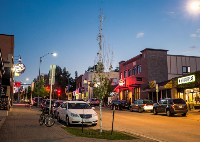
College Hill, mixed-use core area.
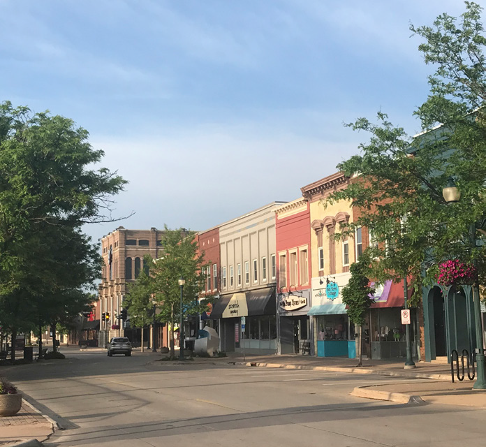
Downtown, Parkade area.
D.
Other Applicable Regulations.
Where apparent conflicts exist between the provisions of the Character Districts and other existing ordinances or approvals, these Character District standards shall govern within a Character District.
E.
Minimum Requirements.
In interpreting and applying the provisions of the Character Districts, they are the minimum requirements for development under this Code.
F.
Components.
The Character District standards are included in the following sections:
1.
Section 26-191, Introduction and definitions, instructs on the use and organization of the Character District Code. It's definitions component includes those terms that are used in the Character District regulations in specific ways, often excluding some of the meanings of common usage. Wherever a word is underlined, consult G, Key character district concepts, below, or H, Definitions, for its specific and limited meaning. Where there is an apparent contradiction between the definitions in the Character Districts and those elsewhere in the Cedar Falls Zoning Ordinance, the definitions in this section shall prevail. Words used but not defined in the Character Districts, but that are defined elsewhere in the Cedar Falls Zoning Ordinance, shall have the meanings set forth therein.
2.
Section 26-192, Regulating plans: The regulating plan is the application map for each Character District. The regulating plan provides specific information on the rules for development within the parcel. The regulating plan makes the development standards place-specific, by designating the building form standard frontages and delineating the public spaces.
The regulating plan identifies: the boundaries for the Character District; existing and new streets; the required building line; and the parking setback line throughout the Character District; and may identify additional regulations and/or special circumstances for specific locations.
3.
Section 26-193, Building form standards, sets out the rules for building siting, scale, and massing that control how buildings frame and relate to the street-space or public realm. The building form standards establish the parameters for development on each site in terms of building placement, height, elements, and uses.
4.
Section 26-194, Architectural standards, provide parameters for a building's exterior elements, with an emphasis on facades. These standards govern materials, configurations, and techniques for development under all building form standards. They are established in order to ensure a coherent and high-quality building character that is complementary to the best traditions of Cedar Falls.
5.
Section 26-195, Public realm standards, include standards for the public realm: streets and sidewalks, and squares, civic greens, and other public open spaces. They are established in order to ensure a vital and complete public realm with a high level of walkability.
6.
Section 26-196, Parking and loading standards, provide goals and requirements to promote a "park once" environment through shared parking and encourage pedestrian-friendly, walkable Character Districts.
7.
Section 26-197, Building function standards, define the uses allowed and/or required on ground floors and in upper floors, correlated with each building form standard. Because the Character Districts emphasize form more than use, these standards include fewer, broader categories than those provided elsewhere in the Cedar Falls Zoning Ordinance.
G.
Key Character District Concepts.
The following list of concepts are important components of the Character District regulations and are provided here for quick reference. These and other terms in the Character District sections are used in specific ways, often excluding some of the meanings of common usage. Wherever a word is in underline format, consult below or H, Definitions, for its complete specific and limited meeting.
Attic Story:
Habitable space situated within the structure of a pitched roof and above the uppermost story that does not count against the ultimate building or story height if constructed within the prescribed standards.
Block:
An increment of land comprised of lots, alleys, and parcels circumscribed and not traversed by streets (pedestrian pathways excepted). Blocks are measured at the required building line (RBL).
Buildable Area:
The area of the lot that structure(s) may occupy, which generally includes the area of the lot behind the required building line and excluding any required setbacks, as designated in the individual building form standard. Any building additions shall be within the specified buildable area.
Clear Sidewalk:
The portion of a sidewalk that must remain clear of obstructions (furniture, signage, trees, lighting, etc.) to allow for unimpeded public passage.
Clearly Visible from the Street-Space:
Some requirements of the Character Districts apply only where the subject is "clearly visible from the street-space." (Note the definition of street-space below.) A building element more than 30 feet from a required building line or street-space is by definition not clearly visible from the street-space. Common or party walls are by definition not clearly visible from the street-space.
Dooryard:
The area within the street-space, extending across the entire frontage of the lot, between the building facade (the required building line) and the clear sidewalk. This area may be hard-surfaced or planted according to section 26-195.2, A public realm standards, general, dooryards.
Facade (building face):
The building elevation facing the street-space or required building line. Building walls facing private interior courts, common lot lines, and alleys are not facades (they are elevations).
Fenestration:
Openings in a wall, including windows and doors, allowing light and views between the building and/or lot interior (private realm) and exterior (public realm).
Parking Setback Line:
A line or plane, generally parallel to the required building line, that extends vertically up from the ground story floor level (unless otherwise noted on the regulating plan), behind which parking may be located.
Private Open Area:
An occupiable area within the buildable area, generally only accessible to occupants of the particular building or site, and (primarily) open to the sky. The permitted location(s) for the private open area is designated in the individual building form standard.
Public Realm:
See street-space.
Required Building Line (RBL):
A line or plane indicated on the regulating plan, defining the street frontage, that extends vertically and is generally parallel to the street, at which the building facade shall be placed. It is a requirement, not a permissive minimum, such as a setback. (The minimum length and height of facade that is required at the RBL is shown on the applicable building form standard.)
Street-Space (Public Realm):
The space between fronting facades or required building lines, including streets, squares, greens, sidewalks, dooryards, and parks—but not within alleys.
Street Wall:
A primarily masonry wall which assists in defining the street-space, filling in the gaps between adjacent building facades.
Tree Lawn (tree trench/planting strip):
A continuous strip of soil area—typically covered with bridging pavement, tree grates, porous pavers, or grass and other vegetation—located between the back of curb and the clear sidewalk, and used for planting street trees and configured to foster healthy street tree root systems. Tree lawn configurations are specified in the public realm standards, section 26-195.5.
H.
Definitions.
The following terms are defined for the purpose of the Character Districts. Terms not defined here may be defined elsewhere in the zoning ordinance. In such case, the definition contained in the zoning ordinance shall be used. Certain terms in these districts are used in very specific ways, often excluding some of the meanings of common usage. Where there is an apparent conflict or contradiction, the definition herein shall prevail.
Alley. The public right-of-way or public access easement for vehicles and pedestrians within a block that provides service access to the rear or side of properties, vehicle parking (e.g., garages), loading docks, utility meters, recycling containers, and garbage bins.
Attic story. See G, Key Character District concepts.
Awning. A solid or fabric-on-frame roof-like element attached to the facade or required building line side of a building to provide shelter or shade.
Balcony. An exterior platform attached to the upper stories of the building facade (generally forward of the required building line).
Bay window. Generally, a U-shaped enclosure extending the interior space of the building forward of the facade/required building line (along its street-space side).
Block. See G, Key Character District concepts.
Block corner. The outside corner of a block at the intersection of any two required building lines. Inside corners, where the resulting angle formed by the block face is less than 180 degrees (concave) are not considered block corners for the purposes of the Character Districts.
Block face. The required building line frontage between block corners.
Building corner. The outside corner of a building where the primary building mass is within an angle less than 180 degrees. Inside corners, where the exterior space of the building mass forms an angle of more than 180 degrees are not considered building corners for the purposes of the Character Districts.
Buildable area. See G, Key Character District concepts.
Building form standards (BFS). The part of the Character District standards that establish basic parameters regulating building form, including: the envelope (in three dimensions); placement on the lot; and certain permitted and required building elements, such as shopfronts, balconies, and fenestration.
Canopy. The solid or fabric-on-frame roof-like element, covering an entry door(s), attached to the facade or required building line side of the building to provide shade or shelter.
Civic buildings. Those buildings designated on the regulating plan that are or were designed to house strictly civic or cultural assembly uses or are historically and urbanistically significant structures. These may include meeting halls; libraries; schools; police and fire stations; post offices (retail operations only, no primary distribution facilities); places of worship; museums; cultural, visual and performing art centers; transit centers; courthouses; and other similar community uses. Public ownership alone does not constitute a civic building. Civic buildings and publicly-owned public art are not subject to the building form standard prescriptions of the Character Districts unless specifically noted otherwise.
Clear height. Within a structure, the habitable distance between the floor and ceiling. For entrances and other external building features, the unobstructed distance from the ground/sidewalk to the lowest element above. Clear height is not applicable to parking structures.
Clear sidewalk. See G, Key Character District concepts.
Clearly visible from the street-space. See G, Key Character District concepts.
Common lot lines. Lot lines shared by adjacent private lots.
Cottage. The building form used for a cottage court.
Cottage court. The configuration of small single unit buildings/houses around a shared courtyard green space that is open to the street-space.
Corner lot. A lot that has frontages on two intersecting street-spaces. Special building placement, fencing and landscape requirements may apply.
Courtyard. The shared central area, that is open to the street-space in a cottage court configuration.
Duplex. A two-unit dwelling, built according to the neighborhood medium or neighborhood small frontage standards, with the two units arranged either side by side or one above the other in the same structure, each having substantially the same exposure to the street frontage.
Dooryard. See G, Key Character District concepts.
Equivalent or better. A building material or construction technique that has been determined, by the zoning administrator in consultation with the zoning review committee, to be at least equal to, in appearance, durability, etc., or surpassing those expressly permitted herein.
English basement. A habitable floor level below the first floor that is partially above and below grade. The ceiling of an English basement is at least three feet above sidewalk grade with windows and an entry with direct street-space access. English basement units do not count against the story height limit but do count against the maximum height measurement. An English basement unit is considered an accessory dwelling unit.
Facade composition. The arrangement and proportion of materials and building elements (windows, doors, columns, pilasters, bays) on a given facade.
Fenestration. See G, Key Character District concepts.
Forecourt. A building facade configuration where a central portion of the facade is set back from the required building lines to form a space that is enclosed on three sides by building elevations, with the entry door on one of the three elevations. Forecourts are limited in size and must satisfy all their frontage standards.
First floor. See ground story.
Front porch. An entry platform attached to the ground story facade or required building line side of the building.
Green or square. A public open space designated on the regulating plan. The term green is used to describe a small public lawn, playground, or other public open area that is primarily unhard-surfaced. The term square is generally used to describe spaces that have more hard-surfaced area. See section 26-195, Public realm standards, for the specific controls on greens and squares.
Ground story. The first habitable level of a building at or above grade. The next story above the ground story is the second story or floor.
Mezzanine. An intermediate level between the ground story and the second story that may be in the form of a platform, podium, or wide balcony.
Muntin. A strip of wood or metal separating and holding panes of glass in a window, less than one inch in thickness. Muntins divide a single window sash or casement into a smaller grid system of panes of glass.
Parking setback line. See G, Key Character District concepts.
Pedestrian pathway. A publicly accessible interconnecting hard-surfaced way, open to the sky, providing pedestrian and bicycle passage through blocks running from a street-space to another street-space, alley, or an interior block parking area.
Privacy fence. An opaque fence generally along alleys, pedestrian pathways, and common lot lines. See the section 26-193, Building form standards, for height and placement specifications and section 26-194, Architecture, for material and configuration standards.
Private open area. See G, Key Character District concepts.
Public realm. See G, Key Character District concepts.
Regulating plan. The implementing plan for development within the Character Districts. Regulating plans designate the building form standards for private development and may provide specific information for the disposition of each building site. The regulating plan also shows how each site relates to adjacent street-spaces, the overall district, and the surrounding neighborhoods.
Required building line (RBL). See G, Key Character District concepts.
Rowhouse. A single-unit multi-story attached building, sharing one or more common walls with at least one other unit, and with a direct street-space facade entry and no principal dwelling unit above another principal dwelling unit.
Shared parking. Automobile parking that is visible and accessible to the public for a minimum portion of each day.
Shopfront. The area of the frontage running, vertically from the sidewalk up to the bottom of the second story floor structure and horizontally, the full width of the interior shop or store space. This is comprised of the various architectural elements including kneewalls, transoms, window panes, mullions, muntins, posts, pilasters, columns, and any roofs, cornices or eaves—all of which shall comply with the standards of section 26-193.3, Building form standards, storefront frontages, and section 26-194.4.F, Architectural standards, shopfronts.
Sidewing. The portion of a building attached to and behind the primary structure extending along a common lot line toward the alley or rear of the lot.
Small apartment. A multi-unit dwelling built according to the neighborhood medium or neighborhood small frontage standards.
Square. See green.
Stoop. An entry platform on the facade of a building. (See the individual building form standards for specifications.)
Story. That space within a building and above grade that is situated between one floor level and the floor level next above, or if there is no floor above, the ceiling or roof above.
Street-space. See G, Key Character District concepts.
Street-space frontage. That portion of the lot or building that is coincident with the required building line as required by the Character Districts.
Street tree. A tree required in the Character Districts that is used to define the street-space or pedestrian realm and listed in the street tree list in section 26-195, Public realm standards. Street trees are large enough to form a shade canopy with sufficient clear trunk to allow traffic to pass under unimpeded.
Street wall. See G, Key Character District concepts.
Tree lawn. See G, Key Character District concepts.
Uses. See sections 26-132 and 26-133 for categories and definitions.
Zoning review committee (ZRC). An internal staff committee established to review development proposals for compliance with applicable Character District regulations and to interpret the ordinance in such a way as to carry out its purpose and intent. The committee shall consist of the zoning administrator, the building official, and a planner designated by the zoning administrator.
(Ord. No. 2994, § 9(Att. A), 11-1-2021)
Sec. 26-192. - Regulating plan.
A.
Purpose and Intent.
The regulating plan is the controlling document and principal tool for identifying the applicable regulations in each Character District. Each Character District will have its own regulating plan.
1.
The regulating plan is the mandatory base zoning for the Character District.
2.
The regulating plan makes the Character District development standards place-specific by:
a.
Identifying the boundaries of the district;
b.
Laying out a specific street and block configuration, including any new streets;
c.
Designating the building frontage for each street-space (regulated in section 26-193, Building form standards);
d.
Identifying any civic buildings; and
e.
Delineating any new or existing greens or squares.
3.
The regulating plan also specifies the required building line and parking setback line. See also the placement page in the individual building frontage in section 26-193, Building form standards.
4.
The regulating plan may identify:
a.
Specific characteristics assigned to a lot or a section of street frontage;
b.
Additional regulations for lots in specific locations;
c.
Exceptions to the building form standards or other Character District standards related to unique context or urban design.
5.
Changes to an adopted regulating plan beyond those specifically allowed in this section will require a rezoning process. (See H, Amending regulating plans below.)
B.
Regulating plan Configuration Standards.
1.
Building form frontages on the regulating plan.
a.
The applicable building form frontages for private parcels are designated on the regulating plan by their street frontage.
b.
The building form standards—which define the form and character of the district—are allocated based on the adopted vision plan.
2.
Streets.
a.
Generally, connectivity of the street grid throughout the Character Districts, specifically intersection alignments, is regulated by these standards. An interconnected street grid is fundamental to creating a compact, walkable, and bikeable environment that is transit-supportive. These standards are intended to preserve and establish that connectivity, whether it is constructed immediately or in a phased manner. The regulating plan delineates the street network that creates a pattern for growth while providing flexible opportunities for infill.
b.
Streets on an adopted regulating plan shall be considered mandatory when developing under this district: if proposed they shall be included, if existing they shall not be removed.
c.
No street-space may be gated.
d.
All lots shall share a frontage line with, and all principal buildings shall directly front, a street-space and/or a required building line—as designated on the approved regulating plan. Phased projects may meet this requirement for each phase of development, satisfying it in increments.
e.
Where a new street or a street stub-out is shown on the regulating plan, no other curb cut and/or intersecting street is permitted within 100 feet.
3.
New streets designated on the regulating plan.
a.
Any new streets will require subdivision and a new plat. Consult the zoning administrator.
b.
In addition to the street connectivity requirements in 2, Streets, above, the following standards apply to those streets constructed after the adoption of the Character District regulating plan.
(i)
New streets designated on the regulating plan may or may not be immediately constructed.
(ii)
Any new streets that create frontage on a parcel being developed shall be constructed at the time of development.
(iii)
New streets shall be public.
c.
If constructed within 50 feet of the center line location in an adopted regulating plan, the street repositioning will not require a rezoning, provided the resulting configuration meets these street configuration standards and that any other properties with frontage are not adversely affected. All regulatory elements of the street, such as the required building line, parking setback line, and the building form frontage designation, shall move with any street repositioning.
d.
Additional new streets or alleys may be added to an adopted regulating plan by an applicant to create a smaller block pattern; however, no streets or alleys may be deleted without being replaced and the result shall meet all the prescriptions of the Character District standards.
C.
Blocks.
1.
Blocks are measured at the required building lines or, where a required building line is not present, along public rights-of-way, or other public, conservation, and/or property outside of the Character District. All lots and/or contiguous lots shall be considered to be part of a block for this purpose (see Diagram A).
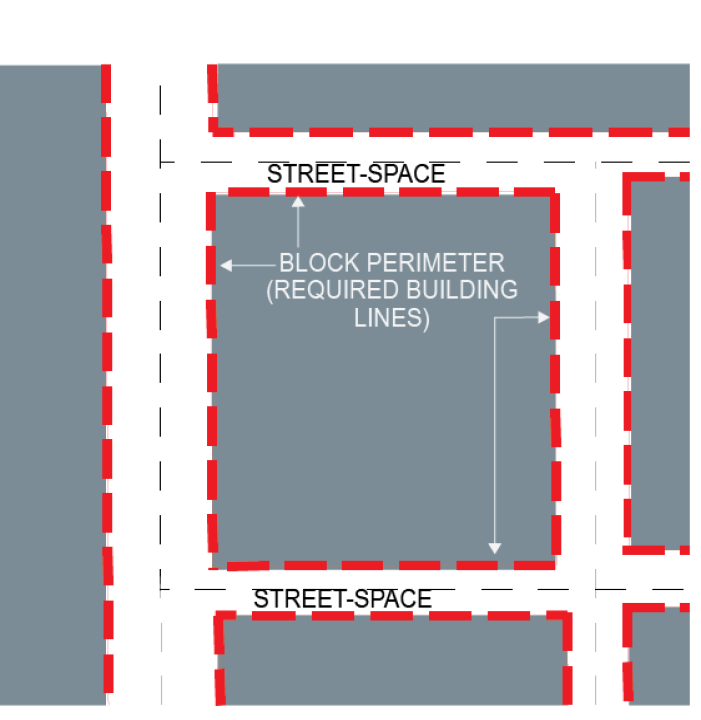
Diagram A.
2.
Within an approved regulating plan: no block face shall have a length greater than 360 feet without an alley, public access easement or pedestrian pathway of not less than 24 feet in width, providing through-access to another street-space, or alley. If a block does not meet this standard, then at the time of development, the following standards apply:
a.
Individual lots with less than 100 feet of street-space frontage are exempt from this requirement.
b.
Lots from 100 through 200 feet in frontage shall, in coordination with the zoning review committee, reserve a public access easement at least 12 feet wide, unless already satisfied within that block face.
c.
Lots with over 200 feet of street frontage shall meet the through-access requirement within their lot, unless already satisfied within that block face.
d.
New lots shall not be platted in order to avoid/circumvent the through-access requirement.
The zoning administrator in consultation with the ZRC shall determine which type of through-access must be implemented.
3.
Where a new regulating plan is being created, or an approved regulating plan is being amended that involves a change to the number of streets or blocks, the following standards apply:
a.
No block face shall have a length greater than 360 feet.
b.
The average perimeter of the blocks within the developed area shall not exceed 1100 feet.
4.
Curb cuts: No new curb cuts are permitted unless otherwise specified below. The creation and retention of curb cuts in the character district shall be dependent on their providing access to, and circulation for, alleys as per the following:
a.
For lots with alley access, existing or in a redevelopment plan, existing curb cuts other than those necessary for alley circulation, shall be eliminated or vacated at the time of redevelopment.
b.
For lots without alley access, existing curb cuts may be maintained or required to be relocated, subject to the standards of this section.
c.
For lots without a curb cut or alley access, new curb cuts for shared driveways have priority over those for single access. No new curb cut may be within 100 feet of another curb cut except where the new curb cut provides needed access for existing or planned alley circulation.
d.
All curb cuts are subject to zoning review committee approval (See section 26-196.C.5).
5.
Where a parking structure or surface lot with more than 20 spaces, existing or planned, is being provided with at least 40 percent of its spaces available to the general public, existing curb cuts that provide access to the public parking may be retained or relocated even if the lot has alley access. Such parking must meet the requirements of section 26-196.C.5 for shared parking.
D.
Alleys.
Alleys provide internal block circulation and shared access to rear parking and service areas. They may also serve as fire lanes.
1.
Existing alleys shall be maintained.
2.
Access to parking and service areas shall be from alleys or public access easements as set forth in this section. Alleys or public access easements shall, at the time of redevelopment, provide access to the rear of all lots. The zoning administrator may waive or approve alternative access to parking and service areas where the absence of the alley would not deprive an adjacent lot/neighbor of rear lot access, and:
a.
The lots are on a perimeter common to non-developable or conservation lands, or
b.
A lot has streets on three sides.
3.
Alleys may be incorporated into parking lots as standard drive aisles. Access from alleys to all adjacent properties shall be maintained.
4.
In Storefront, Urban General, and Urban General 2 frontages, vehicular access between adjacent parking lots and across property lines is encouraged.
5.
In Storefront, Urban General, and Urban General 2 frontages, where an alley does not exist and is not feasible to construct at the time of development of any property, the applicant is required to preserve rear service access and maintain the area within the rear setback by, at a minimum:
a.
Providing routine landscape maintenance to the area.
b.
Keeping the area clear of debris, stored materials, and stored or parked vehicles.
E.
Public Open Space.
Standards for structures and plantings in public open spaces are provided in section 26-195, Public realm standards.
F.
Sample Regulating Plan Key.
Each regulating plan contains a key explaining the plan designations. The key below, Illustration B, is provided as an example.
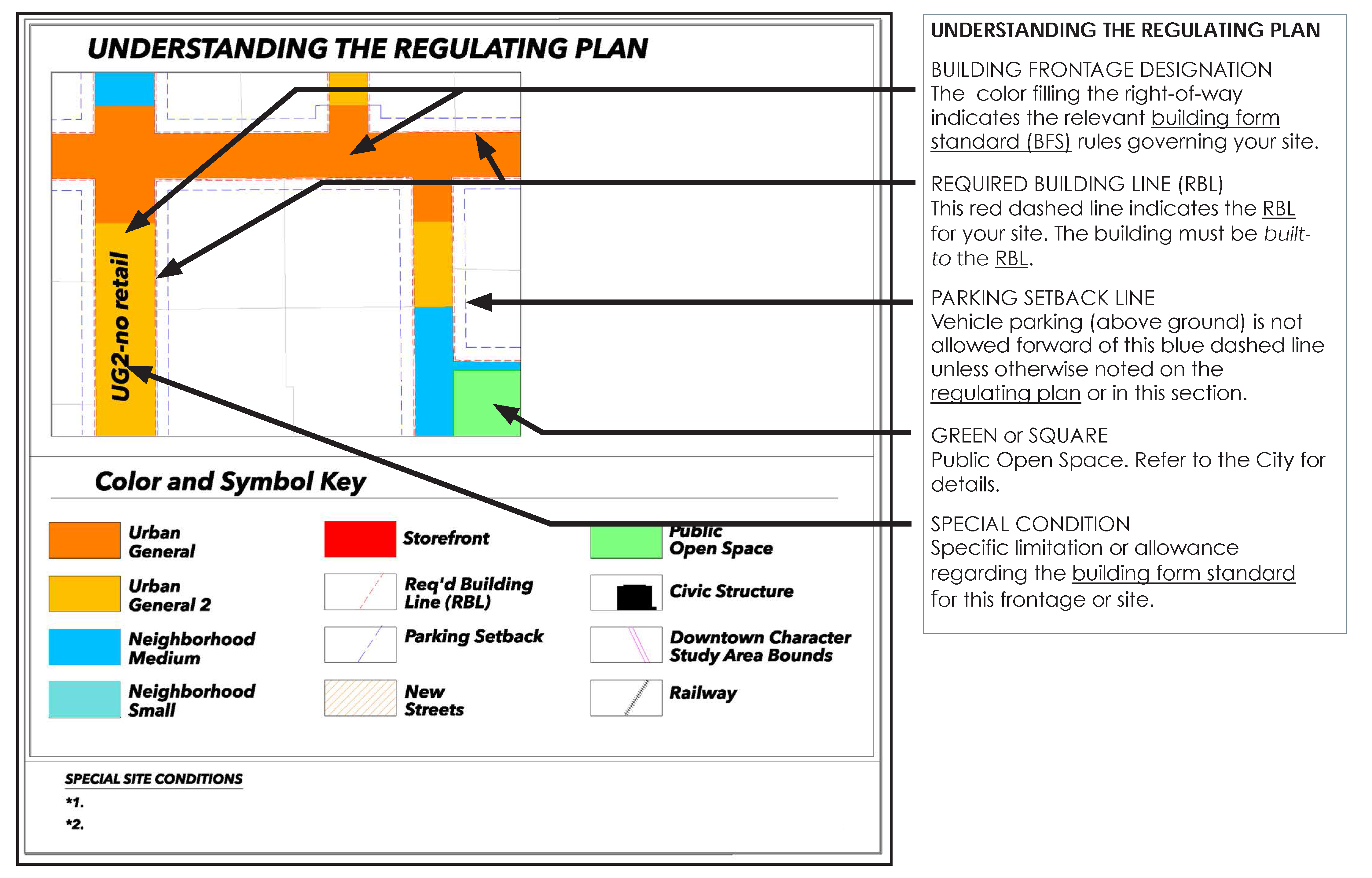
Illustration B.
G.
Example Regulating Plan.
Each Character District has its own regulating plan. The regulating plan below is provided as an example. See the city for the regulating plan for a specific Character District.
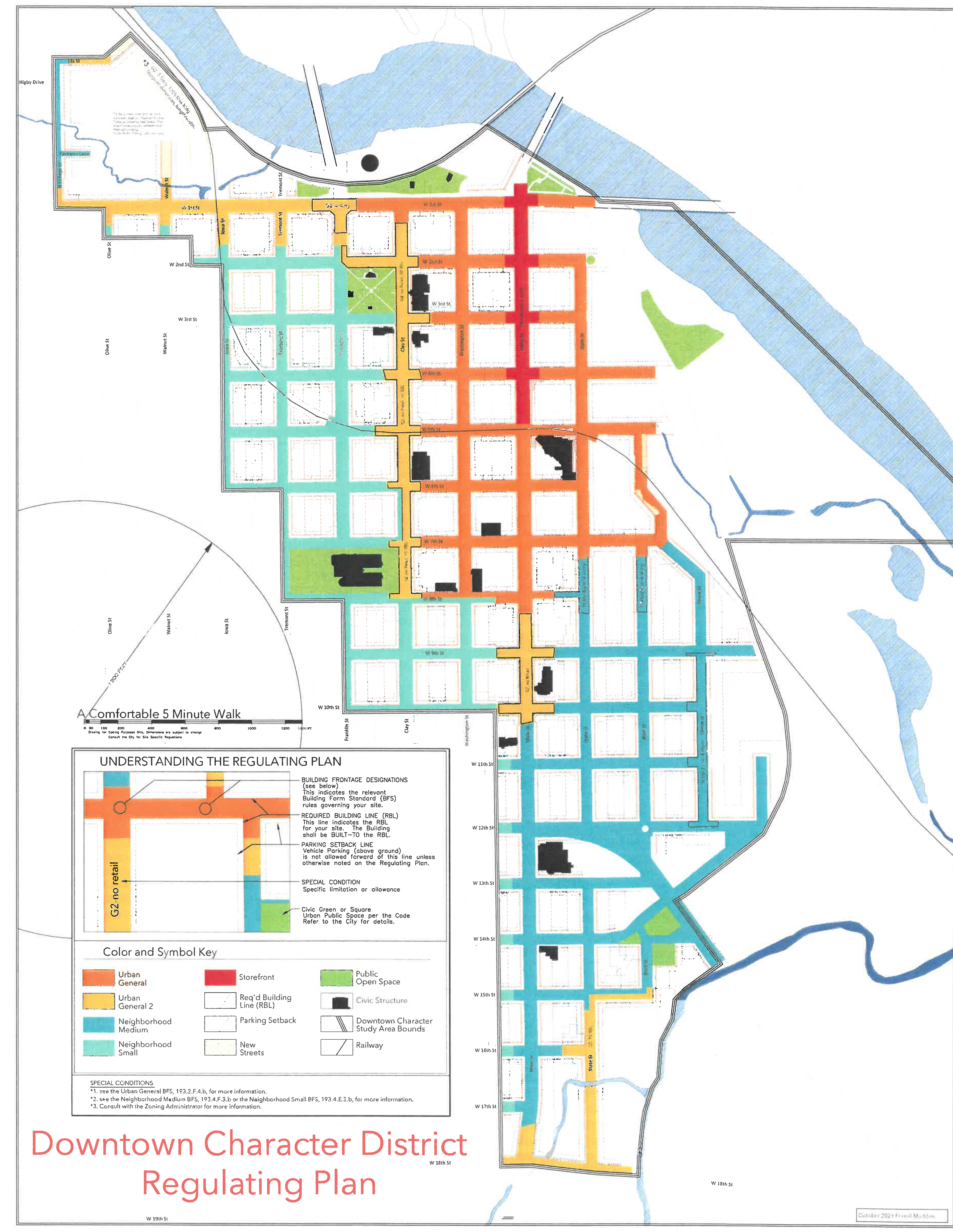
Illustration C. This image of the regulating plan for the Downtown Character District is shown for illustrative purposes only; refer
to the city for the regulating plan specific to your Character District.
H.
Amending Regulating Plans.
1.
Certain minor reconfigurations to the street alignments shown on an adopted regulating plan may be allowed, subject to re-platting and the design standards in sections B.3.c and d above, without triggering a rezoning. Any other changes to an adopted regulating plan shall meet all the criteria of this chapter and will require a rezoning.
2.
Certain minor adjustments to the frontage designation shown on the regulating plan are permitted within the parameters of section 26-193, Building form standards, D.5, Frontage designation flexibility.
3.
Required building line location or new street alignments may be reconfigured by the zoning review committee, without triggering a rezoning, if the presence of a flood plain or wetland on the parcel prohibits development envisioned by the code.
4.
Street connectivity.
a.
Any proposals to reconfigure the street network in the adopted regulating plan shall be configured such that:
(i)
Street connectivity is maintained; cul-de-sacs and other dead-end streets are not permitted except as specified here; and
(ii)
No street intersection occurs within 100 feet of another street intersection; and
(iii)
The block configuration meets the standards defined in section B, Blocks above; and
(iv)
The average perimeter of the resulting blocks within the area of change does not exceed 1,100 feet.
b.
Streets that do not connect to other streets, as part of an interconnected network, are not permitted except:
(i)
Where configured with a one-way loop around the perimeter of an open area, having a maximum depth (perpendicular to the primary street centerline) of 100 feet and a minimum width (dimension parallel to the primary street) of 75 feet (see Diagram E);
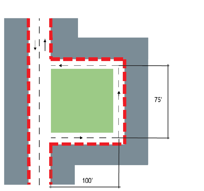
Diagram E.
(ii)
Where less than 130 feet long and configured as a stub-out designed for connection to future streets/development (see Diagram F);
Diagram F.
(iii)
Where less than 130 feet long and connected to an alley, providing rear lot access, and ending at designated conservation lands. (see Diagram G).
Diagram G.
(Ord. No. 2994, § 9(Att. A), 11-1-2021)
Sec. 26-193. - Building form standards.
The building form standards (BFS) establish the rules for development and redevelopment on private lots. They work through form and function controls on building frontages to frame the street-space and foster a vital public realm.
The building frontage designations are denoted on the regulating plan by the color filling the street-space fronting the parcel. The same colors are shown in the section for each frontage designation that follows. The building form standards set the basic parameters governing building form, including building placement, the building envelope (in three dimensions), and certain required or permitted functional elements. These standards allow change-over-time and promote lasting and contributing buildings.
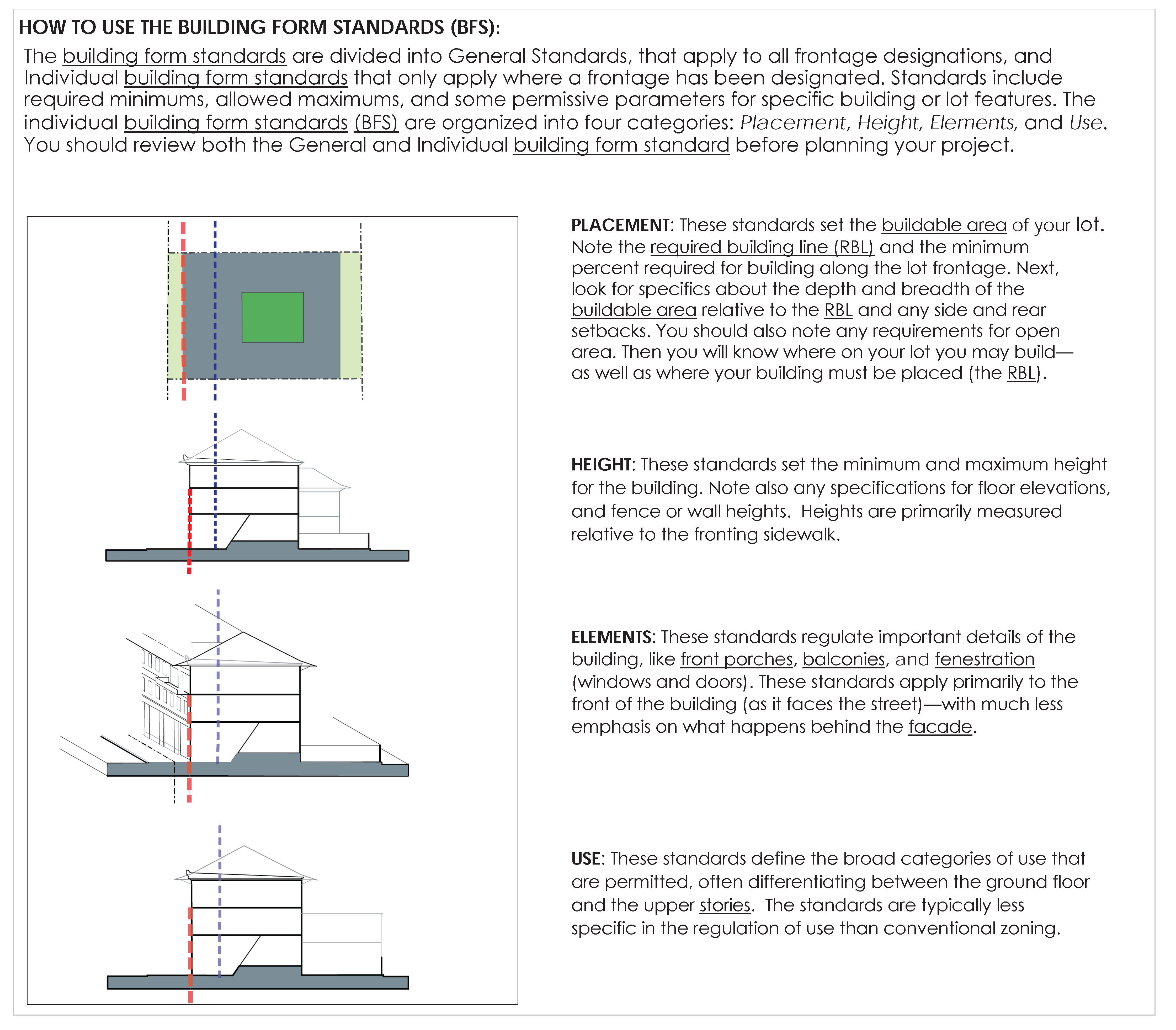
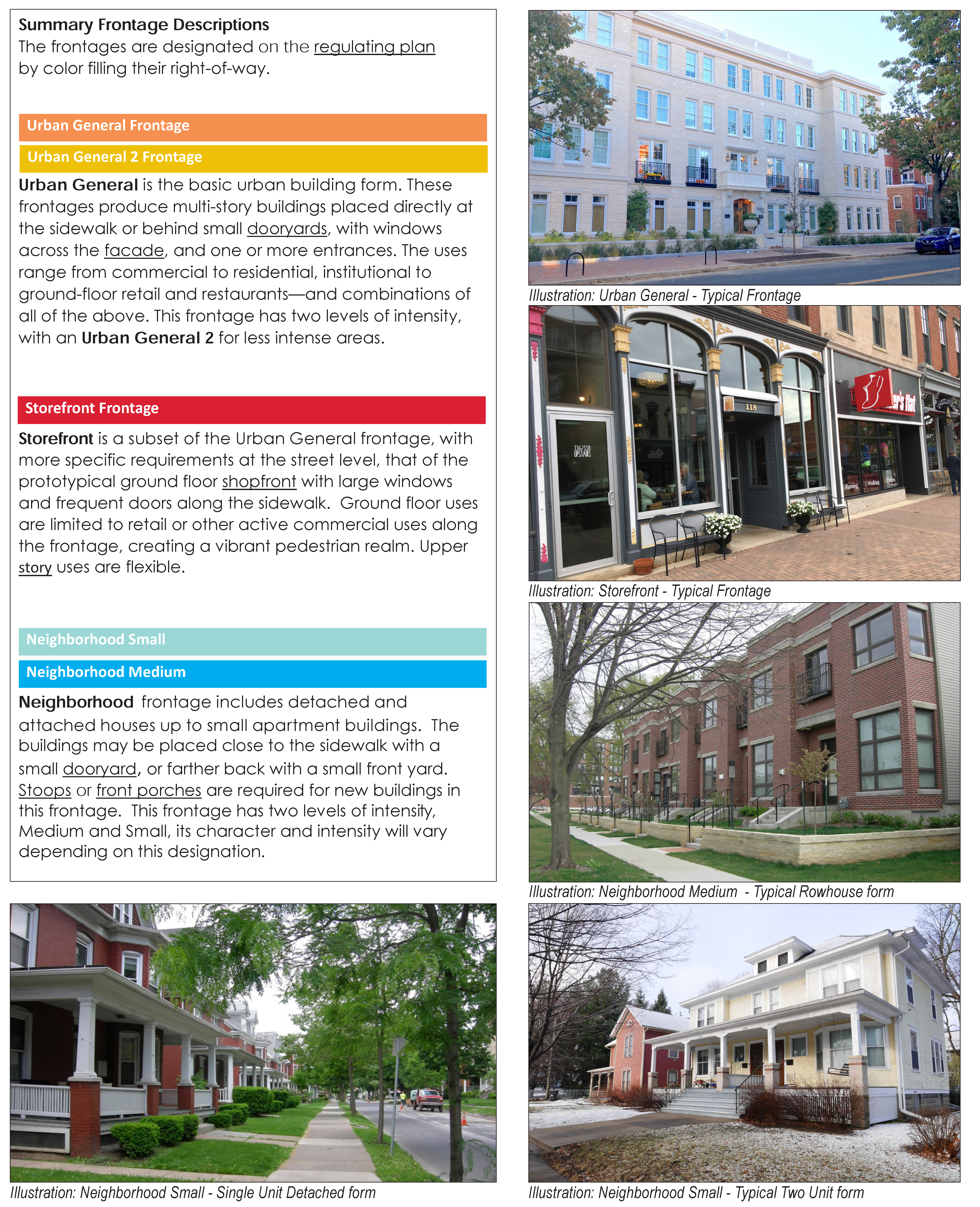
(Ord. No. 2994, § 9(Att. A), 11-1-2021)
Sec. 26-193.1. - General provisions.
These provisions apply to all building frontage designations, unless expressly stated otherwise within the building form standards for an individual frontage designation or on the regulating plan.
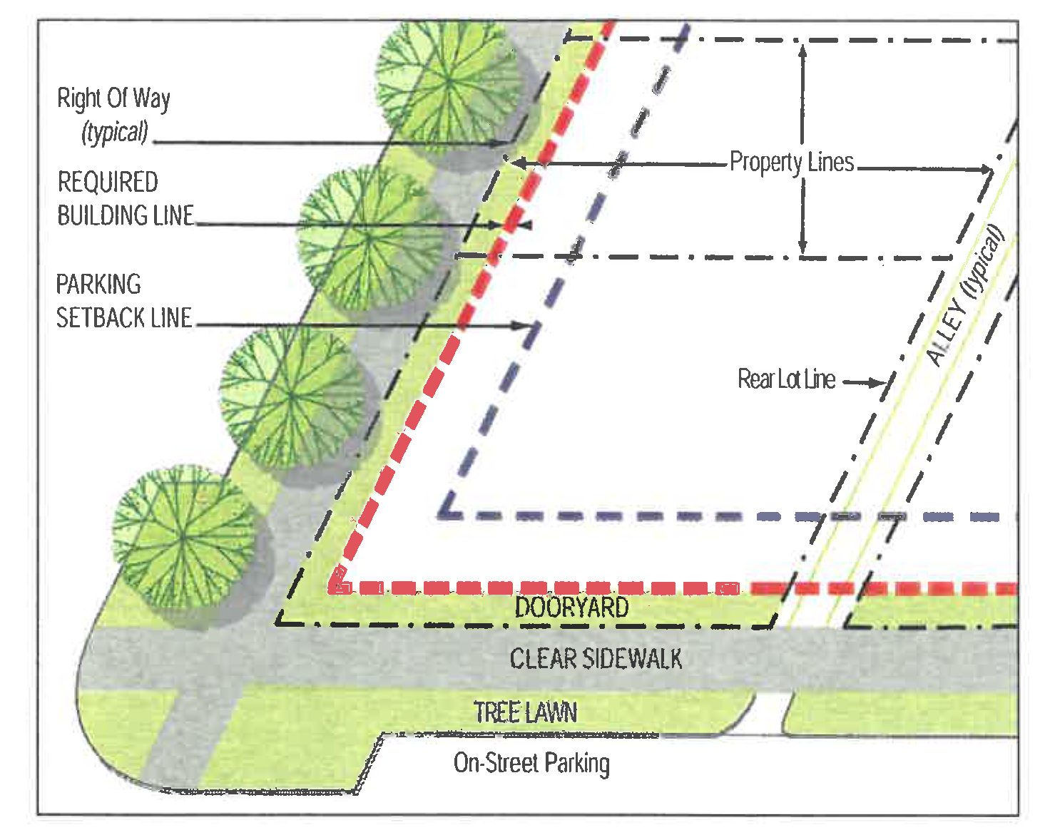
Illustration A. Key Character District elements
A.
Placement.
1.
Required building line (RBL).
a.
Building facades shall be built to the required building line as prescribed in the individual building form standard.
b.
The required building line includes an offset area (or depth) of five feet behind that line (into the buildable area) allowing for jogs and facade articulation. Therefore, where the facade is placed within that five-foot zone, it is considered to be built to the required building line.
c.
The building facade shall be built to the required building line within 30 feet of a block corner. (See Diagram B, Block corners)
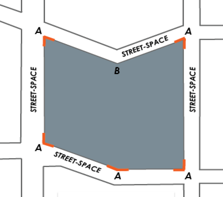
Diagram B. Block corners
A. Block corner
B. not a block corner
d.
For corner lots, the required building line is continuous around the block corner (not broken into separate frontages or required building lines).
e.
All lots, including corner lots and through lots, shall satisfy the requirements of their individual building form standard for both frontages. (See Diagram C, Through lots.)
f.
Where a through lot has frontages with different height limits, the greater of the two maximum height limits shall not come within 60 feet of the RBL of the lower height frontage. (See Diagram C, Through lots.)
Diagram C. Through Lots
2.
Buildable area (See Table A, Facade projection limitations).
a.
Buildings may only occupy that portion of the lot specified as the buildable area: the area behind the required building line and excluding any required setbacks, as prescribed in the building form standard.
b.
No part of any building may be located outside of the buildable area except projecting eaves, awnings, shopfronts, bay windows, porches, stoops, steps, or balconies.
c.
Accessibility ramps approved by the zoning administrator in consultation with the ZRC may be located within the dooryard area.
d.
Rear and side lot setbacks, where required, are specified in the individual building form standard and/or section 26-193.1.F, Neighborhood manners.
3.
Dooryards.
See section 26-195.2.A, Public realm standards. (See also Illustration A, Key Character District elements.)
4.
Private open area.
Private or semi-private usable open area is required on every lot, measured as a specified percentage of the buildable area. This requirement may be satisfied in a variety of at or above-grade configurations, as prescribed in each building form standard.
a.
The private open area must be improved and available for safe and convenient access to all occupants of the building.
b.
The private open area must be open to the sky except for pergolas and porches, decks.
c.
The private open area, when located at grade, must be not more than 33 percent impervious surface area and shall be designed with green features.
d.
Any private open area located at grade or below the third story shall not encroach into any required side or rear set-backs. See the individual building frontage standards for additional parameters.
e.
Any shared private open area located above the second story (excluding balconies) shall be designed with green features, such as planters or functional green roofs, contain outdoor seating and other appropriate amenities, be free of any obstructions, be screened from rooftop mechanical equipment, and be located and configured to prevent views into adjacent dwelling units.
f.
The private open area may be distributed among separate areas, but at least 67 percent shall be in no more than two separate areas.
g.
The private open area is not to be used to satisfy minimum stormwater best management practice area (if thereby excluding active tenant use), parked, or driven upon.
h.
Any development on a lot that is exclusively reusing existing structures is exempt from the private open area requirement.
5.
Street walls and privacy fences.
a.
Unless otherwise indicated in the individual building form standard, a street wall is required along any required building line (RBL) frontage that is not otherwise occupied by a building. (See Illustration D, Street wall at RBL.) Note that a building is required along any RBL within 30 feet of a block corner.
Illustration D: Street wall at RBL
b.
Any street wall above four feet in height shall meet the fenestration requirements of the applicable building form standard.
c.
Privacy fences may be constructed along common lot lines, behind the required building line, and along alleys.
d.
Privacy fences have a maximum height of eight feet.
6.
On-site/off-street vehicle parking and access (curb cuts). In Character Districts, off-street vehicle parking and access should have minimal intrusion on the public realm. Off-street parking should not be clearly visible from the street-space. Access should be provided from alleys, or shared access lanes, minimizing potential vehicular-pedestrian points of conflict. Properties within a Character District are exempt from any parking standards not in sections 26-191 through 26-197. The following standards apply.
a.
The parking setback line is designated on the regulating plan, with additional specifications in the applicable individual building form standard.
b.
The parking setback line extends vertically, as a plane, from the first-floor level.
c.
Vehicle parking must be located behind the parking setback line, with the following exceptions.
(i)
Parking may be forward of the parking setback line where it (see Diagram E):
Diagram E: Parking allowed forward of the parking setback line.
(a)
Is beneath a habitable first floor and completely within the building envelope;
(b)
Has a floor level at least four feet below grade; and
(c)
Has fenestration not greater than 15 percent (from the average fronting sidewalk elevation to the finished first floor level.
(ii)
Parking may be forward of the parking setback line only where designated on the regulating plan:
(a)
At the rear of lots with alley/required building line intersections, as prescribed in the individual building frontage standard; or
(b)
Above the floor level specified on the regulating plan.
(iii)
On lots owned by and used for a permitted civic or institutional use, parking may be located forward of the parking setback line, provided that:
(a)
The parking area is on a lot that contains the subject civic or institutional use or directly abuts or is across the street or alley from the subject civic or institutional use; and
(b)
The parking area is set back a minimum of ten feet from any streetside lot line. This streetside setback area shall be used for landscape screening and trees; screening shrubs shall be minimum 18 inches in height at planting and spaced appropriately to form at maturity a continuous, effective visual screen three to four feet in height to provide a buffer between the parking area and the street space. In addition, canopy shade trees meeting the standards in section 26-195.4F, Street Tree Specifications, shall be planted at an average spacing not greater than 50 feet on center within the streetside setback area; and
(c)
If the lot is located on a neighborhood small or neighborhood medium frontage lot or shares a common lot line with a neighborhood small or neighborhood medium frontage lot or shares a common lot line with a lot in an R-1 or R-2 District, the parking area shall be set back a minimum of five feet from any common lot line and screened with shrubs to form a continuous, effective visual screen as specified in paragraph (b) above; and
(d)
The parking complies with the vision triangle restrictions in section 26-220(e)(7); and
(e)
When a principal building is constructed on the site, the building must be constructed according to the regulating plan and meet all standards and requirements, as applicable.
d.
Curb cuts and driveways shall be located at least 75 feet away from any block corner, other curb cut, or parking garage entry on the same block face. These requirements are not applicable along alleys.
e.
No project may create any new curb cuts where alley or shared access exists or is designated on the regulating plan—unless it is created to provide access to publicly-available parking.
f.
If alley or shared access is not available, an applicant may request direct driveway access from a street, subject to approval by the zoning administrator in consultation with the ZRC.
7.
Publicly accessible parking structures:
a.
Built according to this Code are not included in or subject to the calculation of the maximum building footprint in the individual building form standard, but shall meet all other applicable standards.
b.
Parking spaces on the top level of a parking structure shall not count as an additional story against the height limits of this Code. Shading and solar structures that are not clearly visible from the street-space are permitted.
c.
Any portion of any parking structure within 25 feet of a building constructed under this Code shall not exceed that building's primary ridge or parapet height,
d.
All parking structures are subject to section 26-193.1.F, Neighborhood manners.
e.
Openings in any required building line for parking garage entries shall have a maximum clear height of 16 feet and a maximum clear width of 22 feet.
f.
Parking structures may have parking beyond the parking setback line at and above the second story provided that:
(i)
The parking is clearly identified and accessible to the public; and
(ii)
No less than 90 percent of the parking spaces are available to the public; and
(iii)
At least 12 hours of public parking are provided in any 24-hour period; and
(iv)
That at least eight of those hours are provided during either business or nighttime hours depending on whether the zoning administrator in consultation with the ZRC determines that the primary use will be for commercial or residential uses.
B.
Height.[1]
Heights are specified in the individual building form standard. Civic buildings are exempt from these standards.
1.
Heights in Character Districts are generally measured from the average fronting clear sidewalk elevation.
2.
Building height is measured in stories, with an ultimate building height limit in feet.
a.
Building heights are measured to the top of the wall plate or top of the parapet, whichever is higher. (See Diagram F.)
Diagram F. Building facade view
Building height measurement:
Large floorplates along significantly sloped frontages need to 'step' the building
in order to maintain the proper relationship with the sidewalk.
b.
Finished floor elevation and minimum building height requirements shall be satisfied from the required building line back to a minimum depth of 30 feet.
3.
Clear height is measured from the finished floor elevation to the finished ceiling directly above. [2]
For external building features, it is measured as the unobstructed distance from the ground/sidewalk to the lowest element above.
4.
The prescribed minimum clear height shall be met by at least 75 percent of the floor area for the specified story.
5.
A single attic story, constructed according to the Character District standards, is not included in any building height measurement, whether in stories or feet. (see Elements C.3 below).
6.
Mezzanines (See Diagram G):
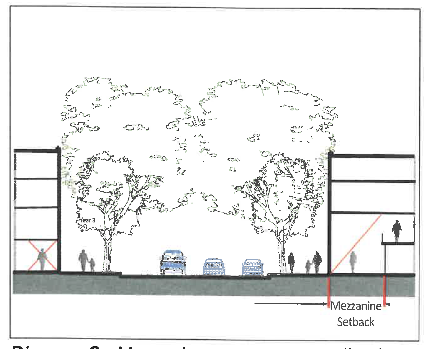
Diagram G. Mezzanine ground story setback
a.
With a floor area greater than ⅓rd of the floor area of the story in which it is located will count as an additional full story in the building height measurement;
b.
Below the second story shall be set back from the required building line at least 15 feet; and
c.
Ground story mezzanines are not included in the clear height measurement.
7.
Parking structures.
a.
Are limited by the maximum height in feet of their frontage, not by stories; and
b.
Are exempt from the clear height prescriptions.
C.
Elements.
1.
Fenestration.
a.
Fenestration is regulated, on a story by story basis, as a percentage of the facade between floor levels. It is measured as glass area (including muntins and similar window frame elements with a dimension less than one inch) and/or the open (void) area in the wall surface.
b.
Lengths of wall exceeding 20 linear feet (horizontal) with no fenestration are prohibited on all street walls, and facades below the 4th story. This measurement includes the entire story, from floor to floor.
c.
Each facade shall have at least one functioning entrance.
d.
The maximum distance between functioning entrances in the same building facade is specified in the building form standard.
e.
Windows should not direct views into or across an adjacent private lot. Common lot lines with a general, storefront, or neighborhood medium frontage may be built with zero or minimal setback. Any views directed into or across a private lot are specifically not protected. (See Illustration H.)
Illustration H. Caution: In an Urban context fenestration along common lot lines may be blocked by adjacent buildings.
f.
Windows shall not direct views into an adjacent private lot where the common lot line is less than ten feet away. (See Diagram I.) Specifically, the window opening and it's window panes shall be at an angle of greater than or equal to 90 degrees to/with the common lot line unless:
(i)
That view is contained within the lot (e.g. ground or first story window views blocked by a privacy fence, opaque glass, or garden wall), or
(ii)
The window's sill is at least six feet above its finished floor level; or
(iii)
Otherwise specified in the individual building form standard.
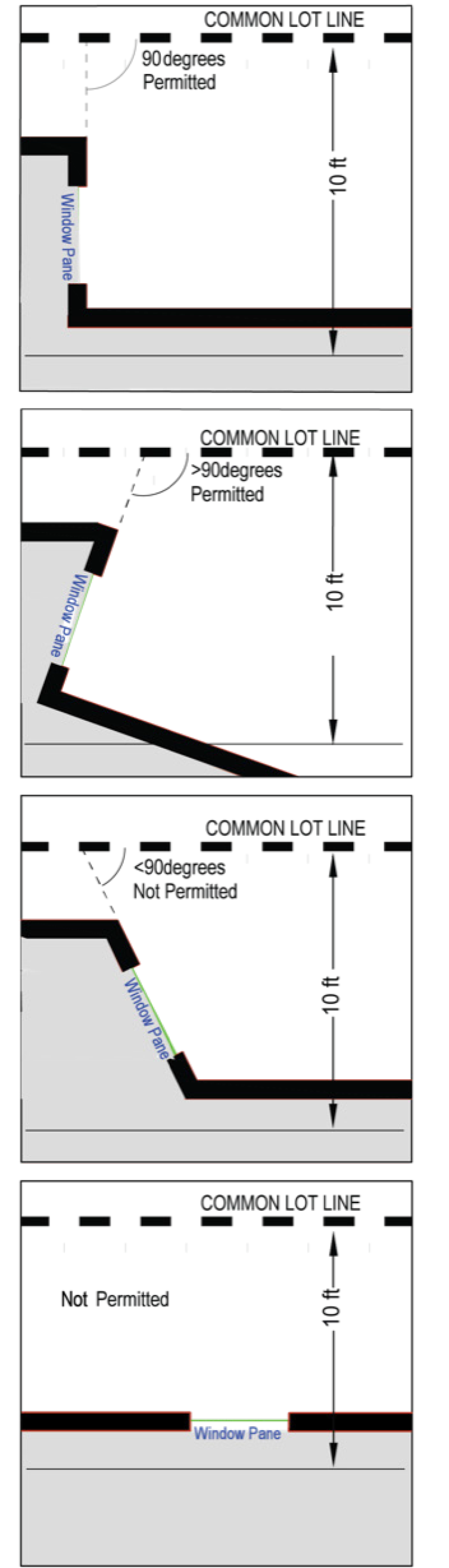
Diagram I. Permitted orientation for windows within 10 feet of a common lot line.
2.
Facade projections.
a.
No part of any building may project forward of the required building line except for: overhanging eaves, awnings, shopfronts, signs, bay windows, front porches, stoops, front steps, balconies, or accessibility ramps approved by the zoning administrator in consultation with the ZRC. (See Table A.)
b.
Any encroachment over the clear sidewalk and/or the right-of-way requires an encroachment agreement with the city, except for signs, overhanging eaves, and awnings, as set forth herein. (See Table A, Facade projection limitations.)
c.
Stoops or front porches:
(i)
All required front porches shall be completely covered by a roof.
(ii)
Front porches may be screened (insect screening) when all architectural elements (columns, railings, etc.) occur on the outside of the screen.
(iii)
Stoops must be fully covered by a roof or canopy.
(iv)
Finished floor height shall be no more than eight inches below the first interior finished floor level of the building.
(v)
See the individual building form standards for additional dimensional standards.
(vi)
See section 26-194.J, Architectural standards, for design standards for front porches and stoops.
d.
Ground story awnings and canopies.
See section 26-194.G, Architectural standards, for design standards for awnings and canopies.
e.
Bay windows:
(i)
Shall have an interior clear width of between four and eight feet at the facade;
(ii)
At the ground story shall project no more than 24 inches beyond the required building line;
(iii)
At the second story and above, shall project no more than 42 inches beyond the required building line; and
(iv)
Shall not project into the right-of-way or over the clear sidewalk.
f.
Balconies.[3]
Where an individual building form standard permits, balconies being used as a method for achieving the required private open area shall:
(i)
Meet all prescriptions in its building form standard;
(ii)
Be enclosed by balustrades, railings, or other means that are not less than 50 percent opaque;
(iii)
Not otherwise be enclosed above a height of 42 inches, except with insect screening and/or columns/posts supporting a roof or connecting with another balcony above; and have either:
(a)
A recess in the facade behind the balcony of at least 18 inches; or
(b)
Must be fully covered by, and posted up to, a roof. Alternately, where a balcony aligns with a balcony on a different story, it may post up to the balcony above.
3.
An attic story does not count against the maximum height in feet or stories, provided it meets the following standards:
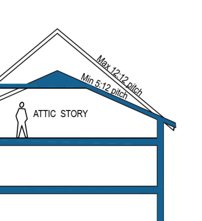
Diagram J. Attic story
a.
There is not more than one floor level within the roof.
b.
Attic story windows fronting the required building line may only be located in dormers.
c.
Dormers for attic stories are permitted so long as they do not break the primary eave line, are individually less than 15 feet wide, and their collective width is not more than 60 percent of the facade.
d.
The habitable area in an attic story is restricted by the limitations on roof pitch.
4.
Roof configurations are regulated in [section 26-]194, Architectural standards, D, Roofs and parapets.
D.
Frontage Designation Flexibility.
When the building frontage designation shown on the regulating plan changes along a property's required building line (RBL), the applicant has the option of applying either building form standard for a maximum additional distance of 30 feet in either direction, for that parcel only, from the transition point shown on the regulating plan. This flexibility is limited by the configuration of the regulating plan (including the parcel lines) at the time of its adoption. An adjustment greater than 30 feet requires a rezoning. (See Diagram K.)
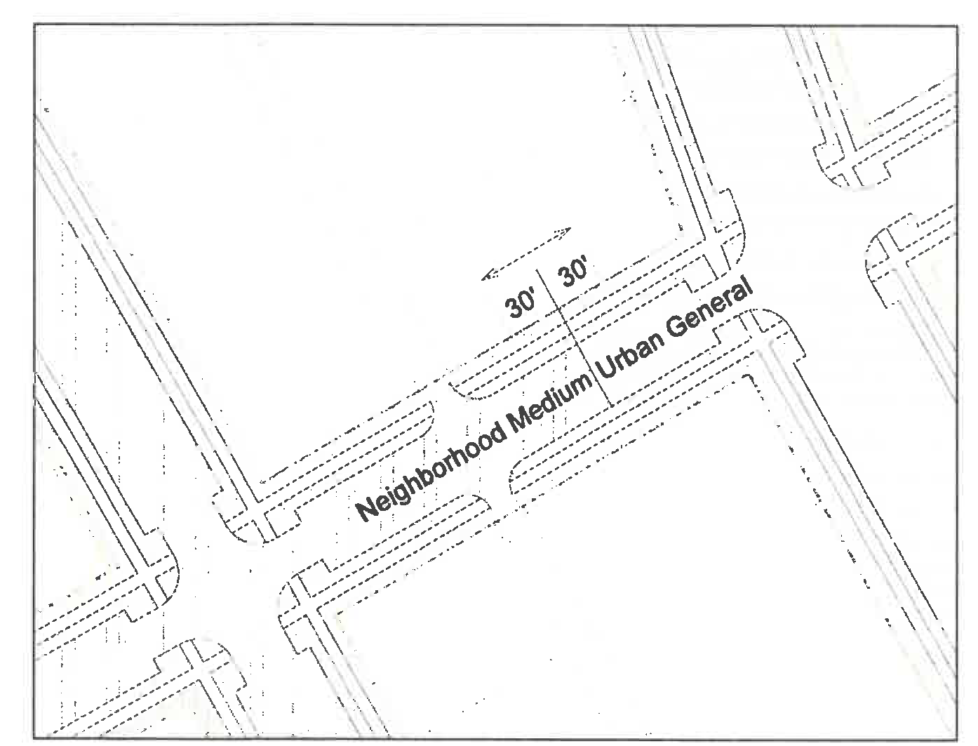
Diagram K. Frontage designation flexibility
E.
Civic Buildings.
When civic buildings, existing or proposed, are designated on the regulating plan, they are exempt from the building form standard provisions except those that relate to F, Neighborhood manners and/or R-1 and R-2 districts.
F.
Neighborhood Manners.
Where Urban General, Urban General 2, and Storefront frontage lots share a common lot line with a Neighborhood Small or Medium frontage lot, or an R-1 or R-2 district, the following standards apply. (See Illustration L.)
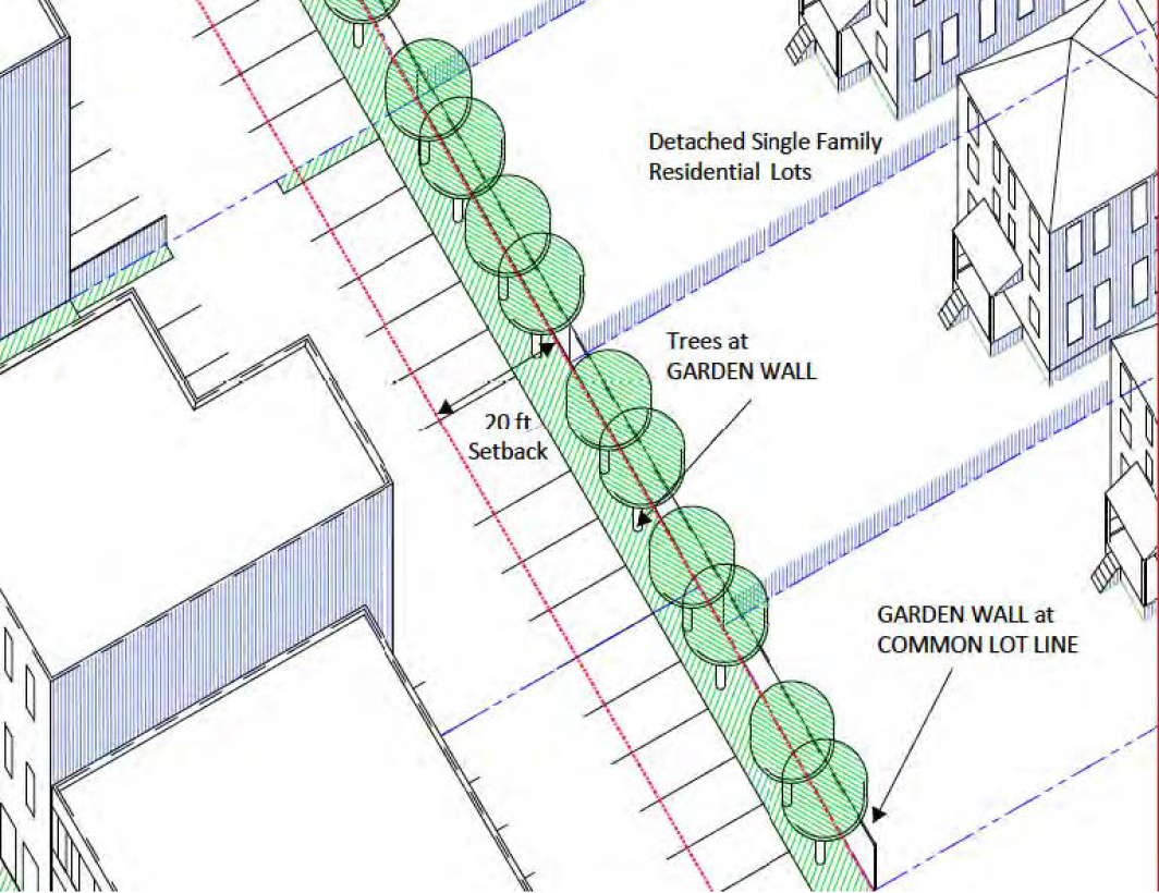
Illustraion L. Neighborhood Manners Context
1.
A masonry wall, four to eight feet in height, shall be constructed within one foot of the common lot line.
2.
Trees from the street tree list (see section 26-195, Public realm standards) shall be planted, on maximum 30-foot centers, between five and ten feet from the wall. At planting, trees shall be at least two and one-half inches in diameter at designated breast height (DBH) and at least eight feet in overall height.
3.
Neighborhood manners setback (See Diagram M):
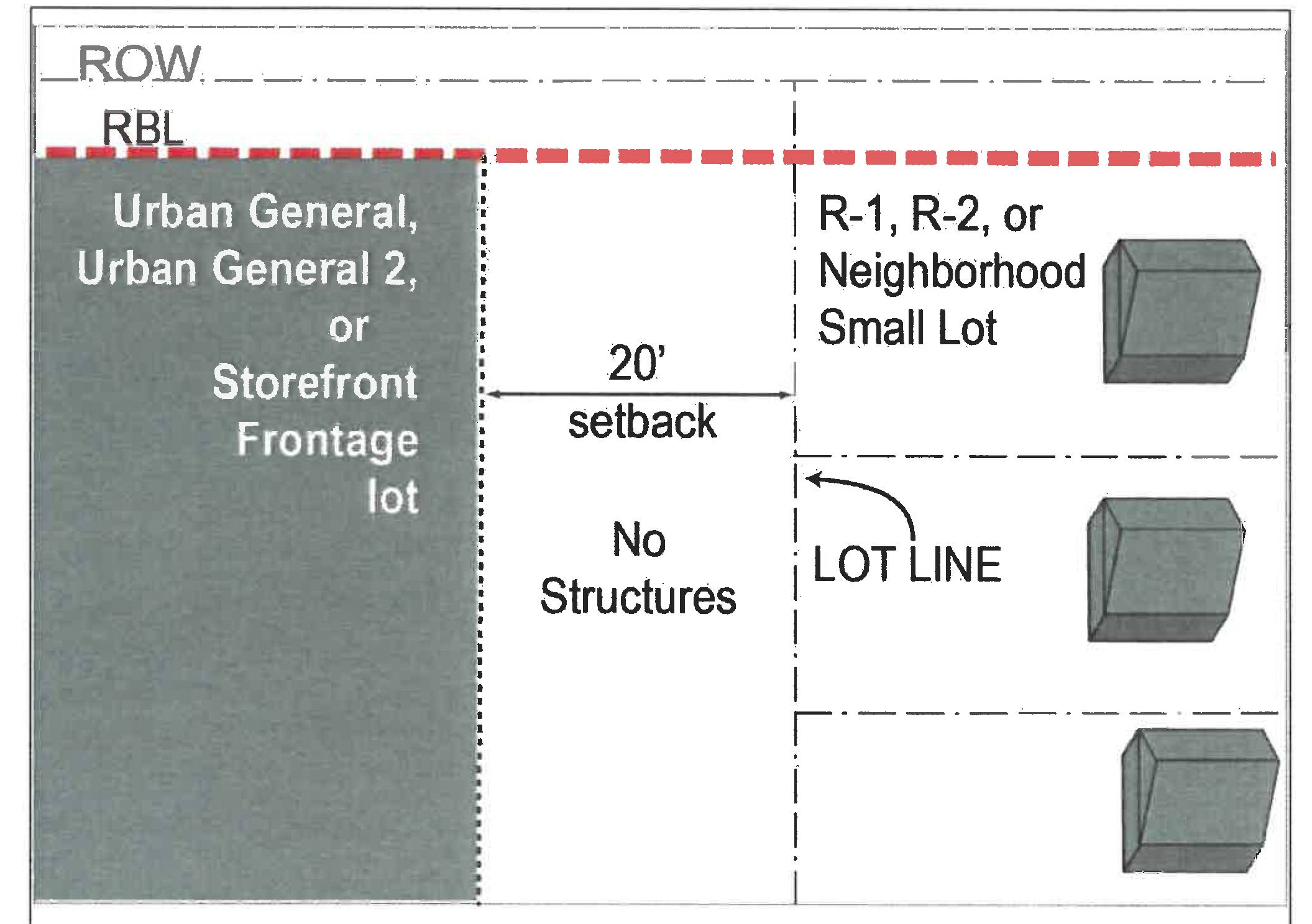
Diagram M. Neighborhood Manners Setback
a.
There shall be a 20 foot setback from the lot line shared with the R-1 or R-2 or neighborhood small or medium frontage lot. There shall be no structures within this area.
b.
There shall be a setback plane, beginning at the R-1 or R-2 or neighborhood small or medium frontage lot line, extending at a slope of one and one quarter to one (1.25: 1), beyond which no building or structure (including parking structures) is permitted. (See Diagram N.)
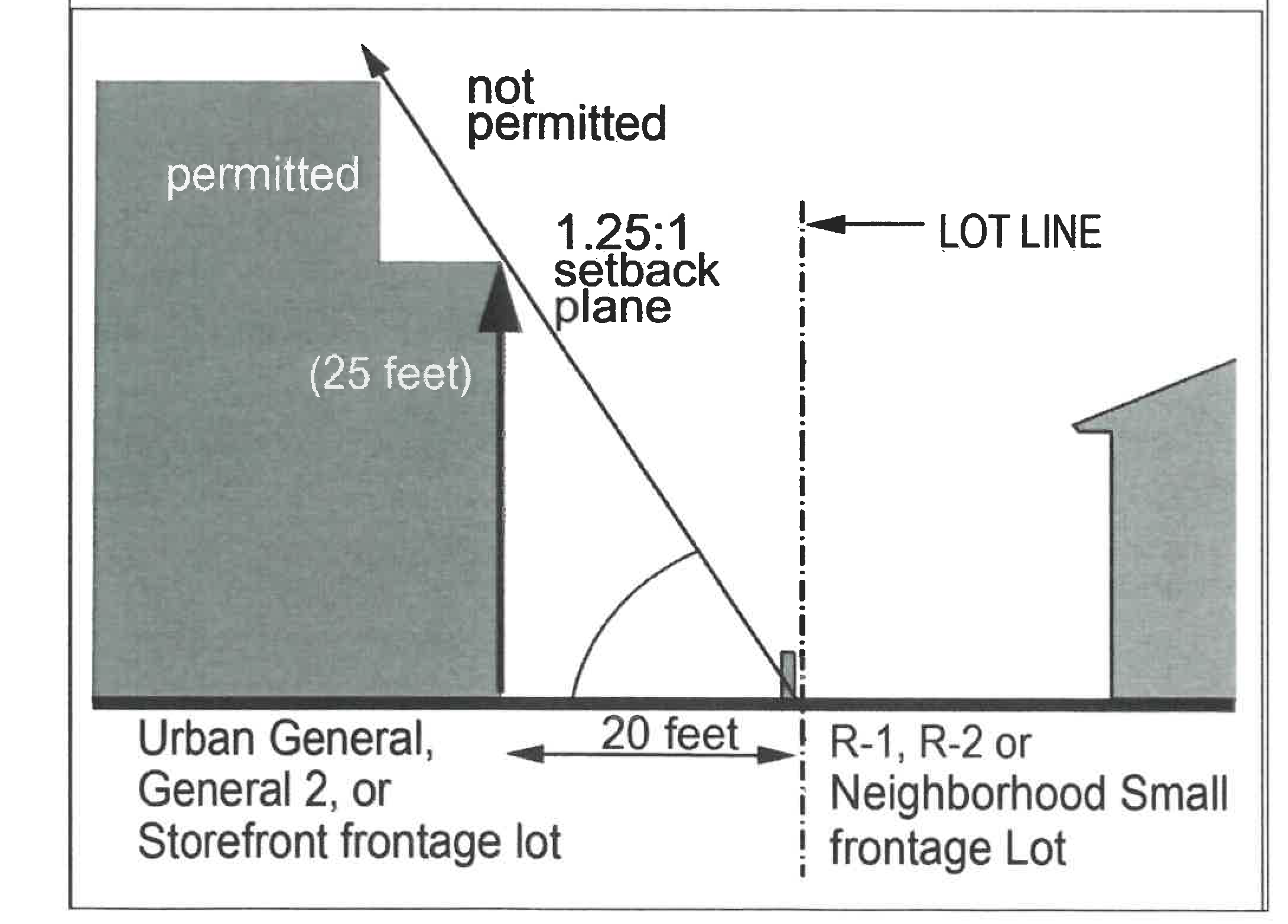
Diagram N. Neighborhood Manners Setback Plane
c.
Balconies or rear decks above the first story level are not permitted on building elevations facing and within 40 feet of a neighborhood manners setback. [4]
4.
The neighborhood manners setback shall be adjusted with any frontage change per D, Frontage designation flexibility above.
G.
Accessory Dwelling Units (ADU).
1.
Accessory dwelling units are permitted for owner-occupied detached or attached single-unit dwellings only. Properties with ADUs shall not be considered duplexes.
a.
ADUs may take the form of English basements or in the buildable area at the rear of the lot (often called a granny flat or, when above a garage, a carriage house).
b.
ADUs have the following maximums:
(i)
A 600 square foot footprint (this does not apply to English basement units); and
(ii)
One bedroom;
(iii)
Rental occupancy, no more than two adults; and
(iv)
No more than one ADU per lot.
(Ord. No. 2994, § 9(Att. A), 11-1-2021; Ord. No. 3041, § 1, 9-18-2023)
Note of intent: This is not the way height is typically measured. The datum is intentionally set relative to an occupant of the street-space. This is also to incentivize the use of pitched roofs, adding variety to the rooflines without arbitrarily requiring it. This will allow additional habitable space (see attic story in C, Elements. 3) while maintaining a smaller scale appearance.
--- (2) ---
Note of intent: The minimum clear height is a value preservation and quality-of-life-over-time measure.
--- (3) ---
Note of Intent: These standards are to ensure suitability for use as private open area. They do not apply to other balconies or decks.
--- (4) ---
Note of Intent: This standard is purposefully not written as "balconies." It addresses privacy concerns, to ensure balconies are not overlooking private space/back yards
Sec. 26-193.2. - Urban general frontages.
A.
Illustrations and intent.
The Urban General frontage is the basic American "downtown" building frontage, once typical in towns and cities across the United States. Multi-story buildings with closely spaced entrances and windows are lined up shoulder to shoulder behind the sidewalk, filling out the block-face.
This frontage is for street-oriented, downtown-type buildings. These building forms can accommodate a range of uses, allowing retail shopfronts, office or residential buildings, and/or mixed-use buildings, with service access and parking lots in the block interior, accessed from the alley.
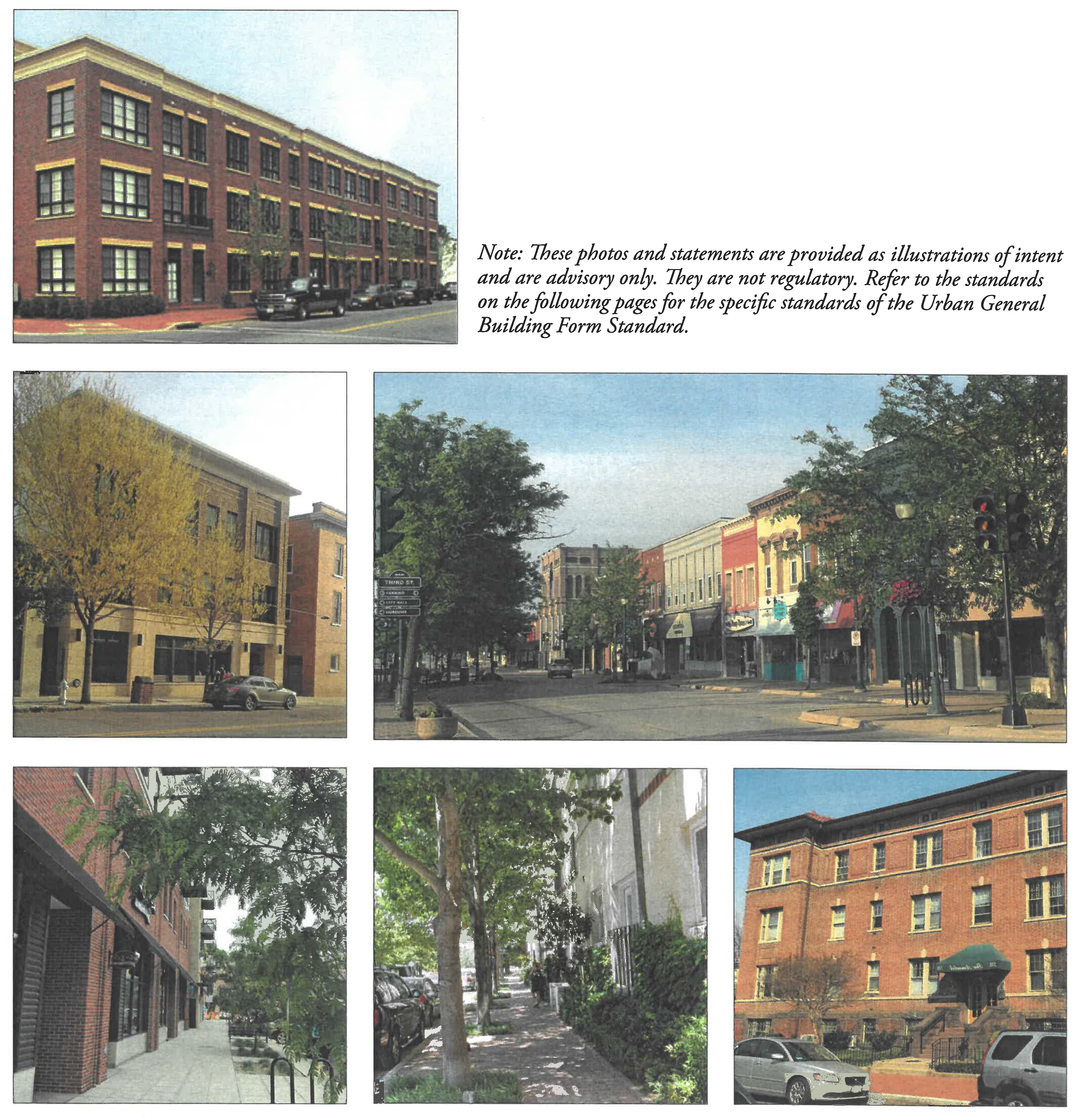
B.
Example Building Configurations and Placement.
Note: These diagrams illustrate some of the building configurations possible under the placement standards on the following page. They do not represent fully designed buildings nor do they fully address issues such as parking or the International Building Code. Refer to the following pages for the specific standards of the Urban General Frontage.
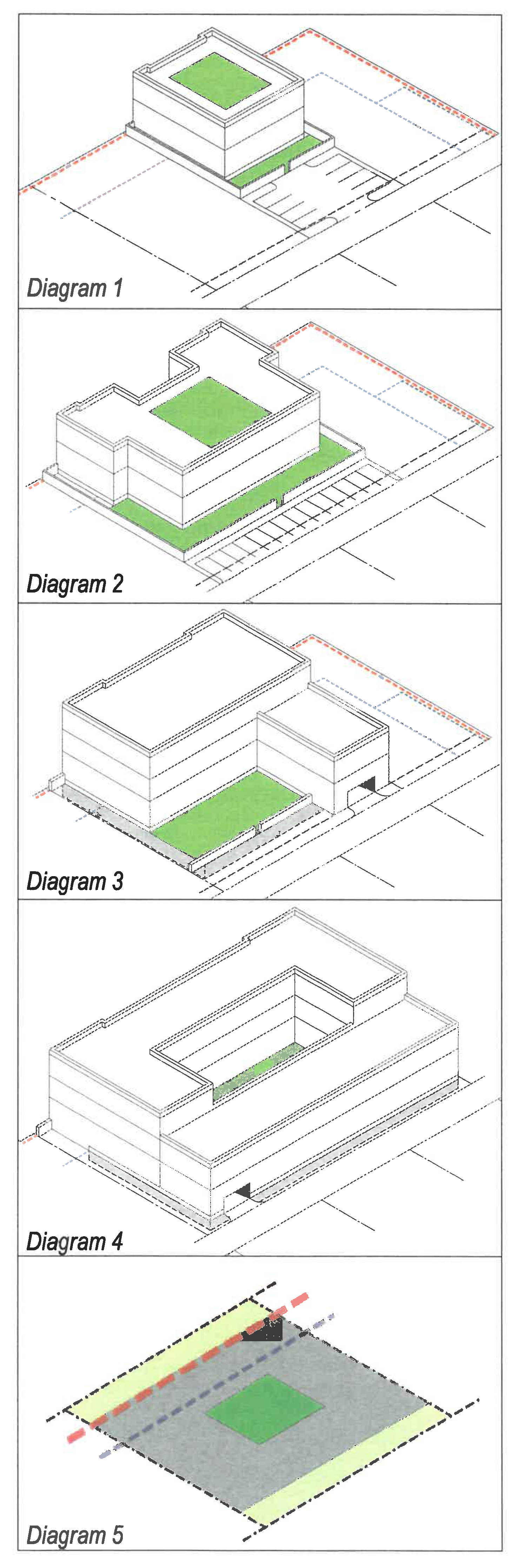
The Urban General frontage standards provide a great deal of flexibility. Once the minimum height and frontage buildout requirements are met, the building behind the facade can take most any configuration. These diagrams, aligned above the placement diagram from the standards on the following pages, illustrate a few of the possible configurations a building can take under the General Urban building form standards. The green area represents the required private open area—which in Urban General frontages may be on or above ground, including on the roof.
Diagram 1 shows a simple bar building. The facade meets the required percentage build-out and minimum height and has a street wall spanning the unbuilt required building line. The private open area is provided on the roof, with additional rear yard area. The building is likely configured with units facing the street or the rear yard. A surface parking lot is accessed from the alley.
Diagram 2 shows a building with a forecourt entry. The facade spans most of the required building line to meet its build-out requirement—the forecourt takes advantage of the percentage of the frontage not required to have a building on it. The private open area is provided on the roof, with additional rear yard area. Parking for the building is directly off the alley.
Diagram 3 shows a building with a lower, rear "L" section. The private open area requirement is met with a rear yard. This diagram suggests basement-level parking, accessed from the alley. Larger buildings may have to meet parking requirements with a combination of inside/under the building, and/or off-site arrangements.
Diagram 4 shows a building with a central courtyard, providing a shared private open area for its occupants. This diagram also suggests semi-basement level parking, under the elevated first floor and accessed from the alley.
Diagram 5 is a re-oriented placement diagram for the Urban General frontages, provided for reference. The red dashed line is the required building line, the blue dashed line is the parking setback line, the gray area is the buildable area, and the green rectangle within it represents the private open area. This is more fully explained in the frontage standard itself, located on the following pages.
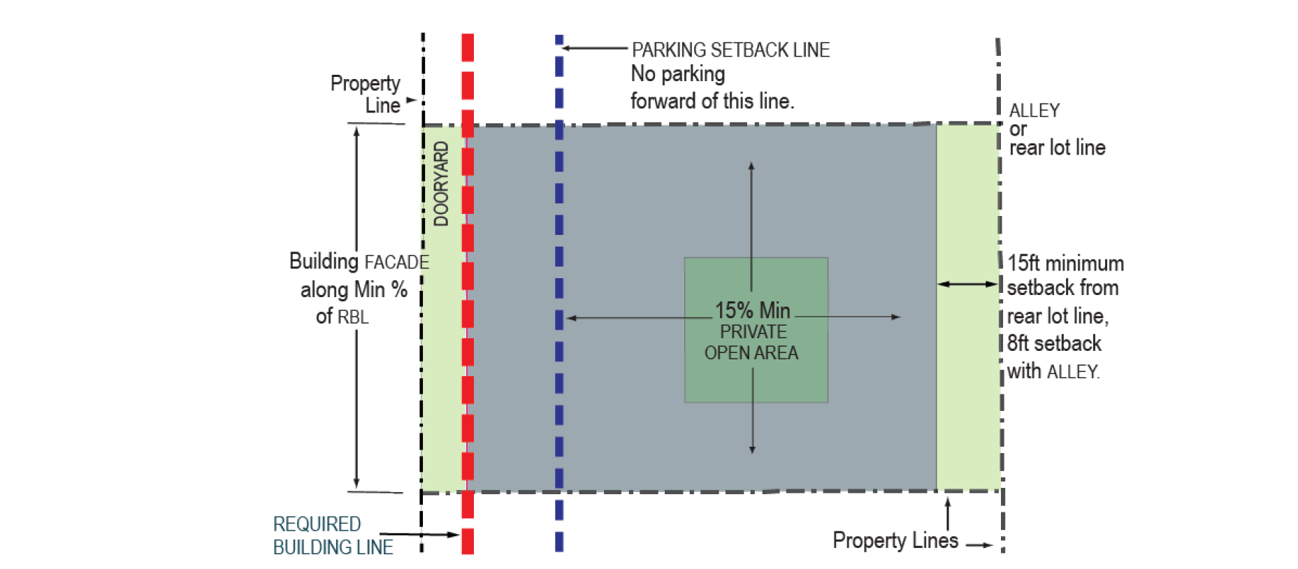
C.
Placement.
1.
Facade.
a.
On each lot the building facade shall be built to the required building line (RBL) for at least:
i.
Urban General: 80 percent of the RBL length.
ii.
Urban General 2: 70 percent of the RBL length.
b.
A street wall is required on any unbuilt required building line.
c.
Within 12 feet of the block corner, the ground story facade may be chamfered to form a corner entry.
d.
A forecourt configuration may be used within the minimum build-to parameters provided:
i.
All elevations facing the forecourt are regulated as facades;
ii.
The forecourt depth is no more than 20 feet and the width between 15 feet and 30 feet;
iii.
The forecourt may not be used for parking, drop-off driving area or storm-water management;
iv.
The forecourt opening does not require a street wall.
e.
In case of conflict, these standards shall supersede vision triangle requirements in the Code of Ordinances.
2.
Buildable area.
a.
The buildable area is delineated by the gray area in the diagram above.
b.
The required building line is indicated on the regulating plan. It is generally located one foot off the ROW/property line for Urban General and five feet off for Urban General 2. The exact position of the RBL should be confirmed in consultation with the zoning administrator and ZRC.
c.
Setbacks: there are no required side setbacks; rear setbacks are: Eight feet from an alley and 15 feet if no alley.
d.
The maximum building footprint is 25,000 square feet.
e.
A private open area equal to at least 15 percent of the buildable area must be provided on every lot.
f.
The minimum private open area dimension is 18 feet.
g.
Up to 33 percent of the required private open area may be satisfied by the balconies of individual units which are exempt from the minimum dimension in f. above, and parking setback line restrictions in h. and i. below. (See 193.1, General standards, C, Elements, 2.f, Balconies, for qualifying balcony requirements.)
h.
The private open area must be located behind the parking setback line when it is below the third story.
i.
Where provided at or above the third story, the private open area may be located forward of the parking setback line (such as in a raised courtyard configuration) only if:
i.
It opens onto no more than one street-space, and
ii.
Is set back at least 30 feet from any block corner or building corner.
j.
When on the building's highest roof level, the private open area may be located anywhere on the roof.
3.
Other.
a.
The parking setback line is indicated on the regulating plan, generally 30 feet behind the required building line, with limited exceptions at alley/RBL intersections. See F.4, Rear lot area below.
b.
A privacy fence is permitted and may be required. See section 26-193.1.E, Neighborhood manners.
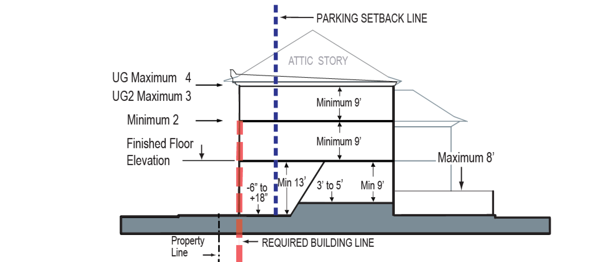
D.
Height.
See section 26-193.1.B. for information about measuring height.
1.
Building height.
a.
Urban General: Minimum at RBL two stories, maximum four stories and 52 feet.
b.
Urban General 2: Minimum at RBL two stories, maximum three stories and 42 feet.
c.
Story heights may be different for specific locations; refer to the regulating plan.
2.
Ground floor finished elevation.
a.
For commercial or retail: -six inches to +18 inches.
b.
For residential units within 30 feet of the required building line: Three feet to five feet. Entrances may be at grade, with transitions within the building to meet the minimum finished floor elevation for the units. Support functions such as lobbies, rental offices, and club rooms may be located at grade.
3.
Second floor finished elevation.
a.
Urban General: Sixteen feet to 22 feet.
b.
Urban General 2: Sixteen feet to 18 feet.
4.
Ground story finished clear height.
a.
For commercial or retail: Thirteen feet minimum.
b.
For residential: Nine feet minimum.
5.
Upper stories finished clear height: Nine feet minimum.
6.
Street wall: Four feet to eight feet.
7.
Privacy fence: Eight feet maximum, measured from adjacent grade.
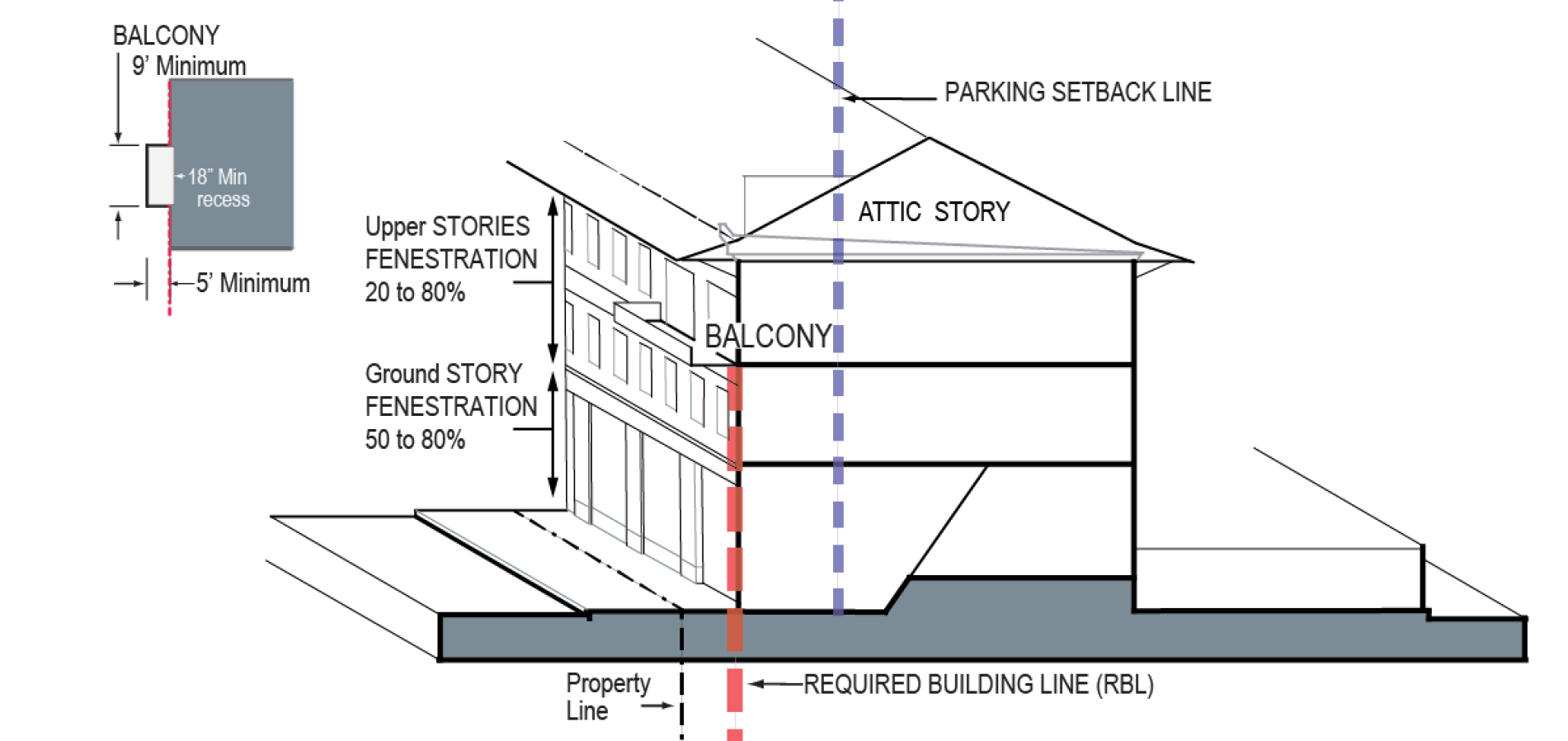
E.
Elements.
1.
Fenestration, ground story: Fifty to 80 percent.
2.
Fenestration, upper stories: Twenty to 80 percent.
3.
Attic story: permitted within the parameters of sections 193.C.3. above and 194.D, Architecture.
4.
Balconies: (Applicable where a balcony is used to contribute to the private open area calculation): Minimum depth five feet, minimum width nine feet.
5.
Facade entry doors: Maximum door to door distance:
a.
Urban General: Seventy feet.
b.
Urban General 2: Eighty feet.
c.
All upper story uses must be directly accessible from the street-space through a facade entry. Unenclosed or partially enclosed exterior staircases may not be used to access upper story units.
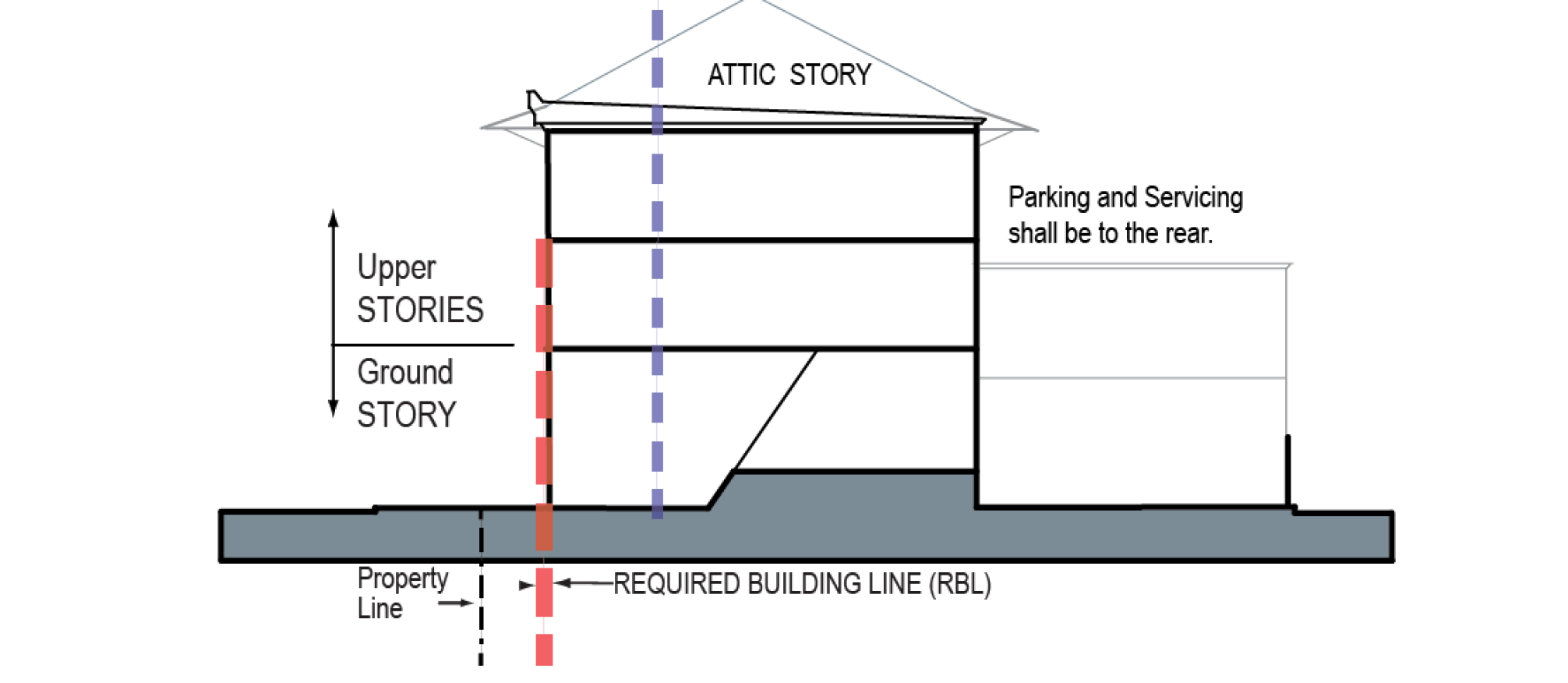
F.
Uses.
See section 26-197, Building functions, for specific parameters and/or performance standards.
1.
Ground story:
a.
Urban General: Nonresidential or residential.
b.
Urban General 2: Nonresidential or residential.
c.
Residential uses are permitted on all stories. See the height standards, above for specific configuration standards for ground story residential.
2.
Upper stories: Residential or nonresidential (no retail).
a.
Nonresidential uses are not permitted above a residential use.
b.
Retail is only permitted in a second story where it is an extension of a ground story retail business and is no larger in gross floor area than that ground story retail space.
3.
Attic story: Residential or nonresidential. Additional habitable space is permitted within the roof where it is configured as an attic story.
4.
Rear lot area:
a.
In addition to the other permitted ground story uses, parking and loading is permitted behind the parking setback line.
b.
For lots with an alley/required building line intersection, where there is an additional parking area designated on the regulating plan, parking is permitted in this area when:
i.
It is within a building and under a habitable second story;
ii.
The facade of the building enclosing the parking meets all requirements;
iii.
It is two feet off the front of the required building line; and
iv.
Within 62 feet of the rear lot line.
c.
See also additional parking location exceptions specified in 26.193.1A.6.
(Ord. No. 2994, § 9(Att. A), 11-1-2021; Ord. No. 3041, § 2, 9-18-2023)
Sec. 26-193.3. - Storefront frontage.
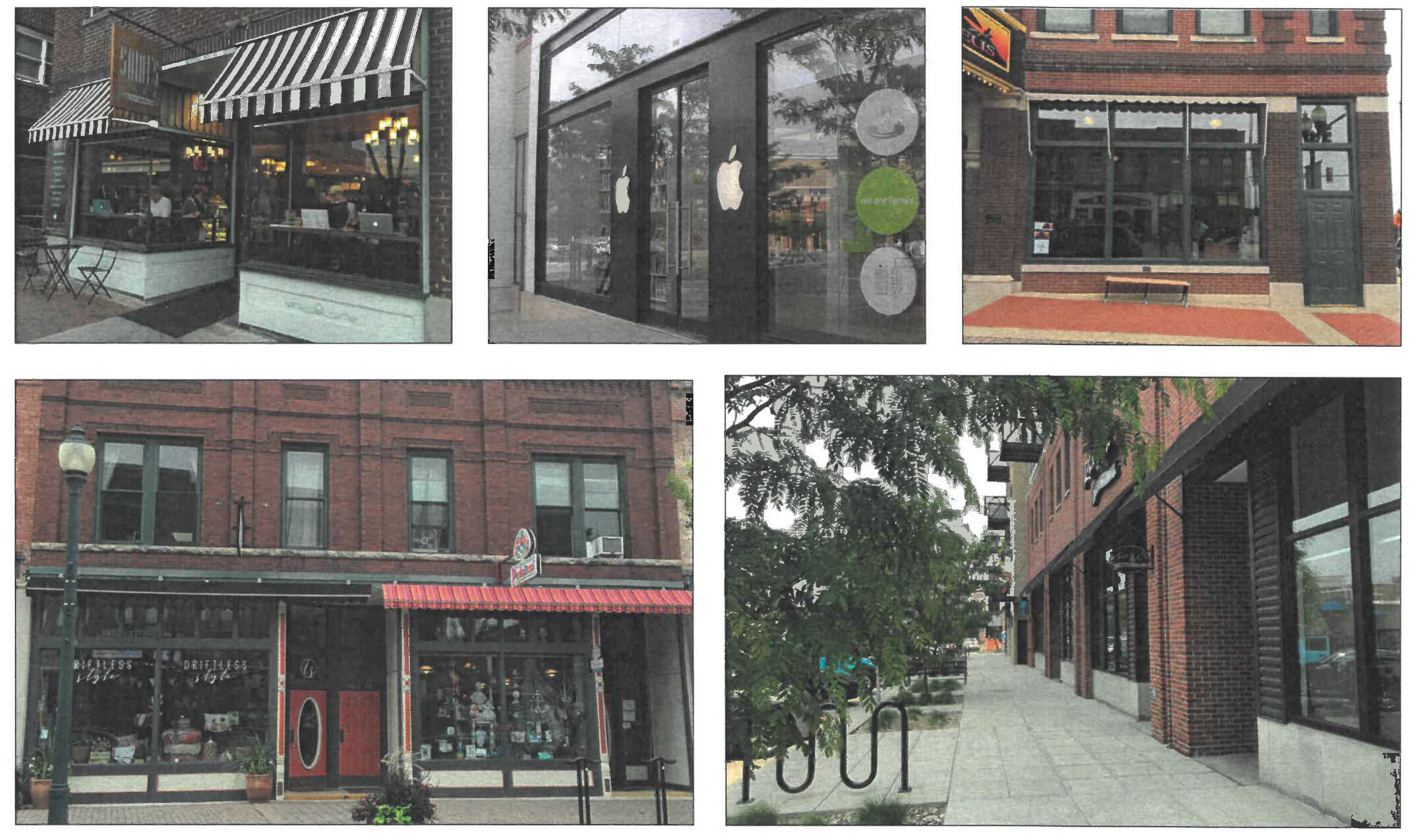
A.
Illustrations and intent.
Note: These photos and statements are provided as illustrations of intent and are advisory only. They are not regulatory. Refer to the standards on this page and the previous pages for the specific rules of the storefront building form standard.
This is the quintessential American "main street" frontage, with retail and restaurant uses on the ground floor and residences or offices upstairs. The overall building form is the same as the Urban General frontage, but with large display windows across the ground floor facade and frequent entrances along the street. Display windows should be large to allow unimpeded views into the interior of the shop. Closely spaced mullions or muntins, punched windows, and horizontal grids should be avoided.
B.
Storefront Frontage Specifications.
Where the storefront frontage is designated on the regulating plan, the ground story configuration shall be that of a shopfront. The BFS standards for Urban General apply with the following exceptions and modifications:
1.
Fenestration: ground story: Seventy to 90 percent.
2.
Frontage build-to minimum: Eighty-five percent.
3.
Ground story uses: Within 30 feet of the required building line, uses are limited to nonresidential categories. Frontages on Main Street between 1st and 6th Streets are generally limited to retail sales and service, and eating and drinking establishments. A lobby and/or entry, serving an upper STORY use, is permitted on the ground story. At the owner's discretion, that lobby or entry portion of the facade may be governed by the Urban General or the storefront frontage standards. See section 26-197, Building functions, for specific parameters and/or performance standards.
4.
Shopfront encroachment: Up to two feet. The shopfront may encroach beyond the required building line into the dooryard, but not into the clear walkway or right-of-way.
5.
Facade entry doors: Maximum door to door: Fifty feet.
(Ord. No. 2994, § 9(Att. A), 11-1-2021)
Sec. 26-193.4. - Neighborhood medium frontage.
A.
Illustrations and intent.
The neighborhood medium frontage is designed to fit comfortably into an existing neighborhood context, allowing redevelopment with a slightly increased scale and intensity. This frontage allows attached dwellings (rowhouses, duplexes), detached houses, cottage courts, and/or small apartment buildings. The character and intensity of this frontage varies depending on the scale of its context. These frontages generally have rear yards and parking accessed from an alley.
Note: These photos and statements are provided as illustrations of intent and are advisory only. They are not regulatory. Refer to the standards on the following pages for the specific standards of the neighborhood medium building form standard.
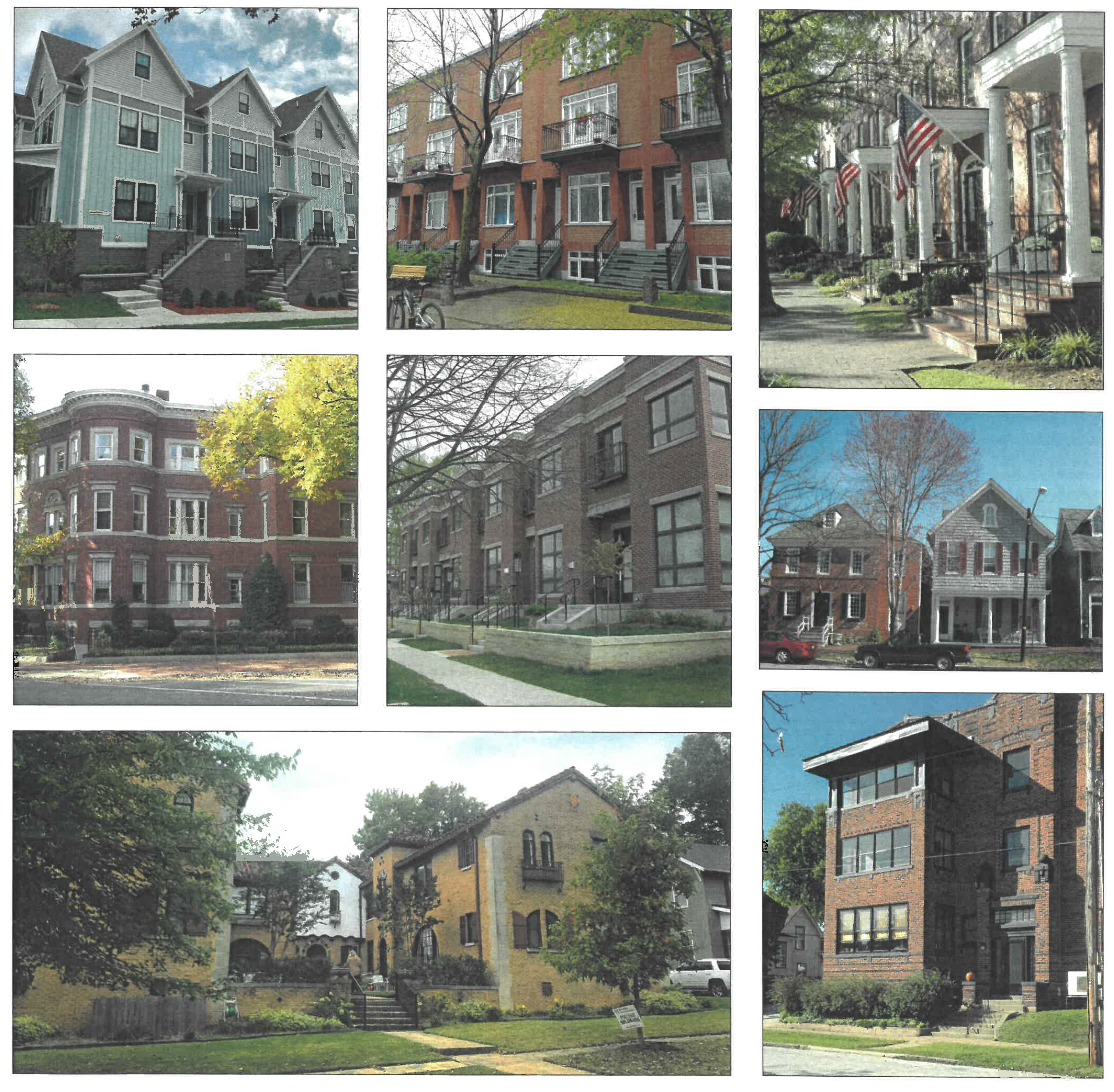
B.
Example Building Placement Configurations.
Note: These diagrams illustrate some of the building configurations possible under the placement standards on the following page. They do not represent fully designed buildings nor do they address issues such as parking or the International Building Code. Refer to the following pages for the specific standards of the neighborhood building form standards.
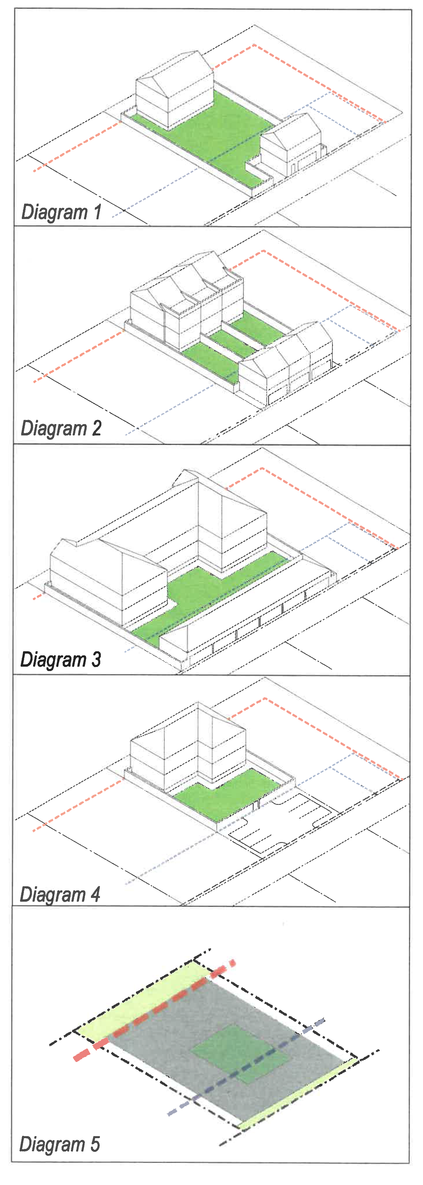
These diagrams, aligned above the placement diagram from the standards on the following pages, illustrate a few of the possible configurations a building can take under the neighborhood medium and neighborhood small building form standards. The green area represents the required private open area.
Diagram 1 shows a detached house, single-unit or two-unit. The area at the rear of the lot shows a two-story building—a garage with an accessory dwelling unit or extra room above it. There could be a sidewing connecting the garage to the main house. The house has its own side and rear yards providing the required private open area.
Diagram 2 is a set of three rowhouses. The buildings may be attached single-family units, with each unit on a separate lot, or they may by a multi-unit building on a single lot. The area at the rear of each rowhouse has two ground level parking spaces with an accessory dwelling unit (ADU) or extra room above the garage. Each rowhouse has a dooryard, with its private open area provide by a rear yard and rear terrace.
Diagram 3 represents a small apartment building. The building has sidewings that project into the rear yard of the building. The rear of the lot has a parking shed, accessed from the alley. The green area between the parking shed and the main building satisfies the private open area requirement.
Diagram 4 is a small apartment building on one lot. The building is likely configured as a "double-loaded corridor" building with units facing the street or the rear yard. The green area behind the main building satisfies the private open area requirement with a shared yard. A surface parking lot is accessed from the alley.
Diagram 5 is a re-oriented placement diagram for the neighborhood frontages, provided for reference. The red dashed line is the required building line, the blue dashed line is the parking setback line, the gray area is the buildable area, and the green rectangle within it represents the private open area. This is more fully explained in the frontage standard itself, located on the following pages.
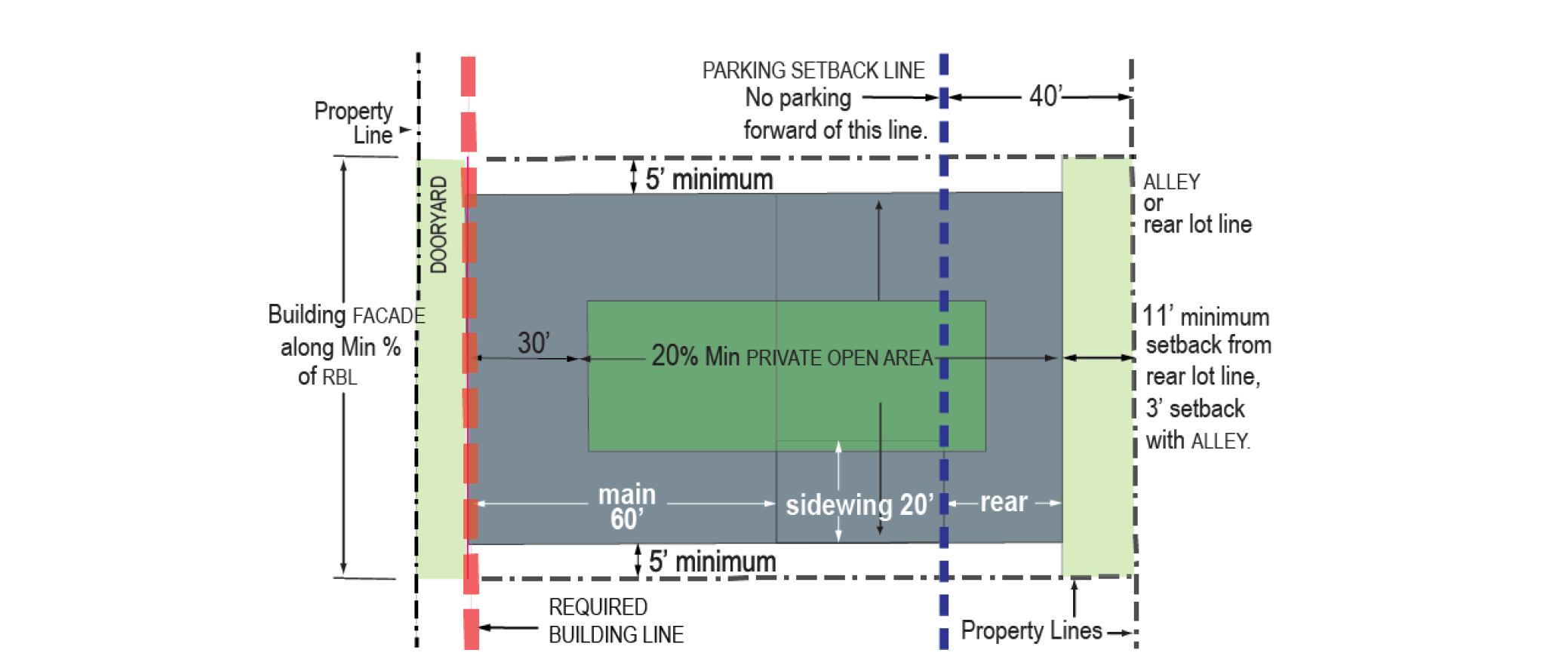
C.
Placement.
1.
Facade. On each lot the building facade shall be built to the required building line (RBL) for at least 66 percent of the RBL length.
2.
A street wall or privacy fence is permitted on any unbuilt required building line.
3.
Maximum facade width. No individual structure or attached set/group of rowhouses may exceed a maximum facade frontage length of 80 feet. A gap of at least ten feet is required between each building or set of rowhouses.
4.
Buildable area.
a.
The buildable area is delineated by the gray area in the diagram above. The main portion of the buildable area is within 60 feet of the RBL. The sidewing buildable areas are between the main and rear buildable areas and within 20 feet of each side setback.
b.
The required building line is indicated on the regulating plan. It is generally located 15 feet off the ROW/property line for neighborhood medium. The exact position of the RBL should be confirmed in consultation with the zoning administrator and ZRC.
c.
Setbacks: Five feet each side lot line [5]; three feet from an alley and 11 feet from rear lot line where there is no alley.
d.
A private open area equal to at least 20 percent of the buildable area must be provided on every lot.
i.
The minimum private open area dimension is 18 feet.
ii.
The private open area must be located at least 30 feet behind the required building line.
iii.
The private open area must be at grade, except balconies and extremely shallow lots, as specified in v. below;
iv.
Up to 33 percent of the required private open area may be satisfied through the balconies of individual rowhouses and/or units, which are exempt from i and ii above.
v.
The private open area for lots with less than 70 feet from the required building line to the rear setback, may be above grade.
5.
Other.
a.
The parking setback line is indicated on the regulating plan, generally 40 feet from the rear lot line, with limited exceptions at alley/RBL intersections and for other special conditions, see F.3, Rear lot area, below. The side setback for parking is three feet from any common lot line.
b.
The minimum rowhouse width, measured parallel to the RBL, is 18 feet.
c.
A privacy fence is permitted, at or behind the required building line, on common lot lines, and on rear lot lines.
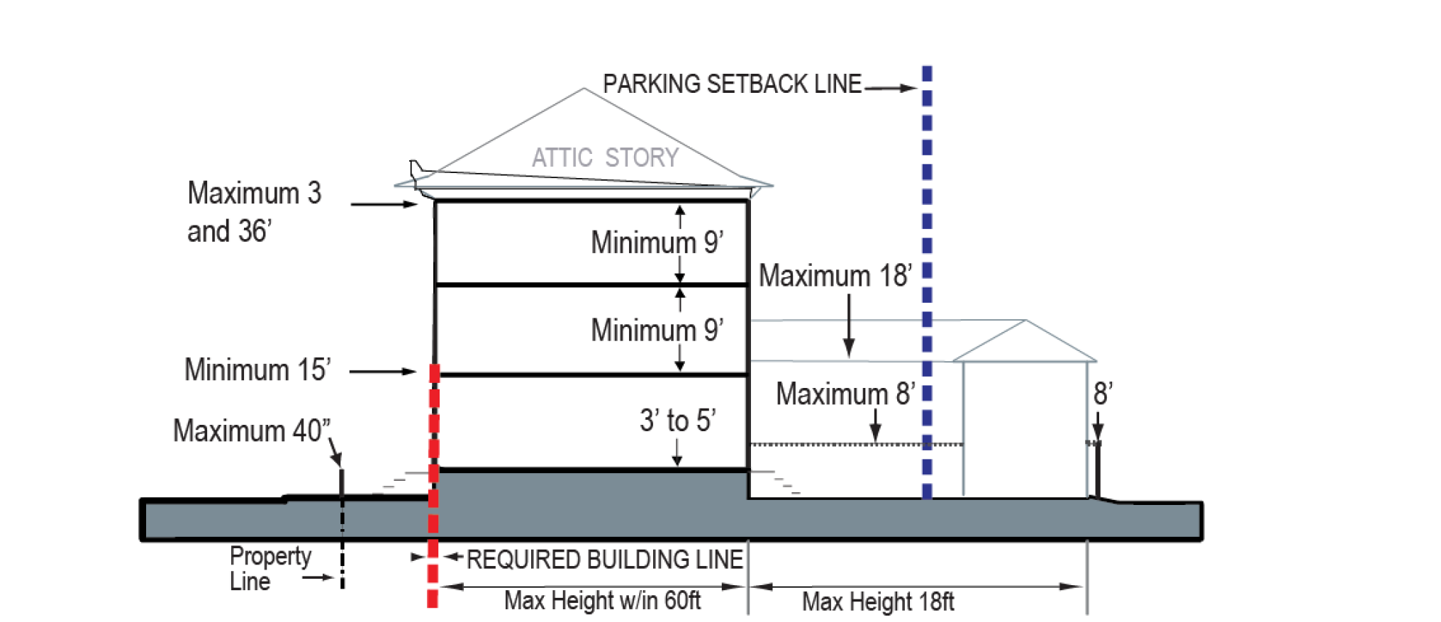
D.
Height.
1.
Building height:
a.
At and within 60 feet of the RBL: Minimum 15 feet at RBL, maximum three stories and 36 feet.
b.
Sidewing and rear lot area: maximum 18 feet.
2.
Ground floor finished elevation: Within 30 feet of the required building line, three feet to five feet. Entrances may be at grade, with transitions to meet the minimum finished floor elevation within the building interior. This this does not prohibit an accessory unit in an English basement form.
3.
All stories clear height: Nine feet minimum.
4.
Street wall: Permitted, four feet to eight feet.
5.
Dooryard wall or fence: permitted, maximum 40 inches. This is an optional low garden wall or fence surrounding the dooryard area. See section 26-194, Architectural standards, I, Street walls and fences.
6.
Privacy fence: Permitted, six feet maximum, measured from adjacent grade.
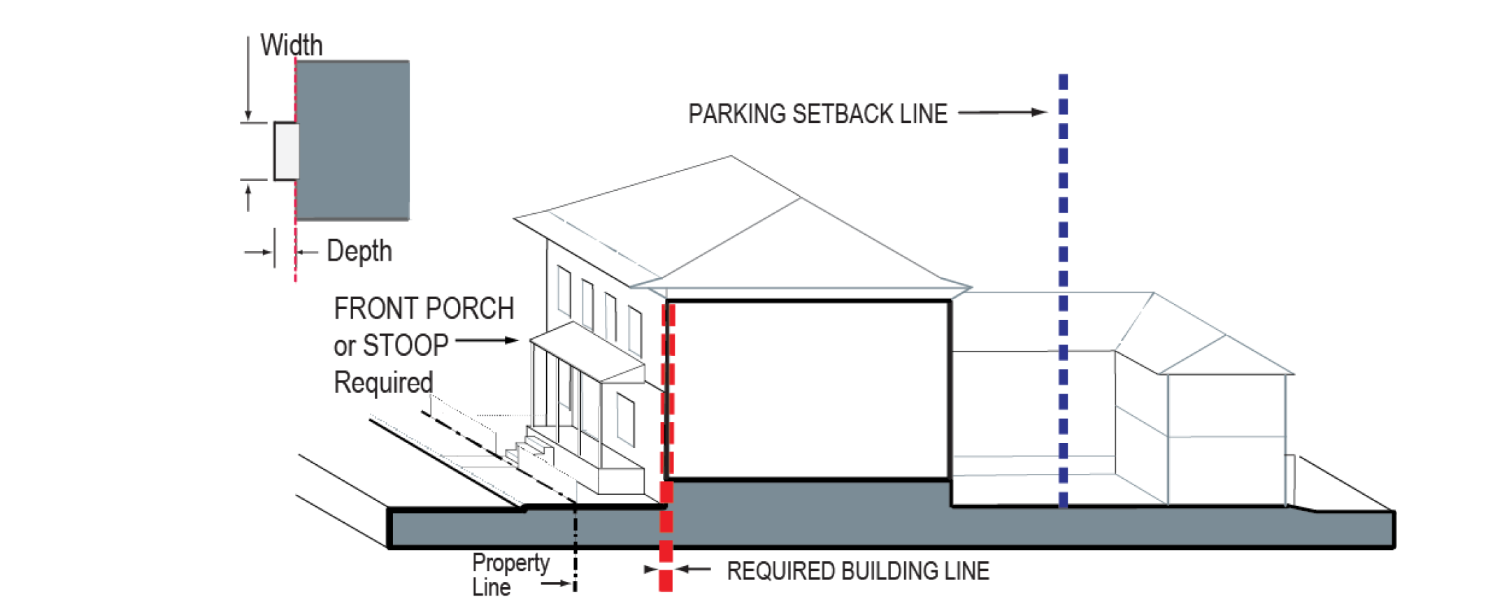
E.
Elements.[6]
1.
Fenestration, all stories: Twenty-five to 70 percent.
2.
A stoop or front porch[7] is required:
a.
Front porch: Minimum width ten feet, minimum depth eight feet.
b.
Stoop: For small apartments, width ten feet to 15 feet, depth six feet to eight feet; for all others, width four feet to six feet, depth three feet to five feet.
c.
For rowhouse or duplex configurations this requirement applies to each rowhouse or to each unit for a duplex.
3.
Balconies:
Required on the upper stories of small apartments with more than 45 feet of frontage width. Rowhouses are not subject to this requirement. Where used to satisfy this requirement, or as part of the private open area calculation, the below dimensions are required:
a.
Balconies shall cumulatively be a minimum ⅓ rd the facade width for each upper story.
b.
Minimum depth five feet, minimum width seven feet.
4.
Attic story: permitted within the parameters of section 26-194.D.
5.
Facade entries: All dwellings must have at least one entry in the facade that provides direct access to the street-space, whether through a shared lobby or their own entry door. ADUs are exempt but must have a clear access to the street-space.
6.
Upper story access: Unenclosed or partially enclosed exterior staircases may not be used to access upper story dwelling units.
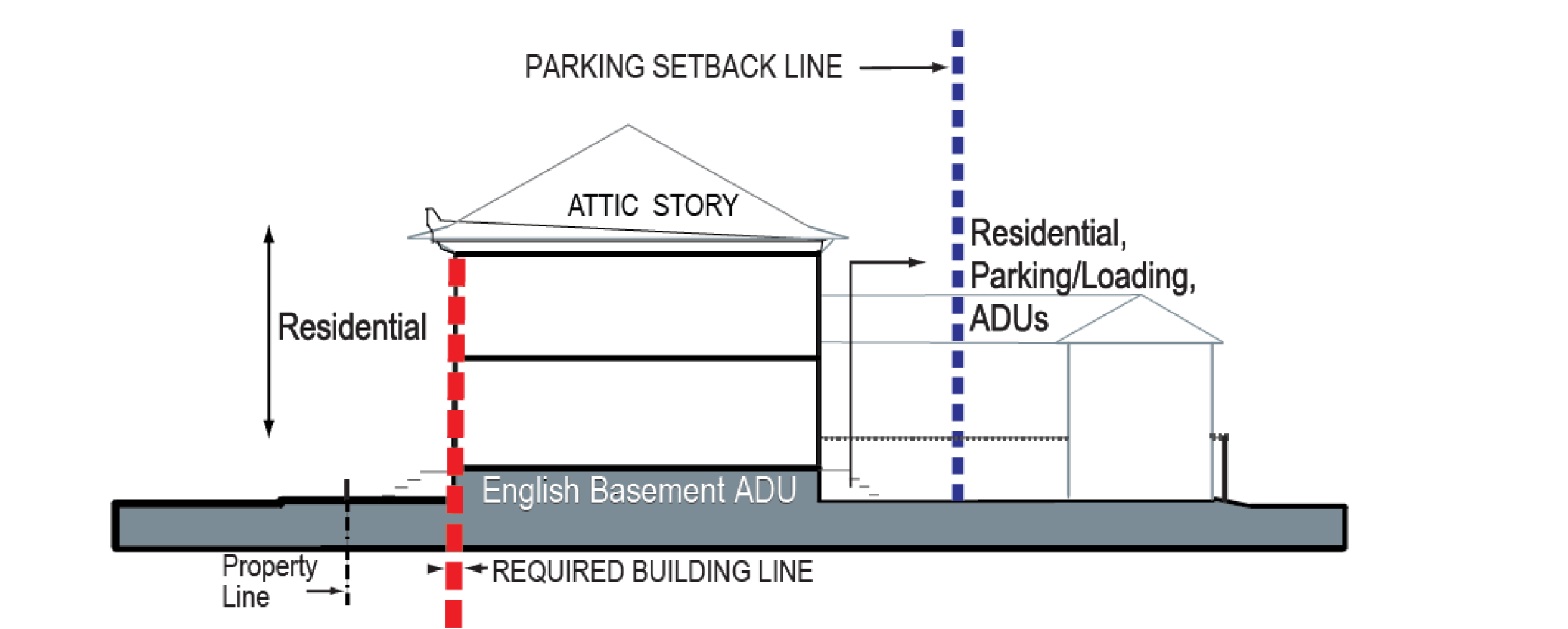
F.
Uses.
See section 26-197, Building functions, for specific parameters and/or performance standards.
1.
All stories: Residential.
2.
Accessory dwelling units: Permitted for owner-occupied attached and detached single-unit dwellings. (See 193.1, General standards, G, Accessory dwelling units, above.)
3.
Rear lot area:
a.
In addition to the residential use, parking and loading is permitted, behind the parking setback line.
b.
For lots with an alley/required building line intersection, where there is an additional parking area designated on the regulating plan, parking is permitted in this area when:
i.
It is within a building;
ii.
The facade of the building enclosing the parking meets all requirements;
iii.
It is two feet off the front of the required building line; and
iv.
Within 40 feet of the rear lot line.
c.
See also additional parking location exceptions specified in 26.193.1A.6.
(Ord. No. 2994, § 9(Att. A), 11-1-2021; Ord. No. 3041, § 3, 9-18-2023)
This setback does not prohibit sets of attached houses (rowhouses) whose combined width does not exceed the maximum facade width listed above. It is a setback from other sets of rowhouses and/or adjacent lots.
--- (6) ---
See section 26-194, Architectural standards, for specific facade materials & configuration requirements.
--- (7) ---
Stoops and front porches, by definition, encroach into the dooryard.
Sec. 26-193.5. - Neighborhood small frontage.
A.
Illustrations and intent.
The neighborhood small frontage is designed to fit comfortably into an existing neighborhood context, allowing redevelopment at a similar or slightly increased scale and intensity. This frontage includes houses (detached and attached), and/or small apartment buildings. The character and intensity of this frontage varies depending on the scale of its context. These frontages generally have rear yards and parking accessed from an alley.
Note: These photos and statements are provided as illustrations of intent and are advisory only. They are not regulatory. Refer to the standards on the following pages for the specific standards of the neighborhood small frontage form standard.
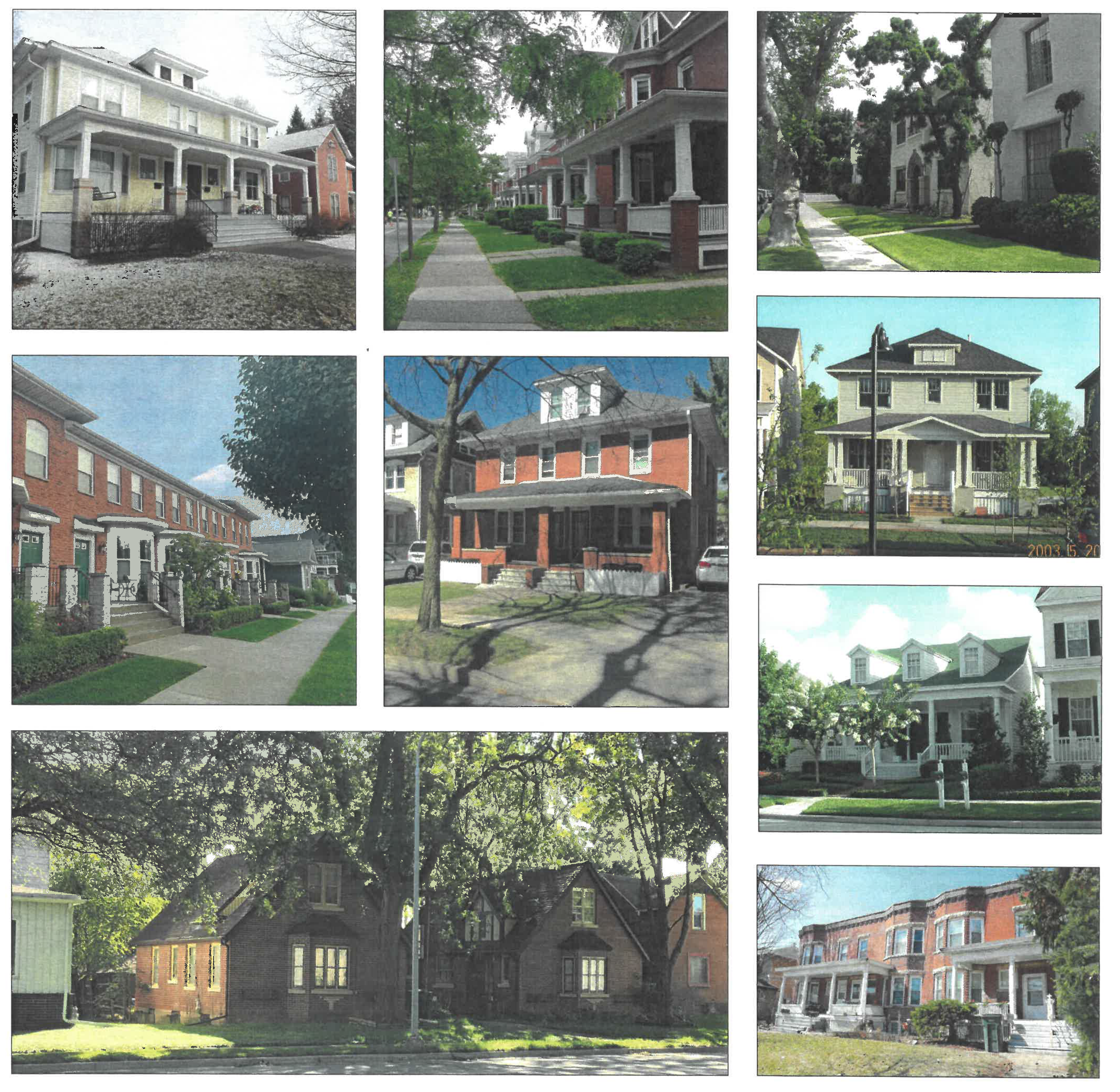
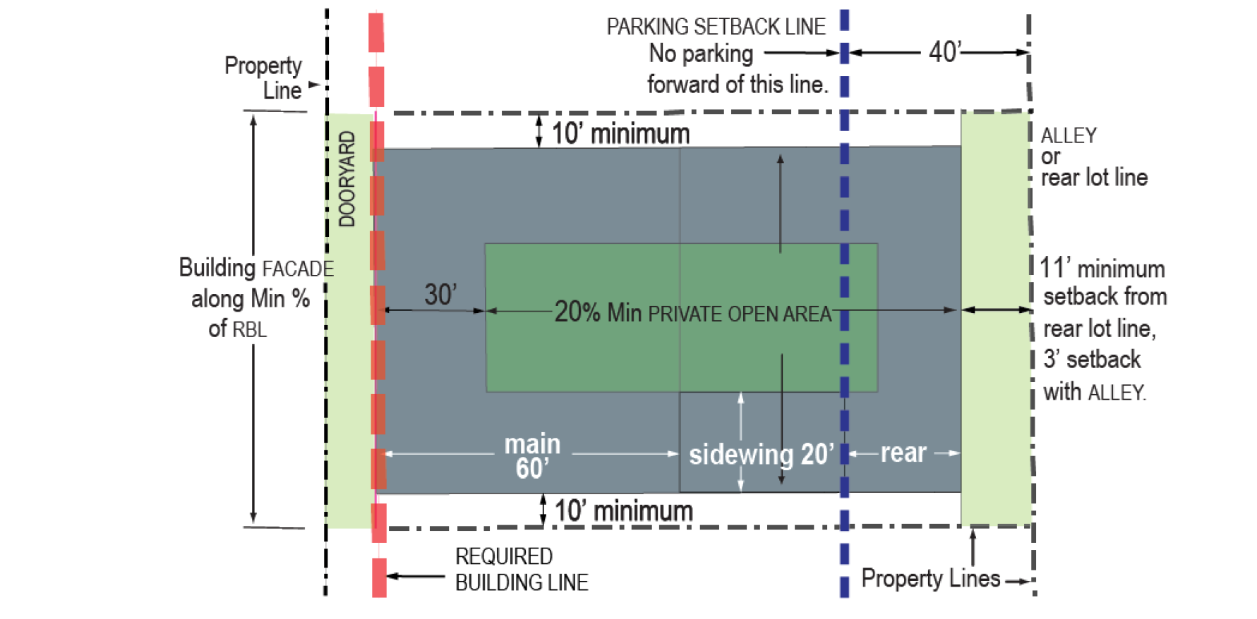
B.
Placement.
1.
Facade: On each lot the building facade shall be built to the required building line (RBL) for at least 50 percent of the RBL length.
2.
A street wall or privacy fence is permitted on any unbuilt required building line.
3.
Maximum facade width: No individual structure or attached set/group of rowhouses may exceed a maximum facade frontage length of 60 feet. A gap of at least ten feet is required between each building or set of rowhouses.
4.
Buildable area.
a.
The buildable area is delineated by the gray area in the diagram above. The main portion of the buildable area is within 60 feet of the RBL. The sidewing buildable areas are between the main and rear buildable area and within 20 feet of each side setback.
b.
The required building line is indicated on the regulating plan. It is generally located 15 feet off the ROW/property line for neighborhood small. The exact position of the RBL should be confirmed in consultation with the zoning administrator and ZRC.
c.
Setbacks: Ten feet each side lot line; three feet from an alley and 11 feet from rear lot line where there is no alley.
d.
A private open area equal to at least 20 percent of the buildable area must be provided on every lot.
i.
The minimum private open area dimension is 18 feet.
ii.
The private open area must be located at least 30 feet behind the required building line.
iii.
The private open area must be at grade, except balconies and extremely shallow lots, as specified in v. below;
iv.
Up to 33 percent of the required private open area may be satisfied through the balconies of individual rowhouses and/or units, which are exempt from i and ii above.
v.
The private open area for lots with less than 70 feet from the required building line to the rear setback, may be above grade.
5.
Other.
a.
The parking setback line is indicated on the regulating plan, generally 40 feet from the rear lot line, with limited exceptions at alley/RBL intersections and for other special conditions, see E.3, Rear lot area, below. The side setback for parking is three feet from any common lot line.
b.
The minimum rowhouse width, measured parallel to the RBL, is 18 feet.
c.
A privacy fence is permitted, at or behind the required building line, on common lot lines, and on rear lot lines.
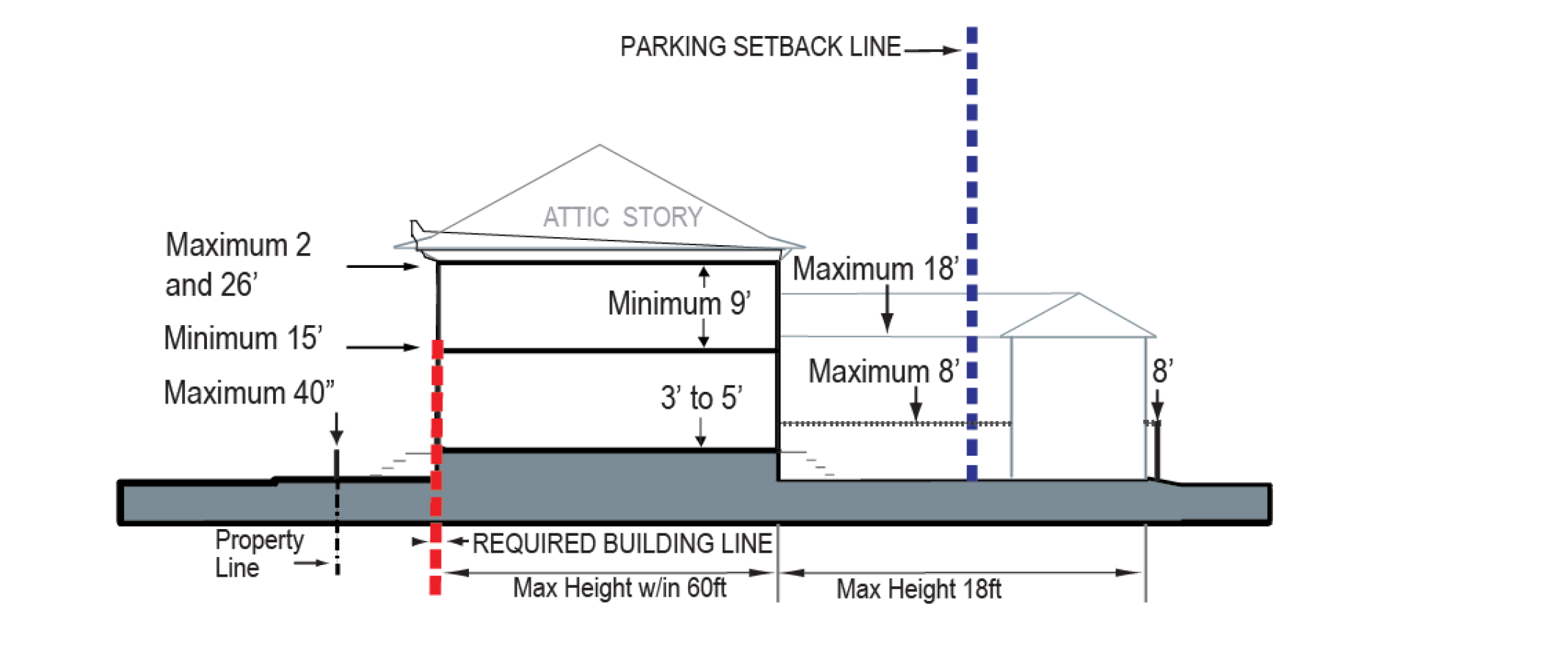
C.
Height.
1.
Building height:
a.
At and within 60 feet of the RBL: Minimum 15 feet, maximum two stories and 26 feet.
b.
Sidewing and rear lot area: Maximum 18 feet.
2.
Ground floor finished elevation: Within 30 feet of the required building line: Three feet to five feet. Entrances may be at grade, with transitions to meet the minimum finished floor elevation within the building interior. This this does not prohibit an accessory unit in an English basement form.
3.
All stories clear height: Nine feet minimum.
4.
Street wall: Permitted, maximum six feet.
5.
Dooryard wall or fence: Permitted, maximum 40 inches. This is an optional low garden wall or fence surrounding the dooryard area.
6.
Privacy fence: Permitted, six feet maximum along RBL, eight feet maximum along common lot lines and rear lot lines, measured from adjacent grade.
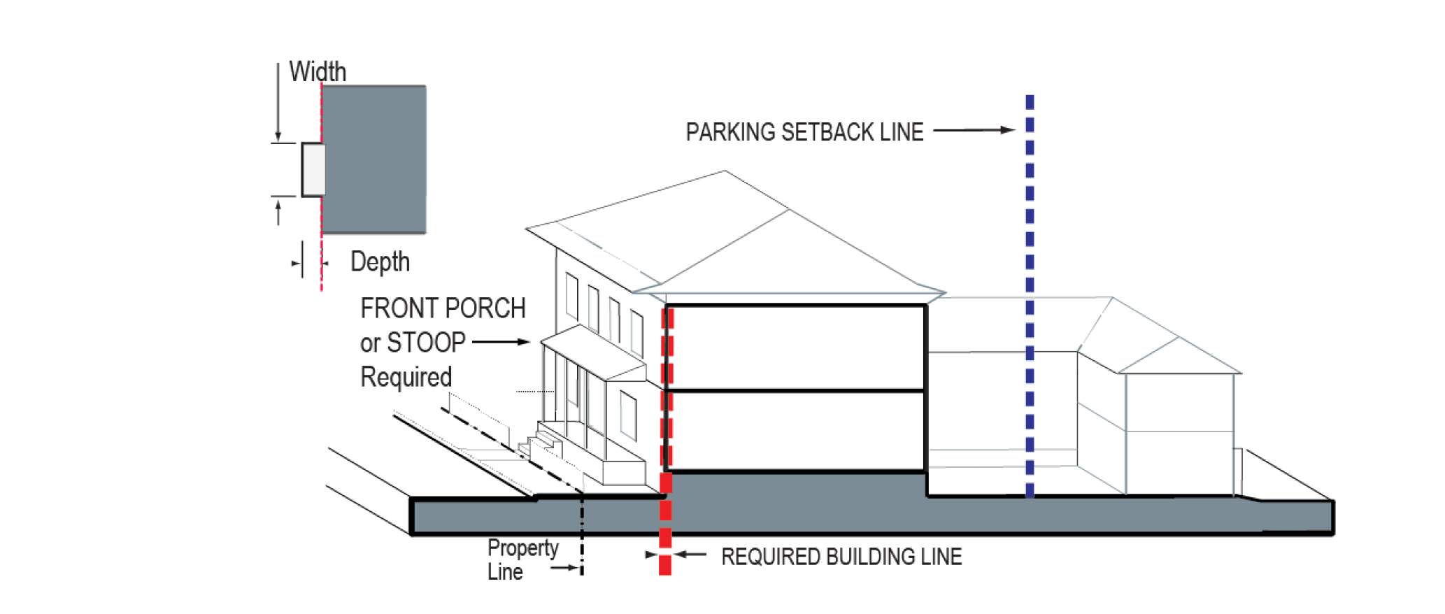
D.
Elements.[8]
1.
Fenestration, all stories: Twenty-five to 70 percent.
2.
A stoop or front porch[9] is required:
a.
Front porch: Minimum width ten feet, minimum depth eight feet.
b.
Stoop: For small apartments, width six feet to ten feet, depth six feet to eight feet; for all others width four feet to six feet, depth three feet to five feet.
c.
For rowhouse configurations, this applies to each rowhouse or to each unit for a duplex.
3.
Balconies:
Required on the upper stories of small apartments with more than 45 feet of frontage width. Where used to satisfy this requirement, or as part of the private open area calculation, these dimensions are required:
a.
Balconies shall cumulatively be a minimum ⅓rd the facade width for each upper story. Rowhouses are not subject to this requirement.
b.
Minimum depth five feet, minimum width seven feet.
4.
Attic story: permitted within the parameters of section 26-194.D.
5.
Facade entries: All dwellings must have at least one entry in the facade that provides direct access to the street-space, whether through a shared lobby or their own entry door. ADUs are exempt but must have a clear access to the street-space.
6.
Upper story access: Unenclosed or partially enclosed exterior staircases may not be used to access upper story dwelling units.
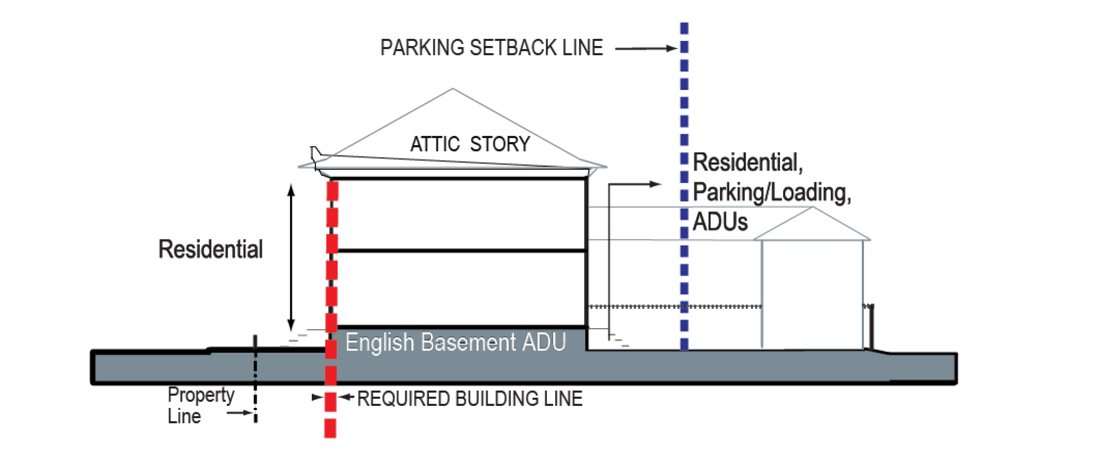
E.
Uses.
See section 26-197, Building functions, for specific parameters and/or performance standards.
1.
All stories: Residential.
2.
Accessory dwelling units: Permitted for owner-occupied rowhouses and detached houses. (See 193.1, General standards, G, Accessory dwelling units, above.)
3.
Rear lot area:
a.
In addition to the residential use, parking and loading is permitted, behind the parking setback line.
b.
For lots with an alley/required building line intersection, where there is an additional parking area designated on the regulating plan, parking is permitted in this area when:
i.
It is within a building;
ii.
The facade of the building enclosing the parking meets all requirements;
iii.
It is two feet off the front of the required building line; and
iv.
Within 40 feet of the rear lot line.
c.
See also additional parking location exceptions specified in 26.193.1A.6.
(Ord. No. 2994, § 9(Att. A), 11-1-2021; Ord. No. 3041, § 4, 9-18-2023)
See section 26-194, Architectural standards, for specific facade materials and configuration requirements.
--- (9) ---
Stoops and front porches, by definition, encroach into the dooryard.
Sec. 26-193.6. - Cottage courts in neighborhood frontages.
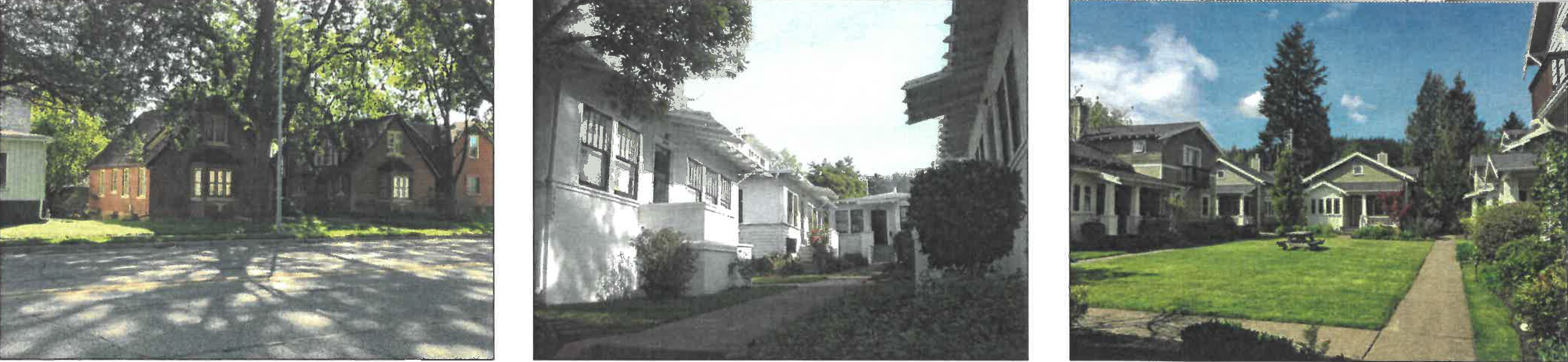
The photos above are provided as illustrations of intent and are advisory only. They
are not regulatory. Refer to the standards below for the specific standards for cottage courts.
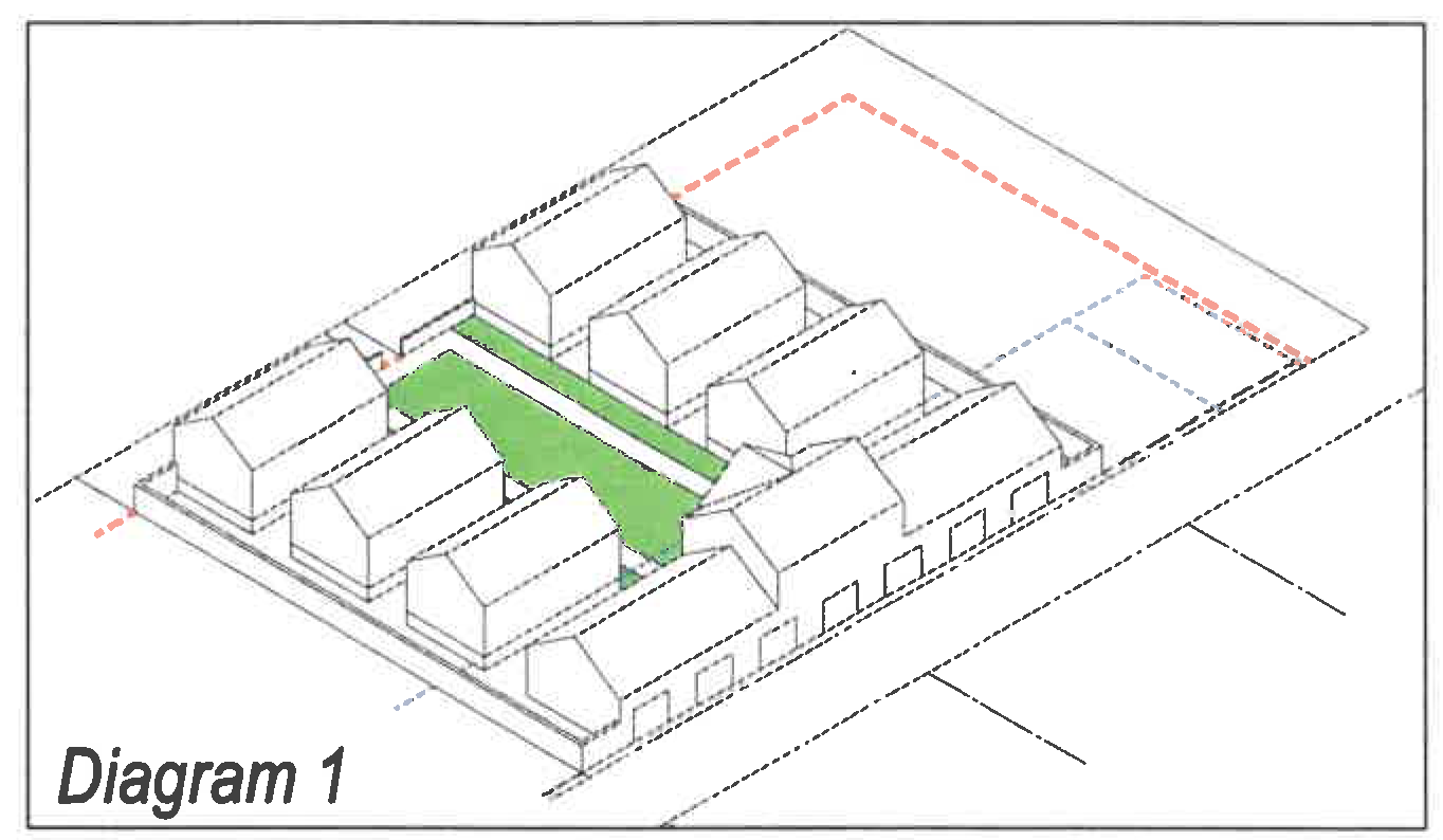
Cottage court with a cottage above the parking shed
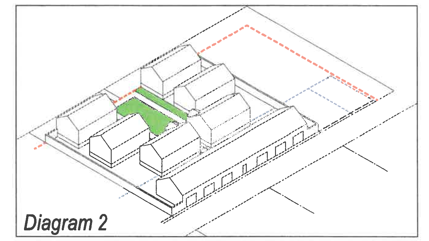
Cottage court with 6 cottages
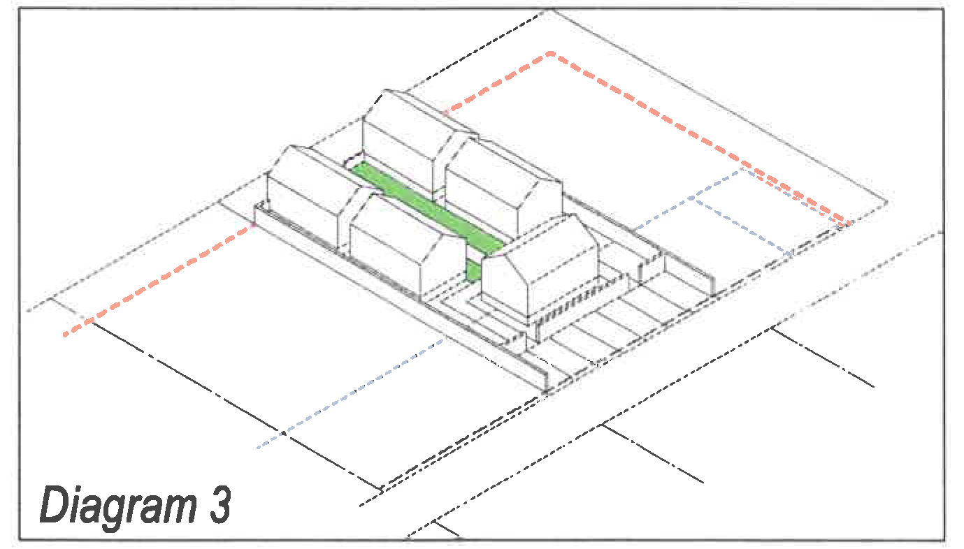
A small cottage court with 5 cottages and a rear parking lot
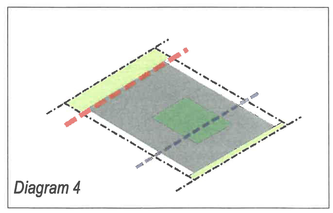
See 193.4 Neighborhood Medium or 193.5 Neighborhood Small for the base frontage standards.
A.
Cottage Court Specifications.
Where a cottage court configuration is being proposed, all rules of the designated neighborhood frontage apply, with the following additions and modifications:
1.
The minimum lot width necessary for a cottage court is 66 feet in neighborhood medium frontages and 76 feet in neighborhood small frontages.
2.
Minimum five feet separation between all buildings (walls).
3.
Minimum cottage width and/or length of 18 feet.
4.
Maximum cottage and/or unit footprint of 700 square feet (parking garages and parking sheds are not limited by this)
5.
Maximum height of one and one-half stories or 18 feet.
6.
Maximum two bedrooms per cottage.
7.
Maximum rental occupancy two adults (children are not precluded).
8.
The central courtyard:
a.
Must be contiguous with the RBL and open to the RBL not less than 80 percent of the widest courtyard dimension (parallel to the RBL).
b.
Must be open to the street-space, with no wall or fence taller than 40 inches above the average fronting clear sidewalk elevation.
c.
Must be configured as a simple rectangle, [10] with no more than one width and/or depth variation.
d.
Must be between 20 feet and 70 feet wide and between 40 feet and 90 feet deep.
e.
Must be a green space, not more than ⅓rd paved. [11]
f.
Satisfies the private open area requirement.
9.
Cottages not on the RBL shall front the central courtyard. Elevations fronting the courtyard will be regulated as facades.
10.
At least 15 feet of each cottage must be contiguous along the courtyard.
11.
All cottage roofs shall be simple hip or gable roofs with a pitch between 5:12 and 12:12. Shed roofs, minimum pitch 3:12, are permitted on dormers, porches, and parking sheds.
12.
A privacy fence is required on the side lot lines behind the RBL.
13.
Vehicle parking must be behind the parking setback line.
(Ord. No. 2994, § 9(Att. A), 11-1-2021)
The central courtyard for irregular lots may vary to accommodate the shape of the side lot lines, but must maintain a simple shape, as approved by the zoning administrator.
--- (11) ---
All paved areas, other than central courtyard walkways, must be reviewed by the ZRC.
Sec. 26-194. - Architectural standards.
A.
General Purpose and Intent.
The primary purposes of the architectural standards, working in tandem with section 26-193, Building form standards, is to complement and reinforce the pedestrian environment and street-space of the Character Districts through the application of high quality materials and architectural designs. These standards are intended to result in construction that is simple and functional, includes sustainable elements, and that will result in quality development that uses durable materials and design. A wide range of architectural expressions, from traditional to contemporary, can be achieved through these standards. The character of new building facades should complement the materials and general scale of surrounding district buildings and, through application of these standards, create a cohesive ensemble of buildings within the Character District.
These architectural standards include basic parameters for functional building element configurations and a palette of exterior building materials. In order to establish and maintain a sense of place, these standards specify an architectural aesthetic of load-bearing walls and regional materials. The standards also specify details, such as window proportions, roof or cornice configurations, shopfronts, and overhangs. Buildings should reflect and complement the traditional materials and techniques of the greater Cedar Falls region.
B.
General Principles.
1.
Applicability:
a.
These standards apply to all new construction within the Character Districts, unless otherwise expressly stated in this section. See section 26-63, Proportionate compliance, for specific applicability when remodeling or renovating existing structures.
b.
Where clearly visible from the street-space:
(i)
Many of these standards apply only where clearly visible from the street-space. Note that the definition of street-space includes parks, squares, and civic greens but not alleys.
(ii)
These controls concentrate on the public realm and views from the public realm, and minimize interference in the private realm. For example, an architectural element that is visible only through an opening in a street wall is not clearly visible from the street.
2.
Materials.
a.
All building materials shall express their structural properties. For example, stronger and heavier materials (masonry) should be located below lighter materials (wood). Material changes should occur at logical construction locations (such as at an inside corner).
b.
Equivalent or better:
Materials, techniques, and product types listed in this section are prescribed. Where indicated, materials that are equivalent or better may be proposed to the zoning administrator and ZRC for review according to the minor adjustments process established in section 26-39, not including any materials specifically prohibited in the individual subsection. The zoning administrator will maintain a list of approved materials containing materials that have met this standard and are therefore permitted under this section.
C.
Architectural Standards: Building Walls.
1.
Purpose and Intent.
Building facades define the public realm, or street-space. All walls should express the construction techniques and structural constraints of their building materials. These standards are intended to achieve simple configurations and solid craftsmanship.
Photographs are provided as illustrations of intent, with no regulatory effect. They shall not imply that every element in the image is permitted. Refer to the standards on the following page for the specific requirements of this section.
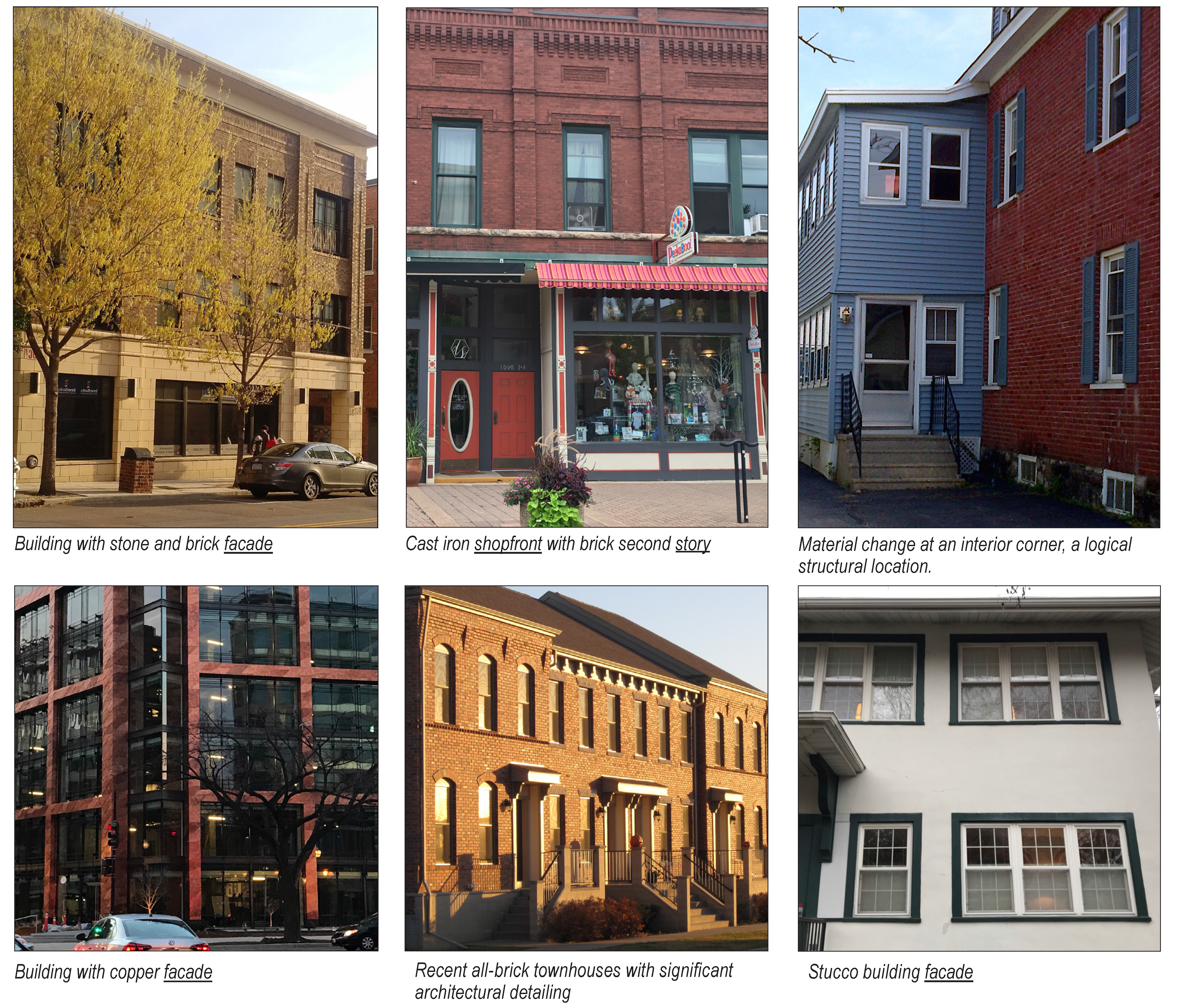
2.
Applicability.
The standards in this section apply to all building walls that are clearly visible from the street-space. Where expressly stated, they also apply to additional building elevations.
3.
Primary facade materials.
a.
Any of the following building materials shall be used on a minimum of 75 percent of the facade area. This measurement shall be calculated as a percentage of the wall portion of the facade, exclusive of fenestration.
(i)
Brick and terra cotta;
(ii)
Natural stone;
(iii)
Stucco (cement plaster); prefabricated stucco panels and sprayed on stucco finishes are prohibited;
(iv)
Cast iron, copper, stainless steel (18-8 or better), or titanium metal.
b.
For neighborhood frontages only:
(i)
Wood or approved fiber cement siding;
(ii)
Vinyl siding may be used on residential buildings with six or fewer dwelling units only, except as noted in the paragraph (iii) below;
(iii)
On other buildings with existing vinyl siding, that siding may be replaced or repaired with vinyl siding and any additions may be clad with vinyl siding.
c.
Additional materials may be proposed to the zoning administrator and ZRC for review under the equivalent or better standard, see section B.2.b above.
4.
Secondary materials.
Any of the following materials are permitted on a maximum of 25 percent of the facade area and on all side and rear elevations.
a.
All permitted primary materials;
b.
Metal (heavy gauge & non-reflective);
c.
Ground- or split-faced block (integrally colored);
d.
Glass block;
e.
Decorative tile;
f.
Pre-cast masonry;
g.
Durable foam-based products, such as Fypon, may be used for architectural detailing; and
h.
EIFS (Exterior Insulation and Finishing System) and other synthetic materials may be used above the second story, if on the ZRC Approved Alternate Materials List.
5.
Prohibited materials.
a.
Styrofoam;
b.
Vinyl (except as noted above for neighborhood frontages) and aluminum siding.
6.
Configurations and techniques.
a.
When different materials are used on a facade, heavier materials shall be used below lighter materials (i.e., stone below brick; brick below metal panel; brick below siding).
b.
All masonry, including brick, block, and stone, shall be in an apparent load-bearing configuration.
c.
Where siding, including panels, is not mitered at corners, siding shall incorporate corner boards on the outside building corners to conceal raw edges.
d.
Wall openings (fenestration) must:
(i)
have a vertical dimension equal to or greater than the horizontal dimension unless otherwise specifically permitted in these district standards;
(ii)
correspond to the interior space and shall not span across building structure such as a floor or wall.
e.
Wood siding and wood simulation materials.
(i)
Horizontal siding shall be configured with a maximum board exposure of eight inches.
(ii)
Board and batten siding shall have a maximum board width of ten inches.
(iii)
Siding and shingles shall be smooth, not rough-sawn finish.
(iv)
Shall not come in contact with the ground surface.
f.
Stucco.
(i)
Shall have a smooth or sand finish only; no rough textured finish.
(ii)
Shall not come in contact with the ground surface.
g.
All exposed masonry walls (i.e., street walls, garden and other free-standing walls, and parapets) shall have a cap or coping to protect the top of the wall from weather.
D.
Architectural Standards: Roofs, Eaves and Parapets.
1.
Purpose and intent.
Roofs and parapets are part of the facade composition (its crown or hat) and contribute to the spatial definition of the street-space. They should demonstrate common-sense recognition of the climate by utilizing appropriate pitch, drainage, and materials in order to provide visual coherence to the district. Roof forms are not interchangeable. The roof type is integral to the design of the building and its architectural character and the configuration should be appropriate for the building and its facade.
Photographs are provided as illustrations of intent, with no regulatory effect. They shall not imply that every element in the image is permitted. Refer to the standards on the following page for the specific requirements of this section.
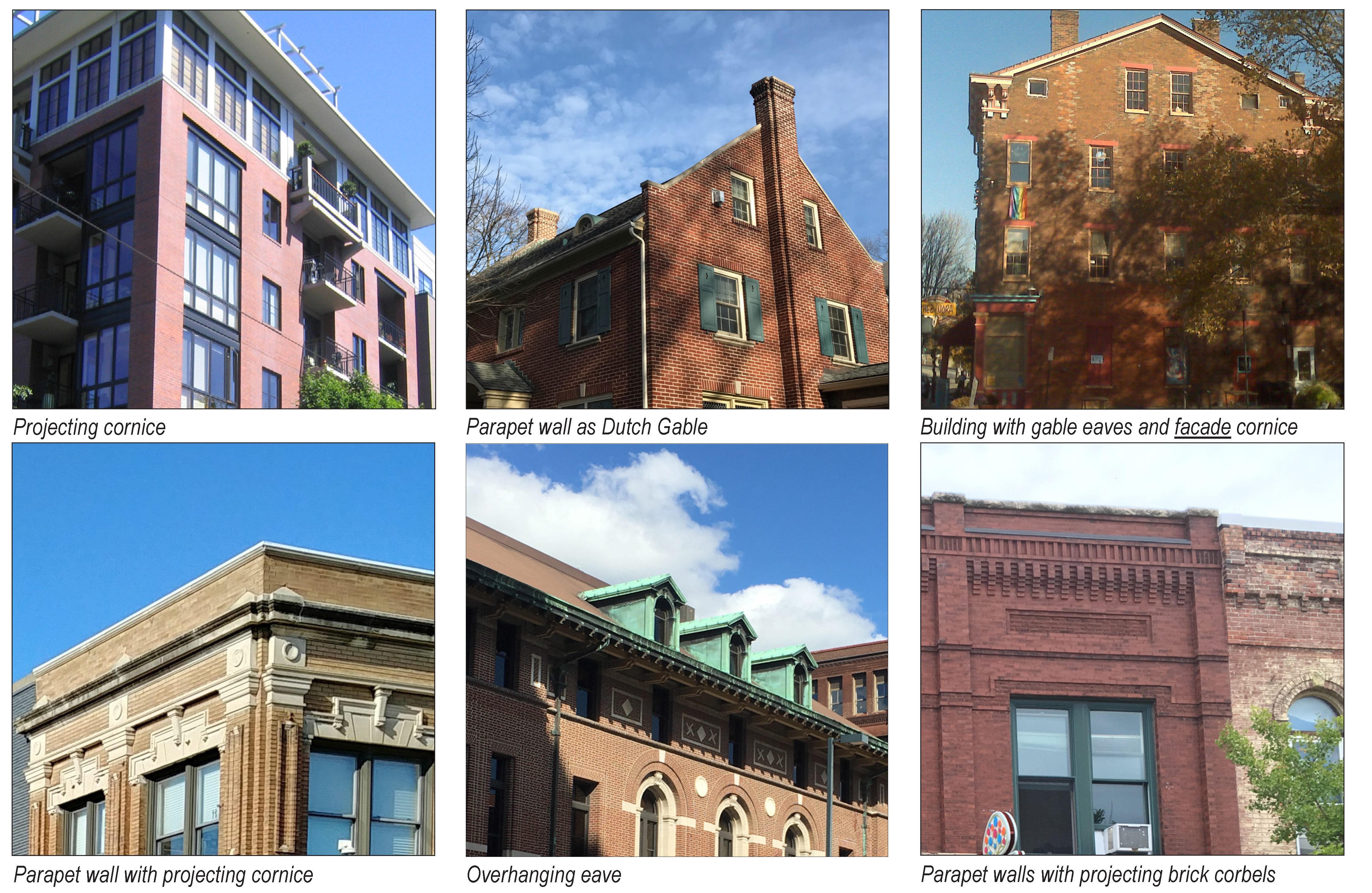
2.
Applicability.
The standards in this section apply to any roof or parapet that is clearly visible from the street-space.
3.
Permitted roofing materials.
a.
Tile;
b.
Slate, and equivalent synthetic materials or better;
c.
Metal, shingle or standing seam, equivalent or better;
d.
Dimensional architectural grade composition shingles; or
e.
Wood shingles.
4.
Prohibited roofing materials: Corrugated metal.
5.
Additional permitted materials and elements.
a.
Cornices and soffits may be comprised of wood or metal.
b.
Gutters and downspouts may be vinyl and/or metal, in accordance with industry standards.
c.
Parapet wall materials, exclusive of copings, shall match the building wall.
6.
Additional materials may be proposed to the zoning administrator and ZRC for review under the equivalent or better standard, see section B.2.b above.
7.
Configurations and techniques.
a.
Flat roofs are allowed except in cottage court configurations.
b.
Pitched roofs.
Roof pitch is measured as rise over run. For example, a 4:12 pitched roof increases four inches in height for every 12 inches of horizontal distance.
(i)
Roofs that cover the main body of a building shall have a slope of no less than 5:12 and no more than 12:12.
(ii)
The roofs of front porches, stoops, and balconies shall have a slope of no less than 2:12 and no more than 6:12.
(iii)
The end walls of a Dutch gable or gambrel roof may extend up above the roof line to form a parapet.
(iv)
Pitched roofs, except those on the facade side of the building, may be "cut out" to allow roof access for terraces and mechanical equipment. The cut out area may not be within 18 inches of end of the individual exterior wall nor within 18 inches of the roof ridge.
c.
Overhang requirements.
(i)
There shall be a ten to 30 inch overhang near the top of the primary structure, with the exception of parapet walls, which have a minimum overhang of three inches. This does not apply to walls on/at common lot lines or rear elevations.
(ii)
Buildings may satisfy the overhang requirement with eaves, a cornice, or similar form projecting horizontally from near the top of the building wall or above the ceiling of the uppermost story.
d.
Other elements.
(i)
Roof-mounted equipment is permitted only when screened from view (from the street-space) by the building's parapet wall.
(ii)
Skylights, solar shingles, and solar panels that are flat and flush to the roof are permitted; however, non-flat/flush panels should be mounted at least five feet from the roof outer edge/eaves or behind the parapet wall.
E.
Architectural Standards: Windows and Doors.
1.
Purpose and intent.
The placement, configuration, type, and size of windows and doors on the facade greatly influences the scale and character of the street-space. For Storefront frontages, windows allow interplay between the ground floor interiors and the sidewalk. Commercial uses (especially restaurants and retail establishments) benefit from exposure to the passers-by and the street-space benefits from the visual activity. For residences, windows foster the "eyes on the street" surveillance which provides for the security and safety for the area.
Photographs are provided as illustrations of intent, with no regulatory effect. They shall not imply that every element in the image is permitted. Refer to the standards on the following page for the specific requirements of this section.
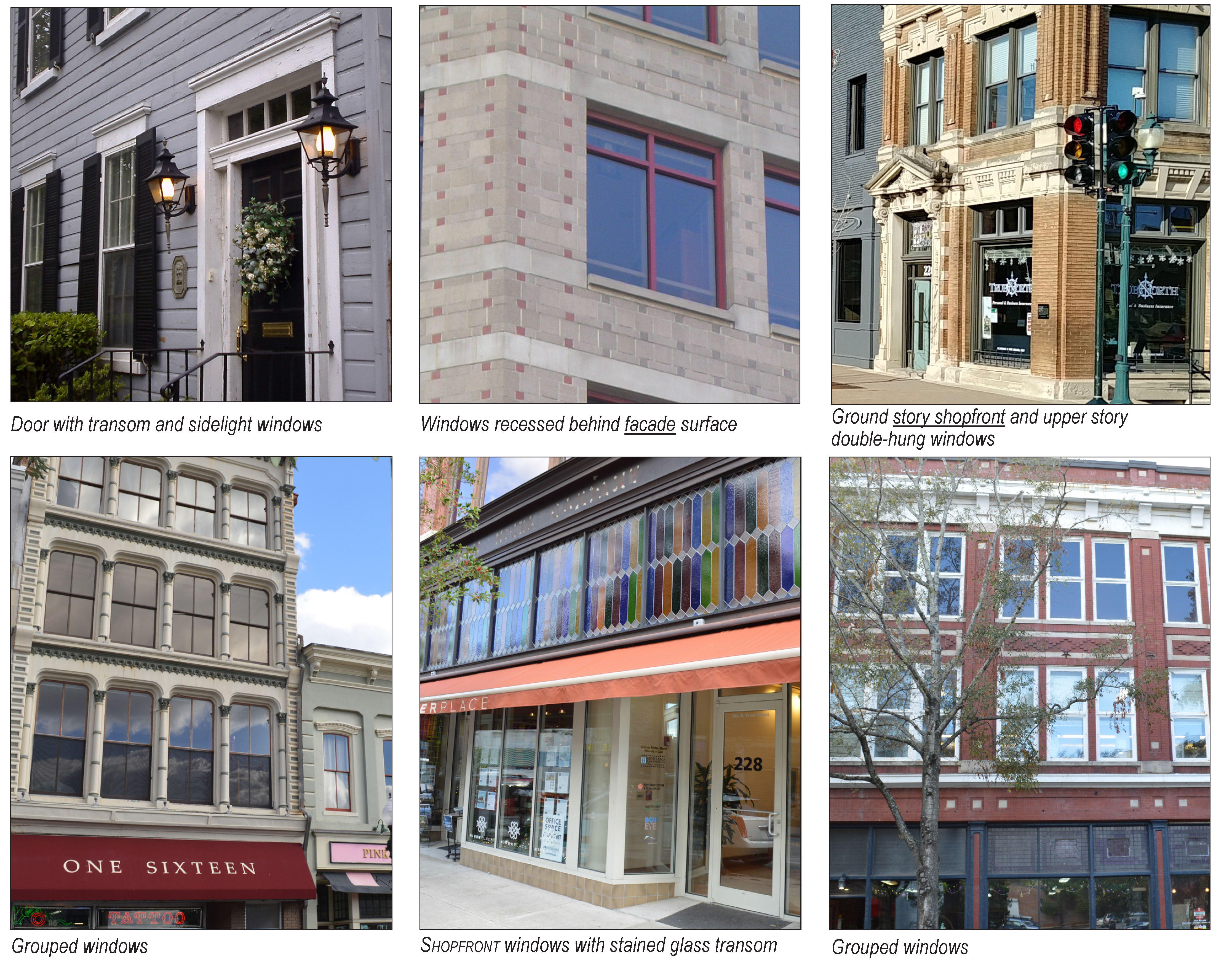
2.
Applicability.
The standards in this section apply to any window or door that is clearly visible from the street-space. See section 26-63 for specific applicability when remodeling or renovating existing structures. Specific requirements and exceptions for shopfronts are provided in section F, Shopfronts, below.
3.
Materials.
a.
Glass panes must be clear, with low reflectivity and light transmission at the ground story of at least 75 percent. Shopfront transoms are excluded from this restriction.
b.
Doors shall be of wood, clad wood, glass, steel, or any combination thereof.
c.
Shutter materials shall be wood or clad wood.
d.
Additional materials may be proposed to the zoning administrator and ZRC for review under the equivalent or better standard, see section B.2.b above.
4.
Configurations and techniques.
a.
All Windows except shopfronts (see F, Shopfronts, below)
(i)
The horizontal dimension of the opening shall not exceed the vertical dimension except for transom windows above an entrance;
(ii)
Windows may be grouped horizontally if each grouping is separated by a mullion, column, pier, or wall section that is at least seven inches wide. A group is limited to a maximum of five windows;
(iii)
Windows should be subdivided to provide a pedestrian scale. The maximum dimensions for glass panes are 60 inches vertical by 36 inches horizontal.
(iv)
Window panes shall be recessed behind the surface of the facade a minimum of three inches, except for bay windows and shopfronts.
(v)
Windows must correspond to the clear height within a building and may not span across building structure such as floor structural and mechanical thicknesses. Windows on different story levels must be separated by a minimum 24-inch wall or framing element.
(vi)
Window types: Single-, double-, and triple-hung, hopper, awning, casement, clerestory, and transom.
(vii)
Fixed windows are only permitted as part of a window grouping that includes an operable window.
(viii)
Egress windows may be installed as required by the applicable building code.
(ix)
Snap-in mullions and muntin are permitted but not considered in any proportion calculation or measurements for fenestration.
(x)
Exterior shutters, when used, shall be sized and mounted appropriately for the window (one-half the width).
b.
Ground story windows and doors.
(i)
Double-height entryways (those that span more than one story) are not permitted.
(ii)
General and storefront facade doors shall not be recessed more than four feet [12] behind their facade and, in any case, shall have a clear view and path to a minimum 45-degree angle past the perpendicular from each side of the door into the street-space. Doors may not encroach into the right-of way when opened.
c.
Upper story windows.
On all upper stories, a minimum of 40 percent of the window area, per story, must be operable.
d.
Garage doors.
When a lot is adjacent to an alley, garage doors shall face towards the alley.
F.
Architectural Standards: Shopfronts.
1.
Purpose and intent.
Shopfronts enliven the public realm. They improve walkability, with frequent entrances and large display windows providing transparency and connection between the interior activity and the public sidewalk. Display windows should be large to allow unimpeded views into the interior of the shop. Closely spaced mullions or muntins, punched windows, and horizontal grids should be avoided.
2.
Applicability.
The standards in this section apply to building frontages designated as Storefront on the Character District regulating plan. They include more requirements than, and some exceptions to, the standards in section E, Windows and doors, above. Where there is an apparent conflict, these rules apply. Applicants may use the shopfront standards for any portion of a General Urban frontage, subject to ZRC approval.
3.
Requirements and configurations.
a.
The bottom of shopfront window glass shall be between one and three feet above the sidewalk and shall run from the sill to a minimum of eight feet above the sidewalk. Materials per section C, Building walls, must be used below the window sill.
b.
Roll-up garage doors are not permitted for designated storefront frontages.
c.
Shopfront window and door glass shall be clear, with light transmission of at least 75 percent. Transom glass may be tinted, obscured, stained, or glass block.
d.
Individual panes of glass in shopfronts shall be no larger than 11 feet in height and six feet in width.
e.
Shopfront windows and doors may not be made opaque by window treatments, except by operable sunscreen devices within the interior. A minimum of 75 percent of the fenestration must allow views into the interior for a depth of at least ten feet.
f.
Shopfront doors must have at least 60 percent glass. Solid and opaque doors are prohibited.
g.
Shopfront doors must be distinguished by features such as: transom windows, awnings or canopies, or a recessed entryway.
h.
Shopfronts must be differentiated from the facade above by a projection or string course, with a minimum relief of one inch and minimum vertical width of three inches, between each shopfront and the window-sill level of the second story.
Photographs are provided as illustrations of intent, with no regulatory effect. They shall not imply that every element in the image is permitted. Refer to the standards on the following page for the specific requirements of this section.

G.
Architectural Standards: awnings and canopies.
1.
Purpose and intent.
Awnings and canopies provide protection from the elements and create shade and shadow on the building, enhance the three dimensional quality, add interest, and can help emphasize a primary building entrance. Open ended awnings are preferred to make blade signs and transom windows more visible from the sidewalk.
2.
Applicability.
The standards in this section apply to any awning or canopy that is clearly visible from the street-space.
3.
Materials.
a.
Awning must be made of commercial-grade fabric and may be either fixed or retractable. High-gloss, plasticized, shiny or reflective materials are prohibited.
b.
Canopy framing shall be constructed of either metal or wood.
c.
Canopy roofing materials, where clearly visible from the street-space, may be: metal standing seam (5V crimp or equivalent), slate, glass, or durable fabric.
d.
Additional materials may be proposed to the zoning administrator and ZRC for review under the equivalent or better standard, see section B.2.b above.
4.
Configurations.
a.
Awnings and canopies shall not interfere with utilities, street trees, or other important ROW elements.
b.
Awnings and canopies shall shade windows with the awning top mounted no more than one foot above the opening below.
c.
Awning and canopy overhangs shall have a minimum of nine feet clear height above the sidewalk and be minimum of four feet deep, measured from the facade. The maximum depth is to back-of-curb or the tree lawn edge, whichever is less. (subject to approval by the zoning administrator and ZRC).
d.
Back-lighting or internal illumination through the awning or canopy is not permitted.
e.
One-quarter cylinder configurations are not permitted.
f.
Canopies shall be mounted to the building wall and supported either from below by brackets or from above by cables or chains, or be structurally integrated with the building.
Photographs are provided as illustrations of intent, with no regulatory effect. They shall not imply that every element in the image is permitted. Refer to the standards on the following page for the specific requirements of this section.
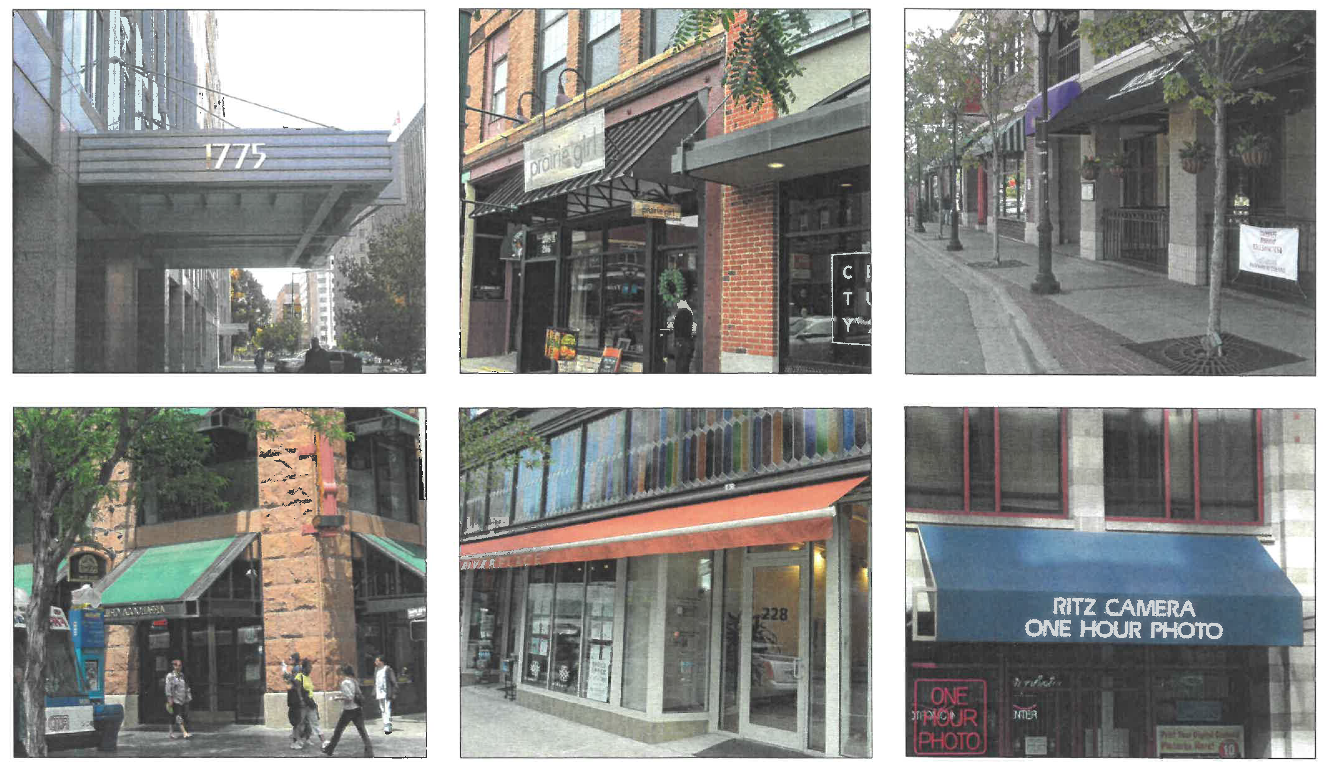
H.
Architectural Standards: facade Composition for Large Building Frontages.
1.
Intent.
General and storefront frontages have additional specific design parameters to ensure that they create a positive pedestrian environment.
2.
Applicability.
These standards maintain a pedestrian scale, even where the buildings are quite large. They apply to the first four stories of the facade. This conservatively covers the distance within which one can discern the human face from the street. Building facades with 100 feet or more of frontage on a block face are subject to this rule. Lots with street frontage of less than 100 feet on a block face are exempt from this rule for that block face, but shall still include at least one functioning pedestrian street entry and meet all other applicable building form standards.
3.
Facade composition.
The facade composition rule is intended to maintain a pedestrian-friendly scale. "Facade composition" is the arrangement and proportion of facade materials and elements (windows, doors, columns, pilasters, bays). "Complete and discrete" distinguishes one part of the facade from another to give the appearance of distinct facades.
a.
For each block face, facades along the required building line shall present a complete and discrete vertical facade composition for the street-space, at no greater than the following average street frontage lengths:
(i)
Sixty feet for storefront frontages;
(ii)
Seventy-five feet for general frontages.
These are average frontage lengths; the facade may be composed of bays of different sizes to achieve the average; uniform spacing is not required.
b.
Each facade composition shall include at least one functioning street entry door.
c.
The facade composition requirement may be satisfied by liner shops, which are shallow shops located in front of larger footprint uses such as grocery stores or parking structures.
d.
To achieve a complete and discrete vertical facade composition within a block face the applicant shall demonstrate that at least two of the following features that distinguish one facade composition from the next are included:
(i)
Different fenestration proportions of at least 20 percent in height or width or height:width ratio. (See Diagram 1.)
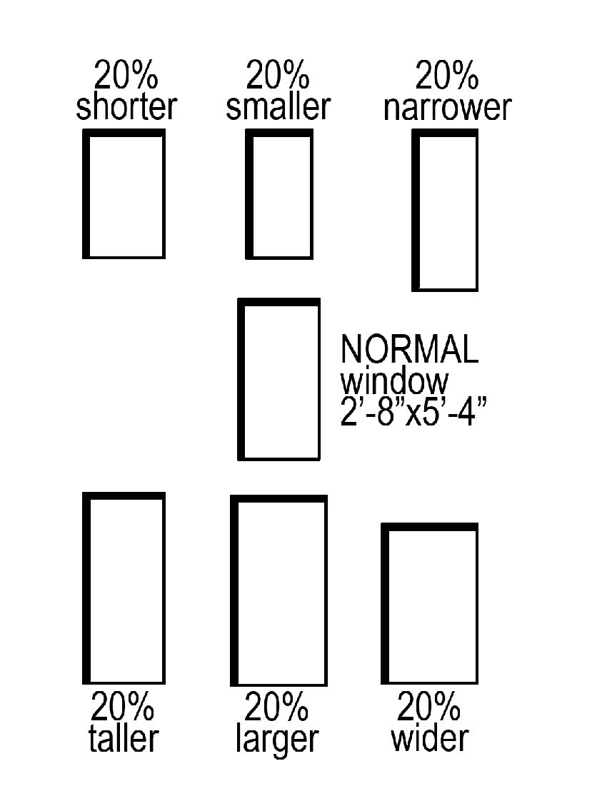
Diagram 1. Illustration of different fenestration proportions
(ii)
Different facade configurations, through a change in architectural features, such as facade elements, bay rhythm, cornice line, articulation, or detailing; change in the wall plane alone is insufficient. (See Diagram 2.)
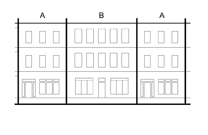
Diagram 2. Illustration of facade configurations with a clearly different rhythm
(iii)
Change in wall material; color changes alone are insufficient.
(iv)
Change in total fenestration percentage with a minimum difference of 12 percent. Ground floor facades are not included.
(v)
Clearly different ground story facade composition, using framing material and fenestration proportions.
I.
Architectural Standards: Street Walls and Fences.
1.
Purpose and intent.
The street-space is physically defined by buildings, walls, or fences. Land should be clearly public or private; in the public view or private and protected.
Street walls establish a clear edge to the street-space where there is no building. These requirements include masonry walls that define outdoor spaces and separate the street-space from the private realm (e.g. parking lots, gardens, trash cans, and equipment). All street wall faces should be designed as is the building facade, with the finished side out (i.e. the "better" side facing the street-space).
Photographs are provided as illustrations of intent, with no regulatory effect. They shall not imply that every element in the image is permitted. Refer to the standards on the following page for the specific requirements of this section.
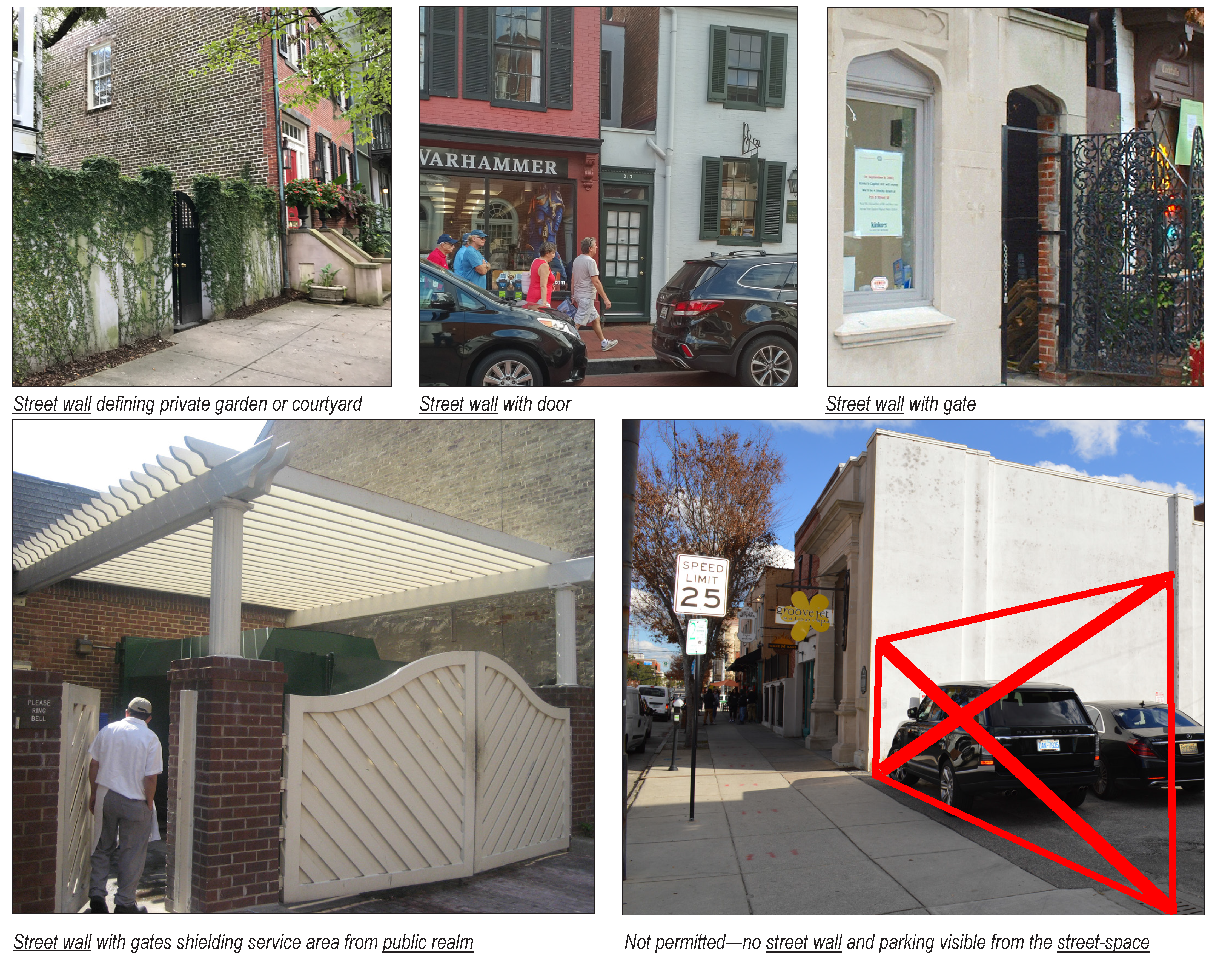
2.
Applicability.
The following standards apply to all street walls and fences that are clearly visible from the street-space.
3.
Materials.
a.
Walls.
(i)
Brick;
(ii)
Natural stone;
(iii)
Stucco on masonry (such as concrete block or poured concrete);
(iv)
A combination of materials, e.g., stone piers with brick infill panels, masonry with iron or steel.
b.
Gates and fenestration.
(i)
Metal, including wrought iron, welded steel and/or electro-plated black aluminum; may also be used for fenestration in the wall itself; or
(ii)
Wood.
c.
Dooryard and privacy fences.
(i)
Wood;
(ii)
Wrought iron or metal that faithfully imitates wrought iron;
(iii)
Dimensional composite material (synthetic and composite woods); or
(iv)
A combination of any of the above materials with masonry piers;
(v)
Rolled fencing (such as chain link) is prohibited where clearly visible from the street-space;
(vi)
Additional materials may be proposed to the zoning administrator and ZRC for review under the equivalent or better standard, see section B.2.b above.
4.
Configurations and techniques.
Permitted configurations and techniques (See also section 26-193, Building form standards):
a.
Street walls:
(i)
Shall be built to the height and length specified in the applicable building form standard.
(ii)
Taller than five feet are subject to the fenestration requirements of the applicable BFS frontage; those lower than five feet may use the fenestration parameters.
b.
Dooryard fences and privacy fences:
(i)
Shall be "finished side" facing the street or adjacent property;
(ii)
Dooryard fences: must be at least ⅓ open and not solid. Wooden picket boards should not be more than 3.75 inches wide and set so that the space between them is not more than three inches wide.
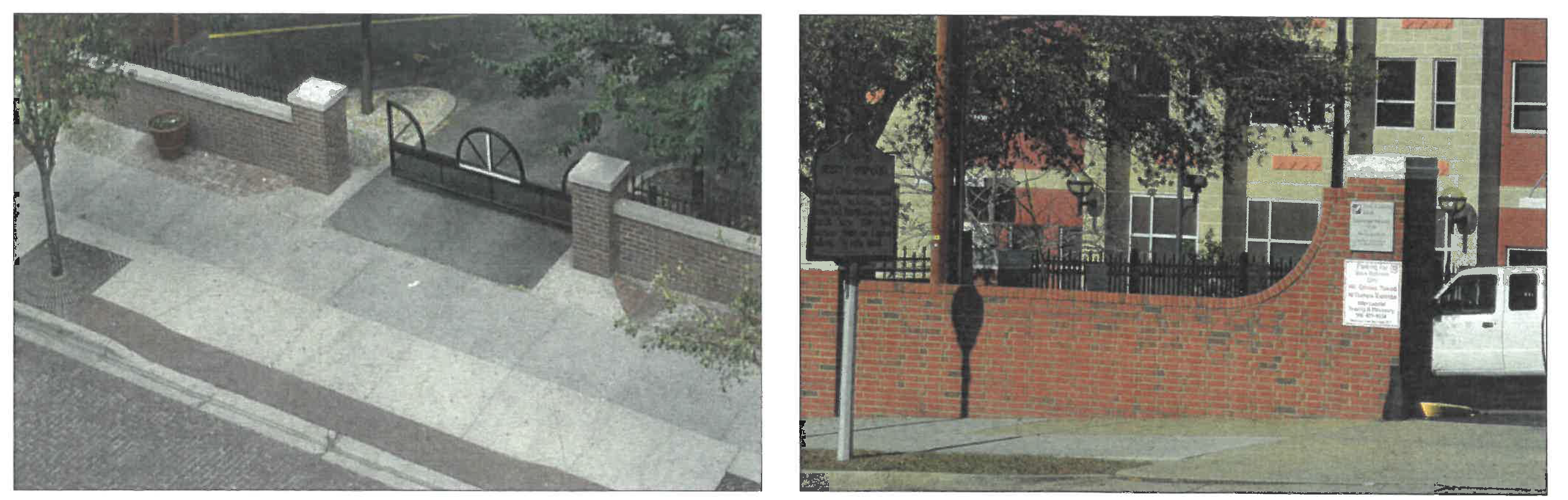
Street walls with coping and wrought iron along an unbuilt street frontage.
J.
Architectural Standards: Entry Features, Front Porches, Stoops and Canopies.
1.
Purpose and intent.
Building entries are the front door of a building and provide a connection between the building interior and the outside, public activity. They also establish a clear hierarchy and focal point for the building. Entries should be scaled appropriately to the size of the building.
Photographs are provided as illustrations of intent, with no regulatory effect. They shall not imply that every element in the image is permitted. Refer to the standards on the following page for the specific requirements of this section.
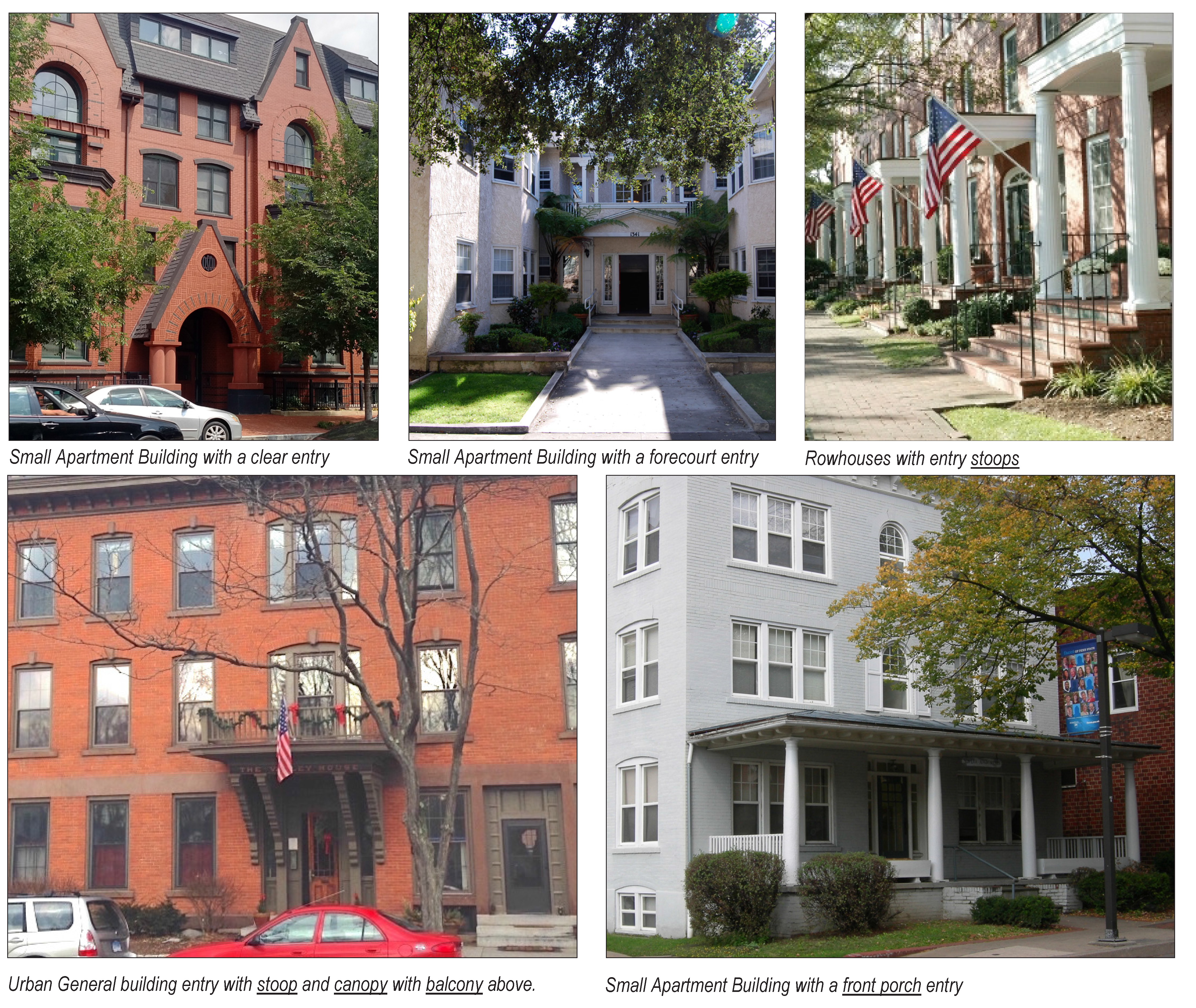
2.
Applicability.
The standards in this section apply to all building facade entries within a Character District.
3.
Materials.
Permitted materials for front porches, stoops, and other entry features: (For awning and canopy materials, see section G, Awnings and canopies, above.)
a.
Foundation walls and piers of stucco, stone, split-faced concrete, poured concrete with a smooth finish, or brick.
b.
Porch posts, piers, columns or pilasters of wood, or approved fiber cement product, stone, stucco, brick, or split-faced block.
c.
Balustrades of: wood, which must be finished (painted or stained, no raw lumber); large section aluminum; or zoning administrator approved synthetic, which must be paintable.
d.
Privacy lattice (max one inch openings) enclosing open foundations.
e.
Additional materials may be proposed to the zoning administrator and ZRC for review under the equivalent or better standard, see section B.2.b above.
4.
Configurations.
Entries should be distinguished by variations in facade design, materials, and articulation that clearly identifies the entrance.
a.
Spacing between columns, piers or posts shall be no wider than 1.33 times their height (for example, nine feet tall posts can not be more than 12 feet apart).
b.
All required front porches or stoops shall be roofed, with supporting posts, brackets, piers or columns and railings. Stoops may alternately have a canopy or awning covering. The awning or canopy may be supported as described in a., above, or hung from the facade by chains or wires of not less than ⅜ inches diameter.
c.
The minimum dimension [13] or diameter for single columns or posts is seven inches, four feet if paired/doubled, turned posts are allowed to have portions with a diameter that are as much as ⅓ below the minimum. Supporting masonry bases have a eight inch minimum dimension, and pilasters must be at least eight inches wide by one inch in depth from the facade.
d.
Pediments, or any other entry architectural detailing, must be at least four inches in depth from the facade and completely span the entry opening.
e.
Canopies must completely cover the stoop they are overhanging.
f.
Balusters and railings shall be a minimum dimension of one inch (maximum four inch dimension) with a maximum three inches clear space between them. They must sit on and be attached to the front porch or stoop floor/platform's top surface, they may not be attached to it's joists or the side of the platform.
g.
Front porches or stoops with railings/balustrades shall be at least 30 inches in height above their floor and fully surround the front porches or stoop excepting a maximum six feet wide front opening and (separate) side opening for any side access.
h.
Porch screen frames may only be mounted behind the columns, posts or piers and intermediate screen supports not less than three feet apart.
5.
Techniques.
Required front porches or stoops may be open in any direction. The elevation facing the street(s) shall not be enclosed (except by insect screening) above a level of 40 inches above the front porch or stoop floor.
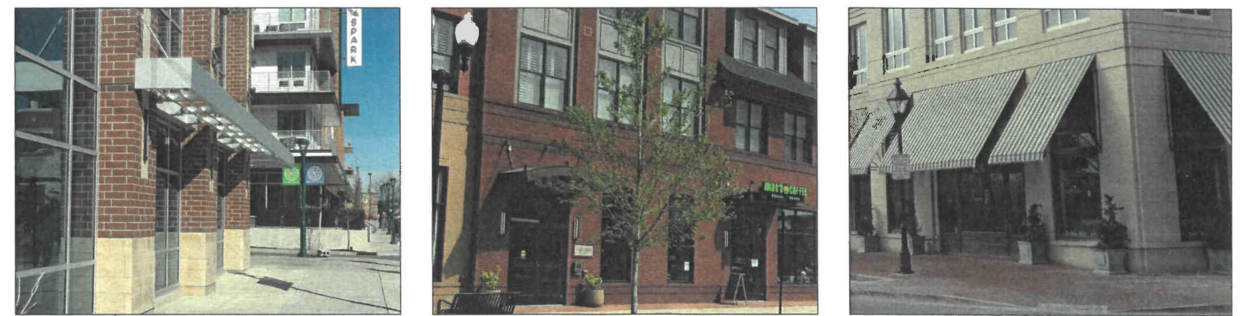
Canopies and awnings
K.
Architectural Standards: Lighting and Mechanical.
Photographs are provided as illustrations of intent, with no regulatory effect. They shall not imply that every element in the image is permitted. Refer to the standards on the following page for the specific requirements of this section.
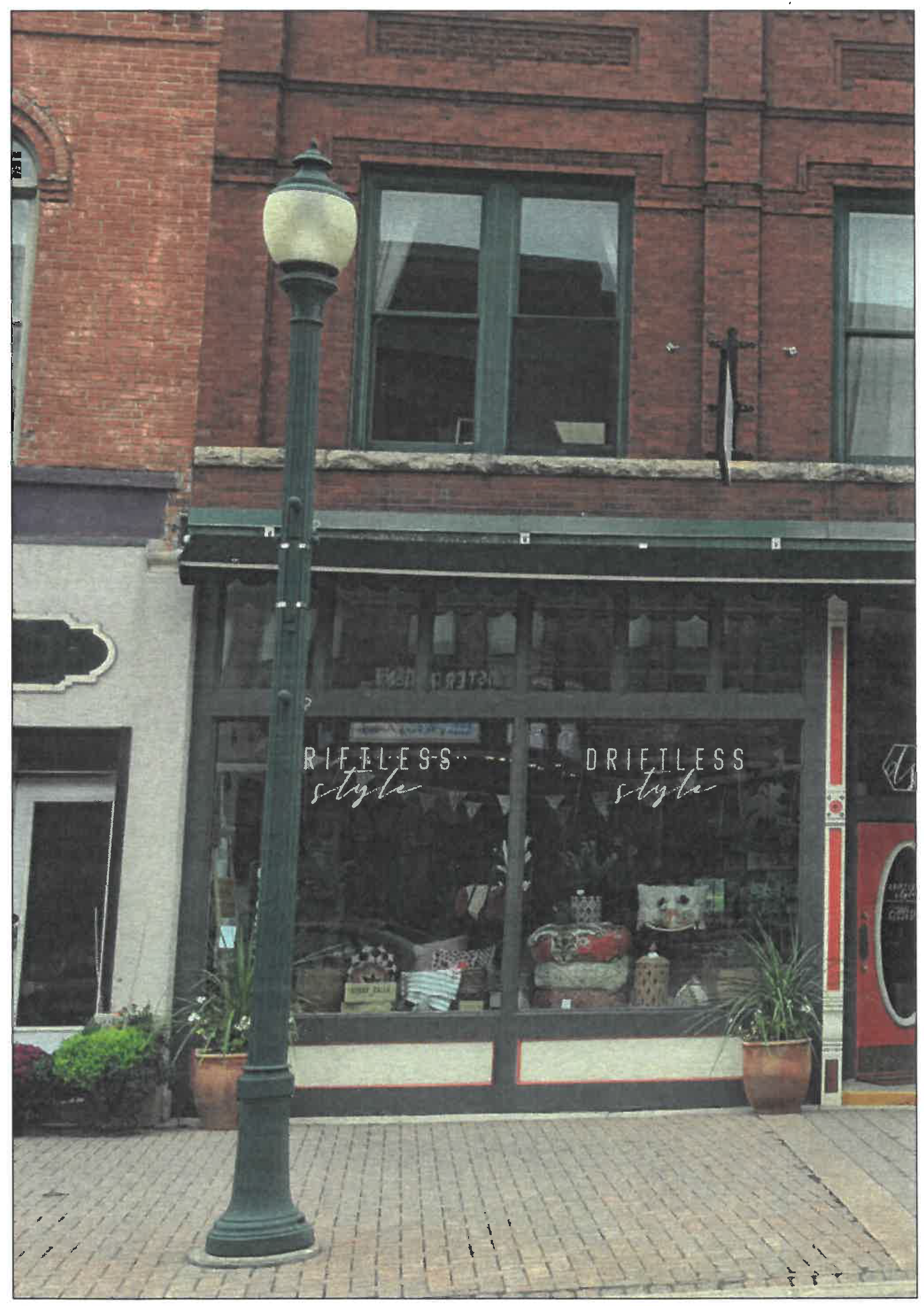
Pedestrian-scale street lights
Not permitted, visible from the street-space
Not permitted within the street-space
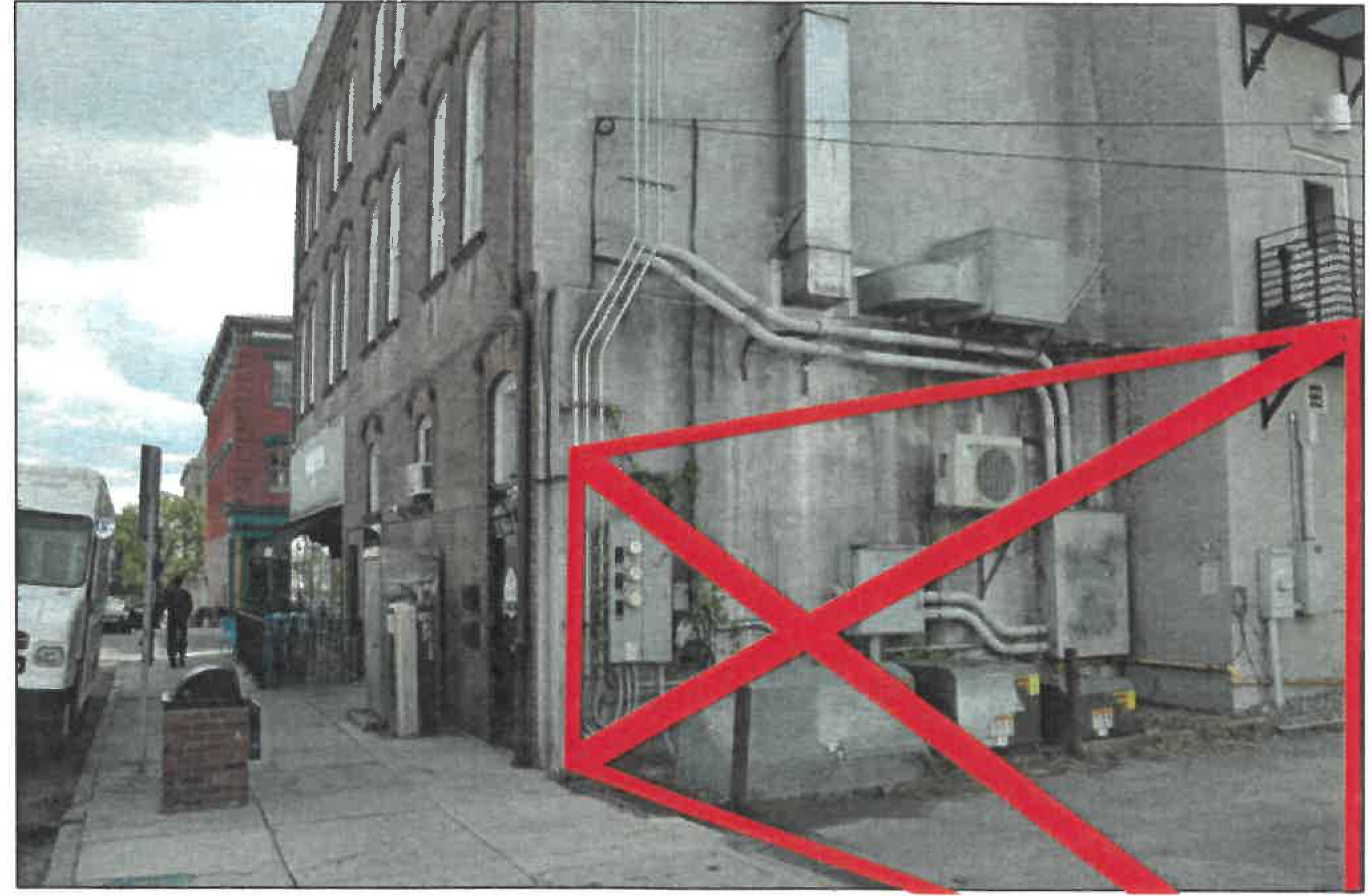
Not permitted, visible from the street-space
The illustrations above are examples of mechanical equipment arrangements that are only acceptable away from and/or not visible from a street-space (i.e. within an alley or screened from view).
1.
Purpose and intent.
These standards are intended to enhance the urban pedestrian context. Appropriate lighting is desirable for night-time visibility, safety, and decoration. However, lighting that is too bright or intense creates glare, hinders night vision, and creates light pollution. Restricting the location of mechanical equipment limits intrusions that would otherwise detract from the public realm. All street lights within a Character District should be pedestrian-scaled. Highway-scale, "cobra-head," fixtures are generally not appropriate for true urban contexts and should be limited to intersections where absolutely necessary.
2.
Applicability.
The standards in this section shall apply to all properties in a Character District. Exceptions may be made to comply with state highway standards where necessary.
3.
Exterior lighting.
a.
Pedestrian-scale streetlights should be:
(i)
Coordinated by the Department of Public Works and Cedar Falls Utilities (CFU) and done in accordance with any adopted streetscape plan;
(ii)
Located on each side of the street-space; (See section 26-195, Public realm standards) and
(iii)
Coordinated with street tree placement and located at least ten feet apart from one another.
b.
Site and accent lighting.
These standards are intended to prevent light from one property extending beyond the property line onto adjacent properties. Compliance with this subsection is achieved with fixture shielding, directional control designed into the fixture, fixture location, fixture height, fixture aim, or a combination of these methods.
(i)
Site lighting shall be designed to illuminate only the lot. If mounted on poles, lights shall not be mounted higher than 25 feet above grade. An exterior lighting plan shall be approved as consistent with these standards by the zoning administrator in consultation with the ZRC.
(ii)
Floodlighting or directional lighting is prohibited except for lighting of loading and service areas, and on civic buildings or monuments, to highlight architectural features (such as cupolas, towers, or courthouse domes) [14], and shall not produce glare into neighboring windows or light trespass into neighboring properties. Floodlights are not permitted for parking lots or outdoor display/storage areas.
(iii)
All under-canopy lights or lights mounted in eaves must either be recessed into the canopy/eave and fully shielded or use flat lenses instead of drop lenses.
(iv)
Lights within ground floor commercial space or shopfronts shall be used to illuminate the interior space and/or window displays and shall not be directed outward into the street-space.
(v)
Light fixtures used to illuminate flags, statues, or objects mounted on a pole or pedestal must use a narrow cone of light that does not extend beyond the illuminated object. Lights that are intended to architecturally highlight a building or its features must use a limited pattern of light that does not extend beyond the wall of the building.
(vi)
Floodlights, when permitted, must be aimed no higher than 45 degrees from vertical; be located and shielded such that the bulb is not directly visible from any adjacent residential use or public right-of-way.
(vii)
In neighborhood frontages, lighting used to illuminate outdoor private recreational facilities, such as swimming pools, tennis courts, and basketball courts, must be turned off by 10:00 p.m. Underwater lighting in swimming pools and hot tubs are exempt from this provision.
(viii)
No lights may exceed 0.5 initial horizontal foot-candle and 2.0 initial maximum foot-candle as measured at any point along a property boundary that is adjacent to or across the street or alley from neighborhood frontages and properties outside the Character District that are zoned residential.
(ix)
Exterior lights on the building shall be shielded and downcast or must be frosted glass or be installed behind a translucent cover. Exterior lights shall be maximum 100-watt incandescent or maximum 1600 lumens. Lights on the facade shall be mounted between eight feet and 12 feet above the adjacent sidewalk These fixtures shall illuminate the dooryard and clear sidewalk area. Lights on the alley shall have a 12 foot maximum height. These fixtures shall illuminate the alley and may also illuminate a portion of their own rear yard area. They shall not direct light or cause glare into neighboring lots.
(x)
High intensity discharge (HID) or fluorescent lights shall not be used on the exterior of buildings.
(xi)
Temporary holiday lighting is exempt from these regulations, in accordance with other city standards.
4.
Mechanical equipment.
a.
All mechanical equipment located at grade (serving the building or tenant use) shall be placed behind and away from any required building line and screened by a street wall if necessary to prevent its being clearly visible from the street-space.
b.
All mechanical equipment on a roof shall be screened, and all screening and penthouses placed on a roof shall be set back from the roof line by a distance at least equivalent to the height of the screening or penthouse in order to minimize visibility from surrounding streets and shall have a maximum height of 18 feet.
L.
Architectural Standards: Signage.
Photographs are provided as illustrations of intent, with no regulatory effect. They shall not imply that every element in the image is permitted. Refer to the standards on the following page for the specific requirements of this section.

Neon sign within the shopfront window
Window sign
Parapet sign
Wall sign
Horizontal blade sign
Wall sign
1.
Purpose and intent.
Signs in Character Districts should be scaled and designed for these mixed-use, pedestrian-oriented areas and not for high speed automobile traffic. Signage along commercial and mixed-use frontages should be durable and is desirable for both informational purposes and as decoration. Signage that is too large creates distraction, intrudes into or lessens the district experience, and creates visual clutter.
2.
Applicability.
The standards in this section apply to any sign that is CLEARLY VISIBLE FROM THE STREET-SPACE in the frontages designated as Urban General or Storefront, except for signs for Civic and Institutional Uses, as defined in this Chapter. Signs for Civic and Institutional Uses located in a Character District and signs in the Neighborhood Frontages are regulated according to the sign standards for the R-1 zoning district.
3.
General standards for all signs.
All signage shall conform to the requirements of article IV of this chapter, except as provided for below.
a.
Only sign types specified in this section are permitted.
b.
Prohibited: Billboards, roof signs, and mural signs painted on facades (except those existing prior to November 1, 2021). Mural signs are permitted, subject to approval by the zoning administrator in consultation with the ZRC, on the other exterior walls (side, rear, and courtyard elevations).
c.
Signs may be illuminated externally from a constant light source. Signs may not be illuminated by flashing, traveling, animated, or intermittent lighting, whether such lighting is of temporary or long-term duration.
d.
Internally illuminated back-lit acrylic-faced cabinet signs and plastic-faced letterform signs are not permitted.
e.
Signs shall not include an Electronic Message Center (EMC) unless explicitly permitted below.
4.
Wall signs.
Wall sign within sign band
a.
Except for approved 1st Street exceptions, are only permitted within the sign band—the horizontal area on the facade between the first floor ceiling and the second story floor line. For one-story buildings, the sign band shall be above the windows and below the cornice. In no case shall this band be higher than 20 feet or lower than 11 feet above the adjacent sidewalk.
b.
Shall not exceed 20 feet in length, 90 percent of the shopfront width, nor come closer than two feet to an adjacent common lot line.
c.
Sign area shall not exceed one and one-half times the shopfront width.
d.
Shall not extend over the architectural features of the building facade, such as cornices, pilasters, transoms, window trim, and similar.
e.
A masonry or bronze plaque may be placed in the building's cornice or parapet wall or under the eaves, and above the upper story windows. Any such plaque shall be no larger than a rectangle of 18 square feet.
Masonry parapet sign
5.
Projecting signs are generally perpendicular to the required building line. Projecting blade signs, marquee signs, and corner signs are permitted.
a.
One blade sign per shopfront is permitted. They:
(i)
May project from the sign band, or be hung from a ground story overhang, canopy, or awning;
(ii)
Shall be no more than six square feet;
(iii)
Shall project from the building no more than 42 inches;
(iv)
Shall be a minimum of eight feet clear above the sidewalk;
(v)
Shall be located no closer than one foot from a common lot line or adjacent shopfront space and no closer than ten feet from any adjacent blade sign; and
(vi)
Shall not be internally illuminated.
Vertical blade sign
b.
Marquee signs are integrated with an entry canopy. They:
(i)
Are only permitted with a theater use;
(ii)
May project to the far edge of the clear sidewalk; and
(iii)
May include an EMC within the sign band area.

Marquee sign
c.
Corner signs that are visible from two or more intersecting streets are permitted as long as:
(i)
There is no more than one per block corner;
(ii)
They are located above the ground story sign band and below the third story, or for a two-story building below the cornice line;
(iii)
They do not exceed 40 square feet per sign face; and
(iv)
The maximum projection from the corner is five feet.
Corner sign
6.
Window signs.
a.
Windows are measured as glass area including muntins and similar framing elements with a dimension of less than one inch. Glazing separated by framing elements of greater than one inch are considered separate windows.
b.
No more than 25 percent of any ground story window may be covered by signage, and such signage shall not be placed or adhered to the window in a manner that prevents views into the shopfront.
c.
Neon signs are allowed within shopfront windows.
d.
No more than ten percent of any upper story window may be covered with signs.
7.
Other signs.
a.
Temporary sandwich board signs of up to 36 inches in height are permitted within the dooryard area. They may also be considered a permitted encroachment to the sidewalk or right-of-way, with prior approval from the city.
b.
Awning signs are permitted. Sign copy on awnings shall be limited to six inches in height on the outside edge/vertical face of the awning.
Awning sign
Awning signs and wall signs
c.
Canopy signs (not including marquee signs, which are regulated separately) are allowed on the canopy face or mounted upright along the top of the canopy with the bottom of the sign no more than four inches above the canopy. Canopy signs shall extend no more than 90 percent of the length of the canopy and be no more than 20 inches in height. Signs mounted on the face of a canopy must maintain a minimum of three inches spacing between the sign and the top and bottom of the canopy face. No more than one canopy sign is allowed per shopfront and a canopy sign is not allowed on a shopfront that has a marquee sign.
d.
Directional signage as defined in this chapter is allowed for assisting traffic flow through allowed drive-through facilities.
8.
Freestanding signs.
a.
No new freestanding signs are permitted after November 1, 2021.
b.
Any property owner voluntarily removing a legally non-conforming freestanding sign may be allowed a bonus of up to 150 percent of the building signs allocated to the property. For example, if a property is allocated 40 square feet of building signs, the property may be allowed 60 square feet of buildings signs if a legally nonconforming freestanding sign is removed.
c.
Bonus signage will still be required to meet the specific placement standards for the particular sign type(s) requested.
9.
First street exceptions for multi-story buildings in the Urban General and storefront frontages.
An additional wall sign is permitted in a sign band located above the top story windows and below the cornice that has:
a.
Square footage less than or equal to one and one-half times the length of the sign wall; and
b.
Length no greater than 90 percent of the length of the sign wall.
(Ord. No. 2994, § 9(Att. A), 11-1-2021; Ord. No. 3027, § 1, 5-25-2023; Ord. No. 3032, § 1, 8-7-2023)
Note of Intent: there may be historic shopfronts in the downtown that do not meet this standard. This is done in consideration of the materials, craftsmanship and aesthetic of contemporary construction (new buildings won't be built out of the same materials or with the same kind of craftsmanship as the historic buildings).
--- (13) ---
Note of Intent: "Nominal" lumber dimensions satisfy these requirements.
--- (14) ---
Note of Intent: intent is to allow all civic building towers such as bell towers, minarets, steeples, etc.
Sec. 26-195. - Public realm standards.
(Ord. No. 2994, § 9(Att. A), 11-1-2021)
Sec. 26-195.1. - Intent.
These public realm standards are designed to establish environments within Character Districts that encourage and facilitate pedestrian and bicycle activity by creating streets and other parts of the public realm that are comfortable, efficient, safe, and interesting.
A.
Although commonly thought of as just greens or parks, the public realm includes the complete street-space—the space between the building facades: the sidewalks, street trees, squares, greens, and the travel lanes.
B.
The street-space is a community's first and foremost public space and should be just as carefully designed and planned as any green or civic building. The character of the street—both its scale and its details—plays a critical role in determining the pedestrian quality of a place.
C.
The public realm standards:
1.
Regulate the pedestrian realm, from the facade to the curb as well as any greens or squares, in a Character District.
2.
Serve as guidance for the curb-to-curb street geometry of any new streets or street rebuilding, as well as the maintenance of existing streets in a Character District. Streets within Character Districts should not be thought of as "roads, highways, arterials, or collectors." They should be developed to create people-oriented places balancing all transportation modes. The majority of streets in a Character District should be designed primarily for walkability and pedestrian comfort.
3.
Contribute to sustainability. Street trees and plants contribute to privacy, the reduction of noise and air pollution, shade, maintenance of the natural habitat, conservation of water, and storm-water management. Good street-spaces promote more sustainable transportation options such as walking and bicycling.
4.
Work in concert with the property frontages. Dooryards and facades literally form the walls of the street-space. They are regulated in section 26-193, Building form standards.
D.
Components.
The Public Realm Standards include the following sections:
1.
26-195.2 General Standards
2.
26-195.3 Public Open Space
3.
26-195.4 Street Trees
4.
26-195.5 Street Design in Character Districts
(Ord. No. 2994, § 9(Att. A), 11-1-2021)
Sec. 26-195.2. - General standards.
The following standards regulate the street-space from the facade to the curb within a Character District.
A.
Dooryards.
1.
All:
a.
Thorny plants shall not be planted along the clear sidewalk or entry walkways.
b.
Noxious weeds, as defined by city ordinance, and invasive exotic species and are prohibited.
2.
Urban General, Urban General 2, and storefront frontages:
a.
Must be planted or hard-surfaced with pervious pavers;
b.
Any plantings/vegetation may not block any fenestration nor extend over the clear sidewalk.
3.
Neighborhood (medium and small) frontages:
a.
Must be planted at a minimum with grass, ground cover, or flowering vines that do not exceed a height of eight inches.
b.
Shrubs or hedges (maximum height 40 inches) may be planted within the dooryard.
c.
Trees may be planted within the dooryard, but must be "limbed up" as they gain appropriate maturity so as to be minimum seven inches clear over the clear sidewalk.
d.
Hard-surfaced walkway(s) must be provided between the clear sidewalk and the building entry(s) in the facade. Such walkways are limited to six feet in width (perpendicular to the RBL) per facade entry.
B.
The developer is required to install sidewalks that meet all city (and ADA) standards and specifications at the time of development. They shall provide a minimum clear sidewalk as follows: Six feet for all Urban General and storefront frontages, five feet for all Urban General 2, and four feet for all neighborhood frontages.
C.
Tree lawn: The area between the clear sidewalk and the curb is used as the planting area for street trees. It may also be used, in more intense pedestrian situations, as a pedestrian area with seating and cafe tables. The tree lawn is regulated in section 26-195.4.
D.
Street lighting:
1.
At the time of development, the developer is required to install pedestrian-scale streetlights per city specifications according to any adopted streetscape plan, on any Urban General, Urban General 2, and storefront frontage being developed.
2.
Alley lighting: All lots with alley access may have lighting fixtures illuminating the alley, see the architectural standards, section 26-194.K.
E.
Street furniture is an element of the overall street-space design. Street furnishings should be simple, functional, and durable. Placement will generally be within the tree lawn area. Any specific green or square designs may specify different placement. All street furniture must meet city standards.
F.
Private mechanical and electrical equipment is prohibited within any street-space including the dooryard. This includes, but is not limited to, air compressors, pumps, exterior water heaters, water softeners, and private garbage cans. Public sidewalk waste bins and water pumps for public fountains or irrigation are not included in this prohibition. (Temporary placement of private garbage cans within the street-space is allowed to accommodate scheduled pick-up.)
G.
Public bicycle parking shall be provided in the street-space, located in the tree lawn or dooryard area. (Bicycle racks must be either a city-specified model or be approved by the zoning administrator.)
(Ord. No. 2994, § 9(Att. A), 11-1-2021)
Sec. 26-195.3. - Public open space.
Squares and greens within a Character District are designated on the regulating plan.
A.
Intent.
Public open space is a key element of the quality of life within a Character District. Its trees and plants provide a landscape and civic architecture that complement the surrounding private building architecture. The squares and greens will foster places for the social interaction, community gathering and family recreation of all age groups, all within a comfortable walking distance.
1.
Squares are active pedestrian centers; greens are intended for less intensive foot traffic. Surface treatment is regulated accordingly.
2.
Pervious paving materials (to allow oxygen for tree roots and absorb stormwater run-off) are encouraged, and the percentage of impervious paving material is limited. (See B.3, Materials and configurations.)
3.
These standards apply to those spaces that are designated on the regulating plan whether publicly owned or publicly accessible through an access easement.
B.
General Standards.
Greens and squares must be designed, planted and maintained according to the following requirements:
1.
Squares and greens shall have at least 60 percent of their perimeter fronting public rights-of-way and they shall be surrounded by street trees. Their dimensions shall be no narrower than a 1:5 ratio and no width or breadth dimension shall be less than 20 feet.
2.
A clear view through the public open space (from two feet to seven feet in height) is required, both for safety and urban design purposes. The foliage of newly planted trees may intrude into this area until the tree has sufficient growth to allow such a clear trunk height.
3.
Materials and configurations.
a.
The street frontages of squares and greens within a Character District shall be configured consistently with the street or block which they are fronting in accordance with this section. However, the species of the trees surrounding a square or green may be of a different species than the connecting streets.
b.
The ground surface elevation shall be between -18 inches and +24 inches of the top of any curb within ten feet.
c.
The slope across any public square or green shall not exceed ten percent.
d.
Squares and greens shall not include active/formal recreation structures such as ball fields, but may include playground equipment.
e.
Trees within a public open space may be selected from outside the street tree list but must be approved by the city arborist (see 195.G, Street tree list, in this section).
f.
Asphalt is prohibited within a square or green.
C.
Greens.
Greens should be designed with a low percentage of hard-surfaced area, appropriate to their less pedestrian-intensive character. Surface treatment and materials (within the area back-of-curb to back-of-curb area excluding any civic use building, public art or monument footprint) shall be a minimum 50 percent unpaved pervious surface area (such as turf, ground cover, soil or mulch).
D.
Squares.
Squares incorporate a higher percentage of hard-surfaced area, appropriate to their more pedestrian-intensive character. Surface treatment and materials (within the back-of-curb to back-of-curb area, excluding any civic building, public art or monument footprint) shall be between 20 percent and 40 percent unpaved pervious surface (turf, ground cover, soil or mulch).
E.
Pedestrian Pathway.
A pedestrian pathway shall be a public access easement or right-of-way and open to the sky. The width for these pathways must be not less than 20 feet with a hard-surfaced walkway not less than ten feet providing an unobstructed view through its entire length, except where otherwise specified on the REGULATING PLAN.
F.
Parks and Preserve Areas.
Any existing or newly created parklands and/or natural preserve areas larger than two and one-half acres should be located outside of, or at the edge of, neighborhoods within a Character District. Neighborhood greens and/or squares should be within a few minutes walk of all parts of a Character District.
(Ord. No. 2994, § 9(Att. A), 11-1-2021)
Sec. 26-195.4. - Street trees and tree lawns.
Street trees are part of an overall street-space plan designed to provide both canopy and shade and to give special character and coherence to each street.
A.
Each street-space must have street trees planted generally in the centerline of the tree lawn or not less than three feet from the back of the curb, unless otherwise specified on the regulating plan, and at an average spacing not greater than 30 feet on center (average calculated per block face). Spacing allowances may be made to accommodate curb cuts and infrastructure elements; however, at no location may street tree spacing exceed 45 feet on center except where necessary for alleys, driveways, or transit stops.
B.
Required street tree planting area minimum specifications are as follows:
1.
They shall be at grade or not greater than six inches above the sidewalk.
2.
Soil surface area shall be no less than 110 square feet per isolated tree or 90 square feet per tree for connected (tree lawn) situations. (See Diagrams A and B).
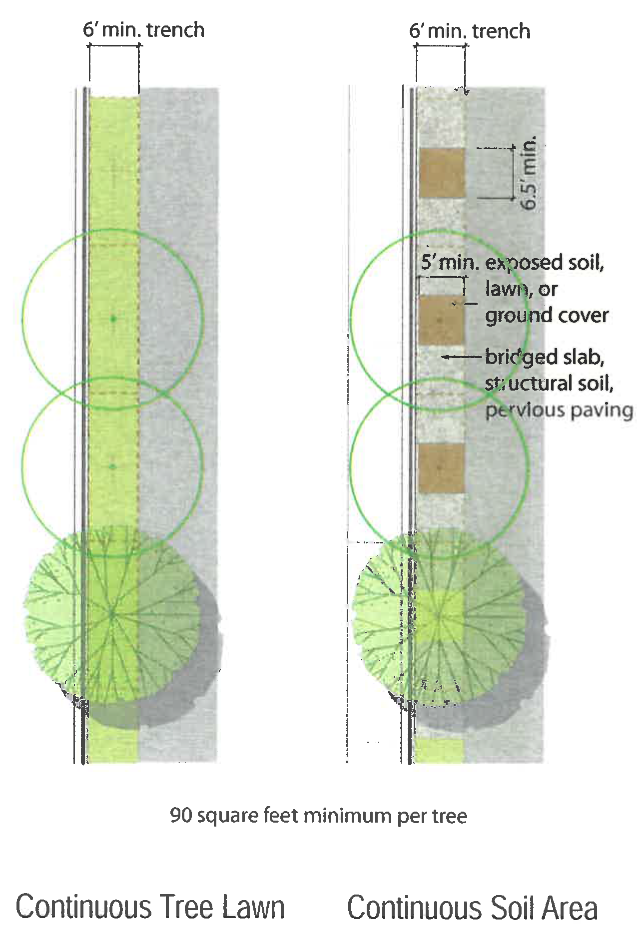
Diagram A. Connected Situation
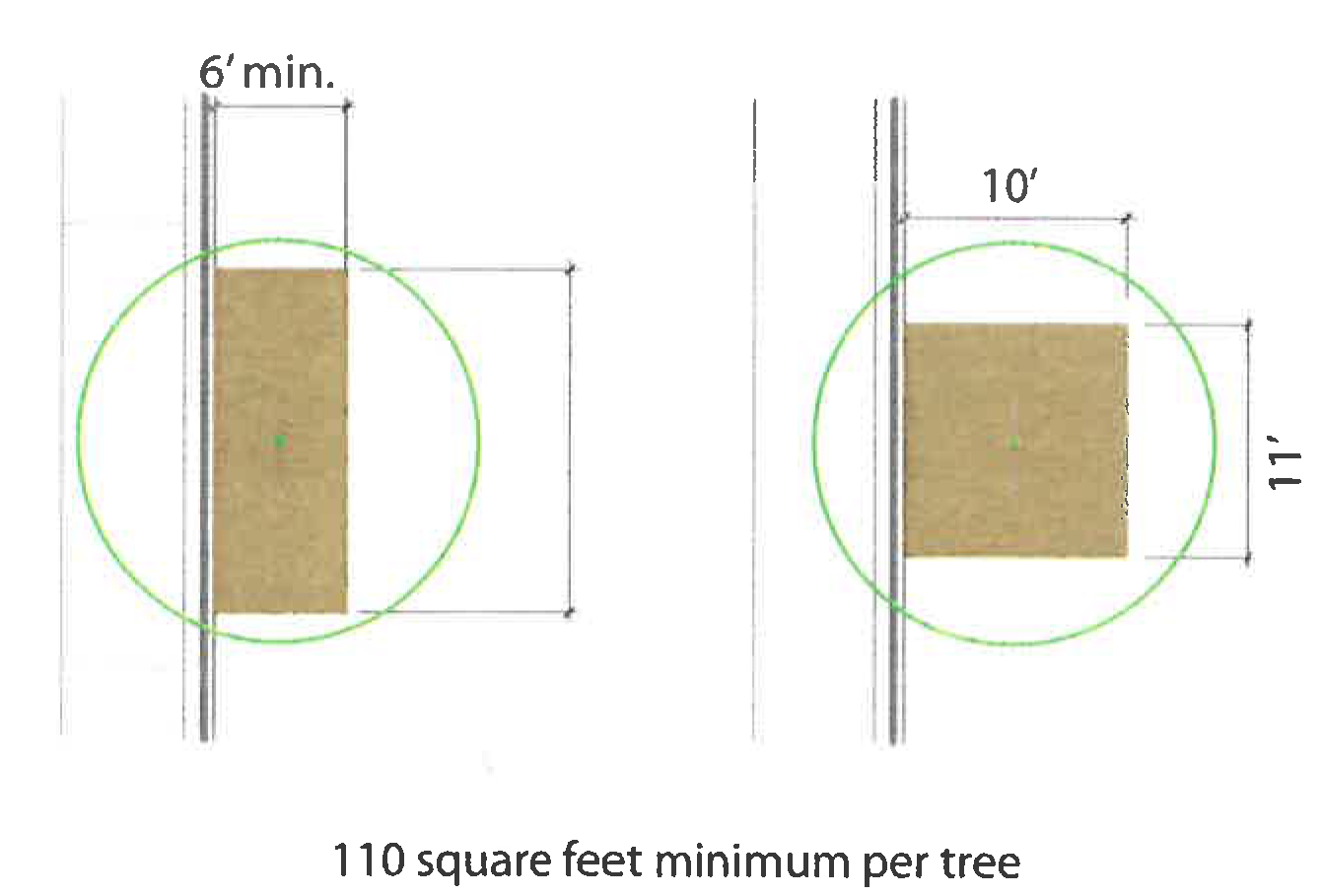
Diagram B. Isolated Tree Situation
3.
No dimension of the soil surface area may be less than five feet unless otherwise specified in this article.
4.
A pervious paving strip, maximum 18 inches wide, may be placed at the back of the curb for access to on-street parking.
5.
Neither the paving strip per 4 above, nor a city arborist approved tree grate, will be measured against the minimum soil surface area in 2 and 3 above.
C.
Street construction designs should incorporate street tree trenches (connected soil areas). The requirements in B, above may be met through the use of bridged slab, structural soil, or other techniques that clearly exceed these standards in the fostering of vital and long-lived street trees.
D.
At planting, street trees shall be at least three and one-half caliper, measured four feet above grade and at least ten feet in overall height. Species shall be selected from the G, Street tree list, below. Consult with the zoning administrator/city forester for any designated tree species for a particular street-space.
E.
Any unpaved ground area shall be planted with ground cover, or flowering vegetation, not to exceed eight inches in height unless approved by the zoning administrator as part of a streetscape plan. Street trees should be "limbed up" as they gain appropriate maturity so as to not interfere with pedestrian or truck travel (minimum seven feet clear over the sidewalk and 14 feet over any travel lanes) and to maintain visibility.
F.
Street Tree Specifications.
1.
Species in the street tree list are selected for their physical characteristics: size, habit of growth, and hardiness. The use of alternate species may be permitted, if approved by the city arborist.
2.
Noxious weeds, as defined by city ordinance, and invasive exotic species are not permitted and may not be used anywhere on private lots or other areas.
3.
The street tree list should be periodically reviewed and updated by the city arborist. These are appropriate species, but there are many regional disease patterns over time, and this list will need to evolve with those changes. Inclusion in this list shall be based on the following criteria:
a.
Structural—street trees shape and subdivide the street-space, increasing pedestrian comfort and adding (literal) value to the street/community. These are primarily "canopy shade tree" species that grow to heights in excess of 60 feet and have a broad canopy—enabling them to clear auto and pedestrian traffic, form a ceiling-like enclosure, and open a clear view of the street-space at eye-level.
b.
Survivability—proper planting techniques and configurations provide a healthy environment in which the tree can thrive—this will ensure that the trees increase their value to the community as they grow.
c.
Form and color—consistent species should be planted along a given street-space to provide it with a distinct form and character. Species diversity is important, and a variety of appropriate street tree species should be planted within the Character District, to provide a healthy bio-diversity.
G.
Street Tree List.
The following list contains all species approved for use as street trees in a Character District. The list may include additional native and/or proven hardy adapted species approved by the city arborist. Other species may be used for planting within a private lot. Species may also be placed within larger soil area locations such as parks, greens, or squares.
(Ord. No. 2994, § 9(Att. A), 11-1-2021)
Sec. 26-195.5. - Street design in character districts.
A.
Intent and Principles.
1.
In order to encourage and support pedestrian and bicycle activity in Character Districts, this section serves as guidance for the curb-to-curb street geometry of any new streets or street rebuilding, as well as the maintenance of existing streets.
2.
Streets within Character Districts should not be thought of as "roads, highways, arterials, or collectors." They should be developed to create people-oriented places balancing all transportation modes.
3.
Street design should consider the needs of all forms of traffic—auto, transit, bicycle and pedestrian—to maximize mobility and convenience for all residents and users. Street character will vary depending on location: some streets will carry a large volume of traffic and provide a more active and intense urban pedestrian experience while others will provide a less active and more intimately scaled street-space.
4.
The majority of the streets within a Character District will have a lower intensity, and should be configured such that in-lane bicycle travel is encouraged and appropriate.
B.
Principles for Street Design in Character Districts.
The appropriate design of streets is one of the most important elements for a vital urban environment.
• Designing for continuous free-flowing traffic creates situations where vehicles will travel at speeds greater than desirable for pedestrians.
• With appropriate street designs, drivers choose slower speeds and less aggressive behavior, a feat typically not achieved through basic speed limit signage/postings.
• An interconnected street network allows traffic capacity to be diffused and maintained across numerous streets.
• Differences between "requirements" and "preferences" can be significant—increased lane width and the accompanying increased vehicle speed more often than not decreases the overall safety for pedestrians.
• On-street parking slows passing vehicular traffic and acts as a buffer between moving vehicles and pedestrians.
• Overall function, comfort, safety and aesthetics of a street are more important than efficiency alone.
• In a Character District, non-vehicular traffic should be provided with every practical advantage so long as safety is not adversely affected.
• Street design should take into consideration what is reasonably foreseeable, not every situation that is conceivably possible.
• Designing a street to facilitate (rather than accommodate) infrequent users may actually be the wrong design for the frequent users of the space.
• When the street design creates a conflict between the vehicular and non-vehicular user, it should be resolved in favor of the non-vehicular user.
• Emergency vehicle access must be maintained. With an interconnected street network, there will always be at least two routes of access to any lot or parcel.
(Ord. No. 2994, § 9(Att. A), 11-1-2021)
Sec. 26-196. - Character district parking and loading.
A.
Intent.
1.
Promote a "park once" environment within each Character District that will enable people to conveniently park and access a variety of commercial, residential, and civic enterprises in pedestrian friendly environments by encouraging shared parking.
2.
Reduce fragmented, uncoordinated, inefficient, reserved single-purpose parking.
3.
Avoid adverse parking impacts on neighborhoods adjacent to Character District mixed-use areas.
4.
Utilize on-street parking.
5.
Provide flexibility for redevelopment of small sites and for the preservation or reuse of historic buildings.
6.
Increase visibility and accessibility of publicly available parking.
7.
Support and encourage a multi-modal, bicycle and pedestrian-friendly environment.
B.
Other Applicable Regulations.
Pervious surfaces approved by the city engineer are encouraged for surface parking lots.
C.
General Urban, General Urban 2, and Storefront Frontages—Minimum Parking Requirements.
1.
Existing buildings fronting Main Street between 1st Street and 6th Street at the time of the Downtown Character District adoption are exempt from these minimum parking requirements, regardless of use.
2.
There is no minimum parking requirement for:
a.
Ground floor commercial space;
b.
The re-use or renovation of an existing structure, in addition to those on Main Street identified in Item C. 1. above, in which there is no gross floor area expansion and the use [is/remains] nonresidential.
3.
Minimum reserved parking.
Reserved parking includes all parking that is not shared parking.
a.
Commercial/civic uses: There is no minimum requirement for reserved parking.
b.
Residential uses in mixed-use or multi-unit buildings: 0.75 spaces per bedroom, but not less than one space per dwelling unit. Note: studio/efficiency units shall count as one bedroom for the purpose of calculating required parking.
Note: In calculating the total number of minimum reserved spaces per building, any partial spaces .5 or above are rounded to the next whole number.
c.
Residential uses in single-unit attached and detached, multi-unit rowhouse, and two-unit configurations—minimum reserved parking spaces per dwelling unit:
4.
Minimum shared parking:
a.
Commercial upper stories.
(i)
Under 5,000 square feet nonresidential gross floor area (GFA) has no minimum shared parking requirements.
(ii)
Five thousand square feet or greater, nonresidential GFA shall provide a minimum of 1.25 spaces per 1,000 square feet as shared parking.
b.
Residential uses-dwellings in mixed-use or multi-unit buildings.
A minimum of .25 parking space per bedroom shall be provided as shared parking.
c.
Shared parking shall be accessible to the public and designated by appropriate signage and markings as determined by the zoning administrator in consultation with the ZRC.
5.
Achieving parking requirements:
a.
Parking shall be located and configured in compliance with the parking setback line or other regulations for the site on which it is located, as indicated on the applicable Character District regulating plan and/or building form standard. (See section 26-193.)
b.
Required reserved parking spaces for General Urban, General Urban 2, and storefront frontages shall only be permitted on-site or as an accessory use on an adjacent parcel or a parcel directly across an alley from the development it is serving, if that parcel is also designated as a General Urban, General Urban 2, or storefront frontage. Such reserved parking shall be subject to a long-term agreement acceptable to the city. Any such off-site surface spaces shall be located and configured as per Item a. above.
c.
Minimum shared parking requirements may be met either on-site or within a 600-foot walking distance of the development.
d.
Any time or hour of the day restrictions on shared parking shall be subject to approval by the zoning administrator in consultation with the ZRC. The administrator may give approval based on a finding that:
(i)
The parking is visibly designated and accessible to the public;
(ii)
At least 12 hours of public parking are provided in any 24-hour period; and
(iii)
That at least eight of those hours are provided during either business or nighttime hours depending on whether the administrator determines that the primary use will be for commercial or residential uses.
6.
Bicycle parking:
a.
For commercial, the developer must provide one employee bicycle parking rack (two-bike capacity) per 5,000 square feet of commercial floor area and one visitor/customer bicycle parking rack (two-bike capacity) per 10,000 square feet of commercial floor area. The employee and visitor racks may be co-located.
b.
For residential, the developer must provide one tenant bicycle parking rack (two-bike capacity) per five units and one visitor bicycle parking rack (two-bike capacity) per ten units. Projects under five units shall have no requirement. Required minimum tenant parking may be located within the building (but not within individual units) or in an otherwise secure location on-site.
c.
Bicycle parking facilities shall be visible to, or clearly identified for, intended users. The bicycle parking facilities shall not encroach on the clear walkway nor shall they encroach on any required fire egress.
d.
Bicycle parking spaces within the public right-of-way (typically along the street tree alignment line) may be counted toward the minimum visitor bicycle parking requirement. (For areas with constrained street-space, an optional approach is to consolidate public bicycle parking in a single dedicated on-street parking space per block face. See Figure 26-196.A.)
Figure 26-196.A. Consolidated public bicycle parking
7.
Permissive parking and loading facilities. Nothing in this article shall be deemed to prevent the voluntary establishment of off-street parking or loading facilities to serve any existing use of land or buildings, in accordance with all regulations herein governing the location, design, and operation of such facilities.
D.
Neighborhood Frontages-Minimum Parking Requirements.
1.
Minimum reserved parking:
Reserved parking includes all parking that is not shared parking.
a.
Residential uses in multi-unit buildings: 0.75 spaces per bedroom, but not less than one space per dwelling unit. Note: studio/efficiency units shall count as one bedroom for the purpose of calculating required parking.
Note: In calculating the total number of minimum reserved spaces per building, any partial spaces .5 or above are rounded to the next whole number.
b.
Minimum reserved parking spaces per dwelling unit in single-unit attached and detached, multi-unit rowhouse, two-unit, and cottage court configurations:
c.
Minimum reserved parking spaces for nonresidential uses is one space per 300 square feet.
2.
Minimum shared parking for multi-unit residential buildings is .25 per unit.
3.
Off-site parking is not permitted for any required reserved parking in Neighborhood frontages.
E.
Reserved.
F.
Parking Lot Plantings for New Development.
1.
For any surface parking lot not separated from the street-space by a building, the space between the required building line and the parking setback line shall be planted with canopy shade trees from the tree lists in section 26-195, Public realm standards. Trees shall be planted at an average distance not to exceed 30 feet on center and aligned parallel three to seven feet behind the required building line/street wall.
2.
The edge of any General Urban or Storefront frontage surface parking lot adjacent to a neighborhood frontage lot shall be screened according to the standards in section 26-193.1.F, Neighborhood manners.
G.
Loading Facilities.
1.
No loading facilities are required.
2.
Where loading facilities are provided, they shall be located to, and accessed from, the rear and/or alley side of buildings.
(Ord. No. 2994, § 9(Att. A), 11-1-2021; Ord. No. 3006, §§ 1, 2, 4-4-2022; Ord. No. 3045, § 1, 11-20-2023)
Sec. 26-197. - Building functions.
A.
Permitted Uses.
1.
All uses are classified and defined in section 26-141.
2.
Permitted uses by building form standard frontage are shown in section C, Use table, below. All uses not expressly permitted are prohibited.
3.
All uses must meet the standards of the applicable building form standard in section 26-193. Any additional development or performance standards are indicated in the section C, Use table, and provided in sections D—H below.
B.
Accessory Uses and Structures.
1.
Home occupations, as defined in this chapter, are permitted.
2.
The following accessory uses are limited to owner-occupied single-unit dwellings, regardless of the applicable building form standard frontage.
a.
Accessory dwelling units (ADUs).
b.
Bed and breakfast establishments.
c.
Day care homes.
3.
Accessory structures are permitted within the buildable area of the lot, as designated in the applicable individual building form standard.
4.
Parking is permitted within the location parameters identified on the regulating plan and applicable individual building form standard.
C.
Use Table.
This table identifies the categories of uses allowed in the ground story and upper stories for each building form standard frontage; however, some specific uses may be restricted or prohibited. All uses must comply with any other applicable standards in this Zoning Code. Additional regulations specific to the Downtown Character District are referenced in the right-hand column.
D.
General Development and Performance Standards.
The following standards apply to all Character District frontages and use categories.
1.
All permitted uses shall meet the section 26-193, Building form standard general provisions, and those standards specified in the applicable individual building form standard (BFS) pages.
2.
No civic, commercial, or institutional use is permitted above a residential use.
3.
Businesses providing drive-through services shall not have a drive-through lane or service window that abuts or faces a street-space.
4.
Drive-through services are prohibited in storefront frontage sites.
5.
For duplexes, multi-unit dwellings, and dwellings in mixed-use buildings, no more than three bedrooms are permitted per unit.
6.
Notwithstanding the provisions of any other section of this article, no existing single-unit residential structure located in the Character District shall be converted or otherwise structurally altered or expanded for the purpose of accommodating the creation or establishment of a second separate dwelling unit within, around or adjacent to the original single-unit residential structure, except for ADUs, as defined and permitted herein.
7.
All use-specific state or local certifications, permits, and licenses apply.
8.
No smoke, radiation, vibration or concussion, excessive noise, heat or glare shall be produced that is perceptible outside a building, and no dust, fly ash or gas that is toxic, caustic or obviously injurious to humans or property shall be produced.
E.
Residential Uses—Development and Performance Standards.
1.
See the General Urban and General Urban 2 building form standard frontages for configuration requirements for ground story Residential uses.
2.
A lobby serving an upper story Residential use is permitted on the ground story within the shopfront space of a storefront frontage site.
3.
Residential dwelling units are not permitted within the required minimum depth for the shopfront space in a storefront frontage site.
4.
Mobile home parks are prohibited.
5.
Fraternity and sorority uses are prohibited.
6.
Group homes and assisted group living uses are subject to all Iowa law requirements and certifications.
F.
Commercial Uses—Development and Performance Standards.
1.
Amusement and recreation, commercial assembly.
a.
Only indoor amusement and recreation uses are permitted.
b.
Adult entertainment is prohibited.
c.
Theater, auditorium, and arena uses shall meet the ground story fenestration requirements of the applicable building form standard, but are exempt from the upper story fenestration requirements.
d.
The lobby serving a commercial assembly or indoor amusement and recreation use is permitted in the shopfront area of a storefront frontage.
2.
Animal sales and service.
No outdoor kennels, play, or exercise areas are permitted.
3.
Eating and drinking establishments.
a.
A restaurant use is permitted in the second story of a storefront or General Urban frontage site provided it is an extension of the same restaurant and the second story floor area is equal to or less than the ground story floor area of the same use.
b.
Outdoor areas for eating and drinking shall be allowed on the public sidewalk and in private outdoor service areas in General Urban and storefront frontages, subject to the issuance of all applicable permits and licensing.
c.
An eating/drinking establishment is permitted on the top floor level or the rooftop of a storefront frontage site or where otherwise designated on the regulating plan, where:
(i)
The use is set back from any common lot line by at least 20 feet;
(ii)
It is not above a residential use;
(iii)
No amplified sound in outdoor seating area, except by special use permit;
(iv)
The hours of operation of any rooftop seating area are limited to 8:00 a.m. to 10:00 p.m.; and
(v)
Subject to all applicable permits and licenses.
d.
The sale and consumption of beer, wine, and liquor shall be subject to all existing permitting and licensing provisions, as applicable.
e.
Live entertainment and drinking establishments are prohibited if the walls of the facility are within 100 feet of a neighborhood frontage site within the Character District or a residentially zoned property which is outside of the Character District.
4.
Financial services.
Only the retail banking services are permitted within the required minimum depth for the shopfront space in a storefront frontage site.
5.
Consumer gas stations, vehicle sales and services.
a.
Gas stations are limited to two paired pumps within a single island with a single drive aisle allowed on either side of the island, all of which must be separated from the street-space by a building.
b.
Surface parking lots for vehicle sales or rental shall only be located and configured in compliance with the parking setback line or other regulations for the site on which it is located, as indicated on the applicable Character District regulating plan and/or building form standard. (See section 26-193.)
c.
Auto repair services are not allowed except as accessory to a gas station or vehicle sales, subject to the following:
(i)
The property shall be at least 100 feet from any solely residential lot;
(ii)
Overnight vehicular storage is not permitted, unless within an enclosed building;
(iii)
The use shall not include the display and rental of cargo trailers, trucks, or similar vehicles;
(iv)
Auto body repair is prohibited;
(v)
The storage or junking of wrecked motor vehicles (whether capable of movement or not) is prohibited; and
(vi)
Discarded and replacement vehicle parts and accessories shall be stored inside the main structure.
(vii)
Upon the abandonment of the gas station or vehicle sales, the auto repair service shall terminate and all structures exclusively used in the business (including underground storage tanks), except buildings, shall be removed by the owner of the property. For the purpose of this subsection, the term "abandonment" shall mean non-operation as an auto repair for a period of six months after the retail services cease.
6.
Heavy commercial.
a.
Self-storage uses are only permitted in the upper stories of the General Urban frontages.
b.
Outdoor nursery and lumberyards are prohibited.
c.
Freight-oriented and outdoor display or storage uses are prohibited.
7.
Lodging.
a.
Ground story guest rooms are not permitted within the required minimum shopfront depth in a storefront frontage site.
b.
Ground story guest rooms abutting any required building line (or street frontage) shall meet the configuration standards for ground story residential uses as specified in the General BFS.
c.
A lobby serving an upper story overnight lodging use is permitted on the ground story of any storefront frontage site.
d.
Bed and breakfast establishments are permitted as accessory uses to owner-occupied houses in neighborhood frontages. No other overnight lodging is permitted in these frontages.
8.
Office.
a.
Office uses are not permitted within the required minimum depth for the shopfront space in a storefront frontage site.
b.
Office uses that exist in Neighborhood frontages as of January 1, 2021 are permitted and considered conforming uses. Changes to existing uses shall be in compliance with the standards and requirements of this chapter. The establishment of new office uses or structures not in association with an existing conforming use or structure is prohibited.
9.
Parking, commercial.
Commercial parking lots and structures are required to meet all building form standards for the frontage sites on which they are located.
10.
Retail sales and services.
a.
A retail sales use is permitted in the second story of a storefront or General Urban frontage site provided it is an extension equal to or less than the area of the same ground story use.
b.
No merchandise (including motorcycles, scooters, and automobiles) may be left within the dooryard when the business is not open.
c.
Only retail sales or gallery/showroom functions for cottage industries are permitted in the required minimum shopfront space of a storefront frontage.
11.
Vehicle sales and service (see gas stations, above).
G.
Civic and Institutional Uses—Development and Performance Standards.
1.
Civic buildings designed for civic uses (as defined in section 26-191, Definitions) that are located on sites specifically designated on the regulating plan are not subject to section 26-194, Architectural standards, or section 26-193, Building form standards, except for section 26-193.1.E, Neighborhood manners.
2.
Day care.
a.
All day care facilities are subject to all permitting and licensing requirements under Iowa Law.
b.
Only day care homes are permitted as accessory uses in neighborhood frontages.
H.
Industrial, Wholesale, and Storage Uses—Development and Performance Standards.
Industrial manufacturing, assembly, or processing facilities that exist as of January 1, 2021 are permitted and considered conforming uses. Changes to existing uses shall be in compliance with the standards and requirements of this chapter. The establishment of new industrial, wholesale, and storage uses or structures not in association with an existing conforming use or structure is prohibited.
(Ord. No. 2994, § 9(Att. A), 11-1-2021)
Sec. 26-219. - Off-street loading spaces.
(a)
In any district, except the C-3 Commercial District, in connection with every building or part thereof erected having a gross floor area of 10,000 square feet or more which is to be occupied by manufacturing, storage, warehouse, goods display, a retail store, a wholesale store, a market, a hotel, a hospital, a mortuary, a laundry, dry cleaning or other uses similarly requiring the receipt or distribution by vehicles of material or merchandise, there shall be provided and maintained, on the same lot with such building, at least one off-street loading space, plus one additional such loading space for each 20,000 square feet or major fraction thereof of gross floor area so used in excess of 10,000 square feet.
(b)
Each loading space shall be not less than ten feet in width and 25 feet in length.
(c)
Such space may occupy all or any part of any required yard or court space or such space as specifically provided for in the district in which it is located.
(Ord. No. 2922, § 1(29-176), 5-7-2018)
Sec. 26-220. - Off-street parking spaces.
(a)
Required, number. In all districts, and in connection with every industrial, commercial, trade, institutional, recreational or dwelling use and similar uses, space for parking and storage of vehicles shall be provided on the same lot or property where said permitted use is established, except as follows:
(1)
For a principal permitted commercial use in the C-3 Commercial District; and
(2)
For a residential use established as a permitted secondary, incidental or accessory use to a principal permitted commercial use in the C-3 Commercial District, such as for a dwelling unit or units located on the second or higher floor of a building, the first or lower floor of which comprises the principal permitted commercial use, subject, however, to review and approval by the planning and zoning commission and city council. Such review and approval shall include consideration of whether the proposed residential use is indeed secondary, incidental or accessory to a principal permitted commercial use of the structure or property.
a.
Review by the planning and zoning commission and city council shall include consideration of traffic patterns, both pedestrian and vehicular, adequacy of screening, compatibility with adjacent land uses and construction of fixtures in accordance with the aesthetics of the neighborhood and accepted civic design principles. All off-premises parking areas or parking lots shall be located within a reasonable distance from the principal use in question. During the course of review of off-premises parking areas or parking lots, the commission may recommend and the city council may require any improvements or fixtures to the parking area or lot, including hard surfacing, landscaping, screening, lighting, stormwater detention, etc., that will help to ensure compatibility with adjacent land uses.
b.
In addition, space for parking and storage of vehicles shall be provided in accordance with the following schedule. If the off-street parking requirement as specified herein is to be satisfied with open, surface parking or garage parking, or a combination of these options, parking must be made available for parking use by the occupants:
1.
Animal hospitals, kennels and animal grooming shops. One parking space per doctor, plus one parking space for every two employees and one parking space for every 400 square feet of gross floor area excluding dog confinement areas.
2.
Automatic carwash. Five stacking spaces for each washing bay, one stacking space for each vacuuming unit, plus one parking space for every two employees.
3.
Automobile, machinery or equipment sales. One parking space for every 500 square feet of gross floor area, plus two parking spaces for each service stall and one parking space for every two employees.
4.
Banks, businesses and professional offices. Not less than one parking space for every 300 square feet of gross floor area, but in no case less than five parking spaces. Each drive-up window shall provide three stacking spaces per teller.
5.
Barbershops and beauty parlors. Two parking spaces per operator.
6.
Boardinghouse and roominghouses. Not less than one parking space per guestroom and/or sleeping room.
7.
Bowling alleys. Five parking spaces for each bowling lane.
8.
Church or temple. One parking space for every eight lineal feet of pew seating or for every four potential occupants in the principal auditorium or, where no auditorium is provided, one parking space for every 80 square feet of gross floor area.
9.
Community center, museum or art gallery. One parking space for every 200 square feet of gross floor area, or one parking space for every five potential occupants in the building, whichever is greater.
10.
Convenience store. One space for every 100 square feet of retail floor space plus one space for every two employees. If fuel dispensing pumps or car wash is established in conjunction with said use the stacking space requirements for each use as specified in this division shall apply.
11.
Dance, assembly, skating rink or exhibition halls without fixed seats, including auction houses. One parking space for every four potential occupants in the building as determined by the uniform building code for maximum occupancy load plus one space for every two employees with a minimum of five spaces for employee parking.
12.
Dwelling, single-unit, including mobile home units. Two parking spaces per dwelling unit.
(i)
Dwelling, single-unit, renter-occupied, including renter-occupied mobile home units. Two parking spaces per dwelling unit, plus one additional parking stall for each bedroom in excess of two bedrooms.
(ii)
Dwelling, two-unit, including single-unit bi-attached dwellings, multi-unit dwellings including condominiums and apartments, but not including nursing homes, convalescent homes, elderly housing or housing for handicapped. Two parking spaces per dwelling unit, plus one additional parking space for each bedroom in each dwelling unit in excess of two bedrooms. One additional stall shall be provided for every five units in excess of five units for visitor parking.
13.
Fraternity house, sorority house or dormitories. Not less than five parking spaces, plus one stall for every two residents in excess of four residents.
14.
Fuel service station. Two parking spaces for each service stall, plus three stacking spaces for each fuel dispensing pump.
15.
Funeral homes and mortuaries. One parking space for every three potential occupants in the principal auditorium, or, where no auditorium is provided, one parking space for every 50 square feet of gross floor area or five parking spaces for each parlor, whichever is greater.
16.
Furniture, appliance, hardware and household equipment stores. One parking space for every 750 square feet of gross floor area, plus one parking space for every two employees.
17.
Game rooms, pool halls and billiard parlors. One and one-half parking spaces for every 100 square feet of gross floor area for any establishment other than one with a liquor license or beer permit.
18.
Golf courses. Four parking spaces per hole. All other commercial or recreational land uses established in conjunction with a golf course, not incidental to the sport of golf, shall be subject to the parking regulations regarding that use.
19.
Hospitals. One parking space for every five beds, plus one parking space for every two employees and one parking space for every two staff doctors.
20.
Hotels, motels or lodginghouses. Not less than one parking space for each guestroom, plus one parking space for every 200 square feet of commercial, assembly or meeting area, and one parking space for every 150 square feet of lounge, coffee shop or restaurant gross floor area, plus one stall for every two employees.
21.
Housing for elderly or handicapped. One and one-half parking spaces for every dwelling unit, plus one stall for every two employees.
22.
Junkyard. Two parking spaces per acre, plus one space for every two employees.
23.
Libraries. One parking space for every 250 square feet of gross floor area in public use, plus one parking space for every two employees.
24.
Manufacturing, research and industrial plants. Four parking spaces for every 10,000 square feet of gross floor area, plus one parking space for every three employees.
25.
Medical or dental clinics. Five parking spaces, plus one additional parking space for each 200 square feet of gross floor area over 1,000 square feet.
26.
Mini-centers, retail stores, shops, etc., under 2,000 square feet in gross floor area. One parking space for every 200 square feet of gross floor area, but in no case less than five parking spaces.
27.
Miniwarehouse. One parking space for every ten storage units, stalls or lockers equally distributed throughout the storage area, plus two parking spaces located at or near the project office for use by prospective customers. A minimum of 35 feet between warehouse buildings for driveway, parking and fire lane purposes is required. When storage units within warehouses do not front one another, a minimum 25-foot drive for driveway, parking and fire lane purposes is also required.
28.
Nursing care, retirement or convalescent homes. One parking space for every five beds, plus one parking space for every two nonresident employees and one parking space for every one resident staff.
29.
Printing, plumbing shop, heating shop or other similar service establishments. One parking space for every two employees therein, plus one parking space for each service vehicle. If retail trade is carried on in the establishment, one additional parking space shall be provided for every 200 square feet of retail floor area.
30.
Restaurant, fast food, drive-in or carryout. One parking space for every 100 square feet of gross floor area, plus one parking space for every two employees with a minimum of five parking spaces for employee parking. Where drive-up window facilities are proposed, five stacking spaces shall be provided per window.
31.
Restaurant (standard eat in). One parking space for every 150 square feet of gross floor area, plus one parking space for every two employees, with a minimum of five parking spaces for employee parking.
32.
School, college or high school. Each separate building requires one parking space for every five potential occupants in the main auditorium or one parking space for every five students and one parking space for every staff member, whichever is greater.
33.
School, daycare, preschool, elementary or junior high school. One parking space for every ten potential occupants in the auditorium or main assembly room, or one parking space for each classroom, whichever is greater.
34.
Seasonal camp or cabins. One parking space for every cabin, sleeping unit, campsite lot or two beds, whichever is greater.
35.
Shopping centers or retail stores, shops or supermarkets over 2,000 square feet in gross floor area; 4½ parking stalls per 1,000 square feet of gross floor area.
36.
Sports arena, stadium, gymnasium, theater or auditorium for other than schools. One parking space for every four potential occupants plus one space for every two employees with a minimum of five spaces for employee parking.
37.
Taverns, bars and nightclubs. One parking space for every 100 square feet of gross floor area, plus one parking space for every two employees with a minimum of five parking spaces for employee parking.
38.
Telemarketing office. Not less than one parking space for each 150 square feet of gross floor area, but in no case less than five spaces.
39.
Tennis and racquetball courts. Two parking spaces per court.
40.
Union headquarters, private clubs or lodges. One parking space for every five potential occupants of the building.
41.
Wholesale establishments or warehouses. One parking space for every two employees, but in no case less than one parking space for every 1,000 square feet of gross floor area.
(b)
Rules for computation of required parking spaces. In computing the number of parking spaces required, the following rules shall apply:
(1)
Gross floor area. Gross floor area shall mean the floor area of the specific use and its associated incidental uses within the exterior walls of a building or portion thereof, exclusive of vent shafts, open air courts and any portion of a structure above or below ground used for off-street parking, loading areas or mechanical equipment not incidental to the specific use such as furnaces, air conditioners, elevators, etc. In addition, other nonessential areas of the gross floor area may be deducted including storage areas, closets, bathrooms, etc., to a maximum of ten percent of the total gross floor area.
(2)
Fractional number of spaces. Where fractional spaces result, the parking spaces required shall be the next higher whole number.
(3)
Uses not specifically provided for. Where the parking space requirement for a use is not specifically mentioned in this section, the required number of spaces shall be that of a similar use as determined by the city planner.
(4)
Joint or mixed uses. In the case of mixed or joint uses, the parking spaces required shall equal the sum of the requirements for each use computed separately.
(5)
Determination of seating capacity. When the unit of measurement determining the number of required parking spaces is based upon the seating capacity of a structure or use, each 24 inches of a pew, bleacher or bench or other seating shall count as one seat.
(6)
Determination of number of employees. When the unit of measurement determining the number of required parking spaces is based on the number of employees, the maximum shift or employment period during which the greatest number of employees are present at the structure or use shall be used in the computation.
(7)
Unknown uses. Where new buildings are proposed but the owner or developer does not wish to designate the type of use that will occupy the building, the most intensive use possible with relation to parking in the zoning district shall determine the parking requirements.
(8)
Potential occupants. The maximum number of potential occupants shall be based upon the assumption that 15 square feet of gross floor area is required per occupant, as documented within the Life Safety Code for places of assembly.
(9)
Stacking space. All stacking spaces shall be nine feet in width and 19 feet in length and shall not prohibit ingress or egress to any driveway, public street, access aisle or parking space at any time. Stacking spaces may include the vehicular space situated at the point of service.
(10)
Tandem parking. Vehicles may be parked in tandem, or one directly behind the other, in conjunction with single-unit, duplex and mobile home residences. Parking spaces inside carports or garages may be counted as part of the space requirement and may be used in tandem. Tandem stalls shall mean no more than two stalls arranged one in front of the other.
(c)
Access. Access to all parking areas and lots from streets, alleys and other adjacent areas shall be provided by an access drive not less than ten feet in width for single-unit dwellings or one-directional traffic flow and not less than 18 feet in width in all other cases.
(d)
Applicability of section. Whenever a building or use existing prior to September 26, 1983, is enlarged in floor area, number of employees, number of dwelling units, seating capacity or otherwise, the building or use in its entirety shall then and thereafter comply with all the requirements set forth in this section. All new buildings or uses constructed or established after September 26, 1983, shall comply with the requirements of this section prior to occupancy. A change in use shall mean any change where the new use established requires a greater number of on-site parking spaces than was required for the prior use. However, if the prior use did not provide minimum off-street parking, then parking spaces shall be provided as specified herein before the new use is established.
(e)
General development standards. Every parcel of land used as a public or private parking area, parking space or parking lot, including a commercial parking lot, shall be developed and maintained in accordance with the following requirements:
(1)
With the exception of parking garages or structures and driveways serving residential uses, all parking lots containing three or more parking spaces shall provide minimum setbacks and landscaping as specified herein. Parking structures or ramps (above or below ground) located on a parcel as a principal permitted use shall meet the minimum building setback requirement of other principal permitted structures within the zoning district where located. When parking spaces are provided within accessory structures, the setbacks for accessory structures shall apply.
(2)
All parking lot setback areas, as specified herein, shall be an open, permeable area consisting of landscaping, natural vegetation ground cover or other type of natural ground cover. No vehicle parked in an adjacent parking space shall be permitted to encroach into any portion of said required setback area.
(3)
Parking lots shall be hard surfaced. Their design shall be based on the amount, type and weight (axle loads) of anticipated traffic, the quality of the surfacing to be used and the supporting strength and character of the subgrade, all applied to a parking lot layout as selected by the designer and approved by the city engineering division.
(4)
Any portion of property that is graded or improved in any fashion to accommodate vehicular parking or is intended or commonly used for vehicular parking shall meet parking lot design standards as specified herein. Any existing parking lot or parking area that does not meet existing standards as specified herein shall not be enlarged or expanded unless the entire parking lot area or parking area meets parking lot design standards as specified herein.
(5)
All accessways or driveways to parking areas or parking lots shall be hard surfaced. Unimproved driveways or accessways in existence at the time of enactment of this division shall be hard surfaced only in the event that the on-site parking lot is expanded, hard surfaced or otherwise upgraded.
(6)
All parking lots shall be arranged and marked in a manner which provide safe and orderly loading, unloading, maneuvering, parking and storage of self-propelled vehicles. Parking spaces shall be provided in accordance with the following minimum requirements:
a.
Parking spaces shall not be less than nine feet in width and 19 feet in length for all nonresidential uses including hotels and other temporary lodging facilities. All residential uses, including multiple unit residences, shall provide parking stalls measuring not less than eight feet in width and 18 feet in length. Compact car spaces shall not be less than eight feet wide and 16 feet in length. Fifteen percent of the parking space requirement may consist of compact car parking spaces in lots which have more than ten stalls. All compact car spaces shall be clearly identified by signs. Where fractional spaces result, the number of permitted compact car spaces shall be rounded to the next higher number.
b.
Handicapped parking shall be provided in accordance with the requirements of the state in Iowa Code ch. 321L.
c.
Buildings and facilities required to provide handicapped parking spaces shall set aside at least one such space. Each space shall be clearly designated as a handicapped parking space by the display of the international symbol of accessibility both in front and within the stall. Parking spaces for handicapped persons and accessible loading zones that serve a particular building shall be located on the shortest accessible route to an entrance to the building. Federal ADA requirements, if more restrictive, shall apply.
d.
The property owner shall be responsible for the continued maintenance of the parking lot, including fences, landscaping, all signs, surface material, surface markings and other forms of traffic control.
e.
Maneuvering space required to permit safe and convenient parking of motor vehicles shall be provided in accordance with the minimum requirements of table 1 for a nine-foot by 19-foot stall.
TABLE 1
(7)
When an accessway or driveway intersects a public right-of-way or when a parking lot, area or space abuts any public right-of-way, screening or landscaping shall not exceed three feet in height above the driveway surface and no structure, sign or vehicle shall be allowed in the triangular area formed by:
a.
The area of property located at a corner formed by the intersection of two public rights-of-way, excluding alleys, with two sides of the triangle being 30 feet in length along the abutting public right-of-way lines measured from their point of intersection and the third side being a line connecting the ends of the other two lines. (See figure 2.)
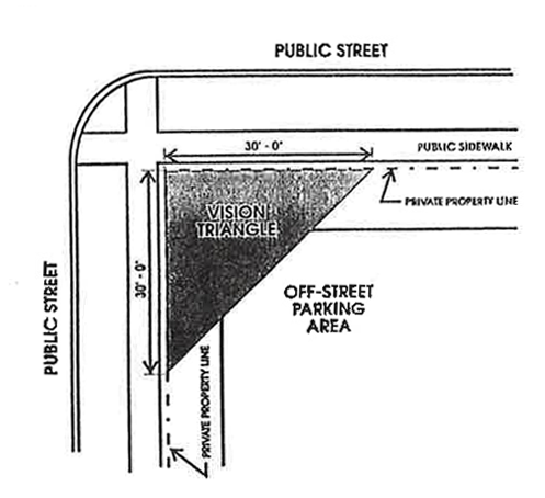
Figure 2—30-Foot Vision Triangle
b.
The areas of property on both sides of an accessway, driveway or alley formed by an intersection with a public right-of-way, with two sides of each triangle being formed by lines a distance of ten feet in length from the point of intersection and with the third side being a line connecting the ends of the ten-foot sides. (See figure 3.)
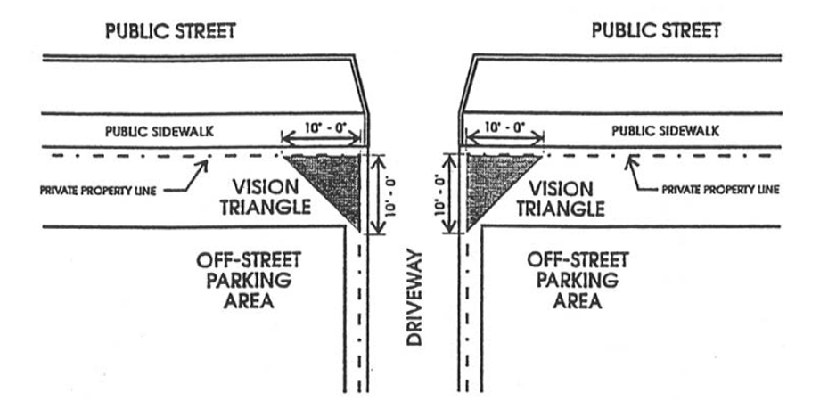
Figure 3—10-Foot Vision Triangle
(8)
All parking spaces shall be designed to prohibit any vehicle from backing into a public right-of-way to obtain ingress or egress, except when the space is used in conjunction with a single-unit or duplex dwelling unit.
(9)
Any lighting used to illuminate any off-street parking area, including any commercial parking lot, shall be provided on private property and shall reflect the light away from adjoining residential premises or from any R district.
(10)
Accessways or driveways shall be situated no closer than three feet from any private property line.
(11)
Curbing. With the exception of driveways or garages that meet the parking requirements for residential uses, all newly constructed parking lots containing ten or more parking spaces shall provide continuous concrete curbing measuring at least six inches in height around the entire perimeter of said parking lot except at points of ingress, egress and drainage locations. Said continuous curbing shall be established at that portion of the parking space to serve as a wheel block or barrier in order to prevent the vehicle from overhanging into the required setback area. Vehicular overhang as measured from the front tires shall be considered to be two feet. Continuous curbing can be substituted with individual wheel blocks or wheel barriers only in the following situations:
a.
A parking lot is designed to contain fewer than ten parking stalls.
b.
A parking lot containing ten or more parking stalls provides a setback area on all sides at least double the minimum required setback.
(12)
Prior to the installation, enlargement, resurfacing or other improvement of any parking lot a plan shall be submitted for review and approved by the city engineering division and the Cedar Falls Utilities.
(f)
Standards for lots in C or M districts.
(1)
In any C commercial or M industrial zoning district abutting an R residence district, off-street parking lots will be permitted in accordance with the following requirements: A six-foot-high screen consisting of a fence, wall or plant material of mature height shall be installed and continually maintained when a parking lot or area abuts an R residential zoning district, except in any required front yard or along any street or alley, where the screen shall be no more than four feet in height. All screening shall comply with the landscaping provisions found in this division.
(2)
All parking lots in C or M zoning districts containing three or more parking spaces shall be hard surfaced, shall meet stormwater detention requirements, shall provide a continuous curb (six inches or more) around the perimeter of the parking lot, and shall be marked properly to indicate the location of parking spaces and driveway aisles.
(g)
Standards for R districts. In any R residence district, off-street parking lots shall be developed and maintained in accordance with the following requirements:
(1)
An off-street parking lot located in an R residence district shall provide the front yard and the required side yards in accordance with the district in which it is located. Furthermore, the minimum rear yard setback shall be five feet. The front yard, the required front yard and the required side yards may be used for vehicular access to the parking lot, for fences, walks, or landscaping only. No vehicular parking is permitted in the front yard, in the required front yard or in the required side yard. Where a contiguous development of lots is used for parking purposes under one ownership, no side or rear yards shall be required for abutting parking lots on the common lot line.
(2)
Off-street parking lots in any R residence district shall provide screening on all yards of the abutting lots. The screen shall be six feet high and consist of a fence, wall or plant material of mature height, except that, when the screen is in the front yard or when the screen is maintained along an alley or street right-of-way line, then the screen shall be no more than four feet in height. All screening shall comply with the landscaping provisions found in this division.
(3)
All parking lots containing three or more parking spaces shall be hard surfaced, shall meet stormwater detention requirements, shall provide continuous curbing or wheel blocks for each parking space, and shall be marked properly to indicate the location of parking spaces and driveway aisles.
(4)
Every parking area or parking lot must have a connecting driveway that meets the regulations of this zoning chapter.
(5)
Any new parking areas, parking lots or paved surfaces in R-1, R-2, R-3 1, R-4, RP, MU zoning districts that are converted to parking, must meet all requirements specified in this section, prior to use for parking.
(6)
Parking areas or parking lots in rear yards shall meet the following requirements:
1 For all single- and two-unit dwellings.
(7)
In the case a parking area or parking lot cannot meet the provisions of section 26-220(g)(6), then review and approval by the city council after recommendation of the city planning and zoning commission is required. The criteria for which additional rear yard parking coverage could be considered include the following:
a.
The request serves the existing building use, not an expansion;
b.
The maximum rear yard coverage shall not be increased by more than five percentage points above the percentage listed in the table in subsection (g)(6) of this section;
c.
Determination that the character of the neighborhood surrounding the property would not be diminished by the increase in parking area and corresponding reduction of open space;
d.
The lot width and lot area of the property are sufficient to accommodate the density of occupants and vehicles that would result from the parking lot or area;
e.
Whether buffering of parking meets code; and
f.
All other city codes are met, including, but not limited to, the housing, property maintenance, nuisance, rental housing, building, and fire codes.
(h)
Parking lot setbacks. Where setbacks required by this section impose a greater restriction than is imposed or required by other provisions of law or by other rules or regulations or ordinances, the provisions of this section shall control.
(1)
Residential districts. Required setbacks for parking lots in residential zoning districts are as follows:
a.
The required setback is three feet along any alley, five feet along any street right-of-way line, and five feet along any adjacent property line.
b.
The front yard and the required side yards shall be provided in accordance with the underlying zoning district. The front yard, the required front yard and the required side yards may be used for access to the parking lots, for fences, walks or landscaping only. No vehicular parking is permitted in the front yard, in the required front yard or in the required side yard.
c.
Individual driveways intended for exclusive use by one-unit dwellings, duplexes, mobile homes, townhouses or multi-unit dwelling units shall not be classified as parking lots and shall not be required to restrict vehicular parking in the front yard, in the required front yard or in the required side yard upon said driveway as described herein. However, said driveways serving detached residential structures, detached garages, or parking lots shall provide a minimum three-foot setback from adjacent property lines and shall meet the provisions of section 26-222, unless the driveway is an existing shared drive where the minimum driveway width can only be met by encroaching into said three-foot setback area.
d.
All yards and required yards as described herein shall consist of permeable material (grass, wood chips, loose rock, or other ground cover material) and be screened in accordance with the landscaping requirements found within this section, and with the exception of driveways, parking lots and patios, no yard area shall be hard surfaced.
(2)
Commercial and manufacturing districts. Required setbacks in commercial and manufacturing districts are as follows: All parking lots in C or M districts shall provide a minimum setback as measured from the private property line to the edge of the hard surface parking area with no vehicular overhang allowed within said setback area. The minimum setbacks shall be:
a.
Five feet when adjacent to a public right-of-way, with the exception when adjacent to a public alleyway, in which case no less than three feet setback shall be required.
b.
Three feet when adjacent to an abutting commercial use or commercial property including an adjacent commercial parking lot.
c.
Five feet when adjacent to a residential use in a commercial or industrial district.
d.
Ten feet when adjacent to an R, residential zoning district.
e.
Residential uses established in a C or M district as a principal use shall provide minimum front yard and side yard setbacks as specified in the R-4 zoning district with no vehicular parking permitted in said required yard areas.
f.
All setback areas shall consist of permeable material (grass, wood chips, loose rock or other ground cover material) and be screened in accordance with the peripheral landscaping requirements as stated herein.
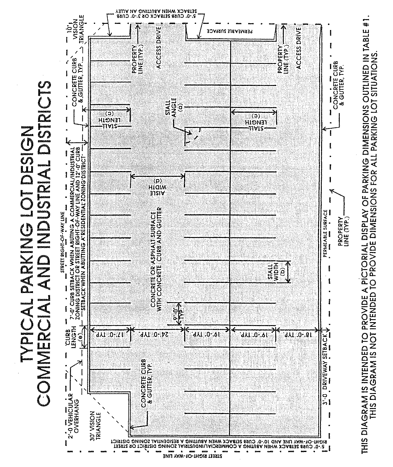
Figure 4
(i)
General landscaping of parking within districts. Landscaped off-street parking lots shall be required within all districts in order to protect and preserve the appearance, character and value of the surrounding neighborhoods, to reduce wind and air turbulence, heat and noise and the glare of vehicular lights, to act as a natural drainage system and ameliorate stormwater drainage problems, to provide shade and to otherwise facilitate the creation of a convenient, attractive and harmonious community.
(1)
Applicability of landscaping requirements. Landscaping requirements contained within this section shall apply to:
a.
New off-street parking lots containing three or more parking spaces.
b.
Existing off-street parking lots containing three or more parking spaces which are effectively altered or enlarged, in whole or in part, other than normal maintenance, repairs, or resurfacing of an existing lot.
(2)
No parking lot containing three or more parking spaces shall be constructed or enlarged in the city until a landscape plan for the parking lot has been approved by the city planner and the city arborist or their designees. Landscape plans submitted pursuant to this section shall not be approved unless they conform to the requirements of this section and, where appropriate, may be submitted as part of the site plan submittal required within other sections of this division. Landscape plans shall be drawn to scale, including dimensions and distances, and clearly delineate the existing and proposed parking spaces or other vehicular use areas, access aisles, driveways, and the location, size and description of all landscape materials.
(3)
The primary landscaping materials used in parking lots shall be trees which provide shade or are capable of providing shade at maturity. Shrubbery, hedges and other planting material may be used to complement the tree landscaping, but shall not be the sole contribution to the landscaping. Effective use of earth berms and existing topography is also encouraged as a component of the landscape plan. In those instances where plant material exists on a parking lot site prior to its development, such landscape material may be used if approved as meeting the requirements of this division.
(4)
Landscaping shall be classified as either internal or peripheral. The following coverage requirements shall pertain to each classification:
a.
Peripheral landscaping. All parking lots containing three or more parking spaces shall provide peripheral landscaping. Peripheral landscaping shall consist of a landscaped strip not less than five feet in width, exclusive of vehicular obstruction, and shall be located between the parking area and the abutting property lines. One tree for each 50 lineal feet of such landscaping barrier or fractional part thereof shall be planted in the landscaping strip. At least one tree shall be planted for every parking lot (such as a three-stall parking lot) regardless of the lineal feet calculation. In addition to tree plantings, the perimeter of the parking lot shall be screened with shrubbery or similar plantings at least three feet in height as measured from the finished grade of the parking lot at the time of planting for purposes of vehicular screening. The vegetative screen should present a continuous, effective visual screen adjacent to the parking lot for purposes of partially obscuring vehicles and also deflecting glare from headlights. If landscaped berms are utilized, the berm and vegetative screening must achieve at least a three-foot-tall screen at time of installation as measured from the grade of the finished parking lot. Each such planting area shall be landscaped with grass, ground cover or other landscape material excluding paving, gravel, crushed asphalt or similar materials, in addition to the required trees, shrubbery, hedges or other planting material. Existing landscaping upon abutting property shall not be used to satisfy the requirements for said parking lot screening requirements unless the abutting land use is a parking lot. Exceptions:
1.
Peripheral landscaping shall not be required for single-unit or two-unit residential structures where the primary parking area is designed around a standard front entrance driveway and/or attached or detached residential garage. However, if an open surface parking lot containing three or more parking stalls is established in the rear yard of a two-unit residential structure, the perimeter landscaping/screening requirements as specified herein shall apply.
2.
Peripheral landscaping shall not be required for parking lots that are established behind building structures where the parking lots do not have any public street or alley frontage or is not adjacent to any open properties such as private yards, parks or similar open areas. Examples of such a parking lot would be one designed with a multiple unit apartment facility where the parking lot is encircled with building structures within the project site and where the parking lot is completely obscured from public view by building structures.
3.
Underground or under-building parking lots.
4.
Aboveground parking ramps shall provide perimeter screening as specified herein around the ground level perimeter of the parking structure.
b.
Internal landscaping. All parking lots measuring 21 parking stalls or more shall be required to landscape the interior of such parking lot. At least one overstory tree shall be established for every 21 parking stalls. Each tree shall be provided sufficient open planting area necessary to sustain full growth of the tree. Not less than five percent of the interior of the parking lot shall be provided as open space, including the tree planting areas. These additional open space areas must be planted with bushes, grasses or similar vegetative materials. Each separate open green space area shall contain a minimum of 40 square feet and shall have a minimum width dimension of a least five feet.
c.
Exceptions. Interior landscaping shall not be required for vehicular storage lots, trucking/warehousing lots or for automobile sales lots. However, perimeter landscaping/screening provisions, as specified herein, shall be required for all such parking areas when they are installed or enlarged in area.
d.
Parking garages or parking ramps. All such facilities where one or more levels are established for parking either below ground or above ground and where structural walls provide for general screening of parked vehicles, internal landscaping shall not be provided.
It is the intent of this regulation that in parking development sites open green space and landscape areas should be distributed throughout the parking development site rather than isolated in one area or around the perimeter of the parking lot. Trees and shrubs planted within parking areas shall be protected by concrete curbs and provide adequate permeable surface area to promote growth and full maturity of said vegetation.
(5)
No materials shall be approved for use in any parking lot landscaping plan unless approved by the city planner and city arborist. A list of generally permissible plants is on file in the office of the city planner and the city arborist. Landscaping plant materials found unsuitable by the city planner and the city arborist for planting in the city shall not be permitted.
(6)
All required screening shall be in place, inspected and approved by the city planner and the city arborist or their staff designees prior to issuance of an occupancy permit. However, installation prior to occupancy may be waived by the city planner and the city arborist if inclement weather conditions or the planting and growing season prohibit installation. In such cases, the owner may be issued a temporary certificate of occupancy by the city planner if the owner enters into a contract with the city to ensure completion of the screening during the next planting season. The performance of such contract shall be secured by the filing of a bond or cash in escrow in an amount not less than the approximate cost of the screening, as estimated by the owner's landscape architect, landscape contractor or nurseryman and approved by the city planner and the city arborist.
(j)
Definitions pertaining to landscape requirements. When computing the type and amount of landscaping required, the following definitions shall apply:
(1)
Tree means any self-supporting woody plant which usually produces one main trunk and a more or less distinct head with many branches that establishes a mature height in excess of 30 feet.
a.
Deciduous trees shall measure a minimum of 1½ inches in trunk diameter for shade type cultivars and one inch in trunk diameter for ornamental type cultivars.
b.
Coniferous trees shall measure a minimum of three feet in height.
(2)
Screening means natural or manmade materials consisting of one or a combination of the following:
a.
Wood or masonry walls or fences when constructed of materials which provide openings of less than 50 percent in area of the vertical surface of the wall or fence.
b.
Plant materials consisting of coniferous material or deciduous materials, or a combination of both. In all cases, plant materials shall measure, at a minimum, as follows:
1.
Deciduous plants.
(i)
Shade trees: 1½-inch trunk diameter.
(ii)
Ornamentals: One-inch trunk diameter.
(iii)
Shrubs: 18 inches in height.
2.
Coniferous plants.
(i)
Large evergreens: Three feet in height.
(ii)
Small evergreens: 12- to 15-inch spread.
Materials shall be planted and maintained so as to form a continuous, unbroken visual screen.
(3)
Earthen berms. When earthen berms are provided and the finished elevation of the property is lower at the property line, or within eight feet inside the property line, than an abutting elevation, such change in elevation may be used in lieu of or in combination with additional screening to satisfy the screening requirements for the district.
(4)
Shrub means a woody plant that usually remains low and produces shoots or trunks from the base; it is not usually tree-like or single stemmed.
(Ord. No. 2922, § 1(29-177), 5-7-2018)
Sec. 26-221. - Filling stations; public garages and parking lots.
(a)
Location of entrances and exits. No gasoline filling station or commercial customer or employee parking lot for 25 or more motor vehicles, or parking garage or automobile repair shop, shall have an entrance or exit for vehicles within 200 feet along the same side of a street of any school, public playground, church, hospital, public library or institution for dependents or for children, except where such property is in another block or on another street which the lot in question does not abut.
(b)
Oil draining pits and fuel pumps. No gasoline filling station or public garage shall be permitted where any oil draining pit or fuel filling appliance is located within 12 feet of any street line or within 25 feet from any R district, except where such appliance or pit is within a building.
(Ord. No. 2922, § 1(29-178), 5-7-2018)
Sec. 26-222. - Residential driveways; criteria for design and location in front yards and side yards in residential districts.
Allowable residential driveways are set forth below.
(1)
An access from the public street, maintaining a three-foot setback from the property line (see section 19-223), that is established to provide vehicular parking at a single-unit or two-unit residential dwelling. It may also provide access to an attached residential garage, or to a detached residential garage in the rear yard area of the property. Refer to figure 5. In the situation in which the existing driveway does not meet the three-foot setback, and if strictly enforced would cause the driveway width to be less than ten feet, a reduced driveway setback may be permitted if approved by the zoning administrator.
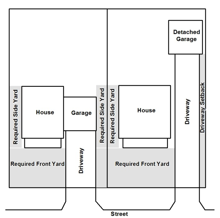
Figure 5
(2)
All second curb cuts and second accesses from the public street that extend across the front or side yard are allowed if approved by the city engineer.
(3)
The maximum width, towards the interior of the lot, of a driveway accessing an attached or detached garage shall be proportional to the width of the garage doorways for accommodating the normal width of the vehicles, utilizing a ten-foot driving width of a vehicle. In the case of a one car garage, the driveway may be up to 18 feet wide, provided a three-foot setback from the property line is maintained.
(4)
A driveway may have a flare out in the front yard or side yard area of the property only if the entire flare out portion meets all of the following requirements (refer to figure 6):
a.
Accommodates no more than one vehicle, with a stall dimension no larger than 12 feet in width by 25 feet in length (not including the flare).
b.
Has a taper slope ratio of no more than one to one, so as to create a 45 degree angle (refer to figure 6).
c.
Is parallel to the driveway.
d.
Is hard surfaced.
e.
No encroachment into the required side yard shall be allowed, including into the required side yard as extended into the front yard, unless it is a corner lot on which the garage accesses from the longer street side as shown in figure 7. In the case of a one car garage, the flare out may have up to a three-foot setback.
f.
Not located toward or in the interior of the lot (i.e., area in front of residence). Flare outs are not allowed on both sides of a driveway unless one common driveway is serving both units of a duplex residence.
g.
If a turn out exists, then a flare out is prohibited in the front and side yards.
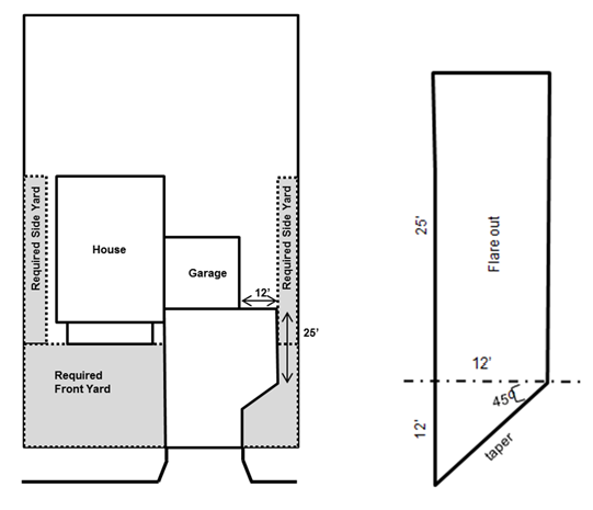
Figure 6
Figure 7
(5)
A driveway may have one turn out in order for vehicles to maneuver in the driveway such that a driveway could be exited face-forward, provided the turn out meets the following requirements (refer to figure 8):
a.
The street is an existing or proposed arterial or collector street, in accordance with the comprehensive plan, that is two or more lanes.
b.
Its maximum width is proportional to the driveway width, as follows:
1.
A ten to 15-foot wide driveway is allowed up to 18 feet beyond the driveway.
2.
A 15-foot or wider driveway is allowed up to nine feet beyond the driveway.
c.
It is a maximum of ten feet long, parallel to the driveway.
d.
If located to the side yard, it is a minimum of three feet from the closest property line.
e.
It shall not be used for storage.
f.
It is located back from the right-of-way, no less than the required front yard setback.
g.
It is not located toward or in the interior of the lot (i.e., area in front of residence). Turn outs are not allowed on both sides of a driveway unless one common driveway is serving both units of a duplex residence.
h.
If a flare out exists, then a turn out is prohibited in the front and side yards.
Figure 8
(6)
Termination of a driveway in the side yard, with no access to a garage or parking lot in the rear yard shall only be permitted if the driveway meets all of the following requirements:
a.
The extension is a maximum of 12 feet wide.
b.
The extension is a maximum length not to exceed the length of the building along which it is located. In no case shall this driveway extension exceed 30 feet in length.
c.
The extension is hard surfaced.
d.
The extension does not occupy any portion of the required side yard and no portion of the vehicle shall be allowed to encroach into the required side yard.
e.
No more than one vehicle, including, but not limited to, trailers, recreational vehicles, boats or similar vehicles, which must be currently and legally licensed, shall be parked in the side yard area.
f.
Only one side yard may be used for vehicular parking.
g.
Side yard parking shall only be allowed in the side yard nearest the established driveway on the property. Refer to figure 9.
Figure 9
(7)
A driveway may be located in the rear yard or in the required rear yard if it accesses a permitted garage, shed or other accessory structure. Furthermore, the following may be permitted (refer to Figures 10 and 11):
a.
One flare out, provided:
1.
It accommodates no more than one vehicle, with a stall dimension no larger than 12 feet in width by 25 feet in length.
2.
It is parallel to the driveway.
3.
It is hard surfaced.
b.
An extension along the side of the accessory structure, provided:
1.
The extension is a maximum of 12 feet wide.
2.
The extension is a maximum length not to exceed the length of the building along which it is located. In no case shall this driveway extension exceed 30 feet in length.
3.
The extension is hard surfaced.
4.
No more than one vehicle, including, but not limited to, trailers, recreational vehicles, boats or similar vehicles, which must be currently and legally licensed, shall be parked in said extension.
5.
The extension is located only on one side of the building along which it is located.
Figure 10
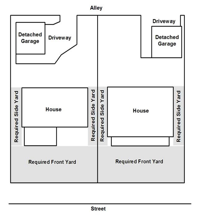
Figure 11
(8)
A secondary driveway, connected to the primary driveway, may be installed for purposes of accessing a detached accessory structure provided the following requirements are met:
a.
The accessory structure is intended for vehicular use and has at least one overhead garage door.
b.
The driveway will be no less than three feet from adjacent property lines.
c.
The driveway is a minimum ten feet wide.
d.
The secondary driveway is hard surfaced.
e.
The overall yard open space requirement and yard open space requirement for the yard where said driveway is proposed is met.
f.
In the case of a corner lot, the driveway shall only be permitted on the interior side yard.
(Ord. No. 2922, § 1(29-179), 5-7-2018)