
Evart City Zoning Code
ARTICLE II
ZONING DISTRICTS AND ZONING MAP
Sec. 44-33. - Relationship of city zoning regulations to community master plan.
This article is enacted to regulate the use of private and public property and structures with the purpose of protecting public health, safety and welfare. Standards and regulations within this article regulate the amount, type and use of a building allowable on a piece of land. This article is a tool used by the community to effectuate the recommendations of the community master plan, which is a guide for the long-term physical development of the city.
(Ord. of 11-6-2017, § 2.1)
Sec. 44-34. - Districts established.
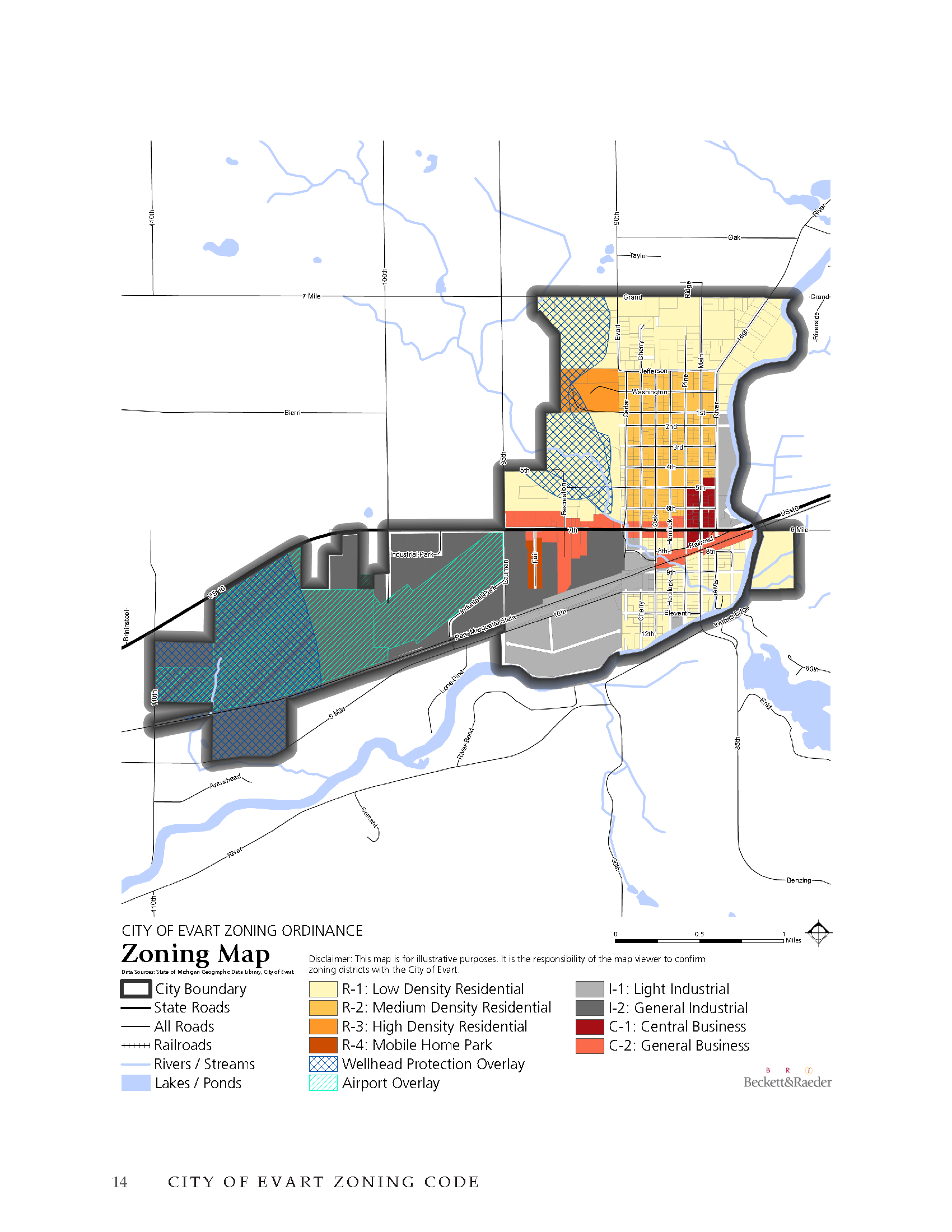
The city is divided into the following districts (see zoning map), which shall be known as:
(Ord. of 11-6-2017, § 2.2)
Sec. 44-35. - Intent and purpose.
The intent and purpose of each zoning district are described in sections 44-36 through 44-43.
(Ord. of 11-6-2017, § 2.3)
Sec. 44-36. - R-1 Low-Density Residential.
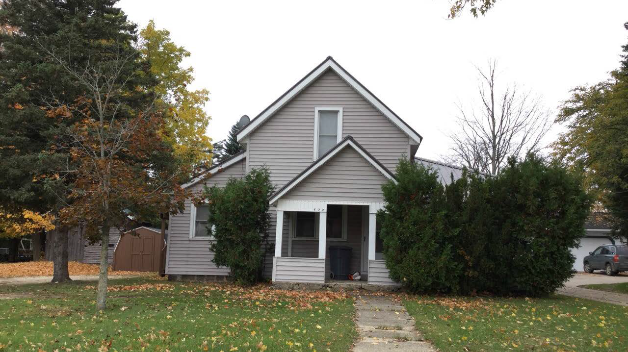
This district is intended for low-density, single-family dwellings and low intensity uses serving the majority of the single-family housing needs of the city. Two-family homes and other related uses may also be allowed under special conditions.
(Ord. of 11-6-2017, § 2.3.1)
Sec. 44-37. - R-2 Medium-Density Residential.
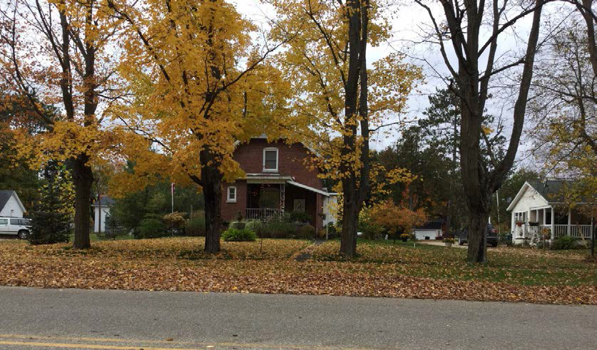
This zoning district is intended for medium-density, single-family and two-family dwellings. Related residential activities may also be permitted under special conditions.
(Ord. of 11-6-2017, § 2.3.2)
Sec. 44-38. - R-3 High-Density Residential.
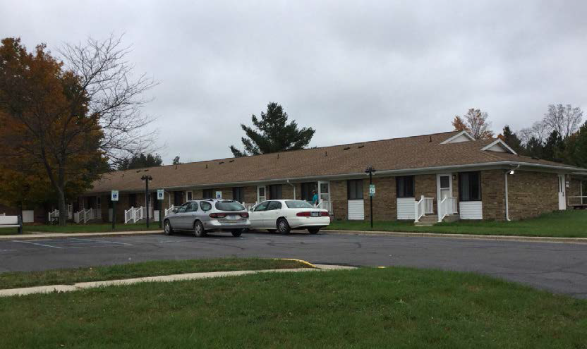
This zoning district is intended for higher-density single-, two- and multiple-family residential dwellings and related uses.
(Ord. of 11-6-2017, § 2.3.3)
Sec. 44-39. - R-4 Mobile Home Park.
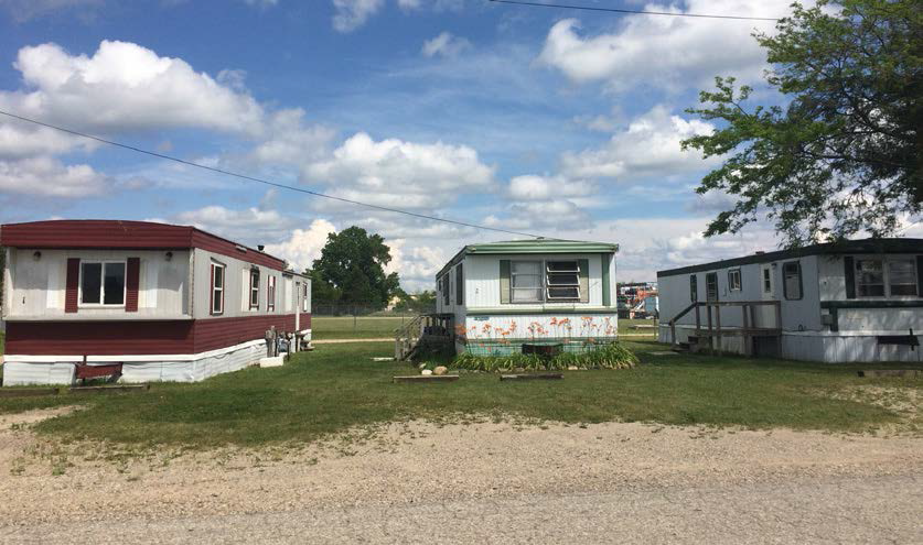
This district is intended to accommodate the particular needs of mobile homes situated in mobile home parks. It is recognized that properly located mobile home parks can provide important alternate and affordable housing opportunities for city residents. All mobile home parks shall conform to the standards specified in Mobile Home Commission Act, MCL 125.2301 et seq., and the Mobile Home Parks and Seasonal Mobile Home Parks Health Standards, Mich. Admin. Code R 325.3311 et seq.
(Ord. of 11-6-2017, § 2.3.4)
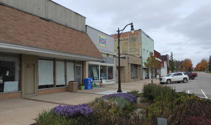
Sec. 44-40. - C-1 Central Business.
This zoning district is intended for retail businesses or service establishments that supply commodities or perform services that meet the daily needs of the residents with a minimal impact on adjacent residential development. This district should serve as the major commercial retail and service area of the city.
(Ord. of 11-6-2017, § 2.3.5)
Sec. 44-41. - C-2 General Business.
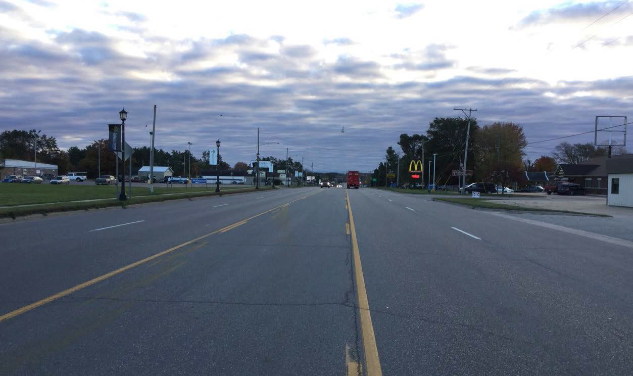
This district is intended for more diversified and higher-intensity commercial land uses that would not be appropriate in the downtown area of the city due to possible objectionable conditions. This district is also appropriate for uses serving the motoring public. Increased setbacks and screening are required to protect neighboring land uses from any objectionable conditions.
(Ord. of 11-6-2017, § 2.3.6)
Sec. 44-42. - I-1 Light Industrial.
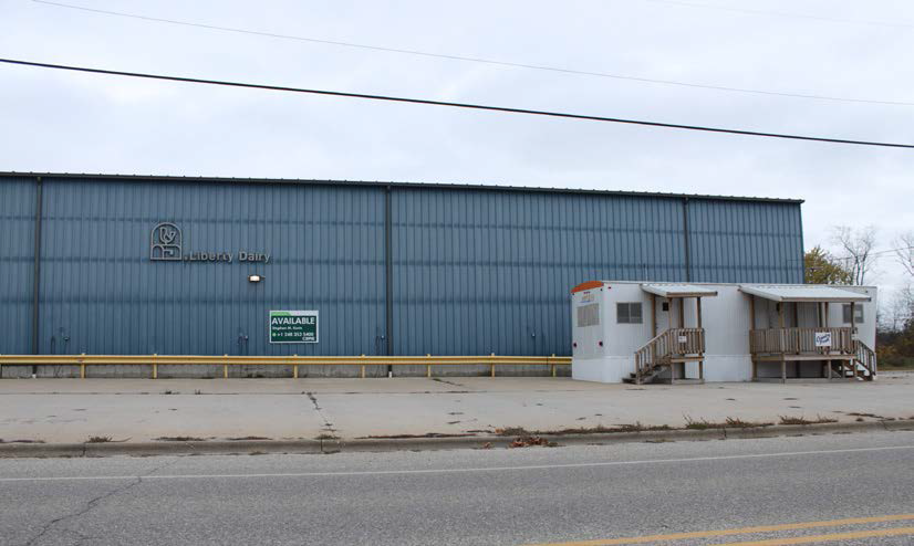
This zoning district is intended for light industrial activities, such as compounding, assembling, or treating of articles or materials; light manufacturing; processing of raw materials; and other similar industrial uses. More intensive industrial uses, such as auto body repair and salvage yards, shall not be permitted. This district may also serve as a buffer between general industrial districts and residential areas of the city.
(Ord. of 11-6-2017, § 2.3.7)
Sec. 44-43. - I-2 General Industrial.
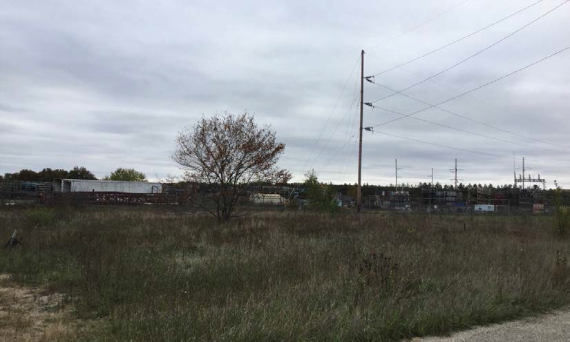
This zoning district is intended for general industrial activities, such as the compounding, assembling, or treating of articles or materials; light manufacturing; processing of raw materials; and other similar industrial uses. This district is also intended to permit a planned business and service environment related to the airport and existing and proposed industrial uses.
(Ord. of 11-6-2017, § 2.3.8)
Sec. 44-75. - F-1 Floodplain Overlay.
It is the purpose of this district to protect the general public and all land in the city subject to flood losses, by minimizing such losses through restricting or prohibiting uses that are dangerous to resident's health, safety and property in times of flood or that cause excessive increases in flood flow heights or velocities. The floodplain overlay district shall apply to all land within the city shown as being within the 100-year floodplain on the flood insurance rate map (FIRM) of the National Flood Insurance Program and Federal Emergency Management Agency. While this overlay district is not shown on the official zoning map, property owners are responsible to determine if their property is located in a floodplain.
(1)
Use standards. Within the floodplain overlay district, except as otherwise required by state or federal laws or regulations, no use of land, building, or structure shall be made; no building or structure shall be erected, converted, or substantially improved or placed; and no land shall be filled unless:
a.
The use in question is allowed in the applicable underlying zone district.
b.
The use complies with all applicable construction requirements.
c.
All necessary permits and approvals, as required by local, state, or federal laws and regulations, have been obtained for the use.
d.
The use is approved as a special land use pursuant to the procedures and requirements of article IV of this chapter.
(2)
Prohibited uses. The following uses are prohibited in the floodplain overlay district:
a.
A building or structure intended to be a permanent residence.
b.
Landfills, dumps, or junkyards.
c.
The storage or processing of materials that, in time of flooding, becomes buoyant, flammable, explosive, or otherwise injurious to public health.
d.
On-site sewage disposal systems.
e.
A new mobile home park or any extension to any existing mobile home park and all new mobile homes not in a mobile home park.
f.
Any encroachment, excavation, dumping or backfilling that would cause any increase in the base flood level.
g.
Enlargement of a building or structure to more than 25 percent of its square footage as it existed at the time of enactment of the ordinance from which this section is derived.
(3)
Additional requirements.
a.
Notwithstanding any provision of this section to the contrary, if a permit or approval from another local, state or federal body or agency cannot be issued prior to the issuance of a zoning permit by the city, a letter from the other agency or body indicating that the permit or approval will be issued contingent solely upon proof of zoning compliance shall be acceptable.
b.
All public utilities and facilities shall be designed, constructed, and located to minimize or eliminate flood damage.
c.
Land shall not be divided in a manner creating parcels or lots that cannot be used in conformance with the requirements of this section.
d.
No structure, fill, excavation, or storage shall be permitted that, acting alone or in combination with existing or future uses, significantly and unduly affects the capacity of the floodway and, thereby, increases the height of the floodwaters.
e.
Filling in the floodway may be permitted only after full compliance has been achieved, to the satisfaction of the planning commission, with the applicable provisions of MCL 324.3101 et seq.,as amended, and all other applicable local, state, and federal laws and regulations. Any fill permitted shall be protected from erosion by riprap, vegetative cover, bulk heading or other approved means.
f.
Prior to any alternation or relocation of a watercourse, notification shall be given to adjacent communities and the state department of natural resources, and evidence of such notification shall be submitted to the Federal Insurance Administration. Proper maintenance shall be provided within the altered or relocated watercourse so that the flood-carrying capacity is not diminished.
g.
Structures shall be constructed and arranged on the building site so as to offer the minimum obstruction to the flow of floodwaters. Whenever possible, structures shall be constructed with the longitudinal axis parallel to the direction of the flood flow and shall be placed approximately on the same flood flow lines as those of adjoining structures.
h.
Any excavation, fill extraction, grading or scarping shall require the prior approval and consent of the water resources commission of the state department of natural resources.
(4)
Liability. The degree of flood protection required by this section is considered the minimum necessary and reasonable for regulatory purposes. Larger floods may occur at any time, and excessive floodwater heights may be experienced due to manmade and natural causes, such as ice jams and accumulated debris in bridge openings. No representation is made by this section that areas outside the floodplain overlay district or uses permitted within the district shall remain free from flooding or flood damage. Under no circumstances shall the city or any officer or employee of the city be liable, to any degree, for any flooding or flood damage that might result from compliance with or reliance upon the provisions of this section or any decisions or administrative approvals lawfully granted under this chapter.
(Ord. of 11-6-2017, § 2.4.1)
Sec. 44-76. - W-1 Wellhead Protection Overlay.
(a)
Intent. It is the purpose of this district to protect the public water supply wells from contamination by land use activities occurring or which may occur within the delineated recharge areas for such wells. The wellhead protection overlay district shall apply to all land within the city wellhead protection area as mapped by the state department of environment, Great Lakes and energy. A WHPA is defined as the surface and subsurface areas surrounding a water well or well field, which supplies a public water system, and through which contaminants are reasonably likely to move toward and reach the water well or well field within a ten-year time-of-travel.
(b)
Use standards. The most significant sources of water supply contamination are landfills, surface impoundment areas, subsurface percolation from septic tanks and cesspools, open dumps, uncapped or improperly capped abandoned wells, injection wells and underground storage tanks. When considering approving new developments in the wellhead protection overlay district, the city will consider strategies for mitigating the following uses and associated activities that may have potential to contaminate the WHPA:
(1)
Manufacturing and industrial facilities;
(2)
Utility companies;
(3)
Abandoned wells;
(4)
Registered storage tanks;
(5)
Hazardous waste;
(6)
Generators;
(7)
Ground water discharges;
(8)
Agricultural operations;
(9)
Septic systems or dry wells.
(Ord. of 11-6-2017, § 2.4.2)
Sec. 44-77. - Airport Overlay District.
The purpose of the airport overlay district is to provide an additional layer of development review for the area in and surrounding the Evart Municipal Airport. This overlay district is consistent with the Evart Municipal Airport Layout Plan, as approved by the state department of transportation in April 2017. All new development proposals should be compatible with airport uses and in compliance with the Evart Municipal Airport layout, as approved.
(Ord. of 11-6-2017, § 2.4.3)
Sec. 44-78. - Properties with multiple zoning designations.
When an individual recorded parcel, which exists at the time of adoption of the ordinance from which this article is derived, has more than one zoning classification, the zoning designation which comprises the majority of the parcel area shall be applied to the entire parcel. In all other instances, interpretation of the boundaries of a zoning district shall be referred to the zoning board of appeals.
(Ord. of 11-6-2017, § 2.5)

