
Farragut City Zoning Code
CHAPTER 4
- GENERAL PROVISIONS AND EXCEPTIONS2
Note— It is the intent of this chapter to provide explanations and qualifications of requirements outlined in other sections of the ordinance.
Sec. I. - Accessory structures and uses.
It is the intent of this section to establish the development requirements specific to accessory structures and uses.
A.
General provisions. No accessory structure, excluding fences, detention basin structures, and retaining walls, shall be placed within any utility, drainage, or construction easement.
B.
Requirements on specified accessory structures for non-single-family and non-two-family residential uses.
1.
Garbage dumpsters, compactors, and recycling containers.
a.
Garbage dumpsters and recycling containers shall be screened with opaque walls and gates. Such gates and walls shall be architecturally compatible with the principal building located on the same lot; and
b.
When used as an alternative to traditional garbage dumpsters and recycling containers, below grade (subsurface/in-ground) refuse collection and recycling systems shall be screened to conceal the above ground portion on at least three sides. Such screening shall be achieved with opaque walls that are architecturally compatible with the principal building located on the same lot. Screening shall not be required on the front access provided it is internally facing to the development/lot; and
c.
Garbage dumpsters and recycling containers shall be set back a minimum of 40 feet from the nearest point of any right-of-way and a minimum of ten feet from all side and rear property lines.
2.
Heating, ventilation, air conditioning, and mechanical units. Such units shall be screened with opaque materials and shall not be visible from adjacent properties or rights-of-way. Such screening shall be architecturally compatible with the building the units are serving.
3.
Retaining walls.
a.
Retaining walls shall be designed and constructed per the adopted building code. Plans must be submitted to and approved by the Town Engineer;
b.
Retaining walls shall not be constructed within any required buffer strip; and
c.
Retaining walls shall be set back a minimum of ten feet from the nearest point of any right-of-way and all side and rear property lines.
C.
Requirements for retaining walls for single-family and two-family residential uses.
1.
Retaining walls shall be designed and constructed per the adopted building code. Plans must be submitted to and approved by the Town Engineer;
2.
Retaining walls shall not be constructed within any required buffer strip; and
3.
Retaining walls shall be set back a minimum of ten feet from the nearest point of any right-of-way and a minimum of five feet from all side and rear property lines. A retaining wall, including the footer, may be constructed at the side or rear property line if a signed agreement from the adjoining property owner is submitted to the town stating the retaining wall may be constructed at their property line. If a retaining wall is removed or damaged as a result of work conducted within the utility, drainage, or construction easement, the property owner shall be responsible for repairs to the retaining wall. When a retaining wall is constructed at a property line, if appropriate a swale shall be constructed behind the retaining wall to ensure stormwater runoff is properly directed.
D.
Requirements for retaining walls for attached single-family developments.
1.
Retaining walls shall be designed and constructed per the adopted building code. Plans must be submitted to and approved by the Town Engineer;
2.
Retaining walls shall not be constructed within any required buffer strip;
3.
Retaining walls shall be constructed per the original design of the development and approved as part of the preliminary plat. The retaining walls shall be owned and maintained by the homeowners association. Retaining walls may be placed within utility, drainage, or construction easements, but it shall be the responsibility of the homeowners association to reconstruct such walls if they are damaged or removed as a result of work within the easement(s). No portion of a retaining wall, including footer, may be placed within the right-of-way. When a retaining wall is constructed at a property line, if appropriate, a swale shall be constructed behind the retaining wall to ensure stormwater runoff is properly directed; and
4.
If an individual property owner within an attached single-family development chooses to construct a retaining wall after the development is complete and the dwelling unit is constructed, the retaining wall shall comply with all requirements of subsection C. of this section.
(Ord. No. 86-16, 4-1986; Ord. of 2-2006; Ord. No. 12-21, §§ 1—4, 1-24-2013; Ord. No. 21-08, § 1, 6-10-2021)
Sec. II. - Administration and enforcement.
A.
Administrative officer. The provisions of this ordinance shall be administered and enforced by the Town Building Official who shall be the town administrator or his designated representative who shall additionally:
1.
Issue all building permits and make and maintain records thereof.
2.
Issue all certificates of occupancy and make and maintain records thereof.
3.
Maintain and keep current zoning maps, and records of amendments thereto.
4.
Conduct inspections as prescribed by this ordinance, and such other inspections as are necessary to insure compliance with the various provisions of this ordinance generally.
B.
Farragut Municipal Planning Commission. The Farragut Municipal Planning Commission, for the purposes of this ordinance shall be referred to as the planning commission. The planning commission shall:
1.
Establish such rules of procedure as are necessary to the performance of its functions hereunder.
2.
Study and report on all proposed amendments to this ordinance; further, review annually this ordinance and on the basis of such review, suggest amendments thereto.
C.
Farragut Board of Zoning Appeals. The Board of Zoning Appeals shall be hereby appointed by the Board of Mayor and Aldermen and shall include five members. The term of each member shall be of such length and so arranged that the term of one member shall expire each year. The Board of Zoning Appeals shall have the following powers:
1.
It shall have the power to hear and decide appeals where it is alleged there is an error in any order, requirements, decision or determination made by an administrative official in carrying out any provision of this or other zoning ordinances enacted by the Board of Mayor and Aldermen of the Town of Farragut.
2.
To hear and decide, in accordance with the provisions of any such ordinance, request for interpretation of the zoning map.
3.
Where there is practical difficulty or unnecessary hardship in carrying out the strict letter of this ordinance, the Board of Zoning Appeals shall have the power in passing upon appeals to authorize such variance from the terms of this ordinance as will not be contrary to the public interest as defined under variances of this section.
4.
To compel attendance of witnesses at hearings and to administer oaths.
5.
To hold at least one scheduled meeting per month and give notice of such meeting as required by law.
D.
Variances. The Board of Zoning Appeals shall have the power and authority to grant variances from terms of this ordinance according to the procedure and under the restrictions set out in this section.
The purpose of the variance is to modify the strict application of the specific requirements of this ordinance in the case of exceptionally irregular, narrow, shallow, or steep lots, or other exceptional physical conditions, whereby such strict application would result in practical difficulty or unnecessary hardship which would deprive an owner of the reasonable use of his land. The variance shall be used only where necessary to overcome some obstacle which is preventing an owner from using his property as the zoning ordinance intended. Procedure for the consideration for a variance by the board is as follows:
1.
Application. Prior to the board considering any application for a variance, the applicant shall submit a nonrefundable sum of money in accordance with the schedule of fees available in the office of the town recorder in the Farragut Town Hall.
2.
Public hearing. Upon receipt of an application, the board shall hold a public hearing, having first given not less than seven days' notice. Such notice of the time and place of such hearing shall be published in a paper of general circulation within the Town of Farragut. The board shall consider and decide all applications for the variances within 30 days of such public hearing and in accordance with the standards provided below.
3.
Standards for variances. In granting a variance, the board shall ascertain that the following criteria are met:
a.
Variances shall be granted only where special circumstances or conditions exist (such as exceptional narrowness, topography, or siting) fully described in the findings of the board, do not apply generally in the district.
b.
Variances shall not be granted to allow a use otherwise excluded from the particular district in which requested.
c.
For reasons fully set forth in the findings of the board, the aforesaid circumstances or conditions are such that the strict application of the provisions of this ordinance would deprive the applicant of any reasonable use of his land. Mere loss in value shall not justify a variance; there must be a deprivation of beneficial use of land.
d.
Any variance granted under the provisions of this section shall be the minimum adjustment necessary for the reasonable use of the land.
e.
The granting of any variance is in harmony with the general purposes and intent of this ordinance and will not be injurious to the neighborhood, detrimental to the public welfare, or in conflict with the comprehensive plan for development.
f.
If size or shape are to be the grounds for the variance, the property must be a "lot of record" and have totally separate ownership from the adjoining parcels.
4.
Requirements for granting a variance. Before the board shall have the authority to grant a variance, the person claiming the variance has the burden of showing:
a.
That the granting of the permit will not be contrary to the public interest.
b.
That the literal enforcement of the ordinance would deprive the applicant any reasonable use of his land.
c.
That by granting the permit contrary to the provisions of the ordinance the spirit of the ordinance will be observed.
d.
That by granting the permit, substantial justice will be done.
5.
Effective date of approval; issuance of permit.
a.
Board approval shall become effective 60 days from the date of the board meeting at which approval is granted.
b.
No building permit shall be issued prior to the date of approval unless upon request by the applicant and at the applicant's own risk.
c.
The building permit shall be issued subject to all conditions and requirements stipulated by the board.
E.
Special exceptions. The following procedure is established to integrate properly the uses permitted as special exceptions with other land uses located in the district. These uses shall be reviewed by the board and authorized or rejected under the following procedure:
1.
Application. Prior to the board considering any application for a special exception, the applicant shall submit a nonrefundable sum of money in accordance with the schedule of fees available in the office of the town recorder in the Farragut Town Hall.
2.
Public hearing. Upon application, the board shall give not less than seven days' notification of a public hearing. Such notice giving time and place of such hearing shall be published in a paper of general circulation within the Town of Farragut.
3.
General review standards. In the review of a special exception request, the Board of Zoning Appeals, in the exercise of its administrative judgment, shall be guided by adopted plans and policies, including, but not limited to, the Farragut Land Use Plan, Farragut Zoning Ordinance, Farragut 2000 Plan, Farragut Municipal Code, and the following general standards:
a.
The use is consistent with adopted plans and policies, as set forth above;
b.
The use is in harmony with the general purpose and intent of the zoning regulations;
c.
The use is compatible with the character of the neighborhood where it is proposed and with the size and location of buildings in the vicinity;
d.
The use will not negatively impact adjacent property by noise, lights, fumes, odors, vibration, traffic, congestion or be incompatible with other development in the surrounding area.
e.
The use is not of a nature or so located as to draw substantial additional traffic through residential streets;
f.
The specially permitted use meets all town requirements with regard to approval of the hydrology, engineering, building codes, landscaping/buffering, signage, etc.;
g.
The specially permitted use meets all requirements set out in the particular zoning classification in which the use is to be located; and
h.
Approval or denial. The Board of Zoning Appeals may approve a development plan, when applicable, or a special exception where it can be shown that the proposed plan or use is in harmony with the general purpose and intent of the zoning ordinance, the Farragut Land Use Plan and such adopted plans as the Farragut 2000 Plan, and is reasonably necessary for the convenience and welfare of the community. The Board of Zoning Appeals may deny a development plan, when applicable, or a special exception where the above cannot be shown or where it can be shown that approval would have an adverse impact on the character of the neighborhood in which the site is located. Whereas a use may be appropriate in one location and inappropriate in another location in the same zoning district, the Board of Zoning Appeals shall be guided by the policies of the Farragut Land Use Plan and such adopted plans as the Farragut 2000 Plan in the exercise of its administrative judgment about the location and appropriateness of special exception uses. The Board of Zoning Appeals shall state conditions of approval or denial, including substantive, factual statements of necessity and appropriateness or of adverse impact, with such information being included in the minutes of the Board of Zoning Appeals meeting where decisions are made.
4.
Restrictions. In the exercise of its approval, the board may impose such conditions regarding the location, character, or other features of the proposed use of buildings as it may deem advisable in the furtherance of the general purposes of this ordinance.
5.
Effective date of approval; issuance of permit.
a.
Board approval shall become effective 60 days from the date of the board meeting at which approval is granted.
b.
No building permit shall be issued prior to the date of approval unless upon request by the applicant and at the applicant's own risk.
c.
The building permit shall be issued subject to all conditions and requirements stipulated by the board.
6.
Validity of plans. All plans, conditions, restrictions, and rules made a part of the approval of the board shall constitute certification on the part of the applicant that the proposed use shall conform to such regulations at all times.
7.
Time limit and notification. All applications for special exception shall be decided within 45 days of the date of application, and the applicant shall be provided with a written notice of approval or denial.
8.
[Validity of special exception.] A special exception that has been approved by the board shall become invalid one year after the date of approval unless:
a.
A certificate of occupancy has been obtained from the town administrator or his designee in compliance with the Town of Farragut building code; or
b.
A certification has been obtained from the town administrator or his designee that the applicant has satisfactorily completed all of the town requirements that were stipulated as part of the approval of the special exception; or
c.
An extension of time, not to exceed six months, has been granted by the town administrator.
The town administrator may grant or deny a request by an applicant for an extension of time not to exceed six months in order to complete requirements that were stipulated as a part of the special exception. An application for an extension shall be submitted, by the applicant, in writing to the town administrator, prior to the date of expiration of the special exception. The town administrator may deny a request for an extension of time if he finds that there has not been a diligent effort made by the applicant to meet the requirements that were stipulated when the special exception was approved. In granting a request for an extension of time, the town administrator shall not change the requirements that were stipulated when the special exception was approved.
The town administrator shall, in writing, notify the applicant requesting extension of time of his/her decision to either grant or deny the request and his reasons therefore, within seven days of the receipt of the request for an extension.
A special exception shall become null and void upon:
(1)
The expiration of one year; or
(2)
The denial of a request for an extension of time by the town administrator; or
(3)
The expiration of an extension of additional time, not to exceed six months, granted by the town administrator.
F.
Building permit. An application for a building permit shall be obtained from the town administrator or his designee and shall be regulated by the building code of the Town of Farragut.
G.
Penalties. It shall be unlawful to erect, construct, reconstruct, alter, maintain or use any building or structure, or to use any land in violation of any regulation in this ordinance. Any person, firm, association, or corporation who violates, disobeys, omits, neglects, or refuses to comply with, or resists the enforcement of any of the provisions of this ordinance shall, upon conviction thereof, be subject to a fine of not more than $500.00 together with the cost of the action; and every day of violation shall constitute a separate offense. Compliance therewith may also be enforced by injunctive process at the suit of the town or the owner or owners of real estate within the same zoning classification in the town or the owner, owners or occupant of real property that is contiguous to a particular property affected by the regulation of this ordinance.
1.
The owner, and/or current party in lawful possession if other than the owner, of any real property located within the Town of Farragut, except as provided for in subsection [G.]2 below, upon which real property is located and displayed vehicles, boats, or other types of equipment for sale, is/are deemed to have permitted such items to be located and displayed for sale on said real property. As a result of allowing such real property to be improperly used, such owner's and/or lawful possessor's of real property are in violation of the Farragut Zoning Ordinance and are subject to citation.
2.
If an owner and/or lawful possessor of real property within the Town of Farragut is cited for violation of the Zoning Ordinance for there being located and displayed for sale upon such real property one or more vehicles, boats, and/or other equipment, the owner or lawful possessor may within two normal working days of having been served with a citation for violation of the Zoning Ordinance relating to the presence and display for sale of one or more vehicles, boats, and/or other equipment on said property, execute and deliver to the Office of Codes Administration and Enforcement, Town of Farragut, a statement in form and substance satisfactory to the Farragut Town Administrator or his designee stating:
a.
That said owner and/or lawful possessor did not grant permission or otherwise authorize the display of the subject vehicle, boat, and/or other equipment upon the owner's and/or lawful possessor's property; and
b.
That the owner and/or lawful possessor grants to the Town of Farragut and its designated officers, agents, employees, or independent contractors authority to come upon the subject property of said owner and/or lawful possessor and tow away or otherwise remove the subject vehicle boat and/or other equipment in violation from the subject property; and
c.
That such authorization to remove such offending vehicles, boats, and other equipment shall remain in full force and effect until revoked by written notice executed by the owner and/or lawful possessor and delivered to the office of codes administration and enforcement, Town of Farragut. Any person claiming any vehicle, boat, and/or other equipment so removed from private property by the Town of Farragut pursuant to such authorization from the owner or lawful possessor shall be responsible for all towing and storage charges.
H.
Validity. No validity or invalidity of any part of this ordinance shall affect the validity of any remaining part, it being declared that all such remaining parts would have been passed irrespective of the validity or invalidity of any part found to be invalid.
I.
Amendment. The Board of Mayor and Aldermen, the planning commission, any citizen of Farragut or any person who owns property in Farragut may present an application to the Farragut Municipal Planning Commission requesting an amendment or amendments to this ordinance.
1.
Application. An application shall be filed with the Board of Mayor and Aldermen for review. Before any action is taken upon an application for an amendment as provided for under said heading, the applicant shall deposit with the Town of Farragut a nonrefundable sum of money in accordance with the schedule of fees available along with application forms in the office of the town recorder in the Farragut Town Hall.
2.
Restrictions. After the Board of Mayor and Aldermen has taken final action upon an application for an amendment to this ordinance, a petition requesting the same or a similar amendment shall not be accepted for a period of one year from the date of such final action. This provision in no way restricts the right of the planning commission or the Board of Mayor and Aldermen to initiate an amendment to this ordinance.
3.
Planning commission certification. No amendment shall be enacted by the Board of Mayor and Aldermen unless such amendment is first submitted to the planning commission for certification.
a.
If approval is recommended by the planning commission, the amendment may be approved by a majority of a quorum of the Board of Mayor and Aldermen.
b.
If disapproval is recommended by the planning commission, the amendment may be approved by the favorable vote of a majority of the entire membership of the Board of Mayor and Aldermen.
4.
Public hearing. A public hearing shall be conducted by the Board of Mayor and Aldermen before adoption of any proposed amendment, at least 15 days' notice of the time and place of which shall be published in a newspaper of general circulation in the community.
J.
Farragut Historic Zoning Commission. The Farragut Historic Zoning Commission shall be hereby appointed by the Board of Mayor and Aldermen and shall consist of five persons appointed from the following backgrounds: a historian or representative of a Farragut patriotic or historical organization; an architect, if available; a planning commissioner; and representatives of the general community. For purposes of this ordinance, the representative of a Farragut patriotic or historical organization can be a member of the Farragut Folklife Museum Committee. Appointments shall be made with the terms of members to be five years. Members appointed initially shall be appointed for staggered terms so that the term of one member expires each year. The term of the appointed representative of the Planning Commission shall run concurrently with said person's remaining term on that body. At the time of expiration of a planning commissioner's term, another person, who is a member of the Planning Commission at the time of his/her appointment, shall be appointed to fulfill the remainder of that term. All members shall serve without compensation. The Farragut Historic Zoning Commission may adopt rules and regulations consistent with the state law.
The Historic Zoning Commission shall have the following powers:
1.
To develop by-laws and guidelines for conducting business;
2.
To review proposals for historic zones, alterations, demolitions and new construction; and,
3.
To survey and identify the historic properties within the Town of Farragut.
a.
Creation of historic overlay zone: Upon application submitted to the town administrator of the Town of Farragut, the historic zoning commission shall review requests made by individuals, organizations or other governmental bodies, including themselves, and shall submit a written recommendation regarding the creation of a historic overlay zone in accordance with the criteria for selection contained in this zoning ordinance, to the Farragut Municipal Planning Commission, who shall forward the written recommendation of both the historic zoning commission and planning commission, and the implications of historic overlay designation on future planning decisions, to the Farragut Board of Mayor and Aldermen.
The Farragut Board of Mayor and Aldermen may initiate applications for historic overlay zone designation and make a final determination of designation after reviewing the recommendations of the historic zoning commission and the planning commission.
b.
Notice of public hearings: Prior to making a recommendation as to the establishment of a historic overlay zone, the historic zoning commission shall hold a public hearing and shall adopt a set of design review guidelines which shall guide any granting or denial of Certificates of Appropriateness within the zone so established. Such design review guidelines shall be consistent with the purposes enumerated in this ordinance and with the regulations and standards adopted by the U.S. Secretary of the Interior, pursuant to the National Historic Preservation Act of 1966, as amended, applicable to the construction, alteration, rehabilitation, relocation or demolition of any building, structure or other improvement. Opportunity for public comment shall be required before the adoption of any such design review guidelines. The design review guidelines shall be made a part of the recommendations forwarded by the Historic Zoning Commission to the Planning Commission and Board of Mayor and Aldermen for adoption. Notice of the public hearing shall appear in a local news publication. Recommendations made by the Historic Zoning Commission shall be forwarded to the planning commission and Board of Mayor and Aldermen within 45 days of said public hearing.
c.
Applications for building permits and issuance of certificates of appropriateness. All applications for permits to allow construction, alteration, repair, rehabilitation, relocation or demolition of any building, structure, object or other improvement to real estate located within a Historic Overlay Zone shall be referred to the Historic Zoning Commission. No building permit for a new building or improvements within a Historic Overlay Zone shall be issued without being thoroughly reviewed by the Historic Zoning Commission and without a recorded certificate of appropriateness being issued by the commission.
d.
Issuance or denial of Certificates of Appropriateness. A Certificate of Appropriateness, with or without attached conditions, in writing, or the denial of a Certificate of Appropriateness, with reasons for such denial in writing, must be issued within 30 days following the availability of sufficient data. In the review of any work to be undertaken in a historic overlay zone, the Historic Zoning Commission shall apply the applicable review guidelines, with primary consideration to:
(1)
Historical or architectural value of the present structure;
(2)
The relationship of the exterior architectural features of such structure to the rest of the structures, to the surrounding area, and to the character of the district;
(3)
The general compatibility of exterior design, arrangement, texture, and materials proposed to be used; and
(4)
Any other factor, including aesthetic, which is justified by the historic character of the proposed zone or is reasonably related to the purpose of this ordinance.
e.
Appeal of decisions of Farragut Historic Zoning Commission regarding decisions on issuance of Certificates of Appropriateness. Anyone aggrieved by a final order or judgment of the Historic Zoning Commission may appeal such decision by taking the issue to a court of competent jurisdiction, as provided for by law.
(Ord. No. 86-16, 4-1986; Ord. of 2-2006)
Sec. III. - Antennas and towers.
The following requirements shall apply to dish antennas, amateur radio towers (excluding towers, as defined in this ordinance), towers, non-tower wireless communication facilities, and small cell support structures:
A.
The following conditions shall apply to dish antenna placements in all zones:
1.
No text, pictures, logos, or advertising shall be displayed on any surface of the dish antenna.
2.
Installation of the required screening shall be done concurrently with the construction of the base mount for any dish antenna.
3.
Where screening is required, the dish antenna shall be screened from view from public rights-of-way and from adjacent property by any combination or single treatment of vegetative or structural barriers. The screening shall provide 80 percent opacity at a height of seven feet within two years of its installation. Defective or dead screening shall be replaced to maintain the screening of the dish antenna while the dish antenna remains in its permitted location.
4.
The dish antenna or any required screening shall not penetrate any recorded easement.
B.
The following conditions shall apply to dish antenna placements in residential and agricultural zoning districts:
1.
Only one dish antenna shall be permitted per lot, parcel, or tract.
2.
No freestanding dish antenna shall exceed 11 feet in height, as measured at its highest point above the surrounding grade.
3.
No dish antenna with a dish size greater than 24 inches shall be placed on any roof or attached to any principal or accessory structure. Dish antennas with a dish size of 24 inches or less may be placed on a roof or wall of a principal or accessory structure provided it does not project above the roof line, it is not visible from any public rights-of-way, and it does violate any required setback.
4.
Freestanding dish antennas shall be set back from the side and/or rear property lines a minimum distance equal to at least two times the height of the mounted dish antenna or the minimum distance for accessory structures, whichever is greater.
5.
Screening shall be required for all dish antenna with a dish size greater than 24 inches.
C.
The following conditions shall apply to dish antenna placements in Community Service, Commercial, and Office Zoning Districts:
1.
Only one dish antenna shall be permitted per business.
2.
A ground-mounted dish antenna shall not exceed 11 feet in height, as measured at its highest point above the surrounding grade. A roof-mounted dish antenna shall not exceed 11 feet above the attachment of the base mount to the roof.
3.
The maximum building height shall apply, relative to the particular zoning district in which the dish antenna is to be located.
4.
Dish antennas may be permitted to be located in the rear yard or on the roof. A dish antenna with a dish size of 24 inches or less may be permitted to be attached to a wall provided it does not project above the roof line, it is not visible from any public rights-of-way, and it does not violate any required setback.
5.
Rear yard placements of the dish antennas may not be located in any other required buffer zone or screening required for other purposes.
6.
Screening shall be required for all rear yard placements of dish antennas.
7.
Roof-mounted dish antennas shall be screened on three sides. The open side shall correspond with the directional requirements of the dish antenna.
D.
The following conditions shall apply to amateur radio towers and other antenna placements, excluding towers, as defined in this Section:
1.
All amateur radio towers and antennas shall be set back a minimum of ten feet from all rear and side property lines, plus an additional one-third (⅓) of a foot for each one foot of tower/antenna height over 35 feet tall. Setbacks shall be measured from the farthest most protrusion of the tower and its appurtenances.
2.
All guy wires shall be set back from the side and/or rear property lines a minimum of ten feet.
3.
No amateur radio tower shall exceed 70 feet in height and the combined total height of an amateur radio tower and its antenna shall not exceed 100 feet in height.
4.
A certified survey shall be submitted at the discretion of the building official which shall verify amateur radio tower and antenna heights, and setbacks for the tower, its appurtenances, and the guy wires.
5.
No amateur radio tower, antenna, or guy wires shall be located within a front yard or on any recorded easement.
6.
No amateur radio tower shall be placed on a roof.
7.
A maximum of one amateur radio tower greater than 35 feet in height shall be permitted per lot, parcel, or tract that is less than five acres. If a lot, parcel, or tract is greater than five acres, a maximum of one amateur radio tower per five acres shall be permitted.
8.
A amateur radio tower shall be fenced, walled, or protected in some manner so as to prevent uncontrolled access by children from the street or from adjacent properties. Said wall, fence, or protection shall be maintained in good condition.
9.
All amateur radio towers shall be removed when no longer in service.
E.
The following terms shall apply to commercial cellular towers and small cell support structures, as provided for in the remainder of this Section. For terms not defined herein, the Federal Communications Commission ("FCC") definition shall apply.
Antennas or related equipment: Any transmitting, receiving or other equipment used in conjunction with a wireless communications facility. The term includes utility or transmission equipment, power supplies, generators, batteries, cables, equipment buildings, cabinets and storage sheds, shelters, or similar equipment. This definition does not include towers.
Applicant: An applicant is a person or entity who is authorized by the provisions of this ordinance to file for approval under these regulations.
Application: An application is the completed site plan application form and all accompanying documents, exhibits, and fees required of an applicant by the Town of Farragut as part of a submission for review.
Base station: Equipment at a fixed location that enables Federal Communications Commission ("FCC") licensed or authorized wireless communication between user equipment and a communication network.
Cellular telecommunications services: A retail telecommunications service that uses radio signals transmitted through cell sites and switching stations.
Co-location: Locating more than one transmission antenna or related equipment on the same small cell support structure or tower.
Monopole: A structure that consists of a single vertical pole without guy wires, designed and erected on the ground to support communications antennas and connected appurtenances. A monopole could be either a tower or a small cell support structure but would not include non-tower wireless communications facilities since those are not originally designed to support communications antennas and connected appurtenances.
Non-tower wireless communications facilities: Wireless communications facilities other than tower-based wireless communications. This would include facilities mounted to existing structures that were not originally intended to accommodate wireless communications facilities, such as buildings, utility poles, water towers, steeples, billboards, flags, etc.
Ordinance: Shall refer to this and any other applicable sections of the Farragut Municipal Code, as amended.
Planning commission: The term "planning commission" shall mean the Farragut Municipal Planning Commission in Farragut, Tennessee.
Planning jurisdiction: The planning jurisdiction includes those areas of Knox County, Tennessee, which fall under the jurisdictional authority of the planning commission.
Right-of-way: The surface of and space above and below any real property in the municipality in which the federal government, state government, municipality, or municipal authority has a regulatory interest, or interest as a trustee for the public, as such interests now or hereafter exist, including, but not limited to, all streets, highways, avenues, roads, alleys, sidewalks, tunnels, bridges, or any other public place, area, or property under the control of the federal government, state, municipality, or municipal authority. private rights-of-way and other government-owned lands not listed above shall not be considered a right-of-way. the phrase "in the right(s)-of-way" means, in, on, over, along, above and/or under the right(s)-of-way.
Small cell system/distributed antenna system ("DAS"): A network of remote antenna nodes that distribute radio frequency signals from a central hub through a high capacity signal transport medium to a specific area.
Small cell support structure: For purposes of this ordinance, a small cell support structure could include a monopole or a non-tower wireless communications facility that is erected within the public right of way or on private property and that does not exceed the lesser of either the maximum building height permitted in the associated zoning district or no more than three feet above the predominant height of the shortest existing utility poles in the immediate area. any other monopole shall be considered a tower, as defined herein, and subject to the regulations that would apply to towers.
Small cell support structures are constructed for the sole or primary purpose of supporting any federal communications commission-licensed or authorized antennas and their associated facilities, including structures that are constructed for wireless communications services including, but not limited to, private, broadcast, and public safety services, as well as unlicensed wireless services and fixed wireless services such as microwave backhaul, and the associated site.
Staff: Those employees of the Town of Farragut assigned to support and/or administer the powers and duties prescribed to the Farragut Municipal Planning Commission.
Stealth technology: Design techniques applied to telecommunication structures that will help conceal them or make them less visible to the casual observer. Such techniques may include, but are not limited to, facilities constructed to resemble light poles, trees, flag poles, steeples, or other streetscape elements. Stealth technology may also include concealment wrap and similar technologies and placing applicable structures underground.
Tower: A support structure and all appurtenances constructed for, or an existing facility that has been adapted for, the location of transmission or related equipment to be used in the provision of any telecommunications services or personal communication services. This would include traditional monopole commercial cell towers and transport poles. For purposes of this ordinance, a tower is differentiated from a small cell support structure in that a tower is a monopole that may exceed the permitted building height of the associated zoning district and is not permitted within the public right-of-way.
Transport poles: A type of tower that includes microwave backhaul. transport poles are subject to all requirements associated with a tower.
Transmission equipment: Equipment that facilitates transmission for any Federal Communications Commission-licensed or authorized wireless communication service, including, but not limited to, radio transceivers, antennas, coaxial or fiber-optic cable, and regular and backup power supply. The term includes equipment associated with wireless communications services including, but not limited to, private, broadcast, and public safety services, as well as unlicensed wireless services and fixed wirelesses services such as microwave backhaul.
Utility: Has the meaning as defined in Tennessee Code Annotated.
Utility, overhead: Utility infrastructure that is located primarily above ground as determined by staff. For purposes of this ordinance, overhead utilities include but are not limited to power lines and communications lines.
Utility pole: A structure used for the support of electrical, telephone, cable television or other video services, street lighting, or other similar cables and located within the public right-of-way or utility easements. a small cell support structure may be incorporated onto a utility pole provided such pole does not extend, with the application of small cell support structures, to a height greater than three feet above the predominant height of the shortest utility poles within 500 feet.
Utility, underground: Utility infrastructure that is located primarily underground as determined by Staff. For purposes of this ordinance, underground utilities include but are not limited to water lines, sanitary sewer lines, storm sewer lines, culverts, natural gas lines, power lines, certain small cell support system/DAS structures, and communications lines.
Wireless communications facility: The set of equipment and network components including antennas, transmitters, receivers, base stations, cabling, and antenna or related equipment, used to provide wireless data and telecommunication services.
F.
Towers. The following provisions shall apply to towers, as defined herein:
1.
Application requirements.
Pre-application filing meeting. Prior to filing an application for a tower, a pre-application meeting with the staff is required. At this meeting, the applicable provisions associated with the requested tower can be reviewed and discussed. An application will not be accepted if the required pre-application meeting has not been completed.
An application for a new tower shall include the following as applicable to the request:
a)
A completed site plan application and filing fee;
b)
A development site plan, per the requirements of this ordinance, showing but not limited to the following: the location of the structure, identification of structure type, location of any proposed equipment cabinets or buildings, identification of adjacent land owners;
c)
A map and plan for how fiber optics are being extended to the property and to the proposed tower and, where applicable, the non-tower wireless communications facility. fiber optics shall be placed underground in areas with primarily underground utilities and an additional right-of-way permit from the town shall be obtained for any work conducted within the right-of-way. Any fiber optics proposed outside the right-of-way or not within existing platted utility easements shall require an easement to be platted and presented to the staff and the planning commission for approval;
d)
A landscape plan, per the requirements of this ordinance;
e)
A map showing other Towers within a one mile radius of the proposed site showing their height and ground elevations at the base;
f)
A map and other documentation which demonstrates the coverage area for the proposed tower as related to the coverage areas of the alternative sites referenced below;
g)
A certified survey showing a circular setback for the tower, access road and road elevations to the site, adjacent property lines, existing landscaping features, identification of all nonresidential buildings and structures, property owners, existing topography and approximate delineation of any topographical changes shown by contour with intervals not to exceed ten feet, and all utility lines and easements;
h)
A list of other possible alternative sites within a one mile radius that were considered for possible use by applicant for the structure and the reason they were unsuccessful in each instance;
i)
The name and address of the initially proposed FCC-licensed entity to use the structure;
j)
Documentation from the Federal Aviation Administration (FAA) indicating whether lighting will be required for the tower and whether it is a hazard to air navigation;
k)
A recorded covenant or deed that runs with the land (or alternate assurance approved by the Town Attorney) that provides for the owner of the tower to remove such structure(s) at his/her expense if the structure has not been used for a period of six months or more;
l)
An affirmation by the applicant not only that the tower is currently needed to provide adequate coverage, but committing that if the site plan is approved, the tower and related equipment will be constructed and in use within 12 months of the approval. The affirmation will also acknowledge that as time passes, municipal planning circumstances will change, and agreeing to reapply for site plan approval if the tower approved by the original site plan is not timely constructed within the 12-month period if the tower is still desired.
m)
A letter from an appropriate officer of the applicant company stating that charges made to any user of the structure will be consistent with the charges made by other tower owners in the area;
n)
A copy of the lease agreement or letter from the property owner giving permission for the application request;
o)
Where applicable, a plat reflecting all newly established easements associated with a tower, in addition to all recorded covenants or deeds;
p)
Pre-addressed and unsealed postage stamped envelopes to be used by the staff to notify property owners that are within a 1,000 foot radius of the tower as measured from the base of the tower; and
q)
Any other document that the staff, planning commission, or their consultant may request.
2.
Processing of applications.
a)
Staff shall review all applications for new towers within 30 days of the application filing to determine if an application is complete. During this time frame, the staff may request a third party consultant review to verify certain applicable information.
b)
Staff shall issue initial comments to the applicant within this 30-day time frame so that the applicant can address any identified deficiencies. Once staff comments have been addressed the staff shall notify the applicant in writing that the application is complete. As applicable, the staff or the planning commission shall then either approve, approve with conditions, or deny the application within 60 days of the date the application is determined to be complete. If the town does not make a final decision within the required 60 days, the application shall be deemed to be approved as submitted.
c)
Requests for co-locations on existing towers shall be subject to obtaining a building permit. A site plan review will not be required for a co-location, provided the co-location is determined by staff to comply with all applicable provisions of this ordinance.
d)
An applicant claiming to be injuriously affected or aggrieved by an official action, order, requirement, interpretation, grant, refusal, or decision of the staff or planning commission in the administration of this ordinance may appeal the action to the Board of Zoning Appeals. Such appeal must be taken within 30 consecutive calendar days of the final action by the staff or planning commission. The appeal shall be filed with the Staff along with an appeal fee of $100.00. The Staff will fix a reasonable time for hearing the appeal and give public notice, as well as written notice to the appellant and the owner of right-of-way or property (if different from the jurisdiction) at least ten days prior to the hearing.
e)
An applicant claiming to be injured or aggrieved by any final action of the town rendered by the Board of Zoning Appeals may appeal from the final action to the Circuit Court of Knox County, Tennessee. Such appeal shall be taken within 30 days after such action.
3.
Design standards for towers.
a)
At the time of application submittal, the applicant shall provide information demonstrating compliance with the applicable provisions of this ordinance. Where the planning commission finds that circumstances or conditions relating to the particular application are not necessary or desirable for the protection of surrounding property or the public health, safety, and general welfare, and that such conditions or circumstances make one or more requirements unreasonable, the planning commission may modify or waive such requirement, either permanently or on a temporary basis. Any modification or waiver, along with justification for each, shall be requested in writing by the applicant.
b)
All towers, as well as non-tower wireless communications facilities mounted on top of existing buildings or other structures, shall be constructed with Stealth Technology that has been approved by the planning commission. All cables and wires shall be installed inside the stealth monopole structure. Stealth technology shall not apply to existing towers, unless such towers are replaced or an existing lease is re-negotiated to provide for stealth technology. Replacement towers shall be constructed with stealth technology.
c)
All towers that are proposed on property that is not zoned residential and does not abut property that is zoned residential shall be set back a minimum of one-half of a foot for each one foot of tower and antenna height or 50 feet, whichever is greater. Setbacks shall be measured from the farthest most protrusion of the tower and antenna to the nearest point of any property line.
d)
All towers that are proposed on property that is zoned residential or towers that are proposed on property that is not zoned residential but abuts property that is zoned residential shall be set back a minimum of one foot for each one foot of tower and antenna height. Setbacks shall be measured from the farthest most protrusion of the tower and antenna to the nearest point of any property line.
e)
All equipment shelters, cabinets, fencing, and all other structures accessory to a Tower shall be set back a minimum of 50 feet on property that is not zoned residential and that does not abut property that is zoned residential. All equipment shelters, cabinets, fencing, and all other structures accessory to a Tower shall be set back a minimum of 60 feet on property that is zoned residential or property that is not zoned residential but abuts property that is zoned residential. Setbacks shall be measured from the farthest most protrusion of the structure(s) to the nearest point of any property line.
f)
All access ways leading to a tower and/or its accessory structures shall be set back a minimum of ten feet from all side and rear property lines.
g)
Towers and attached antennae, including a lightning rod, that are proposed on property that is not zoned residential shall not exceed a height of 165 feet. This also applies to a non-tower wireless communication facility that is constructed on top of another building or structure with the height being the overall height of the building/structure and tower together, measured from the average grade at the building or structure plane to the highest point. The setback requirements in this Ordinance shall apply regardless of whether the tower is a monopole or a non-tower wireless communication facility constructed on top of another building or structure.
h)
Towers and attached antennae, including a lightning rod, that are proposed on property that is zoned residential shall not exceed a height of 75 feet. This also applies to a tower that is constructed on top of another building or structure with the height being the overall height of the building/structure and Tower together, measured from the grade to the highest point. The setback requirements in this ordinance shall apply regardless of whether the tower is a monopole or a non-tower wireless communication facility constructed on top of another building or structure.
i)
No accessory building or structure for a tower shall exceed 15 feet in height.
j)
Towers shall not be permitted within the area adopted as the Mixed Use Town Center, as shown in the Comprehensive Land Use Plan Update, as amended.
k)
Towers shall not be illuminated, except in accordance with state or federal regulations.
l)
The site shall be unstaffed. Personnel may periodically visit the site for maintenance, equipment modification, or repairs. To accommodate such visits, ingress/egress shall only be from approved access points.
m)
Fencing used to enclose Towers and their accessory structures shall be properly maintained and in compliance with state or federal regulations.
n)
The fenced area that encloses the Tower and its accessory structures shall be landscaped with non-exotic, non-invasive plant material that is reviewed and approved as part of a landscape plan that shall accompany the application. This material shall meet the minimum sizes provided for in the town's landscaping requirements and shall include species and a spacing arrangement that will screen the fenced area from view. A landscape maintenance letter of credit shall be provided to cover the maintenance of the approved plant material for a minimum of two years. If an existing structure is being used for stealth purposes as part of a non-tower wireless communication facility, the plant material requirements may be waived by the planning commission.
o)
Existing trees around a tower site shall be preserved and may count toward fulfilling a portion or all of the landscaping requirements stipulated in this ordinance.
p)
All driveways and off-street parking areas shall be constructed with a non-erodible improved surface, such as asphalt, concrete, permeable pavers, that is properly drained and maintained. The driveway shall be a minimum width of 12 feet and a maximum width of 24 feet. The composition of the driveway and off-street parking areas shall be designed by the applicant's engineer and shall be based on the heaviest vehicles that are likely to use such facilities. A turn around area is also required for emergency responders and shall be a component of the approved design.
q)
There shall be no signs permitted, except those displaying emergency information, owner contact information, warning or safety instructions, or signs which are required by a federal, state, or local agency. Such signs shall not exceed five total square feet in area.
r)
All new towers shall be designed and constructed to provide for co-location unless an applicant can clearly demonstrate that co-location is not feasible given a proposed tower's height. A tower design, including stealth technology, and placement shall provide for any anticipated height extension that may occur in the future. Additional height shall require additional co-location. Options for co-location shall be reviewed with the staff and planning commission based on the height and placement of the proposed tower.
s)
All option and site lease agreements shall permit the possibility of co-location.
t)
To ensure the structural integrity of a tower, the owner of such tower shall ensure that the tower is maintained in compliance with standards contained in applicable state or local building codes and the applicable standards for structures that are published by the Electronic Industries Association, as amended from time to time. If upon inspection the Town of Farragut concludes that a tower fails to comply with applicable codes and standards and constitutes a danger to person or property, then upon notice being provided to the owner of the tower, the owner shall have 30 days to bring such tower into compliance with such standards. Failure to bring such tower into compliance within said 30 days shall constitute grounds for the removal of the tower at the owner's expense.
G.
Small cell support structures and distributed antenna systems (DAS). The following provisions shall apply to small cell support structures and das, as defined in this ordinance:
1.
Application requirements.
Pre-Application Filing Meeting. Prior to filing an application for a small cell support structure or DAS, a pre-application meeting with the staff is required. At this meeting, the applicable provisions associated with the request can be reviewed and discussed. An Application will not be accepted if the required pre-application meeting has not been completed.
This meeting will allow for early coordination by identifying existing structures that might be suitable for co-location or that might qualify as non-tower wireless communication facilities. This will also help identify any other issues which may relate to (i) the use of right-of-way or utility poles and/or (ii) the application to the proposed request of any other local zoning, subdivision regulations, or other rules, regulations or adopted plans, including, but not limited to the Comprehensive Land Use Plan and Architectural Design Standards. The meeting will provide an opportunity for an initial discussion regarding proposed structure locations, design, and the application submittal and approval process. Coordination with utilities for possible use of pre-existing structures will be required. Applicants shall supply the provider's preferred locations, structure design, style, and structure height at least one week prior to the pre-application meeting or upon request for such meeting.
Unless provided for otherwise, all proposed small cell support structures/DAS shall be subject to staff review and approval by the planning commission. Certain non-tower wireless communication facilities applications, including co-locations, may be reviewed and approved by the staff provided the staff determines that a more formal review with the planning commission is not necessary based on the location and/or physical characteristics of the proposed facilities.
Applications for small cell support structures or DAS shall include the following information as applicable to the request:
a)
A completed site plan application and filing fee. Applications are limited to three structures per application.
b)
A development site plan, signed and sealed by a professional engineer registered in Tennessee, showing the proposed location of each small cell support structure and any existing small cell support structures within 500 feet of each proposed location. This plan shall specifically identify, for each location, existing utility poles within 500 feet and their predominant physical characteristics (type, material, height, color, etc.). The plan shall address whether an existing utility pole is proposed to be used to accommodate a small cell support structure or whether a new monopole is being requested. The plan shall also address if an existing utility pole is being replaced in order to accommodate a small cell support structure.
c)
A map and plan for how fiber optics are being extended to the small cell support structure/DAS and, where applicable, the non-tower wireless communications facility. Fiber optics shall be placed underground in areas with primarily underground utilities and an additional right-of-way permit from the town shall be obtained for any work conducted within the right-of-way. Any fiber optics proposed outside the right-of-way or not within existing platted utility easements shall require an easement to be platted and presented to the staff and the planning commission for approval.
d)
For non-tower wireless communications facilities proposed on buildings or other structures that are not within the right-of-way, the development site plan shall include the proposed small cell support structures, their physical characteristics, and stealth technology applications that would be proposed based on the proposed location and context.
e)
An indication of existing improvements, such as pedestrian facilities, accesses, landscaping, and underground utilities, that are within 25 feet of the proposed small cell support structure(s) and any other information that may be pertinent to or impact the decision on where to place the structure and its related equipment.
f)
A map and other documentation which demonstrates the coverage area for each proposed small cell support structure. This shall include a statement of the telecommunications objective(s) for each proposed small cell support structure location, whether the proposed facility is necessary to prevent or fill a gap or capacity shortfall in the applicant or provider's service area, whether it is the least obtrusive means of doing so, and whether there are any alternative sites or other applications that would have fewer aesthetic impacts while providing comparable service.
g)
A statement by an authorized representative that the Applicant or provider holds all applicable licenses or other approvals required by the FCC, and any other agency of state or federal government with authority to regulate telecommunications facilities that are required in order for the applicant to construct the proposed facility.
h)
A statement by an authorized representative that the applicant or provider is in compliance with all conditions required for such license and approvals.
i)
A full description of the number and dimensions of all small cell support structures to be installed including, but not limited to, all underground structures, antennae, the height of above ground structures and any equipment cabinets or buildings associated with the installation.
j)
Where structures are permitted above ground, a vertical profile sketch or drawing of the structures, signed and sealed by a professional engineer registered in Tennessee, indicating the height of the structure and the placement and physical dimensions of all antennas and equipment enclosures.
k)
For non-tower wireless communications facilities to be mounted on existing utility poles or replacement utility poles, the profile sketch shall verify compliance with the height parameters provided for in this ordinance.
l)
Written approval from the property owner(s) stating that the applicant or provider has permission to apply to construct a facility on their property (e.g., on an existing building with a non-tower wireless communication facility in the form of a small cell support structure). In the case of non-town-owned utility poles, the utility provider shall acknowledge permission for the applicant to apply to use their pole(s) for small cell support structures. Monopoles within the right-of-way or proposed on town-owned utility poles shall be considered by the staff and planning commission, as representatives of the town, as part of the application review. Final approval to use town-owned property for small cell support structures shall be acknowledged in writing by the duly authorized representative of the town. A lease agreement or a franchise agreement with the town will typically be required as a condition of staff or planning commission approval.
m)
Photographs of view shed from each proposed small cell support structure location taken in at least four directions.
2.
Processing of applications.
a)
Staff shall review all Applications for new small cell support structures within 30 days of application filing to determine if an application is complete. During this time frame, the staff may request a third party consultant review to verify certain applicable information.
b)
Staff shall issue comments to the applicant within this 30-day time frame so that the applicant can address any identified deficiencies. Once staff comments have been addressed the staff shall notify the applicant in writing that the application is complete. As applicable, the staff or the planning commission shall then either approve, approve with conditions, or deny the application within 60 days of the date the application is determined to be complete. If the town does not make a final decision within the required 60 days, the application shall be deemed to be approved as submitted.
c)
An applicant claiming to be injuriously affected or aggrieved by an official action, order, requirement, interpretation, grant, refusal, or decision of the staff or planning commission in the administration of this ordinance may appeal the action to the Board of Zoning Appeals. Such appeal must be taken within 30 consecutive calendar days of the final action by the staff or planning commission. The appeal shall be filed with the staff along with an appeal fee of $100.00. The staff will fix a reasonable time for hearing the appeal and give public notice, as well as written notice to the appellant and the owner of right-of-way or property (if different from the jurisdiction) at least ten days prior to the hearing.
d)
An applicant claiming to be injured or aggrieved by any final action of the town rendered by the Board of Zoning Appeals may appeal from the final action to the Circuit Court of Knox County, Tennessee. Such appeal shall be taken within 30 days after such action.
3.
Design standards for small cell support structures/DAS.
The regulations in this subsection shall apply to small cell support structures and DAS. Temporary, mobile or wheeled cellular antenna structures shall not be permitted without prior approval from the staff or, where applicable, the planning commission.
a)
Monopole small cell support structures shall include stealth technology and shall not exceed the lesser of either the maximum building height for the zoning district within which they are located or three feet above the predominant height of the shortest Utility poles within 500 feet of the proposed monopole. Small cell support structures that involve replacing existing utility poles shall be subject to adhering to the height of the utility pole that is being replaced plus an additional three feet. Replacement utility poles that will more effectively accommodate a stealth technology shall be prioritized as part of the application review process.
b)
Non-tower wireless communication facilities that incorporate small cell support structures shall include stealth technology appropriate for the proposed location and context. With the exception of utility poles, non-tower wireless communications facilities shall not exceed the lesser of either the maximum building height permitted in the associated zoning district or ten feet above the height of the existing structure on which the small cell support structures are proposed. In relation to utility poles, non-tower wireless communications facilities shall not extend more than three feet above the predominant height of the shortest utility poles within 500 feet.
c)
Small cell support structures shall be designed and constructed to accommodate a minimum of two service providers. Based on the proposed location and context, this may be exempted for non-tower wireless communications facilities.
d)
Small cell support structures shall not interfere with other utilities, encroach onto or over sidewalks and other pedestrian or bicycle facilities, interfere with landscaping, visibility, or other matters of public safety.
e)
Small cell support structures proposed in an area with primarily underground utilities shall be placed underground with the exception of an antenna. all wiring shall be concealed within the pole and antenna and the antenna shall include stealth technology appropriate for the location and context.
f)
Small cell support structures proposed in an area with primarily overhead utilities shall apply stealth technology that is appropriate for the location and context.
g)
Where wiring to an antenna cannot be concealed within a utility pole (e.g., wooden poles), all wiring to the antenna shall be concealed within the most Stealth conduit possible that matches the color of the utility pole.
h)
Small cell support structures proposed on property zoned residential shall be encouraged to be non-tower wireless communication facilities (such as those contained behind building parapets or concealed within other existing structures) that include stealth technology appropriate for the location and context.
i)
Where an applicant can clearly demonstrate that employment of a non-tower wireless communication facility is not possible on a property zoned residential, all small cell support structures shall be placed underground. In all cases, antennas proposed on property zoned residential shall be concealed with concealment wrap or a similar application.
j)
Small cell support structures shall not be illuminated, except to fulfill certain state or federal regulations, or where illumination is integral to the stealth technology, such as a design intended to look like a street light pole.
k)
Small cell support structures shall not include advertisements and may only display information required by a federal, state, or local agency. Such display shall not exceed one square foot in area, unless required by state or federal regulations, or unless a larger display is integral to the stealth technology. Such display shall not exceed the width of the pole, unless a wider sign is integral to the stealth technology such as a design which integrates a decorative banner.
l)
The use of cooling fans is discouraged. When needed, fans with lower noise profiles must be used.
m)
Small cell support structures shall not be located within 500 feet of an existing small cell support structure unless an applicant can clearly demonstrate that such distance prohibits the carrier's ability to provide service. Multiple carriers are permitted and encouraged to locate on one small cell support structure, where possible.
n)
Reasonable efforts shall be made by the applicant and assessed as part of the application review process to locate new small cell support structures in the order of hierarchy below, based on the following functional roadway classification from the most to least preferred:
Interstate
Arterial
Collector
Local
o)
Reasonable efforts shall be made by the applicant and assessed as part of the application review process to locate new small cell support structures based on the following hierarchy of zones and land uses from the most to least preferred:
Commercial
Institutional
Public parks
Agricultural
Residential
H.
Factors to consider in evaluation of applications.
As part of Staff and Planning Commission review of Applications filed for telecommunications facilities, the conformity of the Application with the foregoing requirements, including but not limited to the following, shall apply:
1.
The application is consistent with the objectives of this ordinance.
2.
The adequacy of the proposed site, considering such factors as the sufficiency of the size of the site to comply with the established criteria, the configuration of the site, and the extent to which the site is formed by logical boundaries (e.g., topography, natural features, streets, relationship of adjacent uses, etc.) that provide for the ability to comply with the provisions of this ordinance.
3.
The extent to which the proposal responds to the impact of the proposed development on adjacent land uses, especially in terms of visual impact.
4.
The extent to which the proposed telecommunications facility is camouflaged (i.e., use of stealth technology).
5.
The extent to which the proposed facility is integrated with existing structures (i.e., buildings, signs, utility poles, etc.).
6.
An applicant's compliance with all town requirements with respect to previous applications.
I.
Amendments to approved plans.
Amendments to approved plans shall be reviewed by the Staff once the Application for the associated amendment is deemed complete and, where applicable, forwarded to the Planning Commission for consideration and approval. Evaluation of the amendment shall be based on the applicable criteria of this Ordinance.
(Ord. No. 86-16, 4-1986; Ord. of 2-2006; Ord. No. 17-08, § 1, 4-27-2017)
Sec. IV. - Measurements of setbacks, open space, use of lots, access points, visibility triangle and permitted uses and zoning.
A.
Measurement of setbacks.
1.
Setbacks shall be measured from the foundation of a building to the nearest point of any property line, except when the overhanging roof, eaves, gutters, or other architectural feature protrudes more than two feet from the foundation. In such case, the setback shall be measured from the furthermost projection of the building;
2.
Patios, decks, pergolas, arbors, and other similar non-roofed and/or non-enclosed structures attached to and/or adjacent to a principal building shall not be required to meet the side and rear setback requirements of the principal building. Such non-roofed and non-enclosed structures shall be setback a minimum of ten feet from side and rear property lines; and
3.
Setbacks shall be measured from the furthermost protrusion of any non-building structure to the nearest point of any property line.
B.
Open space. No yard, open space, or lot area required for a building or structure shall, during its life, be occupied by, or counted as open space for, any other building or structure.
C.
Visibility triangle. The following regulations provide for the maximum safety of persons using sidewalks and streets, and for the maximum enjoyment of the use of property:
1.
On any corner lot, no wall, fence, sign, structure, plant growth, or any other object, whether movable or stationary, which obstructs the vision at elevations between 2½ feet and ten feet above the crown of the adjacent roadway shall be placed or maintained within a visibility triangle, created by measuring 25 feet from the rights-of-way intersection along each right-of-way (ROW). (See Illustration 2. (see Chapter 1).)
2.
In any required front yard, except as provided in subsection C.1 above, no fence, wall, hedge or yard ornament shall be permitted which materially impedes vision across such yard above the height of 3½ feet.
D.
Use of lots and access points. The purpose of the following is to clarify certain conditions pertaining to the use of lots and access points:
1.
Double frontage lots shall provide the required front yard setbacks along both streets.
2.
For all buildings located on corner lots, there shall be a side yard setback from all intersecting streets the same as the required front yard setback. The interior side yard shall be the same as required for interior lots.
3.
On all lots of record, all yards (front, rear and side) shall conform to the district regulations except where existing yards on the same side and in the same block of the street do not meet the requirements of the district. The yards on such street may be equal to the average depth or width of the existing yards provided such average depth does not extend into the visibility triangle.
4.
Where a permitted use of land involves no structures, such use, excluding agricultural uses, shall nonetheless comply with all yards and minimum lot area requirements applicable to the district in which located, as well as obtaining any other license or permit applicable to that particular use.
5.
Where the dedicated street right-of-way is less than required by the Farragut Subdivision Regulations for a street of its classification, the depth of the front yard shall be measured by starting at a line located a distance equal to 50 percent of the total required right-of-way from the centerline of the street.
6.
No dwelling shall be erected on a lot which does not abut on at least one street for at least 25 feet. A street shall form the direct and primary means of ingress and egress for all dwelling units. Alleys, where they exist, shall form only a secondary means of ingress and egress.
E.
Zoning affects every lot, building, structure, and use. No building or structure shall be erected or altered, or shall any lot, building, structure, or premises be used for any purposes, other than a use expressly permitted in the district in which such lot, building, structure, or premises is located. No lot, building, structure, or premises shall be used so as to produce greater heights, smaller yards, less unoccupied area, or in any other manner contrary to the provisions of this ordinance.
(Ord. No. 86-16, 4-1986; Ord. of 2-2006; Ord. No. 13-22, § 1, 11-19-2013; Ord. No. 19-20, § 4, 6-27-2019)
Sec. V. - Day care facilities.
It is the intent of this section to establish the development requirements specific to day care facilities, which shall include child care facilities and adult care facilities.
A.
Child care facilities.
1.
All child care facilities shall have the applicable license from the State of Tennessee. An applicant shall submit a copy of the application for such license at time of site plan submittal or at time of building permit application submittal, whichever is applicable. Upon receipt of the temporary license from the State of Tennessee, the applicant shall submit a copy of such license to the Town of Farragut. Upon expiration of the temporary license and the receipt of the permanent license from the State of Tennessee, the applicant shall submit a copy of the permanent license to the Town of Farragut. Each time the license is renewed or revised by the State of Tennessee, a copy of such license shall be submitted to the Town of Farragut.
2.
Before a child care facility can open for operation, if applicable, a site plan and landscape plan must be approved and implemented.
3.
With the exception of Drop-In Child Care Centers, as defined by the State of Tennessee, a fenced outdoor play area of not less than 3,000 square feet or 100 square feet per child permitted by the State license, whichever is greater, shall be provided. Such fenced outdoor play area shall meet the following development criteria:
a.
Fences shall be set back a minimum of 35 feet from all front lot lines;
b.
Fences shall be set back a minimum of ten feet from all side and rear lot lines;
c.
Fenced outdoor play areas shall not include any required buffer strips; and
d.
A minimum of one shade tree for each 1,500 square feet of fenced outdoor play area shall be planted within the fenced outdoor play area. Where the resultant figure contains a fraction, any fraction shall be counted as one shade tree. All other landscaping requirements applicable to the site shall also be met.
B.
Adult care facilities. All adult care facilities shall have the applicable license from the State of Tennessee. If a site plan is required, the applicant shall submit a copy of the application for such license at time of site plan submittal. Upon receipt of the license from the State of Tennessee, the applicant shall submit a copy of the license to the Town of Farragut. Each time the license is renewed or revised by the State of Tennessee, a copy of such license shall be submitted to the Town of Farragut.
(Ord. No. 86-16, 4-1986; Ord. of 2-2006; Ord. No. 09-04, § 1, 5-28-2009)
Sec. VI. - Customary home occupations.
It is the intent of this section to establish the permitting process and the development criteria for Customary Home Occupations.
A.
Application/permit process.
1.
Applicants shall submit a completed Customary Home Occupation Application and the required fee to the town hall;
2.
Town staff shall review the application for conformance with the requirements and approve or deny the application within 15 working days of submittal. If the application is denied, the applicant may appeal staff's decision to the Farragut Board of Zoning Appeals (BZA); and
3.
The approved application shall represent the permit and shall constitute a contract agreement.
B.
All Customary Home Occupations shall comply with the following development criteria:
1.
Home occupations shall be undertaken by the residents of the dwelling unit;
2.
No more than one person other than members of the family residing on the premises shall be engaged in such occupation;
3.
The space devoted to the home occupation shall not exceed 20 percent of the gross floor area of the principal building;
4.
No alteration to any building shall indicate from the exterior that the building is being used for other than residential purposes;
5.
No articles, materials, goods, or equipment indicative of the home occupation shall be visible from any public street, or adjacent properties. Outdoor sales and storage is prohibited;
6.
No traffic shall be generated by the home occupation in greater volume than would normally be expected in a residential neighborhood. Off-street parking shall be provided;
7.
The proposed uses shall not increase noise, vibration, glare, fumes, odors, or electrical interference;
8.
Where applicable, recognized professional licenses and required permits of the occupant(s) trade or trades which are practiced shall be obtained and maintained as valid; and
9.
Dwelling units and accessory buildings shall not be used as a primary or incidental storage facility for a business, industry, commercial, or agricultural activity conducted elsewhere.
C.
The following occupations are permitted as customary Home Occupations:
1.
Artist, photographer, sculptor, graphic artist, wood worker, writer, or author;
2.
Craftsperson;
3.
Dressmaker, milliner, seamstress, tailor, baker, or interior decorator;
4.
Personal services such as masseuse, manicurist, cosmetologist, hair dresser, and barber;
5.
Sales representative;
6.
Lawyer, engineer, architect, land planner, drafts person, manufacturing or company representative, off-site inspector, broker, financial or business consultant, real estate representative, insurance agent, or accountant;
7.
Computer programmer, word processor, telemarketer, telephone answering service, information specialist, or similar uses which are in support of computer related technology;
8.
Teaching, including tutoring, musical instruction, or dancing;
9.
Home day care and babysitting, provided that the total number of clients does not exceed four and that such clients are cared for less than 18 hours per day; and
10.
Other similar occupations as determined by the Board of Zoning Appeals.
(Ord. No. 86-16, 4-1986; Ord. of 2-2006)
Sec. VII. - Senior living community.
A.
Intent. It is the intent of this section to establish development requirements that would be specific to what is defined as a senior living community in this ordinance. Unless specified below, all other requirements associated with this use shall be provided for in the base zoning district.
B.
General plan/plat approval requirements.
1.
After consulting with the Town staff as part of a preliminary sketch plan review, a concept plan, as regulated in the applicable portions of the Farragut Subdivision Regulations, shall be submitted to the planning commission for review and approval. All applicable requirements shall be included as part of the development plan submission. The concept plan shall be of the entire senior living community development and is required whether the project is developed in multiple phases or not. The concept plan is a precursor to the more detailed site plan that will subsequently be required per the applicable provisions of this section and the base zoning district.
2.
Where public streets and/or public utilities are to be constructed or extended in association with the overall development, a preliminary plat and final plat shall be provided as regulated in the Farragut Subdivision Regulations. All applicable requirements shall be included as part of the plat submissions.
3.
The approved plans and plats shall be in compliance with the Comprehensive Land Use Plan, the Pedestrian and Bicycle Plan, the Architectural Design Standards, and all other adopted plans and ordinances of the Town of Farragut, as amended.
C.
Land area. In addition to the other requirements of this section, a senior living community shall only be permitted on tracts that are contiguous and that, in total and as part of the concept plan approval, are at least ten acres.
D.
Height.
1.
Whenever the adjacent property is zoned residential and/or agricultural, no buildings to be constructed within 100 feet of a periphery property line shall exceed the maximum height permitted in the base zoning district.
2.
When abutting all other zoning districts or where buildings are greater than 100 feet from a periphery property line such buildings shall not exceed three stories, or 45 feet in height. No accessory structure shall exceed 15 feet in height, except as provided for elsewhere in this ordinance.
E.
Access. The primary access to the development shall be from a street having a classification of major collector or arterial on the Major Road Plan. Such street, based on its classification on the Major Road Plan, shall be built to a standard that is generally consistent with the cross sections provided for in the Subdivision Regulations and the Town of Farragut Pedestrian and Bicycle Plan, as amended. Private access ways internal to the development and that connect to public streets shall be constructed with compaction, aggregate base, binder, and surface course that complies with the standards for a local street in the Farragut Subdivision Regulations.
F.
Accessory uses. Any accessory use, such as dining facilities, personal care services, retail stores, or pharmacies shall be only for the use and benefit of the residents of the development and shall be oriented so that such uses are not readily identifiable from a public street or adjacent residentially zoned property.
G.
Freestanding independent and catered living buildings.
1.
As defined, senior living communities may include smaller single family attached and detached residential scale buildings that provide housing for individuals that are more independent than those living in a traditional senior care facility. The provisions below are specific to the form and arrangement of such buildings as part of a senior living community.
a.
Building arrangement. If arranged around the periphery and the abutting property is zoned residential or agriculture, freestanding buildings may be used as form based transition from the senior living community. The building envelopes shall be shown on the concept and site plan and platted as part of a final plat. The envelopes must demonstrate that the freestanding buildings are at least 20 feet apart, at least 35 feet from the periphery of an abutting residential and/or agriculture zoning district, and are generally consistent with the predominant size, scale, height, and arrangement of residential structures that abut that portion of the senior living community. Where the abutting property is undeveloped and zoned residential and/or agriculture and transitional buildings are proposed along this interface in the senior living community, the size, scale, height, and arrangement of residential structures shall be reviewed as part of the concept plan.
As part of the analysis of appropriateness of the transitional buildings along the undeveloped properties, the planning commission shall consider the surrounding context and the overall concept plan proposed by the applicant.
b.
Landscaping. Though freestanding buildings may serve as form based transition to abutting residential areas they shall be constructed so as to avoid blank walls facing the periphery and shall include landscaping within the 35-foot peripheral setback. Such landscaping shall be shown and approved as part of the overall landscape plan for the elderly care community. The landscaping shall primarily ensure a naturalized transition and shall not include barriers such as screen walls and privacy fences.
c.
Architectural design standards. All buildings, including residential scale freestanding independent and catered living buildings, within a senior living community shall comply with the Town's adopted Architectural Design Standards. This will help ensure effective transitions to abutting residential areas.
H.
Parking. As provided for in Chapter 4, Parking and Loading.
I.
Lighting.
1.
As provided for in Chapter 4, Outdoor Site Lighting, with the following additional provisions:
a.
Exterior lighting within the senior living community shall have a consistency.
b.
Street Lighting shall follow the requirements in Chapter 3, Section XXVII. K.2 of the Zoning Ordinance.
c.
Parking lot lights shall have decorative posts and brackets and a decorative fixture, such as a bell shaped style fixture. The bulbs shall be contained within the fixture so that they are not visible.
d.
Building mounted lights shall be decorative, such as the acorn, lantern, or bell shaped styles. The bulbs shall be contained within the fixture so that they are not visible.
e.
Bollard lighting shall be permitted provided the bulbs are contained within the fixture so that they are not visible.
(Ord. No. 86-16, 4-1986; Ord. of 2-2006; Ord. No. 06-10, § 1, 5-25-2006; Ord. No. 06-26, § 1, 10-26-2006; Ord. No. 09-16, § 1, 8-27-2009; Ord. No. 10-14, § 1, 10-28-2010; Ord. No. 16-06, § 1, 3-24-2016)
Sec. VIII. - Farragut Municipal Flood Damage Prevention Regulations.
A.
Statutory authorization, findings of fact, purpose and objectives.
1.
Statutory Authorization. The Legislature of the State of Tennessee has in Sections 13-7-201 through 13-7-210, Tennessee Code Annotated [T.C.A. §§ 13-7-201—13-7-210] delegated the responsibility to local governmental units to adopt regulations designed to promote the public health, safety, and general welfare of its citizenry. Therefore, the Town of Farragut, Tennessee, Board of Mayor and Aldermen, do ordain as follows:
2.
Findings of Fact.
a.
The Town of Farragut, Tennessee, and the Board of Mayor and Aldermen wishes to maintain eligibility in the National Flood Insurance Program (NFIP) and in order to do so must meet the NFIP regulations found in Title 44 of the Code of Federal Regulations (CFR), Ch. 1, Section 60.3.
b.
Areas of the Town of Farragut, Tennessee are subject to periodic inundation which could result in loss of life and property, health and safety hazards, disruption of commerce and governmental services, extraordinary public expenditures for flood protection and relief, and impairment of the tax base, all of which adversely affect the public health, safety and general welfare.
c.
Flood losses are caused by the cumulative effect of obstructions in floodplains, causing increases in flood heights and velocities; by uses in flood hazard areas which are vulnerable to floods; or construction which is inadequately elevated, floodproofed, or otherwise unprotected from flood damages.
3.
Statement of Purpose. It is the purpose of this ordinance to promote the public health, safety and general welfare and to minimize public and private losses due to flood conditions in specific areas. This ordinance is designed to:
a.
Restrict or prohibit uses which are vulnerable to flooding or erosion hazards, or which result in damaging increases in erosion, flood heights, or velocities;
b.
Require that uses vulnerable to floods, including community facilities, be protected against flood damage at the time of initial construction;
c.
Control the alteration of natural floodplains, stream channels, and natural protective barriers which are involved in the accommodation of floodwaters;
d.
Control filling, grading, dredging and other development which may increase flood damage or erosion;
e.
Prevent or regulate the construction of flood barriers which will unnaturally divert flood waters or which may increase flood hazards to other lands.
4.
Objectives. The objectives of this ordinance are:
a.
To protect human life, health, safety and property;
b.
To minimize expenditure of public funds for costly flood control projects;
c.
To minimize the need for rescue and relief efforts associated with flooding and generally undertaken at the expense of the general public;
d.
To minimize prolonged business interruptions;
e.
To minimize damage to public facilities and utilities such as water and gas mains, electric, telephone and sewer lines, streets and bridges located in floodprone areas;
f.
To help maintain a stable tax base by providing for the sound use and development of floodprone areas to minimize blight in flood areas;
g.
To ensure that potential home buyers are notified that property is in a floodprone area;
h.
To maintain eligibility for participation in the NFIP.
B.
Definitions. Unless specifically defined below, words or phrases used in this ordinance shall be interpreted as to give them the meaning they have in common usage and to give this ordinance its most reasonable application given its stated purpose and objectives.
Accessory structure means a subordinate structure to the principal structure on the same lot and, for the purpose of this ordinance, shall conform to the following:
1.
Accessory structures shall only be used for parking of vehicles and storage.
2.
Accessory structures shall be designed to have low flood damage potential.
3.
Accessory structures shall be constructed and placed on the building site so as to offer the minimum resistance to the flow of floodwaters.
4.
Accessory structures shall be firmly anchored to prevent flotation, collapse, and lateral movement, which otherwise may result in damage to other structures.
5.
Utilities and service facilities such as electrical and heating equipment shall be elevated or otherwise protected from intrusion of floodwaters.
Addition (to an existing building) means any walled and roofed expansion to the perimeter or height of a building.
Appeal means a request for a review of the local enforcement officer's interpretation of any provision of this ordinance or a request for a variance.
Area of shallow flooding means a designated AO or AH Zone on a community's Flood Insurance Rate Map (FIRM) with one percent or greater annual chance of flooding to an average depth of one to three feet where a clearly defined channel does not exist, where the path of flooding is unpredictable and indeterminate; and where velocity flow may be evident. Such flooding is characterized by ponding or sheet flow.
Area of special flood-related erosion hazard is the land within a community which is most likely to be subject to severe flood-related erosion losses. The area may be designated as Zone E on the Flood Hazard Boundary Map (FHBM). After the detailed evaluation of the special flood-related erosion hazard area in preparation for publication of the FIRM, Zone E may be further refined.
Area of special flood hazard. See "Special flood hazard area."
Base flood means the flood having a one percent chance of being equaled or exceeded in any given year. This term is also referred to as the 100-year flood or the one percent annual chance flood.
Basement means any portion of a building having its floor subgrade (below ground level) on all sides.
Building. See "Structure."
Development means any man-made change to improved or unimproved real estate, including, but not limited to, buildings or other structures, mining, dredging, filling, grading, paving, excavating, drilling operations, or storage of equipment or materials.
Elevated building means a non-basement building built to have the lowest floor of the lowest enclosed area elevated above the ground level by means of solid foundation perimeter walls with openings sufficient to facilitate the unimpeded movement of floodwater, pilings, columns, piers, or shear walls adequately anchored so as not to impair the structural integrity of the building during a base flood event.
Emergency flood insurance program or emergency program means the program as implemented on an emergency basis in accordance with Section 1336 of the Act. It is intended as a program to provide a first layer amount of insurance on all insurable structures before the effective date of the initial FIRM.
Erosion means the process of the gradual wearing away of land masses. This peril is not "per se" covered under the Program.
Exception means a waiver from the provisions of this ordinance which relieves the applicant from the requirements of a rule, regulation, order or other determination made or issued pursuant to this ordinance.
Existing construction means any structure for which the "start of construction" commenced before the effective date of the initial floodplain management code or ordinance adopted by the community as a basis for that community's participation in the NFIP.
Existing manufactured home park or subdivision means a manufactured home park or subdivision for which the construction of facilities for servicing the lots on which the manufactured homes are to be affixed (including, at a minimum, the installation of utilities, the construction of streets, final site grading or the pouring of concrete pads) is completed before the effective date of the first floodplain management code or ordinance adopted by the community as a basis for that community's participation in the NFIP.
Existing structures. See "Existing construction."
Expansion to an existing manufactured home park or subdivision means the preparation of additional sites by the construction of facilities for servicing the lots on which the manufactured homes are to be affixed (including the installation of utilities, the construction of streets, and either final site grading or the pouring of concrete pads).
Flood orflooding means a general and temporary condition of partial or complete inundation of normally dry land areas from:
1.
The overflow of inland or tidal waters.
2.
The unusual and rapid accumulation or runoff of surface waters from any source.
Flood elevation determination means a determination by the Federal Emergency Management Agency (FEMA) of the water surface elevations of the base flood, that is, the flood level that has a one percent or greater chance of occurrence in any given year.
Flood elevation study means an examination, evaluation and determination of flood hazards and, if appropriate, corresponding water surface elevations, or an examination, evaluation and determination of mudslide (i.e., mudflow) or flood-related erosion hazards.
Flood Hazard Boundary Map (FHBM) means an official map of a community, issued by FEMA, where the boundaries of areas of special flood hazard have been designated as Zone A.
Flood Insurance Rate Map (FIRM) means an official map of a community, issued by FEMA, delineating the areas of special flood hazard or the risk premium zones applicable to the community.
Flood Insurance Study is the official report provided by FEMA, evaluating flood hazards and containing flood profiles and water surface elevation of the base flood.
Floodplain or floodprone area means any land area susceptible to being inundated by water from any source (see definition of "flooding").
Floodplain management means the operation of an overall program of corrective and preventive measures for reducing flood damage, including, but not limited to, emergency preparedness plans, flood control works and floodplain management regulations.
Flood protection system means those physical structural works for which funds have been authorized, appropriated, and expended and which have been constructed specifically to modify flooding in order to reduce the extent of the area within a community subject to a "special flood hazard" and the extent of the depths of associated flooding. Such a system typically includes hurricane tidal barriers, dams, reservoirs, levees or dikes. These specialized flood modifying works are those constructed in conformance with sound engineering standards.
Floodproofing means any combination of structural and nonstructural additions, changes, or adjustments to structures which reduce or eliminate flood damage to real estate or improved real property, water and sanitary facilities and structures and their contents.
Flood-related erosion means the collapse or subsidence of land along the shore of a lake or other body of water as a result of undermining caused by waves or currents of water exceeding anticipated cyclical levels or suddenly caused by an unusually high water level in a natural body of water, accompanied by a severe storm, or by an unanticipated force of nature, such as a flash flood, or by some similarly unusual and unforeseeable event which results in flooding.
Flood-related erosion area or flood-related erosion prone area means a land area adjoining the shore of a lake or other body of water, which due to the composition of the shoreline or bank and high water levels or wind-driven currents, is likely to suffer flood-related erosion damage.
Flood-related erosion area management means the operation of an overall program of corrective and preventive measures for reducing flood-related erosion damage, including, but not limited to, emergency preparedness plans, flood-related erosion control works and floodplain management regulations.
Floodway means the channel of a river or other watercourse and the adjacent land areas that must be reserved in order to discharge the base flood without cumulatively increasing the water surface elevation more than a designated height.
Freeboard means a factor of safety usually expressed in feet above a flood level for purposes of floodplain management. "Freeboard" tends to compensate for the many unknown factors that could contribute to flood heights greater than the height calculated for a selected size flood and floodway conditions, such as wave action, blockage of bridge or culvert openings, and the hydrological effect of urbanization of the watershed.
Functionally dependent use means a use which cannot perform its intended purpose unless it is located or carried out in close proximity to water. The term includes only docking facilities, port facilities that are necessary for the loading and unloading of cargo or passengers, and ship building and ship repair facilities, but does not include long-term storage or related manufacturing facilities.
Highest adjacent grade means the highest natural elevation of the ground surface, prior to construction, adjacent to the proposed walls of a structure.
Historic structure means any structure that is:
1.
Listed individually in the National Register of Historic Places (a listing maintained by the U.S. Department of Interior) or preliminarily determined by the Secretary of the Interior as meeting the requirements for individual listing on the National Register;
2.
Certified or preliminarily determined by the Secretary of the Interior as contributing to the historical significance of a registered historic district or a district preliminarily determined by the Secretary to qualify as a registered historic district;
3.
Individually listed on the Tennessee inventory of historic places and determined as eligible by states with historic preservation programs which have been approved by the Secretary of the Interior; or
4.
Individually listed on the Town of Farragut, Tennessee inventory of historic places and determined as eligible by communities with historic preservation programs that have been certified either:
a.
By the approved Tennessee program as determined by the Secretary of the Interior; or
b.
Directly by the Secretary of the Interior.
Levee means a man-made structure, usually an earthen embankment, designed and constructed in accordance with sound engineering practices to contain, control or divert the flow of water so as to provide protection from temporary flooding.
Levee system means a flood protection system which consists of a levee, or levees, and associated structures, such as closure and drainage devices, which are constructed and operated in accordance with sound engineering practices.
Lowest floor means the lowest floor of the lowest enclosed area, including a basement. An unfinished or flood resistant enclosure used solely for parking of vehicles, building access or storage in an area other than a basement area is not considered a building's lowest floor; provided, that such enclosure is not built so as to render the structure in violation of the applicable non-elevation design requirements of this ordinance.
Manufactured home means a structure, transportable in one or more sections, which is built on a permanent chassis and designed for use with or without a permanent foundation when attached to the required utilities. The term "Manufactured Home" does not include a "Recreational Vehicle".
Manufactured home park or subdivision means a parcel (or contiguous parcels) of land divided into two or more manufactured home lots for rent or sale.
Map means the Flood Hazard Boundary Map (FHBM) or the Flood Insurance Rate Map (FIRM) for a community issued by FEMA.
Mean sea level means the average height of the sea for all stages of the tide. It is used as a reference for establishing various elevations within the floodplain. For the purposes of this Ordinance, the term is synonymous with the National Geodetic Vertical Datum (NGVD) of 1929, the North American Vertical Datum (NAVD) of 1988, or other datum, to which Base Flood Elevations shown on a community's Flood Insurance Rate Map are referenced.
National Geodetic Vertical Datum (NGVD) means, as corrected in 1929, a vertical control used as a reference for establishing varying elevations within the floodplain.
New construction means any structure for which the "start of construction" commenced on or after the effective date of the initial floodplain management ordinance and includes any subsequent improvements to such structure.
New manufactured home park or subdivision means a manufactured home park or subdivision for which the construction of facilities for servicing the lots on which the manufactured homes are to be affixed (including, at a minimum, the installation of utilities, the construction of streets, and either final site grading or the pouring of concrete pads) is completed on or after the effective date of this ordinance or the effective date of the initial floodplain management ordinance and includes any subsequent improvements to such structure.
North American Vertical Datum (NAVD) means, as corrected in 1988, a vertical control used as a reference for establishing varying elevations within the floodplain.
100-year flood. See "Base flood."
Person includes any individual or group of individuals, corporation, partnership, association, or any other entity, including State and local governments and agencies.
Reasonable safe from flooding means base flood waters will not inundate the land or damage structures to be removed from the Special Flood Hazard Area and that any subsurface waters related to the base flood will not damage existing or proposed structures.
Recreational vehicle means a vehicle which is:
1.
Built on a single chassis;
2.
400 square feet or less when measured at the largest horizontal projection;
3.
Designed to be self-propelled or permanently towable by a light duty truck;
4.
Designed primarily not for use as a permanent dwelling but as temporary living quarters for recreational, camping, travel, or seasonal use.
Regulatory floodway means the channel of a river or other watercourse and the adjacent land areas that must be reserved in order to discharge the base flood without cumulatively increasing the water surface elevation more than a designated height.
Riverine means relating to, formed by, or resembling a river (including tributaries), stream, brook, etc.
Special flood hazard area is the land in the floodplain within a community subject to a one percent or greater chance of flooding in any given year. The area may be designated as Zone A on the FHBM. After detailed ratemaking has been completed in preparation for publication of the FIRM, Zone A usually is refined into Zones A, AO, AH, A1-30, AE or A99.
Special hazard area means an area having special flood, mudslide (i.e., mudflow) and/or flood-related erosion hazards, and shown on an FHBM or FIRM as Zone A, AO, A1-30, AE, A99, or AH.
Start of construction includes substantial improvement, and means the date the building permit was issued, provided the actual start of construction, repair, reconstruction, rehabilitation, addition, placement, or other improvement was within 180 days of the permit date. The actual start means either the first placement of permanent construction of a structure (including a manufactured home) on a site, such as the pouring of slabs or footings, the installation of piles, the construction of columns, or any work beyond the stage of excavation; and includes the placement of a manufactured home on a foundation. Permanent construction does not include initial land preparation, such as clearing, grading and filling; nor does it include the installation of streets and/or walkways; nor does it include excavation for a basement, footings, piers, or foundations or the erection of temporary forms; nor does it include the installation on the property of accessory buildings, such as garages or sheds, not occupied as dwelling units or not part of the main structure. For a substantial improvement, the actual start of construction means the first alteration of any wall, ceiling, floor, or other structural part of a building, whether or not that alteration affects the external dimensions of the building.
State coordinating agency [means] the Tennessee Department of Economic and Community Development, as designated by the Governor of the State of Tennessee at the request of FEMA to assist in the implementation of the NFIP for the State.
Structure, for purposes of this ordinance, means a walled and roofed building, including a gas or liquid storage tank, that is principally above ground, as well as a manufactured home.
Substantial damage means damage of any origin sustained by a structure whereby the cost of restoring the structure to its before damaged condition would equal or exceed 50 percent of the market value of the structure before the damage occurred.
Substantial improvement means any reconstruction, rehabilitation, addition, alteration or other improvement of a structure in which the cost equals or exceeds 50 percent of the market value of the structure before the "start of construction" of the initial improvement. This term includes structures which have incurred "substantial damage," regardless of the actual repair work performed. The market value of the structure should be: (1) the appraised value of the structure prior to the start of the initial improvement; or (2) in the case of substantial damage, the value of the structure prior to the damage occurring.
The term ["substantial improvement"] does not, however, include either: (1) Any project for improvement of a structure to correct existing violations of State or local health, sanitary, or safety code specifications which have been pre-identified by the local code enforcement official and which are the minimum necessary to assure safe living conditions and not solely triggered by an improvement or repair project or; (2) Any alteration of a "historic structure," provided that the alteration will not preclude the structure's continued designation as a "historic structure."
Substantially improved existing manufactured home parks or subdivisions is where the repair, reconstruction, rehabilitation or improvement of the streets, utilities and pads equals or exceeds 50 percent of the value of the streets, utilities and pads before the repair, reconstruction or improvement commenced.
Variance is a grant of relief from the requirements of this ordinance.
Violation means the failure of a structure or other development to be fully compliant with the community's floodplain management regulations. A structure or other development without the elevation certificate, other certification, or other evidence of compliance required in this ordinance is presumed to be in violation until such time as that documentation is provided.
Water surface elevation means the height, in relation to the National Geodetic Vertical Datum (NGVD) of 1929, the North American Vertical Datum (NAVD) of 1988, or other datum, where specified, of floods of various magnitudes and frequencies in the floodplains of riverine areas.
C.
General Provisions.
1.
Application. This ordinance shall apply to all areas within the incorporated area of the Town of Farragut, Tennessee.
2.
Basis for Establishing the Areas of Special Flood Hazard. The Areas of Special Flood Hazard identified on the Town of Farragut, Tennessee, as identified by FEMA, and in its Flood Insurance Study (FIS) and Flood Insurance Rate Map (FIRM), Community Panel Number(s) 47093C—0238F, 0239F, 0352F, 0356F, and 0360F dated, May 2, 2007, and Community Panel Number(s) 47093C—0241G, 0242G, 0243G, 0244G, and 0357G, Dated August 5, 2013, along with all supporting technical data, are adopted by reference and declared to be a part of this ordinance.
3.
Requirement for Development Permit. A development permit shall be required in conformity with this ordinance prior to the commencement of any development activities.
4.
Compliance. No land, structure or use shall hereafter be located, extended, converted or structurally altered without full compliance with the terms of this ordinance and other applicable regulations.
5.
Abrogation and Greater Restrictions. This ordinance is not intended to repeal, abrogate, or impair any existing easements, covenants or deed restrictions. However, where this ordinance conflicts or overlaps with another regulatory instrument, whichever imposes the more stringent restrictions shall prevail.
6.
Interpretation. In the interpretation and application of this ordinance, all provisions shall be: (1) considered as minimum requirements; (2) liberally construed in favor of the governing body and; (3) deemed neither to limit nor repeal any other powers granted under Tennessee statutes.
7.
Warning and Disclaimer of Liability. The degree of flood protection required by this ordinance is considered reasonable for regulatory purposes and is based on scientific and engineering considerations. Larger floods can and will occur on rare occasions. Flood heights may be increased by man-made or natural causes. This ordinance does not imply that land outside the Areas of Special Flood Hazard or uses permitted within such areas will be free from flooding or flood damages. This ordinance shall not create liability on the part of the Town of Farragut, Tennessee or by any officer or employee thereof for any flood damages that result from reliance on this ordinance or any administrative decision lawfully made hereunder.
8.
Penalties for Violation. Violation of the provisions of this ordinance or failure to comply with any of its requirements, including violation of conditions and safeguards established in connection with grants of variance shall constitute a misdemeanor punishable as other misdemeanors as provided by law. Any person who violates this ordinance or fails to comply with any of its requirements shall, upon adjudication therefore, be fined as prescribed by Tennessee statutes, and in addition, shall pay all costs and expenses involved in the case. Each day such violation continues shall be considered a separate offense. Nothing herein contained shall prevent the Town of Farragut, Tennessee from taking such other lawful actions to prevent or remedy any violation.
D.
Administration.
1.
Designation of Ordinance Administrator. The Town Administrator or his/her designee is hereby appointed as the administrator to implement the provisions of this ordinance.
2.
Permit Procedures. Application for a development permit shall be made to the administrator on forms furnished by the community prior to any development activities. The development permit may include, but is not limited to, the following: plans in duplicate drawn to scale and showing the nature, location, dimensions, and elevations of the area in question; existing or proposed structures, earthen fill placement, storage of materials or equipment, and drainage facilities. Specifically, the following information is required:
a.
Application stage.
(1)
Elevation in relation to mean sea level of the proposed lowest floor, including basement, of all buildings where Base Flood Elevations are available, or to certain height above the highest adjacent grade when applicable under this ordinance.
(2)
Elevation in relation to mean sea level to which any non-residential building will be floodproofed where Base Flood Elevations are available, or to certain height above the highest adjacent grade when applicable under this ordinance.
(3)
A FEMA Floodproofing Certificate from a Tennessee-registered professional engineer or architect that the proposed non-residential floodproofed building will meet the floodproofing criteria in this ordinance.
(4)
Description of the extent to which any watercourse will be altered or relocated as a result of proposed development.
b.
Construction Stage. Within AE Zones, where Base Flood Elevation data is available, any lowest floor certification made relative to mean sea level shall be prepared by or under the direct supervision of, a Tennessee registered land surveyor and certified by same. The administrator shall record the elevation of the lowest floor on the development permit. When floodproofing is utilized for a non-residential building, said certification shall be prepared by, or under the direct supervision of, a Tennessee registered professional engineer or architect and certified by same.
Within approximate A Zones, where Base Flood Elevation data is not available, the elevation of the lowest floor shall be determined as the measurement of the lowest floor of the building relative to the highest adjacent grade. The administrator shall record the elevation of the lowest floor on the development permit. When floodproofing is utilized for a non-residential building, said certification shall be prepared by, or under the direct supervision of, a Tennessee registered professional engineer or architect and certified by same.
For all new construction and substantial improvements, the permit holder shall provide to the administrator an as-built certification of the lowest floor elevation or floodproofing level upon the completion of the lowest floor or floodproofing.
Any work undertaken prior to submission of the certification shall be at the permit holder's risk. The administrator shall review the above-referenced certification data. Deficiencies detected by such review shall be corrected by the permit holder immediately and prior to further work being allowed to proceed. Failure to submit the certification or failure to make said corrections required hereby, shall be cause to issue a stop-work order for the project.
3.
Duties and Responsibilities of the Administrator. Duties of the administrator shall include, but not be limited to, the following:
a.
Review all development permits to assure that the permit requirements of this ordinance have been satisfied, and that proposed building sites will be reasonably safe from flooding.
b.
Review proposed development to assure that all necessary permits have been received from those governmental agencies from which approval is required by Federal or State law, including Section 404 of the Federal Water Pollution Control Act Amendments of 1972, 33 USC 1344.
c.
Notify adjacent communities and the Tennessee Department of Economic and Community Development prior to any alteration or relocation of a watercourse and submit evidence of such notification to FEMA.
d.
For any altered or relocated watercourse, submit engineering data/analysis within six months to FEMA to ensure accuracy of community FIRMs through the Letter of Map Revision process.
e.
Assure that the flood carrying capacity within an altered or relocated portion of any watercourse is maintained.
f.
Record the elevation, in relation to mean sea level or the highest adjacent grade, where applicable, of the lowest floor (including basement) of all new and substantially improved buildings, in accordance with this ordinance.
g.
Record the actual elevation, in relation to mean sea level or the highest adjacent grade, where applicable to which the new and substantially improved buildings have been floodproofed, in accordance with this ordinance.
h.
When floodproofing is utilized for a nonresidential structure, obtain certification of design criteria from a Tennessee-registered professional engineer or architect, in accordance with this ordinance.
i.
Where interpretation is needed as to the exact location of boundaries of the Areas of Special Flood Hazard (for example, where there appears to be a conflict between a mapped boundary and actual field conditions), make the necessary interpretation. Any person contesting the location of the boundary shall be given a reasonable opportunity to appeal the interpretation as provided in this ordinance.
j.
When Base Flood Elevation data and floodway data have not been provided by FEMA, obtain, review, and reasonably utilize any Base Flood Elevation and floodway data available from a Federal, State, or other sources, including data developed as a result of these regulations, as criteria for requiring that new construction, substantial improvements, or other development in Zone A on the Town of Farragut, Tennessee FIRM meet the requirements of this ordinance.
Within unnumbered A zones, where base flood elevations have not been established and where alternative data is not available, the administrator shall require the lowest floor of a building to be elevated or flood proofed to a level of at least four feet above the highest adjacent grade. All applicable data including elevations or flood proofing certifications shall be recorded as set forth in this ordinance.
k.
Maintain all records pertaining to the provisions of this ordinance in the office of the administrator and shall be open for public inspection. Permits issued under the provisions of this ordinance shall be maintained in a separate file or marked for expedited retrieval within combined files.
E.
Provisions for Flood Hazard Reduction.
1.
General Standards. In all areas of special flood hazard, the following provisions are required:
a.
New construction and substantial improvements shall be anchored to prevent flotation, collapse and lateral movement of the structure;
b.
Manufactured homes shall be installed using methods and practices that minimize flood damage. They must be elevated and anchored to prevent flotation, collapse and lateral movement. Methods of anchoring may include, but are not limited to, use of over-the-top or frame ties to ground anchors. This requirement is in addition to applicable State of Tennessee and local anchoring requirements for resisting wind forces;
c.
New construction and substantial improvements shall be constructed with materials and utility equipment resistant to flood damage;
d.
New construction and substantial improvements shall be constructed by methods and practices that minimize flood damage;
e.
All electrical, heating, ventilation, plumbing, air conditioning equipment, and other service facilities shall be designed and/or located so as to prevent water from entering or accumulating within the components during conditions of flooding;
f.
New and replacement water supply systems shall be designed to minimize or eliminate infiltration of floodwaters into the system;
g.
New and replacement sanitary sewage systems shall be designed to minimize or eliminate infiltration of floodwaters into the systems and discharges from the systems into floodwaters;
h.
On-site waste disposal systems shall be located and constructed to avoid impairment to them or contamination from them during flooding;
i.
Any alteration, repair, reconstruction or improvements to a building that is in compliance with the provisions of this ordinance, shall meet the requirements of "new construction" as contained in this ordinance;
j.
Any alteration, repair, reconstruction or improvements to a building that is not in compliance with the provision of this ordinance, shall be undertaken only if said non-conformity is not further extended or replaced;
k.
All new construction and substantial improvement proposals shall provide copies of all necessary Federal and State permits, including Section 404 of the Federal Water Pollution Control Act amendments of 1972, 33 USC 1344;
l.
All subdivision proposals and other proposed new development proposals shall meet the standards of this ordinance;
m.
When proposed new construction and substantial improvements are partially located in an area of special flood hazard, the entire structure shall meet the standards for new construction;
n.
When proposed new construction and substantial improvements are located in multiple flood hazard risk zones or in a flood hazard risk zone with multiple Base Flood Elevations, the entire structure shall meet the standards for the most hazardous flood hazard risk zone and the highest Base Flood Elevation.
2.
Specific Standards. In all Areas of Special Flood Hazard and Other Flood Areas (Zone X), in addition to those set forth above, the following provisions are required:
a.
Residential Structures. Where Base Flood Elevation data is available, new construction and substantial improvement of any residential building (or manufactured home) shall have the lowest floor, including basement, elevated to no lower than four feet above the Base Flood Elevation. Should solid foundation perimeter walls be used to elevate a structure, openings sufficient to facilitate equalization of flood hydrostatic forces on both sides of exterior walls shall be provided in accordance with the standards of this section: "Enclosures."
Within approximate A Zones where Base Flood Elevations have not been established and where alternative data is not available, the administrator shall require the lowest floor of a building to be elevated to a level of at least four feet above the highest adjacent grade (as defined in this ordinance). Should solid foundation perimeter walls be used to elevate a structure, openings sufficient to facilitate equalization of flood hydrostatic forces on both sides of exterior walls shall be provided in accordance with the standards of this section: "Enclosures."
b.
Non-Residential Structures. Where Base Flood Elevation data is available, new construction and substantial improvement of any commercial, industrial, or non-residential building, shall have the lowest floor, including basement, elevated or floodproofed to no lower than four feet above the level of the Base Flood Elevation. Should solid foundation perimeter walls be used to elevate a structure, openings sufficient to facilitate equalization of flood hydrostatic forces on both sides of exterior walls shall be provided in accordance with the standards of this section: "Enclosures."
In approximate A Zones, where Base Flood Elevations have not been established and where alternative data is not available, new construction and substantial improvement of any commercial, industrial, or non-residential building, shall have the lowest floor, including basement, elevated or floodproofed to no lower than four feet above the highest adjacent grade (as defined in this ordinance). Should solid foundation perimeter walls be used to elevate a structure, openings sufficient to facilitate equalization of flood hydrostatic forces on both sides of exterior walls shall be provided in accordance with the standards of this section: "Enclosures".
Non-Residential buildings located in all A Zones may be floodproofed, in lieu of being elevated, provided that all areas of the building below the required elevation are watertight, with walls substantially impermeable to the passage of water, and are built with structural components having the capability of resisting hydrostatic and hydrodynamic loads and the effects of buoyancy. A Tennessee-registered professional engineer or architect shall certify that the design and methods of construction are in accordance with accepted standards of practice for meeting the provisions above, and shall provide such certification to the Administrator as set forth in this ordinance.
c.
Enclosures. All new construction and substantial improvements that include fully enclosed areas formed by foundation and other exterior walls below the lowest floor that are subject to flooding, shall be designed to preclude finished living space and designed to allow for the entry and exit of flood waters to automatically equalize hydrostatic flood forces on exterior walls.
(1)
Designs for complying with this requirement must either be certified by a Tennessee professional engineer or architect or meet or exceed the following minimum criteria:
(a)
Provide a minimum of two openings having a total net area of not less than one square inch for every square foot of enclosed area subject to flooding;
(b)
The bottom of all openings shall be no higher than one foot above the finished grade;
(c)
Openings may be equipped with screens, louvers, valves or other coverings or devices provided they permit the automatic flow of floodwaters in both directions.
(2)
The enclosed area shall be the minimum necessary to allow for parking of vehicles, storage or building access.
(3)
The interior portion of such enclosed area shall not be finished or partitioned into separate rooms in such a way as to impede the movement of floodwaters and all such partitions shall comply with the provisions of this ordinance.
d.
Standards for Manufactured Homes and Recreational Vehicles.
(1)
All manufactured homes placed, or substantially improved, on: (1) individual lots or parcels, (2) in expansions to existing manufactured home parks or subdivisions, or (3) in new or substantially improved manufactured home parks or subdivisions, must meet all the requirements of new construction.
(2)
All manufactured homes placed or substantially improved in an existing manufactured home park or subdivision must be elevated so that either:
(a)
Where Base Flood Elevation data is available, the lowest floor of the manufactured home shall be elevated on a permanent foundation to no lower than four feet above the level of the Base Flood Elevation; or
(b)
In approximate A Zones, without Base Flood Elevations, the manufactured home chassis is elevated and supported by reinforced piers (or other foundation elements of at least equivalent strength) that are at least four feet in height above the highest adjacent grade (as defined in this ordinance).
(3)
Any manufactured home, which has incurred "substantial damage" as the result of a flood, must meet the standards of this ordinance.
(4)
All manufactured homes must be securely anchored to an adequately anchored foundation system to resist flotation, collapse and lateral movement.
(5)
All recreational vehicles placed in an identified Special Flood Hazard Area must either:
(a)
Be on the site for fewer than 180 consecutive days;
(b)
Be fully licensed and ready for highway use (a recreational vehicle is ready for highway use if it is licensed, on its wheels or jacking system, attached to the site only by quick disconnect type utilities and security devices, and has no permanently attached structures or additions); or
(c)
The recreational vehicle must meet all the requirements for new construction.
e.
Standards for Subdivisions and Other Proposed New Development Proposals. Subdivisions and other proposed new developments, including manufactured home parks, shall be reviewed to determine whether such proposals will be reasonably safe from flooding.
(1)
All subdivision and other proposed new development proposals shall be consistent with the need to minimize flood damage.
(2)
All subdivision and other proposed new development proposals shall have public utilities and facilities such as sewer, gas, electrical and water systems located and constructed to minimize or eliminate flood damage.
(3)
All subdivision and other proposed new development proposals shall have adequate drainage provided to reduce exposure to flood hazards.
(4)
Base flood elevation data shall be provided for subdivision proposals and all other proposed development (including manufactured home parks and subdivisions).
(5)
The floodway, the special flood hazard areas, and other flood areas shall be shown on all subdivision proposals and other proposed developments (including manufactured home parks and subdivisions).
f.
Requirements for Flood Fringe Fill. Construction fill that alters the conveyance and storage capacity of the natural floodplain is prohibited in the flood fringe one-half the linear distance between the exterior line of the floodway line and the exterior line of the 500-year floodplain line. This no fill line shall be shown on all development plans and plats.
The administrator may authorize an exception to this requirement if a grading plan prepared for the site shows that alteration in the storage capacity of the natural floodplain is mitigated by removal of an equal or greater volume of soil elsewhere in the floodplain located on the site. If this option is used, the administrator may also require the preparation of a drainage study by a registered professional engineer in the State of Tennessee to determine if the cut and fill activities will cause a rise in flood elevations greater than 0.01 feet within 0.5 miles (upstream and downstream) of the proposed development. In no case, however, shall the aquatic buffer be encroached with this option.
3.
Standards for Special Flood Hazard Areas with Established Base Flood Elevations and with Floodways Designated. Located within the Special Flood Hazard Areas established in this ordinance are areas designated as floodways. A floodway may be an extremely hazardous area due to the velocity of flood waters, debris or erosion potential. In addition, the area must remain free of encroachment in order to allow for the discharge of the base flood without increased flood heights and velocities. Therefore, the following provisions shall apply:
a.
Encroachments are prohibited, including earthen fill material, new construction, substantial improvements or other development within the regulatory floodway. Development may be permitted upon approval by the planning commission and that it is demonstrated through hydrologic and hydraulic analyses performed in accordance with standard engineering practices that the cumulative effect of the proposed encroachments or new development shall not result in any increase in the water surface elevation of the Base Flood Elevation, velocities, or floodway widths during the occurrence of a base flood discharge at any point within the community. A Tennessee registered professional engineer must provide supporting technical data, using the same methodologies as in the effective Flood Insurance Study for the Town of Farragut, Tennessee and certification, thereof.
b.
New construction and substantial improvements of buildings, where permitted, shall comply with all applicable flood hazard reduction provisions of this ordinance.
4.
Standards for Areas of Special Flood Hazard Zones AE with Established Base Flood Elevations but Without Floodways Designated. Located within the Special Flood Hazard Areas established in this ordinance, where streams exist with base flood data provided but where no floodways have been designated (Zones AE), the following provisions apply:
a.
No encroachments, including fill material, new construction and substantial improvements shall be located within areas of special flood hazard, unless approved by the planning commission and certification by a Tennessee registered professional engineer is provided demonstrating that the cumulative effect of the proposed development, when combined with all other existing and anticipated development, will not increase the water surface elevation of the base flood at any point within the community. The engineering certification should be supported by technical data that conforms to standard hydraulic engineering principles. In no case, however, shall the aquatic buffer be encroached with this option.
b.
New construction and substantial improvements of buildings, where permitted, shall comply with all applicable flood hazard reduction provisions of this ordinance.
5.
Standards for Streams without Established Base Flood Elevations and Floodways (A Zones). Located within the Special Flood Hazard Areas established in this ordinance where streams exist, but no base flood data has been provided and where a Floodway has not been delineated, the following provisions shall apply:
a.
The Administrator shall obtain, review, and reasonably utilize any Base Flood Elevation and floodway data available from any Federal, State, or other sources, including data developed as a result of these regulations (see b. below), as criteria for requiring that new construction, substantial improvements, or other development in approximate A Zones meet the requirements of this ordinance.
b.
Base flood elevation data shall be provided for subdivision proposals and all other proposed development (including manufactured home parks and subdivisions).
c.
Within approximate A Zones, where Base Flood Elevations have not been established and where such data is not available from other sources, require the lowest floor of a building to be elevated or floodproofed to a level of at least four feet above the highest adjacent grade. All applicable data including elevations or floodproofing certifications shall be recorded as set forth in this ordinance. Openings sufficient to facilitate automatic equalization of hydrostatic flood forces on exterior walls shall be provided in accordance with the standards of this ordinance.
d.
Within approximate A Zones, where Base Flood Elevations have not been established and where such data is not available from other sources, no encroachments, including structures or fill material, shall be located within an area equal to the width of the stream or 25 feet, whichever is greater, measured from the top of each stream bank, unless approved by the planning commission and certification by a Tennessee registered professional engineer is provided demonstrating that the cumulative effect of the proposed development, when combined with all other existing and anticipated development, will not increase the water surface elevation of the base flood at any point within the Town of Farragut, Tennessee. The engineering certification should be supported by technical data that conforms to standard hydraulic engineering principles. In no case, however, shall the aquatic buffer be encroached with this option.
e.
New construction and substantial improvements of buildings, where permitted, shall comply with all applicable flood hazard reduction provisions of this ordinance. Within approximate A Zones, require that those subsections dealing with the alteration or relocation of a watercourse, assuring watercourse carrying capacities are maintained and manufactured homes provisions are complied with as required.
6.
Standards for Areas of Shallow Flooding (AO and AH Zones). Located within the Special Flood Hazard Areas established in this ordinance are areas designated as shallow flooding areas. These areas have special flood hazards associated with base flood depths of one to three feet where a clearly defined channel does not exist and where the path of flooding is unpredictable and indeterminate; therefore, the following provisions, in addition to those set forth in this ordinance, apply:
a.
All new construction and substantial improvements of residential and non-residential buildings shall have the lowest floor, including basement, elevated to at least four feet above as many feet as the depth number specified on the FIRMs, in feet, above the highest adjacent grade. If no flood depth number is specified on the FIRM, the lowest floor, including basement, shall be elevated to at least four feet above the highest adjacent grade. Openings sufficient to facilitate automatic equalization of hydrostatic flood forces on exterior walls shall be provided in accordance with standards of this ordinance.
b.
All new construction and substantial improvements of non-residential buildings may be floodproofed in lieu of elevation. The structure together with attendant utility and sanitary facilities must be floodproofed and designed watertight to be completely floodproofed to at least four feet above the flood depth number specified on the FIRM, with walls substantially impermeable to the passage of water and with structural components having the capability of resisting hydrostatic and hydrodynamic loads and the effects of buoyancy. If no depth number is specified on the FIRM, the structure shall be floodproofed to at least four feet above the highest adjacent grade. A Tennessee registered professional engineer or architect shall certify that the design and methods of construction are in accordance with accepted standards of practice for meeting the provisions of this ordinance and shall provide such certification to the administrator as set forth above and as required in accordance with this ordinance.
c.
Adequate drainage paths shall be provided around slopes to guide floodwaters around and away from proposed structures.
7.
Standards for Areas Protected by Flood Protection System (A-99 Zones). Located within the Areas of Special Flood Hazard established in this ordinance are areas of the 100-year floodplain protected by a flood protection system but where Base Flood Elevations have not been determined. Within these areas (A-99 Zones) all provisions of this ordinance shall apply.
8.
Standards for Unmapped Streams. Located within the Town of Farragut, Tennessee, are unmapped streams where areas of special flood hazard are neither indicated nor identified. Adjacent to such streams, the following provisions shall apply:
a.
No encroachments including fill material or other development including structures shall be located within an area of at least equal to twice the width of the stream, or 25 feet, whichever is greater, measured from the top of each stream bank, unless approved by the planning commission and certification by a Tennessee registered professional engineer is provided demonstrating that the cumulative effect of the proposed development, when combined with all other existing and anticipated development, will not increase the water surface elevation of the base flood at any point within the locality. In no case, however, shall the aquatic buffer be encroached with this option.
b.
When a new flood hazard risk zone, and Base Flood Elevation and floodway data is available, new construction and substantial improvements shall meet the standards established in accordance with this ordinance.
F.
Variance Procedures.
1.
Farragut Board of Zoning Appeals.
a.
Authority. The Farragut Board of Zoning Appeals shall hear and decide appeals and requests for variances from the requirements of this ordinance.
b.
Procedure. Meetings of the Farragut Board of Zoning Appeals shall be held at such times, as the Board shall determine. All meetings of the Farragut Board of Zoning Appeals shall be open to the public. The Farragut Board of Zoning Appeals shall adopt rules of procedure and shall keep records of applications and actions thereof, which shall be a public record.
Compensation of the members of the Farragut Board of Zoning Appeals shall be set by the Farragut Board of Mayor and Aldermen.
c.
Appeals: How Taken. An appeal to the Farragut Board of Zoning Appeals may be taken by any person, firm or corporation aggrieved or by any governmental officer, department, or bureau affected by any decision of the administrator based in whole or in part upon the provisions of this ordinance. Such appeal shall be taken by filing with the Farragut Board of Zoning Appeals a notice of appeal, specifying the grounds thereof. In all cases where an appeal is made by a property owner or other interested party, a fee per the general fee schedule resolution adopted by the Farragut Board of Mayor and Aldermen for the cost of publishing a notice of such hearings shall be paid by the appellant. The administrator shall transmit to the Farragut Board of Zoning Appeals all papers constituting the record upon which the appeal action was taken. The Farragut Board of Zoning Appeals shall fix a reasonable time for the hearing of the appeal, give public notice thereof, as well as due notice to parties in interest and decide the same within a reasonable time which shall not be more than 90 days from the date of the hearing. At the hearing, any person or party may appear and be heard in person or by agent or by attorney.
d.
Powers. The Farragut Board of Zoning Appeals shall have the following powers:
(1)
Administrative Review. To hear and decide appeals where it is alleged by the applicant that there is error in any order, requirement, permit, decision, determination, or refusal made by the administrator or other administrative official in carrying out or enforcement of any provisions of this ordinance.
(2)
Variance Procedures. In the case of a request for a variance, the following shall apply:
(a)
The Farragut Board of Zoning Appeals shall hear and decide appeals and requests for variances from the requirements of this ordinance.
(b)
Variances may be issued for the repair or rehabilitation of historic structures as defined, herein, upon a determination that the proposed repair or rehabilitation will not preclude the structure's continued designation as a historic structure and the variance is the minimum necessary deviation from the requirements of this ordinance to preserve the historic character and design of the structure.
(c)
In passing upon such applications, the Farragut Board of Zoning Appeals shall consider all technical evaluations, all relevant factors, all standards specified in other sections of this ordinance, and:
1)
The danger that materials may be swept onto other property to the injury of others;
2)
The danger to life and property due to flooding or erosion;
3)
The susceptibility of the proposed facility and its contents to flood damage;
4)
The importance of the services provided by the proposed facility to the community;
5)
The necessity of the facility to a waterfront location, in the case of a functionally dependent use;
6)
The availability of alternative locations, not subject to flooding or erosion damage, for the proposed use;
7)
The relationship of the proposed use to the comprehensive plan and floodplain management program for that area;
8)
The safety of access to the property in times of flood for ordinary and emergency vehicles;
9)
The expected heights, velocity, duration, rate of rise and sediment transport of the flood waters and the effects of wave action, if applicable, expected at the site;
10)
The costs of providing governmental services during and after flood conditions including maintenance and repair of public utilities and facilities such as sewer, gas, electrical, water systems, and streets and bridges.
(d)
Upon consideration of the factors listed above, and the purposes of this ordinance, the Farragut Board of Zoning Appeals may attach such conditions to the granting of variances, as it deems necessary to effectuate the purposes of this ordinance.
(e)
Variances shall not be issued within any designated floodway if any increase in flood levels during the base flood discharge would result.
2.
Conditions for Variances.
a.
Variances shall be issued upon a determination that the variance is the minimum relief necessary, considering the flood hazard and the factors listed in this ordinance.
b.
Variances shall only be issued upon: a showing of good and sufficient cause, a determination that failure to grant the variance would result in exceptional hardship; or a determination that the granting of a variance will not result in increased flood heights, additional threats to public safety, extraordinary public expense, create nuisance, cause fraud on or victimization of the public, or conflict with existing local laws or ordinances.
c.
Any applicant to whom a variance is granted shall be given written notice that the issuance of a variance to construct a structure below the Base Flood Elevation will result in increased premium rates for flood insurance (as high as $25 for $100) coverage, and that such construction below the Base Flood Elevation increases risks to life and property.
d.
The administrator shall maintain the records of all appeal actions and report any variances to FEMA upon request.
G.
Legal Status Provisions.
1.
Conflict with Other Ordinances. In case of conflict between this ordinance or any part thereof, and the whole or part of any existing or future ordinance of the Town of Farragut, Tennessee, the most restrictive shall in all cases apply.
2.
Validity. If any section, clause, provision, or portion of this ordinance shall be held to be invalid or unconstitutional by any court of competent jurisdiction, such holding shall not affect any other section, clause, provision, or portion of this ordinance which is not of itself invalid or unconstitutional.
(Ord. No. 86-16, 4-1986; Ord. of 2-2006; Ord. No. 07-16, § 2, 5-10-2007; Ord. No. 13-18, § 1, 6-27-2013)
Sec. IX. - Gasoline/fuel service stations.
A.
The intent of this section is to provide for facilities that fuel and service automobiles and light trucks only. The design criteria used as a guide to construct such facilities are biased towards automobile and light truck traffic only. Service stations shall not be designed to refuel and/or service trucks with more than three axles or more than ten wheels.
The principal building used in conjunction with the service stations shall conform to the setback requirements for principal buildings for the district in which they are located.
B.
Fuel pump islands shall:
1.
Be designed and oriented for automobile and light truck service only.
2.
Be located not closer than 30 feet to any street right-of-way.
3.
Be separated by a driveway of at least 22 feet in width when two islands are located parallel to each other.
4.
Be separated from the principal building by a driveway of at least 20 feet where the islands are constructed parallel to the building, excluding a service attendant building constructed as a part of a pump island.
5.
Be separated from the principal building by a driveway of at least 30 feet in width where the islands are constructed perpendicular to the building.
6.
Be set back at least 30 feet from all property lines other than street rights-of-way.
C.
Canopies shall be designed for automobiles, light trucks, and recreational vehicles. They shall not be constructed closer than 20 feet from any street right-of-way.
D.
A raised curb at least six inches in height shall be constructed along boundaries of the driveways, except at the openings. On-site drainage may not be discharged through the driveway openings into the public right-of-way.
E.
Access to the public right-of-way shall be governed by the Farragut Municipal Code. Sites are not automatically granted multiple access points.
(Ord. No. 86-16, 4-1986; Ord. of 2-2006)
Sec. X. - Short term rental units.
A.
Except as provided for in part B below, and in accordance with T.C.A. 13-7-601 thru 606, short term rental units, as defined in Chapter 2 of this Ordinance, shall be prohibited in all zoning districts within the Town.
B.
Short term rentals recognized by the Town as legally operating prior to May 17, 2018 or the initial adoption of these requirements (Section X., Short Term Rentals) shall be afforded the protections of and be subject to the provisions of T.C.A 13-7-603(a).
(Ord. No. 86-16, 4-1986; Ord. of 2-2006: Ord. No. 16-06, § 2, 3-24-2016; Ord. No. 19-20, § 3, 6-27-2019)
Sec. XI. - Height.
A.
In measuring heights, the front yard grade or elevation shall be used as the base to determine the height of any building. A habitable basement shall not be counted as a story so long as it does not exceed the average front yard elevation or grade by more than three feet. Any habitable attic space shall be counted as a story.
B.
The following structures or parts thereof are hereby exempt from the height limitations set forth in the zoning districts:
1.
Agricultural buildings, barn, silo, windmill, but not including dwellings.
2.
Chimneys, smokestacks, penthouse, spires, flagpoles, ventilators, skylights, derricks, conveyors, cooling towers, church steeples, and belfries.
3.
Radio and television antenna and towers, observation towers, and power transmission towers.
4.
Water tanks and standpipes.
5.
Other similar and necessary mechanical appurtenances pertaining to and necessary to the permitted uses of the zones in which they are located, provided that they are not used for human occupancy.
C.
Churches, schools, hospitals, sanitariums, and other public and semi-public buildings may exceed the height limitations of the zone if the minimum depth of the front, side, and rear yards required in the zone is increased one foot for each two feet by which the height of such public or semi-public structure exceeds the prescribed height limit.
(Ord. No. 86-16, 4-1986; Ord. of 2-2006)
Sec. XII. - Landscaping.
The intent of this section is to foster the town's attractiveness as a place in which to live and work, to raise the level of citizen expectations about the quality of the community's visual environment, to promote qualities in the environment that improve the town's economic well-being, and to promote the preservation of existing mature vegetation.
A.
Applicability. A landscape plan shall be submitted to the town staff and the Visual Resources Review Board (VRRB) for review and approval for any new development or redevelopment where buffering is required and/or new or expanded above-ground stormwater facilities are needed. A landscape plan shall also be submitted for all new developments or redevelopments involving commercial, office, institutional, public, and semi-public projects and for new recreational areas associated with any residential development. In addition, where a new ground-mounted sign is to be erected, a landscape plan shall be submitted for the plant material to be provided around the base of the sign.
With the exception of ground-mounted signs, no grading permit shall be issued or, in association with subdivision development, final plat recorded until a landscape plan has been submitted to the town staff and the Visual Resources Review Board (VRRB) for review and approval.
B.
The landscape plan.
1.
Landscape plans shall be prepared in accordance with the latest requirements of the Tennessee State Board of Architectural and Engineering Examiners. Excluding plans prepared for ground-mounted signs, landscape plans shall be prepared by a landscape architect, nursery professional, horticulturalist, forester, or other person with proven training and experience in the field of landscape design.
2.
All landscape plans shall be drawn at a scale of not less than 1" = 20' for small tracts and 1" = 50' for large tracts on sheets no larger than 24 inches by 36 inches. A minimum of two complete sets of landscape plans shall be submitted at the time of application. One reduced copy of a complete set on a sheet(s) no larger than 11 inches by 17 inches shall also be submitted. Once a landscape plan has been presented to and approved by the VRRB, four copies of the approved landscape plan shall be submitted.
3.
The landscape plan shall include a "plant schedule" which lists the number and common and botanical name(s) of all existing and proposed plant material to be counted toward fulfilling landscaping requirements. The "plant schedule" shall also list the height and caliper (where applicable) of all new plant material at the time of planting and the intended use (e.g., buffer strip, stormwater basin, shade trees, replacement trees, etc.) of all plant material. Examples of plant schedules may be obtained from the town staff.
4.
In addition to the "plant schedule," each set of landscape plans shall also include the following information:
a.
A drawing of the site showing all existing and proposed improvements;
b.
The location and an identification of all visibility triangles, as defined in this ordinance;
c.
The location and an identification of all overhead and underground utilities, including light poles, and a written indication of whether the proposed plant material will interfere with these utilities;
d.
Where existing trees are involved, a summary of required replacement trees and trees proposed for credit, as provided for in the Tree Protection Ordinance found in the Farragut Municipal Code;
e.
The location, species name, and size of all existing trees and shrubs to be credited toward fulfilling the requirements of this ordinance. The outline of all trees shall be drawn based on the anticipated canopy at maturity;
f.
Where a heavily wooded area is being used to fulfill buffer strip requirements, an identification of each individual tree will not be required. The plan, however, must document the wooded area in terms of approximate density, predominant species, the general distribution of these species, and their level(s) of maturity. The plan must clearly address how such areas will contribute toward fulfilling the requirements of this ordinance;
g.
The location and species name of all trees and shrubs to be planted. The outline of all trees shall be drawn based on the anticipated canopy at maturity;
h.
A graphic distinction between existing trees and shrubs and plant materials to be installed;
i.
The location and an identification of all areas to be grassed and mulched;
j.
The location and an identification of all areas to be counted toward fulfilling the requirements for landscaping between buildings and adjacent parking lots and access ways. If separate areas are involved, the square footage for each area shall be listed;
k.
The location and an identification of the total square footage of any improvements that would factor into the total lot coverage, as defined in Chapter 2;
l.
The location and an identification of the top of any new or modified stormwater detention basin and an indication of the linear distance around the top of the basin;
m.
The delineation and linear distance associated with the static water elevation around any new or modified stormwater retention basin;
n.
An identification of any slopes on the inside or outside of a stormwater basin that will be steeper than 3:1 (run/rise);
o.
The zoning of the subject property and all abutting properties;
p.
The location and an identification of all required buffer strips;
q.
The maximum finished grade where grade work is proposed within a required buffer strip;
r.
The location, dimension, and composition of any berms, fences, walls, or other similar materials to be used to fulfill buffer strip requirements;
s.
A table which summarizes the number of required and provided shade, stormwater basin, replacement, and buffer strip plant units;
t.
A table which summarizes the required and provided square footages of all landscaped areas to be used to fulfill the landscaping requirements between buildings and adjacent parking lots and access ways;
u.
Proposed slope stabilization measures for those slopes steeper than 3:1 (run/rise); and
v.
The location and an identification of tree protective fencing, including a detail of proposed fencing material and how such fencing will be secured into the ground.
C.
Recommended plant lists. To aid in the selection of appropriate trees and shrubs and to help promote the intent of the town's landscaping requirements, the VRRB maintains a list of recommended canopy trees, understory trees, and large shrubs. For purposes of determining those species noted on these lists, the following definitions were used:
Canopy tree: An evergreen or deciduous tree whose mature height is commonly expected to exceed 30 feet and is commonly expected to have a crown spread of 30 feet or more.
Understory tree: An evergreen or deciduous tree whose expected height at maturity rarely exceeds 30 feet.
Large shrubs: An evergreen or deciduous shrub whose expected height at maturity commonly exceeds eight feet.
D.
Area landscaping requirements.
1.
Shade trees.
a.
Definition. For purposes of this section, a shade tree shall be considered any tree which has the following characteristics:
(1)
The height at maturity is expected to exceed 30 feet with an expected crown spread of at least 30 feet;
(2)
At the time of planting, such tree has at least a two-inch caliper, as measured six inches above the ground;
(3)
The trunk can be easily maintained in a clear condition (no branches) at least five feet above adjacent ground level; and
(4)
If newly planted, such tree is either noted as a recommended shade tree on the VRRB's "Canopy Tree" list or is approved by the VRRB as a comparable tree.
b.
Planting requirements. One shade tree shall be planted for every 2,500 square feet of proposed improvements factoring into the total lot coverage, as defined in Chapter 2, created as part of a new development, re-development, and/or expansion.
c.
Spacing requirements. Shade trees may be clustered or arranged in any reasonable manner. However, no new parking space shall be greater than 100 feet from the trunk of a required shade tree and shall be no more than 125 feet from at least two or more required shade trees. Distances shall be measured in a straight line from the trunk of the tree six inches above adjacent ground level to the nearest portion of the parking space.
Trees to be counted toward fulfilling the shade tree requirement shall be located within 50 feet of new on-premises impervious surfaces.
Exceptions to the above distance requirements may be granted by the VRRB where only an access way is provided in the front yard and shade trees are needed in that area in order to fulfill other landscaping requirements. An exception may also be granted by the VRRB to permit a portion of the required number of shade trees to be planted along the side(s) or rear(s) of a building where no parking spaces or access ways are located and where such areas would not otherwise require landscaping.
d.
Street frontage shade tree requirement. For any development, regardless of the parking lot location, at least 25 percent of the total required number of shade trees shall be planted in the front yard(s) between the principle building and adjacent public rights-of-way.
e.
Shade tree substitutions. Where, because of an obvious potential for interference with buildings, utilities, or other similar considerations, or where a more creative landscape design would be promoted, the VRRB may permit smaller understory trees to be substituted for shade trees. However, these understory trees shall either be listed on the VRRB's recommended "Understory Tree List" or approved by the VRRB as comparable trees. At the time of planting, these understory trees shall meet the following minimum size requirements: deciduous understory trees shall have at least a two-inch caliper, as measured six inches above the ground; evergreen understory trees shall be at least six feet tall; and, multi-stem understory trees shall be at least eight feet tall. In addition, all understory trees shall be located so as not to create any view obstructions and such trees shall not constitute more than 20 percent of the total required number of shade trees.
Due to variations in caliper for different tree species, the VRRB may also permit certain understory deciduous species to be planted at an initial caliper of 1½ inches, provided that the overall required total of caliper inches based on two-inch caliper trees is satisfied and the design intent is clearly not compromised.
f.
Parking lot design requirements related to shade trees. Where shade trees are planted in parking lot islands, at least 100 square feet of pervious land area shall be provided for each tree within the island. Smaller square footage requirements may be considered by the VRRB where understory trees are used to fulfill a portion of the shade tree requirements. Islands shall be designed with an appropriate width to prevent bumper damage to trees and to allow for car doors to swing open without interference to either the car or the tree.
Raised curbs shall be provided between all landscaped areas and areas devoted to vehicular movement.
2.
Landscaping between buildings and parking lots. A landscaped area between all buildings and any abutting parking lots and vehicular access ways is required. The minimum landscaped area shall be determined by multiplying 2½ feet by the building's length facing a parking lot or vehicular access way. Landscaping within parking lot islands and/or under canopies and building overhangs shall not count toward fulfilling this requirement. In multiple building complexes, the required landscaped area must be provided for each building.
All portions of the landscaped area required between buildings and parking lots shall contain live plant materials. At least 25 percent of this required landscaped area shall contain live plant materials other than grass, such as ground cover, shrubs, and/or understory trees in combination with mulch. The VRRB may consider commonly recognized hard forms of landscaping, such as landscape stone, only where such material would be essential to and would notably enhance the design of the project. Such areas, however, must not exceed 25 percent of the overall required landscaped area and must be combined with live plant material, such as ground cover, shrubs, and/or understory trees, so that the intent of softening the appearance of hardscape elements is not compromised.
3.
Landscaping within parking lots. Perimeter parkways, interior parkways, terminal islands, and interior islands shall be planted with grass and/or trees, shrubs, or ground cover in combination with mulch. The VRRB may consider commonly recognized hard forms of landscaping, such as landscape stone, only where such material would be essential to and would notably enhance the design of the project. Such areas, however, must be limited in size and scope and must be combined with live plant material, such as ground cover, shrubs, and/or trees, so that the intent of softening the appearance of hardscape elements is not compromised.
4.
Landscaping of stormwater basins.
a.
Planting requirements. For new or enlarged stormwater detention basins, a minimum of one tree shall be planted for every 20 linear feet around the top of the basin. Shrubs may be substituted for trees along a portion of or the entire basin rim, provided all of the following criteria are met:
(1)
A minimum of one large shrub, as defined in these requirements, is planted for every five linear feet around the top of the basin along the basin section(s) where such shrubs are proposed;
(2)
The shrub is either listed on the VRRB's recommended "Large Shrub" list or is approved by the VRRB as a comparable shrub; and
(3)
A minimum of one tree is planted for every 40 linear feet around the top of the basin along the basin section(s) where such shrubs are proposed.
For new or enlarged stormwater retention basins, a minimum of one tree shall be planted for every 40 linear feet around the delineated static water elevation. The VRRB shall review the landscaping for retention basins from the perspective of ensuring that the design intent of promoting these areas as visual amenities is not compromised.
b.
Size requirements. For stormwater basins, deciduous canopy and understory trees shall have at least a two-inch caliper, as measured six inches above the ground, at the time of planting. However, due to variations in caliper for different tree species, the VRRB may also permit certain understory deciduous species to be planted at an initial caliper of 1½ inches, provided that the overall required total of caliper inches based on two-inch caliper trees is satisfied and the design intent is clearly not compromised.
Evergreen canopy and understory trees shall be at least six feet tall at the time of planting. Multi-stem trees shall be at least eight feet tall at the time of planting. At least 40 percent of all plant material shall have a flowering component.
Large shrubs shall be at least three feet in height at the time of planting.
c.
Placement requirements. Planting requirements shall vary depending on whether the basin is a detention or a retention basin. In the case of stormwater detention basins, the trunk of each tree or shrub shall be located within 25 feet of the top of the basin and shall not be located below a point on the basin slope one-half the distance between the top of the slope and the bottom of the slope.
In the case of stormwater retention basins, the trunk of each tree shall be located within 50 feet of the delineated static water elevation. The tree shall also be planted so that the trunk is at least two feet above the delineated static water elevation or the designed retention elevation, whichever is greater.
In the case of all stormwater basins, plant material must be located on the property on which the basin is located. Plant material shall also be arranged so as not to interfere with the functionality of the basin or jeopardize the long-term survival of other trees and/or shrubs. The placement of plant material shall be arranged so as to provide access to the basin and promote a natural looking landscape theme.
d.
Stabilization of stormwater basins. If the inside or outside slopes of a newly created or modified stormwater basin are steeper than a ratio of 3:1 (run/rise), such slopes shall be lined with a water permeable landscaping mat and overlaid with mountain stone, field stone, creek rock, river stone, or other comparable material. The stone/rock shall be stacked/installed in such a manner that the slope will be stabilized.
In the case of slopes that are no steeper than 2½:1 (run/rise), alternate methods of stabilizing such slopes may be approved by the town staff if sufficient and credible evidence is provided that such alternate measures will provide permanent stabilization in a timely manner. The town staff may require a separate irrevocable letter of credit to ensure that such alternate measures will achieve the desired stabilization. If, within a time frame established by the town staff, such slopes have not been properly stabilized, the town staff may require such slopes to be stabilized with rock material as outlined above.
If the slopes of the basin are gentler than 3:1 (run/rise), such slopes shall be planted with perennial grass that will provide for a thick and continuous ground cover.
5.
Landscaping of required buffer strips.
a.
Buffer trees and shrubs. New trees and shrubs to be planted in required buffer strips shall either be listed on the VRRB's recommended "Canopy Tree", "Understory Tree", and "Large Shrub" lists or approved by the VRRB as comparable plant material.
b.
Planting requirements.
(1)
Buffer strips which are required to be a minimum of 25 feet in width shall be planted based on the following number of plant units per 100 linear feet of buffer strip:
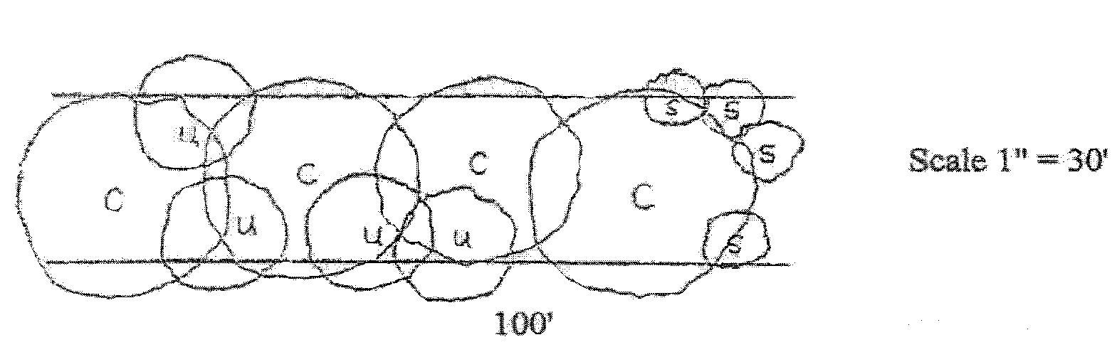
Typical buffer strip of 25 feet in width.
(2)
Buffer strips which are required to be a minimum of 35 feet in width shall be planted based on the following number of plant units per 100 linear feet of buffer strip:
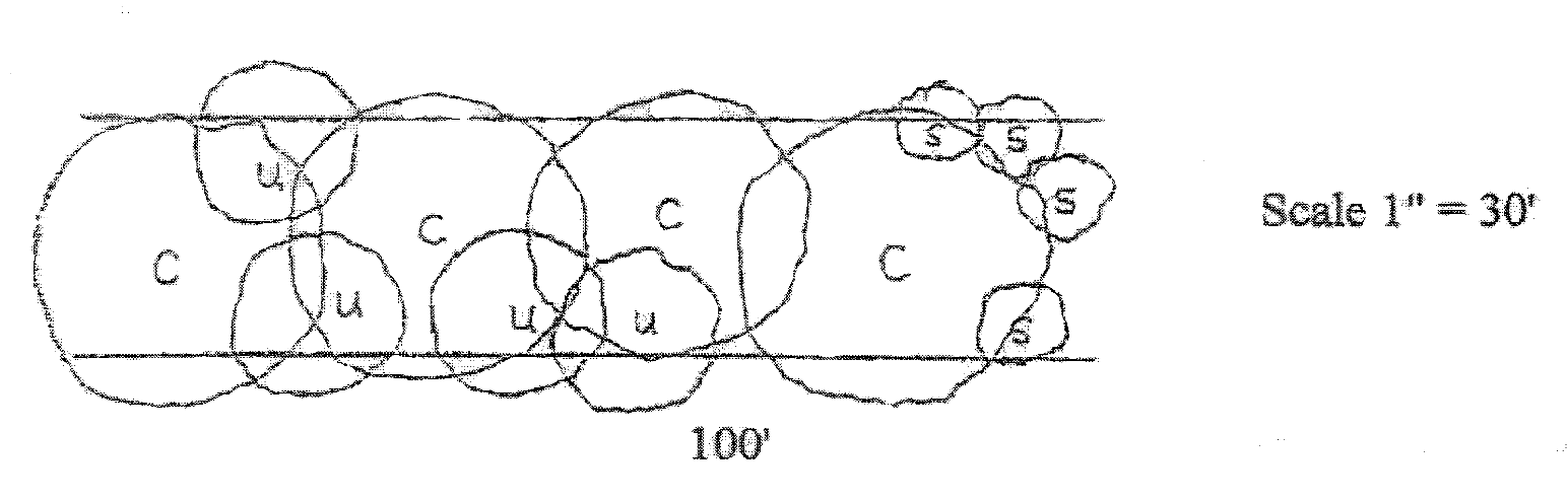
Typical buffer strip of 35 feet in width.
(3)
Buffer strips which are required to be a minimum of 50 feet in width shall be planted based on the following number of plant units per 100 linear feet of buffer strip:
Typical buffer strip of 50 feet in width.
c.
Size and arrangement of buffer trees and shrubs. Deciduous canopy and understory trees shall have at least a two-inch caliper, as measured six inches above the ground, at the time of planting. However, due to variations in caliper for different tree species, the VRRB may also permit certain understory deciduous species to be planted at an initial caliper of 1½ inches, provided that the overall required total of caliper inches based on two-inch caliper trees is satisfied and the design intent is clearly not compromised. Evergreen canopy and understory trees shall be at least six feet tall at the time of planting. Multi-stem trees shall be at least eight feet tall at the time of planting. And, large shrubs shall be at least three feet tall at the time of planting.
Plant material to be used for buffering may be arranged in any reasonable manner, provided the plant material is distributed throughout the entire buffer strip and is spaced so as to provide a natural look which will promote the long-term survival of the plant material.
d.
Plant material substitutions. Where a design or the specific conditions associated with a site necessitate, the VRRB may permit larger plant material, such as understory trees, to be substituted for smaller plant material, such as large shrubs, on a one to one basis. In all cases, however, a mixture of plant material shall be provided so that a natural look is clearly conveyed.
e.
Berms, fences, and walls. Where a berm, timber fence, or masonry wall is used, the required plant units may be reduced by one-half for that portion of the buffer strip fronted by the berm, fence, or wall. Where a berm, fence, or wall does not extend the full length of the buffer strip, the regular required number of plant units shall be provided along that portion of the buffer strip not fronted by the berm, fence, or wall. The required minimum height for all berms, fences, and walls shall be six feet. In addition, where masonry walls are used, such walls shall be architecturally compatible with the principal building. And, where berms are used, the slopes of berms shall not exceed 3:1 (run/rise) and shall be planted with perennial grass and/or other suitable plant material.
f.
Structures within a required buffer strip. No structures other than fences, walls, or signs shall be permitted within a required buffer strip. The planning commission, however, may consider permitting certain structures associated with utilities to be placed within a required buffer strip, provided all landscaping requirements can be met.
g.
Existing wooded areas as buffers. Existing wooded areas may be used to fulfill the buffering requirements of this section, provided such wooded areas are located within and largely cover the full depth of the required buffer strip and are supplemented, where necessary, to equal the plant unit requirements of newly planted buffer strips. Where, because of a dense canopy of mature trees or some other unique condition, additional plant material would likely not survive, deficiencies in terms of plant material requirements may be addressed with the installation of a timber fence, architecturally compatible masonry wall, or some comparable alternative approved by the VRRB.
Existing individual trees and shrubs located within a buffer strip may also be substituted for required new buffer trees and shrubs, provided the existing tree or shrub is safe, healthy, meets the minimum size requirements for new plant material, and provides a significant screen.
Existing trees and shrubs located within 25 feet of a required buffer strip may count toward 20 percent of the required number of trees and shrubs, provided the trees and shrubs are safe, healthy, meet the minimum size requirements for new plant material, and provide a significant screen. In addition, all other landscape requirements shall be met and a note shall be added to the landscape plan which states that all trees and shrubs to be counted toward fulfilling buffering requirements and which are not located within the required buffer strip shall be treated as though they were in the buffer strip and shall be preserved. Any such trees and shrubs removed shall be replaced with new buffer trees and shrubs which meet the criteria specified in this ordinance. In addition, these new buffer trees and shrubs shall be approved by town staff and shall be located within the required buffer strip.
h.
Grading in required buffer strips. Grading shall not be permitted within required buffer strips where wooded areas exist. In all other portions of required buffer strips, the finished grade shall not be steeper than a ratio of 4:1 (run/rise).
6.
Landscaping of ground-mounted signs. A landscaped area around the base of all ground-mounted signs is required. The minimum landscaped area shall be determined by multiplying the longest length of the sign face by five feet. This square footage of landscaped area must then be distributed around the sign base. The number of shrubs to be planted within this area shall be based on the sign face dimensions. A minimum of four shrubs shall be required where the sign face is less than 20 square feet and a minimum of six shrubs shall be required where the sign face is greater than 20 square feet.
All required shrubs must be at least one foot in height at the time of planting. The remainder of the landscaped strip shall be planted with grass, ground cover, and/or seasonal flowers.
Any lights directed toward a ground-mounted sign shall be placed, screened, and/or designed to minimize light that does not illuminate the target area. Blinders, or some other type of protectors, may be required to be placed on the lights so as to direct the beam away from adjacent properties, rights-of-way, access easements, or driveways. All external lighting must be reviewed as part of the sign permit process and a field review shall verify compliance.
Curbing, railroad ties, fencing, or other similar types of vehicular barriers shall be placed around landscaped areas to protect such areas from vehicular traffic.
7.
Exclusivity of area landscaping requirements. All area landscaping requirements shall be met independently. For example, a tree to be counted toward fulfilling the shade tree requirements shall not be counted toward fulfilling the buffer strip or detention basin tree requirements.
E.
General landscaping provisions.
1.
Tree preservation/removal. The preservation and/or removal of existing trees shall be in accordance with the Tree Protection Ordinance [now chapter 113] found in the Farragut Municipal Code.
2.
Standards for crediting existing trees and shrubs. Existing trees/shrubs will only be credited as fulfilling landscaping requirements where such trees/shrubs meet the following requirements:
a.
They are healthy, safe, and meet the size, location, and other applicable requirements of this ordinance;
b.
They are comparable, in terms of species classification and general characteristics, to new trees and shrubs that would be permitted in the proposed location; and
c.
They do not and are not likely to interfere with utilities, vision clearance standards, or obscure streetlights.
3.
Mixture of trees. At a minimum, developments which would require 20 or more new trees as part of the planting requirements of any section of this ordinance (e.g., shade, detention basin, buffering) shall be provided with the following variety of trees:
Where multiple trees are required, no one species shall constitute more than 75 percent of the total number of required trees for that given area.
4.
Prohibited plant material. Plant material which would interfere with underground or overhead utilities shall not be permitted.
Plant material, fences, walls, berms, and other similar objects to be planted or constructed within any visibility triangle and which would obstruct views at elevations between 2½ feet and ten feet shall not be permitted.
5.
Stabilization of slopes. In order to ensure the long term maintainability of slopes, slopes that are 2.5—3.0:1 shall be matted and planted with grasses that do not require mowing. Matting and grasses shall be approved by town staff. Exotic invasive species shall be prohibited. Slopes steeper than 2.5:1 are prohibited. Retaining walls or knee walls shall be constructed so as to maintain slopes gentler than 2.5:1.
F.
Completion and maintenance assurance requirements and continued maintenance responsibilities.
1.
Landscape completion assurance.
a.
Prior to the issuance of a Certificate of Occupancy, Certificate of Completion, or the recording of a final plat, all landscaping shall be planted. If, because of the time of year involved, the required plant material shown on the town approved landscape plan cannot be installed or would likely incur significant losses, an irrevocable letter of credit or other form of surety acceptable to the town attorney may be provided to the town in order to ensure satisfactory installation at an appropriate time. The irrevocable letter of credit or other acceptable surety shall be valid for a period not to exceed one year. A cost estimate from a professional landscape installer may be required in order to assist the town staff in helping to establish and/or verify an appropriate surety amount.
b.
If landscaping is not planted or, in the case of existing plant material, not preserved in accordance with the town-approved landscape plan and/or tree preservation/removal plan, the town retains the right to cash the approved form of surety submitted and, after written notification, enter the property, and complete the landscaping.
2.
Landscape maintenance assurance.
a.
Once all required landscaping has been planted in accordance with the town approved landscape plan, a two-year landscape maintenance irrevocable letter of credit or other form of surety acceptable to the town attorney shall be provided to the town staff. To help establish and/or verify a dollar amount, a minimum of one cost estimate based on 110 percent of the total cost of landscape replacement, including existing trees/shrubs counted toward fulfilling landscaping requirements, may be required by the town staff.
b.
Unless a completion irrevocable letter of credit or other acceptable form of surety is posted, the landscape maintenance assurance, as provided for above, shall be submitted to the town staff prior to the issuance of a Certificate of Occupancy, Certificate of Completion, or the recording of a final plat. In cases where an irrevocable letter of credit or other acceptable form of surety was issued to ensure satisfactory completion, such surety shall not be released until a landscape maintenance irrevocable letter of credit or other acceptable form of surety has been provided to town staff.
c.
Prior to the release of the landscape maintenance irrevocable letter of credit or other acceptable form of surety, the town staff shall inspect the site to ensure that all required plant material, including existing trees/shrubs counted toward fulfilling landscaping requirements, are healthy and are otherwise in accordance with the town approved plans. If plant material has died and has not been replaced, the town retains the right to cash the approved form of surety submitted and, after written notification, enter the property, and replace the dead, dying, or otherwise out of compliance plant material.
3.
Continued maintenance requirements.
a.
Upon expiration of any applicable landscape maintenance irrevocable letter of credit or other acceptable form of surety, property owners shall remain responsible for maintaining plant material in a healthy and orderly manner. Specifically, this shall mean that:
(1)
All plant growth in landscaped areas shall be controlled by pruning, trimming, or other suitable methods so that plant materials do not interfere with utilities, restrict pedestrian or vehicular access, or otherwise constitute a traffic hazard;
(2)
All landscaped areas, with the exception of those devoted to buffering, shall be maintained in a relatively weed-free condition and clear of undergrowth;
(3)
All plant material shall be fertilized and irrigated at intervals as are necessary to promote optimum growth; and
(4)
All trees, shrubs, ground covers, and other plant materials shall be replaced if they die or become unhealthy because of accidents, drainage problems, disease, or other causes.
b.
In locations where manmade materials are used to satisfy a portion of the landscaping requirements of this ordinance, such materials shall be maintained in good repair including, where applicable, periodic painting or finishing.
c.
Subsequent town issued permits, such as grading, building, and sign permits, may be withheld if, after written notification, required landscaping or landscaping to be preserved is not properly maintained.
4.
Removal of required plant material. Where any tree or shrub which was required as part of an approved landscape plan is removed, such tree or shrub shall be replaced with an equivalent tree(s) or shrub(s) approved by town staff.
5.
Topping of required plant material. Tree topping, as defined in this ordinance, of any tree that is used to satisfy the requirements of this section shall be prohibited. Where a tree or a portion of a tree is deemed by an arborist or comparable tree professional to be hazardous, such tree or portion thereof shall not be topped, but instead removed or pruned as recommended by a tree professional. Each required tree that is deemed hazardous and removed shall be replaced with a new tree that meets all applicable requirements of this ordinance.
If a tree is topped, such tree shall be removed and shall be replaced with a new tree(s) that meets all applicable requirements of this ordinance. If the topped tree is larger than two inches at DBH, replacement trees shall be planted per a one to one (1:1) ratio. For example, a topped tree that is ten inches at DBH shall be replaced with five two-inch caliper trees.
(Ord. No. 86-16, 4-1986; Ord. of 2-2006; Ord. No. 08-09, § 2, 6-26-2008; Ord. No. 09-08, § 1, 6-25-2009)
Sec. XIII. - Outdoor site lighting.
A.
Intent. It is the intent of this section to establish outdoor lighting requirements that reduce the negative effects of lighting and protect residents that may otherwise be adversely affected but at the same time address the need for adequate lighting for safety and visibility concerns. Unless provided for otherwise in this ordinance or the Subdivision Regulations, the following requirements shall apply to all developments and/or facilities, excluding single-family and two-family dwellings, street lighting, and lighting associated with a government-owned facility that hosts activities for public use and attendance. Ballfield lighting, temporary or permanent, shall only be permitted in areas where it is directly associated with such government facilities. In no case, however, shall any light shine or glare to create a traffic safety hazard or nuisance due to uncontrolled glare on any adjacent properties, rights-of-way, access easements, or driveways.
B.
Pole mounted lights.
1.
Pole height for new lights. Unless specified elsewhere in this ordinance, light poles, including any supporting base, shall not exceed 28 feet in height. The height shall be measured from the ground to the top of the pole.
2.
Pole height for modifications to existing lights. For existing developments that are expanding, if the existing light poles are taller than 28 feet, and new light poles are to be added as part of the expansion to the project, the planning commission may approve a light pole taller than 28 feet so as to match the existing light poles if it can be shown that the taller light pole will not create any negative effects on any adjacent properties, right-of-ways, access easements, or driveways. In no case shall new light poles exceed the height of the existing light poles or 40 feet in height, whichever is less.
3.
Performance standards for pole mounted lights.
a.
Fixture orientation. Light fixtures on pole mounted lights shall be horizontal in orientation so that light is directed only toward the ground below. Light shall not be distributed out the front or sides of the fixture. No portion of the light source or material surrounding the light source which allows light through shall protrude from the light box/housing.
b.
Fixture style. A variety of fixture styles are permitted provided they can demonstrate full compliance with the performance standards of this ordinance. If pole mounted lights are located adjacent to property zoned residential or agricultural and such land is below the pole base elevation, exterior or interior glare shields shall be added to the pole mounted lights. No lights shall shine or glare directly onto adjacent properties, right-of-ways, access easements, or driveways. For the purposes of this ordinance, glare shall be defined as any brightness within the field of vision of such a character as to cause annoyance, discomfort, interference with vision, or loss in visual performance and visibility.
c.
Footcandles. The maximum number of footcandles at a street right-of-way or a property line that is adjacent to non-commercial or non-office zoned land, including community service zoned land, shall be 0.5 footcandles. The maximum number of footcandles at a street right-of-way or a property line that is adjacent to commercial or office zoned land shall be 3.0 footcandles.
d.
Kelvin temperature. Pole mounted light fixtures shall not exceed 4000 degrees Kelvin.
C.
Wall mounted lights.
1.
Performance standards for wall mounted lights.
a.
Fixture orientation. Unless specified elsewhere in this ordinance, all wall mounted lights shall be horizontal in orientation and direct light only at the ground. Light distributed out the front or sides of the fixture is specifically prohibited. An exception for a decorative wall mounted light fixture with a non-horizontal light source is permitted, provided the material that allows light through is frosted or refractive with regards to light distribution, so that the light source is not visible. No portion of the light source or material surrounding the light source which allows light through shall protrude from the light box/housing. Clear non-horizontal lenses are specifically prohibited. The only exception to this is an emergency light.
b.
Fixture style and mounting height. A variety of fixture styles are permitted provided they can demonstrate full compliance with the performance standards of this ordinance. The maximum mounting height on the wall for all wall lights shall be 15 feet.
c.
Footcandles. The maximum number of footcandles at a property line that is adjacent to non-commercial or non-office zoned land, including community service zoned land, shall be 0.5 footcandles. The maximum number of footcandles at a street right-of-way or a property line that is adjacent to commercial or office zoned land shall be 3.0 footcandles.
d.
Kelvin temperature. Wall mounted light fixtures shall not exceed 4000 degrees Kelvin.
D.
Decorative string lights.
1.
Performance standards for decorative string lights.
a.
Fixture style. Decorative string lights shall not include blinking or any type of motion and shall be without color. Individual bulbs shall not exceed 300 delivered lumens.
b.
Footcandles. The area being illuminated by decorative string lights shall not exceed 5.0 footcandles. Where the abutting property is zoned residential, the area being illuminated by decorative string lights shall not exceed 3.0 footcandles. The maximum number of footcandles at a property line that is adjacent to non-commercial or non-office zoned land, including community service zoned land, shall be 0.5 footcandles. The maximum number of footcandles at a street right-of-way or a property line that is adjacent to commercial or office zoned land shall be 3.0 footcandles.
c.
Kelvin temperature. Decorative string lights shall not exceed 3000 degrees Kelvin.
E.
Ground mounted lights.
1.
Performance standards for ground mounted lights. All ground-mounted lights, whether used to illuminate a building, sign, or some other object shall be designed to minimize light that does not illuminate the target area. Typically, these would be in-grade fixtures. In all cases, however, no portion of the light source or material surrounding the light source which allows light through shall protrude from the light box/housing.
Since glare will be a more likely issue with above grade fixtures, blinders, shields, or some other type of protectors, may also be required on these lights to eliminate glare and direct the beam away from adjacent properties, rights-of-way, access easements, or driveways.
F.
Bollard lights and landscape lights.
1.
Performance standards for bollard lights. Where bollard or landscape lights are used, the light source shall be concealed either within the light box/housing or with a frosted lens so that the light source is not visible. Bollard or landscape lights shall not exceed 500 lumens unless they are full cutoff in which case, they shall not exceed 1000 delivered lumens.
G.
Under canopy and similar lights.
1.
Performance standards for under canopy and similar lights. Lights located under gasoline service station canopies, canopies for bank automatic teller machines, and other such similar canopies shall be recessed into the ceiling structure or shall use light blinders, shields or some other type of protectors to eliminate glare. No portion of the light source or material surrounding the light source which allows light through shall protrude from the structure ceiling. Under canopy and similar lights shall not exceed 4000 degrees Kelvin.
H.
Code and service line requirements. All outdoor site lighting shall comply with applicable building, fire, and utility code requirements. All electrical lines servicing outdoor site lighting shall be underground.
I.
Lighting plan submittal and verification requirements.
1.
Plan requirements. Where any outdoor site lighting is proposed, site plans, as required in Chapter 4 of the Zoning Ordinance, shall include a lighting plan to specifically address compliance with this ordinance. The lighting plan shall be signed and sealed by a licensed electrical engineer, and include, as applicable, the following:
a.
A scaled lighting layout of the site showing and labeling the locations and types of lights proposed in different locations.
b.
A light fixture table that corresponds to the site lighting sheet and that includes the type and number of fixtures proposed in different locations.
c.
A diagram showing the overall height and fixture orientation of pole mounted lights. If old poles are to be reused with new fixtures, the lighting plan shall certify that the old poles will meet the EPA ratings required to support the new fixtures.
d.
A diagram showing the overall height and fixture orientation of wall mounted lights.
e.
Specification sheets for all proposed outdoor light fixtures. Such sheets shall specifically address the corresponding performance standards provided for in this ordinance.
f.
A photometric plot which illustrates the footcandle readings for areas illuminated by string lights and along all property lines and rights-of-way to demonstrate compliance with this ordinance.
2.
Verification requirements. Upon completion of a project and prior to the issuance of a certificate of occupancy or certificate of completion, a lighting certification prepared by a licensed electrical engineer shall be submitted to the town to verify that all outdoor lights have been installed per the approved lighting plan and in compliance with the performance standards and other requirements of this ordinance.
Town staff may waive the verification requirement from a licensed electrical engineer for a portion or all the outdoor lighting where compliance with this ordinance is obvious and can be reasonably verified by town staff.
3.
Modifications to existing facilities. Existing facilities that are adding new lights or changing existing lights shall submit a lighting plan that addresses the applicable performance standards and other requirements of this ordinance. The town staff will review this and, depending on the scope and nature of the modifications, may require a formal approval from the planning commission as part of a site plan review. Consistent with this ordinance, height increases for pole mounted lights shall be presented to the planning commission for approval.
Town staff may also require a verification from a licensed electrical engineer where compliance with this ordinance cannot be reasonably verified by town staff.
(Ord. No. 86-16, 4-1986; Ord. of 2-2006; Ord. No. 06-24, §§ 1, 2, 9-14-2006; Ord. No. 08-03, §§ 1, 2, 3-27-2008; Ord. No. 09-11, § 1, 6-25-2009; Ord. No. 12-20, §§ 1, 2, 1-24-2013; Ord. No. 13-15, § 1, 5-23-2013; Ord. No. 21-20, § 1, 1-27-2022; Ord. No. 22-12, § 2, 1-12-2023)
Sec. XIV. - Lots or parcels.
A.
On subdivided land where the map is of official record in the Register's Office of Knox County, Tennessee, only one dwelling structure may be erected on a lot, except as permitted as a special exception.
B.
No building shall be erected on a lot which does not abut, for a minimum of 25 feet, on a public road, as prescribed in the Farragut Subdivision Regulations.
C.
Where the owner of a lot consisting of one or more adjacent lots-of-record does not own sufficient land to enable the conformance to the yard or other requirements of this ordinance, an application may be submitted to the board for a variance from the spatial requirements of this ordinance. Such lot may be used as a building site, provided however, that the yard and other requirements of the district are complied with as closely as is possible in the opinion of the board.
Adjacent lots-of-record in single ownership shall be used as a single lot or several lots of minimum permitted size, and the lot or lots in one ownership shall be subjected to the requirements of this ordinance.
D.
No recorded lot shall be divided into two or more lots unless such division results in the creation of lots each of which conforms to all of the applicable regulations of the district in which the property is located. No reduction in the size of a recorded lot below the minimum requirements of this ordinance shall be permitted.
E.
No lot which is now or may in the future be built upon, shall be reduced in area so that the yards and other open spaces will be smaller than prescribed by this ordinance; and except as otherwise provided for by this ordinance no yard, court, or open space provided about any building for the purpose of complying with the provisions of this ordinance, shall be used as a yard, court, or other open space for any other building.
(Ord. No. 86-16, 4-1986; Ord. of 2-2006; Ord. No. 19-20, § 5, 6-27-2019)
Sec. XV. - Marinas and boat docks.
A.
Side yards shall not be less than 50 feet and this area shall be free of both primary and accessory buildings.
B.
A buffer strip may be required by the board.
C.
One parking space for each boat mooring plus two spaces per 100 square feet of building space. The board may require additional spaces where public boat launching ramps are provided.
(Ord. No. 86-16, 4-1986; Ord. of 2-2006)
Sec. XVI. - Mining and mineral extraction.
A.
The following regulations shall apply to the mining and extraction operations of drilling, deep shaft, sand and gravel pits, quarries, surface mines, and to the removal of topsoil, sand, clay, shale, gravel or other earth for purposes other than those customarily involved in the grading of streets, highways, rights-of-way or for agricultural purposes, and such excavation necessary in preparing land for the construction of foundations, footing, cellars, or other structures below the natural grade.
B.
No premises or buildings shall be used for any mining and extraction purpose listed in the foregoing paragraph until an application, in writing, is filed with and a conditional use permit has been approved by the board and issued by the building official after a public hearing, and such operations shall be conducted in conformity with the following conditions:
1.
All equipment, building, and premises used for such purpose shall be constructed, maintained, and operated in accordance with the performance standards set forth in this ordinance.
2.
The excavations shall be confined to areas at least 200 feet from any property line, and further, no overburden, spoilbank or stockpile may be deposited within 100 feet of any property lines except that such excavation may, with the written consent of the owners of the adjoining property, be conducted within such limits in order to reduce the elevation thereof to conform with the existing contour or average grade of the adjoining property or in order to provide for adequate drainage.
3.
The excavations shall be confined to areas at least 100 feet from the right-of-way of any existing or platted street, road or highway; except, that excavations may be conducted within such limits in order to reduce the elevation thereof to conform to the existing or established elevation of the adjoining or platted street, road, or highway, or in order to provide for adequate drainage.
4.
Any building containing power driven or power producing machinery or equipment shall be at least 500 feet from all adjacent property and such building or equipment shall be at least 200 feet from the right-of-way lines of any existing or platted street, road, or highway.
5.
All roadways on, and all vehicular entrances to and exits from the private properties on which such operations are conducted to any public roads shall be located to ensure safety, to lessen congestion and to facilitate transportation and shall be so maintained as to eliminate any nuisance from dust to neighboring properties.
6.
A plan of operations shall be submitted for approval by the board which shall provide, in all respects, for the adequate safeguarding and protection of neighboring interests and the general public health and safety, and which shall include a satisfactory plan for the routing of trucks, materials, and equipment from the points of extraction to the permittee's processing operations, a plan and program for the restoration of the land to maximize its reuse potential and to minimize potential detrimental effects on the area by reducing, insofar as is reasonably possible, peaks and depressions and controlling erosion. Any such plan approved by the U.S. Federal Government or the State of Tennessee shall be sufficient to meet these requirements.
7.
Whenever the permit issued by the town administrator or his designated representative has expired or whenever the operation of any gravel or sand pit quarry, or other excavation shall have been discontinued for any period exceeding 12 consecutive months, then, except as may otherwise be permitted upon application to and after hearing by the board, all plants, buildings, structures (except fences) and equipment shall be entirely removed from the property and the property shall be restored in accordance with the approved plan and program for restoring land.
8.
If the property to be used for such excavation is within 100 feet of any residential zone or platted subdivision, it shall be enclosed along the exterior boundaries thereof by a buffer strip.
9.
No excavation shall take place or plant operated on any property, except between the hours of 7:00 a.m. and 6:00 p.m., except whenever any reasonable or necessary repairs to equipment are required to be made.
C.
Upon application in writing, the board may approve the issuance of an amended permit to alter the plan of operations theretofore approved or to extend the life of the permit when the duration of the mining operation was underestimated in the application for the original permit.
D.
A cash bond equal to $500.00 per acre of land to be excavated during the permit period shall be filed with the Farragut Board of Mayor and Aldermen to guarantee the proper restoration and reclamation of the land in accordance with the approved plan; however, proof of bond posted with the State of Tennessee in meeting requirements of the Tennessee Strip Mine Law of 1967 [repealed—see now T.C.A. § 59-8-101 et seq.) shall be acceptable in lieu of this requirement.
(Ord. No. 86-16, 4-1986; Ord. of 2-2006)
Sec. XVII. - Nonconforming buildings and uses.
It is the intent of this ordinance to permit the operation and maintenance of legitimate nonconforming buildings and uses.
A.
Nonconforming buildings.
1.
Operation. Such existing buildings and structures which, as a result of this ordinance and amendments to it, do not comply with required yard and setback areas, exceed height limitations or lack sufficient parking space or otherwise fail to comply with then applicable rules and regulations, may continue to exist and be utilized subject however to the following:
a.
If a tract or parcel of realty has located thereon an existing nonconforming building or nonconforming structure which has remained vacant from a conforming use or has remained vacant from a nonconforming grandfathered use for more than 365 days, then in such event such building or structure may not again be occupied for any purpose unless a variance or special exception for such further occupancy be granted by the board.
b.
In considering an application by a party for such variance or special exception said board shall require the applicant to comply with such then applicable rules and regulations as would be applicable to new construction upon the tract or parcel to the extent possible insofar as such relate to matters other than the actual building(s) or structure(s) sought to be occupied. As to the building or structure itself, the board may impose such reasonable conditions as it may determine so as to bring such building or structure as nearly as possible into conformity with, but not exceeding, current zoning rules and regulations and current building and occupancy code standards. The board may not impose conditions and requirements with respect to said building(s) or structure(s) the cost of which exceed 50 percent of the value of the building or structure. The town administrator, or his designee, shall not issue an occupancy permit for such building or structure unless an application for variance or special exception shall have been approved by the board and all conditions and requirements imposed by the board have been satisfied.
2.
Expansion permitted as special exception. Nonconforming buildings and structures may be permitted to expand provided that the board determines that there is reasonable space for their expansion and that the expansion does not compound their condition of being nonconforming.
3.
Repair and replacement permitted as special exception. Nonconforming buildings and structures may be reconstructed if damaged by fire, flood, wind, or accident provided it is determined by the board that the cost of reconstruction does not equal or exceed 50 percent of the replacement cost. If the board determines that the cost of reconstruction exceeds 50 percent of the replacement cost, then the building or structure shall be reconstructed in conformance with the district requirements.
4.
Violation of prior ordinance or resolutions. Any building or structure created prior to this ordinance but interpreted by the board to have been in violation of ordinances or resolutions then in effect is not to be granted any rights of a nonconforming building or structure and is subject to removal.
B.
Nonconforming uses.
1.
Operation. Such existing use or activity which, as a result of this ordinance and amendments to it, occurs within a district in which it is not either a permitted use or permitted as a special exception may continue. Such continuation does not include the change from one nonconforming use to another nonconforming use.
2.
Expansion permitted as special exception. Nonconforming uses may expand provided the board determines that there is reasonable space on the property owned and occupied by the nonconforming user prior to the zoning designation which rendered the use nonconforming. Property acquired after the zoning designation which renders the use nonconforming cannot be utilized as reasonable space. Existing commercial and industrial uses within or adjoining residential districts may expand only if they provide a buffer strip along those property lines which adjoin private residentially zoned property. Said buffer strip shall be equal in width to the corresponding yard requirement for the district in which the commercial or industrial use is located and shall conform with the definition of buffer strip contained in Chapter 2.
3.
Repair and replacement permitted as special exception. Nonconforming uses shall not be terminated as a result of damage or destruction of the structure or building which they occupy providing the board determines that there was reasonable space on the property owned and occupied by the nonconforming use at the time of its becoming nonconforming.
4.
Discontinuance of nonconforming uses. Any building structure or land area which is used in whole or in part as a nonconforming use which is abandoned by or vacant from that nonconforming use for a consecutive period of 365 days shall not be utilized again for a nonconforming use and may only have permitted uses or special exception uses conducted within the building and/or land area.
(Ord. No. 86-16, 4-1986; Ord. of 2-2006)
Sec. XVIII. - Nursing homes.
The following regulations shall apply to nursing homes as defined in Chapter 2:
A.
At least a portion of the development site shall be adjacent and contiguous to the right-of-way of a major or minor arterial. Access to the public right-of-way shall be governed by the provisions of the Farragut Municipal Code, but in no instance shall the principal access be onto other than a major or minor arterial.
B.
Landscaped buffer strips, installed in accordance with the definition provided in Chapter 2, shall be required along the side and rear property lines, regardless of the adjacent zoning classification.
C.
A certificate of need shall have been issued by the Tennessee Department of Health and Environment or other appropriate state agency and evidence of such shall be submitted prior to beginning the development review process in the Town of Farragut.
D.
All nursing home projects must be on sewer.
E.
Area regulations.
1.
Maximum lot coverage: Determined by zoning district.
2.
Maximum building height: Determined by zoning district.
3.
Maximum number of nursing home units per acre: Determined by site and building design.
F.
On-site incineration of any type is prohibited.
(Ord. No. 86-16, 4-1986; Ord. of 2-2006; Ord. No. 16-05, § 3, 3-24-2016)
Sec. XIX. - Off-premises outdoor advertising.
The intent of this section is to regulate off-premises outdoor advertising. Nothing contained in this section shall imply approval by the Town of Farragut of the continued existence and use of such off-premises outdoor advertising (also known as billboard).
A.
Off-premises outdoor advertising is to be the sole and exclusive use on a tract of land upon which the use is located.
B.
Any existing off-premises outdoor advertising must be removed before a building permit will be issued for the development, expansion, remodeling, or redevelopment of a lot.
C.
Location and setbacks. The outermost edge (cabinet) of an off-premises outdoor advertising structure shall conform to the setback requirements for principal buildings for the district in which it is located.
This section recognizes that there may currently be existing billboards with nonconforming setbacks; however, when a lot is subdivided, the configuration of the lot must be such that all other setbacks shall be met.
(Ord. No. 86-16, 4-1986; Ord. of 2-2006)
Sec. XX. - Parking and loading.
A.
Off-street parking requirements.
1.
General requirements.
a.
Residential off-street parking space shall consist of a parking lot, driveway, garage, or combination thereof and shall be located on the lot it is intended to serve.
b.
Unless approved by the planning commission as provided for in this ordinance, any area once designated as required off-street parking shall not be changed to any other use unless and until equal facilities are provided elsewhere.
c.
The placement of motor vehicles for sale or the repair of vehicles on required off-street parking facilities is prohibited. This provision does not apply to the placing of a "For Sale" sign on or in not more than one licensed vehicle, boat, or other equipment at the same time located in a private residential driveway and which licensed vehicle, boat, or other equipment is owned by an occupant of said private residence.
d.
Wherever parking is required by this ordinance, no building permit shall be issued prior to approval of entrance to affected city streets and/or state highways by the appropriate town and/or state official.
2.
Location and setbacks.
a.
With the exception of shared parking, as provided for in this ordinance, all off-street parking shall be located on land owned by or under long-term lease to the owner or owners of the principal use it is intended to serve.
b.
Where the commercial parking lot abuts side lot lines of a residential district, the required buffer strip shall not be used for parking purposes.
c.
Where parking is to be provided in the front yard of a commercial, office, or multi-family development, the parking lot shall be set back a minimum of 20 feet from the front property line.
d.
Where parking is to be provided in the rear or side yard of a commercial or office development, the parking lot shall be set back a minimum of ten feet from the side or rear property line.
e.
Where parking is to be provided in the rear or side yard of a multi-family development, the parking lot shall be set back a minimum of 50 feet from the side or rear property line, except as provided for elsewhere in this ordinance.
3.
Number of parking spaces required.
Bicycle parking. The minimum number of bicycle parking spaces required whenever any use or building is created, developed or modified requiring vehicular parking, shall be in accordance with the following standards:
Bicycle parking spaces must include a securely anchored rack that supports the bicycle upright by its frame in two places, enables the frame and one or both wheels to be secured (a U-lock should be able to lock a frame component and wheel), and prevent the wheel of the bicycle from tipping over. Inverted "U", "A", Post & Loop, and similarly designed racks are strongly recommended. Such rack designs support two bikes per fixture and count as two parking spaces. Bike lockers are also permitted. Comb, toast, wave, and traditional school-yard rack types do not generally meet these requirements and should not be utilized.
Bicycle racks shall be provided in visible locations on a concrete or comparable pad surface designed for bicycle parking. Racks shall be conveniently located near the building entrance in an unobstructed usable manner and shall be adequately distributed within multi-tenant developments. Their placement must not impede pedestrian or accessible routes and should not cause conflicts between bicycles and pedestrians. Bicycle parking facilities shall also be sufficiently separated from motor vehicle parking areas to protect parked bicycles from damage.
Vehicular parking. Unless a modification, as authorized in this ordinance, is approved by the planning commission as part of the site plan review process, provisions for off-street parking in all districts at such time any building or structure is erected or enlarged or increased in capacity, shall be based on the minimum number of off-street parking spaces provided below. For uses not specifically mentioned herein, off-street parking requirements shall be determined by the Board of Zoning Appeals.
Assisted-care living facility: ¾ parking spaces per each housing unit.
Automobile and/or truck repair shop: One parking space per 250 square feet of gross floor area.
Automobile sales, new and/or used: Five plus one per 200 square feet of gross floor area.
Banks, business offices: One per 300 square feet of gross floor area.
Barbershop or beauty parlor: One per 200 square feet of gross floor area.
Boarding or rooming house: One for each lodging unit.
Bowling alleys: Five per bowling lane.
Business services: One for every 50 square feet of customer service area, plus two per three employees based on the design capacity of the largest shift.
Carpet, rug, linoleum and floor covering sales: One per 400 square feet of gross floor area.
Churches: One per 30 square feet of gross floor area of auditorium.
Coin-operated automatic automobile washing establishments: Three stack-up spaces per washer bay. Such spaces must be designed so that the spaces will not limit ingress or egress to the site.
Coin-operated laundry and/or dry cleaning establishments: One per 100 square feet of gross floor area.
Conveyor-type automatic automobile washing establishments: One stack-up space per five feet of conveyor tunnel. Such spaces must be designed so that the spaces will not limit ingress or egress to the site.
Country club/private club: One per 400 square feet of gross floor area. Plus 1½ per hole for golf course, two per tennis court, and one per 100 square feet of surface for swimming pools.
Day care center: One per employee plus one per 25 children.
Dry cleaning and laundry collection stations: One per 400 square feet of gross floor area.
Furniture and major appliance establishments: One per 400 square feet of gross floor area.
Gasoline/mini-mart station: Two per one gas pump island plus two per each employee during the major work shift or two per one gas pump island plus one per 150 square feet of gross floor area, whichever is greater.
Governmental office building: One per 300 square feet of gross floor area.
Handicapped/accessible parking spaces: Where parking is provided, the number of handicapped/accessible parking spaces shall be as specified by the current adopted edition of the International Building Code, as amended by the Town of Farragut.
Hospital: Two per bed.
Hotel: One per one room or suite.
Independent living and care: One parking space per bedroom and one guest space per ten bedrooms.
Indoor soccer, inline hockey, baseball, and softball fields: 41 parking spaces per indoor play field.
Kennel: One per 400 square feet of gross floor area.
Lawn and tractor sales and service establishments: One parking space per 690 square feet of gross floor area.
Library: One for each 400 square feet of floor area.
Mortuary establishments: One per 100 square feet of gross floor area.
Motels and tourist courts: One per guest bedroom.
Nursing homes: One per three patient beds.
Professional offices: One per 250 square feet of gross floor area.
Regional recreational and entertainment facility: One per 130 square feet of gross floor area.
Residential:
Single and two-family dwellings: Two spaces per dwelling unit.
Apartments/multi-family: 1¾ spaces per dwelling unit.
Residential recreational facilities:
Pavilion: One per 400 square feet of gross floor area or a minimum of three parking spaces, whichever is greater.
Arbor: No parking required.
Decorative fountain: No parking required.
Restaurants, tea rooms, cafes, coffee houses, or other similar establishments serving food or beverage: One per 100 square feet of gross floor space plus one per 200 square feet of discernable outdoor dining area.
Retail liquor store: One per 400 square feet of gross floor area.
Retail stores (except as otherwise specified herein): One per 250 square feet of gross floor area.
Retail stores larger than 50,000 square feet: 3½ per 1,000 square feet of gross floor area.
Retail warehousing, building supplies, home improvement super centers/stores, and construction supplies establishments: One parking space per 400 square feet of gross floor area.
Schools shall be provided with parking spaces under the following schedules:
Elementary, junior high, and the equivalent private or parochial schools: Two per three teachers and employees normally engaged in or about the building or grounds, plus one space for each 150 square feet of seating area, including aisles, in any auditorium.
Senior high schools and the equivalent private or parochial schools: Two per three teachers and employees normally engaged in or about the building or grounds, plus one space per five students, or one space for each 150 square feet of seating area, including aisles, in any auditorium, gymnasium or cafeteria intended to be used as an auditorium, whichever is greater.
Kindergartens, day schools, and the equivalent private or parochial schools: Two parking spaces per three teachers and employees normally engaged in or about the building or grounds, plus one off-street loading space per eight pupils.
Shopping centers: For shopping centers and other multiple use buildings larger than 75,000 gross square feet, there shall be four parking spaces for each 1,000 square feet of gross floor area.
For shopping centers and other multiple use buildings between 50,000 and 75,000 gross square feet, there shall be 4½ parking spaces for each 1,000 square feet of gross floor area.
For shopping centers and other multiple use buildings with less than 50,000 gross square feet, there shall be five parking spaces for each 1,000 square feet of gross floor area.
Parking for detached facilities and buildings that are located on the same lot, parcel, or tract as the shopping center and/or multiple use building shall be in accordance with the regulations of parking required for such uses in these regulations.
Skating rinks: One parking space per 130 square feet of skating surface area.
Stadiums and sports arenas: One per 12 feet of benches.
Swimming pools (nonresidential): One per 150 square feet of water area for swimming pools developed as part of a subdivision, or one per 100 square feet of water area for public swimming pools.
Theaters, auditoriums and places of assembly without fixed seats: One per 100 square feet of gross area.
4.
Increasing or reducing required parking.
Where an applicant requests to increase or reduce parking from the minimum number of required off-street parking spaces, such request shall be based on demonstrated parking demands that are typical for the proposed use(s) throughout a majority of the year. An applicant shall be responsible for providing such documentation and this documentation shall be current and part of the site plan submittal.
Where the planning commission is asked to consider an increase from the minimum number of required off-street parking spaces and the applicant can properly demonstrate a need based on the language provided in this ordinance, the planning commission shall not authorize additional parking spaces in excess of ten percent above the minimum number required unless the following measures are provided and reflected on the approved site and landscape plans:
a.
An additional interior parking lot island is provided for every five parking spaces in excess of the minimum required; and
b.
The additional surface parking and travel lanes associated with the parking in excess of the minimum required shall be constructed in permeable pavers or a comparable and widely recognized low impact development surface parking application.
5.
Off-street parking lot construction and maintenance. Whenever the required off-street parking requires the building of a parking lot, and wherever a parking lot is built, such parking lot shall be constructed and maintained in accordance with the following regulations:
a.
All areas devoted to permanent off-street parking shall be of a sealed-surface construction such as plant mix asphalt, penetrating asphalt or concrete, or permeable pavers and shall be properly maintained;
b.
The curbs surrounding parkways, terminal islands, and interior islands shall be constructed with six-inch-high raised curbs to prevent uncontrolled access of vehicles. Where the area within a parkway or island is being used to accommodate stormwater, an alternate means of preventing uncontrolled access of vehicles into such areas may be considered. In the same manner, stormwater may be directed from the parking lot into the parkway or island without being inhibited by curbing.
6.
Minimum site design. To provide for orderly, safe, and systematic circulation within parking areas, off-street parking areas shall meet the following general requirements:
a.
Backing prohibited onto public street. Except for parcels of land devoted to one and two family uses, all areas devoted to off-street parking shall be so designed and be of such size that no vehicle is required to back into a public street to obtain egress.
Turn-around areas. Back-up or turn-around areas located at the end of dead-end parking aisles shall be a minimum of ten feet in depth.
b.
Handicap parking.
Each handicapped/accessible parking space shall be a minimum of eight feet in width and 19 feet in length. Such spaces shall have an adjacent access aisle, which shall be a minimum of five feet in width and extend the full length of the parking spaces they serve. For every six handicapped/accessible parking spaces, at least one shall be a van-accessible parking space. Such van-accessible parking space shall have an adjacent access aisle of eight feet in width.
Handicapped/accessible parking spaces shall be located on the shortest accessible route of travel from adjacent parking to an accessible building entrance. In parking facilities that do not serve a particular building, accessible parking spaces shall be located on the shortest route to an accessible pedestrian entrance to the parking facility. Where buildings have multiple accessible entrances with adjacent parking, accessible parking spaces shall be dispersed and located near the accessible entrances.
c.
Compact car parking. An applicant may design and construct up to 20 percent of their parking spaces for compact cars, as defined by the Environmental Protection Agency, in accordance with the dimensions listed below in this ordinance. Compact car spaces shall be grouped together to the greatest possible extent in areas clearly designated for compact cars. Parking lots shall have a system of regulatory compliant signs beginning at the entrance that clearly indicates the location of compact car spaces.
d.
Parking space and travel lane dimensions. For the purposes of this ordinance, the minimum parking space width shall be measured perpendicular to the center line of the parking space. For standard cars, the minimum parking space width shall be nine feet and the minimum parking space depth shall be 19 feet. For compact cars, the minimum parking space width shall be eight feet and the minimum parking space depth shall be 17 feet. Travel lanes shall conform to the following minimum standards:
e.
Shared off-site parking. Share off-site parking is encouraged, where applicable, as a means of more efficient land use. The development of a site should take into consideration any opportunities to share parking with an adjacent use. Shared off-site parking shall be considered as part of a site plan review and shall be subject to the following conditions:
(1)
No more than 30 percent of an applicant's required amount of off-street parking may be shared with an adjacent use;
(2)
Off-site parking shall be within 500 feet of the property for which it is being requested;
(3)
Off-site parking may only be provided if the off-site lot has an excess number of spaces or if the applicant can demonstrate, using the latest peak demand analyses published by the Institute of Traffic Engineers (ITE) or other comparable source acceptable to the Planning Commission, that the on-site and off-site uses have non-competing peak demands;
(4)
The amount of off-site parking spaces shall not be less than the amount of reduced on-site parking spaces;
(5)
Off-site parking spaces provided by a separate private property owner shall be subject to a shared parking easement agreement that is legally binding and runs with the land and that is graphically displayed on a recorded plat. Site plan approval where off-site parking is requested shall be subject to the recorded agreement and plat; and
(6)
Uses sharing a parking facility shall provide for safe, convenient walking between uses an parking, including safe, well-marked pedestrian crossings, signage, and adequate lighting that complies with the Town's outdoor site lighting requirements.
f.
Addressing fractions in parking space determination. In any determination of parking requirements as set forth in this section, where the resultant figure contains a fraction, any fraction less than one-half may be dropped and any fraction one-half or more shall be counted as one parking space.
g.
Driveways and other access ways. Driveways and other access ways shall meet the requirements of the Farragut Municipal Code.
h.
Perimeter parkways. Perimeter parkways no less than 20 feet in width shall be provided adjacent to the front property line. Perimeter parkways no less than ten feet in width shall be provided adjacent to the side and rear property lines (Illustration 5 (see Chapter 1)). If an access easement exists on a front property line, a perimeter parkway no less than 20 feet in width shall be provided adjacent to the edge of the access easement. If an access easement exists on a side or rear property line, a perimeter parkway no less than ten feet in width shall be provided adjacent to the edge of the access easement.
i.
Interior parkways. Interior parkways not less than ten feet wide shall be provided for at least every other parking aisle. The curbs shall be constructed with six-inch-high raised curbs to prevent uncontrolled access of vehicles.
j.
Terminal islands. Terminal islands not less than five feet wide from inside of curb to inside of curb shall be provided for at both ends of parking rows and interior parkways. The curbs shall be constructed with six-inch-high raised curbs to prevent uncontrolled access of vehicles.
k.
Interior islands. Interior islands not less than 7½ feet wide from inside of curb to inside of curb and extending the full length of the parking space shall be provided every 15 spaces within a row. As an alternative, an interior island not less than ten feet wide from inside of curb to inside of curb and extending the full length of the parking space shall be provided every 20 spaces within a row.
l.
Curbing around parkways or islands. Curbing around parkways or islands shall be constructed with six-inch-high raised curbs to prevent uncontrolled access of vehicles. Where the area within a parkway or island is being used to accommodate stormwater, an alternate means of preventing uncontrolled access of vehicles into such areas may be considered. In this manner, stormwater may be directed from the parking lot into the parkway or island area without being inhibited by curbing.
B.
Off-street loading requirements. For all commercial and institutional uses, a plan for parking lot and loading areas access shall be submitted as part of the site plan application. No service loading space shall be counted for required parking space. A plan for delivery circulation through a site shall be included as part of the site plan.
C.
On-street parking. In relation to on-street parking within the Town Center District (TCD), the primary street cross section included as Diagram TCD-1, as amended, shall be used. In other areas, where on-street parking spaces are proposed, such applications shall be considered only on joint access easements and streets classified as local on the Major Road Plan. Such on-street parking shall also be reviewed with the Town Engineer, emergency service providers, and other applicable entities to ensure that adequate space is available and no safety-related issues will be created. A minimum parking space width of eight feet and a minimum parking space depth of 23 feet shall be provided.
D.
Turning radius requirements. When designing curb radii for a site, the default design vehicle should be the passenger vehicle. Therefore, the default corner radius should be 15 feet. Larger design vehicles should be used only where they are known to regularly make turns at the intersection, and corner radii should be designed based on the larger design vehicle traveling at crawl speed. In such case, the turning radius shall not exceed 25 feet. In all cases, consideration shall be given to minimize any pedestrian and vehicular conflicts.
(Ord. No. 86-16, 4-1986; Ord. of 2-2006; Ord. No. 06-09, §§ 1, 2, 5-11-2006; Ord. No. 06-10, § 2, 5-25-2006; Ord. No. 06-23, § 1, 8-10-2006; Ord. No. 07-39, § 3, 1-10-2008; Ord No. 08-12, § 1, 7-24-2008; Ord. No. 09-01, §§ 1, 2, 2-26-2009; Ord. No. 10-19, § 1, 1-27-2011; Ord. No. 11-03, § 1, 4-28-2011; Ord. No. 11-27, §§ 1, 2, 1-26-2012; Ord. No. 14-13, §§ 1, 2, 9-9-2014; Ord. No. 16-06, §§ 4, 5, 3-24-2016; Ord. No. 16-16, § 1, 7-28-2016; Ord. No. 16-27, § 1, 3-9-2017; Ord. No. 19-01, § 1, 1-24-2019; Ord. No. 19-24, § 3, 8-22-2019)
Sec. XXI. - Right-of-way requirements.
Before any building permit is issued by the town administrator, it shall be determined that there is sufficient right-of-way along the existing or proposed street(s) to meet the minimum standards for the classification of the adjoining street(s) as specified in the Farragut Subdivision Regulations.
A.
When a building permit application indicates that a project will occur on only one side of an existing street, half of any additional right-of-way width required to meet the minimum standard specified in the Farragut Subdivision Regulations, measured from the centerline of the present right-of-way, shall be dedicated to the Town of Farragut or the State of Tennessee as appropriate.
B.
When a building permit application indicates that a project will occur on both sides of an existing street, the entire additional right-of-way width required to meet the minimum standard specified in the Farragut Subdivision Regulations, if any, shall be dedicated to the Town of Farragut or the State of Tennessee as appropriate.
C.
Such right-of-way dedication as may occur pursuant to subsections A and B above shall be reflected through a transfer by deed which shall be accompanied by a property line survey prepared by a surveyor licensed by [the] State of Tennessee.
(Ord. No. 86-16, 4-1986; Ord. of 2-2006)
Sec. XXII. - Pedestrian facilities.
A.
Where new construction or the redevelopment of a site necessitates a site plan review by the planning commission, walking trails or sidewalks, as determined by the planning commission, shall be constructed on all abutting streets. Preference shall be given to walking trails along collector and arterial streets because the greater width better accommodates a variety of users.
B.
Where new construction or the redevelopment of a site necessitates a site plan review by the planning commission, sidewalks or walking trails, as determined by the planning commission, shall be constructed from the parking lot to the pedestrian facility abutting the street on which the property fronts and to adjacent developments. The planning commission may also require a pedestrian facility to be constructed on an adjacent shared access easement.
C.
No Certificate of Occupancy shall be issued until all pedestrian facilities are completed or a letter of credit is provided to the town to ensure completion.
D.
All pedestrian facilities shall be constructed per the standards established in the Farragut Subdivision Regulations.
E.
All pedestrian facilities shall be free and clear of obstructions. All sidewalks shall maintain a minimum clear width of five feet. With the exception of bollards placed to prevent vehicular access, all walking trails shall maintain a minimum clear width of eight feet.
(Ord. No. 86-16, 4-1986; Ord. of 2-2006; Ord. No. 09-17, § 1, 8-27-2009; Ord. No. 10-18, § 1, 1-13-2011)
Sec. XXIII. - Site plan regulations.
It is the intent of this section to foster the town's attractiveness as a place in which to live and work by facilitating orderly and cost effective development.
A.
Applicability. To ensure compliance with all Town regulations, site plans shall be required for all new developments, modifications to existing developments, and/or redevelopments of all non single-family and two-family residential uses. Such plans shall be approved by the Planning Commission prior to any land disturbance or the issuance of a grading or building permit.
In order to prevent unnecessary and costly revisions, the applicant shall consult early and informally with the planning commission staff for advice and assistance. This will enable the applicant to become thoroughly familiar with all applicable regulations and other official plans or public improvements which might affect the area.
Pursuant to authority granted by Tennessee Code Annotated, § 13-4-104 [T.C.A. § 13-4-104], site plans for any public use, including, but not limited to, schools, parks, streets, public buildings, and utilities shall be prepared in accordance with the provisions of this ordinance.
B.
Site Plan Approval. The development standards in existence at the time of and applicable to the specific site plan approved shall be vested in accordance with Title 14, Chapter 7, of the Farragut Municipal Code, as amended.
C.
Site plan requirements.
1.
All site plans shall be prepared and certified by a licensed engineer, landscape architect, architect, and/or surveyor, as may be appropriate, and in accordance with state law regarding the practice of these professions.
2.
The site plan preparer shall certify that the submitted site plan includes and addresses all items identified in the application checklist.
3.
Upon completion of improvements of the approved site plan, the applicant shall submit finalized, stamped approved site plans and all associated revisions as a pdf and approved as-builts as a pdf prior to the issuance of any Certificate of Occupancy.
4.
All site plans shall be drawn at a scale of not less than 1" = 20' for small tracts and 1" = 50' for large tracts on sheets 24 inches by 36 inches. A minimum of four complete sets of site plans must be submitted at time of application. One reduced copy of any 8½ inches by 11 inches sheet shall also be submitted.
5.
All site plans shall comply with the town adopted fire codes and shall show adequate accessibility of buildings for emergency apparatus.
6.
All site plans shall set forth the proposed development of the total land tract and shall show the following information:
a.
Dimensions and calls of all property lines.
b.
North point, verbal and graphic scale, acreage of site, and location map.
c.
A tree preservation/removal plan as provided for in the Farragut Municipal Code.
d.
Required buffer strips.
e.
Contour lines showing existing and proposed grades.
f.
Stabilization details for all slopes greater than 3:1 (run/rise). Per the Town Engineer, certification from a geo-technical engineer may be required.
g.
A stormwater management plan (which can be incorporated into the grading and drainage plan), including drainage calculations and applicable details, as provided for in the Farragut Municipal Code.
h.
An erosion and sediment control plan as provided for in the Farragut Municipal Code.
i.
Calculations verifying maximum lot coverage.
j.
Calculations verifying landscaping requirements between buildings and parking lots.
k.
Locations of all existing and proposed buildings, including all building entrances.
l.
Elevations/schematics of proposed buildings. The building materials, colors, architectural style, and building height shall be indicated. The location on the building where the address will be posted shall also be indicated.
m.
Parking lots, including islands, interior parkways, parking lot design, interior traffic circulation, and associated dimensions.
n.
Loading areas for truck delivery.
o.
Driveway(s) to adjacent rights-of-way and/or joint access easements.
p.
Distances from the proposed driveway to existing driveways and intersections on the same street and which are located within the immediate vicinity of the proposed new driveway.
q.
Pedestrian access ways and pedestrian circulation patterns, showing the connections between building entrances, parking areas, sidewalks, walking trails, adjacent rights-of-way, etc.
r.
Garbage dumpsters and recyclable containers including location, screening, and access. All dumpsters and recyclable containers shall be screened with a permanent structure that is architecturally compatible with the principal structure.
s.
HVAC systems including screening.
t.
Location of all existing and proposed on-site utilities, including, but not limited to, poles, pad mounted transformers, and buried lines.
u.
Fire hydrant locations and water line sizes.
v.
A lighting plan.
w.
Antennas, including location, size, height, type, and screening.
(Ord. No. 08-02, § 1, 3-28-2008; Ord. No. 12-14, §§ 1, 2, 9-27-2012; Ord. No. 15-18, § 1, 11-12-2015)
Sec. XXIV. - Special events permit.
It is the intent of this section to establish the permitting process and the requirements for special events held by private entities within the Town of Farragut. A special event may include a wide range of activities such as, but not limited to, a grand opening, sidewalk sale, fund raiser, yard sale, vacation bible school, holiday pageant or program, etc.
A.
Non-Residential Uses, including Schools and Churches, and Not-For-Profit/Non-Profit Entities.
1.
General Requirements.
a.
Each individual permanent non-residential use with a valid Certificate of Occupancy is eligible for a special event. In addition, off-site not-for-profit and non-profit entities are eligible for a special event but shall be sponsored by an on-site commercial, office, or service entity.
b.
There shall be a maximum of four special events permits per entity per year.
c.
The duration of each special event shall not exceed ten calendar days.
d.
No special events are permitted on vacant or vacated properties.
e.
Sales from food trucks are permitted if part of an approved special event and shall be subject to a fee, as provided for in the adopted Town of Farragut Fee Schedule.
f.
Activities of the special event shall not materially affect the pedestrian or vehicular circulation within the immediate vicinity of the event. The traffic generation of the special event shall not be allowed to create a hazardous condition for traffic in the public rights-of-way.
2.
Sign Requirements.
a.
Sign provisions shall be in accordance with the applicable sections of the Farragut Sign Ordinance. Special events permit signs shall be considered temporary parcel signs. All signs shall have a white background and signs for commercial uses shall include, on at least 15% of the sign face, the Shop Farragut logo.
b.
All signs and any supporting posts shall be removed at the end of each approved special event time frame.
3.
Permitting Process. A special events permit application and filing fee shall be submitted to and approved by the Town prior to the commencement of the event. The applicant must have an approved permit in hand prior to holding an event.
All special events permit applications shall include the following information:
a.
Applicant's name, street address, telephone number, fax number, and e-mail address.
b.
Name, street address, telephone number, fax number, e-mail address, and signature of individual identified who assumes the responsibility of meeting the conditions of the permit.
c.
Applicant status (commercial, office, service, not-for-profit, non-profit, etc.).
d.
Location of event.
e.
Nature/name of event.
f.
Date range of event.
g.
Previous special events permit(s) approved during the calendar year.
h.
Where a sign is proposed, the application submittal shall be in accordance with the Farragut Sign Ordinance and the applicable provisions of this chapter. Special events permit signs shall be considered temporary parcel signs.
i.
If having a tent(s), sidewalk sales, food trucks, or any other outdoor activities, a site plan is required to show the locations for such activities. A separate tent permit may be required per fire safety requirements. A separate Mobile Food Vending Permit shall be obtained as referenced in the Farragut Municipal Code, Chapter 8. Businesses, Article 3. Mobile Food Vending Permit.
j.
Events on or involving/affecting public property, such as road races, bicycle ride events, concerts, etc., will require additional reviews and information and shall be coordinated with the Town staff. Some events may be subject to approval from the Board of Mayor and Aldermen.
k.
Events on or involving/affecting public property, such as road races, bicycle ride events, concerts, etc., will require additional reviews and information and shall be coordinated with the Town staff. Some events may be subject to approval from the Board of Mayor and Aldermen.
B.
Residential Uses.
1.
General Requirements.
a.
Each homeowner association and individual residence is eligible for a special event.
b.
There shall be a maximum of five special events permits per homeowner association and a maximum of two per residence per year.
c.
The duration of each special event shall not exceed three calendar days.
d.
Special events permits can only be applied for and issued to the property owner of record.
e.
No special events are permitted on vacant or vacated properties. Open space owned by a homeowner association may be used for a special event provided the land, without modifications, can accommodate the proposed activity.
f.
Sales from food trucks are permitted if part of an approved special event sponsored or hosted by a homeowner association. A separate Mobile Food Vending Permit shall be obtained as referenced in the Farragut Municipal Code, Chapter 8. Businesses, Article 3. Mobile Food Vending Permit.
2.
Sign Requirements.
a.
Sign provisions shall be in accordance with the applicable sections of the Farragut Sign Ordinance. Special events permit signs shall be considered temporary parcel signs.
3.
Permitting Process. A special events permit application and filing fee shall be submitted to and approved by the Town prior to the commencement of the event. The applicant must have an approved permit in hand prior to holding an event.
All special events permit applications shall include the following information:
a.
Applicant's name, street address, telephone number, fax number, and e-mail address. Where an event is sponsored or hosted by a homeowner association, include the name, street address, telephone number, fax number, e-mail address, and signature of the individual identified who has legal authority and who assumes the responsibility of meeting the conditions of the permit.
b.
Location of event.
c.
Nature/name of event.
d.
Date range of event.
e.
Previous special events permit(s) approved during the calendar year.
f.
If part of an event sponsored or hosted by a homeowner association, and having a tent, food truck, or any other outdoor activities, a site plan is required to show the locations for such activities. A separate tent permit may be required per fire safety requirements. A separate Mobile Food Vending Permit shall be obtained as referenced in the Farragut Municipal Code, Chapter 8. Businesses, Article 3. Mobile Food Vending Permit.
g.
Events on or involving/affecting public property, such as road races, street parties, etc., will require additional reviews and information and shall be coordinated with the Town staff. Some events may be subject to approval from the Board of Mayor and Aldermen.
h.
Events on or involving/affecting public property, such as road races, street parties, etc., will require additional reviews and information and shall be coordinated with the Town staff. Some events may be subject to approval from the Board of Mayor and Aldermen.
(Ord. No. 86-16, 4-1986; Ord. of 2-2006; Ord. No. 11-22, § 1, 12-8-2011; Ord. No. 17-06, § 1, 4-27-2017; Ord. No. 20-17 § 1, 10-22-2020; Ord. No. 22-13, §§ 1—3, 12-8-2022)
Sec. XXV. - Swimming pools.
It is the intent of this section to establish the development requirements specific to swimming pools. A swimming pool shall be any pool or open tank not located within a completely enclosed building and containing water to a depth at any point greater than two feet. Swimming pools and required barriers shall meet the minimum requirements established in the swimming pool code adopted in the Farragut Municipal Code.
A.
Private residential swimming pools. Swimming pools and any part thereof, including aprons, walks, decks, and equipment rooms, shall be considered accessory structures and shall meet the setback requirements established for such in the zoning district in which it is located.
B.
Recreational and commercial swimming pools. Swimming pools and any part thereof, including aprons, walks, decks, and equipment rooms, shall be considered a principal structure and shall meet the setback requirements for principal buildings and structures established in the zoning district in which it is located.
(Ord. No. 86-16, 4-1986; Ord. of 2-2006)
Sec. XXVI. - Manufactured and modular building units.
The purpose of this section is to provide for the use of manufactured and modular building units for certain uses and to establish development criteria.
A.
Single-family residential uses. Manufactured and modular building units, as defined in this ordinance, may be used for single-family residential dwelling units, provided the following development criteria are met:
1.
Such dwellings are built on a permanent foundation, such as concrete block or poured concrete;
2.
Such dwellings shall meet all applicable building, safety, and fire codes;
3.
All wheels, tongues, and other appurtenances used for towing are removed prior to the issuance of a Certificate of Occupancy; and
4.
Such dwellings have the same general appearance as site-built homes, including veneers and roof coverings.
B.
Churches and other places of worship and hospital complexes. Manufactured building units, as defined in this ordinance, may be used for temporary church or hospital complex expansions to existing facilities as permitted by the Board of Zoning Appeals as a special exception. Such special exception shall be renewed annually by the Board of Zoning Appeals for a total time period not to exceed four years. The site plan for such expansions shall be approved by the Farragut Municipal Planning Commission.
The Board of Zoning Appeals shall review the proposed expansion on the basis of the following items:
1.
Such units shall be architecturally compatible and maintained compatible with the principal building;
2.
Such units shall be underpinned and meet all applicable building, safety, and fire codes;
3.
All wheels, tongues, and other appurtenances used for towing shall be removed prior to the issuance of a Certificate of Occupancy; and
4.
Such units shall be removed upon completion of the replacement, permanent building facilities.
C.
Non-residential uses. Modular building units, as defined in this ordinance, may be used for permanent buildings, provided the following development criteria are met:
1.
Such units are built on a permanent foundation, such as concrete block or poured concrete;
2.
All appurtenances used for towing are removed prior to the issuance of a Certificate of Occupancy;
3.
Such units shall meet all applicable building, safety, and fire codes;
4.
Such units have the same general appearance as a site-built building, including veneers and roof coverings.
D.
Construction trailers. Construction trailers may be used for the purposes of a construction office during the duration of a construction project in all zoning districts. Such trailers shall not be placed on a site prior to the issuance of a building permit and shall be removed prior to the issuance of a Certificate of Occupancy, or the expiration of a building permit, whichever comes first. Such trailers shall be located outside of the right-of-way.
(Ord. No. 86-16, 4-1986; Ord. of 2-2006; Ord No. 08-13, § 1, 7-24-2008)
Sec. XXVII. - Commercial and office co-ownership developments.
It is the intent of this section to establish requirements and criteria to provide for the sale and individual ownership of office and commercial space within buildings located within commercial and office developments. Such sale shall follow the requirements established in the Horizontal Property Act, Tennessee Code Annotated § 67-27-101 et seq. [T.C.A. § 67-27-101 et seq.], and the following regulations, unless otherwise stated, the defined terms contained in the Horizontal Property Act shall have the same meaning.
A.
Applicability. The owner of any development that is zoned commercial or office, may give, devise, sell, transfer, assign, convey, and mortgage the fee simple interest in the apartments within or spaces appurtenant to a defined area of a building, provided the requirements and criteria of this ordinance and all other applicable ordinances and regulations of the Town of Farragut are met.
B.
General provisions.
1.
Provisions dealing with the land.
a.
The land on which the development is located shall be a single parcel and shall not be subdivided or sold in pieces as part of this development option. No subdivision plat shall be required as part of this development option. Only apartments located within the building(s) shall be sold;
b.
The land on which the development is located shall be held in joint, undivided ownership by all the co-owners of the apartments within the building(s);
c.
The land on which the development is located shall meet all the minimum requirements established within the Zoning Ordinance and the Subdivision Regulations of the Town of Farragut;
d.
The entire site shall meet the minimum development requirements of the Town of Farragut; and
f.
Already developed sites shall meet the minimum development requirements of the Town of Farragut and shall be modified accordingly if necessary.
2.
Provisions dealing with the building.
a.
The individual apartments sold within the building(s) shall include only the space from common wall to common wall and any part of open space upon the property clearly delineated for independent use adjacent to and in connection with the use of the foregoing;
b.
The building(s) shall meet the minimum building requirements established for condominiums in the adopted building codes; and
c.
Existing buildings being converted to condominium ownership shall be inspected and modified if necessary to meet the minimum building requirements established for condominiums in the adopted building codes.
3.
Provisions of co-ownership. The general common elements of the property shall be the areas that are owned in common by all the co-owners, as defined in the Horizontal Property Act, and shall include the following:
a.
The land;
b.
The foundation, main walls, roofs, halls, lobbies, stairways, and entrances and exits or communication ways;
c.
The basements, flat roofs, yards, and gardens;
d.
The premises for the lodging of janitors or persons in charge of the building;
e.
The compartments or installations of central services, such as power, light, gas, cold and hot water, refrigeration, reservoirs, water tanks and pumps, and the like;
f.
The elevators, garbage incinerators and, in general, all devises or installations existing for common use; and
g.
All other elements of the building rationally of common use or necessary to its existence, upkeep and safety.
(Ord. No. 86-16, 4-1986; Ord. of 2-2006; Ord. No. 06-22, § 1, 7-27-2006; Ord. No. 10-03, § 1, 3-25-2010)
Sec. XXVIII. - Group-based outdoor sales permit.
It is the intent of this section to establish the requirements and the permitting process for group based outdoor sales held within the Town of Farragut. The purpose of such group-based outdoor sales events is to create a gathering purpose, to add to the sense of community, and to generate foot traffic for existing permanent businesses at the location of the event. Such events are intended to be occasional, intermittent, or periodic in duration. A group-based outdoor sale is an event characterized by multiple participants gathering on common or parking areas of established retail shopping centers for the purpose of selling merchandise to the public. An example of a group-based outdoor sales event would include a seasonal farmers market. These regulations are intended to assist in the economic development of the town, but without lessening a quality of life which the citizens of Farragut strive to maintain and improve to the greatest extent possible.
A.
General Requirements.
1.
Each multi-tenant facility located within the General Commercial District (C-1), General Commercial District, Three Stories (C-1-3), Regional Commercial District (C-2), or the Planned Commercial Development District (PCD) shall be eligible for group-based outdoor sales permits. Each event shall obtain a separate permit.
2.
Participants of the group-based outdoor sales event may be off-premises or on-premises businesses.
3.
Each group-based outdoor sales event shall be held on an intermittent, occasional, or periodic basis.
4.
Each group-based outdoor sales permit shall be valid from date of permit approval to December 31 of that same calendar year. Such permit may be revoked if the terms of the permit are violated. A permit may be denied if a previously issued permit was revoked.
5.
Group-based outdoor sales permits shall not be issued for vacant or vacated properties.
6.
Sales from trucks with more than three axles are prohibited.
7.
Activities of the group-based outdoor sales event shall not materially affect the pedestrian or vehicular circulation within the immediate vicinity of the event. The traffic generation of the group-based outdoor sales event shall not be allowed to create a hazardous condition for traffic in public rights-of-way.
B.
Sign Requirements.
1.
There shall be a maximum of one sign per group-based outdoor sales event not to exceed 20 square feet. For a two-sided sign, only the area of a single face shall be considered.
2.
For ground-mounted signs, the maximum sign height shall be six feet.
3.
Ground-mounted signs shall be set back a minimum of 20 feet from the street edge of pavement as measured from the farthest most protrusion of the sign to the nearest point of the street edge of pavement. Signs shall be set back a minimum of ten feet from all entrance driveways.
4.
All signs shall be a minimum ten millimeter corrugated plastic. Ground-mounted signs shall be affixed to studded T-posts. All signs shall be affixed in such a manner that they do not move in the wind.
5.
All signs shall have a white background.
6.
Sign letters shall meet the Visual Resources Review Board's adopted legibility requirements.
7.
No banners, streamers, balloons, flags-on-a-rope, other types of wind activated displays, or any sign prohibited in the Farragut Sign Ordinance is permitted.
8.
All signs and any associated support posts shall be removed at the end of each stint of the group-based outdoor sales event. For example, if an event occurs only on weekends, the sign shall only be permitted on weekends during the event. Signs may be posted 24 hours before each stint of the group-based outdoor sales event and shall be removed within 24 hours at the end of each stint of the group-based outdoor sales event.
C.
Permitting Process. A group-based outdoor sales permit application and filing fee shall be submitted to the Town Hall prior to the commencement of the event. The applicant must have an approved permit in hand prior to holding an event.
All group-based outdoor sales permit applications shall include the following information:
1.
Applicant's name, street address, telephone number, fax number, and e-mail address. The group outdoor sales permit can only be applied for and issued to the owner of record of the property upon which the group based outdoor sales event is to occur or his/her/its legal representative.
2.
Name, street address, telephone number, fax number, e-mail address, and signature of individual identified who assumes the responsibility of meeting the conditions of the permit.
3.
Location of group-based outdoor sales event.
4.
Nature/name of group-based outdoor sales event.
5.
Date range of group-based outdoor sales event. Include specific dates when actual outdoor sales event will be held.
6.
Previous group-based outdoor sales event permits approved in the past three calendar years.
7.
If applicable, a drawing of the sign which includes dimensions that shows the length and width of the sign, the height and width of all letters and figures, and the overall height of the sign.
8.
Include a site plan showing locations for the all outdoor sales. If having tent(s), a separate tent permit may be required per fire safety requirements.
(Ord. No. 86-16, 4-1986; Ord. of 2-2006; Ord. No. 12-08, § 1, 7-12-2012)
Editor's note— Ord. No. 12-08, § 1, adopted July 12, 2012, set out provisions amending § XXIII. To preserve the existing section numbering, and at the editor's discretion, these provisions have been included as amending § XXVIII (formerly entitled "Outdoor sales permit").
Sec. XXIX. - Grand opening special events permit.
It is the intent of this section to establish the permitting process and the requirements for grand opening special events held by commercial, office, and service entities within the Town of Farragut. The purpose of this grand opening special events permit is to help give new businesses, offices, and service providers additional publicity as they initiate their activities within the Town.
A.
General Requirements.
1.
Commercial, office, and service entities are eligible for one grand opening special events permit when such entity is opening for the first time at a particular location.
2.
The duration of each grand opening special event shall not exceed 20 calendar days.
B.
Sign Requirements.
1.
In order to brand the grand opening events and establish a consistent and identifiable sign for such events, grand opening special events signs shall be owned by and administered through the Town. Sign provisions shall be in accordance with the applicable sections of the Farragut Sign Ordinance. Grand opening special events permit signs shall be considered temporary parcel signs but shall not be counted toward the 40 calendar days per year within which a temporary parcel sign may be permitted. A temporary parcel sign where a commercial, office, or service entity is opening for the first time at a particular location shall be an extra sign allowed for such entity and may be in place for up to 20 calendar days. Such sign shall be exempt from the application filing fee.
2.
Signs shall not be posted until the commercial, office, or service entity has obtained a Farragut Business License and Certificate of Occupancy.
3.
All signs and any associated support posts shall be removed at the end of the grand opening special event and the return of the sign and support posts coordinated with the Town.
4.
An additional temporary parcel sign may also be permitted during the grand opening event subject to compliance with the provisions for Special Events Permits, as provided for in the Farragut Zoning Ordinance, and the application submittal requirements for temporary parcel signs, as provided for in the Farragut Sign Ordinance.
C.
Permitting Process. A grand opening special events permit application shall be submitted to and approved by the Town prior to the commencement of the event. The applicant must have an approved permit in hand prior to holding the event.
All grand opening special event permit applications shall include the following information:
1.
Applicant's name, street address, telephone number, fax number, and e-mail address.
2.
Name, street address, telephone number, fax number, e-mail address, and signature of the individual identified who assumes the responsibility of meeting the conditions of the permit.
3.
Copy of Farragut Business License and Certificate of Occupancy.
4.
Location of event. If having a tent(s), food trucks, or any other outdoor activities, a site plan is required to show the locations for such activities. A separate tent permit may be needed per fire safety requirements. A separate Mobile Food Vending Permit shall be obtained as referenced in the Farragut Municipal Code, Chapter 8. Businesses, Article 3. Mobile Food Vending Permit.
5.
Date range of event.
6.
Whether a grand opening sign is desired and the proposed location for the sign with installation and removal dates.
7.
A written acknowledgment that that applicant will return the grand opening sign and support posts to the Town in the same condition as issued or payment will be required to replace the sign and/or support posts.
8.
A written acknowledgment that that applicant will return the grand opening sign and support posts to the Town in the same condition as issued or payment will be required to replace the sign and/or support posts.
(Ord. No. 12-19, § 1, 1-24-2013; Ord. No. 20-23 § 1, 12-10-2020; Ord. No. 22-13, § 4, 12-8-2022)