
Laredo City Zoning Code
ARTICLE III
SUBDIVISION REGULATIONS
Section 24-56.1 - PURPOSE
This section is adopted to provide recreational areas in the form of parks as a function of subdivision and site development in the City of Laredo. This section is enacted in accordance with the home rule powers of the City of Laredo, granted under the Texas Constitution, and the statutes of the State of Texas, including, but not by the way of limitation, Texas Local Government Code Chapter 212 (Vernon 1988; Vernon Supp. 1999). It is hereby declared by the City Council that recreational areas in the form of parks are necessary and in the public welfare, and that the only adequate procedure to provide for same is by integrating such a requirement into the procedure for planning and developing property or subdivisions in the City. This ordinance is applicable when the proposed development creates a new increase in density.
Therefore, the following requirements are adopted to affect the purposes stated above and shall apply to any land to be used for residential purposes.
(Ord. No. 2025-O-067, 4-22-25)
Section 24-56.2 - GENERAL REQUIREMENTS
Requirements for Parkland and Improvements shall cover both land dedications and park improvement fees for parkland for all types of residential development.
A.
Parkland Dedication and Site Approval Process.
1.
Every master plan, plat or site plan that incorporates residential development (single family, multi-family or manufactured housing) that results in an increase in net density as determined by the City of Laredo Parks Department must designate park space to be dedicated as a park unless otherwise provided for hereunder.
2.
The proposed site of the park shall be shown on the master plan and shall be labeled "proposed park."
3.
The designation on a master plan of "proposed park" shall in no way obligate the City of Laredo to accept the proposed park until such time as the park site has been approved as set forth herein and submitted and accepted by the City Council of the City of Laredo through a separate dedication instrument, the form of which shall be approved by the City Attorney of the City of Laredo.
4.
Once a master plan has been submitted to the Planning and Zoning Department, as set forth above, a copy of the master plan shall immediately be submitted to the Parks and Recreation Department of the City of Laredo.
5.
The Director of the City of Laredo Parks and Recreation Department shall review the master plan's proposed park site and formulate a written recommendation.
6.
The written recommendations of the Parks and Recreation Department Director shall, within two business days, be submitted to the Planning and Zoning Department and shall be included with the comments on the master plan, plat or site plan, to be deliberated on and approved by the City of Laredo Planning and Zoning Commission. In the event the time frame set out above cannot be met, the Director of the Parks and Recreation Department may present his/her recommendation to the Planning and Zoning Commission at their meeting and submit the written recommendation within five (5) working days after the meeting.
7.
Upon approval of the master plan and park site the Director of the Parks and Recreation Department shall submit the park site to the City Council for "Parkland Site Reliance Approval." Said submission shall include the written recommendation of, the Parks and Recreation Director and the Planning and Zoning Commission.
8.
"Parkland Site Reliance Approval" of the site or sites issued by the City Council is sufficient for the developer to rely on and to continue the development process. It shall insure acceptance of the parkland by the City in compliance with the Parkland Site Reliance Approval. The pendency of the Parkland Site Reliance Approval shall not be construed to prohibit a developer from proceeding with the platting of the first phase of the development.
9.
As part of the master plan review process, a letter of approval will be issued to the developer from the Parks Director that shall stipulate the improvements to be built on the dedication parkland (whether improvements are to be made by the developer or the City), and the timeline for park design and construction completion.
10.
In the event that a Developer makes any material and substantial change to the master plan, as determined by the Planning Director, the Developer shall be required to initiate the approval process for the park site or sites again.
11.
Upon submission of a plat or site plan to the Building Department for a multi-family development, the requirements for parkland and improvements shall be reassessed to ensure consistency with the Parkland Dedication Ordinance.
12.
Prior to acceptance of parkland, developer will provide a copy of CAD file of park boundary and contour data.
B.
Land Dedication.
1.
Whenever parkland is included in a final plat to be filed of record with the County Clerk of Webb County for development of a residential area in accordance with the subdivision regulations of the City, such plat shall show the parkland to be dedicated and shall be labeled "park land." The plat shall include a fee simple dedication of the area of land to the City for park purposes or the parkland may be conveyed as a park by separate dedication instrument as approved by the City Attorney. Dedication and Park Improvement fees shall be calculated as per Appendix A, Fees and Calculations, attached herein and incorporated and made a part of this ordinance for all purposes. The developer will have thirty-six (36) months of date of recordation of the first phase or issuance of building permit to build a park, or have eighteen (18) months to dedicate the park by either plat or metes and bounds in a separate instrument.
2.
The required land dedication of this subsection may be met by a payment of money in lieu of land when permitted or required by the other provisions of this section.
3.
Parkland for the entire approved master plan may be dedicated prior to the final approval of the first plat filed at the Park Director's discretion.
4.
For plats of initial master plan phases and site development in which the initial plat does not include parkland but is subject to dedication of parkland and the master plan is phased through multiple plats the following shall apply:
(a)
Deferment Contract.
(1)
If the subdivision is proposed in phases and proposed parkland is shown on a master plan and the first phase or plat includes less than one hundred fifty (150) residential lots or dwelling units then the applicant may plat the first phase or plat and defer the dedication of parkland; however, no further subdivision plat within the master plan or the property subject to that master plan shall be accepted or approved unless and until parkland is dedicated as per the requirements of this ordinance. In no event shall any deferral continue more than thirty-six (36) months from the date the plat is filed of record with the Webb County Clerk. They will have eighteen (18) months to dedicate the park to the City if the developer is not building the park. The developer shall reserve parkland for dedication by entering into an enforceable contract, which shall include the provisions set forth in this section, with the City and approved by the City Attorney.
(2)
No development which enjoys the deferral of the parkland dedication shall proceed to plat a subsequent phase irrespective of ownership, the transfer of ownership of the remainder of the undeveloped property subject to the original approved master plan, or the amendment of the master plan, until the provisions set forth in the preceding paragraph have been met.
(3)
If the actual number of completed dwelling units exceeds the figure upon which the original dedication was based additional dedication shall be required and shall be made by cash payment in lieu of land as calculated in this ordinance.
(4)
For multi-family development or development where parkland was neither previously dedicated nor payment made with the filing of a plat or the number of completed dwelling units, exceeds the figure upon which the original dedication was made, additional park land may be dedicated, private park land and improvements may be provided to accomplish the requirements of this ordinance (so long as the entire requirement of parkland for the multi-family development is met by the private park), or payment in lieu of land required by this section shall be made at the time of the building permit application and the funds so collected shall be used for improvements to the original park dedication.
C.
Cash Payment In Lieu of Land.
1.
A landowner or developer responsible for dedication under this section may, upon request, meet the requirements of section 24.56.2 B in whole or in part by cash payment in lieu of land, in the amount calculated pursuant to Appendix A and amended from time to time by City Council, sufficient to acquire parkland or to improve existing parks. This request is subject to the recommendation of the Director of Parks and approval by City Council. The recommendation must be based upon the following criteria:
(a)
A park exists within the service area of the new neighborhood and has capacity to serve the new neighborhood or there is additional land adjacent to the park which will be acquired with the funds to meet the needs of the new neighborhood; or
(b)
The master plan or plat subject to dedication has less than one hundred fifty (150) residential units and a community park is within the neighborhood service area which has sufficient capacity to meet the needs of the neighborhood seeking the exception within the service area for a neighborhood park; or
(c)
The development making request for cash in lieu of land has thirty-five (35) or fewer residential units and the funds must be used to improve the nearest park.
2.
The fee in lieu of land dedication requirements shall be due and payable prior to plat recordation. Cash payments in lieu of land may be used for acquisition of new parkland serving the subject development, improvements to existing parkland serving the subject development, or for capital replacements to existing park facilities serving the neighborhood, or any purpose reasonably related to new parks or new park facilities serving the subject development, to include the following purposes:
i.
Speed humps for parks abutting roads if it is shown that the development and park activity have created an increase in auto and pedestrian traffic in the immediate vicinity;
ii.
Traffic signals or signs after it is shown that the development and park activity have created an increase in auto and pedestrian traffic in the immediate vicinity; and
iii.
Sidewalks abutting the park.
Any and all traffic control device installation shall comply with Chapter 19 of the City of Laredo Code of Ordinances.
D.
City Option to Require Cash In Lieu of Land.
The City may from time to time decide to purchase land for parks or own land in or near the area of actual or potential development. If the City does purchase park land or owns land, the City shall have the right to require subsequent park land dedications in the surrounding area to be in cash so long as the park has the capacity to serve the development's park requirements, meets the service area requirements of a park, the cash is used for park capital improvements or capital replacements and the land is dedicated as a park. In the event the park is fully improved to park standards and no capital replacements are anticipated within two (2) years, the cash may be used for capital improvements to the park nearest the development boundary as identified under Section 24.56.4 C, without crossing a major thoroughfare unless safe crossing is approved by the Traffic Department.
E.
Park Improvement Fee.
In addition to the land dedication there shall be a Park Improvement Fee, as may be amended from time to time by City Council, to provide improvements to the park to meet the standards for a neighborhood park, community park, metropolitan, or regional park to serve the service area in which such development is located. Park improvement fee is due prior to the time of filing the final plat or issuance of initial building permit, which also applies for commercial development if its housing, and shall be calculated as per Appendix A, Fees and Calculations, attached herein and incorporated and made part of this ordinance for all purposes. Each plat or site plan will not be eligible to be recorded until park improvement fees have been paid.
F.
Park Improvements by Developer or Landowner.
1.
A landowner or developer may request that he construct park improvements and dedicate the land and the improvements to the City, in fulfillment of the requirements of this ordinance. Such improvements shall be in accordance with the need's assessment of the current Parks and Open Space Master Plan, as adopted by the City, include park amenities (based on current market value) with total cost based on the park improvement fee requirement and be completed within thirty-six (36) months of date of recordation of the first phase or issuance of building permit. Such improvements will include seating, service, walking, sports amenities playgrounds and open space as identified in Appendix B. Improvement plans and specifications shall be subject to the review and approval or disapproval by the Director of Parks. All park improvements shall be subject to inspection and approval by the City Engineering Department for compliance with the approved plans and specifications. Improvement plans and specifications must meet all applicable Federal, State, and local regulations. Once improvements are inspected and approved by the City Engineering Department the completed park shall be presented to City Council for acceptance as a park and the landowner or developer shall deed the park and improvements to the City within six (6) months of acceptance by City Council. The criteria listed in Section 24.56.7 still applies to the resulting park.
2.
The landowner or developer shall post a financial guarantee for one hundred percent (100%) of the cost of those park improvements which have not been completed and approved by the City Engineering Department and the thirty-six (36) month required time period for construction has expired. This guarantee shall be filed with the City prior to plat recordation of the next phase. The developer will have an additional six (6) months extension to complete the park within the required time frame. The financial guarantee will be released after the following requirements are met:
(a)
Improvements must have been constructed in accordance with the Approved Plans.
(b)
All Parkland upon which the improvements have been constructed has been dedicated as required under this ordinance.
(c)
All manufacturer warranties have been provided for any and all equipment.
(d)
Improvements must meet all applicable Federal, State, and local regulations as of the time of the approval of plans and specifications.
(e)
A Certificate of Completion of the park improvements has been issued by the City Engineer.
3.
Upon issuance of the Certificate of Completion, the landowner or developer shall warrant all improvements for a period of one (1) year. The City Manager or his designee shall release the financial guarantee upon issuance of the Certificate of Completion. The developer shall remain liable to the City for any and all warranty repairs for one year pursuant to the certificate of warranty.
4.
The City may draw on the financial guarantee if:
(a)
Landowner or developer fails to complete the improvements in accordance with the Approved Plans within the required timeframe.
(b)
Landowner or developer fails to dedicate the parkland on which the improvements are constructed within the required timeframe at which point, funds will be used in the nearest park to meet the level of service of that subdivision.
5.
Landowner or developer shall be liable for any deficiency between the amount of the guarantee and the cost of completion of the installation of improvements and the amount of any warranty work.
6.
Upon submission of a plat or site plan to the Building Department for a multi-family development, a landowner or developer shall post a financial guarantee in the form of a Trust Agreement and will construct the recreational amenities as defined below to the same standard as provided herein. Upon submission of all receipts and site inspection by the Parks and Recreation Department, the funds will be released and reimbursed to the landowner or developer. If landowner or developer cannot develop recreational space in accordance with this ordinance, the Park Improvement Fee and Fee in Lieu shall be assessed and paid prior to receiving building permit and the funds will be used to construct amenities at the nearest park.
(Amended Ord. No. 2019-0-036, § 24.56.2 (A (5, 6, 7, 8, 9), C (1), and F (1)), 3/18/19; Ord. No. 2021-0-001, § 24.56.2 (C (2)) 1/19/2021)
(Ord. No. 2025-O-067, 4-22-25)
Section 24-56.3 - TIME REQUIREMENTS FOR PARK IMPROVEMENTS DESIGN AND COMPLETION
A.
The timeline for park design and construction/completion for a one plat development (single phase development) shall begin at plat recordation and the park improvements shall be completed within thirty-six (36) months of plat recordation.
B.
The timeline for park design and construction completion for phased developments shall be established in the same manner as for single phase developments.
C.
If, however, the master development plan calls for all required parkland dedication in one specific phase (plat) of the development and the applicant has entered into a deferment agreement as identified above, the timeline for park design and construction completion shall run as of the date of the dedication of parkland outlined in the deferment agreement and be completed within thirty-six (36) months. The Director of the Planning and Zoning Department and the Director of the Parks Department shall have the right to approve the order of phasing of the development so that development will reach the dedicated parkland as within the timeline specified above. In no event shall more than three (3) phases be developed before the park is platted and improved. In any event said park, including any temporary easements necessary to access the park. (For non-contiguous dedications, vehicular access may be provided by a forty foot (40') minimum width temporary access easement if no other access exists, subject approval of the Parks Director) shall be dedicated within eighteen (18) months of the date of final recordation of the first plat in the series of plats as per the approved master development plan or prior to the final recordation of the second phase (plat) whichever occurs first.
(Amended Ord. No. 2019-0-036, § 24.56.3, (A and C), 3/18/19)
(Ord. No. 2025-O-067, 4-22-25)
Section 24-56.4 - PRIOR DEDICATION; ABSENCE OF PRIOR DEDICATION
A.
Parkland Dedication Credit shall be given for land dedicated and utilized in accordance with Section 24-57.9 of the Green Space Preservation Ordinance toward the dedication of parkland required by this ordinance or credit will be given for dedications pursuant to this ordinance.
B.
If a landowner or developer wishes to dedicate additional parkland, the parkland dedication in excess of the requirements of this ordinance is deemed a Parkland Dedication Credit. The City may require and/or accept up to 1.56 additional acres per three hundred twenty-nine (329) dwelling units from a developer for new development.
C.
Parkland Dedication Credit may be sold or transferred between projects at full credit for the requirements of this ordinance, provided that the receiving project is within a two (2) mile radius of the project boundary of the site and does not cross a major thoroughfare, unless safe crossing is approved by the Traffic Department, from which the credit originated if such parkland dedication is made pursuant to this ordinance.
D.
If a dedication requirement arose prior to passage of this section, that dedication requirement shall be controlled by the "City of Laredo Annexation Agreement and Service Plan" under which the dedication requirement was incurred and approved by the Laredo City Council by and through an Annexation Ordinance. Additional dedication shall be required only for any increase in density and shall be based upon the ratio set forth in said City of Laredo Annexation Agreement and Service Plan.
E.
The origination of Parkland Dedication Credits and their later use must be acknowledged by contract executed by the City Manager.
F.
Parks not accessible to the general public, run by HOAs or an apartment management company, may count towards the required parkland dedication as long as the Parks Department is not responsible for development, construction, or ongoing maintenance of said park and they meet the same requirements based on cost and size.
(Ord. No. 2025-O-067, 4-22-25)
Section 24-56.5 - SPECIAL FUND
A.
There is hereby established a special fund for the deposit of all sums paid in lieu of land or pursuant to this ordinance, any preceding ordinance or annexation agreement. Said fund shall be known as the "Parkland Acquisition and Park Improvement Fund."
B.
The Director of Parks shall prepare an annual budget for the expenditure of available funds in the Parkland Acquisition and Park Improvement Fund and it shall be included in the City's annual budget, the Capital Improvement Program and shall be approved by the Laredo City Council. Prior to the preparation of any budget, the Director of Parks shall ensure the expenditures are consistent with any Park Master Plan needs assessment. Parkland Acquisition and Park Improvement Fund shall be used for the acquisition, development or improvement of parkland or any purpose reasonably related to new parks or new park facilities serving the subject development, to include the following purposes:
i.
Speed humps for parks abutting roads if it is shown that the development and park activity have created an increase in auto and pedestrian traffic in the immediate vicinity;
ii.
Traffic signals or signs after it is shown that the development and park activity have created an increase in auto and pedestrian traffic in the immediate vicinity; and
iii.
Sidewalks abutting the park.
Expenditures from this fund are subject to the restrictions contained in Section 24.56.2 C 2. Any and all traffic control device installation shall comply with Chapter 19 of the City of Laredo Code of Ordinances.
C.
The City shall account for all sums paid under this ordinance with reference to the individual developments and plats involved. Any funds paid for such purposes must be expended by the City within thirty-six (36) months after the filing of the final plat, or, if a phased development, the filing of each phase or section of the contributing subdivision.
D.
Where funds or a dedication for a phased development have been paid or made for the entire development at one time, and the original developer does not complete all phases of the entire development, the funds or dedication so paid or made shall satisfy the park and money requirements of this ordinance for the undeveloped land and no further dedication or money shall be required unless there is an increase in density, in which case additional parkland and fees may be required.
(Amended Ord. No. 2021-0-001, § 24.56.5 (B). 1/19/2021)
(Ord. No. 2025-O-067, 4-22-25)
Section 24-56.6 - PARK AND OPEN SPACE MASTER PLAN CONSIDERATION
Master Park System Plan.
(A)
There shall be a Master Park System Plan that will be reviewed and approved by the City Council of the City of Laredo prior to the City Council's annual budget hearings.
(B)
The Master Park System Plan shall be reviewed and comments and recommendations shall be made by the Planning and Zoning Commission and the Parks and Recreation Department Director prior to submission of the Master Park System Plan to City Council.
(C)
The Master Park System Plan shall consist of a map of the corporate limits of the City of Laredo and the extraterritorial jurisdiction of the City of Laredo. Additionally, the Master Park System Plan shall include the most current version of the City's recreational needs assessment and summary of priority items for Laredo Parks and Open Space.
(D)
The Master Park System Plan shall include a graphical representation (map) of the site of developed parkland, undeveloped parkland, arterials, parkland subject to annexation agreements, proposed parkland and rivers, creeks, arroyos, streams, power line easements sixty (60) feet in width or greater and pipeline easements fifty (50) feet in width or greater and abandoned gas line easements.
1.
Linear Park System refers to the parks and linear linkage system which connects parks.
2.
Linear Linkage System refers to rivers, creeks, arroyos, streams, power line easements sixty (60) feet in width or greater and pipe line easements fifty (50) feet in width or greater, or other easements or conveyances of sixty (60) feet or wider which are intended to connect parks.
(E)
Park location shall be based on the Master Park System Plan map and the Parks Director, the Planning Director and the Planning and Zoning Commission shall give preference to Master Development Plans (Master Plans) which designate parkland which is accessible to and/or converges with the Linear Park System.
(F)
Development which proposes in its Master Development Plan to locate a park (which meets park requirements under Section 24.56.7) next to or abutting a public elementary school, middle school or high school shall be given priority and the Master Development Plan shall be submitted contemporaneously with its submission to the Planning Department to the Parks Director for review and preliminary dedication approval of the park by the City Council. Upon final approval of the Master Development Plan by the Planning and Zoning Commission the Developer may submit a dedication deed to the Parks Director for consideration and acceptance of the park by the City Council. In no event shall the Developer complete more than twenty-five percent (25%) of the development without the submission of a dedication deed to the City Council and acceptance thereof.
(G)
When a park is proposed to abut a school the Parks Director shall have the authority to negotiate a joint agreement with the school district subject to City Council approval.
(Ord. No. 2025-O-067, 4-22-25)
Section 24-56.7 - PARK TYPES
Mini Park.
Definition Summary: A play lot or playground provides space for parental supervised recreation of toddlers and young children within a neighborhood.
Size Objectives: ½ acre to 1½ acres.
Service Area Objectives: Generally, within a neighborhood of a ½ mile radius or population of up to one thousand (1,000).
Location Objectives: Located in protected areas with separation (fencing or other buffer) from street traffic yet in areas with high visibility; serving local neighborhoods and may adjoin schools, libraries or police and fire facilities.
Orientation: Small geographic areas or neighborhoods. Serves youth in ages ranging from toddlers to twelve (12) years, with adult supervision.
Function: Provides outdoor play experiences for the young under parental supervision. Generates neighborhood communication and provides physical and health opportunities, diversion from work and domestic chores. Promotes neighborhood solidarity.
Space, Design & Service Area: The size of a play lot or playground may range from as small as 2,500 square feet to 1.5 acres.*
The amenities generally include sand play areas, play apparatus, play equipment and other special child-oriented features. The service radius in terms of distance from population served is limited to a ¼ mile.
* (NOTE: Stand-alone play lots require more land area than play lots incorporated into larger parks.)
Mini Parks are the smallest parks and are used to meet limited or isolated recreational needs. Examples include parks in isolated development areas, limited populations, unique recreational opportunities, urban plazas, scenic overlooks and public use areas.
Typical Mini Park Elements.
Active Use Facilities.
• Volleyball Courts
• Playgrounds
• Horseshoe Pits
• Splash Areas
• Skateboard Areas
• Tot lots/Children's Play Areas Passive Use Facilities
Passive Use Facilities.
• Picnic Areas
• Arbors
• Seating Areas
• Fountains
• Scenic Overlooks
• Themed Gardens Neighborhood Park
Neighborhood Park.
Definition Summary: A neighborhood park, by size, program and location, provides space and recreation activities for the immediate neighborhood in which it is located. It is considered an extension of neighborhood residents' "out-of-yard" and outdoor use area.
Size Objectives: Two (2) acres to fifteen (15) acres.
Service Area Objectives: Generally a one-half (½) mile to a one and one-half mile radius (1½), but to be further defined by arterial street patterns which form the limits of neighborhood or recreation service area. Population served may range from one thousand (1,000) and up to five thousand (5,000). The service standard for this park is one (1) acre per one thousand (1,000).
Location Objectives: Centrally located for equitable pedestrian access within a definable neighborhood service area. In instances where the park is from two (2) to five (5) acres it is recommended that it be next to or adjoining or adjacent to an elementary, middle school or high school, or fire station/library, if possible.
Program Objectives: Compatible with the neighborhood setting and park site constraints. May include the following, which are determined with public input as to use and activities:
Limited Parking if any.
Restrooms.
Bike Racks.
Tot Lot/Children's Play Area.
Family Event/Group Picnic Facility.
Informal Family Picnic Area with Benches & Tables.
Unstructured Turf Grass Play Area/Play or Practice Field for Children, Young Adults & Families.
Sport Facilities - Compatible with Neighborhood Setting & Park Site Constraints.
1) Basketball: half court, full court or tri-court configuration.
2) Volleyball area.
3) Softball field/soccer practice or game overlay.
4) Other features as needs or site conditions allow.
5) Skateboard Areas.
Orientation: Serves all age groups, with an emphasis on youth and families in neighborhood settings.
Function: To provide a combination of active recreation and passive activities, both outdoor and indoor facilities, and special features as required or needed.
Neighborhood Parks remain the fundamental element of the park system, serving as the recreational and social focus of the neighborhood. Neighborhood Parks are developed for recreational activities for those living within the immediate area.
Typical Neighborhood Park Elements.
Active Uses.
• Multipurpose Ball Fields
• Basketball Courts
• Tennis Courts
• Playgrounds
• Open Play Areas
• Volleyball Courts
• Horseshoe Pits
• Skate Courts
Passive Uses.
• Individual/Group Picnic Area
• Trails
• Open Spaces/Fields
• Gardens
• Seating Areas/Pavilion
Community Park.
Definition Summary: A Community Park, by size, program and location, provides space and recreation activities for a defined service area, the entire city or significant geographic segment of the city's population.
Size Objectives: Approximately fifteen (15) acres up to ninety-nine (99) acres.
Service Area Objectives: Generally, a two (2) to five (5) mile radius.
Location Objectives: Centrally located if planned to serve a particular geographic segment of the city. Located adjoining or immediately adjacent to a collector street providing community-wide vehicular access, reducing neighborhood traffic impacts. Connected with off-street community trail and bike lane system whenever possible. Adjoining or adjacent to an elementary, middle or high school, library, police and fire facilities if possible.
Program Objectives: Compatible with the community setting and park site constraints. May include the following facilities:
Off-street parking calculated to satisfy demand of park and recreation activities provided. Includes bike racks and public transit station at the site and both on-site and street parking.
Restrooms.
(1) Should accommodate the level of park and recreation activities provided and number of people served and at a minimum include:
Restrooms should be located within a reasonable walking distance from children's play equipment and other high-use areas at one or more sites.
Community Recreation Center
Park Maintenance & Equipment Storage Building
Tot Lot/Children's Play Areas
Picnic Shelters
Picnic Facilities
Sport/recreation facility fulfilling the overall city demand Appropriate program elements include:
Community Pool/Water Feature
Soccer Fields
Softball, Little League Baseball, Junior Pony League Baseball Football
Roller Hockey/Skate Board Area
Tennis courts
Basketball courts
Amphitheater/Performing Arts and Pavilions
Volleyball (indoor and outdoor)
Jogging Trails/Tracks
Other facilities as desirable and park site plan permissible
Concessions (Food and Beverage)
Orientation: Multi-purpose service area or a community-wide recreation/resource serving most or all of the population.
Function: Provides opportunities for indoor and outdoor recreation of a diverse mix of uses and experiences, including walking and bicycling, outdoor performances, various programmed and non-programmed field sports, swimming, and special events.
Typical Community Park Elements.
Active Uses.
• Ball Fields
• Volleyball Courts
• Basketball Courts
• Tennis Courts
• Archery Ranges
• Playgrounds
• Handball Courts
• Open Spaces/Fields
• Horseshoe Pits
• Swimming Pools
• Skate Park
• Shuffleboard Courts
• Hike and Bike Trails
Passive Uses.
• Individual/Group Picnic Area Trails
• Open Spaces/Fields
• Gardens
• Cultural Activities Facilities
• Seating Areas/ Pavilions
• Nature Study Areas
Metropolitan Park.
Metropolitan parks are large park facilities that serve several communities. They range in size from one hundred (100) - four hundred ninety-nine (499) acres and serve the entire city. The metropolitan park is a natural area or developed area for a variety of outdoor recreation such as ball fields, playgrounds, boating, fishing, swimming, camping, picnicking, and trail systems.
Regional Park.
Regional parks are very large multi-use parks that serve several communities within a particular region. They range in size from five hundred (500) acres and above and serve those areas within a one (1) hour driving distance. The regional park provides both active and passive recreation, with a wide selection of facilities for all age groups. They may also include areas of nature preservation for activities such as sight-seeing, nature study area, wildlife habitat, and conservation areas.
Special Use Park.
Definition Summary: A Special Use Park is often designed as a revenue-generating enterprise created to satisfy the demand for a particular sport, recreational activity or special event. A Special Use Park may also be a sports park combined with enterprise activities and administered as a community recreation resource.
Size Objective: The actual size is determined by land availability and facility market demand for special uses or recreation programs.
Service Area Objectives: Community or area-wide and determined by the type of recreation program, special events or use activities.
Location Objectives: Determined by the property opportunity, service area and size objectives.
Program Objectives: Special Use Parks require facility programming that is user- or market-driven and based on community needs or economic and service principles for public and private partnerships. The magnitude and type of special use facilities may include but are not limited to:
a. Water Play Park.
b. Amphitheater.
c. Festival Swap Meet Farmers Market.
d. League Individual Sports Complex.
e. Fitness Entertainment Center.
f. Skateboard In-line Hockey Park.
g. Recreation Programs & Classes.
Orientation: Provides recreation programming, sports and special event attractions and activities for all age groups.
Function: Special events, fairs, festivals, expositions, symposiums, sports, community gatherings, ethnic/cultural celebrations, plays and numerous other recreational programs and activities.
Space, Design & Service Area: The minimum size for special parks varies depending on intended use and programming.
The Special Use Parks classification covers a wide range of parks and recreation facilities oriented toward single-purpose use. Special Use Parks generally fall into three (3) categories:
(1) Special event facilities;
(2) Passive recreation facilities;
(3) Specialized sport facilities.
Typical Special Use Park Elements
Special Event Facilities
• Performing Arts Parks
• Theaters Community
• Amphitheaters
Passive Recreation Facilities.
•Community Centers
•Senior Centers
•Arboretums
•Marinas
•Gardens
•Zoos
•Nature Centers
•Museums/Historical Areas
Specialized Sport Facilities.
•Tennis Centers
•Skate Park
•Softball/Baseball Complexes
•Sports Stadiums
•Hockey Arenas
•Golf Courses
•Aquatic Parks
•Football Stadium
•Soccer Stadium
•And other sport facilities
School-Park.
Definition Summary: By combining the resources of two (2) public agencies, the school park classification allows for expanding the recreation, social and educational opportunities available to the public in an efficient and cost-effective manner.
Depending on the circumstances, school-park sites often complement other public recreation or open lands. As an example, an elementary/middle school site could also serve as a neighborhood park.
Likewise, middle or high school sports facilities could do double duty as a community park or as youth athletic fields. Depending on its size, one (1) school-park site may serve in a number of capacities, such as a neighborhood park, youth athletic fields, and a location for recreation classes. Given the inherent variability of type, size and location, determining how a school-park site is integrated into the park system will depend on case-by-case circumstances. The important outcome in the joint-use relationship is that both the school district and the park system benefit from shared use of facilities and land area.
Size Objective: The optimum size of a school-park site depends on its intended use. The size criteria established for Neighborhood Park and Community Park classifications may apply.
Service Area Objectives: Neighborhood Park and Community Park classifications criteria should be used to determine school-park functions and area served. For planning purposes, the degree to which school lands, including buildings or facilities, meet community needs depends on the specific inter-local agreements formed.
Location Objectives: The location of a school-park site will be determined by the school district based on district policy. Coordinated city and school district planning allows for sitting, acquisition and facility development to be responsive to community needs. Service areas for school-park sites will depend on the type of use and facilities provided.
Program Objectives: The criteria established for neighborhood parks and community parks should be used to determine how a school-park site is developed and programmed. Where feasible, if athletic fields are developed at a school-park site, they should be oriented toward youth rather than adult programs.
Establishing a clearly defined joint-use agreement between involved agencies is critical to making school-park relationships workable. This is particularly important with respect to acquisition, development, maintenance, liability, use, and programming of facilities issues.
The orientation of school-park projects is typically for neighborhood and community recreation services. The functions may include sports, recreation classes, passive recreation activities and other recreation programs suitable to an elementary, middle or secondary education school.
School-Parks serve the recreational needs of neighborhoods or large areas within the community. The school-park service area is generally consistent with the established population services design standard for the school.
School-parks accommodate recreation programs, sports activities and specialized recreation functions.
Typical School-Park Elements.
Active Use Facilities.
• Ball Fields
• Basketball Courts
• Tennis Courts
• Playgrounds
• Soccer Fields
• Swimming Pools
• Volleyball Courts
• Running & Jogging Paths/Tracks
• Gym Facilities
• Handball Courts
Passive Use Facilities.
• Individual/ Group Picnic Areas
• Dance Spaces
• Open Spaces/Fields
• Performance Arts Facilities
• Recreation Classrooms
• Nature Study Areas
• Festival Spaces
The preceding park classification models are provided to assist the department with a graphic definition of the size and character of each park classification used in this document. Actual design and configuration of new facilities will be influenced by property size, topography, surrounding land uses and design criteria for the specific park to be developed. The park design criteria should consider specific needs of the population within a given service area. Standards for park design should be carefully followed to ensure quality of facilities and recreation program services for each park.
Section 24-56.8 - TRAIL AND PATHWAY CLASSIFICATIONS
Pedestrians, bicyclists and users of various other non-motorized transportation modes need safe, convenient and direct routes linking neighborhoods with schools and parks. The ultimate goal is for residents of all age groups and skill levels to have the opportunity to travel on a wide variety of trails to reach destinations within and outside of the city.
The Master Park System Plan provides the framework for the establishment, growth and maintenance of a citywide trail system that will include linkages to trail systems for access to neighborhoods, schools and parks. In conjunction with the city's Transportation Plan, and various other municipal policies, the trail designations and classifications shall be included in, and are an integral part of the Master Park System Plan.
Types of Trails Standards for various types of trail, bikeway and path facilities.
Paved Class I Shared Use Paths: Are provided to accommodate non-motorized wheel and pedestrian use. These are often located within a designated greenbelt and/or utility corridor. The need to accommodate multiple users requires a width of ten (10) to fourteen (14) feet, with two-foot shoulders and a minimum ten-foot height clearance.
Class II Bike Lanes: Are associated with roadways. Class II bike lanes are defined by standards as having a minimum five (5) foot width - one (1) foot wider than AASHTO minimums.
Class Ill Bike Routes (Shared Route): Usually involve a combination of a wide curb lane (thirteen (13) to fourteen (14) feet in width) and designation as a bicycle route. Shared Use Soft Surface Trails: Are designed for a six (6) to ten-foot trail width, and are intended for predominantly recreation use.
Local Soft Surface Trails: Are intended for areas with a less intense use. Intended to preserve the natural setting in which it is located, local soft surface trails are narrower and have somewhat tighter design clearances, appropriate for pedestrian and limited mountain-bike use.
Local Paved Path: Are often narrower (four (4) to six (6) feet) than a typical Class I trail, these facilities are intended to have the same general design specifications for shoulders, grade and sight distance as other paved facilities.
Hillside Connection Trails: Are trails intended to provide pedestrian access along steep terrain. These are narrower facilities (three (3) to six (6) feet) with gravel or wood mulch surfaces. Due to steeper grades, these paths may not be suitable for persons with disabilities or for all types of bicycles.
Neighborhood Paths: Are intended for locations alongside roadways. They may be either a paved or soft-surface facility. Generally, not intended for bicycle use, these facilities should have at least a 5-foot lateral separation from the roadway, although more is much preferred.
Section 24-56.9 - PARKLAND CRITERIA, DEFINITIONS AND ADDITIONAL REQUIREMENTS
A.
Any land dedicated to the City under this section must be suitable for park and recreation uses.
B.
Prior to the dedication of land, the Developer/Owner shall make full disclosure of the presence of any hazardous substances and/or underground storage tanks (UST's) of which the Developer has any knowledge. The City, at its discretion, may proceed to conduct such initial environmental test and surveys on the land, as it may deem appropriate, and the Developer shall grant to the City and its agents and/or employees such reasonable access to the land as is necessary to conduct such surveys and tests. In the event the City elects to send its agents and/or employees onto the Developer's land it shall provide for hold harmless, indemnification and liability insurance as necessary to protect the Developer.
C.
If the results of such surveys and tests indicate a reasonable possibility of environmental contamination or the presence of UST's the City may require further surveys and tests be performed at the Developer's expense as the City may deem necessary prior to its acceptance of the dedication, or in the alternative, the Developer may or the City may require that the Developer identify alternative property or pay cash in lieu of such parkland dedication.
D.
The park site shall be free of trash and debris. At the option of the City, the land shall be left in its natural condition or cleared. If the City opts to have the land remain in its natural condition and the developer disturbs the land then, if requested by the Director of the Parks Department in writing prior to the time of final plat approval, the developer shall return the disturbed land to a condition that is as close as possible to its original natural condition.
(1)
Land that is in the unimproved floodway of a one hundred (100) year storm event according to the City's floodplain administrator is not eligible for fulfilling the dedication requirements of this ordinance.
(2)
Land that is in a floodplain of a one hundred (100) year storm event is eligible for fulfilling the dedication requirements of this ordinance, provided that:
a.
An amount equal to one and a half (1½) times the amount of land required under this ordinance is dedicated.
b.
The entirety of the floodplain that is located within the property boundaries of the development is dedicated.
c.
The floodplain lands to be dedicated in fulfillment of this ordinance are suitable for recreational uses as determined by Director of Parks.
d.
The floodplain lands to be dedicated in fulfillment of this ordinance are not cleared, channelized, or altered.
(3)
The land to be dedicated in fulfillment of this ordinance, as a general rule should have an overall property proportion ratio (width by depth) of two to one (2:1), unless otherwise approved by the Director of Parks. At least one (1) side of the park shall have a minimum of one hundred fifty (150) feet of frontage to a public street. Floodplain areas or parkland dedications along drainage ways/creeks/arroyos and power line easements greater than one hundred (100) feet in width are exempt from this requirement.
(4)
Seventy-five percent (75%) of the land to be dedicated in fulfillment of this ordinance must be less than an eight percent (8%) gradient in any direction.
(5)
Criteria for floodplain areas or parkland dedications along drainage ways are stated in section 24-57.9.F of the Green Space Preservation Ordinance.
(6)
The surface area of perpetually impounded water (wet ponds and/or lakes) are eligible to meet seventy-five percent (75%), [as these amenities are recognized as being located in the floodplain and natural drainage areas of the Green Space Preservation Ordinance (24-57.9 B 1)], of the parkland dedication requirements provided that there is sufficient land available for recreational amenities.
(7)
The land to be dedicated in fulfillment of this ordinance along an unimproved creek shall not be cleared or altered except that the understory may be removed for purposes of public health, safety and welfare.
(8)
Detention improvements may be accepted by the Laredo City Council upon recommendation of the Director of Parks and the Park and Recreation Board provided that the area to be considered is greater than 30 feet wide and meets the gradient requirements for parkland and shall not exceed fifty percent (50%) of the total park area to be dedicated and shall be credited at the rate of fifty percent (50%) of the required parkland dedication. If accepted as part of a park or parkland dedication, the following uses will be allowed for detention areas:
a.
Hike/Bike Trails.
b.
Soccer Fields.
c.
Practice Fields.
d.
Other uses as approved by the Director of Parks.
(9)
Water, sanitary sewer and electric improvements shall be readily accessible to the park from an adjacent street right-of-way or public easement.
(10)
Recreation facilities built by a landowner or developer within detention areas can be accepted pursuant to Section 24-56.2 F. Additional requirements apply to recreation facilities built within detention areas, including:
a.
All improvements must be built one (1) foot higher than the area inundated by a two (2) year storm event. Hydraulic and hydrology models used to calculate such areas must use hydrology generated by ultimate built-out of the contributing watershed (a.k.a. "ultimate hydrology").
b.
The area within the detention area that is lower than the area inundated by a two (2) year storm event must be design in such as way to drain completely. Use of trickle channels is encouraged.
c.
The cost of any drainage structures, control structures, excavation (except in direct relation to construction of recreational facilities), or other drainage related features shall not be included as meeting the requirements of Section 24-56.2 D.
d.
Restrooms, concession stands, and similar buildings must be located out of the detention/retention area.
(11)
If existing trails (maintained by the City of Laredo), parkland (maintained by the City of Laredo), or public schools abut the property, preference for the land to be dedicated in fulfillment of this ordinance should be given to the land abutting the existing trail or school.
(12)
All parkland dedications and park development that is dedicated to the City in fulfillment of the requirements of this ordinance must be fully accessible to the general public without hindrance.
E.
Parks should be easy to access and open to the public view, enhance the visual character of the City, protect public safety and minimize conflict with adjacent land uses. The following guidelines should be used in designing parks and adjacent development.
(1)
Where physically feasible, park sites should be located adjacent to greenways (the linear linkage system), other parks, and/or schools in order to encourage both shared facilities and the potential co-development of new sites.
(2)
A proposed subdivision adjacent to a park may not be designed to restrict reasonable access to the park from other area subdivisions. Street and linear linkage system connections to existing or future adjoining subdivisions may be required to provide reasonable access to parks.
(3)
Where a non-residential use must directly abut a park, the use must be separated by a screening wall or fence and landscaping. Access points to the park may be allowed by the Planning and Zoning Commission if public benefit is established.
(4)
It is desirable that a minimum of forty percent (40%) of the perimeter of a park should abut a public street. In all cases, the Planning and Zoning Commission shall approve the proposed street alignment fronting on city parks.
(5)
Streets abutting a park shall be built in accordance with the thoroughfare plan and the standards of this ordinance; however, the City may require any residential street built adjacent to a park to be constructed to collector width to ensure access and prevent traffic congestion. Landowner or developer shall be entitled to oversize participation in such instance.
Section 24-56.10 - CONSIDERATION AND APPROVAL
A.
Appeal from any decision by the Director of Parks in regards to the provisions of this ordinance shall be in writing, submitted to the Parks Director and the Planning Director and placed on the next agenda of the Planning and Zoning Commission. The Commission may decide contrary to such recommendations only by a concurring vote of a majority of the Planning and Zoning Commission members present.
B.
Appeal for any decision by the Planning and Zoning Commission in regards to the provisions of this ordinance shall be by the City Council.
(Ord. No. 2025-O-067, § , 4-22-25)
Section 24-56.11 - REVIEW OF DEDICATION REQUIREMENTS
The City shall review the requirements of this ordinance and the associated fees set forth in this section every three (3) years or more frequently as needed.
Appendix A "Parkland Dedication Fee Methodology" can be modified by City Council ordinance.
Appendix A
PARKLAND DEDICATION FEE METHODOLOGY
I.
Current Desired Level of Service.
Two (2) Acres per one thousand (1,000) Population.
II.
Land Requirements.
2022 data from U.S. CENSUS Figures—Total Population—257,602.
3.2 Person per Household (PPH) for Single-Family and 2.87 PPH for Multi-Family based on census information for owner and renter occupied units. The overall average from the Census is 3.04 PPH (dwelling unit).
• SINGLE-FAMILY two (2) acres per one thousand (1,000) people; MULTI-FAMILY one (1) acre per one thousand (1,000) people.
One-thousand (1,000) people/3.04 PPH (based on decennial census) = three hundred twenty-nine (329).
Dwelling units/residential lots or two (2) acre per three hundred twenty-nine (329) units.
Dwelling units/multi-family lots of one (1) acre per three hundred twenty-nine (329) units.
The minimum land requirement for parkland dedication is two (2) acres per one thousand (1,000) population - for community or metropolitan parks.
III.
Park Acquisition Cost (Determines Cash Payment In lieu of Land) Fee shall be determined on a per-acre basis at fifty-five thousand dollars ($55,000.00) per acre or fraction thereof.
The fee shall be calculated by A x V = Cash Payment in Lieu of Land; where:
A is the required parkland dedication in acres, calculated to tenths of an acre.
V is the per-acre valuation based upon fifty-five thousand dollars ($55.000.00)
IV.
Park Improvement Fee.
The developer will be required to pay the City a park improvement fee for each dwelling which is a designated amount based on the density of the proposed development as identified below:
The City may require up to 1.56 additional acres per three hundred twenty-nine (329) dwelling units (calculated on one thousand (1,000) population per two (2) acres) by reducing the park improvement fee by forty-five thousand dollars ($45,000.00) per additional acre or fraction thereof (see examples #2 and #3).
Example #1: A plat containing three hundred twenty-nine (329) dwelling units/large residential lot (one thousand (1,000) population).
Land Dedication per Section II of the Appendix = 2 acres
Park Improvement fee per Section IV of the Appendix
329 dwelling units/residential lot at $1,500.00 = $493,500.00
Example #2: A plat containing three hundred twenty-nine (329) dwelling units/medium residential lot (1,000 Population) and the City requiring one (1) additional acre.
Land Dedication per Section II of the Appendix = 2 acres
Additional Land Dedication = 1 acre
Total Land Dedication = 3 acres
Park Improvement fee per Section IV of the Appendix
329 dwelling units/residential lot at $1,000.00 = $329,000.00
Additional Land Dedication Credit l acre x $45,000.00 = $45,000.00
Net Park Improvement fee after credit = $284,000.00
Example #3: A plat containing three hundred twenty-nine (329) dwelling units/small residential lot (one thousand (1,000) population) and the City requiring 1.56 additional acres.
Land Dedication per Section II of the Appendix = 2 acres
Additional Land Dedication = 1.56 acres
Total Land Dedication = 3.56 acres
Park Improvement fee per Section IV of the Appendix
329 dwelling units/residential lot at $666.67 = $219,334.43
Additional Land Dedication Credit 1.56-acre x $45,000.00 ....= $70,200.00
Net Park Improvement fee after credit= $149,134.43
(Ord. No. 2025-O-067, 4-22-25)
Appendix B
PARK AMENITIES EXAMPLES
Number determined by Parks Department as the size and quantity will vary based on location and money owed for Park Improvement Fees.
(Ord. No. 2025-O-067, 4-22-25)
Section 24-57.1 - PURPOSE
The purpose of this ordinance is to establish minimal acceptable requirements for the design of buffers to protect the streams, wetlands and floodplains of Laredo, Texas; to protect the water courses, reservoirs, lakes, and other significant water resources within Laredo, Texas; to protect Laredo's riparian and aquatic ecosystems; and to provide for the environmentally sound use of Laredo's land.
Section 24-57.2 - APPLICABILITY
(A)
This ordinance shall apply to development subject to the Land Development Code. A development is exempt from this ordinance if it does not contain a stream system.
(B)
This ordinance shall apply to surface mining operations except that the design standards shall not apply to active surface mining operations that are operating in compliance with an approved U. S. Department of the Interior surface mining permit.
(C)
This ordinance shall apply to the City of Laredo, a municipal corporation.
(D)
This ordinance shall apply to all development except for activities that were initiated prior to the effective date of this ordinance and meets the following criteria:
1.
Valid, unexpired permit in accordance with development regulations;
2.
A current, executed public works agreement;
3.
A valid, unexpired building permit;
4.
A complete, unexpired plat application;
5.
A current, approved master plan on file with the City of Laredo Planning Department;
6.
Platted property.
Section 24-57.3 - PRESERVATION AND BUFFERING REQUIREMENTS
(A)
All third order and higher stream systems including the Rio Grande are required to be preserved and buffered in accordance with this ordinance.
(B)
First and Second order stream systems which include any of the following criteria are required to be preserved and buffered in accordance with this ordinance unless the requirements of Section 24-57.7 are satisfied.
1.
An environmentally sensitive area.
2.
Wetlands & Waters of the U.S. according to the Wetland Map.
3.
Existing trees with a caliper equal to or greater than eight (8) inches (excluding salt cedar) within the stream channel or potential stream buffer.
Section 24-57.4 - DESIGN STANDARDS FOR STREAM BUFFERS
(A)
The width for vegetative buffers shall depend on the order of the stream being developed. First and second order streams that are to be protected shall have a buffer originating from OHWM extending fifty (50) feet on either side of the stream.
(B)
The required width of a buffer for a third order stream will be fifty (50) feet on both sides measured from the OHWM twenty-five (25) feet shall be added for each level of increase in stream order. For example, a fourth order stream shall have a seventy-five (75) feet buffer, a fifth order stream should have a one hundred-foot buffer, etc.
(C)
For the Rio Grande, the boundary of the buffer zone shall be the one hundred (100) year flood plain or two hundred (200) feet from the OHWM of the watercourse, which ever is less.
(D)
Permanent boundary signs approved by the ESD Director shall be installed after construction has been completed.
(E)
The following are the exceptions:
1.
Regardless of the stream order, the maximum width of the buffer, excluding the Rio Grande is one hundred (100) feet from the OHWM.
2.
All development shall comply with the City's Floodplain Management Ordinance (2002-O-164) and Stormwater Management Ordinance (99-O-186)
3.
The width of the buffer on each side of the stream may be adjusted (both width and length) as long as the total square footage of the buffer remains the same for the stream order but in no event shall the buffer be less than twenty-five (25) feet on any side.
4.
The twenty-five (25) feet of buffer immediately adjacent to the OHWM, containing undisturbed native vegetation, is restricted to permitted road, utility crossings, stormwater management facilities and recreational facilities approved by the City. The remainder of the buffer, also containing native vegetation, is restricted to utility rights-of-way, designated biking/hiking paths, stormwater management facilities, and recreational facilities by the City.
Section 24-57.5 - DESIGN STANDARDS FOR EXISTING PONDS AND BUFFERS
(A)
Existing ponds may be used as stormwater management facilities, in accordance with the Stormwater Management and Flood Plain Management Ordinances, if a conservation plan is submitted (please see Section 24-57.7). Existing ponds, to be used as a stormwater management facility, shall have a buffer width of twenty (20) feet in addition to the Maintenance Access Easement requirements. (Please refer to Stormwater Management Ordinance, Section 24-59.3.2.5 'Retention/Detention Facilities.')
(B)
The area of the twenty (20) feet buffer may include the embankment as long as the total square footage is maintained.
Section 24-57.6 - GREEN SPACE PLAN REQUIREMENTS
(A)
Stream systems and buffers shall be shown on site-specific drainage maps.
(B)
Prior to construction, signs shall be placed every one hundred (100) feet on orange construction border fencing at the edge of the buffer zone to inform workers that the placing of construction materials in the buffer zones during the construction phase is prohibited.
Section 24-57.7 - CONSERVATION PLAN REQUIREMENTS
Where disturbance of protected first or second order stream systems are proposed, the following shall be submitted:
(A)
A copy of the Green Space Plan.
(B)
A location or vicinity map of areas outlined in Section 24-57.3, subsection B(1), B(2), and B(3).
(C)
A summary of disturbance activities, and an in-depth detailed description of disturbances that affect or may affect areas outlined in Section 24-57.3 subsection B(1), B(2), and B(3).
(D)
A detailed description of mitigation activities, as outlined below:
1.
If Wetlands and/or Waters of the U.S. are affected:
a.
Section 404 Permit.
b.
Wetland Mitigation Plan.
2.
If trees are removed:
a.
All four (4) inches caliper or greater trees removed must be replaced by an equal caliper sized tree of the same species except salt cedar; or smaller trees of the same tree species that equal the caliper of the removed tree (i.e.: four (4) one (1) inch trees to replace a four (4) inch caliper tree).
b.
This/these tree(s) must be located within the stream system or buffer on the property where the removed tree was located.
c.
Twenty-five percent (25%) of the original tree species must be replaced with the same species. The remaining seventy-five percent (75%) of original tree species may be replaced with favorable species determined and listed by the Tree Board.
Section 24-57.8 - BUFFER MANAGEMENT AND MAINTENANCE
(A)
Protected stream systems and vegetative buffers shall be managed to enhance and maximize the unique value of these resources. Management includes specific limitations on alteration of the natural conditions of these resources. The following practices and activities are restricted within the vegetative buffer:
1.
Clearing of any existing vegetation;
2.
Soil disturbance by grading, stripping, or other practices;
3.
Filling or dumping;
4.
Use, storage, or application of herbicides.
(B)
The following structures, practices, and activities are permitted in the vegetative buffer, with specific design or maintenance features:
1.
Roads, bridges, sidewalks, and utilities:
a.
These facilities may be constructed if such are required by the City; access to the property would be hindered or compromised because of the property's location; or if conditions specific to the land require it. In any of these instances the ESD Director may administratively grant approval or deny the request for the construction of said structure/s. In the event of denial by the ESD Director the issue may be appealed to the Planning and Zoning Commission whose decision shall be final.
b.
The right-of-way should be the minimum width needed to allow for maintenance access and installation.
c.
The angle of the crossing shall be as near to perpendicular as allowed by the ESD Director. In the event of denial by the ESD Director the issue may be appealed to the Planning and Zoning Commission whose decision shall be final.
d.
Every effort shall be made to minimize the number of road crossings within each subdivision and no more than one (1) road crossing is allowed for every one thousand two hundred (1,200) feet of buffer.
2.
Stormwater Management:
a.
These facilities may be constructed if such are required by the City, the facilities are necessary for flood control or significantly improves water quality or habitat in the stream. In any of these instances the ESD Director may administratively grant approval or deny the request for the construction of said structure/s. In the event of denial by the ESD Director the issue may be appealed to the Planning and Zoning Commission whose decision shall be final.
b.
When constructing stormwater management facilities "best management practices" shall be observed (i.e., BMPs). The area cleared will be limited to the area required for construction and adequate maintenance access as outlined in the most recent edition of City of Laredo Stormwater Management Ordinance.
c.
Material dredged or otherwise removed (during construction or maintenance) from a stormwater management facility shall be stored outside the buffer.
3.
Stream restoration projects approved by the ESD Director are permitted within the vegetative buffer.
4.
Water quality monitoring and stream gauging are permitted within the vegetative buffer as approved by the ESD Director.
5.
Individual trees within the buffer that are in danger of falling, causing damage to dwellings or other structures, or causing blockage of the stream, may be removed. Other tree cutting techniques approved by the ESD Director may be undertaken within the vegetative buffer under the advice and guidance of the Tree Board if necessary to preserve the riparian forest from extensive pest infestation and disease infestation.
6.
Selective clearing for health and safety purposes is allowed as determined by the Fire Chief and/or the Health Department Director.
(C)
The Final Plat and all right-of-way plans shall clearly show the extent of any vegetative buffer on the subject property.
(D)
All protected vegetative buffer areas and stream systems shall run with the land and continue in perpetuity. Protected vegetative buffer areas and stream systems may be dedicated to the public by separate instrument (which must be submitted to the City Engineer for approval and recorded in the land records) unless the protected vegetative buffer area and stream system is dedicated to the public on the face of an approved plat. If the owner of the property desires to keep the stream system and buffer private, there shall be a covenant (which must be submitted to the City Engineer for approval and recorded in the land records) restricting the use of the stream system and buffer to uses set forth herein, and the owner must ensure that the stream system and buffer shall be maintained by the owner, his heirs successors and assigns for so long as the stream system and buffer remain private.
(E)
The ESD shall inspect the buffer annually and immediately following severe storms for evidence of sediment deposition, erosion, or concentrated flow channels. Corrective actions shall be taken to ensure the integrity and functions of the vegetative buffer.
(F)
The City of Laredo will maintain all vegetative buffer and stream systems that are created pursuant to Section 24-58.3 and have been dedicated to the public.
Section 24-57.9 - INCENTIVES
(A)
If buffer widths on first and second order streams are strictly adhered to, the conservation plan requirement shall be waived.
(B)
Credit shall be given as determined by the Planning Director for the development of Linear Parks around natural drainage and wooded areas that provide potential recreational uses. Criteria for flood plain areas (based upon a hundred-year flood plain) that is dedicated as parkland, will be given credit as determined by the Planning Director by meeting the following requirements:
1.
Flood plain and natural drainage area shall generally not exceed seventy-five percent (75%) of total park site.
2.
At least fifty percent (50%) of required dedicated parkland shall have slopes in range of less than five percent (<5%), well-drained and suitable for active use.
3.
Additional flood plain acreage over seventy-five percent (75%) of required parkland may be dedicated at a (3:1) ratio in acres in lieu of non flood plain property and any such consideration of acreage shall be at the discretion of the Planning Director in compliance with the Parks and Open Space Master Plan.
4.
The Director of the Planning Department shall determine whether land offered for dedication complies with the standards for dedication as provided in the Parks Master Plan.
(C)
Stormwater discharges into large creeks.
1.
For development adjacent to the main stem of Sombrerito Creek, below Middle Pasture Lake, and Chacon Creek below Lake Casa Blanca, stormwater discharge does not require detention facilities, so long as there is compliance with the floodplain management ordinance and stormwater management ordinance.
(D)
On-site detention within the plat boundaries of residential subdivision.
1.
For detention ponds in residential developments voluntarily created to enhance the protection of 1st & 2nd order streams, the required private maintenance shall extend to the warranty period as provided by other ordinances.
2.
When a first or second order stream within development is voluntarily protected, a R.O.W. section may be similarly modified as provided below:
(E)
Commercial subdivisions distributed detention.
1.
Distributed detention on commercial subdivisions where streams are to be voluntarily protected shall be allowed, deferring the construction of required stormwater detention facilities to the building permit (construction) phase, so long as the deferral is approved at final platting and covered by a note on the face of the plat.
2.
In cases where a development includes a protected stream system, the required detention volume may be distributed over the site provided the plat is annotated with a note indicating the "Q" (volumetric discharge) of each lot.
3.
The required private maintenance period for off-line detention facilities shall extend to the warranty period. Warranties shall remain in effect as provided by other ordinances.
4.
For developments where all lots are at least one (1) acre in area, minimum storage requirements for detention as well as maximum discharge rate requirements shall be included on the plat for each lot, specifying the requirement for each lot to individually meet the requirements of the Stormwater Management Ordinance included in the City of Laredo Land Development Code during the building permit process. A note approved by the City of Laredo Planning Department indicating the requirement shall be included on the face of the plat. Calculations for said lot storage volumes and discharge rates shall be approved by the City Engineer in conjunction with their review of the improvement plans for the development during the platting process.
(F)
Park credit transferability.
1.
Voluntary protection of first and second order streams entitle the owner to a park credit for the stream system protected and its surrounding buffer on an equivalent square footage basis. If the following criteria is met:
a.
Flood plain and natural drainage area shall generally not exceed seventy-five percent (75%) of the site;
b.
At least fifty percent (50%) of the buffer shall have slopes in the range of two percent (2%) and not to exceed five percent (5%), be well drained and suitable for active use;
c.
Additional park requirements, if any, shall be incorporated (be adjacent) to any buffer;
d.
The buffer and the park space shall be reviewed by the Planning Director to ensure that the buffer and park space requirement comply with the City Standards for Dedication as a park and buffer;
e.
If the buffer and park meet the requirements set forth herein the Planning Director shall make a recommendation to the City Council regarding the acceptance of said buffer and park.
2.
Mandatory protected third order streams and higher qualify for a park credit for the surrounding buffer on an equivalent square footage basis. If the following criteria is met:
a.
Flood plain and natural drainage area shall generally not exceed seventy-five percent (75%) of the site;
b.
At least fifty percent (50%) of the buffer shall have slopes in the range of two percent (2%) and not to exceed five percent (5%), well drained and suitable for active use;
c.
Additional park requirement, if any, shall be incorporated (be adjacent to) any buffer;
d.
The buffer and the park space shall be reviewed by the Planning Director to insure that the buffer and park space requirement comply with the City standards for dedication as a park and buffer;
e.
If the buffer and park meet the requirements set forth herein the Planning Director shall make a recommendation to the City Council regarding the acceptance of said buffer and park.
3.
Park credits obtained pursuant to this provision shall be transferable but may only be used within the Council District in which they were originally acquired.
4.
In the event there is first or second order stream systems located on a tract ten (10) acres or smaller and the owner or said tract wishes to voluntarily preserve the stream system he shall be entitled to a park credit.
5.
Any decision by the Planning Director which does not favor the acceptance of park and buffer may be appealed to the Planning and Zoning Commission for a recommendation regarding the acceptance of the park and buffer to the City Council.
Section 24-57.10 - WAIVERS/VARIANCES
(A)
The ESD Director may grant a variance for the following:
1.
Those projects or activities for which it can be demonstrated that strict compliance with the ordinance would result in a practical difficulty.
2.
Those projects or activities serving a public need where no feasible alternative is available.
(B)
The City of Laredo may, as deemed appropriate by the ESD Director, give credit towards the average buffer width on the platted property for the restoration of riparian habitat and/or installation of a wetlands area within the property boundaries if such installations are ecologically integrated with the riparian system. The square footage of the restored area or wetlands area shall be credited toward the square footage required for the buffer zone.
(C)
The applicant shall submit a written request for a variance to the ESD Director. The application shall include specific reasons justifying the variance and any other information necessary to evaluate the proposed variance request. The ESD Director may require an analysis demonstrating undue hardship would result from a strict application of the ordinance.
(D)
In granting a request for a variance, the Director may require site design, landscape planting, fencing, and signs.
Section 24-57.11 - ENFORCEMENT PROCEDURES
Please Refer to Sections 24-59.8, 24-59.10 and 24-59.11.
Section 24-57.12 - APPEAL
The Planning and Zoning Commission shall hear appeals from ESD and Planning Director whose ruling shall be final.
Any person whose petition for variance has not been granted and who remains adversely affected by the Director's order, or who is subject to an order of the Director issued following a Show Cause Hearing may challenge the final action of the Director to the Planning and Zoning Commission.
The Planning and Zoning Commission shall hear and decide appeals when it is alleged there is an error in any requirement, decision, or determination made by the ESD or Planning Director in the enforcement or administration of this ordinance.
Section 24-57.13 - CONFLICT WITH OTHER REGULATIONS
Where the standards and management requirements of this buffer ordinance are in conflict with other laws, regulations, and policies regarding streams, steep slopes, erodible soils, wetlands, floodplains, timber harvesting, land disturbance activities, or other environmental protective measures, the more restrictive shall apply.
Section 24-58.1 - PURPOSE
The purpose of the Standard Technical Specification Manual is to provide standardized procedures and materials for the orderly construction and installation of public improvements.
Section 24-58.2 - APPLICABILITY
The Standard Technical Specification Manual shall apply to all public improvements. Divisions A, B, C, and D of the Standard Technical Specification Manual shall apply to any public improvement to be awarded or constructed by the City of Laredo. Divisions A, C, and Sections B-1, 2, 3, and 5 are not applicable to public improvements associated with the private platting of properties.
Section 24-58.3 - OPTIONAL SPECIFICATIONS PERMISSIBLE
Where circumstances warrant, or at the request of the engineer of record, a separate set of specifications for development or public improvements may be submitted to the City Engineer for approval. Under no circumstances shall an engineer submit, nor shall the City Engineer approve, specifications less restrictive than those provided in the manual.
In the event the manual does not address some facet of a proposed development or public improvement, a separate set of specifications shall be submitted by the engineer of record for approval by the City Engineer.
Section 24-59.1.1 - PURPOSE AND GOALS
The purposes and objectives of this Code are as follows:
1.
To protect, maintain, and enhance the public health, safety, and general welfare by establishing minimum requirements and procedures to control the adverse impacts associated with stormwater runoff. Proper management of stormwater runoff will minimize damage to public and private property, reduce the effects of development on land and stream channel erosion, assist in the attainment and maintenance of water quality standards, reduce local flooding, and maintain after development, as nearly as possible, the pre-development runoff characteristics.
2.
To prevent the discharge of contaminated stormwater runoff from development and/or redevelopment or construction sites into the Municipal Separate Storm Sewer System (MS4) and natural water within the City of Laredo and its extraterritorial jurisdiction.
3.
To facilitate compliance with state and federal water quality standards, limitations, and permits by owners and operators of development and/or redevelopment sites or construction sites within the City of Laredo.
4.
To enable the City to comply with all federal and state laws and regulations applicable to stormwater discharges.
5.
To maintain and improve the quality of surface water and groundwater within the City of Laredo by preventing the introduction of pollutants to the maximum extent practicable (MEP) using best management practices (BMPs).
6.
To establish responsibility for the reduction of harmful and damaging effects of development-generated erosion, sedimentation, stormwater runoff, and accumulation of debris on other properties and receiving waters.
7.
To minimize harm and long-term costs to the community from activities, which may adversely impact water resources.
8.
To encourage the use of Regional Stormwater Detention Facilities.
Section 24-59.1.2 - SCOPE AND JURISDICTION
The application of this Code and the provisions expressed herein shall be the minimum stormwater management requirements for development and/or redevelopment of a site within the City of Laredo and its extraterritorial jurisdiction. It shall not be deemed a limitation or repeal of any other powers granted by the State statute. In addition, if site characteristics indicate that complying with these minimum requirements will not provide adequate designs or protection for local property or residents, it is the designer's responsibility to exceed the minimum requirements as necessary. The City Engineer or his/her authorized representative shall be responsible for the coordination and enforcement of the provisions of this Code.
This Code sets development constraints to ensure compliance with the outlines, obligations, and responsibilities of the City of Laredo as specified in agreements, permits and jurisdictional responsibilities of state and federal governmental agencies for stormwater management which may include, but are not limited to, the following:
1.
TCEQ - dam safety,
2.
TCEQ - water rights,
3.
EPA-NPDES, and/or TCEQ-TPDES,
4.
TxDOT,
5.
U.S. Army Corps of Engineers,
6.
State Historical Officer,
7.
Parks and Wildlife,
8.
IBWC,
9.
FEMA.
This Code does not abrogate responsibilities of the City of Laredo or its citizens from compliance with state and federal regulations.
A Stormwater Management Guidance Manual has been developed as a supplement to this Code. The purpose of the Stormwater Management Guidance Manual is to provide specific development and/or redevelopment design standards and criteria and information on best management practices (BMPs) and permanent stormwater control mechanisms whose incorporation into a development will ensure compliance with this Code. The manual shall be updated and republished periodically to reflect adopted changes in policies and/or standards.
Section 24-59.1.3 - DEFINITIONS AND ABBREVIATIONS
See Appendix A.
Section 24-59.2.1 - DESIGNATED ADMINISTRATOR
The City Engineer shall implement and enforce the provisions of this Code. Any powers granted to or duties imposed in this Code upon the City Engineer may be delegated by him to other qualified City personnel.
Duties of Administrator are as follows:
1.
Review all stormwater concept plan applications and stormwater management permit applications to determine that the permit requirements of this Code have been satisfied.
2.
Review all stormwater concept plan applications and stormwater management permit applications to determine that all necessary federal, state or local governmental agency approvals have been secured and do not conflict with provisions of this Code.
3.
Review all stormwater concept plans applications and stormwater management permit applications to determine if the proposed development/redevelopment and construction activity is located in a floodway. If located in a floodway ensure that the provisions of 24.69 of the Land Development Code are satisfied.
4.
Require an applicant for a stormwater management permit to execute an affidavit on behalf of himself, his/her heirs, successors and assigns, agreeing that until such time as the drainage improvements are accepted by the City, applicant shall save and hold harmless the City, its officers, employees and appointed officials for any damages arising from loss of property, personal injury or death, loss of access of property, or other consequential damages as a result of a development permit being granted pursuant to this article; except that City shall indemnify and hold applicant harmless from any and all actions or proceedings arising out of the sole negligence or willful act of City. Such affidavits shall be filed with the City Secretary.
5.
Develop and implement an inspection program for stormwater facilities within the City of Laredo and its jurisdictional areas.
Section 24-59.2.2 - APPLICABILITY
A Stormwater Management Permit shall be required for all land disturbances of one (1) acre or larger in accordance with current Environmental Protection Agency/ National Pollutant Discharge Elimination System requirements (EPA/NPDES) for stormwater discharges. This includes permit requirements for land disturbances of some sites under one-acre in environmentally sensitive areas.
If any other provision or ordinance of the City of Laredo conflicts with this Code, that which provides more environmental protection shall apply unless specifically provided otherwise in this Code. The City Engineer is authorized to adopt written procedures for the purpose of carrying out the provisions of this Code. The Stormwater Management Guidance Manual shall be the repository of all current and effective procedures.
Section 24-59.2.3 - RESPONSIBILITY OF LICENSED PROFESSIONAL ENGINEER
All documents, calculations, plans, etc. submitted to the City Engineer as part of the stormwater management review process shall be signed and sealed by a licensed professional engineer unless stated otherwise in this Code. The engineer shall use the best available information and current acceptable level of practice in the design of stormwater management systems taking into consideration their potential off-site impacts.
Section 24-59.2.4 - SCOPE OF DEVELOPMENT PLANS
1.
In developing plans for subdivisions, individual lots in a subdivision development shall not be considered to be separate land disturbing activities and shall not require individual permits. Instead, the subdivision development, as a whole, shall be considered to be a single land disturbing activity. Hydrologic parameters that reflect the ultimate subdivision development shall be used in all engineering calculations.
2.
If individual lots or sections in a subdivision are being developed by different property owners, all land disturbing activities related to the subdivision shall be covered by the approved stormwater management plan permit for the subdivision. Individual lot owners or developers shall sign a certificate of compliance that all activities on that lot will be carried out in accordance with the approved stormwater management plan permit for the subdivision.
3.
Construction drawings for subdivisions which have been submitted for approval prior to the effective date of these regulations are exempt from these requirements. Development of new phases of existing subdivisions which were not previously approved shall comply with the provisions of these regulations.
Section 24-59.2.5 - REQUIRED FOR PERMIT EXEMPT ACTIVITIES
1.
For all land disturbing activities that do not require the issuance of a stormwater management permit as outlined in Section 24-59.2.5, the person responsible for the land disturbing activity shall submit a simplified stormwater management control plan meeting the requirements listed below. This plan does not require approval by the City Engineer and does not require preparation or certification by a licensed professional engineer. This plan includes:
a.
A narrative description of the stormwater management facilities to be used.
b.
A general description of topography and soil conditions of the development site.
c.
A general description of existing structures, buildings, and other fixed improvements located on adjacent properties.
d.
A site plan sketch to accompany the narrative which shall contain:
(1)
A site location map of the proposed project, indicating the location of the proposed project in relation to roadways, jurisdictional boundaries, streams and rivers;
(2)
The boundary lines of the site on which the work is to be performed;
(3)
All areas within the site which will be included in the land disturbing activities shall be identified and the total disturbed area calculated;
(4)
A topographic map of the site;
(5)
Anticipated starting and completion dates of the various stages of land disturbing activities and the expected date the final stabilization will be completed; and
(6)
The location of temporary and permanent vegetative and structural stormwater management control measures.
e.
The stormwater management control plan shall contain certification by the persons responsible for the land disturbing activity that the land disturbing activity will be accomplished in accordance with the plan.
f.
The stormwater management control plan shall contain authorization by the person responsible for the land disturbing activity of the right of the City Engineer to conduct on-site inspections.
Section 24-59.2.6 - STORMWATER CONCEPT PLANS
The stormwater concept plan is designed to allow the City to review the proposed development/redevelopment or construction activities prior to extensive design. This allows the City to ensure that all aspects of the stormwater management code have been addressed early in the design process. Additionally, it allows the developer/engineer the opportunity to address all aspects of the design, with regard to this Code, with the City prior to extensive design and plan development.
1.
A stormwater concept plan for each development/redevelopment and construction activity shall be submitted for review by the City Engineer prior to submission of the stormwater management plan and construction plans for the entire development/redevelopment or construction activity, or any portion thereof.
2.
All preliminary plats of the development/redevelopment or construction activity shall be consistent with the stormwater concept plan required in paragraph (1) above.
3.
Upon approval of the concept plan, the applicant shall submit a final stormwater management plan (as part of the construction plans) to the City Engineer for review and approval. The City Engineer may accept and submit into the review process a stormwater concept plan if it identifies the location and type of facilities to be constructed in sufficient detail to accurately assess proposed impacts and the City Engineer determines that a stormwater management plan is not needed. If accepted under this provision, the stormwater concept plan then becomes the stormwater management plan for this development.
4.
Should any stormwater management plan involve any stormwater management facilities or land to be dedicated to public use, the same information shall also be submitted for review and approval to the department having jurisdiction over the land or other appropriate departments or agencies identified by the City Engineer for review and approval. Upon approval by all such departments and agencies this stormwater management plan shall serve as the basis for all subsequent construction.
5.
The developer and his/her engineer shall be responsible for the accuracy of the information furnished in the design of the storm drainage facilities, pertaining to both the development/redevelopment or construction site in question (on-site) and affected (off-site) properties. Permit approval, by the City of Laredo, of the design plans and specifications shall not be construed to relieve any responsibility of the developer/engineer referred to herein.
6.
All drainage easements, both on-site and off-site, shall be dedicated to the City of Laredo, with the easement called-out and appropriately identified as an easement to be dedicated to the City of Laredo for drainage purposes. Appropriate drainage easements on designated floodways (HUD-FEMA Maps) shall be properly described.
7.
Compliance with Federal Emergency Management Agency (FEMA) regulations is mandatory. All subdivisions shall conform to the "Federal Disaster Protection Act of 1973, Public Law 93-234, passed by the 93rd Congress, H.R. 8449, December 31, 1973 (the latest revision thereof).
8.
The stormwater concept plan may be reviewed, if needed, with the designer, after City Engineer review, where it will either be approved, approved with changes, or rejected. If rejected, then changes, additional analysis, or other information necessary to approve the next submittal of the concept plan shall be identified. The City Engineer's review of the stormwater concept plan will be completed within ten (10) working days from receipt of the plan.
9.
Within ten (10) working days from receipt of the stormwater concept plan, the City Engineer shall issue a decision either approving, rejecting or conditionally approving the plan with modification.
Section 24-59.2.7 - STORMWATER CONCEPT PLAN SUBMITTAL REQUIREMENTS
At a minimum, the stormwater concept plan shall include the following:
1.
A completed application for the stormwater management concept plan review (Application forms are contained within the Stormwater Management Guidance Manual.);
2.
A completed Applicant's Affidavit of Ownership and Designation of Agent form (Forms are contained within the Stormwater Management Guidance Manual.);
3.
A vicinity map showing the location of the development site;
4.
The existing topography of the development site;
5.
Layout of physical improvements on the site, including existing development and proposed development;
6.
Delineation of all areas to be disturbed;
7.
Delineation of any regulatory flood plain;
8.
Preliminary Hydrologic/Hydraulic calculations showing existing pre-development flows and anticipated post-development flows;
9.
Preliminary layout of proposed on-site stormwater management facilities to include water quantity and quality features;
10.
A map indicating any off-site flows draining to the site; and
11.
A map indicating any off-site, downstream flow constrictions.
Section 24-59.2.8 - STORMWATER MANAGEMENT PLAN
The stormwater management plan is a report containing calculations, plans, narrative and supplemental information showing the proposed development's/re-development's compliance with this Code and all state and federal laws that affect the development. The stormwater management plan is submitted to the City after review of the stormwater concept plan. All deficiencies indicated by the City review of the concept plan shall be rectified in the stormwater management plan. Upon review and approval of the stormwater management plan by the City of Laredo, the City will issue a stormwater management permit indicating the development's compliance with this Code and allowing the commencement of construction.
1.
The stormwater management plan, after City Engineer review, will either be approved, approved with changes, or rejected. If rejected, then changes, additional analysis, or other information necessary to approve the next submittal of the management plan shall be identified. The City Engineer's review of the stormwater management plan will be completed within ten (10) working days from receipt of the plan.
2.
Within ten (10) working days from receipt of the stormwater management plan, the City Engineer shall issue a decision approving, rejecting or conditionally approving the plan with modification.
Section 24-59.2.9 - STORMWATER MANAGEMENT PLAN SUBMITTAL REQUIREMENTS
Stormwater management plans shall include, at a minimum, the following:
1.
A completed application for the Stormwater Management Permit (Application forms are contained within the Stormwater Management Guidance Manual.);
2.
A completed Applicant's Affidavit of Ownership and Designation of Agent form (Forms are contained within the Stormwater Management Guidance Manual.);
3.
A vicinity map indicating a north arrow, scale, boundary lines of the site, and other information necessary to locate the development site;
4.
The existing and proposed topography of the development/redevelopment or construction site except for individual lot grading plans in single family subdivisions. Existing topography shall be shown by contour lines on a basis of five (5) feet vertical interval unless the shape of the terrain, in the opinion of the City Engineer or his/her authorized designee, warrants two-foot vertical intervals; datum shall be that of the United States Coast and Geodetic Survey. The scale shall not be smaller than one (1) inch equals two hundred (200) feet with contour intervals not greater than five (5) feet, unless variation is specifically approved by the City Engineer or his/her authorized designee;
5.
Physical improvements on the site, including present development and proposed development/redevelopment or construction activity;
6.
Location, dimensions, elevations, and characteristics of all stormwater management facilities;
7.
All areas within the site which will be included in the land disturbing activities shall be identified and the total disturbed area calculated;
8.
The location of temporary and permanent vegetative and structural stormwater management control measures;
9.
An anticipated starting and completion date of the various stages of land disturbing activities and the expected date the final stabilization will be completed;
10.
A determination that no occupied first floor elevation of any structure is below the 100-year plus eighteen (18) inch flood elevation. All development/redevelopment or construction activity shall conform to the "Federal Disaster Protection Act of 1973, Public Law 93-234, passed by the 93rd Congress, H.R. 8449, December 31, 1973 (the latest version thereof);
11.
At the reasonable discretion of the City Engineer, for all portions of the drainage system which are expected to carry between fifty (50) and one hundred fifty (150) cfs for the 100-year storm, the 100-year plus eighteen (18) inch flood elevation analysis shall be required. To require the 100-year plus eighteen (18) inch flood elevation analysis, the City Engineer should determine that one (1) of the following conditions may exist:
a.
The estimated runoff would create a hazard for adjacent property or residents; or
b.
The flood limits would be of such magnitude that adjacent residents should be informed of these limits;
12.
For all portions of the drainage system which are expected to carry 150 cfs or more for the 100-year storm, the 100-year plus eighteen (18) inch flood elevation analysis shall be done and flood limits shall be shown on the stormwater management plans;
13.
Stormwater management plans shall include designation of all drainage easements needed for inspection and maintenance of the drainage system and stormwater management facilities and shall comply with Section 24-59.3.3 of this Code;
14.
At the reasonable discretion of the City Engineer, a landscape plan for all portions of the drainage system shall be part of the stormwater management plan. This landscape plan shall address the following:
a.
Tree saving and planting plan;
b.
Types of vegetation that will be used for stream bank stabilization, erosion control, sediment control, aesthetics and water quality improvement; and
c.
Any special requirements related to the landscaping of the drainage system and efforts necessary to preserve the natural aspects of the drainage system;
15.
To improve the water quality aspects of the drainage system, the stormwater management plan shall include a stormwater pollution prevention plan, as outlined in Section 24-59.4.2 of this Code, to control the water quality of the runoff during the land disturbing activities and during the life of the development as outlined in this Code;
16.
The stormwater management plan shall include all engineering calculations needed to design the system and associated structures including pre- and post-development velocities, peak rates of discharge, and inflow and outflow hydrographs of stormwater runoff at all existing and proposed points of discharge from the site. Computer disks and hard copies of all input and output files are to be submitted if a computer model is used;
17.
Description of site conditions around points of all surface water discharge including vegetation and method of flow conveyance from the land disturbing activity;
18.
Construction and design details for structural controls;
19.
The expected timing of flood peaks through the downstream drainage system shall be assessed when planning the use of detention facilities;
20.
At the reasonable discretion of the City Engineer, downstream effects from stormwater management structures and the development/redevelopment or construction activity on receiving streams known to have flooding and erosion problems, hydrologic-hydraulic engineering studies shall extend downstream to a point where the proposed development represents less than ten (10) percent of the total watershed;
21.
All stormwater management facilities and all major portions of the conveyance system through the proposed development (i.e., channels, culverts) shall be analyzed, using the design and 100-year storms, for design conditions and operating conditions which can reasonably be expected during the life of the facility. The results of the analysis shall be included in the hydrologic-hydraulic study;
22.
If the stormwater management plan and/or calculations indicate that there may be a drainage or flooding problem at the exit to the proposed development or at any location between the exit point and the ten (10) percent downstream point, the City Engineer may require:
a.
Water surface profiles plotted for the conditions of pre- and post-development for the 25-year design storm;
b.
Water surface profiles plotted for the conditions of pre- and post-development for the 100-year design storm; or
c.
Elevations of all structures potentially damaged by twenty-five (25) and/or one hundred (100) year flows;
23.
All stormwater management plans submitted for approval shall contain certification by the person responsible for the land disturbing activity that the land disturbing activity will be accomplished pursuant to the approved plan and that responsible personnel will be assigned to the project;
24.
All stormwater management submittals shall include a proposed inspection and construction control schedule;
25.
All stormwater management plans shall contain certification by the person responsible for the land disturbing activity, of the right of the City Engineer to conduct on-site inspections;
26.
The stormwater management plan shall not be considered approved without the inclusion of an approval stamp with a signature and date on the plans by the City Engineering Department. The stamp of approval on the plans is solely an acknowledgment of satisfactory compliance with the requirements of these regulations. Approval of construction plans by the City of Laredo Engineering Department is not intended to relieve the owner/developer, consultant engineer, and/or contractor from compliance with the subdivision and stormwater management ordinance and other City ordinance, state and federal regulations, and any liabilities or responsibilities with respect to the design, construction, or operation of the project;
27.
A maintenance schedule for the permanent maintenance of all stormwater management facilities; and
28.
Approved stormwater management plans remain valid for five (5) years from the date of approval. Extensions or renewals of the plan approvals will be granted by the City Engineer upon written request by the person responsible for the land disturbing activity.
Section 24-59.2.10.1 - PERMIT CONDITIONS
a.
No stormwater management permit shall be issued or modified without the following:
(1)
Right of entry by the City for emergency maintenance if necessary;
(2)
Right of entry by the City for inspections;
(3)
Any off-site easements needed; and
(4)
An approved stormwater management plan.
b.
The approved stormwater management plan shall contain certification by the applicant that all land clearing, construction, development and drainage will be done according to the stormwater management plan or previously approved revisions.
c.
In addition to the plans and permits required from the City, applicants shall obtain all applicable state and federal permits required for the proposed development prior to issuance of a stormwater management permit.
d.
A copy of the approved stormwater management plan permit placard shall be posted in clear public view at the construction site from the date of commencement of construction through the date of final stabilization.
Section 24-59.2.10.2 - PERMIT SUSPENSION AND REVOCATION
a.
A stormwater management permit may be suspended or revoked if one (1) or more of the following violations have been committed:
(1)
Violation(s) of the conditions of the stormwater management plan approval;
(2)
Construction not in accordance with the intent of the approved plans;
(3)
Noncompliance with correction notice(s) or stop work order(s); or
(4)
The existence of an immediate danger in a downstream area in the reasonable judgment of the City Engineer.
If one (1) or more of these conditions is found, a written notice of violation shall be served upon the owner or authorized representative and an immediate stop-work order may be issued. The notice shall set forth the measures necessary to achieve compliance with the plan. Correction of these violations must be started immediately or the owner shall be deemed in violation of this Code.
Section 24-59.2.12 - EXEMPTIONS FROM REQUIREMENTS
The following development activities are exempt from the provisions of this Code and the requirements of providing stormwater management measures:
1.
Land disturbing activities on agricultural land for production of plants and animals useful to man, including but not limited to: forages, and sod crops, grains and feed crops, tobacco, cotton, and peanuts; dairy animals and dairy products; poultry and poultry products; livestock, including beef cattle, sheep, swine, horses, ponies, mules, or goats, including the breeding and grazing of these animals; bees; fur animals and aquaculture; except that the construction of an agricultural structure of one (1) or more acres, such as broiler houses, machine sheds, repair shops and other major buildings, which require the issuance of a building permit shall require the submittal and approval of a stormwater management plan prior to the start of the land disturbing activity.
2.
Land disturbing activities undertaken on forest land for the production and harvesting of timber and timber products.
3.
Construction or improvement of single family residences or their accessory buildings (less than one (1) acre) which are separately built and not part of a multiple construction of a subdivision development.
4.
There will be no exemptions from the requirements imposed upon the City of Laredo as part of its MS4 obligations.
5.
The City of Laredo is not exempt from the requirements of this Code.
Section 24-59.2.13 - VARIANCES FROM REQUIREMENTS
1.
The City Engineer may grant a variance from the requirements of this Code if there are exceptional circumstances applicable to the site such that strict adherence to the provisions of the Code will result in unnecessary hardship and not fulfill the intent of the Code.
2.
A written request for a variance shall be required and shall state the specific variance sought and the reasons, with supporting data, for granting said variance. The request shall include descriptions, drawings, calculations and any other information that are necessary to evaluate the proposed variance.
3.
Any substantial variance from the stormwater management plan or concept plan shall be referred to all agencies which reviewed the original plan.
4.
The City Engineer will conduct a review of the request for a variance within ten (10) working days. Failure of the City Engineer to act by the end of the tenth working day will result in the automatic approval of the variance.
5.
There will be no variances from the requirements imposed upon the City of Laredo as part of its MS4 obligations.
Section 24-59.2.14 - APPEALS
Any person aggrieved by a decision of the City Engineer (including any decision with reference to the granting or denial of a variance from the terms of this Code) may appeal same by filing a written notice of appeal with the City Engineer within thirty (30) calendar days of the issuance of said decision by the City Engineer. The City Engineer can then reverse his/her decision or send this notice to a designated Appeals Board with comments. A notice of appeal shall state the specific reasons why the decision of the City Engineer is alleged to be in error and the City Engineer shall prepare and send to the Appeals Board and Appellant, within fifteen (15) days of receipt of the notice of appeal, a written response to said notice of appeal.
All such appeals shall be heard by the Appeals Board which is hereby granted specific authority to hear and determine such appeals in a quasi-judicial capacity. Said appeal shall be heard by the Appeals Board at its next regularly scheduled meeting date, not to exceed thirty (30) days after receipt, by the Appeals Board, of the notice of appeal, or at such other time as may be mutually agreed upon in writing by the Appellant and the Chairperson of the Appeals Board. The Appeals Board will then render a decision within fifteen (15) days after the appeal has been heard.
Each party to the appeal shall be entitled to a hearing before the Appeals Board under judicial forms of procedure, at which hearing each party shall have the right to present evidence and sworn testimony of witnesses, to cross-examine witnesses, and to cause a transcription of the proceedings to be prepared.
Should either party be dissatisfied with the decision of the Appeals Board, any appeal of said decision may be appealed to the Superior Court by writ of certiorari.
Section 24-59.3.1.2 - METHOD OF COMPUTING RUNOFF
The basis of computing runoff shall either be the rational formula, or another method deemed acceptable by the City Engineer. Runoff rates for areas greater than one hundred and thirty (130) acres shall use either a unit hydrograph methodology, or another method deemed acceptable by the City Engineer.
Where an approved study exists (i.e. FEMA, or other regulatory agency) for areas less than one hundred and thirty (130) acres, the methodology shall match that used in the study unless otherwise dictated by the City Engineer.
In all cases, wet antecedent conditions shall be assumed. Run-off rates shall be computed on the basis of ultimate development of the proposed development/redevelopment, or construction activity. Flows from off-site contributing areas draining to, and/or through, the proposed development/redevelopment or construction activity shall be based on the 25-year existing conditions. In order to determine time of concentration, times shall be calculated on the basis of an improved drainage system upstream from the area under consideration. Run-off coefficients shall be obtained from information presented in the Stormwater Management Guidance Manual.
Section 24-59.3.1.3 - OFF-SITE DRAINAGE
a.
The owner or developer of property to be developed/redeveloped shall be responsible for accepting all predevelopment storm drainage flowing onto his/her property as calculated per Section 24-59.3.1.2. Predevelopment storm drainage shall be adequately conveyed through, or around, the property. This responsibility includes all drainage directed to that property by prior development as well as drainage naturally flowing naturally through the property by reason of topography.
b.
Adequate consideration shall be given to determine how the stormwater discharge leaving the proposed development will affect downstream property. In determining downstream effects from stormwater management structures and the development/redevelopment, or construction activity on receiving streams known to having flooding or erosion problems, the City Engineer may require, at his/her reasonable discretion, that hydrologic-hydraulic engineering studies be extended downstream, to a point where the proposed development/redevelopment or construction activity represents less than ten (10) percent of the total contributing watershed.
c.
Any construction activity that requires off-site grading or encompasses an area in compliance with current EPA/NPDES stormwater permitting provisions, where stormwater runoff has been collected or concentrated, whether it be by permanent drainage systems or streets, shall not be permitted to drain onto adjacent property except in existing creeks, channels, storm sewers, or streets unless the following is provided:
(1)
Notarized letter of permission from the affected property owner;
(2)
Proper drainage easements are obtained;
(3)
If the owner is unable to acquire the necessary off-site easements, he/she shall provide the City with documentation of his/her efforts, including evidence of a reasonable offer made to the adjacent property owner. By written request for assistance, the City may assist the negotiations to acquire off-site easements. If the negotiations are unsuccessful, the request may, at the developer's option, be submitted to the City Council for consideration of acquisition through condemnation. In either case, the total cost of the acquisition and the cost of the easements shall be paid by the owner/developer; or
(4)
If the developer is unable to obtain either paragraph (1) or (2) above and chooses not to seek assistance from the City, as outlined in paragraph (3) above, he/she shall provide the City with documentation of his/her efforts. The developer will then execute a notarized letter; said letter shall be in a form approved by the City Attorney and shall provide that the developer shall agree to save and hold harmless the City of Laredo from any and all claims or suits for damage arising out of the required grading and/or concentrations of flow. The City reserves the right to require the notarized letter of permission or easement from the affected property owner prior to construction.
d.
The subdivider shall pay for the cost of all (post-development) drainage improvements or offsite downstream upgrades required for the development of his/her subdivision; these include any necessary off-site channels, or storm sewers, and acquisition of the required easements. In areas where the proposed off-site improvements are to be made within existing City right-of-way(s), an estimate of these off-site costs shall be prepared and submitted with the drainage plans.
e.
Where it is anticipated that additional runoff incident to the construction activity will overload an existing downstream drainage facility, whether natural or man-made, and result in hazardous conditions, the City Engineer may withhold approval of the activity until appropriate provisions has been made to correct the problem. Plans shall be provided which include all necessary off-site improvements including storm sewer systems, channel grading, driveway adjustments, culvert improvements, etc.
Section 24-59.3.1.4 - FINISHED FLOOR REQUIREMENTS
The first floor elevations of all residential and other structures shall be set at a minimum elevation as per the latest adopted International Residential Code.
The approved drainage system shall provide for positive overflow at all low points. The term "positive overflow" means that when the inlets do not function properly or when the design capacity of the conduit is exceeded, the excess flow can be conveyed overland along a grassed or paved course. The approved drainage system shall provide for positive overflow at all low points. Normally, this would mean along a street alley, or otherwise shall require the dedications of special drainage easements on private property.
Positive overflow sections shall provide a minimum of two (2) feet from the overflow invert adjacent to the structure and the corresponding first floor elevation of all residential and other structures.
All lots affected by positive overflow section shall be labeled and minimum finished floor elevation shall be provided on face of the subdivision plat. The Building Official shall require a finished floor National Flood Insurance Program elevation certificate in compliance with this ordinance as a prerequisite to obtain a Certificate of Occupancy.
When the drainage characteristics of a subdivision are such that a portion of the subdivision is within or adjacent to the 100-year floodplain, the City Engineer shall require that minimum finished floor elevations be shown on all lots contained within or adjacent to the 100-year floodplain. These elevations should be based on the most current flood plain management criteria. The elevations shall be shown on the plat prior to filing the plat for record. The following note shall be added to any plat upon which the City Engineer requires the establishment of minimum finished floor elevations:
"The City of Laredo reserves the right to require minimum finished floor elevations on any lot contained within this addition. The minimum elevations shown are based on the most current information available at the time the plat is filed and may be subject to change. Additional lots, other than those shown, may also be subject to minimum finished floor criteria."
Section 24-59.3.2.1 - STREETS AND CLOSED STORM SEWER SYSTEMS
Streets may be used for stormwater drainage only if the calculated stormwater flow does not exceed ten (10) feet per second. Streets and alleys shall be designed on the basis of a ten (10) year frequency storm event. Storm sewer inlets shall be built along paved streets at such intervals that the depth of flow, based upon the 10-year storm, does not exceed the top of curb. By pass flow is allowed and shall not exceed twenty-five (25) percent of the original discharge. Valley gutters shall be placed when surface drainage crosses any local street or in instances when the change in elevation between curbs returns exceeds six (6) inches. Inlets shall be located as necessary to remove the flow based on a ten (10) year storm. At any intersection, only one (1) street shall be crossed with surface drainage; and preferably this street shall be the lower classified street. When an alley intersects a street, inlets shall be placed in the alley whenever flow down that alley would cause the capacity of the intersecting street to be exceeded. Where streets are not capable of carrying stormwaters as outlined above, drainage facilities as required by these standards shall be provided.
Where closed storm sewer systems are utilized the excess discharge shall be picked up at the point where the street can no longer handle the runoff flowing curb full.
Closed storm sewer pipe size and grade shall be designed based on the following criteria:
a.
Minimum pipe size shall be twenty-four (24) inches in diameter. When circumstances do not allow for a twenty-four (24) inch diameter, the City Engineer may approve an alternate size.
b.
Minimum grade shall be such that the minimum flow velocities are not less than three (3) feet per second with the pipe flowing full under the design conditions.
c.
Allowable "n" values for design shall be as specified in the Stormwater Management Guidance Manual.
d.
Under normal conditions, pipes shall be designed assuming full flow conditions.
e.
Where conditions or design cause a pipe to flow under pressure, the hydraulic grade line shall be calculated and plotted in profile. In no case shall the hydraulic grade line be closer than one (1) foot to finished grade unless specifically authorized by the City Engineer.
f.
Pipe for storm drains shall be reinforced concrete pipe (RCP) in sizes as shown on the approved plans. All RCP shall be minimum Class III. All Class III RCPs shall have a minimum cover of not less than one (1) foot over the top of the pipe. Where added strength of pipe is needed for traffic loads over minimum cover or for excessive height of backfill, concrete pipe shall be ASTM C14 Extra Strength or ASTM C76, Class IV or Class V.
g.
City Engineer may approve alternate pipe materials (HDPE, FIBER GLASS, CMP, etc.) within the private easement, positive overflow area and within the Right-of-Way (ROW).
Section 24-59.3.2.1.1 - MANHOLES
Manholes (inlets and junction boxes) shall be provided at sewer intersections, and at a maximum of five hundred (500) feet on straight lines. Design of manholes shall conform to the City of Laredo Design Standards, as periodically amended.
Section 24-59.3.2.2 - OPEN CHANNELS
Open Channels shall be designed for subcritical flow under normal conditions. If supercritical flow exists, energy dissipation will be required to return flow to subcritical flow conditions. Open channels shall be designed to convey, at a minimum, the twenty-five (25) year frequency design storm event.
The maximum allowable velocities in constructed channels shall be based on the channel type. The following velocity chart shall be used for scour protection and to determine the maximum velocities for a given type of channel lining:
Other methods of bottom and slope protection may be substituted for conditions where concrete lining is required upon the approval of the City Engineer. Requests for substitution shall be accompanied by an engineering analysis of the equivalency to concrete, reasons for substitution, and an evaluation of maintenance issues.
Grass-lined channels shall include slope protection in bends, unless the radius of curvature is greater than twice the channel top width.
Open channels shall provide a minimum of one (1) foot of freeboard above design flow depth. Additional freeboard shall be provided where design conditions warrant as outlined in the Stormwater Management Guidance Manual. All channels shall have a minimum eight (8) foot bottom width to facilitate maintenance operations. Where the calculated depth of normal flow is less than the required freeboard, the City may consider reducing channel widths (valley gutter, concrete swale) or alternate configurations.
Section 24-59.3.2.3 - CULVERT AND BRIDGE CROSSINGS
All roadway culvert crossings shall be designed for a twenty-five (25) year frequency storm event. Crossings located within flood hazard zones shall be designed to ensure compliance with FEMA regulations. The hydraulic capacity of proposed culverts shall be such that headwater depth is at least one (1) foot below the minimum roadway elevation. Proposed bridges shall have a low chord elevation at least one (1) foot above the design stormwater surface elevation. All culverts located or expected to be located under paving and bridges shall be structurally designed for an HS-20 loading. Hydrologic and hydraulic calculations for all crossings must be included in the permit application to ensure compliance with this Code.
All culvert and bridge crossing(s) need to have the flood gauge installed by the developer before acceptance by the City.
Section 24-59.3.2.4 - HYDRAULIC STRUCTURES - ENERGY DISSIPATION
Where hydraulic structures are included in the design of stormwater drainage systems, energy dissipation shall be included in the structure as outlined in the Stormwater Management Guidance Manual. Hydraulic structures may include, but are not limited to: pipe outlets, spillways, drop structures, and culvert headwalls. All energy dissipators should be designed to facilitate maintenance. At the reasonable discretion of the City Engineer, the design of outlet structures in or near parks, and/or residential areas must give special consideration to aesthetics.
Section 24-59.3.2.5 - RETENTION/DETENTION FACILITIES
The following are minimum criteria for detention facilities within the City of Laredo and its extraterritorial jurisdiction. These criteria do not supersede or replace requirements established by the State of Texas for dam safety, dam construction plan review, and/or the impoundment of State Waters. Where the State of Texas requirements apply, the owner/developer and/or engineer shall provide evidence of compliance prior to final approval of the facility by the City of Laredo.
Section 24-59.3.2.5.1 - ALLOWABLE DISCHARGE - (PRE/POST ANALYSIS FOR RETENTION/DETENTION FACILITIES)
The ultimate one hundred (100) year design storm event shall be used in determining the required retention/detention volume for the development site. The discharge rate from the facility shall be such that the pre-development discharge rate from the site is not exceeded in the post-developed condition for the design storm event. The precondition discharge rate shall be calculated assuming the proposed site is in a natural state.
Upstream adjacent properties shall be considered at their existing conditions, provided that the downstream receiving stream/channel/detention pond can accept additional stormwater runoff volume without causing flooding as determined by the City Engineer.
Section 24-59.3.2.5.2 - STORAGE
The design storage shall be the volume of the design storm event hydrograph that exceeds the allowable discharge rate noted above. Basins without upstream detention areas and with drainage areas of one hundred thirty (130) acres or less may calculate storage using the Modified Rational Method as described in the Stormwater Management Guidance Manual. Basins with drainage areas greater than one hundred thirty (130) acres, or where the Modified Rational Method is not applicable, shall be designed using an approved method as described in the Stormwater Management Guidance Manual.
Section 24-59.3.2.5.3 - IMPOUNDMENT DESIGN CRITERIA
The steepest side slope permitted shall be 4:1 for a vegetated earth embankment, 2:1 for a rock dam, or as determined by a geotechnical investigation that is certified by a licensed professional engineer and approved by the City Engineer.
Earth embankments used to temporarily impound the required detention volume shall be constructed according to standard specifications for fill. These specifications should be, at a minimum, adequate for levee embankments and be based on the City of Laredo standard specifications for embankment, topsoil, sodding, and seeding.
Where permanent impoundment is to be provided a geotechnical investigation is required. Based on the geotechnical report more stringent specifications may be required.
Embankments, spillways and other appurtenances shall be designed to withstand the pressures of the impounded stormwater.
Excavated detention facilities must provide positive drainage with a minimum bottom grade of three-tenths of a percent, 0.3% (0.003/feet). A low flow concrete valley gutter shall also be provided.
Section 24-59.3.2.5.4 - FREEBOARD AND EMERGENCY SPILLWAY
The top of the embankment shall be a minimum of one (1) foot above the one hundred (100) year maximum design elevation. An emergency spillway, or overflow area, shall be provided above the maximum design elevation to ensure that the State of Texas Dam Safety overflow requirements or the one hundred (100) year frequency event, whichever is more stringent, does not overtop the embankment.
If the emergency spillway capacity is to be provided over the embankment, the spillway will be structurally designed to prevent erosion and consequent loss of structural integrity. The spillway or the dam portion of the pond shall be constructed of reinforced concrete or with concrete lining. Alternate materials may be approved by the City Engineer.
Section 24-59.3.2.5.5 - OUTFLOW STRUCTURE
Where the outflow structure conveys flow through the embankment in a conduit, the conduit shall be reinforced concrete or other material to be approved by the City Engineer designed to support the external loads with an adequate factor of safety. It shall withstand the internal hydraulic pressures without leakage under full external load or settlement. It must convey water at the designed velocity without damage to the interior surface of the conduit.
Section 24-59.3.2.5.6 - FENCE
(1)
Security fencing with a minimum height of six (6) feet shall encompass the detention and maintenance area when required, as determined by the City Engineer, due to potential safety hazards created by prolonged storage of floodwater.
(2)
Design shall be such that it does not restrict the inflow or outfall of the basin.
(3)
Adequate access for maintenance equipment shall be provided.
(4)
In basins to be used for recreation areas during dry periods, pedestrian access may be provided with the approval of the City Engineer.
Section 24-59.3.2.5.7 - FLOATABLE CONTROLS
Detention facilities shall incorporate some type of floatable controls (baffles, skimmers, etc.) to ensure that discharge of floatables from the facility is limited to the maximum extent practicable as determined by the City Engineer. As part of the ongoing detention facility maintenance, the detention facilities shall be regularly checked and any floatables removed. A maintenance regimen for the removal of floatables shall be part of the maintenance schedule submitted for permit review and approval.
Section 24-59.3.2.5.8 - MAINTENANCE ACCESS REQUIREMENTS
A minimum fifteen (15) foot wide maintenance area shall be provided to serve the detention facility. The crown (top of berm) shall have a minimum width of ten (10) feet unless used for primary maintenance of the detention facility, in which case it shall have a minimum width of fifteen (15) feet.
Access must be provided into detention basins designed for periodic desilting and debris removal. Basins with permanent storage must include dewatering facilities to provide for maintenance.
Section 24-59.3.2.5.9 - MUNICIPALITY PARTICIPATION.
When the City Engineer determines that additional storage capacity beyond that required by the applicant for on-site stormwater management is necessary in order to enhance or provide for the public health, safety and general welfare, to correct unacceptable or undesirable existing conditions or to provide protection in a more desirable fashion for future development, the City Engineer may:
(1)
Require that the applicant grant any necessary easements over, through or under the applicant's property to provide access to or drainage for such a facility;
(2)
Require that the applicant attempt to obtain from the owners of property over, through or under where the stormwater management facility is to be located, any easements necessary for the construction and maintenance of same (and failing the obtaining of such easement the City may, at its option assist in such matter by purchase, condemnation, dedication or otherwise, and subject to paragraph (3) below, with any cost incurred thereby to be paid by the City); and/or
(3)
Participate financially in the construction of such facility to the extent that such facility exceeds the required on-site stormwater management as determined by the City Engineer;
(4)
The City may assume maintenance of the facility as a stormwater management facility.
To implement this provision both the municipality and developer must be in agreement with the proposed facility that includes the additional storage capacity, and jointly develop a cost sharing plan which is agreeable to all parties.
Section 24-59.3.2.5.10 - FEE IN-LIEU-OF DETENTION
City Engineer may waive the detention requirement for small plat (less than five (5) acres) with the options of fee in-lieu-of detention when the downstream receiving stream/channel/detention pond can accept additional stormwater runoff volume without causing erosions. The calculation will be based on the combination of the construction cost and land cost of the proposed detention facility and may include the maintenance cost for two (2) years.
Section 24-59.3.2.6 - REGIONAL STORMWATER MANAGEMENT FACILITIES
For the purposes of this Code a regional stormwater management facility shall be any facility constructed on a channel or waterway whose total drainage area is greater than one hundred thirty (130) acres and serves more than one (1) development. Regional stormwater management facilities may be maintained by the City.
The design of regional stormwater management facilities shall assume that all contributing areas are fully developed in accordance with approved future land use plans. A plan of the contributing area will be submitted as part of the permitting process indicating conveyance easements through the property being developed sufficient to convey post development flows to the facility. If the proposed development is upstream of the regional stormwater management facilities, pass through conveyance systems shall be included in the design of the development.
Section 24-59.3.2.6.1 - LAKES AND DAMS
In the event that a property owner or developer desires to modify an existing pond or lake, or desires to impound stormwater by filling or constructing an above-ground dam, thereby creating a lake, pond, lagoon or basin as part of the planned development of that property — the criteria listed below shall be met before City approval of the impoundment can be given. Ponds or lakes created by excavation of a channel area without erecting a dam above natural ground elevation or instream, low water check dams are also subject to the criteria listed below with the exception of spillway capacity requirements. The City Engineer has the final authority to determine the design criteria for a proposed dam, check dam, or excavated lake. The requirements of the State of Texas must also be met for the construction of dams, lakes, and other impoundments.
The design criteria for a dam is dependent on the size and hazard classification of the dam. The size and hazard classification will be based on Chapter 12 of the Texas Water Code. The following criteria will be used to classify a dam:
1.
Size.
The classification for size is based on the height of the dam and storage capacity, whichever gives the larger size category. Height is defined as the distance between the top of the dam (minus the freeboard) and the existing streambed at the downstream toe. Storage is defined as the maximum water volume impounded at the top of the dam (minus the freeboard).
Spillway Design Flood (SDF)
Section 24-59.3.2.7 - RETAINING WALLS IN WATERWAYS
1.
All retaining structures/walls located within a one hundred (100) year floodplain shall be constructed of reinforced concrete or other materials approved as designed for the specific on-site conditions. Special structural designs shall be submitted with supporting calculations to the City Engineer for approval.
2.
Retaining walls shall be designed to achieve a minimum factor of safety of two (2) against overturning and one and an half (1.5) against sliding.
3.
The criteria/parameters used in considering the adequacy of the retaining wall design shall be as outlined in the Stormwater Management Guidance Manual.
4.
Any wall taller than four (4) feet in height will require a building permit and an engineer's certification that the wall is structurally sound, and built as per the plan specifications.
Section 24-59.3.3 - EASEMENTS
Property development/redevelopment that includes detention and/or drainage facilities shall dedicate easements to the City. The minimum width of easements shall be determined by the City Engineer, based on the examples set out in the Stormwater Management Guidance Manual. Final plats shall contain standard language addressing the easements and management areas, and on-ground monumentation as outlined below:
1.
Floodway easements are to be dedicated for open waterways in nonresidential areas. They will be maintained by the property owner.
2.
Drainage easements are to be dedicated for manmade drainage channels, closed storm sewer systems, or drainage structures in areas not owned by the City, but to be maintained by the City.
3.
Detention basins shall be maintained in detention area easements. Detention basins constructed through private development activities shall be maintained by the property owner or neighborhood association. Detention basins constructed for the City, or constructed as a regional facility approved by the City, shall be maintained by City personnel.
4.
All detention easements and drainage easements shall include provisions for adequate maintenance such as dedicated and maintained access easements. These access easements shall be sufficient to provide ingress and egress for maintenance. The minimum width shall be fifteen (15) feet. Access easements are needed only when the area to be maintained does not border a public right-of-way.
Section 24-59.3.3.1 - EASEMENTS FOR ENCLOSED STORM SEWERS, POSITIVE OVERFLOW AREAS AND LOT DRAINAGE
A grading plan shall be prepared and submitted to the City, which indicates typical lot grading for all lots in the subdivision using typical FHA lot grading types (A, B, and C). See Figure 24-59.3.3.1 - Typical FHA lot grading.
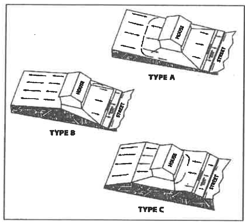
24-59.3.3.1 - Typical FHA lot grading
All storm sewer conduits to be dedicated to the City shall be located in an easement dedicated to the City of Laredo at the time of final platting of the property. The easement shall be at least fifteen (15) feet wide for storm sewers, or wider if the City Engineer requires it for maintenance or other purposes. Special drainage easements for positive overflows on private property shall be a minimum of ten (10) feet wide, or wider if the City Engineer requires it, for maintenance or other purposes.
Accumulated drainage from more than one (1) residential lot (or more than one (1) lot equivalent in the case of staggered or offset lots) shall be contained within a Special Drainage Easement. This easement shall be dedicated to the City at the time of final platting of the property. This shall be a special drainage easement on private property and shall be a minimum of ten (10) feet wide. The easement may be shared with underground utility easements provided those facilities do not impede the calculated runoff. Front to rear lot drainage shall not exceed a maximum slope of five percent (5%). No flow restricting fences, buildings, structures, or other improvements which impede flow shall be placed within these easements.
Single front to rear residential lot drainage, or one (1) lot equivalent in the case of staggered, or offset lots do not require Special Drainage Easement. Front to rear lot drainage shall not exceed a maximum slope of five percent (5%). All lots draining and/or receiving runoff will be identified with a plat note. Flow restricting fences or other structures installed between these lots shall be constructed to the specifications of the engineer of record. Said specifications shall be located on the recorded grading plan. Additionally, the homebuilder shall install a twenty (20) feet wide sod strip along entire rear property line of lots draining onto other lots ten (10) feet strip on upgradient lot and ten (10) feet strip on downgradient lot).
WARNING AND DISCLAIMER OF LIABILITY
The degree of flood protection required by this article is considered reasonable for regulatory purposes and is based on scientific and engineering considerations. Larger floods can and will occur on rare occasions. Flood heights may be increased by manmade or natural causes. This article does not imply that land outside the area of special flood hazards or uses permitted within such areas will be free from flooding or flood damages. This ordinance does not imply that properties shall always be free from flooding or flood damage, surface water stagnation or nonpoint source pollution or that all flood control and water treatment projects to control the quantity and quality of runoff can be constructed effectively. Nothing whatsoever in this ordinance should be construed as or be deemed to create additional duties, on the part of the city, to hold the city liable for any damages incurred in a flood or from adverse water quality, due to drainage runoff. Nothing in this ordinance shall be deemed to waive the city's immunity under state law or reduce the need or necessity for flood insurance.
Section 24-59.4.1 - GENERAL REQUIREMENTS
1.
All operators of construction sites shall use best management practices (BMPs) to control and reduce the discharge, to the MS4 and to waters of the United States, of sediment, silt, earth, soil, and other material associated with clearing, grading, excavation, land filling, and other construction activities to the maximum extent practicable. Any best management practices (BMPs) capable of installation and/or implementation prior to commencement of construction (for example, structural measures) shall be installed and/or implemented prior to commencement of construction at the site or in compliance with a schedule for installation and/or implementation in an applicable Stormwater Pollution Prevention Plan (SWPPP). The best management practices (BMPs) used at construction sites may include, but are not limited to, the following measures:
a.
Ensuring that existing vegetation is preserved where feasible and that disturbed portions of the site are stabilized as soon as practicable in portions of the site where construction activities have stopped for fourteen (14) days, and no further construction is anticipated for an additional seven (7) days, or have permanently ceased;
b.
Use of structural practices to divert flows from exposed soils, to store flows, or to otherwise limit runoff and the discharge of pollutants from the site to the maximum extent practicable;
c.
Minimization of the tracking of sediments off-site by vehicles, the generation of dust, and the escape of other windblown waste from the site;
d.
Prevention of the discharge of building materials, including cement, lime, concrete, asphalt, or mortar, to the MS4 or waters of the United States;
e.
Measures to prevent and contain spills of paints, solvents, fuels, septic waste, and other hazardous chemicals and pollutants associated with construction, and to assure proper cleanup and disposal of any such spills in compliance with state, federal, and local requirements;
f.
Implementation of proper waste disposal and waste management techniques, including covering waste materials, minimizing ground contact with hazardous chemicals and trash, and installing and maintaining covered receptacles for rubbish and garbage to assure that such waste materials are not blown or carried by rainfall runoff from the site;
g.
Timely maintenance of vegetation, erosion and sediment control measures, and other best management practices (BMPs) to maintain them in good and effective operating condition; and
h.
Installation of structural measures during the construction process to control pollutants in stormwater discharges that will occur after construction operations have been completed. Structural measures should be placed on upland soils to the degree attainable. Such installed structural measures may include, but are not limited to, the following: stormwater detention structures (including wet ponds); stormwater retention structures; flow attenuation by use of open vegetative swales and natural depressions; other velocity dissipation devices; infiltration of runoff on site; and sequential systems which combine several practices. Operators of construction sites are only responsible for the installation and maintenance of stormwater management measures prior to final stabilization of the site, and are not responsible for maintenance after stormwater discharges associated with construction activity have terminated.
2.
Qualified personnel (provided by the operator of the construction site) shall inspect disturbed areas of any construction site that have not been finally stabilized, areas used for storage of materials that are exposed to precipitation, structural control measures, and locations where vehicles enter or exit the site, at least once every seven (7) calendar days and within twenty-four (24) hours of the end of a storm that is zero and five tenths (0.5) inches or greater. All erosion and sediment control measures and other identified best management practices (BMPs) shall be observed in order to ensure that they are operating correctly and are effective in preventing significant impacts to receiving waters and the MS4. Based on the results of the inspection, best management practices (BMPs) shall be modified as appropriate, and as soon as is practicable.
3.
Any owner of a site of construction activity, whether or not he/she is an operator, is jointly and severally responsible for compliance with the requirements in this Section 24-59.4.1 of the Code.
4.
Any contractor or subcontractor on a site of construction activity, who is not an owner or operator, but who is responsible under his/her contract or subcontract for implementing a best management practices (BMPs) control measure, is jointly and severally responsible for any willful or negligent failure on his/her part to adequately implement that control measure.
Section 24-59.4.2 - STORMWATER POLLUTION PREVENTION PLAN (SWPPP) SUBMITTAL AND REVIEW
All operators of sites of construction activity, including clearing, grading, excavation, and land filling activities, that result in the disturbance of one (1) or more acres of total land area, or that is part of a common plan of development or sale within which one (1) or more acres of total land area are disturbed, or who are required to obtain an NPDES permit for stormwater discharges associated with construction activity, shall comply as a minimum with the following requirements (in addition to those in Section 24-59.4.1 of this Code and those requirements defined in the most current EPA/NPDES stormwater permit):
1.
Any operator who intends to obtain coverage for stormwater discharges from a construction site under the NPDES General Permit for Stormwater Discharges from Construction Sites ("the Construction General Permit") shall submit a signed copy of the Notice of Intent (NOI) to the City Engineer, at least fifteen (15) calendar days prior to the commencement of construction activities. If the construction activity is already underway upon the effective date of this chapter, the NOI shall be submitted within thirty (30) calendar days. For stormwater discharges from construction sites where the operator changes, a revised NOI shall be submitted at least two (2) calendar days prior to when the new operator commences work at the site.
2.
A SWPPP shall be prepared and implemented prior to the beginning of construction activities in accordance with the requirements of the Construction General Permit or any individual NPDES permit issued for stormwater discharges from the construction site, and with any additional requirement imposed by or under this Code and any other City Code.
3.
The SWPPP shall be prepared, dated, signed, and sealed by a licensed professional engineer. The signature and seal of the licensed professional engineer shall constitute his/her attestation that the SWPPP fully complies with the requirements of the Construction General Permit, or with any applicable individual NPDES permit issued for stormwater discharges from the construction site, and with any additional requirement imposed by or under this Code. The SWPPP shall contain the name, title, and business address of the licensed professional engineer signing it.
4.
The SWPPP shall be updated and modified as appropriate and as required by the Construction General Permit and this Code. Any update or modification to the SWPPP shall be prepared, signed, and sealed by a licensed professional engineer.
5.
The SWPPP shall be prepared and submitted to the City Engineer at least fifteen (15) calendar days prior to the commencement of construction activities. If the construction activity is already underway upon the effective date of this Code, the SWPPP shall be submitted within thirty (30) calendar days.
The SWPPP shall be prepared and submitted to the City Engineer in conjunction with the Stormwater Management Permit and Building Permit application. A Stormwater Management Permit shall be issued prior to commencement of construction activity.
6.
A copy of any SWPPP that is required by Section 24-59.4.2 of this Code shall be submitted to the City in conjunction with any application for a building permit, and Stormwater Management Permit, and any other City approval necessary to commence or continue construction at the site.
7.
If, upon the City Engineer's review of the SWPPP (or any modification to the SWPPP) and any site inspection that the City Engineer may conduct, the City Engineer determines that the SWPPP does not comply with the requirements of the Construction General Permit, any individual NPDES permit issued for stormwater discharge from the construction site, or any additional requirement imposed by or under this Code, the City Engineer may issue an order prohibiting the commencement, or the continuation, of any construction activity at the site. Also, if at any time the City Engineer determines that the SWPPP is not being fully implemented, the City Engineer may similarly issue an order prohibiting the continuation of any construction activity at the site. Any order issued by the City Engineer under the authority of this paragraph may be in the form of a Compliance Order under Section 24-59.8.5, an Emergency Cease and Desist Order under Section 24-59.8.7, or a Stop Work Order under Section 24-59.8.8 of this Code.
8.
Upon review of the SWPPP and any site inspection that is conducted, the City may deny approval of any building permit, Stormwater Management Permit, or any other City approval necessary to commence or continue construction, or to assume occupancy, on the grounds that the SWPPP does not comply with the requirements of the Construction General Permit, any individual or group NPDES permit issued for stormwater discharge from the construction site, or any additional requirement imposed by or under this Code. Also, if at any time the City determines that the SWPPP is not being fully implemented, the City may similarly deny approval of any building permit, stormwater management plan permit, or any other City approval necessary to commence or continue construction, or to assume occupancy, at the site.
9.
All contractors and subcontractors identified in a SWPPP shall sign a copy of the following certification statement before conducting any professional service identified in the SWPPP:
"I certify under penalty of law that I understand the terms and conditions of the National Pollutant Discharge Elimination System (NPDES) permit that authorizes the stormwater discharges associated with industrial activity from the construction site identified as part of this certification."
The certification must include the name and title of the person providing the signature; the name, address, and telephone number of the contracting firm; the address (or other identifying description) of the site; and the date the certification is made.
10.
The SWPPP, with the licensed professional engineer's signature, seal, and date affixed, and the certifications of contractors and subcontractors required by Section 24-59.4.2 of this Code, and with any modifications attached, shall be retained at the construction site from the date of commencement of construction through the date of final stabilization.
11.
The operator shall make a copy of the SWPPP and any modification thereto available to the City Engineer and any other authorized City inspector at the construction site upon request (as well as to EPA and State inspectors).
12.
The City Engineer may notify the operator at any time that the SWPPP does not meet the requirements of the Construction General Permit, any applicable individual NPDES permit issued for stormwater discharges from the construction site, or any additional requirement imposed by or under this Code. Such notification shall identify those provisions of the permit or code which are not being met by the SWPPP, and identify which provisions of the SWPPP require modifications in order to meet such requirements. Within seven (7) calendar days of such notification from the City Engineer, the operator shall make the required changes to the SWPPP and shall submit to the City Engineer a written certification that the requested modifications have been made.
13.
The operator shall modify the SWPPP whenever there is a change in design, construction, operation, or maintenance, which has a significant effect on the potential for the discharge of pollutants to the MS4 or to the waters of the United States, and which has not otherwise been addressed in the SWPPP, or if the SWPPP proves to be ineffective in eliminating or significantly minimizing pollutants, or in otherwise achieving the general objective of controlling pollutants in stormwater discharges associated with construction activity. In addition, the SWPPP shall be modified to identify any new contractor and/or subcontractor that will implement a measure in the SWPPP. All modifications to the SWPPP shall be submitted to the City Engineer within seven (7) calendar days of a change, determination of ineffectiveness (self or City inspection), or effective date of changes in contractor and/or subcontractor.
14.
Qualified personnel (provided by the operator of the construction site) shall inspect disturbed areas of the construction site that have not been finally stabilized, areas used for storage of materials that are exposed to precipitation, structural control measures, and locations where vehicles enter or exit the site, at least once every seven (7) calendar days and within twenty-four (24) hours of the end of any storm that is zero and five tenths (0.5) inches or greater. Disturbed areas and areas used for storage of materials that are exposed to precipitation shall be inspected for evidence of, or the potential for, pollutants entering the drainage system. Erosion and sediment control measures identified in the SWPPP shall be observed to ensure that they are operating correctly. Where discharge locations or points are accessible, they shall be inspected to ascertain whether erosion control measures are effective in preventing significant impacts to receiving waters or the MS4. Locations where vehicles enter or exit the site shall be inspected for evidence of off-site sediment tracking.
15.
Based on the results of the inspections required by the Section 24-59.4.2 item 14 of this Code, the site description and/or the pollution prevention measures identified in the SWPPP shall be modified as appropriate, but in no case later than seven (7) calendar days following the inspection. Such modifications shall provide for timely implementation of any changes to the SWPPP within seven (7) calendar days following the inspection. All modifications to the SWPPP shall be submitted to the City Engineer within seven (7) calendar days of the date of inspection.
16.
A report log summarizing the scope of any inspection required by the Section 24-59.4.2 item 15 of this Code, and the name(s) and qualifications of personnel making the inspection, the date(s) of the inspection, major observations relating to the implementation of the SWPPP, and actions taken shall be made and retained as part of the SWPPP for at least three (3) years from the date that the site is finally stabilized. Such report shall identify any incidence of noncompliance. Where a report does not identify any incidence of noncompliance, the report shall contain a certification that the facility is in compliance with the SWPPP, the facility's NPDES permit, and this Code. The report shall be certified and signed by the person responsible for making it.
17.
The operator shall retain copies of any SWPPP and all reports required by this Code or by the NPDES permit for the site, and records of all data used to complete the NOI, for a period of at least three (3) years from the date that the site is finally stabilized.
18.
Where a site has been finally stabilized and all stormwater discharges from construction activities that are authorized by this Code and by the NPDES permit for those construction activities are eliminated, or where the operator of all stormwater discharges at a facility changes, the operator of the construction site shall submit to the City Engineer, a Notice of Termination (NOT).
19.
Upon final stabilization of the construction site, the owner (or the duly authorized representative thereof) shall submit to the City Engineer written certification by a licensed professional engineer that the site has been finally stabilized. The City may withhold occupancy or use of permits for any premises constructed on the site until such certification of final stabilization has been filed and the City Engineer has determined, following any appropriate inspection, that final stabilization has, in fact, occurred and that any required permanent structural controls have been completed.
Section 24-59.5.1 - APPLICABILITY
(a)
Except as provided in subparagraph (2) of this paragraph, a site specific stormwater quality management plan is required for all residential, commercial, and industrial development and/or redevelopment of one acre or more within the City of Laredo and its jurisdictional areas.
(1)
For the purpose of this section, the area of the development must include all contiguous land owned by the responsible party, regardless of the amount of land that will be affected by the development activity.
(2)
A stormwater quality management plan is not required when a portion of a previously developed tract of land is redeveloped, unless the redevelopment will result in the conversion of more than one-fourth (¼) acre from a porous surface to an impervious surface.
(b)
The stormwater quality plan must be submitted at the time of preliminary plat submission, or submission of a site plan with an application for a building permit (if the site is more than one (1) acre).
(c)
The stormwater quality management plan must identify the location of the ultimate outfall from the City's MS4 into the receiving water and any environmentally sensitive areas that will receive any pollutants carried by stormwater pollution from the site.
(d)
The stormwater quality management plan must state whether an NPDES stormwater pollution prevention plan or a pollution control plan will be submitted to the City Engineer.
(e)
The stormwater quality management plan must be signed and sealed by a professional engineer licensed to practice engineering in the State of Texas.
Section 24-59.5.2 - SPECIAL LAND USE REQUIREMENTS
A stormwater quality management plan and any plans submitted for a building permit for the development of property that will be used for one of the below listed uses must identify the appropriate best management practices (BMPs) to prevent pollutants being discharged into the City's MS4. The owner of a site within City that is currently being used for one of the activities described below is not required to physically alter the existing facility to comply with this section, unless alterations or repairs to the facility require the facility to be brought into compliance with the current City of Laredo building code. The uses are as follows:
(1)
Fueling stations.
(2)
Vehicle/equipment washing and steam cleaning facilities.
(3)
Facilities engaged in harmful liquid materials loading and unloading.
(4)
Facilities engaged in harmful liquids storage in aboveground storage tanks.
(5)
Facilities engaged in container storage of harmful liquids (such as oil, chemical, & hazardous substances), food wastes, and hazardous wastes.
(6)
Facilities engaged in outdoor storage of raw materials that are subject to leaching and transport by erosion and sedimentation, such as gravel, sand, topsoil, compost, sawdust, wood chips, building materials, including lumber, which are subject to leaching; and concrete and metal products, which are subject to chemical erosion, corrosion, and leaching.
Section 24-59.5.3.1 - PRELIMINARY PLAN (PLATTING)
A layout of the proposed water quality management system and calculations showing it meets the requirements of Section 24-59.5.4 below shall be submitted with the other requirements as outlined in Section 24-59.2.
Section 24-59.5.3.2 - FINAL CONSTRUCTION PLANS
Final construction plans and specifications, and calculations showing that the water quality management system meets the requirements of Section 24-59.5.4 below shall be submitted with the other requirements as outlined in Section 24-59.2.
Section 24-59.5.4.1 - QUALITY MANAGEMENT CRITERIA
The criteria of the water quality management for the new development and redevelopment is that the water quality effects of the development should not be significantly different from the water quality effects of the same site before construction. Development/redevelopment within the City of Laredo shall provide, at the minimum, one of the following methods for stormwater treatment, provided that the discharges meet the requirements of the City's stormwater NPDES permit and state water quality criteria. More stringent treatment methods may be required by the City Engineer if discharges fail to meet water quality goals. The drainage area for determining treatment volumes shall include all areas draining to the facility (on-site and off-site). If off-site flows are not commingled with on-site flows prior to treatment, they should not be included in the treatment volume.
Method Treatment Volume and Recovery Rate:
a.
Wet Detention: Wet detention treatment volume shall be, at a minimum, the first one (1) inch of runoff. No more than one-half (½) of the volume may be discharged in the first twenty-four (24) hours.
b.
Off-line Retention: Off-line retention diverts the first flush of stormwater runoff to a facility separated from the main line stormwater conveyance system. The treatment volume for off-line retention shall be one-half (½) inch of runoff. The treatment volume shall again be available within a minimum of twenty-four (24) hours and a maximum of seventy-two (72) hours following a storm event, with appropriate on-site soils test submitted to verify the infiltration rate.
c.
On-line Retention or Detention: For on line retention or detention with under drained filtration, treatment volume shall be provided equal to one (1) inch of runoff. Only bottom underdrain systems planted with grass that are capable of recovering the treatment volume within twenty-four (24) hours shall be allowed, to the satisfaction of the City Engineer, to exceed the capabilities of such a bottom underdrain system.
Design criteria and design specifications for the water quality treatment methods described above are outlined in the Stormwater Management Guidance Manual.
Section 24-59.5.4.2 - FLOATABLE CONTROLS
All detention facilities shall incorporate floatable controls (baffles, etc.) to ensure that no floatables are discharged from the facility. The detention facilities shall be regularly checked and any floatables removed as part of the ongoing detention facility maintenance.
Section 24-59.5.4.3 - SPILL CONTROL
All detention facilities shall incorporate in the design of their discharge structures a method for stopping all discharges in case of an accidental spill occurring within the detention facilities drainage area. This discharge control device shall be periodically checked to ensure its continued operation as part of the ongoing detention facility maintenance.
Section 24-59.5.4.4 - BMPs
For residential development/redevelopment areas of more than one (1) acre, and with the approval of the City Engineer or his/her authorized representative, the water quality requirements as stated in Section 24-59.5.4 may be waived in favor of a series of permanent BMPs, i.e., swales, vegetated buffers, small impoundments, etc. that are shown to provide sufficient water quality enhancements to meet the intent of Section 24-59.4.
Section 24-59.5.4.5 - DISCHARGES TO THE RIO GRANDE
For sites discharging directly into the Rio Grande the runoff amounts used for the determination of water quality treatment volume will be fifty percent (50%) greater than those indicated in Section 24-59.4. The only treatment method for water quality shall be off-line retention unless otherwise approved by the City Engineer and the IBWC.
Section 24-59.6.1 - INSPECTION SCHEDULE AND REPORTS
1.
Prior to the issuance of a stormwater management permit, the developer will submit to the City Engineer a proposed inspection and construction control schedule. The City of Laredo or its authorized representative shall conduct inspections and file reports for periodic inspections necessary during construction of stormwater management systems to ensure compliance with the approved plans.
2.
No work shall proceed until the City Engineer or his/her authorized representative inspects and approves the work previously completed and furnishes the developer with the results of the inspection reports as soon as possible after completion of each required inspection.
3.
Any portion of the work which does not comply must be promptly corrected by the developer, after written notice from the City Engineer or his/her authorized representative. The notice shall set forth the nature of corrections required and the time within which corrections will be made.
4.
The developer shall notify the City Engineer before commencing any work in conjunction with the stormwater management plan and upon completion of the project when a final inspection will be conducted.
Section 24-59.6.2 - INSPECTION REQUIREMENTS DURING CONSTRUCTION
After commencing initial site operations, regular inspections shall be made at the following specified stage of construction:
1.
Infiltration systems at the commencement, during, and upon completion of construction.
2.
Flow attenuation devices, such as open vegetated swales, upon the completion of construction.
3.
Retention and detention structures at the following stages:
a.
Upon completion of excavation to sub-foundation and where required, installation of structural supports or reinforcement for structures, including but not limited to:
(1)
Core trenches for structural embankments;
(2)
Inlet-outlet structures and anti-seep structures, watertight connectors on pipes; and
(3)
Trenches for enclosed storm drainage facilities.
b.
During placement of structural fill, concrete, and the installation of catch basins;
c.
During backfill of foundations and trenches;
d.
During embankment construction; and
e.
Upon completion of final grading and the establishment of permanent stabilization.
Section 24-59.6.3 - FINAL INSPECTION REPORTS
A final inspection shall be conducted by the City Engineer or his/her authorized representative upon completion of the stormwater management facility to determine if the completed work is constructed in accordance with the approved plan and this Code. "As-built" certification by a licensed professional engineer licensed in the State of Texas is also required to certify that the facility has been constructed as shown on the "As-built" plans and is substantially compliant with plans and specifications. The developer will receive written notification of the results of the final inspection. The City Engineer shall maintain a permanent file of inspection reports.
Section 24-59.6.4 - INSPECTION FOR PREVENTION MAINTENANCE
1.
Preventive maintenance shall be ensured through inspection of all infiltration systems, retention, or detention structures by the City Engineer or his/her authorized representative. The inspection shall occur during the first year of operation and at least once every three (3) years thereafter.
2.
Inspection reports shall be maintained by the City Engineer or his/her authorized representative for all stormwater management facilities.
3.
Inspection reports for retention and detention facilities shall include the following:
a.
The date of inspection;
b.
Name of inspector;
c.
The condition of the following:
(1)
Vegetation;
(2)
Fences;
(3)
Spillways;
(4)
Embankments;
(5)
Reservoir area;
(6)
Outlet channels;
(7)
Underground drainage;
(8)
Sediment load; or
(9)
Any other item that could affect the proper function of the stormwater management system.
d.
Description of needed maintenance.
4.
If, after an inspection by the City Engineer or his/her authorized representative, the condition of a stormwater management facility presents an immediate danger to the public health or safety, because of an unsafe condition or improper maintenance, the City Engineer or his/her authorized representative shall take such action as may be necessary to protect the public and make the facility safe.
Section 24-59.7.1 - MAINTENANCE AGREEMENT
1.
Prior to the issuance of any building permit for which stormwater management is required, the City Engineer shall require the applicant or owner to execute under oath, an inspection and maintenance agreement binding on all subsequent owners of land served by the private stormwater management facility. Such agreement shall provide for access to the facility at reasonable times for regular inspections by the City Engineer or his/her authorized representative and for regular or special assessments of property owners to ensure that the facility is maintained in proper working condition to meet design standards and any provision established.
2.
The agreement shall be recorded by the applicant and/or owner in the deed records of Webb County, Texas.
3.
The agreement shall also provide that, if after the notice by the City Engineer to correct a violation requiring maintenance work, satisfactory corrections are not made by the owner(s) within a reasonable period of time (thirty (30) days maximum), the City Engineer may perform all necessary work to place the facility in proper working condition. The owner(s) of the facility shall be assessed the cost of the work and any penalties. This may be accomplished by placing a lien on the property, which may be placed on the tax bill and collected as ordinary taxes by the City.
Section 24-59.7.2 - MAINTENANCE RESPONSIBILITY
1.
All water quality controls and their appurtenances required for commercial or multifamily development shall be maintained by the owner of the commercial or multifamily development.
2.
All water quality controls and drainage required for single family or duplex residential development shall be maintained by the developer for two (2) years after the final acceptance for the entire development. The City will not accept any drainage structure which is not complete according to the requirements of this Code.
3.
The owner of the property on which work has been done pursuant to this Code for private stormwater management facilities, or any other person or agent in control of such property, shall maintain in good condition and promptly repair and restore all grade surfaces, walls, drains, dams and structures, vegetation, erosion and sediment control measures, and other protective devices and remove and properly dispose of all floatable. Such repairs or restoration and maintenance shall be in accordance with approved plans.
4.
A maintenance schedule shall be developed for the life of any stormwater management facility and shall state the maintenance to be completed, the time period for completion, and who shall perform the maintenance. This maintenance schedule shall be printed on the stormwater management plan.
Section 24-59.8.1 - WARNING NOTICE
When the City Engineer finds that any person has violated, or continues to violate, any provision of this Code, or any order issued hereunder, the City Engineer may serve upon that person a written Warning Notice, specifying the particular violation believed to have occurred and requesting the discharger to immediately investigate the matter and to seek a resolution whereby any offending discharge will cease. Investigation and/or resolution of the matter in response to the Warning Notice in no way relieves the alleged violator of liability for any violations occurring before or after receipt of the Warning Notice. Nothing in this subsection shall limit the authority of the City Engineer to take any action, including emergency action or any other enforcement action, without first issuing a Warning Notice.
Section 24-59.8.2 - NOTIFICATION OF VIOLATION
When the City Engineer finds that any person has violated, or continues to violate, any provision of this Code, or any order issued hereunder, the City Engineer may serve upon that person a written Notice of Violation.
Within ten (10) calendar days of the receipt of this notice, an explanation of the violation and a plan for the satisfactory correction and prevention of recurrence thereof, to include specific required actions, shall be submitted by the alleged violator to the City Engineer. If the alleged violator denies that any violation occurred and/or contends that no corrective action is necessary, an explanation of the basis of any such denial or contention shall be submitted to the City Engineer within ten (10) calendar days of receipt of the notice.
Submission of an explanation and/or plan in no way relieves the alleged violator of liability for any violations occurring before or after receipt of the Notice of Violation (NOI). Nothing in this section shall limit the authority of the City Engineer to take any action, including emergency action or any other enforcement action, without first issuing a Notice of Violation (NOV).
Section 24-59.8.3 - CONSENT ORDERS
The City Engineer may enter into Consent Orders, assurances of voluntary compliance, or other similar documents establishing an agreement with any person responsible for noncompliance with any provision in this Code or any order issued hereunder. Such documents may include specific actions to be taken by the person to correct the noncompliance within a time period specified by the document. Such documents shall have the same force and effect as the administrative orders issued pursuant to Sections 24-59.8.5, 24-59.8.6, and 24-59.8.7 of this Code and shall be judicially enforceable.
Section 24-59.8.4 - SHOW CAUSE HEARING
The City Engineer may order any person who has violated, or continues to violate, any provision of this Code, or any order issued hereunder, to appear before the City Engineer and show cause why a proposed enforcement action should not be taken. Notice shall be served on the alleged violator specifying the time and place for the hearing, the proposed enforcement action, the reasons for such action, and a request that the alleged violator show cause why the proposed enforcement action should not be taken. The notice of the hearing shall be served personally or by registered or certified mail (return receipt requested) at least ten (10) calendar days prior to the hearing. Such notice may be served on any authorized representative of the alleged violator. The hearing shall be conducted pursuant to the rights and procedures specified in Section 24-59.9.1 of this Code. A show cause hearing shall not be a bar against, or prerequisite for, taking any other action against the alleged violator.
Section 24-59.8.5 - COMPLIANCE ORDERS
When the City Engineer finds that any person has violated, continues to violate, or threatens to violate, any provision of this Code, or any order issued hereunder, the City Engineer may issue an order to the violator directing that the violator come into compliance within a specified time limit, prior to commencement or continuance of operation, or immediately. Compliance orders may also contain other requirements to address the noncompliance, including additional self-monitoring, and management practices designed to minimize the amount of pollutants discharged to the MS4 and waters of the United States. A compliance order may not extend the deadline for compliance established by a state or federal standard or requirement, nor does a compliance order relieve the person of liability for any violation, including any continuing violation. Issuance of a compliance order shall not be a bar against, or a prerequisite for, taking any other action against the violator.
Section 24-59.8.6 - REMEDIATION, ABATEMENT, AND RESTORATION ORDERS
When the City Engineer finds that a person has violated, or continues to violate, any provision of this Code, or any order issued hereunder, and that such violation has adversely affected the MS4, or the waters of the United States, the City Engineer may issue an order to the violator directing him or her to undertake and implement any appropriate action to remediate and/or abate any adverse effects of the violation upon the MS4, or the waters of the United States, and/or to restore any part of the MS4, or the waters of the United States. Such remedial, abatement, and restoration actions may include, but are not limited to: monitoring, assessment, and evaluation of the adverse effects and determination of the appropriate remedial, abatement, and/or restoration action; confinement, removal, cleanup, treatment, and disposal of any discharged or released pollution or contamination; prevention, minimization, and/or mitigation of any damage to the public health, welfare, or the environment that may result from the violation; and restoration or replacement of City property or natural resources damaged by the violation. The order may direct that the remediation, abatement, and/or restoration be accomplished on a specified compliance schedule and/or be completed within a specified period of time. An order issued under this subsection does not relieve the violator of liability for any violation, including any continuing violation. Issuance of an order under this subsection shall not be a bar against, or a prerequisite for, taking any other action against any responsible party.
Section 24-59.8.7 - EMERGENCY CEASE AND DESIST ORDERS
When the City Engineer finds that any person has violated, continues to violate, or threatens to violate, any provision of this Code, or any order issued hereunder, or that the person's past violations are likely to recur, and that the person's violation(s), or threatened violation(s), have caused or contributed to an actual or threatened discharge to the MS4 or waters of the United States which reasonably appears to present an imminent or substantial endangerment to the health or welfare of persons or to the environment, the City Engineer may issue an order to the violator directing it to immediately cease and desist all such violations and directing the violator to:
1.
Immediately comply with all requirements of this Code; and
2.
Take such appropriate preventive action as may be needed to properly address a continuing or threatened violation, including immediately halting operations and/or terminating the discharge. Any person notified of an emergency order directed to it under this subsection shall immediately comply and stop or eliminate its endangering discharge. In the event of a discharger's failure to immediately comply voluntarily with the emergency order, the City Engineer may take such steps as deemed necessary to prevent or minimize harm to the MS4 or waters of the United States, including immediate termination of a facility's water supply, sewer connection, or other municipal utility services. The City Engineer may allow the person to commence or recommence its discharge when it has demonstrated to the satisfaction of the City Engineer that the period of endangerment has passed, unless further termination proceedings are initiated against the discharger under this Code. A person that is responsible, in whole or in part, for any discharge presenting imminent endangerment shall submit a detailed written statement, describing the causes of the harmful discharge and the measures taken to prevent any future occurrence, to the City Engineer within ten (10) calendar days of receipt of the emergency order. Issuance of an emergency cease and desist order shall not be a bar against, or a prerequisite for, taking any other action against the violator.
Section 24-59.8.8 - STOP WORK ORDERS
Whenever the City Engineer finds that any operator of a construction site has violated, threatens to violate, or continues to violate, any provision of this Code, or any order issued hereunder, the City Engineer may issue a Stop Work Order to the operator, and require that a copy of the Stop Work Order be posted at the construction site and distributed to all City departments and divisions whose decisions affect any activity at the site. Unless express written exception is made by the City Engineer, the Stop Work order shall prohibit any further construction activity, or any commencement of construction activity, at the site and shall bar any further inspection or approval by the City associated with a building permit, grading permit, or any other City approval necessary to commence or continue construction or to assume occupancy at the site. Issuance of a Stop Work Order shall not be a bar against, or a prerequisite for, taking any other action against the violator.
Section 24-59.9.1 - RECONSIDERATION AND HEARING
1.
Any person subject to a Compliance Order under Section 24-59.8.5, a Remediation, Abatement, or Restoration Order under Section 24-59.8.6, an Emergency Cease and Desist Order under Section 24-59.8.7, or a Stop Work Order under Section 24-59.8.8, of this Code may petition the City Engineer to reconsider the basis for his/her order within fifteen (15) calendar days of the affected person's notice of issuance of such an order.
2.
Failure to submit a timely written petition for reconsideration shall be deemed to be a waiver of any further right to administrative reconsideration or review of the order.
3.
In its petition, the petitioning party must indicate the provisions of the order objected to, the reasons for the objection(s), any facts that are contested, the evidence that supports the petitioner's view of the facts, any alternative terms of an order that the petitioner would accept, and whether the petitioning party requests a hearing on its petition.
4.
The effect of any Compliance Order under Section 24-59.8.5, Remediation, Abatement, or Restoration Order under Section 24-59.8.6, and any Stop Work Order under Section 24-59.8.8 shall be stayed pending the City Engineer's reconsideration of the petition, and any hearing thereon, unless the City Engineer expressly makes a written determination to the contrary. The effectiveness of any Emergency Cease and Desist Order under Section 24-59.8.7 shall not be stayed pending the City Engineer's reconsideration, or any hearing thereon, unless the City Engineer expressly and in writing stays his/her emergency order.
5.
Within thirty (30) calendar days of the submittal of a petition for reconsideration, the City Engineer shall either: (1) grant the petition and withdraw or modify the order accordingly; (2) deny the petition, without hearing if no material issue of fact is raised; or (3) if a hearing has been requested and a material issue of fact has been raised, set a hearing on the petition.
6.
Written notice of any hearing set by the City Engineer pursuant to Section 24-59.9.1 item 5 shall be served on the petitioning party personally or by registered or certified mail (return receipt requested) at least ten (10) calendar days prior to the hearing. Such notice may be served on any authorized representative of the petitioning party.
7.
The City Engineer may conduct the hearing and take evidence, or may designate any employee of the City or any specially-designated attorney or engineer to:
a.
Issue in the name of the City notices of hearing requesting the attendance and testimony of witnesses and the production of evidence relevant to any matter involved in the hearing;
b.
Take evidence; and
c.
Transmit a report of the evidence and hearing, including transcripts and other evidence, together with recommendations to the City Engineer for action thereon.
At any hearing held pursuant to this Subsection, testimony taken shall be under oath and recorded. Any party is entitled to present his/her case or defense by oral or documentary evidence and to conduct such cross-examination as may be required for a full and true disclosure of the facts. A transcript will be made available to any party to the hearing upon payment of the usual charges thereof.
8.
After the City Engineer has reviewed the evidence, he/she shall either: (1) grant the petition; (2) deny the petition; or (3) grant the petition in part and deny it in part. The City Engineer may modify his/her order as is appropriate based upon the evidence and arguments presented at the hearing and his/her action on the petition. Further orders and directives as are necessary and appropriate may be issued.
Section 24-59.9.2 - APPEAL
Any person whose petition for reconsideration by the City Engineer has not been granted in its entirety and who remains adversely affected by the City Engineer's order, or who is subject to an order of the City Engineer issued following a Show Cause Hearing under Section 24-59.8.4, may challenge the final action of the City Engineer in an appropriate court of competent jurisdiction.
Section 24-59.10.1.1 -
Whenever it appears that a person has violated, or continues to violate, any provision of this Code that relates to:
a.
The preservation of public safety, relating to the materials or methods used in construction of any structure or improvement of real property;
b.
The preservation of public health or to the fire safety of a building or other structure or improvement;
c.
The establishment of criteria for land subdivision or construction of buildings, including street design;
d.
Dangerously damaged or deteriorated structures or improvements;
e.
Conditions caused by accumulations of refuse, vegetation, or other matter that creates breeding and living places for insects and rodents; or
f.
Point source effluent limitations or the discharge of a pollutant, other than from a non point source, into the MS4, City may invoke Sections 54.011—54.017 of the Texas Local Government Code and petition the State district court or the county court-at-law of Webb County, through the City Attorney, for either the injunctive relief specified in Section 24-59.10.1.2 or the civil penalties specified in Section 24-59.10.1.3 below, or both the specified injunctive relief and civil penalties.
Section 24-59.10.1.2 -
Pursuant to Section 54.016 of the Texas Local Government Code, the City may obtain against the owner or the operator of a facility a temporary or permanent injunction, as appropriate, that:
a.
Prohibits any conduct that violates any provision of this Code that relates to any matter specified in Section 24-59.10.1.1.a—f above; or
b.
Compels the specific performance of any action that is necessary for compliance with any provision of this Code that relates to any matter specified in Section 24-59.10.1.1a—f above.
Section 24-59.10.1.3
Pursuant to Section 54.017 of the Texas Local Government Code, the City may recover a civil penalty of not more than one thousand dollars ($1,000.00) per day for each violation of any provision of this Code that relates to any matter specified in Section 24-59.10.1.1.a—e above, and a civil penalty of not more than five thousand dollars ($5,000.00) per day for each violation of any provision of this Code that relates to any matter specified in Section 24-59.10.1.1.f above, if the City proves that:
a.
The defendant was actually notified of the provisions of the Code; and
b.
After the defendant received notice of the Code provisions, the defendant committed acts in violation of the Code or failed to take action necessary for compliance with the Code.
Section 24-59.10.2 - CRIMINAL PENALTIES
1.
Any person who has violated any provision of this Code, or any order issued hereunder, shall be strictly liable for such violation, regardless of the presence or absence of a culpable mental state, and shall, upon conviction, be subject to a fine of not more than two thousand dollars ($2,000.00) per violation, per day.
2.
Any person who has knowingly made any false statement, representation, or certification in any application, record, report, plan, or other documentation filed, or required to be maintained, pursuant to this Code, or any order issued hereunder, or who has falsified, tampered with, or knowingly rendered inaccurate any monitoring device or method required under this Code shall, upon conviction, be subject to a fine of not more than two thousand dollars ($2,000.00) per violation, per day.
3.
In determining the amount of any fine imposed hereunder, the court shall take into account all relevant circumstances, including, but not limited to, the extent of harm caused by the violation, the magnitude and duration of the violation, any economic benefit gained through the violation, corrective actions by the violator, the compliance history of the violator, the knowledge, intent, negligence, or other state of mind of the violator, and any other factor as justice requires.
Section 24-59.10.3 - CIVIL SUIT UNDER THE TEXAS WATER CODE
Whenever it appears that a violation or threat of violation of any provision of Section 26.121 of the Texas Water Code, or any rule, permit, or order of the Texas Natural Resource Conservation Commission, has occurred or is occurring within the jurisdiction of the City of Laredo, inclusive of its extraterritorial jurisdiction, the City may have a suit instituted in a state district court through its City Attorney for the injunctive relief or civil penalties or both authorized in Subsection (a) of Section 26.123 of the Texas Water Code, against the person who committed or is committing or threatening to commit the violation. This power is exercised pursuant to Section 26.124 of the Texas Water Code. In any suit brought by the City under this section, the Texas Natural Resource Conservation Commission is a necessary and indispensable party.
Section 24-59.10.4 - REMEDIES NONEXCLUSIVE
The remedies provided for in this Code are not exclusive of any other remedies that the City may have under state or federal law or other City ordinances. The City may take any, all, or any combination of these actions against a violator. The City is empowered to take more than one enforcement action against any violator. These actions may be taken concurrently.
Section 24-59.11.1 - PERFORMANCE AND MAINTENANCE BONDS
The City Engineer may, by written notice, order any owner or operator of a source of stormwater discharge associated with construction or industrial activity to file a satisfactory bond, payable to the City, in a sum not to exceed a value determined by the City Engineer to be necessary to achieve consistent compliance with this Code, any order issued hereunder, any required best management practice (BMP), and/or any SWPPP provision, and/or to achieve final stabilization of the site. The City may deny approval of any building permit, grading permit, subdivision plat, site development plan, or any other City permit or approval necessary to commence or continue construction or any industrial activity at the site, or to assume occupancy, until such a performance or maintenance bond has been filed.
Section 24-59.11.2 - LIABILITY INSURANCE
The City Engineer may, by written notice, order any owner or operator of a source of stormwater discharge associated with construction or industrial activity to submit proof that it has obtained liability insurance, or other financial assurance, in an amount not to exceed a value determined by the City Engineer, that is sufficient to remediate, restore, and abate any damage to the MS4, the waters of the United States, or any other aspect of the environment that is caused by the discharge.
Section 24-59.11.3 - PUBLIC NUISANCES
A violation of any provision of this Code, or any order issued hereunder, is hereby declared a public nuisance and shall be corrected or abated as directed by the City Engineer. Any person(s) creating a public nuisance shall be subject to the provisions of the Nuisance Ordinance of the Code of the City of Laredo, including requirements to reimburse the City for any costs incurred in removing, abating, or remedying said nuisance.