
Lewisville City Zoning Code
ARTICLE II
Zoning Districts, Official Zoning Maps,and Uses
2-1 - ZONING DISTRICTS
2-1.1 ZONING DISTRICTS ESTABLISHED
(A)
Jurisdiction .....All the area within the zoning jurisdiction of the adopting jurisdiction is hereby divided into zoning districts within which the use of land and water areas, the location, height, bulk and use of structures, the provision of parking and loading areas, and other development requirements are regulated as herein provided.
(B)
Designated Districts .....General use zoning districts, conditional zoning districts, overlay and special purpose districts, with the symbol designations, general purposes, and other requirements as cited herein, are hereby created.
(C)
Conditional Zoning Districts .....The conditional zoning districts are established as companion districts to the general use districts, except for the CD1-C, MU-C, LD1-C, LD2-C and VBD-C Districts. References in this Ordinance to a general use district shall be construed to also include the corresponding conditional zoning district. Each conditional zoning district is intended to accomplish the purposes of the corresponding general use district through the development of identified uses at a specific location in accordance with a site plan acceptable to the Elected Body. All regulations which apply to a general use district also apply to the corresponding conditional zoning district. Additional reasonable site plan conditions which may be required by the Elected Body and agreed to by the petitioner as part of the rezoning process also apply.
(D)
Purpose Statements .....District purpose statements in this section refer only to general objectives for each zoning district.
(E)
Dimensional Requirements .....The general dimensional requirements for each zoning district cited in this section are subject to additional provisions of this Ordinance as noted in Section B.3-1.
(F)
Growth Management Plan .....The Growth Management Plan of Legacy seeks to guide future development patterns in the community to provide services in a cost effective and efficient manner; allow for urban, suburban, and rural life styles; and preserve environmental and cultural resources. The Growth Management Plan divides the county into five growth management areas as follows:
(1)
City/Town Centers (GMA 1);
(2)
Urban Neighborhoods (GMA 2);
(3)
Suburban Neighborhoods (GMA 3);
(4)
Future Growth Area (GMA 4); and
(5)
Rural Area (GMA 5).
Goals are identified in Legacy for each of these areas. Zoning districts established by this Ordinance have been designed, in part, to achieve the goals of the growth management areas, the objective of the Lewisville Comprehensive Plan. Copies of Legacy are available in the office of the Planning Staff.
(UDO L-164, § 2, 7-8-21)
2-1.2 RESIDENTIAL ZONING DISTRICTS - PURPOSE STATEMENTS AND REGULATIONS
The following residential zoning districts are established. For Single Family Districts (RS), the suffix number multiplied by one thousand (1,000) indicates the minimum lot size in square feet. For Multifamily Districts (RM), the suffix number indicates the maximum number of dwelling units per acre. [For example, RS-40 requires a minimum lot size of forty thousand (40,000) square feet for a single family dwelling, while RM-8 allows multifamily development at a density of up to eight (8) units per acre.]
Table B.2.1
Residential Zoning Districts
Each residential district is designed and intended to secure for the persons who reside there a comfortable, healthy, safe, and pleasant environment in which to live, protected from incompatible and disruptive activities which more properly belong in nonresidential districts. The districts are also intended to assist the community in meeting the growth management goals of Legacy. When a residential rezoning proposal is considered, the Growth Management Plan and the residential land use goals and locational criteria contained in Legacy shall be used as guides, in conjunction with other factors, in determining the appropriateness of the proposed district. Other goals of these residential districts are explained in the remainder of this section.
(A)
YR Yadkin River Conservation District.
(1)
Purpose. .....The YR District is intended primarily to protect the community's main water supply, preserve the historic features of this area, and preserve the natural beauty of a continuous conservation corridor along the Yadkin River. This zoning district is the most restrictive, with low density residential development the primary use allowed. Objectives of the district are the following:
(a)
Protection of water supply;
(b)
Maintenance of rural character;
(c)
Protection of sensitive natural, historical, recreational, and visual resources;
(d)
Retention of natural topography and vegetation;
(e)
Control of sedimentation and other nonpoint source pollution; and,
(f)
Support and encouragement of agricultural activities.
(2)
General Dimensional Requirements - YR.
1.
Nonconforming lots in the YR District meeting the provisions of Section B.5-3.2(C) must meet the minimum setback requirements of the RS-20 zoning district.
2.
Where the main entrance to a single family residence is located on a side yard, the setback for the portion of the wall on which the door is located shall be equal to the front yard setback.
(3)
Supplementary District Requirements.
(a)
Boundaries. .....The boundaries of the YR District are defined as a corridor a minimum of two thousand (2,000) feet from the eastern edge of the river channel and including all flood-prone areas up to three thousand (3,000) feet from the edge of the river.
(b)
Development Standards.
(i)
Minimum Lot Size. .....A minimum lot size of three (3) acres shall be required.
(ii)
Building Setbacks. .....All structures shall be set back at least two hundred (200) feet from the Yadkin River channel, except public utility systems as identified in this section.
(iii)
Stream Buffers. .....To filter pollutants and to trap sediment, undisturbed vegetated buffers shall be maintained along the Yadkin River and along all streams.
[A]
The buffer shall extend horizontally one hundred (100) feet along both sides of the stream channel.
[B]
No land disturbing activity, placement of structures or impervious surface cover, or removal of existing vegetation shall be allowed in the stream buffer, except as permitted under Section B.2-1.2(A)(3)(b)(v).
(iv)
Floodplains. .....No land disturbing activity or placement of structures shall be allowed in the designated floodplains in the YR District except as permitted under Section B.2-1.2(A)(3)(b)(v).
(v)
Uses Permitted in the Stream Buffer and the Floodplain Area. .....The following uses and activities are permitted in YR District stream buffers and floodplains provided the uses and activities are designed to minimize impacts on hydrologic processes, water quality, and wildlife habitat:
[A]
Agricultural uses, except animal feeding operations, with implementation of accepted soil conservation practices of the Soil Conservation Service;
[B]
Forestry operations undertaken on forest land for the production and harvesting of timber and timber products and conducted in accordance with Forest Practice Guidelines Related to Water Quality (best management practices) as adopted by the North Carolina Department of Environment and Natural Resources (DENR);
[C]
New and replacement utility systems, including, but not limited to, stormwater management facilities; utility holes and sanitary sewer mains; overhead utility lines; water supply intake structures; and, gas, electric, and telephone systems (including on-site systems), where there is no practical alternative to locating the systems within the floodplain or the stream buffer;
[D]
Streets, bridges, railway lines and associated facilities, where there is no practical alternative to locating them within the stream buffer or floodplain;
[E]
Parks, greenways, horseback riding trails, open spaces, and other similar private and public passive recreational uses;
[F]
Activities ordinarily associated with a residence, such as lawns, gardens, play areas, utility service lines, and similar uses; and,
[G]
Ponds, boat docks, ramps, piers, or similar facilities.
(c)
One Principal Building per Zoning Lot. .....Only one residential building shall be placed on a zoning lot or lot of record, except as permitted under Section B.2-6.4(C).
(B)
AG Agricultural District
(1)
Purpose. .....The AG District is primarily intended to accommodate uses of an agricultural nature. The district is also intended to accommodate scattered non-farm residences on large tracts of land, but is not intended for residential subdivisions with small lots. The district is intended for application in GMAs 4 and 5, and is established for the following purposes:
(a)
To preserve the rural character of portions of the county and encourage the continued use of land for agricultural, forest, and open space purposes;
(b)
To discourage scattered commercial and industrial land uses;
(c)
To concentrate urban development in and around existing urbanized areas and proposed activity centers, thereby preventing premature conversion of farmland into urban uses; and,
(d)
To discourage any use which may create premature public infrastructure and service demands.
(2)
General Dimensional Requirements - AG.
1.
Nonconforming lots in the YR District meeting the provisions of Section B.5-3.2(C) must meet the minimum setback requirements of the RS-20 zoning district.
2.
Where the main entrance to a single family residence is located on a side yard, the setback for the portion of the wall on which the door is located shall be equal to the front yard setback.
(3)
One Principal Building per Zoning Lot. .....Only one residential building shall be placed on a zoning lot or lot of record, except as permitted under Section B.2-6.4(C).
(C)
RS-40 Residential Single Family District
(1)
Purpose. .....The RS-40 District is primarily intended to accommodate single family detached dwellings on large lots in areas without access to public water and sewer services. The district is established to promote single family detached residences where environmental features, public service capacities, or soil characteristics necessitate very limited development. This district is intended for application in GMAs 4 and 5 and appropriate protected watershed areas. This district may also be applicable to older, larger lot development in GMAs 2 and 3 developed prior to the effective date of this Ordinance.
(2)
General Dimensional Requirements - RS-40.
1.
Where the main entrance to a single family residence is located on a side yard, the setback for the portion of the wall on which the door is located shall be equal to the front yard setback.
(3)
One Principal Building per Zoning Lot. .....Only one residential building shall be placed on a zoning lot or lot of record, except as permitted under Section B.2-6.4(C).
(D)
RS-30 Residential Single Family District
(1)
Purpose. .....The RS-30 District is primarily intended to accommodate single family detached dwellings on approximately three-quarter (0.75) acre lots in areas without access to public water and sewer services. This district is intended for application in GMAs 4 and 5. The district may also be applicable to older, larger lot development in GMAs 2 and 3 developed prior to the effective date of this Ordinance.
(2)
General Dimensional Requirements - RS-30.
1.
Where the main entrance to a single family residence is located on a side yard, the setback for the portion of the wall on which the door is located shall be equal to the front yard setback.
(3)
One Principal Building per Zoning Lot. .....Only one residential building shall be placed on a zoning lot or lot of record, except as permitted under Section B.2-6.4(C).
(E)
RS-20 Residential Single Family District
(1)
Purpose. .....The RS-20 District is primarily intended to accommodate single family detached dwellings in suburban areas and may also be applicable to older, large lot development constructed prior to the effective date of this Ordinance. The district is established to promote orderly development in areas where public water is available. This district is intended for application in GMAs 2 and 3.
(2)
General Dimensional Requirements - RS-20.
1.
Where the main entrance to a single family residence is located on a side yard, the setback for the portion of the wall on which the door is located shall be equal to the front yard setback.
(3)
One Principal Building per Zoning Lot. .....Only one residential building shall be placed on a zoning lot or lot of record, except as permitted under Section B.2-6.4(C).
(F)
RS-15 Residential Single Family District
(1)
Purpose. .....The RS-15 District is primarily intended to accommodate low to moderate density single family detached dwellings in suburban and urban areas. This district is intended for application in GMAs 2 and 3, and may be suitable Metro Activity Centers where public facilities, including public water and sewer, public roads, parks, and other governmental support services are available.
(2)
General Dimensional Requirements - RS-15.
1.
Where the main entrance to a single family residence is located on a side yard, the setback for the portion of the wall on which the door is located shall be equal to the front yard setback.
(3)
One Principal Building per Zoning Lot. .....Only one residential building shall be placed on a zoning lot or lot of record, except as permitted under Section B.2-6.4(C).
(G)
RS-12 Residential Single Family District
(1)
Purpose. .....The RS-12 District is primarily intended to accommodate moderate density single family detached dwellings in suburban and urban areas. This district is intended for application in GMAs 2 and 3, and may be suitable for Metro Activity Centers where public facilities, including public water and sewer, public roads, parks, and other governmental support services, are available.
(2)
General Dimensional Requirements - RS-12.
1.
Where the main entrance to a single family residence is located on a side yard, the setback for the portion of the wall on which the door is located shall be equal to the front yard setback.
(3)
One Principal Building per Zoning Lot. .....Only one residential building shall be placed on a zoning lot or lot of record, except as permitted under Section B.2-6.4(C).
(H)
RS-9 Residential Single Family District
(1)
Purpose. .....The RS-9 District is primarily intended to accommodate relatively high density single family detached dwellings in urban areas. This district is intended for application in GMAs 2 and 3, and may be suitable in Metro Activity Centers where public facilities, including public water and sewer, public roads, parks, and other governmental support services, are available.
(2)
General Dimensional Requirements - RS-9.
1.
Where the main entrance to a single family residence is located on a side yard, the setback for the portion of the wall on which the door is located shall be equal to the front yard setback.
(3)
One Principal Building per Zoning Lot. .....Only one residential building shall be placed on a zoning lot or lot of record, except as permitted under Section B.2-6.4(C).
(I)
RS-7 Residential Single Family District
(1)
Purpose. .....The RS-7 District is primarily intended to accommodate high density single family detached dwellings in urban areas. This district is intended for application in GMAs 2 and 3, and may be suitable for GMA 4 and Metro Activity Centers where public facilities, including public water and sewer, public roads, parks, and other governmental support services, are available.
(2)
General Dimensional Requirements - RS-7.
1.
Where the main entrance to a single family residence is located on a side yard, the setback for the portion of the wall on which the door is located shall be equal to the front yard setback.
(3)
One Principal Building per Zoning Lot. .....Only one residential building shall be placed on a zoning lot or lot of record, except as permitted under Section B.2-6.4(C).
(J)
RSQ Residential Single Family Quadraplex District
(1)
Purpose. .....The RSQ District is primarily intended to accommodate predominantly single family areas containing a mixture of single family detached dwellings, duplexes, triplexes, and quadraplexes in urban neighborhoods and in areas with adequate infrastructure to support more intense development. This district is intended for application in GMAs 2 and 3, and may be suitable for Metro Activity Centers where public facilities, including public water and sewer, public roads, parks, and other governmental support services are available.
(2)
General Dimensional Requirements - RSQ.
1.
Where the main entrance to a single family residence is located on a side yard, the setback for the portion of the wall on which the door is located shall be equal to the front yard setback.
2.
Lot area, lot width and building setbacks for Twin Homes shall be the same as for Duplex in this same chart however the land under units may be sold with no setbacks.
3.
Lot area, lot width and building setbacks for three- and four-unit townhouses shall be the same as for Quadraplex in this same chart however the land under units may be sold with no setbacks.
(3)
Supplementary District Requirements.
(a)
Parking in Side or Rear. .....All off-street parking shall be provided to the side or rear of the principal building(s) unless the Planning Board determines that, due to lot size, shape or topographic features, some or all parking cannot be placed to the side or rear. All parking shall be set back at least five (5) feet off the property line. The intervening five (5) feet shall be landscaped to meet the type I bufferyard standards of Section B.3-5. The provisions of this section shall not apply to single family dwellings with lot widths sixty (60) feet wide or greater at the building line. Lots less than sixty (60) feet wide at the building line shall be permitted only one driveway connection to the street with a maximum driveway width of twelve (12) feet measured at the right-of-way.
(b)
Vehicular Use Landscaping Requirements. .....Vehicular use landscaping requirements of Section B.3-4.3 must be met for multifamily developments (triplexes or quadraplexes) where parking is provided at the front of the principal building.
(c)
Landscaped Separation From Building. .....A minimum three (3) foot wide landscaped area shall be provided between any parking area and building wall providing access into the unit(s).
(d)
Bufferyard. .....The bufferyard requirements for multifamily uses in Section B.3-5 shall not apply.
(e)
Roof Pitch. .....A roof having a pitch with a minimum vertical rise of four (4) feet for each twelve (12) feet of horizontal run is required on all buildings.
(f)
Units per lot. .....Only one principal residential building may be erected or placed on a zoning lot, except that two principal buildings existing on a single zoning lot as of the effective date of the Unified Development Ordinances are considered legal and not nonconforming.
(g)
Conversion. .....Conversion of any existing residential building to accommodate more dwelling units must obtain a special use permit from the Board of Adjustment. No exterior alteration which would detract from the single family character of the building shall be permitted. No new stairways to upper floors are permitted on any side of a building which faces a public street.
(h)
HO District. .....In any neighborhood with an Historic Overlay (HO) District, the HO District regulations shall supersede any conflicting RSQ standards.
(i)
Multifamily Use Conditions. .....Multifamily buildings in the RSQ District do not need to comply with the use conditions for "Residential Buildings, Multifamily" in Section B.2-5.63.
(K)
RM-5 Residential Multifamily District
(1)
Purpose. .....The RM-5 District is primarily intended to accommodate low density, pedestrian-oriented sites and communities containing duplexes, twin homes, multifamily, and townhouse residential buildings with three (3) or four (4) units, and similar residential uses at a maximum overall density of five (5) units per acre. This district is intended for GMAs 2 and 3, and may be suitable for GMA 4 and Metro Activity Centers where public facilities, including public water and sewer, public roads, parks, and other governmental support services, are available.
(2)
General Dimensional Requirements - RM-5.
1.
Buildings must be setback minimum of fifteen (15) off front, rear and side street right-of-way.
2.
Where the main entrance to a single family residence is located on a side yard, the setback for the portion of the wall on which the door is located shall be equal to the front yard setback.
3.
Buildings must be spaced a minimum of fifteen (15) feet from side to side, fifteen (15) from side to rear and thirty (30) feet from rear to rear however the land under units may be sold with no setbacks.
4.
Buildings must be spaced a of minimum twenty (20) feet from side to side, twenty (20) feet from side to rear and forty (40) feet from rear to rear however the land under units may be sold with no setbacks.
(3)
Supplementary District Requirements. .....No multifamily or other residential buildings exceeding four units will be allowed in the RM-5 district.
(4)
One Principal Building per Zoning Lot. .....Only one residential building shall be placed on a zoning lot or lot of record, except as permitted under Section B.2-6.4(C).
(L)
RM-8 Residential Multifamily District
(1)
Purpose. .....The RM-8 District is primarily intended to accommodate duplexes, twin homes, townhouses, multifamily, and other low intensity multifamily uses at a maximum overall density of eight (8) units per acre. This district is appropriate for GMAs 2 and 3, and may be suitable for Metro Activity Centers where public facilities, including public water and sewer, public roads, parks, and other governmental support services are available.
(2)
General Dimensional Requirements - RM-8.
1.
Where the main entrance to a single family residence is located on a side yard, the setback for the portion of the wall on which the door is located shall be equal to the front yard setback.
(3)
Supplementary District Requirements. .....Minimum lot sizes for single family, two family, and multifamily residential buildings on small lots must meet the requirements of Table B.3.3.
(4)
Three Story Structures. .....Three story structures must be setback a minimum of fifty (50) feet from adjacent properties zoned for single family residential development.
(M)
RM-12 Residential Multifamily District
(1)
Purpose. .....The RM-12 District is primarily intended to accommodate multifamily uses at a maximum overall density of twelve (12) units per acre. This district is appropriate for GMAs 1, 2 and 3, and may be suitable for Metro Activity Centers where public facilities, including public water and sewer, public roads, parks, and other governmental support services, are available.
(2)
General Dimensional Requirements - RM-12.
1.
Where the main entrance to a single family residence is located on a side yard, the setback for the portion of the wall on which the door is located shall be equal to the front yard setback.
(3)
Supplementary District Requirements. .....Minimum lot sizes for single family, two family, and multifamily residential buildings on small lots must meet the requirements of Table B.3.3.
(N)
RM-18 Residential Multifamily District
(1)
Purpose. .....The RM-18 District is primarily intended to accommodate multifamily uses at a maximum overall density of eighteen (18) units per acre. This district is appropriate for GMAs 1 and 2, and may be suitable for GMA 3 and Metro Activity Centers where public facilities, including public water and sewer, public roads, parks, and other governmental support services, are available and the site has direct access to a minor or major thoroughfare.
(2)
General Dimensional Requirements - RM-18.
1.
Where the main entrance to a single family residence is located on a side yard, the setback for the portion of the wall on which the door is located shall be equal to the front yard setback.
(3)
Supplementary District Requirements. .....Minimum lot sizes for single family, two family, and multifamily residential buildings on small lots must meet the requirements of Table B.3.3.
(O)
RM-U Residential Multifamily District
(1)
Purpose. .....The RM-U District is primarily intended to accommodate multifamily uses at unrestricted densities. This district is appropriate for GMAs 1 and 2, and may be suitable for Metro Activity Centers where public facilities, including public water and sewer, public roads, parks, and other governmental services, are available and the site has direct access to a minor or major thoroughfare.
(2)
General Dimensional Requirements - RM-U.
1.
Where the main entrance to a single family residence is located on a side yard, the setback for the portion of the wall on which the door is located shall be equal to the front yard setback.
(3)
Supplementary District Requirements. .....Minimum lot sizes for single family, two family, and multifamily residential buildings on small lots must meet the requirements of Table B.3.3.
(P)
MH Manufactured Housing Development District
(1)
Purpose. .....The MH District is primarily intended to accommodate manufactured housing developments with a maximum overall density of five (5) units per acre. This district is intended for application in GMA 3 where public facilities, including public water and sewer, public roads, parks, and other governmental support services, are available.
(2)
General Dimensional Requirements - MH. .....The general dimensional requirements for a single home on an individual lot in the MH District are given below. The dimensional requirements for manufactured housing developments are contained in the use conditions for manufactured housing developments (Section B.2-5.48).
1.
Where the main entrance to a single family residence is located on a side yard, the setback for the portion of the wall on which the door is located shall be equal to the front yard setback.
(UDO L-164, § 2, 7-8-21; UDO L-167, 11-10-22)
2-1.3 COMMERCIAL ZONING DISTRICTS - PURPOSE STATEMENTS AND REGULATIONS
The following commercial districts are established:
Table B.2.2
Commercial Zoning Districts
The purposes of establishing these commercial districts are to provide areas which accommodate the establishment and operation of business and office uses and to assist the community in meeting the growth management goals of Legacy. When a commercial rezoning proposal is considered, the Growth Management Plan and the commercial, office, and industrial land use goals and recommendations contained in Legacy and the Lewisville Comprehensive Plan shall be used as guides, in conjunction with other factors, in determining the appropriateness of the proposed district.
(A)
NO Neighborhood Office District
(1)
Purpose. .....The NO District is primarily intended to accommodate very low intensity office uses within converted single family detached units. The district is intended to be located on the periphery of established residential areas, along major and minor thoroughfares. The district is established to provide convenient locations for offices, the size and operating characteristics of which require limited parking and which generate little traffic. Standards are designed so that this district may serve as a transitional land use between residential districts and commercial districts. This district is intended for application in GMAs 2, 3 and 4.
(2)
General Dimensional Requirements - NO.
(3)
Supplementary District Requirements.
(a)
Structures Size. .....New structures in the NO District shall not exceed four thousand (4,000) square feet in gross floor area.
(b)
Parking Requirements.
(i)
Reductions. .....Off-street parking requirements contained in Section B.3-3.5(D) are reduced fifteen percent (15%).
(ii)
Location. .....All off-street parking shall be provided to the rear or to the side of the principal structure with the exception of two (2) parking spaces which may be located in front of the structure. The side parking area may be no closer to the street than the principal structure.
(c)
Landscaping, Bufferyard, and Streetyard Standards. .....The following landscaping and bufferyard standards apply in the NO District.
(i)
Front Yard. .....Ten (10) feet of the front yard in the NO District shall be landscaped with plant materials to provide a grassed lawn or other maintained landscaping.
(ii)
Rear Parking. .....Parking area shall be buffered by a type I bufferyard, as defined in Section B.3-5, adjacent to residentially zoned property.
(iii)
Side Parking. .....Type I plantings will be provided in the required streetyard. A type II bufferyard, as defined in Section B.3-5, shall be provided if side parking abuts a residentially zoned property.
(d)
Signage. .....Only one sign per structure will be permitted in NO Districts. This sign may be a ground sign, projecting sign, roof sign, or wall sign. This sign will be limited to eight (8) square feet as defined in Section B.3-2.
(e)
Trash Facilities. .....Dumpsters shall be enclosed on three (3) sides with walls at least eight (8) feet high and constructed of the same material as the principal building on the zoning lot; the fourth side of the enclosure shall be a permanent gate of wood or other opaque material.
(f)
Exterior Lighting. .....Exterior lighting on the property shall not be installed at a height of more than eight (8) feet above the finished grade and shall be so shielded as to cast no direct light upon adjacent property.
(g)
Multifamily Residential Development. .....Multifamily residential development is permitted at a maximum density of four (4) units per acre. Multifamily residential buildings may contain no more than four (4) units per structure.
(B)
LO Limited Office District
(1)
Purpose. .....The LO District is primarily intended to accommodate moderately intense medical, professional, administrative, and government office uses on small to mid-sized sites, in a suburban setting. The district is typically located near the intersection of a collector street or thoroughfare in areas which are otherwise developed with residences. Standards are designed so this district may serve as a transition between residential districts and commercial districts. This district is intended for application in GMAs 2, 3 and 4.
(2)
General Dimensional Requirements - LO.
1.
Whenever a lot in a nonresidential district other than the NB or NO Districts shares a common boundary line with a lot in a residential district (except RM-U), YR, AG, or H District with no intervening street or highway, the lot in the nonresidential district shall have a required setback along the shared boundary line of not less than forty (40) feet or shall have the required setback for the nonresidential district, whichever is greater.
(3)
Supplementary District Requirements. .....Structures in the LO District shall not exceed thirty thousand (30,000) square feet in gross floor area.
(4)
Multifamily Residential Development. .....Multifamily residential development is permitted at a maximum density of twelve (12) units per acre.
(C)
CPO Corporate Park Office District
(1)
Purpose. .....The CPO District is primarily intended to accommodate office and research and development uses in a planned, campus-like setting compatible with adjacent residential uses. Auxiliary assembly and warehousing activities may be permitted as part of a total project. The district may contain limited commercial uses within employment centers. The district is intended for large sites with direct access to thoroughfares which provide locations for major development in GMAs 1, 2, 3 and 4 and Metro Activity Centers.
(2)
General Dimensional Requirements - CPO.
1.
For outparcels with internal access to the property provided, the minimum lot size is twenty thousand (20,000) square feet; the required minimum lot width is reduced to one hundred (100) feet; and the interior rear and side yard requirements are deleted, except that any side yard provided adjacent to an interior lot line shall not be less than twelve (12) feet.
2.
Whenever a lot in a nonresidential district other than the NB or NO Districts shares a common boundary line with a lot in a residential district (except RM-U), YR, AG, or H District with no intervening street or highway, the lot in the nonresidential district shall have a required setback along the shared boundary line of not less than forty (40) feet or shall have the required setback for the nonresidential district, whichever is greater.
3.
Height of structure above sixty (60) feet may be increased by one foot for each foot of additional setback beyond minimum required, if adjacent to property zoned RS, RM (except RM-U), YR, AG, or H.
(3)
Supplementary District Requirements.
(a)
Limited Industrial Uses Allowed. .....Industrial uses permitted in the LI District which are specifically related to the principal use are permitted to a maximum of thirty percent (30%) of the square footage within each building or of the total building square footage of the zoning lot.
(b)
Limited Commercial Uses Allowed. .....Commercial uses permitted in the LO and LB Districts are limited to a maximum of thirty percent (30%) of the square footage within each building or of the total building square footage of the zoning lot. Noncommercial uses must be developed prior to or concurrent with commercial uses.
(c)
Vehicular Access. .....Vehicular access onto a major or minor thoroughfare or onto a road improved to necessary standards as determined by the Director of Public Works for the City of Winston-Salem or the North Carolina Department of Transportation.
(D)
GO General Office District
(1)
Purpose. .....The GO District is primarily intended to accommodate high intensity office uses and supporting services. The district is established to provide locations for employment within GMAs 1 and 2 and Metro Activity Centers, and GMA 3 with access to thoroughfares.
(2)
General Dimensional Requirements - GO.
1.
Whenever a lot in a nonresidential district other than the NB or NO Districts shares a common boundary line with a lot in a residential district (except RM-U), YR, AG, or H District with no intervening street or highway, the lot in the nonresidential district shall have a required setback along the shared boundary line of not less than forty (40) feet or shall have the required setback for the nonresidential district, whichever is greater.
2.
The eighty percent (80%) limit applies only to GMA 3.
3.
There is no height limit unless adjacent to property zoned RS, RM (except RM-U), YR, AG, or H. Height of structure above sixty (60) feet may be increased one foot for each foot of additional setback beyond the forty (40) foot minimum required if adjacent to property zoned RS, RM (except RM-U), YR, AG, or H.
(E)
NB Neighborhood Business District
(1)
Purpose. .....The NB District is primarily intended to accommodate very low intensity office, retail, and personal service uses close to or within residential areas. The district is established to provide convenient locations for businesses which serve the everyday household needs of nearby residents without disrupting the character of the neighborhood. The district is not intended to accommodate retail uses which attract customers from outside the neighborhood or which primarily cater to motorists. This district is intended for application in GMAs 2, 3 and 4.
(2)
General Dimensional Requirements - NB.
(3)
Supplementary District Requirements.
(a)
Size and Location. .....Individual NB Districts shall conform to the following requirements:
(i)
Size. .....The district shall comprise not more than one acre of contiguous site area.
(ii)
Proximity to other NB District. .....A NB District shall not be established within one-half mile of another NB District, measured in a straight line from the closest points on the boundary lines of the two (2) districts.
(b)
Floor Area Limitation. .....The following uses are limited to a maximum gross floor area of two thousand five hundred (2,500) square feet:
(i)
Banking/Financial Services;
(ii)
Convenience Store;
(iii)
Drug Store;
(iv)
Food Store;
(v)
Government Office;
(vi)
Medical and Surgical Office;
(vii)
Neighborhood Organization Office; and,
(viii)
Professional Offices.
(c)
Prohibited Uses. .....The following uses are not permitted in GMAs 1, 2 and 3:
(i)
Motor Vehicle Repair and Maintenance;
(ii)
Convenience Store with Gasoline Sales;
(iii)
Retail Store Specializing in Automobile Supply;
(iv)
Hardware Store; and.
(d)
Prohibited Activities.
(i)
No drive-through or in-car service shall be permitted.
(ii)
No gasoline sales shall be permitted in an NB District in GMAs 1, 2 and 3.
(e)
Motor Vehicle Storage Yard. .....A motor vehicle storage yard with a maximum enclosed storage area of three thousand (3,000) square feet shall be permitted as an accessory use to a motor vehicle repair and maintenance facility, where permitted in accordance with Section B.2-1.3(E)(3)(c). Such yard shall meet all use conditions applicable to motor vehicle storage yards (Section B.2-5.54).
(f)
Automatic Teller Machines. .....Automatic teller machines shall be permitted as an accessory use if not constructed as a drive-through facility.
(g)
Parking Requirements.
(i)
Reductions. .....Off-street parking requirements contained in Section B.3-3.5(D) are reduced thirty percent (30%).
(ii)
Location. .....All off-street parking shall be provided to the rear or to the side of the principal structure with the exception of two (2) parking spaces which may be located in front of the structure. The side parking area may be no closer to the street than the principal structure.
(h)
Landscaping, Bufferyard and Streetyard Standards. .....The following landscaping and bufferyard standards apply in the NB District.
(i)
Front Yard. .....Ten (10) feet of the front yard in the NB District shall be landscaped with plant materials.
(ii)
Rear Parking. .....Parking area shall be buffered by a type I bufferyard, as defined in Section B.3-5, adjacent to residentially zoned property.
(iii)
Side Parking. .....Type I plantings will be provided in the required streetyard. A type II bufferyard, as defined in Section B.3-5, shall be provided if side parking abuts residentially zoned property.
(i)
Signage. .....Only one sign per structure will be permitted in NB Districts. This sign may be a ground sign, projecting sign, roof sign, or wall sign. This sign will be limited to four (4) square feet as defined in Section B.3-2.
(j)
Trash Facilities. .....Dumpsters shall be enclosed on three (3) sides with walls at least eight (8) feet high and constructed of a material similar to the principal building on the zoning lot; the fourth side of the enclosure may be a permanent gate of wood or other opaque material.
(k)
Exterior Lighting. .....Exterior lighting on the property shall not be installed at a height of more than twenty-five (25) feet above the finished grade and shall be so shielded as to cast no direct light upon adjacent property.
(F)
PB Pedestrian Business District
(1)
Purpose. .....The PB District is primarily intended to accommodate office, retail, service, institutional, and high density residential uses which customarily serve community and convenience business needs of smaller communities and urban nodes in the city and county. The district is intended to encourage the development of attractive, identifiable small towns, and to accommodate the pattern of building in the business concentrations surrounding the central core of Winston-Salem, and the central core of other municipalities in the County. This district is intended for application in GMAs 2 and 3.
(2)
General Dimensional Requirements - PB.
1.
Whenever a lot in a nonresidential district other than the NB or NO Districts shares a common boundary line with a lot in a residential district (except RM-U), YR, AG, or H District with no intervening street or highway, the lot in the nonresidential district shall have a required setback along the shared boundary line of not less than forty (40) feet or shall have the required setback for the nonresidential district, whichever is greater.
(3)
Supplementary District Standards.
(a)
Parking. .....Parking shall be located to the rear or side of the principal building, except that the Planning Board may allow up to two (2) spaces in the front of the building if all spaces can't be provided in the rear or side, due to lot size, shape, or topographic features. Any parking in the front of the building shall be subject to the streetyard provisions of Section B.3-4.3(B).
(i)
Rear Parking. .....Parking area shall be buffered by a type I bufferyard, as defined in Section B.3-5, adjacent to residentially zoned property.
(ii)
Side Parking. .....The streetyard requirements of Section B.3-4.3(B) shall be met. A type II bufferyard, as defined in Section B.3-5, shall be provided if side parking abuts residentially zoned property.
(iii)
Number of Spaces. .....Off-street parking for any use in the PB District may be reduced thirty percent (30%) from the requirements of Table B.3.8.
(iv)
On-Street Parking. .....Some on-street parking may be permitted to satisfy off-street parking requirements in accordance with Section B.3-3.5(M).
(b)
Screening Mechanical Equipment. .....All on-site mechanical equipment shall be screened.
(G)
LB Limited Business District
(1)
Purpose. .....The LB District is primarily intended to accommodate moderately intense neighborhood shopping and service centers close to residential areas. The district is established to provide locations for businesses which serve nearby neighborhoods, including smaller business locations up to ten (10) acres in size in rural areas. The district is typically located near the intersection of a collector street or thoroughfare in areas which are otherwise developed with residences. Standards are designed so that this district, in some instances, may serve as a transition between residential districts and other commercial districts. This district is intended for application in GMAs 2, 3, 4 and 5.
(2)
General Dimensional Requirements - LB.
1.
Whenever a lot in a nonresidential district other than the NB or NO Districts shares a common boundary line with a lot in a residential district (except RM-U), YR, AG, or H District with no intervening street or highway, the lot in the nonresidential district shall have a required setback along the shared boundary line of not less than forty (40) feet or shall have the required setback for the nonresidential district, whichever is greater.
2.
Side yards are not required, however any side yard provided adjacent to an interior lot line shall be not less than twelve (12) feet in width. A space less than six (6) inches in width between an interior lot line and a building wall shall not be regarded as a side yard.
(3)
Supplementary District Requirements in GMAs 4 and 5.
(a)
Floor Area Limitations. .....The following uses are permitted only in GMAs 4 and 5 and are limited to a maximum zoning lot size of one acre:
(i)
Outdoor Display Retail;
(ii)
Motor Vehicle Repair and Maintenance;
(iii)
On-Street Parking. Some on-street parking may be permitted to satisfy off-street parking requirements in accordance with Section B.3-3.5(M).
(b)
Motor Vehicle Storage Yard. .....In GMAs 4 and 5, a motor vehicle storage yard with a maximum enclosed storage area of three thousand (3,000) square feet shall be permitted as an accessory use to a motor vehicle repair service. Such yard shall meet all use conditions applicable to motor vehicle storage yards (Section B.2-5.54).
(c)
Signage. .....Only one sign per structure will be permitted in LB Districts in GMAs 4 and 5. The sign will be limited to thirty-six (36) square feet as defined in Section B.3-2.
(d)
Trash Facilities. .....Dumpsters shall be screened on three (3) sides with walls of a material similar to the principal building or with vegetation.
(H)
NSB Neighborhood Shopping Center Business District
(1)
Purpose. .....The NSB District is intended to provide for the development of integrated, self-contained shopping and service centers designed to meet the daily retail and service needs of residents in the surrounding area. The district is designed to be compatible with adjacent residential areas by limiting uses and access drives, and by providing substantial setbacks and landscape buffers. The district is intended for application on sites with good road access in GMAs 1, 2 and 3 and Metro Activity Centers. Development in GMA 4 should be considered only where there is a demonstrated need for retail and service uses. The establishment of a neighborhood shopping center district does not establish justification for future commercial zoning in the area.
(2)
General Dimensional Requirements - NSB.
1.
For outparcels with internal access to the property provided, the minimum lot size is twenty thousand (20,000) square feet; the required minimum lot width is reduced to one hundred (100) feet; and the interior rear and side yard requirements are deleted, except that any side yard provided adjacent to an interior lot line shall not be less than twelve (12) feet. Negative access along external roads must be provided and on record.
2.
Whenever a lot in a nonresidential district other than the NB or NO Districts shares a common boundary line with a lot in a residential district (except RM-U), YR, AG, or H District with no intervening street or highway, the lot in the nonresidential district shall have a required setback along the shared boundary line of not less than forty (40) feet or shall have the required setback for the nonresidential district, whichever is greater.
(3)
Supplementary District Requirements.
(a)
Site Plan. .....A site plan must be submitted for any development within the district in conformance with the site plan requirements of Section B.7.
(b)
Site Size. .....The minimum site size shall be four (4) acres, and the maximum site size shall be fifteen (15) acres.
(c)
Building Square Footage. .....Total building square footage shall be at least thirty-five thousand (35,000) square feet and not more than one hundred thousand (100,000) square feet.
(d)
Access.
(i)
Site Access. .....The site shall have direct access to a major or minor thoroughfare.
(ii)
Internal Access. .....All uses shall access only internally to the site.
(iii)
Access Driveways. .....The location and number of driveways shall be limited to assure safe access and circulation and to promote compatibility with surrounding residential areas. In reviewing site plans, the following conditions may be required by the Director of Planning or the North Carolina Department of Transportation.
[A]
Turn Lanes and Signals. Ingress turn lanes and traffic signals provided at all access driveways.
[B]
Pedestrian Access. Safe pedestrian access from adjacent residential areas.
Other site plan requirements related to access include the following:
[C]
Width of Driveways. Access driveways meeting City or State standards.
[D]
Driveway Alignment. Access driveways shall be aligned with other existing and planned intersections and/or streets, including, but not limited to, streets identified in the Transportation Plan.
[E]
Minimum Number of Driveways. A minimum of two (2) access driveways shall be provided unless approved by the City or the State.
[F]
Maximum Number of Driveways. No more than two (2) access driveways per road frontage shall be permitted, unless approved by the City or the State. The City or the State may approve up to a total of three (3) access driveways per road frontage.
[G]
Parking Aisles. Parking spaces shall not be located along the first forty (40) feet of the access driveway aisles.
[H]
Pedestrian Access. Safe pedestrian access shall be provided internally.
(iv)
Bus Shelters. .....Sites on current or planned Winston-Salem Transit Authority bus routes shall provide at least one bus shelter, as determined by the Winston-Salem Transit Authority.
(e)
Right-of-Way Dedication. .....Land shall be dedicated for public right-of-way to meet projected needs for roads shown on the Transportation Plan, or for other roads as determined by the City, Town, or North Carolina Department of Transportation.
(f)
Alternative Parking Allowance. .....Up to ten percent (10%) of the required parking spaces may be unmarked and used for open space purposes during off peak hours, according to the provisions of Section 3-3.5(K).
(g)
Loading Areas/Docks. .....Loading areas and docks are considered part of the principal structure and shall meet building setback requirements.
(h)
Stormwater Management. .....In the City of Winston-Salem, a stormwater management plan shall be submitted to and approved by the City Engineering Department. Outside the City of Winston-Salem, the developer shall demonstrate adequate provision for control of stormwater runoff.
(i)
Signs. .....Signs shall meet the requirements of Section B.3-2.
(j)
Motor Vehicle Storage Yard. .....A motor vehicle storage yard with a maximum enclosed storage area of three thousand (3,000) square feet shall be permitted as an accessory use to a motor vehicle repair service. Such yard shall meet all use conditions applicable to motor vehicle storage yards (Section B.2-5.54).
(k)
Other Department Requirements. .....All site plan requirements of departments reviewing the project shall be met.
(I)
HB Highway Business District
(1)
Purpose. .....The HB District is primarily intended to accommodate retail service and distributive uses. The district is established to provide locations for establishments which require high visibility and good road access, or which cater primarily to passing motorists. However, the district is not intended to encourage or accommodate strip commercial development. Developments in this district generally have substantial front setbacks. This district is intended for application in GMAs 2, 3 and 4.
(2)
General Dimensional Requirements - HB.
1.
Whenever a lot in a nonresidential district other than the NB or NO Districts shares a common boundary line with a lot in a residential district (except RM-U), YR, AG, or H District with no intervening street or highway, the lot in the nonresidential district shall have a required setback along the shared boundary line of not less than forty (40) feet or shall have the required setback for the nonresidential district, whichever is greater.
2.
Side yards are not required, however any side yard provided adjacent to an interior lot line shall be not less than twelve (12) feet in width. A space less than six (6) inches in width between an interior lot line and a building wall shall not be regarded as a side yard.
(J)
GB General Business District
(1)
Purpose. .....The GB District is primarily intended to accommodate a wide range of retail, service, and office uses located along thoroughfares in areas which have developed with minimal front setbacks. However, the district is not intended to encourage or accommodate strip commercial development. The district would accommodate destination retail and service uses, characterized by either a larger single business use or the consolidation of numerous uses in a building or planned development, with consolidated access. This district is intended for application in GMAs 1, 2 and 3 and Metro Activity Centers.
(2)
General Dimensional Requirements - GB.
1.
Whenever a lot in a nonresidential district other than the NB or NO Districts shares a common boundary line with a lot in a residential district (except RM-U), YR, AG, or H District with no intervening street or highway, the lot in the nonresidential district shall have a required setback along the shared boundary line of not less than forty (40) feet or shall have the required setback for the nonresidential district, whichever is greater.
2.
There is no height limit unless adjacent to property zoned RS, RM (except RM-U), YR, AG, or H. Height of structure above sixty (60) feet may be increased by one foot for each foot of additional setback beyond the forty (40) foot minimum required, if adjacent to property zoned RS, RM (except RM-U), YR, AG, or H.
(K)
CB Central Business District
(1)
Purpose. .....The CB District is intended for application in GMA 1. The district is established to encourage high intensity, compact urban development. The district is intended to accommodate a wide range of uses, including office, retail, service, and institutional developments in a pedestrian-oriented setting. The district also accommodates high density residential development. These uses may be mixed on the same tract or within the same structure.
(2)
General Dimensional Requirements. .....Except as specified in this section, there are no general dimensional requirements for the CB District.
(3)
Streetyard. .....Please refer to Section B.3-4.3(B)(5) for streetyard requirements applicable in the CB District.
(4)
Setbacks from Residential Districts. .....Whenever a lot in a nonresidential district other than the NB or NO Districts shares a common boundary line with a lot in a residential district (except RM-U), YR, AG, or H District with no intervening street or highway, the lot in the nonresidential district shall have a required setback along the shared boundary line of not less than forty (40) feet or shall have the required setback for the nonresidential district, whichever is greater.
(UDO L-164, § 2, 7-8-21)
2-1.4 INDUSTRIAL ZONING DISTRICTS - PURPOSE STATEMENTS AND REGULATIONS
The following industrial districts are established:
Table B.2.3
Industrial Zoning Districts
These industrial districts are established to accommodate enterprises engaged in the manufacturing, processing, or assembling of goods, merchandise, or equipment. The standards established for these districts are designed to promote industrial development and to protect nearby residential areas from undesirable aspects of industrial development. Whenever possible, these districts should be separated from residential districts by natural or structural boundaries, such as streams, topographic features, vegetation, major streets, or similar features. When an industrial rezoning proposal is considered, the Growth Management Plan and the industrial land use goals and recommendations in Legacy and the Lewisville Comprehensive Plan shall be used as guides, in conjunction with other factors, in determining the appropriateness of the proposed district.
(A)
LI Limited Industrial District
(1)
Purpose. .....The LI District is primarily intended to accommodate limited manufacturing, wholesaling, warehousing, research and development, and related commercial and service activities which, in their normal operations, have little or no adverse effect upon adjoining properties. The district is established to provide locations for industrial development in GMAs 1, 2, 3 and 4 and Metro Activity Centers.
(2)
General Dimensional Requirements - LI.
1.
Whenever a lot in a nonresidential district other than the NB or NO Districts shares a common boundary line with a lot in a residential district (except RM-U), YR, AG, or H District with no intervening street or highway, the lot in the nonresidential district shall have a required setback along the shared boundary line of not less than forty (40) feet or shall have the required setback for the nonresidential district, whichever is greater.
2.
Side yards are not required, however any side yard provided adjacent to an interior lot line shall be not less than twelve (12) feet in width. A space less than six (6) inches in width between an interior lot line and a building wall shall not be regarded as a side yard.
3.
There is no height limit unless adjacent to property zoned RS, RM (except RM-U), YR, AG, or H. Height of the structure above seventy (70) feet may be increased by one foot for each foot of additional setback above the minimum required, if adjacent to property zoned RS, RM (except RM-U), YR, AG, or H.
(3)
Supplementary District Requirements. .....Retail uses, including but not limited to show rooms and employee services, shall be permitted as accessory uses. Said accessory uses shall not exceed twenty-five percent (25%) of the floor area of the principal industrial building. Existing trees may be used in lieu of not more than eighty percent (80%) of the required new planting; except that where property or site constraints prohibit the placement of additional trees, additional credit for existing trees up to one hundred percent (100%) may be given. All such retail use shall be conducted within the principal industrial building.
(B)
CPI Corporate Park Industrial District
(1)
Purpose. .....The CPI District is intended to accommodate a wide range of assembling, fabricating, and light manufacturing activities, and such ancillary industrial activities as warehousing and distribution. Commercial uses are also permitted accessory to industrial development. The district is established to provide locations for industrial development which have little or no impact on adjoining properties. The district is intended for application in GMAs 2, 3 and 4 Metro Activity Centers, and other large sites with direct access to thoroughfares, which are included in the inventory of prime industrial sites referenced in Legacy.
(2)
General Dimensional Requirements - CPI.
1.
Whenever a lot in a nonresidential district other than the NB or NO Districts shares a common boundary line with a lot in a residential district (except RM-U), YR, AG, or H District with no intervening street or highway, the lot in the nonresidential district shall have a required setback along the shared boundary line of not less than forty (40) feet or shall have the required setback for the nonresidential district, whichever is greater.
2.
For outparcels with internal access to the property provided, the minimum lot size is twenty thousand (20,000) square feet; the required minimum lot width is reduced to one hundred (100) feet; and the interior rear and side yard requirements are deleted, except that any side yard provided adjacent to an interior lot line shall not be less than twelve (12) feet. Negative access along external roads must be provided and on record.
(3)
Supplementary District Requirements.
(a)
Limited Commercial Uses Allowed. .....Commercial uses permitted in the LO and LB Districts are permitted in the CPI District and limited to fifteen percent (15%) of the total building square footage of the zoning lot.
(b)
Bufferyard. .....A minimum forty (40) foot wide type IV bufferyard shall be required wherever the CPI District abuts RM or RS Districts, as required in Section B.3-5.
(c)
Size. .....CPI Districts shall equal thirty (30) acres or more of contiguous area with a minimum of two hundred (200) feet of frontage along a major or minor thoroughfare.
(d)
Driveway Access. .....Driveway access to public streets shall be a minimum of two hundred (200) feet apart.
(e)
Vehicular Access. .....Vehicular access onto a major or minor thoroughfare or onto a road improved to necessary standards as determined by the Director of Public Works for the City of Winston-Salem or the North Carolina Department of Transportation.
(C)
GI General Industrial District
(1)
Purpose. .....The GI District is primarily intended to accommodate a wide range of assembling, fabricating, and manufacturing activities. The district is established for the purpose of designating appropriate locations and establishing development regulations for uses which may have significant environmental impacts or which require special measures to ensure compatibility with adjoining properties. The district is established to provide locations for major developments in GMAs 1, 2 and 3.
(2)
General Dimensional Requirements - GI.
1.
Whenever a lot in a nonresidential district other than the NB or NO Districts shares a common boundary line with a lot in a residential district (except RM-U), YR, AG, or H District with no intervening street or highway, the lot in the nonresidential district shall have a required setback along the shared boundary line of not less than forty (40) feet or shall have the required setback for the nonresidential district, whichever is greater.
2.
Side yards are not required, however any side yard provided adjacent to an interior lot line shall be not less than twelve (12) feet in width. A space less than six (6) inches in width between an interior lot line and a building wall shall not be regarded as a side yard.
3.
There is no height limit unless adjacent to property zoned RS, RM (except RM-U), YR, AG, or H. Height of the structure above seventy (70) feet may be increased by one foot for each foot of additional setback beyond the minimum required, if adjacent to property zoned RS, RM (except RM-U), YR, AG, or H.
(3)
Supplementary District Requirements. .....Retail uses, including but not limited to show rooms and employee services, shall be permitted as accessory uses. Said accessory uses shall not exceed twenty-five percent (25%) of the floor area of the principal industrial building. All such retail use shall be conducted within the principal industrial building.
(D)
CI Central Industrial District
(1)
Purpose. .....The CI District is intended to accommodate assembly, fabrication, and manufacturing activities within GMAs 1 and 2. The central areas of the City of Winston-Salem and Town of Kernersville contain a variety of industrial land uses. These uses provide a substantial non-office employment base, as well as meeting certain needs in the community for industrial type goods. The CI District is intended to encourage and permit the continuation of a significant non-office employment base in the central area of these two communities and to enable the development of new industrial uses compatible with the goals of Legacy for these areas.
(2)
General Dimensional Requirements. .....Except as specified in this section, there are no general dimensional requirements for the CI District.
(3)
Setbacks from Residential Districts. .....Whenever a lot in a nonresidential district other than the NB or NO Districts shares a common boundary line with a lot in a residential district (except RM-U), YR, AG, or H District with no intervening street or highway, the lot in the nonresidential district shall have a required setback along the shared boundary line of not less than forty (40) feet or shall have the required setback for the nonresidential district, whichever is greater.
(UDO L-164, § 2, 7-8-21)
2-1.5 INSTITUTIONAL AND MIXED USE ZONING DISTRICTS - PURPOSE STATEMENTS AND REGULATIONS
The following institutional and mixed use districts are established:
Table B.2.4
Institutional and Mixed Use Zoning Districts
The purpose of establishing these districts is to accommodate institutional and major mixed use developments in compliance with the Growth Management Plan of Legacy and the Lewisville Comprehensive Plan.
(A)
IP Institutional and Public District
(1)
Purpose. .....The IP District is intended to accommodate public and institutional uses which have a limited land use impact or traffic generation potential upon surrounding uses. The district is intended to accommodate smaller, less intensive public and institutional uses which have concentrated service areas and are located in or near residential areas, or larger, less intensive recreational or institutional facilities in rural areas.
(2)
General Dimensional Requirements - IP.
1.
Whenever a lot in a nonresidential district other than the NB or NO Districts shares a common boundary line with a lot in a residential district (except RM-U), YR, AG, or H District with no intervening street or highway, the lot in the nonresidential district shall have a required setback along the shared boundary line of not less than forty (40) feet or shall have the required setback for the nonresidential district, whichever is greater.
(B)
C Campus District
(1)
Purpose. .....The C District is intended to accommodate medium to large-sized public, semi-public, and institutional uses which have a major land use impact or traffic generation potential upon surrounding uses. The district is intended to accommodate larger, more intensive public and institutional uses which have extensive service areas and are centrally located.
(2)
General Dimensional Requirements - C.
1.
Whenever a lot in a nonresidential district other than the NB or NO Districts shares a common boundary line with a lot in a residential district (except RM-U), YR, AG, or H District with no intervening street or highway, the lot in the nonresidential district shall have a required setback along the shared boundary line of not less than forty (40) feet or shall have the required setback for the nonresidential district, whichever is greater.
2.
In GMAs 1 and 2, there is no height limit unless adjacent to property zoned RS, RM (except RM-U), YR, AG, or H. Height of structure above sixty (60) feet may be increased by one foot for each foot of additional setback beyond the minimum forty (40) foot required, if adjacent to property zoned RS, RM (except RM-U), or H. If structure is set back at least one hundred twenty (120) feet from property zoned RS, RM (except RM-U), YR, AG or H, there is no height limit.
3.
In GMAs 3, 4 and 5, the maximum height is forty (40) feet. However, the maximum permitted height of any structure may be increased by one foot for every additional five (5) feet of setback beyond the minimum setbacks required, up to a maximum building height of seventy-five (75) feet.
4.
There is no impervious surface coverage limit in GMAs 1 and 2.
(3)
Supplementary District Requirements.
(a)
Site Plan. .....A site plan must be submitted for any development within the district in conformance with the site plan requirements of Section B.7.
(b)
Access. .....Vehicular access onto a major or minor thoroughfare or onto a road improved to necessary standards as determined by the Director of Public Works for the City of Winston-Salem or the North Carolina Department of Transportation.
(c)
Automatic Teller Machine. .....Automatic teller machines shall be permitted as an accessory use.
(C)
CD1-C Campus District
(1)
Purpose. .....The CD1-C District is intended to accommodate medium to large sized private schools and accessory institutional uses which have a major land use impact or traffic generation potential upon surrounding land uses. The district is intended to accommodate a large private academy or school which has extensive service areas and is centrally located. The intend of the CD1-C district is to establish those uses allowed and to clarify the development approval process with the Town of Lewisville.
(2)
General Dimensional Requirements — CD1-C.
1.
Whenever a lot in a nonresidential district other than the NB or NO Districts shares a common boundary line with a lot in a residential district (except RM-U), YR, AG, or H District with no intervening street or highway, the lot in the nonresidential district shall have a required setback along the shared boundary line of not less than forty (40) feet or shall have the required setback for the nonresidential district, whichever is greater.
2.
In GMAs 3, 4 and 5, the maximum height is twenty (20) feet. However, the maximum permitted height of any structure may be increased by one foot for every additional five (5) feet of setback beyond the minimum setbacks required, up to a maximum building height of seventy-five (75) feet.
(3)
Supplementary District Requirements.
(a)
New Development. .....The regulations of the CD1-C District shall apply to all parcels within the boundaries of the district.
(b)
Existing Development. .....A structure existing at the time that a CD1-C district is approved shall not be deemed a non-conforming structure as a result of the CD1-C District application.
(4)
Development Review Process.
(a)
Compliance Required. .....No building permit or site plan shall be approved which does not demonstrate compliance with the provisions of this district.
(b)
Development Request. .....Request for development within the district shall be accompanied by a dimensioned site plan depicting all proposed buildings, site improvements and other items as required by Chapter B, Article VII, Site Plan Requirements.
(5)
Additional Requirements.
(a)
Context Map. .....A map indicating proposed development and pedestrian/vehicular connections in context with the overall campus plan.
(b)
Parking Count Summary. .....Show all parking spaces required and provided for the proposed development as well as an update of the overall campus building/parking count ratio for parking as a result of such development.
(i)
Parking Required.
[A]
Lower and Middle School Students. .....Zero spaces.
[B]
Upper School Students. .....Three (3) spaces per five (5) students enrolled.
[C]
Full-time Faculty and staff. .....Nine (9) spaces per ten (10) faculty/staff.
[D]
Parent and Visitors. .....Two (2%) percent of maximum student enrollment.
[E]
Bus Parking. .....One (1) space per two (2) buses serving the campus.
(c)
Stormwater Management Plan Update. .....Indicate the impact to, and compliance with the overall campus wide stormwater management plan.
(d)
Streets. .....Development should have a coherent and interconnected street/driveway network. This should include a discernable hierarchy of streets, drives and pedestrian circulation. Said streets and/or drives may be public or private.
(e)
Parking. .....Parking for the proposed development within the CD1-C District shall be provided so as to minimize the view of parking from adjacent uses and public travel ways through the strategic placement of buildings and parking and the utilization of landscaping, grading, and other architectural features for screening and buffering purposes.
(f)
Walkability. .....Encourage pedestrian activity with the proper placement of parking in order to minimize fragmentation of the existing and/or proposed pedestrian circulation system. Sidewalks and pathways shall be provided to connect remote parking areas with the central campus environment.
(g)
Pedestrian Circulation and Connectivity. .....Developments within the CD1-C District shall provide pedestrian connectivity between all proposed and existing administrative, instructional, athletic buildings and mobile units. This connectivity shall be provided through the use of coherent pedestrian pathways and/or sidewalks systems, outdoor plazas, colonnades strategically placed to encourage such inter-connectivity and to provide for safe and secure pedestrian movement protected from automobile traffic and other outside campus security concerns. Such pedestrian routes shall be supported through proper placement of signage, landscaping and architectural elements.
(h)
Building Orientation. .....Buildings shall be oriented toward streets or around courtyards and open space areas. Buildings within the campus district shall have a common organizational element such as architectural design, color, materials or detailing. To promote the unification of the campus fabric, buildings should be placed to create and encourage a balanced, compatible mix of uses, in a pedestrian-friendly environment.
(i)
Building Character. .....Through the use of a variety of fenestration patterns, building facade offsets, roof line treatments and other architectural features, the perceived bulk, scale and length and width of the building shall be compatible with surrounding buildings. Maximum building height shall conform to Section 2-1.5(C)(2)(1). All buildings should blend with adjacent (on site) development in terms of mass, scale, details and character.
(i)
Elevations are to incorporate "human scale" elements and details. Awnings, covered walkways, open colonnades, or similar weather protection structures may be provided to further articulate pedestrian circulation areas.
(ii)
Parking decks and other accessory uses shall blend with adjacent buildings in terms of mass, scale, details and character. The main level of the structure must be clearly articulated through the use of architectural detailing and landscape plantings.
(j)
Landscaping. .....Plantings are to be located between the building and any parking area. Landscape plantings along front facades are required at a ratio of six (6) square feet of planting area for each one (1) foot of horizontal wall. Human scale elements shall be incorporated into large undefined expanses of walls. Plantings are not required along any frontage that has a required bufferyard.
(k)
Automatic Teller Machine. .....Automatic teller machines shall be permitted as an accessory use.
(D)
MU-C Mixed Use - Conditional Zoning District
(1)
Purpose. .....The MU-C District is intended to accommodate and positively integrate a balanced mixture of residential, commercial, and in some cases, light industrial uses within the district and the surrounding area. Depending upon the existing land use context in which the MU-C District is proposed, at least three (3) distinctly different use components are expected for any MU-C zoning proposal. Building mass, rhythm, scale, and transition, as well as a cohesive and connected pedestrian and vehicular network are intended to be key elements of the overall design concept. This district encourages innovation by offering flexibility in design and layout requirements to achieve a greater choice of living and working environments. The development design should also be compatible with the natural terrain and surrounding uses, protect natural and/or historic resources, and provide useful open space. This district is only permitted through the conditional district zoning process. This district is suitable in GMAs 1, 2, 3 and 4 and Metro Activity Centers.
(2)
General Dimensional Requirements - MU-C.
1.
Whenever a lot in a nonresidential district other than the NB or NO Districts shares a common boundary line with a lot in a residential district (except RM-U), YR, AG, or H District with no intervening street or highway, the lot in the nonresidential district shall have a required setback along the shared boundary line of not less than forty (40) feet or shall have the required setback for the nonresidential district, whichever is greater.
2.
There is no height limit unless adjacent to property zoned RS, RM (except RM-U), YR, AG, or H. Height of structure above sixty (60) feet may be increased by one foot for each foot of additional setback beyond the forty (40) foot minimum required, if adjacent to property zoned RS, RM (except RM-U), YR, AG, or H.
(3)
Supplementary District Requirements.
(a)
Pre-application Conference. .....Prior to the formal submission of a proposed MU-C District, the developer or representative shall attend a pre-application conference with the Director of Planning concerning the proposed plan of development. At this pre-application conference, the developer shall submit a sketch plan for the MU-C District and general information on traffic circulation and utilities for tentative review, comments, and recommendations by the Director of Planning. The Director of Planning shall comment on the information presented at that meeting in writing within sixty (60) days. The official plan of development and rezoning request shall be submitted to the Planning Board only after the completion of the pre-application conference and the written response.
(b)
MU-C District Application.
(i)
Time. .....The developer shall file an application for approval of an MU-C District within one hundred eighty (180) days after the written response from the Planning Staff.
(ii)
Site Plan Requirements and Procedure. .....The procedure for approval of an MU-C District shall be the same as a two-phase special use district rezoning in conformance with procedures set forth in Section B.7-4.2.
[A]
Natural Features. Petitioner shall show in the first phase submittal the sensitive natural areas to be retained and indicate impervious surface cover limits greater than or equal to the standards in comparable general use zoning district permitting the use(s).
[B]
Streetyards. Streetyards, if required, shall be determined as appropriate through the site plan review process in accordance with MU-C purpose statement.
[C]
Bufferyards. Both peripheral and internal bufferyards, if required, shall be determined as appropriate through the site plan review process in accordance with the MU-C purpose statement.
[D]
Larger Sites. Larger sites containing more than one hundred (100) acres will be evaluated to determine if development will negatively impact existing or future public facilities and services. Depending upon the size, intensity, and/or complexity of the proposal, the Director of Planning may require the petitioner to submit additional information to assist regulatory agencies with their findings, including, but not limited to, analysis of traffic impacts, availability of public water and sewer, and capacity of schools. As warranted, staff may also recommend certain on-site or off-site infrastructure improvements or other mitigation measures as conditions for zoning approval.
[E]
Screening Mechanical Equipment. All on-site mechanical equipment shall be screened.
(c)
Parking. .....Except for single family residential uses, all parking shall be located to the rear or side of the principal building, except that the Planning Board may allow a limited number of parking spaces in the front of the building if all required spaces cannot be provided in the rear or side, due to lot size, shape, or topographic features. Any parking in the front of the building shall be subject to the streetyard provisions of Section B.3-4.3(B).
(i)
Number of Spaces. .....Off-street parking for any use in the MU-C District may be reduced fifteen percent (15%) from the requirements of Table B.3.8.
(ii)
On-Street Parking. .....Some on-street parking may be permitted to satisfy off-street required parking requirements in accordance with Section B.3-3.5(M).
(d)
Effects of Approval. .....The approval of a development plan and the accompanying preliminary plat shall have the following effects:
(i)
The area of an approved MU-C District shall be noted on the Official Zoning Maps. After approval of a final development plan, such plan shall control the development of the property. After approval of a final development plan, no building or structure may be erected or building permit issued nor any lots sold from any such plat nor any final plat approved or recorded, unless such building, structure, permit or plat is consistent with every respect with the approved final development plan.
(ii)
Approval of the application shall also constitute the required approval for the preliminary plat included in the application. The applicant may then request approval of a final plat in accordance with the Subdivision Ordinance.
(e)
Development in Phases. .....The applicant may propose that an MU-C District be developed in phases.
(i)
The phasing provisions of a proposed final development plan shall be approved only if the proposed plan meets the following standards:
[A]
All phases shall be shown with precise boundaries on the final development plan and shall be numbered in the proposed order of development;
[B]
All data required for the project as a whole shall be given for each phase shown on the plan;
[C]
Phasing plan shall demonstrate a balanced and integrated mixture of uses in accordance with the overall MU-C plan concept. In general, residential components of the MU-C District shall be proportionately phased with commercial elements.
[D]
The cumulative density of a phase and all phases to be developed prior to that phase shall not exceed the proposed net density of the entire MU-C District by more than ten percent (10%);
[E]
A proportionate share of the project's open space and common facilities, if any, shall be included in each phase of development; and,
[F]
The phasing shall be consistent with the development plan for the entire MU-C District.
(ii)
If an approved development plan includes phasing provisions, then:
[A]
The landowner may submit final plats for the projects for areas including one or more complete phases. Unless, however, approved by the Planning Staff based on a consistent density level and land use pattern, no application for a final plat shall be accepted for a phase unless applications for final plat for all phases with lower numbers have already been approved or are included with such application;
[B]
No final plat for a phase of an MU-C District shall be approved unless all open space and common facilities included in previous phases are substantially complete or surety meeting the requirements of the Unified Development Ordinances; and,
[C]
No final plat for a phase of an MU-C District shall be approved if there is any uncorrected violation of the development plan, a preliminary plat, a final plat or this section in any previous phase.
(f)
Maintenance. .....An application for approval of an MU-C District shall be accompanied by copies of documents related to the proposed homeowners association or other entity proposed to manage and maintain private streets, open space, and other common areas and facilities, if any. Such documents shall:
(i)
Set forth the nature of the permanent organization under which common ownership is to be established, including its purposes; how it shall be governed and administered; the provisions made for permanent care and maintenance of the common property, including necessary bonds when required by the city; and, the method of assessing the individual property for its share of the cost of administering and maintaining such common property; and,
(ii)
Set forth the extent of common interest held by the owner of each individual parcel in the tract held in common with others.
(E)
LD1-C and LD2-C Lewisville Downtown Districts
(1)
Purpose. .....The Lewisville Downtown Districts provide for development in Lewisville's traditional town center. The Town Center anchors the surrounding residential neighborhoods while also serving the broader community and visitors alike. Downtown Lewisville conditional districts and standards are adopted to encourage new and adaptive reuse development while safeguarding the values of surrounding properties, protect the town's unique historically small town pedestrian-oriented character, promote good urban design, protect the health, safety, and welfare of residents, property and visitors, and support the aesthetic interest in the Town.
(a)
Lewisville Downtown District 1 (LD1-C) applies to the Downtown Core Area (DCA) - see map titled Lewisville Downtown Overlay Map in Exhibit 5 in the Appendix of the Unified Development Ordinance - and provides a broad array of uses expected in a development pattern.
(b)
Lewisville Downtown District 2 (LD2-C) applies to the Downtown Gateway Area (DGA) - see map titled Lewisville Downtown Overlay Map in Exhibit 5 in the Appendix of the Unified Development Ordinance - and provides a broad array of uses expected in a development pattern.
(2)
Pre-application Conference. .....Prior to the formal submission of a proposed LD1-C and LD2-C Districts, the developer or representative shall attend a pre-application conference with the Planning Staff concerning the proposed plan of development. At this pre-application conference, the developer shall submit a sketch plan for the LD1-C and LD2-C Districts and general information on traffic circulation and utilities for tentative review, comments and recommendations by the Planning Staff.
(a)
The Planning Staff representative, after review by the Town Manager, shall comment on the information presented at that meeting in writing within sixty (60) days. The official plan of development and rezoning request shall be submitted only after the completion of the pre-application conference and the written response.
(b)
The developer shall file an application for approval of an LD1-C and LD2-C Districts within one hundred eighty (180) days after the written response from the Planning Staff.
(3)
Alternative Compliance. .....Successful planning and development of the Lewisville Downtown will likely be dependent upon thorough and systematic individual site plan reviews. Existing land parcels and historic uses of properties will likely transition slowly into a planned downtown area. Adjustments to specific planned downtown requirements must be tempered by the reality of existing situations in a manner providing the means for land owners, planners, and developers to prepare the best possible site plans to meet town requirements.
(a)
The Town may, in its discretion, consider site plans varying from requirements regarding dimensions, setbacks, parking, bufferyards and screening, utility easements, and architectural character per Section B.2-1.5(E)(5)—(11) where the lot size, configuration, topography, nature and configuration of adjoining lots and improvements thereon, parking availability, or other natural conditions beyond the control of the property owner exist or where prior acts of any public agency have occurred such that to require strict compliance with the standards would compromise or contradict the spirit and intent of the requirements.
(b)
Site plans varying from the requirements may be approved only upon a written finding specifically articulating how the site plan fulfills the intent and purposes of the requirements as well as or better than would strict conformance with the requirements, and that such site plan is in harmony with the Lewisville Comprehensive Plan and the Legacy Plan.
(c)
Nothing in this section shall require the Town to approve any site plan that does not comply with the requirements, despite the presentation of evidence that might allow the required findings to be made.
(4)
General Dimensional Requirements—LD1-C and LD2-C.
Note: 1. Side yards are not required, however, Section B.2-1.5(E)(8) Bufferyards and Other Screening Requirements shall be followed.
Note: 2. On parcels having double frontage on both the Great Wagon Road (GWR) and Shallowford Roads, the area of the parking lot shall only extend toward the rear of the site a distance equal to the depth of the first building or buildings to be constructed along the parallel road frontage. This area shall be adequately landscaped to screen the rear of the initial building from view of the GWR until all buildings on the site are complete. At that time, the parking area may be expanded and/or modified to serve all buildings on the site.
(5)
Build-To-Line (BTL). .....The line on which construction of the building façade is to be situated on a lot. A build-to-line runs parallel to the front property line and is established to create an even building facade line on a street. BTL applies only to LD1-C.
(a)
Location of BTL without Overhead Utilities. .....Street trees and street lamps are located on the street right-of-way line. The BTL is located nine (9) feet behind the street right-of-way line (matches the Shallowford Square structures to street relation) or nine (9) feet behind existing street lamps and street trees.
(b)
Location of BTL with Overhead Utilities. .....The BTL shall be as far forward as permitted by the standards currently stated in the National Electric Code (clearance of the area under the overhead electrical power lines plus a number of feet which as of 2002 is fifteen (15) feet). Typical utility pole cross arms are eight (8) feet long with four (4) feet to either side of the pole. Provided the pole is located at the street right-of-way line (generally ten (10) feet behind the curb) plus the additional four (4) feet for the cross arm and fifteen (15) feet for the life safety area the BTL will likely be located twenty-nine (29) feet behind the curb line. In some cases the utility pole may be located beyond the street right-of-way line resulting in the TBL being located the additional distance behind the curb.
(c)
Construction Related to the BTL. .....Not less than fifty percent (50%) of the facade is to be built on the BTL. The remainder of the building should be set back a minimum of six (6) feet behind the BTL. Balconies, stoops, open porches, covered walkways may project into the setback to the extent that it fills the setback area. Bay windows may project one (1) foot six (6) inches into the setback area or beyond the BTL.
(6)
Public Sidewalks. .....Existing "built at the curb" sidewalks may remain. The standard sidewalk shall be a minimum of seven (7) feet wide. Locations where the BTL is more than nine (9) feet behind the street right-of-way line, the sidewalks may be relocated away from the curb to allow for a curbside planting area.
(7)
Parking.
(a)
Amount Required. .....For any permitted use in the LD1-C and LD2-C Districts, the required amount of parking may be reduced by thirty percent (30%). This reduction shall not affect the required number of handicapped parking or loading spaces for that use. Parking on site shall not exceed one hundred twenty-five percent (125%) of minimum required parking.
(b)
Location.
(i)
LD1-C/DCA. .....Parking lots shall be designed to allow the safe movement of pedestrians from their vehicles to the building(s). Parking lots shall be located to the rear or side of the primary structure. Outparcel development should be sited so as to create a courtyard-style site plan which surrounds the development's parking. Large parking lots shall be divided into smaller parking rooms that are defined by landscape planting and site furniture. Any off-street parking, whether located to the front, side, or rear of the primary structure, must be screened from the road. "Front" and "Rear" shall be determined, for the purpose of this subsection, by the orientation of the primary structure(s) to Great Wagon Road or Shallowford Road, and not in relation to the location(s) of entrance(s) to the structure(s).
(ii)
LD2-C/DGA. .....Parking lots shall be designed to allow the safe movement of pedestrians from their vehicles to the building(s). Parking with a maximum depth of one (1) double loaded parking bay (parking space / drive aisle / parking space) shall be allowed adjacent to any public street. Large parking lots shall be divided into smaller parking rooms that are defined by landscape planting and site furniture. Any off-street parking, whether located to the front, side, or rear of the primary structure, must be screened from the road. Lighted corridors (i.e. sidewalks) within the parking areas should be located to safely channel pedestrians from the vehicle to the building(s) and/or perimeter of each parking room or lot. The material for these sidewalks shall be different in color and texture from the paving of the vehicular areas.
(c)
Credits. .....On-street parking satisfying the off-street parking requirements is permitted provided the following requirements are met:
(i)
All parking shall be angled or parallel meeting the requirements of Table B.3.9, and must be approved by the Elected Body, the NCDOT, or other agency, whichever is applicable.
(ii)
Credit shall be limited to all available public on-street parking within a radius of two hundred fifty (250) feet of the midpoint of the subject property's road frontage. Each on-street parking space thus credited may be used in lieu of required off-street parking on a one-for-one basis.
(iii)
Sidewalks shall be constructed immediately adjacent to on-street parking spaces and connected to a well-defined interior pedestrian system.
(iv)
Developer shall dedicate public right-of-way or public road maintenance easements as recommended by the staff of the Town of Lewisville or the North Carolina Department of Transportation and must be approved by the Elected Body.
(v)
Developer shall construct all required improvements within public rights-of-way to applicable public design standards.
(d)
Connectivity. .....Parking areas shall be designed to allow for connectivity between adjoining lots, except where topographic conditions prohibit a feasible connection, as determined by the Town in its discretion.
(8)
Bufferyards and Other Screening Requirements.
(a)
Downtown Overlay Perimeter Yards. .....Type II bufferyard shall be required when the perimeter yard boundary corresponds to the Downtown Overlay boundary and the adjacent property is zoned residential for single family development.
(b)
Side Yards. .....A Type II bufferyard shall be required in side yards when the adjacent property is zoned residential for single family development.
(c)
Removal. .....Owners of LD1-C and LD2-C zoned properties may remove side yard buffers when pre-development conditions, which required the installation, no longer exist.
(d)
Fences. .....Materials such as brick masonry, stone, ornamental iron, wooden materials, or of the same material as that of the principal building are approved for use throughout the overlay district. Vinyl coated (dark green/black) chain link fencing may be used in conjunction only with those uses allowed within the IP zoning districts located within the Downtown Overlay District.
(e)
Plantings. .....Where a chain link fence is utilized, site appropriate landscaping shall be incorporated. All required vegetation shall be planted on the exterior side of the fence and be in addition to those plantings and bufferyards required by the Lewisville Downtown Overlay District.
(9)
Reserved.
(10)
Architectural Character Standards. .....The Architectural Character Standards found in the Downtown Overlay District in Chapter B, Article II, Section 2-1.6 (H) (3) (a-p) of the Unified Development Ordinance shall apply to LD1-C and LD2-C Districts.
(11)
Permitted Uses in LD1-C. .....See Table B.2-6. With the following special exceptions:
(a)
Convenience Store (without gasoline sales).
(b)
Banking and Financial Services (no more than two (2) accessory ATM stations or drive through islands permitted).
(c)
Services, Personal (with the following exceptions from SIC Code 7299 "Miscellaneous Personal Services": Coin-operated Service machine operation: scales, shoeshine, lockers and blood pressure; Comfort Station operation; Dating Service; Escort Service; locker rental, except cold storage; Marriage Bureaus; Massage Parlors; Restroom Operation; Steam Baths; Tattoo Parlors; and Turkish baths)
(12)
Permitted Uses in LD2-C. .....See Table B.2-6 Permitted Uses Table. Including the exceptions in Section B.2-1.5(E)(11).
(F)
VBD-C Vienna Business District
(1)
Definitions. .....See Vienna Core District in Section A.2 for definition of boundaries.
(2)
Applicability, Purpose and Intent. .....This zoning district is intended for use in the Vienna Core District. The Vienna Business District (VBD-C) provides for restricted development in an area that has historically featured neighborhood businesses providing convenience services to the surrounding rural community of Vienna. The Vienna Core District anchors the surrounding residential neighborhoods while also serving the broader community of Pfafftown and western Forsyth County. In the Vienna Business District, a broad array of uses are expected in a pattern which integrates shops, restaurants, services, work places, civic, educational, and religious facilities, single family housing within a pedestrian-oriented environment.
The purpose of the Vienna Business Commercial district is to provide additional requirements to promote, preserve, and protect the health, safety and welfare of residents and property and to protect the aesthetic interest of the Town of Lewisville and the historic Vienna community. It will help conserve the value of buildings and encourage appropriate use of the land. It is based, in part on the following findings:
(a)
Planned business districts contribute to each town's entire image and economic vitality.
(b)
The regulations will insure development of property appropriate for the rural community and existing business area, safeguarding property values and offering social and cultural benefits to the citizens of the Town of Lewisville.
(c)
The standards will encourage new buildings, retain the values of surrounding properties, protect the town's unique character, and promote good urban design.
(d)
The regulations should reduce the number and length of auto trips by encouraging businesses to locate adjacent to residential neighborhoods.
(e)
Facilitate auto, pedestrian, bicycle travel, both within the business district and to surrounding neighborhoods.
(3)
Alternative Compliance. .....Successful planning and development of the Vienna Business District will likely be dependent upon thorough and systematic individual site plan reviews. Existing land parcels and historic uses of properties will likely transition slowly into a planned commercial area. Adjustments to specific planning requirements must be tempered by the reality of existing situations in a manner providing the means for land owners, planners, and developers to prepare the best possible site plans to meet Town of Lewisville requirements.
(a)
The Elected Body may, in its discretion, consider site plans varying from requirements regarding dimensions, setbacks, parking, buffer yards, screening, utility easements and architectural character in Sections B.2-1.5(F)(4), (5), (6), (7), (8) and (9) where the lot size, configuration, topography, nature and configuration of adjoining lots and improvements thereon, parking availability, or other natural conditions beyond the control of the property owner exist or where prior acts of any public agency have occurred such that to require strict compliance with the standards would compromise or contradict the spirit and intent of these requirements.
(b)
Site plans varying from the requirements may be approved only upon a written finding specifically articulating how the site plan fulfills the intent and purposes of the requirements as well as or better than would strict conformance with the requirements, and that such site plan is in harmony with the Lewisville Comprehensive Plan and the Winston-Salem/Forsyth County Legacy Plan.
(c)
Nothing in this section shall require the Elected Body to approve any site plan that does not comply with the requirements, despite the presentation of evidence that might allow the required findings to be made.
(4)
General Dimensional Requirements - VBD-C Zoning District
1.
Side yards are not required, however any side yard provided adjacent to an interior lot line shall be not less than twelve (12) feet in width. A space less than six (6) inches in width between an interior lot line and a building wall shall not be regarded as a side yard.
(5)
Build-To-Line (BTL) in VBD-C. .....The line at which construction of a building is to occur on a lot. A build-to-line runs parallel to the front property line and is established to create an even building facade line on a street. BTL applies only to VBD-C.
(a)
Location of BTL without Overhead Utilities. .....Street trees and street lamps are located on the street right-of-way line. The BTL is located nine (9) feet behind the street right-of-way line (matches the Shallowford Square structures to street relation) or nine (9) feet behind existing street lamps and street trees.
(b)
Location of BTL with Overhead Utilities. .....The BTL shall be as far forward as permitted by the standards currently stated in the National Electric Code. Typical utility pole cross arms are eight (8) feet long with four (4) feet to either side of the pole. Provided the pole is located at the street right-of-way line [generally ten (10) feet behind the curb] plus the additional four (4) feet for the cross arm and fifteen (15) feet for the life safety area the BTL will likely be located twenty-nine (29) feet behind the curb line. In some cases the utility pole may be located beyond the street right-of-way line resulting in the BTL being located the additional distance behind the curb.
(c)
Construction Related to the BTL. .....Not less than fifty percent (50%) of the facade is to be built on the BTL. The remainder of the building should be set back a minimum of six (6) feet behind the BTL. Balconies, stoops, open porches, and covered walkways may project into the setback to the extent that it fills the setback area. Bay windows and other similar appurtenances may project one foot six (6) inches into the setback area or beyond the BTL.
(6)
Sidewalks. .....Existing "built at the curb" sidewalks may remain if applicable. The standard sidewalk shall be a minimum of seven (7) feet wide. Locations where the BTL is more than nine (9) feet behind the street right-of-way line, the sidewalks may be relocated away from the curb to allow for a curbside planting area.
(7)
Parking.
(a)
Amount Required. .....For any permitted use in the VBD-C District, the required amount of parking may be reduced by thirty percent (30%). This reduction shall not affect the required handicapped parking or loading spaces for that use.
(b)
Location. .....Parking lots shall, in most circumstances, be located to the rear or side of the primary structure. Outparcel development should be sited so as to create a courtyard-style site plan which surrounds the development's parking. Large parking lots shall be divided into smaller parking rooms that are defined by landscape planting and site furniture. Any off-street parking, whether located to the front, side, or rear of the primary structure, must be screened from the road. "Front" and "Rear" shall be determined, for the purpose of this subsection, by the orientation of the primary structure(s) to a NCDOT Thoroughfare and/or Secondary Road, and not in relation to the location(s) of entrance(s) to the structure(s).
(c)
Credits. .....On-street parking satisfying the off-street parking requirements is permitted (if applicable) provided the following requirements are met:
(i)
Sites eligible for the credit below shall not generally be located on streets classified as collectors or thoroughfares. However, the North Carolina Department of Transportation (NCDOT), or other applicable agency may consider locations on collectors or thoroughfares on a case by case basis.
(ii)
Parking shall be located on road frontage contiguous to the site.
(iii)
All parking shall be angled or parallel meeting the requirements of Table B.3.9, and must be approved by the Public Works Department of the Town of Lewisville, the NCDOT, or other agency, whichever is applicable.
(iv)
Credit for on-street parking (if applicable) shall not exceed thirty-five percent (35%) of the total off-street parking requirements of the site [thirty percent (30%) reduction for VBD-C shall be applied first].
(v)
Publicly owned and/or operated parking areas intervened by no more than two (2) properties may be credited as available on-street parking.
(vi)
Sidewalks shall be constructed immediately adjacent to on-street parking spaces and connected to a well defined interior pedestrian system.
(vii)
No off-street parking shall be located between a building and any on-street parking except as approved for temporary parking for an earlier phase of a multi-phase development.
(viii)
Developer shall dedicate public right-of-way or public road maintenance easements necessary to meet the requirements of Table B.3.9 and must be approved either by the Public Works Department of the Town of Lewisville or the North Carolina Department of Transportation, whichever is applicable.
(ix)
Owner shall construct all required improvements within public rights-of-way to applicable public design standards.
(d)
Connectivity. .....Interior parking areas shall accommodate connectivity with neighboring or planned neighboring parking areas.
(8)
Buffers and Street yards.
(a)
Commercial District Perimeter Yards. .....Type II bufferyard shall be required when the rear perimeter yard boundary corresponds with an existing residentially zoned property.
(b)
Side Yards. .....Buffering may be required in side yards when the adjacent property contains an existing single family residence or is zoned residential for single family development.
(c)
Removal. .....Owners of VBD-C zoned properties may remove side yard buffers when pre-development conditions, which required the installation, no longer exist.
(9)
Architectural Character. .....The following minimal architectural character standards are to be shown on the site plan and included as conditions for approval of the site plan. Other specific architectural character elements are encouraged which may also be required as conditions for approval of the site plan:
(a)
Roofs. .....The preferred roof pitch is between 8:12 and 12:12 pitch with the minimum pitch 8:12. Where the preferred roof pitch makes the height disproportionate with the proportion and mass of the building, a false slope roof acting as a mansard with a minimum pitch of 8:12, covering between forty percent (40%) and seventy percent (70%) of the exterior perimeter of the footprint can be used. The remainder of the roof may be covered with a low slope roof.
(b)
Main Entrance. .....The main entrance of a structure must be clearly articulated through the use of architectural detailing and landscape plantings.
(c)
Covered Walkways. .....Awning covered walkways, open colonnades, or similar weather protection structures must be provided to further articulate pedestrian circulation areas.
(d)
Facade. .....Openings, doorways, knee walls, windows, and other openings in the facade should be proportioned to reflect pedestrian scale.
(e)
Building Materials. .....Acceptable building materials include brick, wood, stone, hard coat stucco or complementary siding material, except that horizontal clapboard style vinyl siding shall be reviewed for its appropriateness and application on a case by case basis. Concrete masonry units are not acceptable.
(f)
Landscape. .....Landscape plantings along front facades are required at a ratio of six (6) square feet of planting area for each one foot of horizontal wall. Human scale elements are to be incorporated into large undefined expanses of walls. Plantings are to be located between the building and the parking area(s). Plantings are not required along any frontage that has a required bufferyard.
(g)
Building Orientation.
(i)
All buildings shall face a NCDOT Thoroughfare and/or Secondary Road, and provide a principal entrance to the building from the street side of the structure.
(ii)
All buildings shall front on at least one side, preferably the entrance side of the building, on a street with no intervening parking area.
(10)
Permitted Uses in VBD-C. .....See Table B.2-6. with the following special exceptions:
(a)
Shopping Center [not to exceed fifteen thousand (15,000) square feet of gross floor area for all units].
(b)
Banking and Financial Services [no more than two (2) accessory ATM stations or drive through islands permitted].
(c)
Building Contractors, General (no vehicle/equipment or outdoor storage).
(d)
Motor Vehicle, Repair and Maintenance (no outdoor storage).
(e)
Services, Personal (with the following exceptions from SIC Code 7299 "Miscellaneous Personal Services": Coin-operated service machine operation: scales, shoeshine, lockers and blood pressure; Comfort station operation; Dating service; Escort service; Locker rental, except cold storage; Marriage bureaus; Massage parlors; Restroom operation; Steam baths; Tattoo parlors; and Turkish baths).
(11)
Supplemental District Requirements.
(a)
Pre-application Conference. .....Prior to the formal submission of a proposed VBD-C District, the developer or representative shall attend a pre-application conference with the Town Planner concerning the proposed plan of development. At this pre-application conference, the developer shall submit a sketch plan for the VBD-C or District and general information on traffic circulation and utilities for tentative review, comments and recommendations by the Town Planner. The Town Planner, after review by the Town Manager, shall comment on the information presented at that meeting in writing within sixty (60) days. The official plan of development and rezoning request shall be submitted only after the completion of the pre-application conference and the written response.
(b)
VBD-C District Rezoning Application. .....The developer shall file an application for approval of a VBD-C District within one hundred eighty (180) days after the written response from the Town Planner.
(12)
General Regulations and Other Development Standards. .....See Appendix section titled "Vienna Business District (VBD-C)".
(UDO L-134, §§ 2, 3, 10-8-09; UDO L-143, §§ 2—10, 11-14-13; UDO L-162, § 4, 1-14-21; UDO L-164, § 2, 7-8-21; UDO L-165, 4-14-22)
2-1.6 OVERLAY AND SPECIAL PURPOSE ZONING DISTRICTS - PURPOSE STATEMENTS AND REGULATIONS
The following overlay and special purpose zoning districts are established:
Table B.2.5
Overlay and Special Purpose Zoning Districts
The purpose of establishing these districts is to assist the community in meeting the recommendations of Legacy and to meet requirements of State and federal law. When a rezoning proposal for one of these districts is considered, historic preservation, watershed protection, and other applicable goals and recommendations contained in Legacy and the Lewisville Comprehensive Plan shall be used as guides, in conjunction with other factors, in determining the appropriateness of the proposed district.
(A)
NCO Neighborhood Conservation Overlay District
(1)
Purpose. .....The NCO District is intended:
(a)
To preserve and enhance the appearance and special character of certain older neighborhoods by encouraging reuse of existing buildings and new infill development which respects the context of the existing built and natural characteristics;
(b)
To recognize these characteristics as a major part of the community's identity and positive image, and thereby enhance the visual quality of the community;
(c)
To stabilize and improve property values; and,
(d)
To reduce conflicts between new construction and existing development.
(2)
NCO District Requirements.
(a)
Applicability.
(i)
New Development. .....The regulations of the NCO District shall apply to all new development within the boundaries of the NCO District except as specifically exempted by the provision of this section.
(ii)
Existing Development. .....A structure existing at the time a NCO District is approved shall not be deemed a nonconformity because of the NCO District regulations.
(iii)
Work by Local Governments and Utility Companies. .....The regulations of the NCO District shall apply to changes in appearance made by local governments or utility companies to street paving, sidewalks, trees, utility installations, walls, lighting, fences, structures and buildings on public property, easements, or streets.
(b)
Exemptions. .....The following types of activities are exempt from the provisions of this section:
(i)
Replacement of existing structures with a like structure.
(ii)
Interior alterations.
(iii)
Remodeling or other alterations which do not create additional building floor area, and/or to which the conservation standards are not applicable.
(iv)
Routine maintenance or repair of any structure or site feature.
(v)
Routine maintenance or repair of streets, sidewalks, pavement markings, utility service lines, street signs, traffic signals, and/or replacement of street light fixtures.
(vi)
The construction, reconstruction, alteration, restoration, moving, or demolition of any structure or site feature which the Zoning Officer determines is required to protect the public safety because of an unsafe or dangerous condition.
(c)
Development Review Process.
(i)
Site Plan Requirement. .....Except for projects as specifically exempted herein, no building, grading, or demolition permit shall be issued within the NCO District prior to the submittal and approval of plans by the Director of Planning. The plans shall meet the requirements of Section B.7.
(ii)
Compliance Required. .....No site plan or subdivision plat shall be approved which does not demonstrate compliance with the provisions of this section and the conservation standards of the applicable design study.
(iii)
Appeals. .....Any aggrieved party may take an appeal from the actions of the Director of Planning to the Board of Adjustment, whether the site plan was approved or disapproved.
(d)
Standards for Development Within the NCO District.
(i)
Conservation Standards. .....All development within the NCO District shall be subject to the conservation standards contained in the applicable Neighborhood Design Study. These conservation standards may be more stringent or less stringent than the regulations of the underlying zone; in the event of any conflict, the neighborhood conservation standard shall apply. However, the conservation standards shall be objective standards and may regulate only the following: Dimensional requirements, natural and constructed landscape and bufferyard features, parking requirements, signage, lighting, vehicular access, location of exterior entrances and stairways, roof shape, building orientation and scale, outdoor storage, location and screening of utilities. No proposed conservation standard shall conflict with the provisions of NCGS 160D-702.
(ii)
Demolition. .....A demolition permit may not be denied within an NCO District; however, the effective date of such certificate may be delayed not more than ninety (90) calendar days from the date of approval. During the period of delay, the Zoning Officer, in consultation with the Director of Planning, may conduct efforts to preserve the building. If the Zoning Officer, in consultation with the Director of Planning, finds that the building has no particular significant value toward maintaining the character of the district, he/she may waive all or part of such period and authorize earlier demolition or removal.
(3)
Zoning Applications. .....Except for applications filed by the City or County, the Planning Board shall not accept applications for zoning property to an NCO District unless the application meets all of the following criteria:
(a)
The area to be zoned shall contain at least fifteen (15) contiguous acres or shall be an expansion of an existing NCO District.
(b)
The area to be zoned is an area whose development began at least twenty-five (25) years prior to the application for zoning to the NCO District.
(c)
A Neighborhood Design Study which outlines the conservation standards for the area has been adopted by the Elected Body.
(4)
Neighborhood Design Study.
(a)
The Neighborhood Design Study shall include at least the following elements:
(i)
A determination that the area meets the size and age of development criteria.
(ii)
An inventory and description of the distinctive natural and built features of the area.
(iii)
A listing of the conservation standards to be met within the area if NCO District zoning is adopted.
(iv)
A listing of voluntary conservation guidelines for the area.
(b)
The Neighborhood Design Study shall be submitted to the Planning Board for review and recommendation prior to submission to the Elected Body for adoption.
(c)
When a NCO District is approved, the conservation standards contained in the applicable Neighborhood Design Study are adopted by reference and become a part of the Zoning Ordinance.
(B)
TO Thoroughfare Overlay District
(1)
Purpose. .....The TO District is intended to:
(a)
Encourage development and redevelopment which preserves the visual quality and functional operation of major roadways;
(b)
Enhance the visual image of the community;
(c)
Promote traffic safety;
(d)
Preserve property values; and,
(e)
Implement the goals, policies, and objectives of Legacy
(2)
Overlay District Requirements.
(a)
Applicability. .....Within a TO District, every use of a building or land hereafter established, including demolition and reconstruction of new uses, shall meet the requirements of this section unless otherwise exempted Section B.2-1.6(B)(2)(b).
(b)
Exemptions.
(i)
New Residential Development. .....New single family, duplex, or twin home development shall be exempt from all of the provisions of this section.
(ii)
Reuse or Redevelopment. .....Reuse, remodeling, repairs, or other redevelopment which do not create additional building floor area or parking spaces shall be exempt from the provisions of this section.
(iii)
Expansions. .....Building additions, parking lot expansions or other redevelopment that creates additional building floor area or parking spaces not exceeding twenty-five percent (25%) of the floor area or parking spaces existing on the site on the effective date of this Ordinance shall be exempt from the provisions of this section, except no expansion may occur within a required setback area. There shall be only one such expansion.
(iv)
Shallow Lots. .....Vacant lots of record existing as of the effective date of this Ordinance in GMAs 1, 2 or 3 or 4A with less than one hundred fifty (150) feet of depth, or in GMAs 4 or 5 with less than two hundred (200) feet of depth shall be exempt from the provisions of this section, except that these lots are required to meet the ten (10) foot setback for parking off right-of-way and streetyard planting.
(v)
Streetyard. .....If existing structures or parking areas are located within a landscaped streetyard area required pursuant to this section on the effective date of this Ordinance, reduction in streetyard width is permitted as provided in Section B.3-4.3(A)(3)(b).
(c)
Applicable Roads and Boundaries. .....The TO District shall consist of the public right-of-way and those lands within one hundred (100) feet of either side of the right-of-way, including access ramps of all freeways and expressways and roads in the Interstate System. Additional roads may be included in a TO District pursuant to Section B.2-1.6(B)(3). The TO District does not include land lying underneath bridges or elevated portions of roadways.
(d)
Development Review. .....No building or zoning permit or subdivision plat shall be approved which does not demonstrate compliance with the provisions of this section.
(e)
Standards for Development Within the TO District. .....All development within the TO District shall be subject to the site development standards of the underlying district, in addition to the following:
(i)
Enclosed Facilities. .....All manufacturing, storage, offices, wholesale, retail sales, or similar uses, other than display areas for motor vehicle sales and plant nurseries, shall be conducted within an enclosed building, except as otherwise provided below.
(ii)
Outside Storage. .....Outside storage shall be permitted only if screened from view from the thoroughfare. The outside storage shall not occupy an area larger than one-half of the area covered by the principal building.
(iii)
Loading and Garage Bays. .....All loading areas and entrances to motor vehicle repair bays shall be screened from view from the thoroughfare.
(iv)
Shielding On-Site Utilities. .....All public utilities and related facilities, heating, ventilation and air conditioning (HVAC) units, including on-ground and rooftop mechanical systems, and dumpsters, shall be so located and/or shielded so as to not be visible from the public right-of-way.
(v)
Utilities. .....All utilities providing direct service to individual buildings shall be placed underground. All distribution lines running parallel to the roadway within the TO District and installed or relocated in conjunction with construction of a new thoroughfare or widening of an existing thoroughfare which involves the relocation of power lines and poles shall be located underground, unless required to be placed above ground by the applicable utility provider.
(vi)
Setback. .....Any new structure or vehicular use area, including parking lots, loading areas, and driveways, and any addition to an existing structure or vehicular use area shall be set back a minimum distance from the right-of-way line as indicated below:
(vii)
Landscaped Streetyard. .....Within the setback area, the landscaped streetyard requirements of Section B.3-4 shall be met. Use of existing vegetation to meet the requirements is encouraged.
(3)
Establishment of Other Designated TO Districts.
(a)
Along segments of existing and proposed major and minor thoroughfares designated on the adopted Transportation Plan, a TO District may be established following the preparation of a corridor study and plan to protect and enhance the appearance and/or functioning of the roadway, consistent with the purpose of the TO District.
(b)
The corridor study and plan shall describe the conditions and boundaries of the segment of thoroughfare being studied, and may make recommendations in regard to setbacks, landscaping, right-of-way plantings, shielding utilities, access, enclosing facilities, outdoor storage, loading and garage bay provisions, underground utilities, or other areas as deemed appropriate.
(c)
The study and plan shall be submitted to the Planning Board for review and recommendation prior to submission to the Elected Body for adoption.
(d)
The boundaries and recommendations of each corridor plan shall be adopted as a separate and distinct TO District. The development standards contained in the applicable TO District are adopted by reference and become a part of the Zoning Ordinance.
(e)
The Downtown Overlay District for Lewisville, NC is adopted pursuant to this section and included as an appendix item.
(f)
The Vienna Business Commercial District for Lewisville, NC is adopted pursuant to this section and included as an appendix item.
(4)
Variance. .....Applications for variances from the setback and landscaping requirements of the TO District may be approved by the Board of Adjustment in accordance with the procedures in Section B.6-1.4(B). Approval of a variance shall include the determination that there are practical difficulties or unnecessary hardships in the way of carrying out the strict letter of the Ordinance because of one or more of the following conditions:
(a)
Narrow. .....Unusually narrow sections of land available for planting within the back and/or side yards because of existing permanent structures, existing paving, or natural features such as rock outcroppings.
(b)
Elevation Change. .....Elevation change of more than twelve (12) feet within the area where screening would be located.
(c)
Public Safety. .....Specialized land uses such as public utilities, airports, etc. where strict adherence to the screening standard would significantly interfere with the function of that use and would create a public safety problem.
(d)
Public Agency. .....Actions of a public agency.
(e)
Platting or Deeding. .....Difficulties arising from the recorded platting or deeding of land prior to the adoption of this Ordinance.
(C)
H Historic District .....Please refer to Section B.4.
(D)
HO Historic Overlay District .....Please refer to Section B.4.
(E)
Lewisville Multifamily Overlay (LMO)
(1)
Purpose. .....The LMO District is intended to:
(a)
Create compact, high-density development that is well connected to the downtown area by both streets and pedestrian pathways; provided that public sewer is available and capable of supporting said development.
(b)
Permit RM-U (Residential Multifamily - Unlimited Density) and NO (Neighborhood Office) zoning throughout;
(c)
The establishment of the LMO is not intended to, and does not in fact, create or effect a rezoning of any parcel situated within the boundaries set forth below or otherwise within the town boundaries, nor does it create any vested right or presumption that any petition requesting rezoning within the said boundaries will be granted.
(2)
Boundaries of the LMO District.
(a)
A designated high density ring surrounding Lewisville's Downtown Overlay District; and
(b)
Styers Ferry near beltway interchange (outer ring);
(c)
The boundaries shall be depicted on the Official Zoning Map and in the Lewisville Comprehensive Plan.
(3)
LMO District Requirements.
(a)
Applicability.
(i)
New Development. .....The regulations of the LMO District shall apply to all new RM-U and NO zoned parcels within the boundaries of an LMO District.
(ii)
Existing Development. .....A structure(s) existing at the time that an LMO District is approved shall not be deemed a nonconforming structure as a result of the LMO District regulations.
(b)
Development Review Process.
(i)
Compliance Required. .....No building permit or subdivision plat shall be approved which does not demonstrate compliance with the provisions of this district.
(c)
Standards for Development within the LMO District. .....All development within the LMO District shall be subject to the site development standards of the underlying Zoning district, in addition to the following:
(i)
Streets. .....Build roads in accord with terrain features. The development should have a coherent and interconnected street network. This should include a discernable hierarchy of streets and pedestrian circulation.
(ii)
Common Recreation Area. .....The Common Recreation Area requirements are two hundred (200) square feet per unit in the outermost ring, and one hundred (100) square feet per unit in the inner two (2) rings. Common Recreation Areas may be reduced to a minimum of one hundred (100) square feet per unit in the outermost ring and zero (0) square feet per unit in the innermost ring in consideration of the location and/or topography of the site and proximity of the development or existing public open space. Open areas development shall conserve significant existing open spaces and terrain features.
Create a primary Common Recreation Area such as a community square or plaza to serve the entire development. This space shall be at least one hundred fifty (150) feet across and no less than nine thousand (9,000) square feet. Other Common Recreation Areas of the development shall be related to this space in terms of size and scale.
(iii)
Parking. .....Parking is to be both on street, parallel to traffic flow and in small parking lots located to the rear or side of buildings. On street parking will be allowed at a rate of thirty-five percent (35%) of required on site parking. If parking is to be located to the front of the structure the parking must be screened through the use of a planted streetyard no less than twenty (20) feet wide.
(iv)
Pedestrian Circulation. .....Connect these Common Recreation Areas with a coherent pedestrian pathway system. Pathways are to be protected from automobile traffic. Each pathway shall be spatially defined by architectural and landscape architectural elements.
(v)
Building Orientation. .....Buildings shall be oriented toward streets or around courtyards and Common Recreation Areas. Cluster development into groups of no more than two hundred (200) units. Each cluster shall have a common organizational element such as architectural design, color, materials or detailing. Clusters should be separated from one another by open space and linked by pedestrian pathways.
(vi)
Building Character. .....Maximum building height is forty-eight (48) feet. All buildings should blend with adjacent residential development in terms of mass, scale, details and character. Building immediately adjacent to single family residential structures shall be perpendicular to these structures.
Building elevations should include windows, bays, and porches or stoops to interrupt long walls. Entry ways shall be visible from public streets. All sides of the building shall display a similar architectural design and quality.
Elevations that face streets are to incorporate "human scale" elements and details. Awnings, covered walkways, open colonnades, or similar weather protection structures must be provided to further articulate pedestrian circulation areas.
Parking decks and other accessory buildings shall blend with adjacent development in terms of mass, scale, details, and character. The main entrance of a structure must be clearly articulated through the use of architectural detailing and landscape plantings.
(vii)
Landscape Standards. .....Plantings are to be located between the building and the parking area. Landscape plantings along front facades are required at a ratio of six (6) square feet of planting area for each one foot of horizontal wall. Incorporate human scale elements into large undefined expanses of walls. Plantings are not required along any frontage that has a required bufferyard.
(viii)
Sanitary Sewer. .....No building permit, site plan or subdivision plat will be approved without proof from the applicant that adequate sanitary sewer service will be provided to the development. It is the responsibility of the applicant to contact the City/County Utilities Commission regarding the availability of sanitary sewer to individual sites within the LMO district.
(4)
Conflicts with Downtown Overlay District. .....In the event that any provision of the LMO District conflicts with a provision or provisions of the Downtown Overlay District, the provision(s) of the Downtown Overlay District shall control the conflicting provision of the LMO District.
(F)
Lewisville Rural Overlay District (LRO)
(1)
Purpose. .....The LRO District is intended:
(a)
To preserve and enhance the appearance and special character of those rural areas located within the Town of Lewisville by encouraging development which respects the existing natural environment;
(b)
To recognize these characteristics as a major part of the Town's identity and positive image, and thereby enhance the visual quality of the surrounding areas;
(c)
To preserve open sight lines and viewscapes;
(d)
To protect working farms, agricultural areas and wildlife habitat;
(e)
To recognize the environmentally-sensitive nature of the Yadkin River watershed and its importance as a water supply source;
(f)
To identify and preserve the historic sites;
(g)
To stabilize and improve property values;
(h)
To promote higher density in activity centers;
(i)
To discourage strip development;
(j)
To locate public buildings in prominent locations;
(k)
To encourage more compact growth patterns;
(l)
To promote open space in new neighborhoods;
(m)
To promote linkage between neighborhoods;
(n)
To provide greater access to parks & greenways;
(o)
To reduce driveway cuts on major streets;
(p)
To cluster development (encourage PRDs) along rural roads.
(2)
Boundaries. .....All lots designated as "Rural Residential" as shown on the Future Land Use map in the adopted 2022 Lewisville Tomorrow Comprehensive Plan shall constitute the LRO District.
(3)
LRO District Requirements.
(a)
Applicability.
(i)
New Development. .....The regulations of the LRO District shall apply to any change in use of property or change in zoning within the boundaries of the LRO District. The preferred use for residential is existing zoning.
(ii)
Existing Development. .....Any development existing at the time the LRO District is approved shall not be deemed a nonconformity because of the LRO District regulations, and is exempt from the standards set forth below.
(iii)
Commercial Development. .....Any new commercial development within the boundaries of the LRO district should follow the requirements as set out in Chapter B Section 2-1.5(D).
(b)
Development Review Process.
(i)
Development Plan Requirement. .....Except for projects as specifically exempted herein, no building, grading, or demolition permit shall be issued within the LRO District prior to the submittal and recommendation of the development plan by the Planning Board and approval by the Town Council.
(ii)
Compliance Required. .....No site plan or subdivision plat shall be approved which does not demonstrate compliance with the provisions of this section and the conservation standards of the LRO District.
(iii)
Appeals. .....Any aggrieved party may take an appeal from the actions of the Town Planner to the Board of Adjustment, whether the site plan was approved or disapproved.
(4)
Permitted Uses. .....All uses permitted in the underlying district shall be allowed in the LRO District, with the exception of the following: Manufactured Homes; Landfill, Construction and Demolition; Landfill, Land Clearing/Inert Debris; Landfill, Sanitary; and Borrow Site; Park and Shuttle Lot.
(5)
Accessory Structures. .....Residential accessory structures that meet the requirement Chapter B, Article III, Section 3-1.2 (F): Accessory Structures Permitted in Required Yards, shall be allowed in the LRO District.
(G)
Neighborhood Activity Center (NAC)
(1)
Purpose.
(a)
The purpose of Neighborhood Activities Centers is to establish areas of commercial activity that offer small scale retail goods and personal services that are located in proximity to the residential areas they are intended to serve. These commercial areas shall be located and designed as to encourage the clustering and integration of groups of businesses, to minimize the creation of undue traffic congestion and to minimize impact on adjoining residential.
(2)
Uses.
(a)
Residential Uses: .....Combined Use.
(b)
Retail and Wholesale Trade Uses: .....Arts and Crafts Studio; Convenience Store (without gasoline sales); Convenience Store; Food or Drug Store; Furniture and Home Furnishings Store; Hardware Store; Restaurant (w/o drive-through service).
(c)
Business and Personal Services Uses: .....Banking and Financial Services; Bed and Breakfast; Medical and Surgical Offices; Offices, Miscellaneous; Professional Office; Services, Business A; and Veterinary Services (w/o boarding).
(d)
Institutional and Public Uses: .....Adult Day Care Home; Adult Day Care Center; Child Day Care Center; Child Day Care, Large Home; Child Day Care, Small Home; Church or Religious Institution, Neighborhood; Club or Lodge; Library, Public; Neighborhood Organization; Police or Fire Station.
(3)
Setbacks.
(a)
Table of Dimensions:
1.
Side yards are not required, however any side yard provided adjacent to an interior lot line shall be not less than twelve (12) feet in width. A space less than six (6) inches in width between an interior lot line and a building wall shall not be regarded as a side yard.
(b)
Build-To-Line (BTL). .....The line at which construction of a building is to occur on a lot. A build-to-line runs parallel to the front property line and is established to create an even building facade line on a street:
(i)
Location of BTL without overhead utilities. .....The BTL is located nine (9) feet behind the street right-of-way line.
(ii)
Location of BTL with overhead utilities. .....The BTL shall be as far forward as permitted by the standards currently stated in the National Electric Code (clearance of the area under the overhead electrical power lines plus a number of feet which in 2002 is fifteen (15) feet. Typical utility pole cross arms are eight (8) feet long with four (4) feet to either side of the pole. Provided the pole is located at the street right-of-way line (generally ten (10) feet behind the curb) plus the additional four (4) feet for the cross arm and fifteen (15) feet for the life safety area the BTL will likely be located twenty-nine (29) feet behind the curb line. In some cases the utility pole may be located beyond the street right-of-way line resulting in the BTL being located the additional distance behind the curb or ditch line.
(iii)
Construction related to the BTL. .....Not less than fifty percent (50%) of the facade is to be built on the BTL. The remainder of the building should be set back a minimum of six (6) feet behind the BTL. Balconies, stoops, open porches, covered walkways may project into the setback to the extent that it fills the setback area. Bay windows may project one foot six inches into the setback area or beyond the BTL.
(4)
Buffers.
(a)
Neighborhood Activity Center Perimeter Yards. .....Type II bufferyard shall be required when the perimeter yard boundary corresponds with the Neighborhood Activity Center boundary and the adjacent property is zoned residential for single family development.
(b)
Side Yards. .....Buffering may be required in side yards when the adjacent property is zoned residential for single family development.
(c)
Removal. .....Owners of Neighborhood Activity Center properties may remove side yard buffers when pre-development conditions, which required the installation, no longer exist.
(5)
Architectural Standards.
(a)
The following minimal architectural character standards are to be shown on the site plan and included as conditions to approval of the site plan. Other specific architectural character elements are encouraged which may also be required as conditions to approval of the site plan:
(i)
Roofs. .....Preferred roof pitch is 12:12 ratio with a minimum pitch of 8:12. Pitched roof lines with overhanging eaves are encouraged. Roofs are to be constructed to screen all rooftop utility structures. Parapet walls may be used to screen roof top equipment provided a pitched roof appearance is achieved.
(ii)
Main Entrance. .....The main entrance of a structure must be clearly articulated through the use of architectural detailing and landscape plantings.
(iii)
Covered Walkways. .....Awning covered walkways, open colonnades, or similar weather protection structures must be provided to further articulate pedestrian circulation areas.
(iv)
Facade Openings. .....Doorways, knee walls, windows, and other opening in the facade should be proportioned to reflect pedestrian scale.
(v)
Building Materials. .....Acceptable facade building materials include only brick, wood, or stone.
(vi)
Landscape. .....Landscape plantings along front facades are required at a ratio of six (6) square feet of planting area for each one foot of horizontal wall. Human scale elements are to be incorporated into large undefined expanses of walls. Plantings are to be located between the building and the parking area(s). Plantings are not required along any frontage that has a required bufferyard.
(vii)
Footprint of the building structure within a NAC shall not exceed five thousand (5,000) square feet. Structures shall be consistent in scale and character to the surrounding development within a NAC.
(viii)
Building Orientation.
[A]
All buildings shall face an NCDOT Secondary Road and provide the principal entrance to the structure from the front or side of the structure.
[B]
All buildings shall front on at least one side, preferably the entrance side of the building, on a street with no intervening parking area.
(6)
Parking.
(a)
Amount Required.
(i)
For any permitted use in the Neighborhood Activity Center, the required amount of parking may be reduced by thirty percent (30%). This reduction shall not affect the required handicapped parking or loading spaces for that use.
(ii)
Publicly owned and/or operated parking areas intervened by no more than two properties may be credited as available parking further reducing the required parking by an additional ten (10) percentage points.
(b)
Location. .....Parking lots shall, in most circumstances, be located to the rear or side of the primary structure:
(i)
Outparcel development should be sited so as to create a courtyard-style site plan which surrounds the development's parking. Large parking lots shall be divided into smaller parking rooms that are defined by landscape planting and site furniture. Any off-street parking, weather located to the front, side, or rear of the primary structure, must be screened from the road. "Front" and "Rear" shall be determined, for the purpose of this subsection, by the orientation of the primary structure(s) to NCDOT Secondary Road, and not in relation to the location(s) of entrance(s) to the structure(s).
(ii)
Parking shall not be located on road frontage contiguous to the site.
(iii)
No off-street parking shall be located between a building and any on-street parking except as approved for temporary parking for an earlier phase of a multi-phase development.
(iv)
Developer shall dedicate public right-of-way or public road maintenance easements as recommended either by the Public Works Department of the Town of Lewisville or the North Carolina Department of Transportation, whichever is applicable.
(v)
Owner shall construct all required improvements within public rights-of-way to applicable public design standards.
(c)
Connectivity. .....Interior parking areas shall accommodate connectivity with neighboring or planned neighboring parking areas.
(7)
Lighting.
(a)
Area Lighting: .....Lights shall be of a shoe box or cutoff type lighting which shall not cast light onto neighboring properties. Given the operating hours limitation below, such lighting should also be designed and provided for property security purposes versus lighting the area in support of customer and visitor needs. After operating hours, the only lighting allowed to remain on would be security lights.
(8)
Signs.
(a)
Signs shall be in compliance with the Town's sign regulations.
(9)
Hours of Operations. .....7:00 a.m. until 8:00 p.m.
(10)
Pedestrian Circulation. .....Designated Neighborhood Activity Centers may have adopted or designated transportation plans which will likely include alternative transportation elements. When a transportation plan has been designated for an activity center the subsequent specific site development plans shall address the appropriate elements of the designated transportation plan.
(a)
Sidewalks. .....Sidewalk minimum width shall be five (5) feet and constructed of the appropriate materials suitable to the specific site. Both public and private sidewalks are acceptable, however, all sidewalks shall be maintained as indicated on approved site plans.
(b)
Pathways. .....Pathways may be substituted for sidewalks when provided for as a site plan condition, however, pathways shall be constructed of all-weather materials.
(c)
Open Space. .....Neighborhood Activity Centers may have designated open space for the purpose of enhancing pedestrian activity and to accommodate the appropriate pervious surface requirements of the center.
(d)
Connectivity: .....Pedestrian ways shall be designed to connect parking areas, open space, and facilities of the Neighborhood Activity Center.
(11)
Street and Intersection Improvements.
(a)
Neighborhood Activity Centers are located at intersections of North Carolina Secondary Roads and each zoning and/or site plan request shall include a traffic impact analysis. Should the analysis indicate that the roadway level of service is degraded to a lower rating than the current level of service rating, the petition shall be required to make the necessary roadway or intersection improvements to maintain the current level of service rating. An appropriate certified professional must provide and certify all calculations substantiating the analysis.
(12)
Stormwater Controls.
(a)
Post construction runoff from the site shall not be greater than preconstruction stormwater runoff. A professional engineer must provide and certify the stormwater calculations posted on the site plan.
(13)
Alternative Compliance.
(a)
Purpose.
(i)
Successful planning and development of the Neighborhood Activity Centers will likely be dependent upon thorough and systematic individual site plan reviews. Existing land parcels and historic uses of properties will likely transition slowly into a planned Neighborhood Activity Center. Adjustments to specific planned activity center requirements must be tempered by the reality of existing situations in a manner providing the means for land owners, planners, and developers to prepare the best possible site plans to meet town requirements.
(ii)
The Town may, in its discretion, consider site plans varying from requirements regarding dimensions, setbacks, parking, bufferyards or other screening, roof pitch and design, where the lot size, configuration, topography, nature and configuration of adjoining lots and improvements thereon, parking availability, or other natural conditions beyond the control of the property owner exist or where prior acts of any public agency have occurred such that to require strict compliance with the standards would compromise or contradict the spirit and intent of the requirements.
(iii)
Site plans varying from the requirements may be approved only upon a written finding specifically articulating how the site plan fulfills the intent and purposes of the requirements as well as or better than would strict conformance with the requirements, and that such site plan is in harmony with the Lewisville Comprehensive Plan and the Legacy Plan.
(iv)
Nothing in this section shall require the Town to approve any site plan that does not comply with the requirements, despite the presentation of evidence that might allow the required findings to be made.
(b)
Procedure.
(i)
Should a zoning or site plan petitioner desire to pursue alternative compliance the process shall proceed as follows:
[A]
Pre-application Conference. Prior to the formal submission of a proposed rezoning or site plan approval within a Neighborhood Activity Center, the developer or representative shall attend a pre-application conference with the Planning Department official concerning the proposed plan of development. At this pre-application conference, the developer shall submit a sketch plan for the site and general information on traffic circulation and utilities for tentative review, comments, and recommendations by the Planning Department. The Planning Department representative, after review by the Town Manager, shall comment on the information presented at that meeting in writing within sixty (60) days. The official plan of development and rezoning request shall be submitted only after the completion of the pre-application conference and the written response.
[B]
Request for Rezoning or Site Plan Approval with Alternative Compliance. The developer shall file an application for approval of a rezoning or site plan approval within one hundred eighty (180) days after the written response from the Planning Department.
(H)
Downtown Overlay District (DTO)
(1)
Applicability, Purpose and Intent. .....The Lewisville Downtown Overlay District (DTO), see map titled Lewisville Downtown Overlay Map in Exhibit 5 in the Appendix of the Unified Development Ordinance, provides additional requirements within the Town of Lewisville's designated Downtown Core and Gateway areas (Downtown Overlay Area). The purpose of the overlay district is to promote, preserve, and protect the health, safety and welfare of residents and property and to protect the aesthetic interest of the Town. It will help conserve the value of buildings and encourage appropriate use of the land. It is based in part on the following findings:
(a)
Downtowns contribute to each town's entire image and economic vitality.
(b)
The regulations will ensure development of property appropriate for the downtown and central area; thus, safeguarding its property and offering social and cultural benefits to the citizens of Lewisville.
(c)
The standards will encourage new buildings, retain the values of surrounding properties, protect the town's unique character, and promote good urban design.
(2)
General Regulations.
(a)
Existing development, single family homes, and schools are exempt from regulations. However, expansions and reconstruction after demolition or destruction of uses, except single family homes and schools, must comply with the standards.
(b)
The uses permitted in the underlying zoning district shall be allowed in the Downtown Overlay District. Lewisville Downtown (LD1-C and LD2-C) Zoning District is the preferred district, however, other districts may be approved provided the Downtown Overlay District requirements are complied with and only for the uses permitted in the LD1-C and LD2-C districts.
(c)
The Town may, in its discretion, consider site plans varying from setbacks and other dimensional requirements of the UDO and the development standards set forth in the DTO, where the lot size, configuration, topography nature, and configuration of adjoining lots and improvements thereon, parking availability, or other natural conditions beyond the control of the property owner exist or where prior acts of any public agency have occurred such that to require strict compliance with the standards would compromise or contradict the spirit and intent of the requirements. Site plans varying from the requirements may be approved only upon a written finding specifically articulating how the site plan fulfills the intent and purpose of the requirements as well as or better than would strict conformance with the requirements, and that such site plan is in harmony with the Lewisville Comprehensive Plan. Nothing in this section shall require the Town to approve any site plan that does not comply with the requirements, despite the presentation of evidence that might allow the required findings to be made.
(d)
All new development, expansions, reconstruction after demolition or destruction of uses, except single family homes and schools, within the Downtown Overlay District shall require submission of site plans, landscaping plans, and building plans for review and approval by the Planning Board and Elected Body. Such submittal shall comply with the site plan requirements of Section B.7-4.1 Form 1, and the deadlines for all petitions and submittals published by the Planning Staff, consistent with the requirements of Section B.6. For proposals requiring simply site plan review but not rezoning or zoning map amendment, the Planning Board shall recommend approval and the Elected Body shall approve any plans that meet all the requirements of this Downtown Overlay District and the UDO or consistent with the alternative compliance provision in DTO 2.(C), and deny any such requests that do not meet the requirements. The Planning Board and the Elected Body may exercise their full authority when considering requests for rezonings or map amendments. The Planning Board and the Elected Body may, as part of its approval, require conditions to reduce impacts associated with the project as specified in Section B.6-1.3(A)(1).
(e)
These boards will evaluate the design of new structures in terms of the degree to which they contribute to the well-being of the Downtown, while preserving and enhancing the village character, integrity, and attractiveness of central Lewisville as identified in the Lewisville Comprehensive Plan. The major objectives shall be to promote a sense of human scale; to encourage architecture which is compatible but not necessarily conforming; to create architectural transition; to provide an open environment; and to develop tree-lined streets in Downtown areas.
(f)
All properties submitted for rezoning in the Downtown Overlay District shall be considered under the conditional district zoning provisions of Section B.6-2.2, except that only one-phase petitions shall be considered as specified in the provisions of Section B.6-2.2(C)(1).
(3)
Architectural Character Standards. .....The Town of Lewisville sees the interaction between the built environment and the public as a crucial ingredient in maintaining a certain sense of place. Development standards herein are intended to ensure that all new development within the DCA, DGA and DTO results in an architecture of high quality, encourages pedestrian activity and interaction with the built environment and provides appropriate transitions in scale while accommodating many types of approved uses, including civic and institutional, commercial retail and business mixed-use, live/work and multi-family/single family residential developments. Architectural aesthetic character shall be designed so as to support and enhance a pedestrian friendly environment and compliment the historical small town unique character of Lewisville. The following minimal architectural character standards are to be shown on the applicant's plans and included as conditions for approval of the site plan. Other specific architectural character elements are encouraged which may also be required as conditions for approval of the site plan:
(a)
Building Mass. .....All new building façades, in terms of composition, bulk, scale, proportion, orientation, massing, transparency, articulation, color, and major divisions or rhythms in the façade, shall be of a character that supports and enhances a pedestrian friendly environment and shall relate to existing buildings within the Downtown Overlay. Human scale (the legibility of elements by people when close [to] the building) shall be emphasized. In order to reduce the scale of a building, while exposing and emphasizing the ground-level elements to support pedestrian friendliness, the following shall be required:
(i)
Height. .....The following requirements apply to height restrictions of structures in the Downtown Overlay:
a.
Any portion of a structure with a roof pitch between 8:12 and 12:12—The maximum building height shall be forty-eight (48) feet.
b.
Any portion of a structure with a roof pitched less than 8:12 may not exceed thirty-two (32) feet. Low sloped or flat roof requirements shall be followed as specified in Section B.2-1.6(H)(3)(c).
(ii)
Large scale buildings, or buildings that are large compared to nearby structures in the Downtown Overlay, shall apply one (1) or more of the following forms:
a.
Minor Wall Offsets or Wall Setbacks. This includes "pushing and pulling" a façade to create visual interest and break up the massing of a structure. A minimum offset of twenty-four (24) inches is preferred to have proper impact.
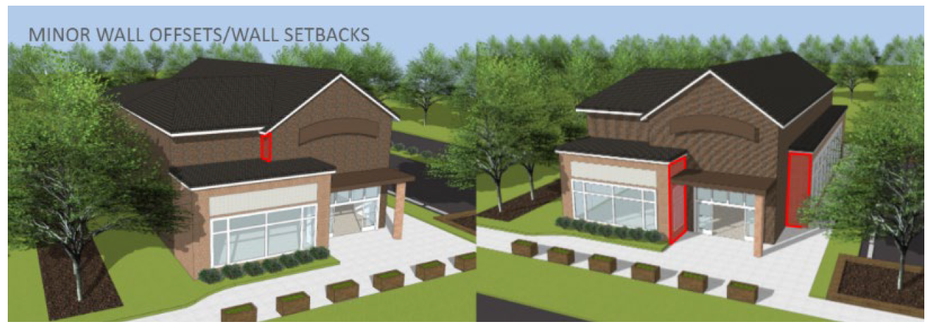
Disclaimer: The example shown is for illustration purposes only and meant to provide examples of design elements.
b.
Height Variation. Differing building roof heights shall be used to add visual interest and reduce boxy building masses.
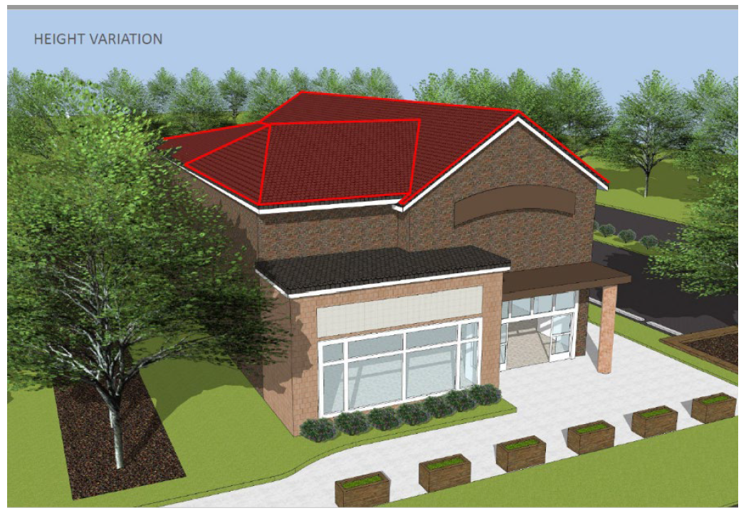
Disclaimer: The example shown is for illustration purposes only and meant to provide examples of design elements.
c.
Upper Floor Step Backs. The upper portions of a larger building mass shall be recessed from the street or when the perimeter yard boundary corresponds with the Downtown Overlay boundary and the adjacent property is zoned residential for single family development to reduce looming effects. A recessed story shall be stepped back a minimum of five (5) feet for any structure greater than twenty (20) feet.
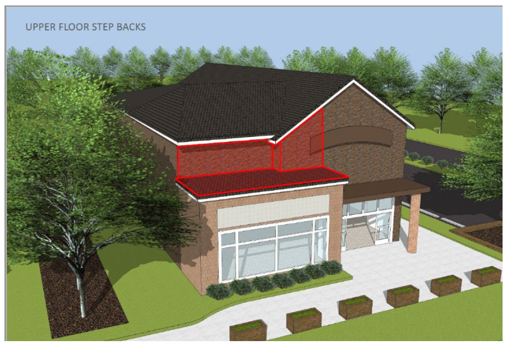
Disclaimer: The example shown is for illustration purposes only and meant to provide examples of design elements.
(b)
Building Materials. .....All new building facades shall be constructed of pedestrian scaled brick, wood, stone, cast stone, decorative concrete masonry, exposed architectural concrete, stucco, complimentary non-vinyl siding, or a combination thereof. The combination of materials shall be done so that the materials and colors will complement each other. Exposed vinyl siding, exposed metal siding, painted concrete, painted brick, painted concrete masonry and standard gray concrete masonry are not acceptable exterior materials. Roofing materials exposed to view shall be standing seam metal or copper, concrete, slate or clay roof tile, or architectural dimensional asphaltic shingles. Exposed roofing felt and standard 3-tab asphaltic roof shingles are not allowed.
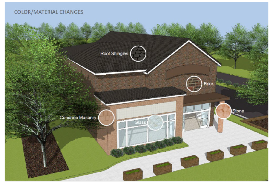
Disclaimer: The example shown is for illustration purposes only and meant to provide examples of design elements.
(c)
Roofs. .....All roofs of new buildings shall meet the following requirements:
(i)
Roofs shall meet the height requirements outlined in Section B.2-1.6(H)(3)(a).
(ii)
Flat roofs shall be hidden by parapet walls capped with continuous masonry, stone or a decorative stucco element or with a concealing sloped roof.
(iii)
Low sloped roofs shall be interrupted by the use of gables, dormers, and other roof features to create distinguishing architectural character.
(iv)
Overhanging eaves are required on all sloped roofs.
(v)
All rooftop utility structures and equipment shall be screened from view at any height.
(d)
Façades. .....The façades of all new buildings shall be designed to support and enhance a pedestrian friendly environment and compliment the historical small town unique character of Lewisville by integrating pedestrian proportioned features such as recessed entrances, projecting elements, arcades, colonnades, porches, pillars, columns, cornices, patterning of materials and other similar architectural features. Visual balance shall be achieved in the overall building façade composition. Differing buildings, multi-tenant businesses and/or activities within the same development may be distinguished within a consistent architecture by utilizing variations of material, scale, forms, and architectural elements. No wall that faces a street or connecting walkway shall have a blank, uninterrupted area with any length exceeding twenty (20) feet. Delineation between ground and upper floors is encouraged by using architectural elements such as cornices, balconies, arcades, and ornamented belt courses. The frontage of buildings shall be divided into architecturally distinct sections of no more than sixty (60) feet in width. All sides, including the rear, of the building shall include materials and design characteristics consistent with those of the front.
(e)
Façade Openings. .....Transparency through use of windows is encouraged in all new buildings.
(i)
For DCA - Minimum percentages of fenestration for street fronting façades of all new buildings are as follows - all commercial retail uses shall be fifty percent (50%) of surface area of horizontal wall at the ground floor and twenty percent (20%) of upper floors; all commercial non-retail and residential uses shall be thirty-five percent (35%) of surface area of horizontal wall at the ground floor and twenty percent (20%) of upper floors. Transparency of the ground level shall be calculated within the first fifteen (15) feet of the building wall, measured vertically at street level. Transparency of all non-street fronting façades shall be treated similarly so as there is no significant changes in aesthetic appearance. Size, orientation, proportion, grouping and detailing of all fenestrations shall be proportioned to relate to human pedestrian scale. Reflective mirrored glazing is not acceptable.
(ii)
For DGA - Minimum percentages of fenestration for street fronting facades of all new buildings are as follows - all commercial retail uses shall be thirty-five percent (35%) of surface area of horizontal wall at the ground floor and twenty percent (20%) of upper floors; all commercial non-retail and residential uses shall be twenty-five (25%) of surface area of horizontal wall at the ground floor and twenty percent (20%) of upper floors. Transparency of the ground level shall be calculated within the first fifteen (15) feet of the building wall, measured vertically at street level. Transparency of all non-street fronting facades shall be treated similarly so as there is no significant changes in aesthetic appearance. Size, orientation, proportion, grouping and detailing of all fenestrations shall be proportioned to relate to human pedestrian scale. Reflective mirrored glazing is not acceptable.
(f)
Building Orientation.
(i)
For DCA - All buildings shall face Shallowford Road or the Great Wagon Road. All buildings shall be oriented so that they abut a public right of way with no intervening parking area. Adequate sidewalks shall be provided for the safe transition of the pedestrian user from any off street on-site parking to the primary user entrance. There shall be a public-private setback zone to each building. This will provide sidewalk activity area for outdoor exhibits, benches, porches, places for conversation, sheltered from weather and pedestrian oriented identity to the specific use of the building. The zone shall be six (6) feet deep and be established beyond the sidewalk along the façade, with fifty percent (50%) of this area free of building to allow the addition of street amenities.
(ii)
For DGA - All buildings shall be oriented so that the primary user entrance is clearly articulated. Adequate sidewalks shall be provided for the safe transition of the pedestrian user from any off street on-site parking to the primary user entrance. There shall be a public-private setback zone to each building. This will provide sidewalk activity area for outdoor exhibits, benches, porches, places for conversation, sheltered from weather and pedestrian oriented identity to the specific use of the building. The zone shall be six (6) feet deep and be established beyond the sidewalk along the façade, with fifty percent (50%) of this area free of building to allow the addition of street amenities.
(iii)
Building walls with street frontage shall emphasize pedestrian-oriented architectural features such as façade articulation, windows, awnings, porticos and other similar features.
(g)
Covered Walkways. .....Awning covered walkways, open colonnades, or similar weather protection structures shall be provided to further articulate pedestrian circulation and shall be encouraged and shall be designed to complement new buildings and the streetscape of the area.
(h)
Exterior Site Improvements. .....Pre-approved and selected features such as fences, utilities, outdoor furniture, signage and displays shall be incorporated and shall be compatible with the mass and scale of such other improvements elsewhere in the area and as otherwise governed herein.
(i)
Service and Utility Areas. .....Service and utility areas, shipping and receiving areas and trash disposal areas shall be to the rear or side of a building in a visually unobtrusive location and shall be screened from view with adequately sized fencing of appropriate materials.
(j)
Utilities. .....New utility service lines to all new buildings from existing utility service source shall be placed underground. Overhead utility crossings are not permitted. Utilities within Town maintained streets and/or NCDOT roads shall be placed underground to the property line. Oversized hotboxes are required to protect larger back-flow valves as required by NFPA-13; however, the preferred installation method is to locate said valves in an approved vault located below ground level where elevations and topography permit.
(k)
Color. .....Color schemes for all new buildings shall incorporate a single base color and no more than two (2) compatible secondary minor accent colors. Natural earth tones are encouraged; bright primary colors are discouraged and shall only be used as accent colors.
(l)
Lighting. .....Internal or external light sources shall be oriented so as to not generate glare. Exterior fixtures shall be selected to aesthetically enhance the existing street lighting. The other standards of Section B.3-11 shall apply.
(m)
Landscape. .....Landscape plantings along front facades are required at a rate of six (6) square feet of planting area for each one (1) foot of horizontal wall. Human scale elements are to be incorporated into large undefined expanses of walls. Plantings are to be located between the building and the parking area(s). Plantings are not required along any frontage that has a required bufferyard.
(n)
Sustainability. .....Conservation of natural resources and incorporation of alternate energy sources are encouraged while meeting the minimum requirements of these standards.
(o)
Signs. .....The maximum height of any ground sign shall be five (5) feet, excepting governmental signs erected for information, identification, or directional purposes. Sign height shall be measured from the highest portion of the copy area.
(i)
Prohibited Signs.
a.
Neon, plastic panel, and plastic panel rear lighted signs.
b.
Off-premises signs.
(ii)
Restrictions on Signs.
a.
Only one (1) on-premises ground sign per zoning lot per street frontage is permitted.
b.
Only one (1) of the following signs is permitted for each tenant per each exposed wall: awning, projecting, or wall.
c.
The material and design of a sign shall be in keeping with the character of the principle use of the site.
d.
Maximum area of awning signs shall be ten (10) square feet.
(p)
Right-of-Way Dedication. .....As deemed necessary by NCDOT to accommodate any on-street parking and a seven-foot wide sidewalk.
(q)
Parking. .....Parking lots shall be designed to allow the safe movement of pedestrians from their vehicles to the building(s). Parking lots shall be located to the rear or side of the primary structure. Outparcel development should be sited so as to create a courtyard-style site plan which surrounds the development's parking. Large parking lots shall be divided into smaller parking rooms that are defined by landscape plantings and site furniture. Any off-street parking, whether located to the front, side or rear of the primary structure, must be screened from the road. "Front" and "Rear" shall be determined, for the purposes of this subsection, by the orientation of the primary structure(s) to NCDOT Secondary Road, Great Wagon Road, or Shallowford Road, and not in relation to the location(s) of entrance(s) to the structure(s).
(i)
Credits. .....On-street parking satisfying the off-street parking requirements is permitted provided the following requirements are met:
a.
All parking shall be angled or parallel meeting the requirements of Table B.3.9, and must be approved by the Elected Body, the NCDOT, or other agency, whichever is applicable.
b.
Credit shall be limited to all available public on-street parking within a radius of two hundred fifty (250) feet of the midpoint of the subject property's road frontage. Each on-street parking space thus credited may be used in lieu of required off-street parking on a one-for-one basis.
c.
Sidewalks shall be constructed immediately adjacent to on-street parking spaces and connected to a well-defined interior pedestrian system.
d.
Developer shall dedicate public right-of-way or public road maintenance easements as recommended by the staff of the Town of Lewisville or the North Carolina Department of Transportation and must be approved by the Elected Body.
e.
Developer shall construct all required improvements within public rights-of-way to applicable public design standards.
(ii)
Connectivity. .....Parking areas shall be designed to allow for connectivity between adjoining lots, except where topographic conditions prohibit a feasible connection, as determined by the Town in its discretion.
(r)
Drive Thrus. .....Drive thrus shall be allowed as provided under LD1-C zoning districts.
(4)
Bufferyards and Other Screening Requirements.
(a)
Downtown Overlay Perimeter Yards. .....A Type II bufferyard shall be required when the perimeter yard boundary corresponds with the Downtown Overlay boundary and the adjacent property is zoned residential for single family development.
(b)
Side Yards. .....A Type II bufferyard shall be required in side yards when the adjacent property is zoned residential for single family development.
(c)
Removal. .....Owners of properties within the Downtown Overlay may remove side yard buffers when pre-development conditions, which required the installation, no longer exist.
(d)
Fences. .....Materials such as brick-masonry, stone, ornamental iron, wooden materials, or of the same material as that of the principle building are approved for use throughout the overlay district. Vinyl coated (dark green/black) chain link fencing may be used in conjunction only with those uses allowed within the IP zoning districts located within the Downtown Overlay District.
(e)
Plantings. .....Where a chain link fence is utilized, site appropriate landscaping shall be incorporated. All required vegetation shall be planted on the exterior side of the fence and be in addition to those plantings and bufferyards required by the Lewisville Downtown Overlay District.
(5)
Gateway Area. .....The downtown gateway area provides primarily for auto-dependent uses in areas not amenable to easy pedestrian access and a comfortable pedestrian environment. It is expected that the gateway area will serve not only the Lewisville Community, but highway travelers as well. Due to its downtown location the moderate integration of pedestrian-oriented environs is paramount to accommodate a systematic transition from vehicular to pedestrian orientation. The following standards apply:
(a)
Maximum Building Setback. .....Forty (40) feet.
(b)
Minimum Streetyard Width. .....Fifteen (15) feet.
(c)
Parking. .....Parking with a maximum depth of one (1) parking bay plus a driving aisle shall be allowed adjacent to any public street.
(6)
Core Area. .....In the Downtown Core Area (Lewisville Downtown District 1) a broad array of uses is expected in a pattern which integrates shops, restaurants, services, work places, civic, educational, and religious facilities, single family housing, and higher density housing in a compact, pedestrian-oriented environment. The following standards apply:
(a)
Façades that face the street or sidewalk must provide windows or other architectural features so as not to create a blank façade.
(b)
Internal or external lighting shall be oriented so as to not generate glare on sidewalks or streets.
(c)
The use of cornice canopies, balconies, and arcades to delineate between the ground level and upper levels is required.
(d)
Medium size buildings must be broken into smaller scale components at the ground level.
(i)
Public-private Setback Zone. .....There shall be a public-private setback zone to each building. This will provide sidewalk activity area for outdoor exhibits, benches, porches, places for conversation, and shelter from the weather. The zone shall be six (6) feet deep and be established beyond the sidewalk along the façade, with fifty percent (50%) of this area free of building to add streetscape amenities.
(ii)
Parking Structures. .....Any parking decks/structures shall be constructed of exterior materials similar to adjacent buildings. Parking structures are encouraged to demonstrate similar rhythm and break-up of solid wall masses on visible façades.
(iii)
Minimum Sideyard Building Setback. .....Zero (0) feet or the width of the bufferyard if required per section B.2-1.6(H)(4) above.
(I)
PCO Pedestrian Connections Overlay District
(1)
Purpose. .....The PCO district is intended:
(a)
To fulfill the comprehensive plan goals while enhancing the visual character of the town and to provide a safe, efficient and diverse transportation system, and to provide facilities that encourage health and wellness;
(b)
To implement, in part, provisions of the accepted Greenway and Pedestrian Connections Plan;
(c)
To provide safe and convenient pedestrian and wheelchair access throughout town and in particular to connect residential areas with commercial and employment areas;
(d)
To promote inter-modal transportation and support transit; and
(e)
To maintain the small-town feel and traditional character of the town.
(2)
PCO District Requirements.
(a)
Sidewalks are required for all new construction and renovations, additions and/or expansions to existing commercial structures which abut proposed public roadways, or which fall into one (1) of the following categories:
(i)
Any project adjacent to sidewalk alignments as shown in the Greenway and Pedestrian Connections Plan.
(ii)
All new single-family residential development which is a major subdivision of ten (10) or more single-family homes; The Greenway and Pedestrian Connections Plan shall be referenced on how it relates to the proposed development. The Elected Body shall determine if new sidewalks are feasible;
(iii)
All new multi-family residential development or residential special use developments of ten (10) units or more or as required as part of a special use permit;
(iv)
All new office, institutional, and commercial or mixed-use developments abutting a state or town road or as required as part of a special use permit;
(v)
All existing office, institutional, and commercial development additions or expansions to structures where the expansion results in an increase of more than fifty percent (50%) value of the structure;
(vi)
All new streets, improved streets or extension to streets as required by the town subdivision ordinances or a special use permit.
(b)
Wherever a property abuts a proposed greenway alignment, the development plan for that property must allocate right-of-way for future construction, or may utilize greenway construction to meet pedestrian access requirements or to offset fees required in lieu of sidewalk construction (see paragraph c. below). Allocated right-of-way for the purpose of greenways may be used to fulfill open space requirements for major subdivisions and special use permits.
(c)
Notwithstanding the conditions of a special use or conditional use permit, a developer may choose to request a waiver for construction of sidewalk and pay a fee in lieu of actual construction or the developer may propose an alternative (see 4. Alternative Compliance below), provided that the following conditions are met:
(i)
The applicable project area, including the street frontage, is not identified as a needed pedestrian linkage within the Greenway and Pedestrian Connections Plan or other adopted transportation or corridor plan, including but not limited to the Transportation Improvement Program (TIP), or is granted approval for a waiver by the Planning Board.
(ii)
To recommend a waiver for sidewalk construction, the Planning Board must find that:
[A]
Such facilities are not in harmony with surrounding uses; or
[B]
That a sidewalk within the development is unfeasible due to special circumstances, including but not limited to impending, road widening or improvements, significant street trees, or severe roadside conditions or slope which would prohibit sidewalk construction.
(iii)
The developer must provide a recorded easement to the Town for the future development of the sidewalk or greenway in accordance with the Greenway and Pedestrian Connections Plan. The developer wherever practical shall grade for the future development of a sidewalk.
(iv)
Fees shall be based on the construction cost for an ADA compliant sidewalk surface for the linear footage of property adjacent to the public roadway.
(d)
All sidewalks shall be constructed in accordance with the standards of the Town of Lewisville and shall be reviewed by the Public Works Director.
(3)
Use of fees collected in lieu of construction. .....All fees collected by the town pursuant to these provisions shall be accounted for separately from other monies, and shall be expended only for the construction or rehabilitation of sidewalks or other pedestrian improvements in the same general area as the development.
(4)
Alternative compliance. .....When a waiver for construction of a sidewalk is requested by the developer and granted by the Planning Board, the developer may propose a sidewalk plan that varies from the strict application of the PCO District in order to accommodate unique characteristics of the site, utilize innovative design, or provide an appropriate degree of pedestrian connectivity. An Application for alternative compliance shall include a site plan following the requirements specified in Section B.7, and may be approved by the Planning Board, in their discretion, only upon a finding that the proposed alternate plan fulfills the intent and purposes of this section.
(5)
Appeals and variances. .....In the event that a developer wishes to appeal the ruling of the town staff or the sidewalk or greenway easement requirements, or to vary the requirements at their location, the developer must provide application with a letter explaining the reasons for their request to the town zoning administrator. The application will be forwarded to the Zoning Board of Adjustment for its consideration.
(UDO L-123, § 3, 10-11-07; UDO L-126, §§ 3, 4, 12-6-07; UDO L-143, §§ 11, 12, 11-14-13; UDO L-144, §§ 2—5, 4-10-14; UDO L-152, § 2, 12-14-17; UDO L-157, § 2, 9-13-18; UDO L-161, § 2, 12-3-20; UDO L-162, § 5, 1-14-21; UDO L-164, § 2, 7-8-21; UDO L-165, 4-14-22; UDO L-167, 11-10-22)
2-2 - OFFICIAL ZONING MAPS
2-2.1 OFFICIAL ZONING MAPS
(A)
Designation and Description of Official Zoning Maps .....There shall be maps known and designated as the Official Zoning Maps which shall show the boundaries of all zoning districts within the planning jurisdiction of the adopting jurisdiction. The Official Zoning Maps as dated upon adoption are made part of this Ordinance as fully as if set forth herein in detail.
(B)
Location of Official Zoning Maps .....The Official Zoning Maps shall be located in the office of the Town Clerk. True copies of the Official Zoning Maps are on file in the office of the Zoning Officer.
(C)
Revision and Replacement of Official Zoning Maps
(1)
Planning Staff Authorization. .....The Planning Staff shall control access to the zoning information contained in the Forsyth County Land Records Information System and is authorized to revise the Official Zoning Maps when amended by the Elected Body. No unauthorized person may alter or modify the Official Zoning Maps.
(2)
Amended Map. .....When an Official Zoning Map is amended by the Elected Body, the Planning Staff shall revise the appropriate data in the Forsyth County Land Records System and create a new Official Zoning Map reflecting the change.
(3)
Replacement Map. .....In the event that an Official Zoning Map becomes damaged, destroyed, lost, or difficult to interpret because of the nature or number of changes or additions, the Planning Staff may create a new Official Zoning Map. The new Official Zoning Map may be revised to correct drafting or other errors or omissions in the prior Official Zoning Map, but no such corrections shall have the effect of amending the designation or boundaries of any zoning districts on the original Official Zoning Maps or any subsequent amendment thereof.
(D)
Amendments to Official Zoning Maps
(1)
Procedures. .....The Official Zoning Maps may be amended under the same procedures which apply to amendments to the text of this Ordinance, as set forth in Section B.6-2.
(2)
Updates. .....The Planning Staff shall update amended Official Zoning Maps in a timely manner after amendments adopted by the Elected Body. Upon entering any such amendment on a map, the Planning Staff shall change the date of the map to indicate the map's latest revision.
(3)
Records. .....The Planning Staff shall keep copies of superseded prints of the zoning map for historical reference.
2-2.2 ZONING DISTRICT BOUNDARIES
(A)
Location of District Boundaries .....District boundaries are usually located along property lines, streets, alleys, railroad rights-of-way, or extensions thereof. Any street, alley, or railroad right-of-way shall be deemed to be in the same district as the abutting property; provided that where the centerline of a street, alley, or railroad right-of-way serves as a district boundary, each half of the right-of-way shall be deemed to be in the same district as the property abutting upon that side of the street, alley, or railroad right-of-way.
(B)
Uncertainty Concerning District Boundaries .....Where uncertainty exists concerning boundaries of districts as shown on the Official Zoning Maps, the following guidelines shall be used:
(1)
Boundary Line is Within a Street. .....In cases where a boundary line is within a street, alley, or easement, the boundary line shall be deemed to be the centerline of such right-of-way;
(2)
Actual Location Varies from Map Illustration. .....If the actual location of a street, alley, or easement varies from the location as shown on the Official Zoning Maps, then the actual location shall control;
(3)
Boundary Line Defined by Proximity to Right-of-Way. .....In cases where a boundary line is shown as being located a specific distance from a street right-of-way line or other physical feature, such distance shall control;
(4)
Water Areas. .....All water areas and the land beneath them are controlled by the applicable zoning district regulations within which they are located.
(C)
Lot Divided by District Boundary Line .....Where a district boundary line divides a lot created by recorded deed, map, plat, or court proceeding, and existing as of the date establishing nonconformity in Section B.5-2.1(A), such boundary shall be presumed to lie on the nearest property line to which it is parallel or most nearly parallel, provided that the district boundary line shown on the Official Zoning Maps is found by the Zoning Officer to be not more than fifty (50) feet, at any point, from said property line. Where a district boundary line is shown on the Official Zoning Maps to be not within fifty (50) feet, at all points, of such property line, then such district boundary line shall be as shown on the Official Zoning Maps, and the exact location thereof shall be as determined by the Zoning Officer through reference to the scale or to notation on the Official Zoning Maps.
(D)
Split Jurisdiction .....If a parcel of land lies within the planning and development regulation jurisdiction of more than one (1) local government, the local governments may, by mutual agreement pursuant to NCGS 160D-203 and with the written consent of the landowner, assign executive planning and development regulation jurisdiction for the entire parcel to any one (1) of those local governments. Such a mutual agreement shall only be applicable to development regulations and shall not affect taxation or other non-regulatory matters. The mutual agreement shall be evidenced by a resolution formally adopted by each governing board and recorded with the register of deeds in the county where the property is located within fourteen (14) days of the adoption of the last required resolution.
(UDO L-164, § 2, 7-8-21)
2-3 - APPLICATION OF DISTRICT REGULATIONS
2-3.1 MINIMUM STANDARDS
The regulations established by this Ordinance within each district shall be the minimum standards and shall apply uniformly to each class or kind of structure or land, except as hereinafter provided.
2-3.2 COMPLIANCE
Land may be used and buildings may be erected, altered, enlarged or used only for one or more of the uses permitted in the applicable zone as indicated in Table B.2.6 subject to the dimensional and other requirements of this Ordinance.
2-3.3 SEPARATE COMPLIANCE
No part of a yard, lot area, off-street parking area, or loading area required in connection with any building or use for the purpose of complying with this Ordinance, shall be included as part of a yard, lot area, off-street parking area, or loading area similarly required for any other building or use, except as otherwise provided in this Ordinance.
2-3.4 YARD AND LOT COMPLIANCE
No yard or lot existing at the time of passage of this Ordinance shall be reduced in dimension or area below the minimum requirements set forth in Section B.3-1, except as otherwise provided in this Ordinance.
2-3.5 CORNER LOTS
The determination of front, side and rear lot lines for corner lots shall be made by the Zoning Officer. The Zoning Officer shall consult with the property owner at the time of application for a building or zoning permit.
2-4 - PERMITTED USES
2-4.1 TABLE B.2.6
Table 2.6 displays the principal uses allowed in each zoning district and references use conditions. Table 2.6 should be read in conjunction with the definitions of principal uses and other terms in Section A. Land, buildings and structures shall only be used in accordance with the districts shown on the Official Zoning Maps and subject to all requirements and conditions specified in this Ordinance.
(UDO L-151, § 3, 2-9-17)
2-4.2 ESTABLISHED NONCONFORMING USES
Nonconforming uses as regulated in Section B.5-2 shall be permitted.
2-4.3 NEW OR UNLISTED USES OF SIMILAR NATURE
When a use is not listed in Table B.2.6, the Zoning Officer shall classify the use with that use in the schedule most similar and enforce the requirements of the similar listed use.
2-4.4 APPLICATION OF TABLE B.2.6
(A)
Zoning Permit from Zoning Officer .....Uses identified in a particular district column with a Z require only issuance of a zoning permit by the Zoning Officer and shall be allowed in such district with such conditions as referenced in the Conditions column, subject to all other applicable requirements of this Ordinance.
(B)
Site Plan Approval by Planning Board .....Uses identified in a particular district column with a P shall be permitted in such district upon approval by the Planning Board of a site plan meeting such conditions as referenced in the Conditions column, subject to all other applicable requirements of this Ordinance as identified in Section B.2-4.6.
(C)
Special Use Permit Approval by Board of Adjustment .....Uses identified in a particular district column with an A shall be permitted in such district upon approval of a special use permit by the Board of Adjustment with such conditions as referenced in the Conditions column, subject to all other applicable requirements of this Ordinance as identified in Section B.2-4.6.
(D)
Special Use Permit Approval by Elected Body .....Uses identified in a particular district column with an E shall be permitted in such district upon approval of a special use permit by the Elected Body with such conditions as referenced in the Conditions column, subject to all other applicable requirements of this Ordinance as identified in Section B.2-4.6.
(E)
ConditionsColumn .....The number in the Conditions column references the subsection of Section B.2-5 (i.e., condition 23 refers to Section B.2-5.23).
2-4.5 OTHER DEVELOPMENT REQUIREMENTS OF THE ZONING ORDINANCE
(A)
Additional Development Requirements .....In addition to the regulation of uses pursuant to this Section B.2-4 and the use conditions of Section B.2-5, the following additional development requirements of this Ordinance may apply to specific properties and situations.
(B)
Site Plan Review Conditions .....For uses which require review by the Planning Board, the Board of Adjustment, and/or the Elected Body, or for special use district rezoning requests, additional conditions may be recommended or placed on the use pursuant to Sections B.6-1.3, B.6-1.4, 6-1.5, and B.6-2.2.
(C)
Nonresidential Development Standards .....In addition to the regulation of uses pursuant to this section and the use conditions of Section B.2-5, the following additional development requirements of this Ordinance shall apply to all nonresidential uses (excluding agricultural uses) for General Use Zoned properties within the municipal boundaries of Lewisville. The Planning Board shall review a site plan as called for in Section B.7-2.3(F).
(UDO L-134, § 10, 10-8-09; UDO L-143, Att., 11-14-13; UDO L-145, § 1, 3-12-15; UDO L-151, § 3(Att.), 2-9-17; UDO L-158, 9-13-18; UDO L-159, § 3, 3-12-20; UDO L-164, § 2, 7-8-21; UDO L-168, 10-10-24)
2-5 - USE CONDITIONS
2-5.1 ACCESS EASEMENT, PRIVATE OFF-SITE
(A)
Applicability .....No access easement or private street shall be established except within a zoning district permitting the use to be served, or as part of and within the general boundaries of an approved subdivision, planned residential development or multifamily development; without a special use permit issued in accordance with Section B.6.
(B)
Special Use District Zoning .....Notwithstanding the requirements of Section B.2-5.1(A), a private access easement established pursuant to Section B.6 may serve more than one zoning lot or special use district zone.
(C)
Standards .....Private access easements requiring the issuance of a special use permit in Section B.2-5.1(A) must be designed in conformity with the accepted criteria established for public streets of equivalent width, grade, curvature, intersection locations, and other safety features.
2-5.2 ADULT DAY CARE CENTER
(A)
As an Accessory Use .....This use is permitted as an accessory use operated by a religious institution on the same zoning lot and also within buildings used for religious activities in all zoning districts.
(B)
Space Requirements .....At least fifty (50) square feet of heated space per person enrolled, or sufficient space to meet State requirements, whichever is greater, shall be provided.
(C)
Hours of Outdoor Activities .....Outdoor activities shall be limited to between 8:00 a.m. and 8:00 p.m.
(D)
Passenger Loading Space .....At least one off-street passenger loading and unloading space separate from the parking area shall be provided for every twenty (20) persons enrolled, plus adequate turnaround.
(E)
Certification .....Certification by the State is required.
2-5.3 ADULT DAY CARE HOME
(A)
Location .....This use is permitted only in a private residence occupied by the operator or as an accessory use operated by a religious institution on the same zoning lot and within buildings also used for religious activities in all zoning districts.
(B)
Space Requirements .....At least fifty (50) square feet of heated space per person enrolled or space sufficient to meet State standards, whichever is greater, shall be provided.
(C)
Hours of Outdoor Activities .....Outdoor activities shall be limited to between 8:00 a.m. and 8:00 p.m.
(D)
Operating Hours .....Operating hours shall be limited to between 6:00 a.m. and 8:00 p.m.
(E)
Passenger Loading Space .....At least one off-street passenger loading and unloading space separate from the parking area, plus adequate turnaround area, shall be provided.
(F)
Certification .....Certification by the State is required.
2-5.4 ADULT ESTABLISHMENT
(A)
Location .....No activities permitted under State law shall be conducted in adult establishments in the following locations:
(1)
Residential Districts. .....Adult establishments may not be located within a distance of one thousand (1,000) feet from any RM or RS District;
(2)
School. .....Adult establishments may not be located within a distance of one thousand (1,000) feet from any public or private school;
(3)
Child Day Care Center. .....Adult establishments may not be located within a distance of one thousand (1,000) feet from any child day care center;
(4)
Other Adult Establishment. .....Adult establishments may not be located within a distance of one thousand (1,000) feet from any other adult establishment.
(B)
Measurements .....All measurements shall be made by drawing straight lines from the nearest point of the lot line where the proposed adult establishment is to be located to the nearest point of the lot line or boundary of the closest RM or RS District; elementary, secondary or private school; or adult establishment.
2-5.5 AGRICULTURAL PRODUCTION, CROPS
(A)
Minimum Size .....Site shall contain a minimum three (3) acres.
(B)
Greenhouses .....Greenhouses used in the agricultural operation shall not exceed eight (8) feet in height and sixteen (16) feet in width.
(C)
Retail Sales .....There shall be no retail sales on the site.
(D)
Screening .....Greenhouses and other structures and equipment used in agricultural operations shall be screened from view of rights-of-way and adjacent residentially zoned land.
(E)
Noise .....Noise from machinery or activities used in agricultural crop production shall not impact adjacent residentially zoned land; mitigation shall be by means of muffling or setting back the source of noise an adequate distance from the adjacent property.
(F)
Special Use Permit .....The Zoning Board of Adjustment is encouraged to approve any special use permit for applicants meeting these requirements without a maximum time limit.
2-5.6 AIRPORT, PRIVATE
(A)
As an Accessory Use .....In the AG, YR, RS-40 and RS-30 Districts, a private airport is permitted as an accessory use. All dimensional and other requirements of this section must be observed.
(B)
Standards and Permits .....All federal and State standards must be met, and the respective approvals obtained.
(C)
Landing Strip Setbacks .....The landing strip must be set back at least two hundred (200) feet from any adjacent property zoned AG, YR, RS or RM.
(D)
Dimensional Requirements .....Hangars and other structures must observe the dimensional requirements for principal buildings in the zoning district.
(E)
Repair and Maintenance Facilities .....Repair and maintenance facilities are limited to those necessary for the aircraft using the private airport. All such facilities, except fuel storage and pumps, must be located within the hangar.
2-5.7 ANIMAL FEEDING OPERATION
(A)
Size .....The minimum site size for an animal feeding operation is three (3) acres.
(B)
Setbacks .....All structures, buildings or enclosed areas used for housing of poultry, hogs, cattle, or other livestock, shall be a minimum of one hundred (100) feet from all property lines.
2-5.8 BED AND BREAKFAST
The following shall apply to all bed and breakfasts in the RS zones:
(A)
Parking to the Rear .....All off-street parking shall be provided to the rear or to the side of the principal structure. The side parking area may be no closer to the street than the principal structure.
(B)
Buffer Around Parking Area
(1)
Rear Parking Areas. .....All rear parking areas shall be buffered by a type I bufferyard, as defined in Section B.3-5, from adjacent residentially zoned property.
(2)
Side Parking Areas. .....Type I plantings will be provided in the required streetyard. A type II bufferyard, as defined in Section B.3-5, shall be provided if side parking abuts residentially zoned property.
2-5.9 BOARDING OR ROOMING HOUSE
In RM Districts, the minimum lot area shall be determined based on the minimum lot area required for a two-unit dwelling in the district, as shown in Table B.3.3.
2-5.10 BORROW SITE
(A)
Prohibited in RS zones in GMA 1, 2 and 3 .....Except as permitted below in subdivisions, borrow sites shall not be permitted in RS Districts in GMAs 1, 2 and 3.
(B)
Subdivisions .....Borrow sites operated by a developer or builder in conjunction with active development of section(s) of a subdivision within five (5) years of final plat approval, including land grading, removal, or filling within the subdivision where the fill material is placed on sites within said section(s) of a subdivision, are exempt from the use conditions of this section and the Special Use Permit requirements specified in Table B.2.6.
(C)
Easements .....No excavation shall take place within easements for underground transmission lines for oil, natural gas, or other potentially hazardous material.
(D)
Fencing .....Any excavation to a depth greater than five (5) feet shall be fenced. However, no fencing shall be required on any property where such fencing would be impracticable, as determined by the Zoning Officer.
(E)
Hours of Operation .....Except in cases of emergency involving safety on the site, borrow sites shall not be operated on Sunday and may not be operated earlier than 7:00 a.m. nor later than 6:00 p.m. on any other day.
(F)
Access .....The borrow site shall have direct access onto a major or minor thoroughfare unless the site is located in GMAs 4 or 5.
(G)
Grading Permit .....A grading permit must be issued for any borrow site ten thousand (10,000) square feet or more.
(H)
Operational Statement .....The petitioner will file an operational statement with the Inspections Division which shall include the following:
(1)
The approximately date to begin operation and its expected duration.
(2)
Estimated type and volume of extraction.
(3)
Description of method of operation, including the disposition of topsoil, overburden, and by-products.
(4)
Description of equipment to be used in the extraction process.
(5)
Any phasing of the operation and the relationship of the various phases.
(I)
Temporary or Permanent Discontinuance of Operations .....Notice of intent to discontinue temporarily a borrow site shall be filed with the Zoning Officer in advance of such temporary discontinuance. Notice of intent to discontinue permanently a borrow site shall be filed with the Zoning Officer.
(J)
Maintenance .....During any period that a borrow site is discontinued temporarily, the site, along with all structures, machinery, and fencing, shall be properly maintained in a safe and orderly condition.
(K)
Reuse or Rehabilitation of Site .....Notice of permanent discontinuance of a borrow site shall include a plan for reuse or rehabilitation of the site. Except where redevelopment for another permitted use is in progress on the site of a discontinued borrow site, the last operator shall perform the following within one year, except that ground vegetation and revegetation of slopes shall comply with the deadlines contained in Section C.4-7.3(A).
(1)
Buildings and Equipment. .....All buildings and equipment shall be removed;
(2)
Materials. .....All nonregulated waste piles, overburden, and other materials shall be graded so that the material assumes it nature angle of repose. These materials shall be planted with vegetation so as to prevent erosion;
(3)
Water Collection and Drainage. .....Any excavation shall be so graded as to provide for natural drainage; if the collection of water in an excavation is unavoidable, the area shall be fenced.
(L)
Other Requirements .....The operator of any borrow site shall file with the Zoning Officer, in addition to any exhibits required elsewhere in this Ordinance, evidence of ownership or control of property, plans for rehabilitation, and notices of intent, as required herein. The Zoning Officer shall inspect the premises annually to determine that all specific conditions are being met. Violation of the requirements herein shall make the operator liable to the penalties set forth in this Ordinance.
2-5.11 CAR WASH
The following conditions shall apply to all car wash facilities:
(A)
Vacuum Facilities .....Vacuum facilities shall meet setbacks of the applicable zoning district.
(B)
Vehicle Stacking .....The facility shall provide for off-street stacking space for five (5) times the number of vehicles which can be accommodated at one time in the facility.
(C)
Traffic Flow .....The facility shall be designed to allow adequate traffic flow for cars to enter and exit the facility safely. No portion of an exit or an entrance shall be less than fifty (50) feet from the right-of-way of an intersection.
(D)
Dry Down Area
(1)
Single Bay or Self-Service Facilities. .....Single bay facilities with automated brushes and multiple bay self-service facilities shall provide space for the parking of one car per bay to be used as a dry down area.
(2)
Conveyors or Chain Drag Systems. .....Facilities utilizing a conveyor or chain drag system for moving motor vehicles through the washing area shall provide adequate space at the building exit to allow for a dry down area of three (3) times the number of vehicles which can be accommodated at one time within the structure.
2-5.12 CEMETERY, LICENSED
(A)
Prohibited Districts .....Licensed cemeteries shall not be permitted as a principal or accessory use in RS Districts in GMAs 1, 2 and 3.
(B)
Requirements .....Licensed cemeteries shall meet all licensing requirements of State law.
(C)
Setbacks .....Buildings and burial plots shall meet the setbacks of the district except:
(1)
Any building except a gate house shall be set back a minimum of fifty (50) feet from any public street right-of-way and a minimum of one hundred (100) feet from the property line of any adjacent residentially zoned property.
(2)
Any burial plot or mausoleum shall be set back a minimum of fifty (50) feet from any public street right-of-way and from any residentially zoned property, except that any grave or burial plot shall be set back not less than three (3) feet from any property line of an adjacent licensed or unlicensed cemetery.
(D)
Required Yards .....All required yards shall be landscaped with a type I bufferyard and adequately maintained.
(E)
Access .....Licensed cemeteries shall have direct access to a major or minor thoroughfare.
(F)
Subdivision .....Licensed cemeteries shall meet the platting and other requirements of the Subdivision Ordinance.
2-5.13 CEMETERY, UNLICENSED
(A)
Prohibited Districts .....Except as otherwise permitted herein, unlicensed cemeteries shall not be permitted as a principal or accessory use in RS Districts in GMAs 1, 2 and 3.
(B)
Setbacks .....Buildings and burial plots shall meet the setbacks of the district except:
(1)
Any building except a gate house shall be set back a minimum of fifty (50) feet from any public street right-of-way and a minimum of one hundred (100) feet from the property line of any adjacent residentially zoned property.
(2)
Any burial plot or mausoleum shall be set back a minimum of fifty (50) feet from any public street right-of-way and from any residentially zoned property, except that any grave or burial plot shall be set back not less than three (3) feet from any property line of an adjacent licensed or unlicensed cemetery.
(C)
Required Yards .....All required yards shall be landscaped with a type I bufferyard and adequately maintained.
(D)
Access .....Municipal and animal cemeteries containing more than five (5) acres shall have direct access to a major or minor thoroughfare.
(E)
Subdivision .....Unlicensed cemeteries shall meet the platting and other requirements of the Subdivision Ordinance. Unlicensed cemeteries existing at the time of adoption of this Ordinance which have not been platted shall be recorded prior to the issuance of any permit for the property, except cemeteries accessory to and located on the main campus of churches.
(F)
Entrance and Internal Roads .....The entrance to and access within the unlicensed cemetery shall be maintained by the property owner.
(G)
Religious Institutions .....Unlicensed cemeteries are permitted as an accessory use to religious institutions in all districts where religious institutions are permitted.
(H)
Prohibitions .....Unlicensed cemeteries are not permitted as accessory uses to residential uses, or on lots less than one acre in size.
2-5.14 CHILD CARE (DROP-IN)
(A)
As a Principal or Accessory Use .....The use is permitted as a principal use in the zoning districts indicated in Table B.2.6, and as an accessory use operated by a religious institution or school on the same zoning lot and within the same buildings also used for religious or educational activities.
(B)
Indoor Space .....At least twenty-five (25) square feet of space of inside space shall be provided for each child (based on permitted capacity) if outdoor space is provided as indicated in Section B.2-5.14(C). If less or no outdoor space is provided, at least thirty-five (35) square feet of inside space shall be provided for each child (based on permitted capacity).
(C)
Outdoor Space .....If outdoor play area is provided, it shall be enclosed by a minimum four (4) foot tall security fence. A minimum of one hundred (100) square feet for each child (based on permitted capacity) must be provided to reduce the indoor space requirements in Section B.2-5.14(B).
(D)
Licensing .....Licensing by the State is required.
2-5.15 CHILD CARE INSTITUTION
(A)
Site Size .....The following minimum site sizes shall apply:
(1)
Five (5) acres for twenty-five (25) to seventy-five (75) children;
(2)
Ten (10) acres for seventy-six (76) to one hundred twenty-five (125) children;
(3)
Fifteen (15) acres for one hundred twenty-six (126) to one hundred seventy-five (175) children; and,
(4)
Twenty (20) acres for one hundred seventy-six (176) or more children.
(B)
Setback .....No building, dumpster, or recreation area shall be less than one hundred (100) feet from any property line adjacent to property zoned residential.
(C)
Licensing .....Licensing by the State is required.
(D)
Regulations .....Facilities must conform to all State and local building, fire, and health codes which apply to such facilities.
2-5.16 CHILD CARE (SICK CHILDREN)
(A)
As Principal or Accessory Use .....The use is permitted as a principal use in the zoning districts indicated in Table B.2.6, and as an accessory use for internal service (care provided by an employer to its employees).
(B)
Indoor Space .....At least forty-five (45) square feet if inside space shall be provided for each child (based on permitted capacity).
(C)
Medical Care .....Sufficient medical and nursing coverage with due regard to communicable disease control shall be provided and approved by the State.
(D)
Licensing .....Licensing by the State is required.
2-5.17 CHILD DAY CARE CENTER
(A)
As an Accessory Use .....A Child Day Care Center is permitted as an accessory use having received Planning Board Review (PBR) approval:
(1)
Church or Religious Institutions. .....In all zoning districts permitting churches or religious institutions when operated by a religious institution on the same zoning lot and within buildings also used for religious activities.
(2)
Public or Private Schools. .....In all zoning districts permitting public or private schools when operated by the school on the same zoning lot and within buildings also used for school activities.
(3)
In CI and GI Districts. .....In the CI and GI Districts when operated solely for the benefit of the employees of the principal use on the same zoning lot.
(B)
Conditions .....Child Day Care Centers must meet the following conditions in all districts when operated as a principal or an accessory use:
(1)
Indoor Space. .....At least twenty-five (25) square feet of inside space shall be provided for each child enrolled.
(2)
Outdoor Space. .....Outdoor play area of one hundred (100) square feet for each child enrolled, with four thousand (4,000) square feet minimum, shall be provided, except that in the CB, CB-S, PB, and PB-S Districts the outdoor play area requirements shall be the same as that required by the North Carolina Day Care Licensing Bureau; such outdoor play area shall be enclosed by a minimum four (4) foot tall security fence. Outdoor activities are limited to the fenced area between 8:00 a.m. and 10:00 p.m.
(3)
Passenger Loading Space. .....At least one off-street passenger loading/unloading space separate from parking shall be provided for each twenty (20) children enrolled, plus adequate turnaround area. The loading/unloading spaces and turnaround areas are required in all districts, including the CB and CI Districts.
(4)
Safety. .....The review and approval of site plans by the staff and approving authorities should give special consideration to internal traffic circulation and safety of the children on the site.
(5)
Licensing. .....Licensing by the State is required.
(UDO L-134, § 4, 10-8-09)
2-5.18 CHILD DAY CARE (LARGE HOME)
(A)
As a Principal or Accessory Use .....This use is permitted only in a private residence occupied by the licensed operator in RS and RM Districts, or as an accessory use operated by a religious institution on the same zoning lot and within buildings also used for religious activities in all zoning districts.
(B)
Indoor Space .....At least twenty-five (25) square feet of heated inside space shall be provided for each child enrolled.
(C)
Outdoor Space .....Outdoor play area of one hundred (100) square feet for each child enrolled, with a two thousand (2,000) square foot minimum, shall be provided. Such outdoor play area shall be enclosed by a minimum four (4) foot tall security fence. Outdoor activities shall be limited to the fenced area between 8:00 a.m. and 8:00 p.m.
(D)
Passenger Loading Space .....At least one off-street passenger loading or unloading space separate from parking shall be provided, plus adequate turnaround area. The loading/unloading spaces and turnaround area are required in all districts, including the CB District.
(E)
Licensing .....Licensing by the State is required.
2-5.19 CHILD DAY CARE (SMALL HOME)
(A)
Location .....This use is permitted only in a private residence occupied by the licensed operator or as an accessory use operated by a religious institution on the same zoning lot and within buildings also used for religious activities in all zoning districts.
(B)
Indoor Space .....At least twenty-five (25) square feet of inside space shall be provided for each child enrolled.
(C)
Outdoor Space .....Outdoor play area of one hundred (100) square feet for each child enrolled, with an eight hundred (800) square feet minimum, shall be provided; such outdoor play area shall be enclosed by a minimum four (4) foot tall security fence. Outdoor activities shall be limited to the fenced area between 8:00 a.m. and 8:00 p.m.
(D)
Registration .....Registration with the State is required.
2-5.20 CHURCH OR RELIGIOUS INSTITUTION, COMMUNITY SCALE
(A)
Access .....The site shall have direct access to a major or minor thoroughfare or a collector street.
(B)
Impervious Surface Cover .....In RS Districts, impervious surface cover for all church or religious institution property within the block of the principal building shall not exceed sixty percent (60%), however impervious surface cover in the RS and IP Districts may be increased to seventy-five percent (75%) with staff approval of a landscaping plan which demonstrates greater tree canopy coverage of parking area by doubling the planting ratio of Section B.3-4.3(C)(4) and reducing by at least one-half the spacing requirements of Section B.3-4.3(C)(5). In other districts, churches are subject to the impervious surface cover requirements of the underlying zone.
(C)
Bufferyard .....All buildings and parking areas on site shall be buffered by a type I bufferyard, as described in Section B.3-5, from adjacent residentially zoned property.
(D)
Parking .....Off-site parking may be used to meet up to fifty percent (50%) of on-site parking requirements upon recommendation of the City Department of Transportation regarding the safety of potential on-street parking. A special use permit from the Board of Adjustment is required.
(E)
Accessory Use .....Churches or religious institutions, community scale are an allowed accessory use in the CD1 district. Community scale church activities are to be conducted in existing CD1 buildings and shall be subordinate to the primary educational purpose of the institution.
(UDO L-134, § 5, 10-8-09)
2-5.21 CHURCH OR RELIGIOUS INSTITUTION, NEIGHBORHOOD SCALE
(A)
Impervious Surface Cover .....In RS Districts, impervious surface cover for all church or religious institution property within the block of the principal building shall not exceed sixty percent (60%), however impervious surface cover in the RS and IP Districts may be increased to seventy-five percent (75%) with staff approval of a landscaping plan which demonstrates greater tree canopy coverage of parking areas by doubling the planting ratio of Section B.3-4.3(C)(4) and reducing by at least one-half the spacing requirements of Section B.3-4.3(C)(5). In other districts, churches are subject to the impervious surface cover requirements of the underlying zone.
(B)
Buffering of Parking Areas .....All parking areas on site shall be buffered by a type I bufferyard, as described in Section B.3-5, from adjacent residentially zoned property.
(C)
Parking .....Off-site parking may be used to meet up to fifty percent (50%) of on-site parking requirements, upon recommendation of the City Department of Transportation regarding the safety of potential on-street parking. A special use permit from the Board of Adjustment is required.
(D)
Accessory Use .....Churches or religious institutions, neighborhood scale are an allowed accessory use in the CD1 district. Neighborhood scale church activities are to be conducted in existing CD1 buildings and shall be subordinate to the primary educational purpose of the institution.
(UDO L-134, § 6, 10-8-09)
2-5.22 CLUB OR LODGE
The following conditions apply in the IP District:
(A)
Minimum size .....The minimum site size shall be one acre.
(B)
Access .....The site shall have direct access to a collector street, or major or minor thoroughfare.
(C)
Setbacks .....No structure or outdoor recreation area shall be located less than forty (40) feet from any property line adjacent to residentially zoned property.
(D)
Public Address Systems .....Public address systems shall not be permitted except within a building.
2-5.23 COMBINED USE
(A)
Dwelling Unit Location .....No dwelling unit(s) shall be located at ground level fronting the street.
(B)
NO and NB Districts .....In the NO and NB Districts a maximum of two (2) residential dwelling units per building are permitted.
(C)
CI District .....Combined Uses proposed in the CI District shall meet the following review requirements:
(1)
Historic Properties Commission. .....The Historic Properties Commission shall review and comment on the plans for all combined uses proposed for structures fifty (50) years of age or older. A petitioner shall contact the Historic Properties Commission to schedule a review appointment which shall be held at a regular monthly Commission meeting;
(2)
Community Appearance Commission. .....The Community Appearance Commission shall review and comment on all combined uses proposed on properties which have been divested by a public entity within the previous three (3) years. A petitioner shall contact the Community Appearance Commission to schedule through the standard Technical Advisory and Project Review process a review appointment which shall be held at a regular monthly Commission meeting.
2-5.24 CONGREGATE CARE FACILITY
(A)
Conditions .....The use conditions for Residential Building, Multifamily (Section B.2-5.63) shall apply to Congregate Care Facilities.
(B)
Density .....Density shall conform to the limitations of the applicable zoning district.
2-5.25 CORRECTIONAL INSTITUTION
In CB and CI Districts, additional setbacks may be required to preserve important view corridors and/or create open space, at the discretion of the Director of Planning.
2-5.26 DIRT STORAGE
(A)
Prohibited in RS zones in GMA 1, 2 and 3 .....Dirt storage shall not be permitted in RS Districts in GMAs 1, 2 and 3.
(B)
Subdivisions .....Dirt storage areas operated by a developer or builder in conjunction with active development of section(s) of a subdivision within five (5) years of final plat approval, including land grading, removal, filling, or storage within the subdivision where the fill material is placed on sites within said section(s) of a subdivision, are exempt from the use conditions of this section and the Special Use Permit requirements specified in Table B.2.6.
(C)
Access .....Access to the dirt storage area shall be controlled with security fencing or other barrier to vehicular access.
(D)
Fencing .....Dirt storage sites which are residentially zoned and lie within one hundred (100) feet of an adjacent property shall be completely enclosed with security fencing of a minimum six (6) feet in height. Any existing natural or constructed barrier approved by the Zoning Officer may be used in place of part of the fencing.
(E)
Bufferyard and Landscaping .....No bufferyard landscaping according to Section B.3-5 is required if a permit for dirt storage is granted for less than six (6) months, and the site remains at least one hundred (100) feet off the property line and the intervening area is left undisturbed. Where a bufferyard is required, a dirt storage site is considered a high intensity use. Streetyard landscaping meeting the standards of Section B.3-4 shall be installed on the outside of the security fencing along any adjacent public street right-of-way.
(F)
Permit Duration and Renewals .....The Board of Adjustment shall issue permit approvals for dirt storage sites which shall be valid for a maximum of three (3) years, after which time renewals may be granted for up to three (3) years at a time.
(G)
Rehabilitation/Reuse Plan .....A rehabilitation/reuse plan shall accompany the permit or site plan application, and shall be implemented by the owner of the site within the deadlines for establishing ground cover and slope revegetation contained in Section C.4-7.3(A).
(H)
Temporary Discontinuance .....Notice of intent to discontinue temporarily a dirt storage site shall be filed with the Zoning Officer in advance of such temporary discontinuance. Notice of intent to discontinue permanently a dirt storage operation shall be filed with the Zoning Officer.
(I)
Maintenance .....During any period that a dirt storage operation is temporarily discontinued, the site, along with all structures, machinery, and fencing, shall be properly maintained in a safe and orderly condition.
2-5.27 FAMILY CARE HOME
(A)
A family care home shall be deemed a residential use of property for zoning purposes and shall be a permissible use in all residential districts.
(B)
A family care home shall not be located within a one-half mile radius of an existing family care home.
(UDO L-164, § 2, 7-8-21)
2-5.27.1 FAMILY GROUP HOME B
(A)
Management .....If not State licensed, the Family Group Home B shall have written operating procedures or manuals, established goals and objectives for persons receiving therapy or treatment, a structured system of management with a Board of Directors, and on-premises management/supervisory personnel.
(B)
Minimum Lot Area .....In RM Districts, the minimum lot area of a Family Group Home B shall be determined based on the minimum lot area required for a two unit dwelling in the district, as shown in Table B.3.3.
(UDO L-164, § 2, 7-8-21)
2-5.28 FAMILY GROUP HOME C
(A)
Management .....If not State licensed, the Family Group Home C shall have written operating procedures or manuals, established goals and objectives for persons receiving treatment or therapy, a structured system of management with a Board of Directors, and on-premises management/supervisory personnel.
(B)
Minimum Lot Area .....In RM-12, RM-18, and RM-U Districts, the minimum lot area shall be based on Table B.3.3 with four (4) residents equal to one dwelling unit. In the IP District, the minimum lot area shall be calculated in the same manner based on the requirements of the RM-8 District.
(C)
Heated Building Area .....One hundred (100) square feet of heated building shall be provided per resident.
(D)
Spacing Requirement .....A Family Group Home C may not be located within a distance of two thousand five hundred (2,500) feet from any other Family Group Home C. All measurements shall be made by drawing straight lines from the nearest point of the lot line where the proposed Family Group Home is to be located to the nearest point of the lot line of another Family Group Home.
2-5.29 FISHING, FEE CHARGED
In the AG, RS-40, RS-30, RS-20, RS-15, and YR Districts, the following conditions shall apply:
(A)
Setbacks .....No building or fishing area shall be located less than one hundred (100) feet from any property line.
(B)
Parking Areas .....Parking areas shall be located not less than one hundred (100) feet from the right-of-way of any public street or other property line.
2-5.30 FRATERNITY OR SORORITY
The following conditions apply in the RM Districts:
(A)
Minimum Site Size .....The minimum site size shall be one-half acre.
(B)
Setbacks .....No structure, or outdoor gathering or recreation area shall be located less than forty (40) feet from any property line adjacent to property zoned for residential use.
(C)
Public Address Systems .....Public address systems shall not be permitted, except within buildings.
2-5.31 GOLF COURSE
(A)
Setbacks .....No building shall be nearer to any property line than one hundred (100) feet.
(B)
Hours of Operation .....In RS and RM Districts, hours of operation shall be limited to between the hours of 6:00 a.m. and 10:00 p.m.
(C)
Lighting .....In RS and RM Districts, no lighting is permitted for nighttime outdoor operations, including accessory golf driving ranges.
(D)
YR District .....In the YR District, best management practices for the protection of water quality shall be utilized in golf course design and operation.
2-5.32 GOLF DRIVING RANGE
(A)
Dimensions .....The depth of a driving range along the driving axis shall be not less than three hundred fifty (350) yards measured from the location of the tees and the breadth not less than two hundred (200) yards at a distance of three hundred fifty (350) yards from the tees. The depth of the driving range may be reduced to three hundred (300) yards if a fence designed to stop rolling balls is installed at the far end of the driving axis.
Golf Driving Range Dimensions
(B)
Lighting .....Any lighting shall be oriented away from adjacent residential properties. In RS and RM Districts, no lighting is permitted for nighttime outdoor operations.
(C)
Setbacks .....No building shall be nearer to any property line than one hundred (100) feet.
(D)
Buffering .....A Type II bufferyard, as defined in Section B.3-5, shall be required in side and rear yards when the adjacent property is zoned residential for single family development.
(E)
Hours of Operation .....In RS and RM Districts, hours of operation shall be limited to between the hours of 6:00 a.m. and 10:00 p.m.
(F)
YR District .....In the YR District, best management practices for the protection of water quality shall be utilized in golf course design and operation.
(UDO L-168, 10-10-24)
2-5.33 GROUP CARE FACILITY A, GROUP CARE FACILITY B
(A)
Management .....If not State licensed, the Group Care Facility A or B shall have written operating procedures or manuals, established goals and objectives for persons receiving therapy or treatment, a structured system of management with a Board of Directors, on-premises management/supervisory personnel, and admission standards that allow only residents that have a commitment and desire to adjust to society and are not dangerous to others as defined in State law.
(B)
Minimum Lot Area .....In RM-12, RM-18, and RM-U Districts, the minimum lot area shall be based on Table B.3.3 with four (4) residents equal to one dwelling unit.
(C)
Heated Building Area .....One hundred (100) square feet of heated building shall be provided per resident.
(D)
Limits on Accessory Production Activities .....Accessory production of goods shall occur only within the principal structure. The area used for production activities shall not exceed twenty-five percent (25%) of the gross floor area of the principal structure.
(E)
Spacing Requirement .....A Group Care Facility may not be located within a distance of two thousand five hundred (2,500) feet from any other Group Care Facility. All measurements shall be made by drawing straight lines from the nearest point of the lot line where the proposed Group Care Facility is to be located to the nearest point of the lot line of another Group Care Facility.
(F)
Display of Goods .....No outside or inside display of any goods or products is allowed on the property.
(G)
Prohibition on Retail Sales .....No retail sales shall take place in the facility.
(H)
Signage .....Only one sign with a maximum of one square foot of copy area may be erected on the property.
2-5.34 HABILITATION FACILITY A
(A)
As an Accessory Use .....This use is permitted as an accessory use operated by a church or religious institution on the same zoning lot and within buildings also used for religious activities in all zoning districts.
(B)
Inside Space .....At least one hundred (100) square feet of heated space shall be provided for each person enrolled.
(C)
Outdoor Play Area .....Outdoor play area of one hundred (100) square feet for each person enrolled, with a four thousand (4,000) square foot minimum shall be provided. Such outdoor play area shall be enclosed by a minimum five (5) foot high security fence if the facility provides services for children under the age of eighteen (18) years old. Fencing of said play area is optional if the facility does not provide services for children under the age of eighteen (18) years old. Outdoor activities shall be limited to the fenced area between 8:00 a.m. and 8:00 p.m.
(D)
Passenger Loading Space .....At least one off-street passenger loading or unloading space separate from the parking area shall be provided, plus adequate turn around.
(E)
Licensing .....Licensing by the State is required.
2-5.35 HABILITATION FACILITY B OR C
(A)
Permitted as an Accessory Use .....This use is permitted as an accessory use operated by a church or religious institution on the same zoning lot and within buildings also used for religious activities in all zoning districts.
(B)
Inside Space .....At least one hundred (100) square feet of heated space shall be provided for each person enrolled.
(C)
Outdoor Play Area .....Outdoor play area of one hundred (100) square feet for each person enrolled with a four thousand (4,000) square foot minimum shall be provided. Such outdoor play area shall be enclosed by a minimum five (5) foot high security fence if the facility provides services for children under the age of eighteen (18) years old. Fencing of said play area is optional if the facility does not provide services for children under the age of eighteen (18) years old.
(D)
Passenger Loading Space .....At least one off-street passenger loading or unloading space separate from parking shall be provided for each twenty (20) persons enrolled, plus adequate turn around. The loading/ unloading spaces and turnarounds are required in all districts, including the CB District.
(E)
Licensing .....Licensing by the State is required.
2-5.36 HAZARDOUS WASTE MANAGEMENT FACILITY
Approval of a special use permit by the Elected Body shall be subject to the following:
(A)
Use Conditions
(1)
Compliance with Applicable Laws. .....The establishment and operation of any hazardous waste management facility must comply with all applicable federal and State laws.
(2)
Size. .....The minimum site size shall be ten (10) acres.
(3)
Setbacks. .....All facilities, including internal roads, shall be located at least two hundred (200) feet from any exterior property line and at least one thousand three hundred twenty (1,320) feet from any residential or institutional district.
(4)
Floodplains or Wetlands. .....All storage and handling of hazardous waste shall occur at least five hundred (500) feet from a designated floodplain or wetland area.
(5)
Storage of Hazardous Waste. .....Storage of hazardous waste shall be above ground and in a manner consistent with applicable State or federal regulations covering each specific stored waste.
(6)
Surface Water and Groundwater. .....All surface water and groundwater on the property will be protected so as to minimize to the greatest possible extent, using the best technology available, the probability of contamination by hazardous waste.
(7)
Water Supply Watersheds. .....No hazardous waste management facility shall be located within a public surface water supply watershed as designated by the North Carolina Department of Environment and Natural Resources (DENR) and the Public Health Department.
(8)
Public Sewer and Stormwater Systems. .....All public sewer and stormwater management systems on the property will be protected so as to minimize to the greatest possible extent using the best available technology, the probability of contamination by hazardous waste.
(9)
Fences. .....A chain link security fence, minimum six (6) feet in height, shall enclose all facilities for the storage and handling of hazardous waste.
(10)
Landscaping. .....Streetyard landscaping meeting the standards of Section B.3-4 shall be installed outside the required fencing along any adjacent public street right-of-way.
(11)
Access. .....Vehicular access to the facility will be provided on a major or minor thoroughfare or on a road improved to necessary industrial capacity as determined by the Director of Public Works for the City of Winston-Salem or the North Carolina Department of Transportation for Forsyth County.
(12)
Governmental Certification. .....A certification from the appropriate local, State, and/or federal agencies that the use for the proposed site is in compliance with the appropriate local, State, and/or federal regulations governing air quality, water quality, and wastewater discharge shall be required.
2-5.37 HELISTOP OR HELIPORT
(A)
Standards and Requirements .....All heliports and helistops will meet the standards and requirements imposed by the Federal Aviation Administration and all other federal, State, or local agencies having jurisdiction.
(B)
Site Size .....The minimum site size of helicopter terminal facilities shall be:
(1)
Helistops. .....One hundred (100) feet in width by one hundred (100) feet in length for a rectangular area, or one hundred twenty (120) feet in diameter for a circular area.
(2)
Heliports. .....Two hundred (200) feet in width by four hundred (400) feet in length for a rectangular area, or three hundred twenty-five (325) feet in diameter for a circular area.
(C)
Hours of Operation .....Nonemergency use of heliports and helistops between the hours of 10:00 p.m. and 6:00 a.m. is prohibited. Emergencies excepted are for public safety or medical purposes.
(D)
Setbacks .....Landing pads for on-grade helistops and heliports shall be set back a minimum of one hundred (100) feet from any property line and four hundred (400) feet from any building used for residential purposes, public or private schools, hospitals, or public parks.
(E)
Location .....Heliports shall be located a minimum one thousand (1,000) feet from other heliports or on-ground helistops and fifty (50) feet from the easements for high voltage transmission lines.
(F)
Access .....An on-ground helistop or heliport shall be surrounded by a fence or other barrier which prohibits access except at a controlled access point. Adequate access for fire and other emergency vehicles shall be provided to on-ground sites.
(G)
Design Standards .....Federal Aviation Administration standards for design of helicopter landing pads, taxiways, parking positions, and pavement grades shall be met. The helistop or heliport landing area shall be constructed of a material free of dust and loose particles which may be blown about by the down blast of the helicopter rotor. Adequate drainage shall be provided for the site and approved by the local jurisdiction.
(H)
Lighting .....Lighting for helistops or heliports is to be provided according to Federal Aviation Administration requirements and is to be oriented as much as possible away from adjacent uses.
(I)
Approach Surfaces .....Approach surfaces and transitional surfaces for landings and take-offs must be sufficiently clear of obstructions to meet Federal Aviation Administration slope standards. If necessary, a curved approach may be used. The landing area shall be aligned to give maximum into-the-wind operation.
(J)
Location on Structures .....Heliports may not be located on structures. Helistops located on structures require certification of the structure's integrity by an engineer.
(K)
Setback Adjustments .....All setback and distance requirements for elevated helistops may be reduced one foot for each one foot of the elevation above ground level.
(L)
Operation at an Airport .....A heliport or helistop may be operated at an airport facility with the approval of the Federal Aviation Administration and airport administration.
2-5.38 KENNELS
(A)
Lot Size .....Any kennel shall occupy a zoning lot of not less than five (5) acres.
(B)
Setbacks .....Any kennel or exercise area shall be set back not less than one hundred eighty (180) feet from any street or property line.
(C)
Outside Runs .....Any outside run for dogs or cats shall be enclosed on a minimum of three (3) sides with a wall of cement block or similar construction not less than four (4) feet in height.
(D)
Building Construction .....The kennel building proper shall be of masonry construction.
(E)
Septic Tank/Sewerage System .....All animal solid and liquid waste shall be disposed of daily in an adequate septic tank or public sewerage system approved under the requirements of Section B.3-10 of this Ordinance.
(F)
Cleaning .....All stalls, cages, and animal runs shall be cleaned daily.
2-5.39 LANDFILL, CONSTRUCTION AND DEMOLITION
(A)
Prohibited Districts .....Construction and demolition landfills shall not be permitted as a principal or accessory use in RS Districts in GMAs 1, 2 and 3.
(B)
Compliance with State and Federal Laws .....The establishment and operation of any landfill must comply with all applicable federal and State laws.
(C)
Watersheds, Floodplains, and Wetlands .....No landfill disposal areas shall be located in a designated water supply watershed, floodplain, or wetland area, or block a natural drainage way so that water is impounded.
(D)
Bufferyard .....A minimum one hundred (100) foot bufferyard area is required along all property lines and public rights-of-way. No landfill activities, including parking, access roads, buildings, or disposal shall occur in the bufferyard area. Roads for access to the site may cross the one hundred (100) foot area and monitoring wells may be located within the one hundred (100) foot area. All existing trees within the bufferyard area shall be preserved, except to allow for construction of necessary road crossings and monitoring wells.
(E)
Landscape Plantings .....Landscape plantings meeting the standards of the type IV bufferyard, defined in Section B.3.5, are required in the bufferyard area along all property lines and public rights-of-way regardless of the adjacent zoning. Existing plant material may be included in the computation of the required plantings with approval of the Director of Inspections.
(F)
Fencing .....A chain link security fence, minimum six (6) feet in height, shall enclose the entire site. The fence may be placed inside the one hundred (100) foot bufferyard area with approval of the Director of Inspections.
(G)
Access .....Vehicular access to the landfill site shall be provided on a major or minor thoroughfare or on a road improved to necessary industrial capacity as determined by the Director of Public Works for the City of Winston-Salem or the North Carolina Department of Transportation for Forsyth County.
(H)
Reclamation Plan .....Developer shall file in the office of the Register of Deeds, prior to issuance of a certificate of occupancy, a reclamation plan for the reuse of the site. Such plan shall indicate that the developer, or other entity approved by the Elected Body, shall remain the owner and be liable for the site forever or until the Elected Body approval is given to release this requirement.
2-5.40 LANDFILL, LAND CLEARING AND INERT DEBRIS
(A)
State Law .....Land clearing and inert debris landfills (LCID) shall comply with State law.
(B)
Exemption
(1)
Beneficial Fill. .....Land clearing and inert debris landfills which affect areas ten thousand (10,000) square feet or less and in which the fill material consists only of inert debris strictly limited to concrete, brick, concrete block, uncontaminated soil, rock, gravel, and asphalt, shall be exempt from the use conditions of this section and either the Planning Board Review or Board of Adjustment Special Use Permit requirements specified in Table B.2.6.
(2)
Within Subdivisions. .....Land clearing and inert debris landfills operated by a developer or builder in conjunction with active development of section(s) of a subdivision within five (5) years of final plat approval, including land grading, removal or filling within the subdivision where the fill material is placed on sites within said section(s) of a subdivision, are exempt from the use conditions of this section and the Special Use Permit requirements specified in Table B.2.6 (Permitted Uses).
(C)
Access .....Access to the land clearing and inert debris landfill area shall be controlled with security fencing or other barrier to vehicular access.
(D)
Fencing .....Land clearing and inert debris landfills which are residentially zoned and lie within a block in which at least fifty percent (50%) of the lots are developed, or where either of the adjacent lots are developed, shall be completely enclosed with security fencing of a minimum six (6) feet in height. Any existing natural or constructed barrier approved by the Zoning Officer may be used in place of part of the fencing.
(E)
Bufferyard and Landscaping .....No bufferyard landscaping according to Section B.3-5 is required if a permit for the land clearing and inert debris landfill is granted for less than six (6) months, or the land clearing and inert debris landfill site remains at least one hundred (100) feet off the property line, and the intervening area is left undisturbed. Where a bufferyard is required, a land clearing and inert debris landfill is considered a high intensity use. Streetyard landscaping meeting the standards of Section B.3-4 shall be installed on the outside of the security fencing along any adjacent public street right-of-way.
(F)
Permit Duration and Renewals .....Any land clearing and inert debris landfills which received approval from the State of North Carolina Department of Environment and Natural Resources (DENR) and were established prior to December 31, 1994, an for which a valid State permit has been continuously maintained shall not be required to obtain a special use permit from the Board of Adjustment. All other land clearing and inert debris landfills must obtain a special use permit from the Board of Adjustment. Said permit shall be valid for a maximum of three (3) years, after which time renewals may be granted for up to three (3) years at a time.
(G)
State Permit Approval .....No permits or site plans for land clearing and inert debris landfills shall be approved until all plans, including plans for rehabilitation of sites, have been reviewed and approved by the North Carolina Department of Environment and Natural Resources (DENR).
(H)
Rehabilitation/Reuse Plan .....Developer shall file in the office of the Register of Deeds a record of use of the site for a landfill and a rehabilitation/reuse plan for the site, prior to the issuance of a grading permit. Said plan shall be implemented by the owner of the site within six (6) months of discontinuance of the land clearing and inert debris landfill operation or expiration of the permit.
(I)
Temporary Discontinuance .....Notice of intent to discontinue temporarily a land clearing and inert debris landfill shall be filed with the Zoning Officer in advance of such temporary discontinuance. Notice of intent to discontinue permanently a land clearing and inert debris landfill operation shall be filed with the Zoning Officer not less than three (3) months in advance.
(J)
Maintenance .....During any period that a land clearing and inert debris landfill operation is temporarily discontinued, the site, along with all structures, machinery, and fencing shall be properly maintained in a safe and orderly condition.
(K)
Schedule for Improvements .....All land clearing and inert debris landfills existing as of the effective date of this Ordinance shall comply with all requirements of this section within two (2) years of the effective date of this Ordinance.
(L)
Siting Criteria .....The siting criteria for land clearing and inert debris landfills, found in Solid Waste Management Rules, 15 A NCAC 138, Section .0564, shall be followed.
(M)
Accessory Uses .....The Zoning Board of Adjustment may issue a permit for the separation, processing, storage, or wholesale sale of materials received through lawful operation of the land clearing and inert debris (LCID) landfill on the site as an accessory use on the site of an LCID, provided such activities occur within the original boundaries of the State-approved LCID landfill and are conducted at least one hundred (100) feet form any adjacent zoning lot zoned RS or RM.
(N)
Hours of Operation .....In RS and RM Districts, the hours of operation shall be limited to between the hours of 7:00 a.m. and 7:00 p.m.
2-5.41 LANDFILL, SANITARY
Approval of a special use permit by the Elected Body shall be subject to the following conditions:
(A)
Prohibited Districts .....Landfills, sanitary, shall not be permitted as a principal or accessory use in RS Districts in GMAs 1, 2 and 3.
(B)
Compliance with State and Federal Laws .....The establishment and operation of any landfill must comply with all applicable federal and State laws.
(C)
Watersheds, Floodplains, and Wetlands .....No landfill disposal areas shall be located in a floodplain or wetland area, nor block a natural drainage way so that water is impounded. No new landfills shall be located in a designated water supply watershed. Expansion of legally existing landfills in water supply watersheds shall be permitted. The expansion is limited to contiguous land area and must be in accordance with North Carolina Solid Waste Rules and other provisions of this Ordinance.
(D)
Bufferyard .....A minimum one hundred (100) foot bufferyard area is required along all property lines and public rights-of-way. No landfill activities, including parking, access roads, buildings, or disposal shall occur in the bufferyard area. Roads for access to the site may cross the one hundred (100) foot area and monitoring wells may be located within the one hundred (100) foot area. All existing trees within the bufferyard area shall be preserved, except to allow for construction of necessary road crossings and monitoring wells.
(E)
Landscape Plantings .....Landscape plantings meeting the standards of the type IV bufferyard, defined in Section B.3-5, are required in the bufferyard area along all property lines and public rights-of-way regardless of the adjacent zoning. Existing plant material may be included in the computation of the required plantings with approval of the Director of Inspections.
(F)
Fencing .....A chain link security fence, minimum six (6) feet in height, shall enclose the entire site. The fence may be placed inside the one hundred (100) foot bufferyard area with approval of the Director of Inspections.
(G)
Access .....Vehicular access to the landfill site shall be provided on a major or minor thoroughfare or on a road improved to necessary industrial capacity as determined by the Director of Public Works for the City of Winston-Salem or the North Carolina Department of Transportation for Forsyth County.
(H)
Reclamation Plan .....Developer shall file in the office of the Register of Deeds, prior to issuance of a certificate of occupancy, a reclamation plan for the reuse of the site. Such plan shall indicate that the developer, or other entity approved by the Elected Body, shall remain the owner and be liable for the site forever or until the Elected Body approval is given to release this requirement.
2-5.42 LIBRARY, PUBLIC
The following conditions apply in the RS and RM Districts:
(A)
Access .....The site shall have direct access to a major or minor thoroughfare.
(B)
Building Size .....The building square footage shall not exceed ten thousand (10,000) square feet.
(C)
Site Size .....The maximum site size shall be five (5) acres.
2-5.43 LIFE CARE COMMUNITY
Use conditions and approval requirements for a planned residential development shall apply to a Life Care Community.
2-5.44 LIMITED CAMPUS USES A & B
(A)
Consistent with Neighborhood .....The use shall be conducted within an existing building or a building with a scale and massing consistent with the structures in the neighborhood in which the building is located.
(B)
Dimensional Requirements .....Any structure shall comply with all dimensional requirements of the applicable district. If applicable, the older neighborhood provisions of Section B.3-8 may apply.
(C)
Campus Housing .....In buildings used for campus housing, a minimum of two hundred fifty (250) square feet of gross floor area shall be provided for each student resident.
(D)
Impervious Surface Cover .....Impervious surface cover of the lot shall not exceed seventy percent (70%).
(E)
Proximity to Campus District .....The use must be conducted within a structure which is entirely within five hundred (500) feet of the C District.
(F)
Access .....The limited campus use must be located on a major or minor thoroughfare unless the lot is adjacent to land zoned C (Campus District).
(G)
Bufferyards .....A type I bufferyard shall be installed adjacent to residential zoning at the discretion of the Planning Board.
(H)
Off-Street Parking .....All off-street parking shall be to the rear of the structure.
(UDO L-134, § 7, 10-8-09)
2-5.45 MANUFACTURED HOME, CLASS A
Each Class A manufactured home shall meet the following criteria in all districts in which it is permitted, except the MH District:
(A)
Orientation .....The longest axis shall be oriented parallel or within a ten (10) degree deflection of being parallel to the lot frontage, unless other orientation is permitted by the Board of Adjustment following a public hearing.
(B)
Foundation .....The manufactured home shall be set up in accordance with the standards established by the North Carolina Department of Insurance. In addition, a continuous, permanent, masonry foundation or masonry curtain wall constructed in accordance with the standards of the State Residential Building Code, unpierced except for required ventilation and access, shall be installed under the perimeter.
(C)
Entrances .....Stairs, porches, entrance platforms, ramps, and other means of entrance and exit shall be installed or constructed in accordance with the standards set by the State Building Code, attached firmly to the primary structure. Wood stairs shall only be used in conjunction with a porch or entrance platform with a minimum of twenty-four (24) square feet.
2-5.46 MANUFACTURED HOME, CLASS B OR CLASS C
(A)
Set Up .....Each Class B or Class C manufactured home shall be set up in accordance with the standards established by the North Carolina Department of Insurance.
(B)
Skirting .....Each Class B or Class C manufactured home shall have skirting installed in accordance with the following requirements:
(1)
Material. .....Skirting shall be of noncombustible material or material that will not support combustion. Skirting material shall be durable and suitable for exterior exposures.
(2)
Wood Framing. .....Any wood framing used to support the skirting shall be of approved moisture resistant treated wood.
(3)
Venting. .....The skirting shall be vented in accordance with State requirements.
(4)
Installation. .....Skirting manufactured specifically for this purpose shall be installed in accordance with the manufacturer's specifications.
(5)
Within Sixty (60) Days. .....Skirting shall be installed no later than sixty (60) days after the set up of the home.
(6)
Maintenance. Skirting shall be properly maintained.
(C)
Previously Approved Class B or C Manufactured Home .....Any Class B or C manufactured home permitted through the Board of Adjustment prior to the effective date of this Ordinance, but which is no longer permitted under Table B.2.6, Permitted Uses, may request a renewal of the permit from the Board of Adjustment according to Section B.6-1.4(A).
2-5.47 MANUFACTURED HOME, CLASS D
(A)
Temporary Use .....A Class D manufactured home is allowed as a temporary use in conformance with Section B.2-7.2(H).
(B)
Existing Manufactured Home .....Class D manufactured homes lawfully existing at the time of adoption of this Ordinance may remain, but if removed, may only be replaced with a Class A, B or C manufactured home or other use permitted in that zoning district.
2-5.48 MANUFACTURED HOUSING DEVELOPMENT
(A)
Site Size and Dimensional Requirements
(1)
Minimum Size. .....The minimum size of a zoning lot to be used as a manufactured housing development shall be four (4) acres for initial development.
(2)
Minimum Width. .....The minimum width of a zoning lot to be used as a new manufactured housing development shall be two hundred fifty (250) feet. The site width shall be measured at the manufactured home space closest to the front lot line of the development.
(3)
Lot Size. .....Each manufactured home space shall have a minimum area of four thousand (4,000) square feet with a minimum width of forty (40) feet for singlewide homes and a minimum area of five thousand (5,000) square feet with a minimum width of fifty (50) feet for multisectional units.
(4)
Setbacks. .....Each manufactured home space shall meet the following setback requirements:
(a)
Front Yard. .....The minimum front yard shall be twenty (20) feet.
(b)
Rear Yard. .....The minimum rear yard shall be ten (10) feet.
(c)
Side Yard. .....The minimum side yard shall be five (5) feet, with a combined width of both side yards of fifteen (15) feet.
(B)
Minimum Number of Spaces .....A manufactured home development shall contain no fewer than ten (10) manufactured home spaces for initial development.
(C)
Density .....The maximum density of a manufactured housing development shall not exceed five (5) spaces per gross acre; with the exception that the maximum density may be increased to five and one-half (5.5) manufactured home spaces per gross acre when at least twelve percent (12%) of the gross site area is in common recreation area.
(D)
Utilities
(1)
Location. .....All utilities within a manufactured home development shall be located underground.
(2)
Water. .....Connection to a public water system and installation of fire hydrants meeting the standards of the appropriate jurisdiction are required.
(3)
Sewer. .....Connection to a public sewer system or installation of an approved package treatment plant is required.
(E)
Bufferyards .....A type II bufferyard of a minimum width of thirty (30) feet shall be established along each exterior property line, except where adjacent to a private street or public right-of-way not internal to the development. Along external private streets or public rights-of-way, a type II bufferyard of a minimum of fifty (50) feet shall be established.
(F)
Access
(1)
External Access. .....No manufactured home space shall have direct vehicular access to a public or private street outside the development.
(2)
Internal Access. .....Each manufactured home space shall have direct vehicular access to an internal private access easement and street.
(G)
Common Recreation Area .....A minimum of four thousand (4,000) square feet or one hundred (100) square feet per manufactured home, whichever is greater, of common recreation area shall be provided in accordance with the standards of Section B.3-6.
(H)
Manufactured Home Spaces
(1)
Construction. .....Each manufactured home space shall be constructed in compliance with the North Carolina Manufactured Home Code.
(2)
Patio or Deck Area. .....A patio or deck area, constructed of concrete, brick, flagstone, wood, or other hard surface material and being a minimum of one hundred forty-four (144) square feet in area, shall be constructed within each space.
(3)
Walkway. .....A hard surface walkway, being a minimum of two (2) feet wide, leading from the major entrance of the manufactured home to its parking spaces or to the street shall be constructed.
(4)
Solid Waste. .....Each space shall have a minimum of one solid waste container with a tight fitting cover and a capacity of not less than thirty-two (32) gallons, or dumpsters of adequate capacity may be substituted. If dumpsters are provided, each such container shall be located on a concrete slab and screened on three (3) sides by an opaque fence at least eight (8) feet in height.
(I)
Manufactured Homes
(1)
Class D. .....Class D manufactured homes shall not be permitted in new manufactured housing developments or expansions of existing manufactured housing developments. Existing Class D manufactured homes located in a manufactured housing development in operation at the time of adoption of this Ordinance are allowed to remain, but if removed, shall be replaced with a Class A, B, or C manufactured home.
(2)
Setup. .....Each manufactured home shall meet the setup requirements of the North Carolina Manufactured Home Code.
(3)
Skirting. .....Each manufactured home shall have skirting installed in accordance with the following requirements:
(a)
Skirting shall be of noncombustible material or material that will not support combustion. Skirting material shall be durable and suitable for exterior exposures;
(b)
Any wood framing used to support the skirting shall be of approved moisture resistant treated wood;
(c)
The skirting shall be vented in accordance with State requirements;
(d)
Skirting manufactured specifically for this purpose shall be installed in accordance with the manufacturer's specifications;
(e)
Skirting shall be installed no later than sixty (60) days after the set up of the home; and,
(f)
Skirting shall be properly maintained.
(4)
Additions. .....Prefabricated structures built by a manufacturer of manufactured home extensions meeting United States Department of Housing and Urban Development standards and any other additions meeting the State Residential Building Code may be added to any manufactured home provided that setbacks within the space can be met and a building permit is obtained.
(5)
Vacant Manufactured Homes. .....No storage of unoccupied and/or damaged manufactured homes is permitted.
(J)
Accessory Structures and Uses .....Accessory structures and uses permitted in manufactured housing developments shall meet standards in Sections B.2-6 and B.3-1.2(F) and (G).
(K)
Site Plans
(1)
Site Plan Review by Planning Board. .....Prior to approval of a zoning permit by the Zoning Officer for the construction of a new or expansion of an existing manufactured housing development, a site plan shall be reviewed by the Planning Board. Said site plan shall meet the site plan requirements found in Section B.7.
(2)
Conditions. .....In approving the site plans for manufactured housing developments, the Planning Board shall determine that adequate provision is made for the following:
(a)
Vehicular traffic to and from the development, and traffic internal to the development, including adequate access for emergency vehicle and personnel, postal service, delivery service, and other public and private services and individuals who would require access to the premises.
(b)
Pedestrian traffic to and from the proposed manufactured home sites, common facilities, and parking areas on the premises.
(c)
Adequate types of common recreation areas, including any needed screening or landscaping.
(3)
Final Development Plan. .....Prior to the issuance of a certificate of occupancy, a final development plan indicating each manufactured home space and prepared in conformance with the Subdivision Ordinance shall be approved by the Planning Staff and recorded in the office of the Register of Deeds. In addition, the corners of all manufactured home spaces shall be clearly marked on the ground with iron stakes.
(L)
Existing Manufactured Housing Developments
(1)
Schedule for Improvements. .....Manufactured housing developments lawfully existing at the time of the adoption of this Ordinance shall be required to meet the following standards of this section within four (4) years of the Ordinance's adoption date:
(a)
Bufferyards. .....Section B.2-5.48(E), with the exception of meeting minimum width requirements in developments where meeting the width requirements would result in the relocation of structures or manufactured homes.
(b)
Solid Waste. .....Section B.2-5.48(H)(4).
(c)
Skirting. .....Section B.2-5.48(I)(3).
(d)
Utilities. .....Section B.2-5.48(D), unless public water and sewer is located more than two hundred (200) feet from the manufactured home development.
(e)
Streets. .....Streets shall have a minimum of four (4) inches of gravel and be well maintained.
(2)
Expansion of Nonconforming Manufactured Housing Developments. .....No expansion of a nonconforming manufactured housing development shall be permitted unless all units in the development, both pre-existing and additional, have vertical skirting or a similar structural enclosure around the entire base of the unit between the outer walls and the ground or paved surface, and are anchored to the ground in accordance with the regulations set forth by the State of North Carolina for manufactured and modular housing units.
2-5.49 MEAT PACKING PLANT
(A)
Setbacks .....No portion of a building or other enclosure to be used for retention of animals or processing of animal products shall be located less than three hundred (300) feet from property zoned RS, RM, IP or C.
(B)
Building Design and Construction .....Building design and construction must comply with requirements of the North Carolina Board of Health and the Public Health Department. Any rendering of animal products is expressly prohibited except to produce lard.
(C)
Septic Tank/Sewerage System .....All animal solid and liquid byproducts and waste shall be disposed of daily in an adequate septic tank or public sewerage system approved under the requirements of Section B.3-10.
2-5.50 MEDICAL, OR SURGICAL OFFICES
(A)
C District .....Medical or Surgical Offices are only permitted in the Campus District if adjacent to a "Hospital or Health Center" in a Campus District.
2-5.50.1 MICRO-BREWERY OR MICRO-DISTILLERY
(A)
Size .....A micro-brewery shall be no larger than twelve thousand (12,000) square feet of gross floor area.
(B)
Taproom or Tasting Room .....A taproom or tasting room must be included in micro-breweries or micro-distilleries located in the PB, LB, LD1-S, LD2-S, HB and MU-S districts. A taproom or tasting room must account for a minimum of ten percent (10%) of the gross floor area devoted to this use.
(UDO L-151, § 4, 2-9-17)
2-5.51 MINING, QUARRY, OR EXTRACTIVE INDUSTRY
(A)
Operations Affected by Regulations .....Mining operations which affect more than one acre of land, including borrow pits which disturb more than one acre of land at any one time, shall meet the following regulations.
(B)
Dimensional Requirements .....Dimensional requirements for mining operations are specified below. Buildings shall meet the setback and other dimensional requirements of the underlying zoning district.
Table B.2.7
Dimensional Requirements for Mining Operations
Required Minimum Distance from any Public Right-of-Way
or from Property that is Adjacent to:
(C)
Easements .....No excavation shall take place within easements for underground transmission lines for oil, natural gas, or other potentially hazardous material.
(D)
Fencing .....Any excavation to a depth greater than five (5) feet shall be fenced. However, no fencing shall be required on any property where such fencing would be impracticable, as determined by the Zoning Officer, by reason of the location of such property in a floodplain.
(E)
Hours of Operation .....Quarries and other mining sites, except in cases of emergency involving safety on the site, shall not be operated on Sunday and may not be operated earlier than 7:00 a.m. nor later than 6:00 p.m. on any other day.
(F)
Access .....The site of the mining operation shall have direct access onto a major or minor thoroughfare unless the site is located in GMAs 4 or 5. Any road which the mining operation accesses may be required to be improved to necessary industrial capacity as a condition of approval.
(G)
Spillage and Effluent .....The loading of trucks shall be accomplished in such a way as to prevent spillage on roads. The effluent of extraction or processing going into streams must comply with requirements of State law.
(H)
Flooding .....Whenever a mining operation would in the course of its operation create a flooding hazard, the operator, before commencing any such excavation, and at such other times during the excavation as may be necessary, shall erect such dikes, barriers, or other structures as will afford the same protection as if no excavation were made. No mining operation shall impede the flow of any watercourse.
(I)
Operational Statement .....The petitioner will file an operational statement with the Inspections Division which shall include the following:
(1)
The approximate date to begin operation and its expected duration;
(2)
Estimated type and volume of extraction;
(3)
Description of method of operation, including the disposition of topsoil, overburden, and by-products;
(4)
Description of equipment to be used in the extraction process;
(5)
Any phasing of the operation and the relationship of the various phases.
(J)
Temporary or Permanent Discontinuance of Operations .....Notice of intent to discontinue temporarily a mining operation shall be filed with the Zoning Officer in advance of such temporary discontinuance. Notice of intent to discontinue permanently a mining operation shall be filed with the Zoning Officer not less than three (3) months in advance.
(K)
Maintenance .....During any period that a mining operation is discontinued temporarily, the site, along with all structures, machinery, and fencing, shall be properly maintained in a safe and orderly condition.
(L)
Reuse or Rehabilitation of Site .....Notice of permanent discontinuance of mining operation shall include a plan for reuse or rehabilitation of the site. Except where redevelopment for another permitted use is in progress on the site of a discontinued mining operation, the last operator shall perform the following within one year:
(1)
Buildings and Equipment. .....All buildings and equipment shall be removed;
(2)
Materials. .....All nonregulated waste piles, overburden, and other materials shall be graded so that the material assumes its natural angle of repose. These materials shall be planted with vegetation so as to prevent erosion;
(3)
Walls. .....Any quarry walls shall be cleared of loose materials;
(4)
Water Collection and Drainage. .....Any excavation shall be so graded as to provide for natural drainage; if the collection of water in an excavation is unavoidable, the area shall be fenced.
(M)
Other Requirements .....The operator of any mining operation shall file with the Zoning Officer, in addition to any exhibits required elsewhere in this Ordinance, evidence of ownership or control of property, plans for rehabilitation, and notices of intent, as required herein. The Zoning Officer shall inspect the premises annually to determine that all specific conditions are being met. Violation of the requirements herein shall make the operator liable to the penalties set forth in this Ordinance.
(N)
Sand Dredging Operations .....In addition to complying with the applicable provisions of this section, sand dredging operations shall be conducted in a manner which does not result in the erosion of the banks of a stream. The use of drag lines or other devices which remove vegetation and sediment from the banks of a stream are specifically prohibited.
2-5.52 MOTOR VEHICLE DISMANTLING AND WRECKING YARD
(A)
Within the GI District .....All motor vehicle dismantling operations located in the GI District shall comply with the following:
(1)
Fencing.
(a)
Location. .....An opaque fence or wall shall be erected along any property line which is adjacent to any street, road, or highway; and all business activity, including storage of vehicles or other materials, shall be conducted within the fence. Fencing requirements shall be one of the following:
(i)
Within Fifty (50) Feet of Right-of-Way. .....An eight (8) foot high opaque fence is required if located within fifty (50) feet of the right-of-way boundary; or,
(ii)
More than Fifty (50) Feet from Right-of-Way. .....A six (6) foot high opaque fence is required if located more than one hundred (100) feet from the right-of-way boundary.
(b)
Conditions. .....Such fencing shall meet the following conditions:
(i)
Construction. .....The fence and screening shall be constructed of materials manufactured, sold and used exclusively as fencing materials with consistent height, materials, and color;
(ii)
Maintenance. .....All fences shall be maintained in sound condition at all times;
(iii)
Advertising. .....Fences shall not contain advertising or other lettering other than lettering or a sign which identifies the operation carried on within the enclosure.
(c)
Parking. .....Customers of the business may park their personal vehicles outside the fence, but not within the right-of-way of the street, provided the vehicles of customers are not parked in such a manner as to impair the view of motorists using the street.
(d)
Bufferyards. .....In addition to the bufferyard requirements of Section B.3-5, a type I bufferyard shall be provided along side and rear lot lines adjacent to property zoned for commercial or industrial use.
(e)
Effective Date. .....Automobile dismantling operations lawfully existing on the effective date of this Ordinance shall install fencing and buffering, as herein specified, within a period of three (3) years after the effective date of this Ordinance.
(2)
Open Burning. .....Open burning is prohibited.
(3)
Abandoned Vehicles. .....In the event that wrecked automobiles or other materials are abandoned or appear to be abandoned upon any property, the real property owner and/or occupant shall, upon notification, remove or cause the removal of such automobiles or other materials, or conduct the operation in full compliance with the requirements of this Ordinance, provided that such use is permitted.
(4)
Hours of Operation. .....No dismantling, disassembling, salvaging, wrecking, or processing operation on the premises shall be carried on between the hours of 9:00 p.m. and 7:00 a.m.
(5)
Hazardous Materials. .....Any gasoline, oil, or other materials spilled or collected on the site shall be contained and disposed of in accordance with State and federal laws.
(B)
Outside the GI District
(1)
Fencing
(a)
Location. .....An opaque fence or wall shall be erected along any property line which is adjacent to any street, road, or highway; and all business activity, including storage of vehicles or other materials, shall be conducted within the fence. Fencing requirements shall be one of the following:
(i)
Within Fifty (50) Feet of Right-of-Way. .....An eight (8) foot high opaque fence is required if located within fifty (50) feet of the right-of-way boundary; or,
(ii)
Within Fifty (50) to One Hundred (100) Feet from Right-of-Way. .....A six (6) foot high opaque fence is required if located fifty (50) feet or more from the right-of-way boundary.
(iii)
More than One Hundred (100) Feet from Right-of-Way. .....A five (5) foot high opaque fence is required if located more than one hundred (100) feet from the right-of-way boundary.
(b)
Conditions. .....Such fencing shall meet the following conditions:
(i)
Construction. .....The fence and screening shall be constructed of materials manufactured, sold and used exclusively as fencing materials with consistent height, materials, and color;
(ii)
Maintenance. .....All fences shall be maintained in sound condition at all times; and,
(iii)
Advertising. .....Fences shall not contain advertising or other lettering other than lettering or a sign which identifies the operation carried on within the enclosure.
(c)
Parking. .....Customers of the business may park their personal vehicles outside the fence but not within the right-of-way of the street; provided the vehicles of customers are not parked in such a manner as to impair the view of motorists using the street.
(d)
Screening Requirements. .....Screening requirements along side and rear property lines shall be one or both of the following:
(i)
Material Stored up to Property Line. .....A six (6) foot high opaque fence may be installed along the side and rear property lines. Storage of motor vehicles or materials is permitted up to the fence line. Said fence shall have the same requirements as Section B.2-5.52(A)(1); and/or
(ii)
Material Stored Ten (10) Feet off Property Line. .....A type I bufferyard shall be installed along the side or rear property lines. Storage of motor vehicles or materials is permitted up to the bufferyard line which is ten (10) feet off the property line.
(e)
Nonconforming Use Status. .....All operators of this use must certify to the Zoning Officer's satisfaction that the use is legally nonconforming as specified in Section B.5 before an application may be accepted by the Planning Board for a site plan review.
(f)
Effective Date. .....Any motor vehicle dismantling operation existing as a legal nonconforming use on the effective date of this Ordinance shall install fencing and buffering, as herein specified, within a period of one year after the effective date of this Ordinance.
(2)
Open Burning. .....Open burning is prohibited.
(3)
Abandoned Vehicles. .....In the event that wrecked motor vehicles or other materials are abandoned or appear to be abandoned upon any property, the real property owner and/or occupant shall, upon notification, remove or cause the removal of such motor vehicles or other materials, or conduct the operation in full compliance with the requirements of this Ordinance, provided that such use is permitted.
(4)
Hours of Operation. .....No dismantling, disassembling, salvaging, wrecking, or processing operation on the premises shall be carried on between the hours of 9:00 p.m. and 7:00 a.m.
(5)
Hazardous Materials. .....Any gasoline, oil, or other materials spilled or collected on the site shall be contained and disposed of in accordance with State and federal laws.
2-5.53 MOTOR VEHICLE REPAIR AND MAINTENANCE, AND MOTOR VEHICLE BODY OR PAINT SHOP
(A)
LB District .....Motor Vehicle Repair and Maintenance is permitted in the LB District only in GMAs 4 and 5 and limited to a maximum zoning lot size of one acre (Section B.2-1.3(G)(3)(a)).
(B)
Compliance with Motor Vehicle Storage Yard Requirements .....A legally established motor vehicle repair and maintenance facility or motor vehicle body or paint shop which has inoperative motor vehicles on site shall store such vehicles in an enclosed building or in a motor vehicle storage yard which meets the requirements of Section B.2-5.54; except that the requirements of Section B.2-5.54 shall not be required for two (2) inoperative vehicles per service bay, up to ten (10) inoperative motor vehicles maximum at motor vehicles repair and maintenance facilities. Excluded from consideration as an inoperative motor vehicle for purposes of this section shall be any vehicle whose sole reason for otherwise being considered inoperative is a North Carolina Vehicle Inspection Certificate less than four (4) months out of compliance at motor vehicle repair and maintenance facilities authorized to do NC Inspection Certificates.
2-5.54 MOTOR VEHICLE STORAGE YARD
(A)
Maximum Size .....A motor vehicle storage yard created or expanded after the adoption date of this Ordinance shall have an enclosed storage area which shall not exceed the following area requirements for the zoning district in which the yard is located:
Accessory motor vehicle storage yards in the LB and PB Districts shall have a maximum size of three thousand (3,000) square feet.
(B)
Repair Work or Sale of Vehicles .....No repair work shall be done on motor vehicles while stored in the storage yard. No parts or other articles may be removed from the vehicles except for security purposes, nor shall any parts or articles be sold. The sale of whole vehicles shall be permitted only to satisfy a mechanics lien or by order of a law enforcement agency.
(C)
Right-of-Way Screening and Access - New or Expanded Storage Yards .....A Motor Vehicle Storage Yard or expansion of an existing storage yard created after the effective date of this Ordinance shall meet the following:
(1)
Outdoor Storage Area Standards. .....A motor vehicle storage yard not screened by an intervening building from any public or private street, whether or not such streets provide access to the site, shall meet the outdoor storage area screening standards of Section B.3-4.5.
(a)
If the fencing option of Section B.3-4.5(B)(1) is selected, streetyard plantings as specified in Sections B.3-4.3(B)(2) are required on the outside of the fence;
(b)
If the planting option of Section B.3-4.5(B)(2) is selected and chain link fencing is installed in conjunction with the plantings, said fencing shall be a minimum six (6) feet in height and black or dark green in color. The plantings may be installed within a minimum five (5) foot strip either on the exterior of the fence or on the property owner's side of the fencing, in which case wheel stops shall be placed a minimum seven (7) feet from the fence.
(2)
Visibility. .....Fencing and plantings must not obstruct traffic visibility at driveways.
(3)
Maintenance. .....Fencing and vegetation shall be maintained in good condition throughout the life of the use.
(4)
Topographic Irregularities. .....Where topographic irregularities require a different location to meet the intent of this section, the location of the landscaping or fencing may be varied with approval of the Zoning Officer.
(5)
Fencing Setback. .....Fencing shall be set back a minimum five (5) feet from the public right-of-way or private street easement.
(6)
Access. .....The maximum number of access points to a motor vehicle storage yard shall be two (2).
(D)
Right-of-Way Screening and Access - Existing Storage Yards .....Motor vehicle storage yards existing prior to the adoption date of this Ordinance shall meet the following:
(1)
Outdoor Storage Area Standards.
(a)
The requirements of Section B.2-5.54(C)(1) shall be met; or,
(b)
Chain link fencing with wood, metal, or vinyl slats of a single color shall be installed. No other plastic or fiberglass cloth or other sheeting materials is permitted unless said material is constructed of materials manufactured, sold, and used exclusively as fencing materials with consistent height, materials, and color; or
(c)
Streetyard landscaping area in accordance with Section B.3-4.3(B).
(2)
Other Requirements. .....The additional provisions of Sections B.2-2.54(C)(2)—(6) shall be met.
(E)
Bufferyard Requirements - Existing Storage Yards
(1)
Bufferyard Standards and Alternatives. .....Motor vehicle storage yards existing prior to the adoption date of this Ordinance shall select one of the following alternative buffer requirements:
(a)
The bufferyard requirements of Section B.3-5. In addition, a type I bufferyard shall be provided adjacent to property designated as High Intensity Commercial (HIC) or Industrial (IND).
(b)
An opaque fence at least six (6) feet in height.
(c)
A chain link fence at least six (6) feet in height with wood, metal, or vinyl slats of a single color. No other plastic or fiberglass cloth or other sheeting materials is permitted.
(2)
Intervening Building. .....No bufferyard is required where the motor vehicle storage yard is screened from view of an adjacent zoning lot by an intervening building.
(3)
Buffering Internal to the Zoning Lot. .....No bufferyard is required along an edge of the motor vehicle storage yard internal to the same zoning lot, unless such edge is clearly visible from a street or an adjacent zoning lot.
(F)
Vertical Stacking .....Vertical stacking of motor vehicles is prohibited.
(G)
Hazardous Substance
(1)
Containment. .....Any gasoline, oil, or other materials spilled or collected on site shall be contained and disposed of in accordance with State and federal laws.
(2)
Storage of Vehicles Carrying Hazardous Substances. .....Tractor trailers, tankers and/or any vehicle carrying a hazardous material shall be stored only in motor vehicle storage yards located in the HB, LI, or GI Districts. A motor vehicle storage yard which stores a tanker which has contained a hazardous substance shall be enclosed by a minimum six (6) foot high fence which shall be locked during nonoperating hours. In addition, a spill containment structure certified by a registered professional engineer as being adequate for spill containment is required. No tanker shall be stored closer than two hundred (200) feet from any residential zoning district.
(H)
Schedule for Improvements .....Such uses shall meet all requirements of this section by January 1, 2001.
2-5.55 NURSING CARE INSTITUTION
(A)
Prohibited Districts .....Nursing Care Institutions shall not be permitted as a principal or accessory use in RS Districts in GMAs 1, 2 and 3.
(B)
Minimum Site Size .....Minimum site size shall be: two (2) acres in the AG and RS-40 Districts; one acre in RS-20 and RS-30 Districts. In RM-8, RM-12, RM-18, and RM-U, the minimum site size shall be based on Table B.3.3 with three (3) beds equal to one dwelling unit. In the IP District, the minimum site size shall be calculated in the same manner based on the requirements of the RM-8 District.
(C)
Access .....In the AG, RS, and IP Districts, the site shall have direct access to a major or minor thoroughfare.
(D)
Permitted Density in RS Districts .....In the RS Districts, the maximum density shall be eighteen (18) beds per acre.
(E)
Calculation of Density in RM Districts .....In the RM Districts, density shall be calculated with three (3) beds equaling one dwelling unit.
2-5.56 OUTDOOR DISPLAY RETAIL
(A)
LB District .....In the LB District, outdoor display retail is only permitted in GMAs 4 and 5 and limited to a maximum zoning lot size of one acre (Section B.2-1.3(G)(3)(a)).
(B)
Motor Vehicle Storage Yards .....Any outdoor area meeting the definition of a motor vehicle storage yard shall comply with the requirements of Section B.2-5.54.
2-5.57 PARK AND SHUTTLE LOT
(A)
In Residential Districts .....Where any newly constructed park and shuttle lot abuts residentially zoned land or a residential use, said parking shall be set back a minimum of fifteen (15) feet. All parking shall comply with the design standards and requirements in Section B.3-3.3.
(B)
In Business, Office and Industrial Districts .....Park and shuttle lots in business and industrial zoning districts shall comply with the design standards and requirements in Section B.3-3.5(C).
2-5.58 PARKING, OFF-SITE, FOR MULTIFAMILY OR INSTITUTIONAL USES IN RS AND RM DISTRICTS
Off-site parking in RS or RM District for multifamily or institutional uses not permitted in the applicable zoning district must meet the requirements of Section B.3-3.4(A).
2-5.59 PLANNED RESIDENTIAL DEVELOPMENT
(A)
Purpose. .....The purpose of the planned residential development is to encourage the development of living environments which meet the needs of the people who live in them by providing certain development privileges in exchange for preplanning and design considerations. The planned residential development provides flexibility in utilizing new development concepts and in introducing variety into neighborhoods by encouraging mixed uses, private roads, variable lot size, and environmentally sensitive design which promotes the conservation of open space.
(B)
Minimum Size. .....A planned residential development shall be located on a site containing at least five (5) contiguous acres, except where single family residential is the only use in the planned residential development.
(C)
Land Ownership. .....At the time of application for a planned residential development, all land, structures and other real property shall be in single or joint ownership of whatever form, or the petitioner shall have the right to acquire ownership under a valid option, and this information shall be included in the submission of an application for a planned residential development.
(D)
Permitted Principal Uses.
(1)
Uses in Applicable Zoning Districts. .....Land may be used and buildings erected, altered, enlarged, or used to include all uses permitted within the applicable zoning district. In addition, in the RSQ and RS-7 Districts, up to twenty-five percent (25%) of the total number of units may be multifamily residential units with approval of a special use permit from the Elected Body.
(2)
Additional Uses. .....Nonresidential uses permitted in the NO and NB Districts shall be permitted in a planned residential development containing at least one hundred (100) dwelling units and located in a residential zoning district other than the YR or AG Districts.
(E)
Relationship to Other Applicable Regulations. .....A planned residential development shall be subject to all applicable standards, procedures, and regulations of these Ordinances and the zoning district in which it is located unless otherwise set forth in this section.
(F)
Development Standards. .....A planned residential development shall meet the following standards:
(1)
Conservation Design Standards. .....Planned Residential Developments shall include designs where the following areas are considered. These areas shall be identified and delineated on the site plan.
(a)
Primary Conservation Area (PCA). .....PCAs shall include, but are not limited to, unbuildable wetlands, floodplains, stream/pond buffers, natural steep slopes (>20%) and other lands protected by federal law at the discretion of the Lewisville Planning Board. The PCA shall not count towards the minimum open space requirement shown in Section B.2-5.59(F)(10).
(b)
Secondary Conservation Area (SCA). .....SCAs shall include, but are not limited to, unprotected elements of the natural landscape such as mature woodlands, meadows, wildlife habitats, cultural features such as historic and archeological sites and scenic views. Wastewater and Stormwater management systems serving the Planned Residential Development may be located within the SCA. Surface systems such as retention ponds shall not qualify towards the minimum SCA required. SCAs may count towards no more than twenty percent (20%) of the total required open space calculation shown in Section B.2-5.59(F)(10).
(c)
Conservation Alternative Compliance. .....Development within the PCA and SCA, or the use of the PCA and SCA towards open space calculations, may be permitted for developments which provide low or no impact to the physical site. An application for alternative compliance shall include an environmental analysis along with the site plan detailing the following:
(i)
The potential or actual impacts of the proposed development on the environment specifically in the conservation areas;
(ii)
A description of the impact to the land including topography changes, forestry activities, an increase in surface run-off, etc.;
(iii)
A description of any investigations or studies of the possible impact of the proposed development on the environment;
Alternative compliance shall be approved by the Planning Board only upon finding that the proposed plan fulfills the intent and purposes of this section equal to or better than would strict conformance with the requirements of this section.
(2)
Bufferyard.
(a)
Perimeter Bufferyard. .....A minimum thirty-foot wide type II bufferyard shall be provided around the entire perimeter of the zoning lot, except:
(i)
At such location where single family residential lots within the planned residential development meet or exceed the minimum lot requirements of a residential zoning district adjacent to and outside the planned residential development;
(ii)
Where the zoning lot is adjacent to a floodplain at least sixty (60) feet wide;
(iii)
Where an internal residential lot line lies at least one hundred (100) feet from an adjacent zoning lot;
(iv)
Where open space or a passive recreation area at least thirty (30) feet wide lies next to the adjacent zoning lot.
(b)
Corridor Bufferyard. .....A minimum one hundred-foot wide type III bufferyard shall be provided along any Heritage Corridor as determined by the Lewisville Comprehensive Plan. If the Heritage Corridor contains significant existing natural or historic elements, these elements shall be preserved. Where present, these natural elements may supplement or take the place of the required type III bufferyard at the discretion of the Lewisville Planning Board.
(c)
Access Drives. .....No loading space, parking space, or access drive to a parking space shall be permitted within the required bufferyard, with the following exceptions:
(i)
An access drive to off-street parking serving a single family detached dwelling, whether inside or outside of a carport or garage attached to or detached from such dwelling. Such access drives shall not constitute off-street parking as required in Section B.3-3.
(ii)
Drives not longer than fifty (50) feet which provide access to the planned residential development.
(d)
Required Planting. .....Planned Residential Developments shall require a minimum of one (1) tree per lot planted in the front yard.
(3)
Required Parking.
(a)
Off-Street Parking. .....Off-street parking shall be provided in compliance with Section B.3-3, except that the parking requirements may be met through group parking located on commonly owned land. Variation shall be provided to avoid visual monotony on long, straight portions of the street through the manipulation of the building elements and massing. Linear, repetitive streetscape appearance and building facades shall be avoided by providing variations between the front elevations and through landscaping plans; particularly through the landscape definition of pedestrian pathways. Houses with identical or similar building elevations and/or floor plans shall not be located on adjacent lots or directly across the street from each other. Where a single house design is used repeatedly, materials and detailing of major facade elements shall be varied. New housing development should avoid front elevations, which mainly consist of rows of garage doors ("tail pipe architecture"). Residential garages and parking pads located at the front of homes, dominating the streetscape, should be avoided.
(b)
Special Accommodations. .....Special accommodations for recreational vehicles, including boats, may be provided in group parking areas. Such special parking areas shall be designated and screened from adjacent residential uses.
(c)
On-Street Parking. .....Some on-street parking may be permitted to satisfy off-street parking requirements in accordance with Section B.3-3.5(M) of this Ordinance.
(4)
Private Streets. .....Private streets are permitted according to the following requirements:
(a)
Width. .....Access easements for roads must be a minimum of twenty-five (25) feet in width.
(b)
Entrance Requirements. .....Gated or fenced communities must provide an entrance minimum of twenty (20) feet to accommodate emergency vehicles and must adhere to all other applicable standards found in Town Code Chapter 19.
(c)
Utilities Easements. .....Utilities easements at a minimum width of seven and one-half (7.5) feet must be provided on each side of the road.
(d)
Road Construction Materials Standards. .....Town of Lewisville and North Carolina Department of Transportation road construction materials standards must be met.
(5)
Pedestrian Access. .....Pedestrian and other modes of non-vehicular movement shall be provided and separated from vehicular traffic, and shall provide a safe connection between major uses on the site. All new Planned Residential Development shall provide sidewalks, greenways or bikeways at a ratio of one (1) linear foot of sidewalk, greenway or bikeway per linear, centerline foot of public/private streets when considering the PRD or Subdivision as a whole. Alleys and private drives associated with minor subdivisions are exempt from linear foot calculations. The exact location and type of pedestrian connection shall be determined during the site plan and subdivision review process with an emphasis on the functional relationship of the required connection to destination points and other existing or planned pedestrian segments. All pedestrian segments shall meet or exceed ADA standards and shall otherwise be constructed of concrete, asphalt or other all-weather surface. Driveways shall be a minimum of twenty (20) feet in length, exclusive of sidewalk or curb. If driveways are not constructed to meet minimum standards, then streets shall be constructed to accommodate on-street parking.
(6)
Impervious Surface Cover. .....Buildings and improvements on single family lots in a planned residential development which have at least five thousand (5,000) square feet shall not be calculated as impervious surface cover in RM Districts.
(7)
Nonresidential Uses. .....Nonresidential uses as permitted by Section B.2-5.59(D)(2) shall meet the following requirements:
(a)
Orientation. .....A nonresidential use in a planned residential development shall be designed and located to serve primarily the residents of the planned residential development. Such use shall be located on and shall face an internal street of the development, and shall not access directly on a street outside the planned residential development.
(b)
Amount. .....No more than twenty-five (25) square feet of gross floor area per dwelling unit, up to a maximum of twenty thousand (20,000) square feet, shall be permitted for nonresidential uses in the planned residential development.
(c)
Size of Nonresidential Structures. .....Structures containing only nonresidential uses shall be limited to a gross floor area no greater than one thousand five hundred (1,500) square feet each.
(d)
Setback. .....A nonresidential use, including any supporting parking area, shall be set back a minimum of three hundred (300) feet from residentially zoned property or the public right-of-way of roads other than a major thoroughfare, and a minimum of one hundred fifty (150) feet from the public right-of-way of a major thoroughfare.
(8)
Lot Dimensional Requirements and Spacing of Structures. .....The lot and setback dimensional requirements of the zoning district for individual lots within the planned residential development are waived. Minimum distances between townhouse and multifamily structures shall be those set forth in Section B.3-1.2(K). Minimum distances between single family, duplex, and twin home structures shall be as follows:
(a)
Front Facing Front. .....The minimum distance between the front wall of structures oriented so as to face each other shall be not less than thirty (30) feet from one (1) another, provided neither shall be closer than ten (10) feet from the nearest right-of-way line of a public street or private access easement.
(b)
Rear Facing Rear. .....Dwellings oriented back to back shall be subject to the following provisions:
(i)
The minimum distance between rear walls of the dwellings shall be no less than thirty (30) feet.
(ii)
Carports or garages shall be permitted in the intervening space between dwellings oriented back to back provided:
a.
Carports or garages shall be no more than one (1) story and of a total dimension not greater than twenty-four (24) feet by twenty-four (24) feet, whether attached or detached from the dwelling.
b.
The rear walls of two (2) carports or garages oriented back to back shall not be closer than six (6) feet.
c.
The rear wall of the carport or garage of one (1) dwelling shall be no less than thirty (30) feet from the rear wall of another dwelling to which it is oriented back to back. For the purpose of this provision, the rear wall of the carport or garage shall be that wall opposite the front wall of the dwelling it serves, whether or not it shall be the entrance wall of such carport or garage.
(c)
Front Facing Side. .....The minimum distance between the front wall of the structure and the side wall of another structure shall not be less than fourteen (14) feet.
(d)
Side Facing Side. .....The minimum distance between side walls of structures shall not be less than fourteen (14) feet.
(e)
Rear Facing Side. .....The minimum distance between the rear of a structure and the side of another structure shall not be less than fourteen (14) feet.
(f)
Rear Facing Front. .....The minimum distance between the front wall of one (1) structure and the rear wall of another structure shall be not less than thirty (30) feet, provided neither shall be closer than ten (10) feet from the nearest right-of-way line of a public street or private access easement.
(9)
Common Recreation Areas. .....Common recreation areas shall be required in accordance with Section B.3-6 for a planned residential development containing forty (40) units or greater. Life Care Developments and other housing occupied by persons who are at least fifty-five (55) years of age or disabled are exempt from this requirement. Common Recreation Areas may count towards open space requirements as shown in Section B.2-5.59(F)(10).
(10)
Open Space and Density Requirements. .....Maximum residential density shall be in accordance with the zoning district in which the planned residential development lies, unless the incentives for density bonuses as set forth in the table below apply. Density is allowed to increase as more open space is provided in the development.
(a)
Area. .....Common open space shall not be less than the following percentages of the land area of the planned residential development, excluding dedicated public rights-of-way or private access easements.
(c)
Location. .....The open space required shall be connected throughout the development. Open Space is considered connected if separated by a roadway, easement or an accessory amenity.
(d)
Character. .....Common Open Space shall incorporate active recreation areas provided for the property owners in the development. Active recreation may include pocket parks, well positioned seating areas, play equipment, fitness stations, pavilions and other hardscape elements. These areas shall be easily accessible to pedestrians.
(G)
Responsibility for Common Open Space and Amenities. .....Land not to be held in private ownership shall be owned by a nonprofit corporation in which all owners of property within the development have automatic membership rights and assessment obligations for the maintenance of these areas. These automatic membership rights and assessment obligations shall be covered by covenants running with the land and other contractual provisions as to insure the proper maintenance of all commonly owned areas, and shall include provision for liens against the individual properties and legally enforceable personal obligations on the part of the individual property owners in the development. Such covenants shall be recorded in the office of the Register of Deeds and such contractual rights and obligations shall be established prior to the issuance of a building permit.
(H)
Platting Requirements. .....All planned residential developments shall meet the requirements of the Subdivision Ordinance. In addition, prior to a permit being issued for the construction of any building, there shall have been recorded in the office of the Register of Deeds, a plat of the property or section thereof, showing: easement and right-of-way widths, street widths, the actual or approximate location of single family lots, commonly owned tracts, and lots and buildings to be occupied by other uses.
(UDO L-125, § 4, 11-8-07; UDO L-146, § 2, 3-12-15; UDO L-147, § 1, 3-12-15; UDO L-167, 11-10-22)
2-5.60 POLICE OR FIRE STATION
The site shall have direct access to a major or minor thoroughfare.
2-5.61 RECREATIONAL VEHICLE PARK
(A)
Prohibited Districts .....Recreational Vehicle Parks shall not be permitted as a principal or accessory use in RS Districts in GMAs 1, 2 and 3.
(B)
General Use Conditions
(1)
Bufferyards. .....In addition to the bufferyard requirements of Section B.3-5, a type I bufferyard is required adjacent to public rights-of-way.
(2)
Setbacks. .....All recreational vehicle spaces shall be located a minimum of one hundred (100) feet from all adjacent property lines and public rights-of-way.
(3)
Access. .....Recreational vehicle parks shall have direct access to a major or minor thoroughfare. Recreational vehicle spaces shall only have direct access to an internal private street which accesses a public street. No recreational vehicle space shall have direct vehicular access to a public street.
(4)
Floodplains. .....No recreational vehicle sites shall be located in the floodplain.
(5)
Landscaping. .....Each recreational vehicle space shall have a planting area containing at least one deciduous or evergreen tree with a minimum height of eight (8) feet and a diameter of two (2) inches measured six (6) feet above ground level at the time of installation. Each planting area shall be a minimum of one hundred fifty (150) feet with a minimum radius of seven (7) feet. The use of existing trees when possible to meet these landscaping requirements is encouraged.
(6)
Sanitary Facilities, Sewage and Garbage Disposal. .....Adequate sanitary facilities, sewage and garbage disposal shall be provided and shall conform with all applicable codes.
(7)
Length of Stay. .....No recreational vehicle shall be used as a permanent place of residence. Occupancy extending beyond three (3) months in any twelve (12) month period shall be presumed to be permanent occupancy and is prohibited in a recreational vehicle park.
(8)
Accessory Uses. .....Management offices, recreational facilities, toilets, showers, dumping stations, coin-operated laundry facilities, and other uses and structures incidental to the operation of a recreational vehicle park are permitted as accessory uses to the park. In addition, other uses may be permitted as accessory uses in the district where such uses are not allowed as principal uses, subject to the following restrictions:
(a)
Size. .....Such establishments and the parking areas related to their operations shall not occupy more than five percent (5%) of the gross area of the park.
(b)
Clientele. .....Such establishments shall be restricted in their use to the occupants of the park.
(c)
Visibility. .....Such establishments shall present no visible evidence from any street outside the park of a commercial nature which would attract customers other than occupants of the park.
(d)
Access. .....Such establishments shall not be directly accessible from any public street, but shall be accessible only from a street within the park.
(9)
Manufactured Homes. .....No manufactured home may be parked or stored in a recreational vehicle park, except that one manufactured home may be located within the park for the exclusive use as the principal dwelling unit for the park manager or operator.
(C)
Recreational Vehicle Parks in HB District
(1)
Purpose. .....To provide short term recreational vehicle and tent camping in areas serviced by major highways.
(2)
Application. .....In addition to the general use conditions for recreational vehicle parks, the following conditions shall apply to recreational vehicle parks in the HB District.
(a)
Park Size. .....The minimum contiguous area of any recreational vehicle park shall be three (3) acres.
(b)
Density. .....The maximum density of any recreational park shall be fifteen (15) recreational vehicle spaces per acre.
(c)
Site Area. .....The minimum area devoted to each recreational vehicle space shall be one thousand five hundred (1,500) square feet.
(D)
Recreational Vehicle Parks in AG, RS-40, RS-30, and YR Districts
(1)
Purpose. .....To permit short term recreational vehicle and tent camping on relatively large amounts of land without the necessity or desirability of being immediately adjacent to main highways or built-up areas, while preserving an open character and promoting outdoor recreational activities.
(2)
Application. .....In additional to the general use conditions for recreational vehicle parks, the following conditions shall apply to recreational vehicle parks in AG, RS-30, RS-40 and YR Districts.
(a)
Site Plan Required. .....A site plan which meets the site plan requirements of Section B.7 shall be submitted as part of each application for a special use permit.
(b)
Park Size. .....The minimum contiguous area of any recreational vehicle park shall be ten (10) acres.
(c)
Density. .....The maximum density of any recreational park shall be ten (10) recreational vehicle spaces per acre.
(d)
Site Area. .....The minimum area devoted to each recreational vehicle space shall be two thousand five hundred (2,500) square feet.
2-5.62 RECREATION SERVICES, INDOOR OR RECREATION SERVICES, OUTDOOR
The following conditions shall be met in the IP District:
(A)
Operation by a Public or Not-For-Profit Organization .....The recreation services facility must be operated by a public or not-for-profit organization.
(B)
Minimum Site Size .....The minimum site size shall be two (2) acres.
(C)
Access .....The site shall have direct access to a collector street, a minor thoroughfare, or a major thoroughfare.
(D)
Setbacks .....No structure, parking area, or outdoor recreation area shall be located less than forty (40) feet from any property line adjacent to residentially zoned property.
(E)
Public Address System .....Public address systems shall not be permitted except within a building.
2-5.63 RESIDENTIAL BUILDING, MULTIFAMILY; RESIDENTIAL BUILDING, TOWNHOUSE; OR RESIDENTIAL BUILDING, TWIN HOME
(A)
Site Plan Review by the Planning Board .....The Planning Board shall review all multifamily or townhouse residential building developments with the following exceptions:
(1)
Front on Public Streets. .....Developments in which all multifamily or townhouse residential buildings front upon an existing public street;
(2)
Six (6) Units or Less. .....Developments which contain six (6) units or less.
(B)
Standards .....With the exception of multifamily or townhouse development located in the RSQ District, all multifamily or townhouse residential buildings shall comply with the following:
(1)
Traffic Requirements. .....In approving the site plan for a multifamily or townhouse development, the Planning Board shall determine that the streets, driveways, parking areas, and other public and private drives shown on the plan are so located that:
(a)
Effect on Public Street System. .....They do not block, impede, or interfere with the orderly development of the public street system.
(b)
Standards and Dedication. .....Those streets on the plan which are likely to be used by the public as through or connector streets, or which for the orderly development of the area should be made public streets, are designed to the standards of public streets and are dedicated or offered for dedication as such on a recorded plat, except that public streets in the RM-5 District may be constructed to alterative width and horizontal and vertical curvature standards, as approved by the Traffic Engineer.
(c)
Access. .....Adequate provision is made for vehicular traffic to and from the premises and for vehicular traffic and pedestrian traffic to and from the proposed buildings, structures, and parking areas on the premises, including fire fighting and police equipment and personnel, ambulance service, garbage collection service, postal service, delivery service, and other public and private services and individuals who would require access to the premises.
(2)
Common Recreation Area. .....Common recreation areas and facilities, such as areas for small children or other recreational areas, shall be provided for multifamily or townhouse developments containing forty (40) units or more, based on the standards of Section B.3-6. Multifamily or townhouse developments which are located in the CB District or which provide elderly housing are exempt from this requirement.
(3)
Other Development Standards. .....All multifamily or townhouse developments shall meet the following standards.
(a)
Air and Light. .....The project provides adequate air and light to the development and surrounding properties.
(b)
Architectural Features. .....Through the use of a variety of fenestration patterns, building facade offsets, roof line treatments, and other architectural features, the perceived bulk, scale, and length and width of the building is compatible with surrounding buildings.
(c)
Affected Area. .....The project will not be injurious to property or improvements in the affected area.
(d)
Adopted Plans. .....The project is in accordance with all development criteria established by the Elected Bodies' adopted plans and policies, such as Legacy, and development guides.
(4)
Developments on Smaller Lots. .....Developments of residential multifamily or townhouse buildings subject to the minimum lot size requirements of Table B.3.3 shall meet the following requirements:
(a)
Impervious Surface Cover. .....For new construction on vacant lots, impervious surface cover is limited to a maximum of sixty percent (60%). Impervious surface cover is otherwise limited to seventy percent (70%).
(b)
Building Height. .....No building shall exceed a height of forty (40) feet.
(c)
Bufferyard. .....Bufferyard requirements of Section B.3-5 must be met for multifamily or townhouse developments containing more than four (4) units.
(d)
Off-Street Parking.
(i)
Number of Spaces. .....Off-street parking for multifamily or townhouse uses shall meet the standards for Efficiency Units, if applicable, or Urban Residential Building in Table B.3.8.
(ii)
Parking in Rear. .....All off-street parking shall be provided to the rear of the principal building(s) unless the Planning Board determines that, due to lot size, shape or topographic features, some or all parking cannot be placed to the rear.
(iii)
Reduction in Bufferyard. .....A side or rear bufferyard which may be reduced to allow a driveway to the rear of the property which accesses the off-street parking if the provisions of Section B.3-5.4(C) are met.
(iv)
Landscaped Separation from Building. .....A minimum three and one-half (3.5) foot wide landscaped area shall be provided between any parking area and building wall providing access into the unit(s).
(e)
Vehicular Use Landscaping Requirements. .....Vehicular use landscaping requirements of Section B.3-4 must be met for multifamily or townhouse developments containing more than four (4) units or nonresidential uses.
(f)
Roofs. .....Pitched roofs are required on all buildings.
(5)
Building Spacing Requirements. .....All multifamily, townhouse, or twin home residential buildings shall meet the requirements of Section B.3-1.2(K).
(6)
Setback from Public Streets. .....Except in the RM-5 District, multifamily or townhouse development, including structures and parking, shall have a minimum fifty (50) foot setback from adjacent public streets. Within the setback an earthen berm planted with a type III bufferyard shall be provided. Access drives may be permitted within the fifty (50) foot setback provided the berm is located between the access drive and the adjacent public street.
(7)
Parking in RM-5 District. .....The following shall apply to all residential development, except single family residences. All off-street parking shall be provided to the side or rear of the principal building(s) unless the Planning Board determines that, due to lot size, shape, or topographic features, some or all parking cannot be placed to the side or rear. All parking shall be set back at least five (5) feet off the property line. The intervening five (5) feet shall be landscaped to meet the type I bufferyard standards of Section B.3-5. Vehicular use landscaping requirements of Section B.3-4.3 must be met for multi-family or townhouse developments (triplexes or quadraplexes) where parking is provided at the font of the principal building. A minimum three (3) foot wide landscaped area shall be provided between any parking area and building wall providing access in to the unit(s).
(C)
LO District .....Multifamily or townhouse development is permitted in the LO District at a maximum density of twelve (12) units per acre.
(D)
RM-5 District .....Three- and four-unit buildings are the only type of multifamily or townhouse residential building permitted in the RM-5 Zoning District. Please refer to Section B.2-1.2(K)(2) for the dimensional requirements for RM-5.
(E)
Dimensional Requirements for Townhouse and Twin Home Units and Buildings
(1)
Townhouse and Twin Home Units. .....Townhouse and twin home units developed in the RSQ and RM-5 Districts shall adhere to the dimensional requirements of their respective Zoning Districts. Townhouse and twin home units in other permitted zoning districts may be constructed and sold with no setback, lot area, or lot width requirements.
(2)
Townhouse or Twin Home Buildings. .....Development projects with townhouse and twin home buildings shall comply with the general dimensional and building spacing requirements of the applicable zoning district for the project as one zoning lot.
2-5.64 RIDING STABLE, INCLUDING VETERINARIAN SERVICES FOR EQUINE SPECIES AND CATTLE
(A)
Prohibited Districts .....Riding stables shall not be permitted as a principal or accessory use in RS Districts in GMAs 1 and 2.
(B)
Size .....Any riding stable shall occupy a zoning lot containing not less than five (5) acres.
(C)
Setbacks .....Such riding stable shall be set back not less than one hundred fifty (150) feet from any adjoining parcel of land; otherwise such riding stable or riding area shall be set back not less than one hundred (100) feet from any street or property line.
(D)
Restrictions .....In the CD1-S Campus District veterinary services shall only be for those animals owned or boarded within the district.
(UDO L-134, § 8, 10-8-09)
2-5.65 SCHOOL, PRIVATE
(A)
Minimum Site Area .....The minimum site area for each type of private school shall be not less than the following square footage per pupil:
(1)
Elementary School. .....Elementary School, grades kindergarten through five (5): four hundred (400) square feet;
(2)
Secondary School.
(a)
Middle School. .....Middle School, grades six through eight: six hundred (600) square feet; or,
(b)
High School. .....High School, grades nine through twelve: eight hundred (800) square feet.
(3)
Combination of Grades and School Types. .....When a private school provides a combination of above grades and schools, the minimum site area is calculated by prorating the number of pupils for each grade.
(B)
Mobile Units .....Any new schools approved or constructed after the date of the adoption of this Ordinance shall identify any areas on which mobile units are to be placed. Installation of mobile units shall comply with the temporary use provisions of Section B.2-7.
(C)
Other Requirements in GMA 1 and the CB District
(1)
Interior Floor Space. .....The minimum interior floor space for each school shall not be less than one hundred (100) square feet per pupil.
(2)
Play Area. .....The minimum outdoor or indoor play area shall be five thousand (5,000) square feet.
(3)
Off-Street Loading. .....There shall be a minimum of one off-street loading or unloading space per fifty (50) pupils enrolled, appropriately located to the entrance(s) to the school building.
(D)
Exemptions .....Exempted from Planning Board Review are the following improvements or buildings on school campuses, provided the Zoning Officer consult with the Director of Planning prior to the issuance of any permits for these improvements or buildings:
(1)
Recreation Improvements. .....Concession stands, playground equipment, or bleachers with a seating capacity for less than one thousand (1,000) spectators;
(2)
Building Expansions or Accessory Buildings. .....Expansions of less than four thousand (4,000) square feet (building footprint) of existing principal buildings; or maintenance, storage, or accessory buildings of less than four thousand (4,000) square feet (building footprint;
(3)
Modification to Parking Lots. .....Modifications to existing parking lots and driveways (NOTE: Any changes to driveways must receive driveway permits from either the City of Winston-Salem or the North Carolina Department of Transportation, whichever is applicable);
(4)
New Parking. .....New parking or pavement areas of less than twenty thousand (20,000) square feet; or,
(5)
Utilities. .....Installation of new utilities or maintenance of existing utilities (NOTE: Any utility relocations or installations must be approved by the Utilities Commission).
(E)
Landscape Plan .....A landscape plan prepared per the requirements of Section B.3-4.8 shall be prepared and installed for any new school or improvements to schools approved or constructed after the date of adoption of this Ordinance.
(F)
Charter Schools .....Charter schools are permitted in all zoning districts in which private schools are permitted.
(G)
[Conditions] .....The following conditions apply to private schools in all zoning districts where permitted:
(1)
Stadiums. .....A school stadium may be located on the same zoning lot as any private secondary school.
(2)
Stadium and Playground Area Setbacks. .....School stadiums, including the parking areas, or other playground areas, shall be set back not less than fifty (50) feet from the property lines of any adjacent residentially zoned property.
(3)
Bufferyards. .....A fence option bufferyard of type II, as specified in Section B.3-5, shall be provided along the side and rear property lines between any school stadium and any property zoned for residential use.
(UDO L-134, § 9, 10-8-09)
2-5.66 SCHOOL, PUBLIC
The following conditions apply to public schools in all zoning districts where permitted:
(A)
School Stadiums
(1)
Stadiums. .....A school stadium may be located on the same zoning lot as any public secondary school.
(2)
Stadium and Playground Area Setbacks. .....School stadiums, including the parking areas, or other playground areas, shall be set back not less than fifty (50) feet from the property lines of any adjacent residentially zoned property.
(3)
Bufferyards. .....A fence option bufferyard of type II, as specified in Section B.3-5, shall be provided along the side and rear property lines between any school stadium and any property zoned for residential use.
(B)
Mobile Units .....The placement of mobile units on school campuses shall be allowed through the issuance of a zoning permit for all school, public sites and comply with the following criteria. If unable to meet these criteria, the mobile unit must be approved by a special use permit issued by the Board of Adjustment. The Board of Adjustment may adjust or waive specified criteria based on site circumstances, such as; existing buildings and development of the school campus or on adjoining property; existing utilities; or natural features, like topography or wooded areas, The location of temporary classrooms on public school campuses must be verified to be consistent with the following criteria by Planning Staff within three (3) months after installation.
(1)
Setbacks. .....A mobile unit shall be setback no less than forty (40) feet from all property lines and shall be located no closer to the surrounding public street(s) than the principal school structure.
(2)
Buffering. .....Either the bufferyard specified in Section B.3-5.2 shall be installed or the provision of Section B.3-5.2(F) met through the approval of a landscaping plan for the school, public site.
(3)
Landscaping. .....At a minimum, there shall be one (1) large variety tree planted on the campus for each mobile unit approved. The tree(s) shall be located within one hundred fifty (150) feet of the mobile unit(s) or the principal school structure and be planted with a minimum on-center spacing of thirty (30) feet and a maximum on-center spacing of fifty (50) feet.
(4)
Accessibility and Safety. .....A hard-surfaced, accessible route with a minimum width of five (5) feet shall be provided between the principal school structure and the mobile unit(s). Further, a striped pedestrian crosswalk shall be provided where the accessible route crosses parking and drive aisles.
(5)
Clustering Units. .....Units should be clustered around a central courtyard or green area rather than side by side so that a usable central outdoor space is created and a central walkway may be shared by the different classrooms. The designated cluster area shall be located close to a hallway entrance of an existing school building. The cluster of classrooms is linked to the main building by a landscaped walkway.
(6)
Retention of Existing Trees. .....Units should be placed so as to minimize harm to or the necessity of removing existing trees.
(7)
Shading. .....Trees should be installed for shade where mobile units are exposed to direct south or western sun. Trees should be placed not inconsistent with the landscape plan for the school so they can become permanent features, and not interfere with recreation areas or moving of the classrooms.
(8)
Preexisting Mobile Units. .....In schools with existing mobile classrooms, additional mobile units should be placed close by to minimize the visual impact on the rest of the campus.
(9)
Skirting. .....Skirting compatible with mobile units shall be provided under mobile classrooms approved under Section B.6-1.2(A)(1)(a)(i), and which are visible from an adjacent public street and located within two hundred (200) feet of the public street.
(10)
Building Code. .....All mobile units and any additions necessary, such as stairs, landings, and porches, shall comply with the Building Code of North Carolina.
(11)
Community Appearance Commission. .....The Community Appearance Commission may develop architectural or other appearance criteria which Planning Staff may utilize in its review of mobile units. For the purpose of this section, the Planning Board shall serve as the Community Appearance Commission.
(12)
New Schools. .....Any new schools approved or constructed after the date of adoption of this Ordinance shall identify any areas on which mobile units are to be placed.
(C)
Other Requirements in GMA 1 and the CB District
(1)
Interior Floor Space. .....The minimum interior floor space for each school shall not be less than one hundred (100) square feet per pupil.
(2)
Play Area. .....The minimum outdoor or indoor play area shall be five thousand (5,000) square feet.
(3)
Off-Street Loading. .....For each off-street loading and unloading area, there shall be a minimum of four (4) spaces and no more than seven (7) spaces appropriately located to the entrance(s) to the school building.
(4)
State Approval. .....The facility plan must be approved by the North Carolina Department of Public Instruction, Division of School Planning and/or the North Carolina Department of Insurance.
(D)
Exemptions .....Exempted from Planning Board Review are the following improvements or buildings on Winston-Salem/Forsyth County School campuses, provided the Zoning Officer consults with the Director of Planning prior to the issuance of any permits for these improvements or buildings:
(1)
Recreation Improvements. .....Concession stands, playground equipment, or bleachers with a seating capacity for less than one thousand (1,000) spectators;
(2)
Building Expansions or Accessory Buildings. .....Expansions of less than four thousand (4,000) square feet (building footprint) of existing principal buildings; or maintenance, storage, or accessory buildings of less than four thousand (4,000) square feet (building footprint);
(3)
Modification to Parking Lots. .....Modifications to existing parking lots and driveways (NOTE: Any changes to driveways must receive driveway permits from either the City of Winston-Salem or the North Carolina Department of Transportation, whichever is applicable);
(4)
New Parking. .....New parking or pavement areas of less than twenty thousand (20,000) square feet;
(5)
Utilities. .....Installation of new utilities or maintenance of existing utilities (NOTE: Any utility relocations or installations must be approved by the Utilities Commission).
(E)
Landscape Plan .....A landscape plan prepared per the requirements of Section B.3-4.8 shall be prepared and installed for any new school or improvements to schools approved or constructed after the date of adoption of this Ordinance. Schools currently under construction at the time of adoption of this Ordinance may elect to provide landscaping in compliance with Sections B3-4.8 and B.3-5.2(D).
(F)
Pedestrian Connectivity - Campus .....Any new public school approved or constructed after the date of adoption of this ordinance [April 8, 2010] shall provide pedestrian connectivity between all proposed and existing administrative, instructional, athletic buildings facilities, mobile units, and parking lots as well as from the street or road to the school building. This connectivity shall be provided through the use of coherent pedestrian pathways and/or sidewalks, outdoor plazas, colonnades strategically placed to encourage such inter-connectivity and to provide pedestrian walkways (pathways) separate of automobile traffic patterns. Such pedestrian routes shall be supported through proper placement of signage, landscaping and architectural elements. An exemption from pedestrian connection from the street or road to the building shall be based on the length, cost, and construction difficulties of the pedestrian connection to the street or road. Any such exemption shall be decided by the Elected Body. In the case of an exemption, an easement and/or right-of-way (easements and right-of-ways shall meet the Town of Lewisville sidewalk standards) shall be dedicated to the Town in lieu of construction of the pedestrian connection.
(G)
Pedestrian Connectivity - Adjoining Residential Uses .....Pedestrian sidewalks and/or greenways paths shall extend outward from the campus to existing residential developments surrounding the new school site, where feasible, such feasibility to be determined by the Elected Body in its sole discretion. These pedestrian pathways shall encourage such inter-connectivity to provide pedestrian walkways (pathways) separate from automobile traffic. Sidewalks and/or greenway paths are encouraged but not required for existing schools, additions, or modular unit additions or extending to remote locations and across athletic and play fields.
(H)
Site Plan .....A site plan indicating proposed development and pedestrian/vehicular connections in context with overall campus plan shall be provided.
(I)
Stadium Parking .....One (1) space shall be provided for every four (4) seats including existing parking and adjacent business parking. A parking plan shall be submitted for stadiums over two thousand five hundred (2,500) seats. This parking plan should include green grass parking locations utilized for overflow parking.
(J)
Stormwater Management Plan Update .....Indicate the impact to, and compliance with the overall campus wide stormwater management plan.
(K)
Streets .....Development should have a coherent and interconnected street/driveway network. This should include a discernable hierarchy of streets, drives and pedestrian circulation. Said streets and/or drives may be public or private.
(L)
Parking .....Parking for the proposed site(s) shall be provided so as to minimize the view of parking for adjacent uses and public travel ways through the strategic placement of buildings and parking and the utilization of landscaping, grading, and other architectural features for the screening and buffering purposes.
(M)
Walkability .....Encourage pedestrian activity with the proper placement of parking in order to minimize fragmentation of the existing and/or proposed pedestrian circulation system. Sidewalks and pathways shall be provided to connect remote parking areas with the central campus environment.
(N)
Building Orientation .....Buildings shall be oriented toward streets or around courtyards and open space areas. Buildings shall have a common organizational element such as architectural design, color, materials, or detailing. To promote the unification of the campus fabric, buildings should be placed to create and encourage a balanced, compatible mix of uses, in a pedestrian-friendly environment.
(O)
Building Character .....Through the use of a variety of fenestration patterns, building façade offsets, roof line treatments and other architectural features, the perceived bulk, scale and length and width of the building shall be compatible with surrounding buildings. Maximum building height shall conform to Section 2-1.5(C)(2)(1). All buildings should blend with adjacent (on site) development in terms of mass, scale, details and character.
(1)
Elevations are to incorporate "human scale" elements and details. Awnings, covered walkways, open colonnades, or similar weather protection structures may be provided to further articulate pedestrian circulation areas.
(2)
Parking decks and other accessory uses shall blend with adjacent buildings in terms of mass, scale, details and character. The main level of the structure must be clearly articulated through the use of architectural detailing and landscape plantings.
(P)
Stacking Spaces and Queue Length .....Stacking spaces and queue length shall be provided to accommodate student pick-up and drop off traffic in order to alleviate congestion on roadways. Stacking spaces and queue length shall follow the guidelines referenced by the MSTA (Municipal School Transportation Assistance) and the MSTA school traffic calculator.
(Q)
Lighting .....All outdoor lighting shall be so shielded and oriented as to cast no direct light onto adjacent property in order to mitigate light trespass and sky glow.
(UDO L-137, § 1, 4-8-10; UDO L-153, § 2, 3-8-18)
2-5.67 SHOPPING CENTER
Uses permitted in Shopping Centers shall be all those uses permitted in the applicable zoning district.
2-5.68 SIGNS, OFF-PREMISES
All signs must comply with the provisions of Section B.3-2.
2-5.69 SOLID WASTE TRANSFER STATION
(A)
Type of Waste Handled .....The transfer station shall only handle waste that can be legally handled or disposed of. This limitation shall not preclude use of the transfer station for collection, processing, storage, and transfer of recyclable materials or for other waste reduction activities.
(B)
Vehicular Access .....Vehicular access to the transfer station site shall be provided on a major or minor thoroughfare or on a road improved to necessary industrial capacity as determined by the North Carolina Department of Transportation.
(C)
Setback and Buffering .....Setback and buffering requirements for the underlying district shall be met. Where the facility is adjacent to residentially zoned land under separate ownership, setback and buffering for structural and vehicular use areas are specified below:
(D)
Within Enclosed Building .....The unloading and loading of solid waste shall take place within a building enclosed on at least three sides. The open side or bay openings for truck access shall be oriented away or screened from adjacent residentially zoned properties in separate ownership, historic districts, or public rights-of-way for those roads subject to requirements of Section B.2-1.6 (B)(2)(c).
(E)
Comply With State And Federal Law .....The establishment and operation of a transfer Station shall comply with all federal and State laws for such facilities.
(F)
Accessory Use .....A Solid Waste Transfer Station constructed as accessory to a landfill prior to adoption of this Ordinance must, upon termination of the landfill use, comply with all requirements of the UDO, including the required zoning of Table B.2.6.
(G)
Special Use Permit - Other .....If a proposed solid waste transfer station is not able to meet the requirements of Sections B.2-5.69(B) and (C), the Elected Body may consider and issue a special use permit for the transfer station according to the provisions of Section B.6-1.5.
2-5.70 STORAGE AND SALVAGE YARD
(A)
Fencing
(1)
Location. .....An opaque fence or wall shall be erected on any property line which is adjacent to any street, road, or highway; and all business activity, including storage of articles, shall be conducted within said fence. Fencing requirements shall be one of the following:
(a)
Within Fifty (50) Feet of Right-of-Way. .....An eight (8) foot high opaque fence is required if located within fifty (50) feet of the right-of-way boundary; or,
(b)
Beyond Fifty (50) Feet of Right-of-way. .....A six (6) foot high opaque fence is required if located fifty (50) feet or more from the right-of-way boundary.
(2)
Conditions. .....Such fencing shall meet the following conditions:
(a)
Construction. .....The fence and screening shall be constructed of materials manufactured, sold and used exclusively as fencing materials with consistent height, materials, and color;
(b)
Maintenance. .....All fences shall be maintained in sound condition at all times; and,
(c)
Advertising. .....Fences shall not contain advertising or other lettering or signs other than lettering which identifies the operation carried on within the enclosure.
(B)
Bufferyards
(1)
Industrial Zoning Type. .....A storage and salvage yard is considered an industrial zoning type for purposes of bufferyard requirements of Section B.3-5 of this Ordinance.
(2)
Type of Bufferyard Required. .....In addition to the requirements of Section B.3-5, a type I bufferyard shall be provided along side and rear lot lines adjacent to property zoned for commercial or industrial use.
(C)
Effective Date .....Such uses existing on the effective date of this Ordinance shall meet all requirements of this section within one year of the effective date of this Ordinance.
2-5.71 SWIMMING POOL, PRIVATE
Private swimming pools are permitted as principal uses in all residential districts as indicated in Table B.2.6, or as accessory uses, provided they meet the following requirements:
(A)
Rear Yard Setbacks .....Pools located in the rear yard of the property shall be no less than five (5) feet from the rear property line.
(B)
Front and Side Yard Setbacks .....Pools located to the front and side of the principal building shall meet the front and side yard requirements of the district in which they are located.
(C)
Building Permits .....Prior to construction, all pools shall be reviewed and receive building permits by the Zoning Officer.
(D)
Fencing .....Pools shall be completely enclosed by a fence, above average grade level, at least four (4) feet in height. However, swimming pools on lots of five (5) acres or more in the AG, YR, RS-40, RS-30 and RS-20 Districts may, in lieu of the fencing requirement, be set back at least two hundred (200) feet from the front lot line and one hundred (100) feet from the rear lot line. For purposes of this section, the exterior walls of a house or building may be incorporated as a portion of such fence to create a fully enclosed area around the pool. All fence openings or points of entry into the pool shall be equipped with gates. Gates shall be equipped with self-closing and self-latching devices for keeping the gate or door securely closed at all times. The fence and gate shall be void of any holes or openings larger than five (5) inches or ten (10) centimeters in one dimension.
(E)
Business .....No private swimming pool shall be operated as a business.
2-5.72 THEATER, DRIVE-IN
(A)
Stacking Area .....Off-street stacking area for motor vehicles shall be provided, in the amount of five percent (5%) of the motor vehicle capacity of the theater.
(B)
Exit Points .....One or more exits, at locations other than the point of entry, shall be provided.
(C)
Streetyard .....A streetyard as described in Section B.3-4 shall be installed in the area between the street property line and the setback line. However, a roadway may be constructed across such area.
(D)
Bufferyard .....A type I bufferyard shall be provided adjacent to commercially zoned property.
(E)
Fencing .....A solid fence or wall not less than eight (8) feet in height shall be erected to entirely enclose the theater except at driveways. Said fence shall be installed along street frontage on the setback line required for principal structures. Said wall or fence shall be installed along other property lines to allow planting area for the required bufferyard. Said fence shall be painted, and no such fence shall contain advertising other than lettering which identifies the operation carried on within the enclosure.
(F)
Screen Orientation .....The theater screen shall be so oriented as not to attract the attention of motorists on streets.
(G)
Sound .....Any mechanically produced sound shall be delivered to each motor vehicle by an individual speaker.
2-5.73 TRANSMISSION TOWER
(A)
Applicability .....Transmission towers which are principal or accessory uses shall meet the following requirements.
(B)
Prohibited Districts .....Transmission towers shall not be permitted as a principal or accessory use in RS Districts in GMAs 1, 2 or 3.
(C)
Fencing .....Security fencing at least six (6) feet in height shall be installed around the tower and any ground equipment or buildings.
(D)
Setback .....The tower shall be set back a minimum one hundred (100) feet from any adjacent zoning lot zoned RS, RM, YR, AG, or H; and a minimum forty (40) feet from any other adjacent zoning lot or public street. Buildings must meet the setback requirements for principal structures of the underlying district.
(E)
Signage .....No business signs, billboards, or other advertising shall be installed on the tower.
(F)
Bufferyard .....Where the transmission tower is located within two hundred (200) feet of an adjacent zoning lot or street and there is no intervening structure to block the view of the tower base and improvements, a type IV bufferyard as described in Section B.3-5 shall be installed around the outside of all improvements on the site, including the tower, any ground buildings or equipment, and security fencing, so as to provide spatial separation and create a visual block from adjacent properties and streets.
(G)
Control of Land .....All land necessary for improvements, including the transmission tower, buildings, fencing, and landscaping, shall be in ownership of or under lease by the tower operator.
(H)
Exemptions
(1)
Attached or Incorporated in a Structure. .....Transmission towers located on nonresidential structures or incorporated into other structures, which structures are devoted to a use not related to the transmission tower, are exempt from the security fencing, setback, bufferyard, and control of land requirements of this section. All ground equipment or buildings shall be placed underground or screened from view.
(2)
Utilities Rights-of-Way. .....Transmission towers located within electrical utility company right-of-way are exempt from the setback and bufferyard requirements of this section.
(I)
Co-Location
(1)
Other Structures .....Co-location of antennas of more than one service provider on individual transmission towers is encouraged, subject to the verified structural and mechanical capabilities of the tower. If no other towers, buildings, or other structures exist within the applicant's tower site search area that are structurally capable of supporting the intended antenna or configuration of antennas or meeting the applicant's necessary height criteria or provide a location free from interference of any nature, then satisfactory evidence to that effect shall be submitted by a qualified expert at the time of application for the earliest required approval.
(2)
Other Users. .....All transmission towers installed after the effective date of this Ordinance shall be structurally and mechanically capable of accommodating the antenna or array of antennas of more than one user/transmitter, unless the tower is incapable of supporting more than one user/transmitter due to the design of the tower which is incorporated into another structure in compliance with Section B.2-5.79(H). Monopoles shall accommodate a minimum of two total users, lattice or other types of towers shall accommodate a minimum of three total users. These users shall be in addition to the local jurisdiction which may place devices per Section B.2-5.79(K). Certification as to the tower's structural and mechanical capability to accommodate colocation shall be provided by a professional engineer or other qualified professional.
(3)
Access. .....Access to available technical feasible space on any towers shall not be denied to any competitive users or service provider.
(4)
Nonconforming Uses. .....Requirements for co-location on transmission towers which are nonconforming are contained in Section B.5-2.3(E).
(J)
Termination of Use .....A tower that is no longer used for communication purposes must be removed within 120 days of the date it is taken out of service.
(K)
Easement for Public Facilities .....At the request of the local jurisdiction, an easement shall be granted to the jurisdiction to place cameras, monitors, two-way mobile radio equipment, or other desired telecommunications devices; however such devices may be restricted so as not to affect the functioning of the antenna or array of antennas of the tower operator or service provider.
(L)
Placement on or Within Large Structures .....Notwithstanding the requirements of Table B.2.6, transmission towers meeting the provisions of Section B.2-5.73(H) or located on large, non-habitable public or utilities structures, including but not limited to trestles of major electrical distribution lines but excluding water towers, are permitted under the following conditions:
(1)
Zoning Permit. .....A zoning permit from the Zoning Officer is required.
(2)
Compliance with Use Conditions. .....Use conditions regarding signage must be complied with.
(M)
State Plane Coordinates .....All site plans submitted in conjunction with requests for transmission towers shall include the location of the proposed tower by State Plane Coordinates and above ground level and sea level elevations, based on 1983 North America datum. All towers operated by the applicant in Forsyth County and within one-quarter (¼) mile of its borders shall also be similarly located and submitted with the site plan.
(N)
Color, Finish, Lighting .....Unless otherwise required by the Federal Aviation Administration (FAA), the finish of the transmission tower shall be non-shiny or glossy; any painted color shall be muted or neutral; and no lights or strobe lights shall be placed on the tower. If lights are required by the FAA, the least obtrusive lighting option available under FAA guidelines shall be installed; white strobe lights are discouraged from use.
(O)
Type of Structure .....Only monopole tower structures with a maximum height of less than two hundred (200) feet are allowed within the Town of Lewisville, except for government operated towers reasonably necessary for emergency services provided no other such tower is located within two (2) miles whether inside or outside town limits.
2-5.74 UTILITIES
(A)
Setbacks .....Any structure erected or use instituted shall be set back not less than forty (40) feet from property lines of any adjacent residentially zoned property.
(B)
Residential Districts .....The following conditions apply in residential districts:
(1)
Health or Safety Hazards. .....All uses which may produce health or safety hazards shall be enclosed by a fence a minimum of six (6) feet in height.
(2)
Bufferyard. .....All uses which may be potential nuisances by creating glare, dirt, noise or other adverse impacts shall be screened, except for driveways, with a type I bufferyard as specified in Section B.3-5.
(3)
Exemptions.
(a)
General. .....Exempt from the provisions of this section are lines for the transportation, transmission, and distribution of the various utilities. This category includes but is not limited to electricity, telegraph, and telephone services and their supporting structures, other than buildings; the lines related to sewerage, water, oil, steam and gas; and rail trackage.
(b)
Fencing and Screening. .....Exempt from the above fencing and screening requirements are reservoirs, water treatment plants, and wastewater treatment plants.
2-5.75 VETERINARY SERVICES AND ANIMAL SHELTER, PUBLIC
The following conditions apply to veterinary services in the NB, LB, GB, HB, and NSB Districts:
(A)
Location and Setbacks .....Veterinary services may be permitted in attached buildings; however, any end unit in an attached building or any freestanding building containing such a use must be set back at least twenty (20) feet from any side lot line and forty (40) feet from any rear lot line. Any end unit of an attached building or any freestanding building containing such a use abutting a residential district shall be set back not less than forty (40) feet from any residential boundary.
(B)
Enclosure of Facilities .....The veterinary services use shall be fully enclosed. There shall be no outside use of the property for the animals or pets.
(C)
Air Exchange .....For any accessory kennel which provides a mechanical heating and air conditioning or ventilation system, such system shall be designed to handle an air exchange of twelve (12) exchanges of air per hour or one exchange of air every five (5) minutes inside the boarding area. The heating and air conditioning system shall be designed by a qualified heating and air conditioning contractor.
(D)
Openings .....Windows or sunroofs will be permitted in the enclosed building, however, such openings in the building shall be of at least double pane construction standards or similar sound absorbing qualities and shall be designed so that there is no safety problem to the animals or pets, nor that any animals or pets will be allowed to escape the inside of the building. All windows or building openings shall remain closed except in the case of a power failure or other extreme emergency.
(E)
Construction .....The building shall be of masonry construction or any other materials which will permit the washing of animal wastes from the interior. Building materials which are porous or permeable which could absorb or permit the escape of animal urine or other wastes are not permitted. To provide sound insulation from animals inside, building shall be constructed with at least a six (6) inch masonry block wall plastered on both sides or any other construction with comparable sound insulating characteristics.
(F)
Sewerage .....All solid and liquid wastes shall be disposed of daily into an adequate septic tank or public sewerage system approved under the requirements of Section B.3-10.
(G)
Cleanliness .....All stalls, cages, and animal exercise areas inside the building shall be cleaned daily.
2-6 - ACCESSORY USES
2-6.1 GENERAL REQUIREMENTS
(A)
Accessory Uses Permitted .....A use accessory to a principal use is permitted if, in the opinion of the Zoning Officer, the accessory use is customarily incidental to the principal use.
(B)
Same Zoning Lot .....An accessory use must be located on the same zoning lot as the principal use to which it is accessory, except for off-site parking or other use provided for by this Ordinance.
(C)
Subordinate to the Principal Use .....An accessory use must be clearly subordinate in area, extent of activity, or purpose to the principal use to which it is accessory.
(D)
Compliance with Ordinance Requirements .....An accessory use must comply with all applicable dimensional and other requirements of this Ordinance.
2-6.2 USES ACCESSORY TO CERTAIN PRINCIPAL USES
Uses not otherwise permitted in the zoning district are permitted as accessory to the following principal uses as indicated. This section does not limit the Zoning Officer in permitting other accessory uses under Section B.2-6.1(A).
Table B.2.8
Uses Accessory to Certain Principal Uses
2-6.3 ACCESSORY USES SUBJECT TO OTHER REQUIREMENTS
(A)
Requirements of Other Sections .....The following uses are permitted as accessory to other principal uses, subject to other requirements of other sections, as indicated.
Table B.2.9
Accessory Uses Subject to Other Requirements
(B)
Medical or Dental Laboratory .....Medical or dental laboratories are permitted in the LO, LB and GO Districts as an accessory use only, provided the following conditions are met:
(1)
Location. .....The laboratory is located in a building which is used predominantly for the offices of physicians, surgeons, dentists, and practitioners in similar professions;
(2)
Clientele. .....The laboratory serves only the medical practitioners located in the same building;
(3)
Area. .....The area devoted to the laboratory does not exceed twenty-five percent (25%) of the gross floor area of the building.
(C)
Motor Vehicle Storage Yards .....Motor vehicle storage yards are permitted in the NB and NSB Districts as an accessory use only, subject to the provisions of Sections B.2-1.3(E)(3) and B.2-1.3(H)(3), respectively.
(D)
Banking and Financial Services
(1)
C District. .....Banking and financial services, including automatic teller machines (ATM's), are permitted in the C District as an accessory use only.
(2)
NB District. .....ATM's are permitted in the NB District as an accessory use if not constructed as a drive-through facility.
(3)
Shopping Centers. .....ATM's located in parking areas of shopping centers or on internally oriented out lots are not required to provide stacking spaces otherwise required in Section B.3-3.3(F).
(E)
Transmission Towers .....Transmission towers which are accessory uses shall meet the requirements of Section B.2-5.73.
2-6.4 USES WHICH MAY ONLY BE ACCESSORY TO PRINCIPAL USES
The following uses may only exist or be developed as accessory uses to a principal use, as provided below:
(A)
Above Ground Storage Tanks
(1)
Setbacks. .....Above ground storage tanks shall meet all building setback requirements of the zoning district, except storage tanks located on existing sites of institution or utility uses where existing below ground tanks are being replaced by above tanks or storage tanks with a storage capacity of five hundred (500) gallons or less located in residential zoning districts.
Storage Tank Setbacks
(2)
Development Standards. .....Above ground storage tanks which are accessory to offices, businesses, industries, or on sites of institution or utility uses and which are located within one hundred (100) feet of any public right-of-way and not screened by a building from the street or not located within ten (10) feet of a principal building, shall meet the following standards.
(a)
Screening.
(i)
The tank shall be partially or totally screened from view from the public right-of-way.
(ii)
Said screening may consist of landscaping, planted earthen berms, natural topographic features, or a combination thereof. Landscaping shall consist of any shrubs identified in the streetyard and interior shrubs suggested plant materials plant list in Section B.3-4.10(D). Said shrubs shall be spaced no more than eighteen (18) inches, edge to edge. No more than thirty percent (30%) of shrubs shall be deciduous.
(iii)
Said screening shall be planted a minimum height of five (5) feet from the tank and be installed along the entire length of the tank if installed horizontally or along the base of the tank if installed vertically.
(iv)
Said screening shall be maintained as long as the tank is present.
(v)
For tanks storing flammable, combustible, hazardous or toxic materials, screening shall not interfere with Fire Department operations, and N.F.P.A. 704 I.D. placards shall be installed as required by the Fire Official.
(3)
Signage. .....No signs or advertising shall be permitted on the tank or screening, except identification signs or labels as required by State law.
(4)
Hazardous Material. .....Above ground storage tanks containing flammable, combustible, hazardous or toxic materials are not permitted in RS and RM Districts.
(5)
Tanks with Capacity Greater than One Thousand (1,000) Gallons. .....Tanks with individual storage capacity greater than one thousand (1,000) gallons are permitted only in office, business, industrial or Campus Zoning Districts, or on sites of institution or utility uses.
(6)
Storage in Residential Districts. .....The storage of more than twenty-five (25) gallons of motor vehicles fuel, Class 1, as an accessory use on any zoning lot in a residential district shall not be permitted, except on a bona fide farm.
(B)
Dwelling, Accessory (Attached)
(1)
Occupancy Requirements. .....A zoning permit for an attached accessory dwelling shall be conditioned upon the property owner signing a statement verifying that one of the occupancy requirements is being met. The zoning permit shall automatically terminate when the occupancy requirement is no longer met.
(a)
At Least Fifty-Five (55) or Handicapped. .....The principal or accessory dwelling unit shall be occupied by a person at least fifty-five (55) years of age or handicapped; or,
(b)
Relation. .....The principal dwelling unit or the attached accessory unit shall be occupied by the following categories of persons:
(i)
Relative. .....Any relative under the civil law of the first, second, or third degree of kinship to the head of the household owning and occupying the principal dwelling on the lot, or to the spouse (whether living or deceased) of the head of the household;
(ii)
Adopted Person. .....A son or daughter by legal adoption, or the adoptive parents of the head of the household or such person's spouse, whether spouse is living or deceased;
(iii)
Other Dependent. .....A dependent of the head of the household or of such person's spouse as defined by the North Carolina Department of Revenue; or,
(iv)
Servant. .....A servant employed on the premises and the servant's family, but only if such servant receives more than one-half of his/her annual gross income in return for services rendered on the premises.
(2)
Structure. .....The principal building shall not be altered in any way so as to appear from a public street to be multiple family housing.
(a)
Prohibited Alterations. .....Prohibited alterations include, but are not limited to: multiple entranceways, multiple mailboxes, or multiple nameplates.
(b)
Access. .....Wherever feasible and consistent with the State Residential Building Code, access to the accessory dwelling unit shall be by means of existing doors.
(c)
Stairways. .....No new stairways to upper floors are permitted on any side of a building which faces a public street.
(d)
Utilities. .....Electric and/or gas utilities shall be supplied to both units through a single meter.
(3)
Size of Unit. .....An attached accessory dwelling unit shall occupy no more than fifty percent (50%) of the heated floor area of the principal building, but in no case shall be greater than one thousand (1,000) square feet. The sum of all accessory uses, including home occupations, in a principal residential building shall not exceed fifty percent (50%) of the total floor area of the building.
(4)
Parking. .....Parking for the attached accessory dwelling shall be served by the same driveway as the principal dwelling.
(5)
Number of Accessory Dwellings. .....No more than one accessory dwelling, whether attached or detached, shall be located on a lot.
(C)
Dwelling, Accessory (Detached)
(1)
Occupancy Requirements. .....A special use permit for the detached accessory dwelling must be approved by the Board of Adjustment in accordance with the requirements of Section B.6-1.4(A). In addition, the applicant must submit a statement verifying that the occupancy requirements of this section are being met. The permit shall automatically terminate with the termination of occupancy by such persons. The principal dwelling unit or the detached accessory unit shall be occupied by the following categories of persons:
(a)
Relative. .....Any relative under the civil law of the first, second, or third degree of kinship to the head of the household owning or occupying the principal dwelling on the lot, or to the spouse (whether living or deceased) of the head of the household;
(b)
Adopted Person. .....A son or daughter by legal adoption, or the adoptive parents of the head of the household or such person's spouse, whether spouse is living or deceased;
(c)
Other Dependent. .....A dependent of the head of the household or of such person's spouse as defined by the North Carolina Department of Revenue; or,
(d)
Servant. .....A servant employed on the premises and the servant's family, but only if such servant receives more than one-half of his/her annual gross income in return for services rendered on the premises.
(2)
Dimensional Requirements. .....Any detached accessory dwelling shall comply with all dimensional requirements applicable to accessory structures in Sections B.3-1.2(F) and (G).
(3)
Building Requirements. .....Any detached accessory dwelling shall comply with all building, plumbing, electrical, and other applicable codes, other than a manufactured housing unit.
(4)
Manufactured Home. .....A Class A or B manufactured home may be used as a detached accessory dwelling; a Class C manufactured home may be used as a detached accessory dwelling in those zoning districts where a Class C manufactured home is permitted as a principal use according to Table B.2.6.
(5)
Number of Accessory Dwellings. .....No more than one accessory dwelling, whether attached or detached, shall be permitted on the same lot.
(D)
Home Occupation
(1)
Purpose. .....The intent of this section is to permit certain home occupations under reasonable safeguards, but not to encourage their development or expansion in violation of the regulations governing the residential districts. This section sets forth the special conditions home occupations must meet to insure compatibility with existing residential uses.
(2)
Permits. .....The Zoning Officer, in the issuance of a zoning permit for a home occupation, shall determine that all prescribed conditions are met. Such permit shall be revoked upon a finding that any home occupation established under this Ordinance fails at any time to meet the requirements prescribed herein.
(a)
Zoning Permits. .....Zoning permits may be issued by the Zoning Officer for the following service occupations:
(i)
The office or studio of an accountant, planner, architect, surveyor, artist, attorney, author, ceramist, clergyman, engineer, interior designer, landscape architect, musician, photographer, dentist, physician or other licensed medical practitioner, teacher of not more than three (3) pupils on the premises at any time, or practitioners in similar fields of service.
(ii)
Other services such as dressmaking, home handicrafts, tailoring, millinery, nameplate making, home cooking, baking or preserving, and telephone or mail services.
(iii)
Lodging, or boarding and lodging, of not more than three (3) resident guests.
(b)
Special Use Permits. .....Special use permits may be issued by the Board of Adjustment in rural areas (GMAs 4 and 5) for construction contracting and motor vehicle repair provided such home occupations meet the characteristics of and the prescribed use conditions for home occupations. A special use permit for such use shall be issued for a period of up to three (3) years in order to provide for automatic review by the Board of Adjustment.
(3)
Conditions. .....The following conditions apply to home occupations:
(a)
Incidental and Secondary Use. .....A home occupation shall be a clearly incidental and secondary use to the principal use as a residence by the person conducting the occupation.
(b)
Number. .....Only one home occupation shall be permitted per principal dwelling unit. The home occupation may be operated only in the principal dwelling unit or in an accessory building, as permitted herein.
(c)
Impact. .....A home occupation shall not increase significantly traffic, noise, electrical interference, glare, dust, smoke, or odors.
(d)
Exterior. .....No exterior evidence of the presence of a home occupation shall be permitted except as hereinafter provided, nor shall the exterior character of the dwelling unit be changed.
(e)
Parking. .....Off-street parking shall be provided in compliance with Section B.3-3.2. Any parking area in addition to what is provided on the site at the time of application for the home occupation which is required to meet the standards of Section B.3-3.2 shall be located to the rear or side of the principal dwelling unit.
(f)
Displays. .....There shall be no salesroom or display window.
(g)
Signs. .....No sign announcing the presence of a home occupation shall be permitted other than one non-illuminated occupancy sign not more than one hundred forty-four (144) square inches in area.
(h)
Employees. .....Only members of the family residing in the principal dwelling unit and not more than one other employee may be employed in the operation of a home occupation.
(i)
Floor Area. .....The floor area of the principal dwelling unit used for the home occupation shall not exceed twenty-five percent (25%) of the gross floor area of the dwelling unit, except where lodging is provided for resident guests.
(j)
Boarding and/or Lodging. .....Boarding and/or lodging of not more than three (3) resident guests shall be permitted only within the principal dwelling unit.
(k)
Outdoor Storage - Urban Areas. .....Home occupations in urban areas (GMAs 1, 2 and 3) shall be conducted entirely within the principal dwelling unit. No outside storage is permitted for home occupations in urban areas.
(l)
Outdoor Storage - Rural Areas. .....Outdoor storage for home occupations occurring within the principal dwelling unit in rural areas (GMAs 4 and 5) must be located on a zoning lot of three (3) acres or greater and is limited to one thousand (1,000) square feet. Said outdoor storage shall be located behind the principal dwelling unit and shall be screened by an opaque fence or wall and gate at least six (6) feet in height.
(m)
Additional Requirements. .....Home occupations in rural areas (GMAs 4 and 5) shall be conducted either within the principal dwelling unit or within an accessory building located on the same zoning lot as the principal dwelling unit. Where an accessory building is used for a home occupation, the home occupation shall meet the following additional requirements:
(i)
Lot Size. .....Be located on a zoning lot of three (3) acres or greater;
(ii)
Setbacks. .....Be set back from adjacent property lines, private roads, and public rights-of-way one hundred (100) feet;
(iii)
Location. .....Be located behind the principal dwelling or two hundred (200) feet from any private road, public right-of-way, or property line;
(iv)
Bufferyard. .....Have a type II bufferyard around the use;
(v)
Parking and Storage. .....Have no more than one thousand (1,000) square feet devoted to parking and outdoor storage including storage of motor vehicles awaiting repair at an motor vehicle repair home occupation. Said outdoor parking and outdoor storage of materials shall be located behind the principal dwelling unit or accessory building and shall be screened by an opaque fence or wall and gate at least six (6) feet in height.
(vi)
Building area. .....Have no more than one thousand (1,000) square feet of building area devoted to the home occupation.
(vii)
Other Requirements. .....Meet all other dimensional and height requirements for the zoning district in which the home occupation is located.
(E)
Postal Facility, Contract and Finance .....Contract and finance postal facilities are allowed as an accessory use to any principal use in multifamily residential (RM), business, office, institutional or industrial districts.
2-6.5 OTHER ACCESSORY USES
(A)
Fallout Shelter .....Structures designed to provide protection against nuclear fallout are permitted as principal or accessory uses in any district and are not subject to setback, yard or lot coverage restrictions, provided such structures extend not more than four (4) feet above grade.
(B)
Sale of Agricultural Products Grown on the Premises .....The sale of agricultural products grown on the premises is a permitted accessory use.
(C)
Farm Tenant Housing .....Housing for farmworkers on bona fide farms or on residential lots in the AG District is a permitted accessory use.
(D)
Recycling Collection Point
(E)
Social Services on Church Campuses .....Homeless shelters, soup kitchens, and other social services conducted by a church or religious institution on its primary campus as permitted accessory uses.
(F)
Dwelling in Nonresidential Districts .....In zoning districts not otherwise permitting residential buildings, a watchman or caretaker may occupy a house or other quarters on the same premises where he or she is employed.
2-7 - TEMPORARY USES
2-7.1 PURPOSE
The intent of this section is to permit the temporary uses customarily accompanying the erection of permitted structures, or the establishment of permitted uses, or the accomplishment of permitted operations, as necessary to such work not substantially injurious to the public health, safety, or welfare. It is also the intent to permit customary uses of open land and of existing buildings and surrounding land which are temporary in nature.
2-7.2 TEMPORARY USES PERMITTED
If requirements of this Ordinance, the Public Health Department, and other applicable laws are met, customary temporary uses shall be permitted, including but not limited to the following:
(A)
Construction .....Temporary structures or manufactured homes used for construction offices and storage areas on construction sites, for which the duration of such permits is limited to the actual time required for construction, plus the thirty (30) day period following the issuance of a certificate of occupancy.
(B)
Grading .....Temporary structures or sites of grading operations, for which the duration of such permits is limited to the actual time required for grading operations, plus the thirty (30) day period following the issuance of a certificate of occupancy.
(C)
Proprietary or Governmental Operations .....Temporary structures, manufactured homes, or storage areas of public agencies in the conduct of proprietary or governmental operations.
(D)
Use of Open Land .....The use of open land for meetings, circuses or carnivals, or the sale of Christmas trees, baked goods or collected clothing and the like, if no structure is erected other than tents, for which the duration of such permits is limited to no longer than forty-five (45) consecutive days.
(E)
Turkey Shoot .....The use of open land for a turkey shoot in the AG, RS-40, LI, and GI Districts outside the corporate limits of Winston-Salem, Kernersville, Lewisville and Clemmons, subject to the following restrictions:
(1)
Size. .....A turkey shoot shall be on a site of not less than three (3) acres;
(2)
Distance to Adjacent Property. .....The site shall be so designed that the distance to any adjacent property measured from the firing point or points in the direction of fire shall be not less than two hundred (200) yards; or an earthen backstop not less than twenty (20) feet in height shall be provided beyond the target line but within two hundred (200) feet thereof;
(3)
Targets and Firing Points. .....Neither targets nor firing points shall be located closer than twenty (20) feet to a side property line;
(4)
Firearms. .....Shotguns only shall be fired;
(5)
Hours of Operation. .....The use of firearms shall be prohibited between the hours of 9:30 p.m. and 7:00 a.m.; and,
(6)
Duration of Permit. .....The duration of the permit shall not exceed sixty (60) consecutive days.
(F)
Nonprofit Organizations .....The use of a residence or other building and surrounding land by any nonprofit charitable, religious, or educational organization for the purpose of exhibiting and purveying, indoors or outdoors, art or craft products, jewelry, clothing, foods, beverages, horticultural specimens, home furnishings and decorations, and similar or related items, and for presenting musical, film, or theatrical programs, indoors, for which the duration of such permits is limited to no longer than thirty (30) consecutive days.
(G)
Helicopter Sites .....Temporary helicopter landing and takeoff in conjunction with a special event, such as an athletic contest, a holiday celebration, parade or similar activity. All permits issued for a temporary helicopter landing facility shall be approved by the Police Department or Sheriffs Department and the Fire Official to ensure safety of operation. The duration of any zoning permit issued by the Zoning Officer for such temporary uses shall not exceed ten (10) consecutive days as specified in the permit. A temporary use permit is not required if landing or takeoff is necessary for law enforcement or other public safety purposes, or for aircraft or medical emergencies.
(H)
Manufactured Homes During Construction .....A manufactured home in the AG, YR and all RS Districts, occupied as a residence during construction of a single family home on the same zoning lot. Such temporary use permit shall be issued for a period not to exceed six (6) months, and may be extended for an additional six (6) months at the discretion of the Zoning Officer if the applicant can demonstrate substantial progress toward completion of construction.
(I)
Storage of Construction Materials .....With the exception of construction of single family dwellings, the storage of construction materials must be on the same site as construction or in a business or industrial district. Any off-site storage requires a temporary use permit except as exempted.
(J)
Inert Debris Fill .....Fill of material on sites where the fill material consists only of inert debris strictly limited to concrete, brick, concrete block, uncontaminated soil, rock, gravel, and asphalt. Said permits may be issued for up to thirty (30) days, and may be renewed up to two (2) times.
(K)
Removal and Deposition of Soils .....The removal of inert debris strictly limited to concrete, brick, concrete block, uncontaminated soil, rock, gravel, and asphalt from one site and the deposition of said inert debris at one other site, provided:
(1)
Frequency. .....The sites so used for removal and deposition shall be permitted in tandem and only once.
(2)
Site Size. .....The area of disturbance of the zoning lot from which the inert debris is taken shall be no greater than five (5) acres.
(3)
Hours of Operation. .....Except in cases of emergency involving safety, the sites shall not be operated on Sunday and may not be operated earlier than 7:00 a.m. nor later than 6:00 p.m. on any other day.
(4)
Duration. .....Notwithstanding the provisions of Section B.2-7.3(A), the temporary use permit shall only run concurrently with the related grading permit issued for operation of the two (2) sites.
(L)
Christmas Tree Sales Lots .....Christmas tree sales lots, however Christmas tree sales lots are not permitted in residential districts on vacant zoning lots or on the premises of a single family unit.
(M)
Child Care (Temporary Care) .....A temporary child care arrangement established as an accessory use to and on the same zoning lot of any institutional or public use which provides either drop-in care or a seasonal or other part-time basis. Such temporary care arrangements must be approved by the State. A permit for such activity shall not exceed ninety (90) days and may not be renewed within the same calendar year.
2-7.3 PERMIT
(A)
Issuance .....Any temporary use shall be established only after issuance of a zoning permit by the Zoning Officer for such use. Duration of the temporary use shall be specified on such permit. Such permit may be renewed not more than twice, and such renewals may not exceed the period of time approved in the original permit. Unless otherwise specified, no single permit or single renewal shall be issued for a temporary use to exceed one year.