
Maui County Unincorporated
City Zoning Code
City Zoning Code
ARTICLE IV
- Regulation of Miscellaneous Areas
19.56.010 - Purpose.
The intent of this chapter is to preserve open space and significant vistas, particularly toward the ocean. Ocean vistas are declared to be an important natural asset, and the preservation of such ocean vistas shall be encouraged by establishing an incentive (bonus) system for floor area and building story heights, in conjunction with the providing of seaward view planes and open spaces.
(Prior code § 8-5.1)
19.56.020 - Scope.
This chapter shall be applicable to apartment, hotel and business districts in the County that lie in those areas located between the ocean and the coastal highways, except as follows:
A.
Those areas in A-1 and A-2 apartment districts, H-1 hotel district, and B-1 business district within one hundred feet from any park, residential district or historic district;
B.
Those areas in H-M and H-2 hotel districts and B-2 business district within two hundred feet from any park, residential district or historic district; and
C.
Any areas classified as B-3 central business district.
Structures within any historic districts shall also be specifically excluded from the provisions of this chapter.
(Prior code § 8-5.2)
19.56.030 - Definitions.
A.
The following words and phrases are defined for use in this chapter:
1.
"Coastal highways" mean the major highways along the coastlines of the County, to be further defined in the rules and regulations.
2.
"Floor-area ratio (F.A.R.)" means that ratio of the total gross floor area of a structure or structures, to the total lot area.
3.
"Net lot width (NLW)" means the average width of the lots-less the required yard setback, measured parallel to the seaward boundary.
4.
"Obstructed space" means any area occupied by a structure greater than three feet in height, excluding fences.
5.
"Open-space ratio (OSR)" means that ratio obtained by dividing the net lot width into the open-space width (OSW divided by NLW).
6.
"Open-space width (OSW)" means the net lot width (NLW), less all obstructed space, measured along the same line as the net lot width.
B.
Where no lot boundary is substantially parallel to the ocean, or more than one direction exists, the planning director shall determine the direction in which the open space widths shall be measured, taking into consideration the vistas to be provided or preserved.
(Prior code § 8-5.3)
19.56.040 - Bonus for open space.
A.
Bonuses in the form of additional floor area and increased building story heights shall be allowed for those buildings which have an open-space ratio (OSR) greater than 0 percent, indicating that open space greater than the minimum required yard setbacks has been provided.
B.
The bonuses shall be given in regular designated increments as established by the planning commission in the rules and regulations, except that the following limits for the floor area ratio (F.A.R.) and building story heights shall not be exceeded:
(Prior code § 8-5.4)
19.56.050 - Bonus for concealed parking.
If required parking is provided underground or within the main building for any particular development, the allowable floor area ratio may be increased by an additional 10 percent. If only a portion of the total required parking stalls are concealed, the bonus shall be 10 percent multiplied by the ratio of the number of concealed stalls to the total number of required stalls. Such underground parking must meet the following criteria to qualify for the bonus:
A.
The parking area surface must be concealed from public view.
B.
For underground parking, the top of the structure shall not be higher than three feet above the finish grade elevation.
C.
The rooftop surface of the underground parking structure shall be landscaped in accordance with a plan submitted to and approved by the planning director. Not more than one-third of the rooftop surfaces shall be exposed. Exposed rooftop surfaces shall be covered with a nonreflective material, as approved by the director.
(Prior code § 8-5.5)
19.58.010 - Purpose.
The ordinance codified in this chapter shall be known as the "project district development ordinance" and is intended to implement the findings and recommendations of the Wailuku-Kahului general plan, and to implement similar findings and recommendations for other areas subsequently designated as project districts by the County.
(Ord. 787 § 1 (part), 1974: prior code § 8-6.1)
19.58.020 - Scope.
A.
The provisions of this chapter shall apply to all areas within project district no. 1 and project district no. 2, as designated in the Wailuku-Kahului general plan, and for other areas similarly designated by the County.
B.
The provisions of Title 18 and Article II of this title shall remain applicable to developments within a project district, except to the extent that such provisions are modified by or inconsistent with this chapter.
(Ord. 787 § 1 (part), 1974: prior code § 8-6.2)
19.58.030 - Use regulations.
No land or building shall be used nor any building shall be erected or structurally altered within a project district, except for the following:
A.
Single-family dwellings;
B.
Greenhouses;
C.
Parks and playgrounds, noncommercial;
D.
Schools, public or privately owned;
E.
Publicly owned buildings or premises;
F.
Accessory buildings located on the same lot, the use of which is customary and incidental, usual and necessary to that of the main building or to the use of the land;
G.
Special uses: The following are declared special uses and approval of the planning commission shall be obtained:
1.
Churches, together with accessory buildings,
2.
Day care centers,
3.
Nursing or convalescent facilities,
4.
Public utilities facilities,
5.
Domestic type businesses, such as sewing, piano playing, etc., which are normal functions of the home,
6.
Residential planned developments,
7.
Neighborhood commercial facilities.
(Ord. 787 § 1 (part), 1974: prior code § 8-6.3)
19.58.040 - Area regulations.
A.
The minimum lot area shall be six thousand square feet and the minimum lot frontage shall be sixty feet, further, a mixture of lot sizes may be permitted; provided, that the overall density or dwelling units permitted is not exceeded.
B.
The overall density or total dwelling units permitted shall be as approved by the council and mayor, in accordance with development plans which shall first be submitted to the commission for review and recommendation. The Wailuku-Kahului general plan, or subsequently adopted plan, shall serve as a guideline for the overall density or total dwelling units to be permitted, unless modification can be justified by the applicant on the basis of physical, social, economic and environmental studies.
(Ord. 787 § 1 (part), 1974: prior code § 8-6.4(a))
19.58.050 - Height regulations.
No building shall exceed two stories and twenty-five feet in height.
(Ord. 787 § 1 (part), 1974: prior code § 8-6.4(b))
19.58.060 - Yards.
There shall be a front yard of fifteen feet, side yard of six feet and rear yard of six feet for all residential and commercial areas. Side and rear yard for two-story buildings shall be ten feet in all residential and commercial areas.
(Ord. 787 § 1 (part), 1974: prior code § 8-6.4(c))
19.58.070 - Rules of procedure.
The owner of a parcel of land which is located within a project district and who is desirous of developing the parcel shall first apply to the planning commission for approval. The application shall consist of a site plan, utility services, road, and other improvements plans, and any other information pertinent to the development of the property. The planning commission shall upon its review approve, approve with conditions or disapprove the plans, subject to the approval of overall density or total dwelling units as provided by section 19.58.040 through 19.58.060.
(Ord. 787 § 1 (part), 1974: prior code § 8-6.5)
19.60.010 - Purpose.
In order to encourage, secure and maintain the orderly and harmonious appearance and aesthetic development of land and structures in the following described areas, and in order that the most appropriate use thereof be determined and protected, it is deemed essential by the council of the County that the Napili bay civic improvement district be established in the following areas pursuant to chapter 19.34.
(Prior code § 8-4.1)
19.60.020 - Established.
The following described areas located in the vicinity of Napili Bay, district of Lahaina, island and County of Maui, situated on the westerly side of Honoapiilani highway, are established as the Napili Bay civic improvement district:
(The specific lots in the Napili bay civic improvement district are not listed here because they are changed from time to time. As of June 30, 1971, the following ordinances and land zoning maps were adopted for the Napili Bay civic improvement district: Land Zoning Maps No. 906, 910, 911, 913, 914, 915, 917, 920, as adopted by Ordinance No. 506, March 6, 1967; Land Zoning Map No. 921, as adopted by Ordinance No. 525, September 5, 1967; Land Zoning Map No. 931, as adopted by Ordinance No. 630, August 1, 1969; Land Zoning Map No. 932, as adopted by Ordinance No. 643, December 29, 1969; Land Zoning Map No. 934, as adopted by Ordinance No. 648, February 20, 1970).
(Prior code § 8-4.2)
19.60.030 - Precise plan.
Under chapter 19.34 of this title, the precise plan of the Napili Bay civic improvement district is as follows:
A.
Structures are limited to a maximum of two stories and thirty feet in height, including all appurtenances such as elevator shafts, stairwells, vent pipes, and antennae.
B.
Total floor area of structures must be limited to 50 percent of the lot area.
C.
Construction must use new material, and the relocation of old buildings is not permitted.
D.
Construction and architectural styling of buildings and structures must be in conformance with present developments in the Napili Bay civic improvement district.
E.
The permitted uses shall be as provided for in the hotel district and as listed in chapter 19.14 of this code, for any hotel or apartment-hotel use established by August 6, 2021, provided, that any permitted accessory use shall be an integral function of the hotel operation, and shall be operated by the management provided only for the convenience of the guests and shall not be an independent commercial venture. The permitted uses shall be as provided for in the residential and apartment districts as listed in chapters 19.08 and 19.12 of this title for any use established after August 6, 2021.
F.
Location of accessory uses must be to the rear or interior of the lot.
G.
Signs and advertisements must not be gaudy or excessive in size, and must comply with chapter 16.13 of this code.
H.
Off-street parking must comply with chapter 19.36B of this title.
I.
Special use permits may be granted in accordance with section 19.510.070 of this title for marginal uses that would conform with the intent of the civic improvement district as approved by the Maui planning commission.
(Ord. No. 5233, § 2, 2021; Ord. No. 4921, § 15, 2018; Ord. 3176 § 2, 2004; prior code § 8-4.3)
19.60.040 - Applicability of other zoning provisions.
Other provisions of article II of this title, regarding change in zoning, action of the commission and council, enforcement, penalty and severability shall be deemed to be effective and applicable to this chapter.
(Prior code § 8-4.4)
19.61.010 - Purpose and intent.
Maui County recognizes that many residents rely on groundwater for their safe drinking water supply, and that certain land uses may contaminate groundwater sources. To ensure the protection of these drinking water sources, this chapter establishes a zoning overlay district to be known as the wellhead protection overlay district. The purpose and intent of the wellhead protection overlay district is to:
A.
Protect the public's health, welfare, and safety by minimizing the risks of contamination of aquifers.
B.
Preserve and protect existing and potential drinking water sources.
C.
Implement land use policies consistent with the Maui County general plan and community plans.
D.
Restrict and prohibit land uses that are incompatible with groundwater protection.
(Ord. No. 5586, § 2, 2023)
19.61.020 - Definitions.
The following definitions apply to this chapter. Terms not defined below have the meanings set forth in section 19.04.040, unless the context clearly indicates a different meaning:
"Animal feeding operation" means a lot or facility (other than an aquatic animal production facility) where animals will be stabled or confined and fed or maintained for a total of forty-five days or more in any twelve-month period, and where crops, vegetation forage growth, or post-harvest residues are not sustained in the normal growing season over any portion of the lot or facility. Pasture operations are not animal feeding operations.
"Contamination" means an impairment of water quality by one or more of the substances regulated under the United States Environmental Protection Agency National Primary Drinking Water Regulations, as set forth in 40 Code of Federal Regulations Part 141, or under the rules relating to public water systems in accordance with Hawaiʻ administrative rules title 11, chapter 20.
"Dump" means a lawfully operated and privately-owned refuse disposal site.
"Hazardous material" means substances that are identified as hazardous waste by the United States Environmental Protection Agency, as set forth in 40 Code of Federal Regulations Part 261 Subpart D, or designated a hazardous substance by the United States Environmental Protection Agency in accordance with 40 Code of Federal Regulations Part 302.
"Integrated pest management" or "IPM" means a decision-making process that considers cultural, mechanical, biological, and chemical controls of pests such as insects or rodents. Control mechanisms are selected as each situation warrants. Where chemical control is indicated, specific pest populations are targeted for treatment when they are most vulnerable rather than by general pesticide application.
"Landfill" means any sanitary landfill maintained and operated by the County.
"Pest management conservation system" means a system that combines an integrated pest management decision-making process with natural resource conservation to address pest and environmental impacts.
"Primary containment facility" means a tank, pit, container, pipe, vessel, or area containing a liquid or chemical that is not a secondary containment facility.
"Public water system" means a water system which provides water for human consumption through pipes or other constructed conveyances if the system has at least fifteen service connections or regularly serves an average of at least twenty-five individuals daily at least sixty days out of any twelve-month period, as defined in section 11-20-2 of the Hawaiʻ administrative rules. "Public water system" includes any collection, treatment, storage, and distribution facility under control of the operator of the system; and any collection or pretreatment storage facility not under the control of the operator of the system which is used primarily in connection with the system.
"Regulated substance" means a substance regulated under the United States Environmental Protection Agency National Primary Drinking Water Regulations, as set forth in 40 Code of Federal Regulations Part 141, or under the Rules Relating to Public Water Systems in accordance with Hawaiʻ administrative rules title 11, chapter 20.
"Release" means any unplanned or unpermitted discharge, leak, or spill of a potential contaminant including a hazardous material.
"Secondary containment facility" means a second tank, catchment pit, pipe, or vessel that limits and contains liquid or chemicals leaking or leaching from a primary containment facility.
"Sewage sludge" means any solid, semi-solid, or liquid waste generated from a municipal, commercial, or industrial wastewater treatment plant, water supply treatment plant, industrial process, or air pollution control facility exclusive of the treated effluent from a wastewater treatment plant.
"Subdivision" means a subdivision as defined in title 14, article 1.
"Time-of-travel distance" means the distance that groundwater will travel in a specified time. This distance is generally a function of the permeability and slope of the aquifer.
"Wellhead protection overlay district" means the overlay district consisting of the surface and subsurface areas surrounding a water well or well field that are regulated to prevent contaminants from reaching the water well or well field, as identified on the county's digital land use viewer at the department of planning's webpage, https://www.mauicounty.gov/121/Planning-Department. The maps must be updated as new wells are added.
(Ord. No. 5586, § 2, 2023)
19.61.030 - Applicability.
This chapter applies to wellhead protection overlay district zones for department of water supply wells, and not to private wells. Nonconforming uses as defined in section 19.04.040 are subject to the provisions of section 19.500.110.
(Ord. No. 5586, § 2, 2023)
19.61.040 - Wellhead protection overlay district zones and maps.
A.
Wellhead protection overlay district zones are delineated utilizing a fixed distance for zone A nearest to the well, and time-of-travel distance criteria for zones B and C using the United States geological survey three-dimensional numerical groundwater model MODFLOW followed by a particle tracking program MODPATH. Zone B is intended to designate a conservative estimate of the area that may contribute bacteria and viruses to the wellhead. A two-year time-of-travel distance criterion is based on survival times for bacteria and viruses in soil and groundwater. Zone C is based on a ten-year time-of-travel distance to allow sufficient time to implement management and remedial measures to mitigate contamination from accidental contaminant spills and other causes.
B.
The wellhead protection overlay district zones are superimposed on all current zoning districts and identified on the maps entitled "Wellhead Protection Overlay District." All regulations of the underlying zoning district remain in effect, in addition to any regulations of the wellhead protection overlay district as set forth in this chapter. Establishment of a wellhead overlay district does not change the underlying zoning designation.
C.
The wellhead protection overlay district zones are designated as follows, with zone A being the most restrictive and zone C being the least restrictive:
1.
Zone A—Fifty-foot direct chemical contamination zone. Zone A is defined as the fixed fifty-foot radius around each well. The purpose of this zone is to provide protection from vandalism, tampering, or other threats at a well site.
2.
Zone B—Indirect microbial contamination zone. Zone B consists of the surface and subsurface area overlying the portion of an aquifer that contributes water to the well within two years.
3.
Zone C—Indirect chemical contamination zone. Zone C consists of the surface and subsurface area overlying the portion of an aquifer that contributes water to the well within ten years.
(Ord. No. 5586, § 2, 2023)
19.61.050 - Regulations for zone A.
Within zone A, necessary public utilities and facilities are permitted uses, including the construction, operations, maintenance, repair, and enlargement of drinking water supply-related facilities such as wells, pipelines, aqueducts, and tunnels. All other uses are prohibited. No wellhead protection permits may be issued for parcels within zone A.
(Ord. No. 5586, § 2, 2023)
19.61.060 - Regulations for zone B.
A.
Within zone B, all uses permitted in the underlying zoning districts must be permitted, unless a wellhead protection permit is required in accordance with subsection B, or a use is prohibited by subsection C.
B.
Permit required. The following uses in zone B require a wellhead protection permit issued by the director of water supply in accordance with section 19.61.080:
1.
Commercial automobile body or commercial automobile repair shops.
2.
Car washes.
3.
Cement or concrete plants.
4.
Petroleum or mixed-biofuel fueling stations.
5.
Fleet, trucking, or bus terminals.
6.
Dry cleaners.
7.
The use of pesticides determined to be pesticides of groundwater concern by the state department of agriculture and the state department of health groundwater protection program, as identified on the document entitled "State of Hawaiʻ Department of Agriculture and Department of Health Groundwater Protection Program List of Pesticides in Groundwater Monitoring Program," with current copies on file with the department of water supply. This document may be amended from time to time based upon updated requirements determined by the state department of agriculture and the state department of health.
8.
Commercial machine shops.
9.
Commercial wood preserving or treatment facilities.
10.
Animal feeding operations.
11.
Commercial equipment maintenance or fueling areas.
12.
Hospitals.
13.
Paved and unpaved parking lots with more than twenty parking spaces.
14.
Waste transfer or recycling stations.
15.
Any collection, handling, manufacture, use, storage, transfer, or disposal of more than fifty-five gallons of petroleum products or more than ten gallons of any other regulated substance.
16.
Subdivisions that create four or more developable lots.
C.
Prohibited uses. The following uses are prohibited within zone B:
1.
Commercial electrical or electronic manufacturing facilities that utilize a regulated substance.
2.
Mortuaries or graveyards.
3.
Golf courses.
4.
Commercial metal plating, finishing, or fabricating facilities that utilize a regulated substance.
5.
Commercial chemical processing or storage facilities.
6.
Commercial plastics or synthetic production facilities that utilize a regulated substance.
7.
Commercial junk, scrap, or salvage yards.
8.
Mines.
9.
Landfills or dumps.
10.
Injection wells, dry wells, or sumps on non-residential properties.
11.
Irrigation with reclaimed wastewater classes R-2 and R-3.
12.
Sewage sludge land applications.
13.
Commercial slaughterhouses.
14.
Wastewater percolation ponds.
(Ord. No. 5586, § 2, 2023)
19.61.070 - Regulations for zone C.
A.
Within zone C, all uses permitted in the underlying zoning districts are permitted, unless a wellhead protection permit is required in accordance with subsection B, or a use is prohibited by subsection C.
B.
Permit required. The following uses in zone C require a wellhead protection permit issued by the director of water supply in accordance with section 19.61.080:
1.
Commercial automobile body or commercial automobile repair shops.
2.
Petroleum or mixed-biofuel fueling stations.
3.
Fleet, trucking, or bus terminals.
4.
Dry cleaners.
5.
Golf courses.
6.
Commercial machine shops.
7.
Commercial wood preserving or treatment facilities.
8.
Animal feeding operations.
9.
Commercial equipment maintenance or fueling areas.
10.
Any collection, handling, manufacture, use, storage, transfer, or disposal of more than fifty-five gallons of petroleum products or more than ten gallons of any other regulated substance.
11.
Subdivisions that create four or more developable lots.
C.
Prohibited uses. The following uses are prohibited within zone C:
1.
Commercial electrical or electronic manufacturing facilities that utilize a regulated substance.
2.
Commercial chemical processing or storage facilities.
3.
Commercial plastics or synthetic production facilities that utilize a regulated substance.
4.
Commercial junk, scrap, or salvage yards.
5.
Commercial metal plating, finishing, or fabricating facilities that utilize a regulated substance.
6.
Mines.
7.
Landfills or dumps.
8.
Injection wells, dry wells, or sumps on non-residential properties.
9.
Wastewater percolation ponds.
(Ord. No. 5586, § 2, 2023)
19.61.080 - Wellhead protection permits.
A.
Wellhead protection permit applications must be submitted to the director of water supply and must include:
1.
The name, address, and phone number of the applicant who will be responsible for implementation of best management practices.
2.
Verification of property ownership and authorization by all property owners if the applicant is not the sole owner of the subject property.
3.
The tax map key of the project site.
4.
A plot plan showing the project location on the parcel.
5.
A description of the proposed use, including names and quantities of any regulated substances collected, handled, manufactured, used, stored, transferred, or disposed of at the project site.
6.
A best management practices plan addressing all activities subject to the wellhead protection permit.
7.
Additional information as may be requested by the director of water supply.
B.
Permit processing.
1.
Upon receipt of a complete application, the director of water supply must approve or deny the application according to the requirements of this chapter, and may impose conditions upon the proposed use to ensure that the purpose and intent of this chapter are met. If a complete application does not meet the requirements of this chapter, it must be denied.
2.
An initial permit must be valid for a period of up to five years. Subsequent permit renewals and permit amendments may be granted by the director of water supply for longer duration. In reviewing applications for renewals, the director of water supply must require evidence of compliance with applicable best management practices and any other permit conditions.
3.
All permits and renewals must contain a provision for inspection at reasonable times and upon presentation of appropriate credentials.
C.
Revocation and appeal. A wellhead protection permit may be revoked at any time and an application for permit renewal may be denied by the director of water supply if the permit terms and conditions have been violated or if the requirements of this chapter have not been met. Appeals of permit denials, revocations, or non-renewals, or alleging errors, must be heard and determined by the board of variances and appeals in accordance with chapter 19.520.
(Ord. No. 5586, § 2, 2023)
19.61.090 - Best management practices.
The following standards apply to uses in zones B and C of any wellhead protection overlay district:
A.
Any collection, handling, manufacture, use, storage, transfer, or disposal of more than fifty-five gallons of petroleum products or more than ten gallons of any other regulated substance, must have a secondary containment facility which must be easily inspected and whose purpose is to intercept any leak or release from the primary containment facility.
B.
An animal feeding operation must meet the minimum requirements for operation set forth in the "Guidelines for Livestock Waste Management" prepared by the University of Hawaiʻ at Mānoa Cooperative Extension Service, College of Tropical Agriculture and Human Resources, dated January 19, 2010, as may be amended.
C.
The irrigation of crops applying pesticides identified in section 19.61.060(B)(7) must follow a conservation practice standard in accordance with the pest management conservation system as published in the United States Department of Agriculture, Natural Resources Conservation Service's Conservation Practice Standard Pest Management Conservation System, Code 595 (595-CPS-1).
D.
Subdivisions that create four or more developable lots in unsewered areas that serve more than one residential unit per acre must install aerobic treatment units or alternative treatment units achieving equal or higher level of wastewater treatment than aerobic treatment units.
E.
Parking lots must be maintained on a yearly basis, including cleaning catch basins, and sweeping and sealing cracks. Runoff from parking lots must be diverted to storm water drains.
F.
Waste transfer or recycling stations must have an operating manual to ensure that only clean, marketable recyclables are collected. Storage of residuals must be accomplished to prevent spillage and leaking.
G.
Golf course development must meet best management practices for use of nutrients and pesticides as set forth in Golf Course Management Measure, Hawaiʻ's Management Measures for the Coastal Nonpoint Pollution Control Program, dated October 2010, as may be amended.
H.
Construction activities must be in accordance with chapter 20.08 and the following standards:
1.
There must be a designated person on site during construction activities who must be responsible for supervising the use, storage, and handling of hazardous material and who must take appropriate mitigating actions necessary in the event of fire or spill.
2.
Hazardous materials left on site when the site is unsupervised must be inaccessible to the public. Locked storage sheds, locked fencing, locked fuel tanks on construction vehicles, or other techniques may be used if they will prevent access.
3.
Construction vehicles and stationary equipment that are found to be leaking fuel, hydraulic fluid, or other hazardous materials must be removed from the site and from any wellhead protection overlay district zone. The vehicle or equipment may be repaired in place, provided the leakage is completely contained.
4.
Hazardous materials must not be allowed to enter stormwater systems.
(Ord. No. 5586, § 2, 2023)
19.61.100 - Design guidelines.
Upon issuance of the appropriate wellhead protection permit for parcels in zones B or C, the following design guidelines must apply to subdivisions that create four or more developable lots:
A.
Proposed development and uses must be located as far from the wellhead as feasible.
B.
Storm-water infiltration basins must be located outside the wellhead protection overlay district where feasible, provided that if this is not feasible, then the basins must be located as far from the wellhead as feasible.
C.
Active parks and schools must implement a conservation practice standard in accordance with section 19.61.090(C).
D.
If a development or use is proposed on property which is partially within a wellhead protection overlay district, the proposed development or use must be located to the maximum extent feasible on the portion of the property that is outside the wellhead protection overlay district.
(Ord. No. 5586, § 2, 2023)
19.61.110 - Liability.
Nothing in this chapter may be construed to imply that the County has accepted any of an owner's or developer's liability if a permitted facility or use contaminates groundwater in any aquifer.
(Ord. No. 5586, § 2, 2023)
19.61.120 - Interpretation of wellhead protection overlay district zone boundaries.
A.
If parts of a parcel lie within one or more of the delineated zones of the wellhead protection overlay district, each part must be governed by the restrictions applicable to the zone in which the part is located.
B.
Where the boundary between two wellhead protection overlay district zones passes through a facility, the entire facility must be considered in the more restrictive zone.
C.
Where a facility, or portion thereof, is overlapped by delineated wellhead protection overlay district zones of different wells or well fields, the more restrictive zone applies.
(Ord. No. 5586, § 2, 2023)
19.61.130 - Enforcement.
Any violation of this chapter may be enforced in accordance with chapter 19.530, and through revocation or non-renewal of wellhead protection permits as prescribed herein.
(Ord. No. 5586, § 2, 2023)
19.61.140 - Administrative rules.
The planning director and the director of water supply may adopt administrative rules regarding the administration of this chapter, in accordance with chapter 91, Hawaiʻ Revised Statutes.
(Ord. No. 5586, § 2, 2023)
19.61.150 - Severability.
Should any section or provision of this chapter be declared invalid, such decision may not affect the validity of the chapter as a whole or any other part thereof. A determination that any portion or provision of this wellhead protection overlay district is invalid does not invalidate any permit previously issued under this chapter.
(Ord. No. 5586, § 2, 2023)
19.64.010 - Purpose and intent.
The purpose of this chapter is to establish a permitting process and appropriate restrictions and standards for bed and breakfast homes; to allow small, local businesses an opportunity to participate and benefit from tourism; to provide a visitor experience and accommodation as an alternative to the resort and hotel accommodations currently existing in the County; and to retain the integrity and character of the neighborhoods in which any bed and breakfast home is located.
(Ord. No. 5262, § 3, 2021; Ord. No. 3611, § 4, 2008; Ord. 2609 § 8 (part), 1997)
19.64.020 - Districts permitted.
Bed and breakfast homes are permitted in accordance with the provisions established in each zoning district and as provided in this chapter.
(Ord. No. 5262, § 3, 2021; Ord. No. 3611, § 4, 2008; Ord. 2609 § 8 (part), 1997)
19.64.030 - Restrictions and standards.
Bed and breakfast homes are subject to the following restrictions and standards:
A.
The bed and breakfast home use is permitted in no more than two single-family dwelling units per lot, except that it is not permitted in any accessory dwelling in accordance with chapter 19.35.
B.
The owner-proprietor must have a current transient accommodations tax license and general excise tax license for the bed and breakfast home.
C.
The owner-proprietor must be a resident of the County and must reside, on a full-time basis, on the same lot being used as the bed and breakfast home.
D.
The owner-proprietor must have legal title to the property on which the bed and breakfast home is located.
E.
The bed and breakfast home permit must be in the name of the owner-proprietor, who must be a natural person and the owner of the real property where the bed and breakfast home use is permitted, except that a permit may be issued for a lot owned by a family trust if the following criteria are met:
1.
The applicant is a natural person or persons who is a trustee or who are trustees of the family trust.
2.
All of the trustees are natural persons.
"Family trust" is defined as a self-settled revocable or irrevocable trust where the trustee(s) is also the trustor(s) or grantor(s) or is related by blood, adoption, marriage, or civil union to the beneficiary(ies). The bed and breakfast home permit must not be held by a corporation, partnership, limited liability company, or similar entity. No more than one permit may be approved for any lot.
3.
The permit is not transferable; except that a permit may be transferred:
a.
To an immediate family member, including a person's parents, spouse, children and their spouses, siblings, stepparents, stepchildren, adopted children and their spouses, and hānai children.
b.
To a successor trustee or beneficiary of the trust, if the permit is held by a family trust in accordance with subsection 19.64.030(E).
F.
The number of bedrooms used for short-term rental in the bed and breakfast home must be no greater than six on Lāna‘i, six on Maui, and no greater than three on Molokai, subject to the provisions of section 19.64.050. The total number of guests is limited to up to two adult guests and up to two minor guests per bedroom.
G.
A bed and breakfast home may make breakfast available to onsite guests, but must not operate as a food service establishment (for example, restaurant), unless a food service establishment is a permitted use in the zoning district.
H.
A bed and breakfast home must be in compliance with all other applicable federal, state, and local laws.
I.
In permitting bed and breakfast homes, the planning director, the planning commissions, and the council must not consider, nor be bound by, any private conditions, covenants, or restrictions on the subject parcel. Any such limitations may be enforced against the property owner through appropriate civil action.
J.
All advertising for any bed and breakfast home in a residential district must include the number of the permit granted to the owner-proprietor.
K.
Single-station smoke detectors must be provided in all guest bedrooms.
L.
Single-family dwellings used as bed and breakfast homes do not qualify for real property tax exemptions in accordance with chapter 3.48.
M.
A bed and breakfast home must not create any impact greater than those previously existing in that district, and must conform to the character of the neighborhood.
N.
Bed and breakfast homes must be limited to a single-family dwelling constructed at least five years prior to the date of the application for the bed and breakfast home permit, and the dwelling unit must be owned by the applicant for at least five years prior to the date of the application.
O.
Within the Hāna community plan area, on Lāna‘i, and on Molokai, a one-square foot sign identifying the bed and breakfast home permit number must be placed at the front of the property along the main access road. On Lāna‘i and Molokai, the sign must be attached to an existing structure, such as a fence, and must state the owner-proprietor's telephone number. On Lāna‘i, a sign must also be placed on each street frontage.
P.
All guest parking must be off-street. Grasscrete and tandem parking are allowed for any required parking stalls.
Q.
The proprietor must post "house policies" within each guest room and is responsible for enforcing the policies. The house policies must include the following provisions:
1.
Quiet hours must be maintained from 9:00 p.m. to 8:00 a.m., during which noise in the bed and breakfast home must not disturb anyone on a neighboring property.
2.
Amplified sound that is audible beyond the property boundaries of the bed and breakfast is prohibited.
3.
Vehicles must be parked in the designated onsite parking area and must not be parked on the street overnight. On Lāna‘i, on-street parking by bed and breakfast home guests, operators, service providers, or delivery vehicles is not permitted at any time.
R.
The County is restricted in approving permits for bed and breakfast homes as distributed per the following community plan areas and as further restricted by the applicable community plan:
1.
Hāna: 48.
2.
Kīhei-Mākena: 100.
3.
Makawao-Pukalani-Kula: 40.
4.
Pāi‘a-Ha‘ikū: 88.
5.
Wailuku-Kahului: 36.
6.
West Maui: 88.
7.
Molokai: no cap.
8.
Lāna‘i: 15.
S.
No bed and breakfast use permit may be issued to any person who holds a valid short-term rental use permit or who has been prohibited from applying for a short-term rental use permit.
T.
On the island of Lāna‘i, no more than one short-term rental home or bed and breakfast home is permitted within a three-hundred-foot radius of another short-term rental home or bed and breakfast home, and no more than one short-term rental home or bed and breakfast home is permitted on the same block.
U.
The planning director or planning commission may impose conditions on the granting of a request for a bed and breakfast home if the conditions are reasonably conceived to mitigate the impacts emanating from the proposed land use.
(Ord. No. 5473, § 16, 2022; Ord. No. 5300, § 2, 2021; Ord. No. 5262, § 3, 2021; Ord. No. 4936, § 6, 2018; Ord. No. 3611, § 4, 2008; Ord. 2609 § 8 (part), 1997)
19.64.040 - Procedures for application and public notice.
A.
Prospective proprietors of bed and breakfast homes must apply for a permit with the planning director in accordance with the provisions of this chapter. A permit application fee must be established in the annual budget of the County. All permit applications must include, but not be limited to, the following information:
1.
The name, address, and phone number of the applicant, and verification that the applicant is the owner of the lot.
2.
The tax map key number of the lot on which the bed and breakfast home is proposed.
3.
Certification that the applicant's primary residence is located on the same lot as the single-family dwelling unit to be used as the bed and breakfast home and that the permit will be non-transferable.
4.
A site and floor plan identifying the location of parking on the site and the location of any bedrooms to be used for short-term rental and any bedrooms to be used by the owner-proprietor and the owner-proprietor's family.
5.
A list of the names and addresses of the owners and lessees of record within a five-hundred-foot distance from the lot on which the proposed bed and breakfast home is to be located; and a map, drawn to scale, that clearly identifies the lots and the tax map key numbers of the lots identified in accordance with this section. On Lāna‘i, the street addresses of adjacent properties, including properties directly across the street, must be included.
6.
Additional information as may be requested by the planning director to determine impact and mitigation measures.
B.
Notice of application.
1.
All applicants must, by certified mail, provide a notice of application for a bed and breakfast permit to the owners and lessees of record located within a five-hundred-foot distance from the lot on which the proposed bed and breakfast home is to be located. On Lāna‘i, notification must also be provided by direct delivery parcel service to the current resident of adjacent properties including properties directly across the street.
2.
The notice of application must contain a description of the proposed bed and breakfast home operation, parking on the site, and number of bedrooms to be used for short-term rental, together with a location map identifying the bed and breakfast lot in relationship to all other lots within a five-hundred-foot distance.
3.
Ten days prior to mailing the notice of application, a four-square-foot project notice sign must be posted at the front of the property along the main access road. The sign must be clearly visible from the roadway and must contain information and wording as prescribed by the department. The sign must remain in place forty-five days from the mailing of the notice of application. The sign is not subject to chapter 16.13.
4.
The notice of application must state that the noticed owners and lessees of record may file a written protest against the proposed bed and breakfast home with the planning director. All protests must be postmarked or received within forty-five days of the mailing of the notice of application.
5.
If planning commission review is required in accordance with subsection 19.64.050(B), the processing requirements are as follows:
a.
The director must set the application for public hearing on the agenda of the appropriate planning commission.
b.
The director must notify the applicant and the appropriate State and County agencies of the date of the public hearing at least forty-five calendar days prior to the public hearing.
c.
The director must publish the notice of the date, time, place, and subject matter of the public hearing once in a newspaper printed and issued at least twice weekly and generally circulated throughout the County, at least thirty calendar days prior to the public hearing.
d.
The applicant must provide notice of the public hearing date on the application to the owners, lessees of record, and residents of the physical addresses located within a five-hundred-foot radius from the parcel identified in the application by:
i.
Mailing, by certified mail, a notice of the date of the public hearing of the application in a form prescribed by the director to each of the owners and lessees at least thirty calendar days prior to the public hearing.
ii.
Submitting each of the receipts for the certified mail to the director at least ten business days prior to the public hearing.
6.
For purposes of this chapter, notice is considered validly given if the planning director finds that the applicant has made a good faith effort to comply with the requirements of this subsection.
C.
If an application does not meet the legal requirements of this chapter, it must be denied.
(Ord. No. 5300, § 3, 2021; Ord. No. 5262, § 3, 2021; Ord. No. 3611, § 4, 2008; Ord. 2609 § 8 (part), 1997)
19.64.050 - Permit processing.
A.
Bed and breakfast home. Short-term rental of one to six bedrooms on Lāna‘i or Maui or of one to three bedrooms on Molokai in a bed and breakfast home must be permitted by a bed and breakfast home permit.
1.
The applicant for a bed and breakfast home permit must file an application with the planning director as provided in section 19.64.040.
2.
The planning director must approve or deny the application in accordance with the requirements of this chapter.
a.
For bed and breakfast homes on Maui and Molokai.
b.
For bed and breakfast homes on Lāna‘i, the planning commission must approve or deny the application in accordance with the requirements of this chapter.
3.
The application must be processed as provided in subsection B if any of the following occur:
a.
Written protests in accordance with subsection 19.64.040(B)(4) comprise 30 percent or more of the owners and lessees of record within a five-hundred-foot distance from the lot on which the bed and breakfast home is proposed.
b.
A variance was obtained to meet the requirements for a bed and breakfast home permit.
c.
Two or more existing bed and breakfast homes are operating on a lot within a five-hundred-foot distance from the lot on which the bed and breakfast home is proposed.
d.
For bed and breakfast homes located within the Hāna, Pāi‘a-Ha‘ikū, and Kīhei-Mākena community plan areas, the number of bedrooms used for short-term rental in the bed and breakfast home is greater than three.
e.
For bed and breakfast homes located on Molokai and Lāna‘i, the application is for an initial bed and breakfast home permit.
f.
For bed and breakfast homes located in the urban reserve district in accordance with chapter 19.69.
4.
The planning director must specify in the department's annual report the number of bed and breakfast home permit applications received and approved.
B.
Bed and breakfast home permit applications described in subsections A(2)(b) and A(3) must be submitted to the appropriate planning commission. The appropriate commission must review and either approve or deny the application in accordance with the requirements of this chapter, the effects the proposed use would have on surrounding uses, and the cumulative impacts within the region and island; provided that, the Maui planning commission must conduct a public hearing prior to approving an application for a bed and breakfast home permit within the Hāna community plan area for which the number of bedrooms used for short-term rental in the bed and breakfast home is greater than three.
(Ord. No. 5300, § 4, 2021; Ord. No. 5262, § 3, 2021; Ord. No. 5232, § 1, 2021; Ord. No. 3611, § 4, 2008; Ord. 2609 § 8 (part), 1997)
19.64.060 - Duration, renewal, and nonrenewal of permits and compliance with permit conditions.
A.
Initial bed and breakfast home permits are valid for a maximum period of three years, except that shorter periods may be approved to mitigate impacts.
B.
Permit renewal applications must be submitted to the department no later than sixty days prior to expiration of the permit, after which the department must not accept any renewal application.
C.
Permit renewals may be granted by the director for terms up to five years on Maui and up to one year on Molokai, except that renewals for permits initially approved by the Molokai planning commission may only be granted by the Molokai planning commission for terms up to one year and on Lāna‘i permit renewals may be granted by the Lāna‘i planning commission for terms up to five years. In reviewing a renewal application, the director or planning commission as appropriate must require evidence of compliance with conditions of the bed and breakfast home permit and this chapter. No permit must be renewed without written verification of appropriate State and County tax filings.
D.
Compliance inspections may be conducted prior to granting a permit renewal or during the permit period. The owner-proprietor must allow compliance inspections to be conducted within one hour of notice. Refusal to allow access within one hour may result in permit revocation.
E.
Upon approval of the permit, the owner-proprietor must send the permit number, a copy of the bed and breakfast home's house policies, twenty-four-hour contact information for the owner-proprietor, and the department's contact information to the owners and lessees of abutting properties and properties directly across the street from the bed and breakfast home. On Lāna‘i, notification must also be sent to the current resident of the street addresses of adjacent properties and across the street by direct delivery parcel service. Proof of mailing must be submitted to the department within thirty days of the permit approval.
F.
The owner-proprietor must send by certified mail notification of any change to contact information for the owner-proprietor to the department, the owners or lessees of abutting properties, and those directly across the street from the bed and breakfast home. On Lāna‘i, notification must also be sent to the current resident of the street addresses of adjacent properties and across the street by direct delivery parcel service. Such notification must be sent prior to, or immediately after, the change in contact information occurs. Proof of mailing must be submitted to the department within thirty days of the mailing.
G.
Nonrenewal procedures.
1.
The director or applicable planning commission may decline to renew the permit if any of the following are found:
a.
The owner-proprietor provided false or misleading information during the application process.
b.
The owner-proprietor is delinquent in payment of State or County taxes, fines, or penalties assessed in relation to the bed and breakfast home.
c.
Evidence of non-responsive management.
d.
Police reports of noise or other disturbances on the property.
e.
Warnings or violations resulting from requests for service.
f.
Neighbor complaints of noise and other disturbances relating to the bed and breakfast home operations if the department has received at least three complaints about the bed and breakfast home within a twelve-month period. Complaints must be from property owners or lessees of record located on two or more different lots within a five-hundred-foot radius of the bed and breakfast home.
g.
Noncompliance with permit conditions.
h.
Noncompliance with this chapter.
i.
Noncompliance with other governmental requirements.
2.
If the permit is not renewed, the department must not accept a new application for a bed and breakfast home permit from the owner-proprietor for two years after the date of the previous permit's expiration.
H.
No later than January 15 of each calendar year, the department must transmit to the real property tax division of the department of finance, and the state department of taxation, an annual list of all bed and breakfast homes as of January 1 of that calendar year. The real property tax division must regularly review its records and determine that no bed and breakfast home has an exemption under chapter 3.48.
I.
A permit remains in effect while a renewal application is being processed for up to six months after the expiration date, unless the applicant fails to provide requested information to the department within sixty days.
(Ord. No. 5262, § 3, 2021; Ord. No. 5011, § 2, 2019; Ord. No. 4865, § 1, 2018; Ord. No. 3611, § 4, 2008; Ord. 2609 § 8 (part), 1997)
19.64.065 - Revocation and enforcement.
A.
Revocation procedures.
1.
The permit may be revoked if the director finds any of the following:
a.
The owner-proprietor provided false or misleading information during the application process.
b.
The owner-proprietor is delinquent in payment of State or County taxes, fines, or penalties assessed in relation to the bed and breakfast home.
c.
Evidence of non-responsive management.
d.
Police reports of noise or other disturbances on the property.
e.
Warnings or violations resulting from requests for service.
f.
Neighbor complaints of noise and other disturbances relating to the bed and breakfast home operations if the department has received at least three complaints about the bed and breakfast home within a twelve-month period. Complaints must be from property owners or lessees of record located on two or more different lots within a five-hundred-foot radius of the bed and breakfast home.
g.
Noncompliance with permit conditions.
h.
Noncompliance with this chapter.
i.
Noncompliance with other governmental requirements.
2.
If the permit is revoked, the department must not accept a new application for a bed and breakfast home permit from the owner-proprietor for two years after the date of revocation.
B.
Advertising that offers a property as a bed and breakfast home constitutes prima facie evidence of the operation of a bed and breakfast home on the property, and the owner, operator, or lessee of record bears the burden of proof to establish that the subject property is being used as a legal bed and breakfast home or is not in operation as a bed and breakfast home.
C.
Any communication by a property owner, operator, or lessee to any person where the owner, operator, or lessee offers their home for rent as a bed and breakfast home on the property constitutes prima facie evidence of the operation of a bed and breakfast home on the property, and the owner, operator, or lessee of record bears the burden of proof to establish that the subject property is being used as a legal bed and breakfast home or is not in operation as a bed and breakfast home.
D.
Advertising for a bed and breakfast home without a valid permit number is prohibited, constitutes a violation, and will result in an enforcement action in accordance with section 19.530.030 when:
1.
The alleged violator and the property owner is notified that all advertising without a valid permit number must be terminated within seven days after issuance of the notice of warning. The notice of warning must specify that failure to cease such advertising by the deadline will result in issuance of a notice of violation and an order to pay a civil fine in the amount established in section 19.530.030 for each day the advertising continues after the deadline.
2.
For a complaint of advertising without a valid permit number that is initiated by the public and confirmed by the department, the department must send a notice of warning to the alleged violator and the property owner following receipt of a request for service, provided the person who initiated the request for service supplied a valid physical address for the property.
3.
A notice of violation, including an order to pay daily fines, must be sent to the alleged violator and the property owner in accordance with section 19.530.030 after the deadline if advertising without a valid permit number continues after the deadline, unless the alleged violator or property owner has submitted evidence satisfactory to the director that such advertising is not under their control.
4.
All repeat violations for advertising without a valid permit number will result in a notice of violation without prior issuance of a notice of warning. A notice of violation, including an order to pay daily fines, will be sent to the alleged repeat violator and the property owner in accordance with section 19.530.030, unless the alleged violator or property owner has submitted evidence satisfactory to the director that such advertising is not under their control. For purposes of this section, a repeat violation is one where the alleged violator has previously been issued a notice of warning for advertising without a valid permit number.
E.
Operating a bed and breakfast home without a valid permit is prohibited. Evidence of operation may include: advertising, guest testimony, online reviews, rental agreements, receipts, or any other information deemed relevant by the department. Operating without a valid permit will result in a property owner being ineligible to apply for a permit for two years.
F.
The department must notify the department of finance, real property assessment division, of violations of this chapter.
G.
The department must file a report with the State department of taxation for persons with violations of this chapter.
H.
On or before January 15 of each calendar year, the department must transmit to the State department of taxation and the department of finance, real property assessment division, a current list of:
1.
Unpermitted operations with advertisements for bed and breakfast homes.
2.
Unpermitted bed and breakfast home operations issued a notice of warning or violation by the department.
(Ord. No. 5300, § 5, 2021; Ord. No. 5262, § 3, 2021; Ord. No. 5011, § 3, 2019; Ord. No. 4865, § 2, 2018)
19.64.070 - Administrative rules.
The director may adopt administrative rules to implement the provisions of this chapter.
(Ord. No. 5262, § 3, 2021; Ord. No. 3611, § 5, 2008)
19.65.010 - Purpose and intent.
The purpose of this chapter is to establish a permitting process for short-term rental homes, subject to appropriate restrictions and standards. It is the intent of the council to implement land use policies consistent with the County's general plan and the state's land use laws; to retain the integrity and character of residential neighborhoods; to provide varied accommodations and experiences for visitors; and to allow small businesses to benefit from tourism.
(Ord. No. 5263, § 2, 2021; Ord. No. 4315, § 6, 2016; Ord. No. 3941, § 14, 2012)
19.65.020 - Districts in which permitted.
Short-term rental homes are permitted pursuant to the provisions established in each zoning district and as provided in this chapter.
(Ord. No. 4315, § 6, 2016; Ord. No. 3941, § 14, 2012)
19.65.030 - Restrictions and standards.
Short-term rental homes are subject to the following restrictions and standards:
A.
The short-term rental home use is permitted in no more than one single-family dwelling per lot, except that short-term rental use is not permitted in any accessory dwelling. For the purposes of this chapter, any reference to a short-term rental home property means a property, lot, or condominium unit. No more than one short-term rental home permit may be approved for any lot; except for lots that are subject to a condominium property regime under chapter 514A or chapter 514B, Hawaiʻ Revised Statutes, the following apply:
1.
If the applicant owns all condominium units on the lot, only one permit may be granted for that lot.
2.
If the applicant does not own all condominium units on the lot, each condominium unit will be considered a lot for purposes of this chapter and each unit owner will be eligible to apply for a short-term rental home permit, except that no owner may hold more than one short-term rental home permit.
3.
Irrespective of ownership, each condominium unit is considered a separate lot for purposes of notification and planning commission review thresholds under subsection 19.65.060(A)(2).
B.
Each permitted dwelling unit on a short-term rental home property must be rented to one group with a single rental agreement, except:
1.
On the island of Lāna‘i.
2.
Any short-term rental home where the owner resides on an adjacent lot.
C.
The permit holder must have a current transient accommodations tax license and general excise tax license for the short-term rental home.
D.
The permit holder must:
1.
Hold a minimum of a 50 percent interest in the legal title to the lot on which the short-term rental home is located, except as provided in subsection 19.65.030(G).
2.
Serve as manager of the short-term rental home; except, the permit holder may designate:
a.
An immediate adult family member of the permit holder to serve as manager. Immediate family includes a person's parents, spouse, children and their spouses, siblings, stepparents, stepchildren, adopted children and their spouses, and hānai children.
b.
An individual with an active State of Hawai‘i real estate license to serve as manager, except for properties located in the Hāna or Lāna‘i community plan areas, where an individual may act as a manager as allowed by State law.
c.
An adult to serve as a temporary manager for up to forty-five days in a twelve-month period.
3.
Notify the department and the immediate adjacent neighbors of:
a.
Any designation of an individual as manager under this section, including a statement of the designated manager's tenure, residential and business addresses, and telephone numbers.
b.
Any change in the manager's addresses or telephone numbers.
E.
The manager of the short-term rental home must:
1.
Be accessible to guests, neighbors, and County agencies. For purposes of this section, "accessible" means being able to answer the telephone at all times, being able to be physically present at the short-term rental home within one hour following a request by a guest, a neighbor, or a County agency, and having an office or residence within thirty driving miles.
2.
Ensure compliance with State department of health regulations, this chapter, permit conditions, and other applicable laws and regulations.
3.
Enforce the house policies.
4.
Collect all rental fees.
5.
For short-term rental homes on the island of Lāna‘i, the manager must be a full-time resident of Lāna‘i.
F.
The short-term rental home may only be rented when the manager is accessible.
G.
The short-term rental home permit is issued in the name of the applicant, who must be a natural person or persons holding a minimum of a 50 percent interest in the legal title in the lot; except, a permit may be issued for a lot owned by a family trust, a corporation, a limited liability partnership, or a limited liability company if the following criteria are met:
1.
The applicant is a natural person or persons who is a trustee or who are trustees of the family trust, or who represents 50 percent or more of the partners of a limited liability partnership, 50 percent or more of the corporate shareholders of a corporation, or 50 percent or more of the members of a limited liability company.
2.
The limited liability partnership, corporation, or limited liability company is not publicly traded.
3.
All of the trustees, partners, corporation's shareholders, or limited liability company's members are natural persons, and if there is more than one partner, shareholder, or member, they must be related by blood, adoption, marriage, or civil union.
"Family trust" is defined as a self-settled revocable or irrevocable trust where the trustee(s) is also the trustor(s) or grantor(s) or is related by blood, adoption, marriage, or civil union to the beneficiary(ies).
H.
An applicant may hold no more than one short-term rental home permit.
I.
A permit is not transferable; except that a permit may be transferred upon the death of a permit holder to an immediate family member as defined in subsection 19.65.030(D)(2)(a). If the permit is held by a trust, the permit may be transferred to a successor trustee, in accordance with subsection 19.65.030(G)(3), or to a beneficiary of the trust.
J.
The applicant must provide the department with the application, copies of any applicable homeowner or condominium association bylaws or rules, and any other applicable private conditions, covenants, or restrictions. The documents, if any, may assist the department in determining the character of the neighborhood.
K.
The number of bedrooms used for short-term rental home use on a short-term rental home lot must be no greater than six on Maui and no greater than three on Lāna‘i and Molokai. The total number of guests staying in the short-term rental home at any one time must be no greater than two times the number of approved bedrooms. On Lāna‘i, valid permits for short-term rental use of more than three bedrooms may continue to be renewed in accordance with section 19.65.070.
L.
Single-station smoke detectors must be installed in all guest bedrooms.
M.
Single-family dwellings used as short-term rental homes do not qualify for real property tax exemptions permitted under chapter 3.48.
N.
Short-term rental homes must conform to the character of the existing neighborhood in which they are situated. Prior to issuing a permit, the department or applicable planning commission must consider the following:
1.
If a proposed short-term rental home property is subject to any homeowner or condominium association bylaws or rules, or other private conditions, covenants, or restrictions, then correspondence from the association or other entity responsible for the enforcement of the bylaws, rules, conditions, covenants, or restrictions is required. The correspondence must include specific conditions that determine whether the proposed short-term rental home use is allowed. The correspondence will be used to assist the department in determining the character of the neighborhood. If no association or entity exists, this requirement does not apply. The director and the planning commissions are not bound by any private conditions, covenants, or restrictions upon the subject parcel. Any limitations may be enforced against the property owner through appropriate civil action.
2.
Existing land-use entitlements and uses.
3.
The applicable community plan.
4.
Community input.
5.
Potential adverse impacts, including excessive noise, traffic, and garbage.
6.
The number of permitted short-term rental homes surrounding the proposed short-term rental home property and their distance to the property. On Lāna‘i, no more than one short-term rental home or bed and breakfast home may be permitted within a three-hundred-foot radius, and not more than one short-term rental home or bed and breakfast home may be permitted on the same block, except that valid permits may continue to be renewed in accordance with section 19.65.070.
7.
The number and substance of protests to the short-term rental home application and protests related to the cumulative short-term rental homes in the neighborhood or area.
8.
Existing or past complaints about rental operations on the property.
9.
Existing or past noncompliance with government requirements and the degree of cooperation by the applicant to become compliant.
10.
Benefits the short-term rental home will bring to the community.
11.
The applicant's justification and reasons for applying for short-term rental home use, and how the property would be used if the permit were not granted.
O.
A short-term rental home permit is limited to a single-family dwelling constructed at least fifteen years prior to the date of application for the short-term rental home permit, and the dwelling unit must be owned by the applicant for at least fifteen years prior to the date of application.
P.
A two-square-foot sign must be displayed along the main access road of the short-term rental home identifying the valid short-term rental home permit, a twenty-four-hour telephone number for the owner or the manager, and a telephone number for the department. The signs are not subject to the provisions of chapter 16.13. On Lāna‘i, one sign must be placed on each street frontage of the parcel, and the name of the manager must be provided with the twenty-four-hour telephone number.
Q.
The permit holder or manager must prominently display "house policies" within the dwelling. The house policies must be included in the rental agreement, which must be signed by each registered adult guest. At a minimum, the house policies must include:
1.
Quiet hours from 9:00 p.m. to 8:00 a.m., during which time the noise from the short-term rental home must not unreasonably disturb adjacent neighbors. Sound that is audible beyond the property boundaries during non-quiet hours must not be more excessive than would be otherwise associated with a residential area.
2.
Amplified sound that is audible beyond the property boundaries of the short-term rental home is prohibited.
3.
Vehicles must be parked in the designated onsite parking area and must not be parked on the street.
4.
Parties or group gatherings are not allowed.
R.
The County is restricted in approving the number of permits for short-term rental homes as distributed per the following community plan areas and as further restricted by the applicable community plan:
1.
Hāna: 15.
2.
Kīhei-Mākena: 46; with no more than five permitted short-term rental homes in the subdivision commonly known as Maui Meadows.
3.
Makawao-Pukalani-Kula: 15.
4.
Paʻia-Ha‘ikū: 48; except that new permits may not be issued for properties within the special management area to avoid proliferation of this use and subsequent changes in the character of the region's coast.
5.
Wailuku-Kahului: 6.
6.
West Maui: 50.
7.
Molokai: 0.
8.
Lāna‘i: 15.
The council must review the community plan short-term rental home restrictions when the number of approved short-term rental homes exceeds 90 percent of the restriction number. Transient vacation rentals operating with a conditional permit under chapter 19.40 must be included in the number of short-term rental homes permitted under this subsection.
S.
Prior to issuing a permit, the director or planning commissions may impose conditions for a short-term rental home if the conditions are reasonably designed to mitigate adverse impacts to the neighborhood.
T.
Any dwelling unit developed in accordance with chapter 201H, Hawai‘i Revised Statutes, or chapters 2.96, 2.97, or 16.28 may not be used as a short-term rental home.
U.
No short-term rental home permit may be issued to any person who holds a valid bed and breakfast home permit or who has been prohibited from applying for a bed and breakfast home permit.
(Ord. No. 5473, § 17, 2022; Ord. No. 5300, § 6, 2021; Ord. No. 5263, § 3, 2021; Ord. No. 5239, § 1, 2021; Ord. No. 5059, § 2, 2020; Ord. No. 4995, § 1, 2019; Ord. No. 4936, § 7, 2018; Ord. No. 4830 § 1, 3-23-2018, eff. 9-27-2018; Ord. No. 4315, § 6, 2016; Ord. No. 3941, § 14, 2012)
19.65.040 - Advertising.
A.
All advertising for a short-term rental home must include the valid permit number issued to the permit holder and the tax map key number of the property unless prohibited by the hosting platform.
B.
Reservation websites must include the short-term rental home house policies or a working link to the short-term rental home house policies.
(Ord. No. 5300, § 7, 2021; Ord. No. 4315, § 6, 2016; Ord. No. 3941, § 14, 2012)
19.65.050 - Procedures for application and public notice.
A.
Applicants must submit an application for a short-term rental home permit to the department in accordance with the provisions of this chapter. Permit application fees and permit renewal fees must be in the annual budget. Permit applications must include all of the following information:
1.
The name, address, and telephone number of the applicant.
2.
Verification of property ownership, and signatures of all owners of the property unless waived by the director in cases where the requirement is unduly burdensome.
3.
The tax map key number of the lot on which the proposed short-term rental home is situated.
4.
Proof of compliance with section 19.65.030.
5.
A site and floor plan identifying the location of parking and bedrooms for short-term rental home use.
6.
A list of the names and addresses of the owners and lessees of record, within a five-hundred-foot radius of the lot of the proposed short-term rental home.
7.
A planning department short-term rental home inspection report that states the structures proposed for short-term rental home use meet the minimum health and safety standards established by the department, or a miscellaneous inspection report issued by the department of public works. The planning department report is to be completed and signed by a home inspector certified by the American Society of Home Inspectors.
8.
A certification form signed by the owner of the property attesting to the following:
a.
No part of the property has been used for any rentals of less than one hundred eighty days at a time, with or without the owner's permission, since January 1, 2013; or, if any part of the property has been used for any rentals of less than one hundred eighty days since January 1, 2013, the owner must:
i.
Identify the periods the property was rented for less than one hundred eighty days.
ii.
Provide proof that the owner paid applicable general excise taxes and transient accommodations taxes for the periods the property was rented for less than one hundred eighty days.
iii.
Provide a State tax clearance showing all applicable State taxes have been paid.
iv.
Pay an after-the-fact permit fee to the County in an amount as set forth in the annual budget ordinance.
b.
The owner has not previously advertised, or has ceased advertising, for the short-term rental home that is the subject of the application, and will not begin, or resume, any advertising until a permit is approved.
c.
The owner either has no financial interest in any property within the County associated with a bed and breakfast home permit or a short-term rental home permit; or, if the owner has a financial interest in a property that is subject to a bed and breakfast home permit or a short-term rental home permit, the nature of the financial interest and the property address.
d.
The owner has paid, or will pay, all fines that have been assessed as a result of a notice of violation previously issued to the owner for unpermitted short-term rental use or activity, prior to the processing of the short-term rental home permit application.
e.
All statements made by the owner on the certification form and provided during the short-term rental home permit application process are correct to the best of the owner's knowledge.
f.
The owner acknowledges that any false information or misrepresentations made in the application or during the application process will result in an enforcement action in accordance with section 19.530.030, the denial or revocation of the permit, and a prohibition against the current property owner applying for a short-term rental home permit for the property for a period of two years after the date of denial or revocation of the permit.
9.
Additional information as may be requested by the director.
B.
All applicants must send, by certified mail, written notice of the application for a short-term rental home permit to the owners and lessees of record located within a five-hundred-foot radius of the lot of the proposed short-term rental home. All applicants must send, by regular mail or hand delivery, written notice of the application for a short-term rental home permit to the residents of each physical address located within a five-hundred-foot radius of the lot of the proposed short-term rental home; if the owner or lessee's mailing address is the physical address, then the certified mailing will fulfill this requirement. For Lāna‘i, notification must also be sent to the current resident of the street addresses of adjacent properties and across the street by direct delivery parcel service. The written notice must include all of the following:
1.
A description of the proposed short-term rental home operation.
2.
The location of proposed on-site parking.
3.
The total number of bedrooms proposed for short-term rental home use.
4.
A map identifying the short-term rental home lot in relation to all other lots within a five-hundred-foot radius.
5.
A provision that the owners, lessees of record, and residents of the physical addresses located within a five-hundred-foot radius of the proposed short-term rental home may file a written protest with the director via fax, email, or letter. All protests must be postmarked within forty-five days of the mailing of the notice of application.
C.
Ten days prior to mailing the notice of application, a four-square-foot project notice sign must be posted at the front of the property along the main access road. The sign must be clearly visible from the roadway and must contain information and wording as prescribed by the department. On Lāna‘i, one sign must be posted along each roadway fronting the parcel. The sign must remain in place for forty-five days from the mailing of the notice of application. The sign is not subject to chapter 16.13.
D.
If planning commission review is required in accordance with subsection 19.65.060(A)(2), the processing requirements are as follows:
1.
The director must set the application for public hearing on the agenda of the appropriate planning commission.
2.
The director must notify the applicant and the appropriate State and County agencies of the date of the public hearing at least forty-five calendar days prior to the public hearing.
3.
The director must publish the notice of the date, time, place, and subject matter of the public hearing once in a newspaper printed and issued at least twice weekly and generally circulated throughout the County, at least thirty calendar days prior to the public hearing.
4.
The applicant must provide notice of the public hearing date on the application to the owners, lessees of record, and residents of the physical addresses located within a five-hundred-foot radius from the parcel identified in the application by complying with the following procedures:
a.
Mailing, by certified mail, a notice of the date of the public hearing of the application in a form prescribed by the director to each of the owners and lessees at least thirty calendar days prior to the public hearing.
b.
Mailing, by regular mail or hand delivery, a notice of the date of the public hearing of the application in a form prescribed by the director to residents of the physical addresses located within a five-hundred-foot radius at least thirty calendar days prior to the public hearing; if the owner or lessee's mailing address is the physical address, then the certified mail will fulfill this requirement.
c.
Submitting each of the receipts for the certified mail to the director at least ten business days prior to the public hearing.
d.
On Lāna‘i, notification must be also be sent to the current resident of the street addresses of adjacent properties and across the street by direct delivery parcel service.
E.
For purposes of this chapter, notice is considered validly given if the director finds that the applicant has made a good faith effort to comply with the requirements of this section.
F.
If an application does not meet the requirements of this chapter, it must be denied.
(Ord. No. 5300, § 8, 2021; Ord. No. 5263, § 4, 2021; Ord. No. 4315, § 6, 2016; Ord. No. 3941, § 14, 2012)
19.65.060 - Permit processing.
A.
The short-term rental home permit process must be as follows:
1.
The applicant for a short-term rental home permit must submit an application to the department as provided in section 19.65.050.
2.
The director must approve or deny the application in accordance with the requirements of this chapter; provided that, the applicable planning commission must approve or deny the permit in accordance with the requirements of this chapter when any of the following occur:
a.
The director receives two or more written protests from the owners, lessees of record, or residents of the physical addresses of two or more lots adjacent to or directly across the street from the driveway access area for the proposed short-term rental home. Roadway lots and road widening lots abutting the access street must not be considered lots for purposes of this section.
b.
Thirty percent or more of the owners, lessees of record, or residents of the physical addresses within a five-hundred-foot radius of the proposed short-term rental home lot submit written protests to the director when there are less than forty lots within a five-hundred-foot radius of the proposed short-term rental home lot.
c.
Fifteen percent or more of the owners, lessees of record, or residents of the physical addresses within a five-hundred-foot radius of the proposed short-term rental home lot submit written protests to the director when there are forty or more lots within a five-hundred-foot radius of the proposed short-term rental home lot.
d.
For subsections a, b, and c, written protests from multiple owners, lessees of record, or residents of the physical address from the same lot will count as one protest.
e.
A variance is obtained to meet the requirements for a short-term rental home.
f.
Two or more existing short-term rental homes are operating within a five-hundred-foot radius of the proposed short-term rental home lot.
g.
The short-term rental home is proposed on Lāna‘i or Molokai.
B.
The director may transmit applications for public hearing by the appropriate planning commission in accordance with complaints received or some other substantive reason.
C.
For short-term rental homes operating under existing conditional permits that meet the criteria set forth in section 19.65.030, those operations must be given the option of changing existing permits to short-term rental home permits, subject to subsection 19.65.070(B), and upon expiration, such permits may be extended for periods of up to five years on Maui and up to one year on Lāna‘i and Molokai, or may continue to operate under existing conditional permit requirements and time extension procedures.
D.
In addition to any enforcement action in accordance with section 19.530.030, the rules of the appropriate planning commission, and the rules of the department, the permit for the short-term rental home must be denied and the owner-applicant may not re-apply for another permit for two years after the date of denial if it is shown that the owner-applicant provided false or misleading information during the application process.
E.
In the department's annual report, the director must specify the number of short-term rental home permit applications received and approved.
F.
Substantive amendments to a permit, including, but not limited to, an increase in the number of bedrooms or dwellings used for short-term rental home purposes, or the addition of a new dwelling to the permit, must be processed in the same manner as the initial application.
(Ord. No. 5300, § 9, 2021; Ord. No. 5263, § 5, 2021; Ord. No. 4315, § 6, 2016; Ord. No. 3941, § 14, 2012)
19.65.070 - Duration, renewal, and nonrenewal of permits and compliance with permit conditions.
A.
Initial short-term rental home permits are valid for a maximum period of three years, except that shorter periods may be approved to mitigate impacts.
B.
Permit renewal applications must be submitted to the department at least sixty days prior to the expiration of the permit, after which the department must not accept any renewal applications. Permit renewals may be granted by the director for terms of up to five years on Maui, and up to one year on Molokai, except that renewals for permits initially approved by the Molokai planning commission may only be granted by the Molokai planning commission for terms up to one year. In reviewing a renewal application, the director or Molokai planning commission as appropriate must require evidence of compliance with conditions of the short-term rental home permit and this chapter. The permit remains in effect while the renewal application is being processed for up to six months after the expiration date, unless the applicant fails to provide requested information to the department within sixty days in which case the permit expires on the sixtieth day. The Lāna‘i planning commission must review all permit renewal applications on Lāna‘i and may grant approval for up to five years.
C.
Compliance inspections may be conducted prior to granting a permit renewal or during the permit period. Permit holders must allow compliance inspections to be conducted within one hour of notice. Refusal to allow access within one hour may result in permit revocation.
D.
Upon approval of the permit, the permit holder must send the permit number, a copy of the short-term rental home's house rules, twenty-four hour contact information for the manager, and the department's contact information to the owners and lessees of record and residents of the physical addresses of abutting properties and properties directly across the street from the short-term rental home. On Lāna‘i, this information must also be sent to the current resident of the street addresses of adjacent properties and across the street by direct delivery parcel service. Proof of mailing must be submitted to the department within thirty days of the permit approval.
E.
The permit holder must send by certified mail notification of any change to contact information for the manager to the department, the owners or lessees of record of abutting properties and those directly across the street from the short-term rental home. The permit holder must send by regular mail or hand delivery the same information to residents of the physical addresses of abutting properties and those directly across the street from the short-term rental home; if the owner or lessee of record's mailing address is the physical address, then the certified mailing will fulfill this requirement. Such notification must be sent prior to, or immediately after, the change in contact information occurs. Proof of mailing must be submitted to the department within thirty days of the mailing.
F.
Nonrenewal procedures.
1.
The director, or on Lāna‘i, the planning commission, may decline to renew the permit if any of the following are found:
a.
The permit holder provided false or misleading information during the application process.
b.
The permit holder is delinquent in filing or payment of State or County taxes, fines, or penalties assessed in relation to the short-term rental home.
c.
Evidence of non-responsive management.
d.
Police reports of noise or other disturbances on the property.
e.
Warnings or violations resulting from requests for service.
f.
Neighbor complaints of noise and other disturbances relating to the short-term rental home operations; provided that, the department has received at least three complaints about the short-term rental home within a twelve-month period. Complaints must be from property owners, lessees of record, or residents of the physical addresses located on two or more different lots within a five-hundred-foot radius of the short-term rental home.
g.
Noncompliance with permit conditions.
h.
Noncompliance with this chapter.
i.
Noncompliance with other governmental requirements.
2.
If the permit is not renewed by the director, or on Lāna‘i, the planning commission, the department must not accept a new application for a short-term rental home permit from the permit holder for two years after the date of the previous permit's expiration.
G.
No later than January 15 of each calendar year, the department must transmit to the department of finance, real property assessment division, and the State department of taxation, an annual list of all short-term rental homes as of January 1 of that calendar year. The real property assessment division must regularly review its records and determine that no short-term rental home has an exemption in accordance with chapter 3.48.
(Ord. No. 5300, § 10, 2021; Ord. No. 5263, § 6, 2021; Ord. No. 5011, § 4, 2019; Ord. No. 4315, § 6, 2016; Ord. No. 3941, § 14, 2012)
19.65.080 - Revocation and enforcement.
A.
Revocation procedures.
1.
The permit may be revoked if the director finds any of the following:
a.
The permit holder provided false or misleading information during the application process.
b.
The permit holder is delinquent in payment of State or County taxes, fines, or penalties assessed in relation to the short-term rental home.
c.
Evidence of non-responsive management.
d.
Police reports of noise or other disturbances on the property.
e.
Warnings or violations resulting from requests for service.
f.
Neighbor complaints of noise and other disturbances relating to the short-term rental home operations if the department has received at least three complaints about the short-term rental home within a twelve-month period. Complaints must be from property owners, lessees of record, or residents of the physical addresses located on two or more different lots within a five-hundred-foot radius of the short-term rental home.
g.
Noncompliance with permit conditions.
h.
Noncompliance with this chapter.
i.
Noncompliance with other governmental requirements.
2.
If the permit is revoked, the department must not accept a new application for a short-term rental home permit from the permit holder for two years after the date of revocation.
B.
Advertising that offers a property as a short-term rental home constitutes prima facie evidence of the operation of a short-term rental home on the property, and the owner, operator, or lessee of record bears the burden of proof to establish that the subject property is being used as a legal short-term rental home or is not in operation as a short-term rental home.
C.
Any communication by a property owner, operator, or lessee of record to any person where the owner, operator, or lessee of record offers their home for rent as a short-term rental home on the property constitutes prima facie evidence of the operation of a short-term rental home on the property, and the owner, operator, or lessee bears the burden of proof to establish that the subject property is being used as a legal short-term rental home or is not in operation as a short-term rental home.
D.
Advertising for a short-term rental home without a valid permit number and tax map key number is prohibited and constitutes a violation and may result in enforcement action in accordance with section 19.530.030, provided that:
1.
The alleged violator and the property owner must be notified that all advertising without a valid permit number and tax map key number must be terminated within seven days of the mailing date of the notice.
2.
Enforcement action, including fines, may commence under section 19.530.030 if advertising without a valid permit number and tax map key number continues after such warning.
3.
If the hosting platform prohibits including tax map key numbers in advertising, then only the valid permit number is required.
E.
Operating a short-term rental home without a valid permit is prohibited. Evidence of operation may include: advertising, guest testimony, online reviews, rental agreements, receipts, or any other information deemed relevant by the department. Operating without a permit will result in a property owner being ineligible to apply for a permit for five years.
F.
The department must notify the department of finance, real property assessment division, of violations of this chapter.
G.
The department must file a report with the State department of taxation for properties with violations of this chapter.
H.
On or before January 15 of each calendar year, the department must transmit to the State department of taxation and the department of finance, real property assessment division, a current list of:
1.
Unpermitted operations with advertisements for short-term rental homes.
2.
Unpermitted short-term rental home operations issued a notice of warning or violation by the department.
(Ord. No. 5300, § 11, 2021; Ord. No. 4315, § 6, 2016; Ord. No. 3941, § 14, 2012)
19.65.090 - Administrative rules.
The director may adopt administrative rules to implement the provisions of this chapter.
(Ord. No. 4315, § 6, 2016; Ord. No. 3941, § 14, 2012)
19.66.010 - Purpose.
It is purpose of this chapter to deny land use to nuclear reactors, nuclear weapons, and all research and testing facilities connected therewith in all districts of the county and its archipelagic waters, whether currently regulated under interim zoning provisions or comprehensive zoning provisions.
(Ord. 1377 § 1 (part), 1984)
19.66.020 - Definitions.
Whenever used in this chapter, unless the context otherwise requires:
A.
"Nuclear reactor" means a device for initiating and maintaining a controlled nuclear chain reaction in a fissionable fuel for the production of energy or additional fissionable material.
B.
"Nuclear weapons" includes any explosive device that generates its energy by nuclear fission or fusion.
C.
"Radioactive materials" means materials giving off, or capable of giving off, radiant energy in the form of particles or rays, as alpha, beta and gamma rays, by the spontaneous disintegration of atomic nuclei, including accelerator-produced isotopes and byproduct materials.
(Ord. 1377 § 1 (part), 1984)
19.66.030 - Exceptions.
This chapter shall not apply to the use of radioactive materials in diagnostic and therapeutic radiology, biomedical research, educational programs, medical devices for individual application, agricultural programs, and commercial equipment, processes, or facilities where such use poses no known public health hazard and is approved by federal and state licensing and regulatory agencies; provided that all radioactive waste or abandoned radioactive material resulting from the foregoing exception shall be transported by the user to a licensed disposal facility outside the State at the earliest practicable date.
(Ord. 1377 § 1 (part), 1984)
19.66.040 - Prohibitions.
Except as otherwise provided in this chapter, no land or building shall be used and no building or off-shore structure shall be erected or structurally altered or maintained within the county or its archipelagic waters for any of the following purposes:
A.
Nuclear reactors or nuclear fission power plants;
B.
Storage of radioactive materials or radioactive wastes;
C.
Disposal sites for radioactive materials or radioactive wastes;
D.
Manufacture of nuclear weapons;
E.
Testing or research facilities for nuclear weapons.
(Ord. 1377 § 1 (part), 1984)
19.66.050 - Injunction.
Any person violating any provision of this chapter may be enjoined by the circuit court of the State by temporary or permanent restraining order necessary or proper to effectuate the purposes of this chapter in a suit brought by any person or agency.
(Ord. 1377 § 1 (part), 1984)
19.66.060 - Penalty.
Any person who violates this chapter shall be fined not more than ten thousand dollars for each separate offense. Each date of violation shall constitute a separate offense. Any action taken to impose or collect the penalty provided for in this subsection shall be considered a civil action.
(Ord. 1377 § 1 (part), 1984)
19.67.010 - Purpose.
The purpose of this chapter is to establish procedures for the regulation of home businesses while preserving the character of the existing neighborhood in which they are operating.
(Ord. No. 4168, § 9, 2014)
19.67.015 - Definitions.
For purposes of this chapter, unless it is plainly evident from the context that a different meaning is intended, certain words and phrases are defined as follows:
"Nuisance" means a home business use which results in material annoyance, inconvenience, or discomfort to the neighborhood or the public, including, but not limited to, offensive noise, vibration, smoke, odors, dust, heat, glare, and garbage.
(Ord. No. 4168, § 9, 2014)
19.67.020 - Districts in which permitted.
A.
Home businesses shall be permitted in accordance with the provisions established in each zoning district and as provided in this chapter.
B.
Any home business in the State agricultural district shall first obtain a State special permit as provided in the provisions of section 205-6, Hawaiʻ Revised Statutes. In addition, the home business shall comply with the provisions of this chapter, including the requirement of obtaining a County special use permit, if required by this chapter.
(Ord. No. 4168, § 9, 2014)
19.67.030 - General standards and restrictions.
All home businesses, as defined in section 19.04.040 of this title, shall meet the following general standards and restrictions:
A.
The home business shall be clearly incidental and secondary to the use of the dwelling unit as a residence.
B.
A home business shall not generate traffic in greater volumes than would normally be expected in the neighborhood in which it is located.
C.
On-site home business hours of operation shall be limited to between 8:00 a.m. and 7:00 p.m.
D.
The repair, manufacture, processing, or alteration of goods, materials, or objects that results in a nuisance, as defined in section 19.67.015, shall be prohibited. Automotive repair and body shops shall require a special use permit, as described in section 19.67.050.
E.
The home business shall accommodate a maximum of four parking spaces on lots of less than one acre, six parking spaces on lots of one to two acres, ten parking spaces on lots of more than two acres to five acres, and twelve parking spaces for lots over five acres. No on-street parking of vehicles associated with the home business shall be permitted.
F.
Except for one ground sign or wall sign, as defined in section 16.13.030 of this code, not to exceed two square feet, there shall be no visible evidence of the home business, including, but not limited to, alterations to the exterior of the residence that change the character of the residence or neighborhood, exterior displays, or the outdoor storage of materials or equipment used by the home business. Ground signs shall not be permitted within fifteen feet of the front or side property line. Wall signs may be affixed to a fence at the entrance of the property on lots of two acres or more.
(Ord. No. 4168, § 9, 2014)
19.67.040 - Permitted use standards and restrictions.
Where home businesses are permitted uses, the following standards and restrictions shall be met:
A.
Only one person, other than those residing on the property, may be employed at the home business site at any given time.
B.
No more than 40 percent of the floor area of any building on a lot shall be used by the home business; provided that, for any accessory structure on a lot of 15,000 square feet or more that may not be used as a long-term rental, 100 percent of the floor area may be used by the home business.
C.
No more than two customers shall be at the home business site at any given time, not to exceed a total of sixteen customers per day.
D.
Installation of mechanical equipment, other than equipment that is common in a residential dwelling unit, is not allowed.
E.
Materials, equipment, or more than two vehicles associated with the home business, excluding customer or employee vehicles, shall not be stored or parked outside a structure on the property.
(Ord. No. 4168, § 9, 2014)
19.67.050 - Special use standards and restrictions; real property tax classification.
A.
Where home businesses do not meet the standards and restrictions set forth in section 19.67.040, a special use permit, as provided in section 19.510.070 of this title, shall be obtained, and the following standards and restrictions shall be met:
1.
Only two persons, other than those residing on the property, may be employed at the home business site at any given time.
2.
No more than 40 percent of the floor area of a dwelling unit on a lot shall be used by the home business.
3.
The home business may use 100 percent of the floor area of any accessory building on the lot.
4.
Except for signage as described in section 19.67.030, there shall be no visible evidence of the home business from alterations to the exterior of the residence. However, the character of the property may show minimal evidence of its business use.
5.
Vehicles, trailers, and other equipment associated with the home business shall be stored or parked in an organized manner and in an inconspicuous location on the lot.
6.
All other exterior storage of equipment and materials associated with the business shall be located behind the footprint of the dwelling unit and shall be screened so that it is not visible from any right-of-way.
7.
On-street parking of motor vehicles to be repaired is prohibited. The repair and off-street parking of motor vehicles shall conform to State and federal regulations and shall be restricted as follows:
a.
Two vehicles for lots up to 10,000 square feet.
b.
Four vehicles for lots greater than 10,000 square feet to one-half acre.
c.
Six vehicles for lots greater than one-half acre to two acres.
d.
Ten vehicles for lots greater than two acres.
8.
Body shops are prohibited except on lots of two acres or more.
B.
Granting of a special use permit as provided in this chapter may result in a change of the real property tax classification for the property as provided in section 3.48.305 of this code.
(Ord. No. 4168, § 9, 2014)
19.67.060 - Administrative rules.
The director may adopt administrative rules to implement the provisions of this chapter.
(Ord. No. 4168, § 9, 2014)
19.67.070 - Enforcement.
19.67.080 - Review.
The council shall review this chapter beginning May 1, 2016, and every two years thereafter.
(Ord. No. 4168, § 9, 2014)
19.68.010 - Purpose.
It is the purpose of this chapter to establish procedures in order to implement the provisions of section 205-3.1, Hawaiʻ Revised Statutes, pertaining to petitions for boundary change/reclassification of state land use district boundaries involving lands fifteen acres or less presently classified as agricultural, rural or urban and to delegate certain responsibilities for the administration of this chapter to the Maui planning commission.
(Ord. 1534 § 1 (part), 1986)
19.68.020 - Applications.
A.
Any department or agency of the State or county or any person having a legal or equitable interest in property or a person acting as the authorized representative of such person with a legal or equitable interest in the land for which a boundary change/reclassification is sought may file an application with the appropriate planning commission of the county by filing the application with the county planning department.
B.
The application shall include:
1.
The legal name and mailing address of the applicant;
2.
Where the applicant is the legal owner or lessee, evidence that:
a.
The applicant is the legal owner or lessee of record of the property for which the application is being submitted; and
b.
The applicant is the fee owner or holds the subject property for an unexpired term which is more than five years from the date the application is accepted by the planning department;
3.
Where the applicant is not the legal owner of the subject property, a notarized document from the legal owner authorizing the application; provided, however, that this requirement shall not apply to revisions or amendments proposed by the planning director or the county council;
4.
A legal description, a map, and a site plan prepared by an engineer or land surveyor registered in the State of Hawaiʻ showing the existing and proposed buildings, landscaping, parking, and access of the real property for which the boundary change/reclassification is being sought;
5.
A description of the proposed project;
6.
A description of the boundary change/ reclassification being requested;
7.
A composite plan using tax maps showing the boundaries of all parcels within five hundred feet of the subject property boundaries;
8.
A nonrefundable filing fee as set forth in the annual budget of the county; provided, that no filing fee shall be required of the county;
9.
A list, compiled within the thirty-day period preceding the acceptance of the completed application by the planning department, of the names of all of those on record as owners and lessees of real property located within five hundred feet of the real property which is the subject of the application, their tax map key numbers, and their addresses as this information is recorded in the state conveyance tax affidavits, real property assessment lists, and addresses located at the real property tax division of the county; provided, that in the case of property ownership pursuant to section 514A-1 et seq. of the Hawaiʻ Revised Statutes, the applicant may rely on any ownership lists containing names and addresses as are provided by any homeowner's association or managing agent; and
10.
Such other information as may be required by the planning director or the appropriate planning commission of the county.
C.
The applicant shall, upon acceptance of the completed application by the planning department, give notice of the application by the planning department, give notice of the application to those on record as the owners and lessees of real property located within five hundred feet of the real property which is the subject of the application as follows:
1.
By mailing a copy of the notice by certified or registered mail, return receipt requested, to all of those persons identified in paragraph (B)(9) of this section; and
2.
By publishing a copy of the notice in a newspaper of general circulation in the county, once a week for three consecutive weeks prior to any public hearing.
For purposes of this section, notice shall be considered validly given upon compliance with the mailing provision herein and upon publication of notice pursuant to subsection (C)(2) of this section.
(Ord. 1970 § 2, 1990: Ord. 1867 § 1 (part), 1989; Ord. 1534, § 1 (part), 1986)
19.68.030 - Procedures.
A.
The appropriate planning commission shall serve a copy of the application upon the state land use commission and the state department of planning and economic development and shall notify these agencies of the time and place of the public hearing provided for in this section.
B.
The appropriate planning commission shall thereupon conduct a public hearing on the application for the requested reclassification/boundary change, notice of which shall be published in a newspaper of general circulation in the county at least thirty days prior to the date of the hearing so noticed. At least six days prior to any planning commission hearing or meeting on the application for the requested reclassification/boundary change, the planning director shall transmit his analyses and recommendations to the appropriate planning commission and shall make such documentation available for public review. After completion of the hearing, the appropriate planning commission shall submit to the county council a report with such recommendations as the facts may warrant, together with a transcript of the hearing or a summary of the evidence and testimony taken.
(Ord. 1970 § 3, 1990: Ord. 1534 § 1 (part), 1986)
19.68.040 - Action by the county council.
A.
Upon receipt of the appropriate planning commission's report and recommendations, the county council shall consider the application and may adopt the findings and recommendations, in whole or in part, or otherwise act upon the report and transcript or summary, and, in the council's discretion, hold further hearings and take further evidence and testimony in connection therewith, before taking final action.
Final action approving an application shall be by the adoption of an ordinance; provided, however, that lands identified by the state as important agricultural lands needed to fulfill the purposes of conserving and protecting agricultural lands, promoting diversified agriculture, increasing agricultural self-sufficiency and assuring the availability of agriculturally suitable lands, shall not be reclassified without meeting the standards and criteria established by the legislature and enactment of an ordinance approving the reclassification of such lands by an affirmative vote of at least two-thirds of the council's membership rather than the usual majority.
B.
Prior to the enactment of an ordinance effecting any reclassification/boundary change, the council may impose conditions upon the applicant's use of the property, fulfillment of such conditions to be prerequisite to the adoption of such ordinance or applicable part thereof. Such conditions shall have already been performed prior to council action on the reclassification/change of boundary or be enforceable by the county after council action. Conditions shall be fulfilled within the time limitation established by the council, or, if no time limitation is established, within a reasonable time. Such conditions, if any, shall run with the land and be recorded in the bureau of conveyances or filed with the assistant registrar of the land court. Conditions shall be imposed only if the council finds such to be necessary to prevent adverse effects upon public health, safety and welfare, and shall be reasonably conceived to fulfill needs arising directly out of proposed land use in the following respects:
1.
Protection of the public from the potentially deleterious effects of the proposed use; or
2.
Fulfillment of the need for public service demands created by the proposed use.
Such conditions shall be enforceable by the county, by appropriate action at law or equity, against the parties and their heirs, personal representatives, successors and assigns, and shall run with the land.
C.
Within sixty days of the effective date of enactment of an ordinance amending the state land use district boundaries a certified copy of the ordinance and a description and map of the affected property shall be transmitted to the state land use commission and the state department of planning and economic development by the county planning director.
(Ord. 1970 § 4, 1990: Ord. 1534 § 1 (part), 1986)
19.68.050 - Consolidation of proceedings.
The processing of an application for the reclassification of the state land use district boundaries may be consolidated with applications pertaining to the county community plans and land zoning ordinances; provided, that the procedural requirements are followed.
(Ord. 1534 § 1 (part), 1986)
19.68.060 - Rules and regulations.
Each planning commission of the county is authorized to make, amend, and repeal rules and regulations, not inconsistent with this chapter, to carry into effect the purposes thereof, which rules and regulations shall be subject to chapter 91 of the Hawaiʻ Revised Statutes.
(Ord. 1970 § 5, 1990: Ord. 1534 § 1 (part), 1986)
19.69.010 - General purpose and intent.
A.
The general purpose and intent of the urban reserve district is to protect the health, safety, and welfare of the general public by:
1.
Accommodating a reserve of lands in the state urban district for future development which is consistent with the community plan designation for these lands;
2.
Preventing premature subdivision and development of lands in the state urban district in areas where public sewer, water, roadways, and other public facilities and services are unavailable or inadequate for urban uses;
3.
Establishing development standards for lands that are not subject to other county zoning regulations but which are in the state urban district; and
4.
Setting minimum and maximum development standards to minimize and reduce conflict between uses.
(Ord. 2216 § 1 (part), 1993)
19.69.020 - Permitted uses.
A.
The following uses are permitted in the urban reserve district:
1.
One single-family dwelling per zoning lot.
2.
Uses and structures that are accessory to the single-family dwelling, such as garages, carports, and storage sheds.
3.
Accessory dwellings subject to chapter 19.35.
4.
Pasturing of animals and cultivation of crops, including greenhouses, flower and truck gardens, and nurseries; except there must not be any retailing or transacting of business on the premises.
5.
Private, public or quasi-public utility lines and roadways, drainage improvements, water source and distribution services, including water wells, reservoirs, tanks, and not more than a twenty-three kilovolt public utility substation.
6.
Bed and breakfast homes, subject to the provisions of chapter 19.64. For the Hāna, Pāʻia-Haʻikū, and Kīhei-Mākena community plan areas, bed and breakfast home permit applications must be reviewed by the appropriate advisory committee.
7.
Buildings or premises used by County government for public purposes.
8.
Only structures used for public purposes are permitted on land the community plan designates as park.
B.
Minimum development standards for the urban reserve district are:
1.
Subdivisions. Subdivisions must not create additional lots other than restricted use lots or lots for park purposes.
2.
Height regulations. Buildings must neither exceed two stories nor thirty feet in height.
3.
Yard setbacks. There must be a front yard setback of at least fifteen feet, side yard setback of at least six feet, and rear yard setback of at least six feet; except side and rear yard setbacks for two-storied buildings must be at least ten feet.
(Ord. No. 5232, § 2, 2021; Ord. No. 3941, § 13, 2012; Ord. 2216 § 1 (part), 1993)
19.69.030 - Prohibited.
This district is prohibited on Molokai.
(Ord. No. 5232, § 3, 2021)
19.70.010 - Purpose and intent.
The purpose and intent of project district 1 at Manele, Lāna‘i, is to establish a low-density, low-rise resort which provides another economic base for the island. The development is not intended to economically compete with services offered in Lāna‘i City. Land uses include single-family residential, multifamily residential, hotel, commercial, park, golf course, open space, and public.
(Ord. 2132 § 1, 1992: Ord. 1578 § 1 (part), 1986)
19.70.020 - Residential PD-L/1.
A.
Permitted Uses. Within residential districts, the following uses shall be permitted:
1.
Principal uses:
a.
Single-family detached dwellings;
2.
Accessory uses and structures;
3.
Special accessory uses:
a.
Greenhouses,
b.
Accessory dwelling for a lot with five-tenths acre or more subject to the provisions of chapter 19.35.
B.
Development standards for residential districts shall be:
1.
Minimum lot area, six thousand square feet;
2.
Minimum lot width, sixty feet;
3.
Minimum building setback:
a.
Front yard, fifteen feet; twenty feet for lots greater than seven thousand five hundred square feet,
b.
Side yard, eight feet; fifteen feet for the second story of a structure,
c.
Rear yard, ten feet; fifteen feet for the second story of a structure;
4.
Maximum overall net density, 0.8576 units per acre;
5.
Maximum height, two stories not to exceed thirty feet.
(Ord. 2410 § 1, 1995: Ord. 2132 § 2, 1992: Ord. 1578 § 1 (part), 1986)
19.70.030 - Multifamily PD-L/1.
A.
Permitted Uses. Within multifamily districts, the following uses shall be permitted:
1.
Principal uses:
a.
Apartment houses,
b.
Duplexes;
2.
Accessory uses and structures.
B.
Development standards for multifamily districts shall be:
1.
Minimum lot area, one acre;
2.
Minimum lot width, one hundred twenty feet;
3.
Minimum building setback:
a.
Front yard, twenty-five feet,
b.
Side yard, fifteen feet; twenty feet for two-story structures,
c.
Rear yard, fifteen feet; twenty feet for two-story structures;
4.
Maximum overall net density, 3.34 units per acre;
5.
Maximum FAR, five-tenths;
6.
Maximum height, two stories not to exceed thirty feet.
(Ord. 2410 § 2, 1995: Ord. 1578 § 1 (part), 1986)
19.70.040 - Commercial PD-L/1.
A.
Permitted Uses. Within commercial districts, the following uses shall be permitted:
1.
Principal uses:
a.
Apparel stores,
b.
Art galleries,
c.
Auditoriums and theaters,
d.
Automobile parking lots and/or buildings,
e.
Bars, nightclubs,
f.
Convenience food stores,
g.
Eating establishments,
h.
Gift and sundry shops,
i.
Jewelry stores,
j.
Museums;
2.
Building or premises utilized by the federal, State or county governments which will not be hazardous or a nuisance to the surrounding area;
3.
Accessory uses and structures.
B.
Special Uses. The following are declared special uses in commercial districts, and approval of the commission shall be obtained:
1.
Any other business or commercial enterprises which are similar in character of rendering sales of commodities or performance of services to visitors and residents of the area.
C.
Development standards for commercial districts shall be:
1.
Minimum lot area, .5 acres;
2.
Minimum lot width, seventy-five feet;
3.
Minimum building setback, six feet, except for off-street parking. Where the side or rear of a lot abuts a lot in any residential, apartment, or hotel district, the abutting side or rear yard shall have the same yard spacing as that required in said district;
4.
Maximum floor area ratio, .75;
5.
Maximum lot coverage, 60 percent;
6.
Maximum height, two stories not to exceed thirty feet.
(Ord. 1578 § 1 (part), 1986)
19.70.050 - Hotel PD-L/1.
A.
Permitted Uses. Within the hotel districts, the following uses shall be permitted:
1.
Principal uses:
a.
Hotel;
2.
Accessory uses and structures;
3.
Special accessory uses:
a.
The following uses shall be operated as an adjunct to, and as part of a hotel with said hotel having at least twenty-five rooms. Furthermore, these uses shall be operated primarily as a service to, and for the convenience of, the tenants and occupants of the hotel on which premises such services are located.
i.
Activities/information center,
ii.
Bars, nightclubs,
iii.
Eating establishments,
iv.
Flower shop,
v.
Gift and sundry shops,
vi.
Newspaper and magazine stand,
vii.
Theater/auditoriums,
viii.
Tour services and ticket agencies,
ix.
Temporary sewage treatment plant which may be operated for a period not to exceed two years, subject to extension upon favorable review by the planning commission. Said treatment plant shall conform to all applicable governmental requirements including those for utilization and disposal of treated effluent;
b.
Shops and businesses may be constructed as separate buildings. However, entrances to shops and businesses shall not front a street.
B.
Special Uses. The following are declared special uses in the hotel districts, and approval of the commission shall be obtained:
1.
Other uses of similar retail character.
C.
Development standards for hotel districts shall be:
1.
Minimum lot area, five acres;
2.
Minimum lot width, two hundred fifty feet;
3.
Minimum building setback:
a.
Front yard, fifty feet,
b.
Side yard, thirty feet,
c.
Rear yard, thirty feet;
4.
Maximum floor area ratio, one;
5.
Maximum lot coverage, 50 percent;
6.
Maximum height, two stories not to exceed thirty feet. The planning director may approve structures which, for aesthetic reasons, may exceed the height limitation, provided the additional area created by the height increase shall not be utilized for habitation or storage;
7.
Maximum overall net density, ten units per acre.
(Ord. 1578 § 1 (part), 1986)
19.70.060 - Park PD-L/1.
A.
Permitted Uses. Within park districts, the following uses shall be permitted:
1.
Principal uses:
a.
Noncommercial parks and playgrounds;
2.
Accessory uses and structures;
3.
Special accessory uses:
a.
Beach services booth whose size, location, and uses, such as water safety services and towel and chair rental, shall be determined by the planning director.
B.
Special Uses. The following are declared special uses in the park districts and approval of the commission shall be obtained:
1.
Food and refreshment sale area, provided that only one such area shall be allowed, not to exceed two thousand square feet of serving, dining, and preparation area.
C.
Development standards for park districts shall be:
1.
Minimum lot area, ten acres;
2.
Minimum lot width, three hundred fifty feet;
3.
Minimum building setback:
a.
Front yard, fifty feet,
b.
Side yard, fifty feet,
c.
Rear yard, fifty feet;
4.
Maximum lot coverage, 2 percent;
5.
Maximum height, one story not to exceed twenty feet.
(Ord. 1578 § 1 (part), 1986)
19.70.070 - Open space PD-L/1.
A.
Permitted Uses. Within open space districts, the following uses shall be permitted:
1.
Principal uses:
a.
Drainage, utility, and erosion control systems,
b.
Landscape planting,
c.
Water reservoirs;
2.
Accessory uses and structures.
B.
Development standards for open space districts shall be:
1.
Maximum height, ten feet, except that inland water reservoirs shall not exceed thirty feet.
(Ord. 1578 § 1 (part), 1986)
19.70.080 - Public PD-L/1.
A.
Permitted Uses. Within public districts, the following uses shall be permitted:
1.
Principal uses:
a.
Sewage treatment plant;
2.
Accessory uses and structures.
B.
Development standards for public districts shall be:
1.
Minimum lot area, two acres;
2.
Maximum height, thirty feet;
3.
Minimum building setback:
a.
Front yard, fifty feet,
b.
Side yard, fifty feet,
c.
Rear yard, fifty feet.
C.
Landscape Requirements. In public districts a minimum four-foot-wide planting strip consisting of at least shrubs and small trees shall be established around the perimeter of the sewage treatment facility.
(Ord. 1578 § 1 (part), 1986)
19.70.085 - Golf course PD-L/1.
A.
Permitted Uses. Within golf course districts, the following uses shall be permitted:
1.
Principal Uses.
a.
Golf courses except for miniature golf courses,
b.
Historic buildings, structures, or sites;
2.
Accessory Uses and Structures. Accessory uses and structures which include, but which are not limited to, the following:
a.
One caretaker's dwelling unit,
b.
Cart barns and other equipment, storage, and maintenance facilities,
c.
One clubhouse with one snack bar, one restaurant, and a pro shop for the sale and service of golf equipment and materials used for golfing purposes,
d.
Comfort and shelter stations,
e.
Golf and driving range including instructional and practice facilities,
f.
Greenhouses to maintain landscaping on the zoning lot,
g.
Indoor and outdoor playing courts, swimming pools, and meeting rooms, provided that no major meeting places such as convention halls and athletic complexes such as tennis centers or other permanent spectator accommodations shall be permitted,
h.
Off-street parking and loading,
i.
Park furniture,
j.
Weight, massage, sauna, and locker rooms,
k.
Other accessory uses for which a special use permit has been obtained in accordance with chapter 205 of the Hawaiʻ Revised Statutes.
B.
Development standards for golf course districts shall be:
1.
Minimum lot area, fifty acres for par three or nine hole; or one hundred ten for eighteen hole;
2.
Minimum building setback, all yards, fifty feet;
3.
Maximum height: thirty-five feet; provided that ten feet of additional height may be permitted if a cart barn is located in the basement level of the structure, and provided further that minor utility facilities, vent pipes, fans, chimneys, and energy-savings devices shall be permitted additional height if the item is mounted on the roof of a facility; except that in no event shall this additional height exceed five feet above the governing height limit.
C.
Irrigation. Effective January 1, 1995 no potable water drawn from the high level aquifer may be used for irrigation of the golf course, driving range and other associated landscaping. The total amount of nonpotable water drawn from the high level aquifer that may be used for irrigation of the golf course, driving range and other associated landscaping shall not exceed an average of six hundred fifty thousand gallons per day expressed as a moving annualized average using thirteen to twenty-eight day periods rather than twelve calendar months or such other reasonable withdrawal as may be determined by the Maui County council upon advice from its standing committee on water use.
(Ord. 2408 § 2, 1995; Ord. 2132 § 3, 1992)
19.70.090 - Land use categories and acreages.
The following are established as maximum acreages for various land use categories within project district 1 at Manele:
See land zoning map no. L-2613.
(Ord. 2743 § 2, 1998: Ord. 2410 § 2, 1995: Ord. 2132 § 4, 1992: Ord. 1578 § 1 (part), 1986)
19.70.100 - General standards of development.
Any tract of land for which development is sought in project district 1 at Manele shall be subject to the following standards:
A.
Building Setback from Shoreline. There shall be a building setback of at least three hundred feet for property fronting a sand beach and at least ninety feet for property fronting a rocky coastline, except as may be determined by the Lāna‘i planning commission in the exercise of its coastal zone management authority.
B.
Shoreline Access.
1.
Vertical shoreline access shall be established within the project district. Shoreline access(es) for the general public shall be defined and shall recognize significant existing recreational uses.
2.
A lateral shoreline trail shall be established throughout the project district's coastline. This trail shall provide public access along and parallel to the water's edge and shall recognize significant existing recreational uses. Open areas on the oceanside of said lateral trail shall, as much as possible, be retained in their natural state.
C.
Steep Slopes.
1.
"Steep slopes" are defined as lands where the inclination of the surface from the horizontal is 12 percent or greater prior to any grading.
2.
A tract master plan shall be provided showing the building envelope, required setbacks, and preliminary drainage plan for each lot within the given tract and shall be reviewed and approved by the planning department during phase III project district review. The planning department may impose mitigative measures to ensure minimum subsidence and erosion on slopes exceeding 30 percent and on portions of the tract which are immediately adjacent to ravines. The tract master plan may include all or any part of the given tract, however phase III approval shall only apply to that part. Prior to the issuance of a building permit for a dwelling on a lot, the grading and erosion control plan for that lot shall be submitted to and approved by the department of public works and waste management, which shall review the final grading plan in accordance with the following criteria:
a.
Individual lot drainage shall conform with the approved phase III preliminary drainage plan;
b.
Erosion control measures to prevent erosion and sedimentation into the adjoining natural drainageway during construction of the home and exterior improvements shall be specified:
c.
A plan shall be submitted for revegetation of all disturbed and exposed slopes. This plan shall show how exposed surfaces will be planted and covered after construction to prevent erosion and sedimentation into the adjoining drainageway; and
d.
The planning department may require additional information if deemed necessary to support any request for phase III approval.
D.
Dunes. At least 95 percent of all such areas shall remain as open space. "Dunes" are defined as ridges of sand which are created by wave and wind action.
E.
Bluffs. All such areas shall be permanent open space. Bluffs are land forms having slopes in excess of 30 percent which terminate at the ocean.
F.
Ravines and Ravine Buffers.
1.
At least 95 percent of all ravines shall remain in permanent open space. At least 80 percent of all ravine buffers shall remain in permanent open space.
2.
"Ravines" are defined as valleys with sharply sloping walls created by action of intermittent stream waters. Ravine buffer areas are to be shown on the tract master plan and shall be at least equal to 10 percent of the mean depth of the lot measured from the top of the ravine wall.
G.
Wetlands. Areas such as swamps, marshes, bogs, or other similar lands shall remain as permanent undisturbed open space.
H.
Woodlands.
1.
No more than 60 percent of existing woodland area shall be cleared. The remaining 40 percent shall be maintained as permanent open space which may be enhanced by landscape planting as approved by the planning director.
2.
"Woodlands" is defined as areas, including one or more lots, covering one contiguous acre or more and consisting of 35 percent or more canopy tree coverage, where (a) trees have a caliper of at least sixteen inches; or (b) any grove of ten trees or more have calipers of at least ten inches. For the purposes of this section, a "grove" is defined as a stand of trees lacking natural underbrush or undergrowth.
I.
Other Resources. Areas of important natural, historical, archaeological, or cultural resources or unique physical features, not otherwise mentioned in this section, shall be identified and provisions shall be outlined to preserve or improve said resource or feature.
J.
Design.
1.
At least 20 percent of the lot area of each development shall be in protected open space. This includes areas defined in this section but does not include roadways, streets, and parking lots.
2.
Each building and structure shall be designed by a Hawaiʻ registered architect to conform with the intent of the project district.
3.
Primary roadways shall include a parkway feature as part of its design concept. Other roads within the project district may utilize the parkway feature as a design concept.
K.
Recreational, Community, and Open Space Facilities.
1.
Recreational and community facilities shall be provided.
2.
Provision shall be made for continuing management of all recreational, community and open space facilities to insure proper maintenance and policing. Documents to said effect shall be required.
L.
Infrastructure. The development shall not burden governmental agencies to provide substantial infrastructural improvements.
M.
Landscape Planting.
1.
Comprehensive landscaping of the entire development shall be provided including along streets, within lots, and in open spaces.
2.
Landscape planting is to be considered as an integral element to be utilized for visual screening, shade, definition, and environmental control. Furthermore, xeriscape planting shall be encouraged and the use of recycled water is to be considered for irrigation purposes.
N.
Signage. A comprehensive signage program shall be designed for the total development area and defined to at least include sizes, format, conceptual design, color schemes, and landscaping.
O.
Lighting. Lighting shall be established in a manner so as to not adversely impact the surrounding areas including the shoreline and ocean.
(Ord. 2410 § 3, 1995; Ord. 2406 § 1, 1995: Ord. 2132 § 5, 1992: Ord. 1578 § 1 (part), 1986)
19.70.110 - Required agreements.
A.
In accordance with section 19.45.050, the applicant shall enter into a unilateral agreement requiring the applicant to develop and coordinate a park access and maintenance program. The program shall provide for the following:
1.
Recognition of existing recreational uses;
2.
Retention of park ownership by the applicant;
3.
Dedication of park use for public purposes in perpetuity; and
4.
Proper maintenance of said park, installation of any infrastructural improvements, and assumption of all liability in connection therewith.
B.
In accordance with section 19.45.050, the applicant shall enter into the following bilateral agreements:
1.
A bilateral agreement requiring the applicant to develop and coordinate a training program for all phases of hotel operations; provided, that development other than hotel or commercial development within the project district may proceed before the agreement has been executed; and
2.
A bilateral agreement requiring the applicant to develop and coordinate an affordable housing program for residents of Lāna‘i, provided, that development other than hotel or commercial development within the project district may proceed before the agreement has been executed.
(Ord. 1578 § 1 (part), 1986)
19.71.010 - Purpose and intent.
A.
The purpose and intent of project district 2 at Koele, Lāna‘i, is to provide for a flexible and creative approach to development which considers physical, environmental, social, and economic factors in a comprehensive manner.
B.
The intent of project district 2 at Koele is to establish a low-density primarily residential and recreational development with hotel facilities in an upland rural setting.
C.
This project district is to be complementary and supportive of services offered in Lāna‘i city and will provide housing and recreational opportunities to island residents. Uses include single-family residential, multifamily residential, hotel, open space, park, and public.
(Ord. 2139 § 2, 1992: Ord. 1580 § 1 (part), 1986)
19.71.020 - Residential PD-L/2.
A.
Permitted Uses. Within the residential districts, the following uses shall be permitted:
1.
Principal uses:
a.
Single-family detached dwellings;
2.
Accessory uses and structures;
3.
Special accessory uses:
a.
Green houses,
b.
Accessory dwelling for a lot with .5 acre or more, subject to the provisions of chapter 19.35.
B.
Development standards for residential districts shall be:
1.
Minimum lot area, six thousand square feet;
2.
Minimum lot width, sixty feet;
3.
Minimum building setback:
a.
Front yard, fifteen feet,
b.
Side yard, six feet, ten feet for the second story of a structure,
c.
Rear yard, six feet, ten feet for the second story of a structure;
4.
Maximum overall net density, two and one-half units per acre;
5.
Maximum height, two stories not to exceed thirty feet.
(Ord. 1580 § 1 (part), 1986)
19.71.030 - Multifamily PD-L/2.
A.
Permitted Uses. Within multifamily districts, the following uses shall be permitted:
1.
Principal uses:
a.
Single-family detached buildings,
b.
Apartment houses,
c.
Duplexes;
2.
Accessory uses and structures.
B.
Development standards for multifamily districts shall be:
1.
Minimum lot area, one acre;
2.
Minimum lot width, one hundred ten feet;
3.
Minimum building setback:
a.
Front yard, fifteen feet,
b.
Side yard, ten feet, fifteen feet for two stories,
c.
Rear yard, ten feet, fifteen feet for two stories;
4.
Maximum overall net density, six units per acre;
5.
Maximum floor area ratio, 0.5;
6.
Maximum height, two stories not to exceed thirty feet.
(Ord. 2139 § 3, 1992; Ord. 1580 § 1 (part), 1986)
19.71.040 - Hotel PD-L/2.
A.
Permitted Uses. Within hotel districts, the following uses shall be permitted:
1.
Principal uses:
a.
Hotel;
2.
Accessory uses and structures;
3.
Special accessory uses:
a.
The following uses shall be operated as an adjunct to, and as part of, a hotel with said hotel having at least twenty-five rooms. Furthermore, these uses shall be operated primarily as a service to, and for the convenience of, the tenants and occupants of the hotel on which premises such services are located.
i.
Activities/information center,
ii.
Bars, nightclubs,
iii.
Flower shops,
iv.
Eating establishments,
v.
Recreational facilities including horse riding stables, and equestrian trails,
vi.
Sundry shops,
vii.
Theater/auditoriums,
viii.
Ticket agencies;
b.
The shops and businesses may be constructed as separate buildings. However, entrances to shops and businesses shall not front on a street.
B.
Special Uses. The following are declared special uses in hotel districts, and approval of the commission shall be obtained:
1.
Other uses of similar accessory retail character.
C.
Development standards for hotel districts shall be:
1.
Minimum lot area, one acre;
2.
Minimum lot width, one hundred ten feet;
3.
Minimum building setback:
a.
Front yard, twenty feet,
b.
Side yard, ten feet,
c.
Rear yard, fifteen feet;
4.
Maximum floor area ratio, 0.8;
5.
Maximum lot coverage, 40 percent;
6.
Maximum height, two stories not to exceed thirty feet, except that the planning director may approve a greater height limitation for a structure where the planning director determines that the increased height will enhance the appeal and architectural integrity of the structure, provided that the additional area created by the excess height shall not be used for habitation nor storage;
7.
Maximum overall net density, twelve units per acre.
(Ord. 2139 § 4, 1992: Ord. 1580 § 1 (part), 1986)
19.71.050 - Park PD-L/2.
A.
Permitted Uses. Within park districts, the following uses shall be permitted:
1.
Principal uses:
a.
Noncommercial parks and playgrounds;
2.
Accessory uses and structures.
B.
Development standards for park districts shall be:
1.
Minimum lot area, two acres;
2.
Minimum lot width, one hundred fifty feet;
3.
Minimum structure setback:
a.
Front yard, fifteen feet,
b.
Side yard, fifteen feet,
c.
Rear yard, fifteen feet;
4.
Maximum lot coverage, 5 percent;
5.
Maximum height, one story not to exceed twenty feet.
(Ord. 1580 § 1 (part), 1986)
19.71.055 - Golf course PD-L/2.
A.
Permitted Uses. Within the golf course district, the following uses shall be permitted:
1.
Principal uses:
a.
Golf courses except for miniature golf courses,
b.
Historical buildings, structures, or sites;
2.
Accessory Uses and Structures. Accessory uses and structures which include, but which are not limited to, the following:
a.
One caretaker's dwelling unit,
b.
Cart barns and other equipment, storage, and maintenance facilities,
c.
One clubhouse with one snack bar, one restaurant, and a pro shop for the sale and service of golf equipment and materials used for golfing purposes,
d.
Comfort and shelter stations,
e.
Golf and driving range including instructional and practice facilities,
f.
Greenhouses to maintain landscaping on the zoning lot,
g.
Indoor and outdoor playing courts, swimming pools, and meeting rooms, provided that no major meeting places such as convention halls and athletic complexes such as tennis centers or other permanent spectator accommodations shall be permitted,
h.
Off-street parking and loading,
i.
Park furniture,
j.
Weight, massage, sauna, and locker rooms,
k.
Other accessory uses for which a special use permit has been obtained in accordance with chapter 205 of the Hawaiʻ Revised Statutes.
C.
Development standards for the golf course district shall be:
1.
Minimum lot area, fifty acres for par three or nine hole; or one hundred ten acres for eighteen hole;
2.
Minimum building setback, all yards, fifty feet;
3.
Maximum height, thirty-five feet; provided that ten feet of additional height may be permitted if a cart barn is located in the basement level of the structure, and provided further that minor utility facilities, vent pipes, fans, chimneys, and energy-savings devices shall be permitted additional height if the item is mounted on the roof of a facility; except that in no event shall this additional height exceed five feet above the governing height limit.
D.
Irrigation. No high level aquifer groundwater will be used for golf course maintenance or operation (other than as water for human consumption) and that all irrigation of the golf course shall be through alternative nonpotable water sources, except as may be allowed from time to time as follows:
1.
The director of the department of public works and waste management, after notification of the chairperson and deputy director of the commission on water resources management, the chair of the Maui County council, the Lāna‘i representative on the Maui County council, any appropriate subcommittee established under one of the Maui County council's standing committees to review water related issues on Lāna‘i, the chair of the Lāna‘i planning commission, and other state and/or county officials as appropriate, may authorize the use of potable groundwater from the high level aquifer if the director finds, in writing, there is an occurrence of an unanticipated event, including but not limited to:
a.
Chemical contamination of a nonpotable source by chemicals not approved for application to golf courses in accordance with Golf Course Superintendents Association of American standards; or
b.
Chemical contamination of a nonpotable source resulting in chemical concentrations not approved for golf course application by the Golf Course Superintendents Association of America, excluding, however, naturally occurring concentrations of chemicals or minerals; or
c.
A water transmission line break resulting in the interruption in the delivery of nonpotable water for golf course irrigation; or
d.
Failure of the pumping system used to pump nonpotable water; or
e.
A failure in the sewage reclamation systems which provide irrigation water for the golf course; or
f.
Draw-down of various lakes or reservoirs due to use of that water to fight fires or other similar emergencies; or
g.
Due to the failure of the main electrical power feed to facilities used to irrigate the golf course with nonpotable water; and
h.
Under to circumstances shall drought be deemed an unanticipated event such that a permit may be issued.
2.
Prior to the director approving the use of potable high level aquifer groundwater for golf course irrigation the golf course owner shall have provided to the director:
a.
Materials, reports and other supporting documents setting forth the facts and/or circumstances which gave rise to the immediate need for golf course irrigation with potable high level aquifer groundwater;
b.
A plan showing that no continuous physical connection will be made between the potable and nonpotable water systems;
c.
A remedial plan to restore the use of nonpotable water in as short a time as possible, and shall include manufacturing and/or shipping times of various items needed for the restoration, as appropriate, and shall further indicate those items will be obtained and/or shipped by the most expeditious means available; and
d.
A plan detailing how the following uses will be accommodated, including all sources from which water will be obtained (specifically addressing the use of existing reservoirs and lake water) and a watering/distribution plan, with the priority of uses as follows, such uses being based on a daily average of the historical record of use over the prior twelve month period immediately preceding the unanticipated event:
i.
Residential/domestic consumption (excluding irrigation uses),
ii.
Commercial, business and resort consumption where potable water is necessarily used,
iii.
Agricultural consumption, and
iv.
Irrigation (including residential and large scale uses such as the golf course). This part of the plan shall address the order in which portions of the golf course shall cease to be watered as the situation continues.
3.
The permit issued by the director shall:
a.
Be issued only one time for any single unanticipated event and shall be valid for a period not to exceed thirty calendar days. The director may propose a longer period to the council and the council, by resolution, may indicate its concurrence with the director's determination that the permit should be issued for a period greater than thirty days. If the council does not so concur, the permit shall be valid for a period not to exceed thirty days. The golf course owner is prohibited from applying for a new permit for the same unanticipated event where the original permit has expired and the remedial action has not been completed, and the director is prohibited from issuing any further permits for the same unanticipated event where the original permit has expired and the remedial action has not been completed;
b.
Require the golf course owner to submit weekly reports to the director and the council regarding the status of the situation, efforts made to address the situation, and the amount of potable groundwater used from the high level aquifer for that week. Meter readings shall be physically verified of public works and waste management;
c.
Include any conditions or restrictions appropriate and reasonably related to the circumstances surrounding the use of high level aquifer potable groundwater and the remedial work to be done, and also including the authority to impose a cap on the use of such water based on the historical monthly average of use of nonpotable water, in an amount not to exceed two hundred fifty thousand gallons per day.
4.
A copy of the permit shall be transmitted to all persons notified pursuant to subsection D1 of this section, the same day it is issued.
E.
Reseeding or Regrassing. Notwithstanding Ordinance 2066, at such time as the fairways at the golf course are to be reseeded or regrassed so as to provide the golf course with more water efficient or better quality grass, the golf course owner may make a request of the county council for the use of potable groundwater from the high level aquifer in an amount up to twenty-seven thousand gallons per day per fairway to supplement irrigation water from alternative nonpotable water sources. Such approval shall be by resolution of the council. Such additional water may be used for a period not to exceed twenty-eight days per fairway. Only one fairway shall be irrigated with the additional water at any given time. No more than four fairways shall be reseeded or regrassed during any calendar year. Fairways shall only be reseeded or regrassed between the months of May through October, inclusive. Each fairway shall only be reseeded one time only under the provisions of this section. No continuous physical connection will be made between the potable and nonpotable water systems. In determining whether or not to approve the golf course owner's request, the council shall ensure that an adequate supply of water shall be available for golf course irrigation in accordance with the priority of uses as follows: (1) residential/domestic consumption (excluding irrigation uses); (2) commercial, business and resort consumption where potable water is necessarily used; (3) agricultural consumption; and (4) irrigation (including residential and large scale uses such as the golf course). If, during the reseeding or regrassing of a fairway, an unanticipated event occurs for which a permit is issued pursuant to subsection D of this section, above, the golf course owner may continue to use potable water for reseeding or regrassing, but only to the extent that such cumulative total of potable water permitted to be used pursuant to subsection D of this section and this subsection does not exceed two hundred fifty thousand gallons per day.
(Ord. 2516 § 1, 1996; Ord. 2515 § 1, 1996; Ord. 2139 § 5, 1992)
19.71.060 - Open space PD-L/2.
A.
Permitted Uses. Within open space districts, the following uses shall be permitted:
1.
Principal uses:
a.
Forest reserves,
b.
Game reserves,
c.
Miniature golf courses,
d.
Open agricultural uses not requiring intensive cultivation, including orchards, vineyards, nurseries, and the raising and grazing of livestock other than swine,
e.
Parks, botanical, and zoological gardens,
f.
Public and quasi-public utility installations and substations,
g.
Watersheds, wells, water reservoirs, and water control structures and drainage structures;
2.
Accessory uses and structures.
B.
Special Uses. The following are declared special uses in open space districts, and approval of the Maui planning commission shall be obtained:
1.
Public utilities, including temporary sewage treatment plants;
2.
Recreational facilities of an outdoor nature, including cultural and historical facilities, with a minimum of five acres;
3.
Riding stables and equestrian trails with a minimum of ten acres.
C.
Development standards for open space districts shall be:
1.
Minimum lot area, five acres;
2.
Minimum lot width, two hundred fifty feet;
3.
Minimum building setback:
a.
Front yard, fifty feet,
b.
Side yard, fifty feet,
c.
Rear yard, fifty feet;
4.
Maximum height, no portion of any building or structure shall exceed thirty feet in height;
5.
Maximum lot coverage, 10 percent.
(Ord. 2139 § 6, 1992: Ord. 1580 § 1 (part), 1986)
19.71.070 - Public PD-L/2.
A.
Permitted Uses. Within public districts, the following uses shall be permitted:
1.
Principal uses:
a.
Utility installations and substations;
2.
Accessory uses and structures.
B.
Development standards for public districts shall be:
1.
Minimum lot area, one acre;
2.
Minimum lot width, one hundred ten feet;
3.
Minimum yard setback:
a.
Front yard, twenty feet,
b.
Side yard, twenty feet,
c.
Rear yard, twenty feet;
4.
Maximum height, two stories not to exceed thirty feet.
C.
Landscaping Requirements. In public districts a four-foot-wide strip shall surround the perimeter of the structures or buildings.
(Ord. 1580 § 1 (part), 1986)
19.71.080 - Land use categories and acreages.
A.
The following are established as maximum acreages for various land use categories within the Koele project district:
(Ord. 2139 § 7, 1992: Ord. 1580 § 1 (part), 1986)
19.71.090 - General standards of development.
Any tract of land for which development is sought in the project district for Koele shall be subject to the following standards:
A.
Steep Slopes.
1.
"Steep slopes" are defined as lands where the inclination of the surface from the horizontal is 12 percent or greater prior to any grading.
2.
A tract master plan shall be provided showing the building envelope, required setbacks, and preliminary drainage plan for each lot within the given tract and shall be reviewed and approved by the planning department during phase III project district review. The planning department may impose mitigative measures to ensure minimum subsidence and erosion on slopes exceeding 30 percent and on portions of the tract which are immediately adjacent to ravines. The tract master plan may include all or any part of the given tract, however phase III approval shall only apply to that part. Prior to the issuance of a building permit for a dwelling on a lot, the grading and erosion control plan for that lot shall be submitted to and approved by the department of public works and waste management, which shall review the final grading plan in accordance with the following criteria:
a.
Individual lot drainage shall conform with the approved phase III preliminary drainage plan;
b.
Erosion control measures to prevent erosion and sedimentation into the adjoining natural drainageway during construction of the home and exterior improvements shall be specified:
c.
A plan shall be submitted for revegetation of all disturbed and exposed slopes. This plan shall show how exposed surfaces will be planted and covered after construction to prevent erosion and sedimentation into the adjoining drainageway; and
d.
The planning department may require additional information if deemed necessary to support any request for phase III approval.
B.
Ravines and Ravine Buffers.
1.
At least 95 percent of all ravines shall remain in permanent open space. At least 80 percent of all ravine buffers shall remain in permanent open space.
2.
"Ravines" are defined as valleys with sharply sloping walls created by action of intermittent stream waters. Ravine buffer areas are to be shown on the tract master plan and shall be at least equal to 10 percent of the mean depth of the lot measured from the top of the ravine wall.
C.
Wetlands. Areas such as swamps, marshes, bogs or other similar lands shall remain as permanent undisturbed open space.
D.
Woodlands.
1.
No more than 60 percent of existing woodland area shall be cleared. The remaining 40 percent shall be maintained as permanent open space which may be enhanced by landscape planting as approved by the planning department.
2.
"Woodlands" are defined as areas, including one or more lots, covering one contiguous acre or more, and consisting of 35 percent or more canopy tree coverage, where (a) trees have a caliper of at least sixteen inches; or (b) any grove of ten trees or more have calipers of at least ten inches. For the purposes of this section, a "grove" is defined as a stand of trees lacking natural underbrush or undergrowth.
E.
Other Resources. Areas of important natural, historical, archaeological, or cultural resources or unique physical features, not otherwise mentioned in this section, shall be identified, and provisions shall be outlined to preserve or improve said resource or feature.
F.
Design.
1.
At least 20 percent of the lot area of each development shall be in protected open space. This includes areas defined in this section but does not include roadways, streets, and parking lots.
2.
Each building and structure shall be designed by a Hawaiʻ registered architect to conform with the intent of the project district.
G.
Recreational, Community, and Open Space Facilities.
1.
Recreational and community facilities shall be provided.
2.
Provision shall be made for continuing management of all recreational, community, and open space facilities to insure proper maintenance and policing. Documents to said effect shall be required.
H.
Infrastructure. The development shall not burden governmental agencies to provide substantial infrastructural improvements.
I.
Landscape Planting.
1.
Comprehensive landscaping of the entire development shall be provided, including along streets, within lots, and in open spaces.
2.
Landscape planting is to be considered as an integral element to be utilized for visual screening, shade, definition, and environmental control. Furthermore, the use of recycled water is to be considered for irrigation purposes.
J.
Signage. A comprehensive signage program shall be designed for the total development area and defined to at least include sizes, format, conceptual design, color schemes, and landscaping.
K.
Lighting. Lighting shall be established in a manner so as to not adversely impact the surrounding areas.
(Ord. 2407 § 1, 1995: Ord. 2139 § 8, 1992: Ord. 1580 § 1 (part), 1986)
19.71.100 - Required agreements.
In accordance with section 19.45.050, the applicant shall enter into the following bilateral agreements:
A.
A bilateral agreement requiring the applicant to develop and coordinate a training program for all phases of hotel operations; provided, that development other than hotel development within the project district may proceed before the agreement has been executed; and
B.
A bilateral agreement requiring the applicant to develop and coordinate an affordable housing program for residents of Lāna‘i, provided, that development other than hotel development within the project district may proceed before the agreement has been executed.
(Ord. 1580 § 1 (part) 1986)
19.73.010 - Purpose and intent.
A.
The purpose and intent of Project District No. 1 at Kapalua, Maui, which is referred to as the "Kapalua Resort Project District," is to establish a mixture of visitor oriented facilities, including hotel accommodations, single and multifamily residences and supporting commercial services within an open space setting organized around a central village core.
B.
The provisions of this chapter shall apply to the area designated as project district no. 1 in the Lahaina Community Plan. It shall contain the following use districts:
1.
The H-M Hotel districts are intended to permit a medium rise full service hotel with complementary accessory uses. They will be situated to allow guests access to the ocean and neighboring shoreline as well as to provide vistas of the Pacific Ocean and the West Maui Mountains.
2.
The multifamily district is generally established outside of the core of the central portion of a town. It is applicable to the area where multifamily units are indicated; yet, the area has not reached a transitional stage wherein public, quasi-public, institutional and other uses are desirable.
3.
Village districts are intended to allow natural growth and evolution of a town center. They will consist primarily of compatible residential, hotel, commercial, recreational and community facilities to serve the needs of its residents as well as those of the surrounding region.
4.
The park district is applied to the area which is to remain free of major structures, preserve and enhance the natural features of the property, and provide recreational, cultural, educational, limited commercial, and operational facilities to serve the Kapalua resort.
5.
The Preservation/Open Space ("P/OS") district shall be applied to the Honokahua Burial Site of 13.61 acres located along the shoreline makai of a portion of the H-M Hotel district. It is to be preserved because of its significance in Hawaiian culture. It shall be landscaped and maintained in a manner consistent with this purpose.
6.
Facilities districts are intended to address undevelopable steep hillsides, drainageways, and buffer zones which are to be generally left in their natural states.
(Ord. 1844 § 1 (part), 1989)
19.73.020 - H-M Hotel PD-LAH/1.
A.
Permitted Uses. Within the H-M hotel district, the following uses shall be permitted:
1.
Any use permitted in residential and apartment districts;
2.
Hotel;
3.
Apartment-hotels;
4.
Auditoriums and theaters;
5.
Automobile parking lots and buildings;
6.
Golf courses, privately or public owned;
7.
Nonprofit museums, libraries and art galleries and philanthropic institutions;
8.
Accessory uses:
a.
Bar,
b.
Barber shops,
c.
Beauty parlors,
d.
Dancing and hula studios,
e.
Flower shops,
f.
Gift and curio shops,
g.
Haberdasheries,
h.
Massage studios,
i.
Music stores and studios,
j.
Newsstands and magazine stands,
k.
Pharmacies and drug stores,
l.
Restaurants, with or without night club facilities,
m.
Sandwich or coffee shops,
n.
Tour service agencies and travel ticket offices,
o.
Wearing apparel shops,
p.
Other accessory, business or service establishments which supply commodities or perform services primarily for the hotel guests; however, such uses shall be approved by the commission as conforming to the intent of this title;
9.
Restrictions on accessory uses:
a.
All such hotel and apartment-hotel buildings in which such accessory uses shall be permitted and allowed shall contain more than twenty rooms, and such accessory uses shall be permitted and allowed only as an adjunct to, and as part of, the main building and no other,
b.
All such personal service shops and businesses shall be operated primarily as a service to, and for the convenience of, the tenants and occupants of the buildings in which such services are located,
c.
Where the lot area is in excess of twenty thousand square feet, doors and entrances to such shops and businesses may be allowed to open to the public street, further, the shops and businesses may be constructed as separate buildings, provided the location of such shops and businesses shall have been approved by the commission.
B.
Development requirements for the H-M hotel district shall be:
1.
Minimum lot area, fifteen thousand (15,000) square feet;
2.
Minimum lot width, eighty-five (85) feet;
3.
Maximum structure height, six (6) stories;
4.
Maximum lot coverage, thirty (30) percent;
5.
Maximum floor area, one hundred (100) percent;
6.
Minimum building setbacks shall be provided in accordance with the following table:
Minimum Yard Spacing in Feet
(Ord. 1844 § 1 (part), 1989)
19.73.030 - Multifamily PD-LAH/1.
A.
Permitted Uses. Within the multifamily districts, the following uses shall be permitted:
1.
Principal uses:
a.
Multifamily developments, including multifamily dwellings, townhouses and duplexes; and
b.
Single family detached dwellings.
2.
Accessory uses and structures.
3.
Special accessory uses and structures:
a.
Recreation and social centers;
b.
Service areas and structures; and
c.
Utility installations.
B.
Development requirements for multifamily districts shall be:
1.
Minimum lot area, ten thousand (10,000) square feet;
2.
Minimum lot width, seventy-five (75) feet;
3.
Minimum building setbacks:
a.
Front yard, fifteen (15) feet for one and two story buildings; twenty (20) feet for three story buildings;
b.
Side yard, fifteen (15) feet for one and two story buildings; twenty (20) feet for three story buildings;
c.
Rear yard, fifteen (15) feet for one and two story buildings; twenty (20) feet for three story buildings;
4.
Maximum building height, three stories, not to exceed forty-five (45) feet; single family dwellings shall be limited to two stories not to exceed thirty (30) feet; and
5.
Maximum overall density, fifteen (15) units per acre.
(Ord. 1844 § 1 (part), 1989)
19.73.040 - Village PD-LAH/1.
A.
Permitted Uses. Within the village districts, the following uses shall be permitted:
1.
Residential uses:
a.
Multifamily developments, including multifamily dwellings, townhouses and duplexes;
b.
Single family detached dwellings; and
c.
Residential units constructed over commercial uses.
2.
Hotel uses:
a.
Hotels, inns and lodges; and
b.
Apartment hotels.
3.
Commercial uses:
a.
Art galleries and dealers as well as artist and craftsmen studios;
b.
Bakeries;
c.
Bars, taverns, cocktail lounges and nightclubs;
d.
Business offices, services and supplies;
e.
Camera and photo processing shops;
f.
Catering establishments employing not more than five (5) persons;
g.
Clinics, medical and dental;
h.
Commercial retail establishments;
i.
Dance and hula studios;
j.
Department and general stores;
k.
Eating and dining establishments, provided that drive-through services are not included;
l.
Equipment rental and sales;
m.
Furniture and interior decorating stores;
n.
Gasoline retailing, provided it is operated as an adjunct to a neighborhood store, and provided further that no servicing, repairing, storing, washing or maintenance of vehicles will be permitted on the premises;
o.
Hardware and garden supply stores;
p.
Fine arts establishments, artist co-ops;
q.
Laundromats, laundry and dry-cleaning services;
r.
Music studios and conservatories;
s.
Nurseries (flower and plants) and greenhouses; provided that all incidental equipment and supplies, including fertilizers and empty cans are kept within enclosed buildings;
t.
Personal services establishments;
u.
Pet shops, not involving the treatment or boarding of animals;
v.
Pharmacies and drug stores;
w.
Printing, copying and blueprinting services;
x.
Private clubs and fraternal organizations;
y.
Professional and financial offices;
z.
Radio and television stations and other communication services;
aa.
Sign painting shops within wholly enclosed buildings and employing no more than five (5) persons;
bb.
Supermarkets and grocery stores, farmers' markets;
cc.
Taxicab and U-drive stations and offices;
dd.
Theaters and auditoriums; and
ee.
Travel agencies.
4.
Recreational uses:
a.
Amusement enterprises, including game arcades;
b.
Bowling alleys;
c.
Golf courses and clubhouses;
d.
Health spas and fitness centers;
e.
Parks; and
f.
Swimming pools, tennis courts, clubhouses and facilities for other court games.
5.
Community facilities:
a.
Information centers;
b.
Conference centers;
c.
Museums;
d.
Parking lots and structures;
e.
Post offices and courier services; and
f.
Private schools, vocational and research facilities.
B.
Mixing of Uses. Uses may be mixed within any lot or structure.
C.
Development requirements for village districts shall be:
1.
Minimum lot area, ten thousand (10,000) square feet;
2.
Minimum lot width, seventy-five (75) feet;
3.
Minimum building setbacks:
a.
Front yard, five (5) feet;
b.
Side yard, none for exterior walls with no openings; ten (10) feet for any portion of exterior walls containing openings for light and/or air; and
c.
Rear yard, none for exterior walls with no openings; ten (10) feet for any portions of exterior walls containing openings for light and/or air.
4.
Maximum structure height, three stories, not to exceed forty-five (45) feet; single family dwellings are limited to two stories not to exceed thirty (30) feet;
5.
Maximum site coverage, eighty (80) percent; thirty (30) percent where the majority of the ground floor space is occupied by residential uses;
6.
Maximum floor area ratio, 1.5 F.A.R. provided, where the majority of the ground floor space is occupied by residential uses shall not exceed 0.65 F.A.R;
7.
Dwelling entrances, residential units shall have separate building entrances from other uses; and
8.
Residential use, if single-family dwellings are developed as exclusive uses (non-mixed) on a site, the development shall be subject to the following development requirements;
a.
Minimum lot area, seven thousand five hundred (7,500) square feet;
b.
Minimum lot width; seventy (70) feet.
c.
Minimum building setbacks:
1.
Front yard, twenty (20) feet;
2.
Side yard, six (6) feet, ten (10) feet for second story of a building; and
3.
Rear yard, ten (10) feet, fifteen (15) feet for the second story of a building.
If multifamily dwellings are developed as exclusive uses (non-mixed use) on a site, the development shall be subject to development requirements as outlined in the section of this chapter pertaining to multifamily districts.
9.
Site location, any proposed development in accordance with the provisions of this chapter, shall be situated within a defined project site, the boundaries of which may or may not reflect actual parcel boundaries.
D.
Special Uses. The following are declared special uses in village districts, and approval of the commission shall be obtained.
1.
Any other business or commercial enterprises which are similar in character of rendering sales of commodities or performance of services to visitors and residents of the area:
a.
Civic centers and government offices;
b.
Police, fire and rescue stations;
c.
Hospitals and emergency treatment facilities;
d.
Libraries;
e.
Colleges and other institutions of higher education;
f.
Churches and other religious institutions;
g.
Day care centers;
h.
Private hospitals, nursing and convalescent homes; and
i.
Utility installations.
E.
Off-street Parking Requirements:
1.
All or a portion of the required off-street parking for nonresidential uses may be located off-site, provided that said parking is situated within a maximum distance of two hundred (200) feet from the project site and subject to review and approval by the planning commission.
F.
Allocation of Uses Within the District. Areas for the village district shall be calculated as follows:
1.
The area of commercial, hotel, and residential use shall be based on the total gross floor area of the respective use in a building divided by the number of stories in said building; plus associated uses including but not limited to parking lots (including landscape planting), walkways, swimming pools, and accessory buildings and structures; but not including recreational open space, major circulation facilities and streets, and buffer zones.
(Ord. 1844 § 1 (part), 1989)
19.73.050 - Park PD-LAH/1.
A.
Permitted Uses. Within the park districts, the following uses shall be permitted:
1.
Principal uses:
a.
Golf courses and driving ranges;
b.
Tennis, volleyball and basketball courts;
c.
Athletic fields;
d.
Archery ranges;
e.
Polo fields and stables;
f.
Walking and jogging paths;
g.
Swimming pools;
h.
Parks for passive use;
i.
Plant nurseries and orchards;
j.
Public facilities and utilities; and
k.
Drainage facilities.
2.
Special accessory structures which clearly support permitted uses including:
a.
Golf and tennis clubhouses with food and beverage services as well as equipment and apparel outlets which primarily meet the needs of the golf and tennis users;
b.
Maintenance structures;
c.
Shelters, restrooms and kiosks;
d.
Greenhouses; and
e.
Custodial residences.
B.
Development requirements for park districts shall be:
1.
Maximum building height, two stories not exceeding thirty (30) feet.
C.
Special Uses. The following are declared special uses in park districts, and approval of the commission shall be obtained:
1.
Restaurants;
2.
Amphitheaters, auditoriums and gymnasiums;
3.
Zoos and marine parks;
4.
Amusement parks; and
5.
Other uses which are deemed to be similar, compatible and beneficial to principal uses in the park district.
(Ord. 1844 § 1 (part), 1989)
19.73.060 - Preservation/Open Space PD-LAH/1.
A.
Permitted Uses. Within this district, the following uses shall be permitted:
1.
The preservation, protection, restoration and maintenance of the Honokahua Burial Site and the use of the site for traditional Hawaiian religious and cultural practices; and
2.
Public access ways to shoreline, beach and the Honokahua Burial Site; and
3.
Public parking and walkways; and
4.
Utility and drainage easements.
B.
Special Uses. Uses which are deemed to be related, compatible, and beneficial to the preservation of the Hawaiian culture.
C.
Development Requirements. No structures, except those deemed to facilitate the permitted uses set out above, shall be allowed. Approval of all special uses and improvements for the site shall be obtained from the commission and shall be in compliance with the Reburial and Restoration Plan and conservation easement for the Honokahua Burial Site.
(Ord. 1844 § 1 (part), 1989)
19.73.070 - Facilities PD-LAH/1.
A.
Permitted Uses. Within the facilities districts, the following uses shall be permitted:
1.
Principal uses:
a.
Public and private roads and walkways;
b.
Drainageways, detention basins and other improvements; and
c.
Utilities and substations.
B.
Development requirements for facilities districts shall be:
1.
Maximum structure height, one (1) story not exceeding fifteen (15) feet.
C.
Special Uses. The following are declared special uses in facilities districts, and approval of the commission shall be obtained.
1.
Uses which are deemed to be related, compatible, and beneficial to the open space concept associated with the facilities district.
(Ord. 1844 § 1 (part), 1989)
19.73.080 - Land use categories and acreage.
The following are established as the acreage for the various land use categories within the Kapalua resort project district:
1.
H-M hotel, 30.023 acres;
2.
Multifamily, 19.560 acres;
3.
Village, 89.378 acres;
4.
Park, 39.267 acres;
5.
Preservation/Open Space, 13.61 acres; and
6.
Facilities, 23.153 acres.
(Ord. 2859 § 1, 2000: Ord. 1844 § 1 (part) 1989)
19.73.090 - General standards of development.
Any tract of land or project site for which development is sought in the Kapalua Resort Project District, with the exception of individual single-family residential dwellings and lots, shall be subject to the following standards:
A.
Use Allocations. The following are established as acreage allocation limits for the various land uses within the Kapalua Resort project district:
1.
H-M hotel district, not to exceed 30.023 acres.
2.
Village district:
a.
Hotel, not to exceed 20 acres; and
b.
Commercial, not to exceed 10 acres.
3.
Recreational open space, major circulation, and buffer zones, not less than eighty-nine acres.
B.
Design.
1.
At least 20 percent of the tract or project site for each development shall be in protected open space. This does not include roadways, streets and parking lots.
2.
Each building and structure shall be designed by a registered architect to conform with the intent of the project district.
C.
Density.
1.
No more than one thousand fifty hotel rooms shall be developed.
2.
No more than eight hundred residential units shall be developed.
D.
Recreational, community and open space facilities.
1.
Adequate recreational and community facilities shall be provided.
2.
Provision shall be made for adequate and continuing management of all recreational, community and open space facilities to insure proper maintenance and policing. Documents to said effect shall be required.
E.
Infrastructure. The development shall not burden governmental agencies to provide substantial infrastructural improvements.
F.
Landscape planting. Comprehensive landscaping of the entire development shall be provided including along streets, within lots and in open spaces.
G.
Signage. A comprehensive signage program shall be designed for the total development area and defined to at least include sizes, format, conceptual design, landscape planting, and color schemes.
H.
Archaeological features. Should any archaeological features be identified within the project district, the appropriate State and county agencies shall be notified. Through consultation with these agencies, appropriate actions shall be undertaken including data recovery, preservation and/or restoration.
I.
Steep Slopes.
1.
Twelve to less than 15 percent slope. No more than 40 percent of such area shall be developed, regraded, or stripped of vegetation, unless approved by the director of public works.
2.
Fifteen to less than 30 percent slope. No more than 30 percent of such areas shall be developed, regraded, or stripped of vegetation, unless approved by the director of public works.
3.
Thirty percent slope or more. No more than 15 percent of such areas shall be developed, regraded or stripped of vegetation, unless approved by the director of public works.
4.
"Steep slopes" are defined as lands where the inclination of the surface from the horizontal is 12 percent or greater.
J.
Sidewalks. Sidewalks abutting commercial uses within the village districts shall have a minimum width of 6 feet.
K.
Other Resources. Areas of important natural, historical, or cultural resources or unique physical features, not otherwise mentioned in this section shall be identified and provisions shall be outlined to preserve or improve said resource or feature.
(Ord. 1844 § 1 (part), 1989)
19.73.100 - Required agreements.
A.
In accordance with the chapter on project district processing procedures, the applicant shall enter into the following agreements:
1.
A bilateral agreement requiring the applicant to develop and coordinate a training program for all phases of hotel operations where the hotel contains more than twenty rooms; provided that development other than hotel development within the project district may proceed before the agreement has been executed;
2.
A bilateral agreement requiring the applicant to develop and coordinate an affordable housing program for residents of West Maui, provided that development other than hotel development within the project district may proceed before the agreement has been executed;
3.
A unilateral agreement requiring the applicant to specify the projects to be developed during the first phase of the project district covering the period 1989 through 1994; and
4.
A unilateral agreement requiring the applicant to dedicate to the county of Maui land outside the project district for development and maintenance by the county of Maui as a public park.
B.
Notwithstanding any provisions to the contrary herein, the H-M hotel district and tennis complex may be developed upon the approval of the ordinance codified in this chapter.
(Ord. 1844 § 1 (part), 1989)
19.74.010 - Purpose and intent.
The purpose and intent of project district 5 at Kihei, Maui, is to establish permissible land uses, appropriate standards of development and specific allocations of land for single-family residential, multifamily residential, commercial, park and open space uses within the defined project district.
(Ord. 1750 § 1 (part), 1988)
19.74.020 - Residential PD-K/5.
A.
Permitted uses. Within the residential district, the following uses shall be permitted:
1.
Principal uses:
a.
Single-family detached dwellings,
b.
Single-family semi-attached (one side only) dwellings,
c.
Bikeway/jogging facilities and related open areas,
d.
Buildings or premises used by the federal, state, or county governments for public purposes,
e.
Greenhouses, flower and truck gardens and nurseries; provided, that there shall be no retailing or transacting of business on the premises, and
f.
Resident recreation center and facilities;
2.
Accessory uses and structures.
B.
Development requirements for residential district shall be:
1.
Minimum lot area, 4,000 square feet;
2.
Minimum lot width, 40 feet; 50 feet for lots 6,000 square feet or more;
3.
Minimum building setback:
a.
Front yard, 15 feet; 20 feet with regard to garages and carports,
b.
Side yard. No setback on one side; provided, that there is a minimum cumulative side yard setback of 6 feet on all other sides for one-story structures, and 10 feet for two-story structures,
c.
Rear Yard, 6 feet, for one-story structures, and 10 feet for two-story structures;
4.
Maximum height, two stories not to exceed 30 feet.
C.
Special uses. The following are declared special uses in a single-family district and approval of the commission shall be obtained:
1.
Certain domestic-type businesses in the home, provided there will be no detrimental or nuisance effect upon the neighbors. Such businesses shall be normal functions of the home, such as baking, sewing, and piano-playing;
2.
Churches, together with accessory buildings;
3.
Day care centers, nurseries, preschools, kindergartens, and other like facilities designed exclusively for child care services;
4.
Housing for low- and moderate-income families, operated by governmental or nonprofit organizations; provided, that the normal dwelling unit density is not increased more than 10 percent;
5.
Housing for the aged, operated by governmental or nonprofit organizations; provided, that the normal population density is not increased more than 10 percent;
6.
Nursing or convalescent homes and domiciliary facilities operated and maintained to provide nursing or supporting care; and
7.
Public utilities substations, which are not and will not be hazardous or a nuisance to the surrounding areas.
(Ord. 2386 § 1, 1994; Ord. 1750 § 1 (part), 1988)
19.74.030 - Multifamily PD-K/5.
A.
Permitted uses. Within the multifamily district, the following uses shall be permitted:
1.
Principal uses:
a.
Apartment houses,
b.
Duplexes,
c.
Single-family dwellings,
d.
Townhouses,
e.
Buildings or premises used by the federal, state or county governments for public purposes, and
f.
Any use permitted in the single-family SF subdistricts except the development standards for single-family dwellings shall be in accordance with the single-family residential SF subdistrict standards;
2.
Accessory uses and structures.
B.
Development requirements for multifamily districts shall be:
1.
Minimum lot area, 10,000 square feet;
2.
Minimum lot width, 70 feet;
3.
Minimum building setback:
a.
Front yard, 20 feet,
b.
Side yard, 10 feet,
c.
Rear yard, 15 feet;
4.
Maximum floor area ratio, 0.6 FAR;
5.
Maximum lot coverage 50 percent;
6.
Maximum height not to exceed 35 feet.
C.
Special Uses. The following are declared special uses in the multifamily district and approval of the commission shall be obtained:
1.
Churches, together with accessory buildings;
2.
Day care centers, nurseries, preschool kindergartens, and other like facilities designed exclusively for child care services;
3.
Nursing or convalescent homes and domiciliary facilities operated and maintained to provide nursing or supporting care; and
4.
Public utilities substations, which are not and will not be hazardous or a nuisance to the surrounding areas.
(Ord. 2386 § 2, 1994; Ord. 1750 § 1 (part), 1988)
19.74.040 - Commercial PD-K/5.
A.
Permitted uses. Within commercial districts, the following uses shall be permitted:
1.
Principal uses:
a.
Antique shops,
b.
Art galleries and shops,
c.
Apparel shops including accessories,
d.
Auditoriums and theaters,
e.
Automobile parking lots and/or buildings,
f.
Automobile parts stores,
g.
Automobile service stations, with or without auto repairing, provided all auto repairing operations are conducted in enclosed buildings; and provided further, that tire rebuilding or battery manufacturing shall not be permitted within this district,
h.
Bake shops,
i.
Banks,
j.
Book, stationery, or gift stores,
k.
Building of premises utilized by the federal, State, or county governments,
l.
Business offices and agencies,
m.
Churches,
n.
Convenience stores,
o.
Clinics, medical and dental,
p.
Dancing and hula studios,
q.
Day care centers and nurseries,
r.
Dry goods stores,
s.
Drugstores,
t.
Florist shops,
u.
Game arcades,
v.
Gasoline retailing,
w.
Grocery, liquor, supermarket, and convenience stores,
x.
Hardware and garden supply stores,
y.
Jewelry stores,
z.
Laundromats,
aa.
Libraries,
bb.
Museums,
cc.
Music conservatories or music studios,
dd.
Nurseries (flowers or plants); provided, that all incidental equipment and supplies, including fertilizers and empty cans, are kept within enclosed buildings,
ee.
Personal service establishments,
ff.
Photo studios,
gg.
Physical culture studios,
hh.
Private clubs or fraternal organizations,
ii.
Religious, benevolent, and philanthropic societies,
jj.
Restaurants, cafes, or bars, including drive-ins, and
kk.
Video stores;
2.
Accessory uses and structures.
B.
Development requirements for commercial districts shall be:
1.
Minimum lot area, 6,000 square feet;
2.
Minimum lot width, 60 feet;
3.
Minimum building setback:
a.
Front yard, 5 feet,
b.
Side yard, no setback; however, if abutting a lot in any residential or multifamily district, the setback requirement of that residential or multifamily district shall apply,
c.
Rear yard, no setback; however, if abutting a lot in any residential or multifamily district, the setback requirement of that residential or multifamily district shall apply;
4.
Maximum height, not to exceed 35 feet.
C.
Special uses. The following are declared special uses in the commercial district and approval of the commission shall be obtained:
1.
Similar retail businesses which supply commodities or perform services primarily to benefit the household needs of residents of project district 5 and its immediate surrounding neighborhood.
(Ord. 2386 § 3, 1994; Ord. 1750 § 1 (part), 1988)
19.74.050 - Park PD-K/5.
A.
Permitted uses. Within the park district, the following uses shall be permitted:
1.
Principal uses:
a.
Noncommercial parks and playgrounds; certain commercial amusement and refreshment sale activities may be permitted when under supervision of the government agency in charge of the park or playground;
2.
Accessory uses and structures.
B.
Development requirements for park district shall be:
1.
Minimum lot area, four acres;
2.
Minimum structure setback, twenty feet.
C.
Special uses. The following are declared special uses in the park district and approval of the commission shall be obtained:
1.
Any other recreational use, similar in character to or related to the permitted uses.
(Ord. 2386 § 4, 1994; Ord. 1750 § 1 (part), 1988)
19.74.060 - Open space PD-K/5.
A.
Permitted uses. Within the open space districts, the following uses shall be permitted:
1.
Principal uses:
a.
Drainage, utility, and erosion control systems,
b.
Landscape planting,
c.
Water reservoirs, and
d.
Jogging trails and walkways;
2.
Accessory uses and structures.
(Ord. 1750 § 1 (part), 1988)
19.74.070 - Land use categories and acreage.
A.
The following are established as acreage for the land use categories within project district 5 at Kihei, Maui:
1.
Maximum acreage:
a.
Single-family, 109.1 acres,
b.
Multifamily, 36.0 acres,
c.
Commercial, 15.0 acres;
2.
Minimum acreage:
Community park, 17.0 acres, and open space landscape buffer, 10.7 acres.
B.
Dwelling units.
1.
The total number of dwelling units shall not exceed 7.0 units per acre for dwelling units in the single-family residential areas;
2.
No more than fifteen units per acre shall be permitted in the multifamily residential district.
(Ord. 2386 § 5, 1994: Ord. 1750 § 1 (part), 1988)
19.74.080 - General standards of development.
Any tract of land for which development is sought in project district 5 at Kihei, Maui, Hawaiʻ, with the exception of individual single-family residential dwellings and lots, shall be subject to the following standards:
A.
Steep slopes. Development of lands with greater than 20 percent slope: No more than 30 percent of such areas shall be developed, regraded, or stripped of vegetation unless approved by the director of public works and waste management.
B.
Ravines and ravine buffers.
1.
Keokea and Waipuilani Gulches shall be kept of sufficient width to accommodate off-site and on-site flows and these drainageways shall be kept in open space, where appropriate. At least 80 percent of all ravine buffers shall remain in permanent open space.
2.
Ravines are defined as valleys with sharply sloping walls created by action of intermittent stream waters. Ravine buffer areas are within 15 feet from the top of the ravine wall.
C.
Other resources. Areas of significant natural, historical, archaeological, or cultural resources or unique physical features, not otherwise mentioned in this section, shall be identified, and provisions shall be identified to preserve or improve said resource or feature.
D.
Design. Each building and structure shall be designed to conform with the intent of the project district as approved by the planning commission.
E.
Recreational, Community, and Open Space Facilities.
1.
Adequate recreational and community facilities shall be provided;
2.
Provisions shall be made for adequate and continuing management of all private recreational, community, and open space facilities to ensure proper maintenance and policing and recognition of existing recreational uses.
F.
Landscape Planting.
1.
Comprehensive landscaping of the entire development shall be provided;
2.
Landscape planting is to be considered as an integral element of the development to be utilized for visual screening, shade, definition, and environmental control.
G.
Signage. A comprehensive signage program shall be designed for the total development area and defined to include sizes, format, conceptual design, color schemes, and landscaping.
H.
Lighting. Lighting shall be established in a manner so as to not adversely impact the surrounding areas.
(Ord. 2386 § 6, 1994; Ord. 1750 § 1 (part), 1988)
19.75.010 - Purpose and intent.
The purpose and intent of the project district 1 at Kula, Maui, is to establish permissible land uses, appropriate standards of development and specific allocation of building area for hotel and commercial uses within the defined project district.
(Ord. 1861 § 1 (part), 1989)
19.75.020 - Lodge PD-MPK/1.
A.
Permitted Uses. Within project district 1, the following uses shall be permitted:
1.
Principal uses:
a.
Hotel,
b.
Commercial,
i.
Restaurant including outside dining area,
ii.
Produce/gift shop,
iii.
Art gallery,
c.
Produce co-op/farmers market;
2.
Accessory uses and structures which are clearly incidental to and customarily found in connection with the principal uses, including the brewing of beer for consumption only within the restaurant and lodge.
B.
Special Uses. The following uses are declared special uses in project district 1 and are subject to the special permit requirements set forth in title 19, Maui County Code; provided that the combined square footage for all commercial accessory and special uses shall not exceed sixteen thousand square feet:
1.
Accessory commercial uses providing services primarily for hotel guests, other than those in subsection 19.75.020A2.
C.
Other Uses Permitted. All uses which are not identified as permitted or special uses are prohibited in Makawao-Pukalani-Kula project district 1.
D.
Development requirements for the lodge district shall be:
1.
Minimum lot area, three acres;
2.
Minimum lot width, two hundred fifty feet;
3.
Minimum building setback, fifty feet from both Haleakala Highway and the south boundary of the property, and thirty feet from other property lines;
4.
Maximum hotel units, fifteen lodging units plus one caretaker's unit; and
5.
Maximum height, not to exceed thirty-five feet.
(Ord. 2495 § 1 (part), 1996: Ord. 1861 § 1 (part), 1989)
19.75.030 - Land use allocations.
A.
The following are established as maximum square footages for various land uses within project district 1 at Kula, Maui:
1.
Hotel (living area per unit), eight hundred fifty square feet; caretaker's unit, two thousand fifteen square feet;
2.
Commercial:
a.
Restaurant, approximately eight thousand four hundred five feet within the existing structure and approximately two thousand five hundred fifty square feet of outside dining area,
b.
Produce/gift shop, located within the main lodge, two thousand two hundred thirty square feet, and
c.
Art gallery, located within the main lodge, one thousand nine hundred ninety square feet;
3.
Produce co-op/farmers market, the approximately two thousand eight hundred square foot existing structure.
(Ord. 2495 § 1 (part), 1996: Ord. 1861 § 1 (part), 1989)
19.75.040 - General standards of development.
Any development within project district 1 at Kula, Maui, shall obtain the approval of the director that the development complies with the following standards:
A.
Steep slopes.
1.
Twelve to less than 15 percent slope: No more than 40 percent of such area shall be developed, regraded, or stripped of vegetation, unless approved by the director of public works.
2.
Fifteen to less than 30 percent slope: No more than 30 percent of such areas shall be developed, regraded, or stripped of vegetation, unless approved by the director of public works.
3.
Thirty percent slope or more: No more than 15 percent of such areas shall be developed, regarded, or stripped of vegetation, unless approved by the director of public works.
4.
"Steep slopes" are defined as lands where the inclination of the surface from the horizontal is 12 percent or greater.
B.
Other resources. Areas of important natural, historical, archaeological, or cultural resources or unique physical features, not otherwise mentioned in this section, shall be identified, and provisions shall be outlined to preserve or improve said resource or feature.
C.
Design.
1.
At least 20 percent of the lot area of each development shall be in protected open space. This includes areas defined in this section but does not include roadways, streets, and parking lots.
2.
Each building and structure shall be designed by a registered architect to conform with the intent of the project district.
3.
Sufficient off-street parking for tour bicycles and vans shall be provided.
D.
Infrastructure. The development shall not burden governmental agencies to provide substantial infrastructural improvements.
E.
Landscape planting.
1.
Comprehensive landscaping of the entire development shall be provided, including along streets and in open spaces.
2.
Landscape planting shall be considered an integral requirement of the development, shall comply with chapter 19.36B of this code, and shall provide shade, spatial definition, environmental control, and visual and noise screening for the development.
F.
Signage. A comprehensive signage program shall be designed for the total development area and defined to at least include sizes, format, conceptual design, color schemes, and landscaping.
G.
Lighting. Lighting shall be established in a manner that does not adversely impact the surrounding area.
(Ord. No. 4921, § 16, 2018; Ord. 2495 § 1 (part), 1996: Ord. 1861 § 1 (part), 1989)
19.78.010 - Purpose and intent.
A.
The purpose of this project district is to provide for a flexible and creative approach to development which considers physical, environmental, social, and economic factors in a comprehensive manner.
B.
The intent of the Wailuku-Kahului project district 1, referred to in this code as the Maui Lani project district, is to establish a residential community along with an integrated open space and recreation system, future school sites, village mixed use area, and community or regional scale commercial shopping facilities to serve the expanding Wailuku-Kahului population.
(Ord. 3364 § 2, 2006; Ord. 1924 § 1, 1990)
19.78.020 - Residential PD-WK/1.
A.
The designation and boundaries of each subdistrict within the residential PD-WK/1 district shall be reviewed and approved by the appropriate planning commission in conjunction with phase two provisions of the County's project district processing procedures.
This district shall consist of four subdistricts, each of which shall permit specific principal, accessory and special uses and which shall be defined by specific development standards in order to foster the development of various types and densities of residential units within the Maui Lani project district.
B.
The residential subdistricts shall be as follows:
1.
Single-family SF-8 subdistrict:
a.
Permitted Uses. Within the single-family SF-8 subdistrict, the following uses shall be permitted:
i.
Principal uses and structures:
(A)
Single-family detached dwellings;
ii.
Accessory Uses and Structures. The following uses shall be clearly incidental to and customarily found in connection with the principal use:
(A)
Antennae dish; provided, that ground dish antennae shall be screened by walls, earth berms, and/or landscaping of a minimum of 4 feet in height,
(B)
Boarders, up to three boarders in a dwelling unit,
(C)
Maintenance and storage structures,
(D)
Home occupations,
(E)
Recreation centers and facilities,
(F)
Parks and common areas,
(G)
Private parking areas for four or more cars, and
(H)
Utility installations.
b.
Development requirements in the single-family SF-8 subdistrict shall be:
i.
Minimum lot area, 8,000 square feet;
ii.
Minimum average lot width, 70 feet;
iii.
Minimum building setbacks:
(A)
Front yard, 15 feet for houses, 20 feet for garages, carports,
(B)
Side yard, 6 feet for single-story, 15 feet for two stories,
(C)
Rear yard, 6 feet for single-story, 15 feet for two stories;
iv.
Maximum building height, two stories not exceeding 30 feet;
v.
Maximum floor area ratio (FAR) (not to include carport or garage), 0.4 FAR;
vi.
Maximum overall density, four units per acre.
c.
Special Uses. The following uses shall be permitted subject to the approval of the planning commission:
i.
Elementary schools;
ii.
Churches;
iii.
Day care centers;
iv.
Residential group living quarters;
v.
Nursing and retirement homes; and
vi.
Other recreational or institutional uses as deemed to be appropriate and compatible with the principal uses of this subdistrict by the planning commission.
2.
Single-family SF-5 subdistrict:
a.
Permitted Uses. Within the single-family SF-5 subdistrict, the following uses shall be permitted:
i.
Principal uses and structures:
(A)
Single-family detached dwellings;
ii.
Accessory Uses and Structures. The following uses shall be clearly incidental to and customarily found in connection with the principal use:
(A)
Antennae dish; provided, that ground dish antennae shall be screened by walls, earth berms, and/or landscaping a minimum of 4 feet in height,
(B)
Boarders, up to three boarders in a dwelling unit,
(C)
Maintenance and storage structures,
(D)
Resident parking facilities,
(E)
Home occupations,
(F)
Recreation centers and facilities,
(G)
Parks and common areas,
(H)
Utility installations, and
(I)
Private parking areas for four or more cars.
b.
Development requirements in the single-family SF-5 subdistrict shall be:
i.
Minimum lot area, 5,000 square feet;
ii.
Minimum lot width, 50 feet;
iii.
Minimum building setbacks:
(A)
Front yard, 15 feet for houses, 20 feet for garages, carports,
(B)
Side yard, 6 feet, 10 feet for second stories,
(C)
Rear yard, 6 feet, 10 feet for second stories;
iv.
Maximum building height, two stories, not to exceed 30 feet;
v.
Maximum floor area ratio (FAR) (not to include carport or garage), 0.45 FAR;
vi.
Maximum overall density, six units per acre.
c.
Special Uses. The following uses shall be permitted subject to the approval of the planning commission:
i.
Elementary schools;
ii.
Churches;
iii.
Day care centers;
iv.
Residential group living quarters;
v.
Nursing and retirement homes; and
vi.
Other recreational or institutional uses as deemed to be appropriate and compatible with the principal uses of this subdistrict by the planning commission.
3.
Single-family SF-3 subdistrict:
a.
Permitted Uses. Within the single-family SF-3 subdistrict, the following uses shall be permitted:
i.
Principal uses and structures:
(A)
Single-family detached dwellings, and
(B)
Single-family semi-attached (on one side only) dwellings;
ii.
Accessory Uses and Structures. The following uses shall be clearly incidental to and customarily found in connection with the principal use:
(A)
Antennae dish; provided, that ground dish antennae shall be screened by walls, earth berms, and/or landscaping a minimum of 4 feet in height,
(B)
Boarders, up to three boarders in a dwelling unit,
(C)
Maintenance and storage structures,
(D)
Resident parking facilities,
(E)
Home occupations,
(F)
Recreation centers and facilities,
(G)
Parks and common areas,
(H)
Utility installations, and
(I)
Private parking areas for four or more vehicles.
b.
Development requirements in the single-family SF-3 subdistrict shall be:
i.
Minimum lot area, 3,000 square feet;
ii.
Minimum average lot width, 40 feet;
iii.
Minimum building setbacks:
(A)
Front yard, 10 feet for houses, 20 feet for carports,
(B)
Side yard, 5 feet for any exterior walls with openings for light, air and/or access; the sum of both side yards on any lot must total 10 feet; common walls built on property lines must be constructed of masonry or of equal fire and sound retardant material,
(C)
Rear yard, 5 feet, 10 feet for second stories;
iv.
Maximum building height, two stories, not to exceed 30 feet;
v.
Maximum floor area ratio (FAR) (not to include carport or garage), 0.5 FAR;
vi.
Maximum overall density, ten units per acre.
c.
Special Uses. The following uses shall be permitted subject to the approval of the planning commission:
i.
Elementary schools;
ii.
Churches;
iii.
Day care centers;
iv.
Residential group living quarters;
v.
Nursing and retirement homes; and
vi.
Other recreational or institutional uses as deemed to be appropriate and compatible with the principal uses of this subdistrict by the planning commission.
4.
Multifamily MF subdistrict:
a.
Permitted Uses. Within the multifamily subdistrict, the permitted uses shall be as follows:
i.
Principal uses and structures:
(A)
Single-family detached dwellings,
(B)
Single-family attached dwellings, and
(C)
Apartments;
ii.
Accessory Uses and Structures. The following uses shall be clearly incidental to and customarily found in connection with the principal uses:
(A)
Antennae dish; provided, that ground dish antennae shall be screened by walls, earth berms, and/or landscaping a minimum of 4 feet in height,
(B)
Boarders, up to three boarders in a dwelling unit,
(C)
Maintenance and storage structures,
(D)
Resident parking facilities,
(E)
Home occupations,
(F)
Resident manager's office,
(G)
Recreation centers and facilities,
(H)
Parks and common areas, and
(I)
Utility installations.
b.
Development requirements in the multifamily MF subdistrict shall be:
i.
Minimum lot area, 10,000 square feet;
ii.
Minimum average lot width, 70 feet;
iii.
Minimum building setbacks:
(A)
Front yard, 15 feet,
(B)
Side yard, 10 feet,
(C)
Rear yard, 15 feet;
iv.
Maximum building height, two stories, not to exceed 30 feet;
v.
Maximum overall density, 25 units per acre.
c.
Special Uses. The following uses shall be permitted subject to the approval of the planning commission:
i.
Elementary schools;
ii.
Churches;
iii.
Day care centers;
iv.
Residential group living quarters;
v.
Nursing and retirement homes; and
vi.
Other recreational or institutional uses as deemed to be appropriate and compatible with the principal uses of this subdistrict by the planning commission.
(Ord. 1924 § 1, 1990)
19.78.030 - Commercial PD-WK/1.
A.
Permitted Uses. Within the commercial PD-WK/1 district, the following uses shall be permitted:
1.
Principal uses and structures:
a.
Automobile services, excluding major repairs;
b.
Animal boarding facility;
c.
Animal hospital;
d.
Day care facility;
e.
Eating and drinking establishments;
f.
Education, general;
g.
Education, specialized;
h.
Eleemosynary organizations;
i.
Food and beverage, retail;
j.
Garage, storage;
k.
General merchandising;
l.
General office;
m.
Group shelters;
n.
Light manufacturing and processing;
o.
Medical center, minor;
p.
Parking area, public;
q.
Personal and business services;
r.
Public facility or public use;
s.
Quasi-public use or quasi-public facility;
t.
Recreation, indoor;
u.
Self-storage, provided it is within an enclosed building; and
v.
Utility facilities, minor.
2.
Accessory Uses and Structures. The following uses shall be clearly incidental to and customarily found in connection with the principal uses:
a.
Energy systems, small-scale;
b.
Outdoor storage yards that are ancillary to a permitted principal use, provided the storage yards are appropriately screened from the public right-of-way;
c.
Parking areas, covered or uncovered;
d.
Service and utility enclosures and structures;
e.
Walls and fences; and
f.
Warehouses which are ancillary to a permitted principal use.
B.
Development requirements for the commercial PD-WK/1 district shall be:
1.
Minimum lot area, 6,000 square feet;
2.
Minimum average lot width, 60 feet;
3.
Minimum structure setbacks:
a.
Front yard, 5 feet,
b.
Side yard, none for exterior walls with no openings, except where the side of a lot abuts a lot in any residential district, the abutting side or rear yard shall have the same yard spacing as those required in the residential subdistrict; notwithstanding the above, a minimum of 10 feet for any portions of exterior walls containing openings for light and/or air,
c.
Rear yard, none for exterior walls with no openings; provided that except where the side of a lot abuts a lot in any residential subdistrict, the abutting side or rear yard shall have the same yard spacing as those required in the district; notwithstanding the above, a minimum of 10 feet for any portions of exterior walls containing openings for light and/or air;
4.
Maximum building height, four stories, not to exceed 60 feet;
5.
Maximum lot coverage, 60 percent;
6.
Maximum floor area ratio (FAR), 1.00.
C.
Special Uses. The following uses shall be permitted subject to the approval of the planning commission:
1.
Public facilities requiring expenditures of governmental resources; and
2.
Any other business or commercial enterprise which is similar in character to the principal uses identified in subsection A.1 of this section.
(Ord. 3364 § 3, 2006; Ord. 1924 § 1, 1990)
19.78.040 - Recreation/facilities PD-WK/1.
A.
Permitted Uses. Within the recreation/facilities PD-WK/1 districts, the following uses shall be permitted:
1.
Principal uses and structures:
a.
Parks, playgrounds and athletic fields;
b.
Athletic courts;
c.
Swimming pools;
d.
Gymnasiums, field houses and other structures for indoor recreational and fitness activities;
e.
Public golf courses, clubhouses and driving ranges;
f.
Schools and government offices;
g.
Drainageways, retention basins, injection wells and other drainage facilities;
h.
Reservoirs; and
i.
Utility lines and substations.
2.
Accessory Uses and Structures. The following uses shall be clearly incidental to and customarily found in connection with the principal uses:
a.
Comfort stations;
b.
Maintenance and storage structures;
c.
Off-street parking;
d.
Park equipment;
e.
Play equipment;
f.
Public and private clubhouses for principal recreational uses including pro shops, snack bars and other ancillary facilities;
g.
Educational and commercial facilities which are directly related to botanical garden activities;
h.
Greenhouses, storage buildings and office space for nursery operations; and
i.
Service and utility enclosures and structures.
B.
Development Requirements. Development requirements for the recreation/facilities PD-WK/1 district shall be:
1.
Minimum building setbacks:
a.
Front yard, twenty feet,
b.
Side yard, twenty feet,
c.
Rear yard, twenty feet;
2.
Maximum building height, two stories, not exceeding thirty feet.
C.
Special Uses. The following uses shall be permitted subject to the approval of the planning commission:
1.
Any other park, recreation or open space use which is deemed by the planning commission to be compatible and beneficial to the residents of the area; and
2.
Cemeteries.
(Ord. 1924 § 1, 1990)
19.78.050 - Public/quasi-public PD-WK/1.
A.
Permitted Uses. Within the public/quasi-public PD-WK/1 districts, the following uses shall be permitted:
1.
Principal uses and structures:
a.
Schools;
b.
Libraries;
c.
Fire stations;
d.
Government offices;
e.
Utility substations.
2.
Accessory Uses and Structures. The following uses shall be clearly incidental to and customarily found in connection with the principal uses:
a.
Service enclosures and structures.
B.
Development requirements in the public/quasi-public PD-WK/1 district shall be:
1.
Minimum building setbacks:
a.
Front yard, twenty feet,
b.
Side and rear yards, none; provided, that where the side or rear of a lot abuts a lot in any residential district, the abutting side or rear yard shall have the same yard spacing as those required in the residential district;
2.
Maximum building height, two stories, not to exceed thirty feet.
C.
Special Uses. The following uses shall be permitted subject to the approval of the planning commission:
1.
Any other public uses which are deemed to be compatible and beneficial to the residents of the area.
(Ord. 1924 § 1, 1990)
19.78.051 - Village mixed use PD-WK/1.
The village mixed use PD-WK/1 district is intended to provide flexibility in the planning and development of a village/commercial district with an integrated residential community. There shall be two village mixed use subdistricts, as follows:
A.
Village mixed use residential (VMX/R) shall be a residential subdistrict in close proximity to the neighborhood commercial/residential core.
1.
Permitted Uses. Within the VMX/R subdistrict, the following uses shall be permitted:
a.
Principal uses and structures:
i.
Single-family dwelling;
ii.
Two-family or duplex dwelling;
iii.
Multifamily dwelling;
iv.
Park;
v.
Public facility or public use;
vi.
Recreation, active;
vii.
Recreation, indoor;
viii.
Recreation, open land;
ix.
Recreation, passive; and
x.
Utility facilities, minor.
b.
Accessory Uses and Structures. The following uses shall be clearly incidental to and customarily found in connection with the principal uses:
i.
Energy systems, small-scale;
ii.
Garage, private;
iii.
Home occupation;
iv.
Parking areas, covered or uncovered;
v.
Play equipment;
vi.
Recreation buildings and pools;
vii.
Restrooms; and
viii.
Walls not exceeding five feet in height, and fences.
c.
Special Uses. The following uses shall be permitted subject to the approval of the appropriate planning commission:
i.
Day care facility;
ii.
Education, general;
iii.
Education, specialized;
iv.
Group shelters;
v.
Uses and structures, which are similar to the character or nature of any of the principal uses or structures or which conform to the intent of this chapter.
d.
Development standards for the VMX/R subdistrict shall be:
i.
Minimum lot size, three thousand square feet;
ii.
Minimum lot width, forty square feet;
iii.
Minimum building setbacks:
(A)
Front yard, ten feet for single-family dwellings; twenty feet for carports and garages; fifteen feet for two-family and multifamily dwellings,
(B)
Side yard, six feet for one-story buildings and ten feet for two-story buildings for single-family dwellings; five feet for two-family dwellings, for any exterior walls with openings for light, air, and/or access; the sum of both side yards on any lot must total a minimum of ten feet; common walls must be constructed of masonry or of equal fire and sound retardant material; ten feet for multifamily dwellings,
(C)
Rear yard, five feet for one-story buildings; ten feet for two- and three-story buildings;
iv.
Maximum building height, two stories, not to exceed thirty feet, for single-family and two-family dwellings; three stories, not to exceed forty-five feet, for multifamily dwellings;
v.
Maximum floor area ratio, 0.5 FAR for single-family, not to include carport or garage; 0.9 FAR for two-family and multifamily, not to include carport or garage;
vi.
Maximum overall density, ten units per acre for single-family dwellings; and fifteen units per acre for two-family and multifamily dwellings.
C.
Village mixed use commercial/residential (VMX/C-R) shall be a subdistrict of mixed residential and commercial uses incorporated into the village concept.
1.
Permitted Uses. Within the VMX/C-R subdistrict, the following uses shall be permitted:
a.
Principal uses and structures:
i.
Single-family dwelling;
ii.
Two-family or duplex dwelling;
iii.
Multifamily dwelling;
iv.
Living quarters;
v.
Lodginghouse;
vi.
Animal boarding facility;
vii.
Animal hospital;
viii.
Day care facility;
ix.
Eating and drinking establishments;
x.
Education, general;
xi.
Education, specialized;
xii.
Eleemosynary organizations;
xiii.
Food and beverage, retail;
xiv.
Garage, storage;
xv.
General merchandising;
xvi.
General office;
xvii.
Group shelters;
xviii.
Light manufacturing and processing;
xix.
Medical center, minor;
xx.
Park;
xxi.
Parking area, public;
xxii.
Personal and business services;
xxiii.
Public facility or public use;
xxiv.
Quasi-public use or quasi-public facility;
xxv.
Recreation, active;
xxvi.
Recreation, indoor;
xxvii.
Recreation, open land;
xxviii.
Recreation, passive;
xxix.
Self-storage, provided it is within an enclosed building; and
xxx.
Utility facilities, minor.
b.
Accessory Uses and Structures. The following uses shall be clearly incidental to and customarily found in connection with the principal uses:
i.
Energy systems, small-scale;
ii.
Garage, private;
iii.
Home occupation;
iv.
Outdoor storage yards that are ancillary to a permitted principal use, provided the storage yards are appropriately screened from the public right-of-way;
v.
Parking areas, covered or uncovered;
vi.
Park equipment, including, but not limited to, play equipment, backstops, dugouts, scoreboards, and bleachers;
vii.
Recreation buildings and pools;
viii.
Restrooms;
ix.
Walls not to exceed five feet in height, and fences; and
x.
Warehouses which are ancillary to a permitted principal use.
c.
Special Uses. The following uses shall be permitted subject to the approval of the appropriate planning commission:
i.
Medical center, major;
ii.
Utility facilities, major; and
iii.
Uses and structures that are similar to, and compatible with, the principal uses and structures of the subdistrict and which conform to the intent of this chapter may be approved by the appropriate planning commission.
d.
Development standards for the VMX/C-R subdistrict shall be:
i.
Minimum lot size, five thousand square feet;
ii.
Minimum lot width, sixty feet;
iii.
The following minimum building setbacks for single-family, two-family, and multifamily residential use shall apply, except for row type dwellings where no setbacks shall be required:
(A)
Front yard, fifteen feet,
(B)
Side yard, six feet for one-story buildings and ten feet for two- and three-story buildings for single-family and multifamily dwellings; five feet for two-family dwellings, for any exterior walls with openings for light, air, and/or access; the sum of both side yards on any lot must total a minimum of ten feet; common walls must be constructed of masonry or of equal fire and sound retardant material,
(C)
Rear, six feet for one-story buildings and ten feet for two- and three-story buildings;
iv.
Minimum building setbacks for commercial/residential use:
(A)
Front yard, no setback,
(B)
Side and rear yard, no setbacks, except when adjacent to residential and noncommercial uses, where the setbacks for the adjacent use shall apply;
v.
Maximum building height, two stories, not to exceed thirty feet for single-family and two-family dwellings; three stories, not to exceed forty-eight feet for commercial and multifamily dwellings;
vi.
Maximum lot coverage ratio, 0.6 for commercial, two-family and multifamily dwellings; and
vii.
Maximum floor area ratio, 0.5 FAR for single-family, not to include carport or garage; 1.0 FAR for commercial, two-family and multifamily dwellings, not to include carport or garage.
(Ord. 3364 § 4, 2006)
19.78.052 - Open space PD-WK/1.
A.
Permitted Uses. Within the open space district, the following uses shall be permitted:
1.
Principal uses:
a.
Drainageways, retention basins, reservoirs, dry wells, and other drainage facilities;
b.
Open areas;
c.
Recreation, active, limited to no roofed or walled structures, such as open ball fields;
d.
Recreation, open land;
e.
Recreation, passive;
f.
Restoration of cultural sites; and
g.
Utility facilities, minor.
2.
Accessory Uses and Structures. The following uses shall be clearly incidental to and customarily found in connection with the principal uses:
a.
Energy systems, small-scale;
b.
Parking areas, uncovered;
c.
Park equipment, including, but not limited to, play equipment, backstops, dugouts, scoreboards, and portable bleachers;
d.
Restrooms;
e.
Walls not to exceed four feet in height, and fences.
3.
Special Uses. The following uses shall be permitted subject to the approval of the appropriate planning commission:
a.
Cemeteries;
b.
Cultural and historical facilities of an outdoor nature.
4.
Development standards for the open space district shall be:
a.
Minimum building setbacks:
i.
Front yard, twenty-five feet;
ii.
Side and rear yard, fifteen;
b.
Maximum building height, one story, not to exceed fifteen feet;
c.
Maximum wall height, four feet within the yard setback from any public right-of-way or public area; and
d.
Maximum lot coverage, five per cent or two thousand five hundred square feet whichever is less.
(Ord. 3364 § 6, 2006)
19.78.060 - Land use categories and acreages.
A.
The following are established as the approximate acreages for the various land use categories within the Maui Lani project district:
B.
The land use map attached as exhibit A-1 to ordinance no. 3146 (2003) is repealed in its entirety, and the land use map dated April 8, 2005, attached as exhibit A-2 to the ordinance repealing exhibit A-1 is adopted and is made a part of this section by reference.
(Ord. 3364 § 5, 2006: Ord. 3146 § 1, 2003; Ord. 1939 § 1, 1990; Ord. 1924 § 1, 1990)
19.78.070 - General standards of development.
Any tract of land or project site for which development is sought in the Maui Lani project district shall be subject to the approval and any conditions of the County departments of planning, public works, and water supply; and the state department of health and department of transportation, regarding availability of water resources, sewage disposal and treatment, and road and/or highway construction in applying the following standards:
A.
Design.
1.
Each major building or structure with the exception of detached single-family homes in the SF-8 and SF-5 subdistricts shall be designed by a registered architect to conform with the intent of the Maui Lani project district; and
2.
All units in the single-family SF-3 subdistrict shall be designed and constructed in accordance with a tract master plan to be provided by the developer of the units. The tract master plan shall show the building footprint and required setbacks for each lot within the given tract;
B.
Recreational, Community and Open Space Facilities.
1.
Sites for recreational and community facilities shall be provided;
C.
Infrastructure.
1.
The development shall not burden governmental agencies to provide substantial infrastructure improvements;
2.
Individual residential lots shall not have direct access onto major arterials (minimum eighty-foot right-of-way) and shall be minimized on major streets (minimum fifty-six-foot right-of-way); and
3.
The development shall not connect to or utilize Kainani Street, Wailuku, as a vehicular ingress or egress into any part of the development.
D.
Boundary Adjustments. The planning commission may adjust the physical boundaries of a certain use district; provided, that a district boundary is only being adjusted for technical considerations such as roadway engineering standards, physical restrictions to infrastructure planning, or drainage and erosion concerns. In adjusting the physical boundaries:
1.
The district's parameter shall not be significantly different from the district parameter shown on the zoning map;
2.
The acreage of the physical district shall be consistent with that of the adopted zoning map; and
3.
No additional density shall be accrued by the revised district;
E.
Landscape Planting.
1.
Comprehensive landscaping of all public and common areas shall be provided including along streets and in improved open spaces; and
F.
Signage.
1.
A comprehensive signage program shall be designed for individual project areas and defined to at least include size, format, conceptual design, landscape planting and color scheme.
(Ord. No. 3764, § 1, 2010; Ord. 1924 § 1, 1990)
19.79.010 - Purpose and intent.
A.
The purpose of this project district is to provide for a flexible and creative approach to development which considers physical, environmental, social, and economic factors in a comprehensive manner.
B.
The intent of the Wailuku-Kahului project district 2, hereinafter referred to as the "Piihana project district," is to establish a residential community with an integrated open space, recreational, and public use system which serves the expanding Wailuku-Kahului population.
C.
Except as otherwise provided, uses not expressly stated in this chapter as permitted are prohibited in this district.
(Ord. 2050 § 1 (part), 1991)
19.79.020 - Residential PD-WK/2.
A.
The designation and boundaries of each subdistrict within the residential PD-WK/2 district shall be reviewed and approved by the Maui planning commission in conjunction with phase II provisions of project district processing procedures of the County.
This district shall consist of three subdistricts, each of which shall permit specific principal, accessory, and special uses. Each subdistrict shall have development standards which foster the development of the various types and densities of residential units within the Piihana project district.
B.
The following shall be the residential PD-WK/2 subdistricts for the Piihana project district:
1.
Single-Family SF-5 Subdistrict.
a.
Permitted Uses. Within the single-family SF-5 subdistrict the permitted uses shall be as follows:
i.
Principal Uses and Structures.
(A)
Single-family dwellings;
(B)
Buildings or premises utilized by the federal, state, or County government;
(C)
Care homes which provide care by residents of the homes for not more than six children or adults and which are approved by the appropriate State of Hawaiʻ governmental agencies;
(D)
Elementary, intermediate, and secondary schools and colleges which are publicly or privately owned and which may include on-campus dormitories; and
(E)
Parks and open space areas.
ii.
Accessory Uses and Structures. The accessory uses and structures shall be clearly incidental to and customarily found in connection with the principal uses which include, but are not limited to:
(A)
Antennae dish; provided that ground dish antennae shall be screened by walls, earth berms, and/or landscaping of a minimum of four feet in height;
(B)
Private garages;
(C)
Greenhouses;
(D)
Home occupation;
(E)
Maintenance and storage structures;
(F)
Park equipment, furniture, and restroom facilities; and
(G)
Swimming pools.
iii.
Special Uses. The following uses shall be special uses which require the approval of the Maui planning commission:
(A)
Churches;
(B)
Care home and centers which provide care for more than six children and adults;
(C)
Group shelters;
(D)
Nursing and retirement homes;
(E)
Noncommercial parking areas for resident and guest parking;
(F)
Resident recreation centers and facilities;
(G)
Utility substations and equipment buildings, which will not be hazardous or a nuisance to the surrounding area; and
(H)
Certain domestic-type businesses that are similar to a home occupation and compatible to the uses permitted in the district but which may have an impact. Such businesses shall be characterized as being normal functions of the home.
b.
Development requirements for the single-family SF-5 subdistrict shall be:
i.
Minimum lot area, five thousand square feet;
ii.
Minimum average lot width, forty feet;
iii.
Minimum building setbacks:
(A)
Front yard, ten feet except private garages and carports which shall be twenty feet,
(B)
Side yard, no setback from one side lot line may be permitted. All other side lot lines shall have a setback of six feet for single-story structures and ten feet for two-story structures,
(C)
Rear yard, six feet for single-story structures; ten feet for two-story structures;
iv.
Maximum building height, two stories not to exceed thirty feet in height;
v.
Maximum lot coverage ratio, 0.5; and
vi.
Maximum overall density, seven units per acre.
2.
Single-Family SF-3 Subdistrict.
a.
Permitted Uses. Within the single-family SF-3 subdistrict the permitted uses shall be as follows:
i.
Principal Uses and Structures.
(A)
Single-family dwellings;
(B)
Buildings or premises utilized by the federal, state, or county government;
(C)
Care homes which provide care by residents of the homes for not more than six children or adults and which are approved by the appropriate State of Hawaiʻ governmental agencies;
(D)
Elementary, intermediate, and secondary schools and colleges which are publicly or privately owned and which may include on-campus dormitories; and
(E)
Parks and open space areas.
ii.
Accessory Uses and Structures. The accessory uses and structures shall be clearly incidental to and customarily found in connection with the principal uses which include, but are not limited to:
(A)
Antennae dish; provided that ground dish antennae shall be screened by walls, earth berms, and/or landscaping of a minimum of four feet in height;
(B)
Private garages;
(C)
Greenhouses;
(D)
Home occupation;
(E)
Maintenance and storage structures;
(F)
Park equipment furniture and restroom facilities; and
(G)
Swimming pools.
iii.
Special Uses. The following uses shall be special uses which require the approval of the Maui planning commission:
(A)
Churches;
(B)
Care homes and centers which provide care for more than six children and adults;
(C)
Group shelters;
(D)
Nursing and retirement homes;
(E)
Noncommercial parking areas for resident and guest parking;
(F)
Resident recreation centers and facilities;
(G)
Utility substations and equipment buildings, which will not be hazardous or a nuisance to the surrounding area; and
(H)
Certain domestic-type businesses that are similar to a home occupation and compatible to the uses permitted in the district but which may have an impact. Such businesses shall be characterized as being normal functions of the home.
b.
Development requirements for the single-family SF-3 subdistrict shall be:
i.
Minimum lot area, three thousand square feet;
ii.
Minimum average lot width, thirty-five feet;
iii.
Minimum building setbacks:
(A)
Front yard, ten feet except private garages and carports which shall be twenty feet,
(B)
Side yard, no setback from one side lot line may be permitted. All other side lot lines shall have a setback of six feet for single-story structures and ten feet for two-story structures,
(C)
Rear yard, six feet for single-story structures; ten feet for two-story structures;
iv.
Maximum building height, two stories not to exceed thirty feet in height;
v.
Maximum lot coverage ratio, 0.6; and
vi.
Maximum overall density, ten units per acre.
3.
Multifamily Residential MF Subdistrict.
a.
Permitted Uses. Within the multifamily residential MF subdistrict the permitted uses shall be as follows:
i.
Principal Uses and Structures.
(A)
Any use permitted in the single-family SF subdistricts except the development standards for single-family dwellings shall be in accordance with the residential SF-3 subdistrict standards;
(B)
Apartments and townhouses; and
(C)
Boardinghouses, roominghouses, and lodginghouses.
ii.
Accessory Uses and Structures. The accessory uses and structures shall be clearly incidental to and customarily found in connection with the principal uses which include, but are not limited to:
(A)
Resident manager's office;
(B)
Resident and guest parking facilities; and
(C)
Resident recreation centers and facilities.
b.
Development requirements for the multifamily residential MF subdistrict shall be:
i.
Minimum lot area, ten thousand square feet;
ii.
Minimum average lot width, seventy feet;
iii.
Minimum building setbacks:
(A)
Front yard, fifteen feet,
(B)
Side yard, ten feet,
(C)
Rear yard, fifteen feet;
iv.
Maximum building height, three stories not to exceed thirty-five feet in height;
v.
Maximum lot coverage ratio, 0.25;
vi.
Maximum floor area ratio, 0.5; and
vii.
Maximum overall density, twenty-five units per acre.
(Ord. 2050 § 1 (part), 1991)
19.79.030 - Park/open space PD-WK/2.
A.
The designation and boundaries of each subdistrict within the park/open space PD-WK/2 district shall be reviewed and approved by the Maui planning commission in conjunction with the phase II provisions of the project district processing procedures of the county of Maui.
This district shall consist of two subdistricts, each of which shall permit specific principal, accessory, and special uses. Each subdistrict shall have development standards which foster the development and preservation of park and open space areas within the Piihana project district.
B.
The following shall be the park/open space PD-WK/2 subdistricts for the Piihana project district:
1.
Park P Subdistrict.
a.
Permitted Uses. Within the P subdistrict, the permitted uses shall be as follows:
i.
Principal Uses and Structures.
(A)
Parks, playgrounds, and athletic fields;
(B)
Athletic courts;
(C)
Swimming pools;
(D)
Gymnasiums and other structures for indoor recreational and fitness activities; and
(E)
Botanical gardens.
ii.
Accessory Uses and Structures. The accessory uses and structures shall be clearly incidental to and customarily found in connection with the principal uses which include, but are not limited to:
(A)
Comfort stations;
(B)
Maintenance and storage structures;
(C)
Park equipment and furniture; and
(D)
Parking lots.
iii.
Special Uses. The following uses shall be special uses which require the approval of the Maui planning commission:
(A)
Cemeteries.
b.
Development requirements for the park P subdistrict shall be:
i.
Minimum building setbacks, all yards, twenty feet; and
ii.
Maximum building heights, two stories not to exceed thirty feet in height.
2.
Open Space OS Subdistrict.
a.
Permitted Uses. Within the open space OS subdistrict, the permitted uses shall be as follows:
i.
Principal Uses and Structures.
(A)
Drainageways, retention basins, and other drainage facilities;
(B)
Gardens and cultivation of crops;
(C)
Open area parks and playgrounds;
(D)
Reservoirs; and
(E)
Utility lines and substations.
ii.
Accessory Uses and Structures. The accessory uses and structures shall be clearly incidental to and customarily found in connection with the principal uses which include, but are not limited to:
(A)
Comfort stations;
(B)
Maintenance and storage buildings;
(C)
Park equipment and furniture; and
(D)
Pump houses and spillways.
iii.
Special Uses. The following uses shall be special uses which require the approval of the Maui planning commission:
(A)
Cemeteries.
b.
Development requirements for the open space OS subdistrict shall be:
i.
Minimum building setbacks, all yards, twenty feet; and
ii.
Maximum building heights, one story not to exceed fifteen feet in height.
(Ord. 2050 § 1 (part), 1991)
19.79.040 - Public/quasi-public PD-WK/2.
A.
Permitted Uses. Within the public/quasi-public PD-WK/2 district, the permitted uses shall be as follows:
1.
Principal Uses and Structures.
a.
Buildings and premises utilized by government agencies;
b.
Community centers;
c.
Day care facilities;
d.
Education, trade, and personal skills schools or facilities;
e.
Hospitals;
f.
Libraries;
g.
Museums;
h.
Private parking lots or structures serving public purposes;
i.
Public parking lots or structures;
j.
Recycling deposit centers;
k.
Religious, benevolent, philanthropic societies, and civic organizations; and
l.
Utility substations and equipment buildings which will not be hazardous or a nuisance to the surrounding area.
2.
Accessory Uses and Structures. The accessory uses and structures shall be clearly incidental to and customarily found in connection with the principal uses which include, but are not limited to:
a.
Antennae dish; provided that ground dish antennae shall be screened by walls, earth berms, and/or landscaping of a minimum of four feet in height;
b.
Maintenance and storage structures;
c.
Parking lots; and
d.
Service enclosures and structures.
B.
Development requirements for the public/quasi-public PD-WK/2 district shall be:
1.
Minimum building setbacks:
a.
Front yard, fifteen feet,
b.
Side yard, ten feet,
c.
Rear yard, fifteen feet; and
2.
Maximum building height, two stories not to exceed thirty-five feet in height.
(Ord. 2050 § 1 (part), 1991)
19.79.050 - Land use categories and acreages.
A.
The following are established as the acreages for the various land use categories within the Piihana project district:
B.
Pursuant to chapter 19.45 of the Maui County Code, pertaining to project district processing during project district phase II review, the Maui planning commission shall review the master development plans for the project district in accordance with the standards established in this project district chapter.
(Ord. 2050 § 1 (part), 1991)
19.79.060 - General standards of development.
Any tract of land or project site for which development is sought in the Piihana project district shall be subject to the approval and any conditions of the Maui County departments of planning, public works, and water supply; and the state departments of health and transportation, regarding availability of water resources, sewage disposal and treatment, and road and/or highway construction in applying the following standards:
A.
Design.
1.
Each building or structure shall be designed by a registered architect to conform to the intent of the Piihana project district except for single-family detached units in the SF-5 subdistricts; and
2.
All units in the single-family SF-3 subdistrict shall be designed and constructed in accordance with a tract master plan to be provided by the developer of the units. The tract master plan shall show the building footprint and required setbacks for each lot within the given tract and shall be reviewed and approved by the planning department during phase III project district review.
B.
Infrastructure and Public Services.
1.
The development shall not burden governmental agencies to provide substantial infrastructure improvements or public services; and
2.
Individual residential lots shall not have direct access onto major collectors (minimum seventy foot right-of-way) and shall be minimized on minor collectors (minimum fifty-six foot right-of-way).
C.
Landscape Planting.
1.
Comprehensive landscaping of all public and common areas shall be provided including along streets and in improved open spaces.
D.
Signage.
1.
A comprehensive signage program shall be established for individual project areas and defined to include, but not be limited to, types of signs, number of allowable signs, sign area, format, conceptual design, color scheme, building materials, lighting, and installation.
(Ord. 2050 § 1 (part), 1991)
19.80.010 - Purpose and intent.
A.
The purpose of this project district is to provide for a flexible and creative approach to development which considers physical, environmental, social, and economic factors in a comprehensive manner.
B.
The intent of the Wailuku-Kahului project district 3, hereinafter referred to as the "Wailuku project district," is to establish a residential community along with an integrated open space and recreation system, future school sites, and community commercial shopping facilities to serve the expanding Wailuku-Kahului population.
C.
Except as otherwise provided, uses not expressly stated in this chapter as permitted are prohibited in this district.
(Ord. 2052 § 3 (part), 1991)
19.80.020 - Residential PD-WK/3.
A.
The designation and boundaries of each subdistrict within the residential PD-WK/3 district shall be reviewed and approved by the Maui planning commission in conjunction with the phase II provisions of the project district processing procedures of the county.
This district shall consist of four subdistricts, each of which shall permit specific principal, accessory, and special uses. Each subdistrict shall have development standards which foster the development of the various types and densities of residential units within the Wailuku project district.
B.
The following shall be the residential PD-WK/3 subdistricts for the Wailuku project district:
1.
Single-Family SF-7 Subdistrict.
a.
Permitted Uses. Within the single-family SF-7 subdistrict, the permitted uses shall be as follows:
i.
Principal Uses and Structures.
(A)
Single-family dwellings;
(B)
Buildings or premises utilized by federal, state, or county government;
(C)
Care homes which provide care by residents of the homes for not more than six children or adults and which are approved by the appropriate State of Hawaiʻ governmental agencies;
(D)
Elementary, intermediate, and secondary schools and colleges, which are publicly or privately owned and which may include on-campus dormitories; and
(E)
Parks and open space areas.
ii.
Accessory Uses and Structures. The accessory uses and structures shall be clearly incidental to and customarily found in connection with the principal uses which include, but are not limited to:
(A)
Antennae dish; provided that ground dish antennae shall be screened by walls, earth berms, and/or landscaping of a minimum of four feet in height;
(B)
Private garages;
(C)
Greenhouses;
(D)
Home occupation;
(E)
Maintenance and storage structures;
(F)
Park equipment, furniture, and restroom facilities; and
(G)
Swimming pools.
iii.
Special Uses. The following uses shall be special uses which require the approval of the Maui planning commission:
(A)
Churches;
(B)
Care homes and centers which provide care for more than six children or adults;
(C)
Group shelters;
(D)
Nursing and retirement homes;
(E)
Noncommercial parking areas for resident and guest parking;
(F)
Resident recreation centers and facilities;
(G)
Utility substations and equipment buildings, which will not be hazardous or a nuisance to the surrounding area; and
(H)
Certain domestic-type businesses that are similar to a home occupation and compatible to the uses permitted in the district but which may have an impact. Such businesses shall be characterized as being normal functions of the home.
b.
Development requirements for the single-family SF-7 subdistrict shall be:
i.
Minimum lot area, seven thousand square feet;
ii.
Minimum average lot width, fifty feet;
iii.
Minimum building setbacks:
(A)
Front yard, ten feet except private garages and carports which shall be twenty feet,
(B)
Side yard, no setback from one side lot line may be permitted. All other side lot lines shall have a setback of six feet for single-story structures and ten feet for two- story structures,
(C)
Rear yard, six feet for single-story structures; ten feet for two-story structures;
iv.
Maximum building height, two stories not to exceed thirty feet in height;
v.
Maximum lot coverage ratio, 0.5; and
vi.
Maximum overall density, five units per acre.
2.
Single-Family SF-5 Subdistrict.
a.
Permitted Uses. Within the single-family SF-5 subdistrict the permitted uses shall be as follows:
i.
Principal Uses and Structures.
(A)
Single-family dwellings;
(B)
Buildings or premises utilized by federal, state, or county government;
(C)
Care homes which provide care by residents of the homes for not more than six children or adults and which is approved by the appropriate State of Hawaiʻ governmental agencies.
(D)
Elementary, intermediate, and secondary schools and colleges, which are publicly or privately owned, which may include on-campus dormitories; and
(E)
Parks and open space areas.
ii.
Accessory Uses and Structures. The accessory uses and structures shall be clearly incidental to and customarily found in connection with the principal uses which include, but are not limited to:
(A)
Antennae dish; provided that ground dish antennae shall be screened by walls, earth berms, and/or landscaping of a minimum of four feet in height;
(B)
Private garages;
(C)
Greenhouses;
(D)
Home occupation;
(E)
Maintenance and storage structures;
(F)
Park equipment, furniture, and restroom facilities; and
(G)
Swimming pools.
iii.
Special Uses. The following uses shall be special uses which require the approval of the Maui planning commission:
(A)
Churches;
(B)
Care homes and centers which provide care for more than six children and adults;
(C)
Group shelters;
(D)
Nursing and retirement homes;
(E)
Noncommercial parking areas for resident and guest parking;
(F)
Resident recreation centers and facilities;
(G)
Utility substations and equipment buildings, which will not be hazardous or a nuisance to the surrounding area; and
(H)
Certain domestic-type businesses that are similar to a home occupation and compatible to the uses permitted in the district but which may have an impact. Such businesses shall be characterized as being normal functions of the home.
b.
Development requirements in the single-family SF-5 subdistrict shall be:
i.
Minimum lot area, five thousand square feet;
ii.
Minimum average lot width, forty feet;
iii.
Minimum building setbacks:
(A)
Front yard, ten feet except private garages and carports which shall be twenty feet,
(B)
Side yard, no setback from one side lot line may be permitted. All other side lot lines shall have a setback of six feet for single-story structures and ten feet for two-story structures,
(C)
Rear yard, six feet for single-story structures; ten feet for two-story structures;
iv.
Maximum building height, two stories not to exceed thirty feet in height;
v.
Maximum lot coverage ratio, 0.5; and
vi.
Maximum overall density, seven units per acre.
3.
Single-Family SF-3 Subdistrict.
a.
Permitted Uses. Within the single-family SF-3 subdistrict the permitted uses shall be as follows:
i.
Principal Uses and Structures.
(A)
Single-family dwellings;
(B)
Buildings or premises utilized by federal, state, or county government;
(C)
Care homes which provide care by residents of the homes for not more than six children or adults and which is approved by the appropriate State of Hawaiʻ governmental agencies;
(D)
Elementary, intermediate, and secondary schools and colleges which are publicly or privately owned and which may include on-campus dormitories; and
(E)
Parks and open space areas.
ii.
Accessory Uses and Structures. The accessory uses and structures shall be clearly incidental to and customarily found in connection with the principal uses which include, but are not limited to:
(A)
Antennae dish; provided that ground dish antennae shall be screened by walls, earth berms, and/or landscaping of a minimum of four feet in height;
(B)
Private garages;
(C)
Greenhouses;
(D)
Home occupation;
(E)
Maintenance and storage structures;
(F)
Park equipment, furniture, and restroom facilities; and
(G)
Swimming pools.
iii.
Special Uses. The following uses shall be special uses which require the approval of the Maui planning commission:
(A)
Churches;
(B)
Care homes and centers which provide care for more than six children and adults;
(C)
Group shelters;
(D)
Nursing and retirement homes;
(E)
Noncommercial parking areas for resident and guest parking;
(F)
Resident recreation centers and facilities;
(G)
Utility substations and equipment buildings, which will not be hazardous or a nuisance to the surrounding area; and
(H)
Certain domestic-type businesses that are similar to a home occupation and compatible to the uses permitted in the district but which may have an impact. Such businesses shall be characterized as being normal functions of the home.
b.
Development requirements for the single-family SF-3 subdistrict shall be:
i.
Minimum lot area, three thousand square feet;
ii.
Minimum average lot width, thirty-five feet;
iii.
Minimum building setbacks:
(A)
Front yard, ten feet except private garages and carports which shall be twenty feet,
(B)
Side yard, no setback from one side lot line may be permitted. All other side lot lines shall have a setback of six feet for single-story structures and ten feet for two-story structures,
(C)
Rear yard, six feet for single-story structures; ten feet for two-story structures;
iv.
Maximum building height, two stories not to exceed thirty feet;
v.
Maximum lot coverage ratio, 0.6; and
vi.
Maximum overall density, ten units per acre.
4.
Multifamily Residential MF Subdistrict.
a.
Permitted Uses. Within the multifamily MF subdistrict permitted uses shall be as follows:
i.
Principal Uses and Structures.
(A)
Any use permitted in the single-family SF subdistricts except the development standards for single-family dwellings shall be in accordance with the residential SF subdistrict standards;
(B)
Apartments and townhouses; and
(C)
Boardinghouses, roominghouses, and lodginghouses.
ii.
Accessory Uses and Structures. The accessory uses and structures shall be clearly incidental to and customarily found in connection with the principal uses which include, but are not limited to:
(A)
Resident manager's office;
(B)
Resident and guest parking facilities; and
(C)
Resident recreation centers and facilities.
b.
Development requirements for the multifamily residential MF subdistrict shall be:
i.
Minimum lot area, ten thousand square feet;
ii.
Minimum average lot width, seventy feet;
iii.
Minimum building setbacks:
(A)
Front yard, fifteen feet,
(B)
Side yard, ten feet,
(C)
Rear yard, fifteen feet;
iv.
Maximum building height, three stories not to exceed thirty-five feet in height;
v.
Maximum lot coverage ratio, 0.25;
vi.
Maximum floor area ratio, 0.5; and
vii.
Maximum overall density, twenty-five units per acre.
(Ord. 2052 § 3 (part), 1991)
19.80.030 - Village mixed use PD-WK/3.
A.
The village mixed use PD-WK/3 district is intended to provide flexibility in the planning and development of a village center serving the residential community.
B.
Permitted Uses. Within the village mixed use PD-WK/3 district, the permitted uses shall be as follows:
1.
Principal Uses and Structures.
a.
All commercial uses permitted in the B-1 neighborhood business district including the servicing, repairing, storing, washing, and maintenance of vehicles;
b.
Apartments and townhouses, which may be located above retail commercial uses;
c.
Amusement activities which are situated within completely enclosed buildings;
d.
Art galleries and museums;
e.
Auditoriums, gymnasiums, and theaters;
f.
Boardinghouses, roominghouses, and lodginghouses;
g.
Buildings and premises utilized by government agencies;
h.
Business, financial, and professional offices;
i.
Commercial retail establishments;
j.
Community centers;
k.
Eating and drinking establishments, but not including cabarets or nightclubs;
l.
Educational, trade, and personal skills schools or facilities;
m.
Fitness centers, and dancing and music studios;
n.
Hardware, feed, and garden stores; provided that feed, fertilizer, and gardening supplies are kept within an enclosed building;
o.
Medical or dental clinics;
p.
Nursing and convalescent homes, hospitals, sanitariums, care homes, care centers, and retirement homes;
q.
Parking lots;
r.
Parks and open space areas;
s.
Personal service establishments;
t.
Photo studios;
u.
Printing establishments which are totally enclosed within a building;
v.
Private clubs or fraternal organizations;
w.
Recycling deposit centers;
x.
Religious, benevolent, philanthropic societies, and civic organizations;
y.
Single-family residences; and
z.
Utility substations and equipment buildings, which are not hazardous or a nuisance to the surrounding uses.
2.
Accessory Uses and Structures. The accessory uses and structures shall be clearly incidental to and customarily found in connection with the principal uses which include, but are not limited to:
a.
Antennae dish; provided that ground dish antennae shall be screened by walls, earth berms, and/or landscaping of a minimum of four feet in height;
b.
Private garages;
c.
Greenhouses;
d.
Home occupation;
e.
Maintenance and storage structures;
f.
Park equipment, furniture, and restroom facilities; and
g.
Resident recreation centers and facilities.
C.
Development requirements for the mixed use PD-WK/3 subdistrict shall be:
i.
Minimum lot area, six thousand square feet;
ii.
Minimum average lot width, sixty feet;
iii.
Minimum building setbacks: no yard spacing shall be required, except for single-family dwellings which shall provide a setback of ten feet from all lot lines, except when abutting another single-family dwelling in which no setback from one side lot line may be permitted. Where the side or rear of a lot in the village mixed use PD-WK/3 district abuts a lot in any residential, multifamily, or hotel district, or another subdistrict within this project district, then the yard requirement of that district or subdistrict shall be provided;
iv.
Maximum building height, four stories not to exceed forty-five feet in height;
v.
Maximum lot coverage ratio, 0.6; and
vi.
Maximum floor area ratio, 2.0.
(Ord. 2052 § 3 (part), 1991)
19.80.040 - Park/open space PD-WK/3.
A.
The designation and boundaries of each subdistrict within the park/open space PD-WK/3 district shall be reviewed and approved by the Maui planning commission in conjunction with phase II provisions of the project district processing procedures of the County.
This district shall consist of two subdistricts, each of which shall permit specific principal, accessory, and special uses. Each subdistrict shall have development standards which foster the development and preservation of park and open space areas within the Wailuku project district.
B.
The following shall be the park/open space PD-WK/3 subdistricts for the Wailuku project district:
1.
Park P Subdistrict.
a.
Permitted Uses. Within the park P subdistrict, the permitted uses shall be as follows:
i.
Principal Uses and Structures.
(A)
Parks, playgrounds, and athletic fields;
(B)
Athletic courts;
(C)
Swimming pools;
(D)
Gymnasium and other structures for indoor recreational and fitness activities; and
(E)
Botanical gardens.
ii.
Accessory Uses and Structures. The accessory uses and structures shall be clearly incidental to and customarily found in connection with the principal uses which include, but are not limited to:
(A)
Comfort stations;
(B)
Maintenance and storage structures;
(C)
Park equipment and furniture; and
(D)
Parking lots.
iii.
Special Uses. The following uses shall be special uses which require the approval of the Maui planning commission:
(A)
Cemeteries.
b.
Development requirements for the park P subdistrict shall be:
i.
Minimum building setbacks, all yards, twenty feet; and
ii.
Maximum building heights, two stories not to exceed thirty feet in height.
2.
Open Space OS Subdistrict.
a.
Permitted Uses. Within the open space OS subdistrict, the following uses shall be permitted:
i.
Principal Uses and Structures.
(A)
Drainageways, retention basins, and other drainage facilities;
(B)
Gardens and cultivation of crops;
(C)
Open area parks and playgrounds;
(D)
Reservoirs; and
(E)
Utility lines and substations.
ii.
Accessory Uses and Structures. The accessory uses and structures shall be clearly incidental to and customarily found in connection with the principal uses which include, but are not limited to:
(A)
Comfort stations;
(B)
Maintenance and storage buildings;
(C)
Park equipment and furniture; and
(D)
Pump houses and spillways.
iii.
Special Uses. The following uses shall be special uses which require the approval of the Maui planning commission:
(A)
Cemeteries.
b.
Development requirements for the open space OS subdistrict shall be:
i.
Minimum building setbacks, all yards, twenty feet; and
ii.
Maximum building heights, one story not to exceed fifteen feet in height.
(Ord. 2052 § 3 (part), 1991)
19.80.050 - Land use categories and acreage.
A.
The following are established as the acreage for the various land use categories within the Wailuku project district:
B.
Pursuant to chapter 19.45 of the Maui County Code, pertaining to project district processing during project district phase II review, the Maui planning commission shall review the master development plans for the project district in accordance with the standards established in this project district chapter.
(Ord. 2745 § 1, 1998: Ord. 2052 § 3 (part), 1991)
19.80.060 - General standards of development.
Any tract of land or project site for which development is sought in the Wailuku project district shall be subject to the approval and any conditions of the Maui County departments of planning, public works, and water supply; and the state departments of health and transportation, regarding availability of water resources, sewage disposal and treatment, and road and/or highway construction in applying the following standards:
A.
Design.
1.
Each building or structure shall be designed by a registered architect to conform with the intent of the Wailuku project district except for single-family detached units in the SF-7 and SF-5 subdistricts; and
2.
All units in the single-family SF-3 subdistrict shall be designed and constructed in accordance with a tract master plan to be provided by the developer of the units. The tract master plan shall show the building footprint and required setbacks for each lot within the given tract and shall be reviewed and approved by the planning department during phase III project district review.
3.
Comprehensive design guidelines shall be established for the village mixed use district which shall be reviewed and approved during phase III project district review. All buildings or structures shall be designed in accordance with the approved design guidelines.
B.
Infrastructure and Public Services.
1.
The development shall not burden governmental agencies to provide substantial infrastructure improvements or public services; and
2.
Individual residential lots shall not have direct access onto major collectors (minimum seventy foot right-of-way) and shall be minimized on minor collectors (minimum fifty-six foot right-of-way).
C.
Landscape Planting.
1.
Comprehensive landscaping of all public and common areas shall be provided including along streets and in improved open spaces.
D.
Signage.
1.
A comprehensive signage program shall be established for individual project areas and defined to include, but not be limited to, types of signs, number of allowable signs, sign area, format, conceptual design, color scheme, building materials, lighting, and installation.
(Ord. 2052 § 3 (part), 1991)
19.81.010 - Purpose and intent.
A.
The purpose of this project district is to allow flexibility in planning for the development of Waihe'e by providing for the integration and inclusion of community input during the formulation of all planning phases for the project district, prior to issuing of permits.
B.
This project district shall establish a golf course and shall provide for the maintenance of agricultural activities as well as the preservation of archaeological sites, traditional beach access, and of existing sand dune features in the former dairy and beach areas.
C.
Except as otherwise provided, uses not expressly stated in this chapter as permitted are prohibited in this project district.
(Ord. 2202 § 1 (part), 1992)
19.81.020 - Park PD-WK/4.
A.
Permitted Uses. Within park PD-WK/4 districts, the following uses shall be permitted:
1.
Principal Uses and Structures.
a.
Noncommercial parks and playgrounds;
b.
Golf courses, except for miniature golf courses; and
c.
Historic buildings, structures, or sites and interpretive facilities.
2.
Accessory Uses and Structures. Accessory uses and structures which include, but which are not limited to, the following:
a.
One caretaker's dwelling unit;
b.
Cart barns and other equipment, storage, and maintenance facilities;
c.
One clubhouse per golf course with one snack bar, one restaurant, and a pro shop for the sale and service of golf equipment and materials used for golfing purposes;
d.
Comfort and shelter stations;
e.
Golf driving ranges including instructional and practice facilities; provided that there shall be no nighttime lighting;
f.
Greenhouses to maintain landscaping on the zoning lot;
g.
Indoor and outdoor playing courts, swimming pools and meeting rooms; provided that no major meeting places such as convention halls and athletic complexes such as tennis centers or other permanent spectator accommodations shall be permitted;
h.
Off-street parking and loading;
i.
Park furniture; and
j.
Weight, massage, sauna, and locker rooms.
B.
Development standards for park districts shall be:
1.
Yards, minimum fifty-foot setback; provided that the shoreline setback shall be not less than two hundred feet;
2.
Height, thirty-five feet; provided that ten feet of additional height may be permitted if a cart barn is located in the basement level of the structure, and provided further that minor utility facilities, vent pipes, fans, chimneys, and energy-saving devices shall be permitted additional height if the item is mounted on the roof of a facility, except that in no event shall this additional height exceed five feet above the governing height limit;
3.
Golf driving range, no nighttime lighting shall be permitted;
4.
Water, nonpotable water shall be used for irrigation unless otherwise authorized by the council.
(Ord. 2202 § 1 (part), 1992)
19.81.030 - Open space PD-WK/4.
A.
Permitted Uses. Within open space PD-WK/4 districts, the following uses shall be permitted;
1.
Principal uses:
a.
Open agricultural uses including, but not limited to, orchards, vineyards, nurseries, agriculture, and the raising and grazing of livestock except for swine, poultry, and bees;
b.
Open areas, parks and playgrounds, botanical gardens, natural, and historical preservation areas;
c.
Public and quasi-public utility installations and substations; and
d.
Drainageways, retention basins, reservoirs, dry wells, and other drainage facilities.
2.
Accessory uses and structures:
a.
Cultural and historical facilities, facilities of an outdoor nature;
b.
Educational and interpretive facilities;
c.
Cemeteries; and
d.
Sewage treatment plants and injection wells.
B.
Development standards for open space districts shall be:
1.
Minimum building setback, all yards, twenty feet;
2.
Maximum height, buildings shall be limited to one story and no portion of any building or structure shall exceed fifteen feet in height.
(Ord. 2202 § 1 (part), 1992)
19.81.040 - Public/quasi-public PD-WK/4.
A.
Permitted Uses. Within public districts, the following uses shall be permitted:
1.
Principal uses:
a.
Buildings and premises utilized by government agencies; and
b.
Utility installations and substations, which will not be hazardous or a nuisance to the surrounding area, including sewage treatment plants.
2.
Accessory uses and structures:
a.
Sewage treatment plants and injection wells.
B.
Development standards for public districts shall be:
1.
Minimum lot area, fifteen thousand square feet;
2.
Minimum lot width, one hundred square feet;
3.
Minimum yard setback:
a.
Front yard, fifteen feet,
b.
Side yard, ten feet,
c.
Rear yard, fifteen feet;
4.
Maximum height, one story not to exceed fifteen feet.
(Ord. 2202 § 1 (part), 1992)
19.81.050 - Land use categories.
A.
The following are established as the various land use categories within project district 4 at Waihe'e:
1.
Open space;
2.
Public;
3.
Park.
B.
Pursuant to chapter 19.45 of the Maui County Code, pertaining to project district processing during project district phase II review, the Maui planning commission shall review the master development plans for the project district in accordance with the standards established in the project district chapter.
(Ord. 2202 § 1 (part), 1992)
19.81.060 - Minimum standards of development.
Any tract of land for which development is sought in project district 4 at Waihe'e shall be subject to the following standards:
A.
Sand Dunes. To protect and preserve the sand dunes, no grading and site disturbance shall be permitted on the sand dunes areas above the forty-foot elevation contour line; provided, however, that certain exceptions may be permitted for individual holes, tees, and cart paths, but in no event shall the same exceed the sixty-five-foot elevation contour line.
B.
Wetland. There shall be no grading or site disturbance within the wetland as determined by the U.S. Army Corps of Engineers unless the Corps of Engineers 404 permit is obtained.
C.
Conservation Easement.
1.
A conservation easement shall be granted to the State of Hawaiʻ and/or the county for the following areas:
a.
That portion of the sand dunes not developed for golf course use;
b.
The lands within the conservation district or within two hundred feet of the shoreline, whichever is greater; and
c.
That portion of land along Waihe'e stream not developed for golf course use.
2.
The project shall comply with the instream uses protection program in accordance with section 174C-71, Hawaiʻ Revised Statutes.
D.
Archaeological and Cultural Resources.
1.
A mitigation plan for data recovery and preservation plan following inventory survey and subsurface testing shall be approved by the state historic preservation division, state department of land and natural resources, and the Maui County planning department, and reviewed by the Maui County cultural resources commission.
2.
Traditional native Hawaiian beach and mountain access trails across the property shall be provided. Additional access trails may be required as determined by the Maui County council.
3.
A cultural preserve shall be established and maintained in perpetuity for all areas presently identified as conservation easement and open space, with the addition of sites identified as 50-4-2403 and 50-4-2405. This preserve, with the exception of the sand dune to which the managing agency may limit access for purposes of preservation and conservation, shall be maintained as open and available for public access and cultural uses.
E.
Other Resources. Areas of important natural, historical, archaeological, or cultural resources or unique physical features, not otherwise mentioned in this section, shall be identified and provisions shall be outlined to preserve or improve said resource or feature.
F.
Design.
1.
Each building and structure shall be designed by a registered architect to conform with the intent of the Waihe'e project district as determined by the planning director.
2.
Drainage improvements and roadway improvements may vary from county standards in order to achieve the open space objectives of the project district and to facilitate soil conservation measures. Grassed shoulders and swales may be considered for roadway improvements, and grass-lined drainage ways and erosion control measures such as retention basins may be incorporated into the golf course design, in order to improve the drainage system design and reduce siltation of nearshore waters. Any drainage and roadway improvements approved by the department of public works which do not conform to county standards shall be maintained by the owner. Alternative design standards shall be reviewed and approved by the director of public works and the planning director.
G.
Recreational, Community, and Open Space Facilities.
1.
Adequate recreational and community facilities shall be provided.
2.
Provision shall be made for adequate and continuing management of all conservation, recreational, community, and open space facilities to ensure proper recognition, maintenance, policing, and recognition of existing recreational areas. Documents to said effect shall be required.
H.
Infrastructure. The development shall not burden governmental agencies to provide substantial infrastructural improvements.
I.
Landscape Planting.
1.
Comprehensive landscaping of the entire development shall be provided, including along streets, within lots, and in open spaces.
2.
Landscape planting is to be considered as an integral element to be utilized for visual screening, shade, definition, and environmental control.
J.
Signage. A comprehensive signage program shall be established for the total development area and defined to at least include sizes, format, conceptual design, color schemes, and landscaping.
K.
Lighting. Lighting shall be established in a manner so as to not adversely impact the surrounding areas.
(Ord. 2202 § 1 (part), 1992)
19.82.010 - Purpose and intent.
The council finds that the State of Hawaiʻ department of business and economic development has projected that the county's average visitor population and total number of hotel units will both increase by approximately 130 percent between 1985 and 2010.
In order to preserve the traditional social, economic, and environmental values of our community, and to ensure that the county's infrastructure is not overburdened, construction of hotel rooms must be limited for an interim period.
The council finds that the county is entering a unique period of long-range planning since the county's general plan and its nine regional community plans must undergo a ten-year review pursuant to section 8-8.3 of the revised charter of the county of Maui 1983 (1989 edition), the county's comprehensive zoning ordinance is being redrafted by the department of planning, and various infrastructural and housing master plans and projects are being developed by both the State and county.
The council further finds that the areas comprising the Lahaina and Kīhei-Mākena community plan regions have been the areas most adversely affected by the impacts of rapid hotel development.
The council believes that the interim restrictions upon hotel development would allow the county adequate time to conduct studies, prepare and implement infrastructural and housing master plans, implement the general plan of the county of Maui, and promote the public health, safety and welfare.
(Ord. 1997 § 1 (part), 1991)
19.82.020 - Authority.
The ordinance codified in this chapter is adopted pursuant to article VIII of the constitution of the State of Hawaiʻ, the charter of the county of Maui, and the authority granted to the county by chapters 46, 205, and 205A of the Hawaiʻ Revised Statutes.
(Ord. 1997 § 1 (part), 1991)
19.82.030 - Definitions.
Whenever used in this chapter, unless a different meaning clearly appears from the context:
"Council" means the council of the county of Maui.
"County" means the county of Maui.
"Hotel" means a building designed for occupancy as the more or less temporary abiding place of transient individuals who are lodged with or without meals, in which there are more than twenty guestrooms, which rooms may be equipped with cooking facilities.
(Ord. 1997 § 1 (part), 1991)
19.82.040 - Applicability.
Unless otherwise provided for in this chapter, the provisions of this chapter shall apply to all existing hotels and hotels to be constructed within the planning area description as set forth within the Kīhei-Mākena and Lahaina community plans.
(Ord. 1997 § 1 (part), 1991)
19.82.050 - Kīhei-Mākena community plan—Hotel development restricted.
From the effective date of the ordinance codified in this chapter, no person, department, or agency of the county shall issue any permit for the development of any hotel within the Kīhei-Mākena community plan region until all of the following have been completed:
A.
Council action, if any, regarding the review of the Kīhei-Mākena community plan region pursuant to chapter 8 of the revised charter of the county of Maui 1983 (1989 edition) is complete;
B.
The council adopts the proposed comprehensive zoning ordinance revisions allowing hotel construction in the Kīhei-Mākena community plan region;
C.
A traffic master plan for the Kīhei-Mākena community plan region is adopted by the council;
D.
A drainage master plan for the Kīhei-Mākena community plan is adopted by the council; and
E.
The capacity of the Kihei wastewater treatment plant is increased to six million gallons per day.
(Ord. 1997 § 1 (part), 1991)
19.82.060 - Lahaina community plan—Hotel development restricted.
From the effective date of the ordinance codified in this chapter, no person, department, or agency of the county shall issue any permit for the development of hotels within the Lahaina community plan region until all of the following have been completed:
A.
Council action, if any, regarding the Lahaina community plan region, pursuant to chapter 8 of the revised charter of the county of Maui 1983 (1989 edition) is complete;
B.
The council adopts the proposed comprehensive zoning ordinance revisions allowing hotel construction in the Lahaina community plan region;
C.
A traffic master plan for the Lahaina community plan region is adopted by the council;
D.
A drainage master plan for the Lahaina community plan region is adopted by the council;
E.
Increment II of the state housing finance and development corporation's Lahaina masterplanned development has been completed; and
F.
Phase II of the Lahaina bypass (state) highway has been completed.
(Ord. 1997 § 1 (part), 1991)
19.82.070 - Exemptions.
The ordinance codified in this chapter shall not prevent the following:
A.
The processing, approval, or granting of any permit or approval application for hotel development which is complete and has been properly filed with the county prior to the effective date of the ordinance codified in this chapter;
B.
The processing, approval, or granting of any permit or approval for hotel development for which a special management area permit has been granted prior to the effective date of the ordinance codified in this chapter;
C.
The issuance of any permit or approval which was lawfully issued, or granted and is in effect on the effective date of the ordinance codified in this chapter;
D.
The granting of necessary permits or approvals for maintenance, repair and alteration which do not create additional guest rooms;
E.
The expansion of existing hotels older than twenty years would be allowed; provided, that such expansion cannot exceed 50 percent of the existing number of guest rooms even if the zoning allows for greater density; and
F.
The processing, approval, or granting of special management area use permits by the appropriate planning commission.
(Ord. 1997 § 1 (part), 1991)
19.82.080 - Duration.
19.82.090 - Penalties.
Any person who violates any provisions of this chapter shall be subject to the provisions of chapter 19.46 of this code.
In addition to the provisions of chapter 19.46, the corporation counsel is authorized to commence legal action in a court of the appropriate jurisdiction to restrain and enjoin any person, department, or agency who violates any provision of this chapter.
The remedies provided in this section shall be cumulative and not exclusive.
(Ord. 1997 § 1 (part), 1991)
19.83.010 - Purpose and intent.
A.
The purposes of the cluster housing development concept are:
1.
To allow development of housing sites which would otherwise be difficult to develop under conventional county subdivision standards;
2.
To allow flexibility in housing types, including attached units;
3.
To encourage innovative site design and efficient open space;
4.
To minimize grading by allowing private roadways, narrower roadway widths, and steeper grades than otherwise permitted;
5.
To provide common amenities when appropriate;
6.
To encourage affordable housing as defined in chapter 2.86 of this code.
B.
It is the intent of the Maui County council that this overlay concept will allow administrative review and approval by the directors of public works and planning, thereby streamlining the development process in order to reduce development costs to the developer and thus housing costs to the consumer.
(Ord. 2135 § 1 (part), 1992)
19.83.020 - Districts in which permitted.
Cluster housing may be constructed in all residential and apartment districts provided that the following minimum land area and density requirements are met:
(Ord. 2135 § 1 (part), 1992)
19.83.030 - Uses permitted.
All uses permitted within the residential and apartment districts, including customary accessory use not inconsistent therewith, shall be permitted, provided that accessory dwellings, pursuant to chapter 19.35 of this title, shall be prohibited.
(Ord. 2135 § 1 (part), 1992)
19.83.040 - Application and procedures.
All requests for a cluster housing project shall be processed as follows:
A.
Preliminary Conceptual Review. Before the submission of a cluster housing application, the applicant may undergo a preliminary conceptual review of the project with the director of planning in accordance with the following:
1.
Submittal of a preliminary site plan drawn to scale showing the following:
a.
Approximate location and dimensions of all proposed structures, roadways, common open areas, and recreational facilities;
b.
A conceptual landscaping plan, with existing contours at vertical intervals of five feet where the slope is greater than 10 percent, and contours not more than two feet where the slope is less than 10 percent. Any areas designated for grading shall be indicated and approximate amounts of cut or fill shown.
2.
This review shall be completed within twenty-one days from the date the preliminary plan is submitted to the planning department and shall indicate the director's comments on the basic project concept, the number and general location of all dwelling units and other structures, the location of all common areas and the preliminary landscape plan.
3.
The applicant should check with appropriate agencies on availability of utilities and public services.
4.
Either after the preliminary conceptual review or as a first action, the applicant may proceed with detailed plans and drawings for the project in compliance with the application requirements.
B.
Application Requirements. Any application for a cluster housing project shall be accompanied by:
1.
Project name;
2.
A location map showing the project in relation to the surrounding area and the location of all major community facilities within a one-half mile radius of the project;
3.
A site plan showing:
a.
A metes and bounds description and map of the site, prepared and certified by a registered engineer or surveyor, including any deed restrictions,
b.
Lot layout and approximate dimensions, lot number of each lot, area of each lot, proposed use of each lot, total number of lots and total area of project,
c.
Locations, names, dimensions, approximate gradients, and radius of curves of existing and proposed streets within and adjacent to the project; approximate location and area dimensions of existing and proposed easements; existing and proposed drainage facilities; existing and proposed utilities, including sewers, water, electric, telephone, and refuse,
d.
Approximate location of areas subject to inundation or storm water overflow, and all areas covered by waterways, including ditches, gullies, streams, and drainage courses within or abutting the site and features such as slide areas or falling boulder areas likely to be harmful to the project or the surrounding area,
e.
Existing contours at vertical intervals of five feet where the slope is greater than 10 percent, and contours not more than two feet where the slope is less than 10 percent,
f.
The finished condition to be achieved by proposed grading to be shown by contours, cross sections, spot elevations or other means, and estimated quantities of cut and fill. Elevations shall be marked on such contours based on established benchmarks,
g.
Approximate location and general description of any historical or significant landmarks or other natural features, and trees with a trunk diameter of six inches or more at five feet above ground, and an indication of the proposed retention or disposition of such features,
h.
Location, size, spacing, setbacks and dimensions of all existing and proposed structures and improvements, including the number and type of dwelling units,
i.
The shoreline, shoreline setback lines, beach access, and stream and other setback lines, when applicable,
j.
Location with notations, and the sizes of all parcels of land, including streets, improvements, facilities, and easements, proposed to be dedicated to the county, or whether the streets, improvements, facilities, and easements are to be private,
k.
Number and location of dwelling units and guest parking (covered and uncovered),
l.
Abutting land uses;
4.
Architectural drawings showing elevations, sections, and dimensions of buildings and units;
5.
Landscape plan showing location, type, and size of existing and proposed new vegetation.
C.
Director's Decision. The director of planning shall either approve, approve with modifications, or deny, stating in writing the reasons for denial, the cluster housing application based on the following criteria:
1.
The applicant's compliance to the provisions of this chapter and title 18 of the Maui County Code;
2.
The applicant's compliance with requirements of other government agencies;
3.
Assurance that the proposed development will be of a quality and character compatible with surrounding land uses and will not have a detrimental effect on the health, safety, and welfare of persons living or working in the area, as would any use or uses generally permitted in the district.
(Ord. 2135 § 1 (part), 1992)
19.83.050 - Design standards.
A.
Except as otherwise provided in this chapter, all other requirements and standards of the underlying zoning district shall apply.
1.
Within cluster housing projects, detached, duplex, and multifamily dwellings shall be permitted. Multifamily dwellings shall not exceed eight dwelling units in one structure.
2.
All structures containing more than two dwelling units shall be set back a minimum of twice the required side and rear yard setback from adjoining properties, provided that this setback need not be provided if the adjoining properties are separated by a permanent open space in excess of fifteen feet in width.
3.
All common activity areas, such as tot lots, playcourts, swimming pools, and barbecue facilities, shall be set back a minimum of twenty-five feet from all adjoining property lines and walls of the units in the project.
4.
The minimum front yard setback for the abutting property may be less than that of the underlying zoning district if (a) a private roadway abuts the neighboring property and (b) a suitable wall, landscaped buffering, or a combination of both, is developed along the roadway. The director of planning shall determine, based upon rules promulgated by the planning department, whether the wall and/or buffering are suitable.
5.
Yard and height setbacks abutting the boundaries of the entire cluster development site shall not be less than minimum requirements of the underlying zoning district. Additionally, the front yard for all lots fronting public streets shall not be less than the front yard requirement of the underlying zoning district.
6.
Maximum building area shall not exceed 50 percent of the total land area for the project. Maximum building area for any lot of record may be more than 50 percent in response to design consideration but in no event shall this area exceed 80 percent.
B.
Except for section 19.83.040 A of this chapter, the director of planning may waive the aforementioned requirements if suitable buffering by landscaping and/or fence/wall is provided.
C.
The director of planning may establish supplemental design guidelines further illustrating the above site design standards.
D.
The director of public works, in consultation with the director of planning, may waive the roadway, sidewalk, and drainage requirements in accordance with criteria established in title 18 of the Maui County Code.
(Ord. 2135 § 1 (part), 1992)
19.84.010 - Purpose and intent.
A.
The purposes of this zero lot line overlay concept are as follows:
1.
To allow housing which has the attributes of detached single-family dwellings but which allows placement of dwellings against one of the property lines, permitting the outdoor space to be grouped and utilized to its maximum benefit;
2.
To provide a greater lot yield, as compared with the typical single-family development, with cost savings due to less street frontage per zoning lot and smaller lot sizes; and
3.
To offer incentives to provide affordable housing by increasing density and expediting development processing.
B.
The intent of the zero lot line overlay district is to encourage affordable housing as defined in title 18 of the Maui County Code by allowing the directors of public works and planning to increase densities in the underlying zoning district based on criteria and standards established by the Maui County council as provided herein. It is further intended that no zero lot line development shall be permitted where there are no public sewer collection and treatment systems. For purposes of this chapter, "public sewer collection and treatment system" means a publicly owned or privately owned treatment unit and its associated piped collection system and disposal system, excluding individual wastewater systems or cesspools.
(Ord. 2135 § 2 (part), 1992)
19.84.020 - Districts in which permitted.
A zero lot line overlay district development for single-family dwellings may be permitted in the R-1, R-2, and R-3 districts, if approved by the director of public works and the director of planning as provided in this chapter. Where the standards included in this chapter conflict with standards included in the individual districts or other sections of title 19, the standards included in this chapter shall apply.
(Ord. 2135 § 2 (part), 1992)
19.84.030 - Application and procedures.
All developments in the zero lot line overlay district shall be processed in accordance with title 18 of the Maui County Code, including application requirements, provided that a site plan shall be submitted with other application materials which meets the criteria established in sections 19.84.040 and 19.84.050 of this chapter.
(Ord. 2135 § 2 (part), 1992)
19.84.040 - Development standards.
All applications for a zero lot line overlay district development shall comply with the following applicable development standards:
A.
Land Area. The land area for a zero lot line overlay district development shall be not less than one acre and not greater than twenty-five acres.
B.
Uses Permitted. One single-family detached dwelling unit on a zoning lot, including every customary accessory use not inconsistent therewith, shall be permitted on a zero lot line lot, provided that no accessory dwelling pursuant to chapter 19.35 of this title shall be permitted on any zero lot line lot. All other uses permitted in the underlying zoning district are special uses in the R-O lot line overlay district and may be permitted with the approval of the planning commission pursuant to the county special use permit application procedures.
C.
Minimum Lot Area.
1.
The minimum lot area shall be based on no more than eight units per acre for parcels zoned R-1 residential, provided that the minimum lot area for each zero lot line lot shall be three thousand square feet;
2.
The minimum lot area shall be based on no more than seven units per acre for parcels zoned R-2 residential, provided that the minimum lot area for each zero lot line lot shall be three thousand five hundred square feet;
3.
The minimum lot area shall be based on no more than five units per acre for parcels zoned R-3 residential, provided that the minimum lot area for each zero lot line lot shall be four thousand square feet.
D.
Lot Width.
1.
The minimum lot width for lots which meet the minimum lot area requirement shall be thirty-five feet, provided that any lot which is equal to or greater than the minimum lot area of the underlying zoning shall comply with the lot width requirements of the underlying zoning district.
E.
Setback Lines and Yard Requirements.
1.
Front Setback Line. A lot with frontage which abuts a public street shall have a setback line from the front lot line of ten feet;
2.
Access Yard Setback Line. There shall be an access yard setback line of fifteen feet;
3.
Zero Lot Line. Not more than one zero lot line shall be permitted in accordance with the standards established in this chapter; provided that no other zero lot line shall be permitted to allow two private garages or carports on two abutting lots to adjoin;
4.
Setback for Alternating Zero Lot Lines. For lots where a zero lot line of a lot is not adjoined by a zero lot line of an adjacent lot, this adjacent lot shall provide a ten-foot setback line that shall include within the setback a five-foot wide maintenance easement pursuant to section 19.84.050 of this chapter;
5.
Other Setback Lines. Except for the front setback line, access yard setback line, zero lot lines, and setback for alternating zero lot lines, there shall be setbacks from all other lot lines of not less than six feet for a lot upon which a one-story dwelling unit is built and not less than ten feet for a lot upon which a two-story dwelling unit is built; and
6.
Additional Yard. Except for the front setback line and the zero setback line and the alternating zero setback lines, there shall be at least one other yard of not less than two hundred twenty-five square feet with a width of ten feet.
(Ord. 2135 § 2 (part), 1992)
19.84.050 - Design standards.
A.
Staggered Siting of Dwelling Units. Siting of dwelling units shall be staggered not less than three feet on adjacent lots; provided that dwelling units built on adjoining zero lot lines shall be exempt from this requirement.
B.
Two Dwelling Units Located on the Same Zero Lot Line. If a dwelling unit is placed against a property line with a zero setback line, a dwelling unit may also be placed on the same zero setback line on the adjacent lot; provided that the dwelling units are designed and constructed to be similar in appearance and provided further that each dwelling unit shall have separate walls designed to support all loads independently of any walls located on the adjacent property.
C.
Dwelling Units Located Adjacent to Other Zoning Districts. No dwelling unit shall be sited on a zero lot line if the adjacent lot is in another zoning district.
D.
Dwelling Units Located on Alternating Zero Lot Line. Dwelling units may be located on alternating zero lot lines if a zero lot line of a lot is not adjoined by a zero lot line of an adjacent lot. The adjacent lot shall reserve a maintenance easement of at least five feet in width next to the adjoining zero lot line for the benefit of the adjoining lot.
E.
Access. Shared driveway or private street easements shall be noted on a final plat of the property and incorporated into each deed transferring title to the property.
F.
Tandem Parking. Tandem parking to meet parking requirements of this title may be provided on individual lots or on driveways which are for the exclusive use of an individual lot. No parking shall be permitted on sidewalks or maintenance and access easements.
(Ord. 2135 § 2 (part), 1992)
19.85.010 - Findings, purpose and intent.
The Maui County council finds there is convincing documented evidence that adult entertainment activities, because of their very nature, have a deleterious, secondary effect on both the existing businesses that surround such activities as well as the surrounding residential areas adjacent to such activities, cause increased crime, decrease in property values, and have a general negative effect on the health, safety, and welfare of the citizens of the communities where such adult entertainment activities are located.
Additionally, based upon public testimony received through public hearings conducted by the three planning commissions on the islands of Maui, Lāna‘i, and Molokai, and by testimony received by the Maui County council, the council finds that the county of Maui has high community standards regarding adult entertainment activity, particularly when nudity occurs as a form of adult entertainment.
The Maui County council desires to protect the citizenry from these adverse secondary effects, and prevent them where possible, thus protecting the citizenry from increased crime, preserving the quality of life, preserving property values and the character of surrounding neighborhoods, and deterring the spread of urban blight.
It is the purpose and intent of this chapter to regulate adult entertainment activity to promote the health, safety, morals, and general welfare of the citizens of Maui County, and to establish reasonable and uniform regulations to prevent the adverse secondary effects the location and concentration of adult entertainment activities will have within the county.
It is not the intent of this chapter to suppress any speech activities protected by the First Amendment of the United States, but to enact a content neutral ordinance which addresses the secondary effects adult entertainment activities have on the health, safety, and welfare of the citizenry.
The provisions of this chapter have neither the purpose nor effect of imposing a limitation or restriction on the content of any adult entertainment activity. Similarly, it is not the intent or effect of this chapter to restrict or deny access by adults to adult entertainment activity protected by the First Amendment.
(Ord. 2402 § 1 (part), 1995)
19.85.020 - Definitions.
Whenever used in this chapter, and unless a different meaning clearly appears from the context, the definitions applicable to this chapter are those definitions set forth in Maui County Code chapters 13.04, 18.04, and 19.04, and as provided as follows:
"Adult entertainment" or "adult entertainment activity" means activity involving or resulting in nudity where permitted pursuant to this chapter. However, nudity which may occur in the overall context of the hula, sumo and other similar cultural or theatrical activities where nudity is an incidental part of the performance and is considered a part of the performance and does not appeal to prurient interests, is excluded.
"Adult entertainment establishment" or "establishment" means:
1.
The opening or commencement of any adult entertainment activity as a new business, enterprise, or activity; or
2.
The conversion of any existing business, enterprise, or activity to an adult entertainment activity whether or not originally an adult entertainment activity; or
3.
The addition of any adult entertainment activity to any other existing adult entertainment activity; or
4.
The relocation of any adult entertainment activity.
"Applicant" means a person in whose name a permit is sought and/or issued pursuant to sections 19.85.040 and 19.85.050.
"Nude" or "nudity" means the showing of:
1.
Human male or female genitals or pubic area with less than a fully opaque covering; or
2.
The portion of the human female breast directly or laterally below a point immediately above the top of the areola with less than a fully opaque covering. This definition shall include the entire lower portion of the human female breast, but shall not include any portion of the cleavage of the human female breast exhibited by a dress, blouse, shirt, leotard, bathing suit, or other clothing, provided the areola is not exposed. "Owner" includes:
1.
Any person who has a financial interest in the establishment;
2.
Any representative or agent of a person who has a financial interest in the establishment; or
3.
Any person employed by a person who has a financial interest in the establishment.
(Ord. 2402 § 1 (part), 1995)
19.85.030 - Adult entertainment.
A.
Any business or commercial activity which involves live adult entertainment, whether for profit or not for profit, whether open to the public at large or whether entrance is limited by a cover charge or membership requirement, shall not be permitted in any zoning district except upon the granting of a conditional permit pursuant to the conditional permit procedure in chapter 19.40 and the requirements of section 19.85.040.
B.
A conditional permit for live adult entertainment shall not be granted unless the following conditions are imposed:
1.
No live adult entertainment activity shall be permitted on a zoning lot whose lot line is located within one thousand feet of any lot line of any residential district, multiple-family district, two-family district (duplex district), apartment district, or any residential area as may be delineated in a project district as approved in its phase III approval, as such districts or areas are either codified in Maui County Code, Title 19, or established pursuant to the provisions of Maui County Code, Title 19, public, private, or parochial nursery, elementary, intermediate or high schools, public parks, churches, synagogues or other regular places of religious worship, or daycare nurseries;
2.
No zoning lot on which live adult entertainment activity is permitted shall be located within one thousand feet of any other zoning lot line of any other zoning lot on which live adult entertainment activity is permitted;
3.
No person under the age of twenty-one shall be permitted to view the live adult entertainment activity;
4.
Liquor shall not be sold, served, or consumed in the premises where live adult entertainment activity occurs; and
5.
There shall be no physical contact between the audience and a performer of live adult entertainment.
C.
For purposes of this chapter, measurement shall be made in a straight line, without regard to intervening structures or objects, from the nearest portion of the zoning lot line on which the adult entertainment activity is conducted to the nearest zoning lot line of the premises of the zoning lots referenced above in subsection 19.85.030B.
D.
If the requirements of subsections A and B of this section are met, for purposes of the conditional permit procedure in chapter 19.40, the proposed use shall not be held detrimental to the public interest, convenience, and welfare, and shall be deemed in harmony with the area on which it is located.
(Ord. 2402 § 1 (part), 1995)
19.85.040 - Permit application.
In addition to the requirements of chapter 19.40, the applicant shall provide:
A.
The names and street address of the owners and operators of the business, the name under which the establishment is to be operated, a general description of the services to be provided, and the date the establishment is expected to commence operations;
B.
An application fee in the amount set forth in the annual county budget;
C.
Documents establishing whether applicant is a foreign corporation or a domestic corporation, limited partnership or other legal entity, as well as the name of all shareholders; and
D.
Proof of ownership or right to operate on the premises.
(Ord. 2402 § 1 (part), 1995)
19.85.050 - Issuance of permit.
A.
Council shall review and approve the issuance of a permit unless they find:
1.
Applicant or owners are under twenty-one years of age;
2.
The applicant or any owner of the proposed adult entertainment activity, or any owner of the property on which the adult entertainment activity is to be located, if different from the applicant or owner of the adult entertainment activity business, is overdue in payment to the county of any taxes, fines, or penalties assessed in relation to an adult entertainment business;
3.
Applicant has failed to provide information reasonably necessary for issuance of the permit or has falsely answered a question or request for information on the application form; or
4.
The premises to be used for adult entertainment have not been approved by the state department of health, the department of fire control, or any building or zoning official as being in compliance with applicable laws and ordinances.
B.
Any permit issued shall be posted in a conspicuous place at or near the entrance of the premises so that it can be easily read at any time.
C.
Each permit shall expire within one year from the effective date of the ordinance granting the conditional use permit issuance and may be renewed only by making application as provided herein.
(Ord. 2402 § 1 (part), 1995)
19.85.060 - Revocation.
A.
The permit may be revoked pursuant to Maui County Code chapter 19.40, or any other applicable law, if it is shown:
1.
The owner gave false or misleading information in the material submitted during the application process;
2.
The owner allowed possession, use, or sale of a controlled substance on the premises;
3.
The owner allowed prostitution on the premises;
4.
The owner operated the business while a permit was suspended or otherwise expired;
5.
The owner allowed any patron to be nude on the premises;
6.
The owner allowed consumption of alcohol on premises;
7.
The owner is delinquent in payment to the county of any taxes;
8.
The owner allowed a person under twenty-one years of age to enter the premises;
9.
There was a change in the ownership or operators and a transfer application was not timely filed; or
10.
There has been a violation of any of the terms, conditions, and restrictions of the permit.
(Ord. 2402 § 1 (part), 1995)
19.86.010 - Purpose and intent.
The purpose and intent of the Wailuku-Kahului project district no. 5 (Maui tropical plantation) at Waikapu, Maui, Hawaiʻ, is to establish permissible land uses, appropriate standards of development, and specific allocations of land for the integrated agricultural and commercial complex known as Maui tropical plantation, including agricultural and commercial usage within a defined project district, specifically delineating uses that are of an urban (commercial) character and the related agricultural activities.
The objectives of the project district are:
A.
The cross-promotion of Hawaiian tropical agriculture, aquaculture, and the visitor industry in a tropical agricultural setting;
B.
To operate a first-class theme park which is a financially viable business, responding to customer demands with facilities, events, products, and services;
C.
To increase the opportunity for related employment;
D.
To provide stimulating and educational experiences which will allow local and tourist visitors to the plantation to gain knowledge of the history of tropical agriculture and the people of Hawaiʻ.
(Ord. 2160 § 1 (part), 1992)
19.86.020 - Agricultural district.
A.
Permitted Uses. Within the agricultural district, the following uses shall be permitted:
1.
All uses permissible under chapter 205, Hawaiʻ Revised Statutes and chapter 19.30 of the Maui County Code, whichever is the more restrictive.
B.
Accessory Agricultural Uses.
1.
Cultivation of crops including, but not limited to, flowers, foliage, fruits, forage, and timber;
2.
Raising of livestock including, but not limited to, poultry, bees, fish, and other animal or aquatic life that are propagated for economic or personal use;
3.
Farm buildings, repair and maintenance buildings, and vehicle storage related to farming and animal husbandry;
4.
Parking for agricultural employees;
5.
Stands for the sale of agricultural products grown on the premises;
6.
Signs related to permitted uses;
7.
Laboratories and research facilities related to agricultural and aquaculture activities;
8.
Wind power and water generation facilities;
9.
Operation of a nursery for the sale of plants and flowers grown on the premises;
10.
Various presentations of birds, fish, and animals including a petting farm.
(Ord. 2160 § 1 (part), 1992)
19.86.030 - Commercial district.
A.
Permitted Uses. Within the commercial district, the following uses shall be permitted:
1.
A tram, walking, rail or other tour of the plantation fields;
2.
Presentation along the tour routes to include crop processing, food tasting, and other related activities;
3.
Production and sale of local food products;
4.
No more than two full-service restaurants, and no more than three food kiosks;
5.
Facilities for day and night banquets, weddings, meetings, and ceremonies with and without entertainment, both indoors and outdoors;
6.
Retail shops will sell a variety of tropical agricultural products and other nonagricultural products and services; provided that the display for sale of agricultural products shall occupy a majority (in excess of 50 percent) of the total floor area;
7.
Industry, historical, museum, craft, entertainment and product pavilions and presentations of educational and entertainment value;
8.
Administrative and support offices and facilities;
9.
Facilities relating to Hawaiʻ's sea life in the form of aquaculture, aquariums, and educational theaters;
10.
Other uses of similar and related character providing goods, services, or facilities may be approved by the Maui planning commission as conforming to the intent of this chapter, subject to terms and conditions as may be warranted and required by the commission.
B.
Height Regulations. The maximum height of all buildings shall be two stories, not to exceed thirty-five feet in height.
(Ord. 2160 § 1 (part), 1992)
19.86.040 - Land use categories and acreage.
A.
The following are established as maximum acreages for the land use categories within project district no. 5 at Waikapu, Maui, Hawaiʻ:
(Ord. 2160 § 1 (part), 1992)
19.86.050 - General standards of development.
Any tract of land for which development is sought in project district no. 5 at Waikapu, Maui, Hawaiʻ, shall be subject to the following standards:
A.
Other Resources. Areas of significant natural, historical, archaeological, or cultural resources or unique physical features, not otherwise mentioned in this section, shall be identified, and provisions shall be made to preserve or improve the resource or feature.
B.
Design. Each building and structure shall be designed to conform with the intent of the project district.
C.
Landscape Planting.
1.
Comprehensive landscaping of the entire development shall be provided.
2.
Landscape planting is to be considered as an integral element of the development to be utilized for visual screening, shade, definition, and environmental control.
D.
Signage. A comprehensive signage program shall be designed for the total development area and defined to include sizes, format, conceptual design, color schemes and landscaping.
E.
Lighting. Lighting shall be established in a manner so as to not adversely impact the surrounding areas.
F.
Buffer Zone. The project district shall have a buffer zone kept in open space or crop production on the northeast and east boundaries for a minimum depth of two hundred fifty feet between the commercial uses and the adjacent single-family residential uses.
(Ord. 2160 § 1 (part), 1992)
19.89.010 - Purpose and intent.
A.
The purpose and intent of Kīhei-Mākena Project District 2 at Pulehunui, Kihei, Maui, Hawaiʻ, formerly known as the "Kihei Gateway Project," but now known and hereinafter referred to in this chapter as the "Kihei Gateway Park Project," is to establish permissible land uses and appropriate standards of development for a low-density, environmentally sensitive, and family-oriented theme park emphasizing Maui's varied cultural heritage, and for unrelated, subordinate commercial uses.
B.
The objectives of the Kihei Gateway Park Project are as follows:
1.
To provide a stimulating, entertaining and educational experience to residents of and visitors to Maui about Maui's varied cultural heritage;
2.
To increase the employment opportunities for the residents of Maui; and
3.
To operate a first-class theme park, with facilities, events, products and services responsive to customer demands.
C.
This chapter shall apply to the area designated as Project District 2 in the Kīhei-Mākena community plan, but excluding the 0.797-acre portion occupied by Suda Store situated in the southwest corner of Project District 2. The Kihei Gateway Park Project shall consist of a single use district and shall include theme-related recreational, entertainment and educational facilities, landscaping, parking, drainageways and waterways intermixed and integrated with commercial facilities.
(Ord. 2671 § 1 (part), 1998)
19.89.020 - PD-K/2.
A.
Permitted uses.
1.
The following principal uses shall be permitted, provided they are theme-related or support park operations and activities:
a.
Amphitheaters,
b.
Amusement parks and theme-related retail uses and activities,
c.
Antique shops,
d.
Apparel and shoe stores,
e.
Aviaries, insect, botanical, fish, aquaria, and environmental displays and exhibits,
f.
Art galleries,
g.
Auditoriums and theaters,
h.
Bakery goods stores,
i.
Book, stationery and gift stores,
j.
Botanical gardens,
k.
Candy stores,
l.
Classrooms,
m.
Cultural exhibits and activities,
n.
Day care centers and nurseries for park employees and visitors,
o.
Delicatessen stores,
p.
Drug stores,
q.
Ice cream and snack counters,
r.
Jewelry stores, craft, furniture and fine art shops,
s.
Miniature golf courses,
t.
Museums,
u.
News and magazine stands,
v.
Parking areas and structures,
w.
Photo studios,
x.
Picnicking areas,
y.
Restaurants, cafes, micro-breweries or bars,
z.
Utility and drainage structures and improvements, and
aa.
Wedding facilities;
2.
The following principal uses shall be permitted:
a.
Business offices and agencies,
b.
Charity relief organizations,
c.
Commercial retail establishments,
d.
Professional and financial buildings,
e.
Religious, benevolent, and philanthropic societies, and
f.
Restaurants, cafes, micro-breweries or bars, and catering establishments;
3.
Accessory uses: uses that are incidental and customarily related to the principal uses including, without limitation, maintenance and storage facilities for any of the principal uses.
B.
Special uses: uses that are deemed to be compatible, similar and beneficial to the principal uses in the district, which shall be permitted upon approval by the commission.
C.
Development requirements for the district shall be:
1.
Minimum lot size: 10,000 square feet;
2.
Maximum building height: 45 feet, provided, however, artificial landscaping features, observation platforms, water-feature structures and artificial mountains shall not exceed 50 feet in height;
3.
Maximum floor area: 50 percent, including artificial mountains, provided that:
a.
At least two-thirds of this area shall be limited to the following theme-related recreational, entertainment and educational uses as provided in section 19.89.020.A.1 herein: amphitheaters, amusement parks, aviaries and similar exhibits, auditoriums and theaters, botanical gardens, classrooms, cultural exhibits and activities, day care centers and nurseries, miniature golf courses, museums, picnicking areas and wedding facilities, and
b.
Not more than one-third of this area shall be used for theme-related commercial retail and food establishment uses as provided in section 19.89.020.A.1 herein and for the uses as provided in section 19.89.020.A.2 herein;
4.
Minimum building setback: 10 feet; and
5.
Minimum landscaping requirement: not less than 40 percent of the total lot area of the Kihei Gateway Park Project shall consist of natural and artificial landscape features, drainageways, waterways, roadways and parking.
(Ord. 2671 § 1 (part), 1998)
19.89.030 - General standards of development.
Any tract of land or project site within the Kihei Gateway Park Project for which development is sought shall be subject to conditions imposed by the Maui County departments of planning, public works and waste management, and water supply, and by the state departments of health, transportation, and land and natural resources, pursuant to any statute, ordinance, rule or regulation, and shall be further subject to the following standards:
A.
Design.
1.
Each building or structure shall be designed to conform to the intent of the Kihei Gateway Park Project; and
2.
Any amphitheater shall be configured to minimize the acoustical impacts to adjacent residential areas located along Uwapo Road and South Kihei Road.
B.
Landscaping.
1.
Comprehensive planting of all common and public areas shall be provided;
2.
A 10-foot landscape buffer shall be established along Piʻilani Highway, Mokulele Highway, South Kihei Road and Uwapo Road;
3.
Landscaping shall be considered an integral element of the Kihei Gateway Park Project, and shall be utilized for visual screening, shade, definition and environmental control;
4.
Environmentally-sound soil preparation, landscape planting, irrigation and landscape maintenance techniques shall be used;
5.
Energy and water conservation and recycling techniques shall be used;
6.
Waiakoa Stream shall remain in its natural state; however, if improvements are made to Waiakoa Stream, such improvements shall maintain an environmentally sensitive design, such as a grass-lined channel and not a concrete-lined channel, and shall facilitate, to the extent practicable, use as a multi-trail system; and
7.
The visual and aesthetic impact of landscaping at the intersection of Piʻilani Highway and Mokulele Highway, as the gateway into the Kīhei-Mākena community plan region, shall be considered in the design of the Kihei Gateway Park Project.
C.
Signage. A comprehensive signage program shall be established and shall include, without limitation, the types, number, area, format, conceptual design, color scheme, building materials, lighting and installation of all signs in the Kihei Gateway Park Project.
D.
Lighting. Lighting shall be designed and installed in a manner that does not adversely affect the surrounding area. Exterior lighting shall be properly shielded and directed away from existing residential areas. A comprehensive lighting plan shall be established for the Kihei Gateway Park Project.
E.
Fences and walls. A comprehensive program shall be established for any fences and walls proposed along the perimeter of the Kihei Gateway Park Project, and shall include, without limitation, the types, dimensions, format, conceptual design, color, building materials, and installation of any such proposed fences and walls.
(Ord. 2671 § 1 (part), 1998)
19.90A.010 - Purpose and intent.
A.
The purpose and intent of Kīhei-Mākena project district 9 (Wailea 670) at Paeahu, Palauea, Keauhou, Honuaʻula, District of Makawao, Maui, Hawaiʻ, is to establish permissible land uses and appropriate standards of development for a residential community consisting of single-family and multifamily dwellings complemented with village mixed uses, all integrated with recreational amenities.
B.
The objectives of Kīhei-Mākena project district 9 (Wailea 670) are as follows:
1.
Provide a mix of single-family and multifamily housing.
2.
Emphasize community development with single-family, zero lot line, and multifamily units complemented with village mixed uses primarily serving the residents of the community.
3.
Integrate recreational amenities with the different uses comprising the project.
4.
Integrate bicycle/pedestrian recreation ways into the project's parks, and include buffer zones between residential areas and the Piʻilani Highway extension corridor.
C.
This chapter applies to the area designated as project district 9 (Wailea 670) in the Kīhei-Mākena community plan, being those certain parcels of land east of Wailea Resort, south of Maui Meadows, and north of Seibu Mauka, and located at Paeahu, Palauea, Keauhou, Honuaʻula, District of Makawao, Maui, Hawaiʻ.
(Ord. No. 5846, § 1, 2025; Ord. 3553 § 2 (part), 2008)
19.90A.020 - Land use subdistricts, and allowable densities and acreage.
A.
The land use subdistricts for Kīhei-Mākena project district 9 (Wailea 670), and the maximum allowable densities and acreage for each land use subdistrict, shall be as follows:
B.
The number of dwelling units that may be constructed in Kīhei-Mākena project district 9 (Wailea 670) may not exceed one thousand one hundred fifty; except that no more than one hundred market rate units per year, cumulatively, commencing from project district phase I approval, may be constructed within the project district, with no limitations on the number of affordable housing units that can be constructed each year.
C.
The aggregate floor area of all structures for those uses specified in section 19.90A.070.A.1.b through w of this chapter shall not exceed a total floor area of one hundred thousand square feet.
D.
The conceptual land use map attached to the ordinance codified in this chapter as exhibit "1" is adopted and is made a part of this section by reference.
(Ord. No. 5846, § 2, 2025; Ord. 3553 § 2 (part), 2008)
19.90A.030 - General standards of development.
Except as provided in this chapter, Kīhei-Mākena project district 9 (Wailea 670) is subject to all federal, state, and municipal statutes, ordinances, rules, and regulations, and is further subject to the following standards:
A.
Environment.
1.
Existing natural drainageways must remain as open spaces and their hardening must be discouraged, provided that landscaping, walkways, bikeways, roadways, fences, drainage, and minor recreational and other structures, which do not either detract from the natural environment or adversely affect drainageways and improvements, are permitted.
2.
The drainage master plan must incorporate open spaces as areas for stormwater retention and desilting basins.
3.
Grading of the project site is encouraged to retain the existing rolling topography and natural drainageways.
4.
Traditional native Hawaiian beach and mountain access trails across the property must be provided, to include the Kanaio Kalama Park Road, as shown on the map in Ord. No. 3553's exhibit "2," which is adopted and made a part of this section by reference.
B.
Energy efficiency. The requirements of the energy code apply.
C.
Infrastructure and public services.
1.
Kīhei-Mākena project district 9 (Wailea 670) must not burden government agencies by requiring the provision of major infrastructure improvements or public services.
2.
Private, nondedicable, resort-residential roadway and pedestrian access standards that meet health and safety requirements must be reviewed for purposes of phase II approval.
3.
Roadways must incorporate landscaped bike/pedestrian ways as part of a comprehensive system of landscape roads and bike/pedestrian ways within the project. A conceptual circulation plan, including design concepts and circulation patterns, must be reviewed for purposes of phase II approval.
4.
A conceptual engineering report for the project, including an identification of pre- and post-development impacts, on- and off-site improvements, and design and systems plans, must be reviewed for purposes of phase II approval.
5.
A conceptual recreational plan identifying recreational amenities and access ways, including locations, integration with bike/pedestrian ways, and design concepts, must be reviewed for purposes of phase II approval.
D.
Design.
1.
Each building or structure must be designed by a licensed architect in conformance with the intent of Kīhei-Mākena project district 9 (Wailea 670).
2.
Conceptual architectural and landscape architectural plans, including lighting and mechanical plans, must be reviewed by the Maui County urban design review board for purposes of phase II approval.
3.
Conceptual design guidelines must be reviewed by the Maui County urban design review board for purposes of phase II approval.
4.
The height of any structure within the project site must be measured in accordance with section 19.04.040.
E.
Landscape planting.
1.
Comprehensive landscaping must be provided for all community common areas, including along streets and drainageways, and in improved open spaces.
2.
Landscaping must be considered an integral element of the project and must be used for visual screening, shade, definition, and environmental control.
3.
Existing native Hawaiian species must be retained or relocated, to the extent practicable.
4.
Use of native Hawaiian species is encouraged.
5.
A minimum 100-foot-wide fire buffer area, with a minimum 50-foot-wide landscape buffer area within it, must be provided between the southern boundary of the Maui Meadows subdivision and Kīhei-Mākena project district 9 (Wailea 670). No structures, except rear and side boundary walls or fences, are permitted in the buffer.
6.
A minimum 20-foot-wide landscape buffer area must be provided for single-family and multifamily development adjoining the Piʻilani Highway extension corridor.
F.
Signs. A comprehensive sign program consistent with chapter 16.12A, as amended, is established for all signs within Kīhei-Mākena project district 9 (Wailea 670). The comprehensive sign program must include type, number allowable, area, format, conceptual design, color scheme, building materials, lighting, and installation. The sign program must be reviewed by the Maui County urban design review board.
G.
Housing. Kīhei-Mākena project district 9 (Wailea 670) must develop at least two hundred eighty-eight residential workforce housing units or comply with the number of residential workforce housing units required by an ordinance duly adopted by the County of Maui, whichever is greater. The units must be onsite.
(Ord. No. 5846, § 3, 2025; Ord. 3553 § 2 (part), 2008)
19.90A.040 - Single-family residential subdistrict.
A.
Permitted Uses and Structures. The following uses and structures shall be permitted in the single-family residential subdistrict:
1.
Principal uses and structures:
a.
Any use or structure permitted under chapter 19.08 of this code;
b.
Minor utility facilities; and
c.
Zero lot line residential developments.
2.
Accessory uses and structures. Accessory uses and structures located on the same lot and incidental and customarily found in connection with the principal uses, including, but not limited to:
a.
Accessory uses and structures permitted in chapter 19.08 of this code;
b.
Adult day care homes in which residents of the home provide care for not more than six adults, provided, that such homes shall be approved by appropriate governmental agencies;
c.
Antennae and antennae dishes, provided that ground dish antennae shall not exceed 10 feet in height, shall be screened by walls, earth berms, and/or landscaping with a minimum height of 4 feet, and that any roof- or wall-mounted antennae shall meet the development standards for maximum height of the single-family residential subdistrict and the multifamily subdistrict;
d.
Garages, private;
e.
Greenhouses;
f.
Home occupations;
g.
Maintenance and storage structures;
h.
Off-site noncommercial parking areas for resident and guest parking as approved by the planning director;
i.
On-site or off-site real estate sales offices and model home complexes, limited to the sale of units within Kīhei-Mākena project district 9 (Wailea 670) and as approved by the planning director;
j.
Park equipment, furniture and restroom facilities;
k.
Parking lots;
l.
Resident recreational uses and structures that perform or offer facilities and services for owners, their tenants and social invitees, which may be located on a separate lot, and as approved by the planning director;
m.
Small scale energy systems that are incidental and subordinate to a principal use or structure;
n.
Swimming pools; and
o.
Other uses and structures that are determined by the planning director as meeting the intent of this section 3. Special uses:
a.
Special uses and structures permitted in chapter 19.08 of this code;
b.
Adult day care homes for more than six adults; and
c.
Uses and structures that are similar to, and compatible with, the principal uses or structures and which conform to the intent of this chapter may be approved by the Maui planning commission.
B.
Development standards. The following development standards shall apply to the uses and structures in the single-family residential subdistrict, except that zero lot line residential developments shall comply with sections 19.09.060 to 19.09.090, inclusive, of this code:
1.
Minimum lot area: 7,500 square feet;
2.
Minimum lot width: 66 feet;
3.
Minimum yards:
a.
Front yard: 15 feet,
b.
Side yard: six feet for one-story buildings and 10 feet for two-story buildings, and
c.
Rear yard: 10 feet;
4.
Maximum height: 30 feet and two stories, except that vent pipes, fans, chimneys, antennae, and rooftop solar collectors may exceed such height limitation by not more than 8 feet.
(Ord. 3553 § 2 (part), 2008)
19.90A.050 - Multifamily residential subdistrict.
A.
Permitted uses and structures. The following uses and structures shall be permitted in the multifamily residential subdistrict.
1.
Principal uses and structures:
a.
Any use or structure permitted in the single-family residential subdistrict;
b.
Two-family or duplex dwelling units; and
c.
Multifamily dwelling units.
2.
Accessory Uses and Structures. Accessory uses and structures located on the same lot and incidental and customarily found in connection with the principal uses, including, but not limited to:
a.
Accessory uses or structures permitted in the single-family residential subdistrict; and
b.
Other uses and structures as determined by the planning director as meeting the intent of this section.
3.
Special uses:
a.
Special uses or structures permitted in the single-family residential subdistrict; and
b.
Uses and structures that are similar to, and compatible with, the principal uses or structures and which conform to the intent of this chapter may be approved by the Maui planning commission.
B.
Development standards. The following development standards shall apply to the uses and structures in the multifamily residential subdistrict, except that those uses permitted in the single-family residential subdistrict shall follow the development standards of the single-family residential subdistrict:
1.
Minimum lot area: 10,000 square feet;
2.
Minimum lot width: 70 feet;
3.
Minimum yards:
a.
Front yard: 15 feet for one-story and two-story buildings, and 20 feet for three-story and four-story buildings,
b.
Side yard: 10 feet for one-story and two-story buildings, and 15 feet for three-story and four-story buildings, and
c.
Rear yard: 15 feet for one-story and two-story buildings, and 20 feet for three-story and four-story buildings;
4.
Maximum height: 50 feet and four stories, except that elevator shafts, air conditioning equipment, vent pipes, fans, antennae, and solar collectors may exceed such height limitation by not more than 10 feet;
5.
Maximum lot coverage ratio: 35 percent;
6.
Maximum floor area-lot area ratio: 90 percent.
(Ord. 3553 § 2 (part), 2008)
19.90A.060 - Recreation and open space/utility subdistrict.
A.
Permitted uses and structures. The following uses and structures are permitted in the recreation and open space/utility subdistrict:
1.
Principal uses and structures:
a.
Athletic courts and fields.
b.
Community, cultural, educational, and recreation centers.
c.
Drainage, utility, and erosion control systems.
d.
Greenhouses and nurseries, limited to the propagation of plants.
e.
Historic buildings, structures, and sites.
f.
Open land recreation.
g.
Parks, playgrounds, and landscaped common or open space areas.
h.
Swimming pools.
i.
Trails and bike-pedestrian ways.
j.
Utility facilities, major and minor.
k.
Wells and reservoirs.
2.
Accessory uses and structures. Accessory uses and structures located on the same lot and incidental and customarily found in connection with the principal uses, including:
a.
Comfort and shelter stations.
b.
Greenhouses.
c.
Maintenance and storage facilities.
d.
Off-street parking and loading.
e.
Park furniture and equipment.
f.
Other uses and structures determined by the planning director as meeting the intent of this section.
3.
Special uses. Uses and structures that are similar to, and compatible with, the principal uses or structures and which conform to the intent of this chapter may be approved by the Maui planning commission.
B.
Development standards. The following development standards shall apply to the uses and structures in the recreation and open space/utility subdistrict:
1.
Minimum front, side and back yards: 20 feet;
2.
Maximum height: 35 feet.
(Ord. No. 5846, § 4, 2025; Ord. 3553 § 2 (part), 2008)
19.90A.070 - Village mixed-use subdistrict.
The village mixed-use subdistrict envisions a community center comprised of a mix of residential, commercial, and recreational and community facilities serving the needs of residents and guests. The intent of the village mixed-use subdistrict is to create community identity and character with landmark buildings and a grouping of services within a central core that includes a mix of uses.
A.
Permitted uses and structures. The following uses and structures are permitted in the mixed-use subdistrict:
1.
Principal uses and structures:
a.
Any use or structure permitted in the single-family residential subdistrict or the multifamily residential subdistrict.
b.
Automobile service stations.
c.
Charitable organizations.
d.
Day care facilities.
e.
Eating and drinking establishments.
f.
Education, general.
g.
Education, specialized.
h.
Food and beverage, retail.
i.
General merchandising.
j.
General office.
k.
Medical center, minor.
l.
Parking area, public; provided the parking lot or building must be appropriately screened in accordance with chapter 19.36B, and exterior lighting must be shielded from adjacent residential properties.
m.
Personal and business services.
n.
Private clubs or fraternal organizations.
o.
Public facility or public use.
p.
Quasi-public use or quasi-public facility.
q.
Recreation, indoor.
r.
Religious institutions.
s.
Religious, benevolent, and philanthropic societies.
t.
Self-storage, provided it is within an enclosed building.
u.
Shopping center.
v.
Utility facilities, minor.
w.
Laundry facilities.
x.
Other uses and structures as determined by the director as meeting the intent of this section.
2.
Accessory uses and structures. Accessory uses and structures located on the same lot and incidental and customarily found in connection with the principal uses, including:
a.
Accessory uses or structures permitted in the single-family residential subdistrict or the multifamily residential subdistrict.
b.
Other uses and structures as determined by the director as meeting the intent of this section.
3.
Special uses. Uses and structures that are similar to, and compatible with, the principal uses or structures and that conform to the intent of this chapter may be approved by the Maui planning commission.
B.
Development standards. The following development standards apply to the uses and structures in the village mixed-use subdistrict:
1.
For those uses and structures permitted in the single-family residential subdistrict and incorporated by reference into other districts, the development standards for the single-family residential subdistrict apply.
2.
For those uses and structures permitted in the multifamily residential subdistrict and incorporated by reference in other districts, the development standards for the multifamily residential subdistrict apply.
3.
For those uses and structures permitted in the village mixed-use subdistrict, but not in the single-family residential subdistrict or the multifamily residential subdistrict, the following development standards apply:
a.
Minimum lot area: 6,000 square feet.
b.
Minimum lot width: 60 feet.
c.
Minimum yards: no yard setbacks are required, except:
i.
That required for off-street parking.
ii.
If the lot abuts a lot in the single-family residential subdistrict or the multifamily residential subdistrict, the side or rear yard setbacks of the abutting district apply.
d.
Maximum height: 50 feet or four stories, except that elevator shafts, air conditioning equipment, vent pipes, fans, antennae, and solar collectors may exceed the height limitation by not more than 10 feet.
e.
Maximum lot coverage ratio: 35 percent.
f.
Maximum floor area-lot area ratio: 90 percent.
4.
A project development plan for the village mixed-uses that is consistent with an approved phase II preliminary site plan must be reviewed and approved by the director in accordance with section 19.510.090.
(Ord. No. 5846, § 5, 2025; Ord. No. 4921, § 17, 2018; Ord. 3553 § 2 (part), 2008)
19.91.010 - Purpose and intent.
A.
The purpose and intent of project district 8 at Palauea, Honuaula, Maui, Kīhei-Mākena community plan region, is to establish permissible land uses, appropriate standards of development and specific allocations of land for agricultural/residential and cultural preserve/park uses within the defined project district.
B.
The provisions of this chapter shall apply to the area within the project district identified as TMK 2-1-023:002, consisting of approximately 44.424 acres.
C.
Except as otherwise provided, uses not expressly stated in this chapter as permitted uses are prohibited.
(Ord. 2898 § 1 (part), 2000)
19.91.020 - Agricultural/residential PD-K/8.
A.
Permitted Uses. Within the agricultural/residential district, the following uses shall be permitted:
1.
Principal uses:
a.
Agricultural land conservation which means the planting of soil-nourishing plants and trees, including native Hawaiian plant species, to achieve soil conservation and environmental benefits, including but not limited to soil nourishment, prevention of soil erosion, improvement of air quality, and habitat restoration;
b.
Cultivation of crops, including but not limited to flowers, vegetables, foliage, fruits, forage, and timber;
c.
Single-family dwellings in conjunction with such agricultural uses and agricultural land conservation;
d.
Private open area types of recreational uses including, but not limited to, park and picnic areas, swimming pool, and other recreational facilities and incidental support amenities;
e.
Public, private, and quasi-public utility lines and roadways, transformer stations, and utility equipment buildings;
f.
Retention, restoration, rehabilitation, or improvement of buildings, sites, or cultural landscapes of historical or archaeological significance;
g.
Drainageways, retention basins, reservoirs, dry wells, and other drainage facilities; and
h.
Any other uses which are similar in character and not detrimental to the welfare of the surrounding area; provided, however, that such uses shall be approved by the commission as conforming to the intent of this ordinance.
2.
Accessory uses and structures: Accessory uses such as garages, greenhouses, gardening and equipment sheds, and similar structures which are customarily used in conjunction with and incidental and subordinate to a principal use or structure.
3.
Special uses: uses deemed to be compatible, similar and beneficial to the principal uses in the district, which shall be permitted upon approval by the Commission.
B.
Development requirements for agricultural/residential district shall be:
1.
Minimum lot area, 1 acre;
2.
Minimum lot width, 150 feet;
3.
Minimum yard setbacks: front yards, 25 feet; side and rear yards, 15 feet;
4.
A minimum area of 10 percent per lot shall be dedicated for agricultural use and agricultural land conservation;
5.
Maximum height limit: unless otherwise provided for herein, the maximum height limit for any structure shall be 30 feet from finished grade, except that vent pipes, fans, chimneys, and antennae on roofs shall not exceed 35 feet; and
6.
Maximum wall height: Walls shall not exceed 6 feet within the yard setback area as measured from the finished grade, to the top of the wall as defined herein. This does not preclude constructing fences on the top of the wall for safety purposes. The director of public works and waste management may permit greater heights of walls as needed to retain earth, water or both for health and safety purposes.
(Ord. 2898 § 1 (part), 2000)
19.91.030 - Cultural preserve/park PD-K/8.
A.
Permitted uses. Within the cultural preserve/park district, the following uses shall be permitted:
1.
Principal uses which shall be consistent with interim and final preservation plans approved by the State Historic Preservation Division; the Island Burial Council, Islands of Maui and Lāna‘i, and the Maui County Cultural Resources Commission:
a.
Cultural and historical facilities, facilities of an outdoor nature;
b.
Educational and interpretive facilities;
c.
Open areas, native Hawaiian botanical gardens, natural and historical preservation areas;
d.
Open agricultural uses;
e.
Agricultural land conservation which means the planting of soil-nourishing plants and trees, including native Hawaiian plant species, to achieve soil conservation and environmental benefits, including but not limited to soil nourishment, prevention of soil erosion, improvement of air quality and habitat restoration;
f.
Natural drainageways; and
g.
Any other uses which are similar in character and not detrimental to the welfare of the surrounding area; provided, however, that such uses shall be approved by the commission as conforming to the intent of this chapter.
2.
Other principal uses:
a.
Caretaker facilities and educational support facilities to serve the entire project district area. Caretaker facilities and educational support facilities shall be situated in the vicinity of Keoneoio-Makena Road, north of the historic free standing wall identified as Site No. 232.
b.
Public and quasi-public underground utility lines, including but not limited to, electrical, telephone, cable television, water and sewer lines. Public and quasi-public underground utility lines shall be placed within a 20-foot wide easement area adjacent and parallel to Keoneoio-Makena Road (Old Makena Road), Kaukahi Street and Makena Alanui Road.
3.
Uses Accessory to Other Principal Uses. The following uses shall be incidental and customarily related to the other principal uses:
a.
Accessory uses such as office space, workshop facility, carports, garages, and maintenance and storage facilities; and
b.
Unpaved driveways and parking areas.
4.
Special uses: uses that are deemed to be compatible, similar and beneficial to the principal uses in the district, which shall be permitted upon approval by the commission, provided that such uses shall be consistent with interim and final preservation plans approved by the State Historic Preservation Division; the Island Burial Council, Islands of Maui and Lāna‘i, and the Maui County cultural resources commission.
B.
Development requirements for cultural preserve/park district shall be:
1.
Minimum lot area, 20 acres;
2.
Minimum lot width, 150 feet;
3.
Minimum yard setbacks: front, side and rear yards, 15 feet; except that the setback from the historic free standing wall located within the cultural preserve/park also identified as Site 232, shall be 5 feet;
4.
Maximum height limit: the maximum height limit for any structure shall be 30 feet from finished grade.
C.
Design. Each building or structure within the cultural preserve/park shall be designed to conform with the intent of the project district. The exterior appearance of structures shall be compatible with native Hawaiian architecture.
(Ord. 2898 § 1 (part), 2000)
19.91.040 - Land use categories and acreage.
A.
The following are established as the acreage for various land use categories within TMK 2-1-023:002 of project district no. 8:
1.
Agricultural/residential, 23.674 acres;
2.
Cultural preserve/park, 20.750 acres.
(Ord. 2898 § 1 (part), 2000)
19.91.050 - General standards of development.
A.
Landscaping. Landscaping shall be considered an integral element of the development to be utilized for visual screening, shade, definition and environmental control. The use of native Hawaiian plants, including endemic, indigenous and Polynesian introduced species shall be encouraged where appropriate.
B.
Signage. A comprehensive signage program shall be established and defined to include, without limitation, the types, number of signs, sign area, format, conceptual designs, color schemes, building materials, lighting and installation.
C.
Lighting. Lighting shall be established in a manner so as to not adversely impact the surrounding areas.
(Ord. 2898 § 1 (part), 2000)
19.92.010 - Purpose and intent.
A.
The purpose and intent of project district no. 2 at Kapalua, Maui, hereinafter referred to as the "Kapalua Mauka project district," is to provide for a flexible and creative approach to development that considers physical and environmental factors in a comprehensive manner and that will result in a low-density, primarily residential and recreational development.
B.
This chapter shall apply to the area within the Kapalua Mauka project district, consisting of a total of approximately 925 acres.
C.
Except as otherwise provided, uses not expressly stated in this chapter as permitted uses are prohibited.
(Ord. 3357 § 1 (part), 2006)
19.92.020 - Definitions.
Whenever used in this chapter, unless a different meaning clearly appears from the context:
"Accessory use" means a use of land or of a building or portion thereof which is customarily incidental and subordinate to the principal use of the land or building and located in the same land use district as the principal use.
"Project" means property that is subject to a project instrument, including, but not limited to, subdivisions containing single-family dwellings and condominiums.
"Project instrument" means one or more documents, including any amendments to the documents, by whatever name denominated, containing restrictions or covenants regulating the use or occupancy of a project.
(Ord. 3357 § 1 (part), 2006)
19.92.030 - Land use categories and acreage.
The land use districts for the Kapalua Mauka project district, and the maximum allowable acreage for each land use district, shall be as follows:
A.
Village PD-WM/2 district. This district shall consist of a maximum of 265 acres. Within this district, residential uses permitted under section 19.92.040.A.1 shall consist of a maximum of 260 acres, and commercial uses permitted under section 19.92.040.A.2 shall consist of a maximum of 5 acres.
B.
Rural residential PD-WM/2 district. This district shall consist of a maximum of 275 acres.
C.
Golf course/park PD-WM/2 district. This district shall consist of a maximum of 250 acres.
D.
Resort open space PD-WM/2 district. This district shall consist of a minimum of 135 acres.
(Ord. 3357 § 1 (part), 2006)
19.92.040 - Village PD-WM/2.
A.
Permitted uses. Within the village PD-WM/2 district, the following uses shall be permitted:
1.
Residential uses:
a.
Single-family dwellings;
b.
Multifamily dwellings, condominiums, townhouses and duplexes;
c.
Senior housing, including, but not limited to, convalescent and nursing homes and assisted living facilities;
d.
Noncommercial recreational facilities and social centers;
e.
Home occupations;
f.
Service areas and structures; and
g.
Public and quasi-public utility installations and substations, including, but not limited to, electrical, telephone, cable and television, water, wastewater, and cellular and other telecommunications antennae.
2.
Commercial uses.
a.
Golf clubhouses with food and beverage services as well as equipment and apparel shops oriented primarily towards golfers;
b.
Golf course and equipment maintenance structures;
c.
Restaurants and bars;
d.
Golf course and other sport and recreational facilities;
e.
Private clubs;
f.
Community facilities;
g.
Parking areas;
h.
Open areas, shelters, restrooms, kiosks, parks and playgrounds, pedestrian paths, and natural and historic preservation areas;
i.
Day care facilities;
j.
Doctors' offices and other medical facilities; and
k.
Health spas and fitness centers.
3.
Accessory uses and structures necessary to facilitate the establishment of principal uses.
B.
Development standards for the village PD-WM/2 district:
1.
Residential uses in the village PD-WM/2 district shall be subject to the following development standards:
a.
Minimum lot area, 3,500 square feet;
b.
Minimum lot width, 35 feet;
c.
Minimum building setbacks:
1.
Front yard, 10 feet,
2.
Side yard, 6 feet for the first story of a building, and 10 feet for any additional stories, and
3.
Rear yard, 10 feet;
d.
Maximum structure height shall not exceed 50 feet, provided that single-family dwellings shall not exceed 30 feet, as defined in section 19.04.040, Maui County Code. Notwithstanding the foregoing, elevator shafts, air conditioning equipment, vent pipes, fans, chimneys, antennae and solar collectors may exceed such height limitations by not more than 10 feet.
2.
Commercial uses in the village PD-WM/2 district shall be subject to the following development standards:
a.
Minimum lot area, 4,000 square feet;
b.
Minimum lot width, 35 feet;
c.
Minimum building setbacks:
1.
Front yard, 5 feet,
2.
Side yard, none for exterior walls with no openings; 5 feet for any portion of exterior walls containing openings for light and/or air, and
3.
Rear yard, none for exterior walls with no opening; 5 feet for garages or any portions of exterior walls containing openings for light and/or air;
d.
Maximum floor area-lot area ratio: the gross floor area of all structures on a lot shall not exceed 150 percent of the total area of the lot;
e.
Maximum structure height shall not exceed 50 feet as defined in section 19.04.040, Maui County Code. Notwithstanding the foregoing, elevator shafts, air conditioning equipment, vent pipes, fans, chimneys, antennae and solar collectors may exceed such height limitations by not more than 10 feet.
(Ord. 3357 § 1 (part), 2006)
19.92.050 - Rural residential PD-WM/2.
A.
Permitted uses. Within the rural residential PD-WM/2 district, the following uses shall be permitted:
1.
Principal uses:
a.
Single-family dwellings;
b.
Open areas, golf courses, shelters, restrooms, kiosks, parks and playgrounds, pedestrian paths, and natural and historic preservation areas;
c.
Plant nurseries and horticultural activities;
d.
Equestrian facilities and trails;
e.
Growing and harvesting of agricultural crops;
f.
Home occupations;
g.
Service areas and structures; and
h.
Utility installations and drainage facilities.
2.
Accessory uses and structures necessary to facilitate the establishment of principal uses.
B.
Development standards for the rural residential PD-WM/2 district shall be:
1.
Minimum lot area, one-half acre;
2.
Minimum lot width, 100 feet;
3.
Minimum building setbacks:
a.
Front yard, 25 feet, and
b.
Side and rear yards, 15 feet;
4.
Maximum height: the maximum height of any structure shall not exceed 30 feet as defined in section 19.04.040, Maui County Code, provided that vent pipes, fans, chimneys, antennae and solar collectors may exceed such limit by not more than 10 feet.
(Ord. 3357 § 1 (part), 2006)
19.92.060 - Golf course/park PD-WM/2.
A.
Permitted uses. Within the golf course/park PD-WM/2 district, the following uses shall be permitted:
1.
Principal uses:
a.
Golf courses, driving ranges, and practice facilities;
b.
Golf course and equipment maintenance structures;
c.
Shelters, restrooms and kiosks supporting golf course operations;
d.
Temporary or permanent structures used in connection with golf tournaments, including viewing stands and television camera towers;
e.
Parks, playgrounds, athletic fields, playing courts, swimming pools, bike and equestrian trails, and pedestrian paths;
f.
Natural and historic preservation areas;
g.
Plant nurseries and greenhouses;
h.
Custodial residences;
i.
Public and quasi-public utility installations and substations, including, but not limited to, electrical, telephone, cable television, water, wastewater, and cellular and other telecommunications antennae;
j.
Public and private roads and golf cart paths;
k.
Preservation of historic, archaeological and burial sites; and
l.
Drainage facilities.
2.
Accessory uses and structures necessary to facilitate the establishment of principal uses.
B.
Development standards for the golf course/park PD-WM/2 district shall be:
1.
Maximum height: the maximum height of any structure shall be 35 feet as defined in section 19.04.040, Maui County Code.
(Ord. 3357 § 1 (part), 2006)
19.92.070 - Resort open space PD-WM/2.
A.
Permitted Uses. Within the resort open space PD-WM/2 district, the following uses shall be permitted:
1.
Principal uses:
a.
Land conservation, which means the planting of soil-nourishing plants and trees, including native Hawaiian plant species, to achieve soil conservation and environmental benefits, including, but not limited to, soil nourishment, prevention of soil erosion, improvement of air quality and habitat restoration;
b.
Cultural, historical, educational, and interpretive facilities with a total covered floor area not exceeding 200 square feet per facility;
c.
Open agricultural uses, including, but not limited to, pastures, orchards, and nurseries;
d.
Open areas, parks and playgrounds, equestrian trails, bicycle and pedestrian paths, botanical gardens, and natural and historic preservation areas;
e.
Public and quasi-public utility installations and substations, including, but not limited to, electrical, telephone, cable television, water, wastewater, and cellular and other telecommunications antennae;
f.
Facilities for the preservation of historic, archaeological, and burial sites;
g.
Drainageways, retention basins, reservoirs, dry wells, and other drainage facilities; and
h.
Paths for golf carts and similar vehicles, not including cars and trucks, where the terrain or topography requires such paths to connect lands in the village, rural residential, and golf course/park districts.
2.
Accessory uses.
B.
Development standards for the resort open space PD-WM/2 district shall be:
1.
Maximum height: the maximum height of any structure shall be 15 feet, except that the maximum height of a structure permitted in subsection A.1.e of this section shall be 30 feet, as defined in section 19.04.040, Maui County Code.
(Ord. 3357 § 1 (part), 2006)
19.92.080 - General standards of development.
Any tract of land or project site within the Kapalua Mauka project district for which development is sought shall be subject to conditions imposed by the department of planning and the department of public works and environmental management, and by the State of Hawaiʻ departments of health, transportation, and land and natural resources, pursuant to any applicable statute, ordinance, rule, or regulation, and shall be further subject to the following standards:
A.
Density. No more than six hundred ninety dwelling units shall be developed in the Kapalua Mauka project district, provided that no dwelling units shall be allowed on those portions of Tax Map Key Numbers (2)4-3-001:006 and (2)4-3-001:008 that are within the project district.
B.
Design. Each building or structure shall be designed to conform to the intent of the Kapalua Mauka project district.
C.
Landscaping.
1.
Landscaping shall be considered an integral element of the project district, and shall be utilized for visual screening, shade, definition, and environmental control;
2.
Environmentally-sound soil preparation, landscape planting, irrigation, and landscape maintenance techniques shall be used; and
3.
Energy and water conservation techniques shall be used.
D.
Design of Roads and Other Improvements. Any roads or other improvements in the Kapalua Mauka project district that are to be dedicated to the County as public roads or facilities shall be designed and constructed in accordance with the requirements of title 18 of this code. Standards for other roads and facilities may be developed during phase II approval for the Kapalua Mauka project district in accordance with the provisions of section 18.32.030 of this code for establishing flexible design standards and implementing design rules.
E.
Signs. A comprehensive sign program shall be established that addresses, without limitation, the types, number, area, format, conceptual design, color scheme, building materials, and lighting of all signs.
F.
Lighting. Lighting shall be designed and installed in a manner that does not adversely affect surrounding areas. Exterior lights shall be properly shielded, directed away from existing residential areas, and designed to minimize light pollution that might adversely affect the region's nighttime skies.
(Ord. 3357 § 1 (part), 2006)
19.93.010 - Purpose and intent.
The purpose and intent of these standards is to create a compact, pedestrian-oriented, mixed use neighborhood where residential and community-related commercial and civic uses are within close proximity to each other. The planning concept is based on a study of historical Hawaiian towns and the principles of traditional neighborhood design.
(Ord. No. 3888, § 1, 2011)
19.93.020 - Definitions.
The following definitions shall apply to this chapter. Terms not defined below shall have the meanings set forth in section 19.04.040, Maui County Code, unless the context clearly indicates a different meaning:
"Apartment house lot" means a lot used or designated for multi-family purposes, such as an apartment house or courtyard apartment building.
"Brightfield" means property covered by a solar photovoltaic energy system.
"Build-to-line" means a line parallel to the property line, along which a building or front lanai shall be built.
"Build-to-zone" means the range of allowable distance from the front lot line where a building or front lanai shall be placed.
"Civic building lot" means a lot used or designated for civic or municipal purposes.
"Cottage house lot" means a lot used or designated for single-family housing of a cottage or bungalow type design.
"Estate house lot" means a lot located in the edge neighborhood or estate edge district used or designated principally for single-family housing and accessory dwellings (ohana units).
"Food processing" means facilities for the preparation of food products for distribution to retail, wholesale and eating establishments. Examples include, but are not limited to, bakeries, refrigerated storage, catering establishments, and coffee roasting and grinding.
"Fractional ownership or use" means occupancy or use of a dwelling or lodging unit by co-owners pursuant to a fractional ownership plan for a period of any length of time. Fractional ownership includes direct ownership in a property as well as indirect ownership through a company, association, or other entity holding title to the property.
"Fractional ownership plan" means an arrangement whether by tenancy in common, sale, deed, or other means, whereby the purchaser or co-owner receives an ownership interest and the right to use the property for a specific and discernable period by temporal division.
"Front lanai house lot" means a lot used or designated for single-family housing having a covered front lanai as a predominant feature.
"Front of lot" or "front lot line" means every lot line bordering a public or private street through which a driveway provides access to the "lot area".
"General store building lot" means a lot used or designated for a general or corner store.
"Live/work lots" means a lot used or designated for live/work mixed use purposes.
"Lot designated" or "designated lot" means a lot identified for a particular use during the Phase III approval process.
"Mixed-use street" means a street within the neighborhood that contains a mix of uses (including commercial, residential, office, and civic uses) within close proximity or adjacent.
"Outside open air dining" means a restaurant or food service establishment with tables, dining facilities, and activities located outside in the open air on a private property, on a public property, or on the sidewalk when the open air dining facilities are used in conjunction with a restaurant or food service business located within the building or structure located along and adjacent to the open air dining facility.
"Porch" means a small platform and/or entrance stairway at a house door.
"Primary entrance" means the entrance to a structure which is located along the primary street.
"Recreational building" means facilities that are for recreational indoor, recreational active, recreation open land, and recreation passive uses such as, but not limited to, pools, auditoriums, skating rink, tennis courts, storage, restrooms, and health and fitness clubs.
"Recyclable materials" include the following discarded materials for which a market exists and which are delivered to a point where they are converted to a material for later manufacture or reprocessing; aluminum cans, batteries, corrugated cardboard, food waste, glass containers, green waste, scrap metal, office paper, paperboard, plastic containers, steel cans, and used oil.
"Recycling facility" means a facility in the workplace edge district for the processing of recyclable materials, whether owned and operated by the County or by a private interest.
"Repair, minor" means repair activities which have relatively little impact on surrounding land uses and can be compatibly located with other businesses. Examples include, but are not limited to, upholstery repair; bicycle repair; production and repair of eye glasses and hearing aids; garment repair; household appliance repair, except those with gasoline engines; shoe repair; and watch, clock, and jewelry repair.
"Setback" means minimum distance between the building face and the lot property line.
"Sideyard lanai house lot" means a lot used or designated for single-family housing having a side yard lanai as a predominant feature.
"Terrace house lot" means a lot used or designated for single-family housing of the terrace housing type design.
"Workshop/loft" means an area used or designated for warehouses and loft commercial/industrial purposes.
"Workshop/loft building lot" means a lot located within the workplace edge district used or designated for warehouses and loft commercial/industrial purposes.
(Ord. No. 3888, § 1, 2011)
19.93.030 - Land use categories and acreage.
The following are established as the approximate acreage for the various land use categories within the West Maui project district:
(Ord. No. 3888, § 1, 2011)
19.93.040 - Districts.
A.
Core neighborhood district.
1.
Purpose: Development is most intense in the core neighborhood district. The character is the most urban of all districts; buildings are normally attached and built along the front property line. Uses may include retail, entertainment, offices, and residential. A mix of apartment houses and dwellings where live/work mixed uses are conducted constitute the residential component of the core neighborhood district. The core neighborhood district is situated where it can be easily accessed from all residential areas in Pulelehua community.
2.
Permitted uses:
a.
Assembly area;
b.
Day care facility;
c.
Church;
d.
Dwelling, single-family;
e.
Dwelling unit, multi-family;
f.
Eating and drinking establishment, except nightclubs;
g.
Education, general;
h.
Education, specialized;
i.
Food and beverage retail;
j.
General merchandise;
k.
General office;
l.
Library;
m.
Live/work mixed uses:
i.
In the core neighborhood district, live/work mixed uses may contain any of the other uses permitted in the core neighborhood district, with the following limitations:
(A)
Assembly area: not permitted;
(B)
Day care facility: limited to five persons cared for;
(C)
Education, specialized; limited to five students at any given time;
(D)
Food and beverage retail: limited to 1,500 square feet;
(E)
General merchandise: limited to 1,500 square feet;
(F)
General office: employees that do not reside within the dwelling unit are limited to three;
(G)
Medical center, minor: employees that do not reside within the dwelling unit are limited to three;
(H)
Personal and business services: employees that do not reside within the dwelling unit are limited to three; and
(I)
Recreation, indoor: limited to 1,500 square feet.
ii.
Live/work mixed uses shall be permitted on live/work lots. A maximum of twenty live/work mixed uses shall be permitted within the core neighborhood district.
n.
Medical center, minor;
o.
Municipal;
p.
Outside open air dining;
q.
Parking area, public;
r.
Personal and business services;
s.
Recreation, indoor; and
t.
Utilities facilities, minor.
3.
Accessory uses:
a.
Energy systems, small-scale;
b.
Garage;
c.
Parking area, public;
d.
Walls;
e.
Fences; and
f.
Storage, wholesale and distribution.
4.
Permitted lot types:
a.
Main street building lot;
b.
Live/work lot; and
c.
Civic building lot.
_____
5.
Development standards for core neighborhood district:
a.
Standards matrix:
* Live/work lot: On a corner lot, a side setback bordering a street shall be no greater than 5 feet.
_____
b.
Additional standards:
i.
Each building shall have separate walls to support all loads independently of any walls located on an adjacent property;
ii.
Each live/work lot shall be permitted one principal building and one accessory building. Accessory buildings shall not exceed 625 square feet; and
iii.
Building appurtenances, such as towers or cupolas, may extend an additional 10 feet in height.
B.
Center neighborhood district.
1.
Purpose: The center neighborhood district is a place where a great range of uses is expected and encouraged. The center is compact and is to have both attached and detached buildings. Multi-story buildings in the center are well suited to accommodate a mix of uses, such as apartments or offices above shops. Lofts (flexible spaces that can be utilized for either living or work space), live/work combinations, and buildings designed for changing uses over time are appropriate for this district. The center neighborhood district is within walking distance of the surrounding, primarily residential areas.
2.
Permitted uses:
a.
Assembly area;
b.
Church;
c.
Day care facility;
d.
Dwelling, single-family;
e.
Dwelling unit, multi-family;
f.
Eating and drinking establishment, except nightclubs;
g.
Education, general;
h.
Education, specialized;
i.
Food and beverage retail;
j.
General merchandise;
k.
General office;
l.
Library;
m.
Live/work mixed uses;
i.
In the center neighborhood district, a live/work mixed uses may contain any of the other permitted uses in the center neighborhood district, with the following limits:
(A)
Assembly area: not permitted;
(B)
Day care facility: limited to five persons cared for;
(C)
Education, specialized: limited to five students at any given time;
(D)
Food and beverage retail: limited to 1,500 square feet;
(E)
General merchandise: limited to 1,500 square feet;
(F)
General office: employees that do not reside within the dwelling unit are limited to three;
(G)
Medical center, minor: employees that do not reside within the dwelling unit are limited to three;
(H)
Personal and business services: employees that do not reside within the dwelling unit are limited to three; and
(I)
Recreation, indoor: limited to 1,500 square feet.
ii.
Live/work mixed uses shall be permitted on live/work lots. A maximum of fifty live/work mixed uses shall be permitted within the center neighborhood district.
n.
Medical center, major;
o.
Medical center, minor;
p.
Municipal;
q.
Outside open air dining;
r.
Park;
s.
Parking area, public;
t.
Personal and business services;
u.
Public facility or public use;
v.
Recreation, active;
w.
Recreation, indoor;
x.
Recreation, open land;
y.
Recreation, passive; and
z.
Utility facilities, minor.
3.
Accessory uses:
a.
Energy systems, small-scale;
b.
Garage;
c.
Parking area, public;
d.
Recreation buildings;
e.
Walls;
f.
Fences, and
g.
Storage, wholesale and distribution.
4.
Permitted lot types:
a.
Main street building lot;
b.
Live/work lot;
c.
General store building lot;
d.
Apartment house lot;
e.
Terrace house lot;
f.
Sideyard lanai house lot; and
g.
Civic building lot.
_____
5.
Development standards for center neighborhood district:
a.
Standards matrix:
* Live/work lot and terrace house lot: Side setback may be zero feet if the adjacent lot is a live/work lot or terrace house lot; neighboring units shall be designed to allow a zero lot line construction. Side setbacks shall be 3 feet minimum in all other instances. On a corner lot, a side setback bordering a street shall be no greater than 5 feet.
** General store building lot: On a corner lot, a side setback bordering a street shall be no greater than 6 feet.
*** Apartment house lot: On a corner lot, a side setback bordering a street shall be no greater than 15 feet.
**** Sideyard lanai house lot: Side setback may be zero feet on one side if the adjacent lot is a sideyard lanai house lot or if the adjacent lot type has 5 feet minimum, maintenance easement or setback in which buildings are prohibited. If side setback is 0 feet on one side, the other side setback shall be 10 feet (to create a large sideyard). Side setbacks shall be a minimum of 3 feet in all other instances.
_____
b.
Additional standards:
i.
Each building shall have separate walls to support all loads independently of any walls located on an adjacent property;
ii.
Each live/work lot, terrace house lot, and sideyard lanai house lot shall be permitted one principal building and one accessory building. Accessory buildings shall not exceed 625 square feet; and
iii.
Building appurtenances, such as towers or cupolas, may extend an additional 10 feet in height.
C.
General neighborhood district.
1.
Purpose: The general neighborhood district area is the largest area of a neighborhood, and is primarily residential in character. A mix of housing types is found here, including single-family attached and detached homes, and multi-family units. Homes located in this district are normally set back from the front property line to allow a front yard with a lanai or porch, and a private rear yard.
2.
Permitted uses:
a.
Assembly area;
b.
Church;
c.
Day care facility (limited to five persons cared for);
d.
Dwelling, single-family;
e.
Dwelling unit, multi-family;
f.
Education, general;
g.
Educational institution;
h.
Library;
i.
Medical center, major;
j.
Municipal;
k.
Park;
l.
Parking area, public;
m.
Public facility or public use;
n.
Recreation, active;
o.
Recreation, open land;
p.
Recreation, passive; and
q.
Utility facilities, minor.
3.
Accessory uses:
a.
Accessory dwelling unit (only on permitted lots);
b.
Home occupation;
c.
Energy systems, small-scale;
d.
Garage;
e.
Parking area, public;
f.
Walls;
g.
Fences; and
h.
Storage, wholesale and distribution.
4.
Permitted lot types:
a.
Apartment house lot;
b.
Terrace house lot;
c.
Cottage house lot;
d.
Sideyard lanai house lot;
e.
Front lanai house lot; and
f.
Civic building lot.
_____
5.
Development standards for general neighborhood district:
a.
Standards matrix:
* Terrace house lot: Side setback may be zero feet if the adjacent lot in an adjoining district is a live/work lot or terrace house lot; neighboring units shall be designed to allow a zero lot line construction in an adjoining district. Side setbacks shall be 3 feet minimum in all other instances. On a corner lot, a side setback bordering the street shall be no greater than 5 feet.
** Apartment house lot: On a corner lot, a side setback bordering the street shall be no greater than 15 feet.
*** Sideyard lanai house lot: Side setback may be zero feet on one side if the adjacent lot is a sideyard lanai house lot or if the adjacent lot has a minimum 5-foot maintenance easement or setback in which building is prohibited. If side setback is 0 feet on one side, the other side setback shall be 12 feet (to create a large sideyard). Side setbacks shall be 5 feet minimum in all other instances.
_____
b.
Additional standards:
i.
Each building shall have separate walls to support all loads independently of any walls located on an adjacent property.
ii.
Each terrace house lot, cottage house lot, sideyard lanai house lot, and front lanai house lot shall be permitted one principal building and one accessory building. Accessory buildings, except accessory dwelling units, shall not exceed 625 square feet.
iii.
Building appurtenances, such as towers or cupolas, may extend an additional 10 feet in height.
D.
Edge neighborhood district.
1.
Purpose: The edge neighborhood district areas are single-family residential in character and have less activity and density than the other residential areas. Although the edge neighborhood district is the most purely residential zone, it can have civic buildings. Edge neighborhood districts are identified by a distinct change such as a natural feature like a stream, forest, gulch, greenway, or a man-made feature such as a thoroughfare. These features provide a physical change that form a boundary, giving each neighborhood identity.
2.
Permitted uses:
a.
Assembly area;
b.
Church;
c.
Day care facility (limited to five persons cared for);
d.
Dwelling, single-family;
e.
Education, general
f.
Educational institution;
g.
Library;
h.
Medical center, major;
i.
Municipal;
j.
Park;
k.
Parking area, public;
l.
Public facility or public use;
m.
Recreation, active;
n.
Recreation, open land;
o.
Recreation, passive; and
p.
Utility facilities, minor.
3.
Accessory uses:
a.
Accessory dwelling unit (only on permitted lots);
b.
Energy systems, small-scale;
c.
Garage;
d.
Parking area, public;
e.
Walls;
f.
Fences; and
g.
Storage, wholesale and distribution.
4.
Permitted lot types:
a.
Front lanai house lot;
b.
Estate house lot; and
c.
Civic building lot.
_____
5.
Development standards for edge neighborhood district:
a.
Standards matrix:
b.
Additional standards:
i.
Each front lanai house lot and estate house lot shall be permitted one principal building and one accessory building. Accessory buildings, except accessory dwelling units, shall not exceed 625 square feet.
ii.
Building appurtenances, such as towers or cupolas, may extend an additional 10 feet in height.
E.
Estate edge district.
1.
Purpose: The estate edge district borders areas of undisturbed and conserved natural lands. The intention of the estate edge district is to create a more relaxed edge of development abutting natural areas, to allow residents and visitors alike the opportunity to enjoy preserved natural areas near their residences.
2.
Permitted uses:
a.
Dwelling, single-family;
b.
Park;
c.
Parking area, public;
d.
Public facilities or public use;
e.
Recreation, active;
f.
Recreation, open land;
g.
Recreation, passive; and
h.
Utility facilities, minor.
3.
Accessory uses:
a.
Accessory dwelling unit (only on permitted lots);
b.
Energy systems, small-scale;
c.
Garage;
d.
Parking area, public;
e.
Walls;
f.
Fences; and
g.
Storage, wholesale and distribution.
4.
Permitted lot types:
a.
Estate house lot;
_____
5.
Development standards for estate edge district:
a.
Standards matrix:
b.
Additional standards:
i.
Each estate house lot shall be permitted one principal building and one accessory building. Accessory buildings, except accessory dwelling units, shall not exceed 800 square feet.
ii.
Building appurtenances, such as towers or cupolas, may extend an additional 10 feet in height.
F.
Workplace edge district.
1.
Purpose: The workplace edge district contains uses unlike those found in the core neighborhood, center neighborhood, general neighborhood, and edge neighborhood districts. The workplace edge district allows for the placement of workshop uses in the neighborhood. Building types may include warehouses and loft commercial/industrial apartments.
2.
Permitted uses:
a.
Automobile services;
b.
Storage, wholesale and distribution (including self storage lockers);
c.
Brightfield (photovoltaics);
d.
Car rental agency;
e.
Dwelling unit, multi-family;
f.
Education, specialized;
g.
Food processing;
h.
General merchandise;
i.
General office;
j.
Light manufacturing and processing;
k.
Parking area, public;
l.
Personal and business services;
m.
Recreation, active;
n.
Recreation, indoor;
o.
Recycling facility; and
p.
Repair, minor.
3.
Permitted lot types:
a.
Workshop/loft building lot;
_____
4.
Development standards for workplace edge district:
a.
Standards matrix:
G.
Open space district.
1.
Purpose: The open space district is intended to provide areas for active and passive recreation, site drainage and water retention, and natural vegetation. Structures built within the open space district shall be accessory to permitted uses.
2.
Permitted uses:
a.
Natural vegetative areas, including areas planted with native Hawaiian plant species;
b.
Agricultural, including, but not limited to community gardens, orchards, and nurseries;
c.
Recreation, open land (parks and playgrounds, playfields, bicycle paths, and pedestrian trails);
d.
Drainage ways, retention basins, reservoirs, dry wells, and other drainage or water storage facilities; and
e.
Accessory buildings, including but not limited to pavilions, restrooms, and utility buildings; and
f.
Utility facilities, minor.
3.
Special uses. The following uses shall be permitted, subject to the approval of the appropriate planning commission:
a.
Cemetery including memorial parks and accessory facilities.
4.
Permitted lot types:
a.
No lot types are permitted in the open space district.
(Ord. No. 3888, § 1, 2011)
19.93.050 - Additional standards for all districts.
Any tract of land or project site within the Pulelehua project district for which development is sought shall be subject to conditions imposed by the department of planning, the department of public works, the department of environmental management, and the State of Hawaiʻ departments of health, transportation, and land and natural resources, pursuant to any applicable statute, ordinance, rule, or regulation, and shall be further subject to the following standards:
1.
Density. No more than one thousand two hundred dwellings or dwelling units, including accessory dwellings, shall be developed in the Pulelehua project district.
2.
Design. Each building or structure within Pulelehua shall be designed to conform to the Pulelehua design guidelines which shall be approved by the urban design review board.
3.
Landscaping. A landscape planting plan shall be provided to specify plant species, sizes, quantities, and locations. Drought tolerant or slow growing hardy grasses, native and indigenous plants, shrubs, ground covers, and trees appropriate for local conditions shall be used to minimize the need for irrigation. Each landscape planted area shall be irrigated and maintained as needed. Landscape planting and irrigation plans shall be reviewed and approved by the department of planning.
4.
Signs. A comprehensive sign plan shall be submitted for Pulelehua, subject to review and approval by the department of planning. The department of planning may refer the comprehensive sign plan to the urban design review board.
5.
Special building elements. Special building elements, such as awnings/marquees, balconies, colonnades/arcades, porches, and outside open-air dining, may project within the right-of-way, subject to chapter 16.26 of this code, as amended.
6.
Live/work mixed uses may be permitted only on live/work lots.
7.
A dwelling or dwelling unit shall not be used for fractional ownership or as a transient vacation rental, time-share unit, or bed and breakfast home.
8.
Parking requirements. The intent of these parking regulations is to encourage a balance between compact pedestrian-oriented development and necessary car storage. Notwithstanding any provision in chapter 19.36B of this code to the contrary, the off-street parking requirements shall be as follows:
a.
The mixed-use land pattern within Pulelehua fosters more pedestrian trips and fewer automobile trips than other more automobile-dependent commercial districts in Maui County. Therefore, a 30 percent reduction in the required number of parking spaces stated below shall be applied to all non-residential uses.
b.
When the computation of required parking spaces results in a fractional number of spaces, the number of spaces required shall be rounded up to the nearest whole number when a fraction of a space is greater than or equal to 0.5 and rounded down when a fraction of a space is less than 0.5.
c.
Onsite parking shall be located in the rear, accessed by an alley. If a lot is not accessible by an alley, the parking location must be 20 feet minimum beyond the front facade of the principal building.
d.
Off-site parking: Parking spaces located on-street and in commonly-owned lots may be used to meet parking requirements. Parking spaces identified for a particular use shall be located on the same lot they serve or within a distance of 400 feet at the nearest point on the lot, and as approved by the department of planning.
e.
Joint-use parking: The planning director may permit joint-use of required parking spaces where two or more uses on the same lot are able to jointly use the same parking spaces because their demands occur at different times. The applicant shall submit an analysis showing the peak parking times of the uses occur at different times and that the parking area will be large enough for the anticipated demands of both uses.
(Ord. No. 4921, § 18, 2018; Ord. No. 3888, § 1, 2011)
19.94.010 - Purpose and intent.
The purpose of this ordinance is to create the health and wellness component of West Maui Project District 3 (Kaanapali-North Beach Mauka), within the context of the Kaanapali Resort, to foster the healthcare industry and various healthcare uses. This component will comprise only 14.99 acres of the overall Project District. The State has identified deficiencies for healthcare services for West Maui. The health and wellness component will satisfy those identified deficiencies.
(Ord. No. 4210, § 1, 2015)
19.94.030 - Health and wellness district.
A.
Permitted Uses. Within the health and wellness district, the following uses shall be permitted:
B.
Accessory Uses and Structures. The following uses, located on the same lot, are deemed accessory, customary, incidental, usual, and necessary to the permitted uses in the health and wellness district.
C.
Development standards. The development standards in the health and wellness district shall be as follows:
(Ord. No. 4210, § 1, 2015)
19.95.010 - Purpose and intent.
The purpose of this project district is to provide for a flexible and creative approach to development which considers physical, environmental, social, and economic factors in a comprehensive manner. The intent of the Waiale Project District is to establish a residential community with a mixture of residential unit types, including a park and open space system with bike and pedestrian paths, supportive retail and commercial facilities, as well as public and quasi-public uses.
Referenced terms have the meanings set forth in section 19.04.040, Maui County Code, or if different, then as specifically defined herein.
19.95.020 - Residential district.
The residential district envisions a range of multi-family and single-family housing types to meet the varied housing needs of Maui residents. The intent of the residential district is to provide the flexibility to allow for all forms of residential use and structures to meet changing market demand. The district also includes other uses that are supportive and compatible with residential use.
Permitted uses and structures. Within the residential district, the following uses shall be permitted:
_____
A.
Principal uses and structures.
B.
Accessory uses and structures.
C.
Special uses. The following uses shall be permitted subject to the approval of the Maui planning commission:
D.
Development standards for the residential district shall be:
19.95.030 - Village mixed use district.
The village mixed use district envisions an area comprised of a mix of residential, commercial, recreational, and community facilities. The intent of the village mixed use district is to create community identity and character with landmark buildings and a grouping of services within a central core that includes a mix of uses.
Permitted Uses. Within the village mixed use district, the following uses shall be permitted:
A.
Principal uses and structures.
B.
Accessory uses and structures.
1.
Accessory structures permitted in the residential district.
2.
Other uses and structures as determined by the planning director as meeting the intent of this section.
C.
Special uses. The following uses shall be permitted subject to the approval of the Maui planning commission: Uses that are similar to, and compatible with, the principal uses and structures and which conform to the intent of this section may be approved by the Maui planning commission.
D.
Development standards for the village mixed use district shall be:
19.95.040 - Industrial district.
The industrial district envisions an area of commercial and light industrial uses, including warehousing and distribution types of activities and the assembly or treatment of materials, with the exception of heavy manufacturing and processing. The district also includes other uses that are supportive and compatible with industrial use.
Permitted uses. Within the industrial district, the following uses shall be permitted:
A.
Principal uses and structures.
B.
Accessory uses and structures. Other uses and structures as determined by the planning director as meeting the intent of this section.
C.
Special uses. The following uses shall be permitted subject to the approval of the Maui planning commission: Uses and structures that are similar to, and compatible with, the principal uses and structures and which conform to the intent of this section may be approved by the Maui planning commission.
D.
Development standards for the industrial district shall be:
19.95.050 - Public/quasi-public district.
The public/quasi-public district envisions uses supportive and compatible with the overall residential character of the Waiale residential community. The district also includes other uses that are supportive and compatible with public/quasi-public use.
Permitted Uses. Within the public/quasi-public district, the following uses shall be permitted:
A.
Principal uses and structures:
B.
Accessory uses and structures. Other uses and structures as determined by the planning director as meeting the intent of this section.
C.
Special uses. The following uses shall be permitted subject to the approval of the Maui planning commission: Uses and structures that are similar to, and compatible with, the principal uses and structures and which conform to the intent of this section may be approved by the Maui planning commission.
D.
Development standards for the public/quasi-public district shall be:
19.95.060 - Park/open space district.
The park/open-space district envisions park and open space uses which serve the active and passive recreational needs of the Waiale residential community. The district also includes other uses that are supportive and compatible with park/open space use.
Permitted uses. Within the park and open space district, the following uses shall be permitted:
A.
Principal uses:
B.
Accessory Uses and Structures.
C.
Special uses. The following uses shall be permitted subject to the approval of the Maui planning commission:
1.
Cemeteries.
2.
Uses and structures that are similar to, and compatible with, the principal uses and structures and which conform to the intent of this section may be approved by the Maui planning commission.
D.
Development standards for the park and open space district shall be:
19.95.070 - Land use districts, approximate acreages, and maximum residential density.
A.
The following are established as the approximate acreages for the various land use districts within the Waiale Project District South:
B.
The approximate acreages for the land use districts shall be applicable to the south area of Waiale project district and shall be modified upon the amendment of this ordinance for the north area of Waiale project district.
C.
The south area of Waiale project district shall be limited to 950 residential units.
19.96.010 - Purpose and intent.
The council has established this zoning district to implement the Maui island plan's directed growth strategy and the Wailuku-Kahului community plan by creating a mixed-use residential community that addresses Maui's future housing demand and provides for the diverse needs of the community's residents. Key objectives of the Waikapu country town include:
1.
Provide for a range of housing options to address projected housing demand.
2.
Develop a "complete community" with a mix of housing, retail, and civic uses to support the community's residents.
3.
Create employment within the Waikapu country town to reduce vehicle commutes.
4.
Create the opportunity for more active and healthy lifestyles through the creation of pedestrian-oriented streets, greenways, separated pedestrian paths and bikeways, a diversity of park spaces, and community supported agricultural development.
(Ord. No. 4997, § 1, 2019)
19.96.020 - Form-based code.
The Waikapu country town zoning code establishes new types of zoning districts, including mixed use districts, and the approximate acreages in each district. It also regulates and provides flexibility in the form and configuration of development, by establishing lot types. In Waikapu country town, each lot type has its own development standards, and each zoning district allows multiple lot types. Development on each lot type is regulated by traditional standards, including setbacks, building heights, and lot sizes and widths, and by new standards, including building orientation, driveway ingress and egress, street frontage, and floor area ratios. In addition, the Waikapu country town zoning code lists all uses alphabetically in tables that identify all zoning districts in which a use is allowed and all lot types on which it may occur.
(Ord. No. 4997, § 1, 2019)
19.96.030 - Controlling plan.
The controlling plan establishes eight zoning districts that together establish a mix of land uses that achieve the purpose and intent of this ordinance. Figure 1A is the controlling plan.
Figure 1A: controlling plan
Figure 1A: Mauka and Makai Controlling Plans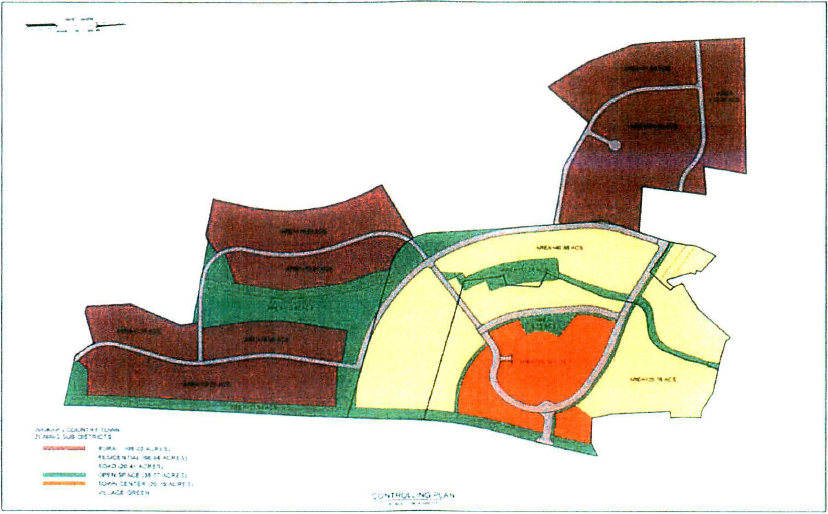
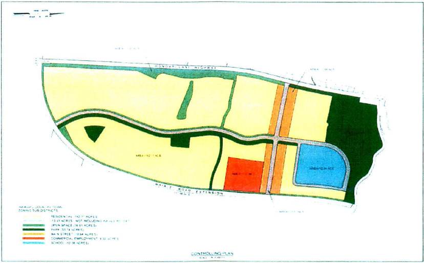
(Ord. No. 5557, § 2, 2023; Ord. No. 4997, § 1, 2019)
19.96.040 - Gross acreage allocations.
A.
Table 1 identifies the approximate gross acreage allocations to each zoning district.
B.
Minor adjustments to acreage allocations may occur as the result of plotting of the final roadway alignments and for acquisition of right-of-way and other land for public purposes such as for parks, schools, and open space.
C.
In order to facilitate site planning flexibility, the gross acreage of the following districts: town center, main street, commercial/employment, residential, rural, and education may be further adjusted, exclusive of adjustments made pursuant to section 19.96.040(B), by up to 5 percent of the gross acreage allocation so long as the total gross acreage from all districts does not exceed the total acres in the Waikapu country town.
(Ord. No. 4997, § 1, 2019)
19.96.050 - Minimum and maximum number of residential units and commercial space.
A.
At buildout, the minimum number of dwelling units within the Waikapu country town shall be one thousand three hundred twenty-six, unless the owner demonstrates that it is not feasible to build the minimum number of units. The maximum number of dwelling units is one thousand four hundred thirty-three, plus up to an additional one hundred forty-six accessory dwellings.
B.
The maximum number of accessory dwellings is one hundred forty-six.
C.
The maximum number of rural lots is eighty.
D.
Multi-family residential units. The minimum number of multi-family residential units within the Waikapu country town shall not be less than 25 percent or more than 50 percent of the total number of permitted non-accessory dwellings.
E.
The maximum amount of commercial, retail, and employment space within the Waikapu country town shall not exceed 200,000 square feet of floor area.
(Ord. No. 4997, § 1, 2019)
19.96.060 - Zoning districts.
A.
Town center. The purpose of the town center district is to create a commercial and social core for Waikapu within a portion of the original grounds of the Maui Tropical Plantation. The unique character and ambiance of the Maui Tropical Plantation grounds will create a village green, which will be the defining feature of the town center. The village green will give the community a distinct sense of place that invites residents to gather and relax and enjoy the tropical grounds and scenic views of the West Maui mountains. Here it is intended for residents to have convenient access to goods and services such as restaurants, cafes, or a farmer's market. Designed around the village green may be live-work residences, multi-family residences, and a mix of retail, business, entertainment, and personal service uses.
B.
Main street. The purpose of the main street district is to create a second walkable town core to service Waikapu country town residents living east (makai) of Honoapiilani Highway. The district comprises a mix of retail, business, and personal service uses organized around a main street design typology that invites walking and bicycling. Development within the district may also include multi-family residences and live-work residences. The adopted main street design typology intends that buildings will front onto wide sidewalks with parking placed within the street right-of-way, within public parking lots, and on-site at the rear of buildings. It is intended that pedestrian-oriented street design and landscape planting provide natural cooling and shading of the streets and sidewalks within the district.
C.
Commercial/employment. The purpose of the commercial/employment district is to establish an area for uses that deliver goods and services or create employment in the professional services, light manufacturing, warehousing, repair services, sales, and distribution sectors. The district may also accommodate neighborhood grocery stores or general merchandise stores that serve the Waikapu country town and the developing Waikapu trade area. The district is characterized by small blocks, buildings built on front property lines, and ample pedestrian amenities.
D.
Residential. The purpose of the residential district is to provide a mix of dwelling units in a variety of urban design formats to accommodate a diversity of household sizes, income ranges, and market demands, which may include education elements. Building types include single-family residential, duplex, triplex, fourplex, sixplex, or larger buildings, including civic buildings. Lots within the district may be sized to accommodate a single structure or multiple structures on a single lot. Dwelling unit types within the district include single-family small lot units, single-family large lot units, single-family cottage complexes, duplex units, multi-plex units, multi-family complexes, townhouses, and live-work units. The district is intended to accommodate residences that front onto aesthetically pleasing and pedestrian-oriented streets. The district may accommodate a variety of block types to accommodate a range of lot sizes. The district includes areas of common open space to provide for passive recreation and visual relief. The urban design of public spaces emphasizes a landscape planting program and streetscapes.
E.
Rural. The purpose of the rural district is to provide large residential lots at the boundary of the urban development to serve as a rural transition to the agricultural lands. It is intended that the rural lots include areas for personal or commercial flower and vegetable gardening, orchards, and the raising of chickens, horses, goats, and other types of livestock. It is intended that the clustering, arrangement, and layout of the rural lots is to preserve areas of common open space.
F.
Education. The purpose of the education district is to provide a site for private or public education facilities to service the Waikapu country town population and neighboring communities.
G.
Parks. The purpose of the parks district is to provide a variety of active and passive park spaces for use by Waikapu country town residents and the broader Waikapu community. It is intended that the design of Waikapu country town's parks will address community needs at the neighborhood and community-wide scale and will include mini-parks, neighborhood parks, and community parks that offer a variety of facilities to support active and passive recreation uses. The parks district also allows for civic spaces, which may include uses such as a community green, square, plaza, passive park area, community garden, farm plot, natural area, or historic area worthy of preservation.
H.
Open space. The purpose of the open space district is to preserve lands from development for the protection of environmental resources, cultural resources, public health and safety, and community livability and wellbeing. Lands within the open space district may include limited passive and active recreational activities, such as bikeways, trails, community gardens, areas for viewing natural and scenic resources, and areas set aside for picnicking and other passive recreation. The open space district also allows for civic spaces, which may include uses such as a community green, square, plaza, passive park area, community garden, farm plot, natural area, or historic area worthy of preservation.
(Ord. No. 5557, § 3, 2023; Ord. No. 4997, § 1, 2019)
19.96.070 - Definitions, general and administrative.
(Ord. No. 4997, § 1, 2019)
19.96.080 - Definitions, uses.
(Ord. No. 4997, § 1, 2019)
19.96.090 - Types of uses and interpretation of terms and uses.
A.
Types of uses. For the purposes of this chapter, there are three types of uses: principal use, accessory use, and special use as set forth in this title. Except as provided in the subsection below, no use shall be permitted in a zoning district unless it is included within the definition of the terms listed, and is identified as a principal use or accessory use; meets all criteria identified for the use; and if it is identified as a use that requires a special use permit, said permit is obtained, and all conditions are complied with.
B.
Interpretation of terms. If a definition or term exists in this zoning ordinance, but is defined in a different way in section 19.04.040 of this title, the definition or term found in this zoning ordinance shall have precedence. If a term or word is not defined or described in this zoning ordinance, then the definition set forth in section 19.04.040 of this title, shall apply.
C.
Interpretation of uses. If a proposed use does not appear in the list of terms, or within the definitions of those terms, or is not defined elsewhere in this title, the director will conduct an administrative review of the proposed use, and based upon the characteristics of the use, determine if a listed or defined use is similar to that proposed; provided further that such use shall be consistent with the purpose and intent of the applicable zoning district, land use designation, and objectives and policies of the general plan.
D.
Other similar uses not specifically enumerated in tables 2A, 2B, or 2C may be permitted as a principal use, accessory use, or special use by the director. In making a determination, the director must determine that the proposed use meets all of the following:
1.
It is substantially similar in character and use to one or more of the uses enumerated within the relevant zoning district.
2.
It is compatible with the purpose and intent of that zoning district.
3.
It is compatible with the purpose and intent of this ordinance.
4.
It creates no unusual impacts to neighboring land users that cannot potentially be mitigated through the issuance of a special use permit.
(Ord. No. 4997, § 1, 2019)
19.96.100 - Principal, accessory, and special uses.
A.
Within the town center, main street, and commercial/employment districts, the land uses identified in table 2A shall either be principal uses (P), accessory to a principal use (AU), or a special use (SU). A special use requires a special use permit.
B.
Within the residential and rural districts, the land uses identified in table 2B shall either be principal uses (P), accessory to a permitted use (AU), or a special use (SU). A special use shall require the issuance of a special use permit.
C.
Within the education, parks, and open space districts the land uses identified in table 2C shall either be principal uses (P), accessory to a permitted use (AU), or a special use (SU). A special use shall require the issuance of a special use permit.
D.
Commercial water bottling is not allowed in Waikapu country town.
(Ord. No. 5557, § 4, 2023; Ord. No. 4997, § 1, 2019)
19.96.110 - Permitted lot types.
A.
Land uses permitted within each zoning district shall be located on lots that are compatible with the purpose and intent of the zoning district as well as the desired urban design standards for each lot type.
B.
An owner proposing development of an area within Waikapu country town shall submit for director approval a proposed neighborhood plan that is consistent with the controlling plan, delineates the lots to be subdivided, and designates the lot type for each lot. The proposed plan shall be submitted to the director prior to or concurrent with an application for subdivision.
(Ord. No. 4997, § 1, 2019)
19.96.120 - Lot types.
(Ord. No. 4997, § 1, 2019)
19.96.130 - Lot types in zoning districts.
A.
Table 3 identifies the lot types permitted within each of the established zoning districts.
B.
For land uses permitted through special or conditional permit processes, the director may choose the most suitable lot type to accommodate the permitted use.
(Ord. No. 5557, § 5, 2023; Ord. No. 4997, § 1, 2019)
19.96.140 - Lot type development standards.
Development standards that regulate lot sizes and lot widths; building setbacks; building height; building orientation; and driveway ingress and egress for each of the permitted lot types are hereby established in table 4. Figure 2, A through P 1 illustrates the lot type development standards.
1 Architectural imagery is intended for illustrative purposes only.
2 Calculated as building length at front setback divided by length of front lot line.
3 Setback applicable to portion of the building fronting upon the street.
4 Parking access is required by alley for blocks where the lot sizes are less than 4,500 square feet.
Figure 2, A: Civic Building
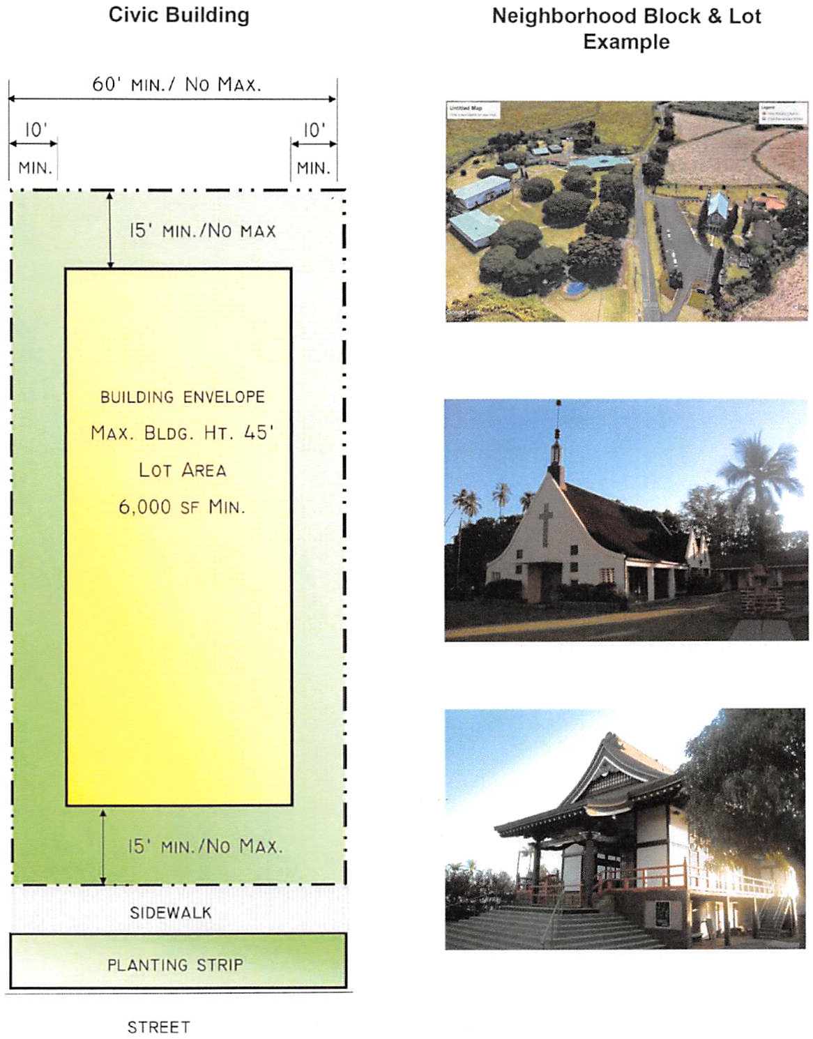
Figure 2, B: Civic Space
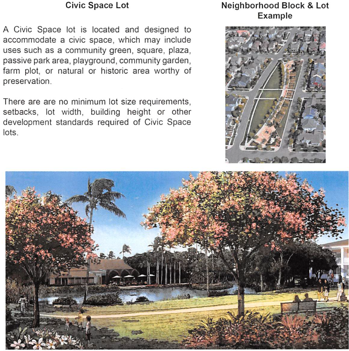
Figure 2, C: Commercial / Retail / Employment
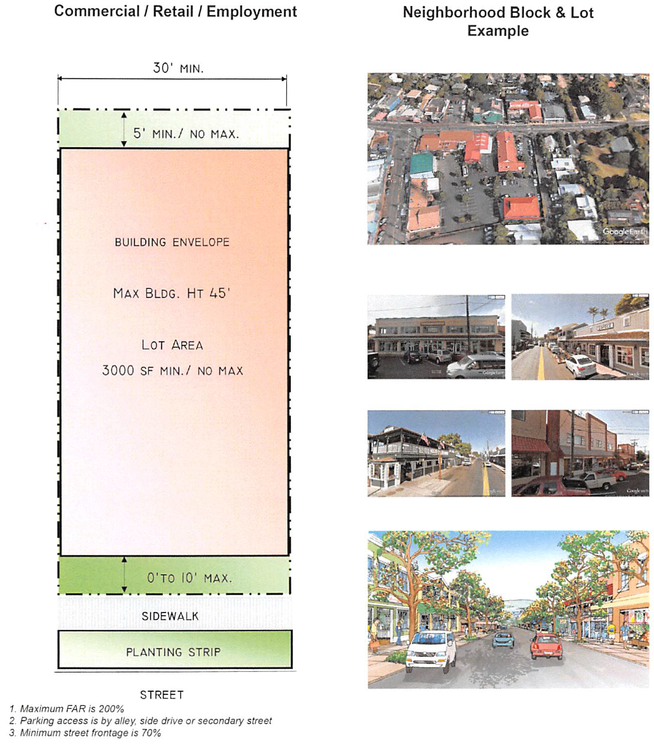
Figure 2, D: Commercial and Residential
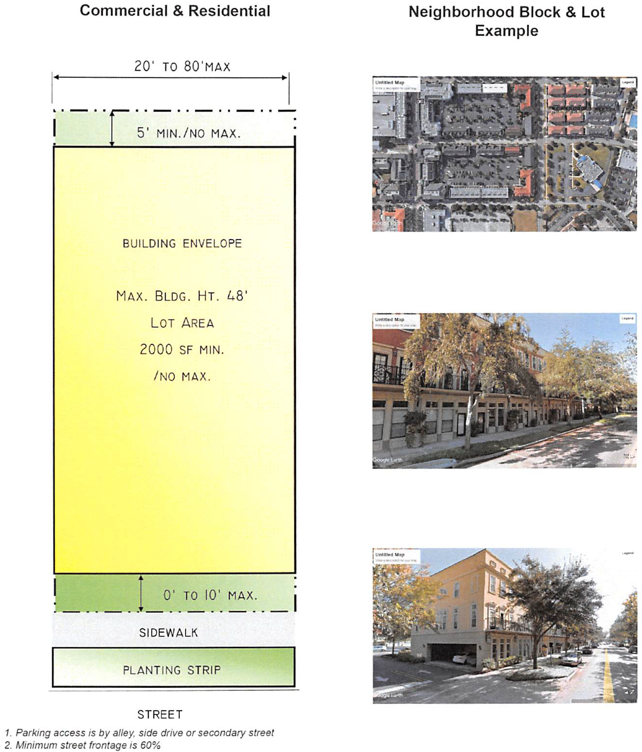
Figure 2, E: Duplex
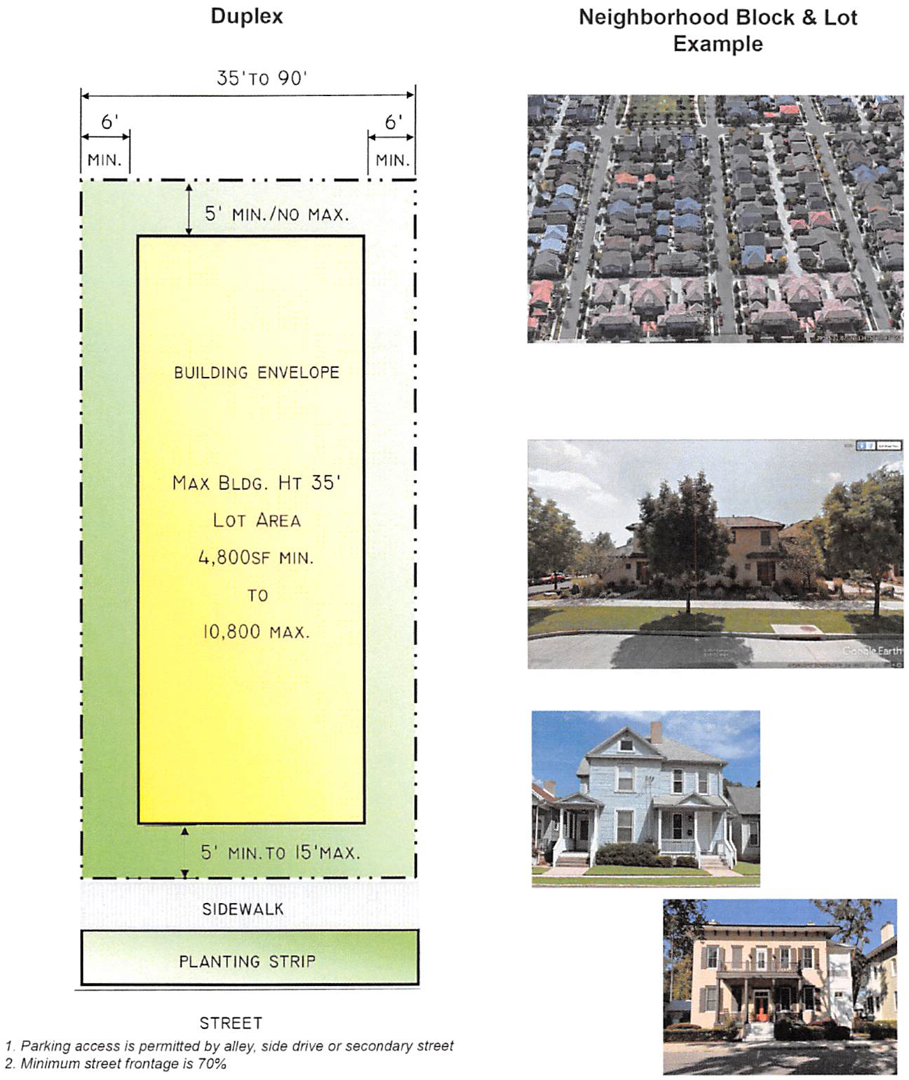
Figure 2, F: Light Industrial
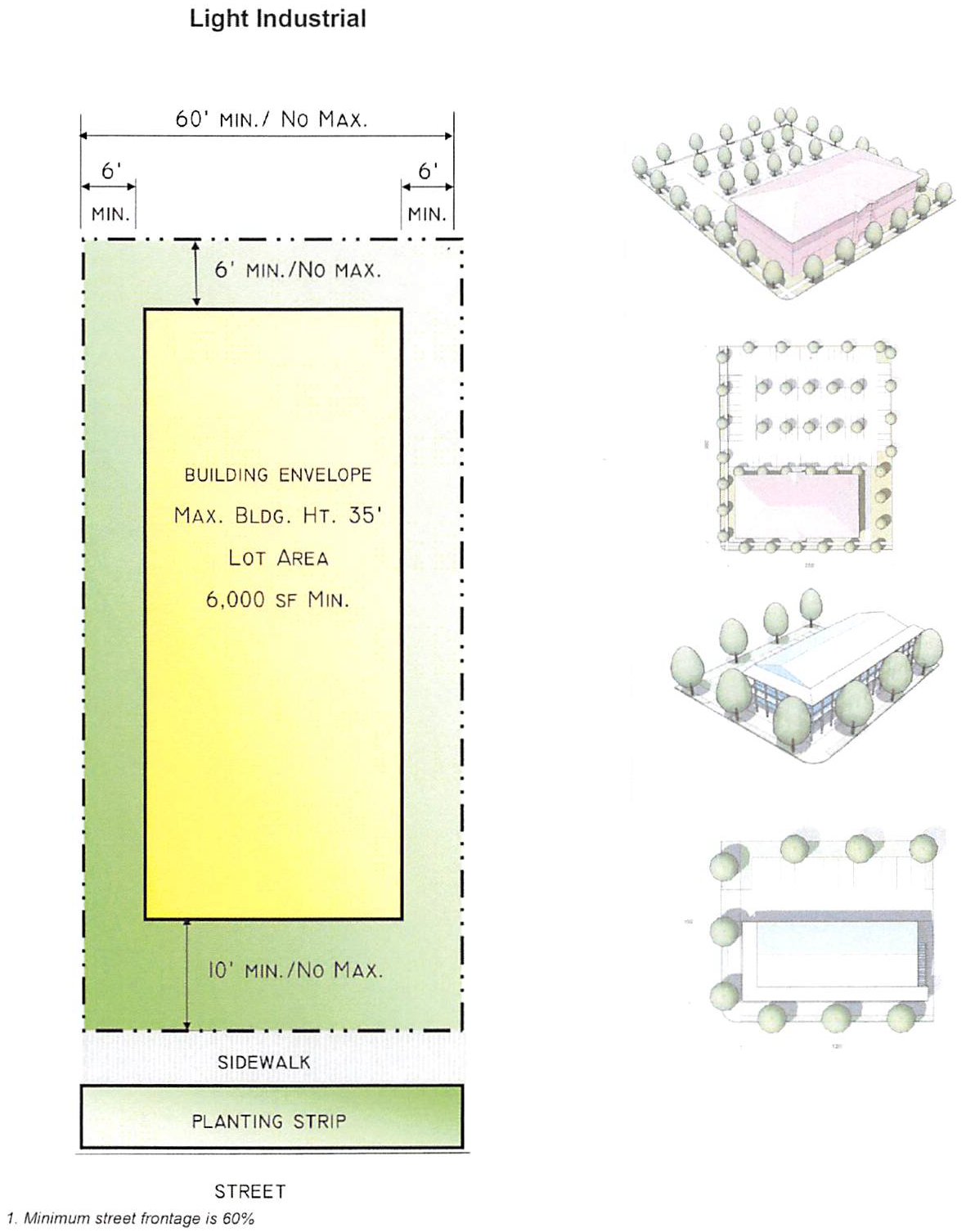
Figure 2, G: Multi-Plex
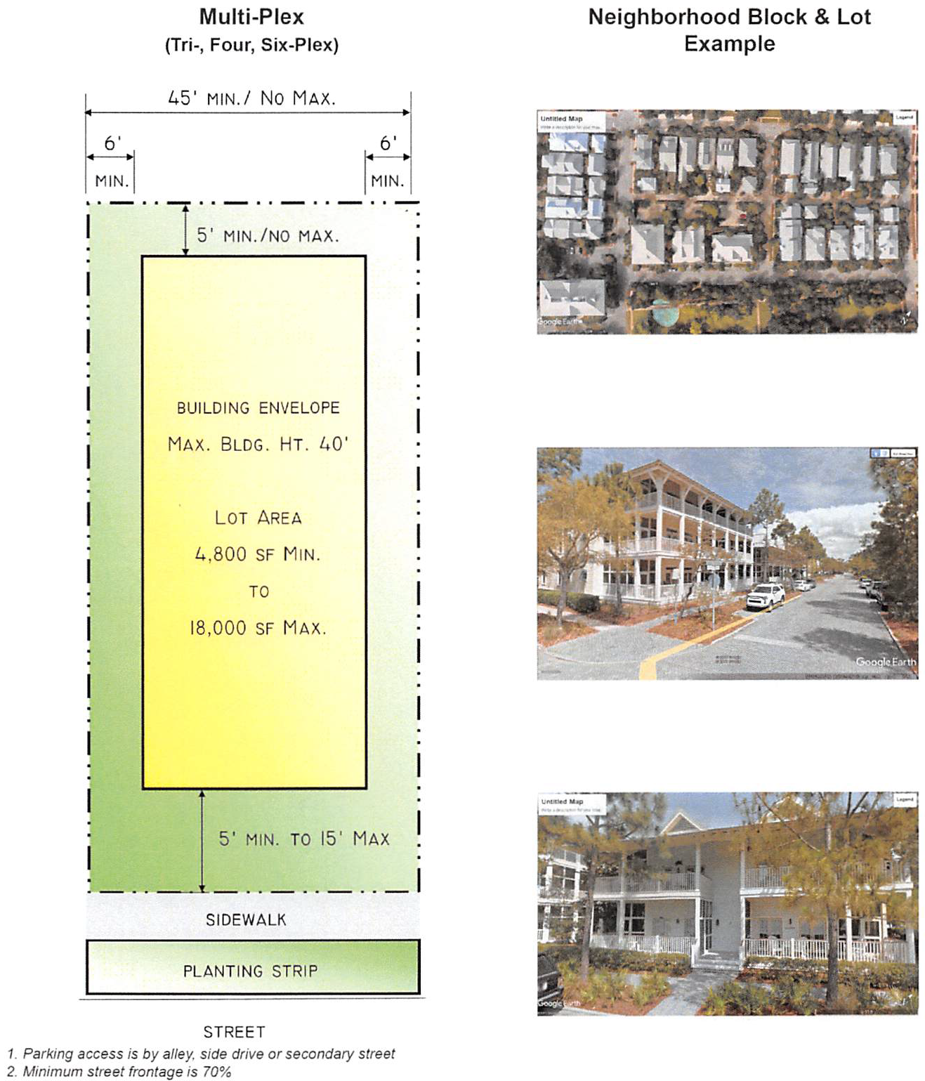
Figure 2, H, a: Multi-Family Complex
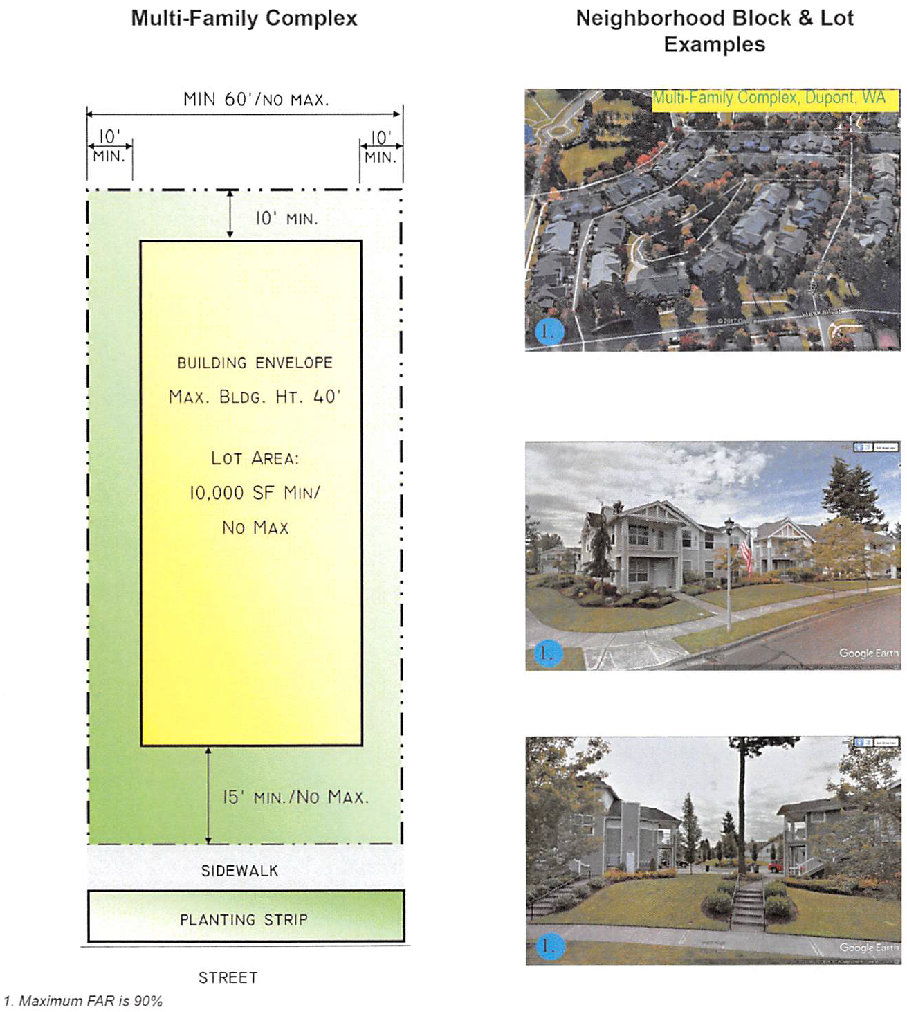
Figure 2 H, b: Multi-Family Complex
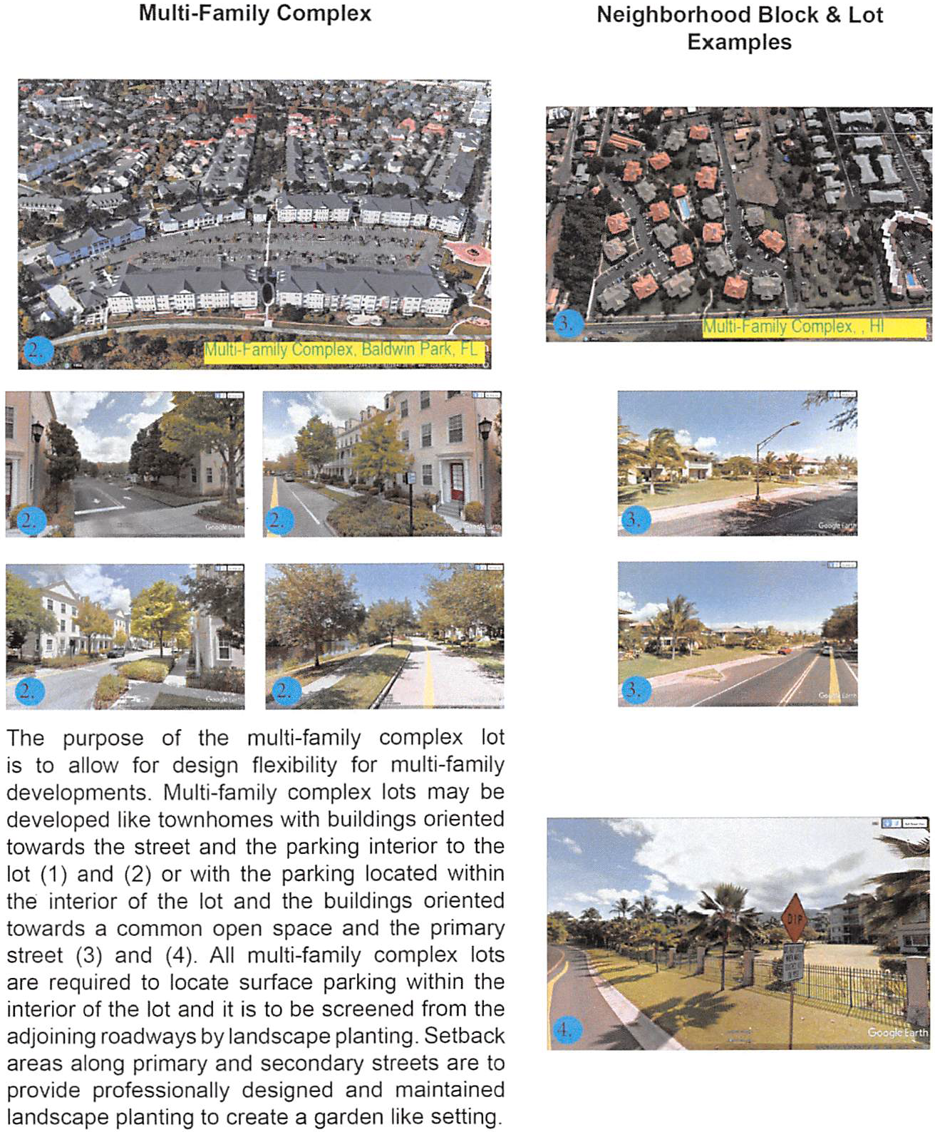
Figure 2, I: Multi-Family Courtyard
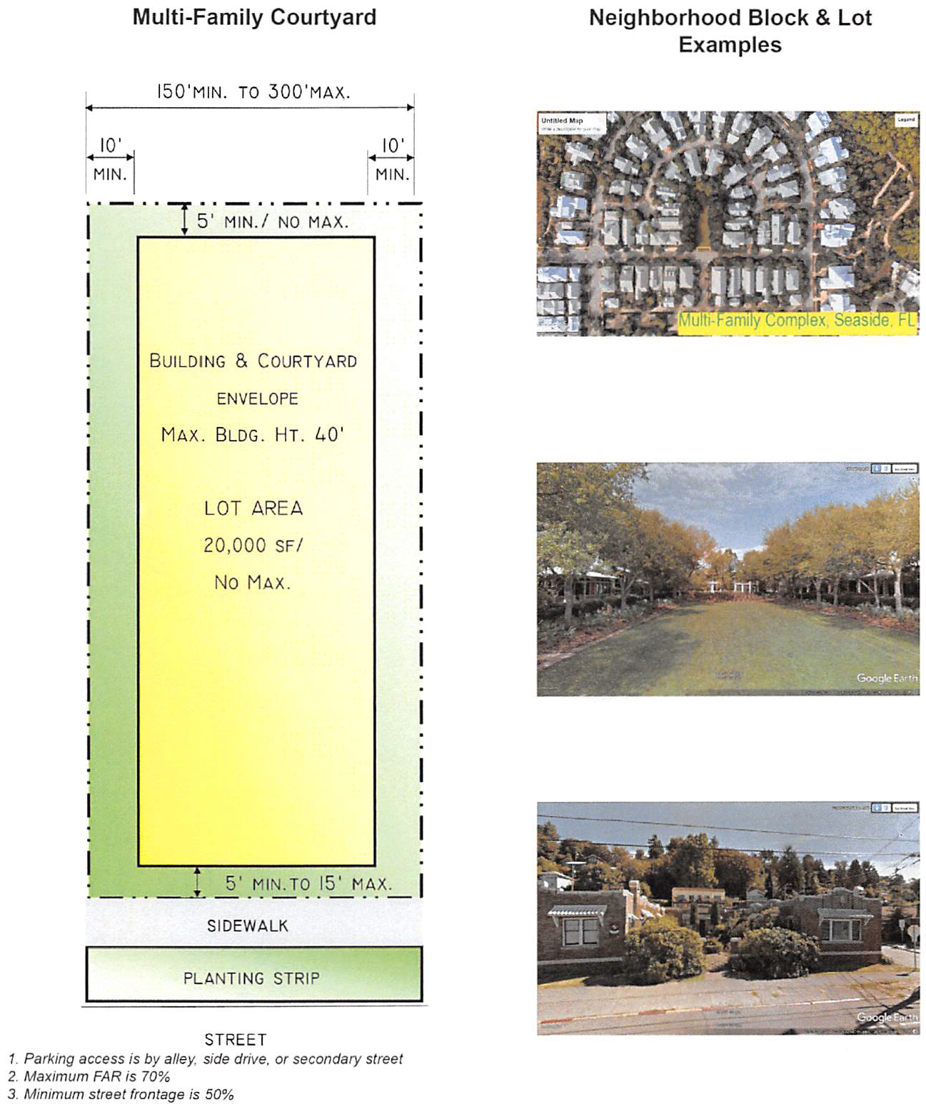
Figure 2, J: Parking
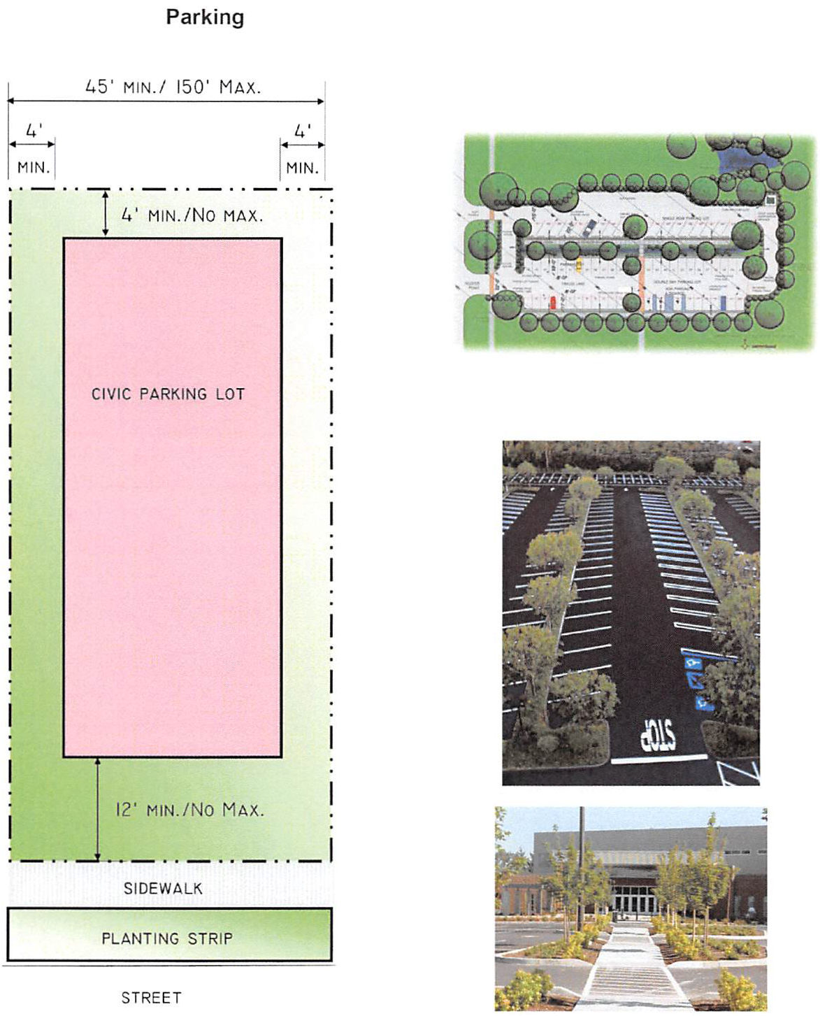
Figure 2, K: Rural
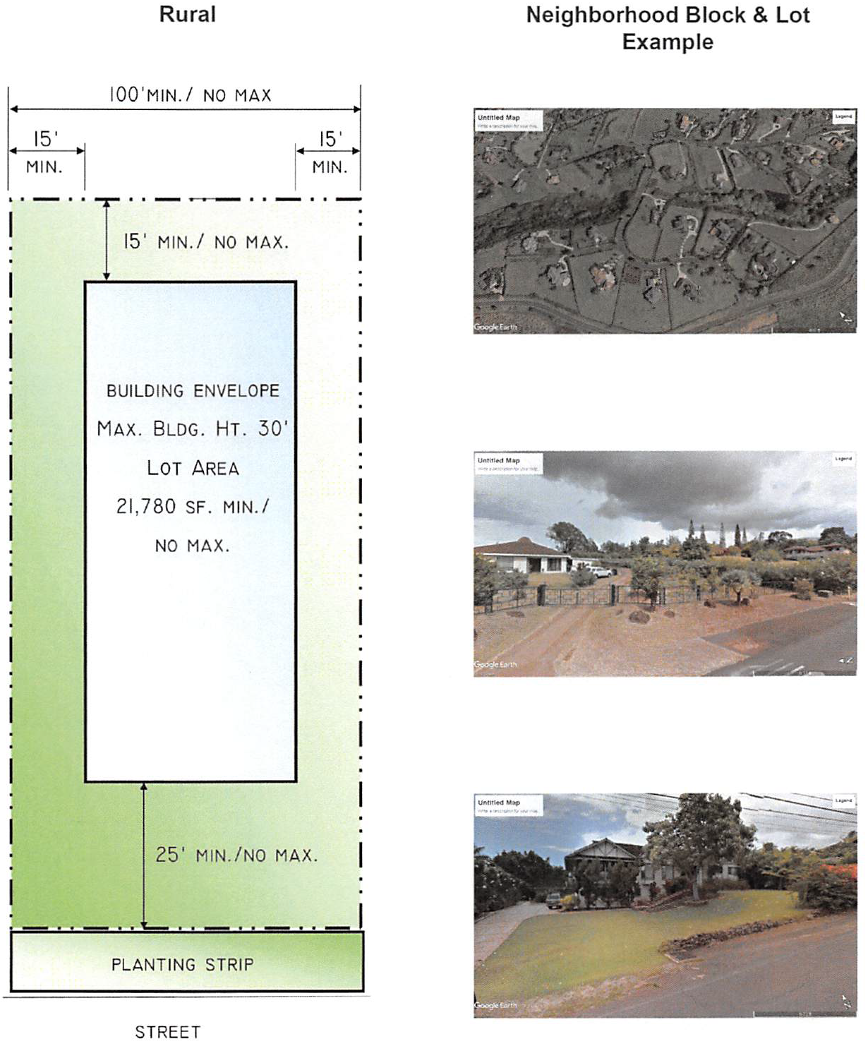
Figure 2, L: Single-Family Cottage Complex
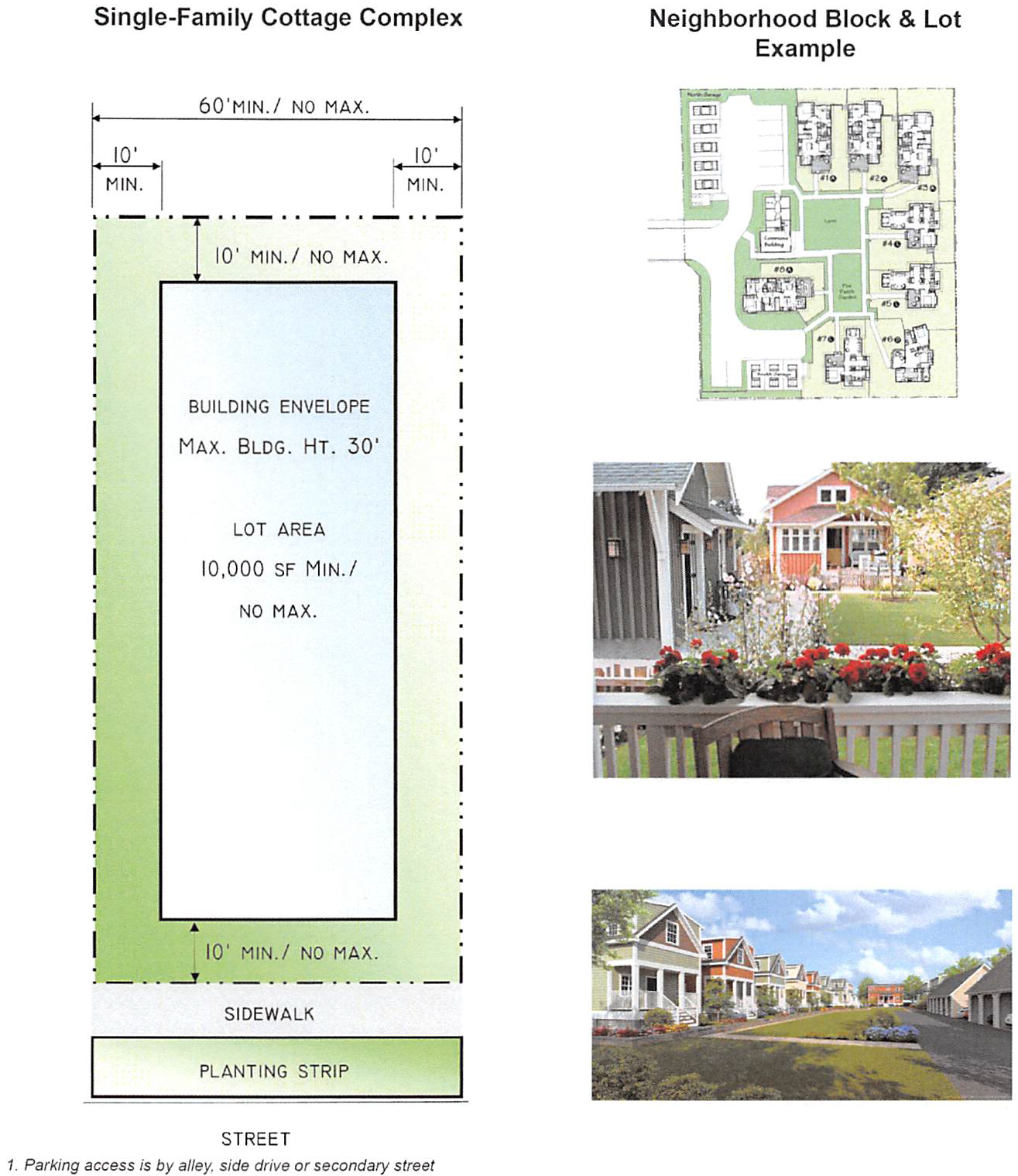
Figure 2, M: Single-Family Green Court
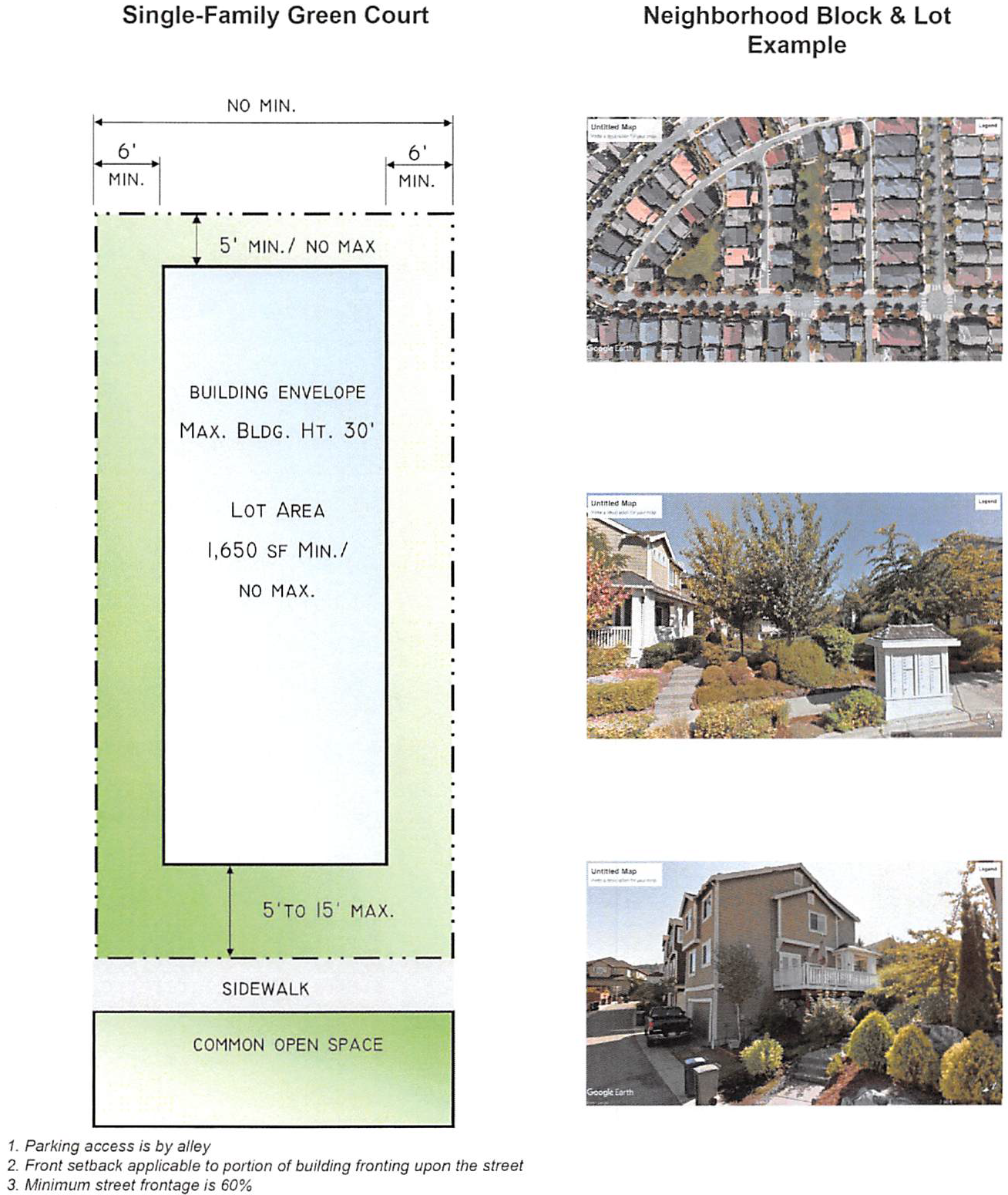
Figure 2, N: Single-Family Large Lot
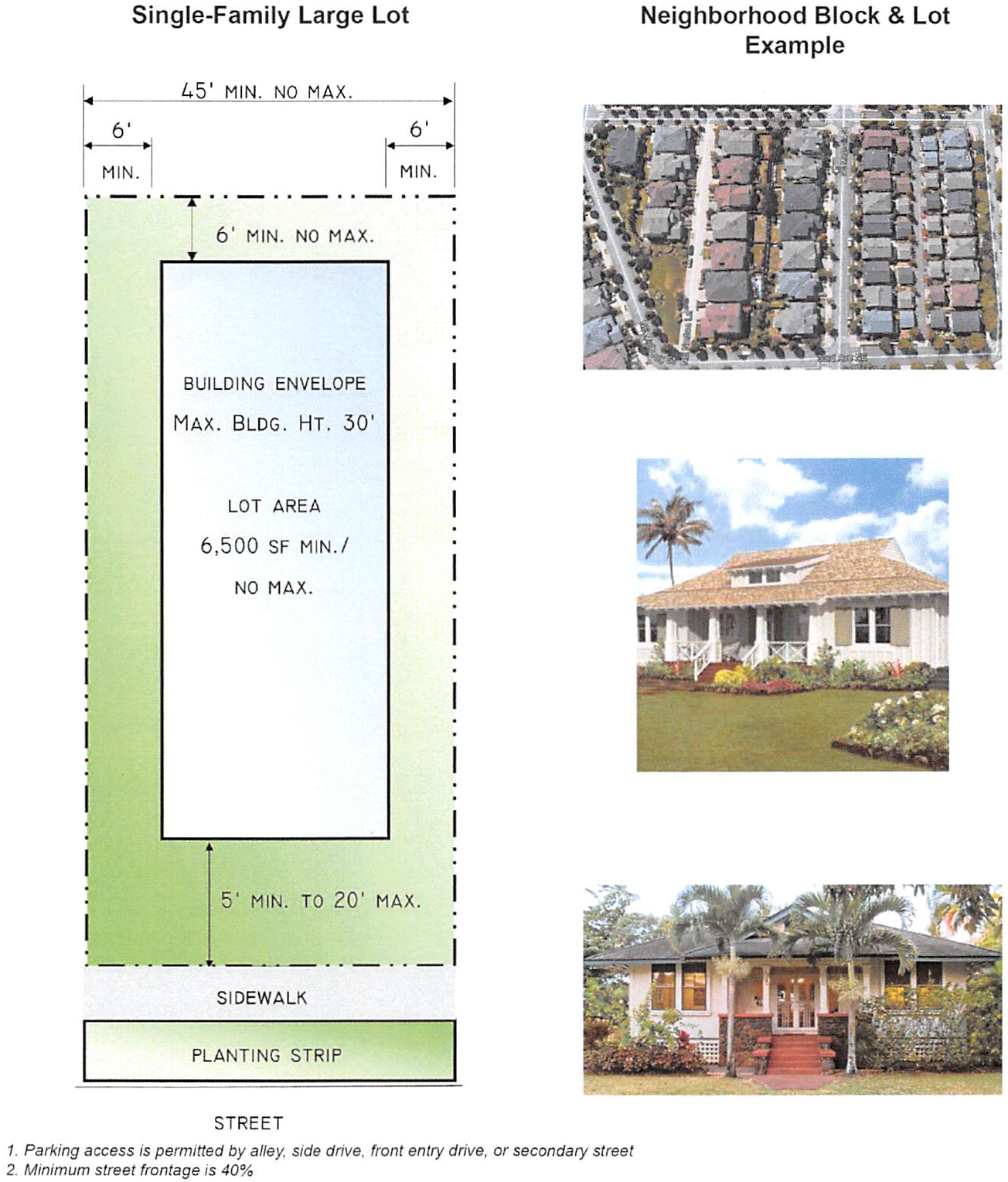
Figure 2, O: Single-Family Small Lot
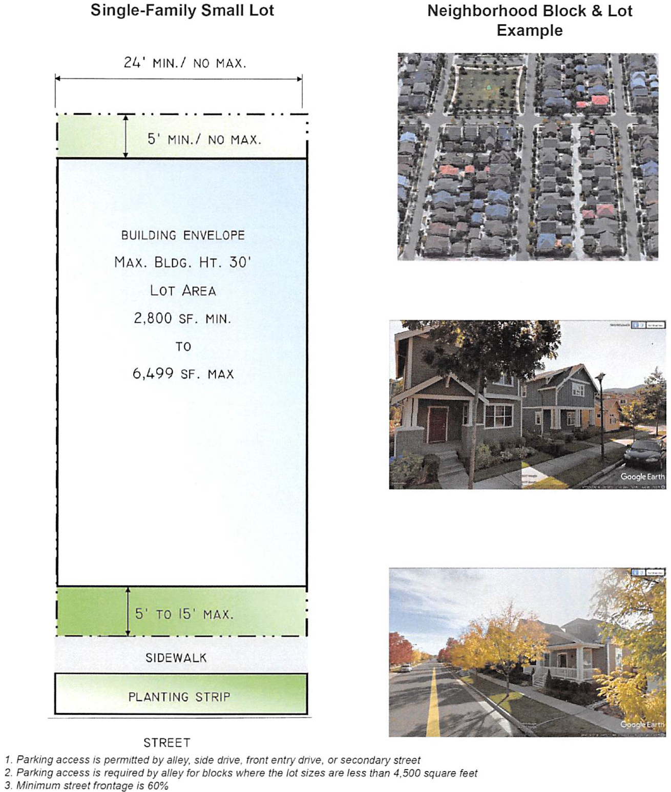
Figure 2, P: Townhouse Lot
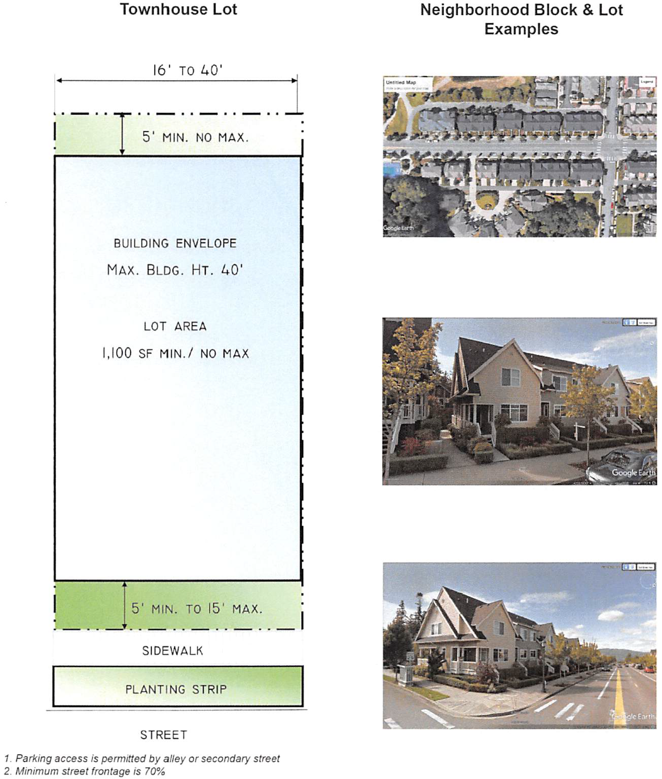
(Ord. No. 4997, § 1, 2019)
19.96.150 - Parking standards.
Chapter 19.36B does not apply to the Waikapu country town.
(Ord. No. 4997, § 1, 2019)
19.96.160 - Additional standards for all districts.
A.
Any tract of land or project site within the Waikapu country town for which development is sought shall be subject to any applicable statute, ordinance, rule, or regulation.
B.
A dwelling or dwelling unit shall not be used for fractional ownership or as a transient vacation rental, time-share unit, short-term rental home, or bed and breakfast home.
(Ord. No. 4997, § 1, 2019)
19.96.170 - Subdivision review.
Before issuance of a final subdivision approval, the director shall review the subdivision to ensure the cohesive implementation of the following elements of the Waikapu country town: illustrative parks and open space plan; non-motorized pedestrian and bicycle network; and traffic calming elements within the Waikapu country town's roadways. These elements shall be generally consistent with the Waikapu country town design guidelines on file with the department at the time this ordinance is adopted.
(Ord. No. 4997, § 1, 2019)
19.96.180 - Administrative rules.
The director may adopt rules to implement the provisions of this chapter.
(Ord. No. 4997, § 1, 2019)
19.97.010 - Purpose.
This chapter's purpose is to declare a moratorium on the issuance of transient accommodation permits on Lāna‘i, for up to one year, until caps for bed and breakfast home permits and short-term rental home permits are established, to protect the island's unique community character.
(Ord. No. 5125, § 1, 2020)
19.97.020 - Moratorium.
For no longer than one year, transient accommodation permits on Lāna‘i may not be granted. Transient accommodation permits are transient vacation rental permits, bed and breakfast home permits, short-term rental home permits, County special use permits, state special permits, conditional permits, and building permits that would allow transient vacation rental use or transient accommodations, except in any zoning district where transient vacation rental use is a permitted use.
(Ord. No. 5125, § 1, 2020)
19.97.030 - Term.
This chapter is effective for one calendar year after its effective date or until ordinances are enacted to establish a maximum number on bed and breakfast home permits and short-term rental home permits on Lāna‘i, whichever is earlier.
(Ord. No. 5125, § 1, 2020)