Newport City Zoning Code
CHAPTER 17
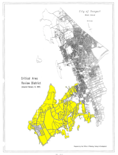
92.- CRITICAL AREA REVIEW—OCEAN DRIVE DISTRICT
17.92.010.- Legislative intent.
The critical area review is a development plan review process designed to protect the unique natural resources located in the subject district and is in accordance with recommendations of element two (land use) of the comprehensive land use plan for the city. The intent of this section is to foster sensitive development activity in the southern shoreline area of the city, commonly known as Ocean Drive, which typically exhibit large lot sizes and to minimize adverse impacts of development on such critical natural elements as vegetation, soil erosion, water quality, natural habitats, and scenic quality. The requirements of this section are developed to protect, conserve, and foster the natural, scenic, historical and economic qualities of lands along the city's Ocean Drive. The critical area review process is not intended to deny an applicant a permitted use of the property as established by this zoning code but rather to review, comment, refine, and develop site design elements within the development plan especially those which pertain to the physical characteristics of the site and its surrounding environment.
(Ord. 4-97 § 1 (part), 1994: prior code § 1262.05.01)
17.92.020. - Usages.
"Critical area review committee" means a five member committee established to carry out the purposes of this section and hereinafter referred to as committee for the purposes of this section.
"Greenway" means a corridor of protected open space managed for conservation, recreation or transportation purposes as defined by Title 42 Chapter 125 Paragraph 3 of the General Laws.
"Critical area review approval" means an approval granted by the committee upon a complete review and acceptance of the proposed development activity which is subject to the requirements of this section.
"Scenic highway" means any road, street, avenue, drive or other vehicular, pedestrian or bicycle route which has been designated as a component of the state system of scenic highways pursuant to Title 24 Chapter 15 of the General Laws.
"Scenic vista" means a defined angle of perception within the landscape which limits the view to a particular part of the landscape while providing the viewer with an unobstructed sight line to distant land, water, structure of historic or cultural significance or in the continuation of a series of such sight lines or vistas. This shall include all scenic vistas along a designated scenic highway.
(Ord. 4-97 § 1 (part), 1994: prior code § 1262.05.02)
17.92.030. - Designation of critical area.
For the purposes of this section, the R-120 and R-160 zones as established by this zoning code and the zoning map shall together comprise the boundaries of the critical area—Ocean Drive district. All development activity including new construction and subdivision of land within the two districts shall be subject to the requirements of this section. It is recognized that the lot sizes prevalent within the R-120 and R-160 districts are desirable to retain the area character and to protect, conserve, and foster the natural, scenic, historical and economic qualities of this truly unique area of Newport. Furthermore, the current lot sizes and density in this area is suitable for the application of the critical area review process. This section shall in no manner enlarge upon nor decrease the number or type of uses permitted in the underlying R-120 and R-160 zoning districts.
(Ord. 4-97 § 1 (part), 1994: prior code § 1262.05.03)
17.92.040. - Critical area review committee.
A.
Establishment. There is established a critical area review committee to carry out the purposes of this section.
B.
Membership and Appointment.
1.
The committee shall consist of five members of which one shall be a member of the tree commission and so nominated by it, one shall be a member of the planning board and so nominated by it, one shall be a member of the historic district commission and so nominated by it. The remaining two members, one of whom shall be a landscape architect or an arborist or equivalent recognized by his/her peers and the other one, a resident of either the R-120 or R-160 district, shall be appointed by the mayor of the city of Newport with the consent of the city council.
2.
The concurring vote of a majority but no less than three members of the committee shall be necessary for approval of any development plans subject to the requirements of this section. All decisions of the committee, in writing, shall articulate and explain the reasons and basis for each decision and in the case of a decision not to issue a critical area review approval, shall include the basis for its conclusion that the proposed development plan does not comply with the intent and/or requirements of this section.
(Ord. 4-97 § 1 (part), 1994: prior code § 1262.05.04)
17.92.050. - Development plan preparation.
The application for critical area review approval shall be filed along with a development plan which shall conform to the requirements of Section 17.88.030. In addition, an inventory of existing plant materials shall be filed. The inventory shall indicate the type of plant, general condition, measures needed to maintain its health and the relative value of the plant. The development plan shall also depict location of scenic vistas, scenic highways and greenways.
(Ord. 4-97 § 1 (part), 1994: prior code § 1262.05.05)
17.92.060. - Filing procedures and processing.
A.
With respect to a development proposal subject to the requirements of this section, an application for a critical area review approval shall be submitted together with six copies of the development plan and supporting documents to the department of planning, zoning, development and inspections, which shall serve as the coordinator for the critical area review plans. At the time the development plan is submitted to the city for review, a fee of fifteen (15) dollars shall be paid to the city.
B.
After the site development plan, related materials and fee have been submitted the committee shall review the application and prepare its findings in writing within forty-five (45) days of the receipt of the application. The committee may solicit comments and/or recommendations from the various city departments in its review of the application.
C.
If the proposed development, subdivision and/or alteration requires approval from the zoning board of review, historic district commission or planning board then such approval must be received prior to the submission of a development plan. In granting the critical area review approval, the committee may add to the requirements of the zoning board of review, the planning board and/or the historic district commission.
D.
The failure of the committee to act within forty-five (45) days from the date of a completed application shall be deemed to constitute approval, unless an extension is agreed upon mutually by the applicant and the committee.
(Ord. 4-97 § 1 (part), 1994: prior code § 1262.05.06)
17.92.070. - Design standards.
The purpose of this section is to establish standards which will protect the unique character of natural resources located in the designated Ocean Drive district. It is the intent of these design standards to continue to preserve established street patterns, ensure building layouts to reflect adjacent building mass and incorporate terrain, vegetation and scenic vistas into the overall design process.
A.
Public scenic vistas shall not be obstructed by new development whenever possible. Other desirable views from public areas and existing buildings to historically significant buildings or natural features shall be retained, whenever possible.
B.
Site grading shall insure positive drainage of water away from the proposed buildings in such a manner as to prevent ponding or sheeting at walks and parking areas. Runoff generated by the proposed site development or alteration must be disposed of in a manner so as not to affect adjacent properties or rights-of-way.
C.
Retention of natural grades and recognition of off-site grades shall be the objective of all grading plans. It is improper to place a building designed for a largely level site on a sloped site in a manner that interrupts the natural ground line. Prominent flat areas or bank cuts around buildings are discouraged.
D.
All setback areas shall be maintained in their natural state except in cases where covenants or deed restrictions existing prior to the adoption of the critical area review district prohibit a property owner from adhering to this standard.
E.
There shall be a minimum setback of seventy-five (75) feet from either a designated wetland or a coastal feature as defined by the coastal resources management council. This setback shall be maintained in its natural state.
F.
If the proposed development requires cutting down of trees and/or disturbance of ground cover, then all such loss of vegetation shall be replaced to the greatest extent possible on the site in equal measure and in a manner approved by the committee.
G.
Street trees are required for every development and should be planted at a maximum thirty (30) feet on-center unless such planting schedule shall result in the diminishing of a scenic vista. Minimum tree size shall be fifteen (15) gallons. Species are to be as specified by the committee in consultation with the tree warden. Street trees should be planted at a minimum of two feet from the face of the curb. Where trees are proposed in an area with a monolithic sidewalk wider than four feet, tree grates shall be used to protect the base of the tree and provide pedestrian safety.
H.
All accessory uses such as garages and boat houses, whether attached or detached to main building shall be considered to be an integral part of the overall design concept. The siting of any accessory use shall not be unnecessarily prominent and in instances where such uses are attached to the main building, they shall appear as an addition with access preferably from the rear or the side.
I.
Due to the area's fragile vegetation, potential for storm and sea flooding, erosion, and poor septic system drainage posing the threat of ground water pollution during seasonal high water table, the high areas within the site are better suited for development. However, the placing of buildings on higher elevations require extra care while designing especially with regards to massing and roof shapes. Shapes that emphasize verticality are discouraged.
(Ord. 4-97 § 1 (part), 1994: prior code § 1262.05.07)
17.92.080. - Critical area plan review prerequisite for building permit.
In the case of any development activity subject to the requirements of this section, no building permit shall be issued to construct, erect or alter any building or structure, or develop, change, or improve land unless such activity is approved in the manner prescribed in this section and a critical area review approval has been issued. The approved development plan and any applicable conditions shall become part of the application for a building permit and shall be binding on any building permit issued. It shall be unlawful for any person to construct, erect or alter any building or structure, or develop, change, or improve land for which approval is required under this section without such approval. The city may restrain any unlawful act hereunder by a stop work order, and by appropriate court action.
(Ord. 4-97 § 1 (part), 1994: prior code § 1262.05.08)
17.92.090. - Appeals.
An applicant may appeal the decision of the committee to the zoning board of review within fifteen (15) days of the filing of such a decision.
(Ord. 4-97 § 1 (part), 1994: prior code § 1262.05.09)