
Peninsula City Zoning Code
CHAPTER 1119
Conservation/Recreation Overlay District
1119.01 PURPOSE AND INTENT.
(a) Maximize the protection of the community's natural resources;
(b) Conserve (within the framework of natural resource conservation) the "small town" character of the Village;
(c) Encourage more efficient use of land and public services through unified development;
(d) Have a harmonious and integrated design and visual character;
(e) Do not increase the overall density of development within the Village; and
(f) Establish development review criteria which promote creative design solutions in a manner which best conserves the area's resources.
(Ord. 21-2020. Passed 12-14-20.)
1119.02 PERMITTED AND SPECIAL USES AND REGULATIONS
(a) Uses permitted in the underlying R-1 Rural Residential District by Section 1109.03 shall be permitted in the Conservation Overlay District provided the following regulations are adhered to for any proposed development.
(b) Except as noted in this Chapter all regulations for a residential development in the R-1 Rural Residential District shall apply to any development within a Conservation/Recreation Overlay.
(c) The Planning Commission may recommend to the Village Council the approval of uses consistent with the purpose and intent and the permitted and conditional uses of the Conservation/Recreation District of this Zoning Code as a Special Use.
(1) Special Uses shall conform to the regulations and standards set forth in this Zoning Code for uses and developments in the Conservation/Recreation District.
(2) Requests for a Special Use shall be submitted to the Planning Commission in conformance with the requirements of Chapter 1149 related to site plans and shall require Council approval.
(d) The subdivision of any existing parcel of property shall not be permitted unless the requirements of this chapter are met.
(Ord. 21-2020. Passed 12-14-20.)
1119.03 MINIMUM PROJECT AREA FOR CONSERVATION DEVELOPMENT.
(a) The gross area of a tract of land proposed for development according to the conservation development shall be a minimum of twenty-five acres, but shall not include area within any existing public street rights-of-way.
(b) The area proposed shall be in one ownership or, if in multiple ownership, the application shall be filed jointly by all the owners of the properties included in the conservation development. (Ord. 21-2020. Passed 12-14-20.)
1119.04 PERMITTED DENSITY/RESTRICTED OPEN SPACE.
(a) The minimum restricted open space shall be fifty-five percent (55%) of the total project area. Required lots, setbacks and building separations within the disturbed or developed portion of a Conservation Development shall not be included in the calculation of permanent open space for the purposes of complying with the requirements of this section.
(b) In no case shall the density of the conservation development be more than the lesser of one dwelling unit per four acres or the density determined by a "yield plan" for a conventional four acre lot subdivision which conforms to all Village regulations. A "Yield Plan" is a site plan layout identifying how the property could be developed in conformance with the R-1 Rural Residential District regulations. See Figure 1. Lots within a conservation development shall be not less than two and one-half acres in area.
(c) The determination of permitted density shall not include any areas designated as flood plain or which are covered by an existing conservation easement.
Figure 1
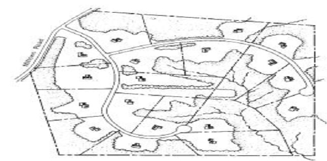 |
Yield Plan
(Ord. 21-2020. Passed 12-14-20.)
1119.05 REGULATIONS FOR RESTRICTED OPEN SPACE.
(a) General Standards: The restricted open space required in Section 1119.04(a) shall comply with the following:
(1) Restricted open space shall be designed and located to conserve significant natural features and historical and cultural elements located on the site.
(2) Areas designated for restricted open space purposes may be:
A. Preserved in its natural state,
B. Designed and intended for the use and/or enjoyment of residents of the proposed development,
C. Utilized for farming when authorized in a conservation easement or in the Association's covenants and restrictions.
(3) Restricted open space shall be interconnected with open space areas on abutting parcels where possible.
(4) In order to encourage the creation of large areas of contiguous open space, areas that shall not be considered restricted open space include:
A. Private roads and public road rights-of-way;
B. Parking areas, access ways and driveways within open space areas.
C. Other small fragmented or isolated open space areas that have a dimension less than one hundred (100) feet in any direction.
(5) Any area within the restricted open space that is disturbed during construction or otherwise not preserved in its natural state, other common areas such as required setback areas, and both sides of new streets shall be landscaped with vegetation that is compatible with the natural characteristics of the site.
(6) The restricted open space, including any recreational facilities proposed to be constructed in such space, shall be clearly shown on the general site plan.
(7) Restricted open space areas shall not be used for the location of common on-site wastewater disposal systems.
(b) Prohibition of Further Subdivision of Restricted Open Space. Restricted open space in a conservation development shall be prohibited from further subdivision or development by deed restriction, conservation easement, or other agreement in a form acceptable to the Village's Legal Advisor and duly recorded in the office of the Summit County Fiscal Office Recorder Division.
(c) Ownership of Restricted Open Space. The restricted open space shall be made subject to a perpetual conservation easement in a form approved by the Village in favor of an organization or agency acceptable to the Village. Conservation easements shall include the Village as third-party beneficiary of the terms of the easement with the right, but no obligation, to enforce the provisions of the easement.
(Ord. 21-2020. Passed 12-14-20.)
1119.06 DEVELOPMENT AND SITE PLANNING STANDARDS.
Buildings, structures, pavement, and streets shall be located in compliance with the following development and site planning standards.
(a) Ownership. Ownership of lots in a conservation development shall be fee simple. All lots shall comply with the requirements of this section.
(b) Lot Requirements.
(1) Lots for standard detached single-family dwellings included as part of a conservation development, shall be not less than two and one-half acres in area.
(2) Lots shall have a minimum width at the front setback line of 250 feet.
(3) The applicant shall depict on the development plan the maximum, parameters or building envelopes, to indicate where buildings shall be located, and shall demonstrate that such building locations will be in compliance with the spacing and setback requirements of this section.
(c) Dwelling Size Regulations.
(1) Each Dwelling shall comply with the minimum floor area requirements established by Section 1113.01(h).
(2) The total aggregate amount of gross livable floor area shall not exceed five thousand five hundred (5,500) square feet per dwelling unit. Gross livable floor area shall mean the sum of the total enclosed area of all floors of a building measured from the inside faces of exterior walls, excluding garages, basements, and uninhabitable attics.
(d) Perimeter Building Regulations.
(1) The minimum setback from an existing public street shall be two hundred (200) feet.
(2) The minimum setback from the project boundary shall be one hundred (100) feet.
(e) Interior Building Setback Regulations.
(1) The minimum setback from a proposed interior private street edge of pavement or a public right-of-way, if permitted by the Village, shall be one hundred (100) feet.
(2) The minimum side yard setbacks shall be thirty-five feet
(3) The minimum separation between dwellings shall be seventy feet.
(4) The minimum rear yard setback shall be one hundred (100) feet.
(f) Height. The maximum height of buildings shall be as provided in Section 1113.01 for R-1, Rural Residential District.
(g) Resource Protection Regulations.
(1) Wetlands Protection. Wetlands that are required by the Army Corp of Engineers or the Ohio EPA to be retained shall be protected by the following:
A. A buffer area having a width not less than twenty feet, measured from the edge of the designated wetland. The area within this buffer shall not be disturbed and shall be retained in its natural state; and
B A minimum building and pavement setback of thirty-five feet, measured from the edge of the designated wetland.
(2) Conservation of Riparian Zones:
A. A riparian buffer shall be provided along the entire length and on both sides of a river or perennial stream channel. The buffer area shall have a width not less than fifty feet, measured from the river or stream bank.
B. Walkways or trails may be permitted to be located within riparian buffers when the Planning Commission determines that such will create minimal change to the riparian buffer.
(h) General Street Design Criteria.
(1) All streets constructed as part of a Conservation Development shall be private streets unless a public street is specifically authorized by the Village to provide for interconnection or to achieve some other public access purpose.
(2) Private streets within a Conservation/Recreation Overlay shall have twenty-two feet of asphalt pavement with berms. Private cul-de-sac streets shall be designed with sufficient turn around areas to adequately accommodate emergency vehicles and service vehicles such as snow plows garbage and fire trucks. Private streets shall be designed and constructed in accordance with the standards and specifications of the Village Engineer.
(3) Each dwelling unit shall have access to a public street or to a private street internal to the Conservation Development in a manner approved by the Village and said access shall be clearly defined on the site plan. No lots shall front on existing public rights-of-ways unless approved by the Planning Commission.
(4) Whenever possible streets shall be looped to provide more than one entrance and exit to the development. Intersections with existing rights-of-ways shall be maintained at a minimum necessary for proper traffic circulation.
(5) Street alignments should follow natural contours and be designed to conserve natural features. Stub streets should be eliminated unless such stub street is necessary based on an overall concept plan for the development of the adjacent property.
(6) Locations of streets should be planned to avoid excessive storm water runoff and the need for storm sewers.
(7) The area of the project devoted to streets and related pavement should be the minimum necessary to provide adequate and safe movement through the development.
(i) Pedestrian Circulation Systems.
(1) A pedestrian circulation system shall be included in the conservation development and shall be designed to ensure that pedestrians can walk safely and easily throughout the development. The pedestrian system shall provide connections between properties and activities or special features within the restricted open space system and need not always be located along streets.
(2) Trails for which public right of passage has been established should be incorporated in the pedestrian circulation system.
(j) Sewage Disposal. Development shall be served by individual or public sewage disposal structures consistent with the Summit County and/or Ohio EPA requirements. Individual sewage disposal systems shall comply with all applicable regulations of the Summit County Health District. If a common on-site system is to be used it shall not be located in the restricted open space.
(k) Architectural Design. Architectural treatments shall demonstrate a cohesive design concept which promotes compatibility among structures and reflects the character of the Village of Peninsula.
(Ord. 21-2020. Passed 12-14-20.)
1119.07 DEVELOPMENT DESIGN CRITERIA.
In addition to the development and site planning standards set forth in Section 1119.06, all elements of a conservation development, particularly the restricted open space areas, shall be designed in accordance with the following criteria to ensure that the project is appropriate for the site's natural, historic and cultural features and meet the objectives of this district.
(a) Conservation of Sloping Land. The road system and buildings should be located to minimize changes to the topography and the need for cutting and filling.
(b) Conservation of Woodlands, Vegetation and other Natural Areas. The design and layout of the development should conserve, maintain, and incorporate existing wooded areas, meadows, and hedgerows and tree lines between fields or meadows, especially those containing significant wildlife habitats.
(c) Conservation of Wildlife Habitats. Wildlife habitat areas of species listed as endangered, threatened, or of special concern by the U.S. Environmental Protection Agency and/or by the Ohio Department of Natural Resources should be protected.
(d) Conservation of Prime Farmland. Farmland that satisfies the USDA definition of "prime" or "locally unique" farmland should be conserved.
(e) Conservation of Existing Scenic Vistas and Visual Quality of the Environment. Buildings should be located to ensure that scenic views and vistas are unblocked or uninterrupted.
(f) Conservation of Cultural Resources. Sites of historic, archaeological, or cultural value and their environs should be protected insofar as needed to safeguard the character of the feature, including stonewalls, spring houses, barn foundations, underground fruit cellars, earth mounds and burial grounds.
(Ord. 21-2020. Passed 12-14-20.)
1119.08 PROJECT REVIEW PROCEDURES.
1119.09 FEES.
Fee shall be in conformance with Section 1149.11 of the Codified Ordinances of the Village of Peninsula.
(Ord. 21-2020. Passed 12-14-20.)