
Raytown City Zoning Code
ARTICLE IV
- DISTRICTS AND DISTRICT MAP
DIVISION 11. - FLOODPLAIN OVERLAY DISTRICT (FP)[2]
Editor's note— Ord. No. 5565-17, §§ 1, 2(Exh. A), adopted January 3, 2017, repealed the former Div. 11, §§ 50-285-50-295 and enacted a new Div. 11 as set out herein. The former Div. 11 pertained to similar subject matter and derived from Comp. Ord. of 4-20-2010, § 14-1—14-9, 14-11.
DIVISION 17. - CENTRAL BUSINESS DISTRICT DESIGN ELEMENTS[3]
Note—The adoption, amendment, repeal, omissions, effective date, explanation of numbering system and other matters pertaining to the use, construction and interpretation of this Code are contained in the adopting ordinance and preface which are to be found in the preliminary pages of this volume.
Sec. 50-103.- Zoning districts.
In order to regulate and restrict the location of trades, professions, industries, commercial enterprises and the location of buildings in designated zoning districts, there are established eight zoning districts known as:
(1)
Low-Density Residential District (R-1).
(2)
Medium-Density Residential District (R-2).
(3)
High-Density Residential District (R-3).
(4)
Manufactured Home Park Residential District (MH).
(5)
Neighborhood Commercial District (NC).
(6)
Highway Commercial Corridor District (HC).
(7)
Industrial District (M).
(8)
Conservation District (N).
(Comp. Ord. of 4-20-2010, § 3-1.01)
Sec. 50-104. - Overlay zoning districts.
In addition to the aforesaid zoning districts, there shall be seven overlay zoning districts known as:
(1)
Town Square Overlay District (TS).
(2)
Floodplain Overlay District (FP).
(3)
Housing Opportunity Residential Overlay District (HO).
(4)
Planned Zoning Overlay District (P).
(5)
Condominium Dwelling Overlay District (CD).
(6)
Historic Preservation Overlay District (HP).
(7)
Adult Entertainment Use Overlay District (AE).
(8)
Central Business District Design Elements.
(9)
Highway 350 Design Standards.
(Comp. Ord. of 4-20-2010, § 3-1.03)
Sec. 50-105. - Zoning district map.
Boundaries of the districts enumerated in this article are shown on a map which is designated as the zoning district map. This map, with its notations, references and information, is a part of this article. It shall be the duty of the city to keep on file in its office an authentic copy of the map and all changes, amendments or additions thereto. The official zoning map shall be located in the office of the director of community development department. The official zoning map shall be identified by the signature of the mayor, attested by the city clerk and bearing the seal of the city under the following words: "This is to certify that this is the Official Zoning Map referred to in section 50-105 of the Code of Ordinances of the City of Raytown, Missouri."
(Comp. Ord. of 4-20-2010, § 3-1.02; Ord. No. 5708-22, § 1, 10-18-2022)
Sec. 50-106. - Boundaries.
In the event that uncertainties exist with respect to the intended boundaries of the various districts as shown on the zoning map(s), the following rules shall apply:
(1)
The district boundaries are the centerline of streets, alleys or railroad rights-of-way(R/W) when the zoning district on both sides of the street, alley or railroad R/W is the same. Where the zoning district is different on opposite sides of the street, alley or railroad R/W, the width of the street or alley shall be zoned the more restrictive district. For the purposes of this subsection, R-1 Low-Density Residential District is the most restrictive district and M Industrial District is the least restrictive district.
(2)
Where the district boundaries are not located on streets, alleys or railroad R/W, and do not coincide with lot lines, the boundary of such district shall be determined by the director of community development subject to appeal to the board of zoning adjustment.
(3)
Reserved.
(4)
Boundaries as indicated following shorelines shall be construed to follow such shorelines, and in the event of change in the shoreline shall be construed as moving with the actual shoreline.
(5)
Boundaries indicated as approximately following the centerlines of streams or rivers or other bodies of water shall be construed to follow such centerlines.
(6)
Where the district boundaries do not coincide with the location of streets, alleys or lot lines, the district boundaries shall be determined by the use of the scale shown on the zoning map unless an exact distance is shown.
(7)
Where physical or constructed features existing on the ground are at variance with those shown on the official zoning map or in other circumstances not covered by subsections (1) through (6) of this section, the director of community development department shall interpret the district boundaries.
(Comp. Ord. of 4-20-2010, § 3-1.04; Ord. No. 5575-18, § 2, 5-2-2017; Ord. No. 5708-22, § 1, 10-18-2022)
Sec. 50-107. - Land use table.
(a)
Generally. The following land use table identifies uses that are either permitted by right, require approval of a conditional use permit or are not allowed in each of the applicable districts. Many of the uses are defined in section 50-4. Any uses that are not defined in section 50-4 shall be given their common meaning.
(1)
Permitted (allowed by right). Uses identified in a zoning district column of the Use Table with a "P" are "permitted by-right" and shall be permitted in such zoning district, subject to such special use regulations as may be indicated in the "conditions" column and all other requirements of this article.
(2)
Conditional uses. Uses identified in a zoning district column of the Use Table with a "C" are "conditional uses" and shall be permitted in such zoning district if reviewed and approved in accordance with the standards of article V of this chapter. Conditional uses shall be subject to such special regulations as may be specified in article V of this chapter and all other requirements of the city Code.
(3)
Not permitted. Uses not identified in a zoning district column of the Use Table as permitted by-right or by conditional use are not allowed in such zoning district unless otherwise expressly permitted by other regulations of the city Code.
(4)
Conditions. A number in the "conditions" column of the Land Use Table refers to standards applicable to a particular use in one or more of the districts in which such use is allowed. The referenced regulations appear in subsection (b) of this section.
(b)
Land use conditions. The following standards shall apply to permitted, conditional and accessory uses:
(1)
Single-household dwellings, excluding manufactured or mobile homes, shall have a permanent foundation.
(2)
Dwellings used for small group living, shall be subject to the following requirements:
a.
No alterations or additions shall be made to a dwelling or accessory structure which will alter the residential appearance of such dwelling.
b.
No dwelling used for small group living shall be located within 1,200 feet of another dwelling used for group living, large or small, or a residential care facility, as measured from the nearest property line to the nearest property line.
c.
No traffic shall be generated by such group home between the hours of 10:00 p.m. and 6:00 a.m. in greater volumes than would normally be expected in a residential neighborhood, and any need for parking generated by the conduct of such group home shall be met by off-street parking areas not located in a required front yard.
d.
The dwelling shall meet all requirements of the city's adopted codes relating to the safety of occupants, including, but not limited to building and fire codes.
(3)
Churches, chapels, mosques, synagogues and temples shall be located on a minimum of a one acre size lot, if located in accordance with at least one of the following:
a.
On a lot having a sideline common to a public park, playground, or cemetery, or directly across a street from any one of combination of said uses.
b.
On a corner lot having a minimum of 100 feet frontage on one side.
c.
On a lot three sides of which adjoin streets.
(4)
Golf courses shall be:
a.
Used for daytime use only, including accessory clubhouses and related daytime driving ranges. This requirement shall not be applicable to independent golf driving ranges, pitch and putt or miniature golf courses.
b.
Placed on lots greater than one acre.
(5)
a.
Residential accessory uses, including automobile parking areas, customarily incident to the above uses and located on the same lot therewith, not involving the conduct of a business or industry, are permitted. Such accessory uses shall not include raising animals, with the exception that one horse per 40,000 square feet lot may be kept in a detached stable. Detached accessory structures should be at least five feet from any property line. Accessory buildings shall not exceed 720 square feet.
b.
Accessory buildings and uses in the NC districts that are customarily incidental to the above permitted uses are allowed, provided there shall be no manufacture, processing or compounding of products other than such that are customarily incidental and essential to such permitted use. Accessory buildings and uses shall be constructed in a style and manner similar to the principal building or use.
c.
In the HC district, accessory buildings and uses customarily incidental to the above uses if they are constructed in a style and manner similar and sympathetic to a principal building or use.
d.
Land in the HC district that is adjacent to a district in which a single-household home is permitted, no article or material stored or offered for sale in connection with uses permitted above shall be stored or displayed outside the confines of a building unless it is so screened by permanent ornamental walls, fences or planting that it cannot be seen from adjoining streets or lots when viewed by a person standing on ground level.
e.
In the HC district, automobile sales and automobile service stations engaged in the sale of gasoline and oil, open display may be permitted of merchandise commonly sold by automobile service stations (e.g., oil, batteries, tires, wiper blades, etc.). No permanent open display will be permitted on sidewalks or public rights-of-way. Such display will be adequately screened from adjacent residential property.
f.
In the Town Square Overlay District, no article or material stored or offered for sale shall be stored or displayed outside the confines of a building unless otherwise approved by the board of aldermen as part of a development plan or is otherwise permitted by a temporary permit governed by section 50-15.
(6)
Private swimming pools, if more than two feet deep, shall be subject to the following conditions and requirements:
a.
They must be located behind the front building line and not less than ten feet from any rear or side lot line, and in the case of corner lots, not less than 15 feet from a side street line and at least 20 feet from a principal building on an adjoining lot.
b.
If located in the side yard, they shall not be less than 40 feet from the front line and not less than 15 feet from the side lot line.
c.
The area in which the pool is located shall be entirely enclosed and separated from adjoining property by a protective fence or other permanent structure of a non-climbable variety at least four feet in height but less than six feet in height.
d.
Such protective enclosures shall be provided with gates equipped with locks, which shall be locked when the pool is not attended.
e.
Adequate pool drainage facilities shall be provided for which the plans and specifications shall be approved by the director of community development department or some other duly qualified individual.
(7)
Home-based business restrictions and limitations. This category includes no-impact home-based businesses and home-based work, each with its own standards as noted below:
a.
Home-based work.
1.
Shall only be engaged in the sale of lawful goods and services, compliant with Missouri State Statute (RSMo) sections 71.990 and 89.500.
2.
The activities of the business take place primarily or entirely outside the residential dwelling and its associated yard area.
3.
This use category includes, but is not limited to, contractors (plumbers, electricians, painters, HVAC technicians, and other similar construction businesses), event planners, door to door salesmen, caterers, independent operators (includes tractor units and tow trucks but does not confer the right to operate vehicle storage lots or tow lots at the residential dwelling address and its associated yard area), health care professionals (visiting nurses and aides), wholesalers and distributors.
4.
Any vehicles related to the business such as tow trucks, box trucks, large vans, and semi-tractor units, do not exceed both the number permitted or the maximum gross vehicle weight rating limit in residential areas.
5.
Business licenses and use permits shall be required for all businesses in this category. No determination of impact is required as these businesses are not primarily conducted at the place of residence.
b.
No-impact home-based businesses.
1.
Shall only be engaged in the sale of lawful goods and services, compliant with Missouri State Statute (RSMo) sections 71.990 and 89.500.
2.
No-impact home-based businesses, primarily occurring at the place of residence as defined in section 50-4 of this chapter, are permitted to operate within the city limits of Raytown.
3.
For the city to determine that the home-based business is a no-impact home-based business, the city requires the property owner or tenant to submit the information set forth in chapter 10, article XVIII, home-based businesses. Upon review of the information, the city may issue a no-impact home-based business certificate if it is determined that the home-based business is a no-impact home-based business.
4.
A no-impact home-based business must be incidental and subordinate to the principal residential use of the premises. This provision shall not be interpreted as allowing an accessory building, accepted by the usual permitting process for any residential accessory building.
5.
The owner or operator of a no-impact home-based business must be an owner or tenant of the residence and must reside at the residence.
6.
The owner or operator of an no-impact home-based business may employ others to work in the home-based business. The owner or operator of the no-impact home-based business may employee others to work in the home-based business but total occupancy cannot exceed occupancy limit of the dwelling unit.
7.
The no-impact home-based business may be partially conducted in a legally existing detached accessory building.
8.
No impact home day care and adult day care businesses shall follow all provisions in this section in addition to the following:
(a)
Have a valid, current, license from the appropriate State of Missouri permitting agency for such type of facility that establishes the maximum number of persons under care at one time, not to exceed the occupancy rating of the dwelling unit.
(b)
Accessory buildings may not be used as care facilities for day care or adult care businesses.
(c)
Sufficient off-street parking spaces shall be provided to accommodate the total number of employees that provide the care.
9.
Outdoor storage of materials or equipment used in a no-impact home-based business shall not be permitted anywhere on the property.
10.
Alterations to the exterior of the principal residential building shall not be made which will change the character of the residence.
11.
One unlighted wall sign, no larger than eight square feet and mounted directly to the front façade of the dwelling near the principal entryway shall be permitted for a no-impact home-based business. Multiple such businesses do not earn an extra sign beyond the first one. Signs shall be properly maintained at all times.
12.
The owner or operator must provide adequate parking for the no-impact home-based business. Parking for the no-impact home-based business may include the entire driveway or garage of the residence or a paved parking area located behind the front plane of the residence. Adequate parking may also include parking on the street, if on street parking is permitted at this location, between the lot lines of, and on the same side of the street as, the no-impact home-based business. Blocking access to mailboxes, fire hydrants, and driveway entrances is not permitted. If the owner, operator, and/or family members of the owner or operator, employees, clients, or customers routinely park in other locations on the street(s) adjoining the residence, the business shall not be considered a no-impact home-based business. For the purposes of this section, the term 'routinely' shall mean more than twice in any given seven-day period.
c.
Home-based businesses that fail to qualify as no-impact home-based businesses.
1.
Any home-based business that fails to qualify as a no-impact home-based business under the provisions of subsection "b." shall be deemed to have a substantial impact that exceeds reasonable limits for residential areas. Any such non-qualifying use of property would therefore be subject to full compliance with the land use table in section 50-107 of this Chapter.
2.
The property owner or tenant of a residential dwelling that has had a home-based business fail to qualify as a no-impact home-based business, may file an appeal with the board of zoning adjustment within 30 days challenging the city's determination of impact.
(8)
Two-household condominium dwellings as long as they are provided with separate utility connections and are constructed with appropriate zero lot line coverage.
(9)
A residential care facility or a dwelling used for large group living, subject to the following requirements:
a.
At least 500 square feet of contiguous, compact outside recreation area must be provided for every five residents.
b.
The recreation area must be fenced with a fence at least 60 inches in height.
c.
Parking. Parking shall be met by off-street parking areas not located in a required front yard, as determined by the requirements of the zoning district.
d.
No alterations or additions shall be made to a dwelling or accessory structure which will alter the residential appearance of such dwelling.
e.
No traffic shall be generated by residential care facilities or a dwelling used for large group living between the hours of 10:00 p.m. and 6:00 a.m. in greater volumes than would normally be expected in a residential neighborhood.
f.
No dwelling used for large group living shall be located within 1,200 feet of another dwelling used for group living, large or small, or a residential care facility, as measured from the nearest property line to the nearest property line.
g.
No residential care facility may be located within 1,200 feet of another residential care facility, or a dwelling used for group living, large or small, as measured from the nearest property line to the nearest property line.
h.
All other requirements of the R-3 district shall be met.
i.
Any residential care facility or dwelling used for large group living must be licensed by the State of Missouri, if applicable.
j.
In Districts R-1 and R-2, no more than 16 total residents shall be cared for at any one time.
k.
In Districts R-1 and R-2, the applicant must demonstrate that the use will be consistent with the residential character of the neighborhood by presenting information regarding:
1.
The number of residents.
2.
The number of employees.
3.
The number of additional vendors or service providers anticipated to visit the home each day, week, and month including but not limited to pharmacy deliveries, barbers, therapists, doctors, food deliveries, transportation of residents, and special activity providers.
4.
The total number of vehicle trips to and from the home per day, including all of the above.
(10)
Any such store or shop must not produce more noise, odor, dust, vibration, blasting or traffic than specifically permitted by these regulations and city policy.
(11)
An off-street, unobstructed, paved parking area for the pick up and drop off of participants must be provided.
(12)
a.
At least 500 square feet for every five children, of contiguous, compact outside play area must be provided for outside recreation of children.
b.
The play area must be fenced with a fence at least 48 inches in height.
c.
An off-street, unobstructed, paved parking area for the pick up and drop off of participants must be provided.
d.
Any body of water, natural or man-made, must be fenced and secured in accordance with the Raytown Code of Ordinances.
(13)
a.
In the industrial district, the entire operation shall be conducted within a fire-rated building or buildings, completely enclosed by walls and roof except that loading docks, service areas and outdoor storage areas may be located outside of a building or buildings, in compliance with the terms of article III, division 7 of this chapter.
b.
The activity shall create no noise in excess of that of normal daily traffic measured at the lot line of the premises.
c.
The activity shall create no vibration for a period longer than three minutes in any one hour that is perceptible at the lot line of the premises.
d.
The activity shall create no dust, dirt, odor or obnoxious gasses, heat and unscreened glare that is perceptible at the lot line of the premises.
e.
The activity shall be free from fire hazards and excessive industrial wastes.
f.
Each industrial area shall have its own system of streets so that the traffic generated by any industrial use shall flow directly onto a street within the area zoned for industry, hence to empty on any street bordering such area.
(14)
All residential units shall be located on floors levels above the first story unless otherwise approved as part of a development plan by the board of aldermen.
(15)
a.
Adult entertainment establishments, adult book stores, adult motion picture theaters or adult mini-motion picture theaters may be located in a commercial district (NC or HC) or industrial district (M) but not within 500 feet of any residential district with an R in its designation (R-1, R-2 or R-3).
b.
No adult entertainment establishment, adult book store, adult motion picture theater or adult mini-motion picture theater shall be allowed to locate or expand within 1,000 feet of any other similar use.
c.
No adult entertainment establishment, adult book store, adult motion picture theater or adult mini-motion picture theater shall be allowed to locate or expand within 500 feet of any school, religious institution or public park within the city.
d.
The distance between any two adult entertainment establishments, adult book stores, adult motion picture theaters or adult mini-motion picture theaters shall be measured in a straight line, without regard to intervening structures, from the closest exterior structure wall of each business.
e.
The distance between any adult entertainment establishment, adult book store, adult motion picture theater or adult mini-motion picture theater and any religious institution, school, public park or any property zoned for residential use shall be measured in a straight line, without regard to intervening structures, from the closest exterior structural wall of the adult entertainment establishment, adult book store, adult motion picture theater or adult mini-motion picture theater to the closest property line of the religious institution, school, public park or the property zoned for residential use.
f.
No adult entertainment establishment, adult book store, adult motion picture theater or adult mini-motion picture theater shall be conducted in any manner that permits the observation of any material depicting, describing or relating to a specified sexual activities or a specified anatomical areas, as defined by these regulations, by display decoration, sign, show window or other opening from any exterior source.
(16)
Reserved.
(17)
The declaration and all details of covenants, by-laws and administrative provisions pertinent to the maintenance of all buildings, structures, land, and other physical facilities shall be reviewed and approved by the planning commission prior to the issuance of a building permit.
(18)
a.
Junk yard or salvage yard shall occupy a minimum lot size of ten acres.
b.
All such uses shall be located at least 300 feet from a boundary line or 500 feet from a boundary line if the property adjoins land in districts Low Density Residential (R-1), Medium-Density Residential (R-2), High-Density Residential (R-3) and Elderly Housing Residential District (RE).
c.
All such uses shall be completely surrounded on all sides by a fence or wall at least eight feet high. The fence or wall shall be of uniform height, uniform texture and color and shall be maintained so as to ensure maximum safety to the public, obscure the junk or salvage from normal view of the public and preserve the general welfare of the neighborhood. The fence or wall shall be installed in such a manner as to retain all scrap, junk or other materials within the yard. No scrap, junk or other salvaged materials may be piled so as to exceed the height of this enclosing fence or wall.
d.
No materials shall be loaded, unloaded, or otherwise placed either temporarily or permanently outside the fence or wall.
e.
No hazardous or toxic materials shall be stored or handled in a junkyard or salvage yard unless they are located in such uses on a temporary basis not to exceed 90 days until other disposal can be arranged.
(19)
a.
The kennel shall occupy a minimum lot size of five acres.
b.
No kennel building or runs shall be located nearer than 200 feet to any property line.
c.
All kennel runs or open areas shall be screened completely from view around such areas or at the property lines to prevent the distraction or excitement of the animals.
d.
All kennel runs shall be surrounded by a fence of at least eight feet in height.
e.
The kennel shall have adequate measures to prevent odor, dust, noise or drainage from becoming objectionable to uses on other properties. No incineration of animal refuse shall be permitted.
f.
All state licensing and operation requirements are met.
(20)
Riding stable (private) shall not be located less than 100 feet from the front lot line or less than 30 feet from any side or rear lot line. On such lots, there shall not be kept more than one horse, pony or mule for each 40,000 square feet of lot area, provided however, there is a minimum lot size of two acres, and further provided, however, that when any such stable exists and/or animals as herein provided for are kept, the owner or keeper shall cause the premises to be kept and maintained so as to comply with all state, county and municipal sanitary and health regulations regarding same.
(21)
No structure housing horses shall be located nearer than 500 feet to the boundary of any residential district with "R" in its title.
(22)
Temporary uses. The following temporary uses of land are permitted in each district unless specifically restricted to particular districts and are subject to the regulations and time limits that follow and to the other applicable regulations of the district in which the use is permitted.
a.
Carnivals and circuses. Permits for may be approved with conditions by the director of community development department. Such uses need not comply with the bulk or lot-size requirements, provided that structures or equipment that might block the view of operators of motor vehicles on the public streets shall not be located within 30 feet of the intersection of the curb line of any two streets.
b.
Christmas tree sales. Allowed in any business or industrial district for a period not to exceed 45 days. Display of Christmas trees need not comply with the yard and setback requirements of these regulations; provided that no trees shall be placed in such a manner as to obstruct the vision of traffic within 30 feet of the intersection of the curb line of any two streets.
c.
Garage sales, yard sales and rummage sales. Periodic conduct of what is commonly called garage or yard or rummage sales that do not exceed a period of more than five days or on more than four occasions during any calendar year.
(23)
The annual production of beer by a craft brewery shall not exceed six million barrels.
(24)
The following additional criteria shall apply to all businesses classified by Municipal Code section 10-573 as tobacco or vaping/e-cigarette sales stores:
a.
Such uses shall not locate within:
1.
2,600 feet of any other property on which another smoke and tobacco or vaping (e-cigarette) store is located;
2.
100 feet of any property legally used as a public park, school, or church.
3.
150 feet from a residential zone.
b.
The separation distance shall be measured from the primary entrance of the smoke, tobacco, or vaping/e-cigarette store, and from or to the property line of the property containing the public park, school, church or residential property.
c.
Separation distance provisions shall not apply to any smoke, tobacco, or vaping/e-cigarette store that can demonstrate that they were in operation at the location requested in the business license application prior to the effective date of the ordinance from which this article is derived.
(25)
The following additional criteria shall apply to all businesses classified by Municipal Code section 4-109 or 4-110 as full original package or malt liquor original package liquor stores:
a.
Such uses shall not locate within:
1.
Highway Commercial zone: 1,000 feet of any other property on which another package liquor store is located;
2.
Neighborhood Commercial zone: 2,600 feet of any other property on which another package liquor store is located;
3.
100 feet of any property legally used as a public park, school, or church.
4.
150 feet from a residential zone.
b.
The separation distance shall be measured from the nearest outer wall of the package liquor sales store, and from or to the property line of the property containing the public park, school, church or residential property.
c.
Separation distance provisions shall not apply to any package liquor sales store that can demonstrate that they were in operation at the location requested in the business license application prior to the effective date of the ordinance from which this article is derived.
(26)
Convenience stores shall meet the definition of such stores contained within Municipal Code section 50-4. If such store does not meet the definition, then the use classification shall be the primary contributor to gross receipts of the business and shall meet all code requirements thereof.
(27)
Permitted accessory uses shall not include Vehicle Sales. Any vehicle sales incidental to an existing commercial business of any type located in the Neighborhood Commercial, (NC), Highway Commercial (HC), or Manufacturing, (M), Zones, shall require an application for approval of a conditional use permit. Such incidental vehicle sales, if approved by conditional use permit, shall be approved for a specific limited number of vehicles to display at any one time and shall not be subject to the distance separation or number of businesses restrictions contained in land use conditions note (28).
(28)
The following additional criteria shall apply to all vehicle sales, new or used:
a.
Such principal use shall not locate or expand an existing operation within 1,500 feet of any other property on which another principal vehicle sales, new or used, business is located; however, the planning commission and board of aldermen may give special consideration to expansion of an existing operation within 1,500 feet of another property with the same principal use if said expansion will improve the overall character of the neighborhood and not increase the overall number of vehicle sales businesses in the city. This shall only occur pursuant to approval of a conditional use permit for the expansion;
b.
The separation distance between two such uses shall be measured from the primary entrance of the first vehicle sales business, from or to the primary entrance of the second such business.
c.
Separation distance provisions shall not apply to any vehicle sales, new or used, business that can demonstrate that they were in operation at the current physical location prior to the effective date of the ordinance from which this article is derived.
d.
Any existing business licensed under this category that has had a change of ownership occur, resulting in the owner of record no longer controlling a majority of the interest in the business, shall be deemed a new business and shall apply for a new business license in accordance with chapter 10 of the Raytown Municipal Code. If the previous owner's business license expired more than six months prior to the new owner filing a business license application to take over control of the business, the new application to change ownership shall not be approved unless all of the requirements of this use table condition can be met, and a conditional use permit has been issued. This shall also apply if the physical use of a specific location for vehicle sales has ceased for a period of six months or more.
e.
Spaces dedicated on a property for the placement of vehicles for sale shall be properly marked and provide adequate drive aisles to access all such marked spaces. These spaces shall in no way reduce the required number of parking spaces to be provided for customers, employees, or handicapped.
f.
Appropriate signage be placed directly on each vehicle that is for sale that can easily be identified as marking such vehicle for that purpose. Such signage shall be placed on or inside the vehicle's windows and shall not consist of balloons, streamers, or other similar devices.
(29)
Uses that commonly involve assemblies of large numbers of persons in a small area may require additional architectural analysis to ensure compliance with the adopted building and fire codes of the city. The director of community development or designated representative may determine that such documentation is required to be submitted for review prior to consideration of approval of a commercial use permit by staff or consideration of a conditional use permit by the planning commission.
(30)
Utility, Major.
a.
Location. For major utility infrastructure in a residential zone or within 200 feet of a residential zone, the applicant must address the city's preferred locations with a detailed explanation justifying why a site of higher priority was not selected.
b.
Setbacks. The setbacks of any proposed new major utility development or expansion must conform to the setback requirements of that particular zoning and overlay district.
c.
Screening. Adequate screening of the major utility infrastructure shall be provided by a solid or semi-solid wall, fence, or a permanent building enclosure not less than eight feet in height. Fences must be made of solid masonry, wood, vinyl, or composite fence with masonry columns. Chain link is not allowed. All equipment cabinets shall be adequately secured to prevent access by other than authorized personnel. Landscaping shall be required around the base or perimeter of the screening wall or fence. A combination of coniferous and deciduous trees and shrubs is required, and drought tolerant plant materials are encouraged. When the visual impact of the equipment compound would be minimal, the landscaping requirement may be reduced or waived by the director of community development.
d.
Lighting. Proposed lighting may not shine outward and create a glare onto any abutting residential district or public right-of-way. A photometric plan must be included with any conditional use permit application for the approval of a major utility facility. This plan must indicate a 0.0 footcandle reading at all property lines.
(Ord. No. 5498-14, § 2A—C, 7-15-2014; Ord. No. 5579-17, §§ 1, 2(Exh. A), 9-5-2017; Ord. No. 5575-17, § 1, 5-2-2017; Ord. No. 5637-20, § 2(Exh. A, B), 2-4-2020; Ord. No. 5640-20, (Exh. B), 2-18-2020; Ord. No. 5649-20, §§ 1, 2(Exh. A, B), 9-15-2020; Ord. No. 5708-22, § 1, 10-18-2022; Ord. No. 5714-22, § 2(Exhs. A, B), 12-6-2022; Ord. No. 5762-24, § 2(Exh. A), 6-18-2024)
Sec. 50-126.- Application.
The regulations set forth in this section, or set forth elsewhere in this division, when referred to in this section, are the regulations in the Low-Density Residential District (R-1). The purpose of this district is to provide for single-household residential development on a lot together with such other uses as may be necessary or are typically compatible with residential surroundings. This district is also designed to protect and preserve existing development of a similar character.
(Comp. Ord. of 4-20-2010, § 4-1)
Sec. 50-127. - Use regulations.
The uses listed below shall be permitted in the Low-Density Residential District. No other building, land or premises shall be used, and no building or structure shall be hereafter erected or altered unless otherwise provided for in these zoning regulations.
(1)
Single-household dwellings, which, excluding manufactured or mobile homes, shall have a permanent foundation.
(2)
Dwellings used for small group living, subject to the following requirements:
a.
No alterations or additions shall be made to a dwelling or accessory structure which will alter the residential appearance of such dwelling.
b.
No dwelling used for small group living shall be located within 1,200 feet of another dwelling used for group living, large or small, or a residential care facility, as measured from the nearest property line to the nearest property line.
c.
No traffic shall be generated by such group home between the hours of 10:00 p.m. and 6:00 a.m. in greater volumes than would normally be expected in a residential neighborhood, and any need for parking generated by the conduct of such group home shall be met by off-street parking areas not located in a required front yard.
d.
The dwelling shall meet all requirements of the city's adopted codes relating to the safety of occupants, including, but not limited to building and fire codes.
(3)
Foster homes.
(4)
Churches, chapels, mosques, synagogues and temples shall be located on a minimum of a one acre size lot, if located in accordance with at least one of the following:
a.
On a lot having a sideline common to a public park, playground, or cemetery, or directly across a street from any one of combination of said uses.
b.
On a corner lot having a minimum of 100 feet frontage on one side.
c.
On a lot three sides of which adjoin streets.
(5)
Golf courses used for daytime use only, including accessory clubhouses and related daytime driving ranges, but not independent golf driving ranges, pitch and putt or miniature golf courses.
(6)
Art galleries and museums shall be placed on lots greater than one acre.
(7)
Accessory uses, including automobile parking areas, customarily incident to the above uses and located on the same lot therewith, not involving the conduct of a business or industry, are permitted. Such accessory uses shall not include raising animals, with the exception that one horse per 40,000 square feet lot may be kept in a detached stable. Detached accessory structures should be at least five feet from any property line. Accessory buildings shall not exceed 720 square feet.
(8)
Private swimming pools located behind the front edge of the structure, if more than two feet deep, are subject to the following conditions and requirements:
a.
They must be located behind the front building line and not less than ten feet from any rear or side lot line, and in the case of corner lots, not less than 15 feet from a side street line and at least 20 feet from a principal building on an adjoining lot.
b.
If located in the side yard, they shall not be less than 40 feet from the front line and not less than 15 feet from the side lot line.
c.
The area in which the pool is located shall be entirely enclosed and separated from adjoining property by a protective fence or other permanent structure of a non-climbable variety at least four feet in height but less than six feet in height.
d.
Such protective enclosures shall be provided with gates equipped with locks, which shall be locked when the pool is not attended.
e.
Adequate pool-drainage facilities shall be provided for which the plans and specifications shall be approved by the director of community development or some other duly qualified individual.
(9)
Reserved.
(Comp. Ord. of 4-20-2010, § 4-2; Ord. No. 5714-22, § 2(Exh. A), 12-6-2022)
Sec. 50-128. - Parking regulations.
Three off-street parking spaces shall be provided for each dwelling unit. Parking spaces located in carports and/or garages will count toward meeting this requirement. Direct street access shall be provided for not less than two spaces.
(Comp. Ord. of 4-20-2010, § 4-3)
Sec. 50-129. - Height, area and yard regulations.
(a)
Height. Main buildings or structures shall not exceed 35 feet and/or 2½ stories in height. Detached accessory structures shall not exceed a maximum of 15 feet.
(b)
Front yard. The depth of the front yard shall be at least 30 feet.
(c)
Side yard. There shall be a side yard of at least eight feet on each side of a dwelling. All detached accessory buildings shall provide a minimum side yard of five feet.
(d)
Rear yard. The depth of the rear yard shall be at least 30 feet. All detached accessory buildings shall provide a minimum rear yard of five feet.
(e)
Lot dimensions. The minimum width of a lot shall be 60 feet on an interior lot and 90 feet on a corner lot. The minimum depth of a lot shall be 90 feet. Lots fronting a cul-de-sac with at least a 50-foot radius may have a width at the front lot line of not less than 35 feet.
(f)
Lot area per household. Every single-household dwelling or residence established shall provide a minimum lot area of 7,700 square feet per household.
(g)
Size of dwelling. Every dwelling hereafter erected, constructed, reconstructed or altered in an R-1 district shall have a minimum habitable floor area, excluding basements, open and screened porches and garages, of not less than 1,000 square feet.
(h)
Maximum building coverage. The maximum building coverage of a lot, including accessory buildings but excluding swimming pools, shall not exceed 30 percent.
(i)
Minimum open space. The minimum open space shall be 65 percent.
(Comp. Ord. of 4-20-2010, § 4-4)
Sec. 50-146.- Application.
The regulations set forth in this section, or set forth elsewhere in these regulations, when referred to in this section, are the regulations in the Medium-Density Residential District (R-2). The purpose of this district is to provide for two-household residential development, commonly known as duplexes, in a way to protect and preserve existing as well as future two-household as well as single-household development.
(Comp. Ord. of 4-20-2010, § 5-1)
Sec. 50-147. - Use regulations.
The uses permitted in the Medium-Density Residential District shall be those uses specified in the use table provided in section 50-107. No other building, land or premises shall be used, and no building or structure shall be hereafter erected or altered unless otherwise provided for in these zoning regulations.
(Comp. Ord. of 4-20-2010, § 5-2)
Sec. 50-148. - Height, area and yard regulations.
(a)
Height. Buildings or structures shall not exceed 35 feet and/or 2½ stories in height. Detached accessory structures shall not exceed a maximum of 15 feet.
(b)
Front yard. The depth of the front yard shall be at least 30 feet.
(c)
Side yard. There shall be a side yard of at least eight feet on each side of a dwelling. All detached accessory buildings shall provide a minimum side yard of five feet.
(d)
Rear yard. The depth of the rear yard shall be at least 30 feet. All detached accessory buildings shall provide a minimum rear yard of five feet.
(e)
Lot dimensions. The minimum width of a lot shall be 80 feet on an interior lot and 90 feet on a corner lot. The minimum depth of a lot shall be 90 feet.
(f)
Lot area per household. Every dwelling or residence established shall provide a minimum lot area of 4,500 square feet per household.
(g)
Size of dwelling. Every dwelling hereafter erected, constructed, reconstructed or altered in district R-2 shall have a minimum habitable floor area, excluding basements, open and screened porches and garages, of not less than 900 square feet for each unit of a two-household dwelling unit.
(h)
Maximum building coverage. The maximum building coverage of a lot, including accessory buildings, but excluding swimming pools shall not exceed 30 percent.
(i)
Minimum open space. The minimum open space shall be 60 percent.
(Comp. Ord. of 4-20-2010, § 5-4)
Sec. 50-165.- Application.
The regulations set forth in this section, or set forth elsewhere in this division, when referred to in this section, are the regulations in the High-Density Residential District (R-3). The purpose of this district is to provide quality apartment development in a higher density setting, while ensuring that livability, property values; open spaces, safety and the general welfare will be sustained.
(Comp. Ord. of 4-20-2010, § 6-1)
Sec. 50-166. - Use regulations.
The uses permitted in the High-Density Residential District shall be those specified in the use table provided in section 50-107. No other building, land or premises shall be used, and no building or structure shall be hereafter erected or altered unless otherwise provided for in these regulations.
(Comp. Ord. of 4-20-2010, § 6-2)
Sec. 50-167. - Height, area and yard regulations.
(a)
Height. Buildings or structures shall not exceed 45 feet and shall not exceed three stories in height. Detached accessory structures shall not exceed a maximum of 15 feet.
(b)
Front yard. The depth of the front yard shall be at least 30 feet.
(c)
Side yard. There shall be a side yard of at least eight feet on each side of a building. All detached accessory buildings shall provide a minimum side yard of five feet.
(d)
Rear yard. The depth of the rear yard shall be at least 30 feet. All detached accessory buildings shall provide a minimum rear yard of five feet.
(e)
Lot dimensions. The minimum width of a lot shall be 80 feet for an interior lot and 90 feet for a corner lot. The minimum depth of a lot shall be 90 feet.
(f)
Lot area per household. The minimum lot area shall be 2,500 square feet for each of the units in a triplex or fourplex dwelling building and 2,000 square feet for each apartment in an apartment building of five or more units.
(g)
Size of dwelling. Every dwelling hereafter erected, constructed, reconstructed or altered in R-3 district shall have a minimum habitable floor area, excluding basements, open and screened porches and garages, of not less than 700 square feet for each multi-household dwelling unit.
(h)
Maximum building coverage. The maximum building coverage of a lot, including accessory buildings but excluding swimming pools, shall not exceed 30 percent.
(i)
Minimum open space. The minimum open space shall be 55 percent.
(Comp. Ord. of 4-20-2010, § 6-4)
Sec. 50-174.- Application.
The regulations set forth in this division, or set forth elsewhere in these regulations, when referred to in this division, are the regulations in the Manufactured Home Park Residential District (MH). The purpose of this district is to provide a controlled environment for the placement of manufactured homes.
(Comp. Ord. of 4-20-2010, § 8-1)
Sec. 50-175. - Use regulations.
In a Manufactured Home Park Residential District (MH), no building, land or premises shall be used, and no building or structure shall be hereafter erected or altered unless otherwise provided for in these regulations, except for the following use of a manufactured home park, subject to the following conditions:
(1)
The applicant for the manufactured home park must satisfy the board of aldermen that the applicant is financially able to carry out the proposed plan and shall prepare and submit a schedule of construction, which construction shall begin within a period of one year following approval by the board of aldermen and shall be completed within a period of two years.
(2)
The applicant for a manufactured home park shall prepare or cause to be prepared a development plan and shall present ten copies of said plan for review by the planning commission and the board of aldermen. This plan shall show the proposed development that shall conform with the following requirements:
a.
All manufactured home spaces shall front upon a private roadway of not less than 40 feet in width, which shall have unobstructed access to a public street, alley or highway. The manufactured home park owner may dedicate all streets in a manufactured home park for public use if such dedication is approved by the planning commission and the board of aldermen. Internal roadways and walkways shall be durable and well drained under normal use and weather conditions, and adequately lighted at night. Unless they are dedicated to public use, all internal streets shall be owned and maintained by the manufactured home park owner. No manufactured home space shall be designed for or allow direct access to a public road outside the boundaries of the manufactured home park unless all roads within the manufactured home park are dedicated to the public.
b.
At least one electrical outlet supplying at least 220 volts shall be provided for each manufactured home space.
c.
A recreational area of not less than one acre shall be provided at a central location in said park area.
d.
Each manufactured home shall be built on a permanent foundation.
e.
Each manufactured home space within the manufactured home park shall be numbered in an orderly fashion and in a manner secure and consistent throughout the mobile home park. The lot number shall be displayed on the lot and be visible at all times.
f.
A storm shelter shall be provided in a central location and shall have the capability of sheltering three persons for each established manufactured home space.
(3)
Proper provisions shall be made for adequate water supply, fire protection and refuse collection as follows:
a.
Application for rezoning to Manufactured Home Park Residential District for a manufactured home park shall include engineering plans and specifications of the water supply and distribution system approved by the water supplier.
b.
Application for rezoning to Manufactured Home Park Residential District for a manufactured home park shall include engineering plans and specifications of sewage disposal facilities and sewer lines.
(4)
All service buildings and the grounds of the park shall be maintained in a clean, sightly condition and kept free of any condition that will threaten the health of any occupant or the public or constitute a nuisance.
(5)
No owner or person in charge of any dog, cat, or other pet or animal shall permit it to run at large or commit any nuisance within the limits of any manufactured home park.
(6)
All manufactured home parks shall have an area or areas set aside for the storage of items owned by residents such as boats, boat trailers, hauling trailers, automobiles and other equipment for seasonal or periodic use. Such area shall be provided for the exclusive use of residents of the manufactured home park. Such equipment shall not be stored upon a manufactured home space or upon the streets within the manufactured home park. Such storage area shall be screened from the remainder of the manufactured home park by a combination of a solid or semi-solid fence of minimum of six feet high.
(7)
No private signs shall be allowed except those which identify the Manufactured Home Park by name; identify administrative areas within the park; and identify the roadways and individual lots.
(8)
A responsible attendant shall be in charge of the park at all times. Such attendant shall supervise the park, and, together with the owner of the property, shall be responsible for any violation of the provisions of this section that may occur in the operation of such manufactured home park.
(9)
It shall be unlawful for any person to maintain or operate a manufactured home park or travel trailer park on any property unless such person shall first rezone such property into the Manufactured Home Park Residential District.
(Comp. Ord. of 4-20-2010, § 8-2)
Sec. 50-176. - Parking regulations.
Off-roadway parking shall be provided at the rate of two parking spaces for each manufactured home space. In addition, on-roadway parking shall be maintained for guests in the amount of at least one parking space for every three manufactured home spaces.
(Comp. Ord. of 4-20-2010, § 8-3)
Sec. 50-177. - Area and yard regulations.
(a)
Yards. Manufactured homes shall be so located on each space that there shall be at least a 20-foot clearance between manufactured homes, provided, however, that with respect to manufactured homes parked end-to-end, the end-to-end clearance shall not be less than 15 feet. Accessory uses shall not be located closer than five feet to the principal structure on the lot. No manufactured home shall be located closer than 25 feet from any building within the park or from any property line bounding the park.
(b)
Lot width. Each manufactured home space shall be at least 60 feet wide and clearly defined.
(c)
Lot area per family. Manufactured home parks hereafter approved shall be at least ten acres in size and shall not exceed six units per gross acre, and space shall be provided for each manufactured home consisting of a minimum of 7,000 square feet.
(Comp. Ord. of 4-20-2010, § 8-4)
Sec. 50-185.- Application.
The regulations set forth in this section, or set forth elsewhere in these regulations, when referred to in this section, are the regulations in the Neighborhood Commercial District (NC). This commercial district is intended to provide a location for miscellaneous retail, wholesale and businesses serving the consumer public and business. Some specified commercial uses will require a conditional use permit.
(Comp. Ord. of 4-20-2010, § 9-1)
Sec. 50-186. - Use regulations.
The uses permitted in the Neighborhood Commercial District shall be those uses specified in section 50-107. No other building, land or premises shall be used, and no building or structure shall be hereafter erected or altered unless otherwise provided for in these regulations.
(Comp. Ord. of 4-20-2010, § 9-2)
Sec. 50-187. - Height, area and yard regulations.
(a)
Height. Buildings or structures shall not exceed 45 feet or three stories in height. Detached accessory buildings shall not exceed 15 feet.
(b)
Front yard. The depth of the front yard shall be at least 30 feet.
(c)
Side yard. The depth of the side yard shall be at least 20 feet. No detached accessory building shall be located less than 15 feet from any side yard.
(d)
Rear yard. The depth of the rear yard shall be at least 20 feet.
(e)
Maximum building coverage. The maximum building coverage shall be 50 percent.
(f)
Floor area ratio. The maximum floor area ratio is 1:2.
(Comp. Ord. of 4-20-2010, § 9-4)
Sec. 50-188. - Buffer regulations.
Every tract zoned NC that is adjacent to any zoning district with an "R" in its title shall have a buffer zone of at least 30 feet along the boundary line between the two districts, or if said boundary line is in the center of a street, along the edge of a street right-of-way abutting the NC district.
(Comp. Ord. of 4-20-2010, § 9-5)
Sec. 50-189. - Aesthetic regulations.
(a)
Applicability. All development located in this district shall be reviewed for aesthetic compatibility by the director of community development department. Such review may include, without limitation, requirements for building materials, building colors, building size and shape and signage.
(b)
Relationship to other sections of chapter. Such aesthetic standards shall be in addition to all other requirements contained in this chapter.
(Comp. Ord. of 4-20-2010, § 9-6; Ord. No. 5708-22, § 1, 10-18-2022)
Sec. 50-206.- Application.
(a)
The regulations set forth in this section, or set forth elsewhere in these regulations, when referred to in this section, are the regulations in the Highway Commercial Corridor District (HC).
(b)
This commercial district is designed to accommodate commercial activities that draw business from, provide services to and would benefit from a location easily accessible to a highway or arterial street. The zoning of commercial property to this district shall be for the purpose of encouraging and requiring appropriate business development and redevelopment on a quality level generally equal to or exceeding that, which prevails in the city.
(c)
All development in this district will be subject to a review of the aesthetic characteristics of the development by the director of community development department. However, the zoning of land into this district, which ordinarily will occur only upon application of the landowner, is intended to encourage efficient use of small tracts, innovative and imaginative planning, conservation of natural resources and minimum waste of land. Commercial areas are to be planned and developed so as to result in attractive, viable and safe centers and clusters.
(d)
Control of vehicular access, circulation, landscaping and signs should soften the impact on any nearby residential neighborhoods and assure minimum adverse effects on the street system and other public services.
(Comp. Ord. of 4-20-2010, § 10-1; Ord. No. 5708-22, § 1, 10-18-2022)
Sec. 50-207. - Use regulations.
The uses permitted in the Highway Commercial Corridor District shall be those specified in the use table provided in section 50-107. No other building, land or premises shall be used, and no building or structure shall be hereafter erected or altered unless otherwise provided for in these regulations.
(Comp. Ord. of 4-20-2010, § 10-2)
Sec. 50-208. - Height, area and yard regulations.
(a)
Height. Buildings or structures shall not exceed 110 feet and/or nine stories in height.
(b)
Front yard. The depth of the front yard shall be at least 25 feet on all sides abutting a street.
(c)
Side yard. The depth of the side yard shall be at least ten feet.
(d)
Rear yard. The depth of the rear yard shall be at least ten feet.
(e)
Lot dimensions. The minimum width of a lot shall be 100 feet located adjacent to the right-of-way on a state or federal highway. The minimum depth of a lot shall be 140 feet.
(f)
Lot size. The minimum lot size shall be 20,000 square feet.
(Comp. Ord. of 4-20-2010, § 10-4)
Sec. 50-209. - Aesthetic regulations.
(a)
Applicability. All development located in this district shall be reviewed for aesthetic compatibility by the director of community development department. Such review may include, without limitation, requirements for building materials, building colors, building size and shape, and signage.
(b)
Relationship to other sections of chapter. Such aesthetic standards shall be in addition to all other requirements contained in this chapter.
(Comp. Ord. of 4-20-2010, § 10-5; Ord. No. 5708-22, § 1, 10-18-2022)
Sec. 50-226.- Application.
The regulations set forth in this section, or set forth elsewhere in these regulations, when referred to in this section, are the regulations in the Industrial District (M). The Industrial District is intended primarily for production, processing and assembly plants that are operated so that they create limited environmental problems in such a way that the sounds, smoke, vibrations, noise, odor, dust and glare of such operations are completely confined within an enclosed building. The Industrial District is also intended for the development of office/warehouse uses. This district is established for industrial uses that do not require large amounts of land; generate modest amounts of traffic; are consistent with the capacity and availability of public and private services; and do not permit the intermixing of residential uses. Applicants for development in the Industrial District shall submit a site plan in accordance with the provisions of this chapter and a site plan must be approved prior to the issuance of any permit for building or construction in the Industrial District.
(Comp. Ord. of 4-20-2010, § 11-1)
Sec. 50-227. - Use regulations.
The uses permitted in the Industrial District shall be specified in the use table provided in section 50-107. No other building, land or premises shall be used, and no building or structure shall be hereafter erected or altered unless otherwise provided for in these regulations.
(Comp. Ord. of 4-20-2010, § 11-2)
Sec. 50-228. - Height, area and yard regulations.
(a)
Height. Buildings or structures shall not exceed 70 feet.
(b)
Front yard. The front yard depth shall be at least 30 feet.
(c)
Side yard. There shall be a side yard on each side of a building; no side yard shall be less than 15 feet.
(d)
Rear yard. The rear yard depth shall be at least 30 feet.
(e)
Maximum lot coverage. 70 percent.
(f)
Lot size requirements.
(1)
Minimum lot area: 10,000 square feet.
(2)
Minimum lot width: 75 feet.
(3)
Minimum lot depth: 125 feet.
(g)
Buffer zone. Every tract zoned M that is adjacent to any zoning district with an "R" in its title shall have a buffer zone of at least 30 feet along the boundary line between the two districts, or if said boundary line is in the center of a street, along the edge of a street right-of-way abutting the M district.
(Comp. Ord. of 4-20-2010, § 11-5)
Sec. 50-229. - Industrial design standards.
(a)
Applicability. All of the provisions of this division shall be applicable to the construction of a new building or structure on a vacant site.
(1)
Where an applicant proposes to construct a new building or structure on a site with an existing building or structure or an addition or expansion to an existing building or structure, and the floor area of the new construction is less than 25 percent of the floor area of the existing building or structure, then:
a.
All of the provisions of this division shall apply to the new construction;
b.
The provisions of this division regarding signage and sign lighting standards and trash receptacle screening standards shall apply to the existing building or structure and the existing site; and
c.
Any other applicable provisions of this chapter, including landscaping, shall apply to the existing building and site.
(2)
Where the applicant proposes to construct a new building or structure on a site with an existing building or structure or an addition or expansion to an existing building or structure, and the floor area of the new construction is at least 25 percent but less than 50 percent of the floor area of the existing building or structure, then:
a.
All of the provisions of this division shall be applicable to the new construction;
b.
All of the provisions of this division shall be applicable to the existing building and existing site, except that the industrial building appearance standards shall not apply to the existing building and the front, rear and side yard setbacks shall not apply to the existing building; and
c.
Any other applicable provisions of this chapter, including landscaping, shall apply to the existing building and site.
(3)
Where the applicant proposes to construct a new building or structure on a site with an existing building or structure or an addition or expansion to an existing building or structure, and the floor area of the new construction is 50 percent or more of the floor area of the existing building or structure, then:
a.
All of the provisions of this division shall be applicable to the new construction, the existing building, and the existing site;
b.
Any other applicable provisions of this chapter, including landscaping shall apply to the existing building and site.
(4)
Where the applicant proposes to construct only a new parking area, loading dock, service area or outdoor storage area, the provisions of this division shall apply only to the new construction.
(5)
Where the applicant proposes to construct only a new sign, the provisions of division regarding signs shall apply to the entire site.
(6)
Where the applicant proposes to expand an existing gravel or paved parking area or driveway or pave an existing gravel parking area or driveway that will result in an increase in the volume or velocity of storm water runoff, the provisions of this division shall apply only to the area to be paved.
(b)
Development policy for industrial buildings. The level of design quality and building appearance required for the development of industrial buildings is subject to a tiered pattern dependent upon location, visibility, and character of the surrounding area. Required design quality standards vary based on the following:
(1)
High visibility or sensitive areas. The highest development standards, including building materials and architectural design are required for buildings within this category. Such developments will be expected to achieve the policies adopted in the industrial building appearance guidelines and all other applicable design guidelines. Properties subject to this category are those with the following attributes:
a.
Properties located adjacent to residential development.
b.
Properties located adjacent to or visible from Highway 350.
(2)
Predominantly developed areas. Buildings proposed to be developed in high visibility or sensitive areas that are predominantly developed, may be permitted to incorporate similar building materials and design features as nearby buildings and will be permitted more flexibility in achieving the "highest quality" development standards. These materials and designs may not be considered of the "highest quality," but should still present an attractive and quality image for the community.
(3)
Secluded or low visibility areas. Properties located in secluded areas or in the middle of industrial parks with minimal visibility will be permitted the greatest flexibility and leniency in achieving the design guidelines for nonresidential building appearance.
(c)
Industrial site design guidelines. The purpose of the site design guidelines is to ensure the function, quality, and appearance of proposed industrial development is compatible when considered in the context of the surrounding area. How the building layout relates to other site design considerations and elements will be considered as part of design review.
(1)
Preliminary site plans for industrial development shall indicate the ultimate development of the site, even where final development will be phased.
(2)
The development design shall utilize the opportunities and reflect the constraints created by floodplains, slopes, soils, vegetation and other physical features. Engineering techniques shall not be utilized to force-fit development into the environment.
(3)
Open storm drainage and detention areas visible to the public shall be incorporated into the design of the development as an attractive amenity or focal point.
(4)
The impact of the development on adjacent land uses shall be minimized by controlling building orientation, site design, landscaping, and architectural design.
(5)
The circulation, utility, and storm drainage systems within industrial and business parks shall be designed and constructed so that when the area is fully developed the resulting systems are logical and efficient.
(6)
The number and location of entrances shall be consistent with the existing of anticipated design of adjacent streets. The specific locations of entrances are largely dependent upon the following factors:
a.
The location of existing or planned median breaks;
b.
Separation requirements between the entrance and major intersections;
c.
Separation requirements between other entrances;
d.
The need to provide shared access with other sites;
e.
The need to align with previously approved or constructed access points on the opposite side of the street;
f.
The minimum number of entrances needed to move traffic onto and off the site safely and efficiently.
(7)
Entrance drives shall provide a throat length that allows for efficient ingress and egress free from parking spaces backing into the drive.
(8)
Additional guidelines may be established through corridor plans and plan reviews.
(d)
Industrial building appearance guidelines. The purpose of these guidelines is to ensure the function, quality, and appearance of proposed structures are compatible when considered in the context of the surrounding area. How the architecture relates to other site design considerations and elements will be considered as part of design review. Building character is extremely important in areas developed with a distinct architectural character or theme, or for areas of established or redeveloping uses. The following guidelines apply in high visibility or sensitive areas:
(1)
Buildings should be designed in an attractive and interesting manner to define the image of the community.
(2)
Consistent architectural design, including building materials and colors, shall be carried throughout the development area. Designs should provide visual interest and variety, yet be consistent with the architectural character of the area.
(3)
Buildings shall relate in scale and proportion to other buildings in the area. However, buildings of different size can be made architecturally compatible through skillful design and careful orientation.
(4)
Architectural details such as texture, pattern, color and building form used on the front facade shall be incorporated on all building facades visible from all public right-of-way, residential properties and other zoning districts. However, such requirements shall not apply to any facades facing service areas, storage yards, or other areas generally not visible to the public.
(5)
Building massing should be varied to create a logical hierarchy of building forms; to break up long expanses of facade ; to create shade and shadow; and to create human scale.
(6)
Building materials shall be of equal or higher quality than the materials of structures in the area. However, dissimilar materials may be permitted when incorporating other characteristics such as scale, form, architectural detailing and color to make the building compatible with the area.
(7)
Materials requiring low maintenance are recommended over high maintenance materials. For instance, materials with integral color are generally recommended over materials that require painting.
(8)
Building facade materials shall consist primarily of brick, stone, stucco or a combination thereof. Metal, wood, or plastic materials may only be used on exterior facades as secondary or temporary facade materials.
(9)
Service and mechanical areas shall be designed as an architectural feature of the building and entirely screened from view.
(10)
Additional guidelines may be established through corridor plans and plan reviews.
(e)
Loading dock, service area, and outdoor storage screening guidelines. The purpose of these guidelines is to ensure that service and storage activities are oriented on the property in a manner that is consistent with the character of the area, privacy, and aesthetic considerations.
(1)
Unattractive elements, such as trash, service, storage and loading areas are to be located out of public view from streets, adjacent residential properties, and other highly visible areas such as parking lots, access drives, etc.
(2)
If the back or sides of building must be oriented toward public streets or highly visible areas, such areas must provide visual interest through a combination of architectural detail, landscaping, and berms.
(3)
Buildings should be designed in a manner so that loading docks, service areas and outdoor storage areas are screened either by a building wall or a screening wall, or integrated into the building design to not be noticeably visible. Screening walls must be a length and height to screen the maximum size of vehicle using the area.
(4)
Screening walls should reflect the same level of architectural design as the primary structure, including elements such as landscaping to soften the wall's appearance, architectural detailing, staggering with recesses and projections, and visual interest.
(5)
Design elements must be accomplished in a manner to control noise generated from service activities and mechanical equipment.
(6)
If a development or individual building is designed to "back" up to residential or other site sensitive areas and is not designed in a manner to incorporate architectural elements similar to the front facade (i.e., entrances, display windows, canopies, awnings, etc.), significant landscaping and berms will be required in addition to screening walls to provide an adequate buffer.
(7)
When fencing is provided along a property line, a decorative fencing material and architectural accents shall be used which are compatible with the building facades. Fencing must be designed in a manner to create variety such as staggering the fence line and incorporating wrought iron or masonry columns.
(f)
Screening of ground and building mounted mechanical equipment guidelines. The purpose of these guidelines is to ensure that mechanical devices and areas are appropriately screened in a manner that projects a high quality appearance. Often such screening measures can be used to enhance the building appearance. All exterior ground or building mounted equipment, including but not limited to mechanical equipment, utility meter banks and coolers, shall be screened from public view with landscaping or an architectural treatment compatible with the building architecture.
(1)
When it is not feasible to locate mechanical devices and areas within a building, the following shall be achieved:
a.
Coolers must be finished with the same building materials and architectural detailing as the main building facade.
b.
Coordinate the same material and detailing as the building facade with screening walls or specially designed enclosure cabinets for HVAC and utility meters.
c.
Use an evergreen species as the primary planting when landscaping is used for screening purposes. Landscape plantings for wall-mounted meters must be installed with a minimum height of six feet.
d.
The visibility of meters and utility banks (i.e., gas, electric, water) can be reduced by locating such equipment along the side or rear of the building in a location not generally visible from the public.
e.
All aboveground electrical and/or telephone cabinets are required to be placed within the interior side or rear building setback yards. Such utility cabinets are prohibited within required front or corner side yards adjacent to street right-of-way unless screened with landscape materials. When such cabinets are located adjacent to or near a building, they should be screened and treated in the same manner as HVAC equipment and trash receptacles (i.e. screening walls, landscaping, etc.).
(2)
Mechanical equipment must be located and screened in a manner so as not to be visible or heard from adjoining properties.
(g)
Screening of rooftop mechanical equipment guidelines. The purpose of these guidelines is to ensure that rooftop mechanical equipment is not visible. It shall also be considered in the overall design and appearance of the building in a manner that enhances the building appearance and creates attractive visual features. The term "rooftop mechanical equipment" includes HVAC units, fans, vents, flues, and other similar devices.
(1)
Rooftop mechanical equipment screens shall be required at a height that is as high or higher than the rooftop equipment being screened.
(2)
Screening shall be provided in a manner that is architecturally integral to the overall appearance of the building.
(3)
The use of parapet walls or specially designed rooftop penthouse enclosures are the preferred methods of screening for rooftop mechanical equipment.
(4)
Partition screens are generally less desirable for screening purposes. However, when using partition screens, the use, design, and material of the screen should blend with the building architecture and create a massing hierarchy that projects the same high quality appearance as the building facade.
(5)
The number of vents and flues shall be kept to a minimum and located in a manner to not be visible. On sloped roof structures, vents and flues shall be incorporated into architectural features or painted to blend with the roofing material.
(6)
After submittal of justification and careful analysis (i.e. site line visibility study), the director of community development department may grant exceptions to the screening requirements if one of the following exception criteria is valid:
a.
A building is located at a high elevation in relation to surrounding properties and it is demonstrated that rooftop equipment will not be visible.
b.
A building is located in the middle of an industrial park and rooftop equipment is not visible from arterial roadways, residential properties, nor will it have a negative impact upon any sensitive areas or scenic views or vistas.
c.
A building is sited in a manner where the location and setback of rooftop equipment from the building edge is relation to the elevation and visibility of surrounding properties is such that the equipment will not be visible from any distance and additional screening measures are not required.
(h)
Signage and sign lighting guidelines. The purpose of these guidelines is to ensure that signage within the industrial district is consistent with the location and appearance of buildings on the property and neighboring properties.
(1)
The type, amount and size of signage allowed on a property shall be in accordance with article VIII of this chapter.
(2)
Signage to be installed on the facade of a building should be designed in a manner so that the signage is a part of the building design rather than being placed haphazardly on the building facade.
(3)
The exterior materials used to support and surround all freestanding signs shall incorporate the same type and color of facade materials as the building(s) on the property.
(4)
Signs may be lit in accordance with the provisions of article VIII of this chapter, except that signs that are visible from any residential district may not be illuminated between 10:00 p.m. and sunrise.
(5)
Landscaping shall be installed around the base of all freestanding signs. A landscape plan for all such landscaping shall be submitted to the community development department for review and approval
(i)
Trash receptacle screening guidelines. The purpose of these guidelines is to ensure that service activities are oriented on the property in a manner that is consistent with the character of the area, privacy, and aesthetic considerations.
(1)
Refuse enclosures shall be screened from public view on at least three sides with a six- to eight-foot opaque screen of either masonry, landscaping treatment or other materials that are compatible with the principle building.
(2)
Trash receptacle areas should not be placed in an area along a public street. Such areas should be located to allow for convenient access by refuse vehicles.
(3)
When located in a highly visible area, or adjacent to a residential use trash receptacle screening walls should be softened with landscape materials such as trees or shrubs.
(4)
Screening doors on the enclosure should be finished with a high quality material and durable finish supported by metal.
(Comp. Ord. of 4-20-2010, § 11-6; Ord. No. 5708-22, § 1, 10-18-2022)
Sec. 50-254.- Application.
The regulations set forth in this section, or set forth elsewhere in these regulations, when referred to in this section, are the regulations in the Conservation District (N). The purpose of this district is designed to protect and promote:
(1)
The preservation of natural and scenic features.
(2)
The preservation of the natural habitats of wildlife.
(3)
The prevention of soil erosion and the preservation of watershed areas.
(Comp. Ord. of 4-20-2010, § 12-1)
Sec. 50-255. - Use regulations.
The uses permitted in the Conservation District shall be those specified in the use table provided in section 50-107. No other building, land or premises shall be used, and no building or structure shall be hereafter erected or altered unless otherwise provided for in these zoning regulations.
(Comp. Ord. of 4-20-2010, § 12-2)
Sec. 50-256. - Parking regulations.
No off-street parking spaces need be provided for property located in the Conservation District.
(Comp. Ord. of 4-20-2010, § 12-3)
Sec. 50-257. - Height, area and yard regulations.
(a)
There are no height limits in the Conservation District.
(b)
There are no minimum yards in the Conservation District.
(c)
There are no minimum lot dimensions in the Conservation District.
(Comp. Ord. of 4-20-2010, § 12-4)
Sec. 50-278.- Application.
The regulations set forth in this section, or set forth elsewhere in these regulations, when referred to in this section, are the regulations in the Town Square Overlay District. This district includes the commercial uses in the Central Business District that provide the major focus of retail, government, business services and entertainment facilities for the entire community as well as residential uses that are not located at street level that collectively create a mixed-use area.
(Comp. Ord. of 4-20-2010, § 13-1)
Sec. 50-279. - Use regulations.
The uses permitted in the Town Square Overlay District shall be those specified in the use table provided in section 50-107. No other building, land or premises shall be used and no building or structure shall be hereafter erected or altered unless otherwise provided for in these regulations.
(Comp. Ord. of 4-20-2010, § 13-2)
Sec. 50-280. - Parking regulations.
No off-street parking spaces need be provided for property located in the Town Square Overlay District.
(Comp. Ord. of 4-20-2010, § 13-3)
Sec. 50-281. - Height, area, yard and landscaping regulations.
(a)
Height. There shall be no maximum building height in the Town Square Overlay District.
(b)
Front yards. The depth of the front yard shall be a maximum of five feet unless otherwise approved by the board of aldermen as part of a development plan in the Town Square Overlay District.
(c)
Side yard. There shall be no minimum side yard in the Town Square Overlay District.
(d)
Rear yard. There shall be no minimum rear yard in the Town Square Overlay District.
(e)
Lot dimensions. The minimum width of a lot shall be 20 feet. The minimum depth of a lot shall be 50 feet.
(f)
Maximum lot coverage. A building, structure or use may occupy all that portion of the zoning lot not otherwise required for the yard regulations.
(g)
Landscaping requirements. If a structure occupies the entire lot of record or zoning lot, no landscaping or screening required by these zoning regulations shall be necessary.
(Comp. Ord. of 4-20-2010, § 13-4)
Sec. 50-285.- Statutory authorization, findings of fact, and purposes.
(a)
Statutory authorization. The Legislature of the State of Missouri has in RSMo 79.110 delegated the responsibility to local governmental units to adopt floodplain management regulations designed to protect the health, safety, and general welfare. Therefore, the Board of Aldermen of the City of Raytown, Missouri ordains as follows:
(b)
Findings of fact.
(1)
Flood losses resulting from periodic inundation. The special flood hazard areas of the City of Raytown, Missouri are subject to inundation which results in loss of life and property, health and safety hazards, disruption of commerce and governmental services, extraordinary public expenditures for flood protection and relief, and impairment of the tax base; all of which adversely affect the public health, safety and general welfare.
(2)
General causes of the flood losses. These flood losses are caused by (1) the cumulative effect of development in any delineated floodplain causing increases in flood heights and velocities; and (2) the occupancy of flood hazard areas by uses vulnerable to floods, hazardous to others, inadequately elevated, or otherwise unprotected from flood damages.
(3)
Methods used to analyze flood hazards. The flood insurance study (FIS) that is the basis of this division uses a standard engineering method of analyzing flood hazards which consist of a series of interrelated steps.
a.
Selection of a base flood that is based upon engineering calculations which permit a consideration of such flood factors as its expected frequency of occurrence, the area inundated, and the depth of inundation. The base flood selected for this division is representative of large floods which are characteristic of what can be expected to occur on the particular streams subject to this division It is in the general order of a flood which could be expected to have a one percent chance of occurrence in any one year as delineated on the Federal Insurance Administrator's FIS, and illustrative materials for Jackson County dated December 7, 2023 as amended, and any future revisions thereto.
b.
Calculation of water surface profiles are based on a standard hydraulic engineering analysis of the capacity of the stream channel and overbank areas to convey the regulatory flood.
c.
Computation of a floodway required to convey this flood without increasing flood heights more than one foot at any point.
d.
Delineation of floodway encroachment lines within which no development is permitted that would cause any increase in flood height.
e.
Delineation of flood fringe, i.e., that area outside the floodway encroachment lines, but still subject to inundation by the base flood.
(c)
Statement of purpose. It is the purpose of this division to promote the public health, safety, and general welfare; to minimize those losses described in subsection (b)(3)a of this section; to establish or maintain the community's eligibility for participation in the National Flood Insurance Program (NFIP) as defined in 44 Code of Federal Regulations (CFR) 59.22(a)(3); and to meet the requirements of 44 CFR 60.3(d) by applying the provisions of this division to:
(1)
Restrict or prohibit uses that are dangerous to health, safety, or property in times of flooding or cause undue increases in flood heights or velocities;
(2)
Require uses vulnerable to floods, including public facilities that serve such uses, be provided with flood protection at the time of initial construction; and
(3)
Protect individuals from buying lands that are unsuited for the intended development purposes due to the flood hazard.
(Ord. No. 5565-17, § 2(Exh. A), 1-3-2017; Ord. No. 5744-23, § 2(Exh. A), 12-7-2023)
Sec. 50-286. - General provisions.
(a)
Lands to which division applies. This division shall apply to all lands within the jurisdiction of the City of Raytown, Missouri identified as numbered and unnumbered A zones and AE zones, on the flood insurance rate maps (FIRMs) for Jackson County on map panels 29095C0288G, 29095C0289G, 29095C0293G, 29095C0401G, 29095C0402G, 29095C0403G, and 29095C0404G, dated January 20, 2017 as amended, and any future revisions thereto. In all areas covered by this division, no development shall be permitted except through the issuance of a floodplain development permit, granted by the board of aldermen or its duly designated representative under such safeguards and restrictions as the board of aldermen or the designated representative may reasonably impose for the promotion and maintenance of the general welfare, health of the inhabitants of the community, and as specifically noted in section 50-288.
(b)
Floodplain administrator. The city engineer is hereby designated as the floodplain administrator under this division.
(c)
Compliance. No development located within the special flood hazard areas of this community shall be located, extended, converted, or structurally altered without full compliance with the terms of this division and other applicable regulations.
(d)
Abrogation and greater restrictions. It is not intended by this division to repeal, abrogate, or impair any existing easements, covenants, or deed restrictions. However, where this division imposes greater restrictions, the provisions of this division shall prevail. All other ordinances inconsistent with this division are hereby repealed to the extent of the inconsistency only.
(e)
Interpretation. In their interpretation and application, the provisions of this division shall be held to be minimum requirements, shall be liberally construed in favor of the governing body, and shall not be deemed a limitation or repeal of any other powers granted by state statutes.
(f)
Warning and disclaimer of liability. The degree of flood protection required by this division is considered reasonable for regulatory purposes and is based on engineering and scientific methods of study. Larger floods may occur on rare occasions or the flood heights may be increased by man-made or natural causes, such as ice jams and bridge openings restricted by debris. This division does not imply that areas outside the floodway and flood fringe or land uses permitted within such areas will be free from flooding or flood damage. This division shall not create a liability on the part of the City of Raytown, any officer or employee thereof, for any flood damages that may result from reliance on this division or any administrative decision lawfully made thereunder.
(g)
Severability. If any section, clause, provision, or portion of this division is adjudged unconstitutional or invalid by a court of appropriate jurisdiction, the remainder of this division shall not be affected thereby.
(Ord. No. 5565-17, § 2(Exh. A), 1-3-2017)
Sec. 50-287. - Administration.
(a)
Floodplain development permit (required). A floodplain development permit shall be required for all proposed construction or other development, including the placement of manufactured homes, in the areas described in section 50-286(a). No person, firm, corporation, or unit of government shall initiate any development or substantial-improvement or cause the same to be done without first obtaining a separate floodplain development permit for each structure or other development.
(b)
Designation of floodplain administrator. The city engineer is hereby appointed to administer and implement the provisions of this division.
(c)
Duties and responsibilities of floodplain administrator. Duties of the city engineer shall include, but not be limited to:
(1)
Review of all applications for floodplain development permits to assure that sites are reasonably safe from flooding and that the floodplain development permit requirements of this division have been satisfied;
(2)
Review of all applications for floodplain development permits for proposed development to assure that all necessary permits have been obtained from federal, state, or local governmental agencies from which prior approval is required by federal, state, or local law;
(3)
Review all subdivision proposals and other proposed new development, including manufactured home parks or subdivisions, to determine whether such proposals will be reasonably safe from flooding;
(4)
Issue floodplain development permits for all approved applications;
(5)
Notify adjacent communities and the Missouri State Emergency Management Agency (Mo SEMA) prior to any alteration or relocation of a watercourse, and submit evidence of such notification to the Federal Emergency Management Agency (FEMA);
(6)
Assure that the flood carrying capacity is not diminished and shall be maintained within the altered or relocated portion of any watercourse;
(7)
Verify and maintain a record of the actual elevation (in relation to mean sea level) of the lowest floor, including basement, of all new or substantially improved structures;
(8)
Verify and maintain a record of the actual elevation (in relation to mean sea level) that the new or substantially improved non-residential structures have been floodproofed;
(9)
When floodproofing techniques are utilized for a particular non-residential structure, the city engineer shall require certification from a registered professional engineer or architect.
(d)
Application for floodplain development permit. To obtain a floodplain development permit, the applicant shall first file an application in writing on a form furnished for that purpose. Every floodplain development permit application shall:
(1)
Describe the land on which the proposed work is to be done by lot, block and tract, house and street address, or similar description that will readily identify and specifically locate the proposed structure or work;
(2)
Identify and describe the work to be covered by the floodplain development permit;
(3)
Indicate the use or occupancy for which the proposed work is intended;
(4)
Indicate the assessed value of the structure and the fair market value of the improvement;
(5)
Specify whether development is located in designated flood fringe or floodway;
(6)
Identify the existing base flood elevation and the elevation of the proposed development;
(7)
Give such other information as reasonably may be required by the city engineer and/or designee;
(8)
Be accompanied by plans and specifications for proposed construction; and
(9)
Be signed by the permittee or his authorized agent who may be required to submit evidence to indicate such authority.
(Ord. No. 5565-17, § 2(Exh. A), 1-3-2017)
Sec. 50-288. - Provisions for flood hazard reduction.
(a)
General standards.
(1)
No permit for floodplain development shall be granted for new construction, substantial-improvements, and other improvements, including the placement of manufactured homes, within any numbered or unnumbered A zones and AE zones, unless the conditions of this section are satisfied.
(2)
All areas identified as unnumbered A zones on the FIRM are subject to inundation of the 100-year flood; however, the base flood elevation is not provided. Development within unnumbered A zones is subject to all provisions of this division. If flood insurance study data is not available, the community shall obtain, review, and reasonably utilize any base flood elevation or floodway data currently available from federal, state, or other sources.
(3)
Until a floodway is designated, no new construction, substantial improvements, or other development, including fill, shall be permitted within any numbered A zone or AE zone on the FIRM, unless it is demonstrated that the cumulative effect of the proposed development, when combined with all other existing and anticipated development, will not increase the water surface elevation of the base flood more than one foot at any point within the community.
(4)
All new construction, subdivision proposals, substantial-improvements, prefabricated structures, placement of manufactured homes, and other developments shall require:
a.
Design or adequate anchorage to prevent flotation, collapse, or lateral movement of the structure resulting from hydrodynamic and hydrostatic loads, including the effects of buoyancy;
b.
Construction with materials resistant to flood damage;
c.
Utilization of methods and practices that minimize flood damages;
d.
All electrical, heating, ventilation, plumbing, air-conditioning equipment, and other service facilities be designed and/or located so as to prevent water from entering or accumulating within the components during conditions of flooding;
e.
New or replacement water supply systems and/or sanitary sewage systems be designed to minimize or eliminate infiltration of flood waters into the systems and discharges from the systems into flood waters, and on-site waste disposal systems be located so as to avoid impairment or contamination; and
f.
Subdivision proposals and other proposed new development, including manufactured home parks or subdivisions, located within special flood hazard areas are required to assure that:
i.
All such proposals are consistent with the need to minimize flood damage;
ii.
All public utilities and facilities, such as sewer, gas, electrical, and water systems are located and constructed to minimize or eliminate flood damage;
iii.
Adequate drainage is provided so as to reduce exposure to flood hazards; and
iv.
All proposals for development, including proposals for manufactured home parks and subdivisions, of five acres or 50 lots, whichever is lesser, include within such proposals base flood elevation data.
(5)
Storage, material, and equipment.
a.
The storage or processing of materials within the special flood hazard area that are in time of flooding buoyant, flammable, explosive, or could be injurious to human, animal, or plant life is prohibited.
b.
Storage of other material or equipment may be allowed if not subject to major damage by floods, if firmly anchored to prevent flotation, or if readily removable from the area within the time available after a flood warning.
(6)
Nonconforming use. A structure, or the use of a structure or premises that was lawful before the passage or amendment of the division, but which is not in conformity with the provisions of this division, may be continued subject to the following conditions:
a.
If such structure, use, or utility service is discontinued for six consecutive months, any future use of the building shall conform to this division.
b.
If any nonconforming use or structure is destroyed by any means, including flood, it shall not be reconstructed if the cost is more than 50 percent of the pre-damaged market value of the structure. This limitation does not include the cost of any alteration to comply with existing state or local health, sanitary, building, safety codes, regulations or the cost of any alteration of a structure listed on the National Register of Historic Places, the State Inventory of Historic Places, or local inventory of historic places upon determination.
(7)
Hazardous materials. All hazardous material storage and handling sites shall be located out of the floodplain.
(8)
Cumulative improvement. A structure may be improved (remodeled or enlarged) without conforming to current requirements for elevation so long as the cumulative value of all work done within the last five calendar years does not exceed 50 percent of the structure's current market value. If the cumulative value of the improvement exceeds 50 percent of the structure's current market value, the structure must be brought into compliance with subsection (b)(1)a, which requires elevation of residential structures to or above the base flood elevation or the elevation/floodproofing of non-residential structures to or above the base flood elevation.
(9)
Critical facilities.
a.
All new or substantially improved critical nonresidential facilities including, but not limited, to governmental buildings, police stations, fire stations, hospitals, orphanages, penal institutions, communication centers, water and sewer pumping stations, water and sewer treatment facilities, transportation maintenance facilities, places of public assembly, emergency aviation facilities, and schools shall be elevated above the 500-year flood level or together with attendant utility and sanitary facilities, be floodproofed so that below the 500-year flood level the structure is water tight with walls substantially impermeable to the passage of water and with structural components having the capability of resisting hydrostatic and hydrodynamic loads and the effects of buoyancy. A registered professional engineer or architect shall certify that the standards of this subsection are satisfied. Such certification shall be provided to the floodplain administrator as set forth in the National Flood Insurance Program (NFIP) regulations.
b.
All critical facilities shall have access routes that are above the elevation of the 500-year flood.
(10)
Accessory structures. Structures used solely for parking and limited storage purposes, not attached to any other structure on the site, of limited investment value, and not larger than 400 square feet, may be constructed at-grade and wet-floodproofed provided there is no human habitation or occupancy of the structure; the structure is of single-wall design; a variance has been granted from the standard floodplain management requirements of this division; and a floodplain development permit has been issued.
(b)
Specific standards.
(1)
In all areas identified as numbered and unnumbered A zones and AE zones, where base flood elevation data have been provided, as set forth in subsection (a)(4)b, the following provisions are required:
a.
Residential construction. New construction or substantial-improvement of any residential structures, including manufactured homes, shall have the lowest floor, including basement, elevated to three feet above the base flood elevation.
b.
Non-residential construction. New construction or substantial-improvement of any commercial, industrial, or other non-residential structures, including manufactured homes, shall have the lowest floor, including basement, elevated to three feet above the base flood elevation or, together with attendant utility and sanitary facilities, be floodproofed so that below the base flood elevation the structure is watertight with walls substantially impermeable to the passage of water and with structural components having the capability of resisting hydrostatic and hydrodynamic loads and effects of buoyancy. A registered professional engineer or architect shall certify that the standards of this subsection are satisfied. Such certification shall be provided to the floodplain administrator as set forth in section 50-287(c)(9).
c.
Require, for all new construction and substantial-improvements that fully enclosed areas below lowest floor used solely for parking of vehicles, building access, or storage in an area other than a basement and that are subject to flooding shall be designed to automatically equalize hydrostatic flood forces on exterior walls by allowing for the entry and exit of floodwaters. Designs for meeting this requirement must either be certified by a registered professional engineer or architect or meet or exceed the following minimum criteria:
i.
A minimum of two openings having a total net area of not less than one square inch for every square foot of enclosed area subject to flooding shall be provided; and
ii.
The bottom of all opening shall be no higher than one foot above grade. Openings may be equipped with screens, louvers, valves, or other coverings or devices provided that they permit the automatic entry and exit of floodwaters.
(c)
Manufactured homes.
(1)
All manufactured homes to be placed within all unnumbered and numbered A zones and AE zones, on the community's FIRM shall be required to be installed using methods and practices that minimize flood damage. For the purposes of this requirement, manufactured homes must be elevated and anchored to resist flotation, collapse, or lateral movement. Methods of anchoring may include, but are not limited to, use of over-the-top or frame ties to ground anchors.
(2)
Require manufactured homes that are placed or substantially improved within unnumbered or numbered A zones and AE zones, on the community's FIRM on sites:
a.
Outside of manufactured home park or subdivision;
b.
In a new manufactured home park or subdivision;
c.
In an expansion to and existing manufactured home park or subdivision; or
d.
In an existing manufactured home park or subdivision on which a manufactured home has incurred substantial-damage as the result of a flood, be elevated on a permanent foundation such that the lowest floor of the manufactured home is elevated to three feet above the base flood elevation and be securely attached to an adequately anchored foundation system to resist flotation, collapse, and lateral movement.
(3)
Require that manufactured homes to be placed or substantially improved on sites in an existing manufactured home park or subdivision within all unnumbered and numbered A zones and AE zones, on the community's FIRM, that are not subject to the provisions of subsection (c)(2)b, of this section, be elevated so that either:
a.
The lowest floor of the manufactured home is at three feet above the base flood level; or
b.
The manufactured home chassis is supported by reinforced piers or other foundation elements of at least equivalent strength that are no less than 36 inches in height above grade and be securely attached to an adequately anchored foundation system to resist flotation, collapse, and lateral movement.
(d)
Floodway. Located within areas of special flood hazard established in section 50-286(a), are areas designated as floodways. Since the floodway is an extremely hazardous area due to the velocity of flood waters that carry debris and potential projectiles, the following provisions shall apply:
(1)
The community shall select and adopt a regulatory floodway based on the principle that the area chosen for the regulatory floodway must be designed to carry the waters of the base flood without increasing the water surface elevation of that flood more than one foot at any point.
(2)
The community shall prohibit any encroachments, including fill, new construction, substantial improvements, and other development within the adopted regulatory floodway unless it has been demonstrated through hydrologic and hydraulic analyses performed in accordance with standard engineering practice that the proposed encroachment would not result in any increase in flood levels within the community during the occurrence of the base flood discharge.
(3)
If subsection (d)(2) is satisfied, all new construction and substantial-improvements shall comply with all applicable flood hazard reduction provisions of this section.
(4)
In unnumbered A zones, the community shall obtain, review, and reasonably utilize any base flood elevation or floodway data currently available from federal, state, or other sources as set forth in subsection (a)(2).
(e)
Recreational vehicles.
(1)
Require that recreational vehicles placed on sites within all unnumbered and numbered A zones and AE zones on the community's FIRM either:
a.
Be on the site for fewer than 180 consecutive days,
b.
Be fully licensed and ready for highway use*; or
c.
Meet the permitting, elevation, and the anchoring requirements for manufactured homes of this division.
*A recreational vehicle is ready for highway use if it is on its wheels or jacking system, is attached to the site only by quick-disconnect type utilities and security devices, and has no permanently attached additions.
(Ord. No. 5565-17, § 2(Exh. A), 1-3-2017)
Sec. 50-289. - Floodplain management variance procedures.
(a)
Establishment of appeal board. The board of zoning adjustment as established by the City of Raytown shall hear and decide appeals and requests for variances from the floodplain management requirements of this division.
(b)
Responsibility of appeal board. Where an application for a floodplain development permit or request for a variance from the floodplain management regulations is denied by the city engineer and/or designee, the applicant may apply for such floodplain development permit or variance directly to the board of zoning adjustment, as defined in subsection (a).
The board of zoning adjustment shall hear and decide appeals when it is alleged that there is an error in any requirement, decision, or determination made by the city engineer in the enforcement or administration of this division.
(c)
Further appeals. Any person aggrieved by the decision of the board of zoning adjustment or any taxpayer may appeal such decision to the Jackson County Circuit Court as provided in RSMo 89.110.
(d)
Floodplain management variance criteria. In passing upon such applications for variances, the board of zoning adjustment shall consider all technical data and evaluations, all relevant factors, standards specified in other sections of this division, and the following criteria:
(1)
The danger to life and property due to flood damage;
(2)
The danger that materials may be swept onto other lands to the injury of others;
(3)
The susceptibility of the proposed facility and its contents to flood damage and the effect of such damage on the individual owner;
(4)
The importance of the services provided by the proposed facility to the community;
(5)
The necessity to the facility of a waterfront location, where applicable;
(6)
The availability of alternative locations, not subject to flood damage, for the proposed use;
(7)
The compatibility of the proposed use with existing and anticipated development;
(8)
The relationship of the proposed use to the comprehensive plan and floodplain management program for that area;
(9)
The safety of access to the property in times of flood for ordinary and emergency vehicles;
(10)
The expected heights, velocity, duration, rate of rise and sediment transport of the flood waters, if applicable, expected at the site; and,
(11)
The costs of providing governmental services during and after flood conditions, including maintenance and repair of public utilities and facilities such as sewer, gas, electrical, and water systems; streets; and bridges.
(e)
Conditions for approving floodplain management variances.
(1)
Generally, variances may be issued for new construction and substantial-improvements to be erected on a lot of one-half acre or less in size contiguous to and surrounded by lots with existing structures constructed below the base flood level, providing subsections (2)—(6) below have been fully considered. As the lot size increases beyond the one-half acre, the technical justification required for issuing the variance increases.
(2)
Variances may be issued for the reconstruction, rehabilitation, or restoration of structures listed on the National Register of Historic Places, the State Inventory of Historic Places, or local inventory of historic places upon determination provided the proposed activity will not preclude the structure's continued historic designation.
(3)
Variances shall not be issued within any designated floodway if any increase in flood levels during the base flood discharge would result.
(4)
Variances shall only be issued upon a determination that the variance is the minimum necessary, considering the flood hazard, to afford relief.
(5)
Variances shall only be issued upon (a) a showing of good and sufficient cause, (b) a determination that failure to grant the variance would result in exceptional hardship to the applicant, and (c) a determination that the granting of a variance will not result in increased flood heights, additional threats to public safety, extraordinary public expense, create nuisances, cause fraud on or victimization of the public, or conflict with existing local laws or ordinances.
(6)
A community shall notify the applicant in writing over the signature of a community official that (1) the issuance of a variance to construct a structure below base flood level will result in increased premium rates for flood insurance up to amounts as high as $25.00 for $100.00 of insurance coverage and (2) such construction below the base flood level increases risks to life and property. Such notification shall be maintained with the record of all variance actions as required by this division.
(f)
Conditions for approving variances for accessory structures. Any variance granted for an accessory structure shall be decided individually based on a case by case analysis of the building's unique circumstances. Variances granted shall meet the following conditions as well as those criteria and conditions set forth in subsections (d) and (e) of this section.
In order to minimize flood damages during the 100-year flood and the threat to public health and safety, the following conditions shall be included for any variance issued for accessory structures that are constructed at-grade and wet-floodproofed.
(1)
Use of the accessory structures must be solely for parking and limited storage purposes in zone A only as identified on the community's flood insurance rate map (FIRM).
(2)
For any new or substantially damaged accessory structures, the exterior and interior building components and elements (i.e., foundation, wall framing, exterior and interior finishes, flooring, etc.) below the base flood elevation, must be built with flood-resistant materials in accordance with section 50-288(a)(4)b of this division.
(3)
The accessory structures must be adequately anchored to prevent flotation, collapse, or lateral movement of the structure in accordance with section 50-288(a)(4)a of this division. All of the building's structural components must be capable of resisting specific flood-related forces including hydrostatic, buoyancy, and hydrodynamic and debris impact forces.
(4)
Any mechanical, electrical, or other utility equipment must be located above the base flood elevation or floodproofed so that they are contained within a watertight, floodproofed enclosure that is capable of resisting damage during flood conditions in accordance with section 50-288(a)(4)d of this division.
(5)
The accessory structures must meet all National Flood Insurance Program (NFIP) opening requirements. The NFIP requires that enclosure or foundation walls, subject to the 100-year flood, contain openings that will permit the automatic entry and exit of floodwaters in accordance with section 50-288(b)(1)c of this division.
(6)
The accessory structures must comply with the floodplain management floodway encroachment provisions of section 50-288(d)(2) of this division. No variances may be issued for accessory structures within any designated floodway, if any increase in flood levels would result during the 100-year flood.
(7)
Equipment, machinery, or other contents must be protected from any flood damage.
(8)
No disaster relief assistance under any program administered by any federal agency shall be paid for any repair or restoration costs of the accessory structures.
(9)
A community shall notify the applicant in writing over the signature of a community official that (1) the issuance of a variance to construct a structure below base flood level will result in increased premium rates for flood insurance up to amounts as high as $25.00 for $100.00 of insurance coverage and (2) such construction below the base flood level increases risks to life and property. Such notification shall be maintained with the record of all variance actions as required by this division.
(10)
Wet-floodproofing construction techniques must be reviewed and approved by the community and registered professional engineer or architect prior to the issuance of any floodplain development permit for construction.
(Ord. No. 5565-17, § 2(Exh. A), 1-3-2017)
Sec. 50-290. - Penalties for violation.
Violation of the provisions of this division or failure to comply with any of its requirements (including violations of conditions and safeguards established in connection with granting of variances) shall constitute a misdemeanor. Any person who violates this division or fails to comply with any of its requirements shall, upon conviction thereof, be fined not more than $500.00, and in addition, shall pay all costs and expenses involved in the case. Each day such violation continues shall be considered a separate offense. Nothing herein contained shall prevent the City of Raytown or other appropriate authority from taking such other lawful action as is necessary to prevent or remedy any violation.
(Ord. No. 5565-17, § 2(Exh. A), 1-3-2017)
Sec. 50-291. - Amendments.
The regulations, restrictions, and boundaries set forth in this division may from time to time be amended, supplemented, changed, or appealed to reflect any and all changes in the National Flood Disaster Protection Act of 1973, provided, however, that no such action may be taken until after a public hearing in relation thereto, at which parties of interest and citizens shall have an opportunity to be heard. Notice of the time and place of such hearing shall be published in a newspaper of general circulation in the City of Raytown least 20 days shall elapse between the date of this publication and the public hearing. A copy of such amendments will be provided to the Region VII office of the Federal Emergency Management Agency (FEMA). The regulations of this division are in compliance with the National Flood Insurance Program (NFIP) regulations.
(Ord. No. 5565-17, § 2(Exh. A), 1-3-2017)
Sec. 50-292. - Definitions.
Unless specifically defined below, words or phrases used in this division shall be interpreted so as to give them the same meaning they have in common usage and to give this division its most reasonable application.
100-year Flood see "base flood."
Accessory structure means the same as "appurtenant structure."
Actuarial rates see "risk premium rates."
Administrator means the Federal Insurance Administrator.
Agency means the Federal Emergency Management Agency (FEMA).
Agricultural commodities means agricultural products and livestock.
Agricultural structure means any structure used exclusively in connection with the production, harvesting, storage, drying, or raising of agricultural commodities.
Appeal means a request for review of the floodplain administrator's interpretation of any provision of this division or a request for a variance.
Appurtenant structure means a structure that is on the same parcel of property as the principle structure to be insured and the use of which is incidental to the use of the principal structure.
Area of special flood hazard is the land in the floodplain within a community subject to a one percent or greater chance of flooding in any given year.
Base flood means the flood having a one percent chance of being equaled or exceeded in any given year.
Basement means any area of the structure having its floor subgrade (below ground level) on all sides.
Building see "structure."
Chief executive officer or chief elected official means the official of the community who is charged with the authority to implement and administer laws, ordinances, and regulations for that community.
Community means any state or area or political subdivision thereof, which has authority to adopt and enforce floodplain management regulations for the areas within its jurisdiction.
Development means any man-made change to improved or unimproved real estate, including but not limited to buildings or other structures, levees, levee systems, mining, dredging, filling, grading, paving, excavation or drilling operations, or storage of equipment or materials.
Elevated building means for insurance purposes, a non-basement building which has its lowest elevated floor raised above ground level by foundation walls, shear walls, posts, piers, pilings, or columns.
Eligible community or participating community means a community for which the administrator has authorized the sale of flood insurance under the National Flood Insurance Program (NFIP).
Existing construction means for the purposes of determining rates, structures for which the "start of construction" commenced before the effective date of the FIRM or before January 1, 1975, for FIRMs effective before that date. "Existing construction" may also be referred to as "existing structures."
Existing manufactured home park or subdivision means a manufactured home park or subdivision for which the construction of facilities for servicing the lots on which the manufactured homes are to be affixed (including, at a minimum, the installation of utilities, the construction of streets, and either final site grading or the pouring of concrete pads) is completed before the effective date of the floodplain management regulations adopted by a community.
Expansion to an existing manufactured home park or subdivision means the preparation of additional sites by the construction of facilities for servicing the lots on which the manufactured homes are to be affixed (including the installation of utilities, the construction of streets, and either final site grading or the pouring of concrete pads).
Flood or flooding means a general and temporary condition of partial or complete inundation of normally dry land areas from (1) the overflow of inland and/or (2) the unusual and rapid accumulation or runoff of surface waters from any source.
Flood boundary and floodway map (FBFM) means an official map of a community on which the administrator has delineated both special flood hazard areas and the designated regulatory floodway.
Flood elevation determination means a determination by the administrator of the water surface elevations of the base flood, that is, the flood level that has a one percent or greater chance of occurrence in any given year.
Flood elevation study means an examination, evaluation and determination of flood hazards.
Flood fringe means the area outside the floodway encroachment lines, but still subject to inundation by the regulatory flood.
Flood hazard boundary map (FHBM) means an official map of a community, issued by the administrator, where the boundaries of the flood areas having special flood hazards have been designated as (unnumbered or numbered) A zones.
Flood insurance rate map (FIRM) means an official map of a community, on which the administrator has delineated both the special flood hazard areas and the risk premium zones applicable to the community.
Flood insurance study (FIS) means an examination, evaluation and determination of flood hazards and, if appropriate, corresponding water surface elevations.
Floodplain or flood-prone area means any land area susceptible to being inundated by water from any source (see "flooding").
Floodplain management means the operation of an overall program of corrective and preventive measures for reducing flood damage, including but not limited to emergency preparedness plans, flood control works, and floodplain management regulations.
Floodplain management regulations means zoning ordinances, subdivision regulations, building codes, health regulations, special purpose ordinances (such as floodplain and grading ordinances) and other applications of police power. The term describes such state or local regulations, in any combination thereof, that provide standards for the purpose of flood damage prevention and reduction.
Floodproofing means any combination of structural and nonstructural additions, changes, or adjustments to structures that reduce or eliminate flood damage to real estate or improved real property, water and sanitary facilities, or structures and their contents.
Floodway or regulatory floodway means the channel of a river or other watercourse and the adjacent land areas that must be reserved in order to discharge the base flood without cumulatively increasing the water surface elevation more than one foot.
Floodway encroachment lines means the lines marking the limits of floodways on federal, state and local floodplain maps.
Freeboard means a factor of safety usually expressed in feet above a flood level for purposes of floodplain management. "Freeboard" tends to compensate for the many unknown factors that could contribute to flood heights greater than the height calculated for a selected size flood and floodway conditions, such as bridge openings and the hydrological effect of urbanization of the watershed.
Functionally dependent use means a use that cannot perform its intended purpose unless it is located or carried out in close proximity to water. This term includes only docking facilities and facilities that are necessary for the loading and unloading of cargo or passengers, but does not include long-term storage or related manufacturing facilities.
Highest adjacent grade means the highest natural elevation of the ground surface prior to construction next to the proposed walls of a structure.
Historic structure means any structure that is (a) listed individually in the National Register of Historic Places (a listing maintained by the Department of Interior) or preliminarily determined by the Secretary of the Interior as meeting the requirements for individual listing on the National Register; (b) certified or preliminarily determined by the Secretary of the Interior as contributing to the historical significance of a registered historic district or a district preliminarily determined by the secretary to qualify as a registered historic district; (c) individually listed on a state inventory of historic places in states with historic preservation programs which have been approved by the Secretary of the Interior; or (d) individually listed on a local inventory of historic places in communities with historic preservation programs that have been certified either (1) by an approved state program as determined by the Secretary of the Interior or (2) directly by the Secretary of the Interior in states without approved programs.
Lowest floor means the lowest floor of the lowest enclosed area, including basement. An unfinished or flood-resistant enclosure, usable solely for parking of vehicles, building access, or storage, in an area other than a basement area, is not considered a building's lowest floor, provided that such enclosure is not built so as to render the structure in violation of the applicable floodproofing design requirements of this division.
Manufactured home means a structure, transportable in one or more sections, that is built on a permanent chassis and is designed for use with or without a permanent foundation when attached to the required utilities. The term "manufactured home" does not include a "recreational vehicle."
Manufactured home park or subdivision means a parcel (or contiguous parcels) of land divided into two or more manufactured home lots for rent or sale.
Map means the flood hazard boundary map (FHBM), flood insurance rate map (FIRM), or the flood boundary and floodway map (FBFM) for a community issued by the Federal Emergency Management Agency (FEMA).
Market value or fair market value means an estimate of what is fair, economic, just and equitable value under normal local market conditions.
Mean sea level means, for purposes of the National Flood Insurance Program (NFIP), the National Geodetic Vertical Datum (NGVD) of 1929 or other datum, to which base flood elevations shown on a community's flood insurance rate map (FIRM) are referenced.
New construction means, for the purposes of determining insurance rates, structures for which the "start of construction" commenced on or after the effective date of an initial FIRM or after December 31, 1974, whichever is later, and includes any subsequent improvements to such structures. For floodplain management purposes, "new construction" means structures for which the "start of construction" commenced on or after the effective date of the floodplain management regulations adopted by a community and includes any subsequent improvements to such structures.
New manufactured home park or subdivision means a manufactured home park or subdivision for which the construction of facilities for servicing the lot on which the manufactured homes are to be affixed (including at a minimum, the installation of utilities, the construction of streets, and either final site grading or the pouring of concrete pads) is completed on or after the effective date of floodplain management regulations adopted by the community.
(NFIP) means the National Flood Insurance Program (NFIP).
Participating community also known as an "eligible community," means a community in which the administrator has authorized the sale of flood insurance.
Person includes any individual or group of individuals, corporation, partnership, association, or any other entity, including federal, state, and local governments and agencies.
Principally above ground means that at least 51 percent of the actual cash value of the structure, less land value, is above ground.
Recreational vehicle means a vehicle which is (a) built on a single chassis; (b) 400 square feet or less when measured at the largest horizontal projections; (c) designed to be self-propelled or permanently towable by a light- duty truck; and (d) designed primarily not for use as a permanent dwelling but as temporary living quarters for recreational, camping, travel, or seasonal use.
Remedy a violation means to bring the structure or other development into compliance with federal, state, or local floodplain management regulations; or, if this is not possible, to reduce the impacts of its noncompliance.
Repetitive loss means flood-related damages sustained by a structure on two separate occasions during a 10-year period for which the cost of repairs at the time of each such flood event, equals or exceeds 25 percent of the market value of the structure before the damage occurred.
Risk premium rates means those rates established by the administrator pursuant to individual community studies and investigations which are undertaken to provide flood insurance in accordance with Section 1307 of the National Flood Disaster Protection Act of 1973 and the accepted actuarial principles. "Risk premium rates" include provisions for operating costs and allowances.
Special flood hazard area see "area of special flood hazard."
Special hazard area means an area having special flood hazards and shown on an FHBM, FIRM or FBFM as zones (unnumbered or numbered) A and AE.
Start of construction includes substantial-improvements, and means the date the building permit was issued, provided the actual start of construction, repair, reconstruction, rehabilitation, addition placement, or other improvements were within 180 days of the permit date. The "actual start" means either the first placement of permanent construction of a structure on a site, such as the pouring of slabs or footings, the installation of piles, the construction of columns, any work beyond the stage of excavation, or the placement of a manufactured home on a foundation. Permanent construction does not include land preparation, such as clearing, grading and filling, the installation of streets and/or walkways, excavation for a basement, footings, piers, foundations, the erection of temporary forms, nor installation on the property of accessory structures, such as garages or sheds not occupied as dwelling units or not part of the main structure. For a substantial-improvement, the "actual start of construction" means the first alteration of any wall, ceiling, floor, or other structural part of a building, whether or not that alteration affects the external dimensions of the building.
State coordinating agency means that agency of the state government, or other office designated by the governor of the state or by state statute at the request of the administrator to assist in the implementation of the National Flood Insurance Program (NFIP) in that state.
Structure means, for floodplain management purposes, a walled and roofed building, including a gas or liquid storage tank, that is principally above ground, as well as a manufactured home. "Structure" for insurance purposes, means a walled and roofed building, other than a gas or liquid storage tank that is principally above ground and affixed to a permanent site, as well as a manufactured home on a permanent foundation. For the latter purpose, the term includes a building while in the course of construction, alteration or repair, but does not include building materials or supplies intended for use in such construction, alteration or repair, unless such materials or supplies are within an enclosed building on the premises.
Substantial-damage means damage of any origin sustained by a structure whereby the cost of restoring the structure to its before damaged condition would equal or exceed 50 percent of the market value of the structure before the damage occurred. The term includes repetitive loss buildings (see definition). For the purposes of this definition, "repair" is considered to occur when the first repair or reconstruction of any wall, ceiling, floor, or other structural part of the building commences.
The term does not apply to:
(1)
Any project for improvement of a building required to comply with existing health, sanitary, or safety code specifications which have been identified by the code enforcement official and which are solely necessary to assure safe living conditions, or
(2)
Any alteration of a "historic structure" provided that the alteration will not preclude the structure's continued designation as a "historic structure", or
(3)
Any improvement to a building.
Substantial improvement means any combination of reconstruction, alteration, or improvement to a building, taking place during a 10-year period, in which the cumulative percentage of improvement equals or exceeds 50 percent of the current market value of the building. For the purposes of this definition, an improvement occurs when the first alteration of any wall, ceiling, floor, or other structural part of the building commences, whether or not that alteration affects the external dimensions of the building. This term includes structures, which have incurred "repetitive loss" or "substantial damage", regardless of the actual repair work done.
The term does not apply to:
(1)
Any project for improvement of a building required to comply with existing health, sanitary, or safety code specifications which have been identified by the code enforcement official and which are solely necessary to assure safe living conditions, or
(2)
Any alteration of a "historic structure" provided that the alteration will not preclude the structure's continued designation as a "historic structure." Or
(3)
Any building that has been damaged from any source or is categorized as repetitive loss.
** Recommend development of written and adopted policy and procedure.
Substantially improved existing manufactured home parks or subdivisions is where the repair, reconstruction, rehabilitation or improvement of the streets, utilities and pads equals or exceeds 50 percent of the value of the streets, utilities and pads before the repair, reconstruction or improvement commenced.
Variance means a grant of relief by the community from the terms of a floodplain management regulation. Flood insurance requirements remain in place for any varied use or structure and cannot be varied by the community.
Violation means the failure of a structure or other development to be fully compliant with the community's floodplain management regulations. A structure or other development without the elevation certificate, other certifications, or other evidence of compliance required by this division is presumed to be in violation until such time as that documentation is provided.
Water surface elevation means the height, in relation to the National Geodetic Vertical Datum (NGVD) of 1929 (or other datum where specified) of floods of various magnitudes and frequencies in the floodplain.
(Ord. No. 5565-17, § 2(Exh. A), 1-3-2017)
Sec. 50-293. - Certificate of adoption.
This Floodplain Management Ordinance for the community of the City of Raytown, Missouri was adopted and approved by the governing body of the City of Raytown, Missouri.
(Ord. No. 5565-17, § 2(Exh. A), 1-3-2017)
Sec. 50-299.- Application.
The regulations set forth in this division, or set forth elsewhere in these regulations, when referred to in this division, are the regulations in the Housing Opportunity Residential Overlay District (HO). The purpose of this district is to provide for denser single-unit detached residential development on smaller-than-normal lot sizes in areas of the city where residential redevelopment is desirable, together with such other uses as may be necessary or are typically compatible with residential surroundings. This district is designed to encourage the construction of new housing at all price levels at an increased density.
(Comp. Ord. of 4-20-2010, § 15-1)
Sec. 50-300. - Use regulations.
The uses listed below shall be permitted in the Housing Opportunity Residential Overlay District. No other building, land, or premises shall be used, and no building or structure shall be hereafter erected or altered unless otherwise provided for in these zoning regulations.
(1)
Dwelling, single unit detached, excluding manufactured, mobile or modular homes. All dwellings shall have a permanent foundation. All group homes shall have an exterior appearance that is in reasonable conformance to the general neighborhood standard. No group home may be located within 300 feet of another group home.
(2)
Accessory uses, including automobile parking areas, customarily incident to the above uses and located on the same lot therewith, not involving the conduct of a business or industry. Accessory buildings shall not exceed 400 square feet.
(3)
Reserved.
(Comp. Ord. of 4-20-2010, § 15-2; Ord. No. 5714-22, § 2(Exh. A), 12-6-2022)
Sec. 50-301. - Parking regulations.
Two off-street parking spaces shall be provided for each dwelling unit.
(Comp. Ord. of 4-20-2010, § 15-3)
Sec. 50-302. - Height, area and yard regulations.
(a)
Height. Main buildings or structures shall not exceed 35 feet and/or 2½ stories in height. Detached accessory structures shall not exceed a maximum of 15 feet.
(b)
Front yard. The depth of the front yard shall be at least 30 feet.
(c)
Side yard. There shall be a side yard of at least six feet on each side of a dwelling. All detached accessory buildings shall provide a minimum side yard of five feet.
(d)
Rear yard. The depth of the rear yard shall be at least 20 feet. All detached accessory buildings shall provide a minimum rear yard of five feet.
(e)
Lot dimensions. The minimum width of a lot shall be 60 feet on an interior lot and 70 feet on a corner lot. The minimum depth of a lot shall be 95 feet. Lots fronting a cul-de-sac with at least a 50-foot radius may have a width at the front lot line of not less than 30 feet.
(f)
Lot area per household. Every single-household dwelling or residence established shall provide a minimum lot area of 5,800 square feet per household.
(g)
Size of dwelling. Every dwelling hereafter erected, constructed, reconstructed or altered in an HO District shall have a minimum habitable area, excluding basements, open and screened porches and garages, of not less than 900 square feet.
(h)
Maximum building coverage. The maximum building coverage of a lot, including accessory buildings but excluding swimming pools, shall not exceed 40 percent.
(i)
Minimum district size. The minimum size of land placed in the HO District shall be 23,200 square feet. All land placed in the HO District shall be whole-number multiples of the minimum district size.
(Comp. Ord. of 4-20-2010, § 15-4)
Sec. 50-306.- Purpose and intent.
Any of the zoning districts designated in section 50-103 of these regulations may be designated as a "Planned District" by adding thereto the designation "P," such as R-P-1. The "P" designation may be affixed to a district at the applicant's request or by the board of aldermen on its own initiative. When such a designation is affixed to a district, the owner or developer of such land shall submit a development plan to the planning commission that must be approved by the board of aldermen before the land may be developed. The general procedures of these regulations relating to zoning amendments shall be followed in a Planned District. A Planned District shall provide for and encourage latitude and flexibility in the location of buildings, structures, roads, drives, variations in yards, open spaces and uses subject to approval of the plan by the board of aldermen.
(Comp. Ord. of 4-20-2010, § 16-1)
Sec. 50-307. - General provisions.
(a)
The proponents of a planned development shall prepare and submit to the planning commission, for review and approval by the board of aldermen for the purpose of rezoning, a development plan with at least the following elements:
(1)
The boundaries of the area to be rezoned and the development of property adjacent to the area and within 200 feet thereof.
(2)
The materials, color, lighting, landscaping and drainage associated with the proposed development.
(3)
Proposed specific uses, location, number and arrangement of buildings, structures, parking areas, existing and proposed streets, drives, open spaces, play areas and other reasonable information required by the planning commission.
(4)
The plan shall be accompanied by a plat giving full legal description of the boundaries of the property.
(5)
Other information applicable to the property as may be required by other sections of this chapter.
(b)
The uses permitted in any Planned District shall be the same as in the corresponding underlying district unless otherwise altered as part of the development plan approved by the board of aldermen for the specific area to which each planned overlay district applies. Alterations may include allowing additional uses that the underlying district does not otherwise allow as well as prohibiting uses that the underlying district otherwise allows. For example, the board of aldermen may permit mixed residential uses or mixed residential and commercial uses in accordance with the development plan for the Planned District.
(Comp. Ord. of 4-20-2010, § 16-2)
Sec. 50-308. - Requirements and standards.
(a)
The amount of signage, open space, buffer zone, yard, parking, play areas, density and height requirements shall be determined by the board of aldermen upon recommendation of the planning commission after review of the proposed plan. The board of aldermen and planning commission shall use the requirements and standards found in the corresponding district as detailed in these regulations as a guide in making their determination but may permit variances from these requirements and standards in the interest of efficient land development and utilization. In reviewing such development plan, the maximum heights of buildings and structures within such Planned District shall be as set out in the corresponding districts. It shall be permissible that front, side and rear yards may be reduced to zero in appropriate circumstances.
(b)
In the event of any proposed substantial change or uses thereof in the development plan in any Planned District, the modified development plan must again be submitted to the planning commission and approved by the board of aldermen before such modification can be made.
(Comp. Ord. of 4-20-2010, § 16-3)
Sec. 50-311.- Application.
The regulations set forth in this section, or set forth elsewhere in these regulations, when referred to in this section, are the regulations in the Condominium Dwelling Overlay District (CD). The purpose of this district is to provide for the development of condominium dwelling houses under the condominium statutes of the state. The declaration and all details or covenants, bylaws and administrative provisions pertinent to the maintenance of all buildings, structures, land and other physical facilities shall be reviewed and approved by the planning commission prior to the issuance of a building permit.
(Comp. Ord. of 4-20-2010, § 17-1)
Sec. 50-312. - Use regulations.
The uses permitted in the Condominium Dwelling Overlay District shall be those specified in the use table provided in section 50-107. No other building, land or premises shall be used, and no building or structure shall hereafter be erected or altered unless otherwise provided for in these regulations.
(Comp. Ord. of 4-20-2010, § 17-2)
Sec. 50-313. - Height, area and yard regulations.
(a)
Height. Buildings or structures shall not exceed 45 feet and/or 2½ stories in height.
(b)
Front yard. The depth of the front yard shall be at least 30 feet.
(c)
Side yard. There shall be a side yard of at least ten feet on each side of a structure. All detached accessory buildings shall provide a minimum side yard of ten feet.
(d)
Rear yard. The depth of the rear yard shall be at least 30 feet. All detached accessory buildings shall provide a minimum rear yard of 25 feet.
(e)
Lot dimensions. The minimum width of a lot shall be 60 feet. The minimum depth of a lot shall be 100 feet.
(f)
Lot area per household. Every dwelling or residence established shall provide a minimum lot area of 4,500 square feet for each unit of a two-unit condominium dwelling, 2,500 square feet for each unit of a three- or four-unit condominium dwelling and 2,000 square feet for a five-unit or greater condominium dwelling.
(Comp. Ord. of 4-20-2010, § 17-4)
Sec. 50-332.- Application.
(a)
This division shall apply to all designated historically and architecturally significant structures and properties and their environs that are located within the city limits. This section also may apply to new construction within the city limits where such construction may affect designated historically and architecturally significant structures, properties and districts.
(b)
The purpose of this division is to promote the educational, cultural, economic, and general welfare of the city by:
(1)
Providing a mechanism to identify and conserve the distinctive historic and architectural characteristics and other historic resources of the city that represent elements of the city's cultural, social, economic, political and architectural history;
(2)
Fostering civic pride in the beauty and noble accomplishments of the past as represented in the city's landmarks, historic districts, and historic resources;
(3)
Conserving and improving the value of property in and around designated landmarks, historic districts and within the city;
(4)
Enhancing the attractiveness of the city to residents, current and prospective home owners, visitors and shoppers, and thereby supporting and promoting business, commerce, industry and providing economic benefit to the city;
(5)
Fostering and encouraging preservation, restoration, and rehabilitation of structures, areas, and neighborhoods;
(6)
Fostering and encouraging the studying, interpreting and publicizing of historic resources;
(7)
Fostering and encouraging the studying, interpreting and publicizing of historical archeological work and information.
(c)
This overlay district may be placed over any underlying district. The use regulations, parking regulations, signage regulations and height, area and yard regulations of the underlying district will apply if approved by the planning commission and board of aldermen.
(Comp. Ord. of 4-20-2010, § 18-1)
Sec. 50-333. - Surveys and inventory.
(a)
The planning commission may survey the city to identify neighborhoods, areas, sites, structures and objects that have historic, community or architectural importance, interest or value. The planning commission may nominate for designation as landmarks or historic districts by a rezoning into this overlay district those properties already listed on the National Register of Historic Places, the Missouri Register of Historic Places, any property nominated on the initiative of the owner of that property and any property nominated on the planning commission's own initiative.
(b)
Inventory. Once the designation process has begun with rezonings into this overlay district, the planning commission shall maintain a detailed inventory of designated landmarks and historic districts. The inventory shall be maintained in a form compatible with the current Missouri Historic Resources Inventory form and with the state comprehensive historic preservation planning process.
(Comp. Ord. of 4-20-2010, § 18-2)
Sec. 50-334. - Landmark and historic district regulations.
(a)
All rezonings into this overlay district shall constitute a city register of historic places. The register shall include the following:
(1)
A list of all sites, structures and objects designated as landmarks pursuant to this section.
(2)
A description of the boundaries of each area designated as a historic district pursuant to this section.
(b)
Landmarks and historic districts may include any:
(1)
Exterior of a structure or part thereof;
(2)
Property or part thereof;
(3)
Interior, or any portion thereof, of a structure, provided it is customarily open or accessible to the public, or to which the public is customarily invited, and the owner consents to such designation. Owners' protest of such designation cannot be overridden by the commission or the board of aldermen;
(4)
Abutting property or part thereof used as and constituting part of the premises on which another landmark is situated; or
(5)
Landscape feature or aggregate of landscape features.
(c)
Historic districts may include two or more structures and/or properties. Individual buildings, sites, structures and objects within an historic district shall be classified and designated on the register. Individual buildings, sites, structures and objects shall be classified as:
(1)
Key contributing;
(2)
Contributing;
(3)
Noncontributing.
(d)
Nomination of a site, structure or object for designation as a landmark or of an area for designation as an historic district may be made only by application, which shall contain such information as deemed necessary by the planning commission. Applications shall be treated as applications for rezoning of property into the historic preservation overlay district. Application may be made by resolution of the board of aldermen or planning commission, in the case of a landmark, by owner(s) of record of the nominated property or structure or in the case of an historic district, by ten percent or more of the owners of record of property in a proposed historic district. The commission shall make all reasonable efforts to secure the approval and written consent of the owners before nominating a site, structure or object as a landmark or as a part of an historic district.
(e)
The following criteria shall be used to determine whether a nominated site, structure, object or area shall be rezoned into the historic preservation overlay district:
(1)
Its character, interest or value as part of the development, heritage or cultural characteristics of the community, county, state or nation;
(2)
Its location as a site of a significant local, county, state or national event;
(3)
Its identification with a person or persons who significantly contributed to the development of the community, county, state or nation;
(4)
Its embodiment of distinguishing characteristics of an architectural style valuable for the study of a period, type, method of construction or use of indigenous materials;
(5)
Its identification as a work of a master builder, designer, architect or landscape architect whose individual work has influenced the development of the community, county, state or nation;
(6)
Its embodiment of elements of design, detailing, materials or craftsmanship that render it architecturally significant;
(7)
Its embodiment of design elements that make it structurally or architecturally innovative;
(8)
Its unique location or singular physical characteristics that make it an established or familiar visual feature;
(9)
Its character as a particularly fine or unique example of a utilitarian structure, including but not limited to, farmhouses, gas stations or other commercial structures, with a high level of integrity or architectural significance.
(f)
In addition to all other notice requirements of these regulations, the area of notification of rezoning into the historic preservation overlay district shall be at least 250 feet.
(g)
Following a public hearing, the planning commission shall adopt by resolution a recommendation to be submitted to the board of aldermen for either:
(1)
Recommending a rezoning into the historic preservation overlay district, thereby designating a landmark or historic district;
(2)
Recommending that no rezoning into the historic preservation overlay district take place, thereby not designating a landmark or historic district; or
(3)
Not to make a recommendation.
(h)
The planning commission shall give the board of aldermen the following information:
(1)
Explanation of the significance or lack of significance of the nominated landmark or historic district as it relates to the criteria for designation as set forth in these regulations;
(2)
Explanation of the integrity or lack of integrity of the nominated landmark or historic district;
(3)
In the case of a nominated landmark found to meet the criteria for designation:
a.
The significant exterior architectural features of the nominated landmark that should be protected; and
b.
The types of construction, alteration, demolition and removal, other than those requiring a building or demolition permit, that cannot be undertaken without obtaining a certificate of appropriateness.
(4)
In the case of a nominated historic district found to meet the criteria for designation:
a.
The types of significant exterior architectural features of the structures within the nominated historic district that should be protected;
b.
The types of construction, alteration, demolition and removal, other than those requiring a building or demolition permit, that cannot be undertaken without obtaining a certificate of appropriateness;
c.
A list of all key contributing, contributing and noncontributing sites, structures and objects within the historic district.
(5)
Proposed design guidelines for applying the criteria for review of certificates of appropriateness to the nominated landmark or historic district.
(i)
The following steps shall be taken after the any designation by the board of aldermen:
(1)
The planning commission shall forward notice of designation of any landmark or historic district approved by the board of aldermen to the state department of natural resources.
(2)
Within seven days after approval of such an ordinance, the director of community development department shall notify in writing the owner of each structure or property designated as a landmark or included within a historic district. The notice shall outline the results of such designation.
(3)
The director of community development department shall cause to be recorded in a timely manner at the county register of deeds a record of any designation of a landmark, historic district, environs, amendment of such designation or recision of such a designation.
(Comp. Ord. of 4-20-2010, § 18-3; Ord. No. 5708-22, § 1, 10-18-2022)
Sec. 50-335. - Designation protest procedures.
(a)
A protest of any rezoning into the historic preservation overlay district for the purpose of landmark nomination may be submitted any time prior to completion of the planning commission's public hearing on the nomination. The protest shall be executed in writing by the owner(s) of record of the nominated landmark.
(1)
Should a properly executed and valid protest be submitted for a property classified as significant, the commission shall immediately terminate the nomination process for that property. However, such action shall have no bearing on subsequent nominations of the same property; or
(2)
The planning commission may recommend that the nomination be classified as highly significant only by a three-fourths favorable vote. To designate the nomination as highly significant, the planning commission must make the following findings on the evidence presented at the public hearing on the nomination:
a.
That the nomination is highly significant, pursuant to the definition set forth in these regulations;
b.
The structure or building is 50 years old or older;
c.
The structure is of a significant or unique architectural style or characteristic, and few, if any, other such structures remain in the city; or the structure is associated with a major event that is a significant part of the history of the city, county, state or nation and few, if any, other such associated structures remain; or the structure is substantially associated with a person or persons of major significance to the city, county, state, or nation and that few, if any, other such structures remain that are primarily associated with the persons or persons;
d.
The structure or building has been surveyed by the director of community development department or other preservation specialist, and recommended for designation as highly significant, which survey and recommendation shall be made part of the public record;
e.
The building or structure shall have a reasonable use to the owner(s), and it is probable that the building or structure shall be physically maintained;
f.
The structural integrity and major architectural components have been substantially preserved;
g.
That the proposed property meets the spirit of the criteria for either the state or national register.
(3)
Upon recommendation of a nomination as highly significant by the planning commission, the nomination shall be forwarded to the board of aldermen. Such property may be designated a landmark only by a three-fourths favorable vote by the board of aldermen.
(b)
The consent of a majority of the owners and the owners of a majority of the total area within a proposed historic preservation overlay district for the purpose of designating a historic district shall be required for the city to designate a historic district. Owners of a property within a proposed district shall be given 60 days within which to file written consents or objections to the inclusion of their property in the proposed district. The 60-day period shall commence upon the publication of the notice of the public hearing before the commission. Owners of property shall be entitled to one vote for each taxable property of which they are the owner of record as acknowledged by the records of the register of deeds of the county. If any property owners fail to respond as set forth herein, they shall be deemed to have consented to the inclusion of their property in the proposed district.
(1)
If a majority of the owners or the owners of a majority, 51 percent or more, of the total area within a proposed historic district file a written protest against the inclusion of their property in the proposed historic district, then the board of aldermen shall deny the application nominating the area as a historic district.
(2)
If 20 percent of the owners or the owners of 20 percent of the total area within a proposed historic district file a written protest against the inclusion of their property in the proposed historic district, then the board of aldermen may adopt an ordinance designating the proposed area as an historic district only upon the affirmative vote of three-fourths of all the members of the board of aldermen.
(c)
Action on building or demolition permit applications shall not be delayed if the building or demolition permit was submitted prior to the submittal of a pertinent landmark or historic district application. Action on a building or demolition permit application to the city for a nominated landmark shall be delayed until final action has been taken on such nomination. Action on a demolition permit application for a key contributing or contributing structure or object within a nominated historic district shall be delayed until final action has been taken on such nomination. There shall be no interim controls on noncontributory buildings, sites, structures and objects within a nominated historic district or on the environs of a nominated landmark or district. Interim controls shall not extend beyond 120 days from date of filing the application in any situation. Exception shall be made when such alteration, removal or demolition is authorized by formal resolution of the board of aldermen as necessary for public health, welfare or safety.
(Comp. Ord. of 4-20-2010, § 18-4; Ord. No. 5708-22, § 1, 10-18-2022)
Sec. 50-336. - Certificate of appropriateness.
(a)
A certificate of appropriateness shall be required before the following actions affecting the exterior architectural appearance of any landmark or property within a historic district or their environs may be taken:
(1)
Any exterior construction, alteration or removal requiring a building permit from the city.
(2)
Any demolition in whole or in part requiring a demolition permit from the city.
(3)
Any construction, alteration, demolition or removal affecting a significant exterior architectural or historical feature as specified in the ordinance designating the landmark or historic district. However, such requirement shall not apply:
a.
To the environs of a designated landmark or historic area;
b.
To such repairs and preventive measures as are minimally required to prevent additional loss or harm to the structure resulting from damage to the structure by accident or natural causes.
(b)
The planning commission shall review the application for a certificate of appropriateness and issue or deny the certificate of appropriateness within 45 days of receipt of the application. Written notice of the appropriateness shall be provided the applicant within seven days following the determination and shall be accompanied by a certificate of appropriateness in the case of approval.
(c)
Any person dissatisfied with a determination by the planning commission concerning a certificate of appropriateness may file an appeal to the board of aldermen within 15 days of the date of notification of that determination. The board of aldermen must act on this request within 30 days of receipt and must hold a public hearing on the appeal.
(d)
An application for a certificate of appropriateness shall be evaluated on a sliding scale, depending upon the designation of the building, structure, site or object in question. The certificate shall be evaluated on the following criteria:
(1)
Most careful scrutiny and consideration shall be given to applications for designated landmarks;
(2)
Slightly less scrutiny shall be applied to properties designated as key contributory within an historic district;
(3)
Properties designated contributory within an historic district shall receive a decreasing scale of evaluation upon application;
(4)
The least stringent evaluation is applied to noncontributory properties and the environs area of a landmark or historic district.
(e)
In considering an application for a certificate of appropriateness, the commission shall be guided by the following general standards in addition to any design criteria in these regulations and in the ordinance designating the landmark or historic district:
(1)
Every reasonable effort shall be made to provide a compatible use for a property that requires minimal alteration of the building, structure, site or object and its environment, or to use a property for its originally intended purpose.
(2)
The distinguishing original qualities or character of a building, structure or site and its environment shall not be destroyed. The removal or alteration of any historic material or distinctive architectural feature should be avoided when possible.
(3)
All buildings, structures and sites shall be recognized as products of their own time. Alterations that have no historical basis and that seek to create an earlier appearance shall be discouraged.
(4)
Changes that may have taken place in the course of time are evidence of the history and development of a building, structure or site and its environment. These changes may have acquired significance in their own right, and this significance shall be recognized and respected.
(5)
Distinctive stylistic features or examples of skilled craftsmanship that characterize a building, structure or site shall be treated with sensitivity.
(6)
Deteriorated architectural features shall be repaired rather than replaced, wherever possible. In the event replacement is necessary, the new material should match the material being replaced in composition, design, color, texture and other visual qualities. Repair or replacement of missing architectural features should be based on accurate duplication of features, substantiated by historic, physical or pictorial evidence, rather than on conjectural designs or the availability of different architectural elements from other buildings or structures.
(7)
The surface cleaning of structures shall be undertaken with the gentlest means possible. Sandblasting and other cleaning methods that will damage the historic building material shall not be undertaken.
(8)
Every reasonable effort shall be made to protect and preserve archeological resources affected by, or adjacent to, any project.
(9)
Contemporary design for alterations and additions to existing properties shall not be discouraged when such alterations and additions do not destroy significant historical, architectural or cultural material, and such design is compatible with the size, scale, color, material and character of the property, neighborhood, or environs.
(f)
The commission shall prepare and adopt specific design criteria as it deems necessary to supplement the provisions of these regulations for the review of certificates of appropriateness.
(g)
Demolition in whole or in part of individual landmarks or any key contributory or contributory structure within a historic district shall not be permitted unless a structure has been substantially damaged through fire or deterioration, and if there is reasonable proof that it would not be economically or physically feasible to rehabilitate. Other exceptions may be allowed if a structure does not possess the integrity, originality, craftsmanship, age or historical significance to merit preservation.
(h)
The following requirements shall be followed in the review of any proposed certificate of appropriateness:
(1)
Existing characteristic features such as trees, walls, stairs, paving materials, fencing, walkways and other similar structures or site features that reflect the landmark or historic district's history and development shall be retained.
(2)
Landscaping should be appropriate to the scale and the unique features of the landmark or historic district.
(3)
Accessory structures within the boundaries of a designated landmark site shall be appropriate to and compatible with the architectural features of the primary landmark structure. Structures accessory to noncontributory buildings within a designated historic district shall be so designated as to not detract from the historical or architectural character of the district.
(Comp. Ord. of 4-20-2010, § 18-5)
Sec. 50-337. - Certificate of economic hardship.
(a)
A certificate of economic hardship serves as an alternative to a certificate of appropriateness whenever a certificate of appropriateness would otherwise be required. The purpose of the certificate of economic hardship is to provide relief where the application of this chapter would otherwise impose undue hardship.
(b)
The planning commission may solicit expert testimony or request that the applicant for a certificate of economic hardship make submissions concerning any or all of the following information before it makes a determination on the application:
(1)
Estimate of the cost of the proposed construction, alteration, demolition or removal, and an estimate of any additional cost that would be incurred to comply with the recommendations of the commission for changes necessary for the issuance of a certificate of appropriateness.
(2)
A report from a qualified or bonded person with experience in rehabilitation as to the structural soundness of any structures on the property and their suitability for rehabilitation.
(3)
Estimated market value of the property in its current condition; after completion of the proposed construction, alteration, demolition, or removal; after any changes recommended by the commission; and, in the case of a proposed demolition, after renovation of the existing property for continued use.
(4)
In the case of a proposed demolition, an estimate from an architect, developer, real estate consultant, appraiser or other real estate professional experienced in rehabilitation as to the economic feasibility of rehabilitation or reuse of the existing structure on the property.
(5)
If the property is income-producing, the annual gross income from the property for the previous two years; itemized operating and maintenance expenses for the previous two years; and depreciation deduction and annual cash flow before and after debt service, if any, during the same period.
(6)
Remaining balance on any mortgage or other financing secured by the property and annual debt service, if any, for the previous two years.
(7)
All appraisals obtained within the previous two years by the owner or applicant in connection with the purchase, financing or ownership of the property.
(8)
Any listing of the property for sale or rent, price asked and offers received, if any, within the previous two years.
(9)
Assessed value of the property according to the two most recent assessments.
(10)
Real estate taxes for the previous two years.
(11)
Form of ownership or operation of the property, whether sole proprietorship, for-profit or not-for-profit corporation, limited partnership, joint venture or other.
(12)
Any other information considered necessary by the commission to make a determination as to whether the property does yield or may yield a reasonable return to the owners.
(c)
Any person dissatisfied with a determination by the planning commission concerning a certificate of economic hardship may file an appeal to the board of aldermen within 15 days of the date of notification of that determination. The board of aldermen must act on this request within 30 days of receipt and must hold a public hearing on the matter.
(Comp. Ord. of 4-20-2010, § 18-6)
Sec. 50-363.- Application.
(a)
The regulations set forth in this division, or set forth elsewhere in these regulations, when referred to in this section, are the regulations in the Adult Entertainment Use Overlay District (AE). The regulations in this District shall be supplemental to the regulations of the underlying zoning district. The Adult Entertainment Use Overlay District (AE) is intended to regulate the location of adult entertainment establishments, as defined in these regulations, by specifying those underlying districts in which such uses may be allowed and providing for special requirements to separate these uses from each other and from certain other uses. Nothing in these regulations shall be interpreted to permit adult entertainment establishments in areas other than allowed in this district.
(b)
The intent of this district is to provide for the confinement of adult entertainment establishments to those commercial and industrial zoning districts in which the impact of these land uses are judged to be least disruptive to the use and enjoyment of adjacent properties. Adult entertainment uses shall not be permitted to locate in such concentration that their operational features may establish the dominant character of any commercial or industrial area.
(Comp. Ord. of 4-20-2010, § 19-1)
Sec. 50-364. - Use regulations.
The used permitted in the Adult Entertainment Use Overlay District (AE) shall be those as specified in the use table provided in section 50-107.
(Comp. Ord. of 4-20-2010, § 19-2)
Sec. 50-365. - Height, area and yard regulations.
The height, area and yard regulations within the Adult Entertainment Use Overlay District (AE) shall be those of the underlying zoning district.
(Comp. Ord. of 4-20-2010, § 19-5)
Sec. 50-393.- Intent and purpose.
(a)
Planning goals. The Central Business District (CBD) Design Elements are intended to provide parameters for the physical appearance and development for the city Central Business District by:
(1)
Implementing the goals and policies adopted in the city comprehensive plan.
(2)
Following the vision identified in the Central Business District Plan.
(3)
Achieving the quality of development identified by the community through the planning commission's creating quality places photo presentations.
(4)
Achieving the vision identified by the citizens, business owners and other community volunteers who served on the city Central Business District Design Elements Community Task Force.
(b)
Design goals. The purpose of the CBD Design Elements is to enhance and create a traditional downtown core that forms a commercial and cultural center for the city by emphasizing appropriate and complimentary architectural, landscape and site design standards for new and redeveloped properties that:
(1)
Focus on building and landscaping.
a.
Buildings and vegetation should be the predominant elements of the downtown area.
b.
Signage and parking facilities should be less prominent.
(2)
Promote pedestrian activity and walkability throughout the Central Business District while also providing pedestrian connections with surrounding neighborhoods.
(3)
Create appropriate building scale and proportion throughout the Central Business District.
(4)
Create a unique identity as development and redevelopment occur within the Central Business District incorporating visually prominent and attractive features through building design and site design that individually and cumulatively create and appealing and attractive area.
(5)
Allow easy access to and from the area via multiple modes of transportation such as pedestrian, bicycle, public transportation and personal vehicle.
(Comp. Ord. of 4-20-2010, § 28-1)
Sec. 50-394. - Applicability and procedures.
(a)
Generally. The CBD Design Elements shall apply to new development and redevelopment, as those terms are defined below, on property located in the following area:
Beginning at the northwest corner of the intersection of 59th Street and Raytown Trafficway, extending south and southeast along the western boundary of Raytown Trafficway to the point 110 feet north of the intersection of Raytown Trafficway and East 63rd Street; thence west along an imaginary line to the west right-of-way line of Arlington Avenue; thence south along the west right-of-way line of Arlington the south right-of-way line of East 63rd Street; thence continuing southward along the same line to a point 170 feet south of 63rd Street; thence east parallel to the south right-of-way line of East 63rd Street along a line 170 feet south of East 63rd Street right-of-way to the west right-of-way line of Raytown Trafficway; thence south along the west right-of-way line of Raytown Trafficway to Raytown Road; thence north along the eastern boundary of Raytown Road to southeast corner of the intersection of Raytown Road and 63rd Terrace; thence east on the south boundary of 63rd Terrace to the southeast corner of the intersection of 63rd Terrace and Willow; thence north on the east boundary of Willow to the northeast corner of the intersection of Willow and 63rd Street; thence north on a line extended from the northeast corner of the intersection of Willow and 63rd Street, a distance of 195 feet, thence west to a point 135.85 feet east of the east boundary of Hadley Street; thence north on a line extended parallel to and 135.85 feet east of the east boundary of Hadley Street to the north boundary of 62nd Street; thence west on the south boundary of 62nd Street to the east boundary of Blue Ridge Boulevard, then north and northeast on the east boundary of Blue Ridge Boulevard to the north east corner of the intersection of Blue Ridge Boulevard and 59th Street; thence west on the north boundary of 59th Street to the northwest corner of the intersection of 59th Street and Raytown Trafficway, the point of beginning.
(b)
New development. All of the provisions of the CBD Design Elements shall be applicable to the construction of a new building or structure on a vacant site.
(c)
Redevelopment. For all development other than the construction of a new building or structure on a vacant site, the provisions of the CBD Design Elements shall be applicable as set forth below.
(d)
Commercial redevelopment.
(1)
Less than 25 percent of the floor area. Unless otherwise specified in each design element standard, where the applicant proposes to construct on property zoned commercial:
a.
A new building or structure on a site with an existing building or structure or an addition or expansion to an existing building or structure; and
b.
The floor area of the new construction is less than 25 percent of the floor area of the existing building or structure; then
c.
All of the CBD Design Elements shall apply to the new construction; and
d.
The following provisions of the CBD Design Elements shall apply to the existing buildings or structures and the existing site:
1.
Commercial Site Design Standards.
2.
Consolidating Parking Facilities.
3.
Location of Driveways.
4.
Parking Lot Landscape.
5.
Pedestrian Connections.
6.
Site Landscape Areas.
7.
Sidewalk Paving.
8.
Commercial Building Design Standards.
9.
Colors.
10.
Commercial Sign Design Standards.
11.
Integration with Architecture.
12.
Sign Design.
13.
Artistic Elements.
(2)
At least 25 percent but less than 50 percent of the floor area. Unless otherwise specified in each design element standard, where the applicant proposes on property zoned commercial:
a.
A new building or structure on a site with an existing building or structure or an addition or expansion to an existing building or structure; and
b.
The floor area of the new construction is at least 25 percent but less than 50 percent of the floor area of the existing building or structure; then
c.
All of the provisions of the CBD Design Elements shall be applicable to the new construction; and
d.
The following provisions of the CBD Design Elements shall apply to the existing buildings or structures and the existing site:
1.
Commercial Site Design Standards.
(i)
Consolidating Parking Facilities.
(ii)
Location of Driveways.
(iii)
Parking Lot Landscape.
(iv)
Pedestrian Connections.
(v)
Site Landscape Areas.
(vi)
Street Trees.
(vii)
Sidewalk Paving.
(viii)
Site Furnishings.
(ix)
Courtyards, Plazas and Open Space.
2.
Commercial Building Design Standards.
(i)
Weather Protection.
(ii)
Ground Level Details.
(iii)
Backsides of Buildings.
(iv)
Screen Blank Walls.
(v)
Colors.
3.
Commercial Sign Design Standards.
(i)
Integration with Architecture.
(ii)
Sign Design.
(iv)
Artistic Elements.
(3)
50 percent or more of the floor area. Unless otherwise specified in each design element standard, where the applicant proposes to construct on property zoned commercial:
a.
A new building or structure on a site with an existing building or structure or an addition or expansion to an existing building or structure; and
b.
The floor area of the new construction is 50 percent or more of the floor area of the existing building or structure; then
c.
All the provisions of the CBD Design Elements shall apply to the new construction, the existing building, and the existing site.
(4)
Other improvements. Where the applicant proposes to improve property zoned commercial, without constructing an expansion to a building or structure, and these CBD Design Elements regulate the improvement, then the provisions of the CBD Design Elements shall apply only to the improvement. For example, where the applicant proposes to improve existing property by constructing a new parking area, loading dock, service area, or outdoor storage area, or by changing the exterior of existing property, the provisions of this division shall regulate the new construction or exterior change.
(5)
Signs only. Where the applicant proposes to construct only a new sign on property zoned commercial, the provisions of the CBD Design Elements regarding signs shall apply to the entire site.
(6)
Parking areas. Where the applicant proposes on property zoned commercial to expand an existing gravel or paved parking area or driveway, or to pave an existing gravel parking area or driveway, and the expansion or paving will result in an increase in the volume or velocity of stormwater runoff, the CBD Design Elements shall apply only to the area to be paved.
(e)
Residential redevelopment.
(1)
Less than 25 percent of the floor area. Unless otherwise specified in each design element standard, where the applicant proposes to construct on property zoned residential:
a.
A new building or structure on a site with an existing building or structure or an addition or expansion to an existing building or structure; and
b.
The floor area of the new construction is less than 25 percent of the floor area of the existing building or structure; then
c.
All of the CBD Design Elements shall apply to the new construction; and
d.
The following provisions of the CBD Design Elements shall apply to the existing buildings or structures and the existing site:
1.
Residential Site Design Standards.
(i)
Private Outdoor Space.
(ii)
Site Landscape Areas.
(iii)
Location of Driveways.
(iv)
Parking Lot Landscape.
(v)
Pedestrian Connections.
2.
Residential Building Design Standards.
Windows and Doors
(2)
At least 25 percent but less than 50 percent of the floor area. Unless otherwise specified in each design element standard, where the applicant proposes to construct on property zoned residential:
a.
A new building or structure on a site with an existing building or structure or an addition or expansion to an existing building or structure; and
b.
The floor area of the new construction is at least 25 percent but less than 50 percent of the floor area of the existing building or structure; then
c.
All of the provisions of the CBD Design Elements shall be applicable to the new construction; and
d.
The following provisions of the CBD Design Elements shall apply to the existing buildings or structures and the existing site:
1.
Residential Site Design Standards.
(i)
Front Yards-Depth.
(ii)
Private Outdoor Space.
(iii)
Site Landscape Areas.
(iv)
Location of Driveways.
(v)
Parking Lot Landscape.
(vi)
Parking Facility Lighting.
(vii)
Courtyards, Plazas and Open Space.
(viii)
Pedestrian Connections.
2.
Residential Building Design Standards
(i)
Windows and Doors.
(ii)
Ground level details (when ground floor is commercial).
(3)
At 50 percent or more of the floor area. Unless otherwise specified in each design element standard, where the applicant proposes to construct on property zoned residential:
a.
A new building or structure on a site with an existing building or structure or an addition or expansion to an existing building or structure; and
b.
The floor area of the new construction is 50 percent or more of the floor area of the existing building or structure; then
c.
All the provisions of the CBD Design Elements shall apply to the new construction, the existing building, and the existing site.
(4)
Other improvements. Where the applicant proposes to improve property zoned residential, without constructing an expansion to a building or structure, and these CBD Design Elements regulate the improvement, then the provisions of the CBD Design Elements shall apply only to the improvement. For example, where the applicant proposes to improve existing property by constructing a new parking area or open space area, or by changing the exterior of existing property, the provisions of this division shall regulate the new construction or exterior change.
(5)
Signs only. Where the applicant proposes to construct only a new sign on property zoned residential, the provisions of the CBD Design Elements regarding signs shall apply to the entire site.
(6)
Paving. Where the applicant proposes on property zoned residential to expand an existing gravel or paved parking area or driveway, or to pave an existing gravel parking area or driveway, and the expansion or paving will result in an increase in the volume or velocity of stormwater runoff, the CBD Design Elements shall apply only to the area to be paved.
(f)
Preliminary site plan; when required.
(1)
A preliminary site plan, reviewed by the planning commission and approved by the board of aldermen, is required for:
a.
The rezoning of:
1.
Any property to a commercial district or from one commercial district to another commercial district; or
2.
Any property to a residential district if more than two dwelling units are located on a single lot.
b.
Construction of a new building or structure if:
1.
The property is zoned commercial; or
2.
The property is zoned residential and more than two dwelling units are located on a single lot.
c.
Construction of an expansion or enlargement to an existing building or structure if:
1.
The property is zoned commercial; or
2.
The property is zoned residential and more than two dwelling units are located on a single lot.
d.
An application for a conditional use permit.
e.
Construction of any building or structure that requires approval of an alternative to a standard specified in this division.
f.
Construction of gated parking facilities or gated portions of parking facilities.
(2)
Exceptions to the specified requirements in subsection (f)(1) of this section for submittal of a preliminary site plan are as follows:
a.
The community development department director may approve an exception to the requirement of a preliminary development plan for the expansion or enlargement of an existing building or structure if the new development is less than 25 percent of the floor area of the existing building or structure; the enlargement or expansion will not increase traffic; and is not located on the front of the property.
b.
No preliminary development plan is required where the city initiates a rezoning of property.
(3)
Where a preliminary site plan is not required, the applicant shall submit the information requested by the director of community development department, sufficient to determine whether the development is in compliance with the CBD Design Elements.
(g)
When a preliminary site plan is not required.
(1)
When a preliminary site plan is not required for property zoned commercial or residential, the applicant shall submit the following information, for the area to be improved:
a.
A plot plan.
b.
Information sufficient to show that public utilities are available to the property to be developed.
c.
All existing and proposed internal and adjacent rights-of-way, including location, width, centerline, curb cuts median breaks, turning lanes and radii.
d.
All existing and proposed internal and adjacent private drives, including location, width, centerline, curb cuts median breaks, turning lanes and radii.
e.
All existing and proposed, internal and adjacent, public and private sidewalks and pedestrian ways, including location and width.
f.
All existing or proposed public or private easements, including location, width and centerline.
g.
All existing and proposed buildings or structures, including location, dimensions, number of stories and area.
h.
All distances between buildings, buildings and property lines, and building and parking areas.
i.
All existing and proposed parking areas, including spaces and handicap spaces, dimensions, and a schedule showing the total number of spaces and handicap spaces.
j.
All distances between parking areas, parking areas and property lines, and parking areas and buildings.
k.
Area of land in square feet and the ratio of lot coverage.
l.
Any areas located within the 100-year floodplain.
m.
All existing and proposed screening, buffering and/or open spaces.
n.
All existing and proposed stormwater collection, detention, and retention facilities, including location, dimensions, and capacity.
o.
Typical elevations of all existing and proposed buildings and structures, including exterior building/structure materials and roofing materials.
p.
Drawings showing the location, dimensions, size, type and materials for all exterior signage.
q.
All existing and proposed landscaping, on a separate landscaping plan, including size, species, location and number.
r.
All existing and proposed trash enclosures, including location, dimensions and materials.
s.
Any information required by the director of community development department to determine whether the preliminary site plan is in compliance with the ordinances of the city.
(2)
The information shall be submitted to the community development department.
(3)
Staff shall review the information submitted and shall approve the development if it meets the standards set forth in the CBD Design Elements.
(h)
Preliminary site plan.
(1)
Applications; contents and submission requirements. An application for approval of a preliminary site plan shall contain the following information:
a.
All information required by article XI of this chapter for a rezoning application.
b.
North arrow and scale, vicinity map, name of design professional who prepared the drawings, and the seal of a design professional licensed in the State of Missouri.
c.
Existing and proposed contours of the site at two foot intervals or less.
d.
All existing and proposed internal and adjacent rights-of-way, including location, width, centerline, curb cuts median breaks, turning lanes and radii.
e.
All existing and proposed internal and adjacent private drives, including location, width, centerline, curb cuts median breaks, turning lanes and radii.
f.
All existing and proposed, internal and adjacent, public and private sidewalks and pedestrian ways, including location and width.
g.
All existing or proposed public or private easements, including location, width and centerline.
h.
All existing and proposed buildings or structures, including location, dimensions, number of stories and area.
i.
All distances between buildings, buildings and property lines, and building and parking areas.
j.
All existing and proposed parking areas, including spaces and handicap spaces, dimensions, and a schedule showing the total number of spaces and handicap spaces.
k.
All distances between parking areas, parking areas and property lines, and parking areas and buildings.
l.
Area of land in square feet and the ratio of lot coverage.
m.
All existing and proposed public and private streets, medians, driveways, curb cuts and turn lanes within 185 feet of the property.
n.
Any areas located within the 100-year floodplain.
o.
All existing and proposed screening, buffering and or open spaces.
p.
All existing and proposed stormwater collection, detention, and retention facilities, including location, dimensions, and capacity.
q.
Typical elevations of all existing and proposed buildings and structures, including exterior building/structure materials and roofing materials.
r.
All existing and proposed signage by location and type (i.e., wall sign, monument sign, etc.).
s.
All existing and proposed landscaping, on a separate landscaping plan, including size, species, location and number.
t.
All existing and proposed trash enclosures, including location, dimensions and materials.
u.
A statement as to whether public utilities are available to the property.
v.
An analysis of the capacity of the sanitary sewer receiving system.
w.
To the extent that the proposed development will be phased, a phasing schedule.
x.
Any information required by the director of community development department to determine whether the preliminary site plan is in compliance with the ordinances of the city.
y.
To the extent that any permitted alternative to the CBD Design Elements is proposed, a narrative stating the section under which the alternative is permitted and an explanation of why the alternative should be approved by the board of aldermen.
z.
A copy of the preliminary site plan reduced to 8½ by 11.
aa.
The number of full-size copies of the preliminary site plan requested by the director of community development department, sufficient to permit review by staff, the planning commission, and the board of aldermen.
bb.
An electronic copy of the preliminary site plan in a format requested by the director of community development department.
cc.
The names and addresses of all property owners located within 185 feet of the property.
(2)
Review and approval.
a.
Review and approval of a preliminary site plan by the planning commission and board of aldermen shall be in the same manner as that required for approval of a rezoning as specified in article XI of this chapter.
b.
The planning commission may recommend approval, conditional approval or denial of a preliminary site plan application.
c.
The board of aldermen may approve, conditionally approve or deny a preliminary site plan application.
d.
Approval of a preliminary site plan shall be in the form of an ordinance.
e.
If, and only if, an alternative to the CBD Design Elements is specifically permitted to be approved by the terms of this division, the alternative may be recommended by the planning commission and approved by the board of aldermen as part of the preliminary site plan, when either:
1.
The board of aldermen determines in its legislative capacity that the intent and purpose of these provisions has been met through the use of alternative materials; alternative design; or alternative construction methods; or
2.
The board of aldermen determines in its legislative capacity that the cost of compliance with these regulations is unduly prohibitive, as compared to the total investment in the building and site, due to conditions beyond the control of the applicant.
f.
The planning commission may recommend and the board of aldermen may in its legislative capacity increase the requirements of this division where necessary for:
1.
The protection of public health, safety and welfare; or
2.
The normal and orderly development of the subject property and surrounding properties.
g.
Approval of a preliminary site plan shall be valid for a period of 24 months from the date of such approval, except that:
1.
If a final site plan is approved for the area within the preliminary site plan, the preliminary site plan shall be valid so long as the final site plan is valid.
2.
A majority of the board of aldermen may by resolution approve an extension not to exceed 12 months at the applicant's request.
3.
A majority of the board of aldermen may approve an alternative phasing plan for the development that specifies the period for which the preliminary site plan shall be valid, either as part of the preliminary site plan approval or by resolution at the applicant's later request.
(i)
Revised preliminary site plan; review and approval.
(1)
Where a preliminary site plan has been approved, a substantial change to the preliminary site plan may be approved only in the same manner as that required for approval of the original preliminary site plan.
(2)
Where a preliminary site plan has been approved, a change, which is not a substantial change, may be approved in writing by the director of community development department.
(j)
Final site plan.
(1)
When required. A final site plan is required prior to any development on property for which a preliminary site plan is required or has been approved.
(2)
Applications; contents and submission requirements. An application for approval of a final site plan shall contain the following information:
a.
North arrow and scale, vicinity map, name of design professional who prepared the drawings, and the seal of a design professional licensed in the State of Missouri.
b.
Existing and proposed finish grades of the site at intervals of two feet or less.
c.
All existing and proposed internal and adjacent rights-of-way, including location, width, centerline, curb cuts, median breaks, turning lanes and radii.
d.
All existing and proposed internal and adjacent private drives, including location, width, centerline, curb cuts, median breaks, turning lanes and radii.
e.
All existing and proposed, internal and adjacent, public and private sidewalks and pedestrian ways, including location and width.
f.
All existing or proposed public or private easements, including location, width and centerline.
g.
All existing and proposed buildings or structures, including location, dimensions, number of stories and area.
h.
All distances between buildings, buildings and property lines, and building and parking areas.
i.
All existing and proposed parking areas, including spaces and handicap spaces, dimensions, and a schedule showing the total number of spaces and handicap spaces.
j.
All distances between parking areas, parking areas and property lines, and parking areas and buildings.
k.
Area of land in square feet and percentage of green space.
l.
All existing and proposed public and private streets, medians, driveways, curb cuts and turning lanes within 185 feet of the property.
m.
Any areas located within the 100-year floodplain.
n.
All existing and proposed screening, buffering and open spaces.
o.
All existing and proposed stormwater collection, detention, and retention facilities, including location, dimensions, capacity and final plans, along with erosion control plans.
p.
Elevations of all existing and proposed buildings, including exterior building and roofing materials.
q.
All existing and proposed landscaping, on a separate landscaping plan, including size, species, location and number.
r.
Location, dimensions, size and materials for any existing and proposed retaining walls.
s.
Drawings showing the location, dimensions, size, type and materials for all exterior signage.
t.
All existing and proposed trash enclosures, including location, dimensions and materials.
u.
A statement from each applicable public utility that the site either is or will be served by the public utility.
v.
Final analysis of the capacity of the sanitary sewer receiving system and final sanitary sewer plans.
w.
Location of existing and proposed fire hydrants.
x.
Location, dimensions and materials for all ground and rooftop mechanical equipment and screening.
y.
To the extent that the proposed development will be phased, a phasing schedule.
z.
Any information required by the director of community development department to determine whether the final site plan is in compliance with the ordinances of the city.
aa.
To the extent that an alternative to the CBD Design Elements is specifically permitted by the terms of this division, and the applicant is seeking approval of an alternative, a statement of the specific section under which an alternative may be approved and a narrative of how the proposed alternative will meet the intent of the CBD Design Element.
bb.
To the extent that any change from the preliminary site plan is proposed, a narrative explaining why the proposed change is not a substantial change.
cc.
A copy of the preliminary site plan reduced to 8½ by 11.
dd.
The number of full-size copies of the final site plan requested by the director of community development department, sufficient to permit review by staff, the planning commission, and the board of aldermen.
ee.
An electronic copy of the final site plan in a format requested by the director of community development department.
(3)
Review and approval.
a.
A final site plan containing no substantial changes from the preliminary site plan may be reviewed and approved by the planning commission. A public hearing is not required.
b.
The planning commission may approve, conditionally approve, or deny a final site plan application.
c.
If, and only if, an alternative to the CBD Design Elements is specifically permitted by the terms of this division and an alternative was approved by the board of aldermen as part of the preliminary site plan, the planning commission may approve a change to the approved alternative, if the planning commission determines:
1.
The change to the approved alternative does not conflict with the terms of the ordinance approving the preliminary site plan; and
2.
The change to the approved alternative is not a substantial change from the preliminary site plan; and
3.
Either the intent and purpose of these regulations is still met through the use of alternative materials; alternative design; or alternative construction methods; or the cost of compliance with the provisions of these regulations is still unduly prohibitive as compared to the total investment in the building and site, due to conditions beyond the control of the applicant.
d.
Approval of a final site plan shall be valid for a period of 12 months from the date of such approval, except that:
1.
If a building permit is issued for construction within the area covered by the final site plan, and substantial construction is commenced, the final site plan shall be valid so long as the building permit is valid.
2.
A majority of the board of aldermen may by resolution approve an extension not to exceed 12 months at the applicant's request.
3.
A majority of the board of aldermen may approve an alternative phasing plan that specifies the period for which the final site plan shall be valid, either as part of the preliminary site plan approval or by resolution at the applicant's later request.
(4)
Appeal of planning commission decision.
a.
An applicant may appeal the decision of the planning commission to approve, conditionally approve or deny a final site plan to the board of aldermen by filing a written request with the city clerk no later than five business days after the planning commission's decision. Upon receipt of a proper and timely appeal from the applicant, the city clerk shall place the final site plan application on a board of aldermen agenda, for review. The item shall be placed on the agenda for a regularly scheduled meeting of the board of aldermen no sooner than seven calendar days and no later than 30 calendar days after receipt of the appeal, but in no event shall the board of aldermen be required to schedule a special meeting to hear the appeal.
b.
A member of the board of aldermen may appeal a decision of the planning commission to approve, conditionally approve or deny a final site plan to the board of aldermen by filing a written request with the city clerk no later than five business days after the planning commission's decision. Upon receipt of a proper and timely appeal from a member of the board of aldermen, the city clerk shall place a board of aldermen agenda, a discussion item regarding whether the full board will hear the appeal. The discussion item shall be placed on the agenda for a regularly scheduled meeting of the board of aldermen no sooner than seven calendar days and no later than 30 calendar days after receipt of the appeal, but in no event shall the board of aldermen be required to schedule a special meeting to hear the discussion item. If a majority of the board of aldermen agrees to hear the appeal, the final site plan application shall be placed on the agenda for the following, regularly scheduled meeting of the board of aldermen.
c.
If the decision of the planning commission is reviewed by the board of aldermen, the board of aldermen may approve, conditionally approve or deny a final site plan application in the same manner as provided for review and approval by the planning commission. No public hearing is required.
d.
During the five day period during which an appeal may be filed, no permits may be issued for the area within the final site plan.
(k)
Definition of substantial change. For purposes of this division, a "substantial change" shall mean:
(1)
A change that requires approval of an alternative to the CBD Design Elements which is specifically permitted by the terms of this division, except that where the board of aldermen has approved an alternative as part of the preliminary site plan, the planning commission may approve a change to the alternative as specified in this division, provided the change is not otherwise a substantial change.
(2)
A change that rearranges the overall layout of buildings, structures, parking areas or open space.
(3)
A change that increases the density of any residential development by ten percent or more.
(4)
A change that increases the amount of impervious surface of a commercial development by ten percent or more.
(5)
A change that increases or decreases the floor area or footprint of any building by ten percent or more.
(6)
A change that increases or decreases the height of any building by 25 percent or more or adds or subtracts a story.
(7)
A change of the primary exterior building or roofing materials from one type of material to another type of material.
(8)
A change to the coverage area for a particular type of exterior building material by ten percent or more.
(9)
A change in patterns or phases of development that will impose greater demands on public infrastructure, including streets, stormwater or sanitary sewer facilities.
(10)
An increase or decrease of any setback by 25 percent or more, provided that an increase or decrease of one foot or less shall not be considered a substantial change and may be approved by staff, provided that the staff shall document the same in writing, and an increase or decrease of more than one foot but less than 25 percent may be approved by the planning commission.
(11)
A decrease of an individual open space area by ten percent or more.
(12)
The community development department director, in his sole discretion, may determine that changes are significant enough to constitute a "substantial change." If the community development department director so determines, the decision shall be rendered in writing.
(Comp. Ord. of 4-20-2010, § 28-2; Ord. No. 5708-22, § 1, 10-18-2022)
Sec. 50-395. - Definitions.
The following words and terms herein defined pertain to the words and terms found in the standards of the CBD Design Elements:
Accent means a device (e.g., color, texture, light) used to visually emphasize the location or shape of a building feature, to visually interrupt the continuity of a surface, or to visually connect or harmonize separate elements.
Alley means a thoroughfare through the middle of a block giving access to the rear of lots or buildings.
Architectural elements means three-dimensional structural embellishments that add detail and/or finely scaled features to a facade. Examples are corbelled brick, plinths, cornices, belt courses, decorative medallions, brackets, kick plate, pilasters, column bases and caps.
Articulation means shifts in the plane of walls, setbacks, step backs, reveals, overhangs, and details in order to create variations in a building's facade.
Belt courses means an architectural element extending horizontally across a building facade that helps to architecturally differentiate floor levels of a building.
Blank walls means walls without windows, plantings or architectural elements, such as modulation features. For purposes of the CBD Design Elements, any uninterrupted stretch of a wall extending for at least 30 feet shall be considered a blank wall.
Body means all surfaces of a building, except the roof, doors, and windows; and for purposes of specifying color, excluding areas designated as "accent" or "trim."
Bollard means any of a series of short posts set at intervals to delineate an area or to exclude vehicles.
Bulk means the mass or volume of a building or structure.
Clerestory means a smaller window located directly above another window that is used chiefly as a device for obtaining extra light.
Color. The appearance of objects or light sources as perceived by the individual and involving hue, lightness, and saturation for objects and hue, brightness, and saturation for light sources.
Community development department director (or director of community development department) means the person designated as the department director for the community development department, or his designee.
Coniferous plant material means any of an order (Coniferales) of mostly evergreen trees and shrubs including forms (as pines) with true cones and others (as yews) with an arillate fruit.
Corbelled brick means brick that extends upward and outward from a vertical surface, such as a wall, and supports weight, such as a cornice.
Cornice means a top course that crowns a wall.
Dark means reflecting only a small fraction of incident light; of a shade tending toward black in comparison with other shades.
Decorative lighting means lighting that is intended to accent the buildings or area in which it is located and blends with the overall design of the building/area.
Defensible entry means a walkway to a building or area that provides a person with the ability to anticipate a path of travel, its obstructions, and points of vulnerability before moving through the space.
Defensible space means areas made secured or safe through design characteristics by allowing an occupant to control or limit access to the area.
Dormer window means a vertical window that projects from a sloping roof, placed in a small gable.
Facade means the exterior of a building.
Festival lighting means seasonal, decorative lighting (e.g., Christmas lights) used to accentuate a seasonal or holiday display or event. Festival lighting shall not serve as year-round or primary lighting. Spotlights, lasers and similar types of lighting are not festival lighting.
Festival signs means decorative signs (e.g., Raytown Round-Up Days) used to accentuate a seasonal or community festival display or community event. Festival signs shall be considered temporary signs as defined by the city sign regulations and shall not serve as year-round or primary signage for a property or business.
Food establishment means restaurants, cafes, bistros or other establishments that serve food to the public.
Gable means the vertical triangular portion of the end of a building having a double spaced roof, extending from the level of the cornice or eaves to the ridge of the roof.
Hue means the property of colors by which they can be perceived as ranging from red through yellow, green, and blue, as determined by the dominant wavelength of the light.
Kick plate means the area on a facade located between the ground and a window that has a different architectural appearance and/or is set on a different plane than the facade materials located to either side.
Landscaped borders means shrubs, trees, grass or other vegetation that is located along the edge of an area such as a parking lot or pedestrian walkway.
Lightness means the dimension of the color of an object by which the object appears to reflect or transmit more or less of the incident light, varying from black to white for surface colors and from black to colorless for transparent volume colors.
Lintel means a horizontal structural feature (such as a beam) over an opening that carries the weight of the wall above it.
Mass means the physical volume or bulk of a building.
Medallion. A tablet or panel in a wall or window bearing a figure in relief, an emblem, or an ornament.
Modulation means variations of a building's mass through the use of deep setbacks, diminishing upper floor areas, and/or projecting roof overhangs.
Mullion means a member dividing a window or other opening.
Parapet wall means that portion of the building facade extending above the roof.
Pergola means a structure usually consisting of parallel colonnades supporting an open roof of girders and cross rafters.
Pilaster means an upright architectural member that is structurally a pier but architecturally treated as a column and usually projects a third of its width or less from a wall.
Plinth means the lower part of a wall, pier, or column considered as a separate architectural feature.
Portico means a porch or walkway with a roof supported by columns, often leading to the entrance of a building.
Primary pedestrian street means streets characterized by such elements as: sidewalks; street trees; pedestrian-scaled lighting; street furnishings; continuous storefronts; weather protection; unique, small-scaled signs; and window furnishings; all of which are intended to support pedestrian activity throughout the day and into the evening. Within the Raytown CBD, the following streets are designated as primary pedestrian streets:
(1)
Blue Ridge Boulevard from 63rd Street to 59th Street.
(2)
Raytown Road.
(3)
59th Street.
(4)
63rd Street.
Proportion means a relationship between the size of buildings, structures and elements of buildings or structures that form a harmonious relation that creates symmetry.
Saturation means vividness of hue; degree of difference from a gray of the same lightness or brightness.
Shade means a gradation of a hue made by adding black to it to lessen its saturation.
Site furnishings means benches, art, trash containers, or other structures or items that are placed within an area.
Through-block passageway. A paved pathway dedicated to pedestrians and separated from vehicles that extend entirely through a block from a street to a parallel street, alley or parking area.
Tint means a gradation of a hue made by adding white to it to lessen its saturation.
Tone means a gradation of a hue made by adding gray to it to lessen its saturation.
Town square neighborhood means the area defined as such in the Raytown Comprehensive Plan.
Transom means a window located between a door and the ceiling.
Trellis means an arrangement that forms or gives the effect of a lattice and is used as a screen or as a support for climbing plants
Trim means solid material used to cover seams, gaps, or rough edges; to provide a transition between surfaces in different planes; or to provide decorative shapes to terminate or interrupt plane surfaces.
Value means the relative lightness or darkness of a color.
Vision glass means a type of glass with a high degree of transparency and which does not have dark tinting or highly reflective coatings or applied film. The intent is to be able to see into the interior space throughout the day and night. If shading is desired, it is to be accomplished by other means, such as through the use of awnings.
Wayfinding means visual features that lead a person to an area or location.
Year-round sight barrier means an area comprised at least in part of coniferous plant materials (as opposed to deciduous plant materials), fence or combination thereof, providing a visual screen of an area(s) the entire year. The sight barrier may or may not be 100 percent opaque depending upon the density of the coniferous plant materials.
(Comp. Ord. of 4-20-2010, § 28-3; Ord. No. 5708-22, § 1, 10-18-2022)
Sec. 50-396. - Commercial site design elements.
The following are design elements for commercial development and redevelopment:
(1)
Location of parking facilities.
a.
Intent: To maintain a contiguous, active pedestrian street front by locating parking facilities behind buildings.
b.
Standard; required:
1.
New development. Parking facilities shall be located behind buildings. The board of aldermen as part of the preliminary site plan may approve an alternative to this design standard.
2.
Redevelopment. Parking facilities shall be relocated behind buildings. The board of aldermen as part of the preliminary site plan may approve an alternative to this design standard.
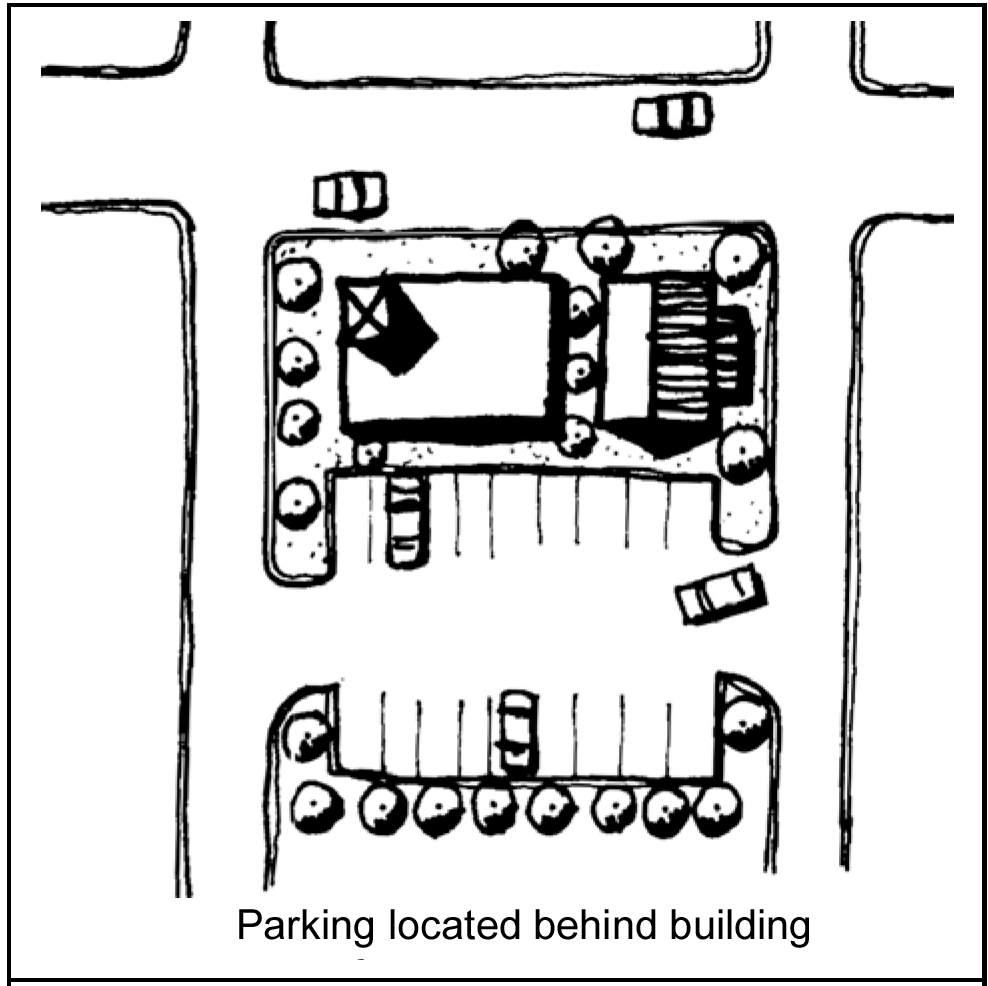
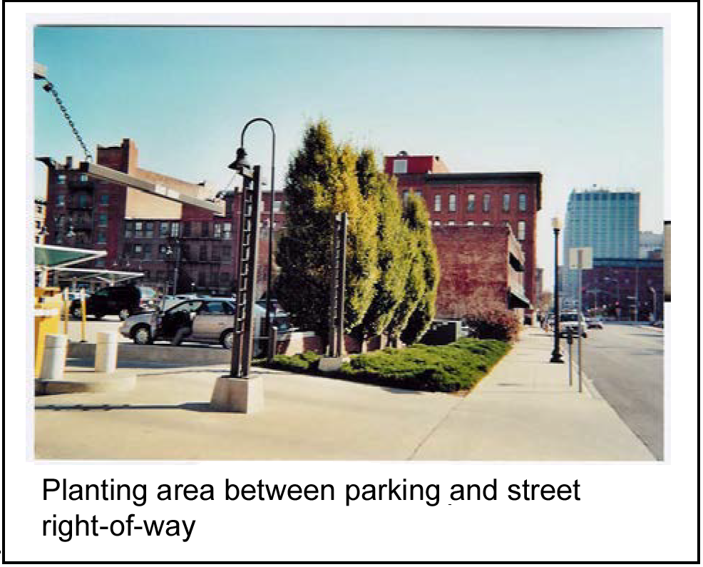
3.
If an alternative is approved and parking is allowed to remain in front of or beside buildings, parking facilities shall provide a ten foot wide planting area between the parking facility and street right-of-way to include:
(i)
A year-round sight barrier;
(ii)
Evergreen shrubs;
(iii)
Evergreen ground cover; and
(iv)
Shrub material maintained at a maximum height of three feet for visibility.
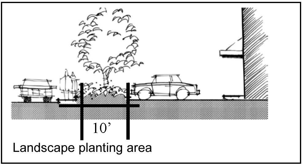
4.
All parking lots (new development and redevelopment) shall comply with the parking lot design standards set forth in this chapter including, but not limited to interior landscape areas, wheel stops, number of stalls and plant material requirements.
5.
Rocks, pebbles, sand and similar non-living materials may be allowed as accent features within landscape planting areas but should be less than five percent of the total landscape planting area but in no case shall exceed 25 percent of the total landscape planting area.
(2)
Consolidating parking facilities.
a.
Intent: To reduce the overall impact of parking within the CBD by consolidating parking facilities whenever possible.
b.
Standard; required:
1.
Where parking facilities are consolidated (shared) the following shall apply:
(i)
The combined number of parking stalls required shall be reduced by ten percent, if two properties consolidate (share) parking.
(ii)
The combined number of parking stalls may be reduced by up to 25 percent, at the discretion of the applicant, if more than two properties consolidate (share) parking.
(iii)
Pedestrian connections shall be provided from parking facility to adjacent development.
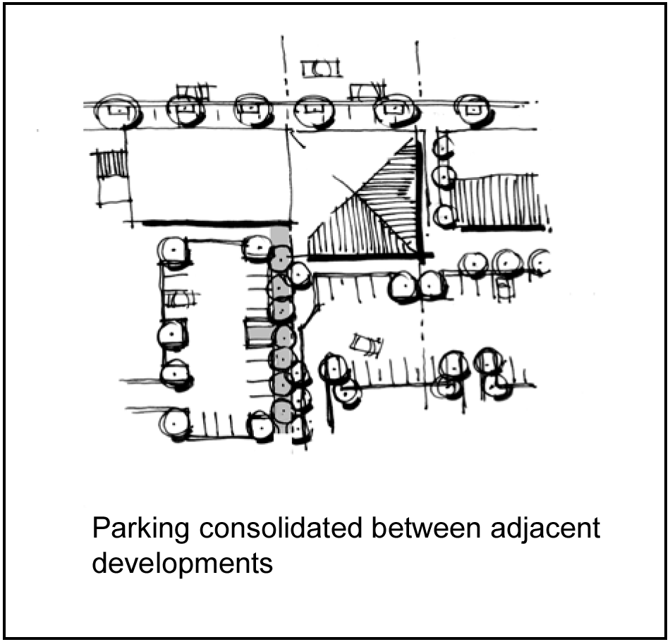
2.
Where parking facilities are not consolidated and are adjacent to one another:
(i)
Pedestrian connections shall be provided between adjoining parking facilities so as to provide access to each adjacent development; and
(ii)
Driveways providing vehicular access from one parking area to the other shall be provided.
(3)
Location of driveways.
a.
Intent: To maintain a contiguous, uninterrupted sidewalk by minimizing, consolidating and/or eliminating driveway access off primary pedestrian streets.
b.
Standards:
1.
Required:
(i)
All vehicular driveways shall be located off side streets and alleys unless one of the following applies:
A.
The only means of access to the site is from a primary pedestrian street;
B.
A development is located at the corner of two primary pedestrian streets;
C.
The driveway is consolidated (shared) between adjacent developments; or
D.
The property cannot be accessed from a side street, alley or shared drive.
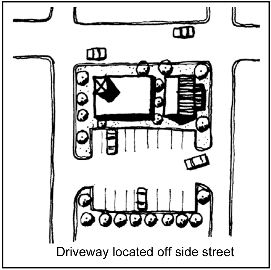
(ii)
Where a driveway is allowed on primary pedestrian streets, driveway entrances shall:
A.
Include an identifying feature of low-maintenance materials, such as an iron-work trellis, monument, low wall/column or special landscape treatment; and
B.
Extend sidewalk-paving material/treatment across the driveway entrance.
(iii)
If used for identifying features in subsection (3)b.1(ii)A of this section, the combination of walls and shrubs/ground cover shall not exceed a maximum height of four feet, unless all of the following are provided:
A.
Wall/landscape treatment does not create a safety hazard;
B.
Portion of wall/landscape treatment that is above four feet in height is a minimum 75 percent transparent (i.e., see-through metal railing, trellis, or other similar treatment); and
C
Portion of wall/landscape treatment that is above four feet in height provides added visual interest, detail and character.
(iv)
The width of the driveway shall be of sufficient width to allow two vehicles to safely and easily pass and shall be designed in accordance with the City of Raytown Permitting, Development Design Criteria and Technical Specifications Manual.
(v)
Entrance drives shall provide a throat length that allows for efficient ingress and egress free from parking spaces backing into the drive.
2.
Encouraged:
(i)
Adjacent developments should consolidate (share) vehicular driveways where feasible.
(ii)
Limited reflective materials are allowed to help define driveway spaces when needed for pedestrian, bicycle or vehicular safety purposes.
3.
Not allowed: No additions required in the location of driveways standards will be permitted to block vehicular, bicycle or pedestrian sight lines.
(4)
Parking lot landscape.
a.
Intent: Reduce the visual impact of parking lots through landscape areas, trellises and/or other architectural features and to visually maintain a building line along the street.
b.
Standard:
1.
Required:
(i)
Parking lot landscape shall be used to reinforce pedestrian, bicycle and vehicular circulation, such as:
A.
Parking lot entrances;
B.
Ends of driving aisles; and
C.
To define pedestrian connections through parking lots.
(ii)
Where walls are provided, landscape-planting areas may be reduced to a minimum width of five feet and shall be located adjacent to the public right-of-way. Low walls (minimum three feet high) used to screen parking lots shall be made of decorative concrete, masonry or other similar material to coordinate with adjacent buildings.
(iii)
The combination of walls and shrubs/ground cover shall not exceed a maximum height of four feet, unless all of the following are provided:
A.
Wall/landscape treatment does not create a safety hazard;
B.
Portion of wall/landscape treatment that is above four feet in height is a minimum 75 percent transparent (i.e., see-through metal railing, trellis, or other similar treatment); and
C.
Portion of wall /landscape treatment that is above four feet in height provides added visual interest, detail and character.
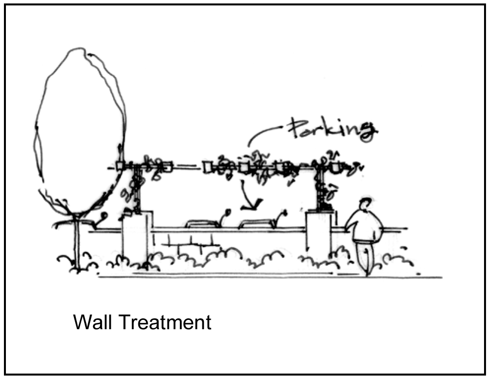
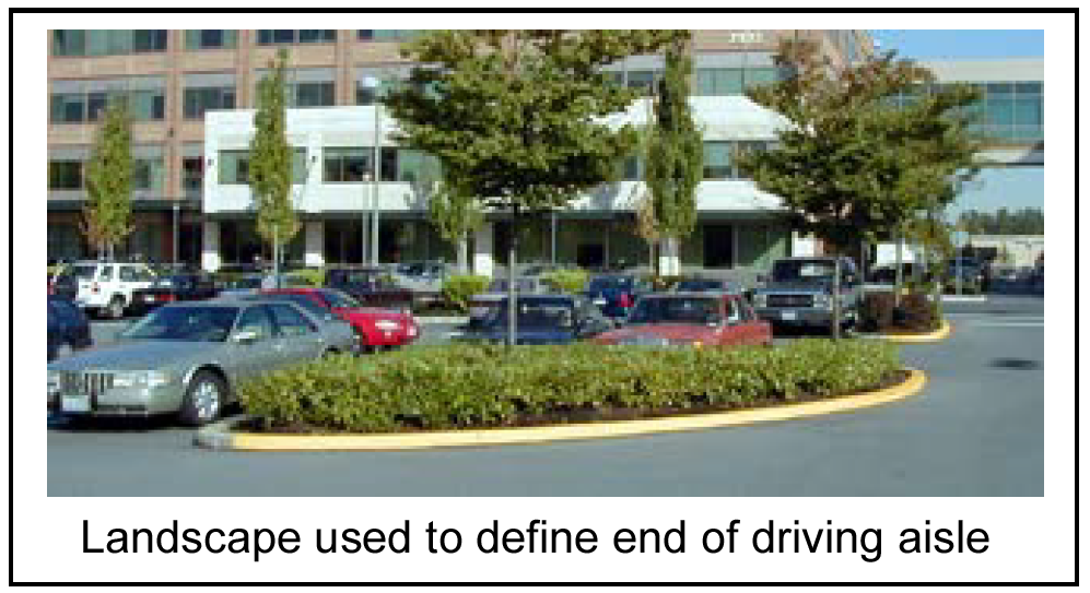
(iv)
For any wall above six feet total height, the entire wall facade shall comply with the building design standards set forth in the CBD Design Standards for ground level details, materials, color, etc.
(v)
A minimum five-foot wide landscape planting area shall be provided between parking lots and adjacent developments to include a year-round sight barrier and meeting the requirements for parking lot landscape provided in the Raytown Landscape Ordinance.
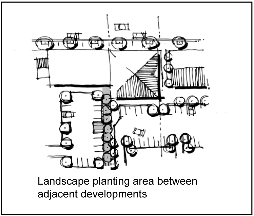
2.
Encouraged: Automatic watering systems should be installed in all landscape planting areas.
3.
Not allowed:
(i)
Business signage on parking lot walls facing the street are not permitted.
(ii)
Chain link and wire fencing shall not be allowed.
(5)
Pedestrian connections.
a.
Intent: To create a network of linkages for pedestrians, including locating building entrances adjacent to sidewalks.
b.
Standards:
1.
Required:
(i)
Clearly defined pedestrian connections shall be provided:
A.
Between a public right-of-way and building entrances when buildings are not located directly adjacent to the sidewalk;
B.
Between parking facilities and building entrances;
C.
Between parking facilities and sidewalks along streets and other public rights-of-way; and
D.
Between parking facilities and plazas, courtyards, green spaces and other pedestrian areas.
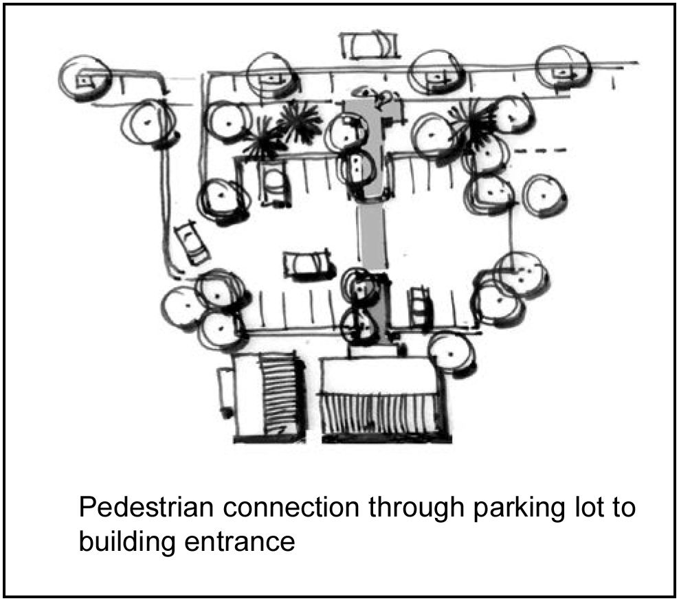
(ii)
Pedestrian connections shall be clearly defined in a combination of two or more of the following ways:
A.
A six-inch vertical curb;
B.
A trellis, railing, bollard, special paving, low seat wall and/or other architectural features; and/or
C.
A continuous landscape area minimum three feet wide on at least one side of the walkway, except as walkways cross vehicular travel lanes.
D.
Where walkways abut a public right-of-way and/or driving aisles, the landscape area shall be provided between the walkway and the public right-of-way or driving aisle and a six-inch curb must be used.
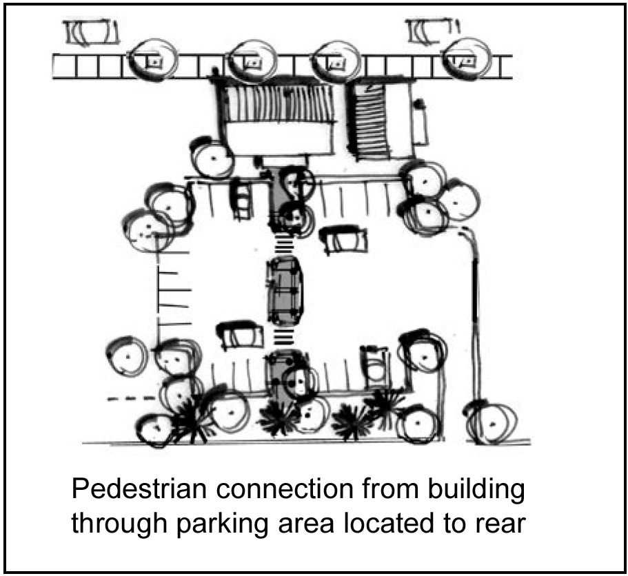
E.
Pedestrian connections shall be clearly defined by pedestrian scale lighting, bollard lighting, accent lighting or a combination thereof to aid in pedestrians way-finding.
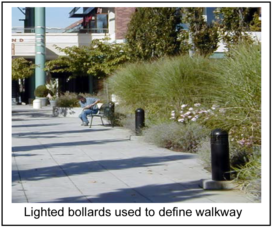
(iii)
Sidewalks along all streets and public rights-of-way shall be a minimum of eight feet in width in the Town Square Neighborhood and a minimum of five feet in all other CBD Neighborhoods.
(iv)
Pedestrian connections walkways shall include clear sight lines to building entrances and shall not be less than five feet wide and connect and blend with adjacent walkways.
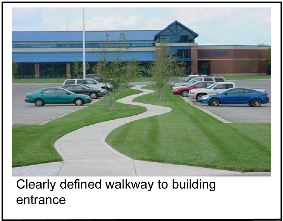
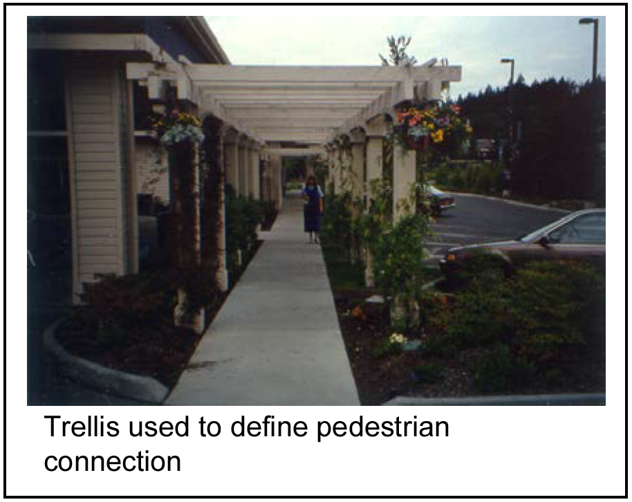
(v)
Landscaping shall consist of drought-tolerant plantings such as evergreens, deciduous trees and shrubs, and decorative grasses. A minimum 20 percent of plant varieties shall provide year-round color, texture and/or other special interest. Shrubs shall be maintained at a maximum three-foot height for visibility.
(vi)
The requirements of the Americans with Disabilities Act shall take precedence over aesthetic design features in all instances.
2.
Encouraged:
(i)
Pedestrian connections should occur between adjacent developments where feasible.
(ii)
Ground covers should be evergreen varieties.
(iii)
Perennials and/or annuals are encouraged to provide special interest and highlight pedestrian areas such as building and/or site entrances, public open space, plazas and major pedestrian connections.
(iv)
Rocks, pebbles, sand and similar non-living materials may be allowed as accent features within landscape planting areas but should be less than five percent but in no case shall be more than 25 percent of the total landscape planting area.
(v)
Automatic watering systems should be installed in all landscape planting areas.
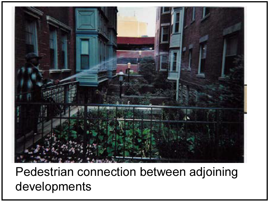
3.
Not allowed: Chain link or other wire fencing shall not be used.
(6)
Blocks, crosswalks and intersections.
a.
Intent: To promote access throughout the central business district, safe passage for pedestrians across primary and secondary pedestrian streets and to increase safety considerations for pedestrians crossing primary vehicular streets.
b.
Standard:
1.
Required:
(i)
Blocks (defined as the length of space between street intersections) will be no longer than 500 feet. The board of aldermen as part of the preliminary site plan may approve an alternative to this design standard.
(ii)
If an alternative to this design standard is approved, a mid-block pedestrian connection shall be provided in accordance with the design criteria for "Pedestrian Connections" and "Through-Block Passages."
(iii)
At intersections with traffic signals or stop signs, sidewalk materials shall be extended across the vehicle and bicycle lanes to define the pedestrian connections in accordance with the specifications of the City of Raytown Permitting, Development Design Criteria and Technical Specifications Manual.
(iv)
Where on street parking is allowed near an intersection, the sidewalk should "bulb out" at the corner by the width/length of the on street parking spaces to shorten the walking distance across the intersection.
(v)
Where crosswalks are defined, stop signs or traffic signals shall be provided to direct bicycle, vehicular and pedestrian traffic.
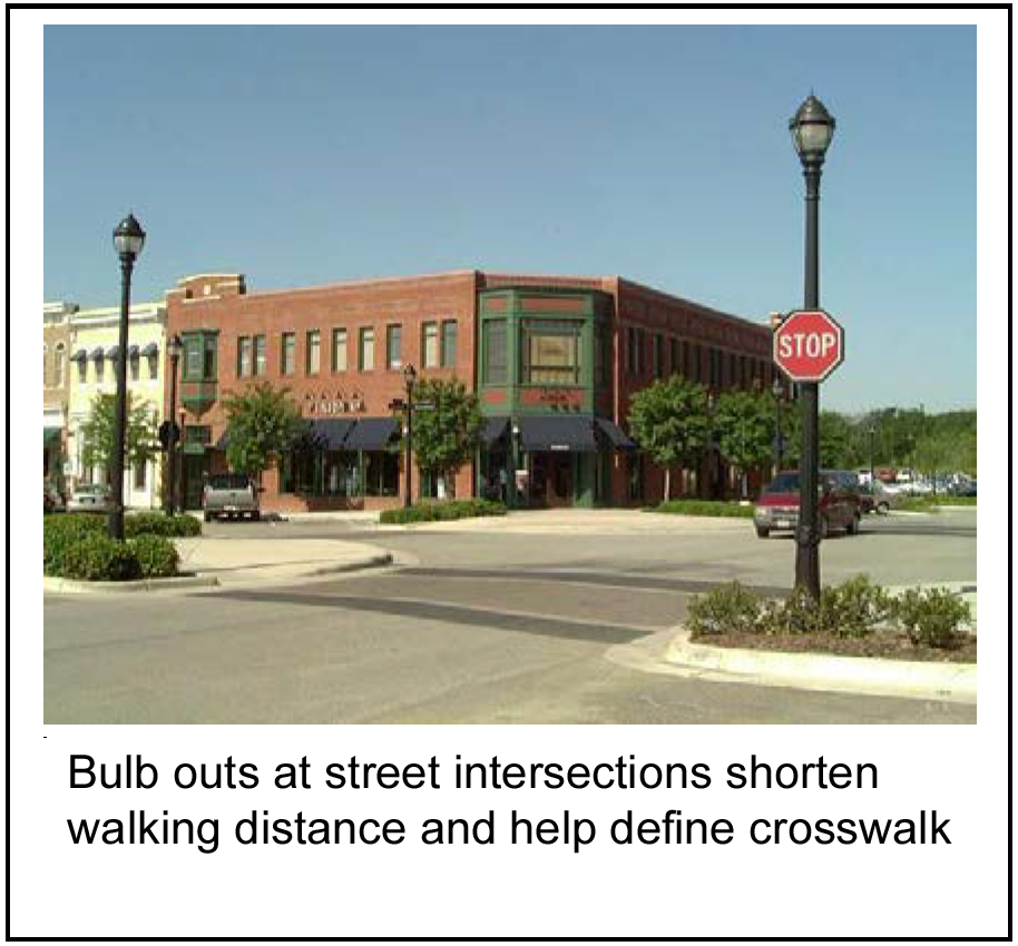
2.
Encouraged: Blocks should be no longer than 300—400 feet in length for appropriately scaled business and pedestrian walkability.
3.
Not allowed: No textured or striped crosswalks shall be permitted where stop signs or traffic signals are not present.
(7)
Through-block passages.
a.
Intent: To provide pedestrian connections in-between large blocks of development.
b.
Standard:
1.
Required:
(i)
Through block passageways shall be provided whenever a block is 500 feet or more length.
(ii)
Where a through block passageway exists on a block that is 500 feet or more in length, a pedestrian activated traffic signal shall be provided at each end of the through block passageway where the passageway intersects with a street so as to allow pedestrians the ability to safely cross the street.
(iii)
Where provided, pedestrian connections should be clearly defined by pedestrian and/or accent lighting.
(iv)
A through block passageway may meander but should have lighting to ensure usability and safety at night.
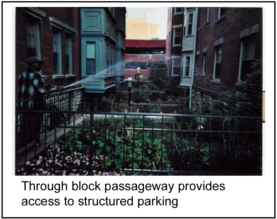
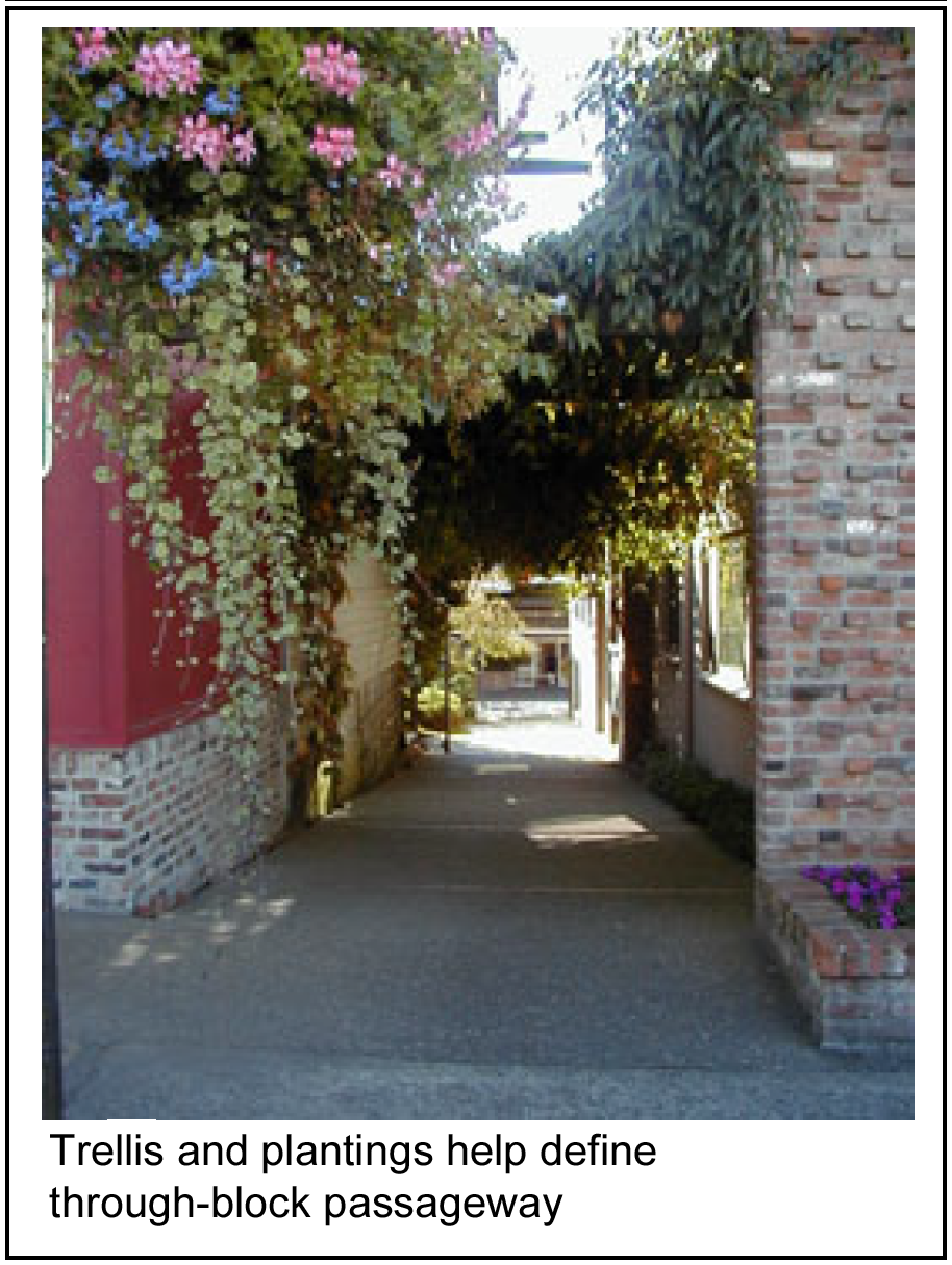
2.
Encouraged:
(i)
Development should include clearly defined pedestrian connections providing through-block passageways.
(ii)
Where provided, pedestrian connections should be clearly defined in one of the following ways:
A.
A continuous landscaped area minimum three feet wide on at least one side of the walkway, except where walkways cross vehicular travel lanes; or
B.
A trellis, bollards, special paving, low seat wall and/or other architectural features.
(iii)
The property owner or business association shall retain ownership of the through block passageway if part of the land plat. However, through-block passages will be maintained by the same entity maintaining the pedestrian sidewalks and other walkways.
(8)
Site landscape areas.
a.
Intent: To reinforce the character of downtown Raytown and the surrounding built environment through site landscaping.
b.
Standard:
1.
Required:
(i)
All areas not otherwise devoted to landscape required by the CBD Design Elements, the Raytown Municipal Code, parking, structures or other site improvements shall be planted, or remain in existing native, non-invasive vegetation.
(ii)
Where new landscape areas are provided, plant materials shall provide year-round color, texture and/or other special interest.
(iii)
Landscaping shall consist of drought-tolerant plantings such as evergreens, deciduous trees and shrubs, and decorative grasses. A minimum 20 percent of plant varieties shall provide year-round color, texture and/or other special interest. Shrubs shall be maintained at a maximum three-foot height for visibility.
(iv)
When used, window boxes, container planters and hanging baskets shall be made of weather resistant materials.
(v)
All landscape areas shall be maintained per the Raytown Landscape Ordinance.
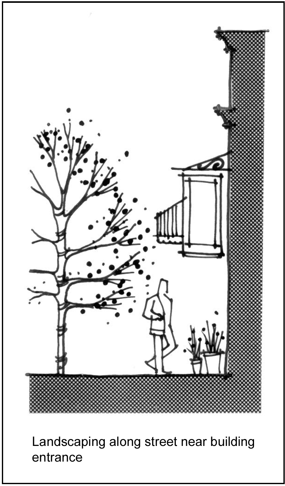
2.
Encouraged:
(i)
Perennials and/or annuals are encouraged to provide special interest and highlight pedestrian areas such as building and/or site entrances, public open space, plazas and major pedestrian connections.
(ii)
Window boxes, container plantings, hanging baskets, or other special interest landscape should be provided to enhance pedestrian areas.
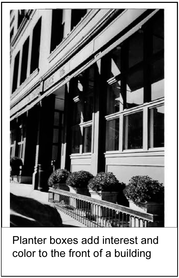
(9)
Street trees.
a.
Intent: To maintain a consistent street frontage throughout the downtown area through the planting of trees along streets and sidewalks.
b.
Standard:
1.
Required:
(i)
Street trees shall be located between the sidewalk and curb edge within the public right-of-way, where feasible.
(ii)
Street tree selection shall comply with the street tree regulations adopted by the City of Raytown Tree Board and shall consider existing utilities, lighting, adjacent street trees, tree root growth and proposed signage locations.
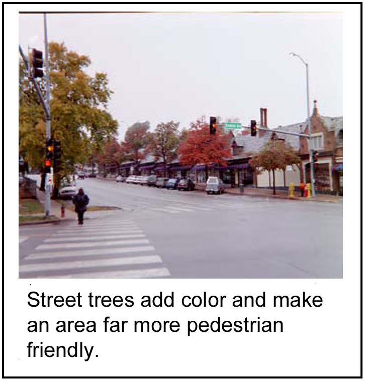
(iii)
Sidewalks should be set back from the edge of the road or the curb a minimum of four feet wherever possible to allow for tree planting and growth.
(iv)
Trees shall be of a similar size and type as trees found within the same block so as to maintain a sightline of similar overall streetscape appearance.
(v)
Trees planted shall be wind, ice and weather tolerant, of medium height when mature.
(vi)
Tree grates when used, shall be of a similar material and appearance as tree grates found in adjacent developments to maintain a similar overall streetscape appearance.
2.
Encouraged: Sidewalks should be set back from the edge of the road or the curb a minimum of six feet wherever possible to allow for tree planting and growth.
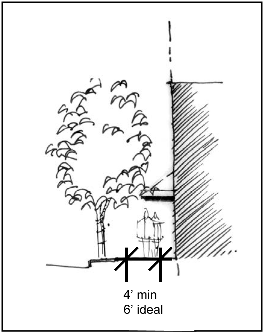
(10)
Site lighting.
a.
Intent: To provide pedestrian scale lighting, accent lighting and festival lighting to accompany street lighting in the downtown area.
b.
Standards:
1.
Required:
(i)
Pedestrian scale lighting and/or bollard lighting shall be used to define pedestrian walkways, crosswalks, connections, and/or other pedestrian areas within a development.
(ii)
Pedestrian scale lighting shall be 14 feet in height.
(iii)
Site lighting shall complement other lighting elements used throughout the site, parking and/or adjacent developments and public right-of-way.
(iv)
All lighting (except festival lighting) shall be shielded from the sky and adjacent properties and structures, either through exterior shields or through optics within the fixture. No light projection should extend higher than horizontal from the light fixture and shall in no case create glare when visible from a public right-of-way or sidewalk.
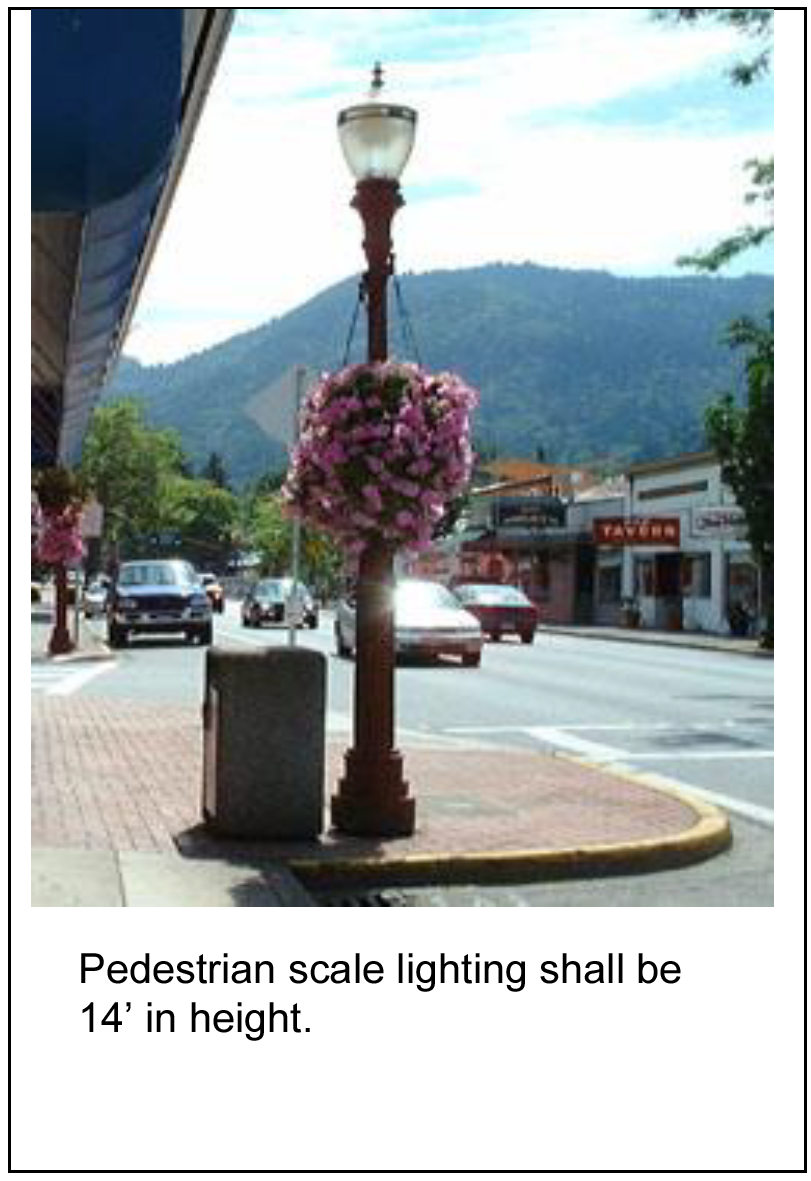
2.
Encouraged:
(i)
Accent lighting should be used for pedestrian safety and to highlight special focal points, building/site entrances, public art and special landscape features.
(ii)
Festival lighting is encouraged during holidays and festivals to reinforce the character and image of the downtown area.
3.
Not allowed: Permanent spotlights, lasers or other types of lighting used as attention-attracting devices shall not be allowed.
(11)
Sidewalk paving.
a.
Intent: To maintain a consistent street frontage throughout the Central Business District.
b.
Standard:
1.
Required:
(i)
Sidewalk paving material shall be not less than eight feet in width within the Town Square Neighborhood and not less than five feet in all other neighborhoods of the Central Business District.
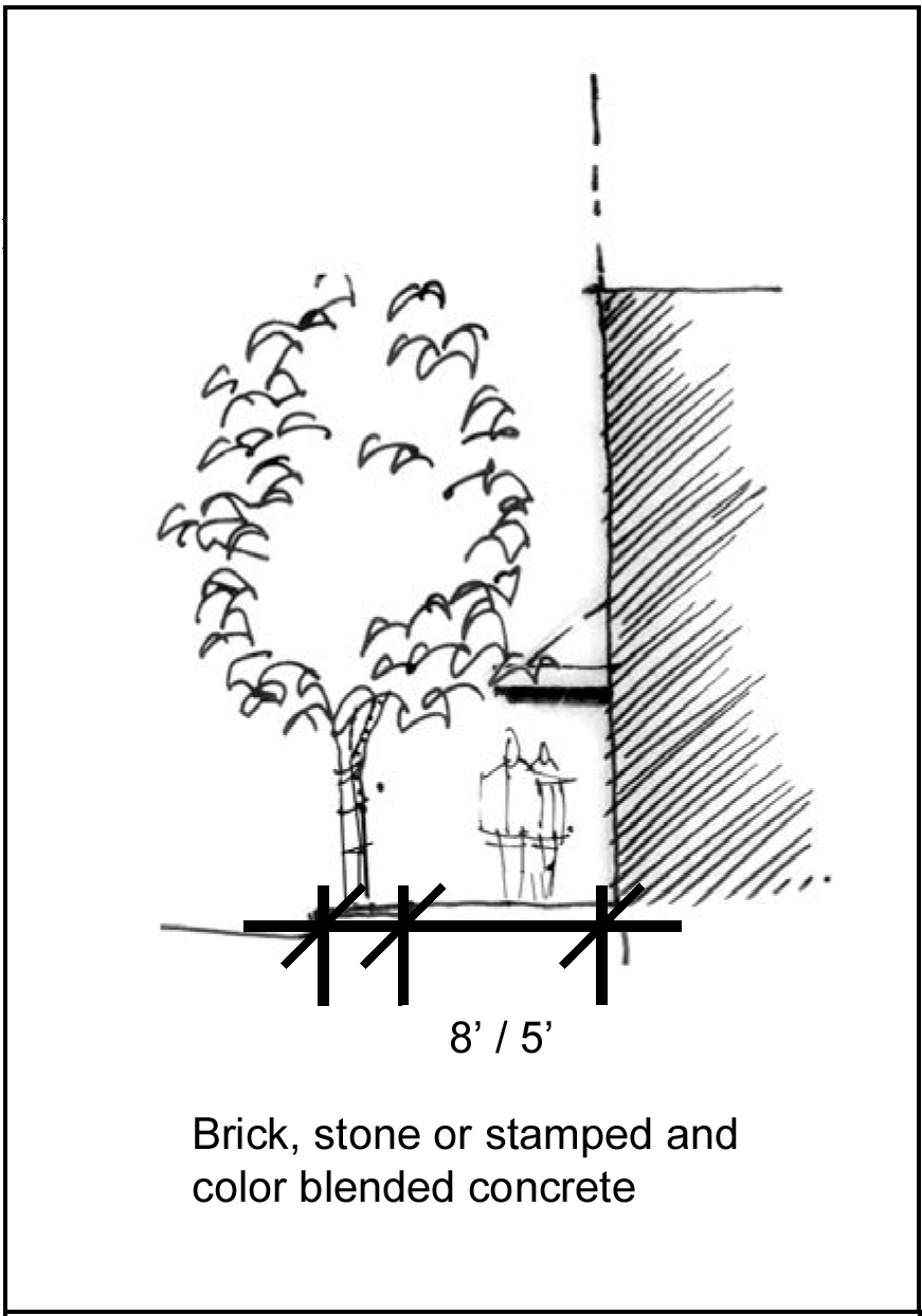
(ii)
Sidewalks in the Town Square Neighborhood shall be separated from the curb by a strip of brick, paver bricks, stone or stamped and color blended concrete that is a minimum width of two feet between the curb and sidewalk unless trees are planted between the sidewalk and curb in which case the sidewalk shall be separated from the curb by a strip of brick, paver bricks, stone or stamped and color blended concrete which shall have a width that is as wide as the tree grates around the trees.
(iii)
Sidewalks in CBD Neighborhoods other than the Town Square Neighborhood shall be separated from the curb by a strip of land that consists of either grass or a strip of brick, paver bricks, stone or stamped and color blended concrete.
(iv)
The sidewalk between the building and strip of brick, paver bricks, stone or stamped and color blended concrete shall be constructed of color blended concrete with a relatively smooth texture that is the same color and texture as other sidewalks along streets in the CBD.
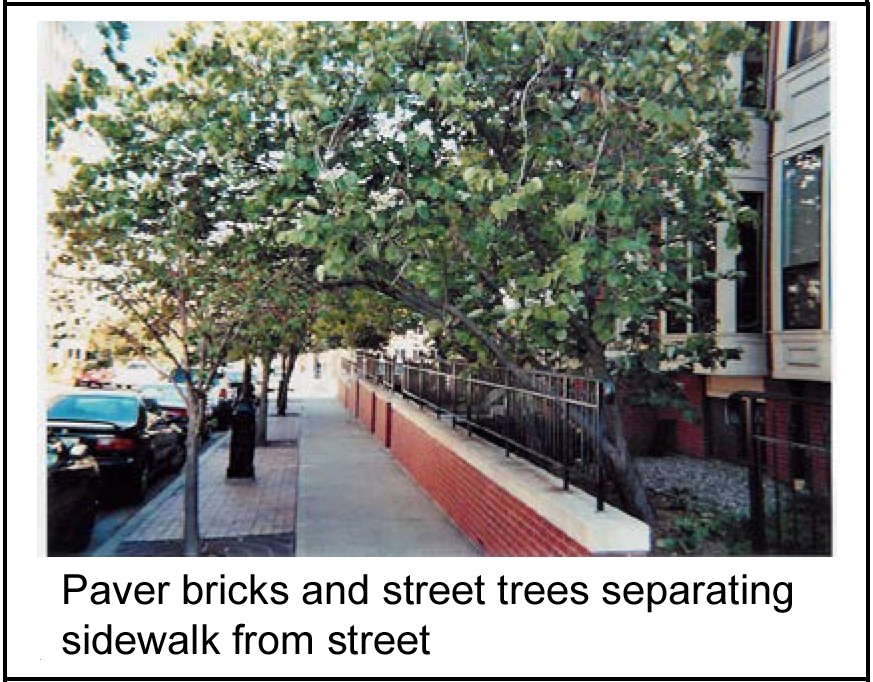
(v)
Unless otherwise required by the city or where larger plaza areas are provided, sidewalk-paving material shall be consistent with street frontage improvements of adjacent developments.
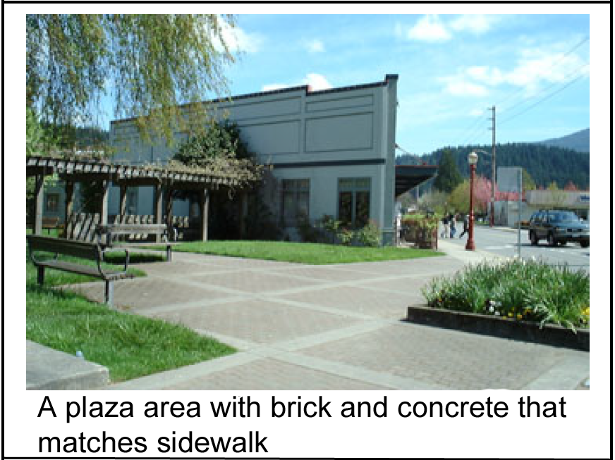
2.
Encouraged: Where larger plaza areas are provided, sidewalk-paving material is encouraged to provide added interest. Refer to the "Courtyards, Plazas and Open Space" section of these CBD Design Standards for additional requirements in plaza areas.
(12)
Bicycle lanes.
a.
Intent: To create a more bicycle friendly street through the integration of bike lanes on streets.
b.
Standard:
1.
Required:
(i)
Wherever the width of a primary pedestrian street allows, bike lanes shall be provided on each side of the street. The width and design of the bike lanes shall be consistent with bicycle standards as specified by the Kansas City American Public Works Association Chapter.
(ii)
At intersections with turn lanes that override the bike lanes, bike lanes shall be phased out a safe distance from the intersection.
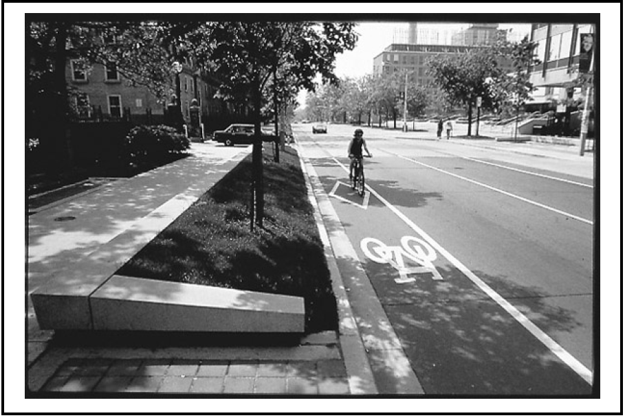
2.
Encouraged.
3.
At reconstruction, primary pedestrian streets should be widened to accommodate bike lanes on both sides of the street.
(13)
Site furnishings.
a.
Intent: To create a more pedestrian friendly street through the use of site furnishings at plazas, building entrances and other pedestrian areas.
b.
Standard:
1.
Required:
(i)
Site furnishings, such as benches with backs, tables and other pedestrian amenities shall be made of durable, weather-resistant and vandal-resistant materials.
(ii)
Site furnishings shall be consistent with the overall character, colors and appearance of adjoining pedestrian areas and site furnishings.
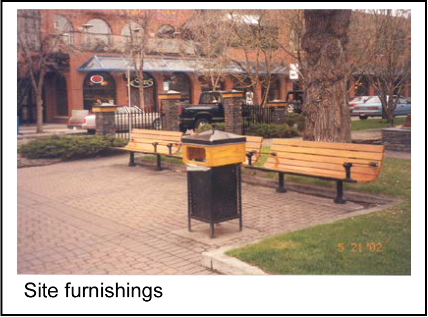
(iii)
Newspaper and other vending machines for the distribution of print media shall be located in vending kiosks facing away from the street and that have exterior materials that are consistent with the exterior materials of the building(s) to which they are adjacent. Identifying logos may appear on the sides of the kiosks facing the sidewalk and street.
2.
Encouraged: Use of site furnishings, such as benches with backs, tables, bike racks, water fountains and other pedestrian amenities should be provided at building entrances, plazas, open space, "bulbed out" sidewalk spaces* and other pedestrian areas.
3.
Not allowed: Site furnishings shall not block pedestrian access to crosswalks, through block passageways, plazas, open space areas and/or building entrances.
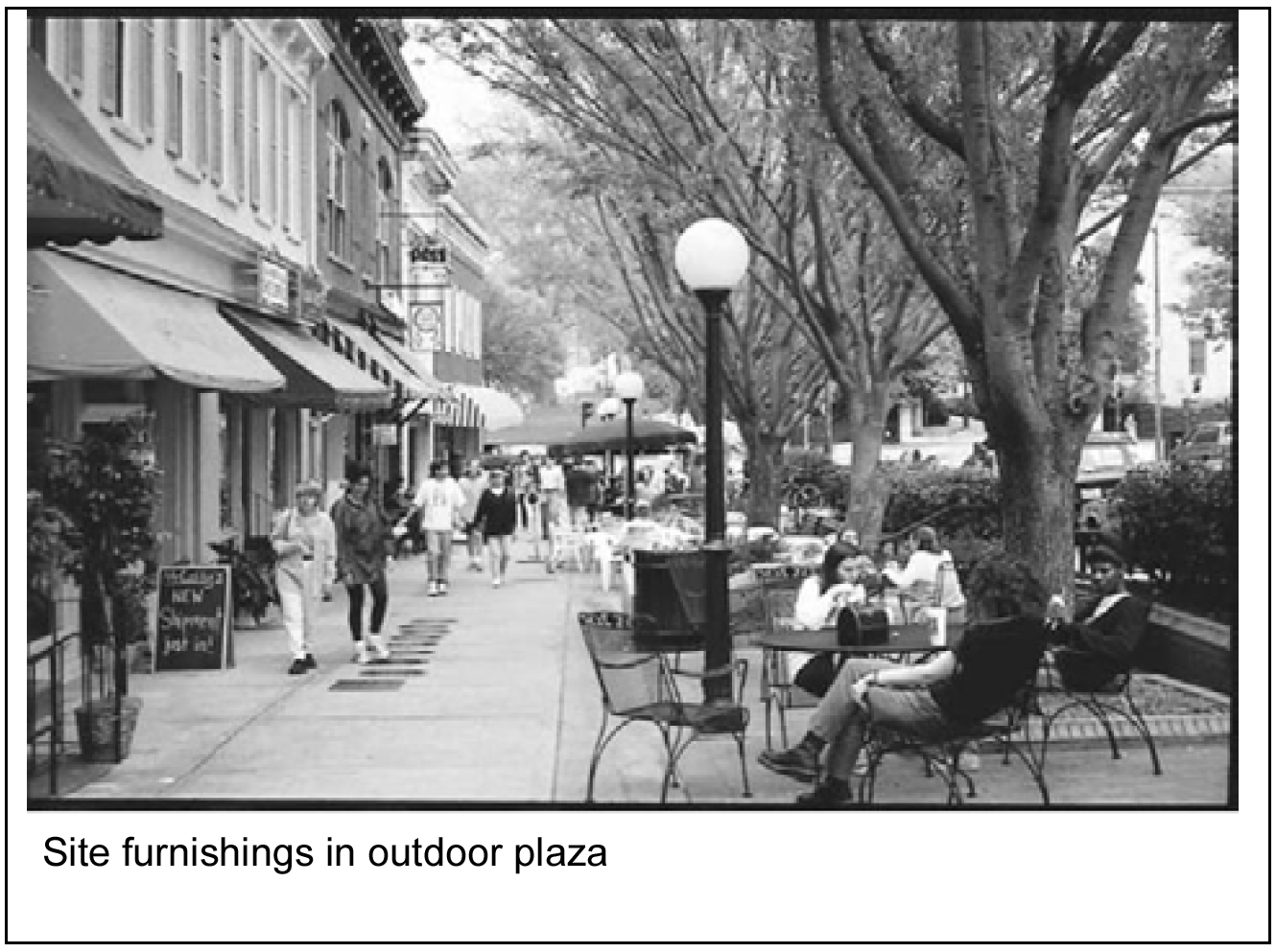
See Blocks, Crosswalks and Intersections Standards
(14)
Courtyards, plazas and open space.
a.
Intent: To reinforce the pedestrian nature of the downtown area by creating usable open space for pedestrians.
b.
Standard:
1.
Required:
(i)
Where provided, pedestrian spaces shall be visible and accessible to the public.
(ii)
Plazas, courtyards, green spaces and other pedestrian areas shall include landscaping and pedestrian scale lighting.
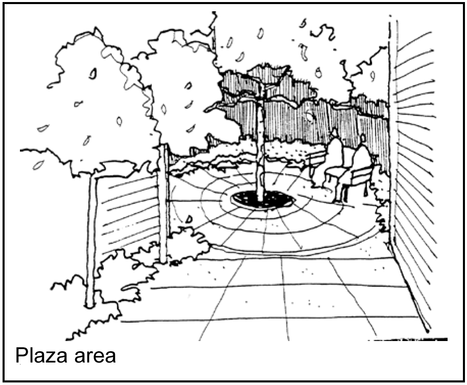
2.
Encouraged:
(i)
If plazas, courtyards, green spaces and other pedestrian areas are provided, they should include public art, benches with backs, low seating walls, or other pedestrian amenities and site furnishings.
(ii)
Use of brick, paver bricks, stone, concrete colored throughout or other special paving material should be provided to reinforce the character of the downtown Raytown and create a more pedestrian-friendly area.
(iii)
Plazas, courtyards, green spaces and other pedestrian areas should be provided within each block in the Town Square Neighborhood and no further than ¼ mile apart in all other CBD neighborhoods.
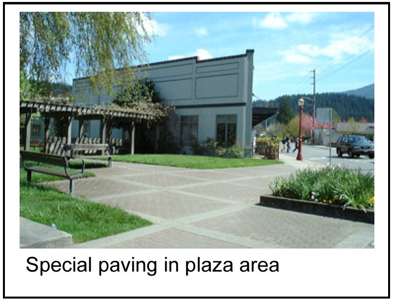
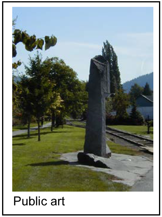
(15)
Town square gateways.
a.
Intent: To highlight gateway areas as an entrance to the Town Square Neighborhood.
b.
Standard:
1.
Required:
(i)
Developments at the intersection of two primary pedestrian streets in the town square area (as defined in the CBD Plan) shall be marked with visually prominent features so as to create a gateway in the town square area.
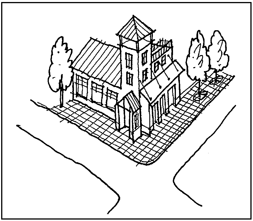
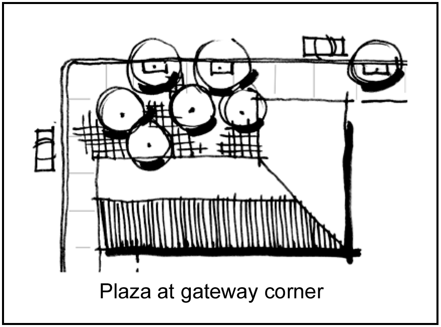
(ii)
Visually prominent features shall include two or more of the following:
A.
Public art;
B.
Monuments;
C.
Special landscape treatment;
D.
Open space/plaza;
E.
Identifying building form;
F.
Special paving, unique pedestrian scale lighting or bollards; and/or
G.
Prominent architectural features, such as trellis/arbor, pergola or gazebo.
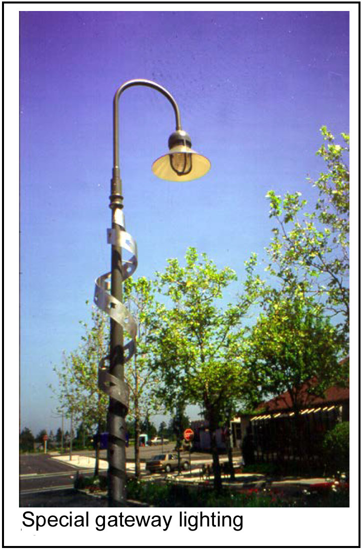
(iii)
Elements used shall be oriented toward pedestrians, bicycles and vehicles.
(iv)
Visually prominent features shall be approved through the regular review and approval processes of the city.
2.
Not allowed: Visibility to adjacent businesses, crosswalks, and traffic lights shall not be blocked by gateway features.
(Comp. Ord. of 4-20-2010, § 28-4)
Sec. 50-397. - Commercial building design standards.
(a)
Prominent entrance.
(1)
Intent: To make major entrances to buildings obvious and welcoming and to avoid long expanses of wall space along a street without having building entrances.
(2)
Standard:
a.
Required:
1.
Visual prominence. The principal entry to the building shall be marked by at least one element from each of the following groups:
(i)
Group A:
■
Recess
■
Overhang
■
Portico
■
Porch
(ii)
Group B:
■
Clerestory
■
Glass window(s) flanking door
■
Ornamental lighting fixtures
■
Large pedestrian entry door(s)
(iii)
Group C:
■
Stone, masonry or tile paving in entry
■
Ornamental building name or address
■
Pots or planters with flowers
■
Seating
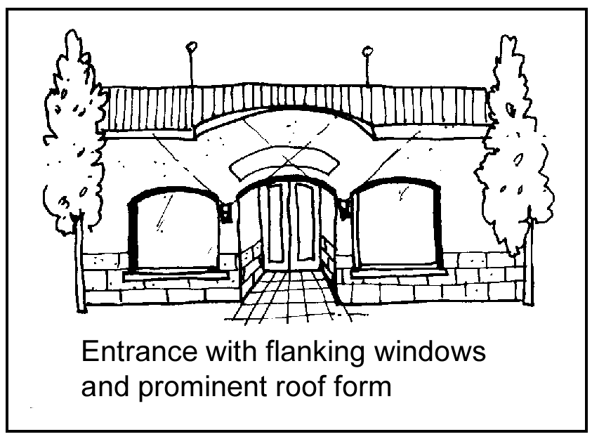
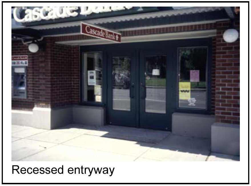
2.
A building entrance shall be provided along streets a minimum of every 100 feet. The board of aldermen as part of the preliminary site plan may approve an alternative to this design standard.
3.
Weather protection. Some form of weather protection shall be provided. This can be combined with the method used to achieve visual prominence.
(b)
Set-to lines/maximum setbacks.
(1)
Intent: To ensure the visibility of retail businesses and establish active, lively uses along the sidewalk.
(2)
Standard:
a.
Required:
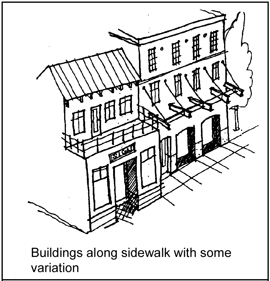
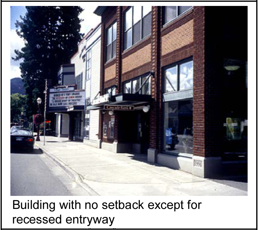
1.
Buildings located along a street shall not be set back from the sidewalk, with the following exceptions:
(i)
Setbacks of up to four feet can be used to highlight entrances and provide for wider sidewalks.
(ii)
A setback of up to ten feet may be allowed for the one of the following purposes:
A.
Providing a public courtyard or plaza area that includes site furnishings; or
B.
Providing outdoor seating as part of a restaurant, cafe or food establishment.
(iii)
The board of aldermen as part of the preliminary site plan may approve an alternative to this design standard.
2.
Where outdoor seating areas or public space is provided that results in an increased building set back, landscaping, fencing, a wall or combination thereof shall be used to maintain a visual building line along the sidewalk.
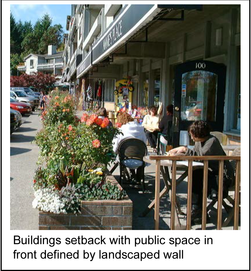
b.
Not allowed: Grass and other landscaping areas shall not comprise more than 25 percent of public courtyard, plaza or outdoor seating areas in the Town Square Neighborhood.
(c)
Ground floor transparency.
(1)
Intent: To provide visual connections between activities inside and outside buildings.
(2)
Standard:
a.
Required:
1.
A minimum of 45 percent of the lowest 12 feet of a building facade facing a street in the Town Square Neighborhood shall be comprised of windows with clear "vision" glass.
2.
A minimum of 25 percent of the lowest 12 feet of a building facade facing any street in a CBD neighborhood other than in the Town Square Neighborhood shall be comprised of windows with clear, "vision glass."
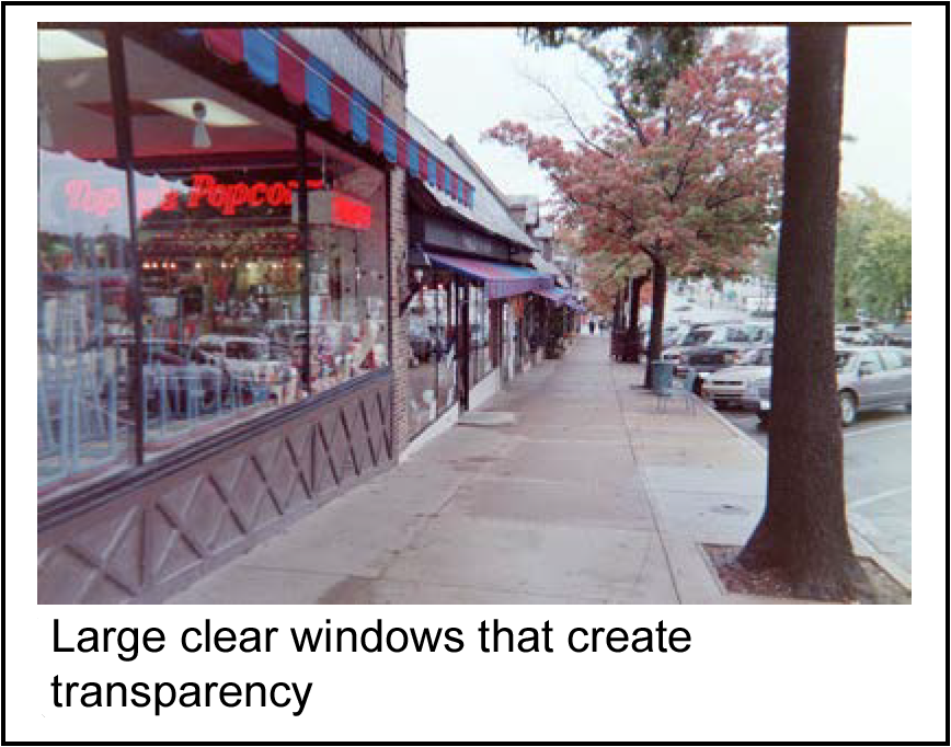
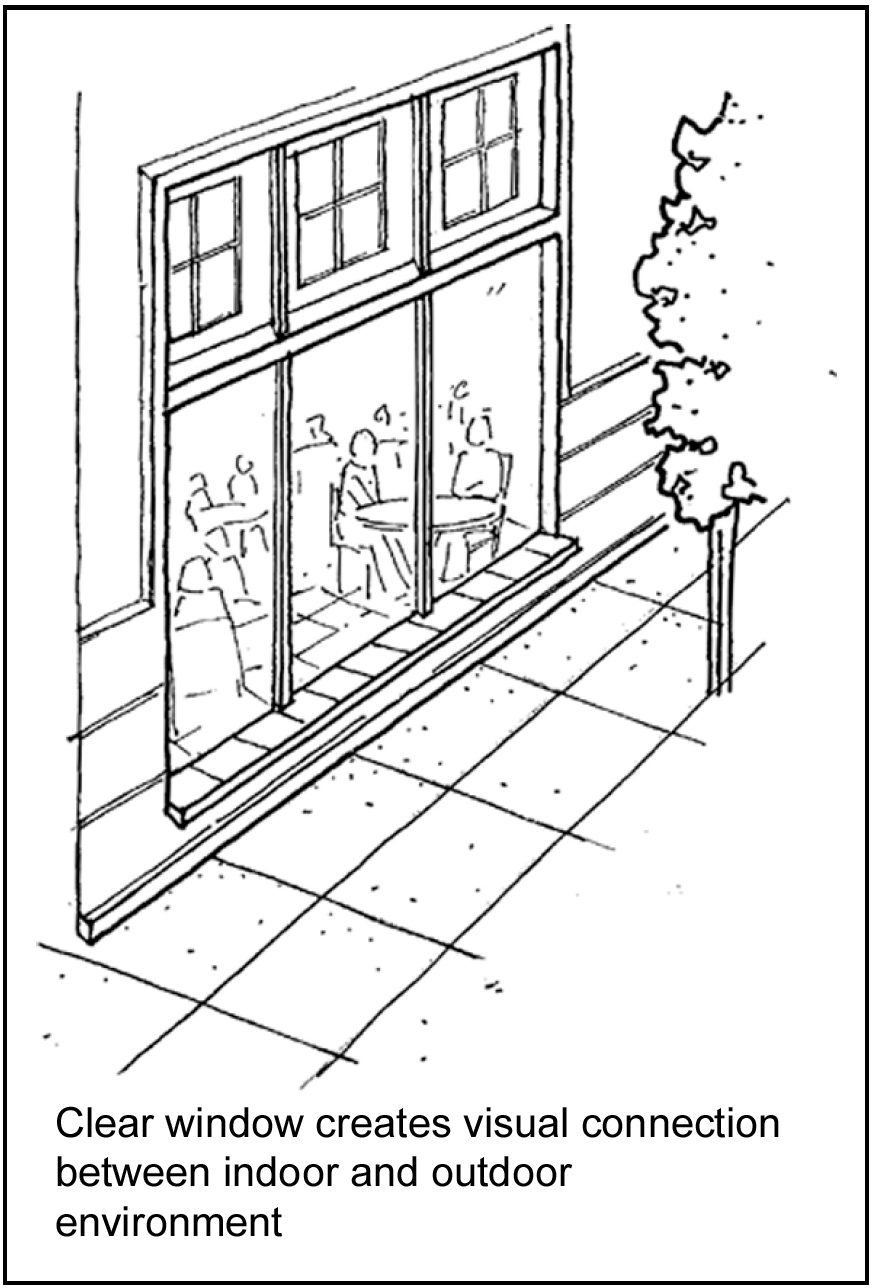
b.
Not allowed: Reflective glass or film shall not be permitted.
(d)
Weather protection.
(1)
Intent: To provide weather protection for pedestrians.
(2)
Standard:
a.
Required:
1.
Canopies or awnings shall be provided over windows and entryways along streets in the Town Square Neighborhood except in the following cases:
(i)
A portico, porch or overhead projection is provided over the window or entryway that achieves the intent indicated above.
(ii)
The building on which the canopy or awning is to be provided has a setback of greater than four feet and the setback area complies with the requirements for courtyards, plazas, and open space as specified within these regulations.
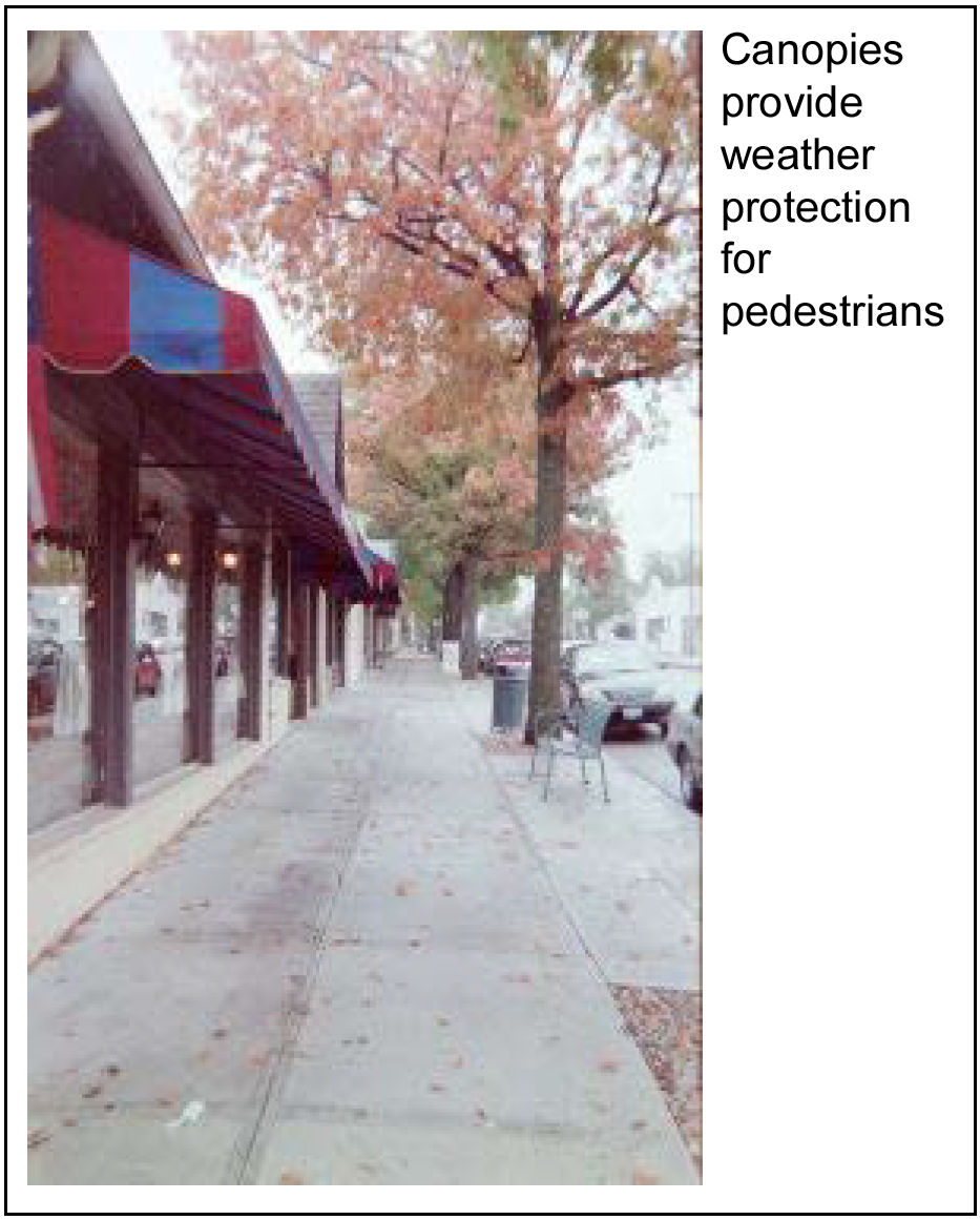
2.
The minimum depth of any canopy or awning shall be four feet unless limited by the city-adopted building code. The vertical dimension between the underside of the canopy or awning and the sidewalk shall be at least eight feet and no more than ten feet.
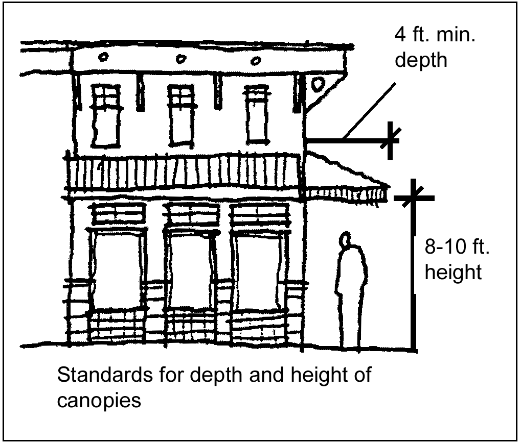
b.
Not allowed: Internal illumination of awning shall not be allowed. Illumination below the awning shall be allowed only if awning material is opaque.
(e)
Storefront and building facade composition.
(1)
Intent: To ensure that ground level storefronts and building facades along streets in the Town Square Neighborhood offer attractive features to pedestrian.
(2)
Standard:
a.
Required:
1.
Ground level building facades along streets in the Town Square Neighborhood shall incorporate at least one of the following:
(i)
Large windows with a sill height of 12 inches to 30 inches above the sidewalk;
(ii)
Clerestory windows above the main windows; or
(iii)
Windows recessed from the face of the building six inches to 18 inches.
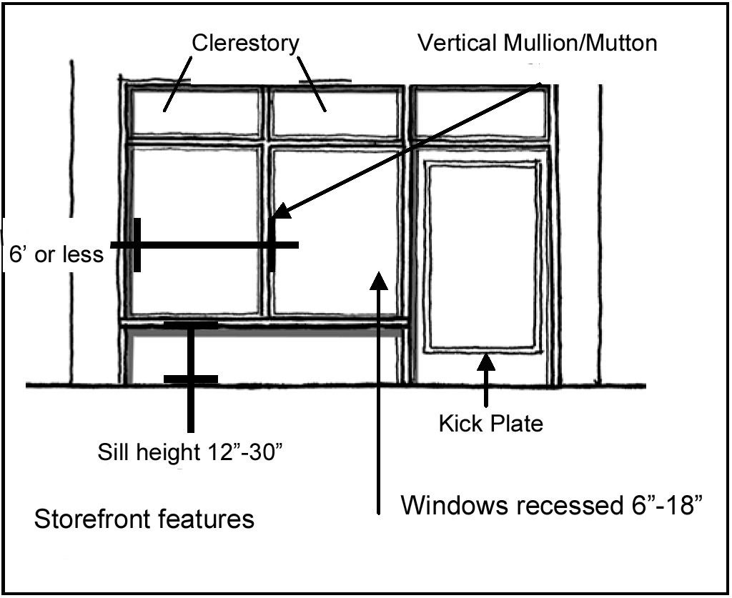
2.
Windows shall have vertical mullions or muttons every six feet.
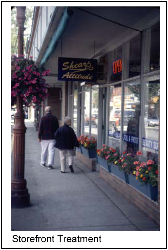
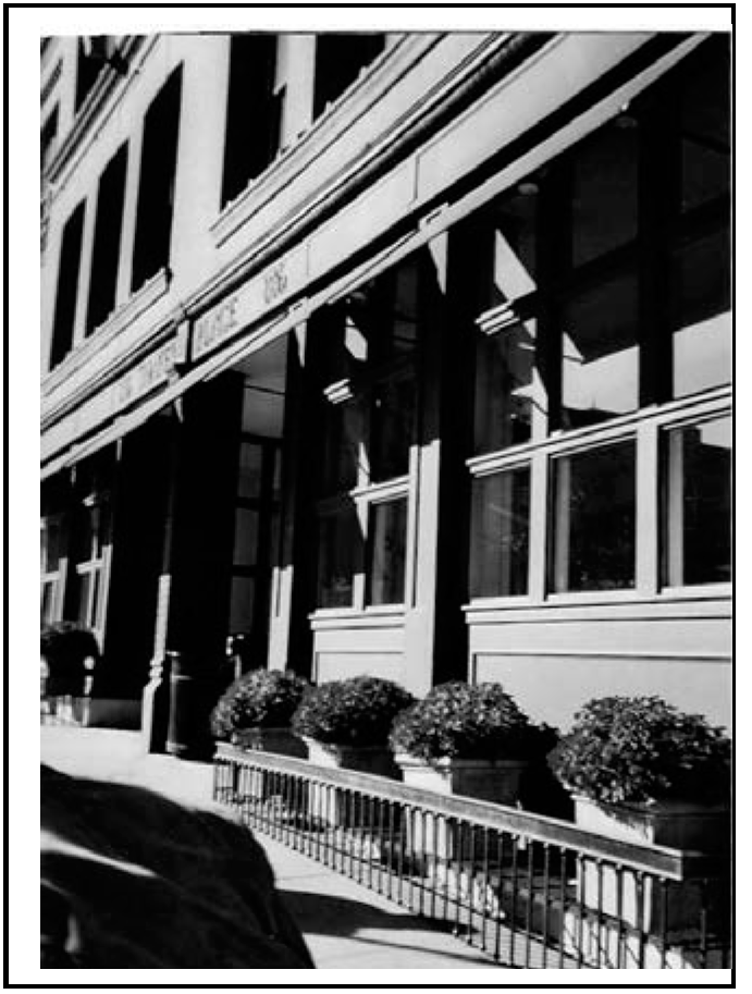
(f)
Ground level details.
(1)
Intent: To ensure that buildings along streets within the Central Business District (CBD) display the greatest amount of visual interest and reinforce the character of the streetscape.
(2)
Standard:
a.
Required:
1.
Buildings within the CBD located along a street in the Town Square Neighborhood shall incorporate at least four of the following elements into any ground-floor, street-facing facade:
(i)
Decorative lighting;
(ii)
Medallions;
(iii)
Belt courses;
(iv)
Plinths for columns;
(v)
Kick plate for storefront window;
(vi)
Projecting sills;
(vii)
Tilework; and/or
(viii)
Planter box.
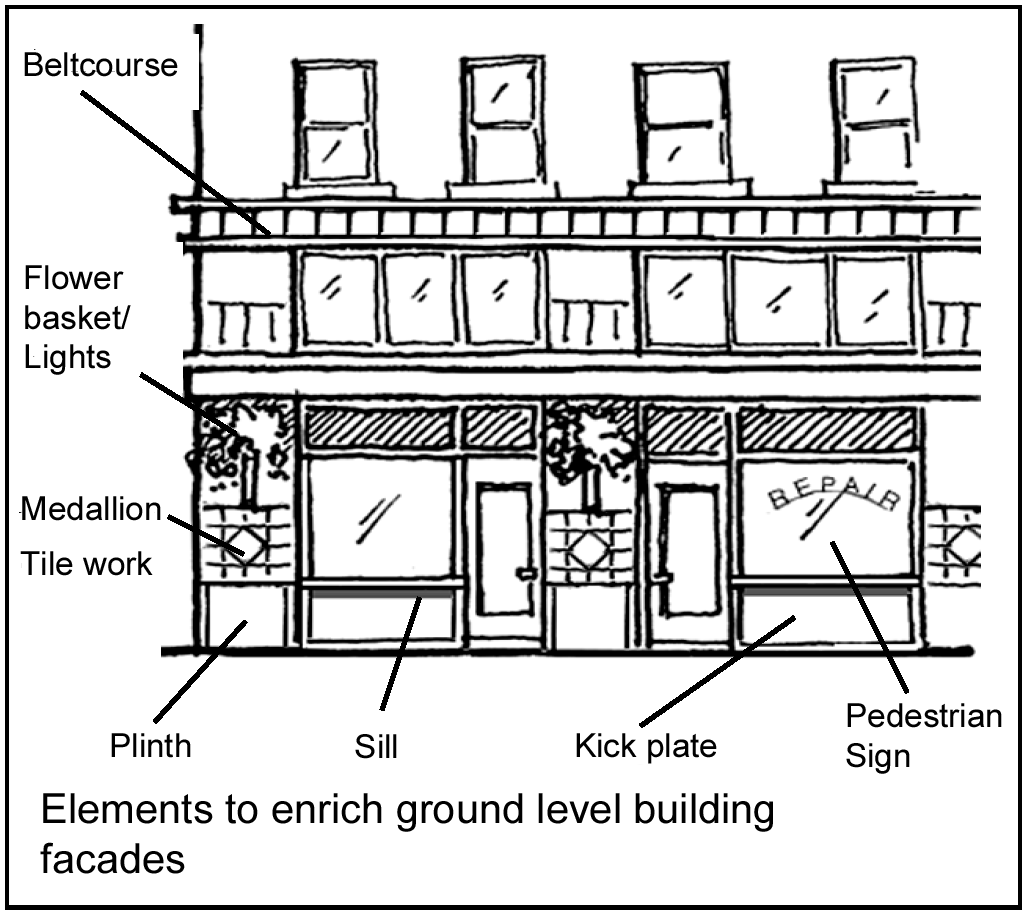
2.
Buildings on any street other than in the Town Square Neighborhood shall incorporate at least three of the above-mentioned elements.
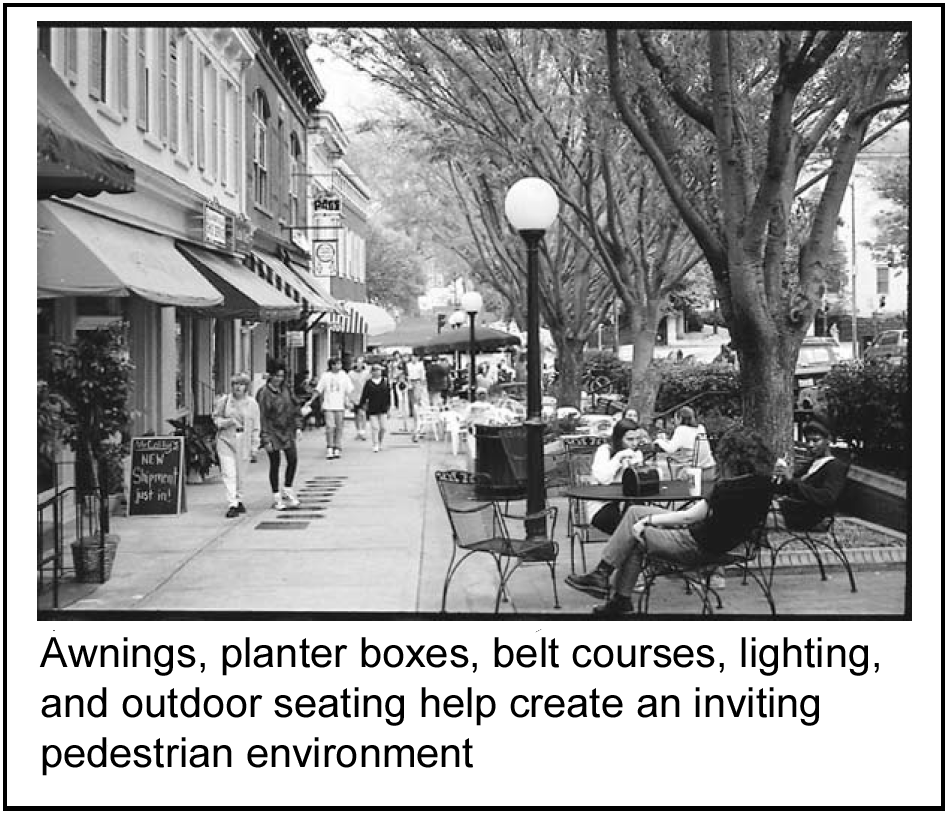
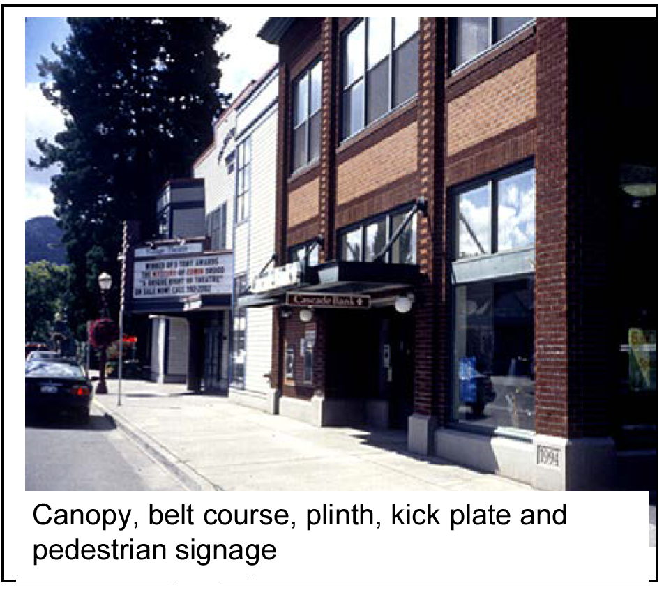
(g)
Upper level step backs.
(1)
Intent: To ensure that new buildings having greater height do not overwhelm the character and scale of the downtown area by requiring a reduction in the bulk of upper floors.
(2)
Standard:
a.
Required:
1.
Buildings of three or more stories that are constructed with a front yard setback of less than 15 feet shall be stepped back above the second story. For each floor above two stories, the amount of the step back shall be at least four feet from the floor below. The step back shall be repeated a minimum of every two floors. The step back need not be continuous and uniform, so long as the decrease in bulk is visually evident. Accordingly, some portions of the exterior walls may extend out to the wall of the floor below. (There may be functional reasons, such as a staircase, that justify an occasional wall extending the full height of the building or for the purpose of creating an architectural gateway to an area at a street intersection.)
2.
Buildings of three or more stories that have a front yard setback of 15 feet or greater are not required to have step backs.
b.
Encouraged:
1.
Terraces should include planters for flowers and other vegetation;
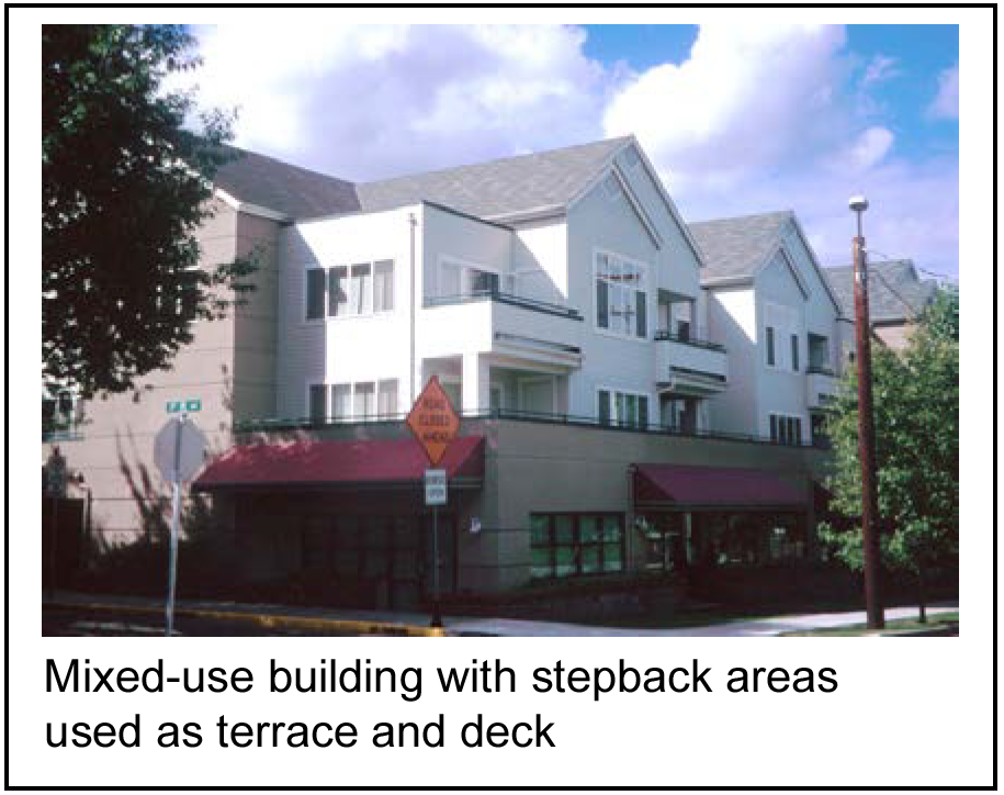
2.
The stepback areas may be used for accessible decks or may be roofed. It is preferred that step backs incorporate combinations of roofs and decks to produce a massing that is both terraced; and varied.
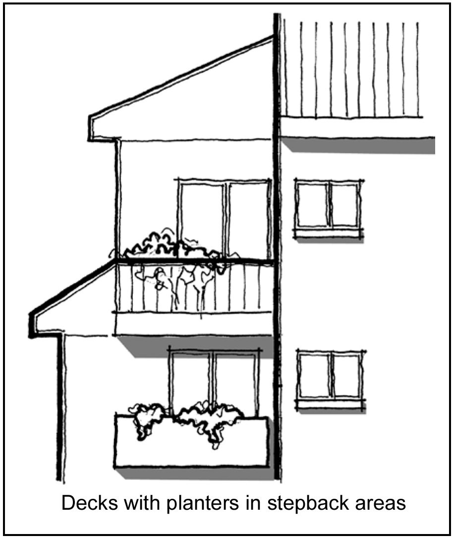
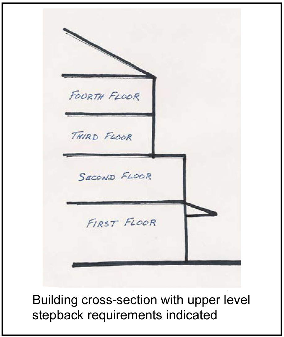
(h)
Roof expression.
(1)
Intent: To ensure that rooflines within the downtown area present a distinctive profile and appearance and reinforce the character of downtown.
(2)
Standard:
a.
Required:
1.
Buildings of two stories or greater with flat roofs in the Town Square Neighborhood shall include either extended parapets and projecting cornices to create a prominent edge or a sloping roof element when viewed against the sky from a street, parking area, public open space or pedestrian connection.
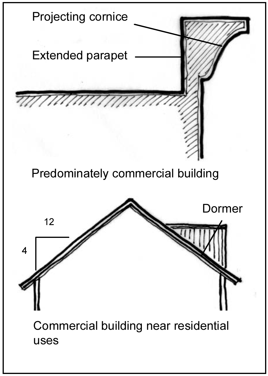
2.
Sloping roof elements are required for all one story buildings in the Town Square Neighborhood.
3.
Sloping roof elements are required for all buildings in all other CBD neighborhoods.
4.
Buildings containing predominantly residential uses shall have pitched roofs with a minimum slope 4:12. Such roofs shall have dormers or intersecting roof forms that break up the massiveness of a continuous, uninterrupted sloping roof.
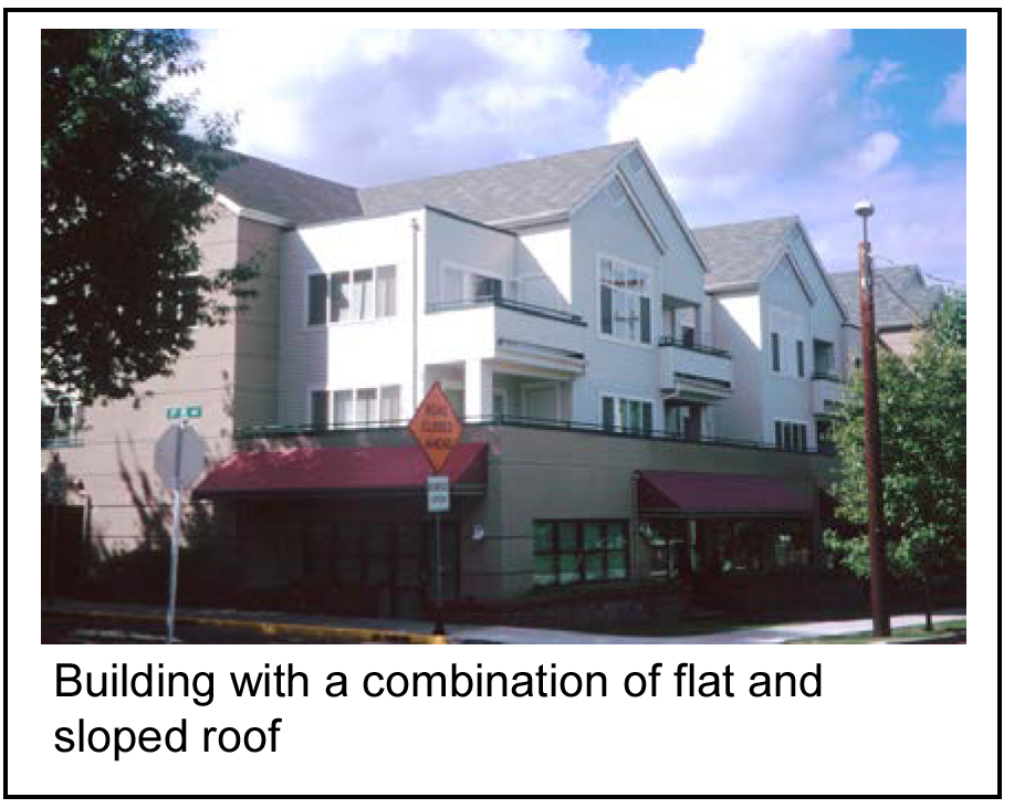
5.
Eaves and downspouts shall be architecturally integrated into the building facade.
6.
Rooftop mounted equipment, vents and flues (other than chimneys) shall be screened by parapet walls or sloping roof elements compatible with the building architecture when visible from a street, parking area, public open space or pedestrian connection or other public area. Mechanical equipment must be located and screened in a manner so as not to be visible or heard from adjoining properties.
(i)
Rooftop mechanical equipment screens shall be required at a height that is as high or higher than the rooftop equipment being screened.
(ii)
Screening shall be provided in a manner that is architecturally integral to the overall appearance of the building.
(iii)
The number of vents and flues shall be kept to a minimum and located in a manner to not be visible. On sloped roof structures, vents and flues shall be incorporated into architectural features or painted to blend with the roofing material.
(iv)
The board of aldermen as part of the preliminary site plan may approve an alternative to this design standard, provided that in addition to the criteria for approval of an alternative, the board of aldermen must also determine that one of the following exception criteria is valid:
A.
A building is located at a higher elevation in relation to surrounding properties and it is demonstrated that rooftop equipment will not be visible.
B.
A building is sited in a manner where the location and setback of rooftop equipment from the building edge is relation to the elevation and visibility of surrounding properties is such that the equipment will not be visible from any distance and additional screening measures are not required.
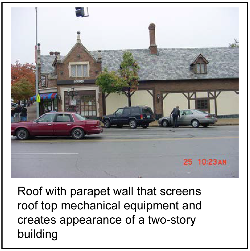
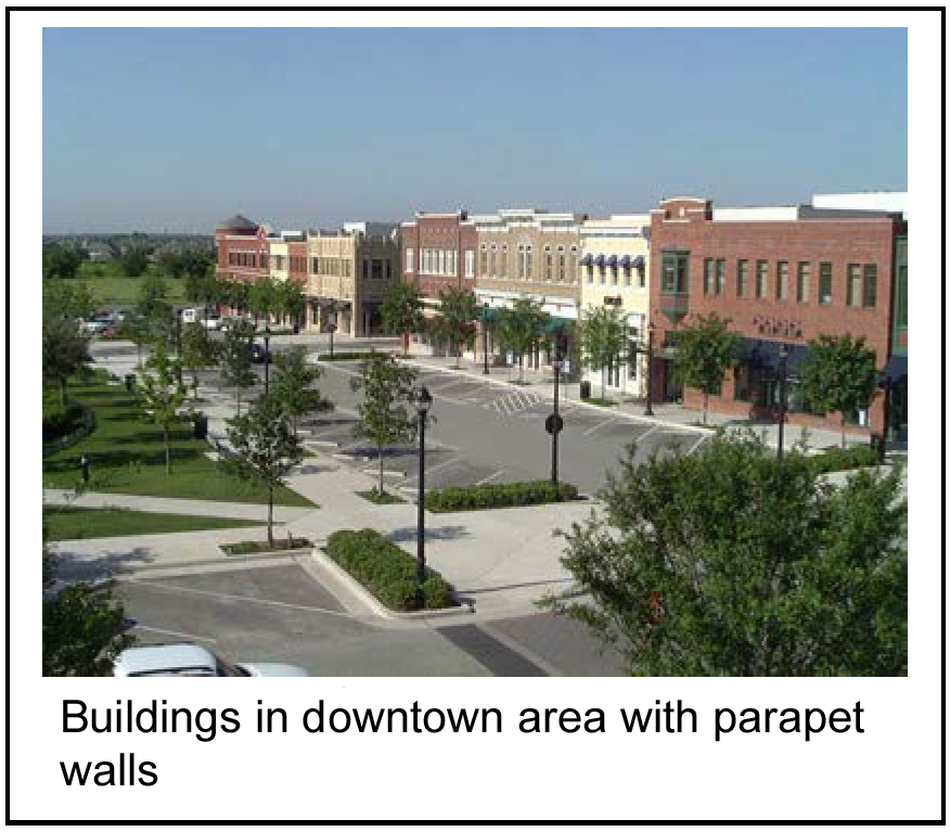
7.
Roof materials shall be durable and shall comply with the City of Raytown adopted fire code.
8.
Roof colors shall be consistent with the roof colors identified in subsection (n) of this section. The board of aldermen as part of the preliminary site plan may approve an alternative to this design standard.
b.
Not allowed:
1.
Flat, unembellished rooflines shall not be permitted.
2.
Bright roof colors shall not be permitted.
3.
Corrugated metal, standing seam metal and wood shake shingle roofs shall not be permitted.
(i)
Marking gateways into the town square.
(1)
Intent: To promote the sense of a gateway into the Town Square Neighborhood through architectural design.
(2)
Standard:
a.
Required:
1.
Buildings at primary pedestrian street intersections in the Town Square Neighborhood shall be designed to create a gateway into the area.
2.
Any corner of a building that abuts a primary pedestrian street in the Town Square Neighborhood intersection shall be given major architectural expression in its facade, roof form and massing. Architectural expressions may include tower forms, unusual rooflines, or over-sized windows that blend with the architectural intent of the Town Square Neighborhood.
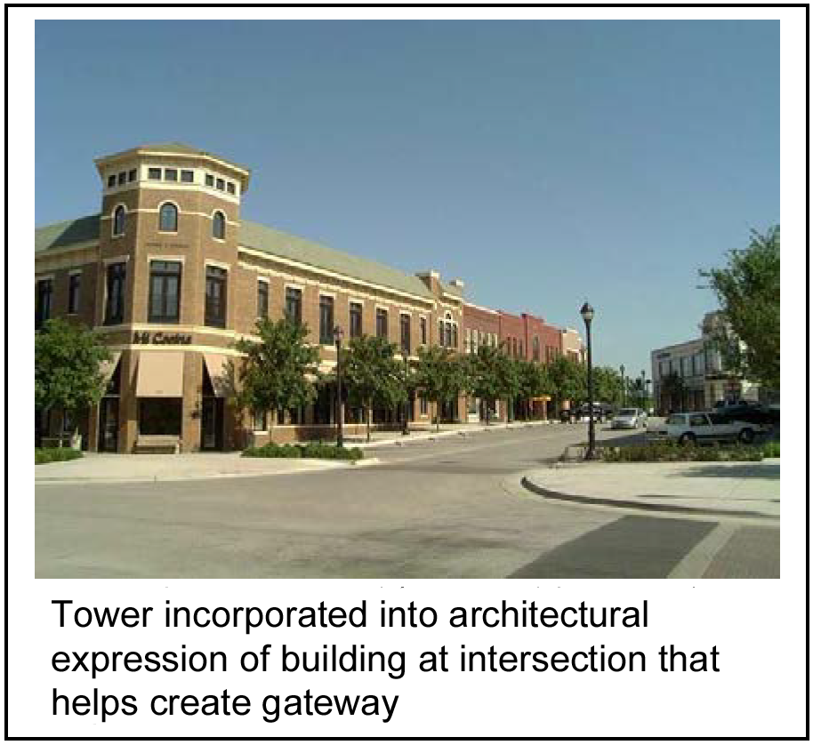
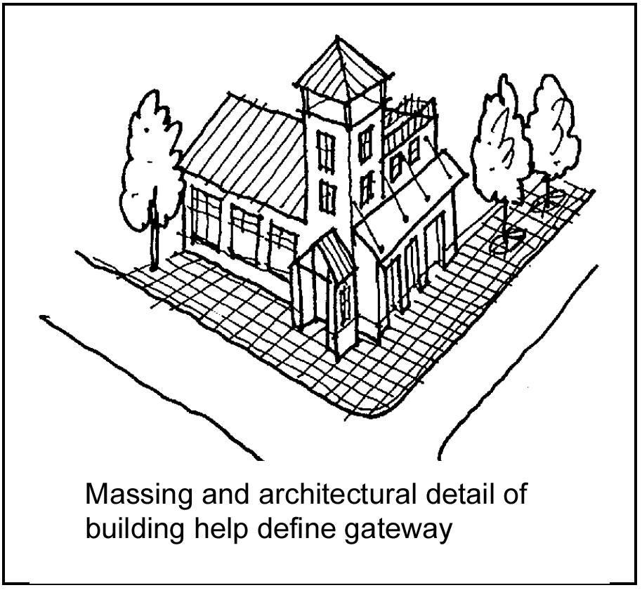
b.
Not allowed: Standard corporate designs shall not be acceptable within gateway locations. Given that designated gateways are critical to conveying identity of the overall Central Business District, gateways are not appropriate locations for the franchise architecture typically associated with businesses such as national brand restaurants and gas stations.
(j)
Backsides of buildings.
(1)
Intent: To ensure that all sides of a building have visual interest.
(2)
Standard; required.
a.
Any side of the building visible from a street, parking area, through block passageway, or public open space shall be given architectural treatment using two or more of the following:
1.
Windows.
2.
Pedestrian entrances.
3.
Balconies.
4.
Architectural details mentioned under "Ground Level Details."
5.
Awnings.
b.
Unattractive elements, such as trash, service, storage and loading areas shall be located out of public view from streets, adjacent residential properties, and other highly visible areas such as parking lots, access drives, through block passageways, etc.
1.
Buildings shall be designed in a manner so that loading docks, service areas, and outdoor storage areas are screened either by a building wall or a screening wall, or integrated into the building design to not be noticeably visible.
2.
Whenever possible, screening walls shall be of a length and height to screen the maximum size of vehicle using the area.
3.
Screening walls shall reflect the same level of architectural design as the primary structure, including elements such as landscaping to soften the wall's appearance, architectural detailing, staggering with recesses and projections, and visual interest.
4.
Design elements must be accomplished in a manner to control noise generated from service activities and mechanical equipment.
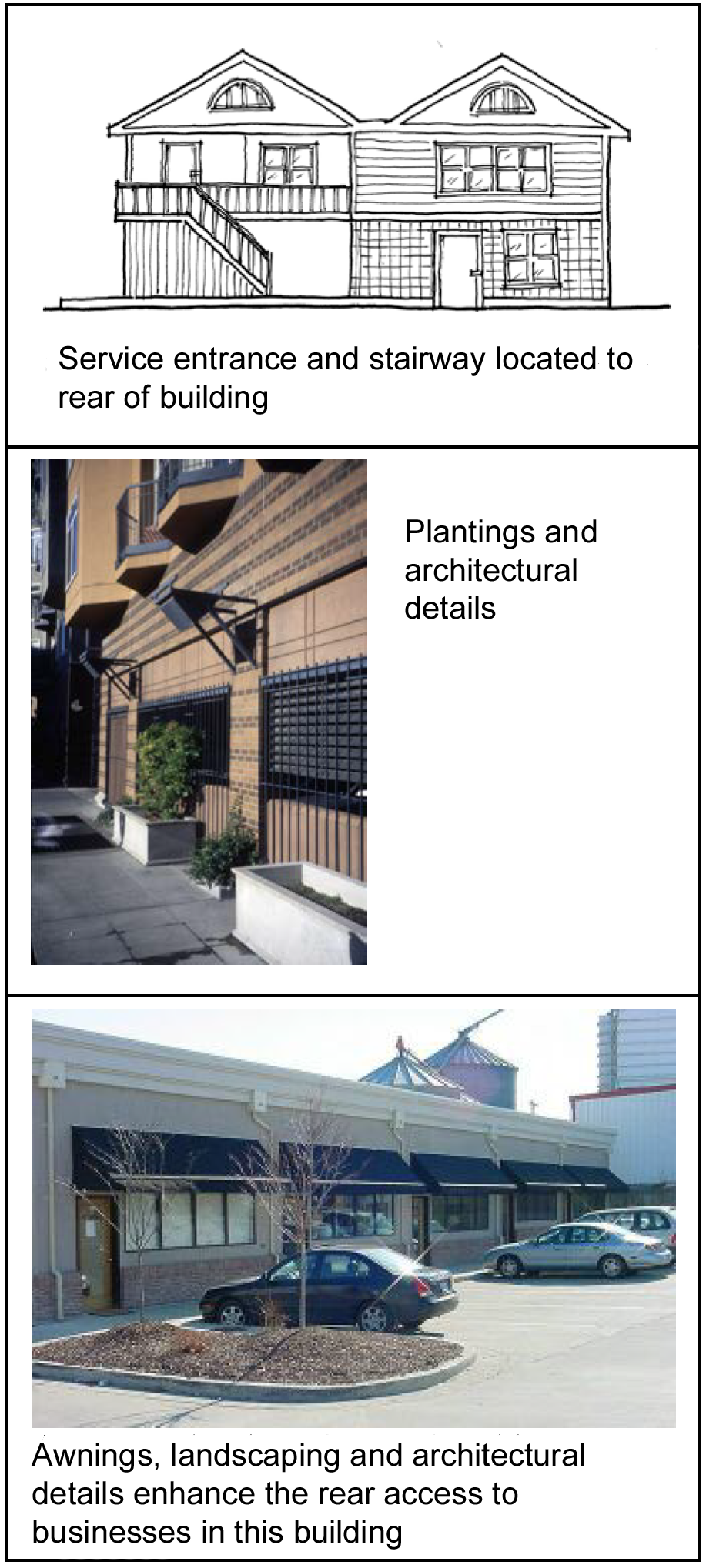
(k)
Concealing structured parking.
(1)
Intent: To integrate parking structures with the surrounding character of the downtown.
(2)
Standard:
a.
Required:
1.
Parking structures facing a street in the Town Square Neighborhood shall provide retail or other commercial uses along at least 66 percent of the linear frontage abutting a street, parking area or public open space.
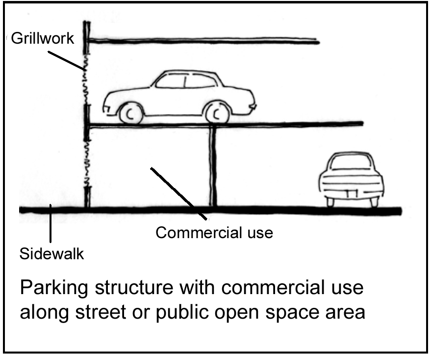
2.
Any remaining portions of the facade not devoted to retail or commercial uses shall incorporate one or more of the following devices to screen the view of parked cars:
(i)
Ornamental grillwork (plain vertical or horizontal bars are not acceptable).
(ii)
Decorative artwork, such as metal panels, murals, and mosaics.
(iii)
Display windows for use by nearby merchants or uses.
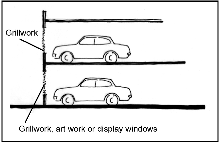
3.
Vehicular entrances shall be designed to incorporate architectural elements that frame the opening, such as an arch, lintels, pilasters, masonry trim, planters, or ornamental lighting.
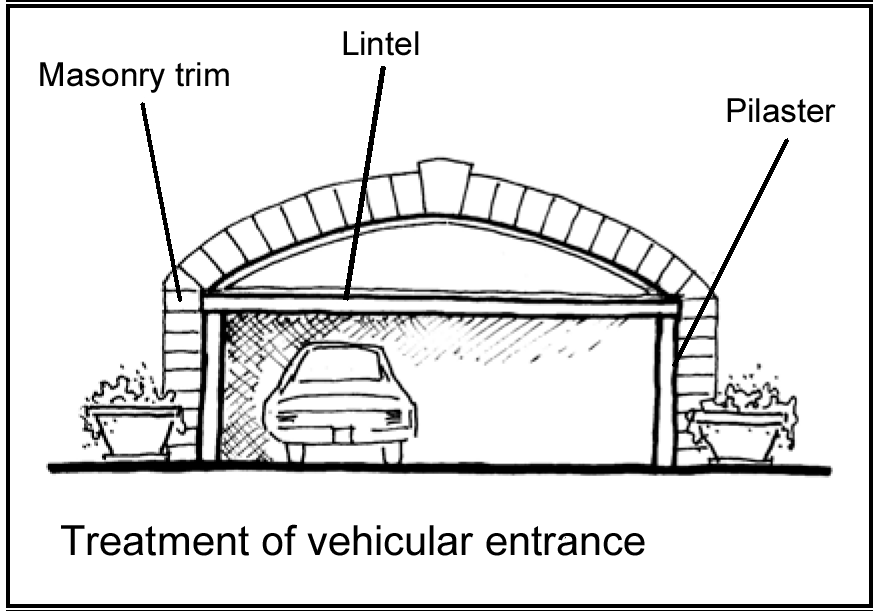
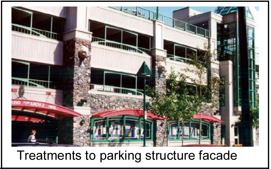
b.
Encouraged:
1.
The ground level of parking structures on all streets in other areas of the CBD as identified by the CBD Plan should be should be screened from view by retail or commercial uses to the greatest extent possible. However, where such uses are not provided, then at least two of the following shall be used to screen the parking:
(i)
Residential uses or lobbies;
(ii)
Ornamental grillwork (plain vertical or horizontal bars are not acceptable);
(iii)
Decorative artwork, such as metal panels, murals, or mosaics; and/or
(iv)
Landscape features.
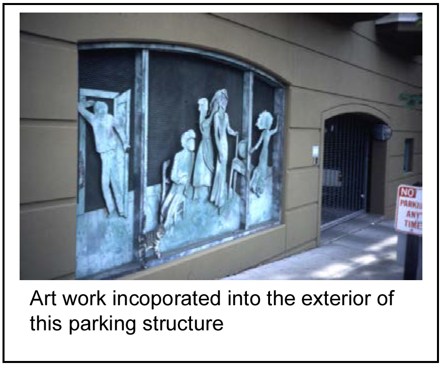
(l)
Screening blank walls.
(1)
Intent: To mitigate blank walls by providing visual interest and reinforcing the character of the downtown.
(2)
Standard; required: Walls within view from a street, sidewalk, parking area or public open space shall have windows, reveals, architectural detail, etc., as described in the building design section of the CBD Design Elements. However, if an uninterrupted expanse of blank wall (longer than 30 feet), portions of a blank facade or a building foundation is unavoidable, two or more of the following shall be used:
a.
Vegetation, such as trees, shrubs, ground cover and/or vines, adjacent to the wall surface;
b.
Artwork, mural or trellis/vine panels;
c.
Seating area with special paving and seasonal planting; and/or
d.
Architectural detailing, contrasting materials or other special interest.
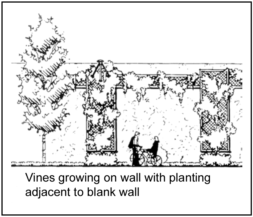
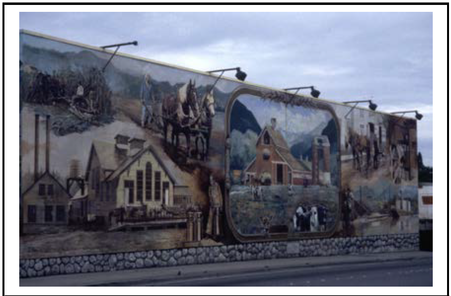
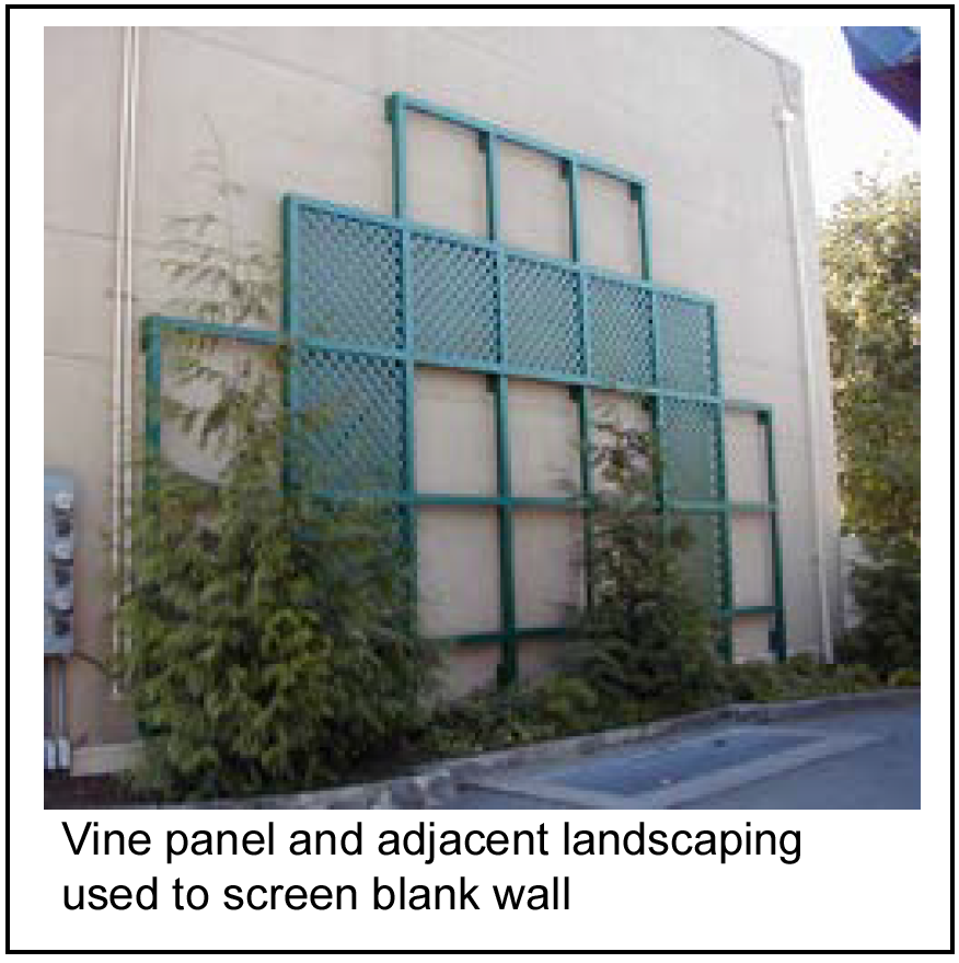
(m)
Materials.
(1)
Intent: To express the activities of the first two floors of the building and contribute to the character of the downtown.
(2)
Standard:
a.
Required:
1.
The first and second floor facades of buildings facing the street shall use materials that add variety, permanence and richness to the streetscape, limited to the following:
(i)
Brick: No larger than four inches by four inches by eight inches. The board of aldermen as part of the preliminary site plan may approve an alternative to this design standard.
(ii)
Stucco: Surface texture of Sandpebble or Quartzputz in colors as identified in the "Color" standards.
(iii)
Stone: Polished surfaces in natural color and texture of native stone in colors as identified in the "Color" standards.
(iv)
Ceramic: Tiles that are a minimum size of 12-inch by 12-inch in colors as identified in the "Color" standards. The city may permit smaller accent tiles upon review and approval.
(v)
Glass: Insulated glass panels in clear colors as identified in the "Color" standards without reflection or mirror appearance.
The board of aldermen as part of the preliminary site plan may approve an alternative to this design standard.
2.
More flexibility in the use of materials is allowed in the upper levels of building.
3.
Cast concrete, wood and metal may be used as secondary facade materials as long as the secondary materials do not comprise more than 30 percent of the facade.
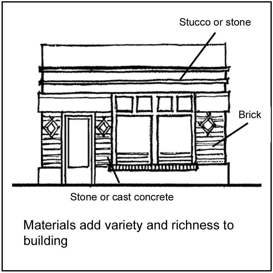
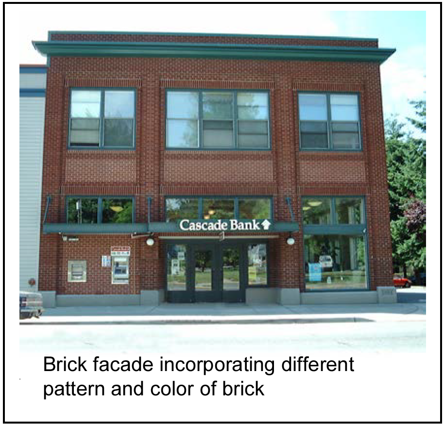
b.
Not allowed: Corrugated metal, standing seam metal and wood shake shingle roof materials are prohibited.
(n)
Colors.
(1)
Intent: To ensure that the exterior facade, trim, door and roof colors on a building or structure create a uniform appearance and are compatible with colors on surrounding properties.
(2)
Standards:
a.
Required:
1.
Limitations on color and finish:
(i)
There shall be no limitation on hues.
(ii)
Unpainted metal surfaces, where permitted, shall be permitted only as trim or accent.
(iii)
The color of overhead doors and any doors used to admit vehicles shall be a tint or tone of the hue, not a saturated color, and shall be of a value (lightness or darkness) as approved by the board of aldermen based upon hues of manmade features and the environment that are existing or approved on adjoining properties.
(iv)
Color for the body of the building shall be a tint or tone of the hue, not a saturated color, and shall be of a value as approved by the board of aldermen based upon hues of manmade features and the environment that are existing or approved on adjoining properties.
(v)
No more than one hue may be applied to the body of a building, but combinations of tints, shades, and tones of the hue shall be permitted; and additional hues may be permitted for trim and accent.
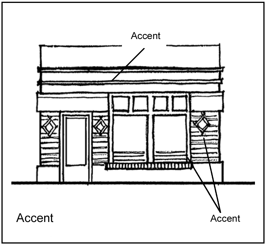
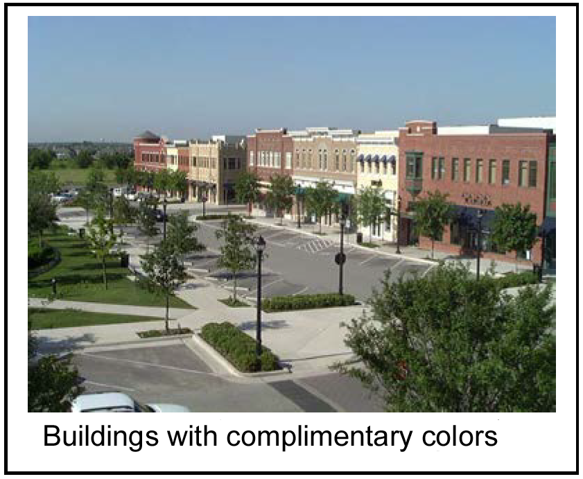
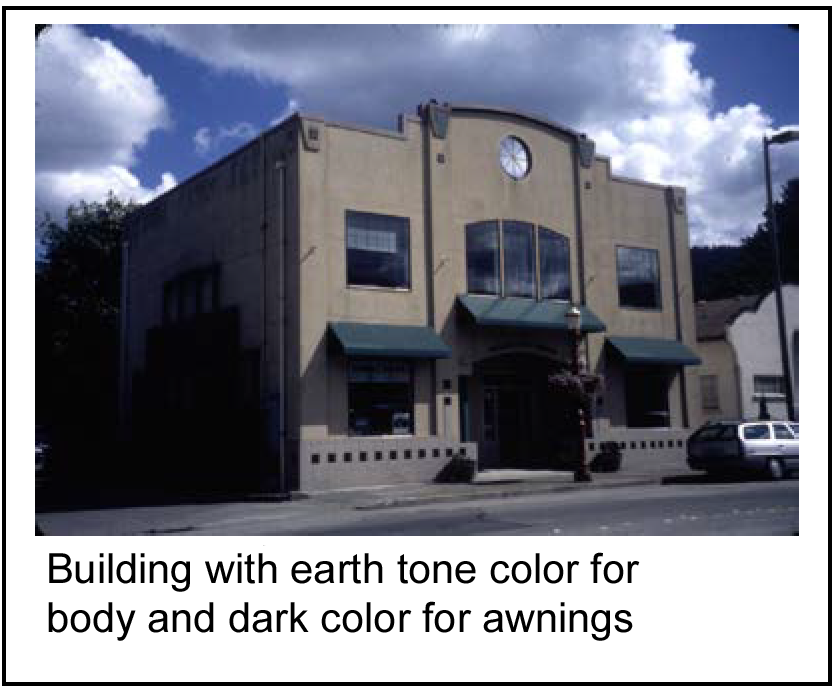
2.
A full palette of color to be used on the exterior and roof of the building shall be submitted for review and approval by the city.
3.
When a new building or building addition is proposed, a fully colored depiction prepared by a licensed architect or a graphic designer shall be submitted for review and approval by the city.
4.
Field painting is to be kept to a minimum. Factory-applied or natural color of materials is the desired appearance that will last longer without ongoing maintenance.
b.
Not allowed: Painted brick, stone, ceramic or glass is prohibited. The board of aldermen as part of the preliminary site plan may approve an alternative to this design standard.
(Comp. Ord. of 4-20-2010, § 28-5)
Sec. 50-398. - Commercial sign design standards.
(a)
Integration with architecture.
(1)
Intent: To ensure that signage is part of the overall design approach to a project and not an additive element afterthought.
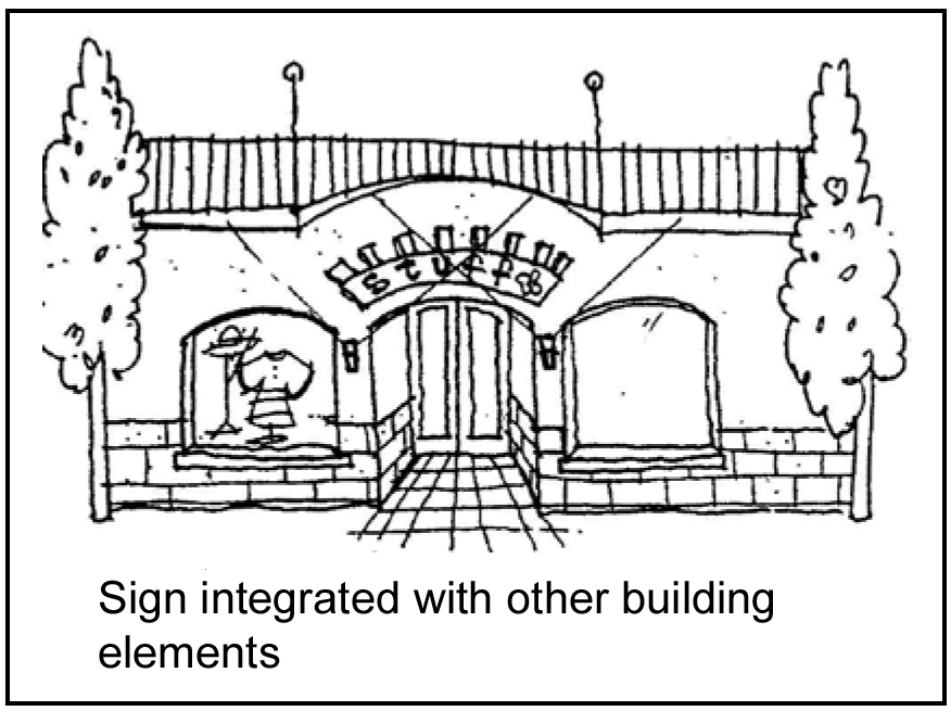
(2)
Standards; required: The design of buildings and sites shall identify locations and sizes for future signs. As tenants install signs, it is expected that such signs shall be in conformance with an overall sign plan that allows for advertising which fits with the architectural character, proportions, and details of the development.
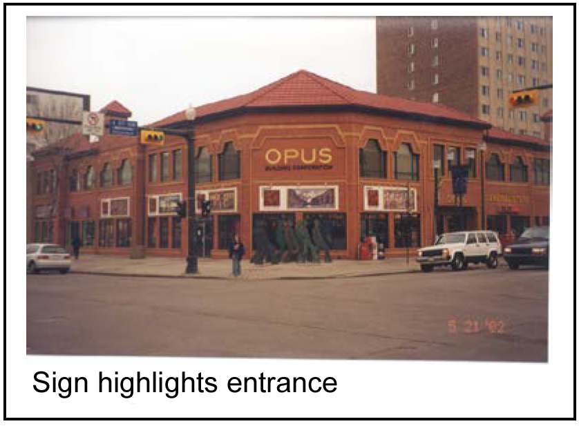
(b)
Sign design.
(1)
Intent: To ensure that signs add to the character of the building on which it is located and incorporate elements that create a unique character for the downtown.
(2)
Standard:
a.
Required:
1.
Freestanding signs shall not be permitted within the town square area. All signs in the town square area shall be mounted on buildings. These include wall signs, window signs, projecting signs located under awnings, signs painted on awning fascias, and signs suspended from canopies.
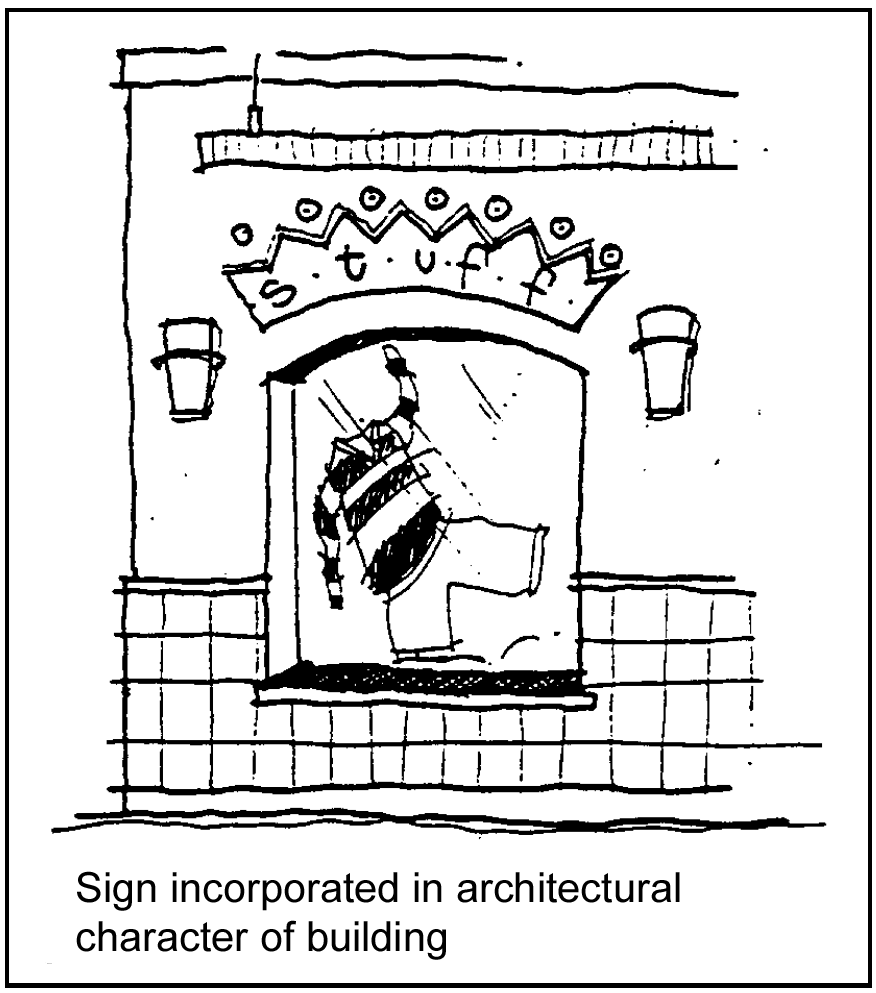
2.
Freestanding signs shall be allowed in other CBD neighborhoods subject to the provisions of the city sign regulations. The exterior materials used to support and surround all freestanding signs shall incorporate the same type and color of facade materials as the building(s) on the property.
3.
Signs where the individual letters, logos, graphics, etc. on the sign are each contained within their own cabinet (not one cabinet for multiple letters, logos, graphics, etc.) may be allowed in the town square neighborhood.
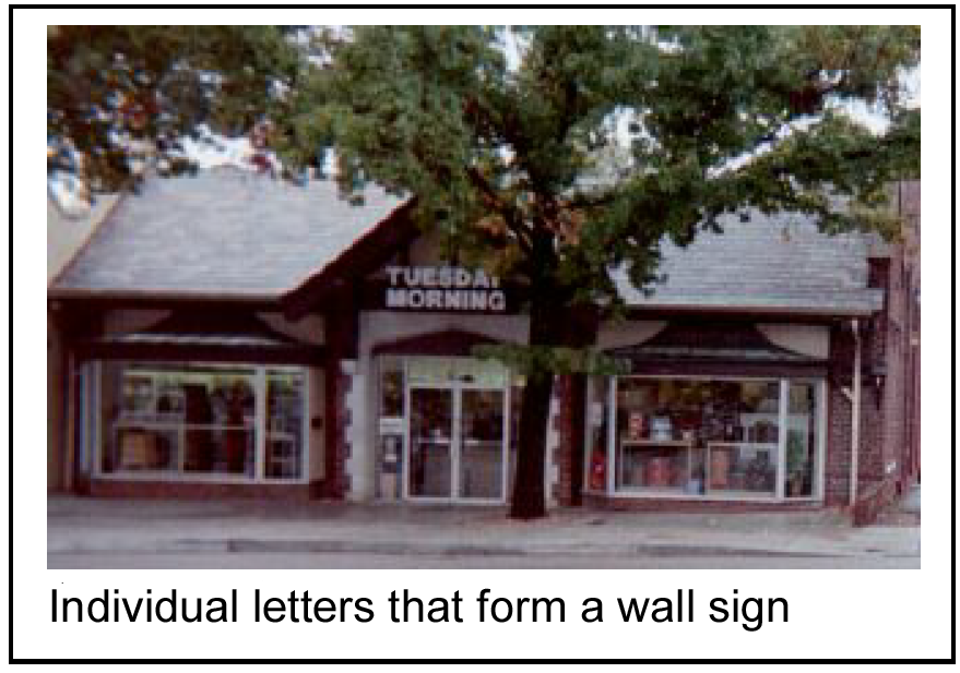
4.
Cabinet signs encompassing the entire sign shall not be allowed in the town square neighborhood unless architecturally integrated into the building facade in accordance with the integration with architecture provisions.
5.
There shall be no more than one wall or projecting sign per side on a building.
6.
Signs painted or hung on the inside of windows shall not cover more than 30 percent of the window area.
7.
The top of any wall sign, projecting sign, awning sign and any other sign mounted on the exterior of a building shall not be located higher than 15 feet from the base of the building. The board of aldermen as part of the preliminary site plan may approve an alternative to this design standard.
8.
A master sign plan depicting potential locations, color(s) and materials for signage shall be submitted for all properties or buildings containing multiple tenants or businesses.
b.
Exceptions:
1.
Where an existing building is set back from the front property line in the town square neighborhood and used for a business, there may be one monument sign that is not greater than 15 square feet in area per face, not higher than five feet above grade, and not internally illuminated.
2.
For any existing development that contains multiple buildings and multiple retail tenants, there may be one monument sign for the property. This sign shall not be greater than 25 square feet in area per face and not higher than five feet above grade.
c.
Not allowed: Projecting signs shall not be backlit.
(c)
Artistic elements.
(1)
Intent: To encourage interesting, creative and unique approaches to the design of signs.
(2)
Standards:
a.
Encouraged:
1.
Signs should be highly graphic in form, expressive and individualized.
2.
Signs should convey the product or service offered by the business in a bold, graphic form.
3.
Projecting signs supported by ornamental brackets and oriented to pedestrians are strongly encouraged.
4.
In addition to signs permitted by the sign code, any business may be allowed to have one additional sign, provided that it meets the following criteria:
(i)
It is principally a two-dimensional or three-dimensional graphic symbol denoting what is offered by the business;
(ii)
It is oriented to pedestrians, rather than people in vehicles; and
(iii)
It is no more than 12 square feet in area per side.
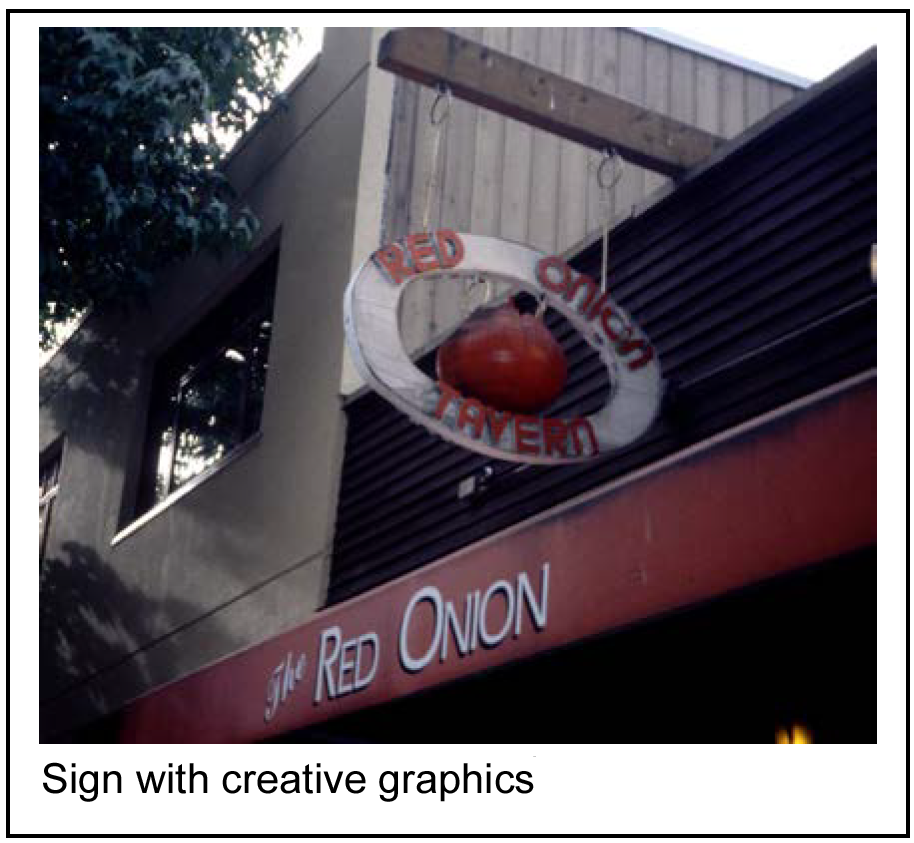
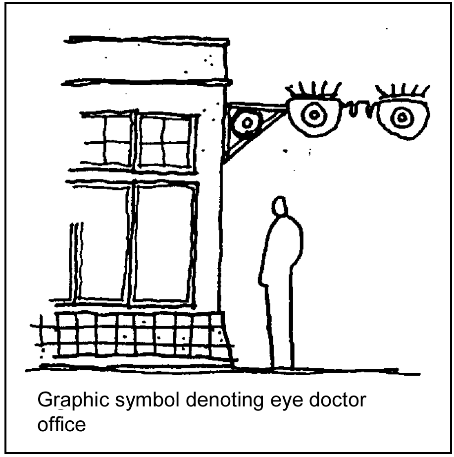
b.
Not allowed:
1.
Internally illuminated boxes with formed or painted lettering are not permitted.
2.
Neon may be used in an artful way in signs; however, simply outlining the roof, sign letters or building in neon tubing shall not be allowed.
(Comp. Ord. of 4-20-2010, § 28-6)
Sec. 50-399. - Residential site design standards.
The following are design elements for residential development and redevelopment.
(1)
Front yard; treatment.
a.
Intent: To provide a feeling of separation between buildings and the public pedestrian realm so that front yards function as usable outdoor spaces.
b.
Standards:
1.
Required:
(i)
In new development and redevelopment front yards, including two side property lines and the street line, shall include at least two of the following transitional elements. Any transitional element over two feet high must be 80 percent transparent.
A.
Steps;
B.
Low fences, no more than three feet high;
C.
Trellises;
D.
Site furnishings;
E.
Low hedges, no more than three feet high;
F.
Landscaped borders; and/or
G.
Low walls, no more than two feet high, of decorative concrete, masonry or other similar material.
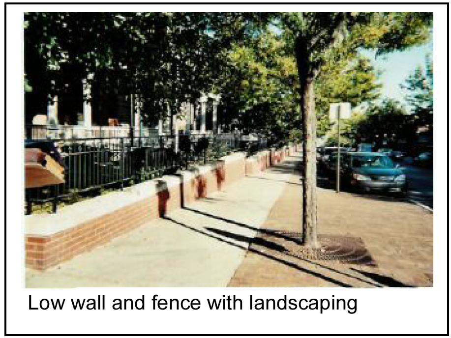
(ii)
Front yards shall include at least one of the following entrance elements between the sidewalk and the building:
A.
Gateways;
B.
Archways;
C.
Canopy;
D.
Arbor or trellis;
E.
Variety of paving materials; or
F.
Pedestrian lighting.
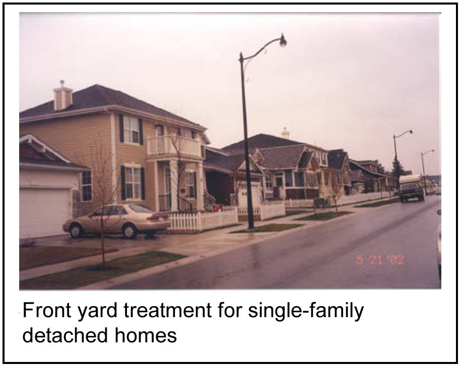
(iii)
Fencing shall be constructed of durable, weather-resistant and vandal resistant materials.
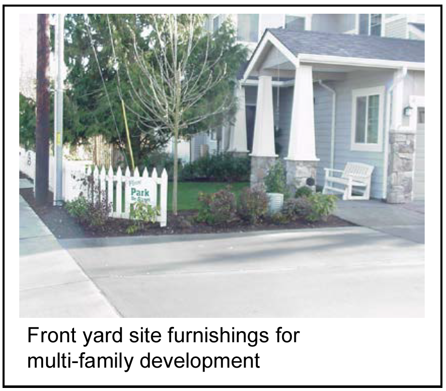
2.
Encouraged:
(i)
Hedges and fences are encouraged to be a maximum of two feet high.
(ii)
Existing residential single and multi-family residences are encouraged to incorporate standards of subsections (1)b.1(i)—(iii) of this section.
3.
Not allowed:
(i)
Transitional elements and entrance elements shall not interfere with the vision triangle as specified in this chapter at intersections or driveways.
(ii)
Chain link and other wire fences shall not be allowed.
(2)
Entries facing the street.
a.
Intent: To provide a clearly defined, welcoming, and safe entry for pedestrians to multifamily dwellings, from the sidewalk into the building.
b.
Standards:
1.
Required:
(i)
Architectural elements shall be used to provide a clearly identifiable and defensible entry* visible from the street.
(ii)
Developments shall include at least two of the following architectural elements:
A.
Recesses;
B.
Balconies;
C.
Articulated roof forms;
D.
Front porches with a depth of at least eight feet;
E.
Arches; and/or
F.
Glass at sides and/or above entry doors.
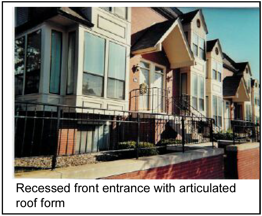
(iii)
Developments shall include at least one of the following site furnishings:
A.
Trellis;
B.
Awning;
C.
Canopy; or
D.
Bench with a back
(iv)
Pedestrian scale lighting and/or lighted bollards shall be provided.
(v)
Primary building entries shall face the street. If the doorway does not face the street, a clearly marked and well-maintained path shall connect the entry to the sidewalk.
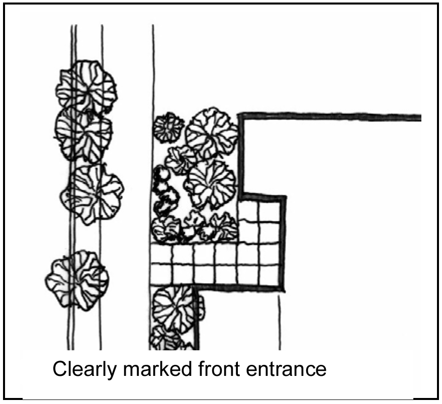
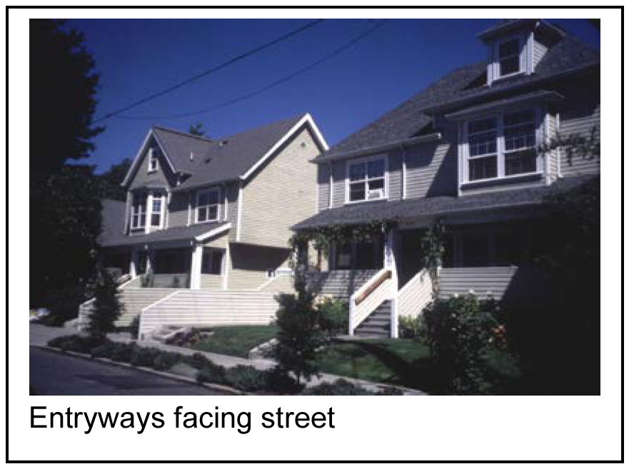
Defensible entry is an industry-specific term that addresses the ability of a person to anticipate a path of travel, its obstructions, and points of vulnerability before moving through the space.
(3)
Private outdoor space.
a.
Intent: To provide private outdoor spaces that encourages a sense of ownership by residents.
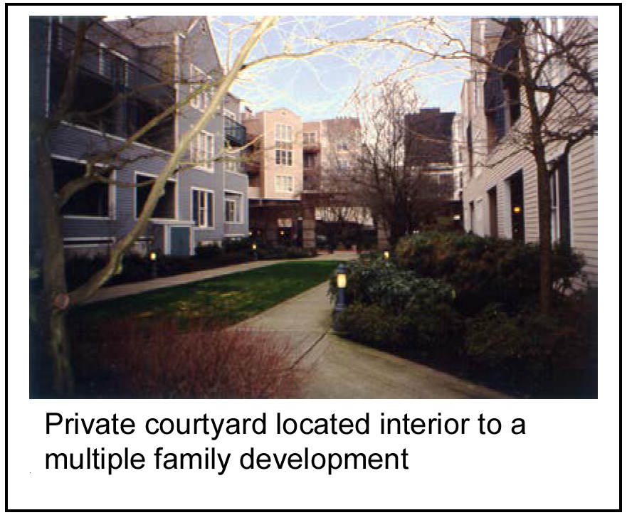
b.
Standards:
1.
Required: Apply defensible space and clear entryway principles for multi-family dwellings.
2.
Encouraged:
(1)
Low walls or partial walls, fences, hedges and landscaping in side and back yards may be used to define and/or visually shield outdoor spaces such as yards, decks, terraces, and patios from each other and from the street.
*Defensible space is clearly associated with an individual dwelling unit and controlled by its occupants, but which the public may view.
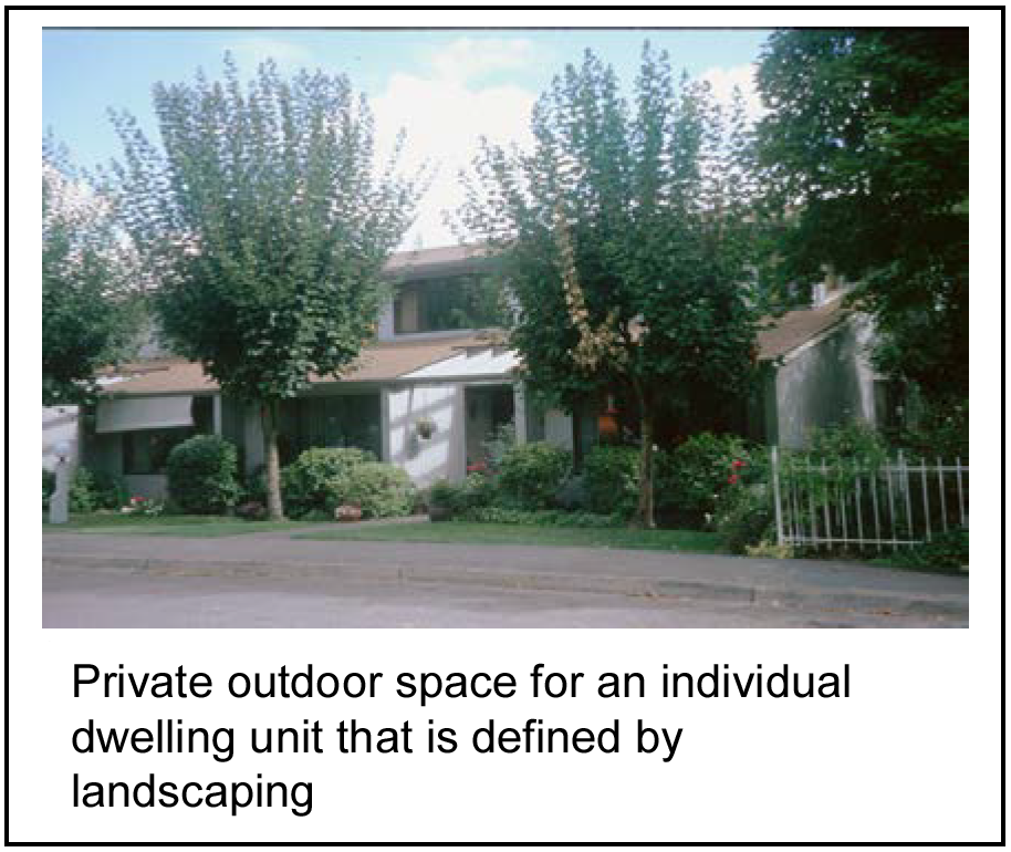
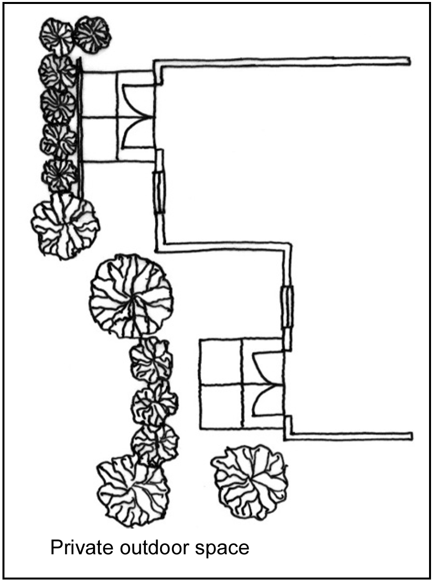
(4)
Site landscape areas.
a.
Intent: To reinforce the character of the downtown area and the surrounding natural environment through site landscaping.
b.
Standards:
1.
Required:
(i)
All areas not devoted to landscape required by these CBD Design Elements, this chapter, parking regulations, structures or other site improvements shall be planted, or remain in existing native, non-invasive vegetation including drought-tolerant grass.
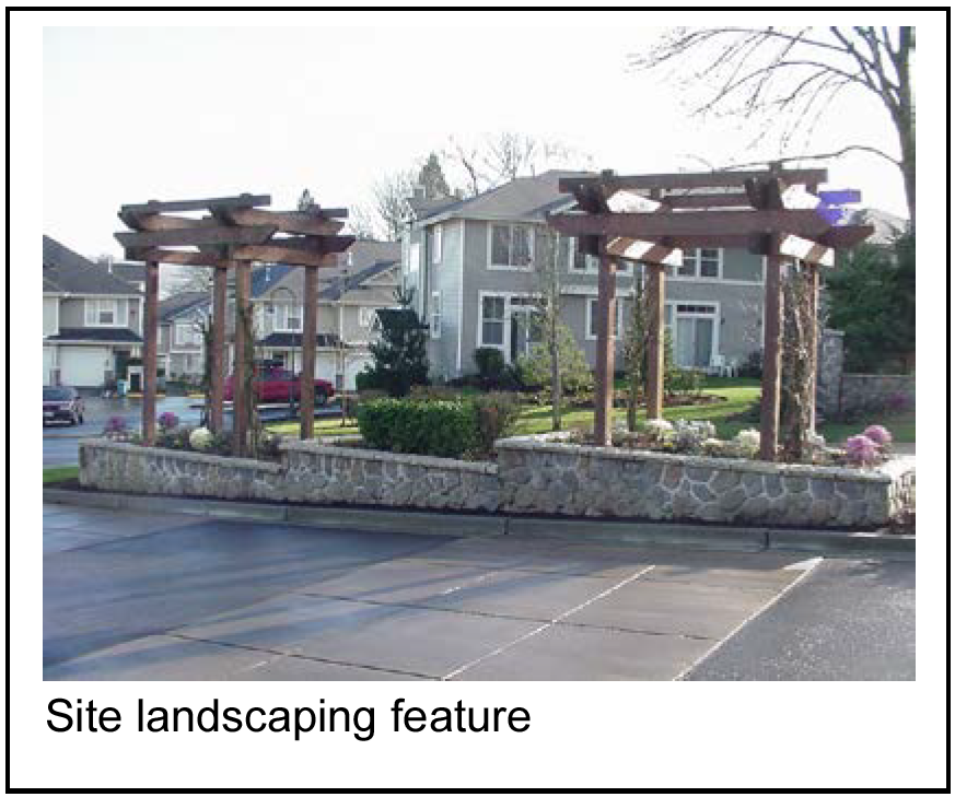
(ii)
A minimum 20 percent of plant varieties shall provide year-round color, texture and/or other special interest.
2.
Encouraged:
(i)
Use of native plants is encouraged where opportunity allows reinforcing Raytown's unique natural setting. Minimum 20 percent of all landscape areas should include native drought-tolerant plant types.
(ii)
Perennials and/or annuals are encouraged to provide special interest and highlight pedestrian areas such as building and/or site entrances, public open space, plazas and major pedestrian connections.
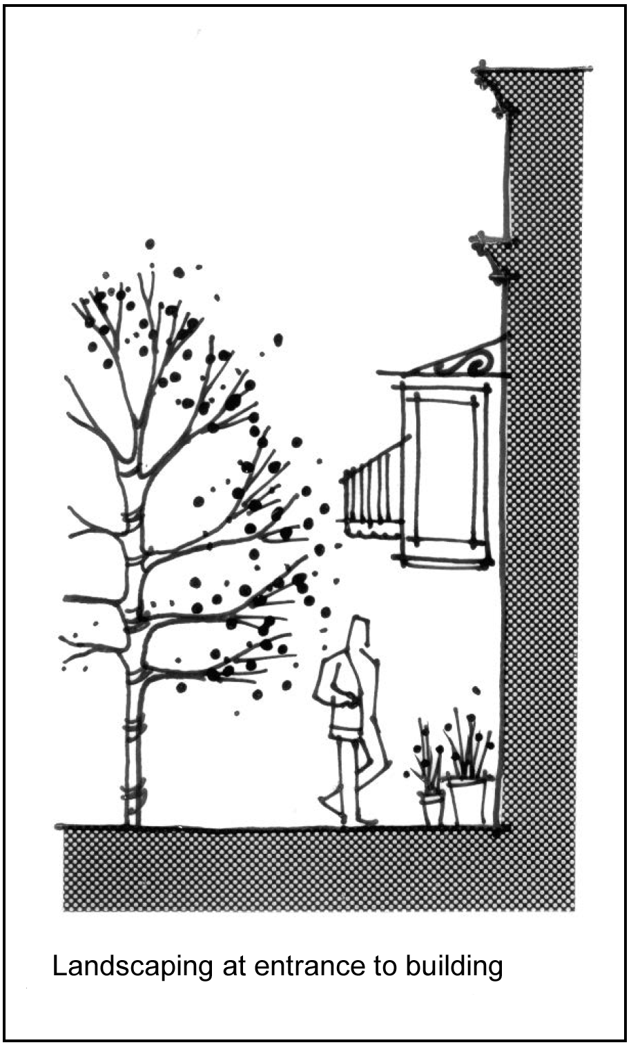
(5)
Location of parking facilities.
a.
Intent: To maintain a contiguous, active pedestrian street front along streets by locating parking facilities behind buildings.
b.
Standards:
1.
Required:
(i)
Garages and covered parking structures shall be constructed of similar materials and have similar architectural character as the principle building(s) on the property.
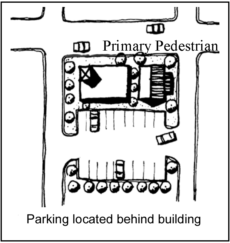
(ii)
New development and redevelopment. Parking facilities shall be located behind buildings. The board of aldermen as part of the preliminary site plan may approve an alternative to this design standard.
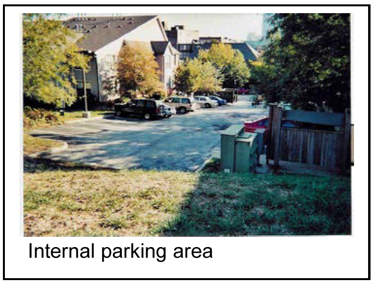
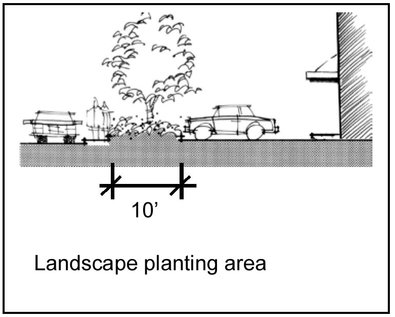
(iii)
Where an alternative to this design standard is approved and parking facilities are allowed to remain in front of or beside buildings, parking facilities shall provide a ten-foot wide planting area between the parking lot and street right-of-way to include:
A.
A year-round sight barrier;
B.
Evergreen shrubs;
C.
Evergreen ground cover; and
D.
Shrub material maintained at a maximum height of three feet for visibility.
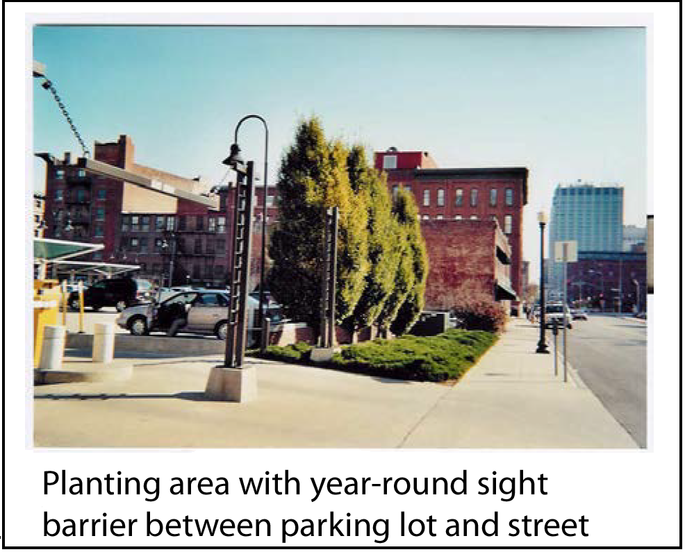
(iv)
All parking facilities (new development and redevelopment) shall comply with the parking lot standards set forth in this chapter including, but not limited to interior landscape areas, wheel stops, plant material requirements, and number of stalls.
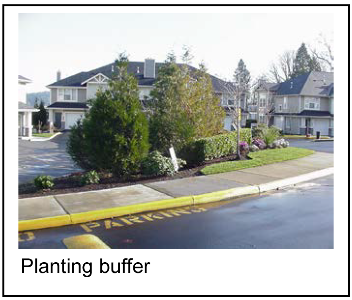
(v)
The board of aldermen by ordinance must approve any gated parking facilities or gated portions as part of a preliminary site plan.
2.
Encouraged:
(i)
Garages, rather than covered parking structures with open sides, are encouraged.
(ii)
Rocks, pebbles, sand and similar non-living materials may be allowed as accent features within landscape planting areas so long as the area covered by such features does not exceed five percent of the total landscape planting area at five years growth.
3.
Not allowed:
(i)
Rocks, pebbles, sand and similar non-living materials may not be used as ground cover substitutes, but may be allowed as accent features within landscape planting areas so long as the area covered by such features does not exceed 25 percent of the total landscape planting area at five years growth.
(ii)
Carports or other covered parking structures shall not be constructed of metal or PVC poles or have metal roofing materials.
(6)
Location of driveways.
a.
Intent: To maintain a contiguous, uninterrupted sidewalk by minimizing, consolidating and/or eliminating driveway access off primary pedestrian streets.
b.
Standards:
1.
Required:
(i)
All vehicular driveways shall be located off side streets and alleys unless:
A.
The only means of access to the site is from a primary pedestrian street;
B.
The development is located at the corner of two primary pedestrian streets;
C.
The driveway is consolidated (shared) between adjacent developments; or
D.
The property cannot otherwise be accessed from a side street, alley or shared drive.
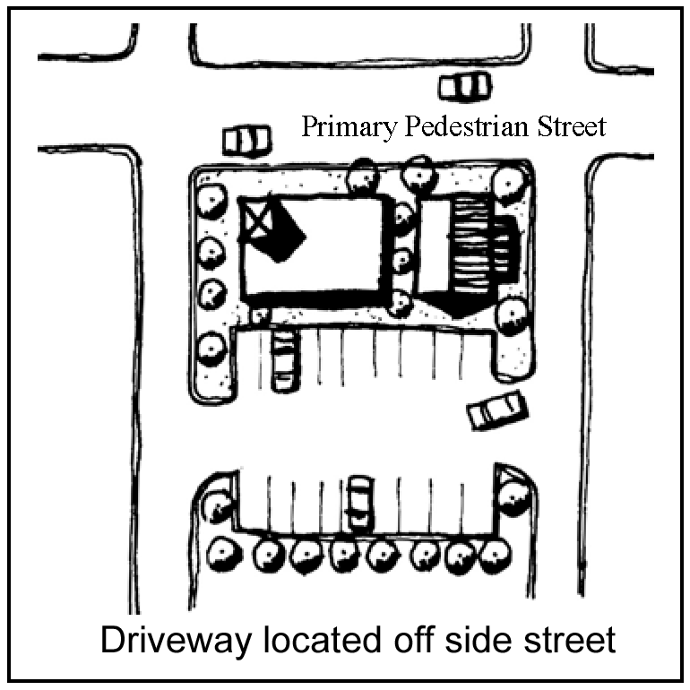
(ii)
Where a driveway is allowed on primary pedestrian streets, driveway entrances shall:
A.
Include an identifying feature, such as a trellis, monument, low wall/column or special landscape treatment; and
B.
Sidewalk-paving material/treatment shall be extended across the driveway entrance.
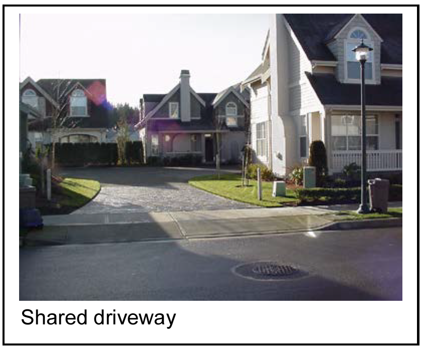
(iii)
Adjacent developments shall consolidate (share) vehicular driveways where feasible regardless of the type of street on which the driveway is located.
(iv)
Apply defensible space and clear entryway principles for pedestrian access from driveways and parking areas to the development.
(v)
If used for identifying features in subsection (6)b.1(ii)A of this section, the combination of walls and shrubs/ground cover shall not exceed a maximum height of four feet, unless all of the following are provided:
A.
Wall/landscape treatment does not create a safety hazard;
B.
Any portion of a wall/landscape treatment that is above four feet in height is a minimum 75 percent transparent (i.e., see-through metal railing, trellis, or other similar treatment); and
C.
Any portion of a wall/landscape treatment that is above four feet in height provides added visual interest, detail and character.
2.
Encouraged:
(i)
The width of the driveway shall be of sufficient width to allow two vehicles to safely and easily pass and shall be designed in accordance with the City of Raytown Permitting, Development Design Criteria and Technical Specifications Manual.
(ii)
Entrance drives shall provide a throat length that allows for efficient ingress and egress free from parking spaces backing into the drive.
3.
Not allowed: No additions required in the location of driveways standards will be permitted to block vehicular or pedestrian sightlines.
(7)
Parking lot landscape.
a.
Intent: To reduce the visual impact of parking lots through landscape areas, trellises and/or other architectural features.
b.
Standards:
1.
Required:
(i)
Parking lot landscape shall be used to reinforce pedestrian and vehicular circulation, such as:
A.
Parking lot entrances;
B.
Ends of driving aisles; and
C.
To define pedestrian connections through parking lots.
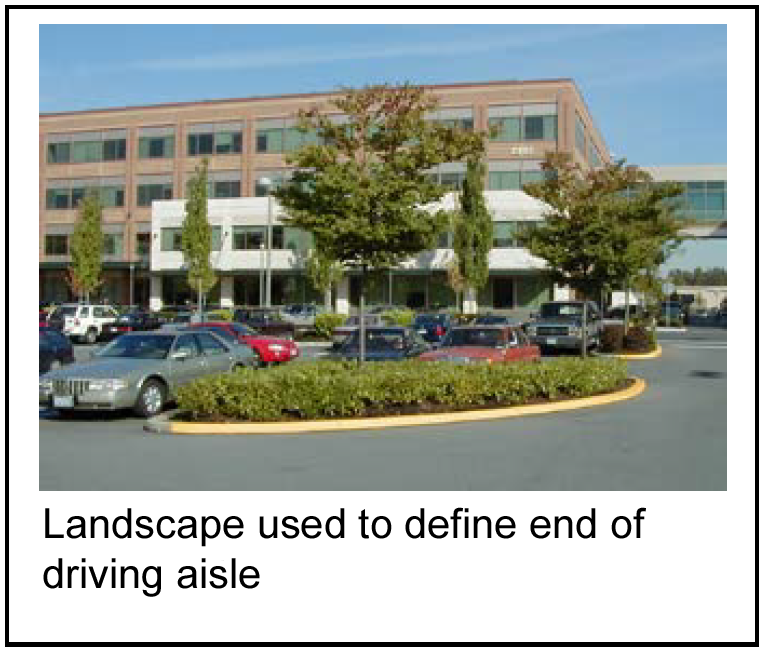
(ii)
Low walls (minimum three-feet high) used to screen parking lots shall be made of decorative concrete, masonry or other similar material. Where walls and/or fences are provided, landscape-planting areas may be reduced to a minimum five feet and shall be located adjacent to the public right-of-way.
(iii)
The combination of walls, fences and shrubs/ground cover shall not exceed a maximum height of four feet, unless all of the following are provided:
A.
Wall/fence/landscape treatment does not create a safety hazard;
B.
Portion of wall/fence/landscape treatment that is above four feet in height is a minimum 75 percent transparent (i.e., see-through metal railing, trellis, or other similar treatment); and
C.
Portion of wall/fence/landscape treatment that is above four feet in height provides added visual interest, detail and character suitable to the nature of the downtown area.
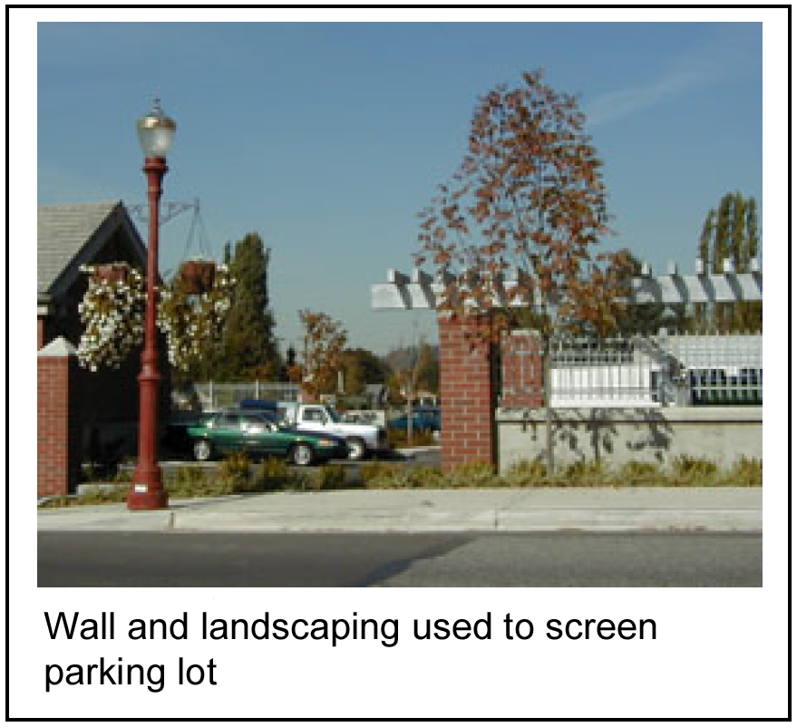
(iv)
For any wall or fence above six feet total height, the entire wall/fence facade shall comply with the building design standards set forth in the CBD Design Elements for ground level details, materials, color, etc.
(v)
A minimum five-foot wide landscape planting area shall be provided between parking lots and adjacent developments to include a year-round sight barrier and meeting the requirements for parking lot landscape provided in this chapter.
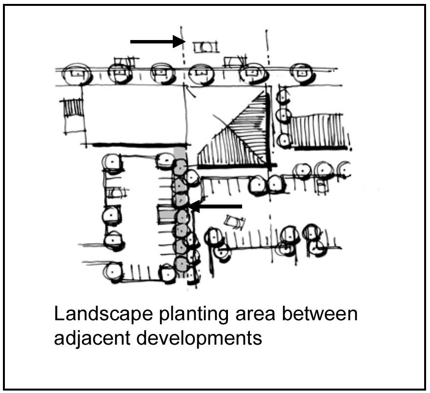
2.
Not allowed:
(i)
Signage on parking lot walls or fences facing the street shall not be permitted.
(ii)
Chain link and other wire fencing shall not be allowed to screen parking lots.
(8)
Parking facility lighting.
a.
Intent: To provide way-finding lighting to define pedestrian areas and promote public safety.
b.
Standards:
1.
Required:
(i)
Lighting located within parking facilities shall be between 15 and 20 feet in height except where the lighting is intended to be used for pedestrian purposes as indicated in subsection (8)b.2(i) of this section.
(ii)
In addition to parking facility lighting, pedestrian scale lighting shall be a maximum 14 feet in height.
(iii)
Pedestrian scale lighting and/or bollard lighting shall be used to further define pedestrian walkways, crosswalks, connections to public right-of-way and/or other pedestrian areas within or besides parking facilities.
(iv)
All lighting (parking lot and pedestrian scale) shall be shielded from the sky and adjacent properties and structures, either through exterior shields or through optics within the fixture. No light projection should extend higher than horizontal from the light fixture.
(v)
All lighting (parking facility and pedestrian scale) shall reinforce the character of the downtown area and should complement other light fixtures through color, style and/or other architectural features of adjacent developments.
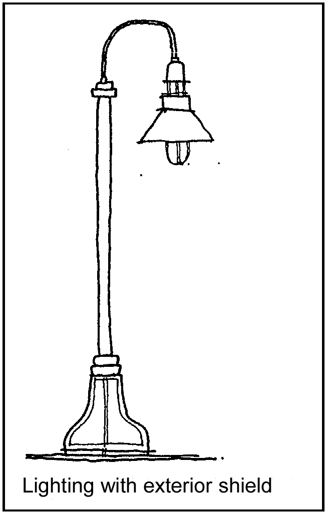
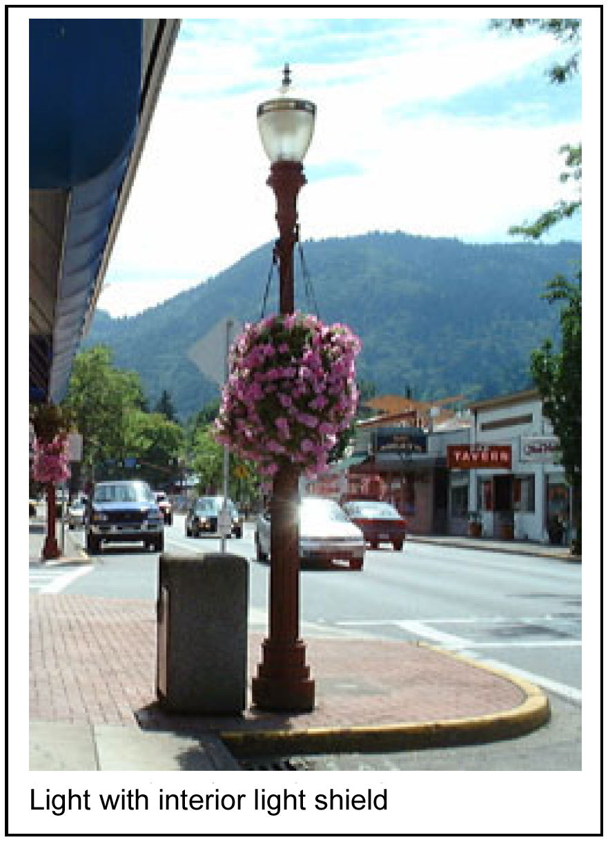
2.
Encouraged:
(i)
Accent lighting should be used for pedestrian safety and to highlight special focal points, building/site entrances, public art and special landscape features.
(ii)
Festival lighting is encouraged during holidays and festivals to reinforce the character and image of the downtown area.
3.
Not allowed: Permanent spotlights, lasers or other types of nuisance lighting is not allowed.
(9)
Courtyards, plazas and open space.
a.
Intent: To reinforce the pedestrian nature of the downtown area by creating usable open space for pedestrians.
b.
Standard:
1.
Required:
(i)
Where provided, pedestrian spaces shall be visible and accessible to the public.
(ii)
Plazas, courtyards, green spaces and other pedestrian areas shall include landscaping and pedestrian scale lighting.
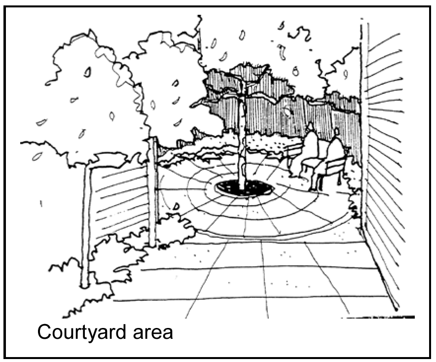
2.
Encouraged:
(i)
If plazas, courtyards, green spaces and other pedestrian areas are provided, they should include public art, benches with backs, low seating walls, or other pedestrian amenities and site furnishings.
(ii)
Use of brick, paver bricks, stone, concrete colored throughout or other special paving material should be provided to reinforce the character of downtown Raytown and create a more pedestrian-friendly area.
(iii)
Plazas, courtyards, green spaces and other pedestrian areas should be provided within each block in the Town Square Neighborhood and no further than one-quarter mile apart in all other CBD neighborhoods.
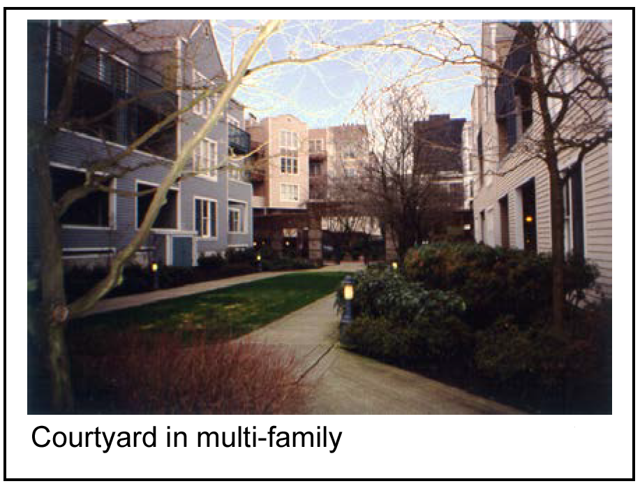
(10)
Pedestrian connections.
a.
Intent: To create a network of linkages for pedestrians, including locating building entrances in closer proximity to sidewalks than in other areas of the city.
b.
Standards:
1.
Required:
(i)
Clearly defined pedestrian connections shall be provided;
(ii)
Between a public right-of-way and building entrances when buildings are not located directly adjacent to the sidewalk; and
(iii)
Between parking lots and building entrances;
(iv)
Pedestrian connections shall be separated from vehicular traffic in a combination of two or more of the following ways:
A.
A six inch vertical curb, except where walkways cross vehicular travel lanes where sidewalk ramps are necessary;
B.
A trellis, railing, bollard, special paving, low seat wall and/or other architectural features;
C.
A continuous landscape area that is a minimum six feet wide on at least one side of the walkway, except where walkways cross vehicular travel lanes; and/or
D.
Where a walkway abuts a driving aisle within a parking area, a minimum six-foot wide landscape area shall be provided between the walkway and the driving aisle.
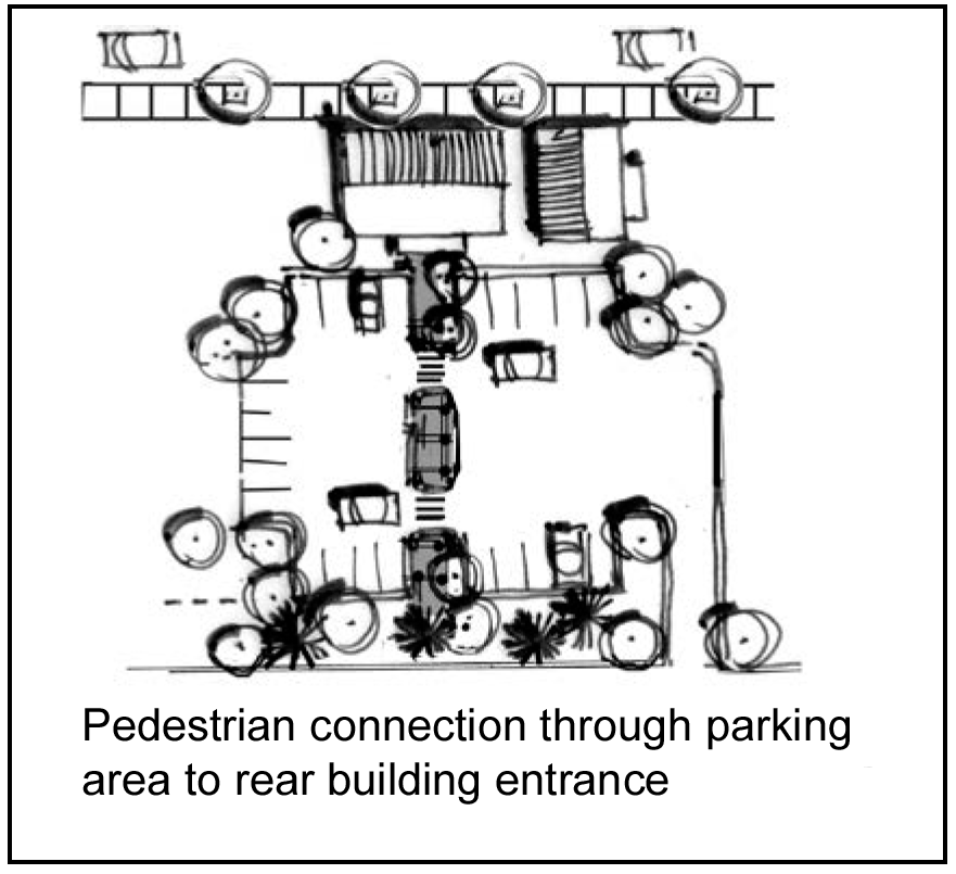
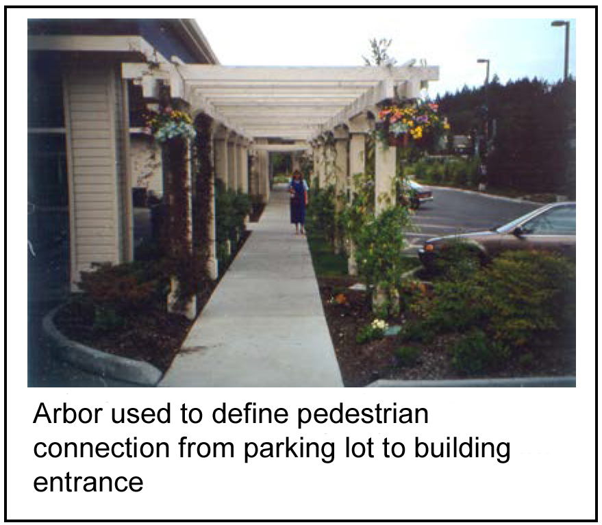
(v)
Where walkways abut a public right-of-way, a minimum six-foot wide landscape area shall be provided between the walkway and the public right-of-way.
(vi)
Pedestrian connections shall be reinforced with pedestrian scale lighting (maximum 14 inch height), bollard lighting, accent lighting or a combination thereof to aid in pedestrians way-finding.
(vii)
Pedestrian connections that cross driveways or other vehicular or bicycle access shall be marked by using continuous sidewalk material consisting of either brick, paver bricks, stone or concrete that is stamped and colored throughout.
(viii)
Pedestrian connections shall:
A.
Include clear sight lines to building entrances;
B.
Be not less than five feet wide;
C.
Connect to adjacent walkways; and
D.
Be of the same color, texture and treatment as adjacent walkways.
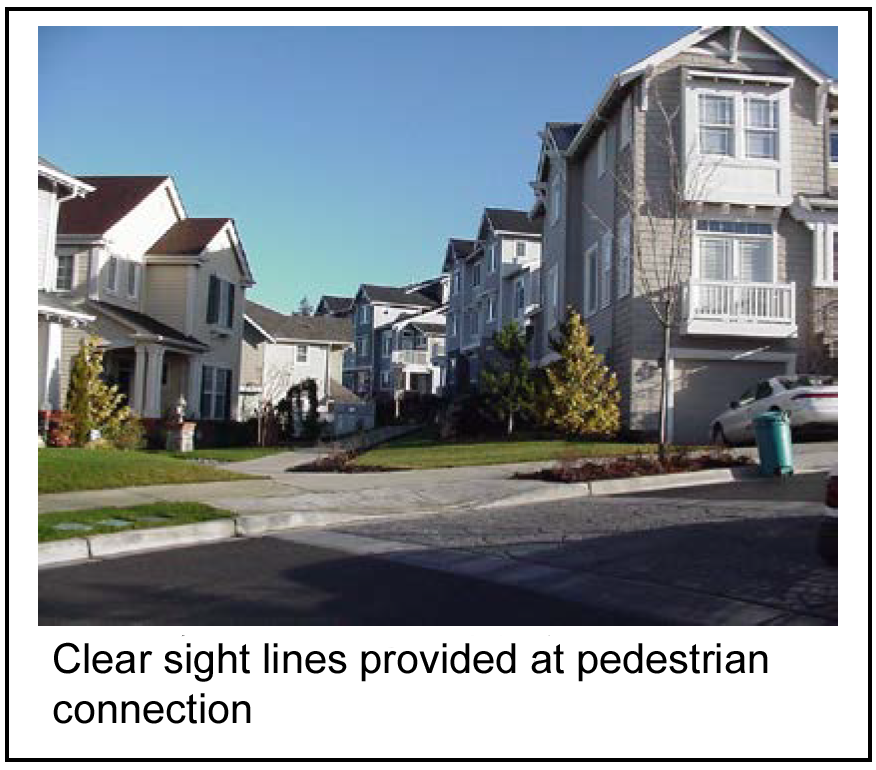
(ix)
Landscaping shall consist of drought-tolerant plantings such as evergreens, deciduous trees and shrubs, and decorative grasses. A minimum 20 percent of plant varieties shall provide year-round color, texture and/or other special interest. Shrubs shall be maintained at a maximum three-foot height for visibility.
2.
Encouraged:
(i)
Pedestrian connections other than along public rights-of-way should occur between adjacent developments where feasible.
(ii)
Ground cover should be evergreen varieties.
(iii)
Perennials and/or annuals are encouraged to provide special interest and highlight pedestrian areas such as building and/or site entrances, public open space, plazas and major pedestrian connections.
(iv)
Rocks, pebbles, sand and similar non-living materials may be allowed as accent features within landscape planting areas so long as the area covered by such features does not exceed five percent of the total landscape planting area.
3.
Not allowed:
(i)
Chain link and other wire fencing shall not be used.
(ii)
Rocks, pebbles, sand and similar non-living materials may not be used as ground cover substitutes, but may be used as accent features provided such features do not exceed a maximum 25 percent of the total landscape area.
(Comp. Ord. of 4-20-2010, § 28-7)
Sec. 50-400. - Residential building design standards.
(a)
Bulk of buildings.
(1)
Intent: To reduce the apparent bulk of buildings by breaking them down into smaller components that is visually consistent with a pedestrian scale:
(2)
Standards; required:
a.
Walls facing streets shall be modulated with bays and recesses at least eight feet wide and no more than 25 feet wide and at least three feet deep.
b.
Modulation shall extend to the roof, except at balconies. The purpose is not to create a regular rigid solution but rather to break up the mass in creative ways.
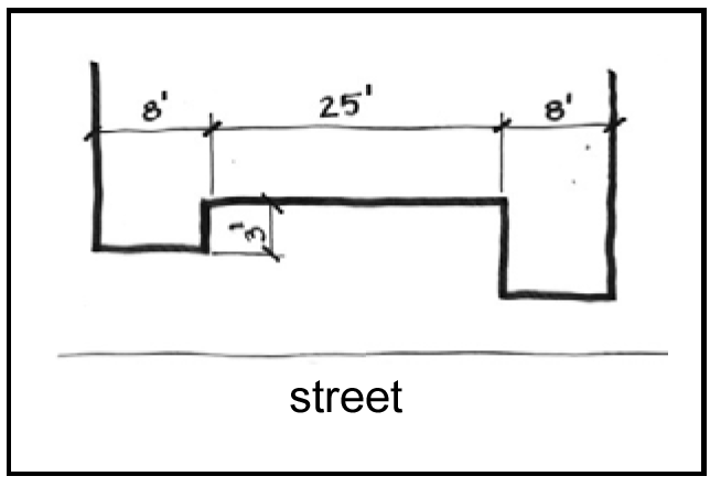
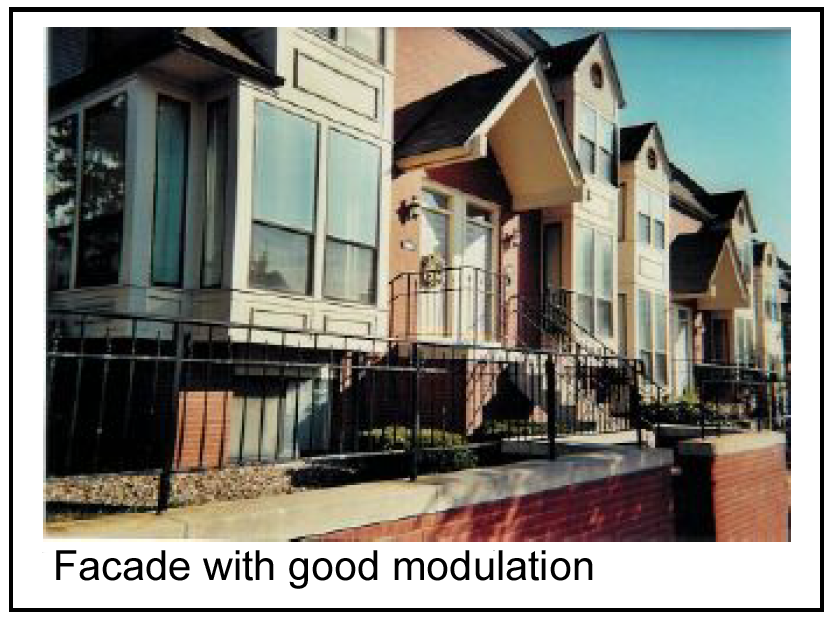
(b)
Articulation and overall massing of buildings.
(1)
Intent: To provide visual variety along the street.
(2)
Standards:
a.
Required:
1.
Buildings shall include articulation along the facades facing and visible from public rights-of-way. Flat blank walls are discouraged.
2.
Horizontal facades longer than 25 feet shall be articulated into smaller units, reminiscent of the residential scale of the neighborhood. At least two of the following methods shall be included:
(i)
Distinctive roof forms;
(ii)
Changes in materials;
(iii)
Window patterns; and/or
(iv)
Color differentiation
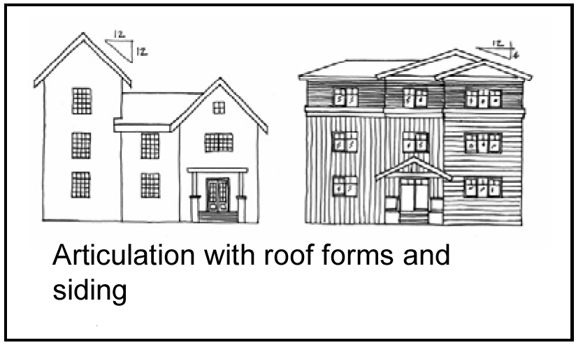
b.
Encouraged: Additions or alterations to existing buildings with unique architectural interest should be made sensitively and in keeping with the buildings' original architectural style.
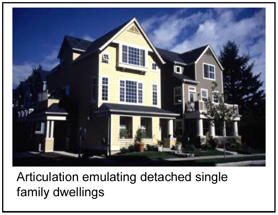
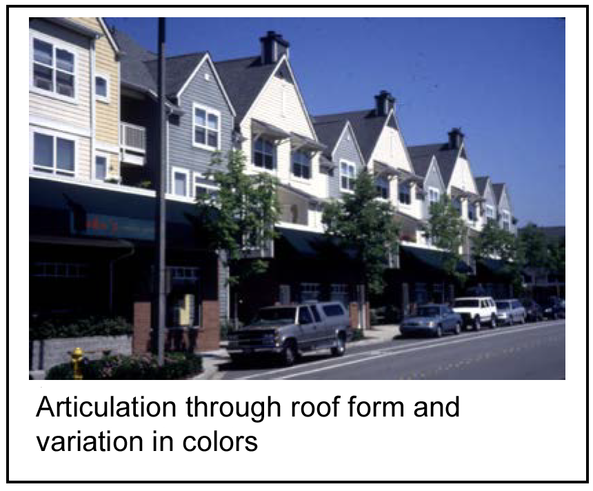
(c)
Upper level step backs.
(1)
Intent: To enhance views of the surrounding area and to increase sunlight penetration to the public sidewalk.
(2)
Standards:
a.
Required: Multi-story buildings shall include step backs a minimum of four feet deep above the second level. Step backs shall be provided at every two floors minimum.
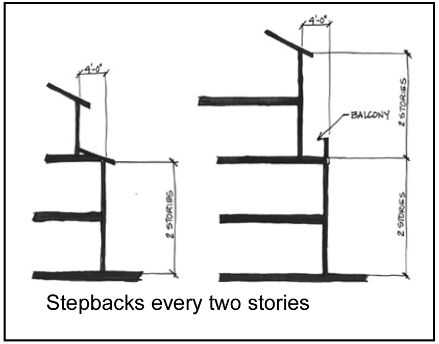
b.
Encouraged: Balconies may extend into the step back.
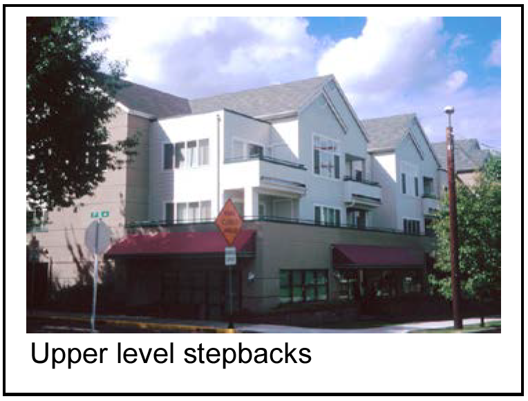
c.
Not required: Upper level step backs are not required within 25 feet of street intersections, measured from the property line.
(d)
Addressing the corner.
(1)
Intent: To provide a reference point at the end of a block of facades and to mark intersections, further providing visual interest to the street fabric.
(2)
Standards; required: Developments at street intersections shall emphasize this unique site aspect with two or more of the following methods:
a.
Placement of the primary entry;
b.
Articulation;
c.
Towers;
d.
Plazas;
e.
Distinctive roof forms;
f.
Other architectural features; and/or
g.
Landscaping.
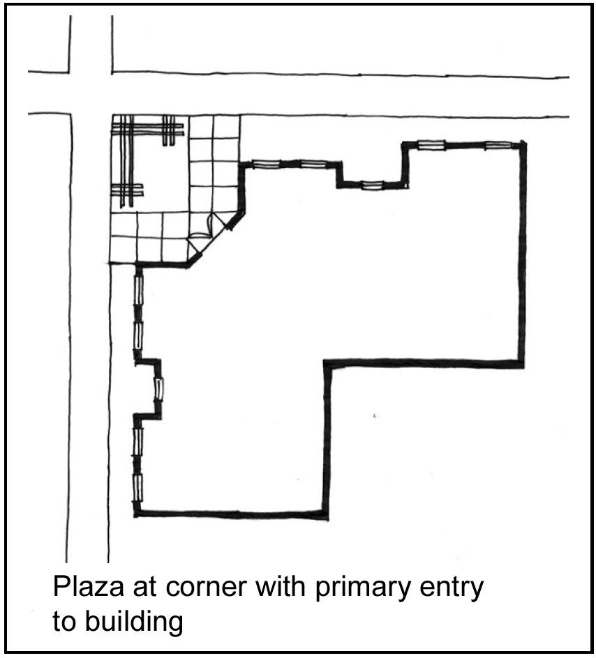
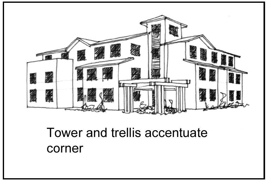
(e)
Pitched roof forms.
(1)
Intent: To maintain and enhance the image and character of the Raytown CBD and its residential neighborhoods.
(2)
Standards:
a.
Required:
1.
All structures shall incorporate pitched roof forms having slopes between 4:12 and 12:12, except that structures located in the town square neighborhood, may have a flat roof that shall includes extended parapets and projecting cornices to create a prominent edge, when viewed against the sky from an adjoining street, parking area, public open space, or pedestrian connection.
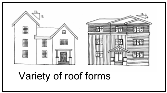
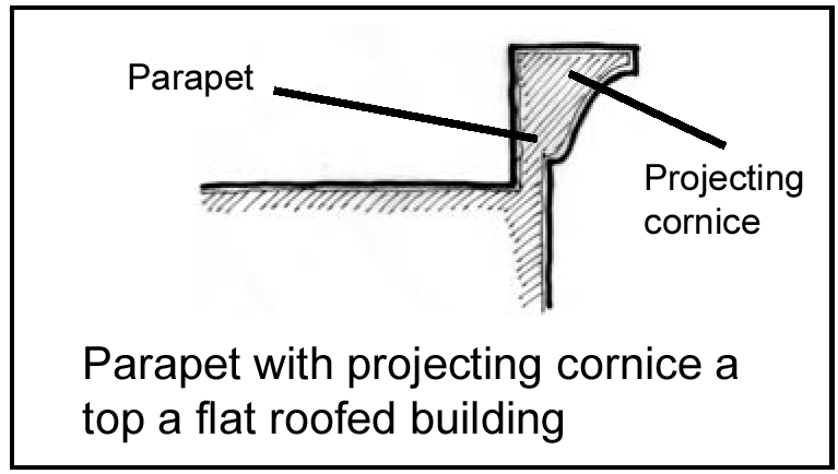
2.
Rooftop mounted equipment, vents and flues (other than chimneys) shall be screened so that they are not visible from ground level on neighboring properties.
(i)
Rooftop mechanical equipment screens shall be required at a height that is as high or higher than the rooftop equipment being screened.
(ii)
Screening shall be provided in a manner that is architecturally integral to the overall appearance of the building.
(iii)
The use of parapet walls or specially designed rooftop penthouse enclosures is the preferred methods of screening for rooftop mechanical equipment.
(iv)
Partition screens are generally less desirable for screening purposes. However, when using partition screens, the use, design, and material of the screen should blend with the building architecture and create a massing hierarchy that projects the same high quality appearance as the building facade.
(v)
The number of vents and flues shall be kept to a minimum and located in a manner to not be visible. On sloped roof structures, vents and flues shall be incorporated into architectural features or painted to blend with the roofing material.
(vi)
The board of aldermen as part of the preliminary site plan may approve an alternative to this design standard, provided that in addition to the other criteria for approval of an alternative, the board of aldermen must also determine that one of the following exception criteria is valid:
A.
A building is located at a higher elevation in relation to surrounding properties and it is demonstrated that rooftop equipment will not be visible.
B.
A building is located in the middle of an industrial park and rooftop equipment is not visible from arterial roadways, residential properties, nor will it have a negative impact upon any sensitive areas or scenic views or vistas.
C.
A building is sited in a manner where the location and setback of rooftop equipment from the building edge is relation to the elevation and visibility of surrounding properties is such that the equipment will not be visible from any distance and additional screening measures are not required.
b.
Encouraged:
1.
Each facade facing a street should have a gabled form roof.
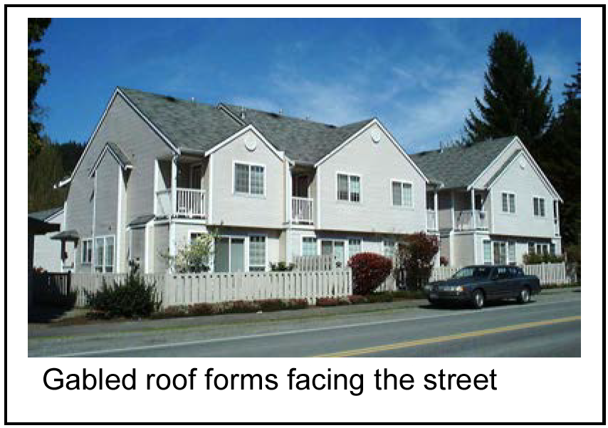
2.
Other roof forms, such as hip roofs, dormers and overhangs are encouraged.
3.
Dormers less than half the facade length may be pitched at shallower slopes or flat when appropriate.
(f)
Materials/architectural details.
(1)
Intent:
a.
To encourage creative expression through diversity of architectural style that enlivens the street.
b.
To ensure a standard of quality that will be easily maintained and cared for over time.
c.
To encourage the use of materials appropriate to residential development and details that reduce the bulk of larger buildings.
(2)
Standards:
a.
Required:
1.
Facades facing a street shall be constructed of durable and maintainable materials. Materials that have texture, pattern and lend themselves to quality detailing include:
(i)
Brick;
(ii)
Stone;
(iii)
Stucco (Dryvit or EIFS);
(iv)
Marble;
(v)
Ceramic;
(vi)
The board of aldermen as part of the preliminary site plan may approve an alternative to this design standard.
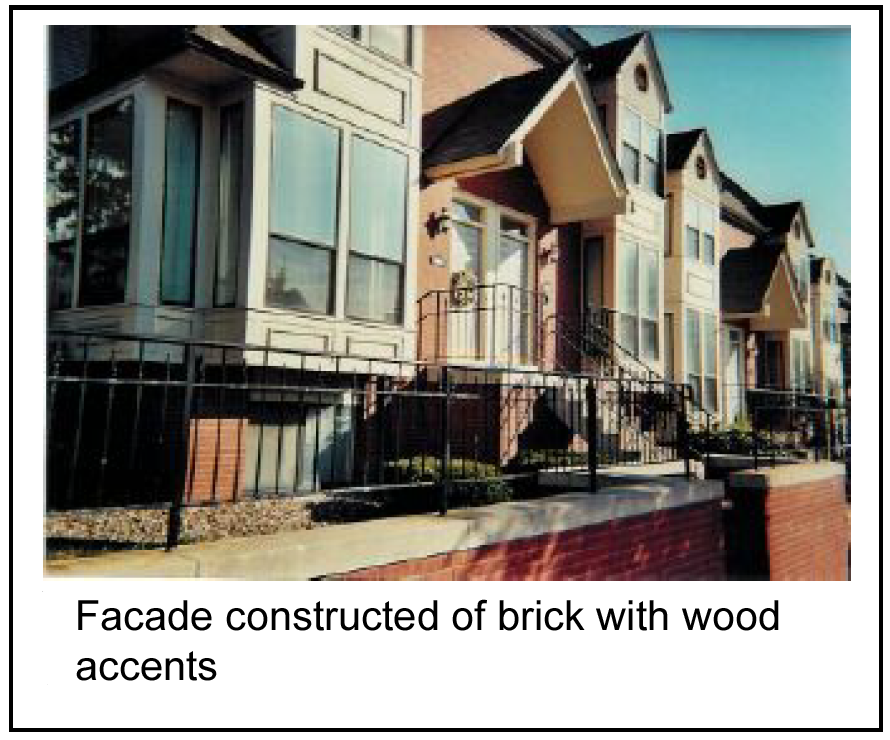
2.
Architectural accents and projections on facades facing a street and facades not facing a street may be constructed of durable and maintainable materials other than those listed in subsection (1) of this section such as:
(i)
Wood;
(ii)
Vinyl;
(iii)
Masonite.
b.
Encouraged:
1.
Before adding or removing architectural details, restoring or making additions to a historic structure, applicants are encouraged to consult an architect or architectural historian regarding appropriate elements of style.
2.
A combination of facade materials identified in subsection (1) of this section should be used on facades facing a street in order to create greater architectural interest.
c.
Not allowed:
1.
Materials that give the appearance of heavy industrial uses, such as:
(i)
Reflective glass;
(ii)
Corrugated metal siding.
2.
Plywood or other materials providing a similar appearance shall not be allowed on any facade.
(g)
Ground level details (when ground floor is commercial).
(1)
Intent: To ensure that mixed-use buildings that have commercial use on the ground floor display the greatest amount of visual interest and reinforce the character of the streetscape.
(2)
Standards; required: A building located along a street shall incorporate at least three of the following elements into any ground-floor, street-facing facade:
a.
Decorative lighting;
b.
Medallions;
c.
Belt courses;
d.
Plinths for columns;
e.
Kick plate for storefront window;
f.
Projecting sills;
g.
Tilework; and/or
h.
Planter box.
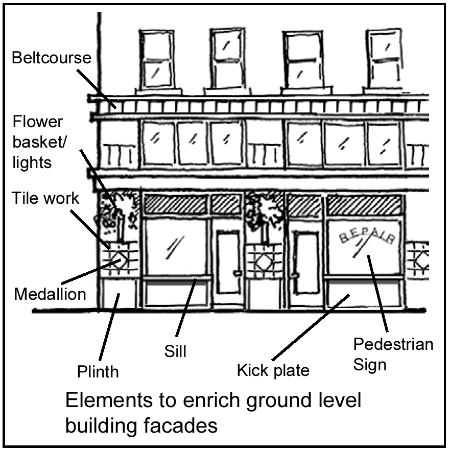
(h)
Concealing structured parking.
(1)
Intent: To integrate parking structures with the surrounding character.
(2)
Standards:
a.
Required: The ground level of parking structures shall be screened from view to the greatest extent possible. At least two of the following shall be used to screen the structure:
1.
Residential uses or lobbies;
2.
Ornamental grillwork (plain vertical or horizontal bars are not acceptable);
3.
Decorative artwork, such as metal panels, murals, or mosaics;
4.
Landscape features described in the site deign guidelines; and/or
5.
Retail/commercial use, where appropriate.
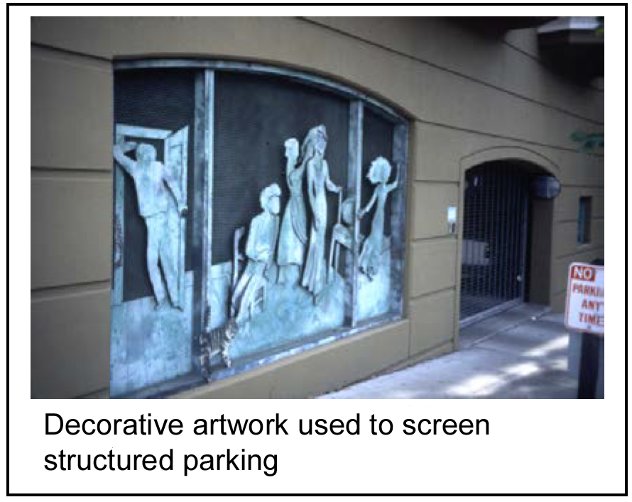
b.
Encouraged: Vehicular entrances shall be designed to incorporate architectural elements that frame the opening, such as an arch or lintel, pilasters, masonry trim, planters, or ornamental lighting.
(Comp. Ord. of 4-20-2010, § 28-8)
Sec. 50-417.- Purpose and intent.
(a)
Generally.
(1)
The 350 Highway Corridor is experiencing renewed interest from developers that are interested in developing remaining undeveloped parcels and redeveloping existing parcels along the corridor. To address the development and redevelopment issues facing the corridor, the 350 Highway/Blue Parkway Corridor Plan ("corridor plan") was developed. It addresses the land use, transportation, aesthetic, and implementation components necessary for a newly revitalized corridor. A copy of the corridor plan is available through the community development department at City Hall.
(2)
These design guidelines are a key component to the implementation of the corridor plan. Through the use of the design guidelines, the creation of which is encouraged in the corridor plan strategies, the overall quality of development in the city will improve and the attraction of new business and other economic development activity will occur, creating a stronger community.
(3)
These guidelines are intended to provide direction to potential developers, redevelopers, current landowners, and business owners, on new development and the redevelopment of existing properties. The design guidelines are intended to encourage high quality architecture, site planning, lighting, landscaping, screening, signage, infrastructure planning, and traffic flow.
(4)
Over time, adherence to and enforcement of the design guidelines will improve the identity of the city, reduce the number of curb cuts, increase the amount and variety of vegetation, de-clutter signage, promote unified development planning of multiple tracts, diversify architecture and land uses, minimize surface runoff through a reduction of redundant parking facilities, improve pedestrian safety, and integrate commercial and residential land uses so that a greater number of persons can work, shop and dine with less reliance on motorized vehicles.
(5)
Unless specifically provided otherwise herein, these design guidelines are supplemental to the regulations provided for in each respective underlying zoning district located within the district.
(b)
Vision, goals, and objectives of the 350 corridor plan.
(1)
a.
The 350 Highway/Blue Parkway Corridor Plan provides an overall vision statement for the future of the corridor and the goals and objectives begin to map out the path to accomplish that vision. These design guidelines are one of the tools used to implement the goals and objectives, and are integral to the successful outcome of the corridor plan.
b.
The vision statement is as follows:
"A vibrant, mixed use community corridor, uniquely sensitive to natural features and aesthetic appearance, where long term vitality for prosperous commerce and surrounding neighborhood, is achieved in a continuing partnership between the residential and business sectors, through effective implementation of strategies and action, that lead toward attaining the highest quality of life possible."
(2)
The goals and objectives of the 350 Highway/Blue Parkway Corridor Plan these design guidelines are intended to effectuate include:
a.
1.
Goal: Enhance the long-term vitality and attractiveness of 350 Highway/Blue Parkway Corridor as a quality, mixed-use environment.
2.
Objectives:
(i)
Promote an efficient and compatible land use pattern that establishes community focal points throughout the corridor.
(ii)
Strengthen aesthetic quality and a sense of identity for the community through development tools that: foster harmonious site planning, architectural and landscape design for new development, and encourage aesthetic improvements at existing business locations.
(iii)
Maintain the diverse visual character of the natural landscape by encouraging protection of sensitive and unique environmental features and views of special significance and integrating them as key amenities of future development.
(iv)
Provide for a diversity of innovative housing types, including creative designs that are responsive to changing population needs and compatible with surrounding neighborhoods.
b.
1.
Goal: Enhance the potential for prosperous commerce.
2.
Objectives:
(i)
Provide for necessary commercial and public services to meet future population needs and protect prime sites from inappropriate development.
(ii)
Ensure that the level and type of business uses are compatible with the scale and character of established neighborhoods and other adjacent land uses.
(iii)
Focus neighborhood mixed-use centers/retail/other uses at selected "nodes" within the city.
(iv)
Develop a business and residential community partnership in the corridor to carry out a comprehensive implementation strategy and undertake marketing efforts.
c.
1.
Goal: Enhance public facilities and services to maintain a high quality of life and to encourage infill development.
2.
Objectives:
(i)
Support enhancements, as necessary, to existing utility systems and leisure facilities.
(ii)
Promote safe pedestrian access to commercial and public services and natural amenity areas from nearby neighborhoods and employment centers.
(iii)
Establish public facility gathering places.
(iv)
Accommodate auto-related businesses and services along the corridor.
d.
1.
Goal: Provide a safe, efficient, and cost effective transportation system.
2.
Objectives:
(i)
Ensure proposed land uses and densities along the corridor are controlled so that the smooth flow of traffic on 350 Highway/Blue Parkway is not disrupted.
(ii)
Limit the number and properly locate direct access to 350 Highway/Blue Parkway and connecting streets, minimizing the number of new signalized intersections along the corridor.
(iii)
Develop collector/local/frontage roads, as new development occurs, to help relieve the increase in traffic generated by growth in the corridor.
(iv)
Encourage pedestrian activity.
(v)
Encourage transportation patterns in light of the MetroGreen trail system.
(c)
Examples of quality design. The following images are examples of quality design that provide examples for corridor development based on the aforementioned vision, goals and objectives. These examples are intended to provide ideas, but are not specific design details:
(1)
Examples of pedestrian walks adjacent to buildings with planters, pedestrian lighting, decorative pavers, materials, landscaping, and covered entries.
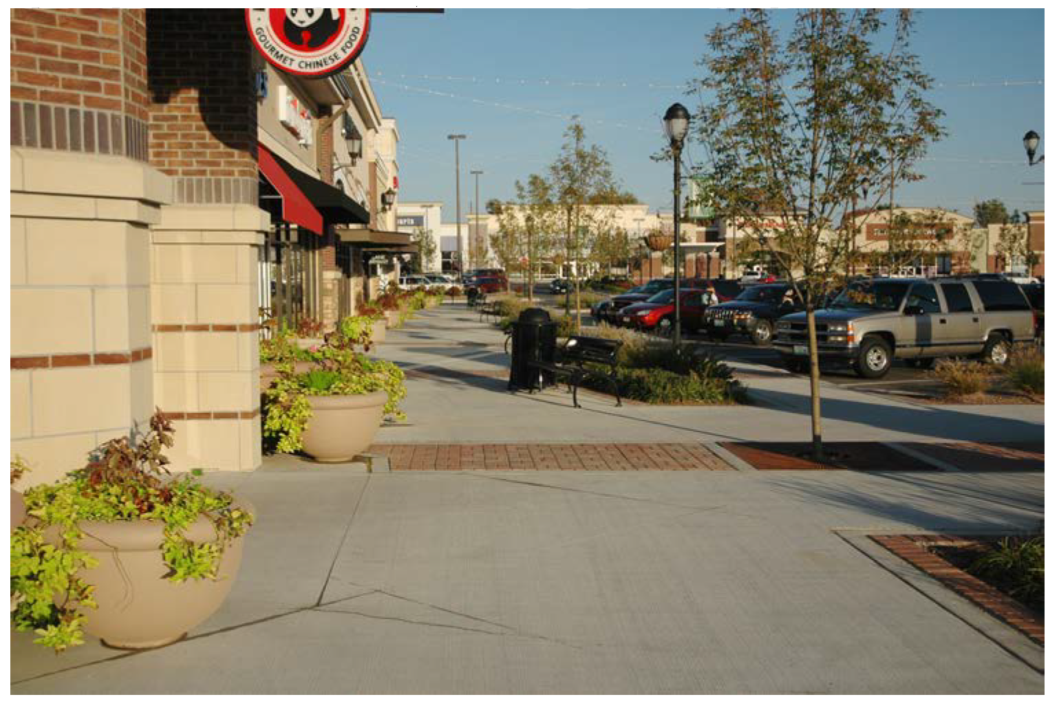
(2)
Examples of pedestrian amenities, decorative lighting, and signage.
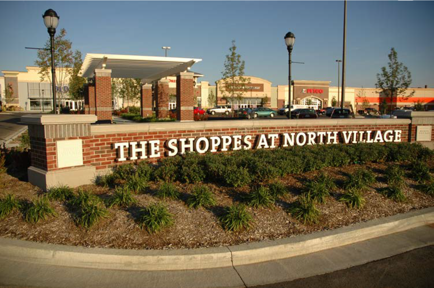
(3)
Examples of pedestrian amenities, and landscaping.
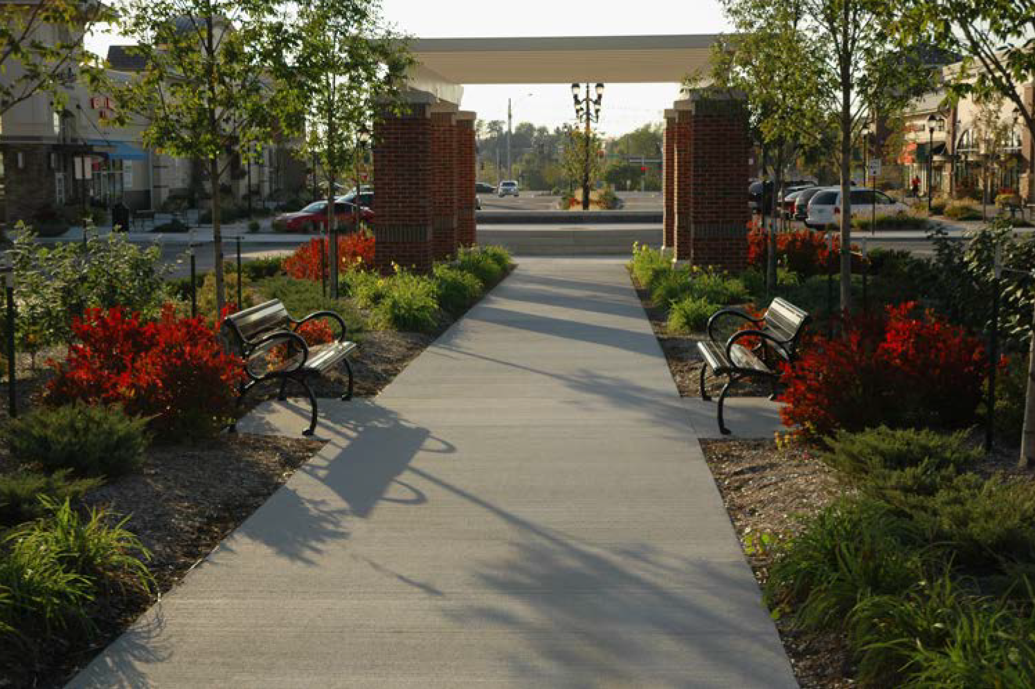
(4)
Example of low decorative wall, and landscaping adjacent to parking.
(5)
Examples of decorative lighting, paving, landscaping, and pedestrian space.
(6)
Example of quality architecture, and stormwater amenity.
(7)
Example of sign design, materials, pedestrian lighting, and paving.
(8)
Example of building landscaping, decorative paving, and materials.
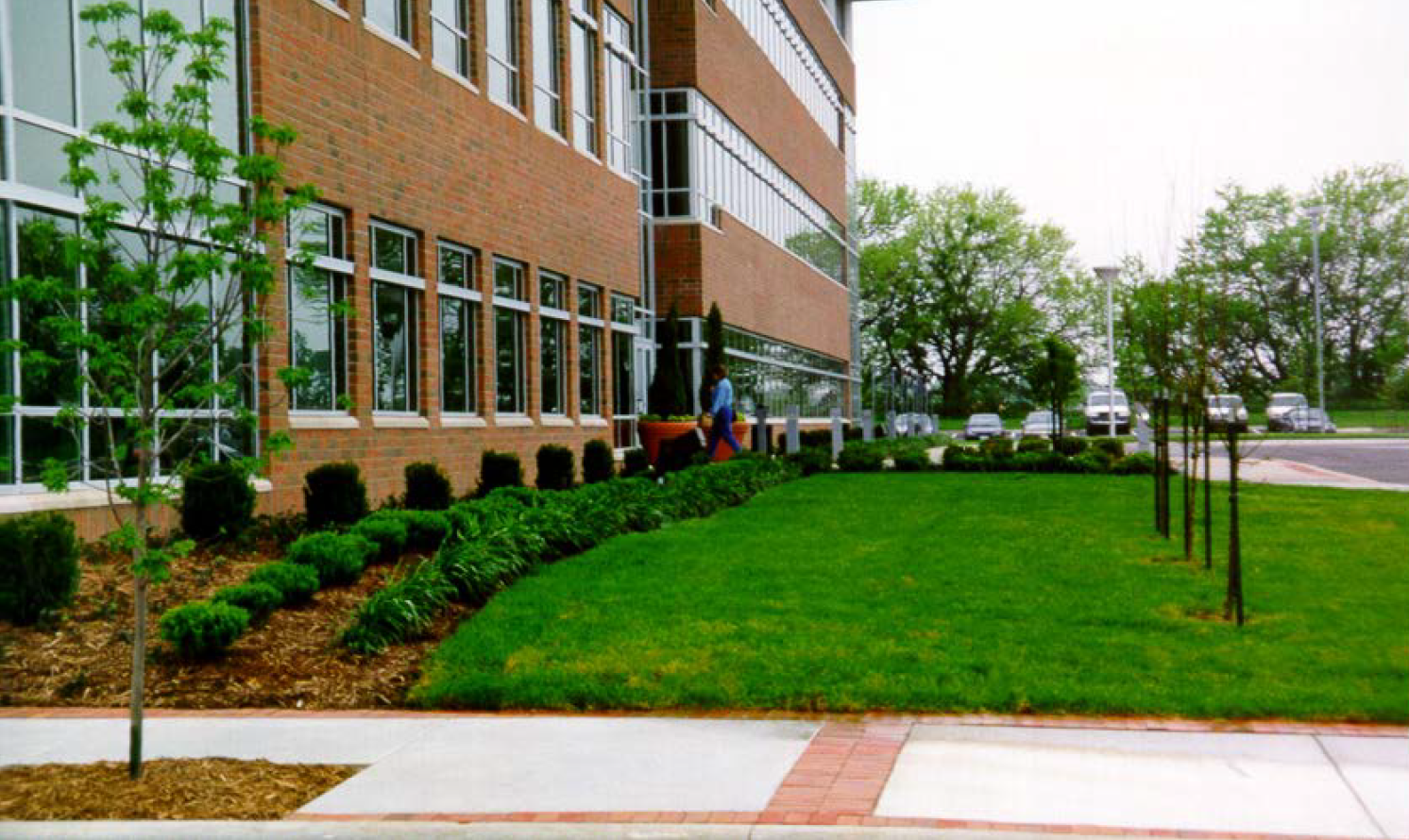
(9)
Example of decorative landscaping, quality materials, and decorative lighting.
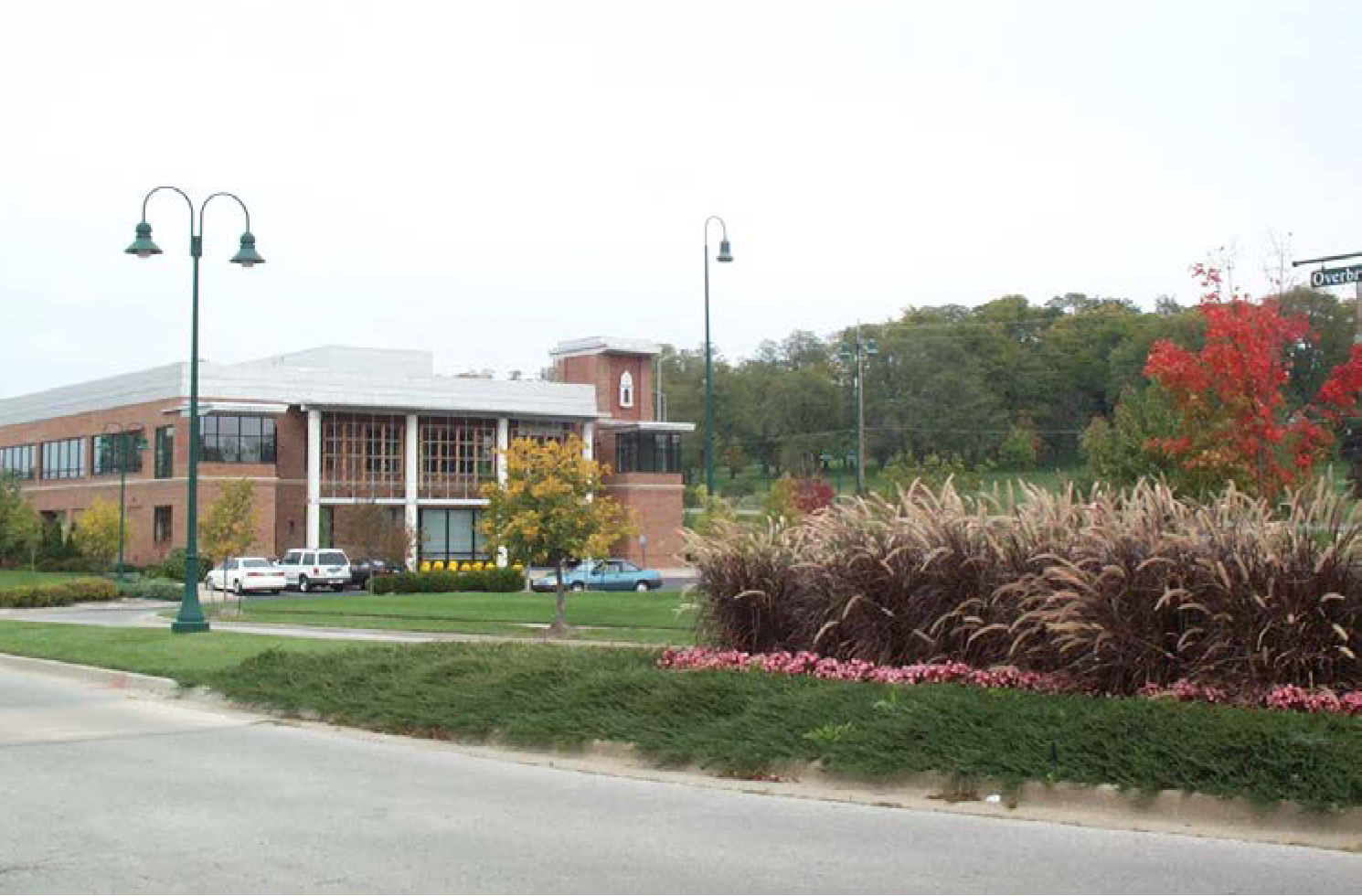
(10)
Example of monument signs and topography screening parking.
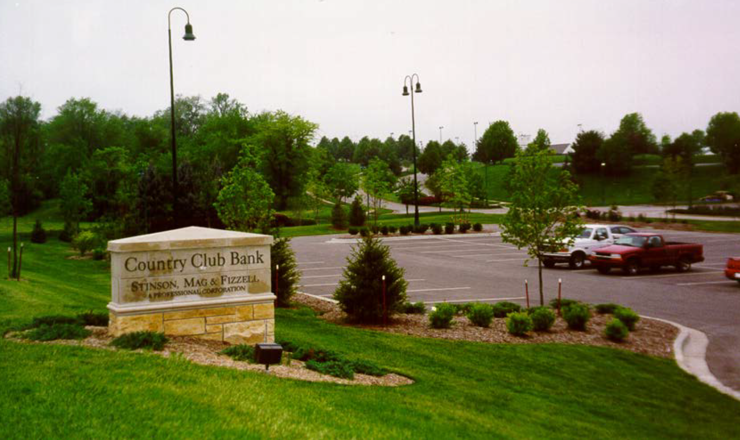
(11)
Example of multifamily residential, landscaping, and decorative lighting.
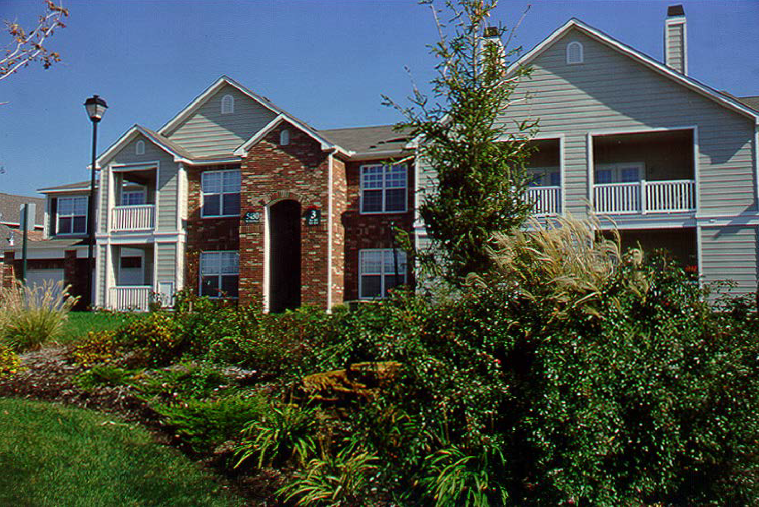
(12)
Example of decorative fencing and landscaping along a public street.
(13)
Example of pedestrian connection, landscaping and amenities.
(14)
Example of quality materials, decorative signs, fencing, planters, and landscaping.
(15)
Example of corner feature with building addressing the corner.
(Comp. Ord. of 4-20-2010, § 29-1; Ord. No. 5708-22, § 1, 10-18-2022)
Sec. 50-418. - Applicability.
(a)
Generally.
(1)
The 350 Highway Corridor Design Guidelines apply to new development and redevelopment, as those terms are defined herein, on all parcels of land that are wholly or partially within 1,320 feet of the north and south right-of-way lines of Highway 350, and extending from the western municipal boundary of Raytown, east to the eastern municipal boundary of Raytown. When a portion of a parcel is within 1,320 feet of these right-of-way lines, the 350 Highway Corridor Design Guidelines apply to the entire parcel.
(2)
Where a single-family residential subdivision or a two family subdivision is developed in the corridor the standards outlined in this document shall not apply. Unless specifically provided otherwise herein, these design guidelines are supplemental to the restrictions and regulations provided for in each respective underlying zoning district located within the district, as well as all maintenance requirements. In the event of inconsistency or conflict, the more restrictive restriction or regulation applies.
(3)
The 350 Highway Corridor Design Guidelines should be read in harmony with the city creating quality places principles. Those principles, adopted by the city after extensive community input and thorough review by the creating quality places committee of the city planning and zoning commission, are in place to promote and ensure quality development and redevelopment within the city in four key areas:
a.
Homes and neighborhoods;
b.
Commercial areas;
c.
Transportation and public places; and
d.
Environmental quality.
Among the objectives emphasized by the creating quality places principles are creating choice and diversity in housing types; encouraging reinvestment in the local community; establishing a distinct identity within city neighborhoods; improving pedestrian/cycling access within the city; improving upon and adding green space to the city; increasing mixed use development within the city; creating linkages between residential development, open space and commercial space; improving upon transportation facilities within the city by ensuring quality interconnections between streets and improving upon bicycle and pedestrian access through the improvement of sidewalks and pathways, and improving upon support for transit-oriented development.
(4)
All tracts of land covered by the 350 Highway Corridor Overlay District shall, for clarification, be identified on the zoning map by a visual keyed depiction of the extent of the area covered.
(5)
Site conditions and other current circumstances on tracts of land within the area covered by the 350 Highway Corridor Overlay District that came into being lawfully, but which do not conform to this division, unless otherwise specifically provided herein, shall be allowed to continue to exist and the land shall be allowed to be put to productive use, but the overall intent of this division is to cause as many aspects of these types of uses to be brought into conformance with the regulations of this division as is reasonably practicable.
(6)
The owner of property that is required to comply with the regulations of this division, and that believes it is impossible, given the physical characteristics of the property, to comply with one or more of the applicable design standards, may appeal this requirement to comply to the director of community development department.
a.
The property owner shall submit all reasons why, considering only the physical characteristics of the property, compliance is impossible to the director of community development department in writing prior to submission of a site plan as required hereby.
b.
The property owner shall bear the burden of establishing, by clear and convincing evidence, that it is physically impossible to comply with one or more of the regulations of this division.
c.
Economic hardship shall not be considered as a reason for noncompliance.
d.
The director of community development department shall review all the relevant evidence and determine whether or not physical compliance is impossible.
e.
If the director of community development department determines that it is physically impossible to comply with one or more of the standards of this division, the director of community development department shall recommend that the applicant not be required to comply with that standard.
f.
If the director of community development department determines that it is physically possible to comply with the applicable standards of this division, the director of community development department shall recommend that the applicant be required to comply with all applicable standards.
g.
The property owner may appeal the determination of the director of community development department that physical compliance is possible to the planning commission in accordance with article XI of this chapter.
(b)
Bonuses/incentives. The following incentives are provided when conformance with Level 1 and Level 2 350 Corridor Overlay District Design Guidelines is achieved:
(1)
Development intensity. The enclosed area of an existing structure may be increased without additional parking requirements if both of the following criteria are met:
a.
The enclosed area of the existing structure does not increase by more than ten percent of the existing development square footage; and
b.
On properties fronting on and having direct access to Highway 350, vehicular and pedestrian cross-access easements exist or are provided for the benefit of an adjacent development which has frontage and access upon Highway 350, provided that use of the cross-access easement does not eliminate or reduce previously required parking.
(2)
Parking reduction. An additional ten percent reduction in required parking spaces may be allowed if all of the following criteria are met:
a.
A vehicular cross/joint access drive is provided to an adjacent lot that fronts 350 Highway or any collector or arterial street within the district;
b.
Pedestrian cross connections of at least five feet in width that include a sidewalk and landscaping between parking lots and buildings is provided; and
c.
The number of driveways for the development lot has been reduced (where possible) or only one driveway is provided.
(3)
Setback reduction. Setback reductions may be granted only when compensating common open space (not less than a 1:1 ratio) is provided elsewhere in the project and where there is ample evidence that the reduction will not adversely affect neighboring property.
a.
Setbacks of buildings and paved areas from a public street may be reduced to 50 percent of the standard requirement.
b.
Side yards between buildings may be reduced to zero when additional open space is provided for public use.
(4)
Gateway improvements.
a.
Land donated to the city for development of gateway features at nodes (designated intersections) along the corridor as outlined may be compensated with open space credits on a 1:1.5 ratio.
b.
Gateway features constructed as designed by the city may be awarded additional square footage to the development based on the cost of the project at a 1:1 ratio.
(c)
New development. All of the provisions of the 350 Corridor Overlay Design Guidelines shall be applicable to the construction of a new building or structure on a vacant site, except for the construction of new industrial buildings, which are governed by the Industrial District Design Standards in section 50-229, and as provided in section 50-426.
(d)
Redevelopment. For all development other than the construction of a new building or structure on a vacant site, the provisions of this division shall be applicable as set forth below.
(1)
Residential development.
a.
Residential redevelopment; less than 50 percent of the floor area.
1.
Unless otherwise specified in each design standard, where the applicant proposes to construct on property zoned residential:
(i)
A new building or structure on a site with an existing building or structure or an addition or expansion to an existing building or structure; and
(ii)
The floor area of the new construction is less than 50 percent of the floor area of the existing building or structure; then
all of the provisions of the 350 Corridor Overlay Design Standards shall be applicable to the new construction; and
2.
The following provisions of the 350 Corridor Overlay Design Standards shall apply to the existing buildings or structures and the existing site:
(i)
Design standards for 350 Corridor Overlay District.
A.
Access standards.
B.
Driveway design standards.
C.
Pedestrian connections.
D.
Site landscape areas.
E.
Street trees.
F.
Parking lot landscaping.
G.
Location of parking facilities.
H.
Site lighting.
(ii)
Residential site design standards.
Private outdoor space
(iii)
Residential building design standards.
Materials/architectural details
b.
Residential redevelopment; at 50 percent or more of the floor area. Unless otherwise specified in each design standard, where the applicant proposes to construct on property zoned residential:
1.
A new building or structure on a site with an existing building or structure or an addition or expansion to an existing building or structure; and
2.
The floor area of the new construction is 50 percent or more of the floor area of the existing building or structure; then
all the provisions of the 350 Corridor Overlay Design Standards shall apply to the new construction, the existing building, and the existing site.
c.
Residential redevelopment; other improvements. Where the applicant proposes to improve property zoned residential, without constructing an expansion to a building or structure, and these design standards regulate the improvement, the provisions of the 350 Corridor Overlay Design Standards shall apply only to the improvement. For example, where the applicant proposes to improve existing property by constructing a new parking area or open space area, or by changing the exterior of existing property, the provisions of this division shall apply to the new construction or exterior change.
d.
Residential redevelopment; signs only. Where the applicant proposes to construct only a new sign on property zoned residential, the provisions of the 350 Corridor Overlay Design Standards regarding signs shall apply to the entire site.
e.
Residential redevelopment; paving. Where the applicant proposes on property zoned residential to expand an existing gravel or paved parking area or driveway, or to pave an existing gravel parking area or driveway, section 50-421(a)(2)a shall apply.
(2)
Commercial development.
a.
Commercial redevelopment; less than 50 percent of the floor area.
1.
Unless otherwise specified in each design element standard, where the applicant proposes on property zoned commercial:
(i)
A new building or structure on a site with an existing building or structure or an addition or expansion to an existing building or structure; and
(ii)
The floor area of the new construction is less than 50 percent of the floor area of the existing building or structure; then
all of the provisions of the 350 Corridor Overlay Design Standards shall be applicable to the new construction; and
2.
The following provisions shall apply to the existing buildings or structures and the existing site:
(i)
Design standards for 350 Corridor Overlay District.
A.
Access standards.
B.
Driveway design standards.
C.
Pedestrian connections.
D.
Site landscape areas.
E.
Street trees.
F.
Parking lot landscaping.
G.
Location of parking facilities.
H.
Site lighting.
(ii)
Commercial site design standards.
A.
Courtyards, plazas and open space.
B.
Site furnishings.
C.
Screening of building service and storage areas.
D.
Screening of blank walls.
(iii)
Commercial building design standards.
A.
Elevation design.
B.
Screening of rooftop units.
C.
Screen blank walls.
b.
Commercial redevelopment; 50 percent or more of the floor area. Unless otherwise specified in each design element standard, where the applicant proposes to construct on property zoned commercial:
1.
A new building or structure on a site with an existing building or structure or an addition or expansion to an existing building or structure; and
2.
The floor area of the new construction is 50 percent or more of the floor area of the existing building or structure; then
all the provisions of the 350 Corridor Overlay Design Standards shall apply to the new construction, the existing building, and the existing site.
c.
Commercial redevelopment; other improvements. Where the applicant proposes to improve property zoned commercial, without constructing an expansion to a building or structure, and these standards regulate the improvement, the provisions of these standards shall apply only to the improvement. For example, where the applicant proposes to improve existing property by constructing a new parking area, loading dock, service area, or outdoor storage area, or by changing the exterior of existing property, the provisions of this division shall regulate the new construction or exterior change.
d.
Commercial redevelopment; signs only. Where the applicant proposes to construct only a new sign on property zoned commercial, the provisions of the 350 Corridor Overlay Design Standards regarding signs shall apply to the entire site.
e.
Commercial redevelopment; parking areas. Where the applicant proposes on property zoned commercial to expand an existing gravel or paved parking area or driveway, or to pave an existing gravel parking area or driveway, section 50-421(a)(2)a of the 350 Corridor Overlay Design Standards shall apply.
(e)
Additional applicability provisions.
(1)
The 350 Highway Corridor Design Standards shall apply to all tracts of land within the area covered by the 350 Highway Corridor Overlay District, which is shown in Table 1 herein.
(2)
Notwithstanding anything to the contrary in this chapter, development on tracts of land within the 350 Highway Corridor Overlay District shall be required to comply with this section when the approval of a site plan is required by article XI of this chapter.
(3)
The division shall also be applicable in the following instances:
a.
Development is proposed at a location at which a use that came into being lawfully, but which does not conform to this section, has ceased for any reason for a period of more than 180 consecutive days (except where government action causes such cessation).
b.
The configuration of an existing driveway is altered by a change in grade, width or location including relocation.
c.
A change to the property, including land, structures or facilities, that causes an increase of:
1.
Fifty percent or greater in the vehicle trips generated by the use(s) on the property after the change, over the vehicle trips generated by the use(s) on the property immediately prior to the change (calculated in accordance with the Trip Generation Handbook, 6th Edition, Volumes 1 and 2, published by the Institute of Traffic Engineers (1997) [either peak hour or daily]); or
2.
One hundred vehicle trips or more per day above the vehicle trips generated by the uses on the property immediately prior to the change.
(f)
Corridor gateways. Community gateways are highlighted in the 350 Corridor Study at key intersections. These gateway features are to be designed by the city and are intended to highlight entries into and important points along the 350 Corridor within the city limits.
(1)
Developments at the following intersections shall be marked with visually prominent features to create a gateway to the 350 Corridor:
a.
Blue Ridge Boulevard and Highway 350;
b.
Raytown Road and Highway 350; and
c.
Westridge Road and Highway 350.
(2)
The property for these features shall be provided to the city in the form of a permanent easement in exchange for bonus points toward open space requirements/landscape requirements and/or building square foot allowances. The bonus point system is outlined in this division and reviewed and approved by the city.
(3)
The use of public art, fountains, sculpture and landscape design should be used as part of these gateway features.
(Comp. Ord. of 4-20-2010, § 29-2; Ord. No. 5708-22, § 1, 10-18-2022)
Sec. 50-419. - Mixed uses allowed, when.
(a)
Mixed use developments are allowed within the Highway 350 Corridor Overlay District at the following locations:
(1)
Blue Ridge Boulevard and Highway 350;
(2)
Raytown Road and Highway 350; and
(3)
Westridge Road and Highway 350.
(b)
Allowed uses include those that are permitted by right within the Highway Commercial (HC) District, Medium Density Residential (R-2) and High Density Residential (R-3) Districts or when approved as part of a Planned Overlay District, pursuant to article XI of this chapter when those uses are integrated as part of a mixed-use development or as a mixed-use structure. In such cases, the Commercial Site Design Standards and the Commercial Architectural Design Standards shall apply.
(c)
Within a 1,000 foot radius of the center of the above listed intersections and provided the site directly abuts one or more of the aforementioned streets or Highway 350, in addition to the bonuses and incentives provided for in section 50-418, a mixed-use residential and commercial development (comprising a square footage ratio of no more than 2 to 1 between residential and commercial development) on a site is entitled to:
(1)
A 20 percent reduction in parking;
(2)
Complete side yard waiver setbacks from the underlying zone; and
(3)
An automatic twenty percent deviation from other bulk requirements (e.g., height, square footage and front and side yard setbacks).
(Comp. Ord. of 4-20-2010, § 29-3)
Sec. 50-420. - Definitions.
The following words and terms herein defined pertain to the words and terms found in the 350 Corridor Overlay Design Standards.
Accent means a device (e.g., color, texture, light) used to visually emphasize the location or shape of a building feature, to visually interrupt the continuity of a surface or to visually connect or harmonize separate elements.
Alley means a thoroughfare through the middle of a block giving access to the rear of lots or buildings.
Architectural standards means three-dimensional structural embellishments that add detail and/or finely scaled features to a facade. Examples are corbelled brick, plinths, cornices, belt courses, decorative medallions, brackets, kick plate, pilasters, column bases and caps.
Architectural metal means an element, design, or motif, constructed of metal, installed, attached or applied to the exterior of a building or structure for the purpose of ornamentation.
Articulation means emphasis to architectural elements that create a complementary pattern or rhythm, including shifts in the plane of walls, step backs, reveals, overhangs, eaves, decorative extensions and details to create variations in a building's facade.
Belt courses means an architectural element extending horizontally across a building facade that helps to architecturally differentiate floor levels of a building.
Blank walls means walls without windows, plantings, architectural standards, such as modulation features, or articulation. For purposes of the 350 Corridor Overlay Design Standards, any uninterrupted stretch of a wall extending for at least 40-feet shall be considered a blank wall.
Body means all surfaces of a building, except the roof, doors and windows; and for purposes of specifying color, excluding areas designated as "accent" or "trim."
Bollard means any of a series of short posts set at intervals to delineate an area or to exclude vehicles.
Bulk means the mass or volume of a building or structure.
Clerestory means a smaller window located directly above another window that is used chiefly as a device for obtaining extra light.
Color means the appearance of objects or light sources as perceived by the individual and involving hue, lightness and saturation for objects and hue, brightness and saturation for light sources.
Community development department director or director of community development department means the person designated as the director for the community development department, or his designee.
Coniferous plant material means any of an order (Coniferales) of mostly evergreen trees and shrubs including forms (as pines) with true cones and others (as yews) with an arillate fruit.
Corbelled brick means brick that extends upward and outward from a vertical surface, such as a wall and supports weight, such as a cornice.
Cornice means a top course that crowns a wall.
Dark means reflecting only a small fraction of incident light; of a shade tending toward black in comparison with other shades.
Decorative lighting means lighting that is intended to accent the buildings or area in which it is located and blends with the overall design of the building/area.
Defensible entry means a walkway to a building or area that provides a person with the ability to anticipate a path of travel, its obstructions and points of vulnerability before moving through the space.
Defensible space means areas made secured or safe through design characteristics by allowing an occupant to control or limit access to the area.
Dormer window means a vertical window that projects from a sloping roof, placed in a small gable.
Facade means that portion of any exterior elevation on the building extending from grade to top of the parapet, wall or eaves and the entire width of the building elevation.
Festival lighting means seasonal, decorative lighting (e.g., Christmas lights) used to accentuate a seasonal or holiday display or event. Festival lighting shall not serve as year-round or primary lighting. Spotlights, lasers and similar types of lighting are not festival lighting.
Flag lot means a lot that has access to a public right-of-way by means of only a narrow strip of land.
Food establishment means restaurants, cafes, bistros or other establishments that serve food to the public.
Gable means the vertical triangular portion of the end of a building having a double spaced roof, extending from the level of the cornice or eaves to the ridge of the roof.
Hue means the property of colors by which colors can be perceived as ranging from red through yellow, green and blue, as determined by the dominant wavelength of the light.
Joint use driveways means driveways that provide one or two points of entry between adjacent parcels.
Kick plate means the area on a facade located between the ground and a window that has a different architectural appearance and/or is set on a different plane than the facade material located to either side.
Landscaped borders means shrubs, trees, grass or other vegetation that is located along the edge of an area, such as a parking lot or pedestrian walkway.
Level 1 design standards means those design standards that use the terms "required." When used in conjunction with a design standard, it is intended to convey that compliance with that standard is necessary to ensue that the vision and goals and objectives of the 350 Highway/Blue Parkway Corridor Plan are achieved, and makes the design standard a mandatory design standard. Except as otherwise specifically provided, all preliminary site plans must comply with all mandatory design standards.
Level 2 design standards means those design standards that use the terms "strongly encouraged." When used in conjunction with a design standard, it is intended to convey that compliance with that standard is of critical importance in ensuring that the vision and goals and objectives of the 350 Highway/Blue Parkway Corridor Plan are achieved. Compliance with all mandatory design guidelines and the Level 1 Encouraged Guidelines subjects a preliminary site plan to administrative review and consideration by the community development department.
Level 3 design standards means those design standards that use the terms "encouraged." When used in conjunction with a design standard, it is intended to convey that compliance with that standard will significantly assist in ensuring that the vision and goals and objectives of the 350 Highway/Blue Parkway Corridor Plan are achieved.
Lightness means the dimension of the color of an object by which the object appears to reflect or transmit more or less of the incident light, varying from black to white for surface colors and from black to colorless for transparent volume colors.
Lintel means a horizontal structural feature (such as a beam) over an opening that carries the weight of the wall above it.
Mass means the physical volume or bulk of a building.
Metal means material made of iron ore or one of its byproducts, aluminum, zinc or copper.
Medallion means a tablet or panel in a wall or window bearing a figure in relief, an emblem or an ornament.
Mixed-use residential/commercial development means the conversion of a tract of land or construction of a building or structure with two or more different land uses. The mix use must include residential, with a combination of office, retail, public or entertainment uses.
Mixed-use structure means a building containing residential in addition to nonresidential uses permitted in the underlying zone.
Modulation means variations of a building's mass through the use of deep setbacks, diminishing upper floor areas and/or projecting roof overhangs.
Parapet wall means that portion of the building facade extending above the roof.
Pergola means a structure usually consisting of parallel colonnades supporting an open roof of girders and cross rafters.
Pilaster means an upright architectural member that is structurally a pier, but architecturally treated as a column and usually projects a third of its width or less from a wall.
Plinth means a continuous course of stones supporting a wall. A block or slab on which a pedestal, column, or statue is placed.
Portico means a porch or walkway with a roof supported by columns, often leading to the entrance of a building.
Proportion means a relationship between the size of buildings, structures and elements of buildings or structures that form a harmonious relation that creates symmetry.
Saturation means vividness of hue; degree of difference from a gray of the same lightness or brightness.
Shade means a gradation of a hue made by adding black to it to increase its saturation.
Shall. When used in conjunction with a design standard, the term "shall" is intended to convey that compliance with that standard is necessary to ensure that the vision and goals and objectives of the 350 Highway/Blue Parkway Corridor Plan are achieved, and makes the design standard a Level 1 design standard.
Site means a lot or parcel, or group of continuous lots or parcels, included in a development application and that is in a single ownership or has multiple owners, all of whom join in an application for development.
Site furnishings means benches, art, trash containers, or other structures or items that are placed within an area.
Tint means a gradation of a hue made by adding white to it to increase its saturation.
Tone means a gradation of a hue made by adding gray to it to increase its saturation.
Transom means a window located between a door and the ceiling.
Trellis means an arrangement that forms or gives the effect of a lattice and is used as a screen or as a support for climbing plants.
Trim means solid material used to cover seams, gaps or rough edges; to provide a transition between surfaces in different planes or to provide decorative shapes to terminate or interrupt plane surfaces.
Value means the relative lightness or darkness of a color.
Vision glass means a type of glass with a high degree of transparency and which does not have dark tinting or highly reflective coatings or applied film. The intent is to be able to see into the interior space throughout the day and night. If shading is desired, it is to be accomplished by other means, such as through the use of awnings.
Year-round sight barrier means an area comprised at least in part of coniferous plant materials (as opposed to deciduous plant materials), fence or combination thereof, providing a visual screen of an area the entire year. The sight barrier may or may not be 100 percent opaque depending upon the density of the coniferous plant materials.
(Comp. Ord. of 4-20-2010, § 29-4; Ord. No. 5708-22, § 1, 10-18-2022)
Sec. 50-421. - Design standards applicable to entire 350 Corridor Overlay District.
(a)
Highway 350 driveways and roadway access standards. The following driveway and roadway design standards shall apply to all development that has direct vehicular access to the Highway 350 Corridor:
(1)
Access standard.
Level 1:
a.
Adjacent properties shall utilize joint use driveways whenever possible and provide cross and joint connections. Owners shall provide cross access easement areas between adjacent sites and developments to provide vehicular access to adjacent property without having to re-enter the public right-of-way.
b.
Cross and joint connections shall provide sufficient width to accommodate two-way vehicular travel.
c.
Cross and joint connections shall provide pedestrian and bicycle cross connections of at least six feet in width that include a sidewalk. The driveway should be designed to provide the shortest practical path across the driveway for pedestrian and bicycle movements.
d.
Lots with frontage on both Highway 350 and an adjacent or intersecting collector, except where it can be proven that other potential access points would cause greater traffic impacts as identified in the city's comprehensive plan, shall not be permitted access to Highway 350.
(2)
Driveway design standards.
a.
Generally.
1.
Level 1:
(i)
The minimum length of a driveway on private property shall be adequate to accommodate the queuing of vehicles to ensure that no vehicles waiting to enter the site remain on Highway 350.
A.
For low traffic volume commercial and industrial driveways (below 150 peak hour vehicles in both directions), the minimum driveway throat length is 20 feet.
B.
For medium traffic volume commercial and industrial driveways (150—400 peak hour vehicles in both directions), the minimum driveway throat length is 60 feet.
C.
For high-volume driveways (over 400 peak hour vehicles in both directions) such as a shopping center entrance, the adequate throat length should always be determined by the results of a traffic study.
(ii)
Driveways shall have minimum spacing of at least 440 feet from roadway intersections measured from centerline of roadway intersection to centerline of driveway.
(iii)
Driveways shall have a minimum spacing of 440 feet between adjacent driveways measured from centerline to centerline, unless both driveways allow for right-in, right-out access (controlled by a restrictive median), in which case the minimum spacing shall 330 feet from centerline to centerline. If the parcel is less than 440 feet in frontage, then one curb cut may be allowed, if cross or joint connections are not possible.
(iv)
Driveways should be as closely lined up with driveways across roadways, without nontraversable medians, to the maximum extent possible.
(v)
Driveways that serve two-way traffic should have angles of intersection with the public road of 90 degrees or very near 90 degrees.
(vi)
Driveways that serve one-way traffic may have an acute angular placement from 60 to 90 degrees.
2.
Level 2: Reserved.
3.
Level 3: Reserved.
4.
Not allowed: Reserved.
b.
Location of driveways.
1.
Intent: To control access on and off of the 350 Highway Corridor providing for a safer driving experience along this stretch of roadway, as well as, to maintain a contiguous, uninterrupted sidewalk by minimizing, consolidating and/or eliminating driveway access off primary pedestrian streets.
2.
Standards:
(i)
Level 1:
A.
All vehicular driveways are to be located off side streets or frontage roads and shall be encouraged to not have direct ingress or egress from Highway 350.
B.
If the only means of access to the site is from Highway 350, the driveway shall be consolidated (shared) between adjacent developments.
C.
Where a driveway is allowed on Highway 350 and the driveway serves a development larger than five acres, the driveway entrances shall:
1)
Include an identifying feature, such as a pergola, monument, low wall/column or additional landscape treatment; and
2)
Sidewalk paving material/treatment shall be extended across the driveway entrance.
D.
The width of the driveway shall be of sufficient width to allow two vehicles to safely and easily pass, but shall in no event be wider than 36 feet unless a center island is provided dividing entry and exit points into the site.
E.
Entrance drives shall be compliant with Missouri Department of Transportation Access Management Guidelines and shall provide a throat length that allows for efficient ingress and egress free from parking spaces backing into the drive.
(ii)
Level 2: Access easements to provide right of entry from adjoining properties is strongly encouraged.
(iii)
Level 3: Reserved.
(iv)
Not allowed: Reserved.
(b)
Linkages.
(1)
Intent: To create a network of internal and external linkages for pedestrians and to make development pedestrian friendly for the users.
(2)
Standards:
a.
Level 1:
1.
Clearly defined pedestrian connections shall be provided:
(i)
Between a public right-of-way and building entrances when buildings are not located directly adjacent to the sidewalk;
(ii)
Between parking facilities and building entrances;
(iii)
Between parking facilities and sidewalks along streets and other public rights-of-way;
(iv)
Between parking facilities and plazas, courtyards, green spaces and other pedestrian areas; and
(v)
From adjacent developments to both residential and commercial developments, creating connections with existing and future developments.
2.
Pedestrian connections shall be clearly defined in a combination of two or more of the following ways:
(i)
A continuous landscape area a minimum of three feet wide on at least one side of the walkway, except as walkways cross-vehicular travel lanes.
(ii)
Where walkways abut a public right-of-way and/or driving aisles, the landscape area shall be provided between the walkway and the public right-of-way or driving aisle and a six-inch curb must be used.
(iii)
Pedestrian connections shall be clearly defined by pedestrian scale lighting, bollard lighting, accent lighting or a combination thereof to aid in pedestrians way-finding.
(iv)
Sidewalks along all streets and public rights-of-way shall be of concrete construction and a minimum of five feet in width along Highway 350 and other streets.
(v)
At intersections with traffic signals or stop signs, sidewalk materials shall be extended across the vehicle lanes to define the pedestrian connections and differentiate the pedestrian connection pavement material from vehicle lane pavement material.
(vi)
The requirements of the Americans with Disabilities Act shall take precedence over aesthetic design features in all instances.
b.
Level 2:
1.
Where on-street parking is allowed near an intersection, the sidewalk should "bulb out" at the corner by the width/length of the on-street parking spaces to shorten the walking distance across the intersection.
2.
Sidewalks are encouraged to be increased to ten feet in width adjacent to Highway 350. Where a ten-foot width is achieved, asphalt-paving material may be utilized in lieu of concrete.
c.
Level 3: Ten-foot-wide bike/pedestrian trails are encouraged along the 350 Highway.
d.
Not allowed: Reserved.
(c)
Addressing nodes.
(1)
Intent: To provide a reference point at major intersections, further providing visual interest to the streetscape. Specific node locations include:
a.
350 Highway and Blue Ridge Boulevard;
b.
350 Highway and Raytown Road;
c.
350 Highway and West Ridge Road;
(2)
Standards:
a.
Level 1: Developments at street intersections shall emphasize this unique site aspect with two or more of the following methods:
1.
Placement of the primary entry;
2.
Towers;
3.
Plazas;
4.
Distinctive roof forms;
5.
Other architectural features; and/or
6.
Landscaping/plazas.
b.
Level 2: Reserved.
c.
Level 3: Reserved.
d.
Not allowed: Blank walls, backs of buildings and drive thru lanes and drive thru windows are not allowed adjacent to the corner.
(d)
Fencing.
(1)
Intent: To buffer uncomplimentary land uses and generally enhance the quality and appearance of developed land areas, as well as establish exterior boundaries of residential and commercial developments. To minimize the impact of solid screen fencing and to minimize the adverse effects of materials that are susceptible to rot and decay, while providing for security and privacy to residential and commercial properties and allowing for aesthetic visual appeal throughout the district.
(2)
Standard:
a.
Level 1:
1.
Allowed fencing materials shall be limited to cedar, redwood, CCA treated wood, wrought iron, aluminum designed to have the appearance of wrought iron, or vinyl to have the appearance of wood.
2.
Fencing must be designed in a manner to create variety, such as staggering the fence line and incorporating wrought iron or masonry columns.
b.
Level 2:
1.
Fencing is strongly encouraged to be designed as a compliment to the developments style of architecture, using a combination of materials and heights.
2.
Consideration is strongly encouraged to be given to the layout of the fencing as it relates to the topography and the ability to undulate the fencing to allow for a less monotonous design.
3.
Fencing is strongly encouraged to be a part of the landscape design and should be an accent to the development and the landscape.
c.
Level 3: The fencing is encouraged to be located on the property line with the ability to inset sections.
d.
Not allowed: Solid fencing shall not exceed four feet in height and shall not be sight obscuring.
(e)
Landscaping/open space.
(1)
Street trees.
a.
Intent: To maintain a consistent street frontage along all streets within the 350 Corridor Overlay District by planting trees along streets and sidewalks.
b.
Standard:
1.
Level 1:
(i)
Street trees shall be located between the sidewalk and curb edge within the public right-of-way, where feasible.
(ii)
Street tree selection shall comply with the street tree regulations adopted by the city tree board and shall consider existing utilities, lighting, adjacent street trees, tree root growth and proposed signage locations.
(iii)
Street trees at a minimum rate of one per 50 lineal feet street frontage shall be provided along all streets.
(iv)
Trees shall be of a similar size and type as trees found within the same block so as to maintain a sightline of similar overall streetscape appearance.
(v)
Trees planted shall be wind, ice and weather tolerant.
2.
Level 2: Reserved.
3.
Level 3: Reserved.
4.
Not Allowed: Reserved.
(2)
Site landscape areas.
a.
Intent: To reinforce the character of the corridor and the surrounding natural environment through site landscaping.
b.
Standards:
1.
Level 1:
(i)
All areas not devoted to landscape required by these 350 Highway Corridor Design Standards, this chapter, parking regulations, structures or other site improvements shall be planted, or remain in existing native, non-invasive vegetation including drought-tolerant grass.
(ii)
Landscaping shall be a combination of drought-tolerant plantings, such as evergreens, deciduous trees and shrubs, and decorative grasses. A minimum 20 percent of plant varieties shall provide year-round color, texture and/or other special interest. Selected shrubs varieties should have a natural maximum growth height of three feet for visibility.
2.
Level 2:
(i)
Use of native plants is strongly encouraged where opportunity allows. A minimum 20 percent of all landscape areas should include native drought-tolerant plant types.
(ii)
All natural vegetative areas and natural drainage areas are strongly encouraged to be maintained.
(iii)
Perennials and/or annuals are strongly encouraged to provide special interest and highlight pedestrian areas such as building and/or site entrances, public open space, plazas and major pedestrian connections.
(iv)
Window boxes, container plantings, hanging baskets or other special interest landscape are strongly encouraged to be provided to enhance pedestrian areas and shall be made of weather resistant materials.
3.
Level 3:
(i)
The use of berms to a height of three inches is encouraged to minimize the visual impact of parking from the highway.
(ii)
Effective use of earth berms and existing topography are encouraged as a component of the landscape plan.
4.
Not allowed: Reserved.
(3)
Parking lot landscape.
a.
Intent: Reduce the visual impact of parking lots through landscape areas, trellises and/or other architectural features and to visually maintain a building line along the street.
b.
Standards:
1.
Level 1:
(i)
Parking lot landscape shall be used to reinforce pedestrian and vehicular circulation, such as:
A.
Parking lot entrances;
B.
Ends of driving aisles; and
C.
To define pedestrian connections through parking lots.
(ii)
Where walls are provided, landscape-planting areas may be reduced to a minimum width of five feet and shall be located adjacent to the public right-of-way.
(iii)
Low walls (minimum three feet high) used to screen parking lots shall be made of decorative concrete, masonry or other similar material, to coordinate with adjacent buildings.
(iv)
The combination of walls and shrubs shall not exceed a maximum height of four feet, unless all of the following are provided:
A.
Wall/landscape treatment does not create a safety hazard;
B.
Portion of wall/landscape treatment that is above four feet in height is a minimum 75 percent transparent (i.e., see-through metal railing, trellis, or other similar treatment); and
C.
Portion of wall /landscape treatment that is above four feet in height provides added visual interest, detail and character.
(v)
A minimum eight-foot-wide landscape planting area shall be provided between parking lots and adjacent developments to include a year-round sight barrier and meeting the requirements for parking lot landscape provided in the Raytown Landscape Ordinance.
(vi)
The primary landscaping materials used in parking lots shall be trees that provide shade or are capable of providing shade at maturity. Shrubbery, hedges and other planting materials shall be used to complement the tree landscaping, but shall not be the sole means of landscaping.
(vii)
Automatic watering systems are strongly encouraged to be installed in all landscape planting areas.
2.
Level 2: Reserved.
3.
Level 3: Reserved.
4.
Not allowed: Signage on parking lot walls or fences facing the street shall not be permitted unless developed as a monument sign.
(f)
Parking facilities.
(1)
Location of parking facilities.
a.
Intent: To maintain a contiguous, attractive street frontage by locating parking facilities behind buildings and bringing structures to the front property line.
b.
Standard:
1.
Level 1:
(i)
All parking lots (new development and redevelopment) shall comply with the parking lot design standards set forth in this chapter including, but not limited to, interior landscape areas, wheel stops, number of stalls and plant material requirements.
(ii)
Parking facilities shall be located to the side buildings away from street frontages.
2.
Level 2: If the city approves the parking to be located along a street frontage, a ten-foot-wide planting area between the parking facility and street right-of-way is strongly encouraged to be provided to include, a year-round three-inch-high sight barrier consisting of an evergreen hedge, decorative wall and/or earth berms.
3.
Level 3: Parking facilities are encouraged to be located behind buildings and away from the street frontage.
4.
Not allowed: Reserved.
(2)
Structured and covered parking.
a.
Intent: To design and integrate parking structures with the surrounding character.
b.
Standards:
1.
Level 1:
(i)
Parking structures facing 350 Highway, Blue Ridge Boulevard, Gregory Boulevard, Raytown Road and/or West Ridge Road shall contain commercial or residential uses along at least 66 percent of the linear frontage abutting the street or public open space.
(ii)
Any remaining portions of the facade not devoted to retail or commercial uses shall incorporate one or more of the following devices to screen the view of parked cars:
A.
Ornamental grillwork (plain vertical or horizontal bars are not acceptable);
B.
Decorative artwork, such as metal panels, murals, and mosaics;
C.
Display windows for use by nearby merchants or uses.
(iii)
Vehicular entrances shall be designed to incorporate architectural standards that frame the opening, such as an arch, lintels, pilasters, masonry trim, planters or ornamental lighting.
(iv)
Garages and covered parking structures shall be constructed of similar materials and have similar architectural character as the principle buildings on the property.
2.
Level 2:
(i)
Garages, rather than covered parking structures with open sides, are strongly encouraged.
(ii)
Parking facilities or portions thereof are strongly encouraged not to be gated.
3.
Level 3: Reserved.
4.
Not allowed: Reserved.
(3)
Accommodation for bicycles.
a.
Intent: To increase accessibility to commercial development via bicycle within the 350 Corridor Overlay District.
b.
Standards:
1.
Level 1: Reserved.
2.
Level 2: Reserved.
3.
Level 3:
(i)
If no other parking offset has been allowed under these guidelines, parking may be reduced up to the lesser of:
A.
Ten percent of the parking space required by city Code; or
B.
A maximum of six parking spaces, by providing innovative, compact and secure on-site bicycle locking and/or storage facilities.
The allowable reduction in parking spaces shall be computed by providing one parking space reduction for each four available bicycle storage spaces provided.
(ii)
Each bicycle locking and/or storage facility shall:
A.
Be securely affixed to the ground or a wall.
B.
Accommodate a minimum of four bicycles.
C.
Provide a frame-mount locking device or enclosure within which to fit a wholly assembled adult-sized bicycle.
D.
Be situated in close proximity to a public entry into on-site buildings.
E.
Provide for at least six feet of pedestrian access between the bicycle storage facility and other obstacles (i.e., buildings, landscaping, sidewalks, street signs, and other manmade structures) when fully utilized for bicycle storage. The six-foot access requirement shall be measured to account for bicycles affixed to the storage/locking facility.
(4)
Consolidating parking facilities.
a.
Intent: To reduce the overall impact of parking within the 350 Corridor Overlay by consolidating parking facilities whenever possible.
b.
Standards:
1.
Level 1:
(i)
Where parking facilities are consolidated (shared) the following shall apply:
A.
The combined number of parking stalls required shall be reduced by 20 percent, if two properties consolidate (share) parking;
B.
The combined number of parking stalls may be reduced by up to 25 percent, at the discretion of the applicant, if three or more properties consolidate (share) parking; and
C.
Pedestrian connections shall be provided from parking facility to adjacent developments.
(ii)
Where parking facilities are not consolidated and are adjacent to one another:
A.
Pedestrian connections shall be provided between adjoining parking facilities so as to provide access to each adjacent development; and
B.
Driveway connections shall be provided between adjoining parking facilities to provide cross access to each adjacent development and access to additional ingress/egress points.
(iii)
The owners of the parking facilities shall share their access point onto each street or highway that is common to each property.
2.
Level 2: The size of parking lots are strongly encouraged to be minimized and large lots should be divided into several smaller lots and separated by building masses, earth berms and landscaping features.
3.
Level 3: Reserved.
4.
Not allowed: Reserved.
(g)
Site lighting.
(1)
Intent: Site lighting should achieve intended illumination within parking lots, plaza/pedestrian spaces, stormwater collection and detention areas and other areas where design or safety considerations are warranted. Site lighting is meant to create safe, recognizable and aesthetically pleasing environments throughout public and private developments, as well as to provide pedestrian scale lighting, accent lighting and festival lighting to accompany street lighting along the corridor.
(2)
Standards:
a.
Level 1:
1.
Parking lot lighting shall be provided to allow for a safe pedestrian and vehicular area.
2.
Parking lot light fixtures shall not exceed 30 inches in height and shall be designed to direct the light toward the development and prevent light spillage to other users and adjacent streets.
3.
Pedestrian scale lighting and/or bollard lighting shall be used to define pedestrian walkways, crosswalks, connections and/or other pedestrian areas within a development.
4.
Pedestrian scale lighting shall be a maximum 14 feet in height.
5.
Site lighting shall complement other lighting elements used throughout the site, parking and/or adjacent developments and public rights-of-way.
6.
All lighting (except festival lighting) shall be shielded from the sky and adjacent properties and structures, either through exterior shields or through optics within the fixture.
7.
No light projection shall extend higher than horizontal from the light fixture and shall in no case create glare when visible from a public right-of-way or off the property.
b.
Level 2:
1.
Using lighting to highlight, complement, and reinforce landscape and architectural design as focal points of interest is strongly encouraged.
2.
A minimum required illumination for parking lots and building entries is strongly recommended to be 0.50-footcandle, with a 0.0-footcandle reading at the property line.
3.
Accent lighting is strongly recommended to be used for pedestrian safety and to highlight special focal points, building/site entrances, public art and special landscape features.
c.
Level 3:
1.
Indirect wall lighting, overhead down-lighting, or interior illumination that spills into the landscape is encouraged.
2.
Festival lighting is encouraged during holidays and festivals to reinforce the character and image of the area.
d.
Not allowed:
1.
High-pressure sodium lights and/ or other non-color corrected lights shall not be used.
2.
Permanent spotlights, lasers or other types of lighting used as attention-attracting devices shall not be allowed.
(h)
Materials/architectural details.
(1)
Intent:
a.
To encourage creative expression through diversity of architectural style that enlivens the street.
b.
To ensure a standard of quality that will be easily maintained and cared for over time.
c.
To encourage the use of materials appropriate to residential development and details that reduce the bulk of larger buildings.
(2)
Standards:
a.
Level 1: Facades shall be constructed of durable and maintainable materials. Materials that have texture, pattern and lend themselves to quality detailing including:
1.
Brick: no larger than four-inch by four-inch by eight-inch. The board of aldermen as part of the preliminary site plan may approve an alternative to this design standard.
2.
Stucco: surface texture of Sandpebble or Quartzputz in colors as identified in the "Color" standards.
3.
Stone: polished surfaces in natural color and texture of native stone in colors as identified in the "Color" standards.
4.
Ceramic: tiles that are a minimum size of 12-inch by 12-inch in colors as identified in the "Color" standards.
5.
Glass: insulated glass panels in clear colors as identified in the "Color" standards without reflection or mirror appearance.
6.
Architectural metal.
7.
Cast concrete and wood may be used as secondary facade materials, as long as the secondary materials do not comprise more than 30 percent of the facade.
8.
The first and second floor facades of buildings shall use materials that add variety, permanence and richness to the streetscape.
9.
Split face block may be used on the rear and sides of buildings that are not addressing a street frontage.
b.
Level 2:
1.
Architectural accents and projections on facades are strongly encouraged to be constructed of durable and maintainable materials.
2.
Cast concrete and wood are strongly encouraged to be used as secondary facade materials as long as the secondary materials do not comprise more than 30 percent of the facade.
c.
Level 3: Reserved.
d.
Not allowed: Reflective glass.
1.
Corrugated metal, standing seem metal and other metal not defined as "architectural metal."
2.
Wood shake shingle siding materials.
3.
Plywood or other materials providing a similar appearance shall not be allowed on any facade.
(Comp. Ord. of 4-20-2010, § 29-5)
Sec. 50-422. - Multifamily residential site design standards.
The following are site design standards for residential development and redevelopment within the 350 Corridor Overlay District:
Building entries.
(1)
Intent: To provide a clearly defined, welcoming, and safe entry for pedestrians to multifamily dwellings, from the sidewalk into the building.
(2)
Standards:
a.
Level 1:
1.
Entries shall be clearly identifiable, defensible and visible from the street.
2.
Building entries shall include at least two of the following features:
(i)
Recesses;
(ii)
Balconies;
(iii)
Articulated roof forms;
(iv)
Front porches with a depth of at least eight-feet;
(v)
Arches; and/or
(vi)
Glass at sides and/or above entry doors.
3.
Building entries shall include at least one of the following site furnishings:
(i)
Pergola;
(ii)
Canopy;
(iii)
Courtyard with benches; or
(iv)
Pedestrian scale lighting and/or lighted bollards.
b.
Level 2: Reserved.
c.
Level 3: Reserved.
d.
Not allowed: Reserved.
(Comp. Ord. of 4-20-2010, § 29-6)
Sec. 50-423. - Multifamily residential building design standards.
Bulk of buildings/articulation and overall massing of buildings.
(1)
Intent: To reduce the apparent bulk of buildings by breaking them down into smaller components that is visually consistent with a pedestrian scale as well as to enhance views of the surrounding area and to increase sunlight penetration to the public sidewalk.
(2)
Standards:
a.
Level 1:
1.
Walls facing streets shall be modulated with bays and recesses at least eight feet wide and no more than 25 feet wide and at least three feet deep.
2.
Modulation shall extend to the roof, except at balconies. The purpose is not to create a regular rigid solution, but rather to break up the mass in creative ways.
3.
Horizontal facades longer than 25 feet shall be articulated into smaller units. At least two of the following architectural treatments shall be utilized:
(i)
Distinctive roof forms;
(ii)
Changes in materials;
(iii)
Window patterns; and/or
(iv)
Color differentiation
4.
Additions or alterations to existing buildings with an identifiable architectural style shall be made sensitively and shall be compatible with the buildings' original architectural style, except if the entire building is receiving a new facade.
5.
All residential structures shall incorporate pitched roof forms having slopes between 4:12 and 12:12.
6.
A porch, patio, courtyard or deck shall be provided for each dwelling unit.
b.
Level 2: To avoid the negative look of a flat blank wall, the use of at least one of the following is strongly encouraged:
1.
Architectural detailing to compliment the building design;
2.
Windows;
3.
Projections and recesses in the facade ; and
4.
Decorative light fixtures.
c.
Level 3: Reserved.
d.
Not allowed: Reserved.
(Comp. Ord. of 4-20-2010, § 29-7)
Sec. 50-424. - Commercial site design standards.
The following are design elements for commercial development and redevelopment within commercial area of the 350 Corridor Overlay District:
(1)
General standards.
a.
Intent: To create a cohesively designed commercial corridor, through the development of individually designed projects with a mix of uses that are compatible.
b.
Standards:
1.
Level 1:
(i)
The development design shall utilize the opportunities and reflect the constraints created by floodplains, slopes, soils, vegetation and other physical features. Engineering techniques shall not be utilized to force-fit development into the environment.
(ii)
Open storm drainage and detention areas visible to the public shall be incorporated into the design of the development as an attractive amenity or focal point.
(iii)
Each new development shall be designed to relate to the adjoining developments creating an interconnected corridor.
2.
Level 2:
(i)
The site design is strongly encouraged to include on-site infiltration based Storm Water Management Best Management Practices (BMPs), such as bioswales, vegetated trenches, basins with some infiltration devices, on-site storage of rainwater using rain barrels, rain gardens or subsurface storage, minimization of impervious areas using green roofs, narrower streets, porous pavement, concave medians, strategic use of native vegetation and landscaped traffic calming areas.
(ii)
All construction is strongly encouraged to be performed in compliance with Kansas City chapter of the American Public Works Association section 5100, including the minimization of land disturbance and avoidance of compaction to the greatest possible degree, given existing and proposed site conditions.
3.
Level 3: Buildings are encouraged to locate at the setback line creating a strong continuous corridor edge. To continue the edge, rhythmic planting of large plant material is encouraged.
4.
Not allowed: Removal of all vegetation and topography of the existing land to create a flat site for development is not allowed.
(2)
Loading dock, service area, trash enclosures and outdoor storage screening guidelines.
a.
Intent: The purpose of these guidelines is to ensure that service and storage activities are oriented on the property in a manner that is consistent with the character of the area, privacy, and aesthetic considerations.
b.
Standards:
1.
Level 1:
(i)
Unattractive elements, such as trash, service, storage and loading areas shall be located out of public view from streets, adjacent residential properties and other highly visible areas, such as parking lots, access drives, etc.
(ii)
If the back or sides of a building must be oriented toward public streets or highly visible areas, these areas shall provide visual interest through a combination of landscaping, berms and architectural detail, such as windows, decorative light fixtures, creative use of materials and/or projections and recesses.
(iii)
Screening walls shall reflect the same level of architectural design as the primary structure, including elements such as landscaping to soften the wall's appearance, architectural detailing, staggering with recesses and projections, and visual interest.
(iv)
Trash receptacles shall be screened from public view on at least three sides with a six to eight foot opaque screen of masonry or other materials that are compatible with the principle building and accented with landscape treatment.
(v)
The color of overhead doors and any other doors used to admit vehicles shall be the same hue used on the building facade.
(vi)
Service areas shall be designed in a manner to control noise generated from service activities and mechanical equipment.
2.
Level 2:
(i)
It is strongly encouraged that buildings should be designed in a manner so that loading docks, service areas and outdoor storage areas are screened either by a building wall or a screening wall, or integrated into the building design to not be visible. Screening walls must be a length and height to screen the maximum size of vehicle using the area.
(ii)
Trash enclosures are strongly encouraged to be located to allow for convenient access by refuse vehicles while complying with subsection (2)b.1(iv) of this section.
(iii)
Screening doors on trash enclosures are strongly encouraged to be finished with a high quality material and durable finish supported by metal support structure.
3.
Level 3: Service areas including trash enclosures are encouraged to be located adjacent to the building or in close proximity of the building for ease of access and to ensure maintenance of the structure.
4.
Not allowed:
(i)
Wood, plastic, vinyl or chain link fencing is not allowed to screen outdoor storage/loading areas.
(ii)
Trash enclosures shall not be placed in an area along a public street.
(3)
Guidelines for screening ground and building mounted mechanical equipment.
a.
Intent: The purpose of these guidelines is to ensure that mechanical devices and areas are appropriately screened in a manner that projects a high quality appearance. Often such screening measures can be used to enhance the building appearance. All exterior ground or building mounted equipment, including but not limited to mechanical equipment, utility meter banks and coolers, shall be screened from public view with landscaping or an architectural treatment compatible with the building architecture.
b.
Standards:
1.
Level 1: When it is not feasible to locate mechanical devices and areas within a building, the following shall be achieved:
(i)
Coolers must be finished with the same building materials and architectural detailing as the main building facade.
(ii)
The same material and detailing as the building facade shall be used for screening walls or specially designed enclosure cabinets for HVAC and utility meters.
(iii)
Evergreen species shall be used as the primary planting when landscaping is used for screening purposes. Landscape plantings for wall-mounted meters must be installed with a minimum height of six feet.
(iv)
The visibility of meters and utility banks (i.e. gas, electric, water) shall be reduced by locating such equipment along the side or rear of the building in a location not generally visible from the public.
(v)
A.
All above ground electrical and/or telephone cabinets are required to be placed within the interior side or rear building setback yards. These utility cabinets are prohibited within required front yards adjacent to street right-of-way unless screened with landscape materials and incorporated in a landscape design.
B.
When these cabinets are located adjacent to or near a building, they shall be screened and treated in the same manner as HVAC equipment and trash receptacles (i.e., screening walls, landscaping, etc.).
2.
Level 2: Mechanical equipment is strongly encouraged to be located and screened in a manner that is not visible or heard from adjoining properties.
3.
Level 3: Reserved.
4.
Not allowed: Wood, plastic, vinyl or chain link fencing is not allowed to screen outdoor storage/loading areas.
(4)
Site furnishings.
a.
Intent: To create more pedestrian friendly developments through the use of site furnishings at plazas, building entrances, sidewalks and other pedestrian areas.
b.
Standard:
1.
Level 1:
(i)
A minimum of two site furnishings and pedestrian amenities shall be selected from the following list and shall be used at building entrances, plazas, open space and other pedestrian areas.
A.
Benches with backs;
B.
Tables;
C.
Low seating walls;
D.
Trash receptacles;
E.
Fountains.
(ii)
Site furnishings shall be consistent with the overall character, colors and appearance of adjoining pedestrian areas and site furnishings.
(iii)
Site furnishings shall be made of durable, weather-resistant and vandal resistant materials.
2.
Level 2: Reserved.
3.
Level 3: Reserved.
4.
Not allowed: Reserved.
(5)
Courtyards, plazas and open space.
a.
Intent: To create a pedestrian friendly atmosphere within commercially zoned portions of the 350 Corridor Overlay District by creating usable open space for pedestrians.
b.
Standard:
1.
Level 1:
(i)
Where provided, pedestrian spaces shall be visible and accessible to the public.
(ii)
Plazas, courtyards, green spaces and other pedestrian areas shall include landscaping and pedestrian scale lighting.
2.
Level 2:
(i)
Plazas and courtyards are strongly encouraged within each development.
(ii)
Plazas, courtyards, green spaces and other pedestrian areas are strongly encouraged to include, public art, benches with backs, low seating walls, or other pedestrian amenities and site furnishings.
(iii)
Use of brick, paver bricks, stone, concrete colored throughout or other special paving material is strongly encouraged to reinforce the character of the development and create a more pedestrian-friendly area.
3.
Level 3: Reserved.
4.
Not allowed: Reserved.
(Comp. Ord. of 4-20-2010, § 29-8)
Sec. 50-425. - Commercial building design standards.
The following guidelines apply to commercial buildings within commercial zones:
(1)
Commercial building appearance guidelines.
a.
Intent: To provide area identity and character through consistency in architecture.
b.
Standard:
1.
Level 1:
(i)
Compatible architectural design, including building materials and colors, shall be carried throughout the development area. Designs shall provide visual interest and variety, yet be consistent with the architectural character of the area.
(ii)
Architectural details such as texture, pattern, color and building form used on the front facade shall be incorporated on all building facades.
(iii)
Any side of the building visible from a street, parking area or public open space shall be given architectural treatment using two or more of the following:
A.
Windows;
B.
Pedestrian entrances;
C.
Balconies;
D.
Architectural details;
E.
Awnings.
(iv)
Building massing shall be varied to create a logical hierarchy of building forms; to break up long expanses of facade to create shade and shadow; and to create "human scale."
(v)
Building materials shall be of equal or higher quality than the materials of structures in the area. However, dissimilar materials may be permitted when incorporating other characteristics, such as scale, form, architectural detailing and color to make the building compatible with the area.
(vi)
Service and mechanical areas shall be designed as an architectural feature of the building and entirely screened from view.
(vii)
No more than one hue may be applied to the body of a building, but combinations of tints, shades, and tones of the hue shall be permitted; and additional hues may be permitted for trim and accent.
(viii)
A full palette of color to be used on the exterior and roof of the building shall be submitted for review and approval.
(ix)
When a new building or building addition is proposed, a full color rendering of all building elevations prepared by a licensed architect or a graphic designer shall be submitted for review and approval with the site plan.
2.
Level 2: Reserved.
3.
Level 3: The painting of brick in a decorative manner is allowed if approved by the board of alderman.
4.
Not allowed: Reserved.
(2)
Prominent entrance.
a.
Intent: To promote the sense of a gateway at major intersections within the 350 Highway Corridor Overlay District through architectural design and to make major entrances to buildings obvious and welcoming.
b.
Standard:
1.
Level 1:
(i)
Buildings at Blue Ridge Boulevard and Highway 350; Raytown Road and Highway 350; and Westridge Road and Highway 350 shall be designed to create a gateway into the area.
(ii)
Any corner of a building placed at one of these intersections shall be given major architectural expression in its facade, roof form and massing. Architectural expressions may include tower forms, unusual rooflines, or over-sized windows that blend with the architectural character of the building and its surroundings, including adjacent development at the same intersection.
(iii)
Each principal building shall have a clearly defined, highly visible entrance with distinguishing features, such as canopies, arches and integral planters. To accomplish this, the design shall include at least one element from each of the following groups:
A.
Group A - Recess, overhang, portico, porch, canopies, arches.
B.
Group B - Clerestory, glass windows flanking door, ornamental lighting fixtures, large pedestrian entry doors.
C.
Group C - Stone, masonry or tile paving in entry; ornamental building name or address; pots or planters with flowers.
(iv)
Canopies or awnings for weather protection shall be provided over windows and entryways to buildings except in the following cases:
A.
A portico, porch or overhead projection is provided over the window or entryway that achieves the intent indicated above; and
B.
The building on which the canopy or awning is to be provided has a setback of greater than four feet and the setback area complies with the requirements for courtyards, plazas, and open space, as specified within these regulations.
(v)
The minimum depth of any canopy or awning shall be four feet, unless limited by the city adopted building code. The vertical dimension between the underside of the canopy or awning and the sidewalk shall be at least eight feet and no more than 12 feet.
2.
Level 2: Reserved.
3.
Level 3: Reserved.
4.
Not allowed: Standard corporate architectural building designs are not acceptable.
(3)
Storefront and building facade composition.
a.
Intent: To ensure that commercial buildings within the 350 Corridor Overlay District display the greatest amount of visual interest and reinforce the character of the streetscape and offer attractive features to pedestrians.
b.
Standard:
1.
Level 1:
(i)
Ground level building facades shall incorporate at least one of the following:
A.
Large windows with a sill height of no more than 30 inches above the ground level;
B.
Clerestory windows above the main windows; or
C.
Windows recessed from the face of the building six-inches to 18-inches.
(ii)
Eaves and downspouts shall be architecturally integrated into the building facade.
(iii)
Buildings shall incorporate at least four of the following elements into any ground-floor facade facing a street or public parking area:
A.
Decorative lighting;
B.
Medallions;
C.
Belt courses;
D.
Plinths for columns;
E.
Kick plate for storefront window;
F.
Projecting sills;
G.
Tilework; and/or
H.
Planter box.
2.
Level 2: Reserved.
3.
Level 3: Reserved.
4.
Not allowed:
(i)
Flat, unembellished rooflines shall not be permitted.
(ii)
Wall signs adjacent to or directly across from residential uses shall not be illuminated between 10:00 p.m. and sunrise.
(4)
Guidelines for screening rooftop mechanical equipment.
(1)
Intent: To ensure that rooftop mechanical equipment is not visible and that the design and appearance of the building considers the equipment in a manner that enhances the building appearance and creates attractive visual features.
(2)
Standards:
a.
Level 1:
(i)
Rooftop mechanical equipment shall include, but not be limited to HVAC units, fans, vents, flues and other similar devices.
(ii)
Rooftop mechanical equipment screens shall be required at a height that is as high or higher than the rooftop equipment being screened and conceals the view of the equipment from the right-of-way.
(iii)
Screening shall be provided in a manner that is architecturally integral to the overall appearance of the building.
(iv)
The number of vents and flues shall be kept to a minimum and located in a manner to not be visible. On sloped roof structures, vents and flues shall be incorporated into architectural features or painted to blend with the roofing material.
b.
Level 2: After submittal of justification and careful analysis (i.e., site line visibility study), the community development department director may grant exceptions to the screening requirements if one of the following exception criteria is valid:
(i)
A building is located at a high elevation in relation to surrounding properties and it is demonstrated that rooftop equipment will not be visible;
(ii)
A building is located in the middle of an industrial park and rooftop equipment is not visible from arterial roadways, residential properties, nor will it have a negative impact upon any sensitive areas or scenic views or vistas;
(iii)
A building is sited in a manner where the location and setback of rooftop equipment from the building edge in relation to the elevation and visibility of surrounding properties is such that the equipment will not be visible from any distance and additional screening measures are not required.
c.
Level 3: Reserved.
d.
Not allowed: Reserved.
(5)
Screening blank walls.
(1)
Intent: To mitigate blank walls by providing visual interest and reinforcing the character of the development.
(2)
Standard:
1.
Level 1: Walls within view from a street, sidewalk, parking area or public open space shall have windows, reveals, architectural detail, etc. as described in the building design section of this division. However, if an uninterrupted expanse of blank wall (longer than 40 feet), portions of a blank facade or a building foundation is unavoidable, two or more of the following shall be used:
(i)
Vegetation, such as trees, shrubs, ground cover and/or vines, adjacent to the wall surface;
(ii)
Artwork, mural or trellis/vine panels; and/or
(iii)
Architectural detailing, contrasting materials or other special interest.
2.
Level 2: Reserved.
3.
Level 3: Reserved.
4.
Not allowed: Reserved.
(6)
Guidelines for sign design and sign lighting.
a.
Intent: To ensure that signage within the 350 Corridor Overlay District is consistent with the location and appearance of buildings on the property and neighboring properties and that the signage is part of the overall design approach to a project and not an afterthought. The type, amount and size of signage allowed on a property shall be in accordance with article VIII of this chapter. In addition to the regulations set out in said article VIII, the following additional guidelines apply in the 350 Corridor Overlay District:
b.
Standards:
1.
Level 1: Reserved.
2.
Level 2: Signs are strongly encouraged to be consolidated wherever possible in a well-organized and clearly understandable manner.
3.
Level 3:
(i)
Signs are encouraged to be highly graphic in form, expressive and individualized.
(ii)
Monument signs constructed of stone, precast concrete, brick or exterior insulation and finish system (e.i.f.s.) with pin-mounted lettering that is halo lit or ground lit are encouraged.
(iii)
Projecting signs supported by ornamental brackets and oriented to pedestrians are encouraged.
4.
Not allowed: Neon may be used in an artful way in signs; however, simply outlining the roof, sign letters or building in neon tubing shall not be allowed.
(Comp. Ord. of 4-20-2010, § 29-9; Ord. No. 5708-22, § 1, 10-18-2022)
Sec. 50-426. - Industrial design guidelines.
Where an applicant proposes development on property zoned Industrial within the 350 Corridor Overlay District, the industrial district design standards specified in section 50-229 apply, as shall the access standards and the driveway design standards of section 50-421(a)(1), the pedestrian connection standards of section 50-421(b), the landscape/open space standards of section 50-421(e) and the site lighting standards of section 50-421(g).
(Comp. Ord. of 4-20-2010, § 29-10)
Sec. 50-427.- Purpose and intent.
The "Uniform Wireless Communications Infrastructure Deployment Act" is intended to encourage and streamline the deployment of broadcast and broadband facilities and to help ensure that robust wireless radio-based communication services are available throughout the community while at the same time permitting authorities to continue to exercise zoning, land use, planning and permitting with regard to the siting of a new wireless support structures and modifications to existing wireless facilities.
(Ord. No. 5575-18, § 2, 5-2-17)
Sec. 50-428. - Definitions.
(a)
For the purpose of this division the following terms are defined as follows:
(1)
"Accessory equipment", any equipment serving or being used in conjunction with a wireless communications facility or wireless support structure. The term includes utility or transmission equipment, power supplies, generators, batteries, cables, equipment buildings, cabinets and storage sheds, shelters, or similar structures;
(2)
"Antenna", communications equipment that transmits or receives electromagnetic radio signals used in the provision of any type of wireless communications services;
(3)
"Applicant", any person engaged in the business of providing wireless communications services or wireless communications infrastructure required for wireless communications services who submits an application;
(4)
"Application", a request submitted by an applicant to an authority to construct a new wireless support structure, for the substantial modification of a wireless support structure, or for collocation of a wireless facility or replacement of a wireless facility on an existing structure;
(5)
"Authority", each state, county, and municipal governing body, board, agency, office, or commission authorized by law and acting in its capacity to make legislative, quasi-judicial, or administrative decision relative to zoning or building permit review of an application. The term shall not include state courts having jurisdiction over land use, planning, or zoning decisions made by an authority;
(6)
"Base station", a station at a specific site authorized to communicate with mobile stations generally consisting of radio transceivers, antennas, coaxial cables, power supplies, and other associated electronics, and includes a structure that currently supports or houses an antenna, a transceiver, coaxial cables, power supplies, or other associated equipment;
(7)
"Building permit", a permit issued by an authority prior to commencement of work on the collocation of wireless facilities on an existing structure, the substantial modification of a wireless support structure, or the commencement of construction of any new wireless support structure, solely to ensure that the work to be performed by the applicant satisfies the applicable building code;
(8)
"Collocation", the placement or installation of a new wireless facility on a structure that already has an existing wireless facility, including electrical transmission towers, water towers, buildings, and other structures capable of structurally supporting the attachment of wireless facilities in compliance with applicable codes;
(9)
"Electrical transmission tower", an electrical transmission structure used to support high voltage overhead power lines. The term shall not include any utility pole;
(10)
"Equipment compound", an area surrounding or near a wireless support structure within which are located wireless facilities;
(11)
"Existing structure", a structure that exists at the time a request to place wireless facilities on a structure is filed with an authority. The term includes any structure that is capable of supporting the attachment of wireless facilities in compliance with applicable building codes, National Electric Safety Codes, and recognized industry standards for structural safety, capacity, reliability, and engineering, including, but not limited to, towers, buildings, and water towers. The term shall not include any utility pole;
(12)
"Maintenance", ensuring that Communications Facilities and Support Structures are kept in good operating condition. Maintenance includes inspections, testing and modifications that maintain functional capacity, aesthetic and structural integrity, for example the strengthening of a Support Structure's foundation or of the Support Structure existing communications Facility. Ordinary maintenance also includes maintaining walls, fences and landscaping including the replacement of dead or damaged plants as well as picking up trash and debris. Ordinary Maintenance does not include substantial modifications;
(13)
"Replacement", includes constructing a new wireless support structure of equal proportions and of equal height or such other height that would not constitute a substantial modification to an existing structure in order to support wireless facilities or to accommodate collocation and includes the associated removal of the preexisting wireless facilities or wireless support structure;
(14)
"Stealth Communications Facility", any Telecommunications Facility that is integrated as an architectural feature of a structure or the landscape so that the purpose of the facility for providing wireless services is not readily apparent to a casual observer;
(15)
"Substantial modification", the mounting of a proposed wireless facility on a wireless support structure which, as applied to the structure as it was originally constructed:
a.
Increases the existing vertical height of the structure by:
1.
More than ten percent; or
2.
The height of one additional antenna array with separation from the nearest existing antenna not to exceed 20 feet, whichever is greater; or
b.
Involves adding an appurtenance to the body of a wireless support structure that protrudes horizontally from the edge of the wireless support structure more than 20 feet or more than the width of the wireless support structure at the level of the appurtenance, whichever is greater (except where necessary to shelter the antenna from inclement weather or to connect the antenna to the tower via cable);
c.
Involves the installation of more than the standard number of new outdoor equipment cabinets for the technology involved, not to exceed four new equipment cabinets; or
d.
Increases the square footage of the existing equipment compound by more than 1,250 square feet;
(16)
"Utility", any person, corporation, county, municipality acting in its capacity as a utility, municipal utility board, or other entity, or department thereof or entity related thereto, providing retail or wholesale electric, natural gas, water, waste water, data, cable television, or telecommunications or internet protocol-related services;
(17)
"Utility pole", a structure owned or operated by a utility that is designed specifically for and used to carry lines, cables, or wires for telephony, cable television, or electricity, or to provide lighting;
(18)
"Water tower", a water storage tank, or a standpipe or an elevated tank situated on a support structure, originally constructed for use as a reservoir or facility to store or deliver water;
(19)
"Wireless communications service", includes the wireless facilities of all services licensed to use radio communications pursuant to Section 301 of the Communications Act of 1934, 47 U.S.C. Section 301;
(20)
"Wireless facility", the set of equipment and network components, exclusive of the underlying wireless support structure, including, but not limited to, antennas, accessory equipment, transmitters, receivers, power supplies, cabling and associated equipment necessary to provide wireless communications services;
(21)
"Wireless support structure", a structure, such as a monopole, tower, or building capable of supporting wireless facilities. This definition does not include utility poles.
(Ord. No. 5575-18, § 2, 5-2-17)
Sec. 50-429. - Conditional use permit.
Wireless facilities, wireless support structures, and equipment compounds, except stealth communications facilities, shall be allowed only upon approval of a conditional use in accordance with the procedures set out in Article V Conditional Uses.
(a)
Any applicant that proposes to construct a new wireless support structure, wireless facilities, equipment compound or proposes a substantial modification of an existing wireless support structure shall:
(1)
Submit the necessary copies and attachments of the application to the appropriate authority. Each application shall include a copy of a lease, letter of authorization or other agreement from the property owner evidencing applicant's right to pursue the application; and
(2)
Comply with applicable local ordinances concerning land use and the appropriate permitting processes.
(3)
If the application is for a wireless support structure, the applicant shall prepare a structural engineering report prepared by a structural engineer licensed in the State of Missouri. The structural engineering report shall include an analysis of the capacity of the structure and shall include the fall zone distance for the structure.
(b)
Disclosure of records in the possession or custody of authority personnel, including but not limited to documents and electronic data, shall be subject to chapter 610.
(c)
The authority, within 120 calendar days of receiving a complete application to construct a new wireless support structure or within such additional time as may be mutually agreed to by an applicant and the authority shall:
(1)
Review the application in light of its conformity with applicable local zoning regulations. An application is deemed to be complete unless the director of community development notifies the applicant in writing, within 30 calendar days of submission of the application, of the specific deficiencies in the application which, if cured, would make the application complete. Upon receipt of a timely written notice that an application is deficient, an applicant may take 30 calendar days from receiving such notice to cure the specific deficiencies. If the applicant cures the deficiencies within 30 calendar days, the application shall be reviewed and processed within 120 calendar days from the initial date the application was received. If the applicant requires a period of time beyond 30 calendar days to cure the specific deficiencies, the 120 calendar days' deadline for review shall be extended by the same period of time;
(2)
Make its final decision to approve or disapprove the application; and
(3)
Advise the applicant in writing of its final decision.
(d)
If the authority fails to act on an application to construct a new wireless support structure within the 120 calendar days' review period specified under subsection (1) of this section or within such additional time as may be mutually agreed to by an applicant and an authority, the application shall be deemed approved.
(e)
A party aggrieved by the final action of an authority, wither by its affirmatively denying an application under the provisions of this section or by its inaction, may bring an action for review in any court of competent jurisdiction within this state.
(Ord. No. 5575-18, § 2, 5-2-17)
Sec. 50-430. - Review and approval of stealth communications facilities.
Stealth communications facilities shall be approved or denied by the director of community development within 45 days from the receipt of a complete application. The application shall not require a public hearing, but the application shall be submitted in accordance with the applicable requirements for a conditional use permit as set out in section 50-429. The application shall also be subject to the applicable standards set out in section 50-432.
(Ord. No. 5575-18, § 2, 5-2-17)
Sec. 50-431. - Review for conformity with applicable building permit requirements—Authority's duties—Court review, when.
(a)
Collocation applications and applications for replacement of wireless facilities shall be reviewed for conformance with applicable building permit requirements, National Electric Safety Codes, and recognized industry standards for structural safety, capacity, reliability, and engineering, but shall not otherwise be subject to zoning or land use requirements, including design or placement requirements, or public hearing review.
(b)
The director of community development, within 45 calendar days of receiving a collocation application or application for replacement of wireless facilities, shall:
(1)
Review the collocation application or application to replace wireless facilities in light of its conformity with applicable building permit requirements and consistency. A collocation application or application to replace wireless facilities is deemed to be complete unless the director of community development notifies the applicant in writing, within 15 calendar days of submission of the application, of the specific deficiencies in the application which, if cured, would make the application complete. Each collocation application or application to replace wireless facilities shall include a copy of a lease, letter of authorization or other agreement from the property owner evidencing applicant's righto pursue the application. Upon receipt of a timely written notice that a collocation application or application to replace wireless facilities is deficient, an applicant may take 15 calendar days from receiving such notice to cure the specific deficiencies. If the applicant cures the deficiencies within 15 calendar days, the application shall be reviewed and processed within 45 days from the initial date the application was received. If the applicant requires a period of time beyond 15 calendar days to cure the specific deficiencies, the 45 calendar days' deadline for review shall be extended by the same period of time;
(2)
Make a final decision to approve or disapprove the collocation application or application for replacement of wireless facilities; and
(3)
Advise the applicant in writing of the final decision.
(c)
If the director of community development fails to act on a collocation application or application to replace wireless facilities within the 45 calendar days' review period specified in subsection 2 of this section, the application shall be deemed approved.
(d)
The provisions of this section shall not:
(1)
Authorize an authority, except when acting solely in its capacity as a utility, to mandate, require, or regulate the placement, modification, or collocation of any new wireless facility on new, existing or replacement poles owned or operated by a utility;
(2)
Expand the power of an authority to regulate any utility; or
(3)
Restrict any utility's right or authority, or negate any utility's agreement, regarding requested access to, or the rates and terms applicable to placement of any wireless facility on new, existing, or replacement poles, structures, or existing structures owned or operated by a utility.
(e)
A party aggrieved by the final action of an authority, either by its affirmatively denying an application under the provisions of this section or by its inaction, may bring an action for review in any court of competent jurisdiction within this state.
(Ord. No. 5575-18, § 2, 5-2-17)
Sec. 50-432. - Standards wireless facilities, wireless support structures and equipment compounds.
Standards wireless facilities, wireless support structures and equipment compounds shall conform to the following performance standards, in addition to any other standards contained in or referenced in these regulation:
(a)
The tower is to be a freestanding monopole design without guy wires and preferably designed for the co-location of multiple telecommunications antennas. The color of the tower shall be blue, gray, galvanized steel or similar color.
(b)
Communication towers may be only illuminated if required by the FCC and/or the FAA. Security lighting around the base of the tower may be installed, provided that no light is directed toward an adjacent residential property or public street. A lighting ring chart shall be provided as part of the final site plan submitted for the tower.
(c)
The design of the tower and associated facilities shall maximize the use of building materials, textures, screening and landscaping to blend the tower effectively into the surrounding setting and built environment and to have a neutral aesthetic impact. All building exteriors shall be masonry; no metal buildings are permitted.
(d)
Adequate screening of the equipment cabinets located at the tower base shall be provided by a solid or semi-solid wall or fence or a permanent building enclosure using materials similar to adjacent structures on the property. All equipment cabinets shall be adequately secured to prevent access by other than authorized personnel. Landscaping shall be required around the base or perimeter of the screening wall or fence. A combination of coniferous and deciduous trees and shrubs is required and drought tolerant plant materials are encouraged. When the visual impact of the equipment compound would be minimal, the landscaping requirement may be reduced or waived by the director of community development.
(e)
Access drives to the site must be asphalt or concrete and be at least 12 feet wide.
(f)
Any tower that is no longer in use for its original purpose shall be removed at the owner's expense. The owner shall provide a copy to the city of any federal notice requiring the ceasing of operations. The owner shall have 90 days in which to remove the tower from the date operations cease. In the case of multiple users of a single tower, this provision shall not become effective until all users cease operations. The equipment on the ground shall not be removed until the tower has been dismantled and removed from the site.
(g)
No tower shall be situated so that if a communication support structure falls it would strike or cause damage to any power line, buildings, or adjacent property or so that any part of the tower exceeds the parameters of the property after the tower has fallen.
(h)
The equipment compound shall meet the minimum required setbacks for a principal use in the district in which it is located.
(i)
Stealth towers and alternative tower structures that are truly architecturally integrated into the building shall maintain the same setbacks that are required for a principal building.
(j)
Non-stealth monopoles or towers shall setback a minimum distance from all property lines equal to the height of the tower unless a reduction or waiver is granted by the board of alderman.
(1)
The applicant may request a reduction or waiver of the setback requirement. The planning commission shall consider the request and make a recommendation to the board of alderman who will make the final determination. In approving a setback reduction or waiver, the commission and board shall consider the following:
a.
That there are special circumstances or conditions affecting the proposed cell tower installation;
b.
That the setback waiver is necessary for reasonable development of the cell tower installation or the landowner's property;
c.
That the granting of the setback waiver will not be detrimental to the public welfare or cause substantial injury to the value of the adjacent property or other property in the vicinity in which the particular property is situated.
(k)
No tower shall be situated within 300 feet of any residential structure.
(l)
A tower and antenna structure can be placed on a building in any appropriate zoning district.
(m)
Wireless support structures may be permitted in residential zones but it is preferred that they be incorporated into or disguised as part of an existing building, be part of a utility installation, or be attached to a building and provide a neutral aesthetic impact to surrounding neighborhoods.
(Ord. No. 5575-18, § 2, 5-2-17)
Sec. 50-433. - Small wireless communications antennae.
The location, design and appearance of small wireless communications antennae installations shall be subject to review and approval by the director of community development within 45 days of the receipt of a complete application as follows:
(a)
Small wireless communication antennae shall mean those whip antennae six feet or less in height and panel antennae with a maximum front surface area of two square feet and not more than 15 inch width, 36 inch height, and four inch depth that can be mounted on an existing utility or street light pole.
(b)
Prior to installation, the provider shall obtain a permit from the city. If the proposed installation is located in right-of-way (R-O-W) the permit shall be issued in accordance with the city's requirements for a R-O-W permit. Otherwise it shall be issued by the building official.
(c)
The size, location, and appearance of the small wireless antennae will be subject to review and approval by the director of community development. In his/her discretion, if the director of community development does not feel the proposed installation meets the intent of this regulation, it may refer approval of the permit to the planning commission.
(d)
Prior to the review and approval of a permit in the R-O-W, the applicant shall enter into an agreement whereby it agrees to abide by the requirements of the city's Right-of-Way Ordinance (as applicable) and to protect the city from any liability associated with the proposed installation. Such protection shall include requirements regarding bond, insurance, and indemnification. The agreement shall be applicable to the applicant's subsequent small wireless communication antenna permits and shall be in a form approved by the city's legal counsel.
(e)
Utility racks shall not be permitted and all equipment will be contained within an enclosed utility box.
(f)
Small antennae will be allowed to be mounted on existing utility and street light poles but the installation of taller utility poles or new overhead wiring to accommodate the antennae will not be permitted unless approved as a conditional use.
(g)
The coaxial cable connecting the antennae to the equipment box shall be contained inside the pole or shall be flush mounted to the pole and covered with a metal, plastic, or similar material cap that matches the color of the pole and is properly secured and maintained by the provider.
(h)
The applicant shall provide proof that it is a licensed provider and will comply with all federal, state and city regulations and laws relative to wireless services.
(i)
The applicant shall provide any relevant information requested by the director of community development.
(j)
Any applicant may appeal a decision of the director of community development to the planning commission.
(k)
Any antenna that is not operated for a continuous period of six months shall be considered abandoned and the owner of such antenna shall remove the same within 90 days after receiving notice from the city. If the antenna is not removed within that 90-day period, the board of alderman may order the antenna removed and may authorize the removal of such antenna at the owner's expense.
(Ord. No. 5575-18, § 2, 5-2-17)