Redington Beach City Zoning Code
Sec. 2
Zoning districts.
(a)
Establishment of zoning districts. The Town of Redington Beach is hereby divided into six (6) zoning districts, known and designated as follows:
(b)
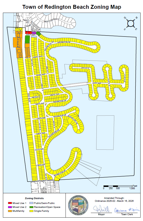
Establishment of zoning map. The locations and boundaries of the enumerated zoning districts are established as shown on the adopted Zoning Map of the Town of Redington Beach. The zoning map is hereby made a part of this Appendix A, Section 2. The zoning map shall be identified by the signature of the mayor, attested by the town clerk and bear the seal of the town. The official zoning map shall be maintained on display in the Town Hall.
Except where referenced on the zoning map to a street boundary line or other designated line by dimensions shown on such map, the zoning district boundary lines are intended to follow property lines or the center line of street or alleys or rights-of-way as they existed at the time of the adoption of the map or any amendments of the same.
(c)
Correlation of zoning districts and future land use plan categories. The table below shows the correlation between the town's zoning districts and future land use plan categories, as established in the town's comprehensive plan. Maximum densities, intensities, and permitted uses of land parcels within each zoning district are governed by the underlying future land use category, unless further restricted by these land development regulations.
(Ord. No. 2026-02, § 1, 3-16-26)