
Spring Hill City Zoning Code
CHAPTER 744
DEVELOPMENT STANDARDS1
Editor's note— Ord. No. 64, 2015, § 1(Exhibit), passed September 28, 2015, effective April 1, 2016, repealed the former Chs. 730—735, and enacted new Chs. 740—744 as set out herein. The former Chs. 730—735 pertained to Zoning—General Provisions, Dwelling Zoning Districts; Zoning—Commercial Districts, Zoning—Industrial Commercial Districts, Sign Regulations, Zoning—Other Districts. See Code Comparative Table for complete derivation.
Article IX. - 2018 REVISED SIGN REGULATIONS[2]
Editor's note— G.O. 10, 2019, § 1, adopted February 25. 2019, repealed the former Art. IX, §§ 744-901—744-906, and enacted a new Art. IX as set out herein. The former Art. IX pertained to similar subject matter and derived from G.O. 64, 2015; G.O. 72, 2015, § 1(Exhibit).
Sec. 744-101. - General requirement.
All development shall be subject to the development standards in this Chapter 744 unless specifically excluded by a provision of the Zoning Ordinance or other regulation of the City of Indianapolis.
(G.O. 64, 2015, § 2)
Sec. 744-201. - General dimensional standards.
A.
Primary dimensional standards. All development in all Zoning Districts shall comply with the primary dimensional standards in this Section 744-201; and shall also comply with standards in Section 744-202 (New Construction for Nonconformities), Section 744-203 (Special Dimensional Standards), Section 744-204 (Height Exceptions and Yard Encroachments) and Section 744-205 (Stream Protection Corridors) as applicable to the development; and any dimensional requirements in Chapter 743, Article III (Use-Specific Standards), as applicable to the uses included in the development; and any dimensional requirements in Chapter 742, Article II (Secondary Districts) as applicable to the property. In case of any conflict between the dimensional standards in any of the referenced sections, the strictest provision shall apply.
B.
Dwelling Districts. Dimensional standards for Dwelling Districts are shown in Table 744-201-2. Units are in feet unless indicated otherwise.
C.
Commercial Districts. Dimensional standards for Commercial Districts are shown in Table 744-201-3.
D.
Mixed-Use Districts. Dimensional Standards for Mixed-Use Districts are shown in Table 744-201-4.
E.
Central Business Districts. Dimensional Standards for Central Business Districts are shown in Table 744-201-5.
F.
Industrial Districts. Dimensional Standards for Industrial Districts are shown in Table 744-201-6.
G.
Development Plan Districts. Dimensional standards for Development Plan Districts (PK-1, PK-2, HD-1, HD-2, UQ-1, UQ-2, SZ-1, and SZ-2) are set forth in Section 742-108, and the development plans approved for each of those Districts pursuant to Section 742-108.
H.
Special Use (SU) Districts. Dimensional standards for Special Use (SU) Districts are set forth in Section 742-109.
(G.O. 64, 2015, § 2; G.O. 37, 2018, § 9; G.O. 26, 2021, § 6; G.O. 23, 2023, § 7)
Sec. 744-202. - New construction for nonconformities.
The standards in this Section 744-202 apply in addition to those in Section 744-201. In the event of a conflict between standards in the two sections, the provisions of this Section 744-202 shall apply.
A.
Setback exception for D-A Lots platted prior to December 20, 1989. Any lot, with deficient minimum lot area or lot width required by the D-A District requirements of this Ordinance, previously platted or recorded prior to December 20, 1989, in conformance with the applicable A-1 or A-2 agricultural district standards of the Marion County Master Plan Permanent Code, may construct, enlarge, extend, reconstruct, or relocate primary and accessory single-family uses with 15-foot minimum side and rear setbacks.
B.
Lot area and width exception for subdivisions in Dwelling Districts.
1.
In the D-S, D-1, D-2, D-3 and D-4 Zoning Districts, any plat of a major subdivision of more than five lots submitted for approval in accordance with Chapter 741 Subdivision Regulations after December 20, 1989, may reduce the minimum lot area for up to 20% of the total number of lots within the subdivision, to the extent of up to 20% below the District's minimum lot area, provided the average size of all lots within the subdivision shall be at least the minimum lot area required by the District.
2.
In the D-S, D-1, D-2, D-3 and D-4 Zoning Districts, any plat of a major subdivision of more than five lots submitted for approval in accordance with Chapter 741 Subdivision Regulations after December 20, 1989, may reduce the minimum lot width for up to 20% of the total number of lots within the subdivision, to the extent of up to 10% below the minimum lot width required by the District.
C.
Lot area and width exceptions for previously recorded lots.
1.
All lots recorded or any platted lot recorded prior to December 20, 1989, having less than the minimum lot area or minimum lot width required by the applicable Dwelling District regulations of the Zoning Ordinance for a single-family detached dwelling, shall be deemed an exception to such minimum lot area and lot width requirement, and a single-family detached dwelling may be constructed thereon provided all other requirements of this ordinance, including minimum yard and setback requirements, shall be maintained.
2.
In the D-6, D-6II and D-7 districts, a single-family detached dwelling or two-family dwelling, including accessory structures, may be constructed, erected, enlarged, extended, or reconstructed on any platted lot recorded prior to December 20, 1989, that was specifically platted for single-family or two-family dwelling purposes. Such development shall be in accordance with the approved plat, any restrictions thereof, and any commitments resulting from the rezoning of such lot
3.
All lots recorded or any platted lot recorded prior to August 2, 1993 having less than the minimum frontage required by the applicable Commercial District regulations of the Zoning Ordinance, shall be deemed an exception to such minimum frontage requirement, and a commercial establishment may be constructed thereon provided all other requirements of the Commercial District, unless specifically excepted in this section, shall be maintained.
D.
Front setback exceptions.
1.
The minimum required front setback for a site may be reduced to the average setback derived from the established front setbacks of the nearest lot on each side of the site that is improved with an existing primary building facing the same street and is within 200 feet of the site. In the case of a corner lot, the average is derived from the established front setback of the nearest improved lot and the setback established by ordinance.
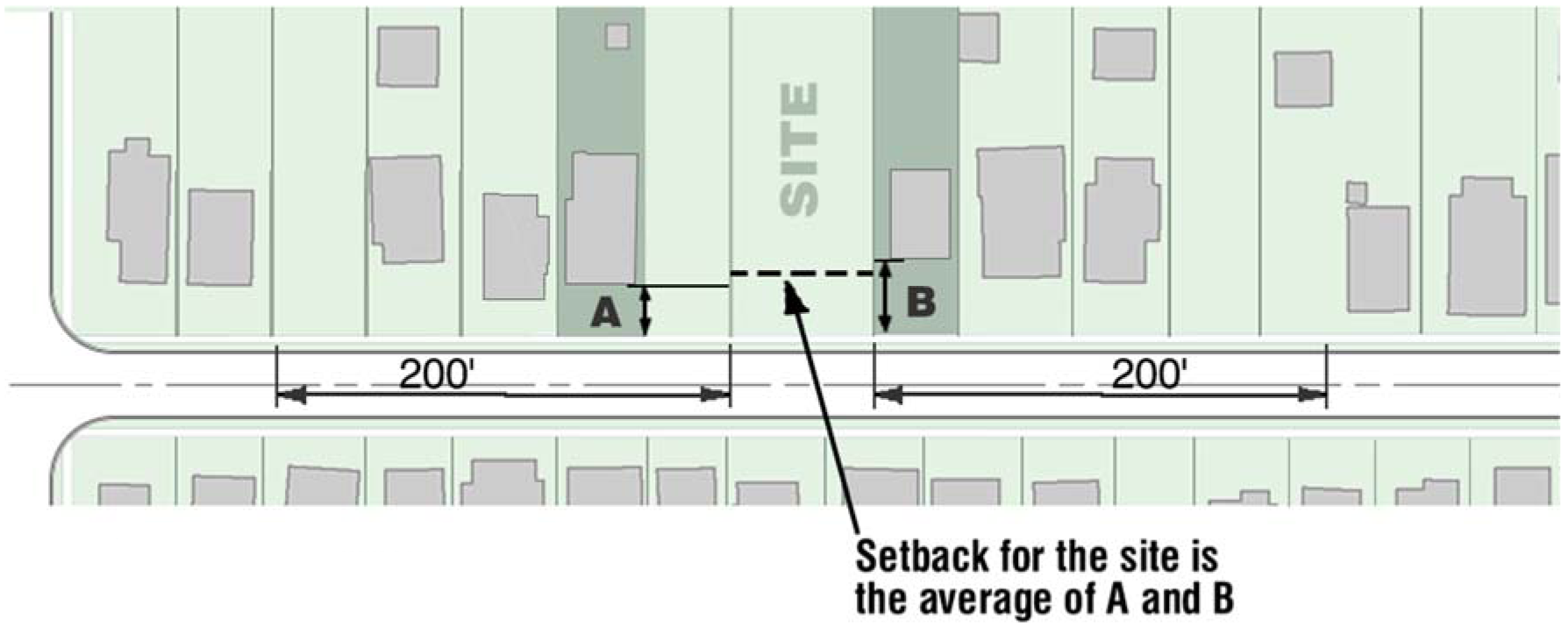
Diagram A Front Setback Averaging
2.
The required front setback in any District for any existing building, having a legally established front setback line which is less than the minimum front setback or greater than the maximum setback of the District, shall be modified to permit expansion of such building along the building's legally established front setback line, provided that:
a.
Only a one-time expansion along the legally established nonconforming front setback line shall be permitted; and
b.
The linear front footage of expansion does not exceed 50% of the linear front footage of the original building, and all other requirements of the Zoning Ordinance are maintained for the expansion.
3.
Notwithstanding the provisions of subsections 1. and 2. above no building or structure shall:
1.
Encroach upon any proposed right-of-way, as determined by the Official Thoroughfare Plan;
2.
Encroach upon any existing right-of-way; or
3.
Encroach into a clear sight triangular area.
E.
Side and rear yard setback exceptions.
1.
In the D-S, D-1, D-2, D-3, D-4, D-5, D-5II, and D-8 Zoning Districts, the minimum side and rear yard setback requirements for a lot containing a single-family detached dwelling or a two-family dwelling shall be subject to the following:
a.
The primary building may be enlarged or extended along a legally established nonconforming side yard between the established front setback line and the established rear yard setback line of the primary building provided that the linear footage of such enlargement or extension:
1.
Does not exceed 50% of the linear footage of the primary building along that side yard setback line, and
2.
Is a one-time only expansion along the legally established setback line.
b.
Legally established, detached, accessory structures may be reconstructed on an existing foundation, even though such reconstruction would not comply with required side or rear yards, provided however it does not encroach upon any right-of-way or clear sight triangular area.
c.
An accessory building may be enlarged or extended along a legally established nonconforming side or rear yard provided that the linear footage of such enlargement or extension:
1.
Does not exceed 50% of the linear footage of the accessory building along that side or rear yard setback line; and
2.
Is a one-time only expansion along the legally established setback line; and
3.
Such enlargement or extension shall not encroach into any required yard other than the existing nonconforming side or rear yard along which the enlargement or extension is occurring.
d.
A detached garage giving access to an alley may be located with a setback from the lot line abutting the alley of five feet or greater, provided however it does not encroach upon any clear sight triangular area.
2.
In the Commercial, Industrial and Mixed-Use Zoning Districts, the minimum required side yard setback for any existing legally established building, having a legally established side yard setback line that is less than the required side yard setback of the District, shall be modified to permit expansion of such building along its legally established nonconforming side yard setback line between the established front setback line and the established rear yard setback line provided that:
a.
Only a one-time expansion along the legally established setback line shall be permitted; and
b.
The linear footage of such expansion does not exceed 50% of the linear footage of the building along that side yard setback line, and all other requirements of this chapter are maintained for the expansion; and
c.
This exception shall not apply to required side transitional yards.
F.
Stream protection corridor nonconformity. Legally-established buildings and structures within the stream protection corridor existing prior to the first day of the month that is six months after the date of adoption, may not be altered to create a new nonconformity or increase the degree of noncompliance with Section 744-205 (Stream Protection Corridor). However, this shall not preclude additional development located outside the stream protection corridor.
(G.O. 64, 2015, § 2; G.O. 37, 2018, § 9; G.O. 23, 2023, § 7)
Sec. 744-203. - Special dimensional standards.
The standards in this Section 744-203 apply in addition to those in Section 744-201. In the event of a conflict between standards in the two sections, the provisions of this Section 744-203 shall apply.
A.
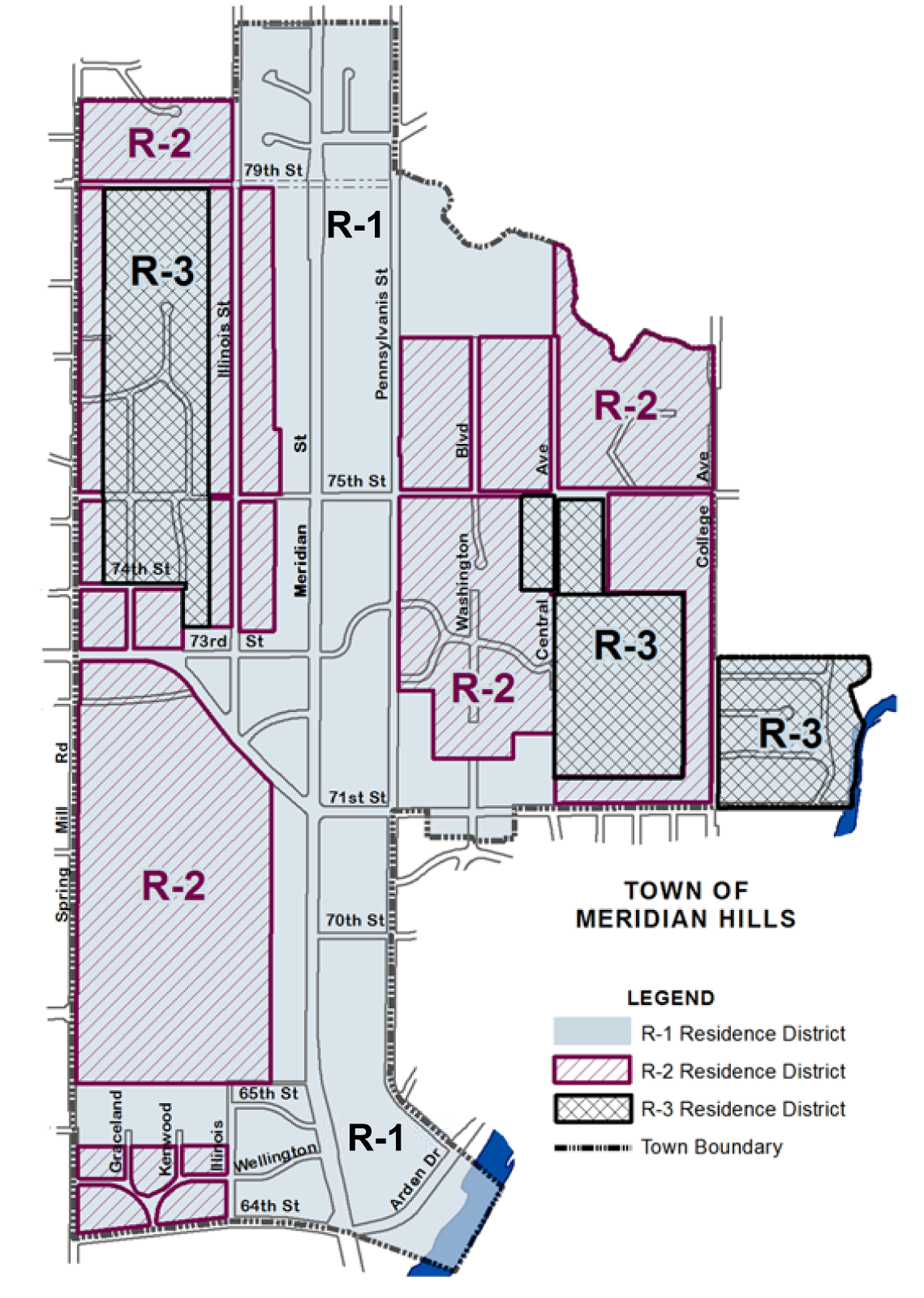
Land within the Town of Meridian Hills. The required front, side and rear setback and minimum front, side and rear yard requirements applicable to all land within the Town of Meridian Hills, Indiana, however presently zoned, shall be not less than the standards of the class R-1, R-2, and R-3 Area Districts, respectively, previously applicable thereto as said land was formerly zoned, in accordance with the Meridian Hills Zoning Map as reflected on the map below and sections 9, 10, and 12 of the Code of the Town of Meridian Hills, Indiana, General Ordinance No. 1, 1946, prior to August 2, 1966, as reflected in Table 744-203-1 below, which rezoned and reclassified said land.
(Said Code of the Town of Meridian Hills, Indiana, sections 9, 10, and 12 and Meridian Hills Zoning Map, adopted by the Marion County Council March 28, 1957, as part of Marion County Council Ordinance No. 8-1957, are hereby incorporated herein by reference).
B.
Development standard exceptions in historic preservation areas. All lots in a Dwelling District or Commercial District that are located within a locally designated historic preservation area as established by, and under the jurisdiction of, the Indianapolis Historic Preservation Commission (IHPC):
1.
Not fronting on a thoroughfare, as designated on Official Thoroughfare Plan shall be exempt from the provisions of Chapter 744, Article II (Lot and Building Dimensions), regarding required minimum front, side and rear yard setbacks. The minimum required front, side and rear yard setbacks for lots located within such historic preservation areas shall be as determined by the IHPC. The minimum required front, side and rear yards shall be as set forth in and specified by the grant of a Certificate of Appropriateness following all procedures set forth by the IHPC.
2.
Fronting on a thoroughfare, as designated on the Official Thoroughfare Plan shall be exempt from the provisions of Chapter 744, Article II, Lot and Building Dimensions, regarding required minimum side and rear setbacks. The minimum required side and rear yard setbacks for lots located within such historic preservation areas shall be as determined by the IHPC. The minimum required side and rear yards shall be as set forth in and specified by the grant of a Certificate of Appropriateness following all procedures set forth by the IHPC.
3.
Shall be exempt from the provisions of Chapter 744, Article II (Lot and Building Dimensions) regarding maximum height of primary buildings and accessory structures. The maximum height of primary buildings and accessory structures located within such historic preservation areas shall be as determined by the IHPC. The maximum height of primary and accessory buildings shall be set forth in and specified by the grant of a Certificate of Appropriateness following all procedures set forth by the IHPC.
C.
Zero-lot line option for Subdivisions in Dwelling Districts. The minimum side yard setback requirements of the D-S, D-1, D-2, D-3, D-4, D-5, and D-5II Zoning Districts shall be subject to the following exceptions: Any plat of a major subdivision submitted for plat approval in accordance with the Chapter 741 Subdivision Regulations after December 20, 1989, may reduce the minimum side yard requirement for one side yard of each lot to zero feet provided that:
1.
A minimum distance of 10 feet shall be required and maintained between all buildings on adjacent lots; and,
2.
No windows or doors shall be provided or maintained on that portion of the structure that reduces the required side yard by use of this exception; and,
3.
The aggregate side yards are provided on the lot according to the applicable Dwelling District regulations; and
4.
An easement, providing for the continual maintenance of that portion of the structure that reduces the required side yard by use of this exception, is provided, recorded and maintained.
D.
Cluster subdivision option in Dwelling Districts. Exceptions to Dwelling District development standards for the development of cluster subdivisions. In any plat of a major subdivision recorded after January 1, 1990, in the D-S, D-1, D-2, D-3 and D-4 Zoning Districts, the development standard exceptions listed in this Section 744-203.D. shall apply. Any major subdivision in the D-S, D-1, D-2, D-3 and D-4 Zoning Districts, the plat of which is submitted for plat approval in accordance with Chapter 741 Subdivision Regulations, may be developed as a cluster subdivision in accordance with the following:
1.
Purpose. Cluster subdivisions are intended to allow greater flexibility in design and development of subdivisions, in order to produce innovative residential environments, provide for more efficient use of land, protect topographical features, and permit common area and open space. To accomplish this purpose, the following regulations and exceptions shall apply only to cluster subdivisions.
2.
Criteria for a cluster subdivision. The following criteria must all be fulfilled to be eligible for a cluster subdivision.
a.
Unique topographical features on the site, including but not limited to slopes, streams, and natural water features, are protected and preserved.
b.
Wooded areas, individual trees of significant size, wetlands, or other environmentally sensitive features are protected and preserved.
c.
Common open space and recreational areas accessible to residents of the subdivision including provisions for walkways and bikeways are provided.
d.
Innovative residential environment is produced.
e.
Alteration of the natural site features is minimized through the design and situation of individual lots, streets, and buildings.
f.
Diversity and originality in lot layout and individual building design achieves the best possible relationship between development and the land.
g.
The land area devoted to motor vehicle access is minimized.
3.
Exceptions to Dwelling District development standards. If the criteria for a cluster subdivision is met, exceptions to the development standards relating to the subdivision's lot size, shape and dimensions may be permitted for individual lots within a cluster subdivision as follows:
a.
Project area (minimum size of subdivision). There shall be a minimum of five acres required for the development of a cluster subdivision. The tract of land to be developed shall be in one ownership or shall be the subject of an application filed by the owners of the entire tract. The tract shall be developed as a unit and in the manner approved.
b.
Project density. The overall maximum density of the proposed cluster subdivision shall remain the same as that permitted by developing the same site area into developable lots in full compliance with the applicable underlying Dwelling District regulations and the Chapter 741 Subdivision Regulations.
c.
Sewers. Attachment to public or semipublic water and sanitary sewer facilities shall be mandatory for development in any cluster subdivision with a minimum lot area of less than 24,000 square feet.
d.
Area, width, setback, and open space for individual lots. Individual lots in a cluster subdivision are exempt from the following development standards of the applicable Dwelling District:
1.
Minimum lot area.
2.
Minimum lot width.
3.
Minimum lot width at setback.
4.
Minimum side and rear yard setback regulations. Minimum side and rear yard setback regulations may be modified by the following:
i.
Setback from any subdivision boundary property lines: 20 feet.
ii.
The minimum rear yard setback: 15 feet.
iii.
The minimum side yard setback shall have a minimum depth in accordance with Section 744-203.C. Zero-lot line option for subdivisions in Dwelling Districts, with the exception that Section 744-203.C.3. shall not apply when utilizing the cluster subdivision exception.
5.
The minimum street frontage. Minimum street frontage may be reduced to 15 feet provided, however, that each individual lot shall have direct access to a public street; and,
6.
Minimum open space. Individual cluster lots shall have a minimum open space of 50%.
e.
Project open space. The amount of permanent open space created by the development of the site as a cluster subdivision shall be equivalent to, or more than, the total reduction in lot sizes. At least 75% of the total amount of open space shall consist of tracts of land at least 50 feet wide. The open space created by the development of the site as a cluster subdivision shall be provided in such a manner that it is preserved in its naturally occurring state for passive recreational activities. A subordinate amount of this open space may be developed as a common recreational area. The open space created by the development of the site as a cluster subdivision shall further be provided in such a manner that it is accessible to residents of the subdivision and for maintenance. The open space shall perpetually run with the subdivision and shall not be developed or separated from the cluster subdivision at a later date. Provisions shall be made for continuous and adequate maintenance at a reasonable and nondiscriminatory rate of charge.
4.
Procedures for cluster subdivision approval.
a.
The petitioner shall submit two site plans for the property proposed for a cluster subdivision for review and conceptual design approval by the Administrator prior to filing for plat approval.
1.
Site Plan 1 shall depict the development of the site in full compliance with all use and development standards of the applicable underlying Dwelling District and Chapter 741 Subdivision Regulations. This site plan will be used to determine the maximum number of developable lots possible on the site and set the density of that development.
2.
Site Plan 2 shall depict the development of the site as a proposed cluster subdivision. The density of the overall development shall be no greater than that permitted by the development of the site depicted in Site Plan 1.
b.
The Administrator shall compare the proposed cluster subdivision (Site Plan 2) with the site plan showing the same site developed in compliance with the applicable Dwelling District (Site Plan 1) and determine if the criteria for a cluster design is met.
c.
If upon review, the Administrator determines that the criteria for a cluster subdivision is not met or the submission requirements not fulfilled, the Administrator shall inform the petitioner in writing of the determination. The petitioner may, within five business days, appeal the Administrator's decision by filing an approval petition before the Metropolitan Development Commission.
d.
If upon review the Administrator determines that the criteria for a cluster subdivision is met, the Administrator shall:
1.
Inform the petitioner in writing of the determination; and,
2.
Send a copy of that letter to the applicable registered neighborhood organizations.
e.
The petitioner may then proceed with the filing of a preliminary plat before the Plat Committee. The filed plat shall be in substantial compliance with the Site Plan 2 approved by the Administrator. The legal notice for the public hearing of the Plat Committee regarding such a preliminary plat shall indicate clearly that the request is for a cluster subdivision.
5.
Maintenance of common open space areas. As a condition of Administrator's approval of the cluster subdivision permitting exceptions to the standard requirements of the applicable Zoning District, the petitioner shall submit with the site plan for review and approval documentary assurances that permanent dedication of the open space areas shall be made and that adequate provisions are being made for continuous and adequate maintenance of project open space, common areas and recreation areas. Once approved by the Administrator, the documentary assurances shall be filed with the Plat Committee at the time a petition for plat approval is initiated. Further, the documentary assurances shall be incorporated in the plat that is recorded with the Office of the Marion County Recorder. No exceptions to these requirements shall be permitted unless the Plat Committee determines that the petitioner has adequately provided for such upkeep, protection and maintenance of open space, common area or recreational areas through other legally binding perpetual agreements.
(G.O. 64, 2015, § 2)
Sec. 744-204. - Height exceptions and yard encroachments.
The following exceptions to height limits and encroachments into required setbacks and yard areas are allowed as indicated in Table 744-204-1: Encroachments and Exceptions.
(G.O. 64, 2015, § 2; G.O. 37, 2018, § 9; G.O. 23, 2023, § 7)
Sec. 744-205. - Stream protection corridors.
A.
Establishment of stream protection corridors.
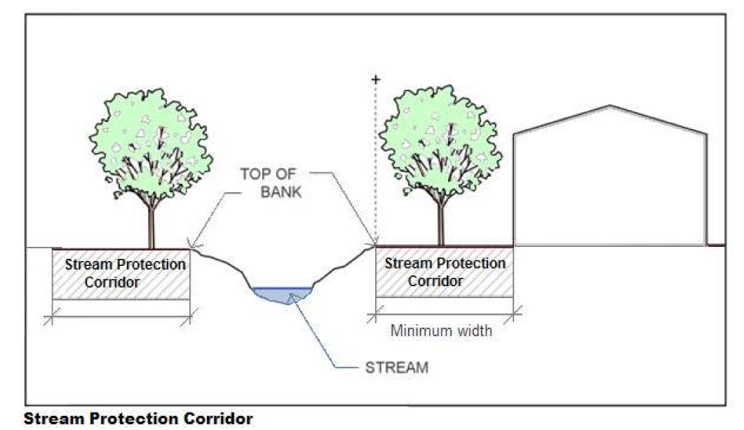
Diagram B Stream Protection Corridor cross-section
1.
A stream protection corridor shall consist of a strip of land, extending along both sides of all streams shown on the map of natural, non-intermittent streams maintained by the Department of Metropolitan Development.
2.
The minimum width of the stream protection corridor must be provided as shown in the Table 744-205-1. The width is measured parallel to the top of bank.
3.
Construction projects over one acre are subject to the requirements of the Environmental Protection Agency (EPA) General Permit and Indiana Department of Environmental Management (IDEM) Construction Stormwater General Permit (CSGP).
4.
When wetland areas extend from within a Stream Protection Corridor's required boundary to a point outside of that boundary, the corridor width shall be adjusted to include the extent of the wetland.
5.
Category One Streams are listed in Table 744-205-2.
B.
Uses permitted in the stream protection corridor.
1.
The vegetative target for the stream protection corridor is a variety of mature, native riparian tree and shrub species that can provide shade, leaf litter, woody debris, and erosion protection to the stream, along with appropriate plantings necessary for stream bank stabilization. The following activities are permitted within the stream protection corridor:
a.
Flood control structures.
b.
Residential support facilities and recreational facilities, such as trail or hiking paths, docks, picnic shelter, scenic overlook, provided however the cumulative area of subsections b. and c. activities does not exceed 10% of the stream protection corridor area on the lot.
c.
Minor residential features, decks associated with an individual dwelling unit, mini-barns or sheds that are 200 square feet or less and are not on a permanent foundation, provided however the cumulative area of subsections b. and c. activities does not exceed 10% of the stream protection corridor area on the lot.
d.
Passive uses such as wildlife sanctuaries, nature preserves, forest preserves, fishing areas, and public and private parkland.
e.
Crossings, subject to the following, and as approved by the Administrator:
1.
Road or railroad crossings, with the right-of-way the minimum width needed to allow for maintenance access and installation and with the angle of the crossing to be perpendicular to the stream. In the case of proposed development or modification to existing development, there shall be one stream crossing per development project, to be no closer than 1,000 feet to any other crossing.
2.
Intrusions necessary to provide access to a property provided that the angle of crossing is perpendicular to the stream in order to require less buffer clearing.
3.
Public sewer or utility easement crossings, including such land disturbance and impervious cover as is necessary for operation and maintenance, including, but not limited to, manholes, vents, and valve structures.
4.
Livestock crossings.
2.
Disturbances in the stream protection corridor. Any tree or vegetation removal must be replaced with native species of shade trees and shrubs at the rate of one shade tree and four large shrubs per 1,000 square feet of disturbed area.
(G.O. 64, 2015, § 2; G.O. 23, 2023, § 7)
Sec. 744-301. - General standards.
A.
Access to accessory parking areas. After the first day of the month that is six months after the date of adoption, if a lot abuts an improved alley and the street frontage is less than 200 feet, vehicle access to that lot shall be exclusively from that alley.
B.
Greenway access. If a site abuts a greenway, pedestrian access must be provided in accordance with the Indy Greenways Full Circle 2014-2024 Master Plan, unless the Administrator determines that access in that location is not practicable due to site, utility or topography constraints.
C.
Bicycle or pedestrian paths. Where plans adopted by the city show a bicycle or pedestrian path or trail, the site design shall provide connections to those paths or trails. Any requests by the city for designation or dedication of land for bicycle or pedestrian trails within a proposed development shall comply with all applicable provisions of federal and Indiana state law.
D.
Safe routes to school. Where a safe routes to school route associated with the federal or Indiana Safe Routes to School program is adjacent to the boundaries of a development or redevelopment involving residential uses, the project design shall provide connections to the designated school route and shall dedicate right-of-way to accommodate the provision of the route. Any requests by the city for designation or dedication of land for the designated school route within a proposed development shall comply with all applicable provisions of federal and Indiana state law.
E.
Cul-de-sac pedestrian access. Whenever cul-de-sac streets are created, a 15-foot wide pedestrian access/public utility easement shall be provided between the cul-de-sac head or street turnaround and the sidewalk system of the closest adjacent street or pedestrian sidewalk or pathway, unless the Administrator determines that public access in that location is not practicable due to site, utility or topography constraints.
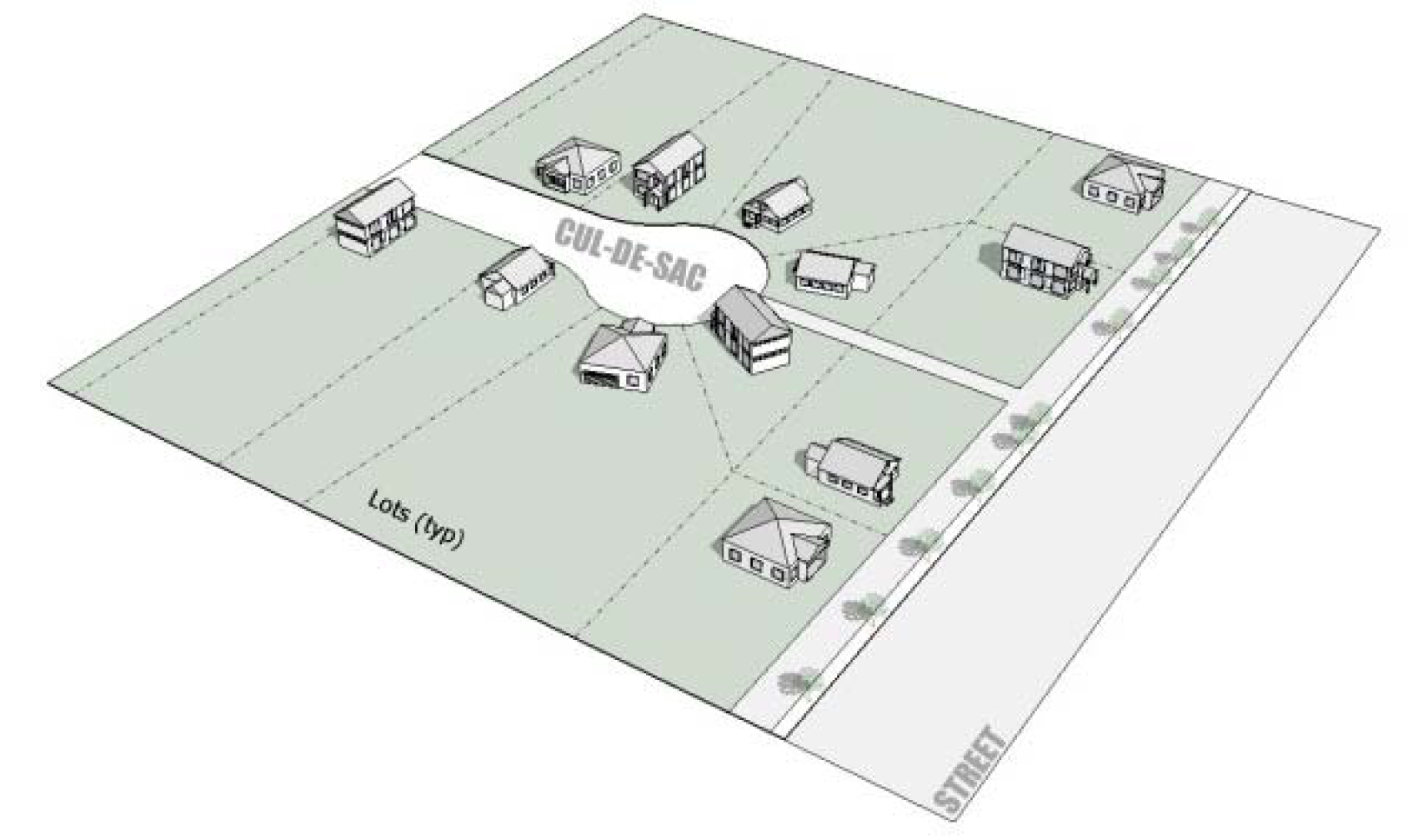
Diagram C Pedestrian Access from cul-de-sac
F.
On-site connectivity.
1.
Walkways to sidewalks. For two-family dwellings and single-family attached dwellings, walkways from the sidewalk system shall be provided to each dwelling unit. For all other buildings, at least one walkway from the sidewalk system shall be provided to each public pedestrian entrance.
2.
Internal connectivity. Within a freestanding lot, project or integrated center, hard-surfaced walkways shall be provided in accordance with a pedestrian plan that shall include a walkway system that functionally connects all of the building's main front entrances with the sidewalk located in the public right-of-way of each of the freestanding lot or integrated center's eligible public streets. Nonresidential and mixed-use developments containing more than one primary building on a single lot shall include an unobstructed walkway or pathway at least five (5) feet wide providing access between the primary buildings.
3.
Markings. Such private walkways shall provide for identifiable pedestrian crossing markings, such as change in paving material, color, or height, along the functional pedestrian routes wherever the route crosses an interior access drive, street, drive-through lane, or parking lot.
G.
Waiver of sidewalks. In locations where site conditions cause extreme difficulty in the construction of sidewalks, the Administrator may, upon written request, waive that portion of sidewalks. Examples of extreme difficulty include, but are not limited to, waterway crossings, significant elevation change, existing deep drainage swales in the right-of-way, and grades steeper than 3:1. The request shall include supporting documentation. The waiver would be pursuant to a written agreement and subject to a contribution in lieu of sidewalks that shall be made to the City for the provision of sidewalks in Marion County. The rate amount shall be set annually.
(G.O. 64, 2015, § 2; G.O. 37, 2018, § 11)
Sec. 744-302. - Construction of sidewalks in the right-of-way.
A.
Sidewalks and any alternative pedestrian walkway shall comply with the Americans with Disabilities Act.
B.
Sidewalks shall consist of the walkway and any curb ramps or blended transitions.
C.
Width of sidewalks, exclusive of the width of any curb, landscape area or amenity zone, must be at least the width indicated in Table 744-302-1: Minimum Sidewalk Widths. The sidewalk shall be unobstructed, except as detailed in the Sidewalk Zone provisions of the Thoroughfare Plan.
* See Sidewalk Zone provisions and standards in the Thoroughfare Plan for specific streetscape designs strategies for various street types, and contexts.
D.
Sidewalks shall meet the Standards for Street and Bridge Design and Construction (G.O. 49, 1972/Standards for Acceptance of Streets and Bridges of the City-County Council of Indianapolis and Marion County, Indiana), except as indicated otherwise herein.
E.
Sidewalks shall be a minimum of four inches in thickness of Portland cement concrete, except where sidewalks cross concrete drives or driveways the thickness shall be a minimum of six inches, conforming to subsection 604 of the current Indiana Department of Transportation Design Standards and Specifications. Sidewalks along frontages that are identified in the Indy Greenways Full Circle 2014-2024 Master Plan, Marion County Comprehensive Plan, or Indy Parks Connectivity Plan as a greenway or linear path may be constructed with alternate materials and depth standards as approved by the Administrator.
F.
Sidewalks shall be provided along the entire frontage of all abutting eligible public streets, excepting freeways and expressways as indicated in the current Official Thoroughfare Plan for Marion County, Indiana, and other full control of access frontages as determined by the Administrator.
G.
Unless a different location is approved by the Administrator, the sidewalks shall generally be provided within the public right-of-way, one foot from the right-of-way line. The Sidewalk Zone provisions of the Thoroughfare Plan provide more specific design details for design of specific street types and rights-of-way conditions.
H.
Where sidewalks exist in the public right-of-way in front of an adjacent lot and extend to a point equal to the common lot line extended, the sidewalks shall fully connect with such existing sidewalks on the adjacent property to provide a continuous, unobstructed walkway along the public street.
(G.O. 64, 2015, § 2; G.O. 26, 2021, § 9)
Sec. 744-303. - Single- and two-family sidewalk standards.
The following standards apply for residential areas that were approved without the provision of sidewalks.
A.
When a lot is part of an approved major residential subdivision that includes or required sidewalks, sidewalks must be installed.
B.
When a single-family detached dwelling, single-family attached dwelling, two-family dwelling, triplex or fourplex is constructed on a freestanding lot, a sidewalk must be provided only if either one of the adjacent lots has a sidewalk installed. A sidewalk along each frontage shall be provided and connect with each existing sidewalk on an adjacent property.
(G.O. 64, 2015, § 2)
Sec. 744-304. - Sidewalk standards for other development.
A.
All "places of public accommodation," as defined in the federal Americans with Disabilities Act (42 U.S.C. 12101 et. seq.) shall comply with the requirements of that act concerning on-site circulation and access.
B.
New development. Sidewalks, as prescribed in this Chapter 744, Article III, shall be provided in connection with the initial development of a freestanding lot or integrated center when a building is constructed, erected, or relocated. Sidewalks shall be provided for the reconstruction of a freestanding lot or integrated center upon which at least two-thirds of all buildings have been removed, demolished, or destroyed.
C.
Redevelopment or additions. When improvements are proposed for a freestanding lot or integrated center upon which a building on a permanent foundation exists prior to July 1, 2008; or, a lot upon which no building on permanent foundation exists and is located within an integrated center upon which a building on a permanent foundation exists prior to July 1, 2008, sidewalks for the redevelopment or the additions shall be provided as prescribed in this Chapter 744, Article III and in compliance with the following regulations:
1.
Sidewalks shall be required when a building is constructed, erected, enlarged, extended, reconstructed, relocated, or converted to a commercial use; except a building that was destroyed or damaged by fire or natural causes and is reconstructed on substantially the same foundation and of substantially the same gross floor area.
2.
Sidewalks shall be provided at a minimum rate of five linear feet of sidewalk per 100 square feet or fraction thereof of the gross floor area of the constructed, erected, enlarged, extended, reconstructed, or converted to a commercial use, or relocated building or addition. The linear amount of sidewalk required shall not exceed the cumulative length of the eligible public streets of the freestanding lot or integrated center, excepting freeways and expressways as indicated in the current Official Thoroughfare Plan for Marion County, Indiana, and other full control of access frontages as determined by the Administrator.
3.
The provision of the sidewalks shall be in accordance with the following options with the first option being preferred:
a.
Sidewalks shall be constructed; or
b.
Pursuant to a written agreement, a contribution in lieu of sidewalks shall be made to the City for the provision of sidewalks in Marion County. The amount shall be $60.00 per linear foot of required sidewalk. The rate per linear foot shall be increased by $3.00 annually beginning January 1, 2017.
4.
Where this Section 744-304.C. would result in the partial installation of sidewalks along an eligible public street, the Administrator shall determine the location along the eligible public street where the sidewalks shall be installed. The criteria for the sidewalk location shall be the greatest improvement to the public health, safety, welfare and convenience.
5.
The provision of the sidewalks shall be required for each addition to the site until the sidewalks are constructed along all eligible frontages or the equivalent contribution has been made for the sidewalks.
6.
A through block sidewalk at least five feet wide shall be provided near the middle of any block face longer than 800 feet in order to provide connections with streets on either side of the block, unless the ownership of adjacent parcels would prevent the walkway from connecting to a public sidewalk or the Administrator determines that the walkway is not practicable due to site, utility, or topography constraints.
(G.O. 64, 2015, § 2)
Sec. 744-305. - Private street and interior access drives.
Private streets and interior access drives must meet the minimum standards for construction, materials for use in construction, and design as specified by the Standards for Street and Bridge Design and Construction (Standards for Acceptance of Streets and Bridges; G.O. 49, 1972 of the City-County Council of Indianapolis and Marion County, Indiana) and Chapter 691 of the Revised Code of the Consolidated City and County. Provided, however, that theses standard specifications are modified as follows:
A.
Curbing shall not be required unless required by storm drainage improvements.
B.
The minimum width of pavement, including curb and gutter, if provided, for private streets and interior access drives must be provided in accordance with Table 744-306-1.
C.
The owner or project management, homeowners' association or other similar organization (not by a governmental agency) must maintain all sidewalks, pedestrian ways, private streets, interior access drives and parking areas in good condition and repair reasonably free of chuckholes, standing water, weeds, dirt, trash, mud, ice and snow and debris.
(G.O. 64, 2015, § 2)
Sec. 744-401. - Applicability.
All off-street parking, loading, and drive-through stacking areas for motor vehicles and bicycles areas shall be provided in accordance with the following regulations. However, commercial parking facilities, including attendant parking, shall be subject to the provisions of Chapter 931 of the Revised Code of the Consolidated City and County, in addition to the development standards of this chapter.
A.
Exception for permits previously issued. For all buildings and structures erected and all uses of land established after the first day of the month that is six months after the date of adoption, parking facilities shall be provided in accordance with the regulations of this Chapter 744, Article IV Parking (Loading and Drive-Through). However, where Improvement Location Permits and building permits have been issued prior to that effective date, and provided that construction has begun within six months of that effective date and diligently pursued to completion (but such time period not to exceed three years after the issuance of such building permit), parking facilities in the amounts required for issuance of such permits may be provided in lieu of any different amount required by the off-street parking regulations of this zoning ordinance.
B.
Increased intensity of use. When the intensity of use of any legally established building, structure or premises (existing on the first day of the month that is six months after the date of adoption or hereafter established) is increased resulting in a net increase of gross floor area or any other unit of measurement specified herein for determining required parking areas, parking spaces and any other facilities as required by this Chapter 744 Article IV shall be provided for the increased intensity of use. However, no building or structure lawfully erected, or use lawfully established, prior to the first day of the month that is six months after the date of adoption shall be required to provide such additional parking spaces or areas, unless and until the aggregate increase in any unit of measurement specified herein for determining required parking spaces causes an increase in the required number of parking spaces that equals 15% or more of the number of parking spaces existing on the first day of the month that is six months after the date of adoption, in which event parking spaces and areas as required herein shall be provided for the total increase.
C.
Change of use. Whenever the type of land use of a building, structure or premises is hereafter changed to a new type of land use permitted by this ordinance, parking spaces and areas shall be provided as required by the provisions of this chapter for such new type of land use, subject to the exception noted in Section 744-401.B. above.
D.
Change to existing parking areas. Required accessory off-street parking areas in existence on the first day of the month that is six months after the date of adoption, shall not hereafter be reduced below, or if already less than, shall not be further reduced below, the requirements for such use as would be required for such use as a new use of a building, structure or premises under the provisions of this chapter.
Further, accessory off-street parking areas in existence on the first day of the month that is six months after the date of adoption that exceed the maximum number of parking spaces allowed, shall not be required to eliminate the excess parking spaces.
E.
New or expanded parking areas. Nothing in this chapter shall prevent the establishment of, or expansion of the amount of, parking areas to serve any existing land use or building, provided that all other regulations in this Chapter 744 Article IV shall be adhered to.
F.
Damage or destruction.
1.
If any legally established nonconforming structure, building, or facility is damaged or partially destroyed by fire or other naturally occurring disaster, and the damage or destruction does not exceed two-thirds of the gross floor area of the building, structure, or facility, any reconstruction of the structure, building or facility shall restore and continue in operation off-street parking and loading spaces equal to those maintained at the time of the damage or partial destruction.
2.
If any legally established nonconforming structure, building, or facility is damaged or partially destroyed by fire or other naturally occurring disaster, and the damage or destruction equals two-thirds or more of the gross floor area of the building, structure, or facility, any reconstruction of the structure, building or facility shall provide off-street parking and loading spaces in accordance with this article.
G.
Calculating amount of required parking. When a computation of required parking spaces results in a fraction, the number of required parking spaces shall be rounded down to the next whole number.
H.
On-street parking spaces. In the Compact Context area, on-street parking spaces, lawful at the time of permit issuance, located on the same side of the street and directly in front of the property containing the use or building being served (as determined by extensions of the property side or rear lot lines, as applicable, into the on-street parking lane) may be counted towards minimum off-street parking requirements.
I.
Measuring and configuring parking areas. All off-street parking areas and facilities, except those for single-family detached dwellings, single-family attached dwellings, two-family dwellings, triplexes, and fourplexes, must comply with the dimensional and configuration standards shown in Table 744-401-1: Parking Space and Lot Design and Dimensions based upon the angle of parking, direction of travel and vehicle size, and depicted in Figure 744-401-A: Parking Lot Layout.
Figure 744-401-A: Parking Lot Layout
Table 744-401-1: Parking Space and Lot Design and Dimensions
(G.O. 64, 2015, § 2; G.O. 23, 2023, § 8)
Sec. 744-402. - Required parking spaces.
Table 744-402-1: Required Parking Table indicates the minimum and/or maximum number of parking spaces that shall be provided for specific types of land uses in all Districts unless otherwise stated in another section of the Zoning Ordinance. Table 744-402-1 is based on Table 743-1: Use Table; however, it does not provide parking requirements for every listed land use type or land use category in that table.
A.
Unlisted uses. For any land use type not listed in Table 744-402-1: Required Parking Table, specific requirements shall be determined by the Administrator and shall be based upon requirements for similar types of uses, expected demand and traffic generated by the proposed use type, and other information from appropriate traffic engineering and planning criteria.
B.
General requirement. Off-street parking spaces shall be provided as shown in Table 744-402-1: Required Parking Table, except as follows:
1.
No off-street vehicle parking is required in the Mile Square Area or MU-4 District.
2.
No off-street vehicle parking is required for any parcel containing less than 5,000 square feet of lot area, except for single-family attached dwellings or single-family detached dwellings.
3.
Minimum vehicle parking required in the CBD-2, CBD-3 and MU-3 Districts is one space per 900 square feet of floor area regardless of the type of land use.
4.
No space used for a required parking space may be used for a required loading or stacking space.
C.
ADA parking requirements. Off-street ADA parking spaces shall be provided in accordance with Table 744-402-2 for all uses that provide off-street parking.
D.
Electric vehicle charging stations.
1.
Two electric vehicle charging stations shall be required for developments that provide 500 or more off-street parking spaces.
2.
Electric vehicle charging stations shall count toward the total required off-street parking spaces.
E.
Bicycle parking.
1.
Bicycle parking design and location requirements.
a.
Bicycle parking shall be located in a visible area near the intended use.
b.
The minimum size of a bicycle parking space is two feet by six feet. Bicycle parking racks shall be provided for bicycle parking.
c.
Bicycle parking racks shall be located to avoid potential conflict with parking and circulation of motor vehicles. Bicycle parking racks shall be positioned out of any required walkway.
d.
Bicycle parking racks shall support each bicycle in a method that does not use a wheel as the primary means of support and connection to the rack.
e.
Bicycle parking racks shall enable the bicycle frame and one or both wheels to be secured through use of a "U" type lock.
f.
Bicycle parking racks shall be securely anchored to a hard surface.
g.
Parallel bike racks shall be placed with a minimum of on-center spacing of 30 inches. Spacing of 48 inches is optimal.
h.
Required covered bicycle parking shall mean bicycle parking spaces that are either in a parking garage, or sheltered by a roofed structure with at least two walls to protect from rain and snow with the cover large enough to keep the bicycles dry.
i.
Required enclosed bicycle parking shall mean bicycle parking spaces that are located in one of the following:
1.
Locked room.
2.
Individual or community storage area.
3.
Bicycle locker.
4.
Locked area that is enclosed by a fence or wall with a minimum height of eight feet.
5.
Private garage serving a dwelling within a multi-unit (residential) building.
6.
Inside a residential dwelling unit if the dwelling unit has an exterior ground floor entry.
F.
Structured parking requirement. The following requirements apply to all developments not exempt from off-street parking requirements by another provision of this Chapter 744, Article IV Parking, Loading and Drive-Through.
1.
After the first day of the month that is six months after the date of adoption, all developments in the compact context area providing 400 or more off-street parking spaces shall provide at least 80% of those parking spaces in structured parking facilities, such as a free-standing garage or parking integrated within the primary building, rather than surface parking lots.
2.
Maximum parking limits shall not apply to developments that provide at least 80% of all off-street parking spaces in structured parking facilities rather than surface parking lots.
(G.O. 64, 2015, § 2; G.O. 37, 2018, § 10)
Sec. 744-403. - Adjustments to required off-street parking.
The minimum required off-street parking spaces shown in Table 744-402-1 may be reduced by the factors shown in subsections A. through E. below, individually or in combination, but the cumulative reduction in required off-street parking spaces shall not exceed 35 percent of the minimum required in Table 744-402-1.
A.
Electric vehicle charging stations. For each electric vehicle charging station provided, the minimum number of required off-street parking spaces may be reduced by two. Each charging station counts toward the minimum number of required parking spaces.
B.
Shared vehicle, carpool, or vanpool spaces. For each shared vehicle, carpool, or vanpool space provided, the minimum number of required off-street parking spaces may be reduced by four. Each shared vehicle, carpool, or vanpool space shall count toward the minimum number of required parking spaces.
C.
Bicycle parking. For every five bicycle parking spaces provided in excess of the required bicycle parking spaces (or where no bicycle parking is required), the minimum number of required off-street parking spaces may be reduced by one, up to a maximum reduction of five off-street parking spaces.
D.
Proximity to public transportation.
1.
The minimum number of off-street parking spaces required for any development with a lot line located within one-quarter mile of a transit stop improved with a shelter and located on an Indianapolis Public Transportation Corporation (IndyGo) Transit Emphasis Corridor shall be reduced by 30 percent.
2.
The minimum number of off-street parking spaces required for any development with a lot line located between one-fourth mile to one-half mile of a transit stop improved with a waiting pad and located on an IndyGo Transit Emphasis Corridor in operation for one year or more may be reduced by 10%.
3.
If an IndyGo transit corridor or center is eliminated or relocated, any development approved in conformance with this section shall not be deemed nonconforming in terms of required parking and shall not be required to provide additional parking for uses or development existing at the time the transit corridor or center is eliminated or relocated.
E.
Shared parking spaces. Where two land uses listed in separate use categories in Table 743-1: Use Table share a parking lot or structure, the total off-site parking required for those uses may be reduced by the factors shown in Table 744-403-1: Shared Parking Reduction Factors. Total off-street parking required shall be the sum of the two parking requirements for the two uses divided by the factors in Table 744-403-1. If uses in three or more categories of Table 744-403-1 share a parking lot or structure, the Administrator shall determine the parking reduction based on the relative sizes of the various uses and the reduction factors listed in Table 744-403-1.
For example: A 50-unit, three-story multifamily dwelling project will share a parking lot with a 6,000 square foot restaurant. According to Table 744-402-1, the required parking for the multifamily dwelling project is one per unit, or 50 parking spaces. The restaurant requires one per 150 square feet, or 40 spaces (6,000 sf ÷ 150). Shared parking for these two uses may be reduced by a factor of 1.1. To calculate the reduction, add the required parking for each use (50 + 40 = 90), then divide by a factor of 1.1 (90 ÷ 1.1 = 81.8). The total number of parking spaces required after the reduction is 82.
F.
Permeable pavers or pavement. Maximum parking requirements can be exceeded by up to 10% if permeable pavement or pavers are used for the amount of parking in excess of the maximum parking requirements listed in Table 744-402-1.
G.
Flexibility for redevelopment. Where the requirements of this article apply to a redevelopment or reconstruction project, rather than raw land development, the Administrator may authorize a reduction of minimum off-street parking requirements established in Section 744-403 by up to 10% (in addition to other reductions available under that section) if required to accommodate street frontage landscaping required by Section 744-504 or parking area landscaping required by 744-505.
(G.O. 64, 2015, § 2)
Sec. 744-404. - Location and design of parking facilities.
The following standards apply to all accessory and commercial parking lots, and to both required and non-required parking areas, unless otherwise stated in the Zoning Ordinance.
A.
Parking Lots and Access Points
1.
Location
a.
In the Metro Context area, accessory off-street parking areas shall be provided on the same lot as the building or use served unless an exception is specifically provided in the Zoning Ordinance and shall not be located within the public right-of-way.
b.
Notwithstanding subsection A.1. above, in the Metro Context area, buildings or uses existing on the first day of the month that is six months after the date of adoption that are subsequently altered or enlarged so as to require the provision of additional parking spaces under the requirements of this Chapter 744 Article IV may be served by parking spaces located on land other than the lot on which the building or use served is located, provided such spaces are within 500 feet of a lot line of the use served. However, no parking area for a nonresidential use shall be located within a Dwelling District unless the nonresidential use is permitted within that Dwelling District.
c.
In the Compact Context Area, accessory off-street parking areas may be located within 500 feet of the property containing the building or use served, provided that:
1.
No parking area for a nonresidential use shall be located within a Dwelling District unless the nonresidential use is permitted within that Dwelling District; and
2.
The Administrator determines that the property on which any required accessory off-street parking is located is reasonably likely to remain available to provide parking for the designated use for a period of at least five years.
2.
Parking in front of building
a.
Off-street parking may be provided between the front of a building and the street right-of-way as indicated in Table 744-404-1: Limitations to Parking in Front of a Building.
b.
Off-street parking may be provided between the front of a building and the street right-of-way unless prohibited by another provision of the Zoning Ordinance, and provided that the parking complies with the following standards:
Diagram D Front Yard
1.
If located in an industrial or commercial zoning district, the parking area must not occupy more than 10% of the total area of the setback area.
2.
All other provisions for Recreational Vehicle parking are met, per Section 743-306.Y (Use-Specific Standards for Recreational Vehicle Parking).
3.
All provisions of Section 744-500 (Landscaping and Screening) are met.
3.
Parking in side and rear yards. Unless prohibited by another section of the Zoning Ordinance, off-street parking may be located in any required side or rear yard that is not a transitional yard; provided that the transitional yard and edge buffering landscape requirements of Section 744-506 (Transitional Yard and Edge Buffering) are met.
4.
Regional Center and North Meridian Street Corridor. In the Regional Center and North Meridian Street Corridor District, parking lots shall not be permitted on any lot with frontage on Meridian Street, Pennsylvania Street, Washington Street, Market Street, or on any lot located within the Mile Square.
5.
CBD, MU-3, and MU-4 Zoning Districts. In the CBD-1, CBD-2, CBD-3, MU-3, and MU-4 Districts, parking lot entrances or exits shall be located at least 75 feet from the nearest point of two intersecting street right-of-way lines. In the MU-4 Zoning District, parking lot entrances shall not be located on a pedestrian frontage.
B.
Parking garage locations and access points.
1.
Parking garages in CBD-1 Zoning District. Vehicular entrances and exits to off-street parking garages in the CBD-1 Zoning District shall be provided only on the following streets:
a.
East New York Street; West New York Street.
b.
East Maryland Street; West Maryland Street.
c.
North Capitol Avenue; South Capitol Avenue.
d.
North Delaware Street; South Delaware Street.
e.
West Washington Street between Illinois Street and Capitol Avenue.
f.
West Ohio between Illinois Street and Capitol Avenue.
g.
North Pennsylvania Street between Ohio Street and New York Street; South Pennsylvania Street between Maryland Street and Washington Street.
h.
North Illinois Street between Ohio Street and New York Street; South Illinois Street between Maryland Street and Washington Street.
i.
Indiana, Massachusetts, Kentucky and Virginia Avenues.
j.
East Washington Street between Pennsylvania Street and Delaware Street.
2.
Parking garages in CBD-2 and CBD-3 Zoning Districts. Off-street parking garages and accessory off-street parking facilities within buildings in the CBD-2 and CBD-3 Zoning Districts located on lots having frontage upon North Meridian Street or North Pennsylvania Street shall be developed as an integral part of an associated apartment, office, hotel or other permitted principal use structure, with no exterior evidence of the parking use perceptible on the Pennsylvania or Meridian Street frontage, except for ingress or egress from North Meridian or North Pennsylvania Streets.
3.
Parking garages on North Meridian Street. Off-street parking garages entrances or exits shall not be located on North Meridian Street between 10th Street and 38th Street.
4.
Parking garages in MU-4 Zoning District. Vehicle entrances and exits to parking garages in the MU-4 Districts shall not be located on a designated pedestrian frontage:
5.
Parking garage entrance/exit spacing from street intersection. Parking garage entrances or exits shall be located a minimum distance of 75 feet from the nearest point of two intersecting street right-of-way lines in the following situations:
a.
The property is located in the CBD-1, CBD-2, CBD-3, MU-3, or MU-4 Zoning Districts; or
b.
The entrance or exit access any of the streets listed below:
1.
North Capital Avenue, extending from 10th Street to 38th Street.
2.
North Illinois Street, extending from 10th Street to 38th Street.
3.
North College Avenue, extending from 22nd Street to 96th Street.
C.
Shared off-street accessory parking areas. Shared off-street parking areas may be provided to serve two or more primary buildings or uses, provided that the parking areas meet the following standards:
1.
The applicant shall file a site and development plan with the Division of Planning for approval by the Administrator prior to the issuance of an Improvement Location Permit. The site and development plan shall indicate:
a.
Adjacent streets, alleys and lots;
b.
Uses to be served, including the location, use (e.g., employee, customer, etc.) and number of parking spaces for each such use as required by Table 744-402-1: Required Parking Table and applicable parking adjustment factors in Section 744-403 Adjustments to Required Off-street Parking;
c.
Driveways and acceleration/deceleration lanes;
d.
The parking area layout, including parking areas, parking spaces, total number of parking spaces and dimensions of those spaces;
e.
Distances to the primary uses served;
f.
All landscaping and screening, walls and fences; proposed lighting, if any; and type of paving proposed;
g.
Location of signs;
h.
Location and type of parking space barriers or curbing, if any; and
i.
All other requirements of Chapter 740, Article VIII Improvement Location Permits.
j.
The site and development plan shall demonstrate compliance with all applicable standards of this Chapter 744 Article IV.
k.
The site and development plan shall be amended and resubmitted for Administrator's approval to indicate any change or other modification of uses served or number of parking spaces provided for those uses, prior to obtaining a new Improvement Location Permit.
l.
Shared off-street accessory parking area shall be developed, maintained and used only in accordance with such approved site and development plan and all other requirements of this Chapter 744 Article IV.
D.
Design of parking areas and facilities.
1.
Regulated as buildings Unless otherwise stated in this zoning ordinance, parking lots and parking garages shall be subject to all use and development standards of the applicable zoning district in addition to the requirements contained this article.
2.
Dimensions and specific parking space location Off-street parking areas (including, but not limited to, entrances, exits, aisles, spaces, traffic circulation and maneuverability) shall be designed and constructed at not less than the recommended specifications contained in the Architectural Graphic Standards, Current Edition, Ramsey/Sleeper, John Wiley and Sons, Inc., New York, New York, and Section 744-401 Applicability; except that each parking space shall have, regardless of angle of parking, a usable parking space measuring as follows:
a.
Residential uses. Not less than eight and one-half feet in width (measured perpendicularly from the sides of the parking space) and at least 150 square feet of usable parking area.
b.
All other uses. Not less than nine feet in width (measured perpendicularly from the sides of the parking space) and not less than 18 feet in length and at least 180 square feet in total area.
c.
Small vehicle parking. Up to 30% of the required parking spaces can be designed as small vehicle parking. Small vehicle parking spaces shall not be less than eight feet in width and 16 feet in length.
d.
ADA parking. All parking spaces reserved for the use of disabled persons shall have an access aisle adjacent to the parking space. The width of the access aisle shall be either 60 inches for car-accessible spaces or 96 inches for van-accessible spaces. One of every six required accessible parking spaces, but always at least one space, must be van-accessible. Two parking spaces may share an access aisle. The parking space and aisle shall not be less than 20 feet in length. The ADA parking spaces shall be located closest to the entrance of the building.
e.
Shared and motorcycle parking. After the required ADA parking spaces are located closest to the entrance, shared vehicle, carpool, vanpool spaces, and any motorcycle parking spaces shall be located closest to the entrance of the building.
f.
Bicycle parking. Bicycle parking shall be located within 50 feet of a pedestrian entrance.
3.
Access to and from parking lots and garages.
a.
Each off-street parking space shall open directly upon an aisle, alley or driveway of a width and design that provides safe and efficient means of vehicular access to the parking space. Aisles, alleys, and driveways may be used to provide for vehicle circulation and maneuvering to reach parking spaces.
b.
No parking space shall be designed or located so that the only way to access that space is by entering directly from or exiting directly to a highway, freeway, or primary arterial.
c.
After the first day of the month that is six months after the date of adoption, no curb cut for street access to an accessory parking area in the compact context area, shall be approved if the property has an improved alley along the side or rear lot line.
d.
Alleys may be used for vehicle circulation and maneuvering.
e.
All off-street parking spaces or areas shall be designed with safe and efficient means of vehicular access to a street or alley that minimize interference with traffic movement. Off-street parking spaces and areas shall be designed and located so that vehicles shall not back into a public street or adjoining property unless the lot and the adjoining property are subject to a recorded easement agreement allowing that type of maneuverability.
f.
No driveway leading to an accessory or primary use parking lot or garage may be located within 100 feet of a freight railway line or spur.
4.
Location of cash register areas. After the first day of the month that is six months after the date of adoption, new above ground commercial parking facilities with an on-site attendant shall have the primary cash register area located so there is an unobstructed view between an area along the property frontage and any attendant at the cash register area.
5.
Use of the parking lot or garage.
a.
No parking lot or garage shall be used any of the following activities for the display, advertisement, sale, repair, dismantling or wrecking of any vehicle, equipment or material, or for the storage of any inoperable vehicle, unless it is accessory to a permitted use that includes those activities, the Zoning Ordinance permits those activities, and the use and area complies with all applicable standards in the Zoning Ordinance.
b.
No parking lot or garage located in a dwelling or Mixed-Use District shall be used for the storage of commercial vehicles.
c.
Buildings or structures for guards, attendants or watchmen shall be permitted in the parking lot or garage; however, the structure shall not occupy any required off-street parking spaces and shall comply with all setback requirements for the parking lot or garage.
6.
Surface of parking lot.
a.
For all uses other than agricultural, animal related, and food production uses located in the D-A Zoning District, parking lots shall provide a durable and dust-free surface through one of the following means:
1.
The parking lot shall be paved with bricks or concrete; or
2.
The parking lot shall be improved with a compacted aggregate base and surfaced with an asphaltic pavement; or
3.
The parking lot shall be improved with a compacted aggregate base and surfaced with permeable pavers or permeable pavement approved by the city as appropriate for the type and intensity of the proposed use and for the climate of the city.
4.
A gravel surface may be used for a period not exceeding one year after the commencement of the use for which the parking areas is provided, where ground or weather conditions are not immediately suitable for permanent surfacing required by the Zoning Ordinance.
5.
For single-family detached dwellings, parking and drive surface may consist of a compacted aggregate base and gravel surface with a distinct edge boundary to retain the gravel.
b.
The surface shall be graded, constructed and drained so that there will be no detrimental flow of water onto sidewalks.
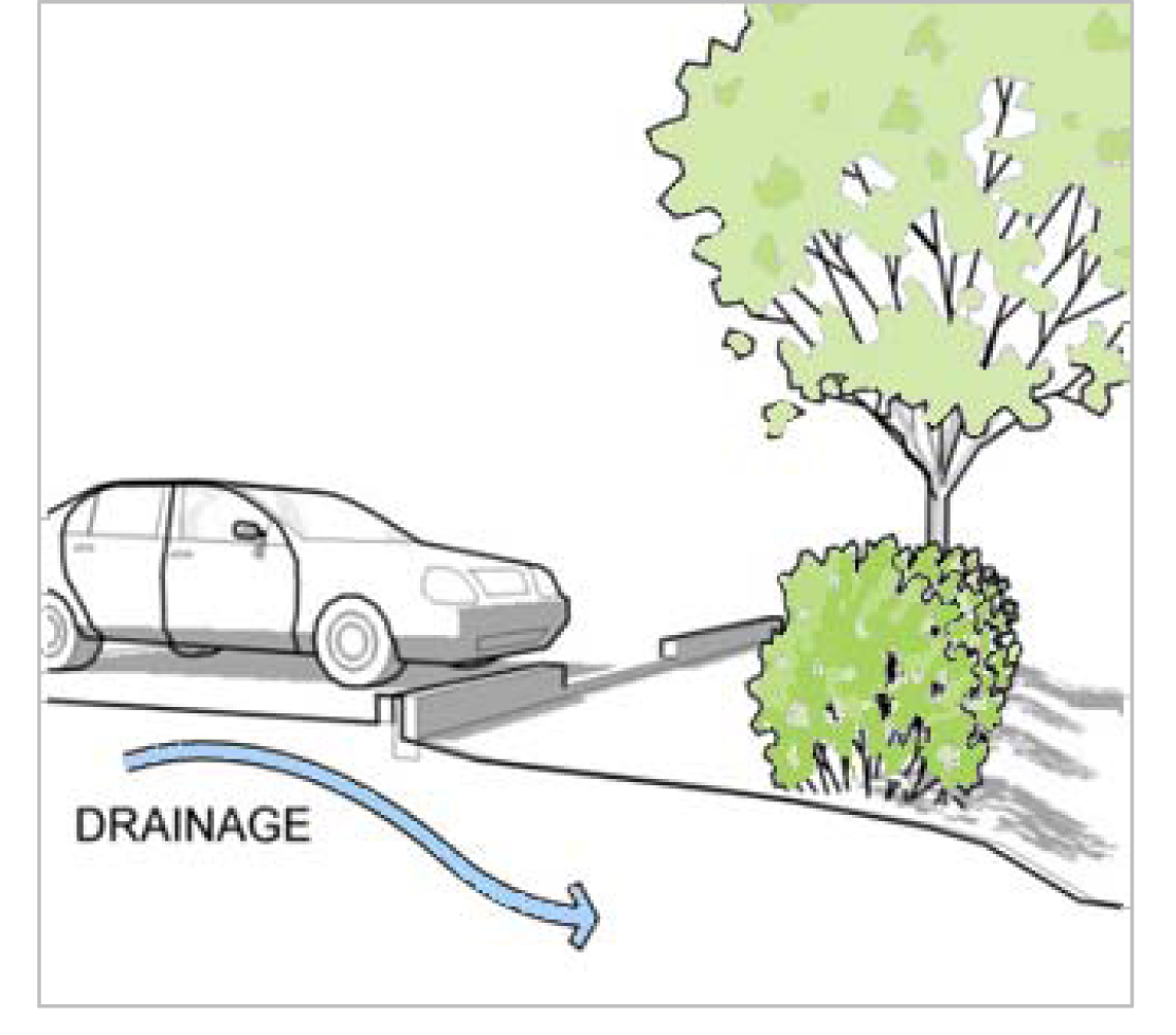
Diagram E Parking Lot Drainage: Curb openings
c.
Parking lots and garages (other than residential driveways for single-family detached dwelling, single-family attached dwelling or two-family dwelling) shall be designed and constructed in such a manner that no part of any parked vehicle shall extend beyond the boundary of the established parking lot or garage into any minimum required landscaped yard or area or onto adjoining property or onto a walkway or bikeway.
d.
If curbs or wheel stops are installed in a parking lot row abutting a landscaped area, they shall have openings allowing drainage from the pavement to enter and percolate through the landscaped areas.
e.
Parking lots, parking garages, and alleys used for access or maneuverability shall be maintained in good condition and free of chuckholes, weeds, dirt, trash and debris.
7.
Marking of parking spaces.
a.
All parking spaces provided in a parking lot or parking garage (other than residential driveways) shall be marked by durable painted lines at least four inches wide and extending the length of the space or by curbs or other means to indicate individual spaces. Signs or markers located on the pavement surface within a parking lot may be used as necessary to ensure efficient and safe traffic operation of the lot.
b.
All parking spaces for required for compliance with the Americans with Disabilities Act or for shared, carpool, vanpool, motorcycle, and small vehicles shall be marked with durable paint and identified with a sign.
8.
Rooftop parking. Parking spaces may be located on a building rooftop provided that the building complies with all applicable building code standards for that use of the roof.
9.
Tandem parking.
a.
End-to-end tandem parking may be used to meet minimum off-street parking requirements for residential uses in the compact context area, provided that both spaces are leased to, allocated to, or otherwise under the control of the same party.
b.
End-to-end tandem parking may be used to provide non-required parking in any Zoning District provided that the maximum parking amounts provided in Table 744-402-1 are not exceeded.
c.
Vertically stacked tandem parking using lift equipment may be used to meet minimum off-street parking requirements in any Zoning District provided that the parking lot or garage is attended with a lift operator at all times.
10.
Parking garage stairwell. For each floor of the parking garage, on at least one wall of any stairwell at least 40% of the wall surface area between three feet and eight feet above the surface of each floor of the garage shall be of glass or other transparent materials and be maintained to allow visibility between the two areas.
11.
Lighting of parking areas. See Chapter 744, Article VI Street and Exterior Lighting
12.
Landscaping of parking areas. See Chapter 744, Article V Landscaping and Screening.
(G.O. 64, 2015, § 2; G.O. 37, 2018, § 10; G.O. 23, 2023, § 8)
Sec. 744-405. - Loading requirements.
All off-street loading facilities accessory to uses in the Commercial, Mixed-Use, and Industrial Districts shall be provided and maintained in accordance with the following regulations:
A.
Amount of loading space required.
1.
Off-street loading space shall be provided and maintained in accordance with Table 744-405-1 and each required loading space shall have a minimum vertical clearance of 15 feet.
2.
No space used for a required parking space may be used for a required loading or stacking space.
B.
Access to and from loading area.
1.
The loading spaces, aisles, and vehicular circulation and maneuvering for loading areas shall be designed and constructed at not less than the recommended specifications contained in Architectural Graphic Standards, Current Edition, Ramsey/Sleeper, John Wiley and Sons, Inc., New York, New York (a copy of which is on file in the office of the division of planning and is incorporated by reference and made a part of the Zoning Ordinance).
2.
Each required off-street loading space shall open directly upon a hard-surfaced aisle, driveway or alley of such width and design as to provide safe and efficient means of vehicular access to such loading space.
3.
Alleys may be used for vehicular circulation and maneuvering.
4.
In the CBD-1 District, each off-street loading area shall be located with direct vehicular access to an alley only, and to least interfere with traffic movements, and so that no vehicle or part of a vehicle will protrude into an alley, street or public right-of-way.
5.
Plans and specifications for: a) the width of driveways; b) location of driveways from the nearest point of two intersecting street rights-of-way; and c) the design and location of frontage lanes and passing blisters shall be submitted to, and written approval obtained from, the Bureau of License and Permit Services of the department of code enforcement. Plans and specifications shall comply with the applicable standards and regulations of such division/department.
6.
Off-street loading areas may have direct access from any streets, except:
a.
The north side of New York Street between Delaware Street and Capitol Avenue;
b.
The south side of Maryland Street between Delaware Street and Capitol Avenue;
c.
The west side of Capitol Avenue between Maryland Street and New York Street;
d.
The east side of Delaware Street between Maryland Street and New York Street;
e.
North Meridian Street within the CBD-3 District;
f.
North Pennsylvania Street within the CBD-3 District; and
g.
The north side of East and West New York Street within the CBD-3 District.
C.
Location and setback.
1.
All required off-street loading spaces shall be located on the same lot as the use served, unless one of the following exceptions applies.
2.
If the lot and the adjoining property are located within the same industrial park or integrated commercial center and maneuverability areas are subject to a recorded easement agreement allowing such maneuverability, the loading space may be located anywhere within the industrial park or integrated commercial center.
3.
If the lot is located within the CBD-1, CBD-2, CBD-3 or MU-4 District:
a.
All off-street loading areas shall be located within 200 feet of the lot served.
b.
Off-street loading facilities for separate lots may be provided collectively if the collective located area is located within 200 feet of all establishments served by the required spaces
c.
If a collective loading area is used for two buildings or establishments, the number of spaces required in the collective loading area shall be determined by applying Table 744-405-1 to the combined gross floor area in the two buildings or establishments served by the spaces.
d.
If a collective loading area is used for three or more buildings or establishments, the number of spaces required in the collective loading area shall be determined by applying Table 744-405-1 to 80% of the combined gross floor area in the three or more buildings or establishments served by the spaces.
4.
No open loading area or loading space shall be located in a required minimum front, side, or rear yard or a required transitional yard.
5.
No open loading area or loading space shall be located in the area between the front lot line and the front line of the primary building.
6.
Off-street loading spaces may be open to the sky, covered or enclosed in a building. If a building is constructed or used for loading, it shall be treated as any other structure and subject to all use and development standards of the applicable Districts in addition to the requirements of this Article IV.
D.
Use of loading area. No motor vehicle repair work or service of any kind shall be permitted in conjunction with loading facilities, except for emergencies developing during occupation of the loading facilities.
E.
Surface of loading area. All loading areas shall be hard-surfaced to provide a durable and dust-free surface. The surface shall be maintained in good condition and free of weeds, dirt, trash and debris and shall be graded, constructed and drained to prevent detrimental flow of water onto sidewalks, except that:
1.
A gravel surface may be used for a temporary period not exceeding one year after commencement of the use for which the loading area is provided, where ground and weather conditions are not immediately suitable for permanent hard surfacing.
2.
For any facility in the Metro Context Area that is not located in the Wellfield Protection Zoning District, a gravel surface may be used permanently for loading and storage areas in association with industries that handle liquids or chemicals that create a potential hazard if containment should be lost and where absorption into the ground through a loose surface material would eliminate or alleviate that hazard.
F.
Lighting of loading area. See Chapter 744, Article VI Street and Exterior Lighting
G.
Landscaping and screening of loading area. See Chapter 744, Article V Landscaping and Screening.
(G.O. 64, 2015, § 2; G.O. 37, 2018, § 10)
Sec. 744-406. - Drive-through and stacking space standards.
A.
General provisions. The purpose of off-street stacking space regulations is to promote public safety by alleviating on-site and off-site traffic congestion from the operation of a facility that has a drive-through service unit. All uses having a drive-through service unit shall provide off-street stacking areas on-site as required by this Section 744-406.
B.
Number of required stacking spaces.
1.
Stacking spaces shall be provided and maintained in accordance with Table 744-406-1. Drive-through service units may contain more than one component part, such as menu boards, pay windows, and food-service pickup windows. To determine the number of off-street stacking spaces located before a service unit, the final component of the service unit shall be used in determining the location of the required off-street stacking spaces. In the case of vehicle washes, the final component of a service unit is the entrance to the vehicle wash building itself.
2.
The Administrator may approve reductions in required stacking spaces based upon requirements for similar uses, expected demand and traffic generated by the proposed use, and other information from appropriate traffic engineering and planning criteria.
C.
Design and location of stacking spaces. Each drive-through service unit shall provide stacking spaces as follows:
1.
Each stacking space shall be not less than eight and one-half feet in width and 17½ feet in length, with additional spaces for necessary turning and maneuvering.
2.
The area required for stacking spaces shall be exclusive of and in addition to any required parking space, loading space, driveway, aisle and required yard, unless specifically noted.
3.
A parking space at any component of a drive-through service unit (window, menu board, order station, or service bay) shall be considered to be a stacking space.
4.
An area reserved for stacking spaces shall not double as a circulation driveway, maneuvering area, and may not include any portion of an alley.
5.
In the metro context area, sites with stacking spaces shall include an exclusive bypass aisle, driveway or other circulation area in the parking lot design to allow vehicles to bypass the stacking area.
6.
A drive-through service unit may project up to one foot into the stacking area.
7.
A drive-through service unit shall not be permitted on the side or rear of a building, or within the side or rear yard of a building, that abuts a protected district unless the side or rear setback of each component of a service unit meets the landscaping and screening requirements in Chapter 744, Article V Landscaping and Screening.
d.
Site plan submission.
1.
All required off-street stacking spaces and circulation patterns shall be demonstrated on the site plan that is submitted at the time of filing for an Improvement Location Permit. The submitted site plan shall also include:
a.
All existing and proposed points of ingress and egress, circulation and maneuvering areas, off-street parking and loading areas; and
b.
A separate tabulation of the number of required off-street parking, loading, and stacking spaces in a conspicuous place on the plan for easy reference.
2.
Prior to obtaining an Improvement Location Permit, the site plan shall be forwarded to the Bureau of License and Permit Services for its review and comment.
(G.O. 64, 2015, § 2; G.O. 37, 2018, § 10)
Sec. 744-501. - Purpose.
The purpose of this Chapter 744 Article V is to foster aesthetically pleasing, environmentally beneficial, and sustainable development that will protect and preserve the appearance, character, general health, safety and welfare of the community through regulations that are appropriate to the type and scale of development and the level of investment being made. More specifically, this article is intended to increase the compatibility of adjacent uses requiring a buffer or screen between uses; to minimize the harmful impact of noise, dust and other debris, motor vehicle headlight glare or other artificial light intrusions and other objectionable activities or impacts conducted or created by an adjoining or nearby use; to increase the attractiveness and long-term value; to encourage the use of landscaping that will assist in the management of stormwater runoff quantity and quality; and to encourage the preservation of significant trees that will help absorb carbon dioxide emissions and reduce heat island impacts and related energy costs.
(G.O. 64, 2015, § 2)
Sec. 744-502. - Applicability.
A.
After the first day of the month that is six months after the date of adoption, all development of single-family detached, single-family attached or two-family dwelling units and development of individual lots with triplex, fourplex, or live-work unit not part of a larger project or subdivision shall be required to comply with Sections 744-503, 744-507, and 744-510, but shall not be required to comply with other provisions of this Chapter 744 Article V.
B.
All development in all Zoning Districts not exempted either in whole or in part by Table 744-502-1 shall comply with the landscaping and screening standards in this Chapter 744 Article V. However, legally established nonconforming uses and structures or buildings with landscaping and screening that are legally established prior to the first day of the month that is six months after the date of adoption may be modified and be exempt from complying with specific sections of Chapter 744 Article V as described in Table 744-502-1; provided, however, in no instance shall any building or structure modification be deemed to exempt the property from or lessen the landscaping and screening standards which were applicable to the property at the time of such building or property's original construction.
C.
The Heritage Tree Conservation provisions of Section 744-503.K. apply to all development or redevelopment on lots and parcels in any zoning district that contain (i) more than 20,000 square feet of lot area, and (ii) a primary structure with a use other than those described above in Section 744-502.A., as well as to any new lot of record created after the first day of the month that is six months after the date of adoption, regardless of the primary use of the property, in all zoning districts.
D.
Lots in a Development Plan District (HD-1, HD-2, PK-1, PK-2, UQ-1, UQ-2, SZ-1, SZ-2), CBD-S District, C-S District or D-P District that are regulated by an approved detailed site and development plan that includes an approved landscaping and screening plan, the landscaping and screening of the lots shall be regulated by that approved plan.
(G.O. 64, 2015, § 2; G.O. 37, 2018, § 12)
Sec. 744-503. - General landscaping standards.
A.
Landscape plan required. A landscape plan shall be submitted as a part of all development and permit applications for those activities listed in this Chapter 744 Article V, unless the Administrator determines that compliance with the provisions of this Article can be demonstrated without the use of a landscape plan. A landscape plan may be combined with other required application materials if compliance with this article can be demonstrated in the combined materials.
B.
Required plant materials. Landscape areas as required by the Zoning Ordinance shall be designed to be drought tolerant. Tree and shrub species used to meet the requirements of the Zoning Ordinance shall be from the Indianapolis Selected Plant List as approved by the Metropolitan Development Commission. Additionally, plants listed on the Indianapolis Prohibited Plant List shall not be counted and shall not fulfill any requirement of this article. All plant material shall be hardy to central Indiana, suitable for the site, free of disease and insects and conform to the American Standard for Nursery Stock (ANSI Z60.1-2004). Upon presentation of evidence, the Administrator may authorize alternative species or cultivars that meet the intended purpose, are not invasive or hazardous, and equally hardy and capable of withstanding the local setting.
Additional plant materials may be planted unless the plant is listed on the Indianapolis Prohibited Plant List.
C.
Minimum living materials. In all areas where landscaping is required, a minimum of 60% of the surface area shall be covered by living materials, rather than gravel, stone or other non-living materials.
D.
Soil condition and planting beds.
1.
All landscaping required by the Zoning Ordinance shall be planted in uncompacted soil at least two feet in depth.
2.
Stone mulch is not permitted in required landscape areas or planting beds except as part of a stormwater best management practices in accordance with Section 702 of the Stormwater Design and Construction Specifications Manual.
3.
All landscaped areas shall be protected from vehicular encroachment by curbs or wheel stops. Curbs shall be provided with openings to accommodate surface collection of stormwater runoff in vegetated swales and detention facilities.
E.
Minimum plant sizes at installation. Unless otherwise specifically noted, the minimum plant size at the time of installation of landscaping required by the Zoning Ordinance shall be according to Table 744-503-1: Minimum Plant Sizes.
F.
Plant material spacing. Except for transitional yard and edge buffering provisions of Section 744-506, trees and shrubs shall not be placed closer than three feet to any lot line. A minimum three-foot radius around fire hydrants, valve vaults, hose bibs, manholes, hydrants, and fire department connections shall be provided and free of trees or shrubs. Plant materials may be grouped but must be located within the particular landscape area to which it will be credited. The Administrator may authorize adjustments to these spacing requirements when necessary due to topography, drainage, utilities or obstructions, provided that the total amount of required landscaping is not reduced.
G.
Species variation. For sites over one acre in size, landscaping shall introduce multiple varieties within one general area. In areas in the Metro Context Area, no one species of tree may make up more than 30% of the total number of trees, and no one species of shrub may make up more than 30% of the total number of shrubs.
H.
Protection of clear sight triangular areas. No obstructions shall be erected, placed, planted or allowed to grow in such a manner as to materially impede visibility between the heights of two and one-half feet and eight feet above grade level of the adjoining right-of-way within a clear sight triangular area. See Section 740.304 Clear Sight Measurements and Calculations.
I.
Planting in the right-of-way. Tree removal or tree planting or the placement of other landscaping elements in the right-of-way shall be done in accordance with Chapter 701 Trees and Flora of the Revised Code of the Consolidated City and County.
J.
Overlapping requirements. If areas required to be landscaped by two or more provisions of the Zoning Ordinance overlap each other, the provision requiring the greater amount of planting in that area shall apply.
K.
Heritage tree conservation. Removal of any heritage tree is prohibited unless any of the following determinations are made before removal:
1.
The Administrator or the city's Urban Forester determines that the tree is dead, significantly and terminally diseased, a threat to public health or safety, or is of an undesirable or nuisance species.
2.
The Director of the Department of Public Works determines that the tree interferes with the provision of public services or is a hazard to traffic.
3.
The Administrator determines that the location of the tree is preventing development or redevelopment that cannot be physically designed to protect the tree.
4.
The site from which the tree is removed is zoned D-A and the tree is harvested as timber or similar forestry product.
L.
Existing vegetation credit and bonus.
1.
In the event that existing vegetation meets the intent of the screening requirements, preserved existing vegetation may be credited for landscape materials required by this Chapter 744 Article V. In no instance will credit be given for existing vegetation that is invasive, as listed in the Indianapolis Prohibited Plant List.
2.
If any of the vegetation that fulfills a requirement of the Zoning Ordinance dies or is removed, replacement plant materials shall be installed in accordance these standards. Existing vegetation to be used to meet a requirement of this Article V shall be protected during construction through use of a fence erected around the area encompassing the area one foot beyond the drip line of the vegetation. No materials shall be placed in this encompassed area.
3.
Preservation of trees and surrounding vegetation shall be given credit toward fulfilling landscaping requirements set forth in this article as follows:
a.
Existing trees and surrounding vegetation may be credited only one time towards any one buffer, screen or other landscape area requirement.
b.
Existing trees and surrounding vegetation shall be located within the required landscape area to which it will be credited.
c.
Existing trees that conform to these standards and are proposed to be used for credit must generally have location, species, caliper and drip line indicated on the required landscape plan.
4.
Existing trees shall be credited as fulfilling a requirement based upon the tree size and provided that the minimum area surrounding the tree is according to the criteria and the quantities shown in Table 744-503-2: Existing Tree Credit and Bonus.
M.
Replacement trees. In the event an existing tree that was given credit or a heritage tree is removed or dies within three years of the ILP issuance date, replacement trees shall be planted. The number of replacement trees that must be planted for each tree lost shall be in accordance with Table 744-503-3: Replacement Trees.
In the event that the site cannot accommodate the number of replacement trees required, the Administrator may authorize an alternate location for the planting of the replacement trees within the County as close to the site as feasible.
N.
Native vegetation and natural landscaping areas.
1.
Growing native vegetation including ferns, grasses, sedges, rushes, forbs, shrubs and trees shall be permitted in lieu of turfgrass lawn. Natural landscape areas are permitted if planned and designed to control, direct, and maintain the growth of natural vegetation, primarily native, and may include the detention and infiltration of stormwater runoff in the natural landscape area.
2.
Natural landscaping areas shall not be located within two feet of a front lot line, or within four feet of any other lot line, except that no rear or side yard setback shall be required where the natural landscaping is separated from adjacent lots by fencing or continuous shrub growth three feet or more in height, or where the natural landscaping area abuts another permitted natural landscaping area on an abutting lot. An intervening path or walkway shall not be deemed to prevent natural landscape materials from abutting.
3.
Where natural landscaping area is installed or preserved, a sign shall be installed indicating that the area is a natural landscape area and generally not mowed.
O.
Rain gardens, bioswales and stormwater management features. Areas included in rain gardens or vegetated site features created to meet storm water management requirements of Section 702 of the Stormwater Design and Construction Specifications Manual shall be counted towards any required interior site or parking lot landscaping, and if vegetated to meet the requirements for any landscaped buffers shall count towards those buffer requirements. Where rain gardens or vegetated site features serving a storm water management purpose are installed, a sign shall be installed indicating that the area the area should not be mowed, but should instead be maintained pursuant to an operations and maintenance manual available from the Department of Public Works.
P.
Retention and detention facilities. Landscaping must be provided around the perimeter of all retention and detention basins. Such landscaping must consist of trees, shrubs, and emergent plantings in a quantity, species, and arrangement that will maintain an ecologically functional environment. Per Section 702.01 in the Stormwater Design and Construction Specification Manual, tall plantings in the aquatic bench are desirable as a means to keep waterfowl from the site. Waterfowl are bacteria sources and are to be discouraged from inhabiting wet ponds. Retention and detention basins should be designed to resemble natural landforms, whenever possible. Such landscaping must be integrated with the littoral zone of emergent vegetation around the pond perimeter with the safety bench of at least 10 feet in width as per Section 302.07 in the Stormwater Design and Construction Specifications Manual. Trees, shrubs and upland plantings are to be located above the normal water line; emergent or wetland plantings are to be located below the normal water line. Vegetation must be established on all side slopes to prevent erosion. A stormwater management easement and operation and maintenance agreement is required for each facility, clearly marking inlet/outlet structures and easements for inflow/outflow piping. Trees or deep-rooted vegetation must not be planted in any easement with storm drainage pipe. Vegetation must not obstruct inlet/outlet structures and inflow/outflow piping area.
Q.
Alternative landscaping.
1.
Alternative landscape plan. The Administrator may approve an alternate landscape plan that does not meet the specific requirements stated in this Article V if the Administrator determines that the alternative plan:
a.
Is consistent with the purposes of this chapter; and
b.
Does not include invasive vegetation; and
c.
Does not include a reduction of tree planting requirements; and
d.
Provides equal or superior buffering of adjacent properties from anticipated impacts of the proposed development; and
e.
Provides equal or superior visual appearance of the property when viewed from the street; and
f.
Provides equal or superior carbon dioxide absorption and heat island reductions.
R.
Installation and delay of installation due to season.
1.
All landscaping material used to meet the requirements of the Zoning Ordinance shall be installed in accordance with the planting procedures established by the ANSI A300 Tree Care Operations: Standard Practices for Tree, Shrub and Other Woody Plant Maintenance.
2.
All landscaping material shall be installed no later than 60 days following the completion of construction or its initial use, unless subsection 3. below applies.
3.
Whenever the installation of required landscaping is not possible by the time construction on the primary structure or primary use parking lot has been completed, an Inspector may authorize a delay in installation until no later than the following May 31. As a condition of authorizing a delay in installation, a surety or other guarantee, may be required, in a form acceptable to the city, in the estimated amount of such installation. During any delay in installation, site management must comply with all applicable provisions for sediment and erosion control.
S.
Maintenance.
1.
All landscaping required by the Zoning Ordinance shall be provided and maintained at all times.
2.
Dead, missing, or damaged landscaping, or landscaping that supports less than 50% healthy leaf growth or shows dead branches over a minimum of 50% of the normal branching pattern shall be replaced with healthy, live plants by the end of the growing season to meet ordinance requirements.
3.
The owner is responsible for the maintenance, repair, and replacement of all required landscaping, screening, and curbing.
4.
Maintenance shall preserve at least the same quantity, quality, and screening effectiveness as initially installed.
5.
Fences, walls, and other barriers shall be maintained in good repair. All barriers that are damaged, broken, or with failing paint shall be repaired, replaced or refinished.
6.
Tree topping is prohibited. Tree topping is the practice of removing whole tops of trees, large branches or trunks from the tops of trees, leaving stubs or lateral branches that are too small to assume the role of a terminal leader.
7.
Plant materials shall be provided water to adequately sustain long-term growth.
(G.O. 64, 2015, § 2; G.O. 37, 2018, § 12; G.O. 23, 2023, § 8)
Sec. 744-504. - Street frontage and front yard landscaping.
In all zoning districts except residential lots in D-A, D-S, D-1, D-2, D-3 and D-4 the front yard shall meet the following standards:
A.
The front yard shall be landscaped with at least one shade tree per 35 feet of street frontage. If overhead electric distribution lines are present, ornamental trees with a maximum mature height of 15 feet shall be planted and the number of trees planted shall be at least one ornamental tree per 20 feet of street frontage.
B.
Trees required by the subsection above shall be planted in the amenity zone right-of-way, or where right-of-way design constraints prevent this, within ten feet of the front lot line.
C.
For lots that have a front yard less than five feet in depth or where the sidewalk extends from the back of curb to the lot line, tree wells may be installed in the right-of-way to accommodate the required frontage trees, provided the sidewalk surface remains at least four feet wide at all locations. The opening in a tree well must be expandable or otherwise accommodate the mature diameter of the tree, and include sub-surface techniques to account for root growth and protection.
D.
All planting in the public right-of-way shall meet the requirements of Chapter 701 and may be counted toward fulfilling the requirements of this article.
E.
On lots adjacent to a landscaped median in the right-of-way, 50 percent of the vegetation in the median that meets a street frontage and front yard landscaping requirement may be credited towards the landscaping requirements of this Section 744-504.
F.
Planting beds with shrubs, flowers, wildflowers, low grasses or sedges, excluding turf grass, shall comprise at least 20 percent of the area of a front yard.
G.
In Dwelling Districts, the front yard is subject to limitations on front yard parking area width shown in Section 744-404.A.2., and the remaining front yard shall be landscaped in grass, shrubbery, trees or flowers, or in combination with other similar and suitable vegetative ground cover plantings.
(G.O. 64, 2015, § 2; G.O. 26, 2021, § 7)
Sec. 744-505. - Parking lot landscaping.
Primary use and accessory parking lots shall provide at least the following amounts and types of landscaping unless alternative requirements are stated in the Zoning Ordinance.
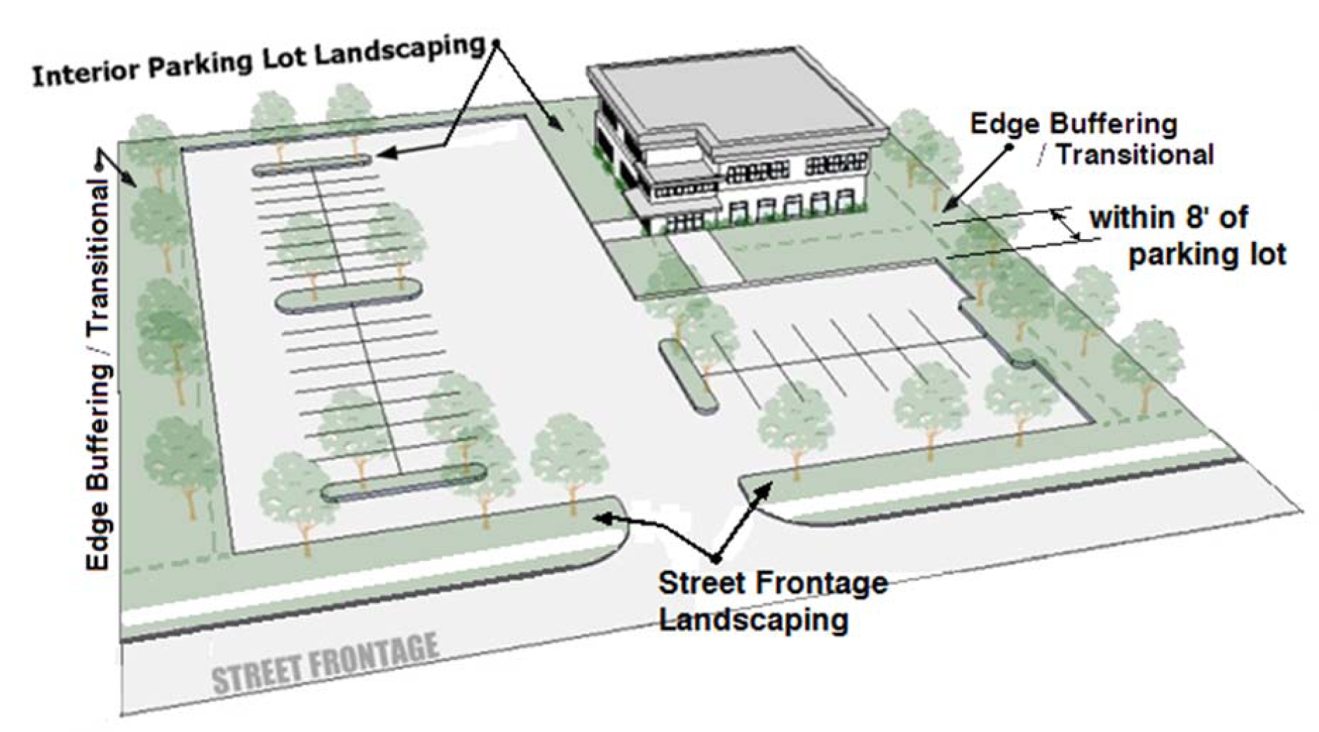
Diagram F Landscaping of a parking lot
A.
Street Frontage Landscaping. Any parking lot with off-street parking spaces must provide landscaping along any street frontage in accordance with Table 744-505-1: Required street frontage landscaping.
B.
Interior landscaping.
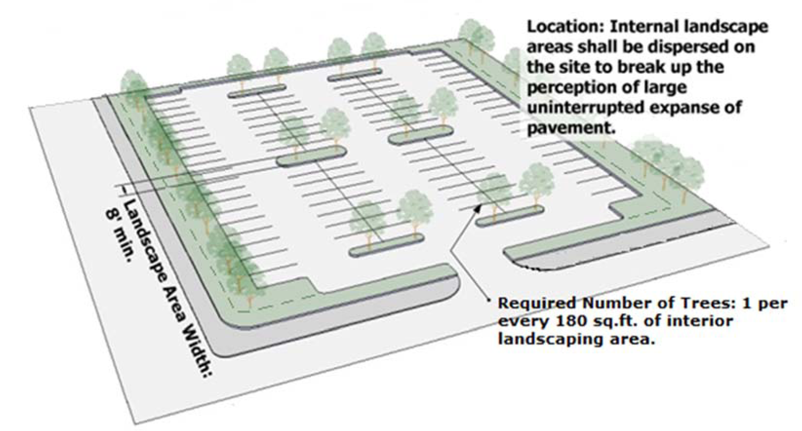
Diagram G Interior landscaping of a parking lot
1.
Any parking lot with 15 or more off-street parking spaces must provide Interior Landscaping in accordance with Table 744-505-2: Required interior landscaping area.
4.
Redevelopment adjustment: For development occurring on land in which 75% or more of the land area was previously developed for purposes other than residential or agricultural and not subject to Section 744-509 (Green Factor Requirement), the required area for interior landscaping may be adjusted by the credits shown in Table 744-505-3: Interior Landscaping Credits.
(G.O. 64, 2015, § 2)
Sec. 744-506. - Transitional yard and edge buffering.
A.
Multifamily residential abutting single-family residential. Where a multifamily dwelling project that abuts a lot in the D-S, D-1, D-2, D-3, D-4, D-5, or D-5II District, or a lot in the D-8 District that contains a single-family attached dwelling or single-family detached dwelling, a landscape buffer shall be provided using either Option 1 or 2 below.
1.
Option 1. A landscape buffer area at least 10 feet wide shall be provided by the multifamily dwelling project along the shared border. The buffer area shall consist of natural landscape materials such as grasses, ground cover, shrubs, and trees, and shall not contain parking or impervious surfaces. One tree shall be provided for every 35 feet of lot line and three large shrubs per 25 feet of lot line, with spacing designed to minimize sound, light, and noise impacts.
2.
Option 2. An opaque wall, fence or dense (at least 50% opacity) vegetative screen at least six feet tall shall be provided. In the metro context area, a berm at least three feet tall may be used instead of the wall, fence, or dense vegetative screen. If a fence or wall is provided, the side facing away from the multifamily dwellings shall be at least as finished in appearance as the side facing the multifamily dwellings, the fence shall be placed at least three feet inside the property line, and three small shrubs per 25 feet of lot line shall be provided between the fence and the property line. If a vegetative screen is proposed, it shall be at least four feet in height at the time of planting and maintained at six feet in height minimum.
B.
Commercial, institutional, or mixed-use abutting dwelling. Where a Commercial District, Mixed-Use District, Hospital District, University Quarter District, PK-II District, or SU District for a public, institutional, or civic building or project abuts a Dwelling District, a landscape buffer shall be provided within the transitional yard using either Option 1 or 2 below.
1.
Option 1. A landscape buffer area at least 15 feet wide shall be provided by the commercial or institutional project along the shared border. The buffer area shall consist of natural landscape materials such as grasses, ground cover, shrubs, and trees, and shall not contain impervious surfaces. One shade or evergreen tree shall be provided for every 30 linear feet of lot line and three large shrubs per 25 linear feet of lot line, with spacing designed to minimize sound, light, and noise impacts on dwelling uses.
2.
Option 2. An opaque wall, berm, fence or dense (at least 75% opacity) vegetative screen at least six feet tall shall be provided with one shade tree provided for every 50 linear feet of lot line. If a fence or wall is provided, the side facing away from the commercial or institutional use shall be at least as finished in appearance as the side facing the commercial or institutional use, the fence or wall shall be placed at least three feet inside the property line, and three small shrubs per twenty-five linear feet of lot line shall be provided between the fence and the property line. If a vegetative screen is proposed, it shall be at least six feet in height at the time of planting.
C.
Industrial abutting dwelling. Where an Industrial District, building or project abuts a Dwelling District or lots used for any use listed as a dwelling use in Table 743-1: Use Table, a landscape buffer shall be provided within the transitional yard using either Option 1 or 2 below.
1.
Option 1. A landscape buffer area at least 15 feet wide shall be provided by the industrial project along the shared border. The buffer area shall consist of natural landscape materials such as grasses, ground cover, shrubs and trees, and shall not contain impervious surfaces. One evergreen tree shall be provided for every 25 linear feet of lot line and four large shrubs per 25 linear feet of lot line, with spacing designed to minimize sound, light and noise impacts on dwelling uses.
2.
Option 2. An opaque wall, berm, fence or dense (100% opacity) vegetative screen at least eight feet tall shall be provided with one shade tree provided for every 50 linear feet of lot line. If a fence or wall is provided, the side facing away from the industrial use shall be at least as finished in appearance as the side facing the industrial use, the fence shall be placed at least three feet inside the property line, and three small shrubs per 25 linear feet of lot line shall be provided between the fence and the property line. If a vegetative screen is proposed, it shall be at least six feet tall at the time of planting.
D.
Industrial abutting commercial or institutional. Where an Industrial District, building or project abuts a C-1 District, Hospital District, University Quarter District, or a Park District, a landscape buffer shall be provided by using either Option 1 or 2 below.
1.
Option 1. A landscape buffer area at least ten feet wide shall be provided by the industrial project along the shared border. The buffer area shall consist of natural landscape materials such as grasses, ground cover, shrubs and trees, and shall not contain impervious surfaces. One shade or evergreen tree shall be provided for every 40 linear feet of lot line and four large shrubs per 20 linear feet of lot line, with spacing designed to minimize sound, light and noise impacts.
2.
Option 2. An opaque wall, berm, fence or dense (50% opacity) vegetative screen at least six feet tall shall be provided with one shade tree provided for every 50 linear feet of lot line. If a fence or wall is provided, the side facing away from the industrial use shall be at least as finished in appearance as the side facing the industrial use, the fence shall be placed at least three feet inside the property line, and three small shrubs per 25 linear feet of lot line shall be provided between the fence and the property line. If a vegetative screen is proposed, it shall be at least six feet tall at the time of planting.
(G.O. 64, 2015, § 2)
Sec. 744-507. - Dwelling Districts.
A.
Low-density Dwelling Districts. In the D-A, D-S, D-1, D-2, D-3, D-4, D-5, D-5II and D-8 Districts, at the time of development, trees shall be provided on the lot being developed in accordance with Table 744-507-1: Residential Tree Planting Requirements.
B.
Other Dwelling Districts. In the D-6, D-6II, D-7, D-9 and D-10 Districts, in addition to the provisions of Section 744-504 (Street frontage and front yard landscaping), trees shall be provided or preserved on site at a rate of one shade tree per 7,000 square feet of lot area.
(G.O. 64, 2015, § 2)
Sec. 744-508. - Screening of facilities and equipment.
A.
Mechanical equipment.
1.
Roof-mounted mechanical equipment. Roof-mounted mechanical equipment shall be screened by a parapet wall or similar feature that is an integral part of the building's architectural design. The parapet wall or similar feature shall be sufficient to screen the mechanical equipment from all sides when viewed from ground level from any street bounding the block on which the property is located.
2.
Ground-mounted mechanical equipment. In Commercial Districts, Mixed-Use Districts, and Dwelling Districts developed with multifamily dwellings, ground-mounted mechanical equipment shall be screened from view from ground view of adjoining properties and from all streets bounding the block on which the property is located, by landscaping or by a decorative wall or fence that incorporates at least one of the primary materials and colors of the nearest wall of the primary structure. The wall shall be of a height equal to or greater than the height of the mechanical equipment being screened. If landscaping is used for screening, the screening material shall be designed to provide 75% opacity within one year after planting along the full required height and length of the screening buffer.
B.
Loading and service areas.
1.
General requirement. These standards shall apply to all exterior areas containing without limitation garbage dumpsters, grease/oil tanks, recycling bins and cardboard compactors, on all properties containing multifamily dwelling, commercial, institutional, industrial or mixed-uses.
a.
In all Districts, non-enclosed service areas and off-street loading areas shall be screened when viewed from ground level from all streets bounding the block on which the property is located as described in subsections 3. or 4. below, as applicable.
b.
Service areas shall not be located in any front yard.
c.
All waste containers and dumpsters shall be equipped with and use a lid covering or be in a roofed enclosure, and shall be designed so that stormwater runoff does not reach storm drain inlets or stormwater treatment units.
2.
Exceptions. The following are not subject to the requirement in subsection 1. above.
a.
Containers located behind a building and not visible from a public right-of-way or adjoining single-family, multifamily, mixed-use or public property.
b.
The temporary purpose of disposing of waste generated during the time of an active building permit, or 180 days, whichever is shorter, for the demolition or construction of improvements on the property upon which the commercial container is located.
c.
Waste or recycling containers being 96 gallons or less in size serving single-family attached dwellings, single-family detached dwellings, two-family dwellings, triplexes and fourplexes.
d.
On a temporary basis, containers for a special event authorized by the city.
3.
Service areas not adjacent to structure wall. Service areas that are not located adjacent to a wall of an existing principal or accessory structure shall be screened from view as follows:
a.
On three sides with a wall constructed of masonry, brick, wood, stone, or similar material and at least as tall as the items in the service area being screened;
b.
On the fourth side a gate constructed of wood or metal and at least as tall as the items in the service area being screened.
4.
Service areas adjacent to structure wall. Service areas that are located adjacent to a wall of an existing principal or accessory structure shall be screened from view as follows:
a.
On two sides with a wall that is (i) constructed of the same principal materials and colors used on the wall of the principal or accessory building that forms the third wall of the enclosure, and (ii) at least as tall as the items in the service area being screened; and (iii) in compliance with applicable fire and building codes;
b.
On the fourth side a gate constructed of wood or metal and at least as tall as the items in the service area being screened.
C.
Outdoor storage and operations. All outdoor storage and operations within 500 feet of a Protected District must be effectively contained by a chain link, solid, lattice or similar type fence or wall and gate. The height of such fence or wall shall be at least six feet and shall not exceed 10 feet. Such fence or wall shall be surrounded by trees or an evergreen hedge of a height not less than the height of such fence or wall, to be planted following the provisions for landscaping and screening of required transitional yards. The storage of materials or products within the enclosure may not exceed the height of the fence.
(G.O. 64, 2015, § 2)
Sec. 744-509. - Green factor.
A.
Purpose. This purpose of this Section 744-509 is to ensure that each new development site is more sustainable and installs landscaping, screening, or buffering while encouraging native plantings which are more resilient, promotes the integration of landscaping and drainage with thoughtful design, and allows flexibility in the type and placement of landscaping to respond to the site's context.
B.
Requirement.
1.
The Green Factor requirement applies to all Zoning Districts except CBD Districts, MU Districts, D-A through D-5II Districts and portions of the D-8 District occupied by single-family detached dwelling and two-family dwellings. Any undeveloped commercial out lot established before the first day of the month that is six months after the date of adoption that is two acres in size or less shall be exempt from this section.
2.
The Green Factor, calculated pursuant to Section 744-509.C. below, means that an equivalent percentage of the project site area is covered by vegetated cover. If the inclusion of all elements required by Sections 744-504 through 744-508 does not result in the required Green Factor, then additional elements shall be provided until the minimum Green Factor required is achieved.
3.
Each development to which this section applies in which one half-acre or more is being disturbed is required to achieve the following minimum Green Factor:
a.
Development occurring on land previously undeveloped or used for residential or agricultural purposes must attain a Green Factor of .30 or higher.
b.
Development occurring on land in which 75% or more of the land area was previously developed for purposes other than residential or agricultural must attain a Green Factor of .22 or higher.
4.
Each landscaping element required by Sections 744-504 through 744-508 shall count towards the Green Factor total for the site, provided that it meets all applicable design standards for that type of element established in the Indianapolis Green Infrastructure Supplement Document and that species installed complies with this Article.
5.
Each development to which this Section 744-509 applies shall submit a landscape maintenance manual when submitting an Improvement Location Permit application for the property. The maintenance manual shall identify monthly, annual, and biennial maintenance regimes for all areas included in the Green Factor calculation.
6.
As an alternative to the requirements of subsections 1. through 5. above, the Green Factor requirement can be met by constructing or modifying the primary building or buildings on-site in a manner that when completed the building or buildings have and maintain an ENERGY STAR rating of 75 or higher. When this alternative is used, all other applicable landscaping standards must be met. For this alternative, additional Improvement Location Permit submission requirements and maintenance requirements shall be established by Metropolitan Development Commission.
C.
Calculation. The Green Factor for each development to which this Section 744-509 applies shall be calculated as follows. A copy of the completed table shall be submitted with the application for an Improvement Location Permit.
1.
Fill in the square footage of the parcel in column C of Table 744-509-1.
2.
Fill in the number of shrubs and trees of each type in column B of the table below and calculate the area equivalent for each from the factors in column C of Table 744-509-1.
3.
For vegetated areas without shrubs or trees, fill in measured areas for vegetated areas in column C of Table 744-509-1.
a.
Landscaping elements that are located in the public right-of-way abutting the lot and between the roadway and the lot line may be counted in the total measured area, except that permeable pavers in those locations may not be counted.
b.
The measured area of vegetated walls is the non-horizontal area covered by vegetation at maturity.
c.
For all elements other than trees, large shrubs, and vegetated walls, the measured area is determined by the area of the portion of a horizontal plane that underlies the element.
4.
If more than one element occupies the same area (for example ground cover under a tree) indicate both the measured area in column C and the number of trees and shrubs in column B.
5.
Multiply the measured area of vegetation and the equivalent square footage of vegetated areas in column C by the multiplier in column D and enter the score for that element in column E.
6.
Add up all of the scores for individual landscaping elements in column E.
7.
Divide the score by the parcel size to obtain the Green Factor score for the site.
D.
Examples.
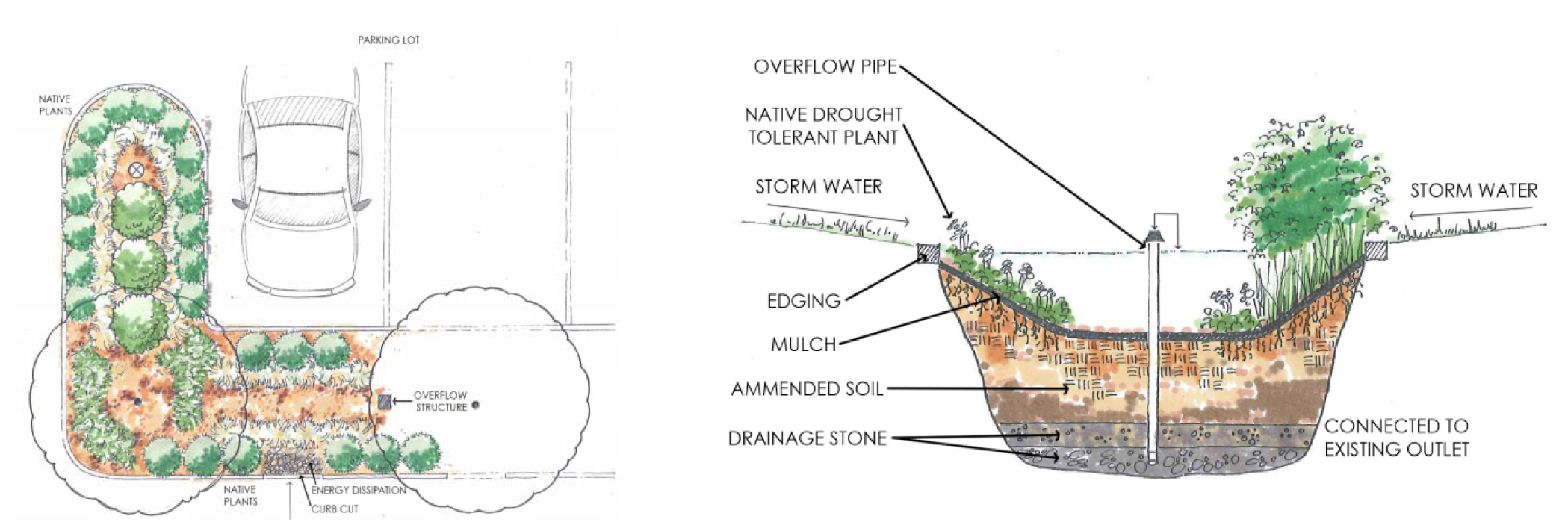
Diagram H Parking Lot Island Bioretention area: Plan view and Profile view
(G.O. 64, 2015, § 2)
Sec. 744-510. - Fences and walls.
A.
Materials.
1.
Fences incorporating barbed wire or razor-wire are prohibited except:
a.
When used to enclose livestock on a site where the primary property use is agricultural uses, buildings or structures; or
b.
When used for public safety or security purposes for a public facility or correctional or penal institution.
2.
Electrified fences are prohibited except if the electrification is of non-lethal voltage with current less than 100 mA (0.1 amp), warning sign is posted in a conspicuous location, and located at least five feet away from a lot line, and:
a.
When used to enclose livestock on a site where the primary property use is agricultural uses, buildings or structures; or
b.
When used for public safety or security purposes for a public facility or correctional or penal institution.
c.
When used to enclose personal livestock in a Dwelling District.
3.
No fence, wall or retaining wall shall be constructed of scrap or waste materials unless those materials have been recycled or reprocessed into building materials for sale to the public.
4.
Fences or fences combined with a wall shall be constructed of wood, stone, brick, decorative concrete block, wrought iron, (or products created to resemble these materials), vegetated cellular confinement system, or other material compatible with the primary building materials; or a combination of any of these materials. Chain link fencing or wire fencing is allowed in accordance with Table 744-510-1:
5.
Retaining walls shall be constructed of or faced with natural stone, brick or similar earth-colored materials, decorative concrete block, vegetated cellular confinement system, textured and colored Mechanically Stabilized Earth (MSE) blocks or other material compatible with the primary building. In the Dwelling Districts, garden walls 30 inches or less in height shall be exempt from this materials standard.
6.
Retaining walls constructed of railroad ties, timber and gabion-type materials are prohibited.
B.
Maximum heights. Maximum height of fence and wall shall be in accordance Table 744-510-2:
C.
Exceptions to fence heights.
1.
Compact Context Area. For single-family attached dwellings, single-family detached dwellings, two-family dwellings, triplexes and fourplexes located on corner lots in the Compact Context Area, fences or walls located in any yard that a) does not serve as the primary entrance for a dwelling unit, and b) does not face the primary entrance of a dwelling unit across the street, may be up to six feet (6') in height. However, in no instance shall any fence or wall exceeding 42 inches in height extend beyond the building line containing the primary entrance.
2.
Through lots. For through lots, fences or walls located in any front yard that does not serve as the primary entrance for a dwelling unit and does not abut a lot with a dwelling unit that has a front yard on that street, may be up to six feet in height, provided that any fence or wall exceeding 42 inches in height does not extend beyond the building line established by the abutting lots.
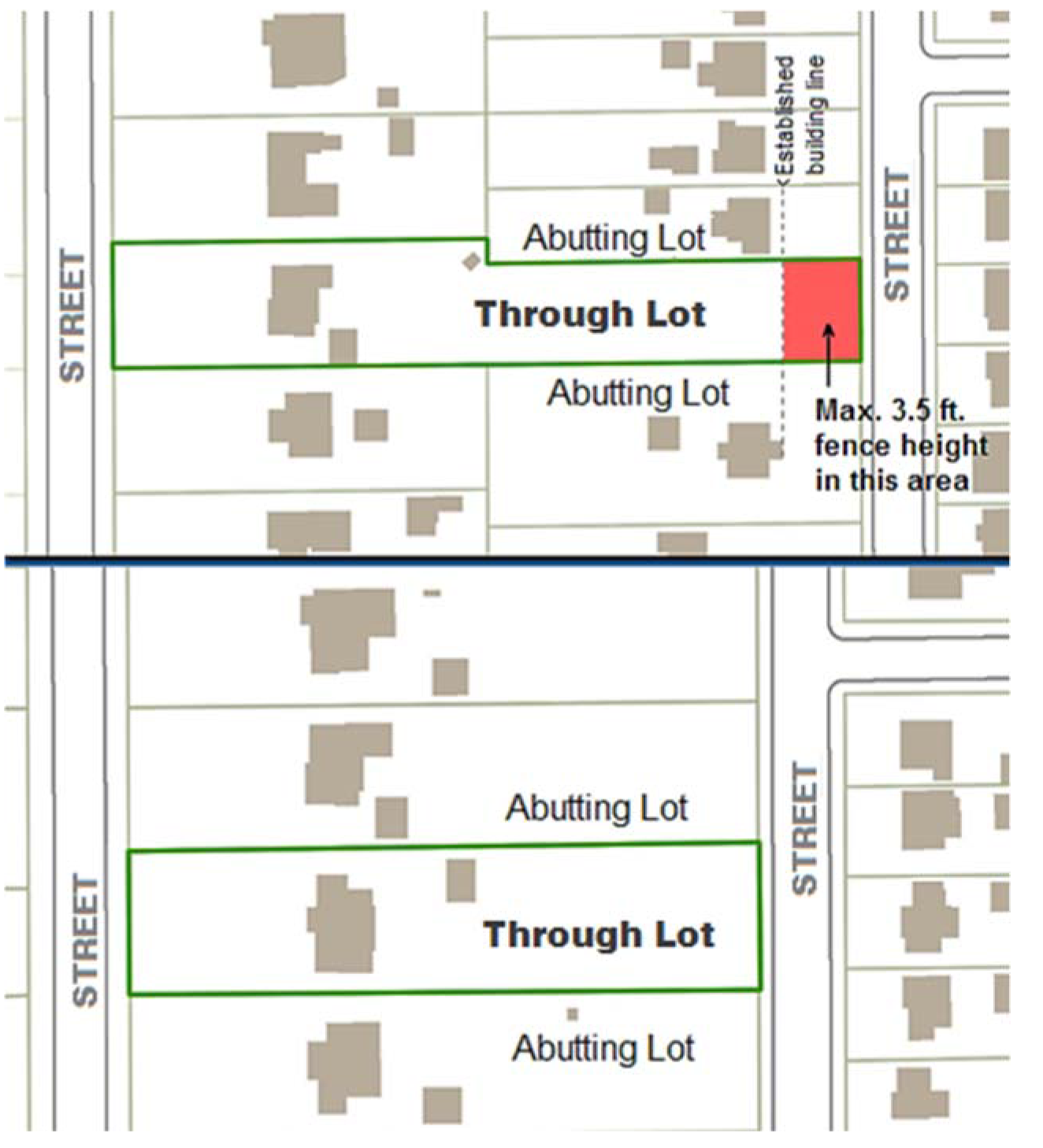
Diagram I Through Lot Fencing
3.
Fence posts. Fence posts may exceed the maximum height of the fence by one foot.
4.
Terrain change. A fence or wall may exceed the maximum height by an amount equal to the accompanying drop in topography along the linear run of the fence for that portion of the fence, up to a maximum of two additional feet, and shall only exceed the maximum height at that location.
5.
Multifamily dwelling projects in a Dwelling District with excessive frontage. Fences or walls located in the front yard may be as tall as six feet provided the front yard has at least 500 linear feet of road frontage, and the fence, when located within 15 feet of pedestrian or vehicular access shall be reduced to three and one-half feet in height or be no more than 25% opacity.
6.
Adjoining a Non-Dwelling District. In the Dwelling Districts, if a lot abuts a lot not zoned to a Dwelling District, the maximum height of a fence or wall along that lot line shall be the greater of the two Districts fence height limitations.
D.
Retaining wall design standards. All retaining walls shall comply with the following standards:
1.
Retaining walls more than six feet tall shall be terraced to minimize visual impacts on residents, neighboring properties and the public realm.
2.
Terracing shall be limited to three tiers.
3.
A terrace at least four feet wide, with a maximum slope of 3:1, shall be provided between each tier to create pockets for landscaping. Reduced terrace depths may be administratively approved by the Administrator where site constraints limit the amount of space available to accommodate the minimum required width.
4.
Terraces between retaining wall tiers shall be vegetated with permanent landscaping to screen retaining walls and provide visual interest unless soil conditions are determined by a licensed engineer to be unsuitable due to geologic hazards.
(G.O. 64, 2015, § 2; G.O. 37, 2018, § 12)
Sec. 744-601. - Street lighting.
A.
All subdivisions that include a new street shall provide street light at each access point to the existing street network, at each street intersection within the subdivision, and along each subdivision street at a maximum spacing of 250 feet placed along one side or alternating sides.
B.
Each required street light shall be a full cutoff fixture.
C.
In Dwelling and Mixed-Use Districts, each required street light fixture shall have a color rendering index of 70 or above.
D.
All street lighting fixtures shall produce at least 80 lumens per watt of energy consumed, as documented by manufacturer's specifications or the results of an independent testing laboratory.
(G.O. 64, 2015, § 2)
Sec. 744-602. - Exterior lighting applicability.
A.
General. All exterior lighting for development in any District after the first day of the month that is six months after the date of adoption shall comply with the standards of this Chapter 744 Article VI unless excepted in Section 744-602.B. below. This includes, but is not limited to, new lighting or replacement equipment exclusive of lamp replacement, whether attached to structures, poles, the earth, or any other location, including lighting installed by any third party.
B.
Exceptions. The following types of lighting are not subject to the requirements of this Chapter 744, Article VI Street and Exterior Lighting:
1.
Lighting of public monuments and statuary;
2.
Lighting required and regulated by the FAA or another agency of the state or federal government with authority to regulate that type of lighting;
3.
Temporary lighting for emergency or nighttime work and construction;
4.
Temporary lighting for theatrical, television and performance areas, or for special public events;
5.
Lighting for a special area designated for special lighting standards in an adopted plan or ordinance, such as Regional Center or an IHPC District Plan; and
6.
Temporary decorative seasonal lighting.
(G.O. 64, 2015, § 2)
Sec. 744-603. - Required lighting.
A.
Each pedestrian entrance, excluding exits for emergency use only, shall have a full cutoff light fixture and be controlled with a photoelectric switch, motion sensor control, or astronomic time switch.
B.
For all uses except single-family detached dwellings, single-family attached dwellings, two-family dwellings, triplexes, and fourplexes, exterior lighting devices shall be provided for all parking areas, walkways, exterior automatic teller machines, and automobile fueling stations.
(G.O. 64, 2015, § 2)
Sec. 744-604. - Lighting standards.
A.
Where exterior lighting is provided, lighting levels for all areas and shall be designed and located so that the illumination measured in foot-candles at grade level shall comply with the standards in the following table unless the applicant requests an alternative lighting level for a specific area and supports that request with information that the requested lighting level is consistent with recommended levels in the Illuminating Engineers Society of North America (IESNA) Lighting Handbook.
B.
All light sources or lamps that emit more than 900 lumens (13-watt compact fluorescent or 60-watt incandescent) shall be concealed or shielded with an Illuminations Engineering Society of North America (IESNA) full cutoff light fixture with an angle not exceeding 90 degrees to minimize the potential for glare and unnecessary diffusion on adjacent property.
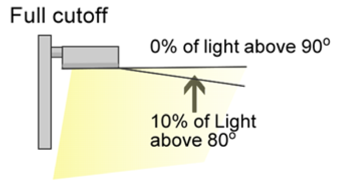
Diagram J Full cutoff light
C.
Private street or pedestrian lighting devices for nonresidential uses and multifamily uses may be mounted at heights between ground level to 42 inches above grade level or from 10 to 20 feet above grade level.
D.
The maximum height of any lighting pole serving a residential use is 20 feet. The maximum height serving all other types of use is 35 feet, except that in the I-3 and I-4 Districts the maximum pole height is 50 feet and in the C-5 and C-7 Districts for active recreational areas and uses the maximum pole height is 80 feet.
E.
Lighting devices for active recreational areas and uses, such as ball diamonds, playing fields, and tennis courts, shall be equipped with switching devices that allow lighting levels to be changed when the active recreational use ceases and a lower lighting level is sufficient, shall be extinguished no later than 11:00 p.m., shall have a maximum illumination at the property line that is no greater than two foot-candles, and light poles shall not be more than 80 feet tall.
F.
In order to accommodate wind energy conversion systems or solar energy collectors on lighting poles, the pole height may be increased to 55 feet, but the lighting fixture height shall remain as stated in subsection D. above.
G.
Lighting on automobile service station, convenience store and other outdoor canopies shall be fully recessed into the canopy and shall not protrude downward beyond the ceiling of the canopy.
H.
High pressure sodium lighting and all lighting devices with a color rendering index of 70 or below are prohibited in Dwelling and Mixed-Use Districts.
I.
All exterior lighting fixtures shall produce at least 80 lumens per watt of energy consumed, as documented by manufacturer's specifications or the results of an independent testing laboratory.
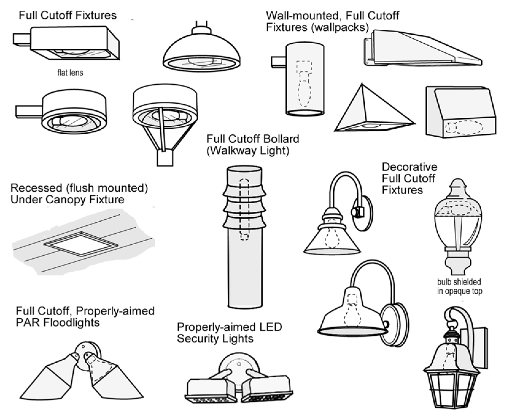
Diagram K Full cutoff light fixture examples
(G.O. 64, 2015, § 2)
Sec. 744-701. - Walkable neighborhood design standards
A.
Applicability. The Walkable Neighborhood Design Standards shall apply to the D-5, D-5II, D-8, D-9 and D-10 zoning districts. The standards shall specifically apply to the following circumstances:
B.
Design objectives. To advance the Livability Principles of this code, and to promote walkable neighborhoods, the design standards in this section have the following objectives. Any exceptions to the standards in this section, or discretionary review processes related to a specific application, shall be judged against these design objectives, in addition to any other criteria in this code for the application.
1.
Design walkable streetscapes, with slow traffic speeds, well-connected sidewalks, and shade and enclosure offered from street trees.
2.
Orient all buildings to the street to activate the streetscape, while still promoting effective transitions from public spaces to private spaces on the lot.
3.
Promote human-scale buildings and create active, social spaces along the streetscape and private frontages with building massing and architectural details that break up larger masses into smaller components and define outdoor spaces.
4.
Use similar forms and massing, common building elements, and consistent relationships to the streetscape to create compatibility among different building types, and to create effective transitions between different scales of buildings.
5.
Minimize the impact of car access on neighborhood streetscapes by limiting driveways and the extent of front loaded garages along block frontages, and use alternative access patterns integrated towards the interior of the block.
6.
Reinforce the neighborhood character with quality materials, windows, and architectural details that provide interest, depth, texture, and variety visible to those experiencing a neighborhood on foot.
7.
Improve the appearance and livability of neighborhoods with good civic design.
8.
Promote lasting and sustained investment in neighborhoods with quality design.
C.
Private frontage types. The design of private frontages on lots establishes the relationship of buildings and lots to the streetscape. The proportion of this area designed for social spaces and access for pedestrians, as opposed to dedicated to vehicle access, affects the character and quality of the streetscape. A consistent frontage design among all lots and buildings along a block face reinforces neighborhood character, even where different types or scale of buildings are permitted. The private frontage design standards in Table 744-701-2 coordinate the setback and building placement of specific building types on a block-by-block basis.
Where multiple frontage types are permitted, the frontages should be similar for all lots on the same block face or gradually transition to different building placement and frontage types on adjacent lots. In general, the front building line of adjacent buildings shall not differ by more than five feet.
Figure 744-701.02 Neighborhood Yard Frontage Elements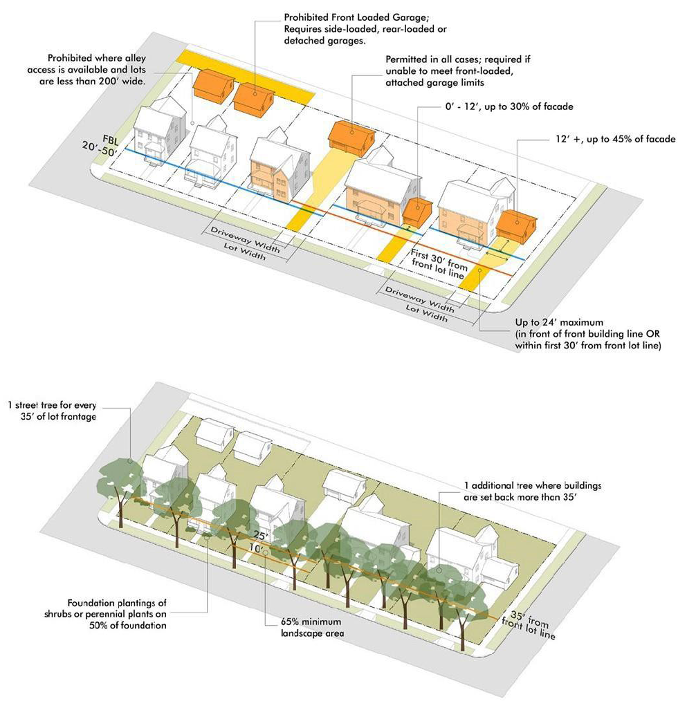
D.
Block and lot open space. Block and lot open space provides for active gathering places, recreation and leisure, and aesthetic enhancements to the buildings and lots serving as an extension of civic spaces connected to streetscapes. The open space required for each building type specified in Table 743.301.7, shall be designed to create usable outdoor space meeting one or more of the following open space types:
1.
Public or Common open space designed and platted according the standards in Table 741-310-2, provided it is on the same or abutting block, and is accessible to the project as public property, through ownership, or by other agreement;
2.
Private frontage areas designed according to Section 744.701.C;
3.
Courtyards, meeting the standards of Section 744.701.E;
4.
Rear yards or uncovered decks or patios, provided they are part of an open area at least 140 feet;
5.
Rooftop decks provided they are at least 160 square feet; or
6.
Private balconies or patios, provided they are at least six feet by 10 feet.
E.
Courtyard pattern. Residential buildings and lots may be designed to front on a courtyard based on the following design standards. A courtyard consists of an open area that is completely or mostly enclosed by the walls of a building or buildings.
1.
Applicability. The courtyard pattern is appropriate where:
a.
Courtyards are designed as an extension of the public streetscape and open space system for the project, block or neighborhood;
b.
Blocks and surrounding lots are deep, allowing a different configuration of buildable lots; or
c.
Other developed areas where existing lot patterns in the vicinity warrant use of this pattern to facilitate infill development and compatible building types.
2.
Eligible building types. The following building types are eligible for this pattern, subject to the limitations stated:
a.
Small apartments, up to five buildings or 36 units, whichever is less.
b.
Row houses, up to four buildings or 24 units, whichever is less.
c.
Multi-unit house, duplex, or detached house, up to eight buildings.
3.
Design standards and exceptions.
a.
The minimum lot size per building may be reduced up to 30%, provided the courtyard is owned in common by all lots or otherwise established as a shared-space amenity.
b.
Lots and buildings may front on the courtyard, rather than along a street, provided they otherwise meet the design standards applicable to the front of buildings.
c.
The front setback may be reduced to five feet from the courtyard.
d.
Vehicle access and parking for each lot shall be designed in a way that minimizes the impact on the public street and the courtyard, and meets all frontage standards applied to the project as a whole.
e.
Any buildings fronting on the street, or the sides of any buildings adjacent to the street shall still meet requirements for public frontages and orientation standards in this section. Corner buildings must meet the front building design standards on both the street front and the courtyard.
f.
The courtyard shall meet the following design standards:
(1)
Size. 750 to 5,000 square feet.
(2)
Proportions. The courtyard shall be at least 25 feet in all directions and be no wider than 3:1 (length to width).
(3)
Frontage and access. The courtyard shall have frontage on a public street, or be visible from and directly connected to the streetscape.
(4)
Landscape. At least 40% of the area shall be allocated to planter beds, seasonal plantings, foundation plants or other landscape amenities, and otherwise meet the landscape standards applicable to Terrace frontages.
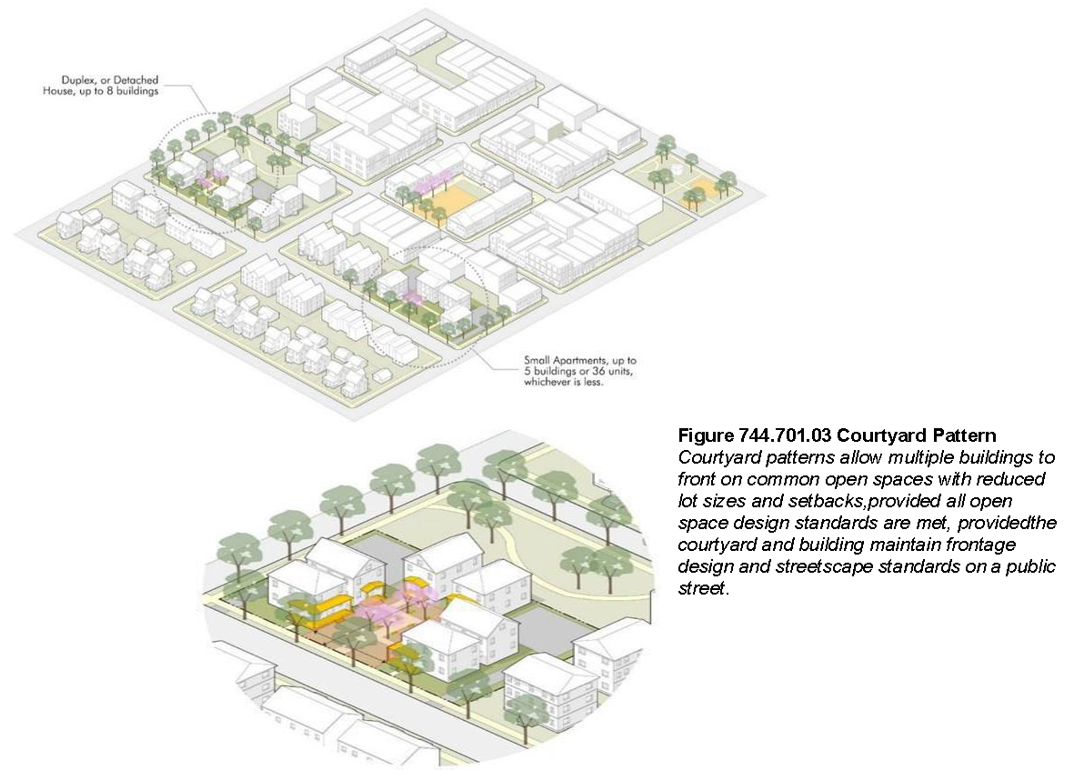
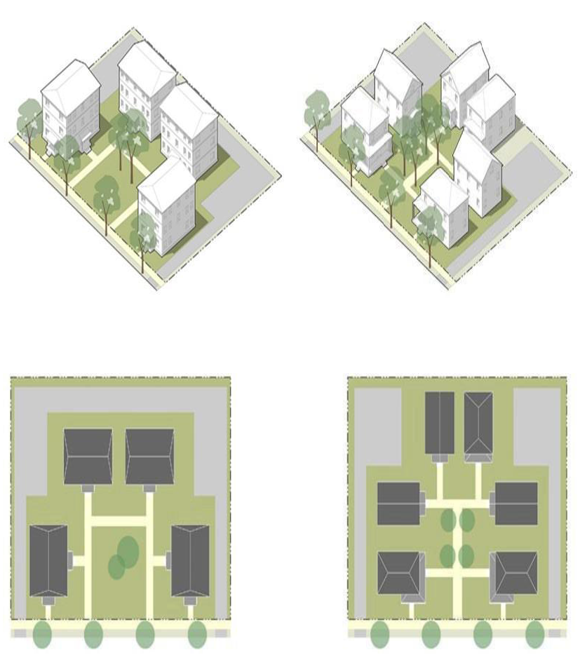
(G.O. 26, 2021, § 8)
Sec. 744-702. - Mixed-Use and Commercial Design Standards.
A.
Applicability. The Mixed Use and Commercial Design Standards apply to the following property:
1.
Mixed-use Districts. All applications of the Mixed-Use Districts (MU-1, MU-2, MU-3 and MU-4); and
2.
Transit-Oriented Development. Any commercially zoned lot (C- Districts) in the Transit-Oriented Secondary District established in Section 743.207.
The standards shall specifically apply to the following circumstances:
B.
Design objectives. To advance the Livability Principles of this code, and to promote walkable, mixed-use and transit-oriented development patterns, the design standards in this section have the following objectives. Any exceptions to the standards in this section, or discretionary review processes related to a specific application, shall be judged against these design objectives, in addition to any other criteria in this code for the particular application.
1.
Create a dynamic, mixed-use environment, where walking is the predominant mode of transportation within the center, and the center is accessed by many modes including transit, bicycles, walking and cars.
2.
Design human scale streetscapes, with slow traffic speeds, well-connected sidewalks, on-street parking, social spaces along streets, and shade and enclosure offered from street trees and building facades.
3.
Produce quality public spaces that are usable for a variety of public and semi-public activities.
4.
Coordinate urban design, site planning and building layouts on a block scale, relating to the level of design and pedestrian amenity on the associated streetscape.
5.
Promote vibrant streetscapes with active uses and attractions located in storefronts and first story of buildings, and frequent windows and doors that activate the street and create visual interest on facades along a block.
6.
Avoid long, monotonous, uninterrupted walls or roof planes visible from the street or other public rights-of-way. Large buildings must include details that add architectural interest and variety such as multiple entrances, projections, recesses, offsets, windows trimmed with frames, sills or lintels, or other ornamentation.
7.
Minimize the impact of car access on streetscapes and the character of the district by limiting driveways and the extent of parking, garage entrances or service bays along streetscapes, and use alternative patterns of vehicle access integrated towards the interior of the block.
8.
Reinforce the character of unique destinations with quality materials and architectural details that provide interest, depth, texture, and variety visible to people on foot, and which differentiate the place from other districts, activity centers, and station areas.
9.
Improve the appearance and vibrancy of districts, activity centers, and station areas with good civic design.
10.
Promote lasting and sustained investment in districts, activity centers and station areas with quality design and construction, and durable, adaptable and re-usable buildings.
C.
Private frontage types. The design of private frontages on lots establishes the relationship of buildings, and the details of building design creates better relationships. The private frontage design standards in Table 744-702-2 coordinate the access, building location and building design on a block-by-block basis to create a consistent frontage along the block. Frontage types may be established through a specific plan for each station area or mixed-use district. In the absence of a plan, and when applying these standards on a project-specific basis, the applicability guidance in Table 744-702-2 for each frontage type shall be used, and staff shall select the appropriate frontage type based on the context, and considering the following:
1.
The distance of the site from transit stations;
2.
The extent that building forms and development patterns on the existing block and adjacent blocks reflect compact, walkable patterns;
3.
The relative quality of the public realm and pedestrian connections existing in the rights-of-way, and considering the pedestrian amenity zones in the thoroughfare plan; and
4
Whether any public or private plans to improve any of the above according to the guidance in the thoroughfare plan exist.
Figure 744.701.04 Pedestrian: Frontage Design & Building Placement & Form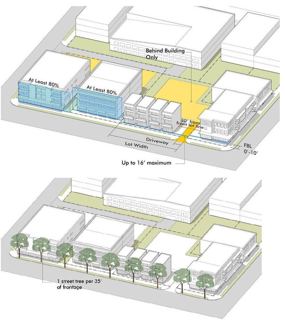
Figure 744.701.05 Connector: Frontage Design & Building Placement & form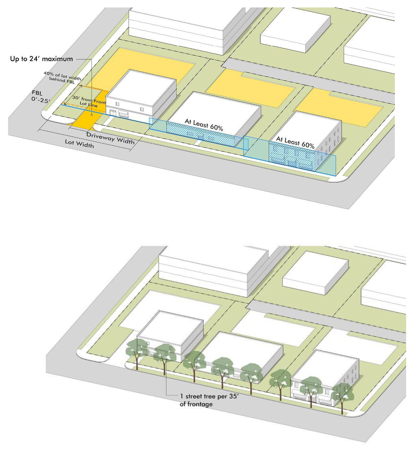
Figure 744.701.06 Buffer: Frontage Design & Building Placement & Form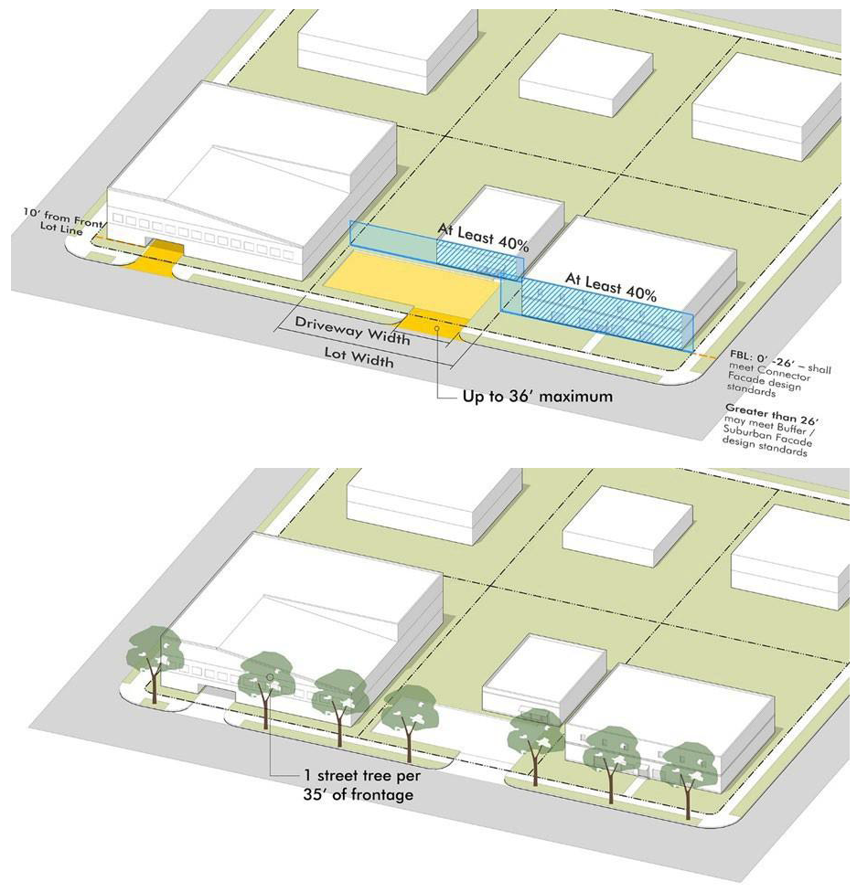
D.
Frontage design.
1.
Access limits. Any lot abutting an alley shall get access off the alley and shall not create new driveways from the street, except for lots with over 200' of street frontage. In all other cases, access to individual lots shall be limited by the width and separation distances specified in Table 744-702-2, measured on center. In cases where access to individual lots is prohibited by these standards, one of the following strategies shall be utilized:
a.
New rear or mid-block alleys, built as shared easements;
b.
Access from side streets; or
c.
Cross-access easements or common lanes among two or more lots along the block.
2.
Parking location and extent. Surface and structured parking shall be limited to the setback distances specified in Table 744-702-2 and any portion of the parking not behind a building or active open space shall be limited to the percent of the frontage specified in the table.
3.
Landscape. In addition to any open space standards or landscape standards that otherwise apply, all frontages shall be planted according to the following:
a.
Street trees are required at the rate specified in Table 744-702-2 and shall be planted every 20 feet to 50 feet on center.
b.
Street trees shall be planted in the following locations, in order of preference:
(1)
In the amenity zone where there is a landscape strip at least six feet wide, or a tree well at least 24 square feet and minimum four feet wide in all directions.
(2)
Within four feet of the sidewalk, where sidewalks are attached and tree wells are not feasible.
(3)
Within six feet of the front property line where right-of-way constraints prohibit the first two locations.
c.
For any non-building portion of the lot frontage, or where buildings are setback more than 25 feet, additional trees shall be planted in the frontage at the same interval to fill the void with vertical landscape elements.
d.
Any parking area permitted within 30 feet of the street shall be screened from the street edge with a two and one-half-foot to four-foot wall or ornamental fence complimenting the materials of the building, a dense landscape hedge, or a combination of both.
e.
Where conditions place constraints on large trees being planted according to this section, small shade trees or ornamental trees may be substituted at a rate of one tree for every 20 feet of lot frontage, or large trees can be concentrated at end-caps and mid-block bulb outs that create gateways or focal points on the block.
Figure 744.701.07 Frontage Landscape Design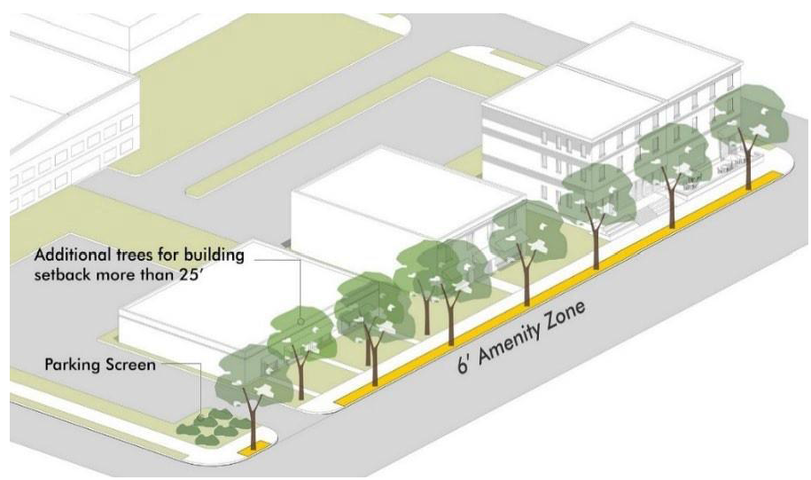
E.
Building placement and form.
1.
Required front building line. All buildings shall establish a front building line within the range of the front lot line specified in Table 744-702-2. The required front building line shall extend for the minimum percentage along the frontage specified in the table.
2.
Courtyards, plazas and patios. Courtyards, plazas and patios along the frontage may count to the required front building line provided:
a.
It is limited to no more than 50 feet or 50% of the lot frontage, whichever is greater;
b.
There are defining features at the extension of the required front building line, such as decorative walls or fences, landscape features and other human scale details; and
c.
All building facades fronting the open space meet the standards otherwise applicable along the streetscape.
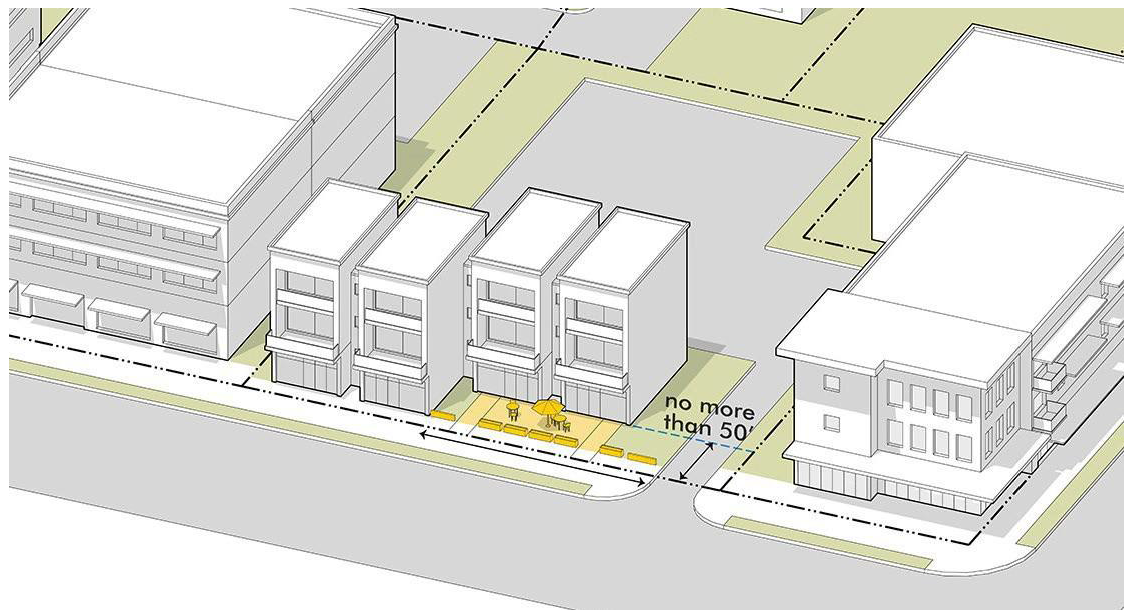
Figure 744.701.08 Alternatives to Required Front Building Line
Active outdoor space such as courtyards, plaza, and patios may contribute to the required front building line, provided they are limited in extent and provide some defining features along the required front building line.
3.
Corner buildings. Corner lots with property lines on two different frontage types shall apply the standards in the design standards in the following manner:
a.
The lot shall be determined to front on and meet the higher frontage classification.
b.
The building shall meet the higher classification on the secondary street for at least the first 25 feet from the corner on the secondary frontage.
c.
An entry feature on the corner and oriented to both streets may satisfy the entire requirement of subsection 3.b above.
4.
Residential buildings. Where buildings with first-floor residential are permitted on the frontage (residential building types), the first story should be elevated at least two feet above street level, and with the front building line established at least ten feet from the sidewalk. The building may be placed within five feet of the sidewalk if the first story is raised an additional six inches for every foot that it is closer to the street than ten feet.
F.
Building scale and design.
1.
Primary entry features. Primary public entrances shall be located at intervals at least as frequent as specified in Table 744-702-2 and be clearly defined on all front façades with at least two of the following elements:
a.
A single-story architectural emphasis such as canopies, awning, porticos, pediments, arches, or arcades.
b.
Architectural details such as transom or display windows, ornamental tile accents, columns, moldings or other similar accents and material changes.
c.
Railings, wing walls or plantings integral to the entry structure that incorporate landscaping and/or places for sitting.
d.
Recesses of the building mass of at least three feet deep.
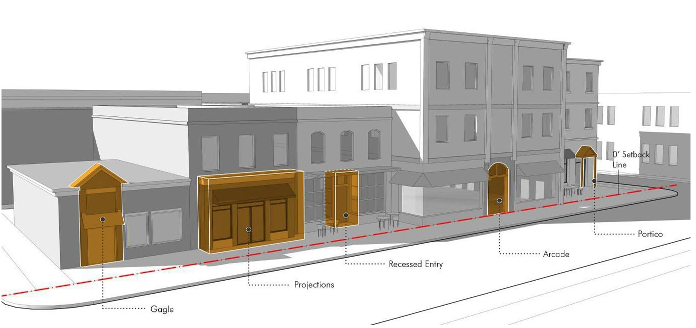
Figure 744.701.09 Primary Entry Features
The frequency and the design details of entry features activate the streetscape and contribute to the pedestrian quality of the street.
2.
Transparency. Buildings shall have the percentage of openings on street-facing façades specified in Table 744-702.2 (First Story and Upper Story Transparency), based on the following:
a.
Where expressed as a first story requirement the percentage shall be measured between three feet and eight feet above the street level, or above the first-floor elevation if the building is set back more than ten feet from the street.
b.
Where expressed as an upper story requirement, the percentage shall be measured between the floor level and ceiling of each story.
c.
All street level windows required shall have transparent glazing and provide direct views to the building's interior or to a lit display area extending a minimum of three feet behind the window.
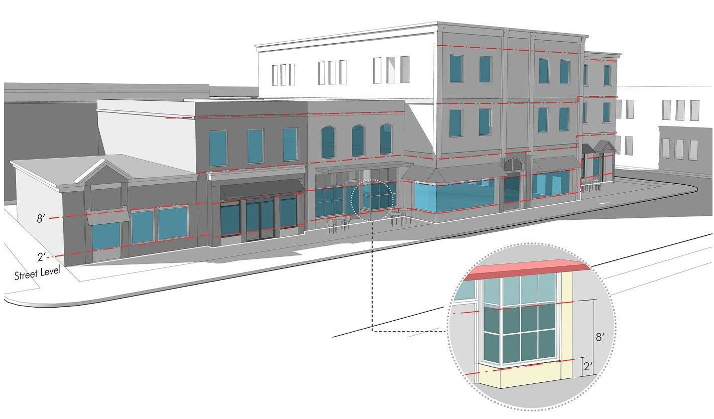
Figure 744.701.10 Transparency
The transparency of the front facade creates actual and perceived connections between the uses in the building, particularly at street level, and the activity along the street scale. The degree of transparence and the composition of windows and doors on the facade contribute to the quality and character of the street.
3.
Wall plane and blank wall limits. Larger façades shall be broken into smaller components by one or a combination of the following techniques to meet the wall plane limits and blank wall limits in Table 744-702-2 (Massing and Modulation):
a.
Use structural bays that emphasize vertical breaks in interior components or massing elements of the building, with visible features such as columns, pillars, or pilasters, and material, color changes or other details and accents that project between four inches and 12 inches off the façade.
b.
Differentiate massing with projections, balconies, cantilevers or step backs from the main mass associated with different stories. Massing shall create deviations in the wall plane of at least two feet if projecting from the façade and at least four feet if recessed from the façade.
c.
Emphasize horizontal differentiation of a base, body and top of all buildings with ornamental details or material changes according to the following:
(1)
For buildings less than three stories, this can be a distinct foundation, a main façade, and an embellished roof structure, such as eaves and fascia for pitched roofs, or cornices and parapets for flat roofs.
(2)
For buildings three to eight stories or more, the first floor should be clearly differentiated from upper stories to establish the base and an embellished roof structure.
(3)
For buildings nine stories or above, the first two stories should be clearly differentiated from the upper stories, and the top story may be differentiated as the top including an embellished roof structure.
d.
Any other blank wall areas in excess of the requirements of Table 744.702-2 shall be broken up by ornamental architectural details complimentary to the materials and architectural style of the building. Significant molding, trim or ornamentation used to break up blank walls or wall planes should project between four inches and two feet from the wall.
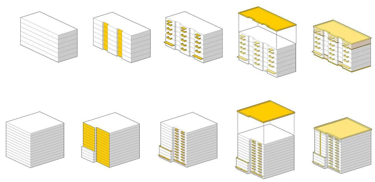
Figure 744.701.11 Wall Plane & Blank Wall Limits
A series of massing and modulation techniques can be used to meet the building scale and design standards, that will break down the buildable envelope and better relate building to the site, the streetscape and to adjacent buildings.
G.
Block and lot open space. Block and lot open space provides for active gathering places, recreation and leisure, and aesthetic enhancements to the buildings and lots serving as an extension of civic spaces connected to streetscapes. The open space required for each building type specified in Table 742-105-3, shall be designed to create usable outdoor space meeting one or more of the following open space types:
1.
Public or common open space designed and platted according the standards in Table 741-310-2, provided it is on the same or abutting block, and is accessible to the project through ownership or other agreement;
2.
Courtyards, plazas and patios or similar outdoor seating areas that are either designed as an extension of the public streetscape on the frontage, or at least 800 square feet and 20 feet in all directions if internal to the site.
3.
Rooftop decks provided they are at least 160 square feet; or
4.
Private balconies or patios for residential units, provided they are at least 60 square feet.
(G.O. 26, 2021, § 8)
Sec. 744-801. - Applicability.
All utility lines installed after January 1, 1973, within all Dwelling Districts, or any Mixed-Use District, or C-1 Commercial District, shall be located underground. Provided, however, nothing contained in this article shall prohibit:
A.
The temporary aboveground location of utility lines during construction or emergency conditions.
B.
Renewal, reinstallation, relocation, replacement, repair or maintenance of existing aboveground utility lines; or installation of aboveground utility lines in location predominantly served by existing aboveground utility lines.
C.
Aboveground utility lines where underground location would not be feasible due to soil conditions, physical obstructions or terrain.
D.
The at- or above-grade level location of transformers, service or meter pedestals and similar accessory installations, including all aboveground utility lines necessarily or customarily extending above-grade level in an underground utility line system.
Further provided, however, adequate access for such underground installation shall be provided at no cost to the utility.
(G.O. 64, 2015, § 2)
Sec. 744-802. - Exceptions.
A.
The Administrator shall make a determination of exception to the above underground utility line regulations as applied to any specific land area, upon sufficient evidence that the underground location of utility lines therein would be undesirable, infeasible, unnecessary or inappropriate because of the size, design, number of units or character of the proposed development, its relationship to existing or planned adjacent uses, or other relevant planning considerations of land use, location, site design, physical or environmental conditions, aesthetics, economics or technology.
B.
Such determination of exception shall be made upon petition by the owners of 50& or more of the subject land area or by the utility. The Administrator shall furnish notice of his determination or denial of exception to the petitioners and the utility.
(G.O. 64, 2015, § 2)
Sec. 744-803. - Improvement Location Permit required.
After January 1, 1973, as a prerequisite to the issuance of an Improvement Location Permit for any structure to be served by utility lines required by this article to be located underground, the applicant shall provide a copy of an agreement with the utility (or other evidence satisfactory to the Administrator) that all utility lines required by this article to be located underground will be installed in compliance with the requirements of this Chapter 744, Article VIII.
(G.O. 64, 2015, § 2)
Sec. 744-901. - Purpose and application.
A.
Purpose. This Chapter 744, Article IX creates the legal framework for sign regulations that are intended to facilitate an easy and agreeable communication between people and to balance the interests and objectives of the sign owner and the community audience. It is recognized that signs serve an important function and, therefore, reasonable and adequate display of signs is permitted under the provisions of this Article IX. It is further recognized that while aesthetics and design quality can vary greatly, the overall impact upon on the surrounding larger community can significantly impact property values, safety, long-term vitality and the overall quality of life in Indianapolis and its neighborhoods.
The purpose of the sign regulations set forth in this Section 744-901 shall be to:
Eliminate or reduce potential hazards to motorists and pedestrians;
Maintain an equitable opportunity for effective communication;
Enhance efficient location of places for ease of commerce, emergency response, and the convenience of residents and guests;
Eliminate excessive and confusing sign displays;
Preserve the scenic and natural beauty;
Preserve and protect historic signs;
Assure the maintenance of signs;
Encourage signs to be compatible with the scale of buildings;
To preserve and improve the appearance of the city as a place in which to live and work and act as an attraction to nonresidents who come to visit or trade;
Supplement and be a part of the regulations imposed and the plan set forth under the Comprehensive Plan for Marion County; and to
Promote the public health, safety, morals and general welfare.
B.
Applicability of regulations.
1.
The requirements, conditions, prohibitions and exceptions specified in Chapter 744, Article IX of the Zoning Ordinance shall apply to all signs and sign structures in all zoning districts in Marion County, Indiana.
2.
No sign or sign structure, or part thereof, shall be constructed, erected, converted, enlarged, extended, reconstructed or relocated except in conformity with these regulations.
C.
Substitution. Noncommercial content may be substituted for other content on any sign permitted under this Chapter 744, Article IX or any legal nonconforming sign under this zoning ordinance.
D.
Severability. If any decision, subsection, sentence, phrase or portion of this Chapter 744, Article IX is for any reason held invalid or unconstitutional by any court of competent jurisdiction, that portion of these regulations shall be deemed separate and distinct, and that holding shall not affect the validity or constitutionality of the remaining portions of this section, which shall remain in full force and effect.
(G.O. 10, 2019, § 1)
Sec. 744-902. - Definitions.
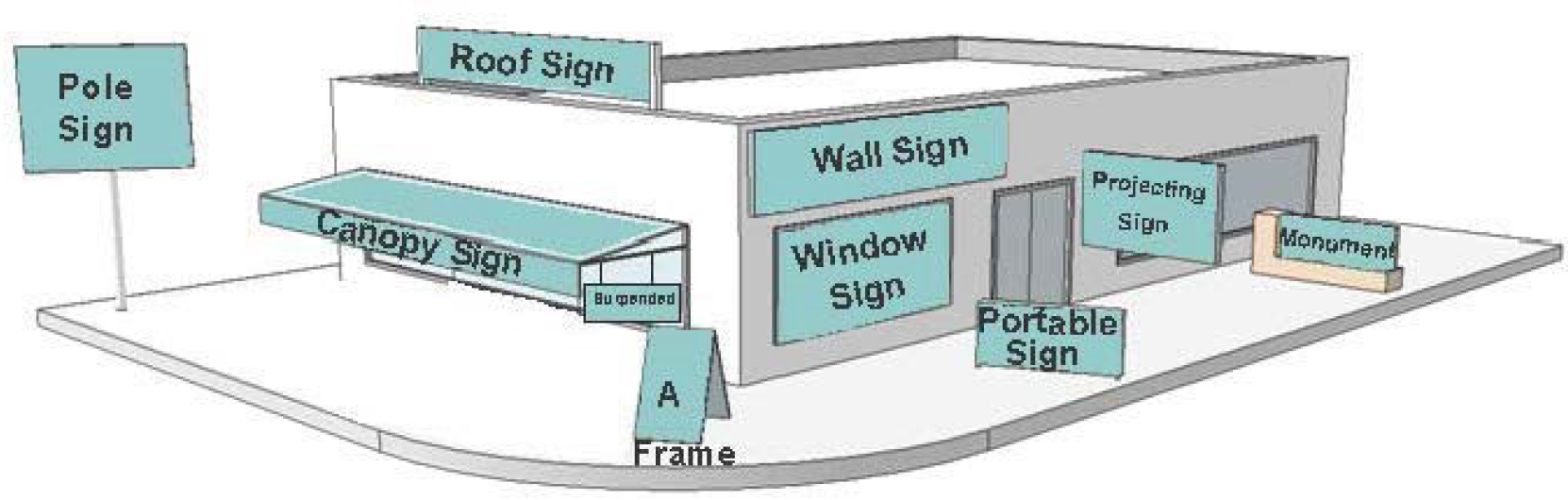
The words in the text or illustrations of this article shall be interpreted in accordance with the following definitions. The illustrations and diagrams in this section provide graphic representation of the concept of a definition; the illustration or diagram is not to be construed or interpreted as a definition itself.

A-Frame Sign Example
A-frame sign: A pedestrian sign containing two sign faces and whose framing is hinged at the apex at an angle less than 60 degrees.
Abandoned sign: Any sign or its supporting sign structure that conforms to this ordinance where the primary use, which has ceased activity for a period of one year or more, is considered abandoned. Any sign or its supporting sign structure that does not conform to this ordinance and which has ceased activity for a period of 60 days or more is considered abandoned. Any sign deemed abandoned will also lose legally non-conforming status. For purposes of this definition, "the primary use" refers to the activity occurring on the property and not to the mere generation of income for the property owner, or the intentions of the property owner or any tenant or sub-tenant.
Air dancer: A lightweight inflatable moving product made up of one or more long tubes of thin fabric with two or more outlets, which is attached to and powered by a fan at or near its base that causes the tubes to move about in a dancing or flailing motion.
Art (pertaining to signs): Original works created by an individual or team that are designed with the intent of producing a creative or aesthetic outcome, and are not used for advertising a business, product, service or commercial activity except in accordance with Section 744-903 F.2.
Automobile rental station: A portion of a legally established parking area or parking garage that serves as the location for the parking, storage, pick-up and drop-off of a rental automobile.
Auto sharing: A service in which automobiles are made available to the public for shared use on a short-term basis.
Banner: A sign with a message applied to cloth, paper, fabric, or flexible plastic, with any such non-rigid material for background.
Bike sharing: A service in which bicycles are made available to the public for shared use on a short-term basis.
Building signs: A sign accessory to the primary use of land that is attached to any part of a building including, but not limited to projecting signs, projecting-blade signs, canopy signs, marquee signs, pedestrian-oriented projecting and suspended signs, skyline signs and wall signs.
Canopy (pertaining to signs): A permanent roof-like cover, which extends from the building, providing shelter over, for example, a doorway, window area, outside walk or parking area.

Canopy Sign Examples
Canopy sign: Any building sign that is part of or attached to a canopy as an accessory to the primary use of the land, made of fabric, plastic, or structural protective cover over a door, entrance, or window. A canopy/awning sign is not a marquee and is different from pump island canopy signs.

Example of Changeable Copy Sign
Changeable copy sign: A sign or portion thereof with characters, letters, numbers, illustrations that can be changed manually but not remotely, and without altering the physical face or the surface of the sign.
Clear sight visibility area: Area between 2.5 feet and nine feet above the driving surface of the adjacent road way within an area formed by measuring 25 feet along both curb lines where they intersect, and connecting the two points to form a triangle.
Commercial flag: Flag displayed for commercial proposes.
Community (residential): A subdivision, condominium or apartment development or building.
Cutoff: See General Definitions, Chapter 740-202.

Digital Display Sign Example
Digital display: Any portion of a sign, such as an electrically or electronically controlled message center, where the characters, letters, or illustrations can be changed or rearranged either non-manually in the field, or from a remote location, without physically altering the face or the surface of the sign. This may include an electronic variable message sign or projected image onto a building. This shall not be construed as a prohibition on the use of LED technology.
Drive-thru sign: A sign on a lot that includes a drive-through service window and at least one stacking lane that is devoted exclusively to customers of a drive-through service, which is located at the entrance of or along or over one or more such stacking lanes.
Flag: Any fabric or similar light-weight material attached at only one end of the material, usually to a staff or pole, so as to allow movement of the material by atmospheric changes. Flags are considered to be signs.
External illumination: A lighting method provided by an external light source.
Freestanding sign: Any sign, accessory to the primary use of land, whose primary support is placed on, or anchored in, the ground and is independent from any building or other structure and may include monument signs, pole signs and pylon signs.
Gateway signs: A sign indicating entry into a neighborhood or special district. Gateway signs shall be subject to Regional Center or IHPC requirements and administrative approval in all districts. DPW and DBNS approval is required for work and/or encroachment into any right-of-way.
Ghost sign: Historic, painted wall sign that remains from an earlier time or advertises the use of a building that provides evidence of the history of the use of the building or activities of the community.
Grade level (pertaining to signs): Existing grade prior to construction or the newly established grade after construction, exclusive of any filling, berming, mounding, or excavating solely for the purpose of locating the sign.
Halo illumination: A lighting method provided by concealing the light source behind three-dimensional opaque letters, numbers, or other characters of a sign, resulting in the night time perception of a halo around the silhouette of each sign character. This is also referred to as "reverse channel" or "reverse lit" illumination. A sign with halo illumination is not considered an internally illuminated sign for the purpose of this article.
Heritage sign: An existing sign having historical significance, and which advertises an establishment or product no longer in existence or a product no longer being offered on the site, may be designated a heritage sign. An exact replica of an original sign attached to a building that would have been at least 50 years old may be designated a heritage sign. See Chapter 744-909 A.
Illumination (pertaining to sign and billboard regulation): The lighting of a sign with an artificial light source incorporated internally or externally to emanate light from, or direct light to a sign's surface, whole or in part, or that is created by the projection of light onto a surface such as a building wall.
Incidental sign: A permanent sign which has a purpose that is secondary and incidental to the use of the lot on which it is located, such as "hours of operation", "loading zone only," "air," "building directory," and "visitor parking," and which carries no commercial message that is legible beyond the lot on which the sign is located, except for a registered logo on a premises with two or more separately-operating businesses.
Inflatable signs: Lighter-than-air or gas-filled balloons or other similar devices used to advertise or define a fixed location are prohibited, except in compliance with Section 744-910.
Integrated center (pertaining to signs): An area of development (commercial, industrial or any combination of commercial, industrial and residential uses) that includes multiple businesses or uses in one or more buildings that share common-site facilities.
Internal illumination: Illumination created by a light source internal to the sign, transparent or translucent material from a light source within the sign structure or panel, or exposed lighting on the sign face.
Legally established nonconforming sign: Any sign and its support structure lawfully erected prior to the effective date of the adoption of this article that fails to conform to the requirements of this chapter.
Maintenance (pertaining to a sign): The process of keeping a sign in good repair. Maintenance includes: cleaning, painting, and repair or replacement of damaged or defective parts with like materials in a manner that does not alter the basic design or structure of the sign.
Marquee: A permanent roof-like projection above an entrance of a building, supported by the building and designed and constructed to provide protection from the weather and may accommodate changeable copy signs or digital displays. A marquee is not a canopy.

Marquee Sign Examples
Marquee sign: A building sign painted, mounted, constructed or attached in any manner on a marquee and may accommodate changeable copy signs or digital displays.
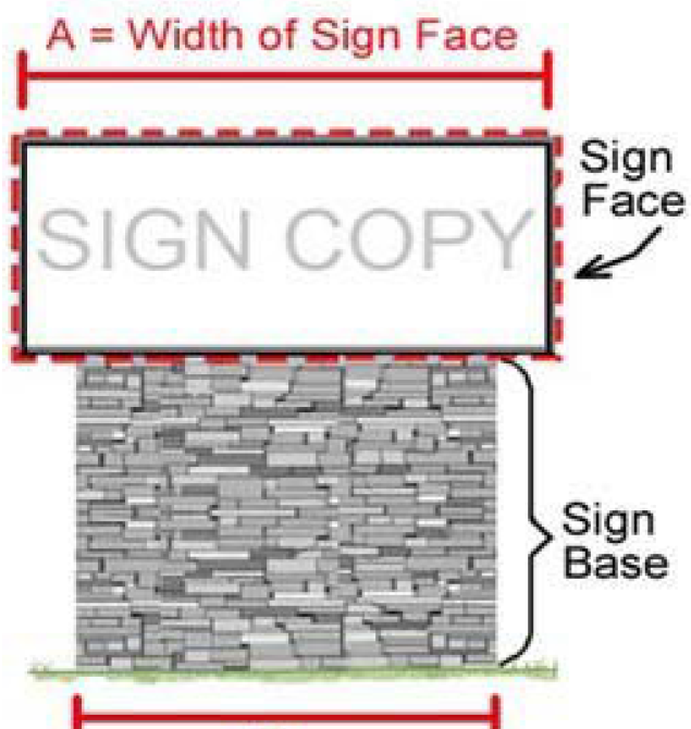
Diagram A - Monument Sign
Monument sign: A freestanding sign, accessory to the primary use of land, whose sign face is attached to a proportionate sign base or structural frame that maintains a minimum width, without opening, greater than 80% of the width of the widest part of the sign face a constant width, without opening.
Municipal bus bench: A seating structure caused to be erected, maintained and managed by or on behalf of the Indianapolis Public Transportation Corporation, or their successor, to provide temporary seating for people waiting to use or ride public transportation.
Municipal bus shelter: A roofed structure caused to be erected, maintained and managed by or on behalf of the Indianapolis Public Transportation Corporation, or their successor, to provide temporary protection of people waiting to use or ride public transportation.
Municipal bus stop: A location designated by Indianapolis Public Transportation Corporation or their successor, for people waiting to use or ride public transportation that is located next to a roadway served by an operational public transit corridor.
Mural: A design or representation painted, drawn or similarly applied on the exterior surface of a structure for artistic expression, see "Art" definition. Typically, the only text includes the artist's name and date of installation.
Multi-tenant sign: A single sign structure accommodating multiple sign faces dedicated to individual tenants.
Non-commercial flag: A flag that is not a commercial flag.
Off-premises sign: A sign that directs attention to a business, profession, commodity, or service offered on the property other than that on which the sign is located. This limitation does not apply to the content of noncommercial messages.
On-premises sign: A sign that directs attention to a business, profession, commodity, or service offered on the property on which the sign is located. This limitation does not apply to the content of noncommercial messages.
Parapet (wall): The portion of a building wall that rises above the roof level.
Pavement sign: A sign built into or affixed to the sidewalk or pavement, typically at the entrance of a building.
Pedestrian-oriented building sign: Signs of scale and location that are intended for pedestrian traffic. See definitions for "projecting sign and suspended sign".
Pedestrian sign: A sign that is located in pedestrian areas, such as sidewalks or plazas. A pedestrian sign may be of an A- or T-framed design.

Pole Sign Example
Pole sign: A freestanding sign, accessory to the primary use of land, that has as its support structure one or more poles anchored in the ground as it extends upward from grade level.
Portable sign: A sign without a sign structure or building, or with a sign structure lacking a permanent foundation or that is otherwise not permanently attached to a fixed location, which can be carried, towed, hauled or driven, and is primarily designed to be moved rather than be limited to a fixed location regardless of modifications that limit its movability, including but not limited to signs on trailer frames, whether or not the trailer wheels have been removed. This definition does not include pedestrian signs.
Primary freestanding sign: A monument, pylon or pole sign or other freestanding permanent sign, accessory to the primary use of land, and that is not one of the types specified as a secondary freestanding sign.
Primary building sign: A wall sign, canopy sign, marquee sign, skyline sign, roof-integral sign, projecting blade sign, projecting sign or a sign that is not pedestrian-oriented, or other permanent sign, accessory to the primary use of land, that is attached or affixed to a building, and that is not one of the types specified as a secondary building sign.

Projecting Sign
Projecting sign: A building sign that is affixed to a building or wall at an angle in such a manner that its leading edge extends more than 18 inches beyond the surface of such building or wall face.
Projecting - Blade sign: A building sign that is a type of projecting sign mounted on a building facade or storefront pole or attached to a surface perpendicular to the normal flow of traffic.
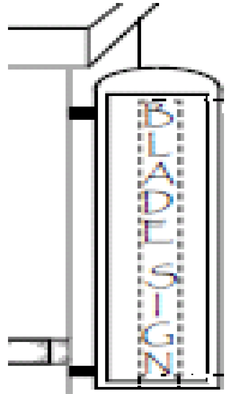
Projecting Blade Sign
Protected District: Specific classes of zoning districts that, because of their low intensity or the sensitive land uses permitted within them, require buffering and separation when abutted by certain more intense classifications of land use. A Protected District includes any Dwelling District, Federally or Locally Designated Historic Preservation District, Hospital District, Parks District, University Quarter District, SU-1 (Church) District or SU-2 (School) District.
Public sign: A sign that is constructed, placed or maintained by the federal, state or local government for the purpose of carrying out an official duty or responsibility or a sign that is required to be constructed, placed or maintained by a federal, state or local government either directly or to enforce a property, including but not limited to signs which promote safety, no trespassing, or traffic signs; memorial plaques; signs of historical interest; notices of pending governmental action and signs directing people to public and semi-public facilities; public transit service signs, utility information signs, public restroom or telephone signs, trespassing signs, legal notices; signs of public service companies indicating danger and aids for service or safety.
Pump island canopy: A roof-like horizontal structure that extends over or covers the fuel dispenser(s), may be a lighting source for the dispensing area and may display signage.
Pump island canopy sign: Any sign that is part of or attached to the pump island canopy.
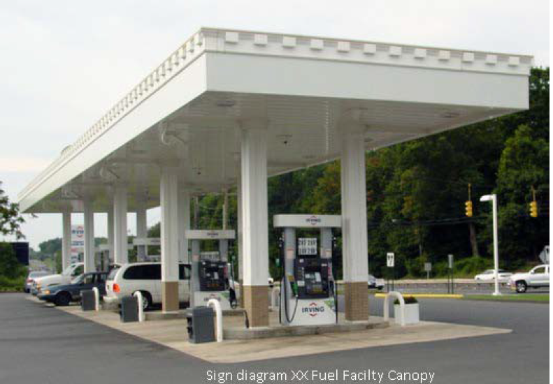
Pump Island Canopy Example
Pylon sign: A freestanding sign, accessory to the primary use of land, with its sign face attached to a sign base consisting of one or more supports that, from grade level to the sign face, maintains a minimum width extending upward from grade level of 20% up to 100% of the width of the widest part of the sign face.
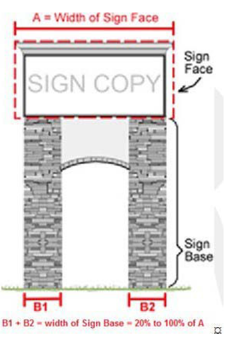
Pylon Sign Example
Roof line: The uppermost edge of the water-carrying surface of a building or structure.
Roof-integral sign: Any building sign erected or constructed as an integral or essentially integral part of a normal roof structure of any design, so that no part of the sign extends vertically above the roof.
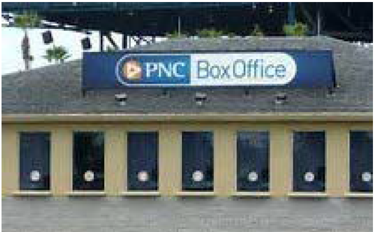
Roof-Integral Sign
Roof sign: Any building sign erected and constructed wholly on and over the roof of a building, supported by the roof structure, and extending vertically above the roof.

Roof Sign Example
Rotating sign: Any sign or portion of a sign designed to revolve or move in a similar manner by means of electrical or wind power.
Secondary freestanding sign: A vehicle entry point sign, incidental signs, drive-thru sign, auto and bike sharing sign or other permanent sign accessory to the primary use of land and that is not one of the types specified as a primary freestanding sign.
Secondary building sign: A window sign, a pedestrian-oriented projecting sign, suspended sign, or incidental sign, which is a permanent building sign, accessory to the primary use of land, and that is not one of the types specified as a primary building sign.
Sign: Any structure, fixture, placard, announcement, declaration, device, demonstration or insignia used for direction, information, identification or to advertise or promote any business, product, goods, activity, services or any interests.
Sign face: The entire surface area of the sign within a single continuous rectangular shape upon, against, or through which all elements that form the display, including any background, is exhibited.
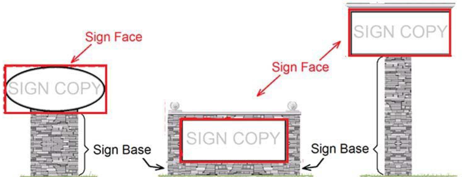
Sign Face and Sign Base Example
Sign structure: Any structure except a building, including the supports, uprights, bracing and framework that supports or is capable of supporting any sign.
Sign type: Itemized categories of freestanding or building signs.
Site: A single building or use, not part of an integrated center. For purposes of this Ordinance, an integrated center shall be treated as a single site.
Skyline sign: A building sign, located in its entirety, on a building façade above 26 feet in height, measured from grade level.
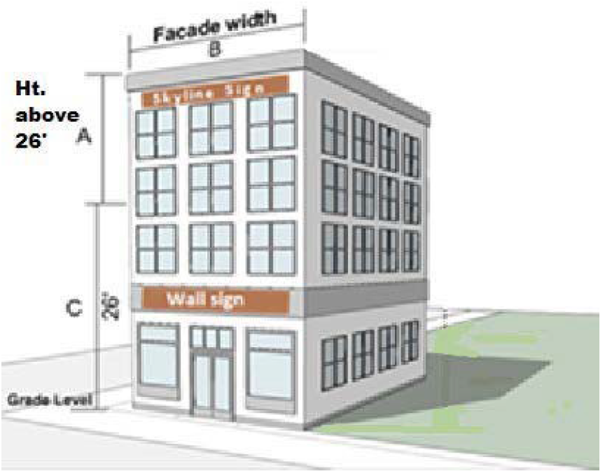
Skyline Sign Example
Street banner: A message applied to cloth, paper, fabric, or flexible plastic, with any such non-rigid material for background suspended across a street for a temporary period. See Section 744-910(B).

Street Banner Example
Suspended sign: A secondary sign attached at an angle to a ceiling or building overhang.
T-frame sign: A pedestrian sign containing two sign faces and whose framing consists of a base perpendicular to the sign face.
Temporary sign: A sign that is authorized for a period, not to exceed 10 days. One-time event temporary signs may be a freestanding or building sign. One-time event temporary signs may be made of nondurable materials, such as pennants, banner, flags (unofficial or official), air-filled, as well as more durable materials such as wood, metal, plastic.
Vehicle area (pertaining to signs): Any area including any public right-of-way, intersection, vehicle ingress or egress point, transit stop, parking space, drive aisle or driveway.
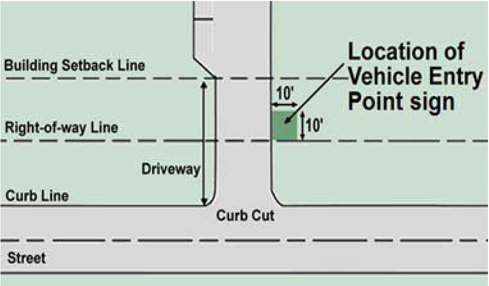
Vehicle Entry Point Example
Vehicle entry point sign: Secondary, freestanding, permanent on-premises sign, accessory to the primary use of land, located within 10 feet of the right-of-way and the pavement of a driveway.
Visibly obstructed: The view of an object that is blocked by a building or other manmade structure so as to be incapable of being seen from that line of sight.
Wall sign: Any building sign, accessory to the primary use of land, attached parallel to, and within 18 inches of a wall; it may be painted on or attached to the exterior elevation of a building or parking garage.
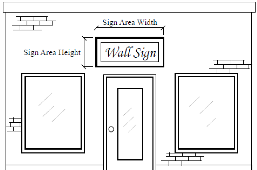
Wall Sign Example
Walkway: A passage or path for walking along such as a sidewalk or trail.
Window sign: Any sign, accessory to the primary use of land, placed, attached or painted on a window surface.

Yard Sign Example
Yard sign: Freestanding sign, accessory to the primary use of land that is located in the yard of a lot, for temporary purposes only. Examples include signs posted by a real estate professional, land developer, builder, home improvement company, garage sale advertising, and signs expressing an opinion. A yard sign may be a maximum of six square feet in size.
(G.O. 10, 2019, § 1)
Sec. 744-903. - Administration.
A.
Consent of property owner.
1.
No sign or sign structure shall be placed on private or public property without the expressed written consent of the owner, owner's representative, holder, lessee, agent, trustee, or other party controlling the use of such property.
2.
No sign, other than signs placed by agencies of government with appropriate jurisdiction, or a sign whose placement is authorized by such agencies, shall be located, used, or maintained on or over a public property or public right-of-way, except as specifically authorized by this chapter and, if applicable, any requisite encroachment license. No sign may be installed, used, or maintained on or over a drainage or utility easement, except as specifically authorized by the entity granted the easement.
B.
Required permits. Any sign not exempted from the requirements of obtaining an Improvement Location Permit (ILP) as noted in Section 744-903(E) shall be required to obtain an ILP.
Furthermore, any sign not identified as a permitted sign type in Section 744-906 is prohibited.
This provision shall not be construed to require an ILP for the changing of a sign face on a sign for which an ILP has previously been issued, except that an ILP is required for the changing of a sign face from a static face to a digital display.
This provision shall not be construed to require an ILP for the maintenance of a sign (Refer to Sign Definitions - Section 744-902) for which an ILP has previously been issued, provided that the maintenance or change of parts or copy of a sign does not alter the surface area, height, or otherwise render the sign nonconforming, or increase the existing degree of nonconformity, with the standards of the Ordinance.
C.
Signs within designated historic districts. The following regulations shall pertain to primary and secondary signs in all districts. Any primary or secondary sign erected on a building or lot located within a federally designated historic district or locally designated historic district—as established by, and under the jurisdiction of, the Indianapolis Historic Preservation Commission (IHPC)—shall be exempt from the provisions of this chapter.
The type, number, area, height, illumination and location of such signs located within such locally designated historic districts shall be as determined by the IHPC. The specific standards and requirements for on-premises signs shall be as set forth in and specified by the grant of a Certificate of Appropriateness following all procedures set forth by the IHPC.
D.
Regional Center Guidelines and Approvals. Any primary or secondary sign erected on a building or lot located within the Regional Center shall be subject to the standards and requirements for on-premises signs as set forth in the Regional Center Guidelines and follow all procedures required for approval by the Administrator.
E.
Signs that may be erected without a permit. The following signs may be erected and maintained without a permit or fee, provided that such signs comply with all standards applicable to that type of sign.
1.
Signs on municipal bus shelters or benches.
2.
Yard signs.
3.
Non-commercial flags, non-commercial banners or other similar non-commercial emblems that are suspended entirely over private property. See definitions of flag, banner, and commercial flag.
4.
Parking structure signs which are not oriented to a right-of-way.
5.
Signs within or on railway property or railway easement for the operation of such railway.
6.
Window signs.
7.
Pedestrian signs.
8.
Sign that is integrated into or on a coin-operated machine, vending machine, or fuel pump that is related to its intended purpose.
9.
Public signs.
10.
Address signs.
11.
Signs permitted on undeveloped lots.
F.
Features that are not considered a sign. The following features are not considered a sign and not regulated by this Chapter 744, Article IX.
1.
Tombstones in a cemetery or graveyard are not considered signs.
2.
A work of art is considered a sign if it contains a business name, brand name or business logo other than the creator's signature or mark, unless it constitutes a sponsorship element no larger than 5% of the size of the work.
3.
Outlining by illumination of structural/architectural elements of buildings in any commercial, industrial or mixed-use district shall not be considered a sign. Such building outline lighting shall not flash or be animated or be located within 600 feet of any Protected District unless visibly obstructed from view from within that District; but in no instance may it be located within 400 feet of such a District.
G.
Prohibited signs. The following signs are prohibited in all zoning districts:
1.
Signs in the public right-of-way. No sign or sign structure may be placed on or in the right-of- way of an alley or a street including those posted on utility poles or street signs, with the exception of public signs and signs associated with an approved outdoor café. Where applicable, an encroachment license from the proper governmental agency shall be obtained prior to the placement of the sign.
2.
Signs which interfere with public signs or traffic devices in the following manner.
a.
No sign or sign structure shall be permitted which attempts or appears to attempt to regulate the movement of traffic or which interferes with or obstructs the view of, or can be confused with, imitates, or resembles any official traffic sign, signal, or device. No rotating beam, beacon or flashing illumination resembling any emergency light shall be used in connection with any sign display.
b.
No sign shall be permitted which obstructs a driver's view of any traffic or roadway sign, signal, device or interfere with the clear sight visibility area as defined in Section 744-902.
3.
Signs painted on, attached to, or maintained upon trees, rocks or other natural features, are prohibited.
4.
Banners. Banners are prohibited except in one or more of the following circumstances. Exceptions:
a.
Temporary banners in compliance with Section 744-910.
b.
Banners on utility poles in compliance with Section 744-909(B).
c.
Non-commercial banners suspended entirely over private property.
d.
Banners that are attached securely to the wall of a building on all four corners shall be considered and regulated as wall signs.
5.
Portable signs are prohibited.
6.
Roof signs are prohibited.
7.
Vehicle signs: Signs placed on vehicles parked on public or private property are prohibited where the primary purpose of the vehicle in that location is to display the sign. Prohibited signs do not include those placed on vehicles parked for the purpose of lawfully making deliveries or sales and service calls. Prohibited signs do not include standard advertising or identification practices where such signs or advertising devices are painted on or permanently attached to business or commercial vehicles such as buses or cabs.
8.
Audio components: Signs that produce or utilize sound are prohibited with the exception of sound speakers that are components of drive-thru signs and that are components of gasoline pump islands are prohibited.
9.
Off-premises signs in any location not expressly permitted by Section 744.911. This limitation does not apply to the content of noncommercial messages.
Computations:
1.
Computation of area of freestanding signs. The area of a sign face of a freestanding sign is computed by means of the smallest rectangle that encompasses the message area.
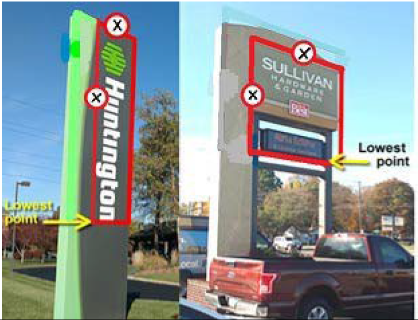
Sign Diagram B - Sign Area for Freestanding Sign
2.
Computation of area of signs on landscape walls or fences. If the sign is located on a fence or landscape wall, that is in compliance, only the area of the actual sign itself shall be calculated in determining the maximum sign area, not the fence or landscape wall itself. (Refer to Sign Diagram C for illustrative guidance to computation methods).
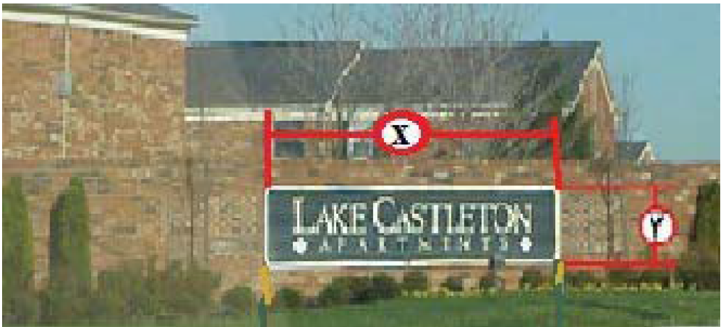
Sign Diagram C - Sign Area for Wall Sign
3.
Computation of area of canopy signs. On canopies, the computation of the sign copy area shall be limited only to the area of the canopy plane that contains the graphics or sign.
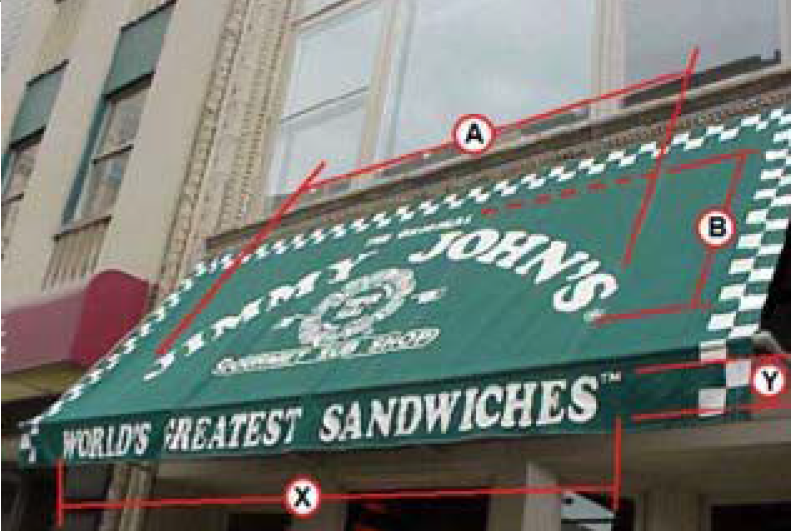
Sign Diagram D - Sign Area for Canopy Sign
4.
Computation of area of multi-sided signs. Multi-sided signs shall be computed by the measurement of one of the sign faces provided that the faces are back to back or no greater than 15 degrees or 42 inches apart, whichever is greater. (Refer to Sign Diagram E for illustrative guidance to computation methods).
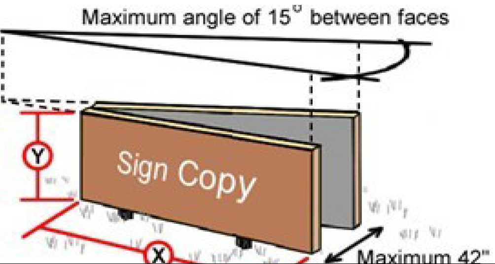
Sign Diagram E - Two Sided Sign
5.
Computation of area of building signs. The sign area for building signs shall be computed by adding together the sign area of each sign face measured individually.
6.
Exceptions to number and area computations.
a.
Address. The area of the sign devoted to the site or building's street number required to comply with Title II, Sections 431-307 and 431-309 of the Revised Code is not included in the calculation of the sign area.
b.
Heritage signs. The area of a designated heritage sign is not counted toward the total primary and secondary sign area permitted. If the heritage sign is an existing freestanding sign, the sign is considered one of the freestanding signs permitted, however the sign area and height standards may be waived upon designation.
7.
Computation of height. The height of a sign shall be computed as the distance from the base of the sign or sign structure at grade level to the top of the highest attached component of the sign structure.
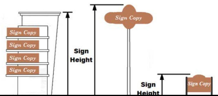
Sign Diagram F - Sign Heights
8.
Measurement to Protected District. The measurement shall be the shortest distance between the closest edge of the sign to the zoning line of the Protected District (Refer to Sign Diagram G).
Sign Diagram G - Measuring Distance to Protected District
(G.O. 10, 2019, § 1)
Sec. 744-904. - Maintenance, safety and removal.
A.
Maintenance required; maintenance of signs.
1.
All signs and sign structures including all supports, braces, guys and anchors, shall be kept in good repair and maintained in a safe and legible condition at all times. Activities that do not alter the design or structure of the sign, including the replacement of defective or damaged parts, painting, repainting, cleaning, and other services required for maintenance of the signs shall not require an ILP as determined by the Department of Business and Neighborhood Services.
2.
Unmaintained signs shall be removed or brought into compliance immediately upon written notice from the Department of Business and Neighborhood Services.
B.
Maintenance and restoration of legally established nonconforming signs and sign structures.
1.
Safety, maintenance and repair. Nothing in this article shall relieve the owner or user of a legal nonconforming sign, or owner of the property on which the legal nonconforming sign is located, from any provisions regarding safety, maintenance and repair of signs.
2.
Any legally established nonconforming sign shall be permitted to be maintained without alteration in size or location or change in materials. Maintenance of such signs shall not include:
a.
Any changes made to the size, height, bulk, or location of the sign.
b.
Temporary or permanent removal of the sign.
3.
Any abandoned sign and its sign structure shall be removed. However, any heritage sign may remain as provided in Section 744-909(A).
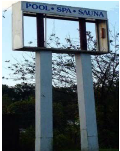
Example of Abandoned Sign
C.
Required relocations or elevations; Outdoor Advertising Signs.
1.
In accordance with I.C. 8-23-20-25.6 and 8-23-20.5-3, legally-established Outdoor Advertising Signs which are required to be elevated or relocated due to a noise abatement or safety measure, grade changes, construction, directional sign, highway widening, or aesthetic improvement made by any agency of the state along the interstate and primary system or any other highway may be elevated or relocated to the extent allowed by state or federal law and upon approval of a special exception from the Board of Zoning Appeals. The elevated or relocated sign shall comply with all applicable development standards of this ordinance. An improvement location permit shall be required for signs that are elevated or relocated pursuant to I.C. 8-23-20-25.6.
(G.O. 10, 2019, § 1; G.O. 23, 2023, § 9; G.O. 1, 2025, § 1)
Sec. 744-905. - General provisions.
A.
Address. The address of a site shall be displayed as provided in this chapter.
B.
Clearance Area Requirements.
1.
No sign or sign structure between 2.5 feet and nine feet above the driving surface of the adjacent road way shall be permitted within the area formed by measuring 25 feet along both curb lines where they intersect, and connecting the two points to form a triangle. Refer to Sign Diagram H - Clear Sight Visibility Area below.
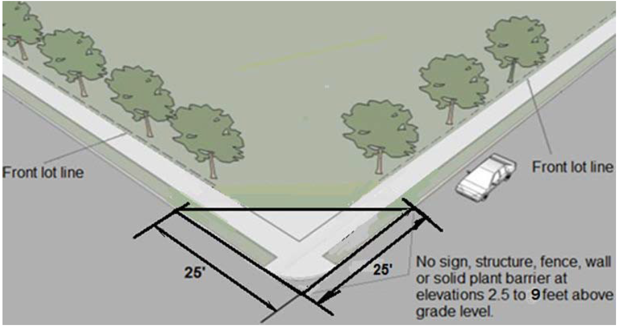
Sign Diagram H - Clear Sight Visibility Area
2.
No sign may be located in a way that obstructs or blocks any public right-of-way, sidewalk, walkway, intersection, ingress or egress point, transit stop, pedestrian ramp, parking space, drive aisle, driveway, building entrance, fire escape, or accessibility ramp.
3.
Any part of a sign extending over a pedestrian traffic area, walkway or sidewalk shall have a minimum vertical clearance of nine feet above that surface and any part of a sign extending over a vehicle area shall have a minimum vertical clearance of 12 feet above that surface.
4.
Freestanding signs shall have at least a vertical clearance of 10 feet from any overhead power line.
C.
Signs generally prohibited in the right-of-way. No sign shall be located, used, or maintained on or over a public property or public right-of-way, except as specifically authorized by this chapter and, if applicable, any requisite encroachment license. No sign may be installed, used, or maintained on or over a drainage or utility easement, except as specifically authorized by the entity granted the easement.
D.
Construction of signs.
1.
Safety. All electrical fixtures, devices, circuits, conduits, raceways, or any apparatus used to illuminate any sign shall be installed and maintained in compliance with current electrical and fire codes with the NFPA 70. A listing label from a nationally recognized testing laboratory, such as UL, shall be provided for any sign with electrical components.
2.
Durability. Materials for signs shall be durable and capable of withstanding weathering over the life of the sign with reasonable maintenance. Glass forming any part of a sign, with the exception of exposed lamps, shall be safety glass.
3.
Watertight. All signs attached to a building shall be installed and maintained so that wall penetrations are watertight and do not exceed allowable stresses of supporting materials. When a building-mounted sign is removed, the wall shall be repaired and restored to its original condition prior to sign installation.
4.
Prevent nesting. All signs and their supporting structures shall be enclosed so as to prevent inhabitation by birds, rodents, insects, and other wildlife.
5.
Raceways and transformers. If a raceway is necessary, it shall not extend in width or height beyond the area of the sign. A raceway shall be finished to match the background surface to which it is attached, or integrated into the overall design of the sign. Conduits and other electrical components shall be designed as an integral part of the overall sign structure and hidden from view to the extent technically feasible. Visible transformers are prohibited.
6.
Natural features prohibited. No signs shall be permitted to be painted on, attached to, or maintained upon trees, rock outcroppings, or other natural features.
E.
Number of faces permitted on a freestanding sign structure. Unless specifically restricted by these sign regulations, a sign structure may contain more than one sign face, and may be two-sided or multi-sided, provided all other requirements of these regulations are met.
F.
Excess sign size square footage. No portion of a maximum size allowance may be transferrable to another sign, another frontage, another façade or between building signs.
(G.O. 10, 2019, § 1)
Sec. 744-906. - Primary and secondary signs by district.
A.
Commercial, Mixed-Use and Industrial Districts.
1.
Undeveloped lots. On lots that are in any Commercial, Mixed-Use or Industrial District, which are not improved with a building, one freestanding sign, that is a maximum of 64 sq. ft. in size and 10 ft. in height is allowed along each improved street right-of-way. Upon completion of the construction of a structure the sign must be removed. Said signs shall not be illuminated and shall comply with the definition of maintenance (pertaining to a sign), Section 744-902, shall not require permit, Section 744-903.E.
2.
Primary freestanding signs. On lots that are improved with a legally established and occupied use permanent primary signs indicated in the following Table 744-906.1 are permitted in accordance with the indicated standards.
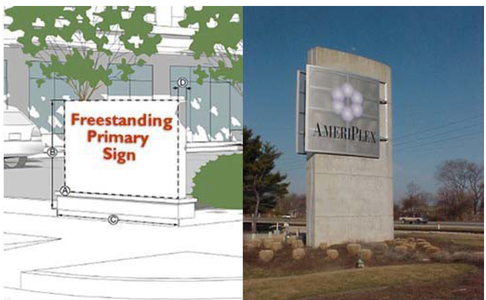
Freestanding Sign Examples
3.
Secondary freestanding signs. On lots that are improved with a legally established and occupied use secondary signs indicated in the following Table 744-906-2 are permitted in accordance with the indicated standards.
Incidental Sign Examples
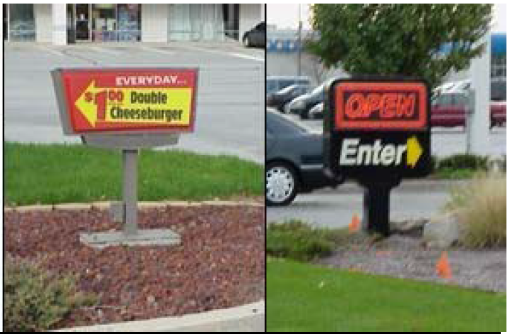
4.
Primary building signs. On lots that are improved with a legally established and occupied use permanent primary building signs indicated in the following Table 744-906-3 are permitted in accordance with the indicated standards.
Wall Sign Example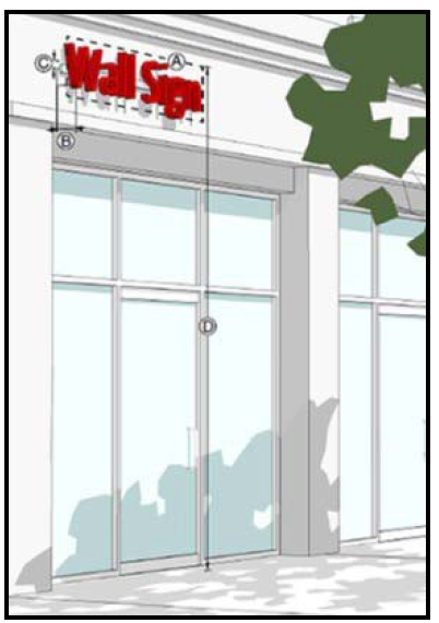

5.
Secondary building signs. On lots that are improved with a legally established and occupied use, permanent secondary building signs indicated in the following Table 744-906-4 are permitted in accordance with the indicated standards.
Window Sign
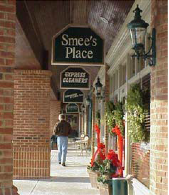

Point of Entrance
B.
Central Business Districts (CBD).
1.
Undeveloped lots. On lots that are not improved with a building in any CBD, one freestanding sign of up to 32 sq. ft. in size and 10 ft. in height is allowed along each improved street right-of-way. Upon construction of a building the sign must be removed.
2.
Primary freestanding signs. On lots that are improved with a legally established and occupied use, permanent primary signs indicated in the following Table 744-906-5 are permitted in accordance with the indicated standards. See below for example of primary freestanding signs.
Freestanding Primary Sign Examples
3.
Secondary freestanding signs. On lots that are improved with a legally established and occupied use secondary signs indicated in the following Table 744-906-6 are permitted in accordance with the indicated standards

Freestanding Secondary Sign Examples
5.
Primary building signs. On lots that are improved with a legally established and occupied use permanent primary building signs indicated in the following Table 744-906.7 are permitted in accordance with the indicated standards.

Primary Building Sign Examples
6.
Secondary building signs. On lots that are improved with a legally established and occupied use, permanent secondary building signs indicated in the following Table 744-906-8 are permitted in accordance with the indicated standards.
C.
Dwelling Districts.
1.
Undeveloped lots. On lots that are in any Dwelling District, which are not improved with a building, one primary, freestanding sign, that is a maximum of 32 sq. ft. in size and 10 ft. in height is allowed along each improved street right-of-way. Upon completion of the construction of a structure the sign must be removed. Said signs shall not be illuminated and shall comply with the definition of maintenance (pertaining to a sign), Section 744-902 shall not require permit, Section 744-903. C.
2.
Gateway signs. Signs shall be subject to Regional Center or IHPC requirements and approval if within the applicable designated area and/or Administrative Approval in all other Districts. A permit is required. DPW and DBNS approval is required for work and/or encroachment into any right of way.
3.
Primary freestanding signs. On lots that are improved with a legally established and occupied use, permanent primary signs indicated in the following Table 744-906-9 are permitted in accordance with the indicated standards.
Freestanding Sign Examples
4.
Secondary Freestanding Signs. On lots that are improved with a legally established and occupied use secondary signs indicated in the following Tables 744-906-10 are permitted in accordance with the indicated standards.
Incidental Sign Example
5.
Building signs. On lots that are improved with a legally established and occupied use permanent primary building signs indicated in the following Table 744-906-11 are permitted in accordance with the indicated standards.
Projecting Sign Example

D.
Planned Unit Development Districts (D-P).
1.
The purpose of the Planned Unit Development District (D-P) includes promoting flexibility and incentives for residential, non-residential and mixed-use development including the creation of a planning document governing the development standards.
2.
Planned Unit Development District (D-P) submissions shall include a sign program, identifying permitted signs and development standards, or a reference to the Section of the Sign Ordinance that should be applied for compliance of any proposed signage.
3.
All development shall be in conformity with the approved detailed planned unit development and any material deviations from the approved detailed planned unit development shall be subject to appropriate enforcement action.
E.
Special Zoning Districts.
Undeveloped lots. On lots that are not improved with a building in any HD, SZ, SU, PK or UQ-1 District, one freestanding sign of up to 32 sq. ft. in size and 10 ft. in height is allowed along each improved street right-of-way. Upon construction of a building the sign must be removed.
1.
Hospital Districts.
a.
The purpose of the Hospital District (H-D) is to facilitate the development, expansion, and modernization of a hospital campus or complex and the diversity of land uses and services that support and the hospital use.
b.
Hospital District submissions shall include a sign program, identifying permitted signs and development standards, or a reference to the section of the Sign Ordinance that should be applied for compliance of any proposed signage.
c.
All development shall be in conformity with the approved sign program and any material deviations from the approved sign program shall be subject to appropriate enforcement action.
2.
Special Use Districts (SU), Park Districts (PK), Speedway (SZ-1, SZ-2) and University Quarter (UQ) Districts.
a.
All sign applications in any SU, PK, SZ or UQ Districts shall be submitted for and subject to Administrative Approval.
b.
All sign applications in SZ-1 and SZ-2 districts shall comply with additional standards in the Speedway District Regulations, Section 744-108.E.
3.
Primary freestanding signs. On lots that are improved with a legally established and occupied use, permanent primary signs indicated in the following Table 744-906-12 are permitted in accordance with the indicated standards.

Freestanding Primary Sign Examples
4.
Secondary freestanding signs. On lots that are improved with a legally established and occupied use secondary signs indicated in the following table 744-906-13 are permitted in accordance with the indicated standards.
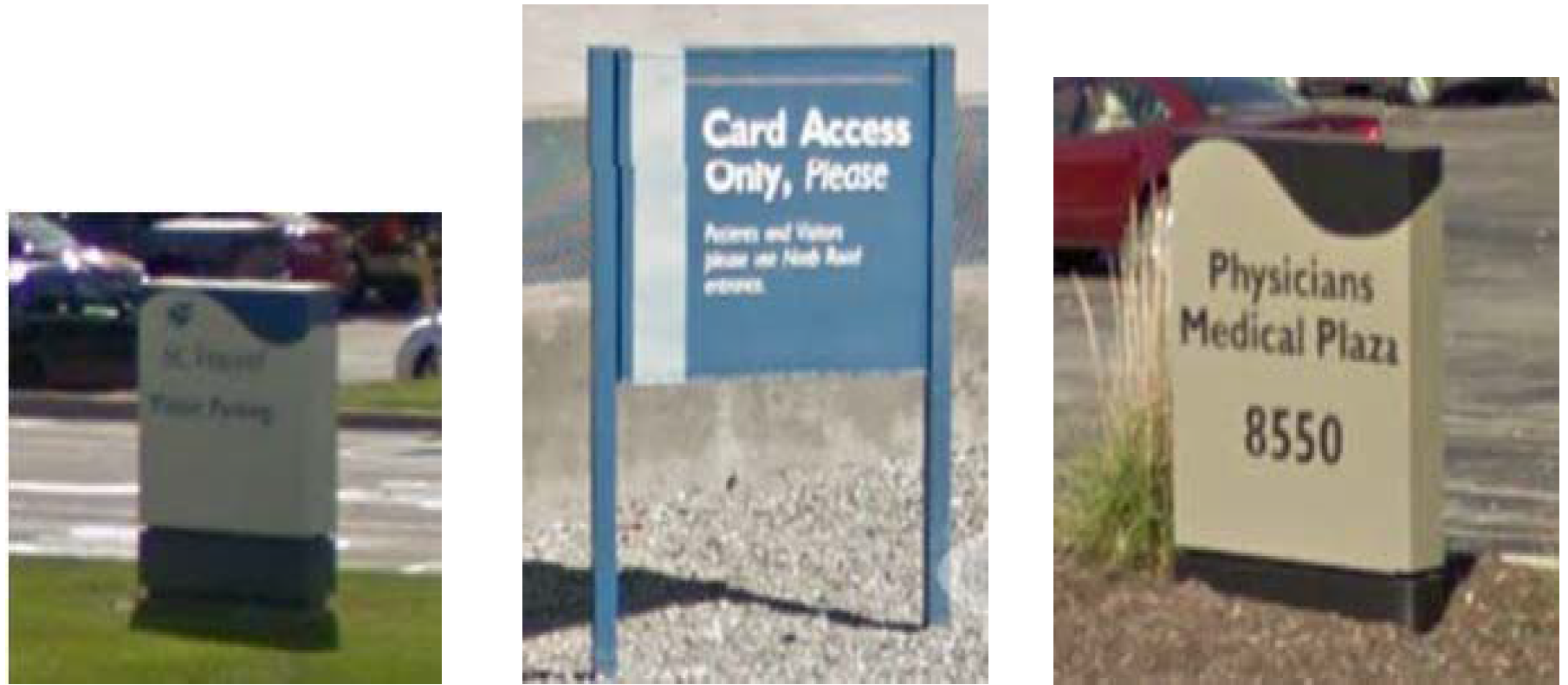
Freestanding Secondary Sign Examples
5.
Primary building signs. On lots that are improved with a legally established and occupied use permanent primary building signs indicated in the following Table 744-906-14 are permitted in accordance with the indicated standards.

Primary Building Sign Examples
6.
Secondary building signs. On lots that are improved with a legally established and occupied use, permanent secondary building signs indicated in the following Table 744-906-15 are permitted in accordance with the indicated standards.
Window Sign Example


Projecting Sign Example
(G.O. 10, 2019, § 1)
Sec. 744-907. - Additional standards.
A.
Illumination. Any illumination of a sign shall comply with the following additional regulations.
1.
All externally illuminated signs that emit more than 900 lumens shall meet the exterior lighting standards per Section 744-604.
2.
External light sources or lamps shall be concealed or shielded so that the light emitting element is not visible from any property line to minimize the potential for glare and unnecessary diffusion on adjacent property.
3.
Efficiency. All exterior light sources shall produce at least 80 lumens per watt of energy consumed, as documented by manufacturer's specifications or the results of an independent testing laboratory.
4.
The fixtures of an externally illuminated sign shall be within 12 feet of a sign face.
5.
Any light source on the underside or bottom of a pump island canopy shall be fully recessed into the canopy and shall not protrude downward beyond the lowest edge.
6.
The lighting of a sign shall not be directed at any vehicle travelling on a street or any pedestrian on sidewalk.
7.
No sign that uses an intermittent or flashing light source to attract attention shall be permitted or maintained. Permitted digital signs operated in accordance with the standards established in Section 744-907.C are not considered flashing or animated.
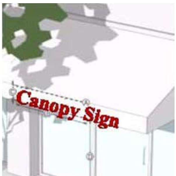
Canopy Sign Example
B.
Canopy Sign Regulations. Canopies on which signs are placed shall comply with the following additional regulations.
Maximum size of sign copy permitted on any canopy shall not exceed 45% of the area of the canopy plane on which it is placed.
1.
Maximum projection of any canopy without support columns shall be six feet from the supporting wall.
2.
Maximum distance from the top to the bottom of any canopy shall be nine feet, including any valance.
3.
No canopy may extend to a point closer than two feet from any street curb or edge of an interior access drive.
4.
If located over a sidewalk, no outer support columns shall be located in or obstruct the continuous, effective walkway along the public street, and the effective walkway width shall be a minimum of eight feet in the CBD districts and five feet in all other districts.
C.
Digital display regulations. Any digital display shall comply with the following additional regulations.
1.
No digital display shall be located within 600 feet of any Protected District unless visibly obstructed from view from within that district; but in no instance may it be located within 400 feet of such a District. Measurement is made from the leading edge of the digital display sign face in a 180-degree arc from the plane of the sign face to the zoning district boundary.
2.
In no instance shall digital display signs be permitted in a federally or locally designated historic district or within 600 feet of the boundary of a federally or locally designated historic district or historic site.
3.
Digital displays shall only display static messages, and shall not have movement or the appearance of or the optical illusion of movement during any part of the display. No static message shall include flashing or the varying of light intensity and the message shall not scroll.
4.
Message change shall be completed in one second or less. All transition effects are prohibited. The digital display shall not flash, nor appear to move or be animated.
5.
Each static message on any Digital Display shall be displayed for a minimum of 10 seconds.
6.
Any digital display shall be operated with systems and monitoring in place to either turn the display off or show "full black" on the display in the event of a malfunction.
7.
Each digital display shall have an operational light sensing device that adjusts the brightness as ambient light conditions change.
a.
The brightness level for any digital display shall not operate over 464 foot candles during daytime operation.
b.
The brightness level for any digital display shall be calibrated for less than 0.30 foot candles above ambient light levels, as measured at 250 feet, but in no instance shall the light level, measured at any right-of-way, exceed 2.0 foot candles.
8.
Light intensity of the digital display shall not cause glare.
(G.O. 10, 2019, § 1)
Sec. 744-908. - Use-specific sign standards.
A.
Automobile fueling station signs: When an Automobile Fueling Station is allowed and developed, the following signs, in addition to the signs permitted by the district, are permitted subject to the following standards.
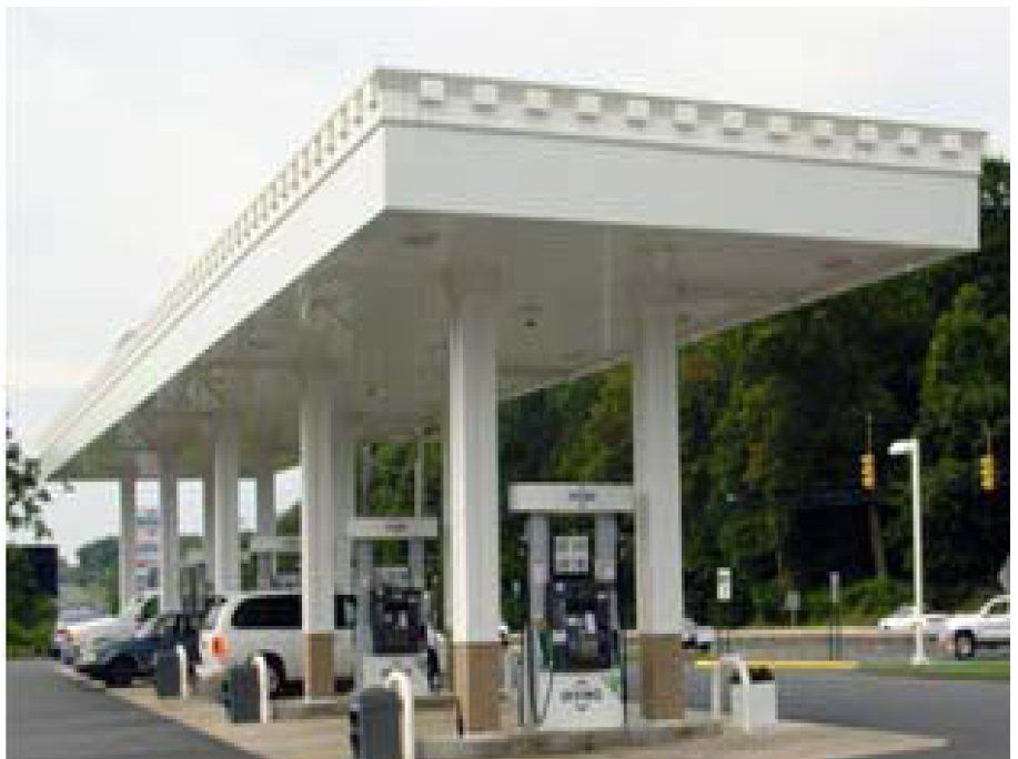
Fuel Canopy Example
1.
Pump island canopy signs. In addition to the signs permitted by the district, one sign per side of any freestanding canopy is permitted and shall not exceed 25% of the facade of the canopy on which it is located. This calculation shall not include the open area beneath the pump island canopy. Permits are required.
2.
Public safety information and signs required by State and Federal laws are allowed and may be placed under the canopy or next to the appropriate emergency safety areas. Permits are not required.
3.
Fuel pump signage is allowed. Maximum size is limited to six square feet. Permits are not required.
4.
Signs may be internally illuminated or have LED components.
B.
Drive-thru signs.
1.
Drive-Thru Board—One freestanding drive-thru sign per drive-thru lane with a maximum sign area of 40 square feet.

Drive-Thru Board Sign Examples
2.
Canopy over stacking lane(s). One sign is permitted on one side of any canopy erected over each stacking lane sign area not to exceed 25% of canopy. Signs may be internally illuminated or have LED components.
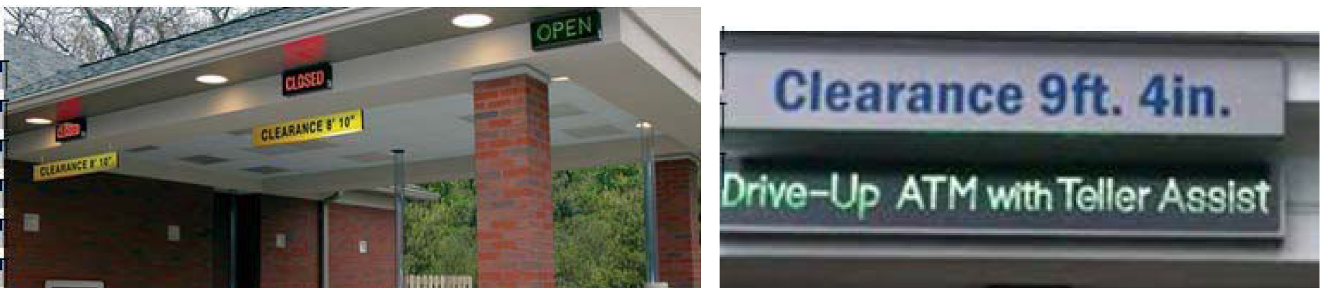
Canopy Sign Examples
C.
Commercial parking lot and commercial parking garage signs. When a commercial parking lot or commercial parking garage is allowed and developed, in addition to the signs allowed by the district or required by other ordinances or licenses, the following signs are allowed subject to the following additional standards.
1.
Signs on payment kiosk. Two signs, maximum eight square feet each, permitted on the kiosk. Signs may be internally illuminated or have LED components if sign does not face any street.
2.
Vehicle entry point signs. One vehicle entry point sign per entrance lane or exit lane allowed with six square feet maximum area, six feet maximum height and two feet minimum setback. Signs may be internally illuminated or have LED components if sign does not face any street.
3.
T-frame or A-frame sign. Sign shall not impede any sidewalk, ramp, travel lane, access drive or parking space. Signs shall be on display during business hours only.
D.
Marquees for theaters and other indoor spectator venues. When a performance theater or similar other indoor spectator venue is allowed and developed, marquee signs are permitted in addition to the signs permitted by the district, subject to the following additional standards:

Marquee Sign Examples
1.
Illuminated marquee signs shall be located at least 600 feet from a Protected District, unless visibly obstructed, but no less than 400 feet.
2.
One marquee, may have multiple planes with marquee signs permitted on each face.
3.
Maximum width is 80% of the width of the tenant space or building elevation, with a maximum width of thirty feet, except in the CBD there is no limit.
4.
Maximum projection from a building wall shall be 15 feet.
5.
Minimum clearance of the marquee shall be 10 ft. above grade level.
6.
Marquee signs may contain a digital display sign, subject to additional standards of Section 744-907.C.
7.
Marquee signs may be illuminated, subject to additional standards of Section 744-907.A. When the business is open to the public, lights on a marquee may flash and otherwise be animated.
8.
In no instance shall any marquee extend to a point closer than two feet from any street curb, pavement edge, or edge of an interior access drive.
E.
Bus shelter signs/rapid transit stops/super stops. When a bus shelter is developed at a municipal bus stop, the following signs, in addition to the signs permitted by the district, are permitted on the walls of the shelter subject to the following additional standards. (See illustration below).
Bus Shelter Sign Example
Non-illuminated signs, which may be double-sided, but which shall not exceed 32 cumulative sf or 25% of each individual window/panel. In no case shall signage be allowed within four feet grade level.
Two digital display signs, which may be double-sided, but which shall be no larger than four square feet. Must meet additional standards of Section 744-907.C.
F.
Municipal bus bench sign. When a municipal bus bench is located within 12 feet of a municipal bus stop without a municipal bus shelter, one sign, in addition to the signs permitted by the district, is permitted subject to the following additional standards.
1.
Maximum sign dimensions are 81 inches across horizontally, 24 inches vertically, and no higher than 36 inches from grade level.
Sign shall be one-sided, non-illuminated, and located on the bench.
Sign shall not be located on a lot, adjacent to a lot, or across the street from a lot improved with a single-family detached dwelling.
Bike Sharing Sign Example
G.
Automobile rental station/bike-sharing signs/ taxi cab signs. When an automobile rental station, bike-sharing facility or taxi cab stand is allowed and developed, one non-illuminated or internally illuminated, freestanding sign with a maximum area of four square feet is permitted in addition to the signs permitted by the district. No digital signs are allowed. Regional Center or IHPC approval may be required if within the applicable designated area and permitting is required.
(G.O. 10, 2019, § 1)
Sec. 744-909. - Specialty signs.
A.
Historic/heritage signs.
1.
Historic sign. A painted wall sign that remains from an earlier time or advertises the use of a building that provides evidence of the history of the use of the building or activities of the community.
a.
Ghost sign.
1.
Ghost signs are considered wall signs and are not off-premises signs.
2.
Ghost signs existing at the effective date of this article are exempt from these requirements and are considered conforming.
3.
Ghost signs need IHPC approval to repaint/restore.

Ghost Sign Example
2.
Heritage signs. An existing sign having historical significance, and which advertises an establishment or product in existence or no longer in existence or a product offered or no longer being offered on the site, may be designated a heritage sign. An exact replica of an original sign attached to a building that would have been at least 50 years old may be designated a heritage sign. There are three types of heritage signs:
1.
Retaining.
2
Restoring.
3.
Replica.
heritage Sign Example
a.
In accordance with the designation, a heritage sign may be maintained, repaired, reconstructed, or relocated, so long as no new items of information, sign features, or sign area are added to the sign. In accordance with the designation, a replica of a building sign previously located on the site at least 50 years ago may be considered a heritage sign, except a billboard.
b.
Heritage signs are not considered nonconforming signs.
c.
Heritage sign may not be a billboard.
d.
A heritage sign may be inside or outside of an IHPC designated historic area.
e.
The area of a heritage sign is not counted toward the total primary and secondary sign area permitted. If the heritage sign is an existing freestanding sign, the sign is considered one of the freestanding signs permitted, however the sign area and height standards may be waived upon designation.
f.
Designation. In order for a sign to be designated a heritage sign, the IHPC Administrator shall make written findings that the sign is at least 50 years old, or is an exact replica of an original sign previously located on the site at least 50 years ago, and meets at least one of the following criteria:
i.
The sign has historic character, interest, or value as part of the development, heritage, or cultural characteristics of Indianapolis or the surrounding area or the building to which it is attached.
ii.
The sign is significant as evidence of the history of the product, business, or service advertised.
iii.
The sign embodies elements of design, construction, detailing, materials, or craftsmanship that make it significant or innovative.
iv.
The sign has a unique location or contains singular physical characteristics that make it an established or familiar visual feature within Indianapolis or the surrounding area; or
v.
In an IHPC-adopted historic area plan, the sign is identified as having historic significance.
g.
The IHPC Administrator may impose additional requirements or conditions upon the designation pertaining to the construction, restoration, shape, size, placement and method of maintenance of any heritage sign.
h.
The IHPC Administrator shall maintain and make available a list of designated heritage signs.

Heritage Sign Example
B.
Banners on light, utility or free-standing poles. If allowed, banner signs on light, utility or freestanding poles are subject to the following regulations.
1.
In the CBD districts and MU districts, banner signs may be located on a light, utility or freestanding pole in the right-of-way provided the banner signs are at least 10 feet from any overhead power lines and upon authorization and issuance of the applicable encroachment or right-of-way permit.
2.
In all other districts, banner signs on light, utility or freestanding poles shall be at least 10 feet from any street right-of-way and any overhead power lines.
Freestanding Pole Sign Example
3.
No more than two banner signs may be placed upon one light utility or freestanding pole.
4.
Banner signs and sign hardware shall:
a.
Be mounted on a light, utility or freestanding pole structurally capable of accommodating the banners and hardware;
b.
Be at least 12 feet above grade, unless it overhangs an interior access drive or right-of-way, in which case it shall be at least 15 feet above grade;
c.
Be made out of weather-resistant and rust-proof material;
d.
Not project more than three feet from the pole onto which it is mounted.
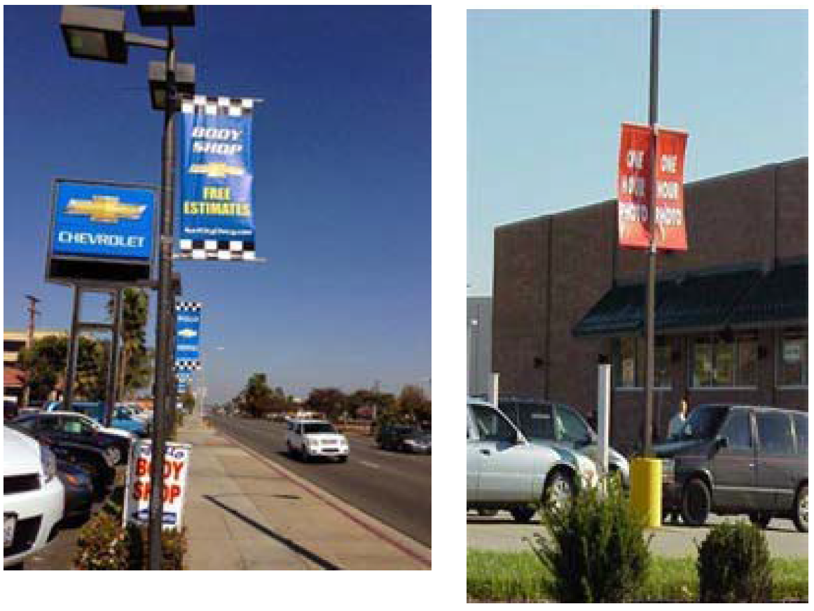
Light Pole Sign Examples
5.
No banner sign may exceed 18 square feet in size.
6.
Administrator's approval is required. The Administrator's decision to grant or withhold approval under this section is governed by the applicable criteria in this chapter.
7.
Providing the provisions of this section and all other requirements of the ordinance are met, a one-time permit for the banner attachment hardware is required as well as an Encroachment License, if within a right-of-way, and an agreement to attach for any municipal owned utility pole(s).
(G.O. 10, 2019, § 1)
Sec. 744-910. - Temporary signs.
A.
Banner signs. Shall be permitted in addition to permitted primary and secondary building signs in Commercial, Central Business, Mixed-Use, Special Use and Industrial Districts, subject to the following standards:
1.
Shall not be located in any right-of-way;
2.
Shall be securely attached at all corners and along all sides;
3.
Shall be securely fastened to withstand displacement by the wind. Signs that have been displaced by the wind or located in the right-of-way are subject to immediate removal;
4.
Shall not block any sidewalk, walkway, pedestrian ramp or any driveway;
5.
Subject to all requirements of any secondary zoning district or overlay district that may apply;
6.
Shall not be higher than 2.5 feet above grade level of any sidewalk if located in the clear sight visibility area;
7.
Shall not be illuminated and may not be a digital sign;
8.
Maximum size shall not exceed 32 square feet;
9.
Maximum height of 6 ft.;
10.
Maximum one banner sign per use;
11.
Maximum duration shall not exceed a 10-day period;
12.
Maximum frequency shall not exceed three times a calendar year; and
13.
Permits are required.
B.
Street banners. Shall be permitted in addition to permitted primary and secondary signs, subject to the following standards:
1.
Shall be securely attached at all corners;
2.
Shall not be illuminated and may not be a digital sign;
3.
Maximum one street banner per thoroughfare;
4.
Maximum duration shall not exceed a 30-day period;
5.
Maximum frequency shall not exceed three times a calendar year;
6.
Permits are required; and
7.
Issuance of the applicable encroachment or right-of-way permit is required.
C.
Pedestrian sign regulations. If allowed, pedestrian signs shall comply with the following additional regulations:
1.
Shall be within 20 feet of a pedestrian entrance;
2.
Shall only be displayed during business or operating hour;
3.
Maximum eight square feet in size. See Section 744.902: A-Frame and T-Frame definitions;
4.
Maximum height five feet;
5.
Maximum one sign per use;
6.
Shall not be located in any designated parking area or parking space, street or pedestrian ramp or within the clear visibility area, as defined in Section 744.902;
7.
If located on a walkway, shall maintain a minimum clear walkway width of five feet;
8.
Must be weighted or anchored to prevent the wind from moving the sign; and
9.
No permit is required.
D.
Signs on construction sites or construction barricades. When a site is being developed or redeveloped as authorized by a valid permit, one sign per frontage may be freestanding, or located or placed upon any necessary construction barricades while a site is under construction or significant renovation in addition to any signs or displays required by law or ordinance.
If permitted, signs on construction sites and signs on construction barricades are subject to the following standards:
1.
May fully cover the construction barricade;
2.
Does not horizontally project from the surface of the barricade;
3.
Securely attached at all corners and along all sides;
4.
Maximum height eight feet. No illumination is permitted; and
5.
No permit is required.
E.
Election-period signs. During the 60-day period before and the six-day period after a national, state, or local government election, there shall be no limit on the number of yard signs permitted in any district, provided however, the following standards are met:
1.
Maximum size of any sign shall be 32 sq. ft.;
2.
Maximum sign height is five feet;
3.
Sign shall not be in the right-of-way;
4.
Sign shall not be illuminated;
5.
Sign shall not be located in any clear sight visibility area as per, Section 744-905.B.; and
6.
Permits are not required.
F.
Inflatable signs and air dancers.
1.
Shall not block any sidewalk, walkway, pedestrian ramp or any driveway;
2.
Subject to all requirements of any secondary zoning district or overlay district that may apply;
3.
Shall not be higher than 2.5 feet above grade level of any sidewalk if located in the clear sight visibility area;
4.
Shall not be illuminated and may not be a digital sign;
5.
Maximum one inflatable or air dancer sign per use;
6.
Maximum duration shall not exceed a 10-day period;
7.
Maximum frequency shall not exceed three times a calendar year; and
8.
Permits are required.
(G.O. 10, 2019, § 1)
Sec. 744-911. - Off-premises (outdoor advertising) signs.
A.
General regulations. The following regulations shall pertain to off-premises signs (also known as outdoor advertising signs) in all districts where permitted by this Section 744-911, Section 744-903.F, Table 744-903-7. Also, refer to Section 744-911(B) - Signs on freeways and expressways, for additional requirements.
1.
ILP required. An ILP shall be required for any new or relocated outdoor advertising sign—or alterations to an existing outdoor advertising sign—not exempted by Section 744-904: Maintenance required; Maintenance of Signs.
2.
Outdoor advertising signs inside I-465. No portion of an outdoor advertising sign shall be erected or otherwise located within 660 feet of the right-of-way of a freeway or expressway, as herein defined, located within the entire area circumscribed by the interior right-of-way line of the Outer Belt Freeway commonly identified as I-465. (The application of these provisions is illustrated in Sign Diagram 21.)
3.
Relocations for outdoor advertising signs.
a.
Relocations for outdoor advertising signs inside I-465. For legally-established, nonconforming signs located in the area described in Section 744-911.A.2, an owner of an outdoor advertising sign may relocate an outdoor advertising sign upon the same parcel of property from which it is being removed. The outdoor advertising sign structure and/or face must not be expanded or enlarged unless in compliance with the standards of this Ordinance. The relocated outdoor advertising sign shall require an ILP. This subsection does not limit any relocation that is governed by Indiana Code 8-23-20-25.6 and 8-23-20.5-3.
b.
Relocations for outdoor advertising signs outside I-465. Legally-established, non-conforming outdoor advertising signs may be relocated outside of I-465 provided that the outdoor advertising sign structure and/or face must not be expanded or enlarged unless in compliance with the standards of the Ordinance. The relocated outdoor advertising sign shall require and ILP. This subsection does not limit any relocation that is governed by Indiana Code 8-23-20-25.6 and 8-23-20.5-3.
4.
Proportional regulations. The size of an outdoor advertising sign on a lot shall not exceed the size specified in Table 744-903-4:
5.
Extensions. Elements of an outdoor advertising sign may be permitted to extend beyond the horizontal or vertical sign edge. The maximum length of an extension shall not be greater than five feet beyond the top edge of the sign, three feet below the bottom edge of sign face and extend more than two and a half feet along all other sign edges. The maximum width of an extension shall not be greater than 45% of the linear length of the horizontal or vertical dimension of the outdoor advertising sign (Refer to Extension Sign Diagram 35).
6.
Outdoor advertising sign size. The face of an outdoor advertising sign shall not be greater than 14 feet in vertical dimension nor greater than 48 feet in horizontal dimension, except where specifically regulated by Section 744-911(B). The sign shall not contain more than two advertising signs per facing. The advertising sign displays may be oriented side-by-side or in a stacked position provided that the total face shall not be greater than 14 feet in vertical dimension nor greater than 48 feet in horizontal dimension.
7.
Flashing, intermittent or moving lights. No advertising sign shall be permitted which contains, includes, or is illuminated by a flashing, intermittent or moving light or lights.
8.
Animation. No advertising sign shall be permitted which has animated or moving images.
9.
Advertising sign. Advertising sign faces consisting of three or less panels that rotate to present a single fixed display at a time, commonly known as Tri-vision signs, are permitted, provided that the rotation of one display to another is no more frequent than every 15 seconds.
10.
Video, LED, (light emitting diode), LCD (liquid crystal display) or electrically powered. No advertising sign shall be permitted which displays video or emitting graphics except as permitted in Section 744-911(B)(2)(d)(2). Internal illumination of outdoor advertising signs is not permitted.
11.
Distance between outdoor advertising signs. Except as otherwise provided for signs in the protected areas along highways, freeways and expressways (see Section 744-911(B)), the minimum distance between outdoor advertising signs shall be as specified below. The applications of these provisions are illustrated in Sign Diagrams 18 and 19.
a.
Radial spacing between outdoor advertising signs. In no event shall any point of an outdoor advertising sign or sign structure be closer than 1,000 feet from any point of any other outdoor advertising sign or sign structure.
b.
Outdoor advertising signs adjacent to protected districts. In no event shall any point of an outdoor advertising sign be closer than 300 feet from a protected district. For the purposes of this section, a protected district shall include any dwelling district, parks district, university quarter district, SU-1 (church) district or SU-2 (school) district. (The applications of these provisions are illustrated in Sign Diagram 20.)
12.
Signs on freeways and expressways. In addition to the requirements of this section, outdoor advertising signs shall further comply with Section 744-911(B) when located on freeways and expressways.
13.
Roof top outdoor advertising signs. Roof top outdoor advertising signs shall not be permitted in any zoning district.
14.
Advertising sign on or appurtenant to buildings. Advertising signs shall not be located on, above or below any portion of primary buildings.
15.
Outdoor advertising sign setback. Signs or sign structures shall be set back in accordance with the building setback lines required by the applicable zoning district. Advertising signs shall not be eligible for setback averaging exceptions. (See Table 744-903-6 below.)
16.
Maximum and minimum height of outdoor advertising signs and sign structures.
a.
The maximum height of signs and sign structures shall not exceed 60 feet above grade level at the base of such sign or sign structure.
b.
No outdoor advertising sign or sign structure (except for the supports, building, structure or column) shall be at its lowest point less than nine feet above grade level. Ground signs, where permitted, shall not exceed four feet in height above grade level.
17.
Construction of outdoor advertising signs. The supports, uprights, bracing and framework of an outdoor advertising sign shall be of steel construction.
18.
Districts permitted and allowable square footage. (Refer to Table 744-903-7 below.)
B.
Signs on freeways and expressways. All signs within 660 feet of the right-of-way of freeways and expressways, as shown on the Official Thoroughfare Plan shall comply with the requirements of this section in addition to all other provisions of this Chapter 744 Article IX.
1.
Permitted signs. Unless prohibited by local, state or federal law, erection or maintenance of the following signs shall be permitted in Protected Areas.
a.
Official signs. Directional or other official signs or notices erected and maintained by public officers or agencies pursuant to and in accordance with direction or authorization contained in local, state, or federal law, for the purpose of carrying out an official duty or responsibility.
b.
On-premises (business) signs. However, not more than one freestanding identification sign shall be permitted to be located on each premises.
c.
Off-premises (advertising) signs.
2.
General provisions. No off-premises signs shall be permitted to be erected or maintained on freeways or expressways in any manner inconsistent with the following:
a.
Flashing, intermittent or moving lights. No sign shall be permitted which contains, includes, or is illuminated by a flashing, intermittent or moving light or lights.
b.
Animation. No sign shall be permitted which moves or has any animated or moving parts.
c.
Rotating, louvered (vertical and or horizontally), moving or other elements. Advertising signs with rotating, louvered (vertical and/or horizontally), moving parts or elements shall not be permitted.
d.
Video, LED (light emitting diode), LCD (liquid crystal display) or electrically powered.
1.
No sign shall be permitted which displays video or emitting graphics. Internal illumination of outdoor advertising signs is not permitted.
2.
Sign faces can be converted to include a pricing display, commonly known as price packs, which may be remotely changed no more than 3 times per day. This display is limited to 10% of an outdoor advertising sign face and only permitted on one face on a single outdoor advertising sign structure.
e.
Measurement of distance.
1.
The distance from the edge of a right-of-way shall be measured horizontally along a line normal or perpendicular to the centerline of the freeway or expressway.
2.
All dimensions parallel to the alignment of the freeway or expressway shall be measured along the centerline of the freeway or expressway between two vertical planes which are normal or perpendicular to and intersect the centerline of the freeway or expressway, and which pass through the termini of the measured distance.
3.
Regulations for off-premises (advertising) signs.
a.
Off-premises signs within informational sites. If the Indiana Department of Transportation (IDOT) constructs an Informational Site, on the freeway system in Marion County, control over off-premises signs within such site shall be the responsibility of that Department.
b.
Off-premises signs outside of informational sites.
1.
The erection or maintenance of the following signs shall be permitted within protected areas outside of informational sites: off-premises signs which are located within 660 feet of a freeway or expressway, as herein defined.
2.
The erection or maintenance of off-premises signs permitted under Section 744-911(b)(3)(a) shall not be permitted in any manner inconsistent with the following:
i.
Sign spacing: Subject to the other provisions of this Section 744-911(b)(3), within protected areas adjacent to freeway or expressway rights-of-way, no part of any off-premise sign structure shall be located within 1,000 feet of any other off-premises sign structure located adjacent to said freeway or expressway on the same side of said freeway. Said 1,000 feet distance shall be measured linearly along the centerline of the freeway or expressway. (The application of this provision is illustrated in Sign Diagrams 26 and 27.)
ii.
Maximum sign dimensions: The maximum size of any sign shall not exceed 14 feet in vertical dimension and 48 feet in horizontal dimension, plus extensions as defined in Section 744-911(A).
iii.
Sign setback: Signs shall not be located closer than 50 feet to the right-of-way of the freeway or expressway.
iv.
Sign clearance: Signs shall not be less than nine feet above grade level at the lowest point, except for the supporting structure.
v.
Maximum sign height: The maximum height of signs and sign structures shall not exceed 60 feet above grade level at the base of such sign structure.
vi.
Entrance or exit roadway limitation: Signs shall not be permitted in protected areas adjacent to any freeway or expressway right-of-way upon any part of the width of which is constructed an entrance or exit roadway. No sign shall be permitted within 500 feet from the point of intersection between the traveled way of such entrance or exit roadway and the main traveled way of the freeway or expressway. Said 500 feet distance shall be measured to the nearest point of the intersection of the traveled way of the entrance or exit roadway and the main-traveled way of the freeway or expressway. (Refer to Sign Diagram 26.)
(G.O. 10, 2019, § 1; G.O. 1, 2025, § 2)
Sign Diagrams 18 and 19. Measurement of Distance between Advertising Signs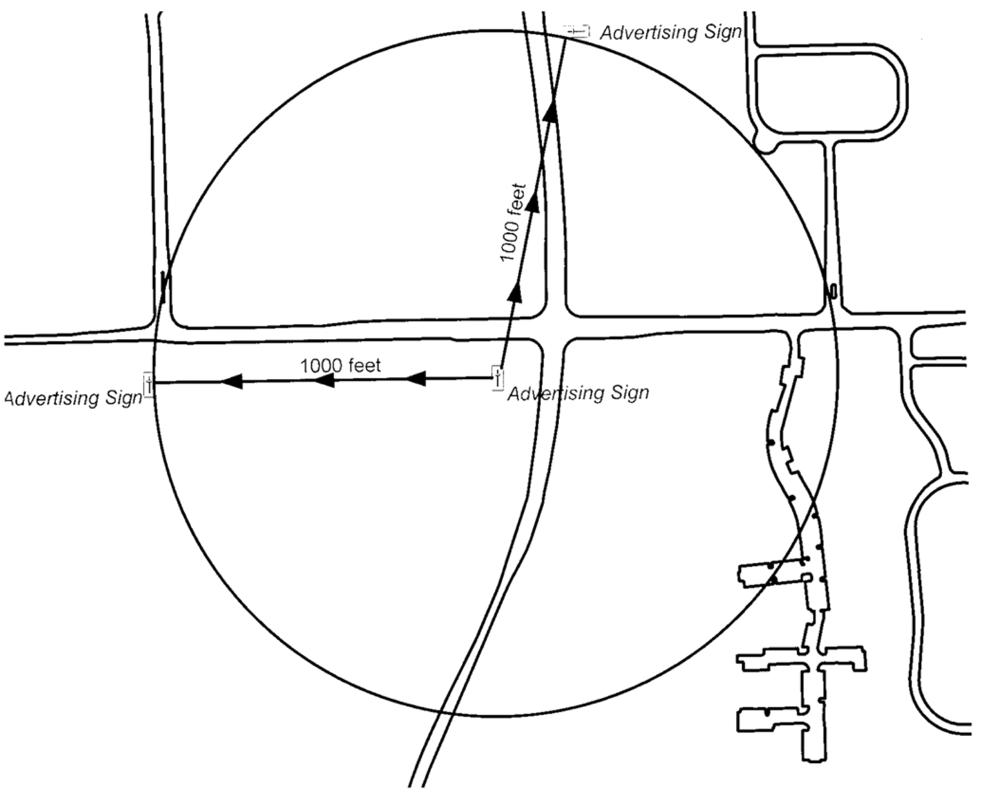
(G.O. 10, 2019, § 1)
Sign Diagram 20. Measurement of Distance between Advertising Signs and Protected Districts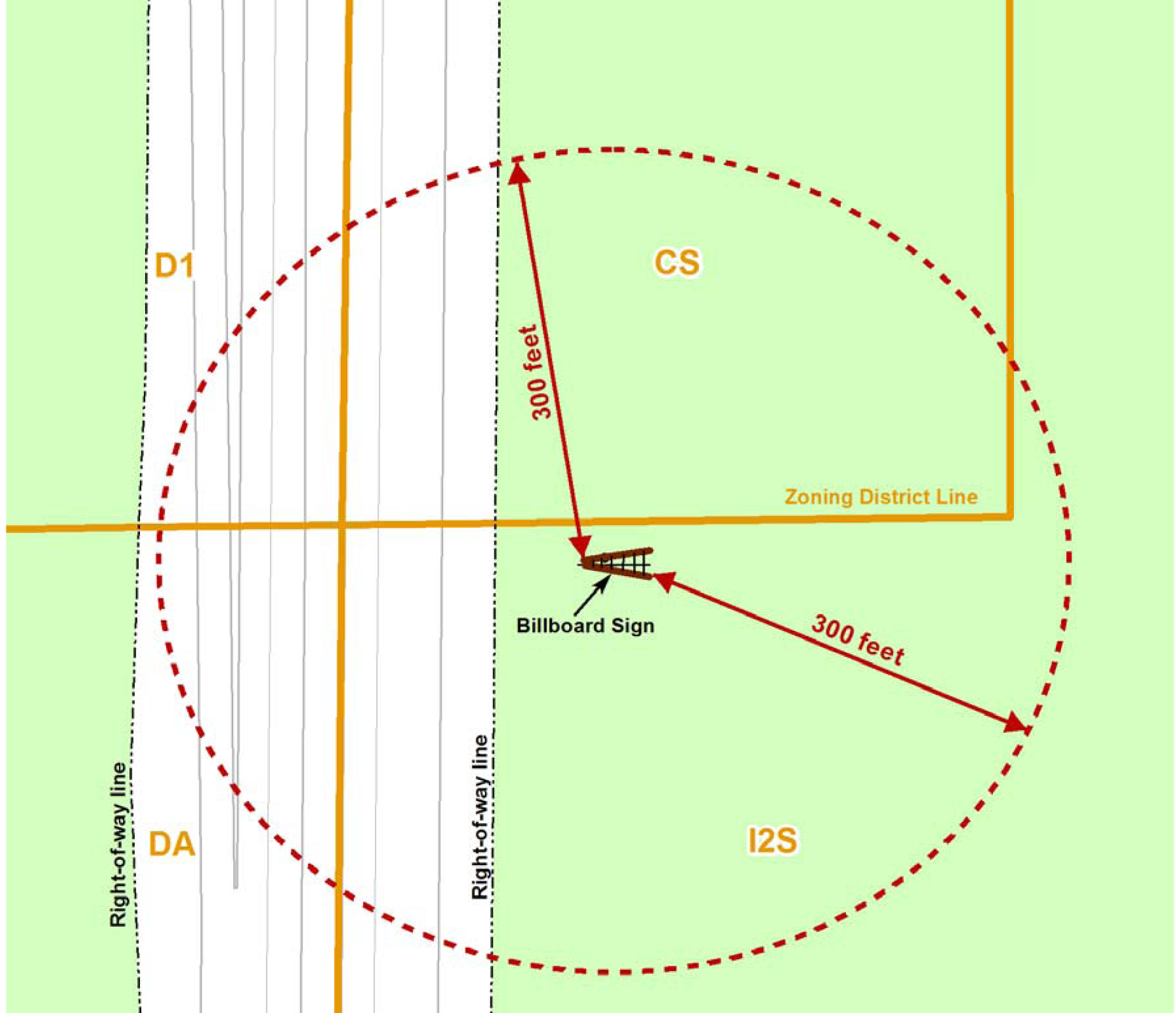
(G.O. 10, 2019, § 1)
Sign Diagram 21. Outdoor Advertising Signs Inside I-465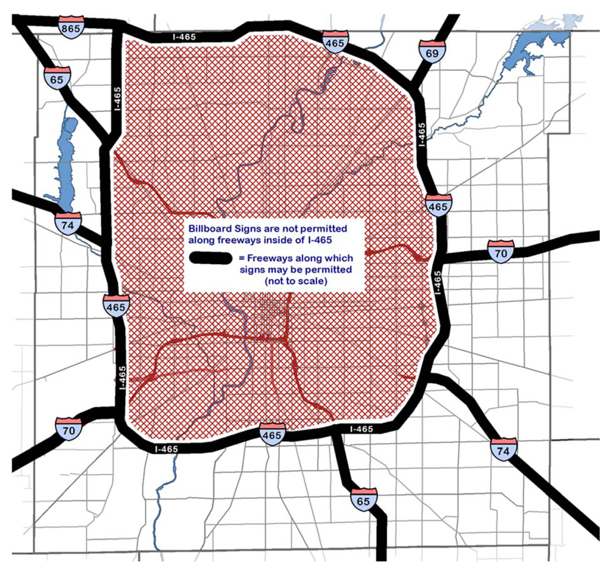
(G.O. 10, 2019, § 1)
Sign Diagram 26. Signs on Interstate Freeways and Expressways: Measurement of Separation
for Off-Premise Signs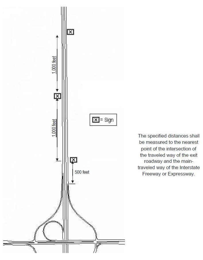
(G.O. 10, 2019, § 1; G.O. 1, 2025, § 2)
Sign Diagram 27. Signs on Interstate Freeways and Expressways: Entrance Roadway Limitation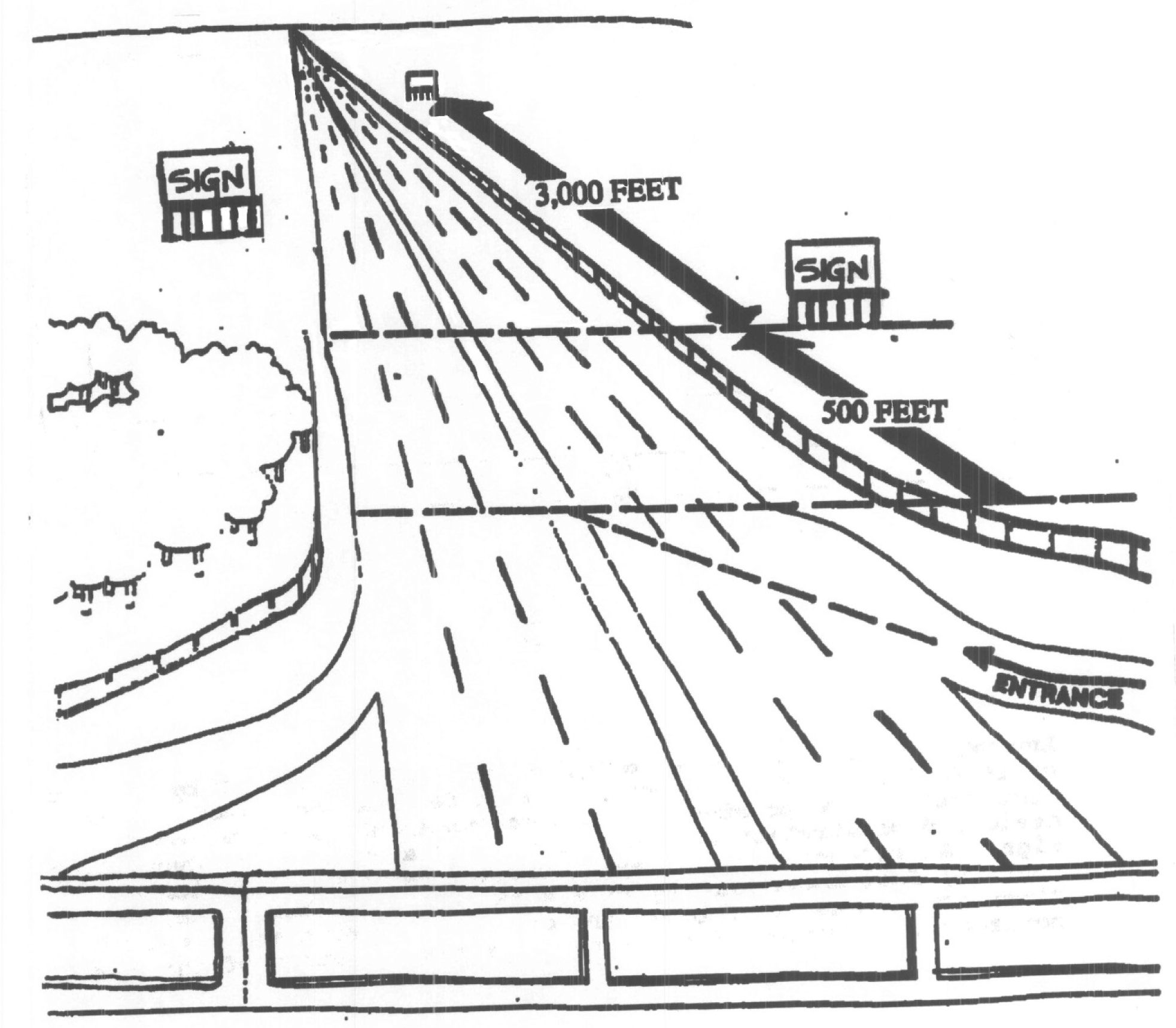
(G.O. 10, 2019, § 1)
Sign Diagram 35. Advertising Sign or Off-Presises Sign Extension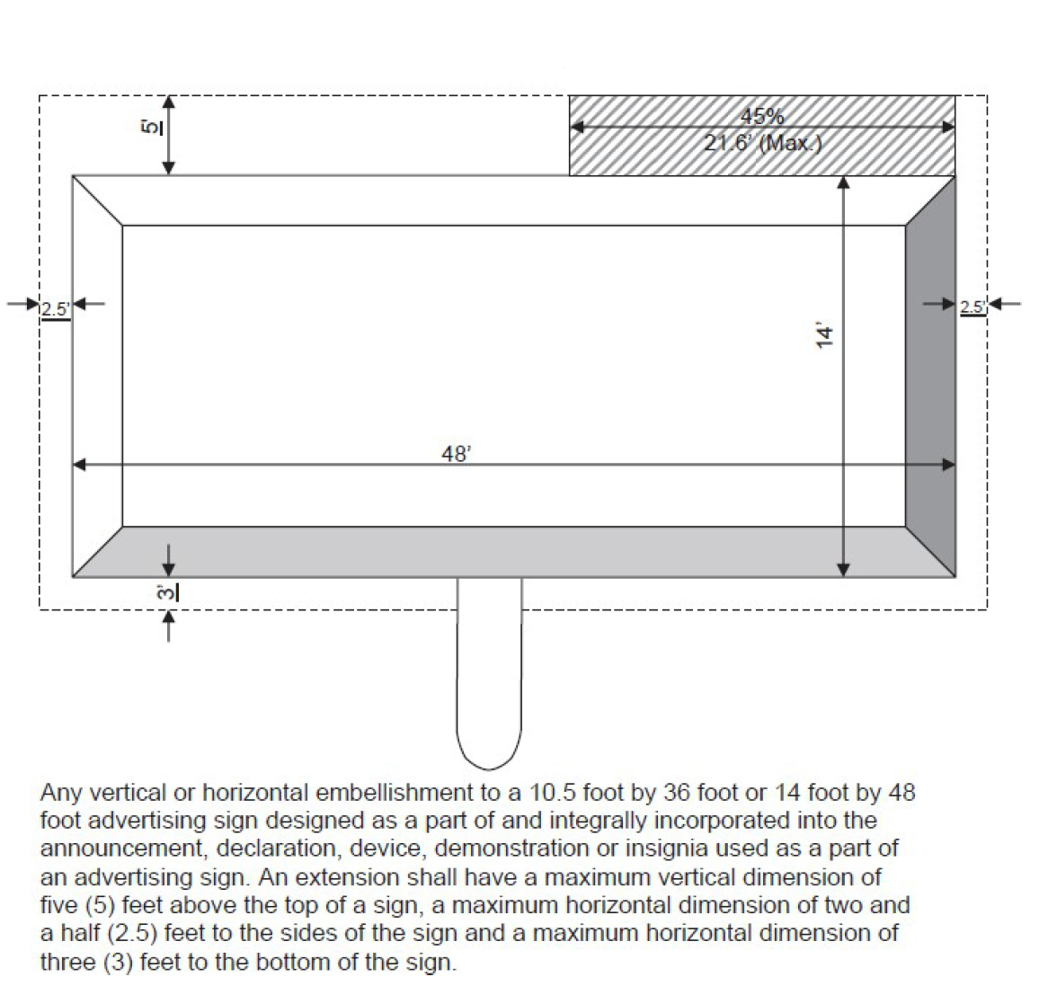
(G.O. 10, 2019, § 1; G.O. 1, 2025, § 2)