
Tiki Island City Zoning Code
ARTICLE I
- IN GENERAL
Sec. 44-1. - Definitions.
The following words, terms and phrases, when used in this chapter, shall have the meanings ascribed to them in this section, except where the context clearly indicates a different meaning:
Above ground improvements means galleries, walkways, steps, open porches, porticos, parapet walls, and the extension of the eaves of a roof.
Board of adjustment means the village board of aldermen.
Boat means a recreational vehicle for traveling in or on water.
Boat dock means a structure designed and constructed to provide a secure storage and loading or unloading facility for a boat used for private enjoyment.
Boat dry storage means a system that stores boats vertically in rack systems or in a sheltered building for the purpose of protecting boats from the weather or other elements of nature.
Building materials include PVC pipe, re-bar, cinder blocks, concrete, metal, timber, glass, fill dirt, and similar materials.
Church. The village defines as a building or temporary structure, either indoor or outdoor, for public worship, mass meeting, gathering, assembly, or congregation by any denomination of religion, faith, sect, cult, conviction, or creed and its use for any type of public, private worship or religious service can only be conducted on city property that is identified on the village Zoning Map.
Commercial fishing or fishing guide boat means a boat that has promotional advertisement on or around the boat, stating that the boat is used for commercial fishing (harvesting of fish, either in whole or in part, for sale, barter or trade) or being advertised as a boat for hire to provide fishing guide services.
Commercial property means buildings or land intended to generate a profit.
Condominium means a form of real property ownership that combines separate ownership of units with common ownership of other elements. Condominiums shall be specifically defined in accordance with the state Condominium Act.
Galveston County Fresh Water Supply District #6 is the district responsible for providing water, sewage, drainage and other services to the village and other adjacent areas within its boundaries. Also referred to as GCFWSD #6.
Licensee means any person to whom a license is issued and renewed annually by the village to maintain or operate a business under the provisions of this chapter.
Marina means a sheltered harbor where boats are kept in the water and where services geared to the needs of recreational boating are found. A marina may have re-fueling, washing and repair facilities, bait shop, boat ramps for boat ingress/egress, stores and restaurants.
Operator means the person in charge of operating a business either under written or verbal lease or under any other arrangement whereby he exercises control over the premises.
Owner means the person in whose name the title to the lot, block, tract or parcel of land is shown to be.
Permit means a written authorization issued by the building inspector for the construction, renovation, remodeling, repair, additions to or demolition of a structure under the provisions of this chapter.
Permittee means any person to whom a temporary permit is issued to construct or modify property under the provisions of this chapter.
Person means any natural individual, firm, trust, partnership, association, or corporation.
Planned unit development (PUD) is a zoning classification that allows flexibility in the design of a large tract of land or subdivision.
Planning and zoning commission is an appointed government board charged with recommending to the village board of aldermen the boundaries of the various zoning districts and appropriate regulations to be enforced therein and any proposed amendments and to act on measures affecting the safety of persons and property within the village.
Residential building means a structure that includes a foundation, finished wall living space, a garage, and a roof and stands permanently in one place.
Short-term rentals means renting a property or business for less than 30 consecutive days.
Single-family residence means a detached dwelling having accommodations for, and occupied by, only one family. The term "single-family residence" shall not include any form of temporary home, or temporary or permanent mobile home, trailer or other vehicle, whether on wheels or not.
Temporary parking is means less than 72 hours.
Time share means a form of ownership or right to the use of a property, in which multiple parties hold rights to use the property, and each sharer is allotted a period of time (typically one week, and almost always the same time every year) in which they may use the property.
Town home ortownhouse means a single-family dwelling, on a separate lot which fronts on a street, a place, or a private access easement, which is attached to one or more similar dwellings by a common wall or walls, interior to both, and which in combination with the other attached dwellings constitutes an architectural whole. A town home or townhouse is not considered an apartment per this chapter.
Vegetative buffer zone means a landscaped area intended to soften the visual impact of a building by providing a continuous vegetated area. Vegetative buffer zones contain no structures, parking areas or other similar improvements with the exceptions of sidewalks, driveways and public streets.
Zoning map means the official map upon which the boundaries of the various zoning districts are drawn and which are an integral part of the zoning ordinance and together with the zoning text make up the zoning regulations of the village.
Zoning official means the building inspector of the village.
(Ord. No. 10-04-01(2), § 12.301, 4-27-2010; Ord. No. 10-08-01, § 2, 8-10-2010; Ord. No. 04-15-2015(1), 4-15-2015)
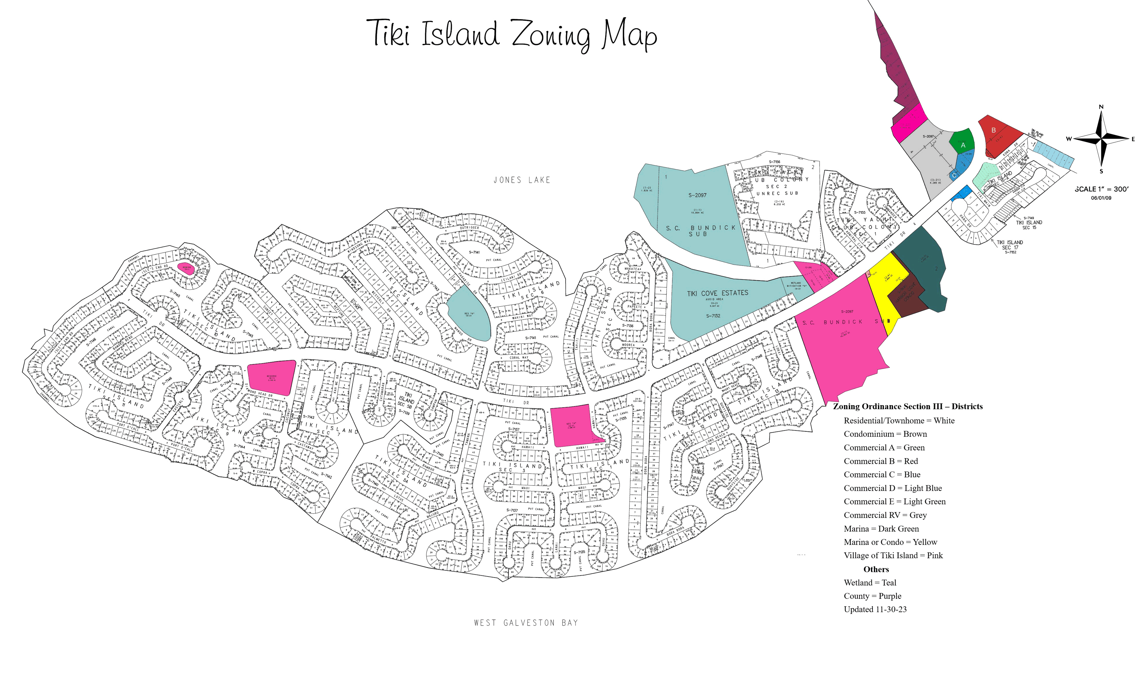
Sec. 44-2. - Zoning district map.
The village is hereby divided into zoning districts, as shown on the official zoning map, which, together with all explanatory matter thereon, is hereby adopted and declared to be a part of this chapter. The official zoning map shall be identified by the signature of the mayor and attested by the village secretary. The official zoning map of the village shall be kept in the office of the village secretary, and one copy shall be maintained in the office of the building inspector.
(1)
Maintenance of the zoning map. Provisions regarding maintenance of the zoning map are as follows:
a.
Changes made to any district boundary on the zoning map shall be entered on the zoning map promptly after the amendment has been approved by the board of aldermen as herein provided. The planning and zoning commission shall be responsible for keeping the zoning map current to reflect all approved zoning district changes.
b.
Approved zoning changes shall be entered on the zoning map by the planning and zoning commission and each change shall be identified on the map with the date and number of the ordinance making the change. No amendment to the ordinance from which this chapter is derived shall become effective until after such ordinance has been finally approved by the board of aldermen.
c.
No change of any nature shall be made on the zoning map or matter shown thereon except in conformity with the procedures set forth in this chapter. Unauthorized change of whatever kind by any person shall be considered a violation of this chapter and punishable hereunder.
d.
Regardless of the existence of purported copies of the zoning map, which may from time to time be made or published, the current zoning map, located in the village office, shall be the final authority as to the current zoning status of land and water areas, buildings and other structures in the village. The current zoning map shall be available to the public at all hours when the village office is open to the public.
e.
The village secretary, upon the adoption of the ordinance from which this chapter is derived, shall affix a seal identifying the map in the office as the zoning district map of the village. He shall likewise officially identify the copy directed to be kept in the office of the building inspector.
(2)
Rules for interpretation of district map boundaries. Where uncertainty exists as to the boundaries of zoning districts as shown on the official zoning map, the following rules shall apply:
a.
Boundaries indicated as approximately following the centerlines of streets, highways or alleyways shall be construed to follow centerlines.
b.
Boundaries indicated as approximately following platted lot lines shall be construed as following the lot lines.
c.
Boundaries indicated as following village limit lines shall be construed as following such village limits.
d.
Boundaries indicated as following shorelines of bodies of water shall be construed to follow such shorelines, and in the event of change in the shoreline shall be construed as moving with the actual shoreline; boundaries indicated as approximately following other bodies of water shall be construed to follow such centerlines.
(Ord. No. 10-04-01(2), § 12.302, 4-27-2010; Ord. No. 10-08-01, 8-10-2010; Ord. No. 12-14-01, 12-16-2014)
Sec. 44-3. - Compliance with the zoning regulations.
(a)
No land shall be used except for a purpose permitted in that zoning district under section 44-54.
(b)
No building shall be erected, converted, enlarged, reconstructed, moved or structurally altered, nor shall any building be used, except for a use permitted in that zoning district.
(c)
Nonconformance. Any use or structure which does not conform with the regulations contained in the zoning district in which it is located is deemed to be a legal nonconforming use when:
(1)
The use or structure was in existence and lawfully operational at the time of the passage of the ordinance from which this chapter is derived, and has since been in regular and continuous use;
(2)
The use or structure was lawfully being used at the time of the adoption of any amendment of the ordinance from which this chapter is derived and by such amendment was placed in a district where it is not otherwise permitted; or
(3)
The use or structure was in existence at the time of annexation to the village and has since been in regular and continuous use.
(d)
Continuing lawful use of property.
(1)
The lawful use of land or structure existing at the time of the passage of the ordinance from which this chapter is derived, although it does not conform to the provision herein, may be continued until termination of such use is made. Upon termination of the legal nonconformance use, any future use of the premises must be in conformity with the general provisions of this chapter.
(2)
A legal nonconforming use, when discontinued or abandoned, cannot be resumed. Evidence of discontinuance or abandonment is as follows:
a.
When land associated with a legal nonconforming use ceases to be used in such a manner for a period of 90 days.
b.
When a structure associated with a nonconforming use ceases to be used in such a manner for a period of 90 days.
(3)
Abandonment of a nonconforming use shall be determined by the board of adjustment and may include a consideration of the following factors in addition to the evidence of abandonment cited in subsection (d)(2) of this section:
a.
The intent of the user or owner; or
b.
The apparent act of discontinuance as supported by evidence submitted to the board of adjustment.
(4)
No nonconforming use or structure may be extended or enlarged, and no nonconforming use of land may be enlarged or increased, to occupy a greater area of land than was occupied at the time the site achieved nonconforming status.
(Ord. No. 10-04-01(2), § 12.305, 4-27-2010)
Sec. 44-4. - Platting requirement may be waived.
The village adopts V.T.C.A., Local Government Code § 212.0045, which permits the village to determine whether specific divisions of land are required to be platted and to waive platting requirements or to substitute therefor the filing of a development plat complying with applicable state law requirements.
(Code 1994, art. 12.200; Ord. No. 4-84-1, 4-10-1984)
State Law reference— Municipal determination regarding exception to plat requirement, V.T.C.A., Local Government Code § 212.0045.
Sec. 44-5. - Measuring and recording setback lines.
Each plat/survey must indicate the building front setback line, side setback line and utility easement. The front lot line (nearest the street) is determined by measuring the property depth indicated on the plat from the bulkhead to the front of the lot or by locating the actual property pins placed in the ground by the surveyor. The property between the front lot line and the street pavement belongs to the village.
Sec. 44-6. - Nonresident commercial fishing or fishing guide boats.
No nonresident will be allowed to operate, anchor or dock a commercial fishing or fishing guide boat in any manner in any waterway within the village.
Sec. 44-7. - Conditional uses.
After public hearing and proper notice, with or without recommendation by the planning and zoning commission, the board of aldermen may authorize the issuance of conditional use permits when the board of aldermen find all of the following conditions present:
(1)
That the establishment, maintenance, or operation of the conditional use will not be materially detrimental to, or endanger, the public health, safety, morals, or general welfare;
(2)
That the uses, values and enjoyment of other property in the neighborhood, for the purpose already permitted, shall be in no foreseeable manner substantially impaired or diminished by the establishment, maintenance, or operation of the conditional use;
(3)
That the establishment of the conditional use will not significantly impede the normal and orderly development and improvement of the surrounding property for uses permitted in the district;
(4)
That adequate utilities, access roads, drainage and other necessary site improvements have been or are being provided;
(5)
That adequate measures have been or will be taken to provide ingress or egress, so designed as to minimize traffic congestion in the public streets; and
(6)
That the conditional use shall conform to all applicable yard area regulations of the district in which it is located.
Prior to the granting of any conditional use, the city council may stipulate such conditions, restrictions, and duration upon the establishment, location, construction, maintenance, and operation of the conditional use as deemed necessary to protect the public health, safety and general welfare of the community, and to secure compliance with the standards and requirements specified in subsections (1) through (6) of section 44-7. In all cases in which conditional uses are granted, the council shall require such evidence and guarantees as it may deem necessary as proof that the conditional [use] stipulated in connection therewith are being and will be complied with. The granting of a conditional use does not create a right to the use and the conditional use may be canceled at the city council's sole discretion. No application for a conditional use that has been denied wholly or in party by the city council shall be resubmitted for a period of six months from the date of said denial.