
Abilene City Zoning Code
CHAPTER 3
- SUBDIVISION REGULATIONS
Section 3.1.1.1 - Authority, Purpose and Applicability
(a)
Authority. The procedures and standards of this Chapter 3 are authorized under the authority of V.T.C.A., Local Government Code Ch. 212 (including Subchapter B) and the City's Charter. The provisions of this Article expressly extend to all areas inside the City limits and the City's extraterritorial jurisdiction.
(b)
Purpose.
(1)
The provisions of this Chapter are intended to implement standards and requirements provided for herein, and shall be minimum requirements for the platting and developing of subdivisions within the City of Abilene and its extraterritorial jurisdiction, as authorized by State statute.
(2)
The subdivision of land, as it affects a community's quality of life, is an activity where regulation is a valid function of municipal government. Through the application of these regulations, the interests of public and private parties are protected by the granting of certain rights and privileges. By establishing a fair and rational procedure for developing land, the requirements in this chapter further the possibility that land will be developed in accordance with existing physical, social, economic and environmental conditions.
(3)
The provisions of this Chapter are intended to implement the following objectives:
a.
Promote the development and the utilization of land in a manner that assures an attractive and high-quality community environment in accordance with the Comprehensive Plan and the zoning regulations of the City of Abilene;
b.
Guide and assist property owners and applicants in the correct procedures to be followed, and to inform them of the standards which shall be required;
c.
Protect the public interest by imposing standards for the location, design, class and type of streets, walkways (sidewalks), alleys, utilities and essential public services;
d.
Assist orderly, efficient and coordinated development within the City's limits and its extraterritorial jurisdiction;
e.
Integrate the development of various tracts of land into the existing community, and coordinate the future development of adjoining tracts;
f.
Ensure the most efficient and beneficial provision of public facilities and services for each tract being subdivided;
g.
Provide for compatible relationships between land uses and buildings;
h.
Provide for the circulation of traffic throughout the municipality;
i.
Provide for pedestrian circulation that is appropriate for the various uses of land and buildings;
j.
Prevent pollution of the air, streams, bodies of water, and aquifers; assure the adequacy of drainage facilities; safeguard both surface and groundwater supplies, as well as natural resources and endangered or threatened plant and animal life; and encourage the wise use and management of natural resources throughout the municipality in order to preserve the integrity, stability and beauty of the community and the value of the land;
k.
Preserve the natural beauty and topography of the municipality, and ensure development that is appropriate with regard to these natural features;
l.
Establish adequate and accurate records of land subdivision;
m.
Ensure that public or private facilities are available and will have sufficient capacity to serve proposed and future developments and citizens within the City and its extraterritorial jurisdiction;
n.
Provide for adequate light, air and privacy; secure safety from fire, flood and other danger; and prevent overcrowding of the land and undue congestion of population;
o.
Ensure that each subdivision approved by the City is designed in such a way as to minimize stormwater runoff from the site and to minimize flooding potential downstream from such subdivision.
(c)
Applicability.
(1)
The provisions of this Chapter 3 apply to any non-exempt (see Section 3.1.1.3) division of land, combination of separate land parcels, and/or development of land within the corporate boundaries of the City and within its extraterritorial jurisdiction.
(2)
No permit shall be issued for any building or structure on a property until a plat has been approved and filed for record with the following exceptions:
a.
Permits for expansion, repair or remodeling of an existing structure or new accessory building(s) under the following exceptions:
1.
Additions or new accessory building(s) shall not exceed more than thirty (30) percent of the existing floor area of all structures, nor shall the expansion exceed more than 5,000 square feet, and such addition(s) shall not occur more than once in any twelve (12) month period;
b.
Permits for the construction of agricultural accessory structures and related development activities, or
c.
Demolition permits, or permits for removal of a structure from a parcel or tract.
(3)
All utility providers shall withhold new or expanded service of any type, including, but not limited to, utility connection and street maintenance, until a plat has been approved and filed for record unless meeting qualifications for an exception (see Section 3.1.1.3).
(4)
ETJ Subdivision Provisions. The owner of a tract of land must have a plat of the subdivision approved if the owner divides the tract into two or more parts to lay out a subdivision of the tract including an addition, lots, or streets, alleys, or other parts of the tract intended to be dedicated to public use or for the use of purchasers or owners of lots fronting on or adjacent to the streets, alleys, or other parts.
a.
All tracts under single ownership and described as a single tract greater than ten (10) acres in size shall be exempt from the provisions of this chapter unless the subdivision includes any streets, alleys, or other parts of the tract intended to be dedicated to public use or for the use of purchasers or owners of lots fronting on or adjacent to the streets, alleys, or other parts.
b.
All lands subdivided or resubdivided not otherwise exempted by part (a) above shall be platted in accordance with the provisions of this chapter except as modified below:
1.
Lots less than or equal to one (1) acre:
a)
All tracts shall have a minimum frontage of sixty (60') feet, or thirty (30') feet if irregularly shaped, on a public road meeting the design and construction standards of the City of Abilene.
b)
The residential lot exception regarding double-frontage lots shall apply regardless of intended use of the land.
2.
Lots greater than one (1) acre:
a)
All tracts shall have a minimum frontage of 100 feet, or 45 feet if irregularly shaped, on a public road or approved private road meeting the design and construction standards of the City of Abilene.
b)
The residential lot exception regarding double-frontage lots shall apply regardless of intended use of the land to lots less than or equal to three (3) acres.
c)
Connection to a sanitary sewer system may be waived if the following conditions are met:
i.
Compliance with Section 3.2.5.5 of this ordinance;
ii.
Dedication of sewer easements if needed to provide future service.
d)
Installation of fire hydrants shall not be required. However, taps shall be provided for future hydrant installation in compliance with City requirements.
e)
An Interim Rural street design, as promulgated by the City Engineer, may be used as an alternative to full City street standards. However, in the following circumstances the City Engineer may require the installation of one or more streets in a proposed subdivision be built to full City standards:
i.
The subject street(s) is a continuation of an existing street already built to the City of Abilene standards;
ii.
The subject street(s) are intersected by one or more streets already built to the City of Abilene standards;
iii.
Any part of the proposed subdivision is within an adopted 3-year Annexation Plan, or is within an area where formal annexation proceedings have commenced; or
iv.
Other situations where the City Engineer, with approval of the Planning and Zoning Commission, finds reasonable justification.
f)
In lieu of meeting the City's water provision standards, a proposed subdivision where all lots front on an existing public or private street and are served by a public water supply where existing lines are currently in place may instead provide a separate dry line for future use or may enter into a deferral agreement with the City to provide upgraded lines in the future.
(d)
Subdivision Rules. The provisions of this Chapter 3, the standards governing water and wastewater facilities applicable to plats, and the technical standards contained in the City of Abilene Standard Specifications for Construction, as adopted by the City Council and as may be amended from time to time, constitute the subdivision rules of the City of Abilene, which apply to applications for plat approval inside City limits and within the City's extraterritorial jurisdiction.
(Ord. No. 8-2010, pt. 1(Exh. A), 4-22-10; Ord. No. 12-2010, pt. A (Exh. A), 6-10-10; Ord. No. 15-2014, pt. 1(Exh. A), 3-13-14)
Section 3.1.1.2 - Types of Plats Required
(a)
Plats. A Final Plat or a Minor Plat shall be approved prior to any non-exempt land division.
(b)
Development Plats. A Development Plat shall be approved prior to development of any tract or parcel for which no Final Plat is required prior to development of any lot in a subdivision for which dedication of any right-of-way for construction or maintenance of public improvements is required by this Land Development Code. A Development Plat shall be required prior to approval of a manufactured home rental community, or to proposed nonresidential development within the City's extraterritorial jurisdiction. Refer to Article 1, Division 5 of this Chapter.
(Ord. No. 8-2010, pt. 1(Exh. A), 4-22-10)
Section 3.1.1.3 - Exemptions
(a)
Exemptions. The following land divisions are exempt from the requirements of this article that apply to plats:
(1)
Use of existing cemeteries complying with all State and local laws and regulations;
(2)
A division of land created by order of a court of competent jurisdiction;
(3)
A division of land for which a Development Plat exemption is claimed (refer to Article 1, Division 5 of this chapter);
(4)
Creation of a remainder tract, which must be a tract of land that is of sufficient size to be developed in the future, when shown on a preliminary plat (also refer to Section 3.1.1.7);
(5)
Farmland exception. Permits may be issued by the Building Official for construction or improvements on property other than lots in a duly recorded subdivision, if said property qualifies for farmland exception as set forth herein. The City and all utility providers may furnish limited services to property other than a lot in a duly recorded subdivision if said property qualifies for farmland exception as set forth herein. Property qualifying for farmland exception shall meet all the following minimum specifications:
a.
Have twenty (20) acres or more in common ownership;
b.
Be used for no primary purpose other than farming or ranching;
c.
Have no more than one (1) single-family residence thereon; and
(6)
A division of land which is owned prior to any transfer of ownership by the City of Abilene and is located at Lake Fort Phantom, and which is leased to a third-party, is less than ½ acre, and is not serviced by the City's wastewater utility.
(Ord. No. 8-2010, pt. 1(Exh. A), 4-22-10; Ord. No. 12-2010, pt. A(Exh. A), 6-10-10; Ord. No. 22-2018, pt. 1(Exh. A), 5-10-18)
Section 3.1.1.4 - Time for Decision on Plats
(a)
Time Period for Action. All plat applications shall be acted upon within thirty (30) days from the official filing date unless a waiver is submitted in accordance with Subsection (b) below.
(b)
Waiver of Right to 30-day Action.
(1)
Responsible Official. The Planning Director shall be the responsible official and the initial decision-maker for a Waiver of Right to 30-Day Action.
(2)
Request. An applicant may request in writing a Waiver of Right to 30-day Action in relation to the decision time for plats of thirty (30) days mandated by State law.
(3)
Received. Waiver requests must be received by the Planning Director prior to the Planning and Zoning Commission meeting at which action would have to be taken (based on the 30-day requirement in State law) on the plat application. Waiver requests that are not received by that day shall not be considered properly submitted, and action shall be taken on the plat application at such meeting as scheduled.
(4)
Action. The Planning Director shall take action on the Waiver of Right to 30-day Action request within the thirty-day (30-day) period for acting on the plat.
(5)
Requirements Maintained. The granting of a Waiver of Right to 30-day Action request shall not be deemed in any way a waiver to any requirement within this LDC. A waiver from requirements herein is a separate and distinct process.
(c)
Final Plat Application for Extraterritorial Jurisdiction. Where the land to be platted lies within the extraterritorial jurisdiction of the City in a county with which the City has no interlocal agreement under V.T.C.A., Local Government Code Ch. 242, no Final Plat application shall be accepted as complete for filing by the responsible official unless the application is accompanied by verification that a copy of the Final Plat has been delivered to the applicable County in which the land subject to the application is located. If the City has not received a decision from the applicable county on matters pertaining to the Final Plat application which are to be determined by the applicable county, under the interlocal agreement or common City procedures, the application for Final Plat approval shall be accepted for filing by the City, but shall be denied, unless a Waiver of Right to 30-day Action is approved in accordance with subsection (b) above.
(Ord. No. 8-2010, pt. 1(Exh. A), 4-22-10)
Section 3.1.1.5 - Applications and Procedures
(a)
Complete Application. Where a conflict exists between the procedures listed in this section and any other section of the LDC, the procedures of this section shall control.
(1)
An application must be complete in order to be accepted for review by the City of Abilene. All applications shall be made on forms available from the City. To be complete, it must comply with all the procedures of this section and any other sections pertaining specifically to each application. Refer to Chapter 1, Article 2, Division 1 of this LDC for complete application procedures and requirements.
(2)
Required documentation for the initial application to be considered complete for each review process is listed on an application form available in the City Planning Department. Electronic copies of all types of plats are required for a complete application.
(Ord. No. 8-2010, pt. 1(Exh. A), 4-22-10)
Section 3.1.1.6 - Stages of Plat Approval
(a)
Plats. A plat may be approved in two stages:
(1)
Preliminary Plat (refer to Article 1, Division 3); and
(2)
Final Plat (refer to Article 1, Division 4).
(b)
Combined Applications. An applicant may submit applications for approval of a Preliminary Plat and a Final Plat simultaneously.
(c)
Planning Director and Development Review Committee. The Planning Director shall be the responsible official for a plat, and the Development Review Committee shall be the initial reviewing body for a plat.
(1)
The Planning Director, and/or other City staff at the direction of the Planning Director, shall review all plat applications for completeness (refer to Chapter 1, Article 2, Division 1, Section 1.2.1.2) based on a checklist supplied by the Planning and Development Services Department.
(2)
The Development Review Committee (DRC) shall review all plat applications that are deemed complete for conformance with this LDC and any other applicable City regulations.
(Ord. No. 8-2010, pt. 1(Exh. A), 4-22-10)
Section 3.1.1.7 - Remainder Tracts
(a)
Definition. A remainder tract is that portion of a larger parcel that is not included within the boundaries of a Final Plat. Remainder tracts shall not be considered platted lots or tracts of the subdivision. Approval of a preliminary plat shall not constitute approval of development on a remainder tract. Remainder tracts must be of a size that is able to be developed (i.e., useable) in the future.
(b)
Information. Information accompanying a plat application for remainder tracts shall be deemed to be an aid to the Planning and Zoning Commission in taking action on the plat application and may be used to determine whether development of the land subject to the plat will be adequately served by public facilities and services and is otherwise in compliance with this Land Development Code, taking into account the development of the property as a whole. Information concerning remainder tracts, including topography, drainage, and existing and planned public improvements, may be considered in formulating conditions to approve the plat application. Based upon such information, the Planning and Zoning Commission may require that additional or less land be included in the plat in order to satisfy the standards applicable to the plat application.
(c)
All remainder tracts shall be included in a preliminary plat.
(Ord. No. 8-2010, pt. 1(Exh. A), 4-22-10)
Section 3.1.3.1 - Purpose, Exceptions and Effect
(a)
Purpose. The purpose of a Preliminary Plat shall be to determine the general layout of the subdivision, the adequacy of public facilities needed to serve the intended development and the overall compliance of the land division with applicable requirements of this Land Development Code.
(b)
Exceptions.
(1)
A Preliminary Plat is not required when a Minor Plat is submitted (Chapter 3, Article 1, Division 6 [Division 5]).
(2)
A Final Plat in accordance with Division 4 of this Article, along with Construction Plans in accordance with Division 8 of this Article, may be submitted in lieu of a Preliminary Plat.
(c)
Effect. Approval of a Preliminary Plat shall authorize the subdivider to submit Construction Plans for approval by the City Engineer under Division 8 of Article 1 of this Chapter and, upon approval of such plans, to construct public improvements to serve the subdivision in accordance therewith. Approval of a Preliminary Plat also shall authorize the subdivider to seek approval of a Final Plat for the land subject to the Preliminary Plat.
(Ord. No. 8-2010, pt. 1(Exh. A), 4-22-10)
Section 3.1.3.2 - Application and Procedures
(a)
Responsible Official and Initial Review. The Planning Director shall be the responsible official for a Preliminary Plat, and the Development Review Committee shall be the initial reviewing body for a Preliminary Plat.
(b)
Pre-Application Conference. Refer to Section 1.2.1.5 of Chapter 1.
(c)
Application Contents. All applications shall be submitted on a form supplied by the Planning Department with the required information as stated on the application form.
(d)
Accompanying Applications.
(1)
An application for a Preliminary Plat may be accompanied by an application for rezoning approval, including a request for a Planned Development District, or a Master Plat application. The rezoning application and Master Plat application shall be decided first.
(2)
An application for a Preliminary Plat may be accompanied by Construction Plans. However, approval of each shall be separate and in accordance with this Division 3 for Preliminary Plat and with Division 8 for Construction Plans.
(e)
Placement on the Agenda. If the Planning Director or his designee determines that the application should be acted upon, the Planning Director shall place it on the agenda of the next meeting of the Planning and Zoning Commission.
(f)
Development Review Committee (DRC). The DRC shall, at each meeting, review each Preliminary Plat application to be placed on the agenda of the forthcoming meeting of the Planning and Zoning Commission. The Committee shall make comments on either:
(1)
Approval of the Preliminary Plat;
(2)
Denial of the Preliminary Plat; or
(3)
Approval of the Preliminary Plat with conditions.
(g)
Resubmittal Following DRC Review.
(1)
The applicant shall retain in his/her possession the original Preliminary Plat that was submitted for review by the DRC.
(2)
At least four (4) days prior to the meeting of the Planning and Zoning Commission during which the Preliminary Plat is scheduled for action, the applicant shall provide to the Planning Director a reproducible copy of the Preliminary Plat. The Planning Director shall then review the Preliminary Plat for compliance with DRC recommendations.
(h)
DRC Review Timing. In any case in which a Preliminary Plat is submitted and is deemed complete, but is not reviewed by DRC because it must be placed on the Planning and Zoning Commission agenda due to the State law mandated 30-day timeframe for action on plats and no Waiver of Right for 30-Day Action is submitted by the applicant, the Preliminary Plat shall be subject to denial by the Planning and Zoning Commission.
(Ord. No. 8-2010, pt. 1(Exh. A), 4-22-10)
Section 3.1.3.3 - Action
(a)
Review and Determination. The Planning and Zoning Commission shall review all Preliminary Plat applications, findings of the DRC, findings of the Planning Director regarding compliance with DRC recommendations, and any other information available. From all such information, the Commission shall determine whether the Preliminary Plat as shown on the application meets the standards of this LDC.
(b)
Approval or Denial. The Planning and Zoning Commission shall decide whether to approve, approve with conditions, or deny the Preliminary Plat application. The action of the Commission shall be noted on two (2) copies of the Preliminary Plat, referenced and attached to any conditions determined. One (1) copy shall be returned to the applicant and one (1) copy shall be retained in the City's files. A notation of the action taken on each Preliminary Plat application, including any conditions for approval attached thereto, and the reasons for the action shall be entered in the minutes of the Commission.
(Ord. No. 8-2010, pt. 1(Exh. A), 4-22-10)
Section 3.1.3.4 - Criteria for Approval
(a)
The following criteria shall be used to determine whether the application for a Preliminary Plat shall be approved, approved with conditions, or denied:
(1)
The plat is consistent with all zoning requirements for the property, and any approved development agreement if applicable;
(2)
The proposed provision and configuration of roads, water, wastewater, and drainage conform to the City's adopted master plans for those facilities, including without limitation water facilities, wastewater facilities, transportation, drainage, and any other municipal plans;
(3)
The proposed provision and configuration of roads, water, wastewater, drainage, easements, and rights-of-way are adequate to serve the subdivision and meet applicable standards of this Chapter of the LDC;
(4)
The plat meets all applicable county standards, when the proposed development is located in whole or in part in the extraterritorial jurisdiction of the City and in the county;
(5)
The plat has been duly reviewed by applicable City staff, including the Planning Director and the Development Review Committee;
(6)
The plat conforms to design requirements and construction standards as set forth in the Design, Details, and Construction Standards; and
(7)
The plat is consistent with the adopted Comprehensive Plan, except where application of the Plan conflicts with State law (e.g., land use).
(Ord. No. 8-2010, pt. 1(Exh. A), 4-22-10; Ord. No. 12-2010, pt. A (Exh. A), 6-10-10)
Section 3.1.3.5 - Effect of Approval of a Preliminary Plat
(a)
Right to Proceed. The approval of a Preliminary Plat application shall allow the applicant to proceed with the development and platting process by submitting Construction Plans and a Final Plat.
(b)
Installation of Subdivision Improvements.
(1)
Approval of the Preliminary Plat by the Planning and Zoning Commission shall be deemed an approval of the layout illustrated on the Preliminary Plat as a guide to the installation of streets, water, sewer, and other improvements that are planned or required within the proposed subdivision.
(2)
Approval of the Preliminary Plat shall not constitute approval of the proposed subdivision, nor shall approval of the Preliminary Plat be construed to mean acceptance by the public of the dedication of any roads, utilities, drainageways, or other such land and improvements.
(3)
Construction of all subdivision improvements shall be based upon approved Construction Plans, and shall occur either:
a.
Prior to Final Plat approval and recordation, or
b.
Following Final Plat approval and recordation, upon approval of a Subdivision Improvement Agreement, or upon submittal of security in lieu of completing construction, in accordance with Division 8 of this Article.
(Ord. No. 8-2010, pt. 1(Exh. A), 4-22-10)
Section 3.1.3.6 - Expiration and Extension
(a)
The approval of a Preliminary Plat application shall remain in effect for a period of two (2) years from the date a complete application was officially submitted to the City, during which period the applicant shall submit and receive approval for Construction Plans and a Final Plat for the land subject to the Preliminary Plat. If Construction Plans and a Final Plat application have not been approved within the two (2) year period, the Preliminary Plat application may be extended for a period of two (2) years in accordance with Article 2, Division 5 of Chapter 1, but such extension may be predicated upon the applicant waiving any vested rights. If the Preliminary Plat is not extended, the plat shall expire and shall be null and void.
(Ord. No. 8-2010, pt. 1(Exh. A), 4-22-10)
Section 3.1.3.7 - Revisions Following Approval of Preliminary Plat
(a)
Minor Changes. Minor changes in the design of the subdivision subject to a Preliminary Plat may be incorporated in an application for approval of a Final Plat without the necessity of filing a new application for approval of a Preliminary Plat. Minor changes shall include adjustment in street or alley alignments, lengths, and paving details, and adjustment of lot lines that do not result in creation of additional lots, provided that such changes are consistent with any approved prior applications.
(b)
Amendments. All other proposed changes to the design of the subdivision subject to an approved Preliminary Plat shall be deemed major amendments that require submittal and approval of a new application for approval of a Preliminary Plat before approval of a Final Plat. Approval of major revisions to an approved Preliminary Plat shall occur prior to the date any approved Master Plat would have expired for the same land.
(c)
Determination. The Planning Director shall make a determination of whether changes are deemed to be minor or shall require new submittal of a Preliminary Plat.
(Ord. No. 8-2010, pt. 1(Exh. A), 4-22-10)
Section 3.1.4.1 - Purpose, Applicability, Exceptions and Effect
(a)
Purpose. The purpose of a Final Plat is to assure that the subdivision of the land subject to the plat is consistent with all standards of this Land Development Code pertaining to the adequacy of public facilities, that public improvements to serve the subdivision or development have been installed and accepted by the City or that provision for such installation has been made, that all other requirements and conditions have been satisfied or provided for to allow the plat to be recorded, and to assure that the subdivision meets all other standards of this Land Development Code to enable initiation of site preparation activities for any lot or tract subject to the Final Plat.
(b)
Applicability. Construction of public improvements may occur prior to Final Plat approval if requirements in Division 8 of this Chapter are met.
(c)
Effect. Approval of a Final Plat shall authorize the subdivider to install any improvements in public rights-of-way with approved Construction Plans and to seek approval of a Site Preparation Permit (refer to Chapter 4, Division 2, Section 4.1.2.2) for any lot in the subdivision. Approval also authorizes the Planning Director to record the Final Plat; however, recordation shall occur only upon completion of public improvements or posting of security as required in Section 3.1.8.4.
(Ord. No. 8-2010, pt. 1(Exh. A), 4-22-10; Ord. No. 12-2010, pt. A (Exh. A), 6-10-10)
Section 3.1.4.2 - Application and Procedures
(a)
Responsible Official. The Planning Director shall be the responsible official for a Final Plat, and the Development Review Committee shall be the initial reviewing body for a Final Plat.
(b)
Pre-Application Conference. Refer to Section 1.2.1.5 of Chapter 1.
(c)
Prior Approved Preliminary Plat. The Final Plat and all accompanying data shall conform to the approved Preliminary Plat as approved by the Planning and Zoning Commission, incorporating all modifications and conditions imposed or required by the Planning Director.
(d)
Consent of Lienholders. The applicant shall furnish with the application to the City a current title commitment issued by a title insurance company authorized to do business in Texas, or a title opinion letter from an attorney licensed to practice in Texas, identifying all persons having an interest in the property subject to the plat, including lienholders. The Final Plat shall be signed (on the face of the plat in plain view) by each lienholder, effectively denoting that they are consenting to the platting of the property and to the dedications and covenants that may be contained in the plat. Such lienholder consent shall be subject to review and approval by the City Attorney.
(e)
Application Contents. All applications shall be submitted on a form supplied by the Planning Department with the required information as stated on the application form.
(f)
Placement on the Agenda. If the Planning Director determines that the application should be acted upon by the Planning and Zoning Commission, the Planning Director shall place it on the agenda of the next meeting of the Planning and Zoning Commission. If the Director does not place the application on the agenda, then the Director shall approve, conditionally approve or deny the plat, within the time prescribed by law.
(g)
Development Review Committee (DRC).
(1)
The DRC shall, at each meeting, review each Final Plat application. The Committee shall recommend either:
a.
Approval of the Final Plat;
b.
Denial of the Final Plat; or
c.
Approval of the Final Plat subject to corrections or alterations required prior to consideration by the Planning Director or the Planning and Zoning Commission.
(2)
In case of a recommendation of approval, the DRC must make only a finding that the Final Plat meets all standards set forth in this LDC, although the DRC may make such additional findings as it deems appropriate. In case of a recommendation for denial or approval with conditions, the DRC shall make specific findings of the reasons for denial or the imposition of conditions and shall cite the standards in this LDC which would be violated if the Final Plat were approved unconditionally.
(h)
Resubmittal Following DRC Review.
(1)
The applicant shall retain in his/her possession the original Final Plat that was submitted for review by the DRC.
(2)
At least four (4) days prior to the meeting of the Planning and Zoning Commission during which the Final Plat is scheduled for review, or alternatively, one week after the Planning Director has communicated in writing that the plat will be approved or approved with conditions, the applicant shall provide to the Director of Planning a mylar of the Final Plat, with revisions made based on DRC comments and recommendations. The Planning Director shall then review the Final Plat for compliance with DRC recommendations.
(i)
DRC Review Timing. In any case in which a Final Plat is submitted and is deemed complete, but is not reviewed by DRC because it must be approved, approved with conditions or denied in accordance with the State law mandated 30-day timeframe for action on plats, and no Waiver of Right for 30-Day Action is submitted by the applicant, the Final Plat shall be subject to denial by the Planning Director.
(Ord. No. 8-2010, pt. 1(Exh. A), 4-22-10; Ord. No. 28-2024, pt. 1(Exh. A), 6-13-24)
Section 3.1.4.3 - Decision
(a)
Review and Determination. The Planning Director shall review all Final Plat applications, and findings of the DRC, regarding compliance with DRC recommendations, and any other information available. From all such information, the Planning Director shall determine whether the Final Plat as shown on the application meets the standards of this LDC. Alternatively, if the Planning Director places the application on the agenda of the Planning and Zoning Commission, the Commission shall review Final Plat applications.
(b)
Approval or Denial. The Planning Director or the Planning and Zoning Commission shall decide whether to approve, approve with conditions, or deny the Final Plat application. The action shall be noted on two (2) copies of the Final Plat, referenced and attached to any conditions determined. One (1) copy shall be returned to the applicant and one (1) copy shall be retained in the City's files. Upon approval of the Final Plat, the applicant shall submit Final Plat copies to the Planning Director so that required signatures can be obtained and recording completed. If any conditions are attached to the approval, both Final Plat copies shall be so corrected prior to signature by any City official. Official action of the Planning Director shall be in writing. If the decision is made by the Commission, the reasons for any action taken by the Commission, whether a Final Plat is approved, denied, or approved with conditions, shall be entered in the minutes of the Commission.
(c)
Appeal of Denial by Planning Director. If the Planning Director denies a plat application, the applicant may appeal the decision to the City Manager. For purposes of this appeal only, the City Manager is delegated the ability to approve, approve with conditions, or deny a plat. The City Manager's decision shall follow the criteria of Section 3.1.4.4. If the City Manager denies the plat application, the applicant may appeal the decision to the Planning and Zoning Commission, and the plat application will be included on the agenda of the next scheduled Planning and Zoning Commission meeting. The Commission shall approve, conditionally approve, or deny the plat within the time prescribed by law. Any appeal request by the applicant to the City Manager or to the Planning and Zoning Commission shall be made in writing and submitted to the Planning Director within 10 days of the denial by the Planning Director or the City Manager.
(Ord. No. 8-2010, pt. 1(Exh. A), 4-22-10; Ord. No. 28-2024, pt. 1(Exh. A), 6-13-24)
Section 3.1.4.4 - Criteria for Approval
(a)
The following criteria shall be used to determine whether the application for a Final Plat shall be approved, approved with conditions or denied:
(1)
Prior Approved Preliminary Plat:
a.
The Final Plat conforms to the approved Preliminary Plat except for minor changes authorized under Divisions 3 or 4 of this Article and that may be approved without the necessity of revising the approved Preliminary Plat;
b.
All conditions imposed at the time of approval of the Preliminary Plat, as applicable, have been satisfied;
c.
Where public improvements have been installed, the improvements conform to the approved Construction Plans and have been approved for acceptance by the City Engineer;
d.
Where the City Engineer has authorized public improvements to be deferred, the Subdivision Improvement Agreement or surety have been executed and submitted by the property owner in conformity with Division 8 of this Article;
e.
The final layout of the subdivision or development meets all standards for adequacy of public facilities contained in this Chapter;
f.
The Final Plat meets any applicable county standards to be applied under an interlocal agreement between the City and the county under V.T.C.A., Local Government Code Ch. 242, where the proposed development is located in whole or in part in the extraterritorial jurisdiction of the City and in the county;
g.
The plat conforms to design requirements and construction standards as set forth in the current or applicable City of Abilene Standard Specifications for Construction; and
h.
The plat conforms to the subdivision application checklist.
(2)
No Prior Approved Preliminary Plat:
a.
The Final Plat conforms to all criteria for approval of a Preliminary Plat;
b.
The Construction Plans conform to the requirements of Chapter 3;
c.
The Subdivision Improvement Agreement or surety for installation of public improvements have been prepared and executed by the property owner in conformity with Division 8 of this Article 1;
d.
The final layout of the subdivision or developments meets all standards for adequacy of public facilities contained in Article 2 of this Land Development Code [Article 2 of this Chapter 3];
e.
The Final Plat meets any applicable county standards to be applied under an interlocal agreement between the City and the county under V.T.C.A., Local Government Code Ch. 242, where the proposed development is located in whole or in part in the extraterritorial jurisdiction of the City and in the county; and
f.
The Final Plat conforms to the application checklist.
(Ord. No. 8-2010, pt. 1(Exh. A), 4-22-10)
Section 3.1.4.5 - Revisions to Final Plat
(a)
Following Approval. An applicant may apply for modification of an approved Final Plat to reflect changes arising from installation of public improvements thereafter, provided that the approved Final Plat has not been recorded and that approval of the modified Final Plat occurs prior to expiration of approval of the initial Final Plat application. If the approved Final Plat has been recorded, revisions may only be approved under Division 7, Revisions to Recorded Plats (replatting), of this Article.
(b)
After Denial or Conditional Approval. Following conditional approval or denial of a Final Plat application, the applicant may submit a revised Final Plat application, together with any revised Construction Plans, for approval by the Planning and Zoning Commission, provided that the revised application is approved prior to the original expiration date of any approved Preliminary Plat for the same land.
(Ord. No. 8-2010, pt. 1(Exh. A), 4-22-10)
Section 3.1.4.6 - Expiration and Extension
(a)
The approval of a Final Plat shall remain in effect for a period of two (2) years from the date a complete application was officially filed, during which period the applicant shall submit any required revisions for approval and record the plat. If the Final Plat has not been recorded within the two-year (2-year) period, the Final Plat approval, unless extended in accordance with Article 2, Division 5 of Chapter 1, shall expire and the applicable plat shall be deemed null and void.
(Ord. No. 8-2010, pt. 1(Exh. A), 4-22-10)
Section 3.1.4.7 - Plat Recordation
(a)
Procedure.
(1)
Signatures. After approval of the Final Plat, the Planning Director shall procure the signature of the chairperson of the Planning and Zoning Commission on the plat, as well as the signature of the Secretary of the Planning and Zoning Commission who shall attest to the signature of the chairperson.
(2)
Recording Upon Performance. The Planning Director shall cause the Final Plat to be recorded with the appropriate County Clerk upon the subdivider's or developer's performance of one of the following:
a.
Completion of the construction of required improvements prior to recordation; or
b.
Filing of security in lieu of completing construction in accordance with Division 8 of this Article.
c.
Regardless of which option, (1) or (2) [a. or b.] above, is chosen, Construction Plans must be approved in accordance with Section 3.1.8.1 prior to approval of the Final Plat and prior to plat recordation.
(b)
Submittal of Record Plat Where Improvements Installed. Where public improvements have been installed prior to recording of the plat, the property owner shall submit a maintenance bond in accordance with Division 8 of this Article from each contractor, one set of "as built" plans or record drawings, and a digital copy of all plans (in a format as determined by the City Engineer), together with a letter stating the contractors' compliance with Division 8 of this Article. The property owner also shall submit copies of the approved Final Plat, revised to reflect modifications as might be needed as shown on the "as built" plans or record drawings, in the format and number as may be required by the Director.
(c)
Submittal of Record Plat Where Improvements Have Not Been Installed. Where public improvements have yet to be completed in connection with an approved Final Plat, the property owner shall submit the approved Final Plat, revised to reflect any changes required by the Planning and Zoning Commission.
(d)
Update of Lienholder Consents. In conjunction with the application for a record plat, the applicant shall furnish to the City an updated title policy commitment issued by a title insurance company authorized to do business in Texas, or a title opinion letter from an attorney licensed to practice in Texas, identifying all persons having an interest in the property subject to the plat, including lienholders. If there has been any change in the lienholders since the time of the lienholder consent agreement provided under Section 3.1.5.2 [3.1.4.2], the applicant shall submit a new agreement executed by each lienholder consenting to the platting of the property and the dedications and covenants contained in the plat. The title commitment or title opinion letter and consent agreement shall be subject to review and approval by the City Attorney.
(Ord. No. 8-2010, pt. 1(Exh. A), 4-22-10; Ord. No. 12-2010, pt. A (Exh. A), 6-10-10)
Section 3.1.5.1 - Purpose, Applicability and Effect
(a)
Purpose. The purpose of a Minor Plat is to simplify divisions of land under certain circumstances outlined in State law.
(b)
Applicability. An application for approval of a Minor Plat may be filed only in accordance with State law, when all of the following circumstances apply:
(1)
The proposed division results in four (4) or fewer lots;
(2)
All lots in the proposed subdivision front onto an existing public street and the construction or extension of a street or alley is not required to meet the requirements of this Land Development Code; and
(3)
The plat does not require the extension of any municipal facilities to serve any lot within the subdivision, however, right-of-way widening and easements shall be permitted as part of a Minor Plat.
(c)
Effect. Approval of a Minor Plat authorizes the applicant to submit an application for a Site Preparation Permit for any lot in the subdivision.
(Ord. No. 8-2010, pt. 1(Exh. A), 4-22-10)
Section 3.1.5.2 - Application and Procedures
(a)
Responsible Official. The Planning Director shall be the responsible official for a Minor Plat.
(b)
Application Contents. All applications shall be submitted on a form supplied by the Planning Department with the required information as stated on the application form.
(c)
Pre-Application Conference. Prior to the official filing of a Minor Plat application, the applicant(s) may request a pre-application conference with the Planning Director and any other pertinent City official(s). Such conference is optional, and before it is convened a vested rights waiver shall be submitted in accordance with Section 1.2.1.5 of Chapter 1.
(d)
Accompanying Applications. An application for approval of a Minor Plat may be accompanied by an application for approval of a Site Preparation Permit for the land subject to the plat, provided that the Minor Plat shall be decided prior to decision on any Site Preparation Permit.
(Ord. No. 8-2010, pt. 1(Exh. A), 4-22-10)
Section 3.1.5.3 - Action
(a)
Final Approval. The Planning Director shall approve, approve with conditions, or refer to the Planning and Zoning Commission for consideration the Minor Plat application. Each Minor Plat application shall be placed on the agenda of the next regularly scheduled meeting of the Planning and Zoning Commission by the Director of Planning. Planning Director [sic] unless the owner of the property provides a Waiver of Right to 30-day Action. Review, approval, and recording of Minor Plats shall be in accordance with procedures set forth for Final Plats in Division 4 of this Article.
(b)
Deemed Approved. If the minor plat is approved by the Director of Planning then no approval by the Planning and Zoning Commission is needed. If the Planning Director fails to act on a Minor Plat application within thirty (30) days, the Minor Plat application shall be deemed approved.
(Ord. No. 8-2010, pt. 1(Exh. A), 4-22-10)
Section 3.1.5.4 - Criteria for Approval
(a)
The Director, or the Planning and Zoning Commission on appeal, shall decide whether to approve, conditionally approve or deny the Minor Plat application based upon the following criteria:
(1)
The Minor Plat is consistent with all zoning requirements for the property, all other requirements of this Land Development Code that apply to the plat, and any approved development agreement;
(2)
All lots to be created by the plat already are adequately served by all required City utilities and services;
(3)
The ownership, maintenance, and allowed uses of all designated easements have been stated on the Minor Plat; and
(4)
The plat does not require the extension of any municipal facilities to serve any lot within the subdivision.
(Ord. No. 8-2010, pt. 1(Exh. A), 4-22-10)
Section 3.1.5.5 - Expiration
(a)
The approval of a Minor Plat application shall remain in effect for a period of two (2) years from the date that a complete application was officially filed with the City. If construction plans or a Site Development Permit (Chapter 4, Division 2, Section 4.1.2.2) has not been submitted within the two (2) year period, the Minor Plat approval shall expire and the plat shall be deemed null and void.
(Ord. No. 8-2010, pt. 1(Exh. A), 4-22-10)
Section 3.1.5.6 - Recordation
(a)
The property owner shall submit the approved Minor Plat, following any required revisions, to the Planning Director, who shall cause the Minor Plat to be recorded in the property records of the appropriate county.
(Ord. No. 8-2010, pt. 1(Exh. A), 4-22-10)
Section 3.1.6.1 - Purpose, Applicability and Effect
(a)
Purpose. The purpose of a Conveyance Plat is to subdivide land and to provide for recordation of same, for the purpose of conveying (i.e., selling) the property without developing it. A Conveyance Plat may be used to convey the property or interests therein; however, a Conveyance Plat does not constitute approval for any type of development on the property. A Conveyance Plat is an interim step in the subdivision and development of land.
(b)
Applicability. A Conveyance Plat may be used in lieu of a Final Plat to record the subdivision of property in the following instances:
(1)
To record the remainder of a tract that is larger than five (5) acres, and that is created by the final platting of a portion of the property, provided that the remainder is not intended for immediate development.
(2)
To record the subdivision of property into parcels, five (5) acres or smaller in size, that are not intended for immediate development, provided all required public improvements exist to the City's current standards prior to approval and minimum frontage requirements are met. All public rights-of-way must be dedicated and all abutting street and utilities must be installed and accepted by the City. Installation of on-site improvements may be delayed if development of other tracts is not affected.
(c)
Effect of Approval. The approval of a Conveyance Plat authorizes conveyance of the lot(s) created thereon, but does not authorize any type of development on the property. The applicant and future owner(s) of the property remain obligated to comply with all provisions in this Ordinance upon future development of the property including, but not limited to, all requirements for platting, required public improvements, utility extensions, street improvements or assessments, right-of-way and easement dedications, and all other requirements in this Ordinance.
(Ord. No. 8-2010, pt. 1(Exh. A), 4-22-10)
Section 3.1.6.2 - Application and Procedures
(a)
Responsible Official. The Planning Director shall be the responsible official for a Conveyance Plat.
(b)
Application Contents. All applications shall be submitted on a form supplied by the Planning Department with the required information as stated on the application form.
(Ord. No. 8-2010, pt. 1(Exh. A), 4-22-10)
Section 3.1.6.3 - Action
(a)
Final Approval. The Planning Director shall approve, approve with conditions, or refer to the Planning and Zoning Commission for consideration the Conveyance Plat application. Each Conveyance Plat application shall be placed on the agenda of the next regularly scheduled meeting of the Planning and Zoning Commission by the Director of Planning unless the owner of the property provides a Waiver of Right to 30-day Action. Review, approval, and recording of Conveyance Plats shall be in accordance with procedures set forth for Final Plats in Division 4 of this Article.
(b)
Deemed Approved. If the Conveyance Plat is approved by the Director of Planning then no approval by the Planning and Zoning Commission is needed. If the Planning Director fails to act on a Conveyance Plat application within thirty (30) days, the Conveyance Plat application shall be deemed approved.
(Ord. No. 8-2010, pt. 1(Exh. A), 4-22-10)
Section 3.1.6.4 - Criteria for Approval
(a)
Review and Consideration. Unless otherwise specified within this Section 3.1.6 for specific requirements for a Conveyance Plat, a Conveyance Plat shall be processed and approved using the same timing and procedures, including recordation, as specified for a Final Plat; refer to Section 3.1.4. Procedures to appeal a decision on a Conveyance Plat shall also be processed and considered the same as a Final Plat (Section 3.1.4).
(b)
Subsequent Filing of a Final Plat. No Final Plat processed and approved in association with a Conveyance Plat shall be filed without the concurrent or prior filing of the associated approved Conveyance Plat for the remainder of the subject property.
(c)
Conveyance Plat Requirements.
(1)
No building or development permits shall be issued nor permanent utility service provided for land that has only received approval as a Conveyance Plat; a Final Plat must be filed for building and development permits and for utility service. Notwithstanding the above, the Building Official may authorize temporary building permits, temporary occupancy permits, and temporary utility service.
(2)
A Conveyance Plat may be superseded by a revised Conveyance Plat or a Final Plat in total or in part through compliance with the procedures and requirements of this Ordinance.
(d)
Standards for Approval.
(1)
Access. All lots created by a Conveyance Plat shall have frontage and access to an existing or proposed public street, defined on the Major Thoroughfare Plan, or an existing standard street meeting City construction standards and accessing the existing City street system. All lots created by a Conveyance Plat shall provide points of access as required by the Zoning Ordinance and/or by this Ordinance.
(2)
Dedication of Rights-of-Way. Dedication of rights-of-way shall be required in accordance with the Thoroughfare Plan and the City of Abilene Standard Specifications for Construction.
(Ord. No. 8-2010, pt. 1(Exh. A), 4-22-10)
Section 3.1.5.5 - Expiration
(a)
The approval of a Conveyance Plat application shall remain in effect for a period of two (2) years from the date that a complete application was officially filed with the City. If a Final Plat has not been submitted within the two (2) year period, the Conveyance Plat approval shall expire and the plat shall be deemed null and void.
(Ord. No. 8-2010, pt. 1(Exh. A), 4-22-10)
Section 3.1.5.6 - Recordation
(a)
The property owner shall submit the approved Conveyance Plat, following any required revisions, to the Planning Director, who shall cause the Conveyance Plat to be recorded in the property records of the appropriate county.
(Ord. No. 8-2010, pt. 1(Exh. A), 4-22-10)
Section 3.1.7.1 - General Requirements for Plat Revisions
(a)
Applicability and Terminology.
(1)
The procedures in this Division 7 shall apply only if a property owner seeks to change any portion of a plat that has been filed of record with the appropriate county or a recorded covenant or restriction applicable to such plat.
(2)
The term "replat" includes changes to a recorded plat, restriction or covenant, whether the change is effected by vacating the recorded plat and approval of a new plat application, replatting without vacation, or approving an amended plat.
(b)
City Action Required for Replats. Except as expressly stated otherwise in this Division 7, any change to a recorded plat or a recorded covenant or restriction applicable to any recorded plat shall be subject to approval by the Planning and Zoning Commission. The requirements and procedures for approval of such changes to a recorded plat shall be in accordance with the requirements and procedures for a Final Plat application under Division 4 of this Article.
(c)
Construction Management. If a replat requires construction of additional improvements, the provisions of Division 8 of this Article shall apply.
(Ord. No. 8-2010, pt. 1(Exh. A), 4-22-10)
Section 3.1.7.2 - Replats Without Vacation
(a)
Applicability. A replat of all or a portion of a recorded plat may be approved in accordance with State law without vacation of the recorded plat, if:
(1)
The replat is signed and acknowledged by only the owners of the property being replatted; and
(2)
Is approved after a public hearing on the replat;
(3)
The replat does not propose to amend or remove any covenants or restrictions previously incorporated in the recorded plat.
(b)
Notice and Hearing. Published notice of the public hearing on the replat application shall be given in accordance with Article 2, Division 2 of Chapter 1. The hearing shall be conducted by the Planning and Zoning Commission in accordance with Article 2, Division 3 of Chapter 1.
(c)
Application. The application for a replat of a subdivision shall meet all application requirements of a Final Plat.
(d)
Partial Replat Application. Any replat which adds or reduces lots must include the original subdivision and lot boundaries. If a replat is submitted for only a portion of a previously platted subdivision, the replat must reference the previous subdivision name and recording information, and must state on the replat the specific lots which have changed.
(e)
Criteria for Approval. The replat of the subdivision shall meet all review and approval criteria for a Final Plat.
(f)
Effect. Upon approval of the application, the replat may be recorded and is controlling over the previously recorded plat for the portion replatted.
(Ord. No. 8-2010, pt. 1(Exh. A), 4-22-10)
Section 3.1.7.3 - Special Replat Requirements
(a)
Applicability. In addition to compliance with the requirements of Section 3.1.7.2 above, a replat without vacation of the preceding plat, in accordance with State law, must conform to the requirements of this section if:
(1)
During the preceding five (5) years, any of the area to be replatted was limited by an interim or permanent zoning classification to residential use for not more than two (2) residential units per lot; or
(2)
Any lot in the preceding plat was limited by deed restrictions to residential use for not more than two (2) residential units per lot.
(b)
Exception. The requirements of this section shall not apply to any approval of a replat application for a portion of a recorded plat if all of the proposed area sought to be replatted was designated or reserved for usage other than for single- or duplex-family residential usage. Such designation must be noted on the recorded plat or in the legally recorded restriction applicable to such plat.
(c)
Notice and Hearing. Published and personal notice of the public hearing on the replat application shall be given in accordance with Article 2, Division 2 of Chapter 1. Personal notice shall be accompanied by a copy of the language of subsection (d) below. The hearing shall be conducted by the Planning and Zoning Commission in accordance with Article 2, Division 3 of Chapter 1.
(d)
Protest. If the replat application is accompanied by a waiver petition and is protested in accordance with this Subsection, approval of the replat shall require the affirmative vote of at least three-fourths of the members of the Planning and Zoning Commission present at the meeting. For a legal protest, written instruments signed by the owners of at least twenty percent (20%) of the area of the lots or land immediately adjoining the area covered by the replat application and extending two hundred feet (200') from that area, but within the original subdivision, must be filed with the Commission prior to the close of the public hearing. In computing the percentage of land area under this section, the area of streets and alleys shall be included.
(Ord. No. 8-2010, pt. 1(Exh. A), 4-22-10)
Section 3.1.7.4 - Amending Plats
(a)
Purpose. The purpose of an amending plat shall be to provide an expeditious means of making minor revisions to a recorded plat consistent with provisions of State law.
(b)
Applicability. The procedures for amending plats shall apply only if the sole purpose of the amending plat is to achieve the following:
(1)
Correct an error in a course or distance shown on the preceding plat;
(2)
Add a course or distance that was omitted on the preceding plat;
(3)
Correct an error in a real property description shown on the preceding plat;
(4)
Indicate monuments set after the death, disability, or retirement from practice of the engineer or surveyor responsible for setting monuments;
(5)
Show the location or character of a monument that has been changed in location or character or that is shown incorrectly as to location or character on the preceding plat;
(6)
Correct any other type of scrivener or clerical error or omission previously approved by the municipal authority responsible for approving plats, including lot numbers, acreage, street names, and identification of adjacent recorded plats;
(7)
Correct an error in courses and distances of lot lines between two adjacent lots if:
a.
Both lot owners join in the application for amending the plat;
b.
Neither lot is abolished;
c.
The amendment does not attempt to remove recorded covenants or restrictions; and
d.
The amendment does not have a material adverse effect on the property rights of the other owners in the plat.
(8)
Relocate a lot line to eliminate an inadvertent encroachment of a building or other improvement on a lot line or easement;
(9)
Relocate one or more lot lines between one or more adjacent lots if:
a.
The owners of all those lots join in the application for amending the plat;
b.
The amendment does not attempt to remove recorded covenants or restrictions; and
c.
The amendment does not increase the number of lots.
(10)
Make necessary changes to the preceding plat to create six (6) or fewer lots in the subdivision or a part of the subdivision covered by the preceding plat if: or
a.
The changes do not affect applicable zoning and other regulations of the municipality;
b.
The changes do not attempt to amend or remove any covenants or restrictions; and
c.
The area covered by the changes is located in an area that the municipal planning commission or other appropriate governing body of the municipality has approved, after a public hearing, as a residential improvement area; or
(11)
Replat one or more lots fronting on an existing street if:
a.
The owners of all those lots join in the application for amending the plat;
b.
The amendment does not attempt to remove recorded covenants or restrictions;
c.
The amendment does not increase the number of lots; and
d.
The amendment does not create or require the creation of a new street or make necessary the extension of municipal facilities.
(c)
Effect. Upon approval by the Director, an amending plat may be recorded and is controlling over the recorded plat without vacation of that plat.
(d)
Application Contents. All applications shall be submitted on a form supplied by the Planning Department with the required information as stated on the application form.
(e)
Decision. The Director shall either approve, approve with conditions, or deny the application for an amending plat.
(f)
Criteria for Approval. The Director shall decide whether to approve, conditionally approve or deny the amending plat application based upon a finding that the amending plat makes only those changes to the recorded plat that are allowed under Subsection (b) above.
(g)
Expiration. Approval of an amending plat shall expire if the plat is not submitted for recordation within the time period specified for recordation of a Final Plat.
(Ord. No. 8-2010, pt. 1(Exh. A), 4-22-10; Ord. No. 12-2010, pt. A (Exh. A), 6-10-10)
Section 3.1.7.5 - Plat Vacation
(a)
Applicability. A plat vacation application must be approved by the Planning and Zoning Commission prior to vacation of any recorded plat or portion thereof. A plat may be vacated only in conjunction with approval of a new plat application and in accordance with State law.
(b)
Application. If no lot subject to the recorded plat has been sold, the property owner may apply for a plat vacation. If any lot in a subdivision has been sold, the recorded plat or any portion thereof may be vacated only upon application of all lot owners in the subdivision. A plat vacation application shall be accompanied by an application for a Master Plat, Preliminary Plat, or Final Plat for the land subject to the recorded plat or portion thereof to be vacated, prepared in accordance with this Article. A plat vacation application also shall be accompanied by an unconditional Waiver of Right to 30-Day Action (mandated by the State for general approval of plats) for the plat vacation application, pending approval of a new Final Plat application for the same land.
(c)
Processing and Decision. The plat vacation application shall be decided by the Planning and Zoning Commission in conjunction with its decision on a new plat application for the same land. The application for plat vacation shall be processed together with the new plat application in accordance with the procedures applicable to the new plat application under this Article. If the new plat application is for a Master Plat or Preliminary Plat, decision on the plat vacation application shall be deferred or conditioned on approval of a Final Plat application for the land subject to the recorded plat or portion thereof to be vacated. The Commission shall decide the plat vacation application after it decides the Final Plat application.
(d)
Criteria. The Planning and Zoning Commission shall approve the plat vacation application upon approving the Final Plat application for the same land, and shall deny the plat vacation application upon denial of such Final Plat application. The Final Plat application, as well as any preceding Master Plat or Preliminary Plat application, shall be decided in accordance with the criteria applicable to such applications under this Article.
(e)
Effective Date of Plat Vacation. The plat is vacated when a signed, acknowledged instrument declaring the plat vacated is approved and recorded in the manner prescribed for the original plat. On the execution and recording of the vacating instrument, the vacated plat shall have no further effect.
(Ord. No. 8-2010, pt. 1(Exh. A), 4-22-10)
Section 3.1.8.1 - Construction Plans
(a)
Purpose. The purpose of Construction Plans is to assure that public improvements required to be installed in order to serve a subdivision or a development are constructed in accordance with all standards of this Land Development Code.
(b)
Application Contents. All applications shall be submitted on a form supplied by the Engineering Department with the required information as stated on the application form.
(c)
Responsible Official and Decision.
(1)
The City Engineer shall be the responsible official for approval of Construction Plans.
(2)
For Construction Plans submitted following approval of a Preliminary Plat, the City Engineer shall approve, approve subject to modifications, or reject the Construction Plans. Incomplete plans shall be returned to the applicant.
(3)
If Construction Plans are approved, the plans shall be marked "approved" and one (1) set shall be returned to the applicant, and at least two (2) sets shall be retained in the City's files.
(4)
Once the Construction Plans are approved, the property owner shall provide additional sets of the approved plans to the City, as specified by the City Engineer, for use during construction. A full set of the City-approved and stamped Construction Plans must be available for inspection on the job site at all times.
(d)
Notification. The City Engineer shall notify the applicant in accordance with Article 2, Division 2 of Chapter 1 that the Construction Plans are approved.
(e)
Revised Plan Submission. If the conditions of approval require revision(s) to the Construction Plans, one (1) set shall be marked with objections noted (on the plans themselves and/or in memo format) and returned to the applicant for correction, whereupon the applicant's engineer shall correct the plans as requested and resubmit them for decision.
(f)
Criteria for Approval. The City Engineer shall render a decision on the Construction Plans in accordance with the following criteria:
(1)
The plans are consistent with the approved Preliminary Plat, or the proposed Final Plat;
(2)
The plans conform to the development standards, and standards for adequate public facilities contained in this Land Development Code; and
(3)
The plans conform to the specifications contained in the City of Abilene Standard Specifications for Construction.
(g)
Approval Required. Construction Plans must be approved in accordance with this section prior to approval of the Final Plat and prior to plat recordation unless a Subdivision Improvement Agreement or surety has been provided in accordance with Section 3.1.8.4.
(h)
Effect. Approval of Construction Plans authorizes the property owner to install public improvements in rights-of-way offered for dedication to the public under an approved Preliminary or Final Plat for which a Site Preparation Permit also has been approved.
(Ord. No. 8-2010, pt. 1(Exh. A), 4-22-10)
Section 3.1.8.2 - Timing of Public Improvements
(a)
Completion Prior to Final Plat. Except as provided below, after approval of a Preliminary Plat and before an approved Final Plat is recorded, the installation of all public improvements required to serve the subdivision, as defined by Article 2 of this Chapter, whether to be located off-site or on-site, including water, wastewater, drainage, and roadway improvements, shall be finally completed in accordance with the approved Construction Plans.
(1)
The installation of improvements required for proper drainage and prevention of soil erosion on individual residential lots, and improvements on any common areas, also shall be finally competed prior to Final Plat recordation in accordance with the approved Construction Plans, except as provided below.
(b)
Installation after Final Plat Approval. The City Engineer, upon request of the applicant, may defer the obligation to install one or more public improvements to serve the subdivision until after Final Plat recordation. The request shall be submitted with an application for Preliminary Plat or Construction Plan approval. Deferral of the obligation to install public improvements shall be conditioned on execution of sufficient surety to secure the obligations defined in the agreement or sureties as required in Section 3.1.8.4.
(c)
Off-Site Easements. All necessary off-site easements required for installation of off-site public improvements to serve the subdivision or development shall be acquired by the subdivider or developer and conveyed by an instrument approved by the City Attorney.
(Ord. No. 8-2010, pt. 1(Exh. A), 4-22-10)
Section 3.1.8.4 - Security for Completion of Improvements
(a)
Security. Whenever the obligation to install public improvements to serve a subdivision or development is deferred until after recordation of the Final Plat, the subdivider shall guarantee proper construction of subdivision improvements, in accordance with standards contained or referred to herein this LDC, by one of the methods described below:
(1)
Performance Bond. A bond executed by a surety company holding a license to do business in the State of Texas, and acceptable to the City of Abilene, on the form provided by the City of Abilene in an amount equal to the cost of improvements required by this LDC. The performance bond shall be approved as to form by the City Attorney.
(2)
Trust Agreement. A trust deposit in a bank or trust company for the benefit of the City of Abilene, of a sum of money equal to the estimated cost of all improvements required by this LDC. Selection of trustee shall be executed on the form provided by the City and approved as to form by the City Attorney.
(3)
Irrevocable Letter of Credit. A letter, on a form provided by the City, signed by the principal officer of a local bank, Federally-insured savings and loan association, or other financial institution acceptable to the City of Abilene, agreeing to pay the City of Abilene on demand a stipulated sum of money to apply to the estimated cost of all improvements required by this LDC. The guaranteed payment sum shall be the costs estimated by the applicant's professional engineer and approved by the City Engineer.
(b)
Warranty & Maintenance. In addition to providing security as described in (a) above, the subdivider or contractor shall also provide a warranty for the improvements for a period of one (1) year following acceptance by the City and shall provide a maintenance bond in the amount of one hundred percent (100%) of the costs of the improvements for such period;
(c)
Amount and Acceptability. The security shall be issued in the amount of one hundred percent (100%) of the cost estimate approved by the City Engineer for all public improvements associated with the subdivision. The security shall be subject to the approval of the City Attorney.
(d)
Security for Construction in Extraterritorial Jurisdiction. Where the land to be platted lies within the extraterritorial jurisdiction of the City, the security shall be in a form and contain such terms as are consistent with an interlocal agreement between the City and the county under V.T.C.A., Local Government Code Ch. 242, where the proposed development is located in whole or in part in the extraterritorial jurisdiction of the City and in the county. In cases where the requirements governing the form and terms of the security are defined in such an agreement, they will supersede any conflicting provisions of Subsections (a), (b), and (c) above.
(e)
Partial Release.
(1)
Upon application of the subdivider, the City Engineer or his designee shall determine the percentage of total work required which has already been performed. That portion of the total, less any prior amounts released and a retainage not to exceed ten percent (10%) of the total, shall then be released.
(2)
The Planning Director and other necessary City officials shall execute any documents necessary to cause release of any portion of the security in accordance with this provision, provided that all such documents shall be subject to approval by the City Attorney.
(3)
No partial release shall be granted where any substantial part of work performed prior to the date of application fails to meet City standards and specifications for any reason other than incompleteness.
(f)
Remedies. In addition to all other remedies authorized in Article 2, Division 6 of Chapter 1, where security has been posted, but required public improvements have not been installed in accordance with the terms of the agreement, the City may:
(1)
Declare the agreement to be in default and require that all the public improvements be installed regardless of the extent of completion of the development at the time the agreement is declared to be in default;
(2)
Obtain funds under the security and complete the improvements itself or through a third party; or
(3)
Assign its right to receive funds under the security to any third party, including a subsequent owner of the development in exchange for the subsequent owner's agreement and posting of security to complete the public improvements serving the tract.
(Ord. No. 8-2010, pt. 1(Exh. A), 4-22-10; Ord. No. 12-2010, pt. A (Exh. A), 6-10-10)
Section 3.1.8.5 - Inspection and Acceptance of Public Improvements
(a)
Inspections. The City Engineer or his authorized representative shall inspect the construction of improvements while in progress as well as upon completion. Construction shall be in accordance with the approved Construction Plans. Any significant change in design required during construction shall be made by the subdivider's engineer, and shall be subject to approval by the City Engineer. If the City Engineer finds upon inspection that any of the required public improvements have not been constructed properly and in accordance with the approved Construction Plans, the property owner shall be responsible for completing and/or correcting the public improvements.
(b)
Submission of Record Drawings. The City shall not accept dedication of required public improvements until the contractor or the applicant's engineer has provided to the City Engineer a detailed record drawing or plat of the property and any off-site easements, showing the location, dimensions, materials, and other information establishing that the public improvements have been built in accordance with the approved Construction Plans. Each record drawing sheet shall show all changes made in the plans during construction.
(c)
Acceptance or Rejection of Improvements.
(1)
The City Engineer shall be responsible for certifying acceptance of completed subdivision improvements intended for dedication to the City of Abilene.
(2)
After final inspection, he shall notify the subdivider and the Planning Director in writing as to his acceptance or rejection of such construction.
(3)
The City Engineer shall reject such construction only if it fails to comply with standards and specifications of the City of Abilene. If the City Engineer rejects such construction, the City Attorney shall, on direction of the City Council, proceed to enforce the guarantee provided by agreements called for in this section.
(4)
If the City Engineer accepts such construction, the City shall execute all the necessary documents to release the full amount of security, including any retainage. The City Engineer shall issue a letter to the property owner stating that all required public improvements have been satisfactorily completed. Acceptance of the improvements shall mean that the property owner has transferred all rights to all the public improvements to the City for use and maintenance. Upon acceptance of the required public improvements, [sic].
(d)
Disclaimer. Approval of a Preliminary Plat or Final Plat by the Planning and Zoning Commission shall not constitute acceptance of any of the public improvements required to serve the subdivision or development. No public improvements shall be accepted for dedication by the City except in accordance with this Division.
(e)
Acceptance of Improvements for Land in Extraterritorial Jurisdiction. Where the facilities to be constructed under the Subdivision Improvement Agreement are located within the City's extraterritorial jurisdiction, and are to be dedicated to a county, the City Engineer shall inform the county that the public improvements have been constructed in accordance with approved Construction Plans, and are ready for acceptance by the county.
(Ord. No. 8-2010, pt. 1(Exh. A), 4-22-10)
Section 3.1.8.6 - Maintenance and Warranty of Improvements
(a)
Maintenance During Construction. The property owner or contractor shall maintain all required public improvements during construction of the development.
(b)
Bond. The owner or contractor shall covenant to warranty the required public improvements for a period of one (1) year following acceptance by the City of all required public improvements and shall provide a maintenance bond in the amount of one hundred percent (100%) of the costs of the improvements for such period. All improvements located within an easement or right-of-way shall be bonded.
(Ord. No. 8-2010, pt. 1(Exh. A), 4-22-10)
Section 3.2.1.1 - General Policy
(a)
Adequate Service for Areas Proposed for Development. Land proposed for development in the City and in the City's extraterritorial jurisdiction must be served adequately by essential public facilities and services, limited to water facilities, wastewater facilities, transportation facilities, and drainage facilities, as set forth in this Article of this Chapter. Land shall not be approved for platting or development unless and until adequate public facilities necessary to serve the development exist or provision has been made for the facilities, whether the facilities are to be located within the property being developed or off-site.
(b)
Responsibilities of the Developer. The subdivider shall pay all design, engineering, labor, and construction costs for facilities required by this LDC, except to the extent that this section specifically provides for full or partial payment by the City of Abilene. The provisions of this section shall apply to resubdivisions as well as to subdivisions. Specifically, the developer shall be responsible for the following:
(1)
Phasing of development or improvements to ensure provision of adequate public facilities;
(2)
Extensions of public facilities and roadways (including any necessary on-site and off-site facilities) to connect to existing public facilities;
(3)
Providing and/or procuring all necessary property interests, including rights-of-way and easements, for the facilities (whether on-site or off-site);
(4)
Providing proof to the City of adequate public facilities;
(5)
Making provisions for future expansion of the public facilities as needed to serve future developments, subject to the City's oversize participation policies, if applicable;
(6)
Providing for all operations and maintenance of the public facilities, or providing proof that a separate entity will be responsible for the operations and maintenance of the facilities;
(7)
Providing all fiscal security required for the construction of the public facilities;
(8)
Obtaining approvals from the applicable utility providers other than the City;
(9)
Complying with all requirements of utility providers, including the City and applicable drainage districts;
(10)
Designing, procuring, and installing the necessary conduits, wiring and appurtenances related to streetlights on all streets within the subdivision and along perimeter streets:
a.
All conduits, wiring and appurtenances related to street lights installations shall confirm to the standards of the City of Abilene;
b.
Conduits, wiring and appurtenances related to street lights shall be installed at intersections, curves, dead ends, and cul-de-sacs. Also, conduits, wiring and appurtenances related to street lights shall be installed mid-block where spacing will exceed twelve hundred (1,200) feet;
c.
A Street Lighting Plan shall be submitted during the platting process with proposal for conduits, wiring and appurtenances related to street light placement. The city traffic engineer shall approve the Street Lighting Plan and placement of conduits, wiring and appurtenances related to street lights. The general requirements outlined within (b.) above may be superseded by the approved Street Lighting Plan;
d.
All conduits, wiring and appurtenances related to street light infrastructures shall be in dedicated utility easements or rights-of-way;
e.
Installation procedures and acceptable standards for conduits, wiring and appurtenances related to street lights shall be governed by design and specification standards of electric utility company serving the subdivision;
f.
The developer shall be responsible for the costs of installation of necessary conduits, wiring and appurtenances related to the electricity to service the street lights and all engineering costs not borne by the electrical service provider;
g.
Once satisfactorily installed, approved, and accepted, the conduits, wiring and appurtenances related to streetlights shall be dedicated to public use with maintenance of the conduits, wiring and appurtenances related to street lights being provided by the electrical service provider;
h.
A Street Lighting Plan shall be required for subdivisions in the Extraterritorial Jurisdiction (ETJ). The developer shall not be required to install conduits, wiring and appurtenances related to street lights in any portion of a subdivision located in the Extraterritorial Jurisdiction (ETJ);
i.
Requests for waivers, or alternative proposals, to the requirements of the proceeding conduits, wiring and appurtenances related to street lights provisions, whether in the ETJ or within the city limits, shall be submitted in writing with the Street Lighting Plan. The City Engineer may grant or deny a waiver request. If the City Engineer denies the waiver request, within 30 calendar days the developer may file a request for waiver with the City Manager. The City Manager or designee shall grant or deny the waiver request within 30 days of filing. If the City Manager or designee denies the waiver, the developer may file a petition for waiver in accordance with Chapter 1, Article 3, Division 4, Petition for Waivers, of this Land Development Code; and
(11)
Nothing in this chapter shall be construed to require any dedication or construction that is not explicitly required by the standards within this Article.
(Ord. No. 8-2010, pt. 1(Exh. A), 4-22-10; Ordinance 07-2020, pt. 1(Exh. A), adopted 2-27-20)
Section 3.2.1.2 - Conformance to Plans
(a)
Conformance. Proposed capital improvements, as limited in 3.2.1.1, serving new development shall conform to and be properly related to the public facilities elements of the City's adopted Comprehensive Plan, other adopted master plans for public facilities and services, and applicable capital improvements plans, and shall meet the service levels specified in such plans.
(1)
Adequate sites and convenient access for schools, parks, playgrounds, and other community services indicated in the City's Comprehensive Plan shall be related to the character and uses of the surrounding properties in accordance with the intent, policies and provisions of this Chapter 3.
(2)
The Planning and Zoning Commission shall consider the Abilene Comprehensive Plan as well as appropriate school district plans, and may deny approval of subdivisions and resubdivisions not in conformity with these plans. The Planning and Zoning Commission may refer the subdivider to the Parks Board or the appropriate School Board of Trustees to seek appropriate recommendations.
(b)
Thoroughfare Plan Amendments. The Thoroughfare Plan is a guide for the roadway connections and types that will be needed as development occurs. All plats shall provide roadway connections consistent with the Thoroughfare Plan and in the same general area as shown on the Thoroughfare Plan. A Thoroughfare plan amendment shall be necessary in the following instances:
(1)
When a roadway connection is made in a location other than the general location shown on the Thoroughfare Plan.
(2)
When a roadway connection is not made due to a City or City Council, through P&Z Commission, determination that such connection is not necessary.
(3)
When a roadway cross-section is a different type than what is shown on the Thoroughfare Plan.
(c)
Water and Wastewater Plans. No Final Plat shall be approved for any subdivision within the City or its extraterritorial jurisdiction until the applicant has made adequate provision for a water system and a sanitary wastewater system of sufficient capacity to adequately provide service to all tracts and lots within the area to be subdivided. The design and construction of the water system and of the sanitary wastewater system to serve the subdivision shall be in conformance with the City's master plans for water and wastewater facilities and with the Design, Details, and Construction Standards and shall be subject to approval by the Director of Water Utilities, or designee.
(Ord. No. 8-2010, pt. 1(Exh. A), 4-22-10; Ord. No. 12-2010, pt. A (Exh. A), 6-10-10)
Section 3.2.2.1 - Findings on Necessity for Right-of-Way Dedication and Construction as a Condition of Development Approval
(a)
Support for New Development.
(1)
New development must be supported by adequate levels of public facilities, as limited in 3.2.1.1, and services as required herein.
(2)
It is necessary and desirable to provide for dedication of rights-of-way and easements for capital improvements, as limited in 3.2.1.1, to support new development at the earliest stage of the development process.
(b)
Essential Nexus. There is an essential nexus between the demand on public facilities systems created by a new development and the requirement to dedicate rights-of-way and easements and to construct capital improvements to offset such impacts.
(c)
Mitigation of Development Impacts; Fair Share. The City desires to assure both that development impacts are mitigated through contributions of rights-of-way, easements and construction of capital improvements, and that a development project contributes not more than its fair share of such costs.
(Ord. No. 8-2010, pt. 1(Exh. A), 4-22-10)
Section 3.2.2.2 - Property Owner's Obligation
(a)
Dedication and Construction of Improvements. The property owner shall dedicate all rights-of-way and easements for, and shall construct, capital improvements within the rights-of-way or easements for those water, wastewater, road or drainage improvements needed to adequately serve a proposed development consistent with the applicable master facilities plans and construction design standards, as limited in 3.2.1.1, whether the facilities are located on, adjacent to or outside the boundaries of the property being developed.
(Ord. No. 8-2010, pt. 1(Exh. A), 4-22-10)
Section 3.2.2.3 - Timing of Dedication and Construction
(a)
Initial Provision for Dedication or Construction. The City shall require an initial demonstration that a proposed development shall be adequately served by public facilities and services, as limited in 3.2.1.1, at the time for approval of the first development application that portrays a specific plan of development, including but not limited to a petition for establishing a Planned Development (PD) zoning district, or other overlay zoning district; a petition for an annexation agreement or a development agreement; an application for a Master Plat, or an application for a Preliminary Plat or Final Plat. As a condition of approval of the development application, the City may require provision for dedication of rights-of-way or easements for, and construction of, capital improvements to serve the proposed development.
(b)
Deferral of Obligation. The obligation to dedicate rights-of-way for or to construct one or more capital improvements to serve a new development may be deferred until approval of a subordinate development permit, or, in the case of a development proposed to be developed in phases, until a subsequent phase of the development, on the sole discretion of the City, upon written request of the property owner, or at the City's own initiative. As a condition of deferring the obligation, the City may require that the developer enter into a capital improvements agreement pursuant to Division 8 of Article 1 of this Chapter, specifying the time for dedication of rights-of-way for or construction of capital improvements serving the development.
(Ord. No. 8-2010, pt. 1(Exh. A), 4-22-10)
Section 3.2.2.4 - Relief From Obligations
(a)
In order to achieve proportionality between the demands created by a proposed development on public facilities and the obligation to provide adequate public facilities, as limited in 3.2.1.1, the City may participate in the costs of public facilities in accordance with this Article or relieve the property owner of some or part of the obligations in response to a petition for relief from a dedication or construction requirement pursuant to Chapter 1.
(Ord. No. 8-2010, pt. 1(Exh. A), 4-22-10)
Section 3.2.2.5 - Roadway Participation Policies—Improvement of Adjacent (Perimeter) Roads and Utilities
(a)
Improvement of Fair Share of an Adjacent Substandard Road. When an area within a proposed plat, whether residential or nonresidential, abuts on one or both sides of an existing substandard road or utility facility, or a planned or future road or utility facility as shown on the City's Thoroughfare Plan and/or adopted plans related to water and wastewater, the developer shall be required to improve its reasonable share of the road (including appurtenant sidewalks, paths, bikeways, barrier-free ramps, storm drainage facilities, screening and landscaping, median openings, left turn lanes, and water quality or erosion controls) and utility facilities, to bring the facilities to City standards, or to replace them with standard City road or utility facilities at no cost to the City.
(b)
Calculation of Fair Share.
(1)
The developer's share of improvements to a substandard perimeter road is twenty and a half feet (20'-6") of pavement (not including curb), or the equivalent of one-half of a collector street, along the entire frontage of the subdivision.
(2)
The developer's share of improvements to a roadway when a subdivision is to be located on both sides of a roadway is the full width of a primary collector roadway, which is forty-one feet (41') of pavement, not including curbs. The roadway shall be improved by the developer on each side of the road along the entire length of the subdivision.
(3)
The City shall participate in the costs of perimeter roads in excess of the developer's fair share obligations and where such costs are not borne by another public entity, and in cases where the application of the standards in this Section result in a disproportional burden on the development, as determined by the City Council in accordance with Chapter 1, Article 3, Division 2.
(c)
[Reserved.]
(d)
Improvements. All streets bordering subdivisions shall be improved, and/or rights-of-way platted, in accordance with standards prescribed herein. If the subdivider widens existing pavement, the existing pavement shall be cut back a distance required by the City Engineer to assure adequate subbase and pavement joint before additional paving material is laid on top.
(1)
Existing Boundary Streets. For boundary streets which exist to some degree, for example, by previous partial dedication or prescriptive easement, the following standards shall apply:
a.
For all classifications of such streets, the subdivider must dedicate additional right-of-way to complete the desired street width from the desired roadway centerline to the final edge of right-of-way. Dedication of more than half this additional increment may be required, in some instances, to maximize use of existing roadway and/or ensure a consistent street alignment with a minimum of undesirable curvature.
b.
For all classifications of such streets, except expressways, the subdivider must pave one-half the additional portion of street right-of-way remaining to be paved, according to the adopted Thoroughfare Plan of the City for improving that street alignment. In no instance, however, shall there be required any more than thirty-three feet (33') of additional paving, nor shall there result any less than a twenty-six-foot (26') paved roadway. In lieu of actual street improvement, the subdivider shall have the following options:
1.
The subdivider shall contribute to the City an amount of money necessary to complete all paving and curbing required. These funds shall be held, and eventually disposed of, in the manner described within Section 3.2.7.2(b)(1)b of this chapter; or
2.
If the subdivision includes no more than two lots, then the subdivider may execute a Developer Agreement which runs with the ownership of the land and which obligates the landowner to pay the City of Abilene on demand the amount of money necessary to cover the cost of all required public street improvements. The Developer Agreement shall be on a City-designated form, signed by the property owner, notarized, and filed with the official property records of the county in which the property is located.
c.
If the right-of-way for an expressway lies adjacent to or forms part of the subdivision boundary, no paving improvements shall be required of the subdivider.
(2)
New Boundary Street. For new boundary streets forming part of the subdivision boundary, the following standards shall apply:
a.
Minor Streets and Subcollectors. Where a minor street or subcollector forms part of the subdivision boundary, the subdivider shall dedicate right-of-way sufficient to make such street conform to requirements of this Division. The subdivider shall also improve such street in conformance with all standards and specifications of the City of Abilene, including installation of curbs on both sides of the street.
b.
Other Streets. Where a proposed thoroughfare (other than a minor street or subcollector) forms part of a subdivision boundary, the subdivider shall dedicate approximately one-half the additional right-of-way necessary to comprise the full street width required by this Division, up to a maximum of one hundred feet (100'). Dedication of more than half this additional increment may be required, in some instances, to maximize the use of existing streets and/or to ensure a consistent street alignment with a minimum of undesirable curvature.
c.
Partial Boundary Street. If the right-of-way for an arterial or collector street forms part of the subdivision boundary, the subdivider shall comply with requirements of either one of the following two paragraphs:
1.
The subdivider shall pave thirty-three feet (33') of the right-of-way in accordance with City standards and specifications.
2.
The subdivider shall contribute to the City an amount of money equal to that necessary to complete paving and curbing as required by this Division.
d.
Expressway. If the right-of-way for an expressway lies adjacent to or forms part of the subdivision boundary, no paving improvements shall be required of the subdivider.
(Ord. No. 8-2010, pt. 1(Exh. A), 4-22-10; Ord. No. 12-2010, pt. A (Exh. A), 6-10-10)
Section 3.2.3.1 - Interlocal Cooperation Agreements Between Abilene and Taylor County
(a)
The City has executed a separate interlocal cooperation agreement as authorized under Chapter 242 of the Texas Local Government Code. This agreement is with Taylor County. Taylor County has assigned the City its respective authority to approve plats in the City's ETJ. The agreement generally provides for the City to enforce its subdivision regulations, together with specified regulations of Taylor County, within the applicable areas of the ETJ. (For specific responsibilities, see the separate interlocal agreement.)
(Ord. No. 8-2010, pt. 1(Exh. A), 4-22-10)
Section 3.2.3.2 - Interlocal Cooperation Agreements Between Abilene and Callahan County
(a)
The City has executed a separate interlocal cooperation agreement as authorized under Chapter 242 of the Texas Local Government Code. This agreement is with Callahan County. Callahan County has assigned the City its respective authority to approve plats in the City's ETJ. The agreement generally provides for the City to enforce its subdivision regulations, together with specified regulations of Callahan County, within the applicable areas of the ETJ. (For specific responsibilities, see the separate interlocal agreement.)
(Ord. No. 8-2010, pt. 1(Exh. A), 4-22-10)
Section 3.2.3.3 - Interlocal Cooperation Agreements Between Abilene and Jones County
(a)
The City has executed a separate interlocal cooperation agreement as authorized under Chapter 242 of the Texas Local Government Code. This agreement is with Jones County. Jones County has assigned the City its respective authority to approve plats in the City's ETJ. The agreement generally provides for the City to enforce its subdivision regulations, together with specified regulations of Jones County, within the applicable areas of the ETJ. (For specific responsibilities, see the separate interlocal agreement.)
(Ord. No. 8-2010, pt. 1(Exh. A), 4-22-10)
Section 3.2.3.4 - Interlocal Cooperation Agreements Between Abilene and Shackelford County
(a)
Reserved.
(Ord. No. 8-2010, pt. 1(Exh. A), 4-22-10)
Section 3.2.4.1 - Water Extension Policy
(a)
Water Required for Public Safety. All lots, tracts or parcels on which development is proposed shall be connected to a public water system which has capacity to provide water for domestic use and emergency purposes, including adequate fire protection.
(b)
Responsibility. The subdivider shall install and pay for all municipal water extensions and associated facilities, including fire hydrants, in accordance with all standards required by this Chapter of the LDC and Chapter 32 of the City code, except to the extent that Section 32-114 of Chapter 32 provides for refunding the cost of certain water mains larger than eight inches (8") in diameter. All such extensions and facilities shall be installed within a public right-of-way or easement designated for utility access. Upon certification that municipal water extensions and associated facilities have been completed in conformance with applicable standards and specifications, such extensions and facilities shall be dedicated to the City of Abilene.
(c)
Extension and Related Expense. Where the City of Abilene's water distribution system is not planned to be extended, all necessary water facilities shall be provided by and at the expense of the subdivider.
(Ord. No. 8-2010, pt. 1(Exh. A), 4-22-10; Ord. No. 12-2010, pt. A (Exh. A), 6-10-10)
Section 3.2.4.2 - The City System
(a)
Installation of Water Facilities. Where water is to be provided through the City system, the developer shall install adequate water facilities, including fire hydrants, in accordance with the current Rules and Regulations for Public Water Systems of the TCEQ, and the firefighting standards of the Texas Board of Insurance, and the standards and specifications of the City.
(b)
Facilities for Health and Safety Emergencies; Alternative Water Sources. All water facilities connected to the City's water system shall be capable of providing water for health and emergency purposes, including fire protection. Water supply facilities shall be in accordance with city requirements. The design and construction of water system improvements and alternative water sources shall also comply with the following standards:
(1)
Design and construction of a water source on the site shall be in accordance with applicable regulations of the TCEQ.
(2)
Design and construction of water service from the City shall be in accordance with the standards in the City's Design, Details, and Construction Standards.
(3)
Design and construction of a fire protection and suppression system shall be in accordance with the standards in the Design, Details, and Construction Standards, and in accordance with the City's Fire Department and Fire Code.
(Ord. No. 8-2010, pt. 1(Exh. A), 4-22-10; Ord. No. 12-2010, pt. A (Exh. A), 6-10-10)
Section 3.2.4.3 - Location; Performance Guarantees
(a)
Construction Plans. The location of all fire hydrants, all water supply improvements and the boundary lines of special districts, private systems and certified water service areas, indicating all improvements proposed to be served, shall be shown on the Construction Plans.
(b)
Cost. The cost of installing all water supply improvements to be made by the developer, including required off-site public facilities, shall be included in the performance guarantees furnished by the developer.
(c)
Location of Lines. Extension of water and wastewater lines shall be made along the entire frontage of the plat adjacent to a street or thoroughfare.
(1)
If the subdivision is not adjacent to a thoroughfare, the extension of utilities shall be accomplished in such a manner as to allow future connections to said utilities by new subdivisions.
(2)
If new subdivisions will never be constructed beyond a developing subdivision due to physical constraints, the City Engineer may waive the requirement for adjacent utility line construction at the time of Final Plat approval and prior to construction of the subdivision.
(d)
Compliance with Other Regulations. Installation, operations and maintenance of utilities not specifically referenced herein shall comply with regulations of the TCEQ, and with any other applicable State rules and regulations, whichever is the most stringent requirement.
(Ord. No. 8-2010, pt. 1(Exh. A), 4-22-10)
Section 3.2.4.4 - Individual Wells
(a)
Within the ETJ. Individual wells within the ETJ shall be subject to approval by the appropriate county health official (depending on the location of the development), and this approval shall be documented by the health official's signature on the water system statement on the plat. If the well water is intended to be the primary water source in order to meet adequate public facilities requirements, the developer must submit with the plat application a certificate from a professional engineer registered in this state, a geoscientist licensed to practice in this state, or a report from an independent testing laboratory, verifying the adequacy and quality of water for human consumption of the proposed source of well supply prior to plat approval.
(b)
Compliance with Other Regulations. Installation, operations and maintenance of individual wells shall comply with City standards, regulations of the TCEQ, any other applicable State rules and regulations, and applicable regulations of any groundwater conservation districts. In the event of conflict among these regulations, whichever is the most stringent shall apply.
(Ord. No. 8-2010, pt. 1(Exh. A), 4-22-10)
Section 3.2.4.5 - Central Water Systems
(a)
Design and Construction. All water facilities within a subdivision shall be designed and constructed to City standards and to all state laws, policies, standards, rules and regulations for an approved public water system, including those covering the preparation, submittal and approval of plans and specifications for water systems and acceptable operating practices, and in conformance with all laws, policies, standards and rules and regulations for establishing the ISO rating of the City and current fire codes of the City. The entire water system may not meet these standards, but the part that serves the subdivision must meet these standards in order to be approved by the City.
(b)
Other Water Systems. For water systems other than the City system, the following apply:
(1)
If the water system that will serve a proposed development is not to be a part of the City water system, the developer must submit with the application for approval of the Preliminary Plat a current letter from the TCEQ certifying that the public water system that will serve the subdivision is in compliance with TCEQ rules and regulations. Plans and specifications for the subdivision's water system that will be built to serve the subdivision shall be submitted as part of the subdivision's Construction Plans.
(2)
The developer must submit a letter from the TCEQ verifying that the public water system proposed to serve the development holds a current valid certificate of convenience and necessity (CCN) for the area proposed for development. The letter must be accompanied by a map showing the boundaries of the water system CCN in the vicinity of the development.
(3)
If a water system cannot meet the standards of this Subsection, at the Planning and Zoning Commission's discretion, the subdivision may be approved, if arrangements have been made for an approved water system that will meet City standards to serve the subdivision upon annexation by the City. This shall be arranged by means of a mutually acceptable contract with the City, unless a contract with another entity ensures compliance with the technical requirements of this chapter, as determined by the City Attorney.
(Ord. No. 8-2010, pt. 1(Exh. A), 4-22-10)
Section 3.2.5.1 - Wastewater Extension Policy
(a)
Wastewater Collection and Treatment Required for Public Safety. All lots, tracts or parcels on which development is proposed shall be served by an approved means of wastewater collection and treatment. The Director of Water Utilities, or designee, shall be responsible for determining the approved means of wastewater collection and treatment. The City may require the phasing of development and/or improvements in order to maintain adequate wastewater capacity.
(b)
Responsibility. The subdivider shall install and pay for all municipal sewer extensions and required public facilities in accordance with all standards required by this Chapter of the LDC and Chapter 32, except to the extent that Section 32-114 of Chapter 32 provides for refunding the cost of certain sewer mains larger than eight inches (8") in diameter. All such lines and public facilities shall be installed within a public right-of-way or easement designated for utility access. Upon certification that municipal sewer extensions and required public facilities have been completed in accordance with applicable standards and specifications, such extensions and public facilities shall be dedicated to the City of Abilene.
(c)
On-Site Sewage Disposal Systems. Where the City of Abilene's sanitary sewer system is not required or planned to be extended, in accordance with applicable standards of this chapter, plans shall be prepared for installation of on-site sewage disposal systems designed to serve each lot in the subdivision. Where non-municipal sewers are planned to collect wastes for transport to private, self-contained sewage treatment facilities within the subdivision, both the sewage collection system as well as necessary treatment facilities shall be installed by and at the expense of the subdivider, including adequate provisions for long-term maintenance.
(Ord. No. 8-2010, pt. 1(Exh. A), 4-22-10; Ord. No. 12-2010, pt. A (Exh. A), 6-10-10)
Section 3.2.5.2 - The City System
(a)
Extension. Extension of the City of Abilene's sanitary sewer system shall be required for any subdivision within City limits. Extension of municipal sewers shall also be required, outside City limits, for any subdivision comprising a lot or lots less than one-half (½) acre in size if served by a public water supply or a lot or lots less than one (1) acre on other properties. In no way is the City of Abilene obligated, however, to permit extension of municipal sewers outside City limits.
(b)
Waiver. The required extension of municipal sewers may be waived wherever the City Council finds that:
(1)
Such extension would require unreasonable expenditures, as compared with other methods of sewage disposal,
(2)
On-site sewage disposal facilities will function properly, and
(3)
There are not substantial negative impacts for development on adjacent properties and surrounding areas.
The advice of the Planning Director and the Director of Water Utilities, or designees, shall be considered in making a decision.
(c)
On-site sewers in lieu of extension of City sanitary sewer system. In a proposed subdivision where public wastewater facilities are not currently accessible, but are expected to be extended to the property in the future, the subdivider receiving a waiver may be required to install sewer lines meeting all applicable standards throughout the subdivision for future connectivity.
(Ord. No. 8-2010, pt. 1(Exh. A), 4-22-10; Ord. No. 12-2010, pt. A (Exh. A), 6-10-10; Ord. No. 16-2014, pt. 1(Exh. A), 3-13-14)
Section 3.2.5.3 - Centralized Wastewater System; Connection to Existing System
(a)
Design Requirements. Where wastewater is to be provided through a centralized system, the developer shall install adequate facilities, subject to the Design, Details, and Construction Standards and state design criteria for wastewater systems.
(b)
Existing System. Where insufficient capacity exists downstream of a proposed connection, the replacement and upsizing of the existing main is required of the developer. The installation of a parallel main is prohibited, unless approved by the Director of Water Utilities, or designee.
(Ord. No. 8-2010, pt. 1(Exh. A), 4-22-10; Ord. No. 12-2010, pt. A (Exh. A), 6-10-10)
Section 3.2.5.4 - Location; Performance Guarantees
(a)
Construction Plans. The location of all wastewater improvements and the boundary lines of special districts, private systems and certified areas, indicating all improvements proposed to be served, shall be shown on the Construction Plans. It is the policy of the City to require all systems to have gravity flow. The use of lift stations is prohibited unless a gravity design is impractical, as determined by the Director of Water Utilities, or designee.
(b)
Cost. The cost of installing all wastewater improvements to be made by the developer, including off-site improvements, shall be included in the performance guarantees furnished by the developer.
(c)
Future Extension of Lines. Pipe stub-outs shall be located in manholes to facilitate the future extension of wastewater lines. The Director of Water Utilities, or designee, will determine the location and size of the stub-outs.
(Ord. No. 8-2010, pt. 1(Exh. A), 4-22-10; Ord. No. 12-2010, pt. A (Exh. A), 6-10-10)
Section 3.2.5.5 - On-Site Sewage Facilities
(a)
On-Site Sewage Disposal—Where Acceptable. An on-site sewage disposal system may be acceptable in any one of the following circumstances:
(1)
Any subdivision within the extraterritorial jurisdiction, as long as no one lot is less than one-half (½) acre in size and is served by a public water supply or as long as no lot is less than one (1) acre in size on other properties.
(2)
Any subdivided lot within the extraterritorial jurisdiction which is greater than or equal to one-half (½) acre in size and is served by a public water supply or is greater than one (1) acre in size on other properties.
(3)
Any subdivision or subdivided lot not meeting criteria specified in (a)(1) and/or (a)(2) above, but for which a waiver from sewer requirements has been duly approved by City Council.
(b)
On-Site Sewage Disposal—General Standards. Plans for on-site sewage disposal, as well as actual installation of such facilities, shall be subject to approval by appropriate public health authorities in order to meet requirements of this LDC. Sewage disposal facilities requiring soil absorption systems may be prohibited where such systems will not function due to high groundwater, flooding, or unsuitable soil characteristics. To this end, the Planning and Zoning Commission shall require that the subdivider note on the face of the plat that soil absorption fields are prohibited in designated areas.
(Ord. No. 8-2010, pt. 1(Exh. A), 4-22-10)
Section 3.2.6.1 - Utility Participation and Extension Policies
(a)
Connections to the City's Water and Wastewater Systems. All connections to the City's water and wastewater systems shall be in accordance with Chapter 32 of the City Code.
(b)
Connections to Existing City Water or Wastewater System Outside the City Limits. Applications for connection to existing portions of the City water or wastewater system for uses located outside the City limits will be granted only with the approval of the City Manager.
(c)
General Extension Policies.
(1)
It is in the City's best interest to encourage development in areas adjacent to compatible development already receiving City services where those services have excess capacity.
(2)
It is in the City's best interest to discourage development in remote areas as well as those areas that exhibit environmental hazards.
(3)
It is in the City's best interest fiscally, socially and environmentally to annex areas that:
a.
Need to be protected in order to prevent or reduce flood damage in existing urban areas;
b.
Possess unique physical characteristics;
c.
Have requested City services;
d.
Minimize fiscal liability;
e.
Are currently urbanizing or exhibit potential for urbanization.
(4)
It is in the City's best interest to withhold all water and sewer extensions outside City limits except in instances where the extension will serve a large volume user who has agreed to annexation at a predetermined date; and who has demonstrated that a significant community benefit will accrue to the City if it provides such service outside City limits; and where no significant fiscal liabilities will be incurred by the City of Abilene.
(5)
It is in the City's best interest fiscally, socially and environmentally to provide services other than water and sewer to individual users beyond City limits:
a.
Upon request and under contracts or cost-sharing arrangements that minimize future fiscal liability;
b.
Upon request and under contracts or cost-sharing arrangements that encourage compact development;
c.
Upon request and under contracts or cost-sharing arrangements that ensure compliance with City subdivision, building, electrical, plumbing and fire codes;
d.
When it is not in the City's best interest to annex the areas to be served.
(6)
It is in the City's best interest fiscally, socially and environmentally to provide services through water supply corporations, county or other similar organizations in the extraterritorial jurisdiction:
a.
Under contracts that minimize future fiscal liability;
b.
Under contracts that encourage compact development;
c.
Under contracts that ensure compliance with City subdivisions, building, electrical, plumbing and fire codes;
d.
When it is not in the City's best interest to annex the areas to be served.
(Ord. No. 8-2010, pt. 1(Exh. A), 4-22-10)
Section 3.2.6.2 - Utility Location Policies
(a)
Placement. It is in the City's best interest to coordinate and regulate the placement of public and private utilities in the public right-of-way and in easements on private property. Such regulations and coordination shall be managed under the general guidelines of this Section.
(b)
Guidelines.
(1)
Utilities are to be placed in accordance with the City's "Design, Details, and Construction Standards" as maintained by the City Engineer.
(2)
The subdivider shall be responsible for insuring that utility providers are given a coordinated schedule for the installation of respective facilities, including sufficient notice of desired installation dates. Prior to the start of curb and pavement installation, the subdivider shall obtain a written release from each utility provider indicating that required utility installation is complete, or shall ensure that subsequent installation of these utilities is performed in a manner that does not cut or otherwise damage newly constructed streets that will be dedicated to the public.
(3)
The subdivider shall be responsible for providing the Planning Director with adequate information on the Final Plat to show the exact locations of all utilities installed. The Planning Director will distribute copies to appropriate City Departments (and utility providers). No public facilities or improvements shall be accepted for dedication until such "as built" plans or record drawings, as required herein as part of the Final Plat, have been submitted accordingly.
(4)
In those instances where existing utilities in easements on private property need to be replaced, such utilities shall be relocated within nearby public rights-of-way in accordance with the location criteria available in the office of the Department of Public Works, wherever feasible.
(5)
There shall be sufficient right-of-way along local and collector streets for utilities and solid waste pick-up, except where alleys or other easements allow for these services to be located off-street.
(6)
There shall be sufficient right-of-way such that sidewalks and related pedestrian activity is not impeded by the location of utilities, including solid waste pick-up, fire hydrants, and utility poles.
(7)
In those instances where unusual circumstances arise, not specifically covered by foregoing provisions and/or referenced location criteria, the general intent of this Section shall be used to guide the placement of utility facilities.
(8)
Polyvinyl conduit, to accommodate telephone and television service lines extending from closures on one (1) side of the street, shall be provided by and at the expense of the subdivider. All such conduit shall be installed at all locations and in conformance with all standards required by this chapter.
(Ord. No. 8-2010, pt. 1(Exh. A), 4-22-10)
Section 3.2.6.3 - Utility Easements on Platted Lots
(a)
Side of Platted Lots. If one or more utilities must be located at the side of platted lots, an easement shall be designated as prescribed below:
(1)
If the easement is for one utility only, then the easement shall be a minimum of six feet (6') in width and shall be located entirely within the boundaries of one lot.
(2)
If the easement is for two or more utilities, then the easement shall be a minimum of fifteen feet (15') in width and shall be split equally between two adjoining lots in the subdivision where the subdivider owns both adjoining lots.
(3)
Easements shall be considered a part of the lot area, for purposes of minimum lot size requirements.
(4)
Easements shall not be placed at locations which will interfere with placement of buildings on lots.
(5)
The property owner whose property is subject to such easement shall be responsible for its maintenance and shall keep it free and clear of any permanent building or structure. No building permits shall be issued to place any building or other improvement on, over, or within such easement, in whole or part.
(6)
The owner of the property upon which the utility easement is located may fence across the easement if such fencing is so desired, providing that by placing such fencing across the easement or by allowing such fence to remain across the easement, the owner shall be conclusively presumed to have consented to permit reasonable access to the utility easement and any utilities therein by any affected utility company over other unfenced portions of the landowner's property.
(Ord. No. 8-2010, pt. 1(Exh. A), 4-22-10; Ord. No. 12-2010, pt. A (Exh. A), 6-10-10)
Section 3.2.7.1 - Adequacy of Streets and Thoroughfares
(a)
Responsibility for Adequacy of Streets and Thoroughfares. The property owner shall assure that the subdivision is served by adequate streets and thoroughfares, and shall be responsible for the costs of rights-of-way and street improvements, in accordance with the following policies and standards, and subject to the City's cost participation policies on oversized facilities. Additional right-of-way may be required at some street intersections to accommodate utilities, sidewalks, paths, bikeways, traffic-control devices and/or sight distances.
(b)
Road Network. New subdivisions shall be supported by a road network having adequate capacity, ingress/egress, and safe and efficient traffic circulation.
(1)
In the event the property to be developed is intended as a phase in a larger development project, or constitutes a portion of the land to be ultimately developed, the City Engineer may require a demonstration of adequacy pursuant to this article for additional phases or portions of the property as a condition of approval for the proposed Preliminary Plat.
(Ord. No. 8-2010, pt. 1(Exh. A), 4-22-10)
Section 3.2.7.2 - Subdivider Responsibility
(a)
Safety, Convenience, Functionality. Proposed roads serving new development shall provide a safe, convenient and functional system for vehicular, bicycle and pedestrian circulation and shall be properly related to the applicable master thoroughfare plan and any amendments thereto, and shall be appropriate for the particular traffic characteristics of each proposed subdivision or development. New developments shall be supported by a thoroughfare network having adequate capacity, and safe and efficient traffic circulation. Each development shall have adequate access to the thoroughfare network.
(b)
Streets, Generally. All streets, including curb and gutter improvements, shall be provided by and at the expense of the subdivider. The subdivider shall install streets at all locations and in accordance with all standards required by this Chapter of the LDC.
(1)
The subdivider shall pay the cost of all such improvements, except as follows:
a.
Arterial Streets Within Subdivision Boundaries. If the right-of-way for any arterial street lies entirely within the boundaries of any subdivision or portion thereof, the City shall be responsible for awarding the contract for construction of required improvements. The subdivider shall deposit his share of construction costs with the City prior to award of the contract. The subdivider's share shall include the cost of pavement, curb and gutter for a street forty-one feet (41') wide. However, the subdivider may be allowed to construct the required improvements at the City Engineer's discretion.
b.
Arterial Streets Bordering Subdivision Boundaries. If the right-of-way of any arterial street forms part of the subdivision boundary, the subdivider shall either improve the street in conformance with this Chapter or contribute to the City an amount of money equal to that necessary to improve the street in conformance with this Chapter. All money received from subdividers for improving boundary streets shall be deposited in an appropriate fund(s) of the City. When the City Council resolves to improve a bounding arterial street to standards appropriate to its use, then the Assessment Fund or similar funds shall be utilized in payment of necessary construction costs.
c.
Improving State- or Federally-Owned Right-of-Way. If the right-of-way for any thoroughfare owned by the State or Federal government lies within or adjacent to the subdivision, the subdivider shall not be required to pave any portion of it. The subdivider shall, however, install sidewalks per Division 13 of this Chapter [Article] and contribute to the City an amount of money equal to that necessary to furnish curb and gutter improvements to any State- or Federally-controlled arterial lying within or adjacent to the subdivision, if adequate curb and gutter improvements do not already exist but are determined to be necessary within the foreseeable future. Funds shall be deposited and disposed of in a fashion similar to that described in the preceding paragraph (1)b of this subsection, concerning improvements to arterial streets bordering subdivision boundaries.
(2)
Existing Boundary Streets For Small Subdivisions. If the right-of-way of an existing street forms part of the boundary for a subdivision meeting all of the following conditions, the subdivider shall have the option to make the contribution to the City for the cost of required street improvements, as determined by the City Manager, through an extended payout arrangement. Such conditions are as follows:
a.
The subdivision includes no more than two (2) lots under a single ownership;
b.
The total street frontage of the subdivision is no more than two hundred feet (200');
c.
Each lot is used for farming/ranching purposes and/or has one (1) residence but no more than one (1) residence with accessory structures;
d.
The street(s) for which improvements are necessary are not listed in the Capital Improvements Program in effect at the time of the subdivision.
(3)
Alleys. Each alley shall be provided by and at the expense of the subdivider. Alleys shall be installed at all locations and improved in accordance with all standards required by this chapter. The subdivider shall pay the full cost of all such improvements.
(Ord. No. 8-2010, pt. 1(Exh. A), 4-22-10; Ord. No. 12-2010, pt. A (Exh. A), 6-10-10)
Section 3.2.7.3 - Street/Thoroughfare Escrow Policies and Procedures
(a)
Request for Escrow. Whenever this Land Development Code requires a property owner to construct a street or thoroughfare, or other type of public improvement, the property owner may petition the City, or the City may require, that the improvements be constructed at a later time, in exchange for deposit of escrow as established in Subsection (b) below, if unusual circumstances exist, such as a timing issue due to pending improvements by another agency such as TxDOT or the applicable county, that would present undue hardships or that would impede public infrastructure coordination or timing. If more than one street or thoroughfare must be constructed in order to meet adequacy requirements for roadways, the City Engineer may prioritize roadways for which escrow is to be accepted and require the deposit of all funds attributable to the development in escrow accounts for one or more of the affected roadways. The City Engineer shall determine whether or not provision of escrow deposits will be acceptable in lieu of the property owner's obligation to construct the street or thoroughfare.
(b)
Escrow Deposit with the City. Whenever the City Engineer agrees to accept escrow deposits in lieu of construction by the property owner, the property owner shall deposit in escrow with the City an amount equal to the owner's share of the costs of design, construction, permits, reviews and approvals, inspections, any additional land acquisition, and an appropriate (and realistic) inflation factor to ensure that the actual "future dollar" costs will be covered when actual construction occurs in the future. This amount shall be reviewed and approved by the City Engineer, and shall be paid prior to recording of the Final Plat. The obligations and responsibilities of the property owner shall become those of the property owner's transferees, successors and assigns; and the liability therefor shall be joint and several.
(1)
Determination of Escrow Amount: The amount of the escrow shall be determined by using comparable "turnkey" costs for construction of the improvements (including design, permits, reviews and approvals, inspections and any additional land acquisition that may be needed). The determination of the escrow amount shall be made as of the time the escrow is due hereunder, and shall be subject to the review and approval of the City Engineer.
(2)
Termination of Escrow: Escrows, or portions of escrowed amounts, which have been placed with the City under this section and which have been held for a period of ten (10) years from the date of such payment or agreement, in the event that the City has not authorized the preparation of plans and specifications for construction of such roadway facilities for which the escrow was made, shall, upon written request, be returned to the property owner or applicant who originally paid the escrow amount, along with all of its accrued interest. Such return does not remove any obligations of the property owner for construction of the required facilities if a building permit has not been issued on the subject lot(s) or if application for a new building permit(s) is made.
(3)
Refund: If any street or highway for which escrow is deposited is constructed by a party other than the City, or is reconstructed by another governmental authority at no cost to the City, the escrowed funds and accrued interest shall be refunded to the property owner or applicant who originally paid the escrow amount after completion and acceptance of the public improvements. In the event that a portion of the cost is borne by the City and the other portion of the cost by another party or governmental authority, the difference between the property owner's actual proportionate cost and the escrowed funds, including accrued interest, if any, shall be refunded after completion and acceptance of the improvements.
(4)
Interest Limitation: If money is refunded within one (1) month of deposit, only the principal will be refunded. Monies returned after this date will be refunded with all of its accrued interest.
(Ord. No. 8-2010, pt. 1(Exh. A), 4-22-10)
Section 3.2.7.4 - Street, Alley Abandonment and Closure Requirements
(a)
General. The abandonment of a thoroughfare, alley, right-of-way or public street shall be by replat or plat abandonment unless such was obtained by the City without platting.
(b)
Quit Claim Deed. A Quit Claim deed that eliminates any and all future claim for City responsibility for the abandoned thoroughfare, public street, right-of-way or alley may be required by the City Council as part of the approval of the document (i.e., plat or separate instrument) that achieves abandonment.
(c)
Approval Process. Any thoroughfare, public street, right-of-way or alley abandonment shall follow the same process as required for a zoning change. City Council shall be the final decision maker.
(d)
Closure. The City Council shall have the authority to close any thoroughfare, alley, right-of-way or public street, or any portion thereof, to traffic. Such closure may be by Resolution or Ordinance after a public hearing, and it shall not be necessary to follow the same process as required for a zoning change. The City Council may require signage, barriers, lighting, or other features as it deems appropriate to protect the public safety. Such closure shall not be an abandonment of the thoroughfare, alley, right-of-way or public street.
(Ord. No. 8-2010, pt. 1(Exh. A), 4-22-10; Ord. No. 12-2010, pt. A (Exh. A), 6-10-10; Ord. No. 18-2021, pt. 1(Exh. A), 5-27-2021)
Section 3.2.7.5 - General Requirements
(a)
Approach Roads and Access. All subdivisions with one hundred (100) or more lots must have at least two (2) points of vehicular access (primarily for emergency vehicles), and must be connected with improved roadways to the City's improved thoroughfare and street system by one or more approach roads of the dimensions and standards hereinafter set forth.
(1)
Requirements for dedication of right-of-way and improvement of approach roads may be increased depending upon the size or density of the proposed development.
(2)
Points of vehicular access into subdivisions shall meet the requirements of the City's adopted Fire Code.
(3)
The subdivision shall be designed to provide adequate emergency access for public safety vehicles. Each residential lot in the subdivision shall have a minimum frontage on a dedicated public street as required by applicable zoning, or twenty-five feet (25'), whichever is greater, unless other provisions have been authorized through planned development approval. Each nonresidential lot shall have a minimum frontage on a dedicated public street as required by applicable zoning or fifty feet (50'), whichever is greater, unless other provisions have been authorized through planned development approval.
(b)
Off-Site Improvements. Where the City believes public safety is at risk, the property owner shall make improvements to off-site collector and arterial streets and intersections necessary to mitigate traffic impacts generated by the development or in conjunction with related developments. The City may participate in the costs of oversize improvements with the property owner as set out herein, and subject to the City's cost participation policies on oversized improvements.
(c)
Street Dedications.
(1)
Dedication of Right-of-Way: The property owner shall provide all rights-of-way required for existing or future streets, and for all required street improvements, including perimeter streets and approach roads, as shown in the Thoroughfare Plan and as required by the Design, Details, and Construction Standards or by other valid development plans approved by the City.
(2)
Construction Easements: Construction easements, in addition to rights-of-way, shall be required when adequate width for streets and/or utilities is not available.
(d)
Street Construction. All streets and thoroughfares shall be constructed and paved to City standards and within rights-of-way as required by the Thoroughfare Plan and this article, and in accordance with the Design, Details, and Construction Standards and other City standards, as may be from time to time amended or adopted.
(e)
Intersection Improvements and Traffic-Control Devices. Intersection improvements and traffic-control devices shall be installed as may be required by the City for traffic safety and efficiency. Construction and design standards shall be in accordance with City standards and the Design, Details, and Construction Standards.
(f)
Private Streets. In relation to private streets, the City will not assist in enforcing deed restrictions. The City may periodically inspect private streets, and may require any repairs necessary to ensure efficient emergency access and to protect the public health, safety, convenience and welfare.
(1)
Private Streets—Construction and Maintenance: The City shall not pay for any portion of the cost of constructing or maintaining a private street. In the case of construction of new private streets, the City Engineer shall certify said streets conform to all applicable standards and specifications referred to or contained herein this chapter. The subdivider shall furthermore provide to the City Engineer a schedule of construction of private streets to accommodate inspection. In addition, the subdivider shall reimburse the City of Abilene in costs of inspections.
(2)
Private Streets—Traffic-Control Devices: All private traffic-control devices and regulatory signs shall conform to the "Texas Manual of Uniform Traffic Control Devices," as amended, and to City standards.
(3)
Private Streets—Restricted Access: The subdivision homeowners' association shall clearly mark entrances to all private streets with a sign, placed in a prominent and visible location, indicating that the streets within the subdivision are private, and not maintained nor regularly patrolled by the City. All restricted access entrances shall be manned twenty-four (24) hours every day, or they shall provide a reliable, alternative means of ensuring access into the subdivision by the City, by emergency service providers, and by other utility or public service providers, such as postal carriers and utility companies, with appropriate identification. The method used to ensure City and emergency access into the subdivision shall be approved by the City's Fire Department and by any other applicable emergency service providers. If the homeowners' association fails to maintain reliable access as required herein, the City may enter the private street subdivision and remove any gate or device which is a barrier to access, and bill the expense to the association. If the bill is not paid, the City may file a lien for the expense against any property owned by the association.
(4)
Private Streets—Waiver of Services: Certain City services may not be provided for private street subdivisions. Among the services which may not be provided are: routine law enforcement patrols, enforcement of traffic and parking regulations, preparation of accident reports, and street lighting. Depending on the characteristics of the development and access limitations posed by the design of entrances into the subdivision, other services (such as sanitation) may not be provided as well.
(5)
Private Streets—Petition to Convert to Public Streets: The property owners' association may petition the City to accept private streets and any associated property as public streets and right-of-way upon written notice to all association members and upon the favorable vote of a majority of the membership. However, in no event shall the City be obligated to accept the streets as public. The City, as a condition of accepting a private street, may impose a requirement either for repairs and improvements to a street at private expense prior to acceptance, or a written agreement by all property owners along the street to payment of a pro-rata assessment of the costs for repairs or improvements to the street by the City prior to acceptance. The City shall be the sole judge of the nature and extent of repairs or improvements needed. The City may also require, at the association's or the lot owners' expense, the removal of any guard houses, access control devices, landscaping or other aesthetic amenities located within the street or other common area prior to City acceptance.
(6)
Private Streets—Hold Harmless: The property owners' association, as owner of the private streets and appurtenances, shall release, indemnify, defend and hold harmless the City, any other governmental entity, and any public utility entity for damages to the private streets that may be occasioned by the reasonable use of the private streets by same, and for damages and injury (including death) arising from the condition of the private streets, out of any use of access gates or cross arms, or out of any use of the subdivision by the City or governmental or utility entity.
(7)
Private Streets—City's Discretion: The City, at its discretion, retains the right to require a public street to ensure adequate public street connectivity and appropriate access for vehicles and pedestrians.
(Ord. No. 8-2010, pt. 1(Exh. A), 4-22-10; Ord. No. 12-2010, pt. A (Exh. A), 6-10-10)
Section 3.2.7.6 - Street Standards
(a)
Design, Details, and Construction Standards Met. In addition to the requirements of the Design, Details, and Construction Standards, the requirements of the street standards in this Section shall be met. If any conflict exists, the City Engineer shall determine which standards shall be met.
(b)
Arrangement of Streets and Conformance to the Thoroughfare Plan. Except as provided in subsection (b)(1) below, the City's adopted Thoroughfare Plan shall be used as a guide for the type of roadway, the location of the roadway, and areas that the roadway is intended to connect as part of the platting process.
(1)
Streets Not Shown on the Thoroughfare Plan. For streets that are not shown on the City's Thoroughfare Plan, such as local residential streets, the arrangement of such streets within a subdivision shall:
a.
Conform to any plan for the neighborhood approved or adopted by the City to meet a particular situation where topographical or other conditions make continuance or conformity to existing streets impractical;
b.
Provide for future access, such as by stubbing streets for future extension; and
c.
Not conflict in any way with existing or proposed driveway openings (including those on the other side of an existing or planned median-divided arterial, in which case new streets shall align with such driveway openings such that median openings can be shared).
(c)
Projections and Related Requirements. Where adjoining unsubdivided areas exist, the subdivision street arrangement shall make provision for projection of streets into such areas. Dead-end streets shall otherwise be prohibited, except where projections into unsubdivided land are necessary or where turnarounds are provided in accordance with Section 3.2.7.9 of this chapter. Private streets shall not be allowed to project beyond the subdivision boundary, and therefore shall not be allowed to dead-end at the subdivision boundary.
(d)
Transitions of Right-of-Way Width. Wherever the right-of-way width of a residential local or collector street must transition to a greater or lesser width, the transition shall not occur within an intersection but within the street right-of-way so that the right-of-way shall be the same on both sides of the street intersection.
(e)
Subdivisions Abutting or Containing Arterial Streets. Where a subdivision abuts or contains an existing or proposed arterial street, the Planning and Zoning Commission may require marginal access streets, shared driveway access on nonresidential lots, reverse or double-frontage lots (lots which back onto the arterial), deep lots with rear service alleys, or such treatment as may be necessary for adequate protection of residential properties and to afford separation of through and local traffic.
(f)
Configuration Shall Reduce Minimal Offsets. Intersecting streets onto an existing or future divided roadway must be configured such that the centerline offset will accommodate the appropriate median opening and left-turn lanes (with required transition and stacking distances) on each divided roadway, and shall be aligned with any existing or proposed streets or driveways on the opposite side of the divided roadway (in order to share the median opening).
(g)
Right-of-Way Widths. Street right-of-way widths shall be as shown on the Thoroughfare Plan and as defined by the corresponding roadway cross-sections on the Thoroughfare Plan, in the Design, Details, and Construction Standards, and in accordance with Section 3.2.7.9 (for cul-de-sacs) and Section 3.2.7.11 (for streets).
(h)
Names of Extensions of Existing Streets. New streets which extend existing streets shall bear the names of the existing streets, and shall be dedicated at equal or greater right-of-way widths than the existing streets for an appropriate transition length, if applicable.
(i)
Construction of Streets. All streets shall be constructed in accordance with paving widths and specifications as set forth in the Design, Details, and Construction Standards at the time at which the Preliminary Plat application is officially submitted and deemed a complete application.
(j)
Street Grades and Horizontal Curves. Minimum and maximum street grades and horizontal curves will conform to standards set forth in the Design, Details, and Construction Standards.
(k)
Access Management. Access management standards and requirements related to TxDOT roadways and City roadways shall be in accordance with Division 9.
(l)
Screening Along Roadways. Screening requirements for roadways shall be in accordance with the zoning districts outlined in Chapter 2 of this LDC; or with Chapter 4, Article 2, Division 2; or with Chapter 4, Article 2, Division 4, whichever is most applicable.
(m)
Pedestrian Connectivity. Pedestrian connectivity and access shall be provided between subdivisions, schools, cul-de-sacs (i.e., bulb-to-bulb access) and park areas. In cases where a subdivision is constructed in a location that is adjacent to another subdivision, pedestrian access shall be provided such that adjacent development can connect to such access at a later date, when development occurs. Gated subdivisions may be exempt from this requirement upon approval by the Planning Director. Also refer to Article 2, Division 13 of this Chapter (Sidewalks).
(n)
Conformance with the Comprehensive Plan. Streets and the layout of streets shall be consistent with the adopted Comprehensive Plan, and specifically the Thoroughfare Plan, to the furthest extent possible.
(o)
Reserve Strips. Reserve strips controlling access to streets shall be prohibited except where their control is required by the City and approved by the Planning and Zoning Commission.
(Ord. No. 8-2010, pt. 1(Exh. A), 4-22-10; Ord. No. 12-2010, pt. A (Exh. A), 6-10-10)
Section 3.2.7.7 - Intersections, Half-Streets
(a)
Intersections. Street intersections shall be situated at an angle of ninety degrees (90°), plus or minus fifteen degrees (15°).
(b)
Half Streets. Construction of half streets shall be prohibited, except when essential to the reasonable development of the subdivision in conforming with the other requirements of this Code and the Thoroughfare Plan, and where the Planning and Zoning Commission makes a determination that there is no immediate benefit to be gained by constructing the full street section since no access from the street will be needed by the subdivision in question. The Planning and Zoning Commission may also find that it would be more practical, or cost effective, to delay construction of the other half of a street until when the adjoining property is developed.
(Ord. No. 8-2010, pt. 1(Exh. A), 4-22-10)
Section 3.2.7.8 - Street Length
(a)
Length of a Block or Street Segment. The maximum length of any block or street segment (including a looped street) shall be sixteen hundred feet (1,600') along arterial streets and in nonresidential zoning districts and shall be twelve hundred feet (1,200') along other streets. Where no existing subdivision or topographical constraints control, the minimum length of any block or street segment shall be three hundred feet (300'), as measured along the street centerline and between the point(s) of intersection with other through streets (i.e., not dead-end streets or cul-de-sacs).
(1)
In cases where physical barriers or limitations imposed by existing adjacent development or subdivisions creates conditions where it is appropriate that these standards be varied, the length may be increased or decreased (through issuance of a plat waiver with plat approval) to meet the existing conditions having due regard for connecting streets, circulation of traffic and public safety.
(2)
Where block lengths exceed the maximum, mid-block pedestrian crossings and/or cul-de-sac connections may be required to facilitate pedestrian connectivity.
(b)
Maximum Length of a Cul-De-Sac Street. No cul-de-sac in any multiple-family, industrial, or commercial district shall exceed six hundred feet (600') in length. No cul-de-sac in any other zoning district shall exceed one thousand feet (1,000') in length, nor shall any such cul-de-sac be designed to serve more than twenty-five (25) dwelling units. For purposes of this paragraph, cul-de-sac length shall be measured as the distance from the center of the cul-de-sac turnaround along the centerline of the right-of-way to the nearest right-of-way line of an intersecting through street with more than one outlet to the City's thoroughfare system.
(c)
Cross-Reference. Also see Section 3.2.7.9 below for cul-de-sac requirements.
(Ord. No. 8-2010, pt. 1(Exh. A), 4-22-10; Ord. No. 12-2010, pt. A (Exh. A), 6-10-10)
Section 3.2.7.9 - Cul-de-Sac Streets
(a)
Cul-De-Sac Streets. Except where projecting into adjacent unsubdivided areas, any street having only one vehicular access to another street shall be terminated by a permanent turnaround. Standards for both the turnaround and its street approach are set forth within this Section 3.2.7.7 [3.2.7.9].
(1)
That portion of any street extending from an intersection to a turnaround shall be improved and rights-of-way platted with the minimal dimensions provided in Table 3-1 below.
TABLE 3-1: WIDTH FOR CUL-DE-SAC STREETS FOR CERTAIN ACTIVITIES
(2)
The turnaround portion of any cul-de-sac shall be improved, and rights-of-way platted, as prescribed below:
TABLE 3-2: VARIOUS CUL-DE-SAC TURNAROUNDS FOR CERTAIN ACTIVITIES
** Where all public and private utilities are required or desired to be within street right-of-way. The more narrow measure indicates the subdivider exercises his option to provide a common trench for electric and communication utilities. (See Section 3.2.6.2, Utility Location Policies.)
(Ord. No. 8-2010, pt. 1(Exh. A), 4-22-10; Ord. No. 12-2010, pt. A (Exh. A), 6-10-10)
Section 3.2.7.10 - Dead-End Streets
(a)
Dead-End Streets. Except when recommended by the City Engineer, no public dead-end streets will be approved unless they are provided to connect with existing streets (including stubbed-out streets) or future platted streets on adjacent land.
(1)
In the case of dead-end streets which will eventually be extended into the adjacent property, no more than one lot (per side) can front onto the dead-end street stub unless a temporary turnaround bulb (with the appropriate temporary street easement) is provided at the end.
(2)
A temporary dead-end street shall not exceed the maximum allowed length of a normal cul-de-sac, and the temporary turnaround bulb must be constructed as provided in Section 3.2.7.9 above.
(3)
A note shall be placed on the Final Plat clearly labeling any temporary dead-end streets (if any) that will at some point be extended into the adjacent property, and signage shall be placed at the end of the constructed street stub, such as on the barricade, also stating that the street may be and is intended to be extended in the future. Signage and lettering must be large enough to be legible by a person with normal vision at a fifty-foot (50') distance. Any required temporary turnaround easements shall be shown on the Final Plat along with their appropriate recording information, if they are off-site or established by separate instrument.
(4)
Private dead-end streets shall meet all the standards and requirements herein for public dead-end streets.
(Ord. No. 8-2010, pt. 1(Exh. A), 4-22-10)
Section 3.2.7.11 - Street Width and Design
(a)
Rights-of-Way Widths. Rights-of-way widths shall be as follows:
TABLE 3-3: WIDTHS REQUIRED BY STREET TYPE
* The purpose of the minimum right-of-way is to accommodate pre-existing situations
in developed areas where it is impractical to require the standard width.
** Where all public and private utilities are required or desired to be within street
right-of-way. The more narrow measure indicates the subdivider exercises his option
to provide a common trench for electric and communication utilities. (See Section 3.2.6.2, Utility Location Policies.)
(b)
Design. Streets shall be designed according to the following requirements:
(1)
Expressways. Streets shall be designed to accommodate cross-country and/or limited cross-city traffic movement, with partial control of access and possible grade separation at major intersections. Unless otherwise specified, an expressway shall also be considered a type of arterial street for the purpose of this code.
(2)
Arterial. Streets shall be designed to accommodate cross-city traffic movement, distributing traffic to and from collector streets. Unless otherwise specified, this definition shall be inclusive of minor arterial streets.
(3)
Minor Arterial. Streets shall be designed to accommodate cross-city traffic movement at moderate volumes and speeds, distributing traffic to and from collector streets.
(4)
Collector. Streets shall be designed to collect traffic from local streets (i.e., subcollector and minor) and connect with arterial streets and freeways.
(5)
Subcollector. Generally, the term "subcollector" shall refer to streets designed to accommodate traffic movement from minor streets to higher classifications of streets as well as provide direct access to activity on individual lots. Specifically, a subcollector may be defined as any street or portion thereof providing direct access to property within commercial or industrial districts as designated on the official Zoning Map of the City of Abilene, any street or portion thereof providing the shortest direct route to a collector street for twenty-five (25) dwelling units or more, or any street segment extending without offset from a collector street and connecting two or more collector streets. Where subcollector streets are terminated by a permanent turnaround, standards for street width and paving shall be as described in Table 3-3.
(6)
Minor. Streets shall be designed to provide direct access to residential activity, and in such a way as to discourage through traffic. Where minor streets are terminated by a permanent turnaround, standards for street width and paving shall be as described in Table 3-3.
(7)
The Planning and Zoning Commission shall have the authority to allow the minimum width in Table 3-3 above based on the following criteria:
(a)
Subdivision is located on a street that has been platted, and is primarily built out, on a narrower right-of-way.
(b)
Sidewalks and/or utilities are located in easements outside the right-of-way.
(Ord. No. 8-2010, pt. 1(Exh. A), 4-22-10; Ord. No. 12-2010, pt. A (Exh. A), 6-10-10)
Section 3.2.7.12 - Street Offsets
(a)
Intersection Offsets. No combination of two (2) streets intersecting a third shall have their centerlines offset any less than the distance specified in Table 3-4:
TABLE 3-4: MINIMUM OFFSET DISTANCES
* For the purposes of this paragraph, subcollectors shall be considered as minor streets, and freeways shall be considered as arterial streets.
(Ord. No. 8-2010, pt. 1(Exh. A), 4-22-10)
Section 3.2.7.13 - Curbs and Gutters
(a)
Curbs and Gutters. Curbs and gutters shall be installed according to the provisions of this Section 3.2.7.11 [3.2.7.13] and to the City of Abilene Standard Specifications for Construction. Combination curb and gutter improvements shall be provided to mark the edge of pavement and carry off surface water, as set forth below:
(1)
Beside Freeways. The subdivider shall be required to install curbs along any freeway frontage road within or adjacent to a subdivision, where required by TxDOT.
(2)
Beside Arterial and Collector Streets. The subdivider shall install curbs on both sides of all arterial and collector streets within the subdivision, and on streets at the subdivision boundary per section 3.2.7.2(b)(1)(a).
(3)
Beside Minor Streets and Subcollectors. The subdivider shall install curbs on both sides of all subcollector and minor streets within the subdivision and at subdivision boundaries, except for existing boundary streets, in which case curb and gutter installation shall be required on the subdivision side only.
(4)
At Street Intersections. The minimum curvature of curbs at street intersections shall be as prescribed in Table 3-5:
TABLE 3-5: MINIMUM CURVATURE OF CURBS AT STREET INTERSECTIONS
(Ord. No. 8-2010, pt. 1(Exh. A), 4-22-10; Ord. No. 12-2010, pt. A (Exh. A), 6-10-10)
Section 3.2.7.14 - Street Names
(a)
Preventing Conflict or Confusion. New streets in a subdivision shall be named in a way that will provide continuity of street names and prevent conflict or confusion with existing street names in the City, in the City's extraterritorial jurisdiction or in a neighboring jurisdiction. A proposed new street name is in conflict with this subsection where:
(1)
It duplicates or sounds phonetically similar to the name of a street already in use within the City or the City's extraterritorial jurisdiction or designated as a future extension in the current Thoroughfare Plan;
(2)
It differs from an existing street name in the City or the City's extraterritorial jurisdiction by the addition of an auxiliary designation including "avenue," "way," "boulevard," etc.; or
(3)
The street to be named is an extension of or is in substantial alignment with an existing street in the City, the City's extraterritorial jurisdiction or a neighboring jurisdiction and the proposed street name is different from the existing street name.
(b)
Continuous Extensions. For any new street segment that is or is planned to be a continuous extension of an existing street, the name of the existing street shall be continued.
(c)
Aligned Arterial and Collector Streets. For new segments of arterial and collector streets extended in approximately the same alignment as an existing arterial or collector street, the name of the existing street shall be continued, even if some natural or man-made feature such as a creek, freeway, or golf course precludes physical continuation of the street.
(d)
Aligned Subcollectors and Minor Streets. New segments of minor streets and subcollectors shall not bear the name of any street existing in approximately the same alignment and separated by some natural or man-made feature such as a creek, freeway, or golf course.
(e)
Duplication. The primary name of a new street shall not duplicate the primary name of an existing street, except as specified above or if the new street is a cul-de-sac serving six (6) or fewer lots, in which case the new street may have the same primary name as the street from which it extends, provided that all the following conditions exist:
(1)
The suffix "court" is used to distinguish the name of that cul-de-sac from the name of the street from which it extends, and
(2)
The house numbers on that cul-de-sac are assigned as if they were actually on the side of the street from which the cul-de-sac extends, and
(3)
No existing cul-de-sac or court already carries the primary name.
(f)
Renaming or changing existing street names.
(1)
Application shall be submitted to the Planning Department no less than 21 days prior to the date of the Planning and Zoning Commission meeting at which the request is to be heard. An application form for such requests is available in the Planning and Zoning office.
If a Department of the City is the applicant, an application form will be required but no application fee is required. The Department Manager is required to sign an application for their Department.
(2)
All requests or proposals are submitted to Plat Review Committee members 3 days following application submittal.
(3)
Notice of the Plat Review Committee is posted 4 days prior to the meeting. The notice contains the agenda, which itself contains street name change requests.
(4)
Owners of property within 200 feet of the request are notified of the Planning and Zoning Commission meeting at which the request is to be heard.
(5)
Notice of the request is published in the newspaper 15 days prior to the date of the City Council final action on the ordinance changing the street name.
(6)
The Plat Review Committee reviews the request and makes a recommendation to the Planning and Zoning Commission.
(7)
The Planning and Zoning Commission shall hold a public hearing on the request. If denied and not appealed, the proposed change cannot be resubmitted for at least one year. If approved or denied and appealed, the request goes to City Council in the form of an ordinance.
(8)
The City Council shall consider the ordinance at two readings, the second reading being a public hearing.
(9)
Conditions may be placed on the approval, including a requirement that the applicant is responsible for some or all of the public costs associated with the change (for example, new street signs, etc.).
(Ord. No. 8-2010, pt. 1(Exh. A), 4-22-10)
Section 3.2.7.15 - Private Streets
(a)
Permitted Only as Subcollector or Minor Street. Private streets shall be permitted only as minor or subcollector streets in all subdivisions. Construction and development of private streets shall meet the standards for right-of-way width and improvement as set forth in this Division 7 as applied to public streets.
(b)
Classification. At the time a private street is proposed, it shall be classified as either a minor or subcollector street, as described herein and made to conform in all respects with right-of-way paving, curb and gutter, construction, and design requirements as applicable to a public street.
(c)
Subdivision Boundary Streets. New subdivision boundary streets shall not be private.
(Ord. No. 8-2010, pt. 1(Exh. A), 4-22-10)
Section 3.2.7.16 - Alleys
(a)
Required.
(1)
Alleys may be required to be dedicated in commercial and industrial subdivisions, but only if a formal request is made by a member of the Development Review Committee (DRC). Said request shall be made in writing to the Planning and Zoning Commission, and it shall be kept as part of the file of the particular subdivision case.
(2)
If a request of a DRC member is not made, the dedication of alleys shall be optional in all subdivisions, except where alleys must be dedicated as direct continuations or extensions of ones existing in adjacent subdivisions. Such continuations shall be extended in the same alignment as evident from adjacent lots in the existing subdivision, except where an existing alley is less than twenty feet (20') wide. In that case, additional land shall be dedicated so as to form an alley at least twenty feet (20') wide.
(b)
Existing Subdivisions with Alleys. Where lots are subdivided or resubdivided adjacent to or within subdivisions already having alleys, the alley must be improved only to the same extent as may be evident from the existing alley. Where lots are subdivided as continuations of existing subdivisions already having alleys, alleys in the new subdivision shall be improved only to the same standards as those existing alleys, all the way to the first street intersection. Thereafter, if alleys are required or desired, they should conform to standards for alley dedication and improvement set forth in subsections (1) and (2) below:
(1)
Alleys in commercial, industrial, and multiple-family residential districts (including townhouses and patio homes where rear automobile access is intended) must be a minimum width of twenty-eight feet (28'). Twenty-four feet (24') of the minimum width must be surfaced in accordance with the City's Design, Details, and Construction Standards.
(2)
Alleys in subdivisions, or portions thereof, proposed for single-family residential use must be a minimum width of twenty feet (20'). Sixteen feet (16') of the minimum width must be surfaced in accordance with the City's Design, Details, and Construction Standards.
(c)
General Requirements.
(1)
Alleys shall be as nearly parallel to the street frontage as reasonably possible.
(2)
Alley intersections with streets shall be as close to right angles (90°) as practical.
(3)
Where two alleys intersect or turn at an angle, a corner clip of not less than ten feet (10') from the normal intersection of the property line shall be provided along each property line.
(4)
If alleys are not straight within each block or do not connect on a straight course with alleys on adjoining blocks, an easement shall be provided for the placement of guy wires on lot division lines necessary to support overhead utility poles set on curving or deviating alley rights-of-way.
(5)
Alleys shall not be platted to intersect any arterial streets.
(6)
Dead-end alleys shall not be permitted unless a permanent or temporary turnaround is provided. The following standards shall apply:
a.
Turnarounds shall be provided with a minimum radius of thirty feet (30').
b.
In instances where dead-end alleys will clearly be permanent, turnarounds shall be surfaced in accordance with the City's Design, Details, and Construction Standards.
(7)
Layout and arrangement of alleys shall be designed to avoid the creation of shortcuts for traffic and to discourage use by traffic other than that generated by activity within property abutting the alley.
(8)
Cross intersections of alleys shall not be permitted.
(9)
Alleys forming the boundary of a subdivision, and adjacent to unplatted property, shall be dedicated and improved the same as if situated in the interior of a subdivision.
(Ord. No. 8-2010, pt. 1(Exh. A), 4-22-10; Ord. No. 12-2010, pt. A (Exh. A), 6-10-10)
Section 3.2.7.17 - Alternative Design Standards
(a)
Purpose. It is the purpose of this Section to provide for the consideration of subdivision improvement designs which differ from the conventional design standards as outlined within this Division of the LDC, but which are based upon sound engineering judgment. Such alternative(s) shall meet the purpose and intent of the standard being varied. In this context, "subdivision improvements" shall mean physical improvements such as streets, water and sewer, as well as any other infrastructure element of a proposed development. Alternative designs shall not be accepted for the layout of streets, lots, blocks, or street connectivity.
(b)
Approval Based on Engineering. Decisions regarding design of various physical improvements in a subdivision should be based on engineering studies. Thus, while this Code provides standards for design, the regulations are not a substitute for sound engineering judgment. Therefore, a licensed engineer may submit alternative designs to be reviewed and considered by the City Engineer.
(c)
Relationship to Standards in Division 7. If the proposed alternative design is approved by the City Engineer, then all other applicable provisions of Division 7 shall be deemed to have been met. If the proposed alternative design standards are not approved by the City Engineer, then the standards contained within Division 7 shall apply.
(d)
Appeals to the Planning & Zoning Commission. If a proposed alternative design is rejected by the City Engineer, the subdivider may appeal the decision to the Planning and Zoning Commission. Prior to being considered by the Planning & Zoning Commission, the appeal shall be reviewed by the Development Review Committee (DRC). The DRC shall make a recommendation on the appeal to the Planning & Zoning Commission.
(e)
Decision. The decision of the Planning & Zoning Commission shall be final.
(Ord. No. 8-2010, pt. 1(Exh. A), 4-22-10)
Section 3.2.9.1 - Reference
(a)
Major Driveways. The location of new major driveways on arterial and minor arterial streets shall include consideration of major driveways and public streets on the opposite side of the street from the new driveway. A major driveway is a Type II or Type III driveway if it has a Monday through Saturday peak hour volume that exceeds 200 vehicles based upon ITE trip generation rates and standard traffic engineering application of trip assignment. New major driveways shall be aligned with existing major driveways and public streets on the opposite side or shall be located more than 200 feet before (relative to the traffic flow on the side of the new driveway) or more than 100 feet after the new driveway.
(Ord. No. 8-2010, pt. 1(Exh. A), 4-22-10; Ord. No. 12-2010, pt. A (Exh. A), 6-10-10)
Section 3.2.9.2 - Driveway Approaches and Related Requirements
(a)
Other Standards. Driveway approaches, curbs, gutters, pavements and appurtenances on public property and other facilities to provide access to abutting properties in the City and ETJ in connection with platting or building construction shall be constructed, provided, altered or repaired in accordance with the Design, Details, and Construction Standards and as prescribed by the standards outlined within this Division.
(b)
All Driveway Approaches. All driveway approaches shall comply with the following standards.
(1)
Sidewalk to Be Removed. Where a driveway approach is designed to cross an existing sidewalk, the sidewalk included in the driveway approach area shall be removed and reconstructed as a driveway approach unless the City Engineer has determined that the section of sidewalk fully complies with the requirements of this section for driveway approaches. The area across the driveway will be jointed and edged as a sidewalk. The depth and design for the sidewalk will be consistent with the driveway approved design and will be consistent with ADA regulations.
(2)
Removal of Curb and Gutter. Where a driveway approach is to be constructed at a location where a curb and gutter is in place, the curb and gutter shall be removed to the nearest existing construction joint or a new construction joint formed by other methods as may be approved by the City Engineer. The driveway approach shall be constructed in accordance with the City's Design, Details, and Construction Standards.
(3)
Drainage. Driveway approaches shall be designed to prevent the entrance of water from the street onto private property, except that a drainage system may be provided within the property to handle water coming from the street. Driveway approaches and related drainage systems shall be constructed in accordance with the City's Design, Details, and Construction Standards.
(4)
Radius. Driveway approaches shall be constructed with either flared side slopes or with return curbs having a rolled face disappearing at the sidewalks and joining the street curb with a radius to conform to the dimensions as required by Table 3-6. Flared side slopes shall be used whenever a curb return may present an architectural barrier within a pedestrian path. Driveway flares shall not extend in front of the adjacent property. The radius shall continue beyond the sidewalk to the end of the required dimension.
(5)
Design Criteria.
(a)
For all gated driveways the gate shall be set back a minimum of 25 feet from the edge of the street pavement except gated driveways on arterial streets serving heavy truck traffic shall be set back a minimum of 60 feet.
(b)
Driveway construction shall not occur without a driveway permit issued by the Engineering Division. Applications for all Type II and Type III driveways shall be accompanied by an approved site plan of the parcel [with a] scaled drawing showing the total street frontage of the parcel and the driveway's relationship to the parking and buildings on the parcel.
(c)
For driveways with medians, the driveway width criteria apply to the sum of the driving surface on both sides of the median and the median width is in addition to that. The minimum width of the median is five (5) feet and the maximum width is 20 feet. For median widths greater than ten (10) feet, the end of the median shall have a bullet-nose design based on AASHTO standards. The end of the median shall be set back a minimum of ten (10) feet from the edge of the roadway.
(d)
Residential driveways shall have a minimum separation equal to the sum of the required curb returns for the two driveways.
(6)
Release of City. In consideration for the approval of substandard construction, the applicant/property owner shall be required to release and acquit the City from any and all damages that may result from substandard construction. The form of release shall be as approved by the City Attorney.
(c)
Type I Driveway Approaches. Type I driveway approaches shall comply with Table 3-6.
TABLE 3-6:
(d)
Type II and Type III Driveway Approaches. Type II and Type III driveway approaches shall comply with the following standards and with Table 3-6.
(1)
Width of Driveway Approach. On local streets the width of any driveway approach shall conform to the dimensions as required by Table 3-6, and the width shall be as measured along the property line, except that driveway approaches for motor vehicle docks, within a building, shall not exceed sixty feet (60') in width at the property line. The width shall be measured to the centerline of the driveway at the property line where the curb return ends.
(2)
Maximum Space to Be Occupied By Driveway Approaches. Driveway approaches shall not occupy more than seventy percent (70%) of the roadway abutting frontage of the tract of ground devoted to one particular use.
(3)
Number of Driveway Approaches Allowed. On local streets not more than one (1) driveway approach shall be permitted on any parcel of property with a frontage of one hundred feet (100') or less, except that additional openings may be permitted with the approval of the City Engineer for the necessity and convenience of the public. For arterials the distances shall be 300 feet.
(4)
Driveway Separation. When more than one (1) driveway approach is required to serve a parcel of property, the driveway approaches shall be separated by a minimum distance, as measured between the edge of the driveway and the adjacent driveway or street right-of-way, as required by Table 3-7. The minimum separation from an arterial or collector intersection shall be 100 feet.
TABLE 3-7: DRIVEWAY SPACING STANDARDS
* Separation may be reduced, at the discretion of the City Engineer, where right-in/right-out only driveway is used. Such drives must be on a median-separated road or be designed to physically prevent vehicles from making a left turn.
Notes:
a)
Single-family and two-family developments are exempt from these standards on local and collector streets.
b)
Where a bike path is adjacent to the roadway, driveway spacing shall be increased to minimize conflicts and accommodate bicyclist safety:
a.
Arterial or Minor Arterial: 250 feet driveway spacing
b.
Collector or Lower: 200 feet driveway spacing
c)
Where a property at a corner does not have the necessary frontage to accommodate the required spacing from the intersection, or an interior property does not have adequate width to meet the spacing requirements from an existing driveway on an adjacent property, a common access easement with adjacent property(ies) shall be utilized to obtain the necessary spacing. Where site limitations preclude such common access easements, or where cooperation of adjacent property owners cannot be obtained (within a period of 90 days), the City Engineer may authorize a noncompliant driveway, which should be spaced as far from the intersection as practical.
d)
Where there is a signalized "T" intersection on the opposite side of the street, the spacing requirements shall apply.
(5)
Requirements for Safety Curb. Where the grade at the property line may result in part of the vehicle extending into the pedestrian way, a safety curb or pipe rail, post and cable shall be located so that no part of a vehicle shall extend over the property line into the right-of-way. The safety curb shall be constructed or arranged to end twenty-four inches (24") from the intersection of the driveway approach with the property line.
(6)
Shared Driveways. Driveway approaches shall be located entirely within the frontage of the premises abutting the work, except that shared driveway access with adjoining property holders may be permitted provided joint application is made by all interested parties and the requirements of Section 3.2.9.3 below are met.
(7)
Angle of Driveway Approach. The angle of the driveway approach with the curb line shall be approximately ninety degrees (90°) for two-way driveways, or forty-five degrees (45°) to ninety degrees (90°) for one-way driveways.
(8)
Driveway Approaches at Intersections. Corner parcels less than one hundred and fifty feet (150') in length along the right-of-way shall combine access with adjoining property, wherever possible. Where it can be shown that access is effectively denied a corner parcel because of the required distance from the corner of the intersecting right-of-way and combined access is not available from adjoining property, a variation to the requirement may be granted by the City Engineer, provided the applicant demonstrates that a variation will not create a traffic hazard.
(9)
Driveway Approaches at Roadway Facilities. Driveway approaches at or near traffic interchanges, grade separations and traffic circles shall be so located that traffic entering or leaving the street will not impede, confuse, imperil or otherwise interfere with vehicular traffic.
(10)
Driveway Approaches in Existing On-Street Angle or Head-In Parking Areas. Driveway approaches shall not be constructed in existing on-street angle or head-in parking areas unless all curb is restored to a standard location along the roadway in front of the premises.
(11)
Obstruction of Driveway Approaches. Driveway approaches shall not be constructed or designed so that standing or parked vehicles may obstruct the driveway.
(12)
Premises Used As Motor Bank. Premises used as a motor or drive-through bank may have driveway approaches as approved by the City Engineer. The approaches shall be utilized for drive facilities and shall not be utilized for angle or head-in parking.
(Ord. No. 8-2010, pt. 1(Exh. A), 4-22-10; Ord. No. 12-2010, pt. A (Exh. A), 6-10-10)
Section 3.2.9.3 - Shared Driveways and Cross-Access Drives
(a)
Driveway Approaches and Shared Driveways. Shared access for all driveways are encouraged by the City in order to ensure public safety access by providing mutual/common access to a median opening, to minimize the number of driveway cuts on streets, thereby maintaining street mobility, and to facilitate traffic flow between adjacent lots. (See Figure 3-1.)
(1)
Arterial Street. A shared mutual access easement(s) for a driveway(s) may be required by the City between driveways on adjacent lots fronting on an arterial street, as designated on the Thoroughfare Plan (as the street exists or is planned to be improved in the future).
(2)
Location and Dimension. The location and dimensions of such easement(s) shall be determined by the Planning Director and City Engineer.
(3)
Easement on Plats. Such easements shall be noted on the Preliminary Plat and Final Plat with the language specified as part of the City's application requirements.
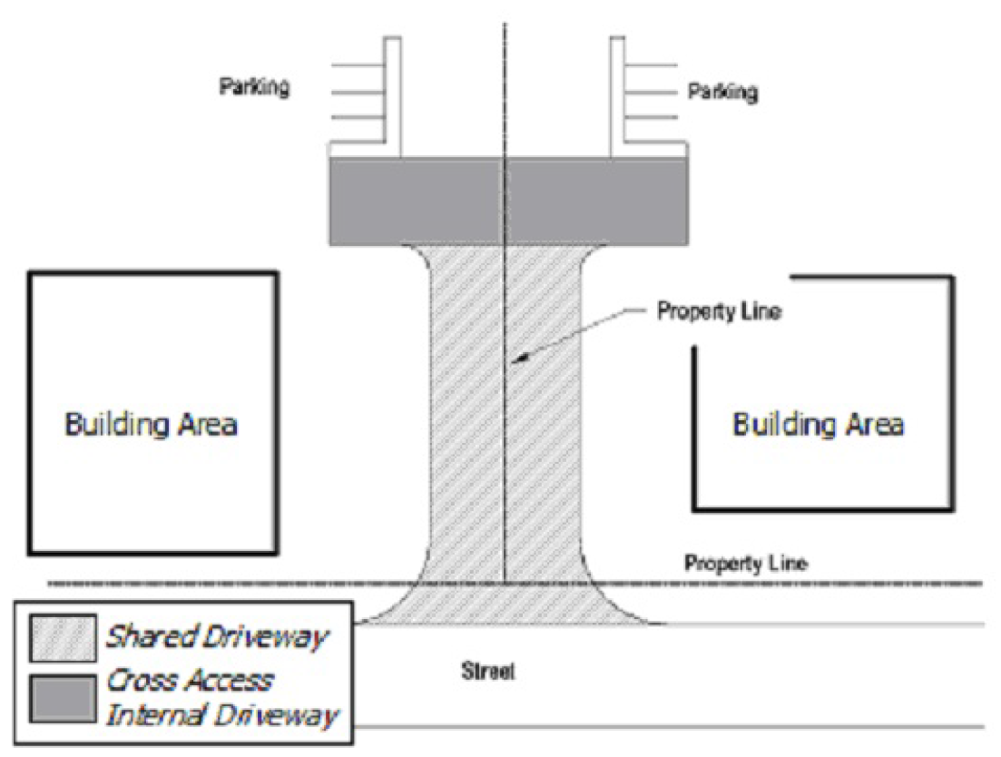
Figure 3-1: Shared Access Driveway & Cross Access Internal Driveway
(b)
Type II and Type III Driveway Approaches and Cross Access Internal Driveways. Cross access easements for internal driveways are encouraged by the City in order to minimize the number of driveway cuts on streets, thereby maintaining street mobility, and to facilitate traffic flow between adjacent lots. (See Figure 3-1.)
(1)
May Be Required. A cross access easement(s) for an internal driveway(s) may be required between adjacent lots;
(2)
Location and Dimension. The location and dimensions of such easement(s) shall be determined by the Planning Director and City Engineer.
(3)
Easement on Plats. Such easements shall be noted on the Preliminary Plat and Final Plat with the language specified as part of the City's application requirements.
(Ord. No. 8-2010, pt. 1(Exh. A), 4-22-10; Ord. No. 12-2010, pt. A (Exh. A), 6-10-10)
Section 3.2.11.1 - Purpose, Definitions, and Methods
(a)
Purpose. It is the purpose of this Division 11 to promote the public health, safety, and welfare and to minimize public and private losses due to flood conditions in specific areas by provisions designed to achieve the following:
(1)
Protect human life and health;
(2)
Minimize expenditure of public money for costly flood control projects;
(3)
Minimize the need for rescue and relief efforts associated with flooding and generally undertaken at the expense of the general public;
(4)
Minimize damage to public facilities and utilities such as water and gas mains, electric, telephone and sewer lines, streets and bridges located in floodplains;
(5)
Help maintain a stable tax base by providing for the sound use and development of all areas in such a manner as to minimize future flood blight areas;
(6)
Insure that potential buyers are notified that property is in a flood area;
(7)
Secure review and approval of the method for handling and disposing of stormwater runoff in the City of Abilene and its extraterritorial jurisdiction, and securing review, analysis, and approval by the appropriate authority of the design, construction, and maintenance of drainageway facilities in conformance with the Abilene Stream Management Plan and Abilene Drainage Standards;
(8)
Impose standards and conditions upon the excavating, grading, filling, berming, and diking of the land within the City of Abilene in conformance with the Abilene Stream Management Plan and Abilene Drainage Standards;
(9)
Minimize the danger that materials may be swept onto other lands causing injury to others;
(10)
Insure the safety of access to property in time of flood for ordinary and emergency vehicles; and
(11)
Minimize prolonged business interruptions.
(b)
Definitions. Unless specifically defined below, words or phrases used in this Division 11 shall be interpreted to give them the meaning they have in common usage and to give the provisions of this Division their most reasonable application.
(1)
Abilene Drainage Standards. The criteria, standards and specifications for storm drainage, streets, and earth change adopted by the City of Abilene.
(2)
Appeal. A request for a review of the Floodplain Administrator's interpretation of any provisions of this ordinance or a request for a variance.
(3)
Area of Shallow Flooding. A designated AO Zone on a community's Flood Insurance Rate Map (FIRM) with a one percent or greater chance of flooding to an average depth of one to three feet where a clearly defined channel does not exist, where the path of flooding is unpredictable, and where velocity flow may be evident. Such flooding is characterized by ponding or sheet flow.
(4)
Area of Special Flood Hazard. The land in a floodplain within a community subject to a one percent or greater chance of flooding in any given year. The area may be designated as Zone A on the FIRM. After detailed ratemaking has been completed in preparation for publication of the FIRM, Zone A usually is refined into Zones A, AO, AH, A1-30, AE, A99, AR, AR/A1-30, AR/AE, AR/AO, AR/AH, AR/A, VO, or V1-30, VE, or V. For purposes of these regulations, the term "area of special flood hazard" is synonymous in meaning with the phrase "Special flood hazard area".
(5)
Base Flood. The flood having a one percent chance of being equaled or exceeded in any given year.
(6)
Base Flood Elevation (BFE). The elevation shown on the Flood Insurance Rate Map (FIRM) and found in the accompanying Flood Insurance Study (FIS) for Zones A, AE, AH, A1—A30, AR, V1—V30, or VE that indicates the water surface elevation resulting from the flood that has a 1% chance of equaling or exceeding that level in any given year, also called the Base Flood.
(7)
City. The City of Abilene and all lands located within the extraterritorial jurisdiction.
(8)
Critical Feature. An integral and readily identifiable part of a flood protection system, without which the flood protection provided by the entire system would be compromised.
(9)
Detention. The temporary storage and controlled release of stormwater runoff.
(10)
Detention Facility. A facility that provides temporary storage of stormwater runoff and controlled release of this runoff.
(11)
Development. Any man-made change to improved or unimproved real estate, including but not limited to buildings or other structures, mining, dredging, filling, grading, paving, excavation, drilling operations, or storage of equipment or materials.
(12)
Drainage Facilities. Includes all elements necessary to convey stormwater runoff from its initial contact with earth to its disposition in an existing drainageway, and said drainageway facilities shall consist of both public and private storm sewers (closed conduits), improved channel constructed in conformity with adopted Abilene Drainage Standards, unimproved drainageways left in their natural condition, areas covered by restricted drainageways, easements for the purpose of providing overland flow and all appurtenances to the foregoing, including inlets, manholes, junction boxes, headwalls, dissipators, culverts, etc.
(13)
Drainage Plan. A plan which consists of engineering drawings, contour maps, and all supporting engineering calculations, as applicable to the land area covered by the plan, which are required to demonstrate full compliance with the Stormwater Management Requirements and the Abilene Drainage Standards.
(14)
Earth Change. Excavating, grading, filling, berming, or diking of land.
(15)
Elevated Building. A nonbasement building: (i) built, in the case of a building in Zones A1—30, AE, A, A99, AO, B, C, X, and D, to have the top of the elevated floor elevated above the ground level by means of piling, columns (posts and piers), or shear walls parallel to the flow of the water; and (ii) adequately anchored so as not to impair the structural integrity of the building during a flood of up to the magnitude of the base flood. In the case of Zones A1—30, AE, A, A99, AO, B, C, X, D, "elevated building" also includes a building elevated by means of fill or solid foundation perimeter walls with openings sufficient to facilitate the unimpeded movement of floodwaters.
(16)
Existing Construction. For the purpose of determining rates, structures for which the "start of construction" commenced before the effective date of the FIRM or before January 1, 1975, for FIRMs effective before that date. "Existing construction" may also be referred to as "existing structures."
(17)
Existing Manufactured Home Park or Subdivision. A manufactured home park or subdivision for which the construction of facilities for servicing the lots on which the manufactured homes are to be affixed (including, at a minimum, the installation of utilities, either final site grading or the pouring of concrete pads, and the construction of streets) is completed before the effective date of floodplain management regulations adopted by a community.
(18)
Expansion to an Existing Manufactured Home Park or Subdivision. The preparation of additional sites by the construction of facilities for servicing the lots on which the manufactured homes are to be affixed (including the installation of utilities, either final site grading or pouring of concrete pads, or the construction of streets).
(19)
Flood or Flooding. A general and temporary condition of partial or complete inundation of normally dry land areas from:
a.
The overflow of inland or tidal waters.
b.
The unusual and rapid accumulation of runoff of surface waters from any source.
(20)
Flood Hazard Boundary Map (FHBM). An official map of a community, issued by the Federal Emergency Management Agency, where the areas within the boundaries of special flood hazards have been designated as Zone A.
(21)
Flood Insurance Rate Map (FIRM). An official map of a community on which the Federal Emergency Management Agency has determined both the areas of special flood hazards and the risk premium zones applicable to the community.
(22)
Flood Insurance Study. The official report provided by the Federal Emergency Management Agency. The report contains flood profiles, the water surface elevation of the base flood, as well as the Flood Hazard Boundary Map.
(23)
Floodplain Administrator. The official designated by the City Manager to administer this ordinance, or an authorized representative.
(24)
Floodplain or Flood-prone Area. Any land area susceptible to being inundated by water from any source (see definition of flooding).
(25)
Flood Protection System. Those physical structural works for which funds have been authorized, appropriated, and expended and which have been constructed specifically to modify flooding in order to reduce the extent of the areas within a community subject to a "special flood hazard" and the extent of the depths of associated flooding. Such as system typically includes hurricane tidal barriers, dams, reservoirs, levees or dikes. These specialized flood-modifying works are those constructed in conformance with sound engineering standards.
(26)
Floodway Development Permit. A permit required prior to building construction or earth change of any property within a designated floodway.
(27)
Floodway (Regulatory Floodway). The channel of a river or other watercourse and the adjacent land areas that must be reserved in order to discharge the base flood without cumulatively increasing the water surface elevation more than one foot.
(28)
Habitable Floor. Any floor usable for living purposes, which includes working, sleeping, eating, cooking or recreation, or a combination thereof. A floor used for storage purposes only (such as storage of cars) is not a "habitable floor."
(29)
Highest Adjacent Grade. The highest natural elevation of the ground surface prior to construction next to the proposed walls of a structure.
(30)
Historic Structure. Any structure that is:
a.
Listed individually in the National Register of Historic Places (a listing maintained by the Department of Interior) or preliminarily determined by the Secretary of the Interior as meeting the requirements for individual listing on the National Register;
b.
Certified or preliminarily determined by the Secretary of the Interior as contributing to the historical significance of a registered historic district or a district preliminarily determined by the Secretary to qualify as a registered historic district;
c.
Individually listed on a state inventory of historic places in states with historic preservation programs which have been approved by the Secretary of the Interior; or
d.
Individually listed on a local inventory of historic places in communities with historic preservation programs that have been certified either:
1.
By an approved state program as determined by the Secretary of the Interior, or
2.
Directly by the Secretary of the Interior in states without approved programs.
(31)
Impervious Surface. Any surface with a runoff coefficient based on the Rational Method of runoff calculation with a value equal to or greater than 0.85. Examples of impervious surfaces include roofs, pavement, and compacted base material.
(32)
Levee. A man-made structure, usually an earthen embankment, designed and constructed in accordance with sound engineering practices to contain, control, or divert the flow of water so as to provide protection from temporary flooding.
(33)
Levee System. A flood protection system which consists of a levee, or levees, and associated structures, such as closure and drainage devices, which are constructed and operated in accordance with sound engineering practices. At a minimum, they are to meet all Federal Emergency Management Agency Requirements.
(34)
Lowest Floor. The lowest floor of the lowest enclosed area (including basement). An unfinished or flood-resistant enclosure, usable solely for parking of vehicles, building access or storage in an area other than a basement area is not considered a building's lowest floor; provided that such enclosure is not built so as to render the structure in violation of the applicable non-elevation design requirement of Section 60.3 of the National Flood Insurance Program regulations.
(35)
Major Drainage System. The 100-year frequency flood shall be contained within the right-of-way or dedicated easement of all major drainage systems. These facilities include floodways, improved channels, detention reservoirs, and overland swales.
(36)
Manufactured Home. See Chapter 5, Article 1, Division 1, Section 5.1.1.3, Paragraph (a)(59) DWELLING, MANUFACTURED HOME (HUD-CODE). The term "manufactured home" does not include a "recreational vehicle".
(37)
Mean Sea Level. For purposes of the National Flood Insurance Program, the National Geodetic Vertical Datum (NGVD) of 1929 or other datum, to which base flood elevations shown on a community's Flood Insurance Rate Map are referenced.
(38)
Natural. The cover and topography of land before any man-made changes, or in areas where there have already been man-made modifications, the state of the area and topography of land on April 30, 1983.
(39)
New Construction. For floodplain management purposes, structures for which the "start of construction" commenced on or after the effective date of a floodplain management regulation adopted by a community.
(40)
New Manufactured Home Park or Manufactured Home Subdivision. A parcel (or contiguous parcels) of land divided into two or more manufactured home lots for rent or sale for which the construction of facilities for servicing the lot on which the manufactured homes are to be affixed (including, at a minimum, the installation of utilities, either final site grading or the pouring of concrete pads, and the construction of streets) is completed on or after April 30, 1983.
(41)
Recreational Vehicle. A vehicle which is:
a.
Built on a single chassis;
b.
Four hundred (400) square feet or less when measured at the largest horizontal projection;
c.
Designed to be self-propelled or permanently towable by a light duty truck; and
d.
Designed primarily not for use as a permanent dwelling but as temporary living quarters for recreational, camping, travel, or seasonal use.
(42)
Regulatory Flood. The flood having a one percent chance of being equaled or exceeded in any given year based upon the existing conditions, adopted Floodwater Management Policies, and the Stormwater Management Requirements of the Subdivision Regulations.
(43)
Sedimentation Facilities. Including but not limited to land terraces, hay bales, and vegetation groundcovers used to reduce transport of suspended solids.
(44)
Start of Construction. Includes substantial improvements and means the date the building permit was issued, provided the actual start of construction, repair, reconstruction, rehabilitation or addition, placement, or other improvement was within 180 days of the permit date. The actual start means either the first placement of permanent construction of a structure on a site, such as the pouring of slab or footings, the installation of piles, the construction of columns, or any work beyond the stage of excavation; or the placement of a manufactured home on a foundation. Permanent construction does not include land preparation, such as clearing, grading and filling; nor does it include the installation of streets and/or walkways; nor does it include excavation for basement, footings, piers or foundations or the erection of temporary forms; nor does it include the installation on the property of accessory buildings, such as garages or sheds not occupied as dwelling units or not part of the main structure. For substantial improvement, the actual start of construction means the first alteration of any wall, ceiling, floor or other structural part of a building, whether or not that alteration affects the external dimensions of the building.
(45)
Structure. A walled and roofed building that is principally above ground, as well as a manufactured home.
(46)
Substantial Damage. Damage of any origin sustained by a structure whereby the cost of restoring the structure to its before damaged condition would equal or exceed fifty percent (50%) of the market value of the structure before the damage occurred.
(46)
Substantial Improvement. Within a regulatory floodplain or floodway, any reconstruction, rehabilitation, addition or other improvement of a structure, the cost of which equals or exceeds fifty percent (50%) of the market value of the structure before the start of construction of the improvement. This term includes structures which have incurred "substantial damage," regardless of the actual repair work performed. The term does not, however, include either:
a.
Any project for improvement of a structure to correct existing violations of State or local health, sanitary, or safety code specifications which have been identified by the local code enforcement official and which are the minimum necessary to assure safe living conditions, or
b.
Any alteration of a "historic structure," provided that the alteration will not preclude the structure's continued designation as a "historic structure,"
c.
Routine maintenance, minor repairs, painting, or similar improvements.
(47)
Variance. A grant of relief to a person from the requirements of this Division 11 when specific enforcement would result in unnecessary hardship. A variance, therefore, permits construction or development in a manner otherwise prohibited by this Section.
(48)
Violation. The failure of a structure or other development to be fully compliant with the community's floodplain management regulations. A structure or other development without the elevation certificate, other certifications, or other evidence of compliance with these requirements is presumed to be in violation until such time as that documentation is provided.
(49)
Water Surface Elevation. The height in relation to the National Geodetic Vertical Datum (NGVD) of 1929 (or other datum, where specified), of floods of various magnitudes and frequencies in the floodplains of coastal or riverine areas.
(c)
Methods for Reducing Flood Losses. In order to accomplish its purpose, this Division 11 uses the following methods:
(1)
Limit runoff from development to a level not to exceed that runoff that would exist under natural, undeveloped conditions unless provided for in a regional detention facility. The "natural" state shall be as defined in subsection (b) Definitions, above.
(2)
Restrict or prohibit uses that are dangerous to health, safety, or property in times of flood, or cause increases in flood heights or velocities.
(3)
Require that uses vulnerable to floods, including facilities which serve such uses, be protected against flood damage at the time of initial construction.
(4)
Control the alteration of natural floodplains, stream channels, and natural protective barriers, which are involved in the accommodation of floodwaters.
(5)
Control filling, grading, dredging and other development which may increase flood damage.
(6)
Prevent or regulate the construction of flood barriers which will unnaturally divert floodwaters or which may increase flood hazards to other lands.
(Ord. No. 8-2010, pt. 1(Exh. A), 4-22-10; Ord. No. 27-2015, pt. 1(Exh. A), 5-14-15; Ord. No. 10-2016, pt. 1(Exh. A), 2-25-16; Ord. No. 33-2023, pt. 1(Exh. A), 7-13-23)
Section 3.2.11.2 - General Provisions
(a)
Lands to Which This Section Applies. This Division 11 shall apply to all areas within the City of Abilene and its extraterritorial jurisdiction.
(b)
Proper Drainage, Plans, Approval. All subdivisions shall be designed to convey the flow of stormwater without damage to persons or property. The subdivision shall be designed to ensure drainage at all points along streets and provide positive drainage away from building sites while, simultaneously, preventing discharge of runoff onto adjacent properties.
(c)
Responsibility. All drainage facilities required in accordance with this chapter shall be installed and paid for by the subdivider in accordance with applicable standards and specifications of the City of Abilene.
(d)
Additional Standards and Requirements. All plans for drainage control shall be consistent with requirements of Article 2, Division 11 of this Chapter as well as with local and regional drainage plans. All plans for drainage control shall also be subject to approval by the City Engineer or his duly authorized representative.
(e)
Basis for Establishing the Areas of Special Flood Hazard. The areas of special flood hazard identified by the Federal Emergency Management Agency in a specific engineering report entitled "The Flood Insurance Study for the City of Abilene," dated January 06, 2012, with accompanying Flood Insurance Rate Maps and Flood Hazard Boundary-Floodway Maps and any revision thereto are hereby adopted by reference and declared to be a part of this LDC of the City of Abilene.
(f)
Drainage Standards. The Floodplain Administrator shall apply standards, where applicable, for drainageway facilities and stormwater detention facilities which shall become adopted "Abilene Drainage Standards" after the same are approved by resolution of the Abilene City Council. Said Abilene Drainage Standards shall be followed by every person, firm, corporation in the construction, installation, and maintenance of drainageway facilities and stormwater detention facilities. The Abilene Drainage Standards, as adopted, may be amended by City Council resolution. The adopted Abilene Drainage Standards shall regulate the design, installation, utilization and maintenance of all detention and drainage facilities and structures; the design, installation, utilization and maintenance of sedimentation and erosion control procedures, facilities and structures; and shall establish acceptable methods for controlling soil sedimentation and erosion.
(g)
Establishment of Floodway Development Permit. A Floodway Development Permit shall be required to ensure conformance with the provisions of this Division 11.
(h)
Compliance. No structure or land shall hereafter be located, altered, or have its use changed without full compliance with the terms of this Division and other applicable regulations. The provisions of this Section shall apply to and be binding upon every person, firm, or corporation who seeks to develop, redevelop, grade, excavate, fill, berm, or dike land within the City of Abilene.
(i)
Abrogation and Greater Restrictions. The requirements of this Division are not intended to repeal, abrogate, or impair any existing easements, covenants, or deed restrictions. However, where this ordinance and another conflict or overlap, whichever imposes the more stringent restrictions shall prevail.
(j)
Interpretation. In the interpretation and application of this Division, all provisions shall be:
(1)
Considered as minimum requirements;
(2)
Liberally construed in favor of the purpose of this Division; and
(3)
Deemed neither to limit nor repeal any other powers granted under State statutes.
(k)
Warning and Disclaimer of Liability. The degree of flood protection required by this Division is considered reasonable for regulatory purposes and is based on scientific and engineering considerations. On rare occasions, greater floods can and will occur and flood heights may be increased by man-made or natural causes. These regulations do not imply that land outside the areas of special flood hazards or uses permitted within such areas will be free from flooding or flood damages. The requirements of this Division shall not create liability on the part of the City of Abilene or any official or employee thereof for any flood damages that result from reliance on this Division or any administrative decision lawfully made thereunder.
(l)
Localized Flooding Areas. A map depicting the drainage areas which contribute to localized flooding problems shall become adopted as the "Localized Flooding Areas Map" after the same is approved by resolution of the Abilene City Council. The map as adopted may be amended by City Council resolution. The map will serve as the basis for application for the stormwater management criteria to individual developments.
(Ord. No. 8-2010, pt. 1(Exh. A), 4-22-10; Ord. No. 33-2023, pt. 3(Exh. A), 7-13-23)
Section 3.2.11.3 - Standards for Subdivision Plats
(a)
Consistency Required. All subdivision plats shall be consistent with all provisions of this Division 11.
(b)
Requirements. All plats for the development of subdivisions shall meet Floodway Development Permit requirements of Section 3.2.11.5, in addition to the provisions of Section 3.2.11.6 and the Drainage Plan requirements of Section 3.2.11.4.
(c)
Base Flood Elevation Data. Base flood elevation data shall be provided for all subdivision plats and other proposed development, if applicable. In designated special flood hazards (A Zones) where there is neither water surface elevation data nor an identified floodway or costal high hazard area, the community shall require new subdivision proposals and other proposed development (including proposals for manufactured home parks and subdivisions) greater than 50 lots or 5 acres, whichever is the lesser, to include within such proposals Base Flood Elevation data.
(d)
Manufactured Home Parks and Subdivisions.
(1)
All subdivision plats including manufactured home parks and subdivisions shall have adequate drainage provided to reduce exposure to flood hazards.
(2)
All subdivision plats including manufactured home parks and subdivisions shall have public utilities and facilities such as sewer, gas, electrical, and water systems located and constructed to minimize flood damage.
(e)
Provisions Prior to Final Approval of Plats. Prior to final approval of a Final Plat, the developer shall provide either:
(1)
Actual construction of all approved drainage and detention facilities required by the City of Abilene; or
(2)
Sufficient surety bond, trust agreement, performance bond, or an irrevocable letter of credit approved by the Floodplain Administrator and City Attorney guaranteeing the developer's pro-rata share of construction of all required drainageway and detention facilities in accordance with an approved Drainage Plan (in conjunction with approved Construction Plans) and duly adopted Abilene Drainage Standards; or
(3)
An alternative form of assurance proposed by the developer to guarantee the developer's pro-rata share of construction of all required drainageway and detention facilities in accordance with an approved Drainage Plan (in conjunction with approved Construction Plans) and the adopted Abilene Drainage Standards, said alternative form of assurance having been accepted by the Abilene Floodplain Administrator.
(Ord. No. 8-2010, pt. 1(Exh. A), 4-22-10; Ord. No. 33-2023, pt. 4(Exh. A), 7-13-23)
Section 3.2.11.4 - Drainage Plans
(a)
Drainage Plans. A Drainage Plan, as defined and regulated by the provisions of this Section, shall be submitted to and approved by the Floodplain Administrator as part of the requirements for Construction Plans for any subdivision of land or site plan. Property not located in areas of special flood hazard as defined herein, and where no improvements are required, shall not be required to submit a Drainage Plan.
(b)
Responsible Official. The Floodplain Administrator shall be the responsible official for a Drainage Plan.
(c)
Determination of Requirement in Relation to a Floodway Development Permit. Prior to the Floodplain Administrator's approval of any Floodway Development Permit, and prior to the issuance of a building permit or a Site Development Permit for the construction of a parking lot, when a Drainage Plan has not been previously required under the terms of this Section, the Floodplain Administrator shall determine whether a Drainage Plan should be required and may require such plan in such instances where the same is necessary to meet the purposes of this Section.
(1)
In general, development on a tract of less than one-half (½) acre that has less than forty-five percent (45%) impervious surface will not be required to submit a formal Drainage Plan.
(2)
Development which creates less than twenty thousand (20,000) total square feet of impervious surface on the site will not be required to submit a formal Drainage Plan. This calculation is determined as new impervious surface from its natural state as defined in Section 3.2.11.1(b) Definitions for "Natural".
(3)
Development located within the following designated infill areas will not be required to submit a formal Drainage Plan:
a.
The Central Business District, as defined in the City's adopted Comprehensive Plan.
b.
Infill development corridors, as defined in the City's Infill Development Strategy, excluding East Highway 80.
(4)
When a Drainage Plan is required prior to issuance of a Building Permit, the structure for which the Building Permit has been obtained shall not be used or occupied until the facilities as shown on the approved Drainage Plan have been completed by the permit applicant and accepted by the Floodplain Administrator.
(5)
An updated Drainage Plan is required when associated with a revised site plan where drainage plans have been previously approved.
(d)
Required Submissions and Technical Data. All Drainage Plans shall be prepared by a registered professional engineer licensed by the State of Texas.
(1)
Drainage Plans submitted for final approval shall bear the signature of the submitting engineer and the following certification:
"I hereby certify that I am familiar with the adopted ordinances and regulations of the City of Abilene governing detention and drainage facilities; that these plans have been prepared under my direct engineering supervision; and that the above and foregoing Drainage Plan complies with all governing ordinances and the adopted drainage standards of the City of Abilene pertaining to detention and drainage facilities to the best of my knowledge, information and belief."
(2)
Upon completion of the proposed improvements, a certification from a contractor or registered professional engineer shall be provided similar to the following certification:
"I hereby certify that the detention improvements were constructed and completed in accordance with the approved Drainage Plans."
(e)
Plan Elements. A Drainage Plan shall consist of engineering drawings, contour maps, and all supporting engineering calculations, as applicable to the land area covered by the Plan which are required to demonstrate full compliance with the requirements of this Division and Abilene's adopted Drainage Standards.
(f)
Requirements in Areas of Special Flood Hazards. Drainage Plans for developments in areas of special flood hazard shall also contain the following:
(1)
Elevation in relation to mean sea level of the lowest habitable floor (including basement) of all proposed structures;
(2)
Elevation in relation to mean sea level to which any residential and nonresidential structure shall be floodproofed;
(3)
A certificate from a registered professional engineer or architect that to the best of their knowledge the nonresidential floodproofed structure shall meet the floodproofing criteria of Section 3.2.11.6 and applicable building codes; and
(4)
Description of the extent to which any watercourse or natural drainage will be altered or relocated as a result of proposed development.
(g)
Administration of Drainage Plans.
(1)
Processing of Drainage Plans. All Drainage Plans as required by this Section shall be submitted to and received by the Floodplain Administrator. A conference to discuss the Drainage Plan may be held with the Floodplain Administrator, but only after Construction Plans have been officially submitted.
a.
Within ten (10) working days after receipt of a properly completed Drainage Plan (also refer to Chapter 1, Section 1.2.1.2), the Floodplain Administrator shall either approve or deny the submitted plan.
b.
Approval of a submitted Drainage Plan shall only constitute acceptance by the Floodplain Administrator of the certification of the submitting engineer and such acceptance shall not operate to remove any requirement of Abilene's adopted Drainage Standards which are not specifically considered in the approved plan.
c.
Drainage Plans which meet the requirements of this ordinance and which conform to all requirements of the adopted Abilene Drainage Standards shall be approved.
d.
If the required findings cannot be made based upon the information contained in the submitted plan, such additional information as is required by the Floodplain Administrator to make such determination will be identified; in the event that the information deficiency is of a technical nature, the Floodplain Administrator may request an engineering conference with the submitting engineer.
e.
If a submitted Drainage Plan is denied, the certifying engineer or applicant, as applicable, shall be advised in writing of the disapproval.
(Ord. No. 8-2010, pt. 1(Exh. A), 4-22-10; Ord. No. 12-2010, pt. A (Exh. A), 6-10-10; Ord. No. 27-2015, pt. 1(Exh. A), 5-14-15; Ord. No. 39-2015, pt. 1(Exh. A), 8-13-15)
Section 3.2.11.5 - Floodway Development Permits
(a)
Floodway Development Permit Requirements. A Floodway Development Permit, as defined and regulated by this Division, shall be required prior to the commencement of any building construction, or earth change, of any property within a designated floodway. Floodway Development Permits shall not be required for activities listed in 3.2.11.2(b) [3.2.11.5(b)]. A separate permit shall be required for each separate, noncontiguous site or lot, and no permit shall be transferable without the prior written consent of the Floodplain Administrator.
(b)
Floodway Development Permit Exemptions. A Floodway Development Permit shall not be required for the following activities:
(1)
Bona fide agricultural and farming operations which constitute the principal use of any lot or tract of ground in the City of Abilene and which meets the requirements of the zoning regulations within Chapter 2 of this LDC.
(2)
Customary and incidental routine grounds maintenance, landscaping, and home gardening which does not require a permit, a zoning variance, or a building permit, and which does not affect stormwater drainage through the site.
(3)
Emergency repairs of a temporary nature made on public or private property which are necessary for the preservation of life, health, or property, and which are made under such circumstances where it would be impossible or impracticable to obtain a Floodway Development Permit.
(4)
Excavation for the purpose of constructing, installing, maintaining, or repairing any public street, public utility facility, or any service lines related thereto.
(c)
Floodway Development Permit Application. A written application for a Floodway Development Permit shall be filed with the Floodplain Administrator. Applications shall be in such form and content as the Floodplain Administrator shall establish, and shall be accompanied by the payment of a permit fee, the amount of which shall be determined by fee resolution by the City Council and placed on file in the office of the City Secretary.
(d)
Contents of Permit Application. Each Floodway Development Permit application shall include all the information specified within paragraphs (1) through (6) below. Provided, however, that if the Floodplain Administrator is unable to determine from the application submitted that it meets the policies and standards governing the issuance of the requested permit, the Floodplain Administrator shall request the applicant in writing to furnish such additional information as may be essential to such determination. This Section governing the contents of Floodway Development Permit applications shall not require the resubmission of any documents, drawings, or other information which was previously submitted by the applicant in conjunction with the processing of a Drainage Plan approved since April 30, 1983, by the Floodplain Administrator for the same site and type of development.
(1)
The name and address of the legal owner of the property for which the permit is requested.
(2)
A vicinity sketch and boundary line survey of the site for which a permit is requested, including a legal description of such property.
(3)
Site drawings indicating each separate land area to be excavated, filled, graded, or leveled, the finished depth of each separate land cut or fill, the present and future (as completed) points of entry and discharge for surface water on the subject property and identification of all temporary or permanent structures or other devices to be erected or established for the purpose of controlling or regulating surface water and erosion on such property.
(4)
The applicant's plans for controlling erosion and sedimentation for the purpose of preventing the deposit of sediment from the lot or tract under application upon any other public or private property or watercourse during all phases of project construction.
(5)
The applicant's plans for receipt of surface water on his property and discharge of surface water from his property during periods of construction, and a statement specifying the anticipated time period for the completion of all drainage and related improvements.
(6)
For developments in areas of special flood hazard, the requirements of Section 3.2.11.6 must be addressed within the Floodway Development Permit application.
(e)
Processing Permits. Within twenty (20) working days after receipt of a complete application for a Floodway Development Permit application (also refer to Chapter 1, Section 1.2.1.2), the Floodplain Administrator shall either approve or deny the permit application.
(1)
If the required findings cannot be made based upon the information contained in the submitted permit application, the general nature of such additional information as is required by the Floodplain Administrator to make such determination will be identified. In the event that the information deficiency is of a technical nature, the Floodplain Administrator may additionally request an engineering conference with the submitting engineer.
(2)
If a Floodway Development Permit is denied, the certifying engineer or applicant shall be advised in writing of the denial with an explanation for such.
(f)
Conditions for Approval. Floodway Development Permits shall meet the following conditions:
(1)
No earth change shall be permitted which creates a public hazard upon any property within the City of Abilene through the obstruction, impairment, sedimentation, blockage or alteration of any storm sewer drain or any existing surface watercourse.
(2)
No earth change shall be permitted which will channelize, obstruct, or impede any watercourse in a manner which is inconsistent with accepted engineering practices and/or the adopted Drainage Standards of the City of Abilene. (Also see Site Preparation, Chapter 4, Article 1, Division 2 [Division 3].)
(3)
All earth changes shall be designed, constructed, and completed in a manner which minimizes the exposure of bare earth to precipitation.
(4)
No earth change shall be permitted which will increase surface runoff to a level, amount or a rate greater than that existing under natural conditions, except runoff which has been provided for through use of an approved regional detention facility.
(5)
Construction activity on residential tracts or commercial and industrial tracts shall be conducted only if appropriate sedimentation facilities are installed and maintained throughout the construction period in accordance with the adopted Abilene Drainage Standards.
(6)
As may be applicable to any lot, parcel, or tract of land for which an approved Drainage Plan exists, the requirements and conditions of the Drainage Plan shall be incorporated as a condition upon the issuance of any Floodway Development Permit.
(7)
In the regulatory floodway, Floodway Development Permits may not be issued until the standards of this Division have been satisfied and until evidence has been presented demonstrating that the proposed encroachment:
a.
Will not result in any increase in floodway levels within the community during the occurrence of the base flood discharge; and
b.
Is consistent with the Abilene Stream Management Plan and Abilene Drainage Standards; and
c.
Meets the standards of this Division including, specifically, Section 3.2.11.6 concerning special provisions for flood hazard reduction in areas of special flood hazard.
(8)
Prior to granting any Floodway Development Permit, the Floodplain Administrator shall attach such additional conditions thereto as he may deem reasonable and necessary to prevent hazard to public or private property resulting from the blockage, obstruction, alteration, or impairment of any storm sewer drain or surface watercourse and to prevent the work thereby authorized from being conducted in a manner hazardous to lives or property, or otherwise likely to create a public nuisance.
(9)
Requirements established and approved by the Floodplain Administrator shall become conditions upon the issuance of the Floodway Development Permit; no changes in approved plans, design standards, or conditions shall be made without prior written approval of the Floodplain Administrator.
(g)
Map Amendment. Where an approved Floodway Development Permit has been issued and the proposed improvements will result in changes in the floodway boundary, the Floodplain Administrator may immediately take the appropriate steps necessary to secure a map amendment.
(Ord. No. 8-2010, pt. 1(Exh. A), 4-22-10; Ord. No. 12-2010, pt. A (Exh. A), 6-10-10)
Section 3.2.11.6 - Special Provisions for Flood Hazard Reduction in Areas of Special Flood Hazard
(a)
General Standards. In all areas of special flood hazards, the following general provisions shall prevail:
(1)
All new construction or substantial improvements shall be designed (or modified) and adequately anchored to prevent flotation, collapse or lateral movement of the structure resulting from hydrodynamic and hydrostatic loads, including the effects of buoyancy;
(2)
All new construction or substantial improvements shall be constructed by methods and practices that minimize flood damage;
(3)
All new construction or substantial improvements shall be constructed with materials resistant to flood damage;
(4)
All new construction or substantial improvements shall be constructed with electrical, heating, ventilation, plumbing, and air-conditioning equipment and other service facilities that are designed and/or located so as to prevent water from entering or accumulating within the components during conditions of flooding;
(5)
All new and replacement water supply systems shall be designed to minimize or eliminate infiltration of floodwaters into the system;
(6)
New and replacement sanitary sewer systems shall be designed to minimize or eliminate infiltration of floodwaters into the system and discharge from the systems into floodwaters;
(7)
On-site waste disposal systems shall be located to avoid impairment to them or contamination from them during flooding; and
(8)
All applicable building codes of the City of Abilene.
(b)
Specific Standards. In all areas of special flood hazards where base flood elevation data has been provided as set forth in this Division, the following provisions are required.
(1)
Residential Construction. New construction and substantial improvement of any residential structure shall have the lowest floor (including basement), elevated to one foot (1') above the base flood elevation or eighteen inches (18") above the gutter whichever is most restrictive. For a hillside lot in an area of special flood hazard, the eighteen (18) inch above gutter requirement may be waived by an approved Drainage Plan prepared by a registered professional engineer that demonstrates that the residence is safe from flooding. A registered professional engineer, architect or land surveyor shall submit a certification in the specified format to the City Engineer that the standard of this subsection is satisfied. Such certification shall include both the elevation relative to base flood and the elevation relative to the gutter or that the construction conforms to the approved Drainage Plan.
(2)
Nonresidential Construction. New construction and substantial improvements of any commercial, industrial, or other nonresidential structure shall either have the lowest floor (including basement) elevated to one foot above the base flood level or, together with attendant utility and sanitary facilities, be designed so that below the base flood level the structure is watertight with walls substantially impermeable to the passage of water and with structural components having the capability of resisting hydrostatic and hydrodynamic loads and effects of buoyancy. A registered professional engineer, architect or land surveyor shall develop and/or review structural design, specifications, and plans for the construction, and shall certify that the design and methods of construction are in accordance with accepted standards of practice as outlined in this subsection. A record of such certification which includes the specific elevation (in relation to mean sea level) to which such structures are floodproofed shall be maintained by the Floodplain Administrator.
(3)
Enclosures. New construction and substantial improvements, with fully enclosed areas below the lowest floor that are subject to flooding shall be designed to automatically equalize hydrostatic flood forces on exterior walls by allowing for the entry and exit of floodwaters. Designs for meeting this requirement must either be certified by a registered professional engineer or architect or meet or exceed the following minimum criteria:
a.
A minimum of two (2) openings having a total net area of not less than one (1) square inch for every square foot of enclosed area subject to flooding shall be provided.
b.
The bottom of all openings shall be no higher than one foot (1') above grade.
c.
Openings may be equipped with screens, louvers, valves, or other coverings or devices provided that they permit the automatic entry and exit of floodwaters.
(4)
Manufactured Homes.
a.
Require that manufactured homes or manufactured homes used commercially that are placed or substantially improved within Zones A1—30, AH, AE, and AO on the community's FIRM on sites:
1.
Outside of manufactured home parks or subdivisions,
2.
In a new manufactured home park or subdivision,
3.
In an expansion to an existing manufactured home park or subdivision, or
4.
In an existing manufactured home park or subdivision on which a manufactured home park or subdivision on which a manufactured home has incurred "substantial damage" as a result of a flood be elevated on a permanent foundation such that the lowest floor of the manufactured home is elevated one foot above the base flood elevation and be securely anchored to an adequately anchored foundation system to resist flotation, collapse and lateral movement.
b.
Require that manufactured homes or manufactured homes used commercially to be placed or substantially improved on sites in an existing manufactured home park or subdivision within Zone A, A1—A30, AH and AE, and on the community's FIRM that are not subject to the provision of Subsection (b)(4)a above be elevated so that either:
1.
The lowest floor of the manufactured home is one foot (1') above the base flood elevation, or
2.
The manufactured home chassis is supported by reinforced piers or other foundation elements of at least equivalent strength that are no less than 36 inches in height above grade and be securely anchored to an adequately anchored foundation system to resist flotation, collapse and lateral movement.
c.
Require that manufactured homes or manufactured homes used commercially to be placed on substantially improved sites in an existing manufactured home park or subdivision within Zone AO on the community's FIRM that are not subject to the provisions of Subsection (b)(4)a above be elevated so that either:
1.
The lowest floor of the manufactured home is at the zone depth number, or
2.
The manufactured home chassis supported by reinforced piers or other foundation elements or at least equivalent structures that are not less than 36 inches in height above grade and be securely anchored to an adequately anchored foundation system to resist flotation, collapse and lateral movement.
d.
All manufactured homes shall be in compliance with Subsections (b)(4)a, (b)(4)b, and (b)(4)c, or shall be eighteen inches (18") above gutter, whichever is more restrictive.
e.
Require that all manufactured home parks located within flood-prone areas as defined on the community's FIRM develop a plan for evacuating residents of said parks [and such plan shall] be filed with the City's Emergency Management authorities within ninety (90) days of the passing of this ordinance.
f.
Require that recreational vehicles placed on sites with Zones A1—30, AH, AE and AO on the community's FIRM either:
1.
Be on the site for fewer than one hundred and eighty (180) consecutive days, or
2.
Be fully licensed and ready for highway use, or
3.
Meet the permit requirements of Subsection (b)(4)a, (b)(4)b, or (b)(4)c. A recreational vehicle shall be considered ready for highway use if it is on its own wheels or jacking system, is attached to the site only by quick-disconnect type utilities and security devices and has no permanently attached additions.
g.
Require that manufactured homes or manufactured homes used commercially placed or substantially improved on sites in an existing manufactured home park or subdivision or outside of a manufactured home park or subdivision which lies within the floodway as designated on the community's floodway map must meet the requirement of Subsection (b)(5) below.
h.
Require owners of mobile homes located in areas of special flood hazard to sign before a Notary Public a form prepared by the City that acknowledges that the mobile home is located in a flood hazard area, that the mobile home is subject to damage during a flood and that federal flood insurance is available.
(5)
Floodways. Located within areas of special flood hazard established in 3.2.11.2(b) [3.2.11.2(e)] are areas designated as floodways. Since the area chosen for the regulatory floodway must be designated to carry the waters of the base flood without increasing the water surface elevation of that flood more than one foot (1') at any point; and since the floodway is an extremely hazardous area due to the velocity of floodwaters which carry debris, potential projectiles and erosion potential, the following provisions shall apply:
a.
Encroachments, including fill, new construction, substantial improvements, earth changes and other developments will not be permitted except when an approved Floodway Development Permit has been secured demonstrating that the proposed encroachment:
1.
Will not result in any increase in flood levels within the community during the occurrence of the base flood discharge; and
2.
Is consistent with the Abilene Stream Management Plan and Abilene Drainage Standards; and
3.
Meets the standards of this ordinance and specifically Section 3.2.11.5, Floodway Development Permits, and Section 3.2.11.6 Special Provisions for Flood Hazard Reduction in Areas of Special Flood Hazard.
b.
The following are exempt from the requirements in above Subsection (b)(5)a:
1.
Bona fide agricultural and farming operations which constitute the principal use of any lot or tract of ground in the City of Abilene and which meet the requirements of the zoning regulations in Chapter 2 and Chapter 4 of this LDC.
2.
Customary and incidental routine ground maintenance, landscaping and home gardening which does not require a zoning amendment, a zoning variance or a building permit, and which does not affect stormwater drainage through the site.
3.
Certain parks and recreational uses which do not affect stormwater drainage through the site.
4.
Emergency repairs of a temporary nature made on public or private property which are necessary for the preservation of life, health, or property and which are under such circumstances where it would be impossible or impracticable to obtain a Floodway Development Permit.
5.
Excavation for the purpose of constructing, installing, maintaining or repairing any public street, public utility facility or any service lines related thereto.
6.
Improvements consistent with the Abilene Stream Management Plan and Abilene Drainage Standards.
(6)
Standards for Areas of Shallow Flooding (AO Zones). Located within the areas of special flood hazard established in Section 3.2.11.2(b) [3.2.11.2(e)] are areas designated as shallow flooding. These areas have special flood hazards associated with base flood depths of one (1') to three feet (3') where a clearly defined channel does not exist and where the path of flooding is unpredictable and indeterminate; therefore, the following provisions apply:
a.
All new construction and substantial improvements of residential structures have the lowest floor (including basement) elevated above the highest adjacent grade at least as high as the depth number specified in feet on the community's FIRM (at least two feet (2') if no depth number is specified).
b.
All new construction and substantial improvements of nonresidential structures:
1.
Have the lowest floor (including basement) elevated above the highest adjacent grade at least as high as the depth specified in feet on the community's FIRM (at least two feet (2') if no depth number is specified), or
2.
Together with attendant utility and sanitary facilities be designated [designed] so that below the base flood level the structure is watertight with walls substantially impermeable to the passage of water and with structural components having the capability of resisting hydrostatic and hydrodynamic loads of effects on buoyancy.
c.
A registered professional engineer, architect, or surveyor shall submit a certification to the Floodplain Administrator that the standards of (6)a, and (6)b.1 of this subsection are satisfied.
d.
A registered professional engineer, architect, or surveyor shall submit a certification to the Floodplain Administrator that the standards of (6)b.2 of this subsection are satisfied.
e.
Require within Zones AH and AO, adequate drainage paths around structures on slopes, to guide floodwaters around and away from proposed structures.
(Ord. No. 8-2010, pt. 1(Exh. A), 4-22-10; Ord. No. 12-2010, pt. A (Exh. A), 6-10-10)
Section 3.2.11.7 - Detention and Drainage Facilities
(a)
Requirements and Standards. On-site stormwater detention shall be required for all new developments to offset increased runoff resulting from new developments except for those developments for which approved regional detention facilities have been established or for which alternate plans have been approved by the City Engineer. Design standards for all stormwater detention and drainage facilities shall be established by adopted Abilene Drainage Standards.
(b)
Title Ownership and Maintenance. Detention and drainage facilities herein provided for shall be dedicated to the public and maintained by the public unless such facilities are an integral, usable part of the development, in which case the ownership and maintenance of said facilities may remain with the private sector. These systems, when retained by the owner shall be maintained by the current and subsequent owners in a manner that will allow them to function as designed. The owner must execute a written maintenance agreement with the City before this option is used and such agreement shall be filed for record at the appropriate county courthouse. These agreements shall be as encumbrances upon the land.
(1)
Major drainage systems not retained by the owner shall be conveyed by title or easement to the City of Abilene as required by the Floodplain Administrator and City Attorney.
(2)
The dedication of a detention facility shall provide that, in the event that the City Council determines that the detention facility is unneeded or unnecessary as a result of drainageway improvements, the same may revert to the party making such dedication, or the abutting owners, or their respective heirs, successors, or assigns.
(3)
All drainage structures and facilities located within a dedicated drainageway shall be owned and maintained by the City of Abilene.
(c)
Private Drainage Facilities. Roof drains, building drains, and parking lot drainageways may be located outside dedicated drainageways.
(Ord. No. 8-2010, pt. 1(Exh. A), 4-22-10; Ord. No. 12-2010, pt. A (Exh. A), 6-10-10)
Section 3.2.11.8 - Alternative Design Standards
(a)
Purpose. It is the purpose of this Section to provide for the consideration of detention and drainage facility designs which differ from the conventional design standards as outlined within this Division of the LDC, but which are based upon sound engineering judgment. Such alternative(s) shall meet the purpose and intent of the standard being varied. In this context, "detention and drainage facilities" shall mean physical improvements such as detention ponds, retention ponds, drainage swales, as well as any other infrastructure element of a proposed development.
(b)
Approval Based on Engineering. Decisions regarding design of such physical improvements in a subdivision should be based on engineering studies. Thus, while this Code provides standards for design, the regulations are not a substitute for sound engineering judgment. Therefore, a licensed engineer may submit alternative designs to be reviewed and considered by the City Engineer, including the option of providing a downstream assessment.
(c)
Relationship to Standards in Division 11. If the proposed alternative design is approved by the City Engineer, then all other applicable provisions of Division 11 shall be deemed to have been met. If the proposed alternative design standards are not approved by the City Engineer, then the standards contained within Division 11 shall apply.
(d)
Appeals to the Planning & Zoning Commission. If a proposed alternative design is rejected by the City Engineer, the subdivider may appeal the decision to the Planning and Zoning Commission. Prior to being considered by the Planning & Zoning Commission, the appeal shall be reviewed by the Development Review Committee (DRC). The DRC shall make a recommendation on the appeal to the Planning & Zoning Commission.
(e)
Decision. The decision of the Planning & Zoning Commission shall be final.
(Ord. No. 8-2010, pt. 1(Exh. A), 4-22-10; Ord. No. 12-2010, pt. A (Exh. A), 6-10-10)
Section 3.2.11.9 - General Administration
(a)
Designation of Floodplain Administrator. The City Manager shall appoint a Floodplain Administrator to administer and coordinate the provisions of this ordinance, and to implement its provisions.
(b)
Duties and Responsibilities of the Administrator. Duties of the Floodplain Administrator shall include but not be limited to the following:
(1)
The Floodplain Administrator shall maintain all files and records pertaining to this ordinance, and shall hold open for public inspection all records pertaining to the provisions of this ordinance. All actions involving an appeal and all variances from the flood hazard regulations shall be reported to the Federal Emergency Management Agency upon request.
(2)
After submission on the appropriate forms, the Floodplain Administrator shall review and approve or deny all applications for Floodway Development Permits or Drainage Plans required by this LDC.
(3)
After submission on the appropriate forms, the Floodplain Administrator shall review permits for proposed development to assure that all necessary permits have been obtained from those Federal, State, or local governmental agencies from which prior approval is required. Applicants shall submit a written certification to the effect that all known Federal, State and local permits have been obtained.
(4)
When interpretation is needed as to exact location of the boundaries of the areas of special flood hazards (for example where there appears to be a conflict between a mapped boundary and actual field conditions) the Floodplain Administrator shall make the necessary interpretation.
(5)
The Floodplain Administrator shall notify adjacent communities and the proper state or federal authorities prior to any alteration or relocation of a watercourse and submit evidence of such notification to the Federal Emergency Management Agency.
(6)
The Floodplain Administrator shall ensure through maintenance agreements and available funding that maintenance is provided in accordance with the Stream Management Plan within the altered or relocated portion of said watercourse so that the flood-carrying capacity is not diminished.
(7)
When base flood elevation data has not been provided in accordance with this Section, the Floodplain Administrator shall obtain, review, and reasonably utilize any base flood elevation data available from a Federal, State, or other source, in order to enforce the provisions of this ordinance.
(8)
The Floodplain Administrator shall be responsible for notifying the Planning Director and the Building Official of all approvals or denials of Floodplain Development Permits and Drainage Plans. Where Drainage Plans are being considered in association with Construction Plans, the Floodplain Administrator shall advise the Planning and Zoning Commission of the status of Drainage Plans prior to consideration of plat documents.
(9)
When a regulatory floodway has not been designated, the Floodplain Administrator must require that no new construction, substantial improvements, or other development (including fill) shall be permitted within Zones A, A1—30 and AE on the community's FIRM, unless it is demonstrated that the cumulative effect of the proposed development, when combined with all other existing and anticipated development, will not increase the water surface elevation of the base flood more than one foot at any point within the community.
(c)
[Reserved.]
(d)
Amendments to Stream Management Plan. The City Council of the City of Abilene may approve amendments and deviations from the Stream Management Plan after conducting a public hearing. Property owners directly affected by the proposed appeal, deviation, or amendments shall be given notice of the meeting in writing prior to the public hearing.
(Ord. No. 8-2010, pt. 1(Exh. A), 4-22-10; Ord. No. 12-2010, pt. A (Exh. A), 6-10-10)
Section 3.2.11.10 - Appeals Process
(a)
Waiver or Deviation Requests to the Board of Adjustment.
(1)
In the same manner and under the same circumstances as generally provided by Chapter 1, Article 1, Division 5 and Chapter 2, Article 2, Division 5 [sic], and except as otherwise specified in this Division, the BOA shall:
a.
Hear and decide requests for variances from the requirements of this Division concerning special flood hazard area regulations;
b.
Hear and determine an appeal when it is alleged there is an error in any requirement, decision, or determination made by any City of Abilene administrative official in the enforcement of Section 3.2.11.6 relating to the flood hazard area regulations.
(2)
Waivers or deviations shall not be issued within any designated floodway if any increase in flood levels during the base flood discharge would result.
(3)
Waivers or deviations may be issued for the repair or rehabilitation of historic structures upon a determination that the proposed repair or rehabilitation will not preclude the structure's continued designation as a historic structure and the variance is the minimum necessary to preserve the historic character and design of the structure.
(4)
Generally, waivers or deviations may be issued for new construction and substantial improvements to be erected on a lot of one-half (½) acre or less in size contiguous to and surrounded by lots with existing structures constructed below the base flood level, providing the relevant factors in Section 3.2.11.6 have been fully considered. As the lot size increases beyond the one-half (½) acre, the technical justification required for issuing the variance increases.
(5)
Upon consideration of the factors noted above and the intent of this Division 11, the Board of Adjustment may attach such conditions as it deems necessary to further the purpose and objectives of this Division.
(6)
Prerequisites for granting a waiver or deviation:
(a)
A waiver or deviation shall only be issued upon a determination that it is the minimum necessary, considering the flood hazard, to afford relief.
(b)
A waiver or deviation shall only be issued upon:
1.
A showing of good and sufficient cause,
2.
A determination that failure to grant the waiver or deviation would result in exceptional hardship to the applicant, and
3.
A determination that the granting of a waiver or deviation will not result in increased flood heights, additional threats to public safety, extraordinary public expense, create nuisances, cause fraud or victimization of the public, or conflict with existing local laws or ordinances.
(c)
Any applicant to whom a waiver or deviation is granted shall be given written notice that the structure will be permitted to be built with the lowest floor elevation no more than two feet (2') below the base flood elevation, and that the cost of flood insurance will be commensurate with the increased risk resulting from the reduced lowest floor elevation.
(Ord. No. 8-2010, pt. 1(Exh. A), 4-22-10; Ord. No. 12-2010, pt. A (Exh. A), 6-10-10)
Section 3.2.11.11 - Enforcement
(a)
Stop Work Orders. If at any time an earth change is performed which is not in accordance with this Division or a Floodway Development Permit, including conditions and approved modifications thereof, a written notice to stop work shall be given by the Floodplain Administrator stating the nature and location of the alleged noncompliance, and specifying what remedial steps are necessary to bring the project into compliance. The responsible parties shall have such time as may be allowed in writing by the Floodplain Administrator to correct all noted deficiencies; the time allowed shall be reasonable, and shall be determined by the nature of the deficiency and whether or not it creates a nuisance or hazard.
(b)
Revocation or Suspension of Floodway Development Permit. A Floodway Development Permit may be revoked or suspended by the Floodplain Administrator. A Floodway Development Permit may be revoked or suspended upon the occurrence of any one of the following events:
(1)
Violation of any conditions of the permit; or
(2)
Violation of any provision of this ordinance or any other applicable law, ordinance, rule, or regulation pertaining to the Floodway Development Permit; or
(3)
Existence of any condition or the doing of any act constituting or creating a nuisance, hazard, or endangering human life or property of others.
(c)
Following Revocation or Suspension of Floodway Development Permit. Upon the revocation or suspension of a Floodway Development Permit, the Floodplain Administrator shall issue a stop work order on all construction activity on the permit holder's property which may be directly or indirectly related to site drainage and which is being performed pursuant to any permits, licenses, franchises or contracts issued or approved by the City of Abilene; such order may order a work stoppage on all construction activity on buildings or structures and all appurtenances thereto, including buildings, electrical, plumbing, mechanical and street work, storm sewers, sanitary sewers, gas lines, and all utilities including gas, electric, telephone and cable TV. Notices and orders required by this Division shall be served upon the parties concerned either personally or by certified mail, addressed to the individual contracting party(ies) or permit holder at the address given on the contract document or permit application filed with the City.
(d)
Appeal. The revocation or suspension of a Floodway Development Permit may be appealed to the City Council, if notice of appeal is properly filed with the City Secretary within ten (10) days of the revocation or suspension.
(Ord. No. 8-2010, pt. 1(Exh. A), 4-22-10; Ord. No. 12-2010, pt. A (Exh. A), 6-10-10)
Section 3.2.13.1 - Purpose and Applicability
(a)
Purpose. The purpose of this Division is to promote the health, safety, and welfare of the residents, property owners, and visitors to the City of Abilene and to implement objectives and strategies of the Abilene Comprehensive Plan. This Division shall also be known as the "Sidewalk Master Plan of the City of Abilene."
(b)
The Sidewalk Master Plan will:
(1)
Improve the safety of walking by providing separation from motorized transportation and improving travel surfaces for pedestrians in high priority locations.
(2)
Improve public welfare by providing an alternative means of access to transportation and social interaction, especially for children, other citizens without personal vehicles, or those with disabilities, in areas with higher pedestrian activity or potential activity.
(3)
Facilitate walking as a means of physical activity recognized as an important provider of health benefits in areas where such activity is most likely to occur.
(4)
Establish minimum criteria for the development of sidewalks as a part of the pedestrian element of the transportation system within the City and its extraterritorial jurisdiction (ETJ).
(Ord. No. 8-2010, pt. 1(Exh. A), 4-22-10; Ord. No. 18-2014, pt. 1(Exh. A), 3-27-14)
Section 3.2.13.2 - Policy Statements
(a)
Walking is a primary form of transportation that should be accommodated in the design of public roadways and transportation systems only on major streets and in areas where pedestrian activity is currently prevalent or in areas where it is most likely to occur in the future.
(b)
A pedestrian system is critical to achieve the benefits of a functional multi-modal transportation system.
(c)
Where this document is silent, the design of pedestrian facilities shall follow the City's Sidewalk Design Standards and applicable State and Federal laws and regulations.
(d)
All sidewalks, sidewalk amenities, and landscaping in the external right-of-way shall be maintained by the adjoining property owner unless otherwise specifically provided for by public policy.
(e)
These requirements are intended to apply within the City and its ETJ, but are not intended to apply to existing single-family residential neighborhoods where sidewalks are not present and have not historically been provided. These requirements are intended to apply to both public and private streets.
(Ord. No. 8-2010, pt. 1(Exh. A), 4-22-10; Ord. No. 12-2010, pt. A (Exh. A), 6-10-10; Ord. No. 18-2014, pt. 1(Exh. A), 3-27-14)
Section 3.2.13.3 - General Requirements
(a)
Unless noted otherwise, sidewalks shall have a minimum clear path width of four feet on local streets in a district zoned for primarily single-family residential purposes and a minimum clear path width of five feet in all other locations.
(b)
The timing of sidewalk construction shall be as required by this Master Plan, unless a development agreement between the property owner and the City provides for alternative timing for construction.
(c)
In addition to sidewalks within the right-of-way, internal pedestrian circulation shall be provided in new development or redevelopment serving any multifamily, commercial, retail, office, service, or similar use and at any governmental facility, school, church, or other place of public assembly. Sidewalks, or other accessible pedestrian routes, shall be installed to connect all buildings to one another and to parking areas and to connect the development to the public street system. All such sidewalks or routes shall be protected from encroachment by parked vehicles.
(Ord. No. 8-2010, pt. 1(Exh. A), 4-22-10; Ord. No. 18-2014, pt. 1(Exh. A), 3-27-14)
Section 3.2.13.4 - Sidewalk Requirements for New Streets
(a)
Sidewalks shall be required on both sides of all new streets except local streets in a single-family residential subdivision where all lots are 1 acre or greater.
(b)
Sidewalks shall be provided at the time of road construction on all new expressway frontage roads, arterial streets, or collector streets.
(c)
Sidewalks shall be installed concurrently with other street improvements on local streets where streets abut non-development areas such as common areas, drainage features, utility rights-of-way, or publicly owned areas.
(d)
A developer of a new subdivision may contribute the projected cost of the sidewalk construction into an escrow fund or through other form of financial guarantee to delay the time of construction of the sidewalk according to procedures that may be promulgated by the City.
(e)
All required sidewalks in new subdivisions must be constructed within 5 years of plat approval unless a different schedule is specifically authorized in writing by the City Engineer for the purpose of coordination with other capital improvement activities.
(Ord. No. 8-2010, pt. 1(Exh. A), 4-22-10; Ord. No. 18-2014, pt. 1(Exh. A), 3-27-14)
Section 3.2.13.5 - Sidewalk Requirements for Existing Streets
(a)
Sidewalks shall be required on both sides of existing collector streets, arterial streets, and the external sides of the frontage roads of expressways, except for property zoned AO, Agricultural - Open Space for uses that do not require a site plan.
(b)
Sidewalks shall be required along block faces of existing local streets in any of the following categories or combinations of categories:
(1)
The Central Business District designated by the Abilene Comprehensive Plan.
(2)
Designated pedestrian routes in a neighborhood plan, corridor plan, or other small area plan adopted by the City of Abilene.
(3)
Locations that would connect existing or otherwise required sidewalks by closing gaps of less than 250 feet.
(4)
Locations in which an adjacent property has a public sidewalk along the same block face.
(5)
Street frontages in all land use zones except the following:
a.
Zones intended primarily for single-family residential purposes and where sidewalks are not present (Example: RS and MH).
b.
Zones intended primarily for multifamily residential purposes where the current or proposed use of the property is for single-family residential (Examples: MD, MF).
c.
Zones intended primarily for warehousing, manufacturing, and industrial uses (Examples: HI, LI).
d.
Zones intended to preserve agricultural activities and open space (Example: AO).
(c)
No plat or subdivision of land along an existing collector street, arterial street, or expressway frontage road may be approved without provision for the installation of public sidewalks along such streets and roads unless the subdivision is subject to exceptions to requirements for infrastructure improvement. The sidewalks must be provided concurrently with other street improvements except as otherwise provided in this Master Plan.
(1)
This requirement does not apply along streets where no other street improvements are required.
(2)
This requirement does not apply along a rural road or a road maintained by the Texas Department of Transportation where drainage ditches are present.
(d)
No new or amended site plan may be approved for development on any property in a location unless applicable provisions for required sidewalks are included in the site plan.
(e)
A certificate of occupancy, or building final approval for residential development that does not require a certificate of occupancy, may not be issued until required sidewalks are installed or brought up to applicable standards when there is development activity requiring:
(1)
A permit for new construction of a structure other than an accessory structure,
(2)
A permit for a major addition to a structure other than an accessory structure, or
(3)
A permit for major alterations or repairs to a structure other than an accessory structure.
(f)
An existing sidewalk may not be removed unless a replacement sidewalk is constructed to standards current at the time of removal.
(Ord. No. 8-2010, pt. 1(Exh. A), 4-22-10; Ord. No. 18-2014, pt. 1(Exh. A), 3-27-14)
Section 3.2.13.6 - Exceptions, Waivers, and Deferrals
(a)
A complete waiver of the requirement for sidewalks should be rare and allowed only where there are unusual factors. The waiver must be approved by both the Planning Director and the City Engineer to be granted and their decision shall be documented with supporting data that states the basis for the decision. Unusual factors include:
(1)
Projects where the cost of establishing sidewalks or walkways would be unreasonably disproportionate to the cost of the associated roadway construction or overall project costs (however a partial waiver may be granted in lieu of a full waiver to reduce the cost of required sidewalks such that the costs will not be unreasonably disproportionate),
(2)
Areas with severe topography or other natural constraints that will constrain proper implementation of this plan,
(3)
Situations inherently adverse to pedestrian activity, such as harmful noise, dust creation, and high volume truck traffic, in certain areas, such as agricultural, heavy commercial, and industrial developments, or
(4)
Situations where an applicant can show other factors or circumstances amounting to reasonably justifiable good cause to support such waiver.
(b)
Deviations from these requirements and the City's Sidewalk Design Standards may be allowed when necessary due to the physical circumstance of the street or when necessary to accomplish adopted development goals of the City or in situations where an applicant can show other factors or circumstances amounting to reasonably justifiable good cause to support such a deviation.
(1)
The specific nature and justification for any deviation must be documented and authorized in writing by both the Planning Director and the City Engineer.
(2)
Deviations should be minimal and consist primarily of changes to required width of clear path or alignment within the right-of-way.
(3)
Deviations shall not allow a minimum clear path width of less than 3 feet.
(c)
Sidewalk construction may be deferred through a Sidewalk Deferral Agreement, when approved by the Planning Director and City Engineer. Deferrals should be granted only in situations where an applicant can show factors or circumstances amounting to reasonably justifiable good cause to support such deferral.
(d)
The applicant must submit sufficient documentation supporting the request for a waiver, deviation, or deferral and the determination shall be based on the information provided.
(e)
A denial of a request for a waiver, deviation, or deferral of these requirements may be appealed to the City Manager.
(1)
A written appeal must be filed with the City Manager within 10 days of the denial.
(2)
The appeal must provide justification for the requested waiver, deviations, or deferral based on the criteria described in subsections (a), (b), and (c) above.
(3)
The City Manager must make findings based on these criteria in order to approve a waiver, deviation or deferral. If substantial new information, not provided as part of the original request, is provided by the applicant within 14 days of the written appeal, the item shall be referred back to the Planning Director and City Engineer for reconsideration prior to a decision by the City Manager.
(4)
In the event the City Manager denies the written appeal, the applicant may submit a written appeal within 10 days of the denial to the City Secretary for consideration by the City Council. The City Council must make findings based on these criteria in order to approve a waiver, deviation, or deferral.
(f)
Sidewalks shall not be required when specifically exempted in a neighborhood plan, corridor plan, or other small area plan adopted by the City Council.
(Ord. No. 8-2010, pt. 1(Exh. A), 4-22-10; Ord. No. 18-2014, pt. 1(Exh. A), 3-27-14; Ord. No. 21-2020, pt. 1(Exh. A), 5-28-20)
Section 3.2.13.7 - Definitions
(a)
"Alley" means a minor public right-of-way not intended for general traffic circulation that is primarily used for secondary access to the rear or side entrances of abutting property.
(b)
"Arterial street" shall mean any route designated as arterial, minor arterial, planned arterial, or planned expressway by the Thoroughfare Plan.
(c)
"Block face" refers to one side of a street between major intersecting features.
(d)
"Change in use" means any change of occupancy as defined by the building code adopted by the City of Abilene.
(e)
"Clear path" means an unobstructed way free from obstacles or overhanging projections to a height of 8 feet above the ground, sidewalk, or surface.
(f)
"Collector street" shall mean all routes designated as collectors or planned collectors by the Thoroughfare Plan.
(g)
"Common area" means a portion of a real estate development that is held for the common use or benefit of multiple owners or tenants: such as parking lots, malls, common recreational areas, landscaping lots, group detention facilities, etc.
(h)
"Drainage feature" means a natural or manmade feature that collects, conveys, or stores surface water or stormwater runoff: such as a channel, stream, detention area, wetland, or lake.
(i)
"Existing street" means a street existing at the time that a sidewalk requirement is triggered, including, but not limited to, all streets existing on the ground on August 10, 2006.
(j)
"Expressway" means an arterial street where access from abutting land is not permitted adjacent to the main travel lanes of the roadway except along a separate frontage road.
(k)
"External right-of-way" means the area located within the public right-of-way between the curb line of a street, or edge of roadway, and the property line at the edge of right-of-way; sidewalk easements shall be considered a part of the external right-of-way.
(l)
"Frontage road" means a roadway within the right-of-way of an expressway corridor that provides access to abutting land.
(m)
"Local street" shall mean a minor street or subcollector street as defined by the City's Subdivision Ordinance.
(n)
"Major addition" shall mean:
(1)
Any addition to a structure in excess of fifty percent of the existing floor area or 10,000 square feet, whichever is less; or
(2)
Any addition that increases the value of the structure in excess of fifty percent or $1,000,000.00, whichever is less.
(o)
"Major alterations or repairs" shall mean any alterations, repairs, or combination thereof to a structure in excess of fifty percent of the value of said structure.
(p)
"Obstacles" means fixed or portable obstructions to the safe passage of pedestrians including, but not limited to: signs, streetlights, mailboxes, landscaping, utility poles, trashcans, parked vehicles, merchandise, furniture, junk, and debris.
(q)
"Project costs" means the following:
(1)
If a sidewalk is triggered by the subdivision process, project costs include the other infrastructure improvements required in the platting process, such as road construction, water lines, sewer lines, drainage facilities, etc.
(2)
If a sidewalk is triggered by the site plan process or any process other than through subdivision, project costs include all development costs associated with the site plan or building project, including site development, buildings, parking lots, etc.
(r)
"Property" means any platted lot or other parcel of land.
(s)
"Road construction" as used in the context of this Master Plan shall mean any new construction, widening of roadways, or adding curb and gutter.
(t)
"Roadway" means that portion of a street or highway between the regularly established curb lines or that part, exclusive of shoulders, improved and intended to be used for vehicular traffic.
(u)
"Sidewalk" means an improved facility intended to provide for pedestrian movement; often located in the public right-of-way adjacent to a roadway.
(v)
"Sidewalk amenities" means accessory features such as sidewalk furniture, planters, railings, bicycle racks, canopies, and specialized lighting.
(w)
"Street" means the entire width between property lines of every way open to the use of the public for purposes of travel with the exception of alleys.
(x)
"Unreasonably Disproportionate" means exceeding twenty percent of the project costs or exceeding three times the cost of a standard sidewalk with no topographic constraints or other unique issues that would raise the cost of a sidewalk. For transportation projects, right-of-way acquisition costs shall not be included in the calculation.
(Ord. No. 8-2010, pt. 1(Exh. A), 4-22-10; Ord. No. 18-2014, pt. 1(Exh. A), 3-27-14)
Section 3.2.14.1 - Reference
(a)
Reference. Fire lanes and access provisions shall comply with all requirements of the City's Fire Code.
(Ord. No. 8-2010, pt. 1(Exh. A), 4-22-10)
Section 3.2.15.1 - General
(a)
Easements for New Development.
(1)
For new development, all necessary on-site easements shall be established on the Final Plat and not solely by separate instrument, and they shall be labeled as a "public utility easement" or labeled for the specific purpose for which they are being provided.
(2)
Such easements may be permitted to be established solely by separate instrument only in the following limited circumstances:
a.
If requested by the entity providing services with the easement, and
b.
If permitted by the City Engineer.
(3)
The ownership, maintenance, and allowed uses of all such easements that are not designated as public utility easements shall be stated on the plat. Examples include the following: a water, wastewater or drainage easement, which is dedicated to the City for a water or wastewater line or for a drainage structure; an access easement, which is dedicated to the public for unrestricted access purposes; a fire lane easement, which is dedicated to the City and fire suppression and emergency medical service providers for access purposes; and an electrical, gas or communications easement, which is dedicated to the specific utility.
(b)
Fencing.
(1)
Utility Easement. A wall, fence or screen shall be permitted over any utility easement provided that the easement remains fully accessible to the City for maintenance and repair purposes.
(2)
Drainage Easement. A wall, fence or screen shall be permitted over any drainage easement if the water flow within the easement is not adversely affected by the wall, fence or screen.
(3)
Removal. In addition to all other remedies provided by this Land Development Code, the City may summarily remove any wall, fence or screen erected in violation of this section, and the City shall not incur any liability or assume any duty to compensate the owner or replace the wall, fence or screen.
(Ord. No. 8-2010, pt. 1(Exh. A), 4-22-10; Ord. No. 12-2010, pt. A (Exh. A), 6-10-10)
Section 3.2.15.2 - Lot Area
(a)
Easements Included. A lot's area shall be computed inclusive of all required public and utility easements. However, the area of required easements on a lot shall in no case exceed one-half of the lot size; floodway easements shall be exempt from this requirement and therefore shall not be included in this calculation. If the property owner disputes the total easement area required for any lot, the owner shall submit a written computation of the percentage of the lot occupied by easements to the City Engineer. The City Engineer shall, in coordination with affected entities, consider a reduction in the area of required easements for the lot.
(Ord. No. 8-2010, pt. 1(Exh. A), 4-22-10)
Section 3.2.15.3 - Blocks—Determination and Regulation of Size
(a)
Determination Criteria. The length, width, placement, and shape of blocks shall be determined with due regard to the following:
(1)
Provision of adequate building sites suitable to the particular needs of the type of use contemplated;
(2)
Zoning requirements as to lot sizes, setbacks and dimensions (if within the City's corporate limits); and
(3)
Needs for convenient access, circulation, control and safety of street traffic, including access for pedestrians or bicyclists.
(b)
Streets. Intersecting streets, which determine the lengths and widths of blocks, shall be provided at such intervals as to serve traffic adequately, to provide adequate fire protection, and to conform to customary subdivision practices. Street design should promote connectivity. Cul-de-sacs and curvilinear developments discourage walking and create long travel distances, and often create bottlenecks for emergency vehicles. New streets should be based on a modified grid system of streets that provides multiple routes to better diffuse traffic and shorten walking distances.
(c)
Block Lengths. Refer to Section 3.2.7.8 of this LDC.
(Ord. No. 8-2010, pt. 1(Exh. A), 4-22-10)
Section 3.2.15.4 - Lots—Determination and Regulation of Size
(a)
Zoning District Requirements, if Applicable. Lots shall conform to the minimum requirements of the established zoning district, if located within the City's corporate limits.
(b)
Lot Frontage. All lots shall have at least one boundary abutting either a private or public street.
(1)
Each residential lot in the subdivision shall have a minimum frontage on a public or private street as required by applicable zoning, or twenty-five feet (25'), whichever is greater, unless other provisions have been authorized through planned development approval.
(2)
Each nonresidential lot shall have a minimum frontage on a public or private street as required by applicable zoning or fifty feet (50'), whichever is greater, unless other provisions have been authorized through planned development approval.
(3)
In addition, lot frontage shall be sufficient to ensure driveway access to each lot consistent with applicable access management restrictions unless shared driveways are accommodated through cross access easements.
(c)
Lot Depth. The minimum depth of each lot shall conform to requirements of the zoning district in which the lot is located, if applicable. All lots which are not required to adhere to zoning district requirements shall conform to the following:
(1)
Where the rear of any lot abuts a railroad, public recreational facility, arterial street or freeway, the minimum depth shall be one hundred and twenty feet (120').
(2)
Where the rear of any residential lot abuts a nonresidential zoning district, the minimum depth shall be one hundred and twenty feet (120').
(d)
General Shape and Layout. The size, width, depth, shape and orientation of lots, and the minimum building setback lines shall conform to standards set forth herein or within the appropriate zoning district, as applicable. Lots shall be designed to assure the adequate provision of public facilities and the purpose of these subdivision regulations (within this Chapter 3 of the LDC), taking into consideration the location and size of the subdivision and the nature of the proposed uses.
(e)
Irregularly Shaped Lots.
(1)
Irregularly shaped lots shall have sufficient width at the building line to meet lot width and frontage requirements of the appropriate zoning district if within the City's limits.
(2)
Such lots shall provide a reasonable building pad without encroachment into front, side or rear yard setbacks or into any type of easement.
(3)
The rear width of such lots shall be sufficient to provide access for all necessary utilities. When alleys are present, there must be sufficient width for access for driveways and solid waste collection and a minimum twenty (20)-foot alley frontage.
(4)
In general, triangular, severely elongated (in excess of a three-to-one (3:1) depth-to-width ratio) or tapered, or flag lots shall not be permitted.
(5)
Keyed Lots and Irregular Lots.
a.
All keyed lots and irregular lots shall meet the minimum width requirements in Table 3-8.
TABLE 3-8: MINIMUM LOT WIDTHS
* Keyed lot frontages in nonresidential districts may be reduced to a minimum of 22
feet if the proposed plat reflects an appropriately dimensioned easement for joint
driveway access by two abutting lots.
** Within subdivisions, or portions thereof, intended exclusively for patio home or
townhouse development, more narrow lot widths permitted by zoning regulations shall
be applicable.
NOTE: All requirements of a zoning district, if applicable, shall be met. If the requirements
herein and those of the zoning district conflict, the zoning district regulations
shall control.
b.
Any keyed lot or other irregularly shaped lot shall include no portion which measures less than the minimum width required by zoning regulations, if applicable.
(6)
The City reserves the right to disapprove any lot which, in its sole opinion, will not be suitable or desirable for the purpose intended or which is so oddly shaped as to create a hindrance to the logical lot layout of surrounding properties.
(f)
Side Lot Line Configuration. Side lot lines shall be at ninety degree (90°) angles or radial to street right-of-way lines to the greatest extent possible. The City reserves the right to disapprove any lot which, in its sole opinion, is shaped or oriented in such a fashion as to be unsuitable or undesirable for the purpose intended, or which is not attractively or appropriately oriented toward its street frontage.
(g)
Double-Frontage Lots.
(1)
Double-frontage lots under two (2) acres shall be avoided, except where they may be essential to provide separation of residential development from arterial streets, or to overcome a specific disadvantage or hardship imposed by topography or other factors.
(2)
Where lots have double frontage, are not screened, and/or are provided access directly onto an arterial street, building setback lines shall be established for each street side.
(3)
Lots in single-family residential districts and lots measuring less than one hundred feet (100') wide and located within the Residential Medium Density (MD) zoning district may abut a street on both the front and rear boundaries, but only under the following conditions:
a.
One lot boundary must abut an arterial street or freeway.
b.
A reservation or easement at least ten feet (10') wide, across which there shall be no right of access, shall be designated beside the abutting arterial street or freeway.
(4)
Residential lots, where double frontage is permitted, shall adhere to the following:
a.
The lot does not back onto any minor, subcollector, or collector street within a residential area or neighborhood.
b.
The lot does not have more than one-half (½) of its perimeter boundaries along streets.
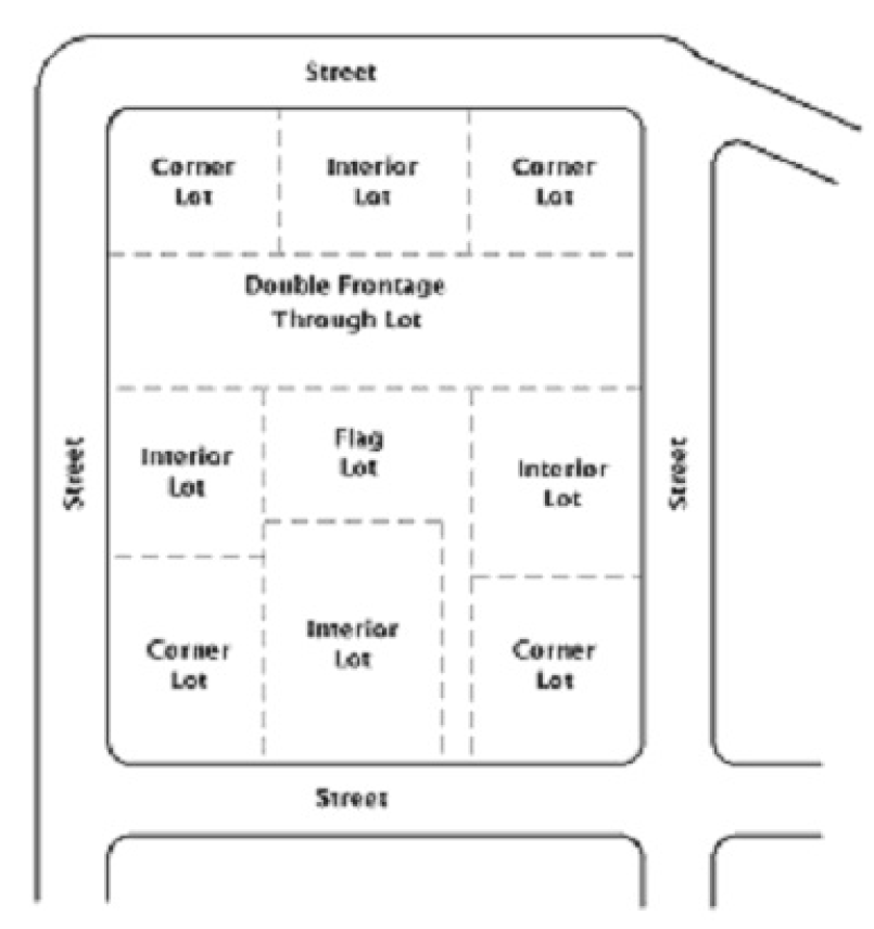
Figure 3-1: Types of Lots
(h)
Extra Depth and Width in Certain Cases. Additional depth shall be required by the Planning and Zoning Commission when a lot in a residential area backs up to a railroad right-of-way, a high pressure gasoline, oil or gas pipeline, an electric transmission line, an arterial street, an industrial area, or other land use that has a depreciating effect on the residential use of the property and where no marginal access street or other street is provided at the rear of the lot. A depth in excess of one hundred and forty feet (140') shall not be required. Where a lot sides to any of the uses listed in this subsection, additional width shall be required by the Commission, but a width in excess of seventy-five feet (75') shall not be required.
(i)
Lots Adjacent To or In Floodplains. Subdivision of property in a designated floodplain must meet the requirements for floodplain management Division 11 of this Chapter.
(j)
Building Lines. Front building lines shall be shown for all lots on all plats submitted for land within the City's ETJ.
(1)
The minimum building setback from lot boundaries adjacent to street rights-of-way shall be as set forth in the zoning regulations, if applicable, by subsection (j)(1)a below, except as specified in subsection (j)(1)b.
a.
1.
Setback from boundary adjacent to freeway (without frontage road in place): Forty feet (40').
2.
Setback from boundary adjacent to expressway (with frontage road in place): Thirty feet (30').
3.
Setback from boundary adjacent to arterial or collector street: Thirty feet (30').
4.
Setback from boundary adjacent to subcollector or minor street: Twenty-five feet (25').
b.
For new lots created by resubdivision of land originally subdivided before 1985, the minimum building setback from street-side boundaries shall be the same as that indicated on the most previously recorded plat or replat of the particular lot(s) under consideration. In all cases, however, there shall be required a front yard of not less than twenty feet (20') and an exterior side yard of not less than fifteen feet (15'), where no building setback lines are represented on a previously recorded plat or replat.
(Ord. No. 8-2010, pt. 1(Exh. A), 4-22-10; Ord. No. 12-2010, pt. A (Exh. A), 6-10-10)
Section 3.2.15.5 - Monuments and Markers
(a)
Placement.
(1)
Four (4) monuments shall be set along the right-of-way boundary and two (2) monuments shall be visible from each other.
(2)
Four (4) monuments should be set on subdivision corners along the right-of-way.
(3)
Permanent markers shall be placed at each lot corner.
(4)
Monuments and lot markers shall be set immediately after completion of utility installations and street construction or as the City Engineer may require.
(b)
Requirements.
(1)
A monument shall be made of an iron stake one-half inch (½") in diameter and eighteen inches (18") long.
(2)
A permanent marker shall be eighteen inches (18") long and set with cap and stamp. Longer stakes should be used in softer soils.
(c)
Requirements for Subdivision Monuments.
(1)
Subdivisions less than five (5) acres shall have at least two (2) monuments installed.
(2)
Subdivisions between five (5) and ten (10) acres shall have at least four (4) monuments installed.
(3)
Any subdivision greater than ten (10) acres shall have more than four (4) monuments installed along the right-of-way boundary for the subdivision as determined by the City Engineer.
(4)
The location of all monuments is subject to approval by the City Engineer.
(Ord. No. 8-2010, pt. 1(Exh. A), 4-22-10)