
Albemarle County Unincorporated
City Zoning Code
City Zoning Code
ARTICLE III
DISTRICT REGULATIONS
Sec. 7.1 - Establishment of districts.
For the purposes of this chapter, the unincorporated areas of Albemarle County are hereby divided into the following districts:
Commercial District - C-1
Commercial Office - CO
Entrance Corridor - EC (Added 10-3-90)
Heavy Industry - HI
Highway Commercial - HC
Light Industry - LI
Monticello Historic District - MHD (Added 6-8-05)
Neighborhood Model - NMD
Overlay Districts:
Airport Impact Area - AIA
Flood Hazard - FH
Natural Resource Extraction - NR
Scenic Streams - SS (Amended 9-9-92)
Planned Development-Industrial Park - PD-IP
Planned Development-Mixed Commercial - PD-MC
Planned Development-Shopping Centers - PD-SC
Planned Residential Development - PRD
Planned Unit Development - PUD
Residential - R-1
Residential - R-2
Residential - R-4
Residential - R-6
Residential - R-10
Residential - R-15
Rural Areas - RA
Village Residential - VR
(§ 7.0, 12-10-80; § 7, Ord. 03-18(2), 3-19-03; Ord. 05-18(5), 6-8-05)
Sec. 8.1 - Intent.
The planned development districts are the Monticello Historic District (MHD), Planned Residential Development (PRD), Planned Unit Development (PUD), Neighborhood Model (NMD), Planned Development - Mixed Commercial (PDMC), Planned Development - Shopping Centers (PDSC), and Planned Development - Industrial Park (PD-IP) zoning districts. Each of these districts is distinct in purpose; however, all are intended to provide for variety and flexibility in design necessary to implement the various goals and objectives set forth in the comprehensive plan. Through a planned development approach, the regulations in section 8 are intended to accomplish the goals and objectives of the comprehensive plan to a greater extent than the regulations of conventional districts. In addition, these regulations are intended to promote: economical and efficient land use through unified development; improved levels of amenities; appropriate and harmonious physical development; creative design; and a better environment than generally realized through conventional district regulations. In view of the substantial public advantages of planned development, these regulations are intended to encourage the planned development approach in areas appropriate in terms of location and character.
Planned development districts shall be developed: to provide for the comfort and convenience of residents or visitors; to facilitate the protection of the character of surrounding lands, neighborhoods and the adjacent rural areas; and to lessen traffic impacts through a reasonably short travel time between origins and destinations of persons living, working, or visiting in such developments. Housing, commercial and service facilities, and places of employment shall be related either by physical proximity or by adequate street networks so as to promote these objectives.
(12-10-80; Ord. 03-18(2), 3-19-03; Ord. 05-18(5), 6-8-05)
Sec. 8.2 - Applicable regulations; waivers and modifications.
Planned developments shall be subject to the following regulations in this chapter:
a.
Sections applicable. Unless expressly superseded by a regulation of the applicable planned development district, the regulations of this chapter, other than those pertaining to conventional development districts stated in section 10 through section 18, section 20B, section 22, section 23, section 24, section 27 and section 28, shall apply to each planned development district unless the subject matter is expressly addressed in the code of development under section 20A.5, or the regulation is waived or modified as provided in subsection 8.2(b).
b.
Waivers and modifications. An applicant may request that any requirement of section 4, section 5, section 21, section 26 and section 32, or the applicable planned development district regulations be waived or modified by the board of supervisors, as follows:
1.
Submittal of request for waiver or modification. If the applicant requests such a waiver or modification as part of the application plan, the applicant shall submit its request in writing as part of the application plan, and shall demonstrate how the findings required by subsection 8.2(b)(3) would be satisfied.
2.
Timing of request. Notwithstanding any regulation in section 4, section 5, section 21, section 26 or section 32 establishing a procedure for considering a waiver or modification, any request for a waiver or modification shall be reviewed and considered as part of the application plan; provided that an owner within a planned development may request a waiver or modification of any requirement of section 4, section 5, section 21, section 26 or section 32 at any time, under the procedures and requirements established therefore.
3.
Findings. In addition to making the findings required for the granting of a waiver or modification in section 4, section 5, section 21, section 26 or section 32, a waiver or modification may be granted only if it is also found: (i) to be consistent with the intent and purposes of the planned development district under the particular circumstances, and satisfies all other applicable requirements of section 8; (ii) to be consistent with planned development design principles; (iii) that the waiver or modification would not adversely affect the public health, safety or general welfare; and (iv) in the case of a requested modification, that the public purposes of the original regulation would be satisfied to at least an equivalent degree by the modification.
4.
Express waiver or modification. Each waiver and modification must be expressly granted and no waiver or modification shall be deemed to have been granted by implication.
(12-10-80; Ord. 03-18(2), 3-19-03; Ord. 05-18(5), 6-8-05; Ord. 09-18(9), 10-14-09)
Sec. 8.3 - Planned development defined.
A planned development is a development that meets all of the following criteria at the time it is established or amended: (1) the area proposed to be rezoned or the area within the planned development district is under unified control and will be planned and developed as a whole; (2) the development conforms with one or more approved application plans; and (3) in all planned development districts other than a planned historic district, the development will provide, operate and maintain common areas, facilities and improvements for some or all occupants of the development where these features are appropriate.
(12-10-80; Ord. 03-18(2), 3-19-03; Ord. 05-18(5), 6-8-05; Ord. 09-18(9), 10-14-09)
Sec. 8.4 - Where permitted.
A planned development district may be established in any development area identified in the comprehensive plan, and in any rural area identified in the comprehensive plan if the district is a planned historic district containing a historic site and the purposes of the district include the restoration, preservation, conservation and enhancement of the historic site, provided that its location is suitable for the character of the proposed uses and structures.
(12-10-80; Ord. 03-18(2), 3-19-03; Ord. 05-18(5), 6-8-05)
Sec. 9.1 - Intent.
The Comprehensive Plan for Albemarle County Virginia, 1989—2010, recommends as a developmental objective the establishment of "a mix of commercial, industrial and public land uses supporting County needs" and further recommends as an implementation strategy various service areas or "non-residential land use groups for growth areas that stress a mixed use orientation, scale of development and intended service population." Most non-residential land uses are to be accommodated within designated service areas as textually described in Chapter Three, The Developed Environment and locationally depicted on the various land use maps contained therein.
The intent of this section is to set forth guidelines for implementation of these various service areas through existing zoning provisions in a manner consistent with the comprehensive plan. Specifically, it is intended that establishment of the various service areas be accomplished through zoning map amendment pursuant to section 33.2.1, property owner petition, together with textual amendment and other modifications as may be accomplished in a particular case pursuant to section 33.3, proffer of conditions, and, where appropriate, section 8.0, planned development districts - generally.
Sec. 9.2 - Where permitted.
Service areas may be established through usage of one or more conventional and/or planned development zoning districts in accord with guidelines of section 9.0 and the comprehensive plan at appropriate locations within areas designated as the urban area, communities and villages in the comprehensive plan consistent with the following criteria:
NON-RESIDENTIAL LAND USE GUIDELINES
*Note: 15% limitation exclusive of motel/hotel/conference use
(Unknown prior history; Ord. 19-18(3), 6-5-19)
Sec. 9.3 - Relation of comprehensive plan service areas to zoning district regulations.
Generally, the following zoning districts compare favorably to recommended service areas as to recommended primary and secondary land uses:
Sec. 9.4 - Establishment of secondary uses.
Secondary uses are intended to be complementary of and subordinate to primary uses. To this end, secondary uses shall be established on a pro rata basis for phased development to the floor area of primary uses unless otherwise specifically permitted by the board in a particular case. In addition, the following guidelines are intended to govern secondary uses unless otherwise specifically modified by the board in a particular case:
9.4.1
Secondary residential uses shall not occupy more than 20 percent of the total site area.
9.4.2
Other secondary uses shall comply with the following limitations:
a.
Total floor area devoted to warehousing shall not exceed ten percent of the total floor area devoted to primary uses;
b.
Total floor area devoted to supporting commercial uses shall not exceed five percent of the total floor area devoted to primary uses;
c.
Total floor area devoted to related office uses shall not exceed ten percent of the total floor area devoted to primary uses;
d.
As to motel/hotel/conference use, the applicant shall demonstrate that such use is intended to be complementary of and subordinate to primary uses in terms of scale, contractual agreements with primary uses, or otherwise.
9.4.3
Supporting commercial uses may consist of primary uses recommended for village and neighborhood service areas to provide convenience uses to employees within service areas. Such supporting commercial uses as may be provided by an individual occupant for the exclusive use of the employees of such occupant shall not be included in floor area limitations of section 9.4.2.
Supporting commercial uses may also consist of dependent or parasite uses as may be demonstrated to be sustainable by and related to the specific character and service requirements of primary uses.
(Added 6-19-91)
Sec. 10.1 - Intent, where permitted.
This district (hereafter referred to as RA) is hereby created and may hereafter be established by amendment of the zoning map for the following purposes:
-
Preservation of agricultural and forestal lands and activities;
-
Water supply protection;
-
Limited service delivery to the rural areas; and
-
Conservation of natural, scenic, and historic resources.
Residential development not related to bona fide agricultural/forestal use shall be encouraged to locate in the urban area, communities and villages as designated in the comprehensive plan where services and utilities are available and where such development will not conflict with the agricultural/forestal or other rural objective. Where development does occur, rural residents should expect to receive a lower level of service delivery than will be provided to residential developments in designated growth areas. In relation to residential development, agricultural/forestal activities shall be regulated only to the extent necessary to protect public health and safety.
In regard to agricultural preservation, this district is intended to preserve the county's active farms and best agricultural and forestal lands by providing lot areas designed to insure the continued availability of such lands for preferential land use tax assessment in order to enhance the economy, and maintain employment and lifestyle opportunities. In addition, the continuation and establishment of agriculture and agriculturally-related uses will be encouraged, and landowners will be encouraged to employ Virginia State Water Control Board best management practices.
(§ 20-10.1, 12-10-80, 11-8-89; § 18-10.1, Ord. 98-A(1), 8-5-98; Ord. 01-18(6), 10-3-01)
It is intended that permitted development be restricted to land which is of marginal utility for agricultural/forestal purposes, provided that such development be carried out in a manner which is compatible with other purposes of this district. Roadside strip development is to be discouraged through the various design requirements contained herein.
Sec. 10.3 - Application of regulations for development by right.
The following provisions shall apply to any parcel of record at 5:15 p.m., the tenth day of December, 1980 (reference 6.5).
(§ 20-10.3, 12-10-80; 11-8-89; § 18-10.3, Ord. 98-A(1), 8-5-98)
Sec. 10.4 - Area and bulk regulations.
Area and bulk regulations within the RA, rural areas, zoning district are as follows:
(§ 20-10.4, 12-10-80; 8-14-85; § 18-10.4, Ord. 98-A(1), 8-5-98; Ord. 08-18(7), 11-12-08)
Sec. 11.1 - Intent and purpose, where permitted.
The intent and purpose of the Monticello Historic District (hereinafter referred to as "MHD") is to create a planned historic district:
-
To permit restoration, preservation, conservation, education, programs, research, business and support activities, including fundraising activities for the public and/or contributors, all of which are related to the operation of a historic house museum and historic site at Monticello;
-
To promote the preservation, interpretation and enhancement of a unique historical site;
-
To preserve significant tracts of agricultural and forestal land;
-
To be a district that is unique to those parcels which both belonged to Thomas Jefferson and contain uses related to the operation of the historic site, in recognition of:
-
the importance of Thomas Jefferson to the history of Albemarle County;
-
the importance of Monticello to the reputation, education, and economy of Albemarle County;
Monticello as a unique element of the historical and architectural legacy of Albemarle County, the nation, and the world, as recognized by its inclusion on the World Heritage List administered by the United Nations Educational, Scientific, and Cultural Organization.
Restoration or re-creation of Jefferson-era structures or landscape features, and their subsequent interpretive use, shall be regulated only to the extent necessary to protect public health and safety.
(§ 18-11.1, Ord. 05-18(5), 6-8-05; Ord. 11-18(4), 4-6-11)
Sec. 11.2 - Status as a planned development district.
The MHD is a planned development district within the meaning of section 8 of this chapter, and shall not be construed to be an agricultural zoning district or a district in which agricultural, horticultural or forestal uses are dominant.
(§ 18-11.2, Ord. 05-18(5), 6-8-05)
Sec. 11.3 - Permitted uses.
The following uses shall be permitted in the MHD, subject to the regulations in this section and section 8 of this chapter, the approved application plan, and any accepted proffers:
Sec. 11.4 - Regulation of development.
In order to protect the county's historic resources and the rural character of surrounding lands, all uses and structures shall be subject to an approved application plan, and to sections 4, 5, 8 and 32 of this chapter, including such regulations as may be waived or modified pursuant to section 8.2. In addition:
a.
Density. Density shall not exceed one dwelling unit per 21 acres and the minimum lot size shall be 21 acres.
b.
Structure height. The maximum structure height established in the standards for development required by section 8.5.1(d)(11) of this chapter shall not exceed 45 feet.
c.
Yards. The minimum yards established in the standards for development required by section 8.5.1(d)(11) of this chapter shall not be less than the minimum yards provided in section 21.7, except as otherwise provided on the application plan.
(§ 18-11.4, Ord. 05-18(5), 6-8-05)
Sec. 11.5 - Standards of operation.
All uses authorized by section 11.3.1(1)(e), 11.3.1(2), or 11.3.1(27) shall be conducted in accordance with the requirements of an approved traffic management plan on file with the department of community development, which may be reviewed on an annual basis at the discretion of the zoning administrator or county engineer, or the request of the owner. Private road and travelway access must meet standards approved by the planning commission upon the recommendation of the county engineer.
(§ 18-11.5, Ord. 11-18(4), 4-6-11)
Sec. 12.1 - Intent, where permitted.
This district (hereafter referred to as VR) is created to establish a plan implementation zone that:
-
Encourages residential development in areas of the county designated as village areas or town area in the comprehensive plan;
-
Permits a variety of housing types;
-
Provides incentives for residential development by allowing variations in lot size, density and frontage requirements;
-
Encourages compact development;
-
Permits related nonresidential development in order to increase the vitality and attractiveness of such areas as a living environment;
-
Encourages creative design which allows for filling in of vacant areas and which is compatible with the character of existing lots and buildings; and
-
Permits agricultural uses in keeping with the village scale of development.
VR districts may be permitted in villages and town locations designated on the comprehensive plan using either locational guidelines therein or boundaries established by amendment to the comprehensive plan. It is further intended that VR districts will be located in such areas where no public water or sewerage service is available or in such areas partially or fully served by approved central water systems or central sewerage systems.
(§ 20-12.1, 12-10-80; 8-14-85; § 18-12.1, Ord. 98-A(1), 8-5-98)
Sec. 12.3 - Area and bulk regulations.
AREA AND BULK REGULATIONS
(§ 20-12.3, 12-10-80; § 18-12.3, Ord. 98-A(1), 8-5-98; Ord. 22-18(1), 1-12-22)
Sec. 12.5 - Cluster development option regulations.
At the option of the owner, regulations under cluster development provisions in section 12.3 may be used for cluster development of the land to be subdivided and developed. Use of cluster provisions shall be subject to other requirements of this ordinance, applicable health requirements and the provisions of Chapter 14 of the Code of Albemarle.
(§ 20-12.5, 12-10-80; § 18-12.5, Ord. 98-A(1), 8-5-98)
Sec. 13.1 - Intent, where permitted.
This district (hereafter referred to as R-1) is created to establish a plan implementation zone that:
-
Recognizes the existence of previously established low density residential districts in communities and the urban area; (Amended 9-9-92)
-
Provides incentives for clustering of development and provision of locational, environmental and development amenities; and
-
Provides for low density residential development in community areas and the urban area. (Amended 9-9-92)
R-1 districts may be permitted within community and urban area locations designated on the comprehensive plan. (Amended 9-9-92)
Sec. 13.3 - Area and bulk regulations.
Area and bulk regulations within the R-1, Residential, district are as follows:
(§ 13.3, 12-10-80; Ord. 15-18(4), 6-3-15)
Sec. 13.5 - Cluster development option regulations.
At the option of the owner, regulations under cluster development provisions in section 13.3 may be used for cluster development of the land to be subdivided and developed. Use of cluster provisions shall be subject to other requirements of this ordinance, applicable health requirements and the provisions of Chapter 14 of the Code of Albemarle.
(Amended 8-14-85)
Sec. 14.1 - Intent, where permitted.
This district (hereafter referred to as R-2) is created to establish a plan implementation zone that:
-
Provides a potential transition density between higher and lower density areas established through previous development and/or zoning in community areas and the urban area; and
-
Provides incentives for clustering of development and provision of locational, environmental and development amenities.
R-2 districts may be permitted within community and urban area locations designated on the comprehensive plan. (Amended 9-9-92)
Sec. 14.3 - Area and bulk regulations.
Area and bulk regulations within the R-2, Residential, district are as follows:
(§ 20-14.3, 12-10-80; Ord. 08-18(4), 6-11-08; Ord. 15-18(4), 6-3-15)
Sec. 15.1 - Intent, where permitted.
This district (hereafter referred to as R-4) is created to establish a plan implementation zone that:
-
Provides for compact, medium-density, single-family development; (Amended 9-9-92)
-
Permits a variety of housing types; and
-
Provides incentives for clustering of development and provision of locational, environmental, and development amenities.
R-4 districts may be permitted within community and urban area locations designated on the comprehensive plan.
(Amended 9-9-92)
Sec. 15.3 - Area and bulk regulations. (Amended 3-18-81)
Area and bulk regulations within the R-4, Residential, district are as follows:
(§ 20-15.3, 12-10-80; 1-1-83; 7-17-85; Ord. 08-18(4), 6-11-08; Ord. 15-18(4), 6-3-15)
Sec. 15.5 - Cluster development option regulations.
At the option of the owner, regulations under cluster development provisions in section 15.3 may be used for cluster development of the land to be subdivided and developed. Use of cluster provisions shall be subject to other requirements of this ordinance, applicable health requirements and the provisions of Chapter 14 of the Code of Albemarle.
(Amended 8-14-85)
Sec. 15.6 - Building separation.
In any case in which there is more than one main structure on any parcel, there shall be a minimum of 30 feet between such structures except as otherwise provided in section 4.11.3. This provision shall not apply to structures built to a common wall.
(Added 1-1-83) (Amended 8-14-85)
Sec. 15.7 - Recreational area requirements.
See section 4.16 for recreation requirements.
(Amended 3-5-86)
Sec. 16.1 - Intent, where permitted.
R-6 districts are hereby created and may hereafter be established by amendment to the zoning map to provide a plan implementation zone that:
-
Provides for compact, medium-density residential development; (Amended 9-9-92)
-
Permits a variety of housing types; and
-
Provides incentives for clustering of development and provision of locational, environmental and developmental amenities.
R-6 districts may be permitted within community and urban area locations recommended for medium-density residential use in the comprehensive plan. (Amended 9-9-92)
Sec. 16.3 - Area and bulk regulations.
Area and bulk regulations within the R-6, Residential, district are as follows:
(§ 20-16.3, 12-10-80; 1-1-83; 7-17-85; Ord. 08-18(4), 6-11-08; Ord. 15-18(4), 6-3-15)
Sec. 16.5 - Cluster development option regulations.
At the option of the owner, regulations under cluster development provisions in section 16.3 may be used for cluster development of the land to be subdivided and developed. Use of cluster provisions shall be subject to other requirements of this ordinance, applicable health requirements and the provisions of Chapter 14 of the Code of Albemarle.
(§ 20-16.5, 12-10-80; 8-14-85)
Sec. 16.6 - Building separation.
The minimum building separation shall be as provided in section 4.19.
(§ 20-16.6, 12-10-80; 1-1-83; 8-14-85; Ord. 15-18(4), 6-3-15)
Sec. 16.7 - Recreational area requirements.
See section 4.16 for recreation requirements.
(§ 20-16.7, 12-10-80; 3-5-86)
Sec. 16.8 - Height regulations.
Except as otherwise provided in section 4.10, structures may be erected to a height of 35 feet.
(§ 20-16.8, 12-10-80; 8-14-85; 9-9-92)
Sec. 17.1 - Intent, where permitted.
R-10 districts are hereby created and may hereafter be established by amendment to the zoning map to provide a plan implementation zone that:
-
Provides for compact, medium-density residential development; (Amended 9-9-92)
-
Permits a variety of housing types; and
-
Provides incentives for clustering of development and provision of locational, environmental and developmental amenities.
R-10 districts may be permitted within the community and urban area locations designated on the comprehensive plan. (Amended 9-9-92)
Sec. 17.3 - Area and bulk regulations.
Area and bulk regulations within the R-10, Residential, district are as follows:
(§ 20-17.3, 12-10-80; 7-17-85; Ord. 08-18(4), 6-11-08; Ord. 15-18(4), 6-3-15)
Sec. 17.5 - Cluster development option regulations.
At the option of the owner, regulations under cluster development provisions in section 17.3 may be used for cluster development of the land to be subdivided and developed. Use of cluster provisions shall be subject to other requirements of this ordinance, applicable health requirements and the provisions of Chapter 14 of the Code of Albemarle.
(§ 20-17.5, 12-10-80; 8-14-85)
Sec. 17.6 - Building separation.
The minimum building separation shall be as provided in section 4.19.
(§ 20-17.6, 12-10-80; 1-1-83; Ord. 15-18(4), 6-3-15)
Sec. 17.7 - Recreational area requirements.
See section 4.16 for recreation requirements.
(§ 20-17.7, 12-10-80; 3-5-86)
Sec. 17.8 - Height regulations.
Except as otherwise provided in section 4.10, structures may be erected to a height not to exceed 65 feet. The minimum stepback requirements for any story that begins above 40 feet in height or for each story above the third story, whichever is less, in height shall be as provided in section 4.19.
(§ 20-17.8, 12-10-80; 8-14-85; 9-9-92; Ord. 15-18(4), 6-3-15; Ord. 17-18(4), 8-9-17)
Sec. 18.1 - Intent, where permitted.
R-15 districts are hereby created and may hereafter be established by amendment to the zoning map to provide a plan implementation zone that:
-
Provides for compact, high-density residential development; (Amended 9-9-92)
-
Permits a variety of housing types; and
-
Provides incentives for clustering of development and provision of locational, environmental and developmental amenities.
R-15 districts may be permitted within the community and urban area locations designated on the comprehensive plan. (Amended 9-9-92)
Sec. 18.3 - Area and bulk regulations.
Area and bulk regulations within the R-15, Residential, district are as follows:
(§ 20-18.3, 12-10-80, 6-11-08; 1-1-83; 7-17-85; Ord. 08-18(4), 6-11-08; Ord. 15-18(4), 6-3-15)
Sec. 18.5 - Cluster development option regulations.
At the option of the owner, regulations under cluster development provisions in section 18.3 may be used for cluster development of the land to be subdivided and developed. Use of cluster provisions shall be subject to other requirements of this ordinance, applicable health requirements and the provisions of Chapter 14 of the Code of Albemarle.
(§ 20-18.5, 12-10-80; 8-14-85)
Sec. 18.6 - Building separation.
The minimum building separation shall be as provided in section 4.19.
(§ 20-18.6, 12-10-80; 1-1-83; Ord. 15-18(4), 6-3-15)
Sec. 18.7 - Recreational area requirements.
See section 4.16 for recreation requirements.
(§ 20-18.7, 12-10-80; 3-5-86)
Sec. 18.8 - Height regulations.
Except as otherwise provided in section 4.10, structures may be erected to a height not to exceed 65 feet. The minimum stepback requirements for any story that begins above 40 feet in height or for each story above the third story, whichever is less, in height shall be as provided in section 4.19.
(§ 20-18.8, 12-10-80, 8-14-85; 9-9-92; Ord. 15-18(4), 6-3-15; Ord. 17-18(4), 8-9-17)
Sec. 19.1 - Intent, where permitted.
PRD districts may hereafter be established by amendment to the zoning map in accordance with the provisions set forth generally for PD districts in sections 8.0 and 33.0, and with densities and in locations in accordance with the comprehensive plan.
The PRD is intended to encourage sensitivity toward the natural characteristics of the site and toward impact on the surrounding area in land development. More specifically, the PRD is intended to promote economical and efficient land use, an improved level of amenities, appropriate and harmonious physical development, and creative design consistent with the best interest of the county and the area in which it is located.
To these ends, the PRD provides for flexibility and variety of development for residential purposes and uses ancillary thereto. Open space may serve such varied uses as recreation, protection of areas sensitive to development, buffering between dissimilar uses and preservation of agricultural activity.
While a PRD approach is recommended for developments of any density, it is recommended but not required that the PRD be employed in areas where the comprehensive plan recommends densities in excess of 15 dwelling units per acre, in recognition that development at such densities generally requires careful planning with respect to impact. (Amended 8-14-85)
Sec. 19.2 - Application.
Notwithstanding the requirements and provisions of section 8.0, planned development districts, generally, where certain planned community (PC) or residential planned neighborhood (RPN) districts have been established prior to the adoption of this ordinance, such districts shall be considered to have been established as PRD districts under this ordinance and shall be so designated on the zoning map.
Sec. 19.4 - Residential densities.
The gross and net residential densities permitted in any PRD district shall be shown on the approved application plan therefor, which shall be binding upon its approval. The overall gross density so approved shall be determined by the board of supervisors with reference to the comprehensive plan, but shall, in no event, exceed 35 dwelling units per acre. In addition, the bonus and cluster provisions of this ordinance shall be inapplicable to any PRD except as herein otherwise expressly provided.
(§ 20-19.4, 12-10-80)
Sec. 19.5 - Minimum area required for establishment of district.
19.5.1
Minimum area required for the establishment of a PRD district shall be three acres.
19.5.2
Additional area may be added to an established PRD district if it adjoins and forms a logical addition to the approved development. The procedure for an addition shall be the same as if an original application were filed, and all requirements shall apply except the minimum acreage requirement of section 19.5.1.
Sec. 19.6 - Minimum area requirements for open space and recreational uses.
19.6.1
Not less than 25 percent of the area devoted to residential use within any PRD shall be in common open space except as hereinafter expressly provided. (Amended 9-13-89)
Sec. 19.7 - Height regulations.
Except as otherwise provided in section 4.10, structures may be erected to a height not to exceed 65 feet. The minimum stepback requirements for any story that begins above 40 feet in height or for each story above the third story, whichever is less, in height shall be as provided in section 4.19.
(§ 20-19.7, 12-10-80; 9-9-92; Ord. 15-18(4), 6-3-15; Ord. 17-18(4), 8-9-17)
Sec. 19.8 - Building separation.
The minimum building separation shall be as provided in section 4.19.
(§ 20-19.8, 12-10-80; 1-1-83; Ord. 15-18(4), 6-3-15)
Sec. 19.9 - Setbacks.
The minimum and maximum yards, including those for garages, shall be as provided in section 4.19.
(§ 20-19.9, 12-10-80; Ord. 15-18(4), 6-3-15)
Sec. 19.10 - Minimum off-street parking regulations.
Off-street parking and loading space requirements shall be in accordance with section 4.12; provided that the board of supervisors may vary or waive such requirements at time of establishment of a PRD district.
(§ 20-19.10, 12-10-80)
Sec. 19.11 - Sign regulations.
Sign regulations shall be as prescribed in section 4.15.
(§ 20-19.11, 12-10-80)
Sec. 20.1 - Intent, where permitted.
PUD districts may hereafter be established by amendment to the zoning map in accordance with the provisions set forth generally for planned development districts in sections 8 and 33 and with densities and uses in locations in accordance with recommendations of the comprehensive plan. As described by the comprehensive plan, PUD districts are intended to serve as neighborhoods or mini-neighborhoods within designated communities and the urban area. Additionally, PUD districts may be appropriate where the establishment of a "new village" or the nucleus of a future community exists and where the PUD development would not preclude achievement of the county's objectives for the urban area, communities and villages.
In order to encourage the community function, appropriate commercial and industrial uses are provided in addition to a variety of residential uses. It is intended that commercial and industrial development be limited to a scale appropriate to the support of the residential uses within the PUD; provided that additional commercial and industrial activity may be permitted upon a finding that the area in which the PUD is to be located is not adequately served by such use.
It is intended that these regulations provide flexibility in residential development by providing for a mix of residential uses with appropriate nonresidential uses, alternative forms of housing, flexibility in internal relationships of design elements and, in appropriate cases, increases in gross residential densities over that provided in conventional districts.
(§ 20.1, 12-10-80; Ord. 12-18(7), 12-5-12, effective 4-1-13)
State Law reference— Va. Code §§ 15.2-2280, 15.2-2286.
Sec. 20.2 - Application.
Notwithstanding the requirements and provisions of section 8, planned development districts, generally, where certain planned community districts have been established and have been developed or received final site development plan approval prior to the adoption of this ordinance, such districts shall be considered to have been established as PUD districts under this ordinance and shall be so designated on the zoning map.
(§ 20.2, 12-10-80; Ord. 12-18(7), 12-5-12, effective 4-1-13)
State Law reference— Va. Code §§ 15.2-2280, 15.2-2286.
Sec. 20.3 - Permitted uses—Residential.
Within areas approved as residential on the application plan, permitted uses shall be as follows:
Sec. 20.4 - Permitted uses—Commercial/service.
Within areas approved as commercial/service on the application plan, uses permitted shall be as follows:
Sec. 20.5 - Permitted uses—Shopping center.
Within areas approved for shopping center on the application plan, uses permitted shall be as follows:
Sec. 20.6 - Permitted uses—Industrial.
In approval of areas as industrial on the application plan, the board of supervisors shall designate the category of uses as provided in section 29.0, planned development - industrial park, PD- IP for each subarea of industrial on the application plan. Thereafter, except as otherwise expressly provided herein, uses permitted shall be established in accordance with section 29.0, provided that no separate application shall be required for any such use permitted by special use permit included in the original PUD rezoning petition.
Sec. 20.7 - Minimum area required for establishment of district.
20.7.1 Minimum area required for the establishment of a PUD district shall be 100 acres.
20.7.2 Additional area may be added to an established PUD district if it adjoins and forms a logical addition to the approved development. The procedure for an addition shall be the same as if an original application were filed, and all requirements shall apply except the minimum acreage requirement of section 20.7.1.
Sec. 20.12 - Minimum off-street parking and loading space requirements.
Off-street parking and loading space requirements shall be in accordance with section 4.12.
Sec. 20.13 - Sign regulations.
Sign regulations shall be as prescribed in section 4.15.
Sec. 20A.1 - Purpose and intent.
The purpose of the Neighborhood Model district (hereinafter referred to as the "NMD") is to establish a planned development district in which traditional neighborhood development, as established in the county's Neighborhood Model, will occur. The county's Neighborhood Model was adopted as part of the comprehensive plan, and is hereinafter referred to as the "Neighborhood Model." The regulations in section 20A encourage a development form and character that is different from conventional suburban development by providing the following characteristics:
-
Pedestrian orientation;
-
Neighborhood friendly streets and paths;
-
Interconnected streets and transportation networks;
-
Parks and open space as amenities;
-
Neighborhood centers;
-
Buildings and spaces of human scale;
-
Relegated parking;
-
Mixture of uses and use types;
-
Mixture of housing types and affordability;
-
Redevelopment;
-
Site planning that respects terrain; and
-
Clear boundaries with the rural areas.
The NMD is intended to provide for compact, mixed-use developments with an urban scale, massing, density, and an infrastructure configuration that integrates diversified uses within close proximity to each other within the development areas identified in the comprehensive plan.
The particular uses permitted within a particular district, as well as the character, form and density of the development, shall be derived from the comprehensive plan, including the land use plan for the applicable development area, the master plan for the applicable development area, and the Neighborhood Model. Density shall be achieved with careful attention to design, as articulated in the Neighborhood Model.
These regulations are intended to provide an applicant with maximum flexibility in creating and implementing the general development plan and the code of development.
(Ord. 03-18(2), 3-19-03)
Sec. 20A.2 - Status as a planned development district.
An NMD is a planned development district within the meaning of section 8 of this chapter, subject to the following:
a.
As a planned development district, the standards for development shall be particular to the district and not be based on standards established for conventional zoning districts or the general standards for commercial or industrial districts in sections 21 and 26, respectively, of this chapter. The standards for development that are submitted by an applicant and approved by the board of supervisors for a particular NMD shall be the district's code of development described in section 20A.5.
b.
An application is not necessarily required to possess every characteristic of the Neighborhood Model delineated in section 20A.1 in order to be approved as an NMD. The size of the proposed district, its relationship to a larger neighborhood, or other similar factors may prevent the application from possessing every characteristic.
c.
An NMD shall have no minimum acreage requirement.
(Ord. 03-18(2), 3-19-03)
Sec. 20A.5 - Codes of development.
A code of development shall establish the unifying design guidelines, the specific regulations for the district, and the use characteristics of each block; provide for certainty in the location of and appearance of central features, and the permitted uses in the district; and provide a flexible range of a mix of uses and densities. Any substantive or procedural requirement of this chapter shall apply to an NMD unless the subject matter is expressly addressed in the code of development. Each code of development shall be in a form required or otherwise approved by the director of planning. To satisfy these requirements, each code of development shall establish:
a.
The uses permitted in the district by right and by special use permit, as provided in section 20A.6.
b.
The amount of developed square footage proposed, delineated for the entire NMD and by block by use and amenity. The developed square footage may be expressed as a proposed range of square footage.
c.
The maximum number of residential dwelling units, dwelling units by type, and delineating at least two housing types, as provided in section 20A.8.
d.
The amount of land area and percentage of gross acreage devoted to green space and amenities, as provided in section 20A.9.
e.
All requirements and restrictions associated with each use delineated in subsection 20A.5(a).
f.
All uses expressly prohibited in the district, so that they may not be considered to be uses accessory to a permitted use.
g.
Architectural standards that will apply in the NMD, which shall address the following:
1.
The form, massing, and proportions of structures which may be provided through illustrations;
2.
Façade treatments;
3.
The preservation of historic structures, sites, cemeteries, and archeological sites identified by the Virginia Department of Historic Resources; and
4.
Architectural styles, materials, colors and textures if these elements are determined to be necessary in order for a proposed development to be compatible with its contiguous developed surroundings. The provisions in a code of development adopted prior to October 14, 2009 pertaining to subsections 20A.5(g)(1) through (4) shall be the only architectural standards in the code of development that apply to the planned development.
h.
Landscape treatments where landscaping in addition to that required by section 32 is proposed. The provisions in a code of development adopted prior to October 14, 2009 pertaining to landscape treatments as required under former subsection 20A.5(g)(7) shall apply to the planned development.
i.
For each block:
1.
The uses permitted on the block by right and by special use permit;
2.
Build-to lines or ranges, which are the required distance from the right-of-way to a structure;
3.
Minimum and maximum lot dimensions;
4.
Minimum number of stories and maximum building heights;
5.
Location of sidewalks and pedestrian paths;
6.
Acreage devoted to and characteristics of green space, amenities, and recreational areas and facilities as required by section 4.16;
7.
Location, acreage and characteristics of conservation areas and preservation areas as defined in section 3.1, if applicable;
8.
Location of parking areas;
9.
Location, acreage and characteristics of civic spaces, which are public areas for community or civic activities (e.g., libraries and their associated yards, schools and places of worship);
(Ord. 03-18(2), 3-19-03; Ord. 09-18(9), 10-14-09)
Sec. 20A.6 - Permitted uses.
The following uses shall be permitted in an NMD, subject to the regulations in this section and section 8, the approved application plan and code of development, and the accepted proffers:
a.
By right uses. The following uses are permitted by right if the use is expressly identified as a by right use in the code of development or if the use is permitted in a determination by the Zoning Administrator pursuant to County Code § 18-8.5.5.2(c)(1):
1.
Each use allowed by right or by special use permit in any other zoning district, except for those uses allowed only by special use permit delineated in subsections 20A.6(b)(2) and (b)(3); provided that the use is identified in the approved code of development.
2.
Water, sewer, energy and communications distribution facilities.
3.
Accessory uses and buildings including storage buildings.
4.
Home occupation, Class A, where the district includes residential uses.
5.
Temporary construction headquarters and temporary construction storage yards (reference 5.1.18).
6.
Public uses (reference 5.1.12).
7.
Tourist lodgings, where the district includes residential uses.
8.
Group homes, where the district includes residential uses.
9.
Tier I and Tier II personal wireless service facilities (reference 5.1.40).
10.
Farmers' markets (reference 5.1.47).
11.
Family day homes (reference 5.1.56). (Added 9-11-13)
12.
Drive-through windows (reference 5.1.60). (Added 3-2-16)
13.
Homestays (reference 5.1.48)
b.
By special use permit. The following uses are permitted by special use permit if the use is expressly identified as use permitted by special use permit in the code of development:
1.
Each use allowed by right or by special use permit in any other zoning district.
2.
(Repealed 3-2-16)
3.
Outdoor storage, display and/or sales serving or associated with a by right permitted use, if any portion of the use would be visible from a travelway.
(Ord. 03-18(2), 3-19-03; Ord 04-18(2), 10-13-04; Ord. 09-18(9), 10-14-09; Ord. 10-18(4), 5-5-10; Ord. 13-18(2), 4-3-13; Ord. 13-18(5), 9-11-13; Ord. 16-18(2), 3-2-16; Ord. 19-18(6), 8-7-19)
Sec. 20A.7 - Residential density.
Residential density within each NMD shall be as follows:
a.
The gross residential density should be within the applicable recommended gross density range established in the land use element of the comprehensive plan. In its deliberations regarding the appropriate residential density for the district, the board of supervisors shall take into account the amount of land devoted to non-residential uses.
b.
The gross residential density shall be measured in dwelling units per acre and calculated by dividing the proposed number of dwelling units in the proposed district by the gross acreage of the district.
(Ord. 03-18(2), 3-19-03; Ord. 09-18(9), 10-14-09)
Sec. 20A.8 - Mixture of uses.
There shall be a mixture of uses within each NMD as follows:
a.
Each district shall have at least two housing types; provided that this requirement may be waived by the board of supervisors if the district is an infill project or at least two housing types are already present within one-quarter mile of the proposed district. The following are considered to be different housing types: (1) single family detached dwellings; (2) single family attached dwellings; (3) two-family dwellings; (4) triplexes; (5) quadplexes; (6) townhouses; (7) multifamily dwellings; (8) accessory apartments; (9) manufactured housing; and (10) special needs housing such as assisted living facilities, group homes, and skilled nursing facilities.
An "infill project" is a project in which a parcel is developed or redeveloped, where abutting or nearby parcels are already developed, and the project area is relatively small compared to the developed abutting or nearby parcels.
b.
Each district shall have at least two different general use classifications (i.e., residential, commercial, industrial, institutional, parks or recreational facilities open to the public); provided that this requirement may be waived by the board of supervisors if a different use is already present within one-quarter mile of the proposed district and accomplishes the mixture of uses within the neighborhood sought to be achieved by this section to an equivalent degree.
c.
The mixture of uses shall be based upon the uses recommended in the land use element of the comprehensive plan. The required mixture of uses may be obtained with different uses in different buildings or a mixture of uses within the same building.
(Ord. 03-18(2), 3-19-03; Ord. 17-18(5), 10-11-17; Ord. 19-18(3), 6-5-19)
Sec. 20A.9 - Green spaces, amenities, conservation areas and preservation areas.
Each NMD shall include the following:
a.
Green space. The minimum area devoted to green space is as follows:
1.
For areas shown in the land use element of the comprehensive plan as neighborhood density residential, urban density residential, transitional, neighborhood service, community service, or office service, the area devoted to green space shall be at least 20 percent of the gross acreage of the area proposed to be rezoned.
2.
For areas shown in the land use element of the comprehensive plan as regional service, office regional or industrial service, the area devoted to green space shall be at least 15 percent of the gross acreage of the area proposed to be rezoned.
3.
For areas having a land use designation not addressed in subsections 20A.9(a)(1) and 20A.9(a)(2), the recommendations of the applicable provisions of the comprehensive plan shall be guidance on the minimum area devoted to green space.
4.
The minimum area devoted to green space may be reduced by the board of supervisors at the request of the applicant. In acting on a request, the board shall consider these factors: the relationship of the site to adjoining or nearby properties containing public green space such as parks or natural areas; the known future uses of the adjoining properties; and whether a reduction would better achieve the neighborhood model goals of the comprehensive plan.
b.
Amenities. The minimum area devoted to amenities is as follows:
1.
For areas shown in the land use element of the comprehensive plan as neighborhood density residential, urban density residential, neighborhood service, and community service, the area devoted to amenities shall be at least 20 percent of the gross acreage of the area proposed to be rezoned.
2.
For areas shown in the land use element of the comprehensive plan as regional service, office service, office regional service or industrial service, the area devoted to amenities shall be at least ten percent of the gross acreage of the area proposed to be rezoned.
3.
For areas having a land use designation not addressed in subsections 20A.9(b)(1) and 20A.9(b)(2), the recommendations of the applicable provisions of the comprehensive plan shall be guidance on the minimum area devoted to amenities.
4.
The minimum area devoted to amenities may be reduced by the board of supervisors at the request of the applicant. In acting on a request, the board shall consider these factors: the relationship of the site to adjoining or nearby properties containing amenities; the proportion of residential uses to nonresidential uses proposed; the known future uses of the adjoining properties; and whether a reduction would better achieve the neighborhood model goals of the comprehensive plan.
c.
Additional requirements for amenities. Amenities shall also be subject to the following:
1.
At least 90 percent of the residential units in the NMD shall be within a one-quarter mile walk of an amenity.
2.
The size, location, shape, slope and condition of the land shall be suitable for the proposed amenity.
3.
The amenity shall be suitable for the specific population to be served.
4.
The design of any recreational facilities shall meet the minimum design requirements from recognized sources of engineering and recreational standards.
5.
In nonresidential areas of the development, amenities shall be located so that they are easily accessible to patrons and employees of the development.
d.
Green space within parks and recreational amenities. Any portion of an amenity that is covered in grass or other vegetation may be counted as both green space and an amenity.
e.
Preservation areas within green space. Preservation areas that preserve environmental features shall be included as green space area.
f.
Conservation areas within green space. Conservation areas that maintain environmental features shall be included as green space area.
(Ord. 03-18(2), 3-19-03; Ord. 09-18(9), 10-14-09)
Sec. 20A.10 - Streets.
Each street within an NMD shall meet the street standards for a traditional neighborhood development established by the department of community development.
(Ord. 03-18(2), 3-19-03; Ord. 09-18(9), 10-14-09)
Sec. 20B.1 - Purpose and intent.
The purpose of the Downtown Crozet District (hereinafter referred to as the "DCD") is to establish a district in which traditional downtown development, as described in the Crozet master plan, will occur.
To these ends, the DCD provides for flexibility and variety of development for retail, service, and civic uses with light industrial and residential uses as secondary uses. The regulations for the DCD are intended to promote a development form and character that is different from typical suburban development allowed by conventional zoning, and are also intended to: (i) promote the economic and social vitality and diversity of downtown Crozet; (ii) implement the Crozet master plan for the downtown area of Crozet so that it may serve as the commercial hub of Crozet and its environs; (iii) provide a greater mix of uses in downtown Crozet, including increased employment; (iv) facilitate infill and redevelopment; (v) increase the utility of the land; (vi) retain the uniquely diverse character of Crozet; and (vii) promote a pedestrian-friendly environment.
These regulations are intended to provide maximum flexibility in establishing uses and structures in order to implement the relevant policies of the Crozet master plan. Accordingly, although the DCD permits uses that are commercial and light industrial in character, neither sections 21 nor 26 of this chapter apply to the DCD.
(Ord. 08-18(3), 6-11-08; Ord. 17-18(5), 10-11-17)
Sec. 20B.2 - Permitted uses.
The following uses shall be permitted in the DCD, subject to the regulations in this section:
A.
By right uses; retail and service. The following retail and service uses are permitted by right:
1.
Antique, gift, jewelry, notion and craft shops.
2.
Automobile, truck repair shops excluding body shops.
3.
Barber, beauty shops.
4.
Clothing, apparel and shoe shops.
5.
Commercial recreation establishments including, but not limited to, amusement centers, bowling alleys, pool halls and dance halls.
6.
Assisted living facilities and skilled nursing facilities (reference 5.1.13).
7.
Convenience stores.
8.
Department stores.
9.
Drug stores, pharmacies.
10.
Factory outlet stores, clothing and fabric.
11.
Farmers' markets (reference 5.1.47). (Amended 5-5-10)
12.
Feed and seed stores (reference 5.1.22).
13.
Financial institutions.
14.
Fire extinguisher and security products sales and service.
15.
Florists.
16.
Food and grocery stores including such specialty shops as bakery, candy, milk dispensary and wine and cheese shops.
17.
Funeral homes.
18.
Furniture and home appliances sales and service.
19.
Hardware stores.
20.
Health spas.
21.
Hotels, motels and inns.
22.
Indoor athletic facilities.
23.
(Repealed 12-11-13)
24.
Laundries, dry cleaners.
25.
Musical instrument sales and repair.
26.
New automotive parts sales.
27.
Newspaper publishing.
28.
Newsstands, magazines, pipe and tobacco shops.
29.
Nursing homes (reference 5.1.13).
30.
Office and business machines sales and service.
31.
Optical goods sales and service.
32.
Photographic goods sales and service.
33.
(Repealed 12-11-13)
34.
Restaurants.
35.
Retail nurseries and greenhouses.
36.
Service stations.
37.
Sporting goods sales.
38.
Tailors and seamstresses.
39.
Temporary construction headquarters and temporary construction storage yards (reference 5.1.18).
40.
Tier I and Tier II personal wireless service facilities (reference 5.1.40).
41.
Tourist lodging.
42.
Visual and audio appliances.
43.
Laboratories/Research and Development/Experimental Testing.
44.
Drive-through windows (reference 5.1.60). (Added 3-2-16)
B.
By right uses; office. The following office uses are permitted by right:
1.
Offices.
2.
Temporary construction headquarters and temporary construction storage yards (reference 5.1.18).
C.
By right uses; public and civic. The following public and civic uses are permitted by right:
1.
Religious assembly use. (Amended 8-9-17)
2.
Clubs, lodges (reference 5.1.02).
3.
Conference centers, outdoor auditoriums, public art or kiosks.
4.
Cultural arts centers.
5.
Child day centers (reference 5.1.06).
6.
Water, sewer, energy and communications distribution facilities.
7.
Fire, ambulance and rescue squad stations (reference 5.1.09).
8.
Libraries.
9.
Outdoor performance areas.
10.
Parking structures and stand alone parking structures (reference 4.12 and 5.1.41).
11.
Private schools.
12.
Public uses (reference 5.1.12).
13.
Temporary construction headquarters and temporary construction storage yards (reference 5.1.18).
14.
Theaters, live and movie, including multi-screen movie theaters.
D.
By right uses; residential. The following residential uses are permitted by right, provided that the first floor of the building in which the residential use exists is designed for and occupied only by a use permitted by subsections 20B.2(A), (B), (C) or (E):
1.
Apartments, either as a single-family dwelling or as a multiple-family dwelling.
2.
Attached single-family dwellings such as townhouses.
3.
Boarding houses.
4.
Condominiums.
5.
Group homes (reference 5.1.07).
6.
Tourist lodging within detached single-family dwellings existing on June 4, 2008.
7.
Dwellings occupied by the owner or employees of a permitted commercial use, and their families (reference 5.1.21).
8.
Family day homes (reference 5.1.56). (Added 9-11-13)
9.
Homestays (reference 5.1.48)
E.
By special use permit; non-residential uses. The following non-residential uses are permitted by special use permit:
1.
(Repealed 12-11-13)
2.
(Repealed 12-11-13)
3.
(Repealed 12-11-13)
4.
Car washes.
5.
(Repealed 12-11-13)
6.
(Repealed 12-11-13)
7.
(Repealed 3-2-16)
8.
Energy and communications transmission facilities (reference 5.1.12).
9.
Hospitals.
10.
(Repealed 12-11-13)
11.
(Repealed 12-11-13)
12.
Preparation of printing plates including typesetting, etching and engraving.
13.
Stand-alone parking (reference 4.12).
14.
(Repealed 12-11-13)
15.
Tier III personal wireless service facilities (reference 5.1.40).
16.
Towing and storage of motor vehicles (reference 5.1.32).
17.
Veterinary offices and animal hospitals.
18.
Storage/Warehousing/Distribution/Transportation.
19.
Manufacturing/Processing/Assembly/Fabrication and Recycling.
20.
Data centers (reference 5.1.65).
F.
By special use permit; residential uses. The following residential uses are permitted by special use permit without the restriction on first floor uses required by subsection 20B.2(D), provided that there is no other use permitted by subsections 20B.2(A), (B) or (E) on the same lot:
1.
Apartments, either as a single-family dwelling or as a multiple-family dwelling.
2.
Attached single-family dwellings such as townhouses.
3.
Boarding houses.
4.
Condominiums.
5.
Detached single-family dwellings.
6.
Group homes (reference 5.1.07)
7.
Tourist lodging within detached single-family dwellings existing on June 4, 2008.
8.
Dwellings occupied by the owner or employees of a permitted commercial use, and their families. (reference 5.1.21)
9.
Family day homes (reference 5.1.56).
G.
Accessory uses and structures. Accessory uses and structures are permitted, including but not limited to: (i) home occupations, Class A and Class B (reference 5.2) for primary residential uses; (ii) storage buildings for primary residential and non-residential uses; (iii) outdoor performance areas for primary cultural arts center uses; and (iv) prototype manufacturing for research and development uses.
(Ord. 08-18(3), 6-11-08; Ord. 10-18(4), 5-5-10; Ord. 13-18(2), 4-3-13; Ord. 13-18(5), 9-11-13; Ord. 13-18(8), 12-11-13; Ord. 16-18(2), 3-2-16; Ord. 17-18(4), 8-9-17; Ord. 17-18(5), 10-11-17; 6-5-19; Ord. 19-18(6), 8-7-19; Ord. 25-18(1), 4-2-25)
Sec. 20B.3 - Area and bulk regulations.
Area and bulk regulations within the DCD are as follows:
A.
Area and bulk regulations, generally. Any buildings, structures (collectively, "buildings") and improvements established on and after June 11, 2008 and to which subsection 20B.3(B) does not apply, shall be subject to the following area and bulk regulations and subsections 20B.3(C) through (J):
B.
Area and bulk regulations, pre-existing buildings, structures and improvements. Notwithstanding subsections 6.3(A)(1) and (3), and subsection 20B.3(A) of this chapter, any building or structure established before, and existing on, June 11, 2008, may be extended or enlarged without complying with the maximum front and maximum side yard setbacks and the minimum front yard setback for parking as an accessory use.
C.
Corner lots; determination of front and other sides. Notwithstanding sections 4.6.2(b) and 4.6.3 of this chapter to the extent they determine when front yard setbacks apply, for purposes of determining setbacks the director of planning (the "director") shall determine which side of a corner lot abutting a street shall be the front based upon the prevailing building pattern that has developed in the vicinity of the lot, and shall then determine which other sides will be the sides and rear of the lot.
D.
Minimum standards for a building façade break. Each building façade break shall provide either pedestrian access or motor vehicle and pedestrian access to the side and/or rear of the building on the same lot. A building façade break providing only pedestrian access shall be a sidewalk having a minimum width of five feet. A building façade break providing both motor vehicle and pedestrian access shall have a travelway at least 12 feet in width and a sidewalk on at least one side having a minimum width of five feet. The travelway and the sidewalk shall be designed and constructed to the applicable standards in the design standards manual. Buildings separated by a building façade break shall have a minimum separation of the width of the pedestrian access or motor vehicle and pedestrian access at all points above the ground. See Figure 3.
E.
Building entrances. Each building abutting a street shall have a primary entrance from either the front or side of the building. A building also may have secondary entrances on the side or rear of the building. If the primary entrance is located on the side of a building, its doors shall face the front of the building.
F.
Stories. For the purposes of this section 20B, each story shall be visibly discernible from the street and be composed of habitable space and/or occupiable space, as defined by the Virginia Uniform Statewide Building Code. Visibly discernible stories shall be achieved through the use of windows or building entries on each story, using varied building materials, special ground-floor design treatments, or other façade elements or other architectural details. In accordance with the procedures stated in subsection 20B.3(H), the Board of Supervisors may waive the requirement that windows, building entries or other façade elements be used to make each story visibly discernible if the applicant demonstrates to the satisfaction of the Board of Supervisors that the use of other architectural details would render the stories visibly discernible to an equivalent degree.
G.
No structures within easements within setbacks. No structures shall be established within easements located within setbacks.
H.
Modifications or waivers to change maximum setbacks or minimum building façade break. In accordance with the procedures stated in subsection 20B.3(I), the Board of Supervisors may modify the ten foot front building setback and authorize the front building setback to be increased to up to 20 feet, may waive the maximum side yard setback and establish a different setback, and may waive the minimum building façade break and establish a different minimum building façade break. The Board of Supervisors may grant a waiver or modification in the following circumstances: (i) to allow outdoor café seating; (ii) to accommodate public spaces and plazas; (iii) where topography, easements, or unusual physical conditions make compliance with the requirement impracticable; (iv) where the required sidewalk and street trees are located on the lot instead of in a public right-of-way; (v) the strict application of the requirement would not further the purposes of this chapter or otherwise serve the public health, safety or welfare, and the waiver or modification would better achieve the goals of the comprehensive plan or provide a design that better meets the purpose and intent of the DCD; or (vi) the waiver or modification would allow the building to be consistent with the prevailing building pattern that has developed in the vicinity of the lot.
I.
Procedure for modifications and waivers. Applications for modifications or waivers (collectively, "waivers") authorized to be reviewed and acted upon by the Board of Supervisors pursuant to this section 20B shall be reviewed and acted upon according to the following procedure:
1.
Application. The applicant shall file a written request with the department of community development stating why one or more of the applicable circumstances exist or criteria are satisfied to allow the waiver to be granted.
2.
Action by the Board of Supervisors. The Board of Supervisors shall act on the waiver request in conjunction with the county's action of the site plan, subdivision plat or special use permit or, if no such action is required, within 90 days of the date the application was submitted and determined to be complete. The Board of Supervisors may grant the waiver if they determine that one or more applicable circumstances exist or criteria are satisfied. In granting a waiver, the Board of Supervisors may impose conditions deemed necessary to protect the public health, safety, or welfare.
J.
Waiver to allow alternative location of parking area. The parking area setback requirements in subsection 20B.3(A) may be waived as follows:
1.
Consideration by Board of Supervisors. The Board of Supervisors may waive the parking area setback requirements in subsection 20B.3(A) and allow a parking area to be located between a street and a primary structure, subject to reasonable conditions that it may impose, upon a finding that:
a.
There are unusual physical conditions on the lot or an adjoining lot including, but not limited to, the location of existing structures and parking areas, steep topography or other environmental features, narrowness or shallowness or the size or shape of the lot that make it impossible or unfeasible to provide parking to the side or rear of a primary structure;
b.
The potential safety of patrons and employees cannot be achieved with adequate lighting and other reasonable design solutions; or
c.
The strict application of the applicable regulations in subsection 20B.3(A) would not further the purposes of this chapter or otherwise serve the public health, safety, or welfare or achieve the goals established in the comprehensive plan.
K.
Terms defined. The term "primary building" means the buildings or structures on a lot that comply with the minimum and maximum front yard setback requirements for a primary building as provided in subsection 20B.3(A). The term "secondary building" means any building or structure that is not a primary building on a lot containing at least one primary building.
(Ord. 08-18(3), 6-11-08; Ord. 10-18(1), 1-13-10; Ord. 21-18(5), 12-1-21)
Sec. 20B.4 - Parking.
The parking, stacking and loading requirements stated in section 4.12 of this chapter shall apply in the DCD, subject also to the following:
A.
No maximum number of spaces. Notwithstanding section 4.12.4(a), there shall be no limitation on the maximum number of parking spaces that may be provided.
B.
Minimum number of parking spaces. Notwithstanding sections 4.12.6 and 4.12.7, except when shared parking is approved as provided in subsection 20B.4(C) below, the following schedule shall apply to determine the minimum number of off-street parking spaces required to be provided:
1.
Residential uses: one space for each dwelling unit having one bedroom; two spaces for each dwelling unit having two or more bedrooms.
2.
Non-residential uses: For all non-residential uses other than assisted living facilities and skilled nursing facilities, one space per 1,000 square feet of net floor area. For assisted living facilities and skilled nursing facilities, one space per each five bedrooms plus one space per employee per shift, or as otherwise provided in a parking study submitted by the applicant and reviewed and approved by the zoning administrator. For the purposes of this subsection, "net floor area" shall be deemed to be: (a) 80 percent of the gross floor area; or (b) at the request of the applicant, the actual floor area as shown on floor plans submitted by the applicant, delineating the actual net floor area, which plans shall be binding as to the maximum net floor area used.
3.
Non-residential uses; bicycle parking spaces: For non-residential uses, one bicycle parking space per ten automobile parking spaces required.
C.
Shared parking. Notwithstanding section 4.12.10(d), the aggregate number of parking spaces required for all uses participating in the shared parking shall not be reduced by more than 75 percent. Within the DCD, the term "nearby lot" as used in section 4.12.10 means a lot within the DCD or a lot within one-quarter mile of the lot with which parking will be shared.
D.
Screening from public streets. Each parking area having more than five spaces that abuts or is visible from one or more public streets abutting the lot on which the parking area is located shall be screened from the streets with continuous evergreen shrubs or opaque walls comprised of materials such as, but not limited to, masonry or board, at a height not to exceed four feet, or by a combination of evergreen shrubs and opaque walls. Opaque walls shall be augmented with landscape vegetation such as shrubbery, trees, or other vegetation approved by the agent. If evergreen shrubs are used as the screen, the shrubs shall measure at least 24 inches in height at the time of planting, and at maturity shall be three to five feet in height. Evergreen shrubs shall be planted between three and five feet on-center, depending upon the species selected. See Figure 5.
E.
Landscaping. The requirements of subsection 32.7.9.7(a) and (b) of this chapter shall apply only to parking areas having more than 25 spaces. Subsection 32.7.9.7(c) of this chapter shall not apply to parking areas within the DCD. See Figure 6.
(Ord. 08-18(3), 6-11-08; Ord. 17-18(5), 10-11-17)
Sec. 20B.5 - Landscaping.
For each development requiring approval of a site plan under section 32 of this chapter, the landscaping requirements in the DCD shall be as follows:
A.
Screening. Notwithstanding subsections 32.7.9.8(a) and 32.7.9.8(c)(1) of this chapter, the rear of each lot shall be screened from any abutting lot containing single-family detached or attached dwelling units, or any abutting lot in a residential or the rural areas zoning district. See Figures 7 and 8. The required screening shall consist of vegetative screening, an opaque wall or fence, or alternative vegetative screening, as provided below, to the reasonable satisfaction of the agent:
1.
Vegetative screening. If only vegetative screening is provided, the screening strip shall be at least 20 feet in depth. Vegetative screening shall consist of a double staggered row of evergreen trees planted 15 feet on center, or a double staggered row of evergreen shrubs planted ten feet on center.
2.
Opaque wall or fence. If an opaque wall or fence is provided, it shall be a minimum of six feet in height and plantings may be required by the agent at intervals along the fence or wall.
3.
Alternative vegetative screening. The agent may approve alternative methods of vegetative screening that better meet the intent to screen commercial uses from residential uses and districts. In approving alternative vegetative screening, the agent shall make the approval in writing and state the reason for approving the alternative.
B.
Tree canopy. Subsection 32.7.9.9 of this chapter shall not apply within the DCD.
(Ord. 08-18(3), 6-11-08)
Sec. 20B.6 - Outdoor lighting.
Notwithstanding subsection 4.17.4(b)(1) of this chapter, the spillover of lighting from first-story luminaries from non-residential uses in the DCD onto public streets and onto other non-residential uses is permitted, provided that the Virginia Department of Transportation approves the spillover of light onto public street rights-of-way.
(Ord. 08-18(3), 6-11-08)
Sec. 20B.7 - Sidewalks and street trees.
For each development requiring approval of a site plan under section 32 of this chapter, sidewalks and street trees in the DCD shall be provided as follows:
A.
Sidewalk design. Each sidewalk proposed to be accepted for maintenance by the Virginia Department of Transportation shall be designed and constructed according to Virginia Department of Transportation standards or to the standards in the design standards manual, whichever is greater. Each sidewalk proposed to be privately maintained shall be constructed using concrete, designed so that no concentrated water flow runs over them, and otherwise satisfy the standards in the design standards manual. Each sidewalk on Crozet Avenue, Three Notch'd Road and the street identified in the Crozet master plan as the new Main Street shall be at least ten feet wide. All other sidewalks shall be at least eight feet wide. See Figure 9.
B.
Sidewalk ownership. Each sidewalk, including street trees, proposed to be accepted for maintenance by the Virginia Department of Transportation, shall be dedicated to public use. Each sidewalk, including street trees, proposed to be privately maintained, shall be maintained by the owner of the lot on which the sidewalk and street trees exist or an owners association that is obligated to maintain the sidewalk and street trees. The agent may require that a sidewalk proposed by the developer to be privately maintained instead be dedicated to public use if the agent determines that the sidewalk serves a public purpose and there is a need for the sidewalks to be publicly owned and maintained.
C.
Street trees. Notwithstanding section 32.7.9.6 of this chapter, street trees shall be planted within grates on each sidewalk or in a planting strip abutting the sidewalk, spaced at a minimum of 25 and a maximum of 40 feet on center and the distance of each tree from the edge of the sidewalk shall be approved by the agent. Street trees shall be selected from a current list of recommended large shade trees, subject to the approval of the agent when site conditions warrant medium shade trees. See Figure 9.
D.
Waivers from sidewalk and/or street tree requirements. In accordance with the procedures stated in subsection 20B.3(I), the Board of Supervisors may waive the requirements for a sidewalk and/or street trees where the developer demonstrates that: (i) either the Virginia Department of Transportation prohibits establishing sidewalks and/or planting street trees or existing utility easements prohibit establishing sidewalks and/or planting street trees; (ii) there are unusual physical conditions on the lot or an adjoining lot including, but not limited to, the location of existing structures and parking areas, steep topography or other environmental features, the narrowness, shallowness, size or shape of the lot, or the width or alignment of the existing sidewalk, that make it impossible or unfeasible to provide the required sidewalk and/or street trees as provided in subsections 20B.7 (A) and (C); or (iii) the strict application of the requirements of subsections 20B.7 (A) and (C) would not further the purposes of this chapter or the DCD or otherwise serve the public health, safety, or welfare or achieve the goals established in the comprehensive plan.
(Ord. 08-18(3), 6-11-08; Ord. 10-18(1), 1-13-10; Ord. 21-18(5), 12-1-21)
Figures
Figures 1 through 9 are for illustration purposes only. If there is a conflict or inconsistency between a regulation in section 20B to which a Figure pertains and the Figure itself, the regulation is controlling. In addition, Figures 1 through 9 merely illustrate specific requirements and do not show all applicable requirements of section 20B.
Figure 1: Front setbacks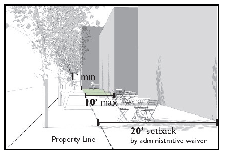
Figure 2: Side setbacks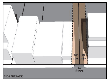
Figure 3: Building façade breaks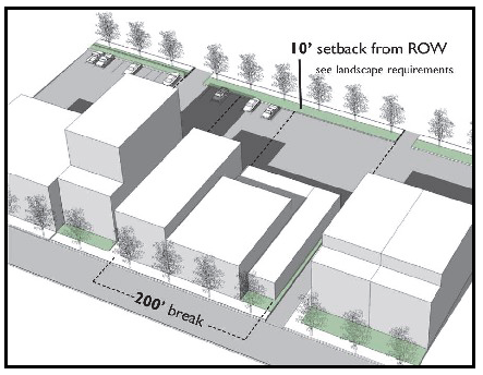
Figure 4: Stepbacks and building height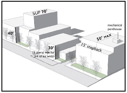
Figure 5: Parking areas; screening from public streets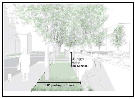
Figure 6: Parking areas; landscaping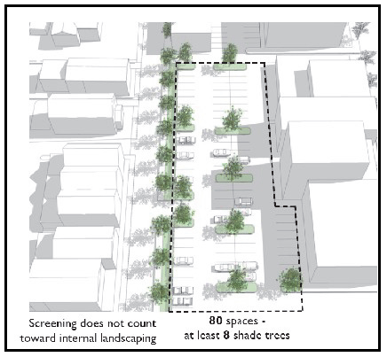
Figure 7: Screening requirements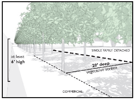
Figure 8: Screening requirements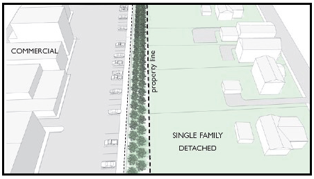
Figure 9: Sidewalks and street trees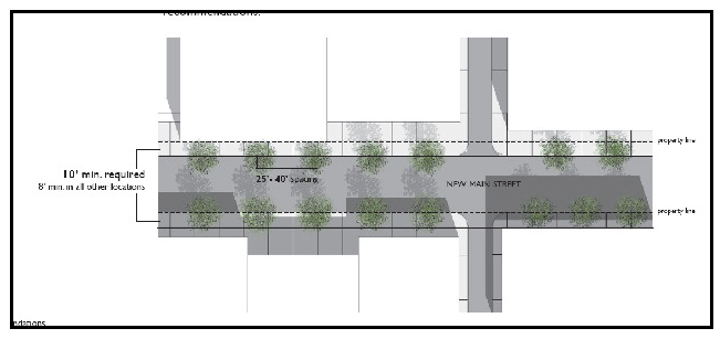
(Ord. 08-18(3), 6-11-08)
Sec. 20B.8 - Residential uses allowed by special use permit; additional factors when considering special use permits.
In evaluating a request for a special use permit for a non-residential use under section 20B.2(E) or a residential use under section 20B.2(F), the board shall consider the following factors in addition to those delineated in section 33.8:
A.
The proposed use should be consistent with the recommendations for the Downtown area in the Crozet Master Plan.
B.
The proposed use and its proposed size should be consistent with the purpose and intent of the Downtown Crozet District as stated in section 20B.1.
C.
The proposed use in its location should complement adjacent uses and contribute to a mix of uses in the Downtown Crozet District.
D.
Whether the part of the structure in which the proposed use will be located can be converted to accommodate by right uses in the Downtown Crozet District.
(Ord. 13-18(8), 12-11-13)
Sec. 20C.1 - Purpose and intent.
The Rio29 Form-Based Code Overlay District (Rio29 FBC District) is created to encourage a development pattern consistent with the vision described in the Rio29 Small Area Plan. The Rio29 Small Area Plan envisions an area that is:
1.
A multimodal hub with a connected network of complete streets, which are designed for all users;
2.
A vibrant and diverse mixed-use community with interesting character and a human-scale built environment; and
3.
A place enhanced through conservation with a network of sustainable and usable public spaces that enrich community and preserve and enhance natural resources.
The Rio29 Form-Based Code (Rio29 FBC) is intended to support redevelopment of existing conventional suburban development to establish new, compact development patterns with an urban scale, mass, density, and a mixture of uses within close proximity to each other. Further, the Rio29 FBC is intended to:
1.
Allow development that achieves the vision through an administrative process;
2.
Establish clear expectations for residents, property owners, developers, and the County for new development;
3.
Be applied upon adoption and allow the area to transition over time to meet the vision; and
4.
Strike the appropriate balance between regulation to achieve the desired form, and flexibility to accommodate market changes, creativity in design, and a mix of uses.
The purpose and intent of each section outlined below are based on this vision. The provisions outlined will inform the development of property within the Rio29 FBC District and provide administrative guidance for waivers or exceptions to the Rio29 FBC.
A.
Uses. Regulation of uses in the Rio29 FBC District is de-emphasized in favor of regulation of street, site, and building forms. Some use regulations remain to avoid negative impacts to residents and other uses.
B.
Streets. Streets in the Rio29 FBC District are designed as "complete streets" to balance the safety and needs of all forms of traffic: pedestrian, bicycle, transit, and vehicular. A street's designated character area(s) and function(s) determine the applicable design standards.
Local streets within the Core prioritize walkability and pedestrian comfort, with automobile movement as a secondary focus.
C.
Building standards. Building standards govern the physical form and mass of buildings in relation to one another by establishing basic parameters for development. These parameters include building height, ground floor ceiling height, block length, and build-to range. The purpose of the building standards section is to support development that is well-connected, walkable, human-scaled, and includes a high-quality public realm.
D.
Parking and loading standards. Parking and loading standards promote a "park once" environment that enables convenient access to a variety of activities by walking, biking, and using transit. These standards encourage shared parking to reduce fragmented, inefficient, and single-purpose parking. Parking and loading standards provide access and walkability to activities within the Rio29 FBC District, while preventing adverse parking impacts on the pedestrian environment, public spaces, and neighborhoods adjacent to developments.
Short-term bicycle parking standards create convenient and accessible bicycle parking areas for customers and other visitors.
Long-term bicycle parking standards create secure and weather-protected bicycle parking areas for employees, residents, commuters, and other visitors who generally stay at a site for several hours.
E.
Architectural design standards. The physical design of buildings and neighborhoods contributes significantly to the overall experience of a community. The distinctive characteristics of various buildings make streets interesting, and make neighborhoods satisfying places to live and work. Simplicity in design, honesty in expression, quality craftsmanship, human-scale proportions, and variety in compositions and details establish a comfortable, welcoming environment.
Architectural design standards set parameters for the exterior design of buildings, addressing appearance using appropriate materials, configurations of building elements, and suitable building techniques. The purpose of the architectural standards section is to reinforce a human-scaled environment with active streets and visual interest and to establish a sense of place that is unique to the Rio29 FBC District.
F.
Civic space standards. Civic spaces are intended to be places for community members to gather and recreate, and should improve sustainability through the provision of green infrastructure services. Civic spaces include (but are not limited to): squares, plazas, greens, linear parks, pocket parks, natural areas, and indoor civic gathering spaces.
G.
Affordable housing requirement. The provision of affordable housing is required in all residential developments containing five or more residential dwelling units to ensure a variety of housing types and levels of affordability are provided in alignment with the Albemarle County Comprehensive Plan (Chapter 9, Housing) and the Housing Albemarle policy (Albemarle County Comprehensive Plan, Appendix 9).
(§ 18-20C.1, Ord. 21-18(4), 9-1-21)
Sec. 20C.2 - Administration and general provisions.
A.
Title. This Code is known as the Rio29 Form-Based Code (Rio29 FBC).
B.
Applicability.
1.
The Rio29 FBC is an optional zoning tool. Property owners who do not opt into the Rio29 FBC retain their existing zoning. Use of the Rio29 FBC is selected through the filing of an application for development under the Rio29 FBC. Properties developed pursuant to the Rio29 FBC must comply with all provisions of the Rio29 FBC.
2.
Properties located in the Rio29 FBC District (as designated on the Regulating Plan) may use or develop property pursuant to the Rio29 FBC. After such use or development, all uses permitted pursuant to section 20C.6 are permitted on the property, subject to all Rio29 FBC regulations.
3.
If an owner develops a parcel pursuant to the Rio29 FBC, Rio29 FBC regulations apply to the entire parcel as it existed on September 1, 2021.
4.
Parcels developed under the Rio29 FBC may not subsequently develop subject to the district regulations of the underlying district.
5.
Redevelopment of existing structures or incorporation of existing structures in the development of a parcel may occur in a phased manner by submitting a conceptual plan showing the proposed redevelopment. Existing structures incorporated into a conceptual plan are required to meet all provisions of the Rio29 FBC.
6.
In the event of any variation or conflict between any provisions of the Rio29 FBC and other sections of the Albemarle County Code, the provisions of the Rio29 FBC govern. For development standards not covered by this Rio29 FBC, applicable sections of the Albemarle County Code apply. Similarly, all development must comply with all applicable Federal, State and County regulations and ordinances including (but not limited to) Albemarle County Code Chapter 17 (Water Protection) and other environmental regulations.
C.
Application requirements and review process.
1.
Preapplication meeting. Any prospective application for development in accordance with the Rio29 FBC must request and hold a meeting with the Community Development Department before submitting an initial site plan. This meeting is referred to as the "pre-application meeting."
a.
Submitting information. The applicant must complete and submit information on County -provided forms before or during the pre-application meeting.
b.
Purposes for a pre-application meeting. The purposes for a pre-application meeting are to:
i.
Provide the applicant and the County a common understanding of the proposed project;
ii.
Inform the applicant about the proposed project's consistency with the Regulating Plan, other relevant policies, and County regulations;
iii.
Broadly identify the planning, zoning, and other issues raised by the application that need to be addressed by the applicant;
iv.
Inform the applicant about the applicable procedure; and
v.
Allow the Director of Planning to identify the information the applicant must submit with the application pursuant to section 32.5.
2.
Submission requirements.
a.
Owners opting to use or develop a parcel pursuant to the Rio29 FBC must submit a Rio29 FBC application at the time of initial site plan submittal.
b.
Initial site plan. The applicant must complete and submit an initial site plan according to the requirements outlined in section 32.5.2.
c.
Final site plan. The applicant must complete and submit a final site plan according to the requirements outlined in section 32.6.2.
3.
Conceptual plan.
a.
A conceptual plan must be submitted when a new use or redevelopment is proposed that will retain and/or reuse existing buildings, either temporarily or permanently, or if a phased development is proposed that will not bring the full property in compliance during the first phase of development.
b.
The conceptual plan must be submitted as part of the Initial Site Plan or as required in section 20C.2.D as part of a special exception. The conceptual plan must include the following:
i.
The location of all new development on the site;
ii.
The location, condition, and any renovation of existing buildings to be retained;
iii.
Any existing site improvements (such as parking areas, landscaping, and open space) to be retained;
iv.
The location of existing streets to be retained, future streets, and future connections to streets on adjoining parcels;
v.
The location of existing and proposed civic spaces;
vi.
The proposed uses on the site;
vii.
A phasing plan showing phase lines and the proposed sequence of development; and
viii.
A summary of any modifications requested.
D.
Special exceptions.
1.
In addition to special exceptions granted under section 33, special exceptions from the Rio29 FBC may be granted by the Board of Supervisors for the following:
a.
The allowance of multi-family and single-family attached dwellings that occupy greater than 66 percent of the ground floor street-facing façade within the Core character area;
b.
The allowance of a single-use artisan manufacturing building with a footprint larger than 20,000 square feet within the Edge character area;
c.
Modifications to building standards or to architectural design standards related to the inclusion of existing buildings, subject to the conceptual plan requirements of section 20C.2.D.3;
d.
Modifications to block length for reasons other than those listed in section 20C.8.C.2;
e.
Relief from the provisions of 20C.2.B.3 to allow the Rio29 FBC to apply to a portion of a parcel existing on September 1, 2021. In addition to the submittal requirements of section 33 the applicant must submit a conceptual plan showing how the entire property could be developed in accord with the regulations of the Rio29 FBC.
2.
Special exceptions from the provisions of the Rio29 FBC may be granted by the Board of Supervisors upon a finding that the special exception:
a.
Furthers the purpose and intent of the provisions of the Rio29 FBC as described in section 20C.1 (Purpose and intent);
b.
Is consistent with the Regulating Plan; and
c.
Is consistent with the Comprehensive Plan.
3.
Special exceptions to allow modifications to building standards or architectural design standards related to inclusion of existing buildings, or to allow relief from provisions of section 20C.2.B.3, may be granted by the Board of Supervisors following the submittal of a conceptual plan, where the following additional conditions are met:
a.
Renovations must not cause existing building(s) to become more nonconforming as to building standards, architectural standards, or any other relevant requirements of this code.
b.
Streets that provide site access and/or connectivity to adjacent properties must be constructed or upgraded to meet the requirements of section 20C.7 and be completed prior to commencement of the use, issuance of a zoning clearance, or issuance of a Certificate of Occupancy for the first phase of development.
c.
Where a new use is proposed under section 20C.6, existing buildings (constructed prior to September 1, 2021) being retained must be shown as part of the phase in which the building will be first used. The following site and building improvements must be provided prior to commencement of the use, issuance of a zoning clearance, or issuance of a Certificate of Occupancy for the phase of development of the building's first use:
i.
Streets to serve each phase of development must be constructed or upgraded to meet the requirements of section 20C.7 with each phase of development.
ii.
The minimum area of required civic space, calculated based on the gross acreage of each phase, must be constructed and dedicated with each phase of development.
iii.
All existing buildings to be retained must meet architectural design standards of section 20C.10 with each phase of development.
d.
Any other conditions as determined by the Board of Supervisors
E.
Agent. The Director of the Albemarle County Community Development Department is hereby designated the Agent of the Board of Supervisors for the purpose of administering the Rio29 FBC, except as otherwise expressly provided. The Agent or their designee has the power and duty to consider and act on requests to vary or except certain Rio29 FBC regulations, pursuant to the Rio29 FBC. All references to the Agent in this section may apply to the Agent or their designee.
(§ 18-20C.2, Ord. 21-18(4), 9-1-21)
Sec. 20C.3 - Definitions.
The following definitions apply only for purposes of the Rio29 FBC.
Alley. "Alley" means a narrow, one-lane road with provisions to access utilities and loading areas.
Articulation of a façade. "Articulation of a façade" (or "façade articulation") means changes in the depth of the surface of a building face or façade such as attached columns, recessed windows or window bays, horizontal banding, or decorative cornices. Articulation gives texture to the building surface.
Artisan manufacturing. "Artisan manufacturing" means the production, display, and sale of individually crafted tangible goods such as artwork, jewelry, furniture, sculpture, pottery, leathercraft, hand-woven article, baked or prepared food and drink, watercraft, and similar items. Artisan manufacturing does not include industrial-scale mass production.
Avenue. "Avenue" means a two-lane, medium-capacity street with provisions to serve both local and through pedestrian, bicycle, and automobile traffic, as well as transit. Berkmar Drive and Hillsdale Drive are Avenues.
Block. "Block" means an increment of land circumscribed and not traversed by streets (alleys and pedestrian pathways excepted). Block length is measured along the edge of a street right-of-way. The measurement is taken along parcel frontages from one corner of a street right-of-way to the next.
Boulevard. "Boulevard" means a four-lane, high-capacity street with provisions to serve both local and through pedestrian, bicycle, and automobile traffic, as well as transit. Rio Road is a Boulevard.
Build-to range. "Build-to range" means a minimum and maximum threshold located on the front(s) of a lot where the structure must be located, measured from the rear edge of the right-of-way or external civic space. The building's street façade wall must be located within the build-to range. Façade articulation, such as window or wall recesses and covered porches, balconies, chimneys, eaves, and like architectural projections are not counted as the building façade line.
Civic space. "Civic space" means an area dedicated to public use that is designated for gathering, socializing, and recreation. Civic space is usually in the form of open outdoors space but may also be in the form of indoor civic gathering spaces.
Commercial parking. "Commercial parking" means the use of surface or structured parking for rent, lease, or sale.
Community facility. "Community facility" means a public or private recreational, safety, cultural, or religious use or facility such as a camp, volunteer fire/rescue station, religious assembly use, museum, community center, or similar facility.
Conceptual plan. "Conceptual plan" means a plan submitted pursuant to section 20C.2.C.3 that delineates the overall scheme of redevelopment where a new use or redevelopment is proposed that will retain and/or reuse existing buildings.
Cultural amenity space. "Cultural amenity space" means a museum, art gallery, or other cultural facility located within a structure. This type of facility must be open to the public on a regular basis.
Development site. "Development site" means property to be developed pursuant to the Rio29 FBC.
Façade segment length. "Façade segment length" means the length of a building façade without horizontal or vertical plane articulation.
Indoor civic space. "Indoor civic space" means an indoors gathering space that provides public access and cultural, horticultural, or other indoor amenities, designed to accommodate recreational functions including (but not limited to): public meeting spaces, sitting, relaxing, picnicking, or education.
Institutional uses. "Institutional uses" means public or private health or educational uses and facilities such as schools, training centers, universities, hospitals, assisted living facilities, skilled nursing facilities, children's residential facilities, or similar facilities.
Landscaped separation zone. "Landscaped separation zone" means the area between the sidewalk and right-of-way that is designed according to the streetscape elements standards in section 20C.7.C.
Light industrial uses. "Light industrial uses" (LI) means processing, fabricating, assembly, or disassembly of items that take place wholly within an enclosed building and that are compatible with, and do not detract from, surrounding uses. Light industrial uses may involve use of tools or machinery. Large scale storage or warehousing of materials are not light industrial uses.
Linear park. "Linear park" means a long, uninterrupted park within an urban area that features a shared use path (SUP) linking a greenway with other amenities and trails, designed to accommodate recreational functions including (but not limited to): walking, running, cycling, sitting, and relaxing.
Live-work dwelling unit. "Live-work dwelling unit" means a dwelling unit that consists of both a residence and a commercial or manufacturing space used by at least one resident of the unit.
Local street. "Local street" means a two-lane, low-speed street with provisions to serve local pedestrian, bicycle and automobile traffic.
Natural area. "Natural area" means a vegetated outdoor civic space of at least 0.5 acres with little to no impervious surfaces, designed to accommodate wildlife habitats and recreational functions including (but not limited to): walking, jogging, biking, relaxing, or picnicking.
Pedestrian passages. "Pedestrian passage" means a pedestrian-only street with provisions to serve local pedestrian traffic safely and conveniently. Pedestrian passages are open to the sky, except for canopies and trellises.
Plaza. "Plaza" means an outdoor civic space of 0.25—2 acres surrounded on all sides by buildings or roads, designed to accommodate recreational functions including (but not limited to): relaxing, sitting or strolling, casual gatherings, picnics, and organized events.
Pocket park. "Pocket park" means a small park embedded within an urban or suburban neighborhood of 0.2—0.5 acres, designed to accommodate recreational opportunities for residents and employees of nearby developments, including (but not limited to): relaxing, sitting, strolling, gardening, dog-walking, playing, or casual gatherings. The park may help the meet needs for public or private open space and stormwater management.
Public green. "Public green" means an open outdoor civic space of 0.5 - 5 acres surrounded on all sides by buildings or roads, designed to accommodate recreational functions including (but not limited to): relaxing, sitting or strolling, casual gatherings, or organized events.
Public art. "Public art" means the application of creativity by artists to the production of tangible objects, including (but not limited to): paintings, carvings, collages, sculptures, frescoes, mosaics, site-specific installations, mobiles, engravings, bas-reliefs, and murals. Architects and landscape architects are not artists for purposes of this definition.
Rideshare. "Rideshare" means a transportation service in which a passenger travels in a private vehicle driven by the vehicle's owner, especially as arranged by means of a website or a mobile phone application.
Sidewalk clear zone. "Sidewalk clear zone" means a contiguous, unobstructed portion of sidewalk that allows the safe and convenient passage of pedestrians.
Square. "Square" means a primarily hardscaped outdoor civic space one-half to one block in size, designed to accommodate a variety of functions, including (but not limited to): farmers' markets, outdoor games, food truck sales, concerts, social gatherings, civic gatherings, outdoor learning spaces, pop-up businesses, and passive recreation.
Street façade. "Street façade" means the building elevation facing a street or civic space. Building walls facing private interior courts, common lot lines, alleys, or pedestrian passages are not street façades.
Street furniture. "Street furniture" means benches, seating, and tables that are available for public use along the street frontage.
Through corridor. "Through corridor" means a high-capacity, high speed street with provisions to serve local and regional traffic. Route 29/Seminole Trail is the only through corridor.
Transparency. "Transparency" means the amount of glass in windows and/or doors (including any mullions, muntins and frames) as a percentage of the building façade. Glass must have low reflectivity. Semi-transparent, opaque, frosted, etched, and mirrored glass do not qualify as transparent glass.
(§ 18-20C.3, Ord. 21-18(4), 9-1-21)
Sec. 20C.4 - Character areas.
Establishment of character areas. The Rio29 FBC District contains three character areas: Core, Flex and Edge. Designated character areas determine the appropriate uses and forms of development within each designated character area. The uses and forms of development are intended to implement the adopted Rio29 Small Area Plan.
A.
Core. The Core character area has the highest intensity and most urban form of development within the District. Development encompasses a mixture of uses and an active street life, encouraged by transparent façades, taller ceiling heights, and non-residential uses on the ground floors of buildings. Well-designed civic spaces enhance an urban and pedestrian-friendly experience. People can easily walk, bike, and use transit to reach their destinations within and outside of the Core.
B.
Flex. The Flex character area accommodates a range of building forms and uses to transition from higher intensity urban development in the Core to the lower intensity development along the Edge. The Flex physically connects the Core and the Edge and has a variety of building heights and block sizes. This connection is enhanced through a network of civic spaces and pedestrian, bike, and transit options.
C.
Edge. The Edge character area exhibits less intense development than the Core and Flex, given its location next to existing residential neighborhoods. Buildings are expected to have lower heights and smaller forms, while continuing to provide neighborhood services and a mixture of uses.
(§ 18-20C.4, Ord. 21-18(4), 9-1-21)
Sec. 20C.5 - Regulating plan.
The Rio29 FBC Regulating Plan indicates the designated character area for each property within the Rio29 FBC District. It also includes the general location of required civic spaces, pursuant to section 20C.11.
The Rio29 Small Area Plan includes a Future Connectivity Plan, which depicts an interconnected network of street types as depicted in section 20C.7. Site plans under the Rio29 FBC should reference the Future Connectivity Plan. While redevelopment and new development will determine the actual location of streets, site plans should provide direct multi-modal connections that will allow people to easily walk, bike, and use transit to reach their destinations within and outside of the Rio29 District.
(§ 18-20C.5, Ord. 21-18(4), 9-1-21)
Sec. 20C.6 - Permitted uses.
A.
Permitted uses. The uses permitted in each character area are listed in Table 1. Accessory uses are permitted unless explicitly prohibited in Table 1.
Table 1: Permitted Uses
B.
Use provisions.
1.
General provisions.
a.
Any materials stored outdoors, with the exception of outdoor display for advertisement, must be hidden behind an opaque fence to screen the ground-level view from any public right-of-way or any residential use, and materials may not be piled or stacked higher than the opaque fence; and
b.
Any use producing noise, vibrations, glare and heat, or electrical disturbance that is subject to the performance standards of section 4.14 must be conducted within an enclosed building; and
c.
Each prospective use of an industrial or manufacturing character must submit a certified engineer's report pursuant to section 4.14.5. prior to commencement of the use, issuance of a zoning clearance, or issuance of a Certificate of Occupancy for the site.
2.
Multiple-family dwellings and single-family attached dwellings.
a.
Multiple-family dwellings and single-family attached dwellings may locate on the ground floor of the Core character area, provided that:
i.
No more than two-thirds of the ground floor street facing façade of a single building may be occupied by multiple-family or single-family attached residential uses. This standard does not apply to façades facing through corridors;
ii.
The construction and design of the ground story must allow for future conversion to a commercial use. The ground floor must be sprinklered as required under the Virginia Construction Code for commercial uses; and
iii.
Temporary false floors or drop ceilings are permitted to allow shorter ground floor ceiling heights, provided that a future conversion could comply with section 20C.8.
3.
Live-work dwelling units.
a.
Any non-residential use of a live-work dwelling unit must be conducted by one or more residents of the unit.
b.
Any non-residential use of a live-work dwelling unit must comply with all performance standards of section 4.14.
c.
Any non-residential use of a live-work dwelling unit must obtain a zoning clearance prior to commencing the use.
d.
The commercial or manufacturing space in a live-work dwelling unit must have a ceiling height of at least 12 feet.
e.
The residential and commercial or manufacturing spaces in a live-work dwelling unit may not be sold, rented, or subleased separately.
f.
Live-work dwelling units may have a maximum floor area of 3,000 square feet.
4.
Artisan manufacturing.
a.
Any individual artisan manufacturing establishment may not employ more than 20 full-time employees or the equivalent part-time employees.
b.
Any individual artisan manufacturing establishment may have regular storefront hours during which a portion of the premises is open to the public for sale of finished products.
c.
An artisan manufacturing use may hold workshops, classes, or events related to the manufacturing use, provided they are accessory to the manufacturing use.
d.
Single-use buildings containing an artisan manufacturing use within the Edge character area may not exceed a building footprint of 20,000 square feet, unless granted a special exception.
5.
Light industrial.
a.
A light industrial use may hold workshops, classes, or events related to the manufacturing use, provided they are accessory to the manufacturing use.
6.
Public art.
a.
The following items are not considered public art, for purposes of the Rio29 FBC: reproductions or unlimited copies of original artwork; mass-produced art objects; the overall architectural design of a building; architectural rehabilitation or historic preservation; and logos or interpretations of logos.
b.
Public art must be located outside of buildings and be completely visible from the public right-of-way or on a publicly viewable façade. It must be permanently fixed, outside of sight distance triangles.
7.
Temporary uses.
a.
Temporary uses must obtain a zoning clearance prior to operation, for operation of up to 180 days. Temporary use zoning clearances may not be renewed.
b.
All use permitted in a character area under the Rio29 FBC may be permitted as a temporary use per Table 1.
c.
Structures used for temporary uses. Temporary uses are permitted in structures in the Rio29 District built before September 1, 2021, and in the following structures as permitted by the Building Code:
i.
Modular buildings or shipping containers of less than 256 square feet as approved by the Virginia Construction Code;
ii.
Trucks and trailers located in place for more than two hours; or
iii.
In tents or outside.
d.
Temporary uses are exempt from sections 20C.7, 20C.8, 20C.10, 20C.11, and 20C.12.
e.
Section 20C.9 applies to temporary uses under the Rio29 FBC.
f.
Temporary uses in the Rio29 FBC District may request a temporary sign permit pursuant to section 4.15.6, for a period of up to 180 days.
8.
Uses not specifically listed.
a.
The Agent may determine that a use not specifically listed is permitted, provided that such use is similar to the listed permitted uses in terms of locational requirements, operational characteristics, visual impact and traffic generation. The Agent's determinations may be appealed pursuant to section 34.
(§ 18-20C.6 Ord. 21-18(4), 9-1-21)
Sec. 20C.7 - Street standards.
A.
Street locations.
1.
Each street must provide an interconnected network of streets consistent with the Rio29 Small Area Plan.
2.
New street locations will be determined in collaboration between the property owner, the Agent, and VDOT.
3.
Streets must provide a network of blocks with block lengths pursuant to section 20C.8.
4.
Streets must:
a.
Be coordinated with existing or planned streets as to location, width, grades and drainage within the general area of the development site;
b.
Connect to planned, existing, or platted streets in adjoining areas by dedication or reservation of right-of-way.
5.
All streets within a development site must be extended and constructed to the abutting property lines to provide vehicular and pedestrian interconnections to existing or future development on adjoining properties.
B.
Street sections.
Figure 1: Boulevard Streets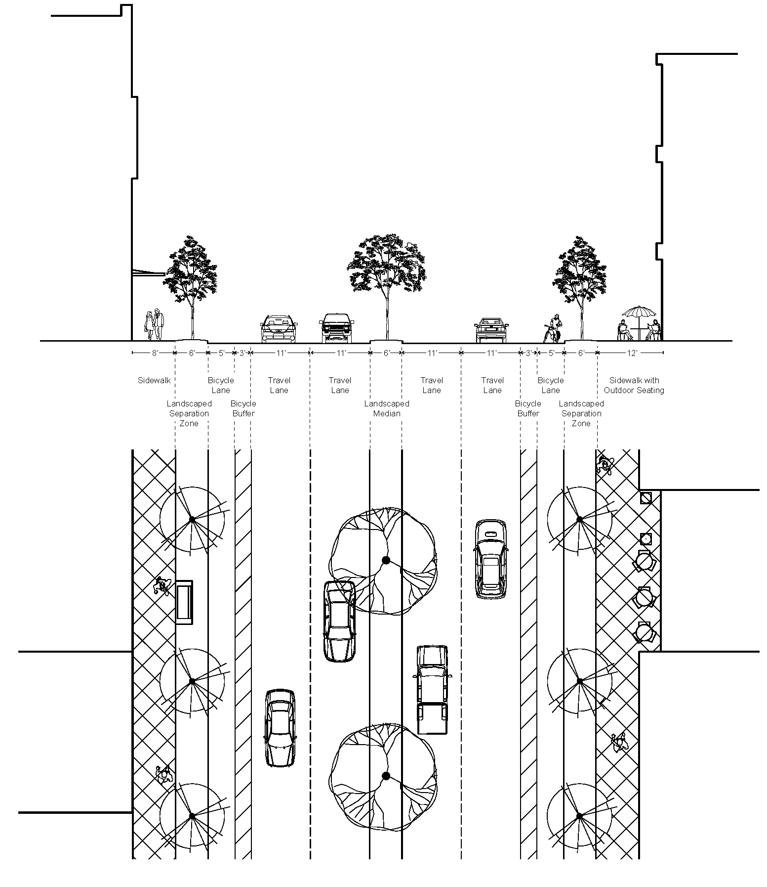
Figure 2: Avenue Streets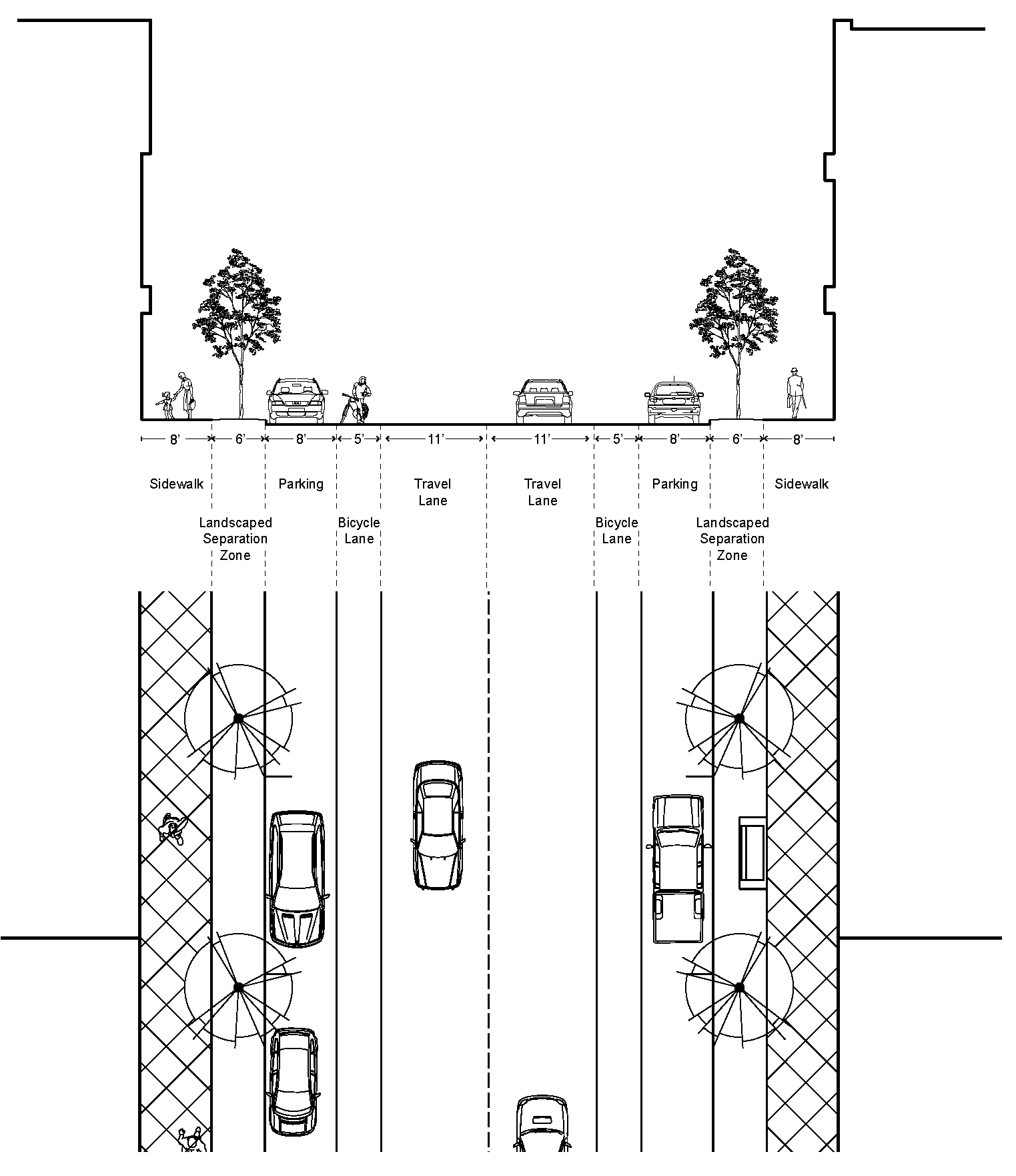
Figure 3: Local Streets (Core)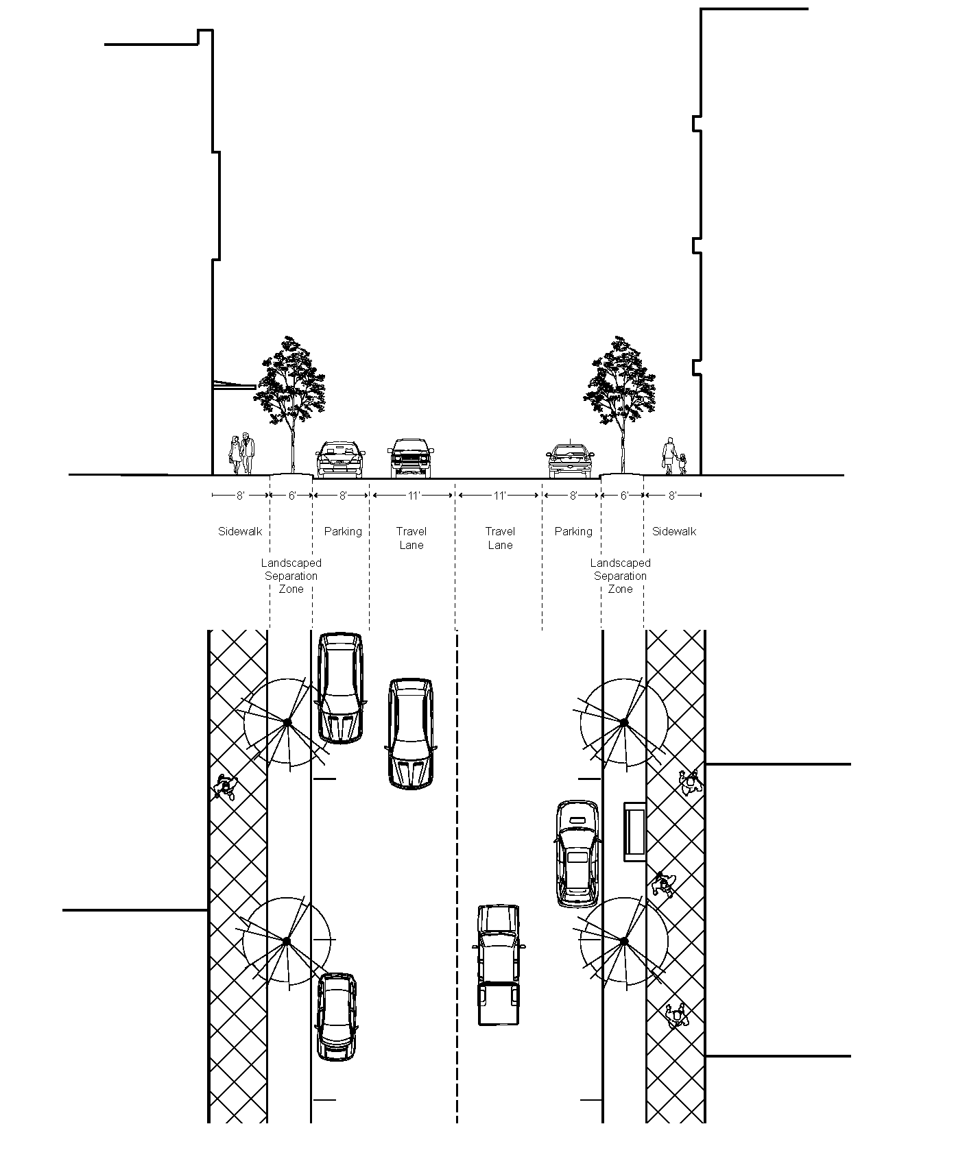
Figure 4: Local Streets (Flex/Edge)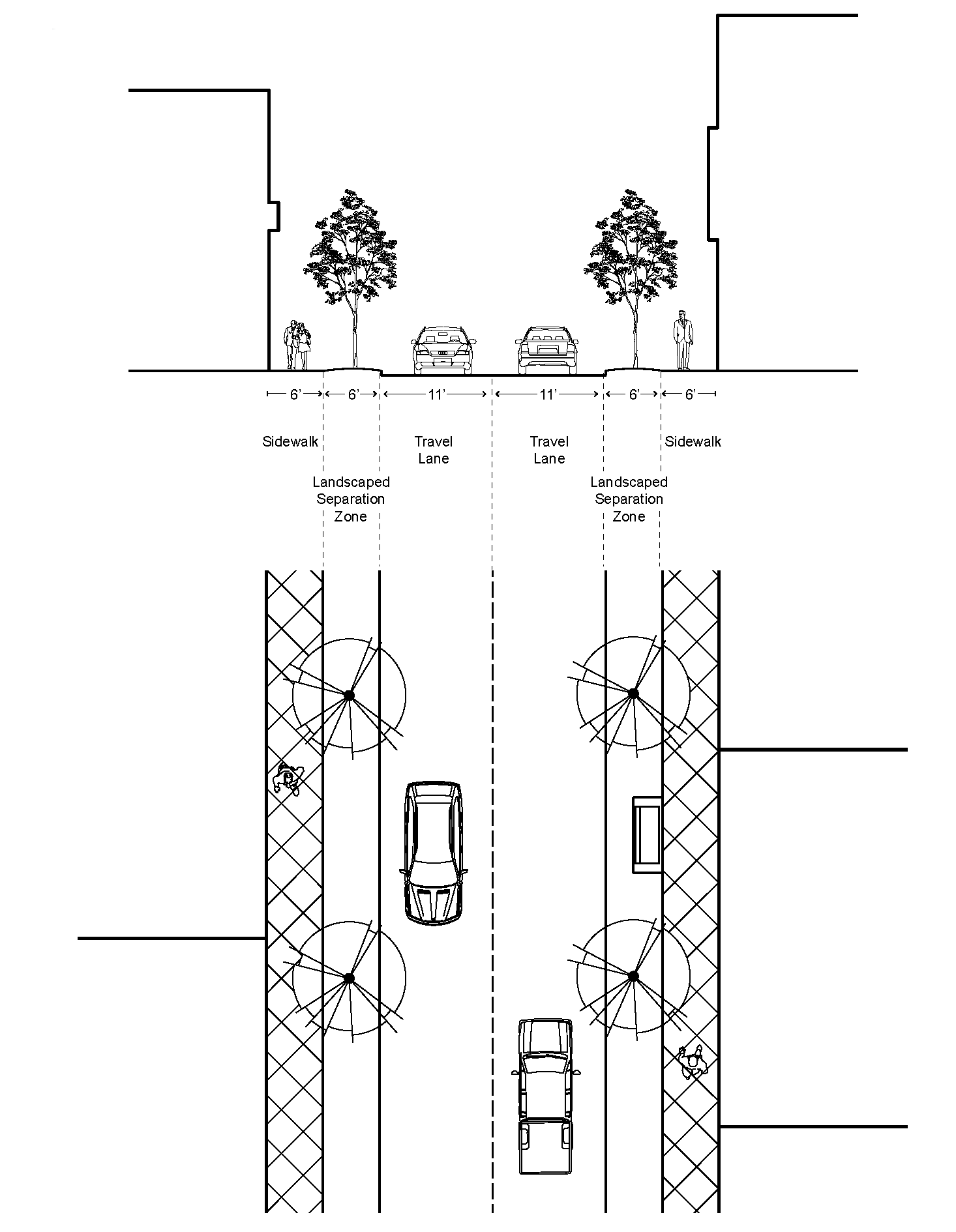
Figure 5: Through Corridor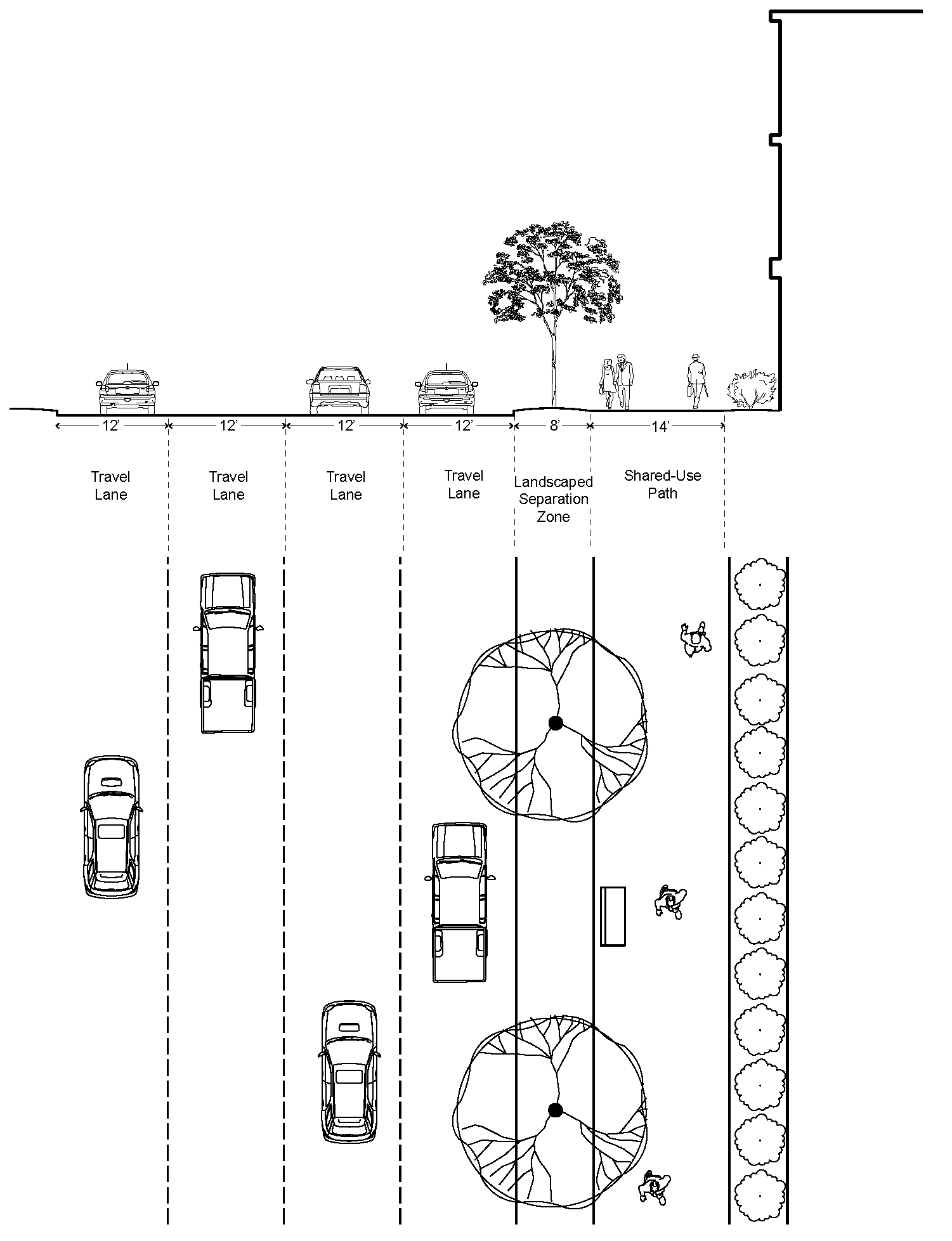
Figure 6: Through Corridor (with Parking and Drive Aisle)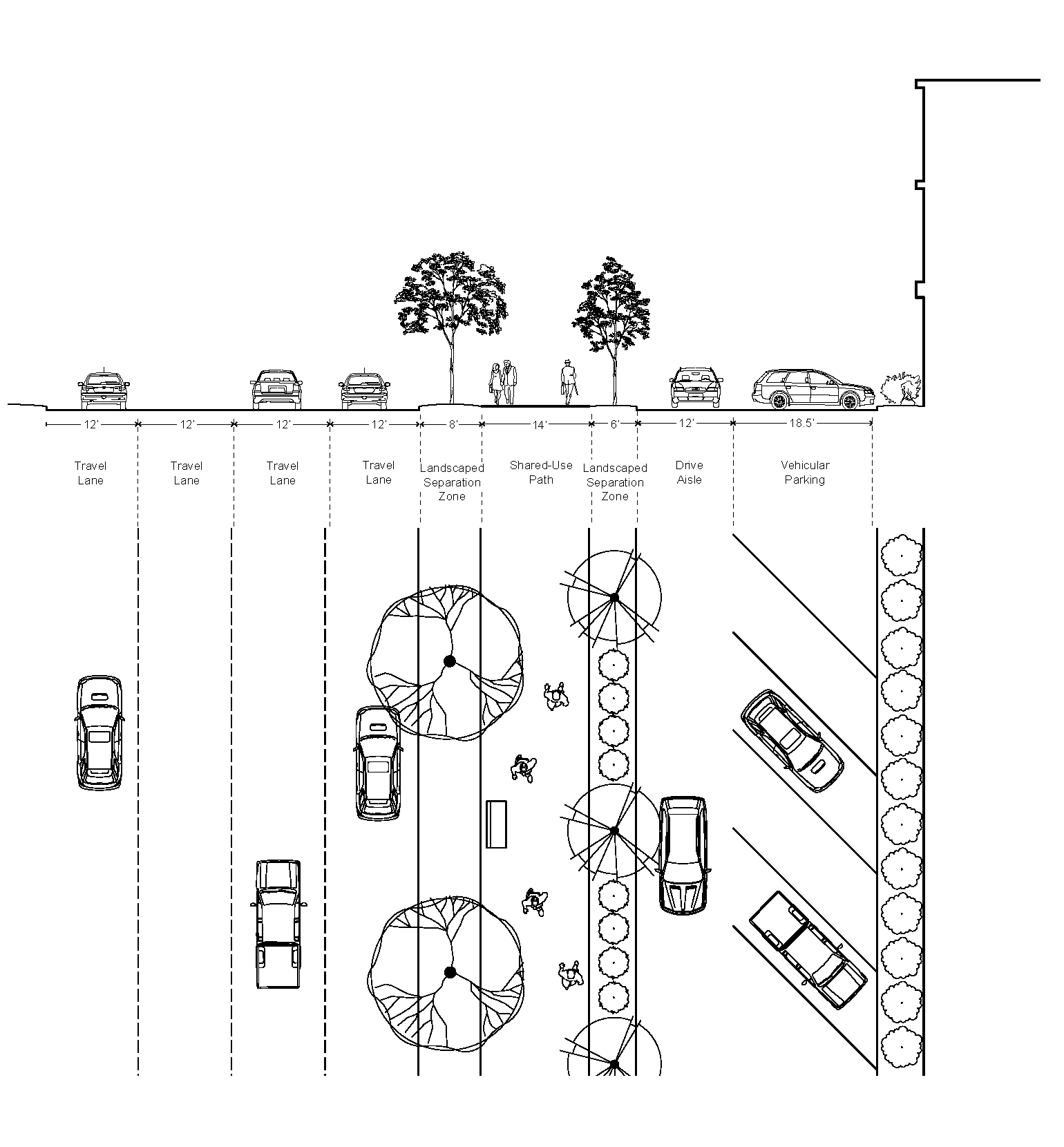
C.
Street standards.
1.
Streets within the Rio29 FBC District platted after September 1, 2021 must comply with the following standards:
a.
Rio Road must comply with Boulevard street standards;
b.
Hillsdale Drive and Berkmar Drive, including extensions and future sections shown on the Rio29 Future Connectivity Plan (see Rio29 Small Area Plan), must comply with Avenue street standards.
c.
All other streets must comply with local street standards.
d.
Pedestrian passages and alleys may be provided at the option of the developer but, where provided, must comply with Rio29 FBC standards.
e.
Streets must meet the block length standards of section 20C.8.
2.
Streets must meet the standards below, in collaboration with the Virginia Department of Transportation (VDOT). Standards vary by street type and character area. Lane width and design will be determined in conjunction with VDOT and Fire Rescue staff, and must comply as closely as feasible with street sections shown in the Rio29 Small Area Plan.
Table 2: Street Standards
3.
Sidewalk standards generally.
a.
Sidewalk width. Sidewalks wider than the minimum standards are permitted at the property owner's discretion. Wider sidewalks may accommodate outdoor cafés, other seating associated with ground story uses, or small displays outside of pedestrian entrances, provided that a five-foot wide sidewalk clear zone is maintained.
The five-foot sidewalk clear zone is not applicable to shared use paths (SUP). SUPs must not be obstructed within the minimum required width.
b.
Maintenance of sidewalks. Property owners must maintain any sidewalk beyond the minimum sidewalk width and any sidewalk used to accommodate outdoor cafés, other seating associated with ground story uses, or small displays outside of pedestrian entrances.
D.
Modifications to street standards.
1.
The Agent may approve modifications to the street standards of this section, provided that the resulting street meets the purpose and intent of this section and provides for continuity with existing or planned streets on adjacent properties.
2.
A SUP or two-way cycle track may be provided in lieu of bicycle/pedestrian facilities if it is deemed appropriate by County Transportation Planning staff and VDOT, and the applicant can provide for appropriate transition to adjacent facilities. SUPs must be designed and constructed in accord with the Albemarle County Design Standards Manual.
3.
The bicycle buffer may be reduced in width where a physical barrier is provided and where appropriate transitions are provided to adjacent properties, if deemed appropriate by VDOT and County Transportation Planning staff.
4.
Appropriate locations for on-street parking must be determined in collaboration with County Transportation Planning and VDOT staff during project design. On-street parking is required for local streets within the Core, in locations deemed appropriate by Transportation Planning and VDOT staff.
5.
The landscaped separation zone may be reduced in width on local streets where street trees are planted within grates or tree wells along sidewalks, provided that (a) the landscape design includes adequate soil volumes below the pavement and (b) a minimum five-foot wide sidewalk clear zone is maintained along the sidewalk.
E.
Street ownership and maintenance.
1.
Public streets. All boulevards, avenues, and local streets must be public streets and be dedicated to public use, and acceptable to VDOT.
2.
New Streets. Property owners or a third party approved by the Agent must construct the new public streets and associated streetscape elements to serve their site as required in this section.
3.
Existing Streets. Where a development site fronts existing public street(s), the property owner(s) must:
a.
Construct street or intersection improvements required by VDOT to safely accommodate traffic to serve the site;
b.
Construct sidewalks, landscaping, and other streetscape elements along the development site frontage required by this section; and
c.
Reserve land for future dedication along the development site frontage for future street widening to accommodate on-street facilities such as bicycle lanes, bicycle buffers, and/or medians, as required by this section. Land reserved for on-street facilities such as bicycle lanes, bicycle buffers, and/or medians must be dedicated to the County upon demand of the County.
4.
Streetscape elements. Owners must dedicate to the County all required streetscape elements between their lot lines and the backs of curbs upon the demand of the County. Any streetscape elements that VDOT does not agree to maintain will be owned by the County, unless otherwise specified in this section.
a.
Privately owned and maintained streets.
i.
Pedestrian passages and alleys. Pedestrian passages and alleys are optional, to be owned and maintained by the property owner, unless other parties agree to maintain them.
ii.
Perpetual easement. The owner must ensure public access to the private street through a perpetual easement. The easement must include any portions of streetscape elements or pedestrian passages that are privately owned and maintained.
5.
Instrument assuring maintenance. The owner must submit an instrument assuring the perpetual maintenance of the streetscape elements, alleys, and/or pedestrian passages. The instrument will be subject to review and approval by the County Attorney and must be suitable for recordation in the office of the Circuit Court Clerk of the County.
F.
Streetscape elements.
1.
The following streetscape elements must be provided:
Table 3: Streetscape Elements Standards by Street Type
G.
Modifications to streetscape elements.
1.
The Agent may grant substitutions or modifications to streetscape standards as listed above, provided that the resulting streetscape meets the purpose and intent of this section and provides for continuity with streetscapes of existing or planned adjacent streets.
2.
Streetscape elements. The Agent may grant a reduction or modification in the number or frequency of required streetscape elements if VDOT standards or the presence of existing overhead or underground utilities, fire hydrants, curb cuts, or other existing features prevent the compliance with the standards in this section.
3.
Landscaped separation zone. The Agent may allow an alternative design and reduced width of landscaped separation zones, provided that the landscape design includes adequate soil volumes below the pavement.
H.
Streetscape elements generally.
1.
How to measure. Spacing of streetscape elements will be measured on an average distance along the site frontage to meet the requirements of section 20C.7.G. Clustering of streetscape elements is acceptable.
2.
Streetscape elements must continue existing spacing patterns established on adjacent developments, if applicable.
3.
Lighting.
a.
Lighting within the Rio29 FBC District must meet section 4.17.4 standards.
b.
Lighting may be used as an integral design component to enhance architecture, landscaping, and other site design elements.
4.
Street Trees.
a.
Street trees must be planted within appropriately sized grates or tree wells at grade or in a planting strip abutting the sidewalk and spaced according to the table below.
b.
Street trees must be selected from a current list of recommended large or medium shade trees, subject to the approval of the Agent when site conditions warrant medium shade trees per Table 4 below.
Table 4: Landscaping Requirements by Street Type
5.
Street furniture. Street furniture must comply with the following standards.
a.
Benches and seating.
i.
Benches and seating must be made of durable, high-quality materials such as concrete, wood, iron, steel, and fiberglass.
ii.
Benches and seating must be provided at the interval provided in section 20C.7.F.
iii.
Benches and seating may be clustered if the average number of seats/benches provided is equivalent to the standard in section 20C.7.F.
iv.
Fifty percent of clustered public seating or benches must comply with the Americans with Disabilities Act Accessibility Guidelines (ADAAG), see ADAAG section 4.32.
v.
Benches and seating must be located on or adjacent to a sidewalk. If benches are located on a sidewalk, a five-foot wide sidewalk clear zone must be maintained along the sidewalk. Benches must not be located where they may interfere with street trees, transit stops, or streetlights.
vi.
Benches and seating may be integrated as a part of other streetscape elements if their primary function and accessibility is not compromised. This may include but is not limited to seating integrated as a seat wall around trees and landscaping, or seating incorporated as a part of public art.
vii.
Temporary or movable seating may be used to meet the standards in section 20C.7.F, to allow seats to meet specific social and microclimate needs. Temporary or movable seating must be maintained by the property owner and remain open to the general public, not just the patrons of an establishment.
b.
Tables.
i.
Tables must be made of durable, high-quality materials such as concrete, wood, iron, steel, and fiberglass.
ii.
Any tables and/or chairs placed on a sidewalk must maintain a five-foot sidewalk clear zone.
iii.
Temporary or movable tables may also be used to meet the requirements in section 20C.7.F, to allow tables to meet specific social and microclimate needs. Temporary or movable tables must be maintained by the property owner and remain open to the public, not just the patrons of an establishment.
6.
Trash & recycling receptacles.
a.
Trash and recycling receptacles must be made of durable, high quality materials, such as galvanized or stainless steel.
b.
Trash and recycling receptacles must be located at the intervals required in section 20C.7.F.
c.
Trash and recycling must be located as near to corner and high activity generators (such as major civic, commercial, and transit destinations) as is practical without interfering with pedestrian, cyclist, transit, and vehicular traffic.
7.
Pedestrian accommodations.
a.
Marked crosswalks.
i.
Marked crosswalks must be provided at locations deemed appropriate, pursuant to the Virginia Supplement to the 2009 Manual on Uniform Traffic Control Devices (MUTCD) Part 3. Markings.
ii.
Marked crosswalks must be provided mid-block and at unsignalized locations deemed appropriate pursuant to the VDOT IIM-TE-384.0 Pedestrian Crossing Accommodations at Unsignalized Locations.
b.
Signals. Pedestrian signals must be provided at all signalized crosswalks along all boulevards, avenues, and local streets in the Core character area, pursuant to the Virginia Supplement to the 2009 Manual on Uniform Traffic Control Devices (MUTCD) Part 4. Highway Traffic Signals.
8.
Enhanced transit stops.
a.
Enhanced transit stops generally.
i.
Any required enhanced transit stop must comply with the standards of the local transit authority and the Rio29 FBC.
ii.
Each enhanced transit stops must include a shelter and seating in accord with the standards of the local transit authority.
iii.
Each enhanced transit stop must be ADA accessible.
b.
Enhanced transit stop locations.
i.
Enhanced transit stops are required in locations currently served or that will be served by Charlottesville Area Transit or other transit providers following completion of project construction.
ii.
Site plans for developments larger than two acres are subject to review by the Agent and by local transit authorities to determine transit service needs.
iii.
Transit stops must be located along a curb extension allowing transit vehicles to stop and board passengers without leaving the travel lane. Where parking lanes are provided, the stop must be aligned with the parking lane.
iv.
Other streetscape elements, such as trash and recycling receptacles, signage, and seating, must not obstruct sidewalks and accessible boarding areas.
c.
Enhanced transit stop design standards.
i.
An ADA accessible boarding area from the transit shelter and adjacent sidewalk must be provided at each transit stop.
ii.
Where boarding platforms are not level with the sidewalk, an ADA accessible ramp must be provided from the sidewalk to the platform.
iii.
Transit shelters must cover and protect at least one bench or four seats from weather elements.
iv.
Shelters may not block the minimum required widths of sidewalks or shared-use paths.
(§ 18-20C.7, Ord. 21-18(4), 9-1-21)
Sec. 20C.8 - Building standards.
A.
Building standards by character area.
Table 5: Building Standards by Character Area
B.
Building standards generally.
1.
Build-to range and street façades.
a.
At least 66 percent of a site's street frontage must be built within the build-to range, with the exception of frontage along through corridors.
b.
Ground floor street façades within seven feet of a block corner are exempt from this requirement, to allow for special treatments.
2.
Block length.
a.
No block face may have a length greater than 300 feet without an alley or pedestrian pathway providing through-access to another street, alley, or civic space.
b.
Development sites with less than 100 feet of street frontage are exempt from this requirement.
C.
Modifications to building standards. The Agent may grant modifications to building standards as listed below, provided that the resulting building and site design still meets the purpose and intent of this section.
1.
Reduction of ground floor height. The Agent may approve a reduction in ground floor height where a temporary false floor or drop ceiling is constructed to allow ground floor residential uses, consistent with section 20C.6, provided that a future conversion to commercial uses could comply with this section.
2.
Block length. The Agent may approve modifications to required block lengths for the following:
a.
To accommodate street connection(s) to existing or planned adjacent street(s);
b.
To accommodate a requirement of VDOT or the Department of Fire Rescue;
c.
To avoid a natural feature such as a water protection ordinance buffer or preserved slopes;
d.
To avoid a planned or existing civic space;
e.
To allow future streets to align with existing travel ways, private streets, or parcel lines within or adjacent to the site;
f.
To avoid or accommodate existing utilities; or
g.
To allow smaller block sizes for drive aisles or counterflow streets along through corridors.
3.
Required build-to range. Provided the modifications meet the purpose and intent of this section, the Agent may approve modifications to required build-to-range and the requirement to build to two-thirds of the site's street build-to range or both when natural features (such as existing mature trees), terrain, or existing utilities would otherwise interfere with required build-to range.
4.
Minimum height. The Board of Supervisors may approve modifications to the required minimum height to allow the reuse of existing one-story buildings that are incorporated within a larger conceptual plan, provided that conditions identified in section 20C.2.D are met.
5.
Incorporation of green building design. The agent may approve modifications to section 20C.10 to allow the incorporation of green building design.
D.
Stormwater Management. Each site plan must comply with all applicable requirements of section 32.
Figure 7: Building Height Measurement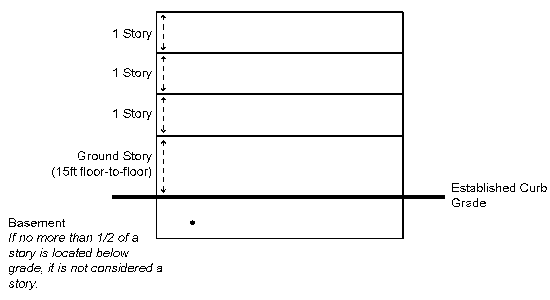
Figure 8: Build-To Range Measurement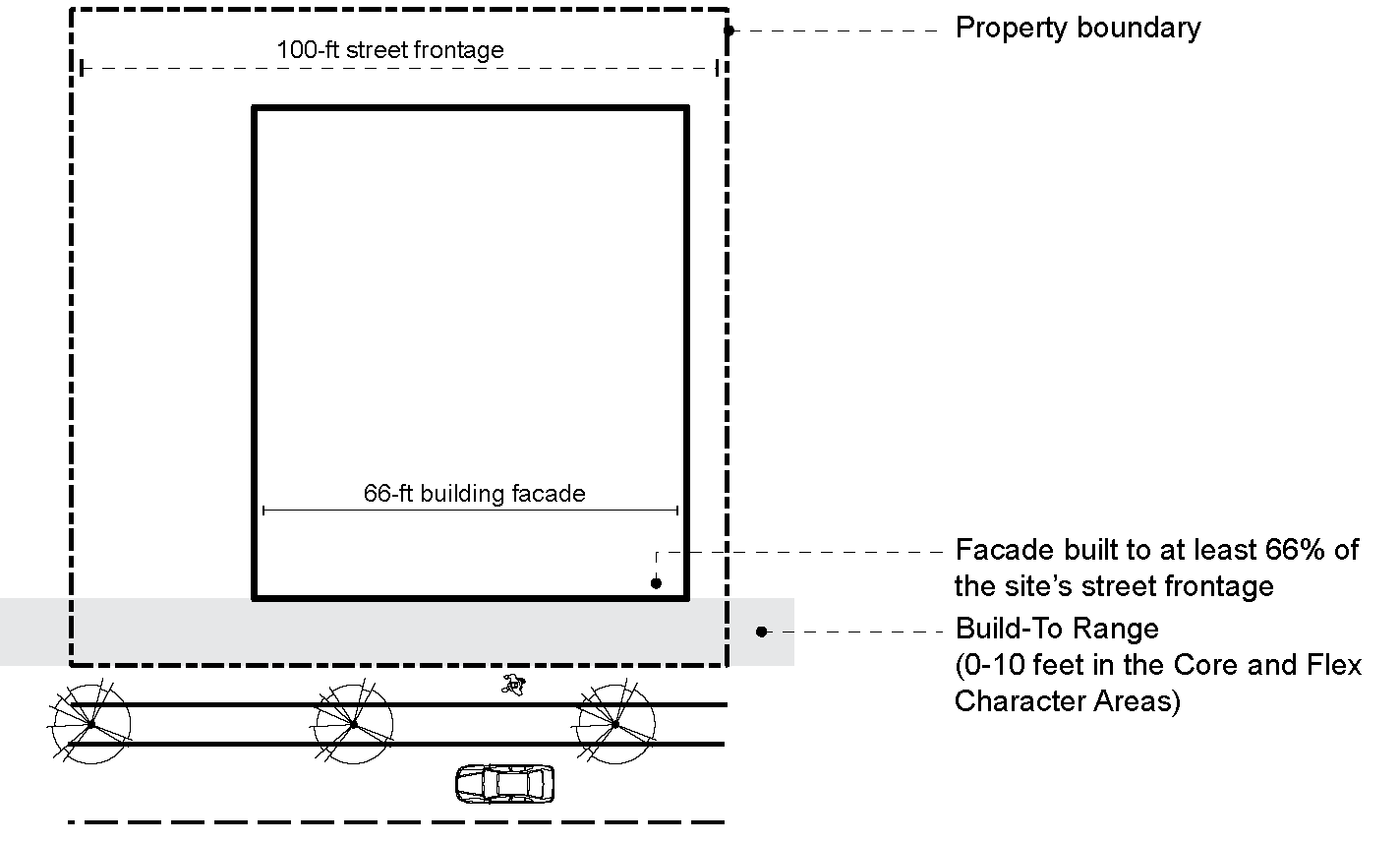
Figure 9: Block-Length Measurement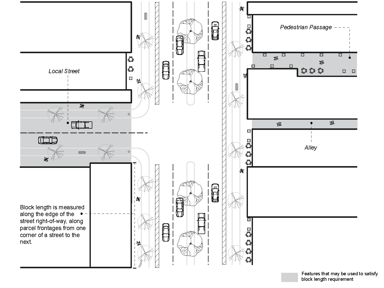
(§ 18-20C.8, Ord. 21-18(4), 9-1-21)
Sec. 20C.9 - Parking standards.
A.
Motor vehicle parking. The parking, stacking and loading requirements in section 4.12 of this chapter apply to the Rio29 Form-Based Code Overlay District provided that the provisions of sections 4.12.4a, 4.12.5, 4.12.6, 4.12.7, 4.12.13a, 4.12.13c, and 4.12.13e do not apply to developments utilizing the provisions of the Rio29 Form-Based Code Overlay District.
1.
Location and type of motor vehicle parking areas.
Table 6: Location and Type of Motor Vehicle Parking Areas by Character Area
2.
Required motor vehicle parking spaces.
Table 7: Required Number of Motor Vehicle Parking Spaces by Use
3.
Parking standards.
a.
On-street parking. On-street parking, including parallel and angled street parking, is exempt from parking setback requirements. Parking along a frontage street or drive aisle parallel to a through corridor may also be exempt from the minimum setback requirement. On-street parking is not permitted on boulevards and is required on local streets in the Core character area.
b.
Parking structure location. Parking structures are not required to meet the build-to range along a through corridor.
4.
Required motor vehicle parking standards.
a.
The Agent may permit parking to be located off-site or shared if a shared parking agreement is provided and the applicant demonstrates that the off-site parking facility is safely accessible to a pedestrian within a walking distance of one-quarter mile from the offsite facility to the entrance to the establishment. In determining safety and accessibility, the Agent may consider the presence of pedestrian paths such as sidewalks, location of street crossings, and obstacles to a pedestrian's safe passage between the off-site parking facility and the development.
b.
On-street parking located on or adjacent to the site may be counted towards the minimum requirement.
5.
Pick-up or drop-off zones.
a.
Uses requiring 20 or more parking spaces must dedicate at least one space per 20 provided spaces as a rideshare, cab, and delivery pick-up or drop-off zone.
b.
The pick-up or drop-off zone spaces must be clearly labeled, with maximum loading times of 15 minutes during peak use hours.
c.
If on-street surface parking is used to meet the minimum parking spaces requirement, the pick-up or drop-off zone must be on-street surface parking.
d.
Uses requiring fewer than 20 parking spaces are exempt from this requirement, unless a shared parking agreement is used to meet this parking requirement.
6.
Modifications to parking standards.
a.
The Agent may grant the following modifications to minimum and maximum required parking spaces, provided that the resulting parking still meets the purpose and intent of this section:
i.
An increase in the required maximum parking spaces to allow for the redevelopment of an existing surface parking area that is part of a larger conceptual plan;
ii.
An increase in the required maximum parking spaces provided a parking and loading needs study submitted by the owner demonstrates a clear need for additional on-site parking and options for shared parking within one-quarter of mile of the site are not available; or
iii.
Reduction(s) in minimum required parking spaces consistent with section 4.12.12.
b.
The Agent may grant the following modifications to parking area design requirements:
i.
Reduction in parking space size to accommodate compact vehicles or autonomous vehicles; or
ii.
Reduction in access aisle minimum design requirements to accommodate compact or autonomous vehicles.
7.
Minimum landscaping requirements for parking areas.
a.
Large trees measured at 2½ inches caliper (measured six inches above the ground) must align the perimeter of parking areas, located at least every 40 feet. These trees must be evenly spaced, with species selected from the Recommended Plant List.
b.
At least one tree must be planted in the interior of parking areas for every ten parking spaces provided.
c.
Trees must be evenly distributed throughout the interior of the parking area.
8.
Minimum design requirements for structured motor vehicle parking areas.
a.
The ground story of structured parking must have non-parking uses located between the parking structure and any sidewalk for at least two-thirds of the street façade within the Core character area, except for frontage along through corridors.
b.
Structured parking at the perimeter of a building must be screened so that vehicles on all parking levels are substantially screened from adjacent streets and civic spaces. Sloped ramps may not be located along the perimeter of a parking structure.
c.
Architectural features or vegetative screens are required to hide parked vehicles and shield lighting that does not meet section 20C.10.E.
d.
Parking structure façades are exempt from the transparency requirements in Section 20C.10.B.
e.
Parking structure façades must meet the façade articulation requirements in section 20C.10.C.
f.
Signage and light sources internal to parking structures must not be visible from outside the structure.
B.
Bicycle parking location and type of bicycle parking facilities.
1.
Short-term bicycle parking.
a.
Required short-term bicycle parking must be visible from nearby bikeways and located:
i.
On the public access level;
ii.
Within fifty feet of the main building entrances; or
iii.
Outside the building.
b.
Required short-term bicycle parking may be located on the sidewalk or within a landscaped separation zone, in accord with this section, provided that a five-foot wide sidewalk clear zone is maintained along the sidewalk.
2.
Long-term bicycle parking.
a.
Long-term bicycle parking must be covered and within:
i.
A locked room or locker;
ii.
An area enclosed by a fence with a locked gate;
iii.
An area within view of an attendant or security guard or monitored by a security camera; or
iv.
An area visible from employee work areas.
b.
Required long-term bicycle parking for residential uses may be located within dwelling units or within deck, patio or private storage areas accessory to dwelling units, if approved by the Agent.
c.
Long-term bicycle parking spaces for non-residential uses may be located off-site, within 300 feet of the site, upon a determination by the Agent that such an arrangement would better serve the public. The off-site parking distance is measured in walking distance from the nearest point of the remote parking area to the closest primary entrance of the use served.
3.
Minimum required bicycle parking spaces.
Table 8: Minimum Number of Required Bicycle Parking Spaces by Use
4.
Minimum design requirements for bicycle parking facilities.
a.
Bicycle parking facilities must:
i.
Provide for storage and locking of bicycles, either in lockers, medium-security racks, or equivalent installation in which both the bicycle frame and the wheels may be locked by the user;
ii.
Be designed not to damage bicycles;
iii.
Facilitate easy locking without interference from or to adjacent bicycles;
iv.
Be anchored so that they cannot be easily removed;
v.
Be of solid construction, resistant to rust, corrosion, hammers, and saws;
vi.
Be consistent with their environment in color and design; and
vii.
Be incorporated whenever possible into building or street furniture design.
b.
Bicycle parking areas must:
i.
Provide for adequate lighting both within the area and along the route to the building entrance;
ii.
Include adequate clearance around racks or lockers to give cyclists room to maneuver, and to prevent conflicts with pedestrians or parked cars;
iii.
Be clearly marked as such and separated from auto parking; and
iv.
Be located on a paved or pervious, dust-free surface with a slope no greater than three percent. Parking surfaces may not be gravel, landscaping rock or pebbles, or wood chips.
c.
Wall-mounted or similar bicycle racks may not exceed 25 percent of required short-term bicycle parking.
5.
Modifications to bicycle parking regulations. The Agent may grant modifications to bicycle parking standards provided that the resulting parking still meets the purpose and intent of this section.
C.
Loading. No loading facilities are required. Where provided, loading facilities must be located to the rear and/or alley side of buildings, and consistent with section 20C.10.F.
(§ 18-20C.9, Ord. 21-18(4), 9-1-21)
Sec. 20C.10 - Architectural design standards.
A.
Sites within the Rio29 Form-Based Code Overlay District are eligible for staff-approved County-wide certificate of appropriateness in Section 30.6.4(b). Developments must receive a certificate of appropriateness before a building permit is issued.
B.
Transparency requirements. The following table outlines the minimum transparency requirements for building façades facing boulevards, avenues, local streets, pedestrian passages, and civic spaces in each character area. Specific standards are outlined for buildings with frontage along through corridors. These requirements do not apply to alleys, rear and interior side yard elevations, structured parking, or buildings facing natural areas, unless specifically stated.
1.
Minimum ground story transparency. Ground story transparency is measured between two and 12 feet above the abutting sidewalk.
2.
Minimum upper story transparency. A general minimum transparency requirement is measured from floor to floor of each story above the ground story.
Figure 10: Minimum Transparency Requirements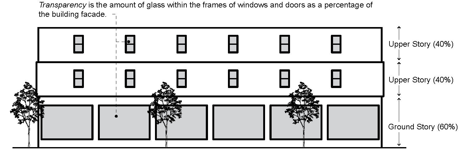
Table 9: Minimum Transparency Requirements
C.
Façade articulation requirements.
1.
Applicability. The maximum façade segment length applies to building façades facing through corridors, boulevards, avenues, pedestrian passages, and civic spaces.
2.
Maximum façade segment length. No building façade segment facing a boulevard, avenue, pedestrian passage, or civic space may exceed double the building height proposed without a physical or visual break in the plane of the façade. Permitted options for articulating a façade are described in subsection 4.
3.
Through corridor façade articulation requirement. No building façade segment facing a through corridor may exceed four times the building height proposed without a physical or visual break in the plane of the façade. Permitted options for articulating a façade are described in subsection 4.
4.
Permitted options for articulating a façade include:
a.
Physical breaks in the plane of the façade (such as wall recesses and vertical and horizontal projections);
b.
Visual breaks in the plan of the façade, including material changes, texture changes, and detailing; and
c.
Roofline breaks, balconies, arcades, awnings and canopies.
Figure 11: Maximum Façade Segment Length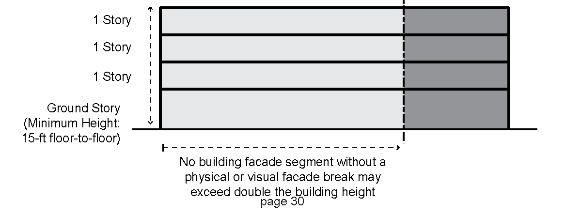
D.
Minimum planting requirements.
1.
All trees must be planted parallel to the street in the landscaped separation zone, pursuant to section 20C.7.H.4.
2.
All trees and other vegetation species must be from the Recommended Plant List.
3.
Each development site must use at least five different species selected from the Recommended Plant List, with no more than 20 percent of one species used.
4.
At least one large tree (2½ inches caliper measured six inches above the ground) must be planted in the interior of parking areas for every ten parking spaces provided. These trees must be evenly spaced.
5.
No grading, trenching, or tunneling may impact more than 25 percent of the critical root zone (CRZ).
6.
Landscape plans must be prepared and sealed by a licensed landscape architect (as defined under Code of Virginia § 54.1-400), a landscape designer certified by the Virginia Society of Landscape Designers, an arborist certified by the International Society of Arboriculture, or a horticulturalist certified by the Virginia Nursery and Landscape Association. This requirement may be waived the Agent.
7.
The following note must be included on each project's landscape plan: "All site plantings of trees and shrubs must be allowed to reach, and be maintained at, mature height; the topping of trees is prohibited. Shrubs and trees must be pruned minimally and only to support the overall health of the plant."
E.
Lighting requirements.
1.
Outdoor luminaires. Light fixtures must comply with section 4.17.4.
a.
Exterior, outdoor lighting must not exceed 2,000 lumens.
b.
Light levels must not exceed 0.5-foot candles at the ground.
2.
Color and appearance.
a.
All exterior fixtures must be fitted with lamps with a white light and color temperature between 2,000 and 3,000 Kelvin.
3.
Pole-mounted light fixtures.
a.
Pole-mounted light fixtures (both the fixture and the pole) must be dark brown, dark bronze, or black.
b.
Freestanding pole-mounted light fixtures (including the base) must not exceed 20 feet in height.
4.
Decorative lighting. Lighting that is used to enhance architecture, landscaping and other site design elements must comply with the following standards.
a.
Exterior light used for decorative effect must comply with section 4.17.4.
b.
Outdoor light fixtures in the Edge character area must be equipped with automatic timing devices and must remain unlit between 11:00 p.m. and dawn.
c.
Illuminations must not project beyond the architectural, landscaping, or site design elements.
F.
Mechanical, service and loading requirements.
1.
Applicability. In addition to the provisions of section 32.7.9.7 the following elements must be screened from view from through corridors, boulevards, avenues, local streets, pedestrian passages, and civic spaces:
a.
Refuse collection, dumpsters, recycling bins, and refuse handling areas that accommodate a dumpster or five or more trash or recycling cans;
b.
Building or ground-mounted mechanical equipment, including (but not limited to): transformers, backflow preventors, telephone risers, equipment cabinets, generators, and similar devices;
c.
Mechanical equipment on roofs;
d.
Air conditioning or similar HVAC equipment;
e.
Loading docks, berths, or similar spaces, including (but not limited to): service entrances and maintenance areas; and
f.
Outdoor storage of materials, equipment, and vehicles.
G.
Permitted and prohibited building façade materials. Materials are permitted or prohibited for building façades according to the table below.
Table 10: Permitted and Prohibited Building Façade Materials
(§ 18-20C.10, Ord. 21-18(4), 9-1-21)
Sec. 20C.11 - Civic space standards.
A.
Civic space requirements.
1.
Minimum area and civic space type options.
a.
Each development under the Rio29 FBC must devote at least the following minimum percentage of gross acreage to civic space:
Table 11: Civic Space Requirements by Character Area
2.
Areas dedicated to stormwater management may contribute to the civic space requirements, provided they meet all civic space design standards and satisfy all required elements.
3.
Ownership and access. Required civic spaces must:
a.
Be dedicated to the County;
b.
Be properly maintained;
c.
Provide public access at least 12 hours per day;
d.
Be located at the ground level or an upper story that is open and accessible to the general public, and provide clear visual connections to pedestrians on an adjacent public sidewalk; and
e.
Be designated and reserved on site(s) to be determined during site plan approval and approved by the Agent.
4.
Dedication of required civic spaces as shown on Regulating Plan. The total acreage and boundaries of civic spaces dedicated to the County as shown on the Regulating Plan may be modified in a site plan, provided the modification meets the acreage requirements shown in Table 11. The Agent may permit a modified location provided that such location is equivalent in acreage and type of civic space required.
5.
Cash-in-lieu of civic space. Cash-in-lieu of civic space(s) may be provided to the County to assist with off-site construction of a required civic space shown on the Regulating Plan, provided:
a.
The required civic space shown on the Regulating Plan is located within one-quarter of a mile; and the required on-site civic space is less than 0.2 acres in size; or,
b.
The required on-site civic space is less than 0.2 acres.
B.
Civic space diagrams.
Figure 12: Square Concept Diagram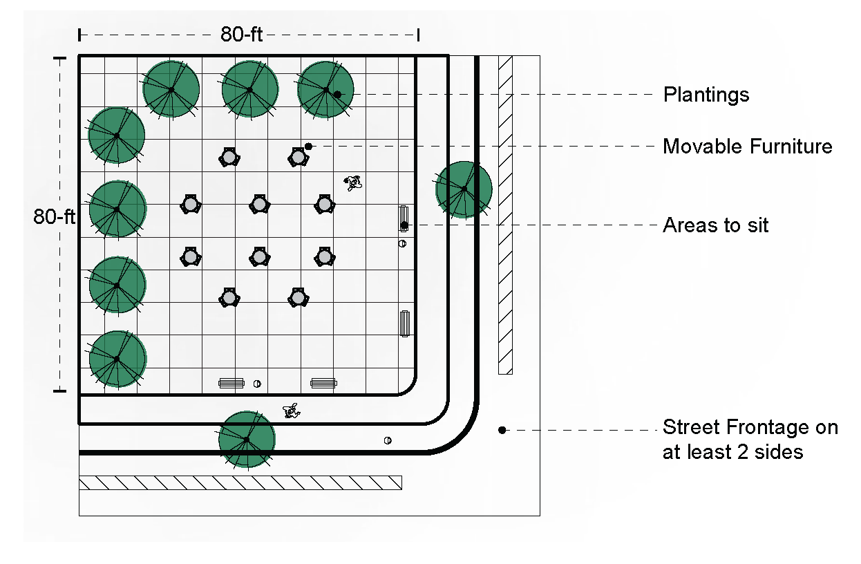
Figure 13: Plaza Concept Diagram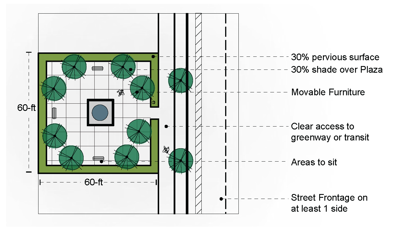
Figure 14: Public Green Concept Diagram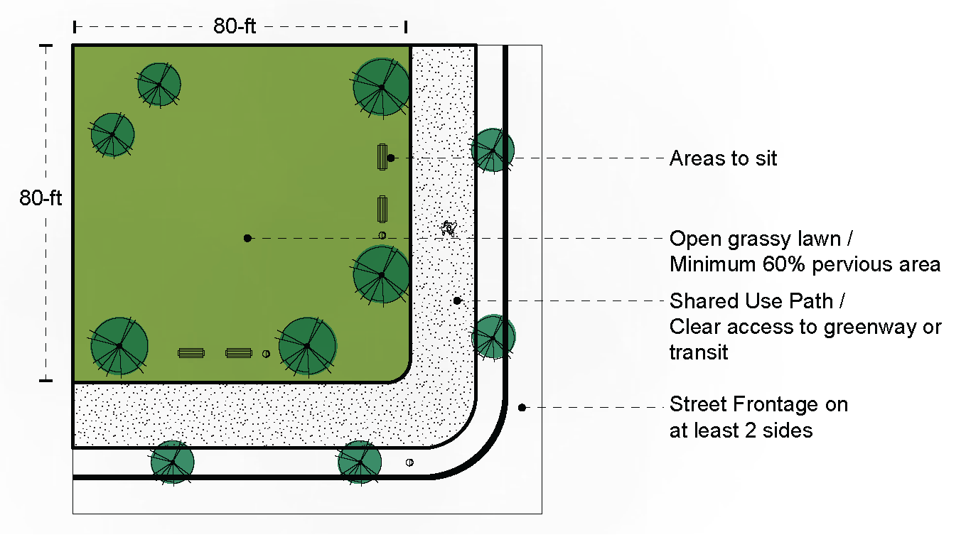
Figure 15: Linear Park Concept Diagram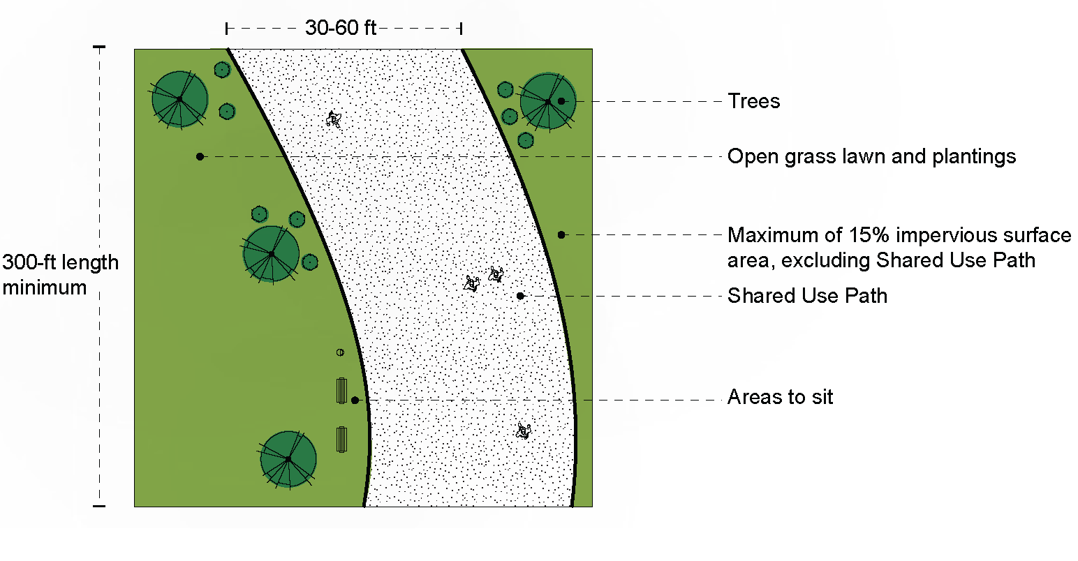
Figure 16: Pocket Park Concept Diagram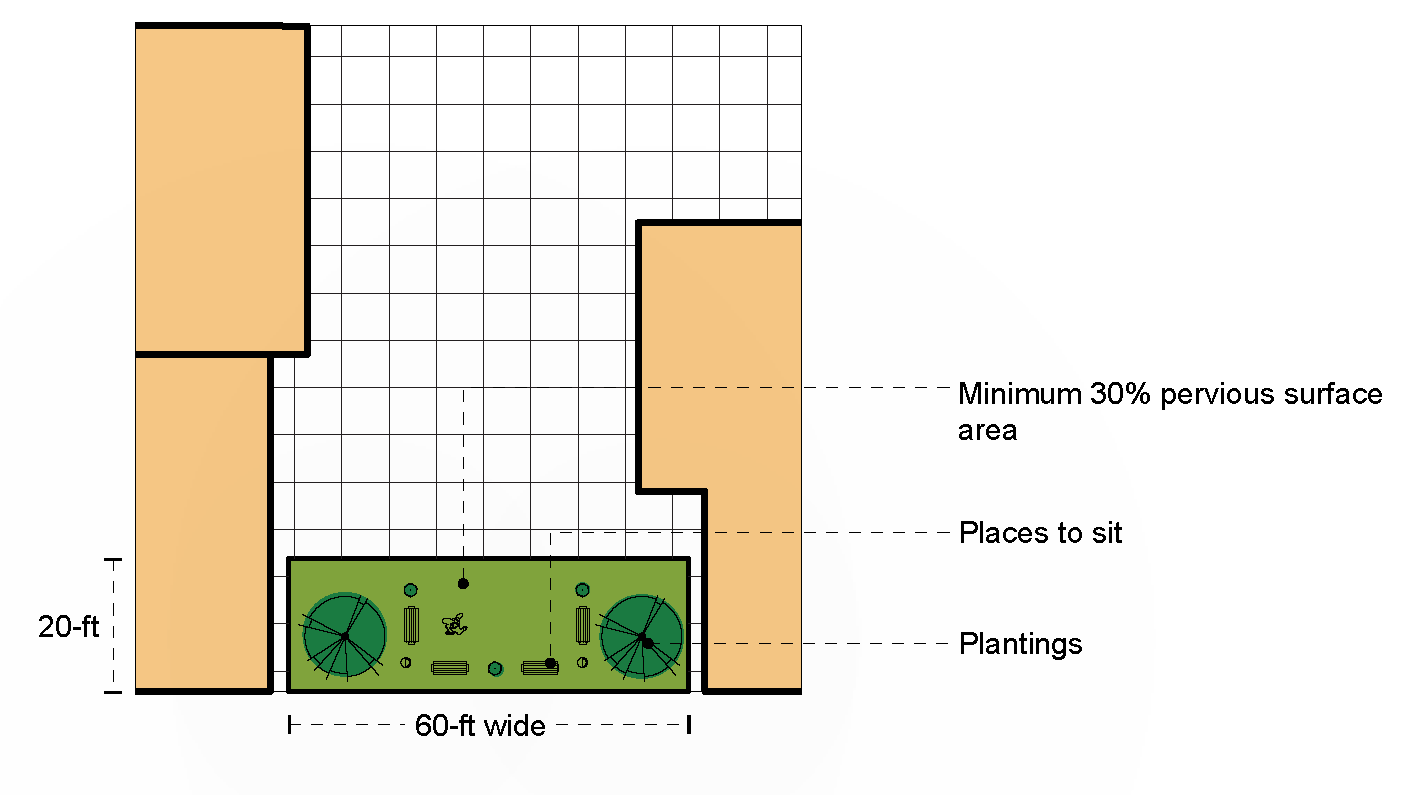
Figure 17: Pedestrian Street Concept Diagram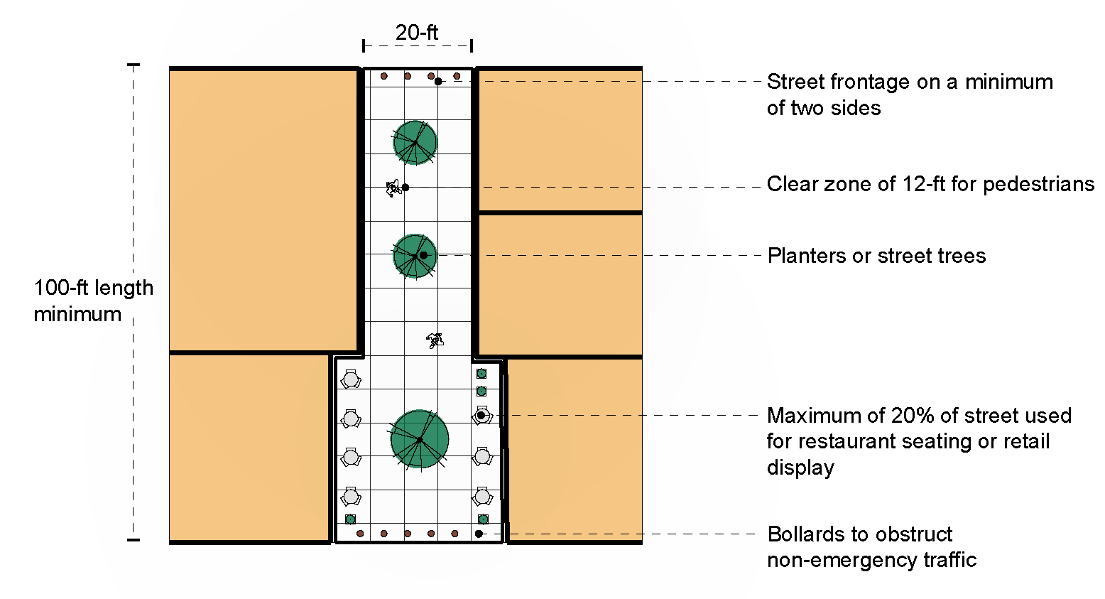
Figure 18: Natural Area Concept Diagram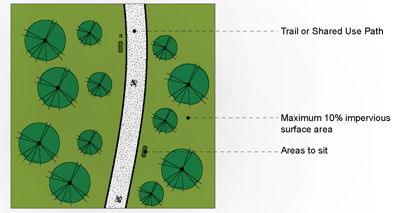
Figure 19: Indoor Civic Gathering Space Concept Diagram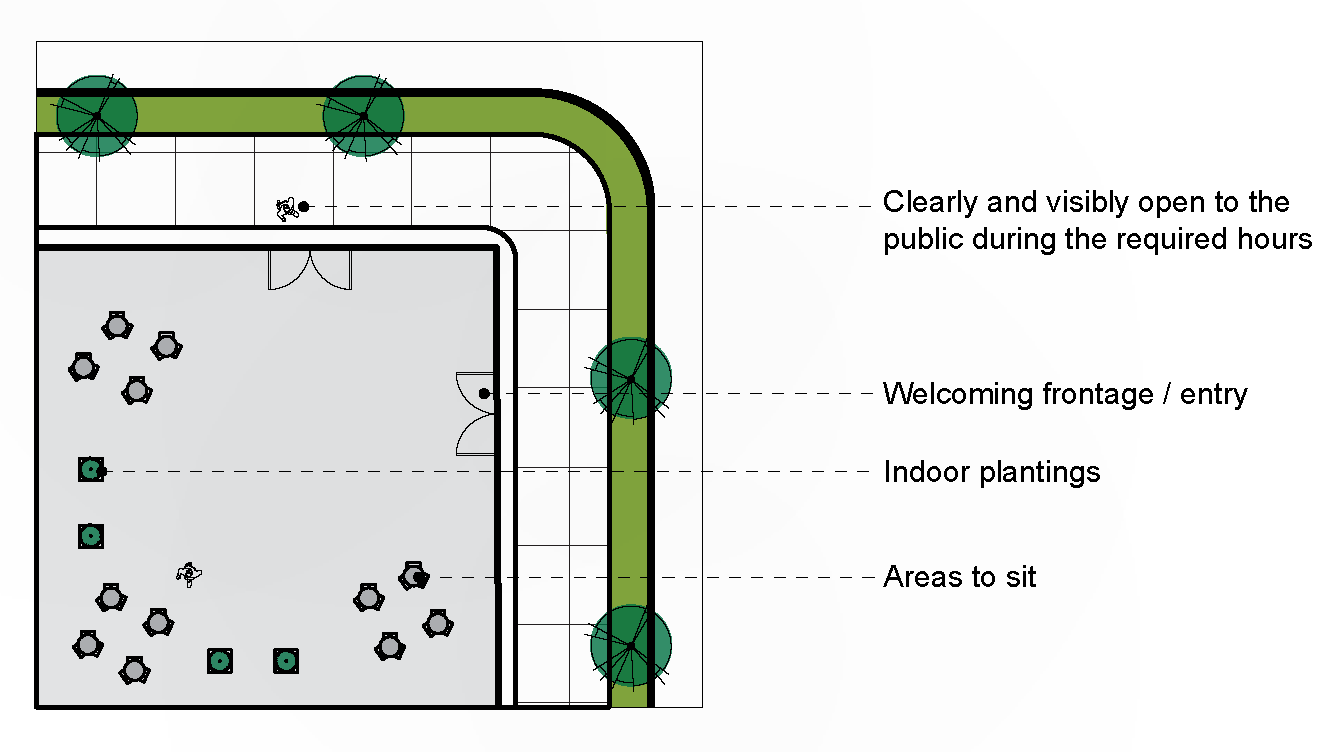
C.
Civic space design standards.
1.
Civic spaces must include:
a.
All required elements listed in Table 12; and
b.
At least one Additional Element listed in Table 12 (Civic Space Design Standards), or as approved by the Agent.
2.
All civic spaces developed under the Rio29 FBC must comply with the design standards as listed in Table 12.
Table 12: Civic Space Design Standards
D.
Trail Standards.
1.
Shared use paths (SUPs) must meet or exceed the standards of the Albemarle County Design Standards Manual for Class A Type Two low-maintenance multi-use/shared use paths.
2.
Trails must meet or exceed the standards of the Albemarle County Design Standards Manual for Class B Type Two high-maintenance pedestrian paths.
3.
Trails and SUPs should be coordinated (as to location, width, drainage, and other factors) with other existing or planned trails or SUPs within the general area and must be extended and constructed to abutting property lines. To the extent possible, trails and SUPs should provide connectivity to nearby or adjacent civic spaces.
(§ 18-20C.11, Ord. 21-18(4), 9-1-21)
Sec. 20C.12 - Affordable housing requirement.
A.
Affordable housing requirements generally.
1.
Affordable housing in the Rio29 FBC District is governed by the Albemarle County Comprehensive Plan (Chapter 9, Housing), the Housing Albemarle policy (Albemarle County Comprehensive Plan, Appendix 9), and the standards of this section.
2.
Affordable housing requirements may be met by provision of owner-occupied affordable housing, rental affordable housing, or a combination of the two, as approved by the Agent.
B.
Affordable housing requirement. Each development containing five or more residential dwelling units must comply with the Albemarle County Comprehensive Plan (Chapter 9, Housing), the Housing Albemarle policy (Albemarle County Comprehensive Plan, Appendix 9), and the standards of this section.
C.
Anti-displacement and tenant relocation requirements. The following activities must comply with the Albemarle County Tenant Relocation Guidelines for Non-Federally Funded Residential Developments:
1.
Redevelopment or rehabilitation of existing residential units;
2.
Conversion of rental housing to non-residential use(s);
3.
Demolition for rebuilding a site; and
4.
Sale by contract where the contract requires an empty building.
D.
Incentives. Additional affordable housing units beyond the minimum requirements of the above subsections may qualify for incentives.
1.
Eligibility. Developments that provide at least five percent more affordable housing units than the required number of such units may qualify for one story of building height in addition to the maximum permitted in the Core and Flex character areas. Units must remain affordable at the AMI levels in the Housing Albemarle policy (Appendix 9) for at least 30 years.
(§ 18-20C.12, Ord. 21-18(4), 9-1-21)
Sec. 21.1 - Intent, where permitted.
It is intended that commercial districts hereby and hereafter created shall be for the purposes of providing places to conduct commerce and business as well as to provide places of employment and strengthen the local economic base. To these ends, activities involving retail, wholesale and service business shall be permitted at appropriate locations within areas designated as the urban area, communities and villages in the comprehensive plan. A review of transportation impacts shall be a major consideration in the establishment and development of all commercial districts.
(§ 20-21.1, 12-10-80)
Sec. 21.2 - Permitted accessory uses and structures.
Uses and structures which are customarily accessory and clearly incidental shall be permitted, provided establishment of the same shall not be permitted until construction has commenced on the principal building or the principal use has been established; and provided further that in no case shall a parking structure other than a parking lot or garage located entirely at and/or below grade, be deemed to be accessory to any use in any commercial district. In no case shall a drive-in window be deemed to be accessory to any use in any commercial district.
(§ 20-21.2, 12-10-80; 11-7-84)
Sec. 21.3 - Off-street parking and loading requirements.
Off-street parking and loading space requirements shall be in accordance with section 4.12.
(§ 20-21.3, 12-10-80)
Sec. 21.4 - Height regulations.
Except as otherwise provided in section 4.10, structures may be erected to a height not to exceed 65 feet. The minimum stepback requirements for any story that begins above 40 feet in height or for each story above the third story, whichever is less, in height shall be as provided in section 4.20.
(§ 20-21.4, 12-10-80; 9-9-92; Ord. 15-18(4), 6-3-15; Ord. 17-18(4), 8-9-17)
Sec. 21.5 - Sign regulations.
Sign regulations shall be as prescribed in section 4.15.
(§ 20-21.5, 12-10-80)
Sec. 21.6 - Minimum landscaped area.
See section 32.7.9 for landscaping and screening requirements.
(§ 20-21.6, 12-10-80; 7-10-85; 9-9-92)
Sec. 21.7 - Minimum yard requirements.
The minimum yard requirements in the commercial districts are as follows:
a.
Adjacent to streets. The minimum and maximum front yards shall be as provided in section 4.20.
b.
Adjacent to residential, rural areas, or the Monticello Historic districts. If the abutting lot is zoned residential, rural areas, or the Monticello Historic district, the minimum and maximum side and rear yards shall be as provided in section 4.20.
c.
Use buffer adjacent to residential and rural areas districts. For the purpose of this subsection, a use buffer shall not be required when a commercial zone is across a street from a residential or rural area district. No construction activity including grading or clearing of vegetation shall occur closer than 20 feet to any residential or rural areas district. Screening shall be provided as required in section 32.7.9. The board of supervisors may waive by special exception the prohibition of construction activity, grading or the clearing of vegetation in the use buffer in a particular case upon consideration of whether: (i) the developer or subdivider demonstrates that grading or clearing is necessary or would result in an improved site design; (ii) minimum screening requirements will be satisfied; and (iii) existing landscaping in excess of minimum requirements is substantially restored.
(12-10-80, §§ 21.7, 21.7.1, 21.7.2, 21.7.3; 7-10-85, 7-8-92, 9-9-92; Ord. 01-18(3), 5-9-01; Ord. 09-18(1), 1-14-09, § 21.7; Ord. 15-18(4), 6-3-15; Ord. 17-18(4), 8-9-17; Ord. 19-18(3), 6-5-19)
Sec. 21.8 - Utility requirements.
All utility lines are to be placed underground where practical.
(§ 20-21.8, 12-10-80)
Sec. 21.9 - Building separation.
The minimum building separation shall be as provided in section 4.20.
(§ 20-21.9, 12-10-80; 10-15-86; Ord. 15-18(4), 6-3-15)
Sec. 22.1 - Intent, where permitted.
C-1 districts are hereby created and may hereafter be established by amendment to the zoning map to permit selected retail sales, service and public use establishments which are primarily oriented to central business concentrations. It is intended that C-1 districts be established only within the urban area, communities and villages in the comprehensive plan. (Amended 9-9-92)
Sec. 22.3 - Additional requirements.
In addition to the requirements contained herein, the requirements of section 21.0, commercial districts, generally, shall apply within all C-1 districts.
(Amended 3-17-82; 7-10-85)
Sec. 23.1 - Intent, where permitted.
CO districts are hereby created and may hereafter be established by amendment to the zoning map to permit development of administrative offices and supporting accessory uses and facilities. This district is intended as a transition between residential districts and other more intensive commercial and industrial districts.
(Unknown prior history; Ord. 19-18(3), 6-5-19)
Sec. 23.3 - Additional requirements.
In addition to the requirements contained herein, the requirements of section 21.0, commercial districts, generally, shall apply within all CO districts.
Sec. 24.1 - Intent, where permitted.
HC districts are hereby created and may hereafter be established by amendment to the zoning map to permit development of commercial establishments, other than shopping centers, primarily oriented to highway locations rather than to central business concentrations. It is intended that HC districts be established on major highways within the urban area and communities in the comprehensive plan. It is further intended that this district shall be for the purpose of limiting sprawling strip commercial development by providing sites with adequate frontage and depth to permit controlled access to public streets.
(§ 24.1, 12-10-80)
Sec. 24.3 - Minimum frontage, shape of district.
Minimum frontage required on a public street for the establishment of an HC district shall be 150 feet. Frontage of an HC district shall not exceed depth. This section shall not apply to HC districts established at the adoption of the zoning map.
(§ 24.3, 12-10-80)
Sec. 24.4 - Additional requirements.
In addition to the requirements contained herein, the requirements of section 21.0, commercial districts, generally, shall apply within all HC districts.
(§ 24.4, 12-10-80)
Sec. 25.1 - Intent, where permitted.
PD-SC districts are hereby created and may hereafter be established by amendment of the zoning map to permit the development of neighborhood, community and regional shopping centers in accordance with standards set forth in the comprehensive plan. PD-SC districts are intended to serve areas not conveniently and adequately provided with a broad range of commercial and service facilities. Regulations provided are intended to encourage planned commercial centers with carefully organized buildings, service areas, parking areas and landscaped areas.
PD-SC districts shall be located in areas served by both public water and sewer systems; provided that neighborhood shopping centers may be permitted in areas not served by public water and/or public sewer systems where adequate alternative water supply and/or sewerage disposal systems are available. PD-SC districts shall have direct access to public streets adequate to accommodate traffic generated by the development.
(§ 25.1, 12-10-80)
Sec. 25.3 - Area required for creation of PD-SC districts.
Minimum and maximum areas required for the creation of PD-SC districts shall be as follows:
(Amended 9-9-92)
Sec. 25.5 - Site planning—Internal relationships.
Buildings shall be arranged in a fashion to encourage pedestrian access of customers and minimize internal automotive movement. Facilities and access routes for deliveries, service and maintenance shall be separated, where practical, from customer access routes and parking areas.
(§ 25.5, 12-10-80)
Sec. 25.6 - Additional requirements.
In addition to requirements contained herein, the requirements of sections 8.0 and 21.0 shall apply to all PD-SC districts. In addition to materials required by section 8.5.1, a transportation analysis plan shall be submitted with the application for PD-SC designation. Such plan shall show: projected automobile and truck traffic generation; internal and access point turning movement; percentage estimate of traffic distribution to and from the site on external roads; proposed improvements to the existing transportation network.
(§ 25.6, 12-10-80)
Sec. 25A.1 - Intent, where permitted.
PD-MC districts are hereby created and may hereafter be established by amendment of the zoning map to permit development of large-scale commercial areas with a broad range of commercial uses under a unified planned approach. It is intended that PD-MC districts be established on major highways in the urban area and communities in the comprehensive plan. In recognition that such large-scale development may substantially reduce the functional integrity and safety of public roads if permitted with unplanned access, it is intended that multiple access to existing public roads be discouraged and that development and access be oriented toward an internal road system having carefully planned intersections with existing public roads.
(§ 25A.1, 12-10-80)
Sec. 25A.3 - Area required for creation of PD-MC district.
25A.3.1 Minimum area required for the establishment of a PD-MC district shall be three acres.
25A.3.2 Additional area may be added to an established PD-MC district if it adjoins and forms a logical addition to the approved development. The procedure for an addition shall be the same as if an original application were filed and all requirements shall apply except the minimum acreage requirement of section 25A.3.1.
(§ 25A.3, 12-10-80)
Sec. 25A.5 - Site planning—Internal relationships.
Buildings shall be arranged in a fashion to encourage pedestrian access of customers and minimize internal automotive movement. Facilities and access routes for deliveries, service and maintenance shall be separated, where practical, from customer access routes and parking areas.
(§ 25A.5, 12-10-80)
Sec. 25A.6 - Additional requirements.
In addition to requirements contained herein, the requirements of sections 8.0 and 21.0 shall apply to all PD-MC districts. In addition to materials required by section 8.5.1, a transportation analysis plan shall be submitted with the application for PD-MC designation. Such plan shall show: projected automobile and truck traffic generation; internal and access point turning movement; percentage estimate of traffic distribution to and from the site on external roads; and proposed improvements to the existing transportation network.
(§ 25A.6, 12-10-80)
Sec. 26.1 - Intent, where permitted.
Industrial districts are intended to be for the purpose of providing places of employment and strengthening the local economic base in furtherance of the economic development policy of the comprehensive plan. To this end, the following shall be encouraged: (i) the establishment and continuation of industrial uses and their supporting uses in the locations and at the levels of intensity designated for those uses in the comprehensive plan; (ii) the establishment of new industrial uses that are appropriate for the character of the industrial districts; and (iii) the enlargement and expansion of existing industrial uses.
Industrial districts are intended to be established in areas having all of the following characteristics: (i) the area is served by public water and sewer facilities; (ii) the area is served by major highway, rail or air service, or secondary roads improved to standards approved by the county; and (iii) the area is clearly demonstrated to be suitable for the intended uses, considering the physical characteristics of the land and the intended uses and their relationship to surrounding development.
(§ 26.1, 12-10-80; Ord. 13-18(1), 4-3-13)
Sec. 26.2 - Permitted primary and accessory uses and structures; prohibited uses and structures.
Uses and structures within the industrial districts are permitted as follows:
a.
Primary uses and structures. Primary uses and structures within the industrial districts are permitted by right, by special use permit, and by special exception as provided in the following table, subject to the applicable requirements of this chapter:
*Applies to all uses within this use classification, as defined, except for those uses expressly identified in unshaded text below that use classification.
**Heading is for organizational purposes only and is not a use classification.
BR: The use is permitted by right.
SP: The use is permitted by special use permit.
SE: The use is permitted by special exception.
N: The use is not permitted.
b.
Planned industrial parks and proffered industrial districts approved prior to April 3, 2013. Within the following planned industrial parks and proffered industrial districts, the uses permitted by right, by special use permit, and by special exception shall be as follows:
1.
Uses in planned industrial parks. The uses permitted by right and by special use permit in any planned development -industrial park (PD-IP) district approved prior to April 3, 2013, any industrial park approved as a planned development prior to December 10, 1980 are those uses permitted by right and by special use permit in effect when the zoning map amendment was approved and those uses delineated in subsection (a), regardless of any election made for a planned development district under subsections 8.5.5.2(a) and (b).
2.
Uses in proffered industrial districts. The uses permitted by right and by special use permit on any site within an industrial district for which proffers either specifying or prohibiting particular uses were accepted prior to April 3, 2013, are those uses permitted by right and by special use permit in effect when the zoning map amendment was approved and those uses delineated in subsection (a), provided that any use not allowed by right or by special use permit by a proffer shall be prohibited.
3.
Certain non-industrial uses in planned industrial parks and proffered industrial districts. In the planned industrial parks and proffered industrial districts delineated in subsections (b)(1) and (2), no supporting retail sales or subordinate commercial use that would exceed the by right thresholds in subsection (a) shall be expanded without a special exception as required by subsection (a).
c.
Accessory uses and structures. Accessory uses and structures are permitted within each industrial district, subject to the following:
1.
When accessory use is permitted. No accessory use is permitted until the primary use to which it is accessory has been established.
2.
When accessory structure is permitted. No accessory structure is permitted until either construction of the primary structure or the primary use to which it is accessory has commenced.
3.
Prohibited accessory uses and structures. Parking structures, stand alone parking and drive-through windows are permitted only as provided in subsection (a) and not otherwise as accessory uses. The storage of sludge or toxic wastes, or both, is prohibited as an accessory use; provided that the temporary storage of sludge or toxic wastes awaiting proper disposal is a permitted accessory use.
d.
Prohibited primary uses and structures. The following uses and structures are prohibited as primary uses within each industrial district:
1.
Incinerators. The establishment or use of an incinerator.
2.
Manufacture of certain products. The manufacture of acetylene gas, acid, ammonia, bleaching powder, chlorine, detergent and cleaning preparations made from animal fats, explosives, fireworks, fish meal, nitrogenous tankage, paints, varnish, shellac that requires distillation or heating ingredients, vinegar that is not derived from an agricultural product, phosphates, and turpentine.
3.
Sludge. The storage of sludge.
4.
Toxic wastes. The disposal or storage of toxic wastes regulated under the federal Toxic Substances Control Act (15 U.S.C. § 2601 et seq.), provided that placing toxic wastes for their lawful collection and disposal by a third party is not prohibited.
(§ 26.2, Ord. 13-18(1), 4-3-13; § 26.3, 12-10-80; 11-7-84; Ord. 18-18-(1), 1-10-18; Ord. 25-18(1), 4-2-25; Ord. 25-18(2), 7-16-2025)
Editor's note— Ord. 13-18(1), adopted April 3, 2013, repealed the former § 26.2, and enacted a new § 26.2 as set out herein. The former § 26.2 pertained to application.
Sec. 26.3 - Independent office and general commercial uses; additional factors when considering special use permits.
In evaluating a request for a special use permit for an independent office or general commercial use as that use is described in section 26.2, the board shall consider the following factors in addition to those delineated in section 33.8:
a.
The purpose of the industrial district in which the use is proposed.
b.
The proposed use and its proposed size should be consistent with the intent of the applicable industrial district.
c.
The use proposed should not be located on the lowest floor of any building having direct exterior access to the ground surface in order to allow that floor to be used for industrial purposes.
d.
The gross floor area of each establishment should not exceed 3,000 square feet.
e.
The aggregate gross floor area of the independent offices or general commercial uses, or both, should not exceed 24,000 square feet and should not exceed 25 percent of the gross floor area of the building.
f.
Whether the structure or structure expansion will be constructed to the standards required for industrial structures, regardless of its intended use.
(§ 26.3, Ord. 13-18(1), 4-3-13)
Sec. 26.4 - Structure height.
Except as otherwise provided in section 4.10, or as authorized by special exception, structures may be erected to a height not to exceed 65 feet. The minimum stepback requirements for any story that begin above 40 feet in height or for each story above the third story, whichever is less, in height shall be as provided in section 4.20.
(§ 26.4, Ord. 13-18(1), 4-3-13; § 26.6, 12-10-80, 9-9-92; Ord. 15-18(4), 6-3-15; Ord. 17-18(4), 8-9-17; Ord. 25-18(3), 10-1-25)
Sec. 26.5 - Minimum yards.
The minimum yard requirements in the industrial districts are as follows:
a.
Adjacent to streets. The minimum and maximum front yards shall be as provided in section 4.20.
b.
Adjacent to district other than commercial or industrial district. If the abutting lot is zoned residential, rural areas, or the Monticello Historic district, the minimum and maximum side and rear yards shall be as provided in section 4.20.
c.
Use buffer adjacent to district other than commercial or industrial district. For the purpose of this subsection, a use buffer shall not be required when a commercial or industrial district zone is across a street from a residential or rural area district. No construction activity, including grading or clearing vegetation (collectively, "disturbance"), shall occur within 30 feet of any district other than a commercial or industrial district except in the following circumstances: (i) adequate landscape screening does not currently exist and disturbance is necessary to install screening that meets or exceeds the screening requirements in section 32.7.9; (ii) an arborist or landscape architect certifies that trees in the buffer are dying, diseased or will constitute a fall hazard and must be removed; (iii) the county engineer determines that disturbance is necessary in order to address an existing drainage problem; or (iv) disturbance will result in improved screening through the use of a berm, a retaining wall or similar physical modification or improvement. When disturbance is allowed under subsection (i), (ii), (iii) or (iv), the developer shall submit an illustration showing the existing screening without disturbance and the screening that would be installed after the disturbance, and disturbance shall be allowed only if the screening installed after the disturbance is equal to or exceeds the screening existing prior to disturbance.
d.
Special exception to disturb use buffer abutting district other than a commercial or industrial district. The board of supervisors may authorize a disturbance in the use buffer required to be maintained under subsection (c) by special exception. The board shall consider whether disturbance is necessary or would result in an improved site design, provided that: (i) minimum screening requirements are met; and (ii) existing landscaping in excess of minimum requirements is substantially restored.
e.
Building separation. The minimum building separation shall be as provided in section 4.20.
(§ 26.5, Ord. 13-18(1), 4-3-13; § 26.10, Ord. 09-18(1), 1-14-09; §§ 26.10, 26.10.1, 26.10.2, 26.10.3; 12-10-80; 7-10-85, 7-8-92, 9-9-92; Ord. 15-18(4), 6-3-15; Ord. 17-18(5), 10-11-17; Ord. 19-18(3), 6-5-19)
Sec. 26.6 - Site development and use.
Subject to sections 26.4 and 26.5, each site within an industrial district shall comply with the applicable site development and use requirements in sections 4, 5 and 32.
(§ 26.6, Ord. 13-18(1), 4-3-13)
Sec. 26.7 - Performance standards.
(Repealed 4-3-13)
Sec. 26.8 - Sign regulations.
(Repealed 4-3-13)
Sec. 26.9 - Minimum landscaped area.
(Repealed 4-3-13)
Sec. 26.10 - Minimum yard requirements.
(Now See 26.5 Minimum Yards)
Sec. 26.11 - Utility requirements.
(Repealed 4-3-13)
Sec. 26.12 - Site planning—External relationships.
(Repealed 4-3-13)
Sec. 26.13 - Building separation.
(Repealed 4-3-13)
Sec. 27.1 - Intent, where permitted.
The intent of the light industry (LI) district is to permit industrial and supporting uses that are compatible with, and do not detract from, surrounding districts.
Structures within the light industry (LI) district are encouraged to be constructed to the standards required for industrial structures, regardless of their intended use.
(§ 27.1; 12-10-80; Ord. 13-18(1), 4-3-13)
Sec. 27.2 - Permitted uses.
The uses permitted by right, by special use permit and by special exception in the light industry (LI) district are set forth in "LI" column in the table in section 26.2.
(§ 27.2; Ord. 13-18(1), 4-3-13 (§ 27.2, 12-10-80)(§ 27.2.1, 12-10-80, 12-2-81, 2-13-85, 4-17-85, 3-5-86, 12-2-87, 11-1-89, 5-12-93; Ord. 98-A(1), 8-5-98; Ord. 01-18(6), 10-3-01; Ord. 02-18(6), 10-9-02; Ord. 04-18(2), 10-13-04; Ord. 08-18(6), 11-12-08; Ord. 10-18(4), 5-5-10)(§ 20-27.2.2, 12-10-80; 7-7-82; 2-13-85; 12-2-87; 12-7-88; 6-6-90; 2-20-91; 6-19-91; 9-15-93; Ord. 98-A(1), 8-5-98; Ord. 03-18(1), 2-5-03; Ord. 04-18(2), 10-13-04; Ord. 08-18(6), 11-12-08; Ord. 10-18(4), 5-5-10; Ord. 10-18(6), 6-2-10))
Sec. 27.3 - Structure height, yard, setback, development, use.
(Formerly Minimum Area Required for Establishment of District, Repealed 4-3-13)
The structure height, yard, setback, development and use standards in sections 26.4, 26.5 and 26.6, and the sections cross-referenced therein, shall apply to all light industry (LI) districts.
(§ 27.3; Ord. 13-18 (1), 4-3-13; § 27.4, 12-10-80)
Sec. 28.1 - Intent, where permitted.
The intent of the heavy industry (HI) district is to permit industrial and supporting uses having the potential, if unregulated, to cause public nuisances and therefore requiring enhanced performance standards and review for their impacts on surrounding lands and the environment.
Structures within the heavy industry (HI) district are encouraged to be constructed to the standards required for industrial structures, regardless of their intended use.
(§ 28.1, 12-10-80; Ord. 13-18(1), 4-3-13)
Sec. 28.2 - Permitted uses.
The uses permitted by right, by special use permit and by special exception in the heavy industry (HI) district are set forth in "HI" column in the table in section 26.2.
(§ 28.2, Ord. 13-18(1), 4-3-13 (§ 28.2, 12-10-80)(§ 20-28.2.1, 12-10-80; 2-13-85; 3-5-86; 11-1-89; 5-12-93; § 18-28.2.1, Ord. 98-A(1), 8-5-98; Ord. 02-18(6), 10-9-02; Ord. 04-18(2), 10-13-04; Ord. 08-18(6), 11-12-08; Ord. 09-18(7), 8-5-09; Ord. 10-18(4), 5-5-10)(§ 20-28.2.2, 12-10-80; 2-13-85; 10-15-86; 6-19-91; § 18-28.2.2, Ord. 98-A(1), 8-5-98; Ord. 03-18(1), 2-5-03; Ord. 04-18(2), 10-13-04; Ord. 08-18(6), 11-12-08; Ord. 10-18(4), 5-5-10))
Sec. 28.3 - Structure height, setback, yard, development, use.
(Formerly Minimum Area Required for Establishment of District, Repealed 4-3-13)
The structure height, yard, setback, development, and use standards in sections 26.4, 26.5 and 26.6, and the sections cross-referenced therein, shall apply to all heavy industry (HI) districts.
(§ 28.3; Ord. 13-18(1), 4-3-13; § 28.4, 12-10-80)
Sec. 29.1 - Intent, where permitted.
The intent of the planned development - industrial park (PD-IP) district is to permit a variety of industrial and supporting uses, together with delineated uses that are ancillary thereto, within a planned development that are compatible with and do not detract either from each other or surrounding districts. In establishing a planned development - industrial park (PD-IP) district, the board of supervisors shall designate the category of uses in section 29.2 that will be permitted on each parcel, or part thereof, within the district.
Structures within the planned development - industrial park (PD-IP) district are encouraged to be constructed to the standards required for industrial structures, regardless of their intended use.
(§ 29.1, 12-10-80; Ord. 13-18(1), 4-3-13)
Sec. 29.2 - Permitted uses.
The uses permitted by right, by special use permit and by special exception within those areas designated as Category I or Category II on the application plan applicable to the planned development - industrial park (PD-IP) district are set forth in the "PD-IP Cat. 1" and "PD-IP Cat. 2" columns in the table in section 26.2. No separate application for a special use permit shall be required for any special use identified on the approved application plan.
(§ 29.2, Ord. 13-18(1), 4-3-13 (§ 29.2, 12-10-80) (§ 29.2.1, 12-10-80) (§ 29.2.2, 12-10-80; 6-28-95) (§ 29.2.3, 12-10-80) (§ 29.2.4, 12-10-80))
Sec. 29.3 - Structure height, setback, yard, development, use.
(Formerly Minimum Area Required for Creation of District, Repealed 4-3-13)
The structure height, yard, setback, development, and use standards in sections 26.4, 26.5 and 26.6, and the sections cross-referenced therein, shall apply to all planned development - industrial park (PD-IP) districts.
(§ 29.3, Ord. 13-18(1), 4-3-13; § 29.5, 12-10-80; Ord. 98-A(1), 8-5-98; Ord. 99-18(1), 4-14-99)
Sec. 29.4 - Number of permitted uses.
(Repealed 4-3-13)
Sec. 8.5.1 - Applications and documents to be submitted.
(Repealed 12-5-12, effective 4-1-13)
Sec. 8.5.2 - Preapplication conferences.
(Repealed 12-5-12, effective 4-1-13)
(Former § 8.5.2 Planning Commission Procedures Repealed 3-19-03)
Sec. 8.5.3 - Review and recommendation by the planning commission.
(Repealed 12-5-12, effective 4-1-13)
Sec. 8.5.4 - Review and action by the board of supervisors; effect of approval.
(Repealed 12-5-12, effective 4-1-13)
Sec. 8.5.5 - Site plans and subdivision plats.
(Formerly § 8.5.6)
Sec. 8.5.5.1 - Contents of site plans and subdivision plats.
Each site plan and subdivision plat submitted for development in a planned development shall comply with the following:
a.
Generally. Each site plan for a planned development shall comply with section 32 of this chapter, subject to the waiver or modification of any such regulation pursuant to section 8.2(b). Each subdivision plat for a planned development shall comply with chapter 14 subject to the waiver, variation or substitution of any such regulation pursuant to section 14-237.
b.
Within the neighborhood model zoning district. In addition to the requirements of subsection (a), each site plan or subdivision plat for a planned development within the neighborhood model zoning district shall pertain to a minimum area of one block and shall include a phasing plan, and each site plan shall include building elevations for all new or modified structures.
(§ 8.5.6.1, 12-10-80; 9-9-92; § 8.5.5.1, Ord. 03-18(2), 3-19-03; Ord. 09-18(9), 10-14-09)
Sec. 8.5.5.2 - Review of site plans and subdivision plats.
Each preliminary and final site plan and subdivision plat for a planned development shall be reviewed for compliance with the applicable regulations, as follows:
a.
Planned development districts established on or before December 10, 1980. Each preliminary and final site plan and subdivision plat within a planned development district established on or before December 10, 1980 shall be reviewed for compliance with the applicable regulations when the site plan or subdivision plat is under county review; provided that, at the option of the developer or subdivider, each preliminary and final site plan and subdivision plat may be reviewed for compliance with the applicable regulations in effect when the planned development was approved if the developer or subdivider establishes a vested right as provided in Virginia Code §§ 15.2-2296et seq. or 15.2-2307 to develop under the previously approved planned development district.
b.
Planned development districts established after December 10, 1980. Each preliminary and final site plan and subdivision plat within a planned development district established after December 10, 1980 shall be reviewed for compliance with the applicable regulations in effect when the planned development district was established or, at the option of the developer or subdivider, in effect when the site plan or subdivision plat is under county review; subject to the following:
1.
Election to comply with regulations in effect when district established; exception for certain current subjects of regulation unless vested rights established. If the developer or subdivider elects to have its site plan or subdivision plat reviewed for compliance with the applicable regulations in effect when the planned development district was established, all of the following subjects of regulation in effect when the site plan or subdivision plat is under county review shall apply unless vested rights are established under Virginia Code §§ 15.2-2296et seq. or 15.2-2307: (i) entrance corridor overlay district (section 30.6); (ii) flood hazard overlay district (section 30.3); (iii) landscaping and screening (section 32.7.9); (iv) outdoor lighting (section 4.17); (v) parking (section 4.12); and (vi) signs (section 4.15). If rights are determined to have vested, the regulations for these six subjects in effect when rights vested shall apply. For the purposes of this subsection 8.5.5.2(b), an application plan approved on and after March 19, 2003 that complies with the requirements of an application plan under section 33.4, or a prior version thereof in effect on and after March 19, 2003, is a significant governmental act within the meaning of Virginia Code § 15.2-2307.
2.
Election to comply with regulations in effect when district established; election to comply with certain current subjects of regulation. If the developer or subdivider elects to have its site plan or subdivision plat reviewed for compliance with the applicable regulations in effect when the planned development district was established, the developer or subdivider may also elect to comply with one or more of the subjects of regulation listed in subsection 8.5.5.2(b)(1) in effect when the site plan or subdivision plat is under county review instead of with the corresponding regulations in effect when the planned development district was established.
c.
Review for compliance and conformance. A site plan or subdivision plat shall be reviewed to determine whether it complies with the applicable regulations and other requirements of law, and whether it conforms to the application plan, as follows:
1.
Zoning administrator. The zoning administrator shall determine whether a site plan or subdivision plat complies with the applicable regulations. In addition, the zoning administrator, after consultation with the director of planning, shall determine whether the proposed permitted uses comply with the applicable regulations and, in doing so, may permit as a use by right a use that is not expressly classified in this chapter if the zoning administrator further determines that the use is similar in general character to the uses permitted by right in the district or by the code of development and is similar in terms of locational requirements, operational characteristics, visual impacts, and traffic, noise and odor generation.
2.
Director of planning. The director of planning shall determine whether a site plan or subdivision plat conforms to the application plan. In determining conformity, the director shall determine whether the central features or major elements within the development are in the same location as shown on the application plan and if the buildings, parking, streets, blocks, paths and other design elements are of the same general character, scope and scale as shown on the application plan.
3.
County engineer. The county engineer shall determine whether an erosion and sediment control plan, grading plan, stormwater management plan, road or street plan, and mitigation plan conform with the concept grading, stormwater management, streets, and mitigation shown on the application plan.
d.
Applicable regulations defined. For the purposes of this section 8.5.5.2, the term "applicable regulations" means, as appropriate and applicable, all zoning regulations, all subdivision regulations, the application plan (except for those elements authorized to be shown at a conceptual or general level), including those plans formerly referred to as general development plans, conditions of approval, accepted proffers, the code of development, special use permits, variances, and waivers, modifications and variations.
e.
Applicability of chapter 17. Each preliminary and final site plan and subdivision plat within a planned development district shall be reviewed for compliance with chapter 17 of the Code in effect when the site plan or subdivision plat is under county review, regardless of when the planned development was established or whether the developer or subdivider elects, or establishes vested rights, under subsections 8.5.5.2(a) and (b) to proceed with review under the applicable regulations in effect when the planned development was approved.
f.
Vested rights not impaired. Nothing in this section shall be construed as authorizing the impairment of a vested right that may be established under Virginia Code §§ 15.2-2261(C), 15.2-2297, 15.2-2298, 15.2-2303 or 15.2-2307.
(§ 8.5.6.2, 12-10-80; 9-9-92; § 8.5.5.2, Ord. 03-18(2), 3-19-03; Ord. 09-18(9), 10-14-09; Ord. 13-18(1), 4-3-13)
Sec. 8.5.5.3 - Variations from approved plans, codes, and standards of developments.
The Board of Supervisors may allow a site plan or subdivision plat for a planned development to vary from an approved application plan, standard of development and, also, in the case of a neighborhood model district, a code of development, as provided herein:
a.
The Board of Supervisors is authorized to grant a variation from the following provisions of an approved plan, code or standard:
1.
Minor changes to yard requirements, build-to lines or ranges, maximum structure heights and minimum lot sizes;
2.
Changes to the arrangement of buildings and uses shown on the plan, provided that the major elements shown on the plan and their relationships remain the same;
3.
Changes to phasing plans;
4.
Minor changes to landscape or architectural standards;
5.
Minor changes to street design and street location, subject to a recommendation for approval by the county engineer; and
6.
Minor changes to the design and location of stormwater management facilities, minor land disturbance including disturbance within conservation areas, and mitigation, all subject to a recommendation for approval by the county engineer.
b.
The applicant shall submit a written request for a variation to the director of planning. The request shall specify the provision of the plan, code or standard for which the variation is sought, and state the reason for the requested variation. The director may reject a request that fails to include the required information.
c.
The Board of Supervisors is authorized to grant a variation upon a determination that the variation: (1) is consistent with the goals and objectives of the comprehensive plan; (2) does not increase the approved development density or intensity of development; (3) does not adversely affect the timing and phasing of development of any other development in the zoning district; (4) does not require a special use permit; and (5) is in general accord with the purpose and intent of the approved application.
d.
The director of planning may require that the applicant provide an updated application plan and, in the case of changes to a code of development, a complete amended code of development, reflecting the approved variation and the date of the variation. If the director requires an updated application plan or code of development, the granting of the variation shall be conditional upon the applicant providing the plan or code within 30 days after approval of the variation and a determination by the director that the plan or code were revised to correctly reflect the granted variation.
e.
Any variation not expressly provided for herein may be accomplished by zoning map amendment.
(§ 8.5.6.3, 12-10-80; 9-9-92; § 8.5.5.3, Ord. 03-18(2), 3-19-03; Ord. 09-18(9), 10-14-09; Ord. 21-18(5), 12-1-21)
Sec. 8.5.5.4 - Building permits and grading permits.
Building permits and grading permits may be issued as provided herein:
a.
A building permit, including any special footings or foundation permits, may be issued for any work within a planned development, excluding the installation of street signs, only after the approval of the final site plan or final subdivision plat in the area in which the permit would apply.
b.
A grading permit may be issued for site preparation grading associated with an approved planned development if the erosion and sediment control plan measures, disturbed area and grading are in conformity with the concept grading and measures shown on the application plan as determined by the county engineer, after consultation with the director of planning.
c.
If, after consultation with the director of planning, the county engineer finds that there is not enough detail on the application plan to assure that the proposed grading and other measures are consistent with the application plan, a grading permit shall not be issued until the final site plan is approved, or the final subdivision plat is tentatively approved.
d.
Within each neighborhood model district, the department of community development shall review each building permit application or modification to determine whether the proposed structure conforms with the architectural and landscape standards in the approved code of development.
(§ 8.5.6.4, 12-10-80; 9-9-92; § 8.5.5.4, Ord. 03-18(2), 3-19-03; Ord. 09-18(9), 10-14-09)
Sec. 8.5.5.5 - Site plan and subdivision plat requirements when there is no application plan.
Site plans and subdivision plats within a planned development district for which an application plan was not approved shall be subject to the following:
a.
No valid site plan or subdivision plat at time district established. If a planned development district was established before an application plan was required by section 8 to be approved as part of the zoning map amendment and neither a final site plan or subdivision plat pertaining to the entirety of the planned development district was valid at the time of the zoning map amendment nor was approved in conjunction with the approval of the zoning map amendment, then neither a site plan nor a subdivision plat shall be approved for any lands within the district unless and until an application plan and all other documents required by section 8.5 are submitted by the owner and are approved as provided therein.
b.
Valid site plan or subdivision plat at time district established. If a planned development district was established before an application plan was required by section 8 to be approved as part of the zoning map amendment but a final site plan or subdivision plat pertaining to the entirety of the planned development district was valid at the time of the zoning map amendment or was approved in conjunction with the approval of the zoning map amendment, the valid or approved site plan or subdivision plat shall be deemed to be the application plan, and the site plan or subdivision plat shall be reviewed as provided in section 8.5.5.2. (Amended 7-16-86)
(§ 8.5.6.5, 12-10-80; 9-9-92; § 8.5.5.5, Ord. 03-18(2), 3-19-03; Ord. 09-18(9), 10-14-09)
Sec. 10.2.1 - By right.
The following uses shall be permitted by right in the RA district, subject to the applicable requirements of this chapter:
1.
Detached single-family dwellings, including guest cottages and rental of the same; provided that yard, area and other requirements of section 10.4, conventional development by right, shall be met for each such use whether or not such use is on an individual lot subject to section 10.3.
2.
Side-by-side two-family dwellings subject to the provisions of section 10.4; provided that density is maintained and provided that buildings are located so that each unit could be provided with a lot meeting all other requirements for detached single-family dwellings except for side yards at the common wall. Other two-family dwellings shall be permitted provided density is maintained.
3.
Agriculture, forestry, and fishery uses except as otherwise expressly provided.
4.
Game preserves, wildlife sanctuaries and fishery uses.
5.
(Repealed 5-5-10)
6.
Water, sewer, energy, communications distribution facilities (reference 5.1.12).
7.
Accessory uses and buildings including major home occupations (reference 5.2A), minor home occupations (reference 5.2A), and storage buildings.
8.
Temporary construction uses (reference 5.1.18).
9.
Public uses (reference 5.1.12).
10.
Temporary sawmill (reference 5.1.15 and subject to performance standards in 4.14).
11.
Veterinary services - off-site treatment only.
12.
Agricultural service occupation (subject to performance standards in 4.14).
13.
Divisions of land in accordance with section 10.3.
14.
Homestays (reference 5.1.48).
15.
Manufactured homes, individual, qualifying under the following requirements (reference 5.6):
a.
A property owner residing on the premises in a permanent home wishes to place a manufactured home on such property in order to maintain a full-time agricultural employee.
b.
Due to the destruction of a permanent home an emergency exists. A permit can be issued in this event not to exceed 12 months. The Zoning Administrator shall be authorized to issue permits in accordance with the intent of this ordinance and shall be authorized to require or seek any information which he may determine necessary in making a determination of cases "a" and "b" of the aforementioned uses.
16.
Temporary manufactured home in accordance with section 5.7.
17.
Farm winery uses, events, and activities authorized by section 5.1.25(a),(b), and (c)(2).
18.
Borrow area, borrow pit, not exceeding an aggregate volume of 50,000 cubic yards including all borrow pits and borrow areas on any one parcel of record on the adoption date of this provision (reference 5.1.28).
19.
Manufactured homes on individual lots (reference 5.6).
20.
Commercial stable (reference 5.1.03).
21.
Stormwater management facilities shown on an approved final site plan or subdivision plat.
22.
Tier I and Tier II personal wireless service facilities (reference 5.1.40).
23.
Farm worker housing, Class A (up to ten occupants and up to two sleeping structures) (reference 5.1.44).
24.
County store, Class A (reference 5.1.45).
25.
Small wind turbines (reference 5.1.46).
26.
(Repealed 11-12-14)
27.
Farm stands (reference 5.1.47).
28.
Family day homes (reference 5.1.56).
29.
Farm brewery uses, events, and activities authorized by section 5.1.57(a), (b), and (c)(2).
30.
Events and activities at agricultural operations authorized by right under section 5.1.58(d).
31.
Farm distillery uses, events, and activities authorized by section 5.1.59(a), (b), and (c)(2).
32.
Group home (reference 5.1.07).
33.
Farmers' markets (reference 5.1.47 a—e)
34.
Religious assembly use with assembly of not more than 200 persons.
35.
Solar energy facilities with a fenced area of 21 acres or less (reference 5.1.66).
(§ 20-10.2.1, 12-10-80; 12-16-81; 7-6-83; 11-1-89; 11-8-89; 11-11-92; 5-12-93; Ord. 95-20(5), 11-15-95; § 18-10.2.1, Ord. 98-A(1), 8-5-98; Ord. 02-18(6), 10-9-02; Ord 04-18(2), 10-13-04; Ord. 06-18(2), 12-13-06; Ord. 08-18(7), 11-12-08; Ord. 09-18(11), 12-10-09; Ord. 10-18(3), 5-5-10; Ord. 10-18(4), 5-5-10; Ord. 11-18(1), 1-12-11; Ord. 12-18(3), 6-6-12; Ord. 13-18(5), 9-11-13; Ord. 14-18(4), 11-12-14; Ord. 15-18(10), 12-9-15; Ord. 17-18(1), 1-18-17; Ord. 17-18(4), 8-9-17; Ord. 18-18(1), 1-10-18; Ord. 18-18(2), 9-5-18; Ord. 19-18(3), 6-5-19; Ord. 19-18(6), 8-7-19; Ord. 19-18(8), 12-18-19; Ord. 25-18(2), 7-16-2025)
Sec. 10.2.2 - By special use permit.
The following uses shall be permitted by special use permit in the RA district, subject to the applicable requirements of this chapter:
1.
Community center (reference 5.1.04).
2.
Clubs and lodges (reference 5.1.02).
3.
Fire and rescue squad stations (volunteer) (reference 5.1.09).
4.
Swim, golf, tennis or similar athletic facilities (reference 5.1.16).
5.
Private schools.
6.
Energy and communications transmission facilities (reference 5.1.12).
7.
Child day centers (reference 5.1.06).
8.
(Repealed 3-5-86)
9.
Manufactured home subdivisions (reference 5.5).
10.
(Repealed 11-11-92)
11.
(Repealed 3-15-95)
12.
Horse show grounds, permanent.
13.
(Repealed 6-5-19)
14.
Sawmills, planing mills and woodyards (reference 5.1.15 and subject to performance standards in 4.14).
15.
(Repealed 8-9-17)
16.
(Repealed 11-15-95)
17.
Commercial kennel (reference 5.1.11 and subject to performance standards in 4.14).
18.
Veterinary services, animal hospital (reference 5.1.11 and subject to performance standards in 4.14).
19.
Private airport, helistop, heliport, flight strip (reference 5.1.01).
20.
Day camp, boarding camp (reference 5.1.05).
21.
Sanitary landfill (reference 5.1.14).
22.
Country store, Class B (reference 5.1.45).
23.
Commercial fruit or agricultural produce packing plants.
24.
(Repealed 11-8-89)
25.
Flood control dams and impoundments.
26.
(Repealed 11-8-89)
27.
Restaurants, taverns, and inns that are:
a.
Located on a site containing a structure that is a historic structure and/or site as defined in section 3.1 or located on a site containing a structure that is identified as contributing to a historic district as defined in section 3.1, provided: (i) the structure was historically used as a restaurant, tavern or inn or previously approved for such use by special use permit; and (ii) if renovation or restoration of the historic structure is proposed, such changes shall restore the structure as faithfully as possible to the architectural character of the period(s) of its significance and shall be maintained consistent therewith; and (iii) that any additions or new structures shall serve a restaurant, tavern or inn use existing within the historic structure and lawfully operating on December 14, 2016; or
b.
Nonconforming uses, provided the restaurant or inn is served by existing water and sewerage systems having adequate capacity for both the existing and proposed uses and facilities without expansion of either system.
28.
Divisions of land as provided in section 10.5.2.1.
29.
Boat livery.
30.
Permitted residential uses as provided in section 10.5.2.1.
31.
(Repealed 1-12-11)
32.
Cemetery.
33.
Crematorium.
34.
(Repealed 3-21-01)
35.
Religious assembly use with assembly of more than 200 persons.
36.
Gift, craft and antique shops.
37.
Public garage.
38.
Exploratory drilling.
39.
Hydroelectric power generation (reference 5.1.26).
40.
Borrow area, borrow pit not permitted under section 10.2.1.18.
41.
Convent, Monastery (reference 5.1.29).
42.
Temporary events sponsored by local nonprofit organizations which are related to, and supportive of the RA, rural areas, district (reference 5.1.27).
43.
Agricultural Museum (reference 5.1.30).
44.
Theatre, outdoor drama.
45.
(Repealed 11-12-14)
46.
Off-site parking for historic structures or sites (reference 5.1.38) or off-site employee parking for an industrial use in an industrial zoning district (reference 5.1.39).
47.
Animal shelter (reference 5.1.11).
48.
Tier III personal wireless service facilities (reference 5.1.40).
49.
Historical centers, historical center special events, historical center festivals (reference 5.1.42).
50.
Special events (reference 5.1.43).
51.
Farm worker housing, Class B (more than ten occupants or more than two sleeping structures) (reference 5.1.44).
52.
Sale of gasoline and other fuels in conjunction with a country store, Class A or Class B (reference 5.1.45).
53.
Farm winery uses, events, and activities authorized by section 5.1.25(c)(3).
54.
Farmers' markets (reference 5.1.47 a—d).
55.
Farm brewery uses, events, and activities authorized by section 5.1.57(c)(3).
56.
Events and activities at agricultural operations authorized by special use permit under section 5.1.58(d).
57.
Farm distillery uses, events, and activities authorized by section 5.1.59(c)(3).
58.
Solar energy facilities with a fenced area of greater than 21 acres (reference 5.1.66).
59.
Landscape contractors on lots three acres or more in size that do not otherwise qualify as an authorized home occupation under section 5.2A.
60.
Battery energy storage facilities (reference 5.1.66).
(§ 20-10.2.2, 12-10-80; 3-18-81; 2-10-82; 4-28-82; 7-6-83; 3-5-86; 1-1-87; 12-2-87; 11-8-89; 6-10-92; 11-11-92; Ord. 95-20(1), 3-15-95; Ord. 95-20(3), 10-11-95; Ord. 95-20(5), 11-15-95; § 18-10.2.2, Ord. 98-A(1), 8-5-98; Ord. 99-18(4), 6-16-99; Ord. 00-18(6), 10-18-00; Ord. 01-18(2), 3-21-01; Ord. 02-18(6), 10-9-02; Ord. 04-18(1), 5-5-04 effective 7-1-04; Ord. 04-18(2), 10-13-04; Ord. 05-18(7), 6-8-05; Ord. 05-18(8), 7-13-05; Ord. 06-18(2), 12-13-06; Ord. 08-18(7), 11-12-08; Ord. 10-18(3), 5-5-10; Ord. 10-18(4), 5-5-10; Ord. 11-18(1), 1-12-11; Ord. 14-18(4), 11-12-14; Ord. 15-18(10), 12-9-15; Ord. 16-18(7), 12-14-16; Ord. 17-18(1), 1-18-17; Ord. 17-18(2), 6-14-17; Ord. 17-18(4), 8-9-17; Ord. 18-18(1), 1-10-18; Ord. 18-18(2), 9-5-18; Ord. 19-18(3), 6-5-19; Ord. 19-18(8), 12-18-19; Ord. 20-18(2), 9-2-20; Ord. 25-18(2), 7-16-2025; Ord. 25-18(2) CORRECTED, 9-24-25)
Sec. 10.3.1 - Conventional development.
Regulations in section 10.5 governing development by right shall apply to the division of a parcel into five or fewer lots of less than 21 acres in area and to the location of five or fewer dwelling units on any parcel in existence at the time of adoption of this ordinance (reference section 1.3). The aggregate acreage devoted to such lots or development shall not exceed 31 acres, except in such case where this aggregate acreage limitation is precluded by other provisions of this ordinance. The second sentence of this provision shall not be applicable to land divided between the effective date of this ordinance (reference section 1.3) and November 8, 1989.
(§ 20-10.3.1, 12-10-80; 11-8-89; 9-9-92; § 18-10.3.1, Ord. 98-A(1), 8-5-98; Ord. 00-18(4), 6-14-00)
Sec. 10.3.2 In addition to the foregoing, there shall be permitted by right any division of land into parcels each of which shall be 21 acres or more in area. No such parcel shall be included in determining the number of parcels which may be created by right pursuant to section 10.3.1; provided that (a) no such division shall affect the number of parcels which may be divided pursuant to section 10.3.1; (b) there may be located not more than one dwelling unit on any parcel created pursuant to this section; (c) at the time of any such division, the owner of the parcel so divided shall designate the number of parcels into which each parcel so divided may be further divided pursuant to section 10.3.1 together with aggregate acreage limitations in accordance with section 10.3.1; and (d) no such division shall increase the number of parcels which may be created pursuant to section 10.3.1.
(§ 20-10.3.2, 12-10-80; 11-8-89; 9-9-92; § 18-10.3.2, Ord. 98-A(1), 8-5-98; Ord. 01-18(6), 10-3-01)
Sec. 10.3.3.2 - Intent; design standards.
The rural preservation development option is intended to encourage more effective land usage in terms of the goals and objectives for the rural areas as set forth in the comprehensive plan than can be achieved under conventional development. To this end, application for rural preservation development shall be reviewed for:
a.
Preservation of agricultural and forestal lands and activities;
b.
Water supply protection; and/or
c.
Conservation of natural, scenic or historic resources.
More specifically, in accordance with design standards of the comprehensive plan and where deemed reasonably practical by the commission:
d.
Development lots shall not encroach into prime, important or unique agricultural or forestal soils as the same shall be shown on the most recent published maps of the United States Department of Agricultural Soil Conservation Service or other source deemed of equivalent reliability by the Soil Conservation Service;
e.
Development lots shall not encroach into areas of critical slope or flood plain and shall be situated as far as possible from public drinking water supply tributaries and public drinking water supply impoundments;
f.
Development lots shall be so situated and arranged as to preserve historic and scenic settings deemed to be of importance to the general public and natural resource areas whether such features are on the parcel to be developed or adjacent to such parcel;
g.
Development lots shall be confined to one area of the parcel and shall be situated so that no portion of the rural preservation tract shall intrude between any development lots;
h.
All development lots shall have access restricted to an internal street in accordance with Chapter 14 of the Code of Albemarle;
i.
Nothing stated herein shall be deemed to obligate the commission to approve a rural preservation development upon finding in a particular case that such proposal does not forward the purposes of rural preservation development as set forth hereinabove and that the public purpose to be served would be equally or better served by conventional development.
(§ 20-10.3.3.2, 11-8-89; § 18-10.3.3.2, Ord. 98-A(1), 8-5-98)
Sec. 10.3.3.3 - Special provisions.
In addition to design standards as set forth in section 10.3.3.2 and other regulation, the following special provisions shall apply to any rural preservation development:
a.
The maximum number of lots within a rural preservation development shall be the same as may be achievable pursuant to section 10.3.1 and section 10.3.2 and other applicable law. Each rural preservation tract shall count as one lot. In the case of any parcel of land which, prior to application for rural preservation development, has been made subject to a conservation, open space or other similar easement which restricts development on the parcel, the total number of lots available for rural preservation development shall not exceed the number available for conventional development as limited by any such previously imposed easement or easements;
b.
Section 10.3.3.3.a notwithstanding, no rural preservation development shall contain more than 20 development lots;
c.
Provisions of section 10.3.3, rural preservation development, shall be applied to the entire parcel. Combination of conventional and rural preservation development within the parcel shall not be permitted, provided that the total number of lots achievable under section 10.3.1 and section 10.3.2 shall be permitted by authorization of more than one rural preservation tract. Nothing contained herein shall be deemed to preclude the director of current development and zoning from approving a rural preservation development for multiple tracts of adjoining land, or on land divided or otherwise altered prior to the effective date of this provision; provided that, in either case, the provisions of section 10.3.3 shall be applicable;
d.
The area devoted to development lots together with the area of roadway necessary to provide access to such lots shall not exceed the number of development lots multiplied by a factor of six expressed in acres;
e.
No rural preservation development shall contain less than one rural preservation tract. The director of current development and zoning may authorize more than one rural preservation tract in a particular case pursuant to the various purposes of rural preservation development as set forth in section 10.3.3.2 or in accord with section 10.3.3.3.c, as the case may be;
f.
No rural preservation tract shall consist of less than 40 acres. Except as specifically permitted by the director of current development and zoning at time of establishment, not more than one dwelling unit shall be located on any rural preservation tract or development lot. No rural preservation tract shall be diminished in area. These restrictions shall be guaranteed by perpetual easement accruable to the County of Albemarle and the public recreational facility authority of Albemarle County in a form acceptable to the board. In accordance with Chapter 14 of the Code of Albemarle, the director of planning and community development shall serve as agent for the board of supervisors to accept such easement. Thereafter, such easement may be modified or abandoned only by mutual agreement of the grantees to the original agreement;
g.
Each application for a rural preservation development is subject to the review and approval of the director of current development and zoning.
(§ 20-10.3.3.3, 11-8-89; § 18-10.3.3.3, Ord. 98-A(1), 8-5-98; Ord. 04-18(1), 5-5-04 effective 7-1-04)
Sec. 10.5.1 - Limitations on divisions permitted by right.
Divisions of land shall be permitted as provided hereinabove; except that no parcel of land of record on the date of the adoption of this ordinance may be divided into an aggregate of more than five parcels except as provided in section 10.3.2 and section 10.5.2 hereof nor shall there be constructed on any such parcel an aggregate of more than five units.
(§ 20-10.5.1, 12-10-80; 11-8-89; § 18-10.5.1, Ord. 98-A(1), 8-5-98)
Sec. 10.5.2 - Where permitted by special use permit.
The board of supervisors may issue a special use permit for more lots than the total number permitted under sections 10.3.1 and 10.3.2; provided that no such permit shall be issued for property within the boundaries for the watershed of any public water supply reservoir, and further provided that no such permit shall be issued to allow more development lots within a proposed rural preservation development than that permitted by right under section 10.3.3.3(b).
The board of supervisors shall determine that such division is compatible with the neighborhood as set forth in section 33.8 of this chapter, with consideration of the goals and objectives of the comprehensive plan relating to rural areas including the type of division proposed and, specifically, with consideration of the following:
1.
The size, shape, topography and existing vegetation of the property in relation to its suitability for agricultural or forestal production as evaluated by the United States Department of Agriculture Natural Resources Conservation Service or the Virginia Department of Forestry.
2.
The actual suitability of the soil for agricultural or forestal production as the same is shown on the most recent published maps of the United States Department of Agriculture Natural Resources Conservation Service or other source deemed of equivalent reliability by the Natural Resources Conservation Service.
3.
The historic commercial agricultural or forestal uses of the property since 1950, to the extent that is reasonably available.
4.
If located in an agricultural or forestal area, the probable effect of the proposed development on the character of the area. For the purposes of this section, a property shall be deemed to be in an agricultural or forestal area if 50 percent or more of the land within one mile of the border of such property has been in commercial agricultural or forestal use within five years of the date of the application for special use permit. In making this determination, mountain ridges, major streams and other physical barriers which detract from the cohesiveness of an area shall be considered.
5.
The relationship of the property in regard to developed rural areas. For the purposes of this section, a property shall be deemed to be located in a developed rural area if 50 percent or more of the land within one mile of the boundary of such property was in parcels of record of five acres or less on the adoption date of this ordinance. In making this determination, mountain ridges, major streams and other physical barriers which detract from the cohesiveness of an area shall be considered.
6.
The relationship of the proposed development to existing and proposed population centers, services and employment centers. A property within areas described below shall be deemed in proximity to the area or use described:
a.
Within one mile roadway distance of the urban area boundary as described in the comprehensive plan;
b.
Within one-half mile roadway distance of a community boundary as described in the comprehensive plan;
c.
Within one-half mile roadway distance of a village as described in the comprehensive plan.
7.
The probable effect of the proposed development on capital improvements programming in regard to increased provision of services.
8.
The traffic generated from the proposed development would not, in the opinion of the Virginia Department of Transportation:
a.
Occasion the need for road improvement;
b.
Cause a tolerable road to become a nontolerable road;
c.
Increase traffic on an existing nontolerable road.
(§ 20-10.5.2.1, 12-10-80; 11-8-89; § 18-10.5.2.1, Ord. 98-A(1), 8-5-98; Ord. 04-18(1), 5-5-04 effective 7-1-04; § 10.5.2, Ord. 12-18(4), 7-11-12; Ord. 12-18(7), 12-5-12, effective 4-1-13)
State Law reference— Va. Code §§ 15.2-2280, 15.2-2286.
Sec. 10.5.2.2 - Materials to be submitted by the applicant.
The commission and the board of supervisors may require the applicant to submit such information as deemed necessary for the adequate review of such application provided that such information shall be directly related to items 1, 2, 3 and 9 of section 10.5.2.1.
(§ 10.5.2.2, 12-10-80)
Sec. 11.3.1 - By right.
The following uses shall be permitted by right in the MHD:
1.
Uses relating to the operation of Monticello as a historic house museum and historic site as follows:
a.
Interpretative, educational and research uses such as tours; interpretive signs, walking paths, displays and exhibits; classes, workshops, lectures, programs and demonstrations; field schools and history-related day camps; and archaeological laboratories.
b.
Administrative and support activities including visitor ticketing and shuttle bus operations, maintenance operations, equipment storage, vehicle maintenance and refueling, security and general administration, and related support spaces and offices.
c.
Visitor amenities including: parking lots; travelways; public restrooms; food and drink preparation and vending; picnic areas; walking paths and pedestrian bridges.
d.
Display and sale of products related to Thomas Jefferson and the history of Monticello.
e.
Fundraising activities and cultivation and stewardship events for the public and/or contributors, subject to section 11.5.
f.
Other uses not expressly delineated in subsection 1(a) through (d) authorized by the zoning administrator after consultation with the director of planning and other appropriate officials; provided that the use shall be consistent with the express purpose and intent of the MHD, similar to the uses delineated in this subsection in character, locational requirements, operational characteristics, visual impact, and traffic generation.
2.
Temporary events related to or supportive of the historic, educational or civic significance of Monticello, such as, but not limited to the Naturalization Ceremony on the Fourth of July, Thomas Jefferson's Birthday celebration, summer speakers series, presidential inaugural events, the Heritage Harvest Festival, wine festivals, community hiking and racing events, musical performances and concerts, and commemorative events similar to the Lewis and Clark bicentennial, subject to section 11.5.
3.
Display and sale of gifts, souvenirs, crafts, food, and horticultural and agricultural products, including outdoor storage and display of horticultural and agricultural products.
4.
Establishment and changes to structures shown on the approved application plan:
a.
Modification, improvement, expansion, or demolition of "modern structures" existing on the effective date of this section 11.
b.
Modification, improvement, re-creation, or restoration (including expansion) of "historic or interpretive structures."
c.
Establishment of "new primary structures or features" identified as such on the approved application plan.
5.
Cemeteries.
6.
Detached single-family dwellings, including guest cottages and rental of the same.
7.
Side-by-side two-family dwellings; provided that density is maintained and provided that buildings are located so that each unit could be provided with a lot meeting all other requirements for detached single-family dwellings except for side yards at the common wall. Other two-family dwellings shall be permitted provided density is maintained.
8.
Agriculture, forestry, and fishery uses except as otherwise expressly provided.
9.
Game preserves, wildlife sanctuaries and fishery uses.
10.
Water, sewer, energy, communications distribution facilities (reference 5.1.12).
11.
Accessory uses and structures including home occupation, Class A (reference 5.2) and storage buildings.
12.
Temporary construction uses (reference 5.1.18).
13.
Public uses (reference 5.1.12).
14.
Temporary sawmill (reference 5.1.15 and subject to performance standards in 4.14).
15.
Agricultural service occupation (subject to performance standards in 4.14).
16.
Divisions of land in accordance with section 10.3.
17.
(Repealed 4-7-11)
18.
Manufactured homes, individual, qualifying under the following requirements (reference 5.6):
a.
A property owner residing on the premises in a permanent home wishes to place a manufactured home on such property in order to maintain a full-time agricultural employee.
b.
Due to the destruction of a permanent home an emergency exists. A permit can be issued in this event not to exceed 12 months. The Zoning Administrator shall be authorized to issue permits in accordance with the intent of this ordinance and shall be authorized to require or seek any information which he may determine necessary in making a determination of cases "a" and "b" of the aforementioned uses.
19.
Farm winery uses, events, and activities authorized by section 5.1.25(a), (b), and (c)(2).
20.
Borrow area, borrow pit, not exceeding an aggregate volume of 50,000 cubic yards including all borrow pits and borrow areas on any one parcel of record on the adoption date of this provision (reference 5.1.28).
21.
Commercial stable (reference 5.1.03).
22.
Stormwater management facilities shown on an approved final site plan or subdivision plat.
23.
Tier I and Tier II personal wireless service facilities (reference 5.1.40).
24.
Monticello scholar residences, which shall be private lodging accommodations in dwellings for educators, academic fellows or scholars working on Jefferson related research and/or programs, Thomas Jefferson Foundation program and event participants, persons directly engaged in the programming, research, or operation of Monticello as a historic museum and historic site, and for a sole caretaker.
25.
(Repealed 11-12-14)
26.
Farm stands (reference 5.1.47).
27.
Events that are typically conducted on a single day, but which may be conducted for up to three consecutive days, for which attendance is permitted only by invitation or reservation including, but not limited to, meetings, conferences, banquets, dinners, weddings, wedding receptions, and private parties, subject to section 11.5.
28.
Farm brewery uses, events, and activities authorized by section 5.1.57(a), (b), and (c)(2).
29.
Events and activities at agricultural operations authorized by right under section 5.1.58(d).
30.
Farm distillery uses, events, and activities authorized by section 5.1.59(a), (b), and (c)(2).
31.
Farmers' markets (reference 5.1.47 a—e)
(§ 18-11.3.1, Ord. 05-18(5), 6-8-05; Ord. 08-18(2), 5-7-08; Ord. 10-18(4), 5-5-10; Ord. 11-18(4), 4-6-11; Ord. 14-18(4), 11-12-14; Ord. 15-18(10), 12-9-15; Ord. 17-18(1), 1-18-17; Ord. 18-18(1), 1-10-18; Ord. 18-18(2), 9-5-18; Ord 19-18(3), 6-5-19)
Sec. 11.3.2 - By special use permit.
The following uses shall be permitted by special use permit in the MHD:
1.
(Repealed 4-7-11)
2.
Private helistop (reference Section 5.1.01).
3.
Commercial fruit or agricultural produce packing plants.
4.
Flood control dams or impoundments.
5.
(Repealed 4-7-11)
6.
Home occupations Class B.
7.
Boat livery.
8.
Farm winery uses, events, and activities authorized by section 5.1.25(c)(3), provided, however, that no special use permit shall be required for any use that is otherwise permitted pursuant to section 11.3.1.
9.
Farm brewery uses, events, and activities authorized by section 5.1.57(c)(3), provided, however, that no special use permit shall be required for any use that is otherwise permitted pursuant to section 11.3.1.
10.
Activities at agricultural operations authorized by special use permit under section 5.1.58(d), provided, however, that no special use permit shall be required for any use that is otherwise permitted pursuant to section 11.3.1.
11.
Farm distillery uses, events, and activities authorized by section 5.1.59(c)(3), provided, however, that no special use permit shall be required for any use that is otherwise permitted pursuant to section 11.3.1.
(§ 18-11.3.2, Ord. 05-18(5), 6-8-05; Ord. 10-18(4), 5-5-10; Ord. 11-18(4), 4-6-11; Ord. 14-18(4), 11-12-14; Ord. 15-18(10), 12-9-15; Ord. 17-18(1), 1-18-17; Ord. 19-18(3), 6-5-19)
Sec. 12.2.1 - By right.
The following uses shall be permitted by right in the VR district, subject to the applicable requirements of this chapter:
1.
Detached single-family dwellings.
2.
Side-by-side two-family dwellings provided that density is maintained and provided further that buildings are located so that each unit could be provided with a lot meeting all other requirements for detached single-family dwellings except for side yards at the common wall. Other two-family dwellings shall be permitted provided density is maintained.
3.
Cluster development of permitted residential uses.
4.
Rental of permitted residential uses and guest cottages, provided that yard, area and other requirements of this ordinance shall be met for each such use whether or not such use is on an individual lay-out.
5.
(Repealed 9-2-81)
6.
Electric, gas, oil and communication facilities, excluding tower structures and including poles, lines, transformers, pipes, meters and related facilities for distribution of local service and owned and operated by a public utility. Water distribution and sewerage collection lines, pumping stations and appurtenances owned and operated by the Albemarle County Service Authority. Except as otherwise expressly provided, central water supplies and central sewerage systems in conformance with Chapter 16 of the Code of Albemarle and all other applicable law. (Amended 5-12-93)
7.
Accessory uses and buildings including home occupation, Class A (reference 5.2) and storage buildings.
8.
Temporary construction uses (reference 5.1.18).
9.
Public uses and buildings including temporary or mobile facilities such as schools, offices, parks, playgrounds and roads funded, owned or operated by local, state or federal agencies (reference 31.2.5); public water and sewer transmission, main or trunk lines, treatment facilities, pumping stations and the like, owned and/or operated by the Rivanna Water and Sewer Authority (reference 31.2.5; 5.1.12). (Amended 11-1-89)
10.
Homestays (reference 5.1.48).
11.
Wayside stands for the display and sale of seasonal agricultural products (reference 5.1.19).
12.
Group home (reference 5.1.07).
13.
Agriculture.
14.
Manufactured homes on individual lots (reference 5.6)
15.
Stormwater management facilities shown on an approved final site plan or subdivision plat.
16.
Tier I and Tier II personal wireless service facilities (reference 5.1.40).
17.
Farm sales (reference 5.1.47).
18.
Farm stands (reference 5.1.47).
19.
Family day homes (reference 5.1.56).
20.
Farmers' markets (reference 5.1.47 a—e).
21.
Urban beekeeping (reference 5.1.63).
(§ 20-12.2.1, 12-10-80; 9-2-81; 11-1-89; 11-11-92; § 18-12.2.1, Ord. 98-A(1), 8-5-98; Ord. 02-18(6), 10-9-02; Ord. 04-18(2), 10-13-04; Ord. 10-18(4), 5-5-10; Ord. 13-18(5), 9-11-13; Ord. 17-18(4), 8-9-17; Ord. 18-18(1), 1-10-18; Ord. 18-18(2), 9-5-18; Ord. 18-18(4), 10-3-18; Ord. 19-18(3), 6-5-19; Ord. 19-18(6), 8-7-19)
Sec. 12.2.2 - By special use permit.
The following uses shall be permitted by special use permit in the VR district, subject to the applicable requirements of this chapter:
1.
Community center (reference 5.1.04).
2.
Clubs, lodges, civic, fraternal, patriotic (reference 5.1.02).
3.
Fire and rescue squad stations (reference 5.1.09).
4.
Swim, golf, tennis or similar athletic facilities (reference 5.1.16).
5.
Private schools.
6.
Electrical power substations, transmission lines and related towers; gas or oil transmission lines, pumping stations and appurtenances; unmanned telephone exchange centers; micro-wave and radio-wave transmission and relay towers, substations and appurtenances (reference 5.1.12).
7.
Child day center (reference 5.1.06).
8.
(Repealed 3-5-86)
9.
Manufactured home subdivisions (reference 5.5).
10.
(Repealed 11-11-92)
11.
Agricultural service occupation.
12.
Home occupation, Class B (reference 5.2).
13.
Hog farms.
14.
Cemeteries.
15.
Religious assembly use.
16.
Tier III personal wireless service facilities (reference 5.1.40).
17.
Historical centers, historical center special events, historical center festivals (reference 5.1.42).
18.
Farmers' markets (reference 5.1.47 a—d).
(§ 20-12.2.2, 12-10-80; 9-2-81; 3-5-86; 11-11-92; § 18-12.2.2, Ord. 98-A(1), 8-5-98; Ord. 04-18(2), 10-13-04; Ord 05-18(7), 6-8-05; Ord. 10-18(4), 5-5-10; Ord. 17-18(4), 8-9-17; Ord. 18-18(1), 1-10-18; Ord. 18-18(2), 9-5-18; Ord. 19-18(3), 6-5-19)
Sec. 12.4.1 - Environmental standards.
Environmental standards bonus factors will be applied to the gross density-standard level in accordance with the applicable regulations in section 2.4.3.
(§ 20-12.4.1, 12-10-80; 8-14-85; 9-9-92; § 18-12.4.1, Ord. 98-A(1), 8-5-98; Ord. 22-18(1), 1-12-22)
Sec. 12.4.2 - Development standards.
Development standards bonus factors will be applied to the gross density-standard level in accordance with the applicable regulations in section 2.4.4.
(§ 20-12.4.2, 12-10-80; 8-14-85; § 18-12.4.2, Ord. 98-A(1), 8-5-98; Ord. 22-18(1), 1-12-22)
Sec. 12.4.3 - Affordable housing.
Affordable housing bonus factors will be applied to the gross density-standard level in accordance with the applicable regulations in section 2.4.5.
(§ 20-12.4.3, 12-10-80; 8-14-85; 3-5-86; § 18-12.4.3, Ord. 98-A(1), 8-5-98; Ord. 18-18(1), 1-10-18; Ord. 22-18(1), 1-12-22)
Sec. 12.4.4 - Reserved.
Editor's note— Ord. 22-18(1), adopted Jan. 12, 2022, repealed § 12.4.4, which pertained to the cumulative density factors and derived from the prior code § 20-12.4.4, adopted Dec. 10, 1980; Ord. of Aug. 14, 1985; and § 18-12.4.1, Ord. 98-A(1), adopted Aug. 5, 1998.
Sec. 13.2.1 - By right.
The following uses shall be permitted by right in the R-1 district, subject to the applicable requirements of this chapter:
1.
Detached single-family dwellings.
2.
Cluster development of permitted residential uses.
3.
Rental of permitted residential uses and guest cottages, provided that yard, area, and other requirements of this ordinance shall be met for each such use whether or not such use is on an individual lay-out.
4.
(Repealed 9-2-81)
5.
(Repealed 9-2-81)
6.
Electric, gas, oil and communication facilities, excluding tower structures and including poles, lines, transformers, pipes, meters and related facilities for distribution of local service and owned and operated by a public utility. Water distribution and sewerage collection lines, pumping stations and appurtenances owned and operated by the Albemarle County Service Authority. Except as otherwise expressly provided, central water supplies and central sewerage systems in conformance with Chapter 16 of the Code of Albemarle and all other applicable law. (Amended 5-12-93)
7.
Accessory uses and buildings including home occupation, Class A (reference 5.2) and storage buildings.
8.
Temporary construction uses (reference 5.1.18).
9.
Public uses and buildings including temporary or mobile facilities such as schools, offices, parks, playgrounds and roads funded, owned or operated by local, state or federal agencies (reference 31.2.5); public water and sewer transmission, main or trunk lines, treatment facilities, pumping stations and the like, owned and/or operated by the Rivanna Water and Sewer Authority (reference 31.2.5; 5.1.12). (Amended 11-1-89)
10.
Homestays (reference 5.1.48).
11.
Group home (reference 5.1.07). (Amended 8-9-17)
12.
Stormwater management facilities shown on an approved final site plan or subdivision plat. (Added 10-9-02)
13.
Tier I and Tier II personal wireless service facilities (reference 5.1.40). (Added 10-13-04)
14.
Family day homes (reference 5.1.56). (Added 9-11-13)
15.
Urban beekeeping (reference 5.1.63)
(§ 20-13.2.1, 12-10-80; 9-2-81; 11-1-89; 5-12-93; Ord. 02-18(6), 10-9-02; Ord. 04-18(2), 10-13-04; Ord. 13-18(5), 9-11-13; Ord. 17-18(4), 8-9-17; Ord. 18-18(4), 10-3-18; Ord. 19-18(6), 8-7-19)
Sec. 13.2.2 - By special use permit.
The following uses shall be permitted by special use permit in the R-1 district, subject to the applicable requirements of this chapter: (Amended 5-5-10)
1.
Community center (reference 5.1.04).
2.
Clubs, lodges, civic, fraternal, patriotic (reference 5.1.02).
3.
Fire and rescue squad stations (reference 5.1.09).
4.
Swim, golf, tennis, or similar athletic facilities (reference 5.1.16).
5.
Private schools.
6.
Electrical power substations, transmission lines and related towers; gas or oil transmission lines, pumping stations and appurtenances; unmanned telephone exchange centers; micro-wave and radio-wave transmission and relay towers, substations and appurtenances (reference 5.1.12).
7.
Child day center (reference 5.1.06).
8.
Manufactured home subdivisions (reference 5.5).
9.
Home occupation, Class B (reference 5.2).
10.
Religious assembly use. (Added 9-2-81; Amended 8-9-17)
11.
Cemeteries. (Added 9-2-81)
12.
Tier III personal wireless service facilities (reference 5.1.40). (Added 10-13-04)
13.
Historical centers, historical center special events, historical center festivals (reference 5.1.42). (Added 6-8-05)
14.
Farmers' markets (reference 5.1.47). (Added 5-5-10)
(§ 20-13.2.2, 12-10-80; 9-2-81; Ord. 04-18(2), 10-13-04; Ord. 05-18(7), 6-8-05; Ord. 10-18(4), 5-5-10; Ord. 17-18(4), 8-9-17; Ord. 18-18(1), 1-10-18; Ord. 19-18(3), 6-5-19)
Sec. 13.4.1 - Environmental standards.
Environmental standards bonus factors will be applied to the gross density-standard level in accordance with the applicable regulations in section 2.4.3.
(§ 20-13.4.1, 12-10-80; 8-14-85; 9-9-92; § 18-13.4.1, Ord. 98-A(1), 8-5-98; Ord. 22-18(1), 1-12-22)
Sec. 13.4.2 - Development standards.
Development standards bonus factors will be applied to the gross density-standard level in accordance with the applicable regulations in section 2.4.4.
(§ 20-13.4.2, 12-10-80; 8-14-85; § 18-13.4.2, Ord. 98-A(1), 8-5-98; Ord. 22-18(1), 1-12-22)
Sec. 13.4.3 - Affordable housing.
Affordable housing bonus factors will be applied to the gross density-standard level in accordance with the applicable regulations in section 2.4.5.
(§ 13.4.3, 12-10-80; 8-14-85; 3-5-86; Ord. 07-18(2), 10-3-07; Ord. 22-18(1), 1-12-22)
Sec. 13.4.4 - Reserved.
Editor's note— Ord. 22-18(1), adopted Jan. 12, 2022, repealed § 13.4.4, which pertained to the cumulative density factors and derived from the Ord. of Aug. 14, 1985.
Sec. 14.2.1 - By right.
The following uses shall be permitted by right in the R-2 district, subject to the applicable requirements of this chapter:
1.
Detached single-family dwellings.
2.
Cluster development of permitted residential uses.
3.
Rental of permitted residential uses and guest cottages, provided that yard, area and other requirements of this ordinance shall be met for each such use whether or not such use is on an individual lay-out.
4.
(Repealed 9-2-81)
5.
(Repealed 9-2-81)
6.
Electric, gas, oil and communication facilities, excluding tower structures and including poles, lines, transformers, pipes, meters and related facilities for distribution of local service and owned and operated by a public utility. Water distribution and sewerage collection lines, pumping stations and appurtenances owned and operated by the Albemarle County Service Authority. Except as otherwise expressly provided, central water supplies and central sewerage systems in conformance with Chapter 16 of the Code of Albemarle and all other applicable law. (Amended 5-12-93)
7.
Accessory uses and buildings including home occupations (reference 5.2) and storage buildings.
8.
Temporary construction uses (reference 5.1.18).
9.
Public uses and buildings including temporary or mobile facilities such as schools, offices, parks, playgrounds and roads funded, owned or operated by local, state or federal agencies (reference 31.2.5); public water and sewer transmission main or trunk lines, treatment facilities, pumping stations and the like, owned and/or operated by the Rivanna Water and Sewer Authority (reference 31.2.5, 5.1.12). (Amended 11-1-89)
10.
Homestays (reference 5.1.48).
11.
Group home (reference 5.1.07). (Amended 8-9-17)
12.
Stormwater management facilities shown on an approved final site plan or subdivision plat. (Added 10-9-02)
13.
Tier I and Tier II personal wireless service facilities (reference 5.1.40). (Added 10-13-04)
14.
Family day homes (reference 5.1.56). (Added 9-11-13)
15.
Urban beekeeping (reference 5.1.63).
(§ 20-14.2.1, 12-10-80; 9-2-81; 11-1-89; 5-12-93; Ord. 02-18(6), 10-9-02; Ord. 04-18(2), 10-13-04; Ord. 13-18(5), 9-11-13; Ord. 17-18(4), 8-9-17; Ord. 18-18(4), 10-3-18; Ord. 19-18(6), 8-7-19)
Sec. 14.2.2 - By special use permit.
The following uses shall be permitted by special use permit in the R-2 district, subject to the applicable requirements of this chapter: (Amended 5-5-10)
1.
Community center (reference 5.1.4).
2.
Clubs, lodges, civic, fraternal, patriotic (reference 5.1.2).
3.
Fire and rescue squad stations (reference 5.1.9).
4.
Swim, golf, tennis, or similar athletic facilities (reference 5.1.16).
5.
Private schools.
6.
Electrical power substations, transmission lines and related towers; gas or oil transmission lines, pumping stations and appurtenances; unmanned telephone exchange centers; micro-wave and radio-wave transmission and relay towers, substations and appurtenances (reference 5.1.12).
7.
Child day center (reference 5.1.6).
8.
Manufactured home subdivisions (reference 5.5).
9.
Assisted living facility, skilled nursing facility, children's residential facility, or similar institution (reference 5.1.13).
10.
Hospitals.
11.
Home occupation, Class B (reference 5.2).
12.
Religious assembly use. (Added 9-2-81; Amended 8-9-17)
13.
Cemeteries. (Added 9-2-81)
14.
Tier III personal wireless service facilities (reference 5.1.40). (Added 10-13-04)
15.
Historical centers, historical center special events, historical center festivals (reference 5.1.42). (Added 6-8-05)
16.
Farmers' markets (reference 5.1.47). (Added 5-5-10)
(§ 20-14.2.2, 12-10-80; 9-2-81; Ord. 04-18(2), 10-13-04; Ord. 05-18(7), 6-8-05; Ord. 10-18(4), 5-5-10; Ord. 17-18(4), 8-9-17; Ord. 17-18(5), 10-11-17; Ord. 18-18(1), 1-10-18; Ord. 19-18(3), 6-5-19)
Sec. 14.4.1 - Environmental standards.
Environmental standards bonus factors will be applied to the gross density-standard level in accordance with the applicable regulations in section 2.4.3.
(§ 20-14.4.1, 12-10-80; 8-14-85; 9-9-92; § 18-14.4.1, Ord. 98-A(1), 8-5-98; Ord. 22-18(1), 1-12-22)
Sec. 14.4.2 - Development standards.
Development standards bonus factors will be applied to the gross density-standard level in accordance with the applicable regulations in section 2.4.4.
(§ 20-14.4.2, 12-10-80; 8-14-85; § 18-14.4.2, Ord. 98-A(1), 8-5-98; Ord. 22-18(1), 1-12-22)
Sec. 14.4.3 - Affordable housing.
Affordable housing bonus factors will be applied to the gross density-standard level in accordance with the applicable regulations in section 2.4.5.
(§ 14.4.3, 12-10-80; 8-14-85; 3-5-86; Ord. 07-18(2), 10-3-07; Ord. 22-18(1), 1-12-22)
Sec. 14.4.4 - Reserved.
Editor's note— Ord. 22-18(1), adopted Jan. 12, 2022, repealed § 14.4.4, which pertained to the cumulative density factors and derived from the Ord. of Aug. 14, 1985.
Sec. 14.4.5 - Cluster development option regulations.
At the option of the owner, regulations under cluster development provisions in section 14.3 may be used for cluster development of the land to be subdivided and developed. Use of cluster provisions shall be subject to other requirements of this ordinance, applicable health requirements and the provisions of Chapter 14 of the Code of Albemarle.
(Amended 8-14-85)
Sec. 15.2.1 - By right.
The following uses shall be permitted by right in the R-4 district, subject to the applicable requirements of this chapter:
1.
Detached single-family dwellings.
2.
Side-by-side two-family dwellings provided that density is maintained, and provided further that buildings are located so that each unit could be provided with a lot meeting all other requirements for detached single-family dwellings except for side yards at the common wall. Other two-family dwellings shall be permitted provided density is maintained.
3.
Semi-detached and attached single-family dwellings such as triplexes, quadruplexes, and townhouses, provided that density is maintained, and provided further that buildings are located so that each unit could be provided with a lot meeting all other requirements for detached single-family dwellings except for side yards at the common wall.
4.
Cluster development of permitted residential uses.
5.
Rental of permitted residential uses and guest cottages, provided that yard, area and other requirements of this ordinance shall be met for each such use whether or not such use is on an individual lay-out.
6.
(Repealed 9-2-81)
7.
(Repealed 9-2-81)
8.
Electric, gas, oil and communication facilities, excluding tower structures and including poles, lines, transformers, pipes, meters and related facilities for distribution of local service and owned and operated by a public utility. Water distribution and sewerage collection lines, pumping stations and appurtenances owned and operated by the Albemarle County Service Authority. Except as otherwise expressly provided, central water supplies and central sewerage systems in conformance with Chapter 16 of the Code of Albemarle and all other applicable law. (Amended 5-12-93)
9.
Accessory uses and buildings including home occupation, Class A (reference 5.2) and storage buildings.
10.
Temporary construction uses (reference 5.1.18).
11.
Public uses and buildings including temporary or mobile facilities such as schools, offices, parks, playgrounds and roads funded, owned or operated by local, state or federal agencies (reference 31.2.5); public water and sewer transmission, main or trunk lines, treatment facilities, pumping stations and the like, owned and/or operated by the Rivanna Water and Sewer Authority (reference 31.2.5; 5.1.12). (Amended 11-1-89)
12.
Homestays (reference 5.1.48).
13.
Group home (reference 5.1.07). (Amended 8-9-17)
14.
Stormwater management facilities shown on an approved final site plan or subdivision plat. (Added 10-9-02)
15.
Tier I and Tier II personal wireless service facilities (reference 5.1.40). (Added 10-13-04)
16.
Family day homes (reference 5.1.56). (Added 9-11-13)
17.
Urban beekeeping (reference 5.1.63).
(§ 20-15.2.1, 12-10-80; 9-2-81; 11-1-89; 5-12-93; Ord. 02-18(6), 10-9-02; Ord. 04-18(2), 10-13-04; Ord. 13-18(5), 9-11-13; Ord. 17-18(4), 8-9-17; Ord. 18-18(4), 10-3-18; Ord. 19-18(3), 6-5-19; Ord. 19-18(6), 8-7-19)
Sec. 15.2.2 - By special use permit.
The following uses shall be permitted by special use permit in the R-4 district, subject to the applicable requirements of this chapter: (Amended 5-5-10)
1.
Community center (reference 5.1.4).
2.
Clubs, lodges, civic, fraternal, patriotic (reference 5.1.2).
3.
Fire and rescue squad stations (reference 5.1.9).
4.
Swim, golf, tennis, or similar athletic facilities (reference 5.1.16).
5.
Private schools.
6.
Electrical power substations, transmission lines and related towers; gas or oil transmission lines, pumping stations and appurtenances; unmanned telephone exchange centers; micro-wave and radio-wave transmission and relay towers, substations and appurtenances (reference 5.1.12).
7.
Child day center (reference 5.1.6).
8.
Manufactured home subdivisions (reference 5.5).
9.
Assisted living facility, skilled nursing facility, children's residential facility, or similar institution (reference 5.1.13).
10.
Hospitals.
11.
Home occupation, Class B (reference 5.2).
12.
Religious assembly use. (Added 9-2-81) (Amended 8-9-17)
13.
Cemeteries. (Added 9-2-81)
14.
Manufactured home parks (reference 5.3). (Added 3-5-86)
15.
Stand alone parking and parking structures (reference 4.12, 5.1.41) (Added 2-5-03)
16.
Tier III personal wireless service facilities (reference 5.1.40). (Added 10-13-04)
17.
Historical centers, historical center special events, historical center festivals (reference 5.1.42). (Added 6-8-05)
18.
Farmers' markets (reference 5.1.47). (Added 5-5-10)
(§ 20-15.2.2, 12-10-80; 9-2-81; 3-5-86; Ord. 03-18(2), 2-5-03; Ord. 04-18(2), 10-13-04; Ord. 05-18(7), 6-8-05; Ord. 10-18(4), 5-5-10; Ord. 17-18(4), 8-9-17; Ord. 17-18(5), 10-11-17; Ord. 18-18(1), 1-10-18; Ord. 19-18(3), 6-5-19)
Sec. 15.4.1 - Environmental standards.
Environmental standards bonus factors will be applied to the gross density-standard level in accordance with the applicable regulations in section 2.4.3.
(§ 20-15.4.1, 12-10-80; 8-14-85; 9-9-92; § 18-15.4.1, Ord. 98-A(1), 8-5-98; Ord. 22-18(1), 1-12-22)
Sec. 15.4.2 - Development standards.
Development standards bonus factors will be applied to the gross density-standard level in accordance with the applicable regulations in section 2.4.4.
(§ 20-15.4.2, 12-10-80; 8-14-85; § 18-15.4.2, Ord. 98-A(1), 8-5-98; Ord. 22-18(1), 1-12-22)
Sec. 15.4.3 - Affordable housing.
Affordable housing bonus factors will be applied to the gross density-standard level in accordance with the applicable regulations in section 2.4.5.
(§ 15.4.3, 12-10-80; 8-14-85; 3-5-86; Ord. 07-18(2), 10-3-07); Ord. 22-18(1), 1-12-22)
Sec. 15.4.4 - Reserved.
Editor's note— Ord. 22-18(1), adopted Jan. 12, 2022, repealed § 15.4.4, which pertained to the cumulative density factors and derived from the Ord. of Aug. 14, 1985.
Sec. 16.2.1 - By right.
The following uses shall be permitted by right in the R-6 district, subject to the applicable requirements of this chapter:
1.
Detached single-family dwellings.
2.
Semi-detached and attached single-family dwellings such as two-family dwellings, triplexes, quadraplexes, and townhouses, provided that density is maintained, and provided further that buildings are located so that each unit could be provided with a lot meeting all other requirements for detached single-family dwellings except for side yards at the common wall.
3.
Multiple-family dwellings such as garden apartments.
4.
Cluster development of permitted residential uses.
5.
Rental of permitted residential uses and guest cottages; provided that yard, area and other requirements of this ordinance shall be met for each such use whether or not such use is on an individual lot.
6.
Group home (reference 5.1.07). (Amended 8-9-17)
7.
Boarding houses.
8.
Homestays (reference 5.1.48).
9.
(Repealed 9-2-81)
10.
(Repealed 9-2-81)
11.
Electric, gas, oil and communication facilities, excluding tower structures and including poles, lines, transformers, pipes, meters and related facilities for distribution of local service and owned and operated by a public utility. Water distribution and sewerage collection lines, pumping stations and appurtenances owned and operated by the Albemarle County Service Authority. Except as otherwise expressly provided, central water supplies and central sewerage systems in conformance with Chapter 16 of the Code of Albemarle and all other applicable law. (Amended 5-12-93)
12.
Public uses and buildings including temporary or mobile facilities such as schools, offices, parks, playgrounds and roads funded, owned or operated by local, state or federal agencies (reference 31.2.5); public water and sewer transmission, main or trunk lines, treatment facilities, pumping stations and the like, owned and/or operated by the Rivanna Water and Sewer Authority (reference 31.2.5; 5.1.12). (Amended 11-1-89)
13.
Temporary construction uses (reference 5.1.18).
14.
Accessory uses and buildings including home occupation, Class A (reference 5.2) and storage buildings.
15.
Stormwater management facilities shown on an approved final site plan or subdivision plat. (Added 10-9-02)
16.
Tier I and Tier II personal wireless service facilities (reference 5.1.40). (Added 10-13-04)
17.
Family day homes (reference 5.1.56). (Added 9-11-13)
18.
Urban beekeeping (reference 5.1.63).
(§ 20-16.2.1, 12-10-80; 9-2-81; 11-1-89; 5-12-93; Ord. 02-18(6), 10-9-02; Ord. 04-18(2), 10-13-04; Ord. 13-18(5), 9-11-13; Ord. 17-18(4), 8-9-17; Ord. 18-18(4), 10-3-18; Ord. 19-18(3), 6-5-19; Ord. 19-18(6), 8-7-19)
Sec. 16.2.2 - By special use permit.
The following uses shall be permitted by special use permit in the R-6 district, subject to the applicable requirements of this chapter: (Amended 5-5-10)
1.
Community center (reference 5.1.04).
2.
Clubs, lodges, civic, fraternal, patriotic (reference 5.1.02).
3.
Fire and rescue squad stations (reference 5.1.09).
4.
Swim, golf, tennis or similar athletic facilities (reference 5.1.16).
5.
Private schools.
6.
Electrical power substations, transmission lines and related towers; gas or oil transmission lines, pumping stations and appurtenances; unmanned telephone exchange centers; micro-wave and radio-wave transmission and relay towers, substations and appurtenances (reference 5.1.12).
7.
Child day center (reference 5.1.06).
8.
Manufactured home subdivisions (reference 5.5).
9.
Assisted living facility, skilled nursing facility, children's residential facility, or similar institution (reference 5.1.13).
10.
Hospitals.
11.
Home occupation, Class B (reference 5.2).
12.
Religious assembly use. (Added 9-2-81; Amended 8-9-17)
13.
Cemeteries. (Added 9-2-81)
14.
Manufactured home parks (reference 5.3). (Added 3-5-86)
15.
Stand alone parking and parking structures (reference 4.12, 5.1.41). (Added 2-5-03)
16.
Tier III personal wireless service facilities (reference 5.1.40). (Added 10-13-04)
17.
Historical centers, historical center special events, historical center festivals (reference 5.1.42). (Added 6-8-05)
18.
Farmers' markets (reference 5.1.47). (Added 5-5-10)
(§ 20-16.2.2; 9-2-81; 3-5-86; Ord. 02-18(1), 2-5-03; Ord. 04-18(2), 10-13-04; 05-18(7), 6-8-05; Ord. 10-18(4), 5-5-10; Ord. 17-18(4), 8-9-17; Ord. 17-18(5), 10-11-17; Ord. 18-18(1), 1-10-18; Ord. 19-18(3), 6-5-19)
Sec. 16.4.1 - Environmental standards.
Environmental standards bonus factors will be applied to the gross density-standard level in accordance with the applicable regulations in section 2.4.3.
(§ 20-16.4.1, 12-10-80; 8-14-85; 9-9-92; Ord. 22-18(1), 1-12-22)
Sec. 16.4.2 - Development standards.
Development standards bonus factors will be applied to the gross density-standard level in accordance with the applicable regulations in section 2.4.4.
(§ 20-16.4.2, 12-10-80; 8-14-85; Ord. 22-18(1), 1-12-22)
Sec. 16.4.3 - Affordable housing.
Affordable housing bonus factors will be applied to the gross density-standard level in accordance with the applicable regulations in section 2.4.5.
(§ 20-16.4.3, 12-10-80; 8-14-85; 3-5-86; Ord. 07-18(2), 10-3-07; Ord. 22-18(1), 1-12-22)
Sec. 16.4.4 - Reserved.
Editor's note— Ord. 22-18(1), adopted Jan. 12, 2022, repealed § 16.4.4, which pertained to the cumulative density factors and derived from the Ord. of Aug. 14, 1985.
Sec. 17.2.1 - By right.
The following uses shall be permitted by right in the R-10 district, subject to the applicable requirements of this chapter:
1.
Detached single-family dwellings.
2.
Semi-detached and attached single-family dwellings such as two-family dwellings, triplexes, quadraplexes, and townhouses, provided that density is maintained, and provided further that buildings are located so that each unit could be provided with a lot meeting all other requirements for detached single-family dwellings except for side yards at the common wall.
3.
Multiple-family dwellings such as garden apartments.
4.
Cluster development of permitted residential uses.
5.
Rental of permitted residential uses and guest cottages; provided that yard, area and other requirements of this ordinance shall be met for each such use whether or not such use is on an individual lot.
6.
Group home (reference 5.1.07). (Amended 8-9-17)
7.
Boarding houses.
8.
Homestays (reference 5.1.48).
9.
(Repealed 9-2-81)
10.
(Repealed 9-2-81)
11.
Electric, gas, oil and communication facilities, excluding tower structures and including poles, lines, transformers, pipes, meters and related facilities for distribution of local service and owned and operated by a public utility. Water distribution and sewerage collection lines, pumping stations and appurtenances owned and operated by the Albemarle County Service Authority. Except as otherwise expressly provided, central water supplies and central sewerage systems in conformance with Chapter 16 of the Code of Albemarle and all other applicable law. (Amended 5-12-93)
12.
Public uses and buildings including temporary or mobile facilities such as schools, offices, parks, playgrounds and roads funded, owned or operated by local, state or federal agencies (reference 31.2.5); public water and sewer transmission, main or trunk lines, treatment facilities, pumping stations and the like, owned and/or operated by the Rivanna Water and Sewer Authority (reference 31.2.5; 5.1.12). (Amended 11-1-89)
13.
Temporary construction uses (reference 5.1.18).
14.
Accessory uses and buildings including home occupation, Class A (reference 5.2) and storage buildings.
15.
Stormwater management facilities shown on an approved final site plan or subdivision plat. (Added 10-9-02)
16.
Tier I and Tier II personal wireless service facilities (reference 5.1.40). (Added 10-13-04)
17.
Family day homes (reference 5.1.56). (Added 9-11-13)
(§ 20-17.2.1, 12-10-80; 9-2-81; 3-5-86; Ord. 03-18(1), 2-5-03; Ord. 04-18(2), 10-13-04; Ord. 13-18(5), 9-11-13; Ord. 17-18(4), 8-9-17; Ord. 19-18(3), 6-5-19; Ord. 19-18(6), 8-7-19)
Sec. 17.2.2 - By special use permit.
The following uses shall be permitted by special use permit in the R-10 district, subject to the applicable requirements of this chapter: (Amended 5-5-10)
1.
Community center (reference 5.1.04).
2.
Clubs, lodges, civic, fraternal, patriotic (reference 5.1.02).
3.
Fire and rescue squad stations (reference 5.1.09).
4.
Swim, golf, tennis or similar athletic facilities (reference 5.1.16).
5.
Private schools.
6.
Electrical power substations, transmission lines and related towers; gas or oil transmission lines, pumping stations and appurtenances; unmanned telephone exchange centers; micro-wave and radio-wave transmission and relay towers, substations and appurtenances (reference 5.1.12).
7.
Child day center (reference 5.1.06).
8.
Manufactured home subdivisions (reference 5.5).
9.
Assisted living facility, skilled nursing facility, children's residential facility, or similar institution (reference 5.1.13).
10.
Hospitals.
11.
Offices.
12.
Retail stores and shops on a single floor, compatible with the residential characteristics of the district, with a gross floor area not exceeding 4,000 square feet.
13.
Home occupation, Class B (reference 5.2).
14.
Religious assembly use. (Added 9-2-81; Amended 8-9-17)
15.
Cemeteries. (Added 9-2-81)
16.
Stand alone parking and parking structures (reference 4.12, 5.1.41). (Added 11-7-84; Amended 2-5-03)
17.
Manufactured home parks (reference 5.3). (Added 3-5-86)
18.
Tier III personal wireless service facilities (reference 5.1.40). (Added 10-13-04)
19.
Historical centers, historical center special events, historical center festivals (reference 5.1.42). (Added 6-8-05)
20.
Farmers' markets (reference 5.1.47). (Added 5-5-10)
(§ 20-17.2.2, 12-10-80; 9-2-81; 3-5-86; Ord. 03-18(1), 2-5-03; Ord. 04-18(2), 10-13-04; Ord. 05-18(7), 6-8-05; Ord. 10-18(4), 5-5-10; Ord. 17-18(4), 8-9-17; Ord. 17-18(5), 10-11-17; Ord. 18-18(1), 1-10-18; Ord. 19-18(3), 6-5-19)
Sec. 17.4.1 - Environmental standards.
Environmental standards bonus factors will be applied to the gross density-standard level in accordance with the applicable regulations in section 2.4.3.
(§ 20-17.4.1, 12-10-80; 8-14-85; 9-9-92; Ord. 22-18(1), 1-12-22)
Sec. 17.4.2 - Development standards.
Development standards bonus factors will be applied to the gross density-standard level in accordance with the applicable regulations in section 2.4.4.
(§ 20-17.4.2, 12-10-80; 8-14-85; Ord. 22-18(1), 1-12-22)
Sec. 17.4.3 - Affordable housing.
Affordable housing bonus factors will be applied to the gross density-standard level in accordance with the applicable regulations in section 2.4.5.
(§ 20-17.4.3, 12-10-80; 8-14-85; 3-5-86; Ord. 07-18(2), 10-3-07; Ord. 22-18(1), 1-12-22)
Sec. 17.4.4 - Reserved.
Editor's note— Ord. 22-18(1), adopted Jan. 12, 2022, repealed § 17.4.4, which pertained to the cumulative density factors and derived from the prior code § 20-17.4.4; and Ord. of Aug. 14, 1985.
Sec. 18.2.1 - By right.
The following uses shall be permitted by right in the R-15 district, subject to the applicable requirements of this chapter:
1.
Detached single-family dwellings.
2.
Semi-detached and attached single-family dwellings such as two-family dwellings, triplexes, quadraplexes, and townhouses, provided that density is maintained, and provided further that buildings are located so that each unit could be provided with a lot meeting all other requirements for detached single-family dwellings except for side yards at the common wall.
3.
Multiple-family dwellings such as garden apartments.
4.
Cluster development of permitted residential uses.
5.
Rental of permitted residential uses and guest cottages; provided that yard, area and other requirements of this ordinance shall be met for each such use whether or not such use is on an individual lot.
6.
Group home (reference 5.1.07). (Amended 8-9-17)
7.
Boarding houses.
8.
Homestays (reference 5.1.48).
9.
(Repealed 9-2-81)
10.
(Repealed 9-2-81)
11.
Electric, gas, oil and communication facilities, excluding tower structures and including poles, lines, transformers, pipes, meters and related facilities for distribution of local service and owned and operated by a public utility. Water distribution and sewerage collection lines, pumping stations and appurtenances owned and operated by the Albemarle County Service Authority. Except as otherwise expressly provided, central water supplies and central sewerage systems in conformance with Chapter 16 of the Code of Albemarle and all other applicable law.
12.
Public uses and buildings including temporary or mobile facilities such as schools, offices, parks, playgrounds and roads funded, owned or operated by local, state or federal agencies (reference 31.2.5); public water and sewer transmission, main or trunk lines, treatment facilities, pumping stations and the like, owned and/or operated by the Rivanna Water and Sewer Authority (reference 31.2.5; 5.1.12). (Amended 11-1-89)
13.
Temporary construction uses (reference 5.1.18).
14.
Accessory uses and buildings including home occupation, Class A (reference 5.2) and storage buildings.
15.
Stormwater management facilities shown on an approved final site plan or subdivision plat. (Added 10-9-02)
16.
Tier I and Tier II personal wireless service facilities (reference 5.1.40). (Added 10-13-04)
17.
Family day homes (reference 5.1.56). (Added 9-11-13)
(§ 18.2.1, 12-10-80; 9-2-81; 11-1-89; Ord. 02-18(6), 10-9-02; Ord. 04-18(2), 10-13-04; Ord. 13-18(5), 9-11-13; Ord. 17-18(4), 8-9-17; Ord. 19-18(3), 6-5-19; Ord. 19-18(6), 8-7-19)
Sec. 18.2.2 - By special use permit.
The following uses shall be permitted by special use permit in the R-15 district, subject to the applicable requirements of this chapter:
1.
Community center (reference 5.1.4).
2.
Clubs, lodges, civic, fraternal, patriotic (reference 5.1.2).
3.
Fire and rescue squad stations (reference 5.1.9).
4.
Swim, golf, tennis or similar athletic facilities (reference 5.1.16).
5.
Private schools.
6.
Electrical power substations, transmission lines and related towers; gas or oil transmission lines, pumping stations and appurtenances; unmanned telephone exchange centers; micro-wave and radio-wave transmission and relay towers, substations and appurtenances (reference 5.1.12).
7.
Child day center (reference 5.1.6).
8.
Manufactured home subdivisions (reference 5.5).
9.
Assisted living facility, skilled nursing facility, children's residential facility, or similar institution (reference 5.1.13).
10.
Hospitals.
11.
Offices.
12.
Retail stores and shops on a single floor, compatible with the residential characteristics of the district, with a gross floor area not exceeding 4,000 square feet.
13.
Home occupation, Class B (reference 5.2).
14.
Religious assembly use. (Added 9-2-81; Amended 8-9-17)
15.
Cemeteries. (Added 9-2-81)
16.
Stand alone parking and parking structures (reference 4.12, 5.1.41). (Added 11-7-84; Amended 2-5-03)
17.
Manufactured home parks (reference 5.3). (Added 3-5-86)
18.
Tier III personal wireless service facilities (reference 5.1.40). (Added 10-13-03)
19.
Historical centers, historical center special events, historical center festivals (reference 5.1.42). (Added 6-8-05)
20.
Farmers' markets (reference 5.1.47). (Added 5-5-10)
(§ 20-18.2.2, 12-10-80; 9-2-81; 11-7-84; 3-5-86; Ord. 03-18(1), 2-5-03; Ord. 04-18(2), 10-13-04; Ord. 05-18(7), 6-8-05; Ord. 10-18(4), 5-5-10; Ord. 17-18(4), 8-9-17; Ord. 17-18(5), 10-11-17; Ord. 18-18(1), 1-10-18; Ord. 19-18(3), 6-5-19)
Sec. 18.4.1 - Environmental standards.
Environmental standards bonus factors will be applied to the gross density-standard level in accordance with the applicable regulations in section 2.4.3.
(§ 20-18.4.1, 12-10-80; 8-14-85; 9-9-92; Ord. 22-18(1), 1-12-22)
Sec. 18.4.2 - Development standards.
Development standards bonus factors will be applied to the gross density-standard level in accordance with the applicable regulations in section 2.4.4.
(§ 20-18.4.2, 12-10-80; 8-14-85; Ord. 22-18(1), 1-12-22)
Sec. 18.4.3 - Affordable housing.
Affordable housing bonus factors will be applied to the gross density-standard level in accordance with the applicable regulations in section 2.4.5.
(§ 18.4.3, 12-10-80; 8-14-85; 3-5-86; Ord. 07-18(2), 10-3-07; Ord. 22-18(1), 1-12-22)
Sec. 18.4.4 - Reserved.
Editor's note— Ord. 22-18(1), adopted Jan. 12, 2022, repealed § 18.4.4, which pertained to the cumulative density factors and derived from the prior code § 20-18.4.4; and Ord. of Aug. 14, 1985.
Sec. 19.3.1 - By right.
The following uses shall be permitted by right in the PRD district, subject to the applicable requirements of this chapter:
1.
Detached single-family dwellings.
2.
Semi-detached and attached single-family dwellings such as two-family dwellings, triplexes, quadraplexes, and townhouses, provided that density is maintained, and provided further that buildings are located so that each unit could be provided with a lot meeting all other requirements for detached single-family dwellings except for side yards at the common wall.
3.
Multiple-family dwellings.
4.
(Repealed 9-2-81)
5.
Parks, playgrounds, community centers and noncommercial recreational and cultural facilities such as tennis courts, swimming pools, game rooms, libraries and the like.
6.
Electric, gas, oil and communication facilities, excluding tower structures and including poles, lines, transformers, pipes, meters and related facilities for distribution of local service and owned and operated by a public utility. Water distribution and sewerage collection lines, pumping stations, and appurtenances owned and operated by the Albemarle County Service Authority. Except as otherwise expressly provided, central water supplies and central sewerage systems in conformance with Chapter 16 of the Code of Albemarle and all other applicable law. (Amended 5-12-93)
7.
Public uses and buildings including temporary or mobile facilities such as schools, offices, parks, playgrounds and roads funded, owned or operated by local, state or federal agencies (reference 31.2.5); public water and sewer transmission, main or trunk lines, treatment facilities, pumping stations and the like, owned and/or operated by the Rivanna Water and Sewer Authority (reference 31.2.5; 5.1.12). (Amended 11-1-89)
8.
Temporary construction uses (reference 5.1.18).
9.
Accessory uses and structures including home occupation, Class A (reference 5.2) and storage buildings.
10.
Group home (reference 5.1.07). (Amended 8-9-17)
11.
Stormwater management facilities shown on an approved final site plan or subdivision plat. (Added 10-9-02)
12.
Tier I and Tier II personal wireless service facilities (reference 5.1.40). (Added 10-13-04)
13.
Family day homes (reference 5.1.56). (Added 9-11-13)
14.
Homestays (reference 5.1.48)
(§ 20-19.3.1, 12-10-80; 9-2-81; 11-1-89; 5-12-93; Ord. 02-18(6), 10-9-02; Ord. 04-18(2), 10-13-04; Ord. 13-18(5), 9-11-13; Ord. 17-18(4), 8-9-17; Ord. 19-18(3) 6-5-19; Ord. 19-18(6), 8-7-19)
Sec. 19.3.2 - By special use permit.
The following uses shall be permitted by special use permit in the PRD district, subject to the applicable requirements of this chapter and provided that no separate application shall be required for any such use as shall be included in the original PRD rezoning petition: (Amended 5-5-10)
1.
Child day center (reference 5.1.06).
2.
Fire and rescue squad stations (reference 5.9).
3.
Assisted living facility, skilled nursing facility, children's residential facility, or similar institution (reference 5.1.13).
4.
Electrical power substations, transmission lines and related towers; gas or oil transmission lines, pumping stations and appurtenances; unmanned telephone exchange centers; microwave and radio-wave transmission and relay towers, substations and appurtenances (reference 5.1.12).
5.
Home occupation, Class B (reference 5.2).
6.
Religious assembly use. (Added 9-2-81; Amended 8-9-17)
7.
Stand alone parking and parking structures (reference 4.12, 5.1.41). (Added 11-7-84; Amended 2-5-03)
8.
Swim, golf, tennis or similar athletic facilities (reference 5.1.16). (Added 9-13-89)
9.
Offices. (Added 6-8-94)
10.
Tier III personal wireless service facilities (reference 5.1.40). (Added 10-13-04)
11.
Historical centers, historical center special events, historical center festivals (reference 5.1.42). (Added 6-8-05)
12.
Farmers' markets (reference 5.1.47). (Added 5-5-10)
(§ 20-19.3.2, 12-10-80; 9-2-81; 11-7-84; 9-13-89; 6-8-94; Ord. 03-18(1), 2-5-03; Ord. 04-18(2), 10-13-04; Ord. 05-18(7), 6-8-05; Ord. 10-18(4), 5-5-10; Ord. 17-18(4), 8-9-17; Ord. 17-18(5), 10-11-17; Ord. 19-18(3), 6-5-19)
Sec. 19.6.2 - Recreational area requirements.
See section 4.16 for recreation requirements. (Amended 3-5-86)
19.6.3
In the case of any proposed PRD having a total gross area of not less than 300 acres and a gross residential density of not more than two dwelling units per acre, the board of supervisors may waive the provision of common open space and recreation area as hereinabove required provided that not less than 35 percent of the gross area of such proposed PRD shall be devoted solely to agriculture. For purposes of this section only, the term "devoted solely to agriculture" shall be deemed to include not more than one dwelling unit, which shall be included in the determination of the gross density of the PRD.
Sec. 20.3.1 - By right.
The following uses shall be permitted by right in the PUD district, subject to the applicable requirements of this chapter:
1.
Detached single-family dwellings.
2.
Semi-detached and attached single-family dwellings such as two-family dwellings, triplexes, quadraplexes, and townhouses, provided that density is maintained, and provided further that buildings are located so that each unit could be provided with a lot meeting all other requirements for detached single-family dwellings except for side yards at the common wall.
3.
Multiple-family dwellings.
4.
(Repealed 9-2-81)
5.
Parks, playgrounds, community centers and noncommercial recreational and cultural facilities such as tennis courts, swimming pools, game rooms, libraries and the like.
6.
Water, sewer, energy and communications distribution facilities.
7.
Public uses (reference 5.1.12).
8.
Temporary construction headquarters and temporary construction storage yards (reference 5.1.18).
9.
Accessory uses and structures including home occupation, Class A (reference 5.2) and storage buildings.
10.
Group homes (reference 5.1.07).
11.
Stormwater management facilities shown on an approved final site plan or subdivision plat.
12.
Tier I and Tier II personal wireless service facilities (reference 5.1.40).
13.
Family day homes (reference 5.1.56). (Added 9-11-13)
14.
Homestays (reference 5.1.48)
(§ 20-20.3.1, 12-10-80; 9-2-81; 11-1-89; 5-12-93; Ord. 02-18(6), 10-9-02; Ord. 04-18(2), 10-13-04; Ord. 13-18(2), 4-3-13; Ord. 13-18(5), 9-11-13; Ord 19-18(3), 6-5-19; Ord. 19-18(6), 8-7-19)
Sec. 20.3.2 - By special use permit.
The following uses shall be permitted by special use permit in the PUD district, subject to the applicable requirements of this chapter and provided that no separate application shall be required for any such use included in the original PUD rezoning petition:
1.
Child day center (reference 5.1.06).
2.
Fire, ambulance and rescue squad stations (reference 5.1.09).
3.
Assisted living facility, skilled nursing facility, children's residential facility, or similar institution (reference 5.1.13).
4.
Energy and communications transmission facilities (reference 5.1.12).
5.
Home occupation, Class B (reference 5.2).
6.
Religious assembly use. (Amended 8-9-17)
7.
Stand alone parking and parking structures (reference 4.12, 5.1.41).
8.
Tier III personal wireless service facilities (reference 5.1.40).
9.
Farmers' markets.
(§ 20-20.3.2, 12-10-80; 9-2-81; 11-7-84; Ord. 03-18(1), 2-5-03; Ord. 04-18(2), 10-13-04; Ord. 10-18(4), 5-5-10; Ord. 13-18(2), 4-3-13; Ord. 17-18(4), 8-9-17; Ord. 17-18(5), 10-11-17; Ord. 19-18(3), 6-5-19)
Sec. 20.4.1 - By right.
1.
Uses permitted by right in section 22.0, commercial, C-1.
2.
Uses permitted by right in section 23.0, commercial office, CO.
Sec. 20.4.2 - By special use permit.
The following uses shall be permitted only by special use permit, provided that no separate application shall be required for any such use included in the original PUD rezoning petition:
1.
Uses permitted by special use permit in section 22.0, commercial, C-1.
2.
Uses permitted by special use permit in section 23.0, commercial office, CO.
3.
Stand alone parking and parking structures (reference 4.12, 5.1.41). (Added 2-5-03)
Sec. 20.5.1 - By right.
Uses permitted by right in section 25.0, planned development - shopping centers, PD-SC.
Sec. 20.5.2 - By special use permit.
The following uses shall be permitted only by special use permit, provided that no separate application shall be required for any such use included in the original PUD rezoning petition:
1.
Uses permitted by special use permit in section 25.0, planned development - shopping centers, PD-SC.
2.
Stand alone parking and parking structures (reference 4.12, 5.1.41). (Added 2-5-03)
Sec. 20.8.1 - Residential density.
The gross and net residential densities permitted in any PUD district shall be shown on the approved application plan therefor, which shall be binding upon its approval.
The overall gross density so approved shall be determined by the board of supervisors with reference to the comprehensive plan, but shall, in no event, exceed 35 dwelling units per acre. In addition, the bonus and cluster provisions of this ordinance shall be inapplicable to any PUD except as herein otherwise expressly provided.
Sec. 20.8.2 - Minimum area requirements for open space.
Not less than 25 percent of the residential area of any PUD shall be in open space.
Sec. 20.8.3 - Recreational area requirements.
See section 4.16 for recreation requirements. (Amended 3-5-86)
Sec. 20.8.4 - Height regulations.
Except as otherwise provided in section 4.10, structures may be erected to a height not to exceed 65 feet. The minimum stepback requirements for any story that begins above 40 feet in height or for each story above the third story, whichever is less, in height shall be as provided in section 4.19.
(§ 20-20.8.4, 12-10-80; 9-9-92; Ord. 15-18(4), 6-3-15; Ord. 17-18(4), 8-9-17)
Sec. 20.8.5 - Building separation.
The minimum building separation shall be as provided in section 4.19.
(§ 20-20.8.5, 12-10-80; 1-1-83; Ord. 15-18(4), 6-3-15)
Sec. 20.8.6 - Setback and yard regulations.
The minimum and maximum yards, including those for garages, shall be as provided in section 4.19.
(§ 20-20.8.6, 12-10-80; Ord. 15-18(4), 6-3-15)
Sec. 20.9.1 - Intent, generally.
Commercial/service areas are intended to be of a scale, character and location appropriate to provide convenience services primarily for the residents of the PUD district. To this end, where practical, commercial/service areas shall be internally oriented and separated from dissimilar areas surrounding the PUD district. External vehicular access shall be discouraged and internal pedestrian access shall be encouraged. Total commercial/service area shall be based on dwellings served. Individual establishments shall be limited in size to avoid the impression of general commercial development.
Sec. 20.9.2 Commercial/service areas shall comply to the requirements of section 21.0, commercial districts, generally, provided that any requirement of section 21.0 shall be subject to modification, variation or waiver as provided in section 8.0, planned development districts, generally. For such areas as may be located on the perimeter of a PUD district, the commission shall be particularly mindful of the intent to protect the character of adjoining development.
Sec. 20.9.3 The total gross floor area of uses permitted in commercial/ service areas shall not exceed 20 square feet per dwelling unit approved on the application plan. Outdoor display service or sales areas shall be included in gross floor area calculations. For gasoline service stations, each fuel pump shall count as 200 square feet of gross floor area and all service bays shall be included in gross floor area calculations. No individual commercial establishment shall have a gross floor area in excess of 5,000 square feet.
Sec. 20.9.4 Building permits for commercial/service uses shall not be issued prior to issuance of building permits for 80 percent of the dwelling units approved on the application plan.
Sec. 20.10.1 - Intent, generally.
Shopping center areas shall be permitted only upon a finding that:
a.
The scale of the PUD development is adequate to support such use;
b.
The area in which the PUD development is located is not adequately served by such use. More specifically, no shopping center area shall be permitted which does not satisfy the requirements of section 25.1.
Sec. 20.10.2 Shopping center areas shall comply with the requirements of section 25.0, planned development - shopping centers, provided that any requirement of section 25.0 shall be subject to modification, variation or waiver as provided in section 8.0, planned development districts, generally. For such areas as may be located on the perimeter of a PUD district, the commission shall be particularly mindful of the intent to protect the character of adjoining development.
Sec. 20.10.3 Building permits for shopping center uses shall not be issued prior to issuance of building permits for 80 percent of the dwelling units approved on the application plan.
Sec. 20.11.1 - Intent, generally.
Industrial areas are intended to provide convenient employment for residents of the PUD district, and where deemed appropriate, for residents of surrounding areas based upon the availability of labor in such areas. To this end, acreage devoted to industrial use shall be proportional to the population served. Additional acreage for industrial usage may be reserved for future development to serve the overall industrial needs of Albemarle County as recommended by the comprehensive plan.
Sec. 20.11.2 Industrial areas shall comply with the requirements of section 26.0, industrial districts, generally, and section 29.0, planned development - industrial park, except as hereinafter expressly provided. Any requirement of sections 26.0 and 29.0 shall be subject to modification, variation or waiver as provided in section 8.0, planned development districts, generally. For such areas as may be located on the perimeter of a PUD district, the commission shall be particularly mindful of the intent to protect the character of adjoining development.
Sec. 20.11.3 Generally, industrial acreage shall not exceed one acre per 100 dwelling units within the PUD district, provided that the board of supervisors may increase such acreage: (1) in order to provide for future industrial development; and/or (2) upon a finding that the industrial uses proposed will provide employment to residents outside the PUD development.
Sec. 20.11.4 Building permits for industrial uses shall not be issued prior to issuance of 80 percent of the dwelling units approved on the application plan.
Sec. 20.11.5Sections 29.3 and 29.4 shall not apply to industrial areas within a PUD district, provided that the total number of industrial uses shall not exceed the total number of acres within the industrial area.
Sec. 22.2.1 - By right.
The following uses shall be permitted in any C-1 district, subject to the applicable requirements of this chapter. The zoning administrator, after consultation with the director of planning and other appropriate officials, may permit as a use by right, a use not specifically permitted; provided that such use shall be similar to uses permitted by right in general character and more specifically, similar in terms of locational requirements, operational characteristics, visual impact and traffic generation. Appeals from the zoning administrator's decision shall be as generally provided in section 34.
a.
The following retail sales and service establishments:
1.
Antique, gift, jewelry, notion and craft shops.
2.
Clothing, apparel and shoe shops.
3.
Department store.
4.
Drug store, pharmacy.
5.
Florist.
6.
Food and grocery stores including such specialty shops as bakery, candy, milk dispensary and wine and cheese shops.
7.
Furniture and home appliances (sales and service).
8.
Hardware store.
9.
Musical instruments.
10.
Newsstands, magazines, pipe and tobacco shops.
11.
Optical goods.
12.
Photographic goods.
13.
Visual and audio appliances.
14.
Sporting goods.
15.
Retail nurseries and greenhouses.
16.
Farmers' markets (reference 5.1.47).
17.
Laboratories/Research and Development/Experimental Testing; gross floor area of the establishment does not exceed 4,000 square feet per site; provided that the gross floor area of the establishment may exceed 4,000 square feet per site by special exception approved by the board of supervisors.
18.
Manufacturing/Processing/Assembly/Fabrication and Recycling; gross floor area of the establishment does not exceed 4,000 square feet per site; provided that the gross floor area of the establishment may exceed 4,000 square feet per site by special exception approved by the board of supervisors.
19.
Drive-through windows (reference 5.1.60). (Added 3-2-16)
b.
The following services and public establishments:
1.
Offices.
2.
Barber, beauty shops.
3.
Religious assembly use, cemeteries. (Amended 8-9-17)
4.
Clubs, lodges (reference 5.1.02).
5.
Financial institutions.
6.
Fire and rescue squad stations (reference 5.1.09).
7.
Funeral homes.
8.
Health spas.
9.
Indoor theaters.
10.
Laundries, dry cleaners.
11.
Laundromat (provided that an attendant shall be on duty at all hours during operation).
12.
Libraries, museums.
13.
Child day centers (reference 5.1.06).
14.
(Repealed 2-6-19)
15.
Tailor, seamstress.
16.
(Repealed 2-6-19)
17.
Water, sewer, energy and communications distribution facilities.
18.
Public uses (reference 5.1.12).
19.
Temporary construction headquarters and temporary construction storage yards (reference 5.1.18).
20.
Dwellings (reference 5.1.21).
21.
(Repealed 4-3-13)
22.
Automobile, truck repair shop excluding body shop.
23.
Temporary industrialized buildings (reference 5.8).
24.
Indoor athletic facilities.
25.
(Repealed 5-5-10)
26.
Stormwater management facilities shown on an approved final site plan or subdivision plat.
27.
Tier I and Tier II personal wireless service facilities (reference 5.1.40).
c.
If the use is served by either public water or an approved central water supply:
1.
Automobile service stations (reference 5.1.20).
2.
Convenience stores.
3.
Restaurants.
d.
Uses permitted by right in the Rural Areas (RA) district pursuant to section 10.2.1, provided that the use is not served by either public water or an approved central water supply.
e.
Any use listed in subsections 22.2.1(a)—(c) not served by either public water or an approved central water supply, provided that: (i) the use is within a structure lawfully existing or vested on February 6, 2019; (ii) no external change on the property occurs other than maintenance or signage changes; and (iii) the use is not subject to a special use permit issued under subsection 22.2.2(11).
(§ 20-22.2.1, 12-10-80; 6-3-81; 3-5-86; 9-9-92; 5-2-93; 9-14-93; 10-11-95; Ord. 02-18(6), 10-9-02; Ord. 04-18(2), 10-13-04; Ord. 10-18(4), 5-5-10; Ord. 13-18(2), 4-3-13; Ord. 16-18(2), 3-2-16; Ord. 17-18(4), 8-9-17; Ord. 18-18(1), 1-10-18; Ord. 19-18(1), 2-6-19; Ord. 19-18(3), 6-5-19)
Sec. 22.2.2 - By special use permit.
The following uses shall be permitted only by special use permit approved by the board of supervisors:
1.
Commercial recreation establishments including but not limited to amusement centers, bowling alleys, pool halls and dance halls.
2.
Energy and communications transmission facilities.
3.
Hospitals.
4.
(Repealed 8-9-17)
5.
Veterinary office and hospital (reference 5.1.11).
6.
Unless such uses are otherwise provided in this section, uses permitted in section 18.0, residential - R-15, in compliance with regulations set forth therein.
7.
Hotels, motels and inns.
8.
Motor vehicle sales and rental in communities and the urban area as designated in the comprehensive plan.
9.
Stand alone parking and parking structures (reference 4.12, 5.1.41).
10.
(Repealed 3-2-16)
11.
Except as provided in subsection 22.2.2(16), uses permitted by right that are either:
a.
Not served by public water, involving water consumption exceeding 400 gallons per site acre per day; and/or
b.
Not served by public sewer, involving anticipated discharge of sewage other than domestic wastes.
Any use authorized by a special use permit approved before February 6, 2019 under this subsection continues as a special use, provided that: (i) the use complies with all conditions of the special use permit; and (ii) any amendment to the special use permit is processed as an application under either this subsection or subsection 22.2.2(16), as applicable.
12.
Body shop.
13.
Animal shelter (reference 5.1.11).
14.
Tier III personal wireless service facilities (reference 5.1.40).
15.
Storage/Warehousing/Distribution/Transportation.
16.
If the use is not served by either public water or an approved central water supply:
a.
Automobile service stations (reference 5.1.20).
b.
Convenience stores.
c.
Restaurants.
17.
Data centers (reference 5.1.65).
(§ 20-22.2.2, 12-10-80; 1-1-83; 6-1-83; 11-7-84; 6-14-89; 9-9-92; 6-16-99; Ord. 03-18(1), 2-5-03; Ord. 04-18(2), 10-13-04; Ord. 13-18(2), 4-3-13; Ord. 16-18(2), 3-2-16; Ord. 17-18(4), 8-9-17; Ord. 19-18(1), 2-6-19; Ord. 19-18(3), 6-5-19; Ord. 25-18(1), 4-2-25)
Sec. 23.2.1 - By right.
The following uses shall be permitted in the CO district, subject to the applicable requirements of this chapter:
1.
Administrative and business offices.
2.
Offices, including medical, dental and optical.
3.
Financial institutions.
4.
Religious assembly use. (Amended 8-9-17)
5.
Libraries, museums.
6.
Accessory uses and structures incidental to the principal uses provided herein. The aggregate of all accessory uses shall not occupy more than 20 percent of the floor area of the buildings on the site. The following accessory uses shall be permitted:
-
Newsstands;
-
Establishments for the sale of office supplies and service of office equipment;
-
Central reproduction and mailing services and the like;
-
Ethical pharmacies, laboratories and establishments for the production, fitting and/or sale of optical or prosthetic appliances on sites containing medical, dental or optical offices;
-
Sale/service of goods associated with the principal use such as, but not limited to: musical instruments, musical scores, text books, artist's supplies and dancing shoes and apparel;
-
Barber shops;
-
Beauty shops.
7.
Water, sewer, energy and communications distribution facilities.
8.
Public uses (reference 5.1.12).
9.
Temporary construction headquarters and temporary construction storage yards (reference 5.1.18).
10.
Dwellings (reference 5.1.21).
11.
Industrialized buildings (reference 5.8).
12.
Child day center (reference 5.1.6).
13.
Stormwater management facilities shown on an approved final site plan or subdivision plat.
14.
Tier I and Tier II personal wireless service facilities (reference 5.1.40).
15.
Farmers' markets (reference 5.1.47).
16.
Laboratories/Research and Development/Experimental Testing; gross floor area of the establishment does not exceed 4,000 square feet per site; provided that the gross floor area of the establishment may exceed 4,000 square feet per site by special exception approved by the board of supervisors.
17.
Drive-through windows (reference 5.1.60). (Added 3-2-16)
18.
Restaurants, provided that they: (i) are served by either public water or an approved central water supply; and (ii) comply with the accessory use requirements of subsection 23.2.1(6).
19.
Uses permitted by right in the Rural Areas (RA) district pursuant to section 10.2.1, provided that the use is not served by either public water or an approved central water supply.
20.
Any use listed in subsections 23.2.1(1)—(18) not served by either public water or an approved central water supply, provided that: (i) the use is within a structure lawfully existing or vested on February 6, 2019; (ii) no external change on the property occurs other than maintenance or signage changes; and (iii) the use is not subject to a special use permit issued under subsection 23.2.2(8).
(§ 20-23.2.1, 12-10-80; 3-17-82; 3-5-86; 12-3-86; 11-1-89; 9-9-92; 5-12-93; Ord. 01-18(6), 10-9-01 ; Ord. 04-18(2), 10-13-04; Ord. 09-18(6), 8-5-09; Ord. 10-18(4), 5-5-10; Ord. 13-18(2), 4-3-13; Ord. 16-18(2), 3-2-16; Ord. 17-18(4), 8-9-17; Ord. 19-18(1), 2-6-19; Ord. 19-18(3), 6-5-19; Ord. 25-18(1), 4-2-25)
Sec. 23.2.2 - By special use permit.
The following uses shall be permitted only by special use permit approved by the board of supervisors:
1.
Hospitals.
2.
Funeral homes.
3.
Energy and communications transmission facilities.
4.
Stand alone parking and parking structures (reference 4.12, 5.1.41).
5.
(Repealed 3-2-16)
6.
School of special instruction.
7.
Clubs, lodges (reference 5.1.2).
8.
Except as provided in subsection 23.2.2(18), uses permitted by right that are either:
a.
Not served by public water, involving water consumption exceeding 400 gallons per site acre per day; and/or
b.
Not served by public sewer, involving anticipated discharge of sewage other than domestic wastes.
Any use authorized by a special use permit approved before February 6, 2019 under this subsection continues as a special use, provided that: (i) the use complies with all conditions of the special use permit; and (ii) any amendment to the special use permit is processed as an application under either this subsection or subsection 23.2.2(18), as applicable.
9.
Unless such uses are otherwise provided in this section, uses permitted in section 18.0, residential R-15. in compliance with regulations set forth therein.
10.
Hotels, motels and inns (reference 9.0).
11.
Supporting commercial uses (reference 9.0).
12.
(Repealed 8-9-17)
13.
(Repealed 8-9-17)
14.
Indoor athletic facilities.
15.
Tier III personal wireless service facilities (reference 5.1.40).
16.
Storage/Warehousing/Distribution/Transportation.
17.
Manufacturing/Processing/Assembly/Fabrication/Recycling.
18.
Restaurants not served by either public water or an approved central water supply, provided that the restaurant complies with the accessory use requirements of subsection 23.2.1(6).
19.
Data centers (reference 5.1.65).
(§ 20-23.2.2, 12-10-80; 11-7-84; 1-1-87; 6-14-89; 6-19-91; 6-10-92; 9-15-93; Ord. 03-18(1), 2-5-03; Ord. 04-18(2), 10-13-04; Ord. 13-18(2), 4-3-13; Ord. 16-18(2), 3-2-16; Ord. 17-18(4), 8-9-17; Ord. 19-18(1), 2-6-19; Ord. 19-18(3), 6-5-19; Ord. 25-18(1), 4-2-25)
Sec. 24.2.1 - By right.
The following uses shall be permitted in any HC district, subject to the applicable requirements of this chapter. The zoning administrator, after consultation with the director of planning and other appropriate officials, may permit, as a use by right, a use not specifically permitted; provided that such use shall be similar to uses permitted by right in general character, and more specifically, similar in terms of locational requirements, operational characteristics, visual impact and traffic generation. Appeals from the zoning administrator's decision shall be as generally provided in section 34.
1.
Car washes.
2.
Automobile, truck repair shops.
3.
(Repealed 2-6-19).
4.
Building materials sales.
5.
Churches, cemeteries.
6.
Clubs, lodges (reference 5.1.02).
7.
(Repealed 2-6-19).
8.
Educational, technical and trade schools.
9.
Factory outlet sales - clothing and fabric.
10.
Feed and seed stores (reference 5.1.22).
11.
Financial institutions.
12.
Fire extinguisher and security products, sales and service.
13.
Fire and rescue squad stations (reference 5.1.09).
14.
Funeral homes.
15.
Furniture stores.
16.
Food and grocery stores including such specialty shops as bakery, candy, milk dispensary and wine and cheese shops.
17.
Home and business services such as grounds care, cleaning, exterminators, landscaping and other repair and maintenance services.
18.
Hardware.
19.
(Repealed 6-3-81)
20.
Hotels, motels and inns.
21.
Self-service storage facilities.
22.
Machinery and equipment sales, service and rental.
23.
Manufactured home and trailer sales and service.
24.
Modular building sales.
25.
Motor vehicle sales, service and rental.
26.
New automotive parts sales.
27.
Newspaper publishing.
28.
Offices.
29.
Office and business machines sales and service.
30.
(Repealed 2-6-19).
31.
Retail nurseries and greenhouses.
32.
Sale of major recreational equipment and vehicles.
33.
Wayside stands - vegetables and agricultural produce (reference 5.1.19).
34.
Wholesale distribution.
35.
Water, sewer, energy and communications distribution facilities.
36.
Public uses (reference 5.1.12).
37.
Temporary construction headquarters and temporary construction storage yards (reference 5.1.18).
38.
Indoor theaters.
39.
Heating oil sales and distribution (reference 5.1.20).
40.
Temporary industrialized buildings (reference 5.8).
41.
Uses permitted by right pursuant to subsection 22.2.1 of section 22.1, commercial, C-1.
42.
Indoor athletic facilities.
43.
Farmers' market (reference 5.1.47).
44.
Stormwater management facilities shown on an approved final site plan or subdivision plat.
45.
Tier I and Tier II personal wireless service facilities (reference 5.1.40).
46.
Storage yards.
47.
Laboratories/Research and Development/Experimental Testing; gross floor area of the establishment does not exceed 4,000 square feet per site; provided that the gross floor area of the establishment may exceed 4,000 square feet per site by special exception approved by the board of supervisors.
48.
Manufacturing/Processing/Assembly/Fabrication and Recycling; gross floor area of the establishment does not exceed 4,000 square feet per site; provided that the gross floor area of the establishment may exceed 4,000 square feet per site by special exception approved by the board of supervisors.
49.
Storage/Warehousing/Distribution/Transportation; gross floor area of the establishment does not exceed 4,000 square feet per site; provided that the gross floor area of the establishment may exceed 4,000 square feet per site by special exception approved by the board of supervisors.
50.
Drive-through windows (reference 5.1.60). (Added 3-2-16)
51.
If the use is served by either public water or an approved central water supply:
a.
Automobile service stations (reference 5.1.20).
b.
Convenience stores.
c.
Restaurants.
52.
Uses permitted by right in the Rural Areas (RA) district pursuant to section 10.2.1, provided that the use is not served by either public water or an approved central water supply.
53.
Any use listed in subsection 24.2.1(1)—(51) not served by either public water or an approved central water supply, provided that: (i) the use is within a structure lawfully existing or vested on February 6, 2019; (ii) no external change on the property occurs other than maintenance or signage changes; and (iii) the use is not subject to a special use permit issued under subsection 24.2.2(13).
(§ 20-24.2.1, 12-10-80; 6-3-81; 3-5-86; 11-1-89; 6-19-91; 9-9-92; 5-12-93; 9-15-93; 10-11-95; § 18-24.2.1, Ord. 98-A(1), 8-5-98; Ord. 02-18(6), 10-9-02; Ord. 04-18(2), 10-13-04; Ord. 08-18(6), 11-12-08; Ord. 10-18(4), 5-5-10; Ord. 13-18(2), 4-3-13; Ord. 16-18(2), 3-2-16; Ord. 18-18(1), 1-10-18; Ord. 19-18(1), 2-6-19; Ord. 19-18(3), 6-5-19)
Sec. 24.2.2 - By special use permit.
The following uses shall be permitted by special use permit in the HC district:
1.
Commercial recreation establishment including but not limited to amusement centers, bowling alleys, pool halls and dance halls.
2.
Septic tank sales and related service.
3.
Livestock sales.
4.
Veterinary office and hospital (reference 5.1.11).
5.
Drive-in theaters (reference 5.1.08).
6.
Energy and communications transmission facilities (reference 5.1.12).
7.
Hospitals, nursing homes, convalescent homes (reference 5.1.13).
8.
Auction houses.
9.
Unless such uses are otherwise provided in this section, uses permitted in section 18.0, residential - R-15, in compliance with regulations set forth therein.
10.
Commercial kennels - indoor only (reference 5.1.11).
11.
Stand alone parking and parking structures (reference 4.12, 5.1.41).
12.
(Repealed 3-2-16)
13.
Except as provided in subsection 24.2.2(18), uses permitted by right that are either:
a.
Not served by public water, involving water consumption exceeding 400 gallons per site acre per day; and/or
b.
Not served by public sewer, involving anticipated discharge of sewage other than domestic wastes.
Any use authorized by a special use permit approved before February 6, 2019 under this subsection continues as a special use, provided that: (i) the use complies with all conditions of the special use permit; and (ii) any amendment to the special use permit is processed as an application under either this subsection or subsection 24.2.2(18), as applicable.
14.
Warehouse facilities not permitted under section 24.2.1 (reference 9.0).
15.
Animal shelter (reference 5.1.11).
16.
Tier III personal wireless service facilities (reference 5.1.40).
17.
Body shops.
18.
If the use is not served by either public water or an approved central water supply:
a.
Automobile service stations (reference 5.1.20).
b.
Convenience stores.
c.
Restaurants.
19.
Data centers (reference 5.1.65).
(§ 20-24.2.2, 12-10-80; 1-1-83; 11-7-84; 6-14-89; 6-19-91; 9-9-92; § 18-24.2.2, Ord. 98-A(1), 8-5-98; Ord. 99-18(4), 6-16-99; Ord. 03-18(1), 2-5-03; Ord. 04-18(2), 10-13-04; Ord. 08-18(6), 11-12-08; Ord. 11-18(2), 1-12-11; Ord. 13-18(2), 4-3-13; Ord. 16-18(2), 3-2-16; Ord. 19-18(1), 2-6-19; Ord. 19-18(3), 6-5-19; Ord. 25-18(1), 4-2-25)
Sec. 25.2.1 - By right.
The following uses shall be permitted by right in the PD-SC district:
1.
Uses permitted by right in the C-1, CO and HC districts, except for storage yards. Outdoor storage, sales or display shall be permitted only when enclosed by appropriate visual screening.
2.
Energy and communications transmission facilities.
3.
Public uses (reference 5.1.12).
4.
Temporary construction headquarters and temporary construction storage yards (reference 5.1.18).
5.
Drive-through windows (reference 5.1.60). (Added 3-2-16)
(§ 20-25.2.1, 12-10-80; 11-1-89; 5-12-93; § 18-25.2.1, Ord. 98-A(1), 8-5-98; § 18-25.2.1, Ord. 98-A(1), 8-5-98; Ord. 08-18(6), 11-12-08; Ord. 13-18(2), 4-1-13; Ord. 16-18(2), 3-2-16)
Sec. 25.2.2 - By special use permit.
The following uses shall be permitted by special use permit in the PD-SC district:
1.
Commercial recreational establishment included but not limited to amusement centers, bowling alleys, pool halls and dance halls. (Amended 1-1-83)
2.
Energy and communications transmission facilities (reference 5.1.12).
3.
Parking structures located wholly or partly above grade.
4.
(Repealed 3-2-16)
5.
Veterinary office and hospital (reference 5.1.11).
6.
Tier III personal wireless service facilities (reference 5.1.40).
7.
Storage yards.
(§ 20-25.2.2, 12-10-80; 1-1-83; 11-7-84; 11-15-89; 9-9-92; § 18-25.2.2, Ord. 98-A(1), 8-5-98; Ord. 04-18(2), 10-13-04; Ord. 08-18(6), 11-12-08; Ord. 13-18(2), 4-1-13; Ord. 16-18(2), 3-2-16)
Sec. 25.4.1 - Vehicular access.
Vehicular access points shall be designed to encourage smooth traffic flow with controlled turning movements and minimum hazards to vehicular and pedestrian traffic. Pavement widths and strengths of both internal and external roads shall be adequate to accommodate projected traffic generated from the district.
Primary access shall be provided from roads of adequate available capacity to accommodate projected traffic. Vehicular access from minor streets through residential neighborhoods shall be generally discouraged and where permitted shall be primarily for the convenience of residential areas served directly by such roads and not for general public access.
(§ 25.4.1, 12-10-80; 9-9-92)
Sec. 25.4.2 - Orientation.
Uses, structures and parking areas shall be oriented toward primary access points and away from adjoining residential districts.
(§ 25.4.2, 12-10-80)
Sec. 25A.2.1 - By right.
The following uses shall be permitted by right in the PD-MC district:
1.
Uses permitted by right in the C-1, CO and HC districts, except for storage yards. Outdoor storage, sales or display shall be permitted only when enclosed by appropriate visual screening. (Amended 11-12-08)
2.
Water, sewer, energy and communications distribution facilities.
3.
Public uses (reference 5.1.12).
4.
Temporary construction headquarters and temporary construction storage yards (reference 5.1.18).
(§ 20-25A.2.1, 12-10-80; 11-1-89; 5-12-93; § 18-25A.2.1, Ord. 98-A(1), 8-5-98; Ord. 08-18(6), 11-12-08: Ord. 13-18(2), 4-3-13)
Sec. 25A.2.2 - By special use permit.
The following uses shall be permitted by special use permit in the PD-MC district:
1.
Uses permitted by special use permit in the C-1, CO and HC districts.
2.
Outdoor amphitheater (reference 5.1.37). (Added 10-9-96)
3.
Storage yards. (Added 11-12-08)
(§ 20-25A.2.2, 12-10-80; 11-1-89; 5-12-93; § 18-25A.2.2, Ord. 98-A(1), 8-5-98; Ord. 08-18(6), 11-12-08)
Sec. 25A.4.1 - Vehicular access.
Vehicular access points shall be designed to encourage smooth traffic flow with controlled turning movements and minimum hazards to vehicular and pedestrian traffic. Pavement widths and strengths of both internal and external roads shall be adequate to accommodate projected traffic generated from the district.
Primary access shall be provided from roads of adequate available capacity to accommodate projected traffic. Vehicular access from minor streets through residential neighborhoods shall be generally discouraged, and where permitted, shall be primarily for the convenience of residential areas served directly by such roads and not for general public access. Direct access by individual uses to existing public roads shall be discouraged. Uses shall be served by an internal road system to the maximum extent possible. Intersections of the internal road system and existing public roads shall be permitted to the extent necessary to provide reasonable access and service to uses contained within the PD-MC district.
(§ 25A.4.1, 12-10-80)
Sec. 25A.4.2 - Orientation.
To encourage visual cohesiveness and a park-like atmosphere, and to protect adjoining residential districts, uses and structures, parking areas shall be oriented toward internal travelways and away from adjoining residential districts.
(§ 25A.4.2, 12-10-80)
Sec. 25A.4.3 - Screening.
(Deleted 7-10-85)
Sec. 26.12.1 - Vehicular access.
(Repealed 4-3-13)
Sec. 26.12.2 - Screening.
(Deleted 7-10-85)
Sec. 30.1.1 - Intent.
Overlay districts hereby created and hereafter established shall be for the purpose of imposing special regulations in certain areas which are intended to accomplish the stated purpose of the particular overlay district and furthermore, intended to promote the general health, safety and welfare of the citizenry and to promote the goals and objectives of the comprehensive plan. Regulations, requirements and limitations of overlay districts shall be in addition to, or supersede, as the case may be, those of the underlying district.
(§ 30.1.1, 12-10-80)
Sec. 30.1.2 - Application.
Overlay districts and amendments thereof shall be established in accordance with the provisions of section 33 of this chapter.
(§ 30.1.2, 12-10-80; Ord. 12-18(7), 12-5-12, effective 4-1-13)
State Law reference— Va. Code § 15.2-2286(A)(4)
Sec. 30.2.1 - Intent.
The airport impact area ("AIA") overlay district is created in recognition of: airport related hazards which may endanger lives and property; obstructions which effectively reduce air space required for take-off/ landing and maneuvering of aircraft, thereby reducing the utility of the Charlottesville-Albemarle Airport and the public investment therein; and noise from aircraft operations which may adversely affect the health of persons and the peaceful use and enjoyment of property. It is the intent of this overlay district to minimize the creation of physical, visual and other obstructions to the safe operations of the airport facility and to minimize adverse air port-related impact on persons and properties in the vicinity. The AIA overlay district shall consist of the airport protection area, runway protection zone ("RPZ") and the AIA noise impact area.
(§ 30.2.1, 12-10-80; Ord. 05-18(6), 6-8-05)
Sec. 30.2.2 - Application.
The AIA overlay district is hereby created and designated generally on the zoning map and specifically on the Airport Airspace Drawing-Part 77, as amended, and on the Existing Noise Contours Map (2003), of the Charlottesville/Albemarle Airport Master Plan, as amended ("Airport Airspace Drawing-Part 77" and "Existing Noise Contours Map (2003)", respectively). Copies of these documents shall be available in the office of the zoning administrator.
(§ 30.2.2, 12-10-80; Ord. 05-18(6), 6-8-05)
Sec. 30.2.3 - (Repealed 6-5-19)
(12-10-80; Ord. 05-18(6), 6-8-05)
Sec. 30.2.4 - Permitted uses.
Within the AIA overlay district, uses shall be permitted in accordance with the regulations and requirements of the underlying district except as hereafter expressly provided.
Sec. 30.2.4.1 - Penetration prohibited.
No building, structure, object of natural growth, or use shall be permitted which shall penetrate the airport protection area. Penetration shall include but shall not be limited to any use or activity which would cause the intrusion into any of the imaginary zones of light, glare, smoke, particles, projectiles, radiation or electrical interference. In determination of potential penetration, the zoning administrator shall consult with the Federal Aviation Administration, the Virginia Department of Aviation and the Charlottesville-Albemarle Airport Board.
(§ 30.2.4.1, 12-10-80)
Sec. 30.2.4.2 - Permitted uses within safety area.
No uses except agricultural and open space type uses not involving concentrations of people shall be permitted in the safety area. A prominent disclosure statement to this effect shall be required upon any plans or plats approved by any Albemarle County official and on all land transfers within the subdistrict.
The regulations prescribed by this ordinance shall not be construed to require the removal, lowering or other changes or alteration of any structure or tree not conforming to the regulations as of the effective date of this ordinance, or otherwise interfere with the continuance of a nonconforming use. Nothing contained herein shall require any change in the construction, alteration or intended use of any structure, the construction or alteration of which was begun prior to the effective date of this ordinance and is diligently prosecuted.
The foregoing notwithstanding, the owner of any existing nonconforming structure or tree is hereby required to permit the installation operation and maintenance thereon of such markers and lights as shall be deemed necessary by the Charlottesville-Albemarle Airport Board to indicate to the operators of aircraft in the vicinity of the airport the presence of such airport hazards. Such markers and lights shall be installed, operated and maintained at the expense of the Charlottesville-Albemarle Airport Board. Such owner is hereby further required to permit the trimming of any trees which presently conform to these regulations in such a manner as to prevent such trees from not conforming to these regulations in the future.
(§ 30.2.4.2, 12-10-80)
Sec. 30.2.5 - Noise performance standards.
Any building or structure intended for human occupancy or use proposed to be located within the noise impact area shall be designed and constructed in accordance with the acoustical performance standards in section 30.2.5.1. Building plan conformance to these requirements shall be certified by the Albemarle County building official prior to initiation of construction activities. "As-built" conformance to these requirements shall be certified by the building official prior to the issuance of any certificate of occupancy.
Plats or plans of lands within the noise impact area approved by any Albemarle County official shall prominently display a disclosure statement that such plat or plan includes land and/or buildings within the AIA noise impact area.
Sec. 30.2.5.1 - Accoustical performance standards.
Sec. 30.2.6 - Cluster development, bonus factors.
No cluster development or bonus level provisions or regulations will be permitted unless the commission shall determine that such development will reduce or be equivalent to hazard and/or noise impacts anticipated under standard level-conventional development of the underlying zoning district.
Sec. 30.3.1 - Purpose and intent.
Under the authority of Virginia Code § 15.2-2280, the purposes and intent of section 30.3 are to:
A.
Prevention of harm. Prevent the loss of life and property, the creation of health and safety hazards, the disruption of commerce and governmental services, the extraordinary and unnecessary expenditure of public funds for flood protection and relief, and the impairment of the tax base.
B.
Means used. In order to prevent the several harms described in subsection (A), section 30.3 establishes an overlay zoning district to: (i) regulate uses, activities, and development which, alone or in combination with other existing or future uses, activities, and development, will cause unacceptable increases in flood heights, velocities, and frequencies; (ii) restrict or prohibit certain uses, activities, and development from locating within areas subject to flooding; (iii) require all of those uses, activities, and developments that do occur in areas subject to flooding to be protected or flood-proofed, or both, against flooding and flood damage; and (iv) protect individuals from buying land and structures which are unsuited for intended purposes because of flood hazards.
C.
Flood insurance. Address a local need for flood insurance and to participate in the National Flood Insurance Program.
(§ 30.3.01, 12-10-80; Ord. 05-18(1), 1-5-05, effective 2-5-05; § 30.3.1, Ord. 14-18(1), 3-5-14)
State Law reference— Va. Code § 15.2-2280.
Federal law reference—44 CFR §§ 59.22(a)(1), (a)(2).
Sec. 30.3.2 - Flood insurance rate map and flood insurance study.
The flood hazard overlay district shall be composed of all areas of the county within the special flood hazard areas delineated on the Flood Insurance Rate Map for Albemarle County, Virginia and Incorporated Areas and the Independent City of Charlottesville, most recently amended effective on and after May 16, 2016 (the "Flood Insurance Rate Map"), and the Flood Insurance Study for Albemarle County and Incorporated Areas and the Independent City of Charlottesville prepared by the Federal Emergency Management Agency, most recently amended effective on and after May 16, 2016 (the "Flood Insurance Study"), and includes all subsequent revisions and amendments to the Flood Insurance Rate Map and Flood Insurance Study.
The Flood Insurance Rate Map and the Flood Insurance Study are incorporated herein by reference. The Flood Insurance Rate Map, including all of the special flood hazard area zones designated thereon, is hereby adopted as the zoning map of the flood hazard overlay district.
(§ 30.3.02.1 (part), 12-10-80; 6-10-87; Ord. 05-18(1), 1-5-05, effective 2-5-05; § 30.3.2, Ord. 14-18(1), 3-5-14; Ord. 16-18(5), 5-4-16, effective 5-16-16)
State Law reference— Va. Code § 15.2-2280.
Federal law reference—44 CFR § 60.2(h).
Sec. 30.3.3 - Applicability.
Section 30.3 applies as follows:
A.
Territory. Section 30.3 shall apply to all privately and publicly owned lands within the county that are identified as being within a special flood hazard area according to the Flood Insurance Rate Map provided to the county by the Federal Emergency Management Agency.
B.
Relationship to other regulations. The regulations in section 30.3 supersede any less restrictive conflicting ordinances and regulations.
C.
New uses and development. On and after April 2, 2014, no land shall be developed and no structure shall be located, relocated, constructed, reconstructed, enlarged, or structurally altered except in full compliance with the terms and provisions of section 30.3, this chapter, and any other applicable ordinances and regulations which apply to uses within the county.
D.
Pre-existing uses and development. Any use or development lawfully existing on April 2, 2014 shall be nonconforming to the extent that it is not in compliance with section 30.3.
E.
Presumptions. Any, use, structure or other development lawfully established after April 2, 2014 without a floodplain development permit, elevation certificate, or any other certification or documentation (collectively, the "documentation") required for development within the flood hazard overlay district is presumed to be a violation of this chapter until the documentation is provided to the floodplain administrator and determined to satisfy the requirements of the district.
(§ 30.3.3; Ord. 14-18(1), 3-5-14)
State Law reference— Va. Code § 15.2-2280.
Federal law reference—44 CFR § 60.1(b).
Sec. 30.3.4 - Disclaimer.
The degree of flood protection sought by the provisions in section 30.3 is considered reasonable for regulatory purposes and is based on acceptable engineering methods of study, but does not imply total flood protection. Larger floods may occur on rare occasions. Flood heights may be increased by man-made or natural causes, such as ice jams and bridge openings restricted by debris. Therefore:
A.
Flooding and flood damage may occur outside of flood hazard overlay district. Section 30.3 does not imply that lands or uses outside of the flood hazard overlay district will be free from flooding or flood damage.
B.
Disclaimer. Section 30.3 is not a waiver of sovereign immunity or any statutory immunities and shall not create liability on the part of the county or any of its officers or employees for any flood damage resulting from reliance on this section or any decision or determination lawfully made under this chapter.
(§ 30.3.08, 12-10-80; § 30.3.4; Ord. 14-18(1), 3-5-14)
Sec. 30.3.6 - Designation of floodplain administrator; powers and duties.
The county engineer is hereby designated the floodplain administrator (the "floodplain administrator") and shall have any and all powers and duties authorized by law to administer and to enforce section 30.3, including, but not limited to, the following:
A.
Administration. Administer section 30.3 which shall include, but not be limited to, performing all applicable duties and responsibilities of the county as provided in 44 CFR § 60.3(a), (b), (c), and (d) relevant to the administration of section 30.3.
B.
Delegation to qualified employees and authorized public entities. Delegate any duties and responsibilities set forth in section 30.3: (i) to qualified technical personnel, plan examiners, inspectors, and other employees; and (ii) with the prior consent of the Virginia Department of Conservation and Recreation, to an authorized public entity by written memorandum of understanding or memorandum of agreement; provided that the floodplain administrator and the county shall remain responsible for complying with the requirements of this section and all applicable state and federal laws.
C.
Implement commitments. Implement the commitments required to be made by the county under 44 CFR § 59.22(a).
D.
Recordkeeping. Maintain and permanently keep records that are necessary for the administration of section 30.3, including: (i) Flood Insurance Studies, Flood Insurance Rate Maps (including historic studies and maps and current effective studies and maps) and Letters of Map Change; and (ii) documentation supporting issuance and denial of permits, elevation certificates, documentation of the elevation (in relation to the datum on the Flood Insurance Rate Map) to which structures have been flood-proofed, other required design certifications, variances, and records of enforcement actions taken to correct violations of these regulations.
E.
Reporting. Report information as required by law, including the following:
1.
Periodic report regarding County participation in program. Submit to the Federal Emergency Management Agency, either annually or biennially as he determines, a report concerning the county's participation in the National Flood Insurance Program, including, but not limited to, the county's development and implementation of floodplain regulations, under 44 CFR § 59.22(b).
2.
Report of buildings, development and related permits. Upon the request of the Federal Emergency Management Agency, complete and submit a report concerning participation in the National Flood Insurance Program, and which may include information regarding the number of buildings in the special flood hazard areas, number of permits issued for development in the special flood hazard areas, and number of variances issued for development in the special flood hazard areas.
3.
Changes to base flood elevation. As soon as practicable, but not later than six months after the date information regarding an increase or decrease to the county's base flood elevations resulting from physical changes affecting flooding conditions becomes available, the administrator shall notify the Federal Emergency Management Agency of the changes by submitting technical or scientific data.
F.
Signatory on applications for Letters of Map Change. Sign as the community official on applications for Letters of Map Change to the Federal Emergency Management Agency.
G.
Enforcement. In conjunction with the zoning administrator who is authorized by section 31.1 to enforce this chapter, enforce section 30.3, investigate alleged violations, issue notices to comply, notices of violation, or stop work orders, as authorized by law, and require permit holders to take corrective action.
(§ 30.3.6; Ord. 14-18(1), 3-5-14)
State Law reference— Va. Code § 15.2-2286.
Federal law reference—44 CFR §§ 59.22(b), 60.2(e), 60.3(b)(5), 65.3.
Sec. 30.3.7 - Administration; interpretation of Flood Insurance Rate Map.
The floodplain administrator shall make interpretations, where needed, as to the exact location of special flood hazard areas, floodplain boundaries, including the approximated floodplain, and regulatory floodway boundaries. The following shall apply to the use and interpretation of a Flood Insurance Rate Map and data:
A.
Where field surveyed topography indicates that adjacent ground elevations above or below base flood elevation. Where field surveyed topography indicates that adjacent ground elevations are:
1.
Above base flood elevation. Above the base flood elevation, the area shall be regulated as a special flood hazard area unless the applicant obtains a Letter of Map Change that removes the area from the special flood hazard area.
2.
Below base flood elevation. Below the base flood elevation, even in an area not delineated as a special flood hazard area on a Flood Insurance Rate Map, the area shall be regulated as a special flood hazard area and subject to the requirements of section 30.3.
B.
Special flood hazard area identified, where base flood elevation and floodway data not identified (approximated floodplain). In any special flood hazard area where base flood elevation and floodway data have not been identified and the floodplain is approximated, any other flood hazard data available from a federal, state, or other sources shall be reviewed and reasonably used and, for example, the floodplain administrator may use as guidance the Federal Emergency Management Agency publication entitled "Managing Floodplain Development in Approximate Zone A Areas: A Guide for Obtaining and Developing Base (100-Year) Flood Elevations."
C.
Special flood hazard area not identified. In any area where a special flood hazard area has not been identified, any other flood hazard data available from a federal, state, or other source shall be reviewed and reasonably used.
D.
Elevations and boundaries on Flood Insurance Rate Map and in Flood Insurance Study take precedence. The base flood elevations and regulatory floodway boundaries on a Flood Insurance Rate Map and in a Flood Insurance Study shall take precedence over base flood elevations and regulatory floodway boundaries by any other sources if those sources show reduced regulatory floodway widths, lower base flood elevations, or both.
E.
Reasonable use of other data sources. Other sources of data shall be reasonably used if they show increased base flood elevations, larger floodway areas, or both, than are shown on a Flood Insurance Rate Map and in a Flood Insurance Study.
F.
Preliminary Flood Insurance Rate Map; preliminary Flood Insurance Study. If a preliminary Flood Insurance Rate Map, Flood Insurance Study, or both has been provided by the Federal Emergency Management Agency:
1.
Prior to the issuance of a Letter of Final Determination. Prior to the issuance of a Letter of Final Determination by the Federal Emergency Management Agency, the use of preliminary flood hazard data: (i) is permitted where the preliminary base flood elevations or floodway areas exceed the base flood elevations, regulatory floodway widths, or both, in existing flood hazard data provided by the Federal Emergency Management Agency; (ii) shall be deemed the best available data and used where no base flood elevations, floodway areas, or both, are provided on the effective; and (iii) any such preliminary data may be subject to change, appeal to the Federal Emergency Management Agency, or both.
2.
Upon the issuance of a Letter of Final Determination. Upon the issuance of a Letter of Final Determination by the Federal Emergency Management Agency, the preliminary flood hazard data shall be used and shall replace the flood hazard data previously provided from the Federal Emergency Management Agency for the purposes of administering section 30.3.
(§ 30.3.02.2, 12-10-80; Ord. 01-18(6), 10-3-01; Ord. 05-18(1), 1-5-05, effective 2-5-05; § 30.3.7; Ord. 14-18(1), 3-5-14)
State Law reference— Va. Code § 15.2-2286.
Federal law reference—44 CFR § 60.3.
Sec. 30.3.8 - Administration; interpretation of district boundaries.
The zoning administrator, in consultation with the floodplain administrator, is authorized to interpret the boundaries of the flood hazard overlay district, as provided in section 31.1(a), subject to any aggrieved person's right to appeal any decision, determination or order to the board of zoning appeals as provided in section 34.
(§ 30.3.8; Ord. 14-18(1), 3-5-14)
State Law reference— Va. Code §§ 15.2-2286, 15.2-2311.
Federal law reference—44 CFR § 59.22(b)(1).
Sec. 30.3.9 - Administration; amendment to district boundaries.
With the prior approval of the Federal Emergency Management Agency, the board of supervisors may amend the boundaries of the flood hazard overlay district in one or more of the following cases: (i) where natural or man-made changes have occurred; (ii) where more detailed studies have been conducted or undertaken by the United States Army Corps of Engineers or other qualified agency; or (iii) an individual documents the need for such change.
(§ 30.3.07 (part), 12-10-80; Ord. 05-18(1), 1-5-05, effective 2-5-05; § 30.3.9; Ord. 14-18(1), 3-5-14)
State Law reference— Va. Code §§ 15.2-2285, 15.2-2286
Federal law reference—44 CFR § 59.22(b)(1).
Sec. 30.3.10 - Administration; Letters of Map Change.
Letters of Map Change are subject to the following:
A.
Request. Any owner, developer or subdivider (collectively, the "owner") shall or may request a Letter of Map Change or a Conditional Letter of Map Change as provided by federal law, and as follows:
1.
Letter of Map Amendment ("LOMA") or Conditional Letter of Map Amendment ("CLOMA"). If survey data shows that a parcel, site or structure is or will be above the base flood elevation and the owner wants the parcel, site or structure removed from the special flood hazard area designation, he may request a Letter of Map Amendment from the Federal Emergency Management Agency. The owner also shall provide survey data to the floodplain administrator, which shall be in a form and of a substance that is satisfactory to the floodplain administrator. If the survey data is satisfactory to the floodplain administrator, he shall record the data. An owner may request a Conditional Letter of Map Amendment for an undeveloped parcel.
2.
Letter of Map Revision ("LOMR") or Conditional Letter of Map Revision (CLOMR), optional. If a new flood study has been conducted showing that the original study was in error or that the new study is based on more accurate or better technical data, an owner may request a Letter of Map Revision or a Conditional Letter of Map Revision from the Federal Emergency Management Agency to change the floodplain or regulatory floodway boundaries or to include new flood data.
3.
Letter of Map Revision ("LOMR") or Conditional Letter of Map Revision (CLOMR), required. If development, or proposed development, in the floodplain may result in a change to the base flood elevation in any special flood hazard area, encroaches on the regulatory floodway, or would alter or relocate a stream, the owner shall request a Letter of Map Revision or a Conditional Letter of Map Revision from the Federal Emergency Management Agency. If the requested Letter of Map Revision is based on new fill in the floodway fringe where a regulatory floodway is defined, the owner shall request a Letter of Map Revision-fill ("LOMR-F") or a Conditional Letter of Map Revision - fill ("CLOMR-F").
4.
Minimal submittal requirements to the floodplain administrator; signature. The owner shall submit to the floodplain administrator two copies of the proposed application, together with supporting documentation and models, and the applicable fee, for review and approval prior to the floodplain administrator signing the application as the community official. If the owner is required to obtain a special use permit for any proposed development in the flood hazard overlay district, the owner shall first obtain approval of the special use permit and satisfy all applicable conditions of the special use permit before the floodplain administrator signs the application.
B.
Effect of conditional Letter of Map Change. A Conditional Letter of Map Change informs the owner and others that when the development is completed, and if the owner submits an elevation certificate and as-built drawings certified by a land surveyor or a professional engineer to demonstrate that the development was built as approved in the Conditional Letter of Map of Map Change, it will qualify for the particular Letter of Map Change, which must be requested from and issued by the Federal Emergency Management Agency in order for the map to be amended or revised.
C.
Effect of Letter of Map Change on permitting and uses. A proposed or pending request for a Letter of Map Change affects permitting and uses as follows:
1.
Letter of Map Amendment or Conditional Letter of Map Amendment. If the owner has or will be requesting a Letter of Map Amendment or a Conditional Letter of Map Amendment as provided in subsection (A)(1), the administrator or any other county official or body may act on any pending application and any authorized use may begin, provided that the owner furnished to the administrator the survey data on which a Letter of Map Amendment or Conditional Letter of Map Amendment is or will be based before the Letter of Map Amendment or Conditional Letter of Map Amendment is issued.
2.
Letter of Map Revision or Conditional Letter of Map Revision, optional. If the owner has or will be requesting an optional Letter of Map Revision or Conditional Letter of Map Revision as provided in subsection (A)(2), the administrator or any other county official or body may act on any pending application and any authorized use may begin, provided that if the Letter of Map Revision or Conditional Letter of Map Revision, if issued, would reduce any design or construction standard, or change the special flood hazard area designation of the parcel, site or structure from the regulatory floodway to the floodway fringe, any approval may be conditioned on, and no use shall be begin, until the Federal Insurance Administrator issues the Letter of Map Revision or Conditional Letter of Map Revision.
3.
Letter of Map Revision ("LOMR") or Conditional Letter of Map Revision (CLOMR), required. If the owner has or will be requesting a required Letter of Map Revision or Conditional Letter of Map Revision as provided in subsection (A)(3), the administrator or any other county official or body shall not act on any pending application and no use shall begin until the Federal Emergency Management Agency issues the Letter of Map Revision and all requirements of 44 CFR § 65.12 are satisfied.
(§ 30.3.07 (part), 12-10-80; Ord. 05-18(1), 1-5-05, effective 2-5-05; § 30.3.10; Ord. 14-18(1), 3-5-14)
State Law reference— Va. Code § 15.2-2286.
Federal law reference—44 CFR §§ 59.22(b)(1), 65.3, 65.6.
Sec. 30.3.11 - Permitted and prohibited uses and structures.
The uses and structures permitted by right and by special use permit, and the uses and structures expressly prohibited, in the flood hazard overlay district are as follows:
*Heading is for organizational purposes only and is not a use classification.
**Heading denotes that the use classifications are prohibited as either primary or accessory uses.
BR: The use is permitted by right, provided that the use or structure satisfies all
applicable requirements of this chapter, including, but not limited to, the permitting
requirements of section 30.3.12 and the encroachment and construction standards in sections 30.3.13 through 30.3.15.
SP: The use is permitted by special use permit, provided that the use or structure
satisfies all applicable requirements of this chapter. including, but not limited
to, the permitting requirements of section 30.3.12 and the encroachment and construction standards in sections 30.3.13 through 30.3.15.
N: The use is not permitted.
((§ 30.3.04, 12-10-80); (§ 30.3.05, 12-10-80); (§ 30.3.05.1, 12-10-80); (§ 30.3.05.1.1, 12-10-80, 7-1-81, 5-12-93; Ord. 98-18(2); 9-16-98; Ord. 04-18(2), 10-13-04; Ord. 09-18(2), 5-13-09); (§ 30.3.05.1.2, 12-10-80; Ord. 05-18(1), 1-5-05, effective 2-5-05); (§ 30.3.05.2, 12-10-80); (§ 30.3.05.2.1, 12-10-80, 4-28-82, Ord. 98-18(2); 9-16-98; Ord. 04-18(2), 10-13-04); (§ 30.3.05.2.2, 12-10-80); § 30.3.11, Ord. 14-18(1), 3-5-14; Ord. 17-18(4), 8-9-17; Ord. 19-18(3), 6-5-19)
State Law reference— Va. Code § 15.2-2280.
Federal law reference—44 CFR § 60.1(d).
Sec. 30.3.12 - Prerequisite to development; required permits and certifications.
In addition to the requirements for any other permits under this chapter, no use, structure, or any other development (collectively, the "development") within the flood hazard overlay district shall commence without the owner first obtaining or providing the following:
A.
Floodplain development permit. A floodplain development permit for any development, including those for which other permits or certificates are required under subsections (B) through (E), issued by the floodplain administrator, which shall be deemed to be certification of the following:
1.
Uses, structures or development subject to permit. The owner submitted documentation that the proposed development is authorized within the district as it has been proposed and approved under this chapter and that it is in compliance with all applicable state and federal laws.
2.
Compliance with all applicable laws. The development is authorized to be undertaken only in strict compliance with the requirements of the flood hazard overlay district, this chapter, and all other applicable laws, including the Virginia Uniform Statewide Building Code, the Subdivision Ordinance, and the Water Protection Ordinance.
3.
Reasonably safe from flooding. The site has been reviewed by the floodplain administrator and he is assured that it is reasonably safe from flooding. This assurance shall be based, in part, upon any documentation provided by the owner showing the elevation of the lowest floor, including the basement, of any new and substantially improved structures and, if the structure has been flood-proofed in accordance with the requirements of the flood hazard overlay district, the elevation (in relation to mean sea level) to which the structure has been flood-proofed.
4.
Adverse effect on capacity of channels and floodways prohibited. Under no circumstances shall any development adversely affect the capacity of the channels or floodways of any watercourse, drainage ditch, or any other drainage facility or system.
5.
Floodway or in a riverine floodplain where the floodway is not mapped. For any development in the regulatory floodway or in a riverine floodplain where the floodway is not mapped, the owner shall submit to the floodplain administrator a no-rise certificate composed of a professional engineer's certification that the development will not cause an increase in flood levels, based on the technical data required by section 30.3.13. The no-rise certificate shall be on a form provided by the floodplain administrator.
B.
Grading permit. No grading permit shall be issued for fill in the floodway fringe unless the floodplain administrator determines that the proposed fill satisfies the requirements of section 30.3.14.
C.
Permit to relocate or alter a watercourse; required notice. Prior to any proposed alteration or relocation of any channels or of any watercourse within the flood hazard overlay district, the owner shall obtain all required permits from the United States Corps of Engineers, the Virginia Department of Environmental Quality, and the Virginia Marine Resources Commission (a joint permit application is available from any of these organizations). In riverine areas, notification of the proposed relocation or alteration shall be given by the owner to all affected adjacent jurisdictions, the Virginia Department of Conservation and Recreation's Division of Dam Safety and Floodplain Management, the Federal Emergency Management Agency, and any other public agencies required to be notified by state or federal law. The flood carrying capacity within an altered or relocated portion of any watercourse shall be maintained.
D.
Building permits. No building permit shall be issued for any structure within the flood hazard overlay district unless:
1.
Elevations. The building permit includes the existing and proposed ground elevations, the boundaries of the flood hazard overlay district, the base flood elevation on the site, the elevation of the lowest floor, including any basement, and for any structures to be flood-proofed as required by section 30.3, the elevation to which the structure will be flood-proofed.
2.
Elevation certificate. The owner submits to the floodplain administrator an elevation certificate, to be retained by the floodplain administrator, certifying that the lowest floor is elevated at or above the freeboard elevation. The elevation certificate shall be either on the Federal Emergency Management Agency Elevation form or a form provided by the floodplain administrator.
3.
Flood-proofing certificate; non-residential buildings. The owner submits to the floodplain administrator a flood-proofing certificate composed of a professional engineer's certification that a non-residential building was properly flood-proofed as required by section 30.3.15. The flood-proofing certificate shall be either on the Federal Emergency Management Agency Elevation form or a form provided by the floodplain administrator.
((§ 30.3.03.2 (part), 12-10-80, 6-10-87); (§ 30.3.03.3, 12-10-80); § 30.3.12, Ord. 14-18(1), 3-5-14)
State Law reference— Va. Code §§ 15.2-2280, 15.2-2286.
Federal law reference—44 CFR §§ 60.3(a)(1), (a)(2), (a)(4)(i), (a)(3), (b)(1), (b)(6), (b)(7).
Sec. 30.3.13 - Encroachment standards; determining impact on base flood elevation.
Any use, structure or other development authorized by section 30.3.11 shall be subject to the following:
A.
Within the floodway in Zone A1-30 or AE. The following shall apply within the regulatory floodway of any Zone A1-30 or AE:
1.
Encroachment prohibited unless owner demonstrates no increase in water surface elevation of the base flood. Any encroachment, including new construction, substantial improvements, fencing crossing a stream channel, or other development, but excluding fill, is prohibited unless the owner demonstrates in a floodplain impact plan that the proposed encroachment will not result in any increase in the water surface elevation of the base flood within the county during the occurrence of the base flood discharge. Fill is prohibited in the regulatory floodway regardless of whether the owner demonstrates that the fill will not result in any increase in the water surface elevation of the base flood.
2.
Encroachment which would increase the water surface elevation may be allowed with Conditional Letter of Map Revision. Any encroachment, including fill, new construction, substantial improvements, or other development, which would increase the water surface elevation of the base flood may be allowed provided that the owner first applies, with the floodplain administrator's endorsement, for a Conditional Letter of Map Revision as provided in section 30.3.10, and receives the approval of the Federal Emergency Management Agency.
3.
Authorized encroachments; applicable design standards. All new construction and substantial improvements shall comply with the applicable standards in section 30.3.15. A replacement manufactured home may be placed on a lot in an existing manufactured home park or subdivision to replace an existing manufactured home, provided the anchoring, elevation, and encroachment standards in section 30.3.15(A) and (B) are satisfied.
B.
Within Zone A1-30, AE or AH, floodway not designated. The following shall apply within any Zone A1-30, AE or AH where the floodway is not designated:
1.
Encroachment prohibited unless owner demonstrates cumulative increase in water surface elevation of the base flood will not exceed one foot. Any encroachment, including fill, new construction, substantial improvements, fencing crossing a stream channel, or other development, is prohibited unless the owner demonstrates in a floodplain impact plan that the cumulative effect of the proposed encroachment, when combined with all other existing and anticipated development, will not result in an increase in water surface elevation of the base flood by more than one foot within the county during the occurrence of the base flood discharge.
2.
Encroachment which would increase the water surface elevation of the base flood by more than one foot may be allowed with Conditional Letter of Map Revision. Any encroachment, including fill, new construction, substantial improvements, or other development, which would increase the water surface elevation of the base flood by more than one foot may be allowed provided that the owner first applies, with the floodplain administrator's endorsement, for a Conditional Letter of Map Revision as provided in section 30.3.10, and receives the approval of the Federal Emergency Management Agency.
C.
Within Zone A; floodway not designated and floodplain boundary approximated. The following shall apply within any Zone A where the floodway is not designated and the floodplain boundary is approximated, in order to determine the location of the floodway and the floodplain, and the elevation of the base flood:
1.
Floodway and base flood elevation. The base flood elevation and floodway shall be determined for the proposed development using information from federal, state, and other acceptable sources shall be used to determine the floodway and base flood elevation, when available. These sources shall include, but are not limited to, the United States Army Corps of Engineers Floodplain Information Reports and the United States Geological Survey Flood-Prone Quadrangles. If the base flood elevation cannot be determined using these sources of data, then the applicant for the proposed encroachment shall determine the base flood elevation, as follows:
a.
Other sources. Base flood elevation data shall be obtained from other sources or developed using detailed methodologies, comparable to those contained in a Flood Insurance Study for subdivisions, site plans, and other proposed development proposals that exceed 50 lots or five acres, whichever is the lesser; or
b.
Hydrologic and hydraulic analyses. In his discretion, the floodplain administrator may require a floodplain impact plan.
2.
Approximated floodplain. In the approximated floodplain, the applicant shall use technical methods that correctly reflect currently accepted non-detailed technical concepts, such as point on boundary, high water marks, detailed methodologies, or hydrologic and hydraulic analyses. Studies, analyses, computations, and other information shall be submitted to the floodplain administrator in sufficient detail to allow him to conduct a complete review of the analyses. In his discretion, the floodplain administrator may require the owner to submit a floodplain impact plan.
D.
Any zone; additional information. The floodplain administrator may require a hydrologic and hydraulic analysis for any development. When the base flood elevation data is used, the lowest floor shall be elevated to or above the freeboard elevation.
(§ 30.3.03.2 (part), 12-10-80, 6-10-87; § 30.3.13; Ord. 14-18(1), 3-5-14)
State Law reference— Va. Code §§ 15.2-2280, 15.2-2286.
Federal law reference—44 CFR §§ 59.1, 60.3(b), (c), (d).
Sec. 30.3.14 - Encroachment standards; fill in the floodway fringe.
Any fill in the floodway fringe authorized by special use permit under section 30.3.11 shall, in addition to any condition of approval of the special use permit and any applicable encroachment standard in section 30.3.13, be subject to the following:
A.
Minimize obstruction. The fill shall be designed and constructed to minimize obstruction to and effect upon the flow of water such that: (i) the fill will not, in the opinion of the floodplain administrator, result in any increase in the base flood elevation above that authorized in section 30.3.13; and (ii) no fill is placed in the regulatory floodway.
B.
Protect against erosion. The fill shall be effectively protected against erosion by vegetative cover, riprap, gabions, bulkhead or another method acceptable to the floodplain administrator. Any structure, equipment or material installed to protect against erosion shall be firmly anchored to prevent dislocation due to flooding.
C.
Non-polluting. The fill shall be of a material that will not pollute surface water or groundwater.
D.
Additional information. The floodplain administrator may require any owner to submit additional topographic, engineering and other data or studies as the administrator deems necessary to determine the effect of flooding on a proposed structure or fill, the effect of the structure or fill, or both, on the flow of water during a flood.
E.
Certification by floodplain administrator. No fill activity shall occur before the owner submits a site plan for review, the floodplain administrator certifies that the requirements of subsections (A) through (D), and all other applicable requirements of the Code, have been satisfied.
(§§ 30.3.06, 30.3.06.1, 12-10-80; § 30.3.14; Ord. 14-18(1), 3-5-14)
State Law reference— Va. Code §§ 15.2-2280, 15.2-2286.
Federal law reference—44 CFR § 60.1(d).
Sec. 30.3.15 - Construction standards.
The following standards shall apply to any structure authorized under section 30.3.11 within the flood hazard overlay district, and its special flood hazard area zones:
A.
Structures and related improvements in any special flood hazard area; general standards. Any structures and related improvements in any special flood hazard area zone shall satisfy the following:
1.
Compliance with building code and required anchoring. New construction and substantial improvements shall be according to the Virginia Uniform Statewide Building Code, and anchored to prevent flotation, collapse or lateral movement of the structure.
2.
Use materials resistant to flood damage. New construction and substantial improvements shall be constructed with materials and utility equipment resistant to flood damage.
3.
Use methods to minimize flood damage. New construction or substantial improvements shall be constructed by methods and practices that minimize flood damage.
4.
Design to prevent water entering systems. Electrical, heating, ventilation, plumbing, air conditioning equipment and other service facilities, including duct work, shall be designed and/or located to prevent water from entering or accumulating within the components during conditions of flooding.
5.
Design to prevent water entering water supply systems. New and replacement water supply systems shall be designed to minimize or eliminate infiltration of flood waters into the system.
6.
Design to prevent water entering sanitary sewage systems. New and replacement sanitary sewage systems shall be designed to minimize or eliminate infiltration of flood waters into the systems and discharges from the systems into flood waters.
7.
Design to prevent impairment or contamination of on-site waste disposal systems. On-site waste disposal systems shall be located and constructed to avoid impairment to them or contamination from them during flooding.
8.
Historic structures. Any historic structure undergoing repair or rehabilitation that would constitute a substantial improvement shall comply with any requirements of the flood hazard overlay district that do not preclude the structure's continued designation as a historic structure. The owner shall provide documentation from the Secretary of the Interior or the State Historic Preservation Officer that a specific requirement of the flood hazard overlay district will cause removal of the structure from the National Register of Historic Places or the State Inventory of Historic places, as applicable. Any relief from any requirement shall be the minimum necessary to preserve the historic character and design of the structure.
B.
Buildings in Zones A, A1-30, AE, and AH; elevation and construction standards. Any buildings in Zones A, A1-30, AE, and AH, where base flood elevations have been provided in the Flood Insurance Study or generated by a certified professional, shall satisfy the following:
1.
Existing residential building. Any substantial improvement of any residential building, including any manufactured home, shall have the lowest floor, including the basement, elevated to or above the freeboard elevation.
2.
Non-residential buildings. Any new construction or substantial improvement of any non-residential building shall: (i) have the lowest floor, including basement, elevated to or above the freeboard elevation; or (ii) in any Zone A1-30, AE, or AH, the building may be flood-proofed in lieu of being elevated to or above the freeboard elevation, provided that all areas of the building components below the freeboard elevation are water tight with walls substantially impermeable to the passage of water, and use structural components having the capability of resisting hydrostatic and hydrodynamic loads and the effect of buoyancy. A registered professional engineer or architect shall certify that the standards of this subsection are satisfied. The certification, including the specific elevation, in relation to mean sea level, to which such structures are flood-proofed, shall be maintained by the floodplain administration.
3.
Drainage paths. Within Zone AH, adequate drainage paths around structures on slopes shall be established and maintained to guide floodwaters around and away from all proposed structures.
C.
Buildings in Zone AO. Any buildings in Zone AO shall satisfy the following:
1.
Existing residential building. Any substantial improvements of any residential building shall have the lowest floor, including the basement, elevated to or above the flood depth specified on the Flood Insurance Rate Map above the highest adjacent grade at least as high as the flood depth number specified in feet on the Flood Insurance Rate Map. If no flood depth number is specified, the lowest floor, including the basement, shall be elevated no less than two feet above the highest adjacent grade.
2.
Non-residential buildings. All new construction and substantial improvements of non-residential buildings shall satisfy either of the following: (i) the lowest floor, including the basement, shall be elevated to or above the flood depth specified on the Flood Insurance Rate Map above the highest adjacent grade at least as high as the depth number specified in feet on the Flood Insurance Rate Map; if no flood depth number is specified, the lowest floor, including the basement, shall be elevated at least two feet above the highest adjacent grade; or (ii) completely flood-proof the building, including any utility and sanitary facilities, to the freeboard elevation so that any space below that level is watertight with walls substantially impermeable to the passage of water and with structural components having the capability of resisting hydrostatic and hydrodynamic loads and effects of buoyancy. A registered professional engineer or architect shall certify that the standards of this subsection are satisfied.
3.
Drainage paths. Adequate drainage paths around structures on slopes shall be established and maintained to guide floodwaters around and away from all proposed structures.
D.
Structures in Zones A, A1-30, AE, AH and AO; design, construction and use standards for space below the freeboard elevation. Any fully enclosed area below the freeboard elevation (the "enclosed area") in any new construction or substantially improved structure in Zones A, A1-30, AE, AH and AO, where base flood elevations have been provided, shall satisfy the following:
1.
Uses. The enclosed area shall be used only for parking vehicles, building access, or the limited storage of maintenance equipment not otherwise prohibited by section 30.3.11 that is used in connection with the premises.
2.
Access. Access to the enclosed area shall be the minimum necessary to allow for parking vehicles (garage door) or limited storage of maintenance equipment (standard exterior door), or entry to other areas of the structure (stairway or elevator).
3.
Construction materials. The enclosed area shall be constructed entirely of flood resistant materials below the freeboard elevation.
4.
Openings. The enclosed area shall include measures to automatically equalize hydrostatic flood forces on walls by allowing floodwaters to enter and exit. To meet this requirement, openings shall be provided that are either certified by a professional engineer or architect, or meet the following minimum design criteria:
a.
Minimum number. Provide a minimum of two openings on different sides of each enclosed area.
b.
Minimum net area. The total net area of all openings shall be at least one square inch for each square foot of enclosed area subject to flooding.
c.
Multiple enclosed areas. If a structure has more than one enclosed area, each area must have openings to allow floodwaters to automatically enter and exit.
d.
Bottom of opening. The bottom of all required openings shall be no higher than one foot above the adjacent grade.
e.
Permitted equipment on openings. Openings may be equipped with screens, louvers, or other opening coverings or devices, provided they permit the automatic flow of floodwaters in both directions.
f.
Flexible skirting, masonry and wood foundations; requirement for openings. Foundation enclosures made of flexible skirting do not create enclosed areas and do not require openings. Masonry or wood underpinning, regardless of structural status, is considered an enclosure and requires openings.
E.
Recreational vehicles. Any recreational vehicle in Zone A1-30, AE or AH where base flood elevations have been provided shall either: (i) be stored on the lot for fewer than 180 consecutive days, be fully licensed and ready for highway use; or (ii) satisfy all requirements for new construction in subsections (A) and (B). For the purposes of this subsection, a recreational vehicle is ready for highway use if it is on its wheels or jacking system, is attached to the site only by quick disconnect type utilities and security devices, and has no permanently attached additions.
F.
Fences. Any fence crossing a stream channel that, as determined by the floodplain administrator, may block the passage of floodwaters or may catch debris during a flood, shall be designed and constructed to be a breakaway fence that will give way on one end under a specified amount of pressure in order to swing parallel to the flow and minimize both resistance to floodwaters and catching debris.
G.
Accessory Structures. Accessory structures in the floodplain shall comply with the non-residential structure requirements in section 30.3.15 or, if not elevated or dry flood-proofed, shall:
1.
Not be used for human habitation;
2.
Be limited to no more than 200 square feet in total floor area;
3.
Be constructed with flood damage-resistant materials below the base flood elevation;
4.
Be constructed and placed to offer the minimum resistance to the flow of floodwaters;
5.
Be anchored to prevent flotation;
6.
Have electrical service and mechanical equipment elevated to or above the base flood elevation;
7.
Shall be provided with flood openings which shall meet the following criteria:
a.
There shall be a minimum of two flood openings on different sides of each enclosed area; if a building has more than one enclosure below the lowest floor, each such enclosure shall have flood openings on exterior walls.
b.
The total net area of all flood openings shall be at least one square inch for each square foot of enclosed area (non-engineered flood openings), or the flood openings shall be engineered flood openings that are designed and certified by a licensed professional engineer to automatically allow entry and exit of floodwaters; the certification requirement may be satisfied by an individual certification or an Evaluation Report issued by the ICC Evaluation Service, Inc.
c.
The bottom of each flood opening shall be one foot or less above the higher of the interior floor or grade, or the exterior grade, immediately below the opening.
d.
Any louvers, screens or other covers for the flood openings shall allow the automatic flow of floodwaters into and out of the enclosed area.
(§ 30.3.03.02 (part), 12-10-80, 6-10-87; § 30.3.15; Ord. 14-18(1), 3-5-14; Ord. 17-18(4), 8-9-17)
State Law reference— Va. Code §§ 15.2-2286, 36-98.
Federal law reference—44 CFR §§ 60.3(a), (b), (c), (d).
Sec. 30.3.16 - Nonconforming uses and structures.
Any pre-FIRM structure or any use which lawfully existed before December 16, 1980, but which is not in conformity with the requirements of the flood hazard overlay district, may continue, subject to the following:
A.
Expansion or enlargement of existing uses or structures. Existing uses or structures shall not be expanded or enlarged.
B.
Modification, alteration, repair, reconstruction or improvement of an existing use or structure; not a substantial improvement. Existing uses or structures may be modified, altered, repaired, reconstructed or improved (collectively, the "improvements"), but not enlarged or expanded, where the improvements are not a substantial improvement, provided that the improvements: (i) are authorized by sections 6.2 and 6.3, as applicable; and (ii) comply with the Virginia Uniform Statewide Building Code.
C.
Modification, alteration, repair, reconstruction or improvement of an existing use or structure; substantial improvement. Existing uses or structures may be modified, altered, repaired, reconstructed or improved (the "improvements"), where the improvements qualify as a substantial improvement, provided that: (i) the entire use or structure complies with the requirements of the flood hazard overlay district and all other applicable laws; and (ii) the entire structure complies with the Virginia Uniform Statewide Building Code.
D.
Repair or rehabilitation of historic structure; substantial improvement. Any historic structure undergoing repair or rehabilitation that would constitute a substantial improvement shall comply with any requirements of the flood hazard overlay district that do not preclude the structure's continued designation as a historic structure. The owner shall provide documentation from the Secretary of the Interior or the State Historic Preservation Officer that a specific requirement of the flood hazard overlay district will cause removal of the structure from the National Register of Historic Places or the State Inventory of Historic places, as applicable. Any relief from any requirement shall be the minimum necessary to preserve the historic character and design of the structure.
(§ 30.3.09, 12-10-80; § 30.3.16; Ord. 14-18(1), 3-5-14)
State Law reference— Va. Code §§ 15.2-2286, 15.2-2307.
Federal law reference—44 CFR § 60.1(d).
Sec. 30.3.17 - Variances.
The board of zoning appeals is authorized to consider and act on applications for variances, subject to the following:
A.
Eligibility. Variances may be issued in the following circumstances:
1.
New construction or substantial improvements; nearby structures constructed below the base flood elevation. For new construction and substantial improvements to be erected on a lot of one-half acre or less in size contiguous to and surrounded by lots with existing structures constructed below the base flood elevation, provided that the board of zoning appeals may, upon good cause shown, consider a variance application pertaining to a lot larger than one-half acre.
2.
New construction, substantial improvement, or development; required for water-dependent facilities. For new construction, substantial improvements, or other development necessary for a water-dependent facility, not otherwise authorized by a special use permit, provided that all applicable requirements of the flood hazard overlay district not varied are satisfied and any structure or other development is protected by methods that minimize flood damages during the base flood and create no additional threats to public safety.
B.
What may be varied. The following may be varied within the flood hazard overlay district: (i) any requirement of this chapter that is eligible to be varied under section 34.2 and Virginia Code § 15.2-2309; (ii) any minimum encroachment standard in sections 30.3.13 and 30.3.14; (iii) any minimum construction standard in section 30.3.15; or (iv) any standard applicable to nonconforming uses and structures in 30.3.16. Neither any part of section 30.3.11 nor any administrative or procedural requirement of the flood hazard overlay district may be varied.
C.
Procedures. The procedures and requirements for applying for and acting on a variance application shall be as provided in section 34.
D.
Factors to be considered. In considering a variance application under this section, the board of zoning appeals shall consider the following factors in addition to those in section 34.2:
1.
Danger to life and property. The danger to life and property due to increased flood heights or velocities caused by encroachments. No variance shall be granted for any proposed use, development, or activity within any regulatory floodway that will cause any increase in the base flood elevation.
2.
Danger of materials being swept away. The danger that materials may be swept on to other lands or downstream to the injury of others.
3.
Water supply and sewage systems. The proposed water supply and sanitary sewage systems and the ability of these systems to prevent disease, contamination, and unsanitary conditions.
4.
Susceptibility to flood damage. The susceptibility of the proposed facility and its contents to flood damage and the effect of such damage on the individual owners.
5.
Importance of services. The importance of the services provided by the proposed facility to the community.
6.
Need for waterfront location. The requirements of the facility for a waterfront location.
7.
Availability of alternative locations. The availability of alternative locations not subject to flooding for the proposed use.
8.
Compatibility. The compatibility of the proposed use with existing development and development anticipated in the foreseeable future.
9.
Comprehensive plan and flood management program. The relationship of the proposed use to the comprehensive plan and floodplain management program for the area.
10.
Vehicular access. The safety of access by emergency and non-emergency vehicles to the site in time of flood.
11.
Flood waters. The expected heights, velocity, duration, rate of rise, and sediment transport of the flood waters expected at the site.
12.
Historic nature of structure. The historic nature of a structure and whether the proposed repair or rehabilitation will preclude the structure's continued designation as a historic structure.
13.
Accessory structures. Accessory structures within the floodplain that are greater than 200 square feet but not greater than 600 square feet and do not meet all of the requirements for non-residential structures in section 30.3.15 must secure a variance before a permit is issued. The structure must comply with the accessory structure criteria in section 30.3.15. No variance shall be granted for an accessory structure exceeding 600 square feet.
E.
Referral to obtain technical assistance. The board of zoning appeals may refer any application and accompanying documentation pertaining to any request for a variance to the floodplain administrator for technical assistance in evaluating the proposed project in relation to flood heights and velocities, and the adequacy of the plans for flood protection and other related matters.
F.
Findings. A variance may be issued if the board of zoning appeals finds:
1.
Cause. The owner has demonstrated good and sufficient cause consistent with the requirements of this section.
2.
Undue hardship. The failure to issue the variance would result in undue hardship.
3.
Impacts. The issuance of the variance will not: (i) result in unacceptable or prohibited increases in flood heights; (ii) result in additional threats to public safety; (iii) result in extraordinary public expense; (iv) create a public or private nuisance; (v) cause fraud or victimization of the public; and (vi) conflict with county regulations.
4.
Variance is minimum required. The variance to be issued will be the minimum required to provide relief.
5.
Additional finding for historic structures. In addition to findings (1) through (4) above, the proposed repair or rehabilitation of the historic structure will not preclude the structure's continued designation as a historic structure and the variance is the minimum necessary to preserve the historic character and design of the structure.
G.
Structure below base flood elevation; notice to owner of effect of issuing a variance. The board of zoning appeals shall notify the applicant in writing that the issuance of a variance to construct a structure below the base flood elevation increases the risks to life and property and will result in increased premium rates for flood insurance. Providing this information on a variance application form shall satisfy the notice requirements of this subsection.
H.
Recordkeeping. A record shall be maintained of the above notification, as well as all variance actions, including justification for the issuance of the variances. Any variances that are issued shall be noted in the annual or biennial report submitted to the Federal Insurance Administrator.
I.
Use variances. No variance may be issued to authorize a use in the flood hazard overlay district not otherwise expressly authorized.
(§ 30.3.10, 12-10-80; § 30.3.17; Ord. 14-18(1), 3-5-14; Ord. 17-18(4), 8-9-17)
State Law reference— Va. Code § 15.2-2309.
Federal law reference—44 CFR § 60.6.
Sec. 30.4.01 - Intent.
This natural resource extraction overlay district (herein referred to as NR) is created to provide for the utilization of spring water for off-site consumption, sand, gravel, stone or other mineral deposits within the county in a manner compatible with adjacent land uses.
NR districts may be established where deposits of sand, gravel, stone or other minerals exist; where the uses permitted hereunder are unlikely to create effects adverse to public health, safety and welfare or to the value of adjacent properties; and specifically where existing roads will not make it necessary to conduct trucking operations through developed residential areas or areas likely to be developed for residents during the course of any extractive use. (Amended 6-10-92)
Sec. 30.4.02.1 - By right.
Within any NR district, uses may be permitted by right as for and subject to the district regulations of the underlying zoning district. In addition, there shall be permitted by right within any NR district the following uses:
1.
Except as otherwise provided in sections 10.2.1.18, 10.2.2.40 or 30.4.2.2, removal of soil, sand, gravel, stone or other minerals by excavating, stripping, quarrying or other mining operation. (Amended 7-6-83)
2.
Accessory uses to a use permitted by right such as blasting, washing, grading, sorting, stockpiling, grinding and the like; provided that such operations are located on the site of the main use. (Amended 4-28-82)
Sec. 30.4.02.2 - By special use permit.
Within any NR district, uses by special use permit shall be permitted as for and subject to the district regulations of the underlying zoning district. In addition, the following shall be permitted by special use permit in any NR district:
1.
Concrete batching plants.
2.
Asphalt mixing plants.
3.
Mining and milling of uranium or other radioactive materials. (Added 4-28-82)
4.
Extraction of oil and natural gas. (Added 4-28-82)
5.
Coal mining. (Added 4-28-82)
6.
Deep mining. (Added 4-28-82)
7.
Accessory uses to a use permitted by special use permit or off-site accessory uses to a use permitted by right such as blasting, washing, grading, sorting, stockpiling, grinding and the like. (Added 4-28-82)
8.
Spring water extraction and/or bottling which does not involve pumping of water to the surface. (Added 6-10-92)
Sec. 30.4.03 - Requirements for zoning clearance.
Each zoning clearance required by section 31.5(a)(5) shall be subject to the following:
a.
Information required to be submitted. The operator of the natural resource extraction activity shall file the following as part of its application for a zoning clearance:
1.
Plan of proposed activity. A plan of the proposed natural resource extraction activity, supported by all data deemed necessary by the zoning administrator to ensure compliance with the requirements of section 30.4. The plan may be a copy of the applicable plan of the proposed natural resources extraction activity authorized by the Virginia Department of Mines, Minerals and Energy under Title 45.1 of the Virginia Code. The zoning administrator may require that the state-approved plan be supported by all data deemed necessary to ensure compliance with the requirements of section 30.4.
2.
Evidence of compliance. Evidence deemed sufficient by the zoning administrator to determine that that the operator has obtained all permits required by the Virginia Department of Mines, Minerals and Energy and the Virginia Department of Environmental Quality, and evidence that the operator has complied with all applicable requirements of Title 45.1 of the Virginia Code and the applicable regulations of the Virginia Department of Environmental Quality.
b.
Periodic review and termination of zoning clearance. Each zoning clearance shall be subject to annual review by the zoning administrator. If any permit for a natural resource extraction activity issued by the Virginia Department of Mines, Minerals and Energy or the Virginia Department of Environmental Quality expires or is terminated as provided by law, the zoning clearance shall not be deemed to authorize any activity authorized by the expired or terminated state-issued permit.
(§ 30.4.03, 12-10-80; 4-28-82; Ord. 11-18(8), 8-3-11)
Sec. 30.4.04 - Minimum area requirement—Establishment of district.
The minimum area for the establishment of any NR overlay district shall be 20 acres.
Sec. 30.4.05 - Maximum percentage lot coverage.
All operations associated with the extraction of natural resources as well as the provision of parking areas and access roads and driveways shall not occupy more than 80 percent of the total site.
Sec. 30.4.06 - Yard and building locations.
Minimum yard dimensions and building location requirements shall be as specified in the underlying zoning district regulations except that no natural resource extraction operation, including associated uses, and structures containing any such use shall be located less than 100 feet from any public road right-of-way or adjoining property within any residential district; except that no such operation, uses or structure shall be located within 200 feet of any contiguous property subdivided into residential lots of one acre or less not under the ownership or control of the applicant nor within 200 feet of any occupied dwelling.
Sec. 30.4.07 - Fencing.
Any natural resource extraction operation shall be subject to such fencing requirements as may be deemed necessary by the zoning administrator for the protection of the public safety. In particular, fencing shall be provided in the cases hereinafter described by a substantial fence erected at least 60 feet outside the limits thereof, such fence being at least five feet in height and so designed as effectively to control access thereto from locations ordinarily open to the general public, including, but not limited to, locked gates at all access points.
30.4.7.1 The top of all open excavations having a depth of ten feet or more, which will create a slope of 45 degrees or more from the horizontal and which shall remain for a period of more than 24 hours;
30.4.7.2 Any collection of water of five feet or more in depth and occupying an area of 200 square feet or more, which shall remain for at least one consecutive month.
Sec. 30.4.08 - Lateral support.
All operations shall be conducted in a safe manner with respect to the likelihood of hazard to persons, physical damage to adjacent land or improvements and damage to any public road by reason of slides, sinking or collapse.
Sec. 30.4.09 - Roadside landscaping, screening.
Existing trees and ground cover along public road frontage shall be preserved, maintained and supplemented by selective cutting, transplanting and addition of new trees, shrubs and other ground cover for the depth of any roadside setback. The type, design and spacing of such plantings shall be approved by the zoning administrator and shall be so designed as to lessen the visual impact of the activity from any adjacent public road, and to minimize the noise and dust resulting from such operation. In any case in which roadside planting is not practical, the zoning administrator may permit the substitution of other screening devices such as fences, berms, walls and the like which are adequate to accomplish the same purpose.
Sec. 30.4.10 - Hours of operation.
Operations involving power equipment of an industrial type shall be limited to the hours of 7:00 a.m. to midnight except in cases of a public emergency as determined by the director of emergency services for the county. Blasting operations shall be restricted to Monday through Friday between 8:00 a.m. and 5:00 p.m.
Sec. 30.4.11 - Public improvements, internal roads.
30.4.11.1 Operations as proposed shall not generate unusual traffic hazards or the need for improvements to public streets or other public facilities at public expense.
30.4.11.2 All internal access roads shall be surfaced with bituminous or other dust free surface for a distance of 300 feet from any public road.
Sec. 30.4.12 - Transportation of excavated materials.
All vehicles used to transport excavated materials shall be loaded in such manner that the material cannot be unintentionally discharged from the vehicle. All such vehicles shall be cleaned of all material not in the load-bed prior to entering onto any public road.
Sec. 30.4.13 - Collections of water.
Creation of undrained pockets and stagnant pools of water shall be avoided to the maximum extent reasonably practicable, and all such undrained pockets and stagnant pools resulting from surface drainage shall be sprayed in accordance with requirements of the Virginia Department of Health to eliminate breeding places for mosquitoes and other insects.
Sec. 30.4.14 - Performance standards.
In addition to any other provision of law, the following performance standards shall apply to any use permitted by sections 30.4.02.1 or 30.4.02.2:
1.
No blasting shall be permitted except in conjunction with a zoning clearance required by sections 30.4.03 and 31.5(a)(5);
2.
Ground vibration from surface blasting shall not exceed the limits set forth in 4VAC25-40-880, as measured in the manner set forth therein;
3.
Air overpressure resulting from surface blasting shall not exceed 133 decibels measured at the closest boundary line of a lot abutting the NR district that is not within an NR district and is measured using the procedures provided in section 4.18.03.
(§ 30.4.14, 12-10-80; 6-14-00; Ord. 11-18(8), 8-3-11)
Sec. 30.4.15 - Off-street parking.
Off-street parking areas adequate for all employees' vehicles and used in any extractive operation shall be provided.
Sec. 30.5.1 - Intent.
This scenic streams overlay district (hereafter referred to as SS) is created to conserve elements of the county's scenic beauty as are contained along scenic waterways. Any development undertaken, rezoning request or new use adjacent to or within any designated scenic streams overlay district which is subject to review by any officer or employee of the county shall be reviewed in accordance with the objectives of such designation as provided by law. (Amended 9-9-92)
Sec. 30.5.2 - Application.
SS overlay districts may be applied over any basic zoning district or other overlay district. (Amended 9-9-92)
Sec. 30.5.2.1
(Repealed 9-9-92)
SS stream overlay districts shall be applied to the following: (Amended 9-9-92)
The entire length of the Moormans River from the bottom of the Charlottesville Water Supply Dam at Sugar Hollow to the confluence of the Moormans River with the Mechum River.
Sec. 30.5.2.2
(Repealed 9-9-92)
Sec. 30.5.3 - Zoning map.
The zoning administrator shall cause SS overlay districts to be shown on copies of the zoning map. (Amended 9-9-92)
Sec. 30.5.4 - (Repealed 9-9-92)
Sec. 30.5.4.1
(Repealed 9-9-92)
Sec. 30.5.4.2
(Repealed 9-9-92)
Sec. 30.5.4.3
(Repealed 9-9-92)
Sec. 30.5.4.4
(Repealed 9-9-92)
Sec. 30.5.5 - Permitted uses by right and by special use permit.
30.5.5.1 Within an adopted SS overlay district, uses shall be permitted as for and subject to the district regulations of basic and/or other overlay districts as cited in section 30.5.2, except as hereinafter expressly provided.
(§ 30.5.5.1, 12-10-80)
30.5.5.2 Within the immediate environs of any stream designated in section 30.5.2, no person shall commence any use involving the construction of any structure, the cutting of any living tree over six inches caliper measured at six inches above ground level, or the grading or other like physical alterations of the immediate environs of such stream except as follows:
a.
The cutting or removal of any such tree as may be necessary to prevent the obstruction of such stream, to eliminate a danger to the health, safety and welfare of any citizen of the county;
b.
Fences;
c.
Maintain existing fords and bridges;
d.
The following uses by special use permit only:
1.
Navigational and drainage aids;
2.
Flood warning aids and devices;
3.
Water monitoring devices;
4.
Bank erosion structures;
5.
Boat docks, piers, wharves;
6.
Bridges, causeways and other similar structures designed for pedestrian and/or vehicular access; provided that the board of supervisors shall find, by clear and convincing evidence, in addition to the factors to be considered under section 33.8, that:
(a)
such bridge or other structure is to be located at the site of an existing bridge, ford or other stream crossing;
(b)
such existing crossing is regularly used, and such bridge or other structure is to be used, as to the sole means of access to one or more existing, lawfully occupied dwellings;
(c)
no alternative means of access to such dwellings is physically practicable;
(d)
no such alternative means of access has been abandoned, aliened or otherwise relinquished by the voluntary act or omission of the owner of the land upon which such dwellings are located since December 10, 1980;
(e)
such bridge or other structure is necessary to prevent, eliminate or substantially alleviate a hazard to the life or property of any resident of the county;
(f)
such bridge or other structure is so designed as to pose the minimum practical disruption of the environment of the stream consistent with the other provisions hereof; and
(g)
such bridge or other structure shall comply with all applicable state and federal law including, but not limited to, Chapters 3.5, 7, 8, 9 and 20 of Title 62.1 of the Code of Virginia (1950), as amended, to the extent that any or all of the same may be applicable in a particular case.
e.
Uses and structures immediately appurtenant and necessary to the foregoing.
(§ 30.5.5.2, 12-10-80; 1-19-83; 9-9-92; Ord. 12-18(7), 12-5-12, effective 4-1-13)
30.5.5.3 For purposes of this section, the term "immediate environs" shall include the bed of any such stream and the land on either side thereof to a distance of 15 feet from the edge of such at mean annual flow level.
(§ 30.5.5.2, 12-10-80)
Sec. 30.5.6 - Area and bulk regulations and options for bonus factors.
Area and bulk regulations and options for bonus factors shall be as for and subject to the district regulations of the underlying basic and/or other overlay districts as cited in section 30.5.2, except that the following limitations shall apply:
Except as herein otherwise expressly provided, no buildings or structures other than necessary accessory appurtenant fences and/or walls shall be constructed within 65 feet of the edge of any designated stream at mean annual flow level. In addition, within 65 feet of the edge of any designated stream at mean annual flow level, there shall be no excessive cutting of any forested area. Any such forested area shall be deemed to have been excessively cut if, as a result of any cutting operation or series or combination of operations, the area of the canopy of such forested area shall be reduced by more than 25 percent on any one parcel of land as determined by reference to aerial photographs of such area, provided that any cutting not prohibited by this section shall be done in such a manner as to maintain insofar as possible a uniform density of trees throughout the entire portion of any land parcel affected hereunder. Each such photograph shall be in existence at the time of the adoption of this section and shall be clearly marked by the director of planning as reference material for this section. Area within any such district may be part of a lot and countable for purposes of area, density and yard requirements unless otherwise prohibited within this ordinance.
(§ 30.5.6, 12-10-80, 9-9-92; Ord. 01-18(6), 10-3-01)
Sec. 30.5.6.1
(Repealed 9-9-92)
Sec. 30.5.6.2
(Repealed 9-9-92)
Sec. 30.5.6.2.1
(Repealed 9-9-92)
Sec. 30.5.6.2.2
(Repealed 9-9-92)
Sec. 30.5.6.2.3
(Repealed 9-9-92)
Sec. 30.5.6.3
(Repealed 9-9-92)
Sec. 30.5.6.3.1
(Repealed 9-9-92)
Sec. 30.5.7 - (Repealed 9-9-92)
Sec. 30.5.7.1
(Repealed 7-8-92)
Sec. 30.5.7.2
(Repealed 7-8-92)
Sec. 30.6.1 - Purpose and intent.
The purpose of this section 30.6 is to implement the enabling authority in Virginia Code § 15.2-2306(A) by identifying those arterial streets and highways found to be significant routes of tourist access to the county and to designated historic landmarks, structures or districts within the county or in contiguous localities, and to require that the erection, reconstruction, alteration or restoration of structures, including signs, on parcels contiguous to those streets and highways as provided herein, be architecturally compatible with those historic landmarks or structures.
The comprehensive plan provides that scenic resources contribute to the community's desirability as a place to live, enhance and protect property values, and contribute to the overall quality of life for the county's residents. The comprehensive plan also acknowledges that scenic resources are important to visitors as well as the county's residents, and that visitors to the Blue Ridge Mountains and the county's rural historic structures gather a lasting impression of the county as they travel the county's scenic roadways. The significant routes of tourist access within the entrance corridor overlay district provide access to the county and to many of the county's historic landmarks, structures and districts including, but not limited to Monticello, the home of Thomas Jefferson, which is on the World Heritage List administered by the United Nations and a National Historic Landmark, Ash Lawn-Highland, the home of James Monroe, the University of Virginia, whose Rotunda is on the World Heritage List and a National Historic Landmark, and whose academical village is on the World Heritage List, a National Historic Landmark and a National Register Historic District, and the county's eight historic districts on the National Register of Historic Places, including the Southwest Mountains Rural Historic District and the Southern Albemarle Rural Historic District.
The entrance corridor overlay district is intended to implement the comprehensive plan's goal to preserve the county's scenic resources because they are essential to the county's character, economic vitality and quality of life. An objective of this goal is to maintain the visual integrity of the county's roadways by using design guidelines. The entrance corridor overlay district will ensure that development is compatible with the county's natural, scenic, historic and architectural resources by providing for review of new construction along the identified significant routes of tourist access by an architectural review board under design guidelines promulgated by that board and ratified by the board of supervisors.
(§ 30.6.1, 10-3-90; Ord. 10-18(5), 5-12-10)
Sec. 30.6.2 - Boundaries of the district.
The entrance corridor overlay district is established upon and comprised of those parcels contiguous to significant routes of tourist access, regardless of the underlying zoning district or the existence of other applicable overlay districts, as provided in section 30.6.2(b) as follows:
a.
Significant routes of tourist access. The following arterial streets and highway are found to be significant routes of tourist access and are hereinafter referred to in section 30.6 as "EC streets":
1.
U.S. Route 250 East (Richmond Road).
2.
U.S. Route 29 North (Seminole Trail).
3.
U.S. Route 29 South (Monacan Trail).
4.
Virginia Route 20 South (Monticello Avenue and Scottsville Road).
5.
Virginia Route 631 (5 th Street and Old Lynchburg Road) from Charlottesville City limits to Route 708 (Red Hill Road) and Virginia Route 631 (Rio Road West) from U.S. Route 29 North (Seminole Trail) to Route 743 (Earlysville Road). (Amended 11-14-90, 4-12-00)
6.
U.S. Route 250 West (Ivy Road and Rockfish Gap Turnpike).
7.
Virginia Route 6 (Irish Road).
8.
Virginia Route 151 (Critzers Shop Road).
9.
Interstate Route 64.
10.
Virginia Route 20 North (Stony Point Road).
11.
Virginia Route 22 (Louisa Road).
12.
Virginia Route 53 (Thomas Jefferson Parkway).
13.
Virginia Route 231 (Gordonsville Road).
14.
Virginia Route 240 (Three Notch'd Road).
15.
U.S. Route 29 Business (Fontaine Avenue)
16.
U.S. Route 29/250 Bypass.
17.
Virginia Route 654 (Barracks Road). (Added 11-14-90)
18.
Virginia Route 742 (Avon Street). (Added 11-14-90)
19.
Virginia Route 649 (Airport Road) from U.S. Route 29 North (Seminole Trail) to Virginia Route 606 (Dickerson Road). (Added 4-12-00)
20.
Virginia Route 743 (Hydraulic Road and Earlysville Road) from U.S. Route 29 North (Seminole Trail) to Virginia Route 676 (Woodlands Road). (Added 4-12-00)
21.
Virginia Route 631 (Rio Road) from U.S. Route 29 North (Seminole Trail) easterly to the Norfolk Southern Railway tracks. (Added 11-2-05)
22.
Virginia Route 631 (Rio Road) between the Norfolk Southern Railway tracks and Virginia Route 2500 (John W. Warner Parkway). (Added 12-5-18)
23.
Virginia Route 2500 (John W. Warner Parkway). (Added 12-5-18)
b.
Parcels contiguous to EC streets. Parcels contiguous to EC streets are:
1.
Parcels sharing boundary with an EC street on reference date. Each parcel that had a boundary that was shared at any point with the right-of-way of an EC street on one of the following applicable reference dates: (i) on October 3, 1990 for those parcels sharing a boundary with an EC street identified in section 30.6.2(a)(1) through (16); (ii) on November 14, 1990 for those parcels sharing a boundary with an EC street identified in section 30.6.2(a)(17) and (18); (iii) on April 12, 2000 for those parcels sharing a boundary with an EC street identified in section 30.6.2(a)(19) and (20); (iv) on November 2, 2005 for those parcels sharing a boundary with an EC street identified in section 30.6.2(a)(21); and (v) on December 5, 2018 for those parcels sharing a boundary with an EC street identified in section 30.6.2(a)(22) and (23) (hereinafter, the "applicable reference date").
2.
Parcels not sharing boundary with an EC street. Each parcel within 500 feet of the right-of-way of an EC street that did not share at any point a boundary with the right-of-way of an EC street on the applicable reference date.
c.
Extent of overlay district. The overlay district extends across the entire width of each parcel contiguous to an EC street. The overlay district extends to the depth of each parcel as follows:
1.
Parcels sharing boundary with an EC street on reference date. If the parcel shared a boundary with an EC street on the applicable reference date as provided in section 30.6.2(b)(1), the overlay district extends to the full depth of the parcel.
2.
Parcels not sharing boundary with an EC street. If the parcel is within 500 feet of an EC street and did not share a boundary with an EC street on the applicable reference date as provided in section 30.6.2(b)(2), the overlay district extends to a depth of 500 feet from the right-of-way of the EC street.
d.
Effectof subsequent change to parcel boundaries. The subdivision, boundary line adjustment, or any other change to the boundaries of a parcel after the applicable reference date shall not reduce the area subject to this section 30.6 without a zoning map amendment that changes the boundaries to the entrance corridor overlay district.
(§ 30.6.2, 10-3-90; 11-14-90; 9-9-92; Ord. 00-18(4), 4-12-00; Ord. 01-18(3), 5-9-01; Ord. 05-18(9), 11-2-05; Ord. 10-18(5), 5-12-10; Ord. 18-18(6), 12-5-18)
Sec. 30.6.3 - Permitted uses and applicable standards.
Within the EC overlay district:
a.
Uses. The following uses may be permitted within the EC overlay district in accordance with the applicable requirements of this section 30.6 and the underlying zoning district:
1.
By right. Uses permitted by right in the underlying zoning district shall be permitted by right in the EC overlay district, except as otherwise provided in section 30.6.
2.
By special use permit. The following uses shall be permitted by special use permit in the EC overlay district:
a.
Uses authorized by special use permit in the underlying zoning district.
b.
Outdoor storage, display and/or sales serving or associated with a permitted use, other than a residential, agricultural or forestal use, any portion of which would be visible from the EC street to which it is contiguous or from any other EC street which is located within 500 feet; provided that review shall be limited to determining whether the outdoor storage, display and/or sales is consistent with the applicable design guidelines. (Amended 9-9-92)
c.
The construction or location of any structure, including any subdivision sign or sign identifying a planned development as provided in section 4.15.16(I), upon the superjacent and subjacent airspace of an EC street that is not required for the purpose of travel or other public use by the Commonwealth of Virginia or other political jurisdiction owning such street.
b.
Area and bulk and other regulations. The area and bulk, minimum yard and setback requirements, and maximum building height requirements of the underlying zoning district shall apply to all uses and structures in the EC overlay district.
c.
Bonus factors. A condition of a certificate of appropriateness that requires improvements or design features for which a bonus might otherwise be permitted under the applicable district regulations shall not affect the eligibility for the bonus.
d.
Grading or land disturbing activity. No grading or other land disturbing activity (including trenching or tunneling), except as necessary for the construction of tree wells or tree walls, shall occur within the drip line of any trees or wooded areas designated on the site plan to be preserved, nor intrude upon any other existing features designated in the certificate of appropriateness for preservation.
e.
Method for preserving designated features. An applicant for a development subject to the provisions of section 30.6 shall sign a conservation checklist provided by the director of planning or his or her designee (the "director of planning") specifying the method for preserving the designated features, and the method shall conform to the specifications contained in Standard and Specification 3.38 at pages III-393 through III-413 of the Virginia Erosion and Sediment Control Handbook; provided that the architectural review board, or the director of planning, may require alternative methods of tree protection if greater protection is deemed necessary.
f.
Designating and protecting preserved features. Areas on a site containing features to be preserved shall be identified on approved site plans and building plans and shall be clearly and visibly delineated on the site prior to commencing grading or other land disturbing activity, including trenching or tunneling. No grading, other land disturbing activity, or movement of heavy equipment shall occur within the delineated areas. The visible delineation of the boundaries of the areas to be preserved shall be maintained until a certificate of occupancy is issued by the county. All features designated for preservation shall be protected during development.
(§ 30.6.3, 10-3-90; § 30.6.3.1, 10-3-90; 30.6.3.2, 10-3-90; 9-9-92; Ord. 01-18(3), 5-9-01; § 30.6.3, Ord. 10-18(5), 5-12-10)
Sec. 30.6.3.1
By right. (Repealed 5-12-10, Now see 30.6.3.a.1)
Sec. 30.6.3.2
By special use permit. (Repealed 5-12-10, Now see 30.6.3.a.2)
Sec. 30.6.4 - Certificates of appropriateness.
The architectural review board is authorized to issue certificates of appropriateness for any structure, and associated improvements, or any portion thereof, that are visible from the EC street to which the parcel is contiguous, as follows:
a.
Development requiring a certificate of appropriateness. The following developments require a certificate of appropriateness:
1.
Building permits required. Each structure and/or site improvement for which a building permit is required, even though it is not a development for which a site plan is required, unless the structure and/or site improvement is exempt under section 30.6.5. No building permit shall be approved until the certificate of appropriateness is obtained.
2.
Site plans required. Each structure and/or site improvement for which a building permit is required in a development for which a site plan is required, unless the improvement is exempt under section 30.6.5. No site plan shall be approved until the certificate of appropriateness is obtained.
b.
Types of certificates of appropriateness. The architectural review board is authorized to issue the following types of certificates of appropriateness:
1.
Specific developments. For specific developments associated with one or more building permits or a single site plan.
2.
Signs in a new multi-business complex or shopping center. For all of the signs in a new multi-business complex or shopping center, where the architectural review board first conducts a comprehensive sign review. Once a certificate of appropriateness for signs in a new multi-business complex or shopping center is issued, the director of planning is authorized to determine whether a particular sign satisfies the conditions of the certificate of appropriateness.
3.
County-wide certificates of appropriateness. County-wide certificates of appropriateness may be issued for classes of structures, sites, improvements, or architectural elements, subject to the applicable design criteria and procedures, as follows:
a.
Categories of structures, sites, improvements, or architectural elements eligible for county-wide certificates of appropriateness. The following categories of structures, sites, improvements, or architectural elements shall be eligible for county-wide certificates of appropriateness:
1.
Structures located 750 feet or more from an EC street that are not more than five stories tall.
2.
Structures that are proposed to be located behind another structure that fronts an EC street as viewed from the EC street, where the rear structure is no more than twice the height of the front structure.
3.
Personal wireless service facilities.
4.
Signs, except for wall signs whose height exceeds 30 feet.
5.
Safety fencing and screening fencing.
6.
New or replacement rooftop-mounted or ground-mounted equipment.
7.
Additions to structures or improvements for which a certificate of appropriateness was issued, where the design of the addition to the structure or improvement is consistent with the architectural design approved with the certificate of appropriateness.
8.
New structure or site lighting or changes to existing structure or site lighting.
9.
Minor amendments to site plans and architectural plans.
10.
Building permits for which the proposed change occupies 50 percent or less of the altered elevation of an existing structure.
11.
Permits classified in sections 5-202, 5-203, 5-204 and 5-208(A) not otherwise exempt under section 30.6.5(k).
12.
New structures, site changes, or reuse of existing structures in accordance with section 20.C.
13.
The following items when located on parcels that are subject to a public-private partnership agreement executed by the County of Albemarle: structures, sites, improvements, and/or architectural elements.
b.
Design criteria. The board may establish appropriate architectural or design features under the design guidelines that a structure, site, improvement or architectural element must be found to be consistent with in order to be eligible to be subject to a county-wide certificate of appropriateness. The architectural or design features may include, but are not limited to: (i) building and structure height; (ii) building and structure size; (iii) scale or mass; (iv) appropriate roof forms; (v) appropriate building materials and/or colors; (vi) minimum planting requirements; (vii) minimum screening requirements; (viii) building, structure and/or site improvement locations; and (ix) the structural and design details of signs.
c.
Determination of compliance by director of planning. Once a county-wide certificate of appropriateness is issued, the director of planning is authorized to determine whether a particular structure, site, improvement or architectural element satisfies the specific design criteria of the county-wide certificate of appropriateness. The director or a member of the architectural review board may request at an upcoming meeting that the architectural review board, instead of the director, determine whether a particular structure, site, improvement or architectural element satisfies the specific design criteria of the county-wide certificate of appropriateness.
d.
Action and appeal. Any person requesting a determination whether a proposed structure, site, improvement or architectural element satisfies the specific design criteria of a county-wide certificate of appropriateness shall submit a request to the director of planning providing the information required by the director. The procedure for submittal and action under section 30.6.6(b), (c), (d) and (f) shall apply.
1.
By the director. If the director determines that the proposed structure, site, improvement or architectural element does not satisfy the specific design criteria of the county-wide certificate of appropriateness, the director shall send notice to the person requesting the determination of his decision. The person requesting the determination may either: (1) appeal the director's decision to the architectural review board by filing an appeal with the director within ten days after the date of the director's notice of decision; or (2) file an application and proceed under sections 30.6.6 and 30.6.7.
2.
By the board. If the board determines in its own review or on an appeal of the director's decision that the proposed structure, site, improvement or architectural element does not satisfy the specific design criteria of the county-wide certificate of appropriateness, the board shall send notice to the person requesting the determination of its decision. The person requesting the determination may either: (1) appeal the board's decision to the board of supervisors under the procedure in section 30.6.8(b), (c) and (d); or (2) file an application and proceed under sections 30.6.6 and 30.6.7.
c.
Authority to assure consistency with applicable design guidelines. In determining whether a structure or associated improvements are consistent with the applicable design guidelines, the architectural review board may specify the following, which are in addition to the requirements of the underlying zoning district or of section 32, provided that the board may not authorize any maximum standard to be exceeded, or any minimum standard to not be met:
1.
Architectural features. The appearance of any architectural feature including, but not limited to, its form and style, color, texture and materials.
2.
Size and arrangement of structures. The configuration, orientation and other limitations as to the mass, shape, area, bulk, height and location of structures. In considering the arrangement and location of structures, the architectural review board may require that the existing vegetation and natural features be used to screen structures and associated improvements from one or more EC streets to which the parcel is contiguous as provided in section 30.6.2(b).
3.
Location and configuration of parking areas and landscaping. The location and configuration of parking areas and landscaping and buffering requirements.
4.
Landscaping measures. In addition to the requirements of section 32.7.9, landscaping measures determined to be appropriate to assure that the structures and associated improvements are consistent with the applicable design guidelines.
5.
Preservation of existing vegetation and natural features. The preservation of existing trees, wooded areas and natural features.
6.
Appearance of signs. In addition to the applicable requirements of section 4.15, the appropriate style, size, colors, materials, illumination and location of all proposed signs, and any other applicable design guidelines. Each application for a certificate of appropriateness for one or more signs shall be accompanied by a site plan or sketch plan that shows the location of all signs proposed to be erected on the lot or lots subject to the site plan or sketch plan.
7.
Fencing. The location, type and color of all fencing, including safety fencing.
d.
Authority to impose conditions to assure development is consistent with the applicable design guidelines. The architectural review board is authorized to impose reasonable conditions in conjunction with any approved certificate of appropriateness to assure that the development is consistent with the applicable design guidelines. The architectural review board also is authorized to approve plans showing, or identifying in a certificate of appropriateness, existing trees, wooded areas and natural areas to be preserved, the limits of grading or other land disturbing activity including trenching and tunneling, in order to, among other things, protect existing features, and grade changes requiring tree wells or tree walls.
e.
Authority of zoning administrator to determine compliance with certificate of appropriateness. The zoning administrator is authorized to determine whether a development, including a sign, satisfies the terms and conditions of the certificate of appropriateness.
f.
Effect of certificate of appropriateness. Each structure or associated improvement for which a certificate of appropriateness was issued shall be established and maintained in accordance with the terms, conditions and requirements of the certificate. Each site plan and building permit shall demonstrate that the structures and associated site improvements will satisfy the terms, conditions and requirements of the certificate.
(§ 30.6.4, 10-3-90; § 30.6.4.1, 10-3-90; 5-18-94; § 30.6.4.2, 10-3-90; § 30.6.5(formerly § 30.6.3.2, 7-8-92; Ord. 01-18(3), 5-9-01); § 30.6.4, Ord. 10-18(5), 5-12-10; Ord. 12-18(2), 3-14-12; Ord. 21-18(4), 9-1-21; Ord. 23-18(1), 10-4-23)
Sec. 30.6.4.1
(Repealed 5-12-10, Now see 30.6.4)
Sec. 30.6.4.2
(Repealed 5-12-10, Now see 30.6.4)
Sec. 30.6.5 - Development exempt from requirement to obtain certificate of appropriateness.
The following development is exempt from the requirements of section 30.6:
a.
Primary and accessory dwelling units if no site plan is required by this chapter.
b.
Structures for agricultural or forestal uses if no site plan is required by this chapter.
c.
Temporary construction headquarters (section 5.1.18(a)), temporary construction yards (section 5.1.18(b)), and temporary industrialized buildings (section 5.7).
d.
Agricultural product signs, political signs, public signs, sandwich board signs, temporary signs, window signs and signs exempt from the sign permit requirement under section 4.15.6.
e.
The repair and maintenance of structures and site improvements where there is no substantial change in design or materials.
f.
The repair and maintenance of nonconforming structures or site improvements as authorized by section 6.3(B).
g.
Additions or modifications to structures or site improvements where there is no substantial change in design or materials.
h.
Additions or modifications to structures to the extent necessary to comply with the minimum requirements of the Americans with Disabilities Act, the Fair Housing Act, or any other similar federal or state law providing for the reasonable accommodation of persons with disabilities.
i.
Additions or modifications to nonconforming structures as authorized by sections 6.3(A)(3) and 6.3(A)(5).
j.
Interior alterations to structures where there is no change in the exterior appearance of the structures.
k.
Issuance of permits classified in sections 5-202, 5-203, 5-204 and 5-208(A) if a building permit has also been issued and the work authorized by the permit classified in those sections does not change the external appearance of the structure.
l.
If a sign for which a certificate of appropriateness was previously issued was thereafter required by the Virginia Department of Transportation ("VDOT") to be removed in conjunction with a VDOT construction project, the erection of the same sign, or a new sign composed of new materials; provided that the same sign or the new sign: (1) complies with the previously issued certificate of appropriateness, including all of its conditions; and (2) any condition pertaining to the specific location of the sign need not be complied with if locating the sign in the previously approved location is not reasonably practicable but it will be located where it otherwise complies with the condition to the extent practicable, as determined by the zoning administrator.
(§ 30.6.6, 10-3-90; § 30.6.6.1, 10-3-90; § 30.6.6.2, 10-3-90, 6-14-00; § 30.6.6.3, 5-18-94; § 30.6.5; Ord. 10-18(5), 5-12-10; Ord. 12-18(2), 3-14-12; Ord. 15-18(3), 5-6-15)
(Formerly Signs, Now see 30.6.4, 5-12-10; Ord. 18-18(1), 1-10-18)
Sec. 30.6.5.1
General regulations. (Repealed 7-8-92)
Sec. 30.6.5.2
Regulation of number, height, area, types of signs. (Repealed 7-8-92)
Sec. 30.6.5.3
(Repealed 7-8-92)
Sec. 30.6.6 - Submittal, review and action on application; preliminary review.
Applications for preliminary review under section 30.6 are subject to the following:
a.
Applications. An application for preliminary review must contain a completed county-provided application form and supplemental information required by the director of planning (the "application"). The application may be filed with the department of community development by the owner, the owner's agent, or a contract purchaser with the owner's written consent (the "applicant"). Eight collated copies of the application and all other information required by the application form for a preliminary review must be filed. The application must be accompanied by the fee required by County Code Chapter 1, Article 5, at the time of its filing.
b.
Determination of complete application; rejection of incomplete application. An application that provides the information required by section 30.6.6(a) shall be accepted for review and decision. The agent shall make a determination as to whether an application is complete within ten days after the submittal deadline.
1.
Complete application; date deemed to be officially submitted. The date of the next application deadline following the submittal of a complete application shall be deemed to be the date upon which the application was officially submitted.
2.
Incomplete application; notice to applicant. An application omitting information required by section 30.6.6(a) shall be deemed to be incomplete and shall not be accepted. The agent shall inform the applicant in writing of the reasons why the application was rejected as being incomplete. If the agent does not deliver the notice within the ten-day period, the application shall be accepted for review, provided that the agent may require the applicant to later provide omitted information within a period specified by the agent of not less than ten days, and further provided that if the applicant fails to timely provide the omitted information the agent may deem the application to be incomplete and reject the application as provided herein.
c.
Resubmittal of application originally determined to be incomplete. Within 15 days after the date the notice of rejection was mailed or delivered by the agent as provided in section 30.6.6(b), the applicant may resubmit the application with all of the information required by section 30.6.6(a) together with payment of the fee for the reinstatement of review. The date of the next application deadline following the resubmittal of the application shall be deemed to be the date upon which the application was officially submitted. If the applicant fails to resubmit the application within the 15-day period, the application shall be deemed to be denied and a new application and fee shall be required to submit the new application.
d.
Resubmittal of revised application originally determined to be complete. During the review process of a complete application, the director of planning (for county-wide certificates of appropriateness) or the architectural review board may request further revisions to the application in order to find that the application is consistent with the applicable design guidelines, or the applicant may revise the application on its own initiative in the absence of such a request, subject to the following:
1.
Request for revision. The director of planning or the architectural review board shall inform the applicant in writing of the requested revisions to the application. The letter shall inform the applicant that if it chooses to make some or all of the requested revisions, it shall notify the director of planning within 15 days of the date of the writing. The letter shall also inform the applicant that it may choose to proceed to action on the application without further revisions, and request that the applicant notify the director of planning within 15 days of the date of the letter if it desires to do so. The failure of the applicant to respond to the letter shall be presumed to be a request by the applicant to proceed to action on the application without further revisions, provided that an untimely notification by the applicant that it desires to make some or all of the requested revisions shall not preclude the applicant from doing so.
2.
Revision on applicant's initiative. The applicant may revise the application at any time, provided that the applicant should inform the director of planning of it doing so when that decision is made.
3.
Suspension of decision date. The receipt by the director of planning of a writing from the applicant stating that it will revise its application shall suspend the 60-day period in which a decision must be made on the application under subsection 30.6.6(f).
4.
Date revised application deemed to be officially resubmitted. The date of the next application deadline following the resubmittal of a revised and complete application shall be deemed to be the date upon which the application was officially resubmitted and the 60-day period in which a decision must be made on the application shall recommence.
e.
Notice of submitted application. The director of planning shall send a notice to each member of the board of supervisors, the commission and the architectural review board that an application has been officially submitted. The notice shall be sent within five days after the application is determined to be complete. The notice shall provide the location of the development by street address and magisterial district, identify the proposed use(s), state that the application may be reviewed in the offices of the department of community development, and provide the date of the architectural review board meeting at which the application will be considered.
f.
Time for decision. An application shall be acted on within 60 days after the date the original application was officially submitted or by a later date requested by or agreed to by the applicant (collectively, the "decision date").
g.
Recommendations and decisions. The architectural review board shall review the application for consistency with the applicable design guidelines as follows:
1.
Recommendation and decision on preliminary review. In making its recommendations on applications for preliminary review, the board shall consider the recommendations of the agent, the statements and information provided by the applicant, and any other information pertaining to the compliance of the application with the requirements of section 30.6. In making a decision on the application for preliminary review, the board also may make any recommendations it deems appropriate. The board shall send notice to the applicant of its decision on the preliminary review.
2.
Decision as action on final review. The board, in its discretion, may determine that additional review of the application is not necessary and make a decision on the application under section 30.6.7(g).
h.
Modes of sending notices, letters and other writings. Notices, letters and other writings required by subsections 30.6.6(b), (d), (e) and (g) shall be mailed to the identified recipients by first class mail, be personally delivered to the applicant, or be sent by email.
i.
Application defined. For the purposes of sections 30.6.6 and 30.6.7, the term "application" means an application for a certificate of appropriateness and a review to determine whether submitted drawings satisfy the conditions of a certificate of appropriateness, and any other request by an applicant for review.
(§ 30.6.6; Ord. 10-18(5), 5-12-10; Ord. 23-18(3), 12-6-23; Ord. 24-A(1), 1-10-24, effective 7-1-24)
(Formerly Nonconformities; Exemptions, Now see 30.6.5, 5-12-10)
Sec. 30.6.6.1
(Repealed 5-12-10, Now see 30.6.5)
Sec. 30.6.6.2
Repair and maintenance of structures. (Repealed 5-12-10, Now see 30.6.5)
Sec. 30.6.6.3
Exemptions. (Repealed 5-12-10, Now see 30.6.5)
Sec. 30.6.7 - Submittal, review and action on application; final review.
Applications for final review under section 30.6 are subject to the following:
a.
Applications. An application for final review must contain a completed county-provided application form and supplemental information required by the director of planning (the "application"). The application may be filed by the owner, the owner's agent, or a contract purchaser with the owner's written consent (the "applicant"), with the department of community development. Eight collated copies of the application and all other information required by the application form for a final review must be filed. The application must be accompanied by the fee required by County Code Chapter 1, Article 5 at the time of its filing.
b.
Determination of complete application; rejection of incomplete application. An application that provides the information required by section 30.6.7(a) shall be accepted for review and decision. The agent shall make a determination as to whether an application is complete within ten days after the submittal deadline.
1.
Complete application; date deemed to be officially submitted. The date of the next application deadline following the submittal of a complete application shall be deemed to be the date upon which the application was officially submitted.
2.
Incomplete application; notice to applicant. An application omitting information required by section 30.6.7(a) shall be deemed to be incomplete and shall not be accepted. The agent shall inform the applicant in writing of the reasons why the application was rejected as being incomplete. If the agent does not deliver the notice within the ten-day period, the application shall be accepted for review, provided that the agent may require the applicant to later provide omitted information within a period specified by the agent of not less than ten days, and further provided that if the applicant fails to timely provide the omitted information the agent may deem the application to be incomplete and reject the application as provided herein.
c.
Resubmittal of application originally determined to be incomplete. Within 15 days after the date the notice of rejection was mailed or delivered by the agent as provided in section 30.6.7(b), the applicant may resubmit the application with all of the information required by section 30.6.7(a) together with payment of the fee for the reinstatement of review. The date of the next application deadline following the resubmittal of the application shall be deemed to be the date upon which the application was officially submitted. If the applicant fails to resubmit the application within the 15-day period, the application shall be deemed to be denied and a new application and fee shall be required to submit the new application.
d.
Resubmittal of revised application originally determined to be complete. During the review process of a complete application, the director of planning (for county-wide certificates of appropriateness) or the architectural review board may request further revisions to the application in order to find that the application is consistent with the applicable design guidelines, or the applicant may revise the application on its own initiative in the absence of such a request, subject to the following:
1.
Request for revision. The director of planning or the architectural review board shall inform the applicant in writing of the requested revisions to the application. The letter shall inform the applicant that if it chooses to make some or all of the requested revisions, it shall notify the director of planning within 15 days of the date of the writing. The letter shall also inform the applicant that it may choose to proceed to action on the application without further revisions, and request that the applicant notify the director of planning within 15 days of the date of the letter if it desires to do so. The failure of the applicant to respond to the letter shall be presumed to be a request by the applicant to proceed to action on the application without further revisions, provided that an untimely notification by the applicant that it desires to make some or all of the requested revisions shall not preclude the applicant from doing so.
2.
Revision on applicant's initiative. The applicant may revise the application at any time, provided that the applicant should inform the director of planning of it doing so when that decision is made.
3.
Suspension of decision date. The receipt by the director of planning of a writing from the applicant stating that it will revise its application shall suspend the 60-day period in which a decision must be made on the application under subsection 30.6.7(f).
4.
Date revised application deemed to be officially resubmitted. The date of the next application deadline following the resubmittal of a revised and complete application shall be deemed to be the date upon which the application was officially resubmitted and the 60-day period in which a decision must be made on the application shall recommence.
e.
Notice of submitted application. The director of planning shall send a notice to each member of the board of supervisors, the commission and the architectural review board that an application has been officially submitted. The notice shall be sent within five days after the application is determined to be complete. The notice shall provide the location of the development by street address and magisterial district, identify the proposed use(s), state that the application may be reviewed in the offices of the department of community development, and provide the date of the architectural review board meeting at which the application will be considered.
f.
Time for decision. An application shall be acted on within 60 days after the date the original application was officially submitted or by a later date requested by or agreed to by the applicant (collectively, the "decision date").
1.
When application may be deemed approved. If the decision date has passed without the application being acted upon, the applicant may make a written demand for action that is delivered to the director of planning. If the board fails to act on the application within 21 days after the receipt of the written demand, the application shall be deemed to be approved.
2.
Notice if application deemed approved. If an application is deemed approved, the agent shall send notice that the application was deemed approved to the applicant, the zoning administrator and the county executive. The notice shall be sent within five days after the expiration of the 21-day period in which the architectural review board had to act.
3.
Consent to extend time for decision. The applicant may consent to extend the time for a decision.
g.
Decisions. The architectural review board shall review the application for consistency with the applicable design guidelines, exercising the authority granted by section 30.6. In making a decision on an application for a certificate of appropriateness and other applications for review, the board shall consider the recommendations of the agent, the statements and information provided by the applicant, and any other information pertaining to the compliance of the application with the requirements of section 30.6.
1.
Issue or deny. In making a decision on an application for a certificate of appropriateness, the board may issue the certificate of appropriateness and impose conditions and grant modifications if it finds that the application is consistent with the applicable design guidelines, or would be consistent with the applicable design guidelines subject to conditions of approval or specified modifications. The board shall send notice to the applicant of its decision on the final review.
2.
Recommendations. In lieu of issuing or denying a certificate of appropriateness, the board may make any recommendations it deems appropriate to the applicant to revise the application so that it is consistent with the applicable design guidelines before the board acts to issue or deny the application. If the time for a decision under section 30.6.7(f) would expire before the application could be thereafter considered by the board, the board must obtain the applicant's consent to extend the time for decision.
h.
Period of validity of certificate of appropriateness. A certificate of appropriateness shall be valid for the same period that the site plan is valid or, if no site plan is required for the structure or site improvements, for three years. The architectural review board may extend the period of validity of a certificate of appropriateness upon the written request of the applicant. The written request must be received by the director of planning before the certificate's period of validity expires and, upon receipt, the running of the period of validity shall be suspended until the architectural review board acts on the request. The board may grant an extension determined to be reasonable, taking into consideration the size and phasing of the proposed development and the laws, ordinances, regulations and design guidelines in effect at the time of the request for an extension and changes thereto since the certificate of appropriateness was originally issued.
i.
Resubmittal of similar denied application. An applicant may not submit an application that is substantially the same as the denied application within one year after the date of denial.
j.
Modes of sending notices, letters and other writings. Notices, letters and other writings required by subsections 30.6.7(b), (d), (e), (f) and (g) shall be mailed to the identified recipients by first class mail, be personally delivered to the applicant, or be sent by email.
(§ 30.6.7, 10-3-90; Ord. 10-18(5), 5-12-10; Ord. 23-18(3), 12-6-23; Ord. 24-A(1), 1-10-24, effective 7-1-24)
Sec. 30.6.8 - Appeals.
A decision of the architectural review board on an application for a certificate of appropriateness and other applications for review, and an application deemed approved under section 30.6.7(f), may be appealed to the board of supervisors as follows:
a.
Persons and entities having right to appeal. An appeal may be filed by the applicant, any person aggrieved, the zoning administrator, or the county executive.
b.
Written appeal required; timing for filing. An appeal shall be in writing and be filed with the clerk of the board of supervisors within ten days after the date of the architectural review board's decision under section 30.6.7(g), or within ten days after the date of the required notice if the application is deemed approved under section 30.6.7(f). The appeal shall state the grounds for the appeal.
c.
Consideration of appeal by board of supervisors. The board of supervisors may affirm, reverse, or modify in whole or in part the issuing, the issuing with conditions or modifications, or the denial of the certificate of appropriateness. In so doing, the board shall give due consideration to the recommendations of the architectural review board together with any other information it deems necessary for a proper review of the appeal. When considering an appeal pertaining to a public safety facility, the board may issue a certificate of appropriateness if it finds that the facility is a public necessity.
d.
Appeal of board of supervisors' decision. The applicant or any person aggrieved may appeal the final decision of the board of supervisors to the circuit court by filing a petition setting forth the alleged illegality of the action of the board of supervisors. The petition shall be filed within 30 days after the date of the final decision.
(§ 30.6.8, 10-3-90; Ord. 10-18(5), 5-12-10)
Sec. 30.6.9 - Public health or safety considered.
Where the public health or safety and any requirement of this section 30.6 or any term or condition of a certificate of appropriateness conflict, the public health or safety shall prevail. In addition:
a.
Nothing in section 30.6 shall be deemed to compromise, limit, or otherwise impair the agent or the commission in their review of a preliminary or final site plan under section 32. In their review of any preliminary or final site plan, the agent or the commission may modify, vary or waive any term or condition of a certificate of appropriateness upon finding that such action would better serve the public health or safety; provided that the agent may modify, vary or waive any such a term or condition only after consulting with the building official, the county engineer, a representative of the department of fire rescue or other public official who advises the agent that the public health or safety would be at risk if the condition is not modified, varied or waived.
b.
Nothing in section 30.6 shall be deemed to impair the authority of the zoning administrator under section 31.4(d).
(§ 30.6.9; Ord. 10-18(5), 5-12-10)
Sec. 30.7.1 - Purpose and intent.
The purpose of this section 30.7 is to establish an overlay district on those lands within the development areas of the county as delineated in the comprehensive plan which have steep slopes and for which additional development design care and consideration must be given, prior to permitted development occurring.
The board of supervisors finds that whenever steep slopes within the overlay district are disturbed, their disturbance should be subject to appropriate consideration and care in their design and construction in order to protect the integrity of the steep slope areas, protect downstream lands and waterways from the adverse effects of the unregulated disturbance of steep slopes, including the rapid or large-scale movement of soil and rock, or both, excessive stormwater runoff, the degradation of surface water, and to enhance and preserve the character and beauty of the steep slopes in the development areas of the county.
The board also finds that certain steep slopes, because of their characteristics, should be preserved to the maximum extent practical, and that other steep slopes, whose preservation is not required, should be managed. Preserved slopes are those slopes that have characteristics that warrant their preservation by the prohibition of disturbance except in the limited conditions pro-vided in this overlay district. Managed slopes are those slopes where development may occur, provided that design standards are satisfied to mitigate the impacts caused by the disturbance of the slopes.
(§ 30.7.1; Ord. 14-18(2), 3-5-14)
State Law reference— Va. Code §§ 15.2-2280(1), (2), 15.2-2286(A)(4).
Sec. 30.7.2 - Applicability.
Section 30.7 shall apply to all privately and publicly owned lands within the county that are within the boundaries of the steep slopes overlay district and depicted as being managed or preserved slopes on the series of maps entitled "Steep Slopes Overlay District," which are hereby adopted as the zoning map of the steep slopes overlay district. Within this overlay district, the regulations in this chapter pertaining to critical slopes shall not apply.
(§ 30.7.2; Ord. 14-18(2), 3-5-14)
State Law reference— Va. Code §§ 15.2-2280(1), (2), 15.2-2286(A)(4).
Sec. 30.7.3 - Characteristics of steep slopes.
The characteristics of the steep slopes within the overlay district are as follows:
a.
Managed slopes. The characteristics of managed slopes are the following: (i) the contiguous area of steep slopes is limited or fragmented; (ii) the slopes are not associated with or abutting a water feature, including, but not limited to, a river, stream, reservoir or pond; (iii) the slopes are not natural but, instead, are manufactured; (iv) the slopes were significantly disturbed prior to June 1, 2012; (v) the slopes are located within previously approved single-family residential lots; or (vi) the slopes are shown to be disturbed, or allowed to be disturbed, by a prior county action.
b.
Preserved slopes. The characteristics of preserved slopes are the following: (i) the slopes are a contiguous area of 10,000 square feet or more or a close grouping of slopes, any or all of which may be less than 10,000 square feet but whose aggregate area is 10,000 square feet or more; (ii) the slopes are part of a system of slopes associated with or abutting a water feature including, but not limited to, a river, stream, reservoir or pond; (iii) the slopes are part of a hillside system; (iv) the slopes are identified as a resource designated for preservation in the comprehensive plan; (v) the slopes are identified as a resource in the comprehensive plan; (vi) the slopes are of significant value to the entrance corridor overlay district; or (vii) the slopes have been preserved by a prior county action, including, but not limited to, the placement of an easement on the slopes or the acceptance of a proffer or the imposition of a condition, restricting land disturbing activity on the slopes.
(§ 30.7.3; Ord. 14-18(2), 3-5-14)
State Law reference— Va. Code §§ 15.2-2280(1), (2), 15.2-2286(A)(4).
Sec. 30.7.4 - Permitted uses.
The following uses and structures are permitted by right or by special use permit on managed or preserved slopes, provided that the land disturbing activity to establish the use or structure complies with design standards in section 30.7.5 and all other applicable requirements of the Code:
a.
Managed slopes. The uses permitted by right and by special use permit on managed slopes are as follows, subject to the applicable requirements of this chapter:
1.
By right. The uses permitted by right in the underlying district shall be permitted by right on managed slopes.
2.
By special use permit. The uses permitted by special use permit in the underlying district shall be permitted by special use permit on managed slopes.
b.
Preserved slopes. The uses permitted by right and by special use permit on preserved slopes are as follows, subject to the applicable requirements of this chapter:
1.
By right. The uses permitted by right on preserved slopes are the following:
a.
Existing single-family dwelling unit. Any single-family detached or single-family attached dwelling unit which was lawfully in existence prior to March 5, 2014 may be expanded, enlarged, extended, modified or reconstructed. For the purposes of this subsection, the term "lawfully in existence" includes, but is not limited to, any single-family detached or single-family attached dwelling unit for which a building permit was issued prior to March 5, 2014; provided that the building permit has not expired.
b.
Existing lot of record; first single-family detached dwelling unit. Any lot which was a lawful lot of record on March 5, 2014 may establish the first single-family detached dwelling unit on the lot; provided the lot does not contain adequate land area outside of the preserved slopes to locate the dwelling unit. For the purposes of this subsection, the term "lawful lot of record" includes any lot shown on a subdivision plat approved prior to March 5, 2014; provided that the plat is still valid.
c.
Necessary public facilities. Public facilities necessary to allow the use of the lot, provided that the lot does not contain adequate land area outside of the preserved slopes to locate the public facilities and one or more of the following exist: (i) the land disturbing activity avoids impacts on other protected resources such as stream buffers or floodplain; (ii) the alignment of the public facilities is consistent with the alignment of public facilities depicted or described in the comprehensive plan; (iii) the disturbance is necessary to provide interconnection required by the Code or the applicable regulations of other public entities; or (iv) prohibiting the facilities from being located on preserved slopes will cause an unnecessary hardship. To the extent that public facilities are established on preserved slopes, the preserved slopes should be preserved to the maximum extent practicable consistent with the intent and purpose of this overlay district.
d.
Trails. Public or private pedestrian and bicycle trails.
e.
Accessory uses and structures. Any uses or structures accessory to a dwelling unit authorized by subsection (b)(1)(a) and (b)(1)(b).
f.
Distribution facilities. Water, sewer, energy, and communications distribution facilities. To the extent that distribution facilities are established on preserved slopes, the preserved slopes should be preserved to the maximum extent practicable consistent with the intent and purpose of this overlay district.
g.
Legislative zoning actions related to the underlying district. Any use or structure approved by the board of supervisors in a zoning map amendment whose location is expressly authorized in an approved application plan, code of development, or an accepted proffer, in a special use permit authorized in the underlying district regulations, or in a special exception authorizing a waiver or modification of the requirements of section 4.2.3; provided that the legislative action is still valid and that the use or structure complies with all requirements and conditions approved or imposed in conjunction with the legislative zoning action.
h.
Slopes less than 25 percent based on new topographic information. Any use or structure allowed by right or by special use permit in the underlying district, provided that the owner submits new topographic information that is based on more accurate or better technical data demonstrating, to the satisfaction of the county engineer, that the slopes are less than 25 percent.
2.
By special use permit. The only use permitted by special use permit on preserved slopes are private facilities such as accessways, utility lines and appurtenances, and stormwater management facilities, not otherwise permitted by right under subsection (b)(1)(e), where the lot does not contain adequate land area outside of the preserved slopes to locate the private facilities.
(§ 30.7.4; Ord. 14-18(2), 3-5-14)
State Law reference— Va. Code §§ 15.2-2280(1), (2), 15.2-2286(A)(4).
Sec. 30.7.5 - Design standards.
Land disturbing activity to establish a use permitted by right or by special use permit in the steep slopes overlay district is subject to the design standards of Section 4.3.3, regardless of whether such activity requires a soil erosion control and stormwater management plan.
(§ 30.7.5; Ord. 14-18(2), 3-5-14; Ord. 20-18(1), 7-15-20; Ord. 24-18(2), 8-7-24)
State Law reference— Va. Code §§ 15.2-2280(1), (2), 15.2-2286(A)(4).
Sec. 30.7.6 - Amendment of district boundaries.
The boundaries of the steep slopes overlay district, including any lands depicted as managed or preserved slopes on the steep slopes overlay district map, or a slope's designation as preserved or managed, may be amended by the board of supervisors under section 33. In order to remove any lands from the district, the applicant shall submit, in addition to any information required by section 33, field run topography prepared by a licensed engineer, surveyor or landscape architect demonstrating that the lands to be removed from the district do not contain slopes of 25 percent or greater.
(§ 30.7.6; Ord. 14-18(2), 3-5-14)
State Law reference— Va. Code §§ 15.2-2280(1), (2), 15.2-2285, 15.2-2286(A)(4).