
Alpharetta City Zoning Code
ARTICLE II
USE OF LAND AND STRUCTURES
SECTION 2.1 - ZONING DISTRICTS
2.1.1 Establishment of zoning districts.
In order to regulate, restrict and segregate the uses of land and structures, and to regulate and restrict the height and bulk of structures and the area of yards and other open spaces about structures, to regulate and restrict density of population, and to implement the intent of this Ordinance, the incorporated area of the City of Alpharetta, is hereby divided into the following zoning districts:
AG Agriculture. An area to be used either at present or in the future for agriculturally related uses including the production of crops, general farming, raising and breeding of farm animals and poultry. This would include the development of large lot dwelling, 'For-Sale', detached residential subdivisions (five acre dwelling, 'For-Sale', lots or larger).
RE Residential Estate. A district intended for detached 'For-Sale' residential dwellings and related uses, developed on lots of no less than 3 acres.
R Dwelling, 'For-Sale' Detached Residential. A district intended for detached 'For-Sale' residential dwellings and related uses, developed on lots of no less than one acre.
R-22 Dwelling, 'For-Sale', Detached Residential. A district intended for detached 'For-Sale' residential dwellings and related uses, developed on lots of no less than 22,000 square feet.
R-15 Dwelling, 'For-Sale', Detached Residential. A district intended for detached 'For-Sale' residential dwellings and related uses, developed on lots of no less than 15,000 square feet.
R-12 Dwelling, 'For-Sale', Detached Residential. A district intended for detached 'For-Sale' residential dwellings and related uses, developed on lots of no less than 12,000 square feet.
R-10 Dwelling, 'For-Sale', Detached Residential. A district intended for detached 'For-Sale' residential dwellings and related uses, developed on lots of no less than 10,000 square feet.
R-4A Dwelling, 'For-Sale', Attached Residential—Medium Density. A district intended for attached 'For-Sale' residential dwellings and related uses, at a density of up to four dwelling units per gross acre.
R-4D Dwelling, Single-Family 'For Sale' Detached Residential—Medium Density. A district intended for single-family detached residential and related uses, at a density of up to four dwelling units per gross acre on lots of no less than 5,000 square feet.
R-8A/D Dwelling, 'For-Sale', Attached/Detached Residential—High Density. A district intended for attached/detached 'For-Sale' residential dwellings and related uses, at a density of up to eight dwelling units per gross acre Attached and 4,500 sq. ft. Detached.
R-10M Dwelling, 'For-Rent' or 'For-Sale' Residential. A district intended for rental or 'For-Sale' residential and related uses, at a density of up to ten dwelling units per gross acre.
CUP Community Unit Plan. A planned mixed-use district which allows the combination of dwelling, 'For-Sale', and dwelling, 'For-Rent', residential uses, neighborhood shopping use, or office and institutional use in accordance with a specific master plan.
O-P Office-Professional. A district primarily intended to provide for business and professional offices, hospitals, medical and dental clinics, and limited commercial activity.
O-I Office-Institutional. A district for planned office developments. Commercial activities related to the overall development are also permitted in combination with the office development, but only as accessory uses in accordance with a specific master plan, such as a coffee shop within an office building.
C-1 Neighborhood Commercial. A district for shopping centers and retail establishments with a market orientation serving the surrounding neighborhood and community with convenience goods, limited retail sales, and personal services.
C-2 General Commercial. A mixed-use district which allows general office, commercial and service uses designed to provide convenience goods, shopper goods, and highway commercial sales and services.
PSC Planned Shopping Center. A district intended to accommodate a group of retail sales and services establishments planned, constructed, and managed as a total entity, in accordance with a specific master plan.
L-I Light Industrial. A district primarily intended for limited manufacturing, assembling, wholesaling, warehousing, and related activities.
OSR Open Space and Recreational. Areas set aside for dedicated open space, lakes and recreational facilities for use of City residents.
SU Special Use. A district set aside to include elementary, middle and high schools, colleges and universities, facilities for social and fraternal organizations and governmental institutions and facilities.
MU Mixed Use. A district intended to allow for the development of a mix of uses in accordance with a specific master plan.
(Ord. No. 692, § 2(Exh. 1), 7-21-2014; Ord. No. 892, § 1 (Exh. A), 8-18-2025)
2.1.2 Conversion of previous zoning district designations.
Zoning district designations assigned to properties prior to the adoption of this Ordinance shall be converted to the zoning district designations contained in this Ordinance in accordance with the table that follows. Zoning districts that are not listed retain their previous designation with no change.
The conversion of district designations shall not affect any conditions of zoning approval or any other official actions affecting the subject properties, and shall not be deemed a rezoning of the properties.
For the purpose of this Ordinance, the City is divided into zoning districts as shown on the Official Zoning Map as adopted by the City Council and amended from time to time. The Zoning Map is hereby made a part of this Ordinance, made of public record, and shall be maintained current by the Director and kept permanently in the office of the Department of Community Development.
The Official Zoning Map shall show the boundaries of all zoning districts as well as the land use areas within CUP projects assigned by zoning district category. The Official Zoning Map shall also show variances and such additional annotations as appropriate to provide a complete reference to the zoning district and any Conditional Uses and conditions of approval applicable to each property in the City.
Changes Due To Map Amendment
If, in accordance with the provisions of this Ordinance, changes are made in the district boundaries or other information portrayed on the Official Zoning Map, changes shall be made on the Official Zoning Map after the amendment has been approved by the City Council.
No changes of any nature other than to correct drafting errors shall be made on the Official Zoning Map or matter shown thereon except in conformity with amendments to the map approved by the Mayor or Council or by the action of the Board of Appeals or a Court having proper jurisdiction.
Changes Due To Annexation.
Where City limit boundaries change by virtue of annexation or some other means, the following provisions shall apply:
The land areas incorporated shall be classified in the City zoning category that is most equivalent to the zoning category of the land immediately prior to its annexation until such time as such classification may be changed through prescribed amendment procedures or unless a different classification is provided in the annexation ordinance; and in all cases, where additions in the total land require adjustments in the Zoning District boundaries, an adjustment shall be made on the Official Zoning Map.
2.1.4 Interpretation of boundaries.
The boundaries of the districts as shown on the Official Zoning Map shall be determined on the basis of the legal descriptions associated with approved zoning applications, or, lacking such legal descriptions, on the basis of the location of the boundary as depicted on the Official Zoning Map along with any dimensions shown.
Where uncertainty exists with respect to the boundaries of districts as shown on the Official Zoning Map, the following rules shall apply.
Unless otherwise indicated, the district boundary lines are center lines of streets or blocks or such lines extended, lot or property lines, a line lying in the center of a stream or drainage way, or the City Limits of Alpharetta;
Where district boundary lines parallel street right-of-way or other discernible topographic features, the exact distance shall be scaled from the map;
In the event the exact location of a boundary cannot be determined by the Director utilizing the foregoing methods, the Board of Appeals shall, upon application, determine the location of the boundary; and
Where a public road, street, alley or other right-of-way is officially vacated or abandoned, the regulations applicable to the property to which it is reverted shall apply to such vacated or abandoned road, street, alley or right-of-way.
SECTION 2.2 - PERMITTED USE DISTRICTS AND REGULATIONS
The following provisions apply to each of the zoning districts, as noted. In addition, requirements are contained in the Supplementary Regulations and in other Sections that apply to some or all of the Zoning Districts collectively.
SECTION 2.2 a - RESERVED
Editor's note— Ord. No. 892, § 2 (Exh. B), adopted Aug. 18, 2025, repealed § 2.2 a, which pertained to conditional use review criteria and derived from Ord. No. 807, § 2(Exh. B), adopted Sept. 8, 2020.
2.2.1 AG agriculture.
A.
Permitted Principal Uses. A property in the AG district may be used for those uses listed in Table 2.2, including any of the following by right, unless superseded by applicable conditions of approval for rezoning, variance, or conditional use:
1.
Agricultural and Residential Uses.
a.
Bed and Breakfast.
b.
Dwelling, 'For-Sale' Detached.
c.
Farmlands, including livestock, poultry.
2.
Business Uses.
a.
Taxidermist.
3.
Semipublic Uses, Utilities.
a.
Park or Playground.
B.
Accessory Uses. A property in the AG district may contain any accessory structure or use customarily related to and clearly subordinate to any principal use that is permitted by right or through approval as a conditional use on the same property, unless superseded by applicable conditions of approval for rezoning, variance, or conditional use.
Permitted accessory structures and uses include but are not limited to the following:
1.
Privacy and decorative fences and walls.
2.
Home Occupation in a residence.
3.
Family Day Care Home in a residence.
4.
Group Home.
5.
Special Care Home in a detached 'For-Sale' dwelling.
6.
Swimming pool, tennis court, detached garage, play house, green house, storage shed, patio, gazebo and other private recreation facilities.
7.
Clubhouse, swimming pool, or community recreation facilities serving a development.
8.
Barns, stables and similar structures for the housing, repair, storing, or processing of farm products of the property.
9.
Vehicle access, parking and loading areas, subject to the requirements of the Parking and Loading regulations herein.
10.
Signs, subject to all of the requirements regulating signage herein.
11.
Retaining walls and other site improvement structures approved as part of the development permit.
C.
Conditional Uses. A property in the AG district may be used for any of the following only upon approval as a conditional use by the City Council:
1.
Residential and Agricultural Uses.
a.
Additional 'For-Sale' detached dwelling.
b.
Greenhouse, Nursery.
2.
Business Uses.
a.
Animal Hospital, Veterinarian.
b.
Broadcasting (Radio or TV).
c.
Builder's Equipment.
d.
Carpenter Shop, Woodworking.
e.
Equestrian Center.
f.
Golf Course, Driving Range.
g.
Kennel.
h.
Special Event Facility.
3.
Semipublic Uses, Utilities.
a.
Airport.
b.
Auditorium.
c.
Cemetery.
d.
Church, Synagogue or any other religious institution.
e.
Club or Lodge.
f.
Country Club.
g.
Heliport, Public/Private.
h.
Utility Substation.
i.
Wireless Tower.
D.
District Regulations.
Minimum lot size—5 acres.
Minimum Lot Width—200 feet.
Minimum Setbacks.
Front yard—from all street frontages:
From right-of-way of local street—50 feet.
From right-of-way of all other streets—65 feet.
Side yard—25 feet.
Rear yard—50 feet.
Maximum Ground Coverage By Principal Buildings—25%.
Maximum Building Height—35 feet.
Minimum Floor Area of a Dwelling Unit—1,800 square feet.
(Ord. No. 744, § 6, 7-10-2017; Ord. No. 800, § 1(Exh. A), 6-22-2020; Ord. No. 808, § 2(Exh. B), 9-8-2020; Ord. No. 833, § 2(Exh. B), 7-26-2021; Ord. No. 843, § 2(Exh. B), 4-18-2022)
A.
Permitted Principal Uses. A property in the RE district may be used for those uses listed in Table 2.2, including any of the following by right, unless superseded by applicable conditions of approval for rezoning, variance, or conditional use:
1.
Agricultural and Residential Uses.
a.
Dwelling, 'For-Sale' Detached.
2.
Semipublic Uses, Utilities.
a.
Park or Playground.
B.
Accessory Uses. A property in the R-E district may contain any accessory structure or use customarily related to and clearly subordinate to any principal use that is permitted by right or through approval as a conditional use on the same property, unless superseded by applicable conditions of approval for rezoning, variance, or conditional use.
Permitted accessory structures and uses include but are not limited to the following:
1.
Privacy and decorative fences and walls.
2.
Home Occupation in a residence.
3.
Family Day Care Home in a residence.
4.
Group Home.
5.
Special Care Home in a 'For-Sale' detached dwelling.
6.
Swimming pool, tennis court, detached garage, play house, green house, storage shed, patio, gazebo and other private recreation facilities.
a.
Clubhouse, swimming pool, or community recreation facilities serving a development.
b.
Vehicle access, parking and loading areas, subject to the requirements of the Parking and Loading regulations herein.
c.
Signs, subject to all of the requirements regulating signage herein.
d.
Retaining walls and other site improvement structures approved as part of the development permit.
C.
Conditional Uses. A property in the R-E district may be used for any of the following only upon approval as a conditional use by the City Council:
1.
Semipublic Uses, Utilities.
a.
Church, Synagogue, or any other religious institutions.
b.
Country Club.
c.
Golf course, Driving range.
d.
Utility Substation, including gas, electric, telephone switching, and similar uses operated by companies regulated by the Georgia Public Service Commission.
e.
Bed and Breakfast.
f.
Equestrian Center.
D.
District Regulations.
Minimum Lot Size—3 acres.
Minimum Lot Width—100 feet.
Minimum Setbacks.
Front yard—from all street frontages:
From right-of-way of local street—50 feet.
From right-of-way of all other streets—65 feet.
Side yard—25 feet.
Rear yard—50 feet.
Maximum Ground Coverage By Principal Buildings—25%.
Maximum Building Height—35 feet.
Minimum Floor Area of a Dwelling Unit—1,800 square feet.
Accessory Structure setback see Sec. 2.3 (c).
(Ord. No. 730, § 2, 12-5-2016; Ord. No. 800, § 1(Exh. A), 6-22-2020; Ord. No. 833, § 2(Exh. B), 7-26-2021; Ord. No. 836, § 1(Exh. A), 10-4-2021)
2.2.3 R-Dwelling, 'for-sale', residential.
A.
Permitted Principal Uses. A property in the R district may be used for those uses listed in Table 2.2, including any of the following by right, unless superseded by applicable conditions of approval for rezoning, variance, or conditional use:
1.
Agricultural and Residential Uses.
a.
Dwelling, 'For-Sale', Detached.
2.
Semipublic Uses, Utilities.
a.
Park or Playground.
B.
Accessory Uses. A property in the R district may contain any accessory structure or use customarily related to and clearly subordinate to any principal use that is permitted by right or through approval as a conditional use on the same property, unless superseded by applicable conditions of approval for rezoning, variance, or conditional use.
Permitted accessory structures and uses include but are not limited to the following:
1.
Privacy and decorative fences and walls.
2.
Home Occupation in a residence.
3.
Family Day Care Home in a residence.
4.
Group Home.
5.
Special Care Home in a 'For-Sale' detached dwelling.
6.
Swimming pool, tennis court, detached garage, play house, green house, storage shed, patio, gazebo and other private recreation facilities.
7.
Clubhouse, swimming pool, or community recreation facilities serving a development.
8.
Vehicle access, parking and loading areas, subject to the requirements of the Parking and Loading regulations herein.
9.
Signs, subject to all of the requirements regulating signage herein.
10.
Retaining walls and other site improvement structures approved as part of the development permit.
C.
Conditional Uses. A property in the R district may be used for any of the following only upon approval as a conditional use by the City Council:
1.
Semipublic Uses, Utilities.
a.
Bed and Breakfast.
b.
Church, Synagogue, or any other religious institutions.
c.
Country Club.
d.
Golf course or golf driving range.
e.
Utility Substation, including gas, electric, telephone switching, and similar uses operated by companies regulated by the Georgia Public Service Commission.
f.
Equestrian Center.
D.
District Regulations.
Minimum Lot Size—1 acre (43,560 square feet).
Minimum Lot Width—100 feet.
Minimum Setbacks.
Front yard—from all street frontages:
From right-of-way of local street—50 feet.
From right-of-way of all other streets—65 feet.
Side yard—25 feet.
Rear yard—50 feet.
Maximum Ground Coverage By Principal Buildings—25%.
Maximum Building Height—35 feet.
Minimum Floor Area of a Dwelling Unit—1,800 square feet.
Accessory Structure Setback see Sec. 2.3 (c).
(Ord. No. 730, § 2, 12-5-2016; Ord. No. 800, § 1(Exh. A), 6-22-2020; Ord. No. 833, § 2(Exh. B), 7-26-2021)
2.2.4 R-22 dwelling, 'for-sale', residential.
A.
Permitted Principal Uses. A property in the R-22 district may be used for those uses listed in Table 2.2, including any of the following by right, unless superseded by applicable conditions of approval for rezoning, variance, or conditional use:
1.
Agricultural and Residential Uses.
a.
Dwelling, 'For-Sale' Detached.
2.
Semipublic Uses, Utilities.
a.
Park or Playground.
B.
Accessory Uses. A property in the R-22 district may contain any accessory structure or use customarily related to and clearly subordinate to any principal use that is permitted by right or through approval as a conditional use on the same property, unless superseded by applicable conditions of approval for rezoning, variance, or conditional use.
Permitted accessory structures and uses include but are not limited to the following:
1.
Privacy and decorative fences and walls.
2.
Home Occupation in a residence.
3.
Family Day Care Home in a residence.
4.
Group Home.
5.
Special Care Home in a 'For-Sale' detached dwelling.
6.
Swimming pool, tennis court, detached garage, play house, green house, storage shed, patio and other private recreation facilities.
7.
Clubhouse, swimming pool, or community recreation facilities serving a development.
8.
Vehicle access, parking and loading areas, subject to the requirements of the Parking and Loading regulations herein.
9.
Signs, subject to all of the requirements regulating signage herein.
10.
Retaining walls and other site improvement structures approved as part of the development permit.
C.
Conditional Uses. A property in the R-22 district may be used for any of the following only upon approval as a conditional use by the City Council:
1.
Semipublic Uses, Utilities.
a.
Church, Synagogue or any other religious institution.
b.
Country Club, Association or Lodge.
c.
Utility Substation, including gas, electric, telephone switching, and similar uses operated by companies regulated by the Georgia Public Service Commission.
d.
Bed and Breakfast.
e.
Golf Course, Driving Range.
f.
Equestrian Center.
D.
District Regulations.
Minimum Lot Size—22,000 square feet.
Minimum Lot Width—100 feet.
Minimum Setbacks.
Front yard—from all street frontages:
From right-of-way of local street—35 feet.
From right-of-way of all other streets—65 feet.
Side yard—25 feet.
Rear yard—30 feet.
Maximum Ground Coverage By Principal Buildings—25%.
Maximum Building Height—35 feet.
Minimum Floor Area of a Dwelling Unit—1,500 square feet.
Accessory Structures Setback see Sec. 2.3 (c).
(Ord. No. 730, § 2, 12-5-2016; Ord. No. 800, § 1(Exh. A), 6-22-2020; Ord. No. 833, § 2(Exh. B), 7-26-2021)
2.2.5 R-15 dwelling, 'for-sale', residential.
A.
Permitted Principal Uses. A property in the R-15 district may be used for those uses listed in Table 2.2, including any of the following by right, unless superseded by applicable conditions of approval for rezoning, variance, or conditional use:
1.
Agricultural and Residential Uses.
a.
Dwelling, 'For-Sale', Detached.
2.
Semipublic Uses, Utilities.
a.
Park or Playground.
B.
Accessory Uses. A property in the R-15 district may contain any accessory structure or use customarily related to and clearly subordinate to any principal use that is permitted by right or through approval as a conditional use on the same property, unless superseded by applicable conditions of approval for rezoning, variance, or conditional use.
Permitted accessory structures and uses include but are not limited to the following:
1.
Privacy and decorative fences and walls.
2.
Home Occupation in a residence.
3.
Family Day Care Home in a residence.
4.
Group Home.
5.
Special Care Home in a 'For-Sale' detached dwelling.
6.
Swimming pool, tennis court, detached garage, play house, storage shed, patio and other private recreation facilities.
7.
Clubhouse, swimming pool, or community recreation facilities serving a development.
8.
Vehicle access, parking and loading areas, subject to the requirements of the Parking and Loading regulations herein.
9.
Signs, subject to all of the requirements regulating signage herein.
10.
Retaining walls and other site improvement structures approved as part of the development permit.
C.
Conditional Uses. A property in the R-15 district may be used for any of the following only upon approval as a conditional use by the City Council:
1.
Semipublic Uses, Utilities.
a.
Associations, (Clubs and Lodges).
b.
Church, Synagogue or other religious institution.
c.
Country Club with golf course or driving range.
d.
Utility Substation, including gas, electric, telephone switching, and similar uses operated by companies regulated by the Georgia Public Service Commission.
e.
Bed and Breakfast.
f.
Equestrian Center.
D.
District Regulations.
Minimum Lot Size—15,000 square feet
Minimum Lot Width—100 feet.
Minimum Setbacks.
Front yard—from all street frontages:
From right-of-way of local street—35 feet.
From right-of-way of all other streets—65 feet.
Side yard—10 feet.
Rear yard—25 feet.
Maximum Ground Coverage By Principal Buildings—25%.
Maximum Building Height—35 feet.
Minimum Floor Area of a Dwelling Unit—1,500 square feet.
(Ord. No. 730, § 2, 12-5-2016; Ord. No. 800, § 1(Exh. A), 6-22-2020; Ord. No. 833, § 2(Exh. B), 7-26-2021)
2.2.6 R-12 dwelling, 'for-sale', residential.
A.
Permitted Principal Uses. A property in the R-12 district may be used for those uses listed in Table 2.2, including any of the following by right, unless superseded by applicable conditions of approval for rezoning, variance, or conditional use:
1.
Agricultural and Residential Uses.
a.
Dwelling, 'For-Sale', Detached.
2.
Semipublic Uses, Utilities.
a.
Park or Playground.
B.
Accessory Uses. A property in the R-12 district may contain any accessory structure or use customarily related to and clearly subordinate to any principal use that is permitted by right or through approval as a conditional use on the same property, unless superseded by applicable conditions of approval for rezoning, variance, or conditional use.
Permitted accessory structures and uses include but are not limited to the following:
1.
Privacy and decorative fences and walls.
2.
Home Occupation in a residence.
3.
Family Day Care Home in a residence.
4.
Group Home.
5.
Special Care Home in a 'For-Sale' detached dwelling.
6.
Swimming pool, tennis court, detached garage, play house, storage shed, patio and other private recreation facilities.
7.
Clubhouse, swimming pool, or community recreation facilities serving a development.
8.
Vehicle access, parking and loading areas, subject to the requirements of the Parking and Loading regulations herein.
9.
Signs, subject to all of the requirements regulating signage herein.
10.
Retaining walls and other site improvement structures approved as part of the development permit.
C.
Conditional Uses. A property in the R-12 district may be used for any of the following only upon approval as a conditional use by the City Council:
1.
Semipublic Uses, Utilities.
a.
Associations, (Clubs and Lodges).
b.
Church, Synagogue, or any other religious institutions.
c.
Country Club with golf course or driving range.
d.
Utility Substation, including gas, electric, telephone switching, and similar uses operated by companies regulated by the Georgia Public Service Commission.
D.
District Regulations.
Minimum Lot Size—12,000 square feet.
Minimum Lot Width—80 feet.
Minimum Setbacks.
Front yard—from all street frontages:
From right-of-way of local street—30 feet.
From right-of-way of all other streets—65 feet.
Side yard—10 feet.
Rear yard—30 feet.
Maximum Ground Coverage By Principal Buildings—25%.
Maximum Building Height—35 feet.
Minimum Floor Area of a Dwelling Unit—1,500 square feet.
Accessory Structure Setback see Sec. 2.3 (c).
2.2.7 R-10 dwelling, 'for-sale', residential.
A.
Permitted Principal Uses. A property in the R-10 district may be used for those uses listed in Table 2.2, including any of the following by right, unless superseded by applicable conditions of approval for rezoning, variance, or conditional use:
1.
Agricultural and Residential Uses.
a.
Dwelling, 'For-Sale', Detached.
2.
Semipublic Uses, Utilities.
a.
Park or Playground.
B.
Accessory Uses. A property in the R-10 district may contain any accessory structure or use customarily related to and clearly subordinate to any principal use that is permitted by right or through approval as a conditional use on the same property, unless superseded by applicable conditions of approval for rezoning, variance, or conditional use.
Permitted accessory structures and uses include but are not limited to the following:
1.
Privacy and decorative fences and walls.
2.
Home Occupation in a residence.
3.
Group Home.
4.
Family Day Care Home in a residence.
5.
Special Care Home in a 'For-Sale' detached dwelling.
6.
Swimming pool, tennis court, detached garage, play house, storage shed, patio and other private recreation facilities.
7.
Clubhouse, swimming pool, or community recreation facilities serving a development.
8.
Vehicle access, parking and loading areas, subject to the requirements of the Parking and Loading regulations herein.
9.
Signs, subject to all of the requirements regulating signage herein.
10.
Retaining walls and other site improvement structures approved as part of the development permit.
C.
Conditional Uses. A property in the R-10 district may be used for any of the following only upon approval as a conditional use by the City Council:
1.
Semipublic Uses, Utilities.
a.
Associations, (Clubs and Lodges).
b.
Church, Synagogue, or any other religious institution.
c.
Country Club with golf course or driving range.
d.
Utility Substation, including gas, electric, telephone switching, and similar uses operated by companies regulated by the Georgia Public Service Commission.
D.
District Regulations.
Minimum Lot Size—10,000 square feet.
Minimum Lot Width—75 feet.
Minimum Setbacks.
Front yard—from all street frontages:
From right-of-way of local street—30 feet.
From right-of-way of all other streets—65 feet.
Side yard—10 feet.
Rear yard—25 feet.
Maximum Ground Coverage By Principal Buildings—25%.
Maximum Building Height—35 feet.
Minimum Floor Area of a Dwelling Unit—1,500 square feet.
Accessory Structures Setback see Sec. 2.3 (c).
2.2.8 R-4A dwelling, 'for-sale', attached residential—Medium density.
A.
Permitted Principal Uses. A property in the R-4A district may be used for those uses listed in Table 2.2, including any of the following by right, unless superseded by applicable conditions of approval for rezoning, variance, or conditional use:
1.
Agricultural and Residential Uses.
a.
Dwelling, 'For-Sale' Attached.
2.
Semipublic Uses, Utilities.
a.
Park or Playground.
B.
Accessory Uses. A property in the R-4A district may contain any accessory structure or use customarily related to and clearly subordinate to any principal use that is permitted by right or through approval as a conditional use on the same property, unless superseded by applicable conditions of approval for rezoning, variance, or conditional use.
Permitted accessory structures and uses include but are not limited to the following:
1.
Privacy and decorative fences and walls.
2.
Home Occupation in a residence.
3.
Family Day Care Home in a residence.
4.
Swimming pool, tennis court, detached garage, play house, storage shed, patio and other private recreation facilities.
5.
Clubhouse, swimming pool, or community recreation facilities serving a development.
6.
Vehicle access, parking and loading areas, subject to the requirements of the Parking and Loading regulations herein.
7.
Signs, subject to all of the requirements regulating signage herein.
8.
Retaining walls and other site improvement structures approved as part of the development permit.
C.
Conditional Uses. A property in the R-4A district may be used for any of the following only upon approval as a conditional use by the City Council:
1.
Semipublic Uses, Utilities.
a.
Associations, (Clubs and Lodges).
b.
Church, Synagogue, or other religious institutions.
c.
Country Club with golf course or driving range.
d.
Utility Substation, including gas, electric, telephone switching, and similar uses operated by companies regulated by the Georgia Public Service Commission.
D.
District Regulations.
Minimum Lot Size—1 acre.
Maximum Density of Dwelling Units—4 per acre.
Minimum Lot Width—30 feet for each individual lot, if the development is subdivided or 30 feet for each dwelling unit.
Minimum Setbacks.
Front yard—from all street frontages:
From right-of-way of local street—35 feet.
From right-of-way of all other streets—65 feet.
Side yard:
From lot line of adjacent property—20.
Between building groupings—20 feet.
Between individual lots, if the development is subdivided—none.
Rear yard—30 feet.
Maximum Coverage By Principal Buildings—40%.
Maximum Building Height—35 feet.
Minimum Floor Area of a Dwelling Unit—1,200 square feet.
(Ord. No. 892, § 2 (Exh. B), 8-18-2025)
2.2.8a R-4D dwelling, 'for sale' detached residential—Medium density.
A.
Permitted Principal Uses. A property in the R-4D district may be used for those uses listed in Table 2.2, including any of the following by right, unless superseded by applicable conditions of approval for rezoning, variance, or conditional use:
1.
Agricultural and Residential Uses.
a.
Dwelling, Single-Family Detached.
2.
Semipublic Uses, Utilities.
a.
Park or Playground.
B.
Accessory Uses. A property in the R-4D district may contain any accessory structure or use customarily related to and clearly subordinate to any principal use that is permitted by right or through approval as a conditional use on the same property, unless superseded by applicable conditions of approval for rezoning, variance, or conditional use.
Permitted accessory structures and uses include but are not limited to the following:
1.
Privacy and decorative fences and walls.
2.
Home Occupation in a residence.
3.
Family Day Care Home in a residence.
4.
Swimming pool, tennis court, detached garage, play house, storage shed, patio and other private recreation facilities.
5.
Clubhouse, swimming pool, or community recreation facilities serving a development.
6.
Vehicle access, parking and loading areas, subject to the requirements of the Parking and Loading regulations herein.
7.
Signs, subject to all of the requirements regulating signage herein.
8.
Retaining walls and other site improvement structures approved as part of the development permit.
C.
Conditional Uses. A property in the R-4D district may be used for any of the following only upon approval as a conditional use by the City Council.
1.
Semipublic Uses, Utilities.
a.
Associations, (Clubs and Lodges).
b.
Church, Synagogue, or other religious institutions.
c.
Country Club with golf course or driving range.
d.
Utility Substation, including gas, electric, telephone switching, and similar uses operated by companies regulated by the Georgia Public Service Commission.
D.
District Regulations.
Minimum Lot Size—5,000 sf.
Maximum Density of Dwelling Units—4 per acre.
Minimum Lot Width—50 ft.
Minimum Setbacks.
Front yard—from all street frontages.
From right-of-way of local street—35 feet.
From right-of-way of all other streets—65 feet.
Side yard—5 feet.
Corner Side Yard—10 feet.
Rear yard:
With Rear Alley—0′.
No Rear Alley—20′.
Maximum Coverage By Principal Buildings—40%.
Maximum Building Height—35 feet.
Minimum Floor Area of a Dwelling Unit—1,500 square feet.
(Ord. No. 692, § 1(Exh. 1), 7-21-2014; Ord. No. 892, § 2 (Exh. B), 8-18-2025)
2.2.9 R-8A/D dwelling, 'for-sale', attached/detached residential—High density.
A.
Permitted Principal Uses. A property in the R-8A/D district may be used for those uses in Table 2.2, including any of the following by right, unless superseded by applicable conditions of approval for rezoning, variance, or conditional use:
1.
Agricultural and Residential Uses.
a.
Dwelling, 'For-Sale', Attached and Detached.
2.
Semipublic Uses, Utilities.
a.
Park or Playground.
B.
Accessory Uses. A property in the R-8A district may contain any accessory structure or use customarily related to and clearly subordinate to any principal use that is permitted by right or through approval as a conditional use on the same property, unless superseded by applicable conditions of approval for rezoning, variance, or conditional use.
Permitted accessory structures and uses include but are not limited to the following:
1.
Privacy and decorative fences and walls.
2.
Home Occupation in a residence.
3.
Family Day Care Home in a residence.
4.
Swimming pool, tennis court, play house, storage shed, patio and other private recreation facilities.
5.
Clubhouse, swimming pool, or community recreation facilities serving a development.
6.
Vehicle access, parking and loading areas, subject to the requirements of the Parking and Loading regulations herein.
7.
Signs, subject to all of the requirements regulating signage herein.
8.
Retaining walls and other site improvement structures approved as part of the development permit.
C.
Conditional Uses. A property in the R-8A district may be used for any of the following only upon approval as a conditional use by the City Council:
1.
Semipublic Uses, Utilities.
a.
Associations, (Clubs and Lodges).
b.
Church, Synagogue, or other religious institutions.
c.
Country Club with golf course or driving range.
d.
Utility Substation, including gas, electric, telephone switching, and similar uses operated by companies regulated by the Georgia Public Service Commission.
D.
District Regulations.
Minimum Lot Size—the development shall occupy a total of at least 1 acre Attached, 4,500 sq. ft. Detached. No minimum lot size is required for each dwelling unit within the development.
Maximum Density of Dwelling Units—8 per gross acre.
Minimum Lot Width—50 feet for each individual lot, if the development is subdivided or 30 feet for each dwelling unit.
Minimum Setbacks.
Front yard—from all street frontages:
From right-of-way of local street—35 feet.
From right-of-way of all other streets—65 feet.
Side yard.
From lot line of adjacent property—5 feet.
Between building groupings—10 feet.
Between individual lots, if the development is subdivided—none.
Rear yard—W/Rear Alley—0′, No Rear Alley—20′.
Maximum Coverage By Principal Buildings—40%.
Maximum Building Height—35 feet.
Minimum Floor Area of a Dwelling Unit—1,200 square feet.
Rear Yard: Alley—0′, No Rear Alley—20′
(Ord. No. 675, § 1, 6-3-2013; Ord. No. 892, § 2 (Exh. B), 8-18-2025)
2.2.10 R-10M dwelling, 'for-rent' or 'for-sale', residential.
A.
Permitted Principal Uses. A property in the R-10M district may be used for those uses listed in Table 2.2, including any of the following by right, unless superseded by applicable conditions of approval for rezoning, variance, or conditional use:
1.
Agricultural and Residential Uses.
a.
Dwelling, 'For-Sale', Attached.
b.
Dwelling 'For-Rent'.
c.
Bed and Breakfast.
2.
Semipublic Uses, Utilities.
a.
Park or Playground.
B.
Accessory Uses. A property in the R-10M district may contain any accessory structure or use customarily related to and clearly subordinate to any principal use that is permitted by right or through approval as a conditional use on the same property, unless superseded by applicable conditions of approval for rezoning, variance, or conditional use.
Permitted accessory structures and uses include but are not limited to the following:
1.
Privacy and decorative fences and walls.
2.
Home Occupation in a residence.
3.
Family Day Care Home in a residence.
4.
Swimming pool, tennis court, storage shed, play house, patio and other private recreation facilities.
5.
Clubhouse, swimming pool, or community recreation facilities serving a development.
6.
Vehicle access, parking and loading areas, subject to the requirements of the Parking and Loading regulations herein.
7.
Signs, subject to all of the requirements regulating signage herein.
8.
Retaining walls and other site improvement structures approved as part of the development permit.
C.
Conditional Uses. A property in the R-10M district may be used for any of the following only upon approval as a conditional use by the City Council:
1.
Business Uses.
a.
Dwelling, Group (congregate housing, nursing home, etc.).
2.
Semipublic Uses, Utilities.
a.
Associations, (Clubs and Lodges).
b.
Church, Synagogue, or other religious institutions.
c.
Country Club with golf course or driving range.
d.
Utility Substation, including gas, electric, telephone switching, and similar uses operated by companies regulated by the Georgia Public Service Commission.
D.
District Regulations.
Minimum Lot Size—the development shall occupy a total of at least one acre. No minimum lot size is required for each dwelling unit within the development.
Maximum Density of Dwelling Units—10 per gross acre.
Minimum Lot Width.
For the property to be developed—75 feet.
If the development is subdivided—20 feet for each individual lot, or 20 feet for each dwelling unit.
Minimum Setbacks.
Front yard—from all street frontages:
From right-of-way of local street—35 feet.
From right-of-way of all other streets—65 feet.
Side yard.
From lot line of adjacent property—25 feet.
Between building groupings—20 feet.
Between individual lots, if the development is subdivided—none.
Rear yard—50 feet.
Maximum Coverage By Principal Buildings—none.
Maximum Building Height—35 feet.
Minimum Floor Area of a Dwelling Unit—none.
(Ord. No. 730, §§ 3, 4, 12-5-2016)
2.2.11 CUP community unit plan.
This district is intended to allow for the development of a mix of uses in accordance with a specific master plan. Every rezoning to this district must include a condition that development occur in accordance with a master plan, which master plan shall include permitted uses allowed on the property. The district regulations are intended to allow greater design flexibility without increasing overall density.
A.
Permitted Principal Uses. A property in the CUP district may be used only for those uses approved as part of the conditions of approval of the CUP zoning on the property including those identified in the master plan, and for related accessory uses, as further limited under "Accessory Uses" and "Conditional Uses" below. The use of land within an overall CUP development is further limited by the following requirements:
Dwelling, 'For-Sale', Detached Residential: A minimum of 25% of the gross land area of the CUP shall be utilized for 'For-Sale' detached dwellings and related accessory uses, streets and other facilities.
Dwelling, 'For-Sale', Attached Residential: No more than 20% of the gross land area of the CUP may be used for 'For-Sale' attached dwellings and related accessory uses, streets and other facilities.
Dwelling, 'For-Rent', Residential: Rental units and related accessory uses, streets and other facilities shall not exceed 20% of the gross land area of the CUP.
Commercial: Uses permitted in the C-1 category shall not exceed (in aggregate) 10% of the gross land area of the CUP.
Open Space: A minimum of 15% of the gross land area must be set aside as open space.
Office and Light Industrial: The following uses shall not exceed (in aggregate) 25% of the gross land area of the CUP:
Office buildings, office parks, research and development and related accessory uses, streets and other facilities.
Wholesale, storage or industrial uses and related accessory uses, streets and other facilities.
B.
Accessory Uses. A property in the CUP district may contain any accessory structure or use customarily related to and clearly subordinate to any principal use that is permitted under the conditions of approval for the CUP zoning on the property.
Permitted accessory structures and uses include but are not limited to the following:
1.
Privacy and decorative fences and walls.
2.
Home Occupation in a residence.
3.
Family Day Care Home in a residence.
4.
Special Care Home in a 'For-Sale' detached dwelling.
5.
Swimming pool, tennis court, play house, storage shed, patio and other private recreation facilities.
6.
Clubhouse, swimming pool, or community recreation facilities serving a development.
7.
Vehicle access, parking and loading areas, subject to the requirements of the Parking and Loading regulations herein.
8.
Signs, subject to all of the requirements regulating signage herein.
9.
Retaining walls and other site improvement structures approved as part of the development permit.
C.
Conditional Uses. A property in the CUP district may be used for those uses listed in Table 2.2, including any of the following uses if the uses have been included in the conditions of approval for the CUP zoning on the property; or if the uses are designated on the CUP's Concept Plan; or if the CUP's concepts plan identifies district categories (i.e. commercial, office) wherein the use would otherwise be permitted by right or as a conditional use:
1.
Agricultural and Residential Uses.
a.
Dwelling, Group (congregate housing, assisted living facility, home-elderly, nursing).
b.
Dwelling, 'For-Sale' Attached.
c.
Dwelling, 'For-Sale' Detached.
d.
Dwelling, 'For-Rent'.
e.
Bed and Breakfast.
2.
Business Uses.
a.
Animal Hospital, small animals.
b.
Art Galleries.
c.
Athletic Facility.
d.
Automobile Sales and Leasing.
e.
Automobile Service and Service Station.
f.
Automotive Parts.
g.
Bakery.
h.
Barber Shop.
i.
Bank, Savings and Loan.
j.
Beauty Shop.
k.
Book Store or Stationery.
l.
Boutique Hotel.
m.
Bowling Alley.
n.
Brewery.
o.
Broadcasting Studio (radio or TV).
p.
Building Equipment/Material.
q.
Clinic.
r.
Contractor's Office with and without outside storage.
s.
Convenience Market with or without gas pumps.
t.
Dance Studio.
u.
Day Care Center.
v.
Distillery.
w.
Drug Store.
x.
Dry Cleaning Pick-up Station.
y.
Equestrian Center.
z.
Extended stay hotel (see Section 2.7).
aa.
Fitness Studio.
bb.
Florist, Retail without Greenhouse.
cc.
Funeral Home wino cemetery or mausoleum.
dd.
Golf, Miniature.
ee.
Grocery Store.
ff.
Hardware and Garden Supply Store.
gg.
Hotel or Motel.
hh.
Hotel, Hybrid.
ii.
Laboratory, Research or Commercial.
jj.
Laundry, Self-Serve, Pick-up.
kk.
Liquor Store.
ll.
Office Building or Office Park (Research and Development shall be a permitted use within an existing Office Building or Office Park or where office is a permitted use within an existing master plan).
mm.
Park, playground.
nn.
Pet Day Care.
oo.
Pet Grooming.
pp.
Print Shop.
qq.
Public Building.
rr.
Recreation Facilities, Indoor and Outdoor.
ss.
Rental Services Establishment without outside storage.
tt.
Research and Development.
uu.
Restaurant.
vv.
Restaurant, with Drive-thru window.
ww.
Retail Sales and Services Establishments not otherwise listed for this zoning district.
xx.
Retail Establishment, Mixed Sales.
yy.
School, Commercial.
zz.
Shop or Studio, Craftsman/Artist.
aaa.
Spa Services.
bbb.
Special Event Facility.
ccc.
Theater, Cinema.
3.
Wholesale, Storage and Industrial Uses.
a.
Laundry, Industrial.
b.
Locker, Frozen Food or Cold Storage.
c.
Manufacturing, Light.
d.
Wholesale Establishment.
4.
Semipublic Uses, Utilities.
a.
Airport, public or private.
b.
Amphitheater.
c.
Auditorium.
d.
Church, Synagogue.
e.
Club, association or lodge.
f.
Country Club.
g.
Fire Station.
h.
Golf Course, Driving Range.
i.
Heliport, public or private.
j.
Hospital.
k.
Library.
l.
Museum.
m.
Parle or Playground.
n.
Power Station.
o.
School, Academic.
p.
Switching Station (Telecom).
q.
Utility Substation, including gas, electric, telephone switching, and similar uses operated by companies regulated by the Georgia Public Service Commission.
r.
Vertiport.
s.
Wireless Tower.
D.
District Regulations. Minimum Lot Size; the minimum area permitted to be zoned for a CUP is 100 acres.
Lot sizes in use areas: Each area within the CUP shall be designated for use in accordance with one of the various zoning districts in this Ordinance, and shall comply with the minimum lot size required by such designated zoning district or, if more restrictive, the conditions of approval of the CUP zoning on the property.
Maximum Density of Dwelling Units: Each area within the CUP shall be designated for use in accordance with one of the various zoning districts in this Ordinance, and shall comply with the lot size or, when applicable, density limitations of such designated zoning district or, if more restrictive, the conditions of approval of the CUP zoning on the property.
Minimum Lot Width, Minimum Setbacks, Maximum Coverage by Principal Buildings, Maximum Building Height, Minimum Floor Area of a Dwelling Unit, Screening and Buffers: Each area within the CUP shall be designated for use in accordance with one of the various zoning districts in this Ordinance, and shall comply with the requirements of such designated zoning district or, if more restrictive, the conditions of approval of the CUP zoning on the property.
Open space: Each CUP shall have a minimum of 15% of the gross acres of the CUP dedicated or set aside as open space. Amenities may be included within the 15% open space requirement. However, open space shall not include any other required open areas such as required building set backs, buffers, landscape strips or other similar requirements of this Ordinance or other applicable laws.
(Ord. No. 718, §§ 2, 4, 12-14-2015; Ord. No. 741, § 4, 6-5-2017; Ord. No. 744, §§ 2, 6, 7-10-2017; Ord. No. 808, § 2(Exh. B), 9-8-2020; Ord. No. 836, § 1(Exh. A), 10-4-2021; Ord. No. 843, § 2(Exh. B), 4-18-2022; Ord. No. 871, § 2(Exh. B), 5-20-2024; Ord. No. 892, § 2 (Exh. B), 8-18-2025; Ord. No. 894, § 2 (Exh. B) 9-8-2025)
2.2.12 O-P office-professional.
This district is intended to provide for the development of business and professional offices, hospitals, medical and dental facilities and limited commercial activity.
A.
Permitted Principal Uses. A property in the O-P district may be used for those uses listed in Table 2.2, including any of the following by right, unless superseded by applicable conditions of approval for rezoning, variance, or conditional use:
1.
Residential Uses.
a.
Bed and Breakfast.
2.
Business Uses.
a.
Bank, Savings and Loan.
b.
Barber Shop and Beauty Shop.
c.
Clinic (medical/dental).
d.
Contractor's office without outside storage.
e.
Day care center.
f.
Office (professional/administrative).
3.
Semipublic Uses, Utilities.
a.
Park or Playground.
4.
The following support retail uses are allowed provided that they are located within an office building and (in total) do not constitute more than 25% of the floor area of the office building in which they are located:
a.
Book store or Stationery.
b.
Retail Establishment - limited to a Computer Supply Store, Jewelry Store (not to exceed 1,200 SF), Office Supply Store (not to exceed 1,200 SF), Optometrist/Eye Wear, Package Shipping/Mail Box Store, and Cell Phone Store.
B.
Accessory Uses. A property in the O-P district may contain any accessory structure or use customarily related to and clearly subordinate to any principal use that is permitted by right or through approval as a conditional use on the same property, unless superseded by applicable conditions of approval for rezoning, variance, or conditional use.
Permitted accessory structures and uses include but are not limited to the following:
1.
Dwelling, 'For-Sale', Accessory: A 'For-Sale' accessory dwelling shall be permitted under the following conditions:
The dwelling shall be located above or to the rear of the commercial or office structure to which it is an accessory.
The dwelling shall be attached by a common wall with the commercial or office structure to which it is accessory.
The dwelling shall be occupied by a single family, a member of whom is the owner or tenant of the commercial or office structure to which it is accessory.
The square footage of the dwelling shall not exceed 40% of the combined square footage of the commercial or office structure and the dwelling.
The dwelling and the commercial or office structure to which it is an accessory shall be in compliance with and decorative fences and walls all applicable provisions of the life safety code, the building code, and other standard codes of the City.
2.
Privacy and decorative fences and walls.
3.
Swimming pool, tennis court, patio and other private recreation facilities.
4.
Clubhouse, swimming pool, or community recreation facilities serving a development.
5.
Vehicle access, parking and loading areas, subject to the requirements of the Parking and Loading regulations herein.
6.
Signs, subject to all of the requirements regulating signage herein.
7.
Retaining walls and other site improvement structures approved as part of the development permit.
C.
Conditional Uses. A property in the O-P district may be used for any of the following only upon approval as a conditional use by the City Council:
1.
Business Uses.
a.
Art Gallery.
b.
Bakery.
c.
Dry Cleaning Pick up station with drive-thru.
d.
Fitness studio.
e.
Florist.
f.
Restaurant without drive-thru.
g.
Shop or studio, Craftsman/Artist.
h.
School Commercial.
i.
Spa Services.
2.
Semipublic Uses, Utilities.
a.
Auditorium.
b.
Church, Synagogue.
c.
Club, association or lodge.
d.
Public Building.
e.
School, Academic.
f.
Utility Substation, including gas, electric, telephone switching, and similar uses operated by companies regulated by the Georgia Public Service Commission.
D.
District Regulations.
Minimum Lot Area—30,000 square feet.
Minimum Lot Width—none.
Minimum Setbacks.
Front yard—from all street frontages:
From right-of-way of local street—50 feet.
From right-of-way of all other streets—65 feet.
Side yard—15 feet.
Rear yard—15 feet.
Maximum Coverage By Principal Buildings—40%.
Maximum Building Height—40 feet.
E.
Screening and buffers (See Sec. 2.3.5).
(Ord. No. 836, § 1(Exh. A), 10-4-2021)
2.2.13 O-I office-institutional.
This district is intended for the development of planned office areas which allow for design flexibility in accordance with a specific master plan. Every rezoning to this district must include a condition that development occur in accordance with a master plan, which master plan shall include permitted uses allowed on the property. Commercial activities are permitted as subordinate uses to office development.
A.
Permitted Principal Uses. A property in the O-I district may be used only for those uses approved as part of the conditions of approval of the O-I zoning on the property including those identified in the master plan, and for related accessory uses, as further limited under "Accessory Uses" and "Conditional Uses" below. The use of land within an overall O-I development is further limited by the following requirements:
1.
Business Uses.
a.
Bank (lots less than 5 acres)
b.
Office (lots less than 5 acres)
c.
Research and development (lots less than 5 acres subject to Design Review Board approval)
d.
A use that is permitted in accordance with an approved master plan that is required for rezoning to the O-I district.
B.
Conditional Principal Uses. A property in the O-I district may be used for the uses listed below and shown in Table 2.2 in accordance with an approved masterplan, unless superseded by applicable conditions of approval for rezoning, variance, master plan, master plan amendment, or conditional use.
1.
Residential Uses.
a.
Dwelling, Group (nursing home, children's home, congregate housing, assisted living facility).
2.
Business Uses.
a.
Bank, Savings and Loan.
b.
Broadcasting Studio (radio or TV).
c.
Clinic.
d.
Congregate Housing.
e.
Day Care Center.
f.
Drug Store.
g.
Manufacturing, Heavy.
h.
Office Building or Office Park (Research and Development shall be a permitted use within an existing Office Building or Office Park or where office is a permitted use within an existing master plan).
i.
Recreational Facilities (Indoor or Outdoor).
j.
Research and Development.
k.
Special Event Facility.
l.
Theater, Cinema.
3.
Semipublic Uses, Utilities.
a.
Church, Synagogue.
b.
Club, association or lodge.
c.
Golf Course, Driving Range.
d.
Heliport.
e.
Hospital.
f.
Library.
g.
Museum.
h.
Public Building.
i.
School, Academic.
j.
Vertiport.
C.
Accessory Uses. A property in the O-I district may contain any accessory structure or use customarily related to and clearly subordinate to any principal use that is permitted by right or through approval as a conditional use on the same property, unless superseded by applicable conditions of approval for rezoning, variance, or conditional use.
Permitted accessory structures and uses include but are not limited to the following:
1.
Dwelling, 'For-Sale', Accessory: A 'For-Sale' accessory dwelling shall be permitted under the following conditions:
The dwelling shall be located above or to the rear of the commercial or office structure to which it is an accessory.
The dwelling shall be attached by a common wall with the commercial or office structure to which it is accessory.
The dwelling shall be occupied by a single family, a member of whom is the owner or tenant of the commercial or office structure to which it is accessory.
The square footage of the dwelling shall not exceed 40% of the combined square footage of the commercial or office structure and the dwelling.
The dwelling and the commercial or office structure to which it is accessory shall be in compliance with all applicable provisions of the life safety code, the building code, and other standard codes of the City.
2.
Privacy and decorative fences and walls.
3.
Swimming pool, tennis court, patio and other private recreation facilities.
4.
Clubhouse, swimming pool, or community recreation facilities serving a development.
5.
Vehicle access, parking and loading areas, subject to the requirements of the Parking and Loading regulations herein.
6.
Signs, subject to all of the requirements regulating signage herein.
7.
Retaining walls and other site improvement structures approved as part of the development permit.
8.
Retail service uses up to 25% of the floor area of an office building for services incidental to the associated office use.
D.
Conditional Subordinate Uses. A property in the O-I district may be used for any of the following listed uses upon approval as a conditional use by the City Council provided that the uses in aggregate do not constitute more than 25% of the total project and are not segregated so as to create a retail strip center.
1.
Residential Uses.
a.
Reserved.
2.
Business Uses.
a.
Animal Hospital, Small Animal.
b.
Art Galleries.
c.
Athletic Facility.
d.
Automobile Service and Service Station.
e.
Bakery.
f.
Barber Shop.
g.
Beauty Shop.
h.
Book Store.
i.
Boutique Hotel.
j.
Bowling Alley.
k.
Brewery.
l.
Car Wash.
m.
Contractor's Office without outside storage.
n.
Convenience Market with or without gas pumps.
o.
Dance Studio.
p.
Distillery.
q.
Dry Cleaning Pick-up Station.
r.
Extended Stay Hotel (see Sec. 2. 7).
s.
Fitness Studio.
t.
Florist, Retail without Greenhouse.
u.
Funeral Home w/out cemetery or mausoleum.
v.
Golf, Miniature, or Golf Driving Range.
w.
Hotel/motel.
x.
Hotel, Hybrid.
y.
Laboratory, Research or Commercial.
z.
Liquor Store.
aa.
Parking Lot, Commercial.
bb.
Print Shop.
cc.
Restaurant.
dd.
Restaurant, with Drive-thru window.
ee.
Retail Sales & Services Establishments subject to the limitation of [subsection] 2.2.13 B 8.
ff.
School, Commercial.
gg.
Spa Services.
3.
Wholesale, Storage and Industrial Uses.
a.
Manufacturing, Light.
4.
Semipublic Uses, Utilities.
a.
Airport.
b.
Amphitheater.
c.
Auditorium.
d.
Country Club.
e.
Fire Station.
f.
Park or Playground.
g.
Utility Substation, including gas, electric, telephone switching, and similar uses operated by companies regulated by the Georgia Public Service Commission.
h.
Wireless Tower.
E.
District Regulations.
Minimum Lot Area—the development shall occupy a total of not less than 25 acres. No minimum lot size is required for each building within the development.
Minimum Lot Width—none.
Minimum Setbacks.
Front yard—from all street frontages:
From right-of-way of local street—50 feet.
From right-of-way of all other streets—65 feet.
Side yard—15 feet.
Rear yard—15 feet.
Maximum Coverage By Principal Buildings—40%.
Maximum Building Height—40 feet.
F.
Screening and buffers. (See Sec. 2.3.5.)
G.
Open space. All areas zoned O-I shall have a minimum of 10% of the gross acres dedicated or set aside as open space for developments up to 100 acres, and shall have a minimum of 15% of the gross acres dedicated or set aside as open space for developments containing 100 acres or more. Amenities may be included and are encouraged within the open space requirement. However, open space shall not include any other required open areas such as required building setbacks, buffers, landscape strips or other similar requirements of this ordinance.
(Ord. No. 718, §§ 3, 6, 12-14-2015; Ord. No. 741, § 4, 6-5-2017; Ord. No. 744, §§ 2, 6, 7-10-2017; Ord. No. 808, § 2(Exh. B), 9-8-2020; Ord. No. 813, § 1(Exh. A), 10-26-2020; Ord. No. 836, § 1(Exh. A), 10-4-2021; Ord. No. 843, § 2(Exh. B), 4-18-2022; Ord. No. 871, § 2(Exh. B), 5-20-2024; Ord. No. 892, § 2 (Exh. B), 8-18-2025; Ord. No. 894, § 2 (Exh. B) 9-8-2025)
2.2.14 C-1 neighborhood commercial.
A.
Permitted Principal Uses. A property in the C-1 district may be used for those uses listed in Table 2.2, including any of the following by right, unless superseded by applicable conditions of approval for rezoning, variance, or conditional use:
1.
Residential Uses.
a.
Dwelling, 'For-Sale'—in an existing or historic structure only.
b.
Bed and Breakfast.
2.
Business Uses.
a.
Art Gallery.
b.
Bakery.
c.
Bank, Savings and Loan.
d.
Barber Shop.
e.
Beauty Shop.
f.
Book Store.
g.
Carpet and Rug Sales.
h.
Clinic.
i.
Dance Studio.
j.
Day Care Center.
k.
Drug Store.
l.
Dry Cleaning Pick-up Station.
m.
Fitness Studio.
n.
Florist, Retail Without Greenhouse.
o.
Hardware and Garden Supply Store.
p.
Laundry, Self-Serve, Pick-up.
q.
Nail Salon.
r.
Office Building or Park.
s.
Pet Day Care.
t.
Pet Grooming.
u.
Print Shop.
v.
Restaurant.
w.
Retail Sales and Services (Establishments not otherwise listed for this zoning district as a permitted or conditional use).
x.
School, Commercial.
y.
Shop or Studio, Craftsman/Artist.
3.
Semipublic Uses, Utilities.
a.
Library.
b.
Museum.
c.
Park or Playground.
d.
School, Academic.
B.
Accessory Uses. A property in the C-1 district may contain any accessory structure or use customarily related to and clearly subordinate to any principal use that is permitted by right or through approval as a conditional use on the same property, unless superseded by applicable conditions of approval for rezoning, variance, or conditional use.
Permitted accessory structures and uses include but are not limited to the following:
1.
Dwelling, 'For-Sale', Accessory: A 'For-Sale' accessory dwelling shall be permitted under the following conditions:
The dwelling shall be located above or to the rear of the commercial or office structure to which it is accessory.
The dwelling shall be attached by a common wall with the commercial or office structure to which it is accessory.
The dwelling shall be occupied by a single family, a member of whom is the owner or tenant of the commercial or office structure to which it is accessory.
The square footage of the dwelling shall not exceed forty percent (40%) of the combined square footage of the commercial or office structure and the dwelling.
The dwelling and the commercial or office structure to which it is accessory shall be in compliance with all applicable provisions of the life safety code, the building code, and other standard codes of the City.
2.
Privacy and decorative fences and walls.
3.
Swimming pool, tennis court, patio and other private recreation facilities.
4.
Clubhouse, swimming pool, or community recreation facilities serving a development.
5.
Vehicle access, parking and loading areas, subject to the requirements of the Parking and Loading regulations, herein.
6.
Signs, subject to all of the requirements regulating signage herein.
7.
Retaining walls and other site improvement structures approved as part of the development permit.
C.
Conditional Uses. A property in the C-1 district may be used for any of the following only upon approval as a conditional use by the City Council:
1.
Residential Uses.
a.
Dwelling, Group (congregate housing, assisted living facility, nursing).
2.
Business Uses.
a.
Animal Hospital, small animals.
b.
Assisted Living, Congregate housing.
c.
Athletic Facility.
d.
Automotive Parts.
e.
Bowling Alley.
f.
Brewery.
g.
Check Cashing.
h.
Club, association or lodge.
i.
Contractor's Office without outside storage.
j.
Distillery.
k.
Funeral home with no cemetery or mausoleum.
l.
Golf, Miniature.
m.
Grocery Store.
n.
Hotel/Motel.
o.
Liquor Store.
p.
Parking Lot, Commercial.
q.
Pest Control Business.
r.
Recreation Facilities, Indoor (Health Clubs, Skating Rink, Billiards, Children's event facilities, etc.)
s.
Rental Services Establishment without outside storage.
t.
Restaurant, with Drive-thru Window.
u.
Retail Establishment, Mixed Sales.
v.
Smoke Shop and Tobacco Store.
w.
Spa Services.
x.
Special Event Facility.
y.
Theater, Cinema.
3.
Semipublic Uses, Utilities.
a.
Auditorium.
b.
Church, Synagogue.
c.
Hospital.
d.
Public Building.
e.
Utility Substation, including gas, electric, telephone switching, and similar uses operated by companies regulated by the Georgia Public Service Commission.
D.
District Regulations.
Minimum Lot Area—30,000 square feet.
Minimum Lot Width—none.
Minimum Setbacks.
Front yard—from all street frontages:
From right-of-way of local street—50 feet.
From right-of-way of all other streets—65 feet.
Side yard—15 feet.
Rear yard—15 feet.
Maximum Coverage By Principal Buildings—45%.
Maximum Building Height—35 feet.
E.
Screening and buffers (See Sec. 2.3.5).
(Ord. No. 704, § 2, 6-1-2015; Ord. No. 718, §§ 6—8, 12-14-2015; Ord. No. 730, §§ 3, 4, 12-5-2016; Ord. No. 741, § 4, 6-5-2017; Ord. No. 744, § 4, 7-10-2017; Ord. No. 772, § 2, 2-4-2019; Ord. No. 808, § 2(Exh. B), 9-8-2020; Ord. No. 836, § 1(Exh. A), 10-4-2021; Ord. No. 843, § 2(Exh. B), 4-18-2022; Ord. No. 881, § 1 (Exh. A), 1-6-2025)
2.2.15 C-2 general commercial.
A.
Permitted Principal Uses. A property in the C-2 district may be used for those uses listed in Table 2.2, including any of the following by right, unless superseded by applicable conditions of approval for rezoning, variance, or conditional use:
1.
Residential Uses.
a.
Dwelling, 'For-Sale'—in an existing or historic structure only.
b.
Bed and Breakfast.
2.
Business Uses.
a.
Art Gallery.
b.
Athletic Facility.
c.
Automobile Service and Service Station.
d.
Automotive Parts.
e.
Bakery.
f.
Bank, Savings and loan.
g.
Barber Shop.
h.
Beauty Shop.
i.
Book Store.
j.
Bowling Alley.
k.
Broadcasting Studio (radio or TV).
l.
Carpet and Rug Sales.
m.
Clinic.
n.
Contractor's Office without outside storage.
o.
Convenience Market with or without gas pumps.
p.
Dance Studio.
q.
Day Care Center.
r.
Drug Store.
s.
Dry Cleaning Pick-up Station.
t.
Fitness Studio.
u.
Florist, Retail Without Greenhouse.
v.
Grocery Store.
w.
Hardware and Garden Supply Store.
x.
Home Improvement Store.
y.
Laundry, Self-Serve, Pick-up.
z.
Liquor Store.
aa.
Nail Salon.
bb.
Office Building or Park.
cc.
Parking lot, Commercial.
dd.
Pet Day Care.
ee.
Pet Grooming.
ff.
Print Shop.
gg.
Rental Services Establishment without outside storage.
hh.
Restaurant.
ii.
Restaurant w/ Drive-thru Window.
jj.
Retail Sales and Services Establishments not otherwise listed for this zoning district as a permitted or conditional use.
kk.
Retail Establishment, Mixed Sales.
ll.
School, Commercial.
mm.
Shop or Studio, Craftsman/Artist.
3.
Semipublic Uses, Utilities.
a.
Hospital.
b.
Library.
c.
Museum.
d.
Park or Playground.
e.
School, Academic.
B.
Accessory Uses. A property in the C-2 district may contain any accessory structure or use customarily related to and clearly subordinate to any principal use that is permitted by right or through approval as a conditional use on the same property, unless superseded by applicable conditions of approval for rezoning, variance, or conditional use.
Permitted accessory structures and uses include but are not limited to the following: (See also Supplementary Regulations in this Article.)
1.
Dwelling, 'For-Sale' Accessory: A 'For-Sale' accessory dwelling shall be permitted under the following conditions:
The dwelling shall be located above or to the rear of the commercial or office structure to which it is accessory.
The dwelling shall be attached by a common wall with the commercial or office structure to which it is accessory.
The dwelling shall be occupied by a single family, a member of whom is the owner or tenant of the commercial or office structure to which it is accessory.
The square footage of the dwelling shall not exceed 40% of the combined square footage of the commercial or office structure and the dwelling.
The dwelling and the commercial or office structure to which it is accessory shall be in compliance with all applicable provisions of the life safety code, the building code, and other standard codes of the City.
2.
Privacy and decorative fences and walls.
3.
Swimming pool, tennis court, patio and other private recreation facilities.
4.
Clubhouse, swimming pool, or community recreation facilities serving a development.
5.
Vehicle access, parking and loading areas, subject to the requirements of the Parking and Loading regulations herein.
6.
Signs, subject to all of the requirements regulating signage herein.
7.
Retaining walls and other site improvement structures approved as part of the development permit.
C.
Conditional Uses. A property in the C-2 district may be used for any of the following only upon approval as a conditional use by the City Council:
1.
Residential Uses.
a.
Dwelling, Group (congregate housing, nursing home, etc.).
2.
Business Uses.
a.
Animal Hospital, small animals.
b.
Assisted Living, Congregate housing.
c.
Automobile Sales and Leasing.
d.
Boutique Hotel.
e.
Brewery.
f.
Builder's Equipment/Material.
g.
Car Wash.
h.
Check Cashing.
i.
Church, Synagogue.
j.
Club, fraternity, association or lodge.
k.
Contractor's Office with outside storage.
l.
Distillery.
m.
Extended Stay Hotel (see Sec. 2.7).
n.
Funeral Homes.
o.
Golf, Miniature.
p.
Greenhouse with nursery.
q.
Hotel or Motel.
r.
Hotel, Hybrid.
s.
Limousine Service and Taxi.
t.
Massage Therapy (see Sec. 2.7).
u.
Pest Control Business.
v.
Spa Services.
w.
Recreation Facilities, Indoor.
x.
Recreation Facilities, Outdoor.
y.
Small Appliance Repair Shop.
z.
Smoke Shop and Tobacco Store.
aa.
Spa Services.
bb.
Special Event Facility.
cc.
Theater, Cinema.
3.
Semipublic Uses, Utilities.
a.
Auditorium.
b.
Public Building.
c.
Utility Substation, including gas, electric, telephone switching, and similar uses operated by companies regulated by the Georgia Public Service Commission.
d.
Wireless Tower.
D.
District Regulations.
Minimum Lot Area—none.
Minimum Lot Width—none.
Minimum Setbacks.
Front yard—Conditional (based on prevailing development patterns).
Side yard—Conditional (based on prevailing development patterns).
Rear yard—10 feet.
Maximum Coverage By Principal Buildings—70% (for development within Downtown Overlay—90%).
Maximum Building Height—40 feet.
E.
Screening and buffers. (See Sec. 2.3.5.)
(Ord. No. 703, § 1, 6-1-2015; Ord. No. 704, § 2, 6-1-2015; Ord. No. 718, §§ 5—7, 9, 12-14-2015; Ord. No. 730, §§ 3, 4, 12-5-2016; Ord. No. 741, § 4, 6-5-2017; Ord. No. 744, §§ 2, 6, 7-10-2017; Ord. No. 772, § 3, 2-4-2019; Ord. No. 808, § 2(Exh. B), 9-8-2020; Ord. No. 836, § 1(Exh. A), 10-4-2021; Ord. No. 843, § 2(Exh. B), 4-18-2022; Ord. No. 871, § 2(Exh. B), 5-20-2024)
2.2.16 PSC planned shopping center.
This district is intended for the development of planned shopping center or specialty shopping center areas which allow for design flexibility in accordance with a specific master plan. Every rezoning to this district must include a condition that development occur in accordance with a master plan, which master plan shall include permitted uses allowed on the property. Certain residential uses are permitted as principal uses in the shopping center development.
A.
Permitted Principal Uses. A property in the PSC district may be used only for those uses approved as part of the conditions of approval of the PSC zoning on the property, including those identified in the master plan, and for related accessory uses, as further limited under "Accessory Uses" and "Conditional Uses" below. The use of land within an overall PSC development is further limited by the following requirements:
2.
Uses.
a.
A use that is permitted in accordance with an approved master plan that is required for rezoning to the PSC district.
B.
Conditional Principal Uses. A property in the PSC district may be used for the uses listed below and shown in Table 2.2 in accordance with an approved master plan, unless superseded by applicable conditions of approval for rezoning, variance, or conditional use.
1.
Residential Uses.
a.
Dwelling, 'For-Sale', Attached (only allowed in the North Point Overlay and not exceeding (8) dwelling units/acre unless additional density is authorized in accordance with said overlay).
b.
Dwelling, 'For-Sale', Detached (only allowed in the North Point Overlay and not exceeding (8) dwelling units/acre unless additional density is authorized in accordance with said overlay).
2.
Business Uses.
a.
Art Galleries.
b.
Bakery.
c.
Barber Shop.
d.
Bank, Savings and Loan.
e.
Beauty Shop.
f.
Brewery.
g.
Book Store.
h.
Car Wash.
i.
Carpet and Rug Sales.
j.
Clinic.
k.
Dance Studio.
l.
Day Care Center.
m.
Distillery.
n.
Drug Store (Pharmacy).
o.
Florist, Retail without Greenhouse.
p.
Grocery Store (max. 50,000 SF in the North Point Overlay).
q.
Hardware Store (max. 50,000 SF in the North Point Overlay).
r.
Home Improvement Store.
s.
Laundry, Self-Serve, Pick-up.
t.
Liquor Store.
u.
Office Building or Park.
v.
Pest Control Business.
w.
Rental Services Establishment without outside storage.
x.
Restaurant.
y.
Restaurant w/Drive-thru window.
z.
Retail Sales and Services Establishments not otherwise listed for this zoning district as a permitted or conditional use.
aa.
Retail Establishment, Mixed Sales.
C.
Accessory Uses. A property in the PSC district may contain any accessory structure or use customarily related to and clearly subordinate to any principal use that is permitted by right or through approval as a conditional use on the same property, unless superseded by applicable conditions of approval for rezoning, variance, or conditional use.
Permitted accessory structures and uses include but are not limited to the following:
1.
Privacy and decorative fences and walls.
2.
Vehicle access, parking and loading areas, subject to the requirements of the Parking and Loading regulations herein.
3.
Signs, subject to all of the requirements regulating signage herein.
4.
Retaining walls and other site improvement structures approved as part of the development permit.
D.
Conditional Subordinate Uses. A property in the PSC district may be used for any of the following only upon approval as a conditional use by the City Council and provided that these uses in aggregate do not constitute more than 50% of the site area:
1.
Residential Uses.
a.
Reserved.
2.
Business Uses.
a.
Animal Hospital, small animals.
b.
Athletic Facility.
c.
Automobile Service and Service Station.
d.
Automotive Parts.
e.
Bowling Alley.
f.
Boutique Hotel.
g.
Broadcasting Studio (radio or TV).
h.
Convenience Center with gas pumps.
i.
Dry Cleaning Plant.
j.
Dry Cleaning Plant with pick-up station.
k.
Fitness Studio.
l.
Funeral Home with no cemetery or mausoleum.
m.
Greenhouse, Nursery.
n.
Golf, Miniature.
o.
Hotel or Motel.
p.
Hotel, Hybrid.
q.
Nail Salon.
r.
Parking Lot, Commercial.
s.
Pet Day Care.
t.
Pet Grooming.
u.
Print Shop.
v.
Recreation Facilities, Indoor.
w.
School, Commercial.
x.
Shop or Studio, Craftsman/Artist.
y.
Spa Services.
z.
Special Event Facility.
aa.
Theater, Cinema.
3.
Semipublic Uses, Utilities.
a.
Auditorium.
b.
Church, Synagogue.
c.
Club, fraternity, association or lodge.
d.
Heliport, public or private.
e.
Libraries.
f.
Museum.
g.
Park or Playground.
h.
Public Building.
i.
Recreational Facilities (Outdoor).
j.
School, Academic.
k.
Utility Substation, including gas, electric, telephone switching, and similar uses operated by companies regulated by the Georgia Public Service Commission.
l.
Vertiport.
m.
Wholesale Establishment.
n.
Wireless Tower.
E.
District Regulations.
Minimum Lot Area—the planned development shall occupy a total of at least 10 acres. No minimum lot size is required for each building or related development site within the overall development.
Minimum Lot Width—none.
Minimum Setbacks.
Front yard—from all street frontages:
From right-of-way of local street—50 feet.
From right-of-way of all other streets—65 feet.
Side yard—15 feet.
Rear yard—15 feet.
Maximum Coverage By Principal Buildings—40%.
Maximum Building Height—40 feet.
F.
Screening and buffers. (See Sec. 2.3.5)
G.
Review Criteria. The PSC district is intended to promote specific objectives. Therefore, the following shall be considered when reviewing a PSC master plan:
1.
Pedestrian connectivity to all uses.
2.
Large parking areas below grade, in decks or screened. Design efforts to provide shared parking will also be considered.
3.
Accommodations for public transportation.
4.
Buildings that face or appear to face public roadways.
5.
Appearance standards for buildings and structured parking.
6.
Limitations on uninterrupted building elevations.
7.
Creation of vistas and view corridors within development.
8.
Focal point features at prominent locations and ends of vistas.
9.
Incorporation of natural site features.
10.
Block lengths conducive to pedestrian traffic.
11.
Detention and retention facilities designed to be aesthetically pleasing.
12.
Creative methods for stormwater management to provide additional open space.
13.
Attractive and usable street furniture in public spaces.
14.
Emphasis on a high quality landscape plan.
(Ord. No. 715, § 2, 9-28-2015; Ord. No. 718, §§ 3, 4, 12-14-2015; Ord. No. 741, § 4, 6-5-2017; Ord. No. 744, §§ 2, 4, 6, 7-10-2017; Ord. No. 767, §§ 1—3, 10-22-2018; Ord. No. 808, § 2(Exh. B), 9-8-2020; Ord. No. 836, § 1(Exh. A), 10-4-2021; Ord. No. 843, § 2(Exh. B), 4-18-2022; Ord. No. 871, § 2(Exh. B), 5-20-2024; Ord. No. 892, § 2 (Exh. B), 8-18-2025; Ord. No. 894, § 2 (Exh. B) 9-8-2025)
A.
Permitted Principal Uses. A property in the L-1 district may be used for those uses listed in Table 2.2, including any of the following by right, unless superseded by applicable conditions of approval for rezoning, variance, or conditional use:
1.
Agricultural and Residential Uses.
a.
Dwelling, Group (home-elderly, children, nursing).
2.
Business Uses.
a.
Animal Hospital, small and large animals.
b.
Art Gallery.
c.
Athletic Facility.
d.
Automobile Service and Service Station.
e.
Automotive Parts.
f.
Automotive Sales and Leasing.
g.
Bakery.
h.
Bank, Savings and Loan.
i.
Book Store.
j.
Bowling Alley.
k.
Brewery.
l.
Broadcasting Studio (radio or TV).
m.
Builder's Equipment/Material.
n.
Car Wash.
o.
Carpenter Shop, Woodworking.
p.
Carpet and Rug Sales.
q.
Check Cashing.
r.
Church, Synagogue.
s.
Congregate Housing.
t.
Contractor's Office with and without outside storage.
u.
Convenience Market with or without gas pumps.
v.
Dance Studio.
w.
Day Care Center.
x.
Discount Store.
y.
Distillery.
z.
Drug Store.
aa.
Dry Cleaning Pick-up Station.
bb.
Fireworks Sales.
cc.
Fitness Studio.
dd.
Funeral Home.
ee.
Greenhouse, Nursery.
ff.
Grocery Store.
gg.
Hardware and Garden Center.
hh.
Home Improvement Store.
ii.
Kennel.
jj.
Laboratory, Research or Commercial.
kk.
Laundry, Self-Serve, Pick-up.
ll.
Limousine Service and Taxi.
mm.
Liquor Store.
nn.
Massage Therapy (see Sec. 2.7).
oo.
Nail Salon.
pp.
Office Building or Office Park.
qq.
Parking Lot, Commercial.
rr.
Pawn Shop.
ss.
Pest Control.
tt.
Pet Day Care.
uu.
Pet Grooming.
vv.
Print Shop.
ww.
Recreation Facilities, Indoor and Outdoor.
xx.
Rental Services Establishment with outside storage.
yy.
Rental Services Establishment without outside storage.
zz.
Research and Development.
aaa.
Restaurant.
bbb.
Restaurant w/ Drive-thru Window.
ccc.
Retail Sales and Services Establishments not otherwise listed for this zoning district as a permitted or conditional use.
ddd.
Retail Establishment, Mixed Sales.
eee.
Shop or Studio, Craftsman/Artist.
fff.
Small Appliance Repair Shop.
ggg.
Smoke Shop and Tobacco Store.
hhh.
Spa Services.
iii.
Special Event Facility.
jjj.
Tattoo Parlor, Body Piercing.
kkk.
Taxidermist.
lll.
Theater, Cinema.
mmm.
Tire Retreading.
3.
Wholesale, Storage and Industrial Uses.
a.
Bottled Gas, storage and distribution.
b.
Locker, Frozen Food or Cold Storage.
c.
Machine Shop.
d.
Manufacturing, Light.
e.
Mini-Warehouse.
f.
Septic Tank Sales, Construction.
g.
School, Commercial.
h.
Storage, Inside and Outside.
i.
Welding Shop.
j.
Wholesale Trade Establishment.
4.
Semipublic Uses, Utilities.
a.
Amphitheater.
b.
Auditorium.
c.
Church, Synagogue.
d.
Heliport.
e.
Hospital.
f.
Library.
g.
Museum.
h.
Park or Playground.
i.
Public Building.
j.
School, Academic.
k.
Switching Station, Telecom.
B.
Accessory Uses. A property in the L-I district may contain any accessory structure or use customarily related to and clearly subordinate to any principal use that is permitted by right or through approval as a conditional use on the same property, unless superseded by applicable conditions of approval for rezoning, variance, or conditional use.
Permitted accessory structures and uses include but are not limited to the following:
1.
Privacy and decorative fences and walls.
2.
Vehicle access, parking and loading areas, subject to the requirements of the Parking and Loading regulations herein.
3.
Signs, subject to all of the requirements regulating signage herein.
4.
Retaining walls and other site improvement structures approved as part of the development permit.
C.
Conditional Uses. When reviewing a conditional use, consideration shall be given to factors associated with the use including, but not limited to, the following:
1.
Site design.
2.
Property access.
3.
Hours of operation of the business.
4.
Vehicular trips generated by the use.
5.
Impact of the use on surrounding properties.
6.
Impact of the use on the natural features of the site.
A property in the L-I district may be used for any of the following only upon approval as a conditional use by the City Council:
1.0
Business Uses.
a.
Adult Entertainment Establishment (see Sec. 2.7).
b.
Boutique Hotel.
c.
Extended Stay Hotel.
d.
Golf Driving Range.
e.
Glass Fabrication.
f.
Hotel, Hybrid.
g.
Tire Retreading.
2.0
Wholesale, Storage and Industrial Uses.
a.
Asphalt Plant.
b.
Dry Cleaning Plant.
c.
Concrete Plant.
d.
Indoor Shooting Range (see Sec. 2.7).
e.
Junk or Salvage Yard.
f.
Laundry Industrial.
g.
Manufacturing, Heavy.
h.
Recycling Center.
i.
Sawmill.
j.
Sewage Disposal Plant.
k.
Transfer Station.
3.0
Semipublic Uses, Utilities.
a.
Airport, public or private.
b.
Power Station.
c.
Utility Substation, including gas, electric, telephone switching, and similar uses operated by companies regulated by the Georgia Public Service Commission.
d.
Vertiport.
e.
Wireless Tower.
4.0
Transfer Station. Any facility associated with waste or a facility used to transfer solid waste from one transportation vehicle to another for transportation to a disposal facility or processing operation.
4.1
General Standards.
a.
No access to transfer station facility shall be allowed from streets that primarily access residential developments;
b.
Access streets shall be paved and shall be able to withstand maximum load limits established by the State of Georgia as approved by the Engineering Director;
c.
No portion of a new transfer station shall be located within a three-mile radius of the property lines of an existing transfer station;
d.
A minimum 200 foot undisturbed buffer and ten-foot improvement setback shall be required along all property lines except public rights-of-way;
e.
A minimum 50 foot buffer and ten-foot improvement setback shall be required along all public rights-of-way;
f.
A minimum six foot high solid fence or wall shall be located on property lines or interior to the required buffers and improvement setback;
g.
Operation of the facility shall be limited to the hours between 7:00 a.m. and 7:00 p.m., Monday through Friday; 9:00 a.m. to 7:00 p.m., Saturday; 12:00 p.m. to 5:00 p.m., Sunday (for routine maintenance and other non-operational facility activities).
h.
Only municipal solid waste is accepted at the facility. No treated or untreated regulated medical waste, treated and destroyed medical waste or asbestos waste debris shall be accepted;
i.
All solid waste is removed from the transfer station within 24 hours of receipt;
j.
A transfer station with permanent operating mechanical equipment must have an attendant on duty whenever the facility is open;
k.
The facility shall be designed and constructed in a manner to ensure that odor will not be emitted from the site;
l.
The transfer facility must be cleaned at least once every 24 hours;
m.
The entrance and exit shall be cleaned at a frequency which prevents the tracking or off-site migration of waste materials;
n.
The operator shall take adequate measures to minimize the creation, emission, or accumulation of excessive dust and particulates;
o.
The operator shall take adequate steps to control or prevent the propagation, harborage and attraction of pests;
p.
All floors must be free from standing water. All drainage from cleaning areas must be discharged to sanitary sewers, authorized cleaning areas must be discharged to sanitary sewers, authorized sanitary waste treatment facilities, or a corrosion-resistant holding tank;
q.
The facility shall provide fire suppression equipment as directed by the City of Alpharetta Fire Department;
r.
All solid waste passing through the transfer station must be ultimately treated or disposed of at an authorized facility;
s.
The transfer station must have adequate storage space for incoming solid waste;
t.
Operational records must be maintained at facilities with permanent operating mechanical equipment. These records must include a daily log of the quantity of solid waste received and transported, specifying the origin by hauler and the destination of the solid waste transported daily;
u.
The facility shall not generate more than 150 total vehicle trips per day;
v.
An annual report must be submitted to the Community Development Department which summarized the information gathered in (t), above;
w.
The facility shall be developed, operated and maintained in a safe, nuisance-free manner; and
x.
The facility and its operation must be in compliance with GA EPD requirements.
4.2
Additional Permit Application Requirements.
a.
Application requirements. An application for a solid waste transfer station permit must confirm to the requirements set forth herein. Applications for initial permits to construct and operate a solid waste transfer station must include the following:
(1)
Regional plan or map. The regional plan or map must delineate the service area of the proposed transfer station.
(2)
Site plan. The site plan must include:
(a)
Site conditions and projected site utilization, including all site structures (such as buildings, fences, gates, entrances and exits, parking areas);
(b)
Property boundaries, access roads, the locations of all surface water bodies, and 100-year floodplain boundaries;
(c)
All proposed structures and areas designated for unloading, sorting, storage, and loading, including dimensions, elevations and floor plans of these structures and areas, and the general process flow; and
(d)
Adjacent properties, including the location of public and private water supplies on these properties.
(3)
Engineering report. The engineering report must include:
(a)
A description of the general operating plan for the proposed facility, including the origin, composition, and expected weight or volume of all solid waste to be accepted, the maximum time any such waste will be stored, where all waste will be disposed of, and the proposed capacity operating hours, and the expected life of the facility;
(b)
A description of all machinery and equipment, including the design capacity;
(c)
A proposed transfer plan specifying the transfer route, the number and type of transfer vehicles to be used, and how often solid waste will be transferred to the disposal site;
(d)
A description of the facility's drainage system and water supply system; and
(e)
A contingency plan that details an alternative solid handling system for periods when not operating, or for delays in transporting solid waste due to undesirable conditions, such as delivery of unauthorized waste, fires, dust, odor, vectors, unusual traffic conditions, equipment breakdown or other emergencies.
4.3
Design Standards. All transfer stations must meet minimum design requirements as follows:
a.
Unloading and loading areas.
(1)
The unloading area must be adequate in size and design to facilitate efficient unloading from the collection vehicles and the unobstructed movement of vehicles;
(2)
The unloading and loading pavement areas must be constructed of concrete or asphalt paving material and equipped with adequate drainage structures;
(3)
Processing, tipping, sorting, storage, and compaction areas must be located within an enclosed building;
(4)
Provisions must be made for weighing or measuring all solid waste transferred to the facility;
(5)
Sufficient internal storage areas must be provided for incoming solid waste;
(6)
Exhaust removal systems must be installed in enclosed areas; and
(7)
The facility must be designed to accommodate expected traffic flow in a safe and efficient manner.
4.4
Expansion or Modification of Existing Facilities. No transfer station facility existing as of 12/06/04 may make modifications which require a permit, make changes that require a permit modification from the GA EPD or increase the square footage of any buildings on site without City Council approval. When reviewing modification or expansion plans, the Council may consider the extent to which the proposed modification or expansion meets the standards established in Sections 4.1 and 4.3, herein; however, any existing buildings which do not meet setback requirements shall be considered non-conforming and shall remain, but may not be expanded with regard to the setback non-conformity pursuant to UDC Sec. 2.4.2.
D.
District Regulations.
Minimum lot size—one acre.
Minimum Lot Width—none.
Minimum Setbacks.
Front yard—from all street frontages:
From right-of-way of local street—50 feet.
From right-of-way of all other streets—65 feet.
Side yard—15 feet.
Rear yard—15 feet.
Maximum Coverage By Principal Buildings—35%.
Maximum Building Height—35 feet.
Development on property over 25 acres in size requires masterplan approval through a Public Hearing process.
E.
Screening and buffers. (See Sec. 2.3.5.)
(Ord. No. 708, § 1, 8-10-2015; Ord. No. 715, § 3, 9-28-2015; Ord. No. 718, §§ 7, 10—12, 12-14-2015; Ord. No. 741, §§ 2, 3, 6-5-2017; Ord. No. 744, §§ 2, 3, 5, 6, 7-10-2017; Ord. No. 808, § 2(Exh. B), 9-8-2020; Ord. No. 835, § 1(Exh. B), 10-4-2021; Ord. No. 836, § 1(Exh. A), 10-4-2021; Ord. No. 843, § 2(Exh. B), 4-18-2022; Ord. No. 871, § 2(Exh. B), 5-20-2024; Ord. No. 894, § 2 (Exh. B) 9-8-2025)
2.2.18 OSR open space and recreational.
A.
Permitted Principal Uses. A property in the OSR district may be used for those uses listed in Table 2.2, including any of the following by right, unless superseded by applicable conditions of approval for rezoning, variance, or conditional use:
1.
Semipublic Uses, Utilities.
a.
Park or Playground.
B.
Accessory Uses. A property in the OSR district may contain any accessory structure or use customarily related to and clearly subordinate to any principal use that is permitted by right or through approval as a conditional use on the same property, unless superseded by applicable conditions of approval for rezoning, variance, or conditional use.
Permitted accessory structures and uses include but are not limited to the following:
1.
Privacy and decorative fences and walls.
2.
Clubhouse, swimming pool, tennis courts or other community recreation facilities.
3.
Vehicle access and public parking areas.
4.
Signs, subject to all of the requirements regulating signage herein.
5.
Retaining walls and other site improvement structures approved as part of the development permit.
C.
Conditional Uses. A property in the OSR district may be used for any of the following only upon approval as a conditional use by the City Council:
1.
Semipublic Uses, Utilities.
a.
Amphitheater.
b.
Utility Substation, including gas, electric, telephone switching, and similar uses operated by companies regulated by the Georgia Public Service Commission.
D.
District Regulation.
Minimum Lot Size—none.
Minimum Lot Width—none.
Minimum Setbacks.
Front yard—from all street frontages:
From right-of-way of local street—50 feet.
From right-of-way of all other streets—65 feet.
Side yard—15 feet.
Rear yard—30 feet.
Maximum Coverage By Principal Buildings—20%.
Maximum Building Height—75 feet.
Screening and buffers—none.
(Ord. No. 836, § 1(Exh. A), 10-4-2021)
A.
Permitted Principal Uses. A property in the SU district may be used for any of the following by right, unless superseded by applicable conditions of approval for rezoning, variance, or conditional use:
1.
Business Uses.
a.
Golf, Miniature.
2.
Semipublic Uses, Utilities.
a.
Airport.
b.
Amphitheater.
c.
Equestrian Center.
d.
Fire Station.
e.
Golf Course, Driving Range.
f.
Heliport, Public/Private.
g.
Hospital.
h.
Library.
i.
Museum.
j.
Park or Playground.
k.
School, Academic.
l.
Utility Substation, including gas, electric, telephone switching, and similar uses operated by companies regulated by the Georgia Public Service Commission.
B.
Accessory Uses. A property in the SU district may contain any accessory structure or use customarily related to and clearly subordinate to any principal use that is permitted by right or through approval as a conditional use on the same property, unless superseded by applicable conditions of approval for rezoning, variance, or conditional use.
Permitted accessory structures and uses include but are not limited to the following:
1.
Privacy and decorative fences and walls.
2.
Swimming pool, tennis court, patio and other recreation facilities.
3.
Clubhouse, swimming pool, or community recreation facilities serving a development.
4.
Vehicle access, parking and loading areas, subject to the requirements of the Parking and Loading regulations herein.
5.
Signs, subject to all of the requirements regulating signage herein.
6.
Retaining walls and other site improvement structures approved as part of the development permit.
C.
Conditional Uses. A property in the SU district may be used for any of the following only upon approval as a conditional use by the City Council:
1.
Semipublic Uses, Utilities.
a.
Cemetery.
b.
Church, Synagogue, or other religious institutions.
c.
Club, association or lodge.
d.
Power Station.
e.
Prison.
f.
Public Building.
g.
Recreation Facilities, Outdoor.
h.
Vertiport.
i.
Wireless Tower.
D.
District Regulations.
Minimum Lot Size—none.
Minimum Lot Width—none.
Minimum Setbacks.
Front yard—from all street frontages:
From right-of-way of local street—50 feet.
From right-of-way of all other streets—65 feet.
Side yard—10 feet.
Rear yard—10 feet.
Maximum Coverage By Principal Buildings—70%.
Maximum Building Height—40 feet.
Screening and buffers—Where a property in this district abuts a residential use or zoning district, a 50 foot wide buffer strip shall be provided along the abutting property lines, in addition to the minimum setback requirements.
(Ord. No. 744, § 6, 7-10-2017; Ord. No. 836, § 1(Exh. A), 10-4-2021; Ord. No. 894, § 2 (Exh. B) 9-8-2025)
This district is intended to allow for the development of a mix of uses in accordance with a specific master plan. Every rezoning to this district must include a condition that development occur in accordance with a master plan, which master plan shall include permitted uses allowed on the property. The district regulations are intended to allow greater design flexibility in order to accommodate a pedestrian focused environment that provides opportunities for living, working, shopping, recreation and entertainment.
A.
Applicability. This zoning district is applicable to properties located within:
1.
Areas that are primarily non-residential in character; or
2.
Along major roadways that are primarily commercial in character; or
3.
Historic Downtown Alpharetta; or
4.
As noted in the Comprehensive Land Use Plan.
B.
Permitted Principal Uses. A property in the MU district may be used only for those uses approved as part of the conditions of approval of the MU zoning on the property including those identified in the master plan, and for "Conditional Uses" below. The use of land within an overall MU development is further limited by the following requirements:
1.
Dwelling, attached or detached: At least 25% of the MU development shall be utilized as residential dwellings. Land use calculations shall utilize gross floor area for vertical mix of uses and land area for horizontal mix of uses. Dwelling, 'For-Rent' and 'For-Sale' units shall require conditional use approval as set forth in Table 2.2.
2.
Commercial: At least 10% of the MU development shall be utilized as commercial uses (as approved in the MU master plan). Land use calculations shall utilize gross floor area for vertical mix of uses and land area for horizontal mix of uses.
3.
Open Space: MU developments shall incorporate the following amounts and types of open space:
a.
All developments: A minimum of 10% of the gross land area shall be designed for use as civic space in conformance with Sec. 2.10.10.C of the North Point Overlay.
b.
Developments with residential uses: In addition to the requirements of "a" immediately above, each MU development containing residential uses shall provide a minimum of one acre of open space/100 population generated by residential uses. Household size shall be calculated using the most current US Census data for the City of Alpharetta. This requirement shall not apply in the North Point Overlay, where alternate standards apply.
4.
Office/Institutional: At least 25% of the MU development shall be utilized for office buildings. Land use calculations shall utilize gross floor area for vertical mix of uses and land area for horizontal mix of uses.
5.
Redevelopment projects that incorporate existing buildings and do not conform to the dwelling, commercial, or office/institutional percentages set forth in "1","2" or "4" above (prior to redevelopment) are not subject to said requirements when all of the following are met:
a.
At least 75% of the total existing floor area remains after redevelopment; and
b.
The total floor area of new construction does not exceed the total floor area of existing buildings to remain; and
c.
The redevelopment does not increase the degree of non-conformity with regards to the percentages set forth in "1"," 2" or "4" above.
As determined by City staff, uses shall be calculated using one of the following methods:
Horizontal Mixed Use: Land Use Land Area (acres)/Total MU Land Area (acres) = % Land Use of MU Development
Example: 25 acres of Residential Land Use/100 acres of MU Land Area = 25% Residential Land Use of MU Development
Vertical Mixed Use: Land Use Gross Floor Area (square feet)/Total Gross Floor Area of All MU Development (square feet) = % Land Use of MU Development
Example: 25,000 SF of Commercial Land Use/100,000 SF for All Vertical Development = 25% Commercial Land Use of MU Development
Combination of Horizontal and Vertical Mixed Use: Land Use Gross Floor Area (square feet)/Total Gross Floor Area of All MU Vertical and Horizontal Development (square feet) = % Land Use of MU Development
Example: [25,000 SF of Vertical Commercial Land Use + 25,000 SF of Horizontal Commercial Development]/200,000 SF for All Vertical and Horizontal Development = 25% Commercial Land Use of MU Development
C.
Conditional Uses. A property in the MU district may be used for those uses listed below and in Table 2.2, as well as, any additional uses included in the conditions of approval for the MU zoning on the property. Conditional uses not included in the master plan shall require a public hearing by the Planning Commission and approval by the City Council.
1.
Residential Uses:
a.
Dwelling, Group (assisted living facility, congregate housing).
b.
Dwelling, 'For-Rent'.
c.
Dwelling, 'For-Sale', Attached and Detached.
d.
Bed and Breakfast.
2.
Commercial Uses:
a.
Art Gallery.
b.
Athletic Facility.
c.
Bakery.
d.
Bank, Savings & Loan.
e.
Barber Shop.
f.
Beauty Shop.
g.
Book Store.
h.
Boutique Hotel.
i.
Brewery.
j.
Clinic.
k.
Dance Studio.
l.
Day Care Center.
m.
Distillery.
n.
Drug Store (Pharmacy).
o.
Dry cleaning, Pickup Station.
p.
Fitness Studio.
q.
Florist, Retail.
r.
Grocery Store (max. 50,000 SF in the North Point Overlay).
s.
Hardware and Garden Supply Store (max. 50,000 SF in the North Point Overlay).
t.
Hotel/Motel.
u.
Hotel, Hybrid.
v.
Liquor Store.
w.
Manufacturing. Heavy.
x.
Nail Salon.
y.
Office.
z.
Pet Grooming.
aa.
Print Shop.
bb.
Recreation Facilities, Indoor and Outdoor.
cc.
Restaurant.
dd.
Retail Establishment.
ee.
School, Commercial.
ff.
Spa Services.
gg.
Special Event Facility.
hh.
Theater, Cinema.
3.
Semipublic Uses, Utilities:
a.
Church, Synagogue.
b.
Heliport.
c.
Library.
d.
Museum.
e.
Park or Playground.
f.
Public Building.
g.
School, Academic.
h.
Vertiport.
D.
District Regulations.
Minimum Lot Size: The minimum area permitted to be zoned for an MU development is 25 acres.
Maximum Density of Dwelling Units: The MU master plan shall establish maximum density for each area within the development. Density for all residential units combined shall not exceed eight (8) dwelling units/acre, except when City Council approves greater density by conditional use in the North Point Overlay. Density shall be calculated based on the gross acreage of the entire MU master plan.
Development Standards: Regulations governing lot size, lot width, setbacks, principal building coverage, floor area of dwelling unit, and height shall be established for each area within the MU master plan and approved through the public hearing process.
Maximum Impervious Area: 80% for the entire MU development.
Civic Space: See Sec. 2.20.B.3.
Open Space: Open space may include residential recreational amenities. However, at least 50% of the required open space shall be provided in passive land area(s).
E.
Review Criteria. The MU district is intended to promote specific objectives. Therefore, the following shall be considered when reviewing an MU master plan:
1.
Retail, restaurant, office, and personal service uses at ground level.
2.
Pedestrian connectivity to all uses.
3.
Large parking areas below grade, in decks or screened. Design efforts to provide shared parking will also be considered.
4.
Accommodations for public transportation.
5.
Buildings that face or appear to face public roadways.
6.
Appearance standards for buildings and structured parking.
7.
Limitations on uninterrupted building elevations.
8.
Creation of vistas and view corridors within development.
9.
Focal point features at prominent locations and ends of vistas.
10.
Incorporation of natural site features.
11.
Block lengths conducive to pedestrian traffic.
12.
Detention and retention facilities designed to be aesthetically pleasing.
13.
Creative methods for stormwater management to provide additional open space.
14.
Attractive and usable street furniture in public spaces.
15.
Emphasis on a high quality landscape plan.
16.
Number of office jobs internally captured on-site.
F.
Time Linkage/Concurrency. In order to ensure that the objectives of MU district are met and development occurs which incorporates a mix of uses, a development phasing strategy or time line shall be established for each MU project, subject to the following:
1.
Open Space and Civic Space. No certificate of occupancy for any use shall be issued until a proportional amount of required open space and civic space has been installed.
Furthermore, when reviewing the phasing strategy or timeline, the City Council may link the issuance of other permits and/or certificates of occupancy for a portion of the development with the completion of other portions of the development.
(Ord. No. 702, § 1(Exh. A), 3-2-2015; Ord. No. 732, § 1, 2-6-2017; Ord. No. 741, § 4, 6-5-2017; Ord. No. 744, § 2, 7-10-2017;Ord. No. 749, §§ 2, 3, 9-18-2017; Ord. No. 767, § 4(Exh. A), 10-22-2018; Ord. No. 808, § 2(Exh. B), 9-8-2020; Ord. No. 836, § 1(Exh. A), 10-4-2021; Ord. No. 843, § 2(Exh. B), 4-18-2022; Ord. No. 871, § 2(Exh. B), 5-20-2024; Ord. No. 892, § 2 (Exh. B), 8-18-2025; Ord. No. 894, § 2 (Exh. B) 9-8-2025)
Table 2.1 List of Development Standards
A - Includes surface or deck parking.
B - Minimum lot width at setback line per unit.
C - Side yard set back from project boundaries and building groupings.
D - Area regulations conditional and are subject to a master plan.
E - All minimum lot sizes as noted are allowable if served by sanitary sewer. If sanitary sewer is not available to the property, then Fulton County Health Department (lot size) regulation shall apply for septic tank approval.
F - Tree save areas may overlap the building lot and building setback area. Such tree save areas must be identified on the land disturbance permit and dedicated on the final plat for permanent preservation.
(Ord. No. 718, § 13(Exh. A), 12-14-2015; Ord. No. 732, § 1, 2-6-2017)
(Ord. No. 671, § 1, 2-4-2013; Ord. No. 675, § 1, 6-3-2013; Ord. No. 692, § 1(Exh. 1), 7-21-2014; Ord. No. 703, § 1, 6-1-2015; Ord. No. 704, § 2, 6-1-2015; Ord. No. 708, § 1, 8-10-2015; Ord. No. 715, § 4, 9-28-2015; Ord. No. 718, § 14(Exh. B), 12-14-2015; Ord. No. 730, § 5, 12-5-2016; Ord. No. 741, § 5(Exh. A), 6-5-2017; Ord. No. 744, § 7(Exh. A), 7-10-2017; Ord. No. 767, § 7(Exh. C), 10-22-2018; Ord. No. 772, § 8(Exh. A), 2-4-2019; Ord. No. 808, § 2(Exh. B), 9-8-2020; Ord. No. 813, § 1(Exh. A), 10-26-2020; Ord. No. 835, § 1(Exh. B), 10-4-2021; Ord. No. 836, § 1(Exh. A), 10-4-2021; Ord. No. 843, § 2(Exh. B), 4-18-2022; Ord. No. 881, § 1 (Exh. A), 1-6-2025; Ord. No. 882, § 2, 1-6-2025; Ord. No. 892, § 2 (Exh. B), 8-18-2025; Ord. No. 894, § 2 (Exh. B) 9-8-2025)
* Uses under the CUP, PSC, MU and O-I Zoning Districts shall be permissible through an approved master plan and statement of intent.
SECTION 2.3 - SUPPLEMENTARY REGULATIONS
2.3.1 General exemptions.
A.
Heights—Exclusions. The following structures are exempt from the height limitations imposed within each zoning district:
1.
Church spires, cupolas, and chimneys.
2.
Agricultural accessory structures, such as barns, silos, windmills, and the like.
3.
Parapets and structures used for ornamental or aesthetic purposes not to exceed twelve (12) feet.
4.
Elevator penthouses not to exceed fifteen (15) feet.
5.
Mechanical equipment on building roofs or rooftop antennas provided any such equipment exceeding 12 feet in height shall be contained within a structure or otherwise screened from ground view from adjoining streets and properties.
B.
Front Yard Requirements—Existing Residential Areas. The setback requirements of this Ordinance shall not apply to any residential lot where the average setback on developed lots located adjacent to and on each side of such lot and within the same zoning district and fronting on the same street as such lot is less than the minimum required setback. In such cases, the setback of such a lot may be less than the required setback but not less than the average of the existing setbacks on the developed lots. In no case, however, shall setbacks be less than 15 feet.
If the adjacent developed lots on both sides of a vacant residential lot, within the same zoning district and fronting on the same street as such lot, have front yard setbacks greater than the minimum required by the zoning district, then the minimum setback on the vacant lot shall be the average of the 2 adjacent developed lots.
C.
Double Frontage Lots.
1.
Double frontage lots should be avoided except where essential to provide separation of residential development from traffic arteries or to overcome specific disadvantages of topography and orientation. A landscaped or natural buffer of at least twenty feet (20'), across which shall be the right of access, shall be provided along the line of lots abutting such a traffic artery.
2.
On lots having frontage on two (2) streets, but not located on a corner, the minimum front yard setback requirement shall be provided along each street frontage.
3.
Double frontage lots shall obtain access from the street with the lower functional classification, unless this poses a safety hazard or would otherwise be impractical.
D.
Setbacks—Exclusions.
1.
No building or structure or projection thereof, including porch, deck, terrace or chimney, shall be erected closer to a property line than the applicable setback regulation prescribed herein allows. However, uncovered steps, patio slabs, driveways, walkways, retaining walls of no more than 4′ in height, and roof overhangs of up to 18″ may be located within setback areas.
2.
Required setbacks may accommodate vegetated runoff reduction measures, provided such setbacks meet fire code standards. The runoff reduction measures may not compromise public safety such as the sight distance triangles required by the City.
E.
Flag Lots.
1.
Flag lots are prohibited for residential development, except as permitted under UDC Subsection 2.9.5. Residential building sites must meet minimum lot width requirements at the front setback line or at twice the required front setback for cul-de-sac lots.
(Ord. No. 730, § 6, 12-5-2016; Ord. No. 732, § 2, 2-6-2017; Ord. No. 843, § 3(Exh. C), 4-18-2022; Ord. No. 881, § 2 (Exh. B), 1-6-2025)
The Director may authorize a temporary use, as follows:
A.
Reserved.
B.
Outdoor tent sales on property zoned and used for non-residential use, for a period not to exceed forty-five (45) days. Authorization may not be granted more than two (2) times per year, per property.
C.
Seasonal events associated with a not-for-profit on property zoned and used for non-residential use, for a period not to exceed seventy-five (75) days. Authorization may not be granted more than two (2) times per year, per property.
Seasonal Events associated with a for-profit entity on property zoned and used for non-residential use for a period not to exceed thirty (30) days. Authorization may not be granted more than four (4) times per year, per property. Seasonal events, such as an ice-skating rink, corn maze, haunted house, etc. shall be limited to activities that draw fewer than 100 people at a time.
D.
Religious meeting in a tent or other temporary structure on property zoned and used for non-residential use, for a period not to exceed sixty (60) days.
E.
Open lot sale of Christmas trees, fruit and vegetables, and other harvested products on property zoned and used for non-residential use, for a period not to exceed forty-five (45) days.
F.
Real estate sales office, related to an active development, in any district, for a period not to exceed one (1) year, provided no sleeping accommodations are maintained in the structure.
G.
Contractor's office, construction trailer and equipment shed, in any district, related to an active development, for a period of one (1) year provided that such office be placed on the property to which it is appurtenant.
H.
Commercial television or motion picture filming activities not to exceed seven (7) calendar days at any residential location, or a period not to exceed twenty-one (21) days if approved by the Mayor and Council. The director or the Mayor and Council may impose conditions to the issuance of the permit to minimize the disturbance to the residential neighborhood. These conditions may include neighborhood notification requirements, parking and traffic control, and limitations on the hours of operation. In no event shall filming activities commence prior to 7:00 a.m. or continue after 10:00 p.m.
I.
All temporary certificates of zoning compliance may be renewed provided that it is determined that said use is clearly of a temporary nature, will cause no increased traffic congestion and will not create a nuisance to surrounding uses.
J.
The director may require City Council review and approval of any temporary uses. Carnival, circus or fair on property zoned and used for non-residential use may be permitted if approved by City Council. Site shall meet adequate parking and safety, access, noise, and security concerns and limit impacts to surrounding properties.
K.
Fireworks sales in a tent or other temporary structure in the L-1 District, for a period not to exceed ninety (90) days.
(Ord. No. 688, § 1, 4-28-2014; Ord. No. 708, § 1, 8-10-2015; Ord. No. 718, § 15, 12-14-2015; Ord. No. 808, § 3(Exh. C), 9-8-2020; Ord. No. 836, § 1(Exh. B), 10-4-2021; Ord. No. 867, § 1(Exh. A), 11-27-2023)
2.3.3 Accessory uses and structures.
A.
Home Occupations. An occupation, profession or trade customarily carried on by an occupant in a dwelling unit as a secondary use which is clearly incidental to the dwelling unit for residential purposes and which meets all of the following conditions:
1.
The use shall be carried on wholly within the dwelling unit principal building. The attachment of an accessory building by a breezeway, roof or similar structure shall not be deemed as sufficient for the accessory building to be considered as a portion of the primary building.
2.
Not more than 25% of the floor area, not to exceed 500 square feet, of the dwelling unit building shall be used for the conduct of the home occupation.
3.
No merchandise or articles shall be displayed for advertising purposes, nor be displayed in such a way as to be visible from outside the dwelling unit. Garage doors shall not be left in the open position when the garage is used for the storage of business related materials.
4.
No merchandise or articles shall be stored other than inside the dwelling unit.
5.
No equipment or business vehicles may be stored or parked on the premises except that 1 business vehicle (the carrying capacity of which shall not exceed 1andhalf; tons and shall not exceed six (6) tires and/or two (2) axles) used exclusively by the resident may be parked in a carport, garage or an approved parking space in the rear or side yard and not within the public street or right-of-way.
6.
A home occupation may not generate more than six non-residential trips per day to the home, excluding occupant trips.
7.
There shall be no alteration of the residential character of the dwelling unit or premises or structures on the premises.
8.
No person not a resident of the dwelling unit shall work in the dwelling unit in connection with the home occupation. This prohibition shall also apply to independent contractors and employees who serve the resident of the dwelling unit.
9.
One (1) off-street paved parking space for each 250 square feet of floor area devoted to the home occupation shall be provided in addition to the required parking for residential use of the building.
10.
No motor power, other than electrically operated motors, shall be used and the total horsepower of such motors shall not exceed 3 horsepower or 1 horsepower for any single motor.
11.
No nameplate or sign shall be displayed upon the dwelling unit or structure on the premises except 1 unlighted sign not exceeding 1 square foot in area and located not less than 20 feet from any property line.
12.
No aspect of the home occupation which is noticeable to neighbors shall be conducted between the hours of 9:00 p.m. of one evening and 7:00 a.m. of the next day.
B.
Swimming Pools. All swimming pools shall comply with the following requirements:
Construction Plan: An application for a permit to construct a swimming pool shall be submitted to and approved by the Building Official.
Pool Location: Swimming pools and their auxiliary structures shall maintain a 20′ setback from side and rear property lines or the same setback as the principle structure, whichever is less. Swimming pools shall not be located within the required front yard of any lot or closer to the front lot line than the principal building on the lot. Pools may also not be located within a buffer or easement.
Accessory Buildings: Pool houses, cabanas and other structures related to a swimming pool shall be subject to all of the requirements for "accessory buildings" and shall maintain a minimum 10 foot setback from side and rear lot lines or the same setbacks as the principal.
Fencing: All swimming pools shall be enclosed by a fence that is at least 5 feet in height and constructed so as not to pass a four inch (4″) diameter sphere through any opening. The fence must be maintained in good condition and shall be self-closing and self-latching. The fencing shall be located so as to not obstruct visibility at road intersections.
C.
Uses Customarily Accessory to Dwellings Located in Residential Zoning Districts. Each of the following uses is considered to be a customary accessory use to a dwelling, and as such, may be situated on the same lot with the principal use to which it serves as an accessory provided that the setback and yard requirements are met and provided that the accessory structure is not located closer to a road than the principal structure. No such accessory use shall be more than 20% in size of principal use or be located in a required front yard.
1.
Private garage not to exceed the following storage capacities; 'For-Sale' dwelling, 4 automobiles; 'For-Rent' dwelling, 2 automobiles per dwelling unit; group dwelling, 1½ automobiles per sleeping room. Structures shall maintain a 10 foot setback from rear and side lot lines or the same setbacks as the principal building, whichever is less.
2.
Open storage space or parking area for motor vehicles provided that such space does not exceed the maximum respective storage capacities listed above; and provided that such space shall not be used for more than 1 commercial vehicle licensed as 1 ton or more in capacity per family residing on the premises.
3.
Shed or tool room for the storage of household goods or equipment used in grounds or building maintenance. Structures shall maintain a 10 foot setback from rear and side lot lines or the same setbacks as the principal building, whichever is less.
4.
Miscellaneous free-standing structures such as gazebos shall maintain a 10 foot setback from lot lines or the same setbacks as the principal building, whichever is less.
5.
Children's playhouse and play equipment.
6.
Quarters for the keeping of pets owned by occupants for non-commercial purposes provided that such use does not generate a nuisance to adjoining properties. Such quarters shall maintain a 20 foot setback from rear and side lot lines.
7.
Private swimming pool and bathhouse or cabana. Swimming pool shall maintain a 20 foot setback from side and rear lot lines, or the same setback as the principle structure whichever is less. All other structures shall maintain a 10 foot setback from side and rear lot lines or the same setbacks as the principal building, whichever is less.
8.
Structures designed and used for purposes of shelter in the event of man-made or natural catastrophes. Same setbacks shall apply as for the principal building.
9.
Backyard chickens on minimum 1-acre properties with a single-family detached dwelling, limited to no more than 6 chickens and no roosters allowed. Associated structures (chicken coop, run, etc.) shall maintain a minimum 25' setback from the rear and side property lines. Chicken coop and run shall not exceed 9' in height. No chickens shall be permitted within any undisturbed water buffers, wetlands, or regulated floodplain.
(Ord. No. 833, § 1(Exh. A), 7-26-2021)
2.3.4 Standards for dwelling, 'for-sale', detached houses.
A.
All detached 'For-Sale' dwellings shall meet or exceed the following requirements in addition to the requirements of all applicable Building Codes:
1.
Each dwelling shall be connected to a potable water supply and sanitary sewage disposal system approved by the Fulton County Development Services Department.
2.
Foundation: The structure shall be attached to a permanent foundation constructed in accordance with the Building Code.
3.
Exterior siding: Exterior siding materials shall consist of wood, brick, stone, concrete, stucco, EIFS or similar materials, or lap siding of masonite, vinyl or similar materials, or any combination of the above.
The exterior siding shall extend the full height of the exterior walls, from the surrounding grade to the bottom of the eaves or other juncture with the roof.
4.
Roofs: All roof surfaces shall have a minimum pitch of 2.25:12 (2¼ inches of rise for every 12 inches of run), except that mansard and gambrel roofs must meet this requirement only for those surfaces that rise from the eaves. All roof surfaces exposed to view shall be covered with asphalt or fiberglass shingles, wood shakes or shingles, clay tiles, slate, standing seam metal or similar materials.
5.
Houses shall be at least 20 ft. in width.
6.
A porch or hard surfaced landing shall be provided at each exterior door and stairway top and bottom, which shall be at least as wide as the door it serves, but no less than 36 inches in width and 36 inches in depth.
2.3.5 Buffers and landscape requirements.
See UDC Section 3.2.8.
(Ord. No. 718, § 16, 12-14-2015; Ord. No. 732, §§ 3, 4, 2-6-2017; Ord. No. 737, § 1, 5-1-2017; Ord. No. 739, 5-1-2017)
2.3.6 Fence and wall requirements.
A.
Height. Height of fences and walls used as fences shall not exceed six (6) feet on residential property and eight (8) feet on non residential property. These limits may be exceeded by up to 50% on sloped lots where the appearance of an even fence line is desired.
B.
Location on Property. In order to prevent the obstruction of visibility, no walls, fences, shrubbery or hedges over three (3) feet in height shall be located within twenty (20) feet of an intersection of two or more streets or within ten (10) feet of the edge of a driveway leading to a street. Fences and walls shall be placed at least five (5) feet from required landscape strips and buffers to accommodate construction and maintenance unless approved otherwise at a public hearing.
C.
Materials. Fences and walls used as fences shall be made of wood which shall be protected from decay by the use of naturally durable wood or wood that is pressure treated, metal, brick, block, vinyl or stone. The use of plywood/sheet goods as a material is prohibited. Barbed, razor wire or electrically charged fencing shall be permitted in AG and RE districts and may be permitted, subject to administrative review and approval, in other districts.
D.
Appearance. All fencing shall be constructed with finished side facing away from the property owners property. Fences and walls used as fences shall not be finished with bright or primary colors or be visually distracting in any other way. A privacy fence or chainlink fence along a public or private right-of-way shall only be permitted when the required landscape strip and associated landscape material is provided. Privacy and chainlink fences shall be prohibited in a front yard, except that the Director of Community Development, or designee, may approve a privacy fence in the front yard on collector or arterial streets.
E.
Permit. A permit for construction shall not be required to erect a fence or wall used as a fence which is built in accordance with these standards. Signage incorporated into such fences shall require a sign permit.
F.
Multi-use Trails. A fence or wall along a public multi-use trail shall be setback at least ten feet (10') from the trail, shall not be opaque and shall not exceed five feet (5') in height.
(Ord. No. 720, § 1, 2-22-2016; Ord. No. 808, § 3(Exh. C), 9-8-2020; Ord. No. 864, § 1(Exh. A), 10-16-2023)
2.3.7 - Procedures to Establish a Residential Infill Overlay District.
A.
The City shall require the filing of a petition and completed application for any Residential Infill Overlay District on forms promulgated by the Community Development department director. A Residential Infill Overlay District shall apply to established neighborhoods without a homeowner's association (HOA).
B.
Any person(s) interested in pursuing the approval of a Residential Infill Overlay District upon request to the Community Development department will be provided with a petition and application form. The petition will allow for persons to sign in favor of the approval of a Residential Infill Overlay District. All signatories to the petition must be real property owners residing within the proposed Residential Infill Overlay District. The Community Development director shall not allow the petition process for the adoption of a Residential Infill Overlay District ordinance to begin to be reviewed and investigated by city staff until thirty (30) percent of the property owners in the proposed Residential Infill Overlay District have voted in favor of the imposition of the Residential Infill Overlay District designation by signing the petition described in this division. Once the thirty (30) percent threshold has been achieved, the Community Development director shall initiate notice to all property owners within the proposed district of a public hearing to be held at the Planning Commission and City Council meetings.
C.
Application forms must be accompanied by a boundary map and a complete list of each property located in the Residential Infill Overlay District by street address or tax parcel identification number(s). All applications must be accompanied by a written description of why the particular properties qualify for a Residential Infill Overlay District designation. This written description shall include an analysis of all the following criteria that shall guide the Planning Commission and City Council in deciding if specific property should be classified as a Residential Infill Overlay District:
1.
Whether the built environment of a neighborhood and its location, size or age, is one in which it is desirable to ensure that new and remodeled single-family dwellings and related accessory uses and structures are compatible with the height, size, and level of forestation of the existing dwellings and lots; and
2.
Whether there is a need to establish and maintain a balance between preserving the character of a mature neighborhood while accommodating compatible new residential developments.
D.
All applications and petitions for a Residential Infill Overlay District shall become final upon presentation and approval at a public hearing before the Planning Commission and City Council, at which time the petition will include a minimum of two-thirds (⅔) of the property owners having voted in favor of the imposition of the Residential Infill Overlay District designation.
E.
The staff of the Community Development department shall conduct a site inspection on all complete applications for a Residential Infill Overlay District designation and shall investigate and prepare an analysis of such application and shall include a written analysis of whether the properties at issue satisfy the criteria identified in subsection C. The staff of the Community Development department shall present its findings and recommendations in written form to the Planning Commission and City Council. Copies of the written findings shall be reasonably available to the public.
F.
In addition to all other applicable standards and criteria, the Planning Commission and City Council shall consider whether the property at issue satisfies the criteria set forth in subsection C. If the Planning Commission and City Council approves the creation of a specific Residential Infill Overlay District, the newly created district shall be governed by the regulations in this division and any other applicable regulations in the code.
(Ord. No. 853, § 1(Exh. A), 3-6-2023)
SECTION 2.4 - NONCONFORMITIES
Nonconforming uses, structures, lots and signs are declared by this Ordinance to be incompatible with land uses, structures, lots and signs that conform to the requirements of the districts in which the nonconformity exists.
2.4.1 Nonconforming uses.
To avoid undue hardship, the lawful but nonconforming use of any structure or land at the time of the enactment of this Ordinance or any amendment thereto may be continued even though such use does not conform with the provisions of this Ordinance, except that the nonconforming use shall not be:
1.
Changed to another nonconforming use;
2.
Re-established after discontinuance for 60 days or more;
3.
Repaired, rebuilt or altered after damage exceeding 50% of its replacement cost at the time of destruction;
4.
Enlarged or altered in a way which increases its nonconformity.
Nothing herein shall be deemed to prevent the strengthening or restoring to a safe condition any structure or part thereof declared to be unsafe by an official charged with protecting the public safety or health, upon order of such official.
2.4.2 Nonconforming structures.
A nonconforming structure may continue to be occupied and used, except that the nonconforming structure shall not be:
1.
Repaired, rebuilt or altered after damage exceeding 50% of its replacement cost at the time of destruction;
2.
Enlarged or altered in a way which increases its nonconformity.
Where the owner of a lot at the time of the adoption of this Ordinance does not own sufficient land to conform to the minimum lot size or street frontage requirement of this Ordinance, such lot may nonetheless be used as a building site provided that access to a street is provided directly or through a recorded easement, and further provided that the minimum setbacks are not reduced below the minimum specified in this Ordinance by more than 20%.
A building setback reduction of more than 20% may be requested as an Exception under the provisions of Article IV of this Ordinance regarding Appeals.
No sign or advertising device shall be erected for the same establishment on the same lot with an existing nonconforming sign until the nonconforming sign has been removed or made to conform to the provisions of this Ordinance.
2.4.4 Prohibited uses and activities.
A.
No business shall be permitted unless such business is carried on within and under cover of a building or buildings according to the provisions of this ordinance. This provision shall not apply to the following:
1.
Light industrial uses with an LI zoning district;
2.
Car lots;
3.
Automotive service stations;
4.
Commercial landscape nurseries;
5.
Outdoor temporary uses such as Christmas tree lots;
6.
Restaurant drive thru or walk up service;
7.
Outdoor café seating in conjunction with a dining establishment.
B.
Mobile homes as defined in this Ordinance (i.e. manufactured prior to 1976) are not allowed in any zoning district in accordance with State law.
SECTION 2.5 - PARKING AND LOADING[1]
Areas suitable for parking vehicles in off-street locations shall be required in all districts at the time of the initial construction of any principal building or when a structural alteration or change in a principal building produces an increase in dwelling units, guest rooms, floor area, seating or bed capacity, or when a conversion in use occurs.
Off-street parking shall be provided and maintained in accordance with the following requirements. A parking study may be submitted to support a request for a proposed parking reduction. This study shall be reviewed by Community Development and must be approved prior to permitting.
(Ord. No. 718, § 17(Exh. C), 12-14-2015; Ord. No. 732, § 5, 2-6-2017)
2.5.1 Number of vehicle parking spaces required.
The following number of off-street vehicle parking spaces shall be required for the respective use:
A.
Residential Uses. Residential parking spaces required by this Ordinance shall be standard parking spaces (9 feet by 19 feet).
Dwelling, 'For-Sale', detached:
Two (2) spaces on the same lot for each dwelling unit, plus 1 additional space where a home occupation is permitted.
Dwelling, 'For-Sale', attached; efficiency or one-bedroom units:
One and one-half (1½) spaces for each dwelling unit.
Two or more bedroom units:
One (1) space for each bedroom.
Bed and Breakfast:
One (1) space for each bedroom.
Dwelling, 'For-Rent', residential:
Two (2) spaces for each unit, plus one (1) guest space per 20 units.
Group Home/Congregate Housing:
One (1) space for each two (2) sleeping rooms.
B.
Business Uses.
Medical, dental and optical offices:
One (1) space per 200 square feet.
Professional and business offices not otherwise specifically enumerated:
One (1) space for each 250 square feet of gross floor space.
Banks:
One (1) space for each 300 square feet of gross floor space.
Hotels (or Motels) and Extended Stay Hotels:
One (1) space for each guest room, plus 1 employee space for each 20 sleeping rooms, plus one space per 500 sq. ft. of space used for convention rooms, conference rooms, ballrooms, restaurant and/or retail shops.
Day Care:
One (1) space for each 400 square feet. (Stacking for six cars must be provided on site.)
Service and repair establishments not otherwise specifically enumerated:
One (1) space for each 250 square feet of floor area not used for storage.
Retail businesses, not otherwise specifically enumerated:
One (1) space for each 200 square feet of gross floor space.
Auto, truck and mobile home sales, outdoor equipment and machinery sales, commercial nurseries:
One (1) space per 100 square feet of showroom, sales office or other conditioned space.
Restaurants:
One (1) space for each 100 sq. ft. of the entire facility.
Retail Shopping Center:
Less than 50,000 sq. ft.: One (1) space for each 200 sq. ft.
50,000—400,000 sq. ft.: One (1) space for each 250 sq. ft.
Over 400,000 sq. ft.: One (1) space for each 285 sq. ft.
Theaters, night clubs and other such places of public assembly:
One (1) space for each 4 seats accommodations plus 1 employee space for each 10 seats.
Service stations:
Two (2) spaces for each gasoline pump plus 1 space per 250 sq. ft. for convenience store.
Funeral homes:
One (1) space for each 4 seats in chapel or parlor plus sufficient space to park or store all company vehicles.
Technology Centers/Data Processing Centers:
One (1) space per 1,000 square feet per gross area of unmanned space together with parking as required for space dedicated to manned space at 1 space per 300 square feet. Land for additional parking calculated at 1 space per 500 square feet of gross area shall be set aside and preserved until such time as additional parking is needed and/or use changes. This land shall not be subdivided from the remainder of the property so that it can be used for parking in the future.
C.
Wholesale and Industrial Uses.
Wholesaling and industrial uses including lumber, brick, coal, junk and supply yards:
One (1) space per 1,000 square feet.
D.
Public and Semipublic Uses.
Hospitals:
One (1) space per bed, plus 1 space per 200 square feet of floor area used for outpatient treatment.
Churches, stadium and other places of public assembly:
One (1) space for each 2 seats in the principal assembly room.
Places of assembly or indoor recreation without fixed seats:
One (1) space for each 500 square feet of playing court, rink, playing field and spectator area, plus one (1) space for each 200 sq. ft. of gross floor space directed to other patron use areas.
Schools, elementary and middle schools:
Two (2) spaces for each classroom and administrative office; however, each school property shall have a minimum of 5 parking spaces.
Schools, senior high:
One (1) space for each classroom and administrative office plus 1 space for each 4 students based on the design capacity of the school.
Other public building:
One (1) space for each 300 square feet of gross floor space.
(Ord. No. 718, § 17(Exh. C), 12-14-2015; Ord. No. 893, § 1 (Exh. A), 8-18-2025)
A.
Common Off-street Parking Areas. Two (2) or more principal uses may utilize a common area in order to comply with the off-street parking requirements, provided that the total number of individual spaces available in the common area is not less than the sum of the spaces required for the individual uses as separately computed in accordance with the provisions of this Ordinance. If it can be demonstrated that the principal uses would not utilize the shared parking areas during the same hours, the required number of parking spaces may be reduced by 25% in the common area.
(Ord. No. 718, § 17(Exh. C), 12-14-2015)
2.5.3 Off-street loading and unloading spaces.
A.
Every lot on which a business, trade or industry is thereafter established shall provide space as indicated below for the loading and unloading of vehicles off the street. Such space shall have access to an alley or, if there is no alley, to a street. For the purpose of this Section, an off-street loading space shall have the minimum dimensions of 12 by 40 feet and be clear and be free of obstructions at all times.
Required spaces shall be provided as follows:
Retail businesses, office, wholesale, industrial, governmental and institutional uses, including public assembly places, hospitals and educational institutions, 1 space for the first 25,000 square feet of total floor area or fractional part thereof. For anything in excess of 25,000 square feet, such uses shall provide loading spaces according to the following schedule:
B.
Vehicles uses for the loading and unloading of retail merchandise may not be parked overnight (between 10:00 p.m. of one day and 8:00 a.m. of the next day) in a location closer to the frontage street than the principal building.
(Ord. No. 718, § 17(Exh. C), 12-14-2015)
2.5.4 Locational criteria for parking.
A.
Location on Other Property. If the required parking cannot reasonably be provided on the same lot on which the principal use is conducted, such parking may be provided on other off-street property provided such property lies within 500 feet of the main entrance to the principal use. Such parking shall be associated with the principal use and shall not thereafter be reduced or encroached upon in any manner.
B.
Location of Required Parking in Residential Districts. Required parking spaces in residential districts shall be subject to applicable area regulations pertaining to setbacks (front, side and rear yard), lot coverage, and accessory and principal structures.
Required parking spaces in 'For-Sale' residential districts shall be contained within a carport, garage or completely enclosed building, in addition:
Each 'For Sale' dwelling unit shall have a minimum 18' long and 10' wide paved driveway, as measured from the garage to the back of sidewalk, or back of curb where a sidewalk is not provided.
Ordinary passenger vehicles and non-commercial pickup trucks may be parked on a paved driveway providing ingress and egress to the lot or on a paved parking space provided that the maximum width of the total paved area cannot exceed 40 (forty) feet.
One (1) business vehicle not prohibited by the provisions of this Ordinance from parking within a residential district and one or more recreational vehicles or boats, or boat trailers may be parked or stored in an area not visible from a street.
The regular parking or storage of any business vehicle, any vehicle used in connection with a home occupation, or any vehicle with a carrying capacity of more than one-and-one-half (1½) tons is prohibited in any residential district. Pickup or panel trucks, used to provide daily transportation to and from work, are allowed in all residential districts.
C.
Parking and Storage of Certain Vehicles. No automobile, truck, motorcycle, trailer or other vehicle of any kind or type without current license plates shall be parked or stored on any lot in a residential district except in a completely enclosed building.
1.
Any person who, as of the effective date of this Article (6/94), has established a long-standing practice of parking or storing boats or recreational vehicles which is not in compliance with the provisions of C(1), above, may continue such practice as a lawful nonconforming use, subject only to the provisions of any applicable district regulations.
2.
Any person may apply to the Director of Community Development for a variance to the provisions of C(1), above pertaining to the parking and storage of boats or recreational vehicles. Variances shall be granted only in the case of extreme hardship or unusual circumstance, as contrasted with merely granting an advantage or a convenience. The factors to be taken into consideration by the Director may include the following:
a.
The ease with which the applicant can comply with the provisions of this ordinance;
b.
Whether there are extraordinary and exceptional conditions pertaining to the particular lot because of its size, shape, topography or location of the improvements on the lot;
c.
The economic hardship that would be imposed upon the applicant if the variance were denied; and
d.
Whether relief, if granted, would cause substantial detriment to the public good or impair the purpose and intent of this ordinance.
3.
Where appropriate, the Director may attach reasonable conditions to the grant of a variance. The Director may also approve an alternative parking practice which, although not in strict compliance with the literal provisions of this Article, is deemed by the Director to be in compliance with the spirit of the Ordinance. All variances are personal to the applicant and shall terminate upon the sale of the lot.
D.
Written variance applications shall be acted upon by the Director within thirty (30) days of receipt. Variance applications denied by the Director may be appealed by filing a written appeal with the Board of Appeals within fifteen (15) days of the date of denial. The Board shall act upon the appeal at its next available meeting following receipt of the appeal.
E.
No parking or loading area shall be used for the sale, repair, dismantling or servicing or storing of any vehicle, equipment, materials or supplies.
(Ord. No. 718, § 17(Exh. C), 12-14-2015; Ord. No. 757, § 2, 5-9-2018; Ord. No. 772, § 4, 2-4-2019)
A.
Parking Space Area Requirements. Including aisles, entrances and exits, each required off-street parking area, lot or other facility shall contain a minimum of 300 square feet of space for each vehicle to be accommodated. Not less than 80% of the parking spaces required by this Ordinance shall be standard parking spaces (9 feet by 19 feet). The dimensions of parking spaces and aisles shall be in accordance with the Parking Standards Illustration (Table 2.3). In order to reduce impervious area, projects using runoff reduction measures may use alternative off street parking dimensions as specified in Table 2.3.a. Accessible parking shall be designed and provided in accordance with the requirements of the Georgia Accessibility Code for Buildings and Facilities.
B.
Permitted Percentage of Compact Car Parking Spaces. Up to 20% of the parking spaces required by this Ordinance may be compact car parking spaces (8 feet by 16 feet). Compact spaces shall be located on the periphery of the parking lot wherever possible.
C.
Minimum Parking Bay Width. The minimum width for 90 degree parking bays shall be 60 feet for standard spaces and 54 feet for compact spaces, except for projects using runoff reduction measures, as noted in 2.5.5.A above.
D.
Off-street parking lots, whether public or private, shall be graded to insure proper drainage, surfaced with concrete or asphalt on an approved base and maintained in good condition free of weeds, dust, trash and debris. A gravel surface may be used for parking when such parking is in excess of code requirements and located within 700' of a waterway.
E.
Tree Preservation. To allow an existing or new development to preserve healthy existing trees within or adjacent to a parking lot, the number of required off-street parking spaces may be reduced by up to twenty percent (20%).
F.
Within residential districts, gravel parking in existence as of 01/01/01 may remain. Such gravel parking areas shall accommodate a maximum of two vehicles and shall be contained on three sides by landscape timbers.
G.
Pervious paving materials for parking areas are allowed as part of an approved stormwater management plan for the site with a long-term maintenance agreement.
H.
Parking Lot Landscaping. See, Sec. 2.3.5.
I.
Multifunctional Functional Runoff Reduction Measures. To encourage multifunctional runoff reduction measures and provide incentives for their use, bioretention areas, vegetated swales, planter boxes, rainwater harvesting systems, and other vegetated BMPs may be used to meet the perimeter island, interior island, and median island landscaping requirements of this Chapter, and may be constructed in the designated landscape areas if part of an approved stormwater management plan for the site and if screening functions are maintained.
J.
Tandem Parking. Enclosed tandem parking spaces shall only count for one required parking space, since only one space is fully accessible.
(Ord. No. 718, § 17(Exh. C), 12-14-2015; Ord. No. 732, §§ 6—9, 2-6-2017; Ord. No. 772, § 5, 2-4-2019)
A.
Access to Parking Lots. A plan of entrances, exits and storm water drainage shall be submitted to the Department of Community Development and approved prior to the issuance of a development permit for off-street parking lots, whether public or private. Installation of entrances, exits and drainage systems shall have been completed prior to the issuance of a certificate of occupancy. All curb cut locations as well as widths shall comply with the Alpharetta Standard Drawings.
B.
Driveways and Curb Cuts. Local structures may have access points to parking lots as needed to fit the development, in accordance with professional traffic engineering practice. In general, curb cuts shall be spaced at least 300 feet apart and be located at least 300 feet away from a street intersection. An individual residential lot shall not have more than one (l) curb cut per 300 feet of street frontage.
C.
Vision Clearance. In all districts no fence, wall, shrubbery or other obstruction to vision between the heights of 2½ feet and 10 feet above the finished grade of streets shall be erected, permitted or maintained within 20 feet of the intersection of the right-of-way lines of streets.
(Ord. No. 718, § 17(Exh. C), 12-14-2015; Ord. No. 732, §§ 6—9, 2-6-2017; Ord. No. 843, § 3(Exh. C), 4-18-2022)
2.5.7 Electric Vehicle Charging Stations (EVCS).
All non-residential and Dwelling, 'For-Rent' developments requiring 100 or more vehicle parking spaces shall provide electric vehicle charging stations. One (1) Level 2 EVCS for every 25 required vehicle parking spaces or one (1) Level 3 EVCS for every 100 required vehicle parking spaces shall be required.
(Ord. No. 718, § 17(Exh. C), 12-14-2015; Ord. No. 864, § 2(Exh. B), 10-16-2023)
2.5.8 Number of bicycle parking spaces required.
A.
Residential Uses.
Dwelling, 'For-Rent':
One (1) bicycle space for every two (2) units.
B.
Business Uses.
Retail, Office, Hotel, Place of Assembly, Entertainment:
One (1) bicycle space for every 25 required vehicle parking spaces.
C.
Public and Semipublic Uses.
Schools (public/private):
One (1) bicycle space for every ten (10) employees, plus one (1) space for every four (4) students.
D.
Miscellaneous/Other.
To be determined by the Transportation Engineer and/or Zoning Administrator.
(Ord. No. 718, § 17(Exh. C), 12-14-2015)
A.
Except when necessary to avoid conflict with other traffic or in compliance with the directions of a police officer, no person shall:
1.
Park a vehicle, except temporarily for the purpose of and while actually engaged in loading or unloading of property or passengers, in acceleration or deceleration lane; or
2.
Park a vehicle overnight in a cul-de-sac located in a residential district.
3.
Park a vehicle on an unpaved surface in any commercial district, the front yard of a residence or the side or rear yard if the side or rear yard fronts on the street, except as provided for in Subsection 2.5.5(F).
B.
The City may, but is not required to, post no parking signs in areas where parking is prohibited in Paragraph 'A' above, and the failure to post signs shall not excuse any person from compliance with Paragraph 'A'.
C.
Paragraph 'A' of this section shall not apply to the driver of any vehicle which is disabled while on the roadway in such a manner and to such extent that is impossible to avoid stopping and temporarily leaving such disabled vehicle in such position.
D.
No inoperable vehicle shall be parked or stored on a street within a residential district. An automobile or other vehicle shall be deemed inoperable if it meets any one of the following criteria:
1.
It does not meet the Official Code of Georgia requirements for operating on a public street;
2.
It is extensively damaged, such damage including but not limited to any of the following: missing wheels, tires, motor or transmission;
3.
It is not operable on the public streets because it is not currently registered with the Georgia Department of Motor Vehicles;
4.
It is not capable of being operated on a public street due to missing or inoperable mechanical or electronic parts; or
5.
It has been continuously parked in the same location for a period of thirty (30) consecutive days.
(Ord. No. 718, § 17(Exh. C), 12-14-2015; Ord. No. 843, § 3(Exh. C), 4-18-2022)
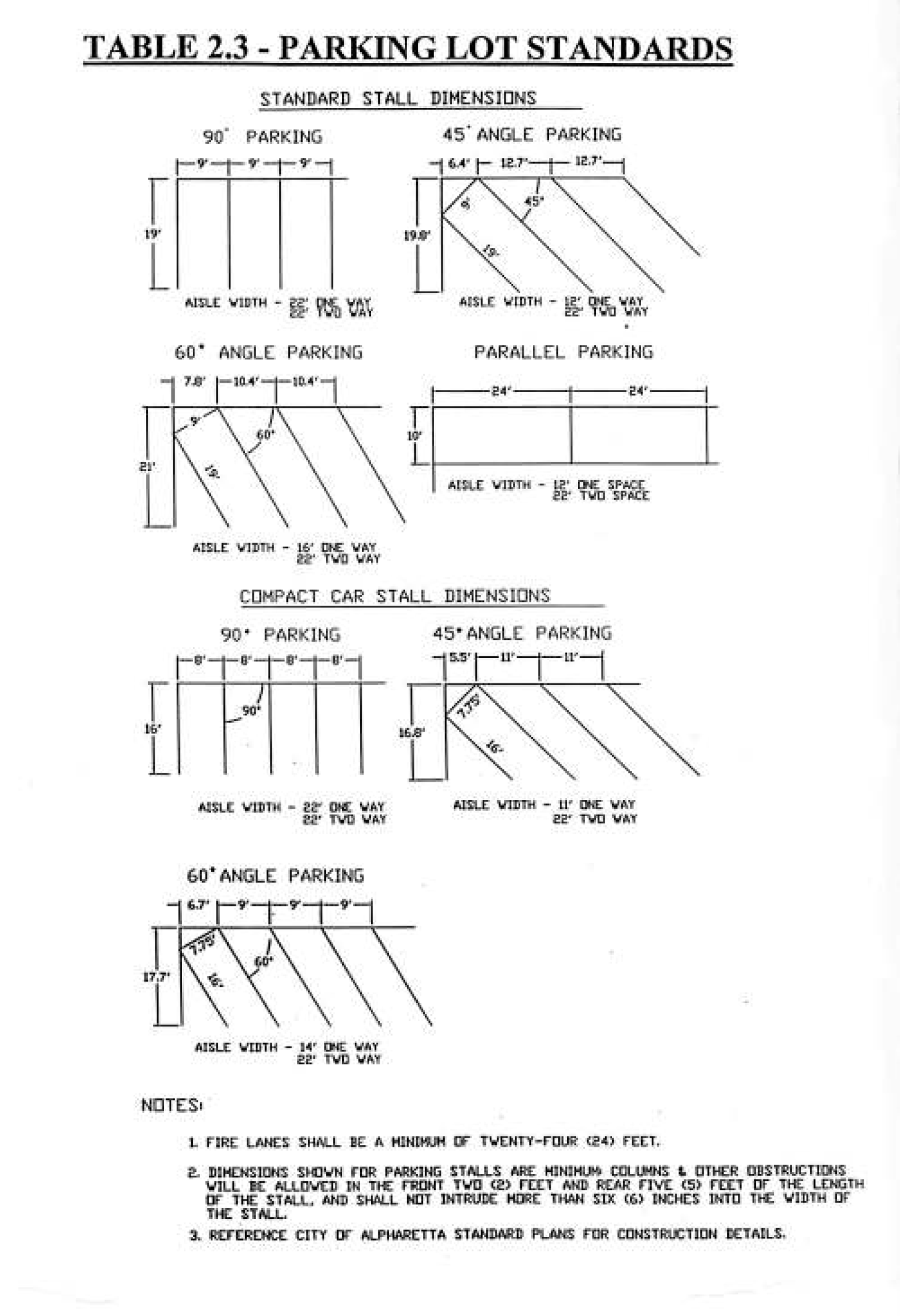
Table 2.3.a Alternative Criteria for Off-Street Parking
The following are recommended alternative criteria for off-street parking design to reduce impervious area of the site.
Source: Urban Land Institute (2010). The Dimensions of Parking, Fifth Edition. National
Parking Association.
Notes: Recommendations assume (1) one-way traffic for aisles less than 90 degrees,
and two-way traffic for 90 degree parking; (2) double loaded aisles; and (3) a design
vehicle that is 6'7" by 17'3".
Editor's note—Ord. No. 718, § 17(Exh. C), adopted Dec. 14, 2015, repealed the former § 2.5 (2.5.1—2.5.9), and enacted a new 2.5 (2.5.1—2.5.9) as set out herein. The former § 2.5 pertained to similar subject matter and derived from the original codification and Ord. No. 675, § 1, adopted June 3, 2013.
SECTION 2.6 - SIGNS[2]
2.6.1 Findings, purpose and intent.
A.
Findings.
1.
The City of Alpharetta finds that signs are a proper use of private property, are a means of personal free expression and a necessary component of a commercial environment. As such, signs are entitled to the protection of the law. In the absence of regulation, however, the number of such signs tends to proliferate, with property owners' desiring ever increasing numbers and sizes of signs, leading to cluttered and aesthetically blighted thoroughfares and properties. In addition, the competition among competing sign owners for visibility of their signs contributes to safety hazards for both vehicles and pedestrians and undermines the sign owners' original purpose of presenting a clear message of its idea or identification of its premises.
2.
The City further finds that the size, height, number, design characteristics, spacing and location of signs in the City directly affect the public health, safety and welfare and property values.
3.
The City further finds that the regulation of the size, height, number, design characteristics, spacing and location of signs is necessary to protect the public safety, to assure compatibility of signs with surrounding land uses, to enhance the business and economy of the City, to protect the public investment in the streets and highways, to maintain the tranquil environment of residential areas, to promote industry and commerce, to eliminate visual clutter and blight, to provide an aesthetically appealing environment, and to provide for the orderly and reasonable display of both advertising and non-commercial messages for the benefit of all the City's citizens.
4.
The City further finds that there is a substantial difference between signs erected by public authority and signs erected by private citizens or businesses. Signs erected by public authority are virtually all erected for the purpose of maintaining the public safety either through direct control of traffic or through provision of such type signage as street signs which enable the traveling public to know where they are located and to find where they are going. As such, with the exception of limited signs serving other purely public purposes, such as identifying government buildings or conveying government speech, virtually all government signs are erected purely for public safety purposes. Moreover, their use in the public right-of-way is necessary to ensure their visibility to the motoring public. The City finds that public utility signs are frequently of the same nature as those signs erected by governmental entities in that they provide necessary information to safeguard the public from downed power lines and from street excavations. Even where signs serve a propriety purpose, such as identifying markings on utility poles, those signs are marked primarily for the purpose of benefiting the public generally through identification of locations where there may be temporary losses of power.
5.
The City further finds that there is a substantial need directly related to the public health, safety and welfare to comprehensively address these concerns through adoption of the following regulations.
B.
Purpose and Intent. The purpose and intent of the governing authority of the City of Alpharetta in enacting this Ordinance includes, are as follows:
1.
To protect the health, safety, general welfare and property values of the citizens of the City, and to implement the policies and objectives of the Comprehensive Plan of the City through enactment of a comprehensive set of regulations governing signs in the City;
2.
To regulate the erection and placement of signs within the City in order to provide safe operating conditions for pedestrian and vehicular traffic without unnecessary and unsafe distractions to drivers and pedestrians;
3.
To preserve the value of property on which signs are located and from which signs may be viewed;
4.
To maintain an aesthetically attractive city in which signs are compatible with the surrounding area;
5.
To maintain for the City's residents, workers and visitors a safe and aesthetically attractive environment and to advance the aesthetic interests of the City;
6.
To prevent the destruction of the natural beauty and environment of the City and maintain and maximize tree coverage within the City;
7.
To establish comprehensive sign regulations which effectively balance the protection of legitimate business and development needs and the rights of individuals and businesses to convey their messages through signs with the promotion of a safe and aesthetically attractive environment for residents, workers and visitors to the City and the protection of the public health, safety, and general welfare;
8.
To ensure the protection of free speech rights under the State and United States Constitution within the City;
9.
To promote economic development;
10.
To establish a permit system to allow specific types of signs in zoning districts consistent with the uses, intent and aesthetic characteristics of the areas where the signs are to be located;
11.
To provide temporary signs in limited circumstances;
12.
To place reasonable controls on non-conforming signs that are by definition contrary to the public health, safety and welfare while protecting the constitutional rights of the owners of said non-conforming signs;
13.
To provide for the maintenance of signs;
14.
To avoid the harmful aspects of the unrestricted proliferation of signs; and
15.
To ensure the fair and consistent enforcement of sign regulations.
(Ord. No. 720, § 2(Exh. A), 2-22-2016)
A.
The provisions and standards of this Ordinance shall apply to all signs located or erected with the corporate limits of the City.
B.
Protected non-commercial speech shall be permitted in any place commercial speech is permitted under this Ordinance. Any sign provided for in any zoning district may contain non-commercial messages. To the extent any conflict arises between this provision and any other language found in this Ordinance, this provision shall control.
C.
Nothing herein shall be construed to permit display of any message which is obscene, illegal or speech which is otherwise unprotected under the First Amendment of the United States Constitution. Nothing herein shall be construed to prohibit a prosecution for violation of a criminal statute by the City or other duly constituted government authority or a civil action by the City or other private person or entity.
(Ord. No. 720, § 2(Exh. A), 2-22-2016)
As used in this Ordinance, unless the context indicates otherwise, the following terms shall have the meaning set forth below:
Abandoned Sign. Any sign that contains or exhibits broken panels, visible rust, visible rot, damaged support structures, or deteriorated copy through lack of maintenance, or which is otherwise dilapidated, unsightly, or unkempt, and for which no person accepts maintenance responsibility.
Animated Sign. Any sign, or part of a sign, that uses any movement or change of lighting or color to depict action or create a special effect or scene, changes colors or physical position by movement or rotation, or which gives the visual impression of such movement or rotation. This includes signs that flash, blink, scroll, fade or rotate/revolve to display a message in more than one direction, and tri-vision signs, but does not include flags, banners, or canopies.
Background Area. The area of a sign face on which copy could be placed, as opposed to the copy area, where copy is in fact posted or painted. See also, "Face of Sign" (or "Sign Face").
Banner. Any sign of lightweight fabric, plastic or similar material that is intended to be hung either with a frame or without a frame. Neither flags nor canopy signs are considered banners.
Beacon. Any light with one (1) or more beams which rotate, move or which are directed into the atmosphere or at one (1) or more points not on the same lot as the light source.
Canopy (or Marquee). A permanent roof-like shelter extending from part or all of a building face and constructed of some durable material such as fabric, metal, glass or plastic.
Canopy Sign. Any sign attached to or constructed in or on a canopy. For purposes of this Ordinance, this term includes Marquee Sign.
Changeable Copy Board. Any sign or part of a sign face that incorporates changeable board or panels, each of which contain a number, letter, character, graphic, symbol or image, to form a sign message or messages ("changeable copy"), whether the changing of such panels or boards are accomplished electronically or manually. A tenant panel is not considered changeable copy.
Channel Letter Sign. A three-dimensional, individually cut letters or figures, illuminated or non-illuminated, affixed to a structure.
City. The City of Alpharetta, Georgia.
Copy. The characters, symbols, graphics, images, letters, words, writing, and/or information or advertising display on a sign surface.
Copy Area. The area in square feet of the smallest rectangle enclosing the actual copy of a sign.
Directory Sign. A single, permanent free-standing sign for multiple businesses, offices, professionals, industries or other entities located within a planned center.
Double-Faced Sign. A sign which has two (2) display areas against each other or where the interior angle formed by the display areas is sixty degrees (60°) or less, where one (1) face is designed to be seen from one (1) direction and the other face from another direction.
Electronic sign. Any sign, or portion of a sign, whose message may be changed at intervals by electronic process or by remote control, including signs such as a tri-vision sign, LCD sign or LED sign.
Facade. The exterior front of a building or structure exposed to public view.
Face of Sign or Sign Face. That part of a sign that is or can be used to announce, direct attention to, identify, advertise or otherwise communicate information. The entire area of sign on which copy could be placed. See also, "Background Area." The sign face may be composed of two or more modules on the same surface that are separated or surrounded by portions of a sign structure not intended to contain any advertising message or idea and are purely structural or decorative in nature.
Feather Sign. A temporary sign or device made of lightweight plastic, fabric, or other material, whether or not containing a message of any kind, attached to a single rod, stake or staff for support, and designed to move in the wind.
Flags. Any fabric, bunting or similar material containing distinctive colors, patterns, or symbols.
Flashing Sign. A sign, the illumination of which is not kept constant in intensity at all times when in use, and which exhibits marked changes in lighting effects.
Free-standing Sign. Any sign erected on a free-standing base, foundation, or frame, or otherwise supported by structures, supports or posts that are attached to, placed on, or anchored in the ground, and which are independent from and not attached to any building or other structure. All permanent free-standing signs shall be self-supporting structures erected on and permanently attached to solid bases or foundations.
Illuminated Sign, External. Any sign illuminated by an external light source. Such source cannot be a device that changes color, flashes or alternates.
Illuminated Sign, Internal. Any sign illuminated by an internal light source. Such source cannot be a device that changes color, flashes or alternates.
Lot or Parcel. A designed parcel, tract or area of land legally established by plat, subdivision or as otherwise permitted by law, to be separately owned, used, developed or built upon.
Monument Sign. A type of permanent free-standing sign that consists of a sign face attached on a solid base or foundation, designed in a manner such that the bottom (base) of the sign face is flush with the supporting solid base, which is directly mounted on and flush with the ground. The supporting base shall be at least as wide as the sign face and shall be constructed of brick, stone, or other architectural material as set forth herein. Also referred to as a "ground sign."
Non-conforming Sign. A sign erected or otherwise in use prior to the effective date of this Ordinance which fails in one or more respects to comply with all provisions of this Ordinance.
Obscene. Any form of speech which, taken as a whole, appeals to the prurient interest in sex, portrays sexual conduct in a patently offensive way, and which, taken as a whole, does not have serious literary, artistic, political, or scientific value. See Miller v. California, 413 U.S. 15, 93 S. Ct. 2607 (1973).
Outparcel. A portion of a larger parcel of land generally designed as a site for a separate structure and business from that of the larger main tract. To be recognized as an outparcel, the parcel must abut and be external to the larger main tract, have street frontage, and at the time of approval of the site plan for the larger main parcel be identified and delineated as a separate building site from that of the larger main parcel.
Pennant or Streamer. A temporary sign or device made of lightweight plastic, fabric, or other material, whether or not containing a message of any kind, suspended from a rope, wire, or string, usually in a series, designed to move in the wind.
Permanent Sign. Any sign affixed in manner that enables the sign and its copy to resist environment loads and precludes ready removal or movement of the sign, which is designed and constructed in a manner such that its intended use appears to be indefinite, and which, when installed, is intended for permanent use.
Perpendicular Sign. A sign that is placed perpendicular to the face of a wall and can be read on both sides. Such signs can be mounted to a wall or attached to the underside of an awning.
Portable Sign. Any sign which is designed to be transported, including, but not limited to, signs transported by trailer or its own wheels, even though the wheels of such sign may be removed and remaining chassis or support constructed without wheels is converted to an "A" or "T" frame sign or attached temporarily or permanently to the ground. Portable sign also means a sign carried by a person when that person's function is to display or convey a message as a pedestrian. Portable sign also means and includes a sign attached to, mounted on, posted on, painted or drawn on a motorized or drawn vehicle, when such vehicle is parked or placed in such a manner as to serve the purpose of an advertising device, or routinely parked at a location other than the location generally associated with the message conveyed or identified thereon, or when the primary purpose or function of such vehicle is to transport the message or messages conveyed or identified thereon. Portable signs shall not be deemed to include standard bumper stickers on vehicles, license plates, or signs that may be reflected on hats or other articles of clothing.
Roof Line. The top edge of the roof or the top of the parapet, whichever forms the top line of the building silhouette.
Roof Sign. Any sign erected upon, against or directly above a roof or on top of or above the parapet of a building.
Rotating Sign. Any sign or portion of a sign that moves in a revolving or similar manner.
Sidewalk or Sandwich Board Sign. A movable sign not secured or attached to the ground or surface upon which it is located.
Sign. Any identification, description, illustration, device, fixture, structure, display or visual representation, which is visible from any public place and affixed to, or supported or suspended by, a stationary object, structure, building or the ground that uses any color, form, character, symbol, graphic, image, illumination, or writing to announce, direct attention to, identify, or advertise an object, idea, location, place, person, institution, organization, business, product, service, activity or event or to otherwise visually communicate information, ideas or messages of any kind to the public. "Sign" includes the sign face and sign structure..
Sign Structure. Any structure, other than a building, which supports, has supported or is designed to support a sign. A decorative cover is part of a sign structure.
Site Plan. A scaled, legible drawing representing the parcel of land on which a sign is to be located showing at least the property lines, public street right-of-ways, drive entrances, buildings and the location of existing free-standing signs.
Standard Informational Sign. A non-illuminated, temporary free-standing sign, which shall contain no reflecting elements, flags, projections or unpainted wooden surfaces, mounted on a post, stake or metal frame (with a thickness or diameter not greater than three and one-half inches) that is attached to, or anchored in, the ground. Standard informational signs are limited per lot to either one (1) sign that is twelve (12) square feet in area or up to four (4) signs not to exceed an aggregate of twelve (12) square feet in area. In addition, each sign shall not exceed a height of five (5) feet. These signs shall be set back not less than ten (10) feet from public right-of-way or ten (10) feet from the back of curb of a private roadway. Standard informational signs do not require a permit.
Strip Shopping Center. A multi-tenant retail center with less than fifty thousand square feet (50,000 sq. ft.) of enclosed, leasable space.
Subdivision Sign. A monument sign located at the vehicular entrance or exit of a platted residential subdivision.
Substandard Lot or Parcel. A lot or parcel that does not meet the lot area, width or public street frontage and access requirements of this Code.
Swinging Sign. A hinged sign installed on an arm or spar, and which is not also permanently fastened to an adjacent wall, ceiling or upright pole or support.
Temporary Sign. Any sign that is not a permanent sign.
Tenant Frontage or Tenant Space Frontage. The horizontal distance in feet between the left side wall and the right side wall or building end wall of a tenant space fronting on a street.
Tenant panel. A physically removable panel on a sign face that may be changed for different like-sized panels and which is at least two (2) square feet in area. Tenant panels do not include electronic signs, reader boards or changeable copy.
Tenant Space. The physical location within a building designed and intended to serve as the separate and exclusive premises for the operations of a business or entity, which has its own exclusive public entrance/exit from the exterior of the building, and which is occupied by a business or entity legally operating pursuant to all Federal, State, City or other applicable laws and regulations. The use of any such physical location by more than one (1) legally operating business or entity shall only constitute a single tenant space. In the event such a physical location is used or occupied by more than one (1) business or entity, in order for such physical location to constitute a "tenant space", all businesses and/or entities operating therein must be operating pursuant to all Federal, State, City or other applicable laws and regulations.
Under-canopy Sign. A sign suspended below the ceiling or roof of a canopy or marquee and perpendicular to the face of the building. For the purposes of this Ordinance, this term includes Under-marquee Sign.
Variable Message Board. A programmable sign that provides changing information.
Wall Sign. A sign attached to or erected against the outside wall of a building, with the face parallel to the building wall and extending not more than 1 foot (1 ft.) therefrom, and which displays only one sign face.
Window Sign. A sign installed on or inside a window for purposes of viewing from outside the building. This term does not include merchandise located in window or similar window displays.
(Ord. No. 720, § 2(Exh. A), 2-22-2016; Ord. No. 841, § 1(Exh. A), 2-21-2022)
2.6.4 Permits and applications.
A.
PERMIT REQUIRED. Except as specifically exempted from the provisions of this Ordinance, it shall be unlawful for any person to post, display, materially change, or erect a sign in the City without first having obtained a sign permit. Notwithstanding the foregoing, signs which are not visible from a public right-of-way or from neighboring properties shall not be subject to the standards of this Ordinance. A change in the copy area of a sign shall constitute a material change.
B.
APPLICATION CONTENTS. Applications for sign permits shall be made on application forms prepared by the Director and filed by the sign owner or its agent with the Director. The application shall include a detailed description of the subject sign and such other information and documents as required by the subject application form, including the following:
1.
The street address of the property upon which the subject sign is to be located and a site plan of the property which bears the scaled and labeled proposed location of the sign.
2.
The aggregate area and copy area for all signs on the parcel.
3.
The name(s) and address(es) of the owner(s) of the real property upon which the subject sign is to be located.
4.
Name, address, telephone number, business license number and signature of the business owner authorizing placement of the sign.
5.
Name, address, telephone number, fax number, business license number and signature of the sign contractor.
6.
The type of sign to be erected, the area and copy area of the sign, the height of the sign (if free-standing), the shape of the sign, the color(s) of the sign, the material of the sign and details showing how the sign will be mounted, installed or erected.
7.
For permanent free-standing, ground and monument signs only, show dimensioned sign location on site plan and include structural foundation and mounting details. Indicate the location and size of all existing permanent free-standing, ground and monument signs on the property.
8.
The cost of the sign (materials and installation).
9.
All applicants for signs which incorporate electricity must obtain an electrical permit or, if previously issued, a copy of the electrical permit. Signs connected to an approved, existing wired outlet or junction box do not require electrical permits.
10.
If the proposed sign is subject to the design standards or other requirements set forth in the Design Review Board Ordinance (codified as §§ 16-37—16-46 of The Code of the City of Alpharetta, Georgia), the applicant must also submit such additional forms, information and/or documents as may be required by the provisions of said ordinance.
11.
Such other information as the City shall require to show full compliance with this and other ordinances of the City.
C.
REVIEW AND CONSIDERATION OF APPLICATIONS; DECISION; APPEALS.
1.
No permit shall be issued until the appropriate application has been filed with, and approved by, the Director and fees have been paid. Fees and any required deposits shall be established from time to time by resolution of the City Council. No application shall be deemed to be accepted by the Director unless and until all fees and deposits are paid and all information reasonably required by the Director is provided by the applicant. When a sign sought pursuant to an application for a permit is located or proposed to be located within the Downtown Overlay or design review for compliance with design standards is delegated and referred to the Design Review Board by the Director as authorized under the Design Review Board Ordinance, the application shall also be subject to design review by the Design Review Board in accordance with the Design Review Board Ordinance. Where design review of a sign by the Design Review Board is required in accordance with the foregoing provisions, a condition of zoning or conditional use approval, or any other applicable City code, ordinance, resolution or regulation, no permit for any such sign shall be issued without the prior grant of design approval by the Design Review Board. The decision of the Design Review Board to grant or deny design approval shall be final.
2.
The Director shall reject any application that is incomplete or does not conform to the City's application requirements, contains a false material statement or omission, or is for a prohibited sign under Subsection 2.6.8. Any such application may be rejected by either returning the application to the applicant or providing written notice of rejection of the application at any time prior to the expiration of (45) business days of receipt of said application. An application which is resubmitted must meet all the standards applicable to an original application. A rejected application that is later resubmitted in conformity with this Section 2.6 shall be deemed to have been submitted on the date of resubmission, instead of the original submission date. The Director is further authorized and empowered to revoke any sign permit issued pursuant to an application containing a false material statement or omission. The rejection or revocation of a permit pursuant to the provisions of this subparagraph may be appealed to the Board of Appeals by filing a notice of appeal with the Director within fifteen (15) days of written notice of the revocation, which must state the reason(s) for the appeal. Any such appeal shall be heard in accordance with the provisions for appeal set forth in subparagraph 5 below.
3.
A sign permit shall become null and void if the sign for which the permit was issued has not been completed and erected within the time frame specified by the permit or six (6) months after the date of issuance.
4.
A complete application for a sign permit shall be approved or denied by the Director within forty-five (45) business days of its receipt by the Director and the applicant's payment of the appropriate deposit(s) and fee(s) to the City. The Director shall give written notice to the applicant of the Director's decision within such forty-five (45) business day period. If it is determined that the application fully complies with the provisions of this Section 2.6 and all other applicable laws, ordinances, codes, resolutions and regulations of the City, the application shall be approved by the Director and a sign permit shall be issued. If it is determined that the application or proposed sign does not fully comply with the provisions of this Section 2.6 and all other applicable laws, ordinances, codes, resolutions and regulations of the City, the Director shall deny the application. If the decision of the Director is to deny the application, the notice shall state the reasons for denial of the permit. The Director shall give such notice in writing by hand-delivery, certified mail, statutory overnight delivery, or e-mail using the contact information provided in the application. If the notice is sent by certified mail, overnight statutory delivery or e-mail, the notice shall be deemed to have been given on the date the notice is mailed or e-mailed by the City as indicated by the postmark or date stamp associated therewith. If the City fails to act within the forty-five (45) business day period, the permit shall be deemed to have been granted.
5.
Except as provided in Paragraph 6 below, when an application for a sign permit is denied by the Director, the applicant may appeal such denial to the Board of Appeals by filing a written notice of appeal with the Director within fifteen (15) days of the written notice of permit denial. The notice of appeal shall specify the grounds thereof. The Board of Appeals shall take final action on the appeal within sixty (60) days of the filing of the notice of appeal. If the Board of Appeals fails to act within said 60-day period, the permit shall be deemed to have been granted. Should the Board of Appeals vote to uphold the decision of the Director, the Board of Appeals shall issue a written decision indicating the reason(s) therefor to the applicant. Appeal from the decision of the Board of Appeals is by writ of certiorari to the Fulton County Superior Court and must be filed within 30 days of the date of the Board's decision.
6.
Notwithstanding the provisions of the foregoing Paragraph, when (a) a sign is subject to design review and approval by the Director for compliance with design standards and other requirements pursuant to the Design Review Board Ordinance (See Chapter 16 of The Code of the City of Alpharetta, Georgia) and (b) an application for a sign permit is denied by the Director solely on the grounds that the proposed sign does not comply with such design standards or requirements (i.e., design approval is denied by the Director), the applicant may appeal such denial to the Design Review Board by filing a written notice of appeal specifying the grounds thereof with the Director within fifteen (15) days of the written notice of permit denial. When the Director's denial of design approval under the Design Review Board Ordinance serves as the sole basis for the denial of an application for a sign permit, such permit denial shall only be appealable to the Design Review Board. The Design Review Board shall take final action on the appeal within 60 days of the filing of the notice of appeal. If the Design Review Board fails to act within said 60-day period, design approval of the proposed sign shall be deemed to have been granted. Should the Design Review Board vote to uphold the denial, the Design Review Board shall issue a written decision indicating the reason(s) therefor to the applicant. Appeal from the decision of the Design Review Board is by writ of certiorari to the Fulton County Superior Court and must be filed within thirty (30) days of the date of the Design Review Board's decision.
7.
The Director may inspect all existing signs in the City to determine if such signs conform to the provisions of the Ordinance. The Director is authorized and empowered to suspend or revoke any sign permit issued upon failure of the holder thereof to comply with any provision of this Sign Ordinance or any other ordinance of the City applicable to the subject sign. The suspension or revocation of the permit shall not preclude the Director or City from taking any other action authorized by this Code or by law to enforce the provisions hereof, assure correction of violations or for any other lawful purpose. No permit shall be suspended or revoked until after the permittee is granted a public hearing before the Board of Appeals. The permittee shall be given fifteen (15) days' written notice of the time, place, and purpose of the hearing, with a statement of the reason(s) for the suspension or revocation of such permit. A finding that the permittee has violated a provision of this Sign Ordinance or any other ordinance of the City applicable to the subject sign shall be due cause for the suspension or revocation of the sign permit.
(Ord. No. 720, § 2(Exh. A), 2-22-2016; Ord. No. 751, § 1(Exh. A), 10-16-2017; Ord. No. 805, § 1(Exh. A), 8-10-2020)
Editor's note— Ord. No. 751, § 1(Exh. A), adopted Oct. 16, 2017, changed the title of § 2.6.4 from "Permits and labels" to read as herein set out.
A.
Where a literal application of terms of this Ordinance, due to special circumstances, would result in an unusual hardship in an individual case, a variance may be granted pursuant to procedures set forth in this Code where all the following conditions exist:
1.
a.
Exceptional conditions pertaining to the property where the sign is to be located as a result of its size, shape or topography, which are not applicable to other lands or structures in the area; or
b.
The natural features of the lot on which the sign is located or to be located, or of the land immediately adjacent to the lot, impairs the visibility of the sign such that it cannot be seen;
2.
The applicant would be deprived of rights that are commonly enjoyed by others similarly situated;
3.
Granting the variance would not confer on the applicant any significant privileges which are denied to others similarly situated;
4.
The exceptional circumstances are not the result of action by the applicant;
5.
The requested variance is the minimum variance necessary to allow the applicant to enjoy the rights commonly enjoyed by others similarly situated;
6.
Granting of the variance would not violate more than one standard of this Ordinance; and
7.
Granting the variance would not result in allowing a sign that interferes with road or highway visibility or obstruct or otherwise interfere with the safe and orderly movement of traffic.
Notwithstanding the foregoing, no variance shall be granted for any sign that is a prohibited sign under Subsection 2.6.8.
(Ord. No. 720, § 2(Exh. A), 2-22-2016)
It is the policy of the City to encourage that all signs within the City be brought into compliance with the terms and requirements of this Ordinance.
A.
The City finds that non-conforming signs may adversely affect the public health, safety and welfare. Such signs adversely affect the aesthetic characteristics of the city and may adversely affect public safety due to the visual impact of said signs on motorists and the structural characteristics of said signs. Accordingly, the following registration requirements are found to be necessary in order to minimize these possible adverse effects through annual inspections and maintenance and allow the City to remain cognizant of the locations and maintenance of said signs.
B.
The owner(s) or authorized agent(s) of each non-conforming sign located within the City shall register said non-conforming sign with the Director no later than 90 days after the effective date of this Ordinance and shall renew this registration annually thereafter. Any non-conforming sign that does not comply with the registration requirements herein shall be deemed to be an illegal sign and shall be subject to the regulations applicable to illegal signs and all other enforcement provisions of this Ordinance. The Director shall promulgate a form for the registration of non-conforming signs and shall annually inspect said signs to assure that they continue in all other respects in conformity with all other provisions of this Ordinance and any other applicable ordinance or regulation of the City.
C.
The Director may inspect existing signs in the City from time to time to determine if such signs conform to the provisions of this Ordinance.
D.
Any non-conforming sign which is not used or leased for a continuous period of 1 year shall not be reused for sign purposes unless and until it fully conforms with the terms and requirements of this Ordinance.
E.
No change in shape, size or design, shall be permitted except to make a non-confirming sign comply with all requirements of this Ordinance.
F.
A non-conforming sign may not be replaced by another non-conforming sign.
(Ord. No. 720, § 2(Exh. A), 2-22-2016)
2.6.7 Exemptions from permit requirements.
The following signs shall be exempt from the permit requirements of Section 2.6.4, provided all standards set forth in this Ordinance are met, including, but not limited to, the standards set forth below:
A.
Standard informational signs.
B.
Address numerals, not exceeding six (6) inches in height in residential districts and twelve (12) inches in height in non-residential districts, for the sole purpose of displaying street numbers as may be required by other ordinances and other signs required by law.
C.
Flags provided that the height of a flag pole shall not exceed 35 feet, and in residential districts shall not exceed twenty-five (25) ft. in height or the height of the primary structure on the lot, whichever is less. In addition, the maximum dimensions of any flag shall be proportional to the flag pole height and the hoist side of the flag shall not exceed twenty percent (20%) of the vertical height of the flag pole. Each lot shall be allowed a maximum of three (3) flag poles unless a special land use permit or variance is obtained. A maximum of 2 flags per pole is allowed.
D.
Non-governmental traffic control devices in or adjacent to internal parking areas and driveways in private developments, located so as not to interfere with, or detract from, official traffic control devices, and which conform to MUTCD (current edition) standards, including, but not limited to, standards regarding size, height, design and location.
E.
Window signs meeting the standards of this Ordinance.
F.
Legally authorized public notices when posted by a government officer in the performance of his or her duties.
(Ord. No. 720, § 2(Exh. A), 2-22-2016; Ord. No. 880, § 1 (Exh. A), 12-16-2024)
2.6.8 Prohibited signs and devices.
Except as otherwise provided, the following types of signs or attention-getting devices are prohibited in all zoning districts of the City:
1.
Balloons, pennants, streamers, feather signs, air or gas filled figures, or similar attention-getting devices or wind-activated devices, excluding flags.
2.
Swinging signs.
3.
Rotating signs.
4.
Animated signs, flashing signs, and intensely lighted signs.
5.
Beacons, search lights or laser lights or images.
6.
Variable message boards used for purposes other than traffic management.
7.
Signs which purport to be, or are an imitation of, or resemble an official traffic sign or signal.
8.
Window signs which, in aggregate, exceed 20% of the window area or otherwise fail to meet the standards of this Ordinance.
9.
A-frame signs, sandwich board, sidewalk or curb signs are prohibited except when placed within 5 ft. of the front door of a building.
10.
Signs painted on or attached to utility poles, trees, rocks or other similar objects, except signs lawfully placed on utility poles by a government, public authority or public utility.
11.
Signs which obstruct a fire escape, required exit, window or door opening used as a means of ingress or egress, or which interfere with any opening required for ventilation, or which violate any code of the City, including the Life Safety Code and the Fire Prevention Code.
12.
Signs occupying a parking space required under the minimum parking requirements of this Ordinance, other than signs designating the space as reserved for handicapped or other use.
13.
Signs which do not conform to City-adopted building and electrical codes.
14.
Signs which emit audible sound, odor or visible matter.
15.
Portable signs.
16.
[Reserved].
17.
[Reserved].
18.
Signs attached to any street signs or traffic control devices, or to any pole supporting same, or any sign attached to any utility pole, other than those signs lawfully placed by a government, public agency, or public utility.
19.
Signs projected on a building.
20.
Signs in a public right-of-way other than publicly owned or maintained signs.
21.
Signs which are in violation of the rules and regulations of any zoning overlay district presently existing or as may later be enacted.
22.
Signs located on any substandard lot.
23.
Abandoned signs.
24.
Any sign that is structurally unsound, or is a hazard to traffic or pedestrians.
25.
Dilapidated or neglected signs. A sign (including sign structure) will be dilapidated or neglected if it does not present a neat and orderly appearance, which may be manifested by the following: rust or holes on or in the sign or sign structure, or broken, missing, loose or bent parts, faded or flaking paint, non-operative or partially non-operative illuminating or mechanical devices or missing letters in sign copy.
26.
Signs exceeding 156 sq. ft. in copy area if located on a commercial building, signs exceeding 240 sq. ft. in copy area if located on an industrial or office park building and/or signs and sign structures in excess of 10 ft. in height (measured from the ground to the highest point of the structure).
27.
Signs in any area designated as an undisturbed buffer pursuant to a federal, state or local law, a condition of zoning, or approved plat.
28.
Internally illuminated window signs, including neon or LED signs (except as otherwise permitted herein). Additionally, LED, string or similar lighting outlining the windows, doors or other similar building features shall be prohibited.
29.
Cabinet signs in the Downtown Overlay.
30.
Face illuminated channel letter signs.
(Ord. No. 720, § 2(Exh. A), 2-22-2016; Ord. No. 736, § 1, 3-20-2017; Ord. No. 805, § 1(Exh. A), 8-10-2020; Ord. No. 841, § 2(Exh. B), 2-21-2022; Ord. No. 864, § 3(Exh. C), 10-16-2023)
In case any sign covered by this Ordinance is or is proposed to be erected, constructed, altered, converted or used in violation of any provision of this Ordinance, the Director may, in addition to other remedies, and after due notice to the appropriate person(s), issue a citation for violation of this Ordinance requiring the presence of the violator in the municipal court or the Alpharetta Code Enforcement Board, or institute injunctive or other appropriate legal or administrative proceedings to prevent such unlawful erection, construction, alteration, conversion or use or to correct or abate such violation.
(Ord. No. 720, § 2(Exh. A), 2-22-2016)
In the event that any section, subsection, sentence or work of this Ordinance is declared or adjudged to be invalid or unconstitutional, such declaration or adjudication shall not affect the remaining provisions of this Ordinance, which shall remain in full force and effect as if such portion so declared or adjudged unconstitutional were not originally part of this Ordinance, even if the surviving parts of this Ordinance result in greater restrictions after any unconstitutional provisions are stricken. The Mayor and Council declare that they would have enacted the remaining parts of this Ordinance if they had known such portions thereof would be declared or adjudged unconstitutional or invalid. The Mayor and Council declare their intent that should this Ordinance be declared invalid, in whole or in part, signs are to continue to be subject to regulations applicable to "structures" contained in other city ordinances, including other sections of this Code.
(Ord. No. 720, § 2(Exh. A), 2-22-2016)
Except as otherwise provided in this Ordinance, the following general regulations apply to all zoning districts in the City:
A.
MAINTENANCE AND APPEARANCE OF SIGNS.
1.
All signs shall be maintained in good condition and present a neat and orderly appearance. Any sign showing gross neglect, or which becomes dilapidated, or which is surrounded by an unmaintained ground area, or due to its condition which may pose a threat to the safety of the public may be required to be repaired or removed as set forth below.
2.
The Director, upon finding any of the above conditions, will give the owner written notice which may be up to 10 days to correct the deficiencies or to remove the sign or signs. If the owner refuses to correct the deficiencies or remove the sign, the Director may issue a citation under the enforcement provisions of this Ordinance.
B.
ILLUMINATION OF SIGNS.
1.
The light from any illuminated sign shall not be of an intensity or brightness which will interfere with the peace, comfort, convenience, and general welfare of residents or occupants of adjacent properties.
2.
No sign shall have blinking, flashing, or fluctuating lights or other illuminating devices which have a changing light intensity, brightness or color.
3.
No color lights shall be used at any location or in any manner so as to be confused with or construed as traffic control devices.
4.
Neither direct nor reflected light from primary light sources shall create a hazard to operators of motor vehicles.
5.
Lighting for free-standing signs shall be located above the sign and aimed downward in order to minimize the brightness added to the night sky.
C.
MEASUREMENT OF SIGN AREA.
1.
Generally. Except as otherwise provided herein, the area of a sign shall be computed as the area within the smallest rectangle enclosing the limits of a sign face, together with any sign face cabinet, frame, material, texture, or color forming an integral part of the sign face used to differentiate the sign face from the structure upon which it is placed. The computation of the area of a sign face shall not include the structure, supports, or uprights on which the sign face is placed or any portions of a sign structure that are not intended to contain any copy or serve background, but rather are purely structural or architectural in nature, except as provided above.
2.
Double-Faced Signs. For double-faced signs, when the sign face surfaces are parallel and are back to back, or where the interior angle formed by the faces is sixty (60) degrees or less, the area of the sign shall be taken as the areas on the largest side. For all other multi-faced signs, the area of the sign shall be the total area on all sides that can be viewed from any angle.
3.
Monument Signs.
a.
Area of Sign. For monument signs, the "sign area" or "area of the sign" shall mean the total area of the visible surface of the sign, including the base, sign structure, and sign face of the sign. The computation of the sign area of a monument sign shall include the entire surface of the base, sign structure and sign face, as measured from top to bottom and side to side. For monument signs that are double-faced, when the sign face surfaces are parallel and are back to back, or where the interior angle formed by the faces is sixty (60) degrees or less, the area of the sign shall be taken as the areas on the largest side.
b.
Sign Face. For monument signs, the area of the sign face shall be measured in the same manner as provided for the measurement of the area of sign for all other signs.
c.
Copy Area. For monument signs, the copy area shall be measured in the manner provided in the definition of "copy area."
d.
Tenant Panels and Changeable Copy Board. If a portion of a monument sign includes a sign face with tenant panels or changeable copy board, which is separated from another copy area on the sign by portions of a sign structure that are not intended to contain any copy, but rather are purely structural or architectural in nature, the portion of the sign containing tenant panels or changeable copy board shall be measured separately from the other copy area of the sign (i.e., the copy area of the monument sign is the total of (i) the area within the smallest rectangle enclosing the limits of the sign face comprised of tenant panels or changeable copy and (ii) the other (separated) copy area.)
D.
STANDARDS FOR MONUMENT SIGNS.
1.
The base of a monument sign shall be at least as wide as the sign face. Unless otherwise specified in a Master Sign Plan or a condition of zoning approval, the base and structure of a monument sign shall be constructed of brick, stone, or other architectural materials matching the principal building's materials and color. Any poles or columns utilized for structural purposes shall be fabricated or covered so that they may not be detected visually. Foundations shall be designed to carry weight and wind load of the sign, in soil which it is placed.
2.
Any tenant panels or changeable copy on a monument sign shall have a uniform background color and material.
3.
All monument signs shall display the property address in numbers at least six (6) inches in height. The numerical address shall not be considered part of the sign face and shall not count against the allowable sign square footage provided such numbers are not more than twelve (12) inches in height.
4.
Except for subdivision signs, monument signs may not be constructed before the principal building is on a lot.
E.
BANNERS. Banners require a permit and are permitted in all zoning districts pursuant to the following standards:
1.
Banners shall be permitted for either one (1) fourteen (14) day period per calendar year per lot or two (2) seven (7) day periods per calendar year per lot. An individual banner permit may be divided into two (2) non-consecutive seven (7) day periods provided the dates are stated on the permit. However, in the case of lots which contain a shopping center (or strip shopping center) with multiple tenant spaces, each tenant space shall be allowed to erect or place a banner for either one (1) fourteen (14) day period per calendar year or two (2) seven (7) day periods per calendar year. Applicants that require review and approval of signage from the Design Review Board (DRB), other than for a Master Sign Plan, shall be permitted one (1) banner sign for up to a 60 day period after submission of a DRB application.
a.
The Director may grant an extension of the time period set forth above for a commercial business when the business fronts a roadway that is under construction. In order to qualify for such an extension:
1.
The subject roadway construction must be related to a project performed by the City. County or the Georgia Department of Transportation; and
2.
The subject roadway construction is planned to continue for three (3) months or more following the date of the request for an extension: and
3.
The subject roadway construction either:
a.
Causes the removal of a monument sign; or
b.
As determined in the discretion of the Director, disrupts the store frontage to the extent the site and/or business appears dosed without the use of a banner.
Any extension granted under this subsection shall be limited to the duration of the subject roadway construction. Extensions granted by the Director may be revoked or limited at any time due to changes in the roadway construction or disruption of the store frontage as determined in the discretion of the Director. The Director may require removal or replacement of any banner placed pursuant to an extension at any time if the banner is not maintained in good condition as determined in the discretion of the Director.
2.
In addition to the foregoing, banners shall be allowed on private property during an approved temporary use, as defined in Section 2.3.2 of the U.D.C., for the approved period of such temporary use, but not to exceed forty-five (45) days; provided, however, the placement of banners on lots during approved temporary uses shall not be permitted more than two (2) times per calendar year per lot. Any such banners shall be removed upon termination of the temporary use or within forty-five (45) days from the date it is first placed on the lot, whichever is first to occur. Upon removal, no banner shall be placed on the same lot for a period of sixty (60) days.
3.
Banners shall not exceed 24 sq. ft. total area in size.
4.
Banners must either be free-standing or mounted to the wall of a tenant space or the lot's existing monument sign. If free-standing, the height of the banner shall not exceed five (5) [feet] above grade. If mounted to the wall of a tenant space, the width of the banner shall not exceed tenant frontage and shall not extend above the horizontal plane of the roof where the building wall and roof meet. If mounted to the lot's existing monument sign, the banner shall not extend beyond the sign face of the monument sign.
5.
Banners shall be erected with supports or other means so that they do not sag or become dilapidated.
F.
PLACEMENT OF SIGNS. Except within the Central Business District, all free-standing signs must be set back at least ten (10) ft. from the public right-of-way. Within the Central Business District, all free standing signs must be set back at least five (5) feet from the public right-of-way.
G.
CHANGEABLE COPY. Any monument sign permitted under this Ordinance may contain up to sixty-five percent (65%) changeable copy if the sign is located on a lot zoned and used (as its principal existing use) for an institutional, public or semi-public use and which includes an indoor public assembly place accommodating one hundred (100) or more persons.
H.
SIGNS PERMITTED IN STRIP SHOPPING CENTERS, SHOPPING CENTERS, AND MIXED-USE DEVELOPMENTS. To ensure aesthetic compatibility of signage throughout a development, strip shopping centers, shopping centers, and mixed-use developments shall submit a Master Sign Plan to the City's Design Review Board for consideration. At a minimum, Master Sign Plans shall address signage type, sign face color, and illumination color. Plans shall limit sign illumination color to one (1) color and sign face colors to no more than three (3) colors, except that licensed trademark/logo colors shall be permitted. Master Sign Plans shall apply to any signage that requires a permit.
(Ord. No. 720, § 2(Exh. A), 2-22-2016; Ord. No. 847, § 1(Exh. A), 4-18-2022; Ord. No. 864, § 3(Exh. C), 10-16-2023)
2.6.12 Requirements for non-residential zoning districts.
A.
Signs Permitted in Strip Shopping Centers (less than 50,000 sq. ft. enclosed leasable space).
1.
Primary Free-standing Sign (Monument Sign). One (1) primary monument sign no greater than ten (10) ft. in height with no more than forty-two (42) sq. ft. of copy area shall be permitted in a strip shopping center. The monument sign may have up to four (4) tenant panels, which shall be calculated as part of the copy area. This sign shall be set back 20 ft. from the public right-of-way.
2.
Wall Signs. One wall sign per road frontage for each tenant space no greater than one (1) sq. ft. of sign area per one (1) in. ft. of tenant space frontage shall be permitted; provided, however, no more than two (2) wall signs shall be allowed for a tenant space (i.e. Corner tenants within strip shopping centers may have a wall sign on the end of the building in addition to the wall sign on the front of the building for a maximum of two (2) wall signs). Up to 50% of unused tenant sign area for wall and perpendicular signs shall be permitted to be aggregated and distributed to a particular building elevation; provided, however, no more than two (2) wall sign and one (1) perpendicular sign (not greater than 8 square feet) shall be allowed on the same building elevation and additional signs shall not be internally-illuminated.
3.
Rear Entrance Sign.
a.
Applicability. Businesses located within the first two floors of a building that backs onto a parking lot, alley, park or other public space may have an additional wall sign.
b.
Location. Rear entrance signs shall be located near the tenant space's rear door facing the parking lot, alley, park or other public space and placed within general proximity of the associated business.
c.
Size. The area of rear entrance signs shall not exceed 50% of the front facing sign area allowed for the same tenant.
4.
Window Signs. Window signs, as defined in this Ordinance, are permitted for each tenant space in a shopping center. The aggregate copy area of such signs, however, shall not exceed a maximum of twenty percent (20%) of the total window area of the subject tenant space. One (1) illuminated window sign is permitted for each tenant space provided that such sign does exceed a maximum of four (4) sq. ft. in area. Illuminated window signs shall be included in the maximum aggregate window sign area calculation. Any illuminated window sign shall be constant in its light emission, shall not be animated, and shall not be so large or of character to obscure vision into the premises from the outside. Window signs shall not require a permit from the Director. However, each tenant shall immediately remove any window sign upon receipt of written notification from the Director stating that such window sign obscures the vision of police or other security or safety personnel into the premises in a manner that endangers public safety.
5.
Under-Canopy Sign. One (1) under-canopy sign is permitted for each tenant space within a strip shopping center, which shall not exceed 8 sq. ft. in area.
6.
Sign During Construction. One (1) temporary free-standing sign per strip shopping center project shall be permitted during the construction of the strip shopping center or the principal building of any outparcel. Such sign shall be allowed upon the commencement of construction for which a land disturbance permit has been issued, and terminating upon the issuance of a certificate of occupancy, installation of a permanent sign, or expiration/termination of the land development permit, whichever is first to occur. The sign shall not exceed ten (10) ft. in height, thirty-two (32) sq. ft. in area, and must be set back ten (10) ft. from the public right-of-way (five (5) ft. in the Central Business District). Further, the location of the sign be confined to the site of construction, and only one (1) such sign may be permitted per project.
7.
Standard Informational Signs. Standard informational signs, as defined in this Section, shall be permitted for each lot. Standard informational signs do not require a permit from the Director.
B.
Signs Permitted in Shopping Centers (more than 50,000 sq. ft. enclosed leasable space).
1.
Primary Free-standing Signs (Monument Signs).
a.
The maximum number of primary monument signs permitted in a shopping center is as follows:
b.
The monument sign may have up to four (4) tenant panels, which shall be calculated as part of the copy area.
c.
No such sign shall be located within twenty (20) ft. of the public right-of-way of the street which affords the principal means of access to the shopping center. The sight distance of each sign shall conform to City standards, and evidence of conformity shall be provided to the Director.
d.
The maximum height of any such sign shall be ten (10) ft. and the maximum area permitted for any such sign is as follows:
e.
Reserved.
f.
The name and street number of the shopping center may be set forth on the monument sign. The calculation of the permitted copy area shall not include the street number.
g.
Reserved.
h.
In addition to the monument signs permitted above, one (1) monument sign not exceeding 10 ft. in height and 32 sq. ft. in copy area is permitted for each out-parcel; provided, however, if the out-parcel is a corner lot, one (1) sign for each street frontage is permitted.
2.
Canopy Signs and Wall Signs.
a.
One canopy sign or wall sign is permitted for each tenant space in the shopping center.
b.
No wall sign or canopy sign shall be located so that any part of the sign or its support extends above the top of the wall or canopy, and no copy shall be located within five (5) in. of the top of the sign.
c.
The area of a wall sign or canopy sign shall not exceed one (1) sq. ft. for each linear foot of tenant space frontage.
d.
Up to 50% of unused tenant sign area for wall and perpendicular signs shall be permitted to be aggregated and distributed to a particular building elevation; provided, however, no more than two (2) wall signs and one (1) perpendicular sign (not greater than 8 square feet) shall be allowed on the same building elevation and additional signs shall not be internally-illuminated.
3.
Under-Canopy Signs.
a.
One (1) under-canopy sign is permitted for each tenant space within a shopping center.
b.
Under-canopy signs shall extend perpendicular to the wall of the tenant space, shall not exceed 8 sq. ft. in area, and shall be attached at a uniform height sufficient to assure the safety of pedestrians. Under-canopy signs shall match the wall or canopy signage for the subject tenant space unless otherwise approved by the Director.
4.
Rear Entrance Sign.
a.
Applicability. Businesses located within the first two floors of a building that backs onto a parking lot, alley, park or other public space may have an additional wall sign.
b.
Location. Rear entrance signs shall be located near the tenant space's rear door facing the parking lot, alley, park or other public space and placed within general proximity of the associated business.
c.
Size. The area of rear entrance signs shall not exceed 50% of the front facing sign area allowed for the same tenant.
5.
Signs During Construction.
a.
One (1) temporary free-standing sign per shopping center project shall be permitted during the construction of the shopping center or the principal building of any outparcel. Such sign shall be allowed upon the commencement of construction for which a land disturbance permit has been issued, and terminating upon the issuance of a certificate of occupancy, the installation of a permanent sign, or the expiration/termination of the land development permit, whichever is first to occur.
b.
The size of the sign shall not exceed thirty-two square feet (32 sq. ft.) in area and the height of such sign shall not exceed ten feet (10 ft.). Further, the location of the sign shall be confined to the site of construction, and only one (1) such sign may be permitted per project.
7.
Window Signs.
a.
Window signs, as defined in this Ordinance, are permitted for each tenant space in a shopping center. The aggregate copy area of such signs, however, shall not exceed a maximum of twenty percent (20%) of the total window area of the subject tenant space.
b.
One (1) illuminated window sign is permitted for each tenant space provided that such sign does not exceed four (4) sq. ft. in area. Illuminated window signs shall be included in the maximum aggregate window sign area calculation. Any illuminated window sign shall be constant in its light emission, shall not be animated, and shall not be so large or of a character to obscure vision into the premises from the outside.
c.
Window signs shall not require a permit from the Director. However, each tenant shall immediately remove any window sign upon receipt of written notification from the Director stating that such window sign obscures the vision of police or other security or safety personnel into the premises in such a manner that endangers public safety.
8.
Reserved.
9.
Signs Permitted for Theaters.
a.
In addition to the primary monument signs permitted for the shopping center, one (1) monument sign, which may include changeable copy board, shall be permitted for a lot containing a theater; provided, however, if the theater is located on an outparcel, any theater monument signs erected shall be in lieu of the monument sign that is otherwise permitted for the outparcel pursuant to this subsection. If the theater is on a corner lot, one (1) theater monument sign for each street frontage is permitted.
b.
The changeable copy board shall be constructed in such a fashion to prevent wind, rain or other elements from altering the position of the copy.
c.
The height of a monument sign for a theater shall not exceed ten (10) ft.
d.
Reserved.
e.
The copy area of a monument sign for a theater shall not exceed one-hundred-and-twenty (120) sq. ft.
f.
One (1) wall sign, which may include changeable copy board, or canopy sign shall be permitted for a theater; provided, however, if theaters are contained within separate buildings then one such sign shall be permitted for each building. Signage for each building shall be treated as a separate sign. The aggregate area of wall signs or canopy signs for a theater shall not exceed 1 sq. ft. for each linear foot of building frontage.
g.
No wall sign or canopy sign shall be located so that any part of the sign or its support extends above the top of the wall or canopy, and no copy shall be located within five (5) in. of the top of the sign. The provisions of this subsection pertaining to signage in theaters shall also apply to theaters not located within a shopping center.
10.
Entry Wall Signs. A sign of up to three (3) sq. ft. is permitted on the wall above or adjacent to the entry of a tenant space located in a building without a common front entry.
11.
Standard Informational Signs. Standard informational signs, as defined in this Section, shall be permitted for each lot. Standard informational signs do not require a permit from the Director.
C.
Signs Permitted in Industrial and Office Parks.
1.
Free-Standing Signs.
a.
Primary Free-Standing (Monument) Signs. A maximum of two (2) primary monument signs are permitted in an industrial or office park. No primary monument sign shall exceed 10 ft. in height. A changeable copy board is not permitted on an industrial or office park sign. No primary monument sign shall be located within 20 ft. of the public right-of-way of the street which affords the principal means of access to the industrial or office park. The permitted area for primary free-standing signs is as follows:
b.
Secondary Free-Standing (Monument) Signs. One secondary monument sign shall be permitted for each building in the industrial or office park, not to exceed 32 sq. ft. in area. The height of a secondary monument sign shall not exceed 10 ft.
2.
Wall Signs. Buildings of two (2) stories or greater may have a wall sign located at the top of the building. The maximum area of such sign shall not exceed 20 sq. ft. per floor or story above road grade, not to exceed 240 sq. ft. Wall signs shall not be internally illuminated. In lieu of a wall sign, up to 50% of the wall sign area allowance may be used for a blade sign.
3.
Door or Wall Sign. One (1) sign of up to three square feet (3 sq. ft.) is permitted for each tenant space within a building. Such signs shall be located on the door of the suite, or on a wall immediately adjacent to the door of the suite for business establishments located in a building without a common front entry.
4.
Directory Signs. Directory signs are permitted in industrial or office parks. Each exterior directory sign shall be a monument sign. Height of a directory sign shall not exceed ten feet (10 ft.).
5.
Reserved.
6.
Rear, Secondary or Delivery Entrance Signs. Rear, secondary or delivery entrance signs are permitted at appropriate locations within an industrial or office park. All such signs shall be free-standing and shall not exceed eight square feet (8 sq. ft.) in size and ten feet (10 ft.) in height.
7.
Signs During Construction. One (1) temporary free-standing sign for each subdivided tract within an industrial or office park is permitted during construction. Such sign shall be allowed upon the commencement of construction for which a land disturbance permit has been issued, and terminating upon the issuance of a certificate of occupancy, the installation of a permanent sign, or the expiration/termination of the land development permit, whichever is first to occur.
The size of such sign shall not exceed thirty-two square feet (32 sq. ft.) and the maximum height of such sign shall be ten feet (10 ft.). Further, the location of the sign shall be confined to the site of construction.
8.
Standard Informational Signs. Standard informational signs, as defined in this Section, shall be permitted for each lot. Standard informational signs do not require a permit from the Director.
D.
Signs Permitted for Convenience Centers with Gasoline Pumps.
1.
One monument sign per road frontage not to exceed ten feet (10 ft.) in height and thirty-two square feet (32 sq. ft.) in area. The monument sign may include changeable copy board, not to exceed four (4) square feet in area, which shall be calculated as part of the copy area no digital copy is allowed.
2.
Wall signage for convenience store and accessory buildings shall not exceed an aggregate area of eighty square feet (80 sq. ft.).
3.
One canopy sign per road frontage not to exceed twenty square feet (20 sq. ft.) per sign.
4.
Signs on pumps shall not exceed three square feet (3 sq. ft.) per pump.
5.
Window signs, as defined in this Ordinance, are permitted. The aggregate copy area of such signs, however, shall not exceed a maximum of twenty percent (20%) of the total window area of the subject building or tenant space. One (1) illuminated window sign is permitted for each tenant space provided that such sign does not exceed four (4) sq. ft. in area.
6.
Standard Informational Signs. Standard informational signs, as defined in this Section, shall be permitted for each lot. Standard informational signs do not require a permit from the Director.
E.
Signs Permitted for Free-Standing Commercial Establishments not Located within a Shopping Center, Office Park or Industrial Park.
1.
One (1) monument sign per road frontage no greater than ten feet (10 ft.) in height with no more than thirty-two square feet (32 sq. ft.) of area. Each sign shall be set back not less than ten feet (10 ft.) from the public right-of-way, except in the Central Business District where the setback shall be not less than five feet (5 ft.) from the public right-of-way.
2.
One (1) wall sign per road frontage for each tenant space no greater than one square foot (1 sq. ft.) of area per one linear foot (1 ln. ft.) of tenant frontage; provided, however, no more than 2 wall signs shall be allowed for a tenant space.
3.
One (1) rear door sign not to exceed three square feet (3 sq. ft.) in area.
4.
Window signs not exceeding twenty percent (20%) of the glass area.
5.
One (1) sign no greater than three square feet (3 sq. ft.) located on the front door or on a wall immediately adjacent to the front door.
6.
Buildings of two (2) stories or greater may have a wall sign located at the top of the building and is not greater than 20 sq. ft. per story (of building), in area.
7.
One (1) temporary free-standing sign shall be permitted during the construction of the principal building for the lot. Such sign shall be allowed upon the commencement of construction for which a land disturbance or building permit has been issued, and terminating upon the issuance of a certificate of occupancy, the installation of a permanent sign, or the expiration/termination of the land development or building permit, whichever is first to occur. The sign shall not exceed ten feet (10 ft.) in height, thirty-two square feet (32 sq. ft.) in area, and must be set back ten feet (10 ft.) from the public right-of-way (five feet (5 ft.) in the Central Business District).
8.
Standard Informational Signs. Standard informational signs, as defined in this Section, shall be permitted for each lot. Standard informational signs do not require a permit from the Director.
F.
Signs permitted within the Downtown Overlay and MU zoned properties. In addition to the signs authorized under a designated category, each business in the Downtown Overlay and within MU zoned properties may utilize the following additional signage:
1.
Each located on the ground floor of a building shall be permitted one (1) perpendicular sign which shall not exceed eight (8) square feet in size and shall be placed at least eight (8) feet, but no more than twelve (12) feet above sidewalk. In order to foster originality, the shape of the sign may not incorporate more than one set of parallel edges and words may only comprise up to 50% of the sign face area. The remaining sign face area must incorporate some form of graphic design. In addition, signs must be mounted on decorative black brackets.
2.
Businesses located within the first two floors of a building that backs onto a parking lot, alley, park or other public space may have an additional wall sign up to twenty-four (24) square feet in size. This additional wall sign shall be located on the back of the building facing the parking lot, alley, park or other public space and placed within general proximity of the associated business.
G.
Signs permitted within the Downtown Overlay.
1.
Building Ground Signs (monument signs) within the Downtown Overlay shall not be internally illuminated. Where illumination is needed, lighting fixtures may be placed at the top of the sign and aimed downward or may be placed on the ground and aimed in such a way as to illuminate the sign without creating spillover into the night sky. Monument signs shall have a multidimensional surface and have materials that relate to the exterior of the building Maximum height shall not exceed 6 feet.
2.
If external illumination is used, lighting fixture shall be minimized or obscured from public view unless it is part of the overall architectural design of the building.
3.
If reverse or halo illuminated letters/logo are used, a minimum of one-inch (1") and maximum of three-inch (3") return depth shall be required. No more than a two-inch (2") standoff from the wall shall be allowed. The illumination color shall relate to the interior lighting of the building on which the sign is attached. Halo lighting shall be in the color range of 2k—5k, except that other colors shall require evidence related to the architecture of the building.
4.
Routed or layered material signs shall have a minimum thickness of three-inches (3").
5.
Signs representing symbols related to a business shall use materials limited to wood, high density urethane, sign foam and metal.
6.
Perpendicular or hanging signs shall use wood, high density urethane, sign foam, metal, or other unique materials as determined by the Design Review Board and high design details.
7.
Window signage shall have graphics with one (1) font and one (1) color. Colors shall be limited to white, gold and frosted. Logos shall be no more than one-quarter (¼) of the window graphic and shall be permitted to be full color. Window graphics shall be limited to one area of the window. Street numbers in the transom above a door shall not count against the maximum allowable window signage area.
(Ord. No. 720, § 2(Exh. A), 2-22-2016; Ord. No. 736, § 2, 3-20-2017; Ord. No. 805, § 1(Exh. A), 8-10-2020; Ord. No. 841, § 3(Exh. C), 2-21-2022; Ord. No. 880, § 1 (Exh. A), 12-16-2024)
2.6.13 Requirements for residential zoning districts.
A.
Standard Informational Signs. Each lot located in a residential district may display standard informational signs, as defined in this Ordinance. No single sign shall exceed four feet (4 ft.) in height. No sign shall be illuminated. All signs must be set back at least ten feet (10 ft.) from the right-of-way.
B.
Subdivision Signs. A maximum of two (2) subdivision signs per platted residential subdivision entrance are permitted, which may be erected while the subdivision is under construction and being actively marketed 'For-Sale'.. These signs shall be single-faced, not exceed ten feet (10 ft.) in height or thirty-two square feet (32 sq. ft.) in area, and be set back at least ten feet (10 ft.) from the right-of-way. Subdivision signs shall not be included in the calculation of aggregate sign area for any lot. A subdivision sign shall not be internally illuminated.
C.
'For-Rent' Dwelling Developments. One (1) monument sign shall be permitted for a planned 'for-rent' dwelling development. Such sign shall not exceed ten feet (10 ft.) in height or thirty-two square feet (32 sq. ft.) in area, and be set back at least ten feet (10 ft.) from the right-of-way. The sign shall not be internally illuminated.
D.
CUP Districts. Within CUP zoning districts, 'For-Rent' dwelling developments shall also be permitted one permanent, free-standing, directional sign. Such sign shall be a monument sign and shall match the appearance of the primary sign on the site, be setback at least ten feet (10 ft.) from the public right-of-way, and shall be no greater than thirty-two square feet (32 sq. ft.) in area.
(Ord. No. 720, § 2(Exh. A), 2-22-2016)
Editor's note—Ord. No. 720, § 2(Exh. A), adopted 2-22-2016, repealed former § 2.6 (2.6.1—2.6.14), and enacted a new § 2.6 as set out herein. The former § 2.6 pertained to similar subject matter and derived from the original codification and Ord. No. 713, §§ 1—8, adopted Sept. 28, 2015.
SECTION 2.7 - MISCELLANEOUS REGULATIONS
2.7.0 Dwelling, for-rent residential.
a.
Standards for developing For-Rent residential in the Downtown Overlay:
1.
Required off-street parking spaces shall be no greater than 400 feet, as measured along a pedestrian walkway, from the door of the unit they serve.
2.
Buildings with "for-rent" use shall incorporate outdoor amenity spaces provided on the lot and available as passive or active recreational space by occupants, subject to the following:
(i)
Outdoor amenity space shall be provided at a minimum ratio of 30 square feet per dwelling unit.
(ii)
Outdoor amenity space may be met in one contiguous open area or in multiple open areas on the lot. To receive credit the area must be at least 10 feet in both length and depth.
(iii)
Outdoor amenity space may be located at or above grade.
(iv)
Outdoor amenity space may be roofed but cannot be enclosed.
(v)
Outdoor amenity space cannot be parked or driven upon, except for emergency access.
(vi)
In calculating the minimum outdoor amenity space requirement, the following can be included: swimming pools, paved surfaces and structures when they are a part of approved features such as gazebos, fountains, and plazas (but excluding any parking areas serving such approved features), ground-level active and passive recreational facilities, roof decks, and roof top gardens
3.
For-rent dwellings are prohibited on first floor of building on a Storefront Street. In addition, all ground floor residential units shall:
(i)
Be oriented to the sidewalk.
(ii)
Provide individual unit entrance from the exterior of the building.
(iii)
Provide individual stoops or porches.
(iv)
Provide a minimum of one ground floor window facing the sidewalk
4.
A minimum of 50 percent of dwelling units above the first-floor shall have balconies with a minimum floor dimension of 6 feet by 8 feet.
5.
No bicycles, storage boxes, storage crates, interior furniture, or any other item, except patio furniture or potted plants, may be placed on balconies.
6.
Adequate provision for the disposal of refuse shall be made within each apartment building, or such refuse shall be conveyed to a central point or points to facilitate collection.
7.
Buildings containing "Downtown For-Rent Dwellings" may not be located more than 1,500 feet from at least one neighborhood grocery store, (measured along the most direct improved pedestrian route from the door of the building containing the for-rent dwelling to the closest customer door.
b.
Standards for developing For-Rent residential in outside of Downtown Overlay:
1.
Required off-street parking spaces shall be no greater than 400 feet, as measured along a pedestrian walkway, from the door of the unit they serve.
2.
Buildings with "for-rent" use shall incorporate outdoor amenity spaces provided on the lot and available as passive or active recreational space by occupants, subject to the following:
(i)
Outdoor amenity space shall be provided at a minimum ratio of 75 square feet per dwelling unit.
(ii)
Outdoor amenity space may be met in one contiguous open area or in multiple open areas on the lot. To receive credit the area must be at least 10 feet in both length and depth.
(iii)
Outdoor amenity space may be located at or above grade.
(iv)
Outdoor amenity space may be roofed but cannot be enclosed.
(v)
Outdoor amenity space cannot be parked or driven upon, except for emergency access.
(vi)
In calculating the minimum outdoor amenity space requirement, the following can be included: swimming pools, paved surfaces and structures when they are a part of approved features such as gazebos, fountains, and plazas (but excluding any parking areas serving such approved features), ground-level active and passive recreational facilities, roof decks, and roof top gardens.
(vii)
In calculating the minimum outdoor amenity space requirement, open and public spaces counting towards the minimum requirements of the applicable zoning district may not be included.
3.
For-rent dwellings are prohibited on first floor of building on a Storefront Street. A maximum of two building sides shall be permitted first floor dwellings. In addition, all ground floor residential units shall:
(i)
Be oriented to the sidewalk.
(ii)
Provide individual unit entrance from the exterior of the building.
(iii)
Provide individual stoops or porches.
(iv)
Provide a minimum of one ground floor window facing the sidewalk.
4.
A minimum of 50 percent of dwelling units above the first-floor shall have balconies with a minimum floor dimension of 6 feet by 8 feet.
5.
No bicycles, storage boxes, storage crates, interior furniture, or any other item, except patio furniture or potted plants, may be placed on balconies.
6.
First floor shall be a minimum of 14 ft. as measured from floor to ceiling, additional floors shall be a minimum of 9′ floor to ceiling.
7.
Adequate provision for the disposal of refuse shall be made within each apartment building, or such refuse shall be conveyed to a central point or points to facilitate collection.
8.
A minimum of 30 square feet of separate storage closet shall be provided for every 5 dwelling units. This storage space should be convenient to outside ground level and appropriate for storage of trunks and items of dead storage.
9.
For Rent units shall be incorporated as part of a mixed use project and incorporate a neighborhood grocery of sufficient size to support the development.
A.
Short-term Rentals shall be allowed as a permitted use within the AG, RE, R, R- 22, R-15, R-12, R-10, R-4A, R-4D, R-8A/D, and R-10M zoning districts, and shall be a conditional use within the CUP and MU zoning districts, subject to the following:
1.
Short-term rental shall be limited to no more than one (1) residential lot or five percent (5%) of the residential lots within each platted subdivision, whichever is greater. Where a subdivision includes two (2) or more phases, the limit of the number of short-term rentals shall be applied to each phase within the subdivision.
2.
Within platted subdivisions, no short-term rental may be located immediately adjacent to another short-term rental that is located along the same street or road.
3.
Notwithstanding the provisions of subsection (A)(1) above, short-term rental shall be limited to no more than twenty-five (25) residential lots governed by a common homeowners/property owners association.
B.
Notwithstanding the provisions of subsection (A) above, the allowance of short-term rentals in this Code shall not prevent private enforcement of private restrictions that may be contained in restrictive covenants or other private contractual agreements or arrangements.
(Ord. No. 882, § 3, 1-6-2025)
A.
Bed and breakfast establishments shall be allowed as a permitted use within the OP zoning district and as a conditional use within the CUP and some 'For-Sale' residential districts subject to the following:
1.
The rooms utilized are part of the primary residential use.
2.
No more than fifteen (15) guests are permitted at any time.
3.
The facility includes a common dining room and individual guest rooms do not include kitchens.
4.
The establishment is owner occupied and operated.
5.
It is determined that the use of the facility as a Bed and Breakfast will not detrimentally impact surrounding properties by virtue of noise, traffic, excess activity and other factors which could undermine the character and normal enjoyment of the surrounding property.
6.
Sufficient parking is provided to accommodate the building owner and guests at the rate of one space per bedroom.
7.
Parking may not be located closer to the frontage street than the primary building and the parking shall be screened with landscaping to maintain the residential appearance and character of the establishment.
8.
No retail or other sales shall be permitted within the establishment unless such sales are clearly incidental to the operation of the Bed and Breakfast.
9.
The owner operator shall maintain a current City of Alpharetta Home Occupation license for the operation of the Bed and Breakfast.
10.
Identification of the Bed and Breakfast shall be limited to one ground sign no greater than six (6) square feet in area, four (4) feet in height and setback ten (10) feet from the right-of-way.
A Data Center use shall be subject to the following:
1.
Noise testing shall be required prior to issuance of a Certificate of Occupancy in order to ensure compliance with the Noise Ordinance.
2.
Exterior lighting shall be designed and constructed with fully shielded fixtures that direct light downward and into the interior of the property and away from adjacent roads and adjacent properties.
3.
Buildings shall be a minimum of 20′ in height.
4.
Principal building facades that face adjacent public roads shall meet the following standards:
a.
Shall avoid the use of undifferentiated surfaces by including at least two (2) of the following design elements:
(1)
Change in building height, building step-backs or recesses, fenestration, change in building material, pattern, or use of architectural accent materials.
b.
75% of each elevation facing a public roadway shall be brick, stone or accent material. Each elevation which faces a public roadway shall be consistent in terms of design, materials, details and treatment.
c.
Chain link fence shall not be visible from the public roadways. All fencing along roadways shall be decorative with Director approval.
d.
In order to minimize visibility from adjacent roads and adjacent properties, ground level and roof top mechanical equipment and loading areas shall be screened. Roof top screening shall be provided by principal building parapet. Ground level equipment shall be screened by a visually solid screen wall constructed of materials compatible with those used in exterior construction of the principal building. Mechanical equipment located in a manner found to have no adverse impact on adjacent roads and adjacent property, as determined by the Director shall not be required to be screened.
e.
No data center building shall be located within 100′ of a collector or local roadway. Site line studies shall be provided to confirm screening of equipment from adjacent roads and properties.
f.
A 40′ heavy planted landscape buffer shall be required along public roadways. Use of natural topography and preservation of existing vegetation, supplemented by new vegetation, if needed, may be substituted for the above requirements when found by Director to provide screening at the appropriate density, depth and height. Landscape shall be maintained for the life of the project. Photographic documentation shall be provided for City record prior to issuance of certificate of occupancy.
A.
Definition. "Extended Stay Hotel" means a building in which lodging is provided for transient guests for an average stay of less than one (1) month and offered to the public for compensation and guest rooms have facilities for the refrigeration and preparation of food by guests, such as a refrigerator and a cooktop/stove (or a refrigerator, a microwave, and a dishwasher or kitchenette sink), and a self-serve laundry facility is available for guests use. For the purposes of this Code, extended stay hotels, hybrid hotels, and hotels (or motels) are separate and distinct uses.
B.
Findings and Purpose. The City finds that extended stay hotels offer an alternative form of lodging from hotels (or motels) or corporate apartments (apartments with short-term leases) for longer-term, business travelers, families in the process of relocating or awaiting new construction or remodeling, long-term tourists and similar patrons. Extended stay hotels, which are places of public accommodation providing longer-term temporary lodging (weekly or monthly occupancies), may be an appropriate use in certain zoning districts as determined by the City Council after considering and finding that certain factors are met, including the use is compatible with surrounding uses, properties and neighborhoods, will not impede the normal and orderly development of surrounding property for uses predominant in the area, and the location and character of said conditional use is consistent with a desirable pattern of development for the city; however, the City finds that if extended stay hotels are left unregulated, such uses can become transitional residences and in some cases permanent residential accommodations, akin to "For-Rent" dwellings. Further, because extended stay hotels are designed for longer-term, temporary lodging (weekly or monthly occupancies), whereas hotels or motels are designed for short-term transient occupancies (less than seven (7) days) and hybrid hotels are designed for short-term and long-term transient occupancies (less than seven (7) days and up to one (1) year, respectively), the City finds that tourism activities and other attendant activities of guests at extended stay hotels differ from those activities of guests at hotels or motels and hybrid hotels, which may not be compatible with the City's comprehensive plan or economic development goals. Accordingly, the City finds that extended stay hotels are separate and distinct land uses from hotels (or motels) and hybrid hotels and that different considerations must be considered to ensure that such uses are consistent with the City's land use patterns and tourism and economic development goals. The City therefore finds that it is necessary to establish regulations that distinguish these types of uses in order to encourage the appropriate use of land for the development of hotels (motels) and hybrid hotels to implement important City interests, including the promotion of tourism within the City, while also providing the opportunity for the development of extended stay hotels to meet the demands of businesses and the community for lodging accommodations designed for longer-term business travelers, families in the process of locating a new residence, awaiting new construction or remodeling, and long-term tourists, while also preventing such uses from becoming permanent residential occupancies or dwellings.
C.
Conditional Use Permit Approval. The location, construction and use of a property or building for an extended stay hotel use shall require the prior approval of a conditional use permit by the City Council. In addition to consideration of the conditional use standards otherwise provided for in this Code, the approval of a conditional use permit for an extended stay hotel is subject to the City Council finding that the proposed use meets the following requirements:
1.
The minimum lot size for extended stay hotels is three (3) acres.
2.
No facility may contain more than thirty-five (35) guestrooms per gross acre of development.
3.
All guestrooms which have facilities for the refrigeration and preparation of food by guests shall have a minimum of four hundred square feet (400 sq. ft.) of floor area. For any such guestrooms designed for occupancy of more than two (2) guests, a minimum of five hundred and fifty square feet (550 sq. ft.) of floor area shall be required.
4.
A minimum of 15% of the gross area of the lot must be designed and used as outdoor amenity space. Outdoor amenity spaces may only be used for the following types of active and/or passive recreational uses: yards or lawns available for unstructured recreation; gardens; hardscape areas or walkway paths for pedestrian enjoyment (but excluding any improvements serving parking areas), which may include pergolas, gazebos, benches and exercise or play equipment; pool areas; tennis courts, basketball courts and similar recreational facilities; and playgrounds designed and equipped for the recreation of children, which must be fenced and may include an open shelter. However, outdoor amenity space shall not include any other required open areas such as required building setbacks, buffers, landscape strips or other similar requirements of this Ordinance or other applicable laws.
5.
All such facilities shall provide a fifty-foot (50') buffer from any property zoned for a 'For-Rent' dwelling use and a one-hundred-foot (100') buffer from any property zoned for a 'For-Sale' dwelling use.
6.
No building may be located within three hundred feet (300 ft.) of any residentially zoned property, inclusive of the required buffer.
7.
Access to each guest room shall be through an inside lobby which is supervised at all hours the facility is open.
8.
Number of Vehicle Parking Spaces Required: One (1) space for each guest room, plus 1 employee space for each 20 sleeping rooms, plus one space per 500 sq. ft. of space used for convention rooms, conference rooms, ballrooms, restaurant and/or retail shops.
D.
Additional Regulations. Extended stay hotels shall comply with the following additional regulations:
1.
The maximum occupancy for a guestroom with facilities for the refrigerated storage and preparation of food by guests that is less than five hundred and fifty square feet (550 sq. ft.) in floor area shall be two (2) persons. For all guestrooms with facilities for the refrigerated storage and preparation of food by guests that exceed five hundred and fifty square feet (550 sq. ft.), the maximum occupancy shall be four (4) persons. For the purposes of this provision, minor children related by blood or marriage to an adult occupant shall be excluded from this computation; provided, however, that in no event shall the maximum occupancy of any room exceed the requirements of the Life Safety Code. Further, except to the extent the regulations of the Life Safety Code are applicable, the restrictions set forth in this subparagraph shall not apply to extended stay hotels built prior to the effective date of these regulations.
2.
No more than ten percent (10%) of individual guests shall register, lodge in, or occupy a room or rooms within the same facility for more than a continuous ninety (90) day period, nor shall any guest move from one room to another without a three (3) day vacancy in between.
3.
Each such facility shall be protected with an alarm system and a sprinkler system meeting the requirements of the Life Safety Code.
4.
No outdoor storage or permanent parking of equipment or vehicles shall be permitted. Parking of inoperable vehicles and vehicles backed into parking spaces with the license plate not visible from the parking lot drive aisle shall be prohibited.
5.
Off-street parking lot lighting shall have an average footcandles of 3.0 and maximum footcandles of 6.0. Parking lot lighting shall be maintained in good working order.
6.
No permanent business license shall be issued for the conduct of any business from any guestroom of the facility.
7.
No facility under this section may be converted to or used as an apartment or condominium.
8.
Facilities under this section shall maintain parking lot and landscape strip shrubs along the properties' road frontage at a height not to exceed four (4) feet.
E.
The prior approval of a hotel (or motel) or hybrid hotel use shall not confer the right to locate, construct or use a property or building as an extended stay hotel. No hotel (or motel) or hybrid hotel may be converted to an extended stay hotel without the approval of a conditional use permit by the City Council in accordance with the foregoing standards.
F.
Extended stay hotels built prior to the effective date of these regulations, which conform to the standards in place at the time of their approval, shall be deemed non-conforming uses; provided, however, such uses shall comply with the regulations set forth in Paragraph D above, except to the extent expressly excepted therefrom as provided herein.
(Ord. No. 718, § 18, 12-14-2015; Ord. No. 871, § 3(Exh. C), 5-20-2024)
A.
Definition. Indoor Shooting Range (Range) shall be defined as a room, place or enclosure wherein the firing of firearms is permitted for the practice of marksmanship.
B.
License Requirements. It shall be unlawful for any person, association, partnership or cooperation to operate a Range within the City of Alpharetta without a license to do so. The annual license fee for the operation of a Range shall be established from time to time by resolution of the City Council. The initial annual license fee shall be one hundred dollars. ($100.00). The annual license fee shall be due and payable on or before the first business day of January each year.
C.
License Qualifications.
1.
No license to operate a Range shall be granted to any person who, within five (5) years prior to the filing of the application for such license, has been convicted under any federal, state or local law of any offense involving the possession or use of firearms, any misdemeanor involving moral turpitude, or any felony. For the purposes of this section, a plea of nolo contendere shall constitute a conviction.
2.
No license fee operation of a Range shall be granted to any person who has had any City license revoked within two (2) years prior to the filing of the application.
D.
License Application.
1.
Every applicant for a license shall make a written application to the City Clerk on forms prescribed by the City Clerk. All Applications shall be accompanied by a certified check for the full amount of the license fee, together with a separate check or cash in the amount of one hundred dollars ($100.00) to defray investigative and administrative costs. If the application is denied, or if the applicant withdraws the application prior to its approval, the license fee (without interest) shall be refunded, but the one hundred dollar ($100.00) investigative fee shall be retained.
2.
Every application for a license shall be accompanied by one or more fully completed background questionnaires on forms prescribed by the City Clerk. The background questionnaire shall be completed by the owner and primary operator of the Range. If the owner is a corporation or partnership, each officer and director of the corporation and each general partner of the partnership shall provide a background questionnaire.
3.
The City Clerk or her designee shall review the application and shall send a copy to all affected departments of city government to determine compliance with city regulations and laws, and to the police department to investigate the character and reputation of the applicant and other parties required to submit background questionnaires.
4.
The City shall have ninety (90) days from receipt of a completed application for a license to make a decision in which to grant or deny a license. The council shall make a final decision regarding whether to grant or deny a license only after a public hearing. Notice of the hearing shall be published in a newspaper of general circulation within the City not less than thirty (30) and not more than forty-five (45) days prior to the date set for the public hearing. Additionally, notice of the public hearing shall be sent to the owner of the property that is the subject of the proposed action at least thirty (30) days prior to the hearing date by regular mail. The notice shall state the time, place and purpose of the hearing. The public hearing shall be conducted according to the procedures established in Section 4.2. In the event the city council has not granted or denied the application within ninety (90) days, the license shall automatically issue.
E.
Regulations.
1.
Buildings containing Ranges shall have walls, ceilings and floors that are either impenetrable to the bullets of the firearms being used within it, or have internal baffling built so that the bullets cannot hit the walls or ceilings. Provisions shall also be made to stop glancing bullets or particles of bullets at the sides of the target area.
2.
A system of ventilation shall be installed within the Range in accordance with the standards and requirements of the Environmental Protection Agency (the "EPA).
3.
The Range shall be so constructed and insulated that the discharge of firearms within shall not disturb persons outside the premises. The discharge of firearms shall be deemed to constitute a disturbance if the noise level exceeds fifty-five decibels (55dBA) at a distance of fifty feet (50') or more from the building containing the Range. Sound measurements shall be made with a sound level meter.
4.
Hearing Protectors which fully cover the shooters' ears will be provided by the Range and made available for all shooters or other persons in the firing area.
5.
There shall be one (1) instructor for each five (5) firing points in use. All instructors will be required to be certified by the National Rifle Association or similar organization satisfactory to the City. The owner of the Range shall require personnel, instructors and attendants to be at least eighteen (18) years of age.
6.
No person under the age of eighteen (18) years of age shall be permitted to enter the Range unless accompanied by an adult.
7.
No weapons other than handguns or rimfire rifles with a .22 caliber or less shall be allowed on the premises. All weapons brought into the Range shall be in a case designed for the weapons so that no part of the weapon will be visible. Certified law enforcement officers are exempt from the provisions of this Ordinance.
8.
Loaded weapons shall only be allowed in the firing area of the Range and shall not be permitted in any other place inside the building or premises or within the property boundaries outside the building.
9.
Not more than one (1) person shall shoot from a firing point at one (1) time. All of the persons except instructors must stand behind the firing point. No person shall be allowed in front of a firing point at any time during operating hours except instructors and/or employees and law enforcement officers.
10.
An emergency system shall be installed within each Range, capable of alerting the people on the Range to stop firing immediately.
11.
It shall be unlawful for any person operating a Range to permit any person or persons to bring any alcoholic beverages on the premises of any Range, or to permit the consumption of alcoholic beverages on the premises or to permit alcoholic beverages to be left at any place on the premises. It shall also be unlawful for any person operating a Range to permit any intoxicated person to be on or remain in the premises of a Range.
12.
It shall be unlawful for any person operating a Range to permit any form of gambling or wagering.
13.
It shall be the responsibility of the licensee or instructor to brief patrons concerning the rules and regulations in the Range before they are permitted to use the firing Range. The licensee shall keep posted in a conspicuous place inside the building and outside the building a sign stating the rules and regulations of the Range.
14.
All Ranges shall be subject to all requirements of the Occupational Safety and Health Act, and the National Institute for Occupational Safety and Health.
F.
Location and Hours of Operation.
1.
No Range shall be located within five hundred feet (500') of any parcel of land which is zoned for residential uses or purposes. No Range shall be located within any zoning category other than industrial (L-1) as defined on Article 6 of the Alpharetta Zoning Ordinance. In addition, the operation of a Range within the L-1 zoning district shall require a conditional use permit. The measurement of distance for the purposes of this Section shall be from property line to property line along the shortest possible straight line distance, regardless of any customary or common route or path of travel, i.e. "as the crow flies".
2.
No Range shall be open for business between the hours of 12:00 midnight and 6:00 a.m.
G.
Suspension or Revocation of License. The City Clerk may suspend or revoke the license of any licensee found to have violated any provision of this Ordinance. However, no license shall be suspended or revoked without the opportunity for a hearing before the City Council. Any licensee desiring a hearing shall, within fifteen (15) days of being notified of an Ordinance violation, file a written petition for a hearing in the office of the City Clerk. A hearing shall be conducted by the City Council. Notice of the hearing shall be published in the newspaper utilized by Alpharetta as the legal organ not less than thirty (30) and not more than forty-five (45) days prior to the date set for the public hearing. The notice shall state the time, place and purpose of the hearing. Additionally, notice of the public hearing shall be sent to the owner of the property that is the subject of the proposed action at least thirty (30) days prior to the hearing date by regular mail. The public hearing shall be conducted according to the procedures established in Section 4.2. The licensee shall have the right to be represented by an attorney at the hearing at the expense of the licensee. The findings of the City Council shall be forwarded to the City Clerk after the conclusion of the hearing and it shall be the duty of the City Clerk to notify the licensee of the action of the City Council. The findings of the City Council shall be final.
H.
Criminal Penalties.
1.
Any person, firm or cooperation operating a Range within the municipality without having obtained a license as provided for in this Section, shall be guilty of a misdemeanor and, upon conviction thereof, shall be fined in an amount not less than two thousand dollars ($2,000.00); and each day the Range is operated without a license shall be a separate offense.
2.
Any licensee who violates any provision of this Section shall be guilty of a misdemeanor and upon conviction shall be fined in an amount not less than fifty dollars ($50.00) nor more than two thousand dollars ($2,000.00); and each violation thereof shall constitute a separate offense and shall be punishable as such.
I.
Unlawful Operation Declared Nuisance. Any Range operated, conducted or maintained contrary to the provisions of this Section shall be declared to be unlawful and a public nuisance. The City may, in addition to, or in lieu of prosecuting a criminal action hereunder, commence an action or proceedings for abatement or removal thereof, in the manner provided by law.
J.
Liability Insurance and Bond.
1.
The owner of the Range, whether individual, or corporate or other business entity, shall carry liability insurance protecting the general public and users of the Range against any injury resulting from the discharge of firearms in the Range in the amount of not less than five hundred thousand dollars ($500,000.00) bodily injury and one hundred thousand dollars ($100,000.00) property damage.
2.
As a condition to the issuance of a license, each licensee shall post to the City Clerk a five hundred dollar ($500.00) cash or surety bond payable to the City of Alpharetta and conditioned upon the licensee's faithful performance of all provisions of this Ordinance. All surety bonds shall be issued by a surety licensed to do business in the State of Georgia and listed on the U.S. Treasury list as an "approved surety".
(Ord. No. 859, § 1(Exh. A), 6-26-2023)
A.
Purpose. The purpose of this Ordinance is to reasonably regulate adult entertainment establishments in a manner that serves the legitimate governmental interest of reducing criminal activity and protecting property values without unreasonably infringing upon the protected rights of adult entertainment establishments and their patrons.
B.
Definitions.
Adult Entertainment Establishment. A Nightclub, cabaret or other establishment featuring live performances by topless and/or bottomless dancers, strippers or similar entertainers, where such performances are characterized by the display or exposure of specified anatomical areas.
Church. A building in which persons regularly assemble for religious worship intended primarily for purposes connected with such worship or for propagating a particular form of religious belief.
Good Moral Character. Refers to a person that has not been convicted of a drug-related or alcohol-related felony or sex-related crime in the past five (5) years.
Licensed Day-Care Center. A facility licensed by the State of Georgia that provides care, training, education, custody, treatment or supervision for more than twelve (12) children under fourteen (14) years of age, where such children are not related by blood, marriage or adoption to the Owner or Operator of the facility, for less than twenty-four (24) hours a day, regardless of whether or not the facility is operated for a profit or charges for the services it offers.
Minor. Any person who has not attained the age of eighteen (18) years.
Operator. The manager or other natural person principally in charge of an Adult Entertainment Establishment.
Owner. The proprietor if a sole proprietorship, all partners (general and limited) if a partnership, or all officers, directors and persons holding ten percent (10%) or more of the outstanding shares if a corporation.
Residential. Premises such as homes, townhomes, patio homes, mobile homes, duplexes, condominiums and apartment complexes, which contain habitable rooms for nontransient occupancy and which are designed primarily for living, sleeping, cooking, and eating therein.
School. A building where persons regularly assemble for the purpose of instruction or education together with the playgrounds, stadiums and other structures or grounds used in conjunction therewith. The term is limited to:
1.
Public and private schools used for primary or secondary education, in which any regular kindergarten or grades one (1) through twelve (12) classes are taught; and
2.
Special educational facilities in which students who have physical or learning disabilities receive specialized education in lieu of attending regular classes in kindergarten or any of grades one (1) through twelve (12).
Specified Anatomical Areas. Shall include any of the following:
1.
Less than completely and opaquely covered human genital or pubic region; buttock; or female breast below a point immediately above the top of the areola; or
2.
Human male genitalia in a discernibly turgid state, even if completely and opaquely covered.
C.
Regulations.
1.
No person, firm, partnership, corporation, or other entity shall advertise, or cause to be advertised, an Adult Entertainment Establishment without a valid adult entertainment license issued pursuant to this Section.
2.
No later than March 1 of each year an Adult Entertainment Establishment licensee shall file a verified report with the City Clerk certifying the licensee's gross receipts and amounts paid to dancers for the preceding calendar year.
3.
No Adult Entertainment Establishment shall employ or contract with as a dancer a person under the age of eighteen (18) years of age or a person not permitted pursuant to this Section.
4.
No person under the age of eighteen (18) years of age shall be admitted to an Adult Entertainment Establishment.
5.
An Adult Entertainment Establishment shall be closed between 12:00 midnight and 9:00 a.m.
6.
No patron, dancer or other employee of an Adult Entertainment Establishment shall, while on the premises of an Adult Entertainment Establishment, commit the offense of public indecency as defined in O.C.G.A. § 16-6-8. For the purposes of this Section, the term "employee" includes an "independent contractor".
7.
If any portion, or subparagraph, of this section of this Ordinance, or its application to any person or circumstance, is held invalid, by a Court of competent jurisdiction, the remainder or application to other persons or circumstances shall not be affected.
D.
License Requirements. It shall be unlawful for any person, association, partnership or corporation to engage in, conduct or carry on, in or upon any premises within the City of Alpharetta, an Adult Entertainment Establishment without a license to do so. The issuance of such a license shall not be deemed to authorize, condone or make legal any activity or conduct that is illegal or unlawful under the laws of the State of Georgia or the United States. The annual license fee for an Adult Entertainment Establishment shall be established from time to time by Resolution of the City Council.
E.
On Premises Operator Requirement. An Adult Entertainment Establishment shall designate a natural person to serve as an on-premises Operator. The Operator shall be principally in charge of the Establishment and shall be located on the premises on a regular basis.
F.
Employee Permit Requirement. It shall be unlawful for any person to be employed by an Adult Entertainment Establishment without a permit issued under the terms of this Section.
G.
Admission of Minors.
1.
It shall be unlawful to allow a person who is younger than eighteen (18) years of age to enter or be on the premises of an Adult Entertainment at any time that the Establishment is open for business.
2.
It shall be the duty of the Operator of each Adult Entertainment Establishment to ensure that an attendant is stationed at each public entrance to the Establishment at all times during such Establishment's regular business hours. It shall be the duty of the attendants to not allow any person under the age of eighteen (18) years of age to enter the Establishment. It shall be presumed that an attendant knew a person was under the age of eighteen (18) unless such attendant asked for and was furnished:
a.
A valid Operator's, commercial Operator's or chauffeur's driver's license; or
b.
A valid personal identification certification issued by the Georgia Department of Public Safety reflecting that such person is eighteen (18) years of age or older.
H.
Location and Development Standards.
1.
No Adult Entertainment Establishment shall be located:
a.
Within seven hundred fifty feet (750′) of any parcel of land which is zoned for residential uses or purposes;
b.
Within seven hundred fifty feet (750′) of any parcel of land upon which a church, school, licensed daycare center, governmental building simultaneously owned and occupied by such government, library, civic center, neighborhood public park or neighborhood playground is located;
c.
Within seven hundred fifty feet (750′) of any parcel of land upon which another Adult Entertainment Establishment is located;
d.
Within any zoning category other than Light Industrial (L-1) as defined in Article II of the Alpharetta Unified Development Code.
The measurement of distances for purposes of this Section shall be from property line to property line along the shortest possible straight-line distance, regardless of any customary or common route or path of travel, i.e. "as the crow flies." The term "parcel of land" means any quantity of land capable of being described by located and boundary, designated and used or to used as a unit.
1.
The minimum lot area for an Adult Entertainment Establishment shall be one (1) acre.
2.
Adult Entertainment Establishments shall be required to be on lots that have a minimum of one hundred fifty feet (150′) of road frontage on a public road, street or highway. Such Establishments shall have a minimum of two (2) driveways, which shall provide access to a public road, street or highway.
3.
In addition to development standards governing the L-1 zoning district, buildings and structures established in connection with an Adult Entertainment Establishment shall be set back at least forty feet (40′) from any other business establishment and minimum rear yard shall be seventy-five feet (75′).
4.
Adult Entertainment Establishments shall be required to provide one (1) automobile parking space for each twenty-five square feet (25 sq. ft.) of gross building area or for every three (3) customer seats, whichever results in the greater number of parking spaces.
5.
Adult Entertainment Establishments shall not allow the merchandise or activities of the Establishment to be visible from any point outside such Establishment.
I.
Employee Requirements.
1.
Employees of an Adult Entertainment Establishment shall be not less than eighteen (18) years of age.
Every employee must be of good moral character as defined in this Section. Any employee who is convicted of a sex-related crime, or drug-related or alcohol-related felony while employed as an Adult Entertainment Establishment employee shall not thereafter be employed by any Adult Entertainment Establishment licensed under this Ordinance for a period of five (5) years from the date of such conviction, unless a longer time is ordered by a Court of competent jurisdiction. The term "convicted" shall include an adjudication of guilt or a plea of guilty. The term "employed as an Adult Entertainment Establishment employee" shall include all work done or services performed while in the scope of employment elsewhere than on the licensed premises.
2.
Before any person may be employed by an Adult Entertainment Establishment, he or she shall file an application for an Adult Entertainment employee permit with the City Clerk on forms that require the information set forth in provision (a) above. Each such person shall also provide a signed and notarized consent on forms prescribed by the Georgia Crime Information Center authorizing the release of such person's criminal records to the Alpharetta Police Department. The City shall have fifteen (15) days to investigate the information contained in the application. If the employee is found to be of good moral character, the City Clerk shall grant the permit. Upon approval, the employee may begin working on the licensed premises. If approval is denied, the prospective employee may, within ten (10) days of said denial, apply to the City Clerk for a hearing. The decision of the licensing officer after the hearing may be appealed to the City Council. An investigative fee of fifty dollars ($50.00) shall accompany the application.
3.
The license of any employee who violates the provisions of this Code, the Ordinances of the City of Alpharetta, laws and regulations of the State of Georgia, or the rules and regulations of the City shall be subject to suspension or revocation.
4.
For the purpose of this Ordinance, independent contractors shall be considered as employees and shall be permitted as employees, regardless of the business relationship with the Owner or licensee of any Adult Entertainment Establishment.
J.
License Application.
1.
Any person, association, partnership or corporation desiring to obtain a license to operate, engage in, conduct or carry on any Adult Entertainment Establishment shall make application to the City Clerk, or her designated representative. The Application must be made in the name of the Adult Entertainment Establishment, the Operator and each Owner, as defined in this Section, of the Adult Entertainment Establishment. The application shall be accompanied by a non-refundable fee, established from time to time by Resolution of the City Council, to defray, in part, the cost of investigation and report required by this Section.
2.
The license application does not authorize the engaging in, operation of, conduct of or carrying on of any Adult Entertainment Establishment.
K.
Application Contents.
1.
The name, street address (and mailing address if different) and Georgia driver's license number of the intended Operator;
2.
The name, street address (and mailing address if different) and Georgia driver's license number of the Owner;
3.
The name under which the Establishment is to be operated and a general description of the services to be provided;
4.
The telephone number of the Establishment;
5.
The address and legal description of the parcel of land on which the Establishment is to be located;
6.
The business, occupation or employment history of each Owner and Operator for the five (5) years immediately proceeding the date of the application.
7.
If any Owner or Operator has had an Adult Entertainment Establishment license or similar type of license denied, revoked or suspended, and if so, the violation that led to the denial, suspension or revocation, the date of the denial, suspension or violation, date of conviction, jurisdiction and any disposition, including any fine or sentence imposed and whether terms of disposition have been fully completed.
8.
If any Owner or Operator has been convicted of any crime involving good moral character in the past five (5) years and, if so, a complete description of any such crime including date of violation, date of conviction, jurisdiction and any disposition, including any fine or sentence imposed and whether terms of disposition have been fully completed.
9.
If the Establishment is or proposes to do business under a trade name, a copy of the trade name properly recorded.
10.
If the Establishment is a Georgia corporation, a certified copy of the articles of incorporation, together with all amendments thereto; and the most recent annual report.
11.
If the Establishment is a foreign corporation, a certified copy of the certificate of authority to transact business in this state, together with all amendments thereto; and the most recent annual report.
12.
If the Establishment is a limited partnership formed under the laws of Georgia, a certified copy of the certificate of limited partnership, together with all amendments thereto, filed in the office of the County Clerk.
13.
If the Establishment is a foreign limited partnership, a certified copy of the certificate of limited partnership and the qualification documents, together with all amendments thereto.
14.
Three (3) character references for each Owner and Operator from individuals who are not related by blood or marriage to any Owner or Operator, who will not directly or indirectly benefit financially if the license is granted, and who have not been convicted of any crime involving good moral character. The licensing officer shall prepare forms consistent with the provisions of this subsection for the applicants who shall submit all character references on such forms.
15.
A plat by a registered engineer, licensed by the State of Georgia, certifying the location of the proposed premises is not inconsistent with the provisions contained in Section (h) of this Ordinance respecting location and development standards.
16.
The application shall contain a statement under oath that:
a.
The person(s) signing the application have personal knowledge of the information contained in the application and that the information contained therein is true and correct; and
b.
The person(s) signing the application have read the provisions of this Section.
17.
The application shall be signed by each Owner and the Operator.
18.
Each Owner and Operator shall provide a signed and notarized consent on forms prescribed by the Georgia Crime Information Center authorizing the release of each such person's criminal records to the Alpharetta Police Department.
19.
The written consent of a Fulton County resident certifying that such resident shall serve as a registered agent for each Owner and Operator, as required by Section 20(a) of this Ordinance.
20.
Any of items 9. through 13. noted previously shall not be required for a renewal application if the applicant states that the documents previously furnished the City Clerk with the original application or previous renewals thereof remain correct and current.
L.
Owner and Operator to Appear. At least one (1) Owner, as defined in this Section, and the Operator shall personally appear at the public hearing scheduled pursuant to Subsection M.2. of this regulation for consideration of the application.
M.
Application and Investigation.
1.
Within fifteen (15) days of receipt of the application, the City Clerk or designee shall review the application and shall send a copy to all affected departments of city government to determine compliance with city regulations and laws and to the Police Department to investigate the character and reputation of each Owner and Operator. Each department notified shall submit a report within fifteen (15) days to the City Clerk. If no report is received, it shall be concluded that there is no objection.
2.
The City Clerk shall prepare and cause to be published a notice of each pending application, which notice shall include the date the application will be considered by the Council, the location or street number of the premises where applicant proposes to conduct activities permitted by this Section and the name of each Owner and Operator. The applicant shall pay the publication costs. The notice shall be published in a newspaper of general circulation within the City not less than thirty (30) and not more than forty-five (45) days prior to the date set for the public hearing. Additionally, notice of the public hearing shall be sent to the owner of the property that is the subject of the proposed action at least thirty (30) days prior to the hearing date by regular mail. The public hearing shall be conducted according to the procedures established in Section 4.2. Each applicant for a license for an Adult Entertainment Establishment shall, at such applicant's expense, post on the premises where the activities permitted by such license are to be conducted, continuously for a period of not less than ten (10) days prior to the consideration of the application by the Council, a notice of the pending application, meeting the following minimum specifications: This notice shall be painted or printed in black letters three inches (3") or more in height, against a white background, on a wooden or metal sign and having a surface of not less than twelve square feet (12 sq. ft.), and shall be placed with the base of the sign not more than three feet (3') from the ground on the most conspicuous part of the premises, facing the most frequently traveled road, street or highway abutting same, and not more than ten feet (10') therefrom. The sign shall state clearly the nature and purpose of the application, the date and hour and place of the Council hearing, and the name of each Owner and Operator making the application.
3.
The Mayor and Council may grant the license following the public hearing if it finds:
a.
The required fee has been paid.
b.
The application conforms in all respects to the provisions of this Ordinance.
c.
No Owner or Operator knowing made a material misrepresentation in the application.
d.
Each Owner and Operator has fully cooperated in the investigation of his application.
e.
Each Owner and Operator is of good moral character as defined in this Ordinance.
f.
No Owner or Operator has had an Adult Entertainment Establishment license or other similar license or permit denied, suspended or revoked for cause involving moral character by this City or any other city located in or out of this State prior to the date of application.
g.
The building, structure, equipment or location of the Adult Entertainment Establishment, as proposed by applicant, will comply with all applicable City zoning and development standards.
h.
Each Owner who is a natural person and the Operator is at least twenty-one (21) years of age.
i.
No Owner or Operator is a City employee or an elected or appointed City official, or a spouse of an elected or appointed City official.
j.
No Owner or Operator has within five (5) years of the date of application, committed or knowingly allowed another to commit the crime of public indecency, as defined in O.C.G.A. § 16-6-6, upon the premises of an Adult Entertainment Establishment or similar business.
k.
The location of the proposed Adult Entertainment Establishment is not inconsistent with the provisions of this ordinance and the grant of such license will not cause a violation of this or any other Ordinance or regulation of the City of Alpharetta, State of Georgia, or the United States.
l.
The registered agent's written consent has been provided.
m.
Subsection H. of this Ordinance respecting location and development standards.
4.
If the license is approved it shall be issued jointly in the name of the Establishment and each Owner and Operator.
5.
The issuance of an Adult Entertainment Establishment license shall not authorize any other conduct or activity regulated by other City ordinances, including, but not limited to, the Alcoholic Beverage Ordinance. Applicants desiring to obtain an alcoholic beverage license or other such license shall submit separate application for each such license, and must independently satisfy all conditioned of each applicable ordinance.
6.
As a condition to the issuance of a license, the Establishment shall post with the City Clerk a ten thousand dollar ($10,000.00) cash bond or surety bond payable to the City of Alpharetta and conditioned upon the licensee's faithful performance of the provisions of this Ordinance. All surety bonds shall be issued by a surety licensed to do business in the State of Georgia and listed on the U.S. Treasury list as an "approved surety".
N.
License Renewal. Licenses for Adult Entertainment Establishments may be renewed on a calendar year basis provided that the licensees continue to meet the requirements set out in this Ordinance. The renewal fee for an Adult Entertainment license shall be established from time to time by resolution of the City Council. Renewal applications shall be submitted by November 15 of each year prior to January 1 of the year for which such permit is requested. The form for renewal applications shall be designated by the City Clerk.
O.
Licenses Non-Transferable. No Adult Entertainment Establishment license may be sold, transferred or assigned by a licensee, or by operation of law, to any other person or persons. Any such sale, transfer or assignment, or attempted sale, transfer or assignment, shall be deemed to constitute a voluntary surrender of such license and such license shall thereafter be null and void; provided and excepting, however, that if the licensee is a partnership and one or more of the partners should die, one or more of the surviving partners may acquire, by purchase or otherwise, the interest of the deceased partner or partners without effecting a surrender or termination of such license, and in such case, the license upon notification to the City, shall be placed in the name of the surviving partner. An Adult Entertainment Establishment license issued to a corporation shall be deemed terminated and void when either any outstanding stock of the corporation is sold, transferred or assigned after the issuance of the license, or any stock not issued at the time of the granting of a license is thereafter issued.
P.
Change of Location or Name.
1.
No Adult Entertainment Establishment shall move from the location specified on its license until a change of location fee, established by resolution of the City Council, has been deposited with the City, and approval has been obtained from the Mayor and Council for the City of Alpharetta. Such approval shall not be given unless all requirements and regulations, as contained in the City's Code, have been met.
2.
No licensee shall operate, conduct, manage, engage in, or carry on any Adult Entertainment Establishment under any name other than his name and the name of the business as specified on the license.
3.
Any application for an extension or expansion of a building or other place of business where an Adult Entertainment Establishment is located shall require inspection and shall comply with the provisions and regulations of this Ordinance.
Q.
Revocation and Appeal.
1.
The City Clerk shall be authorized to suspend or revoke an Adult Entertainment Establishment license under the conditions set forth in this Section. In the event the City Clerk seeks to suspend or to revoke a license, the City Clerk shall give written notification to the licensee of such action and such notice shall contain a specification of the violation or violations.
2.
The City Clerk shall be authorized to suspend or revoke a license in the event of any one or more of the following:
a.
A licensee gave false or misleading information in the original application or renewal process;
b.
A licensee has knowingly allowed possession, use, or sale of controlled substances on the premises, or the licensee did not make a reasonable effort to prevent any such occurrence;
c.
A licensee has knowingly allowed a violation of this Adult Entertainment Establishment Ordinance, any other Ordinance of the City, or any criminal law of the State of Georgia to occur on the premises, or the licensee did not make a reasonable effort to prevent any such violation;
d.
A licensee has violated any provision of this Adult Entertainment Ordinance.
e.
A licensee has been convicted of any drug-related, alcohol-related or sex-related crime by the State of Georgia or the City of Alpharetta regarding an offense which was committed on the premises or which would otherwise violate the provisions of this Ordinance; and
f.
A licensee fails to pay any fee, license fee, fine or other amount of money due to the City of Alpharetta under this Ordinance or any other licensing Ordinance of the City of Alpharetta.
3.
In the event that the City Clerk determines that a license violation has occurred, such license shall be suspended for ten (10) days for the first violation. For a second violation occurring within any consecutive twelve-month period, the license shall be suspended for thirty (30) days. For a third violation occurring within any consecutive twelve-month period, the license shall be suspended for ninety (90) days. Any license that has been suspended three (3) or more times in any consecutive twelve-month period shall be revoked. In addition, any licensee found to be in violation of Sections C.4 and C.6 of this Ordinance shall be subject to immediate license revocation. Provided, however, that the license shall be authorized to continue its business operations until the date of the hearing. No licensee or any other applicant may apply for a license for the same premises during any period of suspension or revocation.
4.
In the event of a suspension or revocation by the City Clerk, the licensee may appeal the decision of the City Clerk to the Mayor and the City Council by filing a written notice of appeal with the City Clerk within ten (10) days from the date of the effective date of the written notice received by the licensee in accordance with subsection 1 of this Section. The notice of appeal shall be accompanied by a memorandum or other writing setting out fully the grounds for such appeal and all arguments in support thereof. The City Clerk may submit a memorandum in response to the memorandum filed by the licensee on appeal to the City Council. The City Clerk's decision shall be final unless an appeal is timely filed. An appeal shall stay the City Clerk's decision until the appeal is heard or withdrawn. The Clerk shall place the appeal on the agenda of the next regular Council Meeting occurring not less than five (5) nor more than thirty (30) days after receipt of the appeal.
5.
When an appeal is placed on the Council agenda, the Council may take either of the following actions:
a.
Set a hearing date before the City Council and instruct the City Clerk to give such notice of hearing as may be required by law; or
b.
Appoint a hearing officer and fix the time and place for hearing. The hearing officer may or may not be a City employee, and may be appointed for an extended period of time. The Clerk shall assume responsibility for such publication of notice of the hearing as may be required by law. If a hearing officer is appointed, the hearing shall be conducted in accordance with the procedures set out in this Ordinance.
In either event, at least thirty (30) days but not more than forty-five (45) days prior to any hearing, notice shall be published in a newspaper of general circulation within the City. The notice shall state the time, place and purpose of the hearing. Additionally, notice of the public hearing shall be sent to the owner of the property that is the subject of the proposed action at least thirty (30) days prior to the hearing date by regular mail.
6.
At any hearing, the hearing officer or the City Council (if it elects not to appoint a hearing officer) shall receive oral and written testimony regarding the appeal. Hearings shall be conducted according to the procedures established in Section 4.2 and under any rules issued by the hearing officer or City Council, which shall be consistent with rules applied in administrative proceedings, and shall ensure that each party may present evidence, cross-examine witnesses and be represented by legal counsel.
7.
If the hearing is held before the City Council, the City Council may sustain, overrule or modify the action of the City Clerk. The decision of the Mayor and City Council shall be final. Appeals from the decision of the Mayor and City Council shall be to the Superior Court of Fulton County filed within thirty (30) days of the final action of Mayor and City Council.
8.
If the hearing is held before the hearing officer, the hearing officer shall, within reasonable time not to exceed fifteen (15) days from the date of such hearing is terminated, submit a written report to the Council. Such report shall contain a brief summary of the evidence considered and state findings, conclusions and recommendations. The report may recommend that the City Council sustain, overrule or modify the action of the City Clerk. All such reports shall be filed with the City Clerk, and shall be considered public records. A copy of such report shall be forwarded by certified mail to the appellant the same day it is filed with the City Clerk, with additional copies furnished to the City Administrator and Chief of Police. The City Clerk shall place the hearing officer's report on the agenda of the next regular Council meeting occurring not less than ten (10) days after the report is filed and shall notify the appellant of the date of such meeting at least ten (10) days prior to the meeting unless the appellant stipulates to a shorter notice period.
9.
The Council may adopt or reject the hearing officer's decision in its entirety or may modify the proposed recommendation. The Council shall base its determination on the hearing officer's report and other evidence in the record. No additional evidence or arguments shall be permitted at the Council meeting. If the Council does not adopt the hearing officer's recommendation, it may:
a.
Refer the matter to the same or another hearing officer for a de novo hearing, or for the taking of additional evidence on specific points, and in either of such cases the hearing officer shall proceed as provided in this Section.
b.
Decide the case upon review of the entire record before the hearing officer with or without taking additional evidence.
R.
Criminal Penalties.
1.
Any person, firm or corporation operating an Adult Entertainment Establishment within the City of Alpharetta without having obtained a license as provided in this Ordinance, shall be guilty of a misdemeanor and, upon conviction thereof, shall be fined in an amount not less than five hundred dollars ($500.00) nor more than two thousand dollars ($2,000.00); and each day the Adult Entertainment Establishment is operated without a license shall be a separate offense.
2.
Any person, firm or corporation who violates any provision of this Ordinance shall be guilty of a misdemeanor and upon conviction, shall be fined in an amount not less than fifty dollars ($50.00) nor more than two thousand dollars ($2,000.00); and each violation thereof shall constitute a separate offense and shall be punishable as such.
S.
Unlawful Operation Declared Nuisance. Any Adult Entertainment Establishment operated, conducted or maintained contrary to the provisions of this Section shall be and the same is hereby declared to be unlawful and a public nuisance. The City may, in addition to, or in lieu of prosecuting a criminal action hereunder, commence an action or actions, proceeding or proceedings for abatement, removal or enjoinment thereof, in the manner provided by law. It shall take such other steps and shall apply to such court or courts as may have jurisdiction to grant such relief as will abate or remove such Adult Entertainment Establishment and restrain and enjoin any person from operating, conducting or maintaining an Adult Entertainment Establishment contrary to the provisions of this Ordinance.
T.
Notices; Registered Agent; Jurisdiction.
1.
All licensed establishments must have and continuously maintain in Fulton County a registered agent upon whom any process, notice or demand required or permitted by law under this Section to be served upon the licensee may be served. This person shall act as registered agent for the Operator and each Owner. This person must be a natural person who is a resident of Fulton County. The Operator shall be appointed registered agent if he or she is a resident of Fulton County. The licensee shall file the name of such agent, along with the written consent of such agent, with the City Clerk in such form as the Clerk may prescribe. By appointing such registered agent, and as a condition of the issuance of a license pursuant to the terms of this Ordinance, the licensee agrees that any legal action brought by the City against the Adult Entertainment Establishment or the licensee (which includes the Operator or any Owner) to enforce the provisions of the Ordinance may be filed in any court of competent jurisdiction in Fulton County, Georgia.
2.
Any notice required or permitted to be given by the City Clerk or any other city office division, department or other agency under this Section to any licensee, Operator or Owner of an Adult Entertainment Establishment may be given either by personal delivery or by certified United States mail, postage prepaid, return receipt requested, addressed to licensee's registered agent at the most recent address specified in the agent's written consent form received by the City Clerk, or any notice of address change which has been received by the City Clerk. If personally delivered, the effective date of the notice shall be the date of delivery. If mailed, the effective date of the notice shall be two (2) days after the notice is placed in the mail.
U.
Conditions.
1.
All Adult Entertainment Establishments shall be kept in a clean, sanitary condition, and shall be in full compliance with all ordinances and regulations of the city, county and state.
2.
The County Health Department shall have the authority to regularly inspect Adult Entertainment Establishments to determine compliance with all city, county and state health rules and regulations and report any violations to the City Clerk.
3.
The City Fire Department shall have the authority to regularly inspect Adult Entertainment Establishments to determine compliance with all city, county and state fire regulations and report any violations to the City Clerk.
4.
The building inspector or designee shall have the authority to regularly inspect Adult Entertainment Establishments to determine compliance with all technical codes of the city.
5.
The City Police Department shall have the authority to periodically inspect Adult Entertainment Establishments to determine compliance with all provisions of this Ordinance or other applicable law and report any violations to the City Clerk.
(Ord. No. 859, § 1(Exh. A), 6-26-2023)
A.
Intent, Rationale and Findings.
1.
Purpose. It is the purpose of this Ordinance to regulate sexually oriented businesses, such as adult book or video stores and sexual device shops, in order to promote the health, safety, moral, and general welfare of the citizens of the City, and to establish reasonable and uniform regulations to prevent the deleterious secondary effects of sexually oriented businesses within the City. The provisions of this Ordinance have neither the purpose nor effect of imposing a limitation or restriction on the content or reasonable access to any communicative materials, including sexually oriented materials. Similarly, it is neither the intent nor effect of this Ordinance to restrict or deny access by adults to sexually oriented materials protected by the First Amendment, or to deny access by the distributors and exhibitors of sexually oriented entertainment to their intended market. Neither is it the intent nor effect of this Ordinance to condone or legitimize the distribution of obscene material.
2.
Findings and Rationale. Based on evidence of the adverse secondary effects of adult uses presented in hearings and in reports made available to the City Council, and on findings, interpretations, and narrowing constructions incorporated in the cases of City of Littleton v. Z.J. Gifts D-4, L.L.C., 541 U.S. 774 (2004); City of Los Angeles v. Almeada Books, Inc., 535 U.S. 425 (2002); City of Erie v. Pap's A.M., 529 U.S. 277 (2000); City of Renton v. Playtime Theatres, Inc., 475 U.S. 41 (1986); Young v. American Mini Theaters, 427 U.S. 50 (1976); Barnes v. Glen Theatre, Inc., 501 U.S. 560 (1991); California v. LaRaz, 409 U.S. 109 (1972); and
Artistic Entertainment, Inc. v. City of Warner Robins, 331 F.3d 1196 (11 th Cir. 2003); Artistic Entertainment, Inc. v. City of Warner Robins, 223 F.3d 1306 (11 th Cir. 2000); Williams v. Pryor, 240 F.3d 944 (11 th Cir. 2001); Williams v. A.G. of Alabama, 378 F.3d 1232 (11 th Cir. 2004); Gary v City of Warner Robins, 311 F.3d 1334 (11 th Cir. 2002); Ward v. County of Orange, 217 F.3d 1350 (11 th Cir. 2000); Boss Capital, Inc. v. City of Casselberry, 187 F.3d 1251 (11 th Cir. 1999); David Vincent, Inc. v. Broward County, 200 F.3d 1325 (11 th Cir. 2000); Sammy's of Mobile, Ltd. v. City of Mobile, 140 F.3d 993 (11 th Cir. 1998); Lady J. Lingerie, Inc. v. City of Jacksonville, 176 F.3d 1358 (11 th Cir. 1999); This That And The Other Gift and Tobacco, Inc. v. Cobb County, 285 F.3d 1319 (11 th Cir. 2002); DLS, Inc. v. City of Chattanooga, 107 F.3d 403 (6 th Cir. 1997); Grand Faloon Tavern, Inc. v. Wicker, 670 F.2d 943 (11 th Cir. 1982); International Food and Beverage Systems v. Ft. Lauderdale, 794 F.2d 1520 (11 th Cir. 1986); Gammoh v. City of LaHabra, 396 F.3d 1114 (9 th Cir. 2005); World Wide Video of Washington, Inc. v. City of Spokane, 368 F.3d 1186 (9 th Cir. 2004); Ben's Bar, Inc. v. Village of Somerset, 316 F.3d 702 (7 th Cir. 2003); and
Fairfax MK, Inc. v. City of Clarkston, 274 Ga. 520 (2001): Morrison v. State, 272 Ga. 129 (2000); Sewell v. Georgia, 233 S.E.2d 187 (Ga. 1977), dismissed for want of a substantial federal question, 435 U. S. 982 (1978) (sexual devices); Flippen Alliance for Community Empowerment, Inc. v. Brannan, 601 S.E. 2d 106 (Ga. Ct. App. 2004); Chamblee Visuals, LLC v. City of Chamblee, 270 Ga. 33 (1998); World Famous Dudley's Food and Spirits, Inc. v. City of College Park, 265 Ga. 618 (1995); Airport Bookstore, Inc. v. Jackson, 242 Ga. 214 (1978); and based upon reports concerning secondary effects occurring in and around sexually oriented businesses, including, but not limited to, Austin, Texas—1986; Indianapolis, Indiana—1984; Garden Grove, California—1991; Houston, Texas—1983; Phoenix, Arizona—1979, 1995-98; Chattanooga, Tennessee—1999-2003; Los Angeles, California—1977; Whittier, California—1978; Spokane, Washington—2001; St. Cloud, Minnesota—1994; Littleton, Colorado—2004; Oklahoma City, Oklahoma—1986; Dallas, Texas—1997; Greensboro, North Carolina—2003; Amarillo, Texas—1977; New York, New York Times Square—1994; and the Report of the Attorney General's Working Group On The Regulation Of Sexually Oriented Businesses. (June 6, 1989, State of Minnesota).
the City Council finds:
(a)
Sexually oriented businesses, as a category of commercial uses, are associated with a wide variety of adverse secondary effects including, but not limited to, personal and property crimes, prostitution, potential spread of disease, lewdness, public indecency, obscenity, illicit drug use and drug trafficking, negative impacts on surrounding properties, urban blight, litter, and sexual assault and exploitation.
(b)
Sexually oriented businesses should be separated from sensitive land uses to minimize the impact of their secondary effects upon such uses, and should be separated from other sexually oriented businesses, to minimize the secondary effects associated with such uses and to prevent an unnecessary concentration of sexually oriented businesses in one area.
(c)
Each of the foregoing negative secondary effects constitutes a harm which the City has a substantial government interest in preventing and/or abating. This substantial government interest in preventing secondary effects, which is the City's rationale for this Ordinance, exists independent of any comparative analysis between sexually oriented and non-sexually oriented businesses. Additionally, the City's interest in regulating sexually oriented businesses extends to preventing future secondary effects of either current or future sexually oriented businesses that may locate in the City. The City finds that the cases and documentation relied on in this Ordinance are reasonably believed to be relevant to said secondary effects.
B.
Definitions. The following terms used in this Ordinance shall have the meanings indicated below:
Adult Bookstore or Adult Video Store. Means a commercial establishment which, as one of its substantial business activities, offers 'For-Sale' or rental for any form of consideration any one or more of the following items: books, magazines, periodicals or other printed matter, or photographs, films, motion pictures, video cassettes, compact discs, digital video discs, slides, or other visual representations which are characterized by their emphasis upon the display of specified sexual activities or specified anatomical areas. A substantial business activity exists where the commercial establishment devotes more than ten square feet (10 sq. ft.) of its total interior business base to the display, sale and/or rental of the foregoing items or derives more than five percent (5%) of its net sales from the sale or rental, or any form of consideration, of the foregoing items. All references to the term "adult bookstore" throughout this Ordinance shall be deemed to include adult video stores and sexual device shops, and all regulations hereinafter set forth in this Ordinance shall be deemed to apply to and include adult bookstores, adult video stores, and sexual device shops.
Church. Means a building in which persons regularly assemble for religious worship intended primarily for purposes connected with such worship or for propagating a particular form of religious belief.
Licensed Day Care Center. A facility licensed by the State of Georgia that provides care, training, education, custody, treatment or supervision for more than twelve (12) children under fourteen (14) years of age, where such children are not related by blood, marriage or adoption to the Owner or Operator of the facility, for less than twenty-four (24) hours a day, regardless of whether or not the facility is operated for a profit or charges for the services it offers.
Residential. Pertaining to the use of land, means premises such as homes, townhomes, patio homes, duplexes, condominiums and apartment complexes, which contain habitable rooms for non-transient occupancy and which are designed primarily for living, sleeping, cooking, and eating therein.
School. A building where persons regularly assemble for the purpose of instruction or education together with the playgrounds, stadiums and other structures or grounds used in conjunction therewith. The term is limited to:
1.
Public and private schools used for primary or secondary education, in which any regular kindergarten or grades one (1) through twelve (12) classes are taught; and
2.
Special educational facilities in which students who have physical or learning disabilities receive specialized education in lieu of attending regular classes in kindergarten or any of grades one (1) through twelve (12).
Sexual Device. Means any three-dimensional object designed and marketed for stimulation of the male or female human genitals, anus, female breasts, or for sadomasochistic use or abuse of one's self or others and shall include devices such as dildos, vibrators, penis pumps, and physical representation of the human genital organs. Nothing in this definition shall be construed to include devices primarily intended for protection against sexually transmitted diseases or for preventing pregnancy.
Sexual Device Shop. Means a commercial establishment that regularly features sexual devices. Nothing in this definition shall be construed to include any pharmacy, drug store, medical clinic, or any establishment primarily dedicated to providing medical or healthcare products or services, nor shall this definition be construed to include commercial establishments which do not restrict access to their premises by reason of age.
Specified Anatomical Areas. Shall include any of the following:
1.
Less than completely and opaquely covered human genital or pubic region; buttock; or female breast below a point immediately above the top of the areola; or
2.
Human male genitalia in a discernibly turgid state, even if completely and opaquely covered.
Specified Sexual Activities. Means genitals in a state of sexual stimulation or arousal; acts of human masturbation, sexual intercourse or sodomy; fondling or other erotic touching of human genitals, pubic regions, buttocks or female breasts.
C.
Location; Development Standards.
1.
No adult bookstore shall be located:
a.
Within one thousand feet (1,000′) of any parcel of land which is zoned for residential uses or purposes or used residentially;
b.
Within one thousand feet (1,000′) of any parcel of land upon which a church, school, licensed daycare center, governmental building simultaneously owned and occupied by such government, library, civic center, neighborhood public park or neighborhood playground is located;
c.
Within one thousand feet (1,000′) of any parcel of land upon which another adult bookstore is located;
d.
Within any zoning category other than Industrial (L-I) as defined in Article II of the Unified Development Code.
The measurement of distances for purposes of this section shall be from property line to property line along the shortest possible straight-line distance, regardless of any customary or common route or path of travel, i.e. "as the crow flies." The term "parcel of land" means any quantity of land capable of being described by location and boundary, designated and used or to be used as a unit.
(1)
The minimum lot area for an adult bookstore facility shall be one (1) acre.
(2)
Adult bookstores shall be required to be on lots that have a minimum of one hundred fifty feet (150′) of road frontage on a public road, street or highway. Such Establishments shall have a minimum of two (2) driveways, which shall provide access to a public road, street or highway.
(3)
In addition to development standards governing the L-I zoning district, buildings and structures established in connection with an adult bookstore shall be set back at least forty feet (40′) from any other business establishment and the minimum rear yard shall be seventy-five feet (75′).
(4)
Adult bookstores shall be required to provide one (1) automobile parking space for each twenty-five square feet (25 sq. ft.) of gross building area or for every three (3) customer seats, whichever results in the greater number of parking spaces.
(5)
Adult bookstores shall not allow the depictions of specified anatomical areas or specified sexual activities to be visible from any point outside the structure.
D.
Violations; Penalties. Any person, firm or corporation who violates any provision of this Ordinance shall be guilty of a misdemeanor and upon conviction, shall be fined in an amount not less than five hundred dollars ($500.00) nor more than one thousand dollars ($1,000.00); and each violation thereof shall constitute a separate offense and shall be punishable as such; and each day that a violation continues shall be punishable as a separate offense.
E.
Unlawful Operation Declared Nuisance. Any adult bookstore operated, conducted or maintained contrary to the provisions of this Ordinance shall be and the same is hereby declared to be unlawful and a public nuisance. The City may, in addition to, or in lieu of prosecuting a criminal action hereunder, commence an action or actions, proceeding or proceedings for abatement, removal or enjoinment thereof, in the manner provided by law. It shall take such other steps and shall apply to such court or courts as may have jurisdiction to grant such relief as will abate or remove the adult bookstore and restrain and enjoin any person from operating, conducting or maintaining the adult bookstore contrary to the provisions of this Ordinance.
F.
Licensing Provisions. The owner and/or operator of an adult bookstore shall be subject to the same application and licensing requirements applicable to owners and operators of adult entertainment establishments as set forth in Section 2.7.5 of this Code, specifically including the following sections: Section 2.7.5D., E., I., J., K., L., M., N., O., P. and Q. It shall be unlawful for any person to operate an adult bookstore in the City without a valid license issued in accordance with such provisions.
G.
Scienter. This Ordinance does not impose strict liability. Unless a culpable mental state is otherwise specified herein, a showing of a knowing or reckless mental state is necessary to establish a violation of a provision of this Ordinance. Notwithstanding anything to the contrary, for the purposes of this Ordinance, an act by an employee that constitutes grounds for suspension or revocation of that employee's license shall be imputed to the sexually oriented business licensee for purposes of finding a violation of this Ordinance, or for the purpose of license denial, suspension, or revocation, only if an officer, director, or a general partner, or a person who managed, supervised or controlled the operation of the business premises, knowingly or recklessly allowed such act to occur on the premises. It shall be a defense to liability that the person to who liability is imputed was powerless to prevent the act.
H.
Severability. This Ordinance and each section and provision of said Ordinance hereunder are hereby declared to be independent divisions and subdivisions and, notwithstanding any other evidence of legislative intent, is hereby declared to be the controlling legislative intent that if any provisions of this Ordinance, or the application thereof to any person or circumstance, is held to be invalid, the remaining sections or provisions and the application of such sections and provisions to any person or circumstances other than those to which it is held invalid, shall not be affected thereby, and it is hereby declared that such sections and provisions would have been passed independently of such section or provision so known to be invalid. Should any procedural aspect of this Ordinance be invalidated, such invalidation shall not affect the enforceability of the substantive aspects of this Ordinance.
I.
Supplemental Regulations. Where possible, this Ordinance shall be interpreted to supplement other ordinances regulating adult oriented businesses. Where there is a direct conflict, the more strict provision shall control.
Editor's note— Ord. No. 730, § 8, adopted Dec. 5, 2016, repealed former § 2.7.7 which pertained to massage therapy.
A.
Definition. "Hybrid Hotel" means a building in which lodging along with customary lodging facilities and services, such as meeting rooms, restaurant, maid service and fitness center, are provided for transient guests for a mix of short- and long-term stays. The hybrid hotel primarily provides lodging for transient guests for an average stay of less than 7 days and offered to the public for compensation. No more than 30% of guest rooms may provide lodging for transient guests for long-term stays up to one year. Hotel services shall include the provision of food and beverage services suitable for both guests and groups, on-site restaurant, lounges, group meeting space with banquet facilities and selective amenities, such as but not limited to spas, banquets rooms, doormen, valet parking, concierge, and high-end restaurant and boutiques. Guest rooms within the building shall not contain equipment for food preparation other than a mini-fridge and/or microwave, except that rooms provided for longer stays may have equipment for food preparation. There shall be no self-laundry facilities (for guest's use) within the building, except that rooms provided for longer stays may have self-laundry facilities. Access to each guest room shall be through an inside lobby supervised at all hours.
B.
Findings and Purpose. The City finds that hybrid hotels offer an alternative form of lodging from hotels (or motels) or corporate apartments (apartments with short-term leases) for longer-term, business travelers, families in the process of relocating or awaiting new construction or remodeling, long-term tourists and similar patrons. Hybrid hotels, which are places of public accommodation providing both short- and longer-term temporary lodging, may be an appropriate use in certain zoning districts as determined by the City Council after considering and finding that certain factors are met, including the use is compatible with surrounding uses, properties and neighborhoods, will not impede the normal and orderly development of surrounding property for uses predominant in the area, and the location and character of the hybrid hotel is consistent with a desirable pattern of development for the City; however, the City finds that if hybrid hotels are left unregulated, such uses can become transitional residences and in some cases permanent residential accommodations, akin to 'For-Rent' dwellings. Further, because hybrid hotels are designed for a mix of short- and long-term temporary lodging, whereas hotels or motels are designed for short-term transient occupancies (less than seven (7) days) and extended stay hotels are designed for long-term transient occupancies (weekly or monthly occupancies), the City finds that tourism activities and other attendant activities of guests at hybrid hotels differ from those activities of guests at hotels or motels, which may not be compatible with the City's comprehensive plan or economic development goals. Accordingly, the City finds that hybrid hotels are separate and distinct land uses from hotels (or motels) and extended stay hotels and that different considerations must be considered to ensure that such uses are consistent with the City's land use patterns and tourism and economic development goals. The City therefore finds that it is necessary to establish regulations that distinguish these types of uses in order to encourage the appropriate use of land for the development of hotels (motels) to implement important City interests, including the promotion of tourism within the City, while also providing the opportunity for the development of hybrid hotels to meet the demands of businesses and the community for lodging accommodations designed for a mix of short- and longer-term business travelers, families in the process of locating a new residence, awaiting new construction or remodeling, and long-term tourists, while also preventing such uses from becoming permanent residential occupancies or dwellings.
C.
Conditional Use Permit Approval. The location, construction and use of a property or building for a hybrid hotel use shall require the prior approval of a conditional use permit by the City Council. In addition to consideration of the conditional use standards otherwise provided for in this Code, the approval of a conditional use permit for a hybrid hotel is subject to the City Council finding that the proposed use meets the following requirements:
1.
The minimum lot or development size for hybrid hotels is three (3) acres.
2.
The building shall contain no more than thirty percent (30%) of guest rooms for long-term stays.
3.
Building shall be rated by Forbes or AAA as 4 stars or better.
4.
Building or development shall have a minimum 60,000 square foot conference room or minimum 60,000 square foot event space, or minimum 60,000 square foot group meeting space with banquet facilities.
5.
Building shall have a minimum 3,000 square foot sit-down restaurant with table service.
6.
All guestrooms which have facilities for the refrigeration and preparation of food by guests shall have a minimum of four hundred square feet (400 sq. ft.) of floor area.
7.
A minimum of 15% of the gross area of the lot must be designed and used as outdoor amenity space. Outdoor amenity spaces may only be used for the following types of active and/or passive recreational uses: yards or lawns available for unstructured recreation; gardens; hardscape areas or walkway paths for pedestrian enjoyment (but excluding any improvements serving parking areas), which may include pergolas, gazebos, benches and exercise or play equipment; pool areas; tennis courts, basketball courts and similar recreational facilities; and playgrounds designed and equipped for the recreation of children, which must be fenced and may include an open shelter. However, outdoor amenity space shall not include any other required open areas such as required building setbacks, buffers, landscape strips or other similar requirements of this Ordinance or other applicable laws.
8.
All such buildings shall provide a minimum fifty-foot (50') buffer from any property zoned for a 'For-Sale' or 'For-Rent' dwelling use.
9.
Access to each guest room shall be through an inside lobby which is supervised at all hours the building is open.
10.
Number of Vehicle Parking Spaces Required: One (1) space for each short-term guest room and two (2) spaces for each long-term guest room, plus 1 employee space for each 20 guest rooms, plus one space per 500 sq. ft. of space used for convention rooms, conference rooms, ballrooms, restaurant and/or retail shops.
D.
Additional Regulations. Hybrid hotels shall comply with the following additional regulations:
1.
The maximum occupancy for a guest room with facilities for the refrigerated storage and preparation of food by guests that is less than five hundred and fifty square feet (550 sq. ft.) in floor area shall be two (2) persons. For all guestrooms with facilities for the refrigerated storage and preparation of food by guests that exceed five hundred and fifty square feet (550 sq. ft.), the maximum occupancy shall be four (4) persons. The maximum occupancy shall be six (6) persons when an additional bedroom is provided. For the purposes of this provision, minor children related by blood or marriage to an adult occupant shall be excluded from this computation; provided, however, that in no event shall the maximum occupancy of any room exceed the requirements of the Life Safety Code.
2.
No more than 30% of individual guests shall register, lodge in, or occupy a room or rooms within the same facility for more than a continuous 365-day period, nor shall any guest move from one room to another without a three (3) day vacancy in between.
3.
Each such building shall be protected with an alarm system and a sprinkler system meeting the requirements of the Life Safety Code.
4.
No outdoor storage or permanent parking of equipment or vehicles shall be permitted. Parking of inoperable vehicles and vehicles backed into parking spaces with the license plate not visible from the parking lot drive aisle shall be prohibited.
5.
Off-street parking lot lighting shall have an average footcandles of 3.0 and maximum footcandles of 6.0. Parking lot lighting shall be maintained in good working order.
6.
No permanent business license shall be issued for the conduct of any business from any guestroom of the building.
7.
No building under this section may be converted to or used as an apartment or condominium.
E.
The prior approval of a hotel or motel use shall not confer the right to locate, construct or use a property or building as a hybrid hotel. No hotel or motel may be converted to a hybrid hotel without the approval of a conditional use permit by the City Council in accordance with the foregoing standards.
(Ord. No. 871, § 3(Exh. C), 5-20-2024)
SECTION 2.8 - WIRELESS TELECOMMUNICATIONS FACILITIES
2.8.1. Purpose, intent and objectives.
The purpose of this Section is to reasonably regulate, to the extent permitted under Georgia and federal law, the installations, operations, collocations, modifications, replacements and removals of wireless telecommunications facilities in the City of Alpharetta, recognizing the benefits of wireless communications while reasonably protecting other important City interests, including the public health, safety and welfare, aesthetics and local property values. These regulations are intended to establish reasonable standards and requirements for the siting of wireless telecommunications facilities, including wireless towers, antennas and accessory equipment. It is the intent of these regulations to promote the health, safety and general welfare of the citizens of the City of Alpharetta by establishing an orderly process for regulating the siting of wireless telecommunications facilities while balancing the need for adequate service levels. Therefore, the purposes of this Section are to establish standards for the safe provision of wireless communication services consistent with state and federal law; to minimize the adverse visual impact of wireless telecommunications facilities through proper design, site placement, height limitation and screening and thereby retain the residential and traditional character of the City and maintain property values; and to encourage the shared use of wireless telecommunications facilities. In furtherance of these purposes, the City shall give consideration to the Comprehensive Plan and Future Land Use Map, the Zoning Map, existing land uses, and environmental, residential, historic and other sensitive areas in approving the location and siting of wireless telecommunications facilities.
It is the intent of this Section to address the aesthetic effect of wireless telecommunications facilities on landscapes in the City, the visual impact of wireless telecommunications facilities on surrounding property owners, citizens' demands for these services, and the needs of service providers to close coverage gaps in service and provide greater capacity by implementing the following objectives:
1.
Minimize the adverse aesthetic effects of wireless telecommunications facilities through appropriate design, screening and location standards;
2.
Promote the siting of wireless telecommunications facilities in a manner such that potential adverse effects to the City and its residents are minimal in order to insure harmony and compatibility with surrounding land uses;
3.
Promote the location of wireless telecommunications facilities in areas where the adverse impact on the community is minimal;
4.
Promote the installation of wireless telecommunications facilities at locations where other such facilities already exist; and
5.
Promote the location and collocation of wireless communication equipment on existing structures thereby minimizing new visual, aesthetic, and public safety impacts.
Pursuant to federal and state law, including Section 704(a) of the Federal Telecommunications Act of 1996, it is not the intent of this section to:
1.
Prohibit or have the effect of prohibiting the provision of personal wireless services in the City of Alpharetta;
2.
Unreasonably discriminate among providers of functionally equivalent wireless communication services;
3.
Regulate the placement, construction or modification of wireless telecommunications facilities on the basis of environmental effects of radio frequency ("RF") emissions where it is demonstrated that the wireless telecommunications facility complies or will comply with the applicable FCC regulations;
4.
Prohibit, effectively prohibit or unreasonably delay collocations or modifications to existing wireless telecommunications facilities that the City is required to approve pursuant to federal and state law; or
5.
Require the location or siting of wireless telecommunications facilities on City-owned public property.
(Ord. No. 715, § 6(Exh. A), 9-28-2015; Ord. No. 771, § 1(Exh. A), 11-12-2018)
The provisions of this Section 2.8 shall apply to all applications to install, place, site, locate, collocate or modify any new or existing wireless telecommunications facility within the City. The provisions of this Section 2.8 are in addition to, and do not replace, any obligations a wireless telecommunications facility permit holder may have under any other permits issued by the City. Notwithstanding any other provision herein to the contrary, no wireless telecommunications facility may be installed, sited, located, collocated or modified within the public rights-of-way of the City except in accordance with Section 2.8.10 (Wireless Telecommunications Facilities in Public Rights-of-Way). Further, except as expressly set forth in Section 2.8.10 regarding public rights-of-way, no person shall install, place, site, locate, or collocate a wireless telecommunications facility on any property, building or structure owned by the City without the City's separate and distinct agreement and conveyance of a property interest, such as an easement or license, to such party authorizing such use. Subject to the foregoing, the installation, placement, siting, location, or collocation of a wireless telecommunications facility on a City-owned property other than public right-of-way shall be exempt from regulation under this Section.
(Ord. No. 715, § 6(Exh. A), 9-28-2015; Ord. No. 771, § 1(Exh. A), 11-12-2018)
A.
Defined terms. When used in this Section, unless the context indicates otherwise, the following terms shall have the meanings set forth below:
Accessory Equipment. Any equipment serving or being used in conjunction with a wireless telecommunications facility, including, without limitation, utility equipment, power meters, power supplies, generators, batteries, cables, control boxes, and equipment cabinets, but excluding antennas, antenna arrays, antenna attachment devices, equipment shelters, storage sheds, antenna support structures and alternative support structures.
Amateur Radio Antenna. A radio communication facility operated for non-commercial purposes by a FCC-licensed amateur radio operator. The term "amateur radio antenna" shall include the antenna, electronic system and the structure it is affixed to for primary support.
Antenna. An apparatus, device or system of electrical conductors that transmits and/or receives electromagnetic waves, radio or other wireless signals used in the provision of all types of wireless communication services. Where the context permits, use of the term 'antenna' shall also refer to the antenna concealment enclosure when such concealment enclosure is required by the applicable design standards.
Antenna Array. A set of antennas and associated mounting hardware having transmission and/or reception elements extending in more than one direction or other similar appurtenances, which share a common attachment device such as a mounting frame or mounting support.
Antenna Attachment Device. Any pole, mount or device which attaches an antenna(s) or antenna array(s) to the roof or side of an existing building or other alternative support structure, such as an electrical transmission tower, light structure, utility pole, or other similar existing structure. Also referred to herein as a 'mount'.
Antenna, Whip. A slim, vertically-oriented, omni-directional antenna.
Attached Wireless Telecommunications Facility or Attached WTF. An antenna or antenna array that is attached to an existing building, electrical transmission tower, light structure, utility pole or other alternative support structure with an antenna attachment device, together with accessory equipment, mounted on the roof of or within the subject building, to or within the structure or pole, or on or under the ground proximate to the subject building, structure or pole, as applicable. Attached WTF's for which an existing building serves as the alternative support structure are:
(1)
"Roof-mounted wireless telecommunications facility" - antenna(s) attached with antenna attachment device(s) to the roof of an existing building; and
(2)
"Building-mounted wireless telecommunications facility" - antenna(s) mounted on the side of an existing building.
Base station. A station at a specific site authorized to communicate with mobile stations, generally consisting of radio transceivers, antennas, coaxial cables, power supplies and other associated electronics.
Broadband services. A fixed or mobile wireless terrestrial service that consists of the capability to transmit at a rate of not less than 25 megabits per second in the downstream direction and at least 3 megabits per second in the upstream direction to end users and in combination with such service provides: (a) access to the internet; or (b) computer processing, information storage, or protocol conversion.
Building-Concealed Wireless Telecommunications Facility. An attached wireless telecommunications facility designed and constructed as an existing architectural feature of an existing building in a manner such that the WTF is not discernible from the remainder of the building and is completely enclosed within the architectural feature. Building-Concealed WTF's function as replacements of existing architectural features of a building that extend vertically above the roof of the building in order to position antennas at a greater height. Building architectural features employed as building-concealed WTF's include, but are not limited to steeples, church spires, clock towers, bell towers and cupolas. The term "building-concealed wireless telecommunications facility" does not include in-building antennas and other wireless transmission equipment that are exempt from the permitting requirements of this Section pursuant to Subsection 2.8.8(C) hereof.
Cell on Wheels or COW. A portable self-contained wireless telecommunications facility that can be moved to a location and set up to provide wireless communication services on a temporary or emergency basis. A COW is normally vehicle-mounted and contains a telescoping boom as the antenna support structure.
Collocation. The placement or installation of new wireless transmission equipment on a previously approved and constructed wireless tower or support structure on which there is an existing antenna in a manner that negates the need to construct a new freestanding support structure.
Concealed. The classification of a wireless telecommunications facility that is disguised, hidden, integrated as or as part of an existing or proposed structure, or placed and enclosed within an existing or proposed structure, and camouflaged and designed to be aesthetically compatible with existing and proposed building(s), structures, uses, and other site features, including natural and architectural features, located on the site and nearby properties, such that it is not readily identifiable as a wireless telecommunication facility by a casual observer, its presence is not apparent to a casual observer, or it is otherwise minimally visible to the casual observer in accordance with such other prescribed standard of visibility. A concealed WTF (i) is integrated as an architectural feature of an existing building such as a cupola; (ii) uses a design which mimics and is consistent with nearby natural, architectural or site features and is integrated as such a feature, such as a flagpole; or (iii) is attached to and, through the use of concealment techniques, is incorporated as part of an existing non-tower structure, such as utility poles or light structures. "Concealed" also refers to the effective employment of the foregoing design techniques in such a manner as to render a wireless telecommunications facility, or certain components or aspects thereof, minimally visible to the casual observer pursuant to a prescribed standard of visibility. The standard of visibility of a concealed WTF may be further prescribed by other guidelines, standards and regulations applicable to the subject type of WTF.
Coverage, Service. The geographic area reached by an individual wireless telecommunications facility.
DAS Hub. An equipment shelter containing accessory equipment utilized in the deployment and operation of wireless DAS receive/transmit infrastructure that is located elsewhere, but which typically does not have any DAS antennas located at such site.
Distributed Antenna System or DAS. A network of one or more antennas and related fiber optic nodes typically mounted to existing or proposed non-tower structures, such as utility poles or light structures. A DAS system typically consists of: (1) a number of remote communications nodes deployed throughout a certain coverage area, each including at least one antenna for transmission and reception; (2) a high capacity signal transport medium (typically fiber optic cable) connecting each node to a central communications hub site (DAS hub); and (3) radio transceivers located at the hub site, rather than at each individual node (as is the case for small cells) to process or control the communications signals transmitted and received through the antennas. A DAS installation may be considered an attached WTF or concealed freestanding support structure for purposes of these regulations.
Electrical Transmission Tower. An electrical transmission tower used to support high voltage (110-kV and above) overhead electrical transmission lines.
Equipment cabinet. A cabinet, enclosure, pedestal, or other similar fixture that is used in association with a WTF to house or contain accessory equipment necessary for the transmission or reception of wireless communication signals. Also referred to as "equipment enclosure."
Equipment compound. A fenced area surrounding equipment shelters, equipment cabinets, storage sheds, and other ground-mounted wireless transmission equipment, and, if applicable, the framework (or base) of a wireless tower or stealth tower.
Equipment shelter. A small building, shed or similar structure that that is used in association with a WTF to shelter, store or house equipment cabinets and accessory equipment necessary for the transmission or reception of wireless communication signals.
FCC. The Federal Communications Commission.
Flush-mounted. The attachment of an antenna, equipment cabinet or other accessory equipment to the exterior (side) of an antenna support structure or alternative support structure (e.g., building, utility pole, or light structure) in a manner such that there is no visual separation between the support structure and wireless transmission equipment at the point of attachment or such that the wireless transmission equipment remains in close proximity, abreast and generally parallel to the exterior surface of the support structure, as applicable. Where a maximum distance related to such mounting is given, such distance shall be measured from the existing appurtenant edge of the antenna support structure or alternative support structure to the outside edge of the antenna or accessory equipment, as applicable. Unless otherwise prescribed, where no distance related to the flush-mounting of accessory equipment is given or where flush-mounting is required to be provided such that there is no visual horizontal separation, the accessory equipment or antenna, as applicable, shall appear to a casual observer to be in direct contact with the exterior surface of the support structure. When an antenna housed within an antenna concealment enclosure is expressly allowed to be flush-mounted to the top of a utility pole, light standard, or similar structure, there shall be no vertical separation between the utility pole and antenna concealment enclosure at the point of attachment, and the circumference of the antenna concealment enclosure shall be consistent with the subject structure's circumference at the point of attachment.
Geographic Search Area (GSA). A geographic area designated by a wireless carrier as the area within which to locate a new wireless telecommunications facility, produced in accordance with generally accepted principles of wireless telecommunications or radio frequency engineering.
Modification or modify. The improvement, upgrade, expansion, or replacement of existing wireless telecommunications facilities, including the installation or replacement of wireless transmission equipment associated with an existing wireless telecommunications facility.
Monopole. A cylindrical, self-supporting (i.e., not supported by guy wires) wireless tower constructed of a single spire.
OTARD antennas. Antennas covered by the "Over-the-Air Reception Devices" rule in 47 C.F.R. § 1.4000 et seq. as may be amended or replaced from time to time.
Propagation Study. A computer simulated model of how a wireless telecommunications facility should perform as part of a network or system. It gives an idea of the service coverage, dead-spots and performance of a proposed wireless telecommunications facility for planning purposes, as well as existing facilities for diagnostic and planning purposes.
Public Right-of-Way. A strip of land over which the City or the State has designated a right of use as a street, road, public thoroughfare or sidewalk for vehicular and/or pedestrian traffic.
Radio Frequency Engineer. An engineer with specialized training and/or experience in (i) the analysis and development of wireless telecommunications facilities and networks and (ii) electrical or microwave engineering, especially the study of radio frequencies.
Radome. A visually-opaque, radio frequency transparent enclosure which may contain one or more antennas, cables, and related accessory equipment therein.
Repeater. A low power, mobile radio service wireless telecommunication facility used to extend service coverage of cell areas to areas not covered by the originating facility.
Residential. Pertaining to the use of land, means premises such as homes, townhomes, patio homes, duplexes, condominiums and apartment complexes, which contain habitable rooms for occupancy as a residence and which are designed primarily for living, sleeping, cooking, and eating therein.
Scenic View. A wide angle or panoramic field of sight or open space vista that may include natural and/or manmade structures and activities. A scenic view may be from a stationary viewpoint or be seen as one travels along a roadway, waterway, or path. A scenic view may be to a far-away object, such as a mountain, or a nearby object, or as part of an open space vista.
Screening or [to] screen. The use of design, existing buildings and structures, existing and proposed vegetation, foliage, and landscaping, existing and proposed man-made or natural site features, and color to obscure a wireless telecommunications facility.
Siting or [to] site. The method and form of placement of a wireless telecommunications facility on a specific area of a property.
Small Cell Facility or Small Wireless Facility. A miniaturized, low power mobile radio service wireless telecommunication facility used to provide targeted capacity or service coverage. Small cell facilities are often employed to provide increased capacity in high call-demand areas or to improve service coverage to weak areas. Small cell facilities can consist of one or more radio transceivers, antennas, coaxial cable, power supply, and other associated electronics. Often, this type of wireless telecommunication facility will have all of the components, except for the coaxial cables and antennas, gathered in a self-contained protective housing, or attached separately to a support structure or alternative support structure. Small cell facilities are generally made up of an equipment enclosure and antenna, and are often attached to an existing structure.
Stealth Tower. A freestanding antenna support structure, together with attached wireless transmission equipment, designed with camouflaging methods that render the wireless telecommunications facility more visually appealing and compatible with the surrounding area and blend the wireless telecommunications facility into an existing visual backdrop. Through the use of structural designs and other camouflaging techniques that are compatible with the natural setting and surrounding structures, stealth towers, such as monopines (or other man-made trees) and unipoles (or slick sticks), are designed to blend into an existing visual backdrop and render the wireless telecommunications facility more visually appealing so as to make the facility less recognizable to the casual observer and reduce or mitigate the facility's potential adverse visual impacts on the surrounding area.
Structure, Historic. A building or structure which has been formally designated as a historic property, building or structure as designated by the Georgia Historic Preservation Division of the Department of Natural Resources, the United States Department of the Interior, or the City Council, or which has sufficient historic merit so as to be listed as a contributing historic building on the City's Historic Resources Inventory.
Support Structure. Any structure on which one or more antennas may be mounted. The term 'support structure' is inclusive of 'alternative support structure' and 'antenna support structure'.
Support Structure, Alternative. An existing structure that is not primarily constructed or designed for the purpose of supporting antennas, but on which one or more antennas may be mounted. Alternative support structures include, but are not limited to, buildings (which may serve as alternative support structures for roof-mounted WTF's, building-mounted WTF's, and building-concealed WTF's), utility poles, light structures, and electrical transmission towers. Alternative support structures have a primary, obvious function other than that of a WTF, and may be concealed or non-concealed.
Support Structure, Antenna. A structure constructed and designed to support antenna(s), antenna array(s), and certain accessory equipment for the primary purpose of accommodating antennas at a desired height, such as a wireless tower, stealth tower or concealed freestanding support structure.
Support Structure, Concealed Freestanding. A clock tower, campanile, freestanding steeple, or other similarly designed freestanding support structure that conceals antennas as an architectural feature, or an alternatively designed freestanding antenna support structure that mimics or also serves as a common site feature, such as a flagpole or light structure, and in which the antenna, and the accessory equipment, are completely hidden from view. Concealed freestanding support structures designed as flagpoles or light standards are referred to herein as "faux flagpoles" or "faux light standards", respectively. Concealed freestanding support structures are designed to be aesthetically compatible with existing uses, building(s), and site features located on the site and nearby properties, such that they are not identifiable or recognizable to the casual observer as a wireless telecommunication facility in order to substantially reduce the facility's potential adverse visual impacts on the surrounding areas. Antenna support structures utilizing concealment elements but which are obviously not such a natural, architectural or site feature so as to render it unidentifiable or unrecognizable as a WTF to the casual observer, such as monopines, and other stealth towers, are not 'concealed freestanding support structures,' provided, however, a unipole or slick-stick that is substantially similar in size, height, diameter and color as utility poles, light poles or other similar site features on the site and nearby properties, may be considered a 'concealed freestanding support structure.'
Tower, Guy. A wireless tower supported, in whole or in part, by guy wires and ground anchors.
Tower, Lattice. A guyed or self-supporting open frame wireless tower that has three (3) or four (4) sides.
Unipole. A uniformly tapered pole with one or more antennas and associated equipment and cables contained within the interior of the pole, and with a radome located at the top of the pole being the same width as the pole at the point of attachment.
Utility Pole. An existing pole or structure owned or operated and in active use by a public utility, electric membership corporation or electric cooperative that is specifically designed and used to carry lines, cables, or wires for electricity, telephone, or cable television. A "utility pole" does not include street light or light structures, light poles, lamp posts, and other structures primarily designed and used to provide lighting. "Utility pole" includes electrical transmission structures or poles used to support lower voltage overhead electrical transmission lines, but does not include "electrical transmission towers."
Wireless Carrier or Carrier. An entity that provides 'personal wireless services' as defined in 47 U.S.C. §332.
Wireless Communications Services. Wireless radio, data and/or telecommunications services, including cellular, telephone, television, microwave, analog, and digital services, 'personal wireless services' as defined in 47 U.S.C. § 332, personal communication services, wireless broadband services, wireless information services provided to the public or to such classes of users as to be effectively available directly to the public via licensed or unlicensed frequencies, wireless utility monitoring and control services, and any other FCC licensed or authorized communications service transmitted over frequencies in the electromagnetic spectrum.
Wireless Telecommunications Facility or WTF. Any facility designed or intended to be used for transmitting or receiving electromagnetic waves, radio or other wireless signals or to otherwise provide wireless communications services, and usually consisting of wireless transmission equipment, including antenna(s) and accessory equipment, mounted to or supported by a wireless tower, antenna support structure, or alternative support structure. The following nonexclusive list shall be considered a wireless telecommunications facility: new, existing, and replacement wireless towers or other antenna support structures, wireless transmission equipment collocated on existing wireless towers or support structures, attached wireless telecommunications facilities, and small wireless facilities. Also referred to herein as a "wireless facility."
Wireless Tower. A freestanding antenna support structure that is designed and constructed for the sole or primary purpose of supporting one or more antennas, antenna array(s), and other wireless transmission equipment, including non-concealed wireless towers, such as lattice towers, guy towers and monopoles, and stealth towers. The term includes, without limitation, tower structures that are constructed to provide wireless communications services, radio and television transmission towers, microwave towers, common carrier towers, cellular (cell) and digital telephone towers and the like.
Wireless Transmission Equipment. The set of equipment and network components, including antennas, antenna arrays, transmitters, receivers, base stations, power supplies, antenna attachment devices, mounts, cabling, equipment cabinets, other accessory equipment, and equipment shelters, used in connection with a support structure or antenna to provide wireless communication services, but exclusive of the underlying wireless tower, antenna support structure or alternative support structure.
B.
Construction of Certain Words and Phrases. For the purposes of this Section 2.8, the following rules shall govern the construction of the respective words and phrases used herein:
1.
Measurement of Height. Unless otherwise expressly provided in this Section 2.8, height shall be measured as follows:
a.
Antenna Support Structure: The height of an antenna support structure (i.e., wireless tower, stealth tower or concealed freestanding support structure) shall be measured as the vertical distance from the average finished grade adjacent to the perimeter of the base of [the] antenna support structure to the highest point of the antenna support structure, including any antenna or other wireless transmission equipment mounted thereto.
b.
Alternative Support Structure: The height of an alternative support structure other than a building (i.e., utility pole, light structure or electrical transmission tower) shall be measured as the vertical distance from the adjacent finished grade to the highest point of the alternative support structure, including any antenna or other wireless transmission equipment mounted thereto.
c.
Building: The height of a building shall be measured in the same manner as provided for "Building Height" in Section 1.4.2 of the UDC.
d.
Roof-Mounted Wireless Telecommunications Facility: The height of a roof-mounted WTF shall be measured as the vertical distance from the existing roof surface of the building (at the location where the antenna attachment device or mount is affixed) to the highest point of the roof-mounted wireless telecommunications facility, including any antenna positioned for operation. The height of accessory equipment, new architectural features, concealment enclosures or other approved screening features installed on the roof in association with the WTF shall be measured as the vertical distance from the existing roof surface of the building (at or below the location where such accessory equipment or screening features are affixed) to the highest point of such equipment or screening feature.
e.
Ground-Mounted Equipment Cabinets: The height of a ground-mounted equipment cabinet shall be measured as the vertical distance from the adjacent finished grade to the highest point of the equipment cabinet or related concealment enclosure.
2.
Measurement of Volume. Volume is a measure of the exterior displacement, not the interior volume of the enclosures. The measurements used to calculate the volume of an imaginary enclosure shall be based on the dimensions of rectangular cubes within which the antenna and its mount fit.
3.
Visibility. Unless otherwise expressly provided in this Section 2.8, the visibility of a wireless telecommunications facility or wireless transmission equipment is based on the viewpoint of a casual observer, who is a person of ordinary sensibilities and intelligence, at ground level from the locations specified within this Section. A wireless telecommunications facility (or wireless transmission equipment) is "visible" when its location or the manner in which it is sited is such that it is likely to be seen by a casual observer or its size, height, shape, color or material contrasts with other objects or features in the surrounding setting such that it is likely to be seen by a casual observer. A wireless telecommunications facility (or wireless transmission equipment) is "plainly visible" when same stands out as an obvious or noticeable feature within its setting. A wireless telecommunications facility is "identifiable" when it is likely to be seen and recognized by a casual observer as a wireless telecommunications facility or something other than the structure or feature that it is designed to mimic.
4.
Adjacent Property. An "adjacent property" shall refer to other properties that are contiguous to the subject property or which are only separated from the subject property by right-of-way.
5.
DAS and Small Cell Facilities. References to DAS, small cell facilities or small wireless technologies, or to antennas, repeaters, equipment cabinets/pedestals, and other accessory equipment associated therewith, are intended to refer to wireless telecommunications facilities or wireless transmission equipment that are physically much smaller and less visible and can be placed at much lower elevations than macrocell antennas and accessory equipment, such that they can be more easily deployed with concealment enclosures and other concealment elements that blend with the non-tower support structure on or within which they are installed. The use of the terms "DAS", "small cell facility", or "small wireless technologies" herein is for the purpose of generally describing in prevailing industry terminology the type of wireless transmission equipment (in terms of its size, scale, design and feasibility for location on alternative support structures or concealed freestanding support structures) that is allowed for the subject type of wireless telecommunications facility. Such terms are used for the purpose of regulating the design standards of wireless telecommunications facilities in order to limit the aesthetic impact of such facilities. The use of such terms is not intended to regulate the technological or operational aspects of wireless transmission equipment.
(Ord. No. 715, § 6(Exh. A), 9-28-2015; Ord. No. 771, § 1(Exh. A), 11-12-2018)
2.8.4 Permits and applications.
A.
Wireless Telecommunications Facility Permit Required. No wireless telecommunications facility shall be installed, placed, sited, located, collocated or modified without the issuance of a permit from the City in accordance with the provisions hereof, subject to certain exemptions set forth herein (a permit to install, place, site, locate, collocate or modify a wireless telecommunications facility, whether an administrative permit or a conditional use permit, is also referred to herein as a "WTF permit"). A WTF permit shall be required for each wireless telecommunications facility installation site. The complete removal of a wireless telecommunications facility shall not require a permit under this Section; however, removal must be performed in strict compliance with this Section and other applicable law.
1.
Administrative Permits. Applications requesting administrative approval to install, place, site, locate, collocate or modify a wireless telecommunications facility shall be subject to the approval of the Director or his/her designee, as further set forth herein. Subject to compliance with the regulations provided herein, the following types of wireless telecommunications facilities are authorized by administrative permit:
a.
Concealed Attached Wireless Telecommunications Facilities;
(i)
Concealed Roof-Mounted WTF's;
(ii)
Concealed Building-Mounted WTF's;
(iii)
Building-Concealed WTF's;
(iv)
Concealed Attached WTF's Mounted to Utility Poles; and
(v)
Concealed Attached WTF's Mounted to Light Structures;
b.
Attached WTF's Mounted to Electrical Transmission Towers; and
c.
Concealed Freestanding Support Structures.
2.
Conditional Use Permits. Unless authorized by administrative permit or expressly exempted from the WTF permit requirement, all other applications to install, place, site, locate, collocate or modify a wireless telecommunications facility shall be subject to the approval of a conditional use permit by the City Council, as further set forth herein.
B.
Pre-Application Review. Prior to the submission of an application for a WTF permit, a person seeking to install or locate a new wireless telecommunications facility is strongly encouraged to have a voluntary pre-application meeting with the Director, or his/her designee, to review preliminary documents and graphic exhibits of the proposed WTF and discuss the application, location and design requirements for the proposed WTF. The primary purposes of the review are to streamline applications and reduce site plan and design revisions, as well as the multiple reviews associated therewith.
C.
Application for Wireless Telecommunications Facility Permit. Any person desiring to obtain a permit to install, place, site, locate, collocate or modify a wireless telecommunications facility shall make application to the Community Development Department. All applications for a WTF permit shall be reviewed by the Community Development Department. The submittal of an application for a WTF permit does not authorize the installation, location, collocation, modification or operation of the wireless telecommunication facility.
D.
Application Contents. An application to install, site, locate, collocate or modify a wireless communication facility shall be made on a form(s) prepared by the Community Development Department. The Community Development Director is authorized to prepare application forms, and may develop application forms that distinguish between different types of wireless telecommunications facilities, installations, collocations and modifications in order to streamline the processing of certain applications and to comply with legal requirements. An applicant for a wireless telecommunications facility permit (or such other approvals required herein) shall include such information and documents required by the subject application form, which shall generally include, but not be limited to, the information the City Council requires for a planning and zoning decision, as well as the following:
1.
Project Description: A written project description for the proposed wireless telecommunications facility that includes, but is not limited to, a general description of the existing land use setting, existing site features, the type of WTF proposed, visibility from public rights-of-way and properties with 'For-Sale' dwelling uses, concealment elements and other design features, on and off-site access, landscaping, and other components of the facility; the project description shall also provide the additional authorizations required for the installation, collocation or modification, and describe the steps that applicant has taken to comply with this Section;
2.
Written Narrative: A written and technically accurate and reliable narrative that explains the nature of the permit sought (new installation, collocation, or modification of an existing WTF) and that further states whether the applicant believes (and the basis therefor) that the WTF is subject to: (a) the provisions of 47 U.S.C. section 332(c)(7), and if so, who the entity is that will be providing personal wireless services; (b) O.C.G.A. § 36-66B-1, et seq. (the BILD Act), and if so, why its proposal fits each and every criteria set forth therein; and/or (c) 47 U.S.C. § 1455(a), and if so, why its proposal fits each and every criteria for a Section 6409(a) modification set forth in Section 2.8.9 hereof;
3.
Property Owner Authorization: A letter of authorization from the property owner(s), including, to the extent allowed by law, the owner of any existing support structure for any proposed attached WTF or collocation, that demonstrates knowledge and acceptance of the applicant's proposed wireless telecommunications facility and use on the subject property;
4.
WTF Owner/Operator and Wireless Provider/Carrier: The name of the respective parties that will own, operate and be responsible for the maintenance of the proposed WTF and the name of the wireless provider and/or carrier that such WTF will serve;
5.
Photo Simulations and Visual Impact Analysis: (a) Photo simulations of the WTF, which show the proposed facility from at least four (4) directions within the surrounding area and depict the visibility of WTF from public right-of-way and other properties zoned or used for 'For-Sale' dwelling use (the photo simulations shall include "before" and "after" renderings of the site, its surroundings, the proposed WTF and antennas at maximum height, and any other structures, vegetation, or topography that will conceal or screen the proposed WTF from visibility), (b) detailed drawings or renderings of the proposed WTF, which further provide the manner in which the proposed facility will be enclosed, camouflaged, screened, and/or obscured to meet the visibility requirements set forth herein, and (c) such other visual information, as necessary, to determine the visual impact of the proposed wireless telecommunications facility on the existing setting or to determine compliance with design standards established herein;
6.
Site Plan and Design Specifications. Written explanation, drawings and scaled site plan providing the following:
a.
Description of the WTF's components and design (including dimensions, colors, and materials), including accessory equipment, equipment cabinets, and the number, direction, and type of antennas;
b.
The location and dimensions of the entire site area and the exact location of the support structure, ground-mounted wireless transmission equipment and equipment compound (if applicable) with proposed setbacks, buffers, access road improvements, and any proposed landscaping or other development or site features;
c.
Front, side, and rear elevation plans showing the proposed WTF, including the support structure, antennas, accessory equipment, and all ground-mounted wireless transmission equipment;
d.
Manufacturer specifications, schematics, renderings, and illustrations of the proposed design of the WTF, including, but not limited to, samples of colors and materials of any proposed concealment elements; and
e.
Land uses and zoning designations or adjacent properties;
7.
Certification from a professional civil and/or structural engineer (licensed in the State of Georgia) that the proposed antenna attachment device, antenna support structure and/or alternative support structure meet the applicable design standards for wind loads and have structural integrity to accommodate the proposed use;
8.
Such additional information necessary for review to confirm compliance with the design requirements set forth herein, as reasonably determined and requested by the Director; and
9.
Payment of the application and review fee as established from time to time by resolution of the City Council or, to the extent authorized, by the Director.
E.
Appeals. Notwithstanding any other provision of the UDC or City Code to the contrary, appeals of administrative decisions or determinations of the Director regarding wireless telecommunications facilities, including denials of WTF permits and alleged errors in the enforcement or interpretation of the meaning of the provisions of this Section 2.8, shall not be taken to or heard by the Board of Appeals. The appeal of a written administrative decision of the Director, including the denial of a WTF permit, may be appealed to the City Council. Any such appeal must be filed with the Director within fifteen (15) days of the date of the written decision being appealed. Failure to timely file such appeal shall render the decision as a final decision. The decision of the City Council in regard to a timely-filed appeal, as well as all other decisions of the City Council pursuant to this Section 2.8, shall be final. The provisions of this Paragraph shall not apply to any request to locate a wireless telecommunications facility within or upon public right-of-way in the City or any decision related thereto.
(Ord. No. 715, § 6(Exh. A), 9-28-2015; Ord. No. 771, § 1(Exh. A), 11-12-2018)
2.8.5 General regulations applicable to wireless telecommunications facilities.
The regulations set forth in this Subsection apply to all wireless telecommunications facilities; provided, however, to the extent additional, conflicting or more detailed requirements are provided for specific types of wireless telecommunication facility in other subsections of this Section 2.8, such specific requirements and design standards shall govern.
A.
The wireless telecommunications facility shall comply with all applicable federal, state and local laws, statutes, regulations rules and ordinances, including, but not limited to, building and safety codes. Wireless telecommunications facilities which have become unsafe or dilapidated shall be repaired or removed pursuant to applicable state and local statutes and ordinances.
B.
Wireless telecommunications facilities shall not be artificially lighted except as follows:
1.
When required by the FCC or Federal Aviation Administration (FAA);
2.
Where such lighting currently exists on an alternative support structure, such as a light structure or utility pole;
3.
Where such lighting is required to assure human safety or protect the public health, safety or welfare as required or approved by the Director of Community Development or City Council, as applicable; or
4.
Where such lighting is approved as part of the design for a concealed attached WTF or concealed freestanding support structure, such as a faux light structure.
C.
Wireless telecommunications facilities shall be designed and constructed to ensure that the structural failure or collapse of the antenna support structure or antenna attachment device will not create a safety hazard to adjoining properties, according to applicable Federal regulations and standards which may be amended from time to time.
D.
Wireless telecommunications facilities shall not contain any signs for the purpose of commercial advertising; provided however, signs necessary to identify site identification or ASR (antenna structure registration) number, the owner, the party responsible for the operation and maintenance (including address and telephone number), to warn of danger, and to comply with applicable federal regulations are permitted. Such signage shall be limited to the smallest face area possible to be visible and legible at ground level.
E.
A wireless telecommunications facility, including any antenna or antenna array, that ceases operation for a period of twelve (12) consecutive months shall be determined to have been abandoned and shall be removed within ninety (90) days of such abandonment at the property owner's expense. It shall be the duty of both the property owner and the owner of the wireless telecommunications facility to notify the City in writing of any intent to abandon the use of the facility.
F.
A wireless telecommunications facility, including the antenna support structure, alternative support structure, and/or antenna attachment device, shall meet the applicable design standards for wind loads and have sufficient structural integrity to accommodate the proposed use, as certified by a professional engineer (licensed in the State of Georgia).
G.
Wireless telecommunications facilities shall not be located in a 100-year flood plain or delineated wetlands. Notwithstanding the foregoing, a wireless telecommunications facility may be located in the 100-year floodplain if all accessory equipment can be located above the 100-year flood level, subject to such wireless telecommunications facility's compliance with any and all other City ordinances, regulations and/or rules related to floodplain management, flood damage prevention, and flood hazard reduction.
(Ord. No. 715, § 6(Exh. A), 9-28-2015)
2.8.6 Regulations for wireless telecommunications facilities authorized by administrative permit.
The guidelines, standards and regulations set forth in this Subsection regulate the location, siting, and design of wireless telecommunications facilities authorized by administrative permit. This Subsection shall not apply to any request to locate a wireless telecommunications facility within or upon public right-of-way in the City, including, but not limited to, any request to install, place, site, or locate an attached wireless telecommunications facility on any electrical transmission tower, utility pole or light structure located within or upon any public right-of-way in the City.
A.
General Guidelines and Considerations for WTF's Authorized by Administrative Permit.
1.
Compatibility with the Existing Setting; Aesthetics; Visibility. To ensure the compatibility with surrounding properties and to protect the aesthetics and character of the City, particularly districts and properties zoned or used for 'For-Sale' dwelling uses, the Downtown Overlay, corridors of influence, and public places, all wireless telecommunications facilities subject to administrative approval shall be located, sited and designed so as to be compatible with the existing setting, to minimize the aesthetic and visual impact on surrounding properties, and to maintain the character and appearance of the subject area of the City, as further provided below.
a.
Location and Siting: WTF's shall be located in areas where existing topography, vegetation, buildings, structures or other site features are available to screen, obscure and/or camouflage the proposed facility, and sited in a manner that utilizes such existing features to effectively screen, hide, and/or camouflage the proposed WTF. WTF's shall be located, sited and otherwise configured in a manner that minimizes adverse effects to the existing landscape and character of the subject area, with specific considerations given to the land uses, architectural design of buildings, and quality of development existing on or planned for the subject and surrounding properties.
b.
Design: WTF's shall be designed (in terms of size, scale, height, shape, style, color, texture, and materials) to blend in with the existing topography, vegetation, buildings, and structures on the project site as well as its existing setting. WTF's shall employ a design that is in harmony with the surrounding area in terms of size, mass, visual and physical impact, and that minimizes adverse aesthetic effects to surrounding properties, with specific design considerations as to the height, scale, color, texture, and architectural design of existing buildings, structures and other features located on the subject lot and surrounding properties. Further, the design of a WTF in terms of its size and scale shall give consideration to the required screening of the WTF, including whether the size and scale of concealment enclosures or installed screening elements would create a greater visual impact than the WTF itself or otherwise not meet applicable screening, concealment or visibility standards. The colors and materials of a WTF shall blend into the predominant visual backdrop or the structure on which it is located and be compatible with existing screening features and/or proposed screening elements.
c.
Screening: WTF's shall be screened through the use of existing buildings and structures, existing and proposed vegetation/landscaping, and/or installed site features. Proposed site features shall comply with any and all other applicable provisions or requirements set forth in the UDC governing the location and design of the subject site feature. Proposed vegetation/landscaping must be approved by the City Arborist.
2.
Concealment Design Requirements. Except as otherwise expressly provided herein, all wireless telecommunications facilities authorized by administrative permit shall be designed as a concealed WTF. Certain types of attached WTF's may only require partial concealment, such that the applicable design standards and requirements require that certain components of the WTF be fully concealed, such as antenna(s) or certain accessory equipment, while other components of the WTF are required to comply with a less restrictive standard or requirement, provided the overall design of the WTF meets the subject standard of visibility. Subject to and in accordance with the design standards and requirements applicable to the attached WTF, partially-concealed antennas are allowed on certain utility poles and certain buildings, and non-concealed antennas are only allowed on certain electrical transmission towers.
3.
General Location and Design Standards for Ground-Mounted Equipment Cabinets. Ground-mounted equipment cabinets shall be located in the rear or side yard or other areas of a property where existing topography, vegetation, buildings, structures or other site features are available to screen, hide, and/or camouflage the equipment cabinet(s). Except as otherwise expressly permitted or restricted pursuant to the specific design standards and requirements set forth in other Paragraphs of this Subsection 2.8.6 applicable to the subject type of WTF, ground-mounted equipment cabinets shall be hidden and/or screened from visibility from public rights-of-way and adjacent properties with a 'For-Sale' dwelling use in a manner that meets the prescribed standard of visibility applicable to the WTF. Ground-mounted equipment cabinets shall be screened through the use of existing buildings, structures or site features or existing or proposed vegetation or landscaping. When further required to provide sufficient screening, site features, such as fences, walls or other similar screening features, that are compatible with the design (in terms of size, scale, shape, color, texture, and materials) of other existing site features and the style of architecture on the subject property and surrounding properties may be installed. Proposed site features shall comply with any and all other applicable provisions and requirements set forth in the UDC governing the location and design of the subject site feature. Unless sufficiently screened through the use of the foregoing techniques, ground-mounted equipment cabinets shall be painted, colored and textured or located within concealment enclosures designed to blend into the predominant visual backdrop. When a ground-mounted equipment cabinet cannot be located in accordance with the foregoing standards, such equipment shall be located in a flush-to-grade underground vault enclosure with flush-to-grade vents, or vents that extend no more than twenty-four (24) inches above the finished grade, screened from view from public right-of-way. Where an equipment compound is permitted for the subject type of WTF pursuant to the applicable design standards and requirements further set forth in this Subsection 2.8.6, such equipment shall be enclosed by fencing not less than six (6) feet in height. Except where access to the equipment compound is provided, a minimum ten-foot (10') wide landscape strip planted to buffer standards, as set forth in Article II of this Code, shall be required on the exterior of all sides of the fence surrounding the equipment compound as a vegetative screen unless the City Arborist determines that existing plant materials are adequate or other existing site features fully screen the equipment from visibility. Such landscape strip shall be maintained in accordance with Section 3.2 of this Code. Fences shall comply with other applicable regulations of this Code not in conflict with this Section. Unless otherwise expressly provided herein, ground-mounted equipment cabinets and equipment compounds are subject to the setback requirements of the zoning district in which located. The foregoing standards and requirements regulating the location and design of ground-mounted equipment cabinets are intended to supplement the general guidelines and considerations set forth in the preceding subparagraphs of this Paragraph A, as well as the specific design standards and requirements set forth in other Paragraphs of this Subsection 2.8.6 governing the subject type of WTF.
4.
Exemptions from Certain Design Requirements. When buffers are provided on the subject lot and the proposed WTF is located, sited and otherwise designed such that the WTF as proposed, and following a 6409(a) modification or as a result of future development on the subject lot, is not and would not be visible from any other lot or any public right-of-way within the City, an application for an administrative WTF permit shall be approved by the Director without requiring the WTF to fully comply with other design standards and requirements applicable to the subject type of WTF.
B.
Standards for Approval.
1.
Administrative Approval. An application for wireless telecommunications facility authorized by administrative permit shall be approved by the Director whenever the Director determines that the proposed wireless telecommunication facility comports with applicable guidelines and fully complies with all regulations, standards and requirements applicable to the subject WTF. Compliance with the minimum requirements further set forth herein (i.e., requirements expressed in specific quantitative values, such as maximum height or antenna volume requirements) does not alone confer a right to issuance of an administrative permit; rather, a proposed wireless telecommunications facility must fully comply with all applicable regulations, standards and requirements, as determined by the Director after consideration of the guidelines, factors for consideration and criteria set forth in this Subsection 2.8.6.
2.
Criteria for Evaluating Visual Compatibility and Compliance with Standard of Concealment/Visibility. The general guidelines and factors for consideration set forth in Paragraph A shall be considered by the Director when evaluating whether the proposed wireless telecommunications facility complies with the location, siting, and design standards and requirements applicable to the subject type of WTF. In addition to the aforementioned guidelines and factors for consideration, the following criteria shall be considered by the Director when evaluating and determining whether the proposed wireless telecommunications facility is visually or aesthetically compatible and whether the WTF meets the applicable standard of concealment or visibility:
a.
Blending: Whether and the extent to which the proposed WTF blends into the surrounding environment, is architecturally compatible with existing buildings and structures, and is integrated into the predominant visual backdrop;
b.
Screening: Whether and the extent to which the proposed WTF is concealed or screened by existing or proposed topography, vegetation, buildings or other structures, including architectural features or site features located or proposed to be located thereon;
c.
Size and Height: Whether and the extent to which the size and height of the proposed WTF is compatible with surrounding buildings and structures; and
d.
Location/Siting: Whether and the extent to which the proposed WTF is located and sited so as to utilize existing natural or manmade features in the vicinity of the WTF, including topography, vegetation, buildings, or other structures, to provide the greatest amount of visual screening and blending with the predominant visual backdrop.
C.
Concealed Roof-Mounted and Building-Mounted Wireless Telecommunications Facilities. The following regulations, standards and requirements govern the location, siting, and design of roof-mounted and building-mounted wireless telecommunications facilities.
1.
Allowed Districts with Administrative Permit: L-I, C-2, C-1, O-I, O-P, PSC, SU, MU*, CUP*, R-10M* and AG*.
*The MU, CUP, R-10M and AG districts are subject to the following conditions:
a.
MU and CUP zoned properties. In the MU and CUP districts, concealed roof-mounted and building-mounted wireless telecommunications facilities may only be attached to an existing building or structure used (existing principal use) for an industrial, commercial, office or 'For-Rent' dwelling building (apartment) use.
b.
R-10M zoned properties. In the R-10M district, concealed roof-mounted and building-mounted wireless telecommunications facilities may only be attached to an existing building or structure used (existing principal use) for a 'For-Rent' dwelling building (apartment) use.
c.
AG zoned properties. In the AG district, concealed roof-mounted and building-mounted wireless telecommunications facilities may only be attached to an existing building or structure used (exiting principal use) for a business, semi-public or institutional use.
2.
Standards and Requirements Applicable to Concealed Roof-Mounted and Building-Mounted Wireless Telecommunications Facilities:
a.
Setback. Concealed roof-mounted and building-mounted wireless telecommunications facilities are subject to the setback requirements of the zoning district in which located.
b.
General Concealment Elements. The antennas and roof-mounted accessory equipment of concealed roof-mounted and building-mounted wireless telecommunications facilities shall be concealed, camouflaged, screened, and/or obscured by, within or behind existing or proposed architectural features or concealment enclosures in such a manner so as to not be identifiable as a wireless telecommunications facility or visible from public rights-of-way and adjacent properties with 'For-Sale' dwelling uses; provided, however, the antenna(s) of a concealed roof-mounted wireless telecommunications facility located on an existing building that is six (6) stories or seventy-two (72) feet in height, whichever is greater, shall be concealed, camouflaged, screened, and/or obscured by, within or behind existing or proposed architectural features or otherwise sited and designed in such a manner so as to not be readily identifiable as a wireless telecommunications facility or plainly visible from public rights-of-way and adjacent properties with 'For-Sale' dwelling uses. Wireless transmission equipment may be located within an existing cupola, steeple, or similar architectural treatment in order to screen same from visibility. If existing architectural features are not sufficient to screen the antenna(s) and accessory equipment of a roof-mounted WTF or the accessory equipment of a building-mounted WTF, a parapet wall, cupola, roof screen, or other similar architectural feature that matches the existing architecture of the building, as determined and approved by the Director, may be installed. Notwithstanding the foregoing, antennas for concealed building-mounted WTF's are required to be located within antenna concealment enclosures designed and camouflaged to blend in with the existing building as further set forth herein.
c.
Accessory Equipment; Equipment Cabinets. Accessory equipment, including equipment cabinets/enclosures, located on the roof of a building and not otherwise screened by existing or installed architectural features shall be located within concealment enclosures designed to architecturally match the facade, roof, wall or other architectural features of the building, blend in with the existing structural design, color and texture of the building, and, if necessary for compatibility with the existing architectural style of the building, be stepped back from the facade of the building in order to limit the WTF's impact on the building's silhouette. Any newly created architectural feature designed to screen or enclose accessory equipment located on the roof shall not exceed twelve (12) feet in height, as measured from the existing roof surface of the building. Equipment cabinets may also be located on the ground in accordance with the standards set forth in Subsection 2.8.6(A)(3). An equipment compound conforming with the requirements set forth in Subsection 2.8.6(A)(3) may only be sited in the rear or side yard of the lot in locations consistent with existing utility areas of the subject lot.
d.
Roof-mounted and building-mounted WTF's, including newly created architectural structures or features designed to enclose or screen same, shall be compatible with the architectural style, color, texture, facade design, and materials of the building, and shall be proportional to the scale and size of the building. Antennas and accessory equipment mounted to the roof of the building shall not protrude beyond the exterior walls of the building.
e.
Cables that are located on the side of the building shall be enclosed in conduit finished to match the materials and color of the building. Cables and conduit shall not be located on the façade of the building.
3.
Additional Design Standards and Requirements for Concealed Roof-Mounted Wireless Telecommunications Facilities.
a.
Type and Height of Antenna. No antenna, other than a whip antenna, or newly created architectural feature designed to screen same shall exceed twelve (12) feet in height. The antenna of a concealed roof-mounted wireless telecommunication facility shall not protrude above required screening and other architectural features so as to be visible, except as follows:
i.
Whip antennas, provided that the whip antenna does not exceed fifteen (15) feet in height, no more than fifty percent (50%) of the whip antenna is visible, and the visible portion of such whip antenna is no greater than two (2) inches in diameter;
ii.
Panel antenna(s) located on an existing building that is six (6) stories or seventy-two (72) feet in height, whichever is greater, which are not otherwise screened by existing or installed architectural features, provided that the antennas are designed, colored and textured to match the facade, roof, walls or other architectural features of the building in order to blend in with same or otherwise camouflaged, designed and sited to blend in with the predominant visual backdrop such that the antenna(s) conforms to the subject visibility standard; and
iii.
Antennas located within antenna concealment enclosures designed or camouflaged in a manner such that the wireless telecommunications facility conforms to the subject visibility standard.
b.
The antenna(s) of concealed roof-mounted WTF's may only be mounted to an existing pitched, gabled or mansard roof if such a mount operates to completely screen the roof-mounted WTF from visibility from the public right-of-way and adjacent properties.
4.
Additional Design Standards and Requirements for Concealed Building-Mounted Wireless Telecommunications Facilities:
a.
Type and Height of Antenna. Only antennas enclosed within an antenna concealment enclosure shall be authorized for a concealed building-mounted wireless telecommunication facility. Antennas and their concealment enclosures shall be flush-mounted to the building (with no visual horizontal separation) and shall not extend or project more than eighteen (18) inches outside of the building's silhouette unless architectural features camouflage, screen or obscure same. Antenna concealment enclosures shall be compatible with the architectural style, color, texture, façade, and materials of the building, and appear as an integral part of the building. Antenna concealment enclosures shall not interrupt architectural lines of building facades, including the length and width of the portion of the façade on which mounted. Antennas and their concealment enclosures shall not extend vertically above the height of the building.
D.
Building-Concealed Wireless Telecommunications Facilities. The following regulations, standards and requirements govern the location, siting and design of building-concealed wireless telecommunications facilities:
1.
Allowed Districts with Administrative Permit: L-I, O-I, O-P, C-2, C-1, MU*, CUP*, PSC, SU, R-10M* and AG*.
*The MU, CUP, R-10M and AG districts are subject to the following conditions:
a.
MU and CUP zoned properties. In the MU and CUP districts, building-concealed wireless telecommunications facilities may only be attached to an existing building or structure zoned and used (existing principal use) for an industrial, commercial, office, or 'For-Rent' dwelling building (apartment) use.
b.
R-10M zoned properties. In the R-10M district, building-concealed wireless telecommunications facilities may only be attached to an existing building or structure used (existing principal use) for a 'For-Rent' dwelling building (apartment) use.
c.
AG zoned properties. In the AG district, building-concealed wireless telecommunications facilities may only be attached to an existing building or structure used (existing principal use) for a business, semi-public or institutional use.
2.
Standards and Requirements Applicable to Building-Concealed Attached Wireless Telecommunications Facilities:
a.
Existing Building. Building-concealed wireless telecommunications facilities may only be located on existing buildings containing steeples, church spires, clock towers, bell towers or cupolas.
b.
Maximum Height. The height of a building-concealed wireless telecommunications facility shall not exceed the height of the existing architectural feature (e.g., steeple, church spire, clock tower, bell tower or cupola) that it is designed to replace by more than twenty-five percent (25%); provided, however, the height of a building-concealed WTF designed as a cupola may exceed the height of the existing cupola that it is designed to replace by up to four (4) feet when the subject building is at least three (3) stories or forty (40) feet in height, whichever is greater. Height of the existing architectural feature shall be measured from the location where the roof surface of the building and base of the existing architectural feature meet to the highest point of the existing architectural feature. Height of the building-concealed WTF is measured from the location where the roof surface of the building and base of the existing or new (replacement) architectural feature meet to the highest point of the new architectural feature in which the antenna is concealed.
c.
Setback. Building-concealed wireless telecommunications facilities are subject to the setback requirements of the zoning districts in which located.
d.
Design Standards and Concealment Elements.
(i)
A building-concealed WTF, including antenna(s) and accessory equipment, shall be fully enclosed by a new (replacement) architectural feature installed to replace an existing architectural feature of like kind; provided, the following exceptions shall be permitted:
(a)
Equipment cabinets may be located on the ground in accordance with the standards set forth in Subsection 2.8.6(A)(3). An equipment compound conforming with the requirements set forth in Subsection 2.8.6(A)(3) may be sited in the rear or side yard of the lot in locations consistent with existing utility areas of the subject lot; and
(b)
Cables may be enclosed in conduit and located on the sides of the architectural feature in which the building-concealed WTF is enclosed and/or the building to which the building-concealed WTF is attached, provided conduit shall be finished to match the materials, texture, and color of the architectural feature and building, as applicable. Cables and conduit shall not be located on the front/façade of the building or architectural feature.
(ii)
A building-concealed WTF shall be designed as a replacement of an existing architectural feature of a building in such a manner so as to not be identifiable as a WTF by a casual observer. The design of the building-concealed WTF shall be compatible with the architectural style, color, texture, façade, design, and materials of the existing (original) architectural feature and building on which it is located.
(iii)
The width of a building-concealed WTF shall not increase the width of the existing building, or create building features that protrude beyond the exterior walls of the building.
(iv)
A building-concealed WTF shall not increase the habitable floor area of the building on which it is located.
E.
Concealed Attached WTF's Mounted to Utility Poles or Light Structures. The following regulations, standards and requirements govern the location, siting, and design of concealed attached WTF's mounted to existing utility poles or light structures which are not located within public right-of-way:
1.
Allowed Districts with Administrative Permit: L-I, O-I, O-P, C-2, C-1, MU, PSC, and SU.
2.
Standards and Requirements Applicable to Concealed Attached WTF's Mounted to Utility Poles or Light Structures.
a.
Allowed Utility Poles. Attached WTF's may only be attached to existing utility poles supporting aerial (overhead) telephone and electric distribution lines that are at least thirty (30) feet in height.
b.
Allowed Light Structures. Attached WTF's may only be attached to freestanding light structures that are at least twenty-five (25) feet in height.
c.
Prohibited Structures. Attached WTF's are not permitted to be attached to the following types of light fixtures:
a.
Antique or decorative light fixtures or lampposts;
b.
Post-top lights (post top luminary fixtures); and
c.
Traffic control devices, including, but not limited to, traffic signal poles or supports.
Further, compliance with the requirements and standards set forth in this Subsection shall not authorize or permit the location of a wireless telecommunications facility within or upon public right-of-way in the City (See, Section 2.8.10), or upon any property or light structure owned by the City.
d.
Minimum Height Location of Antennas. Antenna(s) shall be mounted on the alternative support structure at a height of fifteen (15) feet or more above grade. Pole-mounted equipment cabinets/enclosures shall be mounted on the alternative support structure at a height of ten (10) feet or more above grade.
e.
Wireless Transmission Equipment. Only antennas, repeaters, equipment cabinets or pedestals, and other accessory equipment associated with DAS or small cell facilities may be installed in association with the attached WTF, subject to compliance with other design requirements set forth herein.
f.
Cables. Cables shall be enclosed in conduit flush mounted to the utility pole or light structure. Conduit shall be finished to match the materials, texture, and color of the subject utility pole or light structure and positioned on the utility pole or light structure so as to be screened from view from public rights-of-way.
3.
Additional Design Standards and Requirements for Attached WTF's Mounted to Utility Poles.
a.
General Concealment Elements. The size, shape and orientation of antenna(s) and accessory equipment mounted to a utility pole shall be consistent with the size, shape and orientation of existing utility equipment installed on the subject utility pole and other utility poles in the nearby area. Such antenna(s) and accessory equipment shall be painted, textured, and designed in a manner consistent with the utility pole's style, color, texture and materials and otherwise camouflaged and designed to blend in with the existing utility pole such that the attached WTF is no more readily apparent or plainly visible from public rights-of-way or adjacent property with a 'For-Sale' dwelling use than the existing utility equipment located on the utility pole. Further, if the utility pole is visible (at ground level) from any property with a 'for-sale' dwelling use, antennas shall be concealed or screened by means of canisters, radomes, shrouds or other similar concealment enclosures, which shall be flush-mounted to the utility pole and painted, textured, and designed in a manner consistent with the utility pole's style, color, texture and materials and otherwise camouflaged and designed to blend in with the existing utility pole.
b.
Type of Antennas; Maximum Number. No type of antenna other than a panel antenna, whip antenna, or antenna enclosed within a canister, radome, shroud or other similar antenna concealment enclosure may be mounted to a utility pole. No more than (a) one (1) whip antenna and (b) three (3) panel antennas or three (3) antenna concealment enclosures (mounted on the side of the pole) may be attached to a utility pole. Alternatively, no more than one (1) canister, radome, shroud or other similar antenna concealment enclosure may be mounted at the top of the utility pole, as set forth below.
c.
Mounting of Antennas. Antennas shall be flush-mounted. A panel antenna, together with its mount, shall not extend horizontally from the utility pole more than the width of existing pole-mounted equipment (on the subject utility pole) with the same orientation, or more than three (3) feet, whichever is less. Panel antennas shall not extend vertically above the height of the utility pole. When flush-mounted to the side of the utility pole, a whip antenna, together with its mount, may extend horizontally up to eighteen (18) inches from the utility pole, and the whip antenna, exclusive of its mounts, may extend vertically up to three (3) feet above the height of the utility pole. Alternatively, the base of a whip antenna may be flush-mounted (without vertical separation) to the top surface of the utility pole, but shall not extend vertically above the height of the utility pole by more than three (3) feet. For any canister, radome, shroud or other similar antenna concealment placed at the top of the pole, the base of such canister, radome, shroud or other similar antenna concealment enclosure shall be flush-mounted (without vertical separation) to the top surface of the utility pole and shall not extend vertically above the height of the utility pole by more than three (3) feet.
d.
Maximum Size of Antennas. A non-enclosed panel antenna shall be no larger than one (1) foot in width and two (2) feet in length. A whip antenna shall be no larger than two (2) inches in diameter and five (5) feet in length.
e.
Maximum Antenna Volume. In addition to the foregoing size limitations, each antenna located on the utility pole shall either be (a) located within a canister, radome, shroud or other similar antenna concealment enclosure that is no more than three (3) cubic feet in volume, or (b) if the antenna is not enclosed within an antenna concealment enclosure, capable of fitting within an enclosure (i.e., an imaginary enclosure) that is no more than three (3) cubic feet in volume. The aggregate volume of actual concealment enclosures and/or imaginary enclosures of all antennas located on the utility pole, including any pre-existing antennas, shall not exceed six (6) cubic feet in volume.
f.
Accessory Equipment; Equipment Cabinets. All pole-mounted accessory equipment, other than cables, conduit, and power meters and switches (and similar equipment installed by an electric utility) shall be located in equipment cabinets or other equipment enclosures. Pole-mounted equipment cabinets and enclosures shall be flush-mounted to the side of the utility pole. The dimensions of a pole-mounted equipment cabinet/enclosure shall be not exceed 30 inches in height (length), 24 inches in width, and 18 inches in depth. The volume of all pole-mounted and ground-mounted equipment cabinets and enclosures associated with wireless transmission equipment located on the utility pole, including pre-existing wireless transmission equipment located on the utility pole, shall not exceed seventeen (17) cubic feet.
4.
Additional Design Standards Requirements for Attached WTF's Mounted to Light Structures.
a.
General Concealment Elements. Antenna(s) and pole-mounted accessory equipment of an attached WTF mounted to a light structure shall be designed, camouflaged, screened and obscured from view in order to render the attached WTF as visually inconspicuous as possible. Such antenna(s) and accessory equipment shall be painted, textured, and designed in a manner consistent with the light structure's style, color, texture and materials and otherwise camouflaged and designed to blend in with the existing light structure in order to render the attached WTF as visually inconspicuous as possible, such that it is not readily identifiable or plainly visible from public rights-of-way or adjacent property with a 'For-Sale' dwelling use. Antennas shall be concealed or screened by means of canisters, radomes, shrouds or other similar concealment enclosures, which shall be flush-mounted to the top of the light structure and painted, textured, and designed in a manner consistent with the light structure's style, color, texture and materials and otherwise camouflaged and designed to blend in with the existing light structure.
b.
Type of Antennas. Only panel antennas or antennas enclosed within a canister, radome, shroud or other similar antenna concealment enclosure may be mounted to a light structure. No more than (a) three (3) panel antennas or antenna concealment enclosures mounted to the side of a light structure or (b) one (1) antenna concealment enclosure vertically mounted to the top of a light structure shall be attached to a light structure. No light structure shall contain both types of antenna mounts.
c.
Mounting of Antennas. Panel antennas and antenna concealment enclosures mounted to the side of a light structure shall be flush-mounted with minimal visual horizontal separation and without extending vertically above the height of the light structure. Antenna attachment devices shall not extend horizontally from the light structure's pole more than the width of the pole at the location of attachment. Canisters, radomes, or similar antenna concealment enclosures that are vertically mounted shall be flush-mounted (without vertical separation) to the top of the pole and shall not extend vertically above the height of the light structure by more than three (3) feet. The canister, radome or similar antenna concealment enclosure shall be designed and camouflaged to appear as an integral part of the existing pole to which it is attached. If the diameter of an antenna concealment enclosure is greater than the diameter of the top end of the pole, the antenna concealment enclosure must be tapered in a manner consistent with the style of the subject pole. Antennas shall not be mounted to the mast arm or luminary of a light structure.
d.
Maximum Size of Antennas. The diameter of a canister, radome or similar antenna concealment enclosure that is mounted to the top of a pole shall not exceed the diameter of the existing pole at its mid-point. The depth and width of panel antennas and antenna concealment enclosures mounted to the side of a light structure shall not exceed the minimum width of the pole at the location of attachment by more than fifty percent (50%) and the length of such panel antennas and antenna concealment enclosures shall be no greater than two (2) feet.
e.
Accessory Equipment; Equipment Cabinets. Cable and conduit shall be located inside the pole and not attached to the exterior. All accessory equipment, other than antenna concealment enclosures, cables, conduit, and power meters and switches (and similar equipment installed by an electric utility), shall be located in equipment cabinets or similar enclosures. Equipment cabinets and enclosures shall be flush-mounted to the side of the light structure. The height (length) and depth of a pole-mounted equipment cabinet/enclosure shall not exceed 24 inches and 10 inches, respectively, and the width of a pole-mounted equipment cabinet/enclosure shall not exceed 12 inches or the minimum width of the pole at the location of attachment by more than fifty (50) percent, whichever is greater. The volume of all pole-mounted equipment cabinets/enclosures associated with wireless transmission equipment located on the light structure, including pre-existing wireless transmission equipment located on the light structure, shall not exceed six (6) cubic feet. To the extent ground-mounted equipment cabinets/enclosures are permitted in accordance with Subsection 2.8.6(A)(3) hereof, the volume of all pole-mounted and visible ground-mounted equipment cabinets/enclosures associated with wireless transmission equipment located on the light structure, including pre-existing wireless transmission equipment located on the light structure, shall not exceed seventeen (17) cubic feet.
F.
Attached WTF's Mounted to Electrical Transmission Towers. The following standards and requirements regulate the location, siting, design, and height of attached WTF's mounted to electrical transmission towers:
1.
Allowed Districts with Administrative Permit: All districts.
2.
Minimum Height of Alternative Support Structure. Non-concealed attached WTF's may only be mounted to electrical transmission towers with a height of fifty (50) feet or taller, as measured from finished grade. If the height of the electrical transmission tower is less than fifty (50) feet, only concealed attached WTF's may be mounted to such structure.
3.
Design Standards and Requirements Applicable to Non-Concealed Attached WTF's Mounted to Electrical Transmission Towers.
a.
If the electrical transmission tower is eighty (80) feet or more in height, as measured from finished grade, the attached wireless telecommunications facility, including any antenna(s) or antenna array(s), may be mounted to the top of the electrical transmission tower and extend up to ten (10) feet above the height of such electrical transmission tower.
b.
If the electrical transmission tower is less than eighty (80) feet in height, the attached wireless telecommunications facility, including any antenna(s) or antenna arrays, shall not extend vertically above the height of the electrical transmission tower by more than five (5) feet.
c.
Antenna(s), antenna array(s), and any other accessory equipment attached to the electrical transmission tower shall be painted and textured to match the color and texture of the electrical transmission tower.
d.
Ground-mounted equipment cabinets shall be located and designed in conformity with Subection 2.8.6(A)(3) or located within an equipment compound complying with the requirements set forth in Subsection 2.8.6(A)(3) hereof and set back a minimum of twenty (20) feet from the boundaries of the public utility easement.
4.
Design Standards and Requirements Applicable to Concealed Attached WTF's Mounted to Electrical Transmission Towers Less than Fifty Feet in Height.
Only concealed attached WTF's may be attached to an existing electrical transmission tower less than fifty (50) [feet] in height. Concealed attached WTF's mounted to electrical transmission towers less than fifty (50) [feet] in height require an administrative permit and are required to comply with the design standards applicable to concealed attached WTF's mounted to utility poles, as set forth in subject to the following exceptions:
a.
Pole-mounted equipment cabinets may have dimensions up to 48 inches in height, 28 inches in width, and 20 inches in depth.
G.
Concealed Freestanding Support Structures. The following standards and requirements regulate the location, siting, design and height of concealed freestanding support structures:
1.
Allowed Districts with Administrative Permit:
a.
Concealed Freestanding Support Structure to Exceed District Height: L-I and O-I; and
b.
Concealed Freestanding Support Structure Not to Exceed District Height: All other nonresidential districts and AG, subject to the following:
(i)
AG zoned properties: In the AG district, concealed freestanding support structures may only be located on a property used (existing principal use) for a business, semi-public or institutional use.
2.
Location, Setback and Height Requirements.
a.
Maximum Height.
(i)
L-I and O-I Districts. The height of a concealed freestanding support structure located in the L-I or O-I districts shall not exceed the following maximum heights, as measured above:
(a)
Clock tower, campanile, freestanding steeple, or other similarly designed freestanding support structure that conceals antennas as an architectural feature: eighty (80) feet;
(b)
Faux Flagpoles: sixty (60) feet; and
(c)
Faux Light Structures: forty (40) feet or as otherwise limited by applicable design standards set forth in other provisions of this Code or the City Code.
(ii)
Nonresidential and AG Districts. The height of a concealed freestanding support structure, as measured above, located in any other nonresidential district or AG district shall not exceed the maximum building or structure height allowed for the subject district or, if otherwise prescribed, the maximum height allowed for the subject type of structure feature in accordance with other applicable provisions of this Code or the City Code.
b.
Setback. Concealed freestanding support structures must be set back from the property line of any other property with a 'For-Sale' dwelling use a minimum distance equal to the height of such concealed freestanding support structure. Concealed freestanding support structures and accessory equipment are further subject to the setback requirements of the zoning district in which located and/or required by existing conditions of zoning, or which are otherwise applicable to the subject type of structure in accordance with other provisions of this Code.
3.
Concealment Elements and Design Standards.
a.
General. Concealed freestanding support structures shall fully conceal all wireless transmission equipment, including antenna(s), and may either be designed as an architectural feature or as a structure that mimics a common site feature, such as a faux flagpole or faux light structure, in which the antenna and accessory equipment shall be fully enclosed and completely hidden from view. Concealed freestanding support structures shall be located and designed to be aesthetically compatible with existing uses, building(s), and site features located on the site and nearby properties in such a manner so as not to be reasonably identifiable or recognizable to the casual observer as a wireless telecommunication facility.
b.
Freestanding Architectural Feature.
(i)
A concealed freestanding support structure designed as an architectural feature may be designed as a clock tower, bell tower, campanile, freestanding steeple, or other similarly designed freestanding architectural feature so as to substantially reduce the WTF's potential adverse visual impacts on the surrounding areas. The design of the concealed freestanding support structure shall be compatible with the architectural style, color, texture, facade, design, and materials of the principal building of the lot on which located and other structures located thereon. In order to ensure visual and aesthetic compatibility with the existing buildings and structures located on the subject property and nearby properties, a concealed freestanding support structure designed as an architectural feature shall require the review and approval of a certificate of design approval by the Design Review Board prior to the issuance of an administrative permit hereunder.
(ii)
All accessory equipment for a concealed freestanding support structure designed as an architectural feature shall be located within the concealed freestanding support structure.
c.
Faux Flag Pole.
(i)
The pole of a faux flag pole shall be tapered in a manner consistent with the style of other flag poles. The diameter of a faux flag pole that is less than fifty (50) feet in height shall not exceed eight (8) inches at its mid-point. The diameter of a faux flag pole that is more than fifty (50) feet in height shall not exceed twelve (12) inches at its mid-point.
(ii)
No more than one faux flag pole shall be located on any lot or common development.
(iii)
The faux flag pole shall be located on the property in a manner that is compatible with the location of similar site features on the subject property and other properties in the surrounding area.
(iv)
Antenna(s) shall be fully concealed within the pole or through the use of canisters, radomes, or similar antenna concealment enclosures flush-mounted (without vertical separation) to the top of the pole. A canister, radome, or similar antenna concealment enclosure shall not exceed the diameter of the pole at its mid-point and shall be designed and camouflaged to appear as an integral part of the flag pole. If the diameter of an antenna concealment enclosure is greater than the diameter of the top end of the pole, the antenna concealment enclosure must be tapered and may not exceed three (3) feet in length. Further, the hoist side of the flag shall be required to span the length of any such antenna concealment enclosure. The flag used on a faux flag pole shall comply with other provisions of this Code governing flags.
(v)
Accessory equipment shall either be fully enclosed and concealed within the faux flag pole or placed within a ground-mounted equipment cabinet complying with Subsection 2.8.6(A)(3). An equipment compound conforming with the requirements set forth in Subsection 2.8.6(A)(3) may only be sited in the rear or side yard of the lot in locations consistent with existing utility areas of the subject lot.
d.
Faux Light Structure.
(i)
A faux light structure shall be designed as a replacement of an existing light structure located on the same property so as to substantially reduce the WTF's potential adverse visual impacts on the surrounding areas. The design of a faux light structure, including the design of the pole and any attached light arms, shall be consistent with the size, shape, style, and design of the existing light structure on the property that it is designed to replace/mimic. A faux light structure shall not exceed the height of the existing light structure that it is designed to replace by more than five (5) feet.
(ii)
The faux light structure shall be sited at the same location as the existing light structure that is being replaced.
(iii)
Antenna(s) shall be fully concealed within the pole of the faux light structure or by the use of radomes that do not exceed the circumference of the pole at the location of attachment.
(iv)
Accessory equipment shall either be fully enclosed and concealed within the faux light structure or placed within a ground-mounted equipment cabinet complying with Subsection 2.8.6(A)(3).
H.
Variances. Notwithstanding any other provision of this Code or the City Code to the contrary, no request for a grant of relief from or a variance or exception to any regulation, standard or requirement set forth in this Section 2.8 may be heard or acted upon by the Board of Appeals. Further, subject to the limited exemption set forth in Subsection 2.8.6(A)(4), no administrative variances to any requirement of this Subsection 2.8.6 shall be permitted except for variances to prescribed setback requirements, as herein provided. Provided the proposed WTF meets the standard of visibility, the Director shall be authorized to grant variances from setback requirements for up to twenty percent (20%) of the prescribed setback requirement in accordance with the standards set forth in Articles IV and V of this Code. Except for the foregoing, any person seeking to install, place, site, locate, collocate or modify an attached wireless telecommunications facility or concealed freestanding support structure that does not fully comply with the applicable standards and requirements set forth in Subsection 2.8.6 shall be required to submit an application for a conditional use permit in accordance with Subsection 2.8.7. The additional application, procedural and other requirements for any such request and the factors to be considered in granting or denying such a request are set forth in Paragraphs B, C, and D of Subsection 2.8.7. The provisions of this Paragraph shall not apply to any request to locate a wireless telecommunications facility within or upon public right-of-way in the City or any decision related thereto.
(Ord. No. 715, § 6(Exh. A), 9-28-2015; Ord. No. 771, § 1(Exh. A), 11-12-2018)
2.8.7 Standards and regulations for wireless telecommunications facilities authorized by conditional use permit.
The procedures, standards, minimum requirements and standards of approval set forth in this Subsection govern the installation, placement, siting, location, collocation and/or modification of wireless towers, including stealth towers, and the wireless transmission equipment associated therewith, which may only be allowed in certain zoning districts pursuant to the approval of a conditional use permit. Additionally, the procedures and standards for approval set forth in this Subsection govern the installation, placement, siting, location, collocation or modification of concealed attached WTF's, attached WTF's mounted to electrical transmission towers, and concealed freestanding support structures that do not fully comply with the administrative permit standards.
A.
Wireless Towers and Stealth Towers.
1.
Allowed Districts with Conditional Use Permit: L-I, O-I, C-2, PSC, SU, CUP*, and AG*.
*The CUP and AG districts are subject to the following conditions:
a.
CUP zoned properties: Wireless towers may only be allowed as a conditional use on lots in the CUP district that are zoned and used (existing principal use) for an industrial, commercial, office, semi-public, or 'For-Rent' dwelling building (apartment) use.
b.
AG zoned properties: Wireless towers may only be allowed as a conditional use on lots in the AG district that are a minimum of four (4) acres in size.
2.
Prohibited in Downtown Overlay. Wireless towers are prohibited in the Downtown Overlay.
3.
Minimum Requirements.
a.
Wireless towers must be set back from any off-site residential building or structure a minimum distance equal to the height of the wireless tower. Additionally, wireless towers must be set back from any public right-of-way a distance equal to fifty percent (50%) of the height of the wireless tower.
b.
A wireless tower shall be designed as a stealth tower or monopole.
c.
The height of a wireless tower shall not exceed one-hundred-and-sixty (160) feet.
d.
The wireless tower and all ground-mounted wireless transmission equipment, including equipment shelters and equipment cabinets, shall be located within an equipment compound enclosed by fencing not less than six feet (6') in height and equipped with an appropriate anti-climbing device. The equipment compound shall be subject to the setback requirements of the zoning district in which located.
e.
Landscaping shall be designed in such a way as to preserve existing mature growth and to provide in the determination of the City Arborist, a suitable buffer of plant materials that mitigates the view of the wireless tower and wireless transmission equipment from surrounding properties. Additionally, a minimum 10-foot (10') wide landscape strip planted to buffer standards, as set forth in Article II of the UDC, shall be required on the exterior of all sides of the fence surrounding the equipment compound, except where access to the equipment compound is provided, as a vegetative screen unless the City of Alpharetta Arborist determines that existing plant materials are adequate. Such landscape strip shall be maintained in accordance with Section 3.2 of the UDC.
f.
A fifty foot (50') heavy planted landscape buffer shall be required along all property lines adjoining property zoned or used for a 'For-Sale' dwelling use. Additionally, if the subject property is zoned AG, a fifty foot (50') heavy planted landscape buffer shall also be required along all public right-of-way. Use of natural topography and preservation of existing vegetation within a fifty foot (50') buffer, which may be supplemented by new vegetation, if needed, may be substituted for the above requirements when found by the Director to provide screening at the appropriate density, depth and height. Landscaping shall be maintained for the life of the project.
B.
Attached Wireless Telecommunications Facilities and Concealed Freestanding Support Structures not Meeting Administrative Standards.
1.
Purpose and Intent. The purpose of this Paragraph B is to provide a procedure for the review of an application to install, place, site, locate, collocate or modify a wireless telecommunications facility that generally comports with the design standards and guidelines set forth in Subsection 2.8.6, but fails to fully comply with all guidelines, standards and requirements set forth therein, such that the wireless telecommunications facility is not permitted by administrative permit. Any such application shall be subject to the review and approval of a conditional use permit by City Council in accordance with the standards for approval set forth in Paragraph C below.
2.
Allowed Districts with Conditional Use Permit: See, Subsection 2.8.6 for allowed districts based on the subject type of wireless telecommunications facility.
3.
Minimum Requirements.
a.
The wireless telecommunications facility must be sited and designed as a concealed attached wireless telecommunications facility (concealed roof-mounted WTF, concealed building-mounted WTF, building-concealed WTF, concealed attached WTF mounted to utility pole, concealed attached WTF mounted to light structure), attached WTF mounted to electrical transmission tower, or concealed freestanding support structure that generally comports with the design standards and guidelines set forth in Subsection 2.8.6.
b.
The maximum height of the attached WTF or concealed freestanding support structure shall not exceed the maximum height allowed pursuant to Subsection 2.8.6 by more than twenty-five percent (25%).
c.
Relief from setback requirements shall not exceed fifty percent (50%) of the applicable requirement.
C.
Additional Application Requirements for Conditional Use Permits. In addition to the application requirements set forth in Subsection 2.8.4 hereof, an applicant applying for a conditional use permit shall further provide the following:
1.
A scaled site plan which shall clearly indicate: (a) cable/electrical elements to be utilized, (b) parking, (c) current and proposed on-site land uses and zoning of the property, (d) land uses and zoning designations of adjacent properties, (e) distance from the nearest edge of the support structure and all related equipment to historic structures or scenic views within one (1) mile of the proposed site, (f) adjacent roadways and proposed means of access to the site, (g) proposed setbacks and buffers from adjacent property lines, and (h) topography of the proposed site, including any existing streams, wetlands and floodplains or similar features.
2.
Legal description of the lot and leased parcel (if applicable), for which the conditional use permit is to apply.
3.
If applicant contends that the wireless telecommunications facility is required to close a significant gap in service coverage or capacity, an engineering study which includes a current and a future definition of the area of service coverage, capacity and radio frequency goals for voice and data (delineated individually and combined) to be served by the antenna or support structure and the extent to which such antenna or support structure is needed for service coverage and/or capacity of the subject wireless carrier. The study shall include the following information: (a) a description of the applicant's/wireless carrier's current wireless tower locations/sites within a two (2) mile radius of the proposed site, to include the types and kinds of services, service coverage, capacity and radio frequencies provided by the wireless carrier's antenna located thereon; (b) all other currently proposed wireless tower locations/sites of the applicant/wireless carrier within a two (2) mile radius of the proposed site for which an application or registration has been filed or submitted to another local government or the FCC; (c) the locations of other antennas of the wireless carrier currently proposed for collocation on other existing wireless towers of other owners or wireless carriers within a two (2) mile radius of the proposed site for which an application or registration has been filed or submitted to another local government or the FCC by, or on behalf of, the applicant and/or wireless carrier; (d) all existing wireless tower locations and sites of other owners or wireless carriers located within the geographic search area (GSA) that were considered by the applicant/wireless carrier as alternatives to the proposed siting; (e) other locations within the geographic search area (GSA) that were considered by the applicant/wireless carrier as alternatives to the proposed siting; (f) an analysis and color propagation study of the current usage and service coverage in the service area, including detailed service coverage maps indicating lack of service coverage (coverage gaps), and the projected or anticipated service coverage of the proposed wireless telecommunications facility. The propagation study shall include a map showing the carrier's existing facilities, existing coverage or capacity area, and the proposed coverage or capacity area at varied antenna heights. The study shall also provide justification that the proposed height of the wireless tower or other wireless telecommunications facility is the minimum necessary to achieve the required service coverage delineated in the study. If a capacity issue is involved, an analysis of the current and projected usage in the GSA shall be included. If applicant contends that the wireless telecommunications facility is required due to a coverage or capacity issue for in-home, in-building or transitory use, the analysis shall describe the service coverage/capacity currently existing for such use and the anticipated service coverage/capacity of the proposed wireless telecommunications facility shall be provided. The study shall bear the signature and certification of a radio frequency engineer that the information provided in the application is true and correct.
4.
A curriculum vitae shall be provided for the radio frequency engineer who certifies any documentation provided as part of the application for a WTF. Information shall include education obtained in the area of radio frequency engineering, and experience in the field, including length of time.
5.
An engineer scaled drawing providing the distance between (a) the nearest edge of the proposed wireless tower or other wireless telecommunications facility and the nearest off-site residential building or structure and (b) the nearest point of any proposed accessory equipment of the wireless telecommunications facility and the nearest off-site residential building or structure.
6.
Photos depicting the results of a balloon test of the wireless tower.
7.
Certification that the wireless telecommunications facility, including the foundation and all attachments, are designed and will be constructed to meet all applicable and permissible local codes, ordinances, and regulations, including any and all applicable County, State and Federal laws, rules, and regulations, including but not limited to the most recent editions of the National Electrical Safety Code and the National Electrical Code, as well as accepted and responsible workmanlike industry practices and recommended practices of the National Association of Tower Erectors. Structural integrity analysis shall be provided where antennas and equipment will be attached to an existing structure. Such certification and structural integrity analysis shall bear the signature and seal of a professional engineer (licensed in the State of Georgia) and shall include the design plans.
8.
Written documented, detailed analysis of the impact of the proposed wireless telecommunications facility/use addressing the factors specified in Paragraph D below.
9.
Evidence of compliance with applicable FAA requirements under 14 C.F.R. Section 77, as amended, which may include a copy of the FAA determination of no hazard letter or a written statement prepared and signed by a professional airspace safety consultant.
10.
Copies of the National Environmental Policy Act (NEPA) and the State Historic Preservation Office (SHPO) reports for the proposed wireless telecommunications facility, if any have been issued.
11.
Copy of the Federal Communications Commission (FCC) license applicable for the intended use of the wireless telecommunication facility.
12.
Documentation establishing whether a stealth tower is to be proposed, and if not, an explanation as to why not.
13.
Analysis of possibilities of collocation or the inability to collocate, including any studies and detailed reasons as to why collocation is not possible and proof of the following: (a) all collocation sites and other alternative sites in the area that are/were being pursued and whether use of such sites has been denied; (b) the ability or inability to site an attached WTF by using existing structures; and (c) all actions taken by the applicant to achieve collocation or site an attached WTF to an existing structure.
14.
A written statement providing whether the proposed WTF is engineered and constructed to accommodate additional antennas or antenna arrays and whether the applicant consents to the future collocation of other wireless carriers on the proposed wireless tower.
15.
In addition to the nonrefundable application fees (as established by the City Council), an applicant requesting a conditional use permit for a wireless tower shall be responsible for an additional fee equal to the City's actual, direct costs for the review of the engineering study (provided pursuant to Paragraph 4 above) by a third-party consultant (radio frequency engineer), which shall not exceed $3,500.00. The applicant shall submit a deposit of $2,000.00 toward the fee to be paid pursuant to this section with its application.
D.
Consideration of Conditional Use Permits. Compliance with the minimum requirements set forth in Paragraph A or B of this Subsection does not alone confer a right to issuance of a conditional use permit. In regard to an application for a conditional use permit for a wireless telecommunications facility (i) the Planning Commission shall, after public hearing and consideration of the criteria set forth below, adopt a recommendation of approval, approval with conditions, or denial of the conditional use permit, and (ii) the City Council shall, after public hearing and consideration of the criteria set forth below, approve, approve with conditions, or deny the conditional use permit. Notwithstanding any other provision of this Code to the contrary and in lieu of the conditional use standards set forth in Sections 2.3.7 and 4.2.3, in determining whether to approve, approve with conditions, or deny an application for a conditional use permit for a wireless telecommunications facility, the City Council shall consider the following criteria:
1.
Proximity and impact, if any, on residential districts, properties with 'For-Sale' dwelling uses, and historic structures/properties, including the visual and aesthetic impact of the wireless telecommunications facility;
2.
Impact on the use of adjacent properties and surrounding areas;
3.
Visibility from public rights-of-way, particularly Corridors of Influence, minor arterials, collector streets, and local streets;
4.
Demonstrated need for the wireless telecommunications facility at the specified site, including need for service coverage or additional capacity;
5.
Demonstrated need for the proposed height of the wireless telecommunications facility;
6.
Topography, tree coverage and foliage of the area where the wireless telecommunications facility is to be located that buffer or screen the potential visual impact of the support structure and wireless transmission equipment;
7.
Design of the wireless telecommunications facility, with particular reference to design characteristics which have the effect of reducing or eliminating visual obtrusiveness, including consideration of stealth towers and concealed WTF's;
8.
Proposed ingress and egress;
9.
Availability of suitable existing wireless towers or other support structures for collocation or for siting an attached WTF, so as to not require the construction of additional wireless towers or other antenna support structures;
10.
Other alternative sites;
11.
Collocation capability (i.e., whether the WTF is engineered and constructed to accommodate additional antennas or antenna arrays) and whether applicant intends to allow, accept, and accommodate collocation in the future;
12.
Whether the proposed wireless telecommunications facility will impede the normal and orderly development of surrounding property for uses predominant in the area; and
13.
Whether the location and siting of the proposed wireless telecommunications facility is considered to be consistent with a desirable pattern of development for the City, in general.
E.
Variances.
1.
An application for a variance or exception to the minimum requirements applicable to wireless telecommunications facilities subject to the approval of a conditional use permit Cannot read may only be heard and acted upon by the City Council following the recommendation of the Planning Commission. Any such variance or exception must be requested as part of the conditional use application and shall be heard by the Planning Commission and decided by the City Council as part of the public hearing process related to the conditional use application. If the conditional use is denied, the variance/exception may not be approved. If the conditional use is approved, with or without conditions, action may then be considered on the proposed variance/exception. Any request to change or modify the conditions of an approved conditional use permit or to modify an existing wireless telecommunications facility that is not otherwise exempt pursuant to Sections 2.8.8 or 2.8.9 (§6409 modification) or subject to administrative approval, shall require an application for a conditional use permit. Notwithstanding any other provision of this Code or the City Code to the contrary, no grant of relief from or variance or exception to the requirements applicable to a wireless telecommunications facility subject to the approval of a conditional use permit shall be heard or acted upon by the Board of Appeals.
2.
Variances or exceptions shall be limited to relief from the following requirements of this Section 2.8:
a.
Maximum height of the WTF;
b.
Minimum setback; and
c.
Minimum buffer.
A variance or exception to a height limitation shall not exceed twenty percent (20%) of the maximum height allowed pursuant to the applicable provision of this Section 2.8. Further, a variance or exception to minimum setback or buffer requirements shall not exceed fifty percent (50%) of the minimum setback or buffer required pursuant to the applicable provision of this Section 2.8 or this Code.
3.
When a proposed wireless telecommunications facility is recognized as potentially appropriate pursuant to the criteria set forth in Paragraph D, the City Council may grant a variance or exception only upon a showing by applicant, as found by the City Council, of the following:
a.
(i)
There are extraordinary and exceptional conditions pertaining to the property where the wireless telecommunication facility is to be located as a result of its size, shape or topography, which are not applicable to other lands in the area; and
(ii)
The application of the particular provision of this Section 2.8 to the property will result in a hardship that is substantially unwarranted by the protection of the public health, safety or general welfare and the need for consistency among all properties similarly zoned; and
(iii)
Granting the variance will not confer any special privileges to the applicant which are inconsistent with the limitations upon other properties similarly zoned or which are denied to others similarly situated, or otherwise confer to applicant any advantage over similarly zoned properties or others similarly situated; and
(iv)
Granting of the variance would not violate more than one standard of this Section; and
(v)
Relief, if granted, is the minimum necessary to alleviate such unnecessary hardship and will not otherwise serve as a mere convenience to the applicant; and
(vi)
Relief, if granted and with necessary conditions imposed, would be in harmony with the general purpose and intent of this Section 2.8; and
(vii)
Relief, if granted, would not be injurious to surrounding residential areas and neighborhoods, cause substantial detriment to the public good or impair the purpose and intent of this Code; or
b.
Failure to grant relief would have the effect of prohibiting personal wireless services.
(Ord. No. 715, § 6(Exh. A), 9-28-2015)
The following uses shall not require the approval of an administrative or conditional use WTF permit, as otherwise required pursuant to this Section 2.8, subject to compliance with the applicable requirements set forth below; provided, however, nothing set forth herein shall exempt the subject property or structure from compliance with applicable building, electrical, safety and other construction code requirements, or building or land development regulations, including building and land development permit and site plan review requirements:
A.
Governmental WTF's. Wireless telecommunications facilities, including wireless towers, used solely for public safety purposes, installed and operated as a governmental function by federal or state government, the City, the North Fulton Regional Radio System Authority, or authorized Fulton County public safety agencies (e.g., City or Fulton County 911 emergency communications and City or Fulton County public safety communications for sheriff's office, police department, fire department or first responder medical services) may be installed without the requirement of an administrative or conditional use permit. Unless otherwise prohibited by law, public safety agencies shall be required to provide a map of the wireless tower or wireless telecommunications facility location. Notwithstanding the foregoing requirement regarding the use of the wireless tower for public safety purposes, collocations of wireless transmission equipment for commercial purposes onto an existing governmental wireless tower may be allowed (pursuant to the requirements set forth in the preceding paragraph). When a wireless tower or other wireless telecommunications facility approved for an authorized public safety agency ceases to be operated or used by an authorized public safety agency for a public safety purpose, any current use of such wireless tower or other wireless telecommunications facility by a nonpublic safety entity (due to prior collocation) shall be deemed nonconforming and the structure shall be deemed a nonconforming structure, unless such nonpublic safety entity submits an application for use of the wireless tower or WTF pursuant to the administrative or conditional use permit requirements set forth in this Section, as applicable, as if it were a new wireless tower or WTF.
B.
COW's. Upon a declaration of a state of emergency or disaster by federal, state, or local government or a determination of public necessity by the City, the City Administrator or his/her designee may approve the placement of a COW at any location within the City, subject to the COW's compliance with Federal and/or State requirements, for a period of not more than one-hundred and twenty (120) days following the duration of the state of emergency or occurrence of the disaster or other event providing for public necessity. Further, the City Administrator or his/her designee may approve the placement of a COW for the purpose of providing service for a special event, subject to the COW's compliance with Federal and/or State requirements, for up to forty-five (45) days prior to such special event, for the duration of the special event, and for up to fourteen (14) days thereafter.
C.
In-Building Antennas. Antennas and other wireless transmission equipment installed entirely within buildings (without any exterior alterations to the exterior walls, roof, or other exterior architectural features of the building) for the primary purpose of providing wireless communications services within such building are not subject to the requirements of this Section.
D.
Amateur Radio Antennas. An amateur radio antenna owned and operated by a FCC-licensed amateur radio station operator and used solely for non-commercial purposes may be located without the requirement of an administrative or conditional use permit provided the following requirements are met:
1.
The amateur radio tower, including antenna, is located in the rear year of the property (behind the principal structure);
2.
The amateur radio tower is less than (a) fifty (50) feet in height if located outside the Downtown Overlay, or (b) twenty-five (25) feet in height if located within the Downtown Overlay;
3.
The amateur radio tower shall be designed such that the entire structure will remain on the property or within a fall easement if it should fall; and
4.
The amateur radio tower and antenna shall meet all accessory structure requirements for the zoning district in which the amateur radio antenna is located except for the foregoing height limitations, which shall control.
E.
Minor Antennas. Satellite dish, television broadcast receiving antennas, and other OTARD antennas that are one meter (39.37 inches) or less in diameter and designed and used only to receive video programming signals (a) from direct broadcast satellite services, (b) from television broadcast stations, or (c) for wireless cable service.
F.
Collocations and Modifications. Collocation of new wireless transmission equipment on an existing antenna support structure and modification of an existing wireless telecommunications facility that conform with the following requirements, as applied to the wireless telecommunications facility as it was previously approved and constructed, do not require the approval of a WTF permit:
1.
The proposed collocation shall not increase the height or width of the antenna support structure, as previously approved, to which the wireless transmission equipment is to be attached;
2.
New ground-mounted wireless transmission equipment shall be installed within the existing equipment compound, or, when there is not an existing equipment compound, shall be located within an existing equipment cabinet or a replacement equipment cabinet, which shall not exceed the dimensions or footprint of the equipment cabinet being replaced;
3.
The proposed modification shall not increase the dimensions (area/perimeter) of the equipment compound, as previously approved, or where there is no equipment compound;
4.
The proposed collocation or modification shall comply with any and all regulations, and/or conditions of approval applicable to the wireless telecommunications facility, including any and all design standards and requirements or conditions of approval providing required concealment elements or otherwise related to the design or visibility of the WTF;
5.
The proposed modification or collocation shall not exceed the applicable weight limits for the antenna support structure, as demonstrated by a certified letter from a structural engineer licensed to practice in the State of Georgia; and
6.
The proposed wireless telecommunications facility will not interfere with emergency or public safety communications, as demonstrated by a certified letter from a licensed radio frequency engineer.
Notwithstanding the foregoing exemption, any such proposed collocation or modification requires the submittal of an application to the Community Development Department. The contents of such application shall include such information and documentation set forth in Subsection 2.8.4 as necessary to determine compliance with the foregoing criteria, as well as the applicable certifications required above. An application submitted pursuant to this Paragraph shall include a statement providing that the proposed application for collocation or modification is entitled to streamlined processing pursuant to O.C.G.A. § 36-66B-1, et seq. (the BILD Act). Any such application shall be reviewed for conformance with applicable building, electrical, safety and other construction code permit requirements, land development permit requirements, and site plan review requirements, including zoning and land use conformity, but shall not otherwise be subject to the issuance of additional administrative or conditional use permit (WTF permit) approvals, provided the proposed collocation or modification conforms with the requirements of this Paragraph. The provisions and procedures set forth in this Paragraph are adopted for the purpose of complying with O.C.G.A. § 36-66B-1, et seq. (the BILD Act) and are intended to allow previously approved wireless telecommunications facilities to be modified or collocations to previously approved antenna support structures to be accepted without the requirement of additional zoning or land use review and approval beyond that which is typically required by the City for the issuance of building or electrical permits.
(Ord. No. 715, § 6(Exh. A), 9-28-2015)
2.8.9 § 6409 modifications—Exemptions for modifications that do not substantially change the physical dimensions of a wireless telecommunications facility.
A.
Purpose. This Subsection is adopted pursuant to § 6409(a) of the 2012 Middle Class Tax Relief and Job Creation Act (also referred to as § 6409(a) of the Spectrum Act), codified at 47 U.S.C. § 1455(a), and the new FCC rules and regulations adopted pursuant to Federal Communications Commission Report and Order FCC-14-153 ("Wireless Infrastructure Order") and set forth in 47 CFR § 1.40001.
B.
Definitions. For the purposes of this Subsection 2.8.9 only, the following terms shall have the meanings ascribed to them below (terms not otherwise defined in this Paragraph B, shall have the meanings set forth in Section 2.8.3):
1.
Base Station means the alternative support structure of an attached WTF or any wireless transmission equipment at such fixed location associated with the attached WTF, provided the location and installation of such attached WTF was reviewed, approved, and issued a permit by the City in accordance with the applicable zoning and development regulations set forth in Section 2.8 (or any prior applicable City or local government zoning regulations in effect at the time of the original approval). The term "Base Station" does not encompass the term "Wireless Tower" as defined in this Subsection 2.8.9, or any wireless transmission equipment associated with a Wireless Tower.
2.
Collocation means the mounting or installation of wireless transmission equipment on an Existing Wireless Tower or Existing Base Station for the purpose of transmitting and/or receiving radio frequency signals for communications purposes.
3.
Concealment Elements means any and all concealment, camouflaging, screening, or blending techniques or methods, or other similar techniques or methods to reduce the visibility of the wireless telecommunication facility, (a) imposed as condition of zoning or conditional use approval at the time of the original approval of the Wireless Tower or Base Station or at the time of the approval of any modification to the Wireless Tower or Base Station occurring prior to February 22, 2012, or constituting a Substantial Change, or (b) required by any applicable regulation or provision of this Section 2.8 (or any prior applicable City or local government zoning regulations) in effect at the time of the original approval of the Wireless Tower or Base Station or at the time of the approval of any modification to the Wireless Tower or Base Station occurring prior to February 22, 2012, or constituting a Substantial Change. "Concealment Elements" include any and all design regulations, requirements or conditions that are applied to Wireless Towers and Base Stations to reduce the visibility of the wireless telecommunication facility, including, but not limited to, conditions or design regulations pertaining to antenna size and type, color of the support structure and wireless transmission equipment, antenna mounting techniques, including the requirement that antennas be flush-mounted, siting Base Stations so that they blend in with similar surrounding structures, requirements as to how cables should be located, and the size, location, design, and screening for ground based equipment. "Concealment Elements" include limitations on the height of the Wireless Tower or Base Station when such height limitations are imposed in conjunction with other design regulations or conditions requiring concealment, camouflaging, screening, blending, or other similar techniques or methods to be employed in order to reduce the visibility of the wireless telecommunication facility.
4.
Current Site means:
a.
For Wireless Towers, other than Wireless Towers located in the public rights-of-way, the current boundaries of the leased or owned property surrounding the Wireless Tower and any related access or utility easements, as set forth in the application for the original approval of such Wireless Tower or any subsequent application to modify such Wireless Tower approved prior to February 22, 2012; and
b.
For Wireless Towers located in the public rights-of-way and Base Stations, the limited area in proximity to the alternative support structure and other wireless transmission equipment already deployed on the ground, but only such restricted area that lies within the current boundaries of the leased or owned property surrounding the Base Station and any related access or utility easements.
5.
Existing Wireless Tower or Existing Base Station means a Wireless Tower or Base Station that:
a.
At the time an application is filed with the City pursuant to this Subsection, supports or houses wireless transmission equipment; and
b.
(i)
Was reviewed, approved, and issued a permit by the City in accordance with the applicable zoning and development regulations set forth in Section 2.8, or was reviewed and approved in accordance with any former applicable City or other local government zoning and development regulations governing the permitting of such facilities and equipment at the time of its approval; or
(ii)
Was lawfully built and placed into operation in an area that was not zoned at the time of its installation.
"Existing Wireless Tower" or "Existing Base Station" does not include a structure that (i) is merely capable of supporting wireless transmission equipment, (ii) was constructed without the required zoning and development review and approval, or was otherwise illegally constructed, or (iii) was legally constructed in an area that was zoned, but at a time when applicable City or local zoning and development regulations did not require WTF review and approval.
6.
Modification means the improvement, upgrade, expansion, removal, or replacement of existing wireless telecommunications facilities, including the installation, removal or replacement of wireless transmission equipment associated with an Existing Wireless Tower or Existing Base Station, such as the collocation of antenna on an Existing Wireless Tower or Base Station, the installation, removal or replacement of wireless transmission equipment within an existing equipment compound, or the installation, removal or replacement of an equipment cabinet associated with an Existing Wireless Tower or Existing Base Station, but does not include the complete or substantial replacement of a Wireless Tower or Base Station.
7.
Substantial Change means a modification that, either singularly or due to the cumulative effect of a series of changes over time, changes the physical dimensions of a Wireless Tower or Base Station in any manner meeting one or more of the following criteria:
a.
For a Wireless Tower other than a Wireless Tower located in the public right-of-way, increases the height of the Wireless Tower by more than ten percent (10%) or by the height of one additional antenna array with separation from the nearest existing antenna not to exceed twenty (20) feet, whichever is greater; for a Wireless Tower located in the public right-of-way or a Base Station, increases the height of the structure by more than ten percent (10%) or more than ten (10) feet, whichever is greater, provided:
(i)
In cases where the deployments are or will be separated horizontally, such as on buildings' rooftops, changes in height resulting from a modification shall be measured from the height of the original structure (e.g., change in height is measured from the rooftop to the highest point of the proposed deployment) rather than from the height of a previously approved antenna or WTF (e.g., change in height is not based on the highest point of the existing roof-mounted WTF's antenna); and
(ii)
In other circumstances, changes in height shall be determined by measuring the change in height from the dimensions of the Wireless Tower or Base Station as originally approved, but inclusive of the most recent modification that received City approval or other applicable local zoning approval prior to February 22, 2012; or
b.
For a Wireless Tower other than a Wireless Tower located in the public right-of-way, involves adding an appurtenance to the body of the Wireless Tower that would protrude from the edge of the Wireless Tower by more than twenty (20) feet, or more than the width of the Wireless Tower structure at the level of the appurtenance, whichever is greater; for a Wireless Tower located in the public right-of-way or a Base Station, involves adding an appurtenance to the body of the structure that would protrude from the edge of the structure by more than six (6) feet; or
c.
Involves the installation of more than the standard number of new equipment cabinets for the technology involved, as reasonably determined by the Director, but not to exceed four (4) equipment cabinets; or, for Wireless Towers located in the public rights-of-way or Base Stations, involves the installation of new equipment cabinet(s) on the ground if there are no pre-existing ground-mounted equipment cabinets associated with such Wireless Tower or Base Station, or involves the installation of ground-mounted equipment cabinets that are more than ten percent (10%) larger in height or overall volume than any other ground cabinet associated with the structure; or
d.
Entails excavation or deployment outside the Current Site boundaries; or
e.
Results in the Wireless Tower or Base Station, as modified, being out of compliance with any current regulation required for approval of a WTF permit, any condition imposed as condition of zoning or conditional use approval at the time of the original approval of the Wireless Tower or Base Station or at the time of the approval of any modification to the Wireless Tower or Base Station occurring prior to February 22, 2012, or constituting a Substantial Change, or any applicable regulation or provision of this Section 2.8 (or any prior applicable City or local government zoning regulations) in effect at the time of the original approval of the Wireless Tower or Base Station or at the time of the approval of any modification to the Wireless Tower or Base Station occurring prior to February 22, 2012, or constituting a Substantial Change, other than regulations or conditions related to height, width, equipment cabinets, or excavation or deployment that do not constitute Substantial Changes in accordance with the thresholds identified in subparagraphs a.—d. above, provided that such regulations or conditions related to height, width, equipment cabinets, or excavation or deployment are not concealment elements; or
f.
Would defeat the concealment elements of the Wireless Tower or Base Station.
8.
Wireless Tower means any structure built for the sole or primary purpose of supporting any FCC licensed or authorized antennas and their associated facilities, including tower structures that are constructed for wireless communications services, and the associated Current Site.
C.
Application Review and Approval. Notwithstanding any other provision of Section 2.8 of this Code, a request for Collocation or Modification that will not result in a Substantial Change in the physical dimensions of an Existing Wireless Tower or Existing Base Station, shall be reviewed and approved in accordance with the procedures set forth in 47 CFR § 1.40001, provided the Director further finds that the proposed Collocation or Modification will comply with generally applicable building, structural, electrical and safety codes and all other objective standards set forth in applicable regulations related to health and safety.
D.
Application Contents. Each application that is submitted for review under this Subsection shall clearly identify the application as a Section 6409(a) application and shall be accompanied by such information and documentation set forth in Subsection 2.8.4 as necessary to determine compliance with the foregoing criteria, including, but not limited to:
1.
A written and technically accurate and reliable narrative that explains the nature of the permit sought (collocation or modification) and that further states whether the applicant believes (and the basis therefor) that the WTF is subject to 47 U.S.C. § 1455(a), and if so, why its proposal fits each and every criteria for a Section 6409(a) modification set forth herein.
2.
A detailed written description of the proposed Modification to the Existing Wireless Tower or Existing Base Station;
3.
A photograph or graphic description to scale and a written description of the Existing Wireless Tower or Existing Base Station as originally constructed, if available, and as currently existing, and a graphic depiction to scale of the Wireless Tower or Base Station after Collocation or Modification;
4.
A description of all construction that will be performed in connection with the proposed Collocation or Modification, including any excavation; and
5.
A signed declaration by the applicant certifying that the proposed Collocation or Modification shall not constitute a Substantial Change and detailing the reasons therefor.
E.
Validity. This Subsection 2.8.9 is adopted for the purpose of complying with Section 6409(a) and the Wireless Infrastructure Order. This Subsection shall become null and void if Section 6409(a) or the Wireless Infrastructure Order is rescinded or invalidated. Any and all permits issued pursuant to this Subsection 2.8.9 shall terminate on the ninety-first (91st) day after Section 6409(a) or the Wireless Infrastructure Order is rescinded or invalidated. Further, if any provision of Section 6409(a) or the Wireless Infrastructure Order limiting the review of a modification or collocation by a local government is found unconstitutional, unenforceable or invalid by a court of competent jurisdiction, the corresponding provision(s) set forth in this Subsection 2.8.9 shall become null and void.
(Ord. No. 715, § 6(Exh. A), 9-28-2015)
2.8.10 Wireless Facilities and Antennas in Public Rights-of-Way.
A.
Purpose and Compliance.
1.
This Ordinance shall be known as the "Wireless Facilities and Antennas in Public Rights-of-Way Ordinance" and may be internally cited in this Section 2.8.10 as "this Ordinance."
2.
O.C.G.A. § 32-4-92 authorizes the City of Alpharetta, Georgia (the "City") to establish reasonable regulations for the installation, construction, maintenance, renewal, removal, and relocation of pipes, mains, conduits, cables, wires, poles, towers, traffic and other signals, and other equipment, facilities, or appliances in, on, along, over, or under the public roads of the City. Further, 47 U.S.C. § 253(c) provides that the City has authority to manage its public rights-of-way. Finally, the Georgia Streamlining Wireless Facilities and Antennas Act., O.C.G.A. Title 36, Chapter 66C (the "SWFAA"), addresses the placement of small wireless facilities in the public rights-of-way of the City.
3.
The City finds it is in the best interest of the City and its residents and businesses to establish requirements, specifications reasonable conditions regarding placement of small wireless facilities and poles in the public rights-of-way. These requirements, specifications and conditions are adopted in order to protect the public health, safety and welfare of the residents and businesses of the City and to reasonably manage and protect the public rights-of-way and its uses in the City.
4.
The objective of this Ordinance is to (i) implement the SWFAA and (ii) ensure use of the public rights-of-way is consistent with the design, appearance and other features of nearby land uses, protects the integrity of historic, cultural and scenic resources and does not harm residents' quality of life.
B.
Definitions. As used in this Section 2.8.10, the following terms have the following meanings:
Antenna means: (i) communications equipment that transmits, receives, or transmits and receives electromagnetic radio frequency signals used in the provision of wireless services or other wireless communications; or (ii) communications equipment similar to equipment described in part (i) used for the transmission, reception, or transmission and reception of surface waves. Such term shall not include television broadcast antennas, antennas designed for amateur radio use, or satellite dishes for residential or household purposes.
Applicable Codes means uniform building, fire, safety, electrical, plumbing, or mechanical codes adopted by a recognized national code organization to the extent such codes have been adopted by the State of Georgia or the City or are otherwise applicable in the City.
Applicant means any person that submits an application.
Application means a written request submitted by an applicant to the City for a permit to: (i) collocate a small wireless facility in a right-of-way; or (ii) install, modify, or replace a pole or decorative pole in a right-of-way on which a small wireless facility is or will be located.
Authority Pole means a pole owned, managed, or operated by or on behalf of the City. Such term shall not include poles, support structures, electric transmission structures, or equipment of any type owned by an electric supplier.
Collocate or Collocation means to install, mount, modify, or replace a small wireless facility on or adjacent to a pole, decorative pole, or support structure.
Communications Facility means the set of equipment and network components, including wires and cables and associated equipment and network components, used by a communications service provider to provide communications services.
Communications Service Provider means a provider of communications services.
Communications Services means cable service as defined in 47 U.S.C. § 522(6); telecommunications service as defined in 47 U.S.C. § 153(53); information service as defined in 47 U.S.C. Section 153(24), as each such term existed on January 1, 2019; or wireless services.
Consolidated Application means an application for the collocation of multiple small wireless facilities on existing poles or support structures or for the installation, modification, or replacement of multiple poles and the collocation of associated small wireless facilities.
Decorative Pole means an authority pole that is specially designed and placed for aesthetic purposes.
Electric Supplier means any electric light and power company subject to regulation by the Georgia Public Service Commission, any electric membership corporation furnishing retail service in this state, and any municipality which furnishes such service within this state.
Eligible Facilities Request means an eligible facilities request as set forth in 47 C.F.R. § 1.40001(b)(3), as it existed on January 1, 2019.
FCC means the Federal Communications Commission of the United States.
Fee means a one-time, nonrecurring charge based on time and expense.
GMA Pole means any pole installed in City of Alpharetta rights-of-way, as dictated by O.C.G.A. Title 36, Chapter 66 supported by Georgia Municipal Association (GMA) lobbyists in cooperation with large telecom company lobbyists.
Historic District means: (i) any district, site, building, structure, or object included in, or eligible for inclusion in, the National Register of Historic Places maintained by the secretary of the interior of the United States in accordance with Section VI.D.l.a.i—v of the Nationwide Programmatic Agreement codified by 47 C.F.R. Part I; (ii) any area designated as a historic district under Article 2 of Chapter 10 of Title 44, the Georgia Historic Preservation Act; or (iii) any area designated as a historic district or property by law prior to April 26, 2019.
Law means and includes any and all federal, state, or local laws, statutes, common laws, codes, rules, regulations, orders, or ordinances.
Micro Wireless Facility means a small wireless facility not larger in dimension than 24 inches in length, 15 inches in width, and 12 inches in height that has an exterior antenna, if any, no longer than 11 inches.
Permit means a written authorization, in electronic or hard copy format, required to be issued by the City to initiate, continue, or complete the collocation of a small wireless facility or the installation, modification, or replacement of a pole or decorative pole upon which a small wireless facility is collocated.
Person means an individual, corporation, limited liability company, partnership, association, trust, or other entity or organization, including an authority.
Pole means a vertical pole such as a utility, lighting, traffic, or similar pole made of wood, concrete, metal, or other material that is lawfully located or to be located within a right-of-way, including without limitation a replacement pole and an authority pole. Such term shall not include a support structure, decorative pole, or electric transmission structure.
Rate means a recurring charge.
Reconditioning Work means the activities associated with substantially painting, reconditioning, improving, or repairing authority poles.
Replace, Replacement or Replacing means to replace a pole or decorative pole with a new pole or a new decorative pole, similar in design, size, and scale to the existing pole or decorative pole consistent with 47 C.F.R. § 1.40001(b)(7) as it existed on January 1, 2019, in order to address limitations of, or change requirements applicable to, the existing pole to structurally support the collocation of a small wireless facility.
Replacement Work means the activities associated with replacing an authority pole.
Right-of-Way means, generally, property or any interest therein, whether or not in the form of a strip, which is acquired for or devoted to a public road; provided, however, that such term shall apply only to property or an interest therein that is under the ownership or control of the City and shall not include property or any interest therein acquired for or devoted to an interstate highway or the public rights, structures, sidewalks, facilities, and appurtenances of buildings for public equipment and personnel used for or engaged in administration, construction, or maintenance of public roads or research pertaining thereto or scenic easements and easements of light, air, view and access.
Small Wireless Facility means radio transceivers; surface wave couplers; antennas; coaxial, fiber optic, or other cabling; power supply; backup batteries; and comparable and associated equipment, regardless of technological configuration, at a fixed location or fixed locations that enable communication or surface wave communication between user equipment and a communications network and that meet both of the following qualifications: (i) each wireless provider's antenna could fit within an enclosure of no more than six cubic feet in volume; and (ii) all other wireless equipment associated with the facility is cumulatively no more than 28 cubic feet in volume, measured based upon the exterior dimensions of height by width by depth of any enclosure that may be used. The following types of associated ancillary equipment are not included in the calculation of the volume of all other wireless equipment associated with any such facility: electric meters; concealment elements; telecommunications demarcation boxes; grounding equipment; power transfer switches; cut-off switches; and vertical cable runs for connection of power and other services. Such term shall not include a pole, decorative pole, or support structure on, under, or within which the equipment is located or collocated or to which the equipment is attached and shall not include any wireline backhaul facilities or coaxial, fiber optic, or other cabling that is between small wireless facilities, poles, decorative poles, or support structures or that is not otherwise immediately adjacent to or directly associated with a particular antenna.
State means the State of Georgia.
Support Structure means a building, billboard, water tank, or any other structure to which a small wireless facility is or may be attached. Such term shall not include a decorative pole, electric transmission structure, or pole.
Wireless Infrastructure Provider means any person, including a person authorized to provide telecommunications services in this state, that builds, installs, or operates small wireless facilities, poles, decorative poles, or support structures on which small wireless facilities are or are intended to be used for collocation but that is not a wireless services provider.
Wireless Provider means a wireless infrastructure provider or a wireless services provider.
Wireless Services means any services provided to the public using licensed or unlicensed spectrum, including the use of Wi-Fi, whether at a fixed location or mobile.
Wireless Services Provider means a person that provides wireless services.
Wireline Backhaul Facility means an aboveground or underground wireline facility used to transport communications data from a telecommunications demarcation box associated with small wireless facility to a network.
C.
Permits.
1.
A permit is required to collocate a small wireless facility in the public right-of-way or to install, modify, or replace a pole or a decorative pole in the public right-of-way. A permit is not required to perform the activities described in O.C.G.A. § 36-66C-6(e) or (f).
2.
Any person seeking to collocate a small wireless facility in the public right-of-way or to install, modify, or replace a pole or a decorative pole in the public right-of-way shall submit an application to the Public Works Department for a permit. Applications are available from the Public Works Department. Any material change to information contained in an application shall be submitted in writing to the Public Works Department within 30 days after the events necessitating the change.
3.
Each application for a permit shall include the maximum application fees permitted under O.C.G.A. § 36-66C-5(a)(l), (a)(2) and (a)(3). Such maximum application fees shall automatically increase on January 1 of each year beginning January 1, 2021, as provided under O.C.G.A. § 36-66C-5(b),
4.
The Public Works Department shall review applications for permits according to the timelines and using the procedures identified in O.C.G.A. §§ 36-66C-7 and 36-66C-13.
5.
Applications for permits shall be approved except as follows:
(a)
In order to receive a permit to install a pole or replace a decorative pole, the applicant must have determined after diligent investigation that it cannot meet the service objectives of the permit by collocating on an existing pole or support structure on which: (i) the applicant has the right to collocate subject to reasonable terms and conditions; and (ii) such collocation would not impose technical limitations or significant additional costs. The applicant shall certify that it has made such a determination in good faith, based on the assessment of a licensed engineer, and shall provide a written summary of the basis for such determination.
(b)
The Public Works Department may deny an application for a permit upon any of the conditions identified in O.C.G.A. § 36-66C-7(j).
(c)
For applications for new poles in the public right-of-way in areas zoned for residential use, the Public Works Department may propose an alternate location in the public right-of-way within 100 feet of the location set forth in the application, and the wireless provider shall use the Public Works Department's proposed alternate location unless the location imposes technical limits or significant additional costs. The wireless provider shall certify that it has made such a determination in good faith, based on the assessment of a licensed engineer, and it shall provide a written summary of the basis for such determination.
6.
A permit issued under this Subsection 2.8.10(C) shall authorize such person to occupy the public rights-of-way to: (i) collocate a small wireless facility on or adjacent to a pole or a support structure that does not exceed the limitations set forth in O.C.G.A. § 36-66C-7(h)(3) or on or adjacent to a decorative pole in compliance with O.C.G.A, § 36-66C-12; and (ii) install, modify, or replace a pole or decorative pole for collocation of a small wireless facility that does not exceed the limitations set forth in O.C.G.A. § 36-66C-7(h)(1) and (h)(2).
7.
Upon the issuance of a permit under this Ordinance, and on each anniversary of such issuance, every person issued a permit shall submit to the City the maximum annual payments permitted under O.C.G.A. § 36-66C-5(a)(4) and (a)(5); provided, however, that if such person removes its small wireless facilities form the public rights-of-way pursuant to O.C.G.A. § 36-66C-5(e), then such person shall be responsible for the pro rata portion of the annual payment based on the number of days of occupation since the last annual payment. Upon making such pro rata payment and removal of the small wireless facilities, the person's annual payment obligations under this section shall cease as of the date of the actual removal. The maximum annual payments shall automatically increase on January 1 of each year beginning January 1, 2021, as provided under O.C.G.A. § 36-66C-5(b).
8.
Any person issued a permit shall pay the fees identified in O.C.G.A. § 36-66C-5(a)(6) and (a)(7), as applicable.
9.
The City may revoke a permit issued pursuant to this Subsection C if the wireless provider or its equipment placed in the public right-of-way under that permit subsequently is not in compliance with any provision of this Ordinance or the Georgia Streamlining Wireless Facilities and Antennas Act. Upon revocation, the City may proceed according to the following Paragraph 10.
10.
If a wireless provider occupies the public rights-of-way without obtaining a permit required by this Subsection 2.8.10(C) or without complying with the SWFAA, then the City may, at the sole discretion of the City, restore the right-of-way, to the extent practicable in the reasonable judgment of the City, to its condition prior to the unpermitted collocation or installation and to charge the responsible wireless provider the reasonable, documented cost of the City in doing so, plus a penalty not to exceed $1,000.00. The City may suspend the ability of the wireless provider to receive any new permits from the City under this Subsection 2.8.10(C) until the wireless provider has paid the amount assessed for such restoration costs and the penalty assessed, if any; provided, however, that the City may not suspend such ability of any applicant that has deposited the amount in controversy in escrow pending an adjudication of the merits of the dispute by a court of competent jurisdiction.
11.
All accepted applications for permits shall be publicly available subject to the limitations identified in O.C.G.A. § 36-66C-6(c).
12.
An applicant may file a consolidated application related to multiple small wireless facilities, poles or decorative poles so long as such consolidated application meets the requirements of O.C.G.A. § 36-66C-13.
13.
Activities authorized under a permit shall be completed within the timelines provided in O.C.G.A. § 36-66C-7(k)(2).
14.
Issuance of a permit authorizes the applicant to: (i) undertake the collocation, installation, modification or replacement approved by the permit and (ii) operate and maintain the small wireless facilities and any associated pole covered by the permit for a period of ten (10) years.
15.
Permits shall be renewed following the expiration of the term identified in Section 3.14 upon the terms and conditions identified in O.C.G.A. § 36-66C-7(k)(2)(B).
16.
If an application for a permit seeks to collocate small wireless facilities on authority poles in the public rights-of-way, then the City shall, within 60 days of receipt of the completed application: (i) provide a good faith estimate for any make-ready work necessary to enable the authority pole to support the proposed facility; or (ii) notify the wireless provider that the wireless provider will be required to perform the make-ready work. Any make-ready work performed by the City shall be completed pursuant to and in accordance with the provisions of O.C.G.A. § 36-66C-7(n).
D.
Removal; Relocation; Reconditioning; Replacement; Abandonment.
1.
A person may remove its small wireless facilities from the public rights-of-way according to the procedures of O.C.G.A. § 36-66C-5(e).
2.
In the event of a removal under the foregoing paragraph, the right-of-way shall be, to the extent practicable in the reasonable judgment of the City, restored to its condition prior to the removal. If a person fails to return the right-of-way, to the extent practicable in the reasonable judgment of the City, to its condition prior to the removal within 90 days of the removal, the City may, at the sole discretion of the City, restore the right-of-way to such condition and charge the person the City's reasonable, documented cost of removal and restoration, plus a penalty not to exceed $500.00. The City may suspend the ability of the person to receive any new permits under Subsection 2.8.10(C) until the person has paid the amount assessed for such restoration costs and the penalty assessed, if any; provided. however, that the City will not suspend such ability of any person that has deposited the amount in controversy in escrow pending an adjudication of the merits of the dispute by a court of competent jurisdiction.
3.
If, in the reasonable exercise of police powers, the City determines: (i) a pole or support structure unreasonably interferes with the widening, repair, reconstruction, or relocation of a public road or highway, or (ii) relocation of poles, support structures, or small wireless facilities is required as a result of a public project, the wireless provider shall relocate such poles, support structures, or small wireless facilities pursuant to and in accordance with the provisions of O.C.G.A. § 36-66C-7(l). If the wireless provider fails to relocate a pole, support structure or small wireless facility or fails to provide a written good faith estimate of the time needed to relocate the pole, support structure or small wireless within the time period prescribed in O.C.G.A. § 36-66C-7(l), the City make take the actions authorized by O.C.G.A. § 36-66C-7(o), in addition to any other powers under applicable law.
4.
The City shall recondition and replace authority poles consistent with the provisions of O.C.G.A. § 36-66C-7(m). Wireless providers shall accommodate and cooperate with reconditioning and replacement consistent with the provisions of O.C.G.A. § 36-66C-7(m).
5.
A wireless provider must notify the City of its decision to abandon any small wireless facility, support structure or pole pursuant to and in accordance with the provisions of O.C.G.A. § 36-66C-7(p)(1). The wireless provider shall perform all acts and duties identified in O.C.G.A. § 36-66C-7(p) regarding abandonment. The City may take all actions and exercise all powers authorized under O.C.G.A. § 36-66C-7(p) upon abandonment, in addition to any other powers under applicable law.
E.
Standards.
1.
Small wireless facilities and new, modified, or replacement poles to be used for collocation of small wireless facilities may be placed in the public right-of-way as a permitted use: (i) upon a receipt of a permit under Subsection 2.8.10(C); (ii) subject to applicable codes; and (iii) so long as such small wireless facilities and new, modified, or replacement poles to be used for collocation of small wireless facilities comply with the appropriate provisions of O.C.G.A. § 36-66C-7(h).
(a)
New, modified, or replacement poles installed in the right-of-way in a historic district and in an area zoned primarily for residential use shall not exceed 50 feet above ground level.
(b)
Each new, modified, or replacement pole installed in the right-of-way that is not in a historic district or in an area zoned primarily for residential use shall not exceed the greater of:
(i)
Fifty feet above ground level; or
(ii)
Ten feet greater in height above ground level than the tallest existing pole in the same public right-of-way in place as of January 1, 2019, and located within 500 feet of the new proposed pole;
(c)
New small wireless facilities in the public right-of-way and collocated on an existing pole or support structure shall not exceed more than ten feet above the existing pole or support structure.
(d)
New small wireless facilities in the public right-of-way collocated on a new or replacement pole under subparagraph 1(a) or subparagraph 1(b) of this Subsection 2.8.10(E) may not extend above the top of such poles.
2.
A decorative pole should only be located where an existing pole can be removed and replaced, or at a new location where the City has identified that a streetlight is necessary.
3.
Unless it is determined that another design is less intrusive, or placement is required under applicable law, small wireless facilities shall be concealed as follows:
(a)
Antennas located at the top of poles and support structures shall be incorporated into the pole or support structure, or placed within shrouds of a size such that the antenna appears to be part of the pole or support structure.
(b)
Antennas placed elsewhere on a pole or support structure shall be integrated into the pole or support structure, or be designed and placed to minimize visual impacts.
(c)
Radio units or equipment cabinets holding radio units and mounted on a pole shall be placed as high as possible, located to avoid interfering with, or creating any hazard to, any other use of the public rights-of-way, and located on one side of the pole. Unless the radio units or equipment cabinets can be concealed by appropriate traffic signage, radio units or equipment cabinets mounted below the communications space on poles shall be designed so that the largest dimension is vertical, and the width is such that the radio units or equipment cabinets are minimally visible from the opposite side of the pole on which they are placed.
(d)
Wiring and cabling shall be neat and concealed within or flush to the pole or support structure, ensuring concealment of these components to the greatest extent possible.
4.
Notwithstanding any provision of this Ordinance to the contrary, an applicant may collocate a small wireless facility within a historic district, and may place or replace a pole within a historic district, only upon satisfaction of the following: (i) issuance of a permit under Subsection 2.8.10(C) and (ii) compliance with applicable codes.
5.
Notwithstanding any provision of this Ordinance to the contrary, an applicant may collocate a small wireless facility on a decorative pole, or may replace a decorative pole with a new decorative pole, in the event the existing decorative pole will not structurally support the attachment, only upon satisfaction of the following: (i) issuance of a permit under Subsection 2.8.10(C) and (ii) compliance with applicable codes.
(Ord. No. 785, § 1(Exh. A), 9-23-2019)
Editor's note— Ord. No. 785, § 1(Exh. A), adopted Sept. 23, 2019, repealed § 2.8.10 in its entirety and enacted new provisions to read as herein set out. Former § 2.8.10 pertained to wireless telecommunications facilities in public rights-of-way, and derived from Ord. No. 715, § 6(Exh. A), adopted Sept. 28, 2015; and Ord. No. 771, § 1(Exh. A), adopted Nov. 12, 2018.
SECTION 2.9 - HISTORIC PRESERVATION INCENTIVE ZONING
2.9.1. Purpose.
In support and furtherance of its findings and determination that the historical, cultural, and aesthetic heritage of the City of Alpharetta, Georgia is among its most valued and important assets and that the preservation of this heritage is essential to the promotion of the health, prosperity, and general welfare of the people; and
In order to encourage property owners to maintain historic buildings and structures and to protect and enhance local historical and aesthetic attractions to residents and tourists and thereby promote and stimulate business; and
In order to encourage property owners to provide for the conservation, preservation, restoration, rehabilitation, and permanent protection of historic buildings and their adjacent lands;
The Mayor and Council of the City of Alpharetta, Georgia ("City Council") hereby declares it to be the purpose and intent of this Section, which shall also be known as the "Historic Preservation Incentive Zoning Ordinance," to establish incentive zoning regulations that are applicable to properties containing significant historic resources in order to encourage and promote the protection, enhancement, perpetuation, and use of buildings and properties having special historical, cultural, archeological, or aesthetic interest or value. The incentives and regulations set forth in this Section have been created in support of the policies of revitalization and preservation of historic buildings and the historic character of the community provided in the Comprehensive Plan and the Downtown Master Plan. The provisions of this Section are further intended to promote the Downtown Master Plan's goal of encouraging the development and redevelopment of properties in Downtown Alpharetta while also preserving historic buildings and maintaining the historic character of Downtown Alpharetta. To promote these objectives, these zoning incentive regulations have been specifically developed for properties that have been designated "historic" in accordance with the procedures for designation established herein.
(Ord. No. 712, § 1(Exh. A), 9-8-2015)
The following words, terms and phrases, when used in this Section, shall have the meanings ascribed to them in this Section, except where the context clearly indicates a different meaning:
Application for Designation means a formal written request in a form specified by the Community Development Department that the Historic Preservation Commission and City Council consider a property for possible designation as a historic property.
Building means a structure created to shelter any form of human activity, such as a house, barn, church, courthouse, hotel, or similar structure.
Designation (of a historic property) means a decision by the City Council to officially identify and designate a property as a "historic property" in accordance with the procedures set forth in Subsection 2.9.4, and thereby establish the applicability of zoning incentives and other benefits set forth herein for historic preservation and prohibit all material changes in appearance of such property prior to the issuance of a certificate of appropriateness by the Historic Preservation Commission. Such designation is further intended to serve as the local designation of a historic property in order to govern the applicability of other City ordinances, codes, and regulations containing provisions that reference or apply to "historic" buildings, structures or properties when the subject provision does not otherwise expressly limit same to buildings, structures or properties listed on the National or State Register of Historic Places.
Exterior Architectural Features means the architectural style, general design, and general arrangement of the exterior of a building, structure, or object, including but not limited to the kind or texture of the building material and the type and style of all windows, doors, signs, and other appurtenant architectural fixtures, features, details, or elements relative to the foregoing.
Exterior Environmental Features means all aspects of the landscape or the development or appearance of a site which affect the historic character of the property.
Historic Property means a building and the adjacent area of land necessary for the proper appreciation thereof, including structures or objects of historical value located thereon and adjacent historical sites, designated by the City Council as a historic property pursuant to the criteria established in Paragraph B of Subsection 2.9.4.
Material Change in Appearance means a change that will affect the exterior architectural or environmental features of a historic property, such as:
(1)
A reconstruction or alteration of the size, shape, or facade of a historic property, including but not limited to, relocation of any doors or windows or removal or alteration of any architectural features, details, or elements;
(2)
Demolition or relocation of a historic building, or any structure or object of historical value located on the historic property;
(3)
Commencement of excavation for construction purposes;
(4)
A change in the location of advertising visible from the public right-of-way; or
(5)
The erection, alteration, restoration, or removal of any building or structure located on a historic property, including but not limited to walls, fences, steps and pavements, or other appurtenant features, except exterior paint alterations utilizing colors from the "Historic" or "Williamsburg" color palettes by Benjamin Moore (or equivalent colors of another manufacturer matching the foregoing color palettes) as further described in Section 16-44 of the Code of the City of Alpharetta, Georgia.
Object means a material thing of functional, aesthetic, cultural, historical, or scientific value that may be, by nature or design, movable yet related to a specific setting or environment.
Site, Historical or Site means the location of a significant event, a prehistoric or historical occupation or activity, or a building or structure, whether standing, ruined or vanished where the location itself maintains historical, or archeological value regardless of the value of any existing structure.
Substantial Alteration means any singular material change in appearance or the cumulative effect of a series of material changes in the appearance of a contributing historic building or a designated historic property (1) that does not comply with the standards set forth in Paragraph G of Subsection 2.9.7, including the U.S. Secretary of the Interior's Standards and Guidelines, and (2) for which the cost to cure or remedy such violation(s) (through the performance of preservation, restoration or rehabilitation measures complying with the foregoing standards) and restore the property to the condition existing at the time of designation (or at the time of completion of any subsequent alterations pursuant to a certificate of appropriateness) exceeds fifty [percent] (50%) of the current value of the property.
(Ord. No. 712, § 1(Exh. A), 9-8-2015; Ord. No. 738, § 1, 5-1-2017)
2.9.3 Historic Preservation Commission.
A.
Creation of the Historic Preservation Commission. There is hereby created a City commission whose title shall be the "Alpharetta Historic Preservation Commission" (hereinafter, the "HPC").
B.
HPC members: Number, Appointment, Terms, and Compensation. The HPC shall consist of seven (7) members. The mayor and each council member shall each appoint one (1) member to the commission, to serve concurrently with and at the pleasure of the mayor or council member making the appointment. There shall be no limit on the number of terms a member may serve on the HPC. HPC members must be residents of the City. At least four (4) members of the HPC shall have demonstrated special interest, experience, or education in history, architecture or historic preservation. HPC members shall not receive a salary, although they may be reimbursed for expenses with the prior approval of the city administrator.
C.
Statement of the HPC's Power. Without limiting authority provided elsewhere in this, or any other, ordinance, the HPC shall be authorized to:
1.
Prepare, update and maintain an inventory of all properties and buildings within the City having the potential for designation as a historic property and recommend historic buildings for listing in the City's Historic Resources Inventory — Contributing Historic Buildings;
2.
Recommend to the City Council specific buildings (and adjacent land) to be designated by ordinance as a historic property;
3.
Recommend to the City Council that any designation of a historic property be removed;
4.
Conduct public hearings on all applications for designation of a historic property;
5.
Review applications for certain benefits available to historic properties, as may be delegated to the HPC by the City Council, and make recommendations or otherwise provide its approval (with or without modifications) or denial of same, as applicable;
6.
Review historic preservation plans and make recommendations or otherwise provide its approval (with or without modifications) or denial of same, as applicable, in accordance with the provisions of this Section;
7.
Recommend design guidelines for historic properties, not inconsistent with this Section, for adoption by the City Council;
8.
Subject to funding availability and with the prior approval of the City Council, undertake the restoration or preservation of any historic properties acquired by the City;
9.
Promote any and all programs related to historic properties established by the City, including the acquisition by the City of facade easements and conservation easements, as appropriate, in accordance with the provisions of the Georgia Uniform Conservation Easement Act (O.C.G.A. §§ 44-10-1 through 44-10-8);
10.
Conduct educational programs on historic properties located within the City;
11.
Make such investigations and studies of matters relating to historic preservation, including consultation with historic conservation or preservation experts, as the City Council may, from time to time, deem necessary or appropriate for the purposes of preserving historic resources;
12.
Upon request of the City Council, recommend to the City Council other possible historic preservation incentive programs for their review;
13.
Retain persons with professional expertise to carry out specific tasks, if necessary, subject to approval by the City Council;
14.
Work with designated members of City staff, who will serve as liaisons between HPC and the City Council; and
15.
Review and perform such other duties and functions as expressly delegated to the HPC by the City Council.
D.
Proceedings of the HPC.
1.
The HPC shall conduct a public hearing prior to making a recommendation on any application for designation of a historic property, the removal of designation of a property as historic, and any application for a certificate of appropriateness, including any such applications initiated by the HPC.
2.
The HPC shall elect a Chairperson and a Vice Chairperson from its members who shall serve for one year or until reelected or until their successors are elected. Public hearings of the HPC shall be held in accordance with a schedule established by the Director. Other meetings of the HPC shall be held at the call of the chairperson and at such other times as the HPC may determine. All meetings of the HPC shall be open to the public and comply with the Georgia Open Meetings Act and the Zoning Procedures Law, when applicable.
3.
A majority of the voting members of the HPC shall constitute a quorum. The vote of a majority of the HPC members present and voting at a meeting at which a quorum is present shall be necessary to affirm any decision or recommendation. The HPC may establish bylaws, not inconsistent with this Section, the City Charter, or other ordinance of the City. Any bylaws of the HPC shall be ratified by the City Council before becoming effective.
4.
The Director, or his/her designee, shall serve as a non-voting secretary to the HPC. The secretary shall keep minutes of its proceedings, showing the vote of each member on each question, or if absent or failing to vote, indicating such fact, and shall keep records of its examinations and other official actions, all of which shall be of public record.
E.
Conflict of Interest. The HPC shall be subject to all conflict of interest laws set forth in the Georgia Statutes, the City Charter, and the City Code of Ethics and Conduct.
F.
HPC's Authority to Receive Funding from Various Sources. Subject to the City Council's prior approval, the HPC shall have the authority to accept donations on behalf of the City and shall ensure that these funds do not displace appropriated governmental funds. The HPC shall be subject to and comply with the City Code of Ethics and Conduct.
G.
Records of HPC Meetings. A public record shall be kept of the HPC's resolutions, proceedings, and actions. Reports to the City Council will also be made on a regular and timely basis.
(Ord. No. 712, § 1(Exh. A), 9-8-2015)
2.9.4 Recommendation and designation of historic properties.
A.
Preliminary Research by HPC.
1.
Survey of Local Historic Resources. The HPC shall compile and collect information on historic resources within the City, including the preparation and maintenance of an inventory of all property within the City having the potential for designation as historic. Records shall be maintained in accordance with the City's records management plan.
2.
Recommendation for Historic Designation. Pursuant to the procedure provided herein for consideration of properties for designation as historic, the HPC shall present to the City Council recommendations regarding the designation of historic properties. Notwithstanding any other provision of the UDC or City Code to the contrary, the HPC, not the Planning Commission, shall make recommendations to the City Council regarding the designation of a historic property.
3.
Documentation Supporting Recommendation for Designation of Historic Property. Prior to the HPC's recommendation to the City Council of a property to designate as historic, the HPC shall prepare a report for recommendation consisting of:
a.
A detailed physical description of the proposed historic property; and
b.
A statement of the historical, cultural, architectural, and/or aesthetic significance of the proposed historic property; and
c.
A map showing the boundaries of the proposed property; and
d.
A statement justifying the boundaries of the proposed property; and
e.
Representative photographs of the proposed property.
B.
Criteria for Designation of a Historic Property. In order to be designated a historic property, the property must be an individual building, structure or parcel of land that meets the following criteria:
a.
Is of historic, cultural, aesthetic or architectural significance to the City, the region, the State, or the nation; or
b.
Possesses historic integrity (in terms of its location, design, setting, materials, workmanship, feeling, and association) for all periods related to the significance of the property; and
c.
Is deemed worthy of preservation (and the benefits available due to such status) by reason of value to the City, the region, the State, or the nation for one or more of the following reasons:
i.
It is an outstanding example of a building representative of its era and over 75 years old;
ii.
It is one of the few remaining examples of a past architectural style or type and over 75 years old; or
iii.
It is a place associated with an event or person(s) of historic or cultural significance to the City, the region, the State, or the nation and over 75 years old.
C.
Procedure for Designation of Historic Properties.
1.
Application for Designation of Historic Property. An application for designation of a historic property or historic properties may be submitted by:
a.
The owner of the subject property; or
b.
The City Council, via majority vote, subject to the written consent of the property owner(s); or
c.
The HPC, via majority vote, subject to the written consent of the property owner(s).
2.
Required Components of Designation Ordinance. Any ordinance designating any property as historic shall:
a.
List and describe the proposed individual historic property or properties;
b.
Set forth the name(s) of the owner(s) of the proposed historic property or properties;
c.
Show the property or properties on the official zoning map of the City of Alpharetta, Georgia, with the letters "HP" (historic property) added to the zoning designation for the subject property in order to keep and maintain a public record providing notice of such designation (e.g., property zoned R-15 and designated as a historic property pursuant to this Ordinance/Section shall be shown as R-15HP on the official zoning map).
3.
Public Hearings. The HPC and the City Council shall each hold a public hearing on any proposed ordinance for the designation of a historic property. Such public hearings may be held on the same date. The HPC shall make a recommendation to the City Council and the City Council will take final action. At least thirty (30) days but not more than forty-five (45) days prior to each public hearing, notice shall be published in a newspaper of general circulation within the City. The notice shall state the time, place and purpose of the hearing. Written notice of the hearing shall be mailed not less than thirty (30) nor more than forty-five (45) days prior to the date set for the public hearing. A notice sent via the United States mail to the last known address of the property owner as such address appears in the City ad valorem tax records and a notice sent to the address of the property to the attention of the occupant shall constitute legal notification to the owner and occupant under this section. Such public hearings and the provisions of notice for same shall otherwise be performed in a manner consistent with the requirements of the Georgia Zoning Procedures Law (O.C.G.A. § 36-66-1, et seq.) and the City public hearing process for a proposed zoning change as provided in Section 4.2; provided, however, the HPC, not the Planning Commission, shall serve as the recommending body to the City Council in regard to such matters.
4.
Notification of Historic Preservation Division. No less than thirty (30) days prior to making a recommendation on any ordinance designating a property as historic, the HPC must submit the report, required in Subparagraph A.3. of this Subsection, to the Historic Preservation Division of the Department of Natural Resources.
5.
Recommendation on Proposed Designation. A recommendation to affirm, modify, withdraw, or reject the proposed ordinance for designation shall be made by the HPC following the public hearing and shall be in the form of a resolution to the City Council.
6.
City Council Action Following HPC's Recommendation. Following receipt of the HPC recommendation, the City Council may adopt the ordinance for designation as proposed, may adopt the ordinance with any amendments it deems necessary, or reject the ordinance.
7.
Notification of Adoption of Ordinance for Designation. Within thirty (30) days following the adoption of the ordinance for designation by the City Council, the owners and occupants of each designated historic property shall be given written notification of such designation by the City Council, which notice shall apprise said owners and occupants of the necessity of obtaining a certificate of appropriateness prior to undertaking any material change in appearance of the historic property. A notice sent via the United States mail to the last-known owner of the property shown on the City of Alpharetta tax digest and a notice sent via United States mail to the address of the property to the attention of the occupant shall constitute legal notification to the owner and occupant under this Section.
8.
Notification of Other Agencies Regarding Designation. The HPC shall notify all necessary agencies within the City of the ordinance for designation.
9.
Moratorium on Applications for Alteration or Demolition while Designation is Pending. If an ordinance for designation is being considered, the HPC shall notify the permitting division of the Community Development Department. No permit of any kind shall be issued for work which would constitute a material change in the appearance of a building, structure, site, or landscaping located on the proposed property until the proposed ordinance is adopted or rejected by the City Council or otherwise withdrawn by the applicant.
D.
Effect of Historic Property Designation. Subject to a property owner's compliance with regulations set forth herein, the designation of a "historic property" makes additional zoning and other benefits available to owners of such properties, which may be used at their option. After the designation by ordinance of a historic property, no material change in the appearance of such historic property shall occur or be permitted to be made by the owner or occupant thereof unless or until an application for a certificate of appropriateness has been submitted to and approved by the HPC, as further set forth herein. Such designation is further intended to serve as the local designation of a historic property in order to govern the applicability of other City ordinances, codes, and regulations, including building and construction codes, containing provisions that reference or apply to "historic" buildings, structures or properties when the subject provision does not expressly limit same to buildings, structures or properties listed on the National or State Register of Historic Places or otherwise define same.
E.
Removal of Designation. After a property has been designated as a historic property, such designation may thereafter be rescinded and removed by the City Council by the adoption of an ordinance to remove such designation. The adoption of such an ordinance and the procedures applicable thereto shall be consistent with the procedures required for the designation of a property as historic. The City Council may remove such designation upon a finding that the property no longer meets the subject criteria for designation or when it otherwise finds such removal to be in the public interest.
(Ord. No. 712, § 1(Exh. A), 9-8-2015; Ord. No. 738, § 2, 5-1-2017; Ord. No. 802, § 1(Exh. A), 7-20-2020; Ord. No. 859, § 1(Exh. A), 6-26-2023)
2.9.5 Incentives available to historic properties following designation.
Following designation by the City Council and subject to compliance with the regulations and provisions set forth in this Section 2.9 and any other applicable City, State or federal ordinances, statutes, laws, or regulations, owners of historic properties may utilize or are otherwise eligible for the following zoning incentives, construction code exemptions and other benefits, as applicable:
A.
Zoning and Development Incentives. The following zoning incentives and benefits are available to historic properties, as applicable:
1.
Permitted Residential Uses in C-1 and C-2 Districts. 'For-Sale' Dwelling is a permitted principal use for historic properties located within the C-1 and C-2 zoning districts.
2.
Permitted Mixed-Use.
a.
Historic properties with non-residential principal use: May utilize up to 40% of the heated interior square footage of the principal building for a residential ('For-Sale' dwelling) use. The use of the residence is restricted to the property owner or tenant of the non-residential portion of the building.
b.
Historic properties with residential principal use located in Downtown Alpharetta: May utilize up to 40% of the heated interior square footage of the principal building for a non-residential use, as listed below, provided no more than two (2) total employees and/or independent contractors, who do not also reside at the property, shall be allowed to work in the premises in connection with such non-residential use at any one time. No more than one (1) patron per 250 sq. ft. of gross floor area may patronize the non-residential space at any one time. Except as previously provided, the use of non-residential portion of the building is restricted to the property owner or tenant of the residence. Non-residential uses are limited to the following permitted uses:
i.
Art gallery;
ii.
Barber shop, with no more than two (2) chairs;
iii.
Beauty shop, with no more than two (2) chairs;
iv.
Bed and Breakfast;
v.
Book store;
vi.
Florist;
vii.
Medical office, no surgery; and
viii.
Professional office.
3.
Open Space and Amenity Space.
a.
General. The area of a historic property incorporated into a development as a community amenity may be applied to and included as part of the minimum area required to be set aside as open space pursuant to regulations and requirements governing the CUP District, Conservation Subdivisions, and the Downtown Overlay District.
b.
Permitted Uses. In addition to the uses allowed for an open space pursuant to the underlying zoning regulations or conditions of zoning, provided such use is not otherwise prohibited by this Section 2.9, the property may be used as a community amenity or amenity space for use by the occupants, licensees or guests of the development.
c.
Lot and Development Requirements. The minimum lot size of a historic property eligible for use as an amenity/open space shall be 4,500 square feet. The area of the historic property shall be designated on any required site plans and/or development plans, and shall be subdivided and platted as an individual lot of record on the final plat. To the greatest extent practicable, the layout of the development shall be designed in a manner that allows the historic property to serve as a focal point of the surrounding neighborhood and the community. Other development improvements should be planned and designed in a manner that provides maximum visibility of the historic property from public right-of-way exterior to the development or subdivision. The use of the historic property shall be restricted in perpetuity, or for such other term of years as required by the City, through the use of an approved legal instrument, as further set forth herein.
d.
Additional Requirements - Permanent Protection of Historic Property. An applicant or owner seeking to utilize a historic property as an open space or amenity space shall be required to comply with the additional requirements regarding the ownership, preservation and maintenance of the historic property, including the execution and recording of an instrument providing for the permanent protection of the historic property, set forth in Paragraph F below.
4.
Setback Reduction.
a.
Side setbacks required per the underlying zoning regulations may be reduced by up to 50%.
b.
Rear setbacks required per the underlying zoning regulations may be reduced by up to 25%.
5.
Parking reduction. Parking for office and commercial uses may be reduced up to 50%. Historic properties within Downtown Alpharetta shall not be required to contribute to the Parking Fund as a result of parking reduction.
6.
Flag lots. A flag lot may be permitted on a property designated as historic after consideration of an exception by City Council.
B.
Building, Construction and Property Maintenance Code Exemptions. Designated historic properties may be exempt from certain building, construction and property maintenance code regulations.
1.
Building and Construction Code Exemptions. The following types of exemptions from building and construction code requirements and other regulations are available to certain historic properties based on the provisions of the subject code, as determined by the building official:
a.
Exemptions from the International Energy Conservation Code;
b.
Exemptions from and compliance alternatives to certain requirements of the International Building Code (See Section 8-29 of the Code of the City of Alpharetta, Georgia) regarding the construction, repair, alteration, addition, restoration, and movement of buildings or structures, and change of occupancy, provided the subject condition does not constitute a distinct life safety hazard;
c.
Exemptions from certain flood hazard area requirements;
d.
Exemptions from the International Fire Code (See Section 8-29 of the Code of the City of Alpharetta, Georgia); and
e.
Exemptions from (or compliance alternatives to) Americans with Disabilities Act (ADA) regulations and other related code regulations providing standards for accessibility.
2.
International Property Maintenance Code Exemptions. Compliance with requirements of the International Property Maintenance Code may not be mandatory for historic properties when such buildings or structures are determined to be safe and in the public interest of health, safety, and welfare by the code official.
C.
State and Federal Tax Incentive Programs. Several state and federal tax incentive programs are available to owners who rehabilitate historic properties listed, or certified as eligible for listing, in the Georgia Register of Historic Places or National Register of Historic Places, as applicable, including the State Preferential Property Tax Assessment for Rehabilitated Historic Property, the State Income Tax Credit for Rehabilitated Historic Property, and the Federal Rehabilitation Investment Tax Credit (RITC). The HPC provides additional information regarding such programs. The provisions set forth in this Paragraph are provided for information purposes only and do not constitute any representation, commitment or assurance by the City regarding a property owner's qualification for such tax incentive programs or the continuation of such programs.
D.
Economic Incentives—Facade Grants. Subject to the City Council's adoption of an ordinance(s) providing for the appropriation of funding for the subject grant program and annual appropriations thereafter, historic properties are eligible to receive facade grants for the purpose of funding improvements for the preservation, restoration or rehabilitation of historic properties. In addition to meeting any and all other requirements of the City facade grant program for historic properties, as approved by the City Council, an owner of a historic property receiving facade grant funds shall be required to convey to the City a facade easement complying with the applicable requirements set forth in Paragraph F below. Further, any and all proposed improvements constituting a material change in the appearance of the historic property shall require the prior approval of a certificate of appropriateness by the HPC. Notwithstanding any other provision hereof to the contrary, nothing set forth in this Paragraph shall be deemed to create or confer any vested rights to such grant funds or create any obligation of the City to grant or otherwise appropriate funds for the aforementioned purposes. The City's award of facade grant funds in accordance with any facade grant program is subject to funding availability and, in accordance with O.C.G.A. § 36-30-3, any facade grant program may be terminated immediately and absolutely if the City determines that adequate funds are not appropriated or funds are de-appropriated such that the City cannot sufficiently fund the subject grant program, which determination is at the City's sole discretion and shall be conclusive.
E.
Other Available Benefits and Incentives. The following additional benefits and incentives are available to historic properties:
1.
Free Design Assistance from the HPC. The HPC provides pre-application technical and design assistance regarding proposed preservation, restoration and/or rehabilitation work and its conformance with the U.S. Secretary of the Interior's Standards and Guidelines to owners of historic properties applying for a building permit or seeking to rezone historic property to the TDR-HC Overlay District.
2.
Historic Property Plaque. The City will install a plaque on or within the public right-of-way adjacent to each property designated as historic by the City Council.
F.
Requirements to Provide for Permanent Protection of Historic Property — Open/Amenity Spaces and Facade Grants.
1.
Applicability. In order to provide for the permanent protection of historic properties utilizing certain incentives and benefits, the following historic properties shall comply with the addition regulations set forth in this Paragraph, as applicable:
a.
Historic properties used as open space or amenity space; and
b.
Historic properties receiving facade grants.
2.
Responsible Party for Preservation and Maintenance of Open/Amenity Space. The fee simple owner of the historic property used as an open or amenity space shall be responsible for preserving and maintaining the historic property. The options for ownership and responsibility for preservation and maintenance of the historic property shall be as follows:
a.
The owner of the lots or parcels of the subject development if under common ownership may be the owner of the historic property.
b.
Property Owners' Association. A property owners' association established in accordance with the Georgia Property Owners Association Act, O.C.G.A. § 44-3-220 et seq., may be the owner of the historic property. Membership in the association shall be mandatory and automatic for all property owners of the development or subdivision for which the historic property serves as open space. Prior to the approval [of] a land disturbance permit, the developer shall submit to the Director a description of the property owners' association, including by-laws, and methods for maintaining the historic property. Prior to the issuance of a land development permit, a permanent restrictive covenant (per O.C.G.A. § 44-5-60(c)) providing for the preservation and maintenance of the historic property shall be recorded and run with the land, or a conservation easement may be conveyed in accordance with The Georgia Uniform Conservation Easement Act, O.C.G.A. § 44-10-1, et seq., as further provided herein.
c.
Land Trust or Non-profit organization. A land trust or non-profit organization, which is primarily operated for the purpose of preserving historic properties and possesses the legal authority to own such real property in fee simple interest, may be the owner of the historic property.
3.
Enforcement. In the event the party responsible for the preservation and maintenance of the historic property fails to maintain all or any portion in reasonable order and condition, the City may assume responsibility for its maintenance and may enter the premises and take corrective action, including the provision of extended maintenance. The costs of such maintenance may be charged to the owner and may include administrative costs and penalties; if a property owners' association is the owner, such costs may be charged to such association or to the individual property owners that are members of the property owners' association, and such costs shall become a lien on all properties of the development or subdivision until paid in full.
4.
Historic Preservation Plan. A historic preservation plan shall be submitted to the HPC for review and approval by owners of historic properties used as open or amenity space (prior to the approval of a land disturbance permit) and owners of historic properties to whom facade grant funds are conditionally awarded (prior to the tender of grant funds by the City). The historic preservation plan shall establish an ongoing maintenance and preservation program for the historic property in order to ensure that the essential features of the historic property that enable it to convey its historical identity and significance are maintained in an excellent condition and the overall condition of the historic property is maintained in a good condition in the future. The historic preservation plan shall provide that any changes to such plan shall require the approval of the HPC. Preservation measures and required maintenance required for compliance with the ongoing preservation and maintenance program for the historic property, as required by the Historic Conservation Plan, shall be performed in a manner consistent with the United States Secretary of the Interior's Standards for Preservation and Guidelines for Preserving Historic Buildings. The historic preservation plan shall be reviewed and considered for approval by the HPC in accordance with the procedures set forth herein.
5.
Legal Instrument for Permanent Protection.
a.
The historic property shall be protected by a binding legal instrument recorded with the Fulton County Clerk of Superior Court. Notwithstanding the use of the term "permanent", the duration of the restrictions and obligations set forth in the legal instrument (providing for the continued preservation of the historic property) shall be for such term of years as determined to be reasonable by the City, considering the benefit received by the subject property owner, the useful life of the subject building, and other similar criteria. Facade easements granted to the City in consideration of facade grant funds shall meet the requirements set forth below for conservation easements, except such easements must be in favor of the City, as holder of the easement. For historic properties used as open/amenity space, the instrument of permanent protection, which shall be placed on the historic property at the time of issuance of a land disturbance permit, shall be one of the following:
(i)
Conservation Easement. A permanent conservation easement, in accordance with The Georgia Uniform Conservation Easement Act, O.C.G.A. § 44-10-1, et seq., in favor of either a:
(a)
Land trust or historic preservation oriented non-profit organization with legal authority to accept such easements. The organization shall be bona fide and in perpetual existence and the conveyance instruments shall contain an appropriate provision for retransfer in the event the organization becomes unable to carry out its functions; or
(b)
Governmental entity with an interest in pursuing goals compatible with the purposes of this ordinance. If the entity accepting the easement is not the City, then a third-party right of enforcement favoring the City shall be included in the easement; or
(ii)
Permanent Restrictive Covenant. A permanent restrictive covenant for conservation purposes in favor of a governmental entity with an interest in pursuing goals compatible with the purposes of this Section; or
(iii)
Other. Subject to the approval of the City, an equivalent legal tool that provides permanent protection.
b.
The legal instrument for permanent protection shall:
(i)
Describe the features of the historic property that should be permanently protected;
(ii)
Provide the duration of the covenants set forth therein, which shall run with the land for such minimum term of years as required by the City;
(iii)
Clearly identify the boundaries of the historic property by survey and a metes and bounds legal description;
(iv)
Clearly list the restrictions applicable to the historic property, which shall include such restrictions regarding the use, building and development of the property, as necessary, to comply with and carry out the obligations set forth in this Section and the historic preservation plan, as well as any further restrictions the applicant chooses to place on the use of the historic property not in conflict herewith;
(v)
Provide for inspections of such property by the owner, the holder of the easement, and the City;
(vi)
Provide for maintenance of such property in accordance with the requirements of the historic preservation plan and this Section;
(vii)
Be shown on a certified survey and duly recorded with the Fulton County Clerk of Superior Court prior to the issuance of a land disturbance permit;
(viii)
Provide for amendments only with the express written permission of the property owner(s), the holder of the easement, and the City. Amendments to the legal instrument for permanent protection shall be filed with the Director and shall be recorded with the Fulton County Clerk of Superior Court; and
(ix)
Be subject to the review and approval by the City Attorney's office and include such additional terms and provisions as deemed necessary to protect the City's interest.
c.
Additional Requirements for Conservation Easements. In addition to the foregoing requirements, the conservation easement(s) shall:
(i)
Comply with the requirements set forth in The Georgia Uniform Conservation Easement Act, O.C.G.A. 44-10-1 et seq.;
(ii)
List the parties, that is, the owner(s) of such property, the holder of the easement, and, if required by the City, a person with a third-party right of enforcement;
(iii)
Provide a third-party right of enforcement favoring the City if the City is not the grantee/holder of the easement; and
(iv)
Specify how the easement may be transferred, as in the case of dissolution of the property owners' association or non-profit organization.
(Ord. No. 712, § 1(Exh. A), 9-8-2015; Ord. No. 802, § 1(Exh. A), 7-20-2020; Ord. No. 819, §§ 2, 3, 1-11-2021; Ord. No. 881, § 2 (Exh. B), 1-6-2025)
2.9.6 Historic resources inventory—Contributing historic buildings.
A.
Findings; Purpose and Intent.
1.
The City Council finds: (a) the City contains a stock of historic buildings and structures that contribute to the historic, cultural, aesthetic, architectural, or other heritage of the City of Alpharetta; (b) such historic buildings and structures impart a distinct and distinguished appearance to the City of Alpharetta that is of benefit and attractive to residents, tourists and visitors; (c) the preservation, protection and perpetuation of these historic buildings and structures is essential to the promotion of the health, prosperity, and general welfare of the people; (d) the traditional character and heritage of the community cannot be maintained and the health, prosperity, and general welfare of the people cannot be protected by allowing the unnecessary destruction, demolition, removal or defacement of these buildings and structures that are important or essential to defining the community's character; (e) the adaptive reuse of historic buildings or structures has
2.
This Subsection is intended to provide for the preservation, protection and perpetuation of those certain historic buildings and structures that contribute to the City's historic, cultural, aesthetic, architectural or other heritage, and which impart a distinct and distinguished appearance to the City of Alpharetta that is of benefit and attractive to residents, tourists and visitors, consistent with and in furtherance of the interests, policies and goals of the City: (a) to preserve historic buildings and maintain the traditional and historic character of the community, as set forth in the Comprehensive Plan and the Downtown Master Plan; (b) to foster civic pride in the beauty and accomplishments of the past; (c) to stabilize and protect the aesthetic and economic vitality of such buildings; (d) to protect and promote local historical and aesthetic attractions to residents, tourists and visitors and thereby promote and stimulate business in the City; and (e) to provide for the opportunity and ability to further promote and encourage the protection, enhancement, perpetuation, and use of such buildings by property owners. To further implement these policies and objectives, the purpose of this Subsection is to establish reasonable regulations to prevent the unnecessary destruction, demolition, removal or defacement of such significant buildings.
B.
Established. In order to help carry out the goals and policies of the City's Comprehensive Plan, the Downtown Master Plan and this Ordinance, an official inventory listing and identifying those certain historic buildings that (a) contribute to the City's historic, cultural, aesthetic, architectural, or other heritage, and (b) are at least seventy-five (75) years old is hereby established and designated as the City of Alpharetta Historic Resources Inventory - Contributing Historic Buildings (the "Historic Resources Inventory - Contributing Historic Buildings"). Those certain historic buildings identified in the Comprehensive Plan, Downtown Master Plan and/or which are otherwise found by the City Council to meet the foregoing criteria as of the date of adoption of this Ordinance, as set forth in Appendix A hereof, are hereby listed on the Historic Resources Inventory - Contributing Historic Buildings. The Historic Resources Inventory may be amended from time to time, with buildings added to or removed therefrom, by the City Council's adoption of an ordinance to amend same. The Historic Resources Inventory shall further serve as a resource document for reviewing and evaluating proposed development on the subject sites and surrounding properties, as well as a foundation for identifying properties eligible for designation as historic properties.
C.
Effect of Listing on City's Historic Resources Inventory. The principal building of a property listed on the Historic Resources Inventory - Contributing Historic Buildings shall be deemed a "contributing historic building."
D.
Requirements for Demolition, Removal or Substantial Alteration of a Contributing Historic Building. The demolition, removal (or relocation) or substantial alteration of a contributing historic building shall be prohibited without the prior approval of the City Council following a public hearing. No building permit involving the demolition, removal or substantial alteration of a contributing historic property shall be issued by the City without the City Council's prior approval of such demolition, removal or substantial alteration. Permits for demolitions, removals or substantial alterations that comply with a zoning change or redevelopment plan that has previously been approved by the City Council shall not require any further approval by the City Council. Whenever an application for a demolition, building or other permit that involves the demolition, removal or substantial alteration of a contributing historic building is submitted to the Building Official or other responsible City department, such application shall be forwarded to the Director for determination as to whether same requires a public hearing and approval by the City Council.
1.
Standard for Approval. A request to demolish, remove or substantially alter a contributing historic building shall be approved by City Council upon a finding that any such denial will result in a significant detriment to the property owner that is not justified by the benefit to the public resulting from the preservation, protection and perpetuation of such building.
2.
Factors for Consideration. In considering a request to demolish, remove or substantially alter a contributing historic building, the City Council shall consider the following criteria:
a.
Any substantial changes in circumstances that have occurred since the contributing historic building was added to the Historic Resources Inventory;
b.
The proposed building or redevelopment plans for the property on which the contributing historic building is located;
c.
The impact of the proposed demolition on any remaining portion(s) of the building, if applicable;
d.
The economic hardship which may be experienced by the present owner if the application is denied;
e.
The present condition of surrounding buildings, and the current level of repair and maintenance of neighboring buildings;
f.
The potential of the building for renovation and reuse and the cost and extent of possible renovation;
g.
The degree to which the contributing historic building is out of scale or out of character with surrounding land uses;
h.
Whether due to the location of the property and surrounding land uses, the restrictions placed on such property adversely affect its reasonable use or usability; and
i.
Whether there is a reasonable balance between the public benefit from the preservation, protection and perpetuation of the property and the detriment to the owner as a result of prohibiting the request.
(Ord. No. 712, § 1(Exh. A), 9-8-2015)
2.9.7 Application to HPC for a certificate of appropriateness.
A.
Approval of Material Change in Appearance of Historic Property. After the designation by ordinance of a historic property, no material change in the appearance of such property shall occur or be permitted to be made by the owner or occupant thereof unless or until an application for a certificate of appropriateness has been submitted to and approved by the HPC. A building permit applicable to a historic property shall not be issued without a certificate of appropriateness.
B.
Submission of Plans to HPC. An application for a certificate of appropriateness shall be accompanied by such drawings, photographs, plans and documentation as required by the HPC.
C.
Interior Alterations. In its review of an application for a certificate of appropriateness, the HPC shall not consider interior arrangement or use having no effect on exterior architectural features, other than the existence of adequate heating, cooling and ventilation systems necessary for the preservation of the subject building.
D.
Technical Advice. The HPC shall have the power to seek technical advice from outside its members on any application.
E.
Public Hearings, Notices, and Right to be Heard. The HPC shall hold a public hearing at which each proposed certificate of appropriateness is discussed. At least thirty (30) days but not more than forty-five (45) days prior to each public hearing, notice shall be published in a newspaper of general circulation within the City. The notice shall state the time, place and purpose of the hearing. Written notice of the hearing shall be mailed not less than thirty (30) nor more than forty-five (45) days prior to the date set for the public hearing to all owners and occupants of the subject property. The public hearing shall be conducted according to the procedures established in Section 4.2.
F.
Acceptable HPC Action on Applications for Certificates of Appropriateness.
HPC action: The HPC may (i) approve the application for a certificate of appropriateness as proposed; (ii) approve the application for a certificate of appropriateness with any modifications it deems necessary; or (iii) reject the application for a certificate of appropriateness.
G.
Design Standards for Proposed Material Changes. Any material change in appearance to a historic property shall comply with the following minimum standards:
1.
General Standards. All material changes in the appearance of exterior architectural features of the historic property shall conform with the United States Secretary of the Interior's Standards for the Treatment of Historic Buildings with Guidelines for Preserving, Rehabilitating, Restoring and Reconstructing Historic Buildings (the "U.S. Secretary of the Interior's Standards and Guidelines"), as applicable.
2.
Street-Facing Facades. All street-facing facades must be compatible with the existing or original structure:
a.
The proportion between the width and height of the proposed alterations must be compatible with any street-facing facade of the existing or original structure.
b.
The proportions and relationships between doors and windows in street-facing facades must be compatible with the existing or original structure.
c.
Any alterations consisting of side additions to a street-facing facade must have a minimum setback of twelve (12) inches from the plane of the existing street-facing facade, and any associated roofline must have a minimum setback of twelve (12) inches from the existing roof line.
d.
The following exceptions to the foregoing minimum setback requirements will be permitted where there is, on the effective date, an existing side addition or side porch to a street-facing facade:
i.
An existing open-air porch that does not comply with the 12-inch setback requirement may be enclosed within the existing plane of the porch; and
ii.
An existing side addition that does not comply with the 12-inch setback requirement may be extended a further five (5) feet to the side of the same plane as the existing side addition.
3.
Height and Roof Shapes. The height of the proposed alterations must be compatible with the existing building or structure. The design of the roof and any dormers must be compatible with the existing roof and dormers. Any alterations must preserve the existing or original roof ridge, roof pitch and overhangs of the existing or original building or structure and new or altered dormers must be compatible with the typical styles of dormers associated with the original building or structure.
4.
Architectural Details. Architectural details and materials must be incorporated as necessary to relate the new with the old and to preserve and enhance the character-defining features of the existing or original building or structure. Windows may be replaced as long as they contain real or simulated divided lights, grille patterns, sizes and shapes that are compatible with the typical style of windows associated with the original building or structure and otherwise comply with the requirements of this subparagraph.
5.
Retention of Original Structure. After completion of the proposed alterations:
a.
100% of the existing street-facing facade width and height must be retained intact consistent with the other requirements of this ordinance.
b.
At least 75% of the floor area of the original structure must remain. Interior renovations and any restoration to match the original will not be deducted in determining compliance with the 75% requirement.
6.
Landscape Requirements. Landscaping in front yards shall be subject to the following standards:
a.
Trees greater than six (6) inches in diameter shall be conserved, whenever possible;
b.
Plantings and landscapes that are significant in defining the character of a property or area shall be retained;
c.
Diseased or deteriorated plantings and landscapes that are significant in defining the character of a property or area shall be replaced with healthy specimens of identical or similar species, and the landscape shall be retained; and
d.
Landscaping in front yards shall be designed to reflect the period or style of the principal structure on the property.
H.
Standards for Approval. The HPC shall approve the application and issue a certificate of appropriateness if it finds that the proposed material change(s) in the appearance would not have a substantial adverse effect on the aesthetic, historic, or architectural significance and value of the historic property. In making this determination, the HPC shall consider, in addition to whether the proposed material change(s) in the appearance comply with the foregoing design standards any other pertinent factors, the following criteria:
1.
For restoration, renovation, rehabilitation, reconstruction, alteration, or new construction:
Whether the proposed actions conform in design, scale, building material, setback and site features and to the United States Secretary of the Interior's Standards [for] the Treatment of Historic Buildings with Guidelines for Preserving, Rehabilitating, Restoring and Reconstructing Historic Buildings, as applicable.
2.
For relocation:
a.
The historic character and aesthetic interest of the building, structure, or object contributes to its present setting;
b.
Whether there are definite plans for the area to be vacated and what the effect of those plans on the character of the surrounding area will be;
c.
Whether the building, structure, or object can be moved without significant damage to its physical integrity; and
d.
Whether the proposed relocation area is compatible with the historical and architectural character of the building, structure, site, or object.
3.
For demolition:
a.
The historic, scenic, or architectural significance of the building, structure, site, or object;
b.
The importance of the building, structure, site, or object to the ambiance of the area;
c.
The difficulty or impossibility of reproducing such a building, structure, site, or object because of its design, texture, material, detail, or unique location;
d.
Whether the building, structure, site, or object is one of the last remaining examples of its kind in the neighborhood or the city;
e.
Whether there are definite plans for use of the property if the proposed demolition is carried out, and what the effect of those plans on the character of the surrounding area would be;
f.
Whether reasonable measures can be taken to save the building, structure, site, or object from collapse; and
g.
Whether the building, structure, site, or object is capable of earning reasonable economic return on its value.
I.
Undue Hardship. When, by reason of unusual circumstances, the strict application of any provision of the ordinance would result in the exceptional practical difficulty or undue economic hardship upon any owner of a specific property, the HPC, in passing upon applications, shall have the power to vary or modify strict provisions, so as to relieve such difficulty or hardship; provided such variances, modifications, interpretations shall remain in harmony with the general purpose and intent of said provisions, so that the architectural or historical integrity, or character of the property, shall be conserved and substantial justice done. In granting variances, the HPC may impose such reasonable and additional stipulations and conditions as will, in its judgment, best fulfill the purpose of this Section. An undue hardship shall not be a situation of the person's own making.
J.
Deadline for Approval or Rejection of Application for a Certificate of Appropriateness.
1.
The HPC shall approve, reject or otherwise act on an application for a certificate of appropriateness within sixty (60) days after the filing thereof by the owner or occupant of a historic property, building, structure, object or historical site. Evidence of approval shall be by a certificate of appropriateness issued by the HPC. Notice of the issuance or denial of a certificate of appropriateness shall be sent by United States certified mail to the applicant and all other persons who have filed a written request for such notice with the HPC.
2.
Should the HPC fail to approve or reject an application for a certificate of appropriateness within sixty (60) days the application shall be deemed automatically approved; provided, however, that such sixty (60) day period may be extended an additional thirty (30) days if consideration of an application for a certificate of appropriateness is tabled by the HPC.
K.
Notice and Effect of HPC's Rejection of Application for a Certificate of Appropriateness.
1.
In the event the HPC rejects an application for a certificate of appropriateness, the HPC shall state its reasons for doing so, and shall transmit a record of such rejection and reasons, in writing, to the applicant. The HPC may suggest alternative courses of action it thinks proper if it rejects the application submitted. The applicant, if he or she so desires, may make modifications to the plans and may resubmit the application at any time after making said plan modifications.
2.
In cases where the application for a certificate of appropriateness covers a material change in the appearance of a structure which would require the issuance of a building permit, the rejection of the application for a certificate of appropriateness by the HPC shall be binding upon the building official or other administrative officer charged with issuing building permits and, in such a case, no building permit shall be issued.
L.
Requirement of Conformance with a Certificate of Appropriateness.
1.
All work performed pursuant to an issued certificate of appropriateness shall conform to the requirements of such certificate. In the event work is performed not in accordance with such certificate, the HPC may request that the City obtain a cease and desist order from the appropriate tribunal and all work shall cease.
2.
The City Council or the HPC may, initiate any appropriate action or proceeding in a court of competent jurisdiction to prevent any material change in appearance of a designated historic property, except those changes made in compliance with the provisions of this Section or to prevent any illegal act or conduct with respect to such historic property.
M.
Certificate of Appropriateness Void if Construction Not Commenced.
1.
A certificate of appropriateness shall become void unless the work described in the application for a certificate of appropriateness as approved by the HPC has commenced within six (6) months of the date of issuance.
2.
A certificate of appropriateness shall expire after eighteen (18) months unless said certificate is renewed. A certificate of appropriateness may be renewed for a single eighteen (18) month period. An application for renewal must be submitted to the Community Development Director prior to the expiration of the original certificate of appropriateness. The Director shall approve the application for renewal provided the project is not in violation of any city ordinance.
N.
Record of Application for Certificate of Appropriateness. The HPC shall keep a public record of all applications for a certificate of appropriateness, and of all the HPC's proceedings in connection with said application. These records shall be maintained in accordance with the City's records management plan.
O.
Appeals. Any person adversely affected by any determination made by the HPC relative to the issuance or denial of an application for a certificate of appropriateness may appeal such determination to the City Council. Any such appeal must be filed with the City Council within thirty (30) days after the issuance of the determination pursuant to Subparagraph J.1. of this Subsection, or in the case of a failure of the HPC to act, within thirty (30) days of the expiration of the sixty (60) day period allowed for HPC action, as set forth in Subparagraph J.2. of this Subsection. The notice and procedures of any such appeal shall be conducted in accordance with the procedures established in Section 4.2. The City Council may approve, modify, or reject the determination made by the HPC if the governing body finds that the HPC abused its discretion in reaching its decision. Decisions of the City Council are final and may only be appealed by application for a writ of certiorari to the Superior Court of Fulton County, which must be filed within thirty (30) days of the date of the decision.
(Ord. No. 712, § 1(Exh. A), 9-8-2015; Ord. No. 859, § 1(Exh. A), 6-26-2023)
2.9.8 Maintenance of historic properties; building and zoning code provisions.
A.
Ordinary Maintenance or Repair. Ordinary maintenance or repair of any exterior architectural or environmental feature in or on a historic property to correct deterioration, decay, or to sustain the existing form, and that does not involve a material change in design, material, or outer appearance thereof, does not require a certificate of appropriateness.
B.
Failure to Provide Ordinary Maintenance or Repair. Property owners of historic properties shall not allow their buildings to deteriorate by failing to provide ordinary maintenance or repair. The HPC shall be charged with the following responsibilities regarding deterioration by neglect:
1.
The HPC shall monitor the condition of historic properties to determine if they are being allowed to deteriorate by neglect. Such conditions as broken windows, doors and openings which allow the elements and vermin to enter, and the deterioration of a building's structural system shall constitute failure to provide ordinary maintenance or repair.
2.
In the event the HPC determines a failure to provide ordinary maintenance or repair, the HPC will notify the owner of the property and set forth the steps which must be taken to remedy the situation. The owner of such property will have thirty (30) days to perform such remedial measures. A building permit may be required to accomplish the necessary remedial measures.
3.
In the event that the condition is not remedied in thirty (30) days, the owner shall be deemed to be in violation of this Section.
C.
Affirmation of Existing Building and Zoning Codes. Nothing in this Section shall be construed as to exempt property owners from complying with existing City building, development, and zoning codes; provided, however, owners of historic properties may be exempt from certain requirements of such codes as expressly provided herein and/or pursuant to the provisions of the subject code(s).
(Ord. No. 712, § 1(Exh. A), 9-8-2015)
The remedies and penalties set forth herein are nonexclusive and the exercise of one or more of such remedies or penalties shall not preclude the exercise of another. In addition to the other remedies provided for herein, violations of the provisions of this Section shall be enforced, prosecuted and punished in the same manner as set forth in Article V of the Unified Development Code of the City of Alpharetta. Additionally, the City may take all necessary civil action to enforce the provisions hereof and may seek appropriate legal or equitable remedies or relief, including injunctive relief. Further, violations of this Section may constitute due cause for the revocation or removal of the "historic designation" from the property, which shall require the adoption of an ordinance to revoke or remove such designation in accordance with procedures consistent with the procedures required for the designation of a historic property. Further, if a historic property is demolished, removed or relocated without a certificate of appropriateness or in violation of any condition of a certificate of appropriateness, or in the event of a substantial alteration to the historic property, the following restrictions, in addition to any other penalties or remedies set forth in this Section, shall be applicable to the lot or parcel on which the building or structure comprising the historic property was formerly located:
The lot or parcel shall be deemed a nonconforming lot for a period of five (5) years after the date of such demolition, removal, relocation or substantial alteration. No building or other permits will be issued for the construction or development of any improvements on the lot or parcel for a period of five (5) years after the date of such demolition, removal, relocation or substantial alteration, except for permits approving building or construction activities undertaken to cure the violation to the extent that the violation is curable, as evidenced by the HPC's approval of a certificate of appropriateness for same. Notwithstanding the foregoing restrictions, the City may issue permits for improvements necessary for the immediate protection and preservation of life and/or property of other persons.
The remedies set forth for in this Section are in addition to and cumulative of all other remedies provided by law.
(Ord. No. 712, § 1(Exh. A), 9-8-2015)
To the extent not otherwise provided herein, any person adversely affected by a determination made by the HPC may appeal such determination to the City Council. Any such appeal must be filed within thirty (30) days of the date of the subject determination. The notice and procedures of any such appeal shall be conducted in accordance with the procedures established in Section 4.2. Decisions of the City Council are final and may only be appealed by application for a writ of certiorari to the Superior Court of Fulton County, which must be filed within thirty (30) days of the date of the decision.
(Ord. No. 712, § 1(Exh. A), 9-8-2015; Ord. No. 859, § 1(Exh. A), 6-26-2023)
SECTION 2.10 - NORTH POINT OVERLAY
2.10.1. General Provisions.
A.
Title. This Section shall be known as the "North Point Overlay" or may be internally cited as "this overlay."
B.
General Purpose. The purpose of this overlay is to enable and support the implementation of the following policies:
1.
That North Point is a focal point for high-quality development and redevelopment in the City of Alpharetta as established in the North Point Livable Centers Initiative Plan and the City of Alpharetta 2035 Comprehensive Plan.
2.
That North Point should be a live-work-play district featuring a balanced mix of uses that complement the city's overall mix.
3.
That development and redevelopment should incorporate environmental stewardship and sustainability.
4.
That the redevelopment of large areas of surface parking can accommodate growth and expand the transportation system.
5.
That the existing greenway system should be enhanced and expanded as an amenity.
6.
That a range of useable and interconnected open spaces including parks, squares, playgrounds, and preserved environmentally sensitive areas should be distributed throughout North Point.
7.
That development should adequately accommodate automobiles while respecting the pedestrian and the design of the public realm.
8.
That interconnected networks of streets should be designed to disperse traffic and reduce the length and number of automobile trips.
9.
That development patterns should make walking and bicycling safer and more pleasant.
10.
That buildings and landscaping should contribute to the physical definition of streets and open spaces.
11.
That the harmonious and orderly development and redevelopment of North Point should be secured through these regulations.
C.
Applicability.
1.
This overlay applies within the area be shown on the Official Zoning Map and labeled "North Point Overlay."
2.
Parcels within this overlay shall be subject to both the requirements of this Section and the requirements of their underlying zoning district, subject to the conflict provisions in "3" immediately below.
3.
When requirements of this overlay conflict with any requirement of the underlying zoning or any other provision of the City Unified Development Code (UDC), the requirements of this overlay shall prevail.
4.
When the word "street" is used it means both public and private streets unless stated otherwise.
D.
Conformance Requirements.
1.
All buildings, structures or land, in whole or in part, must be used or occupied, in conformance with this overlay. All buildings or structures, in whole or in part, must be erected, constructed, moved, enlarged or structurally altered in conformance with this overlay.
2.
Nothing in this overlay shall require any change in the plans, construction or intended use of a building or structure for which a lawful permit has been issued or a lawful permit application has been accepted before the effective date of this overlay, provided that the construction under the terms of such permit is diligently followed until its completion.
E.
Conflicting Provisions.
1.
It is not the intent of this overlay to interfere with or abrogate or annul any easements, covenants or other agreements between parties; provided, however, that where this overlay imposes a greater restriction upon the use of property, or requires more space than is imposed or required by other resolutions, rules or regulations, or by easements, covenants or agreements, the provisions of this overlay shall govern.
2.
Nothing herein shall be construed as repealing or modifying the conditions of operation or conditions of site development accompanying those zoning approvals, variances, or use permits issued prior to the existence of this overlay; however, modification or repeal of these past conditions of approval may be accomplished through a zoning change in accordance UDC Section 4.2.
F.
Definitions. The following words, when used in this overlay, shall have the following meanings. Terms not defined here shall be accorded their commonly accepted meanings. In the event of conflicts between these definitions and those of UDC Sec. 1.4, those of this overlay shall take precedence.
Architectural block. A building component made from cast concrete with an exterior facing that resembles natural stone.
Planter. A zone adjacent to the curb intended for planting street trees and the placement of street furniture including light poles, litter receptacles, and similar items.
Stub-out. A shortened thoroughfare which is intended to provide connectivity at some point in the future.
Wall Plate. A horizontal load-bearing member in a wall assembly. The top of the wall plate is the topmost structural piece of the wall.
G.
Text and Graphics. Illustrations, photos, and graphics are included in this overlay to illustrate the intent and requirements of the text. In the case of a conflict between the text of this overlay and any Illustrations, photos, or graphics, the text governs.
H.
Place Making. The design of streets, streetscapes, open spaces, civic spaces, and other features regulated by this overlay must incorporate signage, plantings, lighting, materials, and other placemaking elements as follows:
1.
In accordance with placemaking plans adopted by the City of Alpharetta; or
2.
As submitted by the applicant and approved by the Director of Community development if no plans identified in "1" immediately above have been adopted.
(Ord. No. 767, § 5(Exh. B), 10-22-2018)
A.
Use Provisions. Uses must be in accordance with the underlying zoning district.
B.
Residential Density.
1.
Residential density must be in accordance with the underlying zoning district except as otherwise provided for by "2" immediately below.
2.
When a site is located in a Priority Area 1 or Priority Area 2 of the North Point LCI, as shown in the below North Point LCI Density Priority Map, City Council may authorize residential density over what the underlying district allows by conditional use. The area subject to the conditional use requests shall conform to both the minimum acreage requirements of the underlying district and any previously approved master plans, as amended, as applicable.
3.
In reviewing a request for conditional use, City Council must give the consideration to the following criteria in addition to the set forth in UDC Section 2.2.a:
a.
Conformance with the North Point Livable Centers Initiative Study, the Comprehensive Plan, and other City policies, plans, and initiatives;
b.
The City of Alpharetta Rental housing study;
c.
The number of EcoDistrict measures incorporated under Section 2.10.11, provided that development projects seeking to increase residential density shall incorporate measures totaling 10 points minimum;
d.
The impact on the public health, safety, and general welfare; and
e.
Other considerations deemed material to the application by city council.
(Ord. No. 767, § 5(Exh. B), 10-22-2018; Ord. No. 821, § 1(Exh. A), 2-15-2021)
A.
Corridor Types Established. This overlay uses corridor types to regulate the design of sidewalks, sites, buildings, and other purposes, as shown in the Site Regulation Table and as referenced in other Sections. Corridor types include:
1.
Type A Corridors, which include Mansell Road and Haynes Bridge Road.
2.
Type B Corridors, which include North Point Parkway and Westside Parkway.
3.
Type C Corridors, which include Encore Parkway, North Point Drive, and other existing or proposed internal streets.
4.
Type D Corridors, which include proposed internal streets created within existing parking lots.
B.
Site Regulation Table. Sites must be developed in accordance with the following Site Regulation Table.
Site Regulation Table
| Site Design Standards | ||||
 |  |  |  | |
| Type A Corridors | Type B Corridors | Type C Corridors | Type D Corridors | |
| Building Setback (from the back of required sidewalk) |
20 ft. min./
100 ft max. |
10 ft. min./
60 ft. max. |
No min./
10 ft. max. | No min./10 ft. max. |
| Building Height (as measured along the applicable corridor) |
20 ft. or 2 story min., whichever is higher/
Max. per Sec. 2.10.3.D. |
20 ft. or 2 story min., whichever is higher/
Max. per Sec. 2.10.3.D. |
No min./
Max. per Sec. 2.10.3.D. |
No min./
Max. per Sec. 2.10.3.D. |
| Surface Parking Lots (see UDC Sec. 3.2.8.C and Sec. 2.10.7.A) | May be anywhere on the lot. | Only one row of parking (parallel with the road) is allowed between primary buildings and a public street. | Must be behind or beside primary buildings. No parking or driveways parallel to the roadway may be between primary buildings and a public street. | Must be behind or beside primary buildings. No parking or driveways parallel to the roadway may be between primary buildings and a public street. |
| Streetscape Standards | ||||
| Type A Corridors | Type B Corridors | Type C Corridors | Type D Corridors | |
| Sidewalk | 12 ft. min. | 12 ft. min. | 12 ft. min. | 10 ft. min. |
| Planter | 8 ft. min. | 10 ft. min. | 6 ft. min. | 4 ft. min. |
| Planter Pedestrian Light Spacing (see Sec. 2.10.5.D.3) | 40 ft. on-center max. | 40 ft. on-center max. | 40 ft. on-center max. | 40 ft. on-center max. |
| Planter Tree Spacing (see Sec. 2.10.5.D.2.) | 40 ft. on-center max. | 40 ft. on-center max. | 40 ft. on-center max. | 40 ft. on-center max. |
| Landscape Strip | Per UDC Sec. 3.2.8.D (see note 1) | Per UDC Sec. 3.2.8.D (see note 1) | Per UDC Sec. 3.2.8.D. (see note 1) | Per UDC Sec. 3.2.8.D. (see note 1) |
Note 1: The Director of Community Development has the authority to reduce or eliminate UDC Sec. 3.2.8.D landscape strips adjacent to buildings with ground floor commercial uses that front and are accessible from the adjacent sidewalk.
C.
Minimum Lot Size.
1.
Minimum lot size in accordance with the underlying zoning district except as otherwise provided for by "2" immediately below.
2.
When the underlying zoning is MU (Mixed-use district) the minimum lot size is as follows:
a.
Dwelling, 'For-Sale' Detached: Min. 2,500 sf, when the use is otherwise permitted.
b.
Townhouse/Rowhouse: Min. 900 sf, when the use is otherwise permitted.
D.
Maximum Building Height.
1.
Maximum building height must be in accordance with the underlying zoning district, including any approved master plan conditions, except as provided for by "2" immediately below.
2.
When the underlying zoning is MU (Mixed-use district) the maximum building height is 4 stories or 60 feet, whichever is less, provided that City Council may authorize greater building heights for non-residential uses by conditional use.
(Ord. No. 767, § 5(Exh. B), 10-22-2018)
A.
Blocks.
1.
Sites over 4 acres in size must incorporate existing or new streets that terminate at other existing or new streets to form an interconnected network with the maximum block perimeter of 1,600 feet.
2.
In addition to the block standards above, blocks containing exclusively 'For Sale' detached dwellings must be wide enough to provide two tiers of lots, except where fronting on arterial streets prevented by topographical conditions or size of the property, in which case the City Transportation Engineer may require and/or approve a single tier of lots.
3.
Other than stub-out streets, dead-end streets are not allowed unless a variance is granted for topographic hardship.
4.
Block Measurement.
a.
A block is bounded by a public or private right-of-way (not including an alley). All public or private rights-of-way proposed as part of a development must be improved with a street.
b.
Block perimeter is measured along the edge of the property abutting the public or private right-of-way, except for the measurement of dead-end streets, which are measured from intersecting centerlines.
c.
The City Transportation Engineer may modify the block perimeter requirements when steep slopes in excess of 18%, preexisting development, tree protection areas, stream buffers, cemeteries, open space, or easements would make the provision of a complete block infeasible.
d.
Where the block pattern is interrupted by public parkland, including greenways that are open and accessible to the public, pedestrian access points must be provided with a minimum spacing equal to half of the maximum block perimeter.
5.
No public or private street, including alleys, may be gated.
B.
Access.
1.
General. When land is subdivided or otherwise developed, parcels and buildings must be arranged and designed so as to allow for the opening of future streets and must provide access to those areas not presently served by streets. No development may be designed to completely eliminate street access to abutting parcels without current street access.
2.
Stub-Out Streets.
a.
Stub-out streets within new development must be installed to the meet the block standards of Sec. 2.10.4.A.
b.
Depending on the nature of the adjacent property (such as the Georgia 400 buffer), the stub-out street right-of-way, pavement, and curbing must extend to the boundary of the abutting parcel to the point where the connection to the anticipated street is expected.
c.
Where a stub-out street is provided, a sign noting the future street extension must be posted at the applicant's expense.
d.
Connecting to an Existing Stub-Out Street. If a stub-out street exists on an abutting parcel, the street system of any new development must connect to the stub-out street to form a through street.
3.
Exception. The City Transportation Engineer may eliminate the requirement for a stub-out street or require pedestrian and bicycle-only access when steep slopes in excess of 18%, freeways, waterways, tree conservation areas, flood zones, stream buffers, greenways, open space, or easements would make the provision of a stub-out street infeasible.
C.
Vehicle Cross-Access. All lots must comply with the following standards.
1.
Internal vehicular circulation areas must be designed and installed to allow for cross-access between abutting lots, depending upon the nature of the adjacent property (such as Georgia 400 buffer).
2.
Vehicle cross-access may not be gated.
3.
When an abutting lot is vacant or already developed, a stub for a future cross-access connection must be provided at the point where the connection to the abutting parcel is expected to occur in the future.
4.
If a cross-access driveway stub exists on an abutting parcel, the internal vehicular circulation area must connect to the stub to form a cross-access connection.
5.
When cross-access for vehicles is deemed impractical by the City Transportation Engineer on the basis of topography, the presence of natural features, or vehicular safety factors, the requirement for cross access may be waived. Bicycle and pedestrian connections must be provided between abutting properties when cross-access is waived.
6.
Property owners who establish cross-access easements must:
a.
Allow pedestrian and vehicular access to all properties on the same block face as the property owner establishing the cross-access. Pedestrian and vehicular access is contingent upon the granting of reciprocal vehicular, bicycle, and pedestrian access rights to the granting property;
b.
Record an easement allowing cross-access to and from properties served by the cross-access easement;
c.
Record a joint maintenance agreement requiring each property owner to maintain the vehicular, bicycle, and pedestrian access areas on their lot;
d.
Contain a provision prohibiting the erection of fences, walls and other obstructions that prevent the use of vehicular, bicycle, and pedestrian access ways;
e.
Include a statement that the cross-access agreement is conveyed with the land, is binding on all successors, heirs and assigns and that the easement rights are perpetual; and
f.
The cross access agreement must be signed by all owners of the granting property.
(Ord. No. 767, § 5(Exh. B), 10-22-2018)
A.
Applicability.
1.
The Section applies to:
a.
New development;
b.
Existing developed sites when more than 25% of the site area is disturbed, except as provided for in "2" immediately below;
c.
Existing principal buildings that are expanded, except as provided for in "2" below immediately; and
d.
Existing principal buildings that are renovated or repaired and the value of said work exceeds 50% of the building's replacement cost, except as provided for in "2" immediately below.
2.
The Director of Community Development may grant variances to any requirement of this Section for existing developed sites and existing buildings (except as specifically delegated to the City Transportation Engineer) when one or more of the following exists:
a.
The streetscape or multi-use trail would render a site non-conforming with regard to vehicular parking; or
b.
Existing topography, trees, buildings, bridges, utilities, retaining walls, or other existing features render this Section unreasonable.
3.
This Section does not apply on a parcel for which a Land Disturbance Permit or Building Permit is issued but where the Director of Community Development determines that the permit is for an accessory use or structure to the principal use or structure or for minor repairs or additions to the principal building or structure in existence.
B.
Streetscapes.
1.
Streetscapes Required.
a.
New public and private streets must include sidewalks and planters as identified in the Streetscape Standards of the Site Regulation Table prior to the issuance of Certificate of Occupancy, except as indicated in "d" immediately below.
b.
Existing streets that do not meet the Streetscape Standards of the Site Regulation Table must be brought into compliance with said standards along the site's frontage prior to the issuance of Certificate of Occupancy, except as indicated in "d" immediately below.
c.
On existing streets where there is insufficient right-of-way for the required streetscape improvements, the right-of-way needed for such improvements may be expanded by mutual agreement between the property owner and the entity holding the right-of-way, or a public access easement may be provided to the City to meet the required improvements.
d.
On streetscapes that are or will be within the public right-of-way, root barriers are required between the sidewalk and any adjacent landscape strips or planters, subject to approval of the City Arborist.
e.
The City encourages the use of multi-functional runoff reduction measures in the streetscape, including bioretention areas, stormwater tree box, and planter box. The dimensional standards for planting area, tree spacing, and planting type be varied to accommodate runoff reduction measures.
f.
Alternative streetscape may be approved by City Transportation Engineer for multi-use trails in accordance with Sec. 2.10.5.C.
C.
Multi-Use Trails.
1.
Multi-use trails shall have an average width of 12 feet, but their width may be periodically reduced to 8 feet where topography, wetlands, stream buffers, existing buildings, existing trees, or other existing conditions render this requirement infeasible. The maximum aggregate length of this reduced width is 400 feet.
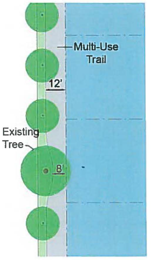
2.
A multi-use trail shall be required instead of a sidewalk along any new or existing street when the location is identified for a multi-use trail in the North Point Livable Centers Initiative Study or another plan that has been adopted by the City of Alpharetta. A multi-use trail may be required in other locations identified for a multi-use trail in the North Point Livable Centers Initiative Study, the Alpha Loop Plan, or another plan that has been adopted by the City of Alpharetta.
3.
In approving a multi-use trail in lieu of a sidewalk, the City Transportation Engineer, upon application, shall reduce the required planter width to a minimum width of 5 feet if the proposed reduction is supported by the public health, safety and general welfare.
4.
Buildings shall maintain a minimum setback of twenty-feet (20') from a multi-use trail.
D.
Planter.
1.
Shrubs and landscaping may be planted in the planter as follows:
a.
When shrubs are installed in the planter and adjacent on-street parking exists, a hardscaped clear zone of at least 2 feet in width (measured from the face of curb) must be installed adjacent to said parking. Additionally, a hardscape walking area at least 2 feet in width must be installed from the parking to the sidewalk.
b.
Shrubs may not exceed 36 inches in height.
2.
Street trees must be planted in the planter as follows:
a.
Overstory trees must be planted in the planter in accordance with the Streetscape Standards of the Site Regulation Table. Newly planted trees shall be a minimum of 3½ inches in caliper, and must be limbed up to a minimum of 7 feet.
b.
Trees must have a pervious planting area that is at least 6 feet wide by 10 feet long, 3 feet deep, and 1,800 cubic feet in soil volume. Tree grates are not allowed unless the City Arborist determines that they will not negatively impact tree health.
c.
Shrubs, groundcover, or mulch must be installed in the tree planting area identified in "c" immediately above when tree grates are not installed. Shrubs must conform to "1" immediately above.
3.
Pedestrian Lights.
a.
Pedestrian lights must be installed in the planter in accordance with the Streetscape Standards of the Site Regulation Table.
b.
Pedestrian lights must be spaced evenly between overstory street trees.
c.
Pedestrian light spacing may be increased by the Director or Community Development along existing streets when trees, traffic control devices, or other existing conditions prevent the required spacing.
E.
On-Street Parking. Newly-created on-street parking on public or private streets must conform to the following:
1.
A bulbout must be provided at the end of every four parallel parking spaces and every six angled or perpendicular spaces. More frequent bulbouts are also allowed.
2.
Each bulbout must include at least one overstory tree. Newly planted trees must be a minimum of 3½ inches in caliper, and must be limbed up to a minimum of 7 feet.
3.
Trees must have a pervious planting area that is at least 6 feet wide by 10 feet long, 3 feet deep, and 1,800 cubic feet in soil volume. Tree grates are not allowed unless the City Arborist determines that they will not negatively impact tree health.
(Ord. No. 767, § 5(Exh. B), 10-22-2018; Ord. No. 864, § 4(Exh. D), 10-16-2023)
_____
A.
Vehicular Parking.
1.
Minimum parking requirements are 20% less than otherwise required by the UDC. Parking requirements may be further reduced based upon an Urban Land Institute shared parking analysis or other parking analyses acceptable to the City, subject to approval of the Director of Community Development.
2.
Where on-street parking spaces exist in the public right-of-way, one on-street parking space may be substituted for every required parking space, provided:
a.
The on-street space immediately abuts the subject property.
b.
Each on-street parking space may only be counted for one property. Where a space straddles an extension of a property line, the space may only be counted by the owner whose property abuts 50% or more of the on-street parking space.
c.
The Director of Community Development, in consultation with the City Transportation Engineer, may determine that to ensure future roadway capacity or other public purposes, the on-street parking credit may not be available.
3.
To encourage efficient land use and shared parking, the impervious area of surface parking stalls shall not exceed the surface area of the building they serve.
B.
Driveways.
1.
Applicability. This following applies to driveways, including those serving alleys, but not to new streets in conformance with Sec. 2.10.4.A.
2.
Spacing. Driveways must be spaced as follows:
a.
Along Type A and B Corridors driveways must be at least 400 feet apart.
b.
Along Type C Corridors driveways must be at least 200 feet apart.
c.
Type D Corridor driveways must be at least 150 feet apart.
3.
Location. Driveways may not be located on a Type A Corridor or Type B Corridor when access is available from a Type C or Type D Corridor.
C.
Design of Parking Structures.
1.
When a parking structure fronts an arterial or collector street its ground story must have active uses (such as, but not limited to, residential, commercial, office, or civic space) between the parking structure and said street. The active use must be at least 20 feet deep.
2.
Where any portions of structured parking are adjacent to or visible from any street or the Big Creek Greenway, they must be screened so that cars and ramps are not visible from ground level view from the adjacent parcel, adjacent street (not including an alley), or adjacent Big Creek Greenway. Screening must include:
a.
Evergreen trees, vines, and landscaping that physically attached to the parking; or
b.
A facade having the appearance of a horizontal storied building; or
c.
A combination of "a" and "b" immediately above.
D.
Loading.
1.
Loading areas for new buildings must be located to the rear of buildings. Loading areas may not be placed between a building and the closest adjacent street or between a building and the Big Creek Greenway.
2.
If a loading area is provided, it must meet the following.
a.
Where a loading dock designed for tractor-trailers is placed between a shared lot line or building and the closest adjacent street (not including an alley) or the Big Creek Greenway, the entire length of the loading area must be screened.
b.
Screening must consist of either:
i.
An 8-foot high wall compatible with the principal building in terms of texture, quality, material and color; or
ii.
Evergreen plant material that can be expected to reach a height of 8 feet with a spread of 4 feet within 3 years of planting.
E.
Parking Locations. Driveway and off-street parking lots are only allowed between a building and the closest street when indicated in the Site Regulations Table.
(Ord. No. 767, § 5(Exh. B), 10-22-2018)
2.10.7. Landscaping and Screening.
A.
Parking Lot Landscaping. All parking lots must conform to the requirements of UDC Sec. 3.2.8.C and these additional standards.
1.
Landscaped areas within the interior of the parking area may be designed as bio-retention areas, using inwardly draining swales without curbs, in lieu of raised planting areas surrounded by curbs, provided that each parking space provides a wheel stop and provided that depressed areas adjacent to driving aisles are surrounded by painted lines or flush curbing to separate landscaping from driving aisles.
2.
Landscape design and material selection may incorporate practices of water conservation and xeriscape. Use of native materials is encouraged. Plant materials should be arranged so that plants that require similar amounts of irrigation are placed together wherever possible.
B.
Foundation Plantings. All building foundations facing a public street must conform to these standards, except as provided for in "3" immediately below:
1.
Foundations must be screened with continuous evergreen or semi-evergreen shrubs
2.
At the time of installation, the screening must be at least 1 foot in height and reach a height of 3 feet within 3 years of planting.
3.
Foundation plantings are not required adjacent to ground floor commercial fenestration when said plantings would obstruct views into the commercial establishments, subject to approval of the Director of Community Development.
C.
Service Areas.
1.
Trash and recycling collection and other similar service areas must be located to the side or rear of buildings and may not be between a building and the street.
2.
Service areas must be screened on 3 sides and on the 4th side by a solid gate at a minimum of 6 feet in height.
3.
Screening must consist of:
a.
A 6-foot high wall; or
b.
Evergreen plant material that can be expected to reach a height of 6 feet with a spread of 4 feet within three years of planting.
4.
Screening walls must be opaque and be constructed of one or a combination of the following: architectural block; brick; stone; cast-stone; or stucco over standard concrete masonry blocks.
5.
The gate must be self-locking and maintained in good working order.
D.
Roof-Mounted Equipment.
1.
Roof-mounted equipment must be set back at least 10 feet from the edge of the roof and screened from ground level view from the abutting parcel or street (not including an alley).
2.
New buildings must provide a parapet wall or other architectural element that is compatible with the principal building in terms of texture, quality, material, and color that fully screens roof-mounted equipment from ground level view.
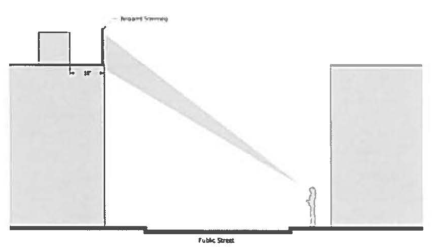
3.
For buildings with no or low parapet walls, roof mounted equipment must be screened on all sides by an opaque screen compatible with the principal building in terms of texture, quality, material, and color.
E.
Wall-Mounted Equipment.
1.
Wall-mounted equipment located on any surface that is visible from a street (not including an alley) or the Big Creek Greenway must be fully screened by landscaping or an opaque wall or fence that is compatible with the principal building in terms of texture, quality, material, and color.
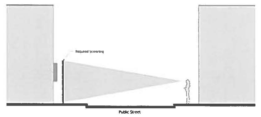
2.
If required, screening must be of a height equal to or greater than the height of the mechanical equipment being screened.
F.
Ground-Mounted Equipment.
1.
Ground-mounted mechanical equipment that is visible from a street (not including an alley) or the Big Creek Greenway must be fully screened by landscaping or an opaque wall or fence that is compatible with the principal building in terms of texture, quality, material, and color.
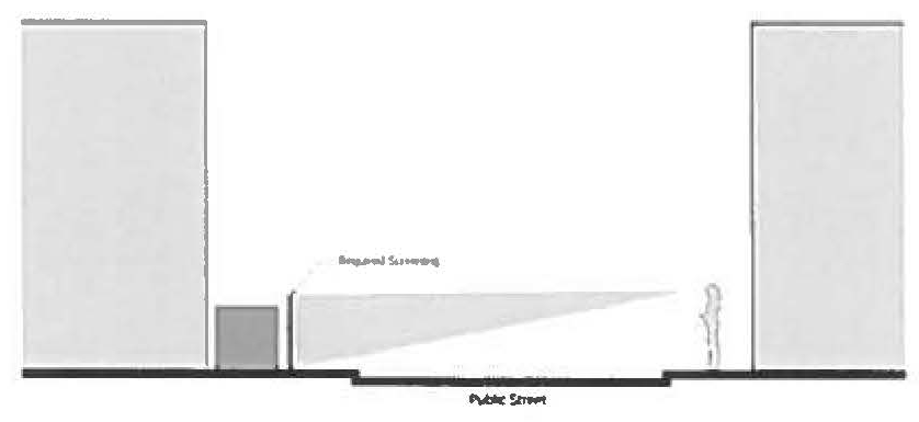
2.
Screening must be of a height equal to or greater than the height of the mechanical equipment being screened.
G.
Plant Material. All plant material shall conform to UDC Sec. 3.2.8.A, Sec. 3.2.8.C, and the following standards:
1.
Plant materials must be hardy to zone 7b in accordance with the U.S. Department of Agriculture's Plant Hardiness Zone Map.
2.
Plant materials must be able to survive on natural rainfall once established with no loss of health. However, irrigation may be provided as the option of the property owner.
3.
No artificial plants, trees, or other vegetation may be installed as required landscaping and screening.
H.
Maintenance of Landscaping.
1.
The property owner is responsible for maintaining all required landscaping and screening in good health and condition. Any dead, unhealthy, damaged or missing landscaping and screening must be replaced with landscaping and screening that conforms to this Section within 90 days (or within 180 days where weather concerns would jeopardize the health of plant materials) as approved by the City Arborist.
2.
All planting areas must be stabilized from soil erosion immediately upon planting and must be maintained for the duration of the use.
(Ord. No. 767, § 5(Exh. B), 10-22-2018)
A.
Applicability. This Section applies to all new buildings, additions to existing buildings, and any change to a building facade except ordinance maintenance and repairs.
B.
Fenestration.
1.
Fenestration is the minimum percentage of window and door glass that must cover a facade.
2.
Ground floor commercial uses along public streets must have no less than 25% and no more than 65% fenestration, calculated per building and per facade.
3.
Glass used to satisfy fenestration requirements must be unpainted, must have a transparency (visible light transmission) higher than 70%, and must have an external reflectance of less than 15%. Transparency and external light reflectance must be established using the manufacturer's specifications.
4.
Fenestration is measured from the top of the finished floor to the top of the finished floor above.
5.
When there is no floor above, fenestration is measured from the top of the finished floor to the top of the wall plate.
6.
Fenestration for residential uses shall be subject to review by the Director of Community Development.
C.
Pedestrian Access.
1.
All buildings must include a street-facing pedestrian entrance.
2.
A pedestrian entrance and walkway providing both ingress and egress, operable to residents at all times and operable to customers, visitors, and employees during business hours, is required to meet the street-facing pedestrian entrance requirements. Additional entrances off another street, civic space, pedestrian area or internal parking area are permitted, but must have the same or shorter hours of operability as the street-facing entrance.
3.
An angled pedestrian entrance may be provided at either corner of a building along the street to meet the street-facing pedestrian entrance requirements.
4.
Where a building has frontage on a civic space instead of a street, these requirements apply to and from the civic space. Where a building has frontage along both a street and civic space, these requirements may apply to either, at the applicant's discretion.
5.
Where a building has frontage on both a street and a multi-use trail, an additional pedestrian entrance is required from the trail.
D.
Building Materials.
1.
Exterior finish materials on walls visible from a street or civic space must be limited to brick, manufactured stone, architectural block, natural stone, cement-based panels, and/or hard coat stucco, except that glass and metal curtain wall systems are allowed to be used on all building stories above the second.
2.
Hard coat stucco, when used as an exterior wall finish material on any individual building, is subject to the following additional standards:
a.
Hard coat stucco may not exceed 50% of the total wall area (excluding foundations) visible from a street or civic space. For the purpose of calculating conformance with this requirement, windows and doors are not included in the total wall area.
b.
The maximum wall length (excluding foundations) visible from a street or civic space that is finished in any continuous or discontinuous hard coat stucco is 60 feet. Authorized wall lengths finished in hard coat stucco must be separated by a minimum wall length of 60 feet that contains no hard coat stucco.
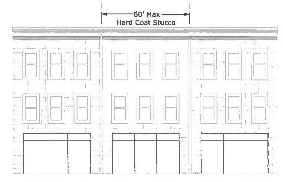
| General Visual Weight Table |
| This table shows the visual weight of permitted materials. Those at the top are lighter than those at the bottom and must be combined accordingly. |
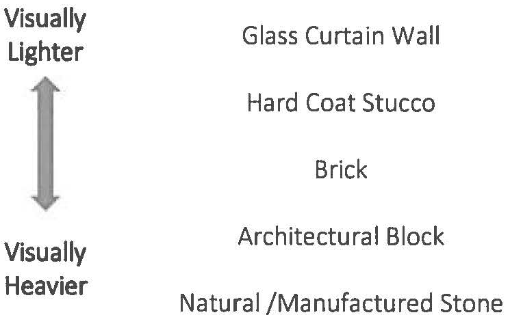 |
| _____ |
3.
Exterior finish materials must be combined only horizontally, with the visually heavier below the lighter as shown in the General Visual Weight Table. This does not apply to architectural details such as cornices, window sills, and beltlines.
4.
No more than three different exterior finish materials, textures, colors, or combinations thereof may be used on a single building, excluding materials used on windows, doors, front porches, balconies, foundations, awnings, or architectural details.
5.
For nonresidential uses, foundations must be constructed as a distinct building element that is finished in a different material or color than the exterior wall. Exposed above-ground foundations must be coated or faced in cement, hard coat stucco, brick, manufactured stone, or natural stone to contrast with facade materials.
E.
Building Facade. The following applies to all street-facing facades for all uses, except For-Sale Detached and Townhome.
1.
Facades must provide visual divisions between the ground story and second story through architectural means such as courses, awnings, or a change in materials.
2.
Facades must delineate all stories above the ground story with windows, belt courses, balconies, cornice lines or similar architectural detailing.
3.
Window panes must be recessed a minimum of 3 inches and a maximum of 8 inches from the adjacent facade or window trim/casing, whichever is greater.
F.
Building Massing.
1.
The footprint of buildings containing any residential uses shall not exceed 50,000 square feet. This building footprint size limitation shall also include any parking structures provided to serve said residential uses.
2.
Facades over 50 feet in length must incorporate wall projections or recesses a minimum of 12 inches in depth. The combined length of said recesses and projections must constitute at least 20% of the total facade length.
3.
Variation in the roofline of buildings and offsets in pitched roofs and gables are required. Parapets in individual building facades exceeding 100 continuous linear feet must be varied in height and projection and must use decorative elements such as crown moldings, dentils, brick soldier courses, or similar details.
4.
The roofs of buildings may include cisterns and greenroofs if part of an approved stormwater management plan for the site and if designed in accordance with the GA Stormwater Management Design Manual (latest version). Above-ground cisterns and greenwalls shall require approval by the Director of Community Development.
(Ord. No. 767, § 5(Exh. B), 10-22-2018)
A.
Materials. Signage must be finished in the same exterior materials as the principal structure.
B.
Monument Sign.
1.
A minimum 2 feet wide planting area must be provided around the base of all monument signs.
2.
Shrubs, groundcover, or mulch must be installed in the tree area identified in "1" immediately above.
(Ord. No. 767, § 5(Exh. B), 10-22-2018; Ord. No. 805, § 2(Exh, B), 8-10-2020)
A.
Defined. Open space is the horizontal outdoor area of a site reserved to provide separation, resource protection, scenic enjoyment, recreation, or amenity. It includes two types: civic space and amenity space.
B.
Minimum Requirements.
1.
New developments shall provide civic space and amenity space in accordance with the North Point Open Space Table.
North Point Open Space Table
2.
New developments with a mix of residential and non-residential uses shall satisfy both requirements independently.
3.
Restaurants with one or more exterior walls shall be subject to the following additional requirements:
a.
An outdoor dining area equal to at least 10% of the restaurant floor area shall be provided. When the outdoor dining area conforms to Sec. 2.10.10.D it may be counted towards amenity space requirements.
b.
When the restaurant abuts a public street (including across an intervening parking lot) the required outdoor dining area shall be located along the portion of the façade facing such public street.
c.
The Director of Community Development has the authority to authorize the required outdoor dining to be placed in locations other than required by "b" above when:
i.
There is insufficient area between the restaurant and the street to accommodate all of the required outdoor dining; or
ii.
There are other unique circumstances not created by the applicant than render this requirement unfeasible.
C.
Civic Space. Civic space is the portion of open space for public use defined by the combination of certain physical constants including the relationships among their intended use, their size, their landscaping, and their adjacent buildings. Above-ground cistern design and appearance shall require approval by the Director of Community Development.
1.
Park. An open space available for structured or unstructured recreation. A park may be independent of surrounding buildings at its edges. Its landscape may consist of paths and trails, meadows and lawns, water bodies, runoff reduction measures such as bioretention areas, swales, cisterns, and woodlands. Recreation fields and courts may also be included. The minimum size for a park is one acre.
2.
Square. An open space available for unstructured recreation and civic purposes. A square is spatially defined by building or streets at its edges. Its landscape must consist of paths and trees, and may also include runoff reduction measures such as bioretention areas and cisterns, lawns and non-asphalt paved surfaces. The minimum size for a square is one-half acre.
3.
Plaza. An open space, available for civic purposes and commercial activities. A plaza must be spatially defined by building or streets at its edges. Its landscape must consist primarily of non-asphalt paved surfaces and trees, and may include runoff reduction measures such as bioretention areas and cisterns. The minimum size for a plaza is one-quarter acre.
4.
Pocket Park. An open space, available for unstructured recreation. A pocket park may be spatially defined by buildings or streets at its edges. Its landscape must consist of lawn and trees, and may include runoff reduction measures such as bioretention areas and cisterns. There is no minimum size for pockets parks.
5.
Playground. An open space designed and equipped for the recreation of children. A playground must be fenced and may include an open shelter. Playgrounds must be interspersed within residential areas, may be placed within a block, and may be included in parks and greens. There is no minimum size for playgrounds. Playgrounds may include runoff reduction measures such as bioretention and underground detention.
6.
Performance Venues. An open space available for outdoor performance. Performance venues typically include a stage surrounded by formal or informal seating on at least one side. Performance venues may have a combination of landscaped and hardscaped areas. The minimum size for a performance areas is one-half acre.
7.
Multi-Use Trails with Potential Connections to Offsite Trails. A linear open space consisting of a conforming multi-use trail that includes a connection to existing or proposed off-site trails. There is no minimum size for this type of open space.
8.
Park Overlooks. An open space primarily intended for the viewing of parks and other open spaces. Park overlooks must include seating. There is no minimum size for park overlooks.
D.
Amenity space. Amenity space is the covered or uncovered, but unenclosed, outdoor areas of at least 100 square feet each for use by the occupants, invitees and guests of the development and specifically excluding Civic Spaces and required sidewalks. Amenity spaces may include, but are not limited to:
1.
Rooftop decks;
2.
Balconies (min. 6' x 8');
3.
Patios and porches;
4.
Outdoor dining areas;
5.
Pool areas;
6.
Tennis courts, basketball courts, and similar uses;
7.
Yards, lawns, and flower gardens;
8.
Community gardens;
9.
Hardscape areas improved for pedestrian enjoyment;
10.
Wooded areas; and
11.
Runoff reduction measures such as bioretention areas and cisterns.
Each amenity area approved must be available and accessible as exterior space appropriately improved for pedestrian amenity or for aesthetic appeal, subject to approved by Director of Community Development. Above-ground cistern design and appearance shall also require approval by the Director.
E.
Open space requirement may be met using existing and/or new open space, subject to approval of the Director of Community Development.
F.
Open space may be privately or publically owned. Private open space is open space that is owned by a corporation, individual, or homeowners association. Public open space is open space owned by a governmental agency.
G.
Wetlands, lakes, ponds, streams, rivers, flood zones, and stream buffers may only be considered open space when located within one of the eight types of civic spaces identified in Sec. 2.10.C or within an amenity space that conforms Sec. 2.10.10.D, unless part of an approved stormwater management plan for the site that includes runoff reduction measures.
H.
No required buffer may be used to satisfy open space requirements, except for stream buffers or the Georgia 400 buffer that are improved with trails and other authorized amenities.
I.
Stormwater management facilities for the site may be used to satisfy open space requirements if they meet this Chapter's definition of open space. Open space credit may be given at the discretion of the Director of Community Development.
J.
No areas used for vehicles, except for incidental service, maintenance, or emergency actions, may be used to satisfy open space requirements.
(Ord. No. 767, § 5(Exh. B), 10-22-2018)
2.10.11. EcoDistrict Measures.
A.
Intent. The following requirements are intended to further the EcoDistrict goals defined in the North Point Livable Centers Initiative.
B.
Applicability. EcoDistrict measures must be incorporated into all new development in accordance with the following minimum point values based on project magnitude. Measures only count if they are part of the new development application; measures already in place at the time of application do not count.
1.
2 Points Minimum. Any development project that either increases an existing building footprint by 30% or more of gross building area; or includes the replacement, renovation, or reconfiguration of 60% or more of the total site parking area (inclusive of required parking lot landscaping areas), must earn a minimum of 2 points in accordance with this Section.
2.
5 Points Minimum. Any development project that increases an existing building footprint by 60% or more of gross building area must earn a minimum of 5 points in accordance with this Section.
3.
7 points Minimum. Any development project that involves the complete renovation of all existing buildings or the construction of all new building must earn a minimum of 7 points in accordance with this Section.
4.
10 points Minimum. Any development project that involves conditional use approval to increase residential density under Sec. 2.10.2.B.3.b must earn a minimum of 10 points in accordance with this Section.
C.
Calculation & Evaluation.
1.
Minimum Points. All point values must be awarded based on meeting the minimum requirements of each EcoDistrict measure, as indicated in this Section. The sum of all assigned values for achieved sustainability measures, as indicated in this Section and summarized in the EcoDistrict Measures and Values Table, must meet the minimum point requirement per project.
2.
Review and Approval. Documentation of which measures and total number of points the applicant will achieve must be submitted with the applicable permit application submitted to the City and must be approved by City staff.
3.
Requirements. The applicant must achieve no fewer than the required points based on project magnitude (see "B" above) from any combination of the measures as valued in the EcoDistrict Measures and Values Table. No partial points will be accepted.
4.
Documentation. The applicant must submit supporting documentation as noted per measure.
EcoDistrict Measures and Values Table
D.
Measures and Requirements.
1.
Certified Green Buildings Measure (3 to 5 points).
a.
Minimum Requirement. Certify a new construction building or building undergoing major renovations through a green building rating system requiring review by an independent, third-party certifying body and approved by the Director of Community Development. Points shall be awarded as follows:
i.
Silver by a USGBC green program or equivalent: 3 points.
ii.
Gold by a USGBC green program or equivalent: 4 points.
iii.
Platinum by a USGBC green program or equivalent: 5 points.
The score may include measures otherwise allowed by this section, however, no measure included as part of a certified green building may also be awarded points as a stand-alone measure.
When a green building rating system equivalent to a USGBC green program is utilized, the applicant shall submit third-party documentation demonstrating how the measure is equivalent to the indicated USGBC certification level.
b.
Documentation. Required documentation includes registration of the project with the system, payment of all applicable fees for the rating system, and a draft scorecard showing the achieved credits or points.
2.
Renewable Energy Sources Measure (3 points).
a.
Minimum Requirements. Incorporate renewable energy generation on-site with a production capacity of at least 5% of the building's annual electric and thermal energy, established through an accepted building energy performance simulation tool.
b.
The following renewable energy generation sources are applicable:
i.
Solar thermal or photovoltaics.
ii.
Geothermal.
iii.
Wind energy conversion.
iv.
Anaerobic digestion.
v.
Other means of generating electricity without using a fuel, such as kinetic, heat exchange, approved by the Director of Community Development.
c.
Documentation. Required documentation includes specifications and construction details for the system installation.
3.
Greenroof Measure (4 points).
a.
Minimum Requirements. Install a vegetated roof for at least 50% of the total new building roof area, including parking structures.
b.
Documentation. Required documentation includes roof construction plans with drainage and planting details.
4.
Building Energy Efficiency Measure (3 points).
a.
Minimum Requirements.
i.
New Construction Buildings. Newly constructed buildings must demonstrate an average 10% improvement over the energy code currently in effect in the City.
ii.
Major Renovation. The building must demonstrate an average 5% improvement over the energy code currently in effect in the City.
b.
Documentation. Required documentation includes an energy model demonstrating that the building(s) will achieve the proposed improvements.
5.
Bio-Retention (2 points).
a.
Minimum Requirement.
i.
Provide landscaped bio-retention areas in the interior of the parking lots, in streetscape planters, and on-street parking landscaping; and
ii.
Incorporate inwardly draining swales without curbs, in lieu of raised planting areas surrounded by curbs;
iii.
Landscape bio-retention areas with species tolerant to frequent induration; and
iv.
Provided wheel stops adjacent to parking and flush or permeable curbing adjacent to driving areas.
b.
Documentation. Required documentation includes plans and detail specifications of planting areas and a hydraulic study demonstrating infiltration capacity.
6.
Building Water Efficiency Measure (2 points).
a.
Minimum Requirements. Indoor water use in new buildings and major renovations must be an average 20% less than in baseline buildings. Baseline water usage shall be determined based on fixtures per the Energy Policy Act of 1992 and subsequent rulings by the United States Department of Energy or a similar method approved by the Director of Community Development.
b.
Documentation. Required documentation includes cut sheets for all water fixtures.
7.
Heat Island Reduction Measure (2 points).
a.
Minimum Requirements. Use any combination of the following strategies for 35% of all on-site, non-roof hardscape areas, including sidewalks, plazas, courtyards, parking lots, parking structures, and driveways.
i.
Tree Canopy Cover. Coverage of the surface at canopy tree maturity in 15 years.
ii.
Solar reflective paving and roofing with a SRI (solar reflectance index) of at least 29.
b.
Documentation. Required documentation includes plans and specifications for installation of the strategy.
8.
Transportation Demand Management (2—3 points).
a.
Minimum Requirement. Provision of three of the following shall be awarded two points and provision of four or more of the following shall be awarded three points:
i.
Flex-time work schedules by employers to reduce congestion at peak times.
ii.
Provision of building or project bicycle rentals for use by any occupant.
iii.
Free ride home in case of emergency or sickness for employees using transit.
iv.
Provision of transit passes to building occupants for a period of 2 or more years.
v.
Other tools that encourage transit and bicycle use, or reduce personal vehicular traffic may be approved by the Director of Community Development.
vi.
Accommodation of a future MARTA bus rapid transit station.
b.
Documentation. Required documentation includes a written narrative of the tools to be provided and any other documentation required by the Direct of Community Development.
9.
Pervious Pavement Measure (2 points).
a.
Minimum Requirements. Install an open grid or pervious pavement system that is at least 40% pervious on 80% of all hardscape surface areas, including sidewalks, plazas, courtyards, parking lots, and driveways.
b.
Documentation. Required documentation includes plans and specifications for installation.
10.
Connected Open Space (2 points).
a.
Minimum Requirements. Provision of all of the following:
i.
All required open space within an interconnected network with no dimension less than 40 feet;
ii.
Required open spaces may extend across public and private streets and multi-use trails, but street area may not be counted towards open space;
iii.
All required open space provided at ground level; and
iv.
Minimum size of 2 acres, excluding any consolidated open space in "11" below.
b.
Documentation. Required documentation includes plans showing open spaces.
11.
Consolidated Open Space (2 points).
a.
Minimum Requirements. Provision of all of the following:
i.
All required open space in a one contiguous area with no dimension of less than 100 feet;
ii.
Required open spaces may not extend across public or private streets;
iii.
All required open space provided at ground level; and
iv.
Minimum size of 2 acres.
b.
Documentation. Required documentation includes plans showing open spaces.
12.
Sustainable Landscaping Measure (1 point). Conform to both of the following minimum requirements:
a.
Minimum Requirement 1. Reduce potable water used for landscape irrigation by 50% from a calculated midsummer baseline case by using either one of the following methods:
i.
Utilizing all xeriscape plant materials and providing no permanent irrigation system;
ii.
Using only captured rainwater with an irrigation system.
b.
Minimum Requirement 2. Exclusion of any plant species listed on the Georgia Exotic Pest Plant Council Invasive Species List from project planting plans.
c.
Documentation. Required documentation includes a landscape plan, irrigation plan, a list of proposed species, and an affidavit from a certified Landscape Architect that no species identified in "b" immediately above will be planted.
13.
Enhanced Bicycle Amenities Measure (1—2 points).
a.
Minimum Requirements. Provision of two of the following shall be awarded one point and provision of three or more of the following shall be awarded two points:
i.
Lockable enclosed bicycle storage. Provide one secure, enclosed bicycle storage space per 20 employees.
ii.
For office or commercial space, employee shower facilities. Provide a minimum of one shower facility plus one additional shower per 150 employees.
iii.
Repair Center. Provide a designated bicycle repair center open to the public and consisting of an air pump, water, and tools at a minimum.
iv.
Bicycle parking spaces. Provide at least 200% of the bicycle parking requirements of UDC Sec. 2.5.8.
v.
Bicycle paths.
vi.
Bicycle rental stations.
b.
Documentation. Required documentation includes site and/or building plans locating the measures included.
14.
Alternative Transportation Measure (1—2 points).
a.
Minimum requirement. One point shall be available for the provision of each of the following, up to two total points for this measure:
i.
Ride-Sharing. Provide at least one on- or off-street pick-up/drop-off zone per 100 new or added vehicular parking spaces for the exclusive use of passengers arriving by taxi, ride-sharing, or shuttle. No project using this measure shall have less than one such space.
ii.
Van Pools. Provide at least one van pool space per 200 new or added vehicular parking spaces.
iii.
Enhanced Bus Shelter. Provide and maintain at least one covered bus shelter with seating, lighting, posted schedules, and trash cans adjacent at an existing public transit stop without such facilities. The location of the enhanced bus shelter must be to the standards of the public transit authority. Note: If more than one such enhanced bus shelter is provided, one additional point shall be awarded for each shelter.
15.
Additional Landscaped Civic Space Measure (1 to 5 points).
a.
Minimum Requirement. Provision of additional landscaped civic space or a multi-use trail over the requirement over the amount required by this overlay or the underlying district, whichever is greater. Additional civic space must be landscaped with lawns, ground cover, shrubs, or woodlands and may not be paved or otherwise impervious except for paths and trails. One point shall be available for each one additional percent of gross acreage provided as civic space, up to five total points for this measure.
b.
Documentation. Required documentation includes site and/or building plans locating the additional open space.
16.
Alternative Measure (1 to 3 points). The applicant may submit an alternative EcoDistrict measure for review and recommendation by the Director of Community Development. The measure must further an EcoDistrict goal of the North Point Livable Centers Initiative and may not be considered standard practice or requirements for current developments.
a.
Minimum Requirements. The measure must be unrelated to any of the other measures defined in this Section. Based upon their review, the Director of Community Development must determine for the number of points to be awarded.
b.
Documentation. Required documentation must clearly illustrate that the project will achieve the measure and that the measure furthers a North Point Livable Centers Initiative sustainability goal.
(Ord. No. 767, § 5(Exh. B), 10-22-2018)
SECTION 2.11 - CRABAPPLE OVERLAY
2.11.1 General Provisions.
A.
Title. This Section shall be known as the "Crabapple Overlay" or may be internally cited as "this overlay."
B.
General Purpose. The purpose of this overlay is to enable and support a cohesive vision for the Crabapple area.
C.
Applicability.
1.
This overlay applies within the area be shown on the Official Zoning Map and labeled "Crabapple Overlay."
2.
Parcels within this overlay shall be subject to both the requirements of this Section and the requirements of their underlying zoning district, subject to the conflict provisions in "3" immediately below.
3.
When requirements of this overlay conflict with any requirement of the underlying zoning or any other provision of the City Unified Development Code (UDC), the requirements of this overlay shall prevail.
4.
When the word "street" is used it means both public and private streets unless stated otherwise.
D.
Conformance Requirements.
1.
All buildings, structures or land, in whole or in part, must be used or occupied, in conformance with this overlay. All buildings or structures, in whole or in part, must be erected, constructed, moved, enlarged or structurally altered in conformance with this overlay.
2.
Nothing in this overlay shall require any change in the plans, construction or intended use of a building or structure for which a lawful permit has been issued or a lawful permit application has been accepted before the effective date of this overlay, provided that the construction under the terms of such permit is diligently followed until its completion.
E.
Conflicting Provisions.
1.
It is not the intent of this overlay to interfere with or abrogate or annul any easements, covenants or other agreements between parties; provided, however, that where this overlay imposes a greater restriction upon the use of property, or requires more space than is imposed or required by other resolutions, rules or regulations, or by easements, covenants or agreements, the provisions of this overlay shall govern.
2.
Nothing herein shall be construed as repealing or modifying the conditions of operation or conditions of site development accompanying those zoning approvals, variances, or use permits issued prior to the existence of this overlay; however, modification or repeal of these past conditions of approval may be accomplished through a zoning change in accordance UDC Section 4.2.
F.
Place Making. The design of streets, streetscapes, open spaces, civic spaces, and other features regulated by this overlay must incorporate signage, plantings, lighting, materials, and other placemaking elements as follows:
1.
In accordance with placemaking plans adopted by the City of Alpharetta; or
2.
As submitted by the applicant and approved by the Director of Community development if no plans identified in "1" immediately above have been adopted.
(Ord. No. 854, § 1(Exh. A), 4-17-2023)
A.
Corridor Types Established. This overlay uses corridor types to regulate the design of sidewalks, sites, buildings, and other purposes, as shown in the Site Regulation Table and as referenced in other Sections. Corridor types include:
1.
Type A Corridors, which include Crabapple Road and Broadwell Road.
2.
Type B Corridors, which include Marstrow Road, Arklow Drive, and new streets.
B.
Site Regulation Table. Sites must be developed in accordance with the following Site Regulation Table.
Site Regulation Table
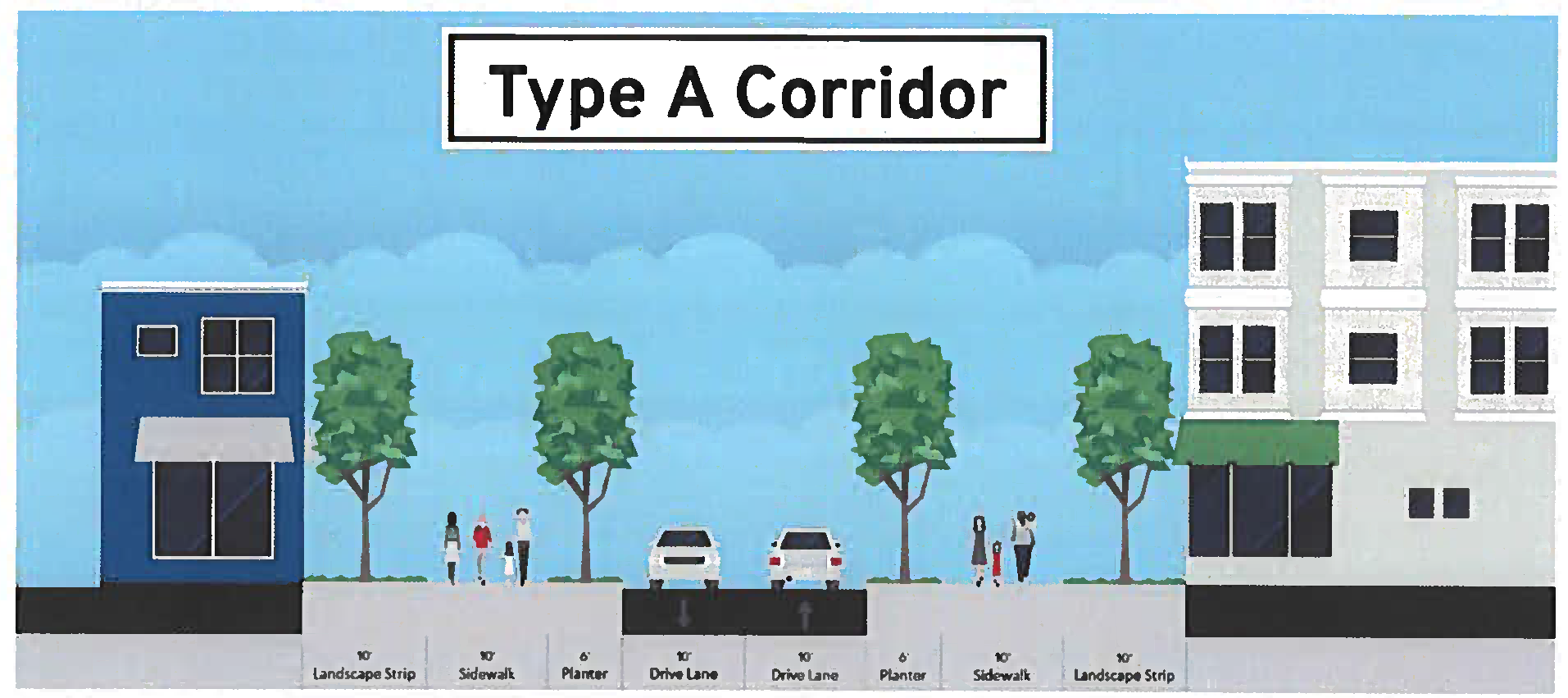
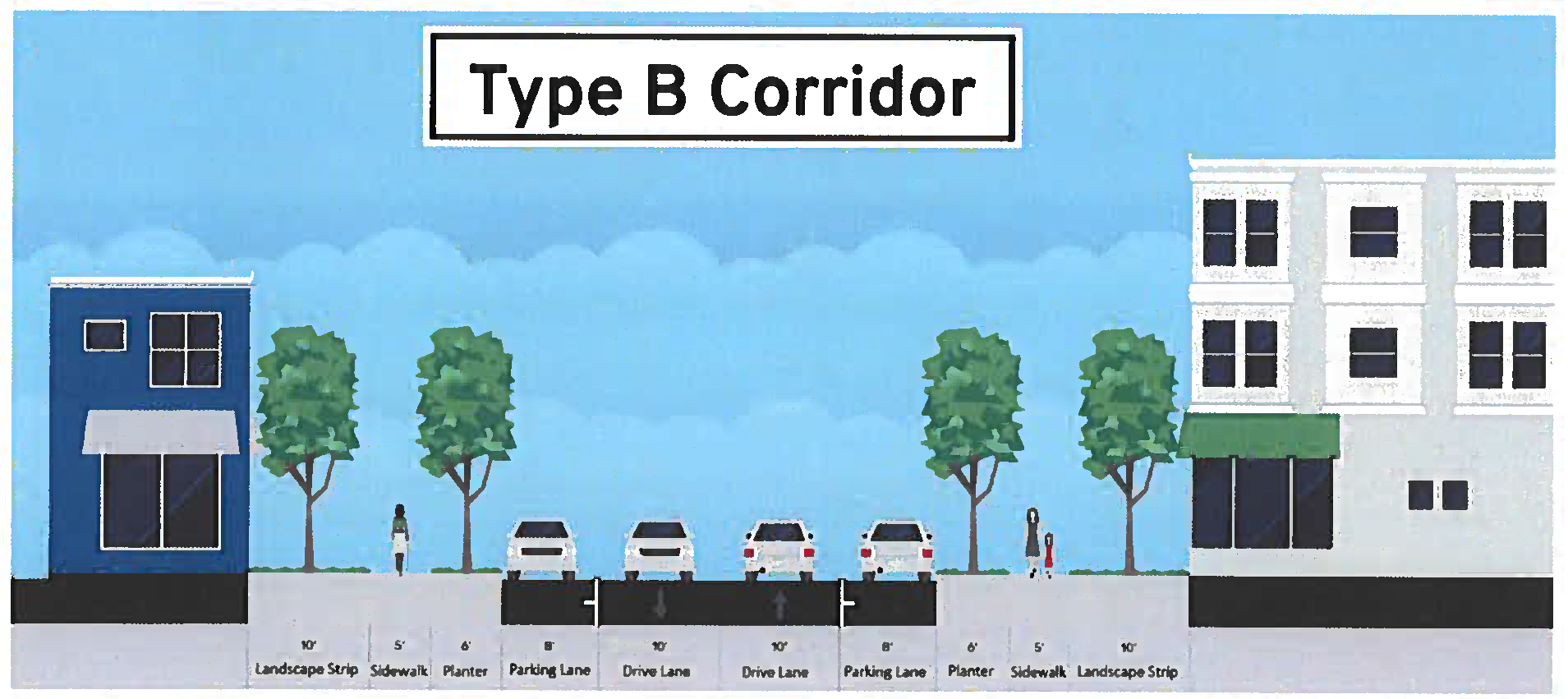
Note 1: The Director of Community Development has the authority to reduce or eliminate UDC Sec. 3.2.8.D landscape strips adjacent to buildings with ground floor commercial uses that front and are accessible from the adjacent sidewalk.
C.
Minimum Lot Size.
1.
Minimum lot size in accordance with the underlying zoning district.
D.
Maximum Building Height.
1.
Maximum building height shall not exceed 3 stories and no more than 40'.
(Ord. No. 854, § 1(Exh. A), 4-17-2023)
A.
Applicability.
1.
The Section applies to:
a.
New development;
b.
Existing developed sites when more than 25% of the site area is disturbed, except as provided for in "2" immediately below;
c.
Existing principal buildings that are expanded, except as provided for in "2" immediately below; and
d.
Existing principal buildings that are renovated or repaired and the value of said work exceeds 50% of the building's replacement cost, except as provided for in "2" immediately below.
2.
The Director of Community Development may grant variances to any requirement of this Section for existing developed sites and existing buildings (except as specifically delegated to the City Transportation Engineer) when one or more of the following exists:
a.
The streetscape would render a site non-conforming with regard to vehicular parking; or
b.
Existing topography, trees, buildings, bridges, utilities, retaining walls, or other existing features render this Section unreasonable.
3.
This Section does not apply on a parcel for which a Land Disturbance Permit or Building Permit is issued but where the Director of Community Development determines that the permit is for an accessory use or structure to the principal use or structure or for minor repairs or additions to the principal building or structure in existence.
B.
Streetscapes.
1.
Streetscapes Required.
a.
New public and private streets must include sidewalks and planters as identified in the Streetscape Standards of the Site Regulation Table prior to the issuance of Certificate of Occupancy, except as indicated in "d" immediately below.
b.
Existing streets that do not meet the Streetscape Standards of the Site Regulation Table must be brought into compliance with said standards along the site's frontage prior to the issuance of Certificate of Occupancy, except as indicated in "d" immediately below.
c.
On existing streets where there is insufficient right-of-way for the required streetscape improvements, the right-of-way needed for such improvements may be expanded by mutual agreement between the property owner and the entity holding the right-of-way, or a public access easement may be provided to the City to meet the required improvements.
d.
On streetscapes that are or will be within the public right-of-way, root barriers are required between the sidewalk and any adjacent landscape strips or planters, subject to approval of the City Arborist.
e.
The City encourages the use of multi-functional runoff reduction measures in the streetscape, including bioretention areas, stormwater tree box, and planter box. The dimensional standards for planting area, tree spacing, and planting type be varied to accommodate runoff reduction measures.
C.
Planter.
1.
Street trees must be planted in the planter as follows:
a.
Overstory trees must be planted in the planter in accordance with the Streetscape Standards of the Site Regulation Table. Newly planted trees shall be a minimum of 3½ inches in caliper, and must be limbed up to a minimum of 7 feet.
b.
Trees must have a pervious planting area that is at least 6 feet wide by 10 feet long, 3 feet deep, and 1,800 cubic feet in soil volume. Tree grates are not allowed unless the City Arborist determines that they will not negatively impact tree health.
c.
Shrubs, groundcover, or mulch must be installed in the tree planting area identified in "b" immediately above when tree grates are not installed. Shrubs must conform to "1" immediately above.
2.
Pedestrian Lights.
a.
Pedestrian lights must be installed in the planter in accordance with the Streetscape Standards of the Site Regulation Table.
b.
Pedestrian lights must be spaced evenly between overstory street trees.
c.
Pedestrian light spacing may be increased by the Director or Community Development along existing streets when trees, traffic control devices, or other existing conditions prevent the required spacing.
D.
On-Street Parking. Newly-created on-street parking on public or private streets must conform to the following:
1.
A bulbout must be provided at the end of every three (3) parallel parking spaces.
2.
Each bulbout must include at least one overstory tree. Newly planted trees must be a minimum of 3½ inches in caliper, and must be limbed up to a minimum of 7 feet.
3.
Trees must have a pervious planting area that is at least 6 feet wide by 10 feet long, 3 feet deep, and 1,800 cubic feet in soil volume. Tree grates are not allowed unless the City Arborist determines that they will not negatively impact tree health.
(Ord. No. 854, § 1(Exh. A), 4-17-2023)
A.
Vehicular Parking.
1.
Minimum parking requirements are as required by UDC Section 2.5. Parking requirements may be reduced based upon an Urban Land Institute shared parking analysis or other parking analyses acceptable to the City, subject to approval of the Director of Community Development.
2.
Where on-street parking spaces exist in the public right-of-way, one on-street parking space may be substituted for every required parking space, provided:
a.
The on-street space immediately abuts the subject property.
b.
Each on-street parking space may only be counted for one property. Where a space straddles an extension of a property line, the space may only be counted by the owner whose property abuts 50% or more of the on-street parking space.
c.
The Director of Community Development, in consultation with the City Transportation Engineer, may determine that to ensure future roadway capacity or other public purposes, the on-street parking credit may not be available.
B.
Driveways.
1.
Applicability. The following applies to driveways, including those serving alleys, but not to new streets in conformance with Sec. 2.10.4.A.
2.
Location. Driveways may not be located on a Type A Corridor when access is available from a Type B Corridor.
C.
Design of Parking Structures.
1.
When a parking structure fronts a Type A Corridor its ground story must have active uses (such as, but not limited to, residential, commercial, office, or civic space) between the parking structure and said street. The active use must be at least 20 feet deep.
2.
Where any portions of structured parking are adjacent to or visible from any street, they must be screened so that cars and ramps are not visible from ground level view from the adjacent parcel or adjacent street (not including an alley). Screening must include:
a.
Evergreen trees, vines, and landscaping that physically attached to the parking; or
b.
A facade having the appearance of a horizontal storied building; or
c.
A combination of "a" and "b" immediately above.
D.
Loading.
1.
Loading areas for new buildings must be located to the rear of buildings. Loading areas may not be placed between a building and the closest adjacent street.
2.
If a loading area is provided, it must meet the following:
a.
Screening must consist of either:
i.
An 8-foot high wall compatible with the principal building in terms of texture, quality, material and color; or
ii.
Evergreen plant material that can be expected to reach a height of 8 feet with a spread of 4 feet within 3 years of planting.
E.
Parking Locations. Driveway and off-street parking lots are only allowed between a building and the closest street when indicated in the Site Regulations Table.
(Ord. No. 854, § 1(Exh. A), 4-17-2023)
2.11.5 Landscaping and Screening.
A.
Parking Lot Landscaping. All parking lots must conform to the requirements of UDC Sec. 3.2.8.C and these additional standards.
1.
Landscaped areas within the interior of the parking area may be designed as bio-retention areas, using inwardly draining swales without curbs, in lieu of raised planting areas surrounded by curbs, provided that each parking space provides a wheel stop and provided that depressed areas adjacent to driving aisles are surrounded by painted lines or flush curbing to separate landscaping from driving aisles.
2.
Landscape design and material selection may incorporate practices of water conservation and xeriscape. Use of native materials is encouraged. Plant materials should be arranged so that plants that require similar amounts of irrigation are placed together wherever possible.
B.
Foundation Plantings. All building foundations facing a public street must conform to these standards, except as provided for in "3" immediately below:
1.
Foundations must be screened with continuous evergreen or semi-evergreen shrubs
2.
At the time of installation, the screening must be at least 1 foot in height and reach a height of 3 feet within 3 years of planting.
3.
Foundation plantings are not required adjacent to ground floor commercial fenestration when said plantings would obstruct views into the commercial establishments, subject to approval of the Director of Community Development.
C.
Service Areas.
1.
Trash and recycling collection and other similar service areas must be located to the side or rear of buildings and may not be between a building and the street.
2.
Service areas must be screened on 3 sides and on the 4th side by a solid gate at a minimum of 6 feet in height.
3.
Screening must consist of:
a.
A 6-foot high wall; or
b.
Evergreen plant material that can be expected to reach a height of 6 feet with a spread of 4 feet within three years of planting.
4.
Screening walls must be opaque and be constructed of one or a combination of the following: architectural block; brick; stone; cast-stone; or stucco over standard concrete masonry blocks.
5.
The gate must be self-locking and maintained in good working order.
D.
Roof-Mounted Equipment.
1.
Roof-mounted equipment must be set back at least 10 feet from the edge of the roof and screened from ground level view from the abutting parcel or street (not including an alley).
2.
New buildings must provide a parapet wall or other architectural element that is compatible with the principal building in terms of texture, quality, material, and color that fully screens roof-mounted equipment from ground level view.
3.
For buildings with no or low parapet walls, roof mounted equipment must be screened on all sides by an opaque screen compatible with the principal building in terms of texture, quality, material, and color.
E.
Wall-Mounted Equipment.
1.
Wall-mounted equipment located on any surface that is visible from a street (not including an alley) must be fully screened by landscaping or an opaque wall or fence that is compatible with the principal building in terms of texture, quality, material, and color.
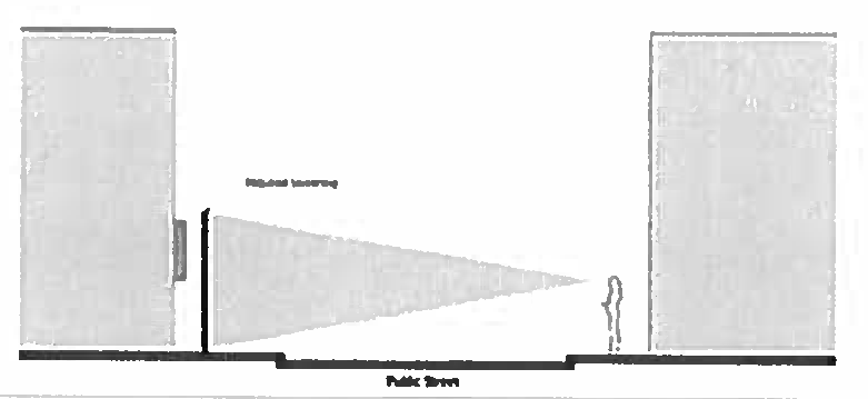
2.
If required, screening must be of a height equal to or greater than the height of the mechanical equipment being screened.
F.
Ground-Mounted Equipment.
1.
Ground-mounted mechanical equipment that is visible from a street (not including an alley) must be fully screened by landscaping or an opaque wall or fence that is compatible with the principal building in terms of texture, quality, material, and color.
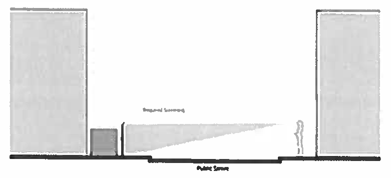
2.
Screening must be of a height equal to or greater than the height of the mechanical equipment being screened.
G.
Plant Material. All plant material shall conform to UDC Sec. 3.2.8.A, Sec. 3.2.8.C, and the following standards:
1.
Plant materials must be hardy to zone 7b in accordance with the U.S. Department of Agriculture's Plant Hardiness Zone Map.
2.
Plant materials must be able to survive on natural rainfall once established with no loss of health. However, irrigation may be provided as the option of the property owner.
3.
No artificial plants, trees, or other vegetation may be installed as required landscaping and screening.
H.
Maintenance of Landscaping.
1.
The property owner is responsible for maintaining all required landscaping and screening in good health and condition. Any dead, unhealthy, damaged or missing landscaping and screening must be replaced with landscaping and screening that conforms to this Section within 90 days (or within 180 days where weather concerns would jeopardize the health of plant materials) as approved by the City Arborist.
2.
All planting areas must be stabilized from soil erosion immediately upon planting and must be maintained for the duration of the use.
(Ord. No. 854, § 1(Exh. A), 4-17-2023)
A.
Applicability. This Section applies to all new buildings, additions to existing buildings, and any change to a building facade except ordinance maintenance and repairs.
B.
Building Architectural Standards.
1.
All buildings, except single-family detached residential, shall be designed in one of the following styles:
a.
Vernacular
b.
Greek Revival
c.
Italianate
d.
Gothic
e.
Queen Anne
f.
Colonial Revival
g.
Adams/Federal
2.
Specific elements of the required styles can be found in A Field Guide to American Houses by Virginia Savage McAlester, Residential Architectural Styles in Georgia by the Historic Preservation Division of the Georgia Department of Natural Resources, or other architectural resources.
C.
Exterior Walls.
1.
Technical and aesthetic requirements.
a.
Wall finishes on sides of individual buildings seen from a public road shall be the same on all visible sides; architecturally significant portions must conform; appendages or secondary wings assume a differing finish according to visibility and architectural merit.
b.
Wood shingles shall be level at the bottom edge. Corners shall be mitered. Decorative novelty shapes are prohibited.
c.
Trim shall be consistent on all sides of the building; the primary building mass or the Facade may be further embellished or enhanced.
d.
Service wings may be expressed in a more simplistic manner, but shall exhibit clear design intent.
2.
Materials.
a.
No more than three different exterior materials, exterior colors, or any combination thereof may be used on a single building, not including windows, doors, porches, balconies, foundations, and architectural details.
b.
Materials may be combined on exterior walls only horizontally, with the heavier below the lighter.
c.
Exterior material shall be limited to brick, natural stone, clapboard, board and batten, hard-coat stucco, or wood shingles.
d.
Vinyl or aluminum siding, and synthetic stone veneer are prohibited.
e.
Stone, brick, and mortar color and style shall match building style.
f.
Hard-coat stucco shall be a 3-coat plaster finish, integral finish, applied on brick or concrete block; control joints shall be concealed where possible.
g.
Clapboards and board and battens shall be wood or cementitious board. Hardi board shall have a 4 inch maximum exposure, while Artisan series Hardi board or full three-quarter inch wood siding may have up to an 8 inch lap. False wood graining is prohibited.
h.
Wood shingles shall be level at the bottom edge.
D.
Roofs.
1.
Technical and aesthetic requirements.
a.
The roof slope on a single mass shall be the same on all sides, except for cat-slides and sheds.
b.
Roof slopes shall match building style.
c.
Vents and stacks shall be painted to match the roof material and hidden from view to the extent possible.
d.
Overhangs that shed water within 5 feet of an adjacent lot shall be guttered or piped, and diverted away from adjacent lots.
2.
Materials.
a.
Materials shall be wood shingles, wood shakes, standing-seam paint grip galvanized metal, slate or asphalt shingles (architectural weathered, wood, or classic green or red), or concrete simulated slate or wood shingles.
b.
Gutters may be ogee or half-round with round downspouts, metal-lined wood, or architecturally formed or molded. Gutter finishes may be copper, unpainted galvanized metal, or color to resemble galvanized metal
c.
Wood shingles shall not drain onto metal roofs.
E.
Foundations.
1.
Foundations shall be constructed of poured concrete or concrete masonry units.
2.
Foundations may be finished with smooth stucco, brick, or stone.
3.
Front porches of wood shall be supported on masonry piers finished in smooth stucco, masonry, brick, or stone. Piers shall have a minimum width of 18 inches and a minimum depth of 8 inches.
F.
Windows.
1.
The provision of windows shall match building style.
2.
Technical and aesthetic requirements.
a.
Windows and casings shall match building style.
b.
Windows shall not be omitted on elevations.
c.
Window sills shall have a minimum depth of 1.5 inches.
d.
Ganged windows and bays shall have a continuous sill and 4 inch mulls minimum.
e.
Grill between glass, reflective glazing, and pop-in grills are prohibited. Windows shall be True Divided Lite or Simulated Divided Lite.
3.
Materials.
a.
Windows shall have sash with a minimum face width of 2 inches; the dimensions of the glass surface to sash and muntin face shall be a minimum of 0.75 inch.
b.
Non-glass exterior window components shall be faced in wood, clad wood, or polymer materials, and said materials shall be paint grade or pre-finished.
G.
Doors and windows that operate as sliders are prohibited along Frontages.
H.
Doors.
1.
Technical and aesthetic requirements.
a.
Doors and casings shall match building style.
b.
Exterior front doors or doors visible from a public way, shall be hardwood, and may be stained or painted.
2.
Materials.
a.
Plastic laminated, stamped metal, and leaded/beveled glass doors are prohibited. Tropical hardwoods are prohibited unless Forest Stewardship Council certified.
b.
Exterior doors shall be a durable, stable wood or clad in wood. Heart pine, wormy chestnut, walnut, cypress, pecan, are acceptable varieties.
c.
Garage doors shall be wood, composite, or metal. Faux strap hinges, embellishments, standard paneled doors, and arched glass panels shall be prohibited.
I.
Shutters.
1.
Shutter design shall match building style.
2.
Shutters shall be solid-core polymers or durable hardwoods.
3.
Vinyl, nail-on, false wood graining, and pre-finished shutters are prohibited.
4.
Shutters shall be authentic, fully operable, and capable of totally closing over the window sash. Plank or louver shutters are acceptable. The minimum thickness of shutters shall be 1.25 inches.
5.
Shutters Shall occur in pairs, except that windows narrower than 3 feet may utilize a single shutter.
J.
Chimneys.
1.
Chimneys shall be proportioned, tapered, and shall match building style.
2.
Stacks shall be faced in smooth integral finish stucco, brick, stone, or detailed as exposed metal flues.
3.
Siding or stucco board is prohibited as a finish material for chimneys.
K.
Porches and Balconies.
1.
Technical and aesthetic requirements.
a.
Columns shall match building style
b.
Classical columns shall be architecturally correct.
c.
Railings shall be simple pickets or fretwork centered on rails.
2.
Materials.
a.
Porch floors shall be wooden, brick, or stone, and shall rest on masonry piers finished in brick, stone, or smoothed stucco.
b.
Porch ceilings shall be beaded nominal 1 by 4 inch or 1 by 6 inch, flush boards, tongue and groove boards, or exterior gypsum board with decorative nominal 1 by 4 inch or 1 by 6 inch shallow coffers or strips.
c.
Plywood ceilings, with or without beads, are prohibited.
d.
Areas between porch piers, if left open, shall be in-filled with custom wood lattice, wood louvers, brick lattice, or wire mesh planted with vines, and shall match building style. The opening is not required to be in-filled if the distance from grade to bottom of floor structure is less than one foot.
e.
Columns shall be wood, resin material, or masonry.
f.
Sheet metal and foam columns are prohibited.
g.
Railing systems shall be painted wood, iron, or masonry.
h.
Synthetic and prefabricated railing systems are prohibited.
i.
Plain, round tapered, fretwork, and straight pickets are permitted.
j.
Precast classical balusters and ornate spindle work are prohibited.
L.
Trim.
1.
Trim shall match building style.
a.
Trim shall be consistent on all sides of building masses, with emphasis on the primary building mass and facade.
b.
Trim for wings not along a Frontage may be simplified to match building style.
2.
Materials.
a.
Trim shall be of wooden or synthetic planks with enough thickness to conceal the edge of the siding. When used on buildings clad in horizontal siding, corner boards, casings, frieze boards, and similar architectural details shall be 1.25 inch thick material.
b.
Pressure treated trim is prohibited.
c.
All trim shall be dressed.
(Ord. No. 854, § 1(Exh. A), 4-17-2023)
A.
Pedestrian lighting. Poles shall be Georgia Power "Washington" type in black and fixtures shall be Georgia Power "Granville" type.
B.
Benches shall be Victor Stanley Classic Series CR-138 in black with no center arm rest.
C.
Trash cans shall be Victor Stanley D-35 in black.
D.
Bicycle racks shall be Dero Round Rack in black.
(Ord. No. 854, § 1(Exh. A), 4-17-2023)
APPENDIX A - HISTORIC RESOURCES INVENTORY—CONTRIBUTING HISTORIC BUILDINGS
(Ord. No. 712, § 1(Exh. A), 9-8-2015; Ord. No. 738, § 3(Exhs. A, B), 5-1-2017; Ord. No. 815, § 1(Exh. A), 11-16-2020; Ord. No. 827, § 1(Exh. A), 6-7-2021)
APPENDIX B - HISTORIC RESOURCES INVENTORY—DESIGNATED HISTORIC BUILDINGS
(Ord. No. 764, §§ 1, 2, 9-4-2018; Ord. No. 765, § 2, 9-4-2018; Ord. No. 766, § 2, 9-4-2018; Ord. No. 774, § 1(Exh. A), 4-22-2019; Ord. No. 815, § 1(Exh. A), 11-16-2020; Ord. No. 865, § 1(Exh. A), 10-16-2023; Ord. No. 866, § 1(Exh. A), 10-16-2023; Ord. No. 872, § 1(Exh. A), 5-20-2024; Ord. No. 888, § 1 (Exh. A), 5-5-2025)