
Branson City Zoning Code
ARTICLE III
- ZONE DISTRICTS
Sec. 94-30. - General provisions.
This section establishes the zoning districts, and contains basic information pertaining to the districts, including statements of purpose and dimensional standards.
(a)
Purposes, residential districts. Residential districts are intended to:
(1)
Generally.
a.
Provide appropriately located areas for residential development that are consistent with the Community Plan 2030, and with the public health, safety and general welfare of the community;
b.
Ensure adequate light, air and privacy for all dwelling units;
c.
Protect the scale and character of existing residential neighborhoods, and the community;
d.
Discourage any use that would generate traffic or create congestion on neighborhood streets other than the normal traffic that serves the residents of the district; and
e.
Discourage any use that, because of its character or size, would create additional requirements and costs for public services that are in excess of such requirements and costs if the district were developed solely for the intended type of residential uses.
(2)
Applicable provisions of Community Plan 2030:
a.
LU 2.2 Pace of growth. Direct development and growth to occur at a pace that is aligned with the city's ability to provide essential services (fire, police, sewer, water).
b.
LU 3.1 Infill and redevelopment. Encourage the development of vacant property, redevelopment of underutilized properties and adaptive re-use of existing buildings before annexing new land.
c.
LU 5.1 Zoning regulations. Create zoning regulations that are flexible but require enough specificity in development applications to achieve the desired outcome.
d.
CC 4.5 Character. Embrace a diversity of residential character and forms while promoting cohesiveness and livability.
e.
CC 4.7 Public spaces. Provide frequent, connected public spaces in a variety of forms through Branson neighborhoods.
(b)
Purposes, Mixed-Use Districts. Mixed-Use Districts are intended to:
(1)
Generally.
a.
Promote Higher-Density Residential development near, and within, downtown Branson;
b.
Concentrate higher-intensity commercial and office employment growth efficiently in, and around, the downtown and other centers of community activity;
c.
Encourage mixed-use redevelopment, conversion, and reuse of aging and under-utilized areas, and increase the efficient use of available commercial land in the city;
d.
Create pedestrian-oriented environments that encourage pedestrian access, bicycle use and more sustainable land use patterns; and
e.
Ensure that the appearance and function of residential and nonresidential uses are of high and unique aesthetic character and quality, and are integrated with one another and the character of the area in which they are located.
(2)
Applicable provisions of Community Plan 2030:
a.
LU 3.1 Infill and redevelopment. Encourage the development of vacant property, redevelopment of underutilized properties and adaptive re-use of existing buildings before annexing new land.
b.
LU 4.1.2 Provide mixed-use zoning, via a zoning amendment or an overlay district, in the identified commercial centers to permit vertically mixed-use buildings, compact development and reduced building setbacks.
c.
LU 7.2 Sustainable development practices. Encourage the use of sustainable design and development practices for all new projects.
d.
LU 5.2 Mixed-use development. Create a regulatory framework to encourage mixed-use development of compatible uses.
e.
H 1.2 Housing variety. Encourage housing in a variety of forms for all demographics and socioeconomics in Branson.
f.
H 1.3 Housing attainability. Encourage the creation and expansion of attainable housing opportunities within the city.
g.
CC 4.2 Pedestrian experience. Promote a safe, efficient, and enjoyable pedestrian experience through residential neighborhoods.
h.
CC 4.4 Compatibility. Promote the compatibility of uses near residential neighborhoods.
i.
CC 4.5 Character. Embrace a diversity of residential character and forms while promoting cohesiveness and livability.
j.
CC 4.7 Public spaces. Provide frequent, connected public spaces in a variety of forms through Branson neighborhoods.
(c)
Purposes, Commercial and Industrial Districts. The Commercial and Industrial Districts are intended to:
(1)
Generally.
a.
Help implement the Branson Community Plan 2030 by accommodating a full range of office, retail, commercial, service and mixed-uses as needed by Branson's residents, businesses, visitors and workers;
b.
Encourage site planning, land use planning and architectural design that create an interesting, pedestrian-friendly environment where appropriate;
c.
Maintain and enhance the city's economic base by providing shopping, entertainment and employment opportunities close to where people live and work;
d.
Preserve, protect and promote employment-generating uses;
e.
Create suitable environments for various types of commercial and industrial uses, and protect them from the adverse effects of incompatible uses;
f.
Allow flexibility to encourage redevelopment and positive improvements to existing businesses;
g.
Minimize potential negative impacts of intense nonresidential development on adjacent residential areas; and
h.
Provide suitable locations for public and semi-public uses needed to complement nonresidential development.
(2)
Applicable provisions of Community Plan 2030:
a.
LU 3.1.3 Ensure the design of infill and redevelopment projects is appropriate with surrounding and adjacent buildings in terms of intensity of use, relationship to the street and scale. This should apply to residential and all nonresidential buildings.
b.
LU 3.2.1 Incentivize reinvestment and building rehabilitation of existing commercial properties public-private partnerships and flexibility on development regulations (i.e., parking requirements).
c.
LU 5.1.3 Amend existing zoning code to provide a finer grain of detail in the commercial zoning category (i.e., tourist commercial, general business, neighborhood commercial, big box commercial, etc.) and to update the allowable and special uses within each new commercial zone.
d.
LU 6.1.1 Zone sufficient land for office to meet the projected demand.
e.
LU 6.1.2 Ensure future commercially zoned land is compatible with the surrounding land uses. Commercial buildings should positively contribute to the area and its building materials, massing and relationship to the street and sidewalks should reinforce the areas character.
f.
LU 6.2.1 Zone sufficient land for industrial and light industrial uses to meet the projected demand.
g.
LU 6.2.2 Ensure future industrial zoned land is compatible with the surrounding land uses. Industrial property should be easily accessible by multiple forms of transportation, utility infrastructure and not on environmentally sensitive land.
(Ord. No. 2018-0030, § 2, 4-10-2018)
Sec. 94-31. - Applicability.
(a)
This chapter shall not apply to the existing use of any building which shall have complied with all the laws and ordinances in effect prior to the effective date of the ordinance from which this chapter is derived.
(b)
All zoning district regulations shall apply to any establishment of a new use or alteration of a building which is intended to change its use, and to any enlarging of a building for a nonconforming use.
(Ord. No. 2018-0030, § 2, 4-10-2018)
Sec. 94-32. - Zoning districts established.
In order to regulate and restrict the use and improvement of lands, and the location, type, construction and use of building improvements located within the city; to promote the general welfare, public safety and health; and to preserve personal and property rights; all parcels and tracts of land located within the city, together with any and all building improvements located thereon, shall be zoned into one of the following districts:
Table 94-32.1 Zoning Districts
(Ord. No. 2018-0030, § 2, 4-10-2018)
Sec. 94-33. - Zoning map.
(a)
Official title. The location and boundaries of the zoning districts are established as shown on a map, prepared for that purpose, designated as the zoning map. The zoning map, along with all of the notations, references and information shown on the map, are incorporated in, and made part of this chapter.
(b)
Preparation and maintenance. The planning commission shall be responsible for the preparation and maintenance of the zoning map, which responsibilities the planning commission may assign to city staff.
(c)
Public inspection. The zoning map shall be available in the planning and development department for inspection and examination by members of the public at all reasonable times.
(d)
Interpretation. The district boundaries shown on the zoning map are generally along streets, alleys, creeks, property lines or extensions thereof. The following rules shall apply when determining the location of such boundaries. Other questions concerning the exact location of boundaries shall be determined by the planning and development director.
(1)
Approximate lines. Boundaries indicated as approximately following centerlines, creek lines, right-of-way lines, property lines, platted lot lines, or the extension of such lines shall be construed to follow the same, unless otherwise noted.
(2)
Boundary interpretation. Where uncertainty exists with respect to the boundaries of the various districts as shown on the zoning map, the following rules shall apply:
a.
The district boundaries are either streets or alleys unless otherwise shown.
b.
Where the boundaries are not otherwise indicated, and where the property has been or may hereafter be divided into blocks and parcels, the district boundaries shall be construed to be parcel lines.
(3)
Scaled distance. Distances not specifically indicated shall be determined by using the scale of the map.
(4)
Divided lots. Where a district boundary divides a platted lot or a tract under single ownership, the entire lot shall be construed to be within the least restrictive district.
(e)
Vacation. Whenever any street, alley or public way is vacated by official action of the board, the zoning districts adjoining each side of such street, alley or public way shall be automatically extended to the center of such vacation, and all areas included in this vacation shall then be subject to all regulations of the extended district.
(Ord. No. 2018-0030, § 2, 4-10-2018)
Sec. 94-34. - Annexation.
Any territory hereafter annexed to the city shall be zoned A until changed as provided in this chapter, unless otherwise indicated in the annexation plan of intent.
(Ord. No. 2018-0030, § 2, 4-10-2018)
Sec. 94-35. - Building types.
This section describes the building types regulated by this Code. Graphics are illustrative only.
(a)
Applicability. The following building types are appropriate in the following districts:
Table 94-48.1: Building Types by Zone District
(b)
Building type descriptions.
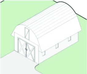
(1)
Agricultural. A structure used solely for agricultural purposes in which the use is exclusively
in connection with the production, harvesting, storage, drying or raising of agricultural
commodities, including the raising of livestock.
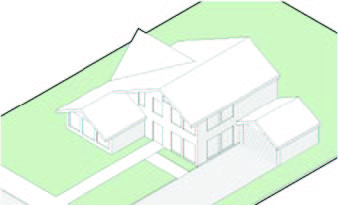
(2)
Detached single-family dwelling. A building, other than a manufactured home or mobile home, designed for residential
purposes having suitable accommodations for only one family.
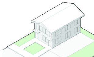
(3)
Two-unit single-family dwelling. A building that contains two primary dwelling units with separate external entrances.
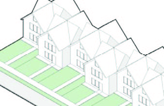
(4)
Attached single-family dwelling or townhouse. A building that contains a dwelling unit located on its own lot that shares a wall
on one or both sides with a neighboring dwelling.
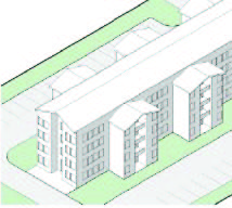
(5)
Multi-family dwelling. A building that contains three or more dwelling units that share common walls or
floor/ceilings with one or more units, and where the lot is held in a single ownership.
(6)
Live/work. A building that contains a single unit (e.g., studio, loft, or one bedroom) consisting
of both a commercial/office and a residential component.
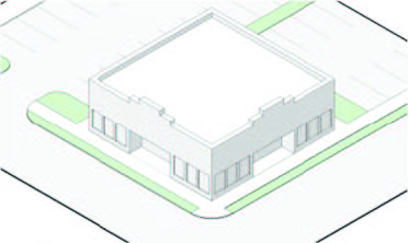
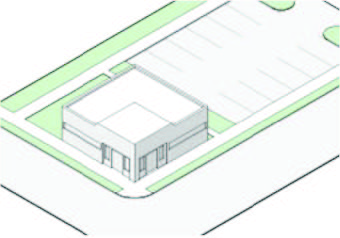
(7)
Commercial. A building designed for a single tenant with a commercial use. Depending on the zone
district, the scale of the structure can vary from a few thousand square feet (e.g.,
a coffee shop) to several hundred thousand square feet (e.g., a department store).
A single tenant commercial building may be developed as a stand-alone structure, or
be incorporated into a larger commercial center.
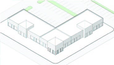
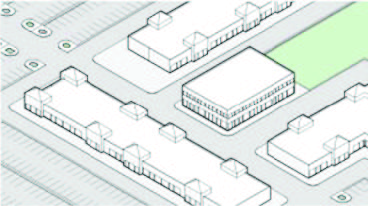
(8)
Neighborhood commercial center. A multi-tenant building, or buildings, designed to accommodate a mix of convenience-oriented
retail uses and services. Intended to support and integrate with neighborhoods, neighborhood
commercial centers have a modest, pedestrian-oriented scale, and typically do not
exceed 150,000 square feet in total. Neighborhood commercial centers may contain a
small anchor such as a pharmacy or small grocery.
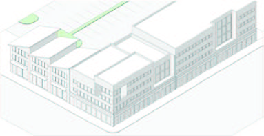
(9)
Community commercial center. A building, or buildings, designed to provide a vertical or horizontal mix of uses
with ground floor commercial, service or retail, and upper-floor commercial or service.
Depending on the zone district, total square footage ranges from 100,000 square feet
to 300,000 square feet.
(10)
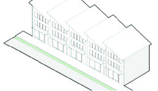
Mixed-use center. A building designed to provide a vertical mix of uses with ground floor commercial,
service or retail, and upper-floor commercial, service or residential.
(11)
Office and flex office. A building designed for office use that may be occupied by one or more tenants for
business uses which may include accessory retail uses. May also include flex office
that is a building designed to provide a vertical or horizontal mix of uses with ground-floor
office or retail.
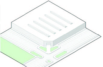
(12)
Industrial. A building designed for industrial use including manufacturing, warehousing and office.
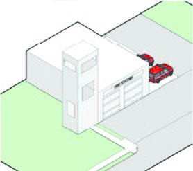
(13)
Civic. A building designed to house public, civic or institutional uses.
(Ord. No. 2021-0101, § 2, 9-14-2021; Ord. No. 2024-0043, § 2, 5-14-2024)
Editor's note— Ord. No. 2021-0101, § 2, adopted Sept. 14, 2021 added new provisions designated as § 94-35 and renumbered existing §§ 94-35—94-47 as §§ 94-36—94-48.
Sec. 94-36. - Conservation District (CON).
(a)
Purpose. The Conservation District seeks to protect and preserve natural resources, landscapes and environmentally sensitive areas owned by public entities. Conservation Districts may include forests, wetlands, floodplains and unique habitats and landscapes. To preserve access to clean air, pure water, natural recreation areas and scenic natural beauty, Conservation Districts restrict the subdivision and development of land. Parks, fish, wildlife and nature preserves are permitted in Conservation Districts, as well as limited forestry and agricultural uses. Conservation Districts may also accommodate limited structures and infrastructure to support the preservation and enjoyment of the natural areas within them.
(b)
Uses. All uses in the CON District shall conform to Table 94-60.1, Permitted Uses.
(c)
Dimensions. Development in the CON District shall conform to the site plan approved for the project.
(Ord. No. 2018-0030, § 2, 4-10-2018; Ord. No. 2021-0101, § 2, 9-14-2021)
Sec. 94-37. - Agricultural District (A).
(a)
Purpose. Agricultural Districts maintain agricultural operations and preserve agricultural lands used for crop production or the raising of livestock. In some cases Agricultural Districts may serve as a "holding zone" for land where future urban development is possible, but not yet appropriate due to the unavailability of urban level facilities and services. Exurban, large-lot residential subdivisions are not appropriate in Agricultural Districts, and should instead be focused in Residential Districts where there is adequate infrastructure and services to accommodate them.
(b)
Uses. All uses in the A District shall conform to Table 94-60.1, Permitted Uses.
(1)
Livestock standards shall conform to this Code.
(c)
Dimensions. Development in the A District shall conform to the following dimensional standards:
Table 94-36.1 A Dimensional Standards
Notes: [1] Livestock must be 75 feet from main family dwelling
(Ord. No. 2018-0030, § 2, 4-10-2018; Ord. No. 2021-0101, § 2, 9-14-2021)
Sec. 94-38. - Low Density Residential District (LDR).
(a)
Purpose.
(1)
The Low Density Residential District is intended for neighborhoods in the city consisting primarily of single-family homes on individual building lots. The Low Density Residential District is the least intense of three residential zoning districts with restrictions on the density and intensity of use to protect and enhance the character of neighborhoods. The average density in this district should not exceed six dwelling units per acre.
(2)
Development in Low Density Residential Districts should balance development needs with preservation of sensitive environmental features, and encourage clustering of development to preserve open space, take advantage of views, provide access to natural amenities, and minimize infrastructure costs. More compact development may be appropriate to minimize impacts to steep slopes, drainage areas, woodlands, and other valued natural features.
(3)
While focused on detached single-family homes, the Low Density Residential District is intended to accommodate a variety of housing types, styles and sizes to provide diverse housing options and accommodate the range of age groups, lifestyles and economic levels within the community. The Low Density Residential District also accommodates civic, open space and other limited nonresidential uses which are designed to be integrated as part of a complete neighborhood. Low Density Residential Districts should be located and coordinated closely with Neighborhood Commercial Districts that provide convenient local access to shopping, services and amenities.
(b)
Uses. All uses in the LDR District shall conform to Table 94-60.1, Permitted Uses.
(c)
Dimensions. Development in the LDR District shall conform to the following dimensional standards:
Table 94-37.1 LDR Dimensional Standards
(Ord. No. 2018-0030, § 2, 4-10-2018; Ord. No. 2021-0101, § 2, 9-14-2021)
Sec. 94-39. - Medium Density Residential District (MDR).
(a)
Purpose. The Medium Density Residential District incorporates housing units at a density of six to 12 dwelling units per acre, and includes both attached and detached housing structures. The Medium Density Residential District is intended to accommodate a variety of housing types, styles and sizes at moderate densities to provide diverse housing options and accommodate the range of age groups, lifestyles and economic levels within the community. Medium Density Residential Districts also accommodate civic, open space and other limited nonresidential uses that are thoughtfully integrated as part of a complete neighborhood. Medium Density Residential Districts permit smaller lots, smaller units and more varied housing configurations than Low Density Residential districts, allowing for more flexible infill development, and more attainable housing costs for residents. Established neighborhoods around the downtown, and new neighborhoods adjacent to employment and activity centers, are ideal locations for Medium Density Residential Districts.
(b)
Uses. All uses in the MDR District shall conform to Table 94-60.1, Permitted Uses.
(c)
Dimensions. Development in the MDR District shall conform to the following dimensional standards:
Table 94-38.1 MDR Dimensional
(Ord. No. 2018-0030, § 2, 4-10-2018; Ord. No. 2020-0083, § 2, 8-11-2020; Ord. No. 2021-0101, § 2, 9-14-2021)
Sec. 94-40. - High Density Residential District (HDR).
(a)
Purpose. The High Density Residential District is the most dense and intense of the city's residential zoning districts, generally consisting of densities of greater than 12 units per acre. High Density Districts feature a carefully integrated mixture of housing of various styles, sizes and densities, but are oriented more toward attached multi-family development than detached single-family units. Limited commercial, service and community uses are also permitted. High Density Residential Districts should be located in close proximity to commercial or employment zoning districts, and connected with a street network, transit, pedestrian and bicycle facilities that link residents to employment and activity centers. New High Density Residential development projects should include design review to ensure that these projects adequately serve resident needs, provide desired amenities and support the city's high quality of life.
(b)
Uses. All uses in the HDR District shall conform to Table 94-60.1, Permitted Uses.
(c)
Dimensions. Development in the HDR District shall conform to the following dimensional standards:
Table 94-39.1 HDR Dimensional Standards
(Ord. No. 2018-0030, § 2, 4-10-2018; Ord. No. 2021-0101, § 2, 9-14-2021)
Sec. 94-41. - Neighborhood Commercial District (NC).
(a)
Purpose.
(1)
Neighborhood Commercial Districts provide needed services, amenities and community spaces to surrounding neighborhoods. Neighborhood Commercial Districts are characterized by small scale retail and service uses that may include mixed-use or attached housing development. They are compact, pedestrian-friendly developments that have good connections to the surrounding neighborhoods. Geared toward the convenience needs of immediately surrounding residents, Neighborhood Commercial Districts should be located within a five to ten minute walk of residential neighborhoods. Neighborhood Commercial Districts are sometimes anchored by a small grocery store, specialty market or pharmacy. Other supporting uses should match the scale and intensity of the neighborhood setting, and may include small offices, restaurants or other convenience-oriented retail and services.
(2)
Neighborhood Commercial Districts may be developed as a discrete commercial center, or function as infill development within, or adjacent to, neighborhoods. Neighborhood Commercial development should focus on pedestrian-friendly design that connects the business and amenities to their residential neighborhoods. Neighborhood Commercial Districts are often located near, or centered on, a civic space that defines the area, and provides a focal point for community gathering.
(b)
Uses. All uses in the NC District shall conform to Table 94-60.1, Permitted Uses.
(1)
Residential uses are encouraged in the development, but are not permitted on the ground floor of a vertical mixed-use structure.
(c)
Dimensions. Development in the NC District shall conform to the following dimensional standards:
Table 94-40.1 NC Dimensional Standards
Floor-to-ceiling heights and floor area of ground floor space.
(1)
All commercial floor space provided on a ground floor of a mixed-use building must have a minimum floor-to-ceiling height of 11 feet.
(2)
All commercial floor space provided on the ground floor of a mixed-use building must contain the following minimum floor area:
a.
At least 800 square feet or 25 percent of the buildable lot area, whichever is greater, on lots with street frontage of less than 50 feet; or
b.
At least 20 percent of the buildable lot area on lots with 50 feet or more of street frontage.
Parking for mixed-use and nonresidential structures shall be located within either side or rear yard.
(Ord. No. 2018-0030, § 2, 4-10-2018; Ord. No. 2021-0101, § 2, 9-14-2021)
Sec. 94-42. - Mixed-Use District (MU).
(a)
Purpose. Mixed-Use Districts are intended as dense, diverse, walkable areas that facilitate residential, commercial, employment and recreation uses in a single location. Mixed-Use Districts should incorporate a variety of complementary uses that are mutually supportive and integrated into the community. The density and precise mix of uses in the Mixed-Use District may vary, but these districts should always be located in, or adjacent to key centers of activity. Successful Mixed-Use Districts require an active and inviting public realm, and safe and inviting pedestrian amenities. Design of public and private components is critical in Mixed-Use Districts to ensure that the concentrated mix of uses and activities functions efficiently and creates an active, inviting environment. Common mixed-use development configurations include active uses such as retail, restaurants and services at the street level, with residential or office space above.
(b)
Uses. All uses in the MU District shall conform to Table 94-60.1, Permitted Uses.
(1)
In the Mixed-Use District, a mix of uses—either within a single building or on a development site—shall be provided unless it can be demonstrated that adjacent properties provide, or will provide a complementary diversity of uses. The uses of adjacent properties can be established through one of the following: (1) existing uses; (2) approved site plan for development; or (3) approved area or neighborhood plan.
(c)
Dimensions. Development in the MU District shall conform to the following dimensional standards:
Table 94-41.1 MU Dimensional Standards
Floor-to-ceiling heights and floor area of ground floor space.
(1)
All commercial floor space provided on a ground floor of a mixed-use building must have a minimum floor-to-ceiling height of 11 feet.
(2)
All commercial floor space provided on the ground floor of a mixed-use building must contain the following minimum floor area:
a.
At least 800 square feet or 25 percent of the buildable lot area, whichever is greater, on lots with street frontage of less than 50 feet; or
b.
At least 20 percent of the buildable lot area on lots with 50 feet or more of street frontage. Parking for mixed-use and nonresidential structures shall be located within either the side or rear yard.
(Ord. No. 2018-0030, § 2, 4-10-2018; Ord. No. 2019-0028, § 2, 3-12-2019; Ord. No. 2021-0101, § 2, 9-14-2021)
Sec. 94-43. - Community Commercial District (CC).
(a)
Purpose.
(1)
Community Commercial Districts provide a diversity of retail, service, office, finance and related business uses to serve the needs of community residents and the larger region. In the Community Commercial District, the size of buildings are larger, and the intensity and density of uses are greater than in Neighborhood Commercial Districts. Community Commercial Districts should be concentrated at major activity centers, along high traffic transportation corridors and are ideally served by transit.
(2)
Because Community Commercial Districts support multiple neighborhoods, they may include larger-scale tenants, including hardware stores, apparel, sporting goods and other larger-format retailers. Community Commercial Districts also accommodate a wide range of commercial uses, including auto-oriented uses. However, the Community Commercial District enables commercial activity centers and corridors to transform over time into more dense, diverse, and walkable places that incorporate other types of uses.
(3)
Community Commercial Districts should be supported and surrounded by adjacent multi-family and mixed-use development that capitalize on the proximity to services, and provide a transition to Lower Density Residential neighborhoods.
(b)
Uses. All uses in the CC District shall conform to Table 94-60.1, Permitted Uses.
(c)
Dimensions. Development in the CC District shall conform to the following dimensional standards:
Table 94-42.1 CC Dimensional Standards
(Ord. No. 2018-0030, § 2, 4-10-2018; Ord. No. 2019-0071, § 2, 6-11-2019; Ord. No. 2021-0101, § 2, 9-14-2021)
Sec. 94-44. - Downtown District (D).
(a)
Purpose. The Downtown District is intended to maintain and enhance the city's downtown as a thriving and charming mixed-use activity center. In the Downtown District, the historic character should be protected and celebrated while providing flexibility for new investment and development that complements the character of the downtown and adjacent neighborhoods. In the Downtown District, pedestrian-oriented streets support the vitality of ground level retail, and enhance the quality of life for downtown residents, visitors and workers. Specially adapted standards for building facades, ground floor uses, infill construction, parking and other conditions unique to the downtown area ensure the district remains active, inviting, and functional.
(b)
Uses. All uses in the D District shall conform to Table 94-60.1, Permitted Uses.
(c)
Dimensions. Development in the D District shall conform to the following dimensional standards:
Table 94-43.1 D Dimensional Standards
(Ord. No. 2018-0030, § 2, 4-10-2018; Ord. No. 2021-0101, § 2, 9-14-2021)
Sec. 94-45. - Entertainment District (ENT).
(a)
Purpose. The Entertainment District is intended to protect and enhance the city's primary entertainment corridor as a major visitor destination, key economic driver and important gateway into the community. The Entertainment District encompasses a wide range of entertainment uses including theaters, museums, rides and other attractions. Lodging and retail uses are also major components of the Entertainment District. Standards in the Entertainment District are focused on enhancing the visitor experience and function of the corridor. The Entertainment District supports high quality development and public realm improvements that enhance the visitor experience and function of the corridor. The Entertainment District is also specially tailored to support the eclectic character and dynamic creativity that is the hallmark of Branson's entertainment.
(b)
Uses. All uses in the ENT District shall conform to Table 94-60.1, Permitted Uses. Multi-family dwelling is prohibited in the Entertainment District.
(c)
Dimensions. Development in the ENT District shall conform to the following dimensional standards:
Table 94-44.1 ENT Dimensional Standards
(Ord. No. 2018-0030, § 2, 4-10-2018; Ord. No. 2019-0071, § 2, 6-11-2019; Ord. No. 2021-0101, § 2, 9-14-2021; Ord. No. 2024-0043, § 2, 5-14-2024)
Sec. 94-46. - Business District (BUS).
(a)
Purpose. Business Districts accommodate a variety of office and light industrial uses that are not ideally located in retail-focused commercial districts. Business Districts include free standing office buildings, office parks, medical facilities and multi-tenant professional offices. Business Districts may also include research or other light industrial uses where these uses are compatible with, or accessory to, office and professional uses in the area. Light assembly or manufacturing may be appropriate where high-quality planned developments integrate a mix of office and light industrial uses. In Business Districts, complementary retail and services should be limited in scale and carefully integrated with surrounding business uses.
(b)
Uses. All uses in the BUS District shall conform to Table 94-60.1, Permitted Uses.
(c)
Dimensions. Development in the BUS District shall conform to the following dimensional standards:
Table 94-45.1 BUS Dimensional Standards
(Ord. No. 2018-0030, § 2, 4-10-2018; Ord. No. 2021-0101, § 2, 9-14-2021)
Sec. 94-47. - Industrial District (I).
(a)
Purpose. Industrial Districts are intended for more intensive industrial uses including manufacturing, assembly and large-scale distribution. Research, warehousing and other light industrial uses are also appropriate in Industrial Districts. In Industrial Districts, complementary retail and service uses should be limited in scale and carefully integrated with surrounding industrial uses.
(b)
Uses. All uses in the I District shall conform to Table 94-60.1, Permitted Uses.
(c)
Dimensions. Development in the I District shall conform to the following dimensional standards:
Table 94-46.1 I Dimensional Standards
(Ord. No. 2018-0030, § 2, 4-10-2018; Ord. No. 2021-0101, § 2, 9-14-2021)
Sec. 94-48. - Planned development (PD).
(a)
Purpose. This section is intended to encourage flexible development patterns that are not specifically provided for in this chapter. It is the purpose of this section:
(1)
To promote and permit flexibility that will encourage innovative and imaginative approaches in land development and renewal that will result in a more efficient, aesthetic, desirable, and economic use of land while maintaining density and intensity of use consistent with the applicable adopted plans, regulations, and policies of the city;
(2)
To promote development within the city that can be conveniently, efficiently, and economically served by existing local utilities and services or by their logical extension;
(3)
To promote design flexibility including placement of buildings, use of open space, pedestrian and vehicular circulation systems to and through the site, and off-street parking areas in a manner that will best utilize potential on-site characteristics such as, topography, geology, geography, size and proximity;
(4)
To provide for the preservation of historic or natural features where they are shown to be in the public interest, including but not limited to such features as: drainage ways, floodplains, existing topography or rock outcroppings, unique areas of vegetation, historic landmarks or structures;
(5)
To provide for compatibility with the area surrounding the project site;
(6)
To provide for usable and suitably located open space such as, but not limited to, bicycle paths, playground areas, courtyards, tennis courts, swimming pools, planned gardens, outdoor seating areas, outdoor picnic areas, and similar open space;
(7)
To minimize adverse environmental impacts of development;
(8)
To improve the design, quality and character of new development; and
(9)
To provide compensating community benefits to offset any impacts of the development, and in recognition of design flexibility.
(b)
Eligibility criteria. All of the following criteria must be met for a project to be eligible to apply for PD approval.
(1)
Minimum lot size.
a.
Projects located outside of the Downtown and Entertainment Districts must be a minimum of five acres.
b.
Projects located within the Downtown or Entertainment Districts may be less than five acres provided the PD combines two or more parcels of land.
(2)
Consistency with comprehensive plan. The proposed development shall be consistent with the Community Plan 2030 and any applicable geographic or specific plan including area, corridor, or neighborhood plans.
(3)
Consistent with PD intent. The proposed development shall be consistent with the intent and spirit of the PD purpose statement.
(4)
Economic impact. The proposed development shall not impede the continued use, or development of, surrounding properties for uses permitted in this chapter or planned for in the Community Plan 2030.
(5)
Unified control. The entire area of the proposed development shall be under single ownership or unified control, such that there is a single entity having responsibility for completing the entire project. This provision shall not prohibit a transfer of ownership or control, provided that a unified ownership remains.
(6)
Public benefit. A recognizable and material benefit will be realized by both the future residents and the city as a whole through the establishment of a PD, where such benefit would otherwise be infeasible or unlikely.
(7)
Preservation of site features. Long-term conservation of natural, historical, architectural, or other significant features or open space will be achieved, where such features would otherwise be destroyed or degraded by development as permitted by the underlying zoning district.
(8)
Sufficient land area for proposed uses. Sufficient land area has been provided to comply with all applicable regulations of this chapter to adequately serve the needs of all permitted uses in the PD projects, and to ensure compatibility between uses and the surrounding neighborhood.
(c)
Dimensional and development standards. The following dimensional and development standards shall apply to all PDs:
(1)
Overlay district. A PD shall be an overlay district and shall be applied over an underlying zone district. When a site contains land that is in more than one zoning district, the allowed residential and conditional uses at the required minimum and maximum densities, if applicable, shall be proportionate to the land within the development site devoted to each zoning district.
(2)
Setbacks. Setbacks from the exterior boundary line of the PD shall be comparable to, or compatible with, those of the existing development on adjacent properties. If adjacent properties are undeveloped, setbacks shall match the underlying zoning or the projections of the Community Plan 2030.
(3)
Permitted uses. PD uses shall be limited to those allowed either as permitted, accessory, or special use in the underlying zone district.
(4)
Use standards. Use standards as described in this chapter shall be applicable to PD projects.
(5)
Timeshare standards.
a.
Maximum density. The maximum number of timeshare dwelling units within a Planned Development (PD) District shall not exceed the number calculated by multiplying the entire area of the property to be used for timeshare purposes by the maximum density shown by Table 94-79.1, except as set forth in the exceptions listed in subsections 94-79(b)(2)—(4). The number of timeshare units may be distributed in any manner over the timeshare portion of the PD consistent with the intent and provisions of this chapter. The development plan shall specify distribution of timeshare units for the PD as a whole or for subareas within the PD as appropriate. In making its determination regarding the distribution of timeshare units, the board may consider compatibility of timeshare densities with other uses within the district as well as outside the district, the impact of timeshare densities on public facilities and services, and the consistency with the master plan and other adopted plans and policies.
Table 94.47.1: Timeshare Density
b.
Timeshare units abutting LDR districts. The maximum density of timeshare dwelling units within 300 feet of an abutting LDR district may be increased to 12 DU/acre, but only under the following circumstances:
(i)
No building within 300 feet of an abutting LDR zoning district shall exceed two stories in height.
(ii)
All buildings must be set back from an LDR zoning district an additional 25 feet for each two DU/acre in excess of six DU/acre to provide additional buffering. Such additional buffering shall be in excess of the 100 feet minimum buffering required by this chapter and shall be provided along the entire boundary common to the LDR zoning district.
(iii)
The maximum density of timeshare dwelling units located more than 300 feet from an abutting LDR zoning district shall be 32 DU/acre.
c.
Timeshare units abutting MDR districts. The maximum density of timeshare dwelling units within 300 feet of an abutting MDR district may be increased to 24 DU/acre, but only under the following circumstances:
(i)
No building within 300 feet of an abutting MDR zoning district shall exceed two stories in height.
(ii)
All buildings must be set back from an MDR zoning district an additional 25 feet for each two DU/acre in excess of 12 DU/acre to provide additional buffering. Such additional buffering shall be in excess of the 100 feet minimum buffering required by this chapter and shall be provided along the entire boundary common to the MDR zoning district.
(iii)
The maximum density of timeshare dwelling units located more than 300 feet from an abutting MDR zoning district shall be 32 DU/acre.
d.
Timeshare units abutting HDR districts. The maximum density of timeshare dwelling units within 200 feet of an abutting HDR district may be increased to 32 DU/acre, but only under the following circumstances:
(d)
General procedures. All PDs are processed in two stages: 1) the preliminary PD, and 2) the final PD. The final PD can only be filed with the city for review and processing after the preliminary PD has been approved or conditionally approved by the board. The approval of a final PD plan shall not constitute the effective dedication of easements, rights-of-way, or access control, nor shall the filed plan be neither the equivalent of, nor substitute for the final platting of land. Specific procedures for conceptual review, preliminary PD, and final PD are outlined below.
(1)
Pre-application conference. A pre-application conference is required for a PD application.
(2)
Coordination with subdivision review. Subdivision review, if applicable, may be carried out concurrently with the review of PD plans under this section. If subdivision approval is required for the subject property, the PD plans required under this section shall be submitted in a form that satisfies the requirements for preliminary and final subdivision plat approvals.
(3)
Application without subdivision review.
a.
Where subdivision review is not required, the preliminary development plan shall be reviewed as a zoning change, and shall be processed in the same manner specified by this chapter. The applicant shall submit a PD application that meets the requirements of the PD application form, including but not limited to the following information:
(i)
A legal description of the site proposed for PD designation, including a statement regarding present ownership and present zoning.
(ii)
A master conceptual plan that indicates tract or parcel locations and dimensions; density per gross and per net acres in the development and in each land use component, if appropriate; the intensity of land use in the development and each land use component, if appropriate; the amount of land in common area open space, recreation use or public use, if appropriate; and the treatment of project boundaries.
(iii)
Written text which includes supporting graphics describing the overall concept of the plan; the uses included and any limitations upon uses; building types and prototypical site layouts, if appropriate; provisions for maintenance of common areas; any proposed agreements, dedications or easements; any proposed private covenants and restrictions; and any other information required by this article or pertinent to a determination of compliance with this article.
(iv)
A circulation plan that indicates roads adjoining the property; the location of access from public roads into the project; and vehicular and pedestrian circulation systems within the project.
(v)
An improvement plan that indicates water supply and distribution facilities as well as the source of the water supply; sewage collection and disposal, including method and location of sewage discharge; methods and facilities for the management of stormwater runoff; improvements to streets and roads; and any other physical improvements required to support the project.
(vi)
A statistical summary that indicates the number of acres in the project; the number of acres allocated to each land use within the project; the gross and net residential density within the project and within each land use component of the project; and floor area, floor area ratios, open space ratios, and other data relating the intensity of development to the site size and location.
b.
The following elements are optional at the request of the planning commission:
(i)
A sign plan that indicates the location, size, design, and other pertinent provisions relating to signs within the project.
(ii)
A parking plan that shows the number of parking spaces as well as their general location and design.
(iii)
An environmental impact statement indicating possible problem areas within the site as well as solutions to these problems as intended by the developer.
(e)
Review and decision. The planning commission may recommend approval of preliminary PD plans, and the board may approve, if the PD overlay district and the associated preliminary PD plan meets all of the following criteria:
(1)
The PD addresses a unique situation, confers a substantial benefit to the city, or incorporates creative site design such that it achieves the purposes of this chapter and represents an improvement in quality over what could have been accomplished through strict application of the otherwise applicable district or development standards. Such improvements in quality may include, but are not limited to: improvements in open space provision and access; environmental protection; tree/vegetation preservation; efficient provision of streets, roads, and other utilities and services; or increased choice of living and housing environments;
(2)
The PD rezoning will promote the public health, safety and general welfare;
(3)
The PD rezoning is consistent with the Community Plan 2030 and the purposes of this chapter;
(4)
Facilities and services (including roads and transportation, water, gas, electric, police and fire protection, and sewage and waste disposal, as applicable) will be available to serve the subject property while maintaining adequate levels of service to existing development;
(5)
The PD rezoning is not likely to result in significant adverse impacts upon the natural environment, including air, water, noise, stormwater management, wildlife, and vegetation, or such impacts will be substantially mitigated;
(6)
The PD rezoning is not likely to result in significant adverse impacts upon other property in the vicinity of the subject tract; and
(7)
Future uses on the subject tract will be compatible in scale with uses on other properties in the vicinity of the subject tract.
(f)
Preliminary approval lapse.
(1)
Submission deadline for final PD plan. Within six months following approval of the preliminary PD plan, the applicant shall initiate the second stage of their application process by filing with the planning and development director a final PD plan, and subdivision plat if necessary, containing in final form all the information required in the preliminary PD plan, along with such other documents as may be necessary to implement the plan or to comply with all applicable requirements of this chapter.
(2)
Time extension. Upon written request by the applicant prior to the application lapsing, the planning commission, for good cause, may extend the period for filing the final PD plan for a period not to exceed six months.
(g)
Final PD plan.
(1)
Contents of final PD plan. The final PD plan shall contain all of the materials included in the preliminary PD plan, together with revisions, if any, that may be approved by the planning commission without an additional public hearing, as described in this section. In addition, the final PD plan shall include the following:
a.
Phasing program. A document describing any proposed phasing program of the development for all structures, recreational and other common facilities, and open space improvements, including time schedule for commencement and completion dates of construction of each phase. Intermediate phases shall not exceed overall project density and a pro rata allocation of public infrastructure and common open space shall be made as each phase is developed.
b.
Common open space agreement. A copy of the formal agreement with a public agency or private association for the ownership and maintenance of the common open space is required.
c.
Plats for recording. A copy of any subdivision plat, plat of dedication, or plat of vacation that may be necessary part of the PD rezoning is required.
d.
Covenant. A restrictive covenant in a form acceptable to the city attorney limiting development of construction upon the tract as a whole to such development and construction as shall comply with the final PD plan as approved by the board, which document shall include a provision granting the city a right to enforce the same.
(2)
Permitted minor changes from a preliminary PD plan. Minor changes in the location, siting, and height of structures, streets, driveways, and open spaces may be authorized by the planning commission to be included in the final PD plan in accordance with the following procedures without additional public hearings if such changes are required by engineering or other circumstances not foreseen at the time the preliminary PD plan is approved. No change authorized by this subsection may cause any of the following:
a.
A change in the use or character of the development;
b.
An increase by more than one percent in the overall coverage of structures;
c.
An increase in the density or intensity of use;
d.
An increase in the problems of traffic circulation and public utilities;
e.
A reduction of not more than one percent in approved common open space;
f.
A reduction in off-street parking and loading spaces;
g.
A reduction in required pavement widths.
(h)
Review and decision.
(1)
The planning commission shall review the application and recommend approval, approval with modifications or conditions, or denial, and transmit its findings of fact and recommendation to the board. If the proposed final PD plan does not include any changes from the approved preliminary PD plan that exceed the criteria listed in this section, the planning commission may review the final PD plan without conducting a public hearing. If the proposed plan includes changes that exceed such criteria, the planning commission shall conduct a new public hearing in order to review the proposed final PD plan.
(2)
The planning commission and the board shall review the final PD plan and PD rezoning according to the same approval criteria listed above for preliminary PD plans.
(i)
Final approval lapse. Development in the approved PD shall commence within 12 months from the approval of the rezoning. If development has not commenced within 12 months, the planning and development director shall initiate a public hearing process for the purpose of considering whether to rezone the property back to its prior zoning classification, or in light of other conditions, to another zoning classification, and authorize the revocation of all permits issued and action taken.
(j)
Revocation. Revocation of a PD may occur if:
(1)
The landowner or a majority of the owners of property within the subject PD, petition for revocation of such PD plan in whole or in part;
(2)
The project falls more than three years behind the schedule filed with the final PD;
(3)
Construction or application for building permits have not commenced within one year of approval of the final PD by the board;
(4)
Applicants have failed to comply with the approved PD plan or any specific condition of approval; or
(5)
The construction and provision of landscaping, buffers, open space, and public streets and facilities that are shown on the final development plan are proceeding at a slower rate than other project components as determined by the planning and development director.
(k)
Action by review and decision-making bodies.
(1)
Planning commission. The planning commission shall hold a public hearing and make a recommendation to revoke the final PD, keep the final PD in force, require an application amendment, or postpone the application. The planning commission may recommend the imposition of reasonable conditions on such revocation in order to advance the health, safety and welfare of the citizens, such as vacation of the underlying final plat.
(2)
Board public hearing. The board shall hold a public hearing and determine whether to revoke, postpone, require amendment, or keep the final PD in force. The board may impose reasonable conditions on such revocation in order to advance the health, safety and welfare of the citizens, such as vacation of the underlying final plat.
(3)
Effect of revocation. If the board revokes a PD approval, the zoning on the parcel shall remain in the same base district as it was when the PD overlay was applied.
(Ord. No. 2018-0030, § 2, 4-10-2018; Ord. No. 2021-0101, § 2, 9-14-2021)
Editor's note— Prior to the inclusion of Ord. No. 2021-0101, § 94-48 was entitled "Building types" and derived from: Ord. No. 2018-0030, § 2, adopted Apr. 10, 2018; and Ord. No. 2019-0028, § 2, Mar. 12, 2019. See § 94-35 for similar provisions.
Sec. 94-49. - Use dimensional standards.
(a)
Patio homes. Patio homes shall meet the following dimensional standards:
(1)
Front yard.
a.
The minimum front yard setback shall be 25 feet.
b.
No accessory structures shall be located in front yards.
(2)
Side yard.
a.
There shall be a side yard on one side of the structure of no less than ten feet in width.
b.
For corner parcels, there shall be a setback of 15 feet along street frontage.
c.
No accessory structures shall be located in the side yards.
(3)
Rear yard.
a.
There shall be a rear yard having a depth of not less than 25 feet.
b.
Accessory structures shall not be less than five feet from any rear parcel line, and there shall be a minimum of 15 feet between structures.
(4)
Lot area. The parcel area for a zero parcel line patio home shall be no less than 4,000 square feet.
(b)
Use-specific height exceptions. The height standards established in the zone districts do not apply to the following:
(1)
Religious assembly architectural elements including spires, towers, and belfries;
(2)
Flagpoles; and
(3)
Flues.
(Ord. No. 2018-0030, § 2, 4-10-2018; Ord. No. 2019-0071, § 2, 6-11-2019; Ord. No. 2021-0101, § 2, 9-14-2021)