
Brookford City Zoning Code
ARTICLE IV
- ZONING DISTRICTS
DIVISION 3. - OVERLAY DISTRICTS
This division sets forth overlay districts which are intended to impose different requirements on certain properties within the underlying conventional or conditional districts. The overlay districts described in this division are shown on a map entitled "Official Zoning Overlay Map," and said map is incorporated herein by reference. The provisions of this chapter regarding the custody, maintenance, control and reproduction of the official zoning map shall apply to the aforesaid overlay map.
(Ord. No. 2021-05, 6-21-2021)
Sec. 44-400.- Establishment of districts.
Purpose: This article divides the county into various districts for purposes of zoning. Within each district, this article describes the permitted uses or building types, densities, intensities, and dimensional standards such as setbacks, permitted height, and floor area ratio. The purpose of this article is to implement the county's small area plans, protect neighborhoods, and provide for economic development.
(a)
Zoning districts. The following zoning districts are established by the county:
Table 44-400-1. Zoning Districts Established
(b)
Conditional zoning districts. This chapter establishes conditional zoning districts that correspond to the general zoning districts. The conditional zoning districts have the same name as the general and zoning district designation along with the designation -CD. For example, a conditional zoning district that corresponds to residential (R-20) has the designation R-20-CD.
(c)
Overlay districts. The overlay districts designated in subsection (1) may impose greater restrictions, require higher development standards, prohibit certain uses, and require additional approvals, as stated in the overlay district regulations.
(d)
Special districts. Special districts are general use districts that are established to address unique situations or special public benefits, such as large employment generators. However, unlike overlay districts, special districts include their own use, dimensional and other standards, and serve as general use districts in the locations where they are mapped.
(Ord. No. 2021-05, 6-21-2021)
Sec. 44-401. - Zoning map.
The official zoning map is maintained by the county geographic information system (GIS) department.
(1)
Adoption of official zoning map. The official zoning map is adopted by reference and declared to be part of this chapter. Where boundaries and designations are not shown directly on the basic map sheets, they are indicated by overlays to such sheets or as separate maps. Overlays or separate maps have the same force and effect as the basic map sheets.
(2)
Inset maps. Where the scale of the basic map sheets or supplemental maps are inadequate for presentation of details in particular areas, such areas may be cross referenced on the basic map sheets or included on supplemental maps or separate inset maps at an appropriate scale.
(3)
Zoning map replacement. The board of commissioners may direct the preparation of a new official zoning map. The new official zoning map replaces the previous official zoning map upon approval by the board pursuant to G.S. 160D-105.
(4)
Authentication. The signature of the chairperson of the board of commissioners shall authenticate the official zoning map. The signature shall be attested by the signature of the clerk to the board, and shall bear the seal of the county under the following words: "This is to certify that the Official Zoning Map referred to was approved on ________."
(5)
Official zoning map amendment, updating and authentication. The official zoning map shall be amended, updated and authenticated as follows:
a.
Amendment. The official zoning map is subject to amendment by this chapter as set out in section 44-324 above. Any proposed amendment shall be identified by reference to the map sheet and/or supplement, and a legal description or other property identification or such other information as is required to make specific the application of the amendment.
b.
Updating. Amendments to the official zoning map shall be updated on the official zoning map by the planning director. Prior to such updating, a certified copy of the amendment shall be physically attached to each map sheet, supplement, or schedule sheet to be changed and prominently marked: "Amendment effective ________: GIS mapping incomplete."
c.
Authentication of amendments. Amendments shall be authenticated by entries made by the planning director on map sheets, supplements, schedule sheets affected, and a record of the nature and date maintained. The entries shall indicate the date the amendment was made, the date the change became effective, if other than the date of the actual approval, the number of the amending chapter, and an indication of the nature of the change sufficient to facilitate specific identification.
(6)
Unauthorized changes prohibited. No changes of any nature shall be made in the official zoning map, except as set forth in this chapter. Any unauthorized changes by any person is a violation of this chapter and punishable as provided by law. This subsection does not preclude action under other applicable criminal state statutes against any person alleged to have made unauthorized changes in this chapter.
(7)
Final authority for official zoning map. Regardless of the existence of purported copies of all or part of the official zoning map which may from time to time be made, published, or reproduced, the official zoning map is the final authority as to the current zoning status of all lands and waters within the zoning jurisdiction of the county.
(8)
The official zoning map shall be available for public inspection and copying. The map may be in paper or a digital format approved by the county. Copies of the zoning district map may be reproduced by any method of reproduction that gives legible and permanent copies.
(Ord. No. 2021-05, 6-21-2021)
Sec. 44-402. - Boundaries of districts.
(a)
District symbol on official zoning map. A district symbol or name shown within district boundaries on the official zoning map indicates that district regulations pertaining to the district extend throughout the whole area surrounded by the boundary line, except as otherwise specifically provided.
(b)
Uncertainty as to boundaries. Where uncertainty exists as to boundaries of districts or other areas delineated for regulatory purposes in the official zoning map, the following rules shall apply:
(1)
Boundaries indicated as approximately following the centerlines of streets, alleys, rights-of-way or easements shall be construed as following such centerlines as they exist on the ground. If a right-of-way is abandoned, the boundary remains in its location.
(2)
Boundaries indicated as approximately following boundaries of streets, alleys, other public or private property lines, rights-of-way, or easements shall follow such boundaries.
(3)
Boundaries indicated as approximately following mean high-water lines or centerlines of rivers, lakes, coves or other bodies of water shall be construed as following such mean high-water lines or centerlines. If the mean high-water line or centerline changes, the boundary shall be construed as moving with the change.
(4)
Boundaries indicated as approximately parallel to or extensions of features described in subsections (1), (2), and (3) above shall be construed as being parallel to or extensions of such features.
(5)
Where distances are not specifically indicated on any map in the official zoning map, they shall be determined by reference to the scale of the map.
(6)
Boundaries indicated as entering any body of water, but not continuing to intersect with other zoning boundaries or with the limits of the jurisdiction of the county, shall be construed as extending, in the direction in which they enter the body of water, to intersect with other zoning boundaries or with the limits of county jurisdiction.
(7)
Where parcels of land and water areas have been inadvertently excluded from a zoning district classification in any manner, the parcel shall be classified to conform to the district which surrounds it or which is most restrictive adjacent to it, until changed after a public hearing.
(8)
Where remaining uncertainty or conflict occurs:
a.
In other circumstances not covered in this section where existing natural or manmade features are at variance with those shown in the official zoning map, where the official zoning map is illegible or unclear, where interpretation based on such rules would produce contradiction or conflict with the intent of this chapter, or upon request from the planning director or an affected property owner, the board of adjustment shall make a finding and interpretation concerning the boundaries involved in accordance with the intent and purpose of this chapter.
b.
When such finding and interpretation involve only correction to the official zoning map or any official supplement and do not change the zoning of any lot, the board of commissioners may direct corrections without proposing an amendment to the map involved. When the zoning of any lot would be changed by such correction, the board of commissioners shall initiate a proposed corrective amendment.
(9)
Where the rules of interpretation set forth in subsections (1), (2), and (3) above would produce a variation of the actual location from the mapped location and this would change the zoning status of a lot or parcel, the boundary shall be interpreted to avoid such change.
(c)
Action where a zoning lot contains two or more zoning district designations. Where a zoning lot contains two or more district designations, the regulations of the underlying general district fronting the public street shall govern, except where the lot fronts on Lakes Hickory, Lookout or Norman or the main stem Catawba River. In these cases, the underlying general district fronting the lake or main stem river shall govern.
(Ord. No. 2021-05, 6-21-2021)
Sec. 44-403. - Use regulations.
(a)
The permitted use and structures within each zoning district are shown in table 44-403-1, use matrix.
(b)
Uses or structures that are not expressly listed in the use matrix or throughout this chapter are permitted in districts where similar uses are permitted. The planning director may determine that a use is materially similar if:
(1)
The use is listed within the same structure or function classification as the use specifically listed in the use matrix, as determined by the land-based classification standards (LBCS) of the American Planning Association; or
(2)
If the use cannot be located within one of the LBCS classifications pursuant to subsection (1) above, the planning director shall refer to the most recent version of the North American Industry Classification System (NAICS), published by the Executive Office of the President, Office of Management and Budget.
(c)
The letter symbols in Table 44-403-1 have the following meanings.
(d)
The reference column in table 44-403-1 indicates the article, division or section of this chapter where additional regulations are required for the specific use. Sections are referenced as "44-xxx." The letter "S" references the section for special use standards and the letter "P" references the section for supplemental regulations.
Table 44-403-1. Use Matrix
(Ord. No. 2021-05, 6-21-2021)
Sec. 44-404. - Dimensional regulations.
(a)
Calculation and rounding of requirements.
(1)
When making calculations as directed in this chapter, for example, off-street parking requirements, round to the next highest whole number.
(2)
No portion of a lot used in connection with an existing or proposed building, structure or use and which is necessary for compliance with the area, height and/or placement regulations of this chapter shall, through sale or otherwise, be used again as part of the lot required in connection with any other building, structure, or use.
(b)
Dimensional standards. Except as specifically provided in this chapter, regulations governing the density, maximum permitted floor area ratio, minimum lot size and width, required front, side and rear setbacks, maximum permitted height of structure, and gross leasable area are shown in table 44-404-1, dimensional standards.
Table 44-404-1. Dimensional Standards
Notes:
(1)
Churches/synagogues and places of worship, that apply for and qualify for tax exempt status with the county, may have a maximum height of 70 feet. In addition, steeples and belfries, which project above the total height of the structure, are allowed to have additional height, equal to that of the worship structure.
(2)
Lots on the turning circles of culs-de-sac may have a minimum 75 feet of lot width.
(3)
A setback of 20 feet is allowed along one internal street front for corner lots within residential subdivisions.
(c)
Density. Density refers to dwelling units per gross acre, and applies only to cluster subdivisions as defined in section 44-544 and multifamily or mixed-use buildings, if permitted in the zoning district.
(d)
Floor area ratio. Floor area ratio is the gross floor area of all nonresidential buildings or structures on a lot, divided by the total lot area. See definitions for calculation example.
(e)
Lot area. The area of a lot means the total area within its boundaries, excluding all rights-of-way. Minimum lot area is the minimum square footage required for a lot by this chapter. The minimum area does not include submerged lands nor street rights-of-way. The minimum lot size for a duplex is 1.5 times the lot size of a single-family dwelling, as indicated in table 44-404-1.
(f)
Frontage and lot width.
(1)
Generally. Lot width shall be measured across the required front setback line, except as provided in subsection (f)(2) below. The front setback line is construed to be parallel to the front lot line. In determining the front lot line for different lot types, as defined in subsection (i) below and depicted in figure 44-404-1, lot types, the following rules shall be used:
a.
On interior lots, the front lot line is the lot line that abuts a street.
b.
On corner lots, the lot lines parallel to each of the streets are both considered to be front lot lines for regulatory purposes.
c.
On multiple frontage lots, all portions adjacent to streets are considered to be front lot lines for regulatory purposes.
(2)
Lot frontage. Lot frontage shall not be less than 80 percent of the required minimum lot width except for lots on the turning circles of culs-de-sac or at similar points of street curvature where the radius of the right-of-way line is less than 90 feet. In the case of a cul-de-sac or where a right-of-way radius is less than 90 feet, the minimum frontage shall be 45 feet. Figure 44-404-1 indicates the relationships involved.
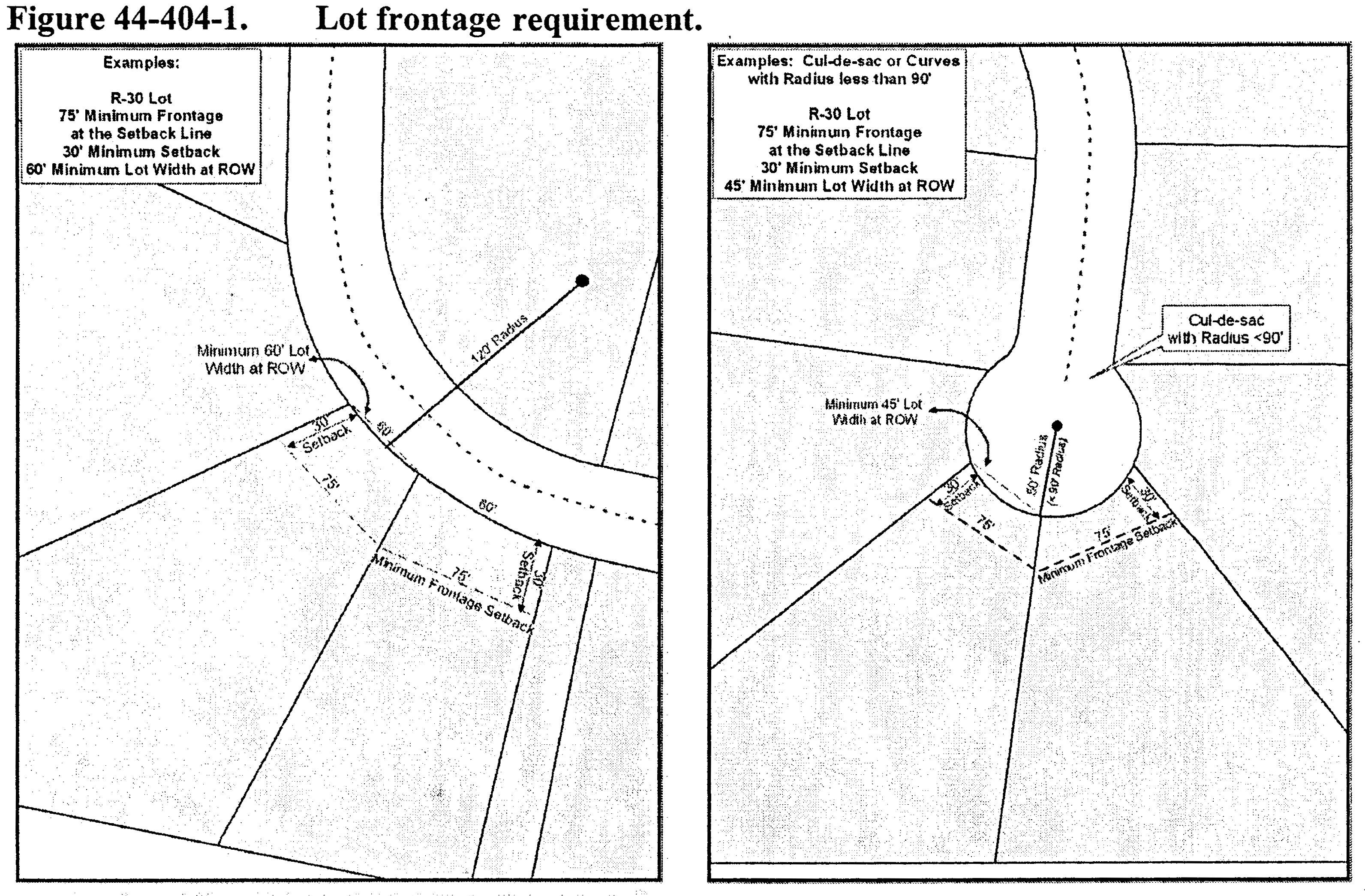
(3)
Diminishing lot width. Lot width shall not be less than 45 feet for any part of its width. The planning director may waive this requirement based on topography, original lot configuration, utility easements or rights-of-way and other natural features.
(4)
Lot width-to-depth ratio.
a.
Depth of residential major and minor development lots cannot exceed five times the width, except for lots with attached dwellings or when portions in excess of that depth are for the purpose of providing separation from major streets or railroads, rights-of-ways, easements, wetlands, water areas, protective strips, original lot configuration or severe topography.
b.
The width-depth ratio does not apply when:
1.
The width of a lot exceeds 300 feet;
2.
The lot is for nonresidential purposes;
3.
Creating a family subdivision.
(g)
Setbacks.
(1)
Generally. A setback is an imaginary line that governs the siting of buildings and structures on a lot. Figure 44-404-2 indicates the nomenclature and location of setbacks. Setbacks are measured from the property lot lines, not considering private easement boundaries.
(2)
Front setbacks. The front setback is an imaginary line extending the entire width of the lot and parallel to the front lot line. The setback requirement in table 44-404-1 is measured perpendicular to the front lot line at the closest point to the front lot line.
(3)
Side setbacks. The side setback is an imaginary line extending the entire length of the lot and parallel to the side lot line. The setback requirement in table 44-404-1 is measured perpendicular to the side lot line at the closest point to the side lot line.
(4)
Rear setbacks. The rear setback is an imaginary line extending the entire width of the lot and parallel to the rear lot line. The setback requirement in table 44-404-1 is measured perpendicular to the rear lot line at the closest point to the rear lot line.
(5)
Corner and multiple frontage lot setbacks. A corner or multiple frontage lot must observe the front yard setbacks for all frontages facing the streets. The rear lot line is the lot line that is opposite to the front with the shortest boundary. If the lot has equal frontage on two streets, frontage will be determined in accordance with the prevailing area lot patterns. See table 44-404-1 as well as figure 44-404-2 above.
(6)
Projections into setbacks.
a.
Cornices, eaves, stoops, gutters, and similar architectural features as determined by the planning director which are attached to a zoning regulated structure may project no more than three feet into the required front setback, five feet into the required rear setback and two feet into the required side setback.
b.
Mechanical equipment, such as air conditioning units, heat pumps, heating equipment, solar panels attached to principal dwellings, and similar installations, may not project into the required front setback, but may project five feet into the required rear setback and two feet into the required side setback.
c.
Features, such as stairs, not attached to a zoning regulated structure, are not subject to the setback requirements.
(h)
Height.
(1)
Excluded portions of structures. Except where specifically provided otherwise, the height limitations of this chapter do not apply to:
a.
Any roof structures for housing elevators, stairways, tanks, ventilating fans, solar energy collectors, or similar equipment required to operate and maintain a building, provided that such structures shall not cover more than 20 percent of the roof area or extend over ten feet in height;
b.
Spires, cupolas, domes, monuments, water towers, skylights, flagpoles, vents, construction or mining cranes or draglines, or similar structures, which may be erected above the height limit;
c.
Firewalls or parapet walls provided that such walls shall not extend more than five feet above the roof.
(2)
Aviation hazard. It is the responsibility of the property owner locating a structure within 5,280 feet of a documented public/private airstrip to obtain a certification from FAA and/or NCDOT verifying that the height of the proposed structure will not be an aviation hazard.
(i)
Lot types. Figure 44-404-3 illustrates the terminology used with reference to corner, interior and double frontage lots.
(1)
In figure 44-404-3, lot "A" is a corner lot, defined as a lot located at the intersection of two or more streets. A lot abutting a curved street is considered a corner lot if straight lines drawn from the foremost points of the side lot lines to the foremost point of the lot (projected if rounded) meet at an interior angle of less than 135 degrees.
(2)
In figure 44-404-3, lot "B" is an interior lot. An interior lot is a lot other than corner lot and abutting one street. Alleys are not considered streets for purposes of this definition.
(3)
In figure 44-404-3, lot "C" is a double frontage lot. A double frontage lot is a lot other than a corner lot, and has frontage on more than one street. Alleys are not considered streets for purposes of this definition.
Figure 44-404-3. Lot Types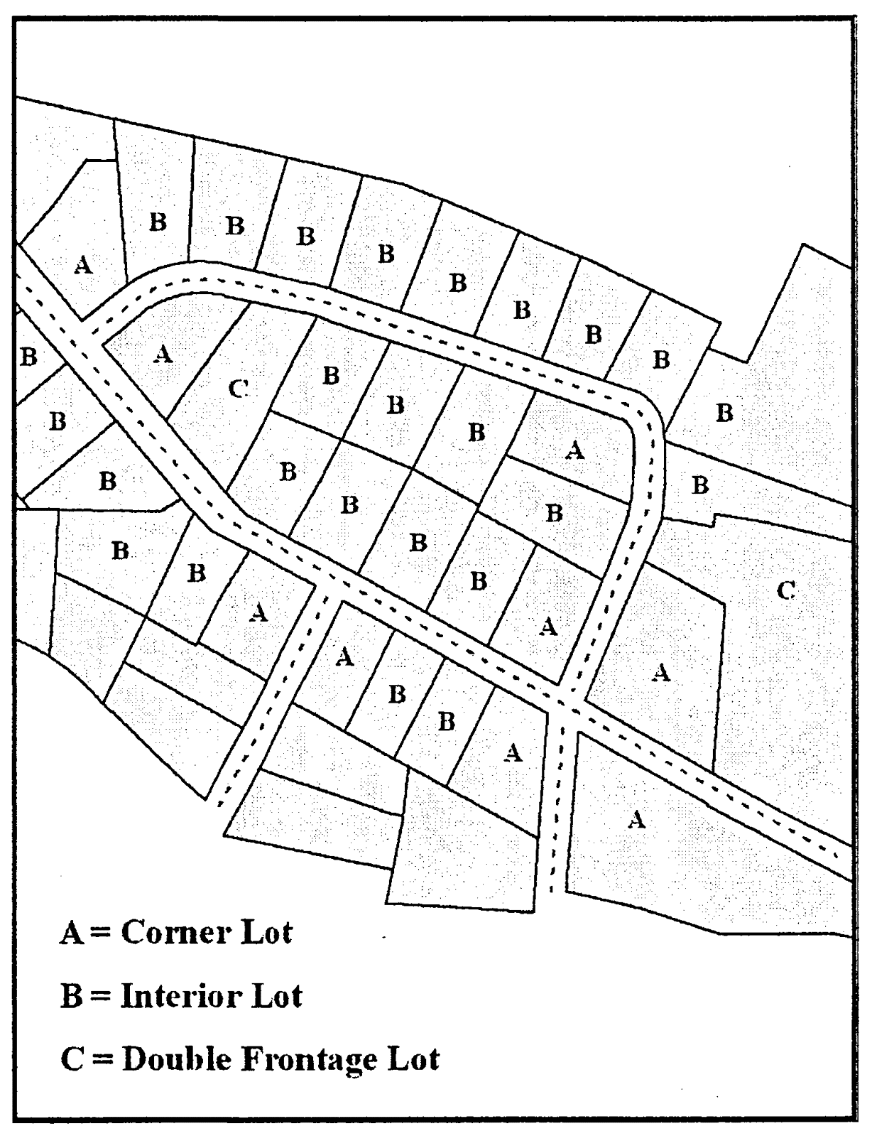
(Ord. No. 2021-05, 6-21-2021)
Sec. 44-405. - Placement of dwelling units on a lot.
(a)
Only one residential dwelling or duplex, and its customary accessory structures, is allowed per zoning lot as a matter of right.
(b)
Dwelling units shall be sited with the front of the structure running parallel to a street in order to achieve consistency and harmony with surrounding structures. The planning director shall have the authority to grant a waiver in the site placement of homes on a case by case basis. This waiver will be based in the topography of the site and any other specific conditions of the site.
(c)
On corner lots the property owner may choose which frontage to face the home.
(Ord. No. 2021-05, 6-21-2021)
Sec. 44-406. - Access.
(a)
A legal lot created and recorded on or before March 18, 1996, must have access to an access easement which has been recorded in the office of the register of deeds. The easement must be a minimum of 15 feet in width and connect to a state-maintained road.
(b)
A legal lot created and recorded after March 18, 1996 must have a minimum 45-foot right-of-way to a state-maintained road. A legal lot created and recorded after March 20, 2017 must have an NCDOT approved right-of-way connecting to a state-maintained road. In non-family subdivision situations, the road must be constructed to NCDOT standards.
An exception to this requirement is lots created for an estate settlement or lots exempt from subdivision regulations as defined in subsection 44-341(a)(1), which must have a minimum 15-foot easement as required in subsection (a) above. No construction standards are required.
(c)
In addition to minimum setback and building spacing requirements specified in this chapter, all buildings and other structures, land preparation, and landscaping must be so located and arranged on lots as to provide safe and convenient access for emergency purposes, fire protection, servicing, and off-street parking and loading located on the premises.
(d)
No residentially zoned land may be used for vehicular or pedestrian access to land or structures in other zoning districts, except as provided in this chapter or other lawful regulations.
(Ord. No. 2021-05, 6-21-2021)
Sec. 44-407. - Visibility of intersections.
No structure or portion of any structure may be placed or erected; no motor vehicle, trailer or equipment may be allowed to park, stand, stop or be stored; and no vegetation may be maintained, planted or allowed to grow in a manner which impedes the visibility from a street, alley or driveway of oncoming traffic from any direction in the intersecting public street. The visibility shall be unobstructed between the heights of two and one-half feet and eight feet, as measured from the pavement edge of the adjacent roadway, across triangles described as follows:
(1)
Start at the intersection of the rights-of-way of the two intersecting roadways or at the intersection of the pavement edges, if no right-of-way exists;
(2)
Measure from the intersection 70 feet along the major right-of-way or pavement edge and 10 feet along the minor; and
(3)
Connect the ends of the measurements to form a triangle.
(Ord. No. 2021-05, 6-21-2021)
Sec. 44-415.- Rural conservation (RCon).
Purpose: The rural conservation (RCon) district is established in areas that are characterized by large lots, agricultural uses and open lands. These areas may include prime farmland and unique topographical or environmental restrictions that are remote from existing developed areas. This district promotes rural development patterns that are characterized by the following:
♦
Low densities, including large lots that are surrounded by contiguous swaths of natural areas or agricultural land.
♦
A setback and lot size consistent with the existing, natural terrain.
♦
Narrow, winding streets that follow the natural topography.
♦
Natural or agricultural areas with a prevalence of forested or agricultural land uses.
(a)
Plan consistency. The RCon district carries forth the principles associated with the preservation and conservation of rural lands throughout the county where very low density is desirable in order to protect environmentally sensitive areas, agricultural areas, viewsheds, and other acreage of strategic importance. RCon districts may be mapped pursuant to individual comprehensive rezoning studies or individual request(s) submitted by landowners.
(b)
Minimum lot size requirement. The minimum lot size required in the RCon district is five acres.
(c)
Cluster subdivision option. Cluster subdivision designs are encouraged in the RCon district. Cluster subdivisions permit more development potential in exchange for preserving additional open space. Cluster subdivisions are subject to the standards in section 44-544.
(d)
Density bonus for affordable housing. As an incentive to provide affordable housing based upon the HUD standards and in an effort to achieve diverse housing, a developer can receive a density bonus. For each affordable house constructed, an additional lot is allowed which can be developed for market-rate housing, up to 20 percent maximum of the base density allowed. This density bonus applies in both the conventional and cluster subdivisions.
(e)
Uses. The uses allowed in the RCon district are listed in table 44-403-1, use matrix, except for:
(1)
Single-family residential subdivisions consisting of 200 lots or more; developed cumulatively; and
(2)
Three or more two-family (duplex) units on separate lots developed cumulatively.
(Ord. No. 2021-05, 6-21-2021)
Sec. 44-416. - Residential districts (R-80, R-40, R-30, R-20, R-15, R-12, R-10, and R-7).
Purpose: The R-80, R-40, R-30, R-20, R-15, R-12, R-10 and R-7 districts have dimensional standards and use restrictions consistent with single-family residential development and less than three two-family (duplex) units on separate lots planned cumulatively.
(a)
Plan consistency. The residential zoning districts relate to the residential density recommendations from the small area plans at the time of their acceptance as listed in table 44-416-1 below. The county's intent is that no rezoning to a zoning classification will be approved unless the location conforms to the designated land use categories except when changing conditions warrant the zoning change and a corresponding change to the comprehensive plan or small area plans. The zoning district designation recommended in the small area plans and depicted in table 44-416-1 do not necessarily accurately reflect the official zoning map adopted at the time of the adoption of the UDO.
Table 44-416-1. Plan Consistency, Residential Zoning Districts
(b)
Minimum lot size requirement. The minimum lot size required in each residential district is listed in table 44-404-1, Dimensional Standards. Where public water is provided either by a municipality or the county in an R-20 district, the next smallest lot size, R-15, is allowed by right where indicated in the applicable small area plan. Where public utilities (water, sewer or a combination of both) are provided either by a municipality or the county in a lower-density district (R-30 and R-40), a rezoning to a higher-density district (R-7 through R-20) is required in order to achieve higher density.
(c)
Cluster subdivision option. Cluster subdivision designs are encouraged in all residential districts. Cluster subdivisions permit more development potential in exchange for preserving more open space. Cluster subdivisions are subject to the standards noted in section 44-544.
(d)
Density bonus for affordable housing. As an incentive to provide affordable housing, based upon the HUD standards and in an effort to achieve diverse housing, a developer can receive a density bonus. For each affordable house constructed, an additional lot is allowed which can be developed for market-rate housing, up to 20 percent maximum of the base density allowed. This density bonus applies in both the conventional and cluster subdivisions. Lot sizes may be adjusted to accommodate density bonuses.
(e)
Uses. The uses allowed in the R-80, R-40, R-30, R-20, R-15, R-12, R-10 and R-7 district are listed in table 44-403-1, use matrix, except for:
(1)
Single-family residential subdivisions consisting of 200 lots or more; developed cumulatively; and
(2)
Three or more two-family (duplex) units on separate lots developed cumulatively.
(f)
Family care homes. A family care home, as defined in the appendix to this chapter and G.S. 160D-907, shall be deemed a residential use of property for zoning purposes and shall be a permissible use in all residential districts.
(Ord. No. 2021-05, 6-21-2021)
Sec. 44-417. - Rural commercial (RC).
Purpose: This district provides small areas for offices, services, and retail uses, all designed in scale with surrounding residential uses. The district regulations are designed to protect and encourage the transitional character of the district by permitting uses and building forms that are compatible with the rural areas of the county. This district establishes setback and area standards that are compatible with residential neighborhoods.
(a)
Plan consistency. The rural commercial district relates to the small area plan land use categories designated in table 44-417-1. The county's intention is that no rezoning to a zoning classification will be approved unless the location conforms to the designated land use categories except where changing conditions warrant the zoning change and a corresponding change to the comprehensive plan.
Table 44-417-1. Plan Consistency, RC District
(b)
Maximum district size. The intent of the county is that no application for a zoning amendment, alone or in combination with a contiguous RC and O-I district, will be approved if it would cause the total size of the combined districts at each individual node to exceed ten acres.
(c)
Minimum lot size requirement. The minimum lot size required in the RC district is 20,000 square feet.
(d)
Uses. The uses allowed in the RC district are listed in table 44-403-1, use matrix. More than one use in a building or multiple building are allowed in a RC district provided the total leasable area does not exceed 15,000 square feet.
(Ord. No. 2021-05, 6-21-2021)
Sec. 44-418. - Highway commercial (HC).
Purpose: This district provides areas for regional highway-oriented business, office, service and civic uses. The district regulations are designed to protect and encourage the transitional character of the districts by permitting uses and building forms that are compatible with the surrounding area.
(a)
Plan consistency. The highway commercial district relates to the small area plan land use categories designated in table 44-418-1. The county's intention is that no rezoning to a zoning classification will be approved unless the location conforms to the designated land use categories except where changing conditions warrant zoning changes and a corresponding change to the comprehensive plan.
Table 44-418-1. Plan Consistency, HC District
(b)
Maximum district size for neighborhood commercial nodes. The intent of the county is that no application for a zoning amendment in a neighborhood commercial node, alone or in combination with a contiguous HC and O-I district, will be approved if it would cause the total size of the combined districts at each individual node to exceed 25 acres.
(c)
Minimum lot size requirement. The minimum lot size required in the HC district is 40,000 square feet.
(d)
Uses. The uses allowed in the HC district are listed in table 44-403-1, use matrix. More than one use in a building or multiple building are allowed in a HC district provided the total leasable area does not exceed 50,000 square feet.
(Ord. No. 2021-05, 6-21-2021)
Sec. 44-419. - Office-institutional (O-I).
Purpose: The O-I district provides for office, institutional, civic, or other low intensity commercial uses. This district may buffer single-family residential neighborhoods from higher intensity residential neighborhoods or adjacent commercial districts.
(a)
Plan consistency. The office-institutional district relates to the small area plan land use categories designated in table 44-419-1 below. The county's intention is that no rezoning to a zoning classification will be approved unless the location conforms to the designated land use categories except where changing conditions warrant zoning changes and a corresponding change to the comprehensive plan.
Table 44-419-1. Plan Consistency, O-I District
(b)
Maximum district size in neighborhood commercial nodes. The intent of the county is that no application for a zoning amendment in a neighborhood commercial node, alone or in combination with a contiguous HC and O-I district, will be approved if it would cause the total size of the combined districts at each individual node to exceed 25 acres.
(c)
Maximum district size in rural commercial nodes. The intent of the county is that no application for a zoning amendment in a rural commercial node, alone or in combination with a contiguous RC and O-I district, will be approved if it would cause the total size of the combined districts at each individual node to exceed ten acres.
(d)
Minimum lot size requirement. The minimum lot size required in the O-I district is 20,000 square feet.
(e)
Uses. The uses allowed in the O-I district are listed in table 44-403-1, use matrix. More than one use in a building or multiple buildings are allowed in an O-I district provided the total leasable area does not exceed the maximum area listed in table 44-419-1 above.
(Ord. No. 2021-05, 6-21-2021)
Sec. 44-420. - Light industrial (LI).
Purpose: The light industrial (LI) district permits light manufacturing, processing and assembly uses, warehousing, distribution and servicing enterprises and limited office activities. This district supports the county's policies to promote economic development opportunities.
(a)
Plan consistency. This district implements the following small area plan land use categories:
(1)
St. Stephens-Oxford—Industrial;
(2)
Catawba—Industrial;
(3)
Balls Creek-Hwy. 321 Business corridor between Newton and Maiden;
(4)
E-1 zoning (now LI) in small area plans.
The county's intention is that no rezoning to a zoning classification will be approved unless the location conforms to the designated land use categories except where changing conditions warrant zoning changes and a corresponding change to the comprehensive plan.
(b)
Minimum lot size requirement. The minimum lot size required in the LI district is 40,000 square feet.
(Ord. No. 2021-05, 6-21-2021)
Sec. 44-421. - General industrial (GI).
Purpose: This district provides for intensive manufacturing, processing and assembly uses. This district promotes the county's policies to promote economic development opportunities. The uses permitted in this district may be very intensive, with their impacts controlled by performance or design standards.
(a)
Plan consistency. This district implements the following small area plan land use categories:
(1)
St. Stephens-Oxford—Industrial;
(2)
Catawba—Industrial;
(3)
E-2 zoning (now GI) in small area plans.
The county's intention is that no rezoning to a zoning classification will be approved unless the location conforms to the designated land use categories except where changing conditions warrant zoning changes and a corresponding change to the comprehensive plan.
(b)
Minimum lot size requirement. The minimum lot size required in the GI district is 60,000 square feet.
(Ord. No. 2021-05, 6-21-2021)
Sec. 44-428.- Catawba River Corridor (CRC-O).
Purpose:
♦
The Catawba River and its banks, lakes, creeks, tributaries, etc. are the most obvious, important and valuable natural resources in the county. The river corridor must be maintained for the use, benefit and enjoyment of present and future residents of and visitors to the county.
♦
The river is the source of water for the people, farmers, and manufacturers of the county. The river corridor contributes to the county's economy and general welfare through increased property values, aesthetic enrichment, and recreational opportunities. The river is the habitat for fish and wildlife and native plants.
♦
The Catawba River corridor, consisting of the lakes, river and its banks as it runs through the county's jurisdiction, must be protected from pollution caused by erosion and sedimentation, agricultural and industrial runoff, and natural and manmade obstruction. This stewardship is essential for the preservation of the public health, safety, and welfare.
(a)
Plan consistency. This section implements the St. Stephens-Oxford, Sherrills Ford and Catawba small area plans.
(b)
Boundaries. The Catawba River Corridor Overlay district shall extend landward a distance of 500 feet from the high water elevation of Lake Hickory and Lookout Shoals in addition to the Catawba River mainstem and 1,000 feet landward from the high water elevation of Lake Norman.
(c)
Consistency with other regulations. Development within the first 50 feet landward shall meet the requirements of the state's Catawba River Basin Riparian Buffer Rules (15A NCAC 2B.0243), as enforced by the NCDENR.
(d)
Minimum lot size requirement. The minimum lot size in the Catawba River Corridor Overlay district shall be 40,000 square feet (R-40) on Lake Hickory, Lookout Shoals and the Catawba River mainstem and 30,000 square feet (R-30) on Lake Norman. Cluster developments are encouraged, and subject to the regulations in section 44-544.
(e)
Minimum lot width requirement. The minimum lot width requirement for waterfront lots in the Catawba River Corridor Overlay district is 100 feet as measured along the waterfront. For nonwaterfront lots, the lot width requirement for the underlying zoning district shall apply.
(f)
Flag lot allowance. A maximum of three flag lots are allowed along a state-maintained road or a new subdivision road provided that a minimum of 45 feet of road frontage is provided. The creation of more than three cumulative lots will require a road built to NCDOT standards and be subject to the major subdivision requirements in article V.
Flag lots must meet the following dimensional criteria:
(1)
The length of the pole can not exceed five times the frontage width; and
(2)
The square footage of the land area within the flag pole may be used in the calculation of the minimum lot size requirement.
(g)
Nonresidential and multifamily development stormwater design requirements. Low-impact development (LID) techniques shall be incorporated into the design of all nonresidential and multifamily development within the Catawba River Corridor Overlay district. LID stormwater practices shall be designed based on the current best available practices and standards such as those provided by the Low Impact Development Center at www.lowimpactdevelopment.org. The county engineer shall review all stormwater plans.
(h)
Accessory structure setback. Accessory structures must be setback 30 feet from the rear property line at the lake or river front as measured from the high water elevation.
(Ord. No. 2021-05, 6-21-2021)
Sec. 44-429. - Floodplain management overlay (FPM-O).
Purpose: The flood hazard areas in the jurisdiction of the county are subject to periodic inundation which results in loss of life and property, health and safety hazards, disruption of commerce and governmental services, extraordinary pubic expenditures of flood protection and relief, and impairment of the tax base, all of which adversely affect the public health, safety and general welfare. These flood losses are caused by the cumulative effect of obstructions in floodplains causing increases in flood heights and velocities and by the occupancy in flood prone areas by uses vulnerable to floods or other hazards. The purpose of this chapter is to promote the public health, safety, and general welfare and to minimize public and private losses due to flood conditions in specific areas by provisions designed to:
♦
Restrict or prohibit uses which are dangerous to health, safety, and property due to water or erosion hazards or that result in damaging increases in erosion, flood heights or velocities;
♦
Require that uses vulnerable to floods, including facilities that serve such uses, be protected against flood damage at the time of initial construction;
♦
Control the alteration of natural floodplains, stream channels, and natural protective barriers, which are involved in the accommodation of floodwaters;
♦
Control filling, grading, dredging, and all other development that may increase erosion or flood damage; and
♦
Prevent or regulate the construction of flood barriers that will unnaturally divert floodwaters or which may increase flood hazards to other lands.
The objectives of this section are:
♦
To protect human life, safety and health;
♦
To minimize expenditure of public money for costly flood control projects;
♦
To minimize the need for rescue and relief efforts associated with flooding and generally undertaken at the expense of the general public;
♦
To minimize prolonged business losses and interruptions;
♦
To minimize damage to public facilities and utilities, (i.e. water and gas mains; electric, telephone, cable and sewer lines; streets; and bridges) located in flood prone areas;
♦
To help maintain a stable tax base by providing for the sound use and development of flood prone areas; and
♦
To ensure that potential homebuyers are aware that property is in a special flood hazard area.
(Ord. No. 2021-05, 6-21-2021)
Sec. 44-429.01. - Statutory authorization.
The state has, in G.S. chapter 143, article 21, part 6; chapter 153A, article 18, parts 3 and 4; chapter 153A, article 6, part 121; and § 160D-923 delegated to local governmental units the responsibility to adopt regulations designed to promote the public health, safety, and general welfare.
(Ord. No. 2021-05, 6-21-2021)
Sec. 44-429.02. - Legal status provisions.
This chapter in part comes forward by reenactment of some of the provisions of the flood damage prevention ordinance enacted on September 3, 1980, as amended, and it is not the intention to repeal but rather to reenact and continue to enforce without interruption such existing provisions, so that all rights and liabilities that have accrued are reserved and may be enforced. The enactment of this article shall not affect any action, suit or proceeding instituted or pending. All provisions of the flood damage prevention ordinance of the county enacted on September 3, 1980, as amended, which are not reenacted in this article are repealed.
The dates of the initial flood insurance rate maps for each municipal jurisdiction within the county are as follows:
Brookford December 18, 1979
Catawba September 3, 1980
Claremont March 3, 2003
Conover September 3, 1980
Hickory August 3, 1981
Long View September 3, 1980
Maiden September 3, 1980
Newton September 3, 1980
(Ord. No. 2021-05, 6-21-2021)
Sec. 44-429.03. - Effect upon outstanding floodplain development permits.
Nothing contained in this chapter shall require any change in the plans, construction, size or designated use of any development, or any part for which a floodplain development permit has been granted by the planning director before the time of passage of this chapter; provided, however, that if construction is not begun under such outstanding permit within a period of six months subsequent to the date of issuance of the outstanding permit, the construction or use shall be in conformity with the provisions of this chapter.
(Ord. No. 2021-05, 6-21-2021)
Sec. 44-429.04. - General provisions.
(a)
Lands to which this chapter applies. This chapter shall apply to all special flood hazard areas (SFHA) within the jurisdiction of the county.
(b)
Basis for establishing the special flood hazard areas. The special flood hazard areas are those identified under the cooperating technical state (CTS) agreement between the state and FEMA in its flood insurance study (FIS) and its accompanying flood insurance rate maps (FIRM) for the county dated September 5, 2007, which are adopted by reference and declared to be a part of this chapter. The initial flood insurance rate maps are as follows for the jurisdictional areas at the initial date:
Catawba County Unincorporated Area, dated September 3, 1980.
(c)
Establishment of floodplain development permit. A floodplain development permit shall be required in conformance with the provisions of this chapter prior to the commencement of any development activities within special flood hazard areas as determined in subsection 44-429.04(b).
(d)
Compliance. No structure or land shall be located, extended, converted, altered, or developed in any way without full compliance with the terms of this chapter and other applicable regulations.
(e)
Abrogation and greater restrictions. This article is not intended to repeal, abrogate, or impair any existing easements, covenants, or deed restrictions. However, where this chapter and another conflict or overlap, whichever imposes the more stringent restrictions shall prevail.
(f)
Interpretation. In the interpretation and application of this chapter, all provisions shall be considered as minimum requirements:
(1)
Considered as minimum requirements;
(2)
Liberally construed in favor of the board of commissioners; and
(3)
Deemed to neither limit nor repeal any other powers granted under state statutes.
(g)
Warning and disclaimer of liability. The degree of flood protection required by this chapter is considered reasonable for regulatory purposes and is based on scientific and engineering consideration. Larger floods can and will occur. Actual flood heights may be increased by manmade or natural causes. This chapter does not imply that land outside the special flood hazard areas or uses permitted within such areas will be free from flooding or flood damages. This chapter shall not create liability on the part of the county or by any officer or employee thereof for any flood damages that result from reliance on this chapter or any administrative decision lawfully made hereunder.
(Ord. No. 2021-05, 6-21-2021)
Sec. 44-429.05. - Definitions.
Unless specifically defined below, words or phrases used in this chapter shall be interpreted so as to give them the meaning they have in common usage and to give this chapter its most reasonable application.
Accessory structure (appurtenant structure). A structure which is located on the same parcel of property as the principal structure and the use of which is incidental to the use of the principal structure. Garages, carports and storage sheds are common urban accessory structures. Pole barns, hay sheds and the like qualify as accessory structures on farms and may or may not be located on the same parcel as the farm dwelling or shop building.
Addition (to an existing building). An extension or increase in the floor area or height of a building or structure.
Appeal. A request from a review of the planning director's interpretation of any provision of this chapter.
Area of shallow flooding. A designated AO on a community's flood insurance rate map (FIRM) with base flood depths determined to be from one to three feet, where a clearly defined channel does not exist, where the path of flooding is unpredictable and indeterminate, and where velocity flow may be evident.
Area of special flood hazard. See "special flood hazard area (SFHA)."
Basement. Any area of the building having its floor subgrade (below ground level) on all sides.
Base flood. The flood having a one percent chance of being equaled or exceeded in any given year.
Base flood elevation (BFE). A determination of the water surface elevations of the base flood as published in the flood insurance study. When the BFE has not been provided in a "special flood hazard area," it may be obtained from engineering studies available from a federal, state or other source using FEMA-approved engineering methodologies. This elevation, when combined with the "freeboard," establishes the "regulatory flood protection elevation."
Building. See "structure."
Chemical storage facility. A building, portion of a building, or exterior area adjacent to a building used for the storage of any chemical or chemically reactive products.
Development. Any manmade change to improved or unimproved real estate, including, but not limited to, buildings or other structures; mining, dredging, filling, grading, paving, excavation, or drilling operations; or storage of equipment or materials.
Disposal defined as in G.S. 130A-290(a)(6).
Elevated building. A nonbasement building which has its lowest elevated floor raised above ground level by foundation walls, shear walls, posts, pies, pilings, or columns.
Encroachment. The advance or infringement of uses, fill, excavation, buildings, structures or development into a floodplain, which may impede or alter the flow capacity of a floodplain.
Existing manufactured home park or manufactured home subdivision. A manufactured home park or subdivision for which the construction of facilities for servicing the lots on which the manufactured homes are affixed, including at a minimum the installation of utilities, the construction of streets, and either final site grading or the pouring of concrete pads, was completed before the initial effective date of the floodplain management regulations adopted by the community.
Flood or flooding. A general and temporary condition of partial or complete inundation of normally dry land areas from the overflow of inland or tidal waters; and/or the unusual and rapid accumulation or runoff of surface waters from any source.
Flood boundary and floodway map (FBFM). An official map of a community, issued by the Federal Emergency Management Agency, on which the special flood hazard areas and the floodway are delineated. This official map is a supplement to and shall be used in conjunction with the flood insurance rate map (FIRM).
Flood hazard boundary map (FHBM). An official map of a community, issued by the Federal Emergency Management Agency (FEMA), where the boundaries of the special flood hazard areas have been designated as zone A.
Flood insurance. The insurance coverage provided on the National Flood Insurance Program.
Flood insurance rate map (FIRM). An official map of a community, issued by the Federal Emergency Management Agency, on which both the special flood hazard areas and the risk premium zones applicable to the community are delineated.
Flood insurance study (FIS). An examination, evaluation, and determination of flood hazard areas, corresponding water surface elevations (if appropriate), flood insurance risk zones, and other flood data in a community issued by the Federal Emergency Management Agency. The flood insurance study report includes flood insurance rate maps (FIRM) and flood boundary and floodway maps (FBFM) if published.
Floodprone area. See "floodplain."
Floodplain or floodprone area. Any land area susceptible to being inundated by water from any source.
Floodplain development permit. Any type of permit that is required in conformance with the provisions of this chapter, prior to the commencement of any development activity.
Floodplain management. The operation of an overall program of corrective and preventive measures for reducing flood damage and preserving and enhancing, where possible, natural resources in the floodplain, including, but not limited to, emergency preparedness plans, flood control works, floodplain management regulations, and open space plans.
Floodplain management regulations. This chapter, building code, health regulations, special-purpose chapters of the County Code, and other applications of police power. This term describes federal, state or local regulations, in any combination thereof, which provide standards for preventing and reducing flood loss and damage.
Floodproofing. Any combination of structural and nonstructural additions, changes, or adjustments to structures which reduce or eliminate risk of flood damage to real estate or improved real property, water and sanitation facilities, or structures with their contents.
Floodway. The channel of a river or other watercourse and the adjacent land areas that must be reserved in order to discharge the base flood without cumulatively increasing the water surface elevation more than one foot.
Flood zone. A geographical area shown on a flood hazard boundary map or flood insurance rate map that reflects the severity or type of flooding in the area.
Floor. The top surface of an enclosed area in a building, including basement, for example, the top of slab in concrete slab construction or the top of wood flooring in wood frame construction. The term does not include the floor of a garage used solely for parking vehicles.
Freeboard. The height added to the base flood elevation (BFE) to account for the many unknown factors that could contribute to flood heights greater than the height calculated for a selected size flood and floodway conditions, such as wave action, blockage of bridge openings, and the hydrological effects of urbanization of the watershed. The base flood elevation plus the freeboard establishes the regulatory flood protection elevation.
Functionally dependent facility. A facility which cannot be used for its intended purpose unless it is located in close proximity to water, limited to a docking or port facility necessary for the loading and unloading of cargo or passengers, shipbuilding, or ship repair. This term does not include long-term storage, manufacture, sales or service facilities.
Hazardous waste management facility. A facility for the collection, storage, processing, treatment, recycling, recovery, or disposal of hazardous waste as defined in G.S. ch. 130A, art. 9.
Highest adjacent grade (HAG). The highest natural elevation of the ground surface, prior to construction, next to the walls of the proposed structure.
Historic structure. Any structure that is:
(1)
Listed individually in the National Register of Historic Places (a listing maintained by the U.S. Department of the Interior) or preliminarily determined by the Secretary of the Interior as meeting the requirements for individual listing on the national register;
(2)
Certified or preliminarily determined by the Secretary of the Interior as contributing to the historical significance of a registered historic district or a district preliminarily determined by the Secretary of the Interior to qualify as a registered historic district;
(3)
Individually listed on a local inventory of historic landmarks in communities with a certified local government (CLG) program; or
(4)
Certified as contributing to the historical significance of a historic district designated by a community with a CLG program.
Certified local government (CLG) programs are approved by the U.S. Department of Interior in cooperation with the North Carolina Department of Cultural Resources through the state historic preservation officer as having met the requirements of the National Historic Preservation Act of 1966 as amended in 1980.
Letter of map amendment (LOMA). A letter provided by FEMA certifying the property is not in the floodplain.
Lowest adjacent grade (LAG). The elevation of the ground, sidewalk or patio slab immediately next to the building, or deck support, after completion of the building. For zones A and AO, use the natural grade elevation prior to construction.
Lowest floor. The lowest floor of the lowest enclosed area (including basement). An unfinished or flood-resistant enclosure, usable solely for parking of vehicles, building access, or limited storage in an area other than a basement area is not considered a building's lowest floor, provided that such an enclosure is not built so as to render the structure in violation of the applicable non-elevation design requirements of this chapter.
Manufactured home. A structure, transportable in one or more sections, which is built on a permanent chassis and designed to be used with or without a permanent foundation when connected to the required utilities. The term manufactured home does not include a recreational vehicle.
Manufactured home park or subdivision. A parcel, or contiguous parcels of land divided into two or more manufactured home lots for rent or sale. (Also see new manufactured home park.)
Market value. The building value, excluding the land value and that of any accessory structures or other improvements on the lot, established by independent certified appraisal, replacement cost depreciated by age of building and quality of construction (actual cash value), or adjusted tax assessed values.
Mean sea level. For the purposes of the NFIP, the National Geodetic Vertical Datum (NGVD) as corrected in 1929, the North American Vertical Datum (NAVD) as corrected in 1988, or other vertical control datum use as a reference for establishing varying elevations within the floodplain to which base flood elevations (BFE) shown on a FIRM are referenced. Refer to each FIRM panel to determine datum used.
New construction. Structures for which the start of construction commenced on or after the effective date of the initial floodplain management regulations and includes any subsequent improvements to such structures.
Nonconforming building or development. Any legally existing building or development which fails to comply with the current provisions of this chapter.
Non-encroachment area. The channel of a river or other watercourse and the adjacent land areas that must be reserved in order to discharge the base flood without cumulatively increasing the water surface elevation more than one foot as designated in the flood insurance study report.
Planning director. The individual appointed to administer and enforce the floodplain management regulations.
Post-FIRM. Construction or other development for which the start of construction occurred on or after the effective date of the initial flood insurance rate map.
Pre-FIRM. Construction or other development for which the start of construction occurred before the effective date of the initial flood insurance rate map.
Principally above ground. At least 51 percent of the actual cash value of the structure is above ground.
Public safety and/or nuisance. Anything which is injurious to the safety or health of an entire community or neighborhood, or any considerable number of persons, or unlawfully obstructs the free passage or use, in the customary manner, of any navigable lake, or river, bay, stream, canal, or basin.
Recreational vehicle (RV). A vehicle which is:
(1)
Built on a single chassis;
(2)
Four hundred square feet or less when measured at the largest horizontal projection;
(3)
Designed to be self-propelled or permanently towed by a light-duty truck; and
(4)
Not designed for use as a permanent dwelling, but as temporary living quarters for recreational, camping, travel, or seasonal use.
Reference level. The portion of a structure or other development that must be compared to the regulatory flood protection elevation to determine regulatory compliance. For structures within special flood hazard areas designated as zone A1-A30, AE, A, A99 or AO, the reference level is the top of the lowest floor or bottom of lowest attendant utility including ductwork, whichever is lower.
Regulatory flood protection elevation. The elevation, in relation to mean sea level, to which the reference level of all structures and other development located within special flood hazard areas must be protected. Where base flood elevations (BFE) have been determined, this elevation shall be the BFE plus two feet of freeboard. Where no BFE has been established, this elevation shall be at least two feet above the highest adjacent grade.
Remedy a violation. To bring the structure or other development into compliance with state and community floodplain management regulations, or, if this is not possible, to reduce the impacts of its noncompliance. Ways that impacts may be reduced include protecting the structure or other affected development from flood damages, implementing the enforcement provisions of the chapter or otherwise deterring future similar violations, or reducing federal financial exposure with regard to the structure or other development.
Riverine. Relating to, formed by, or resembling a river (including tributaries), stream, brook, etc.
Salvage yard. Any nonresidential property used for the storage, collection, and/or recycling of any type of equipment, and including, but not limited to, vehicles, appliances and related machinery.
Solid waste disposal facility. Any facility involved in the disposal of solid waste, as defined in G.S. 130A-290(a)(35).
Solid waste disposal site. Any place at which solid wastes are disposed of by incineration, sanitary landfill, or any other method, as defined in G.S. 130A-290(a)(36).
Special flood hazard area (SFHA). The land in the floodplain subject to a one percent or greater chance of being flooded in any given year as determined in subsection 44-429.04(b) of this chapter.
Start of construction includes substantial improvement, and means the date the building permit was issued, provided the actual start of construction, repair, reconstruction, rehabilitation, addition placement, or other improvement was within 180 days of the permit date. The actual start means either the first placement of permanent construction of a structure, including a manufactured home, on a site, such as pouring of slabs or footings, installation of piles, construction of columns, or any work beyond the stage of excavation or the placement of a manufacture home on a foundation. Permanent construction does not include land preparation, such as clearing, grading, and filling; nor does it include the installation of streets and/or walkways; nor does it include excavation for a basement, footings, piers, foundations, or the erection of temporary forms; nor does it include the installation on the property of accessory buildings, such as garages or sheds not occupied as dwelling units, or not part of the main structure. For a substantial improvement, the actual start of construction means the first alteration of any wall, ceiling, floor, or other structural part of the building, whether or not that alteration affects the external dimensions of the building.
Structure. A walled and roofed building, a manufactured home, or a gas or liquid storage tank that is principally above ground. For floodplain management purposes, "principally above ground" means other manmade facilities or infrastructure principally above ground.
Substantial damage. Damage of any origin sustained by a structure during any one-year period whereby the cost of restoring the structure to its before damaged condition would equal or exceed 50 percent of the market value of the structure before the damage occurred. (See also definition of substantial improvement.)
Substantial improvement. Any combination of repairs, reconstruction, rehabilitation, addition, or other improvement of a structure, taking place during any one-year period for which the cost equals or exceeds 50 percent of the market value of the structure before the start of construction of the improvement. This term includes structures which have incurred substantial damage, regardless of the actual repair work performed. The term does not include either:
(1)
Any correction of existing violations of state or community health, sanitary, or safety code specifications which have been identified by the community code enforcement official and which are the minimum necessary to assure safe living conditions; or
(2)
Any alteration of a historic structure, provided that the alteration will not preclude the structure's continued designation as a historic structure.
Variance. A grant of relief from the requirements of this chapter.
Violation. The failure of a structure or other development to be fully compliant with the community's floodplain management regulations. A structure or other development without the elevation certificate, other certifications, or other evidence of compliance required in the floodplain management overlay district is presumed to be in violation until such time as that documentation is provided.
Water surface elevation (WSE). The height, in relation to mean sea level (existing grade in case of zone AO), of floods of various magnitudes and frequencies in the floodplains of riverine areas.
Watercourse. A lake, river, creek, stream, wash, channel or other topographic feature on or over which waters flow at least periodically. Watercourse includes specifically designated areas in which substantial flood damage may occur.
(Ord. No. 2021-05, 6-21-2021)
ADMINISTRATION AND ENFORCEMENT
Sec. 44-429.06. - Designation of planning director.
The planning director is appointed to administer and implement the provisions of this chapter.
(Ord. No. 2021-05, 6-21-2021)
Sec. 44-429.07. - Floodplain development application, permit and certification requirements.
Application requirements. Application for a floodplain development permit shall be made to the planning director before any development activities located within special flood hazard areas. The following items must be presented to the planning director to apply for a floodplain development permit:
(1)
A plot plan drawn to scale which shall include, but shall not be limited to, the following specific details of the proposed floodplain development:
a.
The nature, location, dimensions, and elevations of the area of development/disturbance; existing and proposed structures, utility systems, grading/pavement areas, fill materials, storage areas, drainage facilities, and other development;
b.
The boundary of the special flood hazard area as delineated on the FIRM or other flood map as determined in subsection 44-429.04(b), or a statement that the entire lot is within the special flood hazard area;
c.
Flood zone(s) designation of the proposed development area as determined on the FIRM or other flood map as determined in subsection 44-429.04(b);
d.
The boundary of the floodway(s) or non-encroachment area(s) as determined in subsection 44-429.04(b);
e.
The base flood elevation (BFE) where provided as set forth in subsection 44-429.04(b), section 44-429.10 or section 44-429.16;
f.
The old and new location of any watercourse that will be altered or relocated as a result of proposed development;
(2)
Proposed elevation, and method thereof, of all development within a special flood hazard area including but not limited to:
a.
Elevation in relation to mean sea level of the proposed reference level (including basement) of all structures;
b.
Elevation in relation to mean sea level to which any non-residential structure in zone AE, A or AO will be flood-proofed; and
c.
Elevation in relation to mean sea level to which any proposed utility systems will be elevated or floodproofed.
(3)
If floodproofing, a floodproofing certificate (FEMA form 81-65) with supporting data and an operational plan that includes, but is not limited to, installation, exercise, and maintenance of floodproofing measures.
(4)
A foundation plan drawn to scale which shall include details of the proposed foundation system to ensure all provisions of this chapter are met. These details include but are not limited to:
a.
The proposed method of elevation, if applicable (for example, fill, solid foundation perimeter wall, solid backfilled foundation, open foundation on columns/posts/piers/piles/shear walls);
b.
Openings to facilitate automatic equalization of hydrostatic flood forces on walls in accordance with subsection 44-429.15(4)c, when solid foundation perimeter walls are used in zones A, AO, AE, and A1-30.
(5)
Usage details of any enclosed areas below the lowest floor.
(6)
Plans and/or details for the protection of public utilities and facilities such as sewer, gas, electrical, and water systems to be located and constructed to minimize flood damage;
(7)
Certification that all other local, state and federal permits required prior to floodplain development permit issuance have been received.
(8)
Documentation for placement of recreational vehicles and/or temporary structures, when applicable, to ensure that the provisions of subsections 44-429.15(6) and (7) are met.
(9)
A description of proposed watercourse alteration or relocation, when applicable, including an engineering report on the effects of the proposed project on the flood-carrying capacity of the watercourse and the effects to properties located both upstream and downstream; and a map (if not shown on plot plan) showing the location of the proposed watercourse alteration or relocation.
(Ord. No. 2021-05, 6-21-2021)
Sec. 44-429.08. - Permit requirements.
At a minimum, the floodplain development permit must include:
(1)
A description of the proposed development;
(2)
The special flood hazard area determination for the proposed development in accordance with available data specified in subsection 44-429.04(b);
(3)
The regulatory flood protection elevation required for the reference level and all attendant utilities;
(4)
The regulatory flood protection elevation required for the protection of all public utilities;
(5)
All certification submittal requirements with timelines;
(6)
A statement that no fill material shall encroach into the floodway or non-encroachment area of any watercourse, as applicable;
(7)
The flood openings requirements, if in zone A, AO, AE or A1-30; and
(8)
Limitations of below BFE enclosure uses (if applicable), (i.e., parking, building access and limited storage only).
(Ord. No. 2021-05, 6-21-2021)
Sec. 44-429.09. - Certification requirements.
(a)
Elevation certificates.
(1)
An elevation certificate (FEMA form 81-31) or floodproofing certificate (FEMA form 81-65) is required after the reference level is established. Within seven calendar days of establishment of the reference level elevation, it is the duty of the permit holder to submit to the planning director, a certification of the elevation of the reference level, in relation to mean sea level. Elevation certification must be prepared and certified by, or under the direct supervision of, a registered land surveyor or professional engineer. Any work done within the seven-calendar-day period, and prior to submission of the certification, is at the permit holder's risk. The planning director shall review the certificate data submitted. Deficiencies detected by such review must be corrected by the permit holder immediately and prior to further work being permitted to proceed. Failure to submit the certification or failure to make required corrections shall be cause to issue a stop-work order for the project.
(2)
A final as-built elevation certificate (FEMA form 81-31) is required after construction is completed and prior to certificate of compliance/occupancy issuance. The permit holder has the duty to submit to the planning director a certification of final as-built construction of the elevation of the reference level and all attendant utilities. The planning director shall review the certificate data submitted. Deficiencies must be corrected by the permit holder immediately and prior to certificate of compliance/occupancy issuance. In some instances, another certification may be required to certify corrected as-built construction. Failure to submit the certification or failure to make required corrections shall be cause to withhold the issuance of a certificate of compliance/occupancy.
(b)
Floodproofing certificate. If nonresidential floodproofing is used to meet the regulatory flood protection elevation requirements, a floodproofing certificate (FEMA form 81-65), with supporting data, an operational plan, and an inspection and maintenance plan, is required prior to the actual start of any new construction. The permit holder has the duty to submit to the planning director a certification of the floodproofed design elevation of the reference level and all attendant utilities, in relation to mean sea level. Floodproofing certification must be prepared and certified by, or under the direct supervision of, a professional engineer or architect. The planning director shall review the certificate data, operational plan, and the inspection and maintenance plan submitted by the permit holder. Deficiencies detected by such review must be corrected by the applicant prior to permit approval. Failure to submit the certification or failure to make required corrections shall be cause to deny a floodplain development permit. Failure to construct in accordance with the certified design shall be cause to withhold the issuance of a certificate of compliance/occupancy.
(c)
Engineered foundation certification. If a manufactured home is placed within zone A, AO, AE, or A1-30 and the elevation of the chassis is more than 36 inches in height above grade, an engineered foundation certification is required in accordance with the provision of subsection 44-429.15(3)b.
(d)
Watercourse alteration, relocation. If a watercourse is to be altered or relocated, a description of the extent of watercourse alteration or relocation; a professional engineer's certified report on the effects of the proposed project on the flood-carrying capacity of the watercourse and the effects to properties located both upstream and downstream; and a map showing the location of the proposed watercourse alteration or relocation must all be submitted by the permit applicant prior to issuance of a floodplain development permit.
(e)
Certification exemptions. The following structures, if located within zone A, AO, AE or A1-30, are exempt from the elevation/floodproofing certification requirements specified in items (a) and (b) above:
(1)
Recreational vehicles meeting requirements of subsection 44-429.15(6)a;
(2)
Temporary structures meeting requirements of subsection 44-429.15(7); and
(3)
Accessory structures less than 150 square feet meeting requirements of subsection 44-429.15(8).
(Ord. No. 2021-05, 6-21-2021)
Sec. 44-429.10. - Duties and responsibilities of the planning director.
At a minimum, the planning director is responsible for the following:
(1)
Review all floodplain development applications and issue permits for all proposed development within special flood hazard areas to assure that the requirements of this chapter have been satisfied;
(2)
Review all proposed development within special flood hazard areas to assure that all necessary local, state and federal permits have been received.
(3)
Notify adjacent communities and the state department of crime control and public safety, division of emergency management, state coordinator for the National Flood Insurance Program prior to any alteration or relocation of a watercourse, and submit evidence of such notification to FEMA;
(4)
Assure that maintenance is provided within the altered or relocated portion of said watercourse so that the flood-carrying capacity is maintained;
(5)
Prevent encroachments within floodways and non-encroachment areas unless the certification and flood hazard reduction provisions of section 44-429.16 are met;
(6)
Obtain actual elevation (in relation to mean sea level) of the reference level, (including basement) and all attendant utilities of all new and substantially improved structures, in accordance with section 44-429.09;
(7)
Obtain actual elevation (in relation to mean sea level) to which the new or substantially improved structures and all utilities have been floodproofed in accordance with the provisions of section 44-429.09;
(8)
Obtain actual elevation (in relation to mean sea level) of all public utilities in accordance with the provisions of section 44-429.09;
(9)
When floodproofing is utilized for a particular structure, obtain certifications from a registered professional engineer or architect in accordance with the provisions of section 44-429.09 and subsection 44-429.15(2);
(10)
Where interpretation is needed as to the exact location of boundaries of the special flood hazard areas, floodways, or non-encroachment areas (for example, where there appears to be a conflict between a mapped boundary and actual field conditions), make the necessary interpretation. The person contesting the location of the boundary has 30 days to appeal the interpretation as provided in this article;
(11)
When BFE data has not been provided in accordance with subsection 44-429.04(b), obtain, review and reasonably utilize any base flood elevation (BFE) data, along with floodway data or non-encroachment area data available from a federal, state or other source, including data developed pursuant to subsection 44-429.16(2)b, in order to administer the provisions of this chapter;
(12)
When BFE data is provided but no floodway or non-encroachment area data has been provided in accordance with subsection 44-429.04(b), obtain, review, and reasonably utilize any floodway data or non-encroachment area data available from a federal, state, or other source in order to administer the provisions of this chapter;
(13)
When the lowest floor and the lowest adjacent grade of a structure or the lowest ground elevation of a parcel or structure in a special flood hazard area is above the BFE, advise the owner of the option to apply for a letter of map amendment (LOMA) from FEMA. Maintain a copy of the LOMA issued by FEMA in the floodplain development permit file;
(14)
Permanently maintain all records that pertain to the administration of this chapter and make these records available for public inspection, recognizing that such information may be subject to the Privacy Act of 1974, as amended;
(15)
Make on-site inspections of work in progress. As the work pursuant to a floodplain development permit progresses, the planning director shall make as many inspections of the work as may be necessary to ensure that the work is being done according to the provisions of the local chapter and the terms of the permit. In exercising this power, the planning director has a right, upon presentation of proper credentials, to enter on any premises within the jurisdiction of the community at any reasonable hour for the purposes of inspection or other enforcement action;
(16)
Issue stop-work orders as required. Whenever a building or part of a building is being constructed, reconstructed, altered, or repaired in violation of this chapter, the planning director may order the work to be immediately stopped. The stop-work order shall be in writing and directed to the person doing or in charge of the work. The stop-work order shall state the specific work to be stopped, the specific reason(s) for the stopped, and the condition(s) under which the work may be resumed. Violation of a stop-work order constitutes a Class 1 misdemeanor and may result in daily civil penalties.
(17)
Revoke floodplain development permits as required. The planning director may revoke and require the return of the floodplain development permit by notifying the permit holder in writing stating the reason(s) for the revocation. Permits shall be revoked for any substantial departure from the approved application, plans, and specifications; for refusal or failure to comply with the requirements of state or local laws; or for false statements or misrepresentations made in securing the permit. Any floodplain development permit mistakenly issued in violation of an applicable state or local law may also be revoked;
(18)
Make periodic inspections throughout the special flood hazard areas within the jurisdiction of the community. The planning director shall have a right, upon presentation of proper credentials, to enter on any premises within the territorial jurisdiction of the department at any reasonable hour for the purposes of inspection or other enforcement action;
(19)
Follow through with corrective procedures of section 44-429.11;
(20)
Review, provide input, and make recommendations for variance requests;
(21)
Maintain a current map repository to include, but not limited to, the FIS report, FIRM and/or other official flood maps/studies adopted under subsection 44-429.04(b), including any revisions thereto including letters of map change, issued by the state and/or FEMA. Notify the state and FEMA of mapping needs;
(22)
Coordinate revisions to FIS reports and FIRM, including letters of map revision based on fill (LOMR-F) and letters of map revision (LOMR).
(Ord. No. 2021-05, 6-21-2021; Ord. No. 2022-03, 2-7-2022)
Sec. 44-429.11. - Corrective procedures.
(a)
Violations to be corrected. When the planning director finds violations of applicable state and local laws, he must notify the owner or occupant of the building of the violation. The owner or occupant must each immediately remedy each of the violations of law cited in such notification.
(b)
Actions in event of failure to take corrective actions. If the owner of a building or property fails to take prompt corrective action, the planning director shall give the owner written notice, by certified or registered mail, to the owner's last known address or by personal service, stating:
(1)
That the building or property is in violation of the floodplain management regulations;
(2)
That a hearing will be held before the planning director at a designated place and time, not later than ten days after the date of the notice, at which time the owner is entitled to be heard in person or by counsel and to present arguments and evidence pertaining to the matter; and
(3)
That following the hearing, the planning director may issue an order to alter, vacate, or demolish the building, remove fill as applicable.
(c)
Order to take corrective action. If, upon a hearing held pursuant to the notice prescribed above, the planning director shall find that the building or development is in violation of the flood damage prevention ordinance, they shall issue an order in writing to the owner, requiring the owner to remedy the violation within a specified time period, not less than 60 calendar days, nor more than 180 calendar days. Where the planning director finds that there is imminent danger to life or other property, he may order that corrective action be taken in such lesser period as may be feasible.
(d)
Appeal. Any owner who has received an order to take corrective action may appeal from the order to the board of adjustment by giving notice of appeal in writing to the secretary of the board of adjustment within 10 days following issuance of the final order. In the absence of an appeal, the order of the planning director shall be final. The board of adjustment shall hear an appeal within a reasonable time and may affirm, modify and affirm or revoke the order.
(e)
Failure to comply with orders. If the owner of a building or property fails to comply with an order to take corrective action from which no appeal has been taken or fails to comply with an order of the board of adjustment following an appeal pursuant to this chapter, he or she shall be in violation of this article and subject to daily civil penalties as allowed by law.
(Ord. No. 2021-05, 6-21-2021; Ord. No. 2022-03, 2-7-2022)
Sec. 44-429.12. - Variance procedures.
(a)
The board of adjustment shall act as the appellate board and hear and decide requests for variances from the requirements of this chapter.
(b)
Any person aggrieved by the decision of the board of adjustment may appeal such decision to the court, as provided in G.S. ch. 7A.
(c)
Variances may be issued for:
(1)
The repair or rehabilitation of historic structures upon the determination that the proposed repair or rehabilitation will not preclude the structure's continued designation as a historic structure and the variance is the minimum necessary to preserve the historic character and design of the structure;
(2)
Functionally dependent facilities if determined to meet the definition as stated in section 44-429.05, provided provisions of subsections 44-429.12(i)(2), (3), and (5) have been satisfied, and such facilities are protected by methods that minimize flood damages during the base flood and create no additional threats to public safety; and
(3)
Any other type of development, provided it meets the requirements of this chapter.
(d)
In passing upon such applications, the board of adjustment shall consider all technical evaluations, all relevant factors, all standards specified in this chapter along with the following:
(1)
The danger that materials may be swept onto other lands to the injury of others;
(2)
The danger to life and property due to flooding or erosion damage;
(3)
The susceptibility of the proposed facility and its contents to flood damage and the effect of such damage on the individual owner;
(4)
The importance of the services provided by the proposed facility to the community;
(5)
The necessity of the facility of a waterfront location as defined in section 44-429.05 as a functionally dependent facility, where applicable;
(6)
The availability of alternative locations, not subject to flooding or erosion damage, for the proposed use;
(7)
The compatibility of the proposed use with existing and anticipated development;
(8)
The relationship of the proposed use to the comprehensive plan and floodplain management program for that area;
(9)
The safety of access to the property in times of flood for ordinary and emergency vehicles;
(10)
The expected heights, velocity, duration, rate of rise and sediment transport of the floodwaters, and the effects of wave action, if applicable, expected at the site; and
(11)
Costs of providing governmental services during and after flood conditions including maintenance and repair of public utilities and facilities such as sewer, gas, electrical and water systems, and streets and bridges.
(e)
A written report addressing each of the above factors must be submitted with the application for a variance.
(f)
Upon consideration of the factors listed above and the purposes of this chapter, the board of adjustment may attach such conditions to the granting of variances as it deems necessary to further the purposes and objectives of this chapter.
(g)
Any applicant to whom a variance is granted shall be given written notice specifying the difference between the BFE and the elevation to which the structure is to be built and that such construction below the BFE increases risks to life and property, and that the issuance of a variance to construct a structure below the BFE will result in increased premium rates for flood insurance up to $25.00 per $100.00 of insurance coverage. Such notification shall be maintained with a record of all variance actions, including justification for their issuance.
(h)
The planning director shall maintain the records of all appeal actions and report any variances to FEMA and the state upon request.
(i)
Conditions for variances:
(1)
Variances shall not be issued when the variance will make the structure in violation of other federal, state, or local laws, regulations, or chapters;
(2)
Variances shall not be issued within any designated floodway or non-encroachment area if the variance would result in any increase in flood levels during the base flood discharge;
(3)
Variances shall only be issued upon a determination that the variance is the minimum necessary, considering the flood hazard, to afford relief;
(4)
Variances shall only be issued prior to development permit approval;
(5)
Variances shall only be issued upon:
a.
A showing of good and sufficient cause;
b.
A determination that failure to grant the variance would result in exceptional hardship; and
c.
A determination that the granting of a variance will not result in increased flood heights, additional threats to public safety or extraordinary public expense; create a nuisance, cause fraud on or victimization of the public, or conflict with existing local laws or chapters.
(j)
A variance may be issued for solid waste disposal facilities or sites, hazardous waste management facilities, salvage yards, and chemical storage facilities that are located in special flood hazard areas provided that all of the following are met:
(1)
The use serves a critical need in the community;
(2)
No feasible location exists for the use outside the special flood hazard area;
(3)
The reference level of any structure is elevated or floodproofed to at least the regulatory flood protection elevation;
(4)
The use complies with all other applicable federal, state and local laws; and
(5)
The county has notified the secretary of the state department of crime control and public safety of its intention to grant a variance at least 30 calendar days prior to granting the variance.
(Ord. No. 2021-05, 6-21-2021)
Sec. 44-429.13. - Penalties for violation.
Violation of the provisions of this chapter or failure to comply with any of its requirements, including violation of conditions and safeguards established in connection with grants of variance or special exceptions, may be punishable by a daily civil penalty. Each day a violation continues shall be considered a separate and distinct offense. Nothing contained within this chapter shall prevent the county from taking other lawful action as is necessary to prevent or remedy any violation.
(Ord. No. 2021-05, 6-21-2021; Ord. No. 2022-03, 2-7-2022)
PROVISIONS FOR FLOOD HAZARD
REDUCTION
Sec. 44-429.14. - General standards.
In all areas of special flood hazard the following are required:
(1)
All new construction and substantial improvements shall be designed (or modified) and adequately anchored to prevent flotation, collapse, or lateral movement of the structure;
(2)
All new construction and substantial improvements must be constructed with materials and utility equipment resistant to flood damage;
(3)
All new construction or substantial improvements must be constructed by methods and practices that minimize flood damages;
(4)
Electrical, heating, ventilation, plumbing, air conditioning equipment, and other service facilities must be designed and/or located so as to prevent water from entering or accumulating within the components during conditions of flooding to the regulatory flood protection elevation. These include, but are not limited to, HVAC equipment, water softener units, bath/kitchen fixtures, ductwork, electric/gas meter panels/boxes, utility/cable boxes, hot water heaters, and electric outlets/switches;
(5)
All new and replacement water supply systems must be designed to minimize or eliminate infiltration of floodwaters into the systems;
(6)
New and replacement sanitary sewage systems must be designed to minimize or eliminate infiltration of floodwaters into the systems and discharges from the systems into floodwaters;
(7)
On-site waste disposal systems must be located and constructed to avoid impairment to them or contamination from them during flooding;
(8)
Any alteration, repair, reconstruction, or improvements to a structure which is in compliance with the provisions of this chapter, must meet the requirements of new construction as contained in this chapter;
(9)
Nothing in this chapter prevents the repair, reconstruction, or replacement of a building or structure existing on September 3, 1980, the effective date of the original ordinance, and located totally or partially within the floodway, non-encroachment area, or stream setback, provided that the bulk of the building or structure below the regulatory flood protection elevation in the floodway, non-encroachment area, or stream setback is not increased and provided that the repair, reconstruction, or replacement meets all of the other requirements of this chapter;
(10)
New solid waste disposal facilities and sites, hazardous waste management facilities, salvage yards, and chemical storage facilities shall not be permitted in special flood hazard areas, except by variance as specified in subsection 44-429.12(j). A structure or tank for chemical or fuel storage incidental to an allowed use or to the operation of a water treatment plant or wastewater treatment facility may be located in a special flood hazard area only if the structure or tank is either elevated or floodproofed to at least the regulatory flood protection elevation and certified in accordance with the provisions of section 44-429.09;
(11)
All subdivision and other development proposals must be consistent with the need to minimize flood damage;
(12)
All subdivision and other development proposals must have public utilities and facilities such as sewer, gas, electrical, and water systems located and constructed to minimize flood damage;
(13)
All subdivision and other development proposals must have adequate drainage provided to reduce exposure to flood hazards; and
(14)
All subdivision proposals and other development proposals must have received all necessary permits from those governmental agencies for which approval is required by federal or state law, including Section 404 of the Federal Water Pollution Control Act Amendments of 1972, 33 U.S.C. 1334.
(15)
When a structure is partially located in a special flood hazard area, the entire structure shall meet the requirements for new construction and substantial improvements.
(16)
When a structure is located in multiple flood hazard zones or in a flood hazard risk zone with multiple base flood elevations, the provisions for the more restrictive flood hazard risk zone and the highest base flood elevation shall apply.
(Ord. No. 2021-05, 6-21-2021)
Sec. 44-429.15. - Specific standards.
All special flood hazard areas where BFE data has been provided, as set forth in subsection 44-429.4(b) or section 44-429.16, the following provisions, in addition to the provisions of section 44-429.14, are required.
(1)
Residential construction. New construction and substantial improvement of any residential structure, including manufactured homes, shall have the reference level, including basement, elevated no lower than the regulatory flood protection elevation, as defined in section 44-429.05.
(2)
Nonresidential construction. New construction and substantial improvement of any commercial, industrial, or nonresidential structure, must have the referenced level including basement, elevated no lower than the regulatory flood protection elevation, as defined in section 44-429.05. Structures located in A, AO, AE and A1-30 zones may be floodproofed to the regulatory flood protection elevation in lieu of elevation provided that all areas of the structure, together with attendant utility and sanitary facilities, below the required flood protection elevation are watertight with walls substantially impermeable to the passage of water, using structural components having the capability of resisting hydrostatic and hydrodynamic loads and the effect of buoyancy. For AO zones, the floodproofing elevation shall be in accordance with subsection 44-429.19(2). A registered professional engineer or architect must certify that the standards of this subsection are satisfied. Such certification must be provided to the official as set forth in section 44-429.09, along with operational and maintenance plans.
(3)
Manufactured homes.
a.
New and replacement manufactured homes must be elevated so that the reference level of the manufactured home is no lower than the regulatory flood protection elevation, as defined in section 44-429.05.
b.
Manufactured homes must be securely anchored to an adequately anchored foundation to resist flotation, collapse, and lateral movement either by certified engineered foundation system, or in accordance with the most current edition of the State of North Carolina Regulations for Manufactured/Mobile Homes, 1995 Edition, and any revision thereto adopted by the commissioner of insurance pursuant to G.S. 143-143.15. Additionally, when the elevation would be met by an elevation of the chassis at least 36 inches or less above the grade at the site, the chassis must be supported by reinforced piers or an engineered foundation. When the elevation of the chassis is above 36 inches in height, an engineering certification is required.
c.
All enclosures or skirting shall be in accordance with subsection 44-429.15(4).
d.
An evacuation plan must be developed for evacuation of all residents of all new, substantially improved or substantially damaged manufactured home parks or subdivisions located within flood prone areas. This plan must be filed and approved by the planning director and the local emergency management coordinator.
(4)
Elevated buildings. Fully enclosed area, of new construction and substantially improved structures, which is below the regulatory protection elevation:
a.
Cannot be designed or used for human habitation, but may only be used for parking of vehicles, building access, or limited storage of maintenance equipment used in connection with the premises. Access to the enclosed area must be the minimum necessary to allow for parking of vehicles (garage door) or limited storage of maintenance equipment (standard exterior door), or entry to the living area (stairway or elevator). The interior portion of the enclosed area must not be finished or partitioned into separate rooms, except to enclose storage areas;
b.
Must be constructed entirely of flood resistant materials at least to the regulatory flood protection elevation; and
c.
Must include, in zones A, AO, AE, and A1-30, measures to automatically equalize hydrostatic flood forces on walls by allowing for the entry and exit of floodwaters. To meet this requirement, the openings must either be certified by a professional engineer or architect or meet the following minimum design criteria;
1.
A minimum of two flood openings on different sides of each enclosed area subject to flooding;
2.
The total net area of all openings must be at least one square inch for each square foot of enclosed area subject to flooding;
3.
If a building has more than one enclosed area, each enclosed area must have flood openings to allow floodwaters to automatically enter and exit;
4.
The bottom of all required openings can be no higher than one foot above the adjacent grade;
5.
Flood openings may be equipped with screens, louvers, or other coverings or devices, provided they permit the automatic flow of floodwaters in both directions; and
6.
Enclosures made of flexible skirting are not considered enclosures for regulatory purposes, and, do not require flood openings. Masonry or wood underpinning, regardless of structural status, are considered to be an enclosure and requires openings as outlined above.
(5)
Additions/improvements.
a.
Additions and/or improvements to pre-FIRM structures when the addition and/or improvements in combination with any interior modifications to the existing structure are:
1.
Not a substantial improvement, the addition and/or improvements must be designed to minimize flood damages and must not be any more nonconforming than the existing structure.
2.
A substantial improvement, both the existing structure and the addition and/or improvements must comply with the standards for new construction.
b.
Additions to post-FIRM structures with no modifications to the existing structure, other than a standard door in the common wall, require only the addition to comply with the standards for new construction.
c.
Additions and/or improvements to post-FIRM structures when the addition and/or improvements in combination with any interior modifications to the existing structure are:
1.
Not a substantial improvement, the addition and/or improvements only must comply with the standards for new construction.
2.
A substantial improvement, both the existing structure and the addition and/or improvements must comply with the standards for new construction.
(6)
Recreational vehicles. Recreational vehicles must either:
a.
Be on site for fewer than 180 consecutive days and be fully licensed and ready for highway use (a recreational vehicle is ready for highway use if it is on its wheels or jacking system, is attached to the site only by quick disconnect type utilities, and has no permanently attached additions); or
b.
Meet the requirements for new construction.
(7)
Temporary nonresidential structures. Prior to the issuance of a floodplain development permit for a temporary structure, applicants must submit to the planning director a plan for the removal of such structure(s) in the event of a hurricane, flash flood or other type of flood warning notification. The following information must be submitted in writing for review and written approval:
a.
A specified time period for which the temporary use will be permitted. Time specified may not exceed three months, renewable up to one year;
b.
The name, address and phone number of the individual responsible for the removal of the temporary structure;
c.
The timeframe prior to the event during which a structure will be removed (for example, a minimum of 72 hours before landfall of a hurricane or immediately upon flood warning notification);
d.
A copy of the contract or other suitable instrument with entity responsible for physical removal of the structure; and
e.
The designation, accompanied by documentation, of a location outside the special flood hazard area, to which the temporary structure will be moved.
(8)
Accessory structures. When accessory structures (sheds, detached garages, etc.) are to be placed within a special flood hazard area, the following criteria must be met:
a.
Accessory structures cannot be used for human habitation, (including work, sleeping, living, cooking or restroom areas);
b.
Accessory structures cannot be temperature-controlled;
c.
Accessory structures must be designed to have low flood-damage potential;
d.
Accessory structures must be constructed and placed on the building site so as to offer the minimum resistance to the flow of floodwaters;
e.
Accessory structures must be firmly anchored in accordance with the provisions of subsection 44-429.14(1);
f.
All service facilities, such as electrical, must be installed in accordance with the provisions of subsection 44-429.14(4);
g.
Flood openings to facilitate automatic equalization of hydrostatic flood forces must be provided below regulatory flood protection elevation in conformance with the provisions of subsection 44-429.15(4)c; and
h.
An accessory structure with a footprint less than 150 square feet that satisfies the criteria outlined above does not require an elevation or floodproofing certificate. Elevation or floodproofing certifications are required for all other accessory structures in accordance with the provisions of section 44-429.09.
(Ord. No. 2021-05, 6-21-2021)
Sec. 44-429.16. - Standards for floodplains without established base flood elevations.
Within the special flood hazard areas designated as approximate zone A and established in subsection 44-429.04(b) where no BFE data has been provided by FEMA, the following provisions, in addition to the provisions of section 44-429.14, apply:
(1)
No encroachments, including fill, new construction, substantial improvements, or new development, are permitted within a distance of 20 feet from each side from the top of each bank or five times the width of the stream, whichever is greater, unless certification with supporting technical data by a registered professional engineer is provided demonstrating that such encroachments will not result in any increase in flood levels during the occurrence of the base flood discharge.
(2)
The BFE used in determining the regulatory flood protection elevation must be determined based on the following criteria:
a.
When BFE data is available from other sources, all new construction and substantial improvements within such areas must comply with all applicable provisions of this chapter and must be elevated or floodproofed in accordance with standards in sections 44-429.14 and 44-429.15.
b.
When floodway data is available from a federal, state, or other source, all new development within floodway areas shall also comply with the requirements of sections 44-429.15 and 44-429.18.
c.
All subdivision, manufactured home park and other development proposals located within special flood hazard areas must provide BFE data if development is greater than five acres or has more than 50 lots/manufactured home sites. The BFE data must be adopted by reference in accordance with subsection 44-429.04(b) and utilized in implementing this chapter.
d.
When BFE data is not available from a federal, state, or other source as outlined above, the reference level must be elevated or floodproofed (nonresidential) to or above the regulatory flood protection elevation as defined in section 44-429.05. Requirements of section 44-429.15 shall also apply.
(Ord. No. 2021-05, 6-21-2021)
Sec. 44-429.17. - Standards for riverine floodplains with BFE but without established floodways or non-encroachment areas.
Along rivers and streams where BFE data is provided by FEMA or is available from another source but neither floodway nor non-encroachment areas are identified for a special flood hazard area on the FIRM or in the FIS report, the following requirements shall apply to all development within such areas:
(1)
Standards outlined in sections 44-429.14 and 44-429.15.
(2)
Until a regulatory floodway or non-encroachment area is designated, no encroachments, including fill, new construction, substantial improvements, or other development, shall be permitted unless certification with supporting technical data by a registered professional engineer is provided demonstrating that the cumulative effect of the proposed development, when combined with all other existing and anticipated development, will not increase the water surface elevation of the base flood more than one foot at any point within the community.
(Ord. No. 2021-05, 6-21-2021)
Sec. 44-429.18. - Floodways and non-encroachment areas.
Areas designated as floodways or non-encroachment areas are located within the special flood hazard areas established in subsection 44-429.04(b). The floodways and non-encroachment areas are extremely hazardous areas due to the velocity of floodwaters that have erosion potential and carry debris and potential projectiles. The following provisions, in addition to standards outlined in sections 44-429.14, and 44-429.15 shall apply to all development within such areas:
(1)
No encroachments, including fill, new construction, substantial improvements and other developments, are to be permitted unless:
a.
It is demonstrated that the proposed encroachment would not result in any increase in the flood levels during the occurrence of the base flood, based on hydrologic and hydraulic analyses performed in accordance with standard engineering practice and presented to the planning director prior to issuance of floodplain development permit, or
b.
A conditional letter of map revision (CLOMR) has been approved by FEMA. A letter of map revision (LOMR) must also be obtained upon completion of the proposed encroachment.
(2)
If subsection (1) is satisfied, all development must comply with all applicable provisions of this chapter.
(3)
No manufactured homes are permitted, except replacement manufactured homes in an existing manufactured home park or subdivision, provided the following provisions are met:
a.
The anchoring and the elevation standards of subsection 44-429.15(3); and
b.
The no encroachment standards of subsection 44-429.16(1) are met.
(Ord. No. 2021-05, 6-21-2021)
Sec. 44-429.19. - Standards for areas of shallow flooding (AO zones).
Located within the special flood hazard areas established in subsection 44-429.04(b) are areas designated as shallow flooding areas. These areas have special flood hazards associated with base flood depths of one to three feet where a clearly defined channel does not exist and where the path of flooding is unpredictable and indeterminate. In addition to sections 44-429.14 and 44-429.15, all new construction and substantial improvements of all structures must meet the following requirements:
(1)
The reference level must be elevated at least as high as the depth number specified on the FIRM in feet, plus a freeboard of two feet, above the highest adjacent grade; or at least two feet above the highest adjacent grade plus a freeboard of two feet if no depth number is specified.
(2)
Nonresidential structures may, in lieu of elevation, be floodproofed to the same level as listed above so that the structure, together with attendant utility and sanitary facilities, below that level must be watertight with walls substantially impermeable to the passage of water and with structural components having the capability of resisting hydrostatic and hydrodynamic loads and effects of buoyancy. Certification is required as in accordance with section 44-429.09 and subsection 44-429.15(2).
(3)
Adequate drainage paths must be provided around structures on slopes, to guide floodwaters around and away from proposed structures.
(Ord. No. 2021-05, 6-21-2021)
Sec. 44-430. - Mixed-use corridor (MUC-O).
Purpose: This district's standards relate to building form, design, signage, landscaping, parking, access management, and appearance. This district may be used to accomplish one or more of the following public purposes:
♦
Provide a mixed-use corridor with connections to a village district;
♦
Provide a walkable mixed-use area that is inviting to pedestrians and convenient for the traveling public;
♦
Establish higher development standards along major road corridors in the county;
♦
Provide a mixture of commercial, office and residential uses; and
♦
Establish building form and architectural standards compatible with the historical character of the area.
(Ord. No. 2021-05, 6-21-2021)
Sec. 44-430.01 - Plan consistency.
The MUC-O district is established to implement the following small area plan land use categories:
(1)
Sherrills Ford Village-Mixed Use, Hwy. 150 Corridor Commercial and Office/Institutional and Regional Commercial/Mixed Use Center designations;
(2)
St. Stephens/Oxford Highway Commercial and Office/Institutional Corridor and Mixed-Use Corridor designations; and
(3)
Mountain View Highway Corridor Commercial and Office/Institutional designation.
(Ord. No. 2021-05, 6-21-2021)
Sec. 44-430.02. - Boundaries.
Where any uncertainty exists with respect to the boundary of any district as shown on the zoning map, the district is deemed to extend from the edge of the right-of-way of the corridor road as designated in this section. Where additional uncertainty exists, the regulations under section 44-402 shall apply. If the chapter does not indicate otherwise, both sides of the road are considered a corridor road. For purposes of this section, the following road segments are designated as corridor roads:
(1)
NC Hwy. 150.
a.
From the Catawba River to the Lincoln County line, with exception of a section from the Seaboard Coast railroad right-of-way, located west of Slanting Bridge Road (SR 1844), extending west to the bridge of the Mountain Creek arm of Lake Norman. The district extends 500 feet from the edge of the right-of-way on both sides of Hwy. 150 and is referred to as the "Hwy. 150 Corridor"; and
b.
The regional commercial/mixed use center at the intersection of Hwy. 150 and Hwy. 16 as designated in the Sherrills Ford Small Area Plan.
(2)
NC Hwy. 16.
a.
Hwy. 16 North from the planning jurisdiction of the City of Conover to 1,000 feet north of the intersection of C & B Farm Road (SR 1487) extending 1,000 feet from the edge of the right-of-way on both sides of Hwy. 16, referred to as the "Greater Rock Barn Economic Development District."
b.
Hwy. 16 South extending 500 feet from the edge of the right-of-way on both sides of Hwy. 16 at the following rural commercial nodes designated in the small area plans:
1.
Smyre Farm Road (SR 1884) and Bethany Church Road (SR 1804);
2.
Balls Creek Road (SR 1810) and Providence Mill Road (SR 1810); and
3.
Buffalo Shoals Road (SR 1003) referred to as the "Hwy. 16 South Commercial Node District."
(3)
Rock Barn Road (SR 1709) from the planning jurisdiction of the City of Conover to 3,500 feet north of the intersection of St. Johns Church Road (SR 1712) extending 1,000 feet from the edge of the right-of-way on both sides of Rock Barn Road, referred to as the "Greater Rock Barn Economic Development District."
(4)
Springs Road (SR 1453) from the planning jurisdiction of the City of Hickory to the intersection of County Home Road (SR 1484) extending 500 feet from the edge of the right-of-way on both sides of Springs Road, referred to as the "Springs Road Corridor."
(5)
NC Hwy. 127 from the planning jurisdiction of the City of Hickory to the intersection of Mountain Grove Road (SR 1128) extending 500 feet from the edge of the right-of-way on both sides of Hwy. 127, referred to as the "Hwy. 127 Corridor."
Right-of-way, as referenced above, is defined as the land within the legally defined property whose title vests in the state and is designated or intended for highway purposes.
(Ord. No. 2021-05, 6-21-2021)
Sec. 44-430.03. - Applicability.
This section applies to all land designated as the MUC-O on the zoning map.
(1)
Except as provided in subsection (4) below, the MUC-O district applies to the extent that there is any inconsistency between the MUC-O district and the underlying general or special use district.
(2)
This section applies to any of the following activities within the MUC-O district:
a.
Any change of use;
b.
Any minor or major expansion to an existing commercial structure as noted in table 44-430.03-1;
c.
Any development of vacant tracts that occurs after the effective date of this section; and
d.
Any subdivision of land.
(3)
This section does not apply to existing single-family, site-built or manufactured homes or duplexes that are used for residential purposes. Additions to such structures or accessory uses are permitted subject to the zoning requirements of the district and section 44-404. Existing single-family, site-built or manufactured homes and duplexes that are partially or fully destroyed may be rebuilt or repaired as a matter of right as allowed in subsection 44-705(b). If a tract of land is vacant at the time this chapter is adopted, a single-family home may be constructed on the property as a matter of right subject to other applicable zoning regulations contained within this chapter.
(4)
The applicant may propose actions, designs, or solutions (hereinafter "alternative standards") that are not literally in accord with this section but that embody its spirit. Alternative standards may be approved provided that they comply with the spirit of the regulations in the particular case, and that the public purposes of this Section are satisfied to an equivalent or greater degree.
(5)
Compliance with this chapter is required in accordance with table 44-430.03-1.
Table 44-430.03-1. Compliance Table, MUC-O District
(Ord. No. 2021-05, 6-21-2021)
Sec. 44-430.04. - Site plan required.
Any person wishing to develop a lot or parcel in the MUC-O is encouraged to have at least five acres incorporated into an integrated site plan. A site plan for parcels less than five acres that existed prior to the adoption of the MUC-O district may be accepted by the planning director if a determination is made that practical difficulties exist and all opportunities have been exhausted. In addition, the site plan may be considered provided that the development standards in the MUC-O district are met to the extent feasible. A separate zoning site plan must be submitted showing applicable chapter requirements. An architectural plan must also be submitted indicating compliance with the applicable building design and site standards.
(Ord. No. 2021-05, 6-21-2021)
Sec. 44-430.05. - Uses.
(a)
Uses allowed in the MUC-O district are those that would typically occupy smaller scale commercial/retail/office type uses where the general public would utilize specific goods and services.
(b)
The uses allowed in the RC, HC, and O-1 districts as shown in table 44-403-1, use matrix are permitted in the MUC-O district, with the exception of subsection (d) below. In addition, multifamily development is permitted as a component of a mixed-use project and shall not comprise the entirety of the overall development.
(c)
A family subdivision, as defined in this chapter, is allowed provided that no more than two driveway cuts and/or rights-of-way are created which connect to the corridor road. Where the tract of land has 1,000 feet or more of corridor road frontage, a family subdivision will be allowed with up to three driveway cuts and/or rights-of-way connecting to the corridor road.
(d)
The following uses are prohibited in the MUC-O district (excluding land areas in the Highway Commercial (HC) nodes along Hwy. 16 South as referenced in subsection 44-430.02(2)b. The Hwy. 16 South nodes allow all permitted uses listed in table 44-403-1 under the HC category.
Table 44-430.05-2. Permitted Principal Uses in MUC-O with Supplemental Regulations
(1)
Auto, truck, boat, light equipment, recreation vehicle and motorcycle sales or rentals, motor vehicle repair (major and minor) or dry storage facilities.
a.
All display/inventory must be located in an enclosed building, utilizing window display; or
b.
All frontages of the site must be screened with ornamental fencing, a minimum of six feet high, bracketed by stone or brick columns, with a maximum separation of 18 feet apart. The fence cannot be located in the front setback. Fencing is not required in front of the office, when the office abuts the setback or the fencing line; and
c.
Landscaping requirements of article V must be met. In addition, landscaping must be installed along the entire frontages to achieve 50 percent opacity within two to three years, at a six-foot height, both in plan (aerial) view and elevation (street level) view;
1.
Plant species must be a minimum of 75 percent evergreen; and
2.
A mixture of species and a variety of shapes and forms must be utilized throughout the frontage landscaping; or
3.
A maintained, earthen-mound or berm may be installed with vegetation, to achieve 50 percent opacity from the top of the berm to the height of six feet, both in plan (aerial) view and elevation (street level) view. Plants must be a minimum of 75 percent evergreen and a minimum three-gallon in size and two feet in height at the time of planting. The berm must have a minimum base width of 12 feet. This mound or berm cannot impound stormwater runoff or direct runoff to adjacent properties.
d.
No stacking of items or materials outdoors is permitted;
e.
All display, inventory, structures, parking areas, and other improvements must be setback a minimum 50 feet from the right-of-way;
f.
Vehicle service entrances must be rear entry, or in the rear or side yard for a corner lot on the lower classified street; and
g.
Dry storage facilities must meet the requirements of section 44-618 and cannot have open sides or bays visible from any rights-of-way. All storage must be within the facility.
(2)
Golf driving range, par-three golf.
a.
Fairways and driving ranges and nets must be setback a minimum of 150 feet from the rights-of-way.
b.
All frontages of the site must be screened with ornamental fencing, a minimum of six feet high, bracketed by stone or brick columns, with a maximum separation of 18 feet apart. The fence cannot be located in the front setback. Fencing is not required in front of the office, when the office abuts the setback or the fencing line; and
c.
Landscaping requirements of article V must be met. In addition, landscaping must be installed on frontages to achieve 50 percent opacity within two to three years, at a six-foot height, both in plan (aerial) view) and elevation (street level) view;
1.
Plant species must be a minimum of 75 percent evergreen; and
2.
A mixture of species and a variety of shapes and forms must be utilized throughout the frontage landscaping; or
3.
A maintained, earthen mound or berm may be installed with vegetation, to achieve 50 percent opacity from the top of the berm to the height of six feet, both in plan (aerial) view and elevation (street level) view. Plants must be a minimum of 75 percent evergreen and a minimum three-gallon in size and two feet in height at the time of planting. The berm must have a minimum base width of 12 feet. This mound or berm cannot impound stormwater runoff or direct runoff to adjacent properties.
(3)
Carwash (freestanding).
a.
All frontages of the site must be screened with ornamental fencing, a minimum of six feet high, bracketed by stone or brick columns, with a maximum separation of 18 feet apart. The fence cannot be located in the front setback. Fencing is not required in front of the office, when the office abuts the setback or the fencing line; and
b.
Landscaping requirements of article V must be met. In addition, landscaping must be installed on frontages to achieve 50 percent opacity within two to three years, at a six-foot height, both in plan (aerial) view) and elevation (street level) view;
1.
Plant species must be a minimum of 75 percent evergreen; and
2.
A mixture of species and a variety of shapes and forms must be utilized throughout the frontage landscaping; or
3.
A maintained, earthen-mound or berm may be installed with vegetation, to achieve 50 percent opacity from the top of the berm, to the height of six feet, both in plan (aerial) view and elevation (street level) view. Plants must be a minimum of 75 percent evergreen and a minimum three-gallon in size and two feet in height at the time of planting. The berm must have a minimum base width of 12 feet. This mound or berm cannot impound storm water runoff or direct runoff to adjacent properties.
(4)
Mini-warehouse.
a.
All supplemental standards of section 44-619 must be met.
b.
All frontages of the site must be screened with ornamental fencing, a minimum of six feet high, bracketed by stone or brick columns, with a maximum separation of 18 feet apart. The fence cannot be located in the front setback. Fencing is not required in front of the office, when the office abuts the setback or the fencing line; and
c.
Landscaping requirements of article V must be met. In addition, landscaping must be installed on frontages to achieve 50 percent opacity within two to three years, at a six-foot height, both in plan (aerial) view) and elevation (street level) view.
1.
Plant species must be a minimum of 75 percent evergreen; and
2.
A mixture of species and a variety of shapes and forms must be utilized throughout the frontage landscaping; or
3.
A maintained, earthen mound or berm may be installed with vegetation, to achieve 50 percent opacity from the top of the berm to the height of six feet, both in plan (aerial) view and elevation (street level) view. Plants must be a minimum of 75 percent evergreen and a minimum three-gallon in size and two feet in height at the time of planting. The berm must have a minimum base width of 12 feet. This mound or berm cannot impound storm water runoff or direct runoff to adjacent properties.
(5)
Billiard or pool hall, nightclub. Neon or fluorescent-colored signs cannot be displayed on the exterior of the building, in windows or doors visible from the rights-of-way.
(Ord. No. 2021-05, 6-21-2021; Ord. No. 2022-15, 9-19-2022)
Sec. 44-430.06. - Site standards.
(a)
Scope. The standards and regulations in this section should be adhered to for all development in the MUC-O district. The general provisions include:
(1)
Long-range plans. The development must conform to all long-range plans concerning such issues as road building and utility extensions.
(2)
General site design. In general, the site design must attempt to reduce cut and fill; protect groundwater resources; avoid unnecessary paved surfaces; provide adequate access and promote visual attractiveness.
(3)
Suitable sites. The site must be suitable for development in the manner proposed without hazards to persons or property, on or off the site, free from the probability of flooding, erosion, subsidence or slipping of the soil, or other dangers. Conditions of soil, groundwater level, drainage and topography shall all be appropriate to both the kind and pattern of use intended.
(4)
Unified site planning. If appropriate to the form of development, lands included in the MUC-O district may be divided by streets, alleys, rights-of-way or easements, but must be so located, dimensioned and arranged as to permit unified planning and development and to meet all requirements in connection and to provide necessary protection against adverse relationships between uses in the district and uses in surrounding areas.
(b)
Preservation. Protecting environmentally sensitive land, open space and historical sites should be given high priority in site design. More specifically the following must be preserved whenever feasible:
(1)
Wetlands. Wetlands as defined through field inspection by the U.S. Army Corps of Engineers;
(2)
Floodplains. Lands in the floodplain as identified on FEMA flood hazard maps;
(3)
Steep slopes. Slopes in excess of 20 percent over intervals of ten feet or more; and
(4)
Historic sites.
(c)
Dimensional requirements for lots within a site plan. Subdivision of land in the MUC-O district requires review and approval of a site plan. Individual lots in the MUC-O district must conform to table 44-430.06-1. Building setbacks, measured as the minimum distance measured from the edge of the street right-of-way and/or nearest property line to be as follows:
Table 44-430.06-1. Dimensional Standards, MUC-O District
Figure 44-430.06-1. Dimensional standards MUC-O district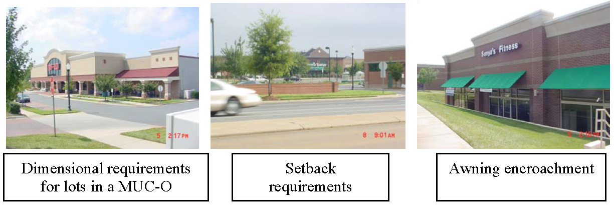
(Ord. No. 2021-05, 6-21-2021)
Sec. 44-430.07. - Building design standards/site standards.
These standards provide building designs that accommodate diversity in style and building materials striving to define a distinct character while maintaining a high quality of development standards. Buildings are oriented to maximize the convenience of pedestrian walkability. These standards further provide development patterns that avoid the excessive linear expansive rooflines of strip plazas.
(1)
Building size. For buildings exceeding an aggregate square footage of 50,000, a planned development special district rezoning is required in accordance with section 44-443. Individual buildings within the MUC-O cannot exceed 65,000 square feet of gross floor area. An exception to building size may be considered, during the rezoning process, for a village center or a planned development special district.
(2)
Street line preservation.
a.
Where a major or minor thoroughfare is planned to be built or widened and initial roadway design and right-of-way locations have been completed and funded in the current state transportation improvement program (STIP), all building setbacks must be measured from the expanded right-of-way for these improvements. All parking, landscape and buffering installations must be located outside of the expanded right-of-way.
b.
Future roads or road improvements that are shown on the urban area transportation plan or the county's thoroughfare plan must be indicated on any subdivision plat, site plan, or zoning authorization permit applications. Buildings, structures, parking, landscape and buffering installations must be located outside the proposed right-of-way or pavement edge of such improvements where these locations are indicated on the urban area transportation plan or the county's thoroughfare plan.
(3)
Type of construction. The following standards must be met for building construction in the MUC-O.
a.
Building front. Ribbed paneling consisting of vinyl or metal as the primary building material or unpainted cinder blocks are prohibited as the building material for the front of a building facing a public right-of-way. Metal and vinyl, of a ribbed-panel design, may be used as accent materials, as part of the façade face comprising no more than 25 percent. For the purposes of this subsection, buildings located on corner lots are only considered to have one front.
b.
Façade(s) visible from a publicly dedicated or private right-of-way. Building façade(s) consisting of ribbed vinyl or metal as the primary building material or unpainted cinder blocks are prohibited as the building material along the portion(s) of the building which are visible from private or public rights-of-way. Metal and vinyl, of a ribbed-panel design, may be used as accent materials, as part of the façade face comprising no more than 25 percent. An exception to allow any building material can be made where a solid vegetative screen exists or is installed which shields that portion of the façade(s) from private or public rights-of-way, as determined by the planning director.
c.
Façade(s) not visible from a publicly dedicated or private right-of-way. Sides not visible from public rights-of-way may use ribbed paneling, painted cinder blocks or other materials.
d.
Roofs. Roofs may be of a standing seam metal material, but ribbed metal is not allowed. Roof colors must be of a neutral tone, such as beige, brown, grey or subtle natural colors such as forest green or black. An exception to the color requirement may be approved by the planning director.
e.
Type of building materials encouraged. Examples of building materials which are encouraged include masonry, wood, fibrocement product such as hardboard, textured vinyl and stucco and other new and innovative materials as they become available in the marketplace. Green roofs and Leadership in Energy and Environmental Design (LEED) construction or equivalent standards are encouraged.
f.
Exemptions. Existing buildings that are listed in the National Register of Historic Places are exempt from these standards where they are in conflict with the Secretary of Interior guidelines.
g.
Building shapes. Building shapes are not restricted as long as they meet all other requirements, including building and fire codes.
(4)
Roof pitch. Roof pitches less than 3/12 and flat roofs will require a parapet wall. An exception to the parapet wall is made for green roof installation covering the surface area suitable for vegetation. A pitched roof must be profiled by eaves a minimum of six inches from the building face or with a gutter. Convenience store canopies cannot have a consistently flat roof. The pitch of the canopy and exterior materials must resemble the roof of the principal structure.
Figure 44-430.07-1. Convenience store canopy with roof form that resembles principal
structure.
(5)
Front facade treatment. Front facades include facades abutting public or private street rights-of-way, excluding rear elevation facades. Architectural elements like windows and doors, bulkheads, masonry piers, transoms, cornice lines, window hoods, awnings, canopies, and other similar details must be used on all facades fronting public or private street rights-of-way. Building wall offsets, including projections, recesses, changes in floor level, must be used in order to: relieve the visual effect of a single, long blank wall. These features are all designed to encourage a pedestrian friendly environment, add variety and provide interest.
a.
For buildings greater than 75,000 square feet, where the front facade including the main entrance is greater than 60 feet in length, at least 33 percent of the length must contain recesses and projections of four feet or more from the primary building line.
b.
The first floor of all building facades, fronting the public or private street rights-of-way, regardless of building size must be designed to complement architectural aesthetics by:
1.
Limiting blank walls to no more than 40 feet in length for buildings 75,000 square feet or less;
2.
Limiting blank walls to no more than 60 feet in length for buildings greater than 75,000 square feet; and
3.
Including glass windows or doors, false window panels/treatments, awning, murals or framed openings comprising at least 20 percent of the wall area.
a.
Roofline offsets should be provided to lend architectural interest and variety to the massing of a building and to relieve the effect of a single, long roof.
b.
Building facades having public access shall be separated at least every 400 feet by either a street or pedestrian amenity such as park benches, gazebos, water features, etc.
c.
Ventilation grates or emergency exit doors at the first floor level in the building facade, which are oriented to any public street, must be decorative.
Figure 44.430.07-2. Pedestrian friendly design features.
(6)
Building entrances.
a.
Customer entrances must include at least three of the features below:
♦
Canopies or porticos;
♦
Roof overhangs;
♦
Recesses/projections;
♦
Arcades;
♦
Raised corniced parapets over the door;
♦
Peaked roof forms;
♦
Arches;
♦
Outdoor patios;
♦
Display windows;
♦
Architectural details such as tile work and moldings which are integrated into the building structure and design; or
♦
Integral planters or wing walls that incorporate landscaped areas and/or places for sitting.
b.
The side and rear of buildings, visible from the right-of-way, must include at least one of the above features listed in (1) above.
(7)
Site appearance. The site design and overall appearance should achieve proportionality and connectivity with adjacent sites to the extent possible while recognizing that individual businesses and uses developed within the corridor are separate and have unique characteristics.
(8)
Underground utilities. All on-site utilities (electrical, telephone, etc.) must be located underground unless technical restrictions exist for doing so. Provisions must be made to significantly reduce the visual blight of any aboveground utilities.
(9)
Paving materials. Permitted paving materials for crosswalks, sidewalks, and similar pedestrian pathways include brick, concrete (aggregate exposed finish), cement pavers, brick pavers or materials that are similar in appearance and durability. Pervious paving materials are encouraged provided that they are similar in appearance and durability to that which is listed above. Breaking pavement patterns is to establish pedestrian spaces, which can be more easily recognized by the motoring public thus increasing a high level of safety for both parties.
(10)
Outside display/storage. Outside display or storage of inorganic product must be screened from any state maintained road in accordance with subsections 44-523(f)(2) and (3). Product can be displayed under a roof overhang area without screening; however, a defined unobstructed walkway of five feet must be maintained along the entire frontage of the building.
(Ord. No. 2021-05, 6-21-2021)
Sec. 44-430.08. - Multifamily residential use and design standards.
(a)
Multifamily development is only allowed as a component of a commercial and/or office mixed-use development. Multifamily development can include apartments, townhomes, rowhouses, or duplexes.
(b)
The multifamily development must be connected by vehicular and pedestrian ways to the mixed use commercial and/or office uses.
(c)
To encourage uniformity along a street, consistent setbacks for residential units apply.
(d)
Front-loaded garages, where constructed for multifamily developments, should be at least ten feet behind the primary plane of the front facade of the residential structure.
(e)
On-street parking for multifamily development is allowed and is encouraged to be located adjacent to public open spaces and parks.
(f)
Sidewalks, for multifamily developments, must be provided on one side of residential streets with a minimum five-foot width.
(Ord. No. 2021-05, 6-21-2021; Ord. No. 2022-15, 9-19-2022)
Sec. 44-430.09. - Driveway connection/access management.
(a)
Driveway connection/access management. The minimum distance between a new driveway and an existing state road intersection must conform to the requirements in table 44-430.09-1 below. Where the NCDOT Policy on Street and Driveway Access to North Carolina Highways conflicts with these regulations, the stricter of the standards applies. The minimum distance between four-way intersections on a corridor road is 1,500 feet.
Table 44-430.09-1. Driveway Connections/Access Management, MUC-0 District
Figure 44-430.09-1. Driveway connections/access management, MUC-O district
(b)
Internal street separation. Internal streets shall be separated by a minimum of 200 feet.
(c)
Off-site traffic improvements. The requirements of subsection 44-446.09(4) apply to the MUC-O district.
(d)
Shared access. The requirements found in subsection 44-446.09(5) apply to the MUC-O district.
(e)
Connected interior driveways/parking. The requirements found in subsection 44-446.09(6) apply to the MUC-O district.
(f)
Channelization. Channelization improvements must be installed where significant turning conflicts are involved with the new development. "Channelization" means the separation of conflicting traffic movements into well-defined paths of travel by traffic islands or significant pavement markings.
(g)
Signalization. Only after all other traffic improvements have been explored may signalizations be installed.
(h)
Street design. All streets, with exception of alleys, must be designed and paved to meet NCDOT standards. Streets can be designated as either public or private. Neighborhood streets must be designed for a maximum 30 mph speed limit.
(i)
Cul-de-sac length. Cul-de-sac street segments (street portion between intersections), designed to be so permanently, shall not be longer than 500 feet to the beginning of the turning point. Exceptions can be made in cases where unusual land configuration, topography or interconnectivity dictates otherwise, as determined by the approval authority.
(j)
Block length. Block lengths cannot exceed 1000 feet. Exceptions can be made in cases where unusual land configuration, topography or interconnectivity dictates otherwise, as determined by the approval authority.
(k)
Curbing. Interior streets must be curbed. The standard two-foot-six-inch curb and gutter section is preferred; however, concrete valley gutter is an allowable type.
(Ord. No. 2021-05, 6-21-2021)
Sec. 44-430.10. - Streetscape landscaping.
(a)
Existing road buffer and interior street landscaping. All public interior streets and development fronting along corridor roads must provide the following along all street frontages:
(1)
A three- to five-foot landscape strip between the curb and sidewalk, subject to NCDOT approval.
(2)
A minimum five-foot wide sidewalk on both sides of street for mixed-use development, subject to section 44-518 and NCDOT approval.
(3)
A ten-foot (minimum) landscape strip behind the right-of-way (within the front setback).
(4)
Street trees must be planted adjacent to the sidewalk and must meet the following.
a.
An average of one shade tree is required for every 40 linear feet of lot frontage on each side of the street, or where overhead lines are present, street trees of low-growing varieties must be planted an average of one tree for every 30 feet of street frontage on each side of the street. Trees should be spaced approximately equal distance.
b.
Each tree, at the time of installation, shall have a clear trunk height of at least five feet and a minimum caliper of two inches. The tree must be a minimum 15-gallon container size or balled and burlapped at time of planting. An appropriate mulch bed must be provided around the tree.
c.
In the absence of overhead lines in the planting area, the shade tree should achieve a mature height of over 20 feet and a mature spread of at least 15 feet.
d.
All trees planted within the right-of-way shall require approval by NCDOT through an encroachment agreement.
(b)
Entranceways. Multitenant, multiparcel or multibuilding developments must install a median-type entranceway at all entrances on major or minor thoroughfares, subject to NCDOT approval. The median must be grassed and landscaped with shrubbery and small decorative trees.
Figure 44-430.10-1. Landscaping, MUC-O district.
(Ord. No. 2021-05, 6-21-2021)
Sec. 44-430.11. - Buffering and screening.
(a)
Residential buffers. When the district directly abuts a residential zoning district, a landscaped buffer meeting the requirements found in subsection 44-523(f) is required.
(b)
Water body buffers. When natural bodies of water are on site, the requirements found in subsection 44-446.10(9) apply.
(c)
Solid waste screening. Solid waste or trash handling areas must be screened from adjacent properties and from public view, including rights-of-way, by an enclosure constructed of materials compatible with the materials on the front building wall of the principal building. All areas must have a solid and closeable gate.
Figure 44-430.11-1. Solid waste screening.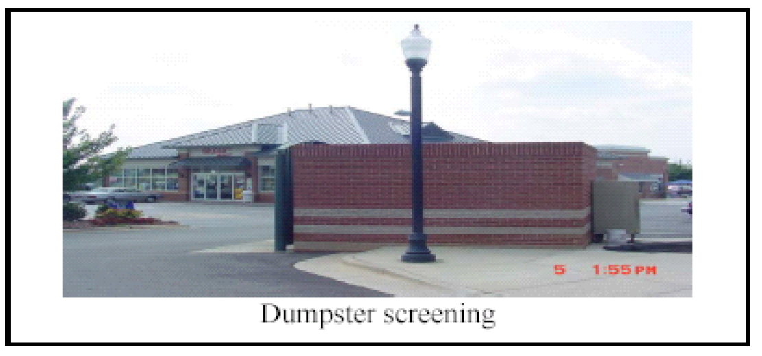
(d)
Mechanical equipment screening. All mechanical equipment, such as air conditioners or pumps, must be screened from view of all streets, public places and neighboring properties, through the use of features such as berms, fences, building walls, false facades, or dense landscaping. Chain link fencing cannot be used. Mechanical equipment on rooftops must be screened from the view of the street with parapets, designed features and other materials compatible with the building and suitable for screening. An exception to the screening requirement is made for photo-voltaic (solar) panels.
(e)
Maintenance area screening. All loading and service areas must be screened to the extent practical from view of all streets and adjoining properties of less intensive use with a buffer meeting the requirements of subsection 44-523(f). If the loading area abuts the perimeter buffering, the loading area is not required to be screened.
(f)
Foundation plantings. The pedestrian entranceway and/or surface parking facilities must be separated from the exterior wall of any principal structure by a landscape buffer. The landscaped buffer strip must be at least five feet in width along the building foundation. An exception to this requirement is allowed where the building square footage exceeds 75,000 and where raised 15-gallon planters containing evergreen shrubs/trees are provided on both sides of all pedestrian ingress and egress locations.
(g)
Construction cleanup, maintenance, and landscaping of disturbed land. During the construction of a project, the requirements found in subsections 44-446-10(a), (b) and (c) apply.
(h)
Parking areas. Parking areas, including perimeter and internal areas, must be landscaped in conformance with subsections 44-523(d) and (e).
Figure 44-430.11-2. Parking design.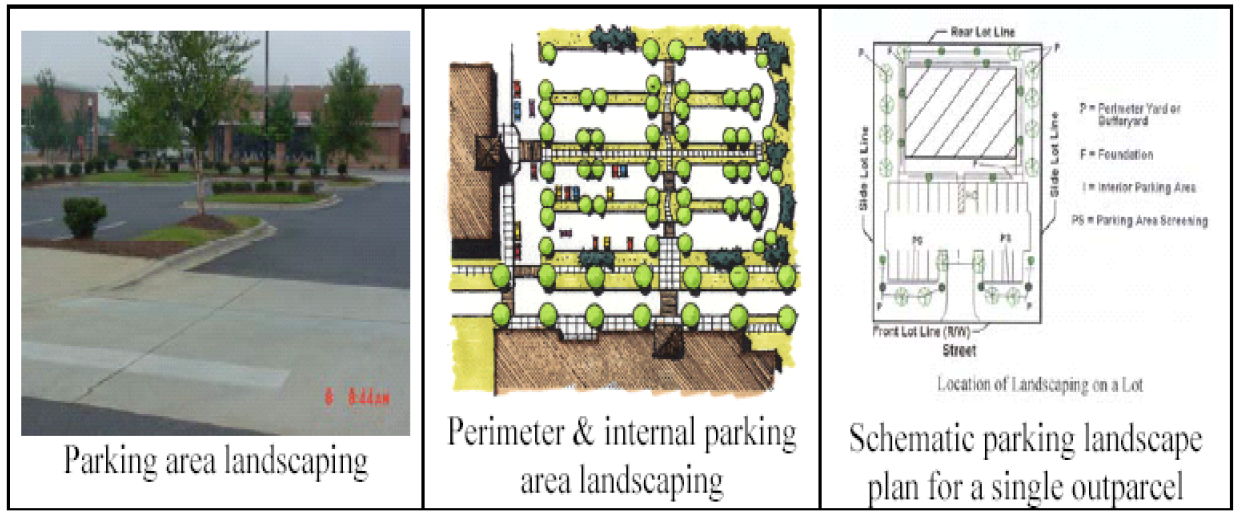
(Ord. No. 2021-05, 6-21-2021)
Sec. 44-430.12. - Parking.
The requirements found in article V, division 5 apply to off-street parking. An exception to the number of parking space requirements may be considered for parking within a planned development special district during the rezoning process based upon documented industry standards or market studies. The following requirements also apply:
(1)
Generally.
a.
Landscaping. Parking is discouraged in the area between the road and the front or side of a principal building or structure. If parking is proposed within this area, the parking area landscaping requirements in subsections 44-523(d) and (e) must be met.
b.
On-street parking permitted. The number of required off-street parking spaces is reduced by the number of on-street parking spaces permitted along the lot frontage of the proposed development.
(2)
Off-street loading. Off-street loading must be screened as provided in section 44-526. No space designated as a required off-street parking space, for the general public, can be used as off-street loading space or maneuvering room for vehicles being loaded or unloaded.
(3)
Interior parking.
a.
When a parking lot is located in front of a building, a pedestrian walkway must connect a customer entrance to the public street.
b.
Shared parking lots can be located in the interior sections of multiple-building developments provided screening, buffering, landscaping, pedestrian amenities and setbacks are followed.
(4)
Connected parking areas. Properties within the MUC-O district shall connect interior parking and driveways. Where adjacent property is vacant, sufficient provisions to connect to the properties shall be submitted.
(5)
Commercial vehicle parking. Only one parked commercial vehicle can be visible from streets.
(6)
Bicycle parking. All nonresidential and multifamily development within the MUC-O shall include an improved area for the purpose of securing bicycles. Bicycle parking facilities should be designed in accordance with the recommendations from the Association of Pedestrian and Bicycle Professionals (APBP) or equivalent standards.
Figure 44-430.12-1. Parking options.
(Ord. No. 2021-05, 6-21-2021)
Sec. 44-430.13. - Pedestrian design.
These standards are designed to provide a unified and well-organized arrangement of buildings, service areas, parking, pedestrian and landscaped common areas (including pocket parks), maximum comfort and convenience of visitors and employees. Commercial buildings are grouped in relation to parking areas such that, after visitors arriving by automobile enter the walkway system, establishments can be visited conveniently with a minimum of conflicts with vehicles. Pedestrian design enhancements are required in order to create an efficient and functional environment as well as promoting a sense of place.
(1)
Pedestrian design requirements. For multitenant/building/parcel projects, the site plan must include provisions for pedestrian-scale amenities, which may include benches, picnic tables, pocket parks, courtyards, plazas, water attractions and trash receptacles. An area must be reserved for pedestrian use and/or open space and be improved and maintained accordingly. Such areas may include covered malls for general pedestrian use, exterior walkways/crosswalks, outdoor seating areas where the facilities are available for common use by employees and visitors. Required buffer areas and setbacks as well as improved deck and roof areas may be used to meet this requirement.
Figure 44-430.13-1. Pedestrian amenities.
(2)
Heavy traffic generators. Convenience stores, fast-food restaurants and similar uses, if provided, must be located so that operations do not block pedestrian or traffic flows in other parts of the development.
(3)
Location of loading zones and maintenance areas. Loading zones where customers pick up goods must be located and arranged to prevent interference with pedestrian movement within the development. Facilities and access routes for shopping center deliveries, servicing, and maintenance must be located and arranged to prevent interference with pedestrian traffic in the center.
(4)
Pedestrian travel. All buildings or building clusters within the development must be connected with linkages other than roads (sidewalks, bikeways and walking paths). When feasible, as determined by the planning director, linkages must be provided between adjacent existing developments and/or continue to the site parcel line to provide access to adjacent future developments. Pedestrian access may be provided at any suitable locations within the district but, where practicable, be separated from vehicular access points in order to reduce congestion, marginal friction and hazards, except where signalization is used in such a manner as to control pedestrian and vehicular movements safely.
(Ord. No. 2021-05, 6-21-2021)
Sec. 44-430.14. - Lighting.
This section provides direction in controlling light spillage and glare so as not to adversely affect motorists, pedestrians, and land uses of adjacent properties. Lighting intensities should be controlled to ensure that light and glare are not directed at adjacent properties, neighboring areas, and motorists. The following general provisions apply:
(1)
Generally.
a.
Light fixtures (not attached to buildings) must be affixed to a pole, which may be of metal, fiberglass, or concrete. Wooden poles are not permitted.
b.
All fixtures must be either semi-cutoff or full cutoff fixtures only.
c.
The maximum height of the light source (light bulb), detached from a building, is 20 feet. An exception to the light height requirement may be considered for light fixtures up to 35 feet within a planned development special district during the rezoning process.
d.
No fixture can be located in close proximity to residentially zoned property which would contribute to light spillage upon the residential property.
(2)
Outdoor illumination of building, landscaping and signs. The following provisions apply to the outdoor illumination of buildings, landscaping and signs:
a.
Floodlights, spotlights or any other similar lighting cannot be used to illuminate buildings or other site features unless they are an integral architectural element that is designated on the development plan. Floodlights or other type of lighting attached to light poles that illuminate the site and/or building(s) are prohibited. When approved, exterior lighting should be integrated with the architectural character of the building.
b.
The unshielded outdoor illumination of any building or landscaping is prohibited. To avoid light spillage, only semi-cutoff, cutoff, or full cutoff fixtures can be used.
c.
Lighting fixtures used to illuminate a sign must either be by directed ground lighting sign or mounted on the top of the sign and be shielded from the sight of passing motorists.
(3)
Lighting for convenience store aprons and canopies. In addition to the provisions of subsections (1) and (2) above, the following provisions apply:
a.
The lighting fixture bulbs must be recessed into a canopy ceiling so that the bottom of the fixture is flush with the ceiling so that light is restrained to no more than 85 degrees from vertical.
b.
As an alternative to recessed ceiling lights, indirect lighting may be used where the light is directed upward and then reflected down from the underside of the canopy. In this case, light fixtures must be shielded so that direct illumination is focused exclusively on the underside of the canopy.
c.
Lights shall not be mounted on the top or sides (facia) of the canopy, and the sides of the canopy cannot be externally illuminated.
d.
The lighting for new facilities (pump islands and under canopies) cannot exceed the average horizontal illumination of ten foot-candles at grade level.
Figure 44-430.14-1. Lighting.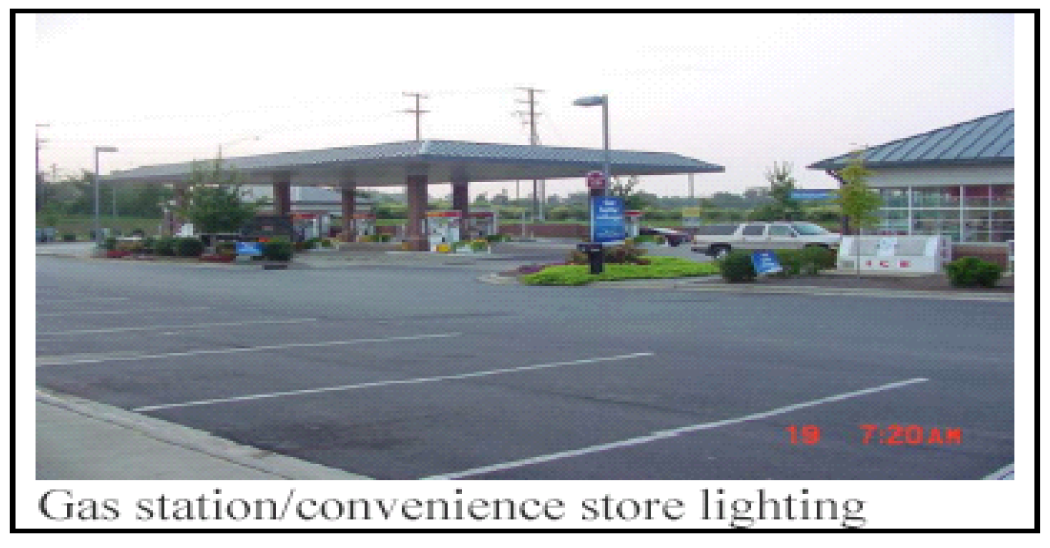
(4)
Prohibited lighting and fixtures. The following are prohibited:
a.
Vertical burn lamps, and similar lighting fixtures.
b.
Canopies and awnings used for building accents which have internal illumination.
c.
Flashing, colored or obtrusive lighting.
d.
The use of laser source light or any similar high intensity light for outdoor advertising or entertainment.
e.
The operation of searchlights for advertising purposes.
f.
Black lights and neon lights (including argon and similar rare gas fixtures), except for signage.
(Ord. No. 2021-05, 6-21-2021)
Sec. 44-430.15. - Signs.
The following requirements apply to all signage.
(1)
Generally. All signs delineated on a detailed site plan must conform to the requirements in article V, division 7, except where the requirements included in this subsection are more restrictive. The following also apply:
a.
No freestanding on-site sign larger than six square feet may be located closer than 100 feet from another similar or larger sign.
b.
No signs may be placed within any sight triangle, as that term is defined by article V, division 7 of the County Code.
c.
No signs can be located in any street right-of-way. Signs may be placed in the landscaped buffer areas.
d.
An exception to the standards in subsections (2)a and b below may be considered for signs within a planned development special district during the rezoning process.
(2)
Permitted signs. The following signs are permitted:
a.
One freestanding sign, having no more than two sign surface areas, may be erected. The signs may not exceed 50 square feet per side for back-to-back signs and may not be over 16 feet in height.
b.
Wall signs are permitted subject to section 44-562.
c.
In addition to one freestanding sign, one static fascia canopy sign is permitted on each side visible from the public right-of-way. Each canopy sign may have a maximum area equal to 25 percent of the canopy fascia surface, up to a maximum height of two feet.
(3)
Prohibited permanent signs. The following are prohibited as permanent signs, but they may be displayed to coincide with a grand opening or other special event. A property may not display one or more such signs for a continuous period of more than 30 days, and a property may not display one or more such signs for more than 45 days during any calendar year:
a.
Portable signs.
b.
Roof signs.
c.
Mechanical movement signs.
d.
Posters, streamers, or similar devices used to attract attention to the site, advertise a product or communicate a message.
e.
Windblown signs (banners, balloons, streamers, etc.).
Figure 44-430.15-1. Signs.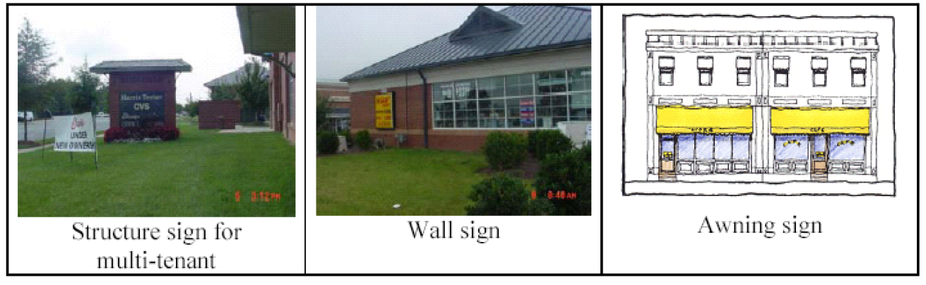
(Ord. No. 2021-05, 6-21-2021)
Sec. 44-432. - Doublewide manufactured home (DWMH-O).
Purpose: This section establishes a class A doublewide or multi-section overlay district to provide opportunities for the sitting of affordable housing, implement small area plan policies regarding the location of manufactured homes and to comply with the requirements of G.S. 160D-910.
Class A doublewide/multisection manufactured homes are subject to the requirements of this section. All class A doublewide and multisection manufactured homes must meet the following appearance criteria:
(1)
Length-width ratio. The main portion of the building must have a length not exceeding four times the building width.
(2)
Roof construction and pitch. The pitch of the main roof of the building must have a minimum rise of two and one-half feet for each 12 feet of horizontal run. The roof must be finished with a type of shingle that is commonly used in standard residential construction or standing seam painted metal. A retrofitted standing seam roof or shingle roof must be designed by a professional engineer and must be made a part of the load-bearing walls of the existing structure.
(3)
Exterior finish. The exterior siding must consist predominantly of vinyl or aluminum lap siding (whose reflectivity does not exceed that of flat white paint), wood or hardboard, comparable in composition, appearance and durability to the exterior siding commonly used in standard residential construction.
(4)
Placement of homes. Dwelling units must be sited with the front running parallel to the street providing access to the site. On corner lots the property owner may chose which frontage to face the home. On culs-de-sac, the dwelling unit must be sited with the front of the home being parallel to the street access.
(5)
Tongue removal. The towing tongue must be removed upon final placement of the unit.
(6)
Underskirting and permanent steps. Underskirting and permanent steps must be provided as follows:
a.
Class A manufactured homes in overlay districts must be permanently placed on a brick, concrete block or other masonry foundation. The foundation must be continuous and unpierced except for ventilation as required by the state regulations for manufactured/mobile homes.
b.
All doublewide and multisection manufactured homes which are placed on rental lots, where the home and lot are in separate ownership, must have the entire perimeter of each home enclosed from the ground to the bottom of the structure with material manufactured for this purpose in accordance with standards set by the state regulations for manufactured/mobile homes. Examples of commonly recognized building materials suitable for use as underpinning include, but are not limited to, the following list: brick masonry, concrete block masonry; natural or synthetic stone masonry; or vinyl. Assemblies, products and materials manufactured expressly for the purpose of underpinning must be installed in accordance with the manufacturers' specifications.
c.
All doublewide and multisection manufactured homes must have either a deck or porch with steps. This structure must be located in front of the home. The deck or porch must be a minimum of 36 square feet. All steps, decks, porches and entrances must be installed and constructed in accordance with the standards set by the state regulations for manufactured/mobile homes or, when applicable, the building code.
(Ord. No. 2021-05, 6-21-2021)
Sec. 44-433. - Mountain protection (MP-O).
Purpose:
♦
Mountains are the predominant natural landmarks in the county. These land forms provide identification and orientation to residents and visitors alike. Rising as they do abruptly from the surrounding piedmont landscape, they are readily identifiable symbols of the county.
♦
Their steep slopes, profuse vegetation, erodible soils, and poor soil percolation characteristics pose severe problems for development. Normal development techniques, following the ordinary development regulations in this chapter, the subdivision regulations and related regulations, are likely to endanger the native flora and fauna on the mountains, cause severe disruptions adjacent to and downstream from the mountains, impair the physical integrity of the mountains' surface and impinge adversely upon their landmark status.
♦
The intent of the mountain protection district (MP-O) regulations is to avoid these hazards, while preserving the unique status which the mountains hold in the county and permitting reasonable continuing use to be made of the land within the MP-O.
♦
Architectural guidelines help reduce the visual prominence of buildings on the mountain sides so that the natural character of the mountains are still apparent.
(a)
Plan consistency. This district implements the mountain area protection policies of the Balls Creek, Sherrills Ford and Mountain View small area plans.
(b)
Boundaries. The boundaries of the MP-O district are defined as the land area above the 1,100-foot contour on Baker Mountain and Anderson Mountain as identified on the U.S.C. topographic maps.
(c)
Permitted uses. The following uses are permitted by right within the MP-O, except in areas where the underlying district prohibits these uses:
(1)
Hobby farms.
(2)
Dwelling units, single-family or two-family.
(3)
Home occupations.
(4)
Customary accessory uses.
(5)
Public parks.
(d)
Prohibited uses. Manufactured homes are prohibited in the MP-O district.
(e)
Average density. The average density allowed in the MP-O district is one unit per two acres. To minimize impacts to environmentally sensitive areas, cluster subdivision designs are strongly encouraged. Under the cluster subdivision design, density from higher slope categories would be transferred to the least sensitive and lower slope category on the tract. Cluster subdivisions are subject to the standards in section 44-544.
(f)
Development standards. In addition to the subdivision standards in article V, the design of developments in the MP-O district must incorporate the following:
(1)
A contour map which includes a scale and contour interval on the site plan to determine the average slope of the tract of land in its natural state and the proposed road network and lots;
(2)
The preservation and minimization of impacts to naturally significant sites when feasible;
(3)
The preservation of significant existing trees and other significant existing vegetation on the site. Nothing prohibits the clearing of vegetation for firebreaks within developments in the MP-O;
(4)
The integration with and preservation of existing site topography, including, but not limited to, such characteristics as steep slopes, existing drainage features, rock outcroppings, ridgelines and scenic topographic features;
(5)
The preservation of significant habitat areas, as identified in Catawba County's Natural Heritage Inventory, where practically feasible;
(6)
If the development abuts a publicly owned natural area or conserved land, the project must be compatible with the management of the natural area or conserved land. In order to achieve this, the development plan must include measures, such as increased setbacks or open space, to provide a transition between the development and the publicly owned natural area or conservation land; and
(7)
Good grading design for safety and aesthetics must, unless impractical as determined by the subdivision review board, include the following:
a.
Roadways follow natural contours instead of being cut through landforms.
b.
Utilization of landform or contour measures to produce cut-and-fill slopes compatible with the existing land character. Continuous unbroken graded slope surfaces that are visible from offsite are discouraged.
c.
Graded slopes contoured by varying slope increments.
d.
Varied housing pad elevations above street level to avoid appearance of monotonous, flat, level pads.
e.
Single-loaded streets (streets with lots and building pads on one side only) are encouraged on steep terrain so grading can be reduced.
f.
Building envelopes shall be noted on the subdivision plat for both horizontal and vertical boundaries for future construction. Also the limits for clearing of vegetation within this building envelope shall be noted.
(g)
Residential designs standards. The following design standards apply to all new residential development in the MP-O in order to maintain the natural, rural aesthetic characteristics of the area:
(1)
Structures should be designed to conform to and be built into the natural terrain and not be located at the crest of a ridge. Different types of foundations, such as pier and beam, step or slab are encouraged to limit excavation and filling.
(2)
Exterior lighting on individual lots must be muted, fully shielded and directed to avoid illuminating entire structures, creating glare on the night sky, and attracting attention to particular areas for reasons other than security.
(3)
The maximum permitted height of structures is 30 feet above the average finished grade elevation adjacent to the structure. The average finished grade elevation is calculated by summing the height of the structure at the point of the highest adjacent grade and at the point of the lowest adjacent grade and dividing by two.
(4)
Disturbance of natural vegetation around any building footprint is limited to 30 feet, unless practical reasons necessitate additional clearing, such as for a septic tank drainfield. This separation allows for a defensible space for minimizing the risk of wildfire damage to the structure.
(5)
The use of fire "smart" vegetation species and techniques, as identified by the state forest service, is encouraged for use in the residential landscape to minimize the vulnerability of the structure to fire.
(Ord. No. 2021-05, 6-21-2021)
Sec. 44-434. - Watershed protection district (WP-O).
Purpose:
♦
Surface waters of the state and county are a precious but delicate natural resource. They are life sustaining for humans, animals, and vegetation both directly and as a source of recharge for the underground aquifers. They provide an essential link in almost all natural processes, provide opportunities for recreation and refreshment, supply industrial needs for process and cooling water, generate power, and contribute immeasurably to scenic beauty.
♦
Most important, surface waters provide raw water for domestic consumption and fire protection to scores of communities in the state, including several in the county and its surrounding jurisdictions.
♦
For the protection of the public health, safety, and general welfare, it is essential that the integrity of these surface waters be protected from pollution, so that the well-being of present and future residents and visitors to the county and surrounding jurisdictions be assured, the costs of furnishing potable water be minimized, and the quality and quantity of surface water be protected.
♦
The intent of the watershed protection district (WP-O) is to provide regulations, which, will limit the exposure of watersheds, under the jurisdiction of the county and used as sources of supply for public water systems, to pollution. The sources of such pollution include leachate from septic tank nitrification fields; stormwater runoff; accidental spillage from residential, commercial and industrial operations.
♦
These occurrences can contribute biological contamination, turbidity from soil erosion and sedimentation, nutrient enhancement, and heavy metal pollution, all of which endanger the water supplies of communities dependent on these watersheds for life-giving and life-sustaining water.
♦
This section is enacted pursuant to G.S. § 153A-121 and § 143-211 through 143-215.741.
(Ord. No. 2021-05, 6-21-2021; Ord. No. 2022-09, 5-16-2022)
Sec. 44-434.01. - Boundaries.
(a)
The boundaries of the watershed protection district (WP-O) encompassing the watersheds within the county's jurisdiction are shown as overlay districts on the official zoning map and are adopted as part of this chapter. Where watershed boundaries follow topographic boundaries and the official zoning map does not accurately represent the actual topographic boundary, a surveyed plat prepared by a registered land surveyor may be submitted to the county as evidence that one or more properties along these boundaries does not lie within the watershed area.
(b)
The watershed protection overlay district shall, as appropriate, impose greater restrictions, require higher development standards, prohibit certain uses and require additional approvals as stated in this section.
(Ord. No. 2021-05, 6-21-2021; Ord. No. 2022-09, 5-16-2022)
Sec. 44-434.02. - Existing development and exceptions to applicability.
(a)
Existing development, as defined in this section, is exempt from the requirements of the watershed protection district. The term existing development is defined as those projects that are built or those projects that at a minimum have established a vested right under state law as of the effective date of this section (January 1, 1994) based on at least one of the following criteria:
(1)
Having expended substantial resources (time, labor, money) based on a good faith reliance upon having received a valid local government approval to proceed with the project;
(2)
Having an outstanding valid building permit as authorized by G.S. § 153A-344.1; or
(3)
Having an approved site-specific or phased development plan as authorized by G.S. § 153A-344.1.
(b)
Reserved.
(c)
Expansions to structures, other than single-family, classified as existing development must meet the requirements of this section; however, the built-upon area of the existing development is not required to be included in the density calculations.
(d)
Any existing nonresidential or multi-family (three or more dwelling units) structure or built-upon area not in conformance with the density or built-upon restrictions of this section that has been damaged or removed may be repaired and/or reconstructed provided it meets the following conditions:
(1)
The repair or reconstruction is in compliance with article VII, nonconformities.
(2)
Repair or reconstruction is initiated within 12 months and completed within two years of such damage; and
(3)
The total amount of built-upon area may be increased according to the built-upon restrictions as allowed for existing development.
(e)
Uses existing on January 1, 1994, but which would not be permitted to be established in the watershed protection district in which they are located, may continue subject to article VII, nonconformities, except as follows:
(1)
When such nonconforming use of land has been changed to an allowed use, it cannot revert to any prohibited use.
(2)
Expansions may be allowed subject to the built-upon restrictions as allowed for existing development.
(f)
If the requirements of this section conflict with other portions of this chapter, the more restrictive of each particular item apply.
(g)
Exclusions and exceptions to the rules described in Chapter 2B of Title 15A of the North Carolina Administrative Code, as amended, shall also be exclusions and exceptions to the requirements of the Watershed Protection District.
(Ord. No. 2021-05, 6-21-2021; Ord. No. 2022-09, 5-16-2022)
Sec. 44-434.03. - Definitions.
The definitions found in this section apply specifically to this section and are intended to supplement the definitions found in the appendix. The following words, terms and phrases, when used in this section, shall have the meanings ascribed to them in this section, except where the context clearly indicates a different meaning:
Balance of watershed (BW). The area adjoining and upstream of the critical area in a WS-II and WS-III water supply watershed. The "balance of watershed" is comprised of the entire land area contributing surface drainage to the stream, river, or reservoir where a water supply intake is located.
Best management practices (BMP). A structural or nonstructural management-based practice used singularly or in combination to reduce nonpoint source inputs to receiving waters in order to achieve water quality protection goals.
Buffer (watershed only). An area of natural or planted vegetation through which stormwater runoff flows in a diffuse manner so that the runoff does not become channelized and which provides for infiltration of the runoff and filtering of pollutants. The buffer is measured landward from the normal pool elevation of impounded structures and from the bank of each side of streams or rivers.
Built-upon area. Includes that portion of a development project that is covered by impervious (does not allow water to infiltrate from surface to subsurface) or partially impervious cover, including buildings, pavement, gravel areas (such as roads, parking lots, and paths), recreation facilities (such as tennis courts). Note: Wooden slatted decks and the water area of a swimming pool are considered pervious.
Cluster development. The grouping of buildings in order to conserve land resources and provide for innovation in the design of the project including minimizing stormwater runoff impacts. This term includes nonresidential development as well as single-family residential subdivisions and multi-family developments. For purposes of this chapter, planned unit developments and mixed use developments are considered cluster developments.
Critical area. The area adjacent to a water supply intake or reservoir where risk associated with pollution is greater than from the remaining portions of the watershed. The critical area is defined as extending either one-half mile from the normal pool elevation of the reservoir in which the intake is located or to the ridge line of the watershed (whichever comes first); or one-half mile upstream from the intake located directly in the stream or river (run-of-the-river), or the ridge line of the watershed (whichever comes first). Local governments may extend the critical area as needed. Major landmarks such as highways or property lines may be used to delineate the outer boundary of the critical area if these landmarks are immediately adjacent to the appropriate outer boundary of one-half mile.
Existing lot of record. A lot which is part of a subdivision, a plat of which has been recorded in the office of the register of deeds prior to January 1, 1994, in accordance with the subdivision regulations in effect at the time of recordation, or a lot described by metes and bounds, the description of which has been so recorded prior to July 31, 1982.
Landfill (discharging). A facility for the disposal of solid waste on land in a sanitary manner in accordance with G.S. ch. 130A, art. 9. For the purpose of this section, this term does not include composting facilities.
Nonresidential development. All development other than residential development, agriculture and forestry.
Protected area (PA). The area adjoining and upstream of the critical area of WS-IV watersheds. The boundaries of the protected area are defined as within five miles upstream of and draining to the normal pool elevation of the reservoir or to the ridgeline of the watershed, whichever comes first; or within ten miles of and draining to a water intake located in a stream or river or to the ridgeline of the watershed, whichever comes first.
Registered professional. Professional engineers, landscape architects to the extent that G.S. ch. 89A allows, and land surveyors to the extent that the design represents incidental drainage within a subdivision, as provided by G.S. § 89C-3(7).
Residential development. Buildings for residence, such as attached and detached single-family dwellings, apartment complexes, condominiums, townhouses, cottages, and their associated outbuildings, such as garages, storage buildings, gazebos, and customary home occupations.
Single-family residential. Any development where no building contains more than one dwelling unit, every dwelling unit is on a separate lot, and where no lot contains more than one dwelling unit except for approved accessory dwelling units.
Stormwater control measure (SCM). A permanent structural device, including any vegetated conveyance, that is designed, constructed, and maintained to remove pollutants from stormwater runoff by promoting settling or filtration; or to mimic the natural hydrologic cycle by promoting infiltration, evapo-transpiration, post-filtration discharge, reuse of stormwater or a combination thereof.
Surface waters. All waters of the state as defined in G.S. § 143-212 except underground waters.
Toxic substance. Any substance or combination of substances, including disease-causing agents, which, after discharge and upon exposure, ingestion, inhalation, or assimilation into any organism, either directly from the environment or indirectly by ingestion through food chains, has the potential to cause death, disease, behavioral abnormalities, cancer, genetic mutations, physiological malfunctions including malfunctions or suppression in reproduction or growth, or physical deformities in such organisms or their offspring or cause other adverse health effects.
Variance, major. A variance that results in any one or more of the following:
•
The relaxation, by a factor of more than ten percent, of any management requirement under the low density option; or
•
The relaxation, by a factor of more than five percent, of the buffer, density or built-upon area requirement under the high-density option; or
•
Any variation in the design, maintenance or operation requirements of a wet detention pond or other approved stormwater management system.
Variance, minor. A variance that does not qualify as a major variance.
Water dependent structure. Any structure for which the use requires access to or proximity to or situated within surface waters to fulfill its basic purpose, such as boat ramps, boathouses, docks and bulkheads. Ancillary facilities, such as restaurants, outlets for boat supplies, parking lots and commercial boat storage areas, are not water dependent structures.
Watershed. The entire land area contributing surface drainage to a specific point, such as the water supply intake or alternatively, the geographic region within which water drains to a particular river, stream or body of water.
(Ord. No. 2021-05, 6-21-2021; Ord. No. 2022-09, 5-16-2022)
Sec. 44-434.04. - WS-II watershed area—Critical area (WS-II-CA).
In order to maintain a low-intensity land use development pattern, single-family residential uses are allowed on a lot with a minimum area of 80,000 square feet. All other residential and nonresidential development are allowed at a maximum six percent built-upon area. Stormwater runoff from the development shall be transported by vegetated conveyances to the maximum extent practicable. New residuals application sites and landfills are specifically prohibited.
(1)
Density and built-upon limits.
a.
For single-family residential development, the minimum lot area shall not be less than 80,000 square feet, except when approved as a cluster subdivision according to section 44-544.
b.
All other residential and nonresidential development cannot exceed six percent built-upon area on a project-by-project basis. For the purpose of calculating the built-upon area, total project area includes acreage in the tract on which the project is to be developed.
(2)
Uses allowed. The following uses are permitted:
a.
Agriculture, subject to the provisions of the Food Security Act of 1985 and the Food, Agriculture, Conservation and Trade Act of 1990 and all rules and regulations of the soil and water conservation commission.
b.
Forestry, subject to the provisions of the Forest Practices Guideline Related to Water Quality (15A NCAC 1I.0101-.0209). The division of forest resources is the designated management agency responsible for implementing this subsection.
c.
Residential development.
d.
Nonresidential development, excluding landfills and sites for land application of residuals or petroleum-contaminated soils.
(Ord. No. 2021-05, 6-21-2021; Ord. No. 2022-09, 5-16-2022)
Sec. 44-434.05. - WS-II watershed area—Balance of watershed (WS-II-BW).
In order to maintain a low intensity land use development pattern, single-family residential uses are allowed on a lot with a minimum area of 40,000 square feet. All other residential and nonresidential development are allowed at a maximum of 12 percent built-upon area; in addition, nonresidential uses may occupy ten percent of the balance of watershed area outside the critical area, with a 70 percent built-upon area when approved as a 10/70 bonus permit according to section 44-434.10. Stormwater runoff from the development shall be transported by vegetated conveyances to the maximum extent practicable.
(1)
Density and built-upon limits. Density and built-upon limits are as follows:
a.
For single-family residential development, the minimum lot area is at least 40,000 square feet, except when approved as a cluster subdivision according to section 44-544.
b.
All other residential and nonresidential development cannot exceed 12 percent built-upon area on a project-by-project basis, except that up to ten percent of the balance of watershed may be developed for nonresidential uses to 70 percent built-upon area on a project-by-project basis subject to approval of a 10/70 bonus permit according to section 44-434.10. For the purposes of calculating the built-upon area, total project area includes acreage in the tract on which the project is to be developed.
(2)
Uses allowed. The following uses are permitted:
a.
Agriculture, subject to the provisions of the Food Security Act of 1985 and the Food, Agricultural, Conservation and Trade Act of 1990;
b.
Forestry, subject to the provisions of the Forest Practices Guidelines Related to Water Quality (15A NCAC 1I.0101-.0209). The division of forest resources is the designated management agency responsible for implementing this subsection;
c.
Residential development; and
d.
Nonresidential development excluding discharging landfills.
(Ord. No. 2021-05, 6-21-2021; Ord. No. 2022-09, 5-16-2022)
Sec. 44-434.06. - WS-III watershed area—Critical area (WS-III-CA).
In order to maintain a low to moderate land use intensity pattern, single-family residential uses are allowed on a lot with a minimum area of 40,000 square feet. All other residential and nonresidential development is permitted at a maximum of 12 percent built-upon area. Stormwater runoff from the development shall be transported by vegetated conveyances to the maximum extent practicable. New residuals application sites and landfills are specifically prohibited.
(1)
Density and built-upon limits. Density and built-upon limits are as follows:
a.
For single-family residential development, the minimum lot area is at least 40,000 square feet, except when approved as a cluster subdivision according to section 44-544.
b.
All other residential and nonresidential development cannot exceed 12 percent built-upon area on a project-by-project basis. For the purpose of calculating the built-upon area, total project area includes acreage in the tract on which the project is to be developed.
(2)
Uses allowed. The following uses are permitted:
a.
Agriculture, subject to the provisions of the Food Security Act of 1985 and the Food, Agriculture, Conservation and Trade Act of 1990 and all rules and regulations of the soil and water conservation commission.
b.
Forestry, subject to the provisions of the Forest Practices Guideline Related to Water Quality (15A NCAC 1I.0101-.0209). The division of forest resources is the designated management agency responsible for implementing this subsection.
c.
Residential development.
d.
Nonresidential development, excluding landfills and sites for land application of residuals or petroleum-contaminated soils.
(Ord. No. 2021-05, 6-21-2021; Ord. No. 2022-09, 5-16-2022)
Sec. 44-434.07. - WS-III watershed area—Balance of watershed (WS-III-BW).
In order to maintain a low to moderate land use intensity pattern, single-family residential uses are allowed on lots with a minimum area of 20,000 square feet. All other residential and nonresidential development are allowed a maximum of 24 percent built-upon area. In addition, nonresidential uses may occupy ten percent of the balance of watershed area outside the critical area, with a 70 percent built-upon area when approved as a 10/70 bonus permit according section 44-434.10. Stormwater runoff from the development shall be transported by vegetated conveyances to the maximum extent practicable.
(1)
Density and built-upon limits. Density and built-upon limits are as follows:
a.
For single-family residential development, the minimum lot area must be at least 20,000 square feet, except when approved as a cluster subdivision according to section 44-544.
b.
All other residential and nonresidential development cannot exceed 24 percent built-upon area on a project-by-project basis, except that up to ten percent of the balance of watershed area may be developed for nonresidential uses to 70 percent built-upon area on a project-by-project basis subject to approval of a 10/70 bonus permit according to section 44-434.10. For the purposes of calculating the built-upon area, total project area must include acreage in the tract on which the project is to be developed.
(2)
Uses permitted. The following uses are permitted:
a.
Agriculture, subject to the provisions of the Food Security Act of 1985 and the Food, Agricultural, Conservation and Trade Act of 1990.
b.
Forestry, subject to the provisions of the Forest Practices Guidelines Related to Water Quality (15A NCAC 1I.0101-.0209). The division of forest resources is the designated management agency responsible for implementing this subsection.
c.
Residential development.
d.
Nonresidential development excluding discharging landfills.
(Ord. No. 2021-05, 6-21-2021; Ord. No. 2022-09, 5-16-2022)
Sec. 44-434.08. - WS-IV watershed area—Critical area (WS-IV-CA).
Only new development activities that require an erosion/sedimentation control plan under state law are required to meet the requirements of this section when located in the WS-IV watershed. Written verification of project exemption must be submitted from the entity responsible for enforcement of the erosion/sedimentation program. In order to address a moderate to high land use intensity pattern, single-family residential uses are allowed on a lot with a minimum area of 20,000 square feet. All other residential and nonresidential development is allowed 24 percent built-upon area. Stormwater runoff from the development shall be transported by vegetated conveyances to the maximum extent practicable. New residuals application sites and landfills are specifically prohibited.
(1)
Density and built-upon limits. Density and built-upon limits are as follows:
a.
For single-family residential development, the minimum lot area must be at least 20,000 square feet, except when approved as a cluster subdivision according to section 44-544.
b.
All other residential and nonresidential development cannot exceed 24 percent built-upon area on a project-by-project basis. For the purpose of calculating the built-upon area, total project area includes acreage in the tract on which the project is to be developed.
(2)
Uses permitted. The following uses are permitted:
a.
Agriculture, subject to the provisions of the Food Security Act of 1985 and the Food, Agriculture, Conservation and Trade Act of 1990 and all rules and regulations of the soil and water conservation commission.
b.
Forestry, subject to the provisions of the Forest Practices Guideline Related to Water Quality (15A NCAC 1I.0101-.0209). The division of forest resources is the designated management agency responsible for implementing this subsection.
c.
Residential development.
d.
Nonresidential development, excluding landfills and sites for land application of residuals or petroleum-contaminated soils.
(Ord. No. 2021-05, 6-21-2021; Ord. No. 2022-09, 5-16-2022)
Sec. 44-434.09. - WS-IV watershed area—Protected area (WS-W-PA).
Only new development activities that require an erosion/sedimentation control plan under state law are required to meet the requirements of this Section when located in a WS-IV watershed. Written verification of project exemption must be submitted from the entity responsible for enforcement of the erosion/sedimentation program. In order to address a moderate to high land use intensity pattern, single-family residential uses are allowed on a lot with a minimum area of 20,000 square feet without public water or sewer or 15,000 square feet with public water or sewer where a curb and gutter street system is not installed. All other residential and nonresidential development are allowed at a maximum of 24 percent built-upon area if a curb and gutter system is installed or 36 percent built-upon area if a curb and gutter system is not installed. Stormwater runoff from the development shall be transported by vegetated conveyances to the maximum extent practicable.
(1)
Density and built-upon limits. Density and built-upon limits are as follows:
a.
For single-family residential development, the minimum lot area must be at least 20,000 square feet without public water or sewer or 15,000 square feet with public water or sewer where a curb and gutter street system is not installed. An exception to these requirements is when a cluster subdivision is approved according to section 44-544.
b.
All other residential and nonresidential development cannot exceed 24 percent built-upon area if a curb and gutter system is installed or 36 percent built-upon area if a curb and gutter system is not installed. For the purpose of calculating the built-upon area, total project area includes acreage in the tract on which the project is to be developed.
(2)
Uses permitted. The following uses are permitted:
a.
Agriculture, subject to the provisions of the Food Security Act of 1985 and the Food, Agricultural, Conservation and Trade Act of 1990.
b.
Forestry, subject to the provisions of the Forest Practices Guidelines Related to Water Quality (15A NCAC 1I.0101-.0209). The division of forest resources is the designated management agency responsible for implementing this subsection.
c.
Residential development.
d.
Nonresidential development.
(Ord. No. 2021-05, 6-21-2021; Ord. No. 2022-09, 5-16-2022)
Sec. 44-434.10. - 10/70 bonus permit.
(a)
In addition to the nonresidential built-upon restrictions for the balance of WS-II and WS-III watersheds as stated in sections 44-434.05 and 44-434.07, nonresidential uses may occupy no more than ten percent of the balance of each WS-II and WS-III watershed outside the critical area, with a maximum 70 percent built-upon area when approved as a 10/70 bonus permit. The 10/70 bonus permit must be considered as a special use permit that must be reviewed by the board of adjustment and is subject to all rules and procedures as established in article III. Requests for a 10/70 bonus permit will be considered in order of receipt of completed applications. A 10/70 bonus permit is valid for two years, and if the development has not begun within that time period the permit shall expire. Reapplication cannot be made for a period of 12 months following the date the permit expired.
(b)
In reviewing an application for a 10/70 bonus permit, the board of adjustment shall make the findings of fact as stated in subsection 44-332. In addition, the board of adjustment shall consider whether the property can be developed as proposed according to any or all of the following pertinent factors:
(1)
Whether the proposal is in conformance with the county's current land use plan.
(2)
Whether the development is in coordination with the county's thoroughfare plan and urban area transportation plan.
(3)
The feasibility of the proposed development based on site-specific factors, such as but not limited to soil type; topography; distance to public utilities, such as water, sewer and gas lines; and road access.
(4)
Projects must minimize built-upon surface area and direct stormwater runoff away from surface waters. Stormwater runoff from the development shall be transported by vegetated conveyances to the maximum extent practicable.
(c)
Where developments are approved under a 10/70 bonus permit, a 100-foot wide vegetative buffer is required for new development along all perennial waters indicated on the most recent version of USGS 1: 24,000 (7.5 minute) scale topographic maps or as determined by local government studies.
(Ord. No. 2021-05, 6-21-2021; Ord. No. 2022-09, 5-16-2022)
Sec. 44-434.11. - Watershed cluster development.
Clustering of development is permitted in all watershed areas under the following conditions:
(1)
Minimum lot sizes are not applicable to single-family watershed cluster development projects; however, the overall density of the project must meet the associated density as required in sections 44-434.04 through 44-434-09.
(2)
Built-upon area of projects shall not exceed that allowed for the applicable critical area or protected area/balance of the watershed as required in sections 44-434.04 through 44-434-09.
(3)
All built-upon areas shall be designed and located to minimize stormwater runoff impact to the receiving waters and minimize concentrated stormwater flow.
(4)
The remainder of the tract must remain in a vegetated or natural state. The title to the open space must be conveyed to an incorporated homeowners' association for management, to a local government for preservation as a park or open space, or to a conservation organization for preservation in a permanent easement.
(Ord. No. 2021-05, 6-21-2021; Ord. No. 2022-09, 5-16-2022)
Sec. 44-434.12. - Buffer area required.
(a)
In the watershed protection overlay (WP-O), a minimum 30-foot wide vegetative buffer is required for all new development along all perennial waters indicated on the most recent version of USGS 1:24,000 (7.5 minute) scale topographic maps or as determined by local government studies. Developments approved under the high-density option, including the 10/70 bonus permit, are required to maintain a 100-foot wide vegetative buffer.
(b)
No new development which requires a zoning authorization permit is allowed in the buffer except for water-dependent structures and public projects, such as road crossings, railroad rights-of-way and the like, where no practical alternative exists. These activities should minimize built-upon surface area, direct runoff away from the surface waters and maximize the utilization of stormwater best management practices. Desirable artificial streambank or shoreline stabilization is permitted.
(Ord. No. 2021-05, 6-21-2021; Ord. No. 2022-09, 5-16-2022)
Sec. 44-434.13. - Administration.
(a)
Administration of this section shall be as provided under article III. Zoning authorization permits shall be issued for development in the watershed protection overlay (WP-O) as prescribed in article III. In addition to the general information required for a zoning authorization permit, the following must be submitted on detailed site plans, as applicable:
(1)
The square footage and percent of built-upon area for nonresidential and residential development excluding single-family. The area required to remain as non-developable land must be noted on the detailed site plan.
(2)
The location of all perennial streams and natural drainage areas on the property.
(3)
The location and landscaping proposed for all required buffer areas.
(b)
The planning director administers the stormwater programs and shall have the following powers and duties:
(1)
To review and approve or disapprove applications for approval of plans pursuant to this article.
(2)
To make determinations and render interpretations of this article.
(3)
To review and approve applications.
(4)
To enforce the provisions of this article in accordance with the enforcement provisions.
(5)
To designate appropriate other person(s) who shall carry out the powers and duties of stormwater administrator.
(c)
The county may make amendments to this section as provided by this chapter. Under no circumstances shall the county adopt such amendments that would cause this section to violate the watershed protection rules as adopted by the state environmental management commission. The planning director shall keep records of all amendments to the water supply watershed regulations and shall provide copies of all amendments, upon adoption, to the state division of water quality.
(d)
The planning director shall keep a record of variances to the local watershed protection district. This record shall be submitted, for the calendar year, to the state department of environmental quality, water resources section on or before January 1 of the following year and shall provide a description of each project receiving a variance and the reasons for granting the variance.
(e)
The planning director shall keep records of the county's utilization of the provision that a maximum of ten percent of the noncritical area of WS-II-BW and WS-III-BW watersheds may be developed with nonresidential development to a maximum of 70 percent built-upon surface area. Records for each watershed shall include the total acres of noncritical watershed area, total acres eligible to be developed under this option, total acres approved for this development option and individual file records for each development that is approved in these areas.
(Ord. No. 2021-05, 6-21-2021; Ord. No. 2022-09, 5-16-2022)
Sec. 44-434.14. - Variances.
(a)
The board of adjustment may authorize, in specific cases, minor variances from the terms of this section that will not be contrary to the public interest. An application for a variance must conform with section 44-333. In addition, the county shall notify and allow two weeks for response from all other local governments having jurisdiction in the designated watershed and the entity using the water supply for consumption where the variance is being considered. In granting of a variance the board of adjustment shall make findings as required in subsection 44-333(f).
(b)
If an application calls for the granting of a major variance, and if the board of adjustment decides in favor of granting the variance, the board shall prepare a preliminary record of the hearing within 30 days.
(1)
The preliminary record of the hearing shall include the following:
a.
The variance application;
b.
The hearing notices;
c.
The evidence presented;
d.
Motions, offers of proof, objections to evidence and rulings on them;
e.
Proposed findings and exceptions; and
f.
The proposed decision, including all conditions proposed to be added to the permit.
(2)
The preliminary record shall be sent to the environmental management commission ("commission") for its review as follows:
a.
If the commission concludes from the preliminary record that the variance qualifies as a major variance and that the property owner can secure no reasonable return from nor make any practical use of the property unless the proposed variance is granted and will not result in a serious threat to the water supply, the commission shall approve the variance as proposed or approve the proposed variance with conditions and stipulations. The commission shall prepare a commission decision and send it to the board of adjustment. If the board of adjustment approves the variance as proposed, the board shall prepare a final decision granting the proposed variance. If the commission approves the variance with conditions and stipulations, the board shall prepare a final decision, including such conditions and stipulations, granting the proposed variance.
b.
If the commission concludes from the preliminary record that the variance qualifies as a major variance and that the property owner can secure a reasonable return from or make a practical use of the property without the variance or the variance, if granted, will result in a serious threat to the water supply, the commission shall deny approval of the variance as proposed. The commission shall prepare a commission decision and send it to the board of adjustment. The board shall prepare a final decision denying the variance as proposed. Any appeal of the decision must be filed pursuant to section 44-329.
(Ord. No. 2021-05, 6-21-2021; Ord. No. 2022-09, 5-16-2022)
Sec. 44-434.15. - High-density development.
(a)
Requirements. Development projects which require a sedimentation and erosion control plan in a WS-IV watershed area, which are being developed as a planned development as defined in this chapter, may propose to be developed under a high-density option as described in this section and must meet the following requirements:
(1)
WS-IV watershed area—Critical area (WS-IV-CA). Where single-family residential development exceeds a density of one dwelling unit per 20,000 square feet on the overall project or other residential and nonresidential development exceeds 24 percent built-upon area, engineered stormwater controls must be used to control runoff from the first one inch of rainfall, and development cannot exceed 50 percent built-upon area.
(2)
WS-IV watershed area—Protected area (WS-IV-PA). Where single-family residential development exceeds a density of one dwelling unit per 20,000 square feet on the overall project, or one dwelling unit on 15,000 square feet on the overall project with public water or sewer where a curb and gutter system is not installed, or other residential and nonresidential development exceeds 24 percent built-upon area with curb and gutter installed, or 36 percent built-upon area for projects without a curb and gutter street system, engineered stormwater controls must be used to control the first one inch of rainfall, and development cannot exceed 70 percent built-upon area.
(3)
A minimum 100-foot wide buffer consistent with section 44-434.12 must be provided for all developments using the high-density option.
(b)
High-density development permits and procedures. Developers requesting to use the high-density development option must follow the application, review, public hearing and approval procedures as required by this chapter for planned developments along with the following procedures:
(1)
For all activities which are subject to this article, no person shall initiate, proceed or undertake any land-disturbing or development activity for which a permit is required without first being issued a written stormwater control permit. All other required applications must be received and permits must be obtained prior to the start of the work. These may include but are not limited to soil erosion and sedimentation control, flood damage prevention, subdivision, and building permits and inspections.
(2)
Approval or denial of the proposed stormwater plan shall be in writing. In the case of denial, the reasons for denial shall be clearly stated. The applicant may appeal decisions of the planning director to the subdivision review board ("SRB") within 15 days after receipt of written notice of disapproval. Only the applicant can appeal the decision of the planning director. Hearings held pursuant to this section shall be conducted by the SRB within 30 days after the date of the appeal. The SRB shall decide appeals within 15 days after the date of the hearing on a stormwater plan. The SRB may uphold or overturn the decision of the planning director. If the SRB upholds the disapproval of a proposed plan, the applicant shall then be entitled to appeal the SRB's decision to the board of adjustment within 15 days of receipt of the SRB's decision. An appeal of the SRB decision pursuant to this section must conform with the provisions of section 44-329.
(3)
The planning director shall take action on revisions to a stormwater plan which has been previously denied within 15 days of receipt of the revised plan application.
(4)
If a revised application is not re-submitted within 60 days from the date the applicant was notified of the denial of the proposed stormwater plan, the application shall be considered withdrawn and a new submittal shall be required along with the appropriate fee and pursuant to the current standards.
(5)
Application for an amendment to a stormwater plan in written and graphic form may be made at any time. Until such time that any amendment is approved by the planning director, it shall be unlawful to deviate from the approved plan. Appeal from the decision of the planning director as to an application for amendment to a stormwater plan must be in accordance with the provisions of subsection (b)(2) of this section.
(6)
An approved plan shall become null and void if the applicant has failed to make progress on the site within 12 months after the date of approval. The stormwater administrator may grant a single, six-month extension of this time limit, for good cause shown, upon receiving written request from the applicant before the expiration of the approved plan. In granting an extension, the planning director may require compliance with standards adopted since the original application was submitted unless there has been substantial reliance on the original permit and the change in standards would infringe the applicant's vested rights.
(7)
The county may not approve a final plat or issue a building permit until:
a.
The stormwater control application has been approved by the planning director; and
b.
Other conditions of preliminary subdivision plat approval are met related to construction of required infrastructure or an approved financial security is posted.
(8)
Upon completion of the required improvements, the registered professional must submit to the planning director as-built plans of the installed stormwater improvements or certify the existing plans as as-built if no changes have occurred. These plans must indicate that stormwater control measures were constructed in accordance with this section.
(c)
SCM application, plan review, and inspection fees for high-density development. Application, plan review, and inspection fees are required as follows:
(1)
Processing and inspection fees must be submitted in the form of a check or money order payable to the county. Applications will be returned and labeled incomplete if not accompanied by the following:
a.
SCM application form;
b.
Payment of the SCM application review fee;
c.
Proposed site plan and SCM plan ("plans") with either written or graphic representations describing the SCM system in sufficient detail for review and any related easement documents;
d.
SCM operation and maintenance manual;
e.
SCM maintenance agreement as required below; and
f.
Performance bond for construction of the SCM ("construction security") in accordance with the provisions of subsection (f) below.
(2)
Before an application is deemed complete, the planning director or the applicant can request a consultation on a concept plan to discuss procedural steps, timing, or any post-construction SCM changes or modifications necessary for the project.
(d)
Final SCM inspection, approval and recordation. Upon completion of the SCM, but prior to a certificate of occupancy ("CO") being issued, the planning director must verify completion of the following:
(1)
Applicant shall provide a sealed set of as-built plans, executed maintenance and easement agreements, maintenance bond, and certification by a registered professional that the SCM has been constructed in accordance with the approved plans. The planning director may issue COs where multiple units are served by the SCM, in which case the planning director may elect to withhold a percentage of permits or COs until as-built plans are submitted and the final inspection and approval has occurred.
(2)
Following final inspection and approval of the SCM and final as-built plans, the final plat, if there were deviations from the original plat, maintenance agreement, easements and deed of conveyance of the SCM to the HOA (if applicable) must be recorded with the county register of deeds office.
(3)
Following final inspection and approval of the SCM and upon the posting and approval of a perpetual maintenance bond ("maintenance security") in accordance with the provisions of section (f) below, the construction security may be released.
(e)
Stormwater control measures. Standards for SCMs are as follows:
(1)
All SCMs must be designed by a registered professional with qualifications appropriate for the type of system required.
(2)
All SCMs must comply with the provisions of section 15A NCAC 02H .1050 of the North Carolina Administrative Code, as amended, and meet the following design criteria:
a.
Be designed to remove 85 percent of total suspended solids in runoff from a one-inch rainfall from the site above the permanent pool.
b.
The discharge rate following the one-inch design storm must be such that the runoff draws down to the pre-storm stage within five days, but not less than two days; or
c.
The post development peak discharge rate must equal the predevelopment rate for the one-year, 24-hour storm.
(3)
All land areas outside of the SCM must be provided with a ground cover sufficient to restrain erosion within 14 days after any land disturbance for flat lands and seven days after any land disturbance for slopes steeper than 3:1. Upon completion of the SCM, a permanent ground cover must be established and maintained as part of the maintenance agreement.
(4)
The area containing the SCM must be depicted on the final recorded plat filed in the office of the county register of deeds containing any easements necessary for general access to the SCM. The described area must include the SCM, vegetative filters, all pipes and water control structures, berms, and dikes. Maintenance access must have a minimum width of ten feet, not to include lateral or incline slopes that exceed 3:1 (horizontal to vertical), and extend to the nearest public right-of-way.
(5)
Qualifying areas of the SCM may be considered pervious when computing total built-upon area. However, if the structure is used to compute the percentage of built-upon area for one site, it cannot be used to compute the built-upon area for any other site or area.
(f)
Posting of financial security and maintenance agreement. Posting of financial security is required as follows:
(1)
All new SCMs must be conditioned on the posting of adequate financial security for the purpose of construction, maintenance, repair or reconstruction necessary for adequate performance of the SCM.
a.
Construction security. Financial security to ensure that the required SCMs are installed as required must be provided to the county so that, if these structures are not properly installed, the county may use the financial security to have such structures properly installed. The bond or other instrument must be in an amount equal to 1.25 times the total cost of constructing the SCM, as estimated by the applicant and approved by the planning director. The total cost of the SCM must include the value of all materials such as piping and other structures; seeding and soil stabilization; design and engineering; and grading, excavation and fill. The costs cannot be prorated as part of a larger project, but are considered under the assumption of an independent mobilization.
b.
Maintenance security. Financial security, to ensure that the required SCMs are properly maintained, must be provided to the county consistent with subsection (2) below so that, if these structures are not properly maintained, the county may use the financial security to have the structures properly maintained or repaired. The cash or security must be in an amount equal to 15 percent of the total cost of construction of the SCM, as defined in subsection (a) above, or the estimated cost of maintaining the SCM over a ten-year period, whichever is greater. The estimated cost of maintaining the SCM must be consistent with the approved operation and maintenance manual provided by the developer under subsection (g)(1) below.
(2)
Financial security. Financial security must be in the form of a certified check, a no-contest irrevocable bank letter of credit or a performance and payment bond underwritten by a state-licensed corporate surety company. Except for a certified check, such sureties cannot be accepted unless the county attorney has reviewed them and rendered a written opinion that the interests of the county are fully protected. The certified check must be deposited with the county manager, as escrow agent, who shall deposit the check in an interest-bearing escrow account of the county. The no-contest irrevocable bank letter of credit must be from a banking corporation licensed to do business in the state and having an office in the county. The terms of the letter must include the absolute right of the county manager to withdraw funds from the bank upon the county manager's certifying to the bank that the terms and conditions of the performance guarantee have been breached.
(3)
Default under the construction security. Upon default of the applicant to complete the SCM as spelled out in the performance bond or other security, the county may obtain and use all or any portion of the funds necessary to complete the improvements based on an engineering estimate. The county shall return any funds not spent in completing the required improvements to the owning entity. The county may collect the difference should the amount of the reasonable cost of such action exceed the amount of the security held. The difference will be collected from the applicant.
(4)
Default under the maintenance security. Upon default of the owning entity to maintain, repair and, if necessary, reconstruct the SCM in accordance with the maintenance agreement, the county must obtain and use all or any portion of the cash security to make the necessary improvements based on an engineering estimate. The expenditure of funds must be made after exhausting all other remedies seeking the owning entity to comply with the terms and conditions of the maintenance agreement. The county shall not return any of the deposited cash funds.
(5)
Maintenance agreement. The applicant must enter into a binding maintenance agreement between the county and all interested parties in the development. The agreement must require the owning entity to maintain, repair, or reconstruct the SCM in accordance with the operation and maintenance manual provided by the developer. The maintenance agreement must be referenced on the final plat and must be filed with the county register of deeds upon final plat approval. If no subdivision plat is recorded for the site, then the maintenance agreement must be recorded with the county register of deeds and a copy provided to the planning director.
(g)
Maintenance and upkeep. Maintenance and upkeep must be provided as follows:
(1)
An operation and maintenance manual must be provided by the developer for each SCM, indicating what operation and maintenance actions are needed, what specific quantitative criteria will be used for determining when those actions are to be taken and, consistent with the maintenance agreement, who is responsible for those actions. The plan must clearly indicate the steps that will be taken for restoring an SCM to design specifications if a failure occurs.
(2)
Landscaping and grounds management must be the responsibility of the owning entity. However, vegetation must not be established or allowed to mature to the extent that the integrity of the SCM structure is diminished or threatened or to the extent of interfering with any easement or access to the SCM.
(3)
Except for general landscaping and grounds management, the owning entity must notify the planning department prior to any repair or reconstruction of the SCM. All improvements must be made consistent with the approved plans and specifications of the SCM and the operation and maintenance manual. After notification by the owning entity, the planning director shall have the completed improvements inspected and inform the owning entity of any required additions, changes or modifications and of the time period to complete the improvements. The planning director may consult with a registered professional.
(4)
Amendments to the plans and specifications of the SCM and/or operation and maintenance manual must be approved by the planning director. Proposed changes must be prepared by a registered professional and submitted to and reviewed by the planning director.
a.
If the planning director approves the proposed changes, the owning entity of the SCM must file sealed copies of the revisions with the planning department.
b.
If the planning director disapproves the changes, the proposal may be revised and resubmitted as a new proposal. If the proposal has not been revised and is essentially the same as that already reviewed, the proposal will be returned to the applicant. Appeal from the decision of the planning director as to an application for amendment to a stormwater plan must be in accordance with the provisions of subsection (b)(2) of this section.
c.
If the planning director finds that the operation and maintenance manual is inadequate for any reason, the planning director shall notify the owning entity of any required changes and prepare and file copies of the revised operation and maintenance manual with the planning department and the owning entity.
(5)
All SCMs will be inspected by a qualified inspector at least on an annual basis to determine whether the controls are performing as designed and intended. The costs of the inspections are the responsibility of the owning entity. Records of inspections shall be maintained on forms approved or supplied by the North Carolina Department of Environmental Quality (NCDEQ). Annual inspections will begin within one year of the filing date of the deed for the SCM.
(6)
If the county discovers the need for corrective action or improvements, the planning director shall notify the owning entity of the needed improvements and the date by which the corrective action is to be completed. All improvements must be made consistent with the plans and specifications of the SCM and operation and maintenance manual. After notification by the owning entity, the planning director may consult with a registered professional.
(Ord. No. 2021-05, 6-21-2021; Ord. No. 2022-09, 5-16-2022)
Sec. 44-436. - Economic development overlay (ED-O).
Purpose: The economic development overlay district (ED-O) is designed to accomplish the following:
♦
Promote a sensitive conversion of farmland and vacant land to more urban uses.
♦
Support development that is compatible with and, whenever possible, enhances the visual attractiveness of the land.
♦
Promote well-planned, economically viable development of all types.
♦
Protect the environment by providing clean air, clean water and an appropriate mix of natural vegetation and wildlife.
♦
Encourage orderly and sensitive planned development, especially at the interchanges.
♦
Avoid uncoordinated, strip development patterns.
♦
Promote flexibility in individual site design including diversification in the location of structures, parking areas and other components.
♦
Encourage the efficient use of land to facilitate an economical arrangement of buildings, traffic circulation systems, land uses and utilities.
♦
Provide for more usable and suitably located recreation facilities and other public and common facilities that would not otherwise be provided under conventional land development procedures.
♦
Encourage high quality development.
♦
Ensure that adequate traffic capacity is available to serve proposed projects.
♦
Create an environment that supports opportunities for alternative residential development that consists of well-planned, affordable housing.
♦
Encourage cooperation between local governments concerning municipal growth and service extensions.
♦
Support mixed-use projects that enhance opportunities to work, shop, entertain and recreate on the same or adjacent sites.
♦
Enhance the economic, tax and employment base for the county.
(a)
Plan consistency. This section implements the land use recommendations of the U.S. 321 Corridor District Plan and the following small area plans:
(1)
Mtn. View.
(2)
Startown.
(3)
Catawba.
(4)
St. Stephens/Oxford.
(b)
Applicability. The economic development overlay (ED-O) shall apply to the following areas:
(1)
U.S. Hwy. 321 corridor, as depicted in the 321 Eco-Tech Development Plan adopted July 11, 2011; and
(2)
I-40 industrial corridor consisting of two strips of land with the first concentrated at Exit 138 at the Town of Catawba/Hwy. 10 interchange and the second including tracts of land north of the Conover/Claremont industrial areas. These areas are indicated as "business/light industrial park" and "industrial" in the Catawba and St. Stephens/Oxford small area plans, respectively. This area is referred to as the "I-40 corridor."
(c)
Development standards.
(1)
New residential subdivisions, existing and new single-family, site-built or manufactured homes and duplexes are exempt from the requirements of the ED-O district.
(2)
Churches and existing commercial/office institutional/industrial uses or properties are exempt from the provisions of the ED-O district.
(3)
With the exception of subsection c.3 below, property being developed for nonresidential or multifamily uses:
a.
In the Hwy. 321 corridor component of the ED-O must:
1.
Be rezoned to 321-ED(MX) or (I). Schools; public use facilities and public utility facilities are exempt from rezoning; and
2.
Meet the regulations of the 321-economic development (321-ED) special district, section 44-446.
b.
In the I-40 corridor component of the ED-O must:
1.
Be rezoned to the applicable zoning district. Schools; public use facilities and public utility facilities are exempt from rezoning; and
2.
Meet the regulations of the 321-economic development (321-ED) special district, section 44-446.
c.
Special uses listed below are allowed within the ED-O and do not require a rezoning, but must comply with the procedures set forth in section 44-328 and standards within article VI for the specific use.
1.
Airstrip;
2.
Boardinghouse, rooming house and bed and breakfast;
3.
Campgrounds;
4.
Cemetery, human public;
5.
Cemetery, pet;
6.
Circus, carnival or fair;
7.
Commercial nurseries/landscaping businesses;
8.
Ham radio antenna;
9.
Hospice house-residential facility;
10.
Kennel;
11.
Membership organizations;
12.
Public service facilities;
13.
Public use facilities;
14.
Radio frequency test facility;
15.
Recreational fish lake or pond;
16.
Roadside stand, commercial; and
17.
Telecommunications tower.
(Ord. No. 2021-05, 6-21-2021)
Sec. 44-441.- Generally.
Purpose. It is the intent of this article to establish special districts for the purposes of:
♦
Protecting existing or proposed character or principal views of, from or through the areas;
♦
Protecting buildings and their visual environment where there is special and substantial interest in; or
♦
Creating higher development standards to accomplish the purpose for which the special district is established.
♦
Promoting the purposes set out in the adopted small area plans and other officially adopted plans of the county and to encourage land use and development in substantial accord with the physical design set out in the plans.
(a)
Special district regulations. The special district regulations are designed to promote the intent of the district, as set out in each district's purpose statement. In particular, such regulations may require submission of concept site plans, building plans and elevations, and maps indicating the relation of proposed development to surrounding or otherwise affected property in terms of the following:
(1)
Location, amount, character, and continuity of open space;
(2)
Protection of desirable principal views;
(3)
Convenience of access through and between buildings or in other locations where appropriate for public purposes and where such access will reduce pedestrian congestion on public streets;
(4)
Separation of pedestrian and vehicular traffic;
(5)
Signs;
(6)
Lighting;
(7)
Mixtures of proposed uses; and
(8)
Other matters appropriate to determine the relation of the special interest district and the objectives to be promoted.
(b)
Procedure for approval of special districts. Applications for special districts will be processed as a zoning map amendment (rezoning); therefore, the procedures outlined in section 44-326 must be followed.
(Ord. No. 2021-05, 6-21-2021)
Sec. 44-443. - Planned development (PD).
Purpose: The planned development district is established to encourage the master planning of large scale, multiple and/or mixed-use development patterns. Applicants who propose a planned development have more flexibility and creativity in design than is possible under conventional zoning regulations. The planned development process:
♦
Allows for the layout of uses and open space that promote high standards in design and construction which furthers the purposes of the small area plans.
♦
Encourages well planned, efficient development to promote economical and efficient land uses.
♦
Allows a planned and coordinated mix of land uses which are compatible and are harmonious but were previously discouraged by conventional zoning procedures.
♦
Encourages the development of contiguous large lot parcels into an integrated and orderly pattern, with particular attention to developing an efficient and coordinated network of internal streets.
♦
Promotes the clustering of structures and other uses in order to preserve unique and natural features such as woodlands, wetlands, natural drainage systems and scenic areas.
♦
Reserves adequate public right-of-way within development areas for the eventual extension of arterial and collector streets, including proper width and spacing of such streets.
♦
A planned development is defined based upon the following general characteristics:
♦
Aggregate size and number of non-residential buildings.
♦
Mixture of housing types including single family with multifamily.
♦
A combination of uses such as retail/commercial with residential or office uses.
(Ord. No. 2021-05, 6-21-2021)
Sec. 44-443.01. - Applicability.
The PD district is required when one or more of the following factors are proposed:
(1)
The aggregate square footage of the nonresidential building(s) on a single zoning lot is more than 50,000 square feet gross leasable area regardless of the number of uses within the building or structures planned;
(2)
Multifamily attached units (apartments, condominiums, townhouses, two or more duplex buildings on the same lot, etc.) for rent or sale;
(3)
Three or more duplex buildings on separate adjoining lots, planned cumulatively as of the adoption of this chapter (see section 44-614 for design criteria); or
(4)
A mix of housing types on a single zoning lot. An example of a mix of housing types would include the combination of single-family dwellings with duplex, multifamily or zero lot line developments. This does not include a lot with an accessory dwelling unit or temporary manufactured home.
(5)
A single-family residential subdivision consisting of 200 or more lots planned cumulatively as of the adoption of this chapter. Subdivisions of less than 200 lots may chose to apply for a PD district at the developer's option.
(Ord. No. 2021-05, 6-21-2021)
Sec. 44-443.02. - General criteria for planned development amendments.
PD districts may be established in accordance with the general procedures and requirements set forth in this article and the following criteria. Enhanced design standards and negotiated amenities may apply subject to an application made for a voluntary planned development-conditional zoning in accordance with section 44-327. The negotiated amenities could include public open space, trails, bicycle paths, conservation easements, traffic improvements, buffering and connectivity.
(1)
Relation to major transportation facilities. PD districts should be located within easy access to expressways, arterial and collector streets to provide direct access to and from the district without creating traffic along surrounding local streets in residential neighborhoods.
(2)
Relation to public utilities, facilities, and services.
a.
When PD districts require connection to sanitary sewer or water lines, the extension or enlargement of such systems cannot result in higher net public cost, or earlier incursion of public cost than other types of development generally permitted under current zoning and development policies for the area. Connection to public water and sewer must conform to county code and policy.
b.
PD districts for multifamily uses are not permitted unless public water and sewer is available.
c.
PD districts, and uses within districts, should be located with respect to necessary public facilities (for example, schools, parks, and playgrounds in the PD districts that have housing uses).
(3)
Plan consistency.
a.
When nonresidential uses are proposed in a PD district, the district may be considered in any of the commercial, office and institutional or mixed use future land use designations identified in the small area plans, with exception of rural and neighborhood commercial nodes.
b.
When multifamily housing is proposed in a PD district, the district may be considered in any commercial, office and institutional, mixed use or multifamily areas designated in the small area plans, with exception of rural and neighborhood commercial nodes.
c.
A PD consisting of three or more duplexes may be considered in any commercial, office and institutional, mixed use or residential (single-family or multifamily) areas designated in the small area plans.
d.
Consideration is given to the existing and prospective character of surrounding development to help protect property values in surrounding neighborhoods.
(4)
Concept site plan relationships. PD districts must be proposed according to site plans which include amenities such as streets, utilities, lots, buildings, parking, service areas, landscaped open space and their relationships to each other. Plans for other uses and improvements, along with a program for provision, operation, and maintenance of such areas whether for public or private use, must also be provided. Procedure requirements in section 44-326 must be met.
(Ord. No. 2021-05, 6-21-2021)
Sec. 44-443.03. - Site plans.
In general, the concept site plan must provide a unified and well-organized arrangement of buildings, service areas, parking, pedestrian, and landscaped common areas providing for maximum comfort and convenience of visitors and occupants. Commercial buildings must be grouped, in relation to parking areas, so that visitors arriving by automobile can enter the walkway system, establishments can be visited conveniently with a minimum of internal automotive movements.
(1)
External relationships. Relation of the planned development district to surrounding areas must be as follows:
a.
Requirement for street access. No planned development should be located except where direct access to an arterial street is available, or will be made available, at convenient locations at the edges of or within the district. Street access must be at a scale and of a character suited to the needs of occupants and visitors.
b.
Location of uses in relation to adjoining residential districts. Where a planned development adjoins any residential district, with or without an intervening street or alley, to the maximum extent reasonably practicable, residential uses within the planned development district must be located adjacent to the residential district, and nonresidential uses and signs located and oriented away from the residential district.
(2)
Internal relationships. The concept site plan shall provide for safe, efficient, convenient, and harmonious groupings of structures, uses, facilities, and open spaces in a manner facilitating pedestrian movement between major origins and destinations within and adjacent to the district with a minimum of conflicts with vehicular traffic. In particular:
a.
Pedestrian amenities must relate to a network of exterior open spaces reserved for pedestrian use and enjoyment. Pedestrian ways must be scaled for anticipated traffic and form a convenient pattern connecting major concentrations of uses within the district.
b.
Streets, parking areas, and service areas must be located and designed to separate private vehicular use within the district from principal pedestrian areas. The separation may be horizontal, with vehicular areas concentrated and grouped in a logical location at edges of the district adjacent to major or collector streets, or vertical, with vehicular areas under buildings.
c.
Relationship of uses must work so that major commercial and service establishments are grouped for maximum pedestrian convenience along frontages. Residential or general office uses may be in separate areas within the districts or be separated vertically from commercial and service areas.
d.
The development must be in complexes where residential (when proposed), commercial, and office uses are scaled, balanced, and located to reduce general traffic congestion by providing housing close to principal destinations and convenient pedestrian circulation systems. In general, local streets cannot be connected with streets outside the districts in such a way to encourage use of such local streets by substantial amounts of through traffic.
e.
A vacated building and an adaptive reuse plan for buildings greater than 75,000 square feet ("big box" design) must be submitted at the site plan approval stage.
(Ord. No. 2021-05, 6-21-2021)
Sec. 44-443.04. - Permitted principal and accessory uses and structures.
Permitted principal and accessory uses and structures in the planned development district are as follows:
(1)
The following permitted principal uses and structures are allowed:
a.
One-family, two-family, and multifamily dwellings, detached, semidetached, and attached;
b.
Offices, clinics, studios, laboratories;
c.
Banks, savings and loan associations, and similar financial institutions;
d.
Retail establishments, not including vehicle sales;
e.
Eating and drinking establishments, catering establishments, delicatessens, and bakeries with products sold at retail on the premises;
f.
Barbershops, beauty shops, and similar personal service establishments;
g.
Laundry and dry-cleaning collection stations, laundry and dry-cleaning plants employing not more than five persons in any one shift in actual laundering, or dry cleaning establishments where equipment is operated by customers;
h.
Tailoring, custom dressmaking, millinery, and similar establishments with on-premises retail sales only;
i.
Repair establishments for home appliances, bicycles, lawn mowers, shoes, clocks and watches, and the like;
j.
Hotels, motels;
k.
Child care nurseries; day care centers; prekindergarten, kindergarten, play and other special schools; or day care facilities for young children;
l.
Family care centers;
m.
Churches, synagogues, temples, and the like;
n.
Colleges, universities, technical college;
o.
Schools—Elementary, middle and high;
p.
Recreation establishments such as theaters and bowling alleys;
q.
Miniwarehouses; and
r.
Structures and uses required for operation of a public utility or performance of a governmental function, except uses involving extensive storage, or with storage as the principal purpose; railroad rights-of-way, stations or tracks, but not railroad yards, or major storage or warehousing operations.
(2)
Automobile, truck, recreational vehicle, boat, motorcycle sales or repair stations are not permitted in this district.
(3)
Accessory uses and structures which are customarily and clearly incidental to permitted principal uses and structures are permitted in this district.
(Ord. No. 2021-05, 6-21-2021)
Sec. 44-443.05. - Minimum required gross land area.
The minimum required gross land area for the establishment of a planned development district is 80,000 square feet. Additional adjoining land may be combined with existing planned development districts. When this occurs, the additional land will be considered as part of the total development with regards to size and standards required in this chapter. Adjoining land to be considered must be developed in harmony with the existing planned development with regards to review procedures, uses, design, access, and other standards as provided in this chapter.
(Ord. No. 2021-05, 6-21-2021)
Sec. 44-443.06. - Maximum permitted floor area ratio.
The maximum permitted floor area ratio (FAR) for a planned development district is 1:2. In addition, all built-upon requirements of section 44-434, watershed protection district (WP-O), must be met.
(Ord. No. 2021-05, 6-21-2021)
Sec. 44-443.07. - Pedestrian and landscaped common areas.
(a)
Nonresidential planned development must reserve an area equal to 15 percent of the land area of the planned development for pedestrian use and landscaping and shall be improved and maintained accordingly. Such space may include covered malls for general pedestrian use as well as exterior walkways, pocket parks, play areas for children, outdoor seating areas, and the like. When covered malls are included, they must be excluded in computing floor area.
(b)
The requirements of section 44-518 must be met. If sidewalks are installed, the land area can be counted toward the open space common area requirement.
(Ord. No. 2021-05, 6-21-2021)
Sec. 44-443.08. - Open/recreation space.
(a)
Open space for passive or active recreation is required in a planned development for residential uses. The amount of open space must be in accordance with section 44-543 based on the number of housing units in the development.
(b)
The requirements of section 44-518 must be met. If sidewalks are installed, the land area can be counted toward the open space common area requirement.
(Ord. No. 2021-05, 6-21-2021)
Sec. 44-443.09. - Landscaping buffer and screening requirements.
The landscaping buffer and screening requirements of article V, division 4 must be met. Planned developments must install a median-type entranceway at main entrances, subject to NCDOT approval. The median must be grassed and landscaped with shrubbery and small decorative trees.
(Ord. No. 2021-05, 6-21-2021)
Sec. 44-443.10. - Off-street parking.
Off-street parking must be provided as required in article V, division 5.
(Ord. No. 2021-05, 6-21-2021)
Sec. 44-443.11. - Underground utilities.
All telephone, electric, cable and other utilities must be underground in any planned development.
(Ord. No. 2021-05, 6-21-2021)
Sec. 44-443.12. - Signs.
Signs in planned development must be in conformance with the regulations established in article V, division 7.
(Ord. No. 2021-05, 6-21-2021)
Sec. 44-443.13. - Minimum setback requirements adjacent to public streets.
Minimum front setbacks adjacent to public streets must be 30 feet. Structures built on properties fronting along existing roads in the R-40 district or along a rural preservation corridor must meet setbacks in table 44-404-1.
(Ord. No. 2021-05, 6-21-2021)
Sec. 44-443.14. - Setbacks required adjacent to residential or nonresidential districts.
(a)
Where a nonresidential planned development district adjoins a residential district without an intervening street or alley, a setback at least 50 feet in width must be provided along such joint boundary.
(b)
Where a residential planned development district adjoins a residential district without an intervening street or alley, a setback at least 50 feet in width must be provided along such joint boundary. No intensive recreational use or off-street parking is permitted within 25 feet of the district boundary in such circumstances.
(c)
Where a planned development district adjoins a nonresidential district, a 35 foot perimeter setback must be provided.
(Ord. No. 2021-05, 6-21-2021)
Sec. 44-443.15. - Architectural elements.
Buildings within the PD must be designed with a consistent architectural theme and color scheme. Building height, rhythm, articulation, massing and bulk must be compatible with the individual site attributes and be compatible with the surrounding neighborhoods. The following also apply:
(1)
Building facades. PD building facades must contain setback relief and a variety of roof component shapes.
(2)
Big box design. For buildings greater than 75,000 square feet ("big box" design) where the storefront length is greater than 60 feet, recesses and projections of four feet or more from the primary building line must be provided comprising a total of at least 33 percent of the storefront length along all sides facing public streets. An exception to the recesses and projections requirements may be granted where the intended affect can be accomplished through a different architectural design which breaks up the appearance of the building facade.
(3)
Building construction standards.
a.
Building front. Ribbed paneling consisting of vinyl or metal material, or unpainted cinder blocks are prohibited as the building material for the front of a building facing a public right-of-way. For the purposes of this subsection, buildings located on corner lots are only considered to have one front.
b.
Facade(s) visible from public rights-of-way. Building facade(s) consisting of ribbed vinyl or metal material, or unpainted cinder blocks are prohibited along the portion(s) of the building, other than the front, which are visible from public rights-of-way. An exception can be made where a solid vegetative screen exists or is installed which shields that portion of the facade(s) from public view, as determined by the planning director.
c.
Facade(s) not visible from public right-of-way. Sides not visible from public rights-of-way may use ribbed paneling, painted cinder blocks or other materials.
d.
Type of building materials encouraged. Examples of building materials which are encouraged include masonry, wood, fibrocement product, such as hardboard, textured vinyl and stucco and other new and innovative materials as they become available in the marketplace; and
(4)
Garage fronts in a duplex or multifamily PD must be de-emphasized and not be the most prominent architectural feature of the house.
(Ord. No. 2021-05, 6-21-2021)
Sec. 44-443.16. - Street design.
(a)
All streets must be designed and paved to meet the NCDOT standards. Streets can be designated as either public or private. A public street is intended to be petitioned for maintenance by NCDOT. A private street is not maintained by NCDOT; however, is required to be designed and constructed to NCDOT standards.
(b)
Turn lanes along the road frontage are required, subject to NCDOT approval.
(Ord. No. 2021-05, 6-21-2021)
Sec. 44-443.17. - Lighting.
Lighting intensities should be controlled to ensure that light and glare are not directed at adjacent properties, neighboring areas, and motorists. The lighting standards in section 44-522 shall be adhered to.
(Ord. No. 2021-05, 6-21-2021)
Sec. 44-443.18. - Subdividing in planned developments.
Individual lots can be established within a planned development, in residential or nonresidential districts, after a detailed site plan has been approved. Lots are not subject to lot area and internal setback requirements; however, all built-upon requirements of section 44-434 Watershed protection district (WP-O) must be met. Perimeter setback requirements of section 44-443.14 must be met. The procedures in article III, division 4 for subdividing the planned development shall be followed.
(Ord. No. 2021-05, 6-21-2021)
Sec. 44-443.19. - Street line preservation.
(a)
Right-of-way dedication is required for all planned development districts fronting along roadways funded for improvements in the current state transportation improvement program (STIP) and must be indicated on any subdivision plat, site plan, or zoning authorization permit applications. When right-of-way is dedicated, density bonuses are provided as shown in subsections 44-502(b) and (c).
(b)
The building setback would include the required setback plus one-half the estimated right-of-way needed for future road improvements.
(Ord. No. 2021-05, 6-21-2021)
Sec. 44-444. - Planned development-industrial parks (PD-IP).
Purpose: Planned development-industrial park (PD-IP) districts are defined as planned development districts for establishment of complementary groupings of related manufacturing, processing, assembly, research activities, and related uses. The intent of this division is to provide for development of such districts at locations appropriate in terms of the adopted small area plans and in accord with standards set forth in this section. The planned development-industrial park district must be developed to:
♦
Encourage concentration of complementary uses grouped adjacent to streets serving large traffic volume, providing well-planned development on sites with adequate frontage and depth to permit controlled access to streets and reduce marginal traffic friction;
♦
Serve as an alternative to further extensions of industrial zoning allowing disorderly strip development; and
♦
Protect stability and property values in surrounding residential neighborhoods.
(a)
Plan consistency. A PD-IP may be considered in the following land use designations within the small area plans:
(1)
St. Stephens-Oxford—Industrial;
(2)
Catawba—Industrial;
(3)
Balls Creek-Hwy. 321 business corridor between Newton and Maiden;
(4)
E-1 (now LI) and E-2 (now GI) zoning in small area plans.
(b)
Applicability. A PD-IP district must be approved when more than one industrial principal structure is planned on a zoning lot or when two or more permitted industrial uses per principal structure are developed on a single zoning lot.
(c)
Minimum area required for establishment of access requirements. A PD-IP district can be established with a land area of less than ten acres. Width and depth of the property must be adequate for the plan proposed and the tract of land must have at least 200 feet of frontage on an arterial or collector street.
(d)
Permitted principal and accessory uses and structures. Permitted principal and accessory uses and structures must be according to the corresponding industrial zoning districts. Business and professional service offices are permitted uses. In addition, applications for amendments to PD-IP zoning districts may be denied, if the proposed district does not contain facilities deemed complementary and compatible or if a particular group of uses, in themselves complementary and compatible, would be inappropriate in the location proposed because of the character of surrounding development and zoning. A PD-IP does not allow residential housing.
(e)
Maximum floor area ratio. Maximum floor area ratio permitted in any PD-IP district is 1:3.
(f)
Height limitations. The maximum height of buildings will be considered as part of the PD approval process.
(g)
Off-street parking and loading requirements. Off-street parking, landscaping and loading requirements for the PD-IP district must be in accordance with article V.
(h)
Underground electric and telephone utilities. Electrical, telephone and other service lines must be underground in all PD-IP districts.
(i)
Sign limitations. Sign limitations in the PD-IP district must be as provided for in article V, division 7.
(j)
Site planning. Site planning considerations and requirements, including pedestrian design, must be as provided for in planned development districts, section 44-443.03. The PD-IP district is not subject to the architectural requirements of the PD district.
(k)
Development boundary setbacks.
(1)
When a PD-IP district abuts a single-family district, the building setbacks from the perimeter of PD-IP district must be a minimum of 50 feet. The setback areas must be landscaped in accordance with subsection 44-523(f).
(2)
When a PD-IP district abuts a commercial district, the building setbacks from the perimeter of the PD-IP district must be a minimum of 35 feet. Such setback areas must be landscaped in accordance with subsection 44-523(f).
(3)
When a PD-IP district abuts a public street, the building setbacks from the street must be a minimum of 35 feet. Street trees shall be planted in accordance with subsection 44-523(h).
(Ord. No. 2021-05, 6-21-2021)
Sec. 44-445. - Village center (VC).
Purpose: In general, a village center (VC) district is established to accommodate the following goals:
♦
Development with modest size and scale that accommodates and promotes pedestrian access and walkable communities generally to serve a trade area within a three-mile radius.
♦
Promote a design that results in residentially scaled buildings fronting on, and aligned with, interconnected streets having a common town square, village green or central square serving as a focal point.
♦
Promote the use of neighborhood greens, landscaped streets, boulevards (a street designed with a central median, planted with trees, as a central feature), parkways, and "single-loaded" streets woven into street and block patterns that provide neighborhood identity and space for social activity, parks, and visual enjoyment.
♦
Provide buildings for common or institutional purposes, such as civic or religious assembly, that act as visual landmarks and symbols of identity.
♦
Promote the location of dwellings, shops, and workplaces in close proximity to each other, the scale of which accommodates and promotes pedestrian travel for trips within the community.
♦
Preserve greenways, scenic vistas, agricultural lands, and natural areas and utilize open space for recreational and environmental protection purposes.
♦
Design building heights to be greatest in the storefront area and transition to lower heights outward from the storefront area to the boundary of the village center.
♦
Design buildings in the village residential area to be comparable in height and massing with the adjacent and nearby properties as well as the surrounding neighborhood.
♦
Create housing densities to be highest within the central residential area, transitioning to progressively lower densities moving outwards from the center of the village center district to the village residential area. This transition can be accomplished using thoughtful architectural design, height, and massing.
♦
Provide a diversity of housing types to support the life cycle of the village residents.
♦
Provide for connectivity between uses with multiple connections and relatively direct routes.
♦
Provide traffic calming, keeping streets as narrow as possible.
(Ord. No. 2021-05, 6-21-2021)
Sec. 44-445.01. - Applicability.
The village center is a special district where the uses and standards in this section apply.
(1)
Classical villages. The classical village provides for a range of complementary uses and may consist of up to four areas:
a.
Storefront area. This area serves as the village core and is the center of pedestrian activity. A typical village core is an area radiating one-eighth to one-quarter mile (or up to a five-minute walk for an average adult) from the "Main-Main" intersection or a primary focal point such as a town square or village green. All mixed use/commercial uses of the village must be located only within the storefront area and consists of the most intense urban buildings in both massing and use. This area provides a variety of retail shops and services to support the needs of village residents and other local residents, complemented by other compatible business, civic, institutional and upper-story residential uses in commercial-type buildings in a manner consistent with a small downtown or central market place in the community. Upper-story dwelling units above nonresidential uses are encouraged. First-floor residential uses are prohibited. The storefront areas must be constructed by the time 50 percent of the residential component has been built.
b.
Central residential area. This area provides a wide variety of housing types in close proximity to the storefront area when the village contains commercial uses or the village core when commercial uses are not present. This area serves as an ideal location for medium- to high-density housing. The housing, together with the core, provide a network of well-connected, pedestrian-scaled streets. In addition, where transit stops are located in the core, there is a significant transit user population within walking distance. The central residential area serves as the transition from the intensity of the core to the surrounding lower density neighborhoods. The size of the area is largely a function of the scale of the village center, and walking distances to the core.
c.
Village residential area. This area is required in all villages, generally located outside the central residential area, and contains primarily single-family detached dwelling units, but may include multifamily and accessory dwelling units. While these areas should be seamlessly connected to the central residential area and/or the storefront area by pedestrian-oriented streets, transitions from the adjacent areas should be accomplished through the proper design of the public realm of the street (including the use of traffic calming features on existing streets) as well through appropriate massing, scale, and architectural design of the buildings.
d.
Village greenway area. This area is required in all villages. This area must consist of a combination of natural wooded area (if pre-existing) and managed areas such as multiple greens, commons, squares and parks in accordance with table 44-445.10-1.
(2)
Alternative component. In some cases, a village development may include a fifth component of a commercial corridor. Where a commercial corridor is proposed, the MUC-O standards in section 44-430 must be met.
(Ord. No. 2021-05, 6-21-2021)
Sec. 44-445.02. - Plan consistency.
A village center may be considered in any of the village future land use designations identified in the Balls Creek, Sherrills Ford, St. Stephens-Oxford or Startown small area plans by rezoning an area of land from its existing classification to a village center district.
(Ord. No. 2021-05, 6-21-2021)
Sec. 44-445.03. - Standards pertaining to a village as a whole.
(a)
Accessory dwelling units. An accessory dwelling unit is permitted, if included on the approved concept site plan, provided it is part of a detached garage and the accessory dwelling unit's square footage is no more than 50 percent of the heated square footage of the principal unit. A special use permit, in accordance with section 44-638, is required for an accessory dwelling unit that was not approved as part of the original village center concept site plan.
(b)
Setbacks. Accessory structures must maintain a 5-foot rear and side setback and are not allowed in the front setback.
(c)
Garages. Front-loaded garages (a garage having its vehicular entry door facing the street) must be at least ten feet behind the primary plane of the front facade of the residential structure.
(d)
Greenways; public open space. A minimum of 30 percent of the overall tract must be permanently protected as greenways and/or public open space with the majority of this land within the greenway area.
(e)
Overall form.
(1)
Buffers. New village development must be compact with a well-defined edge or buffer between new developed areas of the village and adjacent rural area.
(2)
Preservation of natural resources, etc. Areas of new construction must be located to best preserve natural resources, cultural features, and scenic vistas. Modification of existing topography must be minimized to the greatest extent possible.
(3)
Block design.
a.
Villages must be designed in a general grid pattern of blocks and interconnecting streets and rear lanes, defined by buildings, landscaping, pedestrian ways, sidewalks and street furniture. To avoid the monotony of a rigid grid layout and to better conform to the natural terrain, streets may include frequent gentle curves.
b.
The maximum length of a block should be 500 feet. This length may be extended up to 800 feet when mid-block footpaths are provided.
c.
Blocks of the dimensions described above may be reshaped when topography, existing vegetation, or hydrology considerations influence block shape and size.
d.
In the storefront area, at least one pedestrian pathway, a minimum of eight feet wide, should be provided for every 250 feet of street frontage, which connects with rear parking lots.
e.
Each block that includes storefronts and/or townhouse lots less than 40 feet wide must be designed to include a rear alley serving parking areas or garages in the rear.
f.
Local access streets must be configured using a design speed of 25 mph. Traffic calming techniques include "T" intersections (an intersection where it is not possible to proceed in a straight direction, but where vehicles must come to a full stop and turn to either the right or left), traffic islands, circles, loops or crescents, roundabouts, three-way and four-way stop signs. Speed bumps should be avoided and used only as a last choice. The distance between "T" intersections must not exceed three blocks or 1,500 linear feet, which ever is less. "T" intersections must be located in harmony with offset requirements from other intersections to insure traffic flow efficiency.
(4)
Roadway separation for village centers. Residential uses, excluding upper story dwelling units in the storefront area, cannot be located within:
a.
Five hundred feet of an arterial highway having four or more lanes, or
b.
Three hundred feet of a two-lane state highway, unless effectively screened from public view by virtue of topography, dense vegetation or other physical or visual barriers.
(5)
Use transitions.
a.
Similar land uses should face one another across a street, while dissimilar land uses should abut along alleys or rear parking areas.
b.
At least 80 percent of dwelling units should be within 1,500 feet from the storefront area.
c.
Nonresidential uses, intended to serve an area beyond the village, must be located to permit vehicular access from outside the village, without passing through residential streets.
d.
Single-family uses must be separated from multifamily uses by either a street or village green and must have compatible architecture facades to the extent feasible.
(6)
Uniformity. To encourage uniformity along a street, consistent setbacks for residential units apply.
(7)
Sidewalks. Within the storefront, central residential and village residential areas sidewalks must be provided on both sides of commercial and residential streets, subject to section 44-518. In the managed greenway area, as dictated in section 44-445.14, sidewalks must be provided to the greenway area. All sidewalks must be a minimum of five feet wide.
(8)
Street design and construction. All streets within the village center must be designed and constructed to NCDOT standards. The developer can choose from either NCDOT's traditional neighborhood design guidelines or subdivision roads minimum construction standards.
(9)
Underground utilities. All new on-site utilities (electric, telephone, cable, etc.) in village centers must be located underground unless technical restrictions prohibit doing so. The approving board shall determine if technical restrictions are applicable. Appropriate utility easements must be noted on final plats referring to underground utility locations.
(10)
Public amenity sites.
a.
Where applicable, bus stop areas must be provided at strategic locations.
b.
Decorative public benches must be provided at bus stops and at strategic locations, such as in greens, commons, squares and parks.
c.
Decorative bike racks must be provided at strategic locations with a paved pad designed to accommodate it.
(Ord. No. 2021-05, 6-21-2021)
Sec. 44-445.04. - Housing types within the storefront area.
Upper-story dwellings above nonresidential uses are allowed in a condominium ownership or rental arrangement within a higher-density setting.
(Ord. No. 2021-05, 6-21-2021)
Sec. 44-445.05. - Housing types within the central residential area.
The central residential area is designed to provide a variety of housing types in order to accommodate persons with a range of income levels.
(1)
The central residential area must consist of at least two dwelling types.
(2)
The majority of housing types must be duplex or multifamily dwellings.
(Ord. No. 2021-05, 6-21-2021)
Sec. 44-445.06. - Housing types within the village residential area.
The village residential must only contain single-family detached housing types.
(Ord. No. 2021-05, 6-21-2021)
Sec. 44-445.07. - Dimension standards applicable to the central residential area.
Building-to-building distance across a street refers to the horizontal distance between the facades of buildings on opposite sides of a street, excluding open porches, stoops and projecting eaves. Dwellings on opposite sides of the street should be located at least 70 feet, but no more than 90 feet, across from one another, except along boulevards and when buildings face onto greens, commons, or other greenways.
(Ord. No. 2021-05, 6-21-2021)
Sec. 44-445.08. - Residential density.
(a)
Density. The density, or number of dwelling units, in the village center district applies to three density ranges where public water and/or sewer is available:
(1)
Low density (one to three dwellings units per acre) within the village residential area;
(2)
Medium density (four to six dwellings per acre) within the central residential area; and
(3)
High density (seven to 16 dwellings per acre) within the storefront or central residential areas.
(b)
Available area. The area available for dwelling units pertains to lands outside of the required greenway area.
(c)
Density bonus. Residential bonus densities in the central and village residential areas above the established thresholds is permitted when certain public objectives are met:
(1)
Affordable housing. For every one affordable housing unit, one additional housing unit can be permitted, up to a total of 20 percent above the total permitted density. Affordable housing is defined as units sold or rented to families earning less than the county median income, as determined by the U.S. Department of Housing and Urban Development.
(2)
Greenway area. For every one percent increase in greenway area, a one percent increase in residential dwelling units can be obtained up to a total increase of ten percent above the permitted density.
(3)
Public use facilities. A density increase may be granted and specified in the terms and conditions of a development agreement where the village provides for the dedication of land for public use facilities including but not limited to, active and passive public parks and recreation areas, public buildings, school sites, etc.
(Ord. No. 2021-05, 6-21-2021)
Sec. 44-445.09. - Retail/commercial density.
The total acreage set aside for retail and commercial uses should not exceed 30 percent of the total village area.
(Ord. No. 2021-05, 6-21-2021)
Sec. 44-445.10. - Dimension standards and density table for a village center.
Table 44-445.10-1 below establishes the building envelope and lot dimensional standards for the VC district.
Table 44-445.10-1. Village Center Dimensional Standards
The limits depicted under area size in table 44-445.10-1 above may be modified subject to the following factors:
(1)
Topography, surrounding land uses, availability of utilities, market conditions, etc.
(2)
Commercial buildings and their associated parking areas may occupy more area of the village if they include second-story nonretail uses.
(3)
The height limitations of this chapter do not apply to chimneys, spires, gables, cupolas, standpipes, flagpoles, monuments, transmission towers, radio or television antennas, cables, water tanks and similar structures and necessary mechanical appurtenances for the village district, provided that no exception covers, more than ten percent of the area of the building's roof or the ground on which it is located. Such architectural features on institutional, civic or religious buildings may equal the height of the building.
(Ord. No. 2021-05, 6-21-2021)
Sec. 44-445.11. - Permitted uses.
(a)
Permitted uses. Permitted uses ("P") for the VC district are shown in table 44-445.11-1 below. Additional compatible uses in a village center may be permitted in accordance with the LBCS and NAICS classification system.
Table 44-445.11-1. Permitted Uses in VC District
(b)
Prohibited uses.
(1)
Uses that are not specifically permitted in table 44-445.11-1 above or that are similar in use and character as referenced in the LBCS and NAICS classification system are prohibited.
(2)
Specifically prohibited uses in the village center include:
♦
Commercial green house;
♦
Convenience store with gas pumps;
♦
Farm supplies;
♦
Funeral home;
♦
Hospice/palliative care;
♦
Hospital;
♦
Landfill;
♦
Motor vehicle repair;
♦
Nursery/landscaping;
♦
Nursing/convalescent extended care center;
♦
Portable concession stands and ice machines;
♦
Telecommunication tower (stand-alone).
(Ord. No. 2021-05, 6-21-2021)
Sec. 44-445.12. - Design standards for storefront area.
(a)
Design considerations along a highway corridor. Village design standards must coordinate with MUC-O design standards in overlay areas designated in the SAPs.
(b)
Architectural design guidelines.
(1)
Massing. All new construction must visually be of similar scale and massing as traditional scale of commercial buildings in historic hamlets and villages. The massing of larger commercial buildings must be de-emphasized using, but not limited to, one of the following methods:
a.
The use of projecting and recessed wall sections, to reduce their apparent overall bulk. Facade breaks must be at least three feet in depth. Such breaks in facades and rooflines should occur at intervals of no more than 50 feet.
b.
Storefront buildings located on the same side of the street and block must be attached, or located not more than 15 feet apart, except when separated by a pocket park or a common, green or square.
(2)
Architectural style and detail.
a.
Buildings may be either traditional in their architectural character or a contemporary expression of historically traditional styles and forms, respecting the scale, proportion, character, and materials of shops.
b.
Buildings must articulate the line between the ground and upper levels with a cornice, canopy, balcony, arcade or other architectural feature.
c.
The use of special architectural elements such as towers, turrets and corner cutoffs, is encouraged at major street corners to accent structures and provide visual interest. These elements must be kept in scale with the overall structure.
(3)
Main entrances.
a.
As one of the most important parts of the facade, the main entrance must be easily identifiable. Doors and entryways must follow a traditional storefront design (usually recessed) and be compatible with the architectural style of the structure.
b.
Main entrances must be from the front sidewalk, except in courtyard designs. Secondary entrances may open to a rear parking lot.
c.
When a building is located on a corner, the entrance must be located on the corner with an appropriate building articulation, such as a chamfered corner, turret, canopy or other similar building feature.
(4)
Rear entrances and facades. When rear parking is provided, the provision of secondary rear entrances and pleasing rear facades is strongly encouraged. The design of the rear entrances and facades should be appropriately detailed to provide an attractive appearance, but should not be overly embellished to compete with the main storefront. Rear entrances should be marked by attractive signs. Signs should be modestly scaled to fit the character of the more utilitarian rear facade. Planters, awnings and landscaping may be used to identify rear entrances as well as improve the appearance of the structure.
(5)
Lighting. Lighting standards of the MUC-O, section 44-430.14, must be met.
(6)
Solid waste screening.
a.
Dumpsters or trash handling areas must be screened from adjacent properties and from public view, with a minimum six-foot-high solid fence or wall using materials similar in appearance and durability as the principal structure. All the areas must have a solid and closeable gate.
b.
Trash receptacles must be decorative and located so they are not obtrusive but are in harmony with the character of the village.
(7)
Service areas. All loading, shipping, storage, and maintenance areas viewed from the street must be heavily landscaped with mature evergreen trees, at least six feet tall, or other six-foot-tall opaque screening constructed of materials that are the same as the primary building, while providing sufficient space for ingress and egress of vehicles.
(8)
Mechanical equipment. The mechanical equipment must be screened from the street and customer entrances by walls, fencing and/or landscaping. Mechanical equipment on rooftops must be screened from the view of the street.
(9)
Windows.
a.
At ground level, the majority of the nonresidential buildings' front elevation must be windows. At a minimum, one side elevation must have some windows. Windows on other elevations is optional.
b.
Clear glass must be used on ground floor windows. Tinted glass providing a minimum of 50 percent light transmission is limited for use only in transoms and windows above the ground floor. The use of bronze tinted or reflective glass is prohibited.
c.
The use of transom windows is strongly encouraged.
d.
If aluminum window frames are used they must be factory coated. Bare aluminum window frames are prohibited.
(10)
Roofs. Roofs must be pitched with overhanging eaves, or flat with articulated parapets and cornices. Roof materials can include slate (either natural or manmade) or shingle (either wood, asphalt or concrete composition). Metal roofing can be used if it resembles traditional slate or shingle design. Specifically excluded are corrugated metal roofs. Roofs must be earth-tone in color. The use of fascias, dormers, and gables is encouraged to provide visual interest.
(11)
Awnings.
a.
Awnings may be constructed from heavy canvas, matte finish vinyl or fabric. Metal, plastic, shiny vinyl and transparent material awnings are prohibited.
b.
A minimum eight-foot vertical clearance between the sidewalk and the lowest part of the awning must be maintained.
c.
Awnings must break at the vertical divisions of the structure (for example, the break between the display windows and the entrance).
d.
The highest point of a storefront awning must not be higher than the midpoint between the second story windowsills and the top of the first floor storefront window or transom.
(12)
Building materials.
a.
Exterior wall surface materials of all building sides may include wood shingle, brick, fiber cement siding, stucco and textured vinyl. Other products that resemble textures found in the historic villages and towns may also be used. The use of smooth vinyl, cinder-block walls, poured concrete walls, painted brick, wood composite, corrugated or metal paneling is prohibited.
b.
Artificial-looking veneers that appear to be "added on" to a structure are strongly discouraged.
c.
The number of different wall materials must be kept to a minimum, preferably no more than two.
d.
Commercial grade windows and doors must be used.
(13)
Color. Exterior of buildings must be earth-tone in color.
(c)
Landscaping of commercial buildings. In addition to the landscaping requirements of section 44-523, the following regulations apply:
(1)
To reduce maintenance, ensure longevity, and reinforce the indigenous materials of the area, landscaping around commercial buildings and their parking lots should emphasize native species of trees, shrubs, and flowers.
(2)
Plant species should be selected to provide visual interest at different times of the year, with relatively low maintenance needs.
(3)
The facades of storefront buildings may be separated from the sidewalk by a landscaped strip no greater in depth than five feet, except as necessary to accommodate outdoor eating establishments, or in courtyard designs.
(d)
Signs. In addition to the sign requirements in article V, division 7, signs must conform to the following regulations:
(1)
Monument signs are allowed. Pole signs are prohibited.
(2)
Signs must be affixed to a building facade, canopy, or arcade.
(3)
Sidewalk signs must not interfere with pedestrian walkways.
(4)
The tops of wall mounted signs (except window signs) must be located no higher than the sills of second-story windows.
(5)
The shape and design of signs are encouraged to be unique but subtle and compatible with each other.
(6)
Signs must be earth-tone in color.
(7)
Signs may be illuminated. Flashing, moving, LED and any other electronic lighting is prohibited.
(8)
Moving signs and signs with moving elements are prohibited.
(9)
External neon signs are prohibited. Nonflashing neon signs may be displayed inside windows provided they occupy no more than 15 percent of the glass area of the window in which they are displayed.
(10)
In addition to one freestanding sign, one static fascia canopy sign is permitted on sides visible from the public right-of-way. Each canopy sign may have a maximum area equal to 25 percent of the canopy fascia surface, up to a maximum height of two feet.
(e)
Parking. On-street parking is encouraged. Other required parking must meet the parking requirements in section 44-534.
(Ord. No. 2021-05, 6-21-2021)
Sec. 44-445.13. - Residential design standards for central and village residential areas.
(a)
Architecture. Single-family, multifamily (two- to 16-unit) dwellings and accessory dwellings may be either traditional in their architectural character or a contemporary expression of historically traditional styles and forms, with respect to scale, proportion, character, and materials. Different housing types and price ranges should be intermixed rather than physically segregated. Dwellings must be designed so that:
(1)
Dwellings front directly onto streets, rather than parking areas.
(2)
The majority of homes must be oriented with their gable-ends facing the street.
(3)
The majority of homes must have a covered front entry porch, raised a minimum of 18 inches above ground level.
(4)
Multifamily (two- to 16-unit) dwellings must be designed to resemble large single-family residences.
(5)
Roof pitch with slopes between 8:12 and 12:12 is encouraged.
(6)
Fire escapes are prohibited on any side of an accessory dwelling unit except at the rear.
(7)
Issuance of permits for accessory units that are proposed and built as part of the original village concept site plan are not required to have board of adjustment approval for a special use permit. All off-street parking for accessory dwelling units must be located to the side or rear and visually screened from adjoining properties.
(b)
Building materials.
(1)
Exterior wall surface materials of all building sides may include wood shingle, brick, fiber cement siding, stucco and textured vinyl. Other products that resemble textures found in historic villages and towns are also permitted. The use of smooth vinyl, cinder-block walls, poured concrete walls, painted brick, wood composite, corrugated or metal paneling is prohibited.
(2)
Artificial-looking veneers that appear to be "added on" to a structure are strongly discouraged.
(3)
The number of different wall materials must be kept to a minimum, preferably no more than two.
(Ord. No. 2021-05, 6-21-2021)
Sec. 44-445.14. - Village greenway area.
(a)
Greenways must consist of a combination of natural greenway areas (if pre-existing) and managed greenway areas. Natural greenway areas include meadows, woodlands, large specimen trees, wetlands, floodplain and steep slopes. Managed greenway areas may contain multiple greens, commons, squares and parks. Managed greenway areas must serve a variety of outdoor leisure and assembly needs of village residents and enhance the form and appearance of the village. Managed greenways must be distributed throughout the village in the village residential area, the central residential area and to a minor amount in the storefront area.
(b)
Within all villages, a larger, primary, centrally located managed greenway area between 20,000 square feet and 40,000 square feet in size is required.
(c)
A portion of the required greenway areas must be within commercial areas.
(d)
All managed greenway areas must be planted with shade trees along their edges no more than 40 feet apart.
(e)
The views of greens, commons and squares must be maximized by locating greenways as a terminal vista as often as possible, such as the ends of streets at three-way intersections, and/or along the outer edges of curving streets.
(f)
The majority of managed greenway areas must remain for passive recreation activities such as walking/biking trails, sitting and or picnic areas. The remainder of the managed greenway areas can contain active recreation facilities such as playing fields for team sports, golf courses, tennis and basketball courts. Playing fields, playgrounds and courts must be set back at least 100 feet from the perimeter of abutting properties.
(g)
Calculations for required greenway cannot include above-ground power line rights-of-way.
(Ord. No. 2021-05, 6-21-2021)
Sec. 44-446. - 321-economic development district (321-ED).
Purpose: The 321-economic development district (321-ED) is designed to accomplish the following:
♦
Promote a sensitive conversion of farmland and vacant land to more urban uses.
♦
Support development that is compatible with and, whenever possible, enhances the visual attractiveness of the land.
♦
Promote well-planned, economically viable development of all types.
♦
Ensure safe and efficient traffic flow along the U.S. 321 corridor and other roadways as designated in the small area plans.
♦
Protect the environment by providing clean air, clean water and an appropriate mix of natural vegetation and wildlife.
♦
Encourage orderly and sensitive planned development, especially at the interchanges.
♦
Avoid uncoordinated, strip development patterns.
♦
Promote flexibility in individual site design including diversification in the location of structures, parking areas and other components.
♦
Encourage the efficient use of land to facilitate an economical arrangement of buildings, traffic circulation systems, land uses and utilities.
♦
Provide for more usable and suitably located recreation facilities and other public and common facilities that would not otherwise be provided under conventional land development procedures.
♦
Encourage high-quality development.
♦
Ensure that adequate traffic capacity is available to serve proposed projects.
♦
Create an environment that supports opportunities for alternative residential development that consists of well-planned, affordable housing.
♦
Encourage cooperation between local governments concerning municipal growth and service extensions.
♦
Support mixed-use projects that enhance opportunities to work, shop, entertain and recreate on the same or adjacent sites.
♦
Enhance the economic, tax and employment base for the county and each municipality.
The intent of the 321-ED district is to implement strategies as well as specific policies contained in the U.S. 321 corridor district plan and the Mountain View and Startown small area plans. Similar to planned development districts, the goal of the 321-ED district is to promote high-quality development through well-planned, well-designed development. The county's policy is that the 321-ED district is the only new zoning classification that will be approved in the U.S. 321 corridor for nonresidential and multifamily development. The U.S. 321 corridor is defined in the adopted U.S. 321 Corridor district plan. Because of the unique nature of the 321-ED district, requests to rezone land to the 321-ED district shall only be allowed within the 321 corridor district boundaries, set forth in the adopted 321 corridor district plan and corresponding maps.
(Ord. No. 2021-05, 6-21-2021)
Sec. 44-446.01. - Applicability.
(a)
This section applies to any application for nonresidential or multifamily development approval within the 321-economic development district (321-ED), except as provided below.
(b)
New residential subdivisions, existing single-family, site-built or manufactured homes and duplexes are exempt from the requirements of the 321-ED district. Additions to such structures or accessory uses are permitted, without board of adjustment approval, subject to the zoning requirements of the district, before the time the property was rezoned to the 321-ED district. Existing single-family, site-built or manufactured homes and duplexes which are partially or fully destroyed may be rebuilt or repaired as a matter of right. Churches and existing commercial/office institutional/industrial uses or properties are exempt from the provisions of the 321-ED district; however, they shall be subject to the requirements of this chapter prior to their inclusion in the corridor.
(c)
This section does not apply to county public facilities as stipulated in section 44-106.
(d)
Where there are conflicts between the special regulations in this section and general zoning, subdivision, or other regulations or requirements, the more restrictive requirement shall apply in 321-ED districts, unless the planning director finds, in the particular case, that provisions in this section do not serve public purposes to a degree at least equivalent to such general zoning, subdivision, or other regulations or requirements.
(Ord. No. 2021-05, 6-21-2021)
Sec. 44-446.02. - Permitted uses.
(a)
Use elements. The 321-ED district includes two subdistricts:
(1)
321-ED(MX). Any combination of retail commercial, office/institutional and residential components but never exclusively large-lot single-family homes.
(2)
321-ED(I). Primarily industrial/warehousing/distribution with an accessory office/institutional component.
One of these two subdistricts shall be indicated on all rezoning applications and shall be delineated on the official zoning map.
(b)
Permitted uses. More specifically, the following principal and accessory uses and structures may be permitted in the 321-ED districts, subject to the limitations and requirements listed. The following uses are permitted in the 321-ED (MX) districts:
(1)
Retail stores, except those dealing primarily in secondhand merchandise other than antiques, including the following:
a.
Bakeries, confectioneries, delicatessens, fish markets, meat markets, or other stores, with products processed or prepared on, and sold only for, retail on the premises.
b.
Clothing stores, shoe stores;
c.
Drugstores, newsstands, tobacco shops;
d.
Florists, gift shops, jewelry stores, stationery stores, specialty shops;
e.
Groceries, supermarkets;
f.
Hardware, sporting goods, garden supply stores; and
g.
Variety stores.
(2)
Financial institutions.
(3)
Convenience stores (with or without gas pumps), but not repair garages, provided that no more than two convenience stores shall be permitted on any one site, and that no convenience store site can consist of more than 25,000 square feet or five percent of the area of the site, whichever is less.
(4)
Theaters.
(5)
Personal service establishments, including but not limited to:
a.
Barbershops, beauty shops;
b.
Cleaning and laundry agencies; cleaning and laundry establishments not employing more than ten persons in cleaning and/or laundry operations and processing only goods delivered to and picked up from the premises by individual customers; coin-operated laundry and dry-cleaning facilities.
(6)
Bowling alleys and similar commercial recreation establishments.
(7)
Offices; clinics; studios; laboratories; business, professional, labor, civic, social, and fraternal offices.
(8)
Funeral homes.
(9)
Banks, savings and loan associations, and similar financial institutions.
(10)
Hospitals.
(11)
Schools.
(12)
Hotels/motels.
(13)
Child care nurseries; day care centers; prekindergarten, kindergarten, play and other special schools, or day care facilities for young children.
(14)
Adult day care centers.
(15)
Libraries, museums, and galleries.
(16)
Auditoriums and their accessory facilities.
(17)
Social, recreational, and cultural facilities, such as neighborhood or community centers, game rooms, libraries, golf courses, swimming pools, tennis courts.
(18)
Eating and drinking establishments.
(19)
Structures and uses required for operation of a public utility or performance of a governmental function, except uses involving extensive storage or with storage as the principal purpose. Utility substations other than individual transformers must be screened as set forth in this chapter. The uses must be appropriate to the character of the surrounding land uses.
(20)
Dwellings, single-family (large-lot, zero-lot-line and cluster), two-family, and multifamily, provided they are part of a mixed-use site plan where a wide range of residential densities and options exist and in some instances may include land devoted to retail and/or office uses intended to serve the on-site residential development.
(21)
Uses and structures which are customarily accessory and clearly incidental to permitted principal uses and structures.
(c)
321 ED-I districts. Permitted principal and accessory uses and structures in the 321 ED-I district shall be according to table 44-403-1 and the corresponding LI zoning district. Business and professional service offices are also permitted uses.
(d)
Prohibited uses. For the purposes of maintaining visual attractiveness of the 321 corridor, the following uses are not permitted in any 321-ED district:
(1)
Aboveground pipelines;
(2)
Asphalt products processing;
(3)
Auto repair or auto service shops;
(4)
Auto sales, storage or salvage yards;
(5)
Drag strips or racetracks;
(6)
Drive-in theaters;
(7)
Flea markets (outdoor);
(8)
Lumberyards;
(9)
Manufactured and modular home sales;
(10)
Mining of earth products;
(11)
Open conveyor belts;
(12)
Solid waste disposal sites;
(13)
Tire recapping shops;
(14)
Veterinary offices or clinics; and
(15)
Wrecking yards or junkyards.
(Ord. No. 2021-05, 6-21-2021)
Sec. 44-446.04. - Residential development.
The following apply to all residential development in the 321-ED district:
(1)
New site-built homes in the 321 ED(I) district. So as to not interfere with the assemblage of smaller parcels for more appropriate nonresidential uses, single-family dwellings are prohibited in any 321-ED(I) district.
(2)
New site-built homes in the 321-ED(MX) district. Site-built single-family homes are permitted in the 321-ED(MX) district only as part of a mixed use project. The 321-ED (MX) district is intended to encourage a mixture of development types including a range of residential types and densities.
(3)
Existing residential uses and structures in 321-ED district. Existing single-family, site-built or manufactured homes and duplexes are exempt from the requirements of the 321-ED district as long as the property is being used for residential purposes. Additions to such structures or accessory uses are permitted subject to the zoning requirements of the district prior to the time the property was rezoned to the 321-ED district. Existing single-family site-built or manufactured homes and duplexes which are partially or fully destroyed may be rebuilt or repaired as a matter of right.
(Ord. No. 2021-05, 6-21-2021)
Sec. 44-446.05. - Detailed site plan required.
(a)
Contents. No building permit shall be issued in the 321-ED district until a detailed site plan is approved as provided in section 44-317. In addition to the requirements of section 44-317, the detailed site plan must include the following:
(1)
Provisions that indicate any storage will occur in an enclosed building;
(2)
Provisions to significantly contain noise, odors, smoke and dust and light on site; and
(3)
Financial guarantees that public roadways that are damaged by the movement of heavy equipment or earthen materials shall be repaired at no cost to the public.
(b)
Minimum parcel size. The minimum parcel site for submitting a site plan for review in the 321-ED district is five acres of contiguous property. Property may be subdivided into lots less than five acres subject to the requirements of subdivisions in subsection (c) below. The property may include more than one owner and more than one recorded lot, provided that the total property equals or exceeds five acres and the submitted site plan includes development plans for the entire development parcel. A site plan for parcels less than five acres that existed prior to the adoption of the 321-ED district (July 22, 1996) may be accepted by the planning director if a determination is made that practical difficulties exist and all opportunities have been exhausted. A site plan for a parcel or combined parcels of less than five acres, but greater than one acre, may be approved provided the overall polices and goals contained within the Highway 321 corridor plan will not be compromised. A site plan pertaining to a parcel or combined parcels of less than five acres will be considered subject to the following criteria being met:
(1)
Where a site plan with less than five acres provides for coordinated development with adjoining developments, including connected roads and shared driveways, the site plan may be approved provided the new development will not have independent driveway access onto a major/minor thoroughfare. The interior roads and driveways must be designed and built to connect to existing roads in the adjoining development; and
(2)
The remaining standards of the 321-ED zoning district are met.
(c)
Subdivisions. Subdivisions are permitted in the 321-ED district only through review and approval of a site plan so as not to compromise the integrity of the site plan regulations and to avoid interference with the assemblage of smaller parcels for more appropriate development. In addition to other county regulations, land that is subdivided as part of a site plan project must conform to the following:
(1)
Parcel size. Individual lot sizes must be as indicated in table 44-446-2 below.
(2)
Road designs. All roads must conform to the most recent design standards of NCDOT.
(3)
Future development of subdivided lots. All future development of individual parcels in the subdivision requires a site plan which must conform to all applicable site design and improvement standards included in this section.
(4)
Applicable site design standards. The site design must comply with all improvement standards included in this section.
(Ord. No. 2021-05, 6-21-2021)
Sec. 44-446.06. - General development standards.
The following general provisions apply:
(1)
Other regulations. The site design must conform to all local, state and federal regulations through the site plan review process.
(2)
Long-range plans. The plan must also conform to all long-range plans concerning such issues as road building and utility extensions.
(3)
General site design. In general, the site design must attempt to reduce cut and fill; protect groundwater resources; avoid unnecessary paved surfaces; provide adequate access; promote visual attractiveness; and mitigate adverse impacts of noise, odor, traffic, drainage and utilities on adjacent properties.
(4)
Suitable sites. The site must be suitable for development in the manner proposed without hazards to persons or property, on or off the site, free from the probability of flooding, erosion, subsidence or slipping of the soil, or other dangers. Conditions of soil, groundwater level, drainage and topography must all be appropriate to both the kind and pattern of use intended.
(5)
Unified site planning. If appropriate to the form of development, lands to be included in the 321-ED district may be divided by streets, alleys, rights-of-way or easements, but must be so located, dimensioned and arranged as to permit unified planning and development and to meet all requirements, as well as to provide necessary protection against adverse relationships between uses in the district and uses in surrounding areas.
(6)
Phasing. Where a site plan is to be constructed in stages, the infrastructure and improvements must be in place on the initial phase before subsequent phases are developed.
(Ord. No. 2021-05, 6-21-2021)
Sec. 44-446.07. - Preservation.
Protecting environmentally sensitive land and historical sites should be given high priority in site design. Unless the planning director determines that preservation would interfere with all economically feasible use of the property, or if preservation is not possible because of unique topography, the following must be preserved:
(1)
Wetlands as defined through field inspection by the U.S. Army Corps of Engineers;
(2)
Lands in the floodplain as identified on FEMA flood hazard maps;
(3)
Slopes in excess of 20 percent over intervals of ten feet or more; and
(4)
Historic sites.
(Ord. No. 2021-05, 6-21-2021)
Sec. 44-446.08. - Dimensional requirements.
Development must conform to the following dimensional requirements:
(1)
Permitted building height. Buildings up to 75 feet are allowed in the 321-ED district subject to the setback requirements set forth in this section. Additional building heights are allowed subject to an increase in building setbacks of one foot for each additional one foot in building height.
(2)
Building setbacks. The minimum building setback from the edge of all street rights-of-way, planned street rights-of-way and property lines for the outer boundaries of the development are as follows:
Table 44-446.08-1. Building Setbacks, 321-ED District
(3)
General subdivision lot requirements. In subdivisions approved through the site-plan process, design of interior individual lots must conform to the following dimensional requirements, except for requirements included in the site design and improvement standards in subsections 44-446.15(d) and (e).
Table 44-446.08-2. Subdivision Lot Requirements, 321-ED District
(4)
Street line preservation. Where a major and minor thoroughfare is planned to be built or widened, and initial roadway design and right-of-way locations have been completed, all building setbacks must be measured from the expanded right-of-way for these improvements. Future roads or road improvements that are shown on the urban area transportation plan and the county's thoroughfare plan must be indicated on any subdivision plat, site plan, or zoning authorization permit applications. Buildings and structures must be located outside the proposed right-of-way or pavement edge of such improvements where these locations are indicated on the urban area transportation plan and the county's thoroughfare plan and roadway design and right-of-way has been identified.
(5)
Nonresidential densities. To encourage land assemblage, floor area ratios (FAR) are permitted on a sliding scale as follows:
Table 44-446.08-3. Floor Area Ratio (FAR), 321-ED District
(Ord. No. 2021-05, 6-21-2021)
Sec. 44-446.09. - Circulation system design.
The following circulation system requirements apply to all development in the 321-ED district:
(1)
Generally. 321-ED districts must have direct access to an arterial, collector, major or minor thoroughfare street and be designed to minimize traffic in residential neighborhoods.
(2)
Access to major roads. All site plans must depict access to at least one major or minor thoroughfare unless the plan is less than the minimum parcel size requirement as noted in subsection 44-446.05(b).
(3)
Access points permitted.
a.
One access point is allowed on any property with less than 500 feet of frontage on a major or minor thoroughfare.
b.
Two access points are allowed on major and minor thoroughfares if the property has frontage that equals or exceeds 500 feet on a major or minor thoroughfare and the results of a site access study or a recommendation from the NCDOT indicate the need for a second access point.
c.
Three access points are allowed if the property has frontage that equals or exceeds 1,000 feet on a major or minor thoroughfare and the results of a site access study or a recommendation from the NCDOT indicate the need for a third access point. Three access points are the maximum number of access points allowed for a single project on any major or minor thoroughfare.
d.
The location of access points must conform to NCDOT policies for street and driveway connections.
(4)
Off-site traffic improvements. The applicant must provide a site access study when required by NCDOT. Transition tapers and deceleration lanes are required for all site plan projects where a site access study requires or a recommendation from NCDOT indicates that such improvements are necessary. The costs of deceleration lanes and transition tapers are the responsibility of the owner or developer of the property.
(5)
Shared access. Mutual shared access agreements are required between adjacent property owners with frontage on major or minor thoroughfares when site plans are submitted concurrently. When access is to be shared, easements, liability arrangements and a maintenance agreement must be submitted to the local government prior to occupancy. Where no mutual shared access is feasible due to topographical or other physical constraints, access must conform to NCDOT policies for street and driveway connections.
(6)
Connected interior driveways/parking. Adjacent commercial developments with access to a major or minor thoroughfare must connect interior parking and driveways. Where adjacent commercial property is vacant, sufficient provisions to connect to the properties must be submitted. Parcels with frontage on major or minor thoroughfares are required to provide or reserve sufficient access to any adjacent properties with poor or nonexistent access. See subsection (5) above pertaining to shared access. When a site plan is submitted for a tract that is located immediately adjacent to properties less than five acres which front along a common public street, the plan must provide reasonable access to the adjacent properties by one of the following:
a.
Building layout must be shown with a break or open space to allow for construction of a future road serving the adjoining property. The plan must show future road site(s) at a location where, according to sound engineering practices, actual construction of the road would be practical.
b.
The internal road circulation pattern on the site plan must show a roadway connection to the adjoining property that will be constructed as part of the site plan.
(7)
Channelization. Channelization improvements must be installed where significant turning conflicts are involved with the new development. "Channelization" means the separation of conflicting traffic movements into well-defined paths of travel by traffic islands or significant pavement markings.
(8)
Signalization. Only after all other traffic improvements have been explored can signalizations be installed, subject to NCDOT approval.
(9)
Street design. All streets must be designed and paved to meet NCDOT standards.
(Ord. No. 2021-05, 6-21-2021)
Sec. 44-446.10. - Landscaping, buffering and screening.
The following landscaping requirements apply to all development in the 321-ED district:
(1)
Construction cleanup. All dead or dying trees, stumps, litter, brush, weeds or other debris must be removed from the site at the time of occupancy.
(2)
Maintenance. All landscaping and screening must be maintained so as to continue their effectiveness.
(3)
Landscaping of disturbed land. Landscaping of all cuts and fills must be sufficient to prevent erosion. All roadway slopes must be landscaped.
(4)
Interior street landscaping. For multitenant, multiparcel or multibuilding developments, shade trees must be planted along both sides of all interior access streets, excluding streets not typically used by the public. Street trees must be planted adjacent to the sidewalk and must meet the following:
a.
An average of one shade tree is required for every 40 linear feet of lot frontage on each side of the street or, where overhead lines are present, street trees of low-growing varieties must be planted an average of one tree for every 30 feet of street frontage on each side of the street. Trees should be spaced approximately equal distance.
b.
Each tree, at the time of installation, shall have a clear trunk height of at least five feet and a minimum caliper of two inches. The tree must be a minimum 15-gallon container size or balled and burlapped at time of planting. An appropriate mulch bed must be provided around the tree.
c.
In the absence of overhead lines in the planting area, the shade tree should achieve a mature height of over 20 feet and a mature spread of at least 15 feet.
d.
All trees planted within the right-of-way shall require approval by NCDOT.
(5)
Entranceways. Multitenant, multiparcel or multibuilding developments must provide for the installation of a median-type entranceway at all entrances on major or minor thoroughfares. The median must be grassed and landscaped.
(6)
Use of existing topography. Developments must utilize existing topography, such as hills, ridges and berms, to screen parking and maintenance areas to the maximum extent possible.
(7)
Highway 321 buffer. A 50-foot landscaped buffer area is required for the portion of all development adjacent to the U.S. 321 right-of-way. The buffer must include the following improvements planted in an offset pattern:
a.
One tree (two-inch caliper) per 50 linear feet of frontage;
b.
One tree (smaller ornamental tree) per 50 feet of linear feet of frontage; and
c.
One shrub or similar planting per 15 linear feet of frontage.
d.
The remaining area must include a ground cover of seeded grass, sod, or rock, brick, or wood mulch or any combination of these items.
The developer may substitute existing vegetation for some or all of these requirements when practical. Buildings or parking areas are prohibited in the buffer areas. The buffer areas must extend along the entire length of the lot.
(8)
Residential buffers.
a.
When a 321-ED district directly abuts a residential zoning district, all of the structures for the nonresidential uses must be set back 75 feet from all residential property lines. This area must be labeled as the "natural buffer area." No buildings, signs or parking are allowed in this area.
b.
The buffer must meet the requirements of subsection 44-523(f).
(9)
Water body buffers. An undisturbed natural buffer must be provided along all rivers, streams, creeks and other natural bodies of water which:
a.
Are identified as perennial waters on the United States Geological Survey (USGS) quadrangle topographic maps; and
b.
Qualify as environmentally sensitive areas (for example, floodplains as delineated by FEMA, and wetlands, as identified by the U.S. Army Corps of Engineers through field inspection).
Where the resources are present, no design shall be approved unless it complies with the requirements of all applicable federal, state and local laws and regulations pertaining to these resources. These laws and regulations include, but are not limited to, section 404 of the Clean Water Act and its implementing regulations, and all requirements of this chapter. Existing undesirable vegetation may be cleared and the buffer revegetated or landscaped within a reasonable time period to minimize sedimentation and erosion. Manmade bodies of water, such as retention ponds or aesthetic water attractions, are not subject to this requirement. These areas may be used to calculate required open space as provided for in this section.
(10)
Parking area landscaping. Where parking facilities are located in the front of the development, the following landscaping standards apply:
a.
Internal landscaping. Internal landscaping must meet the requirements of subsection 44-523(e).
b.
Perimeter parking landscaping. Perimeter parking landscaping must meet the requirements of subsection 44-523(d).
(11)
Foundation plantings. The pedestrian entranceway and/or surface parking facilities outside of the commercial areas must be separated from the exterior wall of any principal structure by a landscape buffer. The landscaped buffer strip must be at least five feet in width along the building foundation.
(12)
Maintenance area screening. All loading, shipping, storage, maintenance, trash/refuse and mechanical areas must be landscaped in accordance with section 44-526.
(13)
Open storage screening. Open storage must comply with the screening requirements in section 44-527.
(Ord. No. 2021-05, 6-21-2021)
Sec. 44-446.11. - Pedestrian access.
Purpose: This section is designed to ensure that the site plan provides a unified and well-organized arrangement of buildings, service areas, parking, pedestrian and landscaped common areas providing for maximum comfort and convenience of visitors and employees. Commercial buildings should be grouped in relation to parking areas such that, after visitors arriving by automobile enter the walkway system, establishments can be visited conveniently with a minimum of conflicts with vehicles. Pedestrian enhancements are essential to creating an efficient and functional environment as well as promoting a sense of place.
(a)
Pedestrian design. For multitenant/building/parcel projects, the site plan must include provisions for pedestrian-scale amenities, which may include benches, picnic tables, courtyards, plazas, water attractions and trash receptacles. An area must be reserved for pedestrian use and/or open space. This area must be improved with a hard surface, or a combination of hard surfaces and landscaping and/or pedestrian-scale amenities. Such areas may include covered malls for general pedestrian use, exterior walkways, and outdoor seating areas where the facilities are available for common use by employees and visitors. Required buffer areas and setbacks as well as improved deck and roof areas, may be used to meet this requirement.
(b)
Heavy traffic generators. Convenience stores, fast-food restaurants and similar uses, if provided, must be so located that operations do not interrupt pedestrian or traffic flows in other parts of the development.
(c)
Location of loading zones and maintenance areas. Loading zones where customers pick up goods must be so located and arranged as to prevent interference with pedestrian movement within the development. Facilities and access routes for shopping center deliveries, servicing, and maintenance must be so located and arranged as to prevent interference with pedestrian traffic in the center.
(d)
Pedestrian travel. All buildings or building clusters within the development must be connected with linkages other than roads (i.e. sidewalks, bikeways and walking paths). When feasible, these linkages must be provided between adjacent sites. Pedestrian access may be provided at any suitable locations within the district, but should be separated from vehicular access points in order to reduce congestion, marginal friction and hazards, except where signalization is used in such a manner as to control pedestrian and vehicular movements safely.
(e)
Natural areas. Protecting environmentally sensitive areas for use as open space in the development should be given a high priority in site design. The site plan must identify these environmentally sensitive areas, for example, floodplains as delineated by FEMA, and wetlands, as identified by the U.S. Army Corps of Engineers through field inspection. Where these resources are present, no design shall be approved unless it complies with the requirements of all applicable federal, state and local laws and regulations pertaining to these resources. These laws and regulations include, but are not limited to, section 404 of the Clean Water Act and its implementing regulations and all requirements of this chapter.
(Ord. No. 2021-05, 6-21-2021)
Sec. 44-446.12. - Parking.
The following requirements apply to all parking in the 321-ED district:
(1)
Generally. Off-street parking must be provided as required in article V, division 5. Off-street loading must be provided with area location and design appropriate to the needs of occupants of the district and protection of adjacent property from adverse effects. No space designated as required off-street parking space for the general public must be used as off-street loading space or maneuvering room for vehicles being loaded or unloaded.
(2)
Rear parking encouraged.
a.
Parking lots are encouraged to be located in the rear of multiple-building developments and not visible from streets.
1.
If the parking facility is visible from a street, a landscape island is required for every ten spaces in a continuous row.
2.
If the parking facility is not visible from a street, a landscape island is required for every 15 spaces in a continuous row.
b.
In single-building developments, parking areas must be located in the rear of the site when practical. If parking must be located in the front of buildings, the parking area landscaping requirements listed in subsections 44-523(d) and (e) must be met.
(3)
Parking setbacks. All parking areas must be located outside of the required setbacks and have a minimum of eight feet separation from all buildings. This separation must be grassed and landscaped and may include sidewalks.
(4)
Connected parking areas. All parking areas should be linked to parking on adjacent project sites. When adjacent property is zoned 321-ED, provisions must be made to allow for this parking connection when the property develops.
(Ord. No. 2021-05, 6-21-2021)
Sec. 44-446.13. - Signs.
The following requirements apply to all signage in the 321-ED district:
(1)
Generally. All signs for the site plan must conform to the requirements in article V, division 7, except where the requirements included in this subsection are more restrictive. The following also apply:
a.
No on-site sign larger than six square feet may be located closer than 100 feet from another similar or larger sign;
b.
No signs may be placed within any sight triangle, as that term is defined by article V, division 7 of the County Code; and
c.
No signs must be located in any street right-of-way. Signs may be placed in the landscaped buffer areas.
(2)
Prohibited signs. In addition to the signs prohibited in article V, division 7, the following signs are prohibited on any land zoned 321-ED:
a.
Off-premise signs, including billboards;
b.
Portable signs, whether temporary or permanent;
c.
Roof signs;
d.
Rotating multi-panel technology signs;
e.
Posters, streamers, or similar devices used to attract attention (temporary or permanent);
f.
Permanent windblown signs (banners, balloons, streamers, etc.).
(3)
Permitted signs. The following signs are permitted:
a.
One on-premises sign for a development with multiple buildings, parcels, or establishments, having not more than two sign surface areas, may be erected along each section of road frontage on a major or minor thoroughfare from which there is a median entranceway to the development. The signs may not exceed 100 square feet on each side of a back-to-back sign; may not be over 20 feet in height; and may identify the development, as a whole, and the establishments, buildings, and parcels within the development, but it must not contain any other commercial copy; or
b.
One on-premises sign for development with multiple buildings, parcels, or establishment, having not more than two sign surface areas, may be erected to identify the development along each section of road frontage on a major or minor thoroughfare from which there is a median entranceway to the development. The following height and area requirements apply, based on the type road that the development fronts:
Table 44-446.13-1. On-site Sign Requirements for Single Developments in 321-ED District
c.
One additional on-premises sign, with a maximum area of 12 square feet, with a maximum height of six feet, is permitted for each individual building within a development.
d.
Wall signs are permitted subject to section 44-562.
e.
Light-emitting diodes (LED), tri-vision, electronic messages and other similar technologies are allowed. This technology can be utilized subject to the following:
1.
Pulsating or flashing sign structures or messages are prohibited.
2.
LED signs must hold a static message a minimum of eight seconds.
f.
In addition to one freestanding sign, one static fascia canopy sign is permitted on sides visible from the public right-of-way. Each canopy sign may have a maximum area equal to 25 percent of the canopy fascia surface, up to a maximum height of two feet.
(Ord. No. 2021-05, 6-21-2021)
Sec. 44-446.14. - Site appearance.
Purpose: This subsection promotes building designs in the 321-ED district that provide diversity in style with distinct character and a high quality development standard.
(a)
Underground utilities. All on-site utilities (electrical, telephone, etc.) must be located underground unless technical restrictions exist for doing so. Provisions must be made to significantly reduce the visual blight of any aboveground utilities.
(b)
Lighting. Lighting must be provided at intersections, along walkways, in parking lots, between buildings and at development entrances. All lighting must be arranged to reflect the light away from adjacent properties and roadways. The maximum height is 25 feet for all lighting standards. Spacing of the standards is four times the height of the standard. Alternative lighting design may be approved which meets or exceeds the lighting pattern required in this subsection. The lighting plans must be endorsed by the utility provider.
(c)
Paving materials. Design and choice of paving materials in pedestrian areas, including crosswalks and sidewalks, include brick, concrete (aggregate exposed finish), cement pavers, brick pavers or similar materials. Pervious paving materials are encouraged provided that they are similar in appearance and durability to that which is listed above.
(d)
Rooftop equipment. Rooftop mechanical equipment shall be screened or sited so as not to be visible from the ground level.
(e)
Building construction materials. The following standards must be met for building construction in the 321-ED district:
(1)
Building front. Ribbed paneling consisting of vinyl or metal material, or unpainted cinder blocks are prohibited as the building material for the front of a building facing a public right-of-way. For the purposes of this subsection, buildings located on corner lots are only considered to have one front.
(2)
Facade(s) visible from public rights-of-way. Ribbed paneling consisting of vinyl or metal material, or unpainted cinder blocks are prohibited along the portion(s) of the building, which are visible from public rights-of-way. An exception can be made for the side or rear facade, where a solid vegetative screen exists or is installed which shields that portion of the facade(s) from public view, as determined by the planning director.
(3)
Facade(s) not visible from public right-of-way. Sides not visible from public rights-of-way may use ribbed paneling, painted cinder blocks or other materials.
(4)
Type of building materials encouraged. Examples of building materials which are encouraged include masonry, wood, fibrocement product, such as hardboard, textured vinyl and stucco and other new and innovative materials as they become available in the marketplace.
(5)
Exception—Building construction materials. An exception to subsection a and b above, to allow ribbed vinyl or metal panels, is made for development within the 321-ED(I) district.
(Ord. No. 2021-05, 6-21-2021)
Sec. 44-446.15. - Mixed use development in the 321-ED(MX) district.
Purpose: The 321-ED(MX) district regulations are designed to:
♦
Permit a flexible mixture of various residential development types which may include certain commercial/office/civic establishments primarily serving the residents living in the development.
♦
Encourage commercial and office uses that do not attract large volumes of traffic and continuous consumer turnover.
♦
Provide for an alternative to strip-style, highway-oriented commercial uses.
♦
Permit uses that promote the construction of new buildings and the conversion of existing buildings that maintain the visual character and architectural scale of other uses in the same project.
♦
Minimize the visual and functional conflicts between residential and nonresidential uses within and surrounding the development.
♦
Create relatively self-contained residential neighborhoods that provide many services on site that would otherwise require frequent automobile use.
(a)
Permitted uses. See subsection 44-446.02(b).
(b)
Use compatibility criteria. The site plan shall include an analysis of the following compatibility guidelines:
(1)
There is a clear relationship between nonresidential and residential uses on any one site or adjacent sites.
(2)
The use will not require more than one access point.
(3)
Minimum visual and functional conflict will be created between the proposed uses or nearby uses.
(4)
Anticipated noise and congestion created by the use will be insignificant, especially in the evenings.
(5)
The bulk, height and scale of the buildings will be compatible with surrounding or proposed residential development.
(c)
Mixed-use development standards—General design guidelines. In addition to the applicable 321-ED district requirements listed in this section, all mixed-use developments must conform to the following standards:
(1)
All building sites and/or buildings shall be accessed on interior streets, not on thoroughfares or arterials or collectors.
(2)
The placement of all buildings shall take into consideration topography, privacy, building height, orientation, drainage and aesthetics.
(3)
The commercial development on the site shall preferably be located at the development entranceways at major or minor thoroughfares unless significantly reliant on pedestrian customers. Higher density residential development shall be located along major interior roads between or at intersections.
(4)
Common, accessible open space is required for all mixed use developments. The open space shall be pedestrian oriented and shall include such amenities as park benches, walking trails and gazebos. Parking or vehicular access within these areas shall be prohibited. The open space must comprise at least 20 percent of the gross project area and may be more when the reduced lot sizes are used or transfer-of-development rights are granted.
(5)
The site shall be divided into clusters or mini-neighborhoods that separate the different development types. This must be done while maintaining the interconnectivity and accessibility of all uses. The use of curving cul-de-sac off interior collector roads is recommended to achieve the clusters.
(6)
There must be one central focus area to the project. The focus may be a recreation or common open space area (playground, tennis courts, golf course), an entertainment facility (clubhouse, meeting facility, amphitheater) or a pedestrian-oriented commercial area needing little or no parking.
(7)
There shall be several small pocket parks that serve as convenient passive open space and/or recreation areas for the adjacent properties.
(8)
Sidewalks, five feet wide, shall be included with all interior access street and parking area designs. Sidewalks may be constructed at the time of development or may be phased in over a period of several years as demand warrants. If the sidewalks are to be phased in over time, the developer must make payments to a fund that would pay for the sidewalks over time. This payment arrangement must be satisfactory to the planning director. All sidewalks between residential, open space and commercial sections shall be safe and lead to storefronts, not service areas.
(d)
Residential developments. Single-family dwelling units are permitted in conjunction with other residential types including the following:
(1)
Clustered single-family and duplexes, subject to the following:
a.
Minimum lot size: 20,000 square feet. Lot sizes may be reduced by up to 50 percent of the minimum required lot size, provided that at least 75 percent of the balance of the original lot size must be preserved as common open space, accessible by all reduced building sites. Up to 50 percent of the common open space may be located in a designated floodplain or may be reserved for a public use.
b.
Minimum lot width: 50 feet (60 feet for duplexes); add ten feet on corner lots.
c.
Minimum front setback: 15 feet (25 feet where the lot abuts a dedicated street or a large-lot single-family home site).
d.
Minimum side setbacks: Ten feet.
e.
Minimum rear setbacks: 20 feet.
f.
Maximum height: 35 feet or three stories.
g.
Accessory buildings: Accessory buildings shall be located in the rear setback no closer than five feet from the principal dwelling or five feet from any property line and no more than ten feet in height.
(2)
Zero-lot-line. Zero-lot-line development allows the construction of single-family dwellings on individual recorded lots without a side setback requirement on one side. This concept permits the better use of the entire lot by compacting the front, rear and side setbacks into one or more internal gardens which may be completely walled or screened. This type of development is an affordable alternative to standard large-lot single-family dwelling units and apartments, condominiums or townhouses, which usually share common walls.
a.
Minimum lot size: 20,000 square feet. However, lots may be reduced by up to 75 percent of the minimum required lot size, provided that at least 75 percent of the balance of the original lot size must be preserved as common open space, accessible by all reduced building sites. Up to 50 percent of the common open space may be located in a designated floodplain or may be reserved for a public use (school, library, community building, etc.).
b.
Minimum lot width: 40 feet (50 feet on corner lots).
c.
Minimum front setback: Ten feet (25 feet where the lot abuts a dedicated street or a large-lot single-family home site).
d.
Minimum side setbacks: Ten feet on one side, zero feet on the opposite. However, in no case shall a zero-lot-line dwelling be closer than ten feet to the lot line of a large-lot single-family home site or a dedicated street.
e.
Minimum rear setbacks: 20 feet.
f.
Maximum height: 35 feet or three stories.
g.
Location of dwellings. Dwellings shall be constructed against one side lot line, and no windows, doors or other openings are permitted on this side. The developer must provide for an unobstructed wall maintenance easement of five feet on the adjacent property.
h.
Accessory buildings. Accessory buildings shall be located in rear setback no closer than five feet from the principal dwelling or five feet from any property line and no more than ten feet in height.
(3)
Multifamily. To encourage land assemblage, densities for all multifamily projects shall be administered on the sliding scale as follows (densities are based on the size of the development parcel allocated to residential use):
Table 44-446.15-1. Multifamily Density, 321-ED(MX) Subdistrict
a.
Multifamily units: In no case shall there be more than four multifamily units in one linear-designed building or more than ten units where the design is not linear.
b.
Minimum front setback: 15 feet (25 feet where the lot abuts a dedicated street or a large-lot single-family home site).
c.
Minimum side setbacks: Ten feet.
d.
Minimum rear setbacks: 20 feet.
e.
Maximum height: 35 feet or three stories.
(e)
Nonresidential standards. The permitted commercial uses listed in subsection 44-446.02(b) are allowed in the 321-ED (MX) district. These uses shall comply with the following standards:
(1)
The nonresidential uses are encouraged to comply with the use compatibility guidelines in subsection (b) above.
(2)
The following site design and dimensional standards apply to all nonresidential components of a mixed use development:
a.
Minimum lot size: 10,000 square feet.
b.
Minimum lot width: 50 feet (60 feet for duplexes); add ten feet on corner lots.
c.
Maximum height: 35 feet or three stories.
d.
Accessory buildings. Accessory buildings shall be located in rear setback no closer than five feet from the principal dwelling or five feet from any property line and no more than ten feet in height.
(f)
Parking requirements. The following parking requirements shall apply to multifamily and nonresidential components of all mixed-use developments.
(1)
The minimum number of off-street parking spaces shall comply with the requirements of article V, division 5 pertaining to off-street parking and loading requirements.
(2)
The parking area location criteria and design and standards of subsection 44-446.10(10) and section 44-446.12 shall be adhered to for all mixed use developments.
(3)
On-street parking that is located within 200 feet of the establishment's main entrance shall be counted toward the required off-street parking requirements.
(Ord. No. 2021-05, 6-21-2021)
Sec. 44-447. - Manufactured home parks (MHP).
Purpose: The purpose of this section is to:
♦
Further the orderly layout of manufactured home parks;
♦
Help secure safety from fire, floods, panic, congestion and other dangers in manufactured home parks;
♦
Provide for adequate light, air, and open space in manufactured home parks; and
♦
Ensure that facilities for transportation, parking, water, sewer, and recreation are provided to residents of manufactured home parks within this chapter's jurisdiction.
(Ord. No. 2021-05, 6-21-2021)
Sec. 44-447.01. - Definitions.
The following words, terms and phrases, when used in this section, shall have the meanings ascribed to them in this section, except where the context clearly indicates a different meaning:
Cul-de-sac. A permanent dead-end street with an area at the dead end for the purpose of turning around, having a minimum radius of 50 feet.
Existing conforming manufactured home park. A park that is operating within a zoning district where manufactured home parks are permitted in accordance with this chapter and was approved and constructed under the county's manufactured home park ordinance adopted on March 30, 1973.
Existing nonconforming manufactured home park. A park operating outside of a zoning district where manufactured home parks are permitted or has been operating before the adoption of the county's manufactured home park ordinance adopted on March 30, 1973.
Lot. Includes the word "plot," "parcel," or "tract."
Manufactured home park. A piece of land held in single or corporate ownership and developed in a unified manner for the placement of three or more manufactured homes to be occupied for living and sleeping purposes.
Manufactured home space. An area within an approved manufactured home park meeting all applicable requirements for the purpose of setting up a manufactured home.
One-way street. A street intended for traffic to flow in one direction.
Operating permit. A license issued by the planning director to the operator of an approved manufactured home park authorizing the park to conduct business.
Public water system. A water system provided by a municipality and/or county jurisdiction. It does not include private community wells which are approved by the NCDENR.
Setup. The process of placement of a manufactured home on a manufactured home space and includes the minimum requirements for blocking, wiring, plumbing, and anchoring in accordance with applicable local, state, and federal construction regulations.
Steps. A structural component bonded or fastened as one unit in accordance with the state building code and is for the purpose of ingress and egress from manufactured homes.
Street and road are synonymous in meaning.
Street jog. An intersection where one-half of the cross street is offset from the other half of the cross street so that the two halves do not lay in a straight line.
Structure. Includes the word "building."
Tie down. The process of anchoring a manufactured home to the ground in accordance with applicable local, state, and federal construction regulations.
Two-way street. A street intended for traffic to flow in two directions.
(Ord. No. 2021-05, 6-21-2021)
Sec. 44-447.02. - Permitted uses.
(a)
Class A and B (doublewide/multisection and singlewide) manufactured homes meeting the following appearance criteria are allowed as permitted uses in manufactured home parks:
(1)
Roof construction and pitch. The pitch of the main roof of the building must have a minimum rise of two and one-half feet for each 12 feet of horizontal run. The roof must be finished with a type of shingle that is commonly used in standard residential construction. A retrofitted standing seam roof or shingle roof must be designed by a professional engineer and must be made a part of the load-bearing walls of the existing structure.
(2)
Exterior finish. The exterior siding must consist predominantly of vinyl or aluminum lap siding (whose reflectivity does not exceed that of flat white paint), wood or hardboard, comparable in composition, appearance and durability to the exterior siding commonly used in standard residential construction.
(3)
Tongue removal. The towing tongue must be removed upon final placement of the unit, underskirted or screened with shrubbery. Such shrubbery must be of a height to ensure a total visual barrier of the towing apparatus and maintained so as to continue its effectiveness.
(4)
Underskirting and permanent steps. Underskirting and permanent steps must be provided. The manufactured home must have the entire perimeter enclosed from the ground to the bottom of the structure with material manufactured for this purpose in accordance with standards set by the state regulations for manufactured/mobile homes. Examples of commonly recognized building materials suitable for use as underpinning include, but are not limited to, the following list: brick masonry, concrete block masonry; natural or synthetic stone masonry; or vinyl. Assemblies, products and materials manufactured expressly for the purpose of underpinning must be installed in accordance with the manufacturers' specifications.
(5)
Deck. The manufactured home must have either a deck or porch with steps. This structure must be located in front of the home. The deck or porch must be a minimum of 36 square feet. If the homeowner chooses to construct the deck or porch larger than 36 square feet, it must meet the building code. All steps, decks, porches and entrances must be installed and constructed in accordance with the standards set by the state regulations for manufactured/mobile homes or, when applicable, building code.
(b)
Existing singlewide or doublewide manufactured homes not meeting the appearance criteria in subsection (a) above which are located in parks approved prior to the adoption of this chapter are grandfathered at their current location.
(Ord. No. 2021-05, 6-21-2021)
Sec. 44-447.03. - Nonconforming manufactured home parks.
Nonconforming manufactured home parks must meet the requirements in subsection 44-703(d).
(Ord. No. 2021-05, 6-21-2021)
Sec. 44-447.04. - Conforming manufactured home parks.
(a)
Manufactured home parks that are operating as existing conforming approved parks as of the effective date of the chapter may continue to operate under the terms of the operating permit originally issued. However, any expansion of the park must conform to this chapter. If the park has its operating permit revoked or if it ceases operation for a period of 90 days, the park cannot reopen until it complies with all the standards of this section as well as all other applicable state and local laws.
(b)
Manufactured homes must meet the appearance criteria as stated in section 44-447.02 above.
(Ord. No. 2021-05, 6-21-2021)
Sec. 44-447.05. - Inspections.
In order to achieve the objectives of this chapter, authorized representatives of all review agencies are authorized and allowed to enter the property on which a proposed or operating park exists and make such necessary inspections as may be required to enforce this chapter. Inspections will be made during the regular business hours of the agencies. Failure to permit such inspections may result in delays of plan approval or loss of the operating permit.
(Ord. No. 2021-05, 6-21-2021)
Sec. 44-447.06. - Loss of operating permit.
Upon issuance of an operating permit to an approved manufactured home park, the operator of the park must operate the park in compliance with this chapter and all applicable laws and regulations. If any of the inspecting agencies discover a violation of an applicable regulation, the agency will notify the planning director. Upon receipt of this notification, the planning director shall notify the holder of the operating permit of the park of such violation and grant a 30-day grace period in which to correct the violation. If, at the end of 30 days, the planning director and a representative from the agency find corrections have not been made, the operating permit may be revoked and returned, along with the tenant roster, within five days to the planning director. The owner may reapply to open and operate the park at a later date; however, the park must meet any changes in this chapter that may be in effect at that time.
(Ord. No. 2021-05, 6-21-2021)
Sec. 44-447.07. - Notice to tenants.
Upon receipt of a tenant roster by the planning director, notice shall be given to each tenant of the nature of the violation and loss of the permit and tenants will have to vacate the premises within 90 days.
(Ord. No. 2021-05, 6-21-2021)
Sec. 44-447.08. - Penalty.
Any person who is the owner or developer of a manufactured home park or any person who is the agent of the owner or developer of a manufactured home park who violates any section of this chapter shall be given notice of such violation by the planning director and be given a maximum of 30 days to correct the violation or be subject to a daily civil penalty and/or other equitable relief by the county. Following notice by the planning director, each day a violation exists, shall be considered a separate offense. If at the end of 30 days the violation has not been corrected, the operating permit shall be revoked in accordance with section 44-447.06.
(Ord. No. 2021-05, 6-21-2021; Ord. No. 2022-03, 2-7-2022)
Sec. 44-447.09. - Manufactured home spaces.
(a)
Placement of homes. Every manufactured home placed in a manufactured home park must be placed in a space that has been properly approved and is currently listed on the park operating permit.
(b)
Minimum acreage and space design. Any site, tract of land or lot to be developed as a manufactured home park cannot be less than five acres in area, excluding street rights-of-way. The minimum space design in manufactured home parks is determined by the provision of sewer facilities. The following minimum space requirements also take into account the need for adequate space to prevent overcrowding, prevent fire hazards, provide sufficient light and air:
(1)
The minimum space requirements where public water and sewer are available are as follows:
a.
Minimum space size is 5,500 square feet.
b.
Minimum space width is 50 feet.
c.
Minimum space setback requirements are:
1.
On the street side or front, ten feet.
2.
On sides, ten feet.
3.
On rear or side opposite street, ten feet.
Note: Setbacks are measured to the body or box of the manufactured home and not to the pull structure or hitch on the end of the home.
(2)
The minimum space requirements where public water is available and a septic system is used are as follows:
a.
Minimum space size is 12,000 square feet.
b.
Minimum space width is 50 feet.
c.
Minimum space setbacks are:
1.
On street side or front, ten feet.
2.
On sides, ten feet.
3.
On rear or side opposite street, ten feet.
Note: Setbacks are measured to the body or box of the manufactured home and not to the pull structure or hitch on the end of the home.
(c)
Corners marked. Each space must have the front and rear corners clearly marked so that visual establishment of the boundaries of each space can be made. This requirement applies during the inspection and approval phases, and markers may be removed from a space after it is occupied by a home and has passed all inspections. Reestablishment of corners may be required by authorized inspectors at future times in order that verification of compliance with this chapter.
(d)
Spaces numbered. Each manufactured home space must have a permanent number to identify the space. The numbers must be four inches in height and be visible from the street in front of the space.
(Ord. No. 2021-05, 6-21-2021)
Sec. 44-447.10. - Street and parking requirements.
(a)
Access. The primary access to all manufactured home parks must be either from a publicly maintained street on the NCDOT system or from a street that has been properly approved and placed on public record in accordance with this chapter.
(b)
Minimum street design. All streets within a manufactured home park must be graded and paved with an impermeable material. Minimum pavement widths of streets within manufactured home parks are as follows:
(1)
Two-way street, 20 feet;
(2)
One-way street, 18 feet;
(3)
Cul-de-sac, 60 feet; and
(4)
Speed bumps, 200 feet apart with the first bumps being placed within the first 200 feet of street after entering the park.
(c)
Intersections. All streets in manufactured home parks must intersect as nearly as possible at 90-degree angles; however, in no case can a street intersect another street at less than a 60-degree angle. Street jogs of less than 100 feet are not allowed.
(d)
Cul-de-sac. All permanent dead-end streets or culs-de-sac must be marked by a sign as a dead-end or no out. The sign must be provided, installed, and maintained by the park owner/operator.
(e)
Parking. Each manufactured home space must have a minimum of 400 square feet of parking area. This area may be in the form of off-street parking contained on the space or a parking apron a minimum of nine feet wide parallel to the street. The parking area must be paved with an impermeable material. If there is off-street parking on the space, a setback of a minimum of four feet is required between the edge of the street and the parking area. This drive or setback space must also be paved with an impermeable material.
(f)
Drive access to streets outside park. In no case can a manufactured home space have direct access to a street or road outside the manufactured home park except through the approved street layout of the park.
(Ord. No. 2021-05, 6-21-2021)
Sec. 44-447.11. - Utility requirements.
(a)
Generally. The approval and installation of all utility improvements in a manufactured home park, including but not limited to water, sewer, electricity, and solid waste collection, must be in accordance with this section.
(b)
Water. Each and every manufactured home located in a manufactured home park must be supplied water from an approved public water system. Before a final approval and operating permit may be issued to a manufactured home park, the public water system must be installed to meet the local jurisdiction's standards. Individual water wells are not permitted in manufactured home parks.
(c)
Sewer. Each and every manufactured home in a manufactured home park must be supplied with either a hookup to a municipal or package sewer system or an approved septic tank system. Before final approval and an operating permit may be issued to a manufactured home park, the proposed method of sewage disposal must be certified as being installed to meet all state and local regulations by the county division of environmental health or the local jurisdiction's standards. If septic tank systems are to be used, there must be a separate tank for each manufactured home space.
(d)
Electrical hookups. Each and every manufactured home space in a manufactured home park must be provided with its own separate metered electrical service. Installation of this electrical service must be in accordance with the building code and all other state and local regulations that apply. Before a final approval or operating permit may be issued to a manufactured home park, the building inspector must certify that the proposed electrical service has been installed to meet all applicable codes.
(e)
Streetlights. Streetlights must be provided in manufactured home parks in sufficient numbers and spaced appropriately to provide a continuous and uninterrupted lighting pattern on all streets in the manufactured home park. Installation of streetlights must be in accordance with applicable building code. Before final approval or an operating permit may be issued to a manufactured home park, the building inspector must certify that the streetlights installed meet all applicable codes.
(f)
Solid waste collection. Solid waste and refuse collection must be provided in manufactured home parks in accordance with the solid waste requirements of the County Code. Before final approval or any operating permit may be issued to a manufactured home park, the county division of environmental health must certify that the proposed method of solid waste collection is in accordance with the County Code.
(Ord. No. 2021-05, 6-21-2021)
Sec. 44-447.12. - Recreation and open-space requirements.
All proposed manufactured home parks must provide a recreational area for the occupants. The minimum requirements are ten percent of the total park area. Recreational areas must be located to be free of traffic hazards and easily accessible to all park occupants.
(Ord. No. 2021-05, 6-21-2021)
Sec. 44-447.13. - Space preparation and grade.
All manufactured home spaces in proposed parks must be prepared and graded so there is a slope of no more than three percent where the manufactured home is to be located.
(Ord. No. 2021-05, 6-21-2021)
Sec. 44-447.14. - Steps.
All manufactured home spaces in proposed parks must have a solid, well constructed set of steps built in accordance with building code. Loosely stacked brick, block, or other materials are not permitted. The manufactured home owner has the responsibility to furnish the steps.
(Ord. No. 2021-05, 6-21-2021)
Sec. 44-447.15. - Setup and tie down.
All manufactured homes located in proposed parks must be set up and tied down in accordance with the building code and all other applicable state and local codes.
(Ord. No. 2021-05, 6-21-2021)
Sec. 44-447.16. - Signs.
Manufactured home park signs must be in accordance with sign regulations in article V, division 7.
(Ord. No. 2021-05, 6-21-2021)
Sec. 44-447.17. - Office.
Manufactured home parks are allowed to set aside one space for the placement of an office to conduct the business of operating the park. This office may be of permanent or manufactured construction. Activities associated with the office must be in accordance with the zoning regulations set forth in this chapter.
(Ord. No. 2021-05, 6-21-2021)
Sec. 44-447.18. - Buffer.
All manufactured home parks must provide a buffer between the park and any property adjacent to the park, including road frontage. All buffers must consist of a double row of evergreens staggered at a maximum of six feet apart, and having a minimum height of six feet at the time of planting, to block visual access to all adjoining properties. Existing on-site vegetation, which forms an opaque visual buffer, can be used in lieu of the evergreens.
(Ord. No. 2021-05, 6-21-2021)
Sec. 44-447.19. - Screening.
All manufactured home parks must provide screening around all waste disposal receptacles including dumpsters. The screening must be opaque and at least six feet high. Chain link or wire fencing with plastic slats or screening fabric does not meet the requirements of this section.
(Ord. No. 2021-05, 6-21-2021)
Sec. 44-447.20. - Operating permit.
Upon final approval of the manufactured home park, the planning director will issue an operating permit. There is no fee associated with this permit. The operating permit does not exempt the owner or operator from any other permits that may be required by federal, state local laws. This operating permit must be placed in a conspicuous place in the park and be available for inspection upon demand by authorized officials.
(Ord. No. 2021-05, 6-21-2021)