
Conover City Zoning Code
ARTICLE III
ESTABLISHMENT OF DISTRICTS
The purposes of these regulations are to lessen congestion in the streets, to secure safety from fire, panic and other dangers, to promote health and the general welfare, to provide adequate light and air, to prevent the overcrowding of land, to avoid undue concentration of population, to facilitate the adequate and economic provision of transportation, water, sewerage, schools, parks and other public requirements, to conserve the value of buildings, and encourage the most appropriate use of land throughout the city, in accordance with the adopted Land Development Plan.
(Ord. No. 42-19, § 1, 9-9-19)
DIVISION 12. - TRADITIONAL NEIGHBORHOOD DEVELOPMENT ZONING DISTRICT STANDARDS[3]
Editor's note— Section 6 of Ord. No. 16-99, adopted May 3, 1999, changed the title of Div. 12, "NC 16 North Corridor" to "Traditional Neighborhood Development Zoning District Standards."
Section 31.1. - Use districts.
For the purpose of this ordinance, the Conover zoning jurisdiction is hereby divided into districts designated as follows:
(Ord. No. 16-99, § 5, 5-3-99)
Section 31.2. - District boundaries—Generally.
The boundaries of these districts are hereby established as shown on the map entitled "Official Zoning Map, City of Conover, North Carolina" which was made a part of this ordinance in Article I, section 10.5.
Section 31.3. - Same—Rules governing boundaries.
Where uncertainty exists as to the boundaries of any zoning district as shown on the zoning map, the following rules shall apply:
31.3.1 Where such zoning boundaries are indicated as approximately following street lines, alley lines and lot lines existing on or before the effective date of this ordinance, such lines shall be construed to be such boundaries.
Where district boundaries are indicated as approximately following the center lines of streets or highways, street lines or railroad right-of-way lines or such lines extended, such center lines, street lines or railroad right-of-way lines shall be construed to be such boundaries.
Where district boundaries are so indicated that they are approximately parallel to the center lines of streets, highways or railroads, or rights-of-way of same, such district boundaries shall be construed as being parallel thereto and at such distance therefrom as indicated on the zoning map. If no distance is given, such dimensions shall be determined by use of the scale shown on said zoning map.
Where a district boundary line divides a lot in single ownership, the district requirements for the least restricted portion of such lot shall be deemed to apply to the whole thereof, provided that such extensions shall not include any part of such a lot more than thirty-five (35) feet beyond the district boundary line.
31.3.2 In unsubdivided property, the location of zoning boundaries shall be determined by use of the scale appearing on the map.
31.3.3 In subdivided property, the location of zoning boundaries shall be construed to be the nearest parallel lot line; however, if the zoning boundaries lie at a scaled distance greater than twenty-five (25) feet from any parallel or approximately parallel lot line, the boundary shall be determined by use of the scale.
31.3.4 In case any further uncertainty exists, the board of adjustment shall interpret the intent of the map as to location of such boundaries.
Within the districts indicated on the zoning map, no building or land shall be used, and no building shall be erected or altered which is intended or designed to be used, in whole or in part, for any use other than those listed as permitted for that district in this ordinance.
Section 31.4. - Land use table.
1)
This table shall establish which uses are allowed in which districts:
a)
P, permitted use: The use is permitted by right in the specified district.
b)
SR, special requirements: The use is permitted in the specified district but must meet requirements listed in Section 31.5, below.
c)
CZ, conditional zoning: The use is only allowed in the specified district upon the granting of conditional zoning from the City Council.
2)
Utilities:
a)
Utilities, being essential to all areas of the city, shall be permitted in all districts.
b)
Utility distribution lines, which deliver service to the end user from a substation fed by a transmission line providing service to an area larger than the individual parcel or project area, should be installed underground, unless subsurface conditions make underground installation not possible or practical.
c)
Facilities used for the operation of essential services should, whenever possible, be located on interior properties rather than on properties aligned with other lots that have continuous street frontage.
d)
Buildings and other structures which cannot adhere to the scale, volume, spacing, setback and typology of existing buildings along fronting streets shall be provided an opaque screen to shield the view from all public rights-of-way and from abutting properties.
3)
In the event that a requested use is not in the land use table, or does not fall within one (1) of the general categories, the planning director or his designee shall make a determination as to which district most closely fits the use based on the following criteria:
a)
The nature of the use;
b)
The scale of the proposed development;
c)
The intensity of the proposed use, with regard to number of employees, traffic generation, hours of operation, etc.
d)
Any such decision may be appealed to the board of adjustment.
4)
The following uses are expressly forbidden within the city's jurisdiction
a)
Abattoirs and slaughterhouses
b)
Paper manufacturing, not including the processing of paper products
c)
Rubber manufacturing, not including the processing of rubber products
d)
Tanneries or raw hide storage
e)
Any facility that manufactures or stores explosive, radioactive or toxic materials
Land Use Table, Figure 31.4:
Legend: P: Permitted use; SR: Use permitted with special requirements; CZ: Use permitted only through conditional zoning process
Districts: R-20, R-9, R-9A (Residential); NR (Neighborhood Residential); NC (Neighborhood Center); P-1 (Office and Institutional);
MX (Mixed Use); COI (Campus, Office and Institutional); B-1 (Neighborhood Business); B-2 (Highway Business); B-3 (Central Business);
B-4 (General Business); CC (Corridor Commercial); M-1 (General Manufacturing); EM-1 (Exclusive Manufacturing); OS (Open Space)
(Ord. No. 42-19, § 1, 9-9-19; Ord. No. 58-20, § 1, 12-7-20; Ord. No. 29-22, § 1, 6-6-22; Ord. No. 31-23, § 1, 11-6-23; Ord. No. 15-24, § 1, 6-3-24; Ord. No. 29-24, § 1, 9-3-24)
Section 31.5. - Special requirements.
1)
Adult gaming establishment:
a)
An adult gaming establishment is hereby defined as any establishment deemed legal by state law, featuring one (1) or more stand-alone electronic or conventional gaming units, skill-based or otherwise, or serving one (1) or more patrons in such a capacity at any one (1) time, which also rewards patrons with cash or other monetary payments, goods or certificates for services which are redeemable for cash or other monetary payment on or off premise and including on-line redemptions, as well as any rewards which cannot be legally obtained, consumed, or otherwise used by minors. Any use meeting this definition shall be considered a primary use regardless of association or location in conjunction with other permissible primary uses. State of North Carolina sanctioned lottery functions shall not be considered as adult gaming establishments for the purposes of this ordinance.
i.
[Location:] Adult gaming establishments shall not be located in the same building or property where any place of worship, any public or private school, any licensed child day care facility, or any other existing adult gaming establishment is located. Adult gaming establishments shall also not be placed on properties within five hundred (500) feet of any of the aforementioned uses, measured by a straight line from nearest point of property line to nearest point of property line. An adult gaming establishment shall be located not less than one thousand five hundred (1,500) feet from any other adult gaming establishment.
ii.
Access. All adult gaming establishments shall be open and visible from the front interior of the establishment. At all times while open for business and while patrons are on the premises, adult gaming establishments shall be open for direct, unobstructed access by police officers, fire department personnel, development services department staff and emergency response personnel. Entrance doors shall remain unlocked at all times while patrons are on the premises. Police officers, fire department personnel, development services and emergency response personnel shall have direct access to the premises without requiring assistance from an employee, agent, or owner of the establishment.
iii.
Hours of operation. No person or entity engaged in adult gaming establishments shall engage in the business before 10:00 a.m. or after 12:00 midnight Monday thru Saturday and shall not engage in business before 1:00 p.m. or after 12:00 midnight on Sundays. No playing on any device shall be allowed during the times when adult gaming establishments are required by this chapter to remain closed.
iv.
Age restrictions. No adult gaming establishment shall allow, permit, or condone any person under the age of eighteen (18) to engage in adult gaming operations or supervise operation of machines.
v.
Signage. Adult gaming establishments shall prominently post the rules of their games.
vi.
Maximum number. The maximum number of terminals/computers/machines/gaming stations or total number of patrons using gaming apparatus at one (1) time within an adult gaming establishment is twenty (20).
b)
Violations: For each violation of this ordinance the amount of the civil penalty shall be computed based on the number of terminals/machines on the premises. For example if there are ten (10) machines/terminals on the premises the amount of the daily civil penalty shall be fifty dollars ($50.00) times ten (10).
2)
Equine; Riding academy or commercial stable:
a)
In the R-20 residential district, the keeping of horses shall be allowed as an accessory to the primary residential use given that:
i.
The parcel on which the horses are kept can be no less than five (5) acres.
ii.
No more than one (1) horse per two (2) acres of pastureland shall be permitted.
iii.
All buildings and structures related to the care of animals must be located at least one hundred (100) feet from property boundaries.
iv.
It shall be unlawful for any person who owns, operates or maintains a stable in the corporate limits, in which horses are kept, to keep such stable in an unclean or unsanitary condition. There shall be provided a bin or pit, which shall be watertight and so arranged that it, is fly proof, or watertight barrel with a tight fitting lid. All manure accumulating in such stable shall be placed in the bin, pit or barrel each day and the same shall be removed from such stable at intervals not longer than five (5) days, beginning on March 15th, and continuing until following September 15th, and at intervals of one (1) week from each September 16th, to the following March 14th.
b)
In the OS (Open Space) district, the keeping of horses shall be allowed as a primary or accessory use given that:
i.
Meet the standards for keeping horses in the R-20 residential district, above, (Section 31.5, 5) a) parts i—iii).
ii.
It shall be unlawful for any person who owns, operates or maintains a stable in the corporate limits, in which horses are kept, to keep such stable in an unclean or unsanitary condition. Any stable shall be operated in a manner designed to minimize unsanitary or noxious impacts to neighboring property.
iii.
Off-street parking, service areas, and buildings which are not used for residential purposes, farm purposes, or the stabling of horses, shall be separated by an opaque screen from the view from any street and from abutting properties.
3)
Manufacturing, light: Light manufacturing uses in the MX, COI and B-3 districts shall not be permitted to maintain outdoor storage of any materials or products. All manufacturing processes and storage shall be conducted within the facility.
4)
Mini-warehouse storage:
a)
Any site used shall be no more than two (2) acres in size.
b)
Mini-warehousing facilities shall be secured within an opaque fenced and gated perimeter. The facility shall further be screened with a planted buffer as described in Article II, Div. 6—Buffer, Section 26.2.2. with street plantings as described in Article II, Div. 3 Parking, Section 23.5.4.
c)
Building materials and design shall comply with section 22.16.2.
d)
No flat roofs shall be permitted. Roofs shall be of hip and/or gable design and follow requirements of Section 312.5.1.
e)
Hours of public access will be no earlier than 6:00 a.m. and no later than 12:00 midnight. Extra measures for lighting, security and emergency access must be followed and agreed upon in writing prior to the certificate of occupancy by the Conover Police and Fire Departments.
f)
Outdoor storage of any kind shall not be permitted in conjunction with mini-warehouse facilities.
g)
No more than one (1) mini-warehouse business can be located within any one thousand (1,000) foot radius (determined by a straight line and not street distance from the closest property lines) from any other mini-warehouse businesses.
5)
Outdoor display of vehicles and boats for sale: The following shall apply within the B-3 and CC districts:
a)
Vehicles and boats for sale shall not be displayed in an established front yard nor in an established side yard abutting a street.
b)
Vehicles and boats for sale may be displayed in a side yard which does not abut directly on a street, so long as:
i.
The display is placed behind the established front setback line of the building, extended to the side lot lines;
ii.
The display area meets the standards for a parking lot (Division 3, Parking);
iii.
The display area is screened from abutting properties by an opaque screen.
c)
Nothing in this section shall prohibit a break in a planted screen or wall for the crossing of a driveway which provides access to on-site parking from the fronting street or a rear alley, or access between the parking lots of abutting businesses.
6)
Outdoor storage:
a)
Reserved.
b)
Outdoor storage may be established on a lot within the B-2 or B-4 district according to the following standards:
i.
Outdoor storage shall be permitted as an accessory use to a principal business located on the lot, not as a principal use.
ii.
Outdoor storage area shall be located behind the front line of the primary structure and shall not be located within forty (40) feet of any abutting street right-of-way.
iii.
All areas established for outdoor storage shall be screened from view from the street(s) by an opaque screen; wherever security fencing is desired, it shall be placed on the interior side of the opaque screen. (Article II, Div. 6, Section 26.2.1)
7)
Parking lot as principal use: Parking lots not associated with a building shall adhere to the standards of Division 3, Parking and this division. Parking lots may be constructed up to the prevailing established setback line. The prevailing established setback applies for both the fronting street and any abutting side street.
8)
Restaurants with drive through service:
a)
Stacking lanes and circulation; may be permitted in required yards but shall be no closer than ten (10) feet from the property line of the fronting street or any abutting street.
b)
Drive-through service windows, stacking lanes, and circulation are treated as components of on-site parking for the purposes of screening hedges, garden walls, or fences may be built on property lines or as the continuation of building walls. A garden wall, fence, or hedge (minimum three (3) feet in height) shall be installed along any street frontage adjacent to parking areas.
c)
The drive-through lane(s) must be distinctly marked by special striping, pavement markings, or traffic islands. A separate circulation drive must provide for passage around and escape from the outermost drive-through service lane.
d)
Drive-thru trash receptacles shall be placed along stacking lanes for the convenience of drivers and reduction of litter.
9)
Sexually oriented businesses as defined in Chapter 18.5 of the City Code. Provided however:
a)
No more than one (1) sexually oriented business can be located within any one thousand (1,000) foot radius (determined by a straight line and not street distance from the front entrance (door) of the sexually oriented business) from any other sexually oriented businesses.
b)
No sexually oriented business can be located within a five hundred (500) foot radius (determined by a straight line and not street distance) of the closest boundary line of any residential district, within the city's zoning jurisdiction, and any church, school, day care, public park or playground within or without the city's zoning jurisdiction.
c)
Notwithstanding any other provision of this zoning ordinance a sexually oriented business is permitted only in the B-4 general business district.
10)
Temporary uses and structures, including seasonal markets:
a)
The establishment of temporary sales lots for farmers markets, Christmas trees, and other seasonal agricultural products, plus related goods, are permitted for up to a maximum of three (3) months upon the issuance of a temporary use permit by the planning department. The following conditions apply.
i.
Storage of goods in or sale of goods from trailer(s) on the site is prohibited.
ii.
The use may only be located on a vacant lot or on a lot occupied by a nonresidential use.
iii.
The use shall be conducted behind the prevailing established setback line for structures within three hundred (300) feet in either direction on the same side of the street.
iv.
Off-street parking may be provided behind or to the side of the established use, but not forward of the prevailing established setback line, defined in (iii) above.
v.
Signs on the premises of a temporary use shall meet the same standards as the correlative building and lot type permitted in the district.
b)
Temporary accessory structures, including but not limited to school mobile classrooms and temporary offices placed on development sites during construction and sale of buildings, are permitted for up to a maximum of two (2) years, renewable thereafter in one (1) year increments, upon the issuance of a temporary use permit by the planning department. Such structures shall meet the standards for building and lot type to the extent practicable, given the location of existing buildings and improvements on the site and location of permitted construction areas. Temporary structures associated with construction projects shall be removed upon completion of construction.
(Ord. No. 42-19, § 1, 9-9-19; Ord. No. 58-20, § 1, 12-7-20; Ord. No. 29-22, § 1, 6-6-22; Ord. No. 14-23, § 1, 6-5-23; Ord. No. 29-24, § 1, 9-3-24)
Section 32.1. - General.
The R-20 residential district is established as a district in which the principal use of the land is for low-density residential and agricultural purposes. Multifamily housing is permitted and mobile home parks are permitted subject to the granting of a conditional zoning district by the council. This district is intended to ensure that residential development not having access to public water supplies and dependent upon septic tanks for sewage disposal will occur at a sufficiently low density to provide a healthful environment. The district is designed to allow the orderly conversion of land from rural to urban densities without necessitating rezoning of parcels.
A.
Permitted uses: See table "Land Use Table," Article III, Section 31.4.
B.
Permitted building and lot types: See Article III, Division 11: Dimensional Requirements.
C.
Parking and loading: All parking shall follow the standards set forth in Article II, Divisions 3 and 4.
D.
Signs: Signs shall meet the standards set in Article II, Div. 5.
E.
Building standards: One and two family (duplex) dwellings have no building material or color requirements. Mobile homes shall meet the standards set forth in Article II, Division 2, Section 22.15. Multi-family and other developments shall follow the standards set forth in Article II, Division 2, Section 22.16.2.
(Ord. No. 21-07, § 1, 6-4-07; Ord. No. 42-19, § 1, 9-9-19)
Secs. 32.2—32.4 - Reserved.
Editor's note— Ord. No. 42-19, § 1, adopted September 9, 2019, reserved §§ 32.2, 32.3. See the Code Comparative Table for a complete derivation.
Section 33.1. - General.
The R-9 residential district is established to provide urbanized residential areas, allowing single family, two-family, and multi-family developments consistent with the urban context. R-9 properties are generally close to the center of the city and are well served with public utilities such as streets, sidewalks, water and sewer.
A.
Permitted uses: See table "Land Use Table," Article III, Section 31.4.
B.
Permitted building and lot types: See Article III, Division 11: Dimensional Requirements.
C.
Parking and loading: All parking shall follow the standards set forth in Article II, Divisions 3 and 4.
D.
Signs: Signs shall meet the standards set in Article II, Division 5.
E.
Building standards: One and two family (duplex) dwellings have no building material or color requirements. Multi-family and other developments shall follow the standards set forth in Article II, Division 2, Section 22.16.2.
(Ord. of 12-1-75, § 1; Ord. No. 8-07, § 1, 4-2-07, ;Ord. No. 21-07, § 1, 6-04-07; Ord. No. 42-19, § 1, 9-9-19)
Secs. 33.2—33.3. - Reserved.
Editor's note— Ord. No. 42-19, § 1, adopted September 9, 2019, reserved § 33.2. See the Code Comparative Table for a complete derivation.
Section 33A.1. - General.
The R-9A district is designed to accommodate a relatively suburban style of single-family development. The lots are typically larger than more urban lots and accommodate larger homes and yards. The district is served well by utilities such as streets, water, and sewer but is generally located further from the center of the city. The district is typically designed for single family homes with customary accessory uses. Multi-family development of any type and scale requires conditional zoning approval.
A.
Permitted uses: See table "Land Use Table," Article III, Section 31.4.
B.
Permitted building and lot types: See Article III, Division 11: Dimensional Requirements.
C.
Parking and loading: All parking shall follow the standards set forth in Article II, Divisions 3 and 4.
D.
Signs: Signs shall meet the standards set in Article II, Division 5.
E.
Building standards: One and two family (duplex) dwellings have no building material or color requirements. Multi-family and other developments shall follow the standards set forth in Article II, Division 2, Section 22.16.2.
(Ord. No. 1-86, § 1, 3-3-86; Ord. No. 2-90, § 5, 1-8-90; Ord. No. 42-19, § 1, 9-9-19)
Secs 33A.2—33A.3. - Reserved.
Editor's note— Ord. No. 42-19, § 1, adopted September 9, 2019, reserved § 33A.2. See the Code Comparative Table for a complete derivation.
Section 34.1. - General.
The P-1 District is designed to accommodate medical and other professional offices, civic uses, and residential uses. It functions as a transitional zone between residential and zones which accommodate more intensive commercial uses.
A.
Permitted uses: See Table "Land Use Table," Article III, Section 31.4.
B.
Permitted building and lot types: See Article III, Division 11: Dimensional Requirements.
C.
Parking and loading: All parking shall follow the standards set forth in Article II, Divisions 3 and 4.
D.
Signs: Signs shall meet the standards set in Article II, Division 5.
E.
Building standards: One and two family (duplex) dwellings have no building material or color requirements. Multi-family development, new non-residential development and residences converted to office use shall follow the standards set forth in Article II, Division 2, Section 22.16.2.
(Ord. No. 42-19, § 1, 9-9-19)
Secs. 34.2, 34.3. - Reserved.
Editor's note— Ord. No. 42-19, § 1, adopted September 9, 2019, reserved §§ 34.2, 34.3. See the Code Comparative Table for a complete derivation.
Section 35.1. - General.
This district is intended for the use of those businesses and other uses which are normally and necessarily located near residential areas and which cater to the everyday needs of the local residential area.
A.
Permitted uses: See Table "Land Use Table," Article III, Section 31.4.
B.
Permitted building and lot types: See Article III, Division 11: Dimensional Requirements.
C.
Parking and loading: All parking shall follow the standards set forth in Article II, Divisions 3 and 4.
D.
Signs: Signs shall meet the standards set in Article II, Division 5.
E.
Building standards: New development, alterations and expansions shall follow the standards set forth in Article II, Division 2, Section 22.16.2.
(Ord. No. 42-19, § 1, 9-9-19)
Section 35.2—35.5. - Reserved.
Editor's note— Ord. No. 42-19, § 1, adopted September 9, 2019, reserved §§ 35.2, 35.3, 35.5. See the Code Comparative Table for a complete derivation.
Section 36.1. - General.
This district is intended for the use of those businesses and other uses which are properly and necessarily located along major highways and which serve an area larger than the just the nearest neighborhoods or communities.
A.
Permitted uses: See table "Land Use Table," Article III, Section 31.4.
B.
Permitted building and lot types: See Article III, Div. 11: Dimensional Requirements.
C.
Parking and loading: All parking shall follow the standards set forth in Article II, Divisions 3 and 4.
D.
Signs: Signs shall meet the standards set in Article II, Division 5.
E.
Building standards: New development, alterations and expansions shall follow the standards set forth in Article II, Division 2, Section 22.16.2.
(Ord. No. 42-19, § 1, 9-9-19)
Secs. 36.2—36.5. - Reserved.
Editor's note— Ord. No. 42-19, § 1, adopted September 9, 2019, reserved §§ 36.2, 36.3, 36.5. See the Code Comparative Table for a complete derivation.
Section 37.1. - General.
This district is the central shopping area of the city and functions as the historic main commercial area. It is established for those uses which normally require a central location and which provide merchandise and services to be used by the entire city and its environs. It is intended that this district shall develop and be maintained with a strong focus on pedestrian connectivity throughout the area and incorporating quality urban design in new construction and renovations by placing buildings close to the public sidewalk area and providing architectural elements to the building façade(s) such as large storefront windows and doors to welcome patrons and create a sense of place.
A.
Permitted uses: See table "Land Use Table," Article III, Section 31.4.
B.
Permitted building and lot types. See Article III, Division 11: Dimensional Requirements.
C.
Parking and loading:
1)
Sales lots for auto, boat, recreational vehicle, farm equipment or similar goods are subject to standards in Section 31.5 concerning placement and screening.
2)
Off-street parking shall be provided for any new structure and any addition to an existing structure where an increase in parking is required due to the addition at twenty (20) percent of the number of spaces that would otherwise be required. (See Article II, Division 3).
3)
Front yard parking prohibited. No parking is permitted in the front yard of the principal building(s) in the B-3 Central Business District.
4)
Off-street loading. Off-street loading space shall be provided by all uses as required by Article II, Division 4, and in addition thereto alleys may be used.
D.
Signs: Signs shall meet the standards set in Article II, Division 5.
E.
Building standards:
a)
All buildings within this district are to be of a storefront type, emphasizing the pedestrian environment of the area. This type of facade maintains an appropriate relationship between the public street and interior of the building. The front elevation and overall massing shall communicate an emphasis on the human scale. Buildings should follow the basic standards of accepted urban design practices.
b)
New construction of a principal building(s) is required to be a minimum of two (2) full stories except in the case of brewery, manufacturing or similar facilities which may be single story. Expansions of buildings totaling fifty (50) percent or less of the footprint of the existing building are exempt from the two-story minimum requirement. Development in the B-3 District favors retail on the first floor, with office or residential on the second floor.
c)
Building standards, including building materials, massing, fenestration, mechanical screening, etc., shall conform to the provisions of Article II, Division 2, Building Materials.
(Ord. No. 34-19, § 1, 6-3-19; Ord. No. 42-19, § 1, 9-9-19)
Secs. 37.2—37.4. - Reserved.
Editor's note— Ord. No. 42-19, § 1, adopted September 9, 2019, reserved §§ 37.2, 37.3. See the Code Comparative Table for a complete derivation.
Section 38.1. - General.
This district provides a location for larger scale businesses and services which do not necessarily require a central location and may serve the surrounding region. These businesses and services typically locate in areas with high capacity transportation networks. Lots in the B-4 District serving a residential purpose in conformance with the Conover Code of Ordinances on January 1st, 2020 shall be deemed to be conforming. Permits for new residential construction in the B-4 District will not be issued after January 1st, 2020.
A.
Permitted uses: See table "Land Use Table," Article III, Section 31.4.
B.
Permitted building and lot types: See Article III, Division 11: Dimensional Requirements.
C.
Parking and loading: All parking shall follow the standards set forth in Article II, Divisions 3 and 4.
D.
Signs: Signs shall meet the standards set in Article II, Division 5.
E.
Building standards: New development, alterations and expansions shall follow the standards set forth in Article II, Division 2, Section 22.16.2.
(Ord. No. 42-19, § 1, 9-9-19)
Secs. 38.2—38.5 - Reserved.
Editor's note— Ord. No. 42-19, § 1, adopted September 9, 2019, reserved §§ 38.2, 38.3, 38.5. See the Code Comparative Table for a complete derivation.
Section 39.1. - General.
This district is reserved to provide areas for manufacturing as a primary use and other ancillary, smaller scale commercial uses. These ancillary uses should not interfere with the growth or operation of the manufacturing community. It is not intended to permit in this district any use which is inherently obnoxious to urban areas because of noise, odors, smoke, light, dust, or the use of dangerous materials.
Lots in the M-1 District serving a residential purpose in conformance with the Conover Code of Ordinances on January 1st, 2020 shall be deemed to be conforming. Permits for new residential construction in the M-1 District will not be issued after January 1st, 2020.
A.
Permitted uses: See table "Land Use Table," Article III, Section 31.4.
B.
Permitted building and lot types: See Article III, Division 11: Dimensional Requirements.
C.
Parking and loading: All parking shall follow the standards set forth in Article II, Divisions 3 and 4.
D.
Signs: Signs shall meet the standards set in Article II, Division 5.
E.
Building standards: New development, alterations and expansions shall follow the standards set forth in Article II, Division 2.
(Ord. No. 4-82, 5-3-82; Ord. No. 42-19, § 1, 9-9-19)
Secs. 39.2—39.4. - Reserved.
Editor's note— Ord. No. 42-19, § 1, adopted September 9, 2019, reserved §§ 39.2—39.4. See the Code Comparative Table for a complete derivation.
Section 310.1. - General.
This district is established for the exclusive use of manufacturing type uses. The establishment of this district recognizes the necessity of providing and maintaining manufacturing areas which are protected from the intrusion of incompatible uses. It is not intended to permit in this district any use which is inherently obnoxious to urban areas, because of noise, odors, smoke, light, dust or the use of dangerous materials.
Lots in the EM-1 District serving a residential purpose in conformance with the Conover Code of Ordinances on January 1st, 2020 shall be deemed to be conforming. Permits for new residential construction in the EM-1 District will not be issued after January 1st, 2020.
A.
Permitted uses: See Table "Land Use Table," Article III, Section 31.4.
B.
Permitted building and lot types: See Article III, Division 11: Dimensional Requirements.
C.
Parking and loading: All parking shall follow the standards set forth in Article II, Divisions 3 and 4.
D.
Signs: Signs shall meet the standards set in Article II, Division 5.
E.
Building standards: New development, alterations and expansions shall follow the standards set forth in Article II, Division 2.
(Ord. of 12-4-78; Ord. No. 42-19, § 1, 9-9-19)
Secs. 310.2., 310.3. - Reserved.
Editor's note— Ord. No. 42-19, § 1, adopted September 9, 2019, reserved §§ 310.2, 310.3. See the Code Comparative Table for a complete derivation.
Section 310A.1. - General purpose and intent.
The purpose of this division is to regulate the development and land use density in order to limit water supply watershed exposure to nonpoint source discharge and pollution. The nonpoint source discharge can contribute biological contamination, sediment from soil erosion, nutrient enhancement and heavy metal pollution, all of which endanger the water supplies.
As required by the Water Supply Watershed Protection Act of 1989, the State of North Carolina has reclassified each of North Carolinas drinking water supply watersheds to appropriate classification. Lake Norman watershed, a portion of which is in the Conover jurisdiction, is classified as "WS IV" and are protected water supplies that are generally moderately to highly developed.
This effort is a proactive approach, rather than reactive, to assure a clean, safe, and healthy water supply for the citizens and businesses of North Carolina.
(Ord. No. 16-93, § 1, 6-7-93)
Section 310A.2. - Authority and enactment.
The statutory authority for this division is mandated by North Carolina General Statutes Chapter 160A, Article 8, Section 174 and Section 193; Chapter 143, Section 214.5; and Chapter 160A, Section 360. The Conover City Council enacts into law this division as the "Water Supply Watershed Protection District," which may be referred to as the WSP district.
(Ord. No. 16-93, § 1, 6-7-93)
Section 310A.3. - Jurisdiction and affected area.
The provisions of this division shall apply only to those lands within the City of Conover corporate boundaries and extraterritorial jurisdictional limits that have been designated as a public water supply watershed by the state environmental management commission. These areas are defined and established by the overlay district "Water Supply Watershed Protection District" on the official zoning map and delineated on the map entitled "Watershed Protection Area of Conover" which is adopted as part of this division and permanently kept on file in the office of the city clerk.
(Ord. No. 16-93, § 1, 6-7-93)
Section 310A.4. - Exceptions to applicability.
(a)
Existing development, as defined in section 310A.10, is not subject to the requirements of this division. Expansions to structures classified as existing development must meet the requirements of this division; however, the built-upon area of the existing development is not required to be included in the density calculations.
(b)
A pre-existing lot owned by an individual prior to the effective date of this division, regardless of whether a vested right has been established, may be developed for single-family residential purposes without being subject to the restrictions of this division.
(c)
If a use or class of use is not specifically indicated as being allowed in the watershed protection district, such use or class of use is prohibited.
(d)
It is not intended that these regulations interfere with any easement, covenants or other agreements between parties. However if these regulations impose greater restrictions or higher standards, then these regulations shall apply.
(e)
If the requirements of this division conflict with other ordinances adopted by the Conover City Council, the more restrictive of each particular item shall apply.
(f)
Projects in the WSP district that do not require a sedimentation and erosion control plan are exempt from this division.
(Ord. No. 16-93, § 1, 6-7-93; Ord. No. 10-06, § 1, 6-5-06)
Section 310A.5. - Severability.
Should any section or provision of this division be declared invalid or unconstitutional by any court of competent jurisdiction, the declaration shall not affect the validity of the zoning ordinance as a whole or any part thereof that is not specifically declared to be invalid or unconstitutional.
(Ord. No. 16-93, § 1, 6-7-93)
Section 310A.6. - Effective date.
This division was adopted on June 7, 1993 by the Conover City Council. This division shall become effective and be in force on and after July 1, 1993.
(Ord. No. 16-93, § 1, 6-7-93)
Section 310A.7. - Development regulations.
The WSP district is intended to accommodate a moderate to high land use intensity pattern as permitted by the WS IV classification of the Lake Norman Water Supply Watershed.
(a)
Allowed uses in the WSP district.
(1)
Agriculture is allowed, subject to the provisions of the Food Security Act of 1985 and the Food, Agricultural, Conservation Act of 1990.
(2)
Silviculture is allowed, subject to the provisions of the Forest Practices Guidelines Related to Water Quality (15 NCAC II.0101-.0209).
(3)
Residential development is allowed where the underlying primary zoning district permits.
(4)
Nonresidential development is allowed where the underlying primary zoning district permits, excluding the storage of toxic and hazardous materials unless a spill containment plan is implemented.
(b)
Low density and built-upon criteria.
(1)
Single-family residential development. Residential lots should not be less than twenty-one thousand seven hundred eighty (21,780) square feet (one-half (0.5) acre) for projects with curb and gutter system, or fourteen thousand five hundred twenty (14,520) square feet (one-third (0.33) acre) for projects without curb and gutter system. Where the particular zoning district permits a smaller lot size, then such smaller lot size is permitted, however the maximum built-upon area must not exceed the standards in subsection (b)(2) below.
(2)
All other residential and nonresidential development. For projects with curb and gutter system development shall not exceed twenty-four (24) percent built-upon area on a project by project basis. For projects without curb and gutter street system development shall not exceed thirty-six (36) percent built-upon area on a project by project basis. For the purpose of calculating the built-upon area, total project area shall include acreage in the tract on which the project is to be developed.
(3)
PUD-R cluster developments are permitted under the following conditions:
a.
PUD-R cluster development must meet the development standards of section 33.3.1.
b.
Minimum lot sizes are not applicable to single-family cluster projects; however the total number of lots shall not exceed the number of lots allowed for single-family detached developments in section 310A.7(b)(1). Built-upon area or stormwater control requirements shall not exceed that allowed by this division.
c.
All built-upon area shall be designed and located to minimize stormwater runoff impact to the receiving waters, minimize concentrated stormwater flow, maximize the use of sheet flow through vegetated areas, and maximize the flow length through vegetated areas.
d.
The undeveloped area of the tract shall remain in a vegetated or natural state. Where the development has an incorporated property owners association, the title of the open space area shall be conveyed to the association for management. Where a property owners association is not incorporated, a maintenance agreement shall be filed with the property deeds.
(Ord. No. 16-93, § 1, 6-7-93; Ord. No. 10-06, § 1, 6-5-06)
Section 310A.7.1. - Contents of application for zoning permit approval.
In addition to the information required by Section 60.3 of the Conover Code of Ordinances, the following information shall be required for all nonexempt projects (see section 310A.4 for exemptions):
(a)
The square footage and percent of built-upon area.
(b)
For residential projects, total dwelling units and dwelling units per acre.
(c)
The accurate location of all perennial streams and natural drainage areas on the property.
(d)
The location and landscaping proposed for all required buffer areas.
(e)
Two (2) reproducible copies of the development plan, including a vicinity map, adjoining property owners, lot dimensions, and rights-of-way; the accurate location of all existing and proposed buildings and other structures, and the location and size in square feet of all built upon areas. In cases where the developer intends to subdivide the property, the plan must specify the maximum allowed built upon area for each parcel or tract.
(f)
Two (2) reproducible copies of the plans and specifications for proposed drainage facilities, including approximate location and dimensions of open drainage ways, storm sewers, culverts, retaining ponds or areas where water is to be diverted through grading, designed by either a North Carolina registered engineer or landscape architect, to the extent that the North Carolina General Statutes, Chapter 89A allows.
(g)
High density projects must also include the following:
(1)
The location of any wet detention ponds and two (2) reproducible copies of the plans and specifications for any wet detention ponds designed and sealed by a North Carolina registered professional engineer with qualifications appropriate for the type of system required.
(2)
Written verification that a soil erosion and sedimentation control plan has been approved by the appropriate state or local agency.
(3)
Permit application fees as set by the city council.
(4)
A legal description of the area containing the wet detention pond prepared as a separate deed to be filed in the name of the owning entity with the Catawba County Register of Deeds, along with ay easements necessary for general access to the stormwater control structure. The deeded area shall include wet detention pond, vegetative filters, all pipes and water control structures, berms, dikes, etc. and sufficient area to perform inspections, maintenance, repairs and reconstruction.
(5)
The proposed security performance bond or other security to provide adequate financial assurance for the maintenance, repair or reconstruction of the wet detention pond and its associated stormwater control structures.
(6)
The proposed operation and maintenance agreement between the city and the owning entity to maintain, repair and, if necessary, reconstruct the wet detention pond and its associated stormwater control structures in accordance with the operation and management plan or manual provided by the developer.
(7)
An operation and management plan or manual indicating what operation and maintenance actions are needed, what specific quantitative criteria will be used to determine when those actions are to be taken and who is responsible for those actions. The plan shall clearly indicate the steps that will be taken for restoring the wet detention pond system to design specifications if failure occurs.
(Ord. No. 10-06, § 1, 6-5-06)
Section 310A.8. - High density development standards.
(a)
High density development in the watershed protected area (WS-IV-PA). Where new development requires a sediment/erosion control plan and exceeds either two (2) dwelling units per acre or twenty-four (24) percent built-upon area or three (3) dwelling units per acre or thirty-six (36) percent built-upon area for projects without curb and gutter street systems, engineered stormwater controls shall be used to control runoff from the first one (1) inch of rainfall and development shall not exceed seventy (70) percent built-upon area.
(b)
High density development shall meet the standards of this ordinance.
(Ord. No. 10-06, § 1, 6-5-06)
Section 310A.8.1 - High density development permit application.
(a)
A high density development permit shall be required for new development exceeding the requirements of the low density option.
(b)
Application for a high density development shall be addressed and submitted to the city council through the planning director, at least twenty-one (21) days prior to the meeting at which it is to be considered. Application for high density development permit shall be made on the proper form and shall include the following information:
(1)
A completed high density development permit application signed by the owner of the property. The signature of the consulting engineer or other agent will be accepted on the application only if accompanied by a letter of authorization.
(2)
All information as required in section 310A.7.1.
(c)
Prior to taking final action on any application, the city council or the planning director may provide an opportunity to public agencies affected by the development proposal to review and make recommendations on the application. However, failure of the agencies to submit their comments and recommendations shall not delay the city council's action within prescribed time limit.
(d)
The city council shall either approve or disapprove each application for a high density development permit based on the applicable criteria contained in this ordinance. First consideration of a completed application shall be at the next regularly scheduled meeting of the city council following its receipt. The city council shall take action on the application as its first consideration or within sixty-five (65) days of its first consideration.
(1)
If the city council approves, or approves with modifications, the application based on its findings, such approval shall be indicated on the permit and both copies of the site plan and both copies of the plans and specifications of the stormwater control structure. A high density development permit shall be issued after the applicant posts a performance bond acceptable security as required in section 310A.8.3(b)(1) and executes an operation and maintenance agreement as required in section 310A.8.3(c). A copy of the permit and one copy of each set of plans shall be kept on file at the planning director's office. The original permit and one copy of each set of plans shall be delivered to the applicant either by personal service or registered mail, return receipt requested.
(2)
If the city council disapproves the application based on its findings, the reasons for such action shall be stated in the minutes and presented to the applicant in writing wither by personal service or registered mail, return receipt requested. The applicant may make changes and submit a revised plan. All revisions shall be submitted, reviewed, and acted upon by the city council pursuant to the procedures of this section.
(Ord. No. 10-06, § 1, 6-5-06)
Section 310A.8.2. - Stormwater control structures.
(a)
All stormwater control structures shall be designed by a North Carolina registered professional with qualifications appropriate for the type of system required; these registered professionals are defined as professional engineers, landscape architect, to the extent that the General Statutes, Chapter 89A allow; and land surveyors, to the extent that the design represents incidental drainage within a subdivision, as provided in General Statutes 89(C)-3(7).
(b)
All stormwater controls shall use wet detention as a primary treatment system unless alternative stormwater management measures, as outlined in section 310A.8.2(c), are used. Wet detention ponds shall be designed for specific pollutant removal according to modeling techniques approved by the North Carolina Division of Environmental Management. Specific requirements for these systems shall be in accordance with following design criteria:
(1)
Wet detention ponds shall be designed to remove eighty-five (85) percent of total suspended solids in the permanent pool and storage runoff from a one-inch rainfall from the site above the permanent pool.
(2)
The designed runoff storage volume shall be above the permanent pool.
(3)
The discharge rate from these systems following the one-inch rainfall design storm shall be such that the runoff does not draw down to the permanent pool level in less than two (2) days and that the pond is drawn down to the permanent pool level within at least five (5) days.
(4)
The mean permanent pool depth shall be a minimum of three (3) feet.
(5)
The inlet structure shall be designed to minimize turbulence using baffles or other appropriate design features.
(6)
Vegetative filters shall be constructed for the overflow and discharge of all stormwater wet detention ponds and shall be at least thirty (30) feet in length. The slope and width of the vegetative filter shall be determined so as to provide a non-erosive velocity of flow-through the filter for a ten-year, twenty-four-hour storm with a ten-year, one-hour intensity with a slope of five (5) percent or less. Vegetation in the filter shall be natural vegetation, grasses or artificially planted wetland vegetation appropriate for the site characteristics.
(c)
Alternative stormwater management systems, consisting of one (1) treatment option or a combination of treatment options, may be used. The design criteria for approval shall be eighty-five (85) percent average annual removal of total suspended solids. Also, the discharge rate shall meet one (1) of the following criteria:
(1)
The discharge rate following the one-inch design storm shall be such that the runoff draws down to the pre-storm design stage within five (5) days, but not less than two (2) days; or
(2)
The post development peak discharge rate shall equal the predevelopment rate for the one-year, twenty-four-hour storm.
(d)
In addition to the vegetative filters required in section 310A.8.2(b)(6), all land areas outside of the pond shall be provided with a ground cover sufficient to restrain erosion within thirty (30) days (twenty-one (21) days on slopes) after any land disturbance. Upon completion of the stormwater control structure, a permanent ground cover shall be established and maintained as part of the maintenance agreement described in section 310A.8.4(c).
(e)
A description of the area containing the stormwater control structure shall be prepared and filed in consistent with section 310A.8.6(a and b), as a separate deed with the Catawba County Register of Deeds along with any easements necessary for general access to the stormwater control structure. The deeded area shall include the stormwater control structure, vegetative filters, all pipes and water control structures, berms, dikes, etc., and sufficient area to perform inspections, maintenance, repairs, and reconstruction.
(f)
Qualifying areas of the stormwater control structure may be considered pervious when computing total built-upon area. However, if the structure is used to compute the percentage built-upon area for one site, it shall not be used to compute built-upon area for any other site or area.
(Ord. No. 10-06, § 1, 6-5-06)
Section 310A.8.3. - Posting of financial security required.
(a)
All new stormwater control structures shall be conditioned on the posting of adequate financial assurance for the purpose of maintenance, repairs, or reconstruction necessary for adequate performance of the stormwater control structures.
(b)
Financial assurance shall be in the form of the following:
(1)
Security performance bond or other security. The permit applicant shall obtain either a performance bond from a surety bonding company authorized to do business in North Carolina, an irrevocable letter of credit or other instrument readily convertible into cash at face value payable to the City of Conover or placed in escrow with a financial institution designated as an official depository of the city. The bond or other instrument shall be in an amount equal to 1.25 times the total cost of the stormwater control structure, as estimated by the applicant and approved by the city council. The total cost of the stormwater control structure shall include the value of all materials such as piping and other structures; seeding and soil stabilization; design and engineering; and grading, excavation, fill, etc. The cost shall not be prorated as part of a larger project, but rather under the assumption of an independent mobilization.
(2)
Cash or equivalent security deposited after the release of the performance bond. Consistent with section 310A.8.6(c)(1), the permit applicant shall deposit with the city either cash or other instrument approved by the city council that is readily convertible into cash at face value. The cash or security shall be in an amount equal to fifteen (15) percent of the total cost of the stormwater control structure or one hundred (100) percent of the estimated cost of maintaining the stormwater control structure over a ten-year period, whichever is greater. The estimated cost of maintaining the stormwater control structure shall be consistent with the approved operation and maintenance plan or manual provided by the developer under section 310A.8.4(a). The amount shall be computed by estimating the maintenance cost for twenty-five (25) years and multiplying this amount by two-fifths or 0.4.
(c)
Consistent with section 310A.8.1, the permit applicant shall enter into the binding operation and maintenance agreement between the city and all interests in the development. Said agreement shall require the owning entity to maintain, repair, and if necessary, reconstruct the stormwater control structure in the accordance with the operation management plan or manual provided by the developer. The operation and maintenance agreement shall be filed with the Catawba County Register of Deeds by the city attorney.
(d)
Default under the performance bond or other security. Upon default of the permit applicant to complete and/or maintain the stormwater control structure as spelled out in the performance bond or other security, the city may obtain and use all or any portion of the funds necessary to complete the improvements based on an engineering estimate. The city shall return any funds not spent in completing the improvements to the owning entity.
(e)
Default under the cash security. Upon default of the owning entity to maintain, repair and, if necessary, reconstruct the stormwater control structure in accordance with the operation and maintenance agreement, the city shall obtain and use all or any portion of the cash security to make necessary improvements based on an engineering estimate. Such expenditure of funds shall only be made after exhausting all other reasonable remedies seeking the owning entity to comply with the terms and conditions of the operation and maintenance agreement. The city shall not return any of the deposited cash funds.
(Ord. No. 10-06, § 1, 6-5-06)
Section 310A.8.4. - Maintenance and upkeep.
(a)
An operation and maintenance plan or manual shall be provided by the developer for each stormwater control structure, indicating what operation and maintenance actions are needed, what specific quantitative criteria will be used for determining when those actions are to be taken and, consistent with the operation and maintenance agreement, who is responsible for those actions. The plan shall clearly indicate the steps that will be taken for restoring a stormwater control structure to design specifications if a failure occurs.
(b)
Landscaping and grounds management shall be the responsibility of the owning entity. However, vegetation shall not be established or allowed to mature to the extent that the integrity of the control structure is diminished or threatened, or to the extent of interfering with any easement or access to the stormwater control structure.
(c)
Except for general landscaping and grounds management, the owning entity shall notify the planning director prior to any repair or reconstruction of the stormwater control structure. All improvements shall be made consistent with the approval plans and specifications of the stormwater control structure and the operation and maintenance plan or manual. After notification by the owning entity, the planning director shall inspect the completed improvements and shall inform the owning entity of any required additions, changes, or modifications and of the time period to complete said improvements. The planning director may consult with an engineer or landscape architect (to the extent that the General Statutes, Chapter 89A, allow) designated by the city.
(d)
Amendments to the plans and specifications of the stormwater control structure and/or the operation and maintenance plan or manual shall be approved by the city council. Proposed changes shall be prepared by a North Carolina registered professional engineer or landscape architect (to the extent that the General Statutes, Chapter 89A, allow) and submitted to and reviewed by the planning director prior to review by the city council.
(1)
If the city council approves the proposed changes, the owning entity of the stormwater control structure shall file sealed copies of the revisions with the office of the planning director.
(2)
If the city council disapproves the changes, the proposal may be revised and resubmitted to the city council as a new proposal. If the proposal has not been revised and is essentially the same that already reviewed, it shall be returned to the applicant.
(e)
If the city council finds that the operation and maintenance plan or manual is inadequate for any reason, the city council shall notify the owning entity of any required changes and shall prepare and file copies of the revised agreement with the Catawba County Register of Deeds, the office of the planning director and the owning entity.
(Ord. No. 10-06, § 1, 6-5-06)
Section 310A.8.5. - Application and inspection fees.
(a)
Processing and inspection fees shall be submitted in the form of a check or money order made payable to the city. Applications shall be returned if not accompanied by the required fee.
(b)
A permit and inspection fee schedule, as approved by the city council shall be posted in the office of the planning director.
(c)
Inspection fees shall be valid for sixty (60) days. An inspection fee shall be required when improvements are made to the stormwater control structure consistent with section 310A.8.4(c), except in the case when a similar fee has been paid within the last sixty (60) days.
(Ord. No. 10-06, § 1, 6-5-06)
Section 310A.8.6. - Inspection and release of performance bond.
(a)
The stormwater control structure shall be inspected by the planning director and city engineer, after the owning entity notifies the planning director that all work has been completed. At this inspection, the owning entity shall provide:
(1)
The signed deed, related easements and survey plat for the stormwater control structure ready for filing with the Catawba County Register of Deeds.
(2)
A certification sealed by an engineer or landscape architect (to the extent that the General Statutes, Chapter 89A, allow) stating that the stormwater control structure is complete and consistent with the approved plans and specifications.
(b)
The planning director shall present the materials submitted by the developer and the inspection report and recommendations to the city council at its next regularly scheduled meeting.
(1)
If the city council approves the inspection report and accepts the certification, deed, and easements, the city council shall file the deed and easements with the Catawba County Register of Deeds, release up to seventy-five (75) percent of the value of the performance bond or other security and issue a certificate of occupancy for the stormwater control structure.
(2)
If deficiencies are found, the city council shall direct that improvements and inspections be made and/or documents corrected and resubmitted to the city council.
(c)
No sooner than one (1) year after the filing date of the deed, easements and maintenance agreement, the developer may petition the city council to release the remaining value of the performance bond or other security. Upon receipt of said petition, the planning director and city engineer shall inspect the stormwater control structure to determine whether the controls are performing as designed and intended. The planning director and city engineer shall present the petition, inspection report, and recommendations to the city council.
(1)
If the city council approves the report and accepts the petition, the developer shall deposit with the city a cash amount equal to that described in section 310A.8.3(b)(2) after which, the city council shall release the performance bond or other security.
(2)
If the city council does not accept the report and rejects the petition, the city council shall provide the developer with instructions to correct any deficiencies and all steps necessary for the release the performance bond or other security.
(d)
A certificate of occupancy shall not be issued for any building within the permitted development until the city council has approved the stormwater control structure, as provided in section 310A.8.6(b).
(e)
All stormwater control structures shall be inspected at least once on an annual basis to determine whether the controls are performing as designed and intended. Records of inspection shall be maintained on forms approved or supplied by the North Carolina Division of Environmental Management. Annual inspections shall be conducted by the planning director and city engineer and shall begin within one (1) year of filing date of the deed for the stormwater control structure. A fee set by the city council shall be charged to the owning entity for the annual inspection and any necessary reinspections. The inspection report shall be filed in the office of the planning director.
(f)
In the event the planning director and city engineer discovers the need for corrective action or improvements, the planning director shall notify the owning entity of the needed improvements and the date by which the corrective action is to be completed. All improvements shall be made consistent with the plans and specifications of the stormwater control structure and the operation maintenance plan or manual. After notification by the owning entity, the planning director and city engineer shall inspect and approve the completed improvements. The planning director may consult with an engineer or landscape architect (to the extent that the General Statutes, Chapter 89A, allow) designated by the city.
(g)
Appeals of any order, requirement, decision, or determination made by the planning director may be made to and decided by the city council consistent with section 310A.12.1.
(Ord. No. 10-06, § 1, 6-5-06)
Section 310A.8.7. - Sanctions.
In addition to the remedies described in section 310A.14.1 of this ordinance and consistent with G.S. 160A-175, the city council may seek enforcement of this ordinance by assessing a civil penalty to be recovered by the city in a civil action in the nature of debt if the offender does not pay the penalty in a prescribed period of time after being cited for violation of the ordinance. Said violation may be enforced by an appropriate equitable remedy issuing from a court of competent jurisdiction. The court may issue an injunction and order of abatement commanding the defendant to correct the unlawful condition upon or cease the unlawful use of the property. The action shall be governed in all respects by the lows and rules governing civil proceeding, including the Rules of Civil Procedure in general and Rule 65 in particular. If the defendant fails or refuses to comply with an injunction or with an order of abatement with the time allowed by the court, the defendant may be cited for contempt and the city may execute the order of abatement. The City of Conover shall have a lien on the property for the cost of executing an order of abatement in the nature of a mechanic's and material man's lien. The defendant may secure cancellation of an order of abatement by paying all costs of the proceeding and posting a bond for compliance with order. The bond shall be given with sureties approved by the Clerk of Superior Court in an amount approved by the judge before whom the matter is heard and shall be conditioned on the defendant's full compliance with the terms of the order of abatement within a time fixed by the judge. Cancellation of an order of abatement shall not suspend or cancel an injunction issued in conjunction therewith. Enforcement of this ordinance may be by any one, all or a combination of the remedies authorized in this ordinance. Each day's continuing violation shall be a separate and distinct offence.
(Ord. No. 10-06, § 1, 6-5-06)
Section 310A.9. - Buffer area requirements.
(a)
A minimum one-hundred-foot vegetative buffer is required for all new development activities that exceed the low density option; otherwise, a minimum thirty-foot wide vegetated buffer is required for all new development along all perennial waters indicated on the most recent version of USGS 1:24.000 (7.5 minute) scale topographic maps or as determined by local government studies. The minimum required vegetative buffer shall apply to each side of all perennial waters. Desirable artificial streambank stabilization is permitted.
(b)
No new development is allowed in the buffer except for water department structures and public projects such as road crossings, water and sewer lines and associated improvements and greenways where no practical alternative exists. These activities should minimize built-upon surface area, direct runoff away from the surface waters and maximize the utilization of stormwater best management practices.
(c)
This division shall not reduce the development standards and specifications as required by Article II, General Regulations, Division 6, Buffer.
(Ord. No. 16-93, § 1, 6-7-93; Ord. No. 10-06, § 1, 6-5-06)
Section 310A.10. - Existing requirements.
Any existing development as defined in this division, may be continued and maintained subject to the provisions provided herein. Expansions to structures classified as existing development must meet the requirements of this division, however, the built-upon area of the existing development is not required to be included in the density calculations.
(a)
Vacant lots for which plats or deeds have been recorded in the office of the Register of Deeds of Catawba County, prior to July 1, 1993, may be used for any of the uses allowed in the watershed area in which it is located, subject to the following provisions:
(1)
Where a lot area is below the minimum specified in this division, the planning director or his designee is authorized to issue a zoning permit if all other zoning requirements are met.
(2)
Notwithstanding the foregoing, whenever two (2) or more contiguous residential vacant lots of record are in single ownership at any time after the effective date of this division and such lots individually have less area than the minimum requirements for residential purposes for the WSP district, such lots shall be combined or redivided to create one (1) or more lots that meet the standards of this division or reduce the degree of nonconformity of the lots.
(b)
Occupied lots for residential purposes at the time of the adoption of this division, may continue to be used provided that whenever two (2) or more adjoining lots of record, one (1) of which is occupied, are in single ownership at any time after the effective date of this division, and such lots individually or together have less area than the minimum requirements for residential purposes for the WSP district, such lots shall be combined or redivided to create one (1) or more lots that meet the standards of this division or reduce the degree of nonconformity of the lots.
(c)
Uses of land existing at the time of the effective date of this division, but which would not be permitted to be established hereafter in the WSP district, may continue except as follows:
(1)
When such use of land has been changed to an allowed use, it shall not thereafter revert to any prohibited use.
(2)
Such use of land shall be changed only to an allowable use.
(3)
When such use or occupancy ceases for a period of at least two hundred seventy-five (275) continuous days, it shall not be reestablished. Refer to Article II, Division 2, General Provisions, section 22.2, nonconforming use and buildings, of the Conover Zoning Ordinance.
(d)
Reconstruction of buildings or built-upon areas not in conformance with the restrictions of this division that has been damaged or removed may be repaired and/or reconstructed, except that there are not restrictions on single-family residential development, provided it meets the following conditions:
(1)
Repair or reconstruction is initiated within twelve (12) months and completed within two (2) years of such damage.
(2)
The total amount of built-upon area may not be increased.
(Ord. No. 16-93, § 1, 6-7-93; Ord. No. 10-06, § 1, 6-5-06)
Section 310A.11. - Public health regulations.
(a)
Public health in general. No activity, situation, structure or land use shall be allowed within the WSP district which poses a threat to water quality and the public health, safety and general welfare. Such conditions may arise from inadequate on-site septic systems which utilize ground absorption, inadequate sedimentation and erosion control measures, the improper storage or disposal of junk, trash or other refuse on the property, the absence or improper implementation of a spill containment plan for toxic and hazardous materials, improper management of stormwater runoff, or any other situation found to pose a threat to water quality.
(b)
Abatement.
(1)
The planning director or his designee shall monitor land use activities within the WSP district to identify situations that may pose a threat to water quality.
(2)
The planning director shall report all findings to the city manager. He may consult with any public agency or official and request recommendations.
(3)
Where the planning director or his designee finds a threat to water quality and the public health, safety and general welfare, the planning director shall institute any appropriate action or proceeding to retrain, correct or abate the condition and/or violation.
(Ord. No. 16-93, § 1, 6-7-93; Ord. No. 10-06, § 1, 6-5-06)
Section 310A.12. - Watershed administrator and duties thereof.
The city planning director, or his designee, shall serve as watershed administrator, and it shall be their duty to administer and enforce the provisions of this ordinance.
(a)
The planning director shall keep all records of the amendments to the water supply watershed regulations and shall provide copies of all amendments upon adoption to division of water quality.
(b)
The planning director is granted the authority to administer and enforce the provisions of this ordinance, exercising in the fulfillment of his responsibility the full police power of the city. The planning director or his designee may enter any building, structure, or premises, as authorized by law, to perform any duty imposed upon him by this ordinance.
(c)
The planning director shall keep a record of variances of this ordinance. The record shall be submitted to the division of water quality by the first day of January for the preceding year and shall provide a description of each project receiving a variance and the reasons for granting the variance.
(Ord. No. 16-93, § 1, 6-7-93; Ord. No. 10-06, § 1, 6-5-06)
Section 310A.12.1. - Appeal from the watershed administrator.
(a)
Any order, requirement, decision or determination made by the planning director may be appealed to and decided by the city council.
(b)
An appeal from a decision of the planning director must be submitted to the city council within thirty (30) days from the date the order, interpretation, decision or determination is made. All appeals must be made in writing stating the reasons for appeal. Following submission of an appeal, the planning director shall transmit to the city council all papers constituting the record upon which the action appealed from was taken.
(c)
An appeal stays all proceedings in furtherance of the action appealed, unless the officer from whom the appeal is taken certifies to the city council after the notice of appeal has been filed with him, that by reason of facts stated in the certificate, a stay would in his opinion cause imminent peril to life or property. In such case, proceedings shall not be stayed otherwise than by a restraining order which may be granted by the city council or by a court of record on application of notice of the officer from whom the appeal is taken and upon due cause shown.
(d)
The city council shall fix a reasonable time for hearing the appeal and give notice thereof to the parties and shall decide the same within a reasonable time. At the hearing, any party may appear in person, by agent or by attorney.
(Ord. No. 10-06, § 1, 6-5-06)
Section 310A.13. - Variances.
(a)
The zoning board of adjustment shall have the power to authorize, in specific cases, minor variances, as defined herein, from the terms of this division as will not be contrary to the public interest. Applicants may seek variances only from the low density regulations of this article in accordance with Article IV of this appendix.
(b)
If the application for a variance calls for the granting of a major variance, as defined herein, and if the board of adjustment decides in favor of granting the major variance, the board shall prepare a preliminary record of the hearing within thirty (30) days. The preliminary record of the hearing shall include:
(1)
The variance application;
(2)
The hearing notices and advertisements;
(3)
The evidence presented;
(4)
Motions, offers of proof, objections to evidence, and rulings on them;
(5)
Proposed findings and exceptions; and
(6)
The proposed decision, including all conditions proposed to be added to the permit.
The preliminary record shall be sent to the environmental management commission for its review as follows:
(a)
If the commission concludes from the preliminary record that the variance qualifies as a major variance and that:
(1)
The property owner can secure no reasonable return from, nor make any practical use of the property unless the proposed variance is granted; and
(2)
The variance, if granted, will not result in a threat to the water supply; then the commission shall approve the variance as proposed or approve the variance with conditions. The commission shall prepare a commission decision and send it to the zoning board of adjustments, in care of the planning director. If the commission approves the variance as proposed, the board of adjustment shall prepare a final decision granting the proposed variance. If the commission approves the variance with conditions and stipulations, the board of adjustments shall prepare a final decision including such conditions and stipulations, granting the proposed variance.
(b)
If the commission concludes from the preliminary record that the variance qualifies as a major variance and that:
(1)
The property owner can secure a reasonable return from or make a practical use of the property without a variance; or
(2)
The variance, if granted, will result in a serious threat to the water supply, then the commission shall deny approval of the variance proposed. The commission shall prepare a commission decision and send it to the zoning board of adjustments, in care of the planning director. The board of adjustment shall prepare a final decision denying the variance as proposed.
(c)
Public health. Refer to section 310A.10.
(Ord. No. 16-93, § 1, 6-7-93; Ord. No. 10-06, § 1, 6-5-06)
Section 310A.14. - Criminal penalties.
Any person violating any provisions of this ordinance shall be guilty of a misdemeanor and, upon conviction, shall be punished in accordance with N.C.G.S. 14-4. The maximum fine for each offense shall not exceed five hundred dollars ($500.00). Each day that the violation continues shall constitute a separate offense.
(Ord. No. 10-06, § 1, 6-5-06)
Section 310A.14.1. - Remedies.
(a)
If any subdivision, development and/or land use is found to be in violation of this ordinance, the city council may, in addition to all other remedies available either in law or in equity, institute a civil penalty in the amount of fifty dollars ($50.00), action or proceedings to restrain, correct, or abate the violation; to prevent occupancy of the building, structure, or land; or to prevent any illegal act, conduct, business, or use in or about the premises. In addition, the N.C. Environmental Management Commission may assess civil penalties in accordance with G.S. 143-215.6A. Each day that the violation continues shall constitute a separate offense.
(b)
If the planning director finds that any of the provisions of this ordinance are being violated, he shall notify in writing the person responsible for such violation, indicating the nature of the violation, and ordering the action necessary to correct it. He shall order discontinuance of the illegal use of land, buildings or structures; removal of illegal buildings or structures, or of additions, alterations or structural changes thereto; discontinuance of any illegal work being done; or shall take any action authorized by this ordinance to ensure compliance with or to prevent violation of its provisions. If a ruling of the planning director is questioned, the aggrieved party or parties may appeal such ruling to the city council.
(Ord. No. 10-06, § 1, 6-5-06)
Section 310A.15. - Definitions.
The intent of the definitions found within this section is to apply specifically to watershed management measures. These terms are intended as a supplement to the definitions found in article II, division 1 of this appendix.
Agricultural use. The use of waters for stock watering, irrigation and other farm purposes.
Animal unit. A unit of measurement developed by the U.S. Environmental Protection Agency that is used to compare different types of animal operations.
Best management practices (BMP). A structural or nonstructural management based practice used singularly or in combination with another BMP to reduce nonpoint source inputs to receiving waters in order to achieve water quality protection goals.
Buffer (watershed protection only). An area of natural or planted vegetation through which stormwater runoff flows in a diffuse manner so that the runoff does not become channelized and which provides for infiltration of the runoff and filtering of pollutants. The buffer is measured landward from the normal bank of each side of the streams.
Building (watershed protection only). Any structure having a roof supported by columns or by walls, and intended for shelter, housing or enclosure of persons, animals or property. The connection of two (2) buildings by means of an open porch, breezeway, passageway, carport or other such open structure, with or without a roof, shall not be deemed to make them one (1) building.
Built upon area. Built-upon areas shall include that portion of a development project that is covered by impervious or partially impervious cover including buildings, pavement, (e.g. roads, parking lots, paths), recreational facilities (e.g. tennis courts), etc. (Note: Wooden slatted decks and the water area of a swimming pool are considered pervious.)
Cluster development. The grouping of buildings in order to conserve land resources and provide for innovation in the design of the project including minimizing stormwater runoff impacts. This term includes nonresidential development as well as single-family residential subdivisions and multifamily developments that do not involve the subdivision of land. For the purposes of this article, planned unit developments and mixed use development are considered as cluster developments.
Composting facility. A facility in which only stumps, limbs, leaves, grass and untreated wood and like materials collected from land clearing or landscaping operations is deposited.
Development (watershed protection only). Any land disturbing activity which adds to or changes the amount of impervious or partially impervious cover on a land area or which otherwise decreases the infiltration of precipitation into the soil.
Development, existing (watershed protection only). Those projects that are built or those projects that at a minimum have established a vested right under North Carolina zoning laws as of the effective date of this division based on at least one (1) of the following criteria:
(1)
Substantial expenditure of resources (time, labor, money) based on good faith reliance upon receiving a valid local government approval to proceed with the project; or
(2)
Having an outstanding valid building permit as authorized by N.C.G.S. 160A-385.1; or
(3)
Having expended substantial resources (time, labor, money) and having an approved site specific development plan as authorized by N.G.C.S. 160A-385.1.
Development, industrial (watershed protection only). Any nonresidential development that requires a NPDES permit for an industrial discharge and/or requires the use or storage of any hazardous material for the purpose of manufacturing, assembly, finishing, cleaning or developing a product or commodity.
Development, nonresidential (watershed protection only). All development other than residential development, agriculture and silviculture.
Development, residential (watershed protection only). Buildings for residences such as attached and detached single-family dwellings, apartment complexes, condominiums, townhouses, cottages, etc., and their associated accessory structures such as garages, storage buildings, gazebos, etc., and customary home occupations.
Development, single-family residential (watershed protection only). Any development where:
(1)
No building contains more than one (1) dwelling unit;
(2)
Every dwelling unit is on a separate lot; and
(3)
Where no lot contains more than one (1) dwelling unit (e.g. single-family detached or manufactured home).
Dwelling unit (watershed protection only). A building or portion thereof providing complete and permanent living facility for one (1) family.
Hazardous material. Any substance listed as such in SARA section 302, Extremely Hazardous Substances, CERCLA Hazardous Substances or Section 311 of the Clean Water Act (oil and hazardous substances).
Lot. A parcel of land occupied or capable of being occupied by building or group of buildings devoted to a common use, together with the customary accessories and open spaces belonging to the same.
Lot, existing. A lot which is part of a platted subdivision of which has been recorded in the Office of the Register of Deeds office in Catawba County prior to the effective date of this division, or a lot described by metes and bounds, the description of which has been so recorded prior to the effective date of this division.
Plat. A map or plan of a parcel of land which is to be, or has been subdivided.
Protected area. The area adjoining and upstream of the critical area in which protection measures are required. The boundaries of the protected area are defined as extending five (5) miles upstream and draining to water supply reservoirs or to the ridge line of the watershed whichever comes first.
Structure. Anything constructed or erected, including but not limited to buildings, which requires location on or attachment to the land or attachment to something having permanent location on the land.
Toxic substances. Any substance or combination of substances (including disease causing agents), which after discharge and upon exposure, ingestion, inhalation, or assimilation into any organism, either directly from the environment or indirectly by ingestion through food chains, has the potential to cause death, disease, behavioral malfunctions (including malfunctions or suppression in reproduction or growth) or physical deformities in such organisms or their offspring or other adverse health effects.
Variance, major. A variance that results in any one (1) of the following:
(1)
The complete waiver of a management requirement;
(2)
The relaxation of, by a factor of more than ten (10) percent, of any management requirement under the low density option.
Variance, minor. A variance that does not qualify as a major variance.
Water dependant structure. Any structure for which the use requires access to or proximity to or citing within surface waters to fulfill its basic purpose, such as boat ramps, boat houses, docks and bulkheads. Ancillary facilities such as restaurants outlets for boat supplies, parking lots and commercial boat storage areas are not water dependant structures.
Watershed. The entire land area contributing surface drainage to a specific point (e.g. the water supply intake).
(Ord. No. 16-93, § 1, 6-7-93; Amd. of 7-22-05; Ord. No. 10-06, § 1, 6-5-06; Ord. No. 1-14, § 1, 1-6-14)
Section 311.1. - Dimensional Requirements Table.
Lot size, yard and height (each permitted use shall conform to the dimensional requirements of the district in which it is located.)
(a)
The minimum width of the side yard along an intersection of streets shall be equal to one-half (½) the front yard setback of the district.
(b)
On any lot, the total area covered by all buildings, including accessory buildings, shall not exceed the percent of the area of such lot stated in the building coverage column.
(c)
In the R-20 district, for single-family dwellings, the minimum lot area, subject to approval of the county board of health of each lot, is 20,000 square feet for a lot with an individual well and septic tank; 15,000 square feet for a lot served by an approved community water supply and an individual septic tank; and 9,000 square feet for a lot served by a public water and sewer system. For a two-family dwelling the minimum lot area, subject to approval by the county board of health for each lot, is 40,000 square feet for a lot with an individual well and septic tank, 30,000 square feet for a lot served by an approved community water supply and an individual septic tank, and 12,000 square feet for a lot served by a public water and sewer system. The other dimensional requirements for single-family and two-family dwellings served by public water and sewer shall be the same as in the R-9 district.
(d)
The front and rear yard area requirements for lots fronting on culs-de-sac shall be reduced to 20 feet each.
(e)
The side yards will be as follows:
(f)
No dwelling shall exceed 2½ stories or 35 feet in height, unless approved through section 50-2: Conditional zoning districts. No other building shall exceed 35 feet in height unless each side is increased over the required minimum by 5 feet for every 5 feet, or fraction thereof, additional height over 35 feet. No structure shall exceed the maximum height for the district in which it is located, unless noted as an exception under section 22.12.
(g)
The lot area per additional dwelling unit(s) in two-family and multifamily dwellings shall be 3,000 square feet.
(h)
The side yard will be as follows:
(i)
Buildings used for residential purposes shall comply with the dimensional requirements of the R-9 district.
(j)
Buildings used wholly or in part for permitted nonresidential uses shall meet the dimensional requirements for the use district in which they are located.
(k)
A side yard of 20 feet is required on the street side of a corner lot.
(l)
A buffer shall be erected by any manufacturing or commercial use which abuts a residential district. A buffer may be required where the boundary between the manufacturing or commercial zone and the residential zone is a dedicated public street. The city planning staff will determine the need for a buffer.
(m)
Off-street parking as required by this ordinance may be permitted in required yards but shall be no closer than 10 feet from the front property line of any dedicated street or railroad right-of-way line.
(n)
Required only where the side or rear of a lot abuts a residential district. Where the side yard or rear yard abuts a residential district the side yard and rear yard setback shall be 15 feet.
(o)
When general manufacturing (M-1) and exclusive manufacturing (EM-1) zones are adjacent to residential zones, a rear and side yard setback with a minimum of 40 feet will be required. Parking is not permitted in setbacks abutting residential zones. However, if a developer agrees to an additional building setback of at least 20 feet, parking may then be located within 20 feet of rear and side property line.
(p)
There is now no front yard or front setback required and the same is changed so that it shall be a minimum of zero feet and a maximum front setback of two feet. A variance to this requirement will be considered by the board of adjustment for any new building or addition if a public plaza is a part of the development and is warranted. Buildings at intersections are encouraged to provide plazas.
(q)
For lots served by an alley with rear loading/driveway access, side yard setbacks may be reduced to 5 feet.
(Ord. No. 9-87, §§ 4, 5, 3-9-87; Ord. No. 5-98, § 8, 2-2-98; Ord. No. 31-01, § 1, 8-6-01; Ord. No. 5-16, § 1, 2-1-16; Ord. No. 22-18, § 1, 5-29-18; Ord. No. 58-20, § 1, 12-7-20; Ord. No. 14-23, § 1, 6-5-23)
Section 311.2. - Additional dimensional requirements.
311.2.1 Every lot shall abut upon a public street or way for a minimum of 37½ feet.
311.2.2 Every lot at any point shall have a width of no less than 37½ feet.
311.2.3 Every lot shall meet the minimum lot width for the applicable zoning district. The minimum width shall be measured at the point where the minimum front setback line intersects with the side lot lines. The distance, measured in a straight line, from those two points shall be greater than the minimum lot width for the zoning district.
311.2.4 No lot shall have depth three (3) times greater than the width as measured in section 311.2.3.
311.2.5 Along new streets, the build-to-line is fifteen (15) feet greater than the minimum front setback from the right-of-way.
311.2.6 Along existing streets, front build-to-lines shall equal to the average setbacks for buildings on the same side of the street within three hundred (300) feet. Where there are no existing buildings within three hundred (300) feet, the requirements of section 311.2.5 shall apply.
311.2.7 Sections 311.2.5 and 311.2.6 shall not apply to lots which have both a residential zoning classification of R-20, R-9 or R-9A, and an area greater than 1.5 acres.
311.2.8 No lot shall be created that requires the building or location of structures that cannot comply with sections 311.2.5 and 311.2.6.
(Ord. No. 31-01, § 2, 8-6-01)
Secs. 312.1—312.3. - Reserved.
Editor's note— Ord. No. 42-19, § 1, adopted September 9, 2019, reserved §§ 312.1, 312.3. See the Code Comparative Table for a complete derivation.
Section 312.4. - General districts.
312.4.1 Open Space District (OS): General. It is the intent of this section to preserve open space due to its relationship of floodplain, drainage, natural features, steep slopes and recreation. These lands shall also consist of unbuildable sites, other sites that are environmentally sensitive, significant, scenic, or possess unusual attributes that cause them to stand out.
Open space is defined as any area which is not divided into developable building lots, streets, rights-of-way, parking, or easements. Open space may also include portions of private building lots subject to a dedicated open space easement. Open space may contain recreation structures, equipment and amenities as indicated. Golf courses and other neighborhood and outdoor recreational uses which are designed and sited to preserve rural appearance will be construed, in whole or in part, to be open space.
Determination of open space(s) to be preserved will be based on a site specific analysis to identify scenic vistas and features of the natural and built landscape of Conover and environs.
A metes and bounds description of the space to be preserved and limits on use shall be recorded on the subdivision plat, in homeowner covenants, and on individual deeds when open space lands are not held entirely in common.
Land shown in the designated open space district is intended to be part of any proposed development for the property involved, unless otherwise deeded to the city prior to the approval of a planned unit development or subdivision.
A.
Permitted uses: See table "Land Use Table," Article III, Section 31.4.
B.
Permitted building and lot types: Civic building (Section 312.5.8).
C.
Parking and loading: All parking shall follow the standards set forth in Article II, Divisions 3 and 4.
D.
Signs: Signs shall meet the standards set in Article II, Division 5.
E.
Building standards: New development, alterations and expansions shall follow the standards set forth in Article II, Division 2, Section 22.16.
312.4.2 Neighborhood Residential District (NR): General. The district shall provide for town-scaled residential development within walking distance (generally one-fourth (¼) mile) of services. Streets shall be interconnected and a range of lot sizes is encouraged. The Neighborhood Residential District is to permit the development of residential subdivisions. Multi-family development of any type and scale requires conditional zoning approval.
A.
Permitted uses: See table "Land Use Table," Article III, Section 31.4.
B.
Permitted building and lot types:
1)
Apartment building (See 312.5.4)
2)
Civic building (Sec 312.5.8)
3)
Detached house (Sec 312.5.6)
4)
See Article III, Division 11: Dimensional Requirements.
C.
Parking and loading: All parking shall follow the standards set forth in Article II, Divisions 3 and 4.
D.
Signs: Signs shall meet the standards set in Article II, Division 5.
E.
Building standards:
1)
One and two family (duplex) dwellings have no building material or color requirements. Other new development, alterations and expansions shall follow the standards set forth in Article II, Division 2, Section 22.16.2.
2)
Along existing streets, new buildings shall respect the general spacing of structures, building mass and scale, and street frontage relationships of existing buildings.
3)
New buildings which adhere to the scale, massing, volume, spacing, and setback of existing buildings along fronting streets shall exhibit demonstrable compatibility.
4)
New buildings which exceed the scale and volume of existing buildings are encouraged to demonstrate compatibility by varying the massing of buildings to reduce perceived scale and volume. Building massing illustrates the application of design techniques to reduce the visual perception of size and integrate larger buildings with pre-existing smaller buildings.
312.4.3 Neighborhood Center District (NC): General.
The Neighborhood Center District is provided for the location of civic and residential buildings central to a neighborhood or grouping of neighborhoods and within walking distance of dwellings. A neighborhood center shall be developed on an interconnected pattern of streets and is limited to approximately one-fourth (¼) mile in radius. A range of housing types is encouraged and designed in such a manner that buildings and centered on commons or greens as main features.
A.
Permitted uses: See table "Land Use Table," Article III, Section 31.4.
B.
Permitted building and lot types:
1)
Civic building (Sec 312.5.8)
2)
Attached house (Sec 312.5.7)
3)
Apartment (312.5.4)
4)
Detached house (312.5.6)
5)
See Article III, Division 11: Dimensional Requirements.
C.
Parking and loading: All parking shall follow the standards set forth in Article II, Divisions 3 and 4.
D.
Signs: Signs shall meet the standards set in Article II, Div. 5.
E.
Building standards:
1)
One and two family (duplex) dwellings have no building material or color requirements. Other new development, alterations and expansions shall follow the standards set forth in Article II, Division 2, Section 22.16.2.
2)
Along existing streets, new buildings shall respect the general spacing of structures, building mass and scale, and street frontage relationships of existing buildings.
3)
New buildings which adhere to the scale, volume, spacing, and setback of existing buildings along fronting streets shall exhibit demonstrable compatibility.
4)
New buildings which exceed the scale and volume of existing buildings are encouraged to demonstrate compatibility by varying the massing of buildings to reduce perceived scale and volume. Building massing illustrates the application of design techniques to reduce the visual perception of size and integrate larger buildings with pre-existing smaller buildings.
312.4.4 Corridor Commercial District (CC): General. The Corridor Commercial District is established to provide primarily for auto-dependent uses in areas not amenable to easy pedestrian access and a comfortable pedestrian environment. It is expected that the Corridor Commercial District will serve not only the Conover community, but interstate travelers as well. Because of the scale and access requirements of uses in this category, they often cannot be compatibly integrated within the Mixed Use or Neighborhood Center Districts. Development at district boundaries must provide a compatible transition to uses outside the district; property boundaries adjacent to Interstate 40 will require a fifty-foot foliated bufferyard; and frontages on major or minor arterials will require formal street tree planting.
Any Corridor Commercial District shall be bordered on at least one (1) side by a major or minor thoroughfare.
Lots in the CC District serving as a single-family residential home in conformance with the Conover Code of Ordinances on January 1st, 2020 shall be deemed to be conforming. Permits for new single-family residential construction in the CC District will not be issued after January 1st, 2020.
A.
Permitted uses: See table "Land Use Table," Article III, Section 31.4.
B.
Permitted building and lot types:
1)
Civic building (Sec 312.5.8)
2)
Apartment (Sec. 312.5.4)
3)
Attached house (Sec. 312.5.7)
4)
Highway commercial (312.5.3)
5)
Workplace (312.5.)
6)
Shopfront (312.5.2)
7)
See Article III, Division 11: Dimensional Requirements.
C.
Parking and loading: All parking shall follow the standards set forth in Article II, Divisions 3 and 4.
Notwithstanding the limitations on off-street parking in front of buildings, as described by building type and parking lot specifications, a single row of off-street parking may be placed in front of a nonresidential building in the Corridor Commercial District. Such parking shall be adjacent to the building and served by an interior circulation drive or aisle.
D.
Signs: Signs shall meet the standards set in Article II, Div. 5.
E.
Building standards:
1)
One and two family (duplex) dwellings have no building material or color requirements. Other new development, alterations and expansions shall follow the standards set forth in Article II, Division 2, Section 22.16.2.
2)
Along existing streets, new buildings shall respect the general spacing of structures, building mass and scale, and street frontage relationships of existing buildings.
3)
New buildings which adhere to the scale, massing, volume, spacing, and setback of existing buildings along fronting streets shall exhibit demonstrable compatibility.
4)
New buildings which exceed the scale and volume of existing buildings are encouraged to demonstrate compatibility by varying the massing of buildings to reduce perceived scale and volume. The definition of massing in Article II Section 21.2 illustrates the application of design techniques to reduce the visual perception of size and integrate larger buildings with pre-existing smaller buildings.
5)
The arrangement of multiple buildings on a single lot shall establish building facades generally parallel to the frontage property lines along existing streets and proposed interior streets.
312.4.5 Campus Office and Institutional District (COI): General. The campus office and institutional district is established to provide for office and institutional complexes which are already in place and for new office and institutional complexes for which, because of the scale of the buildings or the nature of the use, cannot be fully integrated into the fabric of the community. Campus districts are buffered from neighboring properties; nonetheless, buildings in the campus district that front a town street shall relate to the street as prescribed by building type. Campus districts are intended primarily for existing institutions, as most new institutional projects in unique areas can and should be designed within the fabric of the town. Multi-family development shall only be an ancillary use to a primary campus development.
A.
Permitted uses: See table "Land Use Table," Article III, Section 31.4.
B.
Permitted building and lot types:
1)
Civic building (Sec. 312.5.8)
2)
Shopfront (Sec. 312.5.2)
3)
Apartment (Sec. 312.5.4)
4)
Attached house (Sec. 312.5.7)
5)
Urban workplace (Sec. 312.5.1)
6)
See Article III, Division 11: Dimensional Requirements.
C.
Parking and loading: All parking shall follow the standards set forth in Article II, Divisions 3 and 4.
D.
Signs: Signs shall meet the standards set in Article II, Division 5.
E.
Building standards:
1)
New development, alterations and expansions shall follow the material standards set forth in Article II, Division 2.
2)
Along existing streets, new buildings shall respect the general spacing of structures, building mass and scale, and street frontage relationships of existing buildings.
3)
New buildings which adhere to the scale, volume, spacing, and setback of existing buildings along fronting streets shall exhibit demonstrable compatibility.
4)
New buildings which exceed the scale and volume of existing buildings are encouraged to demonstrate compatibility by varying the massing of buildings to reduce perceived scale and volume. Building massing illustrates the application of design techniques to reduce the visual perception of size and integrate larger buildings with pre-existing smaller buildings.
5)
The interior of new campus developments shall be laid out along a street pattern and maintain well defined open space to give prominence to important structures and allow for assembly and pedestrian circulation; quadrangles are recommended.
312.4.6 Mixed Use District (MX): General. The Mixed Use District provides for a broad array of integrated uses such as shops, restaurants, services, work places, civic, educational, and religious facilities, and higher density housing in a compact, pedestrian-oriented environment. This pattern of development anchors surrounding residential neighborhoods while also serving the broader community.
A.
Permitted uses: See table "Land Use Table," Article III, Sec. 31.4
B.
Permitted building and lot types:
1)
Apartment, (312.5.4)
2)
Civic, (312.5.8)
3)
Shopfront, (312.5.2)
4)
Urban workplace, [4] (312.5.1)
C.
Parking and loading standards.
1)
Off-street loading. Off-street loading space shall be provided by all uses as required by Article II, Division 4, and in addition thereto alleys may be used.
2)
Off-street parking. Off-street parking shall be provided for any new structure and any addition to an existing structure where an increase in parking is required due to the addition at twenty (20) percent of the number of spaces that would otherwise be required. (See Article II, Division 3).
3)
Front yard parking prohibited. No parking is permitted in the front yard of any building in the MX Mixed Use District.
D.
Signs. Signs shall conform to the requirements of Article II, Division 5.
E.
Building standards.
1)
Along existing streets, new buildings shall respect the general spacing of structures, building mass and scale, and street frontage relationships of existing buildings.
2)
New buildings which adhere to the scale, massing, volume, spacing, and setback of existing buildings along fronting streets exhibit demonstrable compatibility.
3)
New buildings which exceed the scale and volume of existing buildings are encouraged to demonstrate compatibility by varying the massing of buildings to reduce perceived scale and volume. Building massing illustrates the application of design techniques to reduce the visual perception of size and integrate larger buildings with pre-existing smaller buildings.
4)
On new streets, allowable building and lot types will establish the development pattern.
5)
New construction of a principal building(s) is required to be a minimum of two (2) full stories except in the case of brewery, manufacturing or similar facilities which may be single story. Development building forms favors retail on the first floor, with office or residential on the second floor. Expansions of buildings totaling fifty (50) percent or less of the footprint of the existing building are not required to build to the two-story standard.
6)
Building standards. Building standards including building materials, massing, fenestration mechanical screening, etc. shall conform with the provisions of section of Article II, Division 2, Building Materials.
(Ord. No. 21-98, 6-2-98; Ord. No. 47-08, 11-3-08; Ord. 47-08, 11-3-08; Ord. No. 16-12, § 1, 6-4-12; Ord. No. 34-19, § 1, 6-3-19; Ord. No. 39-19, § 1, 8-5-19; Ord. No. 42-19, § 1, 9-9-19)
Section 312.5. - Building and lot types.
Buildings and lots:
(a)
All lots shall share a frontage line with a street or square; lots fronting a square shall be provided rear alley access.
(b)
Consistent build-to lines shall be established along all streets and public space frontages; build-to lines determine the width and ratio of enclosure for each public street or space. A minimum percentage build-out at the build-to line shall be established on the plan along all streets and public square frontages.
(c)
Building and lot types shall comply with this section.
Large-scale, single use facilities (conference spaces, theaters, athletic facilities, for example) shall generally occur behind or above smaller scale uses of pedestrian orientation. Such facilities may exceed maximum first floor area standards if so sited.
312.5.1 Lot type/urban workplace:
(a)
Building placement/parking/vehicle access:
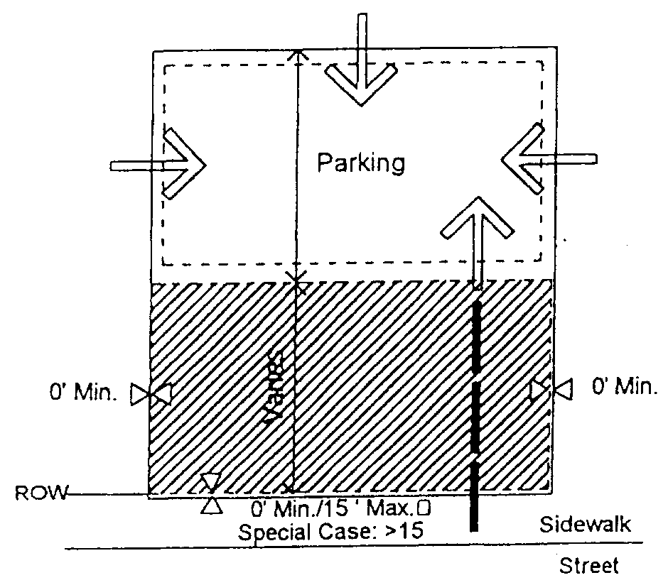
1.
Buildings shall be placed on the lot within the zone represented by the hatched area. In most cases, the build to line will range from zero (0) feet to fifteen (15) feet behind street right-of-way. Special site conditions such as topography, pattern of lot widths, or setbacks of existing buildings permit a larger building setback.
2.
Building facades shall be generally parallel to frontage property lines.
3.
Parking shall be located primarily to the rear of the building; side yard parking shall occupy no more than thirty-five (35) percent of the primary frontage line and shall not be placed in any side yard abutting an intersecting street. Where dimensions of existing lots restrict parking behind buildings, the limitations on side yard parking may be modified.
4.
Points of permitted access to the parking indicated by arrows.
5.
Hedges, garden walls, or fences may be built on property lines or as the continuation of building walls. A garden wall, fence, or hedge (minimum three (3) feet in height) shall be installed along any street frontage adjacent to parking areas.
6.
Parking areas on adjacent lots shall be connected wherever practical.
7.
Trash containers shall be located in a rear parking area (see parking regulations) and shall be screened from the right-of-way.
8.
Mechanical equipment at ground level shall be placed on the parking lot side of building and away from buildings on adjacent sites.
9.
Building facades at street frontage lines shall be pedestrian oriented and of pedestrian scale.
(b)
Encroachment/pedestrian access to building:
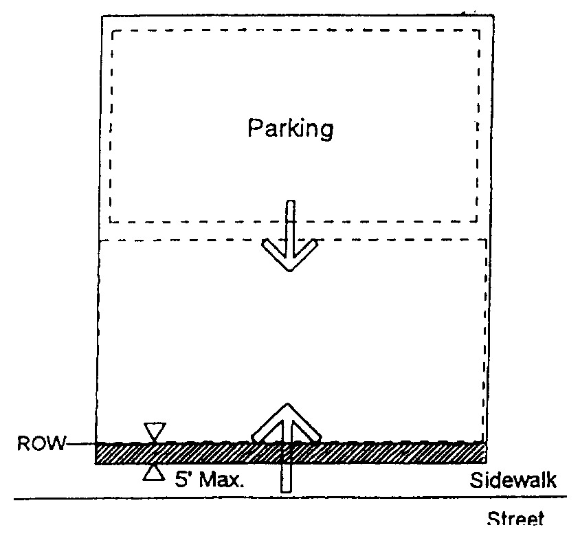
1.
Balconies, bay windows, arcades, porches at an upper level and their supports at ground level, together with awnings above head height (minimum seven (7) feet six (6) inches) are permitted within the sidewalk as shown by the hatched area. Encroaching arcades should cover entire sidewalk.
2.
Primary pedestrian access into the building shall be from the street frontage line (indicated by large arrow). Secondary access may be from parking areas (indicated by smaller arrow).
Description:
The workplace building may be a large structure (fifteen thousand (15,000) plus square feet) and may have a single use/tenant. Office, industrial, and commercial tenants are typical. Southern mill villages often provide examples of how these buildings can reasonably coexist with other businesses and homes. Locke Mill Plaza, in Concord, provides a good example with its placement at the end of prestigious Union Street. These buildings are critical to the town as employment centers and commercial service locations. The buildings will provide space for industry, large offices, as well as large retail uses such as a full service grocery store.
Special conditions:
1.
Buildings in all locations should relate the principal facade to the sidewalk and public space of the street.
2.
Corners: Setback at street corners will generally replicate frontage conditions. Side setbacks on a minor street may be less than the front dimension.
3.
Within the limits described, front and side setbacks will vary depending upon site conditions. Setbacks should be used in a manner which encourage pedestrian activity. For example, squares or spatially defined plazas within building setback areas can act as focal points for pedestrians.
312.5.1.1 Building type/urban workplace:
(a)
Permitted height and uses:

1.
Building height shall be measured as the vertical distance from the highest finished grade relative to the street frontage, up to the eaves or the highest level of a flat roof.
2.
The height of parapet walls may vary depending upon the need to screen mechanical equipment.
3.
Building height to the ridge may vary depending on the roof pitch.
4.
Permitted uses are indicated above.
(b)
Architectural standards:
Principles:
1.
To perpetuate the unique building character of the town and its environs, and to re-establish its local identity, development shall generally employ building types that are compatible to the historic architectural vocabulary of the area in their massing and external treatment.
2.
Building elevations fronting or visible from public streets shall be clad with masonry, wood, vinyl siding, stucco, or similar material. Metal paneling may not comprise a street fronting building face.
3.
The front elevations facing the street, and the overall massing shall communicate an emphasis on the human scale and the pedestrian environment.
4.
Each building should be designed to form part of a larger composition of the area in which it is situated. Adjacent buildings should thus be of similar scale, height, and configuration.
5.
Trailers (mobile units) may not be used as permanent workplace buildings.
6.
At a minimum, the Americans with Disabilities Act standards for accessibility shall be met.
Configurations:
7.
Two (2) wall materials may be combined horizontally on one (1) facade. The "heavier" material should be below and can cover the first floor only (i.e. brick below wood siding).
8.
Street level windows shall be untinted. Mirrorized glass is not permitted in any location.
9.
Windows shall be of square or vertical proportion. Special windows may be circular or regular polygons.
Techniques:
10.
Windows should be set to the inside of the building face wall.
11.
All rooftop equipment shall be enclosed in a building material that matches the structure or is visually compatible with the structure.
312.5.2 Lot type/shopfront building:
(a)
Building placement/parking/vehicular access:
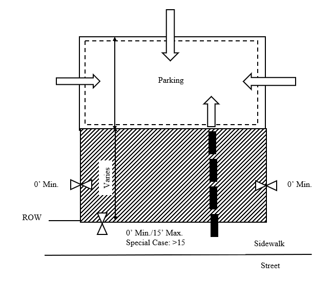
1.
Buildings shall be placed on the lot within the zone represented by the hatched area. In most cases, the build to line will range from zero (0) feet to fifteen (15) feet behind street right-of-way. Special side conditions such as topography, pattern of lot widths, or setbacks of existing buildings permit a larger building setback.
2.
Building facades shall be generally parallel to frontage property lines.
3.
Parking shall be located to the rear of the building; sideyard parking shall occupy no more than twenty-five (25) percent of the primary frontage line and shall not be placed in an established sideyard abutting an intersecting street. Where dimensions of existing lots restrict parking behind buildings, the limitations on sideyard parking may be modified.
4.
Points of permitted access to the parking indicated by arrows.
5.
Hedges, garden walls, or fences may be built on property lines or as the continuation of building walls. A garden wall, fence, or hedge (minimum three (3) feet in height) shall be installed along any street frontage adjacent to parking areas.
6.
Parking areas on adjacent lots shall be connected wherever practicable.
7.
Trash containers shall be located in a rear parking area (see parking regulations).
8.
Mechanical equipment at ground level shall be placed on the parking lot side of building and away from buildings on adjacent sites.
(b)
Encroachment/pedestrian access to building:
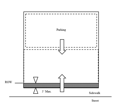
1.
Balconies, bay windows, arcades, porches at an upper level and their supports at ground level, together with awnings above head height are permitted within the sidewalk as shown by the hatched area. Encroaching arcades should cover entire sidewalk.
2.
Primary pedestrian access into the building shall be from the street frontage line (indicated by larger arrow). Secondary access may be from parking areas (indicated by smaller arrow).
Description:
The shopfront building is a small scale structure which can accommodate a variety of uses. The structure is typically a maximum of 15,000 square feet. A group of shopfront buildings can be combined to form a mixed-use neighborhood center. Individual shopfront buildings can be used to provide some commercial service, such as a convenience food store, in close proximity to homes. Traditional commercial buildings in the downtown provide good examples.
Special conditions:
1.
The intention of buildings in all locations must be to relate the principal facade to the sidewalk and public space of the street.
2.
Drive-through customer services, if permitted in the district, must be located at the rear of the building or on a side which does not abut a street.
3.
Corners: Setbacks at street corners will generally replicate frontage conditions. However, side setbacks on a minor street may be less than the front dimension.
4.
Within the limits described, front and side setbacks will vary depending upon site conditions. Setbacks should be used in a manner which encourages pedestrian activity. Squares or spatially defined plazas within building setback areas can act as focal points for pedestrians.
312.5.2.1 Building type/shopfront building:
(a)
Permitted height and uses:
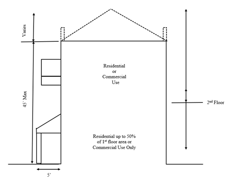
1.
Building height shall be measured as the vertical distance from the highest finished grade relative to the street frontage, up to the eaves or the highest level of a flat roof.
2.
The height of parapet walls may vary depending upon the need to screen mechanical equipment.
3.
Building height to ridge may vary depending upon the roof pitch.
4.
Permitted uses are indicated above.
(b)
Architectural standards:
Principles:
1.
To perpetuate the unique building character of the town and its environs, and to re-establish its local identity, development shall generally employ building types that are sympathetic to the historic architectural vocabulary of the area in their massing and external treatment.
2.
Building elevations fronting or visible from public streets shall be clad with masonry, wood, vinyl siding, stucco, or similar material. Metal paneling may not comprise a street fronting building face.
3.
The front elevations facing the street, and the overall massing shall communicate emphasis on the human scale and the pedestrian environment.
4.
Each building should be designed to form part of a larger composition of the area in which it is situated. Adjacent buildings should thus be of similar scale, height, and configuration.
5.
Trailers (mobile units) may not be used as permanent workplace buildings.
6.
At a minimum, the Americans with Disabilities Act standards for accessibility shall be met.
Configurations:
7.
Two (2) wall materials may be combined horizontally on one (1) facade. The "heavier" material should be below and can cover the first floor only (i.e. brick below wood siding).
8.
Street level windows shall be untinted. Mirrorized glass is not permitted in any location.
9.
Windows shall be of square or vertical proportion. Special windows may be circular or regular polygons.
Techniques:
10.
Windows should be set to the inside of the building face wall.
11.
All rooftop equipment shall be enclosed in a building material that matches the structure or is visually compatible with the structure.
(c)
Typical site layout criteria:
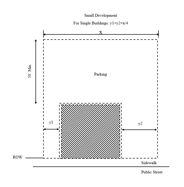
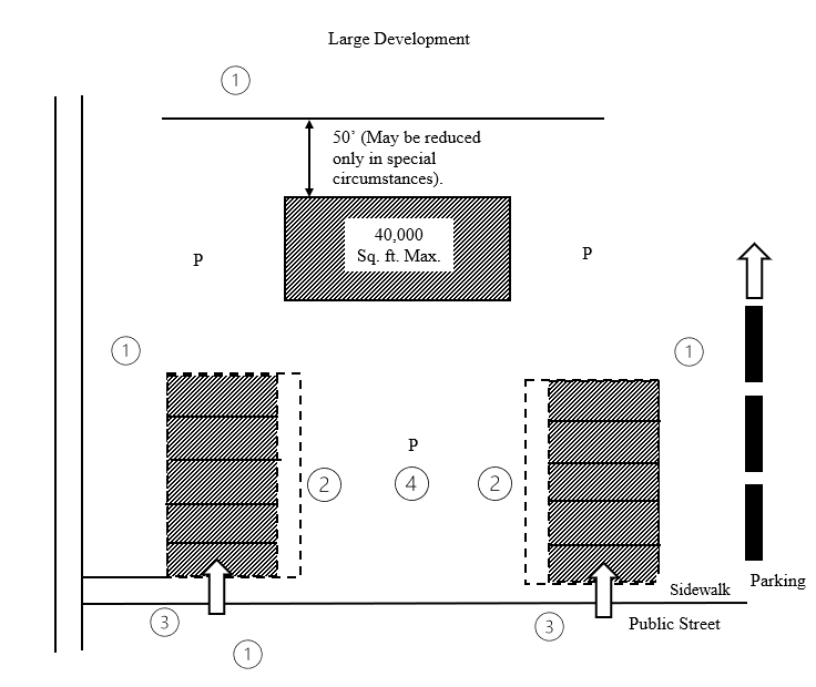
1.
Potential for interconnecting streets.
2.
Smaller shops must extend to sidewalk and have pedestrian arcades to main parking plaza.
3.
End units must have street entrance and clear glass windows comprising not less than thirty (30) percent of wall area facing the public right-of-way.
4.
Parking plaza enclosed on a minimum of two (2) sides.
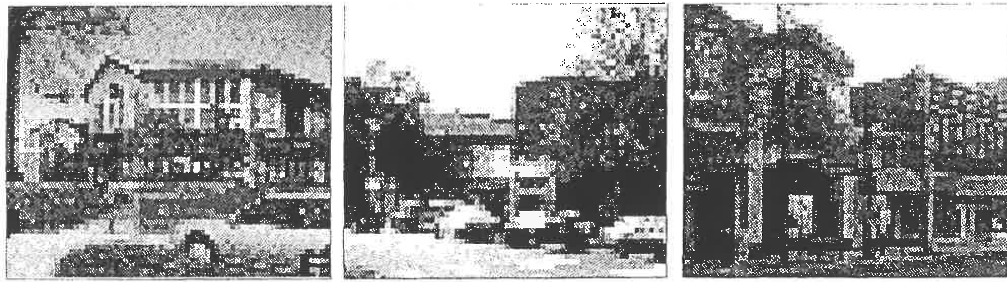
312.5.3 Lot type/highway commercial:
(a)
Building placement/parking/vehicular access:
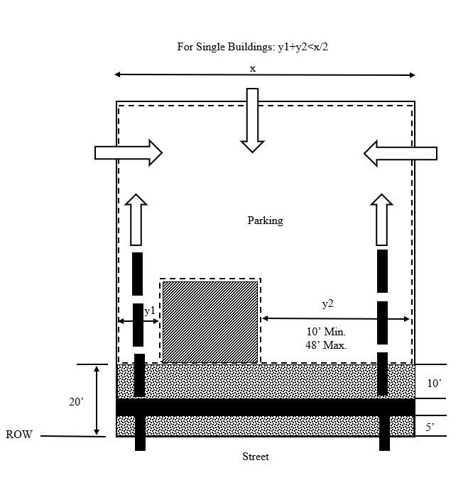
1.
Buildings shall be placed on the lot within zone represented by the hatched area. In most cases, the build to line will be twenty (20) feet behind street right-of-way. Special site conditions such as topography, pattern of lot widths, or setbacks of existing buildings permit a larger building setback.
2.
Setbacks may vary according to setting within limits indicated.
3.
Building facades shall be generally parallel to frontage property lines.
4.
Parking shall be located to the rear or side of the building; sideyard parking may occupy no more than forty-five (45) percent of the principle frontage line and shall not be placed in any sideyard abutting an intersecting street. Where dimensions of existing lots restrict parking behind buildings, the limitations on sideyard parking may be modified.
5.
Points of permitted access to the parking indicated by arrows.
6.
Hedges, garden walls, or fences may be built on property lines or as the continuation of building walls. A garden wall, fence, or hedge (minimum three (3) feet in height) shall be installed along any street frontage adjacent to parking areas.
7.
Parking areas on adjacent lots shall be connected wherever practicable.
8.
Trash containers shall be located in a rear parking area (see parking regulations)
9.
Mechanical equipment at ground level shall be placed on the parking lot side of building and away from buildings on adjacent sites.
(b)
Vehicular circulation/pedestrian access:
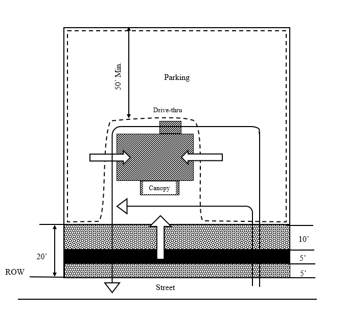
1.
Main pedestrian access to the building may be from the side (indicated by the larger arrows). Secondary access must be from the street frontage (indicated by the smaller arrow).
2.
Drive-throughs shall be located to the rear of the building.
3.
Entrance canopies (for motels, etc.) shall face the street.
4.
Typical vehicular circulation movement is indicated by thin line arrows.
Description:
This building type generally comprises fast food retail, drive through banks, motels and other highway dependent uses. These regulations are designed to bring these building types into a framework of town streets. This building type shall be limited to the Corridor Commercial District.
Special conditions:
1.
Buildings in all locations should relate a principal facade to the sidewalk and public space of the street.
2.
Corners: Setback at street corners will generally replicate frontage conditions.
312.5.3.1 Building type/highway commercial:
(a)
Permitted height and uses:
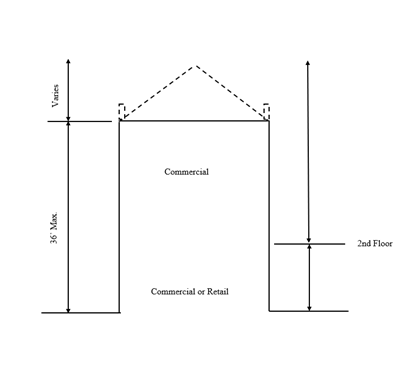
1.
Building height shall be measured as the vertical distance from the highest finished grade relative to the street frontage, up to the eaves or the highest level of a flat roof.
2.
The height of parapet walls may vary depending upon the need to screen mechanical equipment.
3.
Building height to the ridge may vary depending on the roof pitch.
4.
Permitted uses are indicated above.
(b)
Architectural standards:
Principles:
1.
Building elevations fronting or visible from public streets shall be clad with masonry, wood, vinyl, siding, stucco, or similar material. Metal paneling may not comprise a street fronting building face.
2.
Building elevations fronting or visible from public streets shall be clad with masonry, wood, vinyl siding, stucco, or similar material. Metal paneling may not comprise a street fronting building face.
3.
All walls not visible from a public right-of-way may be constructed of split face block, bricks, wood or vinyl siding, or metal paneling but shall be painted to match the overall scheme of the rest of the building.
4.
Trailers (mobile units) may not be used as highway commercial buildings.
5.
At a minimum, the Americans with Disabilities Act standards for accessibility shall be met.
Configurations:
6.
Two (2) wall materials may be combined horizontally on one (1) facade. The "heavier" material should be below (i.e., brick below wood siding).
Techniques:
7.
All rooftop equipment shall be enclosed in building material that matches the structure or is visually compatible with the structure.
(c)
Typical shopping center site layout criteria:
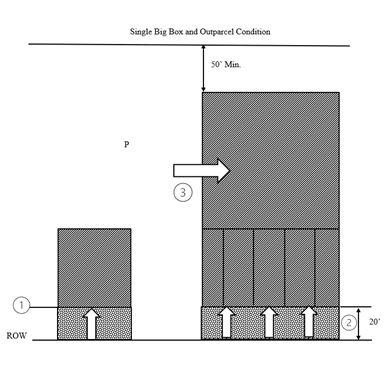
1.
All buildings must extend to build-to line.
2.
Entrances to smaller retail units (if included) should relate to the street. If no small stores, a similar pattern of windows and architectural features should be maintained.
3.
Main entrance to retail store should be rotated ninety (90) degrees from street to "frame" parking area.
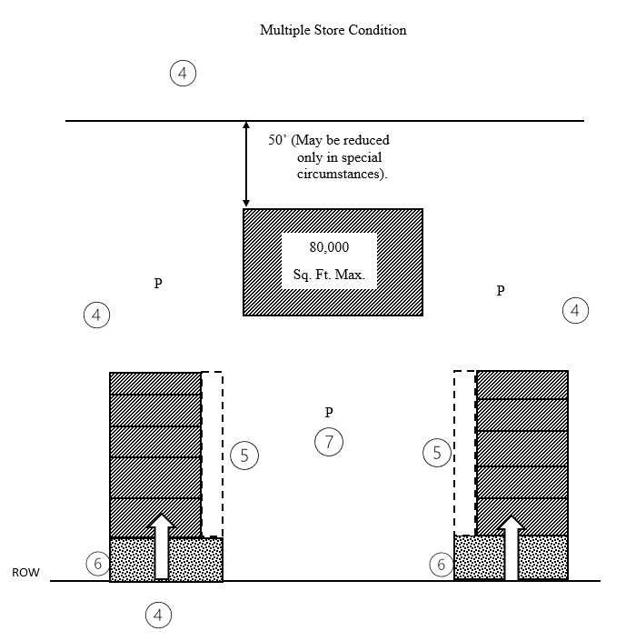
4.
Potential for interconnecting streets.
5.
Smaller shops must extend to build-to line and have pedestrian arcades to main parking plaza.
6.
End units must have street entrance and clear glass windows comprising not less than thirty (30) percent of wall area facing the public right-of-way.
7.
Parking plaza enclosed on a minimum of two (2) sides.
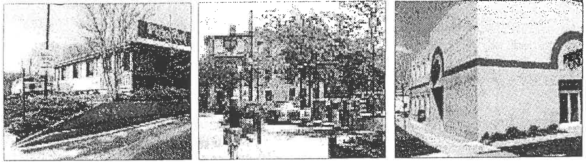
312.5.4 Lot type/Apartment building:
(a)
Building placement/parking/vehicular access:
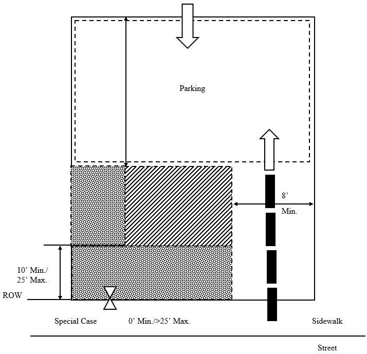
1.
Buildings shall be placed on the lot within the zone represented by the hatched area.
2.
In most cases, the build to line will range from ten (10) feet to twenty-five (25) feet behind street right-of-way. Special site conditions such as topography, pattern of lot widths, or setbacks of existing buildings permit a smaller or larger building setback.
In urban conditions, apartments may be set up to the property line at the sidewalk, including corner conditions.
3.
Building facades shall be generally parallel to front property lines. All buildings shall front onto a public street.
4.
Parking shall be located to the rear of the building.
5.
Points of permitted access to the parking indicated by arrows.
6.
Hedges, garden walls, or fences may be built on property lines or as the continuation of building walls. A garden wall, fence, or hedge (minimum three (3) feet in height) shall be installed along any street frontage adjacent to parking areas.
7.
Trash containers shall be located in the rear parking area (see parking regulations).
8.
Mechanical equipment at ground level shall be placed on the parking lot side of building and away from buildings on adjacent sites.
(b)
Encroachment/pedestrian access:
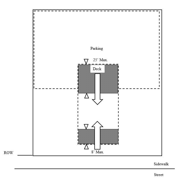
1.
For buildings set back from sidewalk, balconies, stoops, stairs, open porches, bay windows, and awnings are permitted to encroach into setback area up to eight (8) feet.
2.
Decks, porches, and balconies are permitted to encroach into the established rear yard up to twenty-five (25) feet.
3.
For buildings set up to the sidewalk, upper level balconies and bay windows may encroach a maximum of five (5) feet zero (0) inches over the sidewalk.
4.
Main pedestrian access to the building is from the street (indicated by larger arrow). Secondary access may be from parking areas (indicated by smaller arrow).
Description:
The apartment building is a residential building accommodating several households. In traditional towns, this building type coexists with a variety of other building types. A successful contemporary design permits its integration with other residential types through the coordination of site and building design (see architectural regulations). Apartment complexes should be one (1) or more separated buildings similar in their scale on the public street to large detached housing.
Special conditions:
1.
The intention of buildings in all locations must be to relate the principal facade to the sidewalk and public space of the street.
2.
Corners: Setback at street corners will generally replicate frontage conditions. However, side setbacks on a minor street may be less than the front dimension.
3.
Within the limits described, front and side setbacks will vary depending upon site conditions. Setbacks should be used in a manner which encourages pedestrian activity. Squares or spatially defined plazas within building setback areas can act as focal points for pedestrians.
312.5.4.1 Building type apartment building:
(a)
Permitted height and uses:
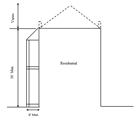
1.
Building height shall be measured as the vertical distance from the highest finished grade relative to the street frontage, up to the eaves or the highest level of a flat roof.
2.
The height of parapet walls may vary depending on the need to screen mechanical equipment.
3.
Building height to ridge may vary depending on the roof pitch.
4.
Permitted uses are indicated above.
(b)
Architectural standards:
Principles:
1.
To perpetuate the unique building character of the town and its environs, and to re-establish its local identity, development shall generally employ building types that are sympathetic to the historic architectural vocabulary of the area in their massing and external treatment.
2.
Building elevations fronting or visible from public streets shall be clad with masonry, wood, vinyl siding, stucco, or similar material. Metal paneling may not comprise a street fronting building face.
3.
The front elevations facing the street, and the overall massing shall communicate an emphasis on the human scale and the pedestrian environment.
4.
Each building should be designed to form part of a larger composition of the area in which it is situated. Adjacent buildings should thus be of similar scale, height, and configuration.
5.
Building silhouettes should be generally consistent. The scale and pitch of roof lines should thus be similar across groups of buildings.
6.
Porches should form a predominant motif of house designs, and be located on the front or to the side of the dwelling. When attached to the front, they should extend over at least fifteen (15) percent of the front facade. All porches, should be constructed of materials in keeping with those of the main building.
7.
Front loaded garages, if provided, shall meet the standards of section 312.8.4.
8.
At a minimum, the Americans with Disabilities Act standards for accessibility shall be met.
Configurations:
9.
Main roofs on residential buildings shall be symmetrical gables or hips with a pitch of between 4:12 and 12:12. Monopitch (shed) roofs are allowed only if they are attached to the wall of the main building. No monopitch shall be less than 4:12. All accessory buildings shall have roof pitches that conform to those of the main building.
10.
Balconies should generally be simply supported by posts and beams. The support of cantilevered balconies should be assisted by visible brackets.
11.
Two (2) wall materials may be combined horizontally on one (1) facade. The "heavier" material should be below.
12.
Exterior chimneys should be finished in brick or stucco or compatible material to structure.
Techniques:
13.
Overhanging eaves may expose rafters.
14.
Flush eaves should be finished by profiled molding or gutters.
312.5.5 Reserved.
312.5.6 Reserved.
312.5.6.1 Reserved.
312.5.7 Reserved.
312.5.7.1 Reserved.
312.5.8 Lot type/civic building:
(a)
Building placement/parking/vehicular access:
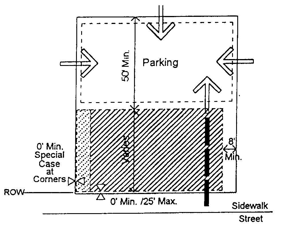
1.
Buildings shall be placed on the lot within the zone represented by the hatched area. In most cases, the build-to line will range from zero (0) feet to twenty-five (25) feet behind street right-of-way. Special site conditions such as topography, lot width, or provision of a green or plaza will permit a larger building setback.
2.
Parking shall be located to the rear of the building; sideyard parking shall occupy no more than twenty-five (25) percent of the primary frontage line and shall not be placed in any sideyard abutting an intersecting street. Where dimensions of existing lots restrict placement of parking behind buildings, the limitations on sideyard parking may be modified.
3.
A planting strip or defined plaza should be provided to relate the building to the street.
4.
Generally, building and street facades must extend parallel to frontage property lines.
5.
Points of permitted access to the parking indicated by arrows.
6.
Hedges, garden walls, or fences may be built on property lines or as the continuation of building walls. A garden wall, fence, or hedge (minimum three (3) feet in height) shall be installed along any street frontage adjacent to parking areas.
7.
Parking areas on adjacent lots should be connected.
8.
Trash containers shall be located in the parking area (see parking regulations).
9.
Mechanical equipment at ground level should be placed on the parking lot side of building and away from buildings on adjacent sites.
(b)
Encroachment/pedestrian access:
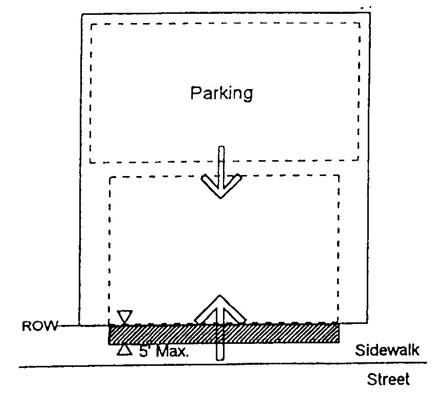
1.
For buildings set up to the sidewalk, upper level balconies and bay windows may encroach a maximum of five (5) zero (0) inches over the sidewalk.
2.
For buildings set back from the sidewalk, balconies, stoops, stairs, open porches, bay windows, and awnings are permitted to encroach into front setback area up to eight (8) feet.
3.
Main pedestrian access to the building is from the street (indicated by large arrow). Secondary access may be from parking areas (indicated by smaller arrow).
Description:
A civic building is a building used for purposes that are public in nature (e.g. schools, libraries, government buildings, and churches). These buildings must be designed to take their appropriate places within neighborhoods as integral parts of the community. It is expected that the scale and architectural sophistication of these buildings will match their civic importance. Where possible, civic structures shall be designed to terminate vistas or serve as key focal points in the neighborhood. The intention of buildings in all locations must be to relate the principal facade to the sidewalk and public space of the street. Civic buildings shall not be set back on the lot behind a standard parking lot.
312.5.8[.1] Building type/civic building:
[(a)]
Permitted height and uses:
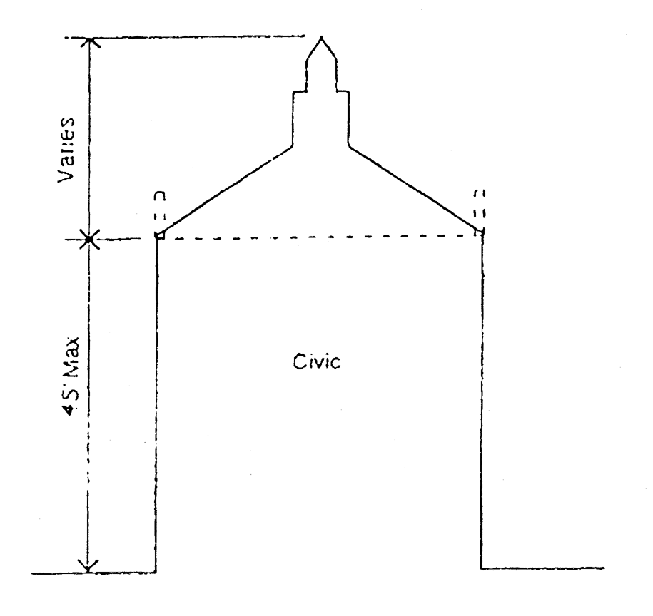
1.
Building height shall be measured as the vertical distance from the highest finished grade relative to the street frontage, up to the eaves or the highest level of a flat roof.
2.
The height of parapet, walls may vary depending upon the need to screen mechanical equipment.
3.
Maximum height of occupiable building shall be forty-five (45) feet. Uninhabitable portions of buildings with footprint area five hundred (500) square feet or less may exceed forty-five (45) feet (example: spire, cupola).
4.
Permitted uses are indicated above.
[(b)]
Architectural standards:
Principles:
1.
To perpetuate the unique building character of the town and its environs, and to re-establish its local identity, development shall generally employ building types that are sympathetic to the historic architectural vocabulary of the area in their massing and external treatment.
2.
Building elevations fronting or visible from public streets shall be clad with masonry, wood, vinyl siding, stucco, or similar material. Metal paneling may not comprise a street fronting building face.
3.
The front elevations facing the street, and the overall massing shall communicate an emphasis on the human scale and the pedestrian environment.
4.
Each building should be designed to form part of a larger composition of the area in which it is situated.
5.
Trailers (mobile units) shall not be used as civic buildings.
6.
Schools, churches, and government buildings shall be built so that they terminate a street vista whenever possible, and should be of sufficient design quality to create visual anchors for the community.
7.
At a minimum the Americans with Disabilities Act standards for accessibility shall be met.
Configurations:
8.
Street level windows shall be untinted. Mirrored glass is not permitted in any location.
9.
Flat roof lines are allowed.
10.
The orders, if provided, should have proportions and moldings according to The American Vignola.
Techniques:
11.
Windows should be set to the inside of the building face wall.
12.
All rooftop equipment shall be enclosed in building material that matches the structure or is visually compatible with the structure.
13.
Windows should be of square or vertical proportion. Special windows may be circular or regular polygons.
(Ord. No. 21-98, 6-2-98; Ord. No. 27-00, § 1, 8-7-00; Ord. No. 32-00, § 1, 10-2-00; Ord. No. 3-02, § 1, 1-7-02; Ord. No. 5-16, § 1, 2-1-16)
Section 312.6. - Streets.
(a)
Public streets shall provide access to all tracts and lots.
(b)
Streets and alleys shall, wherever practicable, terminate at other streets within the neighborhood and connect to existing and projected streets outside the development. Culs-de-sac shall not exceed two hundred fifty (250) feet in length, must be accessed from a street providing internal or external connectivity, shall be permanently terminated by a vehicular turnaround, and are permitted where topography makes a street connection impracticable. In most instances, a "close" or "eyebrow" is preferred to a cul-de-sac. Vehicular turnarounds of various configurations are acceptable so long as emergency access is adequately provided.
(c)
The average perimeter of all blocks should not exceed one thousand three hundred fifty (1,350) feet. No block face should have a length greater than eight hundred (800) feet without a dedicated alley or pathway providing through access.
(d)
Streets shall be organized according to a hierarchy based on function, size, capacity, and design speed; streets and rights-of-way are therefore expected to differ in dimension. The proposed hierarchy of streets shall be indicated on the submitted sketch plan. Each street type shall be separately detailed. Street types illustrated in appendix B, subdivision ordinance, represent the array of elements that are combined to meet the purposes of neighborhood streets: building placement line, optional utility allocation, sidewalk, planting strip, curb and gutter, optional parallel parking, and travel lane(s). Alternative methods of assembling the required street elements will be considered to allow neighborhood street designs that are most appropriate to setting and use.
(e)
To prevent the buildup of vehicular speed, disperse traffic flow, and create a sense of visual enclosure, long uninterrupted segments of straight streets should be avoided. Methods: (1) a street can be interrupted by intersections designed to calm the speed and disperse the flow of traffic and terminate vistas with a significant feature (building, park, natural feature); (2) a street can be terminated with a public monument, specifically designed building facade, or a gateway to the ensuing space; (3) perceived street length can be reduced by a noticeable street curve where the outside edge of the curve is bounded by a building or other vertical elements that hug the curve and deflect the view; (4) other traffic calming configurations are acceptable so long as emergency access is adequately provided.
312.6.1 Street regulations:
(a)
Summary. Streets should be designed to suit their functions. Many streets, especially local ones, have purposes other than vehicular traffic. As an alternative to current N.C. Department of Transportation road standards, the following street designs are provided for non-state maintained streets within the municipal limits of Conover and for streets within the extraterritorial landmark zoning jurisdiction which will be maintained by the town upon annexation. Streets built to the standards of this section are eligible for town maintenance.
Streets in Conover are to be inviting public space and integral components of community design. A hierarchical street network should have a rich variety of types, including bicycle, pedestrian, and transit routes. All streets should connect to help create a comprehensive network of public areas to allow free movement of automobiles, bicyclist and pedestrians. In order for this street network to be safe for motorists and pedestrians, all design elements must consistently be applied to calm automobile traffic.
In summary, streets shall:
1.
Interconnect within a development and with adjoining development. Culs-de-sac shall be allowed only where topographical and/or lot line configurations offer no practical alternatives for connections. Street stubs shall be provided within development adjacent to open land to provide for future connections. Consultation with the planning director is recommended to locate potential connections in new neighborhoods.
2.
Be designed as the most prevalent public space of the town and, thus, scaled to the pedestrian.
3.
Be bordered by sidewalks on both sides for commercial streets and one (1) side for residential streets.
4.
Be lined with street trees on both sides, with the exception of rural roads, lanes, alleys, and the undeveloped edge of neighborhood parkways. Private drives are permitted only as described in the open space district.
5.
Be public. Private streets are not permitted within any new development. Alleys may be either public or private depending upon function.
6.
Be the focus of buildings. Generally, all buildings will front on a public street.
(b)
Intersections and blocks:
(1)
Intersections. Long segments of straight streets should be interrupted by intersections designed to:
A.
Disperse traffic flow and reduce speeds, thereby eliminating the creation of de facto collector streets with high speed, high volume traffic; and
B.
Terminate vistas with a significant natural feature, a building, a small park, or other public space.
Other traffic calming measures such as neckdowns, chicanes, mid-block diverters, intersection diverters, curb bulbs, serial hill crests, and related devices will be considered on a case by case basis.
(2)
Blocks. Street blocks defined by public streets are the fundamental design elements of traditional neighborhoods. Under most conditions, any dimension of a block may range from two hundred fifty (250) to eight hundred (800) linear feet between cross streets.
(c)
Acceptance of streets: Streets shall be accepted in accordance with the street acceptance policy adopted by the city council and on file in the office of the city administrator.
312.6.2 Street plan types:
Examples
The layout of streets should provide structure to the neighborhoods. The formality of the street plan will vary depending upon site conditions and topography. Unique site conditions should be used to create special neighborhood qualities. The following are examples of street plan types, noting advantages and disadvantages.
Advantages
- Street hierarchy with main routes for through traffic
- Even dispersal of local traffic throughout network
- Responsive to terrain
- Responsive to environmental conditions
- Small scale suited to pedestrians
Disadvantages
- Variety of blocks and lots that do not conform to any overall plan
Advantages
- Excellent directional orientation
- Clear spatial definition
- Lot variety controllability
- Street hierarchy with end blocks for through traffic
- Even dispersal of traffic through grid
- Alleys for efficient double loading of service and for utilities location
Disadvantages
- Monotonous unless periodically interrupted
- Does not accommodate environmental interruptions
- Unresponsive to steep or special terrain
Advantages
- Avoids monotony by deflecting views
- Highly responsive to terrain
- Even dispersal of traffic through the network
Disadvantages
- Little directional orientation
- Uncontrollable variety of lots
- No natural hierarchy of street
- Lack of spatial definition
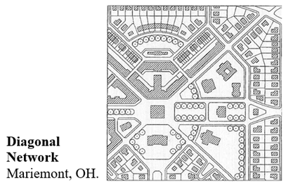
Advantages
- Street hierarchy with diagonals for through traffic
- Diagonals can respond to terrain
- Creates focal points at intersections
- Clear spatial definition
Disadvantages
- Some awkward block shapes at intersections of diagonals and regular grid
312.6.3 Street regulations:
Defining the Public Space of the Street
As the most prevalent public spaces in Conover, streets should be spatially defined by buildings. Proper alignment and delineation of the public street space occurs when the facades of adjacent buildings are aligned much like the walls forming a room. Buildings that make up the street edges are aligned in a disciplined manner. The defined space observes a certain ratio of height to width.
Building articulation must take place primarily in the vertical plane of the facade. Appendages such as porches, balconies, and bay windows are encouraged to promote the transition between the public street and the private dwelling.
For good definition, the ratio of one increment of height to six of width is the absolute minimum, with one to three being a good effective minimum. As a general rule, the tighter the ratio, the stronger the sense of place. Very tight relationships of one to one can create special pedestrian places.
In the absence of spatial definition by facades, disciplined tree planting is an alternative. Trees aligned for spatial enclosure are necessary on streets with deep building setbacks.
312.6.4 Neighborhood districts:
Traditional Neighborhood Street Typology
(a)
More urban conditions: Typical characteristics:
(b)
Less urban conditions: Typical characteristics:
312.6.5 Street design:
(a)
Specifications. Designs should permit comfortable use of the street by motorists, pedestrians, and bicyclists. Pavement widths, design speeds, and the number of motor travel lanes should be minimized to enhance safety for motorists and non-motorists alike. The specific design of any given street must consider the building types which have frontage and the relationship of the street to the overall town street network. The following specifications apply to street design:
1.
Street trees and sidewalks are required on both sides of streets for commercial streets and one (1) side for residential streets. Planting area for street trees should be a minimum of five (5) feet in width and sidewalks should also be a minimum of five (5) feet in width. On streets which serve as main business streets, sidewalks should be a minimum of seven (7) feet in width. Generally, canopy trees shall be planted at a spacing not to exceed forty (40) feet on center. Where overhead utility lines preclude the use of canopy trees, small maturing trees may be substituted, planted thirty (30) feet on center.
2.
On-street parking is recommended where building type and use will generate regular use. Occasional on-street parking can be accommodated without additional pavement width. For streets which serve workplace and storefront buildings, on-street parking is required and should be marked as such. On-street parking on at least one (1) side of the street is also required on streets serving apartments, attached houses, and detached houses with lots sixty (60) feet or less in width. On-street parking must also be provided on one (1) side of any street adjacent to a square, park or other open space area. Parallel on-street parking width is seven (7) feet to eight (8) feet. On-street parking should be parallel; angled parking is only permitted as an intentional design element for the retail center of a planned mixed-use development.
3.
Design speeds should not exceed thirty (30) miles per hour on any neighborhood street. Only major town streets and boulevards should exceed this design speed.
The illustrations on the following pages present typical examples of ways in which town street cross-sections can be assembled. Lane measurements are face of curb to face of curb.
These specifications may be varied only in accordance with the design principles detailed above and as approved by the planning director in consultation with the consulting engineer or transportation planner. The layout design of streets shall be based on the principles published in "Traffic engineering for Neo-Traditional Neighborhoods" published by the Institute of Traffic Engineers (ITE), Washington D.C. 1994.
(b)
Street construction and specifications.
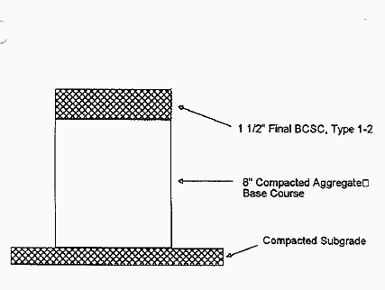
Subgrade must be tested by an independent testing lab, and have a density of one hundred (100) percent in accordance with AASHTO-T99. Base course must have a density of ninety (90) percent for B.C.B.C. and one hundred (100) percent for A.B.C. In accordance with AASHT0-T180, surface course shall be compacted to a density of ninety-five (95) percent. All tests to be conducted by an independent testing firm at the developer's expense and the results sent to City of Conover Public Works Department.
Alternate to diagram: Four (4) inches of B.C.B.C., Type H topped with two (2) inches of B.C.S.C., Type 1-2.
All street construction shall be accordance with the City of Conover Street Acceptance Policy.
312.6.6 Clear sight triangle at street intersection:
1.
In most circumstances, a clear view at each comer of an intersection shall be maintained by establishing an unobstructed "sight triangle." The extent of the required sight triangle varies according to the speed limit of streets forming the intersection. For streets signed thirty-five (35) mph or greater, the area to be clear of view obstructions at unsignalized intersections is generally to be the triangular area formed by the point of intersection of street right-of-way lines and a point located along each right-of-way line at a distance of thirty-five (35) feet from the point of intersection. For intersecting streets signed for less than thirty-five (35) mph, the shaded area in the figure below illustrates the area which must, in most instances, be clear of obstructions to driver visibility at unsignalized intersections. As indicated, the clear sight triangle will vary according to speed limit for traffic on approaching street.
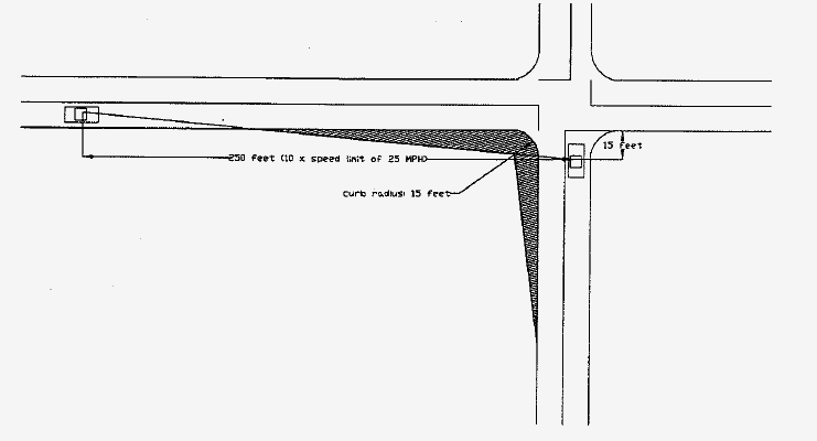
2.
No planting, structure, sign, fence, wall, manmade berm, or other obstruction to vision shall be installed, constructed, set out, or maintained so as to obstruct cross-visibility in the sight triangle between thirty (30) inches and seventy-two (72) inches above the level of the center of the street intersection.
3.
The limitations of this section may be modified in the instances noted below, so long as adequate visibility is maintained relative to intended speed limit:
(a)
Existing natural grades;
(b)
Trees trimmed such that no limbs or foliage extend into the area between thirty (30) and seventy-two (72) inches above the level of the adjacent intersection;
(c)
Fire hydrants, public utility poles, street markers, government signs, electrical junction boxes, and traffic control devices;
(d)
Buildings located in the Mixed Use District, or the Neighborhood Center District;
(e)
The approved and intentional use of traffic calming techniques to reduce speed; these include, but are not limited to: a series of hill crests, neckdowns, intersection diverters, and curb bulbs.
(Ord. No. 21-98, 6-2-98; Ord. No. 27-00, § 1, 8-7-00)
Section 312.7. - Landscaping and open space.
Open space is defined as any area which is not divided into private or civic building lots, streets, rights-of-way, parking, or easements. Design of urban open space shall comply with this section. Open space, as required in the OPS district, is site specific in its designation.
312.7.1 Screens:
1.
The purpose of a screen is to provide a visual barrier between an unsightly or out of scale development feature and the view from public streets and abutting properties. It is required as specified below:
•
Dumpster or trash handling areas: opaque screen
•
Service entrances or utility facilities for building operation: semi-opaque screen
•
Loading docks or spaces: semi-opaque screen
•
All other uses for which screening is specifically required under these regulations (see section 312.9, conditions for certain uses)
2.
An opaque screen is intended to exclude all visual contact with the screened structure or use. It may be composed of:
•
A wall
•
Wood fence
•
Planted vegetation
•
Existing vegetation
•
A combination of these elements which will meet the purpose of the requirement
The width of the screen is that which is necessary to accommodate the screening materials. To provide maximum sight line obstruction, a screen is usually placed immediately adjacent to the structure or use to be screened. Performance of the screen shall meet or exceed the following exemplar: To produce an opaque screen, intermittent planting of deciduous and evergreen trees shall obtain a height at maturity of no less than twenty (20) feet and have no unobstructed openings wider than ten (10) feet between tree canopies upon maturity. At installation, shrub plantings shall have a minimum height of three (3) feet, expected height at maturity at least six (6) feet, and no unobstructed openings wider than four (4) feet. At least fifty (50) percent of the required trees and at least seventy-five (75) percent of the required shrubs shall be evergreen species. All shall be locally adapted to the area and meet the specifications for the measurement, quality, and installation of trees and shrubs in accordance with "American Standards for Nursery Stock." In most instances, a structural screening material such as a wall or wood fence must be augmented with vegetation. Exceptions can include the screening of dumpsters in rear yard parking lots. Manmade berms are not permitted along public streets, whether as a matter of choice or as a means of meeting the screening requirement of this section. Natural changes in topography will, however, be taken into account when evaluating sight lines.
3.
A semi-opaque screen is intended to obscure visual contact with the screened structure or use. It can be used as a device to reduce the perceived scale and massing of a structure to enhance its compatibility with the existing built and natural environment. It may be composed of:
•
A wall
•
Wood fence
•
Planted vegetation
•
Existing vegetation
•
A combination of these elements which will meet the purpose of the requirement
The width of the screen is that which is necessary to accommodate the screening materials. To obscure the sight line, a screen is usually placed immediately adjacent to the structure or use to be screened. Performance of the screen shall meet or exceed the following exemplar: To produce a semi-opaque screen, intermittent planting of deciduous and evergreen trees shall obtain a height at maturity of no less than twenty (20) feet and have no unobstructed openings wider than twenty (20) feet between tree canopies upon maturity. At installation, shrub plantings shall have a minimum height of three (3) feet, expected height of at least six (6) feet at maturity, and no unobstructed openings wider than four (4) feet. At least seventy-five (75) percent of the required shrubs shall be evergreen species. All shall be locally adapted to the area and meet the specifications for the measurement, quality, and installation of trees and shrubs in accordance with "American Standards for Nursery Stock." When a structural screening material such as a wall or wood fence is chosen by the builder or developer, it will in most cases require the addition of some supplemental vegetation. Manmade berms are not permitted along public streets, whether as a matter of choice or as a means of meeting the screening requirements of this section. Natural changes in topography will, however, be taken into account when evaluating sight lines.
312.7.2 Street tree planting:
1.
Street tree planting is required along all major and minor thoroughfares and is the responsibility of the builder or developer. Planting shall be provided as follows:
(a)
If a street specific cross-section and planting plan has been adopted by the board of commissioners for a new or existing thoroughfare, the requirements of the adopted plan shall control;
(b)
If no specific plan and section have been adopted for an existing thoroughfare, canopy trees shall be planted at a spacing not to exceed forty (40) feet on center; where overhead utility lines preclude the use of canopy trees, small maturing trees shall be planted thirty (30) feet on center; manmade berms are not permitted along public streets, whether as a matter of choice or as a means of meeting the tree planting requirements of this section.
2.
Along streets which are built by the developer as part of the development process, the standards of Article 5, streets shall control.
3.
Along roads or streets that are well-forested, or new streets that are to be maintained in a forested condition by the developer, the street tree planting requirement may be reduced or eliminated to minimize grading and enhance preservation of existing, mature trees.
312.7.3 Installation and maintenance responsibility for landscaping:
1.
Certificate of compliance accepted. While land development occurs continuously, vegetation used in landscaping and screening should be planted at certain times of the year to improve survival rate. To ensure compliance with this section and to reduce the potential expense of replacing vegetation installed in an untimely or improper fashion, a letter of compliance must be filed with the zoning administrator at the time of building permit issuance. This letter will acknowledge that the applicant for the building permit is aware of any landscape requirements which apply to his property and that lie or she will comply with those requirements by a specific date, generally within the next planting season, but in no case more than one (1) year after the issuance of the building permit for the portion of the project or building for which the permit was issued. Failure to comply with the provisions of this section within the time specified in the letter of compliance constitutes violation of this section.
2.
Maintenance. All landscape materials required or committed voluntarily by the developer, whether screen, buffer, urban open space, rural open space, street trees, or maintained vegetation shall be properly maintained by the property owner. Maintenance includes actions necessary to keep landscape materials healthy, neat and orderly in appearance, and free of litter and debris. Any landscaping lost shall be replaced unless increased maturity of remaining vegetation compensates for the loss of an individual shrub or tree, thereby causing the intent of the landscape standard to still be met.
312.7.4 Urban open space regulations:
(a)
Design standards:
(1)
Open space defined. Open space is defined as all areas not divided into private or civic building lots, streets, rights-of-way, parking or easements.
Urban open space shall be planned and improved, accessible and usable by persons living nearby. Improved shall mean cleared of underbrush and debris and may contain one (1) or more of the following improvements: landscaping, walls, fences, walks, statues, fountains, ball fields, and/or playground equipment. Walls and fences shall be made of brick, stone, wrought iron, or wood and shall not exceed three and one-half (3.5) feet in height. (Exceptions: fences used in conjunction with ball fields.)
(2)
Amount of open space to be provided. In new developments, urban open space is expected to be integrated into the design of the site. It is expected that such open space will be within one-fourth (¼) mile of each residential building.
(3)
Open space as key public space. Urban open space features should provide focal points for the neighborhood. A central square or green, for example, may comprise a majority of the open space. There should be a hierarchy of open space within new neighborhoods to serve the needs of all residents.
(4)
Conservation areas. Significant stands of trees, stream bed areas, and other valuable topographic features should be preserved within the required open space areas.
(b)
Urban open space types:
(1)
Squares.
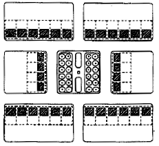
Squares are areas for passive recreational use. Squares shall be bounded by streets on a minimum of three (3) sides or seventy-five (75) percent of their perimeter.
Minimum size: Five hundred (500) square feet
Maximum size: One (1) acre
Squares may be entirely paved in brick paver, or similar material, or partially paved with other areas of soft landscape.
Squares are encouraged to be planted parallel to all street rights-of-way with one (1) tree species planted a minimum of ten (10) feet on center and at a maximum of thirty (30) feet on center. Geometrical tree planting layouts for internal plantings are encouraged.
(2)
Parks.
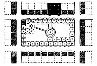
Parks may be designed for passive and/or active recreational use. Parks shall be bounded by streets on a minimum of fifty (50) percent of their perimeter, and are encouraged to be enclosed by streets on all sides.
Minimum size: One (1) acre
Maximum size: Three (3) acres
Maximum park size may exceed three (3) acres if through design the park creates a central open space which services an entire neighborhood or group of neighborhoods; or incorporates physical features which are an asset to the community (i.e. lake, high ground, significant stands of trees).
(3)
Forecourts.
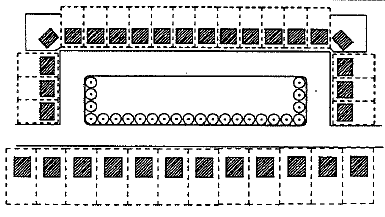
Forecourts are open space areas which act as buffers between residential buildings and nonresidential buildings or streets. Forecourts are entirely bounded by streets. It is recommended that forecourts be planted parallel to all street rights-of-way with one (1) tree species. Such plantings shall be a minimum of ten (10) feet on center and a maximum of thirty (30) feet on center.
(4)
Parkways.
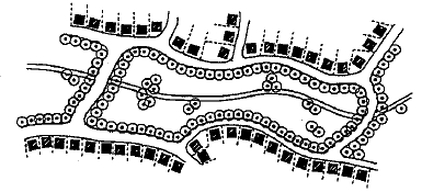
Parkways are open spaces designed to incorporate natural settings such as creeds and significant stands of trees within a neighborhood. Parkways are to be entirely bounded by streets or pedestrian rights-of-way within developed areas. Parkways differ from parks and squares in that their detailing is natural (i.e. informally planted). Parkways are used for walking, jogging, or bicycling. In addition, small scale recreational features such as a playground area or soccer field are appropriate in parkways. Streets bordering the parkway shall match the parkway street standards in the land plan street regulations.
(5)
Plazas.
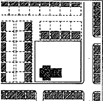
A plaza is an open area adjacent to a civic or commercial building. Plazas function as gathering places and may incorporate a variety of nonpermanent activities, such as vendors and display stands. Plazas are always paved in brick or another type of paver. Plazas shall be level, stepped, or gently sloping (less than five (5) percent grade).
The following sizes are recommended but may be smaller or larger depending on the building or facility design. At no time shall a plazas horizontal length or width be greater than three (3) times the height of surrounding buildings.
Minimum size: Two thousand (2,000) square feet
Maximum size: Thirty thousand (30,000) square feet
Plazas may be left unplanted. If planted, trees should form the geometric frame of the plaza space or for the structure the plaza services. Spacing shall be a minimum of ten (10) feet on center and a maximum of thirty (30) feet on center.
(6)
Greenbelts.
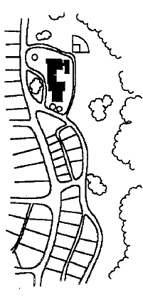
Greenbelts run along the perimeter of a neighborhood or town and serve to buffer a neighborhood from surrounding noncompatible uses such as a highway corridor, industrial district, or a town from agricultural areas or adjacent towns.
Greenbelts are left natural but may include walking trails. In addition, schools located adjacent to greenbelts can provide all recreational and athletic fields within the greenbelt.
312.7.5 Reserved.
312.7.6 Landscape regulations:
(a)
Purpose/applicability. These regulations are established to protect and enhance the natural landscape of Conover and ensure the appropriate use of plant material in new construction. It is the intent of these regulations to preserve natural tree cover and include new tree planting with development in order to:
a.
Reinforce community identity,
b.
Reduce visual blight and noise,
c.
Increase building and property values,
d.
Prevent soil erosion,
e.
Reduce storm water runoff,
f.
Increase groundwater recharge,
g.
Create shade and reduce solar overheating
An approved species list is available from the planning department.
(b)
Street trees. Street trees shall be planted along both sides of all public streets with the exception of lanes, alleys, and parkways, where street trees shall be installed along the side of the street opposite the park. Street trees shall be large maturing canopy species such as the Sugar Maple, Willow Oak, or Red Maple. Street trees shall be planted a maximum of forty (40) feet on center, and shall be a minimum of three (3) inches in caliper. Crape Myrtles, Bradford Pears, and other ornamental trees are not permitted for use as street trees. Small maturing trees planted thirty (30) feet on center may be used to meet street tree requirements only where overhead utility lines along existing streets prevent maturing of canopy trees. On any street for which a streetscape plan has been adopted by the town board, the streetscape plan shall control. Tree planting requirements may be modified where extreme topography would require excessive grading to meet the specific standards above.
(c)
Tree preservation and protection: During the development and construction of a subdivision or nonresidential development, or any lot therein, adequate protective measures shall be provided to minimize damage to existing trees and other vegetation to be retained. The subdivider, developer and builder shall make every reasonable effort to protect and retain existing trees and shrubbery not actually lying in public roadways, drainageways, building foundation sites and a construction activity area equal to twenty (20) feet around the building foundation, private driveways, paths and trails. Generally, all trees measuring eight (8) inches in caliper measured at DBH (four (4) feet to five (5) feet above grade) should be preserved and protected. The following measures shall be followed to protect existing trees to be retained on a developing site:
1.
Prior to construction, tree protective barriers shall be placed around all trees to be saved and their root protection area(s), to prevent damage to trees over eight (8) inches in caliper. These barricades shall be installed prior to grading, construction, or other land disturbing activity. The barricades shall be constructed from material substantial enough to protect the roots, trunk, and crown of the tree, such as two-inch by four-inch standards and one-inch by four-inch rails, silt fencing or orange safety fencing, minimum four (4) feet in height on metal posts. The barricade shall be placed at a distance from the trunk, equal to the farthest drip line of the tree and should include the total area beneath the tree's canopy. Alternative tree protection measures proposed by the developer will also be considered in order to assure maximum preservation on specific sites.
2.
No soil disturbance or compaction, stock piling of soil or other construction materials, vehicular traffic, or storage of heavy equipment are allowed in the areas designated for protection.
3.
Root pruning shall be kept to an absolute minimum.
4.
Pruning of existing trees shall be done according to the National Arborists' Association Standards in a manner that preserves the character of the crown.
5.
Grading must not encroach on a tree's root zone in ways that threaten the survival of the tree. Root cuts and fills must be limited to one-fourth (¼) of the area within the drip line of the tree. Any cuts must be clean and painted promptly with a tree paint.
6.
No ropes, signs, wires, unprotected electrical installation or other device or material. shall be secured or fastened around or through a tree or shrub.
7.
A grading permit shall not be issued prior to approval of a tree protection plan.
312.7.7 Buffer-yards: Landscape screens are required in situations where a new building is expected to create an incompatible relationship with existing buildings or districts, such as large scaled workplace buildings adjacent to residential uses. Screens are required to protect against noise, lighting and other disruptive effects, to protect the character of residential areas and conserve property values.
The buffer-yard area shall be a minimum of fifteen (15) feet and shall consist of plant material which at maturity creates a screen which is one hundred (100) percent opaque. For example, for every one hundred (100) linear feet, the screen shall consist of a combination of at least three (3) canopy trees planted 40 feet on center and thirty-four (34) evergreen shrubs in a double-staggered row six (6) feet on center. New trees and shrubs should be evenly spaced at planting, with trees having an 8-foot minimum installed height, and shrubs have a 36-inch minimum installed height. For dimensions of less than one hundred (100) feet, plantings and spacing shall be in proportion to the basic ratio described above. A solid masonry wall, minimum six (6) feet in height, may be substituted for required shrubs. No mechanical equipment such as air conditioner units are permitted within the buffer area. Permanent detention and temporary erosion and sedimentation control basins are prohibited in bufferyards. Where existing topography prevents the strict application of these standards, alternative screening methods which perform to the same or higher level will be considered. Utility easements may cross but not be placed within the long dimension of a bufferyard. An example site plan is illustrated below:
Where practical, pedestrian access shall be provided through the bufferyard. For example, neighborhoods adjacent to/at the rear of commercial development.
Buffer-yard Example
Site "A" - Affected Property Owner
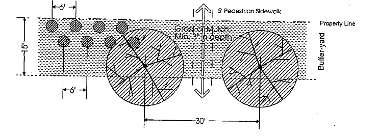
Site "B" - Site Being Developed
Plantings will consist of evergreen shrubs, six (6) feet on center, double
staggered rows, and canopy trees planted thirty (30) feet on center.
(Ord. No. 21-98, 6-2-98)
Section 312.8. - General provisions.
312.8.1 Yard designation:
1.
On lots which abut more than one (1) street, building and lot shall generally front upon the more pedestrian oriented street, given the arrangement of existing and proposed streets and drives, and the orientation of buildings on adjoining lots.
2.
Where multiple buildings are permitted on a single platted lot, each building shall generally front upon a pedestrian oriented street, either external or internal to the development; side and rear yard designations shall be determined on the basis of building orientation.
3.
On irregularly shaped lots, the location of required front, side, and rear yards will be determined by the planning department. The determination will be based on the spirit and intent of this ordinance to achieve an appropriate spacing of buildings and orientation to the street(s).
312.8.2 Permitted accessory uses in all districts:
1.
Accessory uses and structures that are clearly related to and incidental to the permitted principal use or structure on the lot.
2.
Fences and walls.
(a)
In a residential, mixed use, or commercial district, a fence or wall in the established front yard of a building shall be a minimum of two (2) feet in height and a maximum of five (5) feet in height. Decorative caps or spires which extend above the highest horizontal member of the fence shall not be included in the measurement of height. Chain link or similar fencing materials, if used, shall be placed on the interior side of a masonry wall or solid wood fence and shall be planted with a semi-opaque vegetative screen between wall or fence and the public street.
(b)
In a residential or mixed use district, a fence or wall in an established rear or side yard which abuts a street or alley may not exceed six (6) feet in height unless placed fifteen (15) feet or more inside property boundary. Within the first fifteen (15) feet, fences of chain link or similar material are permitted only if screened on the exterior side by evergreen shrubs planted no farther apart than six (6) feet on center, minimum height two and one-half (2½) feet at installation, or if obscured from view by other screening method(s) which perform at the same or a higher level.
(c)
In a residential or mixed use district, a fence or wall in an established rear or side yard which does not abut a street or alley may not exceed eight (8) feet in height.
(d)
In a commercial district, a fence or wall shall not exceed eight (8) feet within the first fifteen (15) feet of an established side or rear yard abutting a street or alley. Fences of chain link or similar material are permitted in the first fifteen (15) feet of an established yard abutting a street or alley only if placed on the interior side of a masonry wall or solid wood fence and planted with a semi-opaque vegetative screen between wall or fence and street or alley. Beyond the first fifteen (15) feet abutting a street or alley, such materials may be used if screened on the exterior side by evergreen shrubs planted no farther apart than six (6) feet on center, minimum height two and one-half (2½) feet at installation, or if obscured from view by other screening method(s) which perform at the same or a higher level.
(e)
In a commercial district, fences of chain link or similar material placed in an established yard which abuts a residential or mixed use district shall provide a semi-opaque vegetative screen on the exterior side of the fence.
(f)
For parking lots as principal or accessory uses, the standards of Division 3, Parking and Division 6, Buffers of this Code will control.
312.8.3 Standards for construction; developer responsibility: Where standards and responsibility for infrastructure construction, including but not limited to streets, sidewalks, and landscaping, are specified in this document or in the subdivision regulations of the City of Conover, city standards shall control.
Each owner, developer or primary builder (permit holder) shall be responsible for damage and undue service caused due to their activity. Further, it shall be the responsibility of all developers to make contractors and suppliers aware of the requirements and it shall be the responsibility of the permittee to recover costs from their service providers.
The city shall charge permittees for costs incurred in correcting or addressing any such matters. Costs will be billed to the permittee whenever reasonable attempts have not been made to correct conditions following notification by the city and/or discovery of a situation requiring immediate attention. Charges for work include labor, equipment and material costs by city and/or private contractors hired by the city to correct the situation.
312.8.4 Standards for residential garages and parking in residential:
1.
On lots greater than seventy-five (75) feet in width, front loading garages shall be recessed at least ten (10) feet behind the primary plane of the front facade of the structure.
Exception for single-family detached dwellings with one thousand four hundred (1,400) square feet or less of heated space: single bay front loading garages may be built flush with, but may not project in front of, the primary plane of the front facade of the structure; double bay front loading garages shall be recessed at least ten (10) feet behind the primary plane of the front facade of the structure.
2.
When the arrangement of permanent structural elements of a dwelling unit provides side view screening of a single bay front loading garage, the structural screening of the garage may be substituted by the homebuilder for the applicable standard above. An example of a permanent structural element which provides such screening would be an elevated porch or stoop with steps to ground level.
3.
In no case shall on-site residential parking extend into the public right-of-way, or into an easement for a public sidewalk on private property.
4.
On-street parking at lot front, when specifically provided, may be counted toward all or part of the parking requirement of a dwelling unit.
5.
Detached garages may only be placed in the established rear yard. Garages for more than two (2) cars must be detached and located in the established rear yard.
6.
Vehicles used primarily for commercial purposes and with more than two (2) axles are prohibited from parking on streets, in driveways, or on private property in residential districts. This shall not be construed as preventing the temporary parking of delivery trucks, moving vans, and similar vehicles which deliver goods or services.
(Ord. No. 21-98, 6-2-98)
Section 312.9. - Reserved.
Editor's note— Ord. No. 42-19, § 1, adopted September 9, 2019, repealed § 312.9, which pertained to conditions for certain uses and derived from Ord. No. 21-98, June 2, 1998; Ord. No. 1-14, § 1, January 6, 2014.