
Dekalb County Unincorporated
City Zoning Code
City Zoning Code
ARTICLE 3
- OVERLAY DISTRICT REGULATIONS
27-3.22 DIVISION 22. - EMORY VILLAGE OVERLAY DISTRICT[2]
Editor's note—Ord. No. 2023-0906, Pt. I, adopted Sept. 28, 2023, repealed the former Div. 22, §§ 3.22.1—3.22.18, and enacted a new Div. 22 as set out herein. The former Div. 22 pertained to similar subject matter and derived from Ord. No. 15-06, adopted Aug. 25, 2015; and Ord. No. 2022-2269, adopted April 25, 2023.
27-3.38 DIVISION - 38.
FRAZER CENTER OVERLAY DISTRICT
27-3.41 DIVISION 41. - COVINGTON AND INDIAN CREEK DISTRICTS[3]
Editor's note— An ordinance adopted May 28, 2020, Pt. I, changed the title of Div. 41 from "Kensington-Memorial Drive Overlay District" to read as herein set out.
Sec. 3.1.1.- Overlay districts generally.
Overlay districts are supplemental to the zoning district classifications established in article 2 of this chapter. This section shall supersede the applicability statements in each overlay district, and are applicable as follows:
A.
All development and building permits for lots located, in whole or in part, within any overlay district shall meet all of the regulations of the underlying zoning district in which they are located as well as all of the regulations of the applicable overlay district.
B.
For new development after the effective date of this chapter, when no complete application for a land disturbance or building permit has been filed with respect to a property located within an overlay district and the property has conditions of zoning that were approved prior to, and in conflict with the overlay district regulations contained in this article, the overlay district regulations shall prevail. If a condition of zoning does not conflict with the overlay district regulations, the condition of zoning shall remain applicable to the property.
C.
For existing development, if overlay district regulations conflict with the conditions of zoning applicable to property within in an overlay district, the existing zoning conditions remain applicable to the property.
D.
If a use is permitted in the overlay district, but the underlying zoning requires a special land use permit for the same use, the overlay shall govern, and no special land use permit is required.
E.
If overlay district regulations conflict with other regulations contained in this chapter, the overlay district regulations shall prevail.
F.
The use of property may be permitted without rezoning if listed as allowed by the overlay. Uses allowed by the underlying zoning in article 4, may also be permitted in the overlay district, unless it is listed as prohibited or if the zoning district is not applicable in the overlay.
G.
Each application for a business license, land disturbance permit, building permit or sign permit, which involves the development, use, exterior alteration, exterior modification or addition of any structure, must demonstrate compliance with all overlay district regulations, subject to article 8, nonconforming uses, structures and buildings.
H.
The zoning district designations contained in article 3, titled Overlay District Regulations, were not revised to reflect the new zoning district designations utilized in the updated zoning ordinance effective June 1, 2015. The discontinued zoning district references contained in this article 3 shall therefore be construed using the conversion chart contained in Table 1.1 of article 1 of the zoning ordinance effective June 1, 2015, and applied as appropriate to the updated provision of the zoning ordinance.
(Ord. No. 15-06, 8-25-2015)
Sec. 3.1.2. - Purpose and intent.
Each Subarea Overlay has its own purpose and intent based on original overlay requirements.
(Ord. No. 15-06, 8-25-2015)
Sec. 3.1.3. - Plan submittal, review and approval (certificate of compliance—See Emory Village for additional requirements associated with historic preservation).
A.
Pre-submittal conference. Prior to the submittal for review of a land disturbance or building permit application for property located within an overlay district, the applicant and the staff shall have a preliminary meeting to discuss the submittal requirements.
B.
Conceptual plan submittal requirements. As part of any land-disturbance permit, building permit, or sign permit application, the applicant shall submit to the director of planning a conceptual plan package and a final design package. Each package must include full architectural and landscape plans and specifications. The submitted plans must include a site plan, architectural elevations and sections; renderings depicting the building design including elevations and architectural details of proposed buildings, exterior materials and colors, and plans and elevations of all hardscape, landscape and signs, all of which shall demonstrate that the proposed design is in compliance with all the requirements of the applicable overlay district and the underlying zoning classification. The director of planning shall provide a copy of the submittals to the district commissioners, at-large commissioners and the citizen stakeholder in whose district or area the property is located for review and comments. If the proposed development is also located in an historic district as designated in the Code, the development shall also comply with the regulations established for the historic district in chapter 13.5 of the Code.
C.
Review by staff. Staff will review the conceptual plans for compliance with specifications and design guidelines contained in this zoning ordinance. If the application fails to comply with any section in this zoning ordinance, the application shall be marked "failed compliance," shall be returned to the applicant with any comments and/or redlines for revisions, and may be re-submitted with corrections addressing the staff's comments and/or redlines for further consideration. Once the application is found to be in compliance, the final design shall be forwarded to the director of planning for approval.
1.
Where the director of planning determines that said plans comply with the requirements of the overlay district, the director of planning shall approve the plans for compliance as part of the application for land disturbance, building or signs permits.
2.
Where the director of planning determines that submitted conceptual plans do not comply with the requirements of this chapter, then the director of planning shall notify the applicant in writing of the manner in which the conceptual plans fail to comply with such requirements. All applications shall be considered and decided by the director of planning within thirty (30) days of receipt of a complete application.
3.
Any appeal to vary overlay district development standards shall be to the zoning board of appeals pursuant to article 7.
D.
Fees. Plans shall be accompanied by an application and payment of a fee in an amount determined by the board of commissioners.
(Ord. No. 15-06, 8-25-2015)
Sec. 3.1.4. - Conceptual plan package review.
A.
The conceptual plan package shall include the following:
1.
A narrative addressing the proposed development explaining how it meets the purpose, intent, and standards of this article. The narrative shall include a tabulation of the approximate number of acres for each different land use type within the project, the approximate number of dwelling units by type, the approximate gross residential density, the approximate commercial density as well as square feet, the common open space acreage, the approximate open space acreage, the anticipated number, type and size of recreational facilities and other public amenities, and the legal mechanism for protecting and maintaining common/public open, as required in article 5;
2.
A site location map showing the proposed development, abutting properties, the access connections of the proposed development to surrounding and existing development, and transitional buffer zones, if required;
3.
A multimodal access plan, prepared at a scale not greater than one inch equals one hundred feet (1"=100'), to demonstrate a unified plan of continuous access to and between all structures in the proposed development and adjacent properties where connections are appropriate. The multimodal access plan shall cover the entire proposed development along with public right-of-way of adjoining streets and any other property lying between the subject property and any primary or secondary streets. Safe and convenient pathways shall be provided from sidewalks along streets to each structure entrance, including pedestrian access routes across parking lots and between adjacent buildings within the same development. Connections to available transportation nodes, such as driveways, sidewalks, and bike paths shall be shown along adjacent streets and those entering adjoining properties. Where an existing or planned public transportation station or stop is within one thousand two hundred fifty (1,250) feet from the nearest boundary of the subject property, the access plan shall show how pedestrians may safely travel from such station or stop to the subject property. Where an existing or planned bike path is located within one thousand five hundred feet (1,500) feet from the nearest boundary of the subject property, the access plan shall show how safe, continuous and convenient bicycle access shall be provided to the subject property.
4.
Two (2) copies of a plan drawn to a designated scale of not less than one inch equals one hundred feet (1"=100'), certified by a professional engineer or land surveyor licensed by the state, presented on a sheet having a maximum size of twenty-four (24) inches by thirty-six (36) inches, and one (1) eight and-one-half (8.5) inches by eleven (11) inches reduction of the plan. A ".pdf" copy of the plan shall be e-mailed to the director of planning for distribution to the district commissioners, at-large commissioners, and citizen stakeholder in whose district or area the property is located for review and comments. If presented on more than one (1) sheet, match lines shall clearly indicate where the several sheets join. Such plan shall contain the following information:
a.
Boundaries of the entire property proposed to be included in the development, with bearings and distances of the perimeter property lines;
b.
Scale and north arrow, with north, to the extent feasible, oriented to the top of the plat and on all supporting graphics;
c.
Location and approximate dimensions in length and width, for landscape strips and required transitional buffers, if any;
d.
Existing topography with a maximum contour interval of five (5) feet and a statement indicating whether it is an air survey or field run;
e.
Delineation of any floodplain designated by the Federal Emergency Management Agency, United States Geological Survey, or DeKalb County;
f.
Delineation of any jurisdictional wetlands as defined by Section 404 of the Federal Clean Water Act;
g.
Approximate delineation of any significant historic or archaeological feature, grave, object or structure marking a place of burial if known, and a statement indicating how the proposed development will impact it;
h.
Delineation of all existing structures and whether they will be retained or demolished;
i.
General location, in conceptual form, of proposed uses, lots, buildings, building types and building entrances;
j.
Height and setback of all existing and proposed buildings and structures;
k.
Location, size and number of all on-street and off-street parking spaces, including a shared parking analysis, if shared parking is proposed;
l.
Identification of site access points and layout, width of right-of-way and paved sections of all internal streets;
m.
Conceptual plans for drainage with approximate location and estimated size of all proposed stormwater management facilities and a statement as to the type of facility proposed;
n.
Development density and lot sizes for each type of use;
o.
Areas to be held in joint ownership, common ownership or control;
p.
Identification of site access points and layout, width of right-of-way and paved sections of all internal streets;
q.
Location of proposed sidewalks and bicycle facilities, trails, recreation areas, parks, and other public or community uses, facilities, or structures on the site;
r.
Conceptual layout of utilities and location of all existing and proposed utility easements having a width of ten (10) feet or more;
s.
Standard details of signs, sidewalks, streetlights, driveways, medians, curbs and gutters, landscaped areas, fencing, street furniture, bicycle lanes, streets, alleys, and other public improvements demonstrating compliance with the design guidelines for the overlay district; and
t.
Seal and signature of the professional preparing the plan.
5.
Two (2) copies of the conceptual building designs including elevation drawings drawn to a scale of not less than one-sixteenth-inch equals one (1) foot showing architectural details of proposed building, exterior materials, all of which demonstrate that the proposed design is in compliance with the Subarea Overlay District in which it is located. Drawings shall be presented on a sheet having a maximum size of twenty-four (24) inches by thirty-six (36) inches, along with one (1) eight and-one-half (8½) inches by eleven (11) inches reduction of each sheet. A ".pdf" copy of the drawings shall be e-mailed to the director of planning or designee for distribution to the district commissioners, at-large commissioners, and the citizen stakeholder in whose district or area the property is located for review and comments. If the drawings are presented on more than one (1) sheet, match lines shall clearly indicate where the several sheets join.
6.
Lighting plan. See article 5.
7.
Traffic study. See article 5.
(Ord. No. 15-06, 8-25-2015)
Sec. 3.1.5. - Final design package.
Upon receiving and addressing the county's comments with respect to the conceptual design package, the applicant must submit the final design package, including color ".pdf" copies, for review and approval. The final design package must contain full architectural and landscape plans, site plan, elevations, section renderings depicting the building design containing elevations and architectural detailing of proposed buildings, exterior materials and color, and plans and elevations of hardscape landscape and signs all of which must demonstrate compliance with overlay district regulations. All items and specifications necessary for obtaining land disturbance and building permits must be submitted with the final design package. The applicant may submit the final design package simultaneously with the land disturbance or building permit application, as applicable.
(Ord. No. 15-06, 8-25-2015)
Sec. 3.1A.1.- Scope of regulations.
This division establishes standards and procedures that apply to any development, use or alteration of any lot, building or structure on any property which is in whole or in part contained within the boundaries of the Kendrick/Osborne Area Overlay district.
(Ord. No. 15-06, 8-25-2015)
Sec. 3.1A.2. - Applicability of regulations.
This division applies to each application for a zoning map amendment and any permit for the development, use, alteration, or modification of any structure where the subject property is in whole or in part contained within the boundaries of the Kendrick/Osborne Area Overlay district.
(Ord. No. 15-06, 8-25-2015)
Sec. 3.1A.3. - Statement of purpose and intent.
The purpose and intent of the board of commissioners in establishing the Kendrick/Osborne Area Overlay district is as follows:
A.
To enhance the long-term economic viability of this portion of DeKalb County by encouraging residential developments with consistent lot widths and street frontage;
B.
To implement the policies and objectives of the DeKalb County Comprehensive Plan;
C.
To protect established residential areas from encroachment of uses which are either incompatible or unduly cause adverse impacts on such communities, and
D.
To protect the health, safety and welfare of the citizens of DeKalb County.
(Ord. No. 15-06, 8-25-2015)
Sec. 3.1A.4. - District boundaries.
The boundaries of the Kendrick/Osborne Area Overlay district shall be established by a zoning map and text amendment adopted pursuant to this chapter which amendment shall be incorporated herein and made a part of this chapter.
(Ord. No. 15-06, 8-25-2015)
Sec. 3.1A.5. - Lot widths, setbacks, and administrative variances.
The following requirements shall apply to all lots and structures in the Kendrick/Osborne Area Overlay district existing prior to the enactment of this division and all lots and structures in the Kendrick/Osborne Area Overlay district that come into existence or are the subject of a zoning map amendment after the enactment of this division:
A.
Lot width: All lots shall have at least fifty (50) feet of frontage as measured along the public street frontage.
B.
Setbacks: The required setbacks shall be as follows:
1.
Front setback: All new construction shall comply with 27-5.2 division 2.
2.
Interior side yard setback: Seven and one-half (7.5) feet.
3.
Rear yard setback: Thirty (30) feet.
C.
Administrative variances: No lots and/or structures in the Kendrick/Osborne Area Overlay district shall be entitled to seek any administrative variances pursuant to section 7.6.5.
(Ord. No. 15-06, 8-25-2015)
Sec. 3.1A.6. - Lot coverage.
The lot coverage of each lot shall not exceed fifty (50) percent.
(Ord. No. 15-06, 8-25-2015)
Sec. 3.2.1.- Scope of regulations.
This division establishes standards and procedures that apply to any development, use, alteration, structure, or natural growth on any lot or portion thereof which is in whole or in part contained within the boundaries of the Airport Compatible Use Overlay District.
(Ord. No. 15-06, 8-25-2015)
Sec. 3.2.2. - Applicability.
This division applies to each application for a permit for the development, use, or alteration of any structure, or natural growth where the subject property is in whole or in part contained within the boundaries of the Airport Compatible Use Zone Overlay District. The procedures, standards, and criteria apply only to that portion of the subject property within the boundaries of the Airport Compatible Use Zone Overlay District.
(Ord. No. 15-06, 8-25-2015)
Sec. 3.2.3. - Statement of purpose and intent.
The purpose and intent of the board of commissioners in establishing the Airport Compatible Use Zone Overlay District is as follows:
A.
To protect the health, safety, and welfare of persons and the value of property within the vicinity of airfields in DeKalb County;
B.
To provide for the safe and efficient operation of airfields in DeKalb County;
C.
To ensure the safety of flyers using airfields in DeKalb County from hazards to air navigation;
D.
To ensure compatibility between airfields in DeKalb County and surrounding land uses; and
E.
To protect the airfields in DeKalb County from encroachment of incompatible uses, structures, and natural growth.
(Ord. No. 15-06, 8-25-2015)
Sec. 3.2.4. - Airport Compatible Use Overlay Districts established.
To achieve the purpose and intent of this division, all of the land within the boundaries of airfields and within one (1) mile of the runway centerline extended of each instrument runway affected, for a distance of two and five-tenths (2.5) miles from each end of such runway, is declared to be an Airport Compatible Use Zone (ACUZ), divided into three (3) sub-zones as follows:
A.
ACUZ-1: From the end of the runway extending outward in a fan-shape fashion to match the horizontal extent of the approach-departure clearance surface for a distance of three thousand (3,000) feet.
B.
ACUZ-2: From the end of ACUZ-1 to a point two and five-tenths (2.5) miles from the end of the runway, extending in a fan-shaped fashion to match the horizontal extent of the approach-departure clearance surface.
C.
ACUZ-3: All of the ACUZ not included in ACUZ-1 or ACUZ-2.
The boundaries of these zones are drawn on maps and are available for inspection during office hours in the offices of the DeKalb County Planning Department.
(Ord. No. 15-06, 8-25-2015)
Sec. 3.2.5. - Height of buildings and structures.
Except as otherwise provided in this section, no obstructions to air navigation, structure or natural growth, shall be erected, altered, allowed to grow or be maintained in such a height or manner so as to become an obstruction to air navigation.
(Ord. No. 15-06, 8-25-2015)
Sec. 3.2.6. - Use restrictions.
A.
No use may be made of land within the ACUZ that results in an electrical interference with radio communications between the airfield and aircraft; generates airborne smoke or dust into the atmosphere; makes it difficult for flyers to distinguish between airfield lights and other lights; results in glare in the eyes of flyers using the airfield; impairs visibility in the vicinity of the airfield; attracts birds; or otherwise endangers the landing, takeoff, or maneuvering of aircraft.
B.
Within ACUZ-1 no public assembly, restaurant, or educational classroom uses shall be permitted which results in a density of occupation greater than twenty-five (25) persons per acre of land. Other uses may be permitted provided they meet all requirements of this section and have received a special administrative permit from the director of public works. Such application shall be forwarded to the director of the department of aviation of DeKalb County within five (5) days of its receipt by the department of public works. The director of the department of aviation shall return written comments to the department of public works within thirty (30) days of receipt of the application. Said comments shall contain a determination that granting the permit would, or would not, constitute a hazard to air navigation.
C.
Within ACUZ-1, no residential use shall be continued after it has been discontinued for a period of one hundred eighty (180) days unless a special administrative permit is issued by the director of public works. Such application shall be forwarded to the director of the department of aviation within five (5) days of its receipt by the department of public works. The director of the department of aviation shall return written comments to the department of public works within thirty (30) days of receipt of the application.
(Ord. No. 15-06, 8-25-2015)
Sec. 3.2.7. - Permits for certain other future uses.
Within ACUZ-1, no material change shall be made in the use of land, and no structure or natural growth shall be materially erected, altered, planted, or otherwise established, in the ACUZ-1 unless a permit therefore shall have been applied for and granted by the director of public works, subject to review by the director of the department of aviation of DeKalb County, as set forth in section 3.2.6. above. Each such application shall indicate the purpose for which the desired use structure, or natural growth is intended, a boundary survey indicating the location of the property and the location, dimensions, and height above mean sea level of any new or altered structure or natural growth, and a written description of the manner in which it would conform to the regulations prescribed in this section. No such permit shall be granted that would:
A.
Allow the establishment, creation, extension, or maintenance of a use which is inconsistent with the provisions of this section;
B.
Permit a non-conforming use, structure, or natural growth to be made, become higher, or become a greater hazard to air navigation or become less compatible in use than it was on the effective date of this chapter or from the date when application for a permit is made.
(Ord. No. 15-06, 8-25-2015)
Sec. 3.2.8. - Permits for certain other existing uses.
Before any existing use, structure, or natural growth is replaced, replanted, substantially altered, rebuilt, or allowed to become a greater hazard to air navigation within the ACUZ a permit shall be granted by the director of public works, following review and comment from the director of the DeKalb County Department of Aviation. No permit shall be granted that would:
A.
Allow the establishment, creation, extension, or maintenance of or extend a use which is inconsistent with the provisions of this section.
B.
Permit a nonconforming use, structure, or natural growth to be made, become higher, or become a greater hazard to air navigation or become less compatible in use than it was on the effective date of this chapter or from the date when application for permit is made.
(Ord. No. 15-06, 8-25-2015)
Sec. 3.2.9. - Hazard marking and lighting.
In order to carry out the intent and purposes of this section, any permit or variance granted under the provisions of this section may be granted with the condition that the owner of the structure or natural growth in question shall, at his or her own expense, install, operate, and maintain thereon such markers and lights as may be necessary to indicate to aircraft pilots the presence of a hazard to air navigation.
(Ord. No. 15-06, 8-25-2015)
Sec. 3.2.10. - Dimensions of imaginary surfaces.
Dimensions of imaginary surfaces as presented in subpart C of the Code of Federal Regulations (14 CFR), Objects Affecting Navigable Airspace, as amended, are incorporated herein by this reference.
(Ord. No. 15-06, 8-25-2015)
Sec. 3.3.1.- Environmentally sensitive lands; purpose and intent.
The board of commissioners finds that there are land areas within the county within which regulations supplemental to those regulations imposed by the underlying zoning district should be imposed in order to preserve or protect environmental elements unique to said land area. The intent and purpose of the board of commissioners in establishing such environmentally sensitive land overlay regulations is as follows:
A.
To reduce hazards to life and protect structures and uses from damage which may be caused by construction on or use of land which is unsafe or unsuitable for development;
B.
To protect land, public infrastructure and waters of the county from damages caused by improper use or construction on land which has physical, environmental or aesthetic limitations for development;
C.
To maintain and enhance natural land features which are environmentally significant or which constitute a natural resource of importance to the county at large, including especially Arabia Mountain and the valleys, ridges and areas of significant views surrounding said mountain;
D.
To maintain and protect significant and important archaeological resources of the county;
E.
To enhance public access to and enjoyment of the county's streams, creeks, and all other watercourses;
F.
To implement the policies of the comprehensive plan related to the protection and enjoyment of natural resources; and
G.
To identify specific resources so as to enable property owners to execute conservation easements and secure tax and other advantages therefrom.
(Ord. No. 15-06, 8-25-2015)
Sec. 3.3.2. - Creation of overlay zoning districts for environmentally sensitive lands.
To carry out the purposes and provisions of this chapter, Environmentally Sensitive Land Overlay Districts are hereby authorized to be established. Said overlay districts shall be implemented by district regulations particularly tailored to the specific land areas to be protected and shall be accompanied by an official zoning map amendment identifying said land area. Said map amendment and regulations shall be superimposed upon the underlying zoning district classification and shall apply to such land area in addition to the underlying district regulations.
(Ord. No. 15-06, 8-25-2015)
Sec. 3.3.3. - Scope of protection.
Within environmentally sensitive land areas, the board of commissioners may adopt overlay zoning regulations as follows:
A.
To regulate the height of buildings and structures;
B.
To regulate the amount of land permitted to be cleared, graded and improved and to authorize density bonuses and internal and external transfers of development rights so as to protect specified land areas containing significant archaeological or environmental resources;
C.
To protect viewsheds through the imposition of reasonable height and development standards for buildings and structures within such viewsheds;
D.
To encourage and facilitate private or public conservation easements so as to promote the purposes and intent of the district;
E.
To impose limitations on the total amount of impervious surface which is permitted within such overlay zones and limitations on development or uses within such highly sensitive zones; and
F.
To enact other development restrictions or bonuses and incentives which are designed to protect the resources defined in such overlay districts while authorizing reasonable and economically feasible uses of such lands.
(Ord. No. 15-06, 8-25-2015)
Sec. 3.4.1.- Title.
The provisions contained within this division are the regulations of the Arabia Mountain Natural Resource Protection Overlay District.
(Ord. No. 15-06, 8-25-2015)
Sec. 3.4.2. - Purpose and intent.
The purpose and intent of the board of commissioners in establishing the Arabia Mountain Natural Resource Protection Overlay District is as follows:
A.
To provide for the protection of natural resources and of scenic views to and from Arabia Mountain, so as to protect and enhance the public welfare associated with these natural resources and the aesthetic qualities within this area, consistent with the policies of the comprehensive plan, including but not limited to chapters 1 and 8;
B.
To provide for reasonable development within the Arabia Mountain Natural Resource Protection Overlay District while preserving the natural land form and features, trees and tree canopy, and the viewshed to and from Arabia Mountain;
C.
To assure that all activities and authorized uses of land allowed within the Arabia Mountain Natural Resource Protection Overlay District, whether allowed uses or permitted uses, are activities or uses which are designed so as not to detract from or damage the protected natural resources and scenic beauty of this district; and
D.
To encourage and promote the dedication of conservation easements to appropriate public and not-for-profit entities established and authorized to hold easements in perpetuity pursuant to the Georgia Uniform Conservation Act, for the purposes of protecting the habitat of endangered or threatened animal and plant species, providing recreational and educational opportunities, preserving the cultural history of the county, protecting open space within the county, and protecting scenic viewsheds to and from Arabia Mountain.
(Ord. No. 15-06, 8-25-2015)
Sec. 3.4.3. - District boundaries.
The boundaries of the Arabia Mountain Natural Resource Protection Overlay District shall be as may be established by a zoning map amendment adopted pursuant to this chapter which amendment shall be incorporated herein and made a part of this chapter 27.
(Ord. No. 15-06, 8-25-2015)
Sec. 3.4.4. - Applicability of regulations.
This division establishes standards and procedures that apply to development of any lot or portion thereof which is in whole or in part contained within the boundaries of the Arabia Mountain Natural Resource Protection Overlay District. The procedures, standards, and criteria shall apply only to that portion of the subject property within the boundaries of the district.
(Ord. No. 15-06, 8-25-2015)
Sec. 3.4.5. - Principal uses and principal structures.
The principal uses of land and structures which are allowed in the Arabia Mountain Natural Resource Protection Overlay District are as is provided by the applicable underlying zoning district, subject to the limitations and standards contained within this division.
(Ord. No. 15-06, 8-25-2015)
Sec. 3.4.6. - Accessory uses and accessory structures.
The accessory uses of land and structures which are allowed in the Arabia Mountain Natural Resource Protection Overlay District are as is provided by the applicable underlying zoning district, subject to the limitations and standards contained within this division.
(Ord. No. 15-06, 8-25-2015)
Sec. 3.4.7. - Lot coverage.
Lot coverage within the Arabia Mountain Natural Resource Protection Overlay District shall not exceed twenty-five (25) percent of net lot area.
(Ord. No. 15-06, 8-25-2015)
Sec. 3.4.8. - Clearing and grading of lots.
No lot shall be cleared and graded to an extent exceeding thirty-five (35) percent of the net lot area. Said limitation is intended to permit twenty-five (25) percent lot coverage as allowed in section 3.4.7 above, and to permit appropriate slopes from the remaining natural land contours to the finished site grades.
(Ord. No. 15-06, 8-25-2015)
Sec. 3.4.9. - Height limitation.
A.
Except as provided in section 5.2.5, and in subsection B., no building or structure within the Arabia Mountain Natural Resource Protection Overlay District shall exceed a height of thirty-five (35) feet, all other requirements of this chapter notwithstanding.
B.
If the placement of a telecommunications tower or antenna within this overlay district in excess of thirty-five (35) feet in height is mandated by federal law, said tower or antenna, in addition to meeting all other standards and criteria applicable thereto, shall meet the following design requirements:
1.
No portion of any such tower or antenna shall extend a distance of more than ten (10) feet above the top of the tree canopy existing on the lot upon which the tower or antenna is placed. If no tree canopy exists on said lot, then no portion of such tower or antenna shall extend a distance of more than ten (10) feet above the top of the tree canopy closest to such tower or antenna.
2.
All portions of a tower or antenna that extend above the top of the existing mature tree canopy pursuant to subsection B.1., shall consist of an alternative tower structure that is designed and colored in a way that blends said tower or antenna with the closest tree canopy to a degree that renders said tower or antenna indistinguishable from said tree canopy at a distance of two hundred (200) feet measured horizontally from said tower or antenna.
(Ord. No. 15-06, 8-25-2015)
Sec. 3.4.10. - Tree removal and replacement.
No trees other than dead, dangerous or diseased trees shall be removed from any lot except within areas of permissible grading as provided in section 3.4.8 above.
(Ord. No. 15-06, 8-25-2015)
Sec. 3.4.11. - Protection of steep slopes.
No lot or portion of a lot having a grade in excess of fifteen (15) percent shall be altered.
(Ord. No. 15-06, 8-25-2015)
Sec. 3.4.12. - Driveways.
The director of planning is authorized to approve shared driveways for two (2) or more dwellings within the Arabia Mountain Natural Resource Protection Overlay District in order to minimize lot coverage and tree removal within the district.
(Ord. No. 15-06, 8-25-2015)
Sec. 3.4.13. - Recording of conservation easements.
The director of planning shall record, after approval by the law department and the board of commissioners, conservation easements within the Arabia Mountain Natural Resource Protection Overlay District which are made in favor of DeKalb County, Georgia.
(Ord. No. 15-06, 8-25-2015)
Sec. 3.4.14. - Notation of all conservation easements on official zoning maps.
The director of planning shall cause to be noted on the official zoning maps any conservation easements granted within the district to any public or private entity authorized to hold such easements.
(Ord. No. 15-06, 8-25-2015)
Sec. 3.4.15. - Lighting.
No light standard shall be installed that extends above the height of the tree canopy. No lighting element of any kind shall be placed upon any structure so as to extend above the height of the tree canopy. No light spillage of any kind is permitted above said tree canopy except as may be otherwise required by any applicable requirement of federal, state or local law.
(Ord. No. 15-06, 8-25-2015)
Sec. 3.4.16. - Density bonus.
The director of planning is authorized to approve an increase of up to twenty-five (25) percent in housing density within the district for any parcel of land having a single-family residential zoning classification. In making application to the director of planning the applicant shall present a site plan in which required lot coverage limitations are met. The site plan shall further demonstrate that the tree canopy will be preserved and protected. In approving any such plan, the director of planning is authorized to approve gravel or other permeable surface for driveways and parking areas where it is demonstrated that such permeable surface will aid in minimizing damage to the root system of trees and will prevent the impaction of soil under the canopies of trees. It is the intent of these regulations that houses be spread out rather than clustered in the effort to protect and preserve the tree canopy which is essential to the maintenance of the character of the district.
(Ord. No. 15-06, 8-25-2015)
Sec. 3.4.17. - Approval of plats where density bonus permitted.
The director of planning is authorized to record plats in which a density bonus has been approved pursuant to section 3.4.16 above. The approval of any such plat shall be noted on the official zoning map by the director of planning.
(Ord. No. 15-06, 8-25-2015)
Sec. 3.4.18. - Billboards prohibited.
No outdoor general advertising sign shall be permitted within the district.
(Ord. No. 15-06, 8-25-2015)
Sec. 3.5.1.- Scope of regulations.
This division establishes standards and procedures that apply to any development, use, alteration, height, density, parking, open space, and building on any lot or portion thereof which is in whole or in part contained within the boundaries of the Stonecrest Area Overlay District.
(Ord. No. 15-06, § 3.5.1, 8-25-2015)
Sec. 3.5.2. - Applicability of regulations.
This division applies to each application for a permit for the development, use, alteration, or modification of any structure where the subject property is in whole or in part contained within the boundaries of the Stonecrest Area Compatible Use Zone Overlay District. The procedures, standards, and criteria herein apply only to that portion of the subject property within the boundaries of the Stonecrest Area Overlay District.
(Ord. No. 15-06, 8-25-2015)
Sec. 3.5.3. - Statement of purpose and intent.
The purpose and intent of the board of commissioners in establishing the Stonecrest Area Compatible Use Zone Overlay District is as follows:
A.
To preserve, protect and enhance existing and proposed open space networks that are adjacent to or within the Stonecrest Area;
B.
To enhance the long term economic viability of this portion of DeKalb County by encouraging new commercial and residential developments that increase the tax base and provide jobs to the citizens of DeKalb County;
C.
To implement the policies and objectives of the DeKalb County Comprehensive Plan 1985—2015 and the policies and objectives of the design guidelines for the Stonecrest Overlay District;
D.
To establish and maintain a balanced relationship between industrial, commercial, and residential growth to ensure a stable and healthy tax base in DeKalb County;
E.
To provide a balanced distribution of regional and community commercial and mixed-use office centers;
F.
To support high density housing in office and mixed-use centers which have the appropriate location, access, and infrastructure to accommodate it;
G.
To encourage mixed-use developments that meet the goals and objectives of the Atlanta regional commission's smart growth and livable centers initiatives;
H.
To allow flexibility in development standards in order to encourage the design of innovative development projects that set high standards for landscaping, greenspace, urban design, and public amenities;
I.
To encourage an efficient land use and development plan by forming a live-work-play environment that offers employees and residents the opportunity to fulfill their daily activities with minimal use of single-occupant automobiles;
J.
To allow and encourage development densities and land use intensities that are capable of making productive use of alternative transportation modes such as bus transit, rail transit, ridesharing, bicycling and walking;
K.
To focus and encourage formation of a well-designed, pedestrian-friendly activity center with high-density commercial and residential development that increases vitality and choices in living environments for the citizens of DeKalb County;
L.
To protect established residential areas from encroachment of uses which are either incompatible or unduly cause adverse impacts on such communities, and to protect the health, safety and welfare of the citizens of DeKalb County;
M.
To promote uniform and visually aesthetic architectural features which serve to unify the distinctive visual quality of the Stonecrest Area.
(Ord. No. 15-06, 8-25-2015)
Sec. 3.5.4. - District boundaries.
A.
The boundaries of the Stonecrest Area Overlay District shall be divided into five (5) development tiers as follows:
1.
Tier I: High-rise mixed use zone;
2.
Tier II: Mid-rise mixed use zone;
3.
Tier III: Low-rise mixed use zone;
4.
Tier IV: Transitional mixed use zone; and
5.
Tier V: Cluster/village mixed use zone.
B.
The boundaries of the Stonecrest Area Overlay District composed of Tiers I, II, III, IV and V shall be established by a zoning map amendment dated November 1, 2012, which is incorporated by reference as if fully set forth herein and made a part of this chapter, a copy of which is attached hereto as Exhibit A and adopted as a map amendment to the Official Zoning Map of DeKalb County. The adopted Stonecrest Overlay District Map and all its amendments will be maintained by the planning director. Any changes to the Overlay District Map dated November 1, 2012 will require a map amendment and a text amendment revising this section to reflect the revised map for the district.
(Ord. No. 15-06, 8-25-2015)
Sec. 3.5.5. - Public space.
A.
Public space: Each lot may provide a minimum of twenty (20) percent public space. To the extent possible, lands containing streams, lakes, one hundred-year floodplains, wetlands, slopes over fifteen (15) percent shall remain undisturbed and included in public space. Natural public space areas shall form an interconnected and continuous network of paths, greenways, and trails throughout the development within the Stonecrest Area Overlay District. Credit for public space areas may be transferred from one (1) parcel to another within overall developments that remain under unified control of a single property owner or group of owners, but must demonstrate interconnectedness of public areas.
1.
Maintenance and protection of public space. Each applicant that chooses to provide for public space shall present as a part of the application for a building permit within the Stonecrest Area Overlay District a legal mechanism under which all land to be used for public space purposes shall be protected. Such legal mechanism may include deed restrictions, property owner associations, common areas held in common ownership or control, maintenance easements, or other legal mechanisms, provided that said legal mechanism shall be approved by the county attorney as assuring each of the following mandatory requirements:
a.
That all subsequent property owners within said Stonecrest Area Overlay District be placed on notice of this development restriction through the deed records of DeKalb County Superior Court;
b.
That all public space held in common will be properly maintained and insured with no liability or maintenance responsibilities accruing to the county;
c.
That a legal mechanism exists for notice of deficiencies in maintenance of the public space held in common, correction of these deficiencies, and assessment and liens against the properties for the cost of the correction of these deficiencies by a third-party or the county;
d.
When an applicant for a Stonecrest Area Overlay District chooses to utilize a property owners association in order to comply with the requirements of subsection A. above, the applicant, in addition to meeting all of said requirements, shall provide for all of the following:
1.
Mandatory and automatic membership in the property owners association as a requirement of property ownership;
2.
A fair and uniform method of assessment for dues, maintenance and related costs;
3.
Where appropriate, party wall maintenance and restoration in the event of damage or destruction; and
4.
Continued maintenance of public space held in common and liability through the use of liens or other means in the case of default.
(Ord. No. 15-06, 8-25-2015)
Sec. 3.5.6. - Landscaping requirements.
A.
Landscape strips. Landscape strips not less than five (5) feet in width shall be provided along all side and rear property lines and on both sides of all public streets. The landscape strip in the front yard shall be a minimum of ten (10) feet in width and shall be planted with a row of street trees of at least three and one-half (3½) inches in caliper selected from the list of street trees species identified in the design guidelines for the Stonecrest Area Overlay District and planted not less than seventy-five (75) feet on center. Continuous landscaped strips shall be constructed along public rights-of-way where surface parking lots are adjacent to such sidewalks or public right-of-way except at points of ingress or egress into the facility.
B.
Ground cover. Ground cover shall also be provided in accordance with the design guidelines for the Stonecrest Area Overlay District in order to protect tree roots and to prevent erosion. Ground cover shall consist of evergreen shrubs or groundcover plant material mulched with pine bark mulch, or other similar landscaping material.
C.
Newly planted trees shall conform to the design guidelines for the Stonecrest Area Overlay District.
D.
No tree shall be planted closer than two (2) feet from the street or sidewalk, and no closer than five (5) feet from a fire hydrant, sign post, streetlight standard, utility pole, or similar structure.
E.
Parking lots shall be landscaped as follows:
1.
Each such parking lot shall have a minimum of five (5) percent of the total lot area of the interior of the parking lot in landscaped space.
2.
A minimum of one (1) tree per twelve (12) parking spaces shall be included in the required landscaped areas. For the purpose of satisfying this requirement, existing trees that are three (3) inches or more in caliper as measured at a height of thirty-six (36) inches above the ground level shall be considered to be equivalent to one (1) or more newly planted trees on the basis of one (1) tree for each three (3) inches of caliper.
3.
Where the landscaped area is in the interior of a parking lot, the landscaped area shall be a minimum of six (6) feet in width and six (6) feet in length, with a minimum area of thirty-six (36) square feet.
4.
All landscaped areas shall be properly maintained in accordance with approved landscape plans. In the event that a tree or any plant material dies, it shall be replaced within ninety (90) days of such occurrence, so as to meet all requirements of this section and to allow for planting in the appropriate planting season.
5.
All trees planted pursuant to the requirements of section 5.4.4 shall be counted for the purpose of meeting the tree planting and tree replacement requirements imposed by section 14-39.
(Ord. No. 15-06, 8-25-2015)
Sec. 3.5.7. - Transitional buffer zone requirements.
Where a lot on the external boundary of the Stonecrest Area Overlay District adjoins the boundary of any property outside the overlay district that is zoned for any R classification, RM classification, MHP classification, or TND classification, a transitional buffer zone not less than fifty (50) feet in width shall be provided and maintained in a natural state or so as to maintain an effective visual screen. Said transitional buffer zone shall not be paved and shall not be used for parking, loading, storage, or any other use, expect where necessary to grade or modify a portion of the transitional buffer zone for the installation of utilities necessitated by the development. Water detention ponds shall not be located within transitional buffer zones. No trees, other than dead or diseased trees, shall be removed from said transitional buffer zone, but additional trees and plant material may be added to the transitional buffer zone.
(Ord. No. 15-06, 8-25-2015)
Sec. 3.5.8. - Streets standards.
Streets within the Stonecrest Area Overlay District may be either public or private streets. Private streets shall comply with requirements of public streets found in chapter 14 and all other applicable sections of the DeKalb County Code, with the following exceptions:
A.
Streets in the Stonecrest Area Overlay District may be constructed with travel lanes at eleven (11) feet in width, measured inside curb and gutter.
B.
Private or public alleys shall be permitted, providing secondary or service access within developments consisting of at least four (4) occupied structures. An alley shall provide a continuous connection between two (2) streets. Alleys shall be paved and constructed to the same standards as the connecting streets except that:
1.
No alley shall be longer than four hundred (400) feet;
2.
No alley shall have a slope greater than seven (7) percent;
3.
The paved width of an alley shall be not less than twelve (12) feet;
4.
Alleys shall be constructed with flush curbs;
5.
Alleys shall be bordered on both sides by unobstructed seven-foot-wide shoulders constructed of grass sod or gravel; and
6.
Buildings shall be set back at least ten (10) feet from the back of curb of an alley.
(Ord. No. 15-06, 8-25-2015)
Sec. 3.5.9. - Underground utilities.
All utilities except for major electric transmission lines and substations are required to be placed underground except where the director of development determines that underground utilities are not feasible due to pre-existing physical conditions, such as conflicting underground structures or utilities, shallow rock, high water table, or other similar geologic or hydrologic conditions.
(Ord. No. 15-06, 8-25-2015)
Sec. 3.5.10. - Streetlights.
Streetlights are required for all public streets and shall conform to the design guidelines for the Stonecrest Area Overlay District.
(Ord. No. 15-06, 8-25-2015)
Sec. 3.5.11. - Interparcel access.
To the maximum extent possible, sidewalks and parking lots serving adjacent lots shall be interconnected to provide continuous driveway connections and pedestrian connections between adjoining lots and streets, except that this requirement shall not apply to lots zoned for single family or duplex residential units. Where necessary, DeKalb County may require access easements be provided to ensure continuous access and egress routes connecting commercial, office, and multifamily lots.
(Ord. No. 15-06, 8-25-2015)
Sec. 3.5.12. - Multi-modal access plans required.
Each new application for a development permit within the Stonecrest Area Overlay District shall be accompanied by a multi-modal access plan prepared at a scale not greater than one inch equals one hundred feet (1"=100'). The multi-modal access plan shall cover the full extent of the proposed development along with public rights-of-way of adjoining streets and any other property lying between the subject property and the nearest public streets on all sides. The purpose of the multi-modal access plan is to demonstrate a unified plan of continuous access to and between all buildings in the proposed development and adjacent properties. Connections to available transportation modes, such as driveways, sidewalks, and bike paths shall be shown along adjacent streets and those entering adjoining properties. Safe and convenient pedestrian ways shall be provided from sidewalks along streets to each building entrance, including pedestrian access routes across parking lots and between adjacent buildings within the same development. Where an existing or planned public transportation station or stop is within one thousand two hundred fifty (1,250) feet (straight line distance) from any boundary of the subject property, the access plan shall show how pedestrians may safely travel from such station or stop to the subject property. Where an existing or planned bike path is located within one thousand five hundred (1,500) feet of the subject property, the access plan shall show how safe, continuous and convenient bicycle access shall be provided to the subject property.
(Ord. No. 15-06, 8-25-2015)
Sec. 3.5.13. - High-Rise Mixed-Use Zone (Tier I Zone).
A.
Principal uses and structures. The following principal uses of land and structures shall be authorized within Tier I. High-Rise Mixed-Use Zone of the Stonecrest Area Overlay District:
1.
All uses authorized in the C-1 and C-2 (General Commercial) District, except those listed in B., below.
2.
All uses authorized in the O-I (Office Institutional) District, except those listed in B., below.
3.
All uses authorized in the O-D (Office-Distribution) District, except those listed in B., below.
4.
All uses authorized in the RM-HD (Multifamily Residential) District.
5.
Buildings that contain a mixture of two (2) or more uses selected from those authorized in this district.
B.
Prohibited uses. The following principal uses of land and structures shall be prohibited within Tier I: High-Rise Mixed-Use Zone of the Stonecrest Area Overlay District:
1.
Kennels.
2.
Storage yards.
3.
Tire dealers and tire repair.
4.
Adult entertainment establishments.
5.
Adult service facilities.
6.
Outdoor amusement and recreation services facilities.
7.
Outdoor storage.
8.
Appliance and equipment repair shops.
9.
Motels.
10.
Used motor vehicles dealers.
11.
Temporary and seasonal outdoor sales.
12.
Automobile title loan establishments.
13.
Pawn shops.
14.
Liquor stores.
15.
Salvage yards and junk yards.
16.
Self-storage facilities.
17.
Gasoline service stations.
18.
Major and minor automobile repair and maintenance shops.
19.
Automotive rental and leasing.
20.
Commercial parking lots.
21.
Carwashes and detail shops.
22.
Check cashing establishments.
23.
Automobile emission testing facilities.
C.
Accessory uses and structures. The following accessory uses of land and structures shall be authorized in the Tier I: High-Rise Mixed-Use Zone of the Stonecrest Area Compatible Use Overlay District:
1.
Accessory uses and structures incidental to any authorized use.
2.
Parking lots and parking garages.
3.
Club house, including meeting room or recreation room.
4.
Swimming pools, tennis courts, and other recreation areas and similar amenities.
5.
Signs, in accordance with the provisions of chapter 21 and this chapter.
D.
Building setbacks. The following requirements shall apply to all structures in the Tier I: High-Rise Mixed-Use Zone of the Stonecrest Area Overlay District:
1.
Minimum front yard setback: Fifteen (15) feet from right-of-way of public street except that garages of residential units shall be set back a minimum of twenty-five (25) feet from right-of-way.
2.
Minimum interior side yard: Ten (10) feet. There shall be a minimum of fifteen (15) feet between buildings and structures less than two (2) stories in height and a minimum of twenty (20) feet between any two (2) buildings and structures when one (1) of them is greater than two (2) stories in height, and a minimum of twenty-five (25) feet between any two (2) buildings when one (1) of them is greater than five (5) stories in height.
3.
Minimum rear yard: Ten (10) feet.
E.
Height of buildings and structures. A building in the High-Rise Mixed-Use Zone may exceed the five-story height limit without the necessity of obtaining a special land use permit. A parking deck may exceed five (5) stories in height; however, a parking deck shall not exceed ten (10) stories either as a separate deck structure or as part of an office building.
F.
Density. No development in a Tier I zone shall exceed a FAR of three and one-half (3.5), unless it also provides additional public space or other amenities singly, or in combination as provided in paragraph G. below.
G.
Bonus density: The maximum allowable FAR of a building or development in a Tier I zone shall be increased to a FAR not to exceed a total of six (6.00) in exchange for one (1) or more of the additional amenities provided in the table below:
Table 3.1. Maximum Bonus FAR: Tier I
H.
Required parking. Required parking may be provided through a combination of off-street, on-street, or shared parking provided that all required parking is located within seven hundred (700) feet of the principal entrance of buildings which it is intended to serve. The minimum number of required parking spaces shall be as provided in article 6, except as follows:
1.
Retail uses, personal service uses, and other commercial and general business uses, including food stores—Minimum of four (4) spaces per one-thousand (1,000) square feet of gross floor area.
2.
Office and clinic uses—Minimum of three (3) spaces per one thousand (1,000) square feet of gross floor area.
3.
Hotel and motel uses—Minimum of one (1) space per unit.
4.
Multifamily residential uses—Minimum of one and one-quarter (1.25) spaces per dwelling unit.
I.
Sidewalks. Sidewalks at least five (5) feet in width shall be provided on both sides of all public streets. Sidewalks along streets and in front of proposed high-rise buildings shall be a minimum of ten (10) feet in width.
(Ord. No. 15-06, 8-25-2015)
Sec. 3.5.14. - Mid-Rise Mixed-Use Zone (Tier II Zone).
A.
Principal uses and structures. The following principal uses of land and structures shall be authorized within Tier II: Mid-Rise Mixed-Use Zone of the Stonecrest Area Overlay District:
1.
All uses authorized in the C-1 and C-2 (General Commercial) District, except as excluded in B., below.
2.
All uses authorized in the O-I (Office Institutional) District, except as excluded in B., below.
3.
All uses authorized in the O-D (Office Distribution) District, except as excluded in B., below.
4.
All uses authorized in the RM-HD (Multifamily Residential) District.
5.
Buildings that contain a mixture of two (2) or more uses selected from those authorized in this district.
B.
Prohibited uses. The following principal uses of land and structures shall be prohibited within Tier II: Mid-Rise Mixed Use Zone of the Stonecrest Area Overlay District:
1.
Kennels.
2.
Storage yards.
3.
Tire dealers and tire repair.
4.
Adult entertainment establishments.
5.
Adult service facilities.
6.
Outdoor amusement and recreation services facilities.
7.
Outdoor storage.
8.
Appliance and equipment repair shops.
9.
Motels.
10.
Used motor vehicles dealers.
11.
Temporary and seasonal outdoor sales.
12.
Automobile title loan establishments.
13.
Pawn shops.
14.
Liquor stores.
15.
Salvage yards and junk yards.
16.
Self storage facilities.
17.
Gasoline service stations.
18.
Major and minor automobile repair and maintenance shops.
19.
Automotive rental and leasing.
20.
Commercial parking lots.
21.
Carwashes and detail shops.
22.
Night clubs and late-night establishments.
23.
Check cashing establishments.
24.
Automobile emission testing facilities.
C.
Accessory uses and structures. The following accessory uses of land and structures shall be authorized in the Tier II: Mid-Rise Mixed-Use Zone of the Stonecrest Area Overlay District.
1.
Accessory uses and structures incidental to any authorized use.
2.
Parking lots and parking garages.
3.
Club house, including meeting room or recreation room.
4.
Swimming pools, tennis courts, and other recreation areas and similar amenities.
5.
Signs, in accordance with the provisions of chapter 21 and this chapter.
D.
Building setbacks. The following requirements shall apply to all structures in the Tier II: Mid-Rise Mixed-Use Zone of the Stonecrest Area Overlay District:
1.
Minimum front yard setback: Fifteen (15) feet from right-of-way of public street, except that garages of residential uses shall be set back a minimum of twenty-five (25) feet from right-of-way.
2.
Minimum interior side yard: Ten (10) feet. There shall be a minimum of fifteen (15) feet between buildings and structures less than two (2) stories in height and a minimum of twenty (20) feet between any two (2) buildings and structures when one (1) of them is greater than two (2) stories in height, and a minimum of twenty-five (25) feet between any two (2) buildings when one (1) of them is greater than five (5) stories in height.
3.
Minimum rear yard: Ten (10) feet.
E.
Height of buildings and structures. Maximum height, ten (10) stories. A building in the Mid-Rise Mixed-Use Zone may exceed the five (5) stories without the necessity of obtaining a special land use permit. A parking deck may exceed five (5) stories in height; however, a parking deck shall not exceed ten (10) stories either as a separate deck structure or as part of an office building.
F.
Density: No development in the Tier II Zone shall exceed a FAR of two and one half (2.5), unless it also provides additional public space or other amenities singly, or in combination as provided in paragraph G., below.
G.
Bonus density: The maximum allowable FAR of a building or development in a Tier II Zone shall be increased to a FAR not to exceed a total of four (4) in exchange for one (1) or more of the additional amenities provided in the table below:
Table 3.2. Maximum Bonus FAR: Tier II
H.
Required parking. Required parking may be provided through a combination of off-street, on-street, or shared parking provided that all required parking is located within seven hundred (700) feet of the principal entrance of buildings which it is intended to serve. The minimum number of required parking spaces shall be as provided in article 6, except as follows:
1.
Retail uses, personal service uses, and other commercial and general business uses, including food stores—Minimum of four (4) spaces per one thousand (1,000) square feet of gross floor area.
2.
Office and clinic uses—Minimum of three (3) spaces per one thousand (1,000) square feet of gross floor area.
3.
Hotel and motel uses—Minimum of one (1) space per unit.
4.
Multifamily residential uses—Minimum of one and one and one-quarter (1.25) spaces per dwelling unit.
I.
Parking space area requirements shall comply with the provisions of section 6.1.3.
J.
Sidewalks. Sidewalks at least five (5) feet in width shall be provided on both sides along the right-of-way of all streets.
(Ord. No. 15-06, 8-25-2015)
Sec. 3.5.15. - Low-Rise Mixed-Use Zone (Tier III).
A.
Principal uses and structures. The following principal uses of land and structures shall be authorized within Tier III: Low-Rise Mixed-Use Zone of the Stonecrest Area Compatible Use Overlay District:
1.
All uses authorized in the C-1 and C-2 (General Commercial) District, except those listed in B., below.
2.
All uses authorized in the O-I (Office Institutional) District, except those listed in B., below.
3.
All uses authorized in the O-D (Office Distribution) District and M (Light Industrial) District, except those listed in (B) below, subject to applicable special use permits.
4.
All uses authorized in the RM-75 (Multifamily Residential) District.
5.
Buildings that contain a mixture of two (2) or more uses selected from those authorized in this district.
B.
Prohibited uses. The following principal uses of land and structures shall be prohibited within Tier III: Low-Rise Mixed Use Zone of the Stonecrest Area Overlay District:
1.
Kennels.
2.
Storage yards.
3.
Tire dealers and tire repair.
4.
Adult entertainment establishments.
5.
Adult service facilities.
6.
Outdoor amusement and recreation services facilities.
7.
Outdoor storage.
8.
Appliance and equipment repair shops.
9.
Motels.
10.
Used motor vehicle dealers, except those used motor vehicle dealers satisfying the requirements of subsection K. which is also applicable to new auto sales dealerships.
11.
Temporary and seasonal outdoor sales.
12.
Automobile title loan establishments.
13.
Pawn shops.
14.
Liquor stores.
15.
Salvage yards and junk yards.
16.
Self storage facilities.
17.
Gasoline service stations, except convenience stores with gas pumps over four thousand (4,000) square feet, subject to applicable special use permits.
18.
Major and minor automobile repair and maintenance shops.
19.
Commercial parking lots.
20.
Carwashes and detail shops.
21.
Night clubs and late-night establishments.
22.
Check cashing establishments.
23.
Automobile emission testing facilities.
C.
Accessory uses and structures. The following accessory uses of land and structures shall be authorized in the Tier III: Low-Rise Mixed-Use Zone of the Stonecrest Area Overlay District:
1.
Accessory uses and structures incidental to any authorized use.
2.
Parking lots and parking garages.
3.
Clubhouse, including meeting room or recreation room.
4.
Swimming pools, tennis courts, and other recreation areas and similar amenities.
5.
Signs, in accordance with the provisions of chapter 21 and this chapter.
6.
Accessory uses and structures incidental to any authorized new or used motor vehicle dealer; including automobile rental/leasing, major and minor automobile repair, new tire sales, emissions testing, non-public fuel pumps and carwashes, and outdoor storage and automobile display.
D.
Building setbacks. The following requirements shall apply to all structures in the Tier III: Low-Rise Mixed-Use Zone of the Stonecrest Area Overlay District:
1.
Minimum front yard setback: Fifteen (15) feet from right-of-way of public street, except that front-facing garages of residential units shall be set back a minimum of twenty-five (25) feet from rights-of-way.
2.
Minimum interior side yard: Ten (10) feet. There shall be a minimum of fifteen (15) feet between buildings and structures less than two (2) stories in height and a minimum of twenty (20) feet between any two (2) buildings and structures when one (1) of them is greater than two (2) stories in height.
3.
Minimum rear yard: Ten (10) feet.
E.
Height of buildings and structures. Maximum height, three (3) stories.
F.
Density: No development in the Tier III Zone shall exceed a FAR of one (1), unless it also provides additional public space or other amenities singly, or in combination as provided in G., below.
G.
Bonus density: The maximum allowable FAR of a building or development in a Tier III Zone shall be increased to a FAR not to exceed a total of two (2) in exchange for one (1) or more of the additional amenities provided in the table below:
Table 3.3 Maximum Bonus FAR: Tier III
H.
Required parking. Required parking may be provided through a combination of off-street, on-street, or shared parking provided that all required parking is located within seven hundred (700) feet of the principal entrance of buildings which it is intended to serve. The minimum number of required parking spaces shall be as provided in article 6, except as follows:
1.
Retail uses, personal service uses, and other commercial and general business uses, including food stores—Minimum of four (4) spaces per one thousand (1,000) square feet of gross floor area.
2.
Office and clinic uses—Minimum of three (3) spaces per one thousand (1,000) square feet of gross floor area.
3.
Hotel and motel uses—Minimum of one (1) space per unit.
4.
Multifamily residential uses—Minimum of one and one-half (1.5) spaces per dwelling unit.
I.
Parking space area requirements. Parking space area requirements shall comply with the provisions of section 6.1.3.
J.
Sidewalks. Sidewalks at least five (5) feet in width shall be provided on both sides along the right-of-way of all public streets.
K.
New or used motor vehicle dealers. New or used motor vehicle dealers are authorized in Tier III of the Stonecrest Overlay District only if they comply with the following requirements:
1.
New or used motor vehicle dealers must be located on a parcel with a lot area of no less than three (3) acres, and must contain at least six thousand (6,000) square feet of building floor space.
2.
New or used motor vehicle dealers must provide vegetative screening along any automobile display areas that abut a public right-of-way. Said vegetative screening shall be located outside any guard rails or security fencing abutting such public right-of-way. Within three (3) years of planting, the vegetative screening must be of sufficient height to screen all guard rails or security fencing abutting the public right-of-way. Planting materials shall be subject to the approval of the DeKalb County Arborist.
3.
New or used motor vehicle dealers must provide screening of all maintenance areas and storage yards for automobiles stored for service. Such screening shall be sufficient to shield the maintenance areas and storage yards from visibility from any adjacent properties or public rights-of-way. Should vegetative screening be used, planting material shall be subject to the approval of the DeKalb County Arborist.
4.
No overhead bay doors opening into vehicle service areas shall be visible from a public right-of-way.
(Ord. No. 15-06, 8-25-2015; Ord. No. 18-02, Pt. I, 2-27-2018; Ord. No. 2017-1120, Pt. I, 2-27-2018)
Sec. 3.5.15.1. - Transitional Mixed Use Zone (Tier IV).
A.
Statement of purpose and intent. The intent of this tier is to encourage mixed use development in a well-planned community and encourage principally office, residential and commercial uses to serve the convenience needs of the local community. This tier provides an economic balance to the other Stonecrest Area Compatible Use Overlay District development categories which focus more on retail uses.
B.
Mixed use requirements. All properties in Tier IV which are proposed for new development shall comply with the minimum requirements of this mixed use development category. Permits for repairs, interior alterations or tenant buildout improvements that do not alter the exterior appearance or the building footprint of the structure shall be exempt from the requirements of this division. Properties in Tier IV shall contain a minimum of two (2) principal uses and any residential use shall not exceed seventy (70) percent of the total floor area. The mixed use development may be combined vertically or horizontally in one (1) or more buildings or may be provided in separate buildings or areas within a mixed-use development.
C.
Principal uses of land and structures. The following principal uses of land and structures shall be authorized in mixed-use developments within Tier IV:
1.
All uses authorized in the OCR (Office-Commercial-Residential) district except those uses prohibited in this section.
2.
All uses authorized in the C-1 and C-2 (General Commercial) districts except those uses prohibited in this section.
3.
All uses authorized in the RM-HD (High Density Residential) district except those uses prohibited in this section.
4.
All uses authorized in the O-I (Office-Institutional) district except those uses prohibited in this section.
5.
Single-family detached units that are part of a master planned community so long as such single-family detached units are part of a mixed-use development and so long as the development provides opportunities for lifelong and aging-in-place communities as defined by the Atlanta Regional Commission.
D.
Prohibited uses. The following principal uses of land and structures shall be prohibited in Tier IV:
1.
Boarding and breeding kennels.
2.
Storage yard for damaged automobiles or confiscated automobiles.
3.
Tire retreading and recapping.
4.
Adult entertainment establishments.
5.
Adult service facility.
6.
Go-cart concession.
7.
Outdoor equipment and materials storage.
8.
Heavy repair shop and trade shop.
9.
Extended-stay motels.
10.
Used cars sales as a primary use.
11.
Temporary and/or seasonal outdoor sales.
12.
Title and pawn shops.
13.
Liquor stores.
14.
Nightclubs and late-night establishments.
15.
Salvage yards/junk yards.
16.
Self service car wash and detailing.
17.
Self storage.
18.
Funeral home.
19.
Mortuary.
20.
Crematorium.
21.
Farm equipment sales, rental or service.
22.
Extended-stay hotel or motel.
E.
Accessory uses and structures. The following accessory uses of land and structures shall be authorized in the Tier IV:
1.
Any uses and structures incidental to any authorized use.
2.
Clubhouse, including meeting rooms and recreation rooms accessory to residential uses.
3.
Parking lots and decks.
4.
Swimming pools, tennis courts, and other recreation areas and similar amenities.
F.
Mixed-use developments: Lot width, lot area and setbacks.
1.
Lot width and area. All lots shall have at least one hundred (100) feet of frontage as measured along the public street frontage.
a.
Minimum lot area: One (1) acre.
2.
Setback requirements.
a.
Front yard. Minimum of zero (0) feet and a maximum of twenty (20) feet to allow for architectural features, outdoor seating, and other project site amenities.
b.
Side yard. Minimum of zero (0) feet and a maximum of twenty (20) feet to allow for architectural features, outdoor seating, plazas and other project site amenities.
c.
Rear yard. Minimum of twenty (20) feet.
d.
Interior side yard. Minimum of zero (0) feet. However, where an interior side yard is facing a structure with windows on an adjoining lot the distance between the existing structure and the proposed structure shall be a minimum of twenty (20) feet.
G.
Single-family detached units: Lot width, lot area and setbacks.
1.
Lot width and area. All lots shall have at least fifty (50) feet of frontage as measured along the public street frontage.
a.
Minimum lot area. Five thousand (5,000) square feet.
2.
Setback requirements.
a.
Front yard. Minimum of ten (10) feet and a maximum of twenty (20) feet.
b.
Side yard. Minimum of ten (10) feet.
c.
Interior side yard. Minimum of five (5) feet.
d.
Rear yard. Minimum of thirty (30) feet.
H.
Single-family attached units: Lot width, lot area and setbacks.
1.
Lot width and area. All lots shall have at least thirty (30) feet of frontage as measured along the public street frontage.
a.
Minimum lot area. Three thousand (3,000) square feet. Maximum of eight (8) units or two hundred forty (240) feet.
2.
Setback requirements:
a.
Front yard. Minimum of five (5) feet and a maximum of twenty (20) feet.
b.
Side yard. Minimum of fifteen (15) feet between buildings.
c.
Rear yard. Minimum of thirty (30) feet.
d.
Structures which are front face to front face, back face to back face, or front face to back face shall be not less than sixty (60) feet apart. Structures which are side face to side face shall not be less than twenty (20) feet apart. Structures which are side face to front face or back face shall be not less than forty (40) feet apart.
I.
Height of buildings and structures. The maximum height of any mixed-use building or structure shall not exceed five (5) stories or seventy-five (75) feet. Buildings in excess of three (3) stories must be approved by the department of fire and rescue services to assure adequacy of fire protection facilities and services. The maximum height of any residential single-family detached building or structure shall not exceed a height of thirty-five (35) feet and shall not exceed two stories.
J.
Density and floor area ratios. Multifamily dwellings may be developed at a density not exceeding thirty (30) dwelling units per acre and the combined floor area ratio for any development shall not exceed one and one-half (1.50).
1.
Density bonus. The maximum allowable FAR of a building or development in Tier IV shall be increased to a FAR not to exceed a total of three (3.0) if one (1) or more of the additional amenities is provided as described in the table below:
Table 3.4 Maximum Bonus FAR: Tier IV
K.
Required parking. Required parking may be provided through a combination of off-street, on-street, or shared parking provided that all required parking is located within seven hundred (700) feet of the principal entrance of buildings which it is intended to serve. The minimum number of required parking spaces shall be as provided in the underlying zoning district regulations for the lot except as follows:
1.
Retail uses, personal service uses, and other commercial and general business uses, including food stores—Minimum of four (4) spaces per one thousand (1,000) square feet of gross floor area.
2.
Office and clinic uses—Minimum of three (3) spaces per one thousand (1,000) square feet of gross floor area.
3.
Hotel and motel uses—Minimum of one (1) space per unit.
4.
Multifamily residential uses—Minimum of one and one-half (1.5) spaces per dwelling unit.
5.
Parking space area requirements shall comply with the provisions of section 6.1.3.
6.
Single-family detached residential dwelling units shall have two (2) spaces per unit. Garages and any surface parking areas are to be accessed by shared driveways located at the rear of the residential structure. Garages that face the public right-of-way shall be setback a minimum of twenty (20) feet.
L.
Sidewalks. Sidewalks at least five (5) feet in width shall be provided on both sides along the right-of-way of all public streets.
(Ord. No. 15-06, 8-25-2015)
Sec. 3.5.15.2. - Cluster Village Mixed-Use Zone (Tier V).
A.
Statement of purpose and intent. The primary intent of Tier V is to encourage single-family detached residential developments with associated neighborhood commercial and office uses to serve the convenience needs of the local community in a village or cluster concept. This tier provides for the preservation of open space while allowing compatible development that complements the other Stonecrest Overlay District development categories. Tier V also seeks to preserve the rural and scenic beauty of Arabia Mountain Preserve while providing flexibility to allow for creativity in site design and development. The goal of Tier V is to minimize the environmental and visual impacts of new development on natural resources and historically and culturally significant sites and structures while encouraging residential and neighborhood commercial development in a well planned community.
B.
Principal uses and structures. All properties in Tier V shall be governed by all of the underlying zoning district regulations and the requirements of this section. In addition, all properties in Tier V may be used for the following principal uses of land and structures:
1.
Adult day care facility.
2.
Bed and breakfast inn.
3.
Child day care facility.
4.
Community facility limited to the location, size and use provisions of this section.
5.
Cultural facility.
6.
Detached single-family dwelling.
7.
Office uses.
8.
Personal care home, group.
9.
Place of worship.
10.
Retail, excluding drive-through facilities, gas and service stations, commercial amusements, liquor stores, video arcades, pool halls, and discount retail shops.
11.
Services, medical and health.
12.
Services, personal.
C.
Accessory uses and structures. The following accessory uses of land and structures shall be authorized in Tier V:
1.
Accessory uses and structures incidental to any authorized use.
2.
Club house, including meeting rooms and recreation rooms.
3.
Swimming pools, tennis courts, and other recreation areas and similar amenities.
D.
Prohibited uses. The following principal uses of land and structures shall be prohibited in Tier V:
1.
Boarding and breeding kennels.
2.
Storage yard for damaged automobiles or confiscated automobiles.
3.
Tire retreading and recapping.
4.
Adult entertainment establishments.
5.
Adult service facility.
6.
Go-cart concession.
7.
Outdoor equipment and materials storage.
8.
Heavy repair shop and trade shop.
9.
Extended-stay motels.
10.
Used cars sales as a primary use.
11.
Temporary and/or seasonal outdoor sales.
12.
Title and pawn shops.
13.
Liquor stores.
14.
Nightclubs and late-night establishments.
15.
Salvage yards/junk yards.
16.
Self-service car wash and detailing.
17.
Self-storage.
18.
Funeral home.
19.
Mortuary.
20.
Crematorium.
21.
Farm equipment sales, rental or service.
22.
Extended-stay hotel or motel.
23.
Multifamily dwelling unit.
E.
Lot width, lot area and setbacks.
1.
All single-family detached residential lots which are located on Klondike Road, Plunkett Road or Rockland Road shall have a minimum of one hundred (100) feet of frontage as measured along the public street frontage.
a.
Minimum lot area. Fifteen thousand (15,000) square feet.
b.
Minimum setback requirements.
i.
Front yard. Thirty-five (35) feet.
ii.
Side yard. Thirty-five (35) feet.
iii.
Rear yard. Forty (40) feet.
iv.
Interior side yard. Ten (10) feet.
2.
All single-family detached residential lots which are located on new roadways shall have a minimum of fifty (50) feet of frontage as measured along the public street frontage.
a.
Minimum lot area. Five thousand (5,000) square feet.
b.
Minimum setback requirements.
i.
From public street:
(a)
Front yard. Minimum of ten (10) feet and a maximum of twenty-five (25) feet.
(b)
Side yard. Fifteen (15) feet.
(c)
Rear yard. Twenty (20) feet.
(d)
Interior side yard. Five (5) feet.
3.
Reserved.
4.
Office and commercial uses shall not be located along Klondike or Rockland Road. Any uses otherwise authorized in Tier V shall be clustered together in a "village" or "hamlet" setting and shall include convenient access to neighboring residential communities in a manner that preserves the open space on the lot. Such uses shall be developed in a manner that also preserves the rural and scenic nature of Tier V and is compatible with the natural design and forestation of the Arabia Mountain Preserve. Such uses shall be developed in a manner that minimizes the environmental and visual impact of new development on the existing natural landscape and the historically and culturally significant sites and structures. To the extent possible, developments shall be constructed in a manner that preserves the bucolic nature and farming community appearance of Tier V.
a.
Office and commercial uses shall be a maximum of two thousand five hundred (2,500) square feet per tenant space.
b.
Single-use structures shall be a maximum of ten thousand (10,000) square feet.
c.
Lot width and lot area. Office and commercial lots shall be a minimum of twenty thousand (20,000) square feet.
F.
Height of buildings and structures. No building or structure shall exceed thirty-five (35) feet in height. All buildings and structures are limited to a two-story height limitation.
G.
Required parking. The minimum number of required parking spaces shall be as provided in the underlying zoning district regulations except as follows:
1.
Residential, single-family detached—Two (2) spaces.
2.
Retail uses, personal service uses, and other commercial and general business uses, including food stores—Minimum of four (4) spaces per one thousand (1,000) square feet of gross floor area.
3.
Office and clinic uses—Minimum of three (3) spaces per one thousand (1,000) square feet of gross floor area.
4.
Parking space area requirements shall comply with the provisions of section 6.1.3.
H.
Sidewalks. A planting strip shall be provided between the curb and the pedestrian travel lane in compliance with land development standards. Sidewalks shall be provided on both sides along the right-of-way of all public streets.
(Ord. No. 15-06, 8-25-2015)
Sec. 3.5.16. - Shared parking.
Shared parking is encouraged and may be authorized by the director of planning. Applicants may make application to the director of planning for authorization for a special exception for shared parking. Said applications shall be considered and decided by the director of planning pursuant to the standards and procedures set forth in section 7.6.5.
(Ord. No. 15-06, 8-25-2015)
Sec. 3.5.17. - Permits for uses.
Any use authorized by this division shall require that a development permit be issued before property improvements can be made in accordance with section 7.7.2 and a building permit required in accordance with the provisions of section 7.7.3.
(Ord. No. 15-06, 8-25-2015)
Sec. 3.5.18. - Design guidelines.
The Stonecrest Overlay District Design Guidelines dated May 2008, shall apply to all uses and structures within the Stonecrest Overlay District and shall be maintained by the planning director and available for public inspection. The design guidelines provide acceptable minimum standards to guide design and development within this overlay district. The planning director or designee is authorized to create, administer, and amend design guidelines for the Stonecrest Area Overlay District. These guidelines provide acceptable architectural design controls, landscaping, detail drawings, signage, fencing, lighting, street and site furniture, and grating criteria. These guidelines shall be used to promote proper design criteria and shall guide the planning director or designee in deciding whether a proposed design complies with the requirements of the Stonecrest Area Overlay District.
(Ord. No. 15-06, 8-25-2015)
Sec. 3.5.19. - Plans required; certificates of compliance.
A.
Plans required. Prior to the issuance of any land disturbance permit, building permit, or sign permit, the applicant shall submit to the director of planning an application which shall include a conceptual plan package as defined by this chapter which shall demonstrate that the proposed design is in compliance with all of the requirements of this Stonecrest Overlay District and the underlying zoning classification.
B.
Fees. Plans shall be accompanied by an application and payment of a fee in an amount determined by the DeKalb County Board of Commissioners.
C.
Review. The director of planning shall review each application for compliance with all requirements of the Stonecrest Overlay District and the underlying zoning classification. Where the director determines that said plans comply with the requirements of the Stonecrest Overlay District a certificate of compliance shall be issued in the form of the director or the director's designee signing the plans and drawings after which the applicant shall then apply for land disturbance, building or signs permits. Where the director determines that said plans do not comply with the requirements of this chapter, then the director shall notify the applicant in writing stating the manner in which said applicant fails to comply with such requirements. All applications shall be considered and decided by the director of planning within thirty (30) days of receipt of a complete application. Any appeal of the director of planning's decision in this regard shall be to the zoning board of appeals pursuant to section 7.5.2.
(Ord. No. 15-06, 8-25-2015)
Sec. 3.5.20. - Conceptual plan package review.
A.
The conceptual plan package shall be composed of the following:
1.
A narrative addressing the proposed development explaining how it meets the purpose, intent, and standards of this chapter. The narrative shall include a tabulation of the approximate number of acres in each land use, the approximate number of dwelling units by type, the approximate gross residential density, the approximate commercial density, the approximate public space acreage, the anticipated number, type and size of recreational facilities and other public amenities; the legal mechanism for protecting and maintaining public space, as required in section 3.5.5.A.1.;
2.
A site location map showing the proposed development, abutting property, the relationship of the proposed development to surrounding natural features and existing development, and transitional buffer zones, if required; and
3.
A multi-modal access plan meeting the requirements of section 3.5.12.
B.
The plan to be submitted in the conceptual plan package shall contain the following information:
1.
Six (6) copies of a plan drawn to a designated scale of not less than one inch equals one hundred feet (1"=100'), certified by a professional engineer or land surveyor licensed by the State of Georgia, presented on a sheet having a maximum size of twenty-four (24) inches by thirty-six (36) inches, and one (1), eight and one-half-inch by eleven-inch reduction of the plan. If presented on more than one (1) sheet, match lines shall clearly indicate where the several sheets join. Such plan shall contain the following information:
a.
Boundaries of the entire property proposed to be included in the development, with bearings and distances of the perimeter property lines.
b.
Scale and north arrow, with north, to the extent feasible, oriented to the top of the plat and on all supporting graphics.
c.
Location and approximate dimensions in length and width, for landscape strips and required transitional buffers, if any.
d.
Existing topography with a maximum contour interval of five (5) feet and a statement indicating whether it is an air survey or field run.
e.
Approximate delineation of any floodplain designated by the Federal Emergency Management Agency, United States Geological Survey, or DeKalb County.
f.
The delineation of any jurisdictional wetlands as defined by Section 404 of the Federal Clean Water Act.
g.
Approximate delineation of any significant historic or archaeological feature, grave, object or structure marking a place of burial if known, and a statement indicating how the proposed development will impact it.
h.
A delineation of all existing structures and whether they will be retained or demolished.
i.
General location, in conceptual form, of proposed uses, lots, buildings, building types and building entrances.
j.
Height and setback of all buildings and structures.
k.
Approximate areas and development density for each type of proposed use.
l.
Location, size, and number of all on-street and off-street parking spaces, including a shared parking analysis, if shared parking is proposed.
m.
Identification of site access points and layout, width of right-of-way and paved sections of all internal streets.
n.
Conceptual plans for drainage with approximate location and estimated size of all proposed stormwater management facilities and a statement as to the type of facility proposed.
o.
Development density and lot sizes for each type of use.
p.
Areas to be held in joint ownership, common ownership or control.
q.
Identification of site access points and layout, width of right-of-way and paved sections of all internal streets.
r.
Location of proposed sidewalks and bicycle facilities trails, recreation areas, parks, and other public or community uses, facilities, or structures on the site.
s.
Conceptual layout of utilities and location of all existing or proposed utility easements having a width of twenty-five (25) feet or more.
t.
Standard details of signs, sidewalks, streetlights, driveways, medians, curbs and gutters, landscaped areas, fencing, grating, street furniture, bicycle lanes, streets, alleys, and other public improvements demonstrating compliance with the design guidelines for the Stonecrest Area Overlay District.
u.
Seal and signature of professional preparing the plan.
(Ord. No. 15-06, 8-25-2015)
Sec. 3.6.1.- Statement of purpose and intent.
The purpose and intent of the board of commissioners is to provide for the establishment of Residential Infill Overlay Districts by petition for the following reasons:
A.
To allow for the implementation of policies and objectives of the county's comprehensive plan and the zoning ordinance; and
B.
To avail neighborhoods of an opportunity to ensure that new and remodeled single-family dwellings and related accessory uses and structures are compatible with the height, size, and level of forestation of the existing dwellings and lots; and
C.
To encourage property owners to improve and renovate existing housing stock rather than demolish the same; and
D.
To establish and maintain a balance between preserving the character of mature neighborhoods while accommodating compatible new residential development; and
E.
To allow neighborhoods an opportunity to establish architectural standards that will preserve the character of their existing neighborhoods.
(Ord. No. 15-06, 8-25-2015)
Sec. 3.6.2. - Scope of regulations.
This division establishes standards and procedures that apply to demolition, new construction and residential development in whole or in part within any area of the county that is designated a Residential Infill Overlay District.
(Ord. No. 15-06, 8-25-2015)
Sec. 3.6.3. - Residential infill overlay districts.
The boundaries of any Residential Infill Overlay District shall be established by a zoning map amendment adopted pursuant to this chapter which amendment shall be incorporated herein and made a part of this chapter 27. The board of commissioners shall not approve any Residential Infill Overlay District that does not include a contiguous arrangement of at least twenty (20) lots of record and a rational, defined boundary.
(Ord. No. 15-06, 8-25-2015)
Sec. 3.6.4. - Applicability of regulations.
This division applies to each application for a permit for development or new construction following the demolition of a single-family home or homes in established neighborhoods that fall within any Residential Infill Overlay District.
(Ord. No. 15-06, 8-25-2015)
Sec. 3.6.5. - Principal uses and principal structures.
The principal uses of land and structures that are allowed in any Residential Infill Overlay District are as is provided in the applicable underlying zoning district, subject to the limitations and standards contained within this division.
(Ord. No. 15-06, 8-25-2015)
Sec. 3.6.6. - Accessory uses and accessory structures.
The accessory uses of land and structures that are allowed in the Residential Infill Overlay District, as is provided in the applicable underlying zoning district, are subject to the limitations and standards contained within this division.
(Ord. No. 15-06, 8-25-2015)
Sec. 3.6.7. - Petition process, boundaries, staff analysis, recommendation.
A.
The county shall require the filing of a petition and completed application for any Residential Infill Overlay District on forms promulgated by the planning department director.
B.
Any person(s) interested in pursuing the approval of a Residential Infill Overlay District upon request to the planning department will be provided with a petition and application form. The petition will allow for persons to sign in favor of the approval of a Residential Infill Overlay District. All signatories to the petition must be real property owners residing within the proposed Residential Infill Overlay District. The planning director shall not allow the petition process for the adoption of a Residential Infill Overlay District ordinance to begin to be reviewed and investigated by county staff until twenty (20) percent of the property owners in the proposed Residential Infill Overlay District have voted in favor of the imposition of the Residential Infill Overlay District designation by signing the petition described in this division. Once the twenty (20) percent threshold has been achieved, the planning director shall initiate notice to all property owners within the proposed district of a public meeting to be held at the community council meeting.
C.
Application forms must be accompanied by a boundary map and a complete list of each property located in the Infill Overlay District by street address or tax parcel identification number(s). All applications must be accompanied by a written description of why the particular properties qualify for a Residential Infill Overlay District designation. This written description shall include an analysis of all of the following criteria that shall guide the board of commissioners in deciding if specific property should be classified as a Residential Infill Overlay District:
1.
Whether the built environment of a neighborhood and its location, size or age, is one (1) in which it is desirable to ensure that new and remodeled single-family dwellings and related accessory uses and structures are compatible with the height, size, and level of forestation of the existing dwellings and lots; and
2.
Whether there is a need to establish and maintain a balance between preserving the character of a mature neighborhood while accommodating compatible new residential developments.
D.
All applications and petitions for a Residential Infill Overlay District shall become final upon presentation at a public hearing before the planning commission pursuant to section 7.2.2 of the Code, at which time the petition will include a minimum of fifty-five (55) percent of the property owners in support of the overlay district.
E.
The staff of the planning department shall conduct a site inspection on all complete applications for a Residential Infill Overlay District designation and shall investigate and prepare an analysis of such application in substantial compliance with section 7.3.4 and shall include a written analysis of whether the properties at issue satisfy the criteria identified in subsection C. The staff of the planning department shall present its findings and recommendations in written form to the planning commission and the board of commissioners. Copies of the written findings shall be reasonably available to the public.
F.
In addition to all other applicable standards and criteria, the board of commissioners shall consider whether the property at issue satisfies the criteria set forth in subsection C. If the board of commissioners approves the creation of a specific Residential Infill Overlay District, the newly created district shall be governed by the regulations in this division and any other applicable regulations in the code.
(Ord. No. 15-06, 8-25-2015)
Sec. 3.6.8. - Notice of hearing.
Notice of the public hearing for any petition for a Residential Infill Overlay District before the planning commission and board of commissioners shall comply with the code requirements for notice for a zoning decision by a party other than the county as set forth in article 5 of this chapter.
(Ord. No. 15-06, 8-25-2015)
Sec. 3.6.9. - Height and threshold elevations.
A.
Height. No new construction shall exceed twenty-eight (28) feet measured from the vertical distance from the front door threshold of the existing residential structure to the highest point of the roof of the proposed residential structure. If the new construction would require alteration or eradication of the original threshold, then the original elevation shall be measured and certified by a licensed surveyor or engineer. If no such dwelling existed on the same lot, height shall be measured from the average elevation of the existing natural grade at the front building line.
B.
Threshold. The proposed front door threshold elevation for infill buildings on infill lots shall not be more than two (2) feet higher than the front door threshold elevation of the residential structure that existed on the lot prior to demolition.
(Ord. No. 15-06, 8-25-2015)
Sec. 3.6.10. - Height limitations and an administrative variance.
Infill building height within any Residential Infill Overlay District shall not exceed twenty-eight (28) feet.
A.
The height of a structure on an infill lot in this overlay district may exceed twenty-eight (28) feet if the applicant for a building permit establishes to the satisfaction of the planning director that the highest peak of the residential structures on both lots immediately adjacent to the infill lot exceed twenty-eight (28) feet. However, in no case shall the variances exceed thirty-five (35) feet in height. All administrative variances that are granted or denied by the planning director shall be in writing and shall contain detailed reasons for the granting or denial of the variance. Notice of an application for an administrative variance shall be posted on the subject property for a period of not less than ten (10) days from the date of application and prior to decision.
B.
If the placement of a telecommunications tower or antenna within any Residential Infill Overlay District in excess of twenty-eight (28) feet in height is mandated by federal law, said tower or antenna, in addition to meeting all other standards and criteria applicable thereto, shall meet the following design requirements:
1.
No portion of any such tower or antenna shall extend a distance of more than ten (10) feet above the top of the tree canopy existing on the lot upon which the tower or antenna is placed. If no tree canopy exists on said lot, then no portion of such tower or antenna shall extend a distance of more than ten (10) feet above the top of the tree canopy closest to such tower or antenna.
2.
All portions of a tower or antenna that extend above the top of the existing mature tree canopy pursuant to subsection B.1., shall consist of an alternative tower structure that is designed and colored in a way that blends said tower or antenna with the closest tree canopy to a degree that renders said tower or antenna indistinguishable from said tree canopy at a distance of two hundred (200) feet measured horizontally from said tower or antenna.
(Ord. No. 15-06, 8-25-2015)
Sec. 3.6.11. - Demolition permits.
In addition to the requirements of chapter 7 of the Code, the site plan submitted in connection with an application for a demolition permit within any Residential Infill Overlay District shall show the infill building height and shall show that the proposed front door threshold elevation for infill buildings on infill lots is not more than two (2) feet higher than the front door threshold elevation of the residential structure that existed on the lot prior to demolition. No demolition permit for property within any Residential Infill Overlay District shall be issued unless the applicant for a demolition permit has submitted a site plan that shows the height of the proposed structure measured in the manner specified in this division of the Code.
(Ord. No. 15-06, 8-25-2015)
Sec. 3.6.12. - Exemption for existing structures that are destroyed by an act of nature.
All provisions of this division including height restrictions, and any applicable height restrictions in section 7-31.1, 7-31.2 and 7-31.3 shall not apply in the event that a residential structure on an infill lot is destroyed or damaged by fire or other act of nature. In the event of such destruction, the residential structure may be rebuilt and used exactly as it existed and was used prior to damage, so long as said reconstruction is completed within two (2) years of the date of damage.
(Ord. No. 15-06, 8-25-2015)
Sec. 3.6.13. - Repealer.
A.
Lots within all Residential Infill Overlay Districts created by the board of commissioners between January 1, 2005, and January 27, 2009, shall be governed by the applicable Residential Infill Overlay District regulations set forth in this Code. Sections 3.6.1 through 3.6.12 that remain codified solely for the purpose of regulating the existing Residential Infill Overlay Districts.
B.
No application pursuant to section 3.6.4 shall be filed with the planning director, or considered by the community council, planning commission or the board of commissioners after January 27, 2009.
(Ord. No. 15-06, 8-25-2015)
Sec. 3.7.1.- Scope of the regulations and applicability.
This division establishes standards and procedures that apply to any development that lies, in whole or in part, within the Leafmore Creek Park Hills Overlay District.
(Ord. No. 15-06, 8-25-2015)
Sec. 3.7.2. - Statement of purpose and intent.
The purpose and intent in establishing the Leafmore Creek Park Hills Overlay District is as follows:
A.
To implement the policies and objectives of the comprehensive plan and the zoning ordinance of DeKalb County within the overlay district.
B.
To ensure that new structures and developments are compatible with the height, size and level of forestation of the existing dwellings and lots;
C.
To encourage property owners to improve and renovate the existing housing stock, rather than demolish the same;
D.
To preserve the visual appearance of the subject neighborhood, and;
E.
To preserve the existing economic and social structure of the neighborhood.
(Ord. No. 15-06, 8-25-2015)
Sec. 3.7.3. - District map and boundaries.
The boundaries of the Leafmore Creek Park Hills Overlay District shall be established by a zoning map amendment adopted pursuant to this chapter which amendment shall be incorporated herein and made a part of this chapter 27.
(Ord. No. 15-06, 8-25-2015)
Sec. 3.7.4. - Principal uses and structures.
The principal uses of land and structures that are allowed in the Leafmore Creek Park Hills Overlay District are as provided by the applicable underlying zoning district, subject to the limitations and standards contained within this division.
(Ord. No. 15-06, 8-25-2015)
Sec. 3.7.5. - Accessory uses and structures.
The accessory uses of land and structures that are allowed in the Leafmore Creek Park Hills Overlay District are as provided by the applicable underlying zoning district, subject to the limitations and standards contained within this division.
(Ord. No. 15-06, 8-25-2015)
Sec. 3.7.6. - Architectural regulations.
The regulations outlined below shall only apply to land where an existing single-family dwelling is altered or demolished and replaced by new construction as defined below. Except as provided herein, nothing contained in these regulations shall or is intended to restrict the right of property owners to make improvements, additions, or modifications to existing structures. The following architectural regulations shall apply to all principal buildings within the Leafmore Overlay District:
A.
New construction. New construction shall mean a situation where thirty-five (35) percent or more of the square footage, or thirty-five (35) percent or more of the roof of an existing single-family dwelling is demolished and new structures or portions are constructed thereupon.
B.
Height. No new construction dwelling unit shall have a height greater than twenty-eight (28) feet as measured from the threshold of the main entrance of the existing dwelling units to the topmost point of the roof of the proposed new construction. If the new construction would require alteration or eradication of the original threshold, then the original elevation thereof shall be certified by a registered surveyor or professional engineer prior to alteration and shall be submitted with the application for any demolition or building permits.
(Ord. No. 15-06, 8-25-2015)
Sec. 3.8.1.- Scope of regulations and applicability.
This division establishes standards and procedures that apply to any development that lies, in whole or part, within the Sagamore Hills Overlay District.
(Ord. No. 15-06, 8-25-2015)
Sec. 3.8.2. - Statement of purpose and intent.
The purpose and intent in establishing the Sagamore Hills Overlay District is as follows:
A.
To implement the policies and objectives of the comprehensive plan and zoning ordinance of DeKalb County within the overlay district;
B.
To ensure that new structures and developments are compatible with the height, size and level of forestation of the existing dwellings and lots;
C.
To encourage property owners to improve and renovate the existing housing stock, rather than demolish the same;
D.
To preserve the visual appearance of the subject neighborhood; and
E.
To preserve the existing economic and social structure of the neighborhood.
(Ord. No. 15-06, 8-25-2015)
Sec. 3.8.3. - District map and boundaries.
The boundaries of the Sagamore Hills Overlay District shall be established by a zoning map amendment adopted pursuant to this chapter which amendment shall be incorporated herein and made a part of this chapter 27.
(Ord. No. 15-06, 8-25-2015)
Sec. 3.8.4. - Principal uses and structures.
The principal uses of land and structures that are allowed in the Sagamore Hills Overlay District are as provided by the applicable underlying zoning district, subject to the limitations and standards contained within this division.
(Ord. No. 15-06, 8-25-2015)
Sec. 3.8.5. - Accessory uses and structures.
The accessory uses of land and structures that are allowed in the Sagamore Hills Overlay District are as provided by the applicable underlying zoning district, subject to the limitations and standards contained within this division.
(Ord. No. 15-06, 8-25-2015)
Sec. 3.8.6. - Maximum height of structures.
Within the Sagamore Hills Overlay District, no building shall exceed a height of twenty-eight (28) feet. Height shall be measured by one (1) of the following alternate methods:
A.
From the average existing grade as measured along the building setback line to the top of the highest roof structure; or
B.
From the threshold of the main entrance of an existing dwelling to the top of the highest roof structure. In the case of an infill building that would require alteration or demolition of the original threshold; the original elevation thereof shall be measured and certified by a licensed surveyor or professional engineer. The certified elevation shall be submitted as a part of the application for any demolition permit or building permit.
(Ord. No. 15-06, 8-25-2015)
Sec. 3.9.1.- Scope of regulations and applicability.
This division establishes standards and procedures that apply to any development that is in whole or part within The Ponderosa-II Overlay District Ordinance.
(Ord. No. 15-06, 8-25-2015)
Sec. 3.9.2. - Statement of purpose and intent.
The purpose and intent in establishing the Ponderosa-II Overlay District Ordinance is as follows:
A.
To implement the policies and objectives of the comprehensive plan and zoning ordinance of DeKalb County within the overlay district ordinance;
B.
To ensure that new structures and developments are compatible with the height, size and level of forestation of the existing dwellings and lots;
C.
To encourage property owners to improve and renovate the existing housing stock, rather than demolish the same;
D.
To preserve the visual appearance of the subject neighborhood; and
E.
To preserve the existing economic and social structure of the neighborhood.
(Ord. No. 15-06, 8-25-2015)
Sec. 3.9.3. - District map and boundaries.
The boundaries of the Ponderosa-II Overlay District Ordinance are established and recorded in the DeKalb County Plat Book 33, Page 66.
(Ord. No. 15-06, 8-25-2015)
Sec. 3.9.4. - Principal uses and structures.
The principal uses of land and structures that are allowed in the Ponderosa-II Overlay District Ordinance are as provided by the applicable underlying zoning district ordinance, subject to the limitations and standards contained within this division.
(Ord. No. 15-06, 8-25-2015)
Sec. 3.9.5. - Accessory uses and structures.
The accessory uses of land and structures that are allowed in the Ponderosa-II Overlay District Ordinance are as provided by the applicable underlying zoning district ordinance, subject to the limitations and standards contained within this division.
(Ord. No. 15-06, 8-25-2015)
Sec. 3.9.6. - Architectural regulations.
The regulations outlined below shall only apply to land where an existing single-family dwelling is altered or demolished and replaced by new construction as defined below. Except as provided herein, nothing contained in these regulations shall or is intended to restrict the right of property owners to make improvements, additions, or modifications to existing structures. The following architectural regulations shall apply to all principal buildings within the Ponderosa-II Overlay District Ordinance:
A.
New construction. New Construction shall mean a situation where thirty-five (35) percent or more of the square footage, or thirty-five (35) percent or more of the roof, of an existing single-family dwelling is demolished and new structures or portions of structures are constructed thereupon.
B.
Height. No new construction dwelling unit shall have a height greater than twenty-eight (28) feet as measured from the threshold of the main entrance of the existing dwelling unit to the topmost point of the roof of the proposed new construction. If the new construction would require alteration or eradication of the original threshold, then the original elevation thereof shall be certified by a registered surveyor or professional engineer prior to alteration and shall be submitted with the application for any demolition or building permits.
(Ord. No. 15-06, 8-25-2015)
Sec. 3.9.7. - Administrative variances regarding height for infill development.
Infill building height within the Meadow Cliff Subdivision Overlay District shall not exceed twenty-eight (28) feet.
A.
The height of a structure on an infill lot in this overlay district may exceed twenty-eight (28) feet if the applicant for a building permit establishes to the satisfaction of the planning director that the highest peak of the residential structures on both lots immediately adjacent to the infill lot exceed twenty-eight (28) feet. However, in no case shall the variances exceed thirty-five (35) feet in overall height. All administrative variances that are granted or denied by the planning director shall be in writing and contained a detailed reason for granting or denial of the variance. Notice of an application for an administrative variance shall be posted on the subject property for a period not less than ten (10) days from the date of the application and prior to decision.
(Ord. No. 15-06, 8-25-2015)
Sec. 3.9.8. - Severability.
Each of the provisions included in section 3.9.6 above is separate, distinct and severable from the other and remaining provisions of this regulation, and that the invalidity or unenforceability of any provision shall not affect the validity or enforceability of any other provision or provisions of this regulation.
(Ord. No. 15-06, 8-25-2015)
Editor's note— Sunset provision. In the event that county-wide infill legislation, which is as restrictive or more restrictive than the regulations set forth in section 3.9.6 above, becomes fully implemented and effective, including withstanding any administrative or court challenges, then the Meadowcliff Subdivision Overlay District Ordinance shall become null and void and the provisions hereof shall be of no further force and effect.
Sec. 3.10.1.- Applicability of regulations.
This division establishes standards and procedures that apply to any development that lies in whole or in part within the Meadowcliff Subdivision Head Overlay District.
(Ord. No. 15-06, 8-25-2015)
Sec. 3.10.2. - Statement of purpose and intent.
The purpose and intent in establishing the Meadowcliff Subdivision Overlay District is as follows:
A.
To implement the policies and objectives of the comprehensive plan and the zoning ordinance of DeKalb County within the overlay district;
B.
To ensure that new developments are compatible with the height, size and level of forestation of the existing dwellings and lots;
C.
To encourage property owners to improve and renovate the existing housing stock, rather than demolish the same;
D.
To preserve the visual appearance of the subject neighborhood; and
E.
To preserve the existing economic and social structure of the neighborhood.
(Ord. No. 15-06, 8-25-2015)
Sec. 3.10.3. - District boundaries and initiation of map amendments.
The boundaries of the Meadowcliff Subdivision Overlay District shall be established by zoning map amendment adopted pursuant to this chapter which shall be incorporated herein and made a part of this chapter 27. The map amendment shall be incorporated herein and made a part of this chapter 27. The map amendment shall be initiated a) by one (1) or more members of the board of commissioners or b) by official action of the planning commission or c) by application by all property owners lying within the proposed zoning overlay boundary as provided in section 27-781 [sic].
(Ord. No. 15-06, 8-25-2015)
Sec. 3.10.4. - Principle uses and principle structures.
The principle uses of land and structures that are allowed in the Meadowcliff Subdivision Overlay District are as provided by the applicable underlying zoning district subject to the limitations and standards contained within this division.
(Ord. No. 15-06, 8-25-2015)
Sec. 3.10.5. - Accessory uses and accessory structures.
The accessory uses of land and structures that are allowed in the Meadowcliff Subdivision Overlay District are as provided by the applicable underlying zoning district subject to the limitations and standard contained within this division.
(Ord. No. 15-06, 8-25-2015)
Sec. 3.10.6. - Architectural regulations.
The regulations outlined below shall only apply to land where an existing single family dwelling is altered or demolished and replaced by new construction as defined below. Except as provided herein, nothing contained in these regulations shall or is intended to restrict the right of property owners to make improvements, additions or modifications to existing structures. The following architectural regulations shall apply to all principle buildings with the Meadowcliff Subdivision Overlay District Ordinance.
A.
New construction. New construction shall mean a situation where thirty-five (35) percent or more of the square footage, or thirty-five (35) percent or more of the roof, of the existing single family dwelling is demolished and new structures or portions of structures are constructed thereupon.
B.
Height. No new construction dwelling shall have a height greater than twenty-eight (28) feet as measure[d] from the threshold of the main entrance of the existing dwelling unit to the topmost point of the roof of the proposed new construction. I[f] the new construction would require alteration or eradication of the original threshold, then the original elevation thereof shall be measure[d] and certified by a registered surveyor or professional engineer prior to alteration and shall be submitted with the application for any demolition or building permits.
C.
Grade. The front door threshold elevation for new construction shall not be more than two (2) feet greater than the front door threshold elevation of the residential structure that existed on the lot prior to demolition.
(Ord. No. 15-06, 8-25-2015)
Sec. 3.10.7. - Administrative variances regarding height for infill development.
Infill building height within the Meadow Cliff Subdivision Overlay District shall not exceed twenty-eight (28) feet.
A.
The height of a structure on an infill lot in this overlay district may exceed twenty-eight (28) feet if the applicant for a building permit establishes to the satisfaction of the planning director that the highest peak of the residential structures on both lots immediately adjacent to the infill lot exceed twenty-eight (28) feet. However, in no case shall the variances exceed thirty-five (35) feet in overall height. All administrative variances that are granted or denied by the planning director shall be in writing and contained a detailed reason for granting or denial of the variance. Notice of an application for an administrative variance shall be posted on the subject property for a period not less than ten (10) days from the date of the application and prior to decision.
(Ord. No. 15-06, 8-25-2015)
Sec. 3.10.8. - Severability.
Each of the provisions included in section 3.10.6 above is separate, distinct and severable from the other and remaining provisions of this regulation, and that the invalidity or unenforceability of any provision shall not affect the validity or enforceability of any other provision or provisions of this regulation.
(Ord. No. 15-06, 8-25-2015)
Editor's note— Sunset provision. In the event that county-wide infill legislation, which is as restrictive or more restrictive than the regulations set forth in section 3.10.6 above, becomes fully implemented and effective, including withstanding any administrative or court challenges, then the Meadowcliff Subdivision Overlay District Ordinance shall become null and void and the provisions hereof shall be of no further force and effect.
Sec. 3.11.1.- Applicability of regulations.
This division establishes standards and procedures that apply to any development that is in whole or in part within the Diamond Head Overlay District.
(Ord. No. 15-06, 8-25-2015)
Sec. 3.11.2. - Statement of purpose and intent.
The purpose and intent in establishing the Diamond Head Overlay District is as follows:
A.
To implement the policies and objectives of the comprehensive plan and the zoning ordinance of DeKalb County within the overlay district;
B.
To ensure that new developments are compatible with the height, size, and level of forestation of the existing dwellings and lots;
C.
To encourage property owners to improve and renovate the existing housing stock, rather than demolish the same;
D.
To preserve the visual appearance of the subject neighborhood; and
E.
To preserve the existing economic structure of the neighborhood.
(Ord. No. 15-06, 8-25-2015)
Sec. 3.11.3. - District boundaries.
The boundaries of the Diamond Head Overlay District shall be established by zoning map amendment adopted pursuant to this chapter which amendment shall be incorporated herein and made a part of this chapter 27.
[Note: The above is the same language used in both the Dunwoody and Candler Road Overlay Districts]
(Ord. No. 15-06, 8-25-2015)
Sec. 3.11.4. - Principal uses and principal structures.
The principal uses of land and structures that are allowed in the Diamond Head Overlay Districts are as provided by the applicable underlying zoning district subject to the limitations and standards contained within this division.
(Ord. No. 15-06, 8-25-2015)
Sec. 3.11.5. - Accessory uses and accessory structures.
The accessory uses of land and structures that are allowed in the Diamond Head Overlay District are as provided by the applicable underlying zoning district subject to the limitations and standards contained within this division.
(Ord. No. 15-06, 8-25-2015)
Sec. 3.11.6. - Maximum height of buildings.
Within the Diamond Head Overlay District, no building shall exceed a height of twenty-eight (28) feet. Height shall be measured by one of the following alternate methods:
A.
From the average existing grade as measured along the building setback line to the top of the highest roof structure; or
B.
From the threshold of the main entrance of an existing dwelling to the top of the highest roof structure. In the case of an infill building that would require alteration or demolition of the original threshold, the original elevation thereof shall be measured and certified by a licensed surveyor or professional engineer. The certified elevation shall be submitted as a part of the application for any demolition or building permit.
(Ord. No. 15-06, 8-25-2015)
Sec. 3.11.7. - Severability.
Each of the provisions included above is separate, distinct and severable from the other and remaining provisions of this regulation, and that the invalidity or unenforceability of any provision shall not affect the validity or enforceability of any other provision or provisions of this regulation.
(Ord. No. 15-06, 8-25-2015)
Sec. 3.12.1.- Scope of the regulations, applicability and boundaries.
This division establishes standards and procedures that apply to any development that lies, in whole or in part, within the Oak Grove Acres Overlay District. The boundaries of the Oak Grove Acres Overlay District shall be established by a zoning map amendment adopted pursuant to this chapter which amendment is incorporated herein and made a part of this chapter 27. The provisions of this Code including but not limited to the provisions of division 8 of this article shall govern the demolition, new construction and residential development in whole or in part with any area of the Oak Grove Acres Overlay District.
(Ord. No. 15-06, 8-25-2015)
Sec. 3.13.1.- Reserved.
Editor's note— In October 2008, the Superior Court of DeKalb County held that section 27-1011(3.13.1) was null and void. Therefore, said provisions have been removed from the Code and the section reserved.
Sec. 3.14.1.- Scope of the regulations, applicability and boundaries.
This division establishes standards and procedures that apply to any development that lies, in whole or in part, within the Lively Trail Overlay District. The boundaries of the Lively Trail Overlay District shall be established by a zoning map amendment adopted pursuant to this chapter which amendment is incorporated herein and made a part of this chapter 27. The provisions of this Code including but not limited to the provisions of division 8 of this article shall govern the demolition, new construction and residential development in whole or in part with any area of the Lively Trail Overlay District.
(Ord. No. 15-06, 8-25-2015)
Sec. 3.15.1.- Scope of the regulations, applicability and boundaries.
This division establishes standards and procedures that apply to any development that lies, in whole or in part, within the Fair Oaks Forest Subdivision Overlay District. The boundaries of the Fair Oaks Forest Subdivision Overlay District shall be established by a zoning map amendment adopted pursuant to this chapter which amendment is incorporated herein and made a part of this chapter 27. The provisions of this Code including but not limited to the provisions of division 8 of this article shall govern the demolition, new construction and residential development in whole or in part with any area of the Fair Oaks Forest Subdivision Overlay District.
(Ord. No. 15-06, 8-25-2015)
Sec. 3.16.1.- Scope of the regulations, applicability and boundaries.
This division establishes standards and procedures that apply to any development that lies, in whole or in part, within the Fama Pines Community Overlay District. The boundaries of the Fama Pines Community Overlay District shall be established by a zoning map amendment adopted pursuant to this chapter which amendment is incorporated herein and made a part of this chapter 27. The provisions of this Code including but not limited to the provisions of division 8 of this article shall govern the demolition, new construction and residential development in whole or in part with any area of the Fama Pines Community Overlay District.
(Ord. No. 15-06, 8-25-2015)
Sec. 3.17.1.- Scope of the regulations, applicability and boundaries.
This division establishes standards and procedures that apply to any development that lies, in whole or in part, within the Briarmoor Manor and Brookdale Park Community Overlay District. The boundaries of the Briarmoor Manor and Brookdale Park Community Overlay District shall be established by a zoning map amendment adopted pursuant to this chapter which amendment is incorporated herein and made a part of this chapter 27. The provisions of this Code including, but not limited to, the provisions of division 8 of this article govern the demolition, new construction and residential development in whole or in part with any area of the Briarmoor Manor and Brookdale Park Community Overlay District.
(Ord. No. 15-06, 8-25-2015)
Sec. 3.18.1.- Scope of the regulations, applicability and boundaries.
This division establishes standards and procedures that apply to any development that lies, in whole or in part, within the August Arden Overlay District. The boundaries of the August Arden Overlay District shall be established by a zoning map amendment adopted pursuant to this chapter which amendment is incorporated herein and made a part of this chapter 27. The provisions of this Code including, but not limited to, the provisions of division 8 of this article shall govern the demolition, new construction, and residential development in whole or in part with any area of the August Arden Overlay District.
(Ord. No. 15-06, 8-25-2015)
Sec. 3.19.1.- Scope of the regulations, applicability and boundaries.
This division establishes standards and procedures that apply to any development that lies, in whole or in part, within the Bruce Road Community Overlay District. The boundaries of the Bruce Road Community Overlay District shall be established by a zoning map amendment adopted pursuant to this chapter which amendment is incorporated herein and made a part of this chapter 27. The provisions of this Code including but not limited to the provisions of division 8 of this article shall govern the demolition, new construction, and residential development in whole or in part with any area of the Bruce Road Community Overlay District.
(Ord. No. 15-06, 8-25-2015)
Sec. 3.20.1.- Scope of the regulations, applicability and boundaries.
This division establishes standards and procedures that apply to any development that lies, in whole or in part, within the Coralwood Drive and Court Overlay District. The boundaries of the Coralwood Drive and Court Overlay District shall be established by a zoning map amendment adopted pursuant to this chapter which amendment is incorporated herein and made a part of this chapter 27. The provisions of this Code including, but not limited to, the provisions of division 8 of this article shall govern the demolition, new construction, and residential development in whole or in part with any area of the Coralwood Drive and Court Overlay District.
(Ord. No. 15-06, 8-25-2015)
Sec. 3.21.1.- Scope of the regulations, applicability and boundaries.
This division establishes standards and procedures that apply to any development that lies, in whole or in part, within the Flair Forest Overlay District. The boundaries of the Flair Forest Overlay District shall be established by a zoning map amendment adopted pursuant to this chapter which amendment is incorporated herein and made a part of this chapter 27. The provisions of this Code including, but not limited to, the provisions of division 8 of this article shall govern the demolition, new construction, and residential development in whole or in part with any area of the Flair Forest Overlay District.
(Ord. No. 15-06, 8-25-2015)
Sec. 3.22.1.- Scope of regulations and applicability.
A.
This division establishes the standards and procedures that apply to any development, use, alteration, structure, or natural growth on any lot or portion thereof which is, in whole or in part, contained within the boundaries of the Emory Village Overlay District ("the overlay district").
B.
In order to achieve the purposes and intent of the Emory Village Overlay District, the board of commissioners finds that it is necessary and desirable to add, delete, and/or modify some of the regulations on the lots, buildings, structures, and land uses within this overlay district. Both the underlying zoning district regulations and these overlay district regulations shall apply. Where applicable, authorized uses and structures shall be as set forth in section 3.22.4. Where there are conflicts between the Emory Village Overlay District regulations and other regulations in chapter 27, said overlay district regulations shall govern.
(Ord. No. 2023-0906, Pt. I, 9-28-23)
Sec. 3.22.2. - Statement of purpose and intent.
The purpose and intent of the board of commissioners in establishing the Emory Village Overlay District is to protect and promote the health, safety, and welfare of the citizens of DeKalb County as follows:
A.
Preserve and promote the mixed-use district in the area known as Emory Village that is appropriate in size, scale, and density to serve adjacent residential neighborhoods, the Emory University campus, Emory hospitals and clinics, and the nearby Centers for Disease Control and Prevention;
B.
Ensure a compatible and diverse mix of residential, commercial, civic, cultural and recreational uses;
C.
Protect, conserve, and enhance environmental resources including streams and floodplains;
D.
Support public access to stream corridors;
E.
Promote a coherent, yet not sterile or overly repetitious, architectural identity for the overlay district;
F.
Promote pedestrian safety and convenience, the safe management of traffic, and public transit by reducing off-street parking requirements, promoting shared parking facilities, adding bicycle lanes, and implementing traffic calming techniques and improved pedestrian use and accessibility;
G.
Protect established residential areas from encroachment of land uses that are incompatible or that would adversely impact them, and prevent incompatible land uses from encroaching along North Decatur Road and Oxford Road into residential areas;
H.
Complement the DeKalb County Historic Preservation Ordinance (chapter 13.5) and the Druid Hills Historic District design standards (the "Design Manual for Druid Hills Local Historic District");
I.
Further implement the Emory Village revitalization plan and related policies of the DeKalb County Comprehensive Plan;
J.
Encourage appropriate infill development in accordance with the Emory Village revitalization plan, the DeKalb County Comprehensive Plan, the DeKalb County Historic Preservation Ordinance (chapter 13.5) and the Druid Hills Historic district design standards (the "Design Manual for Druid Hills Local Historic District"), and in accordance with the United States Secretary of the Interior's standards for the treatment of historic properties;
K.
Support the implementation of the 2003 Regional Development Plan and the relevant portions of the livable centers' initiative of the Atlanta Regional Commission;
L.
Rehabilitate and preserve the urban fabric of the overlay district. New structures must continue the pattern and rhythm of the existing buildings and must remain consistent with the historic development of the overlay district and supportive of the use of the environment by pedestrians;
M.
Encourage new building technologies and design approaches while preserving historic features and compliance with this overlay district's regulations, chapter 13.5, and the Design Manual for Druid Hills Local Historic District; and
N.
Make improvements to the overlay district based on changing needs and desires, with input from all stakeholder groups.
(Ord. No. 2023-0906, Pt. I, 9-28-23)
Sec. 3.22.3. - District boundary.
The boundaries of the Emory Village Overlay District were established by the zoning map amendment adopted pursuant to this chapter, which amendment, together with the May 22, 2007, Emory Village regulating plan (diagram E), is hereby incorporated herein and made a part of this chapter 27 and adopted as if fully set forth herein.
(Ord. No. 2023-0906, Pt. I, 9-28-23)
Sec. 3.22.4. - Definitions.
For the purposes of this overlay district, certain terms and words are hereby defined. Where words/terms are not herein defined, refer to section 27-9.1.3.
Authorized: Allowed, allowable.
Build-to-line: The line generally parallel to the front lot line as established in Table A of the Emory Village Overlay District.
Building story and open-air space: A porch, open-air patio, or deck may be considered part of or an entire building story on any authorized level. They may be part of restaurants and bars. When on the ground (first) level, porches and open-air patios shall be enclosed for at least seventy-five (75) percent of the perimeter along the build-to-line by either planting beds or planters that extend horizontally at least twenty-four (24) inches from the build-to-line and/or by a code-compliant guardrail.
Cigar bar: an establishment that is open to the public where cigars are sold for consumption on and off the premises, and space and seating are provided for patrons to sit and smoke cigars.
Emory Village regulating plan: The document entitled "Emory Village Regulating Plan" prepared for the Alliance to Improve Emory Village by Tunnell-Spangler-Walsh & Associates, dated March 23, 2007, and incorporated herein by this reference.
Emory Village Revitalization Plan: The plan prepared for the Alliance to Improve Emory Village by Peter Drey & Company, dated September 25, 2002.
Furniture zone: Furniture zones accommodate trees, street furniture (waste receptacles, benches, bike racks), utility poles, fire hydrants, traffic signs, bus shelters, public information kiosks, and similar and necessary elements as approved by the county. Furniture zones may also contain outdoor dining.
Open-air patio, porch, and deck: See "building story and open-air spaces" above.
Open-air restaurant and bar: Restaurants and/or bars that may be fully or partially open to the sky and which may constitute all or part of any level above the first level and no higher than the uppermost permitted level or story of a building. As an example, where a building zone limits a structure to four (4) stories, a rooftop patio restaurant and/or bar may be on the second, third, or fourth level, and it may be fully or partially open to the sky.
Short term rental: Transient occupancy of a residential dwelling, or a portion thereof, that is rented for the purpose of overnight lodging during a period of time not to exceed thirty (30) consecutive days.
Sidewalk level: A building story having a finished floor within one (1) vertical foot above or below the adjacent build-to-line and a minimum depth of thirty (30) feet, excluding parking levels.
Smoke/tobacco/vape shop or store: Any business dedicated to the display, sale, distribution, delivery, offering, furnishing, or marketing of tobacco products or paraphernalia, vape products, or any combination thereof. This definition excludes grocery stores; convenience stores; small-box, discount retail stores; or other similar retail establishments in which cigar, cigarette, vape, and tobacco product sales comprise no more than ten (10) percent of total sales.
Village open space: That portion of the Emory Village Overlay District, whether on public or private property, which is open and unobstructed from ground level to the sky, with the exception of natural foliage or accessory recreational facilities or walkways, which is accessible to all persons excluding areas for vehicular use such as driveways and parking lots. Village open space that appears on the Emory Village regulating plan, dated March 23, 2007, is included within this definition.
(Ord. No. 2023-0906, Pt. I, 9-28-23)
Sec. 3.22.5. - Principal authorized and prohibited uses and structures.
A.
Principal uses and structures. The following principal uses of land and structures shall be authorized in the overlay district by-right. In all cases, buildings may contain more than one (1) of these uses.
1.
Alcohol outlet (retail store):
a.
Package store (principal use).
b.
Beer and/or wine (principal use).
2.
Barber shops, beauty salons, and similar establishments.
3.
Bed and breakfast.
4.
Hotel/motel (limited to a maximum of one hundred twenty-five (125) rooms and with no guest rooms located on the sidewalk level).
5.
Catering establishment and/or shared commercial kitchen.
6.
Child day care center (kindergarten) - seven (7) or more children.
7.
College or university (and accessory research and training facilities).
8.
Dry cleaning agencies, pressing establishments, and laundry pick-up stations.
9.
Finance office and banking.
10.
Fitness center (including but not limited to, exercise studios, yoga studios, karate studios, and small gyms).
11.
Health services clinic.
12.
Home healthcare service.
13.
Hospice.
14.
Medical and dental offices and laboratories.
15.
Indoor recreation (bowling alleys, movie theaters, and similar activities conducted wholly indoors).
16.
Theaters with live and recorded performances, assembly and concert halls, and similar entertainment within enclosed building (limited to a closing time of 12:30 a.m.).
17.
Multi-family dwelling.
18.
Office (including but not limited to attorneys, doctors, dentists, therapists, engineers, architects, realtors, researchers, and accountants or similarly scaled uses).
19.
Parcel services and mail centers.
20.
Physical therapy treatment centers.
21.
Place of worship.
22.
Private kindergarten, elementary, middle, and high schools.
23.
Repair services for furniture, and home appliances, computers and other electronics.
24.
Restaurant (non-drive-thru).
25.
Retail use including but not limited to grocery stores, clothing stores, gift shops, and pharmacies. See subsection D (below) for prohibited uses.
26.
Single-family, attached (townhouse type or stacked dwelling units) with or without other uses on the ground level floor, and only in Zones 1 and 4 (see Emory Village regulating plan), and without garages, carports, or parking pads facing the street.
27.
Specialized school.
28.
Tutoring center.
29.
Vocational school.
B.
Special land use permit uses. The following uses and structures shall be authorized only by Special Land Use Permit (SLUP) from the board of commissioners:
1.
Wireless telecommunications towers (stealth design up to one hundred fifty (150) feet).
2.
Home occupations involving customer contact, subject to the allowances of section 4.2.31.
C.
Special administrative permit uses.
1.
Home occupations involving no customer contact and no employee other than a person residing on the premises may be permitted by a special administrative permit from the director of planning and sustainability.
2.
Art shows, carnival rides and special events of community interest, for a period of less than four (4) days duration up to four (4) times per year and for one (1) day up to twelve (12) times a year upon the granting of special administrative permits in accordance with section 27-4.3 temporary use regulations.
D.
Prohibited uses. The following principal uses of land and structures are expressly prohibited in the overlay district. If not expressly permitted, (above) in subsection A, B, or C, the use is not allowed in the overlay district:
1.
Adult day care center (of any size).
2.
Adult entertainment and/or service establishment.
3.
Agricultural uses (including keeping of pigeons, livestock, and riding stables).
4.
Animal boarding and daycare.
5.
Automobile service stations and/or fuel pumps.
6.
Bus or rail stations or terminals (but designated places for ride sharing are allowed).
7.
Cemetery, columbarium, and mausoleum.
8.
Convents and monasteries.
9.
Dormitory.
10.
Drive-through facilities (primary or accessory-banks, laundries, and/or other businesses, except as permitted per article 8 (nonconformities)).
11.
Dwellings, single-family, detached.
12.
Fraternity and/or sorority house.
13.
Funeral home or mortuary.
14.
Heliport.
15.
Hospital or accessory ambulance service (including any general medical, surgical, psychiatric and specialty hospitals).
16.
Hotel/motel with more than one hundred twenty-five (125) rooms.
17.
Minor or major automobile repair.
18.
Nightclub or late-night establishment (including hookah lounges).
19.
Nursing care facility and/or convalescent home.
20.
Personal care home or community living arrangements (of any size).
21.
Private ambulance and emergency medical services.
22.
Private or public golf course or clubhouses.
23.
Restaurant (with a drive-thru configuration).
24.
Retail automobile parts or tire stores.
25.
Mini or multi, self-storage.
26.
Shelter for homeless persons (of any size).
27.
Short term rental (excludes hotels and bed & breakfast establishments).
28.
Smoke, tobacco, or vape store or shop (including cigar bars).
29.
Outdoor recreation (miniature golf, batting cages, tennis, go-cart, and other recreational activities).
30.
Trailer or RV salesroom and lot.
31.
Transitional housing facility.
E.
Principal uses by building level. Uses within a multi-level, mixed-use building must comply with all of the following requirements:
1.
Basement level. See Diagram A for illustration.
a.
Levels largely or fully below ground may only contain parking, building services, electrical and mechanical rooms, storage, and any other suitable authorized use.
b.
Basement spaces that are partially or fully less than five (5) feet below ground may only contain any of the authorized uses stipulated for sidewalk level.
2.
Sidewalk level/ground floor.
a.
The sidewalk level or ground floor of a building shall be limited to the nonresidential uses or residential uses as described in subsection b (below).
b.
Residential uses shall be prohibited at sidewalk or ground floor level except for Zones 1 and 4 on South Oxford Road near Burbanck Park and across from Glenn Memorial Church. In these zones, townhouses, apartments, and condominiums are allowed provided that parking is provided only along the rear of the units and there are no street-facing garages or carports.
c.
Sidewalk level may include open-air spaces such as patios and porches that are contiguous or accessory to a restaurant, bar, store, hotel, bed and breakfast, and/or used for outdoor dining and drinking, sitting, and/or sales. Also see accessory uses (section 3.22.6).
3.
Second stories.
a.
Second stories shall be limited to the following principal uses: retail uses and restaurants that are part of the same businesses on the ground floor and are physically adjoined; schools (or portions thereof); health service clinics; hotels and bed and breakfast establishments that are on one (1) or more adjoining levels (above and/or below); multi-family dwelling units; single-family, attached dwelling units; and office uses.
b.
Second stories may include open-air spaces such as patios and porches that are contiguous or accessory to restaurant, bar, store, hotel, bed and breakfast, and/or used for outdoor dining and drinking, sitting, and/or sales. Also see accessory uses (section 3.22.6).
4.
Third and fourth stories.
a.
Third and fourth stories shall be limited to the following principal uses: offices; multi-family dwelling units; single-family, attached dwelling units; hotels or bed and breakfast establishments that are on adjoining levels (above or below).
b.
Third and fourth stories may include open-air spaces such as patios and porches that are contiguous or accessory to restaurant, bar, store, hotel, bed and breakfast, and/or used for outdoor dining and drinking, sitting, and/or sales. Also see accessory uses (section 3.22.6).
(Ord. No. 2023-0906, Pt. I, 9-28-23)
Sec. 3.22.6. - Accessory uses, buildings, and structures.
Accessory uses, buildings, and structures incidental to any authorized principal use, as defined in article 9 and/or this division, shall be permitted, as established below:
1.
Parking lots and parking garages are only authorized if these facilities are accessory to principal uses and structures that are authorized in the overlay district.
2.
Existing drive-through facilities or drive-through service windows, subject to article 8 (nonconformities) and applicable design guidelines.
3.
Pocket parks, playgrounds (fenced), dog parks (fenced), bocce and similar small-scale sports activity areas, and food trucks in designated areas.
4.
Art shows, carnivals, and special events of community interest, subject to section 3.22.5 C.
5.
Temporary outdoor sales of food and merchandise, including farmers markets and pop-up shops and restaurants, are allowed, as often as twice weekly, upon the granting of a special administrative permit, in accordance with section 4.3 (temporary use regulations).
6.
Ride share services (including taxis) and bus/shuttle stops.
7.
Businesses with existing drive-throughs in the overlay district that relocate to a mixed-use development within the overlay district are permitted to include a drive-through provided the drive-through is not visible from the street and is accessed by driveway, alley, parking lot, or parking deck.
8.
Pedestrian-oriented walk-up windows.
9.
Existing porches, awnings, pavilions, pergolas, and open-air cafes shall be permitted to remain as nonconforming structures if they are accessory to an existing principal structure otherwise authorized in the overlay district.
10.
Establishments may include open-air spaces, such as patios and porches, that are contiguous or accessory to a restaurant, store, hotel, bed and breakfast, and/or used for outdoor dining and drinking, sitting, and/or sales. These may include rooftop restaurants, dining, and/or beverage service (see section 3.22.4 for applicable definitions).
11.
Home occupations, subject to section 3.22.5 B or C.
12.
Alcohol outlet—beer and/or wine (accessory to retail less than 12,000 square feet).
(Ord. No. 2023-0906, Pt. I, 9-28-23)
Sec. 3.22.7. - Distance requirements for wine stores and package stores located in the Emory Village Overlay District.
A.
No person knowingly and intentionally may sell or offer to sell at retail for off-site consumption:
1.
Any wine, malt beverages, or distilled spirits within:
a.
Three hundred (300) feet of any church or place of worship;
b.
Three hundred (300) feet of any adult entertainment establishment;
c.
Six hundred (600) feet of any alcoholic treatment or substance abuse center owned and operated by the state, county, or municipality; or
d.
One hundred fifty (150) feet of another wine store or package store, unless such uses are (1) collocated on the same property; and (2) owned and/or operated by the same person(s) or entity.
B.
There is no distance requirement between a (1) wine store; or (2) package store and any school building, school grounds, educational facility, or college campus.
(Ord. No. 2023-0906, Pt. I, 9-28-23)
Sec. 3.22.8. - Lot setbacks and build-to-lines.
A.
Setback and build-to-line requirements shall be as follows:
1.
Build-to-lines shall be as established in Table 3.5 and as shown on the Emory Village regulating plan.
2.
At least seventy-five (75) percent of the length of the front sidewalk level and second-story façade shall be set at the build-to-line or be within five (5) horizontal feet of it. This requirement does not apply to recessed sidewalk level doors or pedestrian access.
3.
Nothing in this section shall prevent sidewalk level storefronts from being recessed behind the façade.
4.
There shall be no build-to-line requirement for the third and fourth stories.
5.
Awnings and canopies and other architectural elements as permitted by the design manual for Druid Hills Local Historic District are not considered in the building façade line determination. Permanent structures other than buildings, such as ATMs and similar elements, shall not be located closer to the street than the building façade lines.
Table 3.5: Build-to-Lines
* Curb lines shall be based on the locations established by the Emory Village streetscape and roundabout project.
** Curb lines shall be based on the location established by the Emory Village streetscape and roundabout project. Where on-street parallel parking is created, the required build-to-line shall be reduced by an amount equal to the depth of said space.
*** Curb lines shall be based on the location established by the Emory Village streetscape and roundabout project. Where on-street parallel parking is created, the required build-to-line shall be measured from the curb line adjacent to said space. Furthermore, where the build-to-line falls within the public right-of-way, said build-to-line shall only be required after said right-of-way has been conveyed to the adjoining property owner. In the absence of such conveyance, the build-to-line shall be the front lot line.
B.
Side yard setbacks.
1.
Along the side lot lines adjoining an R-75 zoning district: a minimum seven (7) foot setback from the property line is required in the overlay district, and subject to any other applicable regulations.
2.
Along all other side lot lines: zero (0) feet or a minimum separation between adjacent buildings of seven (7) feet.
C.
Rear yard setback. Zero (0) feet or a minimum separation between buildings of seven (7) feet and subject to section 3.22.12.
D.
Setback from contributing historic structures. Notwithstanding subsections A, B, and C above, new buildings shall not be located between an existing contributing historic structure and the street. Additionally, within a minimum distance of fifteen (15) feet from said structure (as measured from the exterior wall) no new structure shall have a front setback less than or equal to the setback of said historic structure.
(Ord. No. 2023-0906, Pt. I, 9-28-23)
Sec. 3.22.9. - Maximum height of buildings.
A.
The maximum height of buildings shall be based upon the zones shown on the Emory Village regulating plan dated March 23, 2007, adopted by the board of commissioners as part of the official zoning map amendment previously incorporated herein by reference, and updated in 2022.
B.
The maximum permitted building height shall be regulated by both the number of stories and the total building height, subject to the following restrictions:
1.
The sidewalk level in Zones 2, 3, and 4 shall have a minimum height of twelve (12) feet and a maximum height of eighteen (18) feet above the closest build-to-line except as authorized in Zones 3 and 4 for parking levels.
2.
The sidewalk level in Zone 1 shall have a minimum height of nine (9) feet and a maximum height of twelve (12) feet above the closest build-to-line.
3.
All other stories shall have a minimum height of nine (9) feet and a maximum height of twelve (12) feet; and
4.
Stories of buildings not meeting the parameters of B.1. through B.3. are prohibited.
C.
Within Zones 1, 2, and 4 and unless otherwise limited by a fixed elevation above mean sea level, the maximum height of sidewalk levels and buildings in feet shall be measured from a horizontal plane established at the finished grade's highest elevation along the closest adjacent build-to-line adjoining said parcel. Parcels with more than one hundred twenty (120) feet of frontage along a build-to-line shall establish the finished grade's maximum elevation and accompanying building height limit not less than once for every one hundred twenty (120) linear feet of frontage.
D.
No building shall be less than two (2) stories in height along the build-to-line. See definition of a building story, section 3.22.4.
E.
The maximum height of buildings shall meet each requirement below within each zone:
1.
Zone 1:
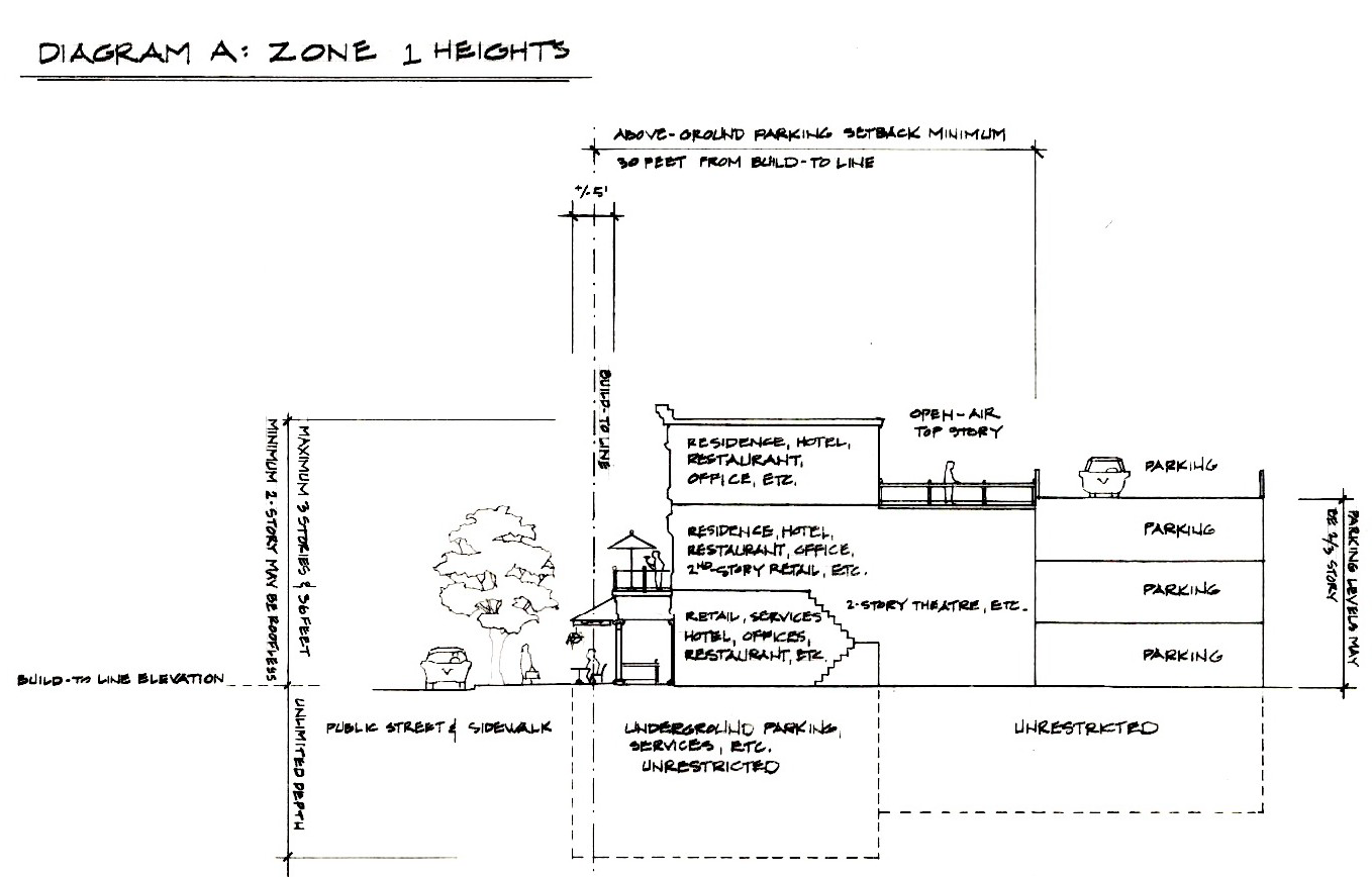
Diagram A: Zone 1 Heights
a.
Maximum height shall not exceed three (3) stories or thirty-six (36) feet above the adjacent build-to-line, whichever is less. Accessory roof structures that are not permanently affixed and parapet walls, not exceeding thirty (30) inches, shall be excluded.
b.
See Diagram A for illustration.
2.
Zone 2:
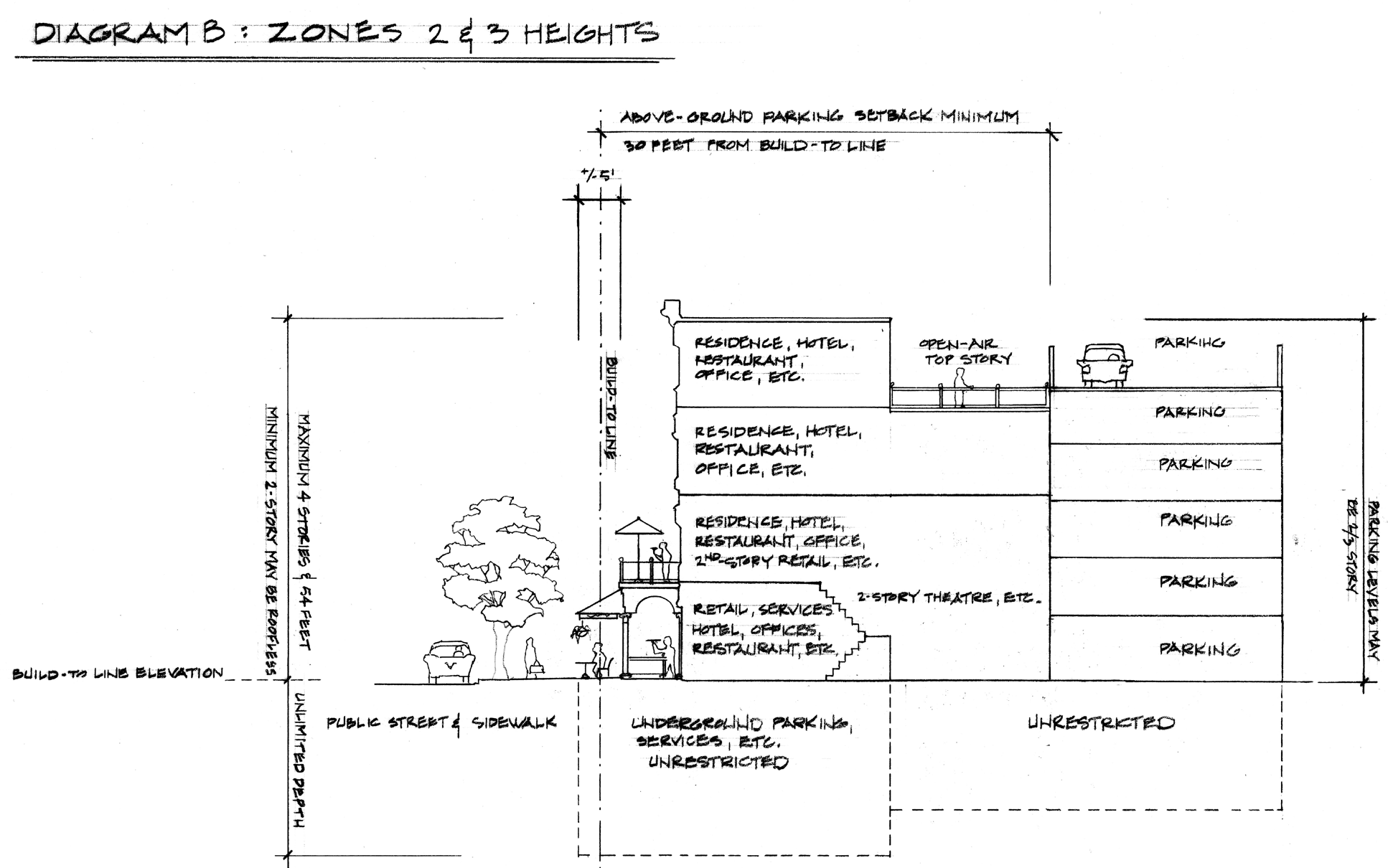
Diagram B: Zone 2 and 3 Height
a.
Maximum height shall not exceed four (4) stories or fifty-four (54) feet above the adjacent build-to-line, whichever is less. Accessory roof structures that are not permanently affixed and parapet walls, not exceeding thirty (30) inches, shall be excluded.
b.
See Diagram B for illustration.
3.
Zone 3:
a.
Maximum height shall not exceed four (4) stories or fifty-four (54) feet above the adjacent build-to-line, whichever is less. Accessory roof structures that are not permanently affixed and parapet walls, not exceeding thirty (30) inches, shall be excluded. For the purpose of calculating the number of stories in this zone, parking levels shall be treated as being two-thirds (⅔) of a story.
b.
See Diagram B for illustration.
4.
Zone 4:
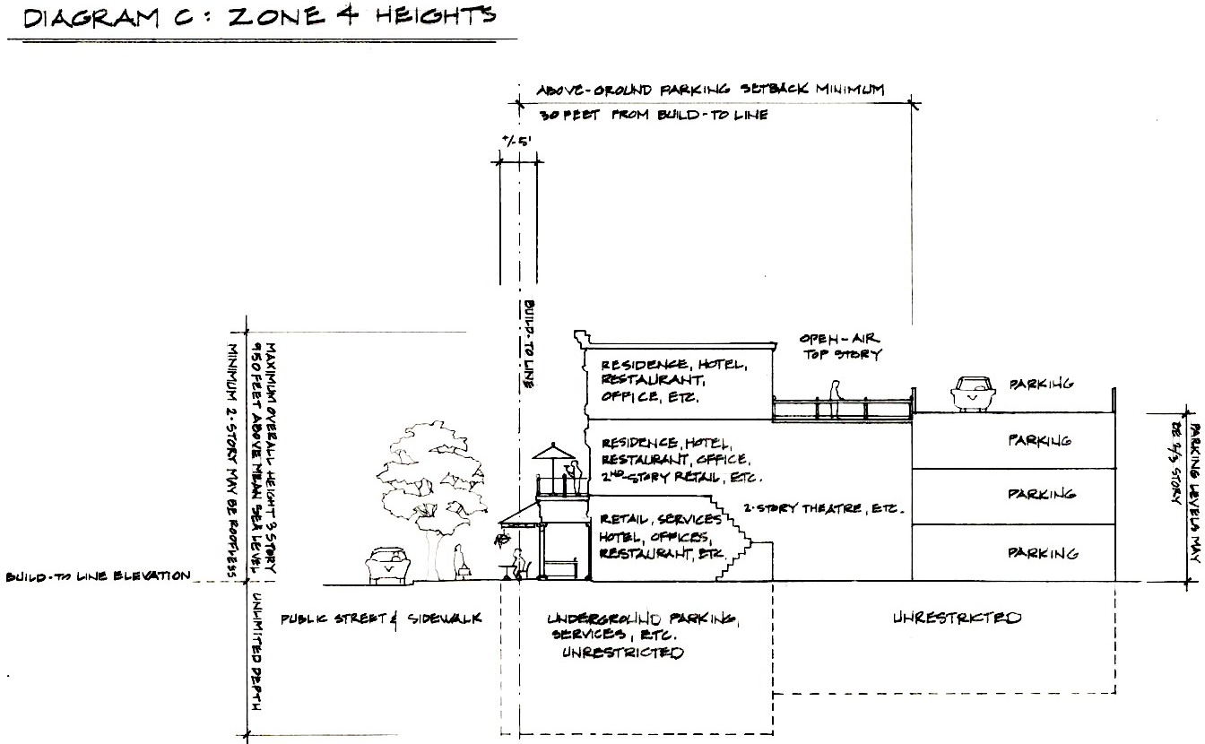
Diagram C: Zone 4 Heights
a.
Maximum height shall not exceed three (3) stories or thirty-six (36) feet above the adjacent build-to-line, whichever is less. Accessory roof structures that are not permanently affixed and parapet walls, not exceeding thirty (30) inches, shall be excluded.
b.
In no case shall any structure, including authorized parapet walls, extend beyond nine hundred fifty (950) feet above mean sea level.
c.
See Diagram C for illustration.
F.
Basements and below-grade parking levels shall not count towards the minimum and maximum number of stories.
G.
The foundation of buildings fronting build-to-lines shall not extend higher than one (1) foot above the build-to-lines.
![]()
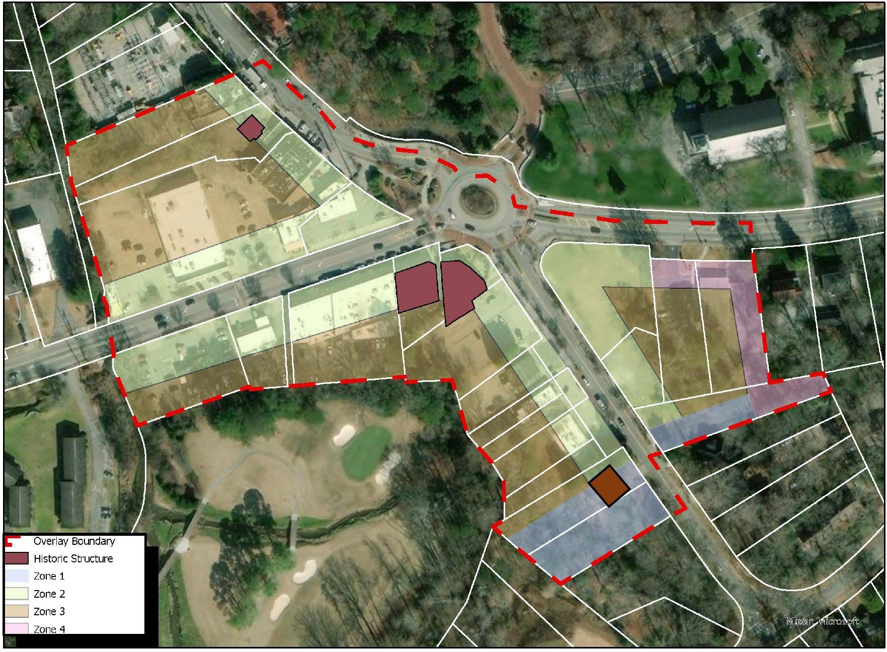
Diagram E: Emory Village Regulating Plan.
(Ord. No. 2023-0906, Pt. I, 9-28-23)
Sec. 3.22.10. - Square footage requirements.
A.
Residential uses. There are no minimum or maximum square footage requirements for apartments, condominiums, or other residential uses within the Emory Village Overlay District.
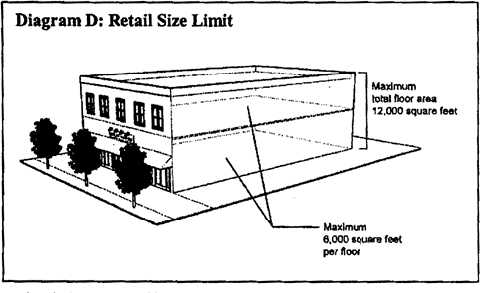

Diagram D: Size Limits for Food Stores, Other Retail, Restaurants, and Services
B.
Retail, restaurants, and services. Retail, restaurant, and service uses shall be subject to the following size limits.
1.
Except for a retail use with at least seventy (70) percent of floor area dedicated to the sale of food items, no individual retail use or service use shall occupy a horizontal area greater than nine thousand (9,000) square feet on one (1) level or a total floor area of twelve thousand (12,000) square feet if on two (2) levels.
2.
Retail uses with at least seventy (70) percent of the floor area dedicated to the sale of food items and nonalcoholic beverages may occupy a maximum horizontal area of twelve thousand (12,000) square feet regardless of number of levels.
3.
Outside areas used for dining, retail, and other functions shall not count towards the square footage limits.
C.
Offices. There are no minimum or maximum square footage requirements for offices.
(Ord. No. 2023-0906, Pt. I, 9-28-23)
Sec. 3.22.11. - Open space and lot coverage requirements.
A.
Open space shall include:
1.
Public rights-of-way or other publicly owned lands.
2.
The portion of property between the build-to-line and the public right-of-way.
3.
The portion of property within the seventy-five (75) foot stream buffer imposed by chapter 14 of the Code.
4.
The portion of property within established one hundred (100) year flood zone established by FEMA.
B.
Buildings shall not be constructed in areas identified in subsections A.2. and A.3.
C.
The maximum lot coverage on lots not impacted by subsections A.2., A.3. and A.4. may be one hundred (100) percent.
D.
Covenants or other legal arrangements shall specify ownership of all open spaces, the method of and responsibility for maintenance, applicable taxes and insurance and assessment shall be incorporated into legal instruments to ensure that open space within the Emory Village Overlay District is maintained.
(Ord. No. 2023-0906, Pt. I, 9-28-23)
Sec. 3.22.12. - Transitional buffer zones.
Wherever any proposed nonresidential use abuts a single-family, residential use, a continuous evergreen landscape hedge no less than six (6) feet tall and four (4) feet deep at planting shall be required as a buffer along the entire adjoining lot line, except within twelve (12) feet of a public right-of-way. No building may be placed within seven (7) feet of the boundary line between such lots.
(Ord. No. 2023-0906, Pt. I, 9-28-23)
Sec. 3.22.13. - Architectural design standards.
A.
All buildings, structures and land within the overlay district shall be regulated by and comply with the Emory Village design standards and hereby adopted by reference as if fully set forth herein and hereinafter referred to as the "Emory Village Design Standards." These standards provide design specifications for architecture, parking, landscaping, signs, fences, lighting, street furniture and utilities. All improvements to existing buildings requiring a building permit, all new buildings, all improvements to parking lots or garages, any subdivision of land, and all improvements made within a public right-of-way shall comply with the Emory Village design standards.
B.
All sides of parking structures that face a street or shall be enclosed by occupied space and shall comply with the Emory Village design standards.
C.
The planning and sustainability director or designee is hereby authorized and directed to administer the Emory Village design standards. These standards as well as the regulations set forth in this division and base zoning regulations shall be the criteria used by the planning director or designee to evaluate compliance of all applications including but not limited to, building permits, development permits, and subdivisions.
D.
Subject to compliance with Georgia Department of Transportation (GDOT) design standards (where applicable), all improvements to public infrastructure including, but not limited to, streets, curbs, sidewalks, pedestrian crosswalks, street trees, street lighting, stormwater management and drainage, shall comply with the requirements of chapter 14 of this Code and, in addition, to all other standards in this division and the Emory Village design standards. In the event of conflicts between this division and the Emory Village design standards, the Emory Village design standards shall govern.
(Ord. No. 2023-0906, Pt. I, 9-28-23)
Sec. 3.22.14. - Sidewalks.
A.
Requirement. Unless sidewalks meeting the conditions established below already exist, new sidewalks along all street frontages shall be required for new structures. Sidewalks are required on all of the sides of a structure that border the public right-of-way. They shall connect with the sidewalks on adjoining properties.
B.
Sidewalk width. Sidewalks shall be of the widths indicated below and shall consist of two (2) zones: a furniture zone and a clear zone.
1.
The furniture zone shall have a minimum width of:
a.
Ten (10) feet on the south side of North Decatur Road, east of Oxford Road;
b.
Ten (10) feet on the west side of Oxford Road, south of North Decatur Road; and
c.
Five (5) feet at all other locations; and
d.
Said widths shall be in addition to any existing or newly created on-street parking.
2.
The sidewalk clear zone shall have a minimum width of:
a.
Fifteen (15) feet on the south side of North Decatur Road, east of Oxford Road;
b.
Fifteen (15) feet on the west side of Oxford Road, south of North Decatur Road; and
c.
Ten (10) feet at all other locations.
(Ord. No. 2023-0906, Pt. I, 9-28-23)
Sec. 3.22.15. - Curb cuts.
A.
A maximum of one (1) curb cut is permitted for each parcel with the exception of properties with frontage on more than one (1) street, which may have one (1) curb cut located on each frontage, and with the exception of a hotel. Curb cuts shall not be placed within one hundred (100) feet of another existing curb cut on the same property. The total number of curb cuts should be minimized, and adjoining properties shall be encouraged to share curb cuts to reduce interruptions to the sidewalks.
B.
Curb cuts shall be between twenty (20) and twenty-four (24) feet wide for two-way entrances. Curbs cuts shall be between ten (10) and twelve (12) feet wide for one-way entrances.
(Ord. No. 2023-0906, Pt. I, 9-28-23)
Sec. 3.22.16. - Parking requirements.
A.
Minimum number of parking spaces. All land uses indicated shall provide off-street parking spaces in the quantities specified in Table B "Standards for Off-Street Parking: Emory Village Overlay District." All uses not listed therein shall meet the parking requirements of the underlying zoning district.
Table B: Standards for Off-Street Parking
B.
Shared parking. To satisfy these parking requirements, parking may be located on the businesses/restaurants/residences lots and/or on other lots within the overlay district. Shared parking between land uses within the overlay district is encouraged and may result in permitted reductions of off-street parking requirements. Parking facilities within the overlay district may be shared if the uses generate parking demands primarily at different times of the day or if a use has excess off-street parking capacity. Applicants may submit a plan for shared parking to the director of planning or designee for authorization of shared parking. Such plans shall include:
1.
A scaled map indicating location of all proposed parking spaces;
2.
Written consent of all property owners to the shared or off-site parking arrangement.
C.
Parking reductions. The director of planning is hereby authorized to grant or deny, pursuant to the sections 7.6.6., 7.6.7, and 7.6.8 (administrative variances), an administrative variance which permits the reduction of the total required parking spaces for the uses by no more than twenty (20) percent of the otherwise required total.
D.
Changes in use. Any change in use of a building, shop or leased area shall require compliance with the parking standards in this section as a prerequisite to obtaining a certificate of occupancy.
E.
Parking design.
1.
On-street parking for nonresidential uses is permissible, subject to approval by the County Public Works Department and/or GDOT. An establishment may count any permitted on-street parking spaces immediately abutting the subject property towards the required minimum parking quantity. This may include valet service or ride-share services.
2.
All on-street parking shall be provided in parallel parking spaces at least eight (8) feet by twenty-two (22) feet.
3.
Off-street parking for townhomes, apartments, and condominiums in Zones 1 and 4 (see Diagram E) must be provided in the rear. Off-street parking shall not be located in the front yard, between a building and the street. Spaces designated for permanent parking and loading shall be permitted within the front yard where provision of adequate parking spaces within the rear is impractical and upon issuance of a variance from the zoning board of appeals.
4.
Authorized accessory parking garages fronting public right-of-way shall align with build-to lines and shall have ground level commercial uses on at least seventy-five (75) percent of the length of the façades facing the public right-of-way.
5.
Parking entries shall comply with required curb cut standards.
6.
Parking structure facades shall be designed to resemble other habitable buildings. All sides of parking structures shall be subject to the Emory Village design standards. Sloping ramps shall be concealed from exterior view. Views from the public rights-of-way and adjoining properties to the interior of structures shall be screened with architectural devices or evergreen plantings.
7.
All newly proposed parking lots and parking spaces shall conform to the geometric design standards set forth in chapter 27, article 6, table 6.1.
8.
All newly proposed parking lots, garages, and parking spaces shall comply with the site design guidelines outlined in these Emory Village Overlay District regulations.
9.
All newly created surface parking lots and parking decks shall have walkways or pedestrian passages with a minimum width of five (5) feet. They shall connect the public sidewalks to the parking areas.
10.
One (1) bicycle/moped/scooter parking space shall be provided for every fifteen (15) automobile parking spaces, with no fewer than three (3) bicycle/moped parking spaces per parking facility.
11.
In every parking structure, at least one (1) electric vehicle charger or alternative clean fueling station shall be provided for every ten (10) vehicle parking spaces.
12.
Parking lots and structures shall be evenly lit at an intensity equal to at least two-tenths (0.2) footcandle of light. Cutoff luminaires shall be used to prevent light spillage and direct glare on to neighboring properties. Lights in parking areas shall be no taller than twenty (20) feet.
13.
All newly proposed parking lots and parking spaces shall comply with the requirements of the Americans with Disabilities Act (ADA) and any other applicable state or federal law.
G.
No other use. No parking space, driveway, or parking lot shall be used for the sale, repair, dismantling, servicing, or long-term (i.e., beyond forty-eight (48) hours) storage of any vehicle or equipment.
(Ord. No. 2023-0906, Pt. I, 9-28-23)
Sec. 3.22.17. - Sign regulations.
All signs within the Emory Village Overlay District shall be regulated by and comply with both chapter 21 of this Code and the Emory Village design standards.
(Ord. No. 2023-0906, Pt. I, 9-28-23)
Sec. 3.22.18. - Processes: Application procedure, plans required, certificates of appropriateness.
A.
Conceptual plan review. Prior to application for any development permit, building permit, sign permit or other permit required for construction or alteration of the exterior of structures or sites in the overlay district, the applicant shall meet with the director of planning or designee. The applicant shall provide architectural plans, site plan and other information explaining how the proposal meets the purpose, intent, and standards of this division of the Code.
B.
Required applications and plans. An applicant for any development permit, building permit, sign permit or other permit required for construction or alteration of structures or sites in the overlay district shall submit an application for certificate of compliance with the overlay district's regulations on an approved form to the director of planning or designee.
C.
Historic preservation review. New construction or any material change in the exterior of an existing building, structure, site, or work of art within the Emory Village Overlay District shall also require a certificate of appropriateness approved by the historic preservation commission pursuant to chapter 13.5 of this Code. The director of planning or designee shall consolidate all plan reviews and comments in a written submission to the historic preservation commission.
D.
Variances. Applications for variances from regulations not contained in this division but for properties located within the overlay district shall not require a certificate of appropriateness from the historic preservation commission. Instead, the director of planning or designee shall provide all variance applications arising under chapter 14 or 27 of this Code to the historic preservation commission for study and investigation within five (5) business days of receipt of the application. The historic preservation commission shall issue a recommendation within forty-five (45) days of receipt of the variance application. No application for a variance under chapter 14 or 27 shall be considered complete until such time as the historic preservation commission has had an opportunity to provide its recommendation in writing. If no written recommendation is issued within the applicable time frame, then the planning commission and/or the zoning board of appeals shall construe the recommendation to be for approval. A recommendation for approval or denial of a variance by the historic preservation commission shall not be binding on the zoning board of appeals or the planning commission.
E.
Subdivision and lot adjustments. Any material change resulting in a new subdivision, a preliminary "sketch" plat, lot aggregation, or lot alteration shall require a certificate of appropriateness prior to consideration by planning commission or the director of planning (or designee), as applicable. The historic preservation commission shall approve, approve with modifications, or deny an application within forty-five (45) days of the official acceptance of the application and plat. No application for sketch plat approval shall be considered by the planning commission unless approved or approved with modifications by the historic preservation commission.
(Ord. No. 2023-0906, Pt. I, 9-28-23)
Sec. 3.22.20. - Emory Village design standards.
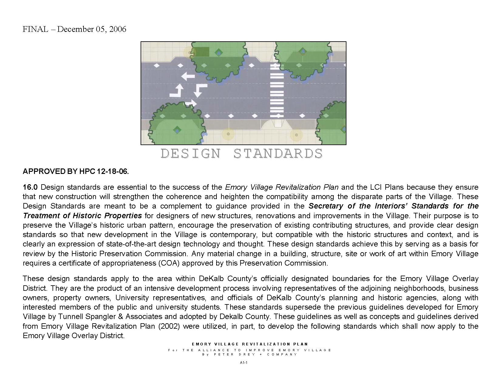
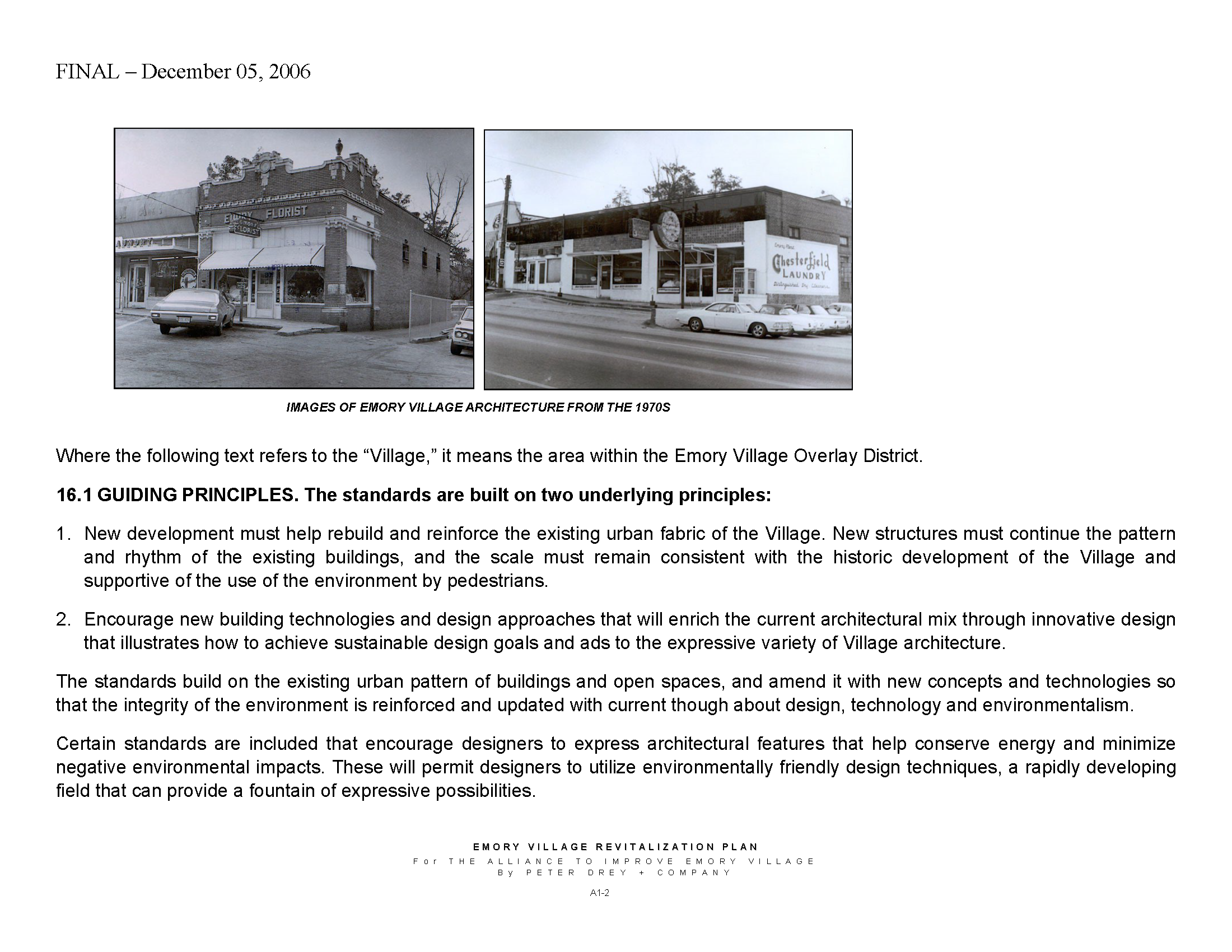
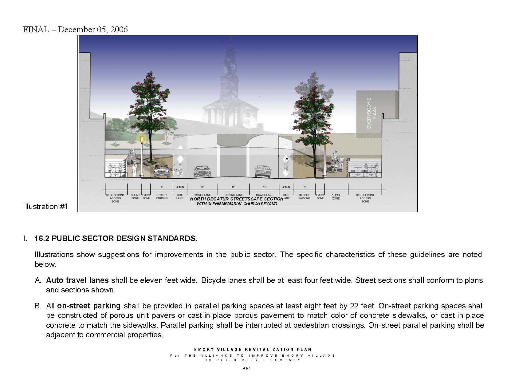
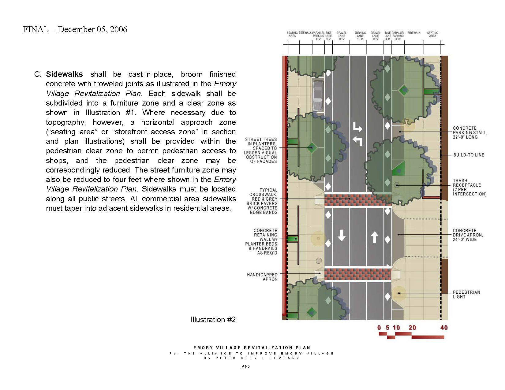
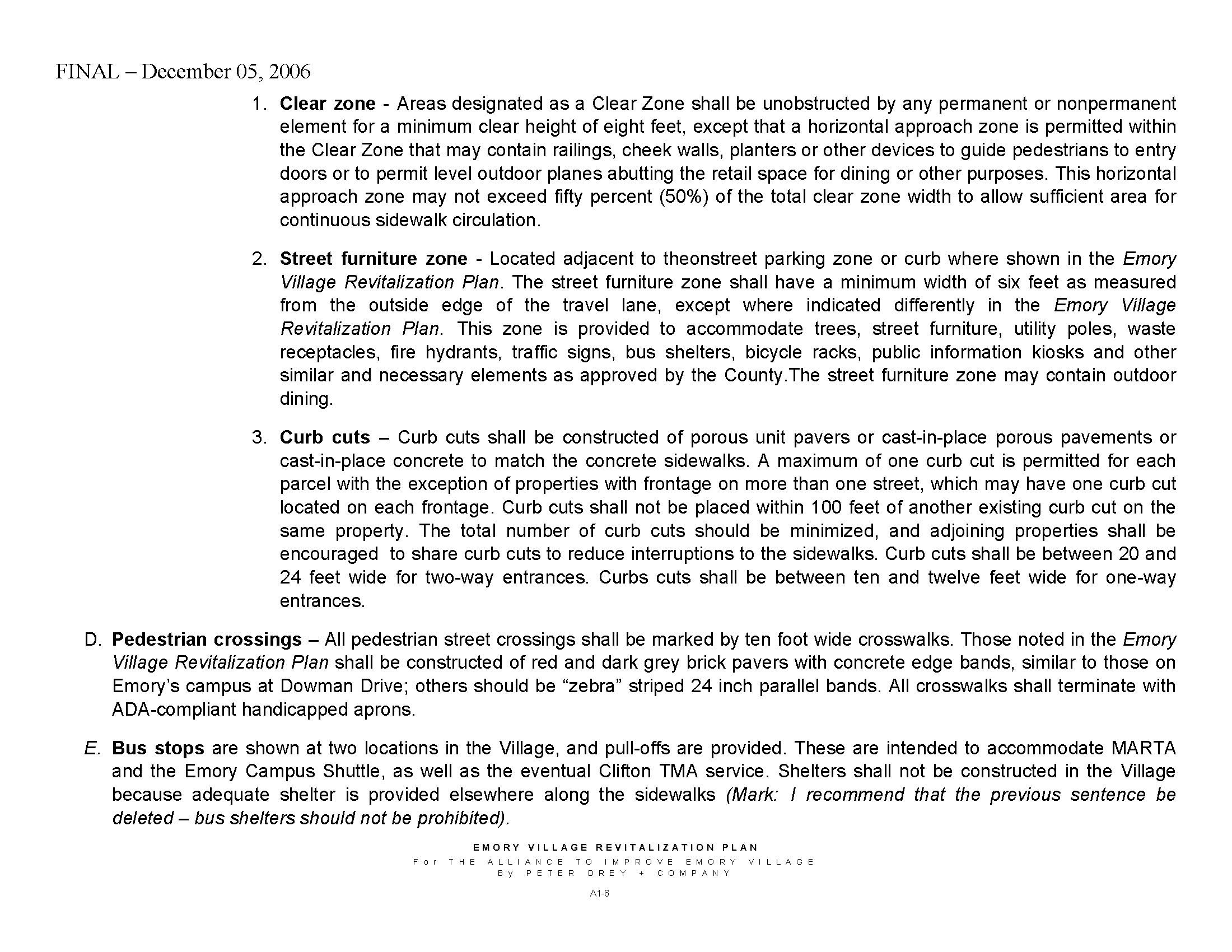
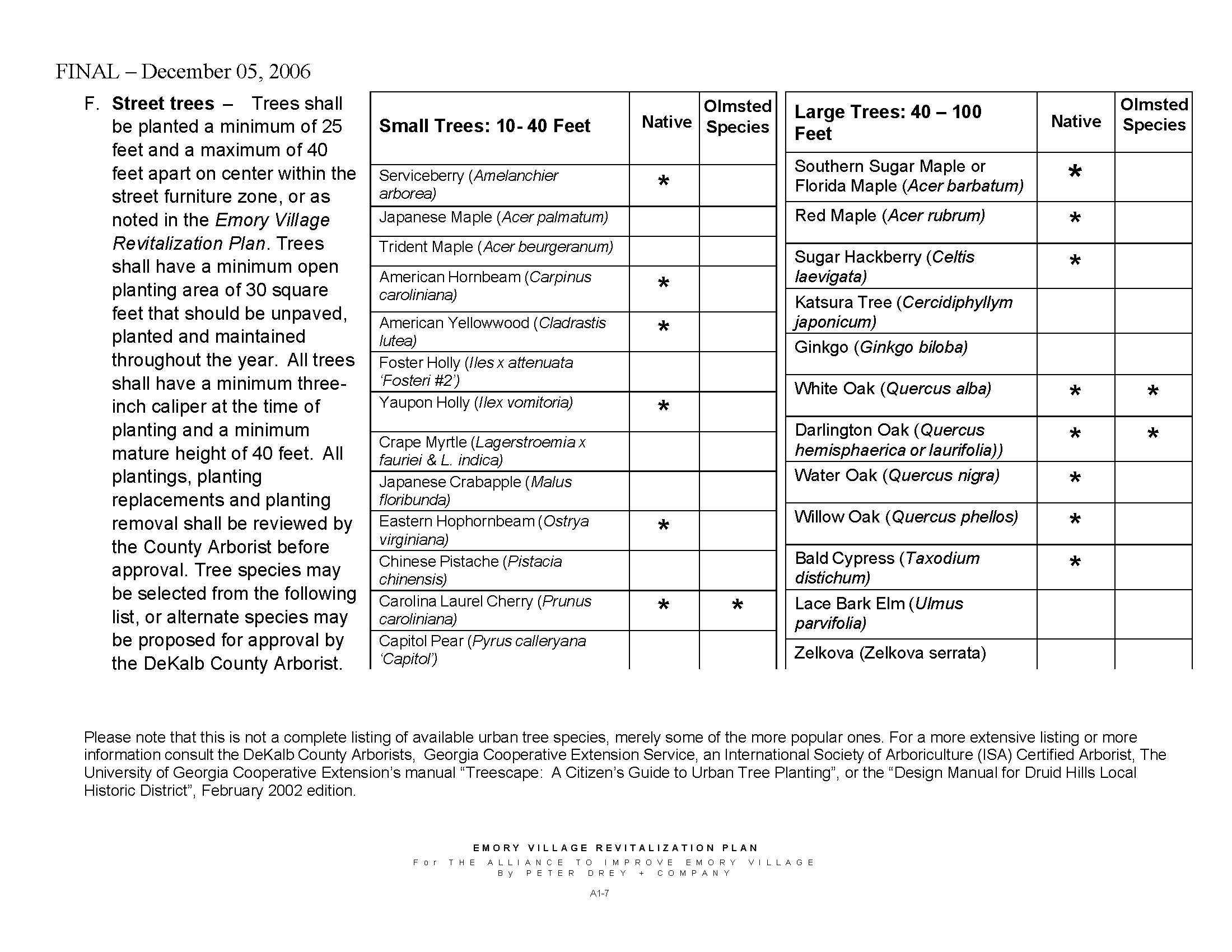
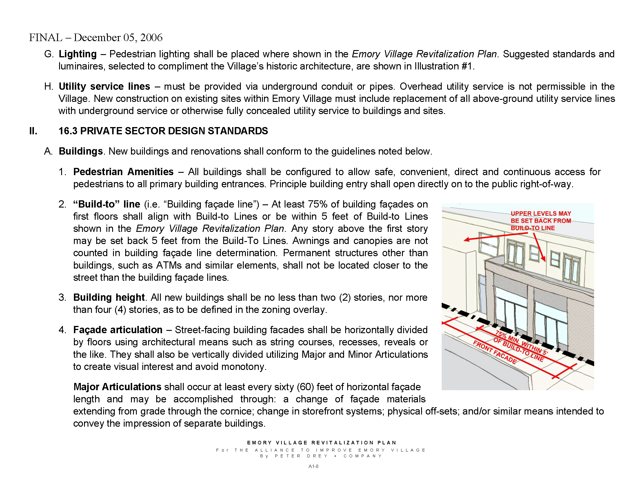
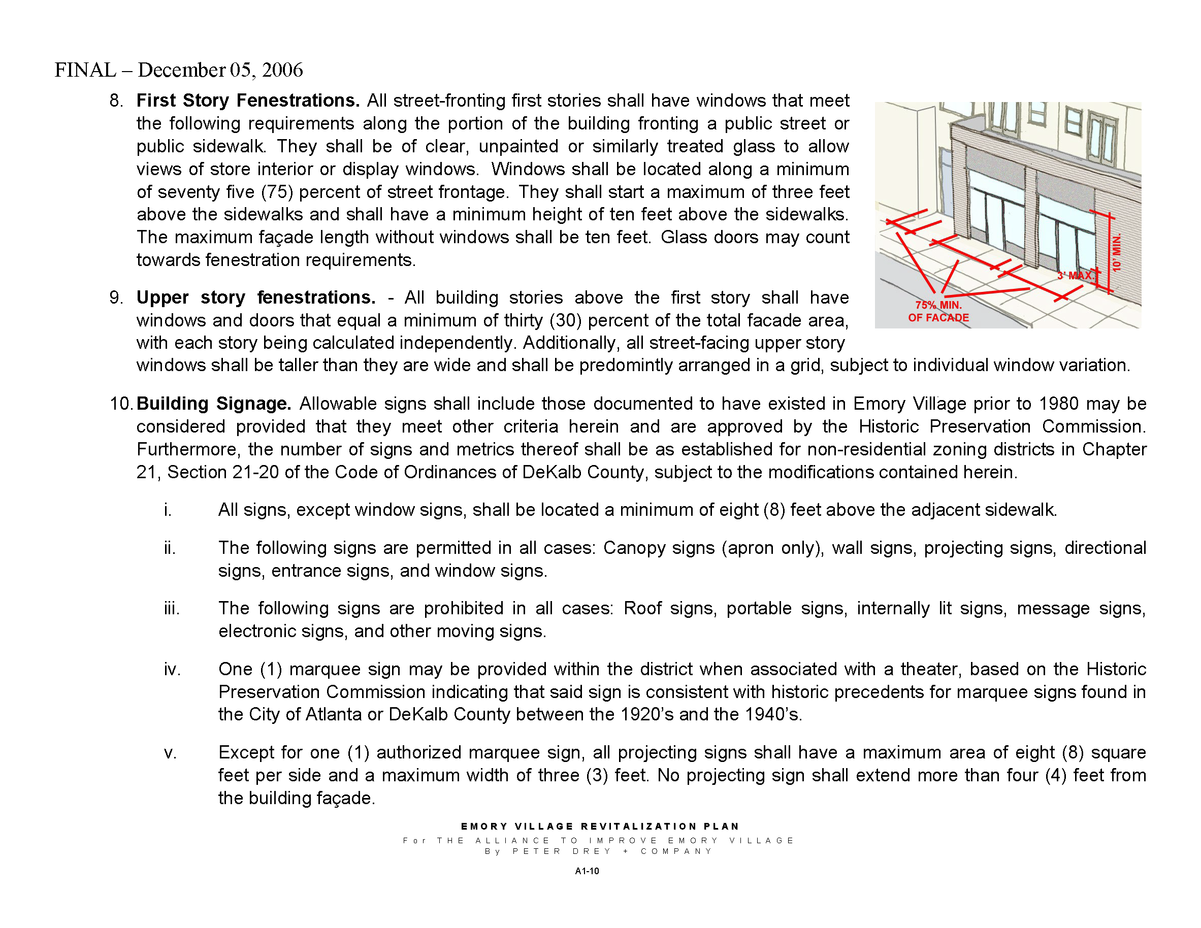
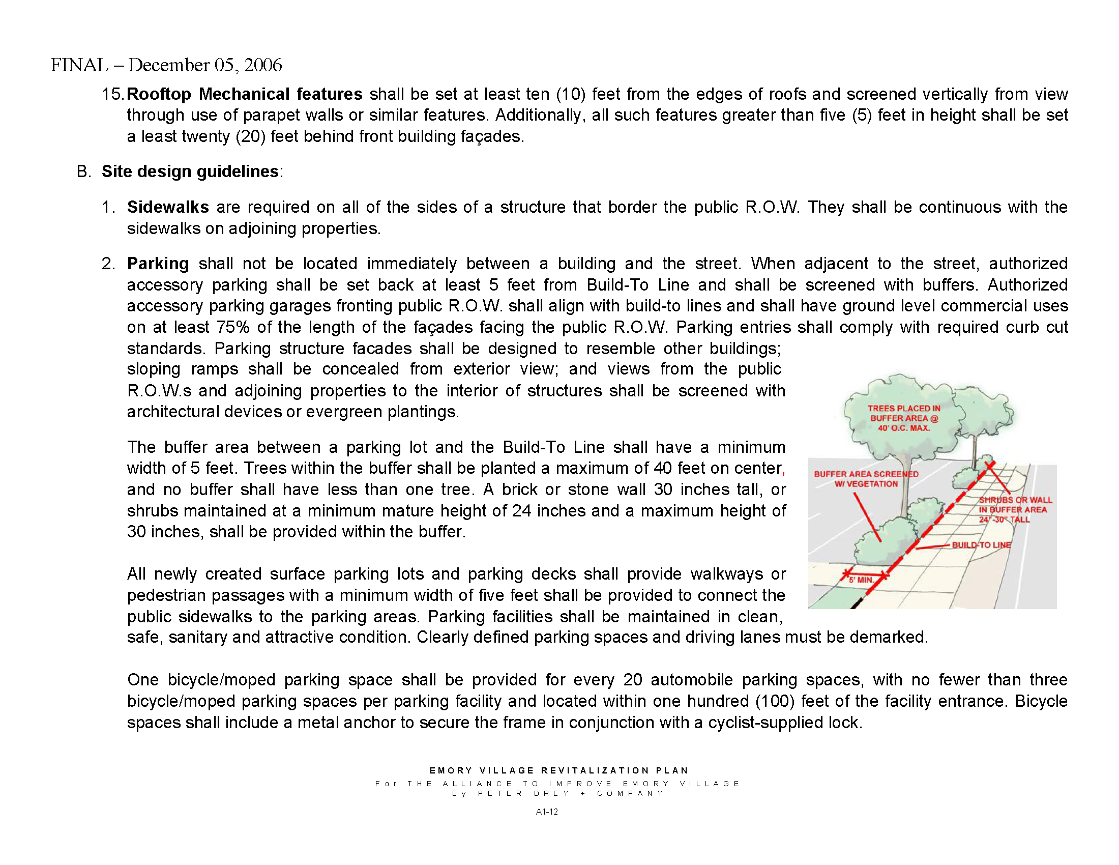
(Ord. No. 2023-0906, Pt. I, 9-28-23)
Sec. 3.23.1.- Scope of the regulations, applicability and boundaries.
This division establishes standards and procedures that apply to any development that lies, in whole or in part, within the Green Acres Overlay District. The boundaries of the Green Acres Overlay District shall be established by a zoning map amendment adopted pursuant to this chapter which amendment is incorporated herein and made a part of this chapter 27. The provisions of this Code including, but not limited to, the provisions of division 8 of this article shall govern the demolition, new construction, and residential development in whole or in part with any area of the Green Acres Overlay District.
(Ord. No. 15-06, 8-25-2015)
Sec. 3.25.1.- Scope of the regulations, applicability and boundaries.
This division establishes standards and procedures that apply to any development that lies, in whole or in part, within the Lavista Acres Overlay District. The boundaries of the Lavista Acres Overlay District shall be established by a zoning map amendment adopted pursuant to this chapter which amendment is incorporated herein and made a part of this chapter 27. The provisions of this Code including but not limited to the provisions of division 8 of this article shall govern the demolition, new construction, and residential development in whole or in part with any area of the Lavista Acres Overlay District.
(Ord. No. 15-06, 8-25-2015)
Sec. 3.26.1.- Scope of the regulations, applicability and boundaries.
This division establishes standards and procedures that apply to any development that lies, in whole or in part, within the Beacon Hill Boulevard Overlay District. The boundaries of the Beacon Hill Boulevard Overlay District shall be established by a zoning map amendment adopted pursuant to this chapter which amendment is incorporated herein and made a part of this chapter. The provisions of this Code, including, but not limited to, the provisions of division 8, shall govern the demolition, new construction, and residential development in whole or in part with any area of the Beacon Hill Boulevard Overlay District.
(Ord. No. 15-06, 8-25-2015)
Sec. 3.27.1.- Scope of the regulations, applicability and boundaries.
This division establishes standards and procedures that apply to any development that lies, in whole or in part, within the Springbrook Estates Overlay District. The boundaries of the Springbrook Estates Overlay District shall be established by a zoning map amendment adopted pursuant to this chapter which amendment is incorporated herein and made a part of this chapter. The provisions of this Code, including, but not limited to, the provisions of division 8 shall govern the demolition, new construction, and residential development in whole or in part with any area of the Springbrook Estates Overlay District.
(Ord. No. 15-06, 8-25-2015)
Sec. 3.28.1.- Scope of the regulations, applicability and boundaries.
This division establishes standards and procedures that apply to any development that lies, in whole or in part, within the Mount Brian-Berkeley Overlay District. The boundaries of the Mount Brian-Berkeley Overlay District shall be established by a zoning map amendment adopted pursuant to this chapter which amendment is incorporated herein and made a part of this chapter. The provisions of this Code, including, but not limited to, the provisions of division 8 shall govern the demolition, new construction, and residential development in whole or in part with any area of the Mount Brian-Berkeley Overlay District.
(Ord. No. 15-06, 8-25-2015)
Sec. 3.29.1.- Scope of the regulations, applicability and boundaries.
This division establishes standards and procedures that apply to any development that lies, in whole or in part, within the Echo Hills Sunset Overlay District. The boundaries of the Echo Hills Sunset Overlay District shall be established by a zoning map amendment adopted pursuant to this chapter which amendment is incorporated herein and made a part of this chapter. The provisions of this Code, including, but not limited to, the provisions of division 8 shall govern the demolition, new construction, and residential development in whole or in part with any area of the Echo Hills Sunset Overlay District.
(Ord. No. 15-06, 8-25-2015)
Sec. 3.31.1.- Scope of the regulations, applicability and boundaries.
This division establishes standards and procedures that apply to any development that lies, in whole or in part, within the Echo Lake Overlay District. The boundaries of the Echo Lake Overlay District shall be established by a zoning map amendment adopted pursuant to this chapter which amendment is incorporated herein and made a part of this chapter. The provisions of this Code, including, but not limited to, the provisions of division 8 shall govern the demolition, new construction, and residential development in whole or in part with any area of the Echo Lake Overlay District.
(Ord. No. 15-06, 8-25-2015)
Sec. 3.32.1.- Scope of the regulations, applicability and boundaries.
This division establishes standards and procedures that apply to any development that lies, in whole or in part, within the Fairstone Overlay District. The boundaries of the Fairstone Overlay District shall be established by a zoning map amendment adopted pursuant to this chapter which amendment is incorporated herein and made a part of this chapter. The provisions of this Code, including, but not limited to, the provisions of division 8 shall govern the demolition, new construction, and residential development in whole or in part with any area of the Fairstone Overlay District.
(Ord. No. 15-06, 8-25-2015)
Sec. 3.32.5.1.- Scope of the regulations, applicability and boundaries.
This division establishes standards and procedures that apply to any development that lies, in whole or in part, within the Ramble Woods Overlay District. The boundaries of the Ramble Woods Overlay District are established by a zoning map amendment adopted pursuant to this chapter which amendment is incorporated herein and made a part of this chapter 27. The provisions of this Code including, but not limited to, the provisions of division 8 of this article shall govern the demolition, new construction, and residential development in whole or in part with any area of the Ramble Woods Overlay District.
(Ord. No. 15-06, 8-25-2015)
Sec. 3.33.1.- Scope of regulations.
This division establishes standards and procedures that apply to any development, use, alteration, height, density, parking, open space, and building on any lot or portion thereof which is in whole or in part contained within the boundaries of the I-20 Corridor Compatible Use Overlay District. This division shall be governed by chapter 27, article 3, division 1, section 3.2.1 of the DeKalb County Zoning Ordinance.
(Ord. No. 15-06, 8-25-2015)
Sec. 3.33.2. - Applicability of regulations.
This division applies to each application for a business license, land disturbance permit, building permit or a sign permit which involves the development, use, alteration, or modification of any structure where the subject property is in whole or in part contained within the boundaries of any of the I-20 Corridor Compatible Use Overlay District. The procedures, standards, and criteria herein apply only to that portion of the subject property within the boundaries of the I-20 Corridor Compatible Use Overlay District.
(Ord. No. 15-06, 8-25-2015)
Sec. 3.33.3. - Statement of purpose and intent.
The purpose and intent of the board of commissioners in establishing the I-20 Corridor Compatible Use Overlay District is as follows:
A.
To encourage development and redevelopment of properties within the district in order to achieve a variety of mixed-use communities;
B.
To provide for the development of sidewalks and walkways in order to promote safe and convenient pedestrian access and to reduce dependence on automobiles and other motorized means of transportation;
C.
To promote physically attractive, environmentally safe and economically sound mixed-use communities;
D.
To permit and to encourage mixed-use developments containing both commercial and residential uses so as to create a pedestrian oriented communities in which people can live, work and play; and
E.
To improve the visual appearance and increase property values within the I-20 corridor and to implement the objectives of the comprehensive plan;
F.
To enhance the long-term economic viability of the portion of DeKalb County within the overlay by encouraging new commercial and residential developments that increase the tax base and provide employment opportunities to the citizens of DeKalb County;
G.
To implement the policies and objectives of the DeKalb County Comprehensive Plan 2005-2025 and the policies and objectives of the design standards for the I-20 Corridor Compatible Use Overlay District;
H.
To establish and maintain a balanced relationship between industrial, commercial, and residential growth to ensure a stable and healthy tax base in DeKalb County;
I.
To provide a balanced distribution of regional and community commercial and mixed-use office centers;
J.
To support high-density housing in office and mixed-use centers which have the appropriate location, access, and infrastructure to support such development;
K.
To encourage mixed-use developments that meet the goals and objectives of the Atlanta Regional Commission's Smart Growth and Livable Centers Initiatives;
L.
To allow flexibility in development standards in order to encourage the design of innovative development projects that set high standards for landscaping, green space, urban design, and public amenities;
M.
To encourage an efficient land use and development plan by forming a live-work-play environment that offers employees and residents the opportunity to fulfill their daily activities with minimal use of single-occupant automobiles;
N.
To allow and encourage development densities and land use intensities that are capable of making productive use of alternative transportation modes such as bus transit, rail transit, ridesharing, bicycling and walking;
O.
To focus and encourage formation of well designed, pedestrian-friendly activity centers with high-density commercial and residential development that increases vitality and choices in living environments for the citizens of DeKalb County;
P.
To protect established residential areas from encroachment of uses which are either incompatible or unduly cause adverse impacts on such communities, and to protect the health, safety and welfare of the citizens of DeKalb County;
Q.
To promote uniform and visually aesthetic architectural features which serve to unify the distinctive visual quality of the I-20 corridor area.
(Ord. No. 15-06, 8-25-2015)
Sec. 3.33.4. - District boundaries and maps.
A.
The I-20 Corridor Overlay District shall be comprised of the following six (6) areas that are centered along the roadways that intersect with Interstate 20: the Panola Road area; the Snapfinger Woods area; the Wesley Chapel Road area; the I-20/I-285 interchange area; the Candler Road corridor and the Gresham Road area.
B.
The boundaries of the Interstate 20 Corridor Compatible Use Overlay District shall be established by a zoning map amendment dated March 12, 2009, which is adopted contemporaneously with the adoption of this section and which is incorporated by reference as if fully set forth herein and made a part of this chapter.
C.
The I-20 Corridor Overlay District shall be divided into three (3) tiers to guide future development and redevelopment. The tiers are based on the future land use recommendations.
Tier 1—High-intensity area focused around the four (4) activity centers of Panola, Wesley Chapel, Candler Road and the Gresham Road area. The purpose of this tier is to allow the most intense mixed-use development. The goal is to allow for redevelopment of the oversized parking areas with new buildings including retail, office, and residential on one (1) parcel to decrease the need for vehicular trips. The maximum height shall be up to twenty (20) stories and sixty (60) dwelling units/acre.
Tier 2—Medium-intensity area wraps around the high-intensity area or at the locations of Snapfinger Woods and I-20/I-285 intersections. The purpose of this tier is to allow medium-density development in a mixed-use development. The maximum height shall be up to eight (8) stories and allows for up to forty (40) dwelling units per acre, with the exception of the properties that front on Parklake Drive, which shall be up to eight (8) stories in height and up to sixty (60) dwelling units per acre.
Tier 3—Low-intensity area which provides for a transition from the higher-intensity areas and more compatibility to the single-family neighborhoods adjacent to the overlay boundaries. The maximum height shall be up to four (4) stories and allows up to forty (40) dwelling units per acre.
D.
The planning and development director shall be the final authority to determine whether any property is located within the boundaries of this section.
(Ord. No. 15-06, 8-25-2015; Ord. of 5-26-2022, Pt. I, 5-26-2022)
Sec. 3.33.5. - Principal uses and structures.
The principal uses of land and structures which are allowed in the I-20 Corridor Overlay District are as provided by the applicable zoning district, subject to the limitations and standards contained within this division. All properties zoned C-1 (Local Commercial) District, C-2 (General Commercial) District, O-I (Office-Institutional) District, O-D (Office-Distribution) District, M (Industrial) and any RM (Multi-Family Residential) District shall be used in accordance with the underlying zoning district and/or for the following principal uses of land and structures in mixed use developments subject to the standards and limitations contained within this division.
A.
Animal hospital, veterinary clinic, pet supply store, animal grooming shop, and boarding and breeding kennel as an interior accessory use.
B.
Art gallery and art supply store.
C.
Automobile services as follows:
1.
Minor automobile repair and maintenance, subject to the requirements of section 4.2.14.
2.
Retail automobile parts and tire stores.
D.
Bank, credit union and other similar financial institution.
E.
Business service establishment.
F.
Child day care center and kindergarten.
G.
Communications uses as follows:
1.
Radio and television broadcasting station.
2.
Telephone business office.
H.
Community facilities as follows:
1.
Cultural facilities.
2.
Noncommercial club or lodge.
3.
Utility structure necessary for the transmission or distribution of service.
I.
Dwellings including apartments, condominiums, and multifamily units. Mixed-use developments may include any combination above plus retail or office uses, subject to the requirements of the I-20 Overlay District regulations.
J.
Educational uses as follows:
1.
Vocational schools.
2.
Private elementary, middle or high school.
3.
Specialized nondegree schools to include ballet, music, martial arts, etc.
K.
Movie theater, bowling alley, and other recreational facilities where such activities are wholly enclosed within a building. Nightclubs are permitted only in Tier 1 (maximum ten thousand (10,000) square feet in floor area), subject to approval of the planning and development director and business license requirements.
L.
Office uses, including the following and similar service, business and professional office uses as follows:
1.
Accounting, auditing and bookkeeping office.
2.
Engineering and architectural office.
3.
Building and construction contractor.
4.
Financial services office.
5.
Insurance office.
6.
Legal office.
7.
Medical office.
8.
Real estate office.
9.
Wholesale sales office.
M.
Place of worship.
N.
Restaurants.
O.
Retail sales as follows:
1.
Apparel and accessories store.
2.
Book, greeting card, and stationery store.
3.
Camera and photographic supply store.
4.
Computer and computer software store.
5.
Convenience store.
6.
Farm and garden supply store.
7.
Florist.
8.
Food stores including bakeries.
9.
Furniture, home furnishings and equipment store.
10.
General merchandise store.
11.
Gift, novelty, and souvenir store.
12.
Hardware store.
13.
Hobby, toy and game store.
14.
Jewelry store.
15.
Music and musical equipment store.
16.
News dealers and newsstand.
17.
Office supplies and equipment store.
18.
Quick copy printing store.
19.
Radio, television and consumer electronics store.
20.
Specialty store.
21.
Sporting goods and bicycle store.
22.
Variety store.
23.
Videotape sales and rental store.
P.
Retail building supplies as follows:
1.
Electrical supply store.
2.
Hardware and other building materials establishments.
3.
Paint, glass and wallpaper store.
Q.
Services, medical and health as follows:
1.
Health service clinic.
2.
Medical and dental laboratories.
3.
Offices of health service practitioners.
4.
Pharmacy and drugstore.
5.
Private ambulance and emergency medical services.
R.
Services, personal, as follows:
1.
Barber shop, beauty shop, and similar personal service establishments.
2.
Laundry and dry-cleaning store.
3.
Funeral home.
4.
Linen and diaper service, garment pressing, alteration and repair.
5.
Photographic studios.
S.
Services, repair, as follows:
1.
Home appliance repair and service.
2.
Jewelry repair service.
3.
Radio, television and similar home appliance repair service.
4.
Furniture upholstery and repair shop.
5.
Shoe repair store.
T.
Shopping center.
U.
Taxi stand and taxi dispatching office.
V.
Tennis center, club and facilities.
W.
Fitness center and health center.
X.
Hotel.
(Ord. No. 15-06, 8-25-2015)
Sec. 3.33.6. - Prohibited uses.
A.
The following principal uses of land and structures shall be prohibited within the I-20 Corridor Compatible Use Overlay District:
1.
Boarding and breeding kennels as a primary use.
2.
Storage yard for damaged automobiles or confiscated automobiles.
3.
Tire retreading and recapping.
4.
Adult entertainment establishments.
5.
Adult service facility.
6.
Go-cart concession.
7.
Outdoor equipment and materials storage.
8.
Heavy repair shop and trade shop.
9.
Extended stay motels.
10.
Used cars sales as a primary use.
11.
Temporary and/or seasonal outdoor sales.
12.
Title and pawn shops.
13.
Liquor stores.
14.
Night clubs excluded in Tiers 2 and 3.
15.
Salvage yards/junk yards.
16.
Self-service car wash and detailing.
17.
Self storage.
(Ord. No. 15-06, 8-25-2015)
Sec. 3.33.7. - Accessory uses and structures.
The following accessory uses of land and structures shall be authorized in the I-20 Corridor Compatible Use Overlay District:
A.
Accessory uses and structures incidental to any authorized use.
B.
Parking lots and parking garages.
C.
Club house, including meeting room or recreation room.
D.
Swimming pools, tennis courts, and other recreation areas and similar amenities.
E.
Signs, in accordance with the provisions of chapter 21 and this chapter.
(Ord. No. 15-06, 8-25-2015)
Sec. 3.33.8. - Special permits.
The following uses and structures shall be authorized only by permits of the type indicated:
A.
Special administrative permit from the director of planning and sustainability as referenced in section 4.2.21, commercial recreation and entertainment:
1.
Art shows, carnival rides, festivals and special events of community interest.
2.
Temporary outdoor social, religious, entertainment or recreation activity where the time period does not exceed fourteen (14) days duration, adequate parking is provided on the site.
3.
Telecommunications antennas that are incorporated in architectural features such as steeples, clock towers, water towers and attached to the top of high-rise buildings subject to requirements of section 4.2.50.
4.
Outdoor recreation/entertainment facilities.
B.
Special land use permit from the board of commissioners:
1.
Heliport.
C.
Special administrative permit from the director of planning and sustainability, as referenced in section 4.3.1, temporary use regulations:
1.
Temporary produce stand, as follows:
a.
A temporary produce stand shall be only allowed as an accessory use.
b.
A temporary produce stand can only operate between the months of March through October, per calendar year, subject to special administrative permit approval.
c.
Temporary produce stands must comply with the general requirements of section 4.3.1. (temporary outdoor uses: general requirement). Where the requirements of the overlay district and the general requirements conflict, the overlay standards shall apply.
(Ord. No. 15-06, 8-25-2015; Ord. of 8-10-2021(2), Pt. I; Ord. No. 2021-2645, Pt. I, 8-10-2021)
Sec. 3.33.9. - Development standards.
The following requirements shall apply to all structures in the I-20 Corridor Overlay District:
A.
Building setbacks. The following requirements apply:
1.
Minimum front yard setback. Zero (0) feet from right-of-way of public street where the distance between the back of curb and property line is fifteen (15) feet in width or greater.
2.
Minimum interior side yard. Ten (10) feet. In mixed-use developments there shall be a minimum of fifteen (15) feet between buildings and structures less than two (2) stories in height and a minimum of twenty (20) feet between buildings and structures when one (1) of them is greater than two (2) stories in height, and a minimum of twenty-five (25) feet between buildings when one (1) of them is greater than five (5) stories in height.
3.
Minimum rear yard. Ten (10) feet.
B.
Height of building and structures. All buildings and structures within the I-20 Corridor Overlay District shall comply with the height restrictions for the development category in which the subject parcels are located. The I-20 Corridor Overlay District shall be comprised of three (3) development categories. The height restrictions are as follows:
Tier 1—Buildings and structures shall not exceed twenty (20) stories.
Tier 2—Buildings and structures shall not exceed eight (8) stories.
Tier 3—Buildings and structures shall not exceed four (4) stories.
A building in the I-20 Corridor Compatible Use Overlay District may exceed any of the limitations specified by an application to the board of commissioners for a special land use permit. A parking deck may exceed five (5) stories in height; however, a parking deck shall not exceed ten (10) stories either as a separate deck structure or as part of an office building.
C.
Density. No development shall exceed a floor-area ratio (FAR) of three and one-half (3.5), unless it also provides additional public space or other amenities singly, or in combination as provided in paragraph D. below.
D.
Density bonus. The maximum allowable FAR of a building or development in a Tier 1 Zone shall be increased to a FAR not to exceed a total of five and one-half (5.5) in exchange for one (1) or more of the additional amenities provided in the table below:
Table 3.9
E.
Required parking. Required parking may be provided through a combination of off-street, on-street, or shared parking provided that all required parking is located with seven hundred (700) feet of the principal entrance of buildings which it is intended to serve. The minimum number of required parking spaces shall be as provided in article 6, except as follows:
1.
Retail uses, personal service uses, and other commercial and general business uses, including food stores—Minimum of four (4) spaces per one thousand (1,000) square feet of gross floor area.
2.
Office and clinic uses—Minimum of three (3) spaces per one thousand (1,000) square feet of gross floor area.
3.
Hotel and motel uses—Minimum of one (1) space per unit.
4.
Multifamily residential uses—Minimum of one and one-quarter (1.25) spaces per dwelling unit.
(Ord. No. 15-06, 8-25-2015)
Sec. 3.33.10. - Open space requirements.
A.
A minimum of twenty (20) percent open space shall be provided for each new development. Open space areas may be transferred from one parcel to another within overall developments that remain under unified control of a single property owner or group of owners, but must demonstrate interconnectedness of public areas.
B.
Open spaces shall be at grade, and surrounded by a mix of uses directly accessible from a public sidewalk and building entrances.
C.
Open spaces may include any combination of the following: yards, planted areas, fountains, parks, plazas, trails and paths, hardscape elements related to sidewalks and plazas, and similar features which are located on private property and accessible to the general public; on-street parking; and natural stream buffers shall be permitted to be counted toward the twenty (20) percent open space requirement.
D.
Private courtyards and other private outdoor amenities may be located at the interior of the block, behind buildings or on rooftops. Private courtyards and outdoor amenities shall not be counted toward the twenty (20) percent requirement.
E.
All open space including buffers, setbacks, sidewalk clear zones, sidewalk zones and open spaces shall be fully implemented prior to issuance of a certificate of occupancy for the primary development.
F.
Each applicant shall present as a part of the application for a building permit within the I-20 Corridor Overlay District a legal mechanism under which all land to be used for public space purposes shall be maintained and protected. Such legal mechanism may include deed restrictions, property owner associations, common areas held in common ownership or control, maintenance easements, or other legal mechanisms, provided that said legal mechanism shall be approved by the county attorney as assuring each of the following mandatory requirements:
1.
That all subsequent property owners within said I-20 Corridor Overlay District be placed on notice of this development restriction through the deed records of DeKalb County Superior Court;
2.
That all public space held in common will be properly maintained and insured with no liability or maintenance responsibilities accruing to the county;
3.
That a legal mechanism exists for notice of deficiencies in maintenance of the public space held in common, correction of these deficiencies, and assessment and liens against the properties for the cost of the correction of these deficiencies by a third-party or the county;
4.
When an applicant for an I-20 Corridor Overlay District chooses to utilize a property owners association in order to comply with the requirements of subsection A. above, the applicant, in addition to meeting all of said requirements, shall provide for all of the following:
a.
Mandatory and automatic membership in the property owners association as a requirement of property ownership;
b.
A fair and uniform method of assessment for dues, maintenance and related costs;
c.
Where appropriate, party wall maintenance and restoration in the event of damage or destruction; and
d.
Continued maintenance of public space held in common and liability through the use of liens or other means in the case of default.
(Ord. No. 15-06, 8-25-2015)
Sec. 3.33.11. - Transitional buffer zone and transitional height requirements.
A.
Where a lot on the external boundary of the I-20 Corridor Overlay District adjoins the boundary of any property outside the district that is zoned for any R zoning classification, RM zoning classification, MHP zoning classification, or TND zoning classification, a transitional buffer of not less than thirty (30) feet in width shall be provided and maintained in a natural state or so as to maintain an effective visual screen. Said transitional buffer zone shall not be paved or otherwise covered with impervious surfaces and shall not be used for parking, loading, storage or any other use, except that portions of the transitional buffer zone may be utilized for installation of utilities when necessitated by the development, and when the applicant shows that the utilities cannot be located outside of the transitional buffer zone. Water detention ponds shall not be located within the transitional buffer zones. No trees, other than dead or diseased trees, shall be removed from said transitional buffer zone, but additional trees and plant material may be added to the transitional buffer zone.
B.
Where a lot on the external boundary of the I-20 Corridor Overlay District adjoins the boundary of any property outside the district that is zoned for any R zoning classification, RM zoning classification, MHP zoning classification, or TND zoning classification, a transitional height plane of forty-five (45) degrees shall apply. Sensitivity shall be exercised for developments adjacent to residentially zoned properties through the use of staggered heights, greater setbacks, and enhanced buffers. Building heights in excess of thirty-five (35) feet shall increase setbacks from the buffer line at a ratio of one (1) to one (1).
(Ord. No. 15-06, 8-25-2015)
Sec. 3.33.12. - Architectural regulations.
The following architectural regulations shall apply to all uses and structures within the I-20 Corridor Overlay District. The architectural style within the I-20 Corridor Overlay Districts shall be governed by the I-20 Corridor Design Standards.
A.
All building façades visible from the public street shall consist of concrete, stone, brick or stucco.
B.
Architectural accents, where utilized, shall consist of non-reflective glass, glass block, natural stone, pre-cast concrete, brick, terra cotta, stucco or wood.
C.
Seventy-five (75) percent of the width of the front façade of the building at the ground level shall consist of fenestration.
D.
Roof materials shall not consist of any reflective surface.
E.
All exterior painted surfaces, where visible from the public street, shall be painted in earth tones. Colors shall be nonprimary colors including darker and cooler shades of green, red such as brick, yellow including beige, and lighter shades of brown including tan.
F.
Burglar bars and steel roll-down doors or curtains shall not be visible from the public street.
G.
Service bays for automobile service and repair uses shall be designed so that the openings of service bays are not visible from a public street.
H.
Chain-link fences shall not be visible from the public right-of-way and metal or temporary awnings are not permitted within the district.
I.
Dumpsters shall not be visible from the public street and shall be fenced or screened so as not to be visible from any adjoining residential district.
J.
Fabric and canvas awnings and all other building materials must be of durable quality and shall be compatible with materials used in adjoining buildings.
(Ord. No. 15-06, 8-25-2015)
Sec. 3.33.13. - Landscaping requirements.
The following landscaping regulations shall apply to all uses within the I-20 Corridor Overlay District, with the exception of mixed-use developments. Such developments shall require the submittal of a landscape plan for approval.
A.
Landscape strips. Any landscape strip shown as part of final design package shall not be less than five (5) feet in width and shall be provided along all side and rear property lines. The landscape strip in the front yard shall be a minimum of ten (10) feet in width and shall be planted with a row of street trees of at least three and one-half (3½) inches in caliper selected from the list of street trees species identified in the design standards for the I-20 Corridor Overlay District and planted not less than seventy-five (75) feet on center. Continuous landscaped strips shall be constructed along public rights-of-way except at points of ingress or egress into the facility.
B.
Ground cover. Ground cover shall also be provided in accordance with the design guidelines for the I-20 Corridor Overlay District in order to protect tree roots and to prevent erosion. Ground cover shall consist of evergreen shrubs or groundcover plant material mulched with pine bark mulch, or other similar landscaping material.
C.
New trees. Newly planted trees shall conform to the design guidelines for the I-20 Corridor Overlay District.
D.
Tree spacing. No tree shall be planted closer than two (2) feet from the street or sidewalk, and no closer than five (5) feet from a fire hydrant, sign post, streetlight standard, utility pole, or similar structure.
E.
Parking lot landscaping requirements. All parking lots within the I-20 Corridor Overlay District shall be landscaped pursuant to the requirements of section 5.4.4.
(Ord. No. 15-06, 8-25-2015)
Sec. 3.33.14. - Sidewalks, street tree planting zone, landscaping and ground cover requirements, and curb cuts.
A.
Sidewalk requirement. There shall be a public sidewalk constructed along all public street frontages contiguous to all properties within the I-20 Corridor Overlay Districts. The sidewalk shall be located five (5) feet from the curb and shall be ten (10) feet in width. The five-foot zone adjacent to the curb shall be the street tree-planting zone. In blocks where there are overhead utility lines, the director of planning and development may authorize a two-foot planting zone from the curb with the five-foot tree-planting zone to be located at the sidewalk.
B.
Street tree planting. Street trees of a caliper that is not less than three (3) inches shall be planted no less than thirty (30) feet between centerlines along properties within the district having street frontage. Trees of the following type shall be used:
1.
Crape myrtle, standard trunk.
2.
October glory red maple.
3.
Sunset maple.
4.
Nuttal oak (Quercus nattalli).
5.
Shumard oak (Quercus shumardii).
6.
Willow oak.
7.
Zelkova serrata.
8.
Ginkgo (Ginkgo biloba).
9.
Trident maple (Acer buergeranum).
10.
Allee lacebark elm (Ulmus parvifolia emer (II).
C.
Maintenance of trees and ground cover. All street trees and other trees and all ground cover required by this chapter or by chapter 14 of the Code shall be maintained in a healthy condition, and any trees or ground cover which die shall be replaced within the earliest possible planting season.
D.
Curb cuts. There shall be a minimum distance of twenty-five (25) feet between curb cuts. Curb cuts shall not be permitted within one hundred (100) feet of the intersection of any two (2) public streets and shall not be more than twenty-four (24) feet wide.
(Ord. No. 15-06, 8-25-2015)
Sec. 3.33.15. - Underground utilities.
Underground utilities. All utilities except for major electric transmission lines and substations are required to be placed underground except where the director of development determines that underground utilities are not feasible due to pre-existing physical conditions, such as conflicting underground structures or utilities, shallow rock, high water table, or other similar geologic or hydrologic conditions.
(Ord. No. 15-06, 8-25-2015)
Sec. 3.33.16. - Streetlights and street furnishings.
Streetlights and street furnishings. Streetlights and furnishings are required for all public streets and shall conform to the design guidelines for the I-20 Corridor Area Overlay District.
(Ord. No. 15-06, 8-25-2015)
Sec. 3.33.17. - Street and inter-parcel access.
Streets within the I-20 Corridor Area Overlay District may be either public or private streets. Private streets shall comply with the requirements of public streets found in chapter 14 and all other applicable sections of the DeKalb County Code of Ordinances.
Inter-parcel access. To the maximum extent possible, sidewalks and parking lots serving adjacent lots shall be interconnected to provide continuous driveway connections and pedestrian connections between adjoining lots and streets, except that this requirement shall not apply to lots zoned for single-family residential development. Where necessary, DeKalb County may require access easements be provided to ensure continuous access and egress routes connecting commercial, office and multifamily lots.
(Ord. No. 15-06, 8-25-2015)
Sec. 3.33.18. - Multimodal access plans required.
Multimodal access plan required. Each new application for a development permit within the I-20 Corridor Overlay District shall be accompanied by a multimodal access plan prepared at a scale not greater than one inch equals one hundred feet (1"=100'). The multimodal access plan shall cover the full extent of the proposed development along with public rights-of-way of adjoining streets and any other property lying between the subject property and the nearest public streets on wall sides. The purpose of the multimodal access plan is to demonstrate a unified plan of continuous access to and between all buildings in the proposed development and adjacent properties. Connections to available transportation modes, such as driveways, sidewalk, and bike paths shall be shown along adjacent streets and those entering adjoining properties. Safe and convenient pedestrian ways shall be provided from sidewalks along streets to each building entrance, including pedestrian access routes across parking lots and between adjacent buildings within the same development. Where an existing or planned public transportation station or stop is within one thousand two hundred fifty (1,250) feet (straight-line distance) from any boundary of the subject property, the access plan shall show how pedestrians may safely travel from such station or stop to the subject property, the access plan shall show how safe, continuous and convenient bicycle access shall be provided to the subject property.
(Ord. No. 15-06, 8-25-2015)
Sec. 3.33.19. - Sign regulations.
All lots in the I-20 Corridor Overlay District shall comply with all requirements of chapter 21 subject to the following additional regulations:
A.
Signs shall be designed so as to be compatible with the I-20 Corridor Design Standards;
B.
All ground signs shall be monument style signs with a base and framework made of brick; the design of ground signs must comply with the I-20 Overlay District Design Guidelines;
C.
Each lot shall have no more than one (1) ground sign;
D.
The sign area of ground signs shall not exceed thirty-two (32) square feet, unless the lot contains a shopping center, in which case ground signs are limited to sixty-four (64) square feet;
E.
Ground signs shall not exceed a height of six (6) feet, unless the lot contains a shopping center, in which case ground signs shall not exceed a height of fifteen (15) feet;
F.
Each separate store front may have a maximum of two (2) wall signs, each of which shall not exceed an area of ten (10) percent of the area of the façade of the ground floor of the building or seventy-five (75) square feet, whichever is less;
G.
Wall signs shall be located on the primary building façade and within fifteen (15) feet of the public right-of-way;
H.
Window signs are prohibited;
I.
Banners are prohibited;
J.
Wall-mounted signs shall be channel cut letters applied directly to the building façade. Flashing, animated, marquee, sound emitting, fluorescent, rotating or otherwise moving signs are prohibited;
K.
Sign shape and lettering shall be limited as follows:
1.
Signs with more than two (2) faces are prohibited;
2.
Sign facing shall be flat in profile and shall not exceed a thickness of eight (8) inches;
3.
Sign faces shall be parallel;
4.
Sign lettering shall consist of block lettering in which individual letters are proportional in size to the overall size of the sign, but in no event shall individual letters exceed eighteen (18) inches in height; and
5.
Sign lettering shall be of an opaque material.
L.
Any violation of this section shall be punishable by fine not exceeding five hundred dollars ($500.00) or imprisoned for a term not to exceed six (6) months, or both.
(Ord. No. 15-06, 8-25-2015)
Sec. 3.33.20. - Shared parking.
Shared parking is encouraged and may be authorized by the director of planning and development. Parking facilities within the parcel may be shared if multiple uses cooperatively establish and operate parking facilities and if these uses generate parking demands primarily when the remaining uses are not in operation, so that the off-street parking requirements for each use are met or exceeded during said use's operational hours. Applicants may make an application to the director of planning and development for authorization for a special exception for shared parking.
(Ord. No. 15-06, 8-25-2015)
Sec. 3.33.21. - Design guidelines.
The planning director or designee is authorized to create, administer, and amend design standards for the I-20 Corridor Compatible Use Overlay District. These standards shall provide acceptable architectural design controls, landscaping, detail drawings, signage, fencing, lighting, street and site furniture and grating. These standards shall be used to promote proper design criteria for the overlay district and shall guide the planning director in deciding whether a proposed design complies with the requirements of this overlay district. The design standards are hereby made a part of this division and shall be amended from time to time.
(Ord. No. 15-06, 8-25-2015)
Sec. 3.33.22. - Plans required; certificates of compliance.
A.
Plans required. Prior to the issuance of any land disturbance permit, building permit, or sign permit, the applicant shall submit a conceptual design package and final design package to the director of planning and development. The planning and development director shall provide a copy of the submittals to the related district commissioner(s) and super district commissioner for review and comment. The final design package must include full architectural and landscape architectural plans and specifications. The submitted plans must include a site plan, architectural elevations and sections; renderings depicting the building design including elevations and architectural details of proposed buildings, exterior materials and colors, and plans and elevations of all landscape, landscape and signs, all of which shall demonstrate that the proposed design is in compliance with all the requirements of this I-20 Corridor Overlay District and the underlying zoning classification.
B.
Fees. The conceptual design package shall be accompanied by an application and payment of a fee in an amount determined by the DeKalb County Board of Commissioners.
(Ord. No. 15-06, 8-25-2015)
Sec. 3.33.23. - Conceptual plan package review.
A.
The conceptual plan package shall be composed of the following:
1.
A narrative addressing the proposed development explaining how it meets the purpose, intent, and standards of this chapter. The narrative shall include a tabulation of the approximate number of acres in each land use, the approximate number of dwelling units by type, the approximate gross residential density, the approximate commercial density, the approximate public space acreage, the anticipated number, type and size of recreational facilities and other public amenities; the legal mechanism for protecting and maintaining public space, as required in section 3.5.5.A.1.;
2.
A site location map showing the proposed development, abutting property, the relationship of the proposed development to surrounding and existing development, and transitional buffer zones, if required; and
3.
A multimodal access plan meeting the requirements of section 3.33.18.
B.
The plan to be submitted in the conceptual plan package shall contain the following information;
1.
Ten (10) copies of a site plan drawn to a designated scale of not less than one inch equals one hundred feet (1"=100'), certified by a professional engineer or land surveyor licensed by the state, presented on a sheet having a maximum size of twenty-four (24) inches by thirty-six (36) inches, and one (1) eight and one-half-inch reduction of the plan. If presented on more than one (1) sheet, match lines shall clearly indicate where the several sheets join. Such plan shall contain the following information:
a.
Boundaries of the entire property proposed to be included in the development, with bearings and distances of the perimeter property lines.
b.
Scale and north arrow, with north, to the extent feasible, oriented to the top of the plat and on all supporting graphics.
c.
Location and approximate dimensions in length and width, for landscape strips and required transitional buffers, if any.
d.
Existing topography with a maximum contour interval of five (5) feet and a statement indicating whether it is an air survey or field run.
e.
Approximate delineation of any floodplain designated by the Federal Emergency Management Agency, United States Geological Survey, or DeKalb County.
f.
The delineation of any jurisdictional wetlands as defined by Section 404 of the Federal Clean Water Act.
g.
Approximate delineation of any significant historic or archaeological feature, grave, object or structure marking a place of burial if known, and a statement indicating how the proposed development will impact it.
h.
A delineation of all existing structures and whether they will be retained or demolished.
i.
General location, in conceptual form, of proposed uses, lots, buildings, building types and building entrances.
j.
Height and setback of all buildings and structures.
k.
Approximate areas and development density for each type of proposed use.
l.
Location, size and number of all on-street and off-street parking spaces, including a shared parking analysis, if shared parking is proposed.
m.
Identification of site access points and layout, width of right-of-way and paved sections of all internal streets.
n.
Conceptual plans for drainage with approximate location and estimated size of all proposed stormwater management facilities and a statement as to the type of facility proposed.
o.
Development density and lot sizes for each type of use.
p.
Areas to be held in joint ownership, common ownership or control.
q.
Location of proposed sidewalks and bicycle facilities trails recreation areas, parks, and other public or community uses, facilities, or structures on the site.
r.
Conceptual layout of utilities and location of all existing or proposed utility easements having a width of twenty-five (25) feet or more.
s.
Standard details of signs, sidewalks, streetlights, driveways, medians, curbs and gutters, landscaped areas, fencing, grating, street furniture, bicycle lanes, streets, alleys, and other public improvements demonstrating compliance with the design guidelines for the I-20 Corridor Area Overlay District.
t.
Conceptual layout of building designs including elevations showing architectural details of proposed buildings, exterior materials, all of which shall demonstrate that the proposed design is in compliance with all of the requirements of the overlay district regulations.
u.
Seal and signature of professional preparing the site plan.
(Ord. No. 15-06, 8-25-2015)
Sec. 3.33.24. - Final design package review and approval process.
A.
[Review, approval of final design package.] Upon receiving comments on the conceptual design package, the applicant will submit the final design package for review and approval. The final design package must include full architectural and landscape architectural plans and specifications. The submitted plans must include a site plan, architectural elevations and sections; renderings depicting the building design including elevations and architectural details of proposed buildings, exterior materials and colors, and plans and elevations of all hardscape, landscape and signage, all of which shall demonstrate that the proposed design is in compliance with all requirements of this I-20 Corridor Overlay District and the underlying zoning classification. The final design package must be signed and sealed by a professional engineer/architect. The final design package must contain all plans, elevations, sections and specifications necessary for obtaining development and building permits. The applicant may submit the final design package simultaneously with the submission for permitting.
B.
Review. The director of planning shall review each application for compliance with all requirements of the I-20 Corridor Overlay District and the underlying zoning classification. Where the director determines that said plans comply with the requirements of the I-20 Corridor Overlay District, a certificate of compliance shall be issued in the form of the director or the director's designee signing the plans and drawings after which the applicant shall then apply for land disturbance, building or signs permits. Where the director determines that said plans do not comply with the requirements of this chapter, then the director shall notify the applicant in writing stating the manner in which said applicant fails to comply with such requirements. All applications shall be considered and decided by the director of planning within thirty (30) days of receipt of a complete application. Any appeal of the director of planning's decision in this regard shall be to the zoning board of appeals pursuant to section 7.5.2.
(Ord. No. 15-06, 8-25-2015)
Sec. 3.33.25. - Final approval of plans.
Prior to issuance of any development or building permit, the conceptual design package and final design package shall be submitted to and approved by the planning and development director after consultation with the district commissioner(s) and super district commissioner(s), consistent with the I-20 Corridor Overlay District requirements.
By enacting the I-20 overlay, the BOC authorizes the planning and development department director to approve the proposed development that provides for unique site features and innovative design in concert with the design guidelines and all related requirements of this division.
(Ord. No. 15-06, 8-25-2015)
Sec. 3.34.2. - Scope of regulations.
This division establishes standards and procedures that apply to any development, use, alteration, height, density, parking, open space, and building that lies, in whole or in part, within the Downtown Tucker Compatible Use Overlay District, hereinafter referred to as the Tucker Overlay District. The Tucker Overlay District is based upon the urban design and development guidelines included in the downtown Tucker livable centers initiative (LCI) plan.
The LCI's plan calls for a community that incorporates higher density development in the downtown Tucker area while providing a mix of commercial, office, recreation, and housing options. Also included in the LCI's goals is the improved mobility on the major corridors. Wherever the underlying zoning regulations are in conflict with the provisions of this overlay district, the regulations of this overlay district shall apply. This division shall be governed by chapter 27, article 3, division 1, section 3.37.2 of the DeKalb County Zoning Ordinance.
(Ord. No. 15-06, 8-25-2015)
Sec. 3.34.3. - Applicability of regulations.
This division applies to each application for a business license, land-disturbance permit, building permit or sign permit which involves the development, use, alteration, or modification of any structure where the subject property is located in whole, or in part, within the boundaries of the Tucker Overlay District. The procedures, standards, and criteria herein apply only to that portion of the subject property within the boundaries of the Tucker Overlay District.
(Ord. No. 15-06, 8-25-2015)
Sec. 3.34.4. - Statement of purpose and intent.
The purpose and intent of the board of commissioners in establishing the Tucker Overlay District is as follows:
A.
To promote the development of a more dynamic, mixed-use district of appropriate scale and magnitude in the downtown Tucker area;
B.
To ensure that new structures and developments are consistent with the vision and recommendations of the downtown Tucker LCI plan (completed in 2005) with significant community involvement and input;
C.
To provide a variety of housing types and promote mixed-income residential opportunities;
D.
To design and arrange structures, buildings, streets, and open spaces to create an inviting, walkable, human-scale environment;
E.
To provide for connectivity of streets and communities and reduce the dependence on automobile use by increasing the ease of movement and opportunities for alternative modes of travel;
F.
To ensure a proportional relationship of surrounding buildings with respect to the general spacing of structures, building mass and scale, and street frontage by using techniques to achieve compatibility, such as:
1.
Use of additional façade detail; proportion of façade elements, doorways, projections and insets; window scale and pattern; and creation of strong shadow lines as decorative elements;
2.
Use of consistent setbacks from property lines;
3.
Development of consistent sidewalks and a more active, interesting pedestrian environment;
4.
Use of landscaping, lighting and street furniture to unify district buildings and define space;
5.
Use of compatible building materials to promote a design and building aesthetic compatible with the desired urban character; and
G.
To implement the policies and objectives of the comprehensive plan and the zoning ordinance of DeKalb County within the Tucker Overlay District.
(Ord. No. 15-06, 8-25-2015)
Sec. 3.34.5. - District boundaries and map.
A.
The boundaries and development categories of the Tucker Overlay District are described below and shall be established by a zoning map amendment adopted pursuant to this chapter which amendment shall be incorporated herein and made a part of this chapter:
B.
The foregoing Tucker Overlay District shall be divided into three (3) development categories:
1.
Neighborhood zone. The intent of the neighborhood zone is to preserve the residential neighborhood character and uses while allowing mixed use and commercial uses along the major roads within the district. This neighborhood character shall be guided by residential architecture such as pitched roofs, smaller scale, fenestration, cornices, columns, etc. The height in this district should be compatible to residential structures.
2.
Corridor zone. The intent of the corridor zone is to encourage mixed-use-type development along Lawrenceville Highway and LaVista Road that creates a more aesthetically pleasing and pedestrian friendly environment. Commercial, office, residential and multifamily mixed-use-type developments are desired. Although a mixture of uses is allowed, multifamily, townhouse, condominium and loft-type structures are preferred. The orientation of any development shall be toward Lawrenceville Highway and LaVista Road; however access can be from the rear.
3.
Village zone. The intent of the village zone is to revitalize Main Street and create a well-defined core area for the downtown Tucker area. Mixed-use-type development with commercial, residential, and office uses is encouraged to help create the downtown, Main Street atmosphere. Additionally, the intent of the Tucker Overlay District is to incorporate the varying institutional uses such as churches, schools, public buildings, public squares/plazas, and government uses into the character of the district. The urban character of this district shall be guided by zero setbacks, urban edges, and common architectural themes, continuation of architectural rhythms, and building materials and massing.
C.
The planning and development director or designee shall have the final authority to determine whether any property is located within the boundaries of this section.
(Ord. No. 15-06, 8-25-2015)
Sec. 3.34.6. - Principal uses and structures.
The principal uses of land and structures which are allowed in the Tucker Overlay District are as provided by the underlying zoning district, subject to the limitations and standards contained within this division. All properties zoned C-1 (Local Commercial) District, C-2 (General Commercial) District, O-I (Office-Institutional) District, O-D (Office-Distribution) District, M (Industrial) District, RM (Multi-Family Residential) District, or any R (Single Family Residential) District shall be used in accordance with the underlying zoning district and/or for the following principal uses of land and structures or a combination of uses in a mixed use development subject to the standards and limitations contained within this division.
A.
Principal uses and structures.
1.
Neighborhood zone.
a.
Single-family detached.
b.
Two-family detached.
c.
Single-family attached.
d.
Office uses—Not to exceed five thousand (5,000) square feet per use along primary streets (La Vista Road, Fellowship Road, and 1st Avenue).
e.
Retail uses—Not to exceed five thousand (5,000) square feet per use along primary streets.
f.
Live-work units along primary streets.
2.
Corridor zone.
a.
Single-family attached.
b.
Live-work units.
c.
Multifamily residential units.
d.
Mixed use with ground-floor retail, office and/or service, and residential and/or office located on upper stories shall be allowed.
e.
Office uses—Not to exceed ten thousand (10,000) square feet per use.
f.
Retail uses—Not to exceed ten thousand (10,000) square feet per use.
3.
Village zone.
a.
Single-family attached.
b.
Live-work units.
c.
Multifamily residential units.
d.
Government uses.
e.
Institutional uses.
f.
Mixed use with ground-floor retail, office and/or service, and residential and/or office located on upper stories shall be allowed
g.
Office uses—Not to exceed ten thousand (10,000) square feet per use.
h.
Retail uses—Not to exceed ten thousand (10,000) square feet per use.
B.
Live-work units, which consist of buildings used jointly as dwellings and non-residential (work) purposes that are both permitted in the Tucker Overlay District. Live-work units shall meet all of the following standards:
1.
Work uses shall be compatible with residential uses and shall not produce or create noise, smoke, vibrations, smells, electrical interferences, or fire hazards that would unreasonably interfere with residential uses. Permitted uses shall include:
a.
Accounting office;
b.
Planning, engineering, or architectural office;
c.
Financial services office;
d.
Insurance office;
e.
Legal office;
f.
Counseling office;
g.
Real estate office;
h.
Information processing uses;
i.
Tutorial/educational services;
j.
Fine arts studios and/or galleries;
k.
Photography studios; and
l.
Consulting services.
2.
The maximum number of employees on the premises shall be two (2), in addition to the occupants of the residential space.
3.
The unit shall not accommodate more than two (2) customers/clients at a time.
4.
The minimum size of the live-work unit shall be one thousand two hundred (1,200) square feet with at least one-third (⅓) of the unit designated for residential space.
(Ord. No. 15-06, 8-25-2015)
Sec. 3.34.7. - Prohibited uses.
The following principal uses of land and structures shall be prohibited within the Tucker Overlay District:
A.
Boarding and breeding kennels.
B.
Storage yard for damaged or confiscated automobiles.
C.
Tire retreading and recapping.
D.
Adult entertainment establishments.
E.
Adult service facility.
F.
Go-cart concession.
G.
Outdoor equipment and materials storage.
H.
Heavy repair shop and trade shop.
I.
Extended-stay motels.
J.
Used cars sales.
K.
Temporary and/or seasonal outdoor sales.
L.
Title and pawn shops
M.
Liquor stores.
N.
Night clubs.
O.
Salvage yards/junk yards.
P.
Self service car wash and detailing.
Q.
Self storage.
(Ord. No. 15-06, 8-25-2015)
Sec. 3.34.8. - Accessory uses, buildings, and structures.
Accessory uses and structures permitted within this district shall include these, incidental to any authorized use and structure, specifically including clubhouses, pods and other recreational amenities.
A.
Accessory uses and structures incidental to any authorized use.
B.
Parking lots and parking garages.
C.
Club house, including meeting room or recreation room.
D.
Swimming pools, tennis courts, and other recreation areas and similar amenities.
E.
Signs, in accordance with the provisions of chapter 21 and this chapter.
(Ord. No. 15-06, 8-25-2015)
Sec. 3.34.9. - Special permits.
The following uses and structures shall be authorized only by permits of the type indicated:
A.
Special administrative permit from the director of planning or designee as referenced in article 4.
1.
Art shows, carnival rides, festivals and special events of community interest.
2.
Temporary outdoor social, religious, entertainment or recreation activity where the time period does not exceed fourteen (14) days' duration, and adequate parking is provided on the site.
3.
Telecommunications antennas that are incorporated in architectural features such as steeples, clock towers, water towers and attached to the top of high-rise buildings subject to the requirements of section 4.2.50.
4.
Outdoor recreation entertainment facilities.
B.
Special land use permit from the board of commissioners. Heliport.
(Ord. No. 15-06, 8-25-2015)
Sec. 3.34.10. - Development standards.
The following requirements shall apply to new structures in the Tucker Overlay District:
A.
Development standards for live-work units.
1.
All off-street parking shall be hidden behind or within individual units. Garages may not face the public street.
2.
The front entrance to each unit shall be at grade opening directly onto the public sidewalk or a public space adjacent to the public sidewalk.
B.
Development standards for commercial and mixed-use buildings.
1.
Ground-floor commercial and retail uses shall have entrances at grade opening directly onto the public sidewalk or a public space adjacent to the public sidewalk.
2.
Canopies over retail and commercial entrances and/or windows shall be mounted at a single consistent height for each building.
3.
The size of lease commercial space shall vary within each development to allow for diversity of tenants.
4.
A minimum of sixty-five (65) percent of the ground-floor façade of mixed-use and commercial buildings shall be clear and untinted, transparent glass storefront.
5.
Pedestrian access shall be provided from parking behind buildings to the public sidewalk through the ground floor of the building or via sidewalks between buildings.
C.
Development standards for multifamily buildings:
1.
Ground-floor residential units that face the street shall have entrances with a stoop or porch between the sidewalk and the building façade. A sidewalk shall connect all ground floor entrances to the public sidewalk.
2.
Multifamily buildings shall be set back between five (5) and fifteen (15) feet from the back of the sidewalk. This area between the sidewalk and the building façade shall contain only steps, front porches or stoops, balconies, or landscaping. Mechanical equipment and other building service items may not be located within the setback area between the public sidewalk and building façade.
D.
Site design requirements.
1.
When blocks are subdivided by new streets, the maximum length of resulting new blocks shall be three hundred (300) linear feet. Along Lawrenceville Highway and LaVista Road, the maximum block length shall be seven hundred (700) feet.
2.
The maximum curb radius at any intersection or curb cut is thirty (30) feet.
3.
All parking shall be accessed via shared alleys or private drives. No curb cuts shall be allowed on primary streets (Lawrenceville Highway, Main Street, La Vista Road, Fellowship Road, and 1st Avenue) if the development is accessible by another street. If an existing block face on a primary street exceeds seven hundred (700) linear feet, then one (1) curb cut per seven hundred (700) linear feet is allowed. If a development is accessible from more than one (1) secondary street, the development shall be limited to one (1) curb cut per block face. If a development is only accessible from one (1) street, the development is limited to two (2) curb cuts on that street.
4.
All curb cuts shall be a maximum of twenty-four (24) feet wide.
5.
Common or joint driveways are encouraged and may be authorized by the director of planning or designee.
6.
Driveways must be perpendicular to the adjacent street. Circular and nonperpendicular driveways are prohibited.
7.
Buildings shall be located toward the front of each lot no more than twenty (20) feet from the public sidewalk. If a lot is bound by more than one (1) public street, the front of the lot shall be considered the side adjacent to the street with the highest classification as follows: Primary: Lawrenceville Highway, LaVista Road, Main Street, 1st Avenue, and Fellowship Road; Secondary: new streets and other existing streets. If the building is contained on a lot at the intersection of two (2) primary streets, the building shall be oriented towards the intersection.
8.
For nonresidential purposes, the primary ground floor entrance to all buildings shall be clearly visible from the street, shall face the street, and shall be unlocked during operating business hours. If a building fronts more than one (1) public street, the primary entrance shall face the street with the highest classification as follows: Primary: Lawrenceville Highway, LaVista Road, Main Street, Fellowship Road, and 1st Avenue; Secondary: new streets and other existing streets.
9.
Where development is on a primary or secondary street and also across the street from existing single-family homes which face the street, the development shall contain buildings facing the primary or secondary street and the existing single-family development.
10.
Maximum spacing between buildings along a primary street shall be twenty (20) feet unless a public space, such as a park or plaza, is provided between the respective buildings. Exceptions will be made for curb cuts approved according to subsection D.3. above.
11.
Minimum space between buildings shall be zero (0) feet, but if the property is adjacent to an existing building with windows facing the property line, the setback shall be twenty (20) feet from the face of the existing building.
12.
All service areas shall be screened from view from the street with buildings, landscaping, or decorative fencing.
13.
Decorative fencing shall only be made of brick, stone, wrought iron, or wood. Fencing in the front yard of any property shall not be higher than four (4) feet. Fencing to the rear or side of a building shall not be higher than six (6) feet.
14.
No barbed wire, razor wire, chain-link fence or similar elements shall be visible from any public plaza, ground level or sidewalk level outdoor dining area or public right-of-way.
15.
Gates and security arms shall be prohibited from crossing any public street or sidewalk.
16.
All utilities shall be located underground.
E.
Building height.
1.
Within the Tucker Overlay District, there shall be three (3) development categories for the purpose of establishing allowable building heights. The boundaries of these development categories shall be established by a zoning map amendment adopted pursuant to this chapter which amendment shall be incorporated herein and made a part of this chapter.
2.
All building heights are to be measured from the finished sidewalk to the top of cornice (or top of parapet wall) for flat-roofed buildings or the bottom of the eave for sloped-roofed buildings along the façade that faces the street with the highest volume of daily traffic. Levels measuring less than six (6) feet in height for the purposes of raising the first-floor level above the street level, providing a consistent first-floor level (crawl space), or for the sole purpose of housing, mechanical, plumbing or electrical equipment shall not be counted as stories for the purposes of calculating maximum building heights.
3.
All buildings within the Tucker Overlay District shall be a minimum of two (2) stories tall and twenty-eight (28) feet in height except for single-family detached houses in the neighborhood zone. Single-family detached houses shall be allowed to be a minimum one (1) story.
4.
The maximum height for buildings for the Tucker Overlay District shall be three (3) stories or forty-five (45) feet, whichever is less, except as provided in subsection (6) below.
5.
Single-family attached townhomes or live/work units in all of the development zones shall not exceed three (3) stories or forty-five (45) feet, whichever is less.
6.
Buildings in the corridor zone and village zone (excluding those located along Main Street) shall be permitted to exceed the maximum building height limit in subsection (4) above provided it meets one (1) or more of the following:
a.
Single-family attached and live/work units are permitted to add one (1) additional story if twenty (20) percent of the total number of residential units within a development of fifteen (15) units or more are priced for workforce housing as defined in article 9. Mixed-use buildings that include residential units and multifamily buildings are permitted to add one (1) additional story if twenty (20) percent of the total number of residential units within a development of twenty (20) units or more are priced for workforce housing as defined in article 9.
b.
Commercial and residential developments are permitted to add one (1) additional story to each building on a given lot if a contiguous publicly accessible open space, as defined by section 3.37.11, not including on-street parking and public sidewalks along roadways, comprising at least twenty-five (25) percent of the development, is provided.
c.
Commercial and multi-family buildings fronting Lawrenceville Highway are permitted to add one (1) additional story to the respective building if seventy-five (75) percent or more of the ground-floor space is used for retail or service commercial uses with storefronts oriented toward a public street.
d.
The maximum building height with any combination of height bonuses listed above shall be dependent upon building use according to the chart below. Special land use permits and variances shall not alter or allow structures taller than the maximum building heights provided herein within the Tucker Overlay District:
Table 3.10: Maximum Building Heights in Downtown Tucker Compatible Use Overlay District
* Whichever is less
F.
Building setbacks. The following requirements shall apply to all structures in the Downtown Tucker Overlay District:
1.
Minimum front setback shall be zero (0) feet. Buildings shall be permitted to be set back from the public sidewalk to allow for building stoops, front porches, balconies or steps, a public space or public park, outdoor dining, outdoor merchandising, or landscaping that does not completely cover the façade of the building. All ground floor uses shall have a sidewalk along the street.
2.
The minimum side and rear setbacks shall be zero (0) feet, however if the property is adjacent to an existing building with windows facing the property line, the setback shall be no less than twenty (20) feet from the face of the existing building. The side of a building facing a public street shall be permitted to set back from a public sidewalk to allow for building stoops, front porches, balconies or steps, a public plaza or park, outdoor dining, outdoor merchandising, or landscaping that does not completely cover the façade of the building. All ground floor uses must have a sidewalk or clear hardscape pathway connecting the building entrance to the public sidewalk along the street.
3.
For buildings located along Main Street, the maximum front setback shall be no greater than the average of the current buildings on the block.
(Ord. No. 15-06, 8-25-2015)
Sec. 3.34.11. - Open space requirements.
A.
Within the Tucker Overlay District, there shall be three (3) development categories for the purpose of establishing required public space. The boundaries of these development categories shall be established by a zoning map amendment adopted pursuant to this chapter which amendment shall be incorporated herein and made a part of this chapter.
B.
A publicly accessible open space shall be provided as follows:
1.
A publicly accessible open space, which is at grade and a minimum of twenty (20) percent of the total development lot, shall be provided by each new development that includes residential uses in the corridor zone and the neighborhood zone.
2.
A publicly accessible open space, which is at grade and a minimum of ten (10) percent of the total development lot, shall be provided by each new development that includes residential uses in the village zone.
Table 3.11: Open Space Requirements in Tucker Compatible Use Overlay District
* Applies only to new development that includes residential uses.
C.
All publicly accessible open spaces shall be at grade, open to general public access during daylight hours, surrounded by buildings with a mix of active uses on the ground floor on at least one (1) side, face the public street, and be directly accessible from a public sidewalk along a street. Ground-floor active uses shall include primary entries and exits into the building and may include, but are not limited to, retail storefronts, professional office storefronts and/or the primary façade of residential buildings with direct entries and exits to multiple residential units.
D.
Publicly accessible open spaces should include appropriate landscaping, including shade trees. At least one (1) shade tree must be provided within or directly adjacent to the open space for every two thousand (2,000) square feet of open space. Shade trees must be a minimum of three and one-half (3.5) inches in caliper measured twelve (12) inches above ground, shall be a minimum of sixteen (16) feet in height, shall have a minimum mature height of thirty (30) feet and shall be limbed up to a minimum height of eight (8) feet.
E.
Publicly accessible open spaces including front yards, planted areas, fountains, parks, plazas, trails, paths, and hardscape elements related to sidewalks and plazas and similar features which are located on private property and accessible to the general public, the portion thereof located on private property; and natural stream buffers shall be permitted to count toward the twenty (20) percent open space requirement.
F.
Private courtyards and other private outdoor amenities shall be located at the interior of the block, behind buildings or on rooftops. Private courtyards and outdoor amenities shall be prohibited from being counted toward the twenty (20) percent minimum open space requirement and other open space calculations that may increase maximum building heights.
G.
All open space including buffers, setbacks, sidewalk clear zones, sidewalk zones, and open spaces shall be fully implemented prior to issuance of a certificate of occupancy for the primary development.
H.
When a private property owner provides landscaping within the public right-of-way and the landscaping dies within one (1) year of installation, such landscaping shall be replaced within the earliest possible planting season.
I.
Covenants or other legal arrangements shall specify ownership of all open spaces, the method of and responsibility for maintenance, taxes, and insurance, compulsory membership and assessment provisions, and shall be incorporated into legal instruments sufficient to ensure that the open space requirements of this section are maintained.
(Ord. No. 15-06, 8-25-2015)
Sec. 3.34.12. - Transitional buffer zone requirements.
Where a lot on the external boundary of the Tucker Overlay District is used for nonresidential purposes and adjoins the boundary of any property outside the district that is zoned for any R zoning classification, RM zoning classification, MHP zoning classification, or TND classification, a transitional buffer zone of not less than fifty (50) feet in width shall be provided and maintained in a natural state or so as to maintain an effective visual screen. Said transitional buffer zone shall not be paved or otherwise covered with nonpervious surfaces and shall not be used for parking, loading, storage, or any other uses, except that portions of the transitional buffer zone may be utilized for installation of utilities when necessitated by the development, and when the applicant shows that the utilities cannot be located outside of the transitional buffer zone. Water detention ponds shall not be located within the transitional buffer zones. No trees, other than dead or diseased trees, shall be removed from said transitional buffer zone, but additional trees and plant material may be added to the transitional buffer zone.
(Ord. No. 15-06, 8-25-2015)
Sec. 3.34.13. - Architectural regulations.
A.
Allowable building materials shall include brick, stone, wood, architectural metal siding, and fiber cement siding. The following building materials shall be prohibited: vinyl siding, exposed concrete block or concrete masonry units, exposed plywood, plastic or PVC, and synthetic stucco or EIFS.
B.
Large buildings, longer than one hundred (100) continuous feet, shall vary the cornice height and create variations in façades with changes in façade depth, materials, textures, colors, and/or window and door patterns to provide visual interest and prevent a massive imposing appearance.
C.
Building façades should promote architectural and visual interest. A minimum of thirty-five (35) percent of any façade facing a public street shall consist of openings including windows and doorways except where section 3.34.10.B.4. applies.
D.
Service areas, trash dumpsters, trash compactors and all other mechanical areas and equipment shall be screened from view from all streets and public rights-of-way. Screening shall be permitted to include landscaping and/or architectural treatment of color similar to the building, to screen the equipment.
E.
Roof structures visible from the public right-of-way may be sloped or flat. Sloped roofs shall be hip roofs of less than forty-five (45) degrees in pitch or gable roofs of at least thirty (30) degrees in pitch. Sloped roofs shall have overhangs of at least twelve (12) inches on all sides and shall not exceed one hundred (100) feet in length without a change in plane. Permitted roofing materials for sloped roofs include asphalt or fiberglass shingles, solar shingles used with asphalt or fiberglass shingles, standing seam metal roof, ceramic tile, and slate or synthetic slate. Flat roofs shall have decorative and/or corbelled parapets on all sides visible from public rights-of-way and drain to internal roof drains and/or to the rear of the structure, limiting downspouts on façades along primary and secondary streets. Simple barrel vaults or roofs are allowable. Mansard, gambrel, and shed roof forms are prohibited.
(Ord. No. 15-06, 8-25-2015)
Sec. 3.34.14. - Streets and sidewalks.
A.
All streets within the Tucker Overlay District shall be public streets. Private streets are prohibited.
B.
All streets shall comply with the requirements of public streets found in chapter 14 and other applicable sections of this Code.
C.
Streets shall be designed to create an interconnected system of grid-patterned roads, modified only to accommodate topographical conditions.
D.
Pedestrian zones shall be provided on all streets and shall consist of a landscape zone and a sidewalk zone of widths as provided below. Landscape zones shall be planted with trees, grass, ground cover or flowering plants, or consist of brick pavers, concrete pavers, or granite pavers where on-street parking is provided or pedestrian crossing and/or congregation is likely. Sidewalk zones shall be paved in concrete and kept clear and unobstructed for the safe and convenient use of pedestrians.
1.
The intent of this section is to provide for a fifteen-foot-wide pedestrian zone with a five-foot-wide landscape zone measured from the back of the adjacent street curb and a ten-foot-wide sidewalk zone along Main Street. However, Main Street right-of-way variations and the current conditions may not provide for a uniform application of this requirement. As such, the director of planning or designee in consultation with the director of public works shall determine on a case by case basis, the requirements for the pedestrian zone along Main Street. The pedestrian zone shall consist of a landscape zone and a sidewalk zone. This applies to all properties abutting Main Street that are within the Tucker Overlay District boundaries.
2.
New development shall provide a fifteen-foot-wide pedestrian zone consisting of a five-foot-wide landscape zone measured from the back of the adjacent street curb and a ten-foot-wide sidewalk zone along First Avenue.
3.
New development within the Tucker Overlay District shall provide a fifteen-foot-wide pedestrian zone consisting of an eight-foot-wide landscape zone measured from the back of the adjacent street curb and seven-foot-wide sidewalk zone along Lawrenceville Highway, LaVista Road, and Fellowship Road.
4.
New development within the Tucker Overlay District shall provide a ten-foot-wide pedestrian zone consisting of a four-foot-wide landscape zone measured from the back of the adjacent street curb and a six-foot-wide sidewalk zone elsewhere along all new and existing streets other than Main Street, 1st Avenue, Lawrenceville Highway, LaVista Road, and Fellowship Road.
5.
All sidewalk paving materials shall be continued across any intervening driveway at the same prevailing grade and cross slope as on the adjacent pedestrian sidewalk area with all driveway crossings meeting ADA standards.
6.
Pedestrian sidewalk areas paved with materials other than concrete that are consistent in color with concrete sidewalks may be allowed with the approval of the director of planning or designee, as long as the materials meet ADA standards.
7.
Where newly constructed sidewalks abut existing sidewalks, the newly constructed sidewalk shall provide safe facilitation of pedestrian traffic flow to adjacent sidewalks. Any development that disturbs existing sidewalks on the adjacent property shall replace disturbed areas to their predisturbance state and condition.
8.
Safe and convenient pedestrian pathways shall be provided from sidewalks along streets to each structure entrance, including pedestrian access routes to parking decks and through parking lots and between adjacent buildings within the same development. All such pathways shall be concrete and a minimum width of five (5) feet.
E.
Landscape zones.
1.
Street trees shall be planted in all landscape zones spaced at a maximum distance of thirty (30) feet on center.
2.
New street trees must be a minimum of three and one-half (3.5) inches in caliper measured twelve (12) inches above ground, shall be a minimum of sixteen (16) feet in height, shall have a minimum mature height of thirty (30) feet and shall be limbed up to a minimum height of eight (8) feet.
3.
Street trees shall have a minimum planting area of four (4) feet by eight (8) feet. Tree-planting areas shall provide porous drainage systems that allow for drainage of the planting area.
4.
Street tree species shall be consistent for entire block lengths. Species shall be permitted to change on individual block face due only to limited supply and/or concerns regarding disease or the health of existing and proposed trees with approval from the director of planning or designee and consultation from a certified arborist.
5.
All initial plantings and plant removal other than routine maintenance or replacement shall be approved by the director of planning or designee.
6.
Benches, trash receptacles, and bike racks shall be placed within the landscape zone on the following streets: Lawrenceville Highway, LaVista Road, Main Street, 1st Avenue, and Fellowship Road.
(Ord. No. 15-06, 8-25-2015)
Sec. 3.34.15. - Parking.
A.
Off-street parking requirements for uses and structures are authorized and permitted, as follows:
1.
Residential.
a.
Single-family detached. One (1) space minimum, two (2) spaces maximum.
b.
Two-family detached. One (1) space per family unit minimum, two (2) spaces per family unit maximum.
c.
Single-family attached. One (1) space minimum, two (2) spaces maximum.
d.
Multifamily. One (1) space per dwelling unit minimum, two (2) spaces per dwelling unit maximum.
2.
Commercial. One (1) parking space for every four hundred (400) square feet of gross building area (minimum and maximum).
3.
Retail. One (1) parking space for every three hundred (300) square feet of gross building area (minimum and maximum).
4.
Other uses. One (1) parking space for every three hundred (300) square feet of gross building area.
B.
Shared parking is encouraged and may result in permitted reductions of off-street parking requirements. Parking facilities within a lot may be shared if multiple uses cooperatively establish and operate parking facilities and if these uses generate parking demands primarily when the remaining uses are not in operation. Applicants shall make an application to the director of planning or designee for authorization for shared parking. Applicants shall include proof of a written formal shared parking agreement between the applicant and all affected property owners. Shared parking arrangements may be approved by the director of planning or designee upon determination that the above stated off-street parking requirements for each use are met during said use's operational hours. Required parking for residential units shall be prohibited from being shared.
C.
Required residential parking shall be segregated from parking for all other uses with the exception of additional parking provided for live/work single-family units.
D.
Each development which provides automobile parking facilities shall provide bicycle parking facilities in adjacent parking structures, parking lots, or the landscape zone of the adjoining sidewalk. Nonresidential developments shall provide bicycle parking at a ratio of one (1) bicycle parking space for every twenty (20) vehicular spaces. Multifamily residential developments shall provide bicycle parking facilities at a minimum ratio of one (1) bicycle parking space for every five (5) multifamily units. No development shall have fewer than three (3) bicycle parking spaces nor be required to exceed a maximum of fifty (50) bicycle parking spaces.
E.
All off-street parking including surface lots and parking decks shall be located behind or beside buildings.
F.
Off-street parking shall be screened from view from any public street by buildings and/or landscaping. Off-street parking may not be located between the public street and the building's front façade. If a lot is bound by more than one (1) public street, the front of the lot shall be considered the side adjacent to the street with the highest classification as follows: Primary: Lawrenceville Highway, LaVista Road, Main Street, Fellowship Road, and 1st Avenue; Secondary: new streets and other existing streets.
G.
Any portion of a parking deck that is adjacent to a public street shall be screened with retail on the ground floor. Any upper stories of a parking deck that are visible from a public street shall be clad with materials permitted in subsection A. of architectural design standards to resemble office or residential buildings with fenestration.
H.
Surface parking provided to the side of any building along a public street shall be designated for short-term (no longer than two (2) hours) parking.
I.
Wheel stops or bumpers shall be placed at the head of all off-street parking spaces that abut a landscape strip or sidewalk.
J.
All surface parking lots of twenty (20) parking spaces or more must include landscaping in the form of shade trees within the confines of the surface parking lot. One shade tree must be provided for every ten (10) parking spaces. Shade trees must be a minimum of three and one-half (3.5) inches in caliper measured twelve (12) inches above ground, shall be a minimum of sixteen (16) feet in height, shall have a minimum mature height of thirty (30) feet and shall be limbed up to a minimum height of eight (8) feet.
K.
All surface parking, parking decks, and parking structures shall have a landscape strip minimum of six (6) feet in width immediately contiguous to the parking facility for the whole of the exterior perimeter of the parking facility except at vehicular or pedestrian entrances and exits and where ground floor retail uses are located. Such landscape strips shall contain no less than one (1) understory or overstory tree per fifty (50) linear feet, ten (10) shrubs per fifty (50) linear feet, and a minimum of ninety (90) percent living groundcover, sod and/or annual or perennial color in the landscape strip surface area.
L.
If required automobile parking spaces cannot be reasonably provided on the same lot on which the principal use is conducted, such spaces may be provided on adjacent or nearby property within the overlay district through a shared parking agreement approved per subsection B. above, provided a majority of such spaces lie within seven hundred (700) feet of the main entrance to the principal use for which the parking is provided.
M.
On-street parking spaces provided by a development shall be permitted to be counted toward the minimum parking requirements for the respective development for all uses except single-family attached dwellings. On-street parking spaces shall be prohibited from being counted toward the maximum parking limitations.
N.
No parking area may be used for the sale, repair, dismantling, service, or long term storage of any vehicles or equipment.
(Ord. No. 15-06, 8-25-2015)
Sec. 3.34.16. - Signs.
A.
The Tucker Overlay District shall comply with the requirements of chapter 21.
B.
Ground signs shall be monument style signs with a base and framework made of brick or stone.
C.
Blinking lights and neon lights shall be prohibited on all signs.
D.
The combined area of any and all signage of any building or structure shall not exceed ten (10) percent of the main building façade.
E.
The maximum height of any freestanding sign above the average grade elevation of the nearest public way or within a twenty-foot radius of the sign shall not exceed the following:
1.
Eight (8) feet where the sign face does not exceed forty (40) square feet;
2.
Ten (10) feet where the sign face does not exceed sixty (60) square feet; or
3.
Twelve (12) feet where the sign face exceeds sixty (60) square feet.
(Ord. No. 15-06, 8-25-2015)
Sec. 3.34.17. - Underground utilities.
All utilities except for major electric transmission lines and substations are required to be placed underground except where the director of development or designee determines that underground utilities are not feasible due to pre-existing physical conditions, such as conflicting underground structures or utilities, shallow rock, high water table, or other similar geologic or hydrologic conditions.
(Ord. No. 15-06, 8-25-2015)
Sec. 3.34.18. - Street lights and street furnishings.
Street lights and street furnishings are required for all public streets and shall conform to the design guidelines for the Tucker Overlay District.
A.
Street and pedestrian lighting shall be alternated along roadways.
B.
Street lights shall be located within the landscape zone spaced at a maximum distance of one hundred eighty (180) feet on center on the following streets: Lawrenceville Highway, LaVista Road, Main Street, 1st Avenue, and Fellowship Road.
C.
Pedestrian lights shall be located within the landscape zone spaced at a maximum distance of ninety (90) feet on center on the following streets: Lawrenceville Highway, LaVista Road, Main Street, 1st Avenue, and Fellowship Road.
D.
Lighting fixtures must be approved by the public works transportation division.
(Ord. No. 15-06, 8-25-2015)
Sec. 3.34.19. - Interparcel access.
To the maximum extent possible, sidewalks and parking lots serving adjacent lots shall be interconnected to provide continuous driveway connections and pedestrian connections between adjoining lots and streets, except that this requirement shall not apply to lots zoned for single-family residential development. Where necessary, DeKalb County may require access easements be provided to ensure continuous access and egress routes connecting commercial, office and multifamily lots.
(Ord. No. 15-06, 8-25-2015)
Sec. 3.34.20. - Multimodal access plan.
A.
Multimodal access plan required. Each new application for a development permit within the Tucker Overlay District shall be accompanied by a multimodal access plan prepared at a scale not greater than one inch equals one hundred feet (1"=100'). The multimodal access plan shall cover the full extent of the proposed development along with public rights-of-way of adjoining streets and any other property lying between the subject property and the nearest public streets on all sides. The purpose of the multimodal access plan is to demonstrate a unified plan of continuous access to and between all buildings in the proposed development and adjacent properties.
B.
[Connections.] Connections to available transportation modes, such as driveways, sidewalk, and bike paths shall be shown along adjacent streets and those entering adjoining properties. Safe and convenient pedestrian ways shall be provided from sidewalks along streets to each building entrance, including pedestrian access routes across parking lots and between adjacent buildings within the same development. Where an existing or planned public transportation station or stop is within one thousand two hundred fifty (1,250) feet (straight-line distance) from any boundary of the subject property, the access plan shall show how pedestrians may safely travel from such station or stop to the subject property, the access plan shall show how safe, continuous and convenient bicycle access shall be provided to the subject property.
(Ord. No. 15-06, 8-25-2015)
Sec. 3.34.21. - Design guidelines.
The planning director or designee is authorized to create, administer, and amend design guidelines for the Tucker Compatible Use Overlay District. These standards shall provide acceptable architectural design controls, landscaping, detail drawings, signage, fencing, lighting, street and site furniture and grating. These standards shall be used to promote proper design criteria for the overlay district and shall guide the planning director in deciding whether a proposed design complies with the requirements of this overlay district. The design guidelines are hereby made a part of this ordinance and shall be amended from time to time.
(Ord. No. 15-06, 8-25-2015)
Sec. 3.34.22. - Plans required; certificate of compliance.
A.
[Application for overlay district compliance.] No permit or license shall be issued within the Downtown Tucker Overlay District until the applicant for such a permit or license has submitted an application for overlay district compliance to the planning and development department that meets all requirements of this division and such application has been approved as an application provision provided herein.
B.
Plans required. Prior to the issuance of any land-disturbance permit, building permit, or sign permit, the applicant shall submit a conceptual design package and final design package to the director of planning or designee. The planning director or designee shall provide a copy of the submittals to the related district commissioner(s) and at-large commissioner(s) for review and comment. The final design package must include full architectural and landscape architectural plans and specifications. The submitted plans must include a site plan, architectural elevations and sections; renderings depicting the building design including elevations and architectural details of proposed buildings, exterior materials and colors, and plans and elevations of all hardscape, landscape and signs, all of which shall demonstrate that the proposed design is in compliance with all the requirements of this Tucker Overlay District and the underlying zoning classification.
C.
Fees. The conceptual design package shall be accompanied by an application and payment of a fee in an amount determined by the board of commissioners.
(Ord. No. 15-06, 8-25-2015)
Sec. 3.34.23. - Conceptual plan package review.
The conceptual plan package shall be composed of the following:
A.
Ten (10) copies of a site plan drawn to a designated scale of not less than one inch equals one hundred feet (1"=100'), certified by a professional engineer or land surveyor licensed by the state, presented on a sheet having a maximum size of twenty-four (24) inches by thirty-six (36) inches, and one (1) eight-and-one-half-inch by eleven-inch reduction of the plan. If presented on more than one (1) sheet, match lines shall clearly indicate where the several sheets join. Such plan shall contain the following information:
1.
Boundaries of the entire property proposed to be included in the development, with bearings and distances of the perimeter property lines;
2.
Scale and north arrow, with north, to the extent feasible, oriented to the top of the site plan and on all supporting graphics;
3.
Location, size and dimensions in length and width of all landscaped areas, transitional buffers, and open space;
4.
Existing topography with a maximum contour interval of five (5) feet and a statement indicating whether it is an air survey or field run;
5.
Delineation of any floodplain designated by the Federal Emergency Management Agency, United States Geological Survey, or DeKalb County;
6.
The delineation of any jurisdictional wetlands as defined by Section 404 of the Federal Clean Water Act;
7.
Approximate delineation of any significant historic or archeological feature, grave, object or structure marking a place of burial if known, and a statement indicating how the proposed development will impact it;
8.
A delineation of all existing structures and whether they will be retained or demolished;
9.
Location of all proposed uses, lots, buildings, building types and building entrances;
10.
Height and setback of all buildings and structures;
11.
Areas, lot sizes and development density for each type of proposed use;
12.
Location, size, and number of all on-street and off-street parking spaces, including a shared parking analysis, if shared parking is proposed;
13.
Identification of site access points and layout, width of right-of-way and paved sections of all internal streets;
14.
Conceptual plans for drainage with approximate location and estimated size of all proposed stormwater management facilities and a statement as to the type of facility proposed;
15.
Areas to be held in joint ownership, common ownership, or common control;
16.
Location of proposed sidewalks and bicycle facilities trails, recreation areas, parks, and other public or community uses, facilities, or structures on the site;
17.
Conceptual layout of utilities and location of all existing or proposed utility easements having a width of ten (10) feet or more;
18.
Standard details of signs, sidewalks, streetlights, driveways, medians, curbs and gutters, landscaped areas, fencing, granting street furniture, bicycle lanes, streets, alleys, and other details demonstrating compliance with the Tucker Overlay District regulations;
19.
Seal and signature of professional preparing the plan.
B.
Ten (10) copies of conceptual building designs including elevation drawings drawn to a designated scale of not less than one-sixteenth ( 1/16 ) inch equals one (1) foot showing architectural details of proposed buildings, exterior materials, all of which demonstrate that the proposed design is in compliance with the requirements of the Tucker Overlay District regulations. Drawings shall be presented on a sheet having a maximum size of twenty-four (24) inches by thirty-six (36) inches, and one (1) eight-and-one-half-inch by eleven-inch reduction of each sheet. If presented on more than one (1) sheet, match lines shall clearly indicate where the several sheets join.
C.
A written statement explaining how the proposed development will meet the standards of this division, including the purposes and intent contained in section 3.34.4, statement of purpose and intent. The written statement shall also include information describing the number of acres contained in the development; the number of dwelling units by type; the gross residential density; the area (in square feet) of any commercial uses; the common open space acreage; the anticipated number, type, and size of other public amenities; and the proposed legal mechanism for protecting and maintaining common open space, if applicable.
D.
A multimodal access plan, prepared at a scale not greater than one inch equals one hundred feet (1"=100'), to demonstrate a unified plan of continuous access to and between all structures in the proposed development and adjacent properties where connections are appropriate. The multimodal access plan shall cover the entire proposed development along with public rights-of-way of adjoining streets and any other property lying between the subject property and any primary or secondary streets. Safe and convenient pedestrian pathways shall be provided from sidewalks along streets to each structure entrance, including pedestrian access routes across parking lots and between adjacent buildings within the same development.
(Ord. No. 15-06, 8-25-2015)
Sec. 3.34.24. - Final design package review and approval process.
A.
[Final design package.] Upon receiving comments on the conceptual design package, the applicant will submit the final design package for review and approval. The final design package must include full architectural and landscape architectural plans and specifications. The submitted plans must include a site plan, architectural elevations and sections; renderings depicting the building design including elevations and architectural details of proposed buildings, exterior materials and colors, and plans and elevations of all hardscape, landscape and signage, all of which shall demonstrate that the proposed design is in compliance with all requirements of this Tucker Overlay District and the underlying zoning classification. The final design package must be signed and sealed by a professional engineer/architect. The final design package must contain all plans, elevations, sections and specifications necessary for obtaining development and building permits. The applicant may submit the final design package simultaneously with the submission for permitting.
B.
Review. The director of planning or designee shall review each application for compliance with all requirements of the Tucker Overlay District and the underlying zoning classification. Where the director or designee determines that said plans comply with the requirements of the Tucker Overlay District a certificate of compliance shall be issued in the form of the director or designee signing the plans and drawings after which the applicant shall then apply for land disturbance, building or signs permits. Where the director or designee determines that said plans do not comply with the requirements of this chapter, then the director or designee shall notify the applicant in writing stating the manner in which said applicant fails to comply with such requirements. All applications shall be considered and decided by the director of planning or designee within thirty (30) days of receipt of a complete application. Any appeal of the director of planning's decision in this regard shall be to the zoning board of appeals pursuant to section 7.5.2.
(Ord. No. 15-06, 8-25-2015)
Sec. 3.34.25. - Final approval of plans.
A.
Prior to issuance of any development or building permit, the application shall be submitted to and approved by the director of planning or designee. A final site plan shall be submitted and shall be consistent with the Tucker Overlay District.
B.
By enacting the Tucker Overlay District, the board of commissioners authorizes the planning and development director and the related district commissioner(s) and at-large commissioner(s) to approve the proposed development that provides for unique site features and innovative design in concert with the design guidelines and all related requirements of this division.
(Ord. No. 15-06, 8-25-2015)
Sec. 3.35.1.- Scope of regulations.
This division establishes standards and procedures that apply to any development, use, alteration, height, density, parking, open space, or building on any lot or portion thereof which is in whole or in part contained within the boundaries of the Northlake Overlay District.
(Ord. No. 15-06, 8-25-2015)
Sec. 3.35.2. - Applicability of regulations.
This division applies to each application for a business license, land-disturbance permit, building permit or sign permit which involves the development, use, exterior alteration, exterior modification, or addition of any structure where the subject property is in whole or in part contained within the boundaries of the Northlake Overlay District. The procedures, standards, and criteria herein apply only to that portion of the subject property within the boundaries of the Northlake Overlay District.
(Ord. No. 15-06, 8-25-2015)
Sec. 3.35.3. - Statement of purpose and intent.
The purpose and intent of the board of commissioners in establishing the Northlake Overlay District is as follows:
A.
To encourage development and redevelopment of properties within the district so as to achieve a mixed-use community.
B.
To provide for the development of sidewalks and walkways in order to promote safe and convenient pedestrian access and to reduce dependence on automobile travel;
C.
To promote a physically attractive, environmentally safe and economically sound mixed-use community;
D.
To permit and to encourage mixed-use developments containing both commercial and residential uses to create a pedestrian oriented community in which people can live, work and play; and
E.
To improve the visual appearance and increase property values within the Northlake Overlay District. To implement the policies and objectives of the DeKalb County 2025 Comprehensive Plan and the policies and objectives of the design guidelines for the Northlake Overlay District;
F.
To enhance the long-term economic viability of this portion of DeKalb County by encouraging new commercial and residential developments that increase the tax base and provide jobs to the citizens of DeKalb County;
G.
To establish and maintain a balanced relationship between industrial, commercial, and residential development to ensure a stable and healthy tax base in DeKalb County;
H.
To provide a balanced distribution of regional and community focused commercial and mixed-use office centers;
I.
To support higher-density housing, office and mixed-use centers which have appropriate access and infrastructure as approved by the planning director, or designee;
J.
To encourage mixed-use developments that meet the goals and objectives of the Atlanta Regional Commission's smart growth and livable centers initiatives;
K.
To allow flexibility in existing underlying development standards in order to encourage the design of innovative development projects that set high standards for landscaping, green space, urban design, and public amenities;
L.
To encourage an efficient land use and development plan by forming a live-work-play environment that offers employees and residents the opportunity to fulfill their daily activities with minimal use of single-occupant automobiles;
M.
To allow and encourage development densities and land use intensities that are capable of making productive use of alternative transportation modes such as bus transit, rail transit, ridesharing, bicycling and walking;
N.
To encourage the formation of a well-designed, pedestrian-friendly activity center with high-density commercial and residential development that increases vitality and choices in living environments for the citizens of DeKalb County;
O.
To protect established single-family residential areas surrounding the Northlake Overlay District from encroachment of commercial, retail, office, and industrial uses by providing for increased density of development within the boundaries of the Northlake Overlay District;
P.
To protect the health, safety and welfare of the citizens of DeKalb County; and
Q.
To promote uniform and visually aesthetic architectural features which serve to unify the distinctive visual quality of the Northlake Overlay District.
(Ord. No. 15-06, 8-25-2015)
Sec. 3.35.4. - Maps and boundaries.
A.
The boundaries and tiers (development categories) of the Northlake Overlay District shall be established by a zoning map amendment adopted pursuant to this chapter which amendment shall be incorporated herein and made a part of this chapter.
B.
The planning director or designee shall be the final authority to determine whether any property is located within the boundaries of the Northlake Overlay District.
C.
The Northlake Overlay District shall be divided into three (3) tiers to guide future development and redevelopment. The tiers are based on the future land use recommendations—ten-year planning horizon as adopted in the Northlake livable centers initiative/activity center town center investment policy study.
1.
Tier 1—A high-intensity commercial area focused around the intersections of LaVista Road with Briarcliff Road, Henderson Mill Road, and Northlake Parkway, and including Northlake Mall and around the Northlake Tower Festival Center.
2.
Tier 2—An office park area which follows both the east and west sides of I-285 and includes Northlake Parkway and Crescent Center Boulevard, and an eastern portion of LaVista Road.
3.
Tier 3—An employment center area immediately north of the CSX Railroad track between Montreal Road and I-285.
(Ord. No. 15-06, 8-25-2015)
Sec. 3.35.5. - Principal uses and structures.
All principal uses of land and structures which are allowed in the Northlake Overlay District are as provided by the underlying zoning district, subject to the limitations and standards contained within this division. All properties, excluding those zoned under any "R" (Residential) designation, may be used in accordance with the uses authorized in the underlying zoning district or for the following principal uses of land and structures or a combination of these uses in a mixed use development subject to the standards and limitations contained within this division.
A.
Animal hospital, veterinary clinic, pet supply store, animal grooming shop, or pet boarding only in conjunction with a veterinary clinic.
B.
Art gallery or art supply store.
C.
Automobile services as follows:
1.
Automobile service station.
2.
Automobile full service wash.
3.
Minor automobile repair and maintenance.
4.
Retail automobile parts or tire stores.
D.
Bank, credit union or other similar financial institution.
E.
Business service establishment.
F.
Child day care center or kindergarten.
G.
Communications uses as follows:
1.
Radio or television broadcasting station.
2.
Telephone business office.
H.
Community facilities as follows:
1.
Cultural facilities.
I.
Dwellings, multifamily, subject to the requirements of the development categories as described within section 3.35.9.
J.
Education uses as follows:
1.
Vocational schools.
2.
Private elementary, middle or high school.
3.
Specialized non-degree schools.
K.
Lodging uses, as follows:
1.
Bed and breakfast inn.
L.
Movie theater, bowling alley, or other recreational facilities where such activities are wholly enclosed within a building.
M.
Office uses, and similar service, business and professional office uses as follows:
1.
Accounting, auditing or bookkeeping office.
2.
Engineering or architectural office.
3.
Building or construction contractor office.
4.
Financial services office.
5.
Insurance office.
6.
Legal office.
7.
Medical or dental office.
8.
Real estate office.
9.
Wholesale sales office.
10.
Place of worship.
N.
Restaurants, as follows:
1.
Restaurant, excluding drive-through facilities.
O.
Retail sales as follows, including but not limited to:
1.
Apparel and accessories store.
2.
Book, greeting card, or stationery store.
3.
Camera and photographic supply store.
4.
Computer and computer software store.
5.
Convenience store.
6.
Farm and garden supply store.
7.
Florist.
8.
Food stores, including bakeries.
9.
Furniture, home furnishings and equipment store.
10.
General merchandise store.
11.
Gift, novelty, or souvenir store.
12.
Hardware store.
13.
Hobby, toy or game store.
14.
Jewelry store.
15.
Music and musical equipment store.
16.
News dealers or newsstand.
17.
Office supplies and office equipment store.
18.
Pharmacy or drugstore.
19.
Quick copy printing store.
20.
Radio, television and consumer electronics store.
P.
Retail sales, building supplies and farm equipment, as follows:
1.
Electrical supply store.
2.
Hardware or other building materials establishments.
3.
Paint, glass and wallpaper store.
Q.
Services, medical and health as follows:
1.
Health service clinic.
2.
Medical and dental laboratories.
3.
Offices of health service practitioners.
4.
Pharmacy.
R.
Services, personal, as follows:
1.
Barber shop, beauty shops, or similar personal service establishments.
2.
Funeral home.
3.
Laundry and dry-cleaning establishment and pickup station.
4.
Linen and diaper service, garment pressing, alteration and repair.
5.
Photographic studios.
S.
Services, repair, as follows:
1.
Home appliance repair and service including radio, television, and computer repair and service.
2.
Jewelry repair service.
3.
Radio, television or similar home appliance repair service.
4.
Furniture upholstery and repair shop within a shopping center.
5.
Shoe repair store.
T.
Shopping center.
U.
Taxi stands and limousine livery rental only in conjunction with hotels, motels or entertainment facilities.
V.
Tennis center, club and facilities.
W.
Utility structure necessary for the transmission or distribution of service, subject to the requirements of all relevant sections of the DeKalb County Code of Ordinances and a maximum height of seventy-five (75) feet.
(Ord. No. 15-06, 8-25-2015)
Sec. 3.35.6. - Prohibited uses.
The following principal uses of land and structures shall be prohibited within the Northlake Overlay District:
A.
Storage yard for damaged, inoperable, or confiscated automobiles.
B.
Tire retreading or recapping.
C.
Adult entertainment establishments, including adult bookstores, adult video sales rental, and smoking paraphernalia.
D.
Adult service facility, including massage parlors not associated with medical uses.
E.
Go-cart concession.
F.
Outdoor equipment or materials storage.
G.
Heavy repair shop or trade shop.
H.
Flea markets.
I.
Storefront churches.
J.
Extended-stay motels or hotels.
K.
Used appliances stores.
L.
Title and pawn shops.
M.
Night clubs.
N.
Salvage yards/junk yards.
O.
Thrift stores.
P.
Coin-operated self-service car wash.
Q.
Self-storage facilities.
R.
On-site dry cleaning facilities.
S.
Check cashing or payday loan office.
T.
Automobile sales, new or used.
U.
Truck or trailer sales or rental.
V.
Boat or recreational vehicle sales or rental.
W.
Freestanding commercial parking lot or deck, except as an accessory use to a principal retail or office use.
X.
Heliport.
Y.
Rooming house.
Z.
Transitional housing or half-way house.
AA.
Homeless shelter.
BB.
Tattoo parlor establishments.
CC>
Boarding or breeding kennel as a primary use.
DD,
Taxi and limousine livery dispatch.
EE.
Special event facility.
(Ord. No. 15-06, 8-25-2015)
Sec. 3.35.7. - Accessory uses and structures.
The following accessory uses of land and structures shall be authorized within the Northlake Overlay District:
A.
Accessory uses and structures incidental to any authorized use or structure, specifically including clubhouses, pools and other recreational amenities.
B.
Parking lots and parking garages.
C.
Clubhouse, including meeting room or recreation room.
D.
Swimming pools, tennis courts, and other recreation areas and similar amenities.
E.
Signs, in accordance with the provisions of chapter 21 and this chapter of the Code.
(Ord. No. 15-06, 8-25-2015)
Sec. 3.35.8. - Special permits.
The following uses and structures shall be authorized only by permits of the type indicated:
A.
Special administrative permit from the director of public works.
1.
Art shows, carnival rides and special events of community interest.
2.
Temporary outdoor social, religious, entertainment or recreation activity where the time period does not exceed fourteen (14) days' duration, adequate parking is provided on the site, and where the same lot or any portion thereof is so used for no more than one (1) such fourteen-day time period within any calendar year.
B.
Special administrative permit from the planning director or designee.
1.
Temporary seasonal outdoor sales.
C.
Special exception permits from the zoning board of appeals. None.
D.
Special land use permit from the board of commissioners.
1.
Drive-through facilities.
2.
Hotel.
3.
Motel.
4.
Personal care home, congregate.
5.
Personal care home, family.
6.
Personal care home, group.
7.
Personal care home, registered.
(Ord. No. 15-06, 8-25-2015)
Sec. 3.35.9. - Development categories.
The Northlake Overlay District shall be divided into three (3) development categories described below as Tier 1, Tier 2, and Tier 3.
A.
Tier 1—High-intensity commercial.
1.
Purpose and goal. The purpose of Tier 1 is to allow for the most intense mixed-use development. The goal is to allow for redevelopment of the oversized parking areas with new buildings, including retail, office, and residential on one (1) lot to decrease the need for automobile trips. The desirable tier-wide development mix in this tier should be sixty (60) percent retail, thirty (30) percent residential and ten (10) percent office.
2.
Building setbacks. The following requirements shall apply to all structures in the Tier 1—High intensity commercial development category of the Northlake Overlay District:
a.
The minimum front yard setback shall be zero (0) feet where the public right-of-way allows room for sidewalks as prescribed in section 3.35.10. A maximum front yard setback of twenty (20) feet shall be imposed where the public right-of-way does not allow the required sidewalk width. Buildings shall be permitted to be setback from the public sidewalk to allow for building stoops, front porches, balconies, canopies, or steps, a public space or park, and or outdoor dining. All ground-floor uses shall have a sidewalk or paved walkway that connects the building entrances to the public sidewalk along the street. Parking shall not be permitted between the building and the public right-of-way.
b.
The minimum interior side yard setbacks shall be zero (0) feet. However, if the property is adjacent to a building with windows or other materials that allow for ventilation that faces the adjoining property line, the setback shall be a minimum of twenty (20) feet from the property line. The side of a building facing a public street shall be permitted to set back from the public sidewalk to allow only for building stoops, porches, balconies or steps, a public plaza or park, outdoor dining or landscaping that does not obstruct the façade of the building. All ground floor uses must have a sidewalk or other paved walkway that connects the building entrances to the public sidewalk along the street.
c.
The minimum rear yard setbacks shall be twenty (20) feet.
3.
Height of buildings and structures. The maximum height of all buildings and structures shall be fifteen (15) stories and no building or structure shall exceed one hundred eighty (180) feet in height. Parking decks and other accessory structures shall not exceed ten (10) stories either as a separate deck or as part of an office building.
4.
Mixed use developments. Tier 1 mixed-use developments shall contain a minimum of two (2) principal uses that are planned in accordance with the following provisions. Proposed mixed use developments shall be comprised of a floor area that has a minimum of sixty-five (65) percent office and/or residential components.
5.
Density. The maximum residential density shall be sixty (60) dwelling units per acre. No development within the Tier 1 development category shall exceed a floor area ratio (FAR) of two and one-half (2.5), and/or it provides additional public space or other amenities singly or in combination as provided below:
a.
Bonus density. The maximum allowable floor area ratio (FAR) of a building or development in a Tier 1 zone shall be increased to a floor area ratio (FAR) not to exceed a total of four and one-half (4.50) in exchange for one (1) or more of the additional amenities provided in the table below:
Table 3.12: Maximum Bonus Floor Area Ratio in Northlake Overlay District, Tier I
B.
Tier 2—Office park.
1.
Purpose and goal. The purpose of this tier is to recognize the existing office, retail, and infill multifamily development in the area. The intent is to allow opportunities for residents to live close to employment and to provide accessibility to shopping areas. This development concept will thereby decrease the number of automobile trips and traffic congestion. The desirable tier-wide development mix in this tier should be sixty (60) percent office, thirty (30) percent residential and ten (10) percent retail.
2.
Building setbacks. The following requirements shall apply to all structures in the Tier 2—Office park development category of the Northlake Overlay District:
a.
The minimum front yard setback shall be zero (0) feet where the public right-of-way allows room for sidewalks as prescribed in section 3.35.10. A maximum front yard setback of thirty (30) feet shall be imposed where the public right-of-way does not allow the required sidewalk width. Buildings shall be permitted to be set back from the public sidewalk to allow for building stoops, front porches, balconies, canopies, or steps, a public space or park, and/or outdoor dining. All ground floor uses shall have a sidewalk or other paved walkway that connects the building entrances to the public sidewalk along the street. Parking shall not be permitted between the building and the public right-of-way.
b.
Interior side yard and rear yard setbacks shall be a minimum of twenty (20) feet. The side of a building facing a public street shall be permitted to allow encroachments in the setback area for building stoops, porches, balconies or steps, a public plaza or park, outdoor dining or landscaping that does not obstruct the façade of the building. All ground floor uses must have a sidewalk or other hardscaped walkway that connects the building entrances to the public sidewalk along the street.
3.
Height of buildings and structures. The maximum height of all buildings and structures shall be nine (9) stories and no building or structure shall exceed one hundred thirty-five (135) feet in height. Parking decks and other accessory structures shall not exceed seven (7) stories either as a separate deck or as part of an office building.
4.
Mixed-use developments. Tier 2 mixed-use developments shall contain a minimum of two (2) principal uses that are planned in accordance with the following provisions. Proposed mixed-use developments shall be comprised of a floor area that that has a minimum of sixty-five (65) percent office and/or residential components.
5.
Density. The maximum density for residential uses shall be thirty (30) dwelling units per acre, with the exception of properties that front along a section of Parklake Drive located south of Northlake Parkway and north of Lavista Road as shown on the attached subject area map, which shall be up to sixty (60) dwelling units per acre. No development within the Tier 2 development category shall exceed a floor area ratio (FAR) of one and one-half (1.5), unless it additional public space or other amenities singly or in combination as provided below:
a.
Bonus density. The maximum allowable floor area ratio (FAR) of a building or development in a Tier 2 zone shall be increased to a floor area ratio (FAR) not to exceed a total of three and one-half (3.50) in exchange for one or more of the additional amenities provided in the table below:
Table 3.13: Maximum Bonus Floor Area Ratio in Northlake Overlay District, Tier II
C.
Tier 3—Employment center.
1.
Purpose and goal. The purpose of this tier is to recognize and protect the existing employment base in the area. The intent is to allow light manufacturing, distribution, showroom and small supporting retail uses. The desirable tier-wide development mix in this tier should be seventy (70) percent industrial, twenty (20) percent retail and ten (10) percent residential.
2.
Building setbacks. The following requirements shall apply to all structures in the Tier 3—Employment center development category of the Northlake Overlay District:
a.
Minimum front yard setback shall be a minimum of twenty (20) feet where site conditions allow room for sidewalks as prescribed in section 3.35.10. A maximum front yard setback of thirty (30) feet shall be imposed where the public right-of-way does not allow the required sidewalk width. Buildings shall be permitted to be set back to allow for building stoops, front porches, balconies or steps, a public space or park, and/or outdoor dining. All ground-floor uses shall have a sidewalk or other paved walkway that connects the building entrances to the public sidewalk along the street. Parking shall not be permitted between the building and the public right-of-way.
b.
Minimum interior side yard and rear yard setbacks shall be a minimum of twenty (20) feet. The side of a building facing a public street shall be permitted to allow encroachments in the setback area for building stoops, porches, balconies, canopies or steps, a public plaza or park, outdoor dining or landscaping that does not obstruct the façade of the building. All ground-floor uses must have a sidewalk or other paved walkway that connects the building entrances to the public sidewalk along the street.
3.
Height of buildings and structures. The maximum height of all buildings and structures shall be four (4) stories and no building or structure shall exceed sixty (60) feet in height.
4.
Mixed use developments. Tier 3—Mixed-use developments shall contain a minimum of two (2) principal uses that are planned in accordance with the following provisions. Proposed mixed-use developments shall be comprised of a floor area that has a minimum of seventy (70) percent for industrial components.
5.
Density. The maximum density for residential uses shall be fifteen (15) development units per acre. No development within the Tier 3 development category shall exceed a floor area ratio (FAR) of one (1), unless it provides additional public space or other amenities singly or in combination as provided below:
a.
Bonus density. The maximum allowable floor area ratio (FAR) of a building or development in a Tier 3 zone shall be increased to a floor area ratio (FAR) not to exceed a total of three (3) in exchange for one (1) or more of the additional amenities provided in the table below:
Table 3.14: Maximum Bonus Floor Area Ratio in Northlake Overlay District, Tier III
(Ord. No. 15-06, 8-25-2015; Ord. No. 2022-1182, Pt. I, 5-26-2022)
Sec. 3.35.10. - Sidewalks/streetscapes.
A.
Sidewalks shall be provided on all streets and shall consist of a street furniture zone and a pedestrian zone of widths that are based on the development category and location. The street furniture zone shall consist of landscape and hardscape items. This zone shall be the location of all signage, seating, trash receptacles, bus shelters, and other site amenities. The landscape elements will vary by development category. They shall consist of trees, grasses, and groundcovers. The pedestrian zone shall be paved and kept clear and unobstructed for the safe and convenient use of pedestrians.
B.
Sidewalks along LaVista Road in Tier 1 shall be a minimum of twenty (20) feet wide, consisting of a minimum fifteen-foot-wide pedestrian zone and a minimum five-foot-wide street furniture zone.
C.
Sidewalks along other streets within Tier 1 shall be a minimum of fifteen (15) feet wide, consisting of a minimum ten-foot-wide pedestrian zone and a minimum five-foot-wide street furniture zone.
D.
Sidewalks in Tier 2 shall be a minimum of fifteen (15) feet wide, consisting of a minimum ten-foot-wide pedestrian zone and a minimum five-foot-wide street furniture zone.
E.
Sidewalks in Tier 3 shall be a minimum of ten (10) feet wide, consisting of a minimum five-foot-wide pedestrian zone and a minimum five-foot-wide street furniture zone.
F.
All sidewalk paving materials shall be continued across any intervening driveway at the same prevailing grade and cross slope as on the adjacent pedestrian sidewalk area.
G.
Pedestrian sidewalk areas shall be paved with either broom finished poured-in-place concrete, or pavers of brick, concrete, or stone. Other materials may be allowed with the approval of the director of planning, or designee.
H.
Where newly constructed sidewalks abut existing adjacent sidewalks, the newly constructed sidewalk shall provide safe facilitation of pedestrian traffic flow to adjacent sidewalks. A ten-foot-long taper shall be provided in cases where an existing sidewalk is a different width than the new sidewalk. Any development that disturbs existing sidewalks on an adjacent property shall replace disturbed areas to their original state and condition.
I.
Safe and convenient pedestrian pathways shall be provided from sidewalks along streets to each structure's entrance, including pedestrian access routes to parking decks, and through parking lots and between adjacent buildings within the same development. All such pathways shall be concrete and have a minimum width of five (5) feet.
(Ord. No. 15-06, 8-25-2015)
Sec. 3.35.11. - Street furniture zone.
A.
The street furniture zone component of a required sidewalk shall be located immediately adjacent to the street, between the street and the pedestrian zone component of the sidewalk. All hardscape items shall comply with the requirements set forth in the Northlake Overlay design guidelines dated May 2008, (hereinafter referred to as "the Northlake Overlay design guidelines") a copy of which shall be maintained by the planning director and available for public inspection. Street furniture shall match. The Northlake LaVista Road streetscape improvement project standards.
B.
The street furniture zone shall contain all landscape and hardscape elements that will provide for the comfort and enjoyment of pedestrians. This zone shall also serve as a transitional edge between pedestrian traffic and vehicular traffic. The street furniture zone shall include all street trees, pedestrian lights, benches, bus shelters, traffic lights, and other such elements.
1.
Pedestrian lights shall be located within the landscape zone spaced at a maximum distance of sixty (60) feet on center.
2.
Benches, trash receptacles, and bike racks may be placed either within the street furniture zone, or in the space between the sidewalk and the building.
(Ord. No. 15-06, 8-25-2015)
Sec. 3.35.12. - Street trees.
A.
Street trees shall be planted in all street furniture zones spaced at a maximum distance of thirty (30) feet on center at a distance of two and one-half (2.5) feet behind the curb.
B.
New street trees must be a minimum of three and one-half (3.5) inches in caliper measured six (6) inches above the ground, shall be a minimum of sixteen (16) feet in height, shall have a minimum mature height of thirty (30) feet and shall be limbed up to a minimum of eight (8) feet.
C.
Street trees shall have a minimum unpaved planting area of four (4) feet by eight (8) feet. Tree planting areas shall provide porous drainage systems that allow for drainage of the planting area. Tree grates are prohibited. Ground cover in accordance with section 3.35.18, shall be provided and maintained for the entire planting area.
D.
Street tree species or planting patterns of varied species shall be consistent for an entire block length. Similar species shall be permitted to change on individual block faces only when approved by the planning director, or designee. Ground cover in accordance with section 3.35.18 shall be provided and maintained for the full extent of the planting area.
E.
All initial plantings and plant removal other than routine maintenance or replacement shall be approved by the planning director, or designee.
(Ord. No. 15-06, 8-25-2015)
Sec. 3.35.13. - Public space requirements.
A.
A minimum of twenty (20) percent of the gross land area shall be provided as public space for each new development. Public space areas may be transferred from one (1) lot to another within overall developments that remain under unified control of a single property owner or group of owners, but must demonstrate inter-connectedness of public areas.
B.
Public spaces shall be at grade, and surrounded on at least one (1) side by buildings with active uses on the ground floor facing the space, and directly accessible from a public sidewalk and building entrance.
C.
Public spaces may include any combination of the following: yards, planted areas, fountains, parks, plazas, trails and paths, hardscape elements related to sidewalks and plazas, and similar features which are located on private property and accessible to the general public; and natural stream buffers may be counted toward the twenty-percent public space requirement.
D.
Private courtyards and other private outdoor amenities may be located at the interior of the block, behind buildings or on rooftops. Private courtyards and outdoor amenities shall not be counted toward the twenty-percent public space requirement.
E.
All public space including buffers, setbacks, sidewalk clear zones, sidewalk zones and open spaces shall be fully constructed prior to issuance of a certificate of occupancy for the principle structure.
F.
Each applicant shall present as a part of the application for a building permit within the Northlake Overlay District a legal mechanism under which all land to be used for public-space purposes shall be maintained and protected. Such legal mechanism may include deed restrictions, property owner associations, common areas held in common ownership or control, maintenance easements, or other legal mechanisms, provided that said legal mechanism shall be approved by the county attorney as assuring each of the following mandatory requirements:
1.
That all subsequent property owners within said Northlake Overlay District be placed on notice of this development restriction through the deed records of DeKalb County Superior Court;
2.
That all public space held in common will be properly maintained and insured with no liability or maintenance responsibilities accruing to the county;
3.
That a legal mechanism exists for notice of deficiencies in maintenance of the public space held in common, correction of these deficiencies, and assessment and liens against the properties for the cost of the correction of these deficiencies by a third party or the county;
4.
When an applicant chooses to utilize a property owners association in order to comply with the requirements of subsection F. above, the applicant, in addition to meeting all of said requirements, shall provide for all of the following:
a.
Mandatory and automatic membership in the property owners' association as a requirement of property ownership;
b.
A fair and uniform method of assessment for dues, maintenance and related costs;
c.
Where appropriate, party wall maintenance and restoration in the event of damage or destruction; and
d.
Continued maintenance of public space held in common and liability through the use of liens or other means in the case of default.
(Ord. No. 15-06, 8-25-2015)
Sec. 3.35.14. - Maintenance of common land.
Covenants or other legal arrangements shall specify ownership of all public spaces, the method of and responsibility for maintenance, taxes and insurance, compulsory membership and assessment provisions, and shall be incorporated into legal instruments sufficient to ensure that the public space requirements of section 3.35.13 are maintained.
(Ord. No. 15-06, 8-25-2015)
Sec. 3.35.15. - Transitional buffer zone and transitional height requirements.
A.
Where a lot on the external boundary of the Northlake Overlay District adjoins the boundary of any property outside the district that is zoned for any R, RM, MHP, or TND zoning classification, a transitional buffer of not less than thirty (30) feet in width, in addition to the required setbacks, shall be provided and maintained in a natural state or so as to maintain an effective visual screen. Said transitional buffer zone shall not be paved or otherwise covered with impervious surfaces and shall not be used for parking, loading, storage or any other use, except that portions of the transitional buffer zone may be utilized for installation of utilities when necessitated by the development, and when the applicant shows that the utilities cannot be located outside of the transitional buffer zone. Stormwater detention ponds shall not be located within the transitional buffer zones. No trees, other than dead or diseased trees, shall be removed from said transitional buffer zone, but additional trees, shrubs and plant material may be added to the transitional buffer zone to provide an effective visual screen.
B.
Where a lot on the external boundary of the Northlake Overlay District adjoins the boundary of any property outside the district that is zoned for any residential zoning classification, a transitional height plane as described herein shall apply. No portion of any structure within the Northlake Overlay District shall exceed such transitional height plane. The transitional height plane shall be determined by beginning forty-five (45) feet above the property line between the district and the adjacent property outside the district, then extending parallel to the ground toward the interior of the district thirty (30) feet over the transitional buffer zone and then at an upward angle of forty-five (45) degrees over the Northlake Overlay District.
(Ord. No. 15-06, 8-25-2015)
Sec. 3.35.16. - Required parking.
In order to promote a pedestrian-oriented community, required parking may be provided through a combination of off-street or shared parking, provided that all required parking is located within seven hundred (700) feet of the principal entrance of the building which it is intended to serve. In this pedestrian-oriented district, parking shall be encouraged in the rear of proposed structures, in parking decks and internal to new developments. The minimum number of required parking spaces shall be as follows:
A.
Shopping centers, retail uses, personal service uses, and other commercial and general business uses, including food stores—Minimum of four (4) spaces per one thousand (1,000) square feet of gross floor area.
B.
Office and clinic uses—Minimum of three (3) spaces per one thousand (1,000) square feet of gross floor area.
C.
Hotel and motel uses—Minimum of one (1) space per room and one (1) space per employee based on the largest shift.
D.
Multifamily residential uses—Minimum of one (1) space per unit for the first bedroom, plus one-half (0.50) space per additional bedroom.
E.
Restaurant uses—Minimum of five (5) spaces per one thousand (1,000) square feet.
F.
[Shared parking.] Shared parking is encouraged and may result in permitted reductions of off-street parking requirements. Parking facilities within a lot may be shared if multiple uses cooperatively establish and operate parking facilities, and if these uses generate parking demands primarily when the remaining uses are not in operation, so that the above stated off-street parking requirements for each use are met during said use's operational hours. Applicants shall make an application to the planning director or designee for authorization for shared parking. Applicants shall include proof of a written formal shared-parking agreement between all applicants prior to consideration. Shared parking lots shall be fully implemented prior to issuance of a certificate of occupancy for the development. A majority of shared spaces must lie within seven hundred (700) feet of the main entrance to the principal use for which the parking is provided. A minimum of fifty (50) percent of the minimum parking requirement must be met onsite before qualifying for shared parking. Required parking for residential units shall be prohibited from being shared.
G.
[Residential parking.] Required residential parking shall be segregated from parking for all other uses with the exception of additional parking provided for live-work single-family detached units.
H.
[Bicycle parking.] All nonresidential developments which provide automobile parking facilities shall provide bicycle parking facilities in parking structures, parking lots or the landscape zone of the sidewalk at a ratio of one (1) bicycle parking space for every twenty (20) automobile spaces. Multifamily residential developments shall provide bicycle parking facilities at a ratio of at least one (1) bicycle parking space for every five (5) multifamily units. No nonresidential development shall have fewer than three (3) bicycle parking spaces nor be required to exceed a maximum of fifty (50) bicycle parking spaces.
I.
[Location.] All off-street parking including surface lots and parking decks shall be located behind or beside buildings. Off-street parking shall be screened from view from any public street using buildings and/or landscaping.
J.
[Screening.] Any portion of a parking deck that is visible from a public street shall be screened from public view with ground-floor retail, and any upper stories shall have a façade constructed with materials permitted in the Northlake Overlay design guidelines and designed to resemble office or residential buildings with fenestration.
K.
[Duration of parking.] Surface parking provided to the side of any building along a public street shall be designated for short-term (no longer than two (2) hours) parking and must be buffered from the public street and sidewalk with a landscape strip no less than six (6) feet in width containing a minimum of ninety (90) percent living shrubs, groundcover, sod and/or annual or perennial flowering plants the landscape strip surface area.
L.
[Wheel stops, bumpers.] Wheel stops or bumpers shall be placed at the head of all parking spaces that abut a landscape strip or sidewalk.
M.
[Landscaping.] See section 3.35.18F. for landscaping requirements for parking lots and parking structures.
N.
[Alternate locations.] If required automobile parking spaces cannot be reasonably provided on the same lot on which the principal use is conducted, such spaces may be provided on adjacent or nearby property within the overlay district, provided a majority of such spaces lie within seven hundred (700) feet of the main entrance to the principal structure for which the parking is provided.
O.
[On-street parking.] On-street parking spaces provided by a development shall not be permitted to be counted toward the minimum parking requirements for the respective development.
P.
[Restrictions.] No parking area may be used for the sale, repair, dismantling, servicing, or long-term storage of any vehicles or equipment.
(Ord. No. 15-06, 8-25-2015)
Sec. 3.35.17. - Development and architectural controls.
The architectural style within the Northlake Overlay District shall comply with the requirements set forth in the Northlake Overlay design guidelines and shall comply with the additional following architectural design controls:
A.
All building façades visible from the public street shall consist of brick, stone, or cement stucco or other equivalents subject to review and approval by the planning director or designee.
B.
Architectural accents, where utilized, shall consist of non-reflective glass, glass block, natural stone, precast concrete, brick, terra cotta, stucco, wood, cast stone, cast-iron, or decorative architectural grade steel or other equivalents subject to review and approval by the planning director or designee.
C.
Building façades, where visible from a public street, shall not consist of aluminum, metal, corrugated steel, vinyl siding, plywood, pressed wood, synthetic stucco, or concrete block.
D.
A minimum of thirty (30) percent of the façade area must be window area. All windows are to be transparent. In addition, in buildings which contain ground level retail uses, a minimum of forty-five (45) percent of the width of the front façade of the building at the ground level shall consist of window area.
E.
Burglar bars and steel roll-down doors or curtains shall not be visible from the public street.
F.
Service bays for automobile service and repair uses shall be designed so that the openings of service bays are not visible from a public street.
G.
Chain-link fences and metal or temporary awnings are not permitted within the Northlake Overlay District.
H.
Dumpsters shall not be visible from the public street and shall be fenced or screened so as not to be visible from any adjoining residential district or any residential unit in a mixed-use building.
I.
Fabric and canvas awnings and all other building materials must be of durable quality and shall be compatible with materials used in adjoining buildings.
J.
Each building shall be designed such that the main entrance and front façade faces the public street. If a building fronts more than one (1) public street, the main entrance and front façade shall face the primary street.
K.
Mansard roofs are prohibited.
L.
Reflective roof finishes are permitted only on roofs sloped less than one (1) inch per foot.
M.
All parking and service areas shall be screened from view from the street with buildings, landscaping, walls or decorative fencing.
N.
Ground-floor commercial and retail uses shall have entrances at grade opening directly onto the public sidewalk or a public space adjacent to the public sidewalk.
O.
Pedestrian access shall be provided from parking areas to the public sidewalk either through the ground floor of the building or via sidewalks between buildings.
P.
Ground-floor commercial and retail uses shall have a canopy not less than six (6) feet wide across the entire length of ground-floor entrances and fenestration for that use. Where multiple ground-floor commercial and retail uses exist in the same building along the same façade, the canopies shall be continuous between them. Canopies over retail and commercial entrances and/or windows shall be mounted at a single consistent height for each building.
(Ord. No. 15-06, 8-25-2015)
Sec. 3.35.18. - Landscape buffer requirements.
Where the planning director, or designee, deems it necessary and appropriate, there shall be the following landscape buffer requirements between buildings, structures, parking areas, etc. and the public sidewalk:
A.
Landscape strips. Landscape strips not less than five (5) feet in width shall be provided along all side and rear property lines and on both sides of all public streets. The landscape strip in the front yard shall be a minimum of ten (10) feet in width and shall be planted with plant materials identified in the Northlake Overlay design guidelines. Continuous landscaped strips shall be constructed along public rights-of-way except at points of ingress or egress into the facility.
B.
Ground cover. Ground cover shall also be provided in accordance with the Northlake Overlay design guidelines in order to protect tree roots and to prevent erosion. Ground cover shall consist of evergreen shrubs or groundcover plant material mulched with pine bark mulch, or other similar landscaping material.
C.
[New trees.] Newly planted trees shall conform to the Northlake Overlay design guidelines.
D.
[Location of trees.] No tree shall be planted closer than two and one-half (2.5) feet from the street or sidewalk, and no closer than eight (8) feet from a fire hydrant, sign post, streetlight standard, utility pole, or similar structure.
E.
Plant materials along streets. Landscaping plant materials required to be provided along streets to meet the minimum requirements of this overlay division shall be selected from the following list of species in the minimum sizes shown. Plant materials provided in locations other than along streets, and plant materials provided along streets in excess of those required to meet this overlay division may be any species appropriate to the design and location subject to the approval of the plan reviewer.
1.
Flowering shrubs.
a.
Abelia X Grandiflora, three-gallon;
b.
Jasminum Nudiflorum, three-gallon;
c.
Coreopsis Auriculata, one-gallon;
d.
Narcissus.
2.
Ground cover.
a.
Liriope Muscari, one-gallon;
b.
Rubus Caleinoides, one-gallon;
3.
Trees along LaVista Road.
a.
Cercis Canadensis, two-inch caliper;
b.
Chionanthus Virginicus, one-and-one-half-inch caliper;
c.
Hemerocallis Species, one-gallon;
d.
Pranus "Okame", one-and-one-half-inch caliper;
e.
Quercus Shumardii, three-and-one-half-inch caliper;
f.
Lagerstroemia Indica, ten (10) feet high;
4.
Trees along remaining streets.
a.
Any tree listed in paragraph (3) above;
b.
Crape Myrtle, standard trunk;
c.
October Glory Red Maple;
d.
Sunset Maple;
e.
Nuttal Oak (Quercus Nattalli);
f.
Shumard Oak (Quercus Shumardii);
g.
Willow Oak;
h.
Zelkova Serrata;
i.
Ginkgo (Ginkgo Biloba);
j.
Trident Maple (Acer Buergeranum);
k.
Allee Laechark Elm (Ulmus Parvifolia Emer II).
F.
Parking lot landscaping requirements. All parking lots within the Northlake Overlay District shall be landscaped in accordance with all the requirements of Code section 5.4.4 and shall comply with all of the following requirements:
1.
Each such parking lot shall include a landscaped area that is a minimum of ten (10) percent of the total lot area of the interior of the parking lot in addition to the landscaping required elsewhere in this section and in article 6.
2.
A minimum of one (1) tree per six (6) parking spaces shall be included in the required landscaped areas. For the purpose of satisfying this requirement, existing trees that are three (3) inches or more in caliper as measured at a height of six (6) inches above the ground shall be considered to be equivalent to one (1) or more newly planted trees on the basis of one (1) tree for each three (3) inches of caliper.
3.
Where the landscaped area is in the interior of a parking lot, the landscaped area shall be a minimum of six (6) feet in width and serve as a landscaped median between parking bays. The area of the landscaped median will be determined by the parking configuration. In no case will the landscaped area be less than sixty (60) square feet.
4.
All landscaped areas shall be properly maintained in accordance with approved landscape plans. In the event that a tree or any plant material dies, it shall be replaced within ninety (90) days of such occurrence, so as to meet all requirements of this section and to allow for planting in the appropriate planting season.
(Ord. No. 15-06, 8-25-2015)
Sec. 3.35.19. - Multimodal access plans required.
Each new application for a development permit within the Northlake Overlay District shall be accompanied by a multimodal access plan prepared at a scale not greater than one (1) inch [equals] one hundred (100) feet. The multimodal access plan shall cover the full extent of the proposed development along with public rights-of-way of adjoining streets and any other property lying between the subject property and the nearest public streets on all sides. The purpose of the multimodal access plan is to demonstrate a unified plan of continuous access to, and between, all buildings in the proposed development and adjacent properties. Connections to available transportation modes, such as driveways, sidewalks, and bike paths shall be shown along adjacent streets and those entering adjoining properties. Safe and convenient pedestrian ways shall be provided from sidewalks along streets to each building entrance, including pedestrian access routes across parking lots and between adjacent buildings within the same development. Where an existing or planned public transportation station or stop is within one thousand two hundred fifty (1,250) feet (straight-line distance) from any boundary of the subject property, the access plan shall show how pedestrians may safely travel from such station or stop to the subject property, and the access plan shall show how safe, continuous and convenient bicycle access shall be provided to the subject property.
(Ord. No. 15-06, 8-25-2015)
Sec. 3.35.20. - Sign regulations.
All lots in the Northlake Overlay District shall comply with all requirements of chapter 21 and all of the following additional requirements:
A.
All signs shall be designed so as to be compatible with the Northlake Overlay design guidelines. Such sign design is to be characteristic of the Northlake Overlay District area;
B.
All freestanding signs shall be ground-mounted monument-style signs with a base and framework made of brick or stone. Pole-mounted signs are prohibited;
C.
Each lot shall have no more than one (1) ground-mounted sign;
D.
The sign area of ground signs shall not exceed thirty-two (32) square feet, unless the lot contains a shopping center, in which case ground signs are limited to sixty-four (64) square feet;
E.
Ground-mounted signs shall not exceed a height of six (6) feet, unless the lot contains a shopping center, in which case ground signs shall not exceed a height of fifteen (15) feet;
F.
Each separate storefront may have a maximum of two (2) wall signs, each of which shall not exceed an area of ten (10) percent of the area of the façade of the ground floor of the building or seventy-five (75) square feet, whichever is less. If the storefront is more than two hundred (200) feet from the public right-of-way as measured from the front of the lot, each separate storefront may have a maximum of two (2) wall signs, each of which shall not exceed an area of ten (10) percent of the area of the façade of the ground floor of the building or one hundred fifty (150) square feet, whichever is less;
G.
The primary wall sign shall be located on the primary building façade and within fifteen (15) feet of the main entrance. A second wall sign can be located at the side or rear building façade, including facing I-285.
H.
Window signs are prohibited;
I.
Banners are prohibited;
J.
Billboards are prohibited;
K.
Wall-mounted signs shall be channel cut letters applied directly to the building façade. Flashing, animated, marquee, sound emitting, fluorescent, rotating or otherwise moving signs are prohibited; and
L.
Sign shape and lettering shall be limited as follows:
1.
Signs with more than two (2) faces are prohibited;
2.
Sign facing shall be flat in profile and shall not exceed a thickness of eight (8) inches;
3.
Sign faces shall be parallel.
(Ord. No. 15-06, 8-25-2015)
Sec. 3.35.21. - Shared parking.
Shared parking is encouraged and may be authorized by the planning director or designee. Applicants may make application to the planning director or designee for authorization for a special exception for shared parking. Said applications shall be considered and decided by the planning director or designee pursuant to the standards and procedures set forth in subsections 7.6.5.A.3. and 4.
(Ord. No. 15-06, 8-25-2015)
Sec. 3.35.22. - Streets, curb cuts, and driveways.
A.
Public and private streets shall comply with the requirements of public streets found in chapter 14 and other applicable sections of this Code.
B.
All new streets must connect to at least two (2) public streets.
C.
When blocks are subdivided by new streets, the maximum length of resulting new blocks shall be three hundred (300) linear feet. Along the portion of LaVista Road within the Northlake Overlay District, the maximum block length shall be seven hundred (700) linear feet.
D.
All curb cuts shall comply with the Northlake Overlay design guidelines and all other applicable requirements of this Code and state law.
E.
The maximum curb radius at any intersection or curb cut shall be twenty (20) feet.
F.
All curb cuts shall be a maximum of twenty-four (24) feet wide.
G.
Common or joint driveways are encouraged and may be authorized by the planning director or designee. Common or joint driveways on a state right-of-way may be allowed if approved in writing by the Georgia Department of Transportation.
H.
Each driveway shall be perpendicular to the street to which it connects.
(Ord. No. 15-06, 8-25-2015)
Sec. 3.35.23. - Townhouse and multifamily development standards.
A.
Mechanical equipment and other building service items may not be located within the setback area between the public sidewalk and building façade.
B.
Each individual townhouse shall have a front entrance with either a front porch or a front stoop between the front façade and the sidewalk.
C.
The front entrance of each townhouse unit may be above the average grade of the sidewalk directly in front of it to a maximum of three (3) feet above grade.
D.
All parking shall be hidden behind or within individual units. Access to parking shall be permitted only via an alley or private drive located behind the units. Garages may not face the public street.
E.
The maximum height of townhouses shall be the lesser of three (3) stories or forty-five (45) feet.
F.
Multifamily ground-floor residential units that face the street shall have entrances with a stoop or porch between the sidewalk and the building façade. A sidewalk shall connect all ground floor entrances to the public sidewalk.
(Ord. No. 15-06, § 3.35.23, 8-25-2015)
Sec. 3.35.24. - Northlake Overlay design guidelines.
The planning director, or designee, is authorized to create, administer, and amend the Northlake Overlay design guidelines dated May 2008. These design guidelines provide acceptable architectural design controls, landscaping, detail drawings, signage, fencing, lighting, street and site furniture and grating. These design guidelines shall be used to promote proper design criteria for the overlay district and shall guide the planning director, or designee, in deciding whether a proposed design complies with the requirements of this overlay district.
(Ord. No. 15-06, 8-25-2015)
Sec. 3.35.25. - Plans required; certificates of compliance.
A.
Plans required. Prior to the issuance of any land-disturbance permit, building permit, or sign permit, the applicant shall submit to the planning director or designee a conceptual design package and a final design package. The final design package must include full architectural and landscape architectural plans and specifications. The submitted plans must include a site plan, architectural elevations and sections; renderings depicting the building design including elevations and architectural details of proposed buildings, exterior materials and colors, and plans and elevations of all hardscape, landscape and signs, all of which shall demonstrate that the proposed design is in compliance with all the requirements of this Northlake Overlay District and the underlying zoning classification.
B.
Fees. Plans shall be accompanied by an application and payment of a fee in an amount determined by the board of commissioners.
C.
Review. The director of planning or designee shall review each application for compliance with all requirements of the Northlake Overlay District and the underlying zoning classification. Where the planning director or designee determines that said plans comply with the requirements of the Northlake Overlay District a certificate of compliance shall be issued in the form of the director or the director's designee signing the plans and drawings after which the applicant shall then apply for land disturbance, building or signs permits. Where the director or his designee determines that said plans do not comply with the requirements of this chapter, then the director or his designee shall notify the applicant in writing stating the manner in which said applicant fails to comply with such requirements. All applications shall be considered and decided by the director of planning or his designee within thirty (30) days of receipt of a complete application. Any appeal of the director of planning's decision in this regard shall be to the zoning board of appeals pursuant to section 7.5.2.
(Ord. No. 15-06, 8-25-2015)
Sec. 3.35.26. - Conceptual plan package review.
A.
The conceptual plan package shall be composed of the following:
1.
A narrative addressing the proposed development explaining how it meets the purpose, intent, and standards of this chapter. The narrative shall include a tabulation of the approximate number of acres in each land use, the approximate number of dwelling units by type, the approximate gross residential density, the approximate commercial density, the approximate public space acreage, the anticipated number, type and size of recreational facilities and other public amenities, and the legal mechanism for protecting and maintaining public space, as required in section 3.35.13.A.;
2.
A site location map showing the proposed development, abutting property, the relationship of the proposed development to surrounding and existing development, and transitional buffer zones, if required; and
3.
A multimodal access plan meeting the requirements of section 3.35.19.
B.
The plan to be submitted in the conceptual plan package shall contain the following information:
1.
Six (6) copies of a plan drawn to a designated scale of not less than one inch equals one hundred feet (1"=100'), certified by a professional engineer or land surveyor licensed by the state, presented on a sheet having a maximum size of twenty-four (24) inches × thirty-six (36) inches, and one (1) eight-and-one-half-inch by eleven-inch reduction of the plan. If presented on more than one (1) sheet, match lines shall clearly indicate where the several sheets join. Such plan shall contain the following information:
a.
Boundaries of the entire property proposed to be included in the development, with bearings and distances of the perimeter property lines;
b.
Scale and north arrow, with north, to the extent feasible, oriented to the top of the plat and on all supporting graphics;
c.
Location and approximate dimensions in length and width, for landscape strips and required transitional buffers, if any;
d.
Existing topography with a maximum contour interval of five (5) feet and a statement indicating whether it is an air survey or field run;
e.
Approximate delineation of any floodplain designated by the Federal Emergency Management Agency, United States Geological Survey, or DeKalb County;
f.
The delineation of any jurisdictional wetlands as defined by Section 404 of the Federal Clean Water Act;
g.
Approximate delineation of any significant historic or archaeological feature, grave, object or structure marking a place of burial if known, and a statement indicating how the proposed development will impact it;
h.
A delineation of all existing structures and whether they will be retained or demolished;
i.
General location, in conceptual form, of proposed uses, lots, buildings, building types and building entrances;
j.
Height and setback of all buildings and structures;
k.
Approximate areas and development density for each type of proposed use;
l.
Location, size and number of all on-street and off-street parking spaces, including a shared parking analysis, if shared parking is proposed;
m.
Identification of site access points and layout, width of right-of-way and paved sections of all internal streets;
n.
Conceptual plans for drainage with approximate location and estimated size of all proposed stormwater management facilities and a statement as to the type of facility proposed;
o.
Development density and lot sizes for each type of use;
p.
Areas to be held in joint ownership, common ownership or control;
q.
Identification of site access points and layout, width of right-of-way and paved sections of all internal streets;
r.
Location of proposed sidewalks and bicycle facilities trails recreation areas, parks, and other public or community uses, facilities, or structures on the site;
s.
Conceptual layout of utilities and location of all existing or proposed utility casements having a width of twenty-five (25) feet or more;
t.
Standard details of signs, sidewalks, streetlights, driveways, medians, curbs and gutters, landscaped areas, fencing, street furniture, bicycle lanes, streets, alleys, and other public improvements demonstrating compliance with the design guidelines for the Northlake Overlay District; and
u.
Seal and signature of professional preparing the plan.
(Ord. No. 15-06, 8-25-2015)
Sec. 3.35.27. - The final design package.
Upon receiving comments on the conceptual design package, the applicant must submit the final design package for review and approval. The final design package must contain all plans, elevations, sections and specifications necessary for obtaining development and building permits. The applicant may submit the final design package simultaneously with the submission for permitting in accordance with section 3.35.25.A.
(Ord. No. 15-06, 8-25-2015)
_____
Design Guidelines
for the
Northlake Commercial Center
Compatible Use Overlay District
I.
Purpose and authority.
In order to protect the interests of property owners in the Northlake Commercial Center Overlay District and to preserve the health, safety, and welfare of the citizens of DeKalb County, it is essential that development within the Northlake Commercial Center Overlay District be of a consistently high design character. This goal is best fulfilled by the establishment of orderly and consistent standards for the design, construction and maintenance of public and private improvements. Following consistent design Guidelines promotes the identity and integrity of this important activity center and advances the public purpose of securing a high quality of life and promoting the economic health of DeKalb County.
The Board of Commissioners of DeKalb County has established the Northlake Commercial Center Overlay District and adopted these design guidelines by reference as minimum standards to govern the overlay area. It is thereby declared to be a public purpose to administer and enforce the following minimum design guidelines and development standards for all new development within the Northlake Commercial Center Overlay [District].
These design guidelines are intended to augment and enhance chapters 14, 27, and other regulations of the DeKalb County Code of Ordinances Zoning, which shall remain in full force and effect within the Northlake Commercial Center Overlay District.
These design guidelines shall be administered by the DeKalb County Planning Department. Applicants for development permits are encouraged to schedule a preapplication conference with the planning department in order to assure full understanding and compliance with these Design Guidelines. Wherever there are conflicts between these design guidelines and other laws and ordinances of DeKalb County, these guidelines shall have precedence. Interpretations, disputes, and appeals with respect to the interpretation and application of these design guidelines by the DeKalb County Planning Department shall be resolved by the DeKalb County Board of Appeals.
II.
Design guidelines.
A.
Streets. Public and private streets shall meet all the requirements for public streets in chapter 14 of the DeKalb County Code of Ordinances, and the Northlake Commercial Center Overlay District. The design requirements for all streets and sidewalks shall be as required in sections 3.35.10 and 3.35.11 of the Northlake Overlay District ordinance. The following exceptions and enhancements shall be incorporated where deemed necessary. The width of travel lanes may be reduced to eleven (11) feet on all private streets except alleys and except on all public streets that are designated by the department of planning as truck routes. The width and design of alleys shall be as required in section 3.5.8.
The design of streets within the Northlake Commercial Center Overlay District shall provide for the continuous and interconnected travel of automobiles, transit buses, bicycles, and pedestrians between points of origin and destination within the district, and shall provide for maximum continuity with streets, transit routes, sidewalks, bicycle lanes, trails, paths, and greenways that enter and leave the overlay district from surrounding areas.
Exhibits 1 and 2, along with Table 1, indicate the arrangement, location, and width of the required elements of street design within the overlay district. All streets except alleys shall be paved to county specifications. Right-of-way would be increased on state and federal routes or truck routes where twelve-foot-wide lanes are required.
Table 1: Dimensions for Elements of Street Design

B.
Medians. Raised medians with curb and gutter shall be required where indicated in Table 1. Raised medians shall be designed to provide for safe and convenient crossings for persons with disabilities and shall provide refuge for pedestrians at crosswalks, as shown in Exhibit 3. Raised medians shall be landscaped with trees, shrubbery, landscaping, and other approved groundcover materials as described in Exhibit 3 and the plant list contained in the appendix unless otherwise approved by the planning director. Shrubbery and groundcover planted in medians within thirty (30) feet of the nose of the median shall not exceed eighteen (18) inches in height.
C.
On-street parking. On-street parking shall be provided on street types as indicated in Table 1 and in Exhibits 1 and 2. On-street parking stalls shall be demarcated with painted boundaries not less than three (3) inches in width and shall be a minimum of nine (9) feet in width and twenty (20) feet in length.
D.
Outdoor lighting.
1.
The following standards apply to all properties within the Northlake Overlay District, excluding those with frontage along LaVista Road. In such areas The LaVista Road sidewalk and streetscape plan dated December 18, 2006, shall govern.
Pedestrian lights shall be provided where required using fixtures specified in Table 2. In addition, all streets and parking lots shall have lighting designed to provide adequate lighting levels for pedestrians and bicyclists as well as for automobiles. Street lighting fixtures shall be located as shown in Exhibits 1, 2 and 3 and shall meet the specifications indicated in Table 2 and Exhibit 4. Pedestrian lighting within rights-of-way shall be mounted no higher than 15 feet above the grade of the adjacent sidewalk.
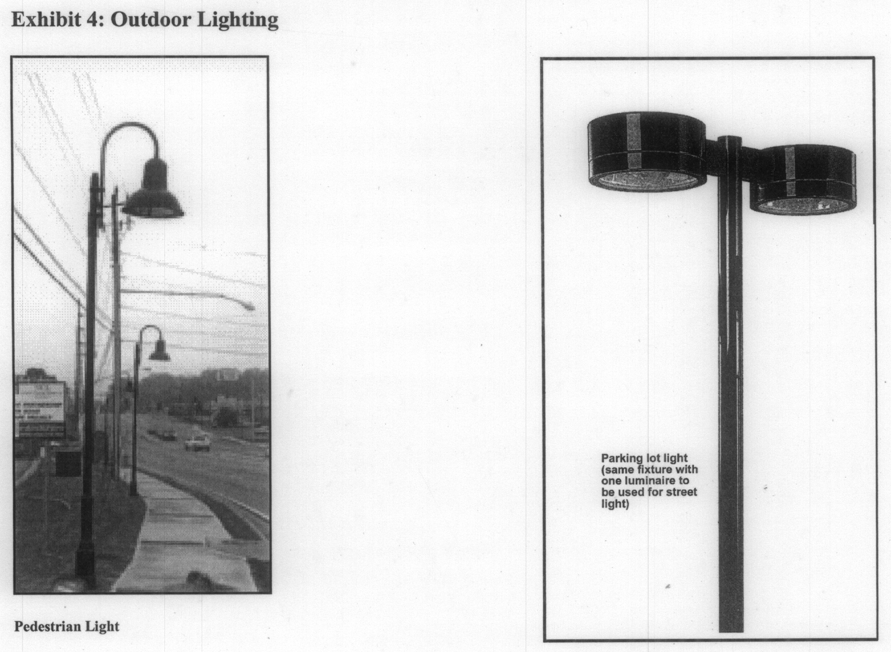
2.
Parking lot lighting shall be as shown in Exhibit 4 and shall meet the specifications indicated in Table 2.
Table 2: Outdoor Lighting Specifications
3.
Light levels of 1.5 foot candles are recommended for parking areas and four (4) foot candles at vehicular drives, entrances, and pedestrian and bicycle ways.
4.
All exterior lighting shall be located and designed with cut-offs to minimize glare on adjacent occupied properties.
5.
Ground-mounted floodlights shall be screened with planting or other means so that the light source is not visible.
6.
The use of flashing, rotating, or oscillating lighting is prohibited in any manner that may be visible from the exterior of buildings.
7.
After-hours security lighting shall equal at least twenty-five (25) percent of the normal parking lot lighting level for security.
E.
Street furniture. The following standards apply to all properties within the Northlake Overlay District, excluding those with frontage along LaVista Road. In such areas the LaVista Road sidewalk and streetscape plan dated December 18, 2006, shall govern.
Sidewalks, plazas, parks, trails, and other public spaces may contain outdoor furniture such as benches, tables, trash receptacles, or other similar appurtenances. Street furniture shall be designed to be comfortable, resist damage and vandalism and be easy to maintain. Table 3 and Exhibit 5 provide specifications of acceptable street furniture. The street furniture types recommended below may be substituted subject to review and approval by the DeKalb County Planning and Development Department.
Table 3: Street Furniture
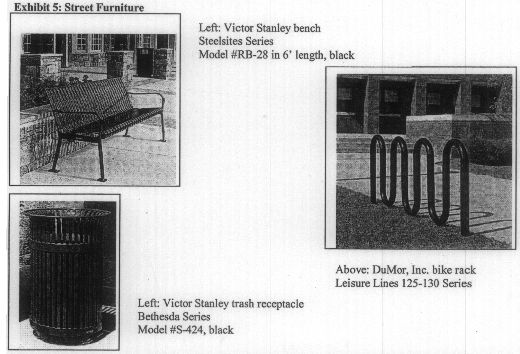
F.
Transit stops. MARTA bus service is provided on certain streets within the overlay district. These bus stops shall be located within public rights-of-way as determined by MARTA. Subject to agreement of MARTA, bus stops may also be located on private property. Transit stops shall provide adequate, lighted and landscaped hard surface areas for waiting patrons. All transit stops shall include at least forty (40) square feet of surface paved in concrete and be accessed by concrete sidewalks along streets and connected to building entrances as provided in section H. of these guidelines. Transit stops anticipated to serve more than an average of ten (10) passengers per weekday shall include shelters designed as shown in Exhibit 6. Trash receptacles are required at all transit stops.
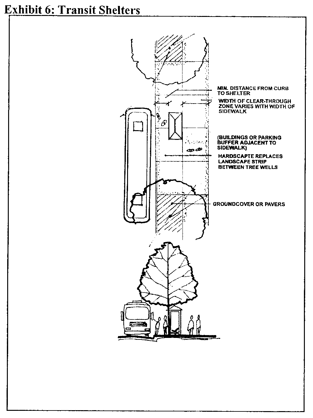
G.
Bicycle lanes and bicycle racks. Paved bicycle lanes shall be provided adjacent to both sides of streets, adjacent to their paved travel lanes as indicated in Table 1 and Exhibits 1 and 2. Bicycle lanes shall be not less than five (5) feet in width with signs and pavement markings as required by the latest version of the Manual for Uniform Traffic Control Devices. Off-street bicycle paths shall be paved not less than eight (8) feet in width and shall be designed with profile not to exceed a four and nine-tenths (4.9) percent grade or else provide approved handrails for use by handicapped persons. Trail cross-slopes shall not exceed two (2) percent. Buildings that require more than one hundred (100) parking spaces shall provide bike racks with at least one (1) bicycle parking stall per 100 vehicular parking spaces. Bicycle racks shall be securely anchored to the ground or a permanent structure and provide outdoor lighting.
H.
Sidewalks and pedestrian ways. The Northlake Commercial Center Overlay District shall be designed to minimize the need for vehicular transportation and to promote pedestrian and bicycle circulation throughout the overlay district. The construction of continuous sidewalks along all streets and off-street pedestrian ways between all building entrances, between adjacent parking lots where shared parking is allowed, and connecting streets with adjacent parking lots, transit stops and building entrances is required throughout the overlay district. See Exhibits 1 and 2 showing sidewalks along streets. See Exhibit 7 for an illustration of off-street pedestrian ways linking parking lots and building entrances. Sidewalks are also encouraged within trails, greenways, and other outdoor recreational areas.
Sidewalks in the overlay district shall be as required in the Northlake Overlay District Ordinance and constructed of four-inch-thick poured-in-place concrete. Minimum slope for all sidewalks shall be two (2) percent. Alternatively, sidewalks may be constructed with brick, stone, or similar durable payer materials to add aesthetic interest and visibility, especially at building entrances, in plazas, in pedestrian crosswalks and at other pedestrian intersections with vehicular routes. Asphalt is not an acceptable paving material for sidewalks or pedestrian ways.
Sidewalks in the overlay district shall be as required in the Northlake Overlay District Ordinance and constructed of four-inch-thick poured-in-place concrete. Minimum slope for all sidewalks shall be two (2) percent. Alternatively, sidewalks may be constructed with brick, stone, or similar durable payer materials to add aesthetic interest and visibility, especially at building entrances, in plazas, in pedestrian crosswalks and at other pedestrian intersections with vehicular routes. Asphalt is not an acceptable paving material for sidewalks or pedestrian ways.
To the extent feasible, sidewalks and pedestrian ways shall be aligned vertically and horizontally to minimize the impact on existing topography and vegetation while forming a continuous pedestrian system. Sidewalks and pedestrian ways that join at property lines or with existing sidewalks shall match the elevation, alignment and cross slope of the abutting sidewalks to form a safe, smooth, and continuous sidewalk system.
I.
Crosswalks. All crosswalks and other intersecting points between the pedestrian and vehicular traffic systems shall be clearly marked as shown in Exhibit 7. The use of approved brick, concrete, or stone paving materials to identify crosswalk areas is encouraged. Crosswalks shall be designed to meet DeKalb County's standards of use for disabled persons. Crosswalks for median-divided streets shall provide for barrier-free passage and refuge areas as illustrated in Exhibit 3. Crosswalks shall be accompanied by pedestrian signals where required by DeKalb County and in conformity with the Manual for Uniform Traffic Control Devices.
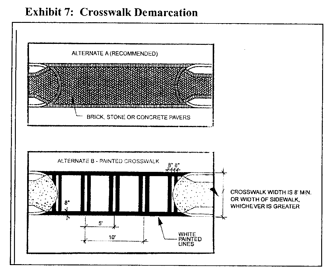
J.
On-street parking. On-street parking is an efficient manner to provide convenient store-front parking and residential parking on minor streets in order to reduce the need for large surface parking lots. See Exhibits 1 and 2. An on-street parking space along the street frontage of an adjacent parcel shall not be counted with off-street and shared parking to meet parking requirements of chapter 27 when such parking space is within seven hundred (700) feet of a building entrance for which the parking space is required. On-street parking spaces shall be safely accessed from the travel lanes of the adjoining street, paved to the specifications of public streets and demarcated with painted lines not less than three (3) inches in width. Parallel parking spaces shall be not less than nine (9) feet wide and not less than twenty (20) feet in length. DeKalb County shall have sole authority to determine time limits, metering, and signage of on-street parking spaces on public streets within the overlay district.
K.
Off-street parking lots. Off-street parking lots shall be provided where there is not enough on-street parking available to satisfy the minimum parking requirements of chapter 27 and the Northlake Commercial Center Overlay District. Where possible, off-street parking lots shall be designed with interconnecting driveways and parking areas to encourage shared use with adjacent parcels. Joint access driveways and continuous access drives behind or between multiple parcels is encouraged to provide continuous inter-parcel access and lessen the need to re-enter public streets to make short trips. The satisfaction of minimum parking requirements with shared parking shall be subject to approval by the DeKalb County Planning Director based on a shared parking analysis performed to the standards of the Institute for Transportation Engineers.
Off-street parking lots shall be designed to minimize the view of parking from adjacent streets and sidewalks. No more than thirty (30) percent of the required parking spaces for a parcel shall be located in front yards. Off-street parking lots shall be separated from abutting streets by landscape strips and sidewalks as illustrated in Exhibits 1 and 2. Parking lots shall be separated from parking lots on adjacent parcels by landscape strips not less than ten (10) feet in width, planted with shrubbery, trees, and groundcover. Landscape strips may be broken by perpendicular access drives and pedestrian walkways or sidewalks. Plant materials shall be selected from the approved plant list in the appendix unless otherwise approved by the planning director.
Off-street parking lots shall be designed to provide for safe and continuous passage of pedestrians between parking bays and building entrances, and between adjacent parking areas and buildings. Landscape strips at the perimeter of off-street parking lots shall provide for safe and convenient crossings by vehicles and pedestrians as shown in Exhibit 8. Pedestrian pathways in parking lots and pedestrian ways that cross vehicular aisles in parking lots shall be appropriately demarcated as shown in Exhibit 8.
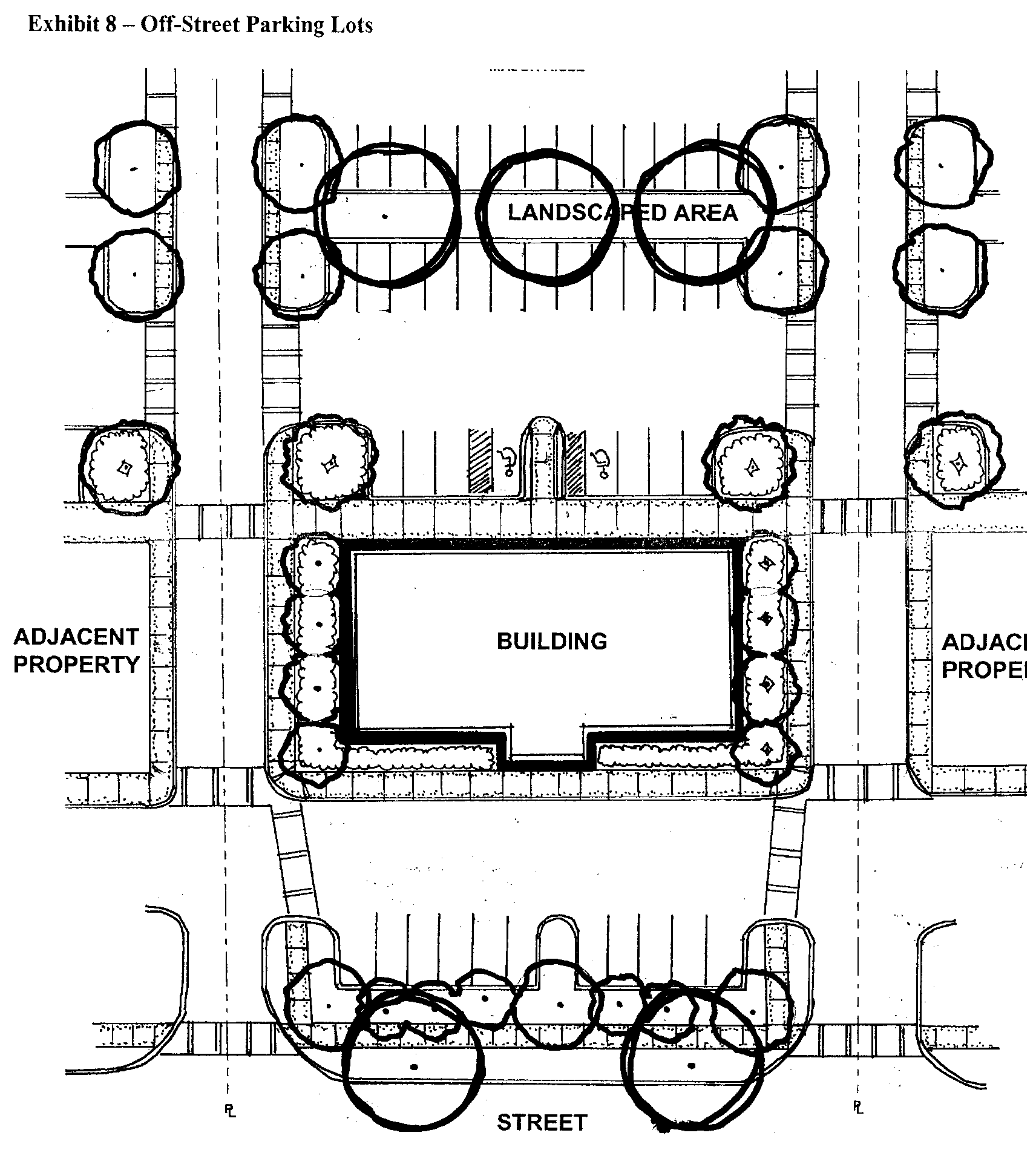
L.
Landscaping. Planting design should reflect and enhance the natural surroundings of each site as well as the design objectives of the building. Existing trees and native groundcover should be preserved wherever possible and integrated into the overall landscape design. Existing plant materials that are to be retained shall be clearly designated on the landscape plans and their root zones and tree canopies shall be adequately protected from damage or destruction during construction using suitable barricades or fencing. Newly planted trees, shrubs and groundcover materials used in landscaped areas shall be selected from the approved plant list in the appendix unless otherwise approved by the planning director.
Plant materials shall be of a size, species and variety specified in the approved plant list in the appendix unless otherwise approved by the planning director. Street trees must be a minimum of three-and-one-half-inch caliper as measured at six (6) inches above ground and help to articulate the pedestrian and vehicular circulation systems. Except for perpendicular crossings of driveways and utility easements. Street trees shall be planted with a spacing not to exceed thirty (30) feet. Street trees shall not be placed closer than eight feet from a building, driveway, light standard, sign standard, post, fire hydrant, or other permanent structure.
Evergreen groundcover planting shall be used on all slopes steeper than two and one-half (2½) to one (1) to aid in erosion control.
Landscape planting and irrigation plans must be prepared by a landscape architect registered in the State of Georgia for each application for a land-disturbance permit.
Transitional buffer zone—Where the transitional buffer zone is well vegetated and provides an adequate visual screen at eye level, it shall be undisturbed. Otherwise, the transitional buffer zone shall be either planted with double staggered rows of approved evergreen trees and shrubbery to form a dense visual screen or the existing vegetation shall be enhanced with native landscaping and groundcover adequate to provide an effective visual screen at eye level from adjacent properties. However, transitional buffer zones may be interrupted where necessary for perpendicular crossings of streets, fences, driveways utilities, and trails, bikeways or pedestrian ways.
Parking lot landscaping—The total length of any parking area facing a street shall be separated from the street by landscaping, including evergreen shrubbery at least eighteen (18) inches in height. Off-street parking lots shall be designed to maximize coverage by shade trees. Shade trees in parking lots shall be a minimum of two-and-one-half-inch caliper as measured at six (6) inches above ground. Off-street parking areas shall provide landscape islands and perimeter landscape strips that provide a cumulative total of at least one (1) shade tree per six (6) parking spaces. Each shade tree shall be planted in a planting area at least eight (8) feet wide. The planting area for a tree shall consist of permeable and well-drained soils with suitable ground cover that provides a minimum of one hundred (100) square feet for the roots of each large tree and fifty (50) square feet for the roots of each small tree. Landscape materials suitable for parking areas shall be selected from the approved plant list in the appendix unless otherwise approved by the planning director.
Irrigation—All newly planted landscape areas (including parking lot islands) shall be irrigated by a fully automatic, commercial, underground irrigation system in according with the following standards:
1.
All irrigation systems shall be provided with backflow preventers approved by DeKalb County. Such devices shall be located or screened so that they are not visible or accessible to the public from adjacent sidewalks, streets, alleys, or parking lots.
2.
Spray heads shall be located to provide one hundred (100) percent, overlapping coverage. Overspray onto sidewalks and other paved areas should be minimized.
3.
Control boxes and panels shall be located inside buildings or where they will not be visible or subject to vandalism.
4.
All main and lateral lines shall be commercial grade PVC pipe.
Irrigation systems are not required in undisturbed buffers or in areas where they would disrupt existing native vegetation.
M.
Signage and street graphics.
1.
Purpose. The following standards are intended to advance the governmental purposes of protecting public safety by minimizing distraction to motorists and improving aesthetics of the Northlake Commercial Center Overlay District by:
a.
Providing a more consistent pattern and appearance for signs and street graphics than would otherwise result from existing sign regulations.
b.
Establishing signage as a design element that contributes a sense of place to the Northlake Commercial Center Overlay District;
c.
Generating varied and creative tenant signage through application of distinctive design;
d.
Reducing the prominence of signage and balancing commercial and aesthetic interests;
e.
Providing clear standards of acceptability for signs in order to facilitate the review and approval process.
2.
Authority. These regulations apply only to the time, place and manner of sign display by limiting the size, number and height of signs in the Northlake Commercial Center Overlay District. Nothing in these standards is intended to regulate the content of sign graphics or limit the free expression of speech guaranteed under the First Amendment of the Constitution of the United States of America. These standards do not replace the sign regulations of DeKalb County with respect to the Northlake Commercial Center Overlay District, but where these standards vary from the underlying DeKalb County standards, these standards shall apply.
These design guidelines shall not prohibit political signs.
All signs shall be designed, erected, inspected, altered, reconstructed, illuminated, located, moved and/or maintained in accordance with these design guidelines and all other applicable codes and ordinances of DeKalb County, the State of Georgia, and the United States of America.
No sign may be installed, reconstructed, illuminated, or moved that varies from these standards without approval of a variance by the DeKalb County Board of Appeals.
3.
Prohibited signs. The following types of signs are prohibited:
a.
Motorist distractions. Signs that incorporate flashing lights or beacons, highly reflectant materials, rotating graphics, motion, smoke or visible matter, noise or changeable copy (copy that changes at materials of more than once every six (6) seconds) are prohibited.
b.
Roof signs. Signs that are placed on or above roofs, penthouses, mechanical equipment screens, and other like structures and any signs that extend above the building parapet or roof fascia line.
c.
Signs that are visible from the street and placed on vehicles or trailers that are not in regular use.
d.
Pole signs and other signs with exposed structural supports that are more than three (3) feet in height and have post supports larger than two (2) inches in diameter or a total of four (4) square inches in cross-section area.
e.
Vacuum molded or pre-manufactured signs.
4.
Authorized signs. The following signs are authorized within the Northlake Commercial Center Overlay District and shall be permitted upon the issuance of a valid sign permit issued by DeKalb County:
a.
Single-tenant development signs. The following sign standards apply to all parcels that have a single tenant or occupant, including, but not limited to, commercial, retail, services, office, office-distribution, wholesale, hotel, office, financial, or multifamily uses:
i.
Monument sign. Each parcel or building with a single tenant or multifamily residential tenants shall be permitted to use one (1) monument sign per public street frontage, not to exceed a total of two (2). Signs shall be of a design similar to Exhibit 9 subject to the following:
• Only one (1) sign placard is allowed per sign face—Maximum ten (10) square feet per face.
• Sign may not exceed six (6) feet in height.
• Sign may be single-faced or double-faced.
• Sign shall be externally front-lighted, using ground-mounted floodlighting.
A single tenant building with more than fifty thousand (50,000) square feet of space or occupying a site larger than ten (10) acres may use a monument sign similar to Exhibit 10. Such sign shall not exceed six (6) feet in height or fifteen (15) feet in length. Sign face may be double-faced and must comply with the size requirements of the Northlake Overlay District Ordinance.
ii.
Single-tenant building mounted sign. Each parcel or building with a single nonresidential tenant shall be permitted one (1) building-mounted sign per street frontage. Letter height and copy area for each single-tenant building-mounted sign shall not exceed the following maximum dimensions:
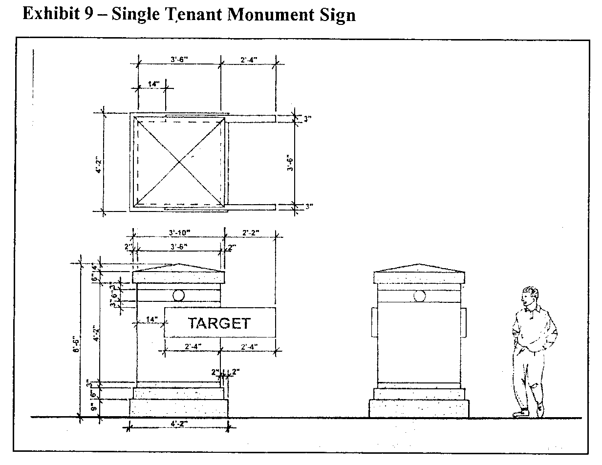
iii.
Entrance sign. A major development containing ten (10) contiguous nonresidential lots accessed from internal streets may be permitted one (1) entrance sign of a design similar to Exhibit 10, to be placed on private property adjacent to the major entrance to such development or within the median of the public street providing the principal route of access to such development. Such sign shall not exceed six (6) feet in height or fifteen (15) feet in length. Sign face may be double-sided and must comply with the size requirements of the Northlake Overlay District Ordinance.
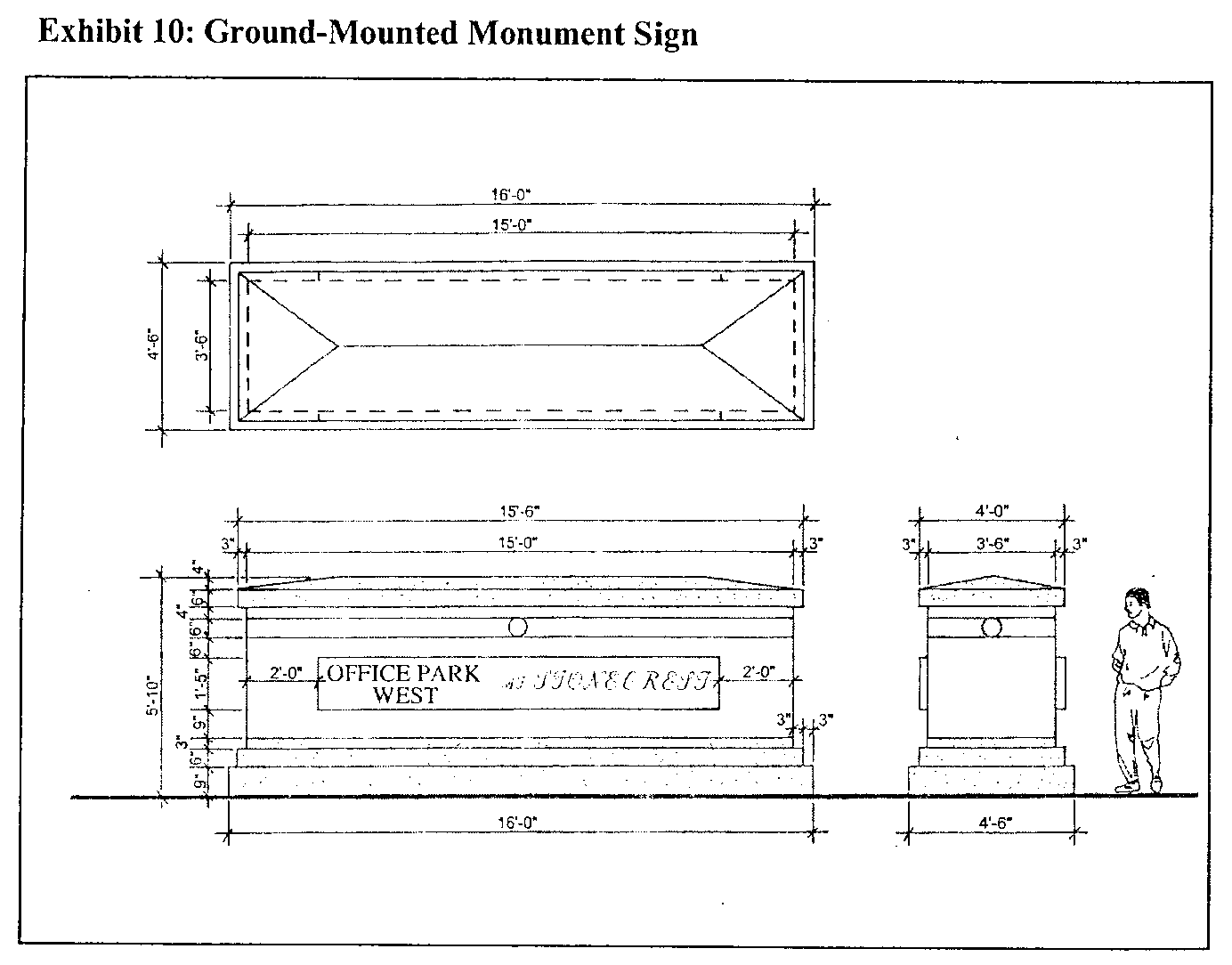
b.
Multiple-tenant buildings and parcels. The following sign standards apply to all parcels that have more than one (1) nonresidential tenant or occupant, including, but not limited to, commercial, retail, services, office, office-distribution, wholesale, hotel, office, or financial tenants:
i.
Monument sign. Each parcel or development with more than one (1) nonresidential tenant and a total of more than one hundred thousand (100,000) square feet shall be permitted one (1) freestanding multitenant monument sign per public street frontage, not to exceed a total of three (3). Signs shall be of a design similar to Exhibit 10 and the following:
• No more than eight (8) sign placards shall be used per side of the monument sign.
• Maximum height fifteen (15) feet.
• Total sign faces may not exceed sixty-four (64) square feet per side.
• Sign may be single-faced or double-faced.
• Sign shall be externally front-lighted, using ground mounted flood lighting.
Each parcel or development with more than one (1) non-residential tenant totaling one hundred thousand (100,000) square feet or more and having a total street frontage of more than five hundred (500) feet on all streets combined shall be permitted one freestanding multitenant monument sign similar to Exhibit 10 for each curb cut, not to exceed a total of three (3) monument signs for a single development.
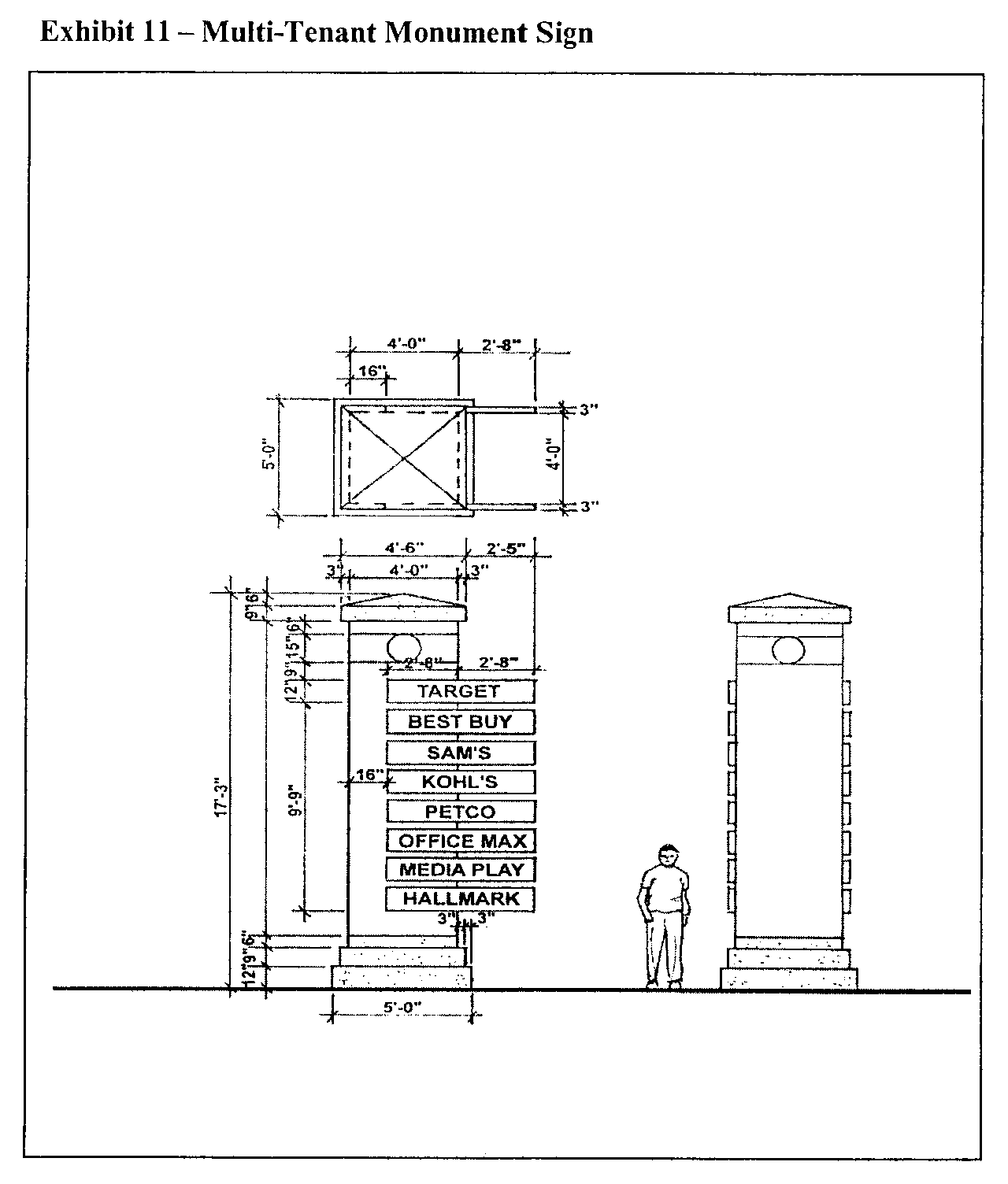
ii.
Building-mounted signs. Each multitenant parcel or development, other than residential tenants, shall be permitted one (1) building mounted sign per building tenant, similar to that shown in Exhibits 12 and 13. Letter height and copy area of the building-mounted sign for each tenant within a multitenant development or building-mounted sign shall not exceed the following maximum dimensions:
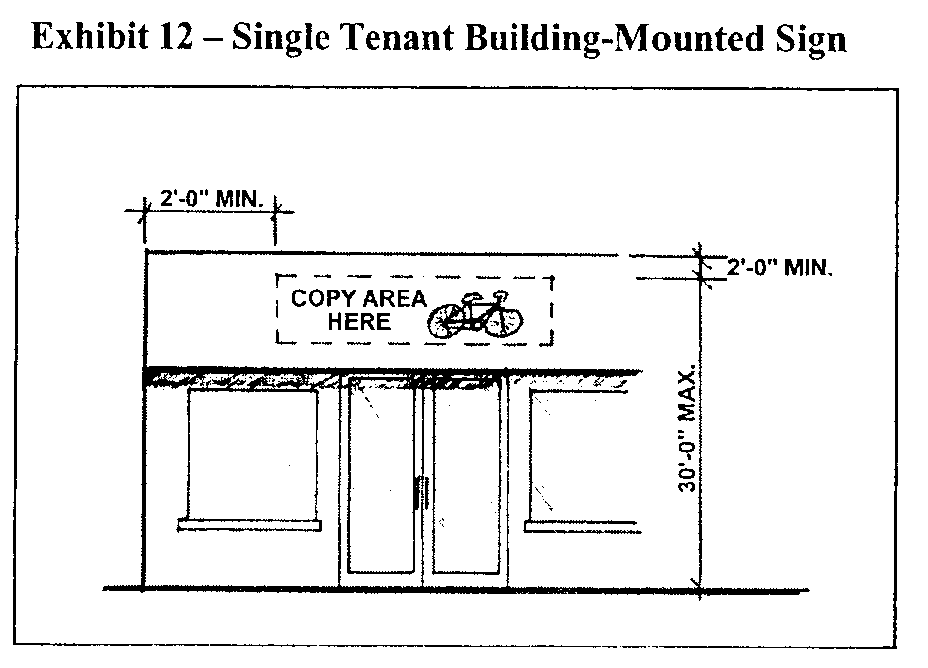
Exhibit 13 — Multi-Tenant Building-Mounted Sign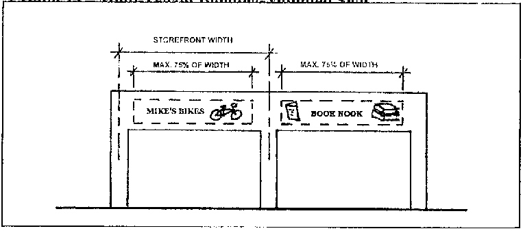
c.
Reserved.
d.
Signs on residential parcels. Nothing in this ordinance shall prohibit display of at least one (1) sign on a residential property. However, signs on residential property other than multitenant residential buildings shall be limited to one (1) sign per street frontage. No such sign shall exceed three (3) feet in height and sixteen (16) square feet in size. Signs on single-family residential parcels shall not be illuminated. Home occupations within residential property are not entitled to additional signs.
N.
Architectural design of buildings and façades.
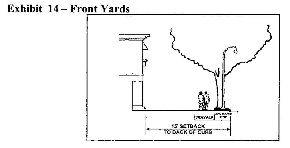
1.
Building massing.
a.
Street fronting building façades greater than one hundred fifty (150) feet in length shall be modulated with breaks in wall surfaces, materials and rooflines at intervals not to exceed one hundred fifty (150) feet, measured parallel to the street as shown in Exhibit 15.
b.
For buildings taller than five (5) stories, floors shall be delineated at third story above sidewalk level and lower and shall be executed through windows, belt courses, cornice lines or similar architectural detailing as shown in Exhibit 16.
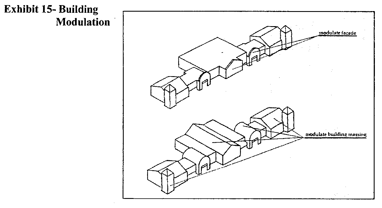
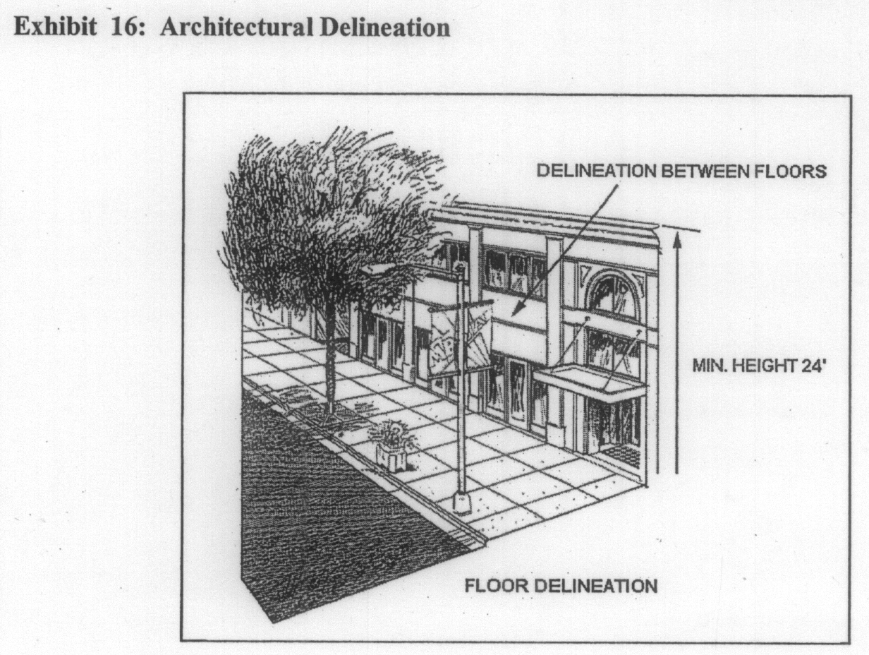
2.
Building façades and fenestration.
a.
For the purposes of this document, fenestration includes all glazed areas including, but not limited to, storefront windows, display windows and doors containing glazed panels at least four (4) feet in height.
b.
Street-fronting nonresidential building façades shall meet the following sidewalk level requirements:
i.
The length of façade without intervening fenestration or entryway shall not exceed thirty (30) feet. See Exhibit 17.
ii.
A minimum percentage of fenestration of thirty (30) percent shall be provided for the length of the building façade. For buildings that front two (2) or more streets, said minimum percentage is only required along one (1) such street frontage. Buildings which contain ground-level retail uses shall have a minimum percentage of fenestration of forty-five (45) percent of the length of the building façade. See Exhibit 17.
iii.
All fenestration shall:
1.
Begin at a point not more than three (3) feet above the sidewalk, to a height no less than ten (10) feet above the sidewalk, or
2.
Begin at the finished floor elevation to a height no less than ten (10) feet above the finished floor elevation when the finished floor elevation is three (3) or more feet above the sidewalk or
3.
Begin at a point not more than sidewalk level, to a height no less than ten (10) feet above the finished floor elevation when the finished floor elevation is below the sidewalk. See Exhibit 17.
iv.
Fenestration shall not utilize painted glass, reflective glass or other similarly treated or opaque windows. Entrances may be counted towards fenestration requirements.
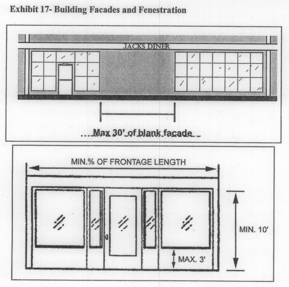
3.
Roof design.
a.
Gable roof designs are encouraged and shall be required for all multifamily residential and hotel buildings less than six (6) stories in height.
b.
Roof-mounted mechanical equipment and appurtenances shall be located or screened so that they are not visible from the ground level. Screening shall be of a material and design that are compatible with the surrounding building materials and architectural design. Rooftop appurtenances shall be painted to be compatible with the colors of the roof.
c.
Roof-mounted radio, TV, and telecommunication towers and antennas are prohibited. Satellite dishes twenty-four (24) inches or less in diameter are permitted provided that they are located out of sight from the ground floor or completely screened from view
d.
The following roof materials are preferred:
i.
Fiberglass architectural profile shingles;
ii.
Slate shingles;
iii.
Clay or concrete tile;
iv.
Standing seam metal (dark green or earth tone only).
4.
Recommended building materials. The following exterior building materials are preferred:
a.
Stone;
b.
Brick;
c.
Pre-cast concrete;
d.
Glass;
e.
Ceramics or tile;
5.
[Exterior walls and parapets.] The following materials are prohibited for exterior walls and parapets:
a.
Imitation wood;
b.
Vinyl or plastic;
c.
Concrete masonry units, except ribbed or rusticated units;
d.
Corrugated metal;
e.
EIFS;
f.
EIFS moldings.
APPENDICES
Plant List
A.
Flowering shrubs.
1.
Abelia X Grandiflora, three-gallon.
2.
Jasminum Nudiflorum, three-gallon;
3.
Coreopsis Auriculata, one (1) gallon;
4.
Narcussus.
B.
Ground cover.
1.
Liriope Muscari, one (1) gallon;
2.
Rubus Calcinoides, one (1) gallon;
C.
Trees along LaVista Road.
1.
Cercis Canadensis, two-inch caliper;
2.
Chionanthus Virginicus, one-and-one-half-inch caliper;
3.
Hemerocallis Species, one (1) gallon;
4.
Pranus "Okame", one-and-one-half-inch caliper;
5.
Quercus Shumardii, three-and-one-half-inch caliper;
6.
Lagerstroemia Indica, ten (10) feet high;
D.
Trees along remaining streets.
1.
Any tree listed in paragraph (3) above;
2.
Crape Myrtle, Standard Trunk;
3.
October Glory Red Maple.
4.
Sunset Maple;
5.
Nuttal Oak (Quercus Nattalli)
6.
Shumard Oak (Quercus Shumardii);
7.
Willow Oak;
8.
Zelkova Serrata;
9.
Ginkgo (Ginlgo Biloba);
10.
Trident Maple (Acer Buergeranum);
11.
Allee Lacebark Elm (Ulmus Parvifolia Emer II).
(Ord. No. 15-06, 8-25-2015)
Sec. 3.36.1.- Scope of regulations.
This division establishes standards and procedures that apply to any development, use, alteration, height, density, parking, open space, and building on any lot or portion thereof which is in whole or in part contained within the boundaries of the Scottdale Area Compatible Use Overlay District (hereinafter referred to as the "Scottdale Overlay District").
(Ord. No. 15-06, 8-25-2015)
Sec. 3.36.2. - Applicability of regulations.
This division applies to each application for a permit for the development, use, alteration, or modification of any structure where the subject property is in whole or in part contained within the boundaries of the Scottdale Overlay District. The procedures, standards, and criteria herein apply only to that portion of the subject property within the boundaries of the Scottdale Overlay District. Permits for repairs, interior alterations or tenant build out improvements that do not alter the exterior appearance of the structure shall be exempt from the requirements of this division. The planning director or designee shall determine the applicability of such regulations on a case by case basis.
(Ord. No. 15-06, 8-25-2015)
Sec. 3.36.3. - Statement of purpose and intent.
The purpose and intent of the board of commissioners in establishing the Scottdale Overlay District is as follows:
A.
To preserve, protect and enhance the existing character of the Scottdale Community;
B.
To encourage new development that is appropriate to the existing character of the Scottdale Community;
C.
To enhance the long term economic viability of this portion of DeKalb County by encouraging new commercial and residential developments that increase the tax base and provide jobs to the citizens of DeKalb County;
D.
To implement the policies and objectives of the DeKalb County Comprehensive Plan 2005—2025 and the policies and objectives of the Design Guidelines for the Scottdale Area Compatible Use Overlay District;
E.
To encourage mixed-use developments along appropriate corridors which have sufficient access and infrastructure to support such developments; and
F.
To protect established residential areas from encroachment of uses which are either incompatible or unduly cause adverse impacts on such communities, and to protect the health, safety and welfare of the citizens of DeKalb County.
(Ord. No. 15-06, 8-25-2015)
Sec. 3.36.4. - District boundaries and maps.
A.
Boundaries: The boundaries of the Scottdale Overlay District shall be established by a zoning map amendment, dated September 25, 2018 which is attached hereto as Exhibit A and is adopted contemporaneously with the adoption of this section and which is incorporated by reference as if fully set forth herein and made a part of this chapter 27. The zoning map amendment shall be maintained by the director of the department of planning and sustainability (director of planning) and shall be available for public inspection in the office of said director.
B.
Tiers: Scottdale Overlay District shall be divided into six (6) tiers:
1.
Tier I: Scottdale East Ponce de Leon Avenue/North Decatur Road Corridor and includes Neighborhood Center;
2.
Tier I-NC: Scottdale Neighborhood Center;
3.
Tier II: Central Scottdale/Eskimo Heights;
4.
Tier III: Scottdale Mill Village;
5.
Tier IV: Scottdale Perimeter; and
6.
Tier V: Scottdale Tobie Grant.
C.
The director of planning or their designee has the discretion to determine whether any property is located within the boundaries of the Scottdale Overlay District or any of its Tiers based upon the adopted zoning map.
(Ord. No. 15-06, 8-25-2015; Ord. No. 18-04, Pt. I, 9-25-2018)
Sec. 3.36.5. - Tier I: Scottdale East Ponce de Leon Avenue/North Decatur Road Corridor and Tier I-NC: Scottdale Neighborhood Center.
A.
Principal uses and structures: All properties located within Tier I and Tier I-NC of the Scottdale Overlay District shall be governed by all of the requirements of the underlying zoning district regulations. In addition, the following principal uses of land and structures shall also be authorized within Tier I and Tier I-NC:
1.
All uses authorized in the OI (Office Institutional), OD (Office Distribution), C-1 (Local Commercial), C-2 (General Commercial) and M (Light Industrial) Zoning Districts on all property located west of East Ponce de Leon Avenue, except those uses listed in subsection B., below.
2.
All uses authorized in the NS (Neighborhood Shopping), OI (Office Institutional), and C-1 (Local Commercial) Zoning Districts on all property located east of East Ponce de Leon Avenue, except those uses listed in subsection B., below.
3.
In Tier I, only: all uses authorized in the MR-1 (Medium Density Residential-1) and MU-2 (Mixed Use-2) Zoning Districts.
4.
In Tier I-NC, only: all uses authorized in the MR-2 (Medium Density Residential-2) and MU-3 (Mixed Use-3) Zoning Districts, except those uses in subsection B., below.
5.
Specific uses complimenting/related to the manufacture, storage, distribution, wholesale, or retail trade of fresh and processed foods, except those listed in subsection B., below.
6.
Research and training facilities with associated lodging, except those listed in subsection B., below.
7.
Facilities engaged in cottage industries, art studies, crafts and other related artisan activities, except those listed in subsection B., below.
8.
Outdoor equipment and materials storage if such use already exists on the property on October 14, 2008. Any existing outdoor storage expansion must be invisible from public rights-of-way and must be screened with fencing and/or landscaping of at least eight (8) feet in height.
9.
Any combination of the above listed uses shall be authorized in a mixed-use development, except those listed in subsection B., below.
10.
The following densities shall apply to all residential property located within Tier I and Tier I-NC:
a.
All residential and mixed-use development shall not exceed a maximum density of twelve (12) units per acre, except where noted in subsection b. below;
b.
Mixed-use development in Tier I-NC, only, shall not exceed a maximum of twenty-four (24) units per acre, subject to the required minimum mix of uses under the applicable MU Zoning District found under Table 2.17, article 2, chapter 27.
B.
Prohibited principal uses and structures. The following principal uses of land and structures shall be prohibited within Tier I and Tier I-NC:
1.
Multifamily (apartments), except within a mixed-use development.
2.
Adult entertainment establishment.
3.
Adult service facility.
4.
Automobile and truck sales.
5.
Parking lots as a primary use.
6.
Automobile repair and paint shop.
7.
Automobile upholstery shop.
8.
Automobile wash service.
9.
Automobile, truck and trailer lease and rentals, except as allowed in 3.36.5.D.
10.
Boat sales.
11.
Boarding/rooming house.
12.
Breeding kennels.
13.
Cemetery, columbarium, or mausoleum.
14.
Check cashing establishment.
15.
Drive-in theater.
16.
Dry cleaning plant.
17.
Extended stay hotel.
18.
Fraternity house, sorority house and residence hall.
19.
Fuel dealers, manufacturers and wholesalers.
20.
Gift, novelty or souvenir store selling adult novelties.
21.
Go-cart and motorcycle or other motorized concession.
22.
Golf driving range or batting cage facility.
23.
Heavy construction contractor with outside storage areas.
24.
Heavy repair service and trade shop.
25.
Hospital.
26.
Motel.
27.
Pawn shop.
28.
Radio and television broadcasting station with outdoor tower.
29.
Rubber and plastics manufacturing.
30.
Shelter for homeless persons.
31.
Storage yard for damaged or confiscated automobiles.
32.
Tire retreading and recapping.
33.
Trailer salesroom and sales lot.
34.
Transitional housing facility.
C.
Additional uses and structures:
1.
The following accessory uses shall be authorized in Tier I and Tier I-NC:
a.
Accessory uses and structures incidental to any authorized use.
b.
Parking lots and parking decks which are accessory to any authorized use.
c.
Clubhouse, including meeting room or recreation room.
d.
Swimming pools, tennis courts, and other recreation areas and amenities.
e.
Signs, in accordance with the provisions of chapter 21 and this chapter.
2.
Special use permits: The following uses and structures shall be authorized in Tier I and Tier I-NC only by special use permit from the board of commissioners:
a.
Adult day care, center and facility.
b.
Child day care center and facility.
c.
Child caring institution, group and community.
d.
Home occupation involving any customer contact.
e.
Bed and breakfast inn and home stay.
f.
Recreation club.
g.
Personal care home, group and community.
h.
Place of worship.
D.
The Scottdale Neighborhood Center: The Scottdale Neighborhood Center shall be established within Tier I. The boundaries of said Scottdale Neighborhood Center shall be established by a zoning map amendment adopted pursuant to this chapter which amendment shall be incorporated herein and made a part of this chapter 27. Automobile lease and rentals shall be allowed in the Scottdale Neighborhood Center consistent with the following standards:
1.
Auto leasing shall be allowed in a multi-tenant retail with a maximum of twenty (20) vehicles in inventory for leasing and a maximum of twenty (20) vehicles to be stored on site at one (1) time. The total property site shall be a minimum of two (2) acres in land area.
2.
Automobiles shall only be stored outside and shall be in an area not visible from the public right-of-way. Screening of stored vehicles shall be provided by fencing, landscaping or buildings.
3.
No automotive repair, outside storage of materials, or equipment associated with the auto leasing use shall be allowed.
4.
No washing of the vehicles shall be visible from public roads.
5.
Ground signage shall be incorporated in a multi-tenant sign structure.
6.
Overnight parking of patron vehicles on site is prohibited.
7.
There shall be a separation of at least one thousand (1,000) feet from any other automobile leasing facility.
E.
Architectural guidelines for non-residential and mixed-use: Architectural design of all mixed-use and non-residential buildings and structures within Tier I and Tier I-NC shall comply with the following guidelines:
1.
Each building elevation shall be constructed of brick, stone, stucco, steel, glass, wood or any combination thereof.
2.
Roofing materials for hipped or pitched roofs shall consist of standing metal seam, tile, slate, stone, or architectural-style shingles.
3.
Walls visible from roadways or parking areas shall incorporate changes in building material/color or varying design details such as trellises, false windows, landscaping, or storefronts every one hundred fifty (150) linear feet.
F.
Architectural guidelines for residential: Architectural design of all residential buildings and accessory structures within Tier I and Tier I-NC shall comply with the following guidelines:
1.
Each building elevation shall be constructed of brick, stone, stucco, wood, wood shake, cement fiberboard siding, or any combination thereof.
2.
Roofing materials for pitched or hip roofs shall consist of metal standing seam, tile, slate, stone, wood shake or architectural-style shingles.
G.
Parking: Refer to Code section 27-6.1.5 (as amended).
H.
Redevelopment: Redeveloped buildings or structures shall be permitted to maintain existing building materials and character, subject to review and approval of the planning director or designee. The director shall inform the president of the Scottdale Community Alliance of such proposed redevelopment in writing at least ten (10) business days before any such approval may be given.
(Ord. No. 15-06, 8-25-2015; Ord. No. 16-09, Pt. I, 7-19-2016; Ord. No. 18-04, Pt. I, 9-25-2018)
Sec. 3.36.6. - Tier II: Central Scottdale/Eskimo Heights.
A.
Principal uses and structures: The following principal uses of land and structures shall be authorized in Tier II:
1.
Detached single-family residences at a maximum density of six (6) units per acre.
B.
Accessory uses and structures: Accessory uses, buildings and structures shall be located within the rear yard. Accessory buildings and structures shall not exceed twenty (20) feet in height or the height of the principal structure, whichever is less, and shall comply with the requirements of section 4.2.2. The following accessory uses of land and structures shall be authorized in Tier II:
1.
Accessory uses and structures incidental to any authorized principal use, including the following and similar uses:
a.
Garages for parking of automobiles.
b.
Storage buildings.
c.
Swimming pools.
d.
Tennis courts and other play and recreation areas.
2.
Signs, in accordance with the provisions of chapter 21 and this chapter.
C.
Special permits: The following uses and structures shall be authorized only by permits of the type indicated:
1.
Special administrative permit approved by the director of planning:
a.
Home occupation involving no customer contact and no employee other than the person residing on the premises.
2.
Special exception permit from the zoning board of appeals:
a.
Utility structure necessary for the transmission or distribution of service.
3.
Special land use permit from the board of commissioners:
a.
Adult day care facility.
b.
Child day care facility.
c.
Convent or monastery.
d.
Home occupation involving any customer contact.
e.
Home stay bed and breakfast residence.
f.
Neighborhood recreation club.
g.
Personal care home, family.
h.
Personal care home, registered.
i.
Place of worship.
D.
Architectural guidelines: Architectural design of all buildings and structures within Tier II shall comply with the following guidelines:
1.
Detached residential guidelines:
a.
Each building elevation shall be constructed of brick, stone, stucco, wood, wood shake, cement fiberboard siding, or any combination thereof.
b.
Roofing materials for pitched or hip roofs shall consist of metal standing seam, tile, slate, stone, wood shake or architectural-style shingles.
E.
Parking: Off-street parking requirements for uses and structures authorized and permitted in Tier II are as follows:
1.
Detached single-family dwelling: Two (2) spaces.
(Ord. No. 15-06, 8-25-2015; Ord. No. 18-04, Pt. I, 9-25-2018)
Sec. 3.36.7. - Tier III: Scottdale Mill Village.
A.
Principal uses and structures: The following principal uses of land and structures shall be authorized in Tier III:
1.
Detached single-family residences at a maximum density of four (4) units per acre.
B.
Accessory uses and structures: Accessory uses, buildings and structures shall be located within the rear yard. Accessory buildings and structures shall not exceed twenty (20) feet in height or the height of the principal structure, whichever is less, and shall comply with the requirements of section 4.2.2. The following accessory uses of land and structures shall be authorized in Tier III:
1.
Accessory uses and structures incidental to any authorized principal use, including the following and similar uses:
a.
Garages for parking of automobiles.
b.
Storage buildings.
c.
Swimming pools.
d.
Tennis courts and other play and recreation areas.
2.
Signs, in accordance with the provisions of chapter 21 and this chapter.
C.
Special permits: The following uses and structures shall be authorized only by permits of the type indicated:
1.
Special administrative permit approved by the director of planning:
a.
Home occupation involving no customer contact and no employee other than the person residing on the premises.
2.
Special exception permit from the zoning board of appeals:
a.
Utility structure necessary for the transmission or distribution of service.
3.
Special land use permit from the board of commissioners:
a.
Adult day care facility.
b.
Child day care facility.
c.
Convent or monastery.
d.
Home occupation involving any customer contact.
e.
Home stay bed and breakfast residence.
f.
Neighborhood recreation club.
g.
Personal care home, family.
h.
Personal care home, registered.
i.
Place of worship.
D.
Architectural guidelines: Architectural design of all buildings and structures within Tier III shall comply with the following guidelines:
1.
Detached residential guidelines:
a.
The scale, size and character of new construction shall be consistent with existing structures.
b.
Each building elevation shall be constructed of wood or cement fiberboard lap siding. Chimneys shall be constructed of brick. Other materials, such as vinyl or aluminum siding, may be repaired or replaced in kind on structures that are currently constructed of such materials.
c.
Foundations of principal structures shall be constructed of brick, stone or concrete covered with stucco.
d.
Roofing materials for pitched or hip roofs shall consist of metal seam, tile, slate, stone, wood shake or architectural style shingles.
e.
Covered front porches shall be required. Front porches may be screened, but shall not be enclosed.
f.
Additions to existing houses shall not be permitted on the front of the houses. Additions may be constructed in the side or rear yard in compliance with the setback requirements of this section.
E.
Parking: Off-street parking requirements for uses and structures authorized and permitted in Tier III are as follows:
1.
Detached single-family dwelling: Two (2) spaces.
F.
Transitional zone: A transitional zone shall be established extending one hundred (100) feet outward from any boundary of Tier III. The transitional zone shall consist of public rights-of-way, easements, alleys, and parcels that are immediately adjacent to Tier III. Within the transitional zone, mixed use developments complementary to the character of the Mill Village, the Mill, the DeKalb Farmers Market, and artisan activities shall be permitted. The properties that lie within the transition zone shall be governed by the principal uses and structures of Tier I. In addition, the transitional zone shall include single-family detached residential uses.
1.
Buildings and structures within the transitional zone shall not exceed thirty (30) feet in height except for the normal architectural projections which may include roof parapets, skylights, or access enclosures.
2.
New buildings and structures to be constructed on parcels that are immediately adjacent to or across a street from any Tier III property shall have a front and side yard setback that is equivalent to the setback of those properties within Tier III.
3.
Buildings and structures within the transitional zone shall have architectural character and design details that are complimentary to the Scottdale Mill Village.
4.
Buildings and structures must be constructed of brick, stone, stucco, steel, glass, wood, cement fiberboard lap siding, or any combination thereof.
5.
All parking areas are to be located in the rear of or on the side of all new buildings. Where parking areas are visible from roadways and sidewalks, a fifteen-foot landscape screen shall be established.
6.
Shared parking is encouraged and may be authorized by the director of planning or designee.
(Ord. No. 15-06, 8-25-2015; Ord. No. 18-04, Pt. I, 9-25-2018)
Sec. 3.36.8. - Tier IV: Scottdale Perimeter.
A.
Principal uses and structures: The following principal uses of land and structures shall be authorized in Tier IV:
1.
Detached single-family residential at a maximum of six (6) units per acre.
2.
Attached single-family residential and attached fee simple multi-family residential at a maximum of twelve (12) units per acre in the Lantern Ridge subdivision, only.
B.
Accessory uses and structures: Accessory uses, buildings and structures shall be located within the rear yard. Accessory buildings and structures shall not exceed twenty (20) feet in height or the height of the principal structure, whichever is less, and shall comply with the requirements of section 4.2.2. The following accessory uses of land and structures shall be authorized in Tier IV:
1.
Accessory uses and structures incidental to any authorized principal use, including the following and similar uses:
a.
Garages for parking of automobiles.
b.
Storage buildings.
c.
Swimming pools.
d.
Tennis courts and other play and recreation areas.
2.
Signs, in accordance with the provisions of chapter 21 and this chapter.
C.
Special permits: The following uses and structures shall be authorized only by permits of the type indicated:
1.
Special administrative permit approved by the director of planning:
a.
Home occupation involving no customer contact and no employee other than the person residing on the premises.
2.
Special exception permit from the zoning board of appeals:
a.
Utility structure necessary for the transmission or distribution of service.
3.
Special land use permit from the board of commissioners:
a.
Adult day care facility.
b.
Child day care facility.
c.
Convent or monastery.
d.
Home occupation involving any customer contact.
e.
Home stay bed and breakfast residence.
f.
Neighborhood recreation club.
g.
Place of worship.
h.
Personal care home, family.
i.
Personal care home, registered.
j.
Private elementary, middle and high school.
D.
Architectural guidelines: Architectural design of all buildings and structures within Tier IV shall comply with the following guidelines:
1.
Detached residential guidelines:
a.
Each building elevation shall be constructed of brick, stone, stucco, wood, wood shake, cement fiberboard siding, or any combination thereof.
b.
Roofing materials for pitched or hip roofs shall consist of metal standing seam, tile, slate, stone, wood shake, asphalt or architectural-style shingles.
c.
Any new dwelling constructed on a lot with frontage on Rockbridge Road shall have its primary entrance facing Rockbridge Road.
d.
Any new dwelling constructed on a lot with frontage on Old Rockbridge Road shall have its primary entrance facing Old Rockbridge Road.
E.
Parking: Off-street parking requirements for uses and structures authorized and permitted in Tier IV are as follows:
1.
Detached single-family dwelling: Two (2) spaces.
2.
Attached single-family dwelling: Two (2) spaces.
3.
Condominiums: One and seventy-five one-hundredths (1.75) spaces per dwelling unit.
F.
Sidewalks: Sidewalks shall be provided along both sides of the right-of-way of all public streets in accordance with section 3.36.12.
G.
Streets: No culs-de-sac are allowed.
(Ord. No. 15-06, 8-25-2015; Ord. No. 18-04, Pt. I, 9-25-2018)
Sec. 3.36.9. - Re-establishment of street grid.
Within the Scottdale Overlay District, the existing street grid shall be continued or re-established where site conditions allow. Where there is no existing street grid system to connect into, or where site conditions do not allow for the continuation or re-establishment of the street grid system, the planning director or designee may approve an alternative street system, including without limitation, stub streets and alleyways. In no case shall new roads alter the established street grid. Cul-de-sacs are prohibited in all new developments.
(Ord. No. 15-06, 8-25-2015)
Sec. 3.36.10. - Building standards.
1.
Standards for detached single-family residences (Tiers I, II, III, IV), cottages (CO) and urban single family (U-SF) detached residences (Tiers I, I-NC):
* Setback averaging shall apply. See 5.2.1.C.
** Max. 32 feet (ft.) height if non-conforming lot or building
*** Architectural projections which may include parapets, skylights and roof access enclosures are exempt from height requirements.
2.
Standards for attached single-family attached residences (townhomes) in Tier I, Tier I-NC, and Tier IV Lantern Ridge:
* Lot size, width, and setbacks not applicable to fee-simple condominiums. See chapter 27-5.7.6.B.
3.
Standards for Two-Family and Three-Family (TTF) attached residential (not stacked) in Tier I and Tier I-NC.
* Lot size, width and setbacks not applicable to fee-simple condominiums. See Chapter 27-5.7.6.B.
4.
Standards for Mixed-Use and Non-residential in Tier I and Tier I-NC
* Subject to transitional height plane standards. See Chapter 27-5.2.4.
5.
Miscellaneous building standards for all Tiers:
a.
Corner lots shall not be required to have an additional fifteen (15) feet of street frontage.
b.
Setback averaging shall apply pursuant to section 27-5.2.1.C. otherwise the front yard setback shall be as shown above.
c.
No lot shall be developed to exceed the maximum allowable coverage by buildings, structures, driveways or parking areas, or any other impervious surface specified as follows:
1)
Detached Single-Family Residential—35%
2)
Attached Single-Family Residential—75%
3)
Two- and Three-Family Residential—55%
4)
Mixed-Use and Non-Residential—80%
d.
Measurement of building height shall be in accordance with section 27-5.25 of the Code.
e.
Fences along public right-of-way shall be four (4) feet maximum. Fence height shall be measured from ground level. If ground level is lower than the level of the adjoining street pavement, then a fence may be higher so that it may be four (4) feet above the level of the pavement. The level of ground shall not be altered in such a way to provided additional fence height.
(Ord. No. 18-04, Pt. I, 9-25-2018)
Editor's note— Ord. No. 18-04, Pt. I, adopted Sept. 25, 2018, repealed § 3.36.10 in its entirety and enacted new provisions to read as herein set out. Former § 3.36.10 pertained to measurement of building, and derived from Ord. No. 15-06, adopted Aug. 25, 2015.
Sec. 3.36.11. - Landscaping requirements.
A.
Landscape strips:
1.
The landscape strip in the front yard shall be planted with a row of street trees of at least three and one-half (3.5) inches in caliper, and planted not less than thirty (30) feet on center. Trees shall be selected from the list of street trees species identified herein and in the Design Guidelines for the Scottdale Overlay District, originally dated May 2008, as amended, a copy of which shall be maintained by the director of planning and available for public inspection. Continuous landscaped strips shall be constructed along public rights-of-way except at points of ingress or egress. Street trees shall be between the curb and sidewalk.
B.
Landscape widths shall be as follows:
1.
Major and minor arterials: Ten-foot-wide landscape strip located between the curb and sidewalk.
2.
Collector and local streets: Five-foot-wide landscape strip located between the curb and sidewalk.
3.
The four-foot strip between the curb and the sidewalk may be used toward the total width of the landscape strip.
4.
Interior yards: Five-foot landscape strip along interior side and rear yards for non-residential and multi-family development only.
C.
Ground cover: Ground cover shall also be provided in accordance with the Design Guidelines for the Scottdale Area Overlay District in order to protect tree roots and to prevent erosion. Ground cover shall consist of evergreen shrubs or groundcover plant material mulched with pine bark mulch, or other similar landscaping material.
D.
Street trees: Newly planted trees shall conform to the Design Guidelines for the Scottdale Overlay District. No tree shall be planted closer than two (2) feet from the street or sidewalk, and no closer than five (5) feet from a fire hydrant, sign post, streetlight standard, utility pole, or similar structure.
E.
Street tree planting: Street trees of a caliper not less than three (3) inches shall be planted no less than thirty (30) feet on center along all properties having frontage on a public street. Trees of the following types shall be used:
1.
Crape myrtle (Lagerstroemia indica) cultivars, with a standard trunk, but only under electric power lines.
2.
All serviceberry (Amelanchier) species, but only under electric power lines.
3.
All dogwood (Cornus) species.
4.
October Glory red maple (Acer rubrum 'October Glory').
5.
Red Sunset maple (Acer rubrum 'Red Sunset').
6.
All oak (Quercus) species.
7.
Japanese zelkova (Zelkova serrata).
8.
Ginkgo (Ginkgo biloba), but only male cultivars.
9.
Trident maple (Acer buergerianum).
10.
Allee lacebark elm (Ulmus parvifolia 'Emer II').
11.
Other varieties are subject to the review and approval of the county arborist and the director of planning or their designee.
F.
Maintenance of trees and ground cover: All street trees and other trees and all ground cover required by this chapter or by chapter 14 shall be maintained in a healthy condition, and any trees or ground cover which die shall be replaced within the earliest possible planting season.
G.
Parking lot landscaping requirements: All parking lots within the Scottdale Overlay District shall be landscaped pursuant to the requirements of section 5.4.4.
(Ord. No. 15-06, 8-25-2015; Ord. No. 18-04, Pt. I, 9-25-2018)
Sec. 3.36.12. - Sidewalks.
A.
Sidewalk widths:
1.
Sidewalk requirements. There shall be a public sidewalk constructed along all public street frontages contiguous to all properties within all tiers of the Scottdale Overlay District. New sidewalks shall match the predominant pattern of existing sidewalks on contiguous properties. If there is no existing sidewalk contiguous to the property, sidewalks shall be located a minimum of four (4) feet from the curb. In places where sidewalks are not present, new sidewalks shall be established. If matching predominant pattern of existing sidewalks on contiguous properties causes the area between the sidewalk and the curb to be less than four (4) feet in width, the street trees shall be planted between the sidewalk and the structure. For properties where there are overhead utility lines, the director of planning or their designee may authorize exceptions to allow for a landscape plan that will not interfere with such utilities. All such conditions will be subject to review and approval by the director of planning or their designee in addition to the DeKalb County Arborist.
2.
Sidewalk widths shall be as follows:
a.
Major and minor arterials in Tier I and Tier I-NC: Minimum ten-foot-wide sidewalk along public streets.
b.
Major and minor arterials, collector, and local streets in all other tiers: Minimum five-foot-wide sidewalk.
c.
Wider sidewalks in Tier I and Tier I-NC may be expanded subject to review by the director of planning to accommodate outdoor dining.
d.
Tier III is exempt from sidewalk requirements.
B.
Sidewalks are required to be installed in all Tiers, except for Tier III, pursuant to all land disturbance permits, new building permits or major changes or re-development of non-residential, multi-family residential, mixed use and individual detached single family homes, as defined by chapter 27.
(Ord. No. 18-04, Pt. I, 9-25-2018)
Editor's note— Ord. No. 18-04, Pt. I, adopted Sept. 25, 2018, repealed § 3.36.12 in its entirety and enacted new provisions to read as herein set out. Former § 3.36.12 pertained to sidewalks and curb cuts, and derived from Ord. No. 15-06, adopted Aug. 25, 2015.
Sec. 3.36.13. - Signs.
All lots in the Scottdale Overlay District shall comply with all requirements of chapter 21, subject to the following additional regulations:
A.
Signs shall be designed so as to be compatible with the Scottdale Overlay District Design Guidelines.
B.
All ground signs shall be monument style signs with a base and framework made of brick; the design of ground signs must comply with the Scottdale Overlay District Design Guidelines.
C.
Each lot shall have no more than one (1) ground sign.
D.
The sign area of ground signs shall not exceed thirty-two (32) square feet, unless the lot contains a shopping center, in which case ground signs are limited to sixty-four (64) square feet.
E.
Ground signs shall not exceed a height of six (6) feet, unless the lot contains a shopping center, in which case ground signs shall not exceed a height of fifteen (15) feet.
F.
For mixed-use developments, each separate store front may have a maximum of two (2) wall signs, each of which shall not exceed an area of ten (10) percent of the area of the façade of the ground floor of the building or seventy-five (75) square feet, whichever is less.
G.
Wall signs shall be located on the primary building façade and within fifteen feet (15) of the public right-of-way.
H.
Window signs are prohibited.
I.
Banners are prohibited.
J.
Wall-mounted signs shall be channel cut letters applied directly to the building façade. Raceways are not allowed. Flashing, animated, marquee, sound emitting, fluorescent, rotating or otherwise moving signs are prohibited.
K.
Sign shape and lettering shall be limited as follows:
1.
Signs with more than two (2) faces are prohibited.
2.
Sign facing shall be flat in profile and shall not exceed a thickness of eight (8) inches.
3.
Sign faces shall be parallel.
4.
Sign lettering shall consist of block lettering in which individual letters are proportional in size to the overall size of the sign, but in no event shall individual letters exceed twenty-four (24) inches in height.
L.
Sign lettering shall be of an opaque material.
M.
Multitenant developments: A master sign plan shall be submitted to the planning director or designee for review and approval prior to issuance of any sign permit for any new development having multiple tenants. All owners, tenants, subtenants and purchasers of individual units within a multitenant development shall comply with the approved master sign plan and the provisions of chapter 21. The master sign plan shall include:
1.
General location of signs: The proposed location of any ground signs, entrance signs or directional signs on a lot shall be identified on the master sign plan. The proposed locations for any projecting sign, wall sign, canopy sign, or window sign shall be clearly identified on renderings of the building elevation(s).
2.
Types of signs: The proposed types of signs (e.g., ground sign, projecting sign, individual channel letters, box mount, painted, electronic variable message signs, etc.) shall be identified in the master sign plan.
3.
Materials: The proposed materials for all sign structures and sign surfaces shall be identified in the master sign plan.
4.
Size and number of signs: The maximum number and maximum size of proposed signs, including maximum height, maximum width, and maximum square footage, should be identified in the master sign plan.
5.
Style and color: The proposed style and color palette for all signs shall be identified in the master sign plan. The style and color shall be consistent with the design details of the primary structure on the lot.
6.
Illumination: The type of illumination, if any, proposed for all signs shall be identified in the master sign plan.
7.
Individual sign approval: Prior to the issuance of a sign permit for an individual sign, all proposed signs shall be reviewed for conformity with the master sign plan and the provisions of chapter 21. No sign shall be erected, located, or placed on a property that has been developed for occupancy by multiple tenants which does not conform to the guidelines of the master sign plan for said development.
8.
Amendment: A master sign plan may be amended upon submission of a revised master sign plan to the planning director or designee; and approval of planning director or designee.
(Ord. No. 15-06, 8-25-2015)
Sec. 3.36.14. - Variances and special exceptions.
Any request for a variance or special exception for property located in whole or in part within the boundaries of the Scottdale Overlay District shall be submitted by the applicant to the then current president of the Scottdale Community Alliance at least ten (10) business days prior to the first public hearing before the zoning board of appeals.
(Ord. No. 15-06, 8-25-2015)
Sec. 3.36.15. - Permits for uses.
Any use authorized by this division shall require that a development permit be issued before property improvements can be made in accordance with section 7.7.2 and a building permit required in accordance with the provisions of section 7.7.3. No permit shall be issued prior to the issuance of a certificate of compliance described in section 3.36.17.
(Ord. No. 15-06, 8-25-2015)
Sec. 3.36.16. - Design guidelines for the Scottdale Area Compatible Use Overlay District.
The Scottdale Overlay District Design Guidelines dated May 2008 provides acceptable minimum standards to guide design and development within the overlay district. The planning director or designee is authorized to create, administer, and amend design guidelines for the Scottdale Overlay District. These guidelines provide acceptable architectural design controls, landscaping, detail drawings, signage, fencing, lighting, street and site furniture, and grating criteria. These guidelines shall be used to promote proper design criteria and shall guide the planning director or designee in deciding whether a proposed design complies with the requirements of the Scottdale Overlay District.
(Ord. No. 15-06, 8-25-2015)
Sec. 3.36.17. - Plans required; certificates of compliance.
A.
Plans required: Prior to the issuance of any land-disturbance permit, building permit, or sign permit, the applicant shall submit to the district commissioners and the director of planning or designee an application which shall include a conceptual plan package as defined by this chapter which shall demonstrate that the proposed design is in compliance with all of the requirements of this Scottdale Overlay District and the underlying zoning classification. The director of planning shall notify the president of the Scottdale Community Alliance and the co-chair of the Avondale-Rockbridge Civic Alliance of any application for so long as both groups or entities remain in existence. Copies of all applications shall be posted to the website for the DeKalb County Planning Department by the director of planning or designee at least ten (10) business days before any certificate of compliance is issued.
B.
Fees: Plans shall be accompanied by an application and payment of a fee in an amount to be determined by the board of commissioners.
C.
Review: The director of planning or designee shall review each application for compliance with all requirements of the Scottdale Overlay District and the underlying zoning classification. Where the director or designee determines that said plans comply with the requirements of the Scottdale Overlay District a certificate of compliance shall be issued in the form of the director or designee's signature on the plans and drawings after which the applicant shall then apply for land disturbance, building or signs permits. Where the director or designee determines that said plans do not comply with the requirements of this section, then the director or designee shall notify the applicant in writing stating the manner in which said applicant fails to comply with such requirements. All applications shall be considered and decided by the director of planning or designee within thirty (30) days of receipt of a complete application. Any appeal of the decision in this regard shall be to the zoning board of appeals pursuant to section 7.5.2.
(Ord. No. 15-06, 8-25-2015; Ord. No. 18-04, Pt. I, 9-25-2018)
Sec. 3.36.18. - Conceptual plan package review.
A.
The conceptual plan package shall be composed of the following:
1.
A narrative addressing the proposed development explaining how it meets the purpose, intent, and standards of this chapter. The narrative shall include a tabulation of the approximate number of acres in each land use, the approximate number of dwelling units by type, the approximate gross residential density, the approximate commercial density, the approximate public space acreage, the anticipated number, type and size of recreational facilities and other public amenities; and a site location map showing the proposed development, abutting property, the relationship of the proposed development to surrounding natural features and existing development, and transitional buffer zones, if required.
B.
The plan to be submitted in the conceptual plan package shall contain the following information:
1.
Six (6) copies of a plan drawn to a designated scale of not less than one inch equals one hundred feet (1"=100'), certified by a professional engineer or land surveyor licensed by the State of Georgia, presented on a sheet having a maximum size of twenty-four (24) inches by thirty-six (36) inches, and one (1) eight and one-half (8½) by eleven-inch reduction of the plan. If presented on more than one (1) sheet, match lines shall clearly indicate where the several sheets join. Such plan shall contain the following information:
a.
Boundaries of the entire property proposed to be included in the development, with bearings and distances of the perimeter property lines.
b.
Scale and north arrow, with north, to the extent feasible, oriented to the top of the plat and on all supporting graphics.
c.
Location and approximate dimensions in length and width, for landscape strips and required transitional buffers, if any.
d.
Existing topography with a maximum contour interval of five (5) feet and a statement indicating whether it is an air survey or field run.
e.
Approximate delineation of any floodplain designated by the Federal Emergency Management Agency. United States Geological Survey, or DeKalb County.
f.
The delineation of any jurisdictional wetlands as defined by Section 404 of the Federal Clean Water Act.
g.
Approximate delineation of any significant historic or archaeological feature, grave, object or structure marking a place of burial if known, and a statement indicating how the proposed development will impact it.
h.
A delineation of all existing structures and whether they will be retained or demolished.
i.
General location, in conceptual form, of proposed uses, lots, buildings, building types and building entrances.
j.
Height and setback of all buildings and structures.
k.
Approximate areas and development density for each type of proposed use.
l.
Location, size, and number of all on-street and off-street parking spaces, including a shared parking analysis, if shared parking is proposed.
m.
Identification of site access points and layout, width of right-of-way and paved sections of all internal streets.
n.
Conceptual plans for drainage with approximate location and estimated size of all proposed stormwater management facilities and a statement as to the type of facility proposed.
o.
Development density and lot sizes for each type of use.
p.
Areas to be held in joint ownership, common ownership or control.
q.
Identification of site access points and layout, width of right-of-way and paved sections of all internal streets.
r.
Location of proposed sidewalks and bicycle facilities trails, recreation areas, parks, and other public or community uses, facilities, or structures on the site.
s.
Conceptual layout of utilities and location of all existing or proposed utility easements having a width of twenty-five (25) feet or more.
t.
Standard details of signs, sidewalks, streetlights, driveways, medians, curbs and gutters, landscaped areas, fencing, grating, street furniture, bicycle lanes, streets, alleys, and other public improvements demonstrating compliance with the design guidelines for the Scottdale Overlay District.
u.
Seal and signature of professional preparing the plan.
(Ord. No. 15-06, 8-25-2015)
Sec. 3.36.19. - Final design package review and approval process.
A.
[Final design package.] Upon receiving comments on the conceptual design package, the applicant will submit the final design package for review and approval. The final design package must include full architectural and landscape architectural plans and specifications. The submitted plans must include the following, demonstrating that the final design package is in compliance with all requirements of the Scottdale Overlay District and the underlying zoning classification: a site plan; architectural elevations and sections; rendering depicting the building design, including elevations and architectural details of proposed buildings, exterior materials and colors; and plans and elevations of all hardscape, landscape and signage. The final design package must be signed and sealed by a professional engineer/architect. The final design package must contain all plans, elevations, sections and specifications necessary for obtaining development and building permits. The applicant may submit the final design package simultaneously with the permit application.
B.
Review. The director of planning or designee shall review each application for compliance with all requirements of the Scottdale Overlay District and the underlying zoning classification. Where the director or designee determines that said plans comply with the requirements of the Scottdale Overlay District a certificate of compliance shall be issued in the form of the director or designee's signature on the plans and drawings after which the applicant shall then apply for land disturbance, building or signs permits. Where the director or designee determines that said plans do not comply with the requirements of this chapter, then the director or designee shall notify the applicant in writing stating the manner in which said applicant fails to comply with such requirements. All applications shall be considered and decided by the director of planning or designee within thirty (30) days of receipt of a complete application. Any appeal of the decision in this regard shall be to the zoning board of appeals pursuant to section 7.5.2.
(Ord. No. 15-06, 8-25-2015)
Sec. 3.36.20. - Final approval of plans.
Prior to issuance of any development or building permit, the application shall be submitted to and approved by the director of planning or designee. A final site plan shall be submitted and shall be consistent with the Scottdale Overlay District. By enacting the Scottdale Overlay District, the board of commissioners authorizes the planning and development director or designee to accept, review and determine the compliance of all proposed development that provides for unique site features and innovative design in concert with the design guidelines and all related requirements of this ordinance.
(Ord. No. 15-06, 8-25-2015)
Sec. 3.36.21. - Tier V: Scottdale Tobie Grant.
A.
Principal uses and structures: The following principal uses of land and structures shall be authorized within Tier V, regardless of the underlying zoning of the property:
1.
Detached single-family residences.
2.
Attached single-family residences.
3.
Multi-family residences.
4.
Adult day care centers.
5.
Child day care centers.
6.
Places of worship, provided that the requirements of section 4.2.41 are also satisfied.
7.
Retail uses as part of a mixed-use development, subject to the requirements set forth in this section.
B.
Accessory uses and structures: Accessory uses, buildings and structures shall only be located within the rear yard of a single-family residence. Accessory buildings and structures shall not exceed the lesser of thirty-five (35) feet in height or the height of the principal structure to which it relates. Accessory uses shall include, but are not limited to:
1.
Clubhouses, including meeting rooms or recreation rooms.
2.
Garages for parking of automobiles.
3.
Laundry facilities for residents.
4.
Leasing offices.
5.
Mail rooms.
6.
Storage buildings.
7.
Swimming pools.
8.
Tennis courts and other play and recreation areas.
C.
Density: The entire Tier V property shall not exceed twelve (12) units per acre.
D.
Special permits: The following uses and structures shall be authorized only by permits of the type indicated:
1.
Special administrative permit approved by the director of planning:
a.
Home occupation involving no customer contact and no employee other than the person residing on the premises.
2.
Special exception permit from the zoning board of appeals:
a.
Utility structures necessary for the transmission or distribution of service.
b.
Shared parking arrangements.
3.
Special land use permit from the board of commissioners:
a.
Home occupations involving any customer contact.
b.
Home stay bed and breakfast residences.
c.
Personal care homes, community.
d.
Personal care homes, group.
e.
Private elementary, middle and high schools.
f.
Child day care facilities.
g.
Adult day care facilities.
E.
Minimum lot area: Lots within Tier V developed for detached single-family residences shall be no less than six thousand (6,000) square feet in area. Fee simple townhomes shall not have a minimum lot area, but the townhome development as a whole shall not be less than two (2) acres. Multifamily developments shall also require a minimum lot area of two (2) acres. Retail uses on the ground floor of a multi-family structure do not have a minimum lot size. Freestanding retail uses require a minimum lot area of ten thousand (10,000) square feet.
F.
Lot width:
1.
Single-family detached residences: Lots shall be no less than sixty (60) feet in width as measured along road frontage.
2.
Single-family attached and multi-family residences: Lots on which a condominium, townhome units as a complex, and on which a multi-family project is located shall be no less than one hundred (100) feet in width as measured along the road frontage.
3.
Freestanding retail uses: Lots on which a freestanding retail use is located shall have a lot width of at least one hundred (100) feet.
G.
Building setbacks: The following requirements shall apply to all structures within Tier V:
1.
Single-family detached residences:
a.
The minimum front yard setback shall be as follows:
i.
From major thoroughfares: Forty-five (45) feet.
ii.
From minor thoroughfares: Thirty-five (35) feet.
iii.
From collector streets: Twenty (20) feet.
iv.
From other streets: Twenty (20) feet.
b.
Minimum side yard setback: Seven and one-half (7.5) feet.
c.
Minimum rear yard setback: Thirty (30) feet.
2.
Single-family attached residences, whether condominium or townhomes:
a.
Minimum front yard setback: Five (5) feet, except that where a garage door faces the street, the façade of said garage shall be set back no less than twenty (20) feet from the sidewalk.
b.
Minimum interior side yard setback: Fifteen (15) feet.
c.
Minimum rear yard setback: Thirty (30) feet.
3.
Multi-family development:
a.
Minimum front-yard setback: Five (5) feet.
b.
Minimum interior side yard setback: Fifteen (15) feet.
c.
Minimum rear yard setback: Twenty (20) feet.
H.
Height of buildings and structures: No multi-family building or structure within Tier V shall exceed sixty (60) feet in height. No single-family building or accessory structure shall exceed thirty-five (35) feet in height. No free-standing retail use shall exceed twenty-five (25) feet in height. No transitional height planes are required within Tier V itself.
I.
Floor area of dwellings: The floor area of each single-family attached or detached dwelling shall be no less than one thousand two hundred (1,200) square feet of heated floor area. The minimum floor area of each multi-family unit shall be as follows:
1.
One (1) bedroom: Six hundred fifty (650) square feet. However, twenty (20) percent of the total units in a multifamily development may have a floor area of not less than five hundred twenty (520) square feet.
2.
Two (2) bedrooms: Eight hundred (800) square feet.
3.
Three (3) or more bedrooms: One thousand (1,000) square feet.
4.
Multifamily dwellings, supportive living: Three hundred (300) square feet.
J.
Architectural guidelines: Architectural design of all buildings and structures within Tier V shall comply with the following guidelines:
1.
Each building elevation shall be constructed of brick, stone, cement stucco, EFIS (not exceeding twenty (20) percent), wood, wood shake, cement fiberboard siding, or any combination thereof.
2.
Roofing materials for pitched or hip roofs shall consist of metal standing seam, tile, slate, stone, wood shake, asphalt or architectural-style shingles.
K.
Parking: Off-street parking requirements for uses and structures authorized and permitted in Tier V are as follows:
1.
Detached single-family dwelling: Two (2) spaces.
2.
Attached single-family dwelling: Two (2) spaces.
3.
Multifamily dwelling, general: One and one-half (1.5) spaces per dwelling unit (and parallel parking on street may be counted towards the final parking count).
4.
Multifamily dwelling for senior citizens: One space per dwelling unit.
5.
Freestanding community center: Three (3) spaces per thousand (1,000) square feet of heated space.
6.
All other uses shall satisfy the requirements of section 27-387 [sic]. Notwithstanding the foregoing, shared parking is encouraged subject to the approval of the director of the department of planning and sustainability.
L.
Sidewalks: Sidewalks shall be provided along both sides of the right-of-way of all public streets in accordance with section 3.36.12.
M.
Streets: No culs-de-sac are allowed, but eyebrows are allowed. Driveway curb cuts shall not exceed a width of twenty-four (24) feet. Alleys may be used for rear access to single-family detached and attached homes.
N.
Regulations relative to the retail component of a mixed-use development:
1.
No individual freestanding building shall exceed an area of twenty-five thousand (25,000) square feet.
2.
Uses shall be restricted to those allowed by the NS and C-1 zoning district regulations found at section 2.25.1 et seq. and section 2.26.1 et seq. Notwithstanding the foregoing, the following uses are prohibited: motels, hotels, pawn shops, adult entertainment establishments, and billiard parlors.
O.
Subdivision: The subdivision of property within any mixed-use development is allowed. Newly-created property lines created by the subdivision of property are not required to satisfy setback, buffer or other requirements, provided that the layout for the project as a whole complies with those regulations.
(Ord. No. 15-06, 8-25-2015; Ord. No. 18-04, Pt. I, 9-25-2018)
Sec. 3.37.1.- Scope of regulations.
This division establishes standards and procedures that apply to any development, use, alteration, height, density, parking, open space, publicly accessible open space, and building on any lot or portion thereof which is in whole or in part contained within the boundaries of the Greater Hidden Hills Overlay District, hereinafter referred to as the "district."
(Ord. No. 15-06, 8-25-2015)
Sec. 3.37.2. - Applicability of regulations.
This division applies to each application for a business license, land disturbance permit, building permit or a sign permit which involves the development, use, alteration, or modification of any structure where the subject property is in whole or in part contained within the boundaries of the district. The procedures, standards, and criteria herein apply only to that portion of the subject property located within the boundaries of the district.
(Ord. No. 15-06, 8-25-2015)
Sec. 3.37.3. - District design guidelines.
The design guidelines for the Greater Hidden Hills Overlay District dated October 28, 2011, hereinafter referred to as the "district design guidelines," shall be used to promote proper design criteria for the district and shall guide the planning director in deciding whether a proposed design complies with the requirements of this division. The district design guidelines provide acceptable architectural design controls, landscaping, detailed drawings, signage, fencing, lighting, street and site furniture and grating for developments in the district. The district design guidelines, the original of which are maintained by the planning director, may be amended in writing by the planning director and the official copy of the district design guidelines shall be maintained in the office of the planning director.
(Ord. No. 15-06, 8-25-2015)
Sec. 3.37.4. - Statement of purpose and intent.
The purpose and intent of the board of commissioners in establishing the district is as follows:
A.
To encourage development and redevelopment of properties in the district in order to achieve a variety of mixed-use communities;
B.
To provide for the development of sidewalks and walkways in order to promote safe and convenient pedestrian access and to reduce dependence on automobiles and other motorized means of transportation;
C.
To promote physically attractive, environmentally safe and economically sound mixed-use communities;
D.
To encourage mixed-use developments containing both commercial and residential uses so as to create a pedestrian-oriented community where people can live, work and play;
E.
To improve the visual appearance and increase property values within the Greater Hidden Hills community;
F.
To enhance the longterm economic viability of the district by encouraging new commercial and residential developments that increase the tax base and provide employment opportunities to the citizens of DeKalb County;
G.
To implement the policies and objectives of the DeKalb County Comprehensive Plan 2005;
H.
To establish and implement the policies and objectives of the district design guidelines in the district;
I.
To encourage the inclusion of publicly accessible open spaces in all new developments in the district;
J.
To establish and maintain a balanced relationship between industrial, commercial, and residential growth to ensure a stable and healthy tax base in DeKalb County;
K.
To provide a balanced distribution of regional and community commercial and mixed-use office centers in the district;
L.
To support high-density housing in office and mixed-use centers which have the appropriate location, access, and infrastructure to support such development;
M.
To encourage mixed-use developments that meet smart growth goals and objectives;
N.
To allow flexibility in development standards to encourage the design of innovative development projects that set high standards for landscaping, green space, urban design, and public amenities;
O.
To encourage efficient land use and development plans that offer employees and residents the opportunity to fulfill their daily activities with minimal use of single-occupant automobiles;
P.
To allow and encourage development densities and land use intensities that are capable of making productive use of alternative transportation modes such as bus transit, rail transit, ridesharing, bicycling and walking;
Q.
To encourage the formation of well designed, pedestrian-friendly activity centers with high-density commercial and residential development that increases vitality and choices in living environments for the citizens of DeKalb County;
R.
To protect established residential areas from encroachment of uses which are either incompatible or unduly cause adverse impacts on such communities, and to protect the health, safety and welfare of the citizens of DeKalb County; and
S.
To promote uniform and visually aesthetic architectural features which serve to unify the distinctive visual quality of the Greater Hidden Hills Area and preserve the character of the Greater Hidden Hills community.
(Ord. No. 15-06, 8-25-2015)
Sec. 3.37.5. - District boundaries and maps.
A.
The boundaries of the district are delineated in the Greater Hidden Hills Overlay District Map, dated October 28, 2011, a copy of which is attached hereto as Exhibit A and adopted with Ordinance No. 11-21 as a map amendment to the official zoning map of DeKalb County. The original of the Greater Hidden Hills Overlay District Map and all its amendments will be maintained by the planning director. Any changes to the Greater Hidden Hills Overlay District Map dated October 28, 2011, will require a map amendment and a text amendment revising this section to reflect the revised map for the district.
B.
The district shall be divided into five (5) tiers and one residential area to guide future development and redevelopment. The tiers and the residential area are based on the future land use recommendations. The tier structure is as follows:
1.
Tier 1. Tier 1 is a medium-intensity area focused around the activity center at the intersection of Covington Highway and South Hairston Road and the commercial corridor along both sides of Covington Highway between South Hairston Road and the boundary of the I-20 Overlay District at the Panola Road and Covington Highway intersection. The purpose of this tier is to allow more intense mixed-use development along Covington Highway, a major thoroughfare. The goal is to redevelop oversized parking areas with new buildings including retail, office, and residential uses within mixed-use developments to decrease the need for vehicular trips. The maximum height shall be up to five (5) stories with a maximum density of thirty (30) dwelling units/acre.
2.
Tier 2. Tier 2 is a low-intensity area located at the neighborhood center on Redan Road at its intersection with South Hairston Road and Panola Road, and the neighborhood center at the intersection of Panola Road and Young Road. The purpose of this tier is to allow lower-density development in a mixed-use context more compatible with the adjacent single-family neighborhoods. The maximum height shall be up to three (3) stories with a maximum density of twenty-four (24) dwelling units per acre.
3.
Tier 3. Tier 3 is a preservation open space area comprised of properties designated as flood hazard areas by the Federal Emergency Management Agency and the county. Such properties are limited to passive recreation areas, pathways, trails and a golf course.
4.
Tier 4. Tier 4 is a conservation open space area comprised of properties which are of such size, configuration and topography which would cause undue impacts on adjoining properties if developed. The properties are to be used for active and passive recreation areas and associated accessory structures.
5.
Tier 5. Tier 5 is a neighborhood mixed-use area which allows for increased density, increased building heights, and additional permitted uses within a mixed-use environment. The purpose of Tier 5 is to allow increased development in an area where it is needed while preserving/conserving property within Tiers 3 and 4.
6.
Residential AREA. The residential area is primarily composed of homes and will not be required to comply with any of the regulations for the district set forth in this division or the district design guidelines. The principal uses of land and structures in the residential area shall be as provided by the applicable underlying zoning district classification. The residential area shall be subject to the requirements and regulations of the applicable underlying zoning district classification.
C.
The planning director shall be the final authority to determine whether any property is located within the boundaries of this district.
(Ord. No. 15-06, 8-25-2015)
Sec. 3.37.6. - Tier 1 principal uses and structures.
The principal uses of land and structures allowed in Tier 1 are provided below subject to the standards and limitations contained within this division. If a use or structure is not listed in this section or is not expressly allowed by special permit, then the principal use or structure is prohibited in Tier 1:
A.
Animal hospital, veterinary clinic, animal boarding, pet supply store, and animal grooming shop.
B.
Art gallery and art supply store.
C.
Bank, credit union and other similar financial institution.
D.
Building and landscape contractor.
E.
Business and professional office use.
F.
Business service establishment.
G.
Communications and utility uses as follows:
1.
Production studio.
2.
Radio and television broadcasting station.
3.
Telephone business office.
H.
Community facilities as follows:
1.
Community center.
2.
Cultural facility.
3.
Noncommercial club or lodge.
I.
Educational uses as follows:
1.
Private elementary, middle or high school.
2.
Specialized nondegree school focusing on fine arts and culture, to include the ballet, music, martial arts, and sports.
3.
Vocational school.
J.
Fitness center and health center.
K.
Hotel (interior access to guest rooms only).
L.
Mixed-use development, but such development shall include residential in combination with any of the other allowed principal uses. Residential use in mixed-use development shall not exceed seventy (70) percent of the total development floor area.
M.
Movie theater, performing arts theater, bowling alley, and other recreational and/or cultural arts facility where such activities are wholly enclosed within a building.
N.
Nursing/convalescent home and assisted living facility.
O.
Personal care home and child caring institution.
P.
Restaurant and late night establishment.
Q.
Retail and wholesale building supplies as follows:
1.
Electrical supply store.
2.
Hardware and other building materials establishment.
3.
Paint, glass and wallpaper store.
R.
Retail sales and wholesale establishment.
S.
Services, medical and health as follows:
1.
Health service clinic.
2.
Offices of health service practitioner.
3.
Medical and dental laboratory.
4.
Pharmacy and drugstore.
T.
Services, personal, as follows:
1.
Barber shop, beauty shop, day spa, and similar personal service establishment.
2.
Linen and diaper service, garment pressing, alteration and repair.
3.
Quick copy, photographic studio.
4.
Self service laundry and dry-cleaning pick up establishment.
U.
Services, repair, as follows:
1.
Home appliance repair and service.
2.
Furniture upholstery and repair shop.
3.
Jewelry repair service.
4.
Radio, computer, television and similar repair service.
5.
Shoe repair store.
V.
Single-family and multifamily dwelling, but only if such dwelling is contained within a mixed-use development.
W.
Taxi dispatching office.
X.
Tennis center, club and facility.
(Ord. No. 15-06, 8-25-2015)
Sec. 3.37.7. - Prohibited uses in Tier 1.
The following principal uses of land and structures shall be prohibited in Tier 1:
A.
Adult entertainment establishment.
B.
Adult service facility.
C.
Blood collection center.
D.
Breeding kennel.
E.
Check cashing establishment to include automobile title loan and pay day loan establishment.
F.
Gold-buying establishment.
G.
Heavy truck and equipment and materials storage.
H.
Reserved.
I.
Motel.
J.
Night club.
K.
Outdoor equipment and materials storage.
L.
Outdoor open flea market.
M.
Pawn shop.
N.
Self-storage facility.
O.
Storage/salvage and junk yard.
P.
Storage yard for damaged or confiscated vehicles.
Q.
Truck stop and terminal.
R.
Automobiles, boats and trailers new and used sales.
S.
Funeral home and crematory.
T.
Self-service car wash and detailing.
U.
Temporary and/or outdoor sales unless authorized by special administrative permit from the planning director in accordance with the requirements of this division.
(Ord. No. 15-06, 8-25-2015)
Sec. 3.37.8. - Special permits in Tier 1.
The following uses and structures in Tier 1 shall be authorized only by permits of the type indicated:
A.
Special administrative permit from the planning director:
1.
Art show, carnival ride, festival or a special event of community interest.
2.
Telecommunications antenna subject to all applicable requirements of section 4.2.51.
3.
Temporary Christmas tree and pumpkin sale.
4.
Temporary and/or seasonal outdoor sale accessory to the on-site principal use.
5.
Temporary outdoor social, religious, entertainment or recreation activity where the time period does not exceed fourteen (14) days in duration so long as adequate parking is provided on the site.
6.
Utility structure necessary for the transmission or distribution of service.
B.
Special land use permit from the board of commissioners:
1.
Automotive repair, major or minor.
2.
Automotive body and paint shop.
3.
Convenience store with or without fuel pumps.
4.
Child day care facility and center.
5.
To exceed the building height limitations for structures in Tier 1.
6.
Heliport.
7.
Place of worship.
8.
Liquor store.
9.
Telecommunications tower.
10.
Transitional housing and similar housing facility not otherwise addressed in this section.
(Ord. No. 15-06, 8-25-2015)
Sec. 3.37.9. - Tier 2 principal uses and structures.
The principal uses of land and structures allowed in Tier 2 are provided below subject to the standards and limitations contained within this division. If a use or structure is not listed in this section or is not expressly allowed by special permit, then the principal use or structure is prohibited in Tier 2:
A.
Animal hospital, veterinary clinic, boarding, pet supply store, and animal grooming shop, but indoor runs only are allowed in such establishments.
B.
Art gallery and art supply store.
C.
Bank, credit union and other financial institution.
D.
Business and professional office.
E.
Business service establishment.
F.
Communications and utility uses as follows:
1.
Production studio.
2.
Radio and television broadcasting station.
3.
Telephone, retail and business office.
G.
Community facilities as follows:
1.
Noncommercial club or lodge.
2.
Community center.
3.
Cultural facility.
H.
Educational uses as follows:
1.
Child daycare center or facility.
2.
Specialized nondegree school focusing on fine arts and culture, to include ballet, music, martial arts, and sports.
I.
Fitness center and health center.
J.
Hotel (interior access to guest rooms only).
K.
Mixed-use development, but such development shall include residential in combination with any of the other allowed principal uses. Residential use in a mixed-use development shall not exceed seventy (70) percent of the total development floor area.
L.
Movie theater, performing arts theater, bowling alley, and other recreational and/or cultural arts facility where such activities are wholly enclosed within a building.
M.
Assisted living facility.
N.
Restaurant.
O.
Retail building supplies as follows:
1.
Electrical supply store.
2.
Hardware and other building materials establishment.
3.
Paint, glass and wallpaper store.
P.
Retail sales and wholesale establishment.
Q.
Services, medical and health as follows:
1.
Health service clinic.
2.
Medical and dental laboratory.
3.
Offices of health service practitioner.
4.
Pharmacy and drugstore.
R.
Services, personal, as follows:
1.
Barbershop, beauty shop, day spa, and similar personal service establishment.
2.
Garment pressing, alteration and repair shop.
3.
Quick copy, video and photographic studio.
4.
Self-service laundry and dry-cleaning pick up establishment.
S.
Services, repair, as follows:
1.
Jewelry repair service.
2.
Radio, computer, television and similar small electronic repair service.
3.
Shoe repair store.
T.
Tennis center, club and facility.
(Ord. No. 15-06, 8-25-2015; Ord. of 8-10-2021(1), Pt. I)
Sec. 3.37.10. - Prohibited uses in Tier 2.
The following principal uses of land and structures shall be prohibited in Tier 2:
A.
Adult entertainment establishment.
B.
Adult service facility.
C.
Automotive parts store.
D.
Automotive repair, major or minor, and body and paint shop.
E.
Blood collection center.
F.
Breeding kennel.
G.
Check cashing establishment to include automobile title loan and pay day loan establishment.
H.
Tire store where the majority of the tires offered for sale are used tires.
I.
Funeral home and crematory.
J.
Gold-buying establishment.
K.
Heavy truck and equipment repair and trade shop.
L.
Reserved.
M.
Motel.
N.
New and used automotive, truck, boat and trailer sales.
O.
Night club.
P.
Outdoor amusement and recreation facility.
Q.
Outdoor equipment and materials storage.
R.
Outdoor open sales and flea market.
S.
Pawn shop.
T.
Personal care home/child caring institution.
U.
Self storage facility.
V.
Car wash and detailing.
W.
Storage yard for damaged or confiscated vehicles.
X.
Storage/salvage and junk yard.
Y.
Tattoo establishment.
Z.
Thrift and consignment store, which is an establishment selling pre-owned merchandise.
AA.
Transitional housing and boarding house.
BB.
Truck stop and terminal.
CC.
Funeral home.
DD.
Temporary and/or outdoor sale unless authorized by special administrative permit from the planning director in accordance with the requirements of this division.
(Ord. No. 15-06, 8-25-2015)
Sec. 3.37.11. - Special permits in Tier 2.
The following uses and structures in Tier 2 shall be authorized only by permits of the type indicated:
A.
Special administrative permit from the planning director:
1.
Art show, carnival ride, festival or special event of community interest.
2.
Temporary outdoor social, religious, entertainment or recreation activity where the time period does not exceed fourteen (14) days in duration as long as adequate parking is provided on the site.
3.
Telecommunications antenna but must be designed as architectural features and comply with the requirements of section 4.2.51.
4.
Temporary and/or seasonal outdoor sales accessory to the on-site principal use.
5.
Temporary Christmas tree and pumpkin sales.
6.
Utility structure necessary for the transmission or distribution of service.
B.
Special land use permit from the board of commissioners:
1.
Heliport.
2.
Child day care facility and center.
3.
Liquor stores.
4.
Place of worship.
5.
Telecommunications tower.
6.
To exceed the maximum building height requirements for structures in Tier 2.
7.
Convenience store with or without fuel pumps.
8.
Late night establishment (see section 3.37.36).
(Ord. No. 15-06, 8-25-2015; Ord. of 8-10-2021(1), Pt. I)
Sec. 3.37.12. - Accessory uses and structures in Tier 1 and Tier 2.
The following accessory uses of land and structures shall be authorized in Tiers 1 and 2:
A.
Accessory use(s) and structure(s) incidental to any authorized use.
B.
Parking lot and parking garage.
C.
Club house, including meeting room or recreation room accessory to a residential use.
D.
Swimming pool, tennis court, and other recreation area with similar amenities.
E.
Sign(s) that comply with applicable provisions of this Code and the district design guidelines.
(Ord. No. 15-06, 8-25-2015)
Sec. 3.37.13. - Development standards in Tiers 1 and 2.
The following requirements shall apply to buildings and structures in Tier 1 and Tier 2:
A.
Site design requirements.
1.
Building orientation along an adjacent street frontage shall be located toward the front of each lot not more than twenty (20) feet from the public right-of-way. If a lot is bound by more than one (1) public street, the front of the lot shall be considered the lot line adjacent to the street with the highest classification as follows: Primary: Covington Highway, Redan Road; South Hairston Road, Young Road, Panola Road; Secondary: all other new and existing streets. If the building is contained on a lot at the intersection of two (2) primary streets, the building's entrance shall be oriented toward one (1) or both primary streets. For nonresidential uses, the primary ground floor entrance to all buildings shall be clearly visible from the street, internal private drive, or public sidewalk.
2.
All loading and service areas shall be screened from view from the street and residential uses with buildings, landscaping, or decorative fencing.
3.
Fencing that is visible from any public plaza, open space, ground level or sidewalk level outdoor dining area, internal main private drive or public street or right-of-way shall be made only of brick, stone, hard-coat stucco, wrought iron, or wood. Fencing in the front yard of any property along a public right-of-way shall not be higher than four (4) feet. Fencing to the rear or side of a building shall not be higher than six (6) feet.
4.
No barbed wire, razor wire, chain-link fence or similar elements shall be visible from any public plaza, open space, ground level or sidewalk level outdoor dining area, internal main private drive or public street or right-of-way. Fencing materials for a detention area must be approved prior to installation by the planning director.
B.
[Building setback.] Buildings adjacent to a property line shall be setback as follows:
1.
Minimum front setback. Zero (0) feet to twenty (20) feet from the property line.
2.
Minimum interior side setback. Minimum setback from property line may be zero (0) feet, but if the property is adjacent to an existing building with windows facing the property line, the setback shall be a minimum of twenty (20) feet from the face of the existing building. In mixed-use developments, there shall be a minimum of ten (10) feet between buildings less than three (3) stories in height and a minimum of fifteen (15) feet between buildings when one (1) of them is three (3) stories or greater in height.
3.
Minimum rear setback. Ten (10) feet.
C.
Height of building and structures. Buildings in Tier 1 shall not exceed five (5) stories or seventy (70) feet in height. Buildings in Tier 2 shall not exceed three (3) stories or fifty (50) feet in height. A building in Tier 1 or Tier 2 may exceed the height limitations specified in this section by obtaining a special land use permit from the board of commissioners. Parking decks in Tiers 1 and Tier 2 shall not exceed the height of the tallest adjacent building within the development.
D.
Density.
1.
Tier 1. No development in Tier 1 shall exceed a floor-area ratio (FAR) of two and one-half (2.5), unless it also provides additional publicly accessible open space or other amenities singly or in combination, as provided in the portion of subsection E. applicable to Tier 1 directly below and entitled "density bonus."
2.
Tier 2. No development in Tier 2 shall exceed a floor-area ratio (FAR) of one (1), unless it also provides additional publicly accessible open space or other amenities singly or in combination, as provided in the portion of subsection E. applicable to Tier 2 directly below and entitled "density bonus."
E.
Density bonus.
1.
The maximum allowable FAR of a building or development in Tier 1 shall be increased to a FAR not to exceed a total of four (4.0) in exchange for one (1) or more of the additional amenities provided in the table below:
2.
The maximum allowable FAR of a building or development in Tier 2 shall be increased to a FAR not to exceed a total of two (2.0) in exchange for one (1) or more of the additional amenities provided in the table below:
F.
Development standards for live-work units.
1.
All off-street parking shall be behind or within individual units. Individual garages for units may not face a primary street.
2.
The front entrance to each unit shall be open directly onto the public sidewalk or a publicly accessible open space.
G.
Development standards for commercial and mixed-use buildings.
1.
Ground-floor commercial and retail uses shall have entrances at grade opening directly onto a public sidewalk or publicly accessible open space adjacent to the public sidewalk.
2.
Canopies over retail and commercial entrances and/or windows shall be mounted at a single consistent height for each building and shall comply with the district design guideline requirements for canopies.
3.
A minimum of seventy-five (75) percent of the ground-floor façade of nonresidential windows shall be clear or tinted so that at least seventy (70) percent of light filters through the window. Single-tenant developments are not required to comply with this requirement.
4.
Pedestrian access shall be provided from any parking area directly to a public sidewalk through the ground floor of the building or via sidewalks between buildings.
H.
Development standards for residential buildings.
1.
Ground-floor residential units that adjoin a street shall have entrances with a stoop or porch between the sidewalk and the building façade no less than two (2) feet above grade. A sidewalk shall connect the ground floor front entrance to the public sidewalk.
2.
Residential buildings shall be set back between five (5) and fifteen (15) feet from the property line along primary and secondary streets. The area between the public sidewalk and the building façade shall contain only steps, front porches or stoops, balconies, or landscaping. Mechanical equipment and other building service items located within the setback area between the public sidewalk and the building façade must be screened from public view.
(Ord. No. 15-06, 8-25-2015)
Sec. 3.37.14. - Transitional buffer zone and transitional height requirements in Tiers 1 and 2.
A.
Where a mixed-use, nonresidential or multifamily developed lot within the district adjoins the boundary of any property outside the district that is zoned for any R zoning classification, RM zoning classification, MHP zoning classification, or TND zoning classification, a transitional buffer of not less than thirty (30) feet in width shall be provided and maintained in a natural state or landscaped with trees and shrubs so as to maintain an effective visual screen. Said transitional buffer zone shall not be paved or otherwise covered with impervious surfaces and shall not be used for parking, loading, storage or any other use, except that portions of the transitional buffer zone may be utilized for installation of utilities when necessitated by the development, and when the applicant shows that the utilities cannot be located outside of the transitional buffer zone. Detention ponds shall not be located within a transitional buffer zone. No trees, other than dead or diseased trees, shall be removed from said transitional buffer zone, but additional trees and plant material may be added to the transitional buffer zone subject to the approval of the DeKalb County Arborist.
B.
Where a lot within the district adjoins the boundary of any property outside the district that is zoned for any R zoning classification, RM zoning classification, MHP zoning classification, or TND zoning classification, a transitional height plane of forty-five (45) degrees shall apply. The planning director may require an applicant to use staggered heights, greater setbacks, and enhanced buffers, when his/her project is adjacent to residentially-zoned properties. Building heights in excess of thirty-five (35) feet shall increase setbacks from the buffer line at a ratio of one (1) to one (1).
(Ord. No. 15-06, 8-25-2015)
Sec. 3.37.15. - Tier 3 principal uses and structures, and accessory uses and structures.
A.
[Restrictions.] No construction activity shall be permitted in Tier 3 except those that comply with applicable requirements of the Code and any applicable state or federal flood hazard area laws or regulations.
B.
Principal uses and structures. The principal uses of land and structures allowed in Tier 3 are provided below subject to the standards and limitations contained within this division. If a use or structure is not listed in this section, then the principal use or structure is prohibited in Tier 3:
1.
Passive recreation area.
2.
Pathway(s) and trail(s).
3.
Golf course.
4.
Community garden.
5.
Historic use or structure.
C.
Accessory uses and structures. Only those accessory uses and structures which are essential to the above-described principal uses shall be permitted. Such accessory uses may include the following:
1.
Restroom facility.
2.
Bicycle rack.
3.
Bench(es).
4.
Exercise equipment.
5.
Playground equipment.
(Ord. No. 15-06, 8-25-2015)
Sec. 3.37.16. - Tier 4 principal uses and structures, accessory uses and structures, and special permits.
A.
Principal uses and structures. The principal uses of land and structures allowed in Tier 4 are provided below subject to the standards and limitations contained within this division. If a use or structure is not listed in this section or is not expressly allowed by special permit, then the principal use or structure is prohibited in Tier 4:
1.
Passive and active recreation area.
2.
Recreational/sport fields and courts.
3.
Golf course.
4.
Community garden.
B.
Accessory uses and structures. Only those accessory uses and structures which are essential to the above-described principal uses shall be permitted. Such accessory uses may include the following:
1.
Restroom facility.
2.
Bicycle rack.
3.
Bench(es).
4.
Exercise equipment.
5.
Playground equipment.
6.
Storage/service facility not to exceed two hundred (200) square feet in area.
C.
Special permits.
1.
The following uses and structures shall be allowed by a special administrative permit from the planning director:
a.
Administration office, stand and booth(s) in support of permitted use.
b.
Art show, festival, and special event of community interest with approved parking plan for a time period not to exceed seven (7) days.
2.
The following uses shall be allowed by Special exception permit from the zoning board of appeals:
a.
Utility structure necessary for the transmission or distribution of service.
3.
The following uses shall be allowed by special land use permit from the board of commissioners:
a.
Outdoor amphitheater.
(Ord. No. 15-06, 8-25-2015)
Sec. 3.37.17. - Tier 5 principal uses and structures.
The principal uses of land and structures allowed in Tier 5 are provided below subject to the standards and limitations contained within this division. If a use or structure is not listed in this section or is not expressly allowed by special permit, then the principal use or structure is prohibited in Tier 5:
A.
Mixed-use development, but the development shall include residential in combination with any of the other allowed principal uses. Residential use in a mixed-use development shall not exceed seventy (70) percent of the total development floor area:
1.
Animal hospital, veterinary clinic, pet supply store, and animal grooming shop.
2.
Art gallery and art supply store.
3.
Bank, credit union and other similar financial institution.
4.
Business service establishment.
5.
Community facilities as follows:
a.
Cultural facility.
b.
Community recreational center.
c.
Noncommercial club or lodge.
d.
Specialized nondegree school focusing on fine arts and culture, to include ballet, music, martial arts, and sports.
6.
Restaurant and late night establishment.
7.
Retail sales establishment.
8.
Business and professional office.
9.
Medical services as follows:
a.
Office of health service practitioner.
b.
Pharmacy and drugstore.
10.
Services, personal, as follows:
a.
Barber shop, beauty shop, day spa, and similar personal service establishment.
b.
Self-service laundry and dry-cleaning pick up establishment.
c.
Garment pressing, alteration and repair.
d.
Quick copy, video and photographic studio.
11.
Services, repair, as follows:
a.
Jewelry repair service.
b.
Shoe repair store.
12.
Fitness center and health center.
13.
Hotel (interior access to guest rooms only).
(Ord. No. 15-06, 8-25-2015)
Sec. 3.37.18. - Prohibited uses and structures in Tier 5.
The following principal uses of land and structures shall be prohibited in Tier 5:
A.
Adult entertainment establishment and adult service facility.
B.
Automobile gas station.
C.
Automobile, boat, trailer and truck sales, new or used.
D.
Automotive parts store.
E.
Automobile repair, major or minor.
F.
Automobile body and paint shop.
G.
Automobile upholstery shop.
H.
Automobile car wash service.
I.
Automobile, truck, boat and trailer sales, lease and rentals.
J.
Movie theater, performing arts theater, bowling alley, and other recreational and/or cultural arts facility where such activities are wholly enclosed within a building.
K.
Boarding and breeding kennel.
L.
Cemetery, columbarium, or mausoleum.
M.
Check cashing establishment to include automobile title loan and pay day loan establishment.
N.
Drive-in theater.
O.
Hotel and motel.
P.
Fraternity house, sorority house and residence hall.
Q.
Fuel dealer, manufacturer and wholesaler.
R.
General building contractor.
S.
Gift, novelty or souvenir store selling adult novelties.
T.
Go-cart/dirt-bike concession.
U.
Heavy construction contractor.
V.
Heavy repair service and trade shop.
W.
Hospital.
X.
Motel.
Y.
Night club.
Z.
Outdoor equipment and materials storage.
AA.
Pawn shop.
BB.
Radio and television broadcasting station with outdoor tower.
CC.
Self storage.
DD.
Storage yard/junk yard for damaged or confiscated automobiles.
EE.
Thrift store which is an establishment selling pre-owned merchandise.
FF.
Tire retreading/recapping and tire discount sales.
GG.
Trailer salesroom and sales lot.
HH.
Transitional housing.
II.
Truck stop and terminal.
JJ.
Gold-buying establishment.
KK.
Convenience store, with or without fuel pumps.
(Ord. No. 15-06, 8-25-2015)
Sec. 3.37.19. - Special permits in Tier 5.
The following uses and structures shall be authorized only by permits of the type indicated:
A.
Special administrative permit from planning director:
1.
Home occupation involving no customer contact and no employee other than a person residing on the premises.
B.
Special exception permit from the zoning board of appeals:
1.
Utility structure necessary for the transmission or distribution of service.
C.
Special land use permit from the board of commissioners:
1.
Adult day care facility/center.
2.
Child day care facility/center.
3.
Convent or monastery.
4.
Home occupation involving any customer contact.
5.
Home stay bed and breakfast residence.
6.
Neighborhood recreation club.
7.
Personal care home, group.
8.
Personal care home, community.
9.
Place of worship.
10.
Heliport.
11.
Liquor store.
12.
Telecommunications tower.
13.
Residential housing mix (single-family, attached; multi-family; and/or single-family, detached).
14.
Senior housing (see section 4.2.46).
(Ord. No. 15-06, 8-25-2015; Ord. No. 2022-2272, Pt. I, 12-13-2022)
Sec. 3.37.20. - Accessory uses and structures in Tier 5.
The following accessory uses of land and structures shall be authorized in Tier 5:
A.
Accessory use(s) and structure(s) incidental to any authorized use.
B.
Parking lots and parking decks which are accessory to any authorized use.
C.
Banquet/special event facility.
D.
Community center, including meeting room and/or recreation facilities.
E.
Swimming pools, tennis courts, and other recreation areas and similar amenities.
F.
Sign(s) in accordance with the applicable provisions of this Code and the district design guidelines.
(Ord. No. 15-06, 8-25-2015)
Sec. 3.37.21. - Tier 5 development standards.
A.
Building setbacks and separations. The following requirements shall apply to all structures within Tier 5:
1.
Front yard setback: Minimum of ten (10) feet and a maximum of twenty-five (25) feet.
2.
Minimum interior side yard setback: ten (10) feet.
3.
There shall be a minimum of fifteen (15) feet between buildings two (2) stories or less in height and a minimum of twenty (20) feet between buildings and structures when one (1) of them is greater than two (2) stories in height.
4.
Minimum rear yard setback: fifteen (15) feet.
B.
Height of buildings. No building in Tier 5 shall exceed five (5) stories or seventy-five (75) feet in height, except as allowed by the density bonuses set forth in this section.
C.
Density.
1.
The maximum allowable density shall be twelve (12) units per acre, except density shall be increased to twenty-four (24) units per acre if an applicant dedicates all of Tier 4 in perpetuity to be used solely as open space or one (1) or more of the authorized uses in Tier 4. Such dedication/restrictive covenant must be recorded in the DeKalb County Superior Court Clerk's office in a form approved by the county attorney. An applicant must provide the planning director with a file-stamped copy of the filed deed restriction/restrictive covenant prior to an applicant being approved for any increased density bonus as allowed by this subsection. The maximum allowable density shall be increased to forty (40) units per acre if in addition to the Tier 4 open space dedication, an applicant agrees to construct publicly accessible community recreation facilities, or a publicly accessible community clubhouse in Tier 5 in a location and form to be approved by the planning director.
2.
No development shall exceed a floor-area ratio (FAR) of three and one-half (3.5) unless it also provides additional publicly accessible open space or other amenities singly or in combination, as provided in paragraph D. below.
D.
Density bonus. The maximum allowable FAR of a building or development in Tier 5 shall be increased to a FAR not to exceed a total of five and one-half (5.5) in exchange for one (1) or more of the additional amenities provided in the table below:
(Ord. No. 15-06, 8-25-2015)
Sec. 3.37.22. - Transitional buffer zone and transitional height requirements in Tier 5.
A.
Where a mixed-use or multifamily developed lot adjoins the boundary of any property zoned for any R zoning classification, MHP zoning classification, or TND zoning classification, a transitional buffer of not less than thirty (30) feet in width shall be provided and maintained in a natural state or so as to maintain an effective visual screen. Said transitional buffer zone shall not be paved or otherwise covered with impervious surfaces and shall not be used for parking, loading, storage or any other use, except that portions of the transitional buffer zone may be utilized for installation of utilities when necessitated by the development, and when the applicant shows that the utilities cannot be located outside of the transitional buffer zone. Water detention ponds shall not be located within the transitional buffer zones. No trees, other than dead or diseased trees, shall be removed from said transitional buffer zone, but additional trees and plant materials may be added to the transitional buffer zone.
B.
Where a lot on the external boundary of Tier 5 adjoins the boundary of any property outside the Tier that is zoned for any R zoning classification, or TND zoning classification, a transitional height plane of forty-five (45) degrees shall apply. The planning director may require an applicant to use staggered heights, greater setbacks, and enhanced buffers, when his/her project is adjacent to residentially-zoned properties. Building heights in excess of thirty-five (35) feet shall increase setbacks from the buffer line at a ratio of one-to-one.
(Ord. No. 15-06, 8-25-2015)
Sec. 3.37.23. - Publicly accessible open space requirements in Tiers 1, 2 and 5.
A.
A minimum of twenty (20) percent publicly accessible open space shall be provided for each new multifamily or new mixed-use development. Publicly accessible open space areas may be transferred from one (1) parcel to another within overall developments that remain under unified control of a single property owner or group of owners, but must demonstrate inter-connectedness of public areas.
B.
Publicly accessible open spaces shall be at grade, and directly accessible from a public sidewalk and building entrances.
C.
Publicly accessible open space that is provided as part of a new development shall include connectivity to any existing or planned nearby public amenity including, but not limited to, trail networks, greenspace or park facility.
D.
Publicly accessible open spaces may include any combination of the following: planted areas, fountains, parks, plazas, trails and paths, hardscape elements related to sidewalks and plazas, and similar features which are located on private property and accessible to the general public; stream buffers shall be permitted to be counted toward the twenty (20) percent publicly accessible open space requirement.
E.
Private courtyards and other private outdoor areas and amenities may be located at the interior of the development, behind buildings or on rooftops. Private courtyards, and outdoor areas and amenities shall not be counted toward the twenty (20) percent publicly accessible open space requirement.
F.
All open space including buffers, setbacks, sidewalk clear zones, sidewalk zones and open spaces shall be fully implemented prior to issuance of a certificate of occupancy for the primary development.
G.
As a part of the application for a building permit within the district, each applicant shall present a legal mechanism under which all land to be used for publicly accessible open space purposes shall be maintained and protected. Such legal mechanism may include deed restrictions, property owner associations, common areas held in common ownership or control, maintenance easements, or other legal mechanisms, provided that said legal mechanism shall be approved by the county attorney to ensure compliance with each of the following mandatory requirements:
1.
All subsequent property owners within said district shall be placed on notice of this development restriction through the deed records of DeKalb County Superior Court;
2.
All publicly accessible open space held in common will be properly maintained and insured with no liability or maintenance responsibilities accruing to the county;
3.
A legal mechanism must be provided for notice of deficiencies in maintenance of the publicly accessible open space held in common, correction of these deficiencies, and assessment and liens against the properties for the cost of the correction of these deficiencies by a third party or the county;
4.
The property owners association shall provide the following:
a.
Mandatory and automatic membership in the property owners' association as a requirement of property ownership;
b.
A fair and uniform method of assessment for dues, maintenance and related costs;
c.
Where appropriate, party wall maintenance and restoration in the event of damage or destruction; and
d.
Continued maintenance of publicly accessible open space held in common and liability through the use of liens or other means in the case of default.
(Ord. No. 15-06, 8-25-2015)
Sec. 3.37.24. - Architectural regulations applicable to all tiers.
The following architectural regulations shall apply to all structures within the district and the architectural style within the district shall be consistent with the district design guidelines:
A.
All building façades visible from a public street shall consist of eighty (80) percent brick, stone, glass, finished masonry materials or hard-coat stucco or a combination thereof.
B.
Architectural accents, where utilized, shall consist of metal, vinyl, nonreflective glass, glass block, natural stone, precast concrete, brick, terra cotta, stucco, hardi-plank or wood.
C.
Walls visible from roadways or parking areas shall incorporate changes in building material/color or varying design details such as trellises, false windows, landscaping, or store fronts every one hundred fifty (150) linear feet.
D.
Mixed-use developments with ground floor nonresidential uses shall provide fenestration that is comprised of seventy-five (75) percent of the width of the front façade of the building at the ground level.
E.
Roof materials shall not consist of any reflective surface.
F.
All exterior painted surfaces, where visible from a public street, shall be painted in earth tones. Accent colors may be primary colors including darker and cooler shades of green, red, such as brick; yellow, including beige, and lighter shades of brown, including tan. No neon colors are allowed.
G.
Burglar bars and steel roll-down doors or curtains shall not be visible from any public street.
H.
Service bays for automobiles, car washes, emission stations, service and repair uses shall be designed so that the openings of service bays do not face a public street.
I.
Chain-link fences shall not be located along a public right-of-way and shall be screened so as not to be visible from the public right-of-way or internal drives.
J.
Dumpsters shall not be visible from any public street and shall be fenced or screened so as not to be visible from any adjoining residential district.
K.
Fabric and canvas awnings and all other building materials must be of durable quality and shall be of compatible materials used in the development. Metal or temporary awnings are not permitted.
L.
Temporary structures such as tents, trailers, and mobile structures are prohibited, except for a permitted temporary use or as allowed in section 4.3.7.
(Ord. No. 15-06, 8-25-2015)
Sec. 3.37.26. - Sign regulations applicable to all tiers.
All signs in the district shall comply with all applicable provisions of the Code and the following additional requirements:
A.
Signs shall be designed in compliance with the applicable requirements in the district design guidelines.
B.
All ground signs shall be a monument-style sign with a base and support members made of brick, stucco or stone as illustrated in the district design guidelines.
C.
Ground signs shall be single- or double-faced only and shall be set back a minimum of ten (10) feet from the street right-of-way line.
D.
All monument signs, and/or a building's front façade facing a public or private street or private drive shall have the address numbers visible from the street or drive, and the individual numbers shall not exceed eight (8) inches in height. Address numbers shall be excluded from the maximum allowed sign area.
E.
Each lot or out-parcel with a single tenant shall be permitted one (1) monument sign per public street frontage. The sign area (face) of the monument sign shall not exceed thirty-two (32) square feet and the sign structure shall not exceed eight (8) feet in height.
F.
Each nonresidential single tenant lot with a floor area greater than fifty thousand (50,000) square feet shall be permitted one (1) monument sign per public street frontage. The sign area (face) of the monument sign shall not exceed sixty-four (64) square feet and the sign structure shall not exceed ten (10) feet in height.
G.
Each lot or development with multitenants/shopping center shall be permitted one (1) monument sign per public street frontage. The sign area of the monument sign shall not exceed sixty-four (64) square feet and the sign structure shall not exceed ten (10) feet in height.
H.
Mixed-use developments shall be permitted one (1) monument sign for each street frontage. One (1) additional monument sign may be allowed for each entrance from a street or drive that is internal to the mixed-use development. The monument sign area shall not exceed thirty-two (32) square feet and a maximum height of six (6) feet, except for one (1) of the monument signs along the primary entrance may be a maximum of sixty-four (64) square feet and fifteen (15) feet in height.
I.
Each single-family residential or multifamily development shall be permitted to have one (1) monument sign per subdivision entrance from a primary or secondary street as classified in this section, not to exceed a sign area of thirty-two (32) square feet and six (6) feet in height from a primary street and sixteen (16) square feet and six (6) feet in height from a secondary street. If a monument sign is to be located on both sides of the entrance, the size may be divided for not more than sixteen (16) square feet in sign area and six (6) feet in height for an allowable thirty-two (32) square foot sign and eight (8) square feet in sign area at a maximum height of six (6) feet for a sixteen (16) square foot allowable sign.
J.
Each separate business front façade with an external public entrance may have a maximum of one (1) wall sign which shall not exceed an area of five (5) percent of the area of the façade of the ground floor of the building or seventy-five (75) square feet, whichever is less. Interior tenant space within a business of at least fifty thousand (50,000) square feet may have an additional wall sign area not to exceed a total of five (5) percent of the area of the façade of the ground floor of the building or one hundred (100) square feet, whichever is less.
K.
Signs may be externally or internally illuminated. In Tiers 3, 4, and 5, monument signs shall be only externally illuminated with ground lights at the base of the monument sign.
L.
Window signs shall be limited to not more than ten (10) percent of the aggregate window area per applicable wall and shall not require a sign permit unless it is the primary identification sign.
M.
Temporary decals, placards, posters and advertisements are prohibited from being placed on the face of exterior walls or windows except as permitted in this section.
N.
Each multitenant or single-tenant building shall be permitted one (1) building-mounted wall sign per tenant façade along a public right-of-way or private drive frontage similar to that shown in Exhibits 12 and 13 of the district design guidelines.
O.
Wall-mounted sign shall be channel cut letters applied directly to the building façade. Wall signs shall not have changeable copy.
P.
Attached canopy and awning sign area shall be deducted from the permitted wall sign area.
Q.
Freestanding drive-through menu board and walk-up and drive-through ATM structures with signage shall not be considered a sign.
R.
Sign placement, lettering and massing shall be limited as follows:
1.
Monument sign structures shall not be two and one-half (2½) times the size of the sign copy area unless incorporated into a perimeter wall/fence structure.
2.
Sign lettering shall be opaque and consist of block lettering in which individual letters are proportional in size to the overall size of the store wall or distance from the right-of-way, but in no event shall individual letters and/or logo copy area exceed the heights below depending on the distance from the street right-of-way:
Building setback is measured from the edge of the public right-of-way or private street, or the back of the curb of a private drive.
S.
The following types of signs are prohibited in the district:
1.
Motorist distractions. Signs that incorporate flashing lights or beacons, highly reflective materials, rotating graphics, motion, smoke or visible matter, noise or changeable copy, that is copy that changes at intervals of more than once every six (6) seconds, are prohibited.
2.
Roof signs. Signs that are placed on or above roofs, penthouses, mechanical equipment screens, and other like structures and any signs that extend above the building parapet or roof fascia line.
3.
Signs that are placed on vehicles or trailers that are not in regular use and are visible from a public right-of-way or major internal private drive.
4.
Pole signs and other signs with exposed structural supports that are more than three (3) feet in height and have post supports larger than two (2) inches in diameter or a total of four (4) square inches in cross-section area.
5.
Vacuum-molded or premanufactured signs.
6.
Temporary signs. Banners, streamers, pennants, flags, wind banners, air/gas filled balloons, portable signs, string lights, laser lights and search lights except as approved as a part of a permitted temporary festival or event.
7.
Flashing, animated, marquee, sound-emitting, fluorescent, rotating or otherwise moving signs are prohibited.
(Ord. No. 15-06, 8-25-2015)
Sec. 3.37.27. - Sidewalks, street tree planting zone, landscaping and ground cover requirements, and curb cuts for all tiers.
A.
Sidewalk requirement. There shall be a public sidewalk constructed along all public street frontages within Tiers 1, 2, and 5 of the district subject to the following standards:
1.
Covington Highway, Panola Road, Redan Road and South Hairston Road. Provide sidewalks at a minimum width of ten (10) feet in compliance with applicable Americans with Disabilities Act ("ADA") requirements; tapering of sidewalks may be required when connecting to existing sidewalks. A planting strip for street trees a minimum width of ten (10) feet shall be provided between the back of the curb and the sidewalk. In blocks where there are overhead utility lines, the planning director may authorize a two-foot extension of the planting zone from the curb with the street tree-planting zone to be located adjacent to the sidewalk.
2.
All other new streets in the district. Provide sidewalks at a minimum width of ten (10) feet in compliance with applicable ADA requirements. A planting strip for street trees a minimum width of five (5) feet shall be provided between the back of the curb and the sidewalk. In blocks where there are overhead utility lines, the planning director may authorize a two-foot extension of the planting zone from the curb with the street tree-planting zone to be located adjacent to the sidewalk. In blocks of residential-only properties, a minimum sidewalk width of five (5) feet shall apply.
B.
Street tree planting.
1.
Street trees of a caliper not less than three (3) inches shall be planted no less than thirty (30) feet on center along properties within the district having street frontage. Trees of the following type or equals approved by the DeKalb County Arborist shall be used:
a.
October glory red maple.
b.
Sunset maple.
c.
Nuttal oak (Quercus nattalli).
d.
Shumard oak (Quercus shumardii).
e.
Willow oak.
f.
Zelkova serrata.
g.
Ginkgo (Ginkgo biloba).
h.
Trident maple (Acer buergeranum).
i.
Allee lacebark elm (Ulmus parvifolia emer (II).
j.
Chalkbark Maple (Acer Leucoderme).
k.
Georgia Oak (Quercus Falcata).
2.
Street trees shall have a minimum planting area of four (4) feet by eight (8) feet. Tree-planting areas shall provide porous drainage systems that allow for drainage of the planting area.
3.
Benches, trash receptacles, and bike racks shall be placed within the sidewalk zone on all streets and shall comply with all applicable district design guidelines.
C.
Maintenance of trees and ground cover. All trees and all ground cover required by this chapter or by chapter 14 of the Code shall be maintained in a healthy condition, and any trees or ground cover which die shall be replaced at the next earliest possible planting season.
D.
Curb cuts. There shall be a minimum distance of twenty-five (25) feet between curb cuts. Curb cuts shall not be permitted within one hundred (100) feet of the intersection of any two (2) public streets and shall not be more than twenty-four (24) feet wide.
E.
Pedestrian zone. Safe and convenient pedestrian pathways shall be provided from sidewalks along streets to each structure entrance, including pedestrian access routes to parking decks and through parking lots and between adjacent buildings within the same development. All such pathways shall be concrete, brick or stone at a minimum width of five (5) feet except in Tiers 3 and 4, paths and trails may be constructed of natural materials.
F.
Landscaping requirements and plans. The following landscaping requirements shall apply to all uses in the district. Any new development or redevelopment applying for a land development permit shall include in the application a written landscape plan, which shall include the following elements:
1.
Landscape strips. A landscape strip shall be provided along all primary and secondary street frontages with a minimum width of ten (10) feet and shall be planted with a row of street trees selected from the list of street tree species identified in the district design guidelines of at least three and one-half (3½) inches in caliper and planted not less than thirty (30) feet on center.
2.
Ground cover. Ground cover shall also be provided in accordance with the district design guidelines in order to protect tree roots and to prevent erosion. Ground cover shall consist of evergreen shrubs or groundcover plant material mulched with pine bark mulch, or other similar landscaping material, to include mulch made from recycled materials.
3.
New trees. Newly planted trees shall conform to the district design guidelines.
4.
Tree spacing. No tree shall be planted closer than two (2) feet to the street or sidewalk, and no closer than five (5) feet to a fire hydrant, sign post, streetlight standard, utility pole, or similar structure.
G.
Parking lot landscaping requirements. All parking lots within the district shall be landscaped in conformity with the requirements of section 5.4.4.
(Ord. No. 15-06, 8-25-2015)
Sec. 3.37.28. - Underground utilities for all tiers.
All new utilities in the district, except for major electric transmission lines and substations, are required to be placed underground except where the development director determines that underground utilities are not feasible due to preexisting physical conditions, such as conflicting underground structures or utilities, shallow rock, high water table, or other similar geologic or hydrologic conditions.
(Ord. No. 15-06, 8-25-2015)
Sec. 3.37.29. - Streetlights and street furnishings for all tiers.
Streetlights and furnishings are required for all streets in the district and shall conform to the district design guidelines and the following requirements:
A.
Street and pedestrian lighting shall be alternated along roadways.
B.
Street lights along all public rights-of-way and new streets within the district shall be located within the street tree-planting zone spaced at a maximum distance of ninety (90) feet on center.
C.
Pedestrian lights along all public rights-of-way and new streets within the district shall be located within the street tree-planting zone spaced at a maximum distance of thirty (30) feet on center.
(Ord. No. 15-06, 8-25-2015)
Sec. 3.37.30. - Street and inter-parcel access for all tiers.
A.
Streets. Streets within the district may be either private drives, public or private streets. Private streets shall comply with the requirements of public streets found in chapter 14 and all other applicable provisions of the Code.
B.
Inter-parcel access. Sidewalks and parking lots serving properties shall be interconnected to provide continuous driveway connections and pedestrian connections between adjoining uses, lots and streets, but this requirement shall not apply to lots zoned for single-family residential development. Where necessary, DeKalb County may require access easements be provided to ensure continuous access and egress routes connecting commercial, office and multifamily lots.
(Ord. No. 15-06, 8-25-2015)
Sec. 3.37.31. - Multimodal access plans required for all tiers.
Each new application for a land development permit in the district shall be accompanied by a multimodal access plan prepared at a scale not greater than one inch equals one hundred feet (1"=100'). The multimodal access plan shall cover the full extent of the proposed development along with public rights-of-way of adjoining streets and any other property lying between the subject property and the nearest public streets on all sides. The purpose of the multimodal access plan is to demonstrate a unified plan of continuous access to and between all buildings in the proposed development and adjacent properties. Connections to available transportation modes, such as driveways, sidewalks, and bike paths shall be shown along adjacent streets and those entering adjoining properties. Safe and convenient pedestrian ways shall be provided from sidewalks along streets to each building entrance, including pedestrian access routes across parking lots and between adjacent buildings within the same development. Where an existing or planned public transportation station or stop is within one thousand two hundred fifty (1,250) feet along travel routes from any boundary of the subject property, the access plan shall show how pedestrians and bicycle access may safely travel from such station or stop to the subject property.
(Ord. No. 15-06, 8-25-2015)
Sec. 3.37.32. - Parking requirements for all tiers.
A.
Required parking may be provided through a combination of off-street, on-street, or shared parking provided that all required parking is located with seven hundred (700) feet of the principal entrance of the building which it is intended to serve. The minimum number of required parking spaces shall be as required by the underlying zoning district classification regulations, except as follows:
1.
Retail uses, personal service uses, and other commercial and general business uses including food stores. Minimum of four (4.0) spaces per one thousand (1,000) square feet of gross floor area.
2.
Office and clinic uses. Minimum of three (3.0) spaces per one thousand (1,000) square feet of gross floor area.
3.
Hotel and motel uses. Minimum of one (1.00) space per unit.
4.
Multifamily residential uses. Minimum of one and one-quarter (1.25) spaces per dwelling unit.
5.
Single-family. Minimum of four (4) spaces per single-family detached dwelling. Minimum of two (2) spaces per single-family attached dwelling or units in a mixed-use development.
B.
Required residential parking shall be segregated from parking for all other uses with the exception of additional parking provided for live/work units.
C.
Each development which provides automobile parking facilities shall provide bicycle parking facilities in on-site parking structures, parking lots, or within a designated area of the landscape zones adjoining the sidewalk. Nonresidential developments shall provide bicycle parking at a ratio of one (1) bicycle parking space for every twenty (20) vehicular spaces. Multifamily residential developments shall provide bicycle parking facilities at a minimum ratio of one (1) bicycle parking space for every five (5) multifamily units. No nonresidential or multifamily development shall have fewer than three (3) bicycle parking spaces nor exceed a maximum of fifty (50) bicycle parking spaces.
D.
All off-street parking including surface lots and parking decks shall be located in the side or rear yards.
E.
Off-street parking shall be screened from view from any public street by buildings, decorative walls/fences, and/or landscaping. Off-street parking may not be located between the public street and the building's front façade. If a lot is bound by more than one (1) public street, the front of the lot shall be considered the yard adjacent to the street with the highest classification as follows: Primary: Covington Highway, Redan Road, South Hairston Road, Young Road, Panola Road; Secondary: all other new and existing streets.
F.
Any portion of a parking deck that is adjacent to a public street shall have the ground level developed with retail, office or other permitted uses on and ground floor entrances oriented toward the street frontage. Any upper stories of a parking deck that face a public street shall be finished to resemble office or residential buildings with fenestration compliant with materials permitted in this division. Landscaping may be appropriate as an alternative, subject to prior approval of the planning director.
G.
No parking or yard area may be used for the repair, dismantling, service, car wash or storage of any equipment or disabled vehicle.
H.
Shared parking is encouraged and may be authorized by the planning director. Parking facilities within any parcel may be shared if multiple uses cooperatively establish and operate parking facilities and if these uses generate parking demands primarily when the remaining uses are not in operation, so that the off-street parking requirements for each use are met or exceeded during said use's operational hours. Applicants may make an application to the planning director for a special exception for shared parking. Said applications shall be considered and decided by the planning director pursuant to the standards and procedures set forth in section 7.6.5.A.3. and 4.
(Ord. No. 15-06, 8-25-2015)
Sec. 3.37.33. - Plans required; certificates of compliance for all tiers.
A.
Plans required. Prior to the issuance of any land development permit, building permit, or sign permit, the applicant shall submit a conceptual design package and final design package to the planning director. The planning director shall provide a copy of the submittals to the related district commissioner(s) and super district commissioner for review and comment. The final design package must include full architectural and landscape architectural plans and specifications. The submitted plans must include a site plan, architectural elevations and sections; renderings depicting the building design including elevations and architectural details of proposed buildings, exterior materials and colors, landscape plans and any shared parking agreements, all of which shall demonstrate that the proposed design is in compliance with all the requirements of this division and the underlying zoning classification.
B.
Fees. The conceptual design package shall be accompanied by an application and payment of a fee in an amount determined by the DeKalb County Board of Commissioners.
(Ord. No. 15-06, 8-25-2015)
Sec. 3.37.34. - Conceptual plan package review.
A.
The conceptual plan package shall be composed of the following:
1.
A narrative addressing the proposed development explaining how it meets the purpose, intent, and standards of this division of the Code. The narrative shall include a tabulation of the approximate number of acres in each land use, the approximate number of dwelling units by type, the approximate gross residential density, the approximate commercial density, the approximate publicly accessible open space acreage, the anticipated number, type and size of recreational facilities and other public amenities; the legal mechanism for protecting and maintaining publicly accessible open space, as required by the applicable provisions of this Code.
2.
A site location map showing the proposed development, abutting property, the relationship of the proposed development to surrounding and existing development, and transitional buffer zones, if required.
3.
A multimodal access plan meeting the requirements of this division.
B.
The conceptual plan package shall contain a site plan that contains all of the following information:
1.
Ten (10) copies of the site plan drawn to a designated scale of not less than one inch equals one hundred feet (1"=100'), certified by a professional engineer or land surveyor licensed by the state, presented on a sheet having a maximum size of twenty-four (24) inches by thirty-six (36) inches, and one (1) eight-and one-half-inch reduction of the plan. If presented on more than one (1) sheet, match lines shall clearly indicate where the sheets join. The plan shall contain the following information:
a.
Boundaries of the entire property proposed to be included in the development with bearings and distances of the perimeter property lines.
b.
Scale and north arrow with north, to the extent feasible, oriented to the top of the plat and on all supporting graphics.
c.
Location and approximate dimensions in length and width for landscape strips and required transitional buffers, if any.
d.
Existing topography with a maximum contour interval of five (5) feet and a statement indicating whether it is an air survey or field run.
e.
Approximate delineation of any floodplain designated by the Federal Emergency Management Agency, United States Geological Survey, or DeKalb County.
f.
The delineation of any jurisdictional wetlands as defined by Section 404 of the Federal Clean Water Act.
g.
Approximate delineation of any significant historic or archaeological feature, grave, object or structure marking a place of burial, if known, and a statement indicating how the proposed development will impact it.
h.
A delineation of all existing structures and whether they will be retained or demolished.
i.
General location, in conceptual form, of proposed uses, lots, buildings, building types and building entrances.
j.
Height and setback of all buildings and structures.
k.
Approximate areas and development density for each type of proposed use.
l.
Location, size and number of all on-street and off-street parking spaces, including a shared parking analysis, if shared parking is proposed.
m.
Identification of site access points and layout, width of right-of-way and paved sections of all internal streets.
n.
Conceptual plans for drainage with approximate location and estimated size of all proposed stormwater management facilities and a statement as to the type of facility proposed.
o.
Development density and lot sizes for each type of use.
p.
Areas to be held in joint ownership, common ownership or control.
q.
Location of proposed sidewalks and bicycle facilities, trails, recreation areas, parks, and other public or community uses, facilities, or structures on the site.
r.
Conceptual layout of utilities and location of all existing or proposed utility easements having a width of twenty-five (25) feet or more.
s.
Standard details of signs, sidewalks, streetlights, driveways, medians, curbs and gutters, landscaped areas, fencing, grating, street furniture, bicycle lanes, streets, alleys, and other public improvements demonstrating compliance with the district design guidelines.
t.
Conceptual layout of building designs including elevations showing architectural details of proposed buildings, exterior materials, all of which shall demonstrate that the proposed design is in compliance with all of the requirements of this division.
u.
Seal and signature of professional preparing the site plan.
(Ord. No. 15-06, 8-25-2015)
Sec. 3.37.35. - Final design package review and approval process.
A.
Review and approval of final design package. Upon receiving comments on the conceptual design package, the applicant will submit the final design package for review and approval. The final design package must include full architectural and landscape architectural plans and specifications. The submitted plans must include a site plan, architectural elevations and sections; renderings depicting the building design including elevations and architectural details of proposed buildings, exterior materials and colors, plans and elevations of all hardscape, landscape and signage and any shared parking agreements, all of which shall demonstrate that the proposed design is in compliance with all requirements of this division and the underlying zoning classification. The final design package must be signed and sealed by a professional engineer/architect. The final design package must contain all plans, elevations, sections and specifications necessary for obtaining development and building permits. The applicant may submit the final design package simultaneously with the submission for permitting.
B.
Review. The planning director shall review each application for compliance with all requirements of the district and the underlying zoning classification. Prior to approval by the planning director and issuance of any land development or building permit, the conceptual design package and final design package shall be submitted to and approved by the planning director after consultation with the district commissioner(s) and super district commissioner(s), consistent with the requirements of this division. Where the director determines that said plans comply with the requirements of the district, a certificate of compliance shall be issued in the form of the director signing the plans and drawings after which the applicant shall then apply for land disturbance, building or signs permits. Where the director determines that said plans do not comply with the requirements of this Code, then the director shall provide the applicant with comments and redlined plans and drawings identifying where said applicant fails to comply with such requirements. All applications shall be considered and decided by the planning director within thirty (30) days of receipt of a complete application. Any appeal of the planning director's decision in this regard shall be to the zoning board of appeals pursuant to section 7.5.2.
C.
Innovative design. By enacting this division, the board of commissioners authorizes the planning director to approve proposed developments that provide for unique site features and innovative designs that comply with the district design guidelines and comply with the requirements and standards set forth in this division.
(Ord. No. 15-06, 8-25-2015)
Sec. 3.37.36. - Supplemental regulations for late night establishments located in Tier 2.
A.
Except as provided in this section, all late night establishments shall comply with the requirements of section 27-4.2.32.
B.
Late night establishments shall comply with the DeKalb County Noise Ordinance found in chapter 16, article VII of this Code. The owner or operator shall take measures to soundproof the establishment such that no noise, including bass tones and vibrations, is audible outside the building. The doors and windows of the establishments shall remain closed except when necessary to allow persons ingress and egress from the building.
C.
Every special land use permit application for a late night establishment shall include a sealed drawing of the location of the proposed premises, showing the distance measured in feet from the boundary line of the property proposed to be used as a late night establishment to the property line of the closest residential use. For shopping plazas or mixed-use developments, the distance will be measured from the property line adjacent to the suite/unit of the proposed establishment. Such drawing shall be certified by a land surveyor or professional engineer registered in the State of Georgia.
D.
Late night establishments operating pursuant to a validly issued business and liquor license issued prior to August 10, 2021, shall be a legal nonconforming use as defined in chapter 27 article IX of the DeKalb County Zoning Code and shall not be required to obtain a special land use permit to continue operating. Those establishments shall not expand, move, enlarge, or otherwise alter the permitted use or alter the buildings on the premises, except for normal maintenance. If a licensee is operating a legal nonconforming late-night establishment and such license is revoked, upon revocation, the legal nonconforming status shall be terminated. Failure to comply with any of the provisions of this section or other generally applicable code provisions may result in termination of the establishment's legal nonconforming status.
E.
No late night establishment shall be located within five hundred (500) feet of the property line of a residential use.
(Ord. of 8-10-2021(1), Pt. I, Ord. of 9-28-2021, Pt. I)
Sec. 3.38.1.- Scope of regulations.
This division establishes standards and procedures that apply to the development of certain uses which are in whole or in part contained within the boundaries of the Frazer Center Overlay District ("overlay regulations").
(Ord. No. 15-06, 8-25-2015)
Sec. 3.38.2. - Applicability of regulations.
A.
General applicability. This division applies to each application for a permit for the development, use, alteration, or modification of any structure where the subject property is in whole or in part contained within the boundaries of the Frazer Center Overlay District. The procedures, standards, and criteria herein apply only to that portion of the subject property located within the boundaries of the Frazer Center Overlay District. The historic preservation ordinance provisions of chapter 13.5 shall apply to all property located in whole or in part within the boundaries of the Frazer Center Overlay District.
B.
Limitation on multiple uses. The operation of a special land use permit authorized only within one (1) of the tiers of these Frazer Center Overlay District regulations shall act to prohibit development of any new use or new structure authorized by the underlying zoning district within the Frazer Center Overlay District.
(Ord. No. 15-06, 8-25-2015)
Sec. 3.38.3. - Purpose and intent of regulations.
The purpose and intent in establishing the Frazer Center Overlay District is as follows:
A.
To provide for the orderly development and redevelopment of properties within the Frazer Center Overlay District in order to achieve consistency with the comprehensive land use plan and the zoning ordinance of DeKalb County;
B.
To preserve, protect and enhance the existing residential character of the Lake Claire and Druid Hills neighborhoods surrounding the Frazer Center Overlay District;
C.
To encourage the development of the Frazer Center in a manner that is appropriate and consistent with the existing residential character of the communities surrounding the Frazer Center;
D.
To provide balanced regulation of the mixed-uses currently existing within the Frazer Center Overlay District;
E.
To prohibit additional new development using the underlying zoning district regulations so long as one (1) of the special use permits uniquely authorized by these overlay regulations are in operation within the Frazer Center Overlay District; and
F.
To protect the health, safety and welfare of the citizens of DeKalb County.
(Ord. No. 15-06, 8-25-2015)
Sec. 3.38.4. - District boundaries and maps.
A.
Boundaries. The boundaries of the Frazer Center Overlay District and the three (3) tiers therein shall be established by the zoning map amendment dated January 8, 2013, and attached hereto as Exhibit "A", which zoning map amendment is adopted contemporaneously with the adoption of this section and is hereby incorporated by this reference as if fully set forth herein and is hereby made a part of this chapter 27. Said zoning map amendment shall be maintained by the director of planning and sustainability or their designee and shall be available for public inspection in the office of the director of planning and sustainability.
B.
Tiers. The Frazer Center Overlay District shall be divided into the following three (3) tiers, as shown on the zoning map identified in subsection A. above:
1.
Tier I: Frazer Center Education Corridor
2.
Tier II: The Hospitality House
3.
Tier III: Cator Woolford Gardens
(Ord. No. 15-06, 8-25-2015)
Sec. 3.38.5. - Tier I: Frazer Center Education Corridor.
A.
Principal uses and structures. The property located within Tier I of the Frazer Center Overlay District shall be authorized for the principal uses and structures identified in the underlying zoning district regulations subject to regulatory standards of the underlying zoning district regulations, except as specifically modified by this division.
B.
Special permits. In addition to those uses and structures permitted by special permit and special land use permit pursuant to the underlying zoning district regulations, the following additional uses shall be authorized only by permits of the type indicated:
1.
Special land use permit from the board of commissioners:
a.
Primary educational facility.
b.
Adult educational rehabilitation facility.
C.
Accessory uses and structures. The following accessory uses of land and structures shall be authorized in Tier I:
1.
Accessory uses and structures incidental to any authorized use.
2.
Signs in accordance with the provisions of chapter 21 and this chapter, as approved by the DeKalb County Historic Preservation Commission.
D.
Parking. The off-street parking requirements for uses and structures authorized and permitted by the underlying zoning district shall meet said underlying district requirements. Off-street parking requirements for uses and structures authorized and permitted within Tier I are as follows:
1.
Primary educational facility: See section 3.38.8.
2.
Adult educational rehabilitation facility: See section 3.38.8.
E.
Development standards: Building setbacks and lot coverage for uses and structures authorized and permitted by the underlying zoning district shall meet said underlying district requirements. Building setbacks and lot coverage for uses and structures authorized and permitted as a primary educational facility or adult educational rehabilitation facility within Tier I shall be as follows:
1.
Building setbacks:
a.
South Tier I boundary line setback: Fifty (50) feet.
b.
All other Tier I boundary line setbacks shall be the same as set forth in the underlying zoning district regulations provided that said setbacks shall be measured from the boundary lines of the Tier I boundaries.
2.
Lot coverage. Total lot coverage within Tier I shall not exceed thirty-five (35) percent.
(Ord. No. 15-06, 8-25-2015)
Sec. 3.38.6. - Tier II: Hospitality House.
A.
Principal uses and structures. The property located within Tier II of the Frazer Center Overlay District shall be authorized for the principal uses and structures identified in the underlying zoning district regulations subject to regulatory standards of the underlying zoning district regulations, except as specifically modified by this division.
B.
Special permits. In addition to those uses and structures permitted by special permit and special land use permit pursuant to the underlying zoning district regulations, the following additional uses shall be authorized only by permits of the type indicated:
1.
Special land use permit from the board of commissioners:
a.
Hospitality house.
C.
Accessory uses and structures. The following accessory uses of land and structures shall be authorized in Tier II:
1.
Accessory uses and structures incidental to any authorized use.
2.
Signs in accordance with the provisions of chapter 21 and this chapter, as approved by the DeKalb County Historic Preservation Commission.
D.
Parking. The off-street parking requirements for uses and structures authorized and permitted by the underlying zoning district shall meet said underlying district requirements. Off-street parking requirements for uses and structures authorized and permitted within Tier II are as follows:
1.
Hospitality house: See section 3.38.8.
E.
Development standards. Building setbacks and lot coverage for uses and structures authorized and permitted by the underlying zoning district shall meet said underlying district requirements. Building setbacks and lot coverage for uses and structures authorized and permitted as a hospitality house within Tier II shall be as follows:
1.
Building setbacks:
a.
North Tier II boundary line setback: Eight and one-half (8.5) feet;
b.
West Tier II boundary line setback: Thirty-five (35) feet;
c.
East Tier II boundary line setback: Fifteen (15) feet;
d.
South Tier II boundary line setback: Eight and one-half (8.5) feet.
2.
Lot coverage. Total lot coverage within Tier II shall not exceed twenty (20) percent.
(Ord. No. 15-06, 8-25-2015)
Sec. 3.38.7. - Tier III: Cator Woolford Gardens.
A.
Principal uses and structures. The property located within Tier III of the Frazer Center Overlay District shall be authorized for the principal uses and structures identified in the underlying zoning district regulations subject to regulatory standards of the underlying zoning district regulations, except as specifically modified by this division.
B.
Special permits. In addition to those uses and structures permitted by special permit and special land use permit pursuant to the underlying zoning district regulations, the following additional use shall be authorized only by permit of the type indicated:
1.
Special land use permit from the board of commissioners:
a.
Special events facility—Non profit.
C.
Accessory uses and structures. The following accessory uses of land and structures shall be authorized in Tier III:
1.
Accessory uses and structures incidental to any authorized use.
2.
Signs in accordance with the provisions of chapter 21 and this chapter, as approved by the DeKalb County Historic Preservation Commission.
D.
Parking. The off-street parking requirements for uses and structures authorized and permitted by the underlying zoning district shall meet said underlying district requirements. Off-street parking requirements for uses and structures authorized and permitted within Tier III are as follows:
1.
Special events facility—Non profit: See section 3.38.8.
E.
Development standards. Building setbacks and lot coverage for uses and structures authorized and permitted by the underlying zoning district shall meet said underlying district requirements. Building setbacks and lot coverage for uses and structures authorized and permitted as a special events facility within Tier III shall be as follows:
1.
Building setbacks:
a.
North Tier III boundary line setback: One hundred (100) feet;
b.
East Tier III boundary line setback: One hundred (100) feet;
c.
West Tier III boundary line setback: One hundred (100) feet;
d.
Southern Tier III boundary line setback: Eight and one-half (8.5) feet.
2.
Lot coverage. Total lot coverage within Tier III shall not exceed six (6) percent.
(Ord. No. 15-06, 8-25-2015)
Sec. 3.38.8. - Shared parking for overlay uses.
A.
Parking for those special land use permit uses authorized only in a tier of the overlay district may be provided outside of the tier in which such special land use permit use is located provided it is located within the boundaries of the Fraser Center Overlay District. The total parking count for all three (3) tiers combined shall be one hundred twelve (112) maximum and eighty-nine (89) minimum parking spaces. All parking spaces may be shared among the three (3) tiers to provide parking for each such use during operations.
B.
Should any such special use in any tier cease operation, the shared parking provisions shall be continued only upon written application by the remaining special use permit holders to the director of planning and sustainability. Said director shall approve continued shared parking only upon a written finding, which may contain specific parking conditions, that safe and adequate off-street parking arrangements have been made. If such shared parking request is denied, parking for each remaining special use within each tier shall be as follows:
1.
Primary education facility: Three and one-half (3.5) spaces per classroom.
2.
Adult education rehabilitation facility: Three and one-half (3.5) spaces per classroom.
3.
Hospitality house: One (1) space per guest sleeping room.
4.
Special events facility—Non profit: Eighty (80) spaces.
C.
Allowable uses authorized by the underlying zoning district shall meet the parking requirements of the underlying district.
(Ord. No. 15-06, 8-25-2015)
Sec. 3.39.1.- General provisions.
A.
Statement of purpose and intent. The purpose and intent in establishing the Bouldercrest-Cedar Grove-Moreland Overlay District, hereinafter referred to as the "district," is as follows:
1.
To ensure that future development and redevelopment is consistent with the policies and intent of the SDAT Report (Southwest DeKalb Planning Study) and the 2005—2025 DeKalb County Comprehensive Plan;
2.
To encourage development and redevelopment of properties in the district in order to achieve a variety of mixed-use communities;
3.
To provide for the development of sidewalks and walkways in order to promote safe and convenient pedestrian access, and to reduce dependence on automobiles and other motorized means of transportation;
4.
To promote physically attractive, environmentally safe and economically sound residential and non-residential developments and communities;
5.
To encourage mixed-use developments containing both non-residential and residential uses so as to create pedestrian-oriented communities where people can live, work and play;
6.
To improve the visual appearance and increase property values within the Bouldercrest-Cedar Grove-Moreland community;
7.
To enhance the long-term economic viability of the district by encouraging new commercial, industrial and residential developments that increase the tax base and provide employment opportunities for the citizens of DeKalb County;
8.
To establish and implement the policies and objectives of the district design guidelines as referenced in this division;
9.
To encourage the inclusion of publicly accessible open spaces in all new developments in the district;
10.
To establish and maintain a balanced relationship between industrial, commercial, and residential growth to ensure a stable and healthy tax base in DeKalb County;
11.
To provide a balanced distribution of regional and community commercial and mixed-use office centers in the district;
12.
To support medium-density housing and mixed-use centers which have the appropriate location, access, and infrastructure to support such development;
13.
To encourage mixed-use developments that meet smart growth goals and objectives;
14.
To allow flexibility in development standards to encourage the design of innovative development projects that set high standards for landscaping, green space, urban design, and public amenities;
15.
To encourage efficient land use and development plans that offer employees and residents the opportunity to fulfill their daily activities with minimal single occupant automobile trips;
16.
To allow and encourage development densities and land use intensities that are capable of making productive use of alternative transportation modes such as bus transit, rail transit, ridesharing, bicycling and walking;
17.
To encourage the formation of well designed, pedestrian-friendly activity centers with high-density commercial and residential development that increases vitality and choices in living environments for the citizens of DeKalb County;
18.
To protect established residential areas from encroachment of incompatible or adverse uses, and to protect the health, safety and welfare of the citizens of DeKalb County; and
19.
To promote uniform and aesthetically pleasing architectural features which serve to unify the distinctive visual qualities of the district, and to preserve and enhance the character of the overall community.
B.
Scope of regulations. This division establishes standards and procedures that apply to any development, use, and alteration of real property, as well as height, density, parking, open space, publicly accessible open space, building, street, and signage requirements on any lot or portion thereof which is in whole or in part contained within the boundaries of the district.
C.
Application of regulations. This division applies to each application for a land disturbance permit, building permit, certificate of occupancy, or sign permit which involves the construction, development, use, alteration, or modification of any structure on property that is in whole, or in part, contained within the boundaries of the district. The procedures, standards, and criteria herein apply only to that portion of a property located within the boundaries of the district. In the case of a conflict with underlying zoning district regulation(s), the district's standards shall govern. Prior to approval by the director of planning and sustainability and issuance of any land development permit, the conceptual design package shall be submitted to and approved by said director after consultation with the district commissioner(s) and super district commissioner(s) whose jurisdictions fall within the boundaries of the district, to insure consistency with the requirements of this division.
D.
Exemptions. The following are exempt from the district's regulations:
1.
Ordinary maintenance and repair of buildings and structures legally existing before the adoption of this division;
2.
Modification or expansion of residential structures legally existing before the adoption of this division, unless the existing floor area as of the date of adoption of this division is increased by at least forty (40) percent;
3.
Addition of accessory structures to single-family residential properties legally existing before the adoption of this division, including but not limited to decks and porches; and
4.
Expansion of non-residential buildings legally existing before the adoption of this division that is less than ten (10) percent of the building's existing gross floor area as of the date of adoption of this division, or one thousand five hundred (1,500) square feet, whichever is greater.
E.
Innovative design. By enacting this division, the board of commissioners authorizes the director of planning and sustainability to approve proposed developments that provide for unique site features and innovative designs that comply with both the district design guidelines and the requirements and standards set forth in this division.
F.
District design guidelines. The district design guidelines for the Bouldercrest-Cedar Grove-Moreland Overlay District, hereinafter referred to as the "district design guidelines," shall be used to promote proper design criteria for property located within the district and shall guide the director of planning and sustainability in deciding whether a proposed design complies with the requirements of this division. The district design guidelines shall provide acceptable architectural design controls, landscaping, detailed drawings, signage, fencing, lighting, street and site furniture and hardscape elements for developments in the district. The district design guidelines, the original of which shall be maintained in the office of the department of planning and sustainability, may be amended by the director of planning and sustainability or his designee after consultation with the respective district commissioner(s) and super district commissioner(s) whose jurisdictions fall within the boundaries of the district.
(Ord. No. 15-06, 8-25-2015)
Sec. 3.39.2. - District boundaries, tiers and sub-areas, and map.
The boundaries of the district are delineated in the Bouldercrest-Cedar Grove-Moreland Overlay District Map which is attached hereto as Exhibit A, dated March 22, 2013, and adopted with this division as a map amendment to the official zoning map of DeKalb County. The director of planning and sustainability shall be the final authority to determine whether any property is located within the boundaries of the district. Any changes to the Bouldercrest-Cedar Grove-Moreland Overlay District Map will require a map amendment and an accompanying text amendment revising this section to reflect the revised map for the district pursuant to the procedures of chapter 27, article 7, division 3—Official zoning map, text, and comprehensive plan land use map amendments.
The district shall be divided into five (5) tiers to guide future development and redevelopment. Within these tiers are two (2) gateways and two (2) corridors. The corridors and gateways are sub-areas of the tiers, and as such will adhere to the uses and standards of the underlying tier, unless exceptions are otherwise specifically stated. The tier, gateway and corridor structure is as follows:
A.
Tier 1 and Gateway 1. Tier 1 is a medium-intensity area focused around the activity center at the interchange of Bouldercrest Road north of I-285. The purposes of this tier are to allow more intense mixed-use development along Bouldercrest Road, which is a major thoroughfare, and to encourage redevelopment of oversized parking areas, old motels, outdated shopping centers, old apartments and other uses that are incompatible with redevelopment. New buildings including retail, office, and residential uses within mixed-use developments will be encouraged and will decrease the need for vehicular trips. Gateway 1 is a sub-area within Tier 1 at the interchange of Bouldercrest Road and I-285. The uses and requirements of Tier 1 apply to Gateway 1, with additional design requirements. These additional requirements are specified in the design guidelines under "Streets and Sidewalks—Gateways 1 & 2."
B.
Tier 2. Tier 2 is a moderate-intensity area within an existing light industrial zoned area centered at the intersection of Moreland Avenue and Cedar Grove Road. The goal of this tier is to encourage the consolidation of properties for higher intensity industrial development within a mixed used context. Tier 2 allows commercial uses and convenience goods and services, thereby reducing the need for vehicular trips outside the district. Residential development is not allowed in this tier.
C.
Tier 3. Tier 3 is a low-intensity area at the intersection of Bouldercrest Road and Cedar Grove Road. The goal of this tier is to promote evolution into a neighborhood center, by allowing small scale development in a mixed-use context, providing for a more compatible use to adjacent single-family neighborhoods.
D.
Tier 4, Gateway 2 and Corridor 2. Tier 4 is the existing industrial zoned area along Moreland Avenue, and the goal of this tier is to encourage the development and redevelopment of industrial properties, but to higher design standards than currently exist. Gateway 2 is a sub-area within Tier 4 at the interchange of Moreland Avenue and I-285. The requirements of Tier 4 apply to Gateway 2, with additional design requirements because of its sensitive location. These additional requirements are specified in the design guidelines under "Streets and Sidewalks—Gateways 1 & 2." Corridor 2 is a sub-area in Tier 4. All requirements of Tier 4 are applicable in Corridor 2, with additional design requirements illustrated in the design guidelines under "Streets and Sidewalks—Corridors 1 & 2." The goal of the additional requirements for Tier 4 and its sub-areas is to enhance the visual quality of the primary roads in Tier 4, and additional features that support this goal are encouraged.
E.
Tier 4A. Tier 4A. is the industrial area along the east side of I-675 and west of the existing Georgia Power Overhead Utility Easement located north of Henrico Road. Because Tier 4A. is only separated from residential neighborhoods by the utility easement, uses and standards are more stringent in this tier.
F.
Tier 5 and Corridor 1. Tier 5 constitutes the existing single-family residential areas in the district. Legally existing homes as of the date of this division's adoption will not be required to comply with the regulations in this division or district design guidelines as set forth in subsection C., unless undergoing major improvements as described in subsection D. above. The principal uses of land and structures in this tier shall be as provided by the table of uses and the applicable underlying zoning district classification. This tier addresses design issues, such as location of structures, design varieties, landscaping, lighting and entrance signage. Corridor 1 is a sub-area in Tier 5. All requirements for Tier 5 are applicable in Corridor 1, with additional design requirements illustrated in the design guidelines under "Streets and Sidewalks—Corridors 1 & 2." The goal of these additional requirements is to enhance the aesthetic quality of the primary roads in Tier 5, and additional features that support this goal are encouraged.
(Ord. No. 15-06, 8-25-2015)
Sec. 3.39.3. - Permitted uses.
The authorized principal uses of land and structures are as follows:
A.
Table of uses. The principal uses of land and structures allowed in each tier, gateway and corridor are specified in The Bouldercrest-Cedar Grove-Moreland Overlay District Table of Uses ("table of uses"). In addition, the table of uses also specifies the following: (1) uses allowed only with an administrative permit from the director of planning and sustainability; (2) uses allowed only with a special land use permit (SLUP) from the board of commissioners; and (3) specifically prohibited uses. If a use is not listed in the table of uses, it is not allowed. The director of planning and sustainability shall be the final authority to determine whether any proposed use of property is permitted by the table of uses, except where a SLUP is required. In cases where a SLUP is required, the board of commissioners shall determine if the use is permitted. In the case of a conflict with underlying zoning district regulations, permitted uses specified in the table of uses govern. In regard to Corridor 2 only, the director of planning and sustainability has authority to grant an administrative variance from the authorized uses and restrictions contained in the table of uses, so as to avoid unintended and unnecessary limitations on the use of industrial zoned property that is distant and not visible from Moreland Avenue.
B.
Mixed-use developments. Mixed-use developments shall consist of two (2) or more different uses that include both authorized primary residential and non-residential uses, with residential uses not to exceed seventy (70) percent of the total development floor area in a single structure.
C.
Nuisance restrictions. Principal uses authorized in the table of uses are not authorized to engage in outdoor operations between 10:00 p.m. and 6:00 a.m. that are likely to create noise and/or odor(s) that would disturb occupants of nearby properties.
D.
Open space standards and requirements. Publicly accessible open space is required in Tiers 1 and 3 for all new developments, in Tiers 4 and 4a for all new developments when abutting residential uses or Tier 5-zoned properties, and is required in Tier 5 only when the new development consists of ten (10) or more new lots, as follows:
1.
A minimum of twenty (20) percent of the total land area of the new development shall be dedicated as usable open space for each new multi-family, commercial or mixed-use development. Publicly accessible open space areas may be transferred from one (1) parcel to another within developments that remain under unified control of a single property owner or group of owners, but must demonstrate inter-connectedness of public areas.
2.
Publicly accessible open spaces shall be consistent with standards of the Americans with Disability Act (ADA) and be directly accessible from a public sidewalk and from primary entrances of adjacent buildings.
3.
Publicly accessible open space that is provided as part of a new development shall provide connectivity to adjacent existing or planned public amenities including, but not limited to, sidewalks, trail networks, and active or passive park facilities.
4.
Publicly accessible open spaces may include any combination of the following: planted areas, fountains, parks, plazas, trails and/or paths, hardscape elements related to sidewalks and plazas, and similar features which are located on private property and accessible to the general public. Required buffers (including, but not limited to stream buffers), flood plain areas, building setbacks and parking areas shall not be included in any calculations for satisfying open space requirements.
5.
Private courtyards and outdoor amenities shall not be counted toward the twenty (20) percent publicly accessible open space requirement.
6.
The installation and construction of all required open space improvements shall be completed prior to issuance of a certificate of occupancy for the primary structure.
7.
As a part of the application for a building permit within the district, each applicant shall present a legal mechanism under which all land to be used for publicly accessible open space purposes shall be maintained and protected by the property owner and subsequent owners, at no cost to the county. Such legal mechanism may include deed restrictions, property owner associations, common areas held in common ownership or control, maintenance easements, or other legal mechanisms, provided that said legal mechanism shall be approved by the county attorney to ensure compliance with each of the following mandatory requirements:
a.
All subsequent property owners shall be placed on notice of this development restriction through the deed records maintained in the DeKalb County Superior Court;
b.
All publicly accessible open space held in common ownership will be properly maintained and insured with no liability or maintenance responsibilities accruing to the county. A mechanism for providing notice of maintenance deficiencies, required correction of the deficiencies, and assessments and liens against the property and property owners for the cost of the correction of the deficiencies, must be provided;
c.
The property owners' association shall create and provide evidence of the following: mandatory and automatic membership in the property owners' association as a requirement of property ownership; a fair and uniform method of assessment for dues, maintenance and related costs; and continued maintenance of publicly accessible open space held in common and liability through the use of liens or other means in the case of default.
(Ord. No. 15-06, 8-25-2015; Ord. No. 2020-1175, Pt. I, 6-22-2021)
Sec. 3.39.4. - Development standards applicable to Tiers 1, 2, 3 and 4.
The director of planning and sustainability shall be the final authority to determine whether a proposed development meets the development standards and requirements for density bonus, except where a special land use permit (SLUP) is required. In cases where a SLUP is required, the board of commissioners shall determine if the development standards are met. In the case of a conflict with underlying zoning district regulations, requirements specified in Table 1 of the Bouldercrest-Cedar Grove-Moreland Overlay District Building and Site Development Standards for Tiers 1, 2, 3, and 4 ("Table of Building and Site Development Standards") shall govern. The following standards shall apply to property and improvements located in Tiers 1, 2, 3 and 4 of the district:
A.
Building and site development standards. Building and site development standards are specified in Table 1 of the Table of Building and Site Development Standards.
B.
Building setbacks. Building setbacks are specified in Table 2, titled Bouldercrest-Cedar Grove-Moreland Overlay District Building Setback Standards Table for Tiers 1, 2, 3, and 4 ("Table of Building Setback Standards").
C.
Transitional buffers and screening. Requirements for transitional buffers and screening are specified in Table 3, titled Bouldercrest-Cedar Grove-Moreland Overlay District Transitional Buffers, Screening and Heights Standards Table for Tiers 1, 2, 3, and 4 ("Table of Transitional Buffers, Screening and Heights Standards").
D.
Height and density standards. Height and density standards are specified in Table 4, titled Bouldercrest-Cedar Grove-Moreland Overlay District Height and Density Standards Table for Tiers 1, 2, 3, and 4 ("Table of Height and Density Standards").
E.
Density bonus. Density bonus allowances for amenities that, exceed minimum requirements are specified in Table 5, titled Bouldercrest-Cedar Grove-Moreland Overlay District Density Bonus Table for Tiers 1, 2, 3, and 4 ("Table of Density Bonuses").
F.
Maximum lot coverage. Maximum lot coverage for Tiers 2, 4, and 4a shall not exceed ninety (90) percent. However, maximum lot coverage shall be limited to eighty (80) percent in Tiers 4 and 4a for all new developments abutting residential uses or properties within Tier 5.
(Ord. No. 15-06, 8-25-2015; Ord. No. 2020-1175, Pt. I, 6-22-2021)
Sec. 3.39.5. - Development standards applicable to Tier 5.
The following standards shall apply to property and improvements located in Tier 5 of the district:
A.
Building setbacks. New homes or additions shall comply with front yard and exterior side yard (along public street) setback requirements of the underlying zoning district. Where infill development is occurring, the average front yard setback per the setback average requirements of article 5, division 2 are applicable. The minimum interior side yard setback is ten (10) feet, and the minimum rear yard setback is thirty-five (35) feet.
B.
Height of buildings. No building in Tier 5 shall exceed the greater of three (3) stories or thirty-five (35) feet in height.
C.
Rear yard adjoining the street. All new home construction, including those on corner lots, shall be oriented to face only one (1) street. For lots fronting on streets in both the front and rear of the home, the following standards shall apply:
1.
The accent materials and trim on the back of the home shall match the accent materials and trim used on the front of the home.
2.
A minimum forty-foot wide landscape buffer area along the rear street, planted with a mixture of evergreen and deciduous trees and shrubs to provide a visual screen, must be provided. Alternatively, a landscape berm with a minimum height of six (6) feet with a slope of 3:1 along the rear property line that adjoins the street must be provided. The landscape buffer or berm plant materials are subject to approval by the county arborist.
3.
There must be at least one (1) large over-story tree for every twenty-five (25) linear feet of rear property line, and these over-story trees may be planted anywhere within the landscape buffer area.
4.
A solid wood or masonry fence/wall may also be utilized within the landscape area or on top of landscape berm but may not be placed closer than twenty (20) feet to the street right-of-way.
5.
Plant selection for buffers and over-story trees shall be subject to the recommended trees referenced in the related design guidelines, subject to the approval of the DeKalb County Arborist.
(Ord. No. 15-06, 8-25-2015)
Sec. 3.39.6. - Standards applicable to all tiers.
The following standards shall apply to all structures and improvements within the district except where otherwise noted, and the architectural style within the district shall be consistent with the district design guidelines. The director of planning and sustainability shall be the final authority to determine whether the standards in this section are met.
A.
Architectural design standards applicable to all tiers. Requirements for site improvements are illustrated in the district design guidelines. Site improvements shall meet the following architectural design standards:
1.
All principal building façades facing a public street shall consist of at least eighty (80) percent brick, stone, glass, decorative concrete, finished masonry materials or hard-coat stucco, or a combination thereof.
2.
Architectural accents, where utilized, shall consist of metal, vinyl, non-reflective glass, glass block, natural stone, decorative concrete, brick, terra cotta, stucco, hardi-plank or wood.
3.
Building walls facing and within one hundred (100) feet of a public street or internal private drive that service more than one (1) parcel in a development shall incorporate changes in building materials, design and details, including offsets in horizontal plane at intervals not to exceed one hundred (100) linear feet of the building wall.
4.
Mixed-use developments with ground floor non-residential uses shall provide fenestration that is comprised of no less than seventy-five (75) percent of the width of the façade of the building wall(s) at the ground level facing a pedestrian walkway and/or a public or internal street.
5.
Burglar bars shall not be visible from any public street.
6.
Service bays for car washes, emission stations, auto or truck service and repair uses shall be designed so that the openings of service bays do not face a public street and are fully screened from residential property.
7.
Chain-link fences shall not be located closer than eighty-five (85) feet to a public right-of-way, unless the chain-link fence is in Tier 4 and is not visible from the public right-of-way. In Tiers 1, 2, 3 and 5, chain-link shall be vinyl coated, and in Tier 4, chain-link fencing may have any finish. Chain-link fences shall be screened with evergreen shrubs and trees with a mature height of five (5) feet or greater, planted no closer than three (3) feet to the fence. Shrubs and trees shall be planted to fully screen the fence within five (5) years. Such screening shall be required for all chain-link fences in all tiers. Barbed wire fencing or razor wire fencing in Tiers 1, 2, 3, 4, and 4a may only be used where not visible from the public right-of-way and where used in conjunction with evergreen landscape screening to hide the fence within five (5) years. Geo-fencing ("flock cameras" or similar devices) may be installed adjacent to driveway entrances and adjacent to and within parking lots to provide appropriate security.
8.
Dumpsters shall not be visible from any public street and shall be enclosed by fences or walls so as not to be visible from any adjoining property or right-of-way.
9.
Awnings and all other building materials must be of durable quality and shall be compatible with materials used on the primary structure. Metal awnings must be anodized (non-reflective). Temporary awnings are not permitted.
B.
Sign regulations applicable to all tiers. All signs in the district shall comply with all applicable provisions of chapter 21, the design guidelines, and the following additional requirements:
1.
Signs shall be designed and constructed in compliance with the applicable requirements in the district design guidelines.
2.
All ground signs shall be monument-style with base and support members made of brick, stucco or stone as illustrated in the district design guidelines.
3.
Ground signs shall be single or double-faced, and shall be set back a minimum of ten (10) feet from the street right-of-way line.
4.
Each lot or out-parcel with a single tenant shall be permitted one (1) monument sign per public street frontage. The sign shall area not exceed thirty-two (32) square feet and shall not exceed eight (8) feet in height.
5.
Each single tenant lot with a floor area greater than fifty thousand (50,000) square feet, or occupying a site greater than ten (10) acres, shall be permitted one (1) monument sign per public street frontage. The sign area shall not exceed forty-eight (48) square feet and shall not exceed eight (8) feet in height.
6.
The front façade of any business may have a maximum of one (1) wall sign which shall not exceed an area of five (5) percent of the front façade on the ground floor of the business or forty-eight (48) square feet, whichever is less. Interior tenant space within a business of at least fifty thousand (50,000) square feet in floor area may have an additional wall sign not to exceed twenty-four (24) square feet.
7.
Each lot or development with multiple tenants shall be permitted one monument sign per public street frontage. For developments with less than one hundred fifty thousand (150,000) square feet of space for sale or lease, the sign shall not exceed forty-eight (48) square feet, and the sign structure shall not exceed ten (10) feet in height.
8.
Each lot or development with multiple tenants and more than one hundred fifty thousand (150,000) square feet of space for sale or lease shall be permitted two (2) monument signs. The primary monument sign shall not exceed sixty-four (64) square feet per side, and the sign structure shall not exceed ten (10) feet in height. A secondary monument sign is permitted, and shall not exceed thirty-two (32) square feet per side or exceed six (6) feet in height.
9.
Each multi-family development shall be permitted to have one (1) monument sign per subdivision entrance from a primary or secondary street. The monument sign at the primary entrance shall not exceed a sign area of thirty-two (32) square feet per side, and the sign structure shall not exceed six (6) feet in height. Each monument sign(s) at the secondary entrance(s) shall not exceed a sign area of sixteen (16) square feet per side, and the sign structure shall not exceed six (6) feet in height. EXCEPTION: monument signs may be located on both sides of an entrance, but size requirements for area will be fifty (50) percent of the size allowed for single signs. If there are two (2) signs on the primary street, the primary signs shall not exceed sixteen (16) square feet per side or six (6) feet in height, and the secondary street signs shall not exceed eight (8) square feet in sign area at a maximum height of six (6) feet.
10.
Each single-family development shall be permitted to have one (1) monument sign per subdivision entrance from a primary or secondary street. The sign structure may not exceed twenty-four (24) square feet (per side) and eight (8) feet in height. All signs must be constructed of brick, stone or hard stucco. Lettering may be painted on a wood insert, carved into stone or with attached metal letters.
11.
In Tiers 3 and 5, monument signs shall be only externally illuminated with ground lighting or light fixtures directed away from the street or driveway so as not to create glare for pedestrians or drivers.
12.
Window signs shall be limited to not more than ten (10) percent of the aggregate window area per applicable wall and shall not require a sign permit unless it is the primary identification sign.
13.
Temporary decals, placards, posters and advertisements are prohibited from being placed on the face of exterior walls or windows.
14.
Wall mounted signs shall be channel cut letters applied directly to the building façade. Wall signs shall not have changeable copy.
15.
Attached canopy and awning sign area shall be deducted from the permitted wall sign area.
16.
Freestanding drive-through menu board and walk-up and drive-through ATM structures with signage shall be exempt signs provided they do not exceed twenty-four (24) square feet in area.
17.
The following types of signs are prohibited in the district:
a.
Motorist distractions, including signs that incorporate flashing lights or beacons, highly reflective materials, rotating graphics, motion, smoke or visible matter, noise or changeable copy are prohibited.
b.
Roof signs to include any signs that are placed on or project above roof lines or extend above the building parapet or roof fascia line.
c.
Signs that are not permanently affixed on vehicles or trailers that are not in regular use and are visible from a public right-of-way or major internal private drive.
d.
Pole signs and other signs with exposed structural supports that are more than three feet in height and have post supports larger than two (2) inches in diameter or a total of four (4) square inches in cross-section area.
e.
Vacuum-molded or pre-manufactured signs.
f.
Temporary signs, including banners, streamers, pennants, flags, wind banners, air/gas filled balloons, portable signs, string lights, laser lights and search lights except as approved as a part of a permitted temporary festival or event.
g.
Flashing, animated, marquee, sound emitting, fluorescent, rotating, or otherwise moving signs are prohibited.
C.
Site improvements. Standards and requirements for site improvements are as follows:
1.
Streetscape requirements. Streetscapes shall include a public sidewalk which is parallel to the edge of the right-of-way and landscaping constructed along all public street frontages according to the following table:
a.
The landscape strip (the area between the sidewalk and the street) will vary in width depending on the width of the right-of-way.
b.
If small trees (as defined by the small tree species list in the District Design Guidelines) are necessary due to overhead utility lines, then maximum spacing between trees shall be forty (40) feet.
2.
Street tree planting. Street planting shall be required as follows:
a.
Street trees of a caliper not less than three (3) inches shall be planted in accordance with the streetscape requirements of paragraph C.1., above. Tree species shall be selected from the plant list provided in the district design guidelines. If such tree species are not available, the county arborist may allow substitutions.
b.
Street trees shall have a minimum planting area of two hundred (200) square feet. The planting area must be pervious, must have structured soils for a depth of two (2) feet, and must have a root barrier adjacent to both the curb and the sidewalk for the entire length of the planting area.
c.
Tree-planting areas shall provide porous drainage systems approved by the county arborist that allow for drainage of the planting area.
d.
When the size of the right-of-way results in a landscape strip that is less than five (5) feet wide, the landscape strip shall be planted in groundcovers and shrubs as provided in the plant list in the district design guidelines. Tree planting will still be required, and the trees shall be planted outside of the right-of-way within ten (10) feet of the outer edge of the sidewalk. No root barrier will be required within the landscape strip, but a root barrier is required along the outer edge of the sidewalk.
e.
When overhead utilities are present, small trees shall be utilized. Small tree species shall be selected from the plant list provided in the district design guidelines.
3.
Maintenance of trees and ground cover. All trees and all ground cover required by this chapter or by chapter 14 shall be maintained by the property owner in a healthy condition, and any trees or ground cover which die shall be replaced at the next earliest possible planting season. Weeds shall be removed.
4.
Pedestrian zone. Safe and convenient pedestrian pathways shall be provided from sidewalks along streets to each structure entrance, including pedestrian access routes to parking decks and through parking lots and between adjacent buildings within the same development. All such pathways shall be concrete, brick or stone at a minimum width of five (5) feet.
5.
Landscaping requirements and plans. The following landscaping requirements shall apply to all uses in the district. Any new development or redevelopment applying for a land development permit shall include in the application a written landscape plan, which shall include the following elements:
a.
Landscape zone. A landscape zone shall be provided outside the public right-of-way along all primary and secondary street frontages. The landscape zone(s) shall have a minimum width of ten (10) feet and shall be planted with a row of street trees approved by the county arborist. Such trees shall be at least three (3) inches in caliper and planted not more than sixty (60) feet apart on center, unless small trees (as defined by the District Design Guidelines) must be utilized due to overhead utility lines or unless property is located in Tier 5, in which case, the trees shall be planted not more than forty (40) feet apart on center. In all gateway sub-areas, this landscape zone shall be twenty (20) feet. Exception: In Tiers 1 and 3 where building setbacks are less than ten (10) feet, no landscape zone is required.
b.
Ground cover. Ground cover shall also be provided in accordance with the district design guidelines in order to protect tree roots and to prevent erosion. Ground cover shall consist of evergreen shrubs or groundcover plant material mulched with pine bark mulch, or other similar landscaping material as approved by the county arborist.
c.
New trees. Newly planted trees shall conform to the district design guidelines and approved by the county arborist.
d.
Tree spacing. No tree shall be planted closer than two and one-half (2.5) feet to the street or sidewalk, and no closer than five (5) feet to a fire hydrant, streetlight, standard utility pole, or similar structure.
6.
Parking lot landscaping requirements. In Tiers 2, 4, and 4a, truck (semi-trailer) parking lots are not required to meet these tree planting standards. Parking spaces for customer or employee parking shall be required to meet these tree planting standards. In addition to landscaping described above, parking lots shall have at least one tree at least three (3) inches in diameter per eight (8) parking spaces within a row. Each tree must be surrounded by no less than two hundred twenty (220) square feet of pervious ground area. This ground area must be prepared properly to meet the needs of the trees - eliminating heavy clays, providing organic matter and drainage. In parking lot design, every row of parking can have no more than ten (10) parking spaces between planting islands. In addition to trees, the islands must have shrubs and groundcover plant materials. All other landscaping requirements for parking lots shall be applicable per section 5.4.4.
7.
Underground utilities. All new utilities in the district, except for major electric transmission lines and substations, are required to be placed underground except where the director of planning and sustainability determines that underground utilities are not feasible due to pre-existing physical conditions, such as conflicting underground structures or utilities, shallow rock, high water table, or other similar geologic or hydrologic conditions.
8.
Streetlights and street furnishings. Streetlights and furnishings are required for all streets in the district and shall comply with district design guidelines:
a.
Street and pedestrian lighting shall be provided along all roadways.
b.
Street and pedestrian lighting shall be provided along a private drive or a private street if it services at least four (4) residences and/or businesses and is at least one hundred (100) feet in length.
c.
Street lights along all public rights-of-way and new streets within the district shall be located within the landscape strip spaced at a maximum distance of eighty (80) feet on center. The planning director may grant an exception to this standard based on the following:
(1)
Review of a photometric study submitted by the property owner providing justification for a different requirement; and
(2)
Review and approval of the photometric study by Georgia Power and the DeKalb County Transportation Division.
d.
Pedestrian lights are not required in Tiers 2, 4, and 4a. Pedestrian lights along all public rights-of-way and new streets within Tiers 1, 3, and 5 of the district shall be located within the landscape strip spaced at a maximum distance of forty (40) feet on center. The planning director may grant an exception to this standard in Tiers 1, 3, and 5 based on the following:
(1)
Review of a photometric study submitted by the property owner providing justification for a different requirement; and
(2)
Review and approval of photometric study by Georgia Power and the DeKalb County Transportation Department.
e.
Benches, trash receptacles, and bike racks shall be placed within the sidewalk zone, the landscape strip or the landscape zone on all arterial streets.
9.
Street and inter-parcel access.
a.
Alleys. New residential subdivisions with lots less than sixty (60) feet in width and all townhouse developments shall be accessed from the rear via a private alley or drive.
b.
Inter-parcel access. Sidewalks and parking lots shall be designed and constructed to be interconnected to provide continuous driveway connections and pedestrian connections between adjoining uses, lots and streets, but this requirement shall not apply to lots zoned for single-family residential development. Where necessary, DeKalb County may require access easements be provided to ensure continuous access and egress routes connecting commercial, office and multifamily lots.
D.
Multimodal access plans. Multimodal access plans and parking requirements for all tiers are as follows:
1.
Multimodal access. Each new application for a land development permit in the district shall be accompanied by a multimodal access plan prepared at a scale not greater than one (1) inch = one hundred (100) feet. The multimodal access plan shall cover the full extent of the proposed development along with public rights-of-way of adjoining streets and any other property lying between the subject property and the nearest public streets on all sides. The purpose of the multimodal access plan is to demonstrate a unified plan of continuous access to and between all buildings in the proposed development and adjacent properties. Connections to available transportation modes, such as driveways, sidewalks, and bike paths shall be shown along adjacent streets and those entering adjoining properties. Safe and convenient pedestrian ways shall be provided from sidewalks along streets to each building entrance, including pedestrian access routes across parking lots and between adjacent buildings within the same development. Where an existing or planned public transportation station or stop is within one thousand two hundred fifty (1,250) feet along travel routes from any boundary of the subject property, the access plan shall show how pedestrians and bicycle access may safely travel from such station or stop to the subject property.
E.
Parking requirements. Parking requirements for all tiers are as follows:
1.
Parking requirements—Nonresidential. Required parking may be provided through a combination of off-street, on street, or shared parking provided that all required parking is located within seven hundred (700) feet of the principal entrance of the building which it is intended to serve. The minimum number of required parking spaces shall be as required by the underlying zoning district classification regulations, except for the maximum number of spaces as follows:
a.
Retail uses, personal service uses, and other commercial and general business uses including food stores require a maximum of 4.0 spaces per one thousand (1,000) square feet of gross floor area.
b.
Office and clinic uses require a maximum of 3.0 spaces per one thousand (1,000) square feet of gross floor area.
c.
Hotel and motel uses require maximum of 1.2 spaces per unit.
2.
Parking requirements—Residential. Required residential parking shall be segregated from parking for all other uses with the exception of additional parking provided for live/work units, with the following requirements:
a.
Multifamily residential uses require a minimum of 1.25 spaces per dwelling unit.
b.
Single-family residential use requires minimum of four (4) spaces per single-family detached dwelling and minimum of two (2) spaces per single-family attached dwelling or units in a mixed-use development.
3.
Bicycle parking. Each multi-family or mixed-use development which provides more than sixty (60) automobile parking spaces shall provide bicycle parking facilities in on-site parking structures, parking lots, or within a designated area of the landscape zones adjoining the sidewalk. Mixed-use developments shall provide bicycle parking at a ratio of one (1) bicycle parking space for every twenty (20) vehicular spaces. Multifamily residential developments shall provide bicycle parking facilities at a minimum ratio of one (1) bicycle parking space for every ten (10) multifamily units. No mixed-use or multifamily development shall have fewer than three (3) bicycle parking spaces nor exceed a maximum of fifty (50) bicycle parking spaces.
4.
Off-street parking. Off-street parking requirements vary as follows:
a.
Where off-street parking is allowed, landscaping, buildings, fences and/or landscaping shall be utilized in order to minimize and soften the visual impact of the parking from the right-of-way.
b.
Off-street parking in front yards (i.e., space between any building and the right-of-way) and in side yards (i.e., space adjacent to front or side right-of-way) is not allowed, except in the following locations: Tier 1 along Bouldercrest Road; Tier 2 in all areas; Tier 3 along Bouldercrest Road, and Tier 4 in all areas. Where off-street parking is allowed, this parking is only permitted within eighty-five (85) feet of any required landscape strip or buffer.
5.
Parking decks. Parking decks must meet the following standards:
a.
Any portion of a parking deck, except those serving institutional uses, that is adjacent to a public street shall have the ground level developed with retail, office or other permitted uses and ground floor entrances oriented toward the street frontage.
b.
Upper stories of a parking deck that face a public street and are adjacent to a residential use shall be finished to resemble office or residential buildings with fenestration compliant with materials permitted in this division.
c.
The parking deck must be set back a minimum of fifty (50) feet from the public right-of-way. In addition, the area between the parking deck and the street must be landscaped as a publicly accessible open space with one (1) shade tree for each thirty (30) feet of frontage.
6.
Parking—Prohibited uses. No parking or yard area may be used for the repair, dismantling, service, car wash or storage of any equipment or disabled vehicle, except in relation to a permitted accessory use.
7.
Shared parking. Shared parking is encouraged and may be authorized by the director of planning and sustainability. Parking facilities within any parcel may be shared if multiple uses cooperatively establish and operate parking facilities and if these uses generate parking demands when the remaining uses are not in operation, so that the off-street parking requirements for each use are met or exceeded during said use's operational hours. Shared parking shall be approved by the director of planning and sustainability.
(Ord. No. 15-06, 8-25-2015; Ord. No. 2020-1175, Pt. I, 6-22-2021)
Sec. 3.39.7. - Administration.
A.
Application plans required. Prior to the issuance of any land development permit, building permit, or sign permit, the applicant shall submit a conceptual design package to the director of planning and sustainability, as follows:
1.
Conceptual design package requirements: The requirements for content and format of the conceptual plan package are detailed in Exhibit B "Bouldercrest-Cedar Grove-Moreland Overlay District Application for Approval of Conceptual Plan Package" (Application for approval of conceptual plan package).
2.
Final design package requirements: The final design package must include architectural and landscape architectural plans and specifications per the requirements herein. The submittal must include a site plan, architectural elevations and sections; renderings depicting the building design including elevations and architectural details of proposed buildings, exterior materials and colors, plans and elevations of all hardscape, landscape and signage and any shared parking agreements, all of which shall demonstrate that the proposed design is in compliance with all requirements of this division and the underlying zoning classification. The final design package must be signed and sealed by a certified design professional. The final design package must contain all plans, elevations, sections and specifications necessary for obtaining development and building permits. The applicant may submit the final design package simultaneously with the submission for permitting.
B.
Review and approval process.
1.
Final review and approval process: The director of planning and sustainability shall review each application for compliance with all requirements of the district and the underlying zoning classification. Prior to approval by said director and issuance of any building permit, land development permit, the conceptual design package shall be submitted to and approved by said director after consultation with the district commissioner(s) and super district commissioner(s), consistent with the requirements of this division. Where the director of planning and sustainability determines that the plans do comply with the Code, the submitted plans shall be signed for approval. Where the director of the department of planning and sustainability determines that the plans do not comply with the Code, then said director shall provide the applicant with comments, redlined plans and drawings identifying where said application fails to comply.
2.
Appeals. Any appeal of the planning director of planning and sustainability's decision in this regard shall be to the zoning board of appeals pursuant to section 7.5.2.
(Ord. No. 15-06, 8-25-2015)
Sec. 3.39.8. - Proposed supplemental use regulations.
A.
Major truck repair establishments shall meet the following requirements:
1.
Upon the minor redevelopment of existing buildings or structures, as defined in section 27-8.1.16, that also requires a land development permit or building permit, the director or his/her designee may require additional improvements to landscaping, signage, parking lots, sidewalks, or building facades. Any minor redevelopment of existing structures, buildings, and physical appurtenances is permitted by right if such changes result in greater conformity with the specifications of this section.
2.
Establishments shall not be permitted on property located within three hundred (300) feet of any property used for a school, park, playground or hospital.
3.
All repair activities must be contained entirely within an enclosed building. For purposes of determining whether a building is enclosed, the use of open overhead bay doors that can be closed after business hours shall be permitted.
4.
Trucks awaiting service shall be parked on-site. If stored overnight, they shall be stored inside an enclosed building or in the side or rear yard enclosed with an opaque fence made of masonry or wood and at least eight (8) feet in height. if abutting property in Tier 5 or if abutting properties with an underlying single-family residential zoning district or single-family residential use. Wood fences shall be constructed with quality wood products. Both sides shall be equally attractive, they must be of #2 or better pressure treated pine, cedar or redwood. Posts must be firmly anchored. They must then be painted or stained and sealed. If abutting property is not zoned Tier 5 or does not contain an underlying single-family residential zoning or single-family residential use, then the fence may be up to a maximum of (50) percent translucent and may consist of wood or a chain link fence with a tarp. If property does not abut Tier 5, single-family residential zoning, or single-family residential use, barbed wire or razor wire security fencing not to exceed two (2) feet in height may be erected on top of permitted fencing where not visible from the public right of way and where used in conjunction with evergreen landscape screening to hide the fence within five (5) years. All outdoor truck storage areas shall be at least fifty (50) feet from the public right-of-way.
5.
Outdoor displays of merchandise shall be prohibited beyond ten (10) feet from the primary building and shall only be displayed during business hours.
6.
Overnight outdoor storage of any materials, equipment, tires, or rims is prohibited.
7.
New facilities must be designed with truck bays facing away from the primary street frontage.
8.
Junk vehicles shall not be stored on the property.
9.
A minimum of one (1) automobile parking space for each employee on the largest shift shall be provided to accommodate employee parking. In tiers where parking in front of the primary building is allowed, all parking located in front of the primary building shall be limited to automobile parking for employees only and not for storing vehicles overnight waiting to be repaired.
10.
No truck sales or leasing shall be permitted on the property. The provision of gasoline/fuel sales is prohibited.
11.
For the purpose of this section, distance shall be measured by the most direct route of travel on the ground.
12.
A minimum of one (1) semi-trailer/tractor trailer parking space shall be required for each four hundred (400) square feet of floor space, and a maximum of one (1) semi-trailer/tractor trailer parking space shall be allowed for each one hundred fifty (150) square feet of floor space. All spaces designated for semi-trailer or tractor-trailer parking shall be at least twelve (12) feet in width by fifty-five (55) feet in length, with a minimum fifty-foot driveway aisle width, or as approved by the transportation department. Maneuvering areas shall not include required parking spaces or any portion of a public right-of-way. No off-street maneuvering area shall require vehicles to back in from or out to a public street.
B.
Minor truck repair establishments shall meet the following requirements:
1.
Upon the minor redevelopment of existing structures or buildings, as defined by section 27-8.1.16, that also requires a land development permit or building permit, the director or his/her designee may require additional improvements to landscaping, signage, parking lot, sidewalks, or building facades. Any minor redevelopment of existing structures, buildings, and physical appurtenances is permitted by right if such changes result in greater conformity with the specifications of this sections.
2.
Operations, including the servicing of vehicles, storage of materials and similar activities connected with the use, must be contained entirely within an enclosed building. For the purpose of determining whether a building is enclosed, the use of open overhead bay doors that can be closed after business hours shall be permitted.
3.
Trucks awaiting service shall be parked on-site. If stored overnight, they shall be stored inside an enclosed building or in the side or rear yard enclosed with an opaque fence made of masonry or wood and at least eight (8) feet in height if abutting property in Tier 5 or if abutting properties with an underlying single-family residential zoning district or single-family residential use. Wood fences shall be constructed with quality wood products. Both sides shall be equally attractive, they must be of #2 or better pressure treated pine, cedar or redwood. Posts must be firmly anchored. They must then be painted or stained and sealed. If abutting property is not zoned Tier 5 or does not contain an underlying single-family residential zoning or single-family residential use, then the fence may be up to a maximum of (50) percent translucent and may consist of wood or a chain link fence with a tarp. If property does not abut Tier 5, single-family residential zoning, or single-family residential use, barbed wire or razor wire security fencing not to exceed two (2) feet in height may be erected on top of permitted fencing where not visible from the public right of way and where used in conjunction with evergreen landscape screening to hide the fence within five (5) years. All outdoor truck storage areas shall be at least fifty (50) feet from the public right-of-way.
4.
Outdoor displays of merchandise shall be prohibited beyond ten (10) feet from the building and shall only be displayed during business hours.
5.
Overnight outdoor storage of any materials, equipment, tires, or rims is prohibited.
6.
New facilities must be designed with truck bays facing away from the primary street frontage.
7.
Junk vehicles shall not be stored on the property.
8.
No truck sales or leasing shall be permitted on the property. The provision of gasoline/fuel sales is prohibited.
9.
A minimum of one (1) automobile parking space for each employee on the largest shift shall be provided to accommodate employee parking. In tiers where parking in front of the primary building is allowed, all parking located in front of the primary building shall be limited to automobile parking for employees and not for storing vehicles overnight waiting to be repaired.
10.
A minimum of (1) semi-trailer/tractor trailer parking space shall be required for each four hundred (400) square feet of floor space, and a maximum of one (1) semi-trailer/tractor trailer parking space shall be allowed for each one hundred fifty (150) square feet of floor space. All spaces designated for semi-trailer or tractor-trailer parking shall be at least twelve (12) feet in width by fifty-five (55) feet in length, with a minimum fifty-foot driveway aisle width, or as approved by the transportation department. Maneuvering areas shall not include required parking spaces or any portion of a public right-of-way. No off-street maneuvering area shall require vehicles to back in from or out to a public street.
CHAIN LINK FENCE WITH GREEN TARP (50% TRANSLUCENT—ESTIMATED)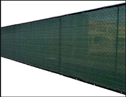
WOOD FENCE WITH APPROXIMATE 50% TRANSLUCENT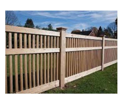
C.
Restaurants with a drive-through configuration shall meet the following requirements:
1.
Drive-through facilities shall not be located within sixty (60) feet of a residentially zoned property, as measured from any menu or speaker box to the property line of adjacent residential property, unless part of a mixed-use development.
2.
No drive-through facility shall be located on a property less than ten thousand (10,000) square feet in area, unless part of a mixed-use development. Stacking spaces for queuing of cars shall be provided for the drive-through area as required in article 6.
3.
Drive-through lanes and service windows serving drive-through lanes shall only be located to the side or rear of buildings.
4.
Drive-through canopies and other structures, where present, shall be constructed from the same materials as the primary building and with a similar level of architectural quality and detailing - article 4.
5.
Speaker boxes shall be pointed away from any adjacent residential properties and shall require masonry sound attenuation walls with landscaping or other speaker volume mitigation measures. Speaker boxes shall not play music but shall only be used for communication for placing orders.
6.
All lighting from drive-through facilities shall be shaded and screened so as to be directed away from any adjacent residential property.
7.
Stacking spaces shall be provided for any use having a drive-through facility or areas having drop-off and pick-up areas in accordance with the following requirements. Stacking spaces shall be a minimum of ten (10) feet wide and twenty-five (25) feet long. Stacking spaces shall begin at the last service window for the drive-through lane (typically the "pick-up" window).
8.
All drive-through facilities with the exception of drive-through restaurants shall provide at least three (3) stacking spaces for each window or drive-through service facility.
9.
The following standards shall apply to all stacking spaces and drive-through facilities:
a.
Drive-through lanes shall not impede on- and off-site traffic movements, shall not cross or pass through off-street parking areas, and shall not create unsafe conditions where crossed by pedestrian access to a public entrance of a building.
b.
Drive-through lanes shall be separated by striping or curbing from off-street parking areas. Individual lanes shall be striped, marked, or otherwise distinctly delineated.
c.
All drive-through facilities shall include a bypass lane with a minimum width of ten (10) feet, by which traffic may navigate around the drive-through facility without traveling in the drive-through lane. The bypass lane may share space with a parking access aisle.
d.
Drive-through lanes must be set back five (5) feet from all lot lines and roadway right-of-way lines.
e.
Owner and operator are responsible for daily litter clean-up to ensure the property remains free of trash, litter, and debris.
f.
Drive-through restaurants shall not be located within five hundred (500) feet of an elementary, middle, or high school.
10.
Semi-trailers and tractor trailer parking/loading shall be provided for establishments within one thousand five hundred (1,500) linear feet from an interstate right-of-way. At least one (1) semi-trailer parking space shall be provided on the side or rear of the lot. All spaces designated for semi-trailer or tractor-trailer parking shall be at least twelve (12) feet in width by fifty-five (55) feet in length. The director may administratively permit a reduction of an equivalent number of passenger parking spaces to accommodate semi-trailer parking/loading. Maneuvering areas shall not include required parking/loading spaces or any portion of a public right-of-way, subject to transportation department approval. No off-street maneuvering area shall require vehicles to back in from or out to a public street.
D.
All sit-down restaurants (non-drive-through) shall comply with the following:
1.
Semi-trailers and tractor trailer parking/loading shall be provided for establishments within one thousand five hundred (1,500) linear feet from an interstate right-of-way. At least one (1) semi-trailer parking space shall be provided on the side or rear of the lot. All spaces designated for semi-trailer or tractor-trailer parking shall be at least twelve (12) feet in width by fifty-five (55) feet in length. The director may administratively permit a reduction of an equivalent number of passenger parking spaces to accommodate semi-trailer parking/loading. Maneuvering areas shall not include required parking/loading spaces or any portion of a public right-of-way, subject to transportation department approval. No off-street maneuvering area shall require vehicles to back in from or out to a public street.
(Ord. No. 2020-1175, Pt. I, 6-22-2021)
BOULDERCREST-CEDAR GROVE-MORELAND OVERLAY DISTRICT
TABLE OF USES
(Ord. No. 2020-1175, Pt. I, 6-22-2021)
Table 1
BOULDERCREST-CEDAR GROVE-MORELAND OVERLAY DISTRICT
BUILDING AND SITE DEVELOPMENT STANDARDS TABLE FOR TIERS 1, 2, 3, AND 4
This "Building and Site Development Table" is cross-referenced in section 3.39.6
Table 2
BOULDERCREST-CEDAR GROVE-MORELAND OVERLAY DISTRICT
BUILDING SETBACKS STANDARDS TABLE FOR TIERS 1, 2, 3, AND 4
This "Building Setbacks Table" is cross-referenced in section 3.37.4
(Ord. No. 2020-1175, Pt. I, 6-22-2021)
Table 3
BOULDERCREST-CEDAR GROVE-MORELAND OVERLAY DISTRICT
TRANSITIONAL BUFFERS AND SCREENING STANDARDS TABLE FOR TIERS 1, 2, 3, AND 4
This "Transitional Buffers and Screening Standards Table" is cross-referenced in section 3.39.6
(Ord. No. 2020-1175, Pt. I, 6-22-2021)
Table 4
BOULDERCREST-CEDAR GROVE-MORELAND OVERLAY DISTRICT
HEIGHT AND DENSITY STANDARDS TABLE FOR TIERS 1, 2, 3, AND 4
This "Height and Density Standards Table" is cross-referenced in section 3.39.6
(Ord. No. 2020-1175, Pt. I, 6-22-2021)
Table 5
BOULDERCREST-CEDAR GROVE-MORELAND OVERLAY DISTRICT
HEIGHT AND DENSITY STANDARDS TABLE FOR TIERS 1, 2, 3, AND 4
This "Height and Density Standards Table" is cross-referenced in section 3.39.6
Design Guidelines
[for the]
Bouldercrest-Cedar Grove-Moreland
Overlay District
A.
Purpose and authority.
1.
In order to protect the interests of property owners in the Bouldercrest-Cedar Grove-Moreland (BCGM) Overlay District and to preserve the health, safety, and welfare of the citizens of DeKalb County, it is essential that development within the BCGM Overlay District be of a consistently high design character. This goal is best fulfilled by the establishment of orderly and consistent guidelines for the design, construction and maintenance of public and private improvements. Following consistent design guidelines promotes the identity an integrity of this important activity center and advances the public purpose of securing a high quality of life and promoting the economic health of DeKalb County
2.
The Board of Commissioners of DeKalb County has established the BCGM Overlay District and adopted these design guidelines by reference as minimum guidelines to govern the overlay area. It is thereby declared to be a public purpose to administer and enforce the following minimum design guidelines for all new development within the BCGM Overlay District.
3.
These design guidelines are intended to augment and enhance chapters 14, 27 and other guidelines of the DeKalb County Code of Ordinances, which shall remain in full force and effect within the BCGM Overlay District.
4.
The goals of these guidelines include:
a.
To provide for connectivity of streets and communities and reduce the dependence on automobile use by increasing the ease of movement and opportunities for alternative modes of travel; and
b.
To ensure a proportional relationship of surrounding buildings with respect to the general spacing of structures, building mass and scale, and street frontage by using techniques to achieve compatibility, such as:
c.
Use of additional façade detail; proportion of façade elements, doorways, projections and insets; window scale and pattern; and creation of strong shadow lines as decorative elements;
d.
Use of consistent setbacks from property lines;
e.
Development of consistent sidewalks and a more active, interesting pedestrian environment;
f.
Use of landscaping, lighting and street furniture to unify district buildings and define space; and
g.
Use of compatible building materials to promote a design and building aesthetic consistent with Oglethorpe University and the desired urban village character.
5.
These design guidelines shall be administered by the DeKalb County Planning and Sustainability Department. Applicants for development permits are encouraged to schedule a pre-application conference with the planning department in order to assure full understanding and compliance with these design guidelines. Interpretations, disputes, and appeals with respect to the interpretation and application of these design guidelines shall be resolved by the Director of the DeKalb County Planning and Sustainability Department.
B.
[District boundaries.]
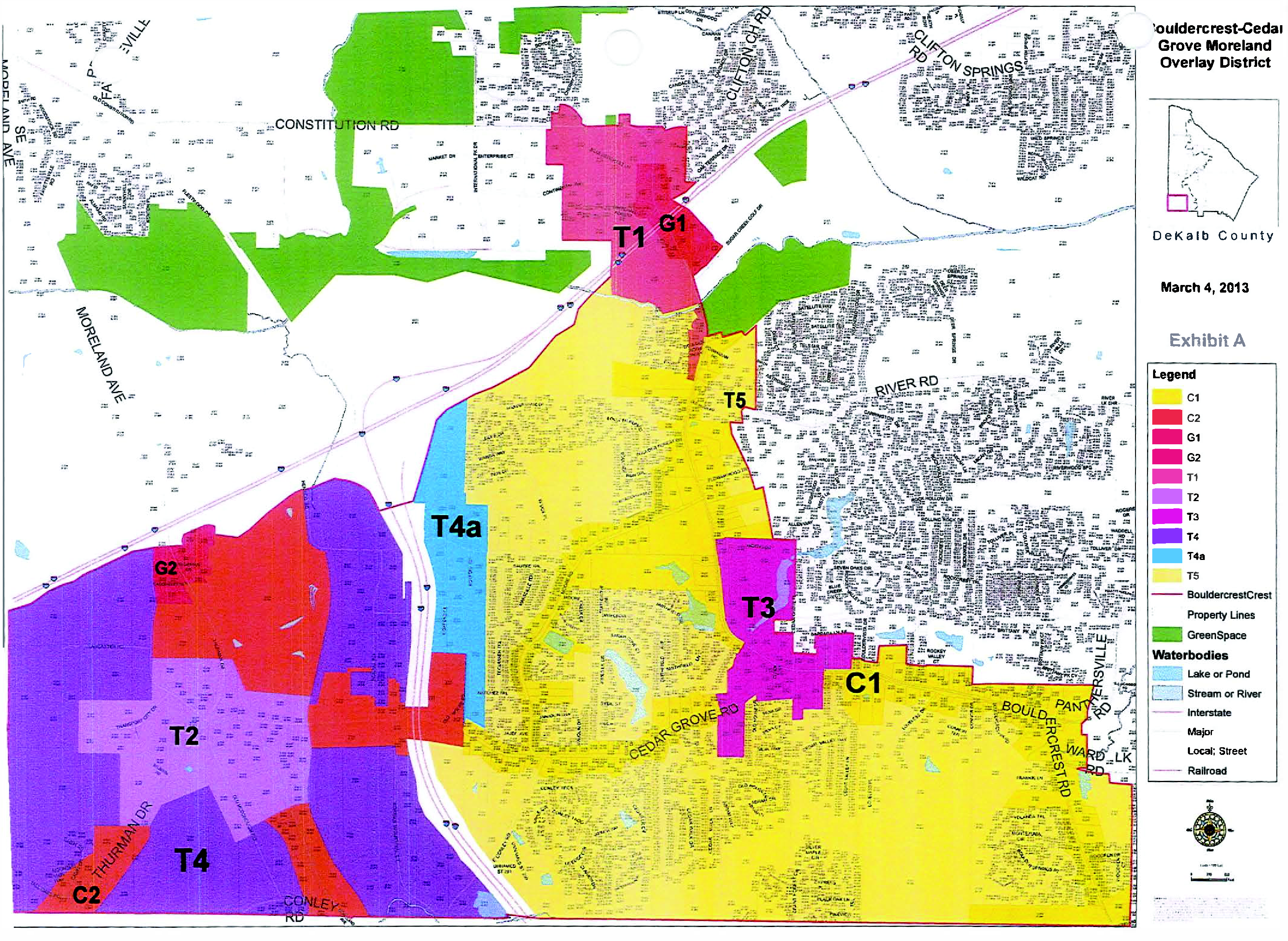
C.
Streets and sidewalks.
1.
[Generally.] Public and private streets shall meet all the requirements for public streets in chapter 14 of the DeKalb County Code of Ordinances, Land Development, and the BCGM Overlay District with the following exceptions and enhancements unless otherwise indicated in the ordinance:
a.
The design of streets within the BCGM Overlay District shall provide for the continuous and interconnected travel of automobiles, transit buses, bicycles, and pedestrians between points of origin and destination within the district, and shall provide for maximum continuity with streets, transit routes, sidewalks, bicycle lanes, trails, paths, and greenways that enter and leave the overlay district from surrounding areas.
b.
Any new streets shall enhance connectivity within the BCGM Overlay District by connecting at least two (2) public streets. When blocks are subdivided by new streets, the maximum length of resulting new blocks shall be three hundred (300) linear feet, or six hundred (600) feet along Moreland Avenue.
c.
Gates and security arms shall be prohibited from crossing any public street or sidewalk.
d.
All utilities shall be located underground.
e.
Plan below is to illustrate location of design elements-it is not drawn to scale.
Exhibit 1
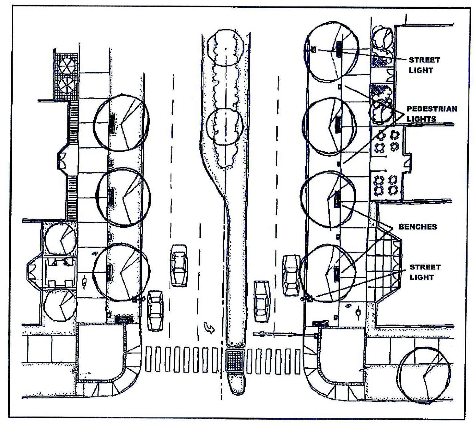
Refer to the table in section 3.39.6 of the ordinance for dimensions and specifics of street and sidewalk design.
f.
All Streets in Tiers 2 and 4 must be designed to accommodate large trucks.
2.
On-street parking. On-street parking is an efficient manner to provide convenient store-front parking and residential parking on minor streets in order to reduce the need for large surface parking lots. On-street parking spaces along the street frontage of an adjacent parcel shall not be counted with off-street parking and shared parking to meet parking requirements of chapter 27. On-street parking spaces shall be safely accessed from the travel lanes of the adjoining street, paved to the specifications of public streets and demarcated with painted lines not less than three (3) inches in width. Parallel parking spaces shall be not less than nine (9) feet wide and not less than twenty (20) feet in length. DeKalb County shall have sole authority to determine time limits, metering and signage of on-street parking spaces on public streets within the overlay district. On-street parking shall be provided on street types as indicated in Table 1. On street parking stalls shall be demarcated with painted boundaries not less than three (3) inches in width and shall be a minimum of nine (9) feet in width and twenty (20) feet in length.
3.
Medians. In roads with more than two (2) lanes, raised medians shall be designed and constructed to provide for safe and convenient crossings for persons with disabilities and shall provide refuge for pedestrians at crosswalks, as shown in Exhibit 1. Raised medians shall be landscaped with trees, shrubbery and other approved groundcover materials in the plant list contained in the appendix unless otherwise approved by the planning director. Shrubbery and groundcover planted in the medians within 30 feet of the nose of the median shall not exceed eighteen (18) inches in height.
4.
Bicycle lanes and bicycle racks. Paved bicycle lanes shall be provided along both sides of minor and major collector streets. Bicycle lanes shall be not less than five (5) feet in width with signs and pavement markings as required by the latest version of the Manual for Uniform Traffic Control Devices. Off-street bicycle paths shall be paved not less than ten (10) feet in width and have cross-slopes not greater than two (2) percent. Properties that require more than one hundred (100) parking spaces shall provide bike racks with at least one (1) parking stall per one hundred (100) vehicular parking spaces. Bicycle racks shall be securely anchored to the ground or a permanent structure, and shall be located adjacent to outdoor lighting sources.
5.
Sidewalks and pedestrian ways. The BCGM Overlay District shall be designed to minimize the need for vehicular transportation and to promote pedestrian and bicycle circulation throughout the overlay district. The construction of continuous sidewalks along all streets and off-street pedestrian ways between all building entrances, between adjacent parking lots and connecting streets with adjacent parking lots, transit stops and building entrances is required throughout the overlay district. See Exhibit 1, page 5, showing sidewalks along streets. See page 28, for an illustration of off-street pedestrian ways linking parking lots and building entrances. Sidewalks are also encouraged within greenways and other outdoor recreational areas.
a.
Sidewalks in the overlay district shall be as listed in the table under section 3.39.6, and constructed of four-inch-thick poured in place concrete. Minimum side slope for all sidewalks shall be two (2) percent. Alternatively, sidewalks may be constructed with brick, stone, or similar durable paver materials to add aesthetic interest and visibility, especially at building entrances, in plazas, in pedestrian crosswalks and at other pedestrian intersections with vehicular routes. Asphalt is not an acceptable paving material for sidewalks or pedestrian ways.
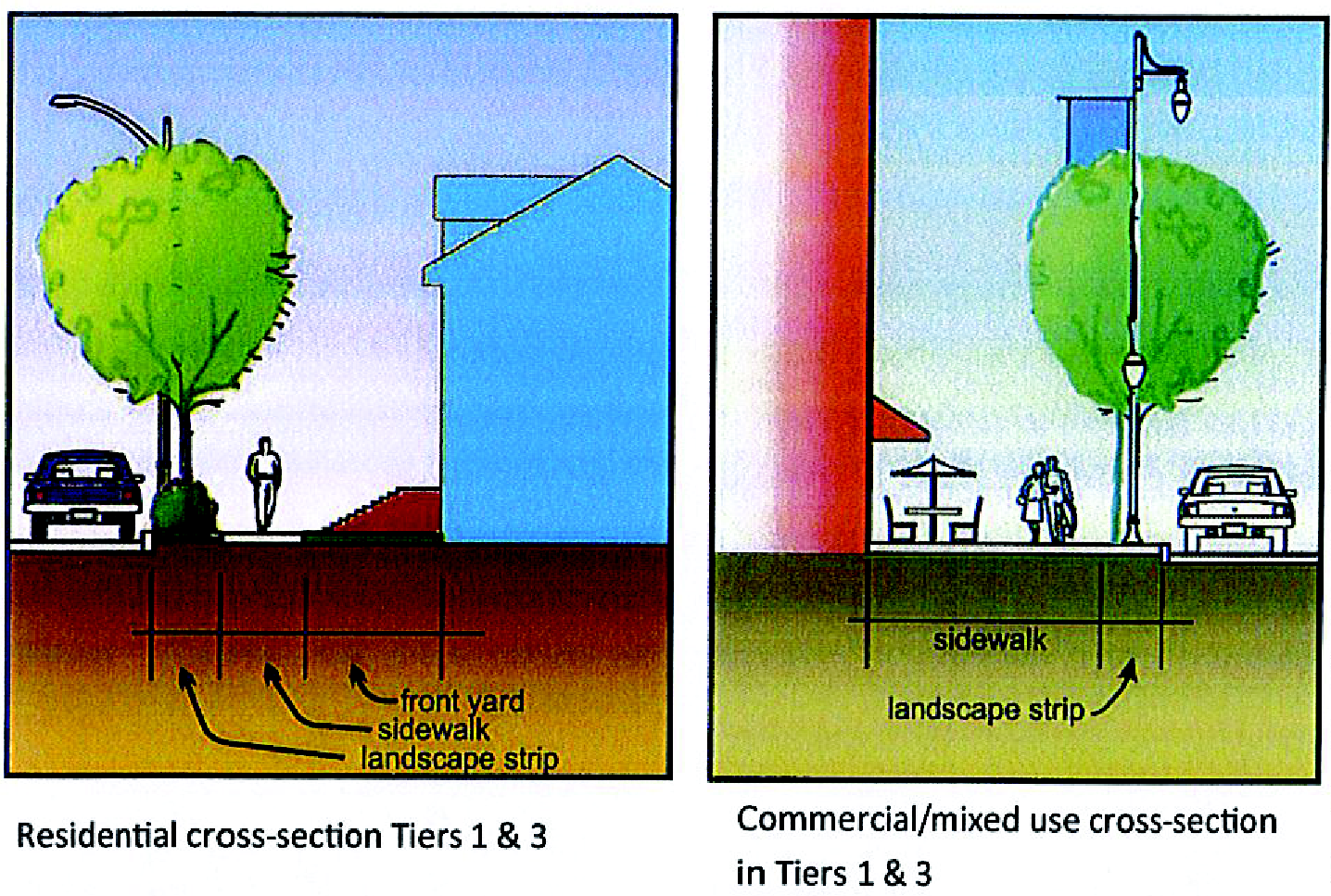
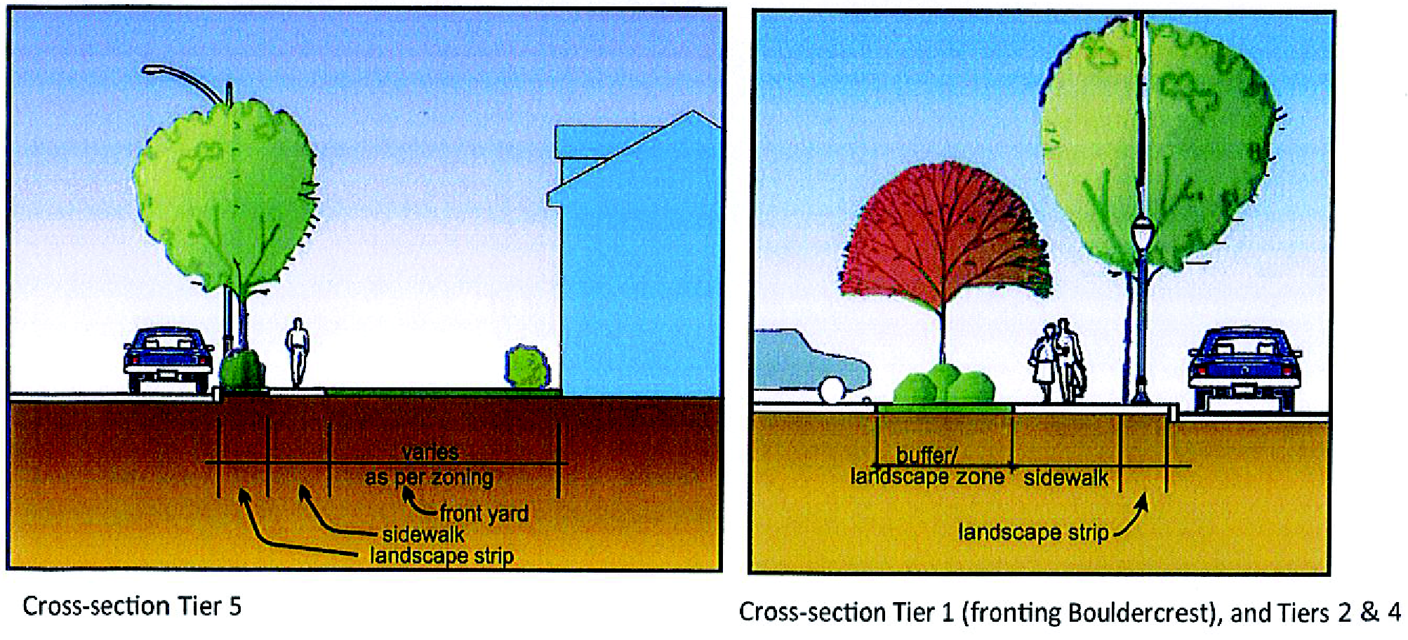
b.
To the extent feasible, sidewalks and pedestrian ways shall be aligned vertically and horizontally to minimize the impact on existing topography and vegetation while forming a continuous pedestrian system. Sidewalks and pedestrian ways that join at property lines or with existing sidewalks shall match the elevation, alignment and cross slope of the abutting sidewalks to form a safe, smooth and continuous sidewalk system.
c.
Landscape strips (the area between the sidewalk and the back of curb) shall be planted with grass, ground cover and flowering plants, or consist of brick pavers, concrete pavers or granite pavers where on-street parking is provided or pedestrian crossings and/or congregation is likely. Pedestrian zones shall be paved in concrete and kept clear and unobstructed for the safe and convenient use of pedestrians. Street trees shall be planted in the landscape strip, unless the strip is less than five (5) feet wide—in which case, the trees must be planted in the landscape zone outside the limits of the sidewalk. Trees shall be selected from the recommended plant list at the end of these guidelines from the first section labeled 'street trees.' Where overhead utilities exist, trees shall be selected from the second section, labeled 'small trees.'
d.
Safe and convenient pedestrian pathways shall be provided from sidewalks along streets to each structure entrance, including pedestrian access routes to parking decks and through parking lots and between adjacent buildings within the same development. All walkways shall be concrete and a minimum width of five (5) feet.
e.
Sidewalk paving materials shall be continued across any intervening driveway at the same prevailing grade and cross slope as on the adjacent pedestrian sidewalk area. Alternatively, approved striping and/or pavement markings may be used to connect pedestrian route across drives and parking lots.
f.
Benches, trash receptacles, and bike racks shall be placed within the landscape strip at high pedestrian traffic areas.
6.
Crosswalks. All crosswalks and other intersecting points between the pedestrian and vehicular traffic systems shall be clearly marked as shown in Exhibit 7. The use of approved brick, concrete or stone paving materials to identify crosswalk areas is encouraged. Crosswalks shall be designed to meet DeKalb County's guidelines of use for disabled persons. Crosswalks for median-divided streets shall provide for barrier-free passage and refuge areas as illustrated in Exhibit 1. Cross-walks shall be accompanied by pedestrian signals where required by DeKalb County and in conformity with the Manual for Uniform Traffic Control Devices.
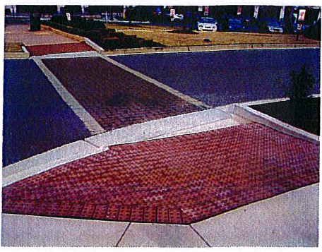
Exhibit 2: Crosswalk delineation.
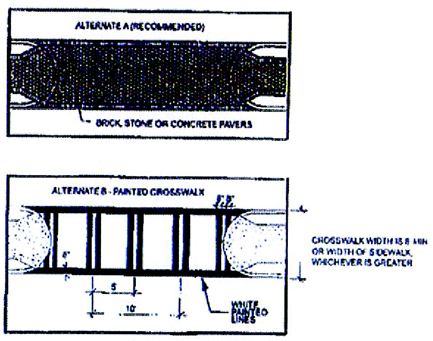
a.
Crosswalks must be clearly marked to meet DOT standards. All crosswalks must have ADA standard curb cuts. Bricks or concrete pavers delineating the walks are desirable. Pavers and planting in islands is required to create landing zones for pedestrians where free-flow turns are installed (see below).
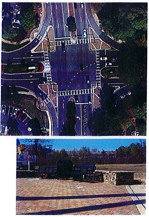
b.
It is desirable to install pedestrian plazas at street intersections.
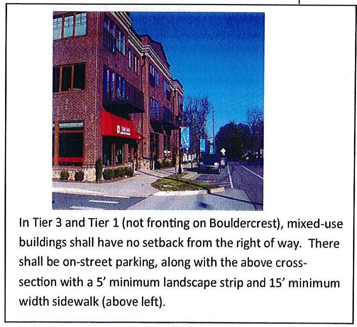
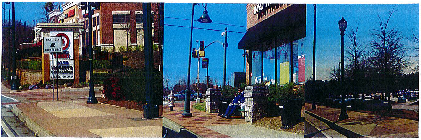
c.
Decorative paving may be used in the landscape strip. Street lights are to be located in this strip, along with street trees (maximum forty (40) feet o.c.). Planting beds (min. fifteen (15) feet long) must occur in the landscape strip, no more than sixty (60) feet o.c.
 Provide sidewalk access directly from sidewalks to businesses
|
In Tiers 2 and 4, and also in Tier 1 (properties fronting on Bouldercrest Road only)
buildings may be set back up to a maximum 85 feet from the right-of-way (maximum one
double-loaded bay of parking plus sidewalk and landscape strip). Direct sidewalk access
must be provided, and decorative paving is encouraged. Landscaping must soften/buffer
parking and include trees at 40' maximum spacing. See cross-section in subsection
III.E.1. 7.
 |
 | Not Allowed: Sidewalks are not allowed next to curb. Deceleration lanes are discouraged and should be added only where necessary. |
D.
Streets and sidewalks—Residential.
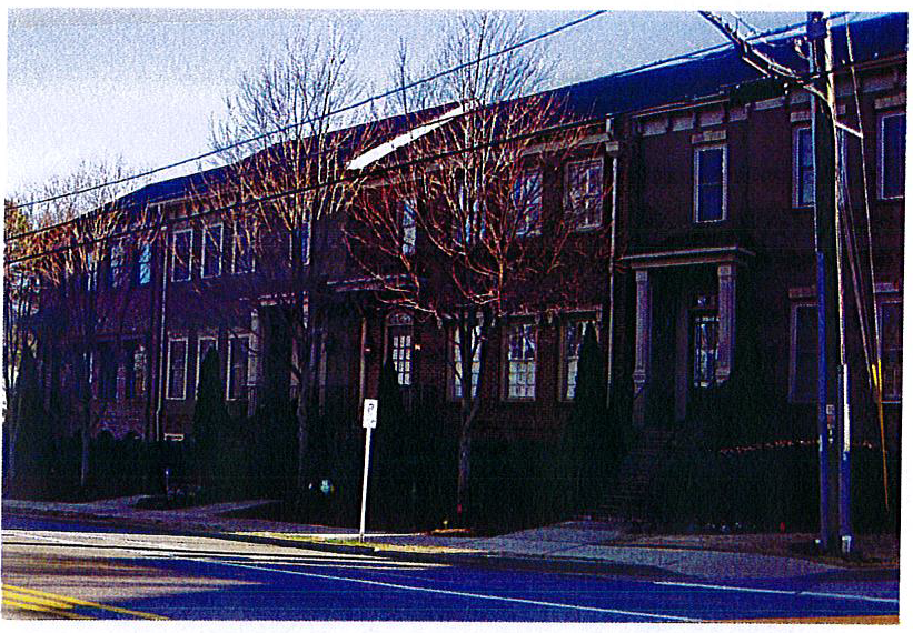
1.
For multi-family and attached single-family housing in Tiers 1 and 3, there must be a minimum five-foot landscape strip behind the curb, a minimum eight-foot wide sidewalk, and a front yard of eight (8) feet minimum and fifteen (15) feet maximum. This front yard shall be for landscaping, porches and steps. Decorative fences are also allowed. Live/work units may have up to seventy (70) percent of this front yard paved.
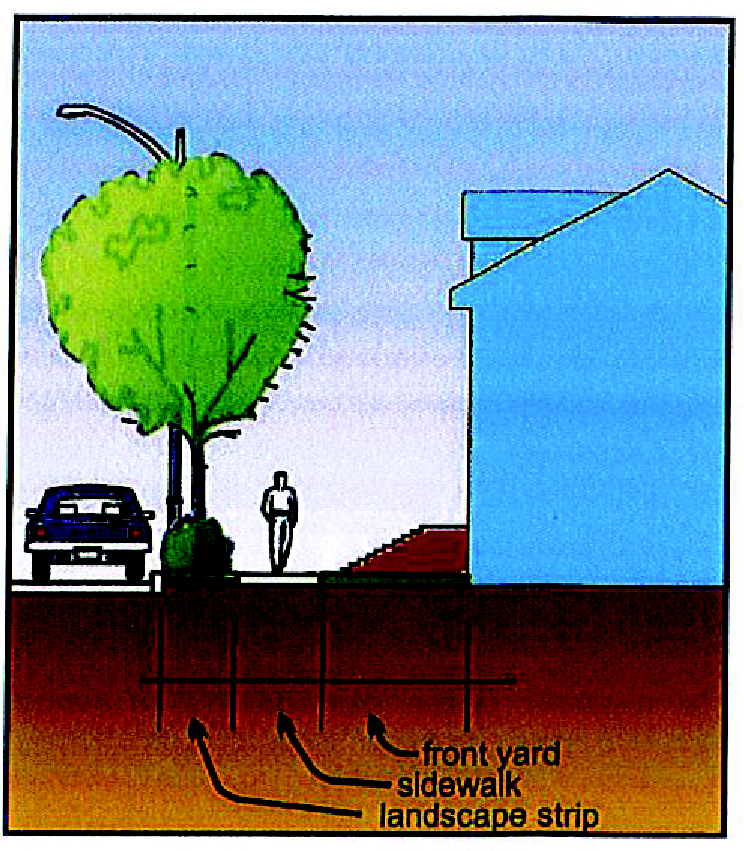
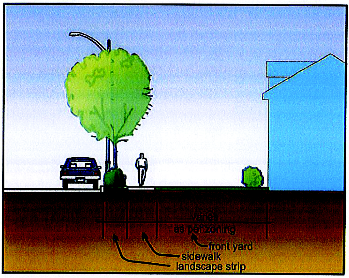
2.
Six-foot-wide sidewalks are required on both sides of the streets in all new Tier 5 single-family residential development. A four-foot minimum landscape strip is required between the curb and sidewalk.
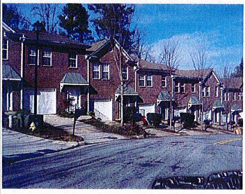 | Not Acceptable All new developments must include sidewalks. |
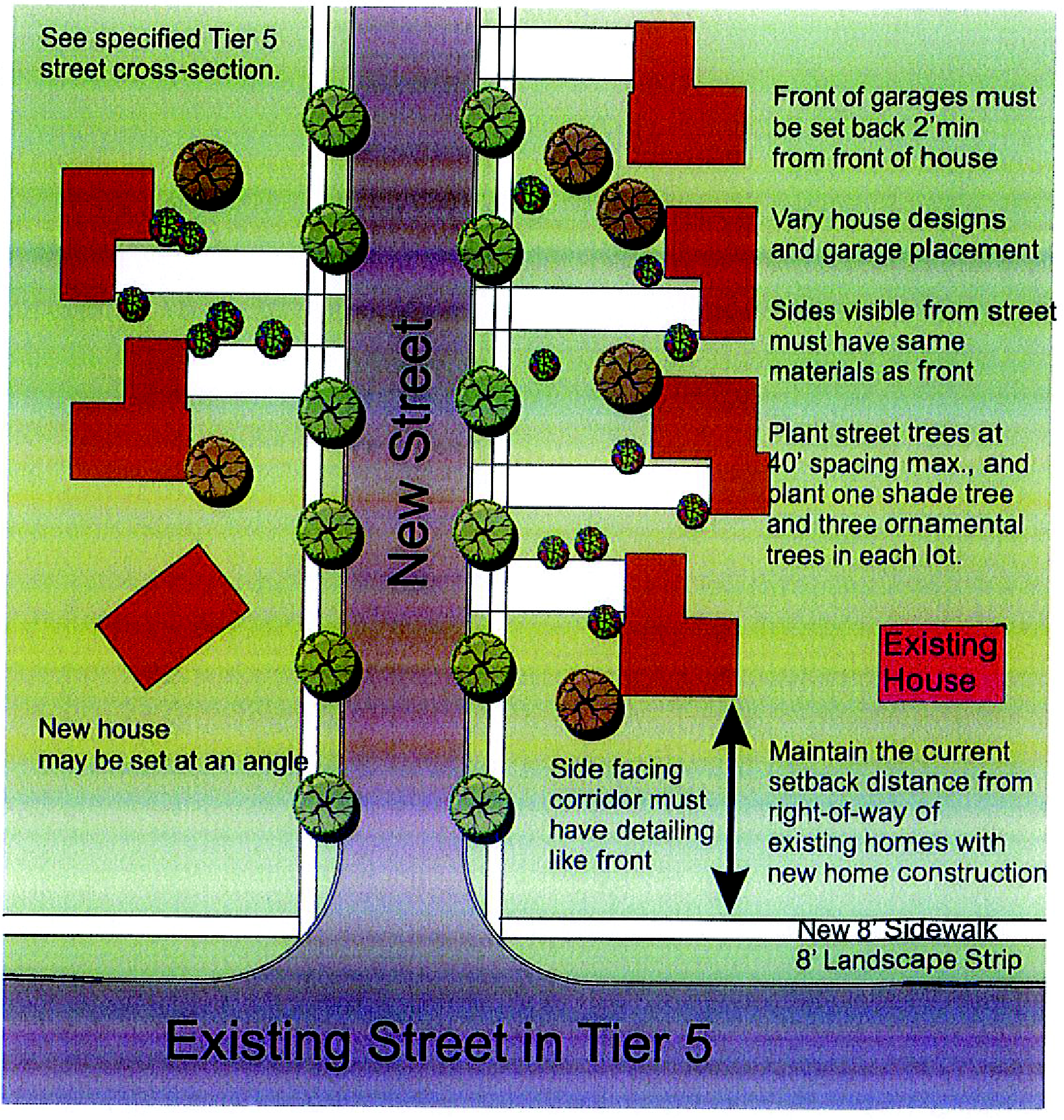
3.
New residential developments Tier 5 must not have any vertical improvements (buildings, walls over three (3) feet, etc.) within the setback from the current right-of-way for adjacent existing buildings. Buildings facing the existing road must be articulated like the building's front, including continuation of the same materials. All homes must carry the design and materials of the front to all sides visible from the street.
4.
When new homes are built on infill lots in existing neighborhoods, these homes must maintain (or exceed) the standards of the existing homes—size, quality of materials, placement, design detailing, etc.
| Sidewalks, trees and architectural variety are lacking in these photographs. Placement of buildings, colors, garage setback must all be considered to make the most attractive neighborhoods. Architectural features and materials must be continued on all visible sides. | 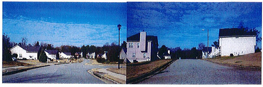 |
E.
Streets and sidewalks—Corridors 1 and 2.
1.
Corridor 1.
a.
New residential developments along Corridor 1 must not have any vertical improvements (buildings, walls over three (3) feet, etc.) within one hundred (100) feet of the corridor right-of-way or setbacks of existing adjacent homes—whichever is less. The building facing the corridor must be articulated like the building's front, including continuation of the same materials. All homes must carry the design and materials of the front to all sides visible from the street.
b.
Sidewalks (eight-foot width minimum) must be installed with an eight-foot wide landscape strip. Landscape strip must be planted with grass and groundcovers. Street trees must also be planted, but varieties and spacing must reflect existing conditions—use similar species and place trees to continue existing appearance (do not introduce formal structure into an informal area, etc.)
c.
Deceleration/acceleration lanes are discouraged—use only where required.
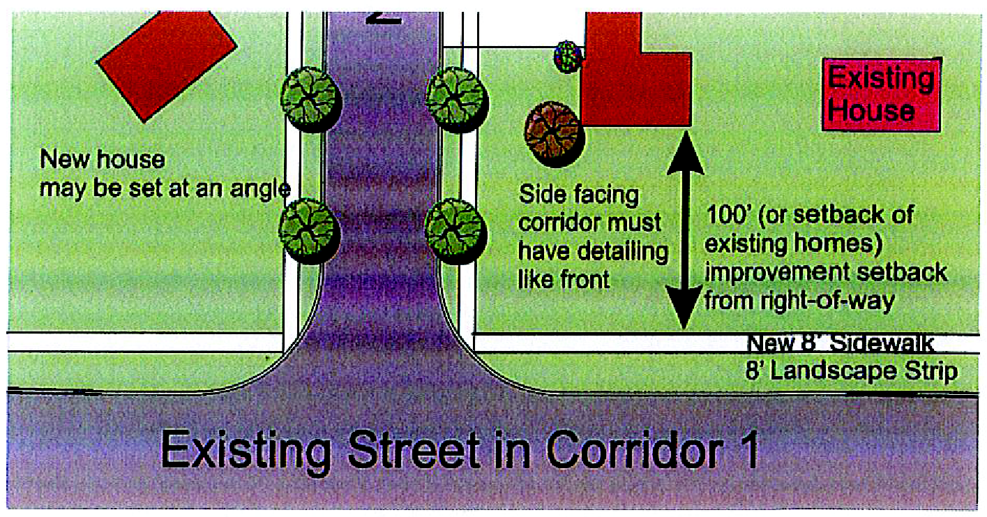
2.
Corridor 2.
a.
New developments in Corridor 2 have a building setback maximum of ninety-five (95) feet. One double-loaded bay of parking is allowed in front, behind a twenty-foot wide landscape strip. Direct pedestrian access from the public sidewalk is required, with clear sidewalk connections across drives and parking delineated with changes in color, texture, striping or other materials. Connections with adjacent parcels are also required—both auto/parking and pedestrian.
b.
There must be no more than ten (10) parking spaces in a row between tree/landscape islands. These islands must have a minimum of two hundred twenty (220) square feet of pervious area for landscaping.
c.
Curb cuts must be at least one hundred twenty-five (125) feet apart, and shared entrances are recommended to minimize the number of curb cuts.
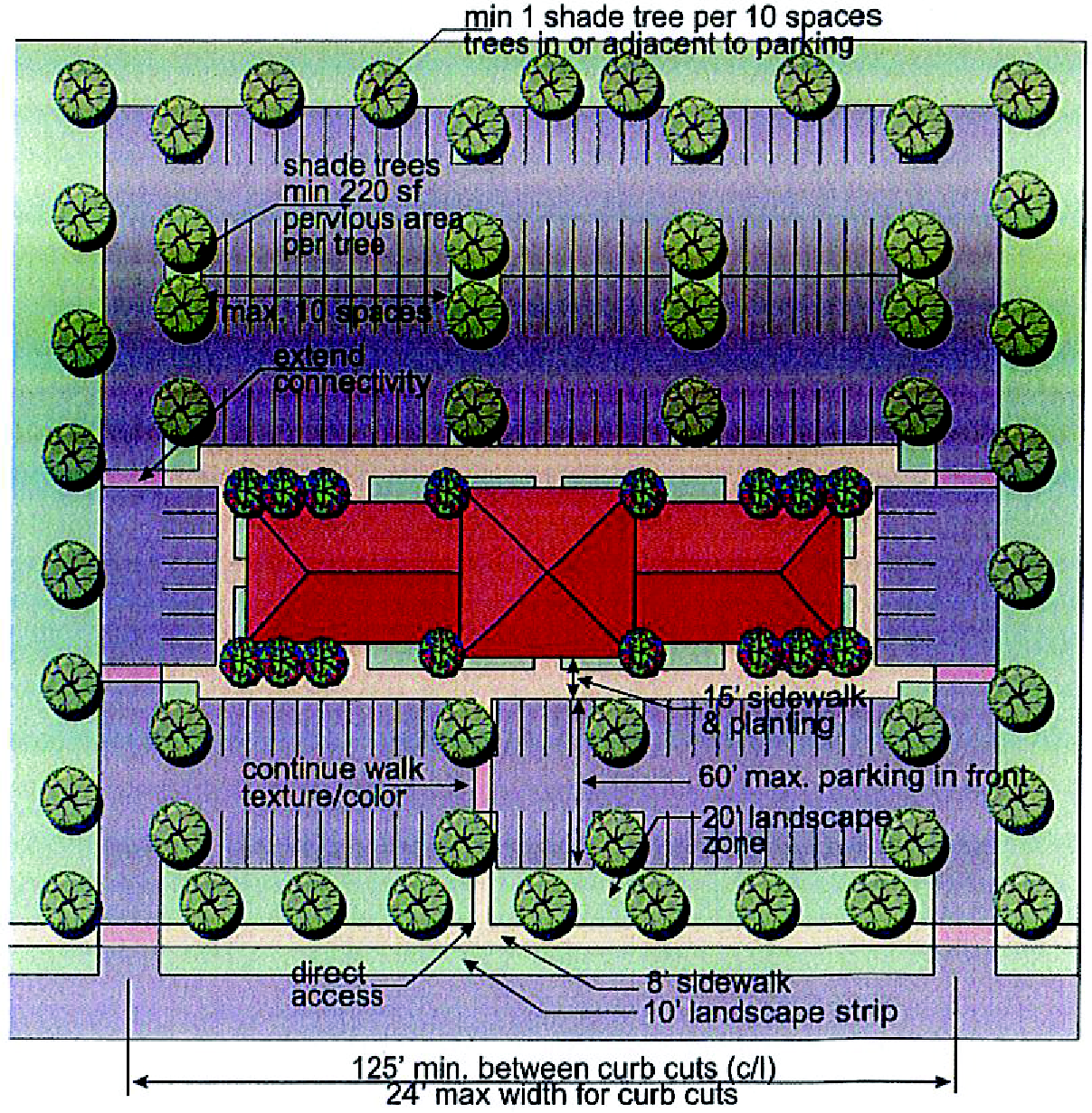
Site Concept Example for: Corridor 2
F.
Streets and sidewalks—Gateways 1 and 2.
1.
The Gateway areas represent the opportunity to create a positive first impression on all visitors. Developments in these areas must take advantage of this opportunity to represent the community in a positive way.
2.
Because of the proximity to I-285, these buildings should be multi-story, with prominent architectural features. Only one (1) double loaded bay of parking is allowed between the building and any right-of-way. Landscape strips must buffer view of parking from the right-of-way.
3.
No more than ten (10) parking spaces may be in a row before a tree/landscape island with at least two hundred twenty (220) square feet of pervious area. See landscaping section for tree requirements.
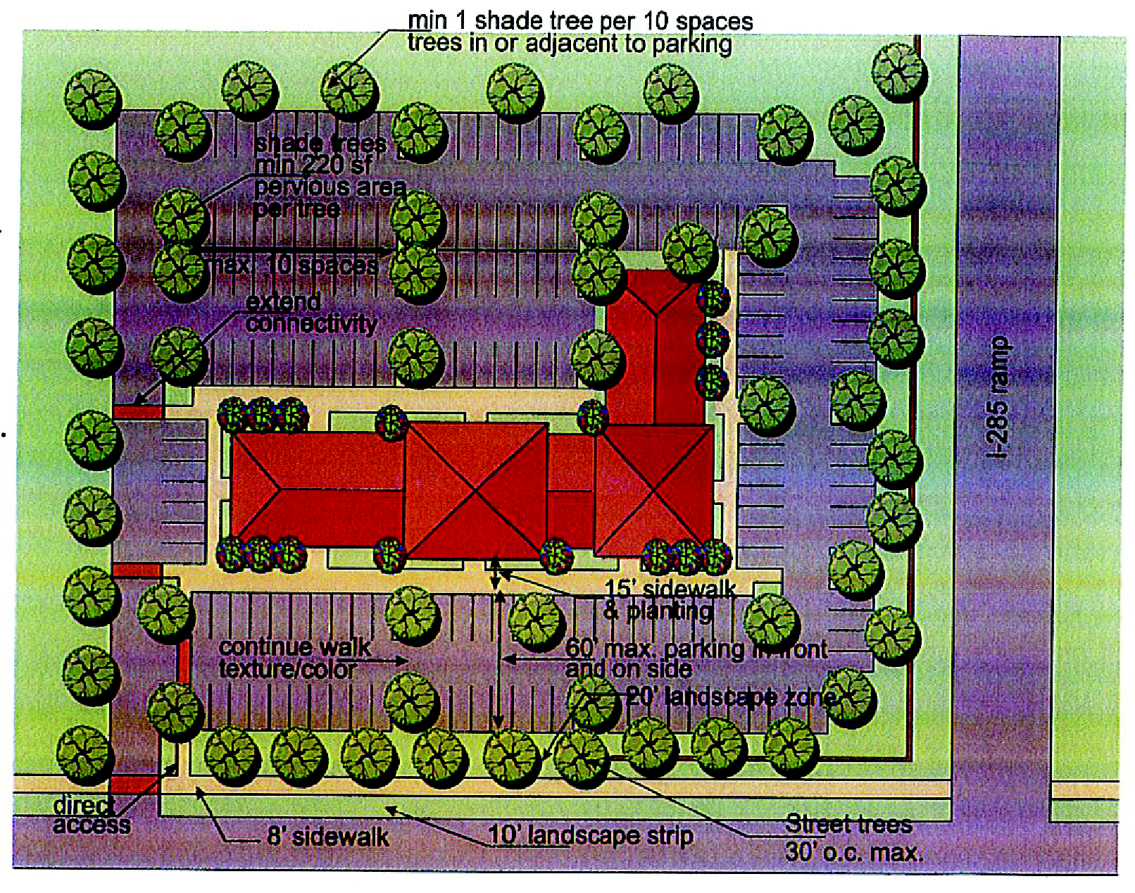
G.
Outdoor lighting and furnishings.
1.
[Generally.] Streetlights shall be provided where required by DeKalb County using fixtures specified in Table 2. In addition, all streets and parking lots shall have lighting designed to provide adequate lighting levels for pedestrians and bicyclists as well as for automobiles. Street lighting fixtures shall meet the specifications indicated in Table 2 and images below. Pedestrian lighting within the right-of-way shall be mounted on fourteen-foot poles. Light fixtures shall be LED luminaires.
Table 1: Outdoor Lighting Specifications—all fixtures and poles shall be permanent black.
a.
Light levels of 1.5 foot candles are recommended for parking areas and four (4) foot candles at vehicular drives, entrances and pedestrian and bicycle ways.
b.
All lighting other than street and pedestrian lighting shall have 'dark sky' design - there shall be no spillover from the fixture onto surrounding properties (including the street). All lights and poles shall have a permanent black finish.
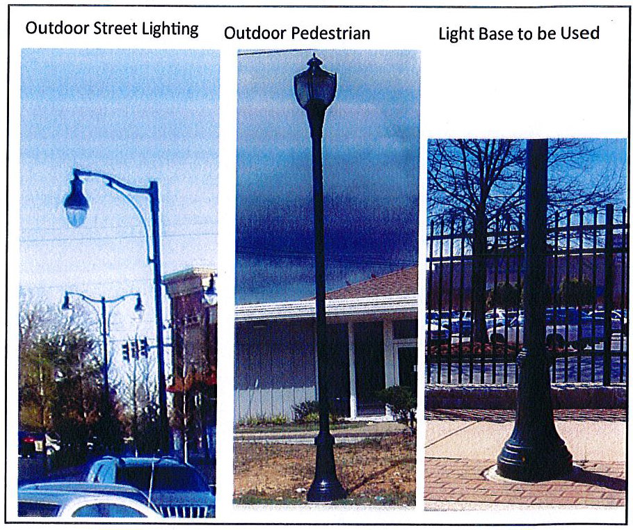
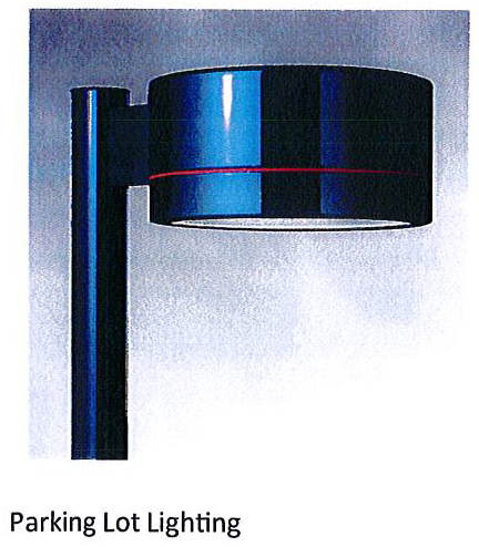
c.
Ground mounted floodlights shall be screened with planting and shields so light source is not visible. The use of flashing, rotating or oscillating lighting is prohibited if visible from outside the buildings. After hours security lighting shall equal at least twenty-five (25) percent of the normal parking lot lighting level.
2.
Street furniture. Sidewalks, plazas, parks, trails and other public spaces may contain outdoor furniture such as benches, trash receptacles, bicycle racks and other similar appurtenances. Acceptable street furniture designs are illustrated below. Similar designs may be acceptable if approved by the director of planning and sustainability, provided they are similar in appearance, and meet the following specifications for construction:
3.
Transit stops. MARTA bus service is provided on certain streets within the overlay district. Bus stops must be located within the public right-of-way as determined by MARTA with approval of the director of planning and sustainability. Transit stops shall provide adequate lighting and at least forty (40) square feet of concrete pavement accessed by ADA accessible sidewalks. Transit stops must be landscaped (a minimum of two (2) shade or ornamental trees and ten (10) shrubs) and have at least one (1) bench and one (1) trash receptacle. Shelters shall be as shown at right - without advertising panel where possible.
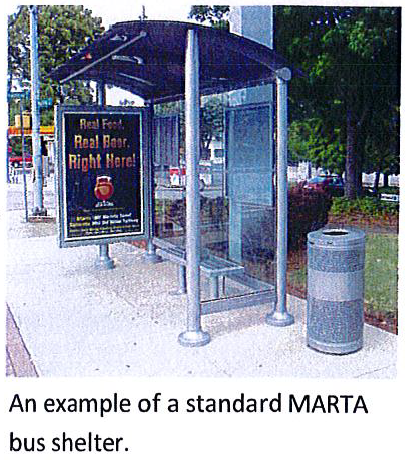
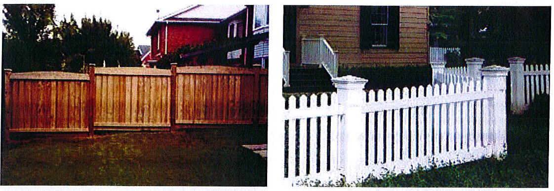
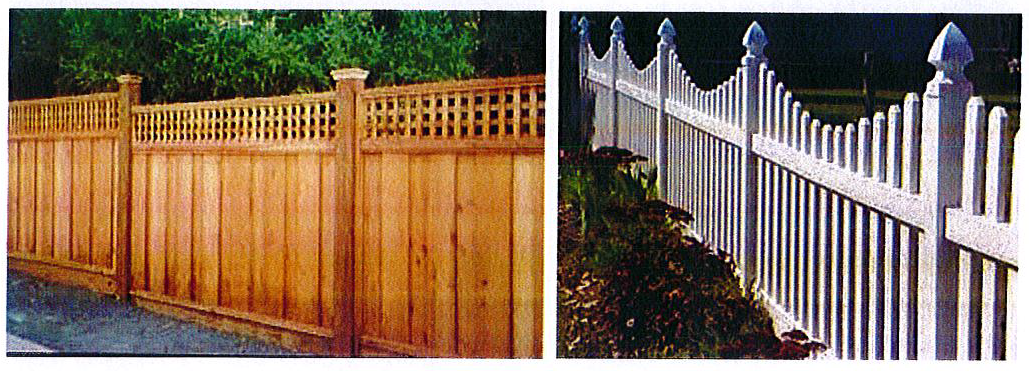
4.
Wood fences shall be constructed with quality wood products. Both sides shall be equally attractive, they must be of #2 or better pressure treated pine, cedar or redwood. Posts must be firmly anchored. They must then be painted or stained and sealed.
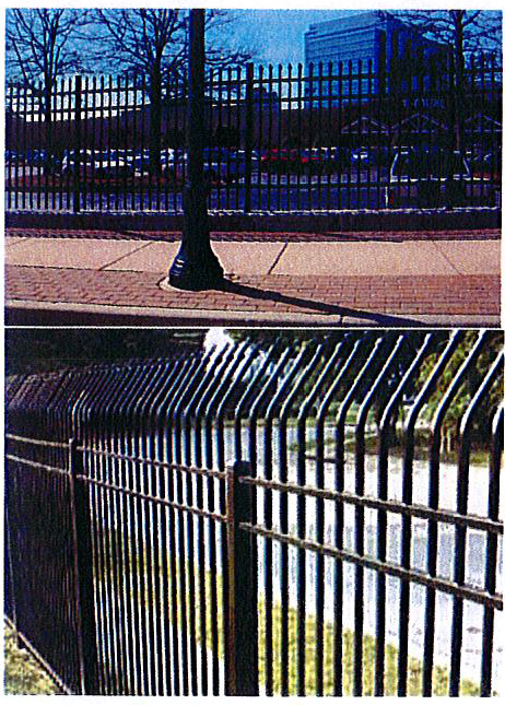
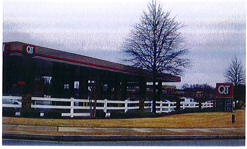
5.
Decorative fences (similar to designs shown) of coated metal or painted wood (with masonry posts) are allowed in all tiers, and recommended as architectural elements.
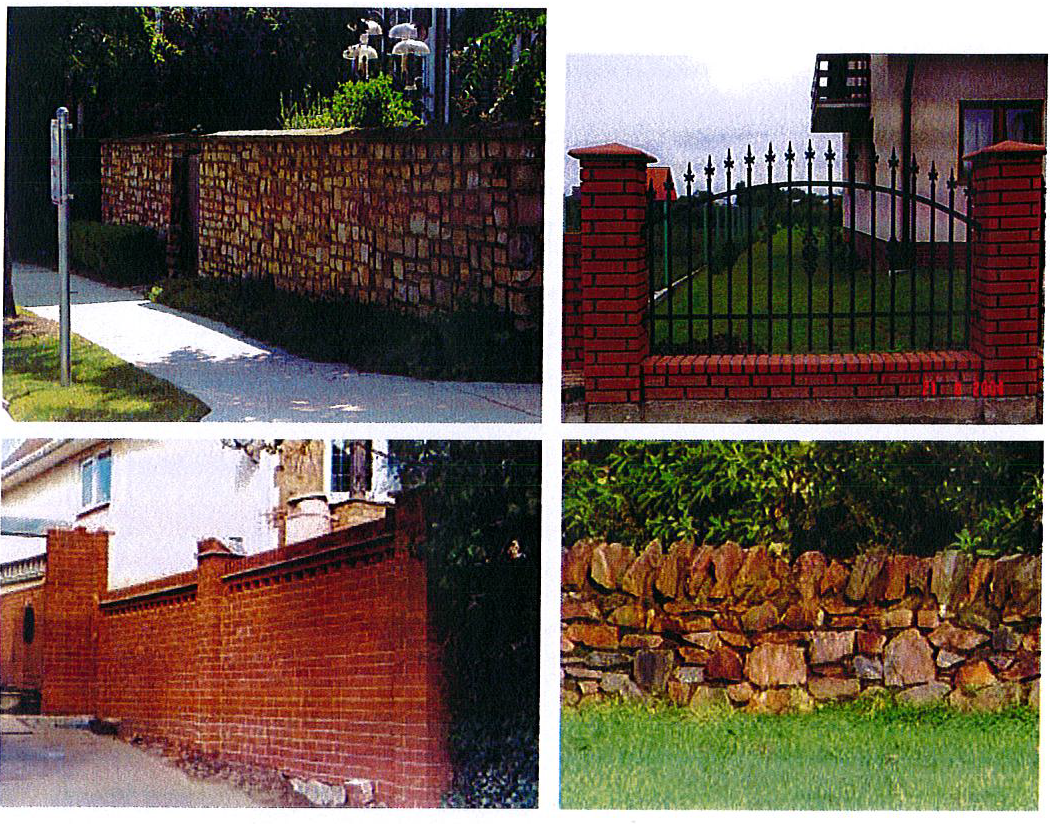
6.
Masonry walls (or masonry combined with decorative metal inserts as shown) are allowed in all tiers. Walls may be decorative or used for screening purposes.
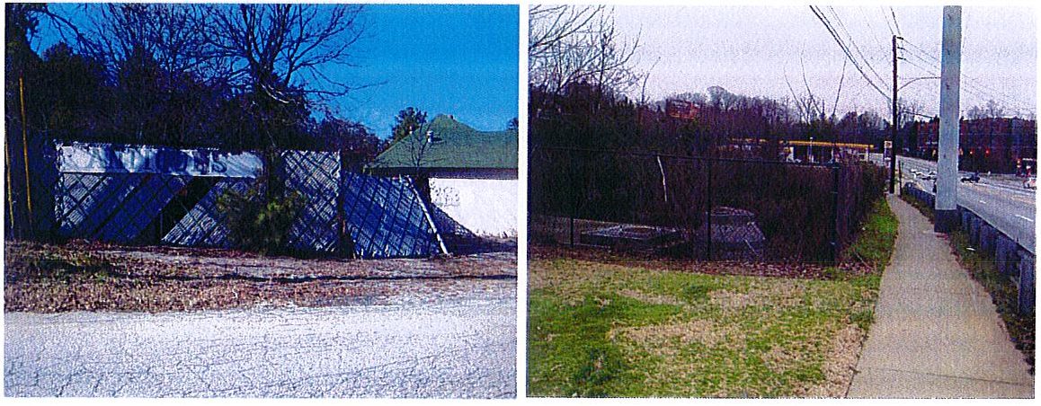 |
| Chain-link fencing (with or without slat inserts) is not allowed in any tier where it is visible from the public right-of-way. In Tiers 2 and 4, black vinyl coated chain link is allowable, but landscaping must be installed that will screen the fence within 5 years. |
H.
Architectural design and massing.
1.
Building orientation.
a.
Where development is on a primary or secondary street and also across the street from existing single-family homes which face the street, buildings along the primary or secondary street shall face the existing single-family development.
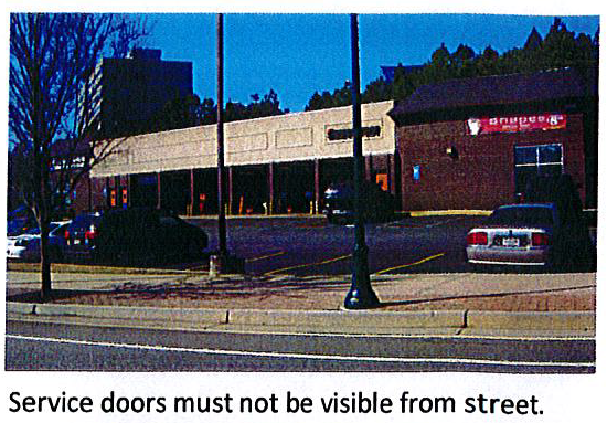
b.
Service and delivery doors, loading docks, service areas, trash dumpsters, trash compaction and all other mechanical areas and equipment shall be screened from view from all streets and public rights-of-way. Screening shall include landscaping, or architectural treatment or color similar to the building to screen the equipment. Rear, unadorned walls shall not be visible from the public right-of-way.
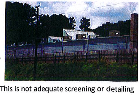
2.
Building setbacks, etc.
a.
All building heights are to be measured from the finished sidewalk to the top of cornice for flat-roofed buildings or the bottom of the eave for sloped roofed buildings along the façade that faces the street with the highest volume of daily traffic. Levels measuring less than six (6) feet in height for the purposes of raising the first floor level above the street level, providing a consistent first floor level, or for the sole purpose of housing mechanical, plumbing or electrical equipment shall not be counted as stories for the purposes of maximum building heights.
b.
Where a non-single-family development on the external boundary of the BCGM Overlay District adjoins the boundary of any property outside the district, or where non-single-family developments back up to existing single-family uses, a transitional buffer of not less than thirty (30) feet in width shall be provided and maintained in a natural state (if it provides an effective buffer/screen) or planted to create an effective visual screen. No paving or impervious surface shall be allowed for parking, loading, storage or any other use. Portions of the buffer zone may be used for installation of utilities when necessary. Water detention ponds shall not be located within the transitional buffer zones. No trees, other than dead or diseased trees, shall be removed from said transitional buffer zone, but additional trees and plant material may be added to the transitional buffer zone.
c.
All buildings within Tier 1 shall be a minimum of two (2) stories tall and twenty-eight (28) feet in height. The maximum building height for buildings in Tier 1 shall be four (4) stories or forty-eight (48) feet whichever is less, in Tier 2 shall be eight (8) stories or one hundred (100) feet, in Tiers 3 and 5 shall be three (3) stories or thirty-six (36) feet in height. In Tier 4 the maximum building height shall be three (3) stories or fifty (50) feet, and in sub-area 4a, the maximum height shall be two (2) stories or thirty (30) feet, whichever is less. Single-family attached townhomes or live/work units in Tiers 1 and 3 shall not exceed three (3) stories or thirty-five (35) feet, whichever is less.
3.
Building massing.
a.
Street fronting building façades greater than one hundred thirty (130) feet in length shall be modulated with breaks in wall surfaces, materials and rooflines at intervals not to exceed one hundred (100) feet, measured parallel to the street.
b.
The size of leased commercial space shall vary within each development to allow for a diversity of tenants.
c.
The primary entrance for all upper story uses shall be clearly visible from the street and shall face the street. If a building fronts more than one (1) street, the primary entrance should face the street with the highest classification.
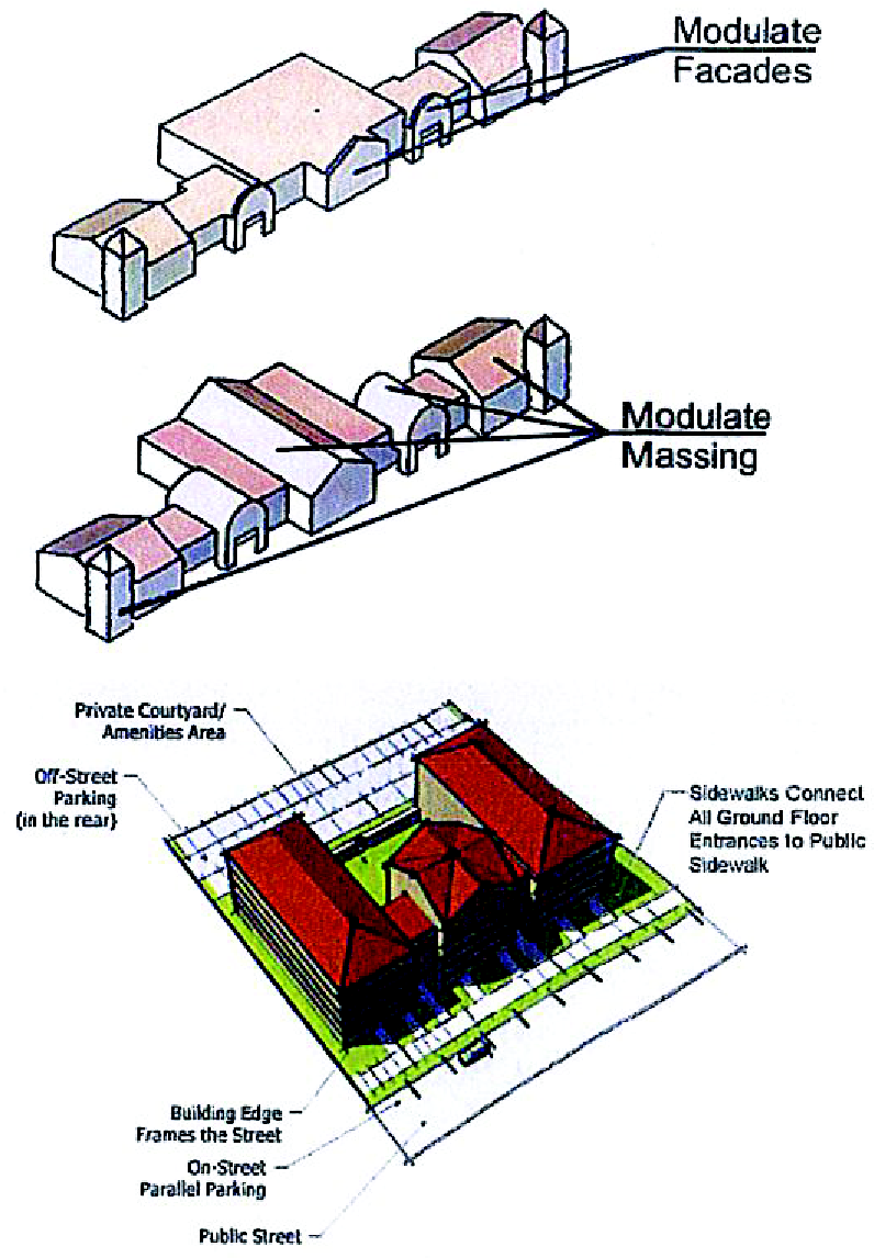
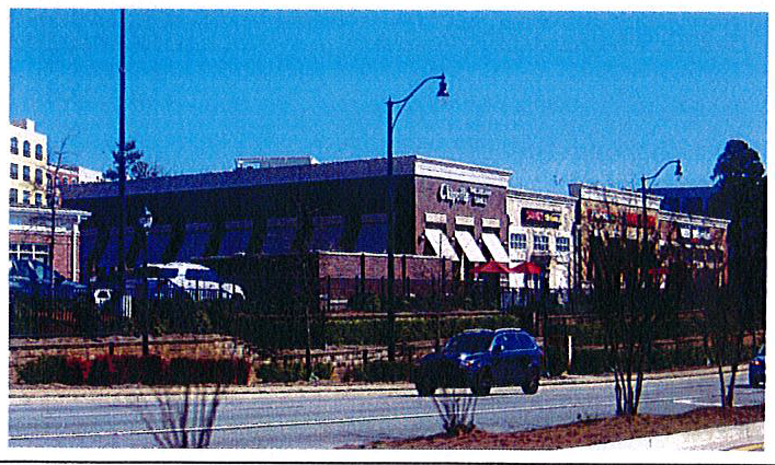
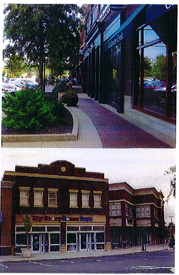
4.
Building façades and fenestration.
a.
For the purposes of this document, fenestration includes all glazed surfaces, including (but not limited to) storefront windows, display windows and doors containing glazed panels at least four (4) feet in height. Fenestration shall not utilize painted glass, reflective glass or other similarly treated or opaque windows. Entrances may be counted towards fenestration requirements.
b.
All fenestrations shall:
i.
Begin at a point not more than three feet above the sidewalk, to a height no less than ten feet above the sidewalk, or
ii.
Begin at the finished floor elevation to a height no less than ten (10) feet above the finished floor elevation when the finished floor elevation is three (3) or more feet above the sidewalk, or
iii.
Begin at a point no more than sidewalk level, to a height no less than ten (10) feet above the finished floor elevation when the finished floor elevation is below the sidewalk.
c.
Building façades should promote architectural and visual interest. A minimum of thirty-five (35) percent of any façade facing a public street shall consist of openings including windows and doorways. For buildings that front two (2) or more streets, said minimum percentage is only required along one (1) such street frontage. On other street frontage sides, the requirement shall be thirty (30) percent. The length of façade without intervening fenestration or entryway shall not exceed thirty (30) feet.
d.
A minimum of seventy-five (75) percent of the ground floor façade of non-residential, multi-user buildings shall be glass that is clear or tinted only so that at least seventy (70) percent of light filters through the window.
| These buildings do not meet the requirements for fenestrations, architectural interest, etc. | 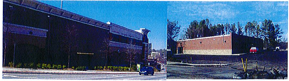 |
e.
Canopies over retail and commercial entrances and/or windows shall be mounted at a single consistent height for each building. Canvas awnings are not permitted.
f.
For buildings taller than two stories, floors shall be delineated above the first or second story and shall be executed through windows, belt courses, cornice lines, setback or similar architectural detailing.
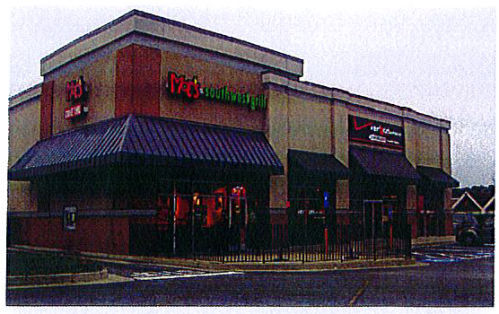
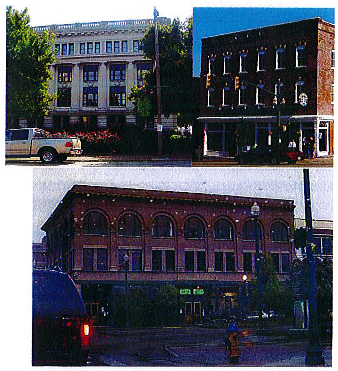 | 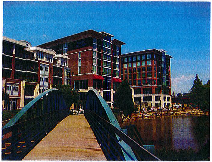 |
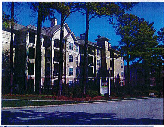 | |
| These buildings illustrate successful methods of delineation to create visual interest. | |
g.
Townhomes and live/work units.
i.
Ground-floor residential units that face the street shall have individual entrances with a stoop or porch between the sidewalk and the building façade. A sidewalk shall connect all ground floor entrances to the public sidewalk.
ii.
All townhome parking shall be hidden behind or within individual units. Access to parking is permitted only via an alley or private drive located behind the units. Garages may not face the public street.
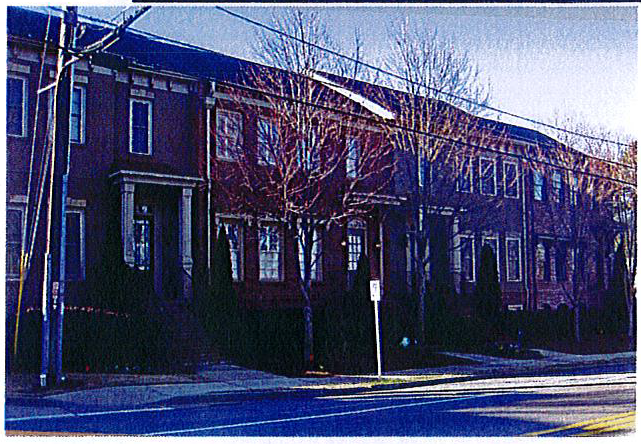
iii.
Townhomes shall be set back between five (5) and fifteen (15) feet from the back of the sidewalk. Setbacks for individual units may vary within a single block of townhomes to break up the façade and delineate individual units. This area between the sidewalk and the building façade shall contain only steps, front porches or stoops, balconies, or landscaping. The front entrance of each townhome unit shall be a maximum of four (4) feet above the grade of the fronting sidewalk.
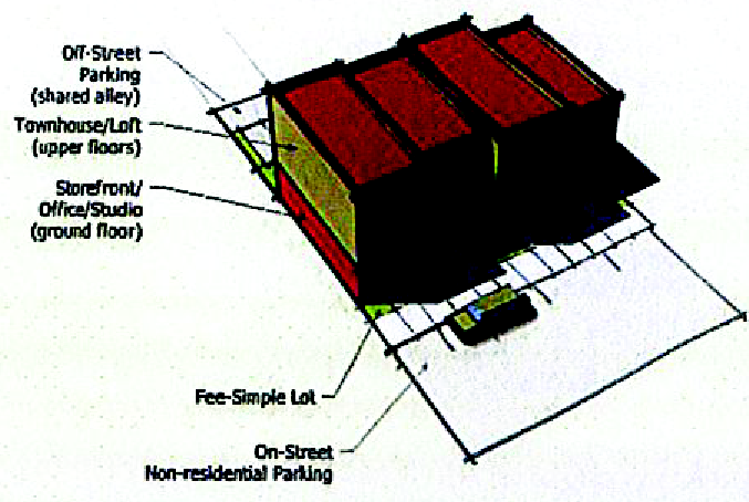
iv.
The front entrance to each live/work unit shall be at grade opening directly onto the public sidewalk or a public space adjacent to the public sidewalk. Entrances shall be at grade opening directly onto the public sidewalk or a public space adjacent to the public sidewalk.
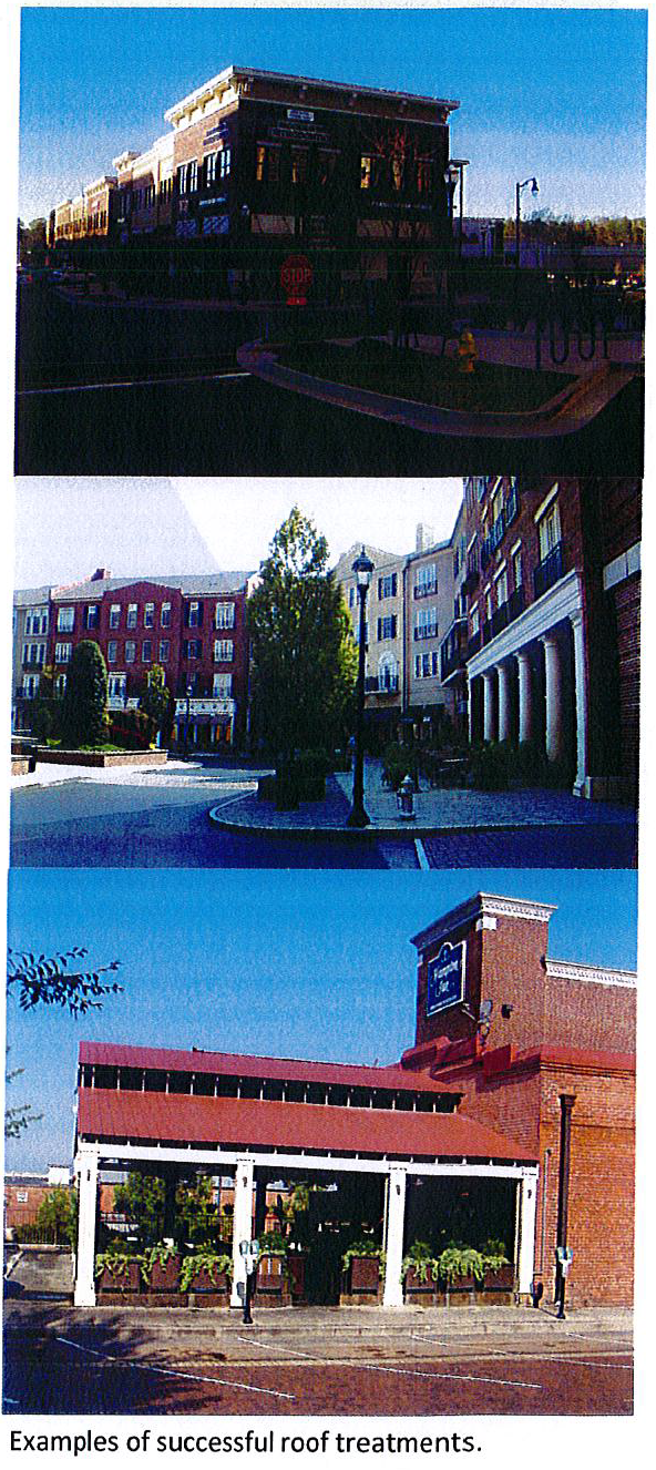
5.
Roof design.
a.
Gable roof designs (minimum 6/12 pitch) are preferred for all multi-family and single-family attached residential buildings with overhangs of at least twenty-four (24) inches on all sides. They shall not exceed one hundred (100) feet in length without a change in plane.
b.
Flat roofs shall have decorative and/or corbelled parapets on all sides visible from the public right-of-way and drain to internal roof drains and/or the rear of the structure, limiting downspouts on façades along primary and secondary streets. Simple barrel vaults or roofs are allowable. Mansard, gambrel, and shed roofs are prohibited.
c.
Roof mounted mechanical equipment and appurtenances shall be located or screened so that they are not visible from the ground level. Screening shall be of a material and design that is compatible with the surrounding building materials and architectural design. Rooftop appurtenances shall be painted to be compatible with the colors of the roof.
d.
Roof mounted radio, TV and telecommunications towers and antennae are prohibited, except when approved by the commission and located in Tiers 2 and 4. Satellite dishes twenty-four (24) inches or less in diameter are permitted provided they are located out of sight from the ground level or surrounding properties.
e.
The following roof materials are preferred: fiberglass architectural profile shingles; Solar shingles used with fiberglass or asphalt shingles; slate shingles; clay or concrete tile; standing seam metal (dark green or earth tone only - must be approved by planning director).
f.
Building materials - at least eighty (80) percent of the façades visible from the public right-of-way shall be brick, steel, glass, decorative concrete, masonry, hard-coat stucco or high quality finished metal panels (not corrugated).
g.
The following materials are prohibited for exterior walls and parapets:
i.
Masonite or particle board; vinyl or plastic; basic concrete masonry units - ribbed, rusticated or custom fabricated units are allowed where pattern/texture is integral to the building design; corrugated metal;
ii.
The images below represent the type of design that the BCGM community finds appropriate. The designs are examples of development that meet the objectives of improving the quality of life, stimulating economic investment and creating a positive business environment.
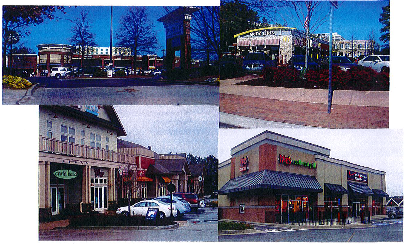
I.
Architectural design and massing—Tiers 2 and 4.
1.
Industrial buildings have needs different than typical commercial and mixed-use buildings. Requirements for massing, fenestrations and detailing described earlier are recommended for consideration, but may be treated as suggestions in Tiers 2 and 4. Building design will determined by the industrial needs, but building materials specified elsewhere still apply here. Creative design and use of materials are encouraged to create a leading-edge environment and foster a new generation of high quality growth.
2.
Building entrances must be visible from the street entrance, and visitor parking must be clearly marked. Service and parking must be screened from street view—only one (1) double loaded bay of parking is allowed in front of the building, behind a landscape zone, minimum ten (10) feet wide (see pg. 27).
3.
These photographs are examples of how these standards can translate into future building design. Variation in textures and fenestration are encouraged.
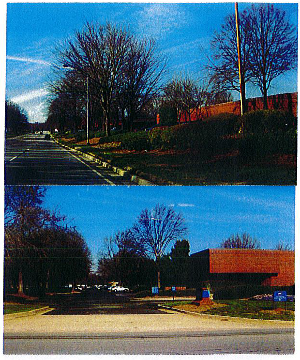
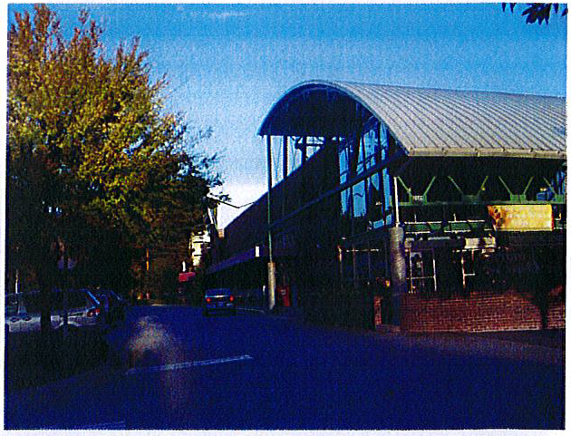
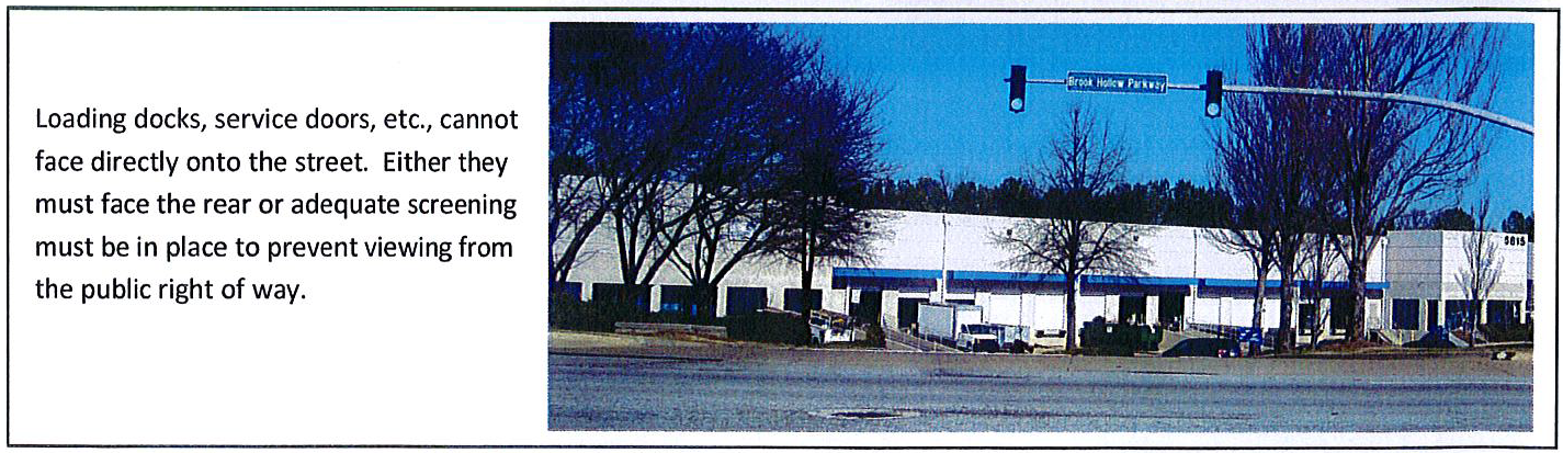
J.
Architectural design and massing—Residential.
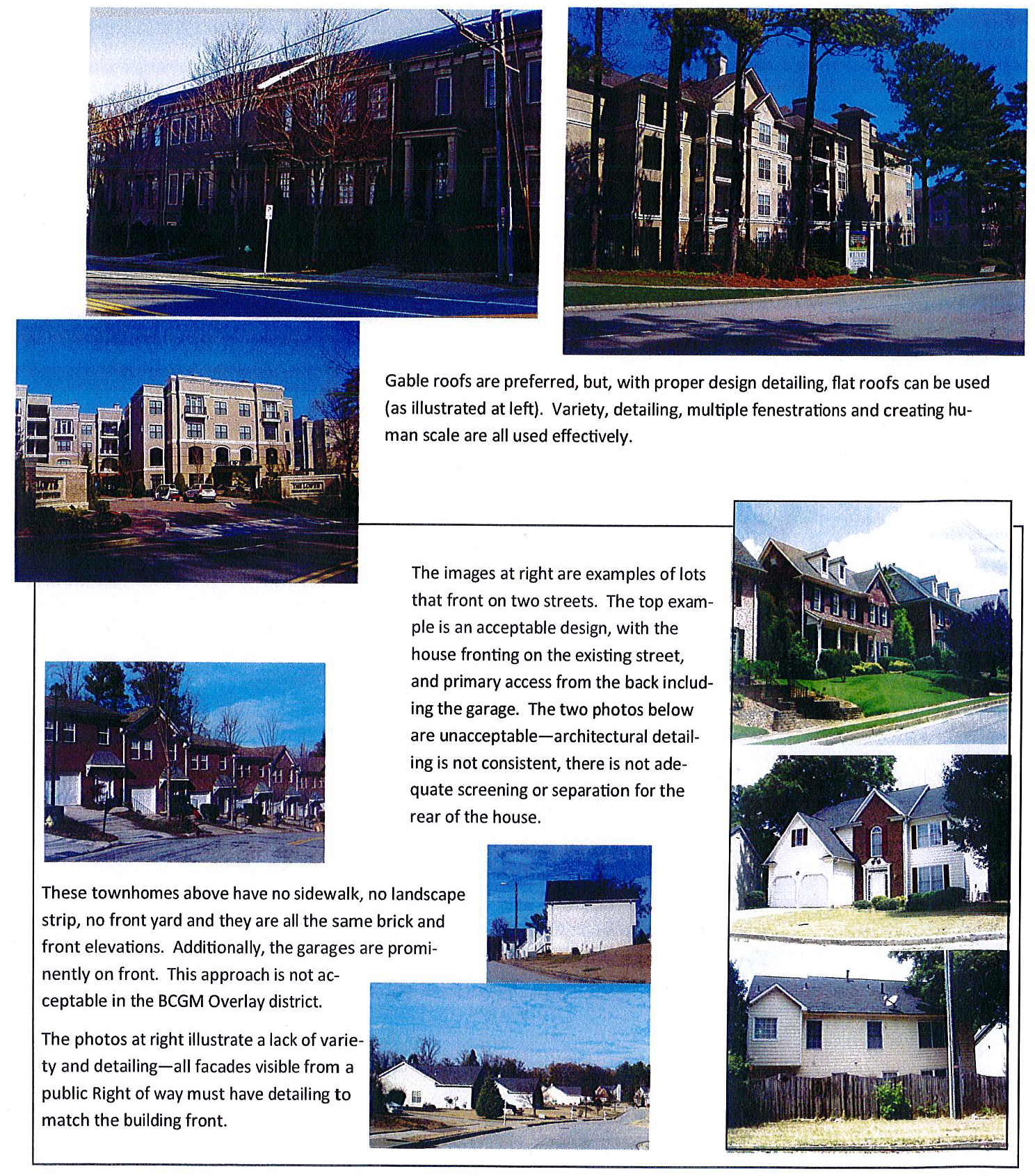
K.
Off-street parking and landscaping.
1.
Off-street parking lots.
a.
Pedestrian access shall be provided from parking behind buildings to the public sidewalk through the ground floor of the building or via sidewalks between buildings.
b.
Off-street parking lots shall be provided to satisfy the minimum parking requirements of chapter 27 and the BCGM Overlay District. Off-street parking lots shall be designed with interconnecting driveways and parking areas to encourage shared use with adjacent parcels and minimize the number of curb cuts. Joint access driveways and continuous access drives behind or between multiple parcels is encouraged to provide continuous inter-parcel access and less the need to re-enter public streets to make short trips. The satisfaction of minimum parking requirements with shared parking shall be subject to approval by the DeKalb County Planning Director based on a shared parking analysis performed to the Guidelines of the Institute for Transportation Engineers.
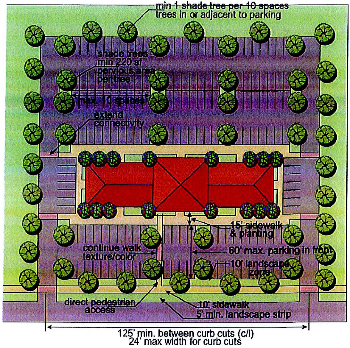
Site Concept Example for:
Tiers 1 and 3: Bouldercrest Road Frontage
Tier 2: all
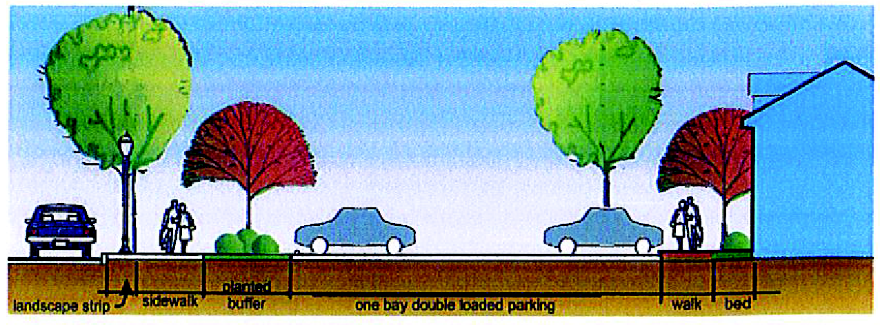
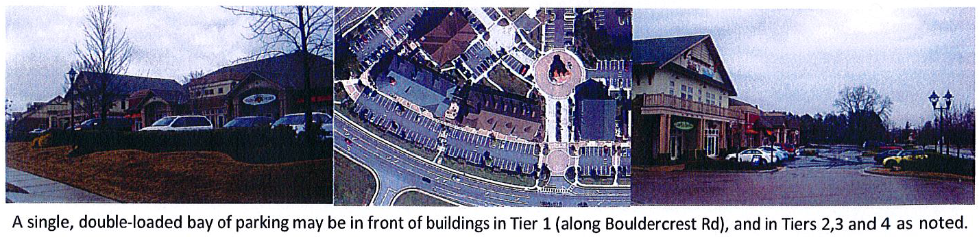
c.
Shared parking is encouraged and may result in permitted reductions of off-street parking requirements. Parking facilities within the parcel may be shared if multiple uses cooperatively establish and operate parking facilities and if these uses generate parking demands primarily when the remaining uses are not in operation, so that the above stated off-street parking requirements for each use are met during said use's operational hours. Applicants shall make an application to the director of planning for authorization for shared parking. Applicants shall include proof of a written formal shared-parking agreement between all applicants. Required parking for residential units shall be prohibited from being shared. Required residential parking shall be segregated from parking for all other uses with the exception of additional parking provided for live/work single-family units.
d.
Off-street parking lots shall be designed to minimize the view of parking from adjacent streets and sidewalks. No more than thirty (30) percent of the required parking spaces for a parcel may be located in the front yards. Off-street parking lots shall be separated from abutting streets by landscape zones (minimum ten (10) feet wide) and sidewalks. Landscape zones may be broken by perpendicular access drives and pedestrian walkways or sidewalks. Plant materials shall be selected from the approved plant list in the appendix unless otherwise approved by the arborist.
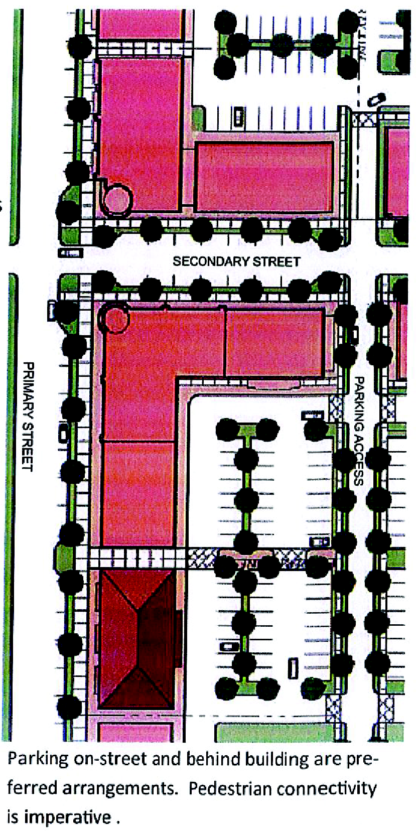
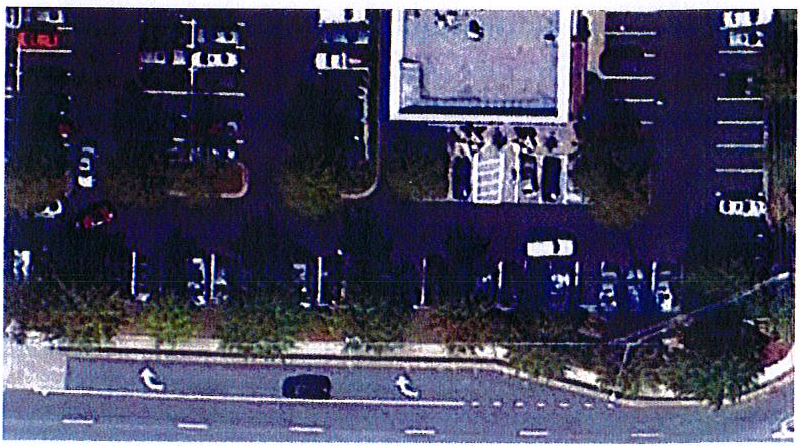
e.
Off-street parking lots shall be designed to provide for safe and continuous passage of pedestrians between parking bays and building entrances, and between adjacent parking areas and buildings. Landscape zones at the perimeter of off-street parking lots shall provide for safe and convenient crossing by vehicles and pedestrians. Pedestrian pathways in parking lots and pedestrian ways that cross vehicular aisles in parking lots shall be appropriately identified as crosswalks.
f.
Surface parking provided to the side of any building along a public street shall be designated for short-term (no longer than two (2) hours) parking and must be buffered from the public street and sidewalk with a landscape zone no less than ten (10) feet in width containing a minimum of ninety (90) percent living shrubs, groundcover, sod and/or annual or perennial color in the landscape strip surface area.
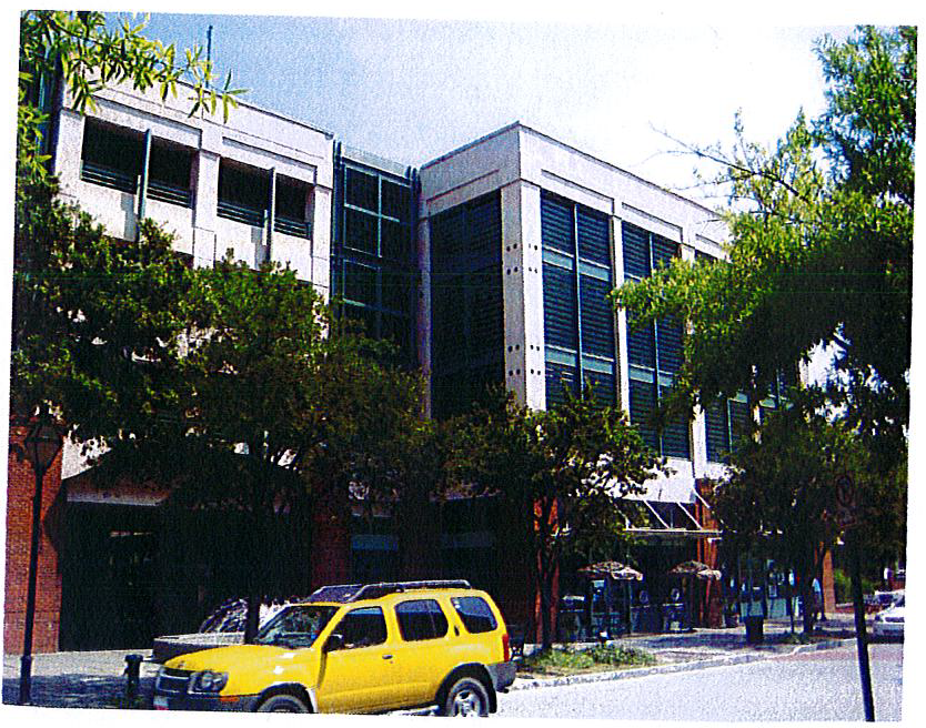
Above: acceptable design of a parking structure.
Below: not acceptable design of a parking structure.
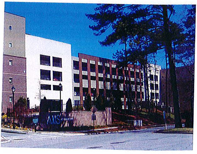
g.
Wheel stops or bumpers shall be placed at the head of all parking spaces that abut a landscape strip or sidewalk.
h.
All surface parking lots of twenty (20) parking spaces or more must include landscaping in the form of shade trees within the confines of the surface parking lot. One (1) shade tree must be provided for every eight (8) parking spaces. No more than ten (10) parking spaces may be in a row without a landscape island with a shade tree. Shade trees must be a minimum of 3.5 inches in caliper measured twelve (12) inches above ground, shall be a minimum of sixteen (16) feet in height, shall have a minimum mature height of thirty (30) feet and shall be limbed up to a minimum height of eight (8) feet. Each tree must be surrounded by a minimum of two hundred twenty (220) square feet of pervious soil area.
i.
Any portion of a parking deck that is adjacent to a public street shall be screened with retail on the ground-floor. Any upper stories of a parking deck that are visible from a public street shall be clad with materials to resemble office or residential buildings with fenestration.
2.
Landscaping.
a.
Planting design should reflect and enhance the natural surroundings of each site as well as the design objectives of the building. Existing trees and native groundcover should be preserved wherever possible and integrated into the overall landscape design. Existing plant materials that are to be retained shall be clearly designated on the landscape plans. The root zones and tree canopies of retained plant materials shall be adequately protected from damage or destruction during construction using suitable barricades or fencing using methods and locations specified in the DeKalb County Tree Ordinance or as approved by the DeKalb County Arborist. Newly planted trees, shrubs and ground-cover materials used in landscaped areas shall be selected from the approved plant list in the appendix unless otherwise approved by the arborist.
b.
Plant materials shall be of a size, species and variety specified in the approved plant list in the appendix unless otherwise approved by the arborist.
c.
Street trees must be a minimum of three and one-half-inch caliper and help articulate the pedestrian and vehicular circulation systems. Except for perpendicular crossings of driveways and utility easements, street trees shall be planted in the landscape zone or strip with a spacing as noted in [section] 3.39.6 of the chapter. Street trees shall not be placed closer than eight (8) feet from a building, driveway, light standard, sign standard, fire hydrant or other permanent structure.
d.
Street trees shall have a minimum pervious area of two hundred twenty (220) square feet. Tree planting areas must be at least one hundred (100 )square feet, with the balance provided with structural soil under surrounding pavements for future root growth.
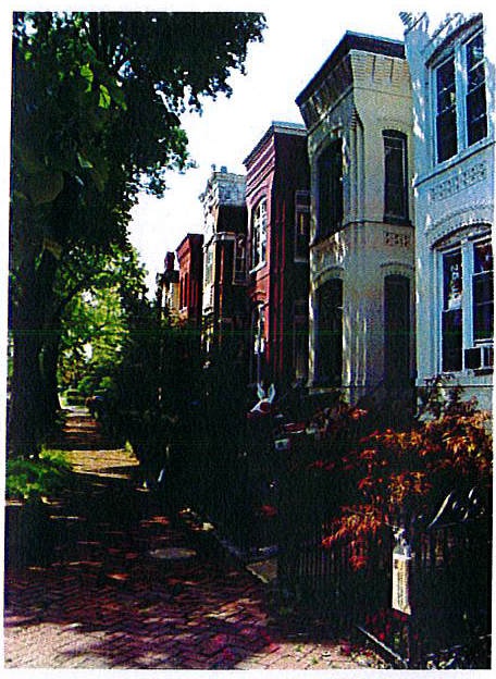
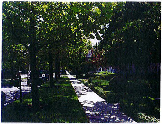
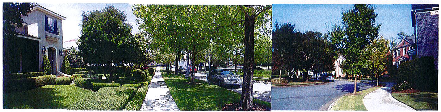
e.
Street tree species shall be consistent for an entire block length. Similar species shall be permitted to change on individual block faces only when approved by the director of planning.
f.
Evergreen groundcover planting shall be used on all slopes steeper than two (2) to one (1) to aid in erosion control. Landscape planting and irrigation plans must be prepared by a landscape architect registered in the State of Georgia for each application for a land disturbance permit.
g.
Transitional buffer zone - where the transitional buffer zone is well vegetated and provides an adequate visual screen at eye level, it shall be undisturbed. Otherwise, the transitional buffer zone shall be either planted with double staggered rows of approved evergreen trees and shrubbery to form a dense visual screen or the existing vegetation shall be enhanced with native and naturalized plant materials adequate to provide an effective visual screen at eye level from adjacent properties. However, transitional buffer zones may be interrupted where necessary for perpendicular crossings of streets, fences, driveways, utilities and trails, bikeways or pedestrian ways. All such interruptions must be approved by the planning director.
h.
Parking lot landscaping - the total length of all parking areas facing a street shall be separated from the street by a landscape zone (minimum ten (10) feet), including evergreen shrubbery eighteen (18) inches to thirty-six (36) inches high. Planting islands shall be located so that no more than ten (10) parking spaces are in a row before a landscaped island. Each landscaped island must be at least ten (10) feet (back of curb to back of curb), it must contain one (1) shade tree per single row of parking and there must be at least two hundred twenty (220) square feet of permeable area for each tree. Each tree must be at least three and one-half-inch caliper in size and meet #1 standards. The soil in these islands must be properly prepared to eliminate heavy clays, provide proper drainage and adequate topsoil for proper growth.
i.
Automated irrigation is recommended for all landscape areas. If irrigation is not to be installed, precautions must be taken to insure plant health:
i.
Plant selection must include drought tolerant plants as approved by the DeKalb arborist.
ii.
Additional organic matter and moisture holding materials shall be incorporated into the soil prior to planting.
iii.
Tree and planting pits must be at least three (3) times the size of the root ball and be backfilled with topsoil and organic matter.
iv.
Gator bags and/or other watering methods must be employed on all trees for at least twelve (12) months after planting to help survivability.
v.
All trees not thriving after ten (10) months must be replaced and given another ten-month warranty for replacement.
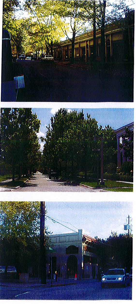
L.
Signs—Freestanding and building mounted.
1.
Purpose. The following guidelines are intended to advance the governmental purposes of the protecting public safety by minimizing distraction to motorists and improving aesthetics of the BCGM Overlay District by:
a.
Providing a more consistent pattern and appearance for signs and street graphics than would otherwise result from existing sign guidelines;
b.
Establishing signage as a design element that contributes a sense of place to the BCGM Overlay District;
c.
Generating varied and creative tenant signage through application of distinctive design;
d.
Reducing the prominence of signage and balancing commercial and aesthetic interests;
e.
Providing the requirement for clear plans and drawings for signs in order to facilitate the review and approval process.
2.
Authority. These guidelines apply only to the time, place and manner of sign display by guiding the elements of design, size number, height and compatibility of signs with an aesthetical appeal contributing to the sense of community within the overlay district. Nothing in these guidelines is intended to regulate the content of sign graphics or limit the free expression of speech guaranteed under the First Amendment of the Constitution of the United States of America. Except where otherwise lawful, it shall be unlawful for any person to post, display material change, or erect a sign in the county without first having obtained a sign permit from DeKalb County.
a.
All signs shall be designed, erected, inspected, altered, reconstructed, illuminated, located, moved and/or maintained in accordance with these design guidelines and all other applicable codes and ordinances of DeKalb County, the State of Georgia and the United States of America.
b.
No sign may be installed, reconstructed, illuminated or moved that varies from the BCGM Overlay District and underlying chapter 21, DeKalb County Sign Code without approval of a variance by the DeKalb County Board of Appeals.
3.
Sign characteristics.
a.
Freestanding identification ground signs shall be monument type constructed with a brick or stone base. No pole signs are allowed except low grade directional type signs not to exceed three (3) feet in height.
b.
The base around the sign structure shall be landscaped with low level shrubs and flowering plants. Freestanding sign structures' base materials shall match the principle building materials. Architectural sign colors allowed shall apply to the sign structure, not sign face.
4.
Authorized signs. The following signs are authorized within the Bouldercrest-Cedar Grove-Moreland Overlay District and shall be permitted upon the issuance of a valid sign permit issued by DeKalb County:
a.
Single-tenant development signs. The following sign standards apply to all parcels that have a single tenant or occupant, including, but not limited to commercial, retail, services, office, office-distribution, wholesale, hotel, office, financial, or multi-family uses.
b.
Monument sign. Each parcel or building with a single tenant or multi-family residential tenants shall be permitted to use one (1) monument sign per public street frontage, not to exceed a total of two (2). Signs shall be subject to the following:
i.
Only one (1) sign placard is allowed per sign face - maximum seventy (70) percent of sign structure, which shall not exceed thirty-two (32) square feet or eight (8) feet in height.
ii.
Sign may be single-faced or double-faced.
iii.
In Tiers 3 and 5, monument signs shall be only externally illuminated with light fixtures directed downward and away from the street or driveway so as not to create glare for pedestrians or drivers.
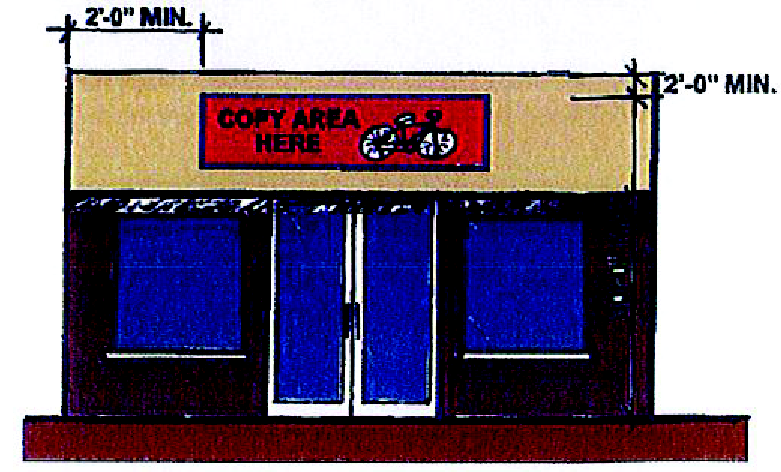
c.
A single tenant building with more than fifty thousand (50,000) square feet of space or occupying a site larger than ten (10) acres may use a monument sign not to exceed eight (8) feet in height and forty-eight (48) square feet. Sign area may not exceed seventy (70) percent of the sign structure.
d.
Each separate business front façade with an external public entrance may have a maximum of one wall sign which shall not exceed an area of five (5) percent of the area of the façade of the ground floor of the building or seventy-five (75) square feet, whichever is less. Interior tenant space within a business of at least fifty thousand (50,000) square feet may have an additional wall sign area not to exceed a total of five (5) percent of the area of the façade of the ground floor of the building or sixty-four (64) square feet, whichever is less.
e.
Multiple-tenant buildings and parcels. The following sign standards apply to all parcels that have more than one (1) non-residential tenant or occupant, including, but not limited to commercial, retail, services, office, office-distribution, wholesale, hotel, office, or financial tenants:
i.
Monument sign. Each parcel or development with more than one (1) non-residential tenant shall be permitted one (1) freestanding multi-tenant monument sign per public street frontage, not to exceed a total of three (3). Signs shall meet the following:
(a)
No more than eight (8) sign placards shall be used per side of the monument sign.
(b)
Sign may be single-faced or double-faced.
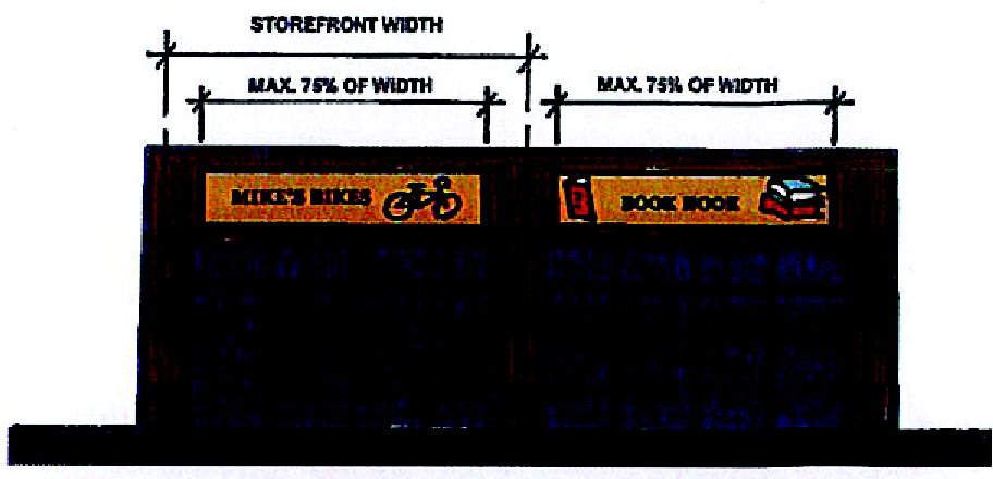
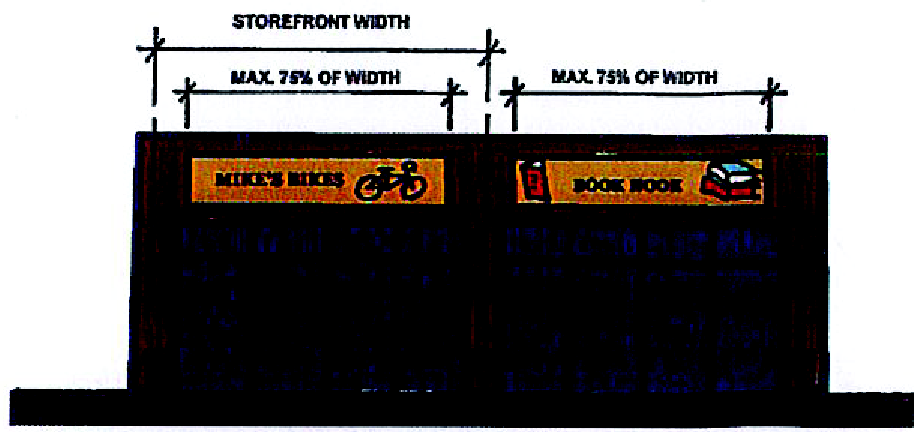
(c)
Each lot or development with multiple tenants shall be permitted one monument sign per public street frontage. For developments with less than one hundred fifty thousand (150,000) square feet of space for sale or lease, the sign shall not exceed forty-eight (48) square feet and the sign structure shall not exceed ten (10) feet in height.
(d)
Each lot or development with multiple tenants with more than 150,000 square feet of space for sale or lease shall be permitted two (2) monument signs. A primary monument sign shall not exceed sixty-four (64) square feet per side and the sign structure shall not exceed ten (10) feet in height. A secondary monument sign shall not exceed thirty-two (32) square feet per side and a maximum height of six (6) feet. The sign area shall not exceed seventy (70) percent of the total surface area of the monument sign structure.
(e)
A tenant that has over fifty thousand (50,000) square feet of gross floor space and has independent leased space within a shopping center shall be allowed wall signs not to exceed five (5) percent of the applicable wall area or three hundred (300) square feet, whichever is smaller.
f.
Miscellaneous signs.
i.
Menu sign. One sign oriented toward the drive-thru lane, and not legible from the public right-of-way, such sign not to exceed six (6) feet in height.
ii.
Banner. Banners shall be allowed for a period not exceeding fourteen (14) days with no more than three (3) such fourteen-day periods being permitted per calendar year per lot. In the case of lots which contain multiple businesses, each business shall be allowed a banner. Banners shall not be more than thirty-two (32) square feet. No banner shall be mounted so as to extend above the horizontal plane of the roof where the building wall and roof meet, or shall not extend more than five (5) feet above grade when on the ground.
iii.
Flags. Each lot may display no more than three (3) flags and/or flagpoles. Flagpoles shall not exceed sixty (60) feet in height. Flag size shall not be more than fifty (50) square feet.
iv.
Suspended signs. In a multi-tenant commercial or office building, In addition to all other permitted signs, one (1) suspended non-illuminated sign per entrance used shall be allowed. Suspended signs shall adhere to the following: not exceed three (3) square feet in area; be uniform in size, material, color and shape and is placed in an equivalent location to other such signs located on the same building; be suspended from the eave or soffit of the building; and maintain a minimum of seven (7) feet clearance between the bottom of the sign and the walkway below.
v.
Window signs. Window signs are allowed without a permit and shall not occupy in the aggregate more than twenty-five (25) percent of the window area.
vi.
Awning/canopy signs. Awning/canopy signs may be displayed. A permit is required. The signs shall be deducted from allocated wall sign area. The area of the sign shall not exceed ten (10) percent of the area of the awning or canopy. The area of an awning/canopy sign shall be deducted from the allowable area of a wall sign.
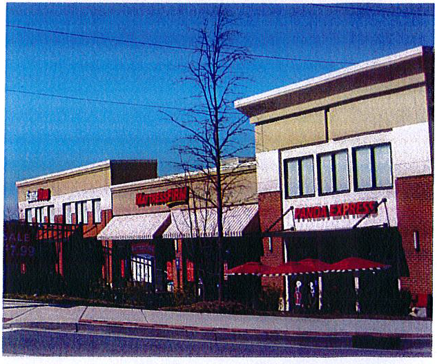
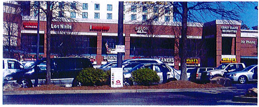
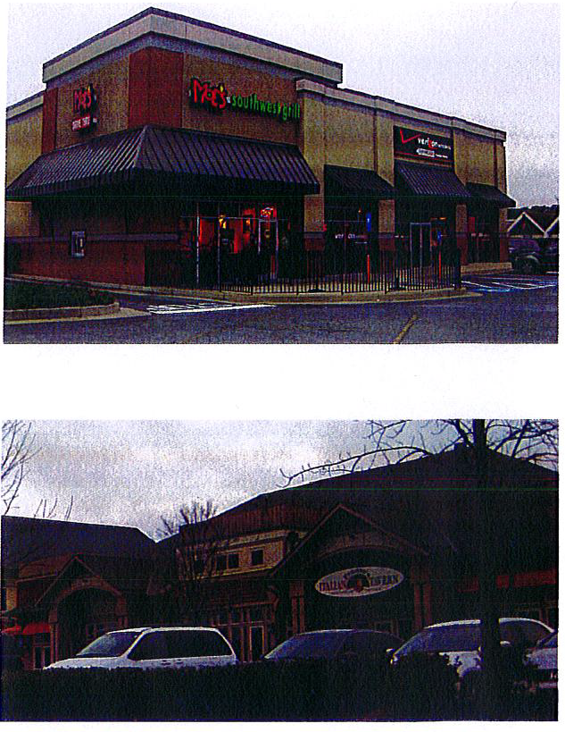
g.
Prohibited signs. The following types of signs are prohibited:
i.
Motorist distractions. Signs that incorporate flashing lights or beacons, highly reflective materials, rotating graphics, motion, smoke or visible matter, noise or changeable copy (copy that changes at intervals of more than once every six (6) seconds) are prohibited.
ii.
Roof signs. Signs that are placed on or above roofs, penthouses, mechanical equipment screens, and other like structures and any signs that extend above the building parapet or roof fascia line.
M.
Signs—Freestanding and building mounted—Prohibited.
1.
Signs and buildings with intense colors or changeable letters are not allowed. Multiple signs, temporary signs (as below) and signs with interchangeable letters are not allowed. Below are a few examples, but this is not an exhaustive list.
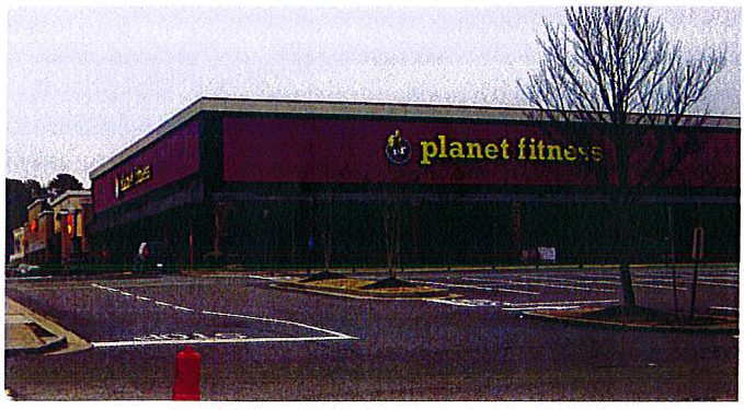
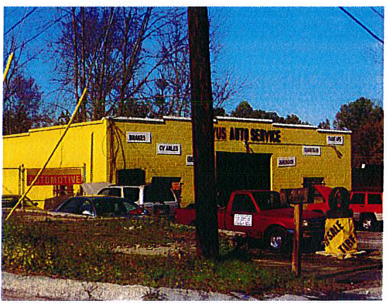
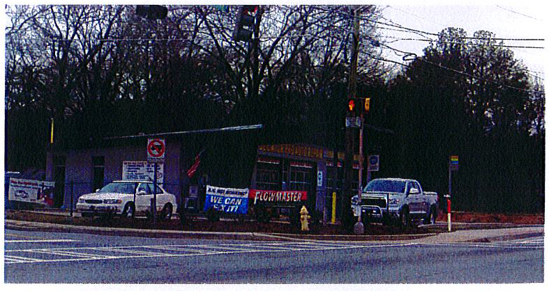
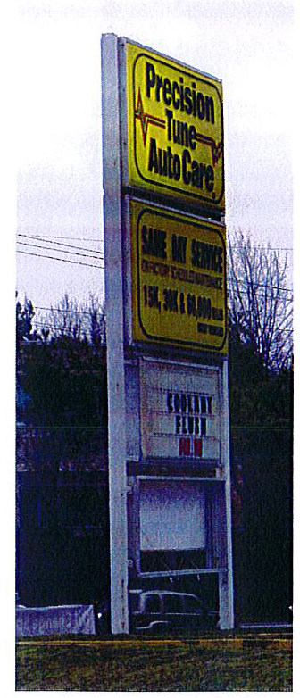
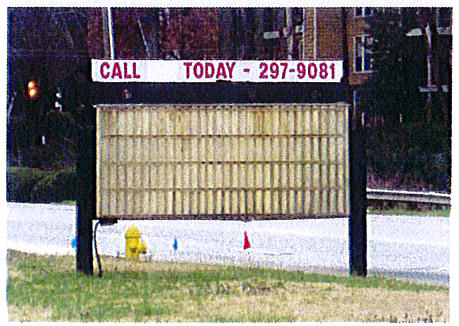
N.
Signs—Neighborhood.
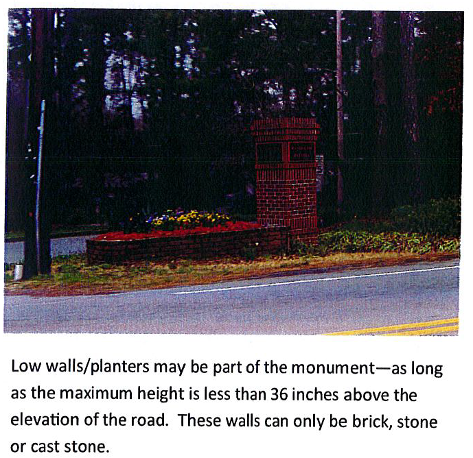
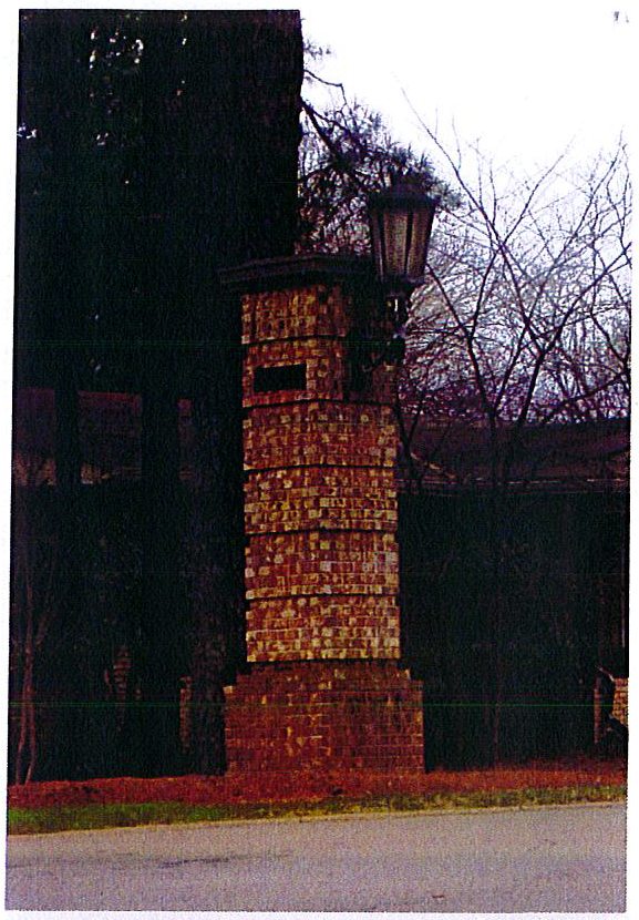
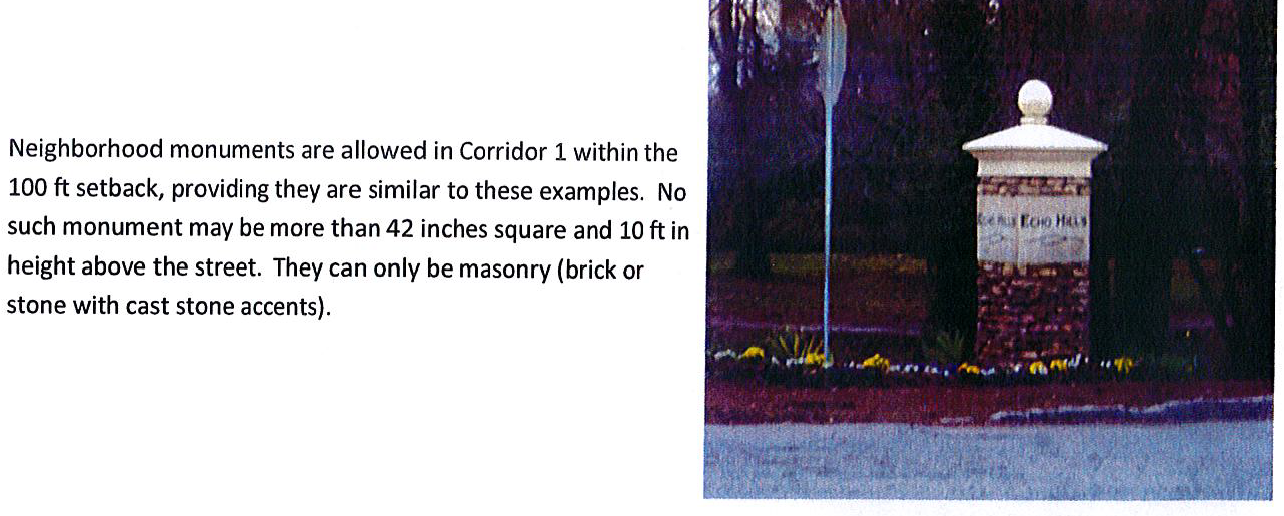
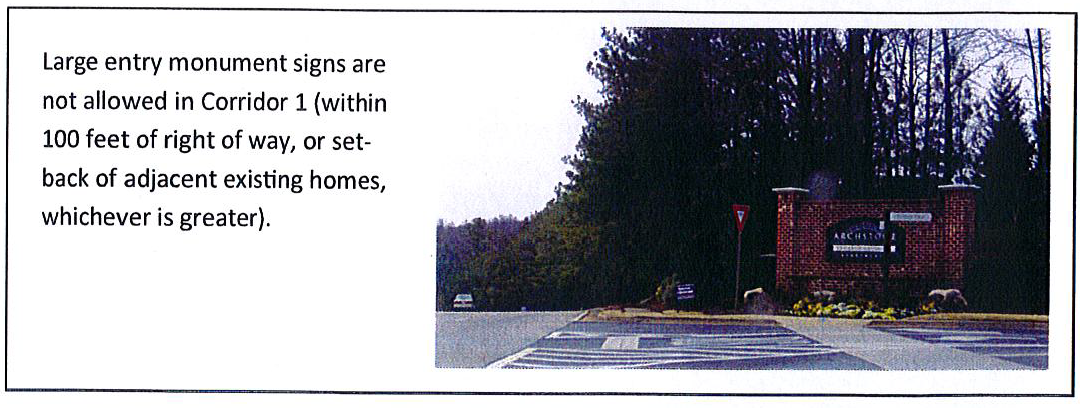
RECOMMENDED PLANT LIST
NOTE: Street trees may only be selected from this list - Genus, species and variety. Any variation from this must be approved by the DeKalb County Arborist. In order to substitute, it must be proven that these plants are not available.
(Ord. No. 15-06, 8-25-2015)
Sec. 3.40.1.- Scope of regulations.
This division establishes standards and procedures that apply to any development, use, or redevelopment on any lot or portion thereof which is, in whole or in part, contained within the boundaries of the Mountain Industrial Boulevard Overlay District, hereinafter referred to as the "district."
(Ord. No. 15-06, § 3.40.1, 8-25-2015)
Sec. 3.40.2. - Applicability of regulations.
This division applies to each application for a permit which involves the development, use, construction, exterior alteration or modification of any structure where the subject property is, in whole or in part, contained within the boundaries of the district. The procedures, standards, and criteria herein apply only to that portion of the subject property within the boundaries of the district. All procedures, standards, and criteria not specifically identified herein shall be as provided by the applicable underlying zoning district regulations. In cases where a conflict exists between the requirements of this district and the underlying zoning district, the requirements of this district shall apply.
(Ord. No. 15-06, § 3.40.2, 8-25-2015)
Sec. 3.40.3. - Statement of purpose and intent.
The purpose and intent of the board of commissioners in establishing the district is as follows:
A.
To preserve and enhance the long-term economic viability of the Mountain Industrial Boulevard Corridor by encouraging investment that increases the tax base and provides employment opportunities to the citizens of DeKalb County;
B.
To improve the visual appearance and increase property values within the corridor;
C.
To allow flexibility in development standards in order to encourage the design of innovative development projects that set high standards for landscaping, green space, urban design, and public amenities; and
D.
To promote uniform and visually aesthetic architectural features which serve to unify the distinctive visual quality of the corridor.
(Ord. No. 15-06, § 3.40.3, 8-25-2015)
Sec. 3.40.4. - District boundaries and maps.
The boundaries of the district shall be established by the zoning map amendment dated January 7, 2013, and attached hereto as Exhibit "A" which zoning map is adopted contemporaneously with the adoption of this division and is hereby incorporated by this reference as if fully set forth herein and is hereby made a part of this chapter 27. Said zoning map amendment shall be maintained by the planning director or designee and shall be available for public inspection in the office of the planning director.
(Ord. No. 15-06, § 3.40.4, 8-25-2015)
Sec. 3.40.5. - Principal uses and structures.
The uses of land and structures which are allowed in this district as principal, accessory, or by special permit or special land use permit are as provided by the applicable underlying zoning district regulations, subject to the requirements, limitations and standards contained within this division.
(Ord. No. 15-06, § 3.40.5, 8-25-2015)
Sec. 3.40.6. - Prohibited uses.
The following principal uses of land shall be prohibited within the district:
A.
Storage yard for damaged automobiles or confiscated automobiles;
B.
Tire retreading and recapping;
C.
Adult entertainment establishments;
D.
Adult service facility;
E.
Late night establishments;
F.
Extended stay motels;
G.
Title and pawn shops;
H.
Salvage yards/junk yards and automobile wrecking yards, not including recovered material or recycling yards;
I.
Self-service car wash and detailing;
J.
Temporary and portable saw mills;
K.
Mines and mining operations, quarries, gravel pits, and sand pits;
L.
Sewage treatment plants;
M.
Asphalt plants;
N.
Fat rendering and fertilizer manufacture; and
O.
Distillation of bones and glue manufacture.
P.
Parking or storing of trucks and trailers between the hours of 11:00 p.m. to 5:00 a.m., unless such truck or trailer is parked or stored pursuant to an accessory use incidental to the permitted principal use of the land
(Ord. No. 15-06, § 3.40.6, 8-25-2015)
Sec. 3.40.7. - Architectural regulations.
The following architectural regulations shall apply to all uses and structures within the district.
A.
Building exteriors shall be limited solely to the following materials:
1.
Brick or brick veneers;
2.
Stone or stone veneers of natural stone such as granite, limestone and marble. Terra Cotta and/or cast stone, which simulate natural stone, are also allowed. Painted stone is not allowed;
3.
Pre-cast concrete;
4.
Painted concrete block, which may only be used on a side or rear façade that does not face a public right-of-way;
5.
Split-face block/concrete masonry unit; and
6.
Hard coat stucco and synthetic stucco.
B.
Architectural accents, where utilized, shall consist of metal, non-reflective glass, glass block, natural stone, pre-cast concrete, brick, or terra cotta. Architectural accents shall only cover ten (10) percent of the surface area of each exterior wall. When calculating the ten (10) percent limitation on architectural accents, the surface area covered by a window(s) shall not be used in the calculation.
C.
Service bays for automobile service and repair uses shall be designed or screened so that the openings of service bays are not visible from a public right-of-way.
D.
Chain-link fences shall be screened from the public right-of-way and shall be galvanized or vinyl coated. Uncoated chain-link is prohibited.
E.
Within a front or exterior side yard, the keeping of goods, materials, merchandise, or inoperable vehicles in the same place for more than twenty-four (24) consecutive hours is prohibited.
F.
Within a side yard that adjoins a public right-of-way, the keeping of goods, materials, merchandise, or inoperable vehicles in the same place for more than twenty-four (24) consecutive hours is only permitted when the side yard is fenced, screened, or otherwise screened from view from the public right-of-way.
G.
Outdoor storage that is not prohibited by this section, and outdoor areas housing service areas, trash dumpsters, trash compactors, equipment, or mechanical devices shall be screened so that such outdoor area cannot be seen from any public right-of-way. Screening shall be permitted to include landscaping, and/or fencing and walls with architectural treatment of color and material similar to the building.
H.
Any linear lighting around windows, rooflines, doors, signs or building structures is prohibited. Linear lighting may include, but is not limited to neon tubes, rope lighting, and other similar lighting devices. Linear lighting devices that form letters or words shall be considered signs.
(Ord. No. 15-06, § 3.40.7, 8-25-2015)
Sec. 3.40.8. - Signage.
Properties within the district are required to comply with the sign regulations of chapter 21 of the Code except as follows:
A.
Definitions.
1.
Portable sign shall mean any sign designed to be transported by trailer or by a design element that includes wheels attached to the sign, or wheels attached to the sign but detachable, the removal of such wheels creating an "A" or "T" frame sign that may attach temporarily or permanently to the ground. Portable sign shall also include vehicles with signs painted or mounted thereon that are parked or immobilized in a single location for more than fourteen (14) consecutive days.
2.
Sandwich board sign shall mean any sign that rests on the ground that is not anchored or otherwise securely attached thereto.
B.
Prohibited signs:
1.
Sandwich board signs are prohibited except within five (5) feet of a building entrance;
2.
Banner signs of any size, except as a special event sign.
C.
Convenience store and service stations. Convenience store and service stations with pump islands may have one (1) sign per canopy face per public street frontage up to a maximum of thirty-six (36) square feet of total canopy sign space.
D.
Directional signs. Directional signs are permitted up to six (6) feet above the ground.
E.
Non-residential zoning districts.
1.
All lots located in non-residential districts not developed as a planned commercial center may display signs as follows:
2 N/A means not applicable.
2.
A lot located in a non-residential district developed as a planned commercial center may display signs as follows:
3.
Property zoned for non-residential use may have only one (1) ground sign per street that is oriented towards travelers along that same street.
4.
The district is exempt from total aggregate sign area requirements in chapter 21 of this Code.
5.
Wood and flexible plastic are prohibited for use in permanent signs in non-residential zoning districts.
F.
Special event signage. All special event signs are subject to the requirements of chapter 21 of the Code, including section 21-21, except that the maximum number of special even sign permits to be issued to a single site or location shall be one (1) per year for a period of time not to exceed thirty (30) days for each permit issued.
(Ord. No. 15-06, 8-25-2015)
Sec. 3.41.1.- The scope of regulations.
These standards and procedures shall apply to any development, use, alteration, or redevelopment on any lot or portion thereof which is, in whole or in part, contained within the boundaries of the Covington District or the Indian Creek District ("Districts"). These Districts shall take precedence over the underlying zoning district regulations. However, where not in conflict with these District regulations, the regulations of the underlying zoning districts shall continue to function the same.
(Ord. No. 17-02, Pt. I, 9-26-2017; Ord. of 5-28-2020, Pt. I)
Sec. 3.41.2. - Applicability of regulations.
These regulations shall apply to each application for any permit which involves the development, use, construction, exterior alteration or modification of any structure where the subject property is, in whole or in part, contained within the boundaries of the Districts. The procedures, standards, and criteria herein apply only to the portion of the subject property within the boundaries of the Districts. Design criteria shall meet the design requirements herein and shall be consistent with article 5 of the zoning ordinance. The director of planning is authorized to interpret these regulations, and to approve construction, uses, design and landscaping not in conflict with these regulations or the zoning ordinance.
(Ord. No. 17-02, Pt. I, 9-26-2017; Ord. of 5-28-2020, Pt. I)
Sec. 3.41.3. - Statement of purpose and intent.
The purpose and intent of the board of commissioners in adopting these two (2) Districts are as follows:
A.
Covington District - The intent of the Covington District is to implement the recommendation of Covington Highway Corridor Study from the DeKalb County Board of Health Master Active Living Plan (MALP). The goal for this area is to revitalize underutilized commercial and multifamily properties into a mix of employment, housing, retail, civic and open spaces, and to make Covington Highway a multimodal transportation corridor that promotes healthy living.
B.
Indian Creek District - The intent of the Indian Creek District is to implement the recommendations of the Indian Creek Master Active Plan (MALP), while developing a multimodal, transit-oriented area that integrates physical activity by enhancing connectivity to trails, parks and open space (both internally and near developed areas). These areas will also connect with mixed use, recreational, residential, and senior facilities. This District is envisioned to be a premier regional recreation destination with accessory restaurant, retail and office space. Transit oriented development (TOD) is encouraged in this area to increase MARTA ridership and mixed-use development around the Indian Creek MARTA station.
(Ord. No. 17-02, Pt. I, 9-26-2017; Ord. of 5-28-2020, Pt. I)
Sec. 3.41.4. - District boundaries and maps.
The Covington and Indian Creek Districts shall be read in conjunction with the DeKalb County 2035 Comprehensive Plan Future Land Use Map. The boundaries of the Covington and Indian Creek Districts shall be unchanged from the boundaries previously established in the zoning map for Tier I (now the Covington District) and Tier III (now the Indian Creek District), respectively, of the former Kensington Memorial Drive Overlay District. A depiction of this name change is set forth on Exhibit A. These boundaries of the Covington and Indian Creek Districts, and any future amendments, will be maintained by the planning director. Any future changes to the boundaries of the Covington and Indian Creek Districts will require a zoning map amendment.
(Ord. No. 17-02, Pt. I, 9-26-2017; Ord. of 5-28-2020, Pt. I)
Sec. 3.41.5. - Definitions.
The following definitions shall only apply to the Covington and Indian Creek Districts, as amended:
A.
Motel: A building or a group of buildings used primarily for providing lodging to long-term or temporary guests or travelers, the individual rooms of which are accessed through exterior doors, corridors, or hallways.
B.
Stand-alone multi-family housing: One (1) or more residential buildings, each containing four (4) or more dwelling units, that are not located in a mixed-use development as defined herein and pursuant to chapter 27 of the zoning ordinance.
C.
Mixed-use development: A development consisting of two (2) or more different types of land uses such as residential, office, retail, services or recreational uses, which are planned as a unified, complementary whole with shared inter-parcel access. All mixed-use developments shall also be governed by chapter 27, article 2 of the zoning ordinance.
D.
Outdoor recreational facility: An outdoor area used for activities such as organized games and sports, which may consist of fitness training courses, challenge trails, tennis courts, basketball courts, soccer fields, baseball fields, and similar facilities.
E.
Sports complex: An indoor facility with seating for spectators, and providing accommodation for a variety of individual, organized, or franchised sports. Such facilities may also provide other regular organized or franchised events, health and fitness clubs, swimming pools, snack bars, restaurants, lounges, retail sales of sporting goods, health or fitness items, conference centers, exhibit halls, movie or performance theatres, and arcades. At the discretion of the director of planning, outdoor fields or courts may be permitted when part of an overall development plan which includes indoor facilities as part of a mixed-use development.
(Ord. No. 17-02, Pt. I, 9-26-2017; Ord. of 5-28-2020, Pt. I)
Sec. 3.41.6. - Principal uses and structures.
The principal uses of land and structures which are allowed in the Covington and Indian Creek Districts are as is provided by the applicable underlying zoning district regulations, subject to the superseding and additional regulations and standards contained in this division as follows:
A.
Permitted uses. The following additional principal uses of land and structures shall be expressly authorized within the Covington and Indian Creek Districts:
1.
Sports complexes (Indian Creek District only).
2.
Film, Movie, and Television Production Studios (Indian Creek District only), only if the following conditions are met:
a.
Studios may be located south of Redan Road only, unless located on properties within existing or planned and approved mixed-use developments within an MU-4 or MU-5 zoning district.
b.
Studios must comply with all provisions of Chapter 15, Article XIV. - Film Production. All other operations, including but not limited to, set construction and fabrication must take place indoors on soundproof stages.
c.
A fifty-foot vegetated buffer from residentially zoned parcels must be provided. An undisturbed buffer, a planted buffer, or an existing vegetated buffer supplemented with additional plantings may be utilized. Whichever buffer type is utilized, the buffer must be opaque outside of the winter months. If a proposed studio is located within an MU-4 or MU-5 zoning district north of Redan Road, a fifty-foot vegetated buffer is required along any exterior MU-4 or MU-5 zoning boundary abutting residentially zoned properties.
d.
No use of outside generators except in the event of a power failure.
3.
Automotive rental and leasing (both Districts), only if the site design includes the following:
a.
A landscape strip that shall meet the perimeter landscape strip standards contained in Section 5.4.4.(c) of this Chapter, except that the minimum width of the perimeter landscape strip for automotive rental or leasing shall be ten (10) feet around the perimeter of any area used to store automobiles for rental or leasing.
b.
Car preparation and maintenance areas that are not located inside a structure shall be attached to the primary building and be screened from view from adjacent streets, from public sidewalks and sidewalks internal to the development, and from the parking lot. Screening shall be accomplished by use of opaque fencing and gates, walls that match building materials, or a combination of berms and a minimum of thirty (30) feet of landscaped area which may serve as a transitional buffer. Fencing and walls must be at least six (6) feet in height.
c.
Dumpster enclosures shall be placed in the least visible location from public streets and shall be enclosed with a wall and metal gates that are at least one (1) foot taller than what is contained in the interior. The dumpster enclosure shall be constructed of the same material as the primary structure. Dumpster enclosure doors or gates must be metal and painted to match exterior building materials.
4.
Temporary outdoor events (including food truck festivals) shall be allowed on properties within existing or approved and planned mixed-use developments within MU-4 or MU-5 zoning districts which are at least two (2) acres. Temporary outdoor events shall be allowed with a special administrative permit (SAP) subject to compliance with section 4.3.1 (temporary outdoor uses: general requirements) and section 4.3.5 (use regulations, lot and parcel restrictions, and temporary sites for worship). Temporary outdoor events at such locations shall operate no more than fourteen (14) consecutive days for a maximum of six (6) times per calendar year.
5.
Bus transfer facilities shall be allowed on properties within an existing or planned and approved mixed-use development within the MU-4 or MU-5 districts and subject to transitional buffer requirements.
6.
Community centers shall be allowed on properties within an existing or planned and approved mixed-use development within the MU-4 or MU-5 districts and subject to transitional buffer requirements.
7.
Mixed-use developments shall be allowed subject to minimum of fifteen (15) percent residential uses and a minimum of twenty (20) percent commercial uses.
B.
Prohibited uses. The following principal uses of land and structures shall be expressly prohibited within both the Covington and Indian Creek Districts:
1.
Breeding kennels, commercial or breeding (grooming and pet daycare permitted);
2.
Non-commercial kennels;
3.
Multi-family housing, unless part of a mixed-use development;
4.
Drive-through restaurants, except when vehicular access is provided from the interior of mixed-use or commercial development;
5.
Storage yards;
6.
Used tire dealers and tire repair establishments;
7.
Adult entertainment establishments;
8.
Adult service facilities/retail;
9.
Outdoor storage;
10.
Outdoor displays;
11.
Outdoor recreational facility, unless part of a sports complex, or on properties within an existing or planned and approved mixed-use development within the MU-4 or MU-5 districts;
12.
Thrift or second-hand retailers;
13.
Appliance and equipment repair shops;
14.
Motels and extended stay motels;
15.
Used motor vehicles dealers, unless located on a parcel not less than three (3) acres and including a building that is six thousand (6,000) square feet or greater;
16.
Temporary and seasonal outdoor sales;
17.
Pawn shops;
18.
Liquor stores;
19.
Salvage yards and junk yards;
20.
Self-storage facilities;
21.
Fuel pumps (unless within one thousand (1,000) feet of an intersection with an interstate);
22.
Major and minor automobile repair and maintenance shops (except as an accessory use to a film or production studio);
23.
Commercial parking lots;
24.
Carwashes and detail shops;
25.
Check cashing establishments;
26.
Automobile emission testing facilities; and
27.
Drive-through restaurants where vehicular access is not provided from the interior of a mixed-use or commercial development.
C.
Accessory uses and structures. The following accessory uses of land and structures shall be expressly authorized within the Covington and Indian Creek Districts:
1.
Accessory uses and structures incidental to any authorized use;
2.
Structures and uses incidental to new or used motor vehicle dealers (major and minor automobile repair, new tire sales, emissions testing, non-public fuel pumps and car washes, outdoor storage and automobile display);
3.
Parking lots and parking garages;
4.
Club houses, including meeting rooms or recreation rooms;
5.
Community gardens; and
6.
Swimming pools, tennis courts, and other recreation areas and similar amenities.
(Ord. No. 17-02, Pt. I, 9-26-2017; Ord. of 5-28-2020, Pt. I; Ord. No. 2024-0114, Pt. I, 5-23-2024)
Sec. 3.41.7. - Design standards.
All design and building standards required under article 5, chapter 27 of the DeKalb County Code of Ordinances, shall apply to all properties located within the Covington and Indian Creek Districts, except where otherwise noted in this division:
A.
Site design requirements.
1.
Buildings shall be set back from the property line adjoining a public street, or private drive not more than twenty (20) feet. For nonresidential uses, there shall be a functioning, pedestrian-accessible entrance from the public street.
2.
All loading and service areas shall be screened from view from the street and residential uses with buildings, landscaping, or decorative fencing.
3.
Fencing that is visible from any public plaza, open space, ground level or sidewalk level outdoor dining area, internal main private drive, or public street or right-of-way shall be made only of brick, stone, brick or stone veneer, hard-coat or synthetic stucco, wrought iron, wood, or materials simulating wrought iron or wood, subject to the approval of the planning director. Fencing in the front yard of any property along a public right-of-way shall not be higher than four (4) feet. Fencing to the rear or side of a building shall not be higher than six (6) feet.
4.
No barbed wire, razor wire, chain-link fence or similar elements shall be visible from any public plaza, open space, ground level or sidewalk level outdoor dining area, internal main private drive or public street or right-of-way. Fencing materials for a detention area must be approved prior to installation by the planning director.
5.
The minimum interior side yard setback from property line may be zero (0) feet, but if the property is adjacent to an existing building with windows facing the property line, the setback shall be a minimum of twenty (20) feet from the face of the existing building. In mixed-use developments, there shall be a minimum of ten (10) feet between buildings less than three (3) stories in height and a minimum of fifteen (15) feet between buildings when one (1) is three (3) stories or greater in height.
6.
The minimum rear yard setback is ten (10) feet.
B.
Height of building and structures. Buildings in the Covington and Indian Creek Districts may exceed the height limitations specified in this section by obtaining a special land use permit from the board of commissioners. However, a parking deck may not exceed the height of the principal building, either as a separate deck structure or as part of the building. The maximum allowable height for buildings in both Districts, in the absence of a special land use permit, is six (6) stories or ninety (90) feet in height.
C.
Density. Density is as permitted by the 2035 DeKalb County Comprehensive Plan, as amended. Density may be increased based on the density bonuses reflected in Table 2.6 of chapter 27 of the Code.
D.
Development standards for live-work units.
1.
All off-street parking shall be behind or within individual units. Individual garages for units may not face a primary street.
2.
The front entrance to each unit shall be open directly onto the public sidewalk or a publicly accessible open space.
E.
Development standards for commercial and mixed-use buildings.
1.
Ground-floor commercial and retail uses shall have entrances at grade opening directly onto a public sidewalk or publicly accessible open space adjacent to the public sidewalk. In mixed-use buildings, residential uses shall not occupy more than fifty (50) percent of the floor area of the ground level. All levels above ground level shall only be occupied by residential, professional office or service uses. This restriction shall not prevent outdoor recreation uses, roof top bars or restaurants from occupying the top floor of a building.
2.
Canopies over retail and commercial entrances and/or windows shall be required.
3.
A minimum of seventy-five (75) percent of the ground-floor facade of nonresidential windows shall be clear or tinted so that at least seventy (70) percent of light filters through the window. At least twenty-five (25) percent of the ground floor of a single tenant building shall consist of clear or tinted windows, so that at least seventy (70) percent of light filters through the window.
4.
Pedestrian access shall be provided from any parking area directly to a public sidewalk through the ground floor of the building or via sidewalks between buildings.
5.
There shall be no maximum standalone commercial total floor area in the MU-4 or MU-5 zoning districts.
F.
Development standards for residential buildings.
1.
Ground-floor residential units that adjoin a street shall have entrances with a stoop or porch between the sidewalk and the building facade no less than two (2) feet above grade. A sidewalk shall connect the ground floor front entrance to the public sidewalk.
2.
Residential buildings shall be set back between five (5) and fifteen (15) feet from the property line along primary and secondary streets. The area between the public sidewalk and the building facade shall contain only steps, front porches or stoops, balconies, or landscaping. Mechanical equipment and other building service items located within the setback area between the public sidewalk and the building facade must be screened from public view.
G.
Complete streets. The Covington and Indian Creek Districts shall comply with the 2014 Transportation Plan Appendix 2. Appendix Document 8 Complete Streets Policy, in maintaining a safe and efficient transportation system for motorists, bicyclists, pedestrians, and transit users. This includes both new and retrofit/reconstruction projects to incorporate bicycle, pedestrian and transit facilities, streetlights, pedestrian sidewalks/trails.
(Ord. No. 17-02, Pt. I, 9-26-2017; Ord. of 5-28-2020, Pt. I; Ord. No. 2024-0114, Pt. I, 5-23-2024)
Sec. 3.41.8. - Architectural regulations.
The following architectural regulations shall apply to all uses and structures within the Covington and Indian Creek Districts:
A.
Building exteriors shall be limited solely to the following materials:
1.
Brick or brick veneers;
2.
Stone or stone veneers of natural stone such as granite, limestone and marble. Terra Cotta and cast stone, which simulate natural stone, are also allowed. Painted stone is not allowed;
3.
Pre-cast concrete;
4.
Painted concrete block, which may only be used on a side or rear facade that does not face a public right-of-way;
5.
Split-face block/concrete masonry unit; and
6.
Hard coat stucco and synthetic stucco.
B.
Architectural accents, where utilized, shall consist of metal, non-reflective glass, glass block, natural stone, pre-cast concrete, brick, or terra cotta. Architectural accents shall only cover ten (10) percent of the surface area of each exterior wall. When calculating the ten (10) percent limitation on architectural accents, the surface area covered by any window(s) shall not be used in the calculation. Secondary building materials may be used per section 5.7.4.3.
C.
Service bays for automobile service and repair uses shall be designed or screened so that the openings of service bays are not visible from a public right-of-way.
D.
Only vinyl coated chain-link fences that are screened from the public right-of-way may be used.
E.
Within a front or exterior side yard, the keeping of goods, materials, merchandise, or inoperable vehicles in the same place for more than twenty-four (24) consecutive hours is prohibited.
F.
The keeping of goods, materials, and other merchandise for sale, or inoperable vehicles in the same place for more than twenty-four (24) consecutive hours is only permitted when the side yard is fenced, screened, or otherwise screened from view from the public right-of-way.
G.
Any linear lighting around windows, rooflines, doors, signs or building structures is prohibited. Linear lighting may include, but is not limited to, neon tubes, rope lighting, and other similar lighting devices. Linear lighting devices that contain letters or words shall be considered signs, and are not prohibited as linear lighting under this subsection.
(Ord. No. 17-02, Pt. I, 9-26-2017; Ord. of 5-28-2020, Pt. I)
Sec. 3.41.9. - Signs.
All signs in the Covington and Indian Creek Districts shall comply with all requirements of chapter 21, subject to the following additional regulations:
A.
All ground signs shall be monument style signs with a base and framework made of brick or stone;
B.
The sign area of ground signs shall not exceed thirty-two (32) square feet, unless the lot contains a shopping center, as defined in chapter 27 of the Code, in which case ground signs are limited to sixty-four (64) square feet.
C.
Ground signs shall not exceed a height of six (6) feet, unless the lot contains a shopping center, as defined in chapter 27 of the Code, in which case ground signs shall not exceed a height of fifteen (15) feet;
D.
Each separate store front may have a maximum of two (2) wall signs, each of which shall not exceed ten (10) percent of the square footage of the façade on the ground floor of the building, or seventy-five (75) square feet, whichever is less;
E.
Wall signs for newly constructed buildings shall be located on the primary building façade;
F.
Window signs are prohibited;
G.
Banners are prohibited;
H.
Wall mounted signs shall be composed of channel cut letters applied directly to the building façade. Flashing, animated, marquee, sound emitting, fluorescent, rotating or otherwise moving signs are prohibited; and
I.
Sign shape and lettering shall be limited as follows:
1.
Signs with more than two (2) faces are prohibited;
2.
Sign facing shall be flat in profile and shall not exceed a thickness of eight (8) inches;
3.
Sign faces shall be parallel;
4.
Sign lettering shall consist of block lettering in which individual letters are proportional in size to the overall size of the sign, but in no event shall individual letters exceed eighteen (18) inches in height; and
5.
Sign lettering shall be of an opaque material.
(Ord. No. 17-02, Pt. I, 9-26-2017; Ord. of 5-28-2020, Pt. I)
Sec. 3.41.10. - Transitional buffer zone requirements.
Developments shall provide a transitional buffer when adjacent to single-family attached and detached land uses along any exterior zoning boundary as follows:
1.
Non-residential, multi-family developments, and mixed-use developments within the district shall provide a minimum fifty-foot transitional buffer; and
2.
All other residential developments within the district shall provide a minimum twenty-foot buffer.
(Ord. No. 17-02, Pt. I, 9-26-2017; Ord. No. 2024-0114, Pt. I, 5-23-2024)
Sec. 3.41.11. - Street standards.
Private streets are permitted within both Districts. Such streets shall comply with requirements found in chapter 14 and all other applicable sections of the DeKalb County Code, with the following exceptions:
A.
Streets shall be constructed with travel lanes a minimum of eleven (11) feet wide, measured inside curb and gutter.
B.
Alleys shall be permitted, providing secondary or service access within developments consisting of at least four (4) occupied structures. An alley shall provide a continuous connection between two (2) streets. Alleys shall be paved and constructed to the same standards as the connecting streets, except that:
1.
No alley shall be longer than four hundred (400) feet in length, unless the block is directly adjacent to a MARTA station, includes a parking structure designated for MARTA patrons, and is no longer than five hundred (500) feet;
2.
No alley shall have a slope greater than seven (7) percent;
3.
The paved width of an alley shall not be less than twelve (12) feet;
4.
Alleys shall be constructed with flush curbs;
5.
Alleys shall be bordered on both sides by unobstructed seven-foot wide shoulders constructed of grass sod or gravel; and
6.
Buildings shall be set back at least ten (10) feet from the back curb of an alley.
C.
All properties located in the Covington and Indian Creek Districts shall comply with the 2014 Transportation Plan Appendix 2. Appendix Document B - Complete Streets Policy, in maintaining a safe and efficient transportation system for motorists, bicyclists, pedestrians, and transit users. This includes both new and retrofit/reconstruction projects to incorporate bicycle, pedestrian and transit facilities, street lights, pedestrian sidewalks/trails.
(Ord. No. 17-02, Pt. I, 9-26-2017; Ord. of 5-28-2020, Pt. I; Ord. No. 2024-0114, Pt. I, 5-23-2024)
Sec. 3.41.12. - Underground utilities.
All utilities except for major electric transmission lines and substations are required to be placed underground except where the director of development determines that underground utilities are not feasible due to pre-existing physical conditions. Examples of such conditions include but are not limited to: conflicting underground structures or utilities, shallow rock, high water table, or other similar geologic or hydrologic conditions. This regulation only applies to newly constructed roads within a proposed development (new development).
(Ord. No. 17-02, Pt. I, 9-26-2017)
Sec. 3.41.13. - Interparcel access.
To the maximum extent possible, sidewalks and parking lots serving adjacent lots within the Covington and Indian Creek Districts shall be interconnected to provide continuous driveway and pedestrian connections between adjoining lots and streets. However, this requirement shall not apply to lots zoned for single-family or two-family residential units. Where necessary, DeKalb County may require that access casements be provided to ensure continuous access and egress routes connecting community, commercial, office, mixed use and multi-family developments.
(Ord. No. 17-02, Pt. I, 9-26-2017; Ord. of 5-28-2020, Pt. I)
Sec. 3.41.14. - Multi-modal access plans required.
Each new application for a development permit within the Covington or Indian Creek Districts shall be accompanied by a multi-modal access plan prepared at a scale not greater than one (1) inch equals one hundred (100) feet. The multi-modal access plan shall cover the full extent of the proposed development along with public rights-of-way of adjoining streets and any other property lying between the subject property and the nearest public streets on all sides. The purpose of the multi-modal access plan is to demonstrate a unified plan of continuous access to and between all buildings in the proposed development and adjacent properties. Connections to available transportation modes, such as driveways, sidewalks, and bike paths shall be shown along adjacent streets and those entering adjoining properties. Safe and convenient pedestrian ways shall be provided from sidewalks along streets to each building entrance, including pedestrian access routes across parking lots and between adjacent buildings within the same development. Where an existing or planned public transportation station or stop is within one thousand two hundred fifty (1,250) feet (straight line distance) from any boundary of the subject property, the access plan shall show how pedestrians may safely travel from such station or stop to the subject property. Where an existing or planned bike path is located within one thousand five hundred (1,500) feet of the subject property, the access plan shall show how safe, continuous and convenient bicycle access shall be provided to the subject property.
(Ord. No. 17-02, Pt. I, 9-26-2017; Ord. of 5-28-2020, Pt. I; Ord. No. 2024-0114, Pt. I, 5-23-2024)
Sec. 3.41.15. - Conceptual plan package review.
A.
The conceptual plan package shall consist of the following:
1.
A narrative addressing the proposed development explaining how it meets the purpose, intent, and standards of the District in which it is located. The narrative shall include a tabulation of the approximate number of acres in each land use, the approximate number of dwelling units by type, the approximate gross residential density, the approximate commercial density, the approximate public space acreage, the anticipated number, type and size of recreational facilities and other public amenities; the legal mechanism for protecting and maintaining public space;
2.
A site location map showing the proposed development, abutting property, the relationship of the proposed development to surrounding and existing development, and transitional buffer zones, if required; and
3.
A multimodal access plan meeting the requirements of section 3.41.14.
B.
Ten (10) copies of a site plan drawn to a designated scale of not less than one (1) inch equals one hundred (100) feet, certified by a professional engineer or land surveyor licensed by the State of Georgia, presented on a sheet having a maximum size of twenty-four (24) inches by thirty-six (36) inches, and one (1), eight and one-half-inch reduction of the plan. If presented on more than one (1) sheet, match lines shall clearly indicate where the several sheets join. Such plan shall contain the following information:
1.
All proposed buildings, parking and greenspace.
2.
Surveyed boundaries of the entire property proposed to be included in the development, with bearings and distances of the perimeter property lines.
3.
Scale and north arrow, with north, to the extent feasible, oriented to the top of the plat and on all supporting graphics.
4.
Location and approximate dimensions in length and width, for landscape strips and required transitional buffers, if any.
5.
Existing topography with a maximum contour interval of five (5) feet and a statement indicating whether it is an air survey or field run.
6.
Approximate delineation of any stream or floodplain designated by the Federal Emergency Management Agency. United States Geological Survey, or DeKalb County.
7.
The delineation of any jurisdictional wetlands as defined by section 404 of the Federal Clean Water Act.
8.
Approximate delineation of any significant historic or archaeological feature, grave, object or structure marking a place of burial if known, and a statement indicating how the proposed development will impact it.
9.
A delineation of all existing structures and whether they will be retained or demolished.
10.
General location, in conceptual form, of proposed uses, lots, buildings, building types and building entrances.
11.
Height and setback of all buildings and structures.
12.
Approximate areas and development density for each type of proposed use.
13.
Location, size and number of all on-street and off-street parking spaces, including a shared parking analysis, if shared parking is proposed.
14.
Identification of site access points and layout, width of right-of-way and paved sections of all internal streets.
15.
Conceptual plans for drainage with approximate location and estimated size of all proposed storm water management facilities and a statement as to the type of facility proposed.
16.
Development density and lot sizes for each type of use.
17.
Areas to be held in joint ownership, common ownership or control.
18.
Location of proposed sidewalks and bicycle facilities trails recreation areas, parks, and other public or community uses, facilities, or structures on the site.
19.
Conceptual layout of utilities and location of all existing or proposed utility easements having a width of ten (10) feet or more.
20.
Standard details of signs, sidewalks, streetlights, driveways, medians, curbs and gutters, landscaped areas, fencing, grating, street furniture, bicycle lanes, streets, alleys, and other public improvements demonstrating compliance with article 5, section 4.
21.
Conceptual layout of building designs including elevations showing architectural details of proposed buildings, exterior materials, all of which shall demonstrate that the proposed design complies with all the requirements of these regulations.
22.
Seal and signature of professional preparing the site plan.
23.
Proposed plan for compliance with the Americans with Disabilities Act (ADA).
(Ord. No. 17-02, Pt. I, 9-26-2017; Ord. of 5-28-2020, Pt. I)
Sec. 3.41.16. - Final design package review and approval process.
A.
Submission of final design package. Upon receiving comments on the conceptual design package, the applicant will submit the final design package for review and approval. The final design package must include full architectural and landscape architectural plans and specifications, in addition to the requirements found under article V of the zoning ordinance. The submitted plans must include a site plan, architectural elevations and sections; renderings depicting the building design including elevations and architectural details of proposed buildings, exterior materials and colors, and plans and elevations of all hardscape, landscape and signage, all of which shall demonstrate that the proposed design is in compliance with all requirements of the Covington or Indian Creek District and the underlying zoning regulations. The final design package must be signed and sealed by a professional engineer/architect. The final design package must contain all plans, elevations, sections and specifications necessary for obtaining development and building permits. The applicant may submit the final design package simultaneously with the submission for permitting.
B.
Review. The planning director shall provide all new development proposals to the chairperson of the affected community council via electronic mail. The chair shall host a community meeting within three (3) weeks of notification of the development proposal. The developer representative shall present the project to the community council. Community council may submit a report summarizing any community meeting to the planning department, district commissioner and super district commissioner. This provision shall be applicable to all proposed developments within the Districts.
C.
Decision and notice of approval or denial. The director of planning shall review each application for compliance with all requirements of the Covington or Indian Creek District and the underlying zoning regulations and development regulations. Where the director determines that the plans comply with all such requirements, a certificate of compliance shall be issued in the form of the director or the director's designee signing the plans and drawings after which the applicant may then apply for a land disturbance, building or sign permit. Where the director determines that said plans do not comply with all such requirements, then the director shall notify the applicant in writing identifying the manner in which the applicant fails to comply. All applications shall be considered and decided by the director of planning within thirty (30) days of receipt of a complete application. Any appeal of the director of planning's decision under this ordinance shall be made to the zoning board of appeals pursuant to the DeKalb Code of Ordinances, section 27-7.5.2, and shall be subject to the appeal procedures therein.
(Ord. No. 17-02, Pt. I, 9-26-2017; Ord. of 5-28-2020, Pt. I)