
Doraville City Zoning Code
ARTICLE XX
LIVABLE COMMUNITY FORM-BASED CODE6
Editor's note— Ord. No. 2008-18, § 1, adopted Sept. 25, 2008, repealed art. XX, §§ 23-2001—23-2008, which pertained to floodplain management/flood damage prevention plan, and derived from Ord. No. 136, adopted Sept. 7, 1971. See ch. 8, floodplain management/flood damage prevention plan. Subsequently, section 1 of Ord. No. 2014-08, § 1, adopted June 16, 2014, enacted the Livable Community Form-Based Code as set out herein. Amendments to the Form-Based Code are indicated by parenthetical history notes following amended sections. The absence of a history note indicates that the section remains unchanged from the original Form-Based Code ordinance. Obvious misspellings and punctuation errors have been corrected without notation. Additions made for clarity are indicated by brackets.
Sec. 23-2001. - INTENT
The intent and purpose of this Article is to enable and support the implementation of the following policies:
(a)
That the Doraville MARTA station area is the focal point for high-quality, mixed-use development in the City of Doraville as established in the 2010 Doraville Downtown Master Plan Livable Centers Initiative and the 2005-2025 Comprehensive Plan.
(b)
That within Doraville ordinary activities of daily life should occur within walking or bicycling distance of most dwellings.
(c)
That interconnected networks of thoroughfares should be designed to disperse traffic and reduce the length of automobile trips.
(d)
That appropriate densities and land uses should be provided within walking distance of transit stops.
(e)
That a range of housing options should be provided to accommodate different needs in the community.
(f)
That the quality-of-life in existing neighborhoods should be preserved, protected, and enhanced.
(g)
That development patterns should enable children to walk or bicycle to school.
(h)
That a range of open spaces including parks, squares, playgrounds, and preserved green corridors should be distributed throughout Doraville.
(i)
That buildings and landscaping should contribute to the physical definition of thoroughfares as civic places.
(j)
That development should adequately accommodate automobiles while respecting the pedestrian and the spatial form of public areas.
(k)
That community design should reinforce safe environments, but not at the expense of accessibility.
(l)
That civic buildings and public gathering places should be provided as locations that reinforce community identity and support self-governance.
(m)
That civic buildings should be distinctive and appropriate to a role more important than the other buildings that constitute the fabric of the area.
(n)
That the harmonious and orderly development and redevelopment of Doraville should be secured through form-based codes.
Sec. 23-2002. - APPLICABILITY
(a)
In areas subject to this Article, all ordinances or parts of ordinances in conflict with this Article or inconsistent with its provisions in the City of Doraville Code of Ordinances (including, without limitation, the remainder of the Zoning Code of the City of Doraville and the Doraville Subdivision Regulations), are hereby superseded to the full extent necessary to give this code full force and effect.
(b)
Should any provision of this Article be declared invalid or unconstitutional by a court of competent jurisdiction, such declaration shall not affect this Article or Chapter as a whole or any part hereof except that specific provision which was the subject of the declaration.
(c)
Capitalized terms used throughout this code may be defined in Division 6, Definitions of Terms. Division 6 contains regulatory language that is integral to this code. Those terms not defined in Division 6 shall be accorded their commonly accepted meanings. In the event of conflicts between these definitions and those of Section 23-402 of this zoning ordinance, those of this code shall take precedence when applied to the regulations found herein.
(d)
The metrics of Division 5, Standards and Tables, are an integral part of this code. However, the diagrams and illustrations that accompany them should be considered advisory, with the exception of those in Table 14, Definitions Illustrated, which are legally binding.
(e)
Where in conflict, numerical metrics shall take precedence over graphic metrics.
Sec. 23-2003. - PROCESS
(a)
Properties may only be rezoned to this code as part of a Regulating Plan and in accordance with Division 2.
(b)
The procedure for rezoning to a Regulating Plan shall be the same as required for any other application for zoning map amendment as described in Article XVI of the zoning ordinance, subject to the modifications thereto and additional requirements set forth below.
(c)
Regulating Plan rezoning applications submitted by any entity, including the City, shall be exempt from the correct site plan requirements set forth in Section 23-1602, Application for a Zoning Amendment, but shall provide the following instead:
(1)
A Regulating Plan in accordance with the requirements of Section 23-2021(b);
(2)
A map of existing structures on the site and those proposed to remain after development;
(3)
Proposed maximum number of residential units and maximum non-residential floor area;
(4)
Standards for Special Districts, if applicable; and
(5)
Requested Variances for concurrent approval by City Council, if applicable.
(d)
Once the Mayor and City Council approves a rezoning under this code, the parcel(s) shall be designated LCC (Livable Community Code) on the City of Doraville zoning map.
(e)
Special Area Plans identified in Section 23-2024 may only be approved by the Mayor and City Council in accordance with the procedures set forth for Regulating Plan rezoning applications.
Sec. 23-2004. - TRANSECT ZONES AND SPECIAL DISTRICTS
(a)
The standards for Transect Zones and Civic Zones shall be as set forth in Divisions 3, 4, and 5.
(b)
Areas that, by their intrinsic character, cannot conform to the requirements of any Transect Zone may be designated as Special Districts on a Regulating Plan or Special Area Plan.
(c)
The standards for Special Districts shall be approved by the Mayor and City Council as part of a Regulating Plan or Special Area Plan and shall include either:
(1)
Standards specifically prepared for the Special District and recorded in Table 13: Special Districts; or
(2)
Standards of any City of Doraville zoning district.
(d)
Special Districts shall comply with all Special District provisions identified in Divisions 3 and 4 unless relief is granted by Variance, and with one of the following:
(1)
Special District provisions set forth in Table 13: Special Districts, as applicable; or
(2)
The requirements of the zoning that existed on the site immediately prior to rezoning to this code, including conditions, as applicable; or
(3)
The requirements of any other City of Doraville zoning district, as applicable.
Sec. 23-2005. - VARIANCES
(a)
Variances from the requirements of this Article shall be in accordance with Article XIV except as identified to the contrary herein.
(b)
The requirements of Sections 23-1402 (Variances) and 23-1402A (Limitation to Grant of Variances) of Article XIV notwithstanding, the Mayor and City Council are authorized upon appeal in specific cases to consider variances as will not be contrary to the public interest where, owing to special conditions, a literal enforcement of the provisions of the Article will, in an individual case, result in practical difficulty or unnecessary hardship, so that the spirit of the code shall be observed, public safety and welfare secured, and substantial justice done. The existence of a nonconforming use of neighboring land, buildings or structures in the same or in other districts shall not constitute a reason for a variance. A variance may be granted in an individual case of unnecessary hardship upon a finding by the Mayor and City Council as relevant that all the conditions below are met. When the Mayor and City Council consider approval, denial or nonbinding recommendations on variances as may be relevant, all of the following conditions must be considered and found present or found not to be present.
(1)
The variance is justified by the provision of Section 23-2001 (Intent).
(2)
The variance is consistent with the comprehensive plan.
(3)
The variance will not materially endanger the public health or safety or constitute a public nuisance if located where proposed and developed according to the plans and information submitted and approved.
(4)
The variance will not substantially injure the value of adjoining property.
(5)
The variance, if developed according to the plans and information approved, will result in development that is in harmony with nearby land uses.
(6)
The variance will advance the presence of the intended form of the development.
(c)
If a variance is requested in conjunction with an application for a Regulating Plan or Special Area Plan, the Mayor and City Council may process the requested variances concurrently.
Sec. 23-2006. - DENSITY CALCULATIONS
(a)
The following Density calculations shall apply to all areas except Special Districts that are subject to the standards of any other City of Doraville zoning district as set forth in Section 23-2004(c)(2).
(b)
All areas of a site shall be considered cumulatively the Gross Site Area.
(c)
Development on a site shall be limited as follows:
(1)
The maximum amount of floor area shall be limited by the maximum building height and applicable setback and lot coverage regulations; and
(2)
The maximum number of housing units shall be further limited by the maximum number of housing units per acre as specified for each Transect Zone by Table 11: Code Summary, item "a" - Residential Density.
(d)
The maximum residential density of a site shall be calculated by multiplying the Transect Zone's density identified in Table 11: Code Summary, item "a" (Residential Density), by the Gross Site Area. Where a site includes multiple Transect Zones, each shall be calculated independently. The area of new Thoroughfares and Civic Spaces on the site shall be allocated to the closest Transect Zone(s) on the site. Where a Thoroughfare or Civic Space adjoins multiple Transect Zones, their area shall be proportionally allocated to the adjoining zones.
(e)
Where a site is subdivided into lots, a lot's residential density may exceed the residential density of the Transect Zone within which it lies, provided that the maximum residential density of the Transect Zone for the site as a whole as established in Section 23-2006(c)(2) is not exceeded.
(f)
Accessory Units do not count toward residential density calculations.
Sec. 23-2021. - INSTRUCTIONS
(a)
The provisions of this Division shall be utilized for sites being rezoned under this Article.
(b)
Regulating Plans shall consist of one or more maps showing the following:
(1)
Transect Zones;
(2)
Civic Building Sites and Civic Spaces;
(3)
Areas where the maximum height of buildings shall be less than otherwise allowed in the Transect Zone or Special District.
(4)
Thoroughfare network, existing and planned;
(5)
Rail transit alignments, existing and planned;
(6)
A differentiation of Thoroughfares as A-Grid and B-Grid. Buildings along the A-Grid shall be held to the highest standard of this code in support of pedestrian activity. Buildings along the B-Grid may be more readily considered for variances allowing automobile-oriented standards;
(7)
Special Districts, including an indication of the specific City zoning district or Special Area Plan, if applicable;
(8)
Mandatory Private Frontages;
(9)
Any special requirements; and
(10)
A record of any variances.
(c)
Within any area subject to an approved Regulating Plan, this code becomes the exclusive and mandatory regulation. Property owners within this area may submit Building Scale Plans under Division 4 in accordance with the provisions of this code.
(d)
The owner(s) of a parcel, or abutting parcels, consisting of 30 acres or more of contiguous lots within an area subject to a Regulating Plan may apply to prepare a Special Area Plan. In consultation with the Department of Community Development, a Special Area Plan may assign new Transect Zones, Civic Zones, Thoroughfares, Special Districts, architectural standards, signage standards, and/or Special Requirements as provided in this code, with appropriate transitions to abutting areas. Special Area Plans shall be approved by the Mayor and City Council.
(e)
The City of Doraville or the owner of a parcel or abutting parcels in an approved Regulating Plan or Special Area Plan may adjust the following subject to approval of the Director of Community Development:
(1)
The locations of proposed Thoroughfares from those shown by up to a total of 300 horizontal feet, provided that the interconnected network shown in the Regulating Plan is maintained. Said adjustment may change the shape or size of any abutting Civic Space, providing the amount of total Civic Space on the site is not reduced.
(2)
The locations of planned rail transit alignments from those shown to the extent necessary to bring said alignments into conformance with those planned by the transit operator.
Sec. 23-2022. - SPECIAL AREA PLAN REQUIREMENTS
(a)
Special Area Plans shall include one or more maps in conformance with the requirements for Regulating Plans set forth in Section 23-2021(b).
(b)
Special Area Plans may also include alternative standards for:
(1)
Section 23-2041(a) off street parking and loading spaces required;
(2)
Section 23-2053 Lighting Standards;
(3)
Section 23-2054 Sign Standards;
(4)
Section 23-2055 Architectural Standards; and
(5)
Table 6: Building Form - Height.
(6)
Table 13: Special Districts.
Where alternate standards are not submitted, the requirements of the applicable sections shall apply.
(c)
The following elements shall not deviate from those established in an approved Regulating Plan:
(1)
Mandatory Public Frontages along existing Thoroughfares; and
(2)
Greenways, although their exact locations may vary provided the connections to adjacent sites shown outside of the Regulating Plan are maintained.
(d)
Each Special Area Plan shall dedicate at least 5% of its total area to Civic Space.
(e)
Civic Space shall be designed as generally described in Table 5: Civic Space and as allowed in the Transect Zones in accordance with Table 11: Code Summary, item d (Civic Spaces). Greenways shall not be counted towards this requirement, except where they pass through a Civic Space meeting the requirements of Table 5: Civic Space.
(f)
The Thoroughfare network for Transect Zones in the Special Area Plan shall be designed to define Blocks not exceeding the size prescribed in Table 11: Code Summary, item b (Block Size) or as approved as part of a Special Area District. The perimeter shall be measured as the sum of lot Frontage Lines of the Block. When one side of the Block perimeter is at the edge of a development parcel the maximum Block perimeter shall be subject to approval by variance.
(g)
All Thoroughfares shall terminate at other Thoroughfares, forming an interconnected network. Internal Thoroughfares shall connect wherever possible to those on adjacent sites. Where adjacent sites are non-conforming with regards to the Thoroughfare network requirements of this code, stub-out streets shall be provided to provide future connectivity at such time as the adjacent sites are developed or redeveloped. All other dead-end streets and cul-de-sacs are allowed only by variance to accommodate specific site conditions including and limited to where said street would otherwise cross a state water, wetland, or existing slope exceeding 25%.
Sec. 23-2023. - REQUIRED BUFFERS
(a)
The requirements of Section 23-1102 (Required Buffers) shall not apply between different uses when both uses are located within an area subject to this code.
(b)
The requirements of Section 23-1102 (Required Buffers) shall apply between different uses where an area subject to this code abuts an area not subject to this code, if such buffer is applicable.
Sec. 23-2031. - ARTICLE APPLICABILITY
(a)
All sites, including those in Special Districts, shall incorporate Thoroughfares and Civic Spaces as established in an approved Regulating Plan or Special Area Plan.
(b)
All sites, including those in Special Districts, may incorporate additional Thoroughfares and Civic Spaces not established in an approved Regulating Plan or Special Area Plan.
(c)
Sites of more than 4 acres not in a Special Area Plan or a Special District shall be designed to define Blocks not exceeding the size prescribed in Table 11: Code Summary, item b (Block Size). The perimeter shall be measured as the sum of lot Frontage Lines of the Block. When one side of the Block perimeter is at the edge of a development parcel the maximum Block perimeter shall be subject to approval by variance.
(d)
Thoroughfares are intended for use by vehicular, bicycle, and pedestrian traffic and to provide access to adjacent lots and Civic Spaces. Thoroughfares shall generally consist of Vehicular Lanes and Public Frontages. Bicycle Facilities, where provided along a Thoroughfare, shall also be considered part of said Thoroughfare.
(e)
Thoroughfares and Civic Spaces shall be designed according to their Transect Zone. The Public Frontages of Thoroughfares that pass from one Transect Zone to another shall be adjusted so that the newer Thoroughfare's vehicular lane and parking assemblies and Public Frontages shall taper to meet those of the existing Thoroughfare.
(f)
Each lot shall front a vehicular Thoroughfare or Civic Space, except that 20% of the lots within each Transect Zone may front a Passage.
(g)
Standards for Thoroughfares within Special Districts shall be determined by the City of Doraville Public Works Director or other official as designated by the City Manager, who may, at their discretion, require alternative standards if the public health, safety, and welfare demand.
(h)
Thoroughfares along a designated B-Grid may be exempted by variance from one or more of the specified Public Frontage or Private Frontage requirements. See Table 8: Private Frontages.
(i)
Rear Alleys and Rear Lanes shall be provided where required by Table 11: Code Summary, item c (Thoroughfares).
(j)
Rear Alleys shall be paved for their width.
(k)
Rear Lanes may be paved to driveway standards. Rear Lanes shall consist of bounded gravel or landscaped edges, and have no raised Curb.
Sec. 23-2032. - THOROUGHFARES—VEHICULAR LANES
Thoroughfares may include vehicular lanes in a variety of widths for parked and moving vehicles, and Bicycle Facilities. The standards for vehicular lanes shall be as shown in Table 3A: Vehicular Lane Dimensions, subject to approval of the City of Doraville Public Works Director or other official as designated by the City Manager, who may, at their discretion, require or approve alternative standards if the public health, safety, and welfare demand.
Sec. 23-2033. - THOROUGHFARES—BICYCLE FACILITIES
(a)
A bicycle network consisting of Greenways, Bicycle Lanes, and other bicycle facilities shall be provided as specified in the approved Regulating Plan or Special Area Plan. The bicycle network shall be connected to existing or proposed city and regional networks wherever possible.
(b)
The standards for Bicycle Facilities shall be as follows, subject to approval of the City of Doraville Public Works Director or other official as designated by the City Manager, who may, at their discretion, require or approve alternative standards if the public health, safety, and welfare demand.
(c)
Greenways shall include:
(1)
A minimum 30 foot wide open space corridor that is available for pedestrian access;
(2)
A Multi-Use Trail, which shall be located within the minimum 30 foot wide open space corridor;
(3)
Trees spaced a minimum of 30 and a maximum of 60 feet on-center along one or both sides of the Multi-Use Trail; and
(4)
Public lighting as established in Section 23-2053.
Sec. 23-2034. - THOROUGHFARES—PUBLIC FRONTAGES
(a)
The standards for Public Frontages shall be as follows, subject to approval of the City of Doraville Public Works Director or other official as designated by the City Manager, who may, at their discretion, require or approve alternative standards if the public health, safety, and welfare demand.
(b)
General to zones T3, T4, T5, T6:
(1)
The Public Frontage contributes to the character of the Transect Zone and includes Sidewalk, Curb, Planter, and trees. If a Greenway is located in what would otherwise be part of the Public Frontage then it shall also be considered part of the Public Frontage.
(2)
Public Frontages shall be designed as shown in Table 4A: Public Frontages - General and Table 4B: Public Frontages - Specific and allocated within Transect Zones, where applicable, as specified in Table 11: Code Summary, item c (Thoroughfares).
(3)
Retrofit of existing Thoroughfares:
i.
Retrofit of existing Thoroughfares shall be accomplished in the Public Frontage by widening Sidewalks, adding trees, adding public lighting, and adding any required Greenways.
ii.
Retrofit of existing Thoroughfares may also be accomplished in the Public Frontage by adding on-street parking, or by adding one Slip Road along one or both sides of the Thoroughfare utilizing one of the Thoroughfares identified as suitable for a Slip Road in Table 3B: Vehicular Lane/Parking Assemblies.
iii.
Where retrofit occurs and there is insufficient right-of-way for the required improvements, the right- of-way needed for such improvements may be expanded by mutual agreement between the property owner and the entity holding the right-of-way, or a public access easement may be provided to the City of Doraville to meet the required improvements. Where the latter occurs, the Frontage Line will not be congruent with the right-of-way line.
(4)
Public lighting shall be provided as established in Section 23-2053 Lighting Standards.
(5)
Street trees shall be provided in the Public Frontage Planter and required Landscape Zone, subject to the following:
i.
Along State Routes street trees shall be placed and sized in accordance with the standards established by the Georgia Department of Transportation.
ii.
All newly planted street trees shall be single-stemmed with a minimum caliper of three (3) inches measured thirty-six (36) inches above ground, shall be a minimum of ten (10) feet in height, shall have a minimum mature height of forty (40) feet (unless otherwise instructed by a utility provider), and shall be limbed up to a minimum height of seven (7) feet.
iii.
Permitted tree species and caliper within the public frontage shall be as established in section 5-298. No more than thirty-three (33) percent of the trees shall be the same species. The City of Doraville may establish additional requirements along specific thoroughfares.
iv.
Wherever street trees are planted, tree root barriers shall be required for all plantings.
(6)
Decorative pedestrian lights shall be located in the tree planting/street furniture zoned as required by the Director of Planning and Community Development and shall be placed a maximum distance of eighty (80) feet on-center and spaced equidistant between required street trees.
(c)
Specific to zone T3:
(1)
The Public Frontage shall include trees of various species, naturalistically clustered.
(d)
Specific to zones T3, T4, T5, T6:
(1)
Street trees shall be spaced a minimum of 30 and a maximum of 60 feet on-center.
(2)
The introduced landscape shall consist of durable species tolerant of soil compaction.
(e)
Specific to zone T4:
(1)
Street trees shall be planted in a regularly-spaced Allee pattern of similarly shaped species with shade canopies of a height that, at maturity, clears at least one Story.
(f)
Specific to zone T5, T6:
(1)
Street trees shall be planted in a regularly-spaced Allee pattern of similarly shaped species with shade canopies of a height that, at maturity, clears at least one Story. At Retail Frontages, the spacing of the trees may be irregular, to avoid visually obscuring the Shopfronts.
(2)
When tree wells are used for street tree plantings, trees shall have a minimum planting area of fifty (50) square feet and shall be planted with evergreen ground cover or covered with hardwood mulch. Flowers and seasonal plantings may be planted in tree planting areas, but shall be supplemented by hardwood mulch when not planted.
(g)
Specific to State Routes:
(1)
The requirements of the Specific Transect Zones or Special Districts notwithstanding, along State Routes Sidewalk with a minimum width of 10 feet and a Planter having a width of 10 feet shall be provided. Street trees shall be located in the Planter and spaced a minimum of 30 and a maximum of 60 feet on-center. The spacing may be adjusted to accommodate specific site conditions.
(Ord. No. 2022-60 (A-22-23), § 5, 11-14-22)
Sec. 23-2035. - CIVIC ZONES
(a)
General.
(1)
Civic Zones shall be designated on a Regulating Plan or Special Area Plan as Civic Building Sites or Civic Spaces.
(b)
Civic Spaces.
(1)
Civic Spaces shall be designed as described in Table 5: Civic Space and shall be accessible to the public during normal City of Doraville park hours or longer each day.
(2)
Each Civic Space, except for Playgrounds and Parks, shall have a minimum of 50% of its perimeter fronting one or more Thoroughfares. There shall be no minimum requirement for Playgrounds and Parks.
Sec. 23-2041. - DIVISION APPLICABILITY
(a)
Lot and building plan approval for areas subject to a Regulating Plan shall be subject to the following requirements of this Division.
(b)
Building and site plans submitted under this code shall show compliance with the following standards described in this code:
(1)
For preliminary site and building approval:
i.
Building Placement.
ii.
Building Form.
iii.
Building Function.
iv.
Public Frontages.
(2)
For final approval, in addition to the above:
i.
Landscaping.
ii.
Signage.
iii.
Special Requirements, if any.
iv.
Architecture.
(c)
Special Districts that do not have provisions within this code as set forth in Table 13: Special Districts shall be governed by the applicable requirements of the zoning that existed on the site immediately prior to rezoning to this code, including conditions, or by any other City of Doraville zoning district as indicated on an approved Regulating Plan or Special Area Plan.
(d)
Civic Building Sites shall not be subject to the requirements of this code. Buildings housing Civic Functions that do not meet the definition of a Civic Building shall be subject to the requirements of this code.
Sec. 23-2042. - NON-CONFORMING PROPERTIES
(a)
Non-conforming properties shall comply with Article V Nonconforming Uses of the zoning ordinance except as indicated to the contrary below.
(b)
A property existing at the date of adoption of this code or any amendments thereto that does not conform to the provisions of this code or any subsequent amendment may continue in use as they are until a Substantial Modification is requested, at which time the Director of Community Development shall determine the provisions of this code that shall apply.
(c)
Lots existing at the time of adoption of this code shall not be considered non-conforming with regard to width.
(d)
The modification of existing buildings is permitted By Right if such changes do not increase the non-conformity with the specifications of this code (as illustrated in Table 2: Modifications to Non-Conforming Properties).
Sec. 23-2043. - SPECIAL REQUIREMENTS
(a)
To the extent that an approved Regulating Plan or Special Area Plan designates any of the following Special Requirements, these standards shall apply to said requirements:
(1)
A mandatory Retail Frontage designation requires that a building provide a Shopfront at Sidewalk level along the entire length of its Private Frontage. The Shopfront shall be no less than 70% glazed in clear glass and shaded by an awning overlapping the Sidewalk as illustrated in Table 8: Private Frontages. The first story shall be confined to Retail or Office use through the depth of the Second Layer.
(2)
A mandatory Gallery Frontage designation requires that a building provide a permanent cover over the Sidewalk, either cantilevered or supported by columns (as generally illustrated in Table 8: Private Frontages). A Gallery Frontage may be combined with a Retail Frontage.
(3)
A mandatory Arcade Frontage designation requires that a building overlap the Sidewalk such that the first floor Facade is a colonnade (as illustrated in Table 8: Private Frontages). The Arcade Frontage may be combined with a Retail Frontage.
(4)
A coordinated Frontage designation requires that the Public Frontage (Table 4A: Public Frontages - General) and Private Frontage (Table 8: Private Frontages) be coordinated as a single, coherent landscape and paving design.
(5)
A cross Block Passage designation requires that a minimum 8 foot wide pedestrian access be reserved between buildings.
Sec. 23-2044. - BUILDING PLACEMENT
(a)
Specific to zones T3, T4, T5, T6:
(1)
Newly platted Lots shall be dimensioned according to Table 11: Code Summary, item e (Lot Occupation).
(2)
Building Placement types shall be as shown in Table 7: Building Placement and Table 11: Code Summary, item h (Building Placement).
(3)
Buildings shall be placed in relation to the boundaries of their lots according to Table 11: Code Summary and Table 14: Definitions Illustrated subject to the following:
i.
Front Setbacks shall be measured from the Frontage Line.
ii.
Side and Rear Setbacks shall be measured from the Lot Line.
(4)
At least One Principal Building at the Frontage, and one Outbuilding to the rear of the Principal Building, may be built on each Lot as shown in Table 14: Definitions Illustrated.
(5)
Lot coverage by building shall not exceed that recorded in Table 11: Code Summary, item e (Lot Occupation).
(6)
Facades shall be built parallel to a straight Principal Frontage Line or to the tangent of a curved Principal Frontage Line, and along the A-Grid to a minimum percentage of the Frontage width at the Setback, as specified as Frontage Buildout on Table 11: Code Summary, item f (Setbacks - Principal Building), provided that where a master planned site in Zone T5 or T6 is planned for subdivision into lots, compliance with this requirement may be calculated prior to subdivision.
(7)
Rear Setbacks for Outbuildings shall be a minimum of 12 feet measured from the centerline of a Rear Alley or Rear Lane easement. In the absence of Rear Alley or Rear Lane, the rear Setback shall be as shown in Table 11: Code Summary.
(b)
Specific to zones T5 and T6: The Principal Entrance to all enfronting buildings shall be on a Frontage Line.
Sec. 23-2045. - BUILDING FORM
(a)
General to zones T3, T4, T5, T6:
(1)
The Private Frontage of buildings shall conform to Table 8: Private Frontages and Table 11: Code Summary.
(2)
Buildings on corner Lots shall have two Private Frontages as shown in Table 14: Definitions Illustrated. Prescriptions for the Second and Third Layers pertain only to the Principal Frontage. Prescriptions for the First Layer pertain to both Frontages.
(3)
Building heights and Stepbacks shall conform to Table 6: Building Form - Height except that:
i.
Lesser building heights shall be as required by Article X: Airport Zoning Provisions of the zoning ordinance, and
ii.
Where the district adjoins an R-1 or R-2 district, height within the district shall be further limited as follows: No portion of any structure shall protrude through a height limiting plane beginning 35 feet above the average grade of the buildable area boundary nearest to the common R-1 or R-2 district boundary and extending inward over the Livable Community Code district at an angle of 45 degrees. For the purpose of this requirement, the average grade of the buildable area boundary shall be the average elevation of the ground surface, prior to construction, recalculated every 10 linear feet along said boundary.
(4)
Stories for buildings serving any Function except Industrial may not exceed 14 feet in height from finished floor to finished ceiling, except for a first floor Commercial or Civic Function, which shall be a minimum of 11 feet with a maximum of 25 feet. A single floor level exceeding 14 feet, or 25 feet at ground level, shall be counted as two stories. Mezzanines extending beyond 33% of the floor area shall be counted as an additional Story.
(5)
A first level Residential Function may be raised a maximum of 6 feet from average Sidewalk grade unless a greater height is approved by Variance.
(6)
In a Parking Structure or garage, each above-ground level counts as a single Story regardless of its relationship to habitable Stories.
(7)
Building height limits do not apply to Attics or raised basements, masts, belfries, clock towers, chimney flues, water tanks, or elevator bulkheads. Attics shall not exceed 14 feet in height.
(8)
The habitable area of an Accessory Unit within a Principal Building or an Outbuilding shall not exceed 440 square feet, excluding the parking area.
(c)
Specific to zone T3:
(1)
No portion of the Private Frontage may encroach the Sidewalk.
(2)
Open porches may encroach the First Layer for 50% of the layer's depth.
(3)
Balconies and bay windows may encroach the First Layer for 25% of the layer's depth except that balconies on porch roofs may encroach as does the porch.
(d)
Specific to zone T4:
(1)
Balconies, open porches and bay windows may encroach the First Layer for 50% of the layer's depth.
(2)
When a property zoned T-4 is adjacent to properties zoned R-1 (neighborhood residential), building heights shall be limited to three (3) stories and shall not exceed 51-feet. In all other instances, the maximum height shall be four (4) stories.
(e)
Specific to zones T5, T6:
(1)
Except where prohibited, Awnings, Arcades, and Galleries may encroach the Sidewalk to within 2 feet of the Curb but must clear the Sidewalk vertically by at least 8 feet.
(2)
Stoops, Lightwells, balconies, bay windows, and terraces may encroach the First Layer for 100% of the layer's depth.
(3)
A walkway with a minimum width of 4 feet shall connect rear buildings to the public Sidewalk.
(4)
A first level Residential or Lodging Function shall be raised a minimum of 2 feet from average Sidewalk grade unless a lesser height is necessary to allow wheelchair access.
(5)
New commercial or retail developments providing at least fifty thousand (50,000) square feet in a single, contiguous space (i.e. "big box" developments) are required to provide at least ten (10) percent of said square footage in additional, individual spaces for small business tenants. These spaces shall meet the following requirements:
i.
Shall be no more than four thousand (4,000) square feet.
ii.
Shall have external storefronts with entrances directly visible from the public realm, including but not limited to public streets, private streets, and parking lots.
iii.
Shall begin construction before any certificates of occupancy (COs) are issued.
(6)
Commercial ready ground floors. New multi-story buildings with upper-story residential uses shall have ground floors that can be used jointly or alternatively used for residential and commercial, office, retail uses allowed within the subject zoning district.
i.
Applicability. This section applies to new buildings with three (3) or more stories that are located adjacent Buford Highway or upon a T-6 zoned lot.
ii.
Variances. Property owners may request a variance from the Mayor and City Council for the standards pursuant the procedures outlined in section 23-1402, Variances. However, no relief may be issued from any standard deemed applicable by the City Building Official and required by the International Building Code (IBC) and Life Safety Code, or the State Minimum Fire Safety Standards adopted and enforced by the City.
iii.
Ground floors shall provide habitable space for a minimum of the first twenty (20) feet in depth behind walls facing Buford Highway and other adjacent public thoroughfares.
iv.
Ground floors shall have a minimum finished floor to ceiling height of fourteen (14) feet and a maximum finished floor to ceiling height of twenty-five (25) feet.
v.
Each ground floor unit shall provide at least two (2) means of egress and ingress into the unit, regardless of proposed land use.
vi.
Each ground floor unit shall be constructed with an approved sprinkler system. The installer of any sprinkler system shall be a licensed Georgia fire sprinkler installer contractor. An N.F.P.A 13 D fire sprinkler system is required on all attached dwellings not required to be sprinkled under other codes.
vii.
Ground floors which are intended for future use as restaurants are required to install grease traps prior to receipt of certificate of occupancy, even if the immediate short-term use of the ground floor shall be for residential, office, or retail uses.
viii.
Ground floors façades facing Buford Highway or other public thoroughfares shall comply with the architectural standards in article XVII, Design standards, and the following supplemental standards:
a.
Knee walls required. Knee walls shall measure a minimum of eight (8) inches but no more than 24 inches above finished grade and must extend the full length of the façade. Knee walls cannot be made of glass.
b.
Fenestration required. Fenestration is the minimum percentage of window and door glass that must cover a façade It is calculated based on façade area and by floor. Facades shall provide a minimum fenestration of forty (40) percent on the ground story.
1.
Glass shall be unpainted and have a transparency higher than seventy (70) percent and an external reflectance of less than fifteen (15) percent.
2.
Window frames, sashes, mullion or similar features integral to the window system may count towards fenestration requirements; but opaque or false windows and doors may not.
3.
Window systems shall be recessed from the façade of the building by a minimum of three (3) inches.
4.
Shades, blinds, and other coverings are permitted on ground floor fenestration only when the unit is occupied as a dwelling.
c.
Transoms required. Horizontal transom windows located above glass display windows and entry doors shall have a minimum height of twenty-four (24) inches and a maximum height of thirty-six (36) inches.
ix.
Change of use parking requirements.
a.
If a new use of a ground floor or structure requires more off-street parking or loading spaces than the use that most recently occupied the building or structure, the new use shall comply with the parking requirements of this subsection - that includes the addition of all parking requirements for the added spaces, including landscaping.
b.
When fractional spaces result, the parking spaces but not loading spaces, shall be constructed to the next highest number.
c.
There is no requirement to address parking deficits associated with existing, lawfully established buildings or uses.
d.
It shall be the responsibility of the developer and/or property owner to plan and provide sufficient parking for all potential land uses to be accommodated within the ground floors units.
e.
Loading spaces. Loading spaces for uses in mixed use buildings located along Buford Highway or T-6 zoned parcels, may be required on a case-by-case basis. A plan for shared or remote loading spaces may be accepted in lieu of providing loading spaces on-site as determined by the Director of Community Development. Criteria to be used to evaluate loading space needs include:
1.
Availability of loading spaces that could be shared on adjacent properties.
2.
Volume of traffic on the primary access street.
3.
Whether user has control of the premises outside the footprint of the structure.
4.
Whether the applicant can establish proof that deliveries will occur from vehicles that could fit within a normally sized parking space.
x.
Parking spaces. The number of parking spaces required for a particular ground floor use shall be as set forth in section 23-1203, Parking space calculations.
(f)
Specific to Special Districts:
(1)
A walkway with a minimum width of 4 feet shall connect all buildings to the public Sidewalk.
(Ord. No. 2021-26, § 1, 4-21-21; Ord. No. 2022-22, § 1, 5-16-22; Ord. No. 2025-11(A-25-04), § 2, 10-15-25)
Sec. 23-2046. - BUILDING FUNCTION
(a)
Nothing in this code shall be construed to provide relief from the provision of Chapter 6 Businesses and Business Regulations of the Doraville Code or Ordinances, which shall remain in full effect.
(b)
Table 10: Specific Function and Use lists the uses that are permitted by Transect Zone. If a particular use is not listed but the Director of Community Development can equate the proposed use to a similar use that is listed, then the use that is not listed may be allowed to locate in the Transect Zone where the equated use is permitted. The uses allowed are those that will benefit from close proximity of uses and foster a pedestrian-oriented environment.
(c)
General to zones T-3, T-4, T-5, T-6: Buildings in each Transect Zone shall conform to the Functions on Table 9: Building Function, Table 10: Specific Function & Use and Table 11: Code Summary.
(Ord. No. 2020-09, § 2, 6-8-20)
Sec. 23-2047. - SCREENING AND FENCING
(a)
Fences, walls and hedges shall be subject to the following:
(1)
General to zones T3, T4, T5, T6:
i.
Electrical and barbed wire fencing are prohibited.
ii.
Chainlink fencing is prohibited from view from a public Thoroughfare and shall be black or hunter green vinyl clad.
iii.
Retaining walls shall be faced with or constructed of stone, brick, or decorative concrete modular block. Retaining walls above three (3) feet high shall have a continuous planting of evergreens in front of them.
(2)
Specific to zones T3, T4:
i.
Where permitted within the First Layer, fences, walls and hedges shall not exceed 48 inches in height. Retaining walls are excluded from this requirement.
ii.
Fences shall be a maximum of 50% opaque in the First Layer.
iii.
In all other locations fences and walls shall not exceed 6 feet in height and shall be at maximum of 50% opaque above 48 inches in height. This requirement shall not apply to fences and walls screening refuse areas or loading docks.
(3)
Specific to zones T5, T6:
i.
Within the first Layer, fences, walls and hedges shall not exceed 54 inches in height. Retaining walls are excluded from this requirement.
ii.
Fences shall be a maximum of 50% opaque in the First Layer.
iii.
In all other locations fences and walls shall not exceed 6 feet in height and may be 100% opaque.
(b)
The following elements shall be screened from view of any A-Grid or Civic Space as set forth below. To comply with the maximum height requirements above, any screening that exceeds the maximum requirements for the First Layer shall not be located within it.
(1)
Loading docks and service areas shall be screened by either:
i.
A minimum 6 foot high 100% opaque fence matching the material of the building; or
ii.
A 15 foot wide landscape strip planted with a continuous hedge of evergreen shrubs. Shrubs shall be moderately growing, be a minimum height of 42 inches at time of planting, reach a minimum height of 6 feet within two years of planting, and all plant materials shall be equal to or surpass specifications as defined in the current issue of "American Standards for Nursery Stock," published by the American Association of Nurserymen, Inc.
(2)
Open Parking or gas fueling bays shall be screened by a continuous screen of evergreen plantings. Said screen shall be 3 feet in height at planting and 4 feet minimum height at maturity and 3 to 8 feet in width at maturity.
(c)
Refuse areas (dumpsters) shall be placed in the least visible location from Thoroughfares, and shall be enclosed in accordance with Article VI of Chapter 15 of the City of Doraville Code of Ordinances. Where fence or wall enclosures are provided they shall be faced in a material compatible with the exterior wall material of the Principal Building.
(d)
Customer shopping cart storage areas adjacent to a building shall be screened by a wall a minimum of 4 feet in height. Enclosures shall be faced in a material compatible with the exterior wall material of the Principal Building.
(e)
Mechanical features such as HVAC condensers, electrical transformers, heat pumps, and similar features shall not be placed in the First Layer and shall be screened from view of any Thoroughfare, Civic Space, or any property zoned, used, or developed for Residential Functions, by one of the following means:
(1)
Placement behind the building;
(2)
100% opaque fencing which shall be constructed of the same type of exterior material used for the Principal Building; or
(3)
By a berm or vegetative screening. The screening shall consist of evergreen shrubs, be a minimum of 42 inches in height at time of planting, and reach a minimum height of 6 feet within two years or planting.
Sec. 23-2048. - OFF-STREET PARKING AND LOADING
(a)
Off-street parking and loading shall be provided in accordance with Article XII: Parking and Loading of this zoning ordinance except where alternate standards have been approved by the Mayor and City Council within a Regulating Plan or Special Area Plan, or as set forth below for shared parking.
(b)
The parking requirements of Article XII may be satisfied off-site subject to the following:
(1)
Said off-site parking shall be located within 600 feet of the Principal Entrance of the use it serves, as measured along the pedestrian walkway;
(2)
Said off-site parking shall be located within this zoning district;
(3)
Applicants shall submit an executed and court recorded parking agreement from the off-site parking property owner granting the applicant the right of sole use of the specific number of parking spaces to be utilized; and
(4)
All off-site parking spaces shall be clearly marked and signed.
(c)
A reduction of the parking requirements of Article XII may be permitted subject to the following:
(1)
Applicants for shared parking shall submit the following to the Director of Community Development:
i.
A shared parking analysis using the Urban Land Institute (ULI) Shared Parking Model (latest edition);
ii.
A to-scale map indicating location of proposed shared parking spaces; and
iii.
Written consent of property owners and businesses agreeing to the shared parking arrangement, including copies of executed and court recorded agreements for off-site parking, as applicable.
(2)
Uses providing shared parking must have either mutually exclusive or compatibly overlapping normal hours of operations.
(3)
Reductions in the total number of required spaces for shared parking are not permitted unless the Director of Community Development determines a reduction is appropriate on a case-by-case basis through use of the ULI Shared Parking Model.
(4)
Renewed parking agreements shall be filed with the Director of Community Development. Lapse of a required lease agreement shall terminate the shared parking reduction.
(5)
All shared parking spaces shall be clearly marked and signed as reserved during specified hours.
(6)
Off-site shared parking shall also comply with the requirements of Section 23-2048(b).
(d)
On-street parking along the parking lane corresponding to the Lot Frontage shall be used to satisfy parking requirements.
(Ord. No. 2016-15, § 4, 8-15-16)
Sec. 23-2049. - PARKING LOCATION STANDARDS, CURB CUTS, AND PARKING STRUCTURES
(a)
General to zones T-3, T-4, T-5, T-6:
(1)
Parking shall be accessed by Rear Alleys or Rear Lanes, when such are available or required.
(2)
Rear Alleys, Rear Lanes, and Driveways on adjacent sites shall connect to provide inter-parcel access to minimize curb cuts and improve street traffic flow.
(b)
Specific to zones T-3:
(1)
Open Parking areas shall be located at the Second and Third Layers, except that Driveways, drop-offs and unpaved parking areas may be located at the First Layer.
(2)
Garages shall be located at the Third Layer.
(c)
Specific to zones T-3, T-4: Driveways at Frontages shall be no wider than ten (10) feet in the First Layer. (Table 3B: Vehicular Lane/Parking Assemblies, item f: Parking Access)
(d)
Specific to zone T-4: All parking areas and garages shall be located at the Second or Third Layer.
(e)
Specific to zones T-5, T-6, and Special Districts:
(1)
All Open Parking shall be located at the Second or Third Layer.
(2)
Pedestrian exits from all Open Parking and Parking Structures shall be directly to a Frontage Line (i.e., not directly into a building) except underground levels which may exit directly into a building.
(f)
Driveway curb cuts in all Transect zones and Special Districts: Driveway curb cut limitations are required to ensure adequate provisions are made for ingress and egress to a property, with particular reference to automotive and pedestrian safety and convenience, traffic flow and control, and access in case of fire or other catastrophe. Along state routes, final driveway curb cut approval is subject to Georgia Department of Transportation.
(1)
Shall be a maximum of twenty-four (24) feet for two-way entrances and twelve (12) feet for one-way entrances, unless a greater width is otherwise permitted by the Director of Community Development upon its finding of necessity of such greater width. For detached single-family homes, refer to Sec. 23-2049(c) limitations.
(2)
Maximum permitted number of driveway curb cuts for each development. (For the purposes of this section, two (2) curb cuts serving two (2) one-way driveways shall only be counted as one (1) curb cut):
i.
Developments with only one (1) street frontage, which is less than three hundred (300) feet in length: One (1) curb cut;
ii.
Developments with only one (1) street frontage, which is greater than or equal to three hundred (300) feet in length: Two (2) curb cuts;
iii
Developments with more than one (1) street frontage: One (1) per street frontage.
(3)
Along City and private streets, the location of driveway curb cuts shall be subject to approval by the Director of Community Development.
(g)
Parking Structures: All parking structures for multi-family and commercial developments, located wholly or in part above finished grade and are used either as a principal use or as accessory parking for another use shall meet the following standards. Refer to Table 15 for applicability of these parking structure standards. Variances from these requirements shall be subject to City Council approval, in accordance with Sec. 23-2005.
(1)
Vehicular and Pedestrian Building Openings: Access points into a parking structure shall have the following maximum width dimensions, unless otherwise approved by the Community Development Director:
i.
Vehicular ingress and egress: thirty (30) feet; and
ii.
Pedestrian access: eight (8) feet.
(2)
Pedestrian walkways from parking: All sidewalk-level parking shall have walkways a minimum width of four (4) feet connecting such parking to sidewalks/walkways and to building entrances.
(3)
Sidewalk-Level Conditioned Habitable Space: Absent a liner building, exterior facades adjacent to public streets shall provide conditioned habitable space on the sidewalk-level for the entire length of the public street-facing façade, except at vehicular and pedestrian access openings. On properties with more than one (1) street frontage, said space shall be required only on one (1) frontage along the street determined by the Community Development Director to be the primary corridor. Additionally, said space:
i.
Shall have a minimum depth of twenty (20) feet measured from the interior backside of the façade and shall not be used for parking or storage.
ii.
Shall be serviced by plumbing, heating, and electricity.
iii.
Sidewalk-level is defined as any building floor within five (5) vertical feet of the adjacent required sidewalk.
(4)
Façade Treatment: Above ground parking structure facades shall comply with the following:
i.
Exterior Façade Screening: All openings on each floor level shall be screened to prevent views into the structure, except at vehicular and pedestrian access openings. Additional screening requirements:
a.
Screening elements shall be designed in a structurally sound manner and have a gap of no more than eighteen (18) inches from the frame of the screening element to the exterior façade wall opening.
b.
Mesh or decorative panels, tinted or sandblasted opaque glass, or similar screening elements shall be used. Where mesh or other materials containing openings is used in conjunction with the screening frame, no individual opening shall exceed four (4) square inches. Chain link fencing and similar screening elements shall be prohibited as an allowable mesh or similar screening element.
c.
Public and Private street-facing facades shall be designed to be compatible with the principal building in terms of architectural style, texture, quality and material.
d.
Alternative decorative elements which provide an equivalent level of screening may be allowed where such elements are employed to match the architectural character of the main building.
ii.
Parapet walls: On all floor levels where parking is provided adjacent to an exterior wall, all façades shall have exterior opaque walls or panels that are a minimum height of fifty-four (54) inches above any finished grade and any finished floor to screen vehicle headlights. Said parapet walls shall not be required when exterior facades provide screening elements that completely prevent views into the parking structure.
(5)
Landscape Buffers: All non-street facing sides of parking structures, when not built to a zero set back on the property line, shall have a continuous minimum ten (10) feet wide landscaped strip between the structure and said property line, except at vehicular and pedestrian access openings. Said landscape strip shall be planted with evergreen ground cover or evergreen shrubs and evergreen trees spaced a maximum distance of twenty (20) feet on center. Said trees shall be a minimum of two and one-half (2.5) inches in caliper as measured thirty-six (36) inches above ground, shall be a minimum of ten (10) feet in height at time of planting, and shall have a forty (40) foot minimum mature height. All plantings shall be approved by the Community Development Director or city arborist.
(6)
Lighting fixtures shall be designed to reduce light spillage outside the parking structure according to the following criteria:
i.
Internal light fixtures which may be visible from the exterior of a parking structure shall direct lighting illumination internally upward or shall screen the illumination to prevent direct visibility.
ii.
Rooftop lighting shall be located at an elevation height less than the top of the nearest exterior perimeter rooftop wall; or shall be setback a minimum of fifteen (15) feet from the exterior perimeter of the rooftop wall at a maximum mounted height of twelve (12) feet above finished floor with cutoff light fixtures that have a maximum ninety-degree illumination.
iii.
Lighting Footcandles: A minimum of one (1) footcandle of light shall be provided throughout the inside of a parking structure. Refer to Sec. 23-2053 for maximum lighting footcandles.
iv.
Alternative design treatments to screen lighting may be proposed, subject to approval by the Community Development Director.
(Ord. No. 2020-09, § 3, 6-8-20; Ord. No. 2020-017, § 1, 9-23-20)
Editor's note— Ord. No. 2020-09, § 3, adopted June 8, 2020, changed the title of § 23-2049 from "Parking locating standards" to read as herein set out.
Sec. 23-2050. - LANDSCAPE STANDARDS
(a)
General to Zones T3, T4, T5, T6, and Special Districts:
(1)
Permitted tree species shall be as established in section 5-298. Street trees shall also comply with the following:
i.
No more than 33 percent of the trees shall be the same species, and
ii.
At least 70 percent of the trees shall be overstory trees.
(2)
The non-native invasive species identified in section 5-299 are prohibited from outdoor planting, but not sale or indoor planting.
(3)
The property owner is responsible for maintaining all required landscaping in good health and condition. Any dead, unhealthy, damaged or missing landscaping and screening shall be replaced with landscaping that conforms to this code within 90 days, or within 180 days where weather concerns would jeopardize the health of plant materials.
(b)
General to zones T3, T4, T5, T6:
(1)
Impervious surface shall be confined to the ratio of Lot coverage specified in Table 11: Code Summary, item e (Lot Occupation).
(c)
Specific to zones T3, T4:
(1)
The First Layer shall be landscaped with live grass, trees, shrubs, hedges and other landscaping materials approved by Director of Community Development and shall not be paved, with the exception of Driveways as specified in Section 23-2049(b) and Section 23-2049(c).
(d)
Specific to zone T3:
(1)
A minimum of two trees shall be planted within the First Layer for each 30 feet of Frontage Line or portion thereof.
(2)
Trees shall be naturalistically clustered.
(e)
Specific to zone T4:
(1)
A minimum of one tree shall be planted within the first Layer for each 30 feet of Frontage Line or portion thereof.
(2)
Trees shall be a single species to match the species of Street Trees on the Public Frontage.
(f)
Specific to zone T5, T6, and Special Districts:
(1)
Adjacent to Open Parking
i.
The First Layer shall be landscaped with live grass, shrubs, hedges, and other landscaping materials approved by Director of Community Development.
ii.
The First Layer shall be planted with trees spaced a minimum of 30 and a maximum of 60 feet on-center. The spacing may be adjusted to accommodate specific site conditions.
iii.
The First Layer shall not be paved, with the exception of walkways and Driveways as specified in Section 23-2049(b) and Section 23-2049(c), the sum of which shall not occupy more than 50% of the area of the First Layer.
(2)
Not adjacent to Open Parking:
i.
Trees and landscaping shall not be required in the First Layer.
ii.
The First Layer may be paved to match the pavement of the Public Frontage.
(Ord. No. 2022-06, § 5, 1-12-22)
Sec. 23-2051. - DRIVE-IN AND DRIVE-THROUGH FACILITIES
Drive-through facilities shall have the following limitations:
(a)
T-3 and T-4 transect zones: prohibited.
(b)
Site Layout: Shall not be located between the principal structure and the street.
(c)
Stacking: Queuing lanes shall provide a minimum of three (3) spaces before service position; one (1) space after service position.
(d)
Number of queuing lanes:
(1)
Banks and similar financial institutions: shall be limited to no more than two (2) service lanes and one (1) passing lane
(2)
Restaurants: shall be limited to no more than two (2) service lanes and one (1) passing lane.
(3)
Car washes inside parking structures: no limitations.
(4)
All other uses: shall be limited to one (1) service lane and one (1) passing lane.
(Ord. No. 2020-09, § 4, 6-8-20)
Editor's note— Ord. No. 2020-09, § 4, adopted June 8, 2020, changed the title of § 23-2051 from "Drive-through standards" to read as herein set out.
Sec. 23-2052. - AUTOMOBILE FUEL STATION STANDARDS
(a)
Lighting: Lighting shall be shielded to direct light and glare onto the lot where the gas/fueling station is located, and minimize light spillage on adjacent properties.
(b)
Design Requirements:
(1)
Gasoline station canopies and pumps:
i.
Shall be located to the side, or rear of the Principal Building.
ii.
Pump canopies shall be located at least fifty (50) feet from any interior side or rear property line that adjoins a Residential Function.
iii.
Shall be buffered from adjoining Residential Functions with an opaque wall between 3.5 and eight (8) feet in height. Said wall shall be faced in a material compatible with the same exterior wall material of the Principal Building.
(2)
A conforming Principal Building is required and shall be a minimum floor area of one thousand six hundred (1,600) square feet.
(d)
Other requirements:
(1)
Fuel stations shall not be located within one thousand five hundred (1,500) feet from another fuel station; or within one thousand (1,000) feet of any single-family, two-family, and/or townhouse/rowhouse residential uses, as measured in a straight line.
(2)
Automated car washes shall be placed to the rear of the principal building and limited to one (1) washing station. No coin operated car washes shall be permitted.
(3)
No automotive detail, service or repair shall be permitted.
(4)
No outdoor storage or display of merchandise or vehicles shall be permitted.
(Ord. No. 2020-09, § 5, 6-8-20; Ord. No. 2023-17 (A-23-03), § 5, 3-13-23)
Sec. 23-2053. - LIGHTING STANDARDS
(a)
The following lighting standards shall apply in areas regulated by this code except where alternate standards have been approved by the Mayor and City Council within a Special Area Plan.
(b)
Lighting levels measured at the building Frontage Line shall not exceed the following amounts:
(1)
Zones T3, T4: 1.0 foot candle.
(2)
Zones T5, T6: 5.0 foot candles.
(3)
Special Districts: No requirement; to be determined by design conditions.
(c)
Any lighting fixture shall be a cutoff luminary whose source is completely concealed with an opaque housing. Fixtures shall be recessed in the opaque housing. Drop dish refractors are prohibited. The wattage shall not exceed 420 watts/480 V per light fixture or equivalent. This provision includes lights on mounted poles as well as architectural display and decorative lighting visible from a Thoroughfare or Civic Space. Wall pack lighting shall be cut-off down directional a maximum of 250 watts or equivalent. Canopy lighting shall be cut-off down directional a maximum of 250 watts or equivalent. Canopy lighting shall be cut-off luminaries with a maximum lamp wattage of 400 watts or equivalent.
(d)
Mounting fixtures must be modified in such a manner that the cone of the light is not directed at any property line. The minimum mounting height for a pole is 12 feet. The maximum mounting for a pole is 28 feet. Any fixture and pole located within 20 feet of an R-1 or R-2 district, T3 Zone, or a T4 Zone shall be a Type Four (enclosures that are intended for outdoor use primarily to provide a degree of protection against windblown dust and rain, splashing water, and hose directed water; undamaged by the formation of ice on the enclosure) and forward throw distribution.
Sec. 23-2054. - SIGN STANDARDS
The provisions of Chapter 14 Signs shall apply in areas regulated by this code except where alternate standards have been approved by the Mayor and City Council within a Special Area Plan.
Sec. 23-2055. - ARCHITECTURAL STANDARDS
(a)
The following architectural standards shall apply to all buildings in areas regulated by this code except where alternate standards have been approved by the Mayor and City Council within a Special Area Plan.
(b)
General to Zones T3, T4, T5, T6, and Special Districts:
(1)
The design of Commercial and Mixed-Use buildings shall conform to Section 23-1705 Building Design.
(2)
The design of Residential buildings shall conform to
i.
The requirements of the Section 23-1705 Building Design, or
ii.
The requirements of Section 23-2055(c).
(3)
Exterior materials for all buildings may be combined only horizontally, with the heavier below the lighter.
(c)
Residential buildings:
(1)
Materials
i.
The exterior finish material on all Facades shall be limited to brick, manufactured stone, natural stone, wood siding, cementitious siding and/or true hard coat stucco.
ii.
Foundations shall be constructed as a distinct building element that contrasts with Facade materials. Exposed above-ground foundations shall be coated or faced in cement, true hard coat stucco, brick, manufactured stone, or natural stone to contrast with façade materials.
iii.
Synthetic stucco exterior insulation finishing systems are prohibited.
(2)
Windows and Doors along Frontages
i.
The combined area of windows above the first Story shall not be less than 15% nor greater than 50% of the total building wall area, with each Facade being calculated independently by story.
ii.
Where used, shutters shall match one half the width of the window opening to which they are adjacent.
iii.
Windows shall provide glass that is clear, unpainted, and not tinted so as to obstruct views into the building.
iv.
Doors and windows that operate as sliders are prohibited.
v.
Windows shall be vertically shaped with a height greater than width. The top of said windows shall generally be in alignment with the top of the adjacent door frame.
vi.
Windows shall have True or Simulated Divided Lights or be one-over-one lights.
vii.
Windows shall include sills of wood, masonry, stone, cast stone, or terra cotta.
viii.
Window frames shall be recessed a minimum of 1.5 inches from the exterior façade.
(3)
Roofs
i.
Pitched roofs, if provided, shall be symmetrically sloped no less than 5:12, except that roofs for porches and attached sheds may be no less than 2:12.
ii.
Flat roofs shall be enclosed by parapets a minimum of 42 inches high, or as required to conceal mechanical equipment.
iii.
Flat roofs are prohibited in T3. In all other Zones and Special Districts, no more than three adjacent detached or attached single-family dwellings shall have flat roofs.
iv.
All roofs shall have a minimum 25-year roof life and no visible roll roofing.
v.
Chimneys, where provided, shall extend to the ground and shall be faced in brick or stacked stone. Chimneys shall extend between 3 and 6 feet above the roof line.
(4)
No more than three adjacent row house units shall have the same façade design. Differentiation between adjacent façades may be accomplished by a change in materials, building height, color, roof form or setbacks, provided that the appearance of a separate building is achieved.
(5)
Stoops and porches:
i.
Porches and stoops along a Frontage shall not be enclosed with screen wire or glass.
ii.
Entry steps leading to porches and stoops along a Frontage shall have enclosed risers.
iii.
Porch columns shall be a minimum width of 8 inches.
TABLE 1: - Transect Zone Descriptions.
This table provides descriptions of the character of each Transect Zone.
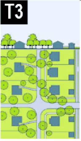 | T-3 SUB-URBAN | ||
| T-3 Sub-Urban Zone consists of low density residential areas, adjacent to higher zones that have some mixed use. Home occupations and outbuildings are allowed. Planting is naturalistic and setbacks are relatively deep. Blocks may be large and the roads irregular to accommodate natural conditions. | General Character: | Lawns and landscaped yards surrounding detached single-family houses; pedestrians occasionally | |
| Building Placement: | Large and variable front and side yard Setbacks | ||
| Frontage Types: | Porches, fences, naturalistic tree planting | ||
| Typical Building Height: | 1- to 2-Story with some 3-Story | ||
| Type of Civic Space: | Parks, Greenways | ||
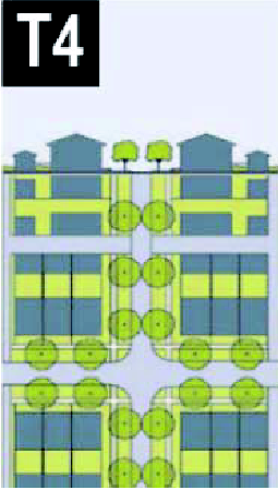 | T-4 GENERAL URBAN | ||
| T-4 General Urban Zone consists of a mixed use but primarily residential urban fabric. It may have a wide range of building types: single, Sideyard, and Rowhouses. Setbacks and landscaping are variable. Streets with curbs and side-walks define medium-sized Blocks. | General Character: | Mix of Houses and Townhouses with scattered Commercial activity; balance between landscape and buildings; presence of pedestrians | |
| Building Placement: | Shallow to medium front and side yard Setbacks | ||
| Frontage Types: | Porches, fences, Dooryards | ||
| Typical Building Height: | 1- to 4-Story | ||
| Type of Civic Space: | Squares, Greens | ||
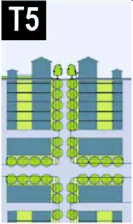 | T-5 URBAN CENTER | ||
| T-5 Urban Center Zone consists of higher density mixed use building that accommodate Retail, Offices, Row-houses and Apartments. It has a tight network of streets, with wide sidewalks, steady street tree planting and buildings set close to the sidewalks. | General Character: | Shops mixed with Townhouses, larger Apartment houses, Offices, work place and Civic buildings; predominantly attached buildings; trees within the public right-of-way; substantial pedestrian activity | |
| Building Placement: | Shallow Setbacks or none; buildings oriented to street, defining a street wall | ||
| Frontage Types: | Stoops, Dooryards, Forecourts, Shopfronts, Galleries and Arcades | ||
| Typical Building Height: | 1- to 6-Story | ||
| Type of Civic Space: | Parks, Plazas and Squares, median landscaping | ||
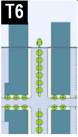 | T-6 URBAN CORE | ||
| T-6 Urban Core Zone consists of the highest density and height, with the greatest variety of uses. It may have larger Blocks; streets have steady street tree planting and buildings are set close to wide sidewalks. | General Character: | Medium to high-Density Mixed Use buildings, entertainment, Civic and cultural uses. Attached buildings forming a continuous street wall; trees within the public right-of-way; highest pedestrian and transit activity | |
| Building Placement: | Shallow Setbacks or none; buildings oriented toward the street, defining a street wall | ||
| Frontage Types: | Stoops, Dooryards, Forecourts, Shopfronts, Galleries and Arcades | ||
| Typical Building Height: | 4-plus Story with a few shorter buildings | ||
| Type of Civic Space: | Parks, Plazas and Squares, median landscaping | ||
TABLE 2: - Modification to Non-Conforming Properties.
This table provides descriptions of changes to non-conforming properties that result in conformance with the specifications of this code. Other changes to decrease the degree of non-conformity are also possible.
|
NON-CONFORMING
PROPERTY | POSSIBLE TECHNIQUES | CONFORMING MODIFICATION | ||
|---|---|---|---|---|
DRIVE-THRU |  | T5 T6 | T5 T6 | |
| • Keep existing building and drive-thru and add Liner Buildings in front of building to engage the Thoroughfare, or |  |  | ||
| • Replace building | ||||
FUEL STATION |  | T5 T6 | T5 T6 | |
| • Keep fuel station building and pumps and build a new building at the intersection, or | 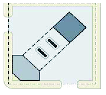 | 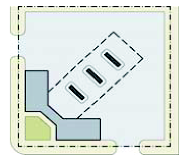 | ||
| • Eliminate the fuel station building, but keep the pumps and increase them, while building a new building at the intersection | ||||
STRIP CENTER | 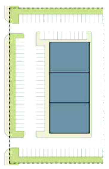 | T5 T6 | T5 T6 | |
| • Keep existing building and add Liner Buildings in front of it to engage the Thoroughfare | 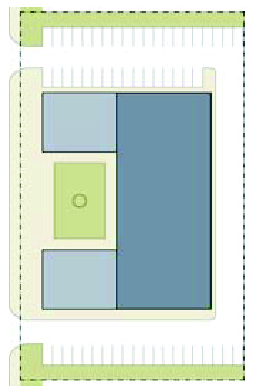 | 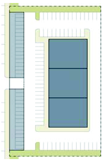 | ||
| • Convert frontal parking into Forecourt and add on-street parking to the existing Thoroughfare | ||||
BIG BOX OR OFFICE BUILDING | 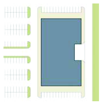 | T5 T6 | T5 T6 | |
| • Infill the frontal parking with new Liner Buildings and streets terminating on the existing building; retain current building use or convert to new use | 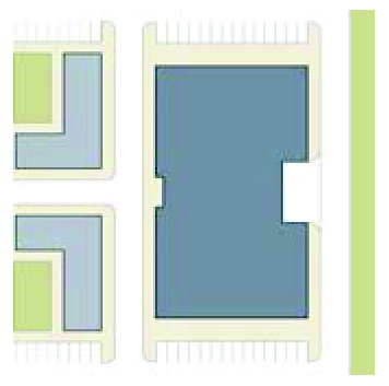 | 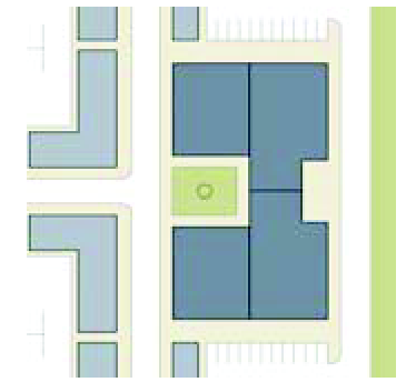 | ||
| • Infill the frontal parking with new Liner Buildings and streets terminating on the existing building; reconfigure existing buildings for new use | ||||
RELIGIOUS BUILDING |  | T4 T5 T6 | T4 T5 T6 | |
| • Infill the frontal parking lot with senior housing; add on-street parking to existing Thoroughfare |  |  | ||
| • Create a street and Civic Space with Liner Buildings terminating on the existing religious building; add on-street parking to the existing Thoroughfare | ||||
TABLE 3A: - Vehicular Lane Dimensions.
This table assigns lane widths to Transect Zones. The Design ADT (Average Daily Traffic) is the determinant for each of these sections. The most typical assemblies are shown in Table 3B: Vehicular Lan/Parking Assemblies. Specific requirements for truck and transit bus routes and truck loading shall be decided by the City of Doraville Public Works Director or other official as designated by the City Manager.
TABLE 3B: - Vehicular Lane/Parking Assemblies.
The projected design speeds determine the dimensions of the vehicular lanes and Turning Radii assembled for Thoroughfares. Use of standards in this table are subject to approval by the City of Doraville Public Works Director or other official as designated by the City Manager. Where on-street Bicycle Lanes or similar bicycle facilities are provided, the paved width shall be increased a corresponding amount.
| a. | NO PARKING | 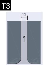 |  |  | ||
| Design ADT | 300 VPD | 22,000 VPD | 30,000 VPD | |||
|
Pedestrian
Crossing | 3 Seconds | 9 Seconds | 13 Seconds | |||
| Design Speed | 25—30 MPH | 25 MPH | 35 MPH or above | |||
| b. | YIELD PARKING |  |  | |||
| Design ADT | 1,000 VPD | 1,000 VPD | ||||
|
Pedestrian
Crossing | 5 Seconds | 7 Seconds | ||||
| Design Speed | ||||||
| c. | PARKING ONE SIDE PARALLEL | 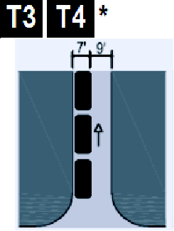 | 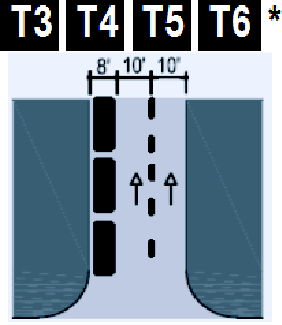 | 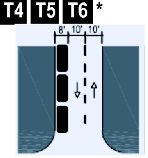 | 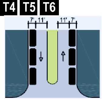 | 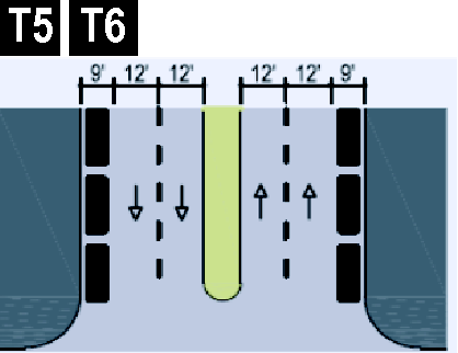 |
| Design ADT | 5,000 VPD | 18,000 VPD | 16,000 VPD | 15,000 VPD | 32,000 VPD | |
|
Pedestrian
Crossing | 5 Seconds | 8 Seconds | 8 Seconds | 11 Seconds | 13 Seconds | |
| Design Speed | 25—30 MPH | 25—30 MPH | 25—30 MPH | 25—30 MPH | 35 MPH and above | |
| d. | PARKING BOTH SIDES PARALLEL | 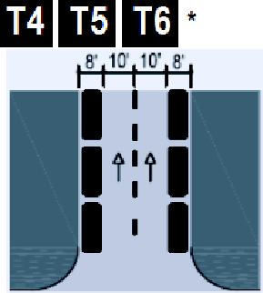 | 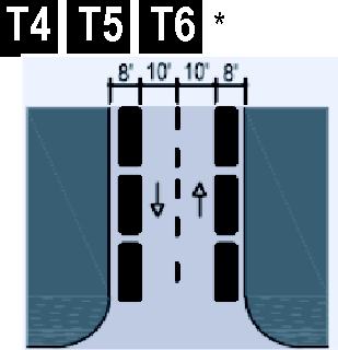 | 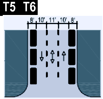 |  | |
| Design ADT | 20,000 VPD | 15,000 VPD | 22,000 VPD | 32,000 VPD | ||
|
Pedestrian
Crossing | 10 Seconds | 10 Seconds | 13 Seconds | 15 Seconds | ||
| Design Speed | 25—30 MPH | 25—30 MPH | 25—30 MPH | 35 MPH and above | ||
| e. | PARKING BOTH SIDES DIAGONAL (Drive-In or back-in parking permitted. Parking may be limited to one side in assemblies suitable for a Slip Road) |  |  |  |  |  |
| Design ADT | 18,000 VPD | 20,000 VPD | 15,000 VPD | 22,000 VPD | 31,000 VPD | |
|
Pedestrian
Crossing | 15 Seconds | 17 Seconds | 17 Seconds | 20 Seconds | 23 Seconds | |
| Design Speed | Below 20 MPH | 25 MPH | 25 MPH | 25—30 MPH | 25—30 MPH | |
| f. | PARKING ACCESS |  |  | |||
| Design ADT | ||||||
|
Pedestrian
Crossing | 3 Seconds | 6 Seconds | ||||
| Design Speed | ||||||
* Indicates assembly suitable for a Slip Road in any Transect Zone
TABLE 4A: - Public Frontages - General.
The Public Frontage is the area between the private Lot Line and the edge of the vehicular lanes. Dimensions are given in Table 4B: Public Frontages - Specific.
 | |
| a. (HW) For Highway: This Frontage has open Swales drained by percolation, Multi-Use Trails and no parking. The landscaping consists of the natural condition or multiple species arrayed in naturalistic clusters. Buildings are buffered by distance or berms. | 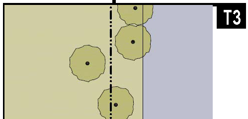 |
| b. (RD) For Road: This Frontage has open Swales drained by percolation and a walking Path or Multi-Use Trail along one or both sides Yield parking. The landscaping consists of the multiple species arrayed in naturalistic clusters. | 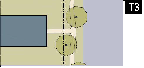 |
| c. (ST) For Street: This Frontage has raised Curbs drained by inlets and Sidewalks separated from the vehicular lanes by individual or continuous Planters, with parking on one or both sides. The landscaping consists of street trees of a single or alternating species aligned in a regularly spaced Allee. | 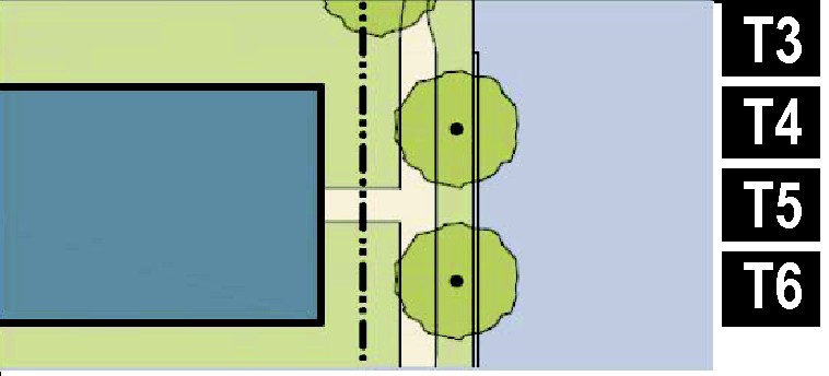 |
| d. (DR) For Drive: This Frontage has raised Curbs drained by inlets and a wide Sidewalk or paved path along one side, related to a Greenway or waterfront. It is separated from the vehicular lanes by individual or continuous Planters. The landscaping consists of street trees of a single species or alternating species aligned in a regularly spaced Allee. |  |
| e. (AV) For Avenue: This Frontage has raised Curbs drained by inlets and wide Sidewalks separated from the vehicular lanes by a narrow continuous Planter with parking on both sides. The landscaping consists of a single tree species aligned in a regularly spaced Allee. |  |
| f. (CS)(AV) For Commercial Street or Avenue: This Frontage has raised Curbs drained by inlets and very wide Sidewalks along both sides separated from the vehicular lanes by separate tree wells with grates and parking on both sides. The landscaping consists of a single tree species aligned with regular spacing where possible but clears the storefront entrances. | 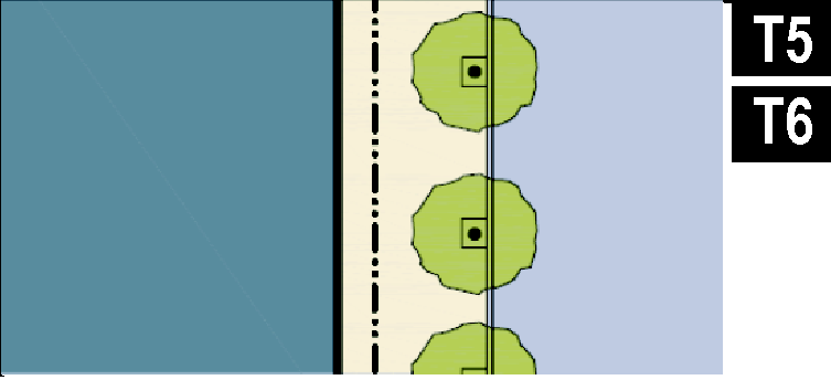 |
| g. (BV) For Boulevard: This Frontage has slip Roads on both sides. It consists of raised Curbs drained by inlets and Sidewalks along both sides, separated from the vehicular lanes by Planters. The landscaping consists of double rows of a single tree species aligned in a regularly spaced Allee. |  |
TABLE 4B: - Public Frontages - Specific.
This table assembles prescriptions and dimensions for the Public Frontage elements - Curbs, walkways and Planters - relative to specific Thoroughfare types within Transect Zones.
| TRANSECT ZONE Public Frontage Type | T3 | T3 | T3 T4 T5 T6 | T4 T5 T6 | T5 T6 | T5 T6 |
| HW & RD | RD & ST | ST-DR-AV | ST-DR-AV-BV | CS-DR-AV-BV | CS-DR-AV-BV | |
| a. Assembly: The principal variables are the type and dimension of Curbs, walkways, Planters and landscape. | 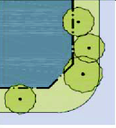 | 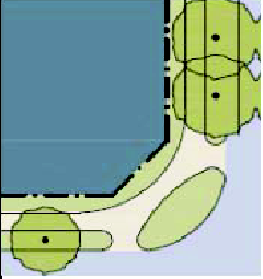 | 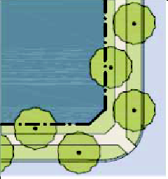 | 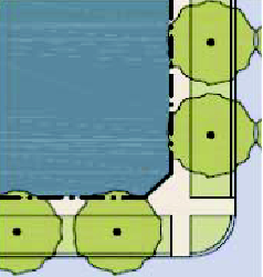 | 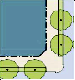 | 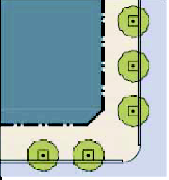 |
| Total Width | 16—24 feet | 12—24 feet | 12—18 feet | 12—18 feet | 18—24 feet | 18—30 feet |
| b. Curb: The detailing of the edge of the vehicular pavement incorporating dranage. |  |  |  |  |  |  |
| Type | Open Swale | Open Swale | Raised Curb | Raised Curb | Raised Curb | Raised Curb |
| Radius | 10—30 feet | 10—30 feet | 5—20 feet | 5—20 feet | 5—20 feet | 5—20 feet |
| c. Walkway: The hard surface dedicated exclusively to pedestrian activity and maintained clear and unobstructed to a minimum height of 8 feet. |  | 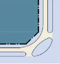 | 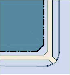 | 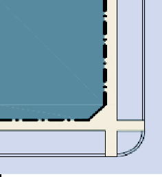 | 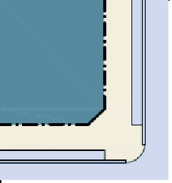 | 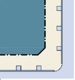 |
| Type | Path Optional | Path | Sidewalk | Sidewalk | Sidewalk | Sidewalk |
| Width | n/a | 4—5 feet | 5—6 feet | 5—6 feet | 12—20 feet | 12—30 feet |
| d. Planter: The layer which accommodates street trees and other landscape materials. | 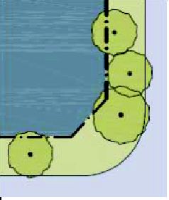 | 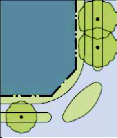 | 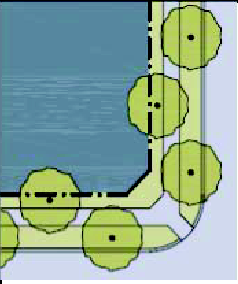 | 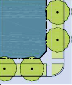 | 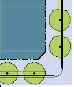 | 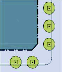 |
| Arrangement | Clustered | Clustered | Regular | Regular | Regular | Opportunistic |
| Species | Clustered | Clustered | Alternating | Single | Single | Single |
| Planter Type | Continuous Swale | Continuous Swale | Continuous Planter | Continuous Planter | Continuous Planter | Tree Well |
| Planter Width | 8 feet—16 feet | 8 feet—16 feet | 6 feet—12 feet | 5 feet—12 feet | 4 feet—6 feet | 4 feet—6 feet |
TABLE 4C: - Thoroughfare Assemblies.
These Thoroughfares are assembled from the elements that appear in Tables 3A: Vehicular Lane Dimensions and 3B: Vehicular Lane/Parking Assemblies and incorporate the Public Frontages of table 4A: Public Frontages - General. The key gives the Thoroughfare type followed by the right-of-way width, followed by the pavement width, and in some instances followed by specialized transportation capability.
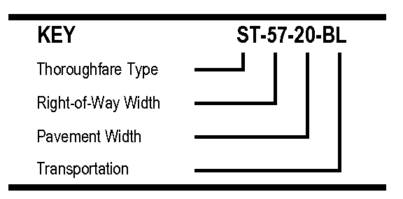 |  | ||
| THOROUGHFARE TYPES | |||
| Highway | HW | ||
| Boulevard | BV | ||
| Avenue | AV | ||
| Commercial Street | CS | ||
| Drive | DR | ||
| Street | ST | ||
| Road | RD | ||
| Rear Alley | RA | ||
| Rear Lane | RL | ||
| Multi-Use Trail | MT | ||
| Bicycle Lane | BL | ||
| Bicycle Route | BR | ||
| Path | PT | ||
| Passage | PS | ||
| ST-50-26 | ST-50-28 | ||
| Thoroughfare Type | Street | Street | |
| Transect Zone Assignment | T4, T5 | T4, T5 | |
| Right-of-Way Width | 50 feet | 50 feet | |
| Pavement Width | 26 feet | 28 feet | |
| Movement | Slow Movement | Yield Movement | |
| Design Speed | 25 MPH | 25 MPH | |
| Pedestrian Crossing Time | 7.4 seconds | 7.6 seconds | |
| Traffic Lanes | 2 lanes | 2 lanes | |
| Parking Lanes | One side @ 8 feet marked | Both sides @ 8 feet marked | |
| Curb Radius | 10 feet | 10 feet | |
| Walkway Type | 5 foot Sidewalk | 5 foot Sidewalk | |
| Planter Type | 7 foot continuous Planter | 6 foot continuous Planter | |
| Curb type | Curb | Curb | |
| Landscape Type | Trees @ 30′ o.c. Avg. | Trees @ 30′ o.c. Avg. | |
| Transportation Provision | BR | BR | |
TABLE 5: - Civic Space.
| a. Park: A natural preserve available for structured or unstructured recreation. A park may be independent of surrounding building Frontages. Its landscape shall consist of Paths and trails, meadows, water bodies, woodland and open shelters, all naturalistically disposed. Parks may also include dog parks within them. Sports and recreation courts and fields are also permitted, but sports stadiums are prohibited. Parks may be lineal, following the trajectories of natural corridors. The minimum size shall be 5 acres. |  |
| b. Green: An Open Space, available for structured or unstructured recreation. A Green may be spatially defined by landscaping rather than building Frontages. Its landscape shall consist of lawn and trees, naturalistically disposed. Greens may also include dog parks within them. Sports courts are also permitted, but sports and recreation fields and stadiums are prohibited. The minimum size shall be ½ acre and the maximum shall be 5 acres. |  |
| c. Square: An Open Space available for unstructured recreation and Civic purposes. A Square is spatially defined by building Frontages. Its landscape shall consist of paths, lawns and trees, formally disposed. Squares shall be located at the intersection of important Thoroughfares. The minimum size shall be ½ acre and the maximum shall be 5 acres. |  |
| d. Plaza: An Open Space available for Civic purposes and Commercial activities. A Plaza shall be spatially defined by building Frontages. Its landscape shall consist primarily of pavement. Trees are optional. Plazas should be located at the intersection of important streets. The minimum size shall be ½ acre and the maximum shall be 2 acres. |  |
| e. Playground: An Open Space designed and equipped for the recreation of children. A Playground should be fenced and may include an open shelter. Playgrounds shall be interspersed within Residential areas and may be placed within a Block. Playgrounds may be included within parks and greens. The maximum size of playground shall be 2 acres, provided that playgrounds may also be located within another approved Civic Space identified above. |  |
TABLE 6: - Building Form - Height.
This table shows the configurations for different building heights for each Transect Zone. Recess Lines shall occur on higher buildings in Zone T6 as shown. N = maximum height in stories as specified in Table 11: Code Summary.
| T3 | T4 | T5 | T6 |
 |  | 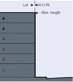 | 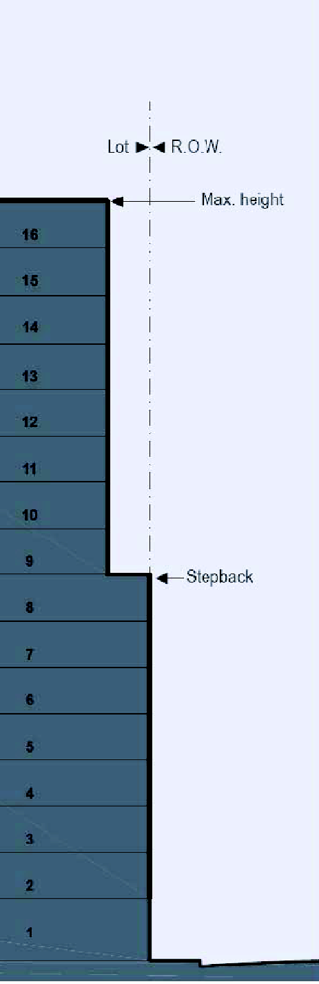 |
| The illustrative T6 configurations below show buildings built less than the maximum permitted height. | |||
| T6 | T6 | T6 | |
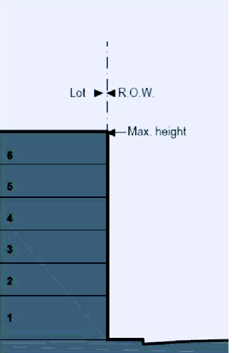 | 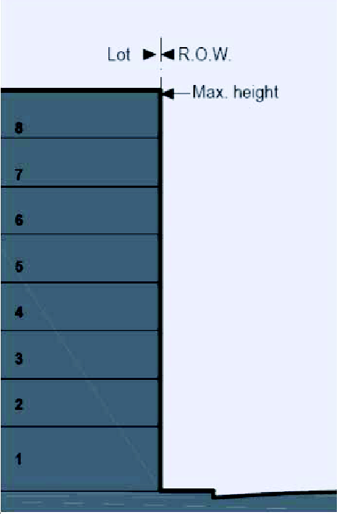 |  | |
TABLE 7: - Building Placement.
This table approximates the location of the structure relative to the boundaries of each individual Lot, establishing suitable basic building types for each Transect Zone.
| a. Edgeyard: A building that occupies the center of its lot with Setbacks on all sides. This is the least urban of types as the front yard sets it back from the Frontage, while the side yards weaken the spatial definition of the public Thoroughfare space. The front yard is intended to be visually continuous with the yards of adjacent buildings. The rear yard can be secured for privacy by fences and a Backbuilding and/or Outbuilding. | 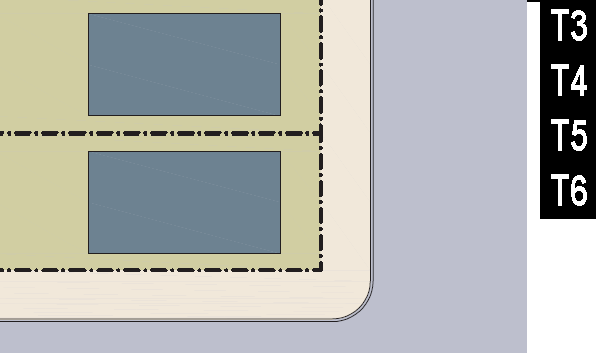 |
| b. Sideyard: A building that occupies one side of the lot with the Setback to the other side. A shallow Frontage Setback defines a more urban condition. If the adjacent building is similar with a blank side wall, the yard can be quite private. This type permits systematic climatic orientation in response to the sun or the breeze. If a Sideyard House abuts a neighboring Sideyard House, the type is known as a Twin or double house. Energy costs, and sometimes noise, are reduced by sharing a party wall in this disposition. | 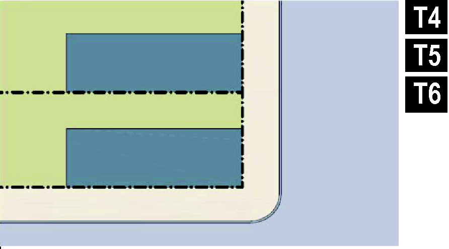 |
| c. Rearyard: A building that occupies the full Frontage, leaving the rear of the lot as the sole yard. This is a very urban type as the continuous Façade steadily defines the public Thoroughfare. The rear Elevations may be articulated for functional purposes. In its Residential form, this type is the Rowhouse. For its Commercial form, the rear yard can accommodate substantial parking. | 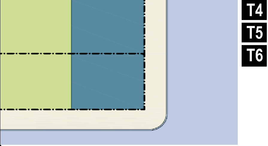 |
| d. Courtyard: A building that occupies the boundaries of its lot while internally defining one or more private patios. This is the most urban of types, as it is able to shield the private realm from all sides while strongly defining the public Thoroughfare. Because of its ability to accommodate incompatible activities, masking them from all sides, it is recommended for workshops, Lodging and schools. The high security provided by the continuous enclosure is useful for crime-prone areas. | 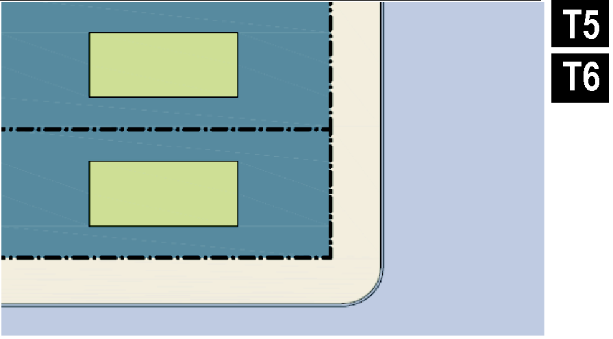 |
TABLE 8: - Private Frontages.
The Private Frontage is the areas between the building Facades and the lot lines.
 | |||
| a. Common Yard: a planted Frontage wherein the Façade is set back substantially from the Frontage Line. The front yard created remains unfenced and is visually continuous with adjacent yards, supporting a common landscape. The deep Setback provides a buffer from the higher speed Thoroughfares. | 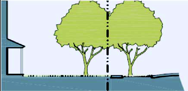 | 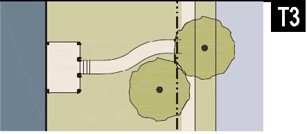 | |
| b. Porch & Fence: a planted Frontage where the Façade is set back from the Frontage Line with an attached porch permitted to Encroach. A fence, wall, or hedge at the Frontage Line maintains street spatial definition. Porches shall be no less than 8 feet deep. | 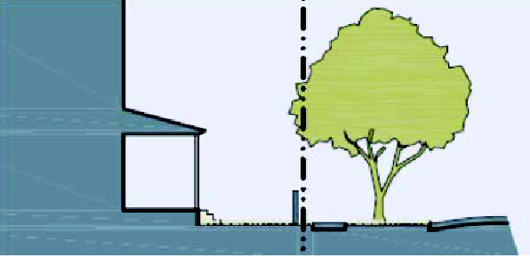 | 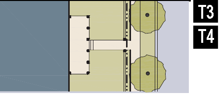 | |
| c. Terrace or Lightwell: a frontage wherein the Façade is set back from the Frontage Line by an elevated terrace or sunken Lightwell. This type buffers Residential use from urban Sidewalks and removes the private yard from public encroachment. Terraces are suitable for conversion to outdoor cafes. Syn: Dooryard. | 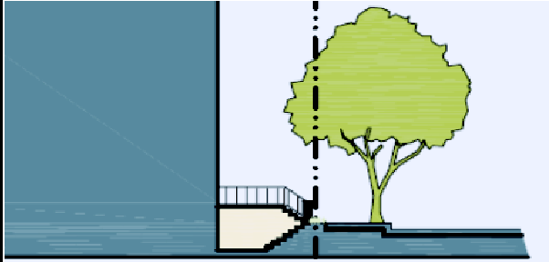 |  | |
| d. Forecourt: a Frontage wherein the Façade is close to the Frontage Line and the central portion is set back. The forecourt created is suitable for vehicular drop-offs. This type should be allocated in conjunction with other Frontage types. Large trees within the Forecourts may overhang the Sidewalks. | 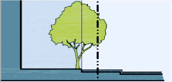 | 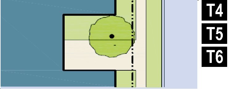 | |
| e. Stoop: a Frontage wherein the Façade is aligned close to the Frontage Line with the first Story elevated from the Sidewalk sufficiently to ensure privacy for the windows. The entrance is usually an exterior stair and landing. This type is recommended for ground-floor Residential use. Stoops shall be no less than 30 inches deep. | 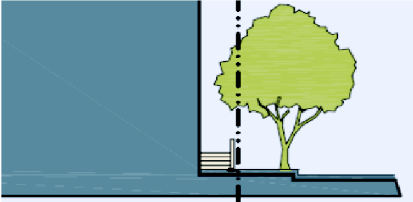 | 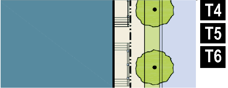 | |
| f. Shopfront: a Frontage wherein the Façade is aligned close to the Frontage Line with the building entrance at Sidewalk grade. This type is conventional for Retail use. It has glazing on the Sidewalk level and an awning that should overlap the Sidewalk. Syn: Retail Frontage. | 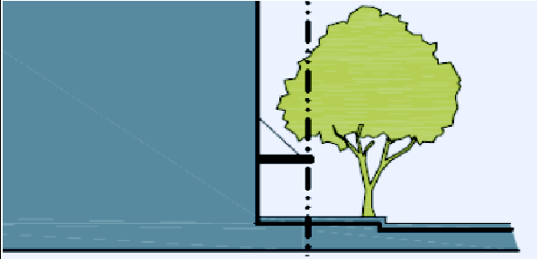 | 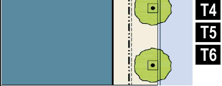 | |
| g. Gallery: a Frontage wherein the Façade is aligned with the Frontage Line with an attached cantilevered shed or lightweight colonnade overlapping the Sidewalk. This type is conventional for Retail use. The Gallery should be no less than 10 feet wide and should overlap the sidewalk to within 2 feet of the Curb. | 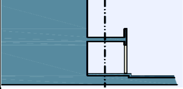 |  | |
| h. Arcade: a collonade supporting habitable space that overlaps the Sidewalk, while the Façade at Sidewalk level remains at or behind the Frontage Line. This type is conventional for Retail use. The Arcade shall be no less than 12 feet wide and should overlap the Sidewalk to within 2 feet of the Curb. | 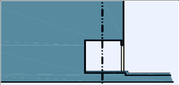 |  | |
TABLE 9: - Building Function.
This table categorizes Building functions within Transect Zones. For Specific Function and Use permitted By Right or by Conditional Use Permit, see Table 10: Specific Function and Use.
TABLE 10: - Specific Function and Use.
This table expands the categories of Table 9: Building Function to delegate specific principal uses within Function categories by Transect Zone. Refer also to Sec. 23-2046 - Building Function, for additional information on uses. Accessory uses are those uses of a nature customarily subordinate to the principal (or primary) use. Drive-through facilities are prohibited in the T-3 and T-4 transect zones.
a)
R-1 and R-2 Distance Requirement: Regardless of transect zone, no building or structure containing an Automotive or Industrial Function identified in section 23-902 may be located within one hundred (100) feet of any R-1 or R-2 zoning district, as measured in a straight line.
b)
Buford Highway Distance Requirement: Regardless of transect zone, no building or structure containing an Industrial Function identified in section 23-902 may be located within fifteen hundred (1,500) feet of the centerline of Buford Highway, as measured in a straight line.
(Ord. No. 2015-13, § 1, 11-9-15; Ord. No. 2016-01, § 1, 3-21-16; Ord. No. 2016-02, § 2, 3-21-16; Ord. No. 2017-20, § 2, 8-21-17; Ord. No. 2018-014, § 3, 9-4-18; Ord. No. 2020-09, § 1(Exh. A), 6-8-20; Ord. No. 2021-18, § 2, 2-17-21; Ord. No. 2021-21, 3-17-21; Ord. No. 2022-02, § 4, 1-12-22; Ord. No. 2022-07, § 5, 1-12-22; Ord. No. 2022-28, § 3, 7-18-22)
TABLE 11: - Code Summary
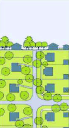 | 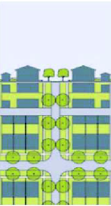 | 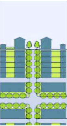 | 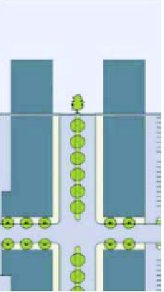 | |||||
|
T3
SUB-URBAN ZONE |
T4
GENERAL URBAN ZONE |
T5
URBAN CENTER ZONE | T6 URBAN CORE | |||||
| a. RESIDENTIAL DENSITY (See Sec. 23-2006) | ||||||||
| By Right | 6 units/ac. | 12 units/ac. | 50 units/ac. | 80 units/ac. | ||||
| b. BLOCK SIZE | ||||||||
| Block Perimeter | 3,000 ft. max. | 2,400 ft. max. | 3,200 ft. max. | 3,200 ft. max. | ||||
| c. THOROUGHFARES (See Table 3 and Table 4) | ||||||||
| HW | permitted | not permitted | not permitted | not permitted | ||||
| BV | permitted | permitted | permitted | permitted | ||||
| AV | permitted | permitted | permitted | permitted | ||||
| CS | permitted | not permitted | permitted | permitted | ||||
| DR | permitted | permitted | permitted | permitted | ||||
| ST | permitted | permitted | permitted | permitted | ||||
| RD | permitted | not permitted | not permitted | not permitted | ||||
| Rear Lane | permitted | required, or Alley | not permitted | not permitted | ||||
| Rear Alley | permitted | required, or Lane | required | required | ||||
| Path | permitted | permitted | not permitted | not permitted | ||||
| Passage | permitted | permitted | permitted | permitted | ||||
| Multi-Use Trail | permitted | permitted | permitted | permitted | ||||
| Bicycle Lane | permitted | permitted | permitted | permitted | ||||
| Bicycle Route | permitted | permitted | permitted | permitted | ||||
| d. CIVIC SPACES (See Table 5) | ||||||||
| Park | permitted | permitted | permitted | permitted | ||||
| Green | permitted | permitted | permitted | permitted | ||||
| Square | not permitted | permitted | permitted | permitted | ||||
| Plaza | not permitted | not permitted | permitted | permitted | ||||
| Playground | permitted | permitted | permitted | permitted | ||||
| e. LOT OCCUPATION | ||||||||
| Lot Width | 70 ft. min 120 ft. max. | 18 ft. min 96 ft. max. | 18 ft. min no max. | 18 ft. min no max. | BUILDING PLACEMENT | |||
| Lot Coverage | 60% max. | 70% max. | 100% max. | 100% max. | ||||
| f. SETBACKS - PRINCIPAL BUILDING (See Table 14) | ||||||||
| (f.1) Front Setback Principal | 20 ft. min. | 10 ft. min. 30 ft. max. | 2 ft. min. 15 ft. max. | 2 ft. min. 15 ft. max. | ||||
| (f.2) Front Setback Secondary | 12 ft. min. | 8 ft. min. 20 ft. max. | 2 ft. min. 15 ft. max. | 2 ft. min. 15 ft. max. | ||||
| (f.3) Side Setback | 5 or 10 ft. min. 2 | 0 ft. min. | 0 ft. min. | 0 ft. min. | ||||
| (f.4) Rear Setback | 12 ft. min. | 3 ft. min. | 3 ft. min. | 3 ft. min. | ||||
| Frontage Buildout | 30% min. | 50% min. | 50% min. | 50% min. | ||||
(Ord. No. 2025-11(A-25-04), § 4, 10-15-25)
TABLES 12A, 12B: - Reserved.
Editor's note— Ord. No. 2022-06, § 6, adopted January 12, 2022, amended the Code by repealing former tables 12A and 12B. Former table 12A pertained to trees and landscaping, and table 12B pertained to invasive species and landscaping. Both tables derived from Ord. No. 2014-08, § 1, adopted June 16, 2014.
TABLE 13: - Special Districts.
The metrics for each column of this table (SD1, SD2, etc.) are to be filled in for each Special district as they are permitted pursuant to a Regulating Plan or Special Area Plan. Functions may be specifically listed or may reference an existing City of Doraville zoning district. More pages can be added. Special Districts that do not have provisions noted herein shall be governed by the standards of any other City of Doraville zoning district as set forth in Sections 1.4.4(c) or (d), as applicable.
(Ord. No. 2015-11, § 2, 3-2-15)
TABLE 14: - Definitions Illustrated
a. THOROUGHFARE & FRONTAGES | |
b. TURNING RADIUS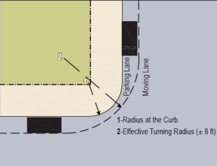 | c. BUILDING DISPOSITION |
d. LOT LAYERS | e. FRONTAGE & LOT LINES |
f. SETBACK DESIGNATIONS | |
TABLE 15: - Applicability of Parking Structure Standards.
This Table summarizes the applicability of parking deck requirements of section 23-2049(g).
(Ord. No. 2020-017, § 2, 9-23-20)
Sec. 23-2061. - Definitions.
This Division provides definitions for terms in this Article that are technical in nature or that otherwise may not reflect a common usage of the term. If a term is not defined in this Article or in Article IV of the zoning ordinance, then the Director of Community Development shall determine the correct definition. Items underlined refer to Divisions, Sections, or Tables in the code.
A-Grid: cumulatively, those Thoroughfares that by virtue of their pre-existing pedestrian-supportive qualities, or their future importance to pedestrian connectivity, are held to the highest standards prescribed by this code. See B-Grid.
Accessory Building: an Outbuilding with an Accessory Unit.
Accessory Unit: a small apartment sharing ownership and utility connections with a Principal Building; it may or may not be within an Outbuilding. (Syn: ancillary unit)
Adaptive Reuse: the process of reusing an existing commercial or industrial building for residential use or vice versa whether in its entirety or partially. This does not apply to home occupations.
Allee: a regularly spaced and aligned row of trees usually planted along both sides of a Thoroughfare or Path.
Arcade: a Private Frontage conventional for Retail use wherein the Facade is a colonnade supporting habitable space that overlaps the Sidewalk, while the Facade at Sidewalk level remains at the Frontage Line.
Avenue (AV): a Thoroughfare of high vehicular capacity and low to moderate speed, acting as a short distance connector between urban centers, and usually equipped with a landscaped median.
B-Grid: cumulatively, those Thoroughfares that by virtue of their use, location, or absence of pre-existing pedestrian-supportive qualities, may meet a standard lower than that of the A-Grid. B-Grid Thoroughfares are often privately-owned. See A-Grid.
Back-building: a single-Story structure connecting a Principal Building to an Outbuilding. See Table 14: Definitions Illustrated.
Bicycle Facility: A general term denoting improvements and provisions to a thoroughfare to accommodate or encourage bicycling including, but not limited to, on-street bike lanes, on-street cycle tracks, on-street markings, off-street multi-use trails, and similar improvements.
Bicycle Lane (BL): a dedicated lane for cycling within a moderate-speed vehicular Thoroughfare, demarcated by striping and having a minimum width of 5 feet.
Bicycle Route (BR): a Thoroughfare suitable for the shared use of bicycles and automobiles moving at low speeds.
Block: the aggregate of private Lots, Passages, Rear Alleys and Rear Lanes, circumscribed by Thoroughfares.
Block Face: the aggregate of all the building Facades on one side of a Block.
Boulevard (BV): a Thoroughfare designed for high vehicular capacity and moderate speed, traversing an Urbanized area. Boulevards are usually equipped with Slip Roads buffering Sidewalks and buildings.
Building Form: the shape of a building, based on its massing, Private Frontage, and height.
Building Placement: the arrangement of a building on its lot.
By Right: characterizing a proposal or component of a proposal for a Building Scale Plan (Division 4) that complies with the code and is permitted and processed administratively, without public hearing. See Variance.
Civic: the term defining not-for-profit organizations dedicated to arts, culture, education, recreation, government, transit, and municipal parking.
Civic Building: a building operated by a city, county, state, or federal government.
Civic Building Sites: a parcel containing a Civic Building.
Civic Space: an outdoor area dedicated for public use, but which may be under public or private ownership. Civic Space types are defined by the combination of certain physical constants including the relationships among their intended use, their size, their landscaping and their Enfronting buildings. See Table 5: Civic Space.
Civic Zone: designation for sites dedicated for Civic Building Sites and Civic Spaces.
Commercial: the term collectively defining workplace, Office, Retail, and Lodging Functions.
Common Yard: a planted Private Frontage wherein the Facade is set back from the Frontage line. It is visually continuous with adjacent yards. See Table 8: Private Frontages.
Convenience store: a retail location, traditionally with a smaller footprint, which provides the public with a variety of prepackaged products and goods, as well as basic grocery and household items. This definition excludes automobile service, fuel sales, and repair centers.
Cottage: an Edgeyard building type. A single-family dwelling, on a regular Lot, often shared with an Accessory Building in the back yard.
Courtyard Building: a building that occupies the boundaries of its Lot while internally defining one or more private patios. See Table 8: Private Frontages.
Curb: the edge of the vehicular pavement that may be raised or flush to a swale. It usually incorporates the drainage system. See Table 4A: Public Frontages - General and Table 4B: Public Frontages - Specific.
Design Speed: is the velocity at which a Thoroughfare tends to be driven without the constraints of signage or enforcement. There are three ranges of speed: Low: (25 MPH); Moderate: (25-35 MPH); High: (above 35 MPH). Lane width is determined by desired Design Speed. See Table 3A: Vehicular Lane Dimensions.
Dooryard: a Private Frontage type with a shallow Setback and front garden or patio, usually with a low wall at the Frontage Line. See Table 8: Private Frontages. (Variant: Lightwell)
Drive: a Thoroughfare along the boundary between an Urbanized and a natural condition, usually along a waterfront, Park, or promontory. One side has the urban character of a Thoroughfare, with Sidewalk and building, while the other has the qualities of a Road or parkway, with naturalistic planting and rural details.
Edgeyard Building: a building that occupies the center of its Lot with Setbacks on all sides. See Table 7: Building Placement.
Effective Turning Radius: the measurement of the inside Turning Radius taking parked cars into account. See Table 14: Definitions Illustrated.
Elevation: an exterior wall of a building not along a Frontage Line. See Table 14: Definitions Illustrated. See: Facade.
First Layer: the privately held Layer between the Frontage Line and the Principal Building front Setback shown in Table 11: Code Summary. Where both a minimum and maximum Setback exists, the First Layer shall extend to the maximum. See Table 14: Definitions Illustrated.
Encroach: to break the plane of a vertical or horizontal regulatory limit with a structural element, so that it extends into a Setback, into the Public Frontage, or above a height limit.
Encroachment: any structural element that breaks the plane of a vertical or horizontal regulatory limit, extending into a Setback, into the Public Frontage, or above a height limit.
Enfront: to place an element along a Frontage, as in "porches Enfront the street."
Facade: the exterior wall of a building that is set along a Frontage Line. See Elevation.
Forecourt: a Private Frontage wherein a portion of the Facade is close to the Frontage Line and the central portion is set back. See Table 8: Private Frontages.
Frontage: the area between a building Facade and the vehicular lanes, inclusive of its built and planted components. Frontage is divided into Private Frontage and Public Frontage. See Table 4A: Public Frontages - General and Table 8: Private Frontages.
Frontage Line: a line bordering a Public Frontage that may or not be congruent with the Lot Line. Facades facing Frontage Lines define the public realm and are therefore more regulated than the Elevations facing other Lot Lines. See Table 14: Definitions Illustrated.
Function: the use or uses accommodated by a building and its Lot, categorized as Restricted, Limited, or Open, according to the intensity of the use. See Table 9: Building Function and Table 10: Specific Function and Use.
Gallery: a Private Frontage conventional for Retail use wherein the Facade is aligned close to the Frontage Line with an attached cantilevered shed or lightweight colonnade overlapping the Sidewalk. See Table 8: Private Frontages.
Green: a Civic Space type for unstructured recreation, spatially defined by landscaping rather than building Frontages. See Table 5.
Greenway: an open space corridor which includes a continuous Multi-Use Trail.
Gross Site Area: all land within a site's boundaries.
Highway: a rural and suburban Thoroughfare of high vehicular speed and capacity. This type is allocated to the more rural Transect Zones (T-2, and T-3).
Home Occupation: non-Retail Commercial enterprises. The work quarters should be invisible from the Frontage, located either within the house or in an Outbuilding. Permitted activities are defined by the Restricted Office category. See Table 9: Building Function.
House: an Edgeyard building type, usually a single-family dwelling on a large Lot, often shared with an Accessory Building in the back yard. (Syn: single.)
Layer: a range of depth of a Lot within which certain elements are permitted. See Table 14: Definitions Illustrated.
Lightwell: A Private Frontage type that is a below-grade entrance or recess designed to allow light into basements. See Table 8: Private Frontages.
Liner Building: a building specifically designed to mask a parking lot or a Parking Structure from a Frontage.
Live-Work: a Mixed Use unit consisting of a commercial and residential function. The commercial function may be anywhere in the unit. It shall be occupied by a business operator who lives in the same structure that contains the commercial activity.
Lodging: premises available for daily renting of guest rooms. See Table 9: Building Function and Table 10: Specific Function and Use.
Lot Line: the boundary that legally and geometrically demarcates a lot.
Lot Width: the length of the Principal Frontage Line of a lot.
Manufacturing: premises available for the creation, assemblage and/or repair of objects, using table-mounted electrical machinery or artisanal equipment, and including their Retail sale.
Mixed Use: multiple Functions within the same building through superimposition or adjacency, or in multiple buildings by adjacency.
Multi-Use Trail (MT): a shared paved pedestrian and bicycle way running independent of a vehicular Thoroughfare and having a minimum width of 12 feet and a maximum width of 20 feet.
Office: premises available for the transaction of general business but excluding uses in the "Function and Use Table" categories of "Automotive" and "Industrial."
Open Parking: an uncovered parking area not within a Parking Structure. (Syn: parking lot)
Outbuilding: an Accessory Building, usually located toward the rear of the same Lot as a Principal Building, and sometimes connected to the Principal Building by a Backbuilding. See Table 14: Definitions Illustrated.
Park: a Civic Space type that is a natural preserve available for unstructured recreation. See Table 5.
Parking Structure: a building containing one or more Stories of parking above grade.
Passage (PS): a pedestrian connector, open or roofed, that passes between buildings to provide shortcuts through long Blocks and connect rear parking areas to Frontages.
Path (PT): a pedestrian way traversing a Park or rural area, with landscape matching the contiguous open space, ideally connecting directly with the urban Sidewalk network.
Planter: the element of the Public Frontage which usually accommodates street trees, whether continuous or individual. The Planter shall be located between the Sidewalk and the Curb.
Planting Zone: The portion of a streetscape reserved for street trees, landscaping, street furniture, bike racks, transit shelters, utility boxes, and other amenities located in the public realm and similar elements in a manner that does not obstruct pedestrian access or motorist visibility. Unless otherwise specified, the planting zone should be located between the back of curb and the sidewalk.
Plaza: a Civic Space type designed for Civic purposes and Commercial activities in the more urban Transect Zones, generally paved and spatially defined by building Frontages.
Principal Building: the main building on a Lot, usually located toward the Frontage. A Lot may contain more than one Principal Building. See Table 14: Definitions Illustrated.
Principal Entrance: the main point of access for pedestrians into a building.
Principal Frontage: On corner Lots, the Private Frontage designated to bear the address and Principal Entrance to the building, and the measure of minimum Lot width. Prescriptions for the parking Layers pertain only to the Principal Frontage. Prescriptions for the First Layer pertain to both Frontages of a corner Lot. See Frontage.
Private Frontage: the privately held Layer between the Frontage Line and the Principal Building Facade that bears the Principal Entrance to the building. See Table 8: Private Frontages and Table 14: Definitions Illustrated.
Public Frontage: the area between the Curb of the vehicular lanes and the Frontage Line. See Table 4A: Public Frontages - General and Table 4B: Public Frontages - Specific.
Rear Alley (RA): a privately owned and maintained vehicular way located to the rear of Lots providing access to service areas, parking, and Outbuildings and containing utility easements. Rear Alleys should be paved from building face to building face, with drainage by inverted crown at the center or with roll Curbs at the edges.
Rear Lane (RL): a privately owned and maintained vehicular way located to the rear of Lots providing access to service areas, parking, and Outbuildings and containing utility easements. Rear Lanes may be paved lightly to Driveway standards. The streetscape consists of gravel or landscaped edges, has no raised Curb, and is drained by percolation.
Rearyard Building: a building that occupies the full Frontage Line, leaving the rear of the Lot as the sole yard. See Table 7: Building Placement. (Var: Rowhouse, Townhouse line prescribed for the full width of a Facade, above which there is a Stepback of a minimum distance, such that the height to this line (not the overall building height) effectively defines the enclosure of the Enfronting public space. See Table 6: Building Form - Height.
Regulating Plan: a Zoning Map or set of maps that shows the Transect Zones, Civic Zones, Special Districts if any, Thoroughfares, and Special Requirements if any, of areas subject to regulation by this Article.
Residential: characterizing premises available for long-term human dwelling.
Retail: characterizing premises available for the sale of merchandise and food service. See Table 10: Specific Function & Use and Table 11: Code Summary.
Retail Frontage: Frontage designated on a Regulating Plan that requires or recommends the provision of a Shopfront, encouraging the ground level to be available for Retail use. See Special Requirements.
Road (RD): a local, rural and suburban Thoroughfare of low-to-moderate vehicular speed and capacity. This type is allocated to the more rural Transect Zones (T2-T3).
Rowhouse: a single-family dwelling that shares a party wall with another of the same type and occupies the full Frontage Line. See Rearyard Building. (Syn: Townhouse)
Secondary Frontage: on corner Lots, the Private Frontage that is not the Principal Frontage. As it affects the public realm, its First Layer is regulated. See Table 14: Definitions Illustrated.
Setback: the area of a Lot measured from the Frontage Line or, in the absence of Frontage Line, the Lot line, to a building Facade or Elevation that is maintained clear of permanent structures, with the exception of Encroachments listed in Section 4.5. See Table 11: Code Summary, item f.
Shopfront: a Private Frontage conventional for Retail use, with substantial glazing and an awning, wherein the Facade is aligned close to the Frontage Line with the building entrance at Sidewalk grade. See Table 8: Private Frontages.
Sidewalk: The portion of a streetscape that is unobstructed by any permanent objects to a vertical height of eight (8) feet and is reserved exclusively for pedestrian circulation and passage.
Sideyard Building: a building that occupies one side of the Lot with a Setback on the other side. This type can be a Single or Twin depending on whether it abuts the neighboring house. See Table 7: Building Placement.
Simulated Divided Lights: a method of constructing windows in which muntins are affixed to the inside and outside of a panel of insulating glass to simulate the look of true divided light.
Slip Road: an outer vehicular lane or lanes of a Thoroughfare, designed for slow speeds while inner lanes carry higher speed traffic, and separated from them by a planted median. (Syn: access lane, service lane)
Special Area Plan: an area of 30 acres or more of contiguous lots within an area subject to a Regulating Plan which, because of its size, may establish unique requirements upon approval of the Mayor and City Council.
Special District (SD): an area that, by its intrinsic Function, Building Placement, or Building Form, cannot or should not conform to one or more of the Transect Zones specified by this code.
Specialized Building: a building that is not subject to Residential, Commercial, or Lodging classification. See Table 6: Building Form - Height.
Special Requirements: provisions of Section 23-2043 of this code and/or the associated designations on a Regulating Plan.
Square: a Civic Space type designed for unstructured recreation and Civic purposes, spatially defined by building Frontages and consisting of Paths, lawns and trees, formally disposed. See Table 5.
State Route: a Thoroughfare under the jurisdiction of the Georgia Department of Transportation.
Stepback: a building Setback of at least 10 feet that occurs at a prescribed number of Stories above the ground. See Table 6: Building Form - Height.
Stoop: a Private Frontage wherein the Facade is aligned close to the Frontage Line with the first Story elevated from the Sidewalk for privacy, with an exterior stair and landing at the entrance. See Table 7: Building Placement.
Story: a habitable level within a building, excluding an Attic or raised basement. See Table 6: Building Form - Height.
Street (ST): a local urban Thoroughfare of low speed and capacity.
Substantial Modification: alteration to an existing building that is valued at more than 60% of the replacement cost of the entire building, if built new according to current standards.
Swale: a low or slightly depressed natural area for drainage.
T-zone: Transect Zone.
Thoroughfare: a public or private way for use by vehicular, bicycle, and pedestrian traffic and to provide access to Lots and Open Spaces, consisting of Vehicular Lanes and the Public Frontage. See Table 3A: Vehicular Lane Dimensions, Table 3B: Vehicular Lane/Parking Assemblies, and Table 14: Definitions Illustrated, item a.
Townhouse: See Rearyard Building. (Syn: Rowhouse)
Transect: a cross-section of the environment showing a range of different habitats. The rural-urban Transect of the human environment is divided into six Transect Zones. These zones describe the physical form and character of a place, according to the Density and intensity of its land use and Urbanism.
Transect Zone (T-zone): one of several geographic areas regulated by this Article. Transect Zones are administratively similar to the land use zones in conventional codes, except that in addition to the usual building use, Density, height, and Setback requirements, other elements of the intended habitat are integrated, including those of the private Lot and building and Public Frontage. See Table 1.
True Divided Lights: A term that refers to windows in which multiple individual panes of glass or lights are assembled in the sash using muntins.
Turning Radius: the curved edge of a Thoroughfare at an intersection, measured at the inside edge of the vehicular tracking. The smaller the Turning Radius, the smaller the pedestrian crossing distance, and the more slowly the vehicle is forced to make the turn. See Table 3B: Vehicular Lane/Parking Assemblies and Table 14: Definitions Illustrated.
Urbanism: collective term for the condition of a compact, Mixed Use settlement, including the physical form of its development and its environmental, functional, economic, and sociocultural aspects.
Urbanized: generally, developed. Specific to this code, developed at T3 (Sub-Urban) Density or higher.
Vehicular Service: the repair, servicing, alteration, restoration, painting, cleaning, or finishing of automobiles, trucks, recreational vehicles, boats and other vehicles as a primary use, including the incidental wholesale and retail sale of vehicle parts as an accessory use. Specifically prohibited are automobile wrecking, automobile junkyards, or salvage yards. Short-term ancillary storage of damaged vehicles is permitted as part of an automobile collision repair establishment.
Yield: characterizing a Thoroughfare that has two-way traffic but only one effective travel lane because of parked cars, necessitating slow movement and driver negotiation. Also, characterizing parking on such a Thoroughfare.
(Ord. No. 2016-01, § 2, 3-21-16; Ord. No. 2017-20, § 1, 8-21-17; Ord. No. 2021-69 (A-21-16), § 2, 7-21-21; Ord. No. 2022-60 (A-22-23), § 6, 11-14-22; Ord. No. 2025-11(A-25-04), § 3, 10-15-25)
Sec. 23-2063. - SD-1 District Special Area Plan Requirements—Motors District.
For the purposes of the SD-1 District Special Area Plan, the following provisions of chapter 23, article XX of this Code shall be supplanted as follows:
(1)
This section shall supplement the regulations contained within article XX of the Livable Community Form-Based Code of the Doraville Zoning Ordinance. Whenever the regulations contained within this section of the ordinance for the SD-1 district special area plan are different than those contained within article XX of the Doraville Zoning Ordinance, or any other ordinance of the City of Doraville, the regulations contained herein for the SD-1 district shall control.
(2)
All parcel subdivision within the special area plan shall meet criteria and requirements established within the Livable Community Code and shall be processed administratively by the City and recorded with DeKalb County GIS Department and the DeKalb County Clerk of Superior Court. Electronic copies of all recorded plats shall be provided to the City of Doraville.
(3)
Every attempt will be made to achieve LEED certification on the site and its structures, but there shall be no certification requirements for individual buildings based on size.
(4)
The following Code sections shall be supplanted as follows solely in the SD-1 special area plan district:
i.
Sec. 23-2048. Off-street parking and loading
(b)(1) Said off-site parking shall be located within one thousand five hundred (1,500) feet of the principal entrance of the use it serves, as measured along the pedestrian walkway;
ii.
Sec. 23-2044. Building placement
(a)(6) Buildings need not be parallel to an adjacent street if it is curvilinear.
(a)(7) Rear setbacks for outbuildings shall be a minimum of zero (0) feet as measured from the centerline of a rear alley or rear lane easement. In the absence of rear alley or rear lane, the rear setback shall be as shown in Table 11: Code Summary.
iii.
Sec. 23-2045. Building form
(a)(3)(i) Taller building heights shall be a maximum of thirty (30) stories, as allowed by FAA guidelines.
iv.
Sec. 23-2053. Alternate lighting standards
To minimize light trespass from the building and site, reduce sky glow to increase night sky access, improve nighttime visibility through glare reduction and reduce development impact from lighting on nocturnal environments. Design exterior lighting so that all site and building mounted luminaires produce a maximum initial illuminance value no greater than six-tenths (0.60) horizontal and vertical footcandles at the site boundary no greater than one-one-hundredth (0.01) horizontal footcandles fifteen (15) feet beyond the site. Document that no more than ten (10) percent of the total initial designed fixture lumens (sum total of all fixtures on site) are emitted at an angle of ninety (90) degrees or higher from nadir (straight down). For site boundaries that abut public rights-of-way, light trespass requirements may be met relative to the curb line instead of the site boundary.
v.
Sec. 23-2054. Alternate sign standards
Refer to section 14-20 of the sign ordinance.
vi.
Sec. 23-2055. Alternate architectural standards
(a)
The following architectural standards shall apply to all buildings in areas regulated by this code. Corrugated metal is a permitted material in the special area plan, up to thirty (30) percent of any façade.
vii.
Additional modifications for SD-1.
(a)
Thirty (30) feet vegetative and lighted easement along Motors Industrial Way that will set the standard for frontage from Peachtree Industrial to the south eastern corner of SD-1. Easement will be used to handle stormwater, sidewalks, public art and streetscapes.
(b)
Open parking may be permitted in the first layer.
(5)
This section shall hereby incorporate the following attachments by reference:
i.
Attachment A Site Map.
ii.
Attachment B Table 10: Special Area Plan. Specific Function and Use.
iii.
Attachment C Table 11: Code Summary for SD-1 District.
ATTACHMENT B
LCC: SD-1 District Special Area Plan
TABLE 10: Special Area Plan. Specific Function and Use. This table expands the categories of Table 9: Building Function to delegate specific principle uses within Function categories by Transect Zone. Uses that are not included or left blank are prohibited.
P: ALLOWED BY RIGHT
CUP: ALLOWED BY CONDITIONAL USE PERMIT
* Drive-through facilities are considered accessory to a retail or automotive function.
** Wholesale retail with a fabricating component allowed in the T-5 and T-5A zones
where space will be limited to 30,000 sf or less. This condition will require sales
of goods fabricated on-site to the retail public and may allow sale to other retail
businesses. Fabrication of goods on-site includes food and craft preparation. Buildings
larger than 30,000 sf shall be considered a conditional use.
ATTACHMENT C
(Ord. No. 2015-11, § 3, 3-2-15; Ord. No. 2015-13, § 2, 11-9-15; Ord. No. 2016-01, §§ 1, 3, 3-21-16; Ord. No. 2016-02, § 3, 3-21-16; Ord. No. 2016-04, § 1, 6-6-16; Ord. No. 2017-10, §§ 1—3, 5-15-17; Ord. No. 2017-20, § 3, 8-21-17; Ord. No. 2018-014, §§ 4, 5, 9-4-18; Ord. No. 2021-02, 1-20-21; Ord. No. 2021-34, § 1, 4-21-21; Ord. No. 2021-36 (Z-21-11), §§ 1—4, 6-23-21; Ord. No. 2022-02, § 5, 1-12-22)
Sec. 23-2064. - SD-2 district special area plan requirements.
For the purposes of the SD-2 District Special Area Plan - Carver Hills, hereinafter referred to as "development," the following provisions of chapter 23, article XX of this Code shall be supplanted as follows:
(1)
This section shall supplement the regulations contained within article XX of the Livable Community Form-Based Code of the Doraville Zoning Ordinance. Whenever the regulations contained within this Section of the Ordinance for the SD-2 District Special Area Plan are different than those contained within article XX of the Doraville Zoning Ordinance, or any other ordinance of the City of Doraville, the regulations contained herein for the SD-2 District shall control.
(2)
All parcel subdivision within the Special Area Plan shall meet criteria and requirements established within the Livability Community Code and shall be processed administratively by the City and recorded with DeKalb County GIS Department and the DeKalb County Clerk of Superior Court. Electronic copies of all recorded plats shall be provided to the City of Doraville.
(3)
The following Code sections shall be supplanted as follows solely in the SD-2 Special Area Plan:
i.
Section 23-2022. Special Area Plan Requirements:
a)
The Carver Hills Development Booklet, incorporated by reference in Exhibit "A", and which is on file with the City Clerk and the Community Development Director, and may be accessed by the public during the City's business hours, provides a conceptual master site plan layout establishing the overall street network, roadway widths, on-street parking, open space areas, typical street and streetscape sections, building setbacks, lot sizes, proposed building materials, and permitted uses. The exact location and number of streets and on-street parking may change, subject to approval by the Community Development Director, due to site constraints related to preservation of mature overstory trees, severe topographic changes, and/or existing streambank and floodplain areas.
b)
Future Street Connections: The Development shall construct street stub-outs at the northwest corner of the property that abut adjacent properties to enable future connections to new streets that may be constructed if such properties are redeveloped. At such time as those future streets are constructed, the Carver Hills Development shall connect to such new streets when and if the opportunity presents itself.
c)
Open Space: The development shall provide open space for a minimum of 20% of the entire development site area as illustrated in The Carver Hills Development Booklet.
d)
Streetscape along Carver Circle Connector (east of Carver Circle) in the right-of-way: The streetscape shall extend to the Peachtree Industrial Access Road with street trees planted along both sides of the street and a sidewalk installed along the north side of the street.
ii.
Division 5. Table 10: Specific Function and Use, as presented in The Carver Hills Development Booklet.
iii.
Division 5. Table 11: Code Summary, as presented in The Carver Hills Development Booklet. Applicant may seek administrative approval of a reduction in the front yard (principal and secondary) setback in the T-4 sub-district, subject to approval of the Community Development Director, due to unforeseen setback constraints pertaining to roadway radii.
iv.
Sec. 23-2044. BUILDING PLACEMENT. The location of structures relative to the boundaries of each individual lot are referenced in the SD-2 Table 10 and the Zoning Site Plan in The Carver Hills Development Booklet.
v.
Sec. 23-2045. BUILDING FORM. Refer to the SD-2 Tables 10 and 11 in The Carver Hills Development Booklet.
vi.
Sec. 23-2048 OFF-STREET PARKING AND LOADING. Off-street parking and loading shall be provided as shown in The Carver Hills Development Booklet.
vii.
Sec. 23-2049. PARKING LOCATION STANDARDS.
a)
Front loaded townhomes: within the T-4 sub-district, front loaded townhomes with garages facing and directly accessible to a street are permitted only in the area of the Master Site Plan identified in The Carver Hill Development Booklet for "Residential Types".
b)
Detached single-family homes: within the T-3 sub-district, garages may be located in the Second Layer.
c)
Driveways widths in the First Layer: shall be limited to a maximum of 20 feet for the length of the driveway located between the front porch and the street curb for single-family homes, and the front building facade and the street for the townhomes.
viii.
Sec. 23-2054 ALTERNATE SIGN STANDARDS. Notwithstanding the provisions of the Sign Ordinance, Sections 14-10 and 14-11, five (5) monument signs up to ten (10) feet in height are allowed. The sign area of each monument sign shall not exceed 60 square feet which shall include signage and structure. Such monument signs shall not count toward the maximum allowable signage on a residential parcel.
ix.
Sec. 23-2055. ARCHITECTURAL STANDARDS. Additional requirements:
a)
Attached Garages Facing Streets: Garages shall be architecturally treated to reduce the massing, scale, and visibility from the street and shall incorporate architectural elements that integrate the garage into the facade of the principal structure, emphasizing the front pedestrian entrance and front porch. Architectural elements shall include any combination of windows, cornice lines, trim features, arches, columns, pilasters, pediments, overhangs, balustrades, dormers to enhance the garage facade. Two or more car garages shall be architecturally treated to visually breakup the garage door into two or more doors.
Exhibit "A"
LCC: SD-2 Special Area Plan - Carver Hills
TABLE 10: Specific Function and Use. This table expands the categories of Table 9: Building Function to delegate specific uses within the Function categories by Transect Zone. Uses that are not included or left blank are prohibited.
R: ALLOWED BY RIGHT
C: ALLOWED BY CONDITIONAL USE PERMIT
* In T-3, no two unit attached single-family dwelling may be created by conversion of an existing detached single-family dwelling.
(Ord. No. 2016-14, § 2, 9-6-16)
Sec. 23-2065. - SD-3 district special area plan requirements—Assembly district.
For the purposes of the SD-3 district special area plan, the following provisions of chapter 23, article XX of this Code shall be supplanted as follows:
(1)
This section shall supplement the regulations contained within article XX of the Livable Community Form Based Code of the Doraville Zoning Ordinance. Whenever the regulations contained within this section of the ordinance for the SD-3 district special area plan are different than those contained within article XX of the Doraville Zoning Ordinance, or any other ordinance of the City, the regulations contained herein for the SD-3 district shall control. However, this section shall not alter or supersede the City's approval of applications prior to the adoption of this section. Such approvals and conditions remain vested with the property.
(2)
All parcel subdivision within the special area plan shall meet criteria and requirements established within the Livability Community Code and shall be processed administratively by the City and recorded with DeKalb County GIS Department and the DeKalb County Clerk of Superior Court. Electronic copies of all recorded plats shall be provided to the City.
(3)
The SD-1 district special area plan attachment A has been updated to the attached SD-3 district special area plan dated May 20, 2021. The SD-3 district special area plan has been modified to combine all transect zones into a single overlay zoning district, see revised SD-3 table 10 (attachment B), special area plan specific function and use, for definition of all specific functions and uses allowed by right or conditionally.
(4)
The following Code sections shall be supplanted as follows solely in the SD-3 special area plan district:
i.
Sec. 23-2035. Civic zones
(3) Civic space, or all outdoor areas dedicated for public use, but which may be under public or private ownership, shall consist of all parks, greens, squares, plazas, playgrounds, amphitheater's, streetscapes, multi-use trails and greenways.
ii.
Sec. 23-2048. Off street parking and loading
(b)(1) Said offsite parking shall be located within one thousand five hundred (1,500) feet of the principal entrance of the use it serves, as measured along the pedestrian walkway.
iii.
Sec. 23-2044. Building placement
(a)(7) Rear setbacks for outbuildings shall be a minimum of zero (0) feet as measured from the centerline of a rear alley or rear lane easement. In the absence of rear alley or rear lane, the rear setback shall be as shown in Table 11: Code Summary.
(a)(8) Any secured perimeter film studio boundary shall not be subject to a maximum property boundary length.
iv.
Sec. 23-2045. Building form
(a) Taller building heights shall be a maximum of thirty (30) stories, as allowed by FAA guidelines.
(b) All code parameters defined in section 23 2045, Building form pertaining to T-5 and T-6 shall apply to the entire property.
v.
Sec. 23-2047. Screening and fencing
(a) In all locations fences and walls can be up to twelve (12) feet in height and may be up to one hundred (100) percent opaque. All exterior facades of studio walls shall be enhanced with architectural treatment, painted finish, or be incorporated into proposed building elevations in a manner which shall be architectural to provide interest and approximate human scale.
(b) The outside faces of free-standing walls facing neighboring private property shall have a minimum ten-foot wide planted screen and meet specifications and species listed in Table 12A - Landscaping - Trees of the Livable Community Code [7], specifically it is understood that this condition will apply along the outside wall face beyond the studio screen wall facing the neighboring auto dealership properties.
vi.
Sec. 23-2053. Alternate lighting standards
All exterior building and site lighting shall be designed to minimize light trespass from the building and site, reduce sky glow to increase night sky access, improve nighttime visibility through glare reduction and reduce development impact from lighting on nocturnal environments.
vii.
Sec. 23-2054. Alternate sign standards
All signage within the assembly district SD-3 district special area plan limits shall be unique to the development. The intent of the SD-3 overlay district is to create a place with a defined character and place which provides a human scale. All sign types which are allowable by the City Sign Ordinance, chapter 14, shall be allowed within the SD-3 special area plan. In addition to all sign types allowed in chapter 14 of the City Sign Ordinance, blade signs shall be permitted. A blade sign shall not project more than five (5) feet from the building facade and shall provide a minimum of eight (8) feet clearance below the sign for walking below.
viii.
Sec. 23-2055. Alternate architectural standards
The following architectural standards shall apply to all buildings in areas regulated by this Code. Corrugated metal is a permitted material in the special area plan, up to thirty (30) percent of any façade.
(a) Thirty-foot vegetative and lighted easement along Motors Industrial Way that will set the standard for frontage from Peachtree Industrial to the south eastern corner of the property line. Easement will be used to handle amenitized stormwater treatment, sidewalks, public art and streetscapes along the Motors Industrial Way frontage of the Assembly development.
(5)
The following attachments shall hereby be incorporated by reference:
i.
Attachment A Site Map.
ii.
Attachment B Table 10: Special Area Plan. Specific Function and Use.
iii.
Attachment C Table 11: Code Summary for SD-3 District.
iv.
Attachment D Site Land Use Plan.
v.
Attachment E Phase I Public Infrastructure.
vi.
Attachment F On Street Parking Plan.
vii.
Attachment G Thoroughfare Plan.
viii.
Attachment H Streetscape Character Imagery.
ix.
Attachment I Signage Character Imagery.
x.
Attachment J Character Imagery.
(6)
The SD-3 district special area plan shall be subject to the following conditions imposed by the Mayor and City Council as part of case Z-21-12 (Ord. No. 2022-04):
i.
The development must be in substantial conformance to with attachment D.
ii.
The overall development must be consistent with the vision established in the assembly character imagery and the streetscape character imagery.
iii.
The development must provide a minimum of six hundred forty (640) residential units beyond the proposed senior housing units.
iv.
Along major thoroughfares and within public open spaces, street and shade trees must be a minimum five-inch caliper.
v.
The City shall have reasonable, regular, and free access to the public open spaces for City-sponsored events.
vi.
All infrastructure, including, but not limited to, streets, public open space, and greenways/trails must be completed within phase I of the development, as shown on the approved phase I plan.
vii.
For all dedicated public streets within the development, the City shall maintain surfaces between the curb lines. The assembly community improvement district (CID) association shall maintain all other objects outside of the curb line, including but not limited to landscaping, street furniture, light fixtures, and waste bins.
viii.
The project shall provide a free, privately-run shuttle service, available to the public, within the assembly development, and from the assembly site to both the Doraville and Chamblee MARTA stations. This shuttle service shall be run in perpetuity, at least until such time as another direct transit or pedestrian connection is made from the Doraville MARTA station to the assembly site.
ix.
The project shall provide a paved multi-use sidewalk connection from the assembly site along Peachtree Road to the City of Chamblee boundary limits along Peachtree Road, for purpose of connecting to the City of Chamblee's future multi-use trail system.
x.
Streets identified as existing in attachment E shall remain A grid or B grid streets as was identified in the original assembly yards thoroughfare plan. This shall be reflected in attachment G.
Attachment A
ATTACHMENT B
LCC: SD-3 District Special Area Plan
TABLE 10: Special Area Plan. Specific Function and Use. This table expands the categories of Table 9: Building Function to delegate specific principle uses within Function categories.
X: Uses prohibited. Furthermore, any use not specifically permitted or uses not permitted
upon approval of a conditional use shall be prohibited.
P: Permitted "by right" Principal Uses and Structures
CUP: Conditional use permit
* Drive-through facilities are considered accessory to a retail or automotive function.
** Wholesale retail limited to 30,000 sf or less. This condition will require sales
of goods fabricated on-site to the retail public and may allow sale to other retail
businesses. Buildings larger than 30,000 sf shall be considered a conditional use.
Attachment C
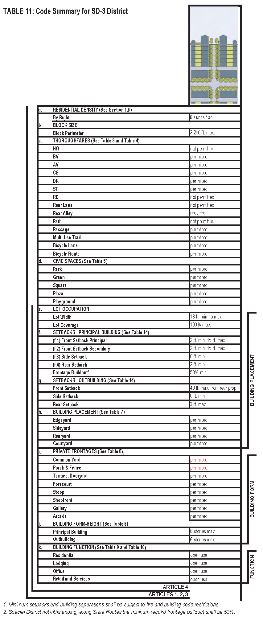
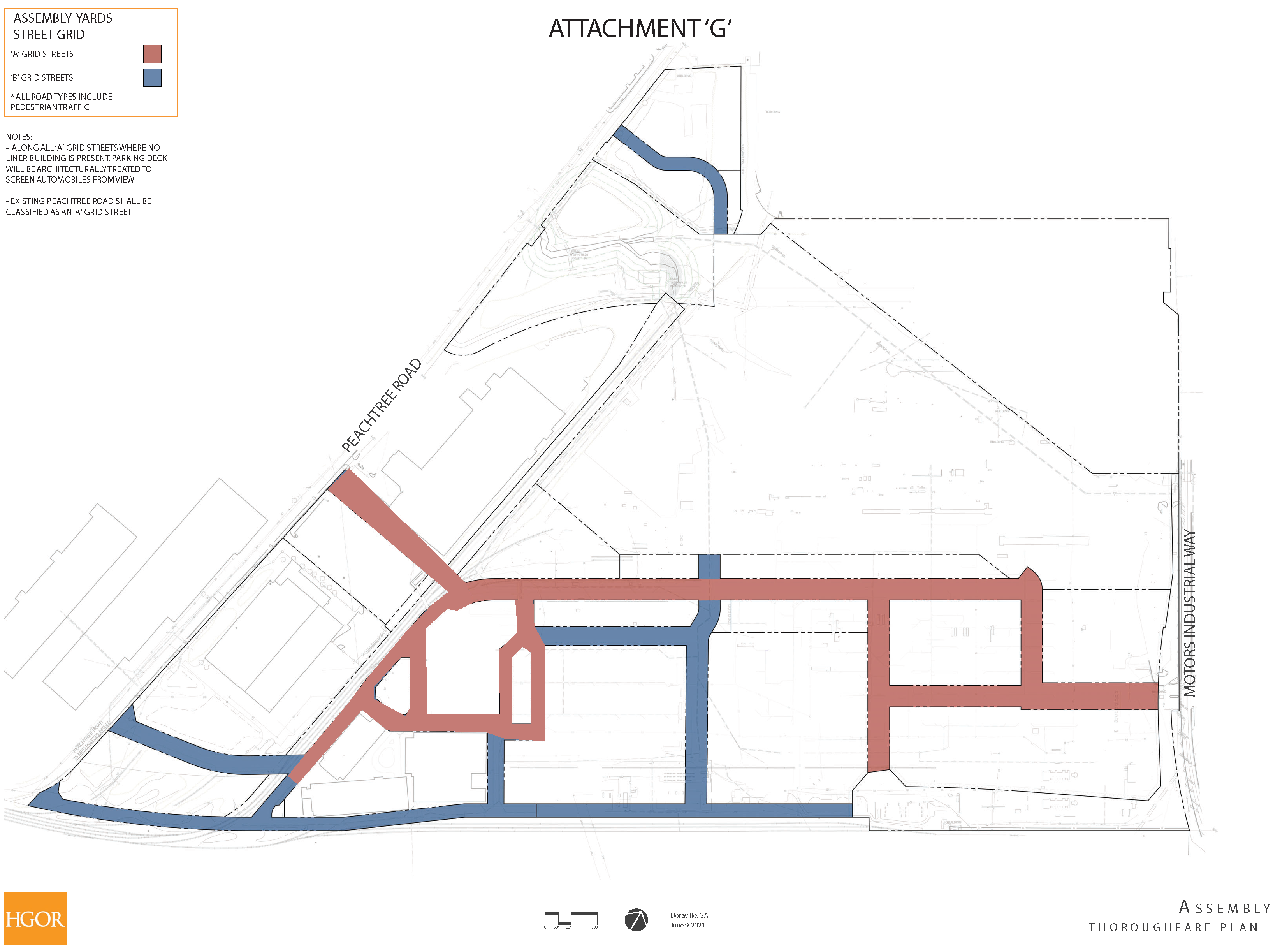
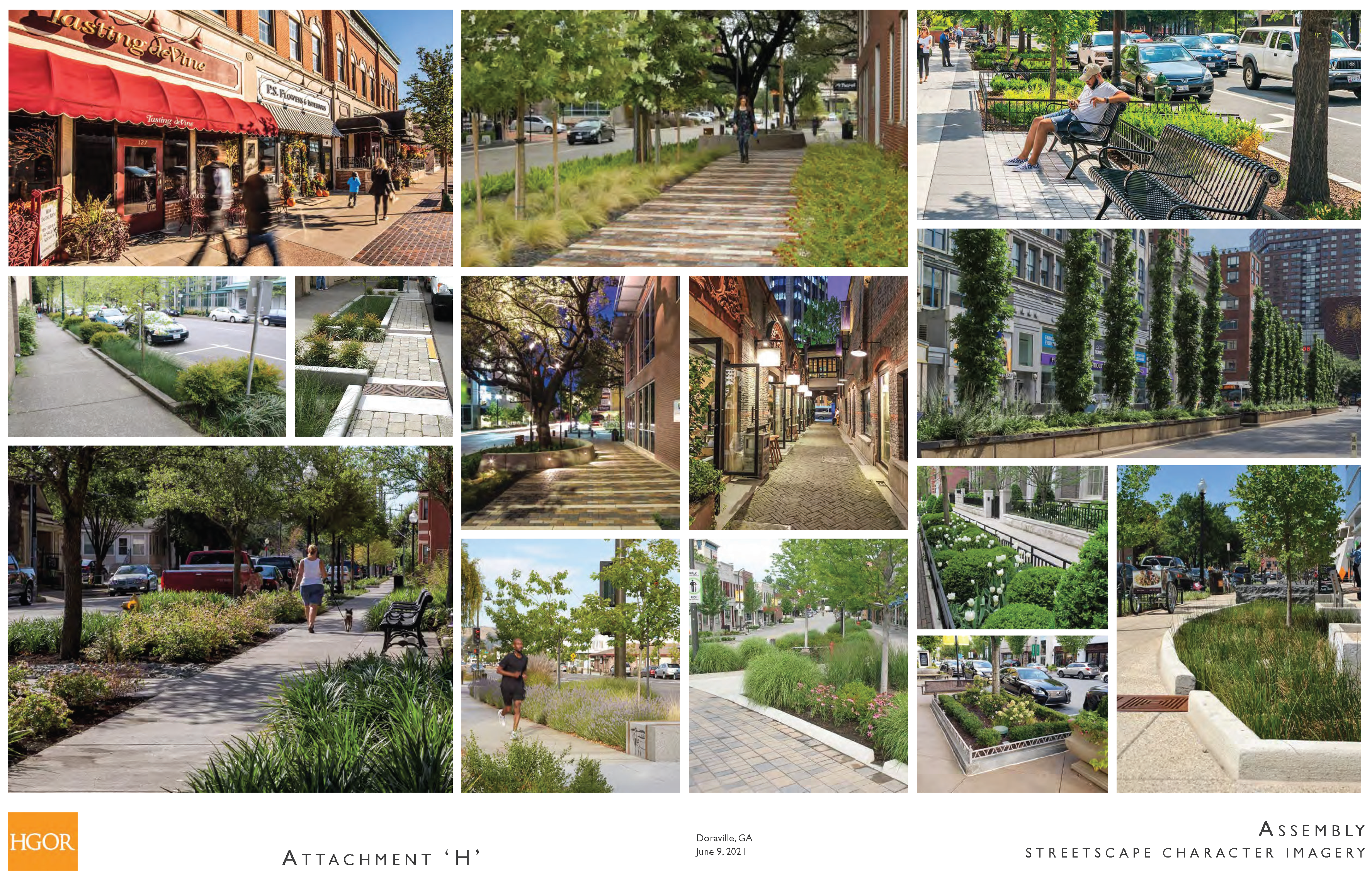
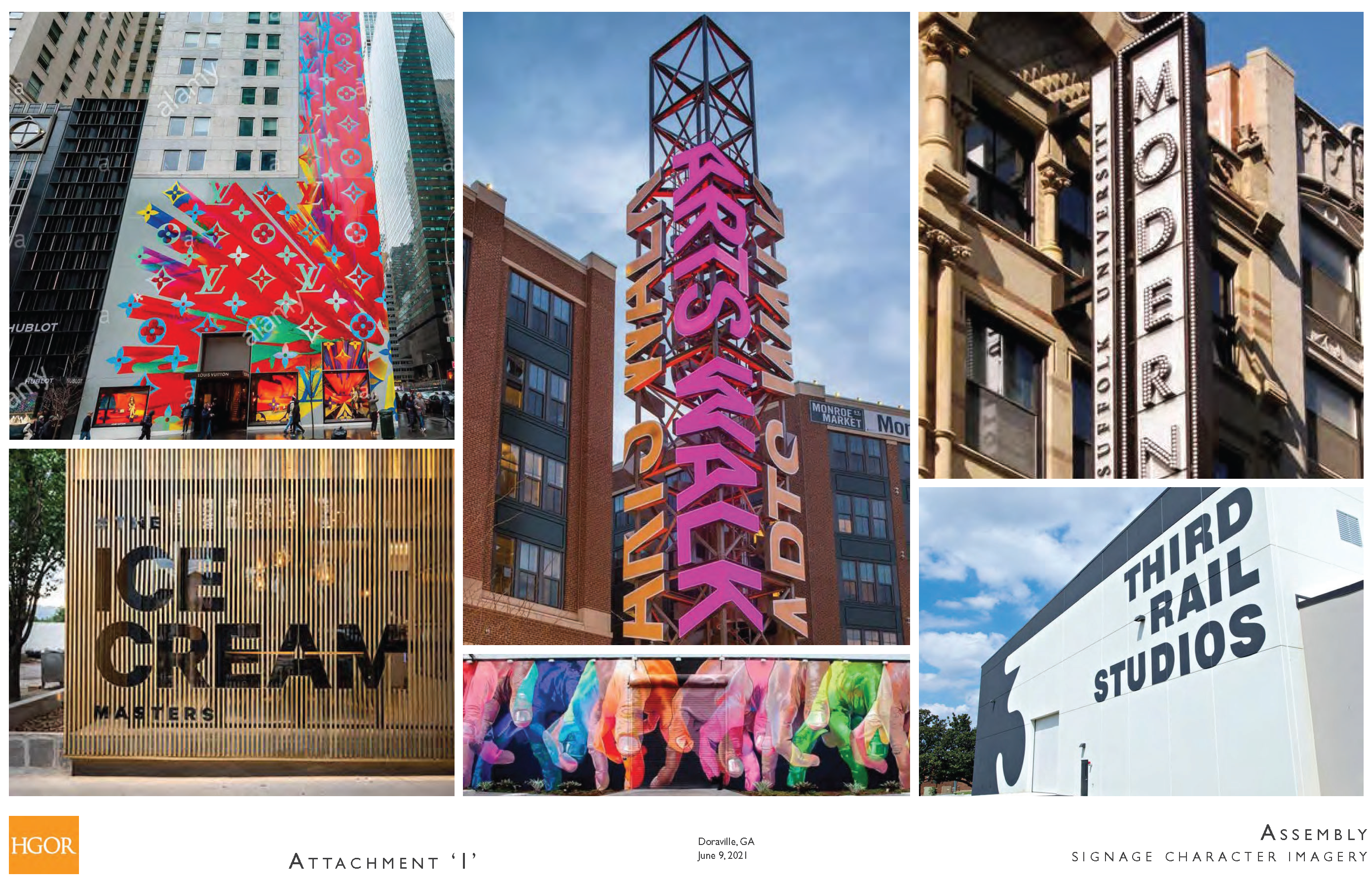
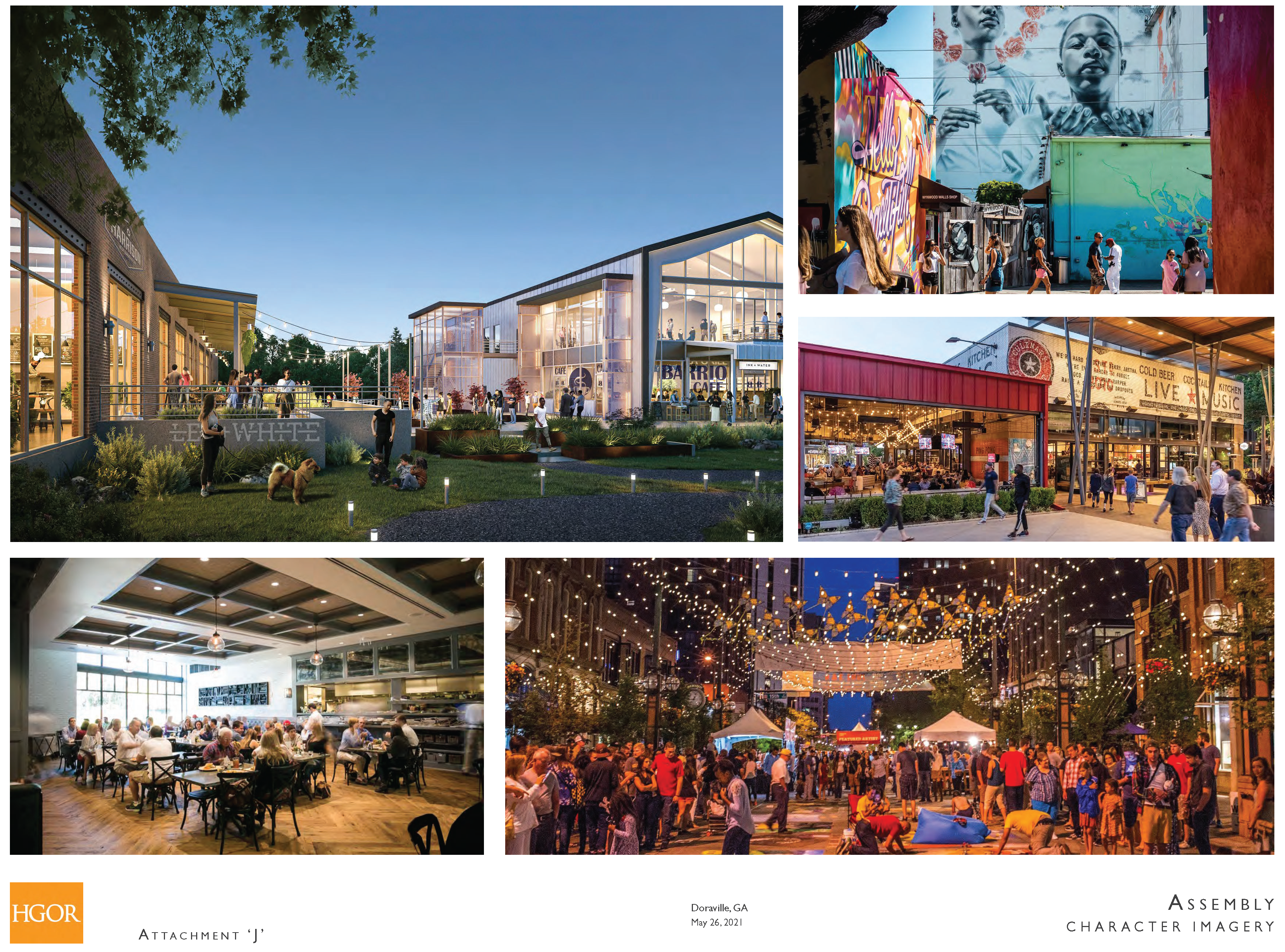
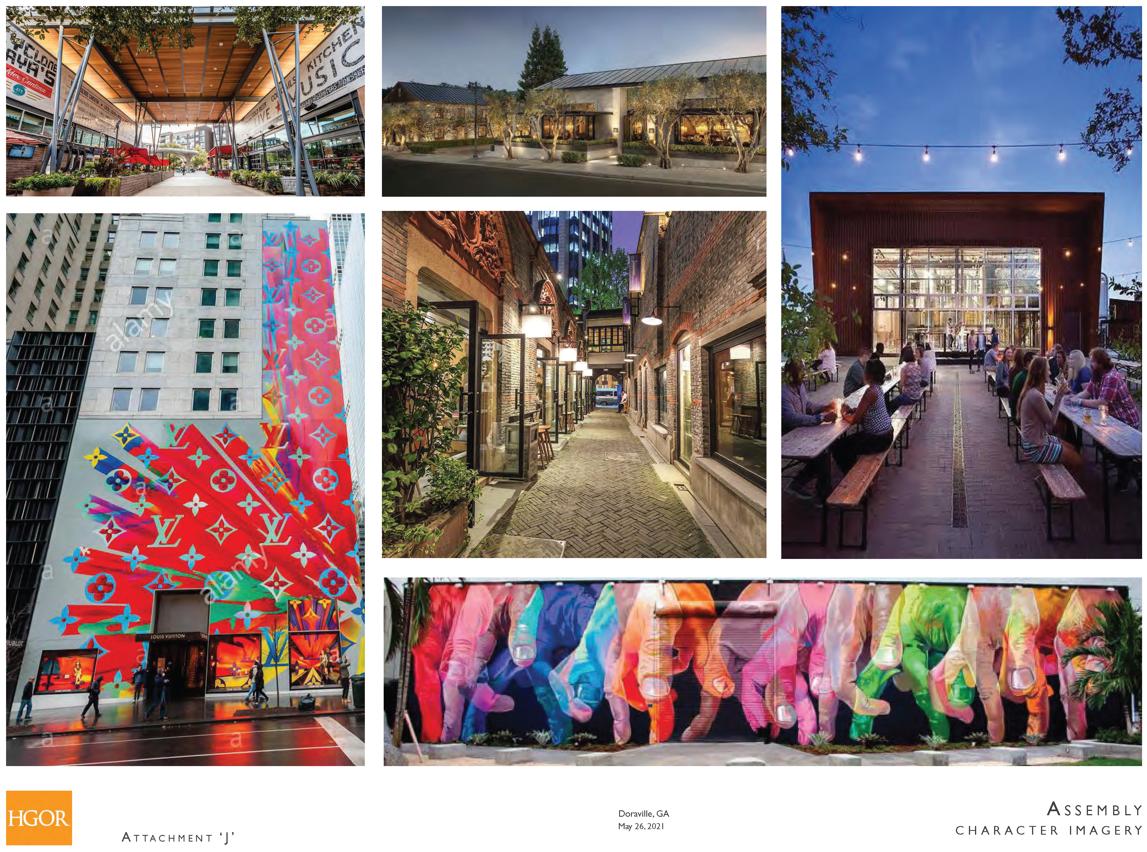
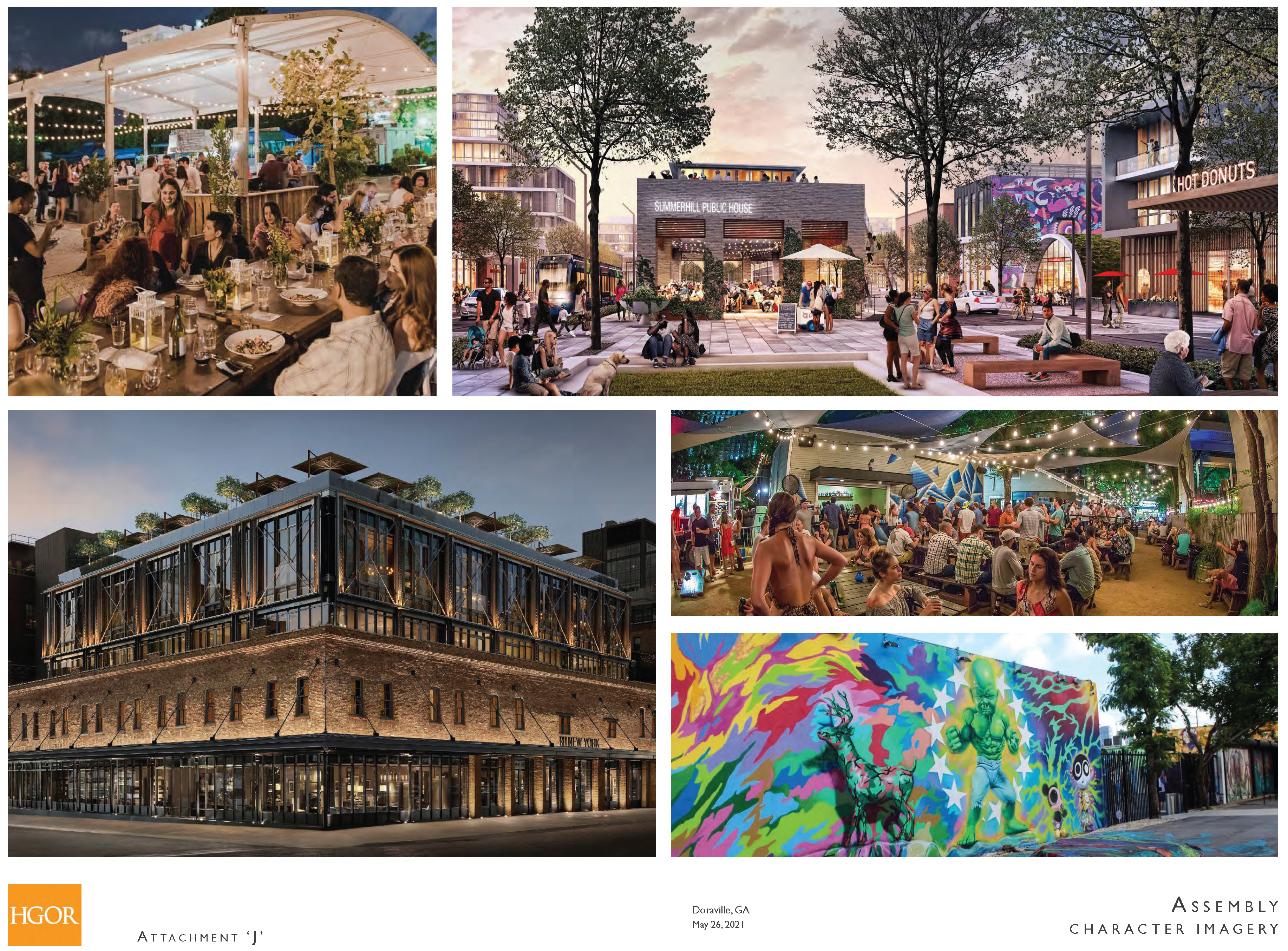
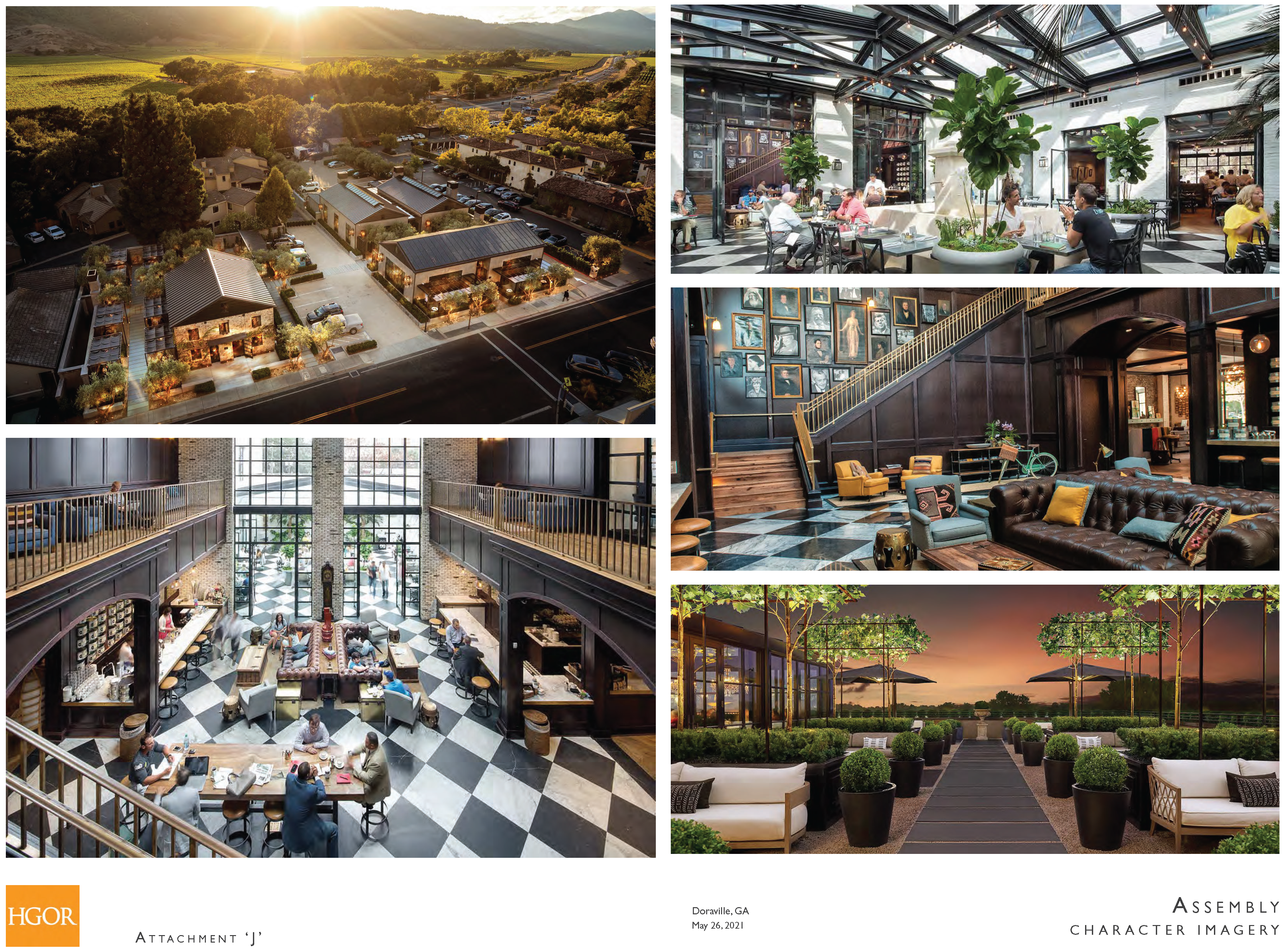
(Ord. No. 2022-02, § 6, 1-12-22; Ord. No. 2022-04, § 2, 1-12-22)
Editor's note— Table 12A has been repealed. Similar provisions can be found in section 5-298.