
Elk Rapids City Zoning Code
ARTICLE VI
- SITE DEVELOPMENT STANDARDS
Sec. 44-202. - Access to public road or way.
In any zoning district, every use, building or structure established after the effective date of the ordinance from which this chapter is derived shall be on a lot or parcel that fronts upon either a public road right-of-way or a private road easement held in common by all property owners abutting.
(Ord. No. 458, § 501, 3-2-2015)
Sec. 44-203. - Minimum dimensional requirements.
Subject to the provisions of section 44-273, planned unit development, all lots in the various zoning districts shall meet the dimensional requirements indicated in section 44-236. Signs shall meet the dimensional requirements of section 44-230.
(Ord. No. 458, § 502, 3-2-2015)
Sec. 44-204. - Dwellings located on lots or premises.
Every dwelling or mobile home erected outside of a mobile home park shall be located on a lot or premises, and no more than one such building or structure shall be erected on such lot or premises; provided, however, that an additional dwelling may be constructed on a single lot, provided that the lot has sufficient frontage at the building line and land area to accommodate the additional dwelling in accordance with the required provisions of section 44-236.
(Ord. No. 458, § 503, 3-2-2015)
Sec. 44-205. - Minimum dimensional and code requirements.
A single-family dwelling subject to the minimum requirements set forth in section 44-236, including a mobile home, shall have a minimum average elevation or cross-sectional structure width of 24 feet over 75 percent of the entire structure length and the entire structure width, for all structure elevations or cross sections. The dwelling shall comply in all respects with the structure code enforced by the county. The width and length shall be treated separately for computation purposes.
(Ord. No. 458, § 504, 3-2-2015)
Sec. 44-206. - Cellar as dwelling.
No cellar structure shall be used for human occupancy unless a completed story is situated immediately above the cellar structure and is used as a dwelling, except underground homes designed and built in accordance with recognized codes and standards for this type of construction.
(Ord. No. 458, § 505, 3-2-2015)
Sec. 44-207. - Damaged buildings.
Any building that has been partially destroyed by fire or is in such a state of disrepair as to be uninhabitable and a hazard to the public health and safety shall either be entirely removed or repaired within 12 months from the date of the occurrence of the damage.
(Ord. No. 458, § 506, 3-2-2015)
Sec. 44-208. - Accessory structure.
(a)
When an accessory use is attached to the principal structure, the accessory use shall be considered part of the principal structure.
(b)
A detached accessory structure shall be located at least ten feet from the principal structure.
(c)
No accessory structure on the same lot with a principal structure shall be used for dwelling purposes, except as specifically permitted in this chapter.
(d)
No detached accessory structure shall be located nearer to a side lot line than the permitted distance for the principal structure on the same lot, unless the accessory structure shall be completely to the rear of all portions of the principal structure the setback may be reduced according to this section.
(e)
No detached accessory structure on a lot bordering a lake or river shall be located nearer to the rear lot line than the rear yard setback established in section 44-216(a).
(f)
No accessory structure shall occupy more than 30 percent of the area of any rear yard.
(g)
Fences shall not be considered accessory structures and are regulated separately by section 44-224.
(h)
No construction of an accessory structure shall be permitted without a principal structure.
(i)
An accessory structure may be constructed on a separate lot or parcel, provided that the separate lot is immediately adjacent to the lot on which the principal structure is located, and further provided that a restriction is recorded with the county register of deeds which states that the two lots shall not thereafter be sold separately.
For the purposes of this section only, the above use of the words "immediately adjacent" shall not deter the application of two or more lots being considered as one unit if the immediate adjacent lots is separated by a road right-of-way easement or dedication. However, the square footage of the accessory structure lots shall not be used to meet the minimum square footage requirement for the lot upon which the principal structure is located.
(j)
Transient (shipping) containers are not permitted as an accessory structure or building. No mobile home, tank, junk object, salvage materials, trailer, vehicle, or similar item shall be utilized as an accessory structure; provided, however, the above requirements shall not be applicable to the following and subject to the following requirements:
(1)
Temporary offices, tool sheds or similar temporary storage structures used as part of a permitted construction project, including personal storage with an open building permit, shall be removed within 14 days of issuance of certificate of occupancy or when a permit expires, whichever is less.
(2)
Storage/shipping containers, such as PODS (portable on demand storage units), shall be allowed as a temporary use within the village for a period not to exceed 14 days. Such containers shall only be for the use of the person utilizing the storage/shipping container for moving of goods and materials. At no time shall any container be placed as a permanent structure within any zoning district.
(3)
Shall be required to be located a minimum of five feet from all property lines.
(Ord. No. 2025-01, § 1, 4-1-2025)
Editor's note— Ord. No. 2025-01, § 1, adopted April 1, 2025, repealed the former § 44-208, and enacted a new 44-208 as set out herein. The former 44-208 pertained to no accessory structures without a principal use structure and derived from Ord. No. 458, § 507, adopted March 2, 2015.
Secs. 44-209, 44-210. - Reserved.
Editor's note— Ord. No. 2025-01, § 1, adopted April 1, 2025, repealed §§ 44-209 and 44-210 which pertained to accessory building as dwelling, maximum size of accessory structures and derived from Ord. No. 458, §§ 508, 509, adopted March 2, 2015.
Sec. 44-211. - Structure height limitations.
(a)
Subject to the remaining provisions of this section, structure height limitations in the various zoning districts shall be as indicated in section 44-236.
(b)
Subject to subsection (c) of this section, the following features are exempt from the district height limitations set forth in subsection (a) of this section: flagpoles, water towers, and other similar freestanding devices.
(c)
Chimneys, church spires, elevator shafts, heating and air conditioning equipment, solar collectors and similar equipment, and fixtures and devices not intended as places of occupancy or storage are exempt from the district height limitations set forth in section 44-236 if they conform to the following requirements:
(1)
Not more than ten percent of the total roof area may be consumed by the features set forth in this section.
(2)
The features set forth in this section must be set back from the edge of the roof a minimum distance of one foot for every foot by which such features extend above the roof surface of the principal structure to which they are attached.
(Ord. No. 458, § 510, 3-2-2015)
Sec. 44-212. - Principal structure setback requirements.
(a)
No structure shall be located on a lot other than that authorized in section 44-236. For the purposes of this section, measurement from the building setback line shall be to the building wall or any extension thereof. A maximum 18-inch roof overhang or eave, excluding gutters and downspouts, shall be allowed within the building setback line.
(b)
The minimum front yard setback for any lot or parcel within the R-2 or R-3 residential district shall be within four feet of the average setback of principal buildings on the same side of the street on the same face block, but no closer than 12 feet from the front property line.
(c)
Unless otherwise provided in this chapter, the required setback distance shall be measured from the public right-of-way line, if the right-of-way line is readily determinable by means of a recorded map and set irons. If the right-of-way line is not so determinable, the setback shall be measured from the actual centerline of the traveled surface of the roadway, adding one-half of the public right-of-way width to the yard setback requirement in section 44-236.
(d)
Structures located on corner or through lots shall observe the minimum required front yard setback from all street frontages. For such situations, side yard setback requirements shall apply to those lot lines that are not street frontages.
(Ord. No. 458, § 511, 3-2-2015)
Sec. 44-213. - Reserved.
Editor's note— Ord. No. 2025-01, § 1, adopted April 1, 2025, repealed § 44-213, which pertained to accessory structure setback requirements and derived from Ord. No. 458, § 512, adopted March 2, 2015.
Sec. 44-214. - Front yard setback for certain decks.
Decks may be constructed into the required front yard setback, provided that they are no closer than 50 feet to the centerline of the street right-of-way, or permanent access of the lot upon which the principal use is located and further that the deck does not exceed four inches in height above the finished grade.
(Ord. No. 458, § 513, 3-2-2015)
Sec. 44-215. - Corner or multiple street frontage lots.
Structures located on multiple street frontage lots shall observe the minimum required front yard setback from all streets. For such situations, side yard setback requirements shall apply to those lot lines that are not street frontages.
(Ord. No. 458, § 514, 3-2-2015)
Sec. 44-216. - Setbacks from lakes, rivers, and streams.
(a)
Notwithstanding other provisions of this chapter, every structure hereafter erected on a lot having a property line abutting any body of water within the village shall set back a minimum of 50 feet from the high water mark or normal stream bank.
(b)
Every parking lot or parking area shall be set back a minimum of 50 feet from the high water mark or normal stream bank of any lake, river, stream, or tributary and shall be so constructed that discharges of stormwater are routed through swales, vegetated buffer strips, rain gardens, retention and detention basins and other traditional stormwater management applications to meet on-site stormwater management requirements, to decrease runoff velocity and volume, allow for natural infiltration, allow suspended solids to settle, and remove pollutants.
(c)
Approved conforming marina uses as set forth in section 44-152 shall be exempt from this section.
(Ord. No. 458, § 515, 3-2-2015)
Sec. 44-217. - Ames Street supplemental setback.
Notwithstanding other provisions of this chapter, the required minimum front yard setback on Ames Street shall be measured at 50 feet from the centerline of the Ames Street right-of-way.
(Ord. No. 458, § 516, 3-2-2015)
Sec. 44-218. - Use of open yard space.
No open yard surrounding a dwelling, or a structure used for dwelling purposes, may be used for the location, parking, disposition, storage, deposit, or dismantling in whole or in part of junked vehicles, machinery, second-hand building materials, or other discarded, disused, or rubbish-like materials or structures.
(Ord. No. 458, § 517, 3-2-2015)
Sec. 44-219. - Storage and use of recreational vehicles and recreational units.
(a)
Definitions. The following words, terms and phrases, when used in this section, shall have the meanings respectively ascribed to them in this subsection, except where the context otherwise requires.
(1)
Storage means and includes the containment or placement of recreational vehicles and recreational units at a time that is outside of season usage.
(2)
Summer season means May 1 to October 31
(3)
Winter season means November 1 to May 1.
(b)
Storage. The storage of recreational vehicles and recreational units shall be allowed on lots in all zoning districts in accordance with the requirements below. For the purposes of this section, two-family dwellings are considered a single-family dwelling.
(1)
The storage of recreational vehicles and recreational units shall be allowed only on a lot used for a dwelling or a lot adjacent to a dwelling. The vehicle must be owned by the dwelling occupant, operable, in good working condition, properly licensed and not contributing to a blighted area.
(2)
The storage of recreational vehicles and recreational units shall be allowed if the vehicle or unit is set back not less than five feet from the rear and side yard property line and behind the front plane of the principal structure. A five-foot setback from the rear and side yard must be adhered to for emergency vehicle access.
(3)
The storage of recreational vehicles and recreational units in the driveway, front yard or right-of-way (including alleys) is not allowed at any time.
(4)
The outdoor storage of no more than two recreational vehicles or recreational units shall be allowed per single-family dwelling.
(5)
No outdoor storage or parking of vehicles or trucks over one-ton rated capacity, or similar heavy equipment or construction equipment, shall be permitted in a yard or on a lot located in any residential zoning district, other than for the temporary parking of trucks or equipment engaged in construction on the site or being used for pickup or delivery purposes.
(c)
Use. The use of recreational vehicles and recreational units shall be allowed on lots in all zoning districts in accordance with the following:
(1)
Recreational vehicles and recreational units will be allowed in the driveway for seasonal usage during the summer and winter seasons defined in this section and in conformity with the requirements of this section.
(2)
No more than two recreational vehicle or recreational units may be used. Only one may be a habitable unit for limited lodging purposes on a parcel with a principal building for a period not exceeding five days subject to the following:
a.
A village permit issued by the village planning and zoning administrator is required if one habitable recreational vehicle or recreational unit is staying longer than five days, but such use shall not to exceed a period of 14 days in any 30-day period.
b.
The use of limited lodging of recreational vehicles and recreational units shall be allowed only if there is a five-foot setback from the rear and side yard property line and behind the front plane of the principal structure.
c.
Use in the right-of-way (including an alley), at any time, is not allowed.
d.
Only when side or rear yard space is not available will recreational vehicles and recreational units be allowed in the front of the house on either a paved or gravel surface. The recreational vehicle or recreational unit shall not extend beyond the driveway length and shall not impede a sidewalk or right-of-way.
e.
Recreational vehicles and recreational units may be connected only to the electrical service of the principal structure.
(Ord. No. 458, § 518, 3-2-2015; Ord. No. 504, 4-18-2022)
Sec. 44-220. - Limitations on boat dockage and waterfront recreational use.
(a)
Limitation on boat dockage. Not more than one boat dockage shall be allowed per 50 feet of water frontage as measured along the water mark. Boat dockage shall not be enclosed.
(b)
Limitation of waterfront recreational use. Not more than one single-family dwelling unit may have the use of the lake frontage per 50 feet thereof as measured along the water's edge. Approved conforming marinas as set forth in section 44-152 shall be exempt from this section.
(Ord. No. 458, § 519, 3-2-2015)
Sec. 44-221. - Visibility at intersection.
No fence, wall, hedge, screen, sign, structure, vegetation, or planting shall be higher than three feet above street grade on any corner lot or parcel within the triangular area formed by the intersecting street right-of-way lines and straight line joining the two street lines at points which are 30 feet distant from the point of intersection, measured along the street right-of-way lines.
(Ord. No. 458, § 520, 3-2-2015)
Sec. 44-222. - Street closures.
When any street, alley, or other public right-of-way is vacated by official action, the zoning district adjoining each side of such public right-of-way shall automatically be extended to the center of such vacation, and all area included therein shall be subject to all appropriate regulations of that district within which such area is located.
(Ord. No. 458, § 521, 3-2-2015)
Sec. 44-223. - Greenbelt buffer.
(a)
Any development within a commercial or industrial zoning district, where such property abuts, adjoins or is adjacent to a residential zoning district, shall include a greenbelt buffer area designed in accordance with the requirements of section 44-229. Except as noted below or unless otherwise authorized in this chapter, no storage or other related activities, shall be permitted within the required greenbelt buffer.
(b)
The greenbelt buffer may be used as part of the commercial or industrial development's stormwater management system, provided that retention of detention basins, if utilized, are no closer than five feet from the adjacent residential property and that the slope and depth of the basin is approved by the planning commission.
(Ord. No. 458, § 522, 3-2-2015)
Sec. 44-224. - Fences, walls and screens.
(a)
Subject to sections 44-213 and 44-217 no fence, wall (other than necessary retaining wall), vegetation or other screening material shall be higher than four feet within the limits of a minimum front yard setback.
(b)
No fence or wall located within a side or rear yard shall exceed 6½ in height.
(Ord. No. 458, § 523, 3-2-2015)
Sec. 44-225. - Grade levels.
(a)
All structures within any zoning district shall, subsequent to the adoption of this section, conform to all established or determined finished grade levels.
(b)
In areas where there are two or more dwellings, buildings, or other structures within 300 feet on the same road, and on the same side of the road, the average of the finished grade level thereof shall determine the finished grade level for the area. In all areas where no finished grade level has been determined or established by dwellings or other structures thereon, a finished grade level of parcels within 300 feet of the subject parcel, on the same street and the same side of the street shall be determined by a licensed registered land surveyor. A copy of the certificate of survey shall be submitted to the planning and zoning administrator for review and approval.
(Ord. No. 458, § 524, 3-2-2015)
Sec. 44-226. - Supplemental utility requirements for the B-2 Central Business District.
Notwithstanding other provisions of this chapter, new construction within the B-2 Central Business District shall have all utility service lines including, but not limited to, telephone, electric, cable, water, sewer, gas and the like, buried underground.
(Ord. No. 458, § 525, 3-2-2015)
Sec. 44-227. - Outdoor wood-fired boilers.
(a)
Purpose. The purpose of this section is to promote the public health, safety and welfare and to safeguard the health, comfort, living conditions, safety and welfare of the citizens of the village by regulating the air pollution and other potential hazards of outdoor wood-fired boilers.
(b)
Findings. Research summarized in several publications, including, but not limited to, federal Environmental Protection Agency (EPA) reports, indicates that there exist certain potentially severe negative health effects of wood-fired boiler emissions on humans when such boilers are installed and used in non-rural settings. At this time, there is no applicable and mandated state or federal standards for determining which, if any, wood-fired boilers would not produce such likely and unacceptable risks to humans if used with the village.
(c)
Defined. The term "outdoor wood-fired boiler" means, but is not necessarily limited to, a wood-fired boiler, stove, furnace or wood-fired hydronic heater that is not located within a building intended for habitation by humans or domestic animals.
(d)
Not allowed. Except as noted in subsection (f) of this section, no outdoor wood-fired boiler shall be installed or used in the village.
(e)
Applicability. This section does not apply to:
(1)
Grilling or cooking food using charcoal, wood, propane or natural gas in cooking or grilling appliances.
(2)
Burning for the purpose of generating heat in a stove, furnace, fireplace or other wood-fired heating device contained within a building used for human or animal habitation.
(3)
The use of propane, acetylene, natural gas, gasoline or kerosene in a device intended for heating, construction or maintenance activities.
(f)
Nonconformity.
(1)
Unless otherwise specifically provided in this chapter, any existing outdoor wood-fired boiler that was otherwise lawful as of the date it was constructed may be continued under the following conditions:
a.
The wood-fired boiler shall burn only clean wood.
b.
The wood-fired boiler shall not burn construction or other types of refuse.
c.
The wood-fired boiler shall be maintained and operated in accordance with the manufacturer's specifications.
(2)
Nothing in this chapter shall prevent, subject to the conditions above, the reconstruction, repair, or restoration and the continued use of any nonconforming outdoor wood-fired boiler lawfully existing as of the date it was constructed.
(g)
Enforcement and penalties. Any person, firm, association, partnership, corporation, or governmental entity who violates any of the provisions of this article or fails to comply with a duly authorized order issued pursuant to this chapter shall be deemed to be responsible for a municipal civil infraction as defined by state law which shall be punishable by civil fine and penalty defined in section 44-323.
(Ord. No. 458, § 526, 3-2-2015)
Sec. 44-228. - Lighting.
(a)
Purpose and intent. The purpose of this section is to preserve the restful nighttime enjoyment and use of all properties in the village by establishing consistent and reasonable exterior lighting standards. Exterior lighting shall be designed, installed and maintained to control glare and light trespass; and prevent the degradation of the nighttime visual environment. The standards of this chapter are intended to preserve the general welfare by permitting sufficient, but not excessive lighting for parking areas, walkways, building entrances and common-site areas; to minimize the adverse effects of inappropriate lighting; and to provide for the safety and security of people and property within the village.
(b)
Scope. The standards of this section shall apply to all exterior lighting sources; all light sources visible from any road right-of-way; and all development projects subject to site plan review and zoning compliance approval, except as follows:
(1)
Residential accessory exterior lighting such as decorative porch lights or low-level intensity lawn or walkway lighting, and special seasonal lighting such as for holiday decorating.
(2)
Lighting for a permitted temporary circus, fair, carnival, or civic use, except that the planning and zoning administrator may impose reasonable restrictions on the use of such lighting where necessary to protect public safety and welfare.
(3)
Public street lighting, if determined by the village council it is not in the best interest of the public welfare.
(4)
Shielded lighting of flags of the United States of America or the state.
(5)
Fossil fuel light produced directly or indirectly from the combustion of natural gas or other utility-type fossil fuels (e.g., gas lamps).
(6)
Circumstances where federal or state laws, rules or regulations take precedence over the provisions of this section; or where fire, police, emergency, or repair personnel need light for temporary or emergency situations.
(c)
General requirements. The following general requirements shall apply to all light sources regulated by this section:
(1)
Fully shielded. Exterior lighting shall be fully shielded using concealed source fixtures directed downward and away from adjacent lots and road rights-of-way. All exterior light fixtures shall utilize full cutoff housings, louvers, glare shields, reflectors or other measures to prevent off-site glare and light pollution.
(2)
Glare and light trespass. Exterior lighting shall be designed, constructed, and maintained in a manner that prevents off-site glare, light trespass on neighboring properties, and traffic hazards for motorists.
(3)
Lamp wattage.
a.
Except as prohibited in subsection (c)(6) of this section, fixtures in parking lots shall use low- or high-pressure sodium, metal halide or other similar lamp types with a maximum wattage of 250 watts per fixture up to 20 feet in height above grade.
b.
Decorative exterior light fixtures or lamps shall be limited to lamps with a maximum foot-candle output wattage equivalent to of 100 watts incandescent per fixture.
(4)
Intensity.
a.
The maximum intensity of light within any site shall not exceed the following standards:
b.
Intensity level determination. Exterior lighting intensity levels shall be measured on the horizontal plane at grade level within the site; and on the vertical plane of the lot or road right-of-way boundaries at a height of five feet above grade. Fixture height shall be measured from grade level to the highest point of the light source (see illustration below).
(5)
Fixture type standards. The following standards shall apply to specific types of exterior light fixtures, in addition to the provisions of this subsection (c):
a.
Freestanding pole lighting. The maximum height of all freestanding, pole-mounted fixtures shall be determined by the fixture's proximity to the boundary of a lot or parcel in a residential zoning district, as follows:
b.
Architectural lighting. Exterior illumination of building facades shall be limited to fully shielded fixtures directed toward the building facade. All light from such fixtures shall be concentrated on the wall surface. Luminous tube (neon) and fluorescent lighting shall be prohibited as an architectural detail on the exterior of any structure, including, but not limited to, rooflines, cornices, eaves, windows, and door openings.
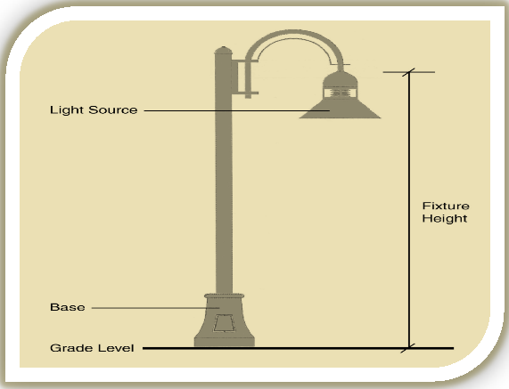
Light Fixture Height
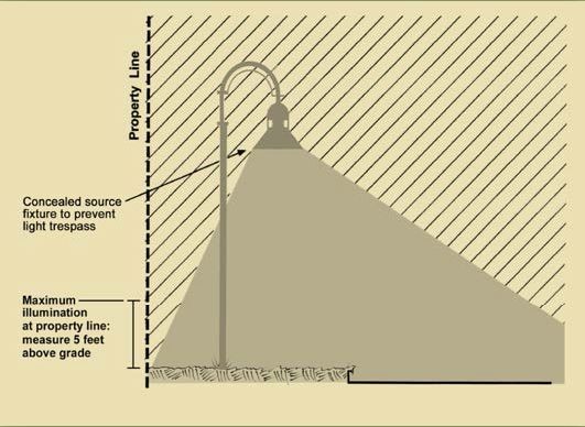
Light Fixture Orientation
and Shading
(6)
Prohibited lighting. The following types of exterior light sources and activities shall be prohibited:
a.
Mercury vapor lighting. The installation of mercury vapor fixtures shall be prohibited.
b.
Animated lighting. Lighting shall not be of flashing, moving, or animated type.
(7)
Alternative fixtures, replacement or alteration. Alternative lighting design or specific fixture substitutions may be permitted in accordance with the following requirements:
a.
Decorative light fixtures. The planning commission may approve the use of decorative light fixtures as an alternative to fully shielded fixtures, where such fixtures would enhance the aesthetics of the site without causing off-site glare or light trespass.
b.
Fixture alteration or replacement. Light fixtures regulated by this section shall not be altered or replaced unless approved by the planning and zoning administrator after verification that the alteration or substitute fixture conforms to the requirements of this section.
(Ord. No. 458, § 527, 3-2-2015)
Sec. 44-229. - Landscaping.
(a)
Intent. The intent of this section for all projects that require a special land use permit or commercial site plan review is to promote and encourage flexible and creative design, installation, and maintenance provisions for landscaping along public streets, between incompatible land uses, interior site landscaping, and within and around the perimeter of parking areas. Additionally, it is intended to provide incentives for the preservation of quality mature trees, improved filtration for maintaining groundwater quality, minimize negative impacts of stormwater runoff, and improve the function, appearance and value of properties.
(b)
Definitions. See section 44-5.
(c)
Requirements for submission and approval.
(1)
Requirements for submission.
a.
A landscaping plan shall be submitted for approval to the planning commission for all land uses which require site plan review in accordance with section 44-274.
b.
In addition to the requirements of section 44-274(c), the landscaping plan shall clearly identify existing trees and plant materials to be removed and retained, proposed landscape materials within buffer and landscape areas and typical planting details for trees, shrubs and ground cover within the landscaped areas.
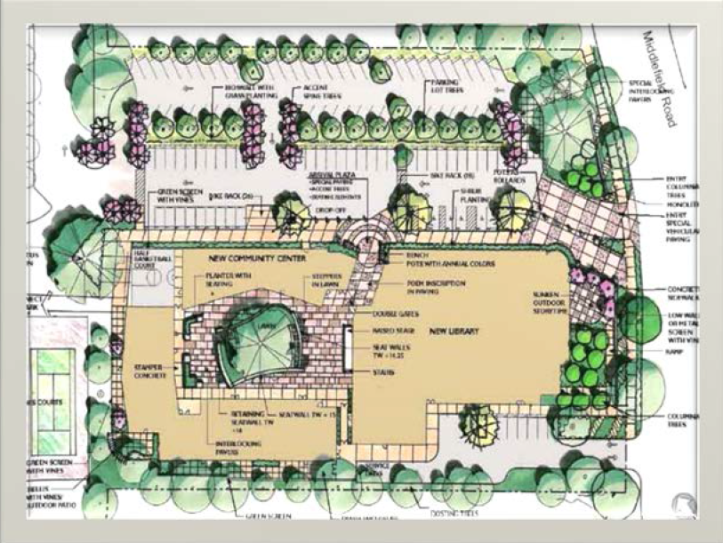
Example Site Plan
(2)
Criteria for approval. No site plan approval will be granted by the planning commission, and no land use permit shall be issued by the planning and zoning administrator, until the landscaping plan has received final approval. Approval of the landscaping plan is conditioned upon satisfaction of the following criteria:
a.
Agreement by the owner or applicant that the required landscaping and buffering improvements shall be completed concurrent with completion of the approved site plan, or as approved in a phased development plan. In the event of unusual delays, or adverse weather conditions that make it impossible to plant, the planning and zoning administrator may grant an extension of the time period to the next appropriate planting season; and
b.
All other requirements of this section have been met.
(3)
General landscape provisions.
a.
Landscape and perimeter buffer areas shall be provided in accordance with this section and completed in accordance with the approved landscape plan. The planning commission may waive or modify provisions herein based on their determination that special circumstances exist.
b.
Except for specific signage that shall meet the requirements of section 44-230, no structure shall be permitted in the required landscaped areas other than as defined in this chapter.
c.
Plantings within four feet of a fire hydrant shall be no taller than 24 inches at maturity.
d.
Responsibility for landscaping and buffering installation shall be that of the owner or authorized representative of the owner who is in control of the development of the site. It shall be the owner's responsibility to see that the landscaping is maintained in a neat, clean, orderly, and healthful condition. This includes, among other things, proper pruning, mowing of lawns, weed control, removal of litter, replacement of plants when necessary, and the regular watering of all plants.
(4)
Landscape plant material.
a.
Plant materials. It is the intent of this section to encourage thoughtful, environmentally sensitive, and biodiverse nature of the mixture of plantings, including those plantings native to the Northwest Michigan region, and to discourage the use of invasive plant materials during the landscape design process. In order to meet this intent, the village will utilize the Recommended Planting Guidelines for Municipalities, as published by the Northwest Michigan Invasive Species Network, as may be amended from time to time, to determine what plant materials shall be considered native species from invasive species.
b.
Plant quality. All plant materials shall be of nursery quality, obtained from a licensed grower, hardy to the climate of Northern Michigan, and free of disease and insects.
c.
Plant mixture. The overall landscape plan should promote a mixture of native species plant materials as described below.
d.
Approved native species planting materials. The following native species plant materials may be used for landscape purposes. Additional selections of native species planting materials may be found under Recommended Plants for Ornamental Landscapes within the Recommended Planting Guidelines for Municipalities, noted above:
1.
Trees. Balsam fir, Sugar Maple, Shadlow Serviceberry, River Birch, Musclewood, Eastern Larch Tamarack, Ironwood, Horizontal Dogwood, Red Pine, White Pine, Black Cherry, White Oak, Northern Pin Oak, Northern Red Oak, Northern White Cedar, Eastern Hemlock, and Pear.
2.
Shrubbery. Round-leaved Serviceberry, Black Chokecherry, New Jersey Tea, Buttonbush, Alternate-leaf Dogwood, Silky Dogwood, Red-osier Dogwood, Michigan Holly, Meadowsweet, and Nine Bark.
3.
Ground cover. Spreading Juniper, Wild Strawberry, Little Blue Stem Grass.
e.
Prohibited plant materials. Invasive species planting materials listed under commercial guidelines, as Class one and Class two Plants, within the Recommended Planting Guidelines for Municipalities, noted above, shall not be used for landscaping purposes under any circumstances.
(5)
Landscaping along public roads.
a.
With the exception of the Central Business District (CBD) and the Mobile Home District (RM-MH), a greenbelt buffer meeting the following provisions are required on all land abutting village public road rights-of-way.
b.
Minimum width of six feet for the entire length of the roadway frontage, minus ingress and egress driveways.
c.
The planning commission may approve greenbelt buffers containing a selected combination of living deciduous and evergreen trees, shrubs, flowers, grasses, vines, ground cover, native plantings or decorative fencing so arranged to present an aesthetically pleasing appearance that meets the intent of this chapter.
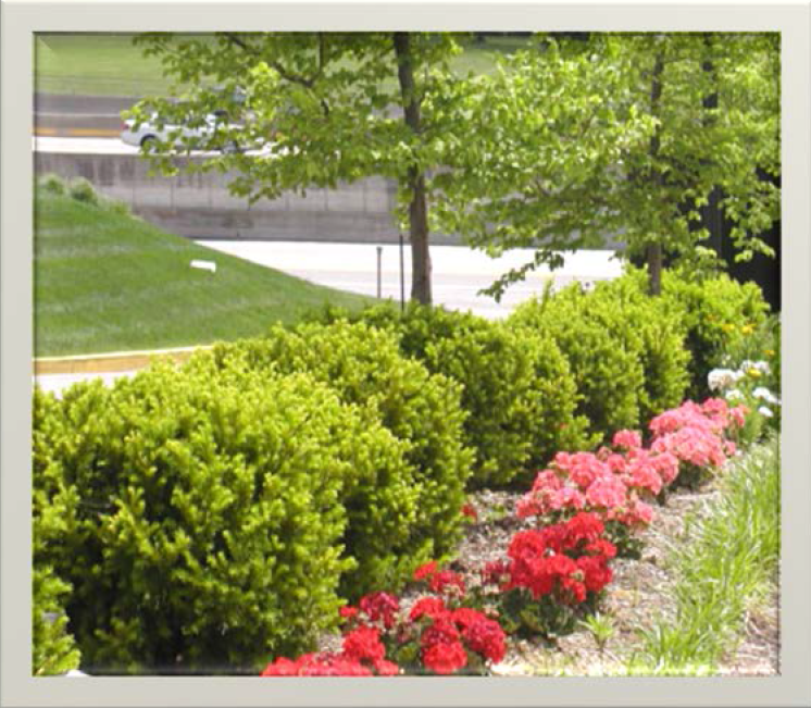
Example Perimeter Landscape Buffer
Along Public Road Right-of-Way
(6)
Landscaping between residential and nonresidential uses and between multifamily and single-family uses. In addition to subsection (c)(5) of this section, a greenbelt buffer meeting the following provisions are required along the perimeter side and rear lot lines between residential and nonresidential uses and between multifamily and single-family uses:
a.
Minimum width of ten feet for the entire length of the side and rear lot lines.
b.
The buffer shall be used solely for landscaping, screening, or stormwater drainage as provided herein.
c.
The planning commission may approve perimeter landscape greenbelt buffer areas containing a selected combination of earth mounds, ground cover, decorative fences, evergreen and deciduous plant materials, sufficient to provide views screened of vehicular use areas.
d.
All trees shall be evergreens a minimum eight feet high at planting.
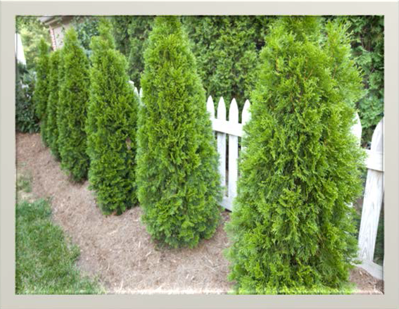
Example Side/Rear Perimeter
Landscape Screening Buffer
(7)
Interior site landscaping.
a.
For every new development, except in the Central Business District (CBD) or Mobile Home District (RM-MH), there shall be interior landscaping areas exclusive of any other required landscaping, consisting of at least ten percent of the total lot area. This landscaped area should be concentrated groupings near building entrances, along the perimeter of building foundations, along pedestrian walkways and along service areas.
b.
The planning commission may approve interior site landscaping area plantings containing a selected combination of living deciduous and evergreen trees, shrubs, flowers, grasses, vines, ground covers, native plantings or decorative fencing so arranged to present an aesthetically pleasing appearance that meets the intent of this chapter.
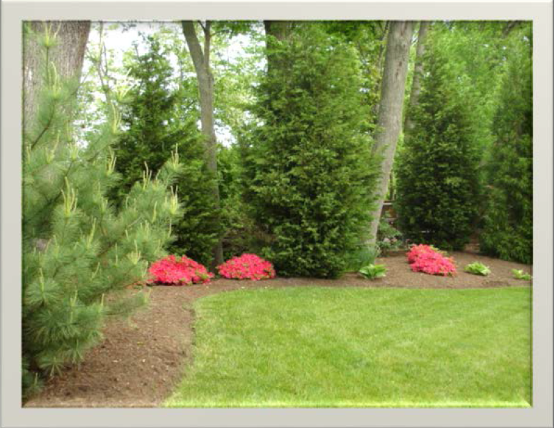
Example Interior Site
Landscaping Areas
(8)
Parking lot landscaping.
a.
Landscaping along public road rights-of-way. All outdoor off-street parking areas that contain five or more parking spaces shall provide a perimeter landscape buffer along those property boundaries where the parking lot abuts or adjoins a public road, street or highway in accordance with subsection (c)(5) of this section.
b.
Landscaping between residential and nonresidential uses and between multifamily and single-family uses. All outdoor off-street parking areas that contain five or more parking spaces shall provide a perimeter landscape buffer along those side and rear property boundaries where the parking lot abuts or adjoins residential and nonresidential uses and between multifamily and single-family uses in accordance with subsection (c)(6) of this section.
(9)
Interior parking lot landscaping. Interior landscaping areas, defined herein as the area within the perimeter of the parking lot paved surface in addition to perimeter landscaping or buffering requirements, shall be provided for parking areas containing 6,000 square feet or more of paved area; ten vehicular parking spaces or more; or more than two parking aisles, in accordance with the following requirements:
a.
A minimum of ten square feet of interior landscaping area for each parking space shall be required.
b.
Landscaped areas shall be a minimum of 75 square feet with a minimum dimension of eight feet. Interior landscape areas shall be designed so as to create minimum interference with snow removal.
c.
The planning commission may approve alternative selected combination of living deciduous trees, shrubs, grasses, flowers, ground cover, native plantings or vines so arranged to present an aesthetically pleasing appearance that meets the intent of this article.
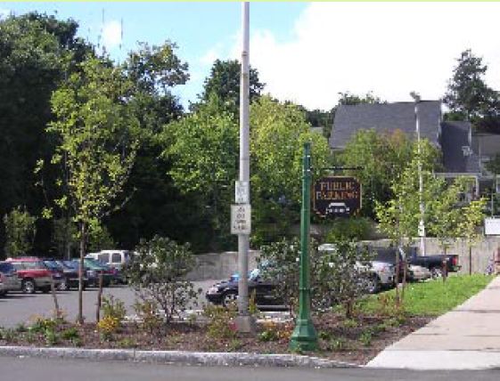
Example Interior
Parking Lot Lands
(10)
Waste receptacle and mechanical equipment screening. Waste receptacles and mechanical equipment shall be located and screened from view with fencing, walls or plant materials or combination of these, as approved by the planning commission, sufficient to provide views screened of these use areas.
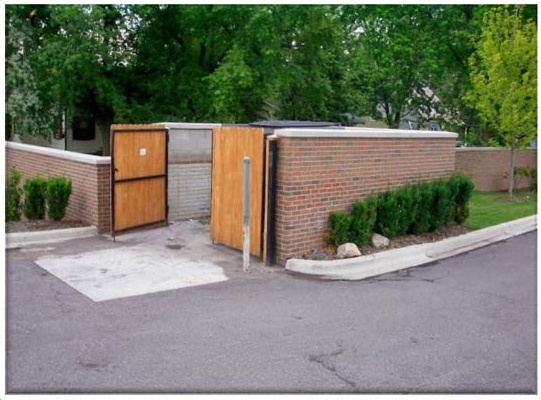
Example
Waste Receptacle Screening
(11)
Providing low-impact design elements such as bioswales and rain gardens is encouraged.
(Ord. No. 458, § 528, 3-2-2015; Ord. No. 466, 4-18-2016; Ord. No. 2024-11, § 1, 11-19-2024)
Sec. 44-230. - Signage.
(a)
Purpose.
(1)
The purpose of this section is to provide for the regulation of signs of all types in a manner which does not significantly restrict the content thereof, while:
a.
Recognizing the mass communications needs of all parties;
b.
Protecting property values, enhancing the physical appearance of the village, and preserving neighborhood character;
c.
Creating a more attractive business climate by encouraging compatible designs within given areas;
d.
Promoting pedestrian and traffic safety by reducing sign obstructions and other hazards; and
e.
Promoting community environmental and aesthetic values.
(2)
Window signs visible from the outdoors are not regulated by this section.
(3)
Compliance with this chapter does not ensure compliance with other county, state, or federal sign regulations, nor does the issuance of a sign permit grant permission to the applicant to place signs on any property including road rights-of-way other than property owned or otherwise legally under the control of the applicant. The issuance of a sign permit only assures the applicant that the sign meets the requirements of this chapter.
SIGN ILLUSTRATIONS
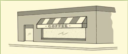
Awning Sign
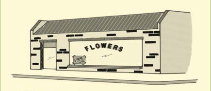
Window Sign
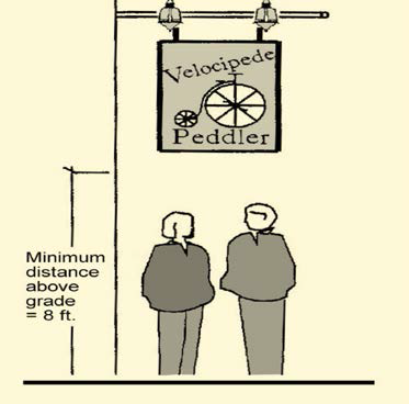
Projecting Sign Detail

Portable Signs

Various Types of Ground Signs
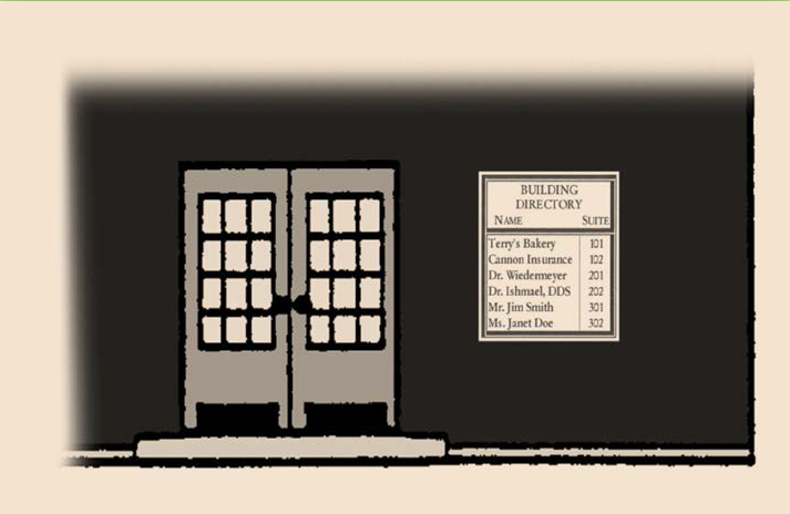
Wall Sign
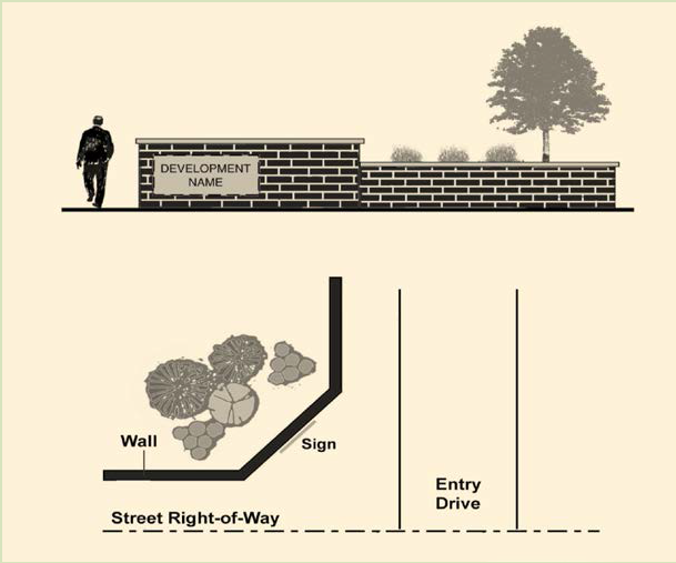
Subdivision Signs
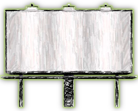
Billboard
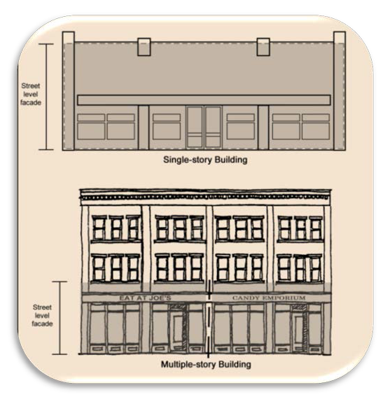
Signable Area
(b)
Determination of number of signs.
(1)
For the purpose of determining the number of signs, a sign shall be considered a single sign when the display surface or display device containing elements is organized, related, and composed to form a unit. When elements are displayed in a random manner without organized relationship, each element shall be considered a single sign.
(2)
A two-sided or multisided sign shall be regarded as one sign so long as:
a.
With respect to a V-type sign, the two sides are at no point separated by a distance that exceeds five feet; and
b.
With respect to double faced (back-to-back) signs, the distance between the backs of each face of the sign does not exceed three feet.
(c)
Computation of sign face area.
(1)
The sign face area shall be computed by including the entire area within a single, continuous perimeter of not more than eight straight lines, or a circle or an ellipse, enclosing the extreme limits of the writing, representation, emblem, or other display, together with any material or color forming an integral part of the background of the display or used to differentiate the sign from the backdrop or structure against which it is placed, but not including any supporting framework or bracing that is clearly incidental to the display itself.
(2)
If the sign consists of more than one section or module, all of the area, including that between sections or modules, shall be included in the computation of the sign face area.
(3)
With respect to two-sided, multisided or three-dimensional signs, the sign face area shall be computed by including the total of all sides designed to attract attention or communicate information. Without otherwise limiting the generality of the foregoing:
a.
The sign face of a double-faced, back-to-back sign shall be calculated by using the area of only one side of such sign, so long as the distance between the backs of such signs does not exceed three feet.
b.
The sign face area of a double-faced sign constructed in the form of a "V" shall be calculated by using the area of only one side of such sign (the larger side if there is a size difference), so long as the interior angle of the "V" does not exceed 30 degrees and no point does the distance between the backs of such sides exceed five feet.

Computation of Sign Face Area
(d)
Prohibited signs. The following signs shall not be allowed in any district and shall be considered a violation of this chapter:
(1)
Signs which are not consistent with the standards of this chapter.
(2)
Signs that are not safe, or securely affixed to the support structure.
(3)
Signs which appear to attempt to regulate, warn, or direct the movement of traffic on public thoroughfares or which interface with or resemble any official traffic sign, signal, or device.
(4)
Revolving, moving, or flashing signs.
(5)
Signs other than utility company signs affixed to power utility poles or other utility structures or fixtures.
(6)
Signs located so as to interfere with the view necessary for motorists to proceed safely through intersections or to enter onto or exit from public streets or private roads.
(7)
Signs, except those established, maintained or approved by municipal, county, state, or federal governments, located in, projecting into, or overhead within a public right-of-way or dedicated public easement.
(8)
Signs that project above the maximum height limitations of the zoning district in which it is located.
(9)
Ground signs in excess of ten feet in height with the exception of billboards pursuant to subsection (h)(6) and (10) of this section.
(10)
Roof signs.
(e)
Signs excluded from sign permit. The following signs are permitted without a sign permit but shall conform to the requirements set forth herein as well as all other applicable requirements of this section:
(1)
Signs erected by, on behalf of, or pursuant to the authorization of a governmental body, including legal notices, identification, and information signs or historical markers and traffic, directional, and regulatory signs.
(2)
Official signs erected by public utilities.
(3)
Flags, pennants and banners.
(4)
Integral decorative or architectural features of buildings or works of art.
(5)
Incidental signs associated with a principal structure that are necessary for public safety, health and welfare.
(6)
Temporary signs.
a.
Temporary signs located in the commercial (B-1, B-2 and B-3) and industrial (I-1) zoning districts are subject to the following requirements:
1.
Not more than three such signs shall be located on any single lot of record.
2.
No such sign shall exceed four square feet in sign face area.
3.
Temporary signs shall not be erected longer than 30 consecutive days and the same sign shall not be erected more than five times per calendar year.
b.
The village may remove without notice any temporary sign determined by the planning and zoning administrator to be in violation of this chapter. A removed sign will be held for seven calendar days, after which it may be discarded.
(f)
Sign Regulations.
| Ground Sign Standards | |||||
| Definition | Illustrative Example | ||||
Ground sign means a sign permanently supported by one or more uprights, poles, braces or some other structure placed in the ground surface and not attached to any building. |  | ||||
| Regulations | |||||
A. Ground signs shall be supported and permanently placed by embedding, anchoring, or connecting the sign in such a manner as to incorporate it into the landscape or architectural design scheme. B. No ground sign may occupy an area designated for parking, loading, walkways, driveways, fire lane, easement, right-of-way, or other areas required to remain unobstructed. | |||||
| District | Max Area Per Sign (sq ft) |
Max Height
(ft) | Max No. | Additional Requirements | Permit |
|
R-1
R-2 R-3 |
Non residential uses not including home occupations and short term rentals:
25 | 6 | 1/parcel |
•10 ft from right-of-way and all property lines
•No illumination | Yes |
|
RM-L
RM-H RM-MH | 25 | 6 | 1/parcel |
•10 ft from right-of-way and all property lines
•No illumination | Yes |
| B-1 | 20 | 6 |
1/parcel or
1/street frontage | •10 ft from right-of-way and all property lines | Yes |
| B-2 | — | — | — | •Not allowed | — |
|
B-3
I-1 P-1 | 32 | 6 |
1/parcel or 1/street
frontage | •10 ft from right-of-way and all property lines | Yes |
| Wall Sign Standards | |||||
| Definition | Illustrative Example | ||||
A building-mounted sign that is either attached to, displayed, or painted to an exterior wall that is parallel to the wall surface. | 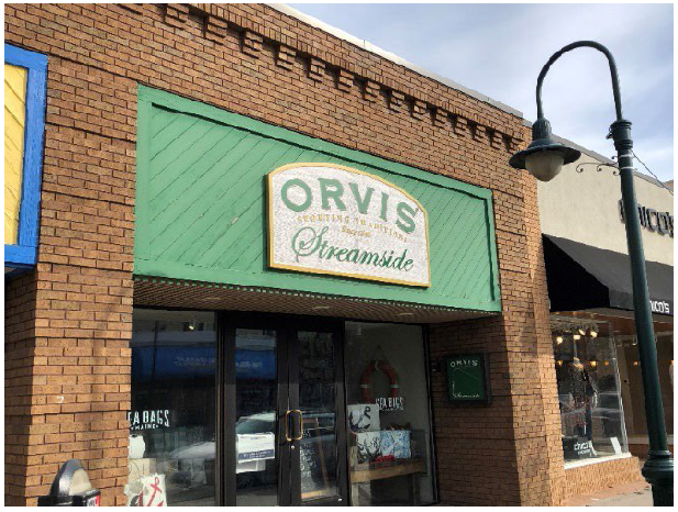 | ||||
| Regulations | |||||
A. Wall signs shall not extend more than twelve (12) inches beyond the surface of the wall to which it is attached. B. External Illumination permitted. C. Internal illumination permitted if not facing a residential zone or use. | |||||
| District |
Max Area
Per Sign Type |
Max Height
of Sign | Max No. | Additional Requirements | Permit |
R-1 R-2 R-3 RM-L RM-H RM-MH | 20% of wall area | Not to extend above wall | Up to Max Area | Signs permitted for non residential uses. | Yes |
|
B-1
B-2 B-3 I-1 P-1 | 10% of wall area | Not to extend above wall | Up to Max Area | — | Yes |
| Projecting Sign Standards | |||||
| Definition | Illustrative Example | ||||
A building-mounted double-sided sign with the two faces of the sign projecting perpendicular to the building façade, not to include signs on an awning. | 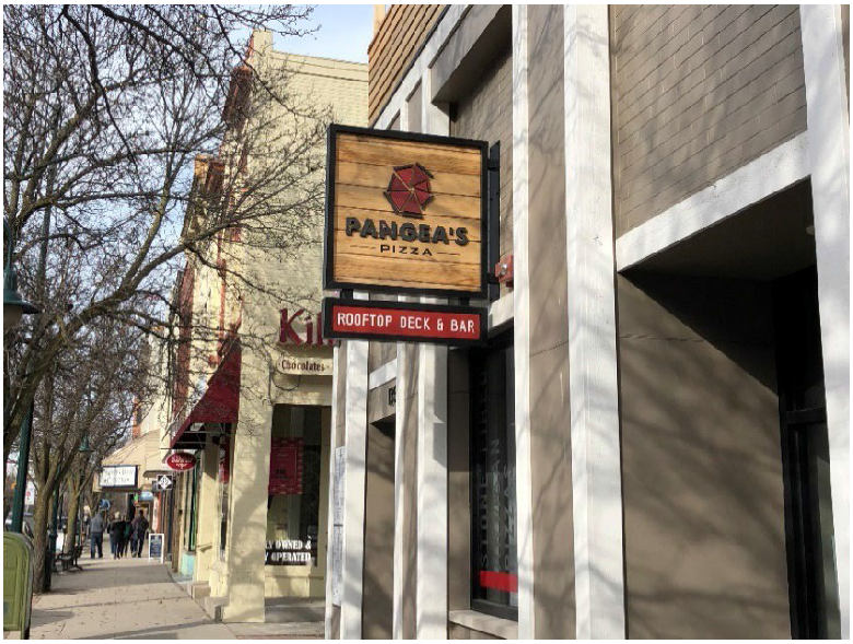 | ||||
| Regulations | |||||
A. The sign shall be located on the building as near as architecturally possible to the center of the business's linear street frontage. The building official has the authority to exercise discretion in the placement of signs in consideration of existing adjacent signs and to account for unique architectural features. B. Must project perpendicularly from the wall it is attached to. C. The distance measured between the principal faces of any projecting sign shall not exceed 12 inches. D. Shall not project more than 4 ft beyond the property line and/or building wall plane. E. Projecting signs will be mounted to the building wall by a single metal bracket; support chains are prohibited. F. In the commercial corridor zone, projecting signs are not permitted on residential uses. | |||||
| District | Max Area Per Sign Type | Max Height | Max No. |
Additional
Requirements | Permit |
|
R-1
R-2 R-3 RM-L RM-H RM-MH | — | — | — | Not allowed | — |
|
B-1
B-2 B-3 I-1 P-1 | 10% of wall area | 12 ft | 1 per commercial entrance | Minimum height from bottom of sign shall be 8 feet | Yes |
| Awning/Canopy/Marquee Sign Standards | |||||
| Definition | Illustrative Example | ||||
Lettering or symbols on a cloth, or other nonstructural covering that projects from a wall for the purpose of shielding a doorway or window. | 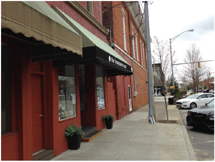 | ||||
| Regulations | |||||
A. An awning without lettering or other advertising shall not be regulated as an awning sign. B. Limited to the 1st floor and shall be a minimum of 8 ft above the finished grade. C. Illumination prohibited. D. Must be centered over architectural features like doors or windows. E. Shall not encroach more than 4 feet in the right-of-way and must be set back at least 6 feet from the curb line. | |||||
| Districts Permitted | Max Area Per Sign Type | Max Height | Max No. | Limitations | Permit |
|
R-1
R-2 R-3 RM-L RM-H RM-MH | — | — | — | Not allowed | — |
|
B-1
B-2 B-3 I-1 P-1 | 20% of wall area of the wall attached to | 12 ft | 1 | — | Yes |
| Changeable Sign Standards | |||||
| Definition | Illustrative Example | ||||
Electric: A freestanding sign that provides a static or changing display created by electronic means such as lights, television, liquid crystal display, or light emitting diode. Manual: A reader board attached to a sign or the exterior of a wall where the copy is changed manually. | 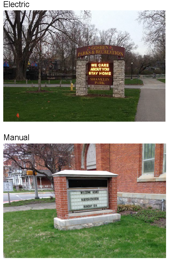 Manual and electric: The sign frame is not included in the calculation of the sign
measurement, but the frame shall not exceed the dimensions of the sign. For example,
if the width of the sign is 8 ft, the combined width of the supporting structure cannot
exceed 8 ft.
Manual and electric: The sign frame is not included in the calculation of the sign
measurement, but the frame shall not exceed the dimensions of the sign. For example,
if the width of the sign is 8 ft, the combined width of the supporting structure cannot
exceed 8 ft.
| ||||
| Regulations | |||||
Electric: A. Each copy display whether or not in a sequential message, shall be totally extinguished a minimum of one (1) second before a new copy display appears, and each copy display shall remain lit a minimum of ten (10) seconds. B. All messages shall have a dark background with light message content, with each message having the same light intensity. C. Shall contain a default design that freezes the message if a malfunction should occur. D. Shall be prohibited from being incorporated into a non-conforming sign. E. Animated, pulsing, streaming, flashing, and scrolling messages shall be prohibited. | |||||
| District | Max Area Per Sign Type | Max Height | Max No. | Additional Requirements | Permit |
|
R-1
R-2 R-3 RM-L RM-H RM-MH | — | — | — | •Not allowed | — |
| B-1 | 20 sq ft | 6 ft | 1/parcel | •Limited to nonresidential uses | Yes |
|
B-2
B-3 I-1 P-1 | •10 ft from right-of-way and all property lines | ||||
| Temporary Sign Standards | |||||
| Definition | Illustrative Example | ||||
A type of non-permanent sign that is located on private property that can be displayed for a limited duration of time and is not intended to be a permanent display. |  | ||||
| Regulations | |||||
A. Small temporary signs shall not reduce the unobstructed width of any sidewalk or pedestrian path by less than 4 feet. B. Illumination shall be prohibited. A small temporary sign shall not be placed in any rights-of-way. | |||||
| District | Max Area Per Sign Type | Max Height | Max No. | Additional Requirements | Permit |
|
R-1
R-2 R-3 RM-L RM-H RM-MH | 12 sq ft | 4 ft | Up to Max Area Allowed | — | No |
|
B-1
B-2 B-3 I-1 P-1 | 24 sq ft | 4 ft | Up to Max Area Allowed | — | No |
(h)
Footnotes. Footnotes for the tables above are as follows:
(1)
Wall signs.
a.
Wall signs shall be attached flat against a building wall. Such signs are only allowed on a wall which faces onto a street or alley.
b.
Total signage of wall signs shall not exceed ten percent of building wall surface to which they are attached.
c.
Wall signs in residential areas for institutional or historical marker use are not to exceed 20 percent of the facade. Historical markers are obtained through the state department of natural resources pursuant to the state historical marker program as provided in MCL 399.151 et seq.
(2)
Marquee signs.
a.
Marquee signs shall provide for eight feet of clearance above the finished grade or walkway about the building at the sign location.
b.
Marquee signs shall not exceed 20 percent of wall area to which it is attached as determined by the front elevation of the marquee sign projected against the wall.
(3)
Awning signs shall not exceed seven percent of the area of the awning projected against the wall to which the awning is attached as seen in the front elevation. Total sign face area of all of signage attached to a single wall surface will not exceed ten percent of the wall surface to which they are attached.
(4)
Ground signs.
a.
One ground sign is allowed along each street frontage in the case of lots having frontage on more than one street.
b.
The maximum height of a ground sign shall be six feet and not exceed 25 feet squared for one side and 50 feet squared for signs with two or more faces.
c.
One ground sign is allowed per developed legal lot or lot of record, provided that no single business shall have more than one sign per street frontage.
d.
Multiple businesses on one or more lots shall utilize a business center sign rather than individual ground signs.
e.
Ground signs for planned shopping centers shall be designed as an integral part of the development.
f.
Signs identifying individual businesses shall be placed on the building or business.
g.
Only signs that identify the shopping center or are directional in nature shall be allowed adjacent to the public roadway.
h.
All ground signs in residential areas are for institutional uses only.
(5)
Projecting signs.
a.
Forty-eight inches maximum horizontally total distance from front of building.
b.
Natural wood or natural appearing wood is encouraged.
c.
Minimum height of eight feet from bottom of sign to finished grade.
d.
One projecting sign per commercial entrance.
(6)
Portable signs.
a.
Portable signs are allowed to provide visibility to the public.
b.
Portable signs in the B-2 Central Business District must comply with the central business district sidewalk obstruction regulations.
c.
Portable sign permits shall be renewed annually by applications (due May 30) with fee in an amount as provided in the village fee schedule.
d.
Portable signs must be taken in during hours of non-operation of the business.
e.
Portable sign size is limited to six feet squared, with a maximum height of 48 inches from the ground or sidewalk. Leg length is not part of sign area determination.
f.
Portable signs are limited to one per business and must be located on or adjacent to the applicant's business property.
(7)
Billboard signs shall be placed only in the industrial zone as allowed by the Highway Advertising Act of 1972, Public Act No. 106 of 1972 (MCL 252.301 et seq.), provided that the signs do not exceed 20 feet in height and meet the front and side yard setback requirements of the zoning district in which they are located.
(8)
Tourist oriented directional signs (TODS), provided such signs are otherwise permitted by the state department of transportation pursuant to MCL 247.401—247.405, and that meet the following restrictions:
a.
An operator of a tourist-oriented activity who wishes to participate in a directional sign program under the Act and is applying for a sign that would reside within the boundaries of the village in accordance with the provisions of MCL 247.401—247.405 shall submit the application for review by the planning commission.
b.
The village may limit the number TODS allowed within its jurisdictional boundaries.
c.
Sign face area and height may not exceed that as provided in MCL 247.401—247.405.
(9)
See subsection (e)(7) of this section for specific requirements
(10)
The use of permanent banners, flags or pennants at public facilities shall be as approved by the village council.
(11)
See subsection (e)(8) of this section for specific requirements of feather signs.
(i)
Required sign setbacks and height requirements.
(1)
Setbacks are subject to the provisions of this article. Setback requirements from the road right-of-way and lot lines are subject to the signage table provisions of subsection (g) of this section.
(2)
With the exception of billboard signs as defined above, no part of a ground sign shall exceed a height of ten feet as measured from the mean elevation immediately beneath the sign.
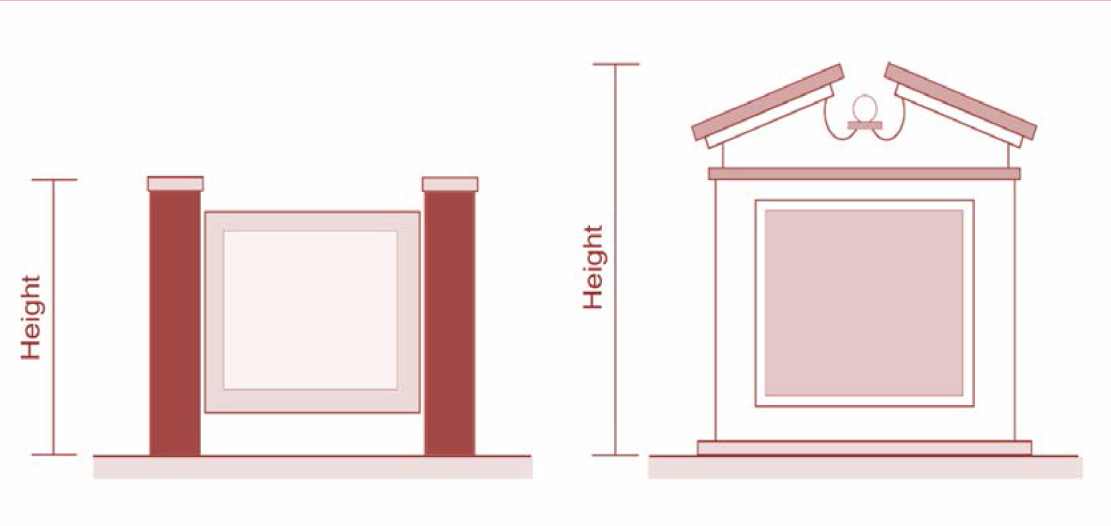
Sign Height Illustration
(j)
Sign illumination and signs containing lights.
(1)
Unless otherwise prohibited by this chapter, signs may be illuminated in accordance with this section and section 44-228.
(2)
No sign within 150 feet of a residential zone may be illuminated between the hours of 12:00 midnight and 6:00 a.m.
(3)
Lighting directed toward a sign shall be shielded so that it illuminates only the face of the sign and does not shine directly into a public right-of-way or residential premises.
(4)
Except as herein provided, illuminated signs are not permitted in the residential zoning districts.
(5)
Projecting signs cannot be illuminated either internally or externally, with the exception of marquee signs.

Sign Illumination Illustration
(k)
Nonconforming signs.
(1)
Subject to the remaining restrictions of this section and other village ordinances, nonconforming signs that were otherwise lawful under the village zoning regulations in effect on the date the sign was installed may be continued.
(2)
No person may engage in any activity that causes an increase in the extent of nonconformity of a nonconforming sign. Without limiting the generality of the foregoing, no nonconforming sign may be enlarged or altered in such a manner as to increase the nonconforming condition. Nor may illumination be added to any nonconforming sign.
(3)
A nonconforming sign may not be moved or replaced except to bring the sign into complete conformity with this chapter or as allowed in subsection (k)(6) of this section.
(4)
If a nonconforming sign is destroyed, it may not thereafter be repaired, reconstructed, or replaced except in conformity with all the provisions of this chapter, and the remnants of the former sign structure not usable for a new conforming sign shall be cleared from the land. For purposes of this section, a nonconforming sign is destroyed if damaged to an extent that the cost of repairing the sign to its former stature equals or exceeds the cost to replace the sign so damaged. Detailed written documentation from a recognized professional sign company indicating both the repair and replacement cost of the destroyed sign must be submitted to the planning and zoning administrator for final disposition of the destroyed nonconforming sign.
(5)
Subject to the other provisions of this section, nonconforming signs may be maintained. For the purpose of this section, the refacing of a nonconforming sign with new, single or multiple, composite material panels, shall not be considered maintenance or repair, but rather shall be considered a new sign requiring the nonconforming sign be brought into complete compliance with this chapter.
(6)
If a nonconforming sign advertises a business, service, commodity, accommodation, attraction, or other enterprise or activity that is no longer operating or being offered or conducted for a period of 180 consecutive days, that sign shall be considered abandoned and shall be removed by the owner of the sign, the owner of the property where the sign is located, or the party having control over the sign within 30 days after such abandonment.
(7)
If a nonconforming billboard sign remains blank for a continuous period of 180 days, and it is determined that the intent is to abandon the sign, that off-premise sign shall be deemed abandoned and shall, within 30 days after such abandonment, be altered to comply with this chapter or be removed by the owner of the sign, owner of the property where the sign is located, or the persons having control over such sign. For purposes of this section, a sign is blank if:
a.
It advertises a business, service, commodity, accommodation, attraction, or other enterprise or activity that is no longer operating or being offered or conducted; or
b.
The advertising message it displays becomes illegible in whole or in part.
(8)
The planning and zoning administrator shall keep complete records of all correspondence, communications, and other actions taken with respect to such nonconforming signs.
(Ord. No. 458, § 529, 3-2-2015; Ord. No. 486, 6-14-2018; Ord. No. 498, 8-5-2019; Ord. No. 2022-03, 9-6-2022; Ord. No. 2024-12, § 1, 5-21-2024)
Sec. 44-231. - Off-street parking and loading regulations.
(a)
Purpose. The purpose of this section is to reduce the number of off-street parking spaces, the amount of impervious surfaces and to encourage the use of alternative pervious surface materials that may be permitted on a parcel of land; to protect water quality and capacity of drainage and stormwater management systems; to establish flexible minimum and maximum standards for off-street parking and loading; and to promote the use and development of shared parking facilities.
(b)
Scope. With the exception of the B-2 Central Business District, regulations of this section shall be met when any use is established; any structure is erected, enlarged, or increased in capacity; or any existing use is changed to a different use, expanded, extended, or increased in intensity.
(c)
Standards for parking and loading calculations. The following standards shall apply to all parking calculations:
(1)
Multiple or mixed uses. When more than one principal use exists or is proposed to occupy a site, the parking requirements for each use shall be calculated separately. The total parking obligation for the site shall equal the cumulative total of the parking requirements for the individual uses.
(2)
Fractions. When units of measurement determining the number of required parking spaces result in requirement of a fractional space, any fraction shall be counted as one additional space.
(3)
Employees. For requirements stated in terms of employees, the calculation shall be based upon the number of employees likely to be on the premises during the largest shift or busiest period of the workday.
(4)
Capacity or permitted occupancy. For requirements stated in terms of capacity or maximum permitted occupancy, the number shall be determined on the basis of the largest occupancy ratings by the state construction code, or applicable local, county or state fire or health codes.
(5)
Uses not specifically mentioned. For those uses not specifically mentioned in this chapter, the requirements for off-street parking shall be in accordance with a listed use that the planning and zoning administrator deems to be similar in type.
(d)
General requirements. The following requirements shall apply to all off-street parking and loading facilities:
(1)
There shall be provided in all zoning districts, off-street parking space with adequate ingress and egress to all spaces. The minimum number of parking spaces for specific uses of land specified in this section is based upon consideration of the maximum number of motor vehicles that can be expected on the premises at the same time during an average day.
(2)
No parking, loading, unloading, or standing space that exists at the effective date of this chapter or is provided for the purpose of complying with This chapter shall be relinquished or reduced in any manner below the requirements established in this chapter.
(3)
Off street parking in the R-1, R-2, and R-3, Single-family Residential Districts shall be subject to the following additional requirements:
a.
The minimum required spaces per subsection (f)(3) of this section shall be located on the premises of the principal dwelling.
b.
Such parking shall be provided in an accessory garage, carport, driveway, parking pad or bay, or combination thereof. Parking spaces may be located within a rear or side yard, but off-street parking shall not be permitted within the front yard setback unless otherwise provided in this chapter.
c.
Parking of motor vehicles accessory to single-family or two-family dwellings shall be limited to passenger vehicles and a maximum of one light commercial vehicle (not to exceed one ton capacity) per dwelling unit.
d.
The parking of any commercial vehicle exceeding one ton capacity shall be prohibited unless contained within a garage, or effectively screened from adjacent properties.
e.
Unlicensed or inoperable motor vehicles may not be parked or stored on any premises unless parked or stored within a completely enclosed structure.
(4)
Off-street parking facilities for other than residential use shall be subject to the following additional requirements:
a.
The minimum required spaces per subsection (f)(3) of this section shall be located on the same lot as the principal building or use for which the parking is intended; or on a lot under the same ownership as the principal building; or as otherwise permitted under subsection (f)(5) of this section. Except where otherwise prohibited, on-street parking within 300 feet of the main building, as measured from the property lines containing the main building, may be used to meet the minimum required off-street parking for each specific land use for which the parking is intended.
b.
No commercial activity or selling of any kind shall be conducted within required parking areas, except as part of a permitted temporary use.
c.
Parking lots and loading areas shall not be used for parking or storage of inoperable vehicles for more than 48 consecutive hours, storage or display of vehicles for sale (unless owned by the property owner of record), vehicle repairs, dumping of refuse, or storage of any merchandise, equipment, products or materials unless otherwise permitted in this chapter.
(e)
Off-street parking requirements. The minimum number of required off-street parking spaces and maximum number of permitted spaces by type of use shall be determined in accordance with the following schedule:
(1)
Minimum parking requirements. Off-street parking, stacking, and loading spaces shall be provided for specific uses of land and structures in the village in accordance with the minimum requirements of this section.
(2)
Maximum parking requirements. The maximum amount of off-street parking permitted for any use shall not exceed 120 percent of the minimum parking requirements of this section. This requirement shall not apply to spaces reserved for off-site uses as part of a shared parking facility agreement per subsection (f)(5) of this section.
(3)
Table of off-street parking requirements. Off-street parking, stacking, and loading spaces shall be provided for specific uses of land and structures in the village in accordance with the following:
Table of Off-Street Parking Requirements
(4)
Deferment of parking spaces. When an applicant can demonstrate to the satisfaction of the planning commission that the minimum required number of parking spaces is excessive, the planning commission may approve the construction of a lesser number of parking spaces, provided that the deferred parking is shown on the site plan and set aside as open space.
(5)
Shared parking facilities. The minimum required parking spaces for a use per subsection (e)(3) of this section shall not be considered as providing the required parking facilities for any other use, unless a shared parking facility agreement has been approved by the planning commission in accordance with the following:
a.
Prior to approval of a shared parking facility, the planning commission shall determine that the operating hours of the uses do not overlap, or the peak activity for each use will occur at different periods of the day or week.
b.
The planning commission shall determine the conditions of overlapping requirements and the amount of reductions in the required number of spaces to be permitted in accordance with this subsection.
c.
When shared parking facilities are provided, the minimum number of required parking spaces shall not be less than the sum of the minimum required number of spaces for the largest user of parking.
d.
When shared parking facilities are provided, the minimum required parking for each use shall be located within 300 feet of a primary entrance to the principal building or use for which the parking is intended.
e.
Shared parking facilities and the permitted reduction in required parking shall be subject to the acceptance and approval by the planning commission of a shared parking facility agreement between the property owners. The property owners shall provide two notarized copies of the document to the planning and zoning administrator.
(f)
Off-street parking design and site development requirements. Any off-street parking area providing spaces for five or more vehicles for all land uses which require a site plan review in accordance with section 44-274 shall be designed, constructed and maintained in accordance with the following standards and requirements:
(1)
Parking area. No parking area providing spaces for five or more vehicles for all land uses which require a site plan review shall be constructed until a permit is issued by the planning and zoning administrator and site plan approval has been authorized by the planning commission.
(2)
Barrier-free parking requirements. Barrier-free parking spaces shall be provided at conveniently accessible locations within each parking area providing spaces for five or more vehicles per the state construction code and the following:
(3)
Setback requirements. A no-building buffer strip, to be used exclusively for landscaping, screening or drainage as required herein, shall be provided around the perimeter of all off-street parking areas containing spaces for five or more vehicles in accordance with the following requirements:
a.
Off-street parking spaces and driveways shall be set back a minimum of ten feet from any side or rear property line and shall be effectively screened in accordance with this section. The required setback shall not apply to parking spaces and driveways that serve single-family or two-family residential lots.
b.
Off-street parking spaces and driveways shall be set back a minimum of six feet from the public road right-of-way for the entire length of the roadway frontage, minus ingress and egress driveways, and shall be effectively screened in accordance with this section.
c.
Each ingress and egress to and from any parking lot located in an area zoned for other than Single or Multiple Residential Family use shall be at least 25 feet from adjacent property located in any residential district and 40 feet from any public road intersection.
d.
Distance measurements for setback requirements shall be made from the pavement edge to the nearest point along the lot boundary or right-of-way.
(4)
Ingress/egress. Adequate means of ingress and egress shall be provided for all parking and loading facilities by means of clearly defined drives, curb cuts, and maneuvering lanes. Driveways and maneuvering lanes for any off-street parking area providing spaces for five or more vehicles shall comply with the following requirements:
a.
Aisles for access to all parking spaces on two-way aisles shall be designed and clearly marked for two-way traffic flow. Aisles for angle parking spaces shall be limited to one-way movement and shall be clearly marked as such.
b.
Ingress and egress to a parking lot shall not be across land located in any single-family residential district if the parking lot is located in any district zoned for nonresidential use.
c.
Backing directly onto a road or using a road for maneuvering between parking rows shall be prohibited.
d.
Not more than 20 parking spaces shall be permitted in a continuous row without interruption by a landscaped island or similar site element in accordance with this section.
(5)
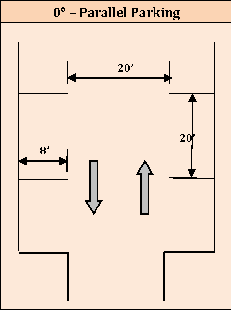
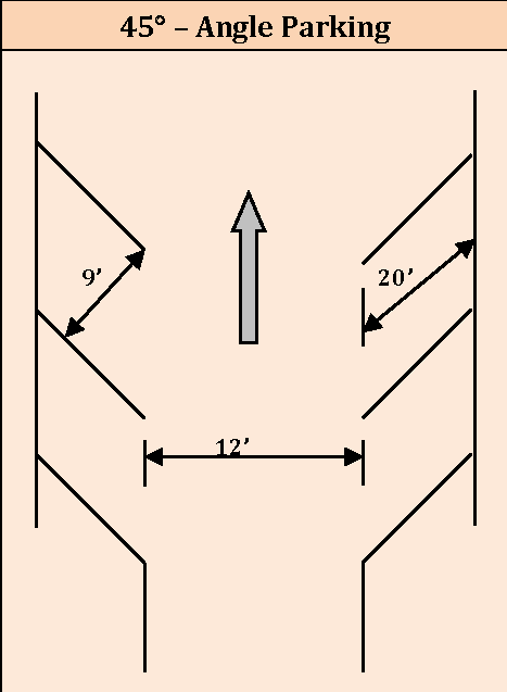
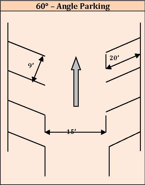
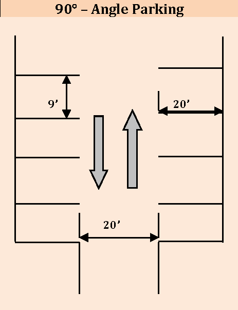
Parking layout. The layout of off-street parking shall be in accordance with the following minimum requirements.
a.
Parking space dimensions shall be exclusive of access drives or aisles. Maneuvering lanes and aisles shall be designed to meet village and other outside agency standards for emergency vehicle access.
b.
When required by this section, stacking spaces shall be nine feet wide by 20 feet long. Stacking spaces shall not intrude into any road right-of-way or maneuvering lane for an off-street parking lot.
Typical Parking Dimensional Standards
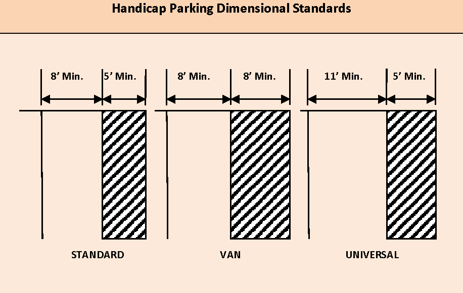
Disabled Parking
Dimensional Standards
(6)
Grading, drainage, and stormwater management.
a.
Off-street parking areas, including driveways, shall be graded and provided with adequate stormwater management and drainage facilities to dispose of surface waters in accordance with this section and the village infrastructure standard specifications and details manual.
b.
Surface water shall not drain on to abutting properties, toward buildings or across a public roadway, except in accordance with an approved drainage plan.
c.
In order to improve the quality of stormwater runoff, discharges of stormwater shall be routed through swales, vegetated buffer strips, stormwater basins, by the utilization of alternative pervious surface materials, or other facilities designed to decrease runoff velocity and volume, allow for natural infiltration, allow suspended solids to settle, and remove pollutants.
(7)
Surfacing.
a.
Off-street parking and loading areas requiring site plan review and containing five or more parking spaces, shall consider the use of alternative pervious surface materials as listed below, for all or a portion of a off-street parking, loading or unloading facilities. The use of alternative pervious materials shall not be construed as the only stormwater management technique encouraged. Impervious surface materials can be used in combination with other traditional means of stormwater management, such as, rain gardens, retention and detention basins and other traditional stormwater management applications to meet on-site stormwater management requirements identified in subsection (f)(6) of this section.
b.
Alternative pervious materials used for these areas may include, but not necessarily be limited to, permeable concrete, permeable asphalt, open jointed blocks, permeable pavers, or other materials designed to allow the maximum infiltration of water. Regular maintenance of these pervious areas is required to ensure that they continue to function properly after installation.
c.
With authorization of the planning commission, parking lots abutting sensitive natural features like a stream, river, lake, wetland or the Great Lakes, may utilize gravel, grass, crushed stone or other dust producing surface, providing said surface will better protect the environmental quality of the sensitive natural feature without creating a nuisance for an abutting landowner, or result in inadequate surface quality for vehicles and pedestrians.
(8)
Striping and signage. Pavement striping shall be provided in accordance with applicable state construction code requirements. All signage shall conform to the requirements of section 44-230.
(9)
Lighting. Light fixtures used to illuminate off-street parking areas shall conform to the requirements of section 44-228.
(g)
Off-street loading and unloading requirements. For any commercial, industrial, institutional or office land use that customarily receive or distribute vehicles with materials or merchandise, the following requirements shall be followed in order to avoid interference with public use of roads and parking areas:
(1)
Each off-street loading or unloading space shall be of sufficient size and configuration to accommodate the largest type of delivery vehicle anticipated for the proposed use.
(2)
Loading spaces shall be located within or immediately adjacent to the building to be served.
(3)
Off-street loading or unloading areas that result in vehicles backing directly into a public road are prohibited. All maneuvering shall take place on the site and not within a road right-of-way.
(4)
Each loading or unloading space shall be a minimum ten feet in width, 25 feet in length and, if a roofed space, not less than 15 feet in height.
(5)
The minimum number of off-street loading and unloading spaces shall be as follows:
a.
First 2,000 square feet of floor area: none.
b.
Each additional 20,000 square feet of floor area or fraction thereof: one.
c.
In the case of two or more uses on one lot or parcel, the total requirements for off-street loading or unloading shall be the sum of the various uses.
(Ord. No. 458, § 530, 3-2-2015; Am. Ord. No. 462, 10-19-2015)
Sec. 44-232. - Supplemental environment and wetland regulations.
(a)
Intent and purpose.
(1)
It is the intent and purpose of this section to protect water quality and land resources related to lake and stream shorelines and other wetlands within the village and to enhance the future health, safety, and welfare of village residents. The village recognizes the unique value of wetlands, shorelines and floodplains, as a groundwater recharge area, a holding area for stormwater, and an open space area for recreation, thus maintaining and preserving the quality of life in the village.
(2)
Further, uncontrolled development of wetlands not only reduces their unique character but also increases the potential for environmental damage and economic loss to both the individual and the community through flood damage, erosion, sedimentation, foundation, and septic tank failure.
(3)
In addition to areas designated as wetlands by the state department of environmental quality, wetlands are those areas of the village that are periodically or permanently covered with water or having high water table, support aquatic or semi-aquatic plants and animals, or contain soil types as defined and mapped by U.S.D.A. Soil Conversation Service for the area, specifically (Lu) Lupton Muck and (Ru) Roscommon Mucky Loamy Sand.
(4)
Delineation of flood areas shall be based on reasonable flood expectancy, as determined by flood history or detailed floodplain engineering studies or as defined in this chapter. Such flood areas shall be restricted as to use, building encroachment, and occupancy, so that human life is protected and future flood damage is minimized. In event of reasonable doubt as to location of a floodplain, the planning and zoning administrator may require the applicant to submit detailed engineering studies prepared by a registered professional engineer showing the extent and location of floodable areas. All development in a wetlands or floodplain area as defined above shall first obtain approval of the planning commission and be issued a land use permit upon showing compliance with the provisions of this chapter, pursuant to the conditions of which the village thereby grants the specific use.
(b)
Site plan review.
(1)
Each application for a land use permit shall conform to the provisions of section 44-274, and be accompanied by a site plan indicating the following:
a.
A property line map at a scale of one-inch equals 100 feet, showing contour lines of at least two-foot intervals; soil types certified by a civil engineer or the county soil conservation district; all permanent surface water or subsurface water tables; floodplains; and all intermittent drainage-ways onto and off from the site.
b.
The intended use as permitted in the zoning district in which the parcel is located.
(2)
All requirements of the zoning district in which the parcel subject to the land use permit is located shall serve as minimum standards.
(c)
General development conditions. The following conditions apply to all development in a wetland or floodplain areas:
(1)
All normal runoff resulting from parking, drives, and roofs shall be held on the site for a sufficient time to avoid any increase in runoff over that which occurs from the site prior to development, since soil erosion adversely affects land owned by others in the established natural drainage or groundwater system. A soil erosion plan shall be approved by the county drain commissioner. Certification by a civil engineer shall be furnished concerning present runoff pattern and proposed volume after development, if the project is over one acre.
(2)
Holding areas on the site shall retain the basic character of the wetlands environment.
(3)
Setbacks shall maintain natural vegetation for the purpose of soil retention and filtration.
(d)
Floodplain permitted uses. Notwithstanding any other provisions of this chapter, no uses shall be permitted to occur within a floodplain except the following:
(1)
Open space uses, such as farms, truck gardens, nurseries, parks, playgrounds, golf courses, preserves, bridle paths, or other similar uses.
(2)
Yard and setback areas or other open space portions required for any district, provided that the elevation of the lowest floor designed for human habitation shall be above the established floodplain.
(3)
Off-street parking uses, provided that all parking areas shall conform to the provisions of this article.
(4)
Roads, service drives, and utility uses, when designed so as not to increase the possibility of flood or be otherwise detrimental to the public health, safety, and welfare.
(e)
Floodplain restricted uses. Any structure where human habitation is contemplated either as a place of residence, places of public gathering, or employment shall be prohibited from locating in floodplain areas.
(f)
Floodplain required conditions.
(1)
Any construction other than as permitted in subsection (d) of this section or prohibited in subsection (e) of this section within the floodplain shall conform to the requirements of this section as administered by the planning and zoning administrator with assistance from the department of environmental quality.
(2)
Any construction within the floodplain shall be so designed, constructed, and placed on the lot or parcel so as to offer no added obstruction to the flow of water or reduce the holding capacity of the floodplain and be so fixed to the site as to withstand the force of the expected velocity of floodwater.
(3)
When topographic data, engineering studies, or other studies are needed to determine the effects of flooding on proposed construction or the effect of construction on the flow of water, the applicant shall submit such data or studies, prepared by a registered professional engineer.
(4)
Filling in floodplain areas to raise lands above the floodplain may be permitted with the approval of the board of appeals, subject to prior approval of the state department of environmental quality and in accordance with MCL 323.1 through 323.12.
(g)
Setback from lakes, rivers, and stream. For setbacks from lakes, rivers and streams, see section 44-216.
(h)
Retaining wall permit. No shoreline retaining wall shall be erected without the issuance of a land use permit, and no such permit shall be issued except upon a showing that all federal and state approvals have been secured. All such structures shall be designed and placed so as to minimize any adverse hydrological effects caused thereby to adjacent property owners.
(i)
Removal of shore cover.
(1)
Regulation of tree cutting along the shoreline or normal stream bank of any water body in the village is necessary to protect scenic beauty, control erosion, and reduce effluent and nitrified flow from the shoreland. Those provisions shall not apply to the removal of dead, diseased, or dying trees at the discretion of the landowner or to the silvicultural thinning upon recommendation of a forester.
(2)
Tree cutting in a strip paralleling the shoreline and extending 35 feet inland from all points along the water mark of the shoreline or normal stream bank shall be limited in accordance with the following provisions:
a.
No more than 30 percent of the length of this strip shall be clear cut to the depth of the strip.
b.
The cutting authorized in this section shall not create a clear cut opening in a strip greater than 30 feet wide for every 100 feet of shoreline or normal stream bank.
c.
The remaining 70 percent length of a strip cutting shall leave sufficient cover to screen cars, dwellings, accessory structures, except boathouses, as seen from the water, to preserve natural beauty, and to control erosion.
d.
Natural shrubbery, trees, or other vegetation shall be preserved as far as practicable, and where removed it shall be replaced with other vegetation that is equally effective in retarding runoff, preventing erosion, and preserving natural beauty.
e.
Any paths, roads, or passages within the strip shall be so constructed or surfaced as to be effective in controlling erosion.
f.
As an alternative to the above requirements, a special cutting plan allowing greater cutting may be permitted by the planning commission. In applying for such a permit, the planning commission may require the lot owner to submit a sketch of this lot, including the following information: location of all structures, location of parking, gradient of the land, existing vegetation, proposed cutting, and proposed replanting. The planning commission may grant such a permit only if it finds that the special cutting plans:
1.
Will not cause undue erosion or destruction of scenic beauty; and
2.
Will provide substantial shielding of dwellings, accessory structures, and parking areas from the water. The planning commission may condition such a permit upon a guarantee of tree planting by the lot owner. Such an agreement shall be enforceable in court.
g.
From the inland edge of the 35-foot strip to the outer limits of the shoreland, the commercial harvesting of trees shall be allowed when accomplished under accepted forest management practices. The maintenance and improvement of water quality shall be emphasized in all timber harvesting operations.
(j)
Stormwater detention.
(1)
When any land in the village is developed or altered in any way which affects stormwater runoff, the owner shall:
a.
When a public storm sewer is available, maintain the peak discharge from the property at a rate which does not exceed that which existed prior to development.
b.
When a public storm sewer is not available, retain stormwater runoff onto adjacent properties, including roads and other rights-of-way, in a manner which shall result in the maximum amount of stormwater runoff not exceeding that which existed prior to the development or improvement of the property. This provision shall not apply to subdivisions with approved stormwater detention plans.
(2)
In instances in which the planning and zoning administrator considers the ability of a proposed use to meet all the requirements of this section to be reasonably doubtful, the planning and zoning administrator may require the owner to develop and submit as part of the land use permit application a plan for detaining stormwater as required. In this event, the planning and zoning administrator may require that the plan be prepared by a registered civil engineer or other suitable professional and may withhold the land use permit until such evidence is submitted.
(Ord. No. 458, § 531, 3-2-2015)
Sec. 44-233. - Overlay districts for environmentally sensitive areas.
(a)
Intent and purpose.
(1)
Due to the soil, topographic, high water table and drainage characteristics of several areas of the village, it is the intent of this section to implement the master plan and to protect the health, safety and welfare of village residents and property owners in these vicinities by establishing a set of special development regulations for such environmentally sensitive areas, allowing limited residential use while insuring that sound construction practices are employed, open spaces are protected, natural character and appearance are maintained and surface water is responsibly managed.
(2)
It is the further intent of this section, in those areas specifically designated as conservation residential by the master plan, to encourage clustered housing and lower densities than would normally be permitted by the underlying zoning districts, allowing development of those areas that are the most buildable, while protecting larger areas of environmentally sensitive lands as open space and minimizing the effect of stormwater runoff.
(b)
Conflicting regulations. When the requirements for an environmentally sensitive area overlay district are determined to be in conflict with the underlying zoning district regulations, this section shall govern.
(c)
Applicability of section. This section shall apply to all areas designated as environmentally sensitive area overlay districts.
(d)
Establishment of the South Bayshore Drive Environmentally Sensitive Area Overlay District.
(1)
This section establishes an overlay district for the environmentally sensitive area east of South Bayshore Drive, which shall be constituted and regulated according to this section, supplementing and, in certain cases, superseding requirements of underlying zoning districts.
(2)
The limits of the overlay district, are shown below, may be modified from time to time as deemed appropriate by the village, and are as further defined by the village master plan delineated conservation residential district within the boundaries.
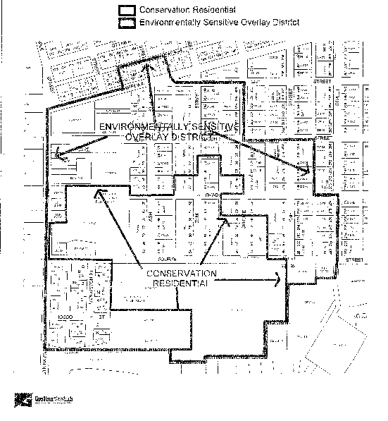
Exhibit A
Southwest Area Overlay District
(e)
Use regulations. Uses permitted within an environmentally sensitive area overlay district shall be those permitted by the underlying zoning district. All uses within an environmentally sensitive area overlay district shall meet both the dimensional requirements of the underlying zoning district and the requirements of subsection (f) of this section and supplemental requirements shall apply in accordance with subsection (g) of this section.
(f)
Applicable overlay district regulations. The following regulations shall apply to all lands and uses within environmentally sensitive area overlay districts:
(1)
Underground utility regulations. All utilities, including electric, telephone and cable TV, shall be constructed underground.
(2)
Grading and drainage regulations. Permit applicants shall prepare a grading and drainage plan based on a certified elevation survey showing consistence with the elevations and grades established by the village's overall grading and drainage plan for the area. The plan shall indicate: the limits of the proposed grading activities; the existing and proposed elevations of buildings, pavements and impervious surfaces; and the proposed elevations of ground surfaces. Floor elevations shall comply with the provisions of subsection (f)(5) of this section. Earth change and grading activities shall be planned and constructed in a manner that controls runoff and prevents discharges that may adversely affect adjoining properties, alleys or roadways. As much as practicable, runoff control measures shall be used that employ stormwater best management practices, such as grassed waterways and properly sized sedimentation areas. To protect environmentally sensitive areas, grading and filling activities shall be planned to minimize disturbance of existing vegetation and alteration of drainage patterns, except where such alteration is in keeping with the village's overall grading and drainage plan for the area. Preparation of this plan shall not relieve the applicant of the responsibility to obtain a soil erosion and sedimentation control permit from the county, if applicable.
(3)
Platted alley regulations. In previously platted areas that include un-improved alleys, being platted alleys that have not been surfaced and are not used for vehicle access, such alleys shall not be improved for the purpose of vehicle access. Except where already improved, existing platted alleys shall be used and maintained for the management, drainage and retention of stormwater. Alleys shall not be filled, graded or developed in any way or encumbered by any building, structure, fence, wall, earthen berm or other improvements so as to impede the flow of stormwater within the platted but unimproved alley.
(4)
Soil correction regulations. No structure or pavement shall be constructed on unsuitable soils, those being organic, unstable or other soils deemed unsuitable for foundation support. Soils unsuitable for support of structures or paving shall be removed and replaced with acceptable fill materials; or other suitable structural methods shall be employed to support structures and pavement areas. If soils correction or structural methods are employed, they shall comply with generally accepted engineering practices. All sand fill materials shall be soils complying with state department of transportation standards for Class II or Class III sand. Sand fill beneath structures or pavements shall be placed in lifts not exceeding eight inches and compacted to 95 percent of maximum dry unit weight.
(5)
Elevation requirements. A certified elevation survey shall be submitted with the permit application. Based on an established benchmark, the elevation survey will show: the elevation at the road edge; the high and low elevations on the lot; the elevation of the ground floor of the principal structure and its garage floor; as well as that of the finished site grade, which shall include a six-inch drop in the first eight feet away from the principal structure. A condition for any permit issued shall be certification of the finished elevations. In an environmentally sensitive area overlay district, no habitable grade level floor of any building, including garage floors, shall be constructed below the elevations established by the village's overall grading and drainage plan for the area.
(6)
Garage regulations. Existing unimproved alleys shall not be used for vehicle access, except where existing garages face such an alley. All garages and accessory buildings requiring paved flooring or aprons shall have a minimum rear yard setback from an unimproved alley of 25 feet and a front yard setback no more than ten feet greater than that required for the principal building.
(7)
Landscaping regulations. All landscape plant materials shall meet the requirements of the underlying zoning districts. Noxious and invasive plant materials, such as purple loosestrife, shall not be used for landscaping purposes within environmentally sensitive area overlay districts.
(8)
Soil stabilization regulations. Exposed soil shall be stabilized in accordance with The Guidebook on Best Management Practices for Michigan Watersheds (state department of environmental quality, surface water quality division) prior to winter freeze up, even if the project has not been completed. Generally, dormant seeding and mulching shall be used after October 1 but prior to freeze up.
(9)
Street lighting regulations. Required street lighting shall consist of cut-off type fixtures that direct light to the ground and promote dark sky lighting. Light fixtures shall be mounted on poles 25 feet or less in height.
(10)
Permit fees. In environmentally sensitive area overlay districts, fees for all permits regulated by this chapter shall be increased by 20 percent.
(g)
Applicable conservation residential regulations. The following additional requirements shall apply to areas within environmentally sensitive area overlay districts that the village master plan specifically designates as conservation residential areas:
(1)
Development intensity. The minimum parcel size shall be 18,000 square feet for previously platted property. Un-platted property shall have a maximum density of 2.4 dwelling units per acre.
(2)
PUD required. Any parcel consisting of more than 2½ acres and containing more than one principal building shall be processed in accordance with the requirements of section 44-273. At the request of the applicant, PUD may be considered for parcels of less than 2½ acres in environmentally sensitive area overlay districts.
(3)
Lots of record. Any residential lot created and recorded within an environmentally sensitive area overlay district prior to the adoption of this section may be used for any permitted principal use, even though the lot area is less than that required by this subsection:
a.
The other dimensional requirements of the underlying districts are satisfied.
b.
No adjacent land is owned by the owner of the lot in question or was owned at the time of adoption of this section.
c.
Any lot so excepted shall be no less than 65 feet in width.
(h)
Procedures.
(1)
Zoning compliance permit required. No amount of site grading or removal of vegetation for the purpose of site development shall be commenced in an environmentally sensitive area overlay district, until a zoning compliance permit shall have been issued by the planning and zoning administrator in accordance with the requirements and procedures section 44-271.
(2)
Plans required. In addition to the requirements of section 44-271 and subsection (g)(2) of this section shall be prepared for each site or project specifying the areas and extent of excavation; the method and place of soil disposal; the volume and type of replacement soil materials; the methods of soil replacement and compaction; the routing and retention of stormwater; the type and methods to be employed in controlling soil erosion; as well as the removal of trees of greater than three inch caliper, and of shrub vegetation greater than six feet in height.
(3)
Foundation inspection required. The owner will be required to provide evidence of an approved foundation inspection, prior to issuance of occupancy and prior to provision of water and sewer service.
(Ord. No. 458, § 532, 3-2-2015)
Sec. 44-234. - Overlay district for the Dam Beach and Fishing Park area.
(a)
Establishment of the Dam Beach and Fishing Park Conservation/Recreation Overlay District.
(1)
This section establishes the conservation/recreation overlay district for the Dam Beach and Fishing Park area which shall be constituted and regulated according to this section, supplementing and, in certain cases, superseding requirements of the underlying zoning district.
(2)
The limits of the conservation/recreation overlay district are generally within the boundaries established by Gosling Czubak Engineering Drawing dated February 26, 2014, and further described by the village recreation master plan adopted in 2013. The limits shown in the drawing may be modified as deemed appropriate by the village.
(b)
Intent and purpose. It is the intent and purpose of this section to implement the village master plan; to protect natural resource and water quality values; to protect, maintain and enhance local ecosystems and natural features of the property; to retain quality habitat for native plants and animals; and to provide passive recreation opportunities for public enjoyment.
(c)
Conflicting regulations. When the requirements for this conservation/recreation overlay district are determined to be in conflict with the regulations of the underlying zoning district, the regulations of this section shall govern.
(d)
Permitted uses. Notwithstanding any other provisions of this chapter, and as further provided below, no use shall be permitted to occur within the conservation/recreation overlay district, except the following:
(1)
Open space uses, such as natural preserve areas, parks, beach and picnic activities, fishing, or other similar passive recreational uses.
(2)
Existing road, fishing platforms, service drive and sidewalk, and utility uses, when designed to effectively control erosion, or otherwise not be detrimental to the public health, safety, and welfare.
(3)
Site appropriate, low impact, universal access facilities that are minimal and seasonally removable.
(4)
Off-street parking, provided all parking areas conform to the provisions of section 44-231, and further provided that alternative permeable type surfacing be utilized incorporating rain garden or other similar stormwater management systems wherever practical.
(5)
A modern restroom facility to be positioned as recommended in an area next to the existing parking area and outside of the designated dune area.
(6)
Temporary structures (i.e., tents) to accommodate recreational, cultural, and educational uses.
(7)
Special event or other similar temporary activities or uses, determined to benefit the community that are permitted by special approval of the village council.
(e)
Property improvement regulations. The following regulations shall apply to all property improvement activity within the conservation/recreation overlay district:
(1)
Grading, beach grooming, or other similar activities shall be prohibited unless permits required by all governmental entities having jurisdiction have been obtained and, a copy of the approved permits have been provided to the planning and zoning administrator.
(2)
Native shrubbery, trees, or other vegetation shall be preserved as far as practicable, and where removed, shall be replaced with other native vegetation that is equally effective in preventing erosion and preserving the natural beauty of the area. Non-native, noxious and invasive plant materials, such as purple loosestrife, shall not be used within conservation/recreation overlay district;
(3)
Utilities, including water, sewer and electric, if deemed necessary by the village council, shall be constructed underground.
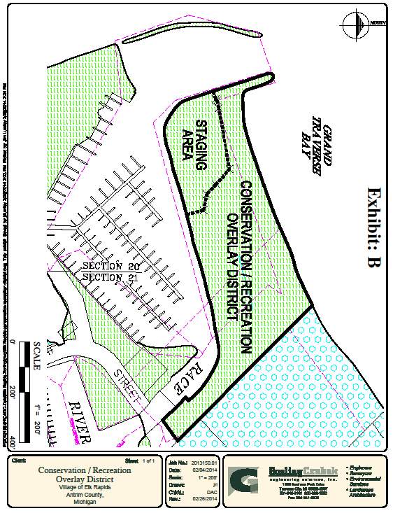
(Ord. No. 456, § 168.10, 8-4-2014)
Sec. 44-235. - Subdivision improvements.
(a)
Purpose. It is the purpose of this section to establish and define the improvements which will be required to be constructed by the subdivider as conditions for final plat approval and also to outline the procedures and responsibilities of the subdivider and the various public officials and agencies concerned with the administration, planning, design, construction, and financing of public facilities and to further establish procedures for assuring compliance with these requirements.
(b)
Responsibility for plans. It shall be the responsibility of the subdivider of every proposed subdivision to have prepared by a licensed engineer a complete set of construction plans, including profiles, cross-sections, contour grading plans, specifications, and other supporting data for the hereinafter required public streets, driveways, drainageways and structures, utilities, including electric, gas, telephone and television, and other facilities. Construction plans shall be based on preliminary plans which have been approved with the preliminary plat final approval and shall be prepared in conjunction with the final plat. Construction plans are subject to approval by the responsible public agencies shown. All construction plans shall be prepared in accordance with the applicable standards or specifications.
(c)
Required improvements. Every subdivider shall be required to install the public and other improvements set forth in this section in accordance with the conditions and specifications as follows.
(d)
Streets and traffic ways.
(1)
Construction standards. Subject to subsection (d)(2) of this section, streets and intersections shall conform to the required construction standards for streets, roads, and intersections adopted by the village. Streets shall be dedicated to public use.
(2)
Private streets or roads. Private streets or roads and access by easement may be permitted within planned unit developments or site condominiums where acceptable to the village council. Private streets and traffic ways in access easements shall be allowed only under the following circumstances:
a.
Use of the road is not required by the general public, such as persons not having an ownership interest in the road.
b.
The road is a limited dead-end road or is contained within a project which is not a part of the village major thoroughfare or road plan.
c.
The private road is one which may be extended at a later date when it is agreed that the road will become public.
d.
The type of land use does not require a public road for health, safety, and welfare of the public.
(3)
Location and arrangement.
a.
Conformity to master plan. The proposed subdivision shall conform to the various elements of the master plan and the village and county thoroughfare plans and shall be considered in relation to the existing thoroughfares and collector streets. Roadways within the plat shall be platted in the location and the width indicated on such plan.
b.
Local streets. The street layout shall include local streets so laid out that their use by through traffic shall be discouraged.
c.
Primary thoroughfare. Should a proposed subdivision border on or contain an existing or proposed major thoroughfare, the village council shall require marginal access streets, reverse frontage, or such other treatment as may be necessary for adequate protection of residential properties and to afford separation and reduction of traffic hazards.
d.
Relation to topography. Streets shall be arranged in proper relation to topography so as to result in usable lots, safe streets, and reasonable gradients.
(4)
Right-of-way widths. Street right-of-way widths shall conform to at least the following minimum requirements:
a.
Primary thoroughfare. Right-of-way widths shall be in conformance with the village thoroughfare or street plan.
b.
Residential and others. Right-of-way widths shall be 66 feet or 86 feet with utility right-of-way.
(5)
Street gradients and alignment. Street gradients and alignment shall be as established and amended by the village from time to time.
(e)
Intersections.
(1)
Angle of intersection. Streets shall intersect at 90 degrees or closely thereto and in no case at less than 80 degrees.
(2)
Sight triangles. Minimum clear sight distance at all minor street intersections shall permit vehicles to be visible to the driver of another vehicle when each is 125 feet from the center of the intersection.
(3)
Number of streets. No more than two streets shall cross at any one intersection.
(4)
Centerline offsets. Slight jogs at intersections shall be avoided. When such jogs are unavoidable, street centerlines shall be offset by a distance of 150 feet or more.
(5)
Vertical alignment of intersection. Nearly flat grade with appropriate drainage slopes is desirable within intersections. This flat section shall be carried back 50 feet.
(f)
Blocks.
(1)
A block shall be so designed as to provide two tiers of lots, except where lots back onto a primary thoroughfare, natural feature, or subdivision boundary.
(2)
Blocks shall not be less than 500 feet from center of street to center of street.
(3)
The maximum length allowed for residential blocks shall be 1,320 feet from center of street to center of street.
(g)
Lots.
(1)
Conform to zoning. The lot width, depth, and area shall not be less than the particular district requirements of this chapter, except where outlets are provided for some indicated and permitted purpose.
(2)
Lot lines. Side lot lines shall be essentially at right angles to straight streets and radial to curved streets.
(3)
Width related to length. Narrow deep lots shall be avoided. The depth of a lot generally shall not exceed 2½ times the width as measured at the building line.
(4)
Corner lots. Corner lots shall have extra width to permit appropriate building setback from both streets or orientation to both streets and shall be laid out in a manner which will ensure that the front of the residence is located on the street accommodating the least traffic either at the time of construction or at a later day.
(5)
Back up lots. Lots shall back into such features as primary thoroughfares, except where there is a marginal access street, unless a secondary access is provided. The lots shall contain a landscaped easement along the rear at least 20 feet wide to restrict access to the primary thoroughfare, to minimize noise, and to protect outdoor living areas. Lots extending through a block and having frontage on two local streets shall be prohibited.
(6)
Lot frontage. All lots or parcels shall front upon a publicly dedicated street unless approved upon a private access as provided in subsection (d) of this section.
(7)
Future arrangements. When parcels of land are subdivided into unusually large lots, the parcels shall be divided, where feasible, so as to allow for resubdividing into small parcels in a logical fashion. Lot arrangements shall allow for the ultimate extension of adjacent streets through the middle of wide blocks or splitting of lots into smaller lots. When such future resubdividing or lot splitting is contemplated, the plan thereof shall be approved by the planning commission prior to the taking of such action.
(8)
Lot splits.
a.
No lot, outlot, or other parcel of land, either in a recorded plat or a metes and bounds parcel, shall be further partitioned or divided unless in conformity with this chapter, the Land Division Act, MCL 560.101 et seq., and other applicable state statutes. Any landowner wishing to so divide or partition shall submit to the planning and zoning administrator three copies of a completed written application, on forms provided by the village, enclosing a site plan which complies with requirements of this chapter and a receipt showing that all taxes have been paid. No lot in a recorded plat shall be divided into more than four parts.
b.
When the resultant partition or division is in full conformance with the provisions of this chapter and the taxes are paid, the planning and zoning administrator, upon written review of the village assessor, shall authorize the partition or division. The division of a lot or lots into larger sized lots shall also be permitted by the planning and zoning administrator, provided that all affected lots shall be larger in size so as to be in greater square footage compliance and are otherwise in compliance and in complete conformance with all other dimensions, use, and other requirements of this chapter.
c.
Division of unplatted parcel. The division of an unplatted parcel of land into two, three, or four lots involving the dedication of a new street shall require the approval of the village council prior to taking such action. All such applications shall be made in writing and shall be accompanied by a drawing of the proposed division. No land use permit shall be issued in such cases until the council has approved division of such lands.
(9)
Driveways. In areas having steep topography generally in excess of ten percent gradient and erodible soils, the probable location of driveways to each lot shall be shown on the preliminary and final plat from the road or street paving to the outer edge of the required right-of-way. Grading and structures for driveways shall be shown on the plans required under section 44-275(d)(1) through (5). All driveway openings shall be as specified by the village or the state department of transportation. Driveways in any case shall not exceed 12.5 percent grade.
(10)
Easements.
a.
Location. Easements shall be provided along front lot lines in accordance with the standards of the village and alongside lot lines when necessary for utilities. The total width shall not be less than six feet along each lot or a total of 12 feet for adjoining lots.
b.
Drainage. The subdivider shall provide drainageway easements as required by the rules of the village.
(11)
Natural features and uninhabitable areas.
a.
Existing natural features which add value to residential development and enhance the attractiveness of the community (such as trees, watercourses, historic spots, and similar irreplaceable assets) shall be preserved, insofar as possible, in the design of the subdivision.
b.
Lands subject to high organic content soils, high water table, and flooding or otherwise deemed by the planning commission to be uninhabitable shall not be platted for residential purposes or for uses that may, in the judgment of the planning commission, increase the danger to health, life, or property or increase the flood hazard. Such land within a subdivision shall be set aside for other uses, such as parks or other open space.
(12)
Public sites and open spaces. When a proposed park, playground, school, or other public use shown on the master plan is located in whole or in part within a subdivision, a suitable area for this purpose may be dedicated to the public or reserved for public purchase. Lands designated for either private or public open space or park use shall have natural qualities and location which make it suitable for developed recreational facilities accessible to all lots within the plat or have unique natural qualities and location which make it desirable to leave the land in an undisturbed and protected natural state. Odd or unusually shaped parcels of land shall not be so designated merely to avoid difficult design or layout problems.
(13)
Pedestrian ways. Rights-of-way for pedestrian walkways in the middle of long blocks shall be required where necessary to obtain convenient pedestrian circulation to schools, parks, or shopping areas. Other walkways shall be provided when required to provide access to common park areas, beaches, and other open space. The right-of-way shall be at least ten feet wide. In the case of crosswalks, they shall extend entirely through the block. Sideline setbacks shall be calculated from the pedestrian right-of-way. Walkways shall be improved as part of the overall subdivision improvement and as a minimum shall be a wood chip walkway. Bike paths shall be designed in accordance with state department of highway and transportation standards or as approved by the village council. The proprietor shall provide for the maintenance of crosswalks and pedestrian walkways.
(14)
Street names.
a.
Street names shall not duplicate any existing street name in the county, except where a new street is a continuation of an existing street, in which case it shall take the same name. Street names that may be spelled differently but sound the same shall also be avoided.
b.
Street name signs shall be installed in the appropriate locations at each street intersection in accordance with the requirements of the county road commission.
(15)
Street lighting. All streets shall be lighted in accordance with the current lighting standards and specifications of the village.
(16)
Planting strips, reserve strips, and street trees.
a.
Planting strips may be required to be placed in subdivisions next to incompatible features such as highways or agricultural properties. Such screens shall be a minimum of 20 feet wide unless otherwise provided in this article; in such cases the most stringent provisions shall prevail. Such screens shall not be a part of the normal roadway right-of-way or utility easement.
b.
Street trees shall be provided as required by the planning commission after review and recommendation by the village beautification commission in accordance with the following:
1.
The trees should be the species as determined by the planning commission which are most resistant to damage and disease in this part of the country and which are not likely to cause interference with underground utilities or street lighting or street pavement.
2.
Street trees should be spaced so that there will be approximately ten feet between branch tips when the trees are full grown. No trees shall be planted within 50 feet of the intersection of two street right-of-way lines. Approaches to buildings should be considered when locating trees.
3.
When planted, trees should be at least 1½ inches in diameter one foot above the ground. Lowest branches should not be less than seven feet and no more than ten feet above the ground.
4.
The number of trees shall be determined by the lot widths. There shall be a minimum of one tree per interior lot with a frontage of 70 feet or less, or a minimum of two trees per lot with a frontage of more than 70 feet. At least three trees shall be provided for a corner lot.
(17)
Installation of utilities.
a.
Utilities. Utilities shall be located in accordance with the rules of the village. The underground work for utilities shall be stubbed to the property line.
b.
Water supply.
1.
When a public water supply system is accessible to the subdivision, provisions shall be made by the subdivider to supply each lot in the subdivision with water from the public supply by means of a water supply system which meets current village specifications.
2.
When a public water supply system is not accessible to the subdivision by reasons of absence of feeder mains, the subdivider shall bear the cost of installation of a new feeder main from the source of supply to the subdivision in accordance with current village specifications.
3.
When it is deemed impractical to connect to an existing public water system or otherwise have a public water system within a plat, in accordance with the Safe Drinking Water Act, MCL 325.1001 et seq., and a private community water system has been developed, the private system shall meet the requirements of the current village specifications for water systems.
c.
Sanitary sewer system.
1.
When a proposed plat is to be serviced by a public sanitary sewage system, sanitary sewers and other required appurtenances thereto shall be provided by the subdivider. Sewer systems shall comply with the requirements of MCL 325.201 et seq.
2.
If there is no existing or accessible public sewer system, a sewer system for the common use of the lot owners may be required to be provided by the subdivider, if feasible in the judgment of the village council with the advice of the health department, which shall comply with the requirements of MCL 325.201 et seq. The system provided shall be turned over to the village for operation and maintenance.
3.
When it is determined, in the judgment of the planning commission and the county health department, that a subdivision cannot be economically connected with an existing public sewer system or that a public sewer system cannot be provided for the subdivision itself, then septic tanks and disposal fields which comply with the requirements of the county health department may be approved. However, where studies by the planning commission indicate that construction or extension of sanitary trunk sewers to serve the property being subdivided appears a probability within a reasonably short time (up to three years), sanitary sewer mains and house connections shall be installed and capped.
d.
Underground wiring. The subdivider of a residential subdivision shall make arrangements for all local distribution lines for telephone or electric service exclusive of main supply and perimeter feed lines, when located on section or quarter section lines, to be placed entirely underground throughout a subdivided area. However, when a subdivision overlaps a section or quarter section line, main supply and perimeter feed lines located on such section or quarter section line shall be placed underground. The village council may waive or modify this requirement where, in its judgment, circumstances exist that render compliance impractical. Conduits or cables shall be placed within private easements provided to the service companies by the subdivider or within public ways. Those telephone and electrical facilities placed in dedicated public ways shall be planned so as not to conflict with other underground utilities. All telephone and electrical facilities shall be constructed with standards of construction approved by the state public service commission.
e.
Storm drainage system.
1.
An adequate storm drainage system, including necessary storm sewers, drain inlets, manholes, culverts, bridges, and other appurtenances shall be required in all subdivisions. The requirements for each particular subdivision shall be established by the county drain commission.
2.
Construction shall follow the specifications and procedures established by the county drain commission. All proposed storm drainage construction plans for proposed plats shall be approved by the county drain commissioner.
(18)
Control of erosion and sedimentation.
a.
In the event that any developer shall intend to make changes in the contour of any land proposed to be subdivided, developed, or changed in use by grading, excavating, or the removal or destruction of the natural topsoil, trees, or other vegetative covering thereon, the changes shall only be accomplished after the owner of the land or his agent has submitted to the village council for approval a plan for erosion and sedimentation controls, unless there has been a prior determination by the village council that such plans are not necessary. Such plans shall contain adequate measures for control of erosion and siltation, where necessary, using the guidelines and policies contained herein and the standards and specifications of the county soil conservation district. The village council shall review these plans as submitted and shall take necessary steps to ensure compliance by the developer with these plans as finally approved.
b.
In circumstances where soil erosion control comes under the jurisdiction of the state Soil Erosion and Sedimentation Control Act, MCL 282.101 et seq. (five acres or more), the developer shall submit a set of plans approved by the county soil erosion control officer.
c.
For plats not under jurisdiction of MCL 282.101 et seq., the developer shall comply with the following requirements:
1.
Three sets of plans for the control of erosion and sedimentation shall be submitted to the planning commission at the time the final plat drawings are submitted.
2.
Measures to be taken to control erosion and sedimentation shall be described and provided for in the construction agreement and the estimated cost of accomplishing such measures shall be covered in the performance bond. In addition, the subdivider shall be required to provide a cash escrow guarantee (to be held by a company which is in the practice of handling escrows), approved by the village council, in an amount determined by the planning commission, which would ensure the village that emergency measures could be taken by the village at the subdivider's expense, if the subdivider did not initiate corrective action determined to be needed by the planning commission. In this regard, the subdivider shall, at the time of final plat submission, deliver to the village council, written instructions addressed to the escrow holder to convey to the subdivider, after completion of the entire subdivision, (as per the construction agreement) upon approval by the resolution of the village council, the cash guarantee or to convey to the village when the village council has approved such action, by resolution, such amounts of the cash guarantee as the resolution requires.
3.
At the building permit application stage, a review will be conducted to ensure conformance with the plan as approved.
4.
During the construction phase, further consultative technical assistance will be furnished, if necessary, by the village council. The village council shall enforce compliance with the approved plans.
5.
The village council shall make a continuing review and evaluation of the methods used and the overall effectiveness of the erosion and sedimentation control program.
d.
The following control measures shall be used for an effective erosion and sediment control plan:
1.
The smallest practical area of land should be exposed at any one-time during development.
2.
When land is exposed during development, the exposure should be kept to the shortest practical period of time.
3.
When necessary, temporary vegetation or mulching should be used to protect areas exposed during development.
4.
Sediment basins (debris basins, de-silting basins, or silt traps) should be installed and maintained to remove sediment from runoff waters from land undergoing development.
5.
Provisions should be made to retain effectively on property any increased run-off caused by changed soil and surface conditions during and after development.
6.
The permanent final vegetation and structures should be installed as soon as practical in the development.
7.
The development plan should be fitted to the topography and soils so as to create the least erosion potential.
8.
When feasible, natural vegetation should be retained and protected.
(19)
Guarantee of completion of improvements required by the village.
a.
Authority. In lieu of the actual installation of required public improvements, the village council may permit the subdivider to provide a financial guarantee of performance in one or a combination of the following arrangements for those requirements which are over and beyond the requirements of the county road commission, county drain commission, or any other agency responsible for the administration, operation, and maintenance of the applicable public improvement. The village council may waive financial guarantees of performance under this article for streetlights or street trees. In case these improvements are specified, completion may be required prior to the issuance of occupancy permits as required by this chapter.
b.
Performance or surety bond.
1.
Accrual. The bond shall accrue to the village, covering construction, operation, and maintenance of the specific public improvement.
2.
Amount. The bond shall be in an amount equal to the total estimated cost for completing construction of the specific public improvement, including contingencies, as estimated by the village council.
3.
Term length. The term length in which the bond is in force shall be for a period to be specified by the village council for the specific public improvement.
4.
Bonding or surety company. The bond shall be with a surety company authorized to do business in the state, acceptable to the village council.
5.
Escrow agreement. The escrow agreement shall be drafted at the expense of the developer and approved by the village attorney.
c.
Cash deposit, certified check, negotiable bond, or irrevocable bank letter of credit.
1.
A cash deposit, certified check, negotiable bond, or an irrevocable bank letter of credit, such surety acceptable by the village council shall accrue to the village. These deposits shall be made with the village treasurer or deposited with a responsible escrow agent or trust company, subject to the approval of the village council.
2.
The dollar value of the cash deposit, certified check negotiable bond, or an irrevocable bank letter of credit shall be equal to the total estimated cost of construction of the specific public improvement including contingencies, as estimated by the village council.
3.
The escrow time for the cash deposit, certified check, negotiable bond, or irrevocable bank letter of credit shall be for a period to be specified by the village council.
4.
In the case of cash deposits or certified checks, an agreement between the village and the subdivider may provide for progressive payment out of the cash deposit or reduction of the certified check, negotiable bond, or irrevocable bank letter of credit to the extent of the cost of the completed portion of the public improvement, in accordance with a previously entered into agreement.
(20)
Monuments. Monuments shall be set in accordance with the Land Division Act, MCL 560.101 et seq., and the rules of the state department of treasury.
(Ord. No. 458, § 533, 3-2-2015)
Sec. 44-236. - Open space development.
(a)
For the purposes of this chapter, an open space development involves the siting of residential units upon a site in a manner which responds to the preservation of a site's special natural resources, preserves open spaces for the enjoyment of those residents who will occupy the projects dwelling units, and generally blends the man-built environment with the natural environment in a manner not otherwise obtainable through traditional subdivisions or lot split development patterns. This concept is viewed by the village as a highly effective technique to preserve the village's small-town character while providing for residential development of property.
(b)
The applicant shall guarantee to the satisfaction of the village attorney that all open space portions of the development will be maintained in the manner approved. Documents shall be presented that bind all successors and future owners in fee title to commitments made as a part of the proposal. This provision shall not prohibit a transfer of ownership or control, provided notice of such transfer is provided to the village and the land uses continue as approved in the open space development.
(c)
The following open space requirements apply:
(1)
The total areas of dedicated open space shall equal at least 30 percent of the parcel, exclusive of parking lots, roads and public rights-of-way. Dedicated open space may include floodplain areas, but no more than 40 percent of the required dedicated open space may be wetlands and no more than 20 percent of the required dedicated open space may be submerged on a yearround basis.
(2)
All land within a development that is not devoted to a dwelling unit, an accessory use, vehicle access, vehicle parking, a roadway, or an approved land improvement shall be set aside as common land for recreation, conservation, or preservation in an undeveloped state.
(3)
The dedicated open space shall be set aside by the developer through an irrevocable conveyance that is found acceptable to the village attorney, such as recorded deed restrictions, covenants that run with the land, transfer of a nonprofit land trust, or a conservation easement established per the State of Michigan Conservation and Historic Preservation Act, MCL 399.251. Such conveyance shall ensure that the village will not be liable for any uses or activities occurring within the dedicated open space and that the open space will be protected from all forms of development, except as shown on an approved site plan, and shall never be changed to another use unless mutually agreed by the written consent of the village council and the property owner or association. Such conveyance shall also:
a.
Indicate the proposed allowable uses of the dedicated open space.
b.
Require that the dedicated open space be maintained by parties who have an ownership interest in the open space.
c.
Provide standards for scheduled maintenance of the open space.
d.
Provide for maintenance to be undertaken by the village in the event that the dedicated open space is inadequately maintained or is determined by the village to be a public nuisance, with the assessment of costs upon the property owners.
(4)
Eighty percent of the dedicated open space must be contiguous.
(5)
All dedicated open space must be a minimum of 20 feet wide.
(6)
Dedicated open space must be easily accessible from all open space development residences.
(7)
The dedicated open space shall remain open space, subject only to uses approved by the village on the approved site plan. Further subdivision of open space land or its use for other than recreation or conservation purposes, except for easements for utilities and septic systems, shall be strictly prohibited.
(8)
Any structures or buildings accessory to a recreation or conservation use may be erected within the dedicated open space, subject to the approved open space plan. These accessory structures or buildings shall not exceed, in the aggregate, one percent of the dedicated open space area.
(Ord. No. 458, § 534, 3-2-2015)
Sec. 44-237. - Zoning district development standards.
R-1 Single-Family Residential District
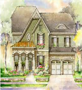 | 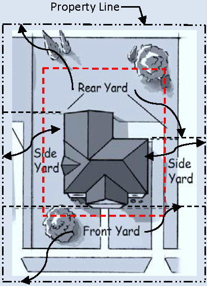 |  | |||
| Minimum Lot Area | Minimum Front Yard Setback | Minimum Floor Area | |||
| 12,000 sq. ft. per dwelling unit. | 25 ft. | 650 sq. ft.—One-story dwelling | |||
| For corner or multiple street frontage lots, the minimum front yard setback shall be observed from all streets. | 450 sq. ft.—Two-story dwelling, first floor area. | ||||
| 650 sq. ft.—Two-story dwelling, both stories. | |||||
| Minimum Lot Width | Minimum Rear Yard Setback* | Maximum Height | |||
| 100 ft. per dwelling unit | 30 ft. | 26 ft. | |||
| Maximum Lot Coverage | Minimum Side Yard Setback | Accessory Building | |||
| 30% = All structures | 10 ft. for one side yard |
Max. area ≤ first floor area of primary dwelling.
Min. alley setback = 5 ft | |||
| 20 ft. for both side yards | |||||
| For corner or multiple street frontage lots, side yard setback requirements shall apply to those lot lines that are not street frontages. | |||||
| Detached Accessory Building | |||||
| Min. rear yard setback = 5 ft.* | |||||
| Min. side yard setback = 10 ft. | |||||
| See section 44-212 | |||||
| See section 44-213 | |||||
R-2 Single-Family Residential District
 | 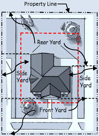 |  | |||
| Minimum Lot Area | Minimum Front Yard Setback | Minimum Floor Area | |||
| 7,260 sq. ft. per dwelling unit. | 12 ft. | 450 sq. ft.—Two-story dwelling, first floor area. | |||
| 650 sq. ft.—One-story dwelling | |||||
| For corner or multiple street frontage lots, the minimum front yard setback shall be observed from all streets. | 650 sq. ft.—Two-story dwelling, both stories. | ||||
| Minimum Lot Width | Minimum Rear Yard Setback* | Maximum Height | |||
| 65 ft. per dwelling unit. | 30 ft. | 26 ft. | |||
| Maximum Lot Coverage | Minimum Side Yard Setback | Accessory Building | |||
| 30% = All structures | 5 ft. for one side yard |
Max. area ≤ first floor area of primary dwelling.
Min. alley setback = 5 ft | |||
| 15 ft. for both side yards | |||||
| For corner or multiple street frontage lots, side yard setback requirements shall apply to those lot lines that are not street frontages. | |||||
| Detached Accessory Building | |||||
| Min. side yard setback = 5 ft. | |||||
| Min. rear yard setback = 5 ft.* | |||||
| See section 44-212(b) | |||||
| See section 44-213 | |||||
R-3 Single-Family Residential District
 | 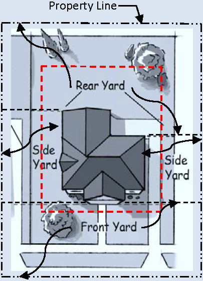 | 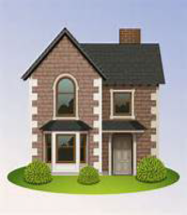 | |||
| Minimum Lot Area | Minimum Front Yard Setback | Minimum Floor Area | |||
| 5,500 sq. ft. per dwelling unit | 12 ft. | 650 sq. ft.—One-story dwelling | |||
| For corner or multiple street frontage lots, the minimum front yard setback shall be observed from all streets | 450 sq. ft.—Two-story dwelling, first floor area | ||||
| 650 sq. ft.—Two-story dwelling, both stories | |||||
| Minimum Lot Width | Minimum Rear Yard Setback* | Maximum Height | |||
| 50 ft. per dwelling unit | 30 ft. | 26 ft. | |||
| Maximum Lot Coverage | Minimum Side Yard Setback | Accessory Building | |||
| 30% = All structures | 5 ft. for one side yard |
Max. area ≤ first floor area of primary dwelling.
Min. alley setback = 5 ft | |||
| 15 ft. for both side yards | |||||
| For corner or multiple street frontage lots, side yard setback requirements shall apply to those lot lines that are not street frontages. | |||||
| Detached Accessory Building | |||||
| Min. side yard setback = 5 ft. | |||||
| Min. rear yard setback = 5 ft.* | |||||
| See section 44-212(b) | |||||
| See section 44-213 | |||||
RM-L Multifamily Low Density District
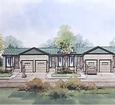 |  | 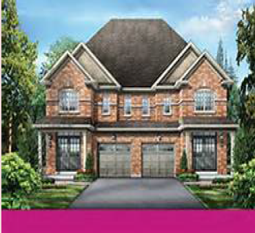 | |||
| Minimum Lot Area | Minimum Front Yard Setback | Minimum Floor Area | |||
| Min. lot area for all RM development = 1 acre. | 30 ft. | 650 sq. ft.—One-story dwelling | |||
| 7,260 sq. ft. per dwelling unit. | For corner or multiple street frontage lots, the minimum front yard setback shall be observed from all streets. | 450 sq. ft.—Two-story dwelling, first floor area. | |||
| 650 sq. ft.—Two-story dwelling, both stories. | |||||
| Minimum Lot Width | Minimum Rear Yard Setback* | Maximum Height | |||
| 65 ft. per dwelling unit for first two units, 10 additional ft. for next six units, 5 additional ft. for each additional unit to a max. of 250 ft. | 30 ft. | 35 ft. | |||
| Maximum Lot Coverage | Minimum Side Yard Setback | Accessory Building | |||
|
35% = All structures
see: section 44-240 | 15 ft. for one side yard |
Max. area ≤ first floor area of primary dwelling.
Min. alley setback = 5 ft | |||
| 30 ft. for both side yards | |||||
| For corner or multiple street frontage lots, side yard setback requirements shall apply to those lot lines that are not street frontages. | |||||
| Detached Accessory Building | *See additional requirements section 44-168 | ||||
| Min. side yard setback = 5 ft. | |||||
| Min. rear yard setback = 5 ft.* | |||||
| *See section 44-213 | |||||
| See additional requirements in section 44-167 | |||||
RM-H Multifamily High Density District
 |  |  | |||
| Minimum Lot Area | Minimum Front Yard Setback | Minimum Floor Area | |||
| Min. lot area for all RM development = 1 acre | 30 ft. | 650 sq. ft.—One-story dwelling | |||
| Single-family = 9,600 sq. ft. per dwelling unit. | For corner or multiple street frontage lots, the minimum front yard setback shall be observed from all streets. | 450 sq. ft.—Two-story dwelling, first floor area. | |||
| Two family = 7,260 sq. ft. per dwelling unit. | 650 sq. ft.—Two-story dwelling, both stories. | ||||
| Multifamily = 8,000 for first dwelling unit, plus 5,000 sq. ft. for each additional 3 or more bedroom units; 4,000 sq. ft. for each additional 2 bedroom unit; and 3,000 sq. ft. for each additional 1 bedroom or efficiency unit | |||||
| Minimum Lot Width | Minimum Rear Yard Setback* | Maximum Height | |||
| 65 ft. per dwelling unit. | 30 ft. | 35 ft. | |||
| Maximum Lot Coverage | Minimum Side Yard Setback | Accessory building | |||
|
35% = All structures
see: section 44-240 | 15 ft. for one side yard |
Max. area ≤ first floor area of primary dwelling.
Min. alley setback = 5 ft | |||
| 30 ft. for both side yards | |||||
| For corner or multiple street frontage lots, side yard setback requirements shall apply to those lot lines that are not street frontages. | |||||
| Detached Accessory Building | *See additional requirements section 44-168 | ||||
| Min. side yard setback = 5 ft. | |||||
| Min. rear yard setback = 5 ft.* | |||||
| *See section 44-213 | |||||
| See additional requirements in section 44-167 | |||||
RM-MH Mobile Home District
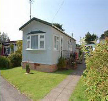 | 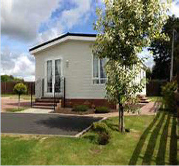 | 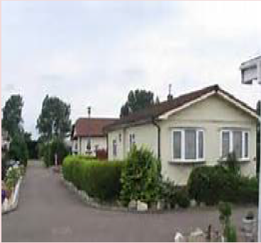 | |||
| Minimum Lot Area | Minimum Front Yard Setback | Minimum Floor Area | |||
| Min. lot area for all RM-MH development = 15 acres. | 23 ft. | 650 sq. ft.—One-story dwelling | |||
| Single-family = 5,500 sq. ft. per dwelling unit. | 450 sq. ft.—Two-story dwelling, first floor area. | ||||
| 650 sq. ft.—Two-story dwelling, both stories. | |||||
| Minimum Lot Width | Minimum Rear Yard Setback* | Maximum Height | |||
| N/A | 10 ft. | 25 ft. | |||
| Maximum Lot Coverage | Minimum Side Yard Setback | Accessory Building | |||
|
35% = All structures
see: section 44-240 | 10 ft. for one side yard |
Max. area ≤ first floor area of primary dwelling.
Min. alley setback = 5 ft | |||
| 20 ft. for both side yards | |||||
| For corner or multiple street frontage lots, side yard setback requirements shall apply to those lot lines that are not street frontages. | |||||
| Detached Accessory Building | *See additional requirements section 44-168 | ||||
| Min. side yard setback = 5 ft. | |||||
| Min. rear yard setback = 5 ft.* | |||||
| *See section 44-213 | |||||
| See additional requirements section 44-168 | |||||
B-1 Local Business District
 |  |  | |||
| Minimum Lot Area | Minimum Front Yard Setback | Minimum Floor Area | |||
| 8,000 sq. ft. | 30 ft. | Variable | |||
| Minimum Lot Width | Minimum Rear Yard Setback* | Maximum Height | |||
| 80 ft. | 30 ft. | 26 ft. | |||
| Maximum Lot Coverage | Minimum Side Yard Setback | Accessory Building | |||
|
35% = All structures
see: section 44-240 | 10 ft. for one side yard |
Max. area ≤ first floor area of primary building.
Min. alley setback = 5 ft | |||
| 20 ft. for both side yards | |||||
| For corner or multiple street frontage lots, side yard setback requirements shall apply to those lot lines that are not street frontages. | |||||
| Detached Accessory Building | |||||
| Min. side yard setback = 5 ft. | |||||
| Min. rear yard setback = 5 ft.* | |||||
| *See section 44-213 | |||||
| See section 44-214 | |||||
B-2 Central Business District
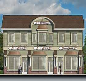 |  | 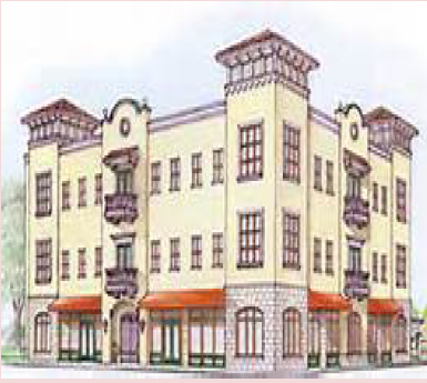 | |||
| Minimum Lot Area | Minimum Front Yard Setback | Minimum Floor Area | |||
| 1,800 sq. ft. | N/A | N/A | |||
| Minimum Lot Width | Minimum Rear Yard Setback* | Maximum Height | |||
| N/A | N/A | 3 stories and 35 ft. | |||
| Maximum Lot Coverage | Minimum Side Yard Setback | Minimum Height | |||
| N/A | N/A | 2 stories | |||
| Front Build-To-Line: 1 st Floor | Side Build-To-Line: | Detached Accessory Building | |||
|
Shall match adjacent building fronts. If the neighboring properties have different
front buildings, the new building shall be 0 ft to the lesser
building setback. | N/A |
N/A
*See section 44-213 | |||
| Minimum Lot Coverage | Accessory Building | Minimum Ground Floor Height | |||
| 65% | Max. area ≤ first floor area of primary building. | 12 ft. | |||
| Minimum Front Facade height | |||||
|
24 ft. (when adjacent to a
building of multiple levels on a minimum of one side) | |||||
B-3 Commercial Business District
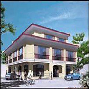 | 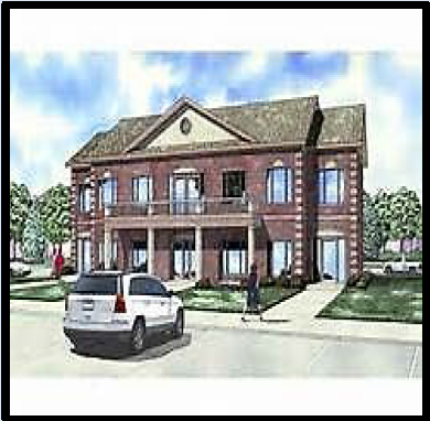 | 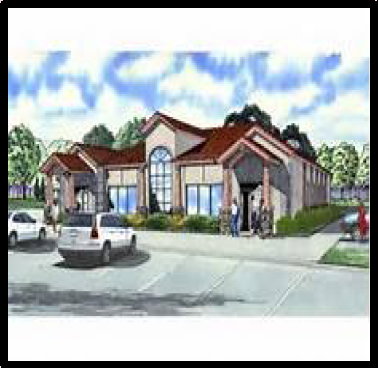 | |||
| Minimum Lot Area | Minimum Front Yard Setback | Minimum Floor Area | |||
| 12,000 sq. ft. | 30 ft. | Variable | |||
| Minimum Lot Width | Minimum Rear Yard Setback* | Maximum Height | |||
| 100 ft. | 30 ft. | 26 ft. | |||
| Maximum Lot Coverage | Minimum Side Yard Setback | Accessory Building | |||
| N/A | 10 ft. for one side yard |
Max. area ≤ first floor area of primary building.
Min. alley setback = 5 ft | |||
| 20 ft. for both side yards | |||||
| For corner or multiple street frontage lots, side yard setback requirements shall apply to those lot lines that are not street frontages. | |||||
| Detached Accessory Building | |||||
| Min. side yard setback = 5 ft. | |||||
| Min. rear yard setback = 5 ft.* | |||||
| *See section 44-213 | |||||
| See section 44-214 | |||||
I-1 Light Industrial District
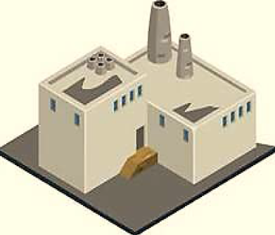 | 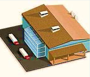 |  | |||
| Minimum Lot Area | Minimum Front Yard Setback | Minimum Floor Area | |||
| 20,000 sq. ft. | 30 ft. | Variable | |||
| Minimum Lot Width | Minimum Rear Yard Setback* | Maximum Height | |||
| 150 ft. | 30 ft. | 35 ft. | |||
| Maximum Lot Coverage | Minimum Side Yard Setback | Accessory Building | |||
| N/A | 15 ft. for one side yard |
Max. area ≤ first floor area of primary building.
Min. alley setback = 5 ft | |||
| 30 ft. for both side yards | |||||
| For corner or multiple street frontage lots, side yard setback requirements shall apply to those lot lines that are not street frontages. | |||||
| Detached Accessory Building | |||||
| Min. side yard setback = 5 ft. | |||||
| Min. rear yard setback = 5 ft.* | |||||
| *See section 44-213 | |||||
| See section 44-221 | |||||
P-1 Public Lands District
 |  |  | |||
| Minimum Lot Area | Minimum Front Yard Setback | Minimum Floor Area | |||
| 12,000 sq. ft. | 30 ft. | Variable | |||
| Minimum Lot Width | Minimum Rear Yard Setback* | Maximum Height | |||
| 100 ft. | 30 ft. | 35 ft. | |||
| Maximum Lot Coverage | Minimum Side Yard Setback | Accessory Building | |||
| 30% | 15 ft. for one side yard |
Max. area ≤ first floor area of primary building.
Min. alley setback = 5 ft | |||
| 30 ft. for both side yards | |||||
| For corner or multiple street frontage lots, side yard setback requirements shall apply to those lot lines that are not street frontages. | |||||
| Detached Accessory Building | |||||
| Min. side yard setback = 5 ft. | |||||
| Min. rear yard setback = 5 ft.* | |||||
| *See section 44-213 | |||||
| See section 44-221 | |||||
(Ord. No. 458, § 535, 3-2-2015; Ord. No. 2024-02, § 1, 5-21-2024; Ord. No. 2024-11, § 1, 11-19-2024; Ord. No. 2025-01, § 1, 4-1-2025)
Sec. 44-238. - Central business district design standards.
(a)
General standards. The purpose of the following design and architectural standards is to evaluate proposed buildings and site improvements during the development plan review to ensure that certain design and appearance standards are maintained. These standards ensure that the village's appearance, character, history, function, and natural resources are preserved through high-quality design.
(b)
Applicability. The provisions of the subsection shall apply to all planned buildings and all alterations, renovations, expansions, or other work that includes exterior changes to existing buildings subject to site plan review in the B-2 central business district.
(1)
This subsection is not intended to supersede or supplant established building and are code regulations, nor to regulate the quality, durability, maintenance, performance, load capacity, or are resistance characteristics or workmanship of building materials.
(2)
Innovations in architectural design may be permitted, provided the building design shall be in keeping with the desired character of the town center area as described in the Village of Elk Rapids master plan and the design guidelines within this section.
(3)
The exterior finish materials shall be of equal or better quality and durability as those permitted herein, with the intent to allow for new technologies in building materials while maintaining the desired character for the village center area.
(4)
Front building facades at the first story shall be located at the frontage line, except the planning commission may adjust the required front yard to the average front setback of any abutting building.
(c)
Building Standards.
(1)
The following table details design requirements for public entrances, design features, rooflines, windows and transparency, building materials, awnings and balconies.
Table X. Building Standards
| Public Entrances | |
|
All buildings shall have at least one primary public entrance that faces a public
street unless a building does not face a public street and or right-of-way. Rear entrances
are permitted, only if there is a primary entrance from a public street. Main entrances
to buildings shall incorporate devices such as canopies, recessed entrance ways, larger
door openings and display windows, accent colors, and architectural details such as
tile work, moldings, and
distinctive door pulls. | |
|
Min. one at grade entrance per street-facing façade, or one
corner entrance for corner lots with frontage on two streets | 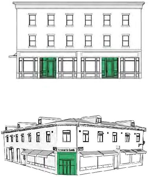 |
| Min. four feet from façade for outward opening doors along public rights-of-way | |
| Cantilever doors permitted as customer entrances with minimum 50% transparency. | |
| Doors shall measure 7'8". If a door is shorter than that, there shall be a glass transom above the door to reach 7'8". | |
| Entrances on the front façade must be constructed so that the elevation of the entrance allows direct building access without exterior ramps or steps. | |
| Design Features | |
|
Buildings shall have clearly defined, highly visible customer entrances that include
no less than three of the following design features:
• Canopies/porticos above the entrance; • Roof overhangs above the entrance; • Entry recesses/projections; • Arcades that are physically integrated with the entrance; • Raised corniced parapets above the entrance; • Display windows that are directly adjacent to the entrance; or • Architectural details, such as =le work and moldings, that is integrated into the building structure and design and is above and/or directly adjacent to the entrance. | |
| Roof Lines: Flat Roofs | |
| Detailed parapets or exaggerated cornice lines shall be incorporated into rooflines along building facades greater than 27 feet. | 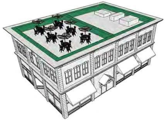 |
| Mansard, mock mansard, or barrel roofs are prohibited. | |
| Rooftop mechanical equipment visible from the ground or an established floor/story of an adjacent buildings shall be concealed by architectural feature(s). | |
|
Rooftop patios are permitted and do not count as an established floor/story.
Rooftop amenities may be erected to accommodate occupiable, enclosed space for rooftop amenities and may exceed the height limit of the district by a maximum of 15 feet, provided: (1) The use shall be limited to restrooms, storage areas, community rooms for the occupants of the building, and food and beverage service, provided that operations comply with the village's noise regulations, found in sections 22-92 through 22-122. (2) Shall be setback a minimum of 20 feet from any street facing facade and rear property line if abutting or across an alley from an R-District. (3) Not exceed a total of 1,650 square feet or 20% of the rooftop area, whichever is less. (4) Only the stair tower, elevator lobby, restrooms, any bars may have roofs, all other areas must be open-air. | |
| Windows and Transparency | |
| Buildings with frontage on a public or private right-of-way shall be designed to encourage and complement a pedestrian-scale environment, with window openings and facade transparency subject to the following standards: | 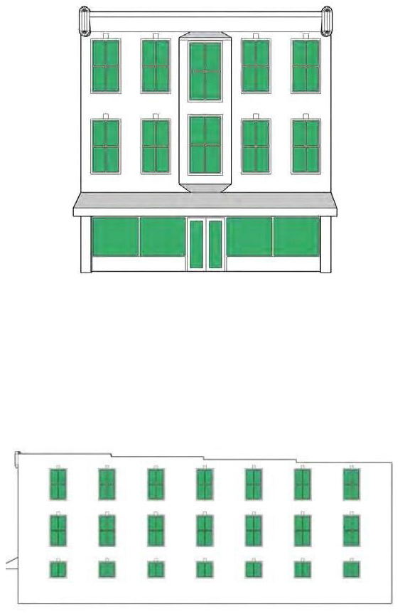 |
| Front façade - 1 st floor: Min 50%, Max 70% | |
| Front façade - Upper floors: Minimum 40%, Max 60% | |
| Side façade: Min. 40% other than when the distance to adjacent structures is less than 12" | |
| Glazing: Primarily clear or lightly tinted glass. Translucent glass shall be limited to bathroom windows and similar use areas requiring privacy. | |
|
Pattern and orientation: All facades visible from public streets must contain glazed
glass windows. Windows shall be recessed and include visually obvious sills. Spaces
between windows shall be formed by columns, mullions, or material found elsewhere
on the facade. First floor window shapes shall be rectangular, square, or Palladian
(rectangular with semi- circle top).
Vertical window orientation shall have a width to height ratio of at least one to two (1:2), and shall be consistent with adjacent buildings. Horizontal windows with a width to height ratio of between one to one (1:1) and four to one (4:1) may be permitted by the Planning Commission if they determine such window orientation is consistent with the appearance and character of the downtown. | |
| Building materials, mass, and scale must be consistent with the surrounding neighborhood character. All building construction, alteration, renovation, and other development activity subject to the provisions of this section shall conform with the following standards for exterior building façade materials. Building materials on the front façade or any facade visible from a public right-of-way must be primarily of natural materials conveying permanence. The percentages presented below apply to each façade individually. | |
| Building materials | Max. Permitted Façade Coverage |
| Brick | 100% |
| 60% | |
| Stone | 100% |
| Concrete slab | 50% |
| 50% | |
| Siding | 50% |
| Decorative or accent features | 20% |
| CMU= Concrete Masonry Unit | |
| Recommended Materials | Brick, stone, concrete slab(poured in place, tilt-up, construction) |
| Acceptable Materials | Split face block, scored, or ground face block, beveled wood or cement board siding(lap, board and vatter, shake); exterior insulation finish systems(EFIS). |
| Discouraged Materials | Smooth face block, vinyl siding, metal siding(standing seam panels, aluminum siding); clear and reflective glass; T111 and other wood panel siding. |
Acceptable or discouraged materials, or other similar synthetic or highly reflective materials should not be used except for decorative or accent features only. Exterior insulation finish systems(EFIS) may be used for decorative or accent features and may also be used as a primary façade material provided it is placed at a height of 12' or greater above the final grade and provided it is no more than 20 percent of the total façade area, excluding window areas.
Exterior colors: Exterior colors shall be compatible with the colors on surrounding buildings, subject to review and approval by the planning commission. The following natural colors are encouraged for the main portions of the building facades and roof forms; neutral earth tones(sand and brown), shades of gray; traditional colors(e.g. brick red, forest green, navy blue); light subdued hues(e.g. salmon) or white. Contrasting colors which are compatible with the primary colors listed above are encouraged for trim, accent, and other decorative architectural features. The use of bright or fluorescent colors(e.g. purple, orange, pink, lime, yellow) is discouraged. Colors should be natural to the material or pigmented, and not painted on the material whenever possible.
Proposed colors shall be specified on the development plan. Samples of building materials and colors are required at the time of development plan submittal for review and approval by the Planning Commission.
| Facades Variation | |
|
All visible building facades greater than 27 feet in length shall contain architectural
features, details, and ornaments that are consistent with predominating architectural
styles found within the downtown such as: arches; roof cornices; contrasting bases;
contrasting masonry courses, water tables, or molding; pilasters or columns; corbeling;
contrasting bands or color; stone or ceramic accent tiles; colonnades; or porches.
Elements such as wall clocks, decorative light fixtures, and/or window canopies are also recommended. | |
| Blank windowless wall are expressly prohibited. | |
|
Contrasting accent colors that are compatible with the roof colors shall be used for
trim, accent, and other decorative architectural features.
The use of bright or fluorescent colors is prohibited. Colors should be natural to the material or pigmented, and not painted on the material whenever possible. | 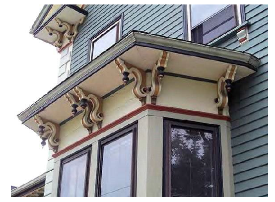 |
| All sides of a building shall be complementary in design, details, and materials. Where a side or rear facade is visible from a public street, or if parking is located at the side or rear of a building, the side and/or rear facade shall include windows, building materials, and architectural features complimentary to those present on the front facade of the building. | 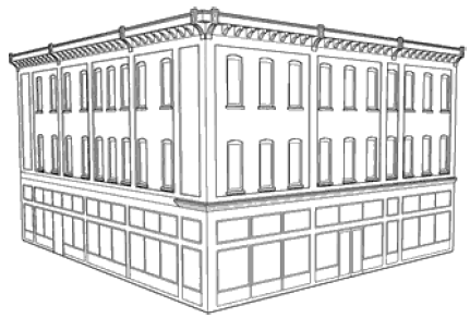 |
| Awnings | |
| Awnings are encouraged and shall be primarily designed to protect pedestrians, display windows, public entrances, and outdoor dining areas from the weather; and to add color and visual interest to the street level façade. Awnings shall be attached directly to the building rather than supported by columns or poles. In buildings with multiple storefronts, compatible awnings shall be used as a means of unifying the structure. Awning shall be aligned over window or entrances to the building. | |
| Design: shed, concave, or A-frame. | |
| Setback: 6 ft from curbline | 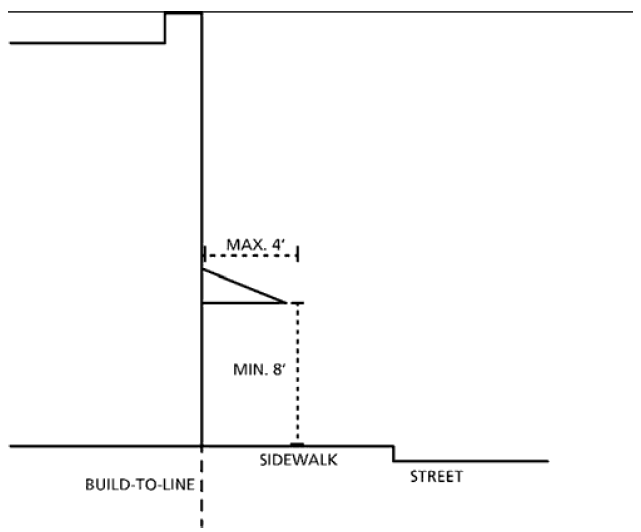 |
| Minimum clearance above grade: 8 ft | |
| Maximum ROW encroachment: 4 ft with ROW agency approval | |
| Awnings shall be kept in good repair to maintain the original appearance and securely attached to the building to ensure public safety. | |
| Balconies | |
| Balconies are permitted as either recessed or projecting, shall be made of wood, glass, or decorative iron or steel, and allowed on upper level facades subject to the following standards: | 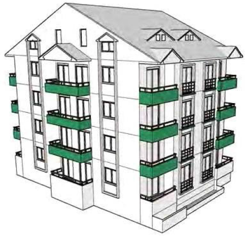 |
|
Facades:
Front—Recessed balconies only Side - Projecting balconies permitted but shall be setback five feet from property line. Recessed balconies permitted if building setback at least five feet from property line Corner lot - Projecting balconies permitted but shall not encroach into the ROW. Recessed balconies permitted. Rear - Projecting and recessed balconies permitted but shall be setback at least five feet from property line. | |
(d)
Other Standards.
(1)
The following table details design requirements for exterior lighting, utilities, courtyards, and landscaping.
|
Lighting
All lighting and light fixtures shall furthermore comply with the lighting standards in 44-228. | |
| Services Areas: A service alley or designated loading space should be reserved at the rear of the building. Loading from secondary streets may be permitted by the planning commission upon demonstration by the applicant that through traffic flow and access to neighboring uses will not be disrupted. | |
| Utilities | |
| All public and semi-public utilities and other services, including, but not limited to electricity, telephone, cable television, and others shall be placed underground. | |
| Courtyards and Plazas | |
| Exterior public and semi-public spaces, such as courtyards or plazas shall be designed for function, enhance the surrounding buildings, and provide amenities for users in the form of textured paving, landscaping, lighting, trees, benches, trash receptacles, and other items of street furniture, as appropriate. Courtyards shall have recognizable edges defined on at least three sides by buildings, walls, elements of landscaping, and/or elements of street furniture in order to create a strong sense of closure. | 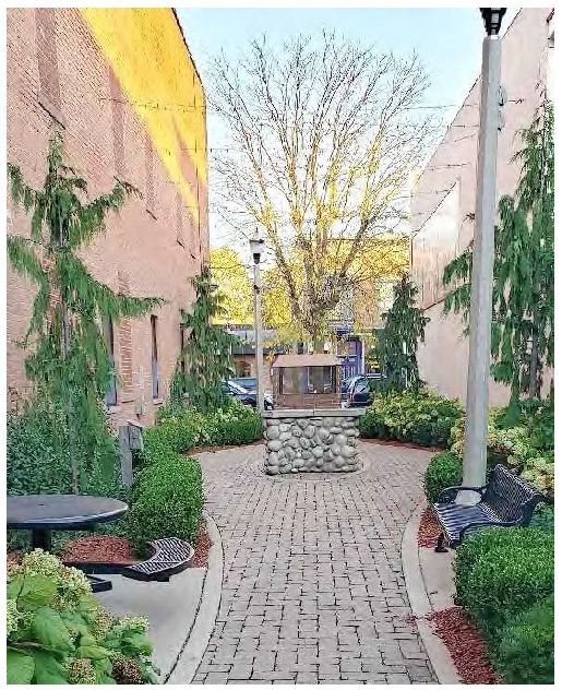 |
(Ord. No. 2024-02, § 1, 5-21-2024)
Sec. 44-239. - Mobile food vendors.
(a)
A mobile food vendors in the B- and I- districts may operate on private property with a required license. If the vehicle is located adjacent to an R- district, the vehicle is required to meet the setbacks of the district.
(b)
Mobile food vendors may not operate in an R- district unless the primary use of the property is for education, religion, or civic organization.
(c)
For educational, religious, and civic organizations, a mobile food vendor may operate on private property, with a license for not more than 48 consecutive hours, twice in a calendar month.
(Ord. No. 2024-08, § 1, 10-15-2024)
Sec. 44-240. - Lot coverage adjustments for green infrastructure.
Development requests that contain bioswales and or rain gardens for stormwater management are allowed up to an additional five percent lot coverage based on the increase on-site capacity of the stormwater management features. Bioswales and rain gardens must be located either in the front yard, side yard outside of the setback, rear yard outside of the setback, or in the adjacent right-of-way, subject to approval by the village, who may seek a recommendation by a licensed civil engineer.
(Ord. No. 2024-11, § 1, 11-19-2024)

