
Escambia County Unincorporated
City Zoning Code
City Zoning Code
CHAPTER 4
LOCATION AND USE REGULATIONS
Sec. 4-1.1 - Purpose of chapter.
(a)
General. This chapter establishes county land use regulations necessary to implement comprehensive plan policies requiring the management of specific uses and locations. Location-based regulations additionally limit the uses allowed by zoning regulations and prescribe conditions for those uses when in proximity to essential resources, recognized hazards, and other constraints. Use-based regulations establish additional requirements to assure that specific uses will be compatible with surrounding uses. Compliance with the provisions of this chapter is evaluated by the administrative authorities described in chapter 1 according to the compliance review processes prescribed in chapter 2. More specifically, this chapter is intended to:
(1)
Protect navigable airspace and aviation facilities, wetlands, groundwater and surface waters, beaches and shorelines, critical habitat area, historical and archaeological resources, and other community resources.
(2)
Protect and conserve property values and property rights, balancing individual rights with the interests of the community to create a healthy, safe and orderly living environment.
(3)
Provide for adequate light, air, and privacy, and protect life and property in areas subject to natural or manmade hazards.
(Ord. No. 2015-12, § 1(Exh. A), 4-16-2015)
Sec. 4-1.2 - Purpose of article.
This article establishes general provisions that apply broadly to all location-based and use-based regulations within the chapter. The regulations applicable to specific locations and uses are prescribed in the remaining articles of this chapter.
(Ord. No. 2015-12, § 1(Exh. A), 4-16-2015)
Sec. 4-1.3 - General conditions.
(a)
Applicability. The standards of this chapter apply to all land uses and development activities as established within each article and are independent of the review processes used to determine compliance with them.
(1)
New uses and structures. Any new use that is established, including a change of use, or any building or other structure that is constructed, or tract of land developed, for any principal or accessory use allowed by the land development code (LDC), is subject to the standards of this chapter.
(2)
Existing uses and structures. Any existing use of land that is extended, enlarged or moved, or any existing building or other structure that is extended, enlarged, moved, structurally altered or reconstructed, is subject to the standards of this chapter with respect to such changes and any existing nonconformity.
(b)
Nonconformance with chapter regulations. Lawfully established and maintained uses, structures, lots, and site conditions that no longer comply with one or more of the regulations established in this chapter may continue in productive use, subject to the nonconformance provisions of the regulations and chapter 1.
(c)
Relief from standards. Modification of the land use regulations of this chapter is generally contrary to good development practices. However, the county recognizes that land is not uniform and the same regulation may not affect all sites equally. Accordingly, regulations allow variances for limited site-specific relief through the approval of the planning official or the board of adjustment (BOA), or the Santa Rosa Island Authority (SRIA) for Pensacola Beach properties. However, the regulation must be specifically identified as eligible and the variance must be within the limits prescribed. No provisions of the chapter preclude the establishment of variance limits or conditions by the approving authority.
(Ord. No. 2015-12, § 1(Exh. A), 4-16-2015)
Sec. 4-2.1 - Administration.
(a)
General. These regulations shall be known as the Floodplain Management Ordinance of Escambia County, hereinafter referred to as "this article."
(b)
Scope. The provisions of this article shall apply to all development that is wholly within or partially within any flood hazard area, including, but not limited to, the subdivision of land; filling, grading, and other site improvements and utility installations; construction, alteration, remodeling, enlargement, improvement, replacement, repair, relocation or demolition of buildings, structures, and facilities that are exempt from the Florida Building Code; placement, installation, or replacement of manufactured homes and manufactured buildings; installation or replacement of tanks; placement of recreational vehicles; installation of swimming pools; and any other development.
(Ord. No. 2015-12, § 1(Exh. A), 4-16-2015; Ord. No. 2016-10, § 2(Exh. A), 1-21-2016)
Sec. 4-2.2 - General provisions.
(a)
The purposes of this article and the flood load and flood-resistant construction requirements of the Florida Building Code are to establish minimum requirements to safeguard the public health, safety, and general welfare and to minimize public and private losses due to flooding through regulation of development in flood hazard areas to:
(1)
Minimize unnecessary disruption of commerce, access and public service during times of flooding;
(2)
Require the use of appropriate construction practices in order to prevent or minimize future flood damage;
(3)
Manage filling, grading, dredging, mining, paving, excavation, drilling operations, storage of equipment or materials, and other development which may increase flood damage or erosion potential;
(4)
Manage the alteration of flood hazard areas, watercourses, and shorelines to minimize the impact of development on the natural and beneficial functions of the floodplain;
(5)
Minimize damage to public and private facilities and utilities;
(6)
Help maintain a stable tax base by providing for the sound use and development of flood hazard areas;
(7)
Minimize the need for future expenditure of public funds for flood control projects and response to and recovery from flood events;
(8)
Meet the requirements of the National Flood Insurance Program for community participation as set forth in the Title 44 Code of Federal Regulations, Section 59.22.
(b)
Coordination with the Florida Building Code. This article is intended to be administered and enforced in conjunction with the Florida Building Code. Where cited, ASCE 24 refers to the edition of the standard that is referenced by the Florida Building Code.
(c)
Warning. The degree of flood protection required by this article and the Florida Building Code, as amended by this community, is considered the minimum reasonable for regulatory purposes and is based on scientific and engineering considerations. Larger floods can and will occur. Flood heights may be increased by manmade or natural causes. This article does not imply that land outside of mapped special flood hazard areas, or that uses permitted within such flood hazard areas, will be free from flooding or flood damage. The flood hazard areas and base flood elevations contained in the Flood Insurance Study and shown on Flood Insurance Rate Maps and the requirements of Title 44 Code of Federal Regulations, Sections 59 and 60 may be revised by the Federal Emergency Management Agency, requiring this community to revise these regulations to remain eligible for participation in the National Flood Insurance Program. No guaranty of vested use, existing use, or future use is implied or expressed by compliance with this article.
(d)
Disclaimer of liability. This article shall not create liability on the part of board of county commissioners of Escambia County or by any officer or employee thereof for any flood damage that results from reliance on this article or any administrative decision lawfully made thereunder.
(Ord. No. 2015-12, § 1(Exh. A), 4-16-2015; Ord. No. 2016-10, § 2(Exh. A), 1-21-2016)
Sec. 4-2.3 - Applicability.
(a)
General. Where there is a conflict between a general requirement and a specific requirement, the specific requirement shall be applicable.
(b)
Areas to which this article applies. This article shall apply to all flood hazard areas within Escambia County, as established in section 4-2.3(c) of this article.
(c)
Basis for establishing flood hazard areas. The Flood Insurance Study for Escambia County, Florida and Incorporated Areas dated August 19, 2025, and all subsequent amendments and revisions, and the accompanying flood insurance rate maps (FIRM), and all subsequent amendments and revisions to such maps, are adopted by reference as a part of this article and shall serve as the minimum basis for establishing flood hazard areas. Studies and maps that establish flood hazard areas are on file at the Escambia County Building Inspections Department, 3363 West Park Place, Pensacola, Florida 32505.
(d)
Submission of additional data to establish flood hazard areas. To establish flood hazard areas and base flood elevations, pursuant to section 4-2.6 of this article the floodplain administrator may require submission of additional data. Where field surveyed topography prepared by a Florida licensed professional surveyor or digital topography accepted by the community indicates that ground elevations:
(1)
Are below the closest applicable base flood elevation, even in areas not delineated as a special flood hazard area on a FIRM, the area shall be considered as flood hazard area and subject to the requirements of this article and, as applicable, the requirements of the Florida Building Code.
(2)
Are above the closest applicable base flood elevation, the area shall be regulated as special flood hazard area unless the applicant obtains a letter of map change that removes the area from the special flood hazard area.
(e)
Other laws. The provisions of this article shall not be deemed to nullify any provisions of local, state or federal law.
(f)
Abrogation and greater restrictions. This article supersedes any ordinance in effect for management of development in flood hazard areas. However, it is not intended to repeal or abrogate any other provisions of existing ordinances including, but not limited to, land development regulations, zoning ordinances stormwater management regulations, or the Florida Building Code. In the event of a conflict between these regulations and any other regulation, the more restrictive shall govern. This article shall not impair any deed restriction, covenant or easement, but any land that is subject to such interests shall also be governed by this article.
(g)
Interpretation. In the interpretation and application of this article, all provisions shall be:
(1)
Considered as minimum requirements;
(2)
Liberally construed in favor of the governing body; and
(3)
Deemed neither to limit nor repeal any other powers granted under state statutes.
(Ord. No. 2015-12, § 1(Exh. A), 4-16-2015; Ord. No. 2016-10, § 2(Exh. A), 1-21-2016; Ord. No. 2022-34, § 2, 9-1-2022; Ord. No. 2025-18, § 2, 5-15-2025)
Sec. 4-2.4 - Duties and powers of the floodplain administrator.
(a)
Designation. The county administrator is designated as the floodplain administrator. The floodplain administrator may delegate performance of certain duties to other employees.
(b)
General. The floodplain administrator is authorized and directed to administer and enforce the provisions of this article. The floodplain administrator shall have the authority to render interpretations of this article consistent with the intent and purpose of this article and may establish policies and procedures in order to clarify the application of its provisions. Such interpretations, policies, and procedures shall not have the effect of waiving requirements specifically provided in this article without the granting of a variance pursuant to section 4-2.8 of this article.
(c)
Applications and permits. The floodplain administrator, in coordination with other pertinent offices of the community, shall:
(1)
Review applications and plans to determine whether proposed new development will be located in flood hazard areas;
(2)
Review applications for modification of any existing development in flood hazard areas for compliance with the requirements of this article;
(3)
Interpret flood hazard area boundaries where such interpretation is necessary to determine the exact location of boundaries; a person contesting the determination shall have the opportunity to appeal the interpretation;
(4)
Provide available flood elevation and flood hazard information;
(5)
Determine whether additional flood hazard data shall be obtained from other sources or shall be developed by an applicant;
(6)
Review applications to determine whether proposed development will be reasonably safe from flooding;
(7)
Issue floodplain development permits or approvals for development other than buildings and structures that are subject to the Florida Building Code, including buildings, structures and facilities exempt from the Florida Building Code, when compliance with this article is demonstrated, or disapprove the same in the event of noncompliance; and
(8)
Coordinate with and provide comments to the building official to assure that applications, plan reviews, and inspections for buildings and structures in flood hazard areas comply with the applicable provisions of this article.
(d)
Substantial improvements and substantial damage determinations. For applications for building permits to improve buildings and structures, including alterations, movement, enlargement, replacement, repair, change of occupancy, additions, rehabilitations, renovations, substantial improvements, repairs of substantial damage, and any other improvement of or work on such buildings and structures, the floodplain administrator, in coordination with the building official, shall:
(1)
Estimate the market value, or require the applicant to obtain an appraisal of the market value prepared by a qualified independent appraiser, of the building or structure before the start of construction of the proposed work; in the case of repair, the market value of the building or structure shall be the market value before the damage occurred and before any repairs are made;
(2)
Compare the cost to perform the improvement, the cost to repair a damaged building to its pre-damaged condition, or the combined costs of improvements and repairs, if applicable, to the market value of the building or structure;
(3)
Determine and document whether the proposed work constitutes substantial improvement or repair of substantial damage;
(4)
Notify the applicant if it is determined that the work constitutes substantial improvement or repair of substantial damage and that compliance with the flood resistant construction requirements of the Florida Building Code and this article is required.
(e)
Modifications of the strict application of the requirements of the Florida Building Code. The floodplain administrator shall review requests submitted to the building official that seek approval to modify the strict application of the flood load and flood-resistant construction requirements of the Florida Building Code to determine whether such requests require the granting of a variance pursuant to section 4-2.8 of this article.
(f)
Notices and orders. The floodplain administrator shall coordinate with appropriate local agencies for the issuance of all necessary notices or orders to ensure compliance with this article.
(g)
Inspections. The floodplain administrator shall make the required inspections as specified in section 4-2.7 of this article for development that is not subject to the Florida Building Code, including buildings, structures and facilities exempt from the Florida Building Code. The floodplain administrator shall inspect flood hazard areas to determine if development is undertaken without issuance of a permit.
(h)
Other duties of the floodplain administrator. The floodplain administrator shall have other duties, including, but not limited to:
(1)
In coordination with the building official review all permits for construction within the special flood hazard areas to ensure that the proposed project meets the freeboard requirements. In Escambia County the freeboard requirement is three feet above the designated FEMA Base Flood Elevation.
(2)
Establish, in coordination with the building official, procedures for administering and documenting determinations of substantial improvement and substantial damage made pursuant to section 4-2.4(d) of this article;
(3)
Require that applicants proposing alteration of a watercourse notify adjacent communities and the Florida Division of Emergency Management, state floodplain management office, and submit copies of such notifications to the Federal Emergency Management Agency (FEMA);
(4)
Require applicants who submit hydrologic and hydraulic engineering analyses to support permit applications to submit to FEMA the data and information necessary to maintain the flood insurance rate maps if the analyses propose to change base flood elevations, flood hazard area boundaries, or floodway designations; such submissions shall be made within six months of such data becoming available;
(5)
Review required design certifications and documentation of elevations specified by this article and the Florida Building Code to determine that such certifications and documentations are complete; and
(6)
Advise applicants for new buildings and structures, including substantial improvements, that are located in any unit of the Coastal Barrier Resources System established by the Coastal Barrier Resources Act (Pub. L. 97-348) and the Coastal Barrier Improvement Act of 1990 (Pub. L. 101-591) that federal flood insurance is not available on such construction; areas subject to this limitation are identified on flood insurance rate maps as "Coastal Barrier Resource System Areas" and "Otherwise Protected Areas."
(i)
Floodplain management records. Regardless of any limitation on the period required for retention of public records, the floodplain administrator shall maintain and permanently keep and make available for public inspection all records that are necessary for the administration of this article and the flood-resistant construction requirements of the Florida Building Code, including flood insurance rate maps; letters of map change; records of issuance of permits and denial of permits; determinations of whether proposed work constitutes substantial improvement or repair of substantial damage; required design certifications and documentation of elevations specified by the Florida Building Code and this article; notifications to adjacent communities, FEMA, and the state, related to alterations of watercourses; assurances that the flood carrying capacity of altered watercourses will be maintained; documentation related to appeals and variances, including justification for issuance or denial; and records of enforcement actions taken pursuant to this article and the flood-resistant construction requirements of the Florida Building Code. These records shall be available for public inspection at Escambia County Development Services.
(Ord. No. 2015-12, § 1(Exh. A), 4-16-2015; Ord. No. 2016-10, § 2(Exh. A), 1-21-2016; Ord. No. 2022-34, § 2, 9-1-2022; Ord. No. 2025-18, § 3, 5-15-2025)
Sec. 4-2.5 - Permits.
(a)
Permits required. Any owner or owner's authorized agent (hereinafter "applicant") who intends to undertake any development activity within the scope of this article, including buildings, structures, and facilities exempt from the Florida Building Code, which is wholly within or partially within any flood hazard area shall first make application to the floodplain administrator, and the building official if applicable, and shall obtain the required permit(s) and approval(s). No such permit or approval shall be issued until compliance with the requirements of this article and all other applicable codes and regulations has been satisfied.
(b)
Floodplain development permits or approvals. Floodplain development permits or approvals shall be issued pursuant to this article for any development activities not subject to the requirements of the Florida Building Code, including buildings, structures, and facilities exempt from the Florida Building Code. Depending on the nature and extent of proposed development that includes a building or structure, the floodplain administrator may determine that a floodplain development permit or approval is required in addition to a building permit.
(c)
Buildings, structures and facilities exempt from the Florida Building Code. Pursuant to the requirements of federal regulation for participation in the National Flood Insurance Program (44 C.F.R. Sections 59 and 60), floodplain development permits or approvals shall be required for the following buildings, structures and facilities that are exempt from the Florida Building Code and any further exemptions provided by law, which are subject to the requirements of this article:
(1)
Railroads and ancillary facilities associated with the railroad.
(2)
Nonresidential farm buildings on farms, as provided in Section 604.50 Fla. Stat., as amended.
(3)
Temporary buildings or sheds used exclusively for construction purposes.
(4)
Mobile or modular structures used as temporary offices.
(5)
Those structures or facilities of electric utilities, as defined in Section 366.02 Fla. Stat., as amended, which are directly involved in the generation, transmission, or distribution of electricity.
(6)
Chickees constructed by the Miccosukee Tribe of Indians of Florida or the Seminole Tribe of Florida. As used in this paragraph, the term "chickee" means an open-sided wooden hut that has a thatched roof of palm or palmetto or other traditional materials, and that does not incorporate any electrical, plumbing, or other non-wood features.
(7)
Family mausoleums not exceeding 250 square feet in area which are prefabricated and assembled on site or preassembled and delivered on site and have walls, roofs, and a floor constructed of granite, marble, or reinforced concrete.
(8)
Temporary housing provided by the department of corrections to any prisoner in the state correctional system.
(9)
Structures identified in Section 553.73(10)(k) Fla. Stat., as amended, are not exempt from the Florida Building Code if such structures are located in flood hazard areas established on flood insurance rate maps.
(d)
Application for a permit or approval. To obtain a floodplain development permit or approval the applicant shall first file an application in writing on a form furnished by the community. The information provided shall:
(1)
Identify and describe the development to be covered by the permit or approval.
(2)
Describe the land on which the proposed development is to be conducted by legal description, street address or similar description that will readily identify and definitively locate the site.
(3)
Indicate the use and occupancy for which the proposed development is intended.
(4)
Be accompanied by a site plan or construction documents as specified in section 4-2.6 of this article.
(5)
State the valuation of the proposed work.
(6)
Be signed by the applicant or the applicant's authorized agent.
(7)
Give such other data and information as required by the floodplain administrator.
(e)
Validity of permit or approval. The issuance of a floodplain development permit or approval pursuant to this article shall not be construed to be a permit for, or approval of, any violation of this article, the Florida Building Codes, or any other ordinance of this community. The issuance of permits based on submitted applications, construction documents, and information shall not prevent the floodplain administrator from requiring the correction of errors and omissions.
(f)
Expiration. A floodplain development permit or approval shall become invalid unless the work authorized by such permit is commenced within 180 days after its issuance, or if the work authorized is suspended or abandoned for a period of 180 days after the work commences. Extensions for periods of not more than 180 days each shall be requested in writing and justifiable cause shall be demonstrated.
(g)
Suspension or revocation. The floodplain administrator is authorized to suspend or revoke a floodplain development permit or approval if the permit was issued in error, on the basis of incorrect, inaccurate or incomplete information, or in violation of this article or any other ordinance, regulation or requirement of this community.
(h)
Other permits. Floodplain development permits and building permits shall include a disclaimer that all other applicable state or federal permits be obtained by the applicant before commencement of the permitted development. Such permits may include, but not limited to, the following:
(1)
The Northwest Florida Water Management District; Section 373.036 Fla. Stat., as amended.
(2)
Florida Department of Health for onsite sewage treatment and disposal systems; Section 381.0065 Fla. Stat., as amended, and Chapter 64E-6, F.A.C.
(3)
Florida Department of Environmental Protection for construction, reconstruction, changes, or physical activities for shore protection or other activities seaward of the coastal construction control line; Section 161.141 Fla. Stat., as amended.
(4)
Florida Department of Environmental Protection for activities subject to the Joint Coastal Permit; Section 161.055 Fla. Stat., as amended.
(5)
Florida Department of Environmental Protection for activities that affect wetlands and alter surface water flows, in conjunction with the U.S. Army Corps of Engineers; Section 404 of the Clean Water Act.
(6)
Federal permits and approvals.
(Ord. No. 2015-12, § 1(Exh. A), 4-16-2015; Ord. No. 2016-10, § 2(Exh. A), 1-21-2016; Ord. No. 2022-34, § 2, 9-1-2022)
Sec. 4-2.6 - Site plans and construction documents.
(a)
Information for development in flood hazard areas. The site plan or construction documents for any development subject to the requirements of this article shall be drawn to scale and shall include, as applicable to the proposed development:
(1)
Delineation of flood hazard areas, floodway boundaries and flood zone(s), base flood elevation(s), and ground elevations if necessary for review of the proposed development.
(2)
Where base flood elevations, or floodway data are not included on the FIRM or in the flood insurance study, they shall be established in accordance with section 4-2.6(b)(2) or (3) of this article.
(3)
Where the parcel on which the proposed development will take place will have more than 50 lots or is larger than five (5) acres and the base flood elevations are not included on the FIRM or in the flood insurance study, such elevations shall be established in accordance with section 4-2.6(b)(1) of this article.
(4)
Location of the proposed activity and proposed structures, and locations of current buildings and structures; in coastal high hazard areas and Coastal A Zones, new buildings shall be located landward of the reach of mean high tide.
(5)
Location, extent, amount, and proposed final grades of any filling, grading, or excavation.
(6)
Where the placement of fill is proposed, the amount, type, and source of fill material; compaction specifications; a description of the intended purpose of the fill areas; and evidence that the proposed fill areas are the minimum necessary to achieve the intended purpose.
(7)
Delineation of the coastal construction control line or notation that the site is seaward of the coastal construction control line, if applicable.
(8)
Extent of any proposed alteration of sand dunes or mangrove stands provided such alteration is approved by the Florida Department of Environmental Protection.
(9)
Existing and proposed alignment of any proposed alteration of a watercourse.
The floodplain administrator is authorized to waive the submission of site plans, construction documents, and other data that are required by this article but that are not required to be prepared by a registered design professional if it is found that the nature of the proposed development is such that the review of such submissions is not necessary to ascertain compliance with this article.
(b)
Information in flood hazard areas without base flood elevations (approximate Zone A). Where flood hazard areas are delineated on the FIRM and base flood elevation data have not been provided, the floodplain administrator shall:
(1)
Require the applicant to include base flood elevation data prepared in accordance with currently accepted engineering practices.
(2)
Obtain, review, and provide to applicants base flood elevation and floodway data available from a federal or state agency or other source or require the applicant to obtain and use base flood elevation and floodway data available from a federal or state agency or other source.
(3)
Where base flood elevation data and floodway data are not available from another source, where the available data are deemed by the floodplain administrator to not reasonably reflect flooding conditions, or where the available data are known to be scientifically or technically incorrect or otherwise inadequate:
a.
Require the applicant to include base flood elevation data prepared in accordance with currently accepted engineering practices; or
b.
Specify that the base flood elevation is three feet above the highest adjacent grade at the location of the development, provided there is no evidence indicating flood depths have been or may be greater than two feet.
(4)
Where the base flood elevation data are to be used to support a letter of map change from FEMA, advice the applicant that the analyses shall be prepared by a Florida licensed engineer in a format required by FEMA, and that it shall be the responsibility of the applicant to satisfy the submittal requirements and pay the processing fees.
(c)
Additional analyses and certifications. As applicable to the location and nature of the proposed development activity, and in addition to the requirements of this section, the applicant shall have the following analyses signed and sealed by a Florida-licensed engineer for submission with the site plan and construction documents:
(1)
For development activities proposed to be located in a regulatory floodway, a floodway encroachment analysis that demonstrates that the encroachment of the proposed development will not cause any increase in base flood elevations; where the applicant proposes to undertake development activities that do increase base flood elevations, the applicant shall submit such analysis to FEMA as specified in section 4-2.6(d) of this article and shall submit the conditional letter of map revision, if issued by FEMA, with the site plan and construction documents.
(2)
For development activities proposed to be located in a riverine flood hazard area for which base flood elevations are included in the flood insurance study or on the FIRM and floodways have not been designated, a hydrological and hydraulic analysis that demonstrates that the cumulative effect of the proposed development, when combined with all other existing and anticipated flood hazard area encroachments, will not increase the base flood elevation more than one foot at any point within the community. This requirement does not apply in isolated flood hazard areas not connected to a riverine flood hazard area or in flood hazard areas identified as zone AO or zone AH.
(3)
For alteration of a watercourse, an engineering analysis prepared in accordance with standard engineering practices which demonstrates that the flood-carrying capacity of the altered or relocated portion of the watercourse will not be decreased, and certification that the altered watercourse shall be maintained in a manner which preserves the channel's flood-carrying capacity; the applicant shall submit the analysis to FEMA as specified in section 4-2.6(d) of this article.
(4)
For activities that propose to alter sand dunes or mangrove stands in coastal high hazard areas (zone V) and Coastal A Zones, an engineering analysis that demonstrates that the proposed alteration will not increase the potential for flood damage.
(d)
Submission of additional data. When additional hydrologic, hydraulic or other engineering data, studies, and additional analyses are submitted to support an application, the applicant has the right to seek a letter of map change from FEMA to change the base flood elevations, change floodway boundaries, or change boundaries of flood hazard areas shown on FIRMs, and to submit such data to FEMA for such purposes. The analyses shall be prepared by a Florida-licensed engineer in a format required by FEMA. Submittal requirements and processing fees shall be the responsibility of the applicant.
(Ord. No. 2015-12, § 1(Exh. A), 4-16-2015; Ord. No. 2016-10, § 2(Exh. A), 1-21-2016; Ord. No. 2022-34, § 2, 9-1-2022)
Sec. 4-2.7 - Inspections.
(a)
General. Development for which a floodplain development permit or approval is required shall be subject to inspection.
(b)
Development other than buildings and structures. The floodplain administrator shall inspect all development to determine compliance with the requirements of this article and the conditions of issued floodplain development permits or approvals.
(c)
Buildings, structures, and facilities exempt from the Florida Building Code. The floodplain administrator shall inspect buildings, structures, and facilities exempt from the Florida Building Code to determine compliance with the requirements of this article and the conditions of issued floodplain development permits or approvals.
(d)
Buildings, structures, and facilities exempt from the Florida Building Code, lowest floor inspection. Upon placement of the lowest floor, including basement, and prior to further vertical construction, the owner of a building, structure, or facility exempt from the Florida Building Code, or the owner's authorized agent, shall submit to the floodplain administrator:
(1)
If a design flood elevation was used to determine the required elevation of the lowest floor, the certification of elevation of the lowest floor prepared and sealed by a Florida-licensed professional surveyor; or
(2)
If the elevation used to determine the required elevation of the lowest floor was determined in accordance with section 4-2.6(b)(3)b. of this article, the documentation of height of the lowest floor above highest adjacent grade, prepared by the owner or the owner's authorized agent.
(e)
Buildings, structures and facilities exempt from the Florida Building Code, final inspection. As part of the final inspection, the owner or owner's authorized agent shall submit to the floodplain administrator a final certification of elevation of the lowest floor or final documentation of the height of the lowest floor above the highest adjacent grade; such certifications and documentations shall be prepared as specified in section 4-2.7(d) of this article.
(f)
Manufactured homes. The building official shall inspect manufactured homes that are installed or replaced in flood hazard areas to determine compliance with the requirements of this article and the conditions of the issued permit. Upon placement of a manufactured home, certification of the elevation of the lowest floor shall be submitted to the building official.
(Ord. No. 2015-12, § 1(Exh. A), 4-16-2015; Ord. No. 2016-10, § 2(Exh. A), 1-21-2016; Ord. No. 2022-34, § 2, 9-1-2022)
Sec. 4-2.8 - Variances and appeals.
(a)
General. The Escambia County Board of Adjustments (BOA) shall hear and decide on requests for appeals and requests for variances from the strict application of this article. Pursuant to Section 553.73(5) Fla. Stat., as amended, the BOA shall hear and decide on requests for appeals and requests for variances from the strict application of the flood resistant construction requirements of the Florida Building Code. This section does not apply to Section 3109 of the Florida Building Code, Building.
(b)
Appeals. The BOA shall hear and decide appeals when it is alleged there is an error in any requirement, decision, or determination made by the floodplain administrator in the administration and enforcement of this article. Any person aggrieved by the decision of BOA may appeal such decision to the circuit court, as provided by Florida Statutes.
(c)
Limitations on authority to grant variances. The BOA shall base its decisions on variances on technical justifications submitted by applicants, the considerations for issuance in section 4-2.8(g) of this article, the conditions of issuance set forth in section 4-2.8(h) of this article, and the comments and recommendations of the floodplain administrator and the building official. The BOA has the right to attach such conditions as it deems necessary to further the purposes and objectives of this article.
(d)
Restrictions in floodways. A variance shall not be issued for any proposed development in a floodway if any increase in base flood elevations would result, as evidenced by the applicable analyses and certifications required in section 4-2.6(c) of this article.
(e)
Historic buildings. A variance is authorized to be issued for the repair, improvement, or rehabilitation of a historic building that is determined eligible for the exception to the flood resistant construction requirements of the Florida Building Code, Existing Building, Chapter 12, Historic Buildings, upon a determination that the proposed repair, improvement, or rehabilitation will not preclude the building's continued designation as a historic building and the variance is the minimum necessary to preserve the historic character and design of the building. If the proposed work precludes the building's continued designation as a historic building, a variance shall not be granted and the building and any repair, improvement, and rehabilitation shall be subject to the requirements of the Florida Building Code.
(f)
Functionally dependent uses. A variance is authorized to be issued for the construction or substantial improvement necessary for the conduct of a functionally dependent use, as defined in this article, provided the variance meets the requirements of section 4-2.8(d), is the minimum necessary considering the flood hazard, and all due consideration has been given to use of methods and materials that minimize flood damage during occurrence of the base flood.
(g)
Considerations for issuance of variances. In reviewing requests for variances, the BOA shall consider all technical evaluations, all relevant factors, all other applicable provisions of the Florida Building Code, this article, and the following:
(1)
The danger that materials and debris may be swept onto other lands resulting in further injury or damage;
(2)
The danger to life and property due to flooding or erosion damage;
(3)
The susceptibility of the proposed development, including contents, to flood damage and the effect of such damage on current and future owners;
(4)
The importance of the services provided by the proposed development to the community;
(5)
The availability of alternate locations for the proposed development that is subject to lower risk of flooding or erosion;
(6)
The compatibility of the proposed development with existing and anticipated development;
(7)
The relationship of the proposed development to the comprehensive plan and floodplain management program for the area;
(8)
The safety of access to the property in times of flooding for ordinary and emergency vehicles;
(9)
The expected heights, velocity, duration, rate of rise, and debris and sediment transport of the floodwaters and the effects of wave action, if applicable, expected at the site; and
(10)
The costs of providing governmental services during and after flood conditions including maintenance and repair of public utilities and facilities such as sewer, gas, electrical and water systems, streets, and bridges.
(h)
Conditions for issuance of variances. Variances shall be issued only upon:
(1)
Submission by the applicant, of a showing of good and sufficient cause that the unique characteristics of the size, configuration, or topography of the site limit compliance with any provision of this article or the required elevation standards;
(2)
Determination by the BOA that:
a.
Failure to grant the variance would result in exceptional hardship due to the physical characteristics of the land that render the lot undevelopable; increased costs to satisfy the requirements or inconvenience do not constitute hardship;
b.
The granting of a variance will not result in increased flood heights, additional threats to public safety, extraordinary public expense, nor create nuisances, cause fraud on or victimization of the public or conflict with existing local laws and article; and
c.
The variance is the minimum necessary, considering the flood hazard, to afford relief;
d.
Receipt of a signed statement by the applicant that the variance, if granted, shall be recorded in the office of the clerk of the court in such a manner that it appears in the chain of title of the affected parcel of land; and
e.
If the request is for a variance to allow construction of the lowest floor of a new building, or substantial improvement of a building, below the required elevation, a copy in the record of a written notice from the floodplain administrator to the applicant for the variance, specifying the difference between the base flood elevation and the proposed elevation of the lowest floor, stating that the cost of federal flood insurance will be commensurate with the increased risk resulting from the reduced floor elevation and stating that construction below the base flood elevation increases risks to life and property.
(Ord. No. 2015-12, § 1(Exh. A), 4-16-2015; Ord. No. 2016-10, § 2(Exh. A), 1-21-2016; Ord. No. 2022-34, § 2, 9-1-2022)
Sec. 4-2.9 - Violations.
(a)
Violations. Any development that is not within the scope of the Florida Building Code but that is regulated by this article that is performed without an issued permit, that is in conflict with an issued permit, or that does not fully comply with this article, shall be deemed a violation of this article. A building or structure without the documentation of elevation of the lowest floor, other required design certifications, or other evidence of compliance required by this article or the Florida Building Code is presumed to be a violation until such time as that documentation is provided.
(b)
Authority. For development that is not within the scope of the Florida Building Code but that is regulated by this article and that is determined to be a violation, the floodplain administrator is authorized to serve notices of violation or stop work orders to owners of the property involved, to the owner's agent, or to the person or persons performing the work.
(c)
Unlawful continuance. Any person who shall continue any work after having been served with a notice of violation or a stop work order, except such work as that person is directed to perform to remove or remedy a violation or unsafe condition, shall be subject to penalties as prescribed by law.
(Ord. No. 2015-12, § 1(Exh. A), 4-16-2015; Ord. No. 2016-10, § 2(Exh. A), 1-21-2016)
Sec. 4-2.10 - Definitions.
(a)
General. Unless otherwise expressly stated, the following words and terms shall, for the purposes of this article, have the meanings shown in this section.
(b)
Terms defined in the Florida Building Code. Where terms are not defined in this article and are defined in the Florida Building Code, such terms shall have the meanings ascribed to them in that code.
(c)
Terms not defined. Where terms are not defined in this article or in the Florida Building Code, such terms shall have ordinarily accepted meanings such as the context implies.
Accessory structure. A structure on the same parcel of property as a principal structure and the use of which is incidental to the use of the principal structure. For floodplain management purposes, the term includes only accessory structures used for parking and storage.
Alteration of a watercourse. A dam, impoundment, channel relocation, change in channel alignment, channelization, or change in cross-sectional area of the channel or the channel capacity, or any other form of modification which may alter, impede, retard or change the direction and/or velocity of the riverine flow of water during conditions of the base flood.
Appeal. A request for a review of the floodplain administrator's interpretation of any provision of this article.
ASCE 24. A standard titled "Flood Resistant Design and Construction" that is referenced by the Florida Building Code. ASCE 24 is developed and published by the American Society of Civil Engineers, Reston, VA.
Base flood. A flood having a one-percent chance of being equaled or exceeded in any given year. The base flood is commonly referred to as the "100-year flood" or the "1-percent-annual chance flood."
Base flood elevation. The elevation of the base flood, including wave height, relative to the National Geodetic Vertical Datum (NGVD), North American Vertical Datum (NAVD) or other datum specified on the flood insurance rate map (FIRM).
Basement. The portion of a building having its floor sub-grade (below ground level) on all sides.
Coastal A zone. Flood hazard areas that have been delineated as subject to wave heights between one and one-half feet (457 mm) and three feet (914 mm). Such areas are seaward of the limit of moderate wave action shown on the flood insurance rate map.
Coastal construction control line. The line established by the State of Florida pursuant to F.S. § 161.053, as amended, and recorded in the official records of the community, which defines that portion of the beach-dune system subject to severe fluctuations based on a 100-year storm surge, storm waves or other predictable weather conditions.
Coastal high hazard area. A special flood hazard area extending from offshore to the inland limit of a primary frontal dune, along an open coast and any other area subject to high velocity wave action from storms or seismic sources. Coastal high hazard areas are also referred to as "high hazard areas subject to high velocity wave action" or "V Zones" and are designated on flood insurance rate maps (FIRM) as zone V1-V30, VE, or V. In Perdido Key, beginning at the intersection of State Road 292, Perdido Key Drive and Johnson Beach Road, all parcels south of Johnson Beach Road and Perdido Key Drive to the Alabama line, are designated as coastal high hazard areas for the purposes of the Land Development Code, the County Code of Ordinances, and the Florida Building Code.
Datum. A reference surface used to ensure that all elevation records are properly related. The current national datum is the National Geodetic Vertical Datum (NGVD) of 1929, which is expressed in relation to mean sea level, or the North American Vertical Datum (NAVD) of 1988.
Design flood. The flood associated with the greater of the following two areas:
1.
Area with a floodplain subject to a one-percent or greater chance of flooding in any year.
2.
Area designated as a flood hazard area on the community's flood hazard map, or otherwise legally designated.
Design flood elevation. The elevation of the "design flood," including wave height, relative to the datum specified on the community's legally designated flood hazard map. In areas designated as zone AO, the design flood elevation shall be the elevation of the highest existing grade of the building's perimeter plus the depth number (in feet) specified on the flood hazard map.
Development. Any manmade change to improved or unimproved real estate, including, but not limited to, buildings or other structures, tanks, temporary structures, temporary or permanent storage of equipment or materials, mining, dredging, filling, grading, paving, excavations, drilling operations or any other land disturbing activities.
Dry floodproofing certificate for non-residential structures. Form issued by FEMA for certification of design of dry floodproofing measures, certification of around elevations and the elevation of at-built dry floodproofing measures, and certification that the measures were constructed as designed.
Elevation certificate. Form issued by FEMA for documentation and certification of elevations and other information for buildings in flood hazard areas. When used to certify ground and building elevations referenced to datum, the forms shall be prepared, signed, and sealed by Florida licensed professional surveyors or registered design professionals qualified to perform elevation surveys.
Encroachment. The placement of fill, excavation, buildings, permanent structures or other development into a flood hazard area which may impede or alter the flow capacity of riverine flood hazard areas.
Elevated building. A non-basement building built to have the lowest floor elevated above the ground level by foundation walls, posts, piers, columns, pilings, or shear walls.
Existing building and existing structure. Any buildings and structures for which the "start of construction" commenced before September 30, 1977.
Federal Emergency Management Agency (FEMA). The federal agency that, in addition to carrying out other functions, administers the National Flood Insurance Program.
Flood or flooding. A general and temporary condition of partial or complete inundation of normally dry land from the overflow of inland or tidal waters or the unusual and rapid accumulation or runoff of surface waters from any source.
Flood damage-resistant materials. Any construction material capable of withstanding direct and prolonged contact with floodwaters without sustaining any damage that requires more than cosmetic repair.
Flood hazard area. The greater of the following two areas:
1.
The area within a floodplain subject to a one-percent or greater chance of flooding in any year.
2.
The area designated as a flood hazard area on the community's flood hazard map, or otherwise legally designated.
Flood insurance rate map (FIRM). The official map of the community on which the Federal Emergency Management Agency has delineated both special flood hazard areas and the risk premium zones applicable to the community.
Flood insurance study (FIS). The official report provided by the Federal Emergency Management Agency that contains the flood insurance rate map, the flood boundary and floodway map (if applicable), the water surface elevations of the base flood, and supporting technical data.
Floodplain administrator. The office or position designated and charged with the administration and enforcement of this article (may be referred to as the floodplain manager).
Floodplain development permit or approval. An official document or certificate issued by the community, or other evidence of approval or concurrence, which authorizes performance of specific development activities that are located in flood hazard areas and that are determined to be compliant with this article.
Floodplain management regulations. This article and other zoning articles, subdivision regulations, building codes, health regulations, special purpose ordinances (such as floodplain ordinance, grading ordinance, and erosion control ordinance), and other applications of police power which control development in floodprone areas. The term describes federal, State of Florida, or local regulations in any combination thereof, which provide standards for preventing and reducing flood loss and damage.
Floodproofing. A combination of design modifications which results in a building or structure, including the attendant utility and sanitary facilities, being water tight with walls substantially impermeable to the passage of water and with structural components having the capacity to resist loads as identified in the Florida Building Code.
Floodway. The channel of a river or other riverine watercourse and the adjacent land areas that must be reserved in order to discharge the base flood without cumulatively increasing the water surface elevation more than one foot.
Floodway encroachment analysis. An engineering analysis of the impact that a proposed encroachment into a floodway is expected to have on the floodway boundaries and base flood elevations; the evaluation shall be prepared by a qualified Florida-licensed engineer using standard engineering methods and models.
Florida Building Code. The family of codes adopted by the Florida Building Commission, including: Florida Building Code, Building; Florida Building Code, Residential; Florida Building Code, Existing Building; Florida Building Code, Mechanical; Florida Building Code, Plumbing; Florida Building Code, Fuel Gas.
Freeboard. The additional height, usually expressed as a factor of safety in feet, above a flood level for purposes of floodplain management.
Functionally dependent use. A use which cannot perform its intended purpose unless it is located or carried out in close proximity to water, including only docking facilities, port facilities that are necessary for the loading and unloading of cargo or passengers, and ship building and ship repair facilities; the term does not include long-term storage or related manufacturing facilities.
Hardship/unique hardship. A hardship results if due to circumstances involving the parcel's size, location, configuration or geotechnical condition, the strict application of this article:
A.
Renders the parcel unusable; or
B.
Denies the owner of the same development rights commonly enjoyed by similarly situated property owners who are in compliance with the ordinance.
A hardship may not result through the fault of the owner, e.g. such as by building without a permit.
Highest adjacent grade. The highest natural elevation of the ground surface prior to construction next to the proposed walls or foundation of a structure.
Historic structure. Any structure that is determined eligible for the exception to the flood hazard area requirements of the Florida Building Code, Existing Building, Chapter 12, Historic Buildings.
Letter of map change (LOMC). An official determination issued by FEMA that amends or revises an effective flood insurance rate map or flood insurance study. Letters of map change include:
1.
Letter of map amendment (LOMA): An amendment based on technical data showing that a property was incorrectly included in a designated special flood hazard area. A LOMA amends the current effective flood insurance rate map and establishes that a specific property, portion of a property, or structure is not located in a special flood hazard area.
2.
Letter of map revision (LOMR): A revision based on technical data that may show changes to flood zones, flood elevations, special flood hazard area boundaries and floodway delineations, and other planimetric features.
3.
Letter of map revision based on fill (LOMR-F): A determination that a structure or parcel of land has been elevated by fill above the base flood elevation and is, therefore, no longer located within the special flood hazard area. In order to qualify for this determination, the fill must have been permitted and placed in accordance with the community's floodplain management regulations.
4.
Conditional letter of map revision (CLOMR): A formal review and comment as to whether a proposed flood protection project or other project complies with the minimum NFIP requirements for such projects with respect to delineation of special flood hazard areas. A CLOMR does not revise the effective flood insurance rate map or flood insurance study; upon submission and approval of certified as-built documentation, a letter of map revision may be issued by FEMA to revise the effective FIRM.
Light-duty truck. As defined in 40 C.F.R. 86.082-2, any motor vehicle rated at 8,500 pounds gross vehicular weight rating or less which has a vehicular curb weight of 6,000 pounds or less and which has a basic vehicle frontal area of 45 square feet or less, which is:
1.
Designed primarily for purposes of transportation of property or is a derivation of such a vehicle; or
2.
Designed primarily for transportation of persons and has a capacity of more than 12 persons; or
3.
Available with special features enabling off-street or off-highway operation and use.
Limit of moderate wave action. Line shown on FIRMs to indicate the inland limit of the one and one-half foot (457 mm) breaking wave height during the base flood.
Lowest floor. The lowest floor of the lowest enclosed area of a building or structure, including basement, but excluding any unfinished or flood-resistant enclosure, other than a basement, usable solely for vehicle parking, building access or limited storage provided that such enclosure is not built so as to render the structure in violation of the non-elevation requirement of the Florida Building Code or ASCE 24.
Manufactured home. A structure, transportable in one or more sections, which is eight feet or more in width and greater than 400 square feet, and which is built on a permanent, integral chassis and is designed for use with or without a permanent foundation when attached to the required utilities. The term "manufactured home" does not include a "recreational vehicle" or "park trailer."
Manufactured home park or subdivision. A parcel (or contiguous parcels) of land divided into two or more manufactured home lots for rent or sale.
Market value. As used in this article, the term refers to the value of buildings and structures, excluding the land and other improvements on the parcel. Market value is the actual cash value (in-kind replacement cost depreciated for age, wear and tear, neglect, and quality of construction) determined by a qualified independent appraiser, or tax assessment value adjusted to approximate market value by a factor provided by the Escambia County property appraiser.
New construction. For the purposes of administration of this article and the flood resistant construction requirements of the Florida Building Code, structures for which the "start of construction" commenced on or after September 30, 1977, and includes any subsequent improvements to such structures.
North American Vertical Datum (NAVD) of 1988. A vertical control used as a reference for establishing varying elevations within the floodplain.
Park trailer. A transportable unit which has a body width not exceeding 14 feet and which is built on a single chassis and is designed to provide seasonal or temporary living quarters when connected to utilities necessary for operation of installed fixtures and appliances. [Defined in F.S. § 320.01, as amended.]
Recreational vehicle. A vehicle, including a park trailer, which is: [Defined in F.S. § 320.01, as amended.]
1.
Built on a single chassis;
2.
Four hundred square feet or less when measured at the largest horizontal projection;
3.
Designed to be self-propelled or permanently towable by a light-duty truck; and
4.
Designed primarily not for use as a permanent dwelling but as temporary living quarters for recreational, camping, travel, or seasonal use.
Regulatory floodway. The channel of a river or other watercourse and the adjacent land areas that must be reserved in order to discharge the base flood without cumulatively increasing the water surface elevation more than one foot.
Riverine. Relating to, formed by, or resembling a river (including tributaries), stream, brook, etc.
Sand dunes. Naturally occurring accumulations of sand in ridges or mounds landward of the beach.
Special flood hazard area. An area in the floodplain subject to a one percent or greater chance of flooding in any given year. Special flood hazard areas are shown on FIRMs as zone A, AO, A1-A30, AE, A99, AH, V1-V30, VE or V.
Start of construction. The date of issuance of permits for new construction and substantial improvements to existing structures, provided the actual start of construction, repair, reconstruction, rehabilitation, addition, placement, or other improvement is within 180 days of the date of the issuance. The actual start of construction means either the first placement of permanent construction of a building (including a manufactured home) on a site, such as the pouring of slab or footings, the installation of piles, the construction of columns.
Permanent construction does not include land preparation (such as clearing, grading, or filling), the installation of streets or walkways, excavation for a basement, footings, piers, or foundations, the erection of temporary forms or the installation of accessory buildings such as garages or sheds not occupied as dwelling units or not part of the main buildings. For a substantial improvement, the actual "start of construction" means the first alteration of any wall, ceiling, floor or other structural part of a building, whether or not that alteration affects the external dimensions of the building.
Substantial damage. Damage of any origin sustained by a building or structure whereby the cost of restoring the building or structure to its before-damaged condition would equal or exceed 50 percent of the market value of the building or structure before the damage occurred.
Substantial improvement. Any repair, reconstruction, rehabilitation, addition, or other improvement of a building or structure, the cost of which equals or exceeds 50 percent of the market value of the building or structure before the improvement or repair is started. If the structure has incurred "substantial damage," any repairs are considered substantial improvement regardless of the actual repair work performed. The term does not, however, include either:
1.
Any project for improvement of a building required to correct existing health, sanitary, or safety code violations identified by the building official and that are the minimum necessary to assure safe living conditions.
2.
Any alteration of a historic structure provided the alteration will not preclude the structure's continued designation as a historic structure.
Variance. A grant of relief from the requirements of this article, or the flood resistant construction requirements of the Florida Building Code, which permits construction in a manner that would not otherwise be permitted by this article or the Florida Building Code. A quasi-judicial remedy for hardship administered by the board of adjustment in accordance with the procedures contained in this article. See section 4-2.8.
Watercourse. A river, creek, stream, channel or other topographic feature in, on, through, or over which water flows at least periodically.
Water surface elevation. The height, in relation to the North American Vertical Datum (NAVD) of 1988, of floods of various magnitudes and frequencies in the floodplains of coastal or riverine areas.
(Ord. No. 2015-12, § 1(Exh. A), 4-16-2015; Ord. No. 2016-10, § 2(Exh. A), 1-21-2016; Ord. No. 2017-26, § 2, 5-4-2017; Ord. No. 2022-34, § 2, 9-1-2022; Ord. No. 2025-18, § 4, 5-15-2025)
Sec. 4-2.11 - Flood-resistant development.
(a)
Buildings and structures. Pursuant to section 4-2.5(c) of this article, buildings, structures and facilities that are exempt from the Florida Building Code, including substantial improvement or repair of substantial damage of such buildings, structures and facilities, shall be designed and constructed in accordance with the flood load and flood-resistant construction requirements of ASCE 24. Structures exempt from the Florida Building Code that are not walled and roofed buildings shall comply with the requirements of section 4-2.17 of this article.
(b)
Buildings and structures seaward of the coastal construction control line. If extending, in whole or in part, seaward of the coastal construction control line and also located, in whole or in part, in a flood hazard area:
(1)
Buildings and structures shall be designed and constructed to comply with the more restrictive applicable requirements of the Florida Building Code, Building Section 3109 and Section 1612 or Florida Building Code, Residential Section R322.
(2)
Minor structures and non-habitable major structures as defined in Section 161.54 Fla. Stat., as amended, shall be designed and constructed to comply with the intent and applicable provisions of this article and ASCE 24.
(c)
Non-elevated accessory structures. Accessory structures are permitted below the elevations required by the Florida Building Code provided the accessory structures are used only for parking or storage and:
(1)
If located in special flood hazard areas (Zone A/AE} other than coastal high hazard areas, are one-story and not larger than 600 square feet and have flood openings in accordance with Section R322.2 of the Florida Building Code, Residential.
(2)
If located in coastal high hazard areas (Zone VNE}, are not located below elevated buildings and are not larger than 100 square feet.
(3)
Are anchored to resist flotation, collapse or lateral movement resulting from flood loads.
(4)
Have flood damage-resistant materials used below the base flood elevation plus three feet.
(5)
Have mechanical, plumbing and electrical systems. including plumbing fixtures, elevated to or above the base flood elevation plus three feet.
(Ord. No. 2015-12, § 1(Exh. A), 4-16-2015; Ord. No. 2016-10, § 2(Exh. A), 1-21-2016; Ord. No. 2022-34, § 2, 9-1-2022)
Sec. 4-2.12 - Subdivisions.
(a)
Minimum requirements. Subdivision proposals, including proposals for manufactured home parks and subdivisions, shall be reviewed to determine that:
(1)
Such proposals are consistent with the need to minimize flood damage and will be reasonably safe from flooding;
(2)
All public utilities and facilities such as sewer, gas, electric, communications, and water systems are located and constructed to minimize or eliminate flood damage; and
(3)
Adequate drainage is provided to reduce exposure to flood hazards: In zones AH and AO, adequate drainage paths shall be provided to guide floodwaters around and away from proposed structures.
(b)
Subdivision plats. Where any portion of proposed subdivisions, including manufactured home parks and subdivisions, lies within a flood hazard area, the following shall be required:
(1)
Delineation of flood hazard areas, floodway boundaries and flood zones, and design flood elevations, as appropriate, shall be shown on preliminary plats;
(2)
Where the subdivision has more than 50 lots or is larger than five acres and base flood elevations are not included on the FIRM, the base flood elevations determined in accordance with section 4-2.6(b)(1) of this article; and
(3)
Compliance with the site improvement and utility requirements of section 4-2.13 of this article.
(Ord. No. 2015-12, § 1(Exh. A), 4-16-2015; Ord. No. 2016-10, § 2(Exh. A), 1-21-2016; Ord. No. 2025-18, § 5, 5-15-2025)
Sec. 4-2.13 - Site improvements, utilities and limitations.
(a)
Minimum requirements. All proposed new development shall be reviewed to determine that:
(1)
Such proposals are consistent with the need to minimize flood damage and will be reasonably safe from flooding;
(2)
All public utilities and facilities such as sewer, gas, electric, communications, and water systems are located and constructed to minimize or eliminate flood damage; and
(3)
Adequate drainage is provided to reduce exposure to flood hazards; in zones AH and AO, adequate drainage paths shall be provided to guide floodwaters around and away from proposed structures
(b)
Sanitary sewage facilities. All new and replacement sanitary sewage facilities, private sewage treatment plants (including all pumping stations and collector systems), and on-site waste disposal systems shall be designed in accordance with the standards for onsite sewage treatment and disposal systems in Chapter 64E-6, F.A.C., and ASCE 24 Chapter 7 to minimize or eliminate infiltration of floodwaters into the facilities and discharge from the facilities into floodwaters, and impairment of the facilities and systems.
(c)
Water supply facilities. All new and replacement water supply facilities shall be designed in accordance with the water well construction standards in Chapter 62-532.500, F.A.C., and ASCE 24 Chapter 7 to minimize or eliminate infiltration of floodwaters into the systems.
(d)
Limitations on sites in regulatory floodways. No development, including, but not limited to, site improvements, and land disturbing activity involving fill or regrading, shall be authorized in the regulatory floodway unless the floodway encroachment analysis required in section 4-2.6(c)(1) of this article demonstrates that the proposed development or land disturbing activity will not result in any increase in the base flood elevation.
(e)
Limitations on placement of fill. Subject to the limitations of this article, fill shall be designed to be stable under conditions of flooding including rapid rise and rapid drawdown of floodwaters, prolonged inundation, and protection against flood-related erosion and scour. In addition to these requirements, if intended to support buildings and structures (zone A only), fill shall comply with the requirements of the Florida Building Code.
(f)
Limitations on sites in coastal high hazard areas (zone V) and Coastal A Zones. In coastal high hazard areas Coastal A Zones, alteration of sand dunes and mangrove stands shall be permitted only if such alteration is approved by the Florida Department of Environmental Protection and only if the engineering analysis required by section 4-2.6(c)(4) of this article demonstrates that the proposed alteration will not increase the potential for flood damage. Construction or restoration of dunes under or around elevated buildings and structures shall comply with section 4-2.17(h)(3) of this article.
(Ord. No. 2015-12, § 1(Exh. A), 4-16-2015; Ord. No. 2016-10, § 2(Exh. A), 1-21-2016; Ord. No. 2022-34, § 2, 9-1-2022)
Sec. 4-2.14 - Manufactured homes.
(a)
General. All manufactured homes installed in flood hazard areas shall be installed by an installer that is licensed pursuant to F.S. § 320.8249, as amended, and shall comply with the requirements of Chapter 15C-1, F.A.C. and the requirements of this article. If located seaward of the coastal construction control line, all manufactured homes shall comply with the more restrictive of the applicable requirements.
(b)
Foundations. All new manufactured homes and replacement manufactured homes installed in flood hazard areas shall be installed on permanent, reinforced foundations that:
(1)
In flood hazard areas (zone A) other than coastal high hazard areas and Coastal A zones, are designed in accordance with the foundation requirements of the Florida Building Code, Residential Section R322.2 and this article.
(2)
In coastal high hazard areas (zone V) and Coastal A zones, are designed in accordance with the foundation requirements of the Florida Building Code, Residential Section R322.3 and this article.
(c)
Anchoring. All new manufactured homes and replacement manufactured homes shall be installed using methods and practices which minimize flood damage and shall be securely anchored to an adequately anchored foundation system to resist flotation, collapse or lateral movement. Methods of anchoring include, but are not limited to, use of over-the-top or frame ties to ground anchors. This anchoring requirement is in addition to applicable state and local anchoring requirements for wind resistance.
(d)
Elevation. All manufactured homes that are placed, replaced, or substantially improved in flood hazard areas shall be elevated such that the bottom of the frame is at or above the base flood elevation plus three feet.
(e)
Enclosures. Enclosed areas below elevated manufactured homes shall comply with the requirements of the Florida Building Code, Residential Section R322 for such enclosed areas, as applicable to the flood hazard area.
(f)
Utility equipment. Utility equipment that serves manufactured homes, including electric, heating, ventilation, plumbing, and air conditioning equipment and other service facilities, shall comply with the requirements of the Florida Building Code, Residential Section R322, as applicable to the flood hazard area.
(Ord. No. 2015-12, § 1(Exh. A), 4-16-2015; Ord. No. 2016-10, § 2(Exh. A), 1-21-2016; Ord. No. 2022-34, § 2, 9-1-2022; Ord. No. 2025-18, § 6, 5-15-2025)
Sec. 4-2.15 - Recreational vehicles and park trailers.
(a)
Temporary placement. Recreational vehicles and park trailers placed temporarily in flood hazard areas (no longer than 14 days) shall be fully licensed and ready for highway use, which means the recreational vehicle or park model is on wheels or jacking system, is attached to the site only by quick-disconnect type utilities and security devices, and has no permanent attachments such as additions, rooms, stairs, decks and porches.
(b)
Permanent placement. Recreational vehicles and park trailers that do not meet the limitations in section 4-2.15(a) of this article for temporary placement shall meet the requirements of section 4-2.14 of this article for manufactured homes.
(Ord. No. 2015-12, § 1(Exh. A), 4-16-2015; Ord. No. 2016-10, § 2(Exh. A), 1-21-2016)
Sec. 4-2.16 - Tanks.
(a)
Underground tanks. Underground tanks in flood hazard areas shall be anchored to prevent flotation, collapse or lateral movement resulting from hydrodynamic and hydrostatic loads during conditions of the design flood, including the effects of buoyancy assuming the tank is empty.
(b)
Above-ground tanks, not elevated. Above-ground tanks that do not meet the elevation requirements of section 4-2.16(c) of this article shall:
(1)
Be permitted in flood hazard areas (zone A) other than coastal high hazard areas and Coastal A Zones, provided the tanks are anchored or otherwise designed and constructed to prevent flotation, collapse or lateral movement resulting from hydrodynamic and hydrostatic loads during conditions of the design flood, including the effects of buoyancy assuming the tank is empty and the effects of flood-borne debris.
(2)
Not be permitted in coastal high hazard areas (zone V) and Coastal A Zones.
(c)
Above-ground tanks, elevated. Above-ground tanks in flood hazard areas shall be attached to and elevated to or above the design flood elevation on a supporting structure that is designed to prevent flotation, collapse or lateral movement during conditions of the design flood. Tank-supporting structures shall meet the foundation requirements of the applicable flood hazard area.
(d)
Tank inlets and vents. Tank inlets, fill openings, outlets and vents shall be:
(1)
At or above the design flood elevation or fitted with covers designed to prevent the inflow of floodwater or outflow of the contents of the tanks during conditions of the design flood; and
(2)
Anchored to prevent lateral movement resulting from hydrodynamic and hydrostatic loads, including the effects of buoyancy, during conditions of the design flood.
(Ord. No. 2015-12, § 1(Exh. A), 4-16-2015; Ord. No. 2016-10, § 2(Exh. A), 1-21-2016; Ord. No. 2022-34, § 2, 9-1-2022)
Sec. 4-2.17 - Other development.
(a)
General requirements for other development. All development, including manmade changes to improved or unimproved real estate for which specific provisions are not specified in this article or the Florida Building Code, shall:
(1)
Be located and constructed to minimize flood damage;
(2)
Meet the limitations of section 4-2.13(d) of this article if located in a regulated floodway;
(3)
Be anchored to prevent flotation, collapse or lateral movement resulting from hydrostatic loads, including the effects of buoyancy, during conditions of the design flood;
(4)
Be constructed of flood damage-resistant materials; and
(5)
Have mechanical, plumbing, and electrical systems above the design flood elevation, except that minimum electric service required addressing life safety and electric code requirements is permitted below the design flood elevation provided it conforms to the provisions of the electrical part of building code for wet locations.
(b)
Fences in regulated floodways. Fences in regulated floodways that have the potential to block the passage of floodwaters, such as stockade fences and wire mesh fences, shall meet the limitations of section 4-2.13(d) of this article.
(c)
Retaining walls, sidewalks and driveways in regulated floodways. Retaining walls and sidewalks and driveways that involve the placement of fill in regulated floodways shall meet the limitations of section 4-2.13(d) of this article.
(d)
Roads and watercourse crossings in regulated floodways. Roads and watercourse crossings, including roads, bridges, culverts, low-water crossings and similar means for vehicles or pedestrians to travel from one side of a watercourse to the other side, that encroach into regulated floodways shall meet the limitations of section 4-2.13(d) of this article. Alteration of a watercourse that is part of a road or watercourse crossing shall meet the requirements of section 4-2.6(c)(3) of this article.
(e)
Concrete slabs used as parking pads, enclosure floors, landings, decks, walkways, patios and similar nonstructural uses in coastal high hazard areas (zone V) and Coastal A Zones. In coastal high hazard areas Coastal A Zones, concrete slabs used as parking pads, enclosure floors, landings, decks, walkways, patios and similar nonstructural uses are permitted beneath or adjacent to buildings and structures provided the concrete slabs are designed and constructed to be:
(1)
Structurally independent of the foundation system of the building or structure;
(2)
Frangible and not reinforced, so as to minimize debris during flooding that is capable of causing significant damage to any structure; and
(3)
Have a maximum slab thickness of not more than four inches.
(f)
Decks and patios in coastal high hazard areas (zone V) Coastal A Zones. In addition to the requirements of the Florida Building Code, in coastal high hazard areas and Coastal A Zones, decks and patios shall be located, designed, and constructed in compliance with the following:
(1)
A deck that is structurally attached to a building or structure shall have the bottom of the lowest horizontal structural member at or above the design flood elevation and any supporting members that extend below the design flood elevation shall comply with the foundation requirements that apply to the building or structure, which shall be designed to accommodate any increased loads resulting from the attached deck.
(2)
A deck or patio that is located below the design flood elevation shall be structurally independent from buildings or structures and their foundation systems, and shall be designed and constructed either to remain intact and in place during design flood conditions or to break apart into small pieces to minimize debris during flooding that is capable of causing structural damage to the building or structure or to adjacent buildings and structures.
(3)
A deck or patio that has a vertical thickness of more than 12 inches or that is constructed with more than the minimum amount of fill necessary for site drainage shall not be approved unless an analysis prepared by a qualified registered design professional demonstrates no harmful diversion of floodwaters or wave run-up and wave reflection that would increase damage to the building or structure or to adjacent buildings and structures.
(4)
A deck or patio that has a vertical thickness of 12 inches or less and that is at natural grade or on nonstructural fill material that is similar to and compatible with local soils and is the minimum amount necessary for site drainage may be approved without requiring analysis of the impact on diversion of floodwaters or wave run-up and wave reflection.
(g)
Other development in coastal high hazard areas (zone V) and Coastal A Zones. In coastal high hazard areas and Coastal A Zones, development activities other than buildings and structures shall be permitted only if also authorized by the appropriate federal, state or local authority; if located outside the footprint of, and not structurally attached to, buildings and structures; and if analyses prepared by qualified registered design professionals demonstrate no harmful diversion of floodwaters or wave run-up and wave reflection that would increase damage to adjacent buildings and structures. Such other development activities include, but are not limited to:
(1)
Bulkheads, seawalls, retaining walls, revetments, and similar erosion control structures;
(2)
Solid fences and privacy walls, and fences prone to trapping debris, unless designed and constructed to fail under flood conditions less than the design flood or otherwise function to avoid obstruction of floodwaters; and
(3)
On-site sewage treatment and disposal systems defined in 64E-6.002, F.A.C., as filled systems or mound systems.
(4)
A pool adjacent to an elevated V zone building may be constructed at grade or elevated so that the lowest horizontal structural member supporting the pool is at or above BFE.
A Florida-registered design professional must certify that such structure will not be subject to breaking up or floating out of the ground and affecting the pilings and columns of the supporting system of the surrounding buildings. The certified professional must also verify that the pool and accessory equipment will not divert waves an increase potential damage to any nearby buildings. All pool equipment must be strapped down or elevated above BFE to prevent flotation.
(h)
Nonstructural fill in coastal high hazard areas (zone V) and Coastal A Zones. In coastal high hazard areas and Coastal A Zones:
(1)
Minor grading and the placement of minor quantities of nonstructural fill shall be permitted for landscaping and for drainage purposes under and around buildings.
(2)
Nonstructural fill with finished slopes that are steeper than one unit vertical to five units horizontal shall be permitted only if an analysis prepared by a qualified registered design professional demonstrates no harmful diversion of floodwaters or wave run-up and wave reflection that would increase damage to adjacent buildings and structures.
(3)
Where authorized by the Florida Department of Environmental Protection or applicable local approval, sand dune construction and restoration of sand dunes under or around elevated buildings are permitted without additional engineering analysis or certification of the diversion of floodwater or wave run-up and wave reflection if the scale and location of the dune work is consistent with local beach-dune morphology and the vertical clearance is maintained between the top of the sand dune and the lowest horizontal structural member of the building.
(Ord. No. 2015-12, § 1(Exh. A), 4-16-2015; Ord. No. 2016-10, § 2(Exh. A), 1-21-2016; Ord. No. 2022-34, § 2, 9-1-2022)
Sec. 4-3.1 - Floodplain management on Pensacola Beach under the control of the Santa Rosa Island Authority.
(a)
General. These regulations shall be known as the Floodplain Management Ordinance of the Santa Rosa Island Authority, hereinafter referred to as "this article."
(b)
Scope. These provisions shall apply to all development or redevelopment of property within the jurisdiction of the Santa Rosa Island Authority (SRIA), including, but not limited to, the subdivision of land; filling, grading, and other site improvements and utility installations; construction, alteration, remodeling, enlargement, improvement, replacement, repair, relocation or demolition of buildings, structures, and facilities that are exempt from the Florida Building Code; placement, installation, or replacement of manufactured buildings; installation or replacement of tanks; placement of recreational vehicles; installation of swimming pools; and any other development.
(Ord. No. 2015-12, § 1(Exh. A), 4-16-2015; Ord. No. 2015-43, § 1, 10-8-2015; Ord. No. 2025-19, § 2, 5-15-2025)
Sec. 4-3.2 - General provisions.
(a)
Purposes. The purposes of this article and the flood load and flood resistant construction requirements of the Florida Building Code are to establish minimum requirements to safeguard the public health, safety, and general welfare and to minimize public and private losses due to flooding through regulation of development to:
(1)
Minimize unnecessary disruption of commerce, access and public service during times of flooding;
(2)
Require the use of appropriate construction practices in order to prevent or minimize future flood damage;
(3)
Manage filling, grading, dredging, mining, paving, excavation, drilling operations, storage of equipment or materials, and other development which may increase flood damage or erosion potential;
(4)
Manage the alteration of flood hazard areas and shorelines to minimize the impact of development on the natural and beneficial functions of the floodplain;
(5)
Minimize damage to public and private facilities and utilities;
(6)
Help maintain a stable tax base by providing for the sound use and development of flood hazard areas;
(7)
Minimize the need for future expenditure of public funds for flood control projects and response to and recovery from flood events; and
(8)
Meet the requirements of the National Flood Insurance Program for community participation as set forth in the Title 44 Code of Federal Regulations, Section 59.22.
(b)
Coordination with the Florida Building Code. This article is intended to be administered and enforced in conjunction with the Florida Building Code. Where cited, ASCE 24 refers to the edition of the standard that is referenced by the Florida Building Code.
(c)
Warning. The degree of flood protection required by this article and the Florida Building Code, as amended by the SRIA, is considered the minimum reasonable for regulatory purposes and is based on scientific and engineering considerations. Larger floods can and will occur. Flood heights may be increased by manmade or natural causes. This article does not imply that uses permitted will be free from flooding or flood damage. The flood hazard areas and base flood elevations contained in the flood insurance study and shown on flood insurance rate maps and the requirements of Title 44 Code of Federal Regulations, Sections 59 and 60 may be revised by the Federal Emergency Management Agency, requiring the SRIA to revise these regulations to remain eligible for participation in the National Flood Insurance Program. No guaranty of vested use, existing use, or future use is implied or expressed by compliance with this code.
(d)
Disclaimer of liability. The provisions of this article shall not create liability on the part of the Escambia County Board of County Commissioners or by any officer or employee thereof, or the Santa Rosa Island Authority or by any officer or employee thereof, for any flood damage that results from reliance on these provisions or any administrative decision lawfully made thereunder.
(Ord. No. 2015-43, § 1, 10-8-2015; Ord. No. 2025-19, § 2, 5-15-2025)
Sec. 4-3.3 - Applicability.
(a)
General. Where there is a conflict between a general requirement and a specific requirement, the specific requirement shall be applicable.
(b)
Areas to which these regulations apply. These regulations shall apply to all land within the jurisdiction of the Santa Rosa Island Authority.
(c)
Basis for establishing flood hazard data. The Flood Insurance Study for Escambia County, Florida and Incorporated Areas dated August 19, 2025, and all subsequent amendments and revisions, and the accompanying flood insurance rate maps (FIRM), and all subsequent amendments and revisions to such maps, are adopted by reference as a part of this article and shall serve as the minimum basis for establishing flood hazard data. Studies and maps that establish flood hazard data are on file at the SRIA Department of Environmental and Developmental Services.
(d)
Other laws. The provisions of this article shall not be deemed to nullify any provisions of local, state or federal law.
(e)
Abrogation and greater restrictions. The provisions of this article supersede any ordinance in effect for management of development within the jurisdiction of the Santa Rosa Island Authority. However, it is not intended to repeal or abrogate any existing ordinances, including, but not limited to, land development regulations, zoning ordinances, stormwater management regulations, or the Florida Building Code. In the event of a conflict between these regulations and any other regulation, the more restrictive shall govern. These regulations shall not impair any deed restriction, covenant or easement, but any land that is subject to such interests shall also be governed by this article.
(f)
Interpretation. In the interpretation and application of the provisions of this article, all provisions shall be:
(1)
Considered as minimum requirements;
(2)
Liberally construed in favor of the governing body; and
(3)
Deemed neither to limit nor repeal any other powers granted under state statutes.
(Ord. No. 2015-43, § 1, 10-8-2015; Ord. No. 2022-35, § 3, 9-1-2022; Ord. No. 2025-19, § 2, 5-15-2025)
Sec. 4-3.4 - Duties and powers of the floodplain administrator.
(a)
Designation. The director of developmental services is designated as the floodplain administrator. The floodplain administrator may delegate performance of certain duties to other employees.
(b)
General. The floodplain administrator is authorized and directed to administer and enforce the floodplain management provisions of this article. The floodplain administrator shall have the authority to render interpretations of this article consistent with the intent and purpose of this article and may establish policies and procedures in order to clarify the application of its provisions. Such interpretations, policies, and procedures shall not have the effect of waiving requirements specifically provided in this article without the granting of a variance pursuant to section 4-3.8 of this article. The floodplain administrator shall have the authority to approve all applications for development under the jurisdiction of the Santa Rosa Island Authority. Building permits and certificates of occupancy issued by Escambia County shall be consistent with the floodplain administrator's approvals and denials of approvals.
(c)
Applications, approvals, and permits. The floodplain administrator, in coordination with other pertinent offices of the SRIA and the county, shall:
(1)
Review applications for modification of any existing development for compliance with the requirements of this article;
(2)
Provide available flood elevation and flood hazard information;
(3)
Determine whether additional flood hazard data shall be obtained from other sources or shall be developed by an applicant;
(4)
Review applications to determine whether proposed development will be reasonably safe from flooding;
(5)
Issue floodplain development approvals for development other than buildings and structures that are subject to the Florida Building Code, including buildings, structures and facilities exempt from the Florida Building Code, when compliance with the provisions of this article is demonstrated, or disapprove the same in the event of noncompliance; and
(6)
Coordinate with and provide comments to the Escambia County Building Officials to assure that applications, plan reviews, county permits, and inspections for buildings and structures comply with the applicable provisions of this article.
(d)
Substantial improvement and substantial damage determinations. For applications for approvals and building permits to improve buildings and structures, including alterations, movement, enlargement, replacement, repair, change of occupancy, additions, rehabilitations, renovations, substantial improvements, repairs of substantial damage, and any other improvement of or work on such buildings and structures, the floodplain administrator, in coordination with the Escambia County Building Officials, shall:
(1)
Obtain the estimated building value from the Escambia County Property Appraiser adjusted by a factor provided by the Escambia County Property Appraiser to estimate the market value, or allow the applicant to obtain an actual cash value (in-kind replacement cost depreciated for age, wear and tear, neglect, and quality of construction determined by a qualified independent appraiser. The value shall be the value of the building or structure before the start of construction of the proposed work; in the case of repair, the market value of the building or structure shall be the market value before the damage occurred and before any repairs are made;
(2)
Compare the cost to perform the improvement, the cost to repair a damaged building to its pre-damaged condition, or the combined costs of improvements and repairs, if applicable, to the market value of the building or structure;
(3)
Determine and document whether the proposed work constitutes substantial improvement or repair of substantial damage; for proposed work to improve, modify, or add to an existing building, the determination requires evaluation of previous permits as specified in the definition of "substantial improvement"; and
(4)
Notify the applicant if it is determined that the work constitutes substantial improvement or repair of substantial damage and that compliance with the flood-resistant construction requirements of the Florida Building Code and this article is required.
(e)
Modifications of the strict application of the requirements of the Florida Building Code. The floodplain administrator shall review requests submitted to the Escambia County Building Official that seek approval to modify the strict application of the flood load and flood-resistant construction requirements of the Florida Building Code to determine whether such requests require the granting of a variance pursuant to section 4-3.8 of this article.
(f)
Notices and orders. The floodplain administrator shall coordinate with appropriate local agencies for the issuance of all necessary notices or orders to ensure compliance with this article.
(g)
Inspections. The floodplain administrator shall make the required inspections as specified in section 4-3.7 of this article for development that is not subject to the Florida Building Code, including buildings, structures and facilities exempt from the Florida Building Code. The floodplain administrator shall inspect areas to determine if development is undertaken without issuance of an approval or county permit.
(h)
Other duties of the floodplain administrator. The floodplain administrator shall have other duties, including, but not limited to:
(1)
Establish, in coordination with the Escambia County Building Official, procedures for administering and documenting determinations of substantial improvement and substantial damage made pursuant to section 4-3.4(d) of this article;
(2)
Require applicants who submit hydrologic and hydraulic engineering analyses to support approval and permit applications to submit to FEMA the data and information necessary to maintain the flood insurance rate maps if the analyses propose to change base flood elevations or flood hazard area boundaries, such submissions shall be made within six months of such data becoming available;
(3)
Review required design certifications and documentation of elevations specified by this article and the Florida Building Code to determine that such certifications and documentations are complete and correct;
(4)
Notify the Federal Emergency Management Agency when the corporate boundaries of the Santa Rosa Island Authority are modified; and
(5)
Advise applicants for new buildings and structures, including substantial improvements that are located in any unit of the coastal barrier resources system established by the Coastal Barrier Resources Act (Pub. L. 97-348) and the Coastal Barrier Improvement Act of 1990 (Pub. L. 101-591) that federal flood insurance is not available on such construction; areas subject to this limitation are identified on flood insurance rate maps as "Coastal Barrier Resource System Areas" and "Otherwise Protected Areas."
(i)
Floodplain management records. Regardless of any limitation on the period required for retention of public records, the floodplain administrator shall maintain and permanently keep and make available for public inspection all records that are necessary for the administration of this article and the flood-resistant construction requirements of the Florida Building Code, including flood insurance rate maps; letters of map change; records of issuance of approvals and denial of approvals; determinations of whether proposed work constitutes substantial improvement or repair of substantial damage; required design certifications and documentation of elevations specified by the Florida Building Code and this article; documentation related to appeals and variances, including justification for issuance or denial; and records of enforcement actions taken pursuant to the provisions of this article and the flood-resistant construction requirements of the Florida Building Code. These records shall be available for public inspection at the SRIA Department of Environmental and Developmental Services.
(Ord. No. 2015-43, § 1, 10-8-2015; Ord. No. 2022-35, § 3, 9-1-2022; Ord. No. 2025-19, § 2, 5-15-2025)
Sec. 4-3.5 - Approvals and permits.
(a)
Approvals and permits required. Any owner or owner's authorized agent (hereinafter "applicant") who intends to undertake any development activity within the scope of this article, including buildings, structures, and facilities exempt from the Florida Building Code, which is wholly within or partially within the jurisdictional limits of the SRIA shall first make application to the floodplain administrator for approval, and shall obtain the required approval(s) and county permit(s). No such permit or approval shall be issued until compliance with the requirements of this article and all other applicable codes and regulations has been satisfied.
(b)
Floodplain development permits or approvals. Floodplain development permits or approvals shall be issued pursuant to this article for any development activities not subject to the requirements of the Florida Building Code, including buildings, structures, and facilities exempt from the Florida Building Code. Depending on the nature and extent of proposed development that includes a building or structure, the floodplain administrator may determine that a floodplain development approval is required in addition to a building permit.
(c)
Buildings, structures, and facilities exempt from the Florida Building Code. Pursuant to the requirements of federal regulation for participation in the National Flood Insurance Program (44 C.F.R. Sections 59 and 60), floodplain development permits, or approvals shall be required for the following buildings, structures, and facilities that are exempt from the Florida Building Code and any further exemptions provided by law, which are subject to the requirements of this article.
(1)
Railroads and ancillary facilities associated with the railroad.
(2)
Nonresidential farm buildings on farms, as provided in F.S. § 604.50, as amended.
(3)
Temporary buildings or sheds used exclusively for construction purposes.
(4)
Mobile or modular structures used as temporary offices.
(5)
Those structures or facilities of electric utilities, as defined in F.S. § 366.02, as amended, which are directly involved in the generation, transmission, or distribution of electricity.
(6)
Chickees constructed by the Miccosukee Tribe of Indians of Florida or the Seminole Tribe of Florida. As used in this paragraph, the term "chickee" means an open-sided wooden hut that has a thatched roof of palm or palmetto or other traditional materials, and that does not incorporate any electrical, plumbing, or other non-wood features.
(7)
Family mausoleums not exceeding 250 square feet in an area which are prefabricated and assembled on site or preassembled and delivered on site and have walls, roofs, and a floor constructed of granite, marble, or reinforced concrete.
(8)
Temporary housing provided by the department of corrections to any prisoner in the state correctional system.
(9)
Structures identified in F.S. § 553.73(10)(k), as amended, are not exempt from the Florida Building Code if such structures are located in flood hazard areas established on flood insurance rate maps.
(d)
Application for approval. To obtain a floodplain development approval the applicant shall first file an application in writing on a form furnished by the SRIA Department of Environmental and Developmental Services. The information provided shall:
(1)
Identify and describe the development to be covered by the approval.
(2)
Describe the land on which the proposed development is to be conducted by legal description, street address or similar description that will readily identify and definitively locate the site.
(3)
Indicate the use and occupancy for which the proposed development is intended.
(4)
Be accompanied by a site plan or construction documents as specified in section 4-3.6 of this article.
(5)
State the valuation of the proposed work.
(6)
Be signed by the applicant or the applicant's authorized agent.
(7)
Give such other data and information as required by the floodplain administrator.
(8)
For projects that include enclosed areas under elevated buildings, include a signed nonconversion lease amendment as described in section 4-3.5.
(e)
Nonconversion lease amendment. Where an enclosed area below the design flood elevation exceeds four feet in height, measured from floor of the enclosure to the underside of the floor system above, the applicant shall sign a nonconversion lease amendment acknowledging that the conversion of the area below the lowest floor to a use or dimension contrary to the building's originally approved design is prohibited.
(1)
The nonconversion lease amendment shall authorize the floodplain administrator to conduct inspections of the enclosed area in accordance with the lease amendment's authorization to make future inspections of the leasehold upon reasonable notice to the lessee.
(2)
The applicant shall provide a copy that documents that the nonconversion lease amendment has been recorded in the office of the clerk of the court in such a manner that it appears in the chain of title of the affected property.
(3)
A copy of the recorded nonconversion lease amendment shall be presented as a condition of issuance of the final certificate of occupancy.
(f)
Certificate of occupancy. The Escambia County Building Official shall not issue a certificate of occupancy until:
(1)
The permit applicant has provided the floodplain administrator with a copy of the following, where applicable:
a.
The building permit;
b.
The "final construction" elevation certificate;
c.
The as-built site survey; and
d.
The recorded nonconversion lease amendment.
(2)
The floodplain administrator has notified the Escambia County Building Inspections Division that the project has been completed and is in compliance with the provisions of this article.
(g)
Validity of permit or approval. The issuance of a floodplain development permit or approval pursuant to this article shall not be construed to be a permit for, or approval of, any violation of this article, the Florida Building Codes, or any other ordinance of SRIA or Escambia County. The issuance of permits based on submitted applications, construction documents, and information shall not prevent the floodplain administrator from requiring the correction of errors and omissions.
(h)
Expiration. A floodplain development permit or approval shall become invalid unless the work authorized by such permit is commenced within 180 days after its issuance, or if the work authorized is suspended or abandoned for a period of 180 days after the work commences. Extensions for period of not more than 180 days each shall be requested in writing and justifiable cause shall be demonstrated.
(i)
Suspension or revocation. The floodplain administrator is authorized to suspend or revoke a floodplain development approval if the approval or permit was issued in error, based on incorrect, inaccurate or incomplete information, or in violation of this article or any other ordinance, regulation or requirement of the SRIA.
(j)
Other permits required. Floodplain development approvals and permits and building permits shall include a condition that all other applicable state or federal permits be obtained before commencement of the permitted development, including, but not limited to, the following:
(1)
The Northwest Florida Water Management District; F.S. § 373.036, as amended.
(2)
Non-residential farm buildings on farms, as provided in F.S. § 604.50, as amended.
(3)
Temporary buildings or sheds used exclusively for construction purposes.
(4)
Mobile or modular structures used as temporary offices.
(5)
Those structures or facilities of electric utilities, as defined in F.S. § 366.02, as amended, which are directly involved in the generation, transmission, or distribution of electricity.
(6)
Federal permits and approvals.
(Ord. No. 2015-43, § 1, 10-8-2015; Ord. No. 2022-35, § 3, 9-1-2022; Ord. No. 2025-19, § 2, 5-15-2025)
Sec. 4-3.6 - Site plans and construction documents.
(a)
Information for development. The site plan or construction documents for any development subject to the requirements of this article shall be drawn to scale and shall include, as applicable to the proposed development:
(1)
Delineation of flood insurance rate map zones, base flood elevation(s), and ground elevations if necessary for review of the proposed development.
(2)
Location of the proposed activity and proposed structures, and locations of existing buildings and structures; in coastal high hazard areas, new buildings shall be located landward of the reach of mean high tide.
(3)
Location, extent, amount, and proposed final grades of any filling, grading, or excavation.
(4)
Where the placement of fill is proposed, the amount, type, and source of fill material; compaction specifications; a description of the intended purpose of the fill areas; and evidence that the proposed fill areas are the minimum necessary to achieve the intended purpose.
(5)
Delineation of the coastal construction control line or notation that the site is seaward of the coastal construction control line, if applicable.
(6)
Extent of any proposed alteration of sand dunes or mangrove stands, provided such alteration is approved by the Florida Department of Environmental Protection.
The floodplain administrator is authorized to waive the submission of site plans, construction documents, and other data that are required by this article but that are not required to be prepared by a registered design professional if it is found that the nature of the proposed development is such that the review of such submissions is not necessary to ascertain compliance with this article.
(b)
Additional analyses and certifications. For activities that propose to alter sand dunes or mangrove stands in coastal high hazard areas, the applicant shall submit an engineering analysis, signed and sealed by a Florida-licensed engineer, that demonstrates the proposed alteration will not increase the potential for flood damage.
(Ord. No. 2015-43, § 1, 10-8-2015; Ord. No. 2025-19, § 2, 5-15-2025)
Sec. 4-3.7 - Inspections.
(a)
General. Development for which a floodplain development permit or approval is required shall be subject to inspection.
(b)
Development other than buildings and structures. The floodplain administrator shall inspect all development to determine compliance with the requirements of this article and the conditions of issued floodplain development permits or approvals.
(c)
Buildings, structures, and facilities exempt from the Florida Building Code. The floodplain administrator shall inspect buildings, structures, and facilities exempt from the Florida Building Code to determine compliance with the requirements of this article and the conditions of issued floodplain development permits or approvals.
(d)
Buildings, structures, and facilities exempt from the Florida Building Code, lowest floor inspection. Upon placement of the lowest floor, including basement, and prior to further vertical construction, the owner of a building, structure or facility exempt from the Florida Building Code, or the owner's authorized agent, shall submit to the floodplain administrator the certification of elevation of the lowest floor prepared and sealed by a Florida-licensed professional surveyor.
(e)
Buildings, structures, and facilities exempt from the Florida Building Code, final inspection. As part of the final inspection, the owner or owners' authorized agent shall submit to the floodplain administrator a final certification of elevation of the lowest floor; such certifications shall be prepared as specified in section 4-3.7(d) of this article.
(Ord. No. 2015-43, § 1, 10-8-2015; Ord. No. 2022-35, § 3, 9-1-2022; Ord. No. 2025-19, § 2, 5-15-2025)
Sec. 4-3.8 - Variances and appeals.
(a)
Appeals. The SRIA Board shall hear appeals when it is alleged there is an error in any requirement, decision, or determination made by the floodplain administrator in the administration and enforcement of this article. The SRIA Board shall make final decisions on appeals to the actions of SRIA staff. Any person aggrieved by the decision of the SRIA Board may appeal such decision to the Escambia County Board of County Commissioners.
(b)
Variances. Pursuant to F.S. § 553.73(5), as amended, the SRIA Board shall hear requests for variances from the strict application of the flood resistant construction requirements of the Florida Building Code and recommend their resolution to the Escambia County Board of Adjustment which shall make final decisions. Any person aggrieved by the decision of the Escambia County Board of Adjustment may appeal such decision to the Escambia County Board of County Commissioners. This section does not apply to Section 3109 of the Florida Building Code, Building.
(c)
Limitations on authority to grant variances. The SRIA Board and the Escambia County Board of Adjustment shall base their recommendations and decisions on variances on technical justifications submitted by applicants, the considerations for issuance in section 4-3.8 of this article, the conditions of issuance set forth in section 4-3.9 of this article, and the comments and recommendations of the floodplain administrator and the Escambia County Building Official. The SRIA Board and the Escambia County Board of Adjustment have the right to recommend and subsequently to attach such conditions deemed necessary to further the purposes and objectives of this article.
(d)
Historic buildings. A variance is authorized to be issued for the repair, improvement, or rehabilitation of a historic building that is determined eligible for the exception to the flood-resistant construction requirements of the Florida Building Code, Existing Building, Chapter 12, Historic Buildings, upon a determination that the proposed repair, improvement, or rehabilitation will not preclude the building's continued designation as a historic building and the variance is the minimum necessary to preserve the historic character and design of the building. If the proposed work precludes the building's continued designation as a historic building, a variance shall not be granted and the building and any repair, improvement, and rehabilitation shall be subject to the requirements of the Florida Building Code.
(e)
Functionally dependent uses. A variance is authorized to be issued for the construction or substantial improvement necessary for the conduct of a functionally dependent use, as defined in this article, provided the variance is the minimum necessary considering the flood hazard, and all due consideration has been given to use of methods and materials that minimize flood damage during occurrence of the base flood.
(f)
Considerations for issuance of variances. In reviewing requests for variances, the SRIA Board and the Escambia County Board of Adjustment shall consider all technical evaluations, all relevant factors, all other applicable provisions of the Florida Building Code, this article, and the following:
(1)
The danger that materials and debris may be swept onto other lands resulting in further injury or damage;
(2)
The danger to life and property due to flooding or erosion damage;
(3)
The susceptibility of the proposed development, including contents, to flood damage and the effect of such damage on current and future owners;
(4)
The importance of the services provided by the proposed development to the community;
(5)
The availability of alternate locations for the proposed development that are subject to lower risk of flooding or erosion;
(6)
The compatibility of the proposed development with existing and anticipated development;
(7)
The relationship of the proposed development to the comprehensive plan and floodplain management program for the area;
(8)
The safety of access to the property in times of flooding for ordinary and emergency vehicles;
(9)
The expected heights, velocity, duration, rate of rise and debris and sediment transport of the floodwaters and the effects of wave action, if applicable, expected at the site; and
(10)
The costs of providing governmental services during and after flood conditions including maintenance and repair of public utilities and facilities such as sewer, gas, electrical and water systems, streets and bridges.
(Ord. No. 2015-43, § 1, 10-8-2015; Ord. No. 2022-35, § 3, 9-1-2022; Ord. No. 2025-19, § 2, 5-15-2025)
Sec. 4-3.9 - Conditions for issuance of variances.
Variances shall be issued only upon:
(a)
Submission by the applicant, of a showing of good and sufficient cause that the unique characteristics of the size, configuration, or topography of the site limit compliance with any provision of this article or the required elevation standards;
(b)
Determination by the SRIA Board and the Escambia County Board of Adjustment that:
(1)
Failure to grant the variance would result in exceptional hardship due to the physical characteristics of the land that render the lot undevelopable; increased costs to satisfy the requirements or inconvenience do not constitute hardship;
(2)
The granting of a variance will not result in increased flood heights, additional threats to public safety, extraordinary public expense, nor create nuisances, cause fraud on or victimization of the public or conflict with existing local laws and ordinances; and
(3)
The variance is the minimum necessary, considering the flood hazard, to afford relief.
(c)
Receipt of a signed statement by the applicant that the variance, if granted, shall be recorded in the office of the clerk of the court in such a manner that it appears in the chain of title of the affected parcel of land; and
(d)
If the request is for a variance to allow construction of the lowest floor of a new building, or substantial improvement of a building, below the required elevation, a copy in the record of a written notice from the floodplain administrator to the applicant for the variance, specifying the difference between the base flood elevation and the proposed elevation of the lowest floor, stating that the cost of federal flood insurance will be commensurate with the increased risk resulting from the reduced floor elevation (up to amounts as high as $25.00 for $100.00 of insurance coverage), and stating that construction below the base flood elevation increases risks to life and property.
(Ord. No. 2015-43, § 1, 10-8-2015; Ord. No. 2022-35, § 3, 9-1-2022; Ord. No. 2025-19, § 2, 5-15-2025)
Sec. 4-3.10 - Violations.
(a)
Violations. Any development that is not within the scope of the Florida Building Code but that is regulated by this article that is performed without the administrator's approval or an issued permit, that is in conflict with an issued approval or permit, or that does not fully comply with the provisions of this article, shall be deemed a violation of this article. A building or structure without the documentation of elevation of the lowest floor, other required design certifications, or other evidence of compliance required by this article, or the Florida Building Code is presumed to be a violation until such time as that documentation is provided.
(b)
Authority. For development that is not within the scope of the Florida Building Code but that is regulated by this article and that is determined to be a violation, the floodplain administrator is authorized to serve notices of violation or stop work orders to owners of the property involved, to the owner's agent, or to the person or persons performing the work.
(c)
Unlawful continuance. Any person who shall continue any work after having been served with a notice of violation or a stop work order, except such work as that person is directed to perform to remove or remedy a violation or unsafe condition, shall be subject to penalties as prescribed by law.
(Ord. No. 2015-43, § 1, 10-8-2015; Ord. No. 2022-35, § 3, 9-1-2022; Ord. No. 2025-19, § 2, 5-15-2025)
Sec. 4-3.11 - Definitions.
Unless otherwise expressly stated, the following words and terms shall, for the purposes of this article, have the meanings shown in this section.
(a)
Terms defined in the Florida Building Code. Where terms are not defined in this article and are defined in the Florida Building Code, such terms shall have the meanings ascribed to them in that code.
(b)
Terms not defined. Where terms are not defined in this article or the Florida Building Code, such terms shall have ordinarily accepted meanings such as the context implies.
Appeal. A request for a review of the floodplain administrator's interpretation of any provision of this article.
ASCE 24. A standard titled flood-resistant design and construction that is referenced by the Florida Building Code. ASCE 24 is developed and published by the American Society of Civil Engineers, Reston, VA.
Base flood. A flood having a one-percent chance of being equaled or exceeded in any given year. The base flood is commonly referred to as the "100-year flood" or the "1-percent-annual chance flood."
Base flood elevation. The elevation of the base flood, including wave height, relative to the National Geodetic Vertical Datum (NGVD), North American Vertical Datum (NAVD) or other datum specified on the flood insurance rate map (FIRM). For an area where no base flood elevation is shown on the FIRM, the base flood elevation shall be the highest base flood elevation specified on the FIRM adjacent to that area.
Basement. The portion of a building having its floor subgrade (below ground level) on all sides.
Building official. The building official for Escambia County.
Coastal construction control line. The line established by the State of Florida pursuant to section F.S. § 161.053, as amended, and recorded in the official records of Escambia County, which defines that portion of the beach-dune system subject to severe fluctuations based on a 100-year storm surge, storm waves or other predictable weather conditions.
Coastal high hazard area. The area subject to high velocity wave action from storms or seismic sources. Coastal high hazard areas are also referred to as "high hazard areas subject to high velocity wave action." The entire area of the Santa Rosa Island Authority is considered a coastal high hazard area for the purposes of this article and the Florida Building Code.
Design flood. The flood associated with the greater of the following two areas:
(1)
Area with a floodplain subject to a one-percent or greater chance of flooding in any year; or
(2)
Area designated as a flood hazard area on the community's flood hazard map, or otherwise legally designated.
Design flood elevation. The elevation of the "design flood," including wave height, relative to the datum specified on the community's legally designated flood hazard map.
Development. Any manmade change to improved or unimproved real estate, including, but not limited to, buildings or other structures, tanks, temporary structures, temporary or permanent storage of equipment or materials, mining, dredging, filling, grading, paving, excavations, drilling operations or any other land disturbing activities.
Elevation certificate. Form issued by FEMA for documentation and certification of elevations and other information for buildings in flood hazard areas. When used to certify ground and building elevations referenced to datum, the forms shall be prepared, signed, and sealed by Florida-licensed professional surveyors or registered design professionals qualified to perform elevation surveys.
Existing building and existing structure. Any buildings and structures for which the "start of construction" commenced before September 28, 1973.
Federal Emergency Management Agency (FEMA). The federal agency that, in addition to carrying out other functions, administers the National Flood Insurance Program.
Flood or flooding. A general and temporary condition of partial or complete inundation of normally dry land from:
(1)
The overflow of inland or tidal waters.
(2)
The unusual and rapid accumulation or runoff of surface waters from any source.
Flood damage-resistant materials. Any construction material capable of withstanding direct and prolonged contact with floodwaters without sustaining any damage that requires more than cosmetic repair.
Flood hazard area. For the purposes of this article and the Florida Building Code, all lands within the jurisdiction of the Santa Rosa Island Authority are considered to be a flood hazard area.
Flood insurance rate map (FIRM). The official map of the community on which the Federal Emergency Management Agency has delineated both special flood hazard areas and the risk premium zones ("flood zones") applicable to the community.
Flood insurance study (FIS). The official report provided by the Federal Emergency Management Agency that contains the flood insurance rate map, the flood boundary and floodway map (if applicable), the water surface elevations of the base flood, and supporting technical data.
Floodplain administrator. The office or position designated and charged with the administration and enforcement of this article.
Floodplain development approval. A written approval issued by the floodplain administrator which notifies the Escambia County Building Official that the requested development activity is determined to be compliant with this article.
Floodplain development permit. An official document or certificate issued by the Escambia County Building Official, or other evidence of approval or concurrence, which authorizes performance of specific development activities and that are determined to be compliant with this article.
Florida Building Code. The family of codes adopted by the Florida Building Commission, including: Florida Building Code, Building: Florida Building Code, Residential, Florida Building Code, Existing Building, Florida Building Code, Mechanical, Florida Building Code, Plumbing, Florida Building Code, Fuel Gas.
Functionally dependent use. A use which cannot perform its intended purpose unless it is located or carried out in close proximity to water, including only docking facilities, port facilities that are necessary for the loading and unloading of cargo or passengers, and ship building and ship repair facilities; the term does not include long-term storage or related manufacturing facilities.
Historic structure. Any structure that is determined eligible for the exception to the flood hazard area requirements of the Florida Building Code, Existing Building, Chapter 12, Historic Buildings.
Letter of map change (LOMC). An official determination issued by FEMA that amends or revises an effective flood insurance rate map or flood insurance study. Such amendments or revisions generally only affect the insurance aspects of the National Flood Insurance Program and do not alter the fact that the entire jurisdictional area of the Santa Rosa Island Authority is considered a coastal high hazard area and subject to this article and the Florida Building Code. Letters of map change include:
(1)
Letter of map amendment (LOMA). An amendment based on technical data showing that a property was incorrectly included in a designated special flood hazard area. A LOMA amends the current effective flood insurance rate map and establishes that a specific property, portion of a property, or structure is not located in a special flood hazard area.
(2)
Letter of map revision (LOMR). A revision based on technical data that may show changes to flood zones, flood elevations, special flood hazard area boundaries and floodway delineations, and other planimetric features.
(3)
Letter of map revision based on fill (LOMR-F). A determination that a structure or parcel of land has been elevated by fill above the base flood elevation and is, therefore, no longer located within the special flood hazard area. In order to qualify for this determination, the fill must have been permitted and placed in accordance with the SRIA's floodplain management regulations.
(4)
Conditional letter of map revision (CLOMR). A formal review and comment as to whether a proposed flood protection project or other project complies with the minimum NFIP requirements for such projects with respect to delineation of special flood hazard areas. A CLOMR does not revise the effective flood insurance rate map or flood insurance study; upon submission and approval of certified as-built documentation, a letter of map revision may be issued by FEMA to revise the effective FIRM.
Light-duty truck. As defined in 40 C.F.R. 86.082-2, any motor vehicle rated at 8,500 pounds gross vehicular weight rating or less which has a vehicular curb weight of 6,000 pounds or less and which has a basic vehicle frontal area of 45 square feet or less, which is:
(1)
Designed primarily for purposes of transportation of property or is a derivation of such a vehicle; or
(2)
Designed primarily for transportation of persons and has a capacity of more than 12 persons; or
(3)
Available with special features enabling off-street or off-highway operation and use.
Lowest floor. The lowest floor of the lowest enclosed area of a building or structure, including basement, but excluding any unfinished or flood-resistant enclosure, other than a basement, usable solely for vehicle parking, building access or limited storage provided that such enclosure is not built so as to render the structure in violation of the non-elevation requirements of the Florida Building Code or ASCE 24.
Manufactured home. A structure, transportable in one or more sections, which is eight feet or more in width and greater than 400 square feet, and which is built on a permanent, integral chassis and is designed for use with or without a permanent foundation when attached to the required utilities. The term "manufactured home" does not include a "recreational vehicle" or "park trailer."
Market value. As used in this article, the term refers to the value of a building or structure, excluding the land and other improvements on the parcel. Market value is established as specified in section 4-3.4(d).
New construction. For the purposes of administration of this article and the flood-resistant construction requirements of the Florida Building Code, structures for which the "start of construction" commenced on or after September 28, 1973, and includes any subsequent improvements to such structures.
Nonconforming structure. A building or structure legally constructed in accordance with the applicable building laws in effect at the time of construction that does not meet current building or flood hazard regulations. A structure can become "nonconforming" due to revisions to the building code or the flood hazard regulations or a revision to the flood insurance rate map that increases the base flood elevation.
Nonconversion lease amendment. A form provided by the floodplain administrator to be signed by the owner and recorded in Official Records of the Clerk of Courts in a manner to appear in the chain of title, for the owner to agree not to convert or modify in any manner that is inconsistent with the terms of the building permit and these regulations any enclosures below elevated buildings, and to authorize in accordance with the lease amendment, the floodplain administrator to conduct inspections of any enclosures upon reasonable notice to the lessee.
Park trailer. A transportable unit which has a body width not exceeding 14 feet and which is built on a single chassis and is designed to provide seasonal or temporary living quarters when connected to utilities necessary for operation of installed fixtures and appliances.
Recreational vehicle. A vehicle, including a park trailer, which is:
(1)
Built on a single chassis;
(2)
Four hundred square feet or less when measured at the largest horizontal projection;
(3)
Designed to be self-propelled or permanently towable by a light-duty truck; and
(4)
Designed primarily not for use as a permanent dwelling but as temporary living quarters for recreational, camping, travel, or seasonal use.
Sand dunes. Naturally occurring accumulations of sand in ridges or mounds landward of the beach.
Special flood hazard area. An area in the floodplain subject to a one percent or greater chance of flooding in any given year. Special flood hazard areas are shown on FIRMs as zone A, AO, A1-A30, AE, A99, AH, V1-V30, VE, or V.
Start of construction. The date of issuance of permits for new construction and substantial improvements, provided the actual start of construction, repair, reconstruction, rehabilitation, addition, placement, or other improvement is within 180 days of the date of the issuance. The actual start of construction means either the first placement of permanent construction of a building (including a manufactured home) on a site, such as the pouring of slab or footings, the installation of pilings, the construction of columns. Permanent construction does not include land preparation (such as clearing, grading, or filling), the installation of streets or walkways, excavation for a basement, footings, piers, or foundations, the erection of temporary forms or the installation of accessory buildings such as garages or sheds not occupied as dwelling units or not part of the main buildings. For a substantial improvement, the actual "start of construction" means the first alteration of any wall, ceiling, floor, or other structural part of a building, whether or not that alteration affects the external dimensions of the building.
Substantial damage. Damage of any origin sustained by a building or structure whereby the cost of restoring the building or structure to its before-damaged condition would equal or exceed 50 percent of the market value of the building or structure before the damage occurred.
Substantial improvement. Any combination of repair, reconstruction, rehabilitation, addition, or other improvement of a building or structure taking place during a ten-year period, the cumulative cost of which equals or exceeds 50 percent of the market value of the building or structure before the improvement or repair is started. For each building or structure, the ten-year period begins on the date of the first improvement or repair of that building or structure subsequent to the effective date of this article. If the structure has sustained "substantial damage," any repairs are considered substantial improvement regardless of the actual repair work performed. The term does not, however, include either:
(1)
Any project for improvement of a building required to correct existing health, sanitary, or safety code violations identified by the Escambia County Building Official and that are the minimum necessary to assure safe living conditions.
(2)
Any alteration of a historic structure provided the alteration will not preclude the structure's continued designation as a historic structure.
Variance. A grant of relief from the requirements of this article, or the flood resistant construction requirements of the Florida Building Code, which permits construction in a manner that would not otherwise be permitted by this article or the Florida Building Code.
(Ord. No. 2015-43, § 1, 10-8-2015; Ord. No. 2022-35, § 3, 9-1-2022; Ord. No. 2025-19, § 2, 5-15-2025)
Sec. 4-3.12 - Buildings and structures.
(a)
Design and construction of buildings, structures and facilities exempt from the Florida Building Code. Pursuant to section 4-3.5(c) of this article, buildings, structures, and facilities that are exempt from the Florida Building Code, including substantial improvement or repair of substantial damage of such buildings, structures and facilities, shall be designed and constructed in accordance with the flood load and flood-resistant construction requirements of ASCE 24. Structures exempt from the Florida Building Code that are not walled and roofed buildings shall comply with the requirements of section 4-3.18 of this article.
(b)
Standards for buildings and structures within the jurisdiction of the SRIA. Floodplain requirements for Pensacola Beach are under the jurisdiction of Santa Rosa Island Authority (SRIA). The design and construction of buildings in flood hazard areas shall be in compliance with the Florida Building Code and this section. Nonconforming buildings and structures shall not be extended, expanded, or enlarged unless the entire nonconforming structure is brought into conformance with the flood hazard area requirements of the Florida Building Code and this article.
(1)
Administrative amendment; nonconversion lease. Applications for buildings with enclosures below the required elevation shall include signed nonconversion lease agreements, as defined in section 4-3.11 of the Land Development Code. The agreements shall be recorded in the office of the clerk of the court in such a manner that it appears in the chain of title of the property and a copy shall be presented as a condition of issuance of the final certificate of occupancy.
(2)
Administrative amendment; certification forms. Where elevations of buildings in flood hazard areas are specified in applications, and where certification of the elevation of buildings in flood hazard areas is required, the NFIP elevation certificate shall be submitted.
(3)
Technical amendment; cumulative substantial improvement. In the Florida Building Code, Building, and Florida Building Code, Existing Building, definitions for the term "substantial improvement" shall be as defined section 4-3.11 of the Land Development Code.
(4)
Technical amendment; design requirements.
a.
All buildings and structures within the jurisdiction of the SRIA shall be designed and constructed in accordance with the requirements of ASCE 24 applicable to coastal high hazard areas.
b.
All buildings and structures in flood hazard areas shall have the bottom of the lowest horizontal structural member of the lowest floor, except piles, pile caps, columns, grade beams, mat and raft foundations, and bracing, at or above 12 feet NAVD, the base flood elevation plus three feet, or the design flood elevation, whichever is higher.
c.
Cross bracing shall not be permitted unless the bracing is located at the base flood elevation plus three feet, or the design flood elevation, whichever is higher, and provided such bracing is perpendicular to the shoreline. Cross bracing shall not be used as part of the structural calculations to meet the required design criteria.
(c)
Non-elevated accessory structures. If approved by the SRIA, pursuant to Land Development Code Section 4-7.3, walled and roofed accessory structures are permitted below the elevations required by the Florida Building Code provided the accessory structures are used only for parking or storage and:
(1)
Are not larger than 100 square feet.
(2)
Are not located below elevated buildings.
(3)
Are anchored to resist flotation, collapse or lateral movement resulting from flood loads.
(4)
Have flood damage-resistant materials used below the base flood elevation plus three feet.
(5)
Have mechanical, plumbing, and electrical systems, including plumbing fixtures, elevated to or above the base flood elevation plus three feet.
(Ord. No. 2015-43, § 1, 10-8-2015; Ord. No. 2021-16, § 2, 3-4-2021; Ord. No. 2022-35, § 3, 9-1-2022; Ord. No. 2025-19, § 2, 5-15-2025)
Sec. 4-3.13 - Subdivisions.
(a)
Minimum requirements. Subdivision proposals shall be reviewed to determine that:
(1)
Such proposals are consistent with the need to minimize flood damage and will be reasonably safe from flooding;
(2)
All public utilities and facilities such as sewer, gas, electric, communications, and water systems are located and constructed to minimize or eliminate flood damage; and
(3)
Adequate drainage is provided to reduce exposure to flood hazards and adequate drainage paths shall be provided to guide floodwaters around and away from existing and proposed structures.
(b)
Subdivision plats. The following shall be required for each subdivision plat:
(1)
Delineation of flood zones and design flood elevations, as appropriate, shall be shown on preliminary plats;
(2)
Compliance with the site improvement and utilities requirements of section 4-3.14 of this article.
(Ord. No. 2015-43, § 1, 10-8-2015; Ord. No. 2025-19, § 2, 5-15-2025)
Sec. 4-3.14 - Site improvements, utilities, and limitations.
(a)
Minimum requirements. All proposed new development shall be reviewed to determine that:
(1)
Such proposals are consistent with the need to minimize flood damage and will be reasonably safe from flooding;
(2)
All public utilities and facilities such as sewer, gas, electric, communications, and water systems are located and constructed to minimize or eliminate flood damage; and
(3)
Adequate drainage is provided to reduce exposure to flood hazards and adequate drainage paths shall be provided to guide floodwaters around and away from existing and proposed structures.
(b)
Sanitary sewage facilities. All new and replacement sanitary sewage facilities (including all pumping stations and collector systems) shall be designed in accordance with the standards for onsite sewage treatment and disposal systems in Chapter 64E-6, F.A.C. and ASCE 24 Chapter 7 to minimize or eliminate infiltration of floodwaters into the facilities and discharge from the facilities into flood waters, and impairment of the facilities and systems.
(c)
Water supply facilities. All new and replacement water supply facilities shall be designed in accordance with ASCE 24 Chapter 7 to minimize or eliminate infiltration of floodwaters into the systems.
(d)
Limitations on placement of fill. Subject to the limitations of this article, fill shall be designed to be stable under conditions of flooding including rapid rise and rapid drawdown of floodwaters, prolonged inundation, and protection against flood-related erosion and scour. Fill shall not be permitted to support buildings and structures.
(e)
Limitations on site improvements. Alteration of sand dunes and mangrove stands shall be permitted only if such alteration is approved by the Florida Department of Environmental Protection and only if the engineering analysis required by section 4-3.6(b) of this article demonstrates that the proposed alteration will not increase the potential for flood damage. Construction or restoration of dunes under or around elevated buildings and structures shall comply with section 4-3.18(e) of this article.
(Ord. No. 2015-43, § 1, 10-8-2015; Ord. No. 2022-35, § 3, 9-1-2022)
Sec. 4-3.15 - Manufactured homes.
Manufactured home prohibition. Manufactured homes are not permitted within the jurisdiction of the SRIA.
(Ord. No. 2015-43, § 1, 10-8-2015; Ord. No. 2025-19, § 2, 5-15-2025)
Sec. 4-3.16 - Recreational vehicles and park trailers.
(a)
Temporary placement. Recreational vehicles and park trailers placed temporarily shall:
(1)
Be on the site for fewer than 180 consecutive days; or
(2)
Be fully licensed and ready for highway use, which means the recreational vehicle or park model is on wheels or jacking system, is attached to the site only by quick-disconnect type utilities and security devices, and has no permanent attachments such as additions, rooms, stairs, decks and porches.
(b)
Permanent placement prohibited. Permanent placement of recreational vehicles and park trailers is not permitted within the jurisdiction of the SRIA.
(Ord. No. 2015-43, § 1, 10-8-2015; Ord. No. 2025-19, § 2, 5-15-2025)
Sec. 4-3.17 - Tanks.
(a)
Underground tanks. Underground tanks shall be anchored to prevent flotation, collapse or lateral movement resulting from hydrodynamic and hydrostatic loads during conditions of the design flood, including the effects of buoyancy assuming the tank is empty.
(b)
Above-ground tanks, not elevated. Above-ground tanks that do not meet the elevation requirements of article 2, section 4-2.4 of the LDC shall not be permitted.
(c)
Above-ground tanks, elevated. Above-ground tanks shall be attached to and elevated to or above the design flood elevation on a supporting structure that is designed to prevent flotation, collapse or lateral movement during conditions of the design flood. Tank-supporting structures shall meet the foundation requirements for coastal high hazard areas.
(d)
Tank inlets and vents. Tank inlets, fill openings, outlets and vents shall be:
(1)
At or above the design flood elevation or fitted with covers designed to prevent the inflow of floodwater or outflow of the contents of the tanks during conditions of the design flood; and
(2)
Anchored to prevent lateral movement resulting from hydrodynamic and hydrostatic loads, including the effects of buoyancy, during conditions of the design flood.
(Ord. No. 2015-43, § 1, 10-8-2015; Ord. No. 2025-19, § 2, 5-15-2025)
Sec. 4-3.18 - Other development.
(a)
General requirements for other development. All development, including manmade changes to improved or unimproved real estate for which specific provisions are not specified in this article or the Florida Building Code, shall:
(1)
Be located and constructed to minimize flood damage;
(2)
Be anchored to prevent flotation, collapse or lateral movement resulting from hydrostatic loads, including the effects of buoyancy, during conditions of the design flood;
(3)
Be constructed of flood damage-resistant materials; and
(4)
Have mechanical, plumbing, and electrical systems above the design flood elevation or meet the requirements of ASCE 24, except that minimum electric service required to address life safety and electric code requirements is permitted below the design flood elevation provided it conforms to the provisions of the electrical part of building code for wet locations.
(b)
Concrete slabs used as parking pads, enclosure floors, landings, decks, walkways, patios and similar nonstructural uses. Concrete slabs used as parking pads, enclosure floors, landings, decks, walkways, patios and similar nonstructural uses are permitted beneath or adjacent to buildings and structures provided the concrete slabs are designed and constructed to be:
(1)
Structurally independent of the foundation system of the building or structure;
(2)
Frangible and not reinforced, so as to minimize debris during flooding that is capable of causing significant damage to any structure; and
(3)
Have a maximum slab thickness of not more than four inches.
(c)
Decks and patios. In addition to the requirements of the Florida Building Code, decks and patios shall be located, designed, and constructed in compliance with the following:
(1)
A deck that is structurally attached to a building or structure shall have the bottom of the lowest horizontal structural member at or above the design flood elevation and any supporting members that extend below the design flood elevation shall comply with the foundation requirements that apply to the building or structure, which shall be designed to accommodate any increased loads resulting from the attached deck.
(2)
A deck or patio that is located below the design flood elevation shall be structurally independent from buildings or structures and their foundation systems, and shall be designed and constructed either to remain intact and in place during design flood conditions or to break apart into small pieces to minimize debris during flooding that is capable of causing structural damage to the building or structure or to adjacent buildings and structures.
(3)
A deck or patio that has a vertical thickness of more than 12 inches or that is constructed with more than the minimum amount of fill necessary for site drainage shall not be improved unless an analysis prepared by a qualified registered design professional demonstrates no harmful diversion of floodwaters or wave run-up and wave reflection that would increase damage to the building or structure or to adjacent buildings and structures.
(4)
A deck or patio that has a vertical thickness of 12 inches or less and that is at natural grade or on nonstructural fill material that is similar to and compatible with local soils and is the minimum amount necessary for site drainage may be approved without requiring analysis of the impact on diversion of floodwaters or wave run-up and wave reflection.
(d)
Other development. Development activities other than buildings and structures shall be permitted only if also authorized by the appropriate federal, state or local authority; if located outside the footprint of, and not structurally attached to, buildings and structures; and if analyses prepared by qualified registered design professionals demonstrate no harmful diversion of floodwaters or wave run-up and wave reflection that would increase damage to adjacent buildings and structures. Such other development activities include but are not limited to:
(1)
Bulkheads, seawalls, retaining walls, revetments, and similar erosion control structures; and
(2)
Solid fences and privacy walls, and fences prone to trapping debris, unless designed and constructed to fail under flood conditions less than the design flood or otherwise function to avoid obstruction of floodwaters.
(e)
Nonstructural fill. In coastal high hazard areas:
(1)
Minor grading and the placement of minor quantities of nonstructural fill shall be permitted for landscaping and for drainage purposes under and around buildings.
(2)
Nonstructural fill with finished slopes that are steeper than one unit vertical to five units horizontal shall be permitted only if an analysis prepared by a qualified registered design professional demonstrates no harmful diversion of floodwaters or wave run-up and wave reflection that would increase damage to adjacent buildings and structures.
(3)
Where authorized by the Florida Department of Environmental Protection or applicable local approval, sand dune construction and restoration of sand dunes under or around elevated buildings are permitted without additional engineering analysis or certification of the diversion of floodwater or wave run-up and wave reflection if the scale and location of the dune work is consistent with local beach-dune morphology and the vertical clearance is maintained between the top of the sand dune and the lowest horizontal structural member of the building.
(Ord. No. 2015-43, § 1, 10-8-2015; Ord. No. 2025-19, § 2, 5-15-2025)
Sec. 4-4.1 - Purpose of article.
This article establishes land use regulations that implement comprehensive plan policies requiring the prevention of airport and airfield hazards and incompatible land uses around those facilities. It is the intent of these regulations to ensure the continued safe and efficient use of navigable airspace and operation of airports, airfields and other air navigation or communication facilities within the county. Airport and airfield hazards effectively reduce the size of areas available for the landing, taking off and maneuvering of aircraft, tending to destroy or impair both the present and future utility of aviation facilities and any public investment in them. Incompatible uses and activities have the potential for being hazardous to persons and property on the ground as well as aircraft operations. This article also implements and puts into regulatory effect certain recommendations of the Escambia County Joint Land Use Study, September, 2003, as amended through the Air Installations Compatible Use Zones (AICUZ) Study for NAS Pensacola and NOLF Saufley, 2010.
The county shall enforce its airport regulations to assure compliance with the requirements set forth in F.S. ch. 333, as amended, to meet the intent of the Federal Aviation Administration's reviewed and accepted noise exposure maps, and to prevent encroachment into airport and airfield operational areas.
(Ord. No. 2015-12, § 1(Exh. A), 4-16-2015; Ord. No. 2016-43, § 1, 12-8-2016; Ord. No. 2017-30, § 1, 5-25-2017; Ord. No. 2021-40, § 2, 11-16-2021)
Sec. 4-4.2 - General provisions.
(a)
Approval required. All land uses and development activities in proximity to airports and airfields require county review, permitting, and approval for compliance with the regulations of this article unless the use or activity is specifically identified in the LDC as exempt from these regulations. The regulations include both obstruction limitations for flight safety and land use restrictions for areas exposed to noise and accident risk.
(b)
Modification of regulations. Variances to the strict application of the regulations of this article may only be granted as specifically allowed by the variance provisions of this article and the compliance review processes of chapter 2.
(c)
Applicable airports and airfields. The following facilities, each with an established elevation of the highest point above mean sea level of its runways or landing areas, are protected by the provisions of this article:
Pensacola International Airport: 121 feet
Ferguson Airport: 27 feet
Naval Air Station (NAS) Pensacola, Sherman Field: 28 feet
Any new airport as may be developed within the county.
(d)
Source standards. The obstruction provisions of this article are derived from federal obstruction standards in Safe, Efficient Use, and Preservation of the Navigable Airspace, 14 CFR pt. 77, and Unified Facilities Criteria (UFC) 3-260-01, Airfield and Heliport Planning and Design. The land use compatibility provisions are derived from Airport Noise Compatibility Planning, 14 CFR pt. 150, and the Air Installations Compatible Use Zones (AICUZ) program, (Air Installations Compatible Use Zones Study for NAS Pensacola and NOLF Saufley 2010), as described in OPNAV Instruction 11010.36C. However, whenever the provisions of this section reference federal standards or recommendations, the latest version is intended unless the context clearly indicates otherwise.
(e)
Notifications.
(1)
Federal Aviation Administration. Any person proposing any construction or alteration requiring notice to the Federal Aviation Administration (FAA) shall file such notice according to the applicability, form and time of notice requirements established in federal "preservation of navigable airspace" regulations. Subsequently, the FAA will make a determination of any hazard to air navigation and the appropriateness of any obstruction marking and lighting or other measures necessary for the continued safety of air navigation. However, FAA determinations are not approvals or permits for any construction or development. Approval and permitting remain responsibilities of the state and county which have authority to require the air safety measures recommended by the FAA and to deny a construction or alteration permit regardless of FAA determinations.
(2)
State of Florida. All variances to airport or airfield provisions of the LDC, or any amendments to them, shall be filed with the State of Florida in compliance with the provisions of this article. Any state permits required for structures exceeding federal standards for obstructions to air navigation shall be obtained according to Florida Statutes.
(3)
Airport and airfield officials. Notification to airport or airfield officials is required for any property that is within a designated airport or airfield height limitation zone or planning district and is the subject of an application for rezoning, all site development, subdivision or board or adjustment (BOA) approval, or as otherwise determined appropriate by the planning official. Those officials identified in the interlocal agreement between Escambia County and the U.S. Navy shall be notified regarding military airfields, and the director of the Pensacola International Airport shall be notified regarding that facility. Notification shall include access to application documents, a request to review and comment on proposed actions, and a request for recommendations to the county regarding application approval.
(f)
Interior noise reduction. In areas of high noise exposure from normal airport and airfield operations, interior noise reduction methods are required to maintain compatibility for some uses. Anticipated high noise exposure is represented by noise zones according to a FAA standard measure of the 24-hour day-night average sound level (DNL). Noise reduction required by the applicable noise zone shall be identified on building construction plans and accomplished according to nationally accepted sound attenuation methods. For the habitable space within any new building or building addition, the following noise reductions are required by exposure:
(1)
Below 65 DNL. For noise exposures less than 65 DNL, no interior noise reduction is required.
(2)
Between 65 and 70 DNL. For noise exposures between 65 and 70 DNL, an interior noise level reduction of at least 25 decibels (dB) is required for residential uses or educational facilities, and is recommended for other noise sensitive uses.
(3)
Between 70 and 75 DNL. For noise exposures between 70 and 75 DNL, an interior noise level reduction of at least 30 dB is required for residential, educational, public assembly or reception, office, and other noise sensitive uses.
(4)
Above 75 DNL. For noise exposures above 75 DNL, residential and educational uses are prohibited regardless of noise reduction measures, but an interior noise level reduction of at least 35 dB is required for public assembly or reception, office, and other noise sensitive uses.
(g)
Divided parcels and buildings. Generally, when a parcel is divided by an airport or airfield planning district boundary, only that portion of the parcel within the district is subject to district requirements. Requirements of the areas or zones that make up a planning district are similarly limited. However, when any part of a parcel is within an airfield planning district, the avigation easement provisions apply to the entire parcel. For any new building or addition proposed within more than one noise zone, the more stringent sound reduction requirements apply to the entire building or addition.
(h)
Transfer of development rights. At such time as the county may establish a comprehensive program for transfer of development rights, parcels within the airport and airfield planning districts shall be eligible as sending parcels, but shall not be included in that program as receiving parcels.
(Ord. No. 2015-12, § 1(Exh. A), 4-16-2015; Ord. No. 2016-34, § 1, 9-1-2016; Ord. No. 2016-43, § 1, 12-8-2016; Ord. No. 2016-43, § 1, 12-8-2016; Ord. No. 2017-30, § 1, 5-25-2017; Ord. No. 2019-20, § 2, 5-2-2019; Ord. No. 2021-40, § 2, 11-16-2021)
Sec. 4-4.3 - Hazards to air navigation.
(a)
Hazards prohibited. No permit or other approval to construct a new structure or establish a new use shall be granted that would allow the establishment or creation of an airport or airfield hazard. Additionally, no approval shall be granted that would allow a nonconforming use, structure or site condition to become a higher obstruction or greater hazard to air navigation.
(b)
Obstruction hazards. A hazard to air navigation is presumed to exist when an object of natural growth or terrain, or of permanent or temporary construction or alteration, including mobile objects and equipment or materials used, exceeds any federally established standards for identifying obstructions to air navigation or navigational aids or facilities. Those standards apply regardless of other LDC height limits.
(1)
Exceeding height limits. Except as otherwise provided, no object shall be constructed or altered in such a way as to exceed the height limitations established here unless a variance is first obtained according to the provisions of this article.
(2)
Obstruction marking and lighting. Any permit granted for an obstruction to air navigation shall, as a condition of approval, require the owner to install, operate, and maintain at their expense any marking or lighting of the obstruction that has been recommended in a FAA aeronautical study determination, or as otherwise required by Florida Statutes. The county may also condition permit approval on any other obstruction marking and lighting recommendations provided by the operators of airports or airfields within the county.
(c)
Nonobstruction hazards. The use or development of land shall not create or contribute to interference with the operation of aircraft, including the following nonobstruction hazards to air navigation:
(1)
Dangerous lighting. No lights or illumination, whether for streets, parking, signs or other structures, shall be arranged and operated in a manner that is misleading or dangerous to aircraft operating from or in the vicinity of an airport or airfield, as determined by the operator of the airport or airfield.
(2)
Smoke or glare. No operations of any type shall produce smoke, glare or other visual hazards within three statute miles of any designated airport or airfield, or any usable runway, with the exception of permitted projects or activities.
(3)
Electronic interference. No operations of any type shall produce electronic interference with navigation signals or radio communication between an airport or airfield and any aircraft.
(4)
Landfills. No sanitary landfill shall be operated within 10,000 feet from the nearest point of any runway used or planned to be used by turbine aircraft, or within 5,000 feet of any runway used by only non-turbine aircraft; or outside those perimeters, but still within the lateral limits of the civil patrol imaginary surfaces defined in 14 C.F.R. § 77.19, as may be amended. Additionally, no landfill of any type shall be located so that it attracts or sustains hazardous bird movements from feeding, water or roosting areas into or across the runways or approach and departure patterns of aircraft. County approval of proposed landfill locations meeting these restrictions remains subject to conditions recommended by the operators of any affected airports or airfields.
(d)
Airport obstruction notification zone.
(1)
Purpose. The purpose of the airport obstruction notification zone is to regulate obstructions for air navigation which affects the safe and efficient use of navigable airspace or the operation of planned or existing air navigation and communication facilities.
(2)
Location and map zone.
a.
An airport obstruction notification zone is established around Pensacola International Airport (PNS) and consists of an imaginary surface extending from any point of the PNS runway at a slope of 100 to one at a horizontal distance of 20,000 feet and a height of 200 feet above ground level. The airport obstruction notification zone map may be reviewed annually by the airport staff and updated/amended by the airport executive director in conjunction with the county development services department as needed to ensure currency.
b.
An airport obstruction notification zone is established around Ferguson Airport and consists of any imaginary surface extending from any point of the a Ferguson runway at a slope of 50 to one at a horizontal distance of 10,000 feet. The airport obstruction notification zone map may be reviewed annually by the airport staff and updated/amended by the airport executive director in conjunction with the county development services department as needed to ensure currency.
c.
An airport obstruction notification zone may be established around any new airport or airfield as necessary for the health, safety, and welfare of the public.
(3)
Development compliance. No object, structure, or alteration to a structure will be allowed within an airport obstruction notification zone at a slope exceeding 100 to one for a horizontal distance of 20,000 from the nearest PNS runway or a slope exceeding 50 to one for a horizontal distance of 10,000 feet from the nearest Ferguson Airport or 200 feet above ground level within these horizontal distances without an approved permit issued by the airport.
(Ord. No. 2015-12, § 1(Exh. A), 4-16-2015; Ord. No. 2016-34, § 1, 9-1-2016; Ord. No. 2017-30, § 1, 5-25-2017; Ord. No. 2021-40, § 2, 11-16-2021)
Sec. 4-4.4 - Airport hazard structure permit.
(a)
Permitting.
(1)
Any individual seeking to alter, construct, or place any structure or development within any airport hazard area or runway protection zone or any land on, adjacent to, or in the immediate vicinity of airports or any individual seeking a building permit, development order, subdivision approval, rezoning, conditional use, comprehensive plan amendment, non-conforming use approval, variance, or other official action by the county that will have the effect of permitting a development or alteration of land or a structure shall submit an application for airport hazard review to the development services department (DSD) for determination as to the need for an airport hazard structures permit.
(2)
DSD shall make the initial determination with respect to whether the proposed development exceeds the height and surface within the airport obstruction notification zone based upon on the maps in appendix C as an element of the review. The review shall include the zoning, development order, and building permit application processes. If DSD determines the proposed development or alteration, including any associated use of temporary construction equipment, exceeds an airport obstruction notification zone surface or height threshold, then the applicant is required to obtain an airport hazard structures permit from DSD prior to the issuance of any further development orders or permits. DSD shall obtain technical input from the applicable airport as part of the permitting process. This provision applies to all development or improvements to land, including new development, redevelopment, building or use modifications, or similar actions.
(3)
The permitting procedures for an airport hazard structures permit are outlined as follows. If an airport hazard structures permit application is deemed necessary by DSD as determined through the use of the airport obstruction notification zone map, the following procedures will apply:
a.
After an initial review and the determination that a permit is required, DSD will give a written notice to the applicant that an airport hazard structures permit is required and that no further permits or development orders can be obtained from the county until an airport hazard structures permit is obtained.
b.
The applicant must submit a completed airport hazard structures permit application to DSD at the Central Office Complex located at 3363 W Park Place, Pensacola, Florida 32505. DSD will complete a sufficiency review and then route the application to the affected airport. The affected airport will review the application and provide comment to DSD.
c.
Upon receipt of a complete permit application, DSD shall provide a copy of the application to the State of Florida, Department of Transportation (FDOT) Aviation Office by certified mail, return receipt requested, or by a delivery service that provides a receipt evidencing delivery.
d.
The permit application shall also be provided to the City of Pensacola within ten calendar days of the filing of the application.
e.
The affected airport, FDOT, and the city will review the application to evaluate technical consistency with this subsection. The county shall allow the airport, the department of transportation, and the city a 15-day review period following receipt of the application. This review period shall run concurrently with the local government permitting process. DSD shall consider any comments from the affected airport, FDOT, and the city in processing permit applications under this section.
(4)
In determining whether to issue or deny a permit, DSD shall consider the following, as applicable:
a.
The safety of persons on the ground and in the air.
b.
The safe and efficient use of navigable airspace.
c.
The nature of the terrain and height of existing structures.
d.
The effect of the construction or alteration on the state licensing standards for a public-use airport contained in F.S. ch. 330, as may be amended, and rules adopted thereunder.
e.
The character of existing and planned flight operations and developments at public-use airports.
f.
Federal airways, visual flight rules, flyways and corridors, and instrument approaches as designated by the Federal Aviation Administration.
g.
The effect of the construction or alteration of the proposed structure on the minimum descent altitude or the decision height at the affected airport.
h.
The cumulative effects on navigable airspace of all existing structures and all other known proposed structures in the area.
(5)
Approval of a permit will not be based solely on the determination by the Federal Aviation Administration that the proposed structure is not an airport hazard.
(b)
The county shall enforce the issuance or denial of any permit or other determination related to air hazard permit applications by any means provided, authorized, or allowed by law or ordinance, including Florida Statutes and chapter 30, code enforcement, part 1, Escambia County Code of Ordinances. More particularly:
(1)
Procedural remedies. Failure to comply with LDC provisions may result in application denial, delay of application approval, conditional application approval, voiding an application approval, delay of use, or penalties as additionally may be prescribed by the LDC.
(2)
Civil remedies. The BCC or any aggrieved party, as defined by state law, may apply to the Circuit Court of Escambia County, Florida, to enjoin and restrain any person violating the provisions of this section.
(3)
Criminal remedies. Any person who violates, disobeys, omits, neglects, or refuses to comply with, or who resists the enforcement of, any of the provisions of the LDC, shall be subject to prosecution in the same manner as misdemeanors are prosecuted, and upon conviction shall be punished by a fine and/or imprisonment according to state law. Upon conviction the person shall additionally pay all expenses of the county in the case. Each day a violation exists shall constitute a separate offense.
(c)
Permitting by the county for the construction or alteration of structures dangerous to air navigation or for structures governed by Title 14, CFR, Part 77 shall consider whether or not a permit has been obtained from FDOT Aviation or FDOT Aviation has confirmed that no FDOT permit is necessary.
(Ord. No. 2017-30, § 1, 5-25-2017; Ord. No. 2021-40, § 2, 11-16-2021)
Editor's note— Ord. No. 2017-30, § 1, adopted May 25, 2017, repealed the former § 4-4.4, and enacted a new § 4-4.4 as set out herein. The former § 4-4.4 pertained to airport and airfield planning districts and derived from Ord. No. 2015-12, § 1(Exh. A), 4-16-2015; Ord. No. 2016-34, § 1, 9-1-2016; Ord. No. 2016-43, § 1, 12-8-2016.
Sec. 4-4.5 - Airport and airfield planning districts.
(a)
Pensacola International Airport Planning District. The Pensacola International Airport Planning District (PNSPD) is established to provide enhanced protection in support of the continued operation of the Pensacola International Airport for areas that are close enough to the airport to influence or be influenced by its activities. The PNSPD imposes additional restrictions on surrounding development that primarily address noise and safety concerns created by flight operations and potential interferences with those operations.
(1)
Establishment. The PNSPD is established through its definition and adoption within the LDC. The Pensacola International Airport Influence Planning District Overlay maps for noise zones and educational facility restrictions are specifically adopted here by reference and declared to be part of the LDC, with the information shown on the maps having the same force and effect as the text of the LDC. The PNSPD maps are maintained digitally in the county's "Geographic Information System" (GIS).
(2)
Real estate disclosure. All real estate transactions for property within the Pensacola International Airport Real Estate Disclosure Area shall include a form disclosing the proximity of the site to the airport. The disclosure is intended to inform a potential property owner or occupant of the nearby airport and alert them to possible incompatibilities of the intended property use with airport operations. The disclosure form shall be attached to all listing agreements, sales and rental contracts, subdivision plats, and marketing materials provided to prospective buyers, renters and lessees. The form need not be included in advertisements directed to the public at large. Disclosure is required as soon as practicable, but shall occur before the making or acceptance of an offer to buy, rent or lease.
(b)
Military airfield influence planning districts. Airfield influence planning districts (AIPDs) are established to provide enhanced protection in support of the continued operation of military airfields for areas that are close enough to those airfields to influence or be influenced by their activities. AIPDs impose additional restrictions on surrounding development that primarily address noise and safety concerns created by flight operations and potential interferences with those operations. If military operations permanently cease at an airfield, the supplemental requirements of its AIPDs will no longer apply to surrounding lands.
(1)
General characteristics. Airfield influence planning districts are combinations of noise zones, clear zones, accident potential zones, and other areas of influence that overlap and combine to define a broad range of airfield influences on surrounding land use. The range of influences is divided between two planning districts: AIPD-1 composed of areas closest to an airfield and, therefore, with highest noise exposure and accident risk; and AIPD-2 composed of areas further from the airfield than AIPD-1, but that still may influence or be influenced by airfield operations.
(2)
Clear zones and accident potential zones. Clear zones and accident potential zones identify areas near airfield runways where aircraft accidents are most likely, if they do occur. The zones are defined by the type of aircraft for which the runway is primarily used. Clear zones extend immediately beyond the ends of runways and designate areas of high accident potential. Accident potential zones (APZs) generally extend beyond clear zones and designate areas that remain impacted by accident potential. APZ-1 identifies areas that retain a significant potential for accidents. APZ-2 identifies areas beyond APZ-1 that retain lower but measurable potential for accidents.
(3)
Establishment. AIPDs and their constituent zones and areas are established through their definition and adoption within the LDC. The airfield influence planning district overlay maps for NAS Pensacola, as included in the Air Installations Compatible Use Zones Study for Naval Air Station Pensacola and Navy Outlying Landing Field Saufley 2010, are specifically adopted here by reference and declared to be part of the LDC, with the information shown on the maps having the same force and effect as the text of the LDC. The AIPD maps are maintained digitally in the county's "Geographic Information System" (GIS).
(4)
General AIPD requirements.
a.
Real estate disclosure. All real estate transactions for property within an AIPD shall include a form disclosing the proximity of the site to the military airfield. The disclosure is intended to inform a potential property owner or occupant of the nearby airfield and alert them to possible incompatibilities of the intended property use with airfield operations. The disclosure form shall be attached to all listing agreements, sales and rental contracts, subdivision plats, and marketing materials provided to prospective buyers, renters and lessees. The form need not be included in advertisements directed to the public at large. Disclosure is required as soon as practicable, but shall occur before the making or acceptance of an offer to buy, rent or lease.
b.
Avigation easement. For any parcel within an AIPD where subdivision or any site plan approval is requested, the application shall include an executed avigation easement or proof of the public recording of an executed easement. The purpose of the easement is to grant a clear property right to maintain flight operations in the airspace above the property. The easement shall be in a form approved by the county attorney and recorded with the property deed to run in perpetuity with the land.
c.
Rezoning. Rezoning is allowed within AIPDs, but density remains limited to the maximum density allowed by the AIPD, regardless of the zoning. The AIPD density limits shall govern.
(5)
AIPD-1 requirements. Airfield influence planning district 1 (AIPD-1) defines areas of greatest protection for an airfield. AIPD-1 lies within a boundary connecting the outermost limits of an installation's clear zones, accident potential zones, or other areas necessary to achieve adequate protections. The following requirements apply to all lands within an AIPD-1 district:
a.
Prohibited concentrations of population. Any use at such a scale that gatherings concentrating more than 25 people per acre and within a structure would be expected on a regular basis is prohibited. Such uses include sports stadiums, amphitheaters, auditoriums, clubhouses, churches, schools, hospitals, assisted living facilities, hotels and motels, restaurants, nightclubs and other establishments.
b.
Residential density. Residential density is limited by the applicable zone or area with the AIPD according to the following:
1.
Clear zones. Areas designated as "clear zone" are allowed no residential density except vested single-family dwellings on existing lots of record.
2.
Area A. Areas designated as "area A" are allowed no residential density except vested single-family dwellings on existing lots of record.
3.
APZ-1. Areas designated as "accident potential zone 1" (APZ-1) and aligned with airfield runways are allowed no residential density except vested single-family dwellings on existing lots of record. All other APZ-1 areas are limited to one dwelling unit per two and one-half acres.
4.
APZ-2. Areas designated as "accident potential zone 2" (APZ-2) and aligned with airfield runways are limited to two dwelling units per acre. All other APZ-2 areas are limited to three dwelling units per acre.
5.
Area B. Areas designated as "area B" are limited to three dwelling units per acre and only subject to the minimum lot area of the applicable zoning district.
c.
Dwellings. Residential development is limited to detached single-family dwellings, including manufactured (mobile) homes if allowed by applicable zoning district. No single-family attached or multifamily dwellings are permitted. The planning district also prohibits the clustering of dwellings, including mobile home parks, whether by density transfers, planned unit development or other means.
d.
Minimum lot area. The required minimum lot area shall be the inverse of the established maximum density except where noted. For example, a maximum density of three dwelling units per acre inversely requires at least one acre per three dwelling units, so the minimum lot size for one dwelling unit is one-third acre.
e.
Parks and recreational facilities. Outdoor sports facilities, parks and recreation areas are permitted, but all their structures are restricted to those that are accessory to the outdoor use, such as bleachers, backstops, picnic tables, public restrooms, concession stands, etc.
f.
Conditional uses. The following uses require conditional use approval by the board of adjustment (BOA), regardless of whether they are permitted within the applicable zoning district:
1.
Borrow pits and borrow pit reclamation.
2.
Solid waste collection points, transfer stations, or processing facilities.
3.
Salvage yards.
g.
Prohibited uses. The following uses are prohibited:
1.
Animal feedlots and similar facilities that concentrate animal feed and waste.
2.
Electrical transmission lines above ground.
3.
Stables designed to house more than four horses or other domesticated equine.
4.
Telecommunications towers.
5.
Motor vehicle sales, new or used.
(6)
AIPD-2 requirements. AIPD-2 is additional areas extended beyond AIPD-1 that is sufficiently close to the airfield to require some protections. AIPD-2 requirements are the same for all airfields. Densities and minimum lot sizes of the underlying zoning districts are not modified by AIPD-2.
(Ord. No. 2017-30, § 1, 5-25-2017; Ord. No. 2019-20, § 2, 5-2-2019; Ord. No. 2021-40, § 2, 11-16-2021; Ord. No. 2024-25, § 1, 8-1-2024)
Sec. 4-4.6 - Variances.
(a)
General eligibility. A variance to the airport and airfield regulations of the LDC is generally contrary to the safe and efficient use of navigable airspace and the operation of airports and airfields. However, where compliance with the requirements creates an exceptional hardship on an applicant for development approval, the board of adjustment (BOA) may, in compliance with Florida Statutes and the quasi-judicial variance process prescribed in chapter 2, approve or deny a request for a site-specific modification to the air navigation obstruction standards of this article for the erection, alteration, or modification of any structure that would cause those standards to be exceeded. Additionally, a variance to the educational facility construction prohibition associated with the Pensacola International Airport may be requested. No other variances, however, are applicable to the requirements of the airport and airfield environs.
(b)
Specific limitations. In addition to the general variance review and approval requirements prescribed in chapter 2, available variances to airport and airfield environs provisions shall comply with all of the following conditions:
(1)
State review. As required by state regulations, the applicant shall provide a copy of the variance application to the Florida Department of Transportation (FDOT) by certified mail to allow a 45-day opportunity for department comment. The county may proceed with consideration of the application in a public hearing only upon receipt of FDOT review comments or a waiving of that right.
(2)
Required findings. A variance may only be granted where the applicant demonstrates, and the BOA establishes in its findings, all of the following conditions as applicable:
a.
No hazard. For an obstruction to air navigation, a valid aeronautical study by the FAA has concluded that the object is not a hazard to air navigation.
b.
Public policy. For a prohibited educational facility, the public policy reasons for allowing the construction outweigh the health and safety concerns prohibiting such a location.
c.
No objections. U.S. Navy officials, the director of the Pensacola International Airport, or other operators of airports or airfields within the county have no substantial objections to the variance, or their objections will be addressed through conditions of the variance approval.
d.
Hardship. A literal application or enforcement of the regulations would result in practical difficulty or unnecessary hardship.
e.
Public interest. The relief granted would not be contrary to the public interest.
f.
Intent. The relief granted would do substantial justice and be in accordance with the intent of county and state regulations.
(3)
Conditions of approval. Any variance granted by the BOA is subject to the following conditions:
a.
Any reasonable conditions that the BOA finds necessary to accomplish the purposes of county and state regulations.
b.
A variance granted for an obstruction to air navigation shall require the owner to install, operate and maintain at his expense any marking or lighting of the obstruction that has been recommended in a FAA aeronautical study determination, or as otherwise required by Florida Statutes. The BOA may also condition approval on any other obstruction marking and lighting recommendations provided by the operators of airports or airfields within the county.
c.
The applicant shall provide FDOT a copy of the county decision on an obstruction variance application within ten days of issuance of the decision.
(Ord. No. 2015-12, § 1(Exh. A), 4-16-2015; Ord. No. 2017-30, § 1, 5-25-2017; Ord. No. 2021-40, § 2, 11-16-2021)
Editor's note— Ord. No. 2017-30, § 1, adopted May 25, 2017, renumbered § 4-4.5 as § 4-4.6.
Sec. 4-4.7 - Nonconforming structures.
If any nonconforming structure is determined to be an airport hazard and the owner will not remove, lower, or otherwise eliminate it or the approach protection necessary cannot, because of constitutional limitations, be provided by airport zoning regulations, or it appears advisable that the necessary approach protection be provided by acquisition of property rights rather than by airport zoning regulations, then DSD shall notify the county attorney's office and county administrator in order to conduct an analysis related to public acquisition either by purchase, grant, or condemnation, in the manner provided in F.S. ch. 73 and ch. 74.
(Ord. No. 2017-30, § 1, 5-25-2017; Ord. No. 2021-40, § 2, 11-16-2021)
Sec. 4-4.8 - Appeals.
(a)
Any individual, political subdivision or its administrative agency, or a joint airport zoning board that contests a decision made on an improper application of airport zoning regulations may appeal the decision.
(b)
All appeals shall be heard by the Escambia County Board of Adjustment (BOA). All appeals shall be made within 15 days after the date of the official's decision according to the provisions for appeal of administrative decisions as prescribed in article 6. Upon notice of appeal, the building official and director of development services shall forthwith transmit to the BOA all the papers constituting the record upon which the appeal was taken.
(c)
The BOA shall fix a reasonable time for hearing appeals, and shall give public notice and provide notice to the interested parties. The BOA shall render a decision within a reasonable time. The BOA shall notify in writing the airport manager and NAS facilities management office, FDOT, and the City of Pensacola of all meetings in which an appeal under this section is scheduled. During the hearing before the BOA, any party may appear in person, by agent, or by attorney.
(d)
The BOA may, in conformity with the provisions of this chapter, reverse or affirm, in whole, or in part, or modify the order, requirement, decision or determination, as may be necessary.
(e)
If the final determination of the BOA is denial, no new application for the same use on the same parcel can be accepted for review until at least 180 days from the date of the denial. A final determination of the BOA may be appealed by petitioning the circuit court for judicial review within 30 days after date of the board's decision, and providing a copy of the petition to the clerk of the board.
(Ord. No. 2017-30, § 1, 5-25-2017; Ord. No. 2021-40, § 2, 11-16-2021)
Sec. 4-5.1 - Purpose of article.
This article establishes land use regulations that implement comprehensive plan policies requiring the protection, conservation, and appropriate use of natural resources.
(Ord. No. 2015-12, § 1(Exh. A), 4-16-2015)
Sec. 4-5.2 - General provisions.
(a)
Approval required. All land uses and development activities which impact environmentally sensitive lands require prior county review and approval for compliance with the regulations of this article unless the use or activity is specifically identified in the land development code (LDC) as exempt from these regulations. The board of county commissioners (BCC) has determined the following land and water resources to be environmentally sensitive lands:
(1)
Wetlands as defined by the State of Florida.
(2)
Shoreline protection zones as defined in this article.
(3)
Aquatic preserves and the Escambia River Wildlife Management Area as defined or authorized by Florida Statutes.
(4)
Outstanding Florida Waters as listed in the rules of Florida Administrative Code (Ch. 62-302.700).
(5)
Habitats of threatened and endangered species as defined by the U.S. Fish and Wildlife Service (FWS), the Florida Fish and Wildlife Conservation Commission (FWC), or other state or federal agencies.
(6)
Essential fish habitat, including seagrasses, defined as those waters and substrate necessary for fish to spawn, breed, feed, or grow to maturity. (See Magnuson-Stevens Act, 16 U.S.C. 1802 (101).)
(7)
Floodplain areas identified on the Federal Emergency Management Agency's flood insurance rate map as areas of special flood hazard subject to a one-percent or greater annual chance of flooding.
(8)
Wellhead protection areas as defined in this article, including potable water wells, cones of influence, and potable water well fields.
(9)
Surface waters identified as impaired under Section 303(d) of the Clean Water Act.
(b)
Modification of regulations. Variances to the strict application of the regulations of this article may only be granted according to the compliance review processes of chapter 2, and only if such modifications maintain the stated purposes of this article, are specifically allowed by its provisions, and comply with all stated conditions.
(c)
Environmental trust fund. The Escambia County Environmental Lands Trust Fund (ECELTF) is established for use in managing wetlands and other environmentally sensitive lands in the county. The county is authorized and directed here to establish the fund and to receive and disburse all monies according to the following provisions:
(1)
Fund sources. The ECELTF shall receive monies from the following sources:
a.
All revenues collected pursuant to mitigation and enforcement of this article.
b.
All monies accepted by Escambia County in the form of grants, allocations, donations, contributions, or appropriations for the acquisition, restoration, enhancement, management, mapping, and/or monitoring of environmentally sensitive lands.
c.
All interest generated from the deposit or investment of ECELTF monies.
(2)
Fund maintenance and disbursements. The ECELTF shall be maintained in trust by the county solely for the purposes prescribed here, in a separate and segregated fund of the county that shall not be commingled with other county funds until disbursed, and only disbursed for the following purposes:
a.
Acquisition (including by eminent domain), restoration, enhancement, management, mapping, and/or monitoring of environmentally sensitive lands and conservation easements within Escambia County.
b.
All costs associated with acquisitions, including appraisals, surveys, title search work, real property taxes, documentary stamps, surtax fees, and other transaction costs.
c.
Costs of administering the activities enumerated in this section.
(d)
Resource identification. Where the potential for on-site wetlands or the habitat of threatened or endangered species is indicated, a site-specific survey shall be conducted and shall include the delineation of all such lands on the subject parcel. The survey shall be evaluated for the protection of significant resources prior to clearing, grading or other alterations, and the delineations shall be used in the determination of buildable area on the lot or parcel.
(e)
Avoidance, minimization, and mitigation. If a proposed land use or development activity includes impacts to protected natural resources, the application for county compliance review and approval shall include written documentation that adverse impacts to those resources have been avoided to the maximum extent practicable. For unavoidable adverse impacts, the application shall demonstrate that the impacts have been minimized to the greatest extent practicable. Only with such demonstration will the county review and consider a mitigation plan for those impacts.
(1)
Clustering. Where lands proposed for predominantly residential development contain wetlands, the habitat of threatened or endangered species, or floodways, dwelling units may be clustered within non-environmentally sensitive areas as prescribed in article 1 of chapter 3 to more fully develop available density on the remainder of the parcel and avoid adverse impacts on the resources.
(2)
Mitigation. A land use or development activity shall not cause a net adverse impact on resource functions that is not offset by mitigation. Methods to compensate for adverse direct or indirect impacts are required when uses or activities degrade estuaries, wetlands, surface waters, submerged aquatic vegetation, threatened and endangered species habitat and other protected natural resources.
(3)
Mitigation plans. A mitigation plan shall be submitted to the county and include provisions for the replacement of the predominant functional values of the lost resources, specify the criteria by which success will be measured, and specify any necessary maintenance entity and its responsibilities.
(Ord. No. 2015-12, § 1(Exh. A), 4-16-2015; Ord. No. 2017-62, § 2, 11-2-2017)
Sec. 4-5.3 - Wetlands.
Protection required. Wetlands as defined in Florida Administrative Code (Ch. 62-340) shall be protected from draining, dredging, filling, excavating, building, pollution, and other alterations or acts that will reduce or otherwise adversely impact their ecological functions and public benefits.
Upland buffers with a minimum width of 15 feet and an average width of 25 feet shall be provided abutting those wetlands under the regulatory jurisdiction of the State of Florida under 62-340, F.A.C. (director).
A ten-foot average upland buffer shall be required for development activities that avoid impacts to wetlands.
(a)
Conditional exemptions.
(1)
Single-family dwelling. When insufficient uplands exist for construction of one single-family dwelling on a lot of record less than five acres in size, application for the construction is exempt from the regulations of this section if the total area of dredging or filling in wetlands for the dwelling and its associated improvements does not exceed 4,000 square feet, and if the total area of clearing in wetlands (including the area of dredging and filling for the dwelling and associated improvements) does not exceed 6,000 square feet on the contiguous property owned by the applicant.
(2)
Agriculture and silviculture. Bona fide agricultural or silvicultural operations on land classified by the Escambia County Property Appraiser as "agricultural" for ad valorem tax purposes are exempt from the regulations of this section.
(3)
Utility activities. Utility company activities that provide service to an individual single-family dwelling, or their activities that take place within existing utility easements or public street rights-of-way containing existing utility lines, or within easements or rights-of-way otherwise approved for utility use by the county, are exempt from the regulations of this section.
(b)
Mitigation for impacts. Mitigation for adverse impacts to wetlands shall be based on the Uniform Mitigation Assessment Method (UMAM) prescribed by Florida Administrative Code (Ch. 62-345).
(c)
Enforcement. In addition to the general LDC compliance enforcement provisions of chapter 1, for any violations of LDC erosion control provisions impacting wetlands, violators shall begin remedial action immediately and have seven calendar days to complete restoration of the impacted area to pre-impact conditions or better. For other violations of the wetland protection provisions of this article, violators shall begin remedial action planning immediately and have 21 calendar days to complete restoration of the impacted area to pre-impact conditions or better. With documented evidence of good faith restoration efforts the planning official may authorize an extension to the time period for completion of the required action for extenuating circumstances.
(Ord. No. 2015-12, § 1(Exh. A), 4-16-2015)
(Reference: DSM Chapter 2, Wetlands)
Sec. 4-5.4 - Threatened and endangered species habitat.
(a)
Protection required. To maintain and enhance the valuable diversity and distribution of plant and animal species within the county, preserve the ecological values and functions of their habitats, provide for habitat corridors and minimize habitat fragmentation, threatened and endangered species habitat shall be protected from adverse impacts. For the purposes of this article, threatened or endangered species are those listed as "threatened", "endangered", or "species of special concern" by the U.S. Fish and Wildlife Service (FWS) or Florida Fish and Wildlife Conservation Commission (FWC); and threatened or endangered species habitat is any area that contains or shows factual evidence of such listed species.
(b)
Mitigation. No development approval may be granted without an approved mitigation plan if the permitted activities would threaten the life or habitat of any threatened or endangered species.
(c)
Perdido Key beach mouse.
(1)
Identified habitat. Approximately 278 acres of private property containing primary, secondary and scrub dunes on Perdido Key have been identified as habitat for the Perdido Key Beach Mouse (PKBM), a federally listed endangered species.
(2)
Special assessment. For properties involved in mitigation for Perdido Key beach mouse habitat impacts and those electing to provide in-lieu fee mitigation, a mechanism is established for imposition and collection of a recurring annual assessment. The assessment is fairly and reasonably apportioned among the properties in the PKBM habitat area and is based upon the extent of the impact on the habitat. Those properties responsible for the annual assessments derive a benefit from the improvements and services provided from the conservation and natural resource protection.
a.
Per unit. New developments or redevelopments on Perdido Key within the designated PKBM habitat that have elected mitigation for habitat impacts shall be assessed an annual, recurring special assessment of $201.00 per dwelling unit on the subject site. Lodging and commercial assessments shall be based on the number of parking spaces allocated to the non-residential use or in the alternative, the number authorized by the Authorization of Coverage under the US Fish and Wildlife Incidental Take Permit (ITP) to Escambia County #TE46592A.
b.
Procedure. Upon issuance of an Authorization of Coverage under ITP #TE46592A, for any development subject to this assessment, the subject parcel identification number(s) shall be reported to the Escambia County Office of Management and Budget to process for collections.
1.
Method of collection. Collection shall be by the uniform method of collection provided for by F.S. § 197.3632.
2.
Duration. Recurring annual collections shall continue until such time as these assessment provisions are repealed by the BCC.
3.
Appeal. Any property owner who asserts his assessment is in error may appeal in writing to the Escambia County Office of Management and Budget.
(Ord. No. 2015-12, § 1(Exh. A), 4-16-2015; Ord. No. 2017-42, § 1, 7-6-2017)
(Reference: DSM Chapter 2, Clustering density -Wetlands, Endangered Species Habitat, and Rural Districts)
Sec. 4-5.5 - Marine, estuarine and riverine shorelines (MERS).
(a)
Dune protection and restoration. Adverse impacts to the primary dune system on Santa Rosa Island and Perdido Key shall be avoided to the greatest extent practical, and minimized and mitigated when unavoidable.
(b)
Beach renourishment. Beach renourishment may be used to stabilize erosion prone areas. All renourishment activities shall be performed in accordance with accepted engineering and environmental practices.
(c)
Protection required. Land uses and development activities along marine, estuarine and riverine shorelines shall avoid construction that can jeopardize the stability of the beach-dune system, accelerate erosion, inadequately protect upland structures, endanger adjacent properties, and interfere with public beach access.
(d)
Marine shorelines.
(1)
Marine shoreline protection zone. A marine shoreline protection zone is established along the shorelines of Santa Rosa Island and Perdido Key, extending from the mean high water line (MHWL) of the Gulf of America landward to the 1975 Coastal Construction Control Line (CCCL) as recorded the official records of Escambia County (Plat Book 9, Page 72 A-P). No construction is authorized within the marine shoreline protection zone with the following exceptions:
(2)
Dune walkovers. Elevated pile-supported dune and beach walkover structures may be permitted within the shoreline protection zone provided the existing dune system is enhanced or re-vegetated if adversely impacted during construction.
(3)
Beach and dune preservation and enhancement. Sand fencing and other beach restoration and dune protection methods approved by the county may be permitted within the shoreline protection zone in accordance with accepted engineering and environmental practice. Beach restoration and dune protection methods shall not be interpreted to allow armoring of the marine shoreline.
(4)
Sundecks, patios, walkways. Sundecks, patios, walkways, etc., may be constructed within the shoreline protection zone on Santa Rosa Island on a case by case basis consistent with the SRIA board policy manual.
(5)
Vegetation. Except as otherwise allowed by these marine shoreline provisions, the removal or destruction of native vegetation within the shoreline protection zone is prohibited.
(6)
Reconstruction and redevelopment. Only to prevent a taking, a variance to allow construction of a replacement structure within the previous footprint may be requested from the BOA for Pensacola Beach Gulf-front properties that have an insufficient building area to rebuild or redevelop, provided that intrusion into the shoreline protection zone is reduced to the maximum extent practical.
(7)
Variances. No variances are otherwise available to authorize the prohibited construction.
(8)
New construction. For new construction and substantial improvement to a Gulf front development, the minimum dune mitigation shall include a dune walkover.
(e)
Estuarine shorelines.
(1)
Applicability. The estuarine shoreline provisions of this section apply to all shorelines of subtidal habitats and adjacent tidal wetlands of brackish waterbodies. These estuarine systems include bays, sounds, lagoons, bayous, rivers mouths, saltwater marshes and canals.
(2)
Estuarine shoreline protection zone. An estuarine shoreline protection zone is established along the estuarine shorelines extending 15 feet landward of the mean high water line (MHWL).
(3)
Natural shoreline stabilization. The shorelines of estuarine systems shall be retained in their natural state to the extent possible. Because natural methods of shoreline protection (i.e. living shorelines) provide an opportunity for natural recovery, erosion prone areas shall be stabilized with appropriate native vegetation in accordance with accepted engineering and environmental practices and/or criteria set forth in F.A.C. 62-346.051(14), wherever practical.
(4)
Construction setbacks. No new construction is allowed along an estuarine shoreline within the established shoreline protection zone, except the following:
a.
Structures. Walkways, boardwalks, gazebos, docks, piers, boathouses, seawalls, bulkheads, or other retaining walls, and structures necessary for permitted water dependent and water related uses may be permitted within the shoreline protection zone.
b.
Armored shorelines. Because the use of rigid shore protection structures, including riprap and rock revetments, may cause significant environmental impacts, and erosion of neighboring properties such structures may only be permitted within the shoreline protection zone where vegetative or other natural methods of shoreline stabilization have been determined by the county to not be practical. Prior to the construction of any new significant rigid shore protection structure the applicant shall submit the following to the county for review and approval:
1.
Shoreline erosion statement. A description of the features of the site and adjacent area, and the proposed measures to be implemented for prevention of erosion and other adverse impacts to adjacent properties from the construction shall be provided.
2.
Hold harmless agreement. An executed agreement, in a form approved by the county attorney, to hold the county, its officers and employees harmless from any damages to persons or property that may result from authorized construction.
(f)
Riverine shorelines.
(1)
Applicability. The riverine shoreline provisions of this section apply to all shorelines of surface water habitats that periodically or continuously contain flowing water and their associated wetlands. These riverine systems include rivers, tributaries, perennial streams and intermittent streams, but do not include ditches, swales, or other manmade features created for stormwater control.
(2)
Riverine shoreline protection zone. A riverine shoreline protection zone is established along riverine shorelines, extending 30 feet landward from the ordinary high water line.
(3)
Natural shoreline stabilization. The shorelines of riverine systems shall be retained in their natural state to the extent possible. Because natural methods of shoreline protection provide an opportunity for natural recovery, erosion prone areas shall be stabilized with appropriate native vegetation in accordance with accepted engineering and environmental practice wherever practical. The removal or destruction of existing native submergent and emergent vegetation in and along the littoral zone shall be prohibited, unless determined by the county to be necessary for the protection of life and property.
(4)
Construction setbacks. No new construction is allowed along a riverine shoreline within the established shoreline protection zone, except the following:
a.
Structures. Walkways, boardwalks, gazebos, docks, piers, boathouses, seawalls, bulkheads, or other retaining walls, and structures necessary for permitted water dependent and water related uses may be permitted within the shoreline protection zone.
b.
Road crossings. To allow access to developable uplands, roads may be permitted to cross riverine systems if the proposed crossing complies with all other requirements of the LDC.
c.
Armored shorelines. Rigid shoreline protection structures may be allowed within the riverine shoreline protection zone (extending 15 feet landward of the ordinary high water line) according to the same limitations required for estuarine shorelines.
(Ord. No. 2015-12, § 1(Exh. A), 4-16-2015; Ord. No. 2018-6, § 1, 2-1-2018; Ord. No. 2025-29, § 18, 7-10-2025)
Sec. 4-5.6 - Coastal high-hazard areas.
(a)
Protection required. To reduce the exposure of people and property to natural hazards, population concentrations shall be directed away from coastal high-hazard areas, and development and any public expenditure that subsidizes development there shall be limited. For the purposes of this section, the coastal high-hazard area (CHHA) is the area below the elevation of the Category 1 storm (hurricane) surge line as established by the state's Sea, Lake, and Overland Surges from Hurricanes (SLOSH) computerized storm surge model. The county-adopted coastal high-hazard area map is the delineation of the CHHA.
(b)
Hazard reduction.
(1)
Hurricane evacuation. The county shall review development and maintain information regarding the impact of development on hurricane evacuation times established by the comprehensive plan. When it is demonstrated that the roadways affected by proposed development have sufficient capacity at their adopted levels of service (i.e., the development passes the test for transportation concurrency), the impact on evacuation times is acceptable.
(2)
Prohibited uses. Group homes, nursing homes, or other uses that have special evacuation requirements; manufactured (mobile) home developments; and schools are all prohibited as new uses within the CHHA.
(Ord. No. 2015-12, § 1(Exh. A), 4-16-2015)
(Reference: DSM Chapter 2 - Coastal High Hazard Areas)
Sec. 4-5.7 - Barrier island sand.
(a)
Protection required. The county recognizes that the white sands of Perdido Key and Pensacola Beach promote tourism and enhance the quality of life of the residents of the county, and that the permanent discoloration, darkening or staining of the sands would harm the public welfare. To maintain, preserve and protect the natural function and color of these fine to medium grained white sands, the importation, use, and relocation of red clay and other materials that tend to discolor, darken or stain the natural white sands of Perdido Key and Santa Rosa Island is prohibited. Additionally, transportation of prohibited materials when exposed to wind or water shall be prevented on the islands by containment and removal. Approved and prohibited material specifications are provided in chapter 2, barrier island sand section of the design standards manual (DSM).
(b)
Applicability. There shall be no distinction made regarding the applicability of the provisions of this section between Perdido Key and Santa Rosa Island soil material. However, the county may, upon specific consideration, differentiate between the allowable soil material of the Gulf-front beach, Gulf-front (primary) dunes, sound side beach, interior (secondary) dunes and forested ecosystems.
(c)
Permit required. All projects involving the placement of sand or other construction or landscaping materials on Santa Rosa Island or Perdido Key shall require county approval of a representative sample of the materials according to the compliance review processes of chapter 2 prior to transport on the barrier islands.
(d)
Prohibited importation, transfer and use. The following prohibitions on the importation, transfer and use of some materials on barrier islands are based on approved and prohibited materials as prescribed in this section:
(1)
No person may import or cause to be imported onto Santa Rosa Island or Perdido Key any construction or landscaping material which is not an approved material.
(2)
No person may use, or transfer for use, any prohibited material in connection with any paving, road surfacing, filling, landscaping, construction work or any other improvement to real property on Perdido Key or Santa Rosa Island, whether leased or not.
(3)
No person may transfer from parcel to parcel any construction material which is not an approved material where such material is to be used in connection with any paving, road surfacing, filling, landscaping, construction work or any other improvement to real property on Perdido Key or Santa Rosa Island, whether leased or not.
(e)
Removal of prohibited materials.
(1)
General. Any time reconstruction, redevelopment, improvement or use of a site on Santa Rosa Island or Perdido Key uncovers or exposes "prohibited materials" as defined in DSM chapter 2, barrier island sand section those materials must be immediately removed from the site and relocated off the barrier island.
(2)
Utilities. Any time a utility company, authority, or franchisee, which has acquired use of the county's rights-of-way, easements or other interest by permission, agreement or law to provide services to consumers, shall uncover or expose any prohibited material during the installation, maintenance, repair or removal of its system on Santa Rosa Island or Perdido Key, it shall remove from the barrier island the prohibited material disturbed by the work and replace it with approved materials. The prohibited materials shall be removed in such a manner as to avoid their release by wind, water, or other means onto adjacent lands or waters.
(3)
BCC approved exemption. The BCC may exempt the application of these removal provisions for particular projects or parts of projects upon determination by a four-fifths vote of the board that an emergency exists and that an immediate exemption is required to protect the public health, safety or welfare.
(4)
Removal time. The requirement for immediate removal of prohibited materials may be relaxed if the materials are confirmed to be contained in such a way as to preclude their transfer by wind, water or other means within the parcel or onto adjacent parcels or waters, and if the delay is otherwise consistent with the purpose and intent of this section. However, prohibited materials may remain on the site where exposed or on the barrier island for no more than 48 hours. The county shall promulgate approved methods of containing and transporting prohibited materials required to be removed.
(Ord. No. 2015-12, § 1(Exh. A), 4-16-2015)
Sec. 4-5.8. - Barrier island lighting.
(a)
Definitions. Terms not specifically defined in this section shall be interpreted in accordance with those definitions provided in the remainder of this chapter. The following terms and phrases, when used in this section, shall have the following meanings, unless the context clearly indicates a different meaning:
(1)
Artificial light: The light emanating from any human-made device.
(2)
Beach: The zone of unconsolidated material that extends landward from the mean high water line of the Gulf of America to the place where there is marked change in material or physiographic form, or to the line of permanent vegetation.
(3)
Certified wildlife lighting: Lighting fixtures and bulbs reviewed and approved with conditions of use through the Florida Fish and Wildlife Conservation Commission's Wildlife Lighting Certification Process and published at https://myfwc .com/conservation/you-conserve/lighting/criteria/certified/.
(4)
Cumulatively visible: Light from numerous artificial light sources that as a group can be seen by an observer standing anywhere on the beach.
(5)
Developed footprint: The area upon which manmade or constructed features exists. The developmental footprint includes all driveways, egresses, structures, and entry points.
(6)
Directly visible: Occurs when glowing elements, lamps, globes, or reflectors of an artificial light source can be seen by an observer standing anywhere on the beach.
(7)
Foot-candle: The English unit for measuring illuminance; the uniform illumination of a surface one foot away from a point source of one candela; one lumen per square foot; equal to 10.76 lux.
(8)
Full cutoff: A lighting fixture constructed in such a manner that no light emitted by the fixture, either directly from the lamp or a diffusing element or indirectly by reflection or refraction from any part of the luminaire, is projected at or above 90 degrees as determined by photometric test or certified by the fixture manufacturer.
(9)
Fully shielded: A lighting fixture constructed in such a manner that the glowing elements, lamps, globes, or reflectors of the fixture are completely covered by an opaque material to prevent them from being directly visible from the beach. Any structural part of the light fixture providing this shielding must be permanently affixed.
(10)
Indirectly visible: Light reflected from glowing elements, lamps, globes, or reflectors of an artificial light source that can be seen by an observer standing anywhere on the beach without the light source being directly visible.
(11)
Long wavelength: A lamp or light source emitting light wavelengths of 560 nanometers or greater and absent wavelengths below 560 nanometers. Luminaires, lamps, light fixtures, or light sources that meet the definition of long wavelength through the use of filters, gels, or lenses are not recommended.
(12)
Nighttime: The locally effective period between sunset and sunrise.
(13)
Non-egress lighting: Exterior lighting that is not being used to light a distinct route or meet minimum requirements for emergency access to or from a building, including, but not limited to, decorative lights (e.g., strobe lights, string lights, etc.), balcony lights, landscape lights, and up lights.
(14)
Outdoor area: Any portion of a property that could have an artificial light source not attached to a permanent structure, including, but not limited to, pathway lighting, landscape lighting, pool lighting, etc.
(15)
Perdido Key beach mouse: All individuals belonging to the species Peromyscus polionotus trissyllepsis. For the purposes of this ordinance, the term Perdido Key Beach Mouse is synonymous with beach mouse.
(16)
Perdido Key property: All privately-owned lands on Perdido Key bordered on the north by a line parallel to the east-west portion of Semmes Street extending from the Alabama border on the west to the east end of Perdido Key and extending south to the mean high water line of the Gulf of America.
(17)
Primary dune: The first natural or manmade mound or bluff of sand which is located landward of the marine beach, and which has sufficient vegetation, height, continuity, and configuration to offer protective value.
(18)
Sea turtle: Any turtle, including all life stages from egg to adult, of these species: Green (Chelonia mydas), Leatherback (Dermochelys coriacea), Loggerhead (Caretta caretta), Hawksbill (Eretmochelys imbricata), and Kemp's ridley (Lepidochelys kempii). For the purposes of this section, the term sea turtle is synonymous with marine turtle.
(19)
Temporary lighting: Any non-permanent light source that may be hand-held or portable, including, but not limited to, tiki torches, lanterns, flashlights (including cell phone flashlights), candles, and flash photography.
(20)
Tinted glass: Glass modified via tinting, film, or other material to reduce the inside to outside light transmittance value.
(b)
Pensacola Beach.
(1)
General. Marine shorelines shall be protected from all artificial (manmade) light sources and the adverse impacts of such lighting on nesting sea turtles, their hatchlings, and other endangered coastal wildlife shall be minimized. For the purposes of these lighting regulations, "within line-of-sight from the beach" means any source of illumination directly or indirectly visible from a marine beach.
(2)
Exemptions. The following lights are exempt from beachfront lighting regulations on Pensacola Beach under the conditions noted:
a.
Navigation. Lights mandated by federal regulations for illuminating obstructions in navigable airspace and lights required by the U.S. Coast Guard for boat navigation, provided they have been reviewed and approved in conformance with requirements of the federal Endangered Species Act.
b.
U.S. flag. Lighting fixtures that are directed upward onto the flag of the United States if the flag is not within line-of-sight from the beach.
c.
Holidays. Traditional holiday lights used outside the sea turtle nesting season which begins May 1 and continues through October 31 each year.
d.
Special events. Those events which are approved by Santa Rosa Island Authority with consultation of Escambia County Natural Resources Management Department through a special event permit or other authorization.
(3)
New construction. All non-exempt lighting for new coastal construction on Pensacola Beach, including redevelopment and substantial improvements, shall comply with the following standards:
a.
Wildlife lighting. Any exterior lighting on Pensacola Beach visible from a marine beach, shall be consistent with Florida Fish and Wildlife Conservation Commission (FWC) standards for wildlife lighting to minimize the potential for adverse effects on the nocturnal behaviors of nesting and hatchling sea turtles and other wildlife.
b.
Dune walkovers. Lighting of dune walkovers and elevated crossovers to the beach is prohibited seaward of the crest of the primary dune. Walkover lighting landward of the crest of the primary dune shall be long wavelength, downward directed, full cutoff, and fully shielded, and shall not directly, indirectly, or cumulatively illuminate the beach.
c.
Tinted glass. Exterior windows, doors, and other building surfaces utilizing glass and other transparent or semi-transparent surface shall be treated to achieve an industry-approved, inside-to-outside light transmittance value of 45 percent or less.
d.
Interior lights. Locations including, but not limited to, stairwells, elevators, parking garages, or courtyards shall not produce light that is directly, indirectly, or cumulatively visible from any portion of the beach. Light screens, shades, or curtains shall be used to block visibility of interior lights from the beach. Light screens shall be used on open or enclosed staircases on the seaward or shore-perpendicular side of a building, or for parking garages, to limit light visibility from the nesting beach.
e.
Lighting plan. Before granting any building permit, the Santa Rosa Island Authority shall determine that all proposed construction complies in all respects with the lighting standards of this section. Detailed project lighting plans shall be submitted to Santa Rosa Island Authority showing the type and location of all exterior light sources. The plans shall identify the location, number, and type of all lighting fixtures to be used. A letter from the FWC documenting approval of the lighting plan may be submitted to the Santa Rosa Island Authority in lieu of the Santa Rosa Island Authority lighting plan if FWC approval is required by the state for site development for Pensacola Beach.
f.
Review. Before granting any building permit, the Santa Rosa Island Authority shall determine that all proposed construction complies in all respects with the standards imposed in this section. Detailed project lighting plans shall be submitted to the Santa Rosa Island Authority showing the location of all exterior light sources. The plans must identify the location, number, and type of lighting to be used for all fixtures.
g.
Certification. Upon application for certificate of occupancy, a final lighting plan or as-built survey shall be submitted that states the approved lighting plan was followed and approved fixtures have been utilized and properly installed.
(4)
Nonconforming lighting. All existing artificial light sources on Pensacola Beach, including utility owned outdoor lighting, shall comply with the standards for new construction by January 1, 2028, unless identified in this section as exempt.
(c)
Perdido Key.
(1)
General. All Perdido Key property shall be protected from all artificial (manmade) light sources, and the adverse impacts of such lighting on nesting sea turtles, their hatchlings, Perdido Key beach mice, and other endangered coastal wildlife shall be minimized.
(2)
Exemptions. The following lights are exempt from beachfront lighting regulations on Perdido Key property under the conditions noted:
a.
Navigation. Lights mandated by federal regulations for illuminating obstructions in navigable airspace and lights required by the U.S. Coast Guard for boat navigation, provided they have been reviewed and approved in conformance with requirements of the Federal Endangered Species Act.
(3)
New construction. All non-exempt lighting for new construction on Perdido Key property, including redevelopment and substantial improvements, shall comply with the following standards:
a.
Wildlife lighting. All exterior lighting shall be consistent with Florida Fish and Wildlife Conservation Commission (FWC) standards for wildlife lighting to minimize the potential for adverse effects on the nocturnal behaviors of Perdido Key beach mice, nesting and hatchling sea turtles, and other wildlife.
b.
Dune walkovers. Lighting of dune walkovers and elevated crossovers to the beach is prohibited seaward of the crest of the primary dune. Walkover lighting landward of the crest of the primary dune shall be long wavelength, downward directed and full cutoff and fully shielded and shall not directly, indirectly, or cumulatively illuminate any point outside the development footprint.
c.
Tinted glass. All exterior windows, doors, and other building surfaces utilizing glass and other transparent or semi-transparent materials shall be treated to achieve an industry-approved, inside-to-outside light transmittance value of 45 percent or less.
d.
Interior lights. Locations including, but not limited to, stairwells, elevators, parking garages, or courtyards shall not produce light that is directly, indirectly, or cumulatively visible from any point outside the development footprint. Light screens, shades or curtains shall be used to block visibility of interior lights from the beach. Light screens shall be used on open or enclosed staircases on the seaward or shore-perpendicular side of a building or for parking garages to limit visibility of lights any point outside the development footprint.
e.
Lighting plan. Detailed project lighting plans shall be submitted to the the county showing the type and location of all exterior light sources. The plans shall identify the location, number, and type of all lighting fixtures to be used.
f.
Review. Before granting any building permit, Escambia County shall determine that all proposed construction complies in all respects with the standards imposed in this section.
g.
Certification. Upon application for certificate of occupancy, a final lighting plan or as-built survey shall be submitted that states the approved lighting plan was followed, and approved fixtures have been utilized and properly installed.
(4)
Nonconforming lighting. All existing artificial light sources on Perdido Key, including utility owned outdoor lighting, shall comply with the standards for new construction by January 1, 2028, unless identified in this section as exempt.
(Ord. No. 2015-12, § 1(Exh. A), 4-16-2015; Ord. No. 2023-20, § 2, 7-18-2023; Ord. No. 2025-29, § 19, 7-10-2025)
(Reference: DSM, Chapter 2, Barrier Island Lighting (Pensacola Beach))
Sec. 4-5.9 - Wellhead protection.
(a)
Protection required. For the protection of public health, safety and welfare the use, handling, production and storage of certain deleterious substances and contaminants which may impair present and future public potable water supply wells and well fields shall be limited in proximity to wellheads.
(b)
Wellhead protection areas.
(1)
Seven-year time of travel contours. The seven-year time of travel contour is a continuous line of points from which water takes up to seven years to reach the wellhead point of withdrawal. The contour is based on the composite vertical and horizontal travel time analysis of the well.
(2)
Twenty-year time of travel contours. The 20-year time of travel contour is a continuous line of points from which water takes up to 20 years to reach the wellhead point of withdrawal. The contour is based on the composite vertical and horizontal travel time analysis of the well.
(3)
Radius. Any wells north of Barrineau Park Road (County Road 196) that do not have the benefit of a seven-year time of travel model shall have a 500-foot radius zone.
(c)
Restrictions on development.
(1)
Two hundred-foot radius. Within 200 feet of any well, the only activities allowed are those associated with the well or existing single-family residential uses, open spaces and recreation facilities, but not including impervious surfaces.
(2)
Seven-year time of travel area. The following land uses are prohibited within the established seven-year travel time contour, or within the 500-foot radius of any well north of County Road 196:
a.
Sanitary landfills or construction and debris pits.
b.
Facilities for the bulk storage, handling or processing of materials on the Florida Substance List as per Florida Statutes.
c.
Activities that require the outside storage, use, production or bulk transportation of regulated substances: Agricultural chemicals, petroleum products, hazardous/toxic wastes, industrial chemicals, medical wastes, etc.
d.
Feedlots or other concentrated animal facilities.
e.
Wastewater treatment plants, and related percolation ponds; septic tank or other on-site treatment facilities for commercial and industrial uses.
f.
Mines, borrow pits and other mineral resource extraction.
g.
Excavation of waterways or drainage facilities which intersect the water table.
h.
Drainage wells or other facilities which provide for the disposal of stormwater directly into the aquifer absent normal percolation.
i.
Discharges to ground water of industrial wastewater.
j.
Phosphogypsum stacks and lateral expansions of phosphogypsum stack systems.
k.
Class I and Class III underground injection control wells.
l.
Class V underground injection control wells.
m.
Aboveground and underground tank storage of hazardous wastes.
(3)
Twenty-year time of travel area. Within the 20-year time of travel area, all site plans or change of use applications involving the land uses listed in paragraph (2) above, shall be subject to review by one representative each of the water provider and county technical staff to evaluate risk to the public water supply.
(d)
Development standards.
(1)
Site plan requirements. Where applicable, all site plans which accompany applications for development approval shall depict the location of all active and inactive or protected wellheads within 500 feet of the property, and the development approvals shall be conditioned upon the submission of a management plan which provides for the proper abandonment of existing unused wells, in conformance with requirements of the NWFWMD and the public supply systems.
(2)
Groundwater/wellhead impact report. For all proposed development within a seven-year or 20-year time of travel contour, except a single-family dwelling, a groundwater/wellhead impact report shall be prepared and submitted to the county (DSM chapter 2, specifications of groundwater/wellhead impact report). The water provider may waive this reporting requirement with record of that decision provided to the county.
(3)
Abandoned wells. Where wells have been abandoned or no longer function, they shall be sealed and plugged in compliance with the requirements of the Northwest Florida Water Management District (NWFWMD) and Florida Administrative Code (ch. 17.28).
(e)
New public water supply wells. All applications for development approval must specify whether new protected wellheads will be required to service the development. When such new protected wellheads are required, the applicant shall demonstrate that:
(1)
There will be no significant adverse impact on minimum groundwater levels at the protected wellhead; and
(2)
There will be no significant adverse impact from saltwater intrusion at the protected wellhead.
(3)
The applicant shall provide notice to all nonresidential zoned landowners within 500 feet or within a proposed seven-year time of travel, whichever is greater, protection area as to potential limitations regarding the use of their property due to the new potable well prior to the county approval process.
(f)
Area of water resources concern. Whenever adverse groundwater withdrawal impacts have been identified through water quality monitoring activities, all development approvals that may contribute to increasing the use of impaired groundwater wells shall be coordinated with the NWFWMD and the ECUA and other public supply systems. Among other things, lower permit thresholds, maximum and minimum withdrawal levels, other stipulated conditions regarding water use, and any provisions of the Florida Administrative Code including relevant portions of § 40A-2.801 et seq. may be employed to regulate, control or restrict water resource withdrawal activities.
(Ord. No. 2015-12, § 1(Exh. A), 4-16-2015)
(Reference: DSM Chapter 2, Specifications of Groundwater/Wellhead Impact Report)
Sec. 4-5.10 - Docks, piers, and marinas.
Setbacks required. Piers, docks, and marinas setback lines shall be ten percent of the waterfront at MHWL, but not less than five feet from a property boundary. Specific construction standards and additional setbacks are located in chapter 2, article 3 of DSM.
(Ord. No. 2015-12, § 1(Exh. A), 4-16-2015)
(Reference: DSM Chapter 2, Docks, Piers, and Marinas)
Sec. 4-6.1 - Purpose of article.
This article establishes land use regulations that implement comprehensive plan policies requiring the identification and preservation of significant archeological and historic sites and structures.
(Ord. No. 2015-12, § 1(Exh. A), 4-16-2015)
Sec. 4-6.2 - General provisions.
(a)
Identification of resources. The potential for on-site historical and archeological sites shall be determined through review of the Florida Master Site File, Florida's official inventory of historical and cultural resources maintained by the Florida Department of State, and probability maps found in the technical manual.
(b)
Protection required. To protect historical and archeological sites, land uses and development activities require prior county review and approval for compliance with the regulations of this article unless the use or activity is specifically identified in the LDC as exempt from these regulations. Additionally, these regulations apply to any historical or archeological artifact discovered during any phase of construction until such time as the artifact has been protected or proven insignificant.
(c)
Cessation of activities. Any time historical or archeological artifacts or resources are discovered during the process of construction or development activities, such activities impacting the artifact or resource shall immediately cease until such time as a determination of significance has been provided.
(1)
Partial cessation. If the location of the artifact or resource is such that the area can be protected while construction or development activities continue elsewhere on the site, such protection shall be allowed. However, if the location or nature of the artifact or resource is such that any site disturbing activities would impact the artifact or resource, then activities on the entire site shall cease.
(2)
Extension of approval time. If the cessation of construction or development activities goes beyond the time limits established by development orders, building permits or any other county approvals issued according to the provisions of the LDC, then the time for completion of such activities shall be extended to allow for the successful completion of the development or construction.
(d)
Determination of significance.
(1)
Artifacts. The determination of whether or not an artifact is of significant importance and afforded protection by federal or state regulation shall be concluded no later than ten business days after discovery and notification to the county.
(2)
State approved. The determination of the significance of any artifact or historical or archeological evidence found on any construction site or on any site listed on the Florida Master Site File shall be made by those persons, firms or corporations approved to make such determination by the Florida Department of State, Division of Historical Resources.
(e)
Available resources. The county shall use any available resources of the Florida Department of State, Division of Historical Resources, in the identification of historic structures within the county. The county will utilize guidance, direction and technical assistance received from the agency to insure protection of identified historic structures, sites and areas. Additionally, the county will utilize state assistance together with the assistance of the University of West Florida and others in identifying newly discovered historic or archeological resources. The identification will include an analysis to determine the significance of the resource.
(f)
Clustering. Where lands proposed for predominantly residential development contain historical or archeological resources, the dwelling units may be clustered as prescribed in article 1 of chapter 3 to more fully develop available density on the remainder of the parcel and avoid adverse impacts on the resources.
(Ord. No. 2015-12, § 1(Exh. A), 4-16-2015; Ord. No. 2017-62, § 3, 11-2-2017)
Sec. 4-7.1 - Purpose of article.
This article establishes land use regulations that implement comprehensive plan policies requiring the compatibility of adjacent uses. It is the intent of these regulations to ensure compatibility between uses that are not ensured by zoning district regulations alone. Unlike zoning and other location-based regulations, the requirements of this article regulate certain uses based on their characteristics and potential conflicts with other uses. These use-based regulations supplement and sometimes modify the provisions of the applicable zoning district. They are intended to objectively address the unique compatibility challenges of specific uses, allowing those uses by right and avoiding case-by-case discretionary conditional use approval.
(Ord. No. 2015-12, § 1(Exh. A), 4-16-2015)
Sec. 4-7.2 - General provisions.
(a)
Approval required. All land uses and development activities specifically identified within this article require county review and approval for compliance with the regulations of this article unless the use or activity is specifically identified in the LDC as exempt from these regulations.
(b)
Modification of regulations. Variances to the strict application of the regulations of this article may only be granted according to compliance review processes of chapter 2, and only if such modifications maintain the stated purposes of this article, are specifically allowed by its provisions, and comply with all stated conditions.
(Ord. No. 2015-12, § 1(Exh. A), 4-16-2015)
Sec. 4-7.3 - Accessory uses and structures.
(a)
General conditions. Accessory uses and structures shall be allowed in compliance with the provisions of the applicable zoning district and this section.
(1)
Subordinate. An accessory use shall be subordinate in extent and purpose to the principal use and not simply a different, alternative, or additional use. Multiple uses on a parcel may each be classified as a principal use, so the determination of subordinate uses shall, at a minimum, consider the following:
a.
Area. The area devoted to the use in relation to the principal use. However, the fact that a use occupies less area does not necessarily make the use accessory.
b.
Time. The time devoted to the use in relation to the principal use. For example, a seasonal activity may be accessory in relation to a year-round primary use, but a year-round use would not be subordinate to a seasonal primary use.
c.
Intensity. The relative intensity of the use and the resulting impacts on the land and neighboring properties.
d.
Employees. The number of employees assigned to a use. However, an accessory use need not always have fewer employees than the principal use.
(2)
Customarily incidental. An accessory use shall be customarily incidental to the principal use, having commonly, habitually, and by long practice been established as reasonably associated with that use. A rare association of uses does not qualify as customary, but the uses need not be joined in a majority of the instances of the principal use. Additionally, an incidental use must have a reasonable relationship to the principal use, being clearly associated, attendant, or connected. A use is customarily incidental when it is so necessary or so commonly to be expected in connection with the principal use that it cannot be reasonably supposed that the LDC intended to prevent it.
(3)
Establishment. Unless otherwise specifically allowed by the provisions of the LDC, accessory uses and structures may only be established concurrently with or following the lawful establishment of a validating principal use or structure.
(4)
Location. An accessory use or structure shall be located on the same lot as the principal use or structure. Accessory structures are limited to locations within side and rear yards, except as specifically allowed by LDC provisions, including the following:
a.
Large residential lots. Accessory structures, including an accessory dwelling unit, on a lot ten acres in size or larger may be located within the front yard of the principal dwelling if the structures are at least 60 feet from the front lot line.
b.
Waterfront lots. Accessory structures may be located in the front yard of a waterfront lot if the structures are at least 60 feet from the front lot line and granted conditional use approval by the board of adjustment (BOA).
c.
Signs and fences. Signs and fences as accessory structures may be located within a front yard if in compliance with the sign and fence standards prescribed in chapter 5.
d.
Fuel pumps. Pumps and pump islands for retail fuel sales may be located within the front yard of a conforming non-residential use if the pumps and islands are at least 20 feet from any street right-of-way.
e.
Sewage systems. The underground components of an on-site sewage treatment and disposal system (e.g., septic tank and drain field) may be located within a front yard as necessary to obtain sufficient open space if the components are at least five feet from any lot line.
f.
Deposit boxes. Deposit boxes for the donation of used items to charitable organizations may be located within the front yard of a conforming non-residential use if the total area coverage by the boxes is limited to 100 square feet and they are placed in compliance with the sight visibility and sign standards prescribed in chapter 5.
g.
Automated vending. Automated vending structures may be located within the front yard of a conforming nonresidential use if the vending structures are at least 20 feet from any street right-of-way and in compliance with the sight visibility and sign standards prescribed in chapter 5. Such structures shall also be freestanding, self-contained, and unattended; have separately metered utilities; and be limited to on-demand self-service commercial activities such as the retail sale of ice or the provision of banking services.
(5)
Size in relation to single-family dwellings. Structures accessory to single-family dwellings, including accessory dwelling units, are subject to the following size limits, excluding accessory structures on farms or within agricultural zoning:
a.
Less than two acres. On lots smaller than two acres, no individual accessory structure may exceed 50 percent of the gross floor area of the principal dwelling.
b.
Two to five acres. On lots two acres to five acres, no individual accessory structure may exceed 75 percent of the size of the gross floor area of the principal dwelling.
c.
Greater than five acres. On lots larger than five acres, no individual accessory structure may exceed the size of the principal dwelling.
Structures larger than the limits established here shall require variance approval from the BOA.
(b)
Specific uses and structures.
(1)
Accessory dwelling units. Accessory dwelling units are allowed on the lots of single-family dwellings, but a second dwelling unit on a lot is not subject to the limitations of accessory structures if the lot area and applicable zoning district would otherwise allow the additional dwelling. Accessory dwelling units shall comply with the following conditions:
a.
The applicable zoning is a mainland district, but is not industrial (Ind), recreation (Rec), conservation (Con), or public (Pub).
b.
The principal dwelling and accessory dwelling unit are the only dwellings on the lot and the lot provides the minimum area required by the applicable zoning.
c.
The resulting residential density on the lot may exceed the gross density limit of the applicable zoning, but complies with all other applicable density limits (e.g., airfield environs).
d.
The form of accessory dwelling (e.g., manufactured home) is an allowed use of the applicable zoning.
e.
The accessory dwelling complies with the setbacks applicable to the principal dwelling unless otherwise allowed by the LDC.
(2)
Carports. All carports, attached or detached, are allowed as accessory structures regardless of their construction material, but shall comply with the following conditions:
a.
The structure setbacks of the applicable zoning district are not exceeded, except that a carport may encroach into the required front yard provided it is not less than ten feet from the front property line.
b.
The carport is not prohibited by private deed restrictions.
c.
Minor site development approval is obtained for the structure and it complies with applicable building codes.
d.
A building permit is obtained for the structure unless it is a portable carport covering less than 400 square feet.
e.
The structure is not attached to a mobile home.
(3)
Chickens and single-family dwellings. The ownership, possession, and raising of live chickens (Gallus gallus domesticus) is an allowed accessory use for any single-family dwelling principal use, except on Perdido Key and Santa Rosa Island, regardless of any prohibition of farm animals or minimum lot area for farm animals established by the applicable zoning district. However, such keeping of chickens shall comply with the following standards:
a.
Limit by lot area. No more than eight chickens shall be kept on any lot that is one quarter acre or less in size.
b.
Roosters. No rooster shall be kept less than 100 yards from any inhabited residence other than the dwelling of the person keeping the rooster.
c.
Security. Chickens may roam freely in the fenced rear yard of the principal dwelling from sunrise to sunset. During all other times the chickens shall be kept in secure coops, pens or enclosures that prevent access by predators.
d.
Enclosure setbacks. All chicken pens, coops, or enclosures shall be a minimum of ten feet from rear and side property lines, and a minimum of 20 feet from any residence located on an adjacent lot.
(4)
Columbaria. Columbaria are allowed as accessory uses to places of worship.
(5)
Docks and piers. As an exception to the establishment of a principal use or structure for any accessory use or structure, docks and piers may be permitted as accessory structures on lots exclusively for single-family dwellings regardless of the establishment of any dwellings on the lots.
(6)
Dog-friendly outdoor dining areas. F.S. Ch. 509, as amended, authorizes a local exemption to certain regulations adopted by the division of hotels and restaurants, Florida Department of Business and Professional Regulation, for the option of restaurants and other public food service establishments to offer dog-friendly outdoor dining areas. As further provided in this part, those establishments as defined by the state and licensed by the division may allow patrons' dogs within designated outdoor portions of the establishments as an accessory use to the food service. These provisions do not limit the areas of use by dogs as service animals for disabled persons or by dogs in the service of law enforcement agencies.
a.
Permit required. Prior to allowing patron's dogs on their premises, all public food service establishments, new or existing, shall obtain a permit for the accessory use from the county through the site plan review process prescribed in article 4 of chapter 2. In addition to information required by adopted site plan application procedures, the applicant shall provide the following:
1.
Name, location, and mailing address of the public food service establishment.
2.
Name, mailing address, and telephone contact information of the permit applicant.
3.
Accurately labeled, dimensioned, and scaled diagram of the outdoor area to be designated as available to patrons' dogs. The area shall be shown in relation to the establishment's property boundary, remaining unavailable area, and any sidewalks or other public ways within or adjoining the site. The diagram shall also depict any quantity and placement of tables, chairs, and restaurant equipment within the designated area for patrons' dogs, all entries and exits to that area, any existing or proposed fences or barriers, and locations of site signs proposed for the required posting of rules.
4.
Days of the week and hours of operation that patrons' dogs will be permitted in the designated outdoor area.
5.
Division-issued license number of the applying public food service establishment.
6.
Scaled representations of the site signs proposed for the required posting of rules.
b.
Design and operation. To protect the health, safety, and general welfare of the public, all public food service establishments authorized by this local exemption shall instruct employees in appropriate health and safety practices and include the following in their design and operation of outdoor areas provided for patron's dogs:
1.
Hand sanitizer. Waterless hand sanitizer shall be provided at all tables within the designated areas.
2.
Surface cleaning. Between the seating of patrons all table and chair surfaces shall be cleaned and sanitized with a division-approved product and all spilled food and drink shall be removed from the floor or ground.
3.
Waste cleanup. Accidents involving dog waste shall be cleaned immediately and the area sanitized with a division-approved product. A kit with the appropriate materials for this purpose shall be kept near the designated outdoor area.
4.
Limited travel. Except for dogs as service animals for disabled persons or dogs in the service of law enforcement agencies, no dogs shall be permitted to travel through indoor or non-designated outdoor portions of the establishment. Accordingly, ingress and egress to the designated outdoor portions of the establishment must not require entrance into or passage through other areas of the establishment.
5.
Area signage. One or more signs notifying the public that a designated outdoor area is available for the use of patrons and patrons' dogs shall be conspicuously posted on the premises of the establishment. Additionally, one or more signs at each entrance to the designated outdoor area shall remind employees and patrons of the following statute-based rules of use of the area:
i.
All employees shall wash their hands promptly after touching, petting, or otherwise handling dogs. Employees are prohibited from touching, petting, or otherwise handling dogs while serving food or beverages or handling tableware or before entering other parts of the public food service establishment.
ii.
All patrons in the designated outdoor areas should wash their hands before eating.
iii.
Employees and patrons shall not allow dogs to come into contact with serving dishes, utensils, tableware, linens, paper products, or any other items involved in food service operations.
iv.
Patrons shall keep their dogs on leashes at all times and shall keep their dogs under direct control.
v.
Dogs are not allowed on chairs, tables, or other furnishings.
vi.
Except for dogs used as service animals for disabled persons or dogs in the service of law enforcement agencies, dogs are not permitted to travel through indoor or non-designated outdoor portions of the establishment.
c.
Owner obligations. Any current or subsequent owner of a public food service establishment approved through these provisions to allow patrons' dogs within designated outdoor portions of the establishment is obligated by the approval to maintain all site conditions and elements as approved for all times the patrons' dogs are allowed within those designated areas.
d.
Enforcement. The regulations of this part shall be enforced by county code enforcement officers as authorized pursuant to chapter 30, code enforcement, part I, Escambia County Code of Ordinances. Any party or parties in violation of these regulations shall be subject to notices of violation, citations, and civil penalties as prescribed in chapter 30.
e.
State and local cooperation. The county shall monitor permit compliance in cooperation with the division of hotels and restaurants through the following:
1.
Planning official. The planning official shall, on no less than an annual basis, provide the division with a copy of all county-approved applications and issued permits for dog-friendly dining. The appropriate division-issued license numbers of the respective public food service establishments shall be on all documents provided.
2.
Code enforcement. County code enforcement shall, on no less than an annual basis, report citizen complaints related to these dog-friendly dining provisions and the enforcement responses made to such complaints. The report shall include the division-issued license numbers of the respective public food service establishments and may be submitted in coordination with the applications report of the planning official.
(7)
Home-based businesses. A home-based business is allowed wherever the host dwelling unit is allowed, but it shall maintain the residential character of the dwelling as prescribed herein. A business is considered a home-based business if it operates, in whole or part, from a residential property occupied by a dwelling and complies with all the following conditions:
a.
Accessory use. The activities of the home-based business are secondary to the property's residential use. More specifically, the business is an accessory use to the principal residential use of the dwelling, not a conversion of the dwelling or a change of its use.
b.
Licenses and taxes. All business, professional, and occupational licenses applicable to the business are obtained prior to commencement of the home-based business and are maintained for the duration of the activity. The home-based business remains subject to applicable local business taxes authorized under F.S. ch. 205, the Local Business Tax Act, as amended.
c.
Off-site impacts. The activities of the home-based business comply with any relevant county or state regulations with respect to equipment and adverse off-site impacts (i.e., noise, vibration, heat, smoke, dust, glare, fumes, or noxious odors). County regulation of the business with respect to adverse off-site impacts may not be more stringent than that applied to a residence where no business is conducted.
d.
Signage. The activities of the home-based business comply with any relevant county or state regulations with respect to signage. Regardless of the presence of any home-based business, the parcel of the dwelling remains subject to signage limitations applicable to the principal residential use.
e.
Employee residency. The employees of the business who work at the dwelling must also reside in the dwelling, except that up to a total of two employees or independent contractors who do not reside at the dwelling may work at the business. The business may have additional remote employees that do not work at the dwelling.
f.
Parking. Parking related to the business activities of the home-based business complies with all applicable county ordinances, including the parking standards of the LDC and the following conditions:
1.
Quantity. The need for parking generated by the business, including non-resident employees, may not be greater in volume (quantity and size of spaces) than would normally be expected at a similar dwelling where no business is conducted.
2.
Location. Vehicles and trailers used in connection with the business must be parked in legal parking spaces that are not located within the right-of-way, on or over a sidewalk, or on any unimproved surfaces at the property of the dwelling.
g.
Appearance. As viewed from the street, the use of the residential property is consistent with the lawfully established and maintained uses of the residential areas that surround the property. Any external modifications made to a dwelling to accommodate a home-based business must conform to the residential character and architectural aesthetics of the neighborhood.
h.
Transactions. The home-based business shall not conduct on-site retail transactions at a structure other than the dwelling; however, incidental business uses and activities may be conducted at the property of the dwelling.
i.
Hazardous materials. All business activities comply with any relevant local, state, and federal regulations with respect to the use, storage, or disposal of any corrosive, combustible, or other hazardous or flammable materials or liquids. County regulation of the business with respect to such materials may not be more stringent than that applied to a residence where no business is conducted.
j.
Prevailing conditions. The application of these conditions for home-based businesses does not supersede provisions to the contrary of any of the following:
1.
Condominiums. Any current or future declaration or declaration of condominium adopted pursuant to F.S. ch. 718, the Condominium Act, as amended.
2.
Cooperatives. Any current or future cooperative document adopted pursuant to F.S. ch. 719, the Cooperative Act, as amended.
3.
Homeowners' associations. Any current or future declaration or declaration of covenant adopted pursuant to F.S. ch. 720, the Homeowners' Association Act, as amended.
4.
Lease and rental agreements. Any current or future lease or rental agreement, including Santa Rosa Island Authority (SRIA) leaseholds, prohibiting or otherwise regulating home-based businesses.
5.
Transient public lodging. Local laws, ordinances, or regulations related to transient public lodging establishments defined in F.S. ch. 509, as amended, and not otherwise preempted under that chapter.
(8)
Pensacola Beach structures. All accessory structures on Pensacola Beach require approval of the SRIA Board, except signs, fences, swimming pools within principal structure setbacks, and decks on grade (max. 12 inches above finished grade). Those structures requiring approval include detached garages, storage buildings, playhouses, swimming pools outside of structure setbacks, cabanas, gazebos, detached elevated decks, and screened enclosures. Approval is entirely at the discretion of the SRIA, but any approved accessory structure shall comply with the following:
a.
Compatible design. The design of the accessory structure is compatible with the design of the principal structure.
b.
Waterfront location. Other than a state-approved dune walkover, if the accessory structure is on a waterfront lot, it does not extend further seaward than principal structures on adjoining lots. Additionally, if the lot fronts the Gulf of America, the structure does not extend seaward of the state's 1975 Coastal Construction Control Line or a line 50 feet landward of the crest of the primary dune line, whichever setback from the shoreline is more restrictive.
c.
No variance. No variance to established structure setback lines is requested or necessary.
d.
Structure separation. No wall of the accessory structure is closer than six feet to any wall of the principal structure, and no part of the accessory structure is closer than four feet to any part of the principal structure.
e.
Elevated decks. If the accessory structure is a detached elevated deck, it is no greater than 200 square feet in area and does not exceed 35 feet in height or the height of the principal structure, whichever height is less.
f.
Walkway covers. If the accessory structure includes a walkway cover between it and the principal structure, the cover is no more than six feet wide.
g.
Swimming pools. If the accessory structure is a swimming pool, it is designed and constructed in consideration of barrier island environmental conditions and complies with the following conditions:
1.
Hold harmless. The property leaseholder executes a hold harmless agreement with the SRIA prior to approval.
2.
Outside of setbacks. Any request to construct the swimming pool outside of the building setback lines of the applicable zoning district, although not subject to a variance approval, is approved as prescribed by adopted SRIA procedures, including a requirement of no objections from adjoining property leaseholders.
3.
Hardscape setbacks. No swimming pool hardscape is closer than five feet to any side or rear property line.
h.
Other requirements. The accessory structure complies with all other LDC and Florida Building Code requirements, and all applicable building permits are obtained from the county prior to commencement of construction.
(9)
Small wind energy systems. For the purposes of this section, a small wind energy system is an accessory use consisting of a wind turbine, structural support, and associated control or conversion electronics design to supply some of the on-site electrical power demands of a home, farm, or small business. A small wind energy system is allowed only if constructed and operated in compliance with each of the following requirements:
a.
System height. The height of the system is the minimum necessary to reliably provide the required power.
b.
Prohibited use. To protect the unique scenic view, the system is not installed within the Scenic Highway Overlay District.
c.
Airport and military review. If the installation of the system or additional turbines is within the Pensacola International Airport Planning District (PNSPD) or any military Airfield Influence Planning District (AIPD), the applicant has notified and obtained a response from the respective airport/airfield authority. If the authority has objections to the installation, the planning official shall consider them in any final determination and may impose approval conditions on the installation to address the objections.
d.
Setback. The center of the system tower base is no closer to any part of a dwelling outside of the system installation parcel than the total height of the system. Additionally, no part of the system structure, including any guy wires or anchors, is closer than five feet to the property boundary of the installation parcel.
e.
Appearance.
1.
Design and location. Towers are designed and located to minimize visual impacts. Colors and surface treatment of system components minimize visual distraction.
2.
Signs. Signs on system components are limited to the manufacturer's or installer's identification and appropriate warnings.
3.
Lighting. System structures are not lighted except to the extent required by the Federal Aviation Administration or other applicable authority.
(10)
Swimming pool enclosures. Screened enclosures for swimming pools may be erected no closer than five feet from the rear or side property line. No pool enclosure shall be allowed on any easement unless authorized by the grantee of the easement through an encroachment agreement.
(Ord. No. 2015-12, § 1(Exh. A), 4-16-2015; Ord. No. 2015-49, § 1, 11-5-2015; Ord. No. 2017-41, § 1, 7-6-2017; Ord. No. 2018-18, § 2, 4-5-2018; Ord. No. 2019-15, § 3, 3-7-2019; Ord. No. 2022-10, § 2, 2-10-2022; Ord. No. 2025-29, § 20, 7-10-2025)
Sec. 4-7.4 - Adult entertainment.
(a)
General. All adult entertainment, including adult theaters, adult bookstores, adult performance establishments, and other uses or activities regulated by the adult entertainment provisions of chapter 18, businesses, part I, Escambia County Code of Ordinances, shall be located:
(1)
No less than 1,000 feet from any existing adult entertainment facility.
(2)
No less than 300 feet from any existing commercial establishment that sells or dispenses alcoholic beverages in any manner for on-premises consumption.
(3)
No less than 1,000 feet from any existing place of worship, child care facility, K—12 educational facility, park or playground.
(4)
No less than 500 feet from any existing residential use or residential zoning district (RR, LDR, MDR, and HDR).
(Ord. No. 2015-12, § 1(Exh. A), 4-16-2015)
Sec. 4-7.5 - Alcoholic beverage sales.
(a)
Zoning compliance. Regardless of the sale of liquor, beer or wine as may be permitted by the applicable zoning district, no vendor shall sell alcoholic beverages, whether for on-premises or off-premises consumption, within 1,000 feet of a place of worship, child care facility or K—12 educational facility, except as may be allowed by the provisions of this section. This prohibition does not apply to 1APS (beer only) or 2APS (beer and wine only) licenses, or to ODP (one-, two- or three-day) temporary permits, as described in Florida Statutes.
(b)
Measurement. The distance required between the place of business selling alcoholic beverages and a place of worship, child care facility, or K—12 educational facility shall be measured along the shortest route of ordinary pedestrian travel within public rights-of-way, from the main entrance of the place of business to the main entrance of the place of worship or child care facility; or for an educational facility, to the nearest point of the grounds in use as part of the facility.
(c)
License transfer. If the county has issued alcoholic beverage zoning compliance confirmation for a specific location as prescribed in chapter 2, it shall not thereafter be denied to the transferee of a license holder operating a business at the same location if the transferee applies to the county for zoning compliance confirmation within 60 days of the last day of business of the transferring license holder.
(d)
Establishment of new conflicting uses. Whenever a licensee has obtained a state license permitting the sale of alcoholic beverages on premises, the subsequent establishment of a place of worship, child care facility or educational facility within a distance otherwise prohibited by this section shall not be cause for the revocation of the license nor prevent the subsequent renewal or transfer of the license, or upgrade to a consumption-on-premises (COP) license.
(e)
Conditional use. The board of adjustment (BOA) may approve a conditional use for the sale of alcohol within 1,000 feet of a place of worship or child care facility if it finds that all of the conditions prescribed in chapter 2 for conditional use approval have been established. With regard to the condition of general compatibility, the BOA shall consider the extent to which:
(1)
The existing times of use of the places of worship or child care facilities coincide with the hours of operation of the subject business.
(2)
The 1,000-foot minimum distance is not achieved.
(3)
The conflicting uses are visible to each other.
(4)
Any on-premises consumption is outdoors.
(5)
Any conditions or circumstances mitigate any incompatibility.
(Ord. No. 2015-12, § 1(Exh. A), 4-16-2015)
Sec. 4-7.6 - Borrow pits and reclamation.
(a)
Approvals. The extraction, removal and transportation of material excavated from borrow pits, and the filling or other reclamation of such pits after removal of usable materials, requires site development approval coordinated with the borrow pit and reclamation provisions of chapters 42 and 82, Escambia County Code of Ordinances. Borrow pits and their reclamation remain subject to the additional requirements of applicable federal, state, and regional regulatory authorities.
(1)
Application. An application to consider any borrow pit or reclamation activity shall be submitted to the clerk of the board at least 30 business days prior to the scheduled board meeting. A pre-application meeting of the petitioner with county staff is recommended to discuss the process and review county and petitioner responsibilities.
(2)
Public participation. Prior to any hearing to consider any borrow pit or reclamation activity, the clerk of the board shall ensure public notice consistent with Florida Statutes, Code of Ordinances and the comprehensive plan.
a.
Publication. At least ten days prior to the hearing, notice shall be published in a newspaper of general circulation in Escambia County.
b.
Site sign. At least 15 days prior to the hearing, a sign no smaller than 24 inches by 48 inches shall be prominently posted on, or as near as practicable to, the subject property and shall be clearly readable from the nearest public right-of-way.
c.
Notification. At least 15 days prior to the hearing, notification shall be sent via U.S. mail to the address registered with the property appraiser for each owner of real property with any portion of the property located within 2,500 feet of the subject property. The cost of the mailing is to be borne by the applicant.
(b)
Standards regulating conditional uses. In addition to the general provisions regulating conditional uses, a conditional use may be permitted by the BOA provided the proposed conditional use complies with the standards of this code and the following requirements:
(1)
Borrow pits and land clearing debris disposal sites.
a.
Sites shall require access from adequately wide paved roads where trucks hauling excavated materials or debris to/from the site do not require access on local residential roads.
b.
The scale, intensity and operation of use shall not generate unreasonable noise, traffic, odors, dust, or other potential nuisances or hazards to contiguous residential properties.
c.
The applicant shall submit a boundary survey and description of anticipated excavation phases for a borrow pit as well as a reclamation plan for affected lands. The same requirements shall apply to a development plan explaining:
1.
Proposed practices to protect adjacent land and water resources, minimize erosion, and treat stormwater runoff.
2.
Safety features of the development plan.
3.
Landscaped areas, particularly treatment of property lines in the proximity of residential uses.
4.
The applicant's reclamation plan.
5.
Time schedule that meets the requirements of the permitting agency.
6.
Method, manner, and type of revegetation of affected areas.
d.
Minimum parcel size is 20 acres.
e.
Conditional use approval pursuant to this subsection does not waive an applicant's duty to meet any other county, state, or federal permitting requirements or performance standards.
f.
Notwithstanding the uses listed for any zoning district, the conditional use approval process shall be waived for any borrow pit or reclamation activity that is located 1,000 feet on all sides from any residential use or zoning district and is serviced by an adjacent arterial or collector road.
(c)
Standards regulating adverse off-site impacts.
(1)
Noise.
a.
Prohibitions. It shall be unlawful, except as expressly permitted herein, to make, cause, or allow the making of any noise or sound which exceeds the limits set forth in this article or in any county ordinance regulating noise. The Escambia County Code of Ordinances contains the principal noise regulations; the following provisions deal with development issues only.
b.
Measurement of sound. The measurement of sound or noise shall be made with a calibrated sound or noise level meter. A calibration check shall be made at the time of any noise measurement Measurements recorded shall be taken so as to provide a proper representation of the noise source. A windscreen for the sound level meter microphone shall be used when required. Traffic, aircraft and other transportation noise sources and other background noises shall not be considered in taking measurements except where such background noise interferes with the primary noise being measured. All measurements shall be made at the property line of the subject property and such measurements shall be taken at least five feet above grade and for a period of not less than two minutes.
c.
Maximum permissible sound levels. No manufacturing or commercial use shall operate or cause to be operated any source of sound in such a manner as to create a sound level which exceeds the limits set forth below at the time of land use certificate/site plan review, the applicant may be asked to certify the intent to meet the specified standard:
Sound Level Limits
(2)
Hours of operation.
a.
Mining, borrow pit, resource extraction, and reclamation activities, including land clearing debris and construction and demolition debris disposal that require trucks and heavy equipment to traverse through residential areas as their only access path to pit operations are limited to the hours between 6:00 a.m. and 6:00 p.m. Monday through Friday and between 8:00 a.m. and 2:00 p.m. on Saturday. Operations that occur entirely on-site and do not require traffic or access to roadways are permitted on Sunday during daylight hours.
b.
Mining, borrow pit, resource extraction, and reclamation activities, including land clearing debris and construction and demolition debris disposal that access their operations without traversing through residential areas are limited to the hours between 6:00 a.m. and 6:00 p.m. Monday through Saturday. Operations that occur entirely on-site and do not require traffic or access to roadways are permitted on Sunday during daylight hours.
(3)
[Exceptions to operating hours.] Exceptions to the above noted operating hours may be authorized by federal, state, and/or county authorities in cases of emergency or when determined by such authorities to best serve the public interest. Any exceptions require written approval by the county administrator, or his/her appointed designee, specifying the reason and allowed timeframe(s) for the exception.
a.
Exemptions. The following uses or activities are exempt from the noise level regulations as noted above and in chapter 1-20.3:
1.
Construction operations for which building permits have been issued, provided that such operations are limited to the hours between 5:00 a.m. and one hour after sunset, except that on Pensacola Beach:
A.
No outside construction may begin before 6:30 a.m., if within 200 feet of an occupied residence; and
B.
Owner-occupied single-family detached houses are exempt from the above restriction.
2.
Safety signals, warning devices, bells and chimes of churches;
3.
Noise from emergency vehicles, or noises resulting from emergency works;
4.
All noises coming from the normal operation of trains, aircraft (not including scale model aircraft), motor vehicles governed by F.S. § 316.293, or vessels operated upon the waters within or adjacent to Escambia County;
5.
Activities at Five Flags Speedway and/or other legally constructed and operated tracks or courses for competitive motor vehicles.
(d)
Borrow pits (includes mining and resource extraction) and reclamation activities thereof:
(1)
Setbacks for excavation. Borrow pit slope commencement (i.e., the outermost edge of excavation) shall be located a minimum of 25 feet from the adjoining owner's property boundary and/or adjacent right-of-way (ROW); however, minimum excavation setbacks shall be consistent with the setbacks to be applied in the applicant's reclamation plan. Setback provisions established herein include the required width for landscape screening and buffers subsequently noted herein. The following exceptions may apply:
a.
Back to back pits. The setback for slope commencement excludes property boundary lines between active pits using the same excavation area.
b.
Site specific requirements. Increased setbacks may be required per the terms of the mandatory county development order to protect wellheads, environmental areas, and/or adjacent properties from adverse impacts.
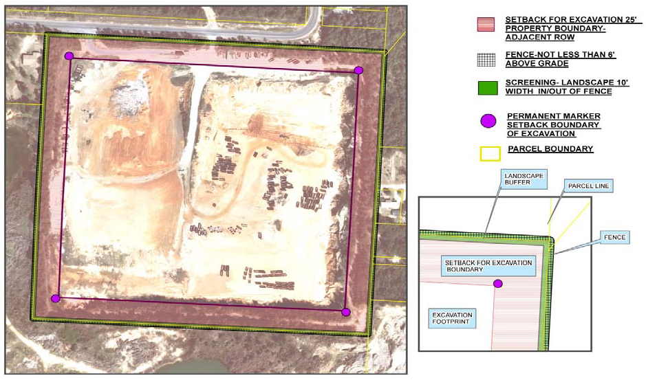
(2)
Excavation slope requirements. The angle of repose for borrow pit/mining slopes shall be no greater than 2:1 (i.e., two feet horizontal for each one foot vertical) unless a professional engineer (P.E.) or professional geologist (P.G.) certifies that an angle of repose exceeding this ratio will prohibit any potential erosion or slumping, factoring into account the type of soil (i.e., clay, sand, etc.) and pertinent environmental conditions of the area.
(3)
Traffic requirements. See section 7.11.09 [DSM section 2-2.6]. Pit access shall be limited to routes having the least impact on residential areas, and the use shall be subject to all traffic concurrency requirements.
(4)
Permits. See Escambia County Code of Ordinances, part I, chapter 42, article VIII, section 42-323. A county resource extraction permit is required for extraction, removal and transportation of material excavated from the site. Permits for filling and/or reclamation of pits after removal of usable materials are subject to additional federal, state and/or local regulations as governed by the applicable regulatory authority.
(5)
Hours of operation. Limited for pits and reclamation activities as indicated above.
(6)
Fences and gates. A security fence with appropriate gates for access, not less than six feet above grade, is required along the outer perimeter of the excavated area, with exception of the pit access point(s). Additional security features, such as barbed wire above the fence top, are permitted. Gates for access shall be locked at all times during non-operating hours. Fences and gates shall be maintained in a reasonable condition to remain an effective barrier.
(7)
Screening. Portions of the pit visible from the public right-of-way or nearest residential use shall be screened with dense landscaping to achieve at least 75 percent opacity. The landscape buffer shall be no less than ten feet in width at any given point and may be placed either inside or outside the required fence perimeter to achieve maximum dust and noise reduction and visible shielding. Earthen berms with a minimum height of three feet can be placed within this buffer area.
(8)
Buffers. In addition to the landscape screening noted above, a minimum ten-foot wide buffer is required parallel to, and inside, the required fence. Excavation, pit operations, parking, storage and disposal of debris are not permitted within the screening or buffer areas. The setback area may not be used for truck or equipment traffic, except as necessary to maintain the setback area and perimeter fence. Pit access point(s) shall be designed perpendicular to the buffer/screening width with the least disturbance to the buffer/screening zone that allows safe vehicle and equipment access to the operating site.
(9)
Signs. "No Trespassing" signs are required at each pit access point(s), every 250 linear feet on the boundary fence, and at each corner, in letters not less than two inches in height. "No Trespassing" signs shall be maintained in legible condition.
(10)
Reclamation activities. Active reclamation activities shall be governed by any performance standards applicable to the reclamation occurring on site, in accordance with all federal, state, and local regulations and as approved pursuant to the Escambia County Code of Ordinances. Reclamation involving land clearing debris disposal shall only be permitted to the minimum height above ground level that allows for environmental safety and stormwater runoff consistent with the surrounding environment and intended post-mining land use not to exceed six feet. Groundwater monitoring wells may be required for specific types of debris disposal per the applicable federal and state regulations and the terms of the required county-approved reclamation plan.
(11)
Existing permitted and unpermitted activities. Borrow pits, and resource extraction activities existing and in operation prior to August 22, 2014, or permitted prior to that date shall be grandfathering (or vested) in accordance with the following regulations:
a.
Lawful nonconforming activities existing prior to June 2, 2005. Ordinance 2005-18 was adopted on June 2, 2005. Borrow pits and resource extraction activities existing and in operation prior to June 2, 2005, became lawful nonconforming land uses on June 2, 2005. Such land use activities were and are subject to the provisions of chapter 1, article 2 of the Land Development Code. Local permits are required and to the extent these facilities and land use activities are not grandfathered and do not already comply with applicable regulations, they shall have 180 days from the date this ordinance is approved to comply. Extensions for extenuating circumstances may be approved by the county administrator or the county administrator's designee on a case-by-case basis.
b.
Unpermitted existing activities. Borrow pit and resource extraction activities created on or after June 2, 2005, that were otherwise in a zoning district that authorized the land use activity as either a permitted or conditional use, and which made application for either permitting or a development order prior to August 22, 2014, shall obtain and will be considered for a local permit to operate consistent with their current and historical use of the property. The technical conditions of the permit shall be addressed on a case-by-case basis, which will include consideration of the nature and history of the activity to be permitted and the length of time the activity has been ongoing; however, the permit conditions will include compliance with this article to the extent feasible. Facilities qualifying to request treatment pursuant to either (11)a. or (11)b. may choose either.
c.
Permitted existing activities. The grandfathered status and vested rights of operators and owners of borrow pits and resource extraction activities that held a current and active development order or other permit issued by the county prior to August 22, 2014, are to obtain local permits upon approval of this section and are to be addressed on a case-by-case basis that will include consideration of the specific wording of the previously approved development order, permit and any other land use approval issued by the county relating to the operation of the borrow pit or resource extraction activity. Previously permitted or approved performance standards remain in effect, except where the County determines the public health, safety and welfare dictates the current standard apply.
d.
Inordinate burden. In no event shall the application of any revision to the land development code relating to an activity that falls within the coverage of (11) be so severe as to make the permitted activity either economically infeasible or to impose an inordinate burden on the land use activity, as such inordinate burden is defined in F.S. § 70.001.
(Ord. No. 2015-12, § 1(Exh. A), 4-16-2015; Ord. No. 2017-15, § 4, 3-16-2017)
Sec. 4-7.7 - Condo-hotels.
General. A hotel or motel under a condominium form of ownership (condo-hotel or condotel) shall contain only individual lodging units permanently dedicated to full-time public rental for transient occupancy and be entirely under the control, management and operation of a single entity. The management may, however, permit the owner of an individual unit to occupy the unit without rental charge for up to 12 weeks in any calendar year, provided that when not owner-occupied the unit is made available to the public by the operator for short-term transient rentals of less than 30 days. A condo-hotel shall also satisfy the following requirements:
(1)
The facility is advertised and appropriately marked with signage identifying the condo-hotel as a hotel or motel.
(2)
The facility is served by singly metered utility services and has central telephone and television systems serving all individual units.
(3)
The operator shall be directed by the owners' association or board of directors to make the guest register available for inspection during business hours by authorized agents, officers and employees of the county to verify compliance.
(4)
The operator shall be directed by the owners' association or the board of directors to provide access to all rental records, tax receipts or other documents and records necessary to allow authorized agents, officers and employees of the county to verify compliance with the requirements of this provision.
(5)
The operator shall be directed by the owners' association or board of directors to retain the records referred to above, for a minimum of five years.
Condo-hotel units that are offered in fractional shares must have all unoccupied units available for daily transient rental by the operator or an exchange company.
(Ord. No. 2015-12, § 1(Exh. A), 4-16-2015)
Sec. 4-7.8 - Manufactured (mobile) homes.
(a)
General. When a manufactured (mobile) home is permitted for use in any district, it shall meet all minimum requirements for a detached single-family dwelling in the district. A manufactured home shall not be used for any purpose other than a single-family dwelling and shall not be stored or parked on any public right-of-way. Except for nonconforming uses, and emergency conditions as determined by the SIRA or BCC, manufactured homes are not permitted on Pensacola Beach or Perdido Key.
(b)
As nonconforming use. Any manufactured home as a nonconforming use may be replaced by another manufactured home of any size without being considered an increase in the extent of nonconformity if the replacement complies with all of the following conditions:
(1)
Age. Manufactured after July 13, 1994, and no older than the unit being replaced.
(2)
HUD compliance. Constructed according to U.S Department of Housing and Urban Development (HUD) standards as documented by an attached HUD certification seal.
(3)
Setbacks. Placed according to the setback requirements of the applicable zoning district and, if within a manufactured home park, at least ten feet from any other dwelling unit.
(c)
Setback modification. Within an existing manufactured home park or subdivision the front and rear setbacks may be modified by the planning official to accommodate manufactured homes larger than those for which the development was originally designed if smaller units are no longer reasonably available.
(d)
Manufactured home parks. A manufactured home park shall have a minimum of five manufactured home spaces, and no space may be occupied until at least five spaces are completed and ready for occupancy. Additionally, a park shall comply with all applicable state statutes and administrative rules.
(e)
Manufactured home subdivisions. A manufactured home subdivision shall comply with all subdivision regulations of the LDC and all site and building requirements of the applicable zoning district, except the minimum lot area may be 4,000 square feet if the subdivision provides sanitary sewer.
(Ord. No. 2015-12, § 1(Exh. A), 4-16-2015)
Sec. 4-7.9 - Outdoor storage.
General. Where the LDC allows any outdoor storage of equipment, goods, junk, material, or merchandise, the storage shall comply with the regulations of this section unless specifically identified in the LDC as exempt from these regulations. The regulations are intended to allow outdoor storage, including retail display, while assuring it is not a hazard to public health and safety, does not have a depreciating effect on adjacent property values, and does not create nuisance conditions. Unless specifically identified as a principal use, outdoor storage in all zoning districts is limited to items accessory (subordinate and incidental) to a permitted principal use on the same parcel, and complying with the provisions of this section.
(a)
Exemptions. The following storage is exempt from the regulations of this section:
(1)
Construction and landscaping. Construction and landscaping materials and equipment incidental to ongoing construction or landscaping activities within the parcel on which the materials and equipment are stored.
(b)
Residential uses. Outdoor storage for all residential uses is limited to items accessory to the use of a dwelling, on the lot occupied by the dwelling, and complying with the following conditions:
(1)
Rear or side yard storage of firewood for the purpose of consumption only by those residing on the premises.
(2)
Recreational vehicle storage if the vehicle is licensed and operable and is stored no closer than five feet from a side or rear lot line. Additionally, such stored vehicles shall not encroach on a public right-of-way or public sidewalk.
(3)
Items not intended for outdoor use or storage shall not be stored outdoors regardless of resistance to deterioration by the elements.
(c)
Retail display. Outdoor retail display shall comply with the following standards:
(1)
Accessory. The display shall be accessory to a permitted retail use on the same parcel.
(2)
Access. The display shall not be located where it will interfere with any required vehicular or pedestrian access, including access to public rights-of-way, parking stalls, loading zones, driveways, drive aisles, fire lanes, hydrants, alarms, emergency exits, or sidewalks. Additionally, displays shall not interfere with any sight visibility triangles prescribed in chapter 5, or any utilities, services or drainage systems.
(3)
Order. Items displayed shall be maintained in a neat and orderly manner.
(4)
Height. The height of items displayed shall not exceed the height of any required screening.
(5)
Condition of approval. The location of permissible display area shall be established as a condition of any applicable county approval for a retail use.
To regulate outdoor storage and determine the proper screening requirements for such storage, the following storage categories and standards are established:
(Ord. No. 2015-12, § 1(Exh. A), 4-16-2015; Ord. No. 2020-32, § 1, 9-3-2020)
Sec. 4-7.10 - Recreational vehicles.
Recreational vehicles (RVs), as defined in chapter 6, are designed primarily as temporary living quarters for recreational, camping or travel use. The use and outdoor storage of RVs is limited by the following:
(1)
Outdoor storage. The outdoor storage of an unoccupied RV is allowed accessory to a residential dwelling as authorized conditionally by the outdoor storage section of this article. For all other land uses, outdoor RV storage is limited to that specifically authorized by the applicable zoning district. No RV storage is authorized to encroach on a public right-of-way or access easement.
(2)
Living quarters. The use of a RV as living quarters for more than 14 days in any calendar year is prohibited outside of duly licensed campgrounds, RV parks, or mobile home parks, except as specifically authorized herein. Use of a RV as living quarters for any period requires authorization of the landowner and compliance with the following as applicable:
a.
Short-term use. In any zoning district, short-term use (no more than 14 days in any calendar year) of a single RV as living quarters outside of a duly licensed campground, RV park, or mobile home park may be authorized on a parcel by a land use certificate, provided the RV complies with the use standards of this section and remains fully licensed and ready for highway use. Such readiness requires that the RV be on wheels or a jacking system, be attached to the site only by quick-disconnect type utilities and security devices, and have no permanent attachments such as additions, rooms, stairs, decks or porches.
b.
Use within District 5. For any parcel within the established limits of BCC commissioner District 5, RV use as living quarters for more than 14 days in a calendar year may be authorized on the parcel by a land use certificate, provided the parcel and RV placement comply with the following conditions in addition to the RV use standards of this section:
1.
Manufactured home permitted. The zoning of the parcel specifically includes individual manufactured (mobile) homes among the permitted residential uses of the district.
2.
Not in platted subdivision. The parcel is not a lot or other parcel of a platted subdivision.
3.
A lot of record. The parcel is a lot of record as defined in chapter 6.
4.
Only RV on parcel. The RV is the only RV occupied as living quarters on the parcel.
5.
Only RV use of owner. The RV is the only RV occupied as living quarters on any contiguous parcels (those sharing any boundary point in common) owned in whole or part by the same landowner of record.
6.
Not in hazard areas. The RV is not placed within a FEMA designated special flood hazard area, a state designated coastal high-hazard area, or a county designated evacuation zone A, B, or C.
c.
Use during dwelling construction. For any parcel where a building permit has been issued for the construction of a single-family dwelling as the principal structure on the parcel, the use of a single RV as temporary living quarters may be authorized on the parcel by a land use certificate, but only for use while the permit is valid and the dwelling is under construction. RV placement shall comply with accessory structure setbacks to the extent practical. After a certificate of occupancy is issued for the new dwelling or other conclusion of the permit, the RV use is no longer authorized. Any subsequent use or storage of the RV on the parcel is subject to the applicable provisions of this section and may require reauthorization, relocation, or disconnection of utility services.
d.
Use for disaster recovery. If a natural or man-made disaster requires temporary housing to facilitate repair or replacement of a damaged structure, a RV may be allowed to provide the disaster recovery housing as authorized conditionally by the temporary uses and structures section of this article.
e.
Standards for use. Authorization of RV use as living quarters on a parcel outside of a duly licensed campground, RV park, or mobile home park does not authorize any structural additions to the RV or any accessory structures on the parcel. Additionally, the RV use shall comply with the following standards:
1.
Authorization. Any individual authorization (e.g., land use certificate) of RV use on the parcel is maintained on the parcel to be available on request by county code enforcement officers.
2.
Setbacks. The RV placement complies with the parcel boundary setbacks applicable to a principal structure on the parcel, except as may be authorized for disaster recovery or use during dwelling construction.
3.
Utilities. If the RV requires the installation of site utilities, they are obtained through applicable land use approval and building permits (e.g., electrical, plumbing).
4.
Site preparation. If the RV site requires land clearing or driveway connection, applicable permits for the activities (e.g. land disturbance, tree removal, driveway construction) are obtained. For tree removal, RVs are not separately eligible for any protected tree exemptions available to single-family dwellings.
5.
Waste. All sewage and other liquid waste from the RV are discharged directly into a sewage treatment and disposal system or other manner of collection and disposal specified and approved for such waste by the Florida Department of Health. All solid waste is contained and disposed of in compliance with county ordinances.
(Ord. No. 2015-12, § 1(Exh. A), 4-16-2015; Ord. No. 2020-32, § 2, 9-3-2020)
Sec. 4-7.11 - Recycling and waste diversion facilities.
Recovered materials processing facilities, recycling facilities and operations, resource recovery facilities and operations, and volume reduction plants shall conform to all performance standards governing the containment, collection, and treatment of leachate pursuant to F.S. ch. 403, and any other applicable regulations promulgated by the Florida Department of Environmental Protection. The violation of any such statute or rule governing leachate under F.S. ch. 403, shall also constitute a violation of the LDC.
(Ord. No. 2015-12, § 1(Exh. A), 4-16-2015)
Sec. 4-7.12 - Telecommunications towers.
(a)
General. In zoning districts where telecommunications towers are allowed, either generally as a "public utility structure" or specifically as a telecommunications tower, most require conditional use approval by the BOA to exceed the district or other height limit. Such approval is required of all towers in some districts. For the purposes of this section, a telecommunications tower is a pole or similar structure designed to support one or more antennas in a fixed location for transmitting or receiving commercial wireless communications signals. Towers limited to amateur radio, VHF marine, or similar noncommercial operations are not included.
(1)
Antennas. A commercial communication antenna may be located on an existing nonresidential structure without conditional use approval if the antenna and its supporting structure does not extend more than 50 feet above the existing structure and does not exceed the structure height allowed by the applicable zoning district.
(2)
Collocation. To provide marketable services while limiting unnecessary telecommunication towers, approvals for all new towers are conditioned on the applicant providing for collocation. Specifically, if the telecommunication tower is 150 feet or lower, collocation shall be provided for at least one other communication service provider; and if greater than 150 feet, collocation shall be provided for two or more additional providers. Additionally, all applicants for telecommunications towers shall submit evidence that reasonable efforts to collocate their equipment on existing structures have been made.
(3)
Setback from residential zoning. No commercial communication tower shall be located closer than the height of the tower to a residential zoning district line. Additionally, in districts where commercial communications towers are allowed, all such towers that will exceed 150 feet in height and/or are located within 500 feet of a residential use require conditional use approval by the BOA.
(4)
Lighting. Ground or security lighting for commercial communication towers shall be shielded to prevent direct visibility from nearby residences.
(5)
Color. Commercial communication towers not requiring FAA marking otherwise shall have either a galvanized finish or be painted gray or black.
(6)
Standards. Commercial communication towers shall be designed and constructed in compliance with the latest revision of the telecommunication and electronic industries standards (TIA/EIA 222) representing the accepted industry practices in the design of antenna supporting structures.
(7)
Security. A minimum six-foot fence or wall shall be required around all commercial communication tower sites. Access shall be through a locked gate and an appropriate anticlimbing device shall be installed on the tower. Fences in residential districts may not exceed a height of six feet; in commercial districts the maximum height is eight feet.
(8)
Screening. Landscaping and buffering shall be provided as required by the LDC.
(9)
Emissions. No location of a commercial communication tower or communication antenna shall be regulated on the basis of the environmental effects of radio frequency emissions, except to the extent that such towers and antennas comply with the FCC regulations concerning those emissions.
(10)
Abandonment. The county shall consider any commercial communication tower whose use has been discontinued for a period of 12 months to be abandoned. The owner/operator of the tower shall have 180 days to reactivate the use of the tower, transfer the tower to another owner/operator, or dismantle and remove the tower.
(11)
Existing towers. Existing lawfully erected towers may continue in use, including their routine maintenance. Additional antennas and other communication devices may be co-located on existing towers if the towers are structurally designed to accommodate them and the new combined height does not exceed district height allowed. If an existing tower is a nonconforming use, it can be replaced with a new tower of equal or lesser height on the site of the existing tower or on an alternative site within the same parcel. However, a replacement tower placed on an alternative site within the same parcel shall comply with the standards prescribed in this section. If the tower is nonconforming with regard to height, the requirements of the airport and airfield environs shall apply.
(12)
Airport/airfield environs. Any tower located within the airport and airfield environs prescribed by the LDC shall be reviewed for compliance with the standards for those environs.
(13)
Conditional use. Conditional use approval to allow a telecommunications tower of greater height does not additionally require a height variance. Where a tower requires conditional use approval, the reviewing board may only grant a conditional use upon a finding by the board that, in addition to the standard conditions, the tower complies with following conditions:
a.
Siting alternatives. All other reasonable siting alternatives have been explored and the conditional use is necessary due to extenuating factors such as location of existing uses, trees, structures or other features on or adjacent to the property, or compatibility with existing adjoining uses or with the general character of the area.
b.
Environmentally sensitive land. The proposed site of the tower avoids wetlands, habitat of threatened or endangered species, and historical sites to the greatest extent practical. Where adverse impacts have not been avoided they will be mitigated as required by the LDC or as may additionally be required by the approving board.
(14)
Application requirements. Application for LDC compliance review of proposed telecommunication towers shall include the following completed documents for use in evaluating compliance, but applications for conditional use approval need not include the geotechnical report or environmental compliance checklist.
a.
A geotechnical exploration report.
b.
An FCC/NEPA environmental compliance checklist.
c.
Letters indicating no objection to the tower from the Federal Communications Commission, Federal Aviation Administration, Florida Department of Transportation, and Escambia County Emergency Management.
d.
Coverage maps for this tower.
e.
Collocation information.
(Ord. No. 2015-12, § 1(Exh. A), 4-16-2015)
Sec. 4-7.13 - Temporary uses and structures.
(a)
General limitations. Where authorized by the parcel owner and applicable permits, uses and structures are allowed temporarily according to the provisions of this section.
(1)
Time of use. Except as may otherwise be provided for specific uses and structures, the temporary establishment of a use, or the temporary placement of one or more structures, on the same parcel for more than 30 days shall require county land use approval. Establishment or placement for more than 180 days shall require LDC compliance review and approval as prescribed in chapter 2 for permanent development. Prior to the expiration of their authorized time of use on a parcel, all temporary uses shall be discontinued on the parcel and all temporary structures shall be removed from the parcel unless authorized for permanent use. Unless authorized by a separate land use permit, the time limit for all temporary uses and structures is measured from the time any temporary use is established or any temporary structure is placed on the parcel until all the uses are discontinued and all structures are removed.
(2)
Temporary uses. A temporary use may be established outdoors on a parcel or within an authorized permanent or temporary structure on the parcel, provided the use is a permitted use within the applicable zoning district or is otherwise authorized. Minor alterations in a temporary use (e.g., changing items offered at a sales event) do not modify the permitted duration of the use and are not considered discontinuation of the use.
(3)
Temporary structures. A temporary structure may be erected on a parcel for an authorized use for a limited time provided the structure complies with the requirements of the applicable zoning district or is otherwise authorized as a specific structure. A temporary structure may be the principal structure on a parcel and a permanent structure is not required to be on the same parcel as the temporary structure. Change of use or occupancy, including periods of disuse or vacancy, does not modify the permitted time of placement for a temporary structure, and relocation within the same parcel is not considered removal of the structure or discontinuation of its use.
(b)
Specific uses and structures. The following uses and structures are allowed temporarily under the conditions prescribed for each:
(1)
Construction sites. Real estate sales and construction management may be carried out within separate or combined temporary construction site offices when in compliance with the applicable provisions for each use.
a.
Construction offices. A construction office is allowed by land use permit as a temporary use and structure on a construction site, or on an adjoining parcel, during authorized site construction. The temporary office shall be set back a minimum of five feet from any property line of the host parcel, be a State of Florida approved modular building, and be removed no later than 90 days from the date of issuance of a certificate of occupancy or other applicable final county approval of the site construction.
b.
Sales offices. A real estate sales office is allowed by land use permit as a temporary use and structure on a construction site. or on an adjoining parcel, and can be authorized prior to the start of construction if a pre-application review of the proposed development has been completed by the county. The setback and building type shall be that required for a construction office. but removal of a temporary sales office shall be within 24 months of the issuance of pre-application review comments if construction has not begun. Extension of the time may only be authorized as prescribed in article 6 of chapter 2. These provisions do not apply to real estate sales offices authorized within model homes by other provisions of this section.
(2)
Disaster recovery housing. A temporary structure or recreational vehicle is allowed by land use permit to provide disaster recovery housing when a fire, flood, windstorm, or other natural or manmade disaster requires the temporary housing of a single-family residential use or a nonresidential use to facilitate repair or replacement of a damaged structure. The following provisions apply to such housing:
a.
Permit conditions. As a condition of its land use permit, a temporary structure providing disaster recovery housing shall be removed from the property within ten days after a certificate of occupancy is issued for the new or rehabilitated structure, or upon the expiration of the permit, whichever occurs first. Failure to remove the temporary structure shall authorize the county to remove it without further notice and at the expense of the permit holder or property owner. After a recreational vehicle is no longer authorized to be used for disaster recovery housing, the vehicle becomes subject to the normal use provisions of the LDC.
b.
Date of disaster. If an official disaster declaration is issued, the date of the declaration shall be the date of the disaster for the purpose of permitting.
c.
Utilities required. Electrical power, potable water, and sanitary sewer connections complying with the Florida Building Code shall be provided to the temporary structure.
d.
Flood considerations. Placement of the temporary structure shall comply with all floodplain management regulations.
e.
Single-family dwelling. During post-disaster rehabilitation or reconstruction of a single-family dwelling made unfit for human habitation, the building official may permit the use of a manufactured (mobile) home or recreational vehicle as temporary living quarters on the lot of the damaged dwelling, regardless of zoning district requirements. However, no more than one such temporary structure or vehicle may be permitted per lot, and the resident of the damaged dwelling must occupy it. Additionally, the applicant must apply for such permit within six months of the date of the disaster and the maximum length of the temporary use shall be 18 months after the date of the disaster.
f.
Alternate residential sites. When the lot of a damaged single-family dwelling is not suitable for placement of a manufactured (mobile) home or recreational vehicle as temporary living quarters, the applicant for the temporary quarters may designate an alternate site for either type of quarters. However, a manufactured home must be a permitted use under the zoning of the alternate site and shall comply with the setback requirements for an accessory dwelling. When an alternate site is designated, both the person whose home has been made uninhabitable and the owner of the alternate site shall join in the application for the permit and be responsible for the timely removal of the temporary housing.
g.
Nonresidential use. During post-disaster rehabilitation or reconstruction of commercial or industrial use structures made unfit for business activities, the building official may permit the use of a State of Florida approved modular building as a temporary structure to carry out business activities on the lot of the damaged building. However, such temporary structures may be permitted only for use on the site of the damaged structure and only if there remains adequate parking (including handicap) based on the temporary structure. Additionally, the applicant must apply for such permit within six months of the date of the disaster and the maximum length of the temporary use shall be nine months after the date of the disaster.
h.
Permit extension. When any temporary use structure or vehicle permitted under these disaster recovery provisions is replaced due to damage from a subsequent disaster, the duration of the original temporary use permit shall not be extended unless the building official determines the subsequent disaster caused sufficient damage to the permanent structure to require additional repairs that will slow the rehabilitation or reconstruction process.
(3)
Medical hardship temporary living quarters. A manufactured (mobile) home or park trailer is allowed as a temporary use within any mainland zoning district that does not otherwise allow such living quarters if approved by the board of adjustment (BOA) for use due to medical hardship as prescribed in article 6 of chapter 2. The following standards apply to the temporary living quarters:
a.
Maximum structure size. The temporary quarters shall not exceed 1,280 square feet in gross floor area.
b.
Minimum lot size. The lot where the temporary quarters will be located shall be at least one-quarter acre if served by public sewer. If a septic tank is used, the lot shall be at least one-half acre. Additionally, the lot shall be sufficient in size to allow compliance with all zoning district lot coverage and setback requirements.
c.
Location. The temporary quarters shall be located on the same parcel (same property identification number) as the primary residence.
d.
Limited occupancy. Only the caregiver and their immediate family, or the person in need of medical care and their immediate family, shall occupy the temporary quarters.
e.
Indemnification. Prior to placement of the temporary quarters on the approved parcel, the landowner shall execute an agreement with the county (in a form acceptable to the county attorney) providing for indemnification from all claims arising in connection with the temporary quarters and acknowledging the county's right to remove the temporary use at the owner's expense if the owner. or his heirs and assigns, fails to remove it within 60 days after the expiration of the temporary use approval granted by the BOA.
f.
Building code compliance. The installation of the temporary quarters shall comply fully with the Florida Building Code and is subject to all associated compliance inspections.
g.
Temporary status maintained. The wheels and axles of the temporary quarters shall not be removed, and no additions shall be constructed, except that handicap access ramps may be provided.
(4)
Mobile vending units. A mobile vending unit is allowed as a temporary use on any parcel within the Agr, Com, HC/LI, Ind, Com-PK, CC-PK, CG-PK, and PR-PK zoning districts. The following additional restrictions apply to any use of mobile vending units:
a.
License. The operator of the mobile vending unit must obtain any applicable occupational license from the Escambia County Tax Collector and affix a copy of the occupational license to the mobile vending unit in a conspicuous location. The operator is additionally responsible for obtaining all other applicable authorizations required to store, prepare, serve, distribute, or sell by mobile vending.
b.
Nuisance conditions. The mobile vending unit shall be designed, placed, maintained, and operated so as to prevent the creation of nuisance conditions, including surface discharges of waste water, oil, or grease. Solid waste receptacles of adequate capacity and convenience shall be provided to prevent the scattering of beverage containers, paper products, and other vending related debris.
c.
Placement. The mobile vending unit shall not be placed within a parking lot drive aisle or required landscape area of a developed site used by another active use; within any active driveway or sidewalk, or within any public right-of-way; in any location obstructing the line of sight for traffic; or in any location otherwise presenting a safety hazard.
(5)
Model homes. Within any residential subdivision for which a preliminary plat has been approved by the county, the construction of no more than two principal dwellings for temporary use as model homes or real estate offices for the promotion and sale of lots or houses within the subdivision may be authorized prior to final plat approval. For the annual "Parade of Homes" event or other special circumstances the Board of County Commissioners (BCC) may authorize at a public hearing the issuance of additional model home permits if additional assurances of infrastructure completion are provided. However, issuance of a model home permit does not authorize issuance of a certificate of occupancy, and no permanent certificate of occupancy may be issued for any dwellings until the final plat is approved by the BCC and recorded as prescribed in article 5 of chapter 2. Additionally, the dwellings cannot be permanently occupied as residences until certificates of occupancy are issued. Any office use of a model home shall cease when sales within the subdivision have been completed.
(6)
Portable storage containers. On a lot where a portable storage container is not allowed as outdoor storage by the applicable zoning, the container may be allowed as a temporary use according to the following provisions:
a.
The on-site use of a container for 30 days or less only requires notification to the planning official of the placement by the provider of the container, and tracking by the official for enforcement purposes.
b.
The on-site use of a container for more than 30 days requires issuance of a 90-day permit by the planning official after a reasonable demonstration by the applicant of temporary circumstances that make the additional on-site storage time necessary. Such circumstances may include damage to or destruction of the principle structure, remodeling, renovation, construction, or relocation. A weatherproof copy of the permit indicating the date of issuance, date of expiration, and address of the approved placement shall be attached to the container.
c.
Prior to expiration of the original permit and upon additional demonstration by the applicant of unforeseen circumstances, the planning official may grant not more than one 90-day extension to the permit for good cause shown. If granted, a weatherproof copy of the extension shall be attached with the initial permit.
d.
Applicants are generally limited to one portable storage container per principal use. For residential uses the limit is one container per dwelling unit. The use of more than one storage container per principal use may be approved by the planning official upon a demonstration of need, such as the scope of work or extent of construction.
e.
The exterior dimensions of a container shall not exceed nine feet in height, 20 feet in length, and eight feet in width.
f.
The container shall not obstruct the line of sight for traffic or otherwise present a safety hazard. The placement of containers in fire lanes or public rights-of-way is prohibited.
g.
Front yard placement of a container may only be permitted where no alternative location on the parcel exists, or if placement at an alternative location would create an unreasonable hardship on the owner or occupant.
h.
The provider of a container shall be responsible to ensure that it is in good condition, free from evidence of deterioration, weathering, discoloration, graffiti, rust, rips, tears or other holes or breaks.
(7)
Special events. For the purposes of this section, a special event is an infrequent short-term outdoor use or activity not specifically identified as allowed by the applicable zoning district, but not otherwise prohibited by law or ordinance. Special event uses and activities include art shows, garage and yard sales, estate sales, sidewalk sales, festivals, school carnivals, church bazaars, classic car shows, tournaments, concerts, fairs and circuses, haunted houses, pumpkin and Christmas tree sales, grand openings, and similar temporary events likely to attract crowds.
a.
Limitations. A special event is allowed as a temporary use without a land use permit for up to 30 days, but on any parcel used as or zoned residential a special event is limited to no more than 14 days in a calendar year. No special event or associated temporary structure on any parcel shall endanger public health, safety, or welfare, particularly in consideration of nuisance or other adverse impacts from the scale, extent, intensity, time, or duration of the event.
b.
Associated structures. Temporary structures may be placed on special event parcels for the duration of the associated event according to the provisions of this article and the conditions of any applicable permits. Nothing in this section shall be construed to prohibit temporary structures associated with civic, community, or religious events, including authorized events on public lands, social and religious activities on parcels occupied by places of worship, and events on private lands developed to include special events (e.g. Pensacola Interstate Fairgrounds).
(8)
Temporary shelters. The use or placement of one or more temporary structures, shelters, or any other accommodations on a parcel for the residence, dwelling, or habitation of any person(s) on that parcel is allowed as a temporary use on the parcel for no more than 14 days in any calendar year outside of a duly licensed campground or recreational vehicle park, except as may be authorized through the disaster recovery housing or medical hardship provisions of this section. See also the additional provisions of this article regarding the use of manufactured (mobile) homes and recreational vehicles.
(9)
Amenities. In accordance with the applicable permitting and land use approval process, Escambia County will issue building permits and allow for construction to commence for the permitted amenities prior to final plat approval provided that the applicant has presented a letter of capacity from the water and sewer utility provider at the specific location of the amenity. Issuance of the requested building permits shall not be construed as an approval of a violation of the provisions of this code or of other Escambia County Ordinances. The certificate of occupancy for the structure shall not be issued until the final plat is approved and proof that water and sewer tap has been provided.
(Ord. No. 2015-12, § 1(Exh. A), 4-16-2015; Ord. No. 2015-54, § 2, 12-10-2015; Ord. No. 2024-13, § 3, 3-7-2024)
Sec. 4-7.14 - Zero lot line subdivisions.
(a)
General. Regardless of the applicable zoning district, zero lot line subdivision shall comply with the following standards:
(1)
Minimum project area. No minimum project area is required.
(2)
Minimum lot area. Minimum lot area for each lot is 2,000 square feet.
(3)
Structure setbacks. Minimum setbacks for all dwelling units are 20 feet in front and 15 feet in rear. Each dwelling unit shall be placed on one interior side property line with no setback (the zero lot line), and with the side yard setback on the opposite side a minimum of ten feet. In no case shall a zero lot line dwelling be built closer than 15 feet of the lot line of a contiguous parcel that is zoned LDR or MDR, and is not within the zero lot line lot development.
(4)
Minimum lot width. The minimum lot width for all lots within a zero lot line development shall be 35 feet.
(5)
Maximum lot building coverage. The total lot coverage permitted for all buildings on each lot shall not exceed 80 percent.
(6)
Building height. The maximum building height shall not exceed two and one-half stories or 35 feet above the habitable first floor.
(7)
Platting requirements. Each dwelling shall be located on its own individual platted lot. The plat shall indicate the zero lot lines and appurtenant easements.
(8)
Openings on zero lot line side. The wall of the dwelling located on the lot line shall have no windows, doors, air conditioning units or any other type of openings.
(9)
Corner lots. Minimum side yards for corner lots shall not be less than ten feet from the lot line or the street right-of-way line, whichever is greater.
(10)
Atriums or courts. Atriums or courts shall be permitted on the zero lot line side when the court or atrium is enclosed and a solid wall at least eight feet high and constructed of the same material as exterior walls of the unit is provided on the zero lot line.
(11)
Maintenance and drainage easements. A perpetual four-foot wide wall maintenance and drainage easement shall be provided on the lot adjacent to the zero lot line property line, which, with the exceptions of walls and fences, shall be kept clear of structures. The easement shall be shown on the plat and incorporated into each deed transferring title to the property. The wall shall be maintained in its original color and treatment unless otherwise agreed to in writing by the affected lot owners. Roof overhangs may penetrate the easement on the adjacent lot a maximum of 24 inches, but the roof shall be so designed that water runoff from the dwelling placed on the lot line is limited to the easement area.
(12)
Parking. As referenced in the applicable section of the Design Standards Manual.
(Ord. No. 2015-12, § 1(Exh. A), 4-16-2015; Ord. No. 2024-13, § 4, 3-7-2024)
Sec. 4-7.15 - Cinerators.
(a)
General. Conditional use and performance standards for location of direct disposal establishments and funeral establishments with cinerators.
(b)
Purpose. The purpose of this section is to restrict the location of the land uses of "funeral establishment with cinerators" or "direct disposal establishment."
(1)
Prohibition. Notwithstanding any provision found in article 3 of this code, the issuance of permits is prohibited for the installation of a cinerators, as defined in article 6, in either a funeral establishment or a direct disposal establishment within 500 feet of an existing residence, an apartment, a restaurant or other commercial eating establishment, a motel, a hotel, a private or public school (including day care centers) a nursing home, an assisted living facility, or any other place designed and intended for the temporary or permanent overnight accommodation of human beings. In addition to the above stated prohibition that applies to the existing described land uses, the prohibition extends to issuance of permits for the installation of a cinerators in either a funeral establishment or a direct disposal establishment within 500 feet of vacant property that is zoned LDR, MDR, HDR.
(2)
Measurement. The distance from a proposed facility that would include a cinerator shall be measured by drawing a straight line between the closest property lines of the proposed cinerator location and the property containing the existing land uses or existing zoning described in (1) above.
(3)
Establishment of new land uses or zoning changes. Neither the establishment of new land uses nor the modification of existing zoning of property within the prohibited distances described in (1) above shall convert a previously approved permit authorizing the installation of a cinerator into a nonconforming use. For the purpose of this section only, the issuance of either a development order or a building permit establishes a new land use, until such date as the development order or building permit expires.
(4)
[Existing cinerators.] Existing cinerators shall be grandfathered.
(Ord. No. 2015-12, § 1(Exh. A), 4-16-2015)
Sec. 4-7.16 - Recreational amenities.
In cases where a subdivision or other residential development where a recreational amenity including, but not limited to, a golf course, swimming pool, club house or tennis courts, was anticipated as part of the subdivision or development regardless of whether the amenity was included in the subdivision plat, and that amenity abuts or is otherwise located adjacent to any portion of the subdivision, then should that amenity cease to be used for recreational purposes, it cannot be developed or used in a manner that is more intense than the most intense residential use in the subdivision.
(Ord. No. 2015-12, § 1(Exh. A), 4-16-2015)
Sec. 4-7.17 - Pari-mutuel facilities.
(a)
Zoning compliance. Pari-mutuel facilities shall comply with all applicable state and federal regulations governing their operation, as well as any development standards, site, and building requirements set forth in the land development code and the Escambia County Comprehensive Plan. Regardless of the zoning district regulations, no state-licensed pari-mutuel facility shall be located within 1,000 feet of a place of worship, child care facility, K—12 educational facility, park, or playground. If a pari-mutuel facility is adjacent to or contiguous with an existing single-family home, duplex, triplex, quadplex, apartment, condominium, or townhouse, a minimum 20-foot vegetative buffer shall be required. Additionally, an eight-foot-high wooden privacy fence shall be constructed along the shared property boundary.
(b)
Measurement. The distance required between a state-licensed pari-mutuel facility and a place of worship, child care facility, K—12 educational facility, park, or playground shall be a 1,000-foot radius from the main entrance of the pari-mutuel facility to the main entrance of the place of worship, child care facility, K—12 educational facility, park, or playground.
(Ord. No. 2025-12, § 4, 3-25-2025)