Fort Myers City Zoning Code
ARTICLE 8
- SMART CODE
118.8.1 - Generally.
A.
Intent. The Smart Code is an instrument for the implementation of the comprehensive plan and smart growth principles in the areas of the City within the Downtown and Midtown Future Land Use designations. Smart growth encourages:
1.
Community development that is diverse, compact and walkable;
2.
The protection of landscapes that are ecologically and culturally valuable;
3.
The complex neighborhood unit as the basic increment of settlement;
4.
Neighborhood size determined by a pedestrian shed small enough that most residents would walk to its center;
5.
Retail for ordinary household needs within the neighborhood; workplaces, including those integrated with dwellings, available near the neighborhood;
6.
The integration of housing types, suitable for younger and older persons, single households and families;
7.
Balancing investment in transportation and civic infrastructure, towards the provision of civic open space and buildings;
8.
Transportation options that include walking, cars, transit, and bicycles;
9.
A fine-grained network of thoroughfares dispersing traffic and connecting to the regional system;
10.
Thoroughfares designed equitably for pedestrians, bicyclists, automobiles and the disabled;
11.
Building frontages that mask parking and support pedestrian activity.
12.
Vertically mixed use development.
B.
Terms and definitions. Terms used throughout this article shall take their commonly accepted meanings and as herein defined. The definitions may contain regulatory language that is integral to this article. In the event of conflicts between these definitions and those of chapter 142 of the City Code, the definitions of this article shall take precedence. If a term is not defined by this article, then the definitions in chapter 142 shall apply. Where no definition exists, Webster's Dictionary, current edition, shall apply.
Adverse impact means the negative consequences of a use on surrounding areas, usually as a result of size, scale, noise, vibration, odor, traffic, pollution or anti-pedestrian quality. Consequences confined within the lot boundaries are not considered to create adverse impact.
Allee means a walkway lined with trees or tall shrubs.
Apartment means a dwelling unit sharing a building and a lot with other dwellings and/or uses. Apartments may be for rent or for sale as condominiums.
Artisanal means premises used primarily for the manufacture, display and sale of artifacts, jewelry, sculpture (except for stone and metal), pottery, photography, leather craft, handwoven articles, paintings, artisan baked goods, and similar items, manufactured onsite, using only tools and processes which do not produce noise, fumes, particulates or other effects detrimental to adjacent uses.
Assisted living facility means premises for living and medical care for people who need some assistance with daily activities but do not require care in a nursing home.
Attic means the area within the slope of a roof. An inhabited attic shall not be considered a story for purposes of determining building height.
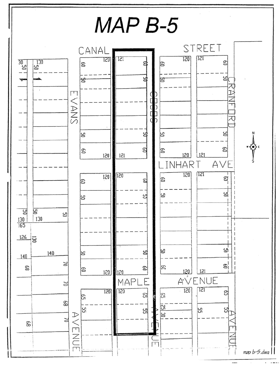
Backbuilding means a single story structure connecting a principal building to an outbuilding. See Diagram 1.
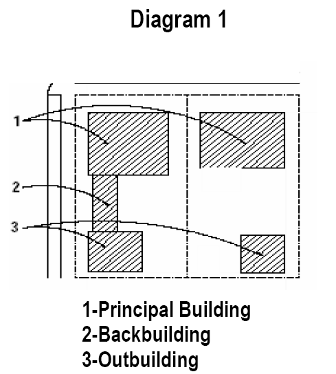
Block means the aggregate of lots, paths and passages, lanes and alleys, enclosed by other thoroughfares. See Diagram 2.
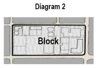
Block face means the aggregate of all the building facades on one side of a block. The block face provides the context for establishing architectural harmony. See Diagram 3.
Building disposition means the placement of a building on its lot.
Building frontage means the privately held layer in front of the building facade. The elements of building and landscape that are within a frontage are held to specific standards. The variables of private frontage are the depth of the setback and the combination of architectural elements such as fences, stoops, porches, and galleries. These elements influence social behavior in the public realm. The frontage layer may overlap the public streetscape in case of awnings, galleries and arcades.
Building height means the vertical extent of a building measured in stories including parking structures but not including a raised basement, habitable attic, masts, belfries, clock towers, chimney flues, water tanks, elevator bulkheads and similar structures.
Building type means the combination of certain physical constants defined by the relationship between height, disposition and use.
Civic means only government owned, publicly used land that is intended to remain in public uses and ownership.
Civic recreation means an open area dedicated for use by the public, typically for community gatherings.
Commercial means the collective term for office and retail use.
Density means the number of residential dwelling units per acre of land.
1.
For multifamily density calculation purposes only:
a.
A studio unit with 750 square feet or less or a one-bedroom unit with 750 square feet or less is equivalent to 0.5 dwelling unit;
b.
A two-bedroom unit with 1,200 square feet or less is equivalent to 0.75 dwelling unit;
c.
All other unit types are considered equivalent to one dwelling unit.
d.
An applicant may request alternative multifamily unit density equivalencies on a case-by-case basis (i.e., a two-bedroom unit larger than 1,200 square feet is equivalent to a fraction of one dwelling unit). The applicant must conclusively demonstrate that wastewater flows will be less than average of 75 gallons/capita/day, or household size will be less than average of 2.5 persons per household. Alternative multifamily unit density equivalencies may be approved upon finding by the city that: (1) the requested equivalency is justified based on sound engineering analysis, and (2) the potential impact to city services is adequately addressed. If an alternative equivalency is approved, it will be enforced through monitoring of the actual flows following construction. If the flow levels exceed the levels that were provided as justification, the city is authorized to impose utility fee surcharges for the overages.
2.
For group living density calculation purposes, assisted care facilities and adult congregate living facilities shall be restricted to the same density regulations applicable within the district in which they are allowed. For the purposes of determining conformance with the density requirements and all other district requirements, every 1.93 occupants of an assisted care facility shall be deemed to equal one dwelling unit. To calculate future occupants and subsequent density when number of bed spaces is used as opposed to number of units, 1.0 bed space shall equal 1.0 occupant. The number of occupants divided by the household size (1.93) shall equal the number of units..
3.
As defined in chapter 142, article 2 a guest house, cottage, or garage apartment accessory to a principal dwelling unit is not subject to calculations.
4.
Hotels and hospitals are not subject to density calculations.
Director means the director of the community development department, or the director's designee.
Dooryard and light court. See section 118.8.6.B.3 frontage table.
Downtown means the area within the Downtown Future Land Use Designation, as depicted on the City's Future Land Use Map.
Elevation means the exterior walls and roof of a building.
Enfront means the placing of an element along a frontage line, as in "porches enfront the street."
Entrance, principal means the principal place of pedestrian entry to a building. In the support of pedestrian activity, the principal entrance should face the enfronting street rather than the parking.
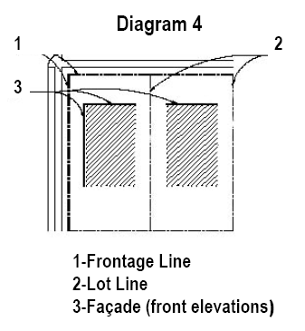
Facade means an exterior wall of a building that is set along a frontage line. Facades support the public realm and are subject to frontage requirements additional to those required of other elevations. See Diagram 4.
Flexhouse means a dwelling unit that contains, to a varying but limited extent, a commercial component. The size of the commercial component is limited by the required paved parking for the commercial area in addition to the required parking for the residential unit. The term "flexhouse" is synonymous with the term "live-work unit."
Floor area ratio (FAR) means the calculation determined by dividing the non-residential floor area of all floors within buildings on a lot by the area of that lot. FAR is used as a measurement of non-residential development intensity. See Diagram 5.
Diagram 5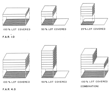
Forecourt. See section 118.8.6.B.4. frontage types.
Front yard. See section 118.8.6.B.1. frontage types.
Frontage line means those lot lines that coincide with a public thoroughfare or a civic space. Those frontages on an A street shall be considered to be primary frontage lines. Facades along frontage lines define the public realm and are therefore more highly regulated than other elevations. For this reason, all frontage lines shall meet the facade treatment requirements to the greatest extent possible. See Diagram 4.
Infill means a site within the existing urban fabric small enough to involve the design of only one or a few buildings.
Institutional use means structures and related land used by organizations providing educational, social and recreational services to the community, and organizations such as colleges and universities, elementary and secondary schools, community centers and clubs, civic and religious facilities, and museums. Civic uses, those structures and lands owned by government for public use, are excluded from this category. Institutional uses are permitted in all zoning districts within downtown redevelopment area.
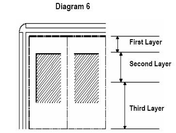
Layer means the depth of the lot within which certain elements are permitted. See Diagram 6.
Liner building means a building specifically designed to mask a parking lot or a parking garage or other use or structure from a frontage. Its purpose is to enhance the pedestrian connection to the street.
Lodging means premises available for daily and weekly renting of bedrooms.
Lot line means the boundary that legally demarcates a lot. See Frontage line. See Diagram 2.
Midtown means the area within the Midtown Future Land Use Designation, as depicted on the City's Future Land Use Map.
Outbuilding means an ancillary building, usually located towards the rear of the lot, on the same lot as the principal building, sometimes connected to the principal building by a backbuilding.
Parking structure means a building containing two or more stories of parking.
Pedestrian shed means the average distance that may be traversed at an easy pace by a walk from its center to its edge. This distance is used to determine the outer limit of the neighborhood. This dimension is approximately one-quarter of a mile or 1,400 feet or a five-minute walk. Five pedestrian sheds cover downtown and midtown and are depicted on Diagram 7.
Diagram 7
Personal care services means those services including, but not limited to, barber, salon, manicure and pedicure, massage therapy, tailor, and shoe repair.
Plan means the Downtown Fort Myers Plan, adopted by city council on April 7, 2003, as may be amended from time-to-time.
Porch and fence. See section 118.8.6.B.2. frontage types.
Primary/secondary grid means thoroughfare designations on the plan. Buildings on the primary grid are subject to all of the provisions of this Code. Buildings on the secondary grid are exempt from certain provisions. The term "primary grid" is synonymous with A Street, and the term "secondary grid" is synonymous with B Street. A list of A and B Streets is contained in section 118.8.6.F. Frontage lines are assigned only along thoroughfares that are required to provide an excellent pedestrian experience. Other thoroughfares are secondary and are therefore exempt from these requirements to allow for necessary open parking lots, unmasked parking decks, drive-through and hermetic building fronts.
Principal building means the main building on a lot, always located towards the frontage. See Diagram 1.
Public parking structure means a structure, either publicly or privately owned, providing parking spaces to the general public that are in excess of spaces otherwise required for development under this article.
Residential means premises available for long-term habitation by means of ownership or rental, excluding short-term renting and assisted living facilities.
Retail means
1.
A store selling, leasing or renting consumer goods, wares and merchandise for off premises use, including but not limited to convenience goods, electronic equipment, hardware, novelties, groceries, household products, medical supplies, pet supplies, pharmaceuticals, plants, sporting goods, tobacco, used or secondhand goods, and related products. Outdoor storage, automobiles and large equipment are excluded.
2.
Prepared food for on-premises or off-premises consumption.
3.
Alcohol beverages for on-premises or off-premises consumption.
Retail frontage line means those frontage lines designated on the plan that are encouraged to provide a shopfront, making the ground level available for retail use.
Shopfront and awning. See section 118.8.6.B.6 frontage types.
Stoop. See section 118.8.6.B.5 frontage types.
Story means a habitable level within a building, no more than 14 feet in height, or a level within a parking garage, from finished floor to finished ceiling. An attic or raised basement is not considered a story for the purposes of determining building height.
Streetscape means the type and dimension of curbs, walks, planters, street trees and streetlights and the like.
Streetwall means a decorative, opaque, freestanding wall interplanted with vegetation and built along the frontage line, or coplanar with the facade, often for the purpose of masking a parking lot from the street. Streetwalls shall be constructed at a height of 3.5 feet and of a material matching the adjacent building facade. Streetwalls may have openings no larger than necessary to allow automobile and pedestrian access.
Terminated vista means a location at the axial conclusion of a thoroughfare. A building located at a terminated vista may be recommended to have an articulated facade.
Transition line means a horizontal line, the full width of a facade, expressed by a material change or by a continuous horizontal articulation such as a cornice or a balcony.
Uses permitted means the uses accommodated by a building and its lot within the zoning districts of this article. Uses are categorized as limited or open according to the intensity of the otherwise similar use.
Uses, water dependent means marinas, yacht clubs, customer passenger boating, charter boats, boat ramps, and any related feature.
Uses, water enhanced means resource based recreational use, restaurants, residential, hotel, motel and related features.
Warrant means a variation from particular standards of the Smart Code that is justified by need, hardship or physical constraint. See section 118.8.3.
(Ord. No. 3422, § 4, 1-14-2008; Ord. No. 3473, § 13, 6-16-2008; Ord. No. 3775, § 1, 5-16-2016; Ord. No. 3790, § 2, 1-3-2017; Ord. No. 3858, § 1(Exh. A), 2-4-2019; Ord. No. 3915, § 1(Exh. A), 11-15-2021)
118.8.2 - Procedures.
A.
Application of the Smart Code.
1.
Generally. No building, structure, or land shall be used or occupied and no building or structure or part thereof shall be erected, constructed, reconstructed, moved or structurally altered, added to, or changed in use, except in conformity with the regulations for the zoning district as designated on the zoning map in which such building, structure or land is located, except as follows:
a.
Where housing units within the downtown or midtown existing prior to December 9, 2003, are demolished by a natural disaster or an act of nature, replacement housing units may be permitted for the same number of units existing prior to the destruction, regardless of whether the number of units exceeds that eligible as bonus densities or whether the excess number of units meets bonus density standards under this article. The replacement units shall comply with the standards contained in the Smart Code and land development code as applicable. To obtain the replacement housing units, the property owner must obtain all building permits to construct within two years of demolition, commence construction within six months of building permit issuance, and complete construction within two years from the date of commencement. Failure of the property owner to meet the above time limitations shall preclude the use of the replacement housing units, and the owner shall be required to obtain approvals pursuant to this article as if all of the units were new housing units.
b.
Where housing units within the downtown or midtown existing prior to December 9, 2003, are demolished by the property owner, replacement housing units may be permitted for the same number of existing units. The replacement units shall comply with the standards contained in the Smart Code and land development code as applicable. To obtain the replacement housing units, the property owner must obtain building permits within six months from the date of demolition, commence construction within six months of building permit issuance, and must complete construction within two years of the date of commencement. Failure of the property owner to meet the above time limitations shall preclude the use of the replacement housing units, and the owner shall be required to obtain approvals pursuant to this article as if all of the units were new housing units.
2.
Conflict. The provisions of this article when in conflict shall take precedence over other codes, ordinances, regulations and standards, except that those listed in section 118.8.4 shall remain in effect. Chapter 126, signs, and chapter 138, vegetation, except as noted herein, shall not apply to development in the downtown. Other requirements of the land development code or other applicable ordinances continue to be applicable only to issues not covered by this article, except where those would contradict the intent of this article.
3.
Exemptions. Items listed below shall be exempt from the requirements of this article and shall instead be reviewed for compliance with the requirements of the land development code.
a.
Interior remodeling only.
b.
Like replacement of materials and structures.
c.
Routine maintenance and repair.
d.
Single-family and duplex residential development, including additions. Single family homes shall be developed according to the RS-7 district regulations in section 118.2.1(A)(1)(d). Duplexes shall be developed according to the RS-D district regulations in section 118.2.1(A)(1)(e).
e.
Historic rehabilitation and/or restoration in compliance with the Secretary of the Interior Standards, or the occupancy of a historic landmark or a contributing structure within the downtown historic district and Dean Park Historic District with a permitted use that proposes no additional square footage.
f.
Change in occupancy from one permitted use to another where no additional square footage is proposed.
4.
Activation. Provisions of this article shall be activated by "shall" when required, "should" when recommended, and "may" when optional.
5.
Development processes. There shall be three development processes applicable to the downtown and midtown as established herein.
a.
Approval requiring review by the director pursuant to the site plan review process, with appeal to the city council.
b.
Approval pursuant to the site plan review process and with warrants approved by the director, with appeal to the city council.
c.
Approval through the planned unit development process.
d.
Approval through the conditional use process.
B.
Review process.
1.
Any application for development of a lot or building in the downtown or midtown areas pursuant to this article shall include a site plan in accordance with this section.
a.
Site plan application requirements. The site plan shall be prepared by a professional architect, engineer, certified planner or landscape architect. The community development department shall initiate review of a site plan application upon receipt of a complete application. Data furnished in the application shall be to scale and shall include the following information, unless waived in writing by the director:
1)
Name and address of the record owners, the applicant, and the person preparing the site plan.
2)
Location map.
3)
Legal description and survey of the proposed site boundaries made and certified by a state registered land surveyor or engineer. The survey shall reflect any existing structures and paved areas.
4)
Proposed land use, with indication of size, location and height of structures with approximate dimensions, setbacks, and landscaped yards.
5)
Adjacent area information, including setbacks, existing land use and other pertinent information.
6)
Vehicular circulation system, both on-site and off-site, with proposed access, which shall comply with city traffic engineering.
7)
Pedestrian circulation system, on-site and off-site.
8)
Photometric plan for development site.
9)
The location of existing public utilities, including location of closest available water supply system or collection lines and fire hydrants; closest available wastewater collection system or collection lines; and existing provisions for the collection and discharge of surface drainage.
10)
Gross acreage of uplands.
11)
Number of dwelling units, including density equivalency calculation, for residential uses only. If an approved density equivalency calculation is applied to an existing planned unit development resulting in no increase to the approved density, and there is no increase to the approved building footprint, floor area ratio, or height, approval of amendment to the planned unit development to reflect the density equivalency calculation may be granted by administrative deviation pursuant to subsection 98.3.3(D), and the provisions of subsection 118.8.5(A)(11) referencing amendment in the same manner as the original planned unit development do not apply.
12)
Square footage of ground covered by buildings or structures, pervious and impervious areas, and square footage and percentage of site for each.
13)
Required and provided number of parking spaces.
14)
Proposed location of sidewalks, curbs, gutters, water mains, sanitary sewers, storm drains, manholes, inlets, underground conduits, seawalls, and the size and shapes and types thereof; and the character, width and depth of pavement in sub-base of any roadways, access points or paths located within the proposed development
15)
Location and width of any proposed permanent utility easements.
16)
All adjacent rights-of-way, with indication of centerline and width, paved width, existing median cuts and intersections, street light poles and utility company facilities.
17)
Building separations and setbacks.
b.
Location of all paved drives and parking areas, including centerlines, dimensions, radius, and elevations, traffic signage and striping.
c.
Schematic elevations of buildings showing concealment of all mechanical or accessory equipment located on the roof.
d.
Building floor plans and proposed building materials. Front, side and rear elevations (with any wall signs) showing height to peak of roof.
e.
Location of trash and garbage disposal system and provisions for accessibility to garbage trucks.
f.
Adequate architectural screening of all trash and garbage disposal systems.
g.
Loading areas and provisions for accessibility to vehicles of the required type and clearances.
h.
Areas for emergency vehicles and fire engines and provisions for fire lane accessibility for vehicles of the required type.
i.
Entrance features, walls, buffers, and ground signs.
j.
Where the site plan covers only a part of contiguous real property owned by the applicant, master-phasing plan for such additional acreage unless the applicant certifies that the remaining real property shall not be developed.
k.
The proposed treatment of the perimeter of the site, including the material and techniques used, such as screens, landscaping buffers, fences and walls.
l.
The location and size, in acres or square feet, of all areas to be conveyed, dedicated, or reserved as open space, public parks, recreational areas, and similar public or semi-public uses.
m.
Any other signage proposed, including specifically that beyond what the city code requires.
n.
If the applicant is seeking approval of bonus density, bonus intensity, and/or bonus height, according to the provision of the bonus allocation program in section 118.8.5(A)(4), a description of the requested bonuses shall be provided.
o.
If the applicant is seeking a reduction in community contribution fees which are due according to the provision of the bonus allocation program in section 118.8.5(A)(4), a description of the proposed design, operation, and maintenance of the public gathering space shall be provided.
p.
Trip generation from the uses proposed.
q.
Any additional information as may be reasonably required by the director.
2.
The director shall request a review of the completed application from city departments as the director deems appropriate, including but not limited to community development/planning, public works/engineering, and fire. Each city department that reviews the application shall respond with written comments and recommendations based upon the standards in this article to the director. The applicant shall be advised by mail of the comments and recommendations and any steps necessary to comply with this article. The applicant shall have an opportunity to satisfy any requirement by filing a written request within 15 days of such written notice for an opportunity to modify the application, along with such modifications requested. If the applicant does not request an opportunity to modify, then the recommendations shall be forwarded to the director for determination, which shall be made within 60 days from the end of the aforesaid 15-day period. The director shall approve, approve with conditions or deny the site plan application.
3.
If at any time during the review of the application, the director desires to convene the reviewing departments to discuss the application, the meeting of the reviewing departments shall be a public meeting and the applicant shall be notified of the meeting and have an opportunity to attend and present information at the meeting.
4.
Appeal of the director's determination shall be made to the city council within 30 days of the director's decision, which shall conduct a quasi-judicial public hearing on the appeal.
5.
Issuance of a site plan approval shall be deemed to authorize only the particular site configuration, layout and level of impacts that were approved. Permitted uses may occur in conjunction with or in place of the approved use. A site plan approval shall run with the land. Issuance of a site plan approval shall be deemed to authorize the building official to approve an application for a building permit if the applicant has complied with other relevant portions of this article and the Code.
6.
Minor modifications may be made to the site plan upon written approval of the director and upon submission of a letter explaining the need for corrections and payment of the fee established by the adopted fee schedule. Minor modifications include, but are not limited to: a change in sign location, minor modifications to parking areas (such as the relocation of a handicapped parking space), relocation of terminal islands to accommodate trees or utility lines, reduction in building footprint size, addition of small canopies, minor revisions to lot lines to be consistent with a recorded plat, temporary sales and construction trailers, and satellite dish location. No additional density or height may be approved by minor modification. Except for minor modifications, the site plan may be amended only pursuant to the procedures and standards established for its original approval.
C.
Those developments required by this article to be approved pursuant to the planned unit development rezoning process shall be reviewed through the process described in section 118.5.1, except that the development standards of this article shall apply. Once approved, a planned unit development shall be completed within the period of time provided in the planned unit development approval, which shall include commencement and completion time requirements for each phase of the planned unit development. Failure to comply with the time frames shall result in the planned unit development or phase thereof becoming void and the property reverting to its previous zoning district. Public hearing notice requirements shall be in accordance with section 98.3.10 - Planned Unit Development, except the notice shall be mailed to the owners of all properties within a 1,000-foot radius of the perimeter boundaries of the property, or properties, described in the application submitted to the community development department.
(Ord. No. 3422, § 4 1-14-2008; Ord. No. 3790, § 3, 1-3-2017; Ord. No. 3858, § 1(Exh. A), 2-4-2019; Ord. No. 3915, § 1(Exh. A), 11-15-2021; Ord. No. 4053, § 3, 7-21-2025)
118.8.3 - Warrants.
To expedite the development review and approval process and provide incentives for promoting smart growth, there is hereby established a warrant process.
A.
A warrant permits a practice that is a variation from a specific provision of this article, but that is justified by need, hardship or physical constraint. Warrants may be granted administratively by the community development director. The following site design issues may be considered through the warrant process: building setbacks; vehicular access from a rear alley; parking standards; location of parking facilities; landscape requirements, on-site signage; fencing type, building type/disposition and frontage type. Addition or change of uses permitted within a land use district is not possible through the warrant process. The community development director may choose to defer adjudication of parking space warrant requests to the board of adjustment, which shall conduct a quasi-judicial public hearing on the warrant request.
B.
The developer may appeal a decision of the director regarding a warrant to the board of adjustment, which shall conduct a quasi-judicial public hearing on the appeal.
C.
A warrant shall be considered unique and shall not set precedent for others. Warrants shall not be granted unless a written application is submitted on forms provided by the city demonstrating each of the following:
1.
That special conditions and circumstances exist which are peculiar to the land, structure, or building involved and which are not generally applicable to other lands, structures, or buildings in the same district;
2.
That granting the warrant is in the best interest of the public and promotes the general health, safety, and welfare of the neighborhood to be affected by the warrant;
3.
That granting the warrant is based on need, hardship or physical constraint; and
4.
That granting the warrant results in a project that better complies with the intent of the Downtown Fort Myers Plan.
(Ord. No. 3422, § 4, 1-14-2008; Ord. No. 3473, § 14, 6-16-2008; Ord. No. 3858, § 1(Exh. A), 2-4-2019; Ord. No. 3915, § 1(Exh. A), 11-15-2021)
118.8.4 - Superseding Regulations.
The provisions of the following regulations take precedence over the provisions of this article:
A.
Adult entertainment regulations.
B.
Noise regulations.
C.
Flood hazard regulations.
D.
Historic preservation regulations.
E.
Accessibility (Americans with Disabilities Act) standards.
F.
Florida Building Code.
G.
Florida Fire Prevention Codes.
(Ord. No. 3422, § 4, 1-14-2008; Ord. No. 3858, § 1(Exh. A), 2-4-2019)
118.8.5 - Zoning District Regulations.
A.
Applicable to all zoning districts.
1.
Building disposition in general.
a.
One principal building on the frontage and one outbuilding to the rear of it may be built on each lot. One back-building may be built in an edge yard building type.
b.
Facades shall be built parallel to the principal frontage line or, if curved or broken, on a line tangent to it.
c.
Setbacks shall be as shown in section 118.8.5 and subsection 118.8.6.E. In the case of an infill lot, setbacks shall match one or the other of the existing adjacent setbacks or the setback may be adjusted by warrant, see section 118.8.3. Parking shall not be located within the front layer, except as approved by warrant.
d.
Open porches, stoops, balconies, awnings and bay windows may encroach into any setback as approved.
e.
Loading docks and service areas, which are those areas with parking, loading, machinery, transformers, and overhead doors, shall not be permitted on frontages, except by warrant.
f.
Buildings on a secondary grid (B Street) are exempt from disposition requirements. A list of A and B Streets is shown in subsection 118.8.6.F.
g.
All A Street frontages shall be encouraged to have liner buildings to the maximum extent possible.
h.
Outbuildings may have a gross floor area of up to 80 percent of the gross floor area of the principal building. See Diagram 1.
2.
Hurricane evacuation plan. New developments which contain at least 75 residential dwelling units, or any redevelopment which adds at least 60 residential dwelling units, must submit a hurricane evacuation plan which demonstrates that residents can safely evacuate the county within 16 hours for a category 5 storm event or maintain a 12 hour evacuation time to shelter for a category 5 storm event and ensure that shelter space is available to accommodate the additional residents allowed by the bonus allocation. All plans shall comply with Lee County Administrative Code AC 7-7, be submitted to and approved by the county emergency management director. In lieu of a hurricane evacuation plan, the developer may contribute money toward the construction/operation of hurricane shelters equal to the proportional amount needed to accommodate the additional residents allowed by the bonus allocation, as determined by the city manager.
3.
Required amenities. All new developments shall provide the following amenities:
a.
Pedestrian-friendly connections. The developer will provide pedestrian access between the project and public right-of-way with a minimum width of six feet for access to either the sidewalk/street frontage or to a riverwalk. The developer will build and maintain improvements at its expense. Developer must agree to continue the adopted streetscape plan on the first layer of the property and to maintain consistency with the plan in perpetuity.
b.
Riverwalk/public access. This section shall apply to all new waterfront development or waterfront redevelopment consisting of real estate improvements which exceed 50 percent of the assessed value of the existing structure or adds building area in excess of 50 percent of the existing floor area located along the waterfront within downtown.
1)
All new waterfront development and waterfront redevelopment, as described above, shall be required to provide a ten-foot riverwalk easement along the rear property line (river's edge) to preserve public access to and along the river.
2)
A ten-foot easement shall be provided along one side yard line extending from the riverwalk easement to the street of any property where the riverwalk easement is not accessible from an adjoining street right-of-way or other riverwalk easement connecting to an adjoining street right-of-way. The side yard easement may be released by the city when the riverwalk easement becomes contiguous to an adjoining street right-of-way or other riverwalk easement connecting to an adjoining street right-of-way.
3)
Within the area designated above for the riverwalk/public access easement, the city shall also dedicate riverfront access on adjacent public streets where feasible.
c.
Exceptional architectural/site design. Developer shall provide exceptional architectural and site design. The applicant must demonstrate a connection to the nature, style, character and history of the city.
d.
Multimodal transportation strategies. Proposed development with at least 100 residential dwelling units or 25,000 square feet of commercial or office use shall submit a multimodal transportation plan to provide and promote use of alternative transportation. The plan shall incorporate strategies such as on-site shuttle services and provision of employee showers and changing rooms which promote bicycle transit.
4.
Bonus allocation program. The bonus allocation program allows for bonus density, intensity, and height in the downtown and midtown future land use districts to be allocated in addition to the maximum density, intensity, and height allowable in each zoning district. In no case shall the bonus exceed the maximum permitted in the future land use element. The aggregate bonus density allocation available shall be based on surplus utility capacity, which is depicted geographically on the surplus equivalent dwelling unit (EDU) map in section 118.8.6.G and map F of the future land use element. The allowable bonus density allocation shall not exceed the available surplus equivalent units as quantified based on utility system capacity on the surplus EDU map. The cost of new infrastructure improvements necessary for the construction of any development will be paid by the developer. Bonus density, intensity and height shall only be approved through the planned unit development rezoning process in accordance with section 118.5.1. In order to accommodate for additional demands on public services and impacts associated with the increased density, the applicant shall pay community contribution fees and/or provide public gathering space as provided below.
a.
Maximum bonus allocation. The maximum amount of bonus density, intensity, and height that may be approved for any downtown or midtown property is as follows:
1)
Parcels greater than 0.5 acres. In addition to the base density, intensity and height allowed within the underlying zoning district, a 30% bonus density, intensity and height may be awarded to parcels which are greater than 0.5 acres.
2)
Parcels 0.5 acres or less. In addition to the base density, intensity and height allowed within the underlying zoning district, a 40% bonus density, intensity and height may be awarded to parcels which are 0.5 acres or less.
3)
Urban general neighborhood protection. Properties within and contiguous to the urban general zoning designation shall be limited to a maximum height of six stories. Bonus height shall not be allocated in violation of this policy.
b.
Community contribution fee. The developer/applicant shall pay a community contribution fee in the amount of $10,000.00 per approved bonus dwelling unit that the city shall deposit in a community contribution fund. Community contribution fees shall be paid prior to issuance of final certificate of occupancy. The funds shall be used for costs associated with the provision of affordable/workforce housing, public open space/recreation facilities, infrastructure improvements, public transportation, public parking, or other community facilities and amenities within the downtown and midtown areas only.
c.
Public gathering space contribution. The community contribution fee may be reduced for developments which provide a designated public gathering space. The intent of this section is to augment the publicly owned public spaces by incentivizing private property owners to provide a variety of spaces throughout downtown and midtown, available for public enjoyment. The entire designated public space shall be dedicated as a public access easement for unrestricted access and use by the public in perpetuity. The following parameters shall be utilized in awarding public gathering space contributions:
1)
The designated public gathering space shall be located on the subject property and may be provided as outdoor space, indoor space, or a combination of both.
2)
The designated public gathering space shall be a minimum of 2,000 square feet. Public gathering spaces less than 2,000 square feet may be approved through the warrant process.
3)
A minimum of four shade trees shall be provided for outdoor spaces.
4)
One linear foot of seating per 50 square feet of public gathering space shall be provided. Outdoor seating shall provide cover from sun exposure with shade trees or other overhead canopy.
5)
Identifying signage indicating the designation of the public gathering space shall be prominently displayed. Signage design shall be approved by the community development director.
6)
Areas designated as public gathering space shall be prohibited from being utilized for any other use without approval by the community development director. Patrons of on-site restaurants may utilize the space, though it shall not be reserved solely for the use of the patrons of those restaurants.
7)
Outdoor public gathering space shall be open to the public at all times, unless, due to safety concerns, permission is granted by the community development director to allow closures during specified nighttime hours. Indoor public gathering spaces shall, at a minimum, be open during business hours or anytime the public has access to the facility.
8)
The following formula shall be used to convert community contribution fees to public gathering space contribution:
For every 200 square feet of dedicated public gathering space provided up to 10,000 square feet, the community contribution fee may be reduced by one percent. For that portion of public gathering space provided in excess of 10,000 square feet, the community contribution fee shall be reduced by one-half percent for every 200 square feet of dedicated public gathering space provided.
9)
When provided in conformance with the above standards, the required riverwalk easement, per section 118.8.5(A)(3)(b), may be counted towards the public gathering space contribution and reduction of the community contribution fee.
10)
Areas designated as public gathering spaces shall not count toward the maximum allowable non-residential intensity/FAR.
5.
Nonconforming uses. Any existing use that has become nonconforming as a result of the rezoning of property indicated on map C-2 of the future land use element of the City of Fort Myers Comprehensive Plan, is subject to the nonconforming provisions in section 118.8.5(C)(9), or can be reviewed through the planned unit development process.
6.
Parking design standards in general.
a.
Parking shall be located within the second and third layers.
b.
Parking lots abutting residential uses shall be secured by a combination of a solid six-foot wall of masonry or other materials as approved by the director, with four shade trees and 25 shrubs every 100 linear feet. Wood fencing is discouraged.
c.
Parking structures must be designed to be compatible with the overall design of the project and may not resemble typical parking structures.
d.
New surface parking areas shall provide landscaping as follows:
1.
A 10-foot landscape buffer yard shall be provided along any property line abutting a road-right-of-way. The buffer yard shall consist of 4 shade trees and 33 shrubs per 100 linear feet of frontage.
2.
New and expanded surface parking areas shall comply with the regulations contained in Section 138-41(a).
7.
Architectural standards in general.
a.
Exterior materials shall be as specified in the specific zoning districts. Hardiplank or equal may be used as a substitute for wood in all buildings.
b.
Windows shall be clear glass, and must transmit at least 50 percent of visible daylight.
c.
Pitched roofs, if provided, shall be symmetrically sloped no less than 4:12, except that porches may have attached shed type roofs with slopes no less than 2:12.
d.
Roof mounted mechanical equipment shall be screened from ground view by parapet walls.
e.
Openings above the first story shall not exceed 50 percent of the total building wall area, with each facade being calculated independently.
f.
The facades on A Streets shall be detailed as storefronts and glazed no less than 70 percent of the sidewalk-level story. The facades on office frontages shall be glazed no less than 25 percent of the sidewalk-level story.
g.
Open porches, stoops, balconies, awnings and bay windows may encroach into any setback up to the right-of-way line. Footings may be located within the right-of-way or within easements if applicant agrees to restore all underground and surface improvements disturbed by footing construction.
h.
Openings, including porches, galleries, arcades and windows shall be square or vertical in proportion.
i.
Buildings must provide connectivity to adjacent sites.
8.
Landscape/buffer standards in general.
a.
Properties within the downtown and midtown areas are exempt from the requirements of chapter 138.
b.
A minimum of one tree to match the tree on the enfronting streetscape, not in conflict with the most recently adopted streetscape plan, shall be planted for each 25 feet of frontage, or any portion thereof, within the first layer of each lot unless otherwise specified. If there is insufficient space for street front trees on subject property, planter boxes in the right-of-way may be considered.
c.
Groundcover shall be planted and maintained on the first layer of each lot unless otherwise specified.
9.
Signage standards in general.
a.
Signage is an integral component of the building and site design and should be appropriately scaled and consistent in character with the project's overall design. Signage utilized within the historic district shall be approved by the historic preservation commission.
b.
Number of signs: There shall be one sign per facade. Blade signs shall not be counted toward signage permitted.
c.
Size of signs: Wall or monument signs shall be no greater in size than five percent of nonresidential space on the first story of the front facade area. Monument signs shall not exceed five feet in height.
d.
Banner signs: In addition to other permitted signage, banner signs shall be permitted only on publicly owned arts and cultural buildings to promote special events or collections. Said banner signs may be displayed no more than two weeks prior to the special event or collection and shall be removed within 24 hours afterward. Banner signs shall not be counted toward the total amount of signage allowed. The city may install banner signs on light posts with no time limitations.
e.
Prohibited signs: In addition to those signs prohibited in section 126-91, billboards, pole signs, electronic messaging signs (excluding district), and promotional inflatable signs are expressly prohibited.
f.
Additional signage or modifications to the signage provisions may be considered through the warrant process.
g.
Except as noted herein regarding prohibited signs, the remaining sections in chapter 126 are not applicable.
10.
Construction site screening.
a.
All development projects where heavy equipment is used and stored shall submit plans detailing the staging of construction areas, including, but not limited to: storage of heavy equipment; building materials; employee parking; and access. A hard compacted dust-free surface, acceptable to the public works department, is required for the storage of heavy equipment.
b.
All construction sites and/or staging areas shall be screened along all yards with a six-foot high chain link fence with green, black or brown mesh screening. The mesh screening may consist of artistic panels that do not contain any type of advertising or verbiage except for the project identification sign as provided in chapter 126. This requirement may be waived by the community development director if it can be demonstrated that the construction activity will not exceed a duration of 30 days.
c.
Notwithstanding section 126-91, prohibited signs, project identification signage may be allowed on the temporary fencing and screening of the construction site.
11.
Amendment to previously approved planned unit development. Any amendment to a previously approved planned unit development within downtown and midtown shall be subject to the provisions of section 118.5.1, except any increase in the number of dwelling units, increased FAR or increased height, shall require amendment in the same manner as the original planned unit development with the conditions as follows:.
a.
The developers on First Street/Palm Beach Boulevard will be required to pay the proportionate share as indicated in the SR 80/First Street Master Traffic Study or the road impact fees, whichever is greater. The payment is due prior to the issuance of the first building permit for vertical construction, as needed.
b.
The developers on West First Street shall pay any funds designated for the roundabout design prior to June 30, 2007.
12.
General fence and wall requirements.
a.
The use of barbed, razor, or electric wire is prohibited in all districts except industrial districts and
b.
Height is limited to a maximum six (6) feet.
c.
All fences, and walls shall comply with section 134.2.21. Site Distance/Visibility at Intersections.
d.
A solid fence or wall higher than 3 feet on a single-family lot shall be located no closer to the front property line than the front façade of the home.
e.
Fencing type utilized for the front yard shall be one uniform type of material, style and color. In the case of a corner lot, both street frontages shall be considered the front yard and subject to this requirement. The variety of fencing types in all districts is limited to three different types per parcel.
f.
Picket fences may be 42 inches maximum height above average ground level as measured at the fence line, provided they have a uniform void or open area of 50 percent when viewed perpendicular to the fence.
g.
Chainlink and wire fencing: All of the following regulations apply to chainlink fencing.
1.
Chainlink and wire fencing is prohibited in the front yard and on corner lots. Chainlink may be permitted on single-family lots, if setback a minimum of 20 feet from the front property line, or perpendicular to the front façade, whichever is greater.
2.
Fencing around sports courts (i.e., tennis courts, basketball courts, baseball courts, volleyball courts, etc.) shall be exempt from the height limitations of this section.
3.
All chainlink fences (including all poles, rails, gates, supports and the like), except those used by single-family dwellings, shall be green, brown or black plastic or vinyl-coated material only.
4.
The use of slats or fabric on chain link fencing is prohibited, with the exception of dumpster enclosure gates and construction site screening.
B.
Urban General Zoning District Regulations. The urban general district areas shall encourage compatible infill and encourage live/work units and limited mixed-uses.
1.
Building disposition.
a.
Lot standards. Lot area: 3,000 square foot minimum, and existing lots of record as of adoption of [Ordinance 3858], shall be vested for purposes of minimum lot size. Lot coverage: 75% maximum.
b.
Setbacks. Front setback: 15 foot minimum, 25 foot maximum. Side setback: 5 foot minimum, 30 foot maximum. Rear setback: 10 foot minimum.
c.
Building type. Edge yard: permitted. Side yard: permitted. Rear yard: permitted. Court yard: permitted.
d.
Frontage type. Common yard: permitted. Porch and fence: permitted. Dooryard: permitted. Forecourt: permitted. Stoop: permitted. Shopfront: permitted.
e.
Entrance orientation. Buildings shall have their principal entrances facing the street, however if physical constraints result in a condition where a side-facing entrance better complies with the intent of the downtown plan and urban-general district, a side-facing entrance may be approved by warrant as provided in section 118.8.3.
2.
Building height. Principal building height: three story maximum. Outbuilding height: Two story maximum. Bonus height is available through the bonus allocation program as described in section 118.8.5(A)(4).
3.
Uses permitted.
a.
Residential (including flexhouse or live-work unit.
b.
Retail is a permitted use throughout the Second Street Overlay. Elsewhere in the urban general, retail is a permitted use only on corner lots.
c.
Lodging is limited to a maximum of eight bedrooms per lot and may provide food service only to guests. The maximum length of stay shall not exceed 30 days.
d.
Office.
e.
Childcare services.
f.
Financial services.
g.
Personal care services.
h.
Artisanal.
4.
Parking standards.
a.
All parking areas shall be located within the second and third layers and masked by a streetwall or liner building.
b.
Parking may be accessed from the frontage by a driveway.
5.
Architectural standards.
a.
The exterior finish materials on all facades shall be limited to brick, wood, hardiplank, tile, terracotta, stucco, or similar materials.
b.
Buildings shall have sloped roofs.
c.
Fences at the first layer of a lot shall be painted wood or hardiplank pickets, garden walls, decorative wrought iron or similar metallic material that accomplishes the decorative look. Fences at other layers may be painted wood or hardiplank pickets, wood board, coated chainlink, masonry, or PVC.
6.
Signage standards.
a.
In the event of office or lodging use a blade sign may be permanently installed perpendicular to the facade.
b.
Externally lit signs shall be lit with incandescent-spectrum bulbs.
7.
Residential density. In urban general, the maximum residential base density is 12 dwelling units per acre. Bonus density is available through the bonus allocation program as described in section 118.8.5(A)(4).
8.
Non-residential intensity. In urban general, the maximum non-residential base intensity is two FAR.
9.
Conditional uses. Conditional uses in urban general are as follows:
a.
Institutional uses.
b.
Public or private surface parking lots and public or private parking structures.
c.
Parking garages without liner buildings on all A Streets (primary grid).
d.
Adult congregate living facilities (ACLF), also known as assisted living facilities (ALF). Density shall be limited according to the definition of density under section 118.8.1(B).
e.
Retail in locations other than corner lots.
10.
Prohibited uses. Uses not expressly permitted in urban general are prohibited as follows:
a.
Automotive sales, service, and repair.
b.
Kennels and animal husbandry.
c.
Depots for large-scale storage and distribution.
d.
Pole signs and billboards.
e.
Service stations.
f.
Golf courses and nurseries.
g.
Labor pool, halfway houses and food pantries.
h.
Landfills and dumps.
i.
Mineral extraction areas.
j.
Outdoor storage.
k.
Prisons, except as accessories to police stations.
l.
Scrap yards for the processing and storage of waste and recyclable materials.
m.
Drive through service.
n.
Transportation terminals, except bus depots, rail stations, and ferry terminals.
11.
Second Street corridor overlay. The Second Street overlay shall include the properties with frontage on Second Street between Fowler Street and Park Avenue. The overlay shall not extend to properties which are more than 220 feet from the south side of Second Street or more than 150 feet from the north side of Second Street. Properties within this overlay may be developed with maximum density, intensity and height as follows:
a.
Building height. The maximum principal building height for properties within the overlay on the south side of Second Street shall be six stories. The maximum principal building height for properties within the Overlay on the north side of Second Street shall be three stories. Bonus height is available through the bonus allocation program as described in section 118.8.5(A)(4).
b.
Residential density. In the Second Street Corridor overlay, the maximum residential base density is 17 dwelling units per acre. Bonus density is available through the bonus allocation program as described in section 118.8.5(A)(4).
c.
Non-residential intensity. In the Second Street Corridor Overlay, the maximum non-residential base intensity is four FAR. Bonus intensity is available through the bonus allocation program as described in section 118.8.5(A)(4).
C.
Urban Center Zoning District Regulations. The urban center zoning areas are established to protect the pedestrian-friendly fabric of the historic downtown core and the center of each surrounding neighborhood. Ground floor retail is encouraged.
1.
Building disposition.
a.
Lot standards. Lot area: 2,000 square foot minimum, and existing lots of record as of adoption of [Ordinance 3858], shall be vested for purposes of minimum lot size. Lot coverage: 100% maximum.
b.
Setbacks. Front setback: 0 foot minimum, 10 foot maximum. Side setback: 0 foot minimum, 10 foot maximum. Rear setback: 0 foot minimum.
c.
Building type. Edge yard: prohibited. Side yard: permitted. Rear yard: permitted. Court yard: permitted.
d.
Frontage type. Front yard: prohibited. Porch and fence: prohibited. Dooryard: permitted. Forecourt: permitted. Stoop: permitted. Shopfront: permitted.
e.
Entrance orientation. Buildings shall have their principal pedestrian entrances on a frontage line.
f.
Façade. Facades shall be built parallel to the principal frontage line along a minimum of 70 percent of its length with a setback of zero to ten feet from the frontage line. In the absence of a building along the remainder of the frontage, a street wall or vegetative hedge shall be required along the existing wall line.
g.
Screening. Roof mounted mechanical equipment shall be screened from ground view by parapet walls.
2.
Building height. Principal building height: two story minimum, 12 story maximum (except where restricted further by historic designations). Outbuilding height: two story maximum. Bonus height is available through the bonus allocation program as described in section 118.8.5(A)(4).
3.
Uses permitted.
a.
Residential (including flexhouse or live-work unit).
b.
Retail. Ground floor retail shall be encouraged along A-Street frontages.
c.
Office.
d.
Lodging.
e.
Childcare services.
f.
Financial services.
g.
Personal care services.
h.
Artisanal.
4.
Parking standards.
a.
All parking areas, with the exception of waterfront properties, shall be located within the second and third layers and masked by a streetwall or liner building. Waterfront properties shall locate parking areas in the second or third layers as determined by the director.
b.
Pedestrian entrances to all parking lots and parking structures shall be directly from a frontage line, so the street frontage is active with pedestrians. Only underground parking structures may be entered by pedestrians directly from a building.
c.
The vehicular entrance to a parking lot or garage on a frontage shall be no wider than 30 feet.
5.
Architectural standards.
a.
The exterior finish material on all facades shall be limited to stone, brick, ceramic tile, glass, architectural aluminum panels, cast stone, stucco, or similar materials.
b.
Buildings shall have sloped roofs or flat roofs enclosed by parapets.
c.
Streetwalls, when utilized, shall be located at the first layer along the frontage line.
d.
Openings, including porches, arches, and windows, shall be square or vertical in proportion.
e.
Roof mounted mechanical equipment shall be screened from ground view by parapet walls.
6.
Signage standards.
a.
A single external sign band (no multiple signs) may be applied to the facade of each building, providing that such sign shall not exceed three feet in height by any length.
b.
Blade signs, not to exceed four square feet for each separate business entrance, may be attached perpendicular to the facade.
c.
Signage shall be externally lit, except that signage within the shop may be neon lit.
7.
Residential density. In urban center, the maximum residential base density is 50 dwelling units per acre. Bonus density is available through the bonus allocation program as described in section 118.8.5(A)(4).
8.
Non-residential intensity. In urban center, the maximum non-residential base intensity is eight FAR. Bonus intensity is available through the bonus allocation program as described in section 118.8.5(A)(4).
9.
Nonconforming uses. Those properties shown on map C-2 of the future land use element of the comprehensive plan, which were designated light industrial (I-1) as of April 30, 2003, shall have legal non-conforming status that allows existing light industrial uses to continue, except as noted herein. All light industrial principal and accessory uses shall be permitted on the properties shown on map C-2 of the future land use element of the comprehensive plan, except as follows: outdoor storage, contractor storage outdoor (indoor allowed), crematorium, detention center, jail, prison, labor pool, blood plasma donation or Plasmapheresis centers, social service facility, pawnshop, and trade school for heavy equipment/truck operators. Automotive uses and services shall be permitted but must be wholly contained within a building with limited outdoor storage permitted with appropriate screening.
10.
Conditional uses. Conditional uses in urban center are as follows:
a.
Institutional uses.
b.
Public or private surface parking lots and public or private parking structures.
c.
Parking garages without liner buildings on all A Streets (primary grid).
d.
Adult congregate living facilities (ACLF), also known as assisted living-facilities (ALF). Density shall be limited according to the definition of density under section 118.8.1(B).
e.
Indoor/outdoor recreation.
f.
Drive-through service, when located adjacent to an arterial, and when a traffic analysis conducted in conformance section 134.2.29 indicates that no adverse traffic impacts will be created.
g.
Food truck parks per section 118.3.5.F.7.
11.
Prohibited uses. Uses not expressly permitted in urban center are prohibited as follows:
a.
Automotive sales, service, and repair.
b.
Kennels and animal husbandry.
c.
Depots for large-scale storage and distribution.
d.
Pole signs and billboards.
e.
Service stations.
f.
Golf courses and nurseries.
g.
Labor pool, halfway houses and food pantries.
h.
Landfills and dumps.
i.
Mineral extraction areas.
j.
Outdoor storage.
k.
Prisons, except as accessories to police stations.
l.
Scrap yards for the processing and storage of waste and recyclable materials.
m.
Transportation terminals, except bus depots, rail stations, and ferry terminals.
D.
Urban Core Zoning District Regulations. Urban core areas shall be thoroughly developed as mixed-use. The urban core designation shall encourage retail at the street level and allow commercial and retail on floors two and above.
1.
Building disposition.
a.
Lot standards. Lot area: 2,000 square foot minimum, and existing lots of record as of adoption of [Ordinance 3858], shall be vested for purposes of minimum lot size. Lot coverage: 100% maximum.
b.
Setbacks. Front setback: 0 foot minimum, 5 foot maximum. Side setback: 0 foot minimum, 0 foot maximum. Rear setback: 0 foot minimum.
c.
Building type. Edge yard: prohibited. Side yard: permitted. Rear yard: permitted. Court yard: permitted.
d.
Frontage type. Front yard: prohibited. Porch and fence: prohibited. Dooryard: permitted. Forecourt: permitted. Stoop: permitted. Shopfront: permitted.
2.
Building height.
a.
Building height shall be a minimum of two stories and a maximum of 18 stories. Bonus height is available through the bonus allocation program as described in section 118.8.5(A)(4).
b.
Stories at sidewalk level shall be no less than 12 feet in height from finished floor to finished ceiling.
3.
Uses permitted.
a.
Residential (including flexhouse or live-work unit).
b.
Retail. Ground floor retail is encouraged.
c.
Office.
d.
Lodging.
e.
Childcare services.
f.
Financial services.
g.
Personal care services.
h.
Artisanal.
4.
Parking standards. See subsections 118.8.6.E.
a.
All parking areas shall be located within the second and third layers and masked by a streetwall or liner building.
b.
Pedestrian entrances to all parking lots and parking structures shall be directly from a frontage line. Only underground parking structures may be entered by pedestrians directly from a building.
c.
The vehicular entrance of a parking lot or garage on a frontage shall be no wider than 30 feet.
5.
Architectural standards.
a.
The exterior finish materials on all facades shall be limited to stone, ceramic tile, glass, architectural aluminum panels, brick, cast stone, stucco, or similar materials.
b.
Balconies, galleries and arcades may be metal or concrete or shall match abutting wall material.
c.
Buildings shall have flat or sloped roofs; flat roofs must have parapets.
d.
Streetwalls shall be located at the first layer along the building frontage line.
e.
Roof mounted mechanical equipment shall be screened from ground view by parapet walls.
6.
Signage standards.
a.
A single external sign band may be applied to the facade of each building, providing that such sign shall not exceed three feet in height by any length.
b.
Blade signs, not to exceed four square feet in area for each separate business entrance may be attached perpendicular to the facade.
c.
Signage may be externally or back lit. Signage within the shop may be neon lit.
7.
Residential Density. In urban core, the maximum residential base density is 70 dwelling units per acre. Bonus density is available through the bonus allocation program as described in section 118.8.5(A)(4).
8.
Non-residential Intensity. In urban core, the maximum non-residential base intensity is 12 FAR. Bonus intensity is available through the bonus allocation program as described in section 118.8.5(A)(4).
9.
Conditional uses. Conditional uses in urban core are as follows:
a.
Institutional uses.
b.
Public or private surface parking lots and public or private parking structures.
c.
Parking garages without liner buildings on all A Streets (primary grid).
d.
Adult congregate living facilities (ACLF), also known as assisted living facilities (ALF). Density shall be limited according to the definition of density under section 118.8.1(B).
e.
Indoor/outdoor recreation.
f.
Drive-through service, when located adjacent to an arterial, and when a traffic analysis conducted in conformance section 134.2.29 indicates that no adverse traffic impacts will be created.
g.
Food truck parks per section 118.3.5.F.7.
10.
Prohibited uses. Uses not expressly permitted in urban core are prohibited as follows:
a.
Automotive sales, service, and repair.
b.
Kennels and animal husbandry.
c.
Depots for large-scale storage and distribution.
d.
Pole signs and billboards.
e.
Service stations.
f.
Golf courses and nurseries.
g.
Labor pool, halfway houses and food pantries.
h.
Landfills and dumps.
i.
Mineral extraction areas.
j.
Outdoor storage.
k.
Prisons, except as accessories to police stations.
l.
Scrap yards for the processing and storage of waste and recyclable materials.
m.
Transportation terminals, except bus depots, rail stations, and ferry terminals.
E.
Special Impact Zoning District Regulations.
1.
Generally. Areas have been designated special impact district to meet the specialized needs of the community. Proposed development in these areas shall be required to be approved through the planned unit development process, and use the underlying future land use categories for uses and standards for development. For purposes of this section, the definition of development is limited to new construction and is not intended to limit the ability of parcels to be refurbished or reconstructed in a manner which brings them more into compliance and which is an improvement.
2.
Changes in use in CI District. Change from one permitted use to another permitted use listed in the commercial intensive district (CI) is allowed with the exception of those uses listed below lettered a. through m.
3.
Adverse impact uses in the CI District. Uses which create an adverse impact require approval of a planned unit development. For purposes of this section, property designated district located south of Dr. Martin Luther King Jr. Boulevard with an underlying zoning of commercial intensive district (CI) shall be subject to the following modified list of adverse impact uses:
a.
Cellular telephone towers.
b.
Kennels and animal husbandry.
c.
Depots for large-scale storage and distribution.
d.
Golf courses and nurseries.
e.
Labor pool, halfway houses, and food pantries.
f.
Landfills and dumps.
g.
Mineral extraction areas.
h.
Outdoor storage.
i.
Prisons, except as accessories to police stations.
j.
Scrap yards for the processing and storage of waste and recyclable materials.
k.
Transportation terminals, except bus depots, rail stations, and ferry terminals.
l.
Public or private surface parking lots and public or private parking structures.
m.
Parking garages without liner buildings on all A streets (primary grid).
4.
Changes in use in IL District. Change from one permitted use to another permitted use listed in the light industrial district (IL) is allowed with the exception of those uses listed below lettered a. through i.
5.
Adverse impact uses in the IL District. Property designated district located south of Dr. Martin Luther King Jr. Boulevard with an underlying zoning of light industrial district (IL) shall be subject to the following modified list of adverse impact uses:
a.
Depots for large-scale storage and distribution.
b.
Golf courses and nurseries.
c.
Landfills and dumps.
d.
Mineral extraction areas.
e.
Prisons, except for accessories to police stations.
f.
Scrap yards for the processing and storage of waste and recyclable materials.
g.
Transportation terminals, except bus depots, rail stations, and ferry terminals.
h.
Public or private surface parking lots and public or private parking structures.
i.
Parking garages without liner buildings on all A streets (primary grid).
6.
Building disposition.
a.
Lot standards. Lot area: follow adjacent development standards. Lot coverage: follow adjacent development standards.
b.
Setbacks. Front setback: follow adjacent development standards. Side setback: follow adjacent development standards. Rear setback: follow adjacent development standards.
7.
Building height. Principal building height: follow adjacent development standards. Outbuilding height: follow adjacent development standards.
F.
Civic Zoning District Regulations. Civic areas are to include government owned and wholly publicly used properties intended to remain in public use and ownership. Properties designated as civic shall be required to be developed through the planned unit development process. The guidelines for development are to follow the adjacent or nearest zoning district regulations.
G.
Civic-Recreation Zoning District Regulations. Areas designated civic-recreation shall be used as parks, open space, active and passive recreational facilities or activities operated directly or indirectly by the government. Permitted uses include institutional uses, parks, open space, active and passive recreational facilities operated directly or indirectly by the government. Properties designated civic-recreation shall be developed through the planned unit development process.
H.
Convention Hotel Overlay. This overlay applies to properties located adjacent to Harborside Event Center, 1375 Monroe Street, within the downtown future land use category, and subject to the Convention Hotel Overlay as established in the comprehensive plan. Only property developed as a convention hotel development is eligible for the provisions of the convention hotel overlay.
1.
Permitted uses. Convention hotel development may include those uses permitted in the underlying zoning category.
2.
Property development regulations. Property development regulations and design standards are those applicable in the underlying zoning category, except that building types and frontage types are not applicable, maximum permitted building height is 12 stories, and maximum floor area ratio is 8. Additional stories may be approved through the planned unit development rezoning process.
3.
Historic preservation. Development within the downtown historic district is subject to Historic Preservation Commission review.
I.
Midtown General Zoning District Regulations. The midtown general zoning designation shall be primarily residential and encourage compatible infill, live/work units and limited mixed-use.
1.
Building disposition.
a.
Lot standards. Lot area: 3,000 square foot minimum, and existing lots of record as of adoption of [Ordinance 3858], shall be vested for purposes of minimum lot size. Lot coverage: 75% maximum.
b.
Setbacks. Front setback: 15 foot minimum, 25 foot maximum. Side setback: 0 foot minimum, 30 foot maximum. Rear setback: 5 foot minimum.
c.
Building type. Edge yard: permitted. Side yard: permitted. Rear yard: permitted. Court yard: permitted.
d.
Frontage type. Common yard: permitted. Porch and fence: permitted. Dooryard: permitted. Forecourt: permitted. Stoop: permitted. Shopfront: permitted.
e.
Entrance orientation. Buildings shall have their principal entrances facing the street, however if physical constraints result in a condition where a side-facing entrance better complies with the intent of the downtown plan and midtown general district, a side-facing entrance may be approved by warrant as provided in section 118.8.3.
2.
Building height. Principal building height: Five story maximum; Outbuilding height: Two story maximum. Bonus height is available through the bonus allocation program as described in section 118.8.5(A)(4).
3.
Uses permitted.
a.
Residential (including flexhouse or live-work unit.
b.
Retail.
c.
Lodging is limited to a maximum of eight bedrooms per lot and may provide food service only to guests. The maximum length of stay shall not exceed 30 days.
d.
Office.
e.
Childcare services.
f.
Financial services.
g.
Personal care services.
h.
Artisanal.
4.
Parking standards.
a.
All parking areas shall be located within the second and third layers and masked by a streetwall or liner building.
b.
Parking may be accessed from the frontage by a driveway.
5.
Architectural standards.
a.
The exterior finish materials on all facades shall be limited to brick, wood, hardiplank, tile, terracotta, stucco, or similar materials.
b.
Buildings shall have sloped roofs.
c.
Fences at the first layer of a lot shall be painted wood or hardiplank pickets, garden walls, decorative wrought iron or similar metallic material that accomplishes the decorative look. Fences at other layers may be painted wood or hardiplank pickets, wood board, coated chain-link, masonry, or PVC.
6.
Signage standards.
a.
In the event of office or lodging use a blade sign may be permanently installed perpendicular to the facade.
b.
Externally lit signs shall be lit with incandescent-spectrum bulbs.
7.
Residential density. In midtown general, the maximum residential base density is 15 dwelling units per acre. Bonus density is available through the bonus allocation program as described in section 118.8.5(A)(4).
8.
Non-residential intensity. In midtown general, the maximum non-residential base intensity is four FAR. Bonus intensity is available through the bonus allocation program as described in section 118.8.5(A)(4).
9.
Conditional uses. Conditional uses in midtown urban general are as follows:
a.
Institutional uses.
b.
Public or private surface parking lots and public or private parking structures.
c.
Parking garages without liner buildings on all A Streets (primary grid).
d.
Adult congregate living facilities (ACLF), also known as assisted living facilities (ALF). Density shall be limited according to the definition of density under section 118.8.1(B).
e.
Indoor/outdoor recreation.
10.
Prohibited uses. Uses not expressly permitted in midtown general and which create adverse impacts are prohibited as follows:
a.
Automotive sales, service, and repair.
b.
Kennels and animal husbandry.
c.
Depots for large-scale storage and distribution.
d.
Pole signs and billboards.
e.
Service stations.
f.
Golf courses and nurseries.
g.
Labor pool, halfway houses and food pantries.
h.
Landfills and dumps.
i.
Mineral extraction areas.
j.
Outdoor storage.
k.
Prisons, except as accessories to police stations.
l.
Scrap yards for the processing and storage of waste and recyclable materials.
m.
Transportation terminals, except bus depots, rail stations, and ferry terminals.
J.
Midtown Center Zoning District Regulations. The midtown center zoning designation shall be applied to establish and protect pedestrian-friendly midtown transition areas in close proximity to surrounding neighborhoods.
1.
Building disposition.
a.
Lot standards. Lot area: 2,000 square foot minimum, and existing lots of record as of adoption of [Ordinance 3858], shall be vested for purposes of minimum lot size. Lot coverage: 100% maximum.
b.
Setbacks. Front setback: 0 foot minimum, 10 foot maximum. Side setback: 0 foot minimum, 10 foot maximum. Rear setback: 0 foot minimum.
c.
Building type. Edge yard: prohibited. Side yard: permitted. Rear yard: permitted. Court yard: permitted.
d.
Frontage type. Front yard: prohibited. Porch and fence: prohibited. Dooryard: permitted. Forecourt: permitted. Stoop: permitted. Shopfront: permitted.
e.
Entrance orientation. Buildings shall have their principal pedestrian entrances on a frontage line.
f.
Façade. Facades shall be built parallel to the principal frontage line along a minimum of 70 percent of its length with a setback of zero to ten feet from the frontage line. In the absence of a building along the remainder of the frontage, a street wall or vegetative hedge shall be required along the existing wall line.
g.
Screening. Roof mounted mechanical equipment shall be screened from ground view by parapet walls.
2.
Building height. Principal building height: Two story minimum; Twelve (12) story maximum. Outbuilding height: Two story maximum. Bonus height is available through the bonus allocation program as described in section 118.8.5(A)(4).
3.
Uses permitted.
a.
Residential (including live-work unit).
b.
Retail. Ground floor retail shall be encouraged along A Street frontages.
c.
Office.
d.
Lodging.
e.
Childcare services.
f.
Financial services.
g.
Personal care services.
h.
Artisanal.
4.
Parking standards.
a.
All parking areas, with the exception of waterfront properties, shall be located within the second and third layers and masked by a streetwall or liner building. Waterfront properties shall locate parking areas in the second or third layers.
b.
Pedestrian entrances to all parking lots and parking structures shall be directly from a frontage line, so the street frontage is active with pedestrians. Only underground parking structures may be entered by pedestrians directly from a building.
c.
The vehicular entrance to a parking lot or garage on a frontage shall be no wider than 30 feet.
5.
Architectural standards.
a.
The exterior finish material on all facades shall be limited to stone, brick, ceramic tile, glass, architectural aluminum panels, cast stone, stucco, or similar materials.
b.
Buildings shall have sloped roofs or flat roofs enclosed by parapets.
c.
Streetwalls, when utilized, shall be located at the first layer along the frontage line.
d.
Openings, including porches, arches, and windows, shall be square or vertical in proportion.
e.
Roof mounted mechanical equipment shall be screened from ground view by parapet walls.
6.
Signage standards.
a.
A single external sign band (no multiple signs) may be applied to the facade of each building, providing that such sign shall not exceed three feet in height by any length.
b.
Blade signs, not to exceed four square feet for each separate business entrance, may be attached perpendicular to the facade.
c.
Signage shall be externally lit, except that signage within the shop may be neon lit.
7.
Residential density. In midtown center, the maximum residential base density is 50 dwelling units per acre. Bonus density is available through the bonus allocation program as described in section 118.8.5(A)(4).
8.
Non-residential intensity. In midtown center, the maximum non-residential base intensity is eight FAR. Bonus intensity is available through the bonus allocation program as described in section 118.8.5(A)(4).
9.
Conditional uses. Conditional uses in midtown center are as follows:
a.
Institutional uses.
b.
Public or private surface parking lots and public or private parking structures.
c.
Parking garages without liner buildings on all A Streets (primary grid).
d.
Adult congregate living facilities (ACLF), also known as assisted living facilities (ALF). Density shall be limited according to the definition of density under section 118.8.1(B).
e.
Indoor/outdoor recreation.
f.
Drive through service, when located adjacent to an arterial, and when a traffic analysis conducted in conformance section 134.2.29 indicates that no adverse traffic impacts will be created.
g.
Warehousing and distribution terminals.
h.
Food truck parks per section 118.3.5.F.7.
10.
Prohibited uses. Uses not expressly permitted in midtown center and which create adverse impacts are prohibited as follows:
a.
Automotive sales, service, and repair.
b.
Kennels and animal husbandry.
c.
Depots for large-scale storage and distribution.
d.
Pole signs and billboards.
e.
Service stations.
f.
Golf courses and nurseries.
g.
Labor pool, halfway houses and food pantries.
h.
Landfills and dumps.
i.
Mineral extraction areas.
j.
Outdoor storage.
k.
Prisons, except as accessories to police stations.
l.
Scrap yards for the processing and storage of waste and recyclable materials.
m.
Transportation terminals, except bus depots, rail stations, and ferry terminals.
K.
Midtown Core Zoning District Regulations. Midtown core areas shall be thoroughly developed as mixed-use. The midtown core designation shall encourage retail commercial at the street level and allow commercial, office, residential and lodging on floors two and above.
1.
Building disposition.
a.
Lot standards. Lot area: 2,000 square foot minimum and existing lots of record as of adoption of [Ordinance 3858], shall be vested for purposes of minimum lot size. Lot coverage: 100% maximum.
b.
Setbacks. Front setback: 0 foot minimum, 5 foot maximum. Side setback: 0 foot minimum, 0 foot maximum. Rear setback: 0 foot minimum.
c.
Building type. Edge yard: prohibited. Side yard: permitted. Rear yard: permitted. Court yard: permitted.
d.
Frontage type. Front yard: prohibited. Porch and fence: prohibited. Dooryard: permitted. Forecourt: permitted. Stoop: permitted. Shopfront: permitted.
2.
Building height.
a.
Building height shall be a minimum of two stories and a maximum of 18 stories. Bonus height is available through the bonus allocation program as described in section 118.8.5(A)(4).
b.
Stories at sidewalk level shall be no less than 12 feet in height from finished floor to finished ceiling.
3.
Uses permitted.
a.
Residential (including flexhouse or live-work unit).
b.
Retail. Ground floor retail is encouraged.
c.
Office.
d.
Lodging.
e.
Childcare services.
f.
Financial services.
g.
Personal care services.
h.
Artisanal.
4.
Parking standards.
a.
All surface parking areas shall be located within the second and third layers and masked by a streetwall or liner building.
b.
Pedestrian entrances to all parking lots and parking structures shall be directly from a frontage line. Only underground parking structures may be entered by pedestrians directly from a building.
c.
The vehicular entrance of a parking lot or garage on a frontage shall be no wider than 30 feet.
5.
Architectural standards.
a.
The exterior finish materials on all facades shall be limited to stone, ceramic tile, glass, architectural aluminum panels, brick, cast stone, stucco, or similar materials.
b.
Buildings shall have flat or sloped roofs; flat roofs must have parapets.
c.
Streetwalls shall be located at the first layer along the building frontage line.
d.
Roof mounted mechanical equipment shall be screened from ground view by parapet walls.
6.
Signage standards.
a.
A single external sign band may be applied to the facade of each building, providing that such sign shall not exceed three feet in height by any length.
b.
Blade signs, not to exceed four square feet in area for each separate business entrance may be attached perpendicular to the facade.
c.
Signage may be externally or back lit. Signage within the shop may be neon lit.
7.
Residential density. In midtown core, the maximum residential base density is 70 dwelling units per acre. Bonus density is available through the bonus allocation program as described in section 118.8.5(A)(4).
8.
Non-residential intensity. In midtown core, the maximum non-residential base intensity is 12 FAR. Bonus intensity is available through the bonus allocation program as described in section 118.8.5(A)(4).
9.
Conditional uses. Conditional uses in midtown core are as follows:
a.
Institutional uses.
b.
Public or private surface parking lots and public or private parking structures.
c.
Parking garages without liner buildings on all A Streets (primary grid).
d.
Adult congregate living facilities (ACLF), also known as assisted living facilities (ALF). Density shall be limited according to the definition of density under section 118.8.1(B).
e.
Indoor/outdoor recreation.
f.
Drive through service, when located adjacent to an arterial, and when a traffic analysis conducted in conformance section 134.2.29 indicates that no adverse traffic impacts will be created.
g.
Warehousing and distribution terminals.
h.
Food truck parks per section 118.3.5.F.7.
10.
Prohibited uses. Uses not expressly permitted in midtown core and which create adverse impacts are prohibited as follows:
a.
Automotive sales, service, and repair.
b.
Kennels and animal husbandry.
c.
Depots for large-scale storage and distribution.
d.
Pole signs and billboards.
e.
Service stations.
f.
Golf courses and nurseries.
g.
Labor pool, halfway houses and food pantries.
h.
Landfills and dumps.
i.
Mineral extraction areas.
j.
Outdoor storage.
k.
Prisons, except as accessories to police stations.
l.
Scrap yards for the processing and storage of waste and recyclable materials.
m.
Transportation terminals, except bus depots, rail stations, and ferry terminals.
(Ord. No. 3422, § 4, 1-14-2008; Ord. No. 3473, §§ 15—17, 6-16-2008; Ord. No. 3568, §§ 4—6, 11-15-2010; Ord. No. 3594, § 3, 1-17-2012; Ord. No. 3695, § 3, 1-6-2014; Ord. No. 3752, § 1, 8-17-2015; Ord. No. 3775, § 2, 5-16-2016; Ord. No. 3790, § 4, 1-3-2017; Ord. No. 3858, § 1(Exh. A), 2-4-2019; Ord. No. 3890, § 1(Exh. A), 1-21-2020; Ord. No. 3915, § 1(Exh. A), 11-15-2021; Ord. No. 3929, § 2, 5-16-2022; Ord. No. 4000, § 7, 12-4-2023)
118.8.6 - Standards and Tables.
A.
Building type disposition table. Buildings shall be disposed in relation to the boundaries of their lots according to this section and 118.8.5 in this article. The precise disposition of the building, density, floor area ratio, and building coverage shall be according to subsection 118.8.6.E., summary tables.
1.
Edge yard. A building that occupies the center of its lot with setbacks on all sides. This is the least urban of types as the front yard sets it back from the frontage, while the open side yard weakens the spatial definition of the enfronting space. The front yard is intended to be visually public and continuous with the yards of adjacent buildings. The rear yard can be secured for privacy by fences and a well-placed backbuilding and/or outbuilding.
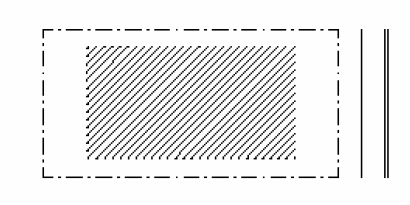
2.
Side yard. A building that occupies one side of the lot with the primary open space to the other side. The visual opening of the side yard on the street frontage causes this building type to appear freestanding. A shallow front setback defines a more urban condition. If the adjacent building is similar with a blank party wall on the lot boundary, the yard can be quite private. This type permits systematic climatic orientation, with the long side yard elevation responding to the sun or the breeze.
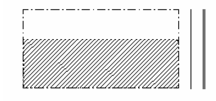
3.
Rear yard. A building that occupies the full front leaving the rear of the lot as a sole yard. This is a very urban type, as the continuous facade steadily defines the edge of the public space. The rear elevations may be articulated for functional purposes. In its residential form, this type is represented as the rowhouse. In its commercial form, the rear yard accommodates substantial parking.

4.
Court yard. A building that occupies the boundaries of its lot while internally defining one or more private patios. This is the most urban of types as it is able to shield the private realm from all sides while strongly defines the public spaces. This type is common in hot climates, but is useful everywhere. Because of its ability to accommodate incompatible activities in close proximity, it is recommended for workshops, lodging, and schools. The high security provided by the boundary definition is useful for crime-prone urban cores.

5.
Specialized. A building that is one not subject to typological categorization. Buildings dedicated to manufacturing and transportation, such as factories or airports, are often distorted by the trajectories of machinery. Civic buildings, which must express the aspirations of institutions, may be exempt from the discipline of type. Certain communal residential types, such as hospitals and co-housing, may evolve as specialized types. Such specialized buildings may be permitted in the district zoning district through the planned unit development process.

B.
Frontage types.
1.
Front yard. A frontage wherein the facade is set back substantially from the frontage line. The front yard thus created remains unfenced and is visually continuous in landscaping with adjacent yards simulating a common rural landscape. Front yards are suitable along higher speed thoroughfares, as the setback provides a buffer.
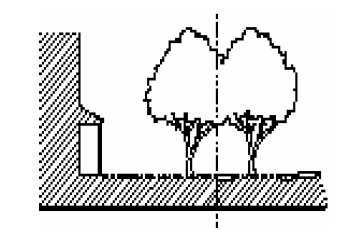
2.
Porch and fence. A frontage wherein the facade is set back from the frontage line with an attached porch encroaching. The porch should be within a conversational distance of the sidewalk. A fence at the frontage line maintains the demarcation of the yard. Porches shall be no less than eight feet wide.
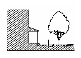
3.
Dooryard or light court. A frontage wherein the facade is set back from the frontage line by an elevated garden or terrace, or a fenced, sunken light court. This type buffers residential use from urban sidewalks, while removing the private yard from public encroachment. The terrace is suitable for transformation for outdoor dining.
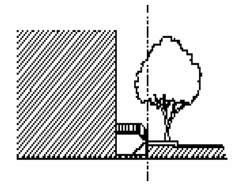
4.
Forecourt. A frontage wherein a portion of the facade is close to the frontage line while a substantial portion of it is set back. The forecourt created is suitable for gardens and off-loading. This type should be allocated sparingly in conjunction to other frontage types. Trees within the forecourts may overhang the sidewalks.
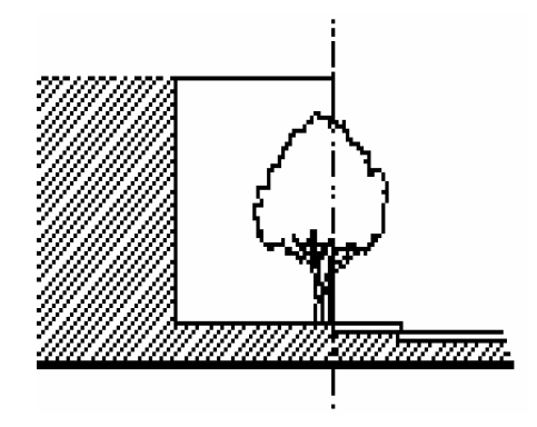
5.
Stoop. A frontage wherein the facade is aligned close to the frontage line with the lower story elevated from the sidewalk sufficient to secure privacy for the windows. The access is usually an exterior stair. This type is recommended for ground-floor residential uses.
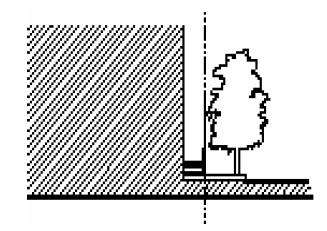
6.
Shopfront and awning. A frontage wherein the facade is aligned close to the frontage line with the building entrance at sidewalk grade. This type is conventional for retail use with a minimum of 70 percent glazing on the sidewalk level for retail locations and an awning placed so as to overlap the full width of the sidewalk.
C.
Building height measurement. The vertical extent of a building shall be measured in numbers of stories, not including a raised basement or an inhabited attic. Building height shall be measured from the average grade of the enfronting sidewalk. Height limits shall not apply to structures or portions of structures with a building coverage of less of 240 square feet including towers as masts, belfries, chimneys, water tanks, elevator shafts, and the like.
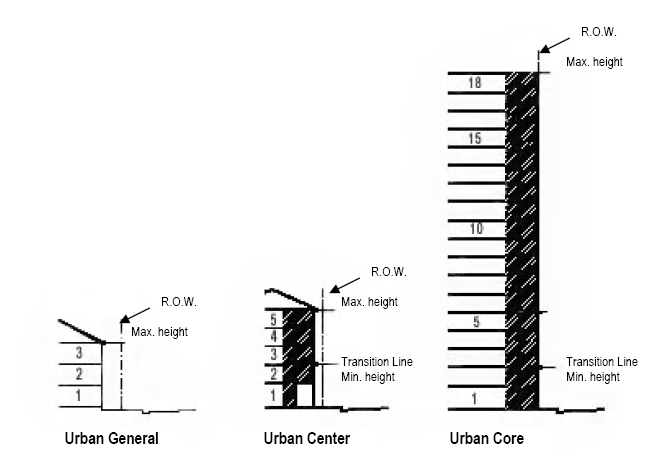
D.
Minimum parking standards.
1.
Except for those properties exempted in section 118.8.6.D.2 below, every building or structure instituted or erected hereafter in the downtown and midtown future land use districts shall be provided with off-street parking facilities in accordance with the provisions of this section for the use of occupants, employees, visitors and patrons. Such off-street parking facilities shall be maintained and continued as a required accessory use as long as the building or structure is continued. It shall be unlawful for any owner or operator of such building or structure affected by this article to discontinue, change or dispense with, or cause the discontinuance or reduction of, the required parking facilities apart from the discontinuance of such building or structure, without establishing alternative off-street parking facilities which meet the requirements of this article. Whenever any existing building or structure is enlarged, parking facilities shall be provided in accordance with this section for the enlarged area. In the event of the reduction of building, use or structure, the parking facilities may be reduced proportionately.
2.
Properties located in the downtown and midtown core pedestrian sheds (see Diagram 7 in section 118.8.1.B.) are exempt from the parking requirements contained herein. All other properties shall provide, at a minimum, off-street vehicle parking spaces according to the following table:
3.
Bicycle parking facilities shall be provided on-site at a ratio of one bicycle parking space for every 15 required automobile parking spaces. Bicycle parking facilities shall provide for secure parking of each bicycle.
4.
Parking facilities shall be located in the same pedestrian shed as the use they serve, unless otherwise approved by warrant to be located outside the pedestrian shed.
5.
Shared parking agreements may be used to meet the required off-street parking standards if the developer/applicant demonstrates that the shared parking facility can accommodate the parking needs of all proposed uses and that peak parking demands for each of the uses sharing the parking facility clearly occur at different times. Shared parking agreements must be recorded by a recordable covenant, lease, or other agreement and approved by the community development director.
E.
Summary tables.
1.
Urban General.
 | |||||||
| Density | |||||||
| Base Density | Bonus Density | ||||||
| 12 units per acre maximum | The maximum bonus density shall be 30% of the base density for parcels greater than one-half acre and 40% of the base density for parcels one-half acre or less. | ||||||
| Second Street Overlay | |||||||
| 17 units per acre maximum | |||||||
| Lots and Setbacks | |||||||
| Lot Area | Lot Coverage | Front Setback | Side Setback | Rear Setback | |||
| 3,000 square feet minimum; Lots of record existing as of adoption of Ordinance 3858, shall be vested for purposes of minimum lot size. | 75% maximum |
15 foot minimum,
25 foot maximum |
5 foot minimum
30 foot maximum | 10 foot minimum | |||
| Building Type | |||||||
| Edge Yard | Side Yard | Rear Yard | Court Yard | ||||
| Permitted | Permitted | Permitted | Permitted | ||||
| Frontage Type | |||||||
| Common Yard | Porch and Fence | Dooryard | Forecourt | Stoop | Shopfront | ||
| Permitted | Permitted | Permitted | Permitted | Permitted | Permitted | ||
| Height | |||||||
| Principal Building Height | Outbuilding Height | Second Street Overlay Principal Building Height | |||||
| 3 story maximum | 2 story maximum | 6 story maximum | |||||
| Non-Residential Base Intensity | |||||||
| 2 FAR maximum | Second Street Overlay 4 FAR maximum | ||||||
| Permitted Uses | |||||||
| Residential (including flexhouse or live-work unit) | Except for the Second Street Overlay, retail is limited to corner locations unless otherwise approved by conditional use per section 118.8.5.B. | Lodging is limited to a maximum of 8 bedrooms per lot and food service may be provided only to guests. The maximum length of stay shall not exceed 30 days. | Office | Childcare Services | Financial Services | Personal Care Services | Artisanal |
2.
Urban Center.
 | |||||
| Density | |||||
| Base Density | Bonus Density | ||||
| 50 units per acre maximum | The maximum bonus density shall be 30% of the base density for parcels greater than one-half acre and 40% of the base density for parcels one-half acre or less. | ||||
| Lots and Setbacks | |||||
| Lot Area | Lot Coverage | Front Setback | Side Setback | Rear Setback | |
| 2,000 square feet minimum; Lots of record existing as of adoption of Ordinance 3858, shall be vested for purposes of minimum lot size. | 100% maximum |
0 foot minimum,
10 foot maximum |
0 foot minimum,
10 foot maximum | 0 foot minimum | |
| Building Type | |||||
| Edge Yard | Side Yard | Rear Yard | Court Yard | ||
| Prohibited | Permitted | Permitted | Permitted | ||
| Frontage Type | |||||
| Front Yard | Porch and Fence | Dooryard | Forecourt | Stoop | Shopfront |
| Prohibited | Prohibited | Permitted | Permitted | Permitted | Permitted |
| Height | |||||
| Principal Building Height | Outbuilding Height | ||||
| 2 story minimum; 12 story maximum | 2 story maximum | ||||
| Non-Residential Base Intensity | |||||
| 8 FAR maximum | |||||
| Permitted Uses | |||||
| Residential (including flexhouse or live-work unit), office, retail, lodging, child care services, financial services, personal care services, artisanal. | |||||
3.
Urban Core.
 | |||||
| Density | |||||
| Base Density | Bonus Density | ||||
| 70 units per acre maximum | The maximum bonus density shall be 30% of the base density for parcels greater than one-half acre and 40% of the base density for parcels one-half acre or less. | ||||
| Lots and Setbacks | |||||
| Lot Area | Lot Coverage | Front Setback | Side Setback | Rear Setback | |
| 2,000 square feet minimum; Lots of record existing as of adoption of Ordinance 3858, shall be vested for purposes of minimum lot size. | 100% maximum |
0 foot minimum,
5 foot maximum |
0 foot minimum,
0 foot maximum | 0 foot minimum | |
| Building Type | |||||
| Edge Yard | Side Yard | Rear Yard | Court Yard | ||
| Prohibited | Permitted | Permitted | Permitted | ||
| Frontage Type | |||||
| Front Yard | Porch and Fence | Dooryard | Forecourt | Stoop | Shopfront |
| Prohibited | Prohibited | Permitted | Permitted | Permitted | Permitted |
| Height | |||||
| Principal Building Height | Outbuilding Height | ||||
| 2 story minimum; 18 story maximum | Not applicable | ||||
| Non Residential Base Intensity | |||||
| 12 FAR maximum | |||||
| Permitted Uses | |||||
Residential (including flexhouse or live-work unit), office, retail, lodging, child care services, financial services, personal care services, artisanal. | |||||
4.
Special Impact District.
 | |||||
| Uses Permitted | |||||
| Residential Uses | Lodging | Office | Retail/Services | Artisanal | Civic |
| All uses within the District category shall be developed through the Planned Unit Development process. The adjacent land uses will determine the development standards for district uses. *Institutional uses are permitted in all districts | |||||
| Building Disposition | |||||
| Lot Area | Lot Coverage | Front Setback | Side Setback | Rear Setback | |
| Follow adjacent development standards | Follow adjacent development standards | Follow adjacent development standards | Follow adjacent development standards | Follow adjacent development standards | |
| Principal Building Height | Outbuilding Height | Bonus Density Allocation | Standard Density Allocation | ||
| Follow adjacent development standards | Follow adjacent development standards | Follow adjacent development standards | Follow adjacent development standards | ||
| Building Type | |||||
| Edge Yard | Side Yard | Rear Yard | Court Yard | ||
| Not applicable | |||||
| Frontage Type | |||||
| Front Yard | Porch and Fence | Dooryard | Forecourt | Stoop | Shopfront |
| Not applicable | |||||
5.
Civic.
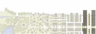 | |||||
| Uses Permitted | |||||
| Residential Uses | Lodging | Office | Retail/Services | Artisanal | Civic |
| All uses within the Civic category shall be developed through the Planned Unit Development process. *Institutional uses are permitted in all districts by PUD | |||||
| Building Type | |||||
| Lot Area | Lot Coverage | Front Setback | Side Setback | Rear Setback | |
| Determined by PUD | Determined by PUD | Determined by PUD | Determined by PUD | Determined by PUD | |
| Principal Building Height | Outbuilding Height | Bonus Density Allocation | Standard Density Allocation | ||
| Determined by PUD | Determined by PUD | Determined by PUD | Determined by PUD | ||
| Building Type | |||||
| Edge Yard | Side Yard | Rear Yard | Court Yard | ||
| Not applicable | |||||
| Frontage Type | |||||
| Front Yard | Porch and Fence | Dooryard | Forecourt | Stoop | Shopfront |
| Not applicable | |||||
6.
Civic—Recreation.
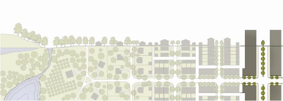 | |||||
| Uses Permitted | |||||
| Residential Uses | Lodging | Office | Retail/Services | Artisanal | Civic |
| All uses within the Civic Recreation category shall be developed through the Planned Unit Development process. *Institutional uses are permitted in all districts by PUD | |||||
| Building Type | |||||
| Lot Area | Lot Coverage | Front Setback | Side Setback | Rear Setback | |
| Determined by PUD | Determined by PUD | Determined by PUD | Determined by PUD | Determined by PUD | |
| Principal Building Height | Outbuilding Height | Bonus Density Allocation | Standard Density Allocation | ||
| Determined by PUD | Determined by PUD | Determined by PUD | Determined by PUD | ||
| Building Type | |||||
| Edge Yard | Side Yard | Rear Yard | Court Yard | ||
| Not applicable | |||||
| Frontage Type | |||||
| Front Yard | Porch and Fence | Dooryard | Forecourt | Stoop | Shopfront |
| Not applicable | |||||
7.
Convention Hotel Overlay.
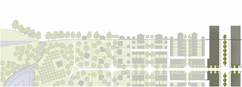 | |||||
| Uses Permitted | |||||
| Residential Uses | Lodging | Office | Retail/Services | Artisanal | Civic |
| All uses within the underlying zoning category shall be permitted pursuant to the applicable land use district regulations. | |||||
| Lots and Setbacks | |||||
| Lot Area | Lot Coverage | Front Setback | Side Setback | Rear Setback | |
| Lots and setbacks shall be consistent with the underlying zoning category. | |||||
| Building Type | |||||
| Edge Yard | Side Yard | Rear Yard | Court Yard | ||
| Not applicable | |||||
| Frontage Type | |||||
| Front Yard | Porch and Fence | Dooryard | Forecourt | Stoop | Shopfront |
| Not applicable | |||||
| Principal Building Height | |||||
| Maximum: 12 stories; additional building height determined by PUD | |||||
| Additional Standards | |||||
| Only property adjacent to Harborside Convention Center developed as a convention hotel development is eligible for the provisions of the convention Hotel Overlay. | |||||
| Development within the Downtown Historic District is subject to Historic Preservation Commission Review. | |||||
8.
Midtown General.
 | |||||||
| Density | |||||||
| Base Density | Bonus Density | ||||||
| 15 units per acre maximum | The maximum bonus density shall be 30% of the base density for parcels greater than one-half acre and 40% of the base density for parcels one-half acre or less. | ||||||
| Lots and Setbacks | |||||||
| Lot Area | Lot Coverage | Front Setback | Side Setback | Rear Setback | |||
| 3,000 square feet minimum; Lots of record existing as of adoption of Ordinance 3858, shall be vested for purposes of minimum lot size. | 75% maximum |
15 foot minimum,
25 foot maximum |
0 (zero) minimum,
30 foot maximum | 5 foot minimum | |||
| Building Type | |||||||
| Edge Yard | Side Yard | Rear Yard | Court Yard | ||||
| Permitted | Permitted | Permitted | Permitted | ||||
| Frontage Type | |||||||
| Common Yard | Porch and Fence | Dooryard | Forecourt | Stoop | Shopfront | ||
| Permitted | Permitted | Permitted | Permitted | Permitted | Permitted | ||
| Height | |||||||
| Principal Building Height | Outbuilding Height | ||||||
| 5 story maximum | 2 story maximum | ||||||
| Non-Residential Base Intensity | |||||||
| 4 FAR maximum | |||||||
| Permitted Uses | |||||||
| Residential (including flexhouse or live-work unit) | Retail | Lodging is limited to a maximum of 8 bedrooms per lot and food service may be provided only to guests. The maximum length of stay shall not exceed 30 days. | Office | Childcare Services | Financial Services | Personal Care Services | Artisanal |
9.
Midtown Center.
 | |||||
| Density | |||||
| Base Density | Bonus Density | ||||
| 50 units per acre maximum | The maximum bonus density shall be 30% of the base density for parcels greater than one-half acre and 40% of the base density for parcels one-half acre or less. | ||||
| Lots and Setbacks | |||||
| Lot Area | Lot Coverage | Front Setback | Side Setback | Rear Setback | |
| 2,000 square feet minimum; Lots of record existing as of adoption of Ordinance 3858, shall be vested for purposes of minimum lot size. | 100% maximum |
0 foot minimum,
10 foot maximum |
0 foot minimum,
10 foot maximum | 0 foot minimum | |
| Building Type | |||||
| Edge Yard | Side Yard | Rear Yard | Court Yard | ||
| Prohibited | Permitted | Permitted | Permitted | ||
| Frontage Type | |||||
| Front Yard | Porch and Fence | Dooryard | Forecourt | Stoop | Shopfront |
| Prohibited | Prohibited | Permitted | Permitted | Permitted | Permitted |
| Height | |||||
| Principal Building Height | Outbuilding Height | ||||
| 2 story minimum; 12 story maximum | 2 story maximum | ||||
| Non-Residential Base Intensity | |||||
| 8 FAR maximum, excluding hotel use. | |||||
| Permitted Uses | |||||
| Residential (including flexhouse or live-work unit), office, retail, lodging child care services, financial services, personal care services, artisanal. | |||||
10.
Midtown Core.
| |||||
| Density | |||||
| Residential Base Density | Bonus Density | ||||
| 70 units per acre maximum | The maximum bonus density shall be 30% of the base density for parcels greater than one-half acre and 40% of the base density for parcels one-half acre or less. | ||||
| Lots and Setbacks | |||||
| Lot Area | Lot Coverage | Front Setback | Side Setback | Rear Setback | |
| 2,000 square feet minimum; Lots of record existing as of adoption of Ordinance 3858, shall be vested for purposes of minimum lot size. | 100% maximum |
0 foot minimum,
5 foot maximum |
0 foot minimum,
0 foot maximum | 0 foot minimum | |
| Building Type | |||||
| Edge Yard | Side Yard | Rear Yard | Court Yard | ||
| Prohibited | Permitted | Permitted | Permitted | ||
| Frontage Type | |||||
| Front Yard | Porch and Fence | Dooryard | Forecourt | Stoop | Shopfront |
| Prohibited | Prohibited | Permitted | Permitted | Permitted | Permitted |
| Height | |||||
| Principal Building Height | Outbuilding Height | ||||
| 2 story minimum; 18 story maximum | Not applicable | ||||
| Non-Residential Base Intensity | |||||
| 12 FAR Maximum | |||||
| Permitted Uses | |||||
| Residential (including flexhouse or live-work unit), office, retail, lodging, child care services, financial services, personal care services, artisanal. | |||||
F.
Primary and secondary grids.
1.
Primary grid streets that will form a continuous, high quality pedestrian frontage are designated A streets. Secondary grid streets that will be permitted to maintain their automotive focus are designated B streets. It is the intent of this article that properties fronting on A streets shall have a higher level of regulation than B street properties. A and B streets located within the Midtown Future Land Use designation shall be consistent with the Midtown Vision Plan.
2.
Primary Grid/A Streets.
a.
Altamont Avenue.
b.
Avalon Street.
c.
Bay Street.
d.
Bayside Parkway.
e.
Broadway.
f.
Central Avenue from Dr. Martin Luther King, Jr. Boulevard to Edison Avenue.
g.
Clifford Street.
h.
Cottage Street from Dr. Martin Luther King, Jr. Boulevard to Victoria Avenue.
i.
Cranford Avenue from Michigan Avenue to First Street.
j.
Dean Street.
k.
Dr. Martin Luther King, Jr. Boulevard from Heitman Street to Lee Street.
l.
Edison Avenue.
m.
Edwards Avenue.
n.
First Street.
o.
Fourth Street.
p.
Fowler Street from Caloosahatchee River to Edison Avenue.
q.
Hendry Street from Caloosahatchee River to Widman Way.
r.
Henley Place.
s.
Hough Street.
t.
Jackson Street.
u.
Johnson Street.
v.
Lee Street from Caloosahatchee River to Richmond Street.
w.
Liberty Street from Broadway to Jackson Street.
x.
Main Street.
y.
Michigan Avenue.
z.
Monroe Street from Dr. Martin Luther King, Jr. Boulevard to Victoria Avenue.
aa.
Monroe Street from Edwards Avenue to Second Street.
bb.
Palm Avenue from Michigan Avenue to First Street.
cc.
Park Avenue.
dd.
Widman Way.
ee.
Poinsettia Avenue.
ff.
Providence Avenue.
gg.
Rhode Island Avenue.
hh.
Royal Palm Avenue.
ii.
Second Street.
jj.
Third Street.
kk.
Thompson Street from Fowler Street to Evans Avenue.
ll.
Tournament Avenue.
mm.
Union Street.
nn.
Victoria Avenue.
oo.
Virginia Avenue.
pp.
West First Street.
qq.
Wilna Street.
rr.
Woodford Avenue.
3.
Secondary grid/B Streets.
a.
Alicia Street.
b.
Cleveland Avenue.
c.
Dr. Martin Luther King, Jr. Boulevard from Cleveland Avenue to Heitman Street.
d.
Edison Bridge northbound approach (Park Avenue).
e.
Fowler Street from Dr. Martin Luther King, Jr. Boulevard south.
f.
Heitman Street from First Street to Dr. Martin Luther King, Jr. Boulevard.
g.
Hendry Street from Widman Way to Union Street.
h.
Lee Street from Richmond Street to Dr. Martin Luther King, Jr. Boulevard.
i.
Market Street from Central Avenue to Evans Avenue.
j.
Monroe Street from Second Street to Dr. Martin Luther King, Jr. Boulevard.
k.
Thompson Street from Lee Street to Fowler Street.
G.
Surplus equivalent dwelling units (EDUs) by Utility System Phase. The surplus EDUs indicated for each Utility System Phase are cumulative maximums for each phase. Available EDUs on a site specific basis are subject to the infrastructure in the immediate vicinity serving the specific site, on a sub-phase level. These more specific sub-phase capacities are identified and depicted in the Downtown and Midtown Fort Myers Utility Capacity Analysis (January 2017), as may be updated from time to time, on file with the Fort Myers Community Development Department. One EDU is based on the estimated wastewater production of one single family dwelling unit. Each multifamily dwelling unit shall be considered 0.5 EDU. 1,000 square feet of nonresidential area shall be considered 1 EDU.
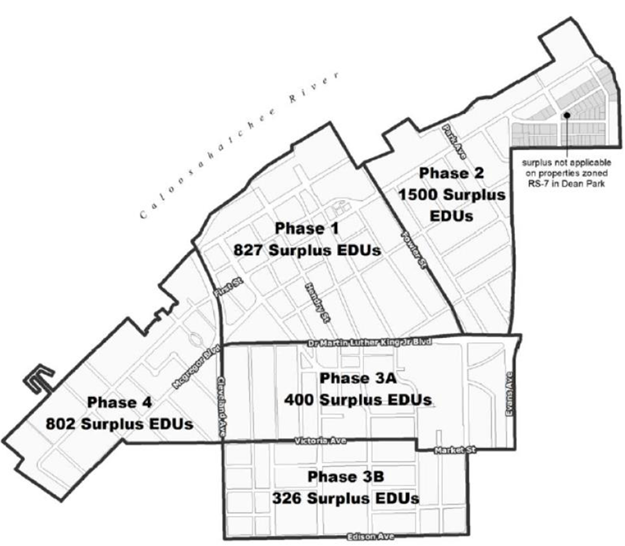
(Ord. No. 3422, § 4, 1-14-2008; Ord. No. 3563, § 4, 8-16-2010; Ord. No. 3775, § 3, 5-16-2016; Ord. No. 3790, § 5, 1-3-2017; Ord. No. 3858, § 1(Exh. A), 2-4-2019; Ord. No. 3915, § 1(Exh. A), 11-15-2021)
Addendum A. - [Maps B-1—B-5.]
Multifamily units in legal existence on or before July 8, 1997, shall be a special nonconforming use in the areas identified on maps B-1 through B-5, found below. refer back to section 118.3.3.a.3 for additional information.
(Ord. No. 3841, § 1, 10-1-2018)