
Franklin City Zoning Code
CHAPTER 1111
Development Requirements And Standards
1111.01 Subdivision Regulations
- Purpose: It is the purpose of these Subdivision Regulations to establish minimum requirements for the subdividing or platting of land within the City, in order to protect, safeguard and promote the public health, safety, convenience and welfare; in order to facilitate the orderly growth and development of the City by providing suitable (planned) residential neighborhoods with adequate streets, utilities, public school sites, recreational areas and other public open spaces; in order to achieve individual property lots of maximum utility and livability; and in order to provide for economical streets of adequate width and proper design so that future traffic circulation is provided fore by a coordinated street system.
- Validity: If any section, subsection, sentence, clause or phrase of these Subdivision Regulations is for any reason held to be unconstitutional, void or invalid, the validity of the remaining portions shall not be affected thereby.
- Fees:
- Fees for Major Subdivisions and Minor Subdivisions shall be as provided for in section 1105.09.
- If, due to nature of the proposed subdivision, it becomes necessary for the City to hire outside professionals to review the proposed subdivision, the applicant, by submitting a subdivision application, agrees to reimburse the City for the actual cost of said outside review.
- Applicability: All subdivisions defined as Major Subdivisions shall be subject to the requirements of sections 1111.02, 1111.03, 1111.04, 1111.05 and 1111.06.
- Procedure: The procedures for the subdivision process, including required submittals, review by Planning Commission and Council, and the applicable review standards are outlined in section 1115.06 for Major Subdivisions and section 1115.07 for Minor Subdivisions.
(Ord. 2009-14. Passed 7-6-09.)
1111.02 Subdivision Design Requirements And Standards
- General Provisions:
- The proposed subdivision and its ultimate use shall be in conformity with the City's Comprehensive Land Use Plan as adopted, and shall not encroach upon an area designated in the Comprehensive Land Use Plan for future public use.
- Land which the Planning Commission has found to be unsuitable for subdivision development due to flooding, poor drainage, soil conditions or other features which are likely to be harmful to the health, safety and welfare of future residents shall not be subdivided unless satisfactory methods of correction are formulated by the subdivider and approved by the Planning Commission.
- The Planning Commission shall consider plats designed for special development of group housing, new concepts of solar orientation, superblock arrangements or other methods of site design which may require modification or adjustment of these Subdivision Regulations, provided that such plats do not have an unfavorable effect upon the development of adjacent properties.
- Variations, exceptions and/or modifications of these design requirements may be made by the Planning Commission, in accordance with section 1111.02(h), in specific cases where it is deemed that extraordinary hardship, unusual topographical conditions or other unique conditions justify such variations.
- Streets:
- The arrangement, character, extent, width, grade and location of all streets shall conform to the Major Thoroughfare Plan, as adopted by the Planning Commission, and shall be considered in their relation to existing and planned streets, to topographic conditions, to public convenience and safety and in their appropriate relation to the proposed uses of the land to be served by such streets.
- Public right-of-way widths shall be as shown on the Major Thoroughfare Plan, and, unless otherwise indicated on the Major Thoroughfare Plan, shall not be less than the following:
Classification Right-of-Way Width (in Feet) A. Expressways 300 B. Major street 80-100 C. Collector streets 60-80 D. Minor streets 50 E. Marginal access streets 50 F. Alleys 20 G. Crosswalks 10 H. Utility easements 12 - The following standards also apply to streets:
- Additional street right-of-way width may be required by Planning Commission, upon the recommendation of the City Engineer, to assure adequate access, circulation and parking in subdivisions within high density residential areas, commercial areas and industrial areas.
- Where a proposed subdivision abuts or contains an existing street of inadequate right-of-way width, additional right-of-way width for the existing street may be required by Planning Commission in conformity with the standards of this Section.
- Minor streets shall be so arranged as to discourage their use by through traffic. Curvilinear street design is recommended for residential streets to discourage excessive vehicular speeds and to provide attractive vistas.
- The street arrangement in a subdivision shall provide for the continuation of existing streets in surrounding areas and shall provide for suitable access to adjoining unplatted areas at points not more than one-thousand three-hundred twenty feet (1,320') apart.
- Where a proposed subdivision abuts or contains an existing or proposed major street or highway as defined in the Major Thoroughfare Plan, the Planning Commission may require marginal access streets, reverse frontage lots containing a ten-foot no access reservation with approved screen planting along the rear property line, or such other treatment as may be necessary for the adequate protection of residential properties and to afford separation of through and local traffic.
- Intersections on major streets or thoroughfares shall be located not less than eight-hundred feet (800') apart, measured from center line to center line.
- When a tentative layout, including streets, of the general area or neighborhood has been made, approved and adopted by the Planning Commission, the proposed subdivision shall be in conformity thereto.
- Where a proposed subdivision abuts or contains a railroad right of way, expressway or other limited access highway, the Planning Commission may require a street approximately parallel to, and on each side of, such right-of-way at a distance suitable for the appropriate use of the intervening land. Such distances shall also be determined with due regard for the requirements of approach grades for future bridges or grade separations.
- Street jogs with center line offsets of less than one-hundred twenty-five feet (125') shall be prohibited.
- There shall be no private streets, lanes or ways platted in any subdivision except under the special design considerations for PUDs, as outlined in section 1109.05, and for PRCDs, as outlined in section 1109.06, this requirement may be waived or modified by the Planning Commission.
- Half streets shall be prohibited, except where Planning Commission finds it absolutely essential to the reasonable development of a tract in conformity with the subdivision design and improvement requirements of this Chapter, and where satisfactory assurance for dedication of the remaining part of the street is provided. Whenever a tract to be subdivided borders on an existing half or partial street, the other part of the street shall be dedicated within such tract.
- Dead-end streets are prohibited, except those designed as permanent cul-de-sacs or those required for future access to adjacent unplatted property. Temporary turn-around arrangements for dead-end streets which will be extended in the future may be required by the Planning Commission.
- Cul-de-sac streets shall be no longer than six-hundred feet (600') and shall contain at the closed end a turn-around having an outside road pavement diameter of one-hundred five feet (105') and a street property line diameter of one-hundred twenty feet (120'). Special consideration will be given to longer cul-de-sacs under unusual topographic conditions.
- Street grades shall not be greater than five percent (5%) or less than five-tenths percent (0.5%) per one-hundred feet (100').
- To insure adequate sight distance, horizontal curves shall have the following minimum center line radii:
Classification Centerline Radii (in Feet) (i) Minor streets & Marginal Access Streets 150 (ii) Collector streets 300 (iii) Major streets 500 (iv) Expressways 750 (v) A tangent at least one hundred feet (100') long shall be provided between reverse curves on collector streets and at least two hundred-fifty feet (250') long on major streets and thoroughfares, including expressways. - Streets shall intersect one another at right angles or as nearly at right angles as conditions permit. No street shall intersect another at an angle of less than sixty degrees (60°).
- “T” intersections of minor streets are to be encouraged.
- Multiple intersections involving the junction of more than two streets shall be prohibited.
- Minor streets intersecting with a major street or thoroughfare shall have a tangent section of center line not less than fifty feet in length.
- No street names shall be used which will duplicate or be confused with the names of existing streets within the area of jurisdiction of the City. Street and subdivision names and house numbers shall be subject to the approval of the City Manager or his designee.
- Alleys:
- Alleys shall be prohibited in subdivisions within single-family or two-family districts, unless Planning Commission finds they are warranted by special or unique conditions.
- Alleys shall be provided for subdivisions where the intended use is for multiple dwellings or business, commercial or industrial purposes. The Planning Commission may waive this requirement where other definite provision is made for service access, off-street loading and parking.
- Dead-end alleys are prohibited, unless Planning Commission finds them unavoidable because of special physical conditions. If permitted, dead-end alleys shall be provided with adequate turnaround facilities for service trucks, as determined by the Planning Commission.
- Blocks:
- Block length shall be no longer than one-thousand three-hundred twenty feet (1,320') nor less than five hundred feet (500'), unless Planning Commission finds that special physical conditions justify a departure from these standards.
- Block width shall be sufficient to provide for a development of two tiers of lots between streets except in cases where lots back to a major street or thoroughfare under the conditions specified in section 1111.02(b)(3)E.
- Where a proposed subdivision abuts or contains a major street or thoroughfare as shown on the Major Thoroughfare Plan, the long dimension of the block should parallel the major street or thoroughfare.
- Blocks designated for multiple dwellings or for business, commercial or industrial use may be specifically designed for such purposes with spaces set aside for off-street parking and loading facilities as specified in the parking regulations contained in section 1111.06.
- Dedication of an easement, at least ten feet (10') in width, may be required for a pedestrian walkway through a block over nine-hundred feet (900') in length or where Planning Commission finds it necessary in order to provide for safe and convenient access to schools, parks, shopping centers or other community facilities.
- Lots:
- The lot size, width, depth, shape and orientation shall be appropriate for the location and contemplated use of the subdivision but in no case shall any of the lot dimensions, building setback lines or lot area requirements be less than the minimum specified in the Zoning Code for the particular district in which the subdivision is located.
- The minimum lot depth for residential lots shall be one hundred (100) feet, one hundred thirty-five feet (135') on major streets, except as provided in section 1111.02(b)(3)(E).
- The general depth-to-width ratio of lots shall not exceed two and one-half to one (2.5:1).
- Every lot shall abut upon and have permanent access to a public street. However, in subdivisions designed under the special design considerations for PUDs, as outlined in section 1109.05, and for PRCDs, as outlined in section 1109.06, this requirement may be modified or waived by the Planning Commission.
- Side lot lines shall be at approximately right angles or radial to the street right-of-way line.
- Utility easements may be required on rear or side lot lines, as specified by the Planning Commission. Such easements shall be at least twelve feet (12') in width with six feet (6') being taken from the abutting lots on both sides of the center line of the easements.
- Additional easements may be required by the Planning Commission along drainage channels or water courses in such width, as may be recommended by the City Engineer.
- Corner residential lots shall have extra width sufficient to maintain building setback lines specified for the zoning district, as outlined in Chapter 1107.
- Modifications and Conditions:
- Where the Planning Commission finds that strict compliance with the design requirements provided for in this Section results in extraordinary hardship or costs being imposed upon a particular subdivision, it may vary these design requirements, so that substantial justice may be done and the public interest secured.
- In granting modifications of these Subdivisions Regulations, the Planning Commission may require such conditions as will, in its judgment, secure the objectives of the standards or requirements so varied or modified.
(Ord. 2009-14. Passed 7-6-09.)
1111.03 Public Improvements Design Requirements And Standards
- Applicability: This section, in its entirety, shall apply to all Major Subdivisions, PUDs, PCRDs, and any other developments requiring the submission of a Site Plan, as outlined in section 1115.08.
- General Procedures - Major Subdivisions:
- Construction Plans: Prior to beginning construction on any improvements in a Major Subdivision or any section thereof, Construction Plans showing contemplated improvements for the required streets, utilities and other facilities required by this Section shall be submitted and approved in accordance with section 1115.06.
- Guarantees: Before approval of Construction Plans for a Major Subdivision or any section thereof will be granted, the Subdivider or Developer must file a guarantee with the City, in accordance with section 1111.03(e), to assure completion of the required public improvements.
- Inspection Fees: Before approval of Construction Plans for a Major Subdivision or any section thereof will be granted, the Subdivider or Developer shall pay to the City a fee to provide for the inspection of the various public improvements as they are constructed. Inspection fees shall be charged at the rate of two and one-half percent (2-1/2%) of the estimated cost of the improvements. The fees shall be used to defray the cost of plan review, field inspection during the one- (1) year maintenance warranty period and any other incidental expenses directly related to the contracted improvement. Any costs incurred in excess of the two and one-half percent (2-1/2%) shall be billed to the Subdivider or Developer. Any costs in excess of the two and one-half percent (2-1/2%) shall be paid to the City before acceptance by the City of any improvements for operation and maintenance.
- Acceptance by City: No public improvements in a Major Subdivision shall be accepted by the City unless installed and constructed in accordance with this UDO. Acceptance of such improvements shall follow the procedures set forth in section 1115.06.
- General Procedures - PUDs and PCRD's:
- Construction Plans: Prior to beginning construction on any improvements in a PUD/PRCD or any section thereof, Construction Plans showing contemplated improvements for the required streets, utilities and other facilities required by this Section shall be submitted and approved in accordance with section 1115.05.
- Guarantees: Before approval of Construction Plans for a PUD/PRCD or any section thereof will be granted, the Developer must file a guarantee with the City, in accordance with section 1111.03(e), to assure completion of the required public improvements.
- Inspection Fees: Before approval of Construction Plans for a PUD/PRCD or any section thereof will be granted, the Developer shall pay to the City a fee to provide for the inspection of the various public improvements as they are constructed. Inspection fees shall be charged at the rate of two and one-half percent (2.5%) of the estimated cost of the improvements. The fees shall be used to defray the cost of plan review, field inspection during the one (1) year maintenance warranty period and any other incidental expenses directly related to the contracted improvement. Any costs incurred in excess of the two and one-half percent (2.5%) shall be billed to the Developer. Any costs in excess of the two and one-half percent (2.5%) shall be paid to the City before acceptance by the City of any improvements for operation and maintenance.
- Acceptance by City: No public improvements in a PUD or PRCD shall be accepted by the City unless installed and constructed in accordance with this UDO. Acceptance of such improvements shall follow the procedures set forth in section 1115.05.
- General Procedures - Other Developments:
- Construction Plans: Prior to beginning construction on any improvements shown on the Final Site Plan, Construction Plans showing contemplated improvements for the required streets, utilities and other facilities required by this Section shall be submitted and approved in accordance with section 1115.08.
- Guarantees: Before approval of the Construction Plans will be granted, the Developer must file a guarantee with the City, in accordance with section 1111.03(e), to assure completion of the required public improvements.
- Inspection Fees: Before approval of Construction Plans will be granted, the Developer shall pay to the City a fee to provide for the inspection of the various public improvements as they are constructed. Inspection fees shall be charged at the rate of two and one-half percent (2.5%) of the estimated cost of the improvements. The fees shall be used to defray the cost of plan review, field inspection during the one (1) year maintenance warranty period and any other incidental expenses directly related to the contracted improvement. Any costs incurred in excess of the two and one-half percent (2.5%) shall be billed to the Developer. Any costs in excess of the two and one-half percent (2.5%) shall be paid to the City before acceptance by the City of any improvements for operation and maintenance.
- Acceptance by City: No public improvements shown on a Final Site Plan shall be accepted by the City unless installed and constructed in accordance with this UDO. Acceptance of such improvements shall follow the procedures set forth in section 1115.08.
- Guarantees: The Subdivider or Developer shall enter into a contract with the City for the completion of the required public improvements, and shall provide a financial guarantee of performance in one or a combination of the following arrangements, subject to the review of Council:
- Performance Bond: A performance or surety bond sufficient to cover the full cost of the contemplated improvements, as estimated by the Subdivider's or Developer's Engineer and as approved by the City Engineer, and payable to the City of Franklin, shall be filed with the Finance Director to assure satisfactory installation of said improvements in accordance with these regulations. Such bond shall specify the time period in which the improvements are to be completed and shall be with an acceptable bonding company authorized to do business in Ohio by the Secretary of State.
- Escrow Fund: The Subdivider or Developer may enter into an escrow agreement with the City, and may deposit in a financial institution, as approved by the City's Finance Director, a sum equal to the total estimated cost of the contemplated improvements, to be held in escrow for the estimated tune period necessary to complete the required public improvements, to guarantee the satisfactory completion of said improvements within the required time. The escrow agreement may provide for the making of payments from such funds, from time to time, upon the written certification of the City Engineer that the balance remaining in the fund after such payments will, in his opinion, be adequate to pay the remaining costs of any unfinished improvements.
- Deposit with the City: A cash deposit or certified check sufficient to cover the full cost of the contemplated improvements, as estimated by the Subdivider's or Developer's Engineer and as approved by the City Engineer, may be deposited with the Finance Director. In the case of either cash deposits or certified checks, an agreement between the City and the Subdivider or Developer may provide for progressive payments out of the cash deposit or reduction of the certified check from time to time, upon the written certification of the City Engineer that the balance of funds remaining after such payments will, in his opinion, be adequate to pay the remaining costs of any unfinished improvements.
- Required Public Improvements: Every Major Subdivision, PUD, PCRD or other development to which this Chapter applies shall be required to provide complete public utilities, including water, sanitary sewers and storm sewers, and full street improvements, including street paving, curbs, gutters, street trees, street lighting, and sidewalks. The Subdivider or Developer shall be responsible, at his own cost, for making application for and obtaining all necessary permits and approvals from the Ohio EPA. The minimum standards for required public improvements shall be as follows:
- Water: A public water system containing an eight-inch minimum supply line, fire hydrants, valves and other water system appurtenances shall be constructed. The Subdivider or Developer shall provide the subdivision or development with a complete loop type water distribution system, unless otherwise directed by the City. The system shall be adequate to serve the area being platted or developed, shall include a connection for each lot, and shall include appropriately spaced fire hydrants in accordance with the requirements of the City of Franklin. The entire water system shall be designed to meet the approval of the City.
- Sanitary Sewers: A public sanitary sewer system containing an eight-inch minimum size pipe shall be constructed and the sewer size, grade and other appurtenances of the system shall be constructed in conformity with the requirements of the City Engineer. The Subdivider or Developer shall provide the subdivision or development with a complete sanitary sewer connected with such sewer main, including a lateral connection for each lot. Where a public sanitary main is not reasonably accessible, in the opinion of the Planning Commission, proper provisions shall be made for the disposal of sanitary wastes by one or the other of the following methods, as the case may be:
- In the case of a subdivision or development in which the average size of lots is less than two acres, the subdivision shall be provided with a complete sewer system, including a lateral connection for each lot, and a community sewage treatment plant of a type meeting the approval of the City Engineer and the Health Commissioner. The right of the City to charge the actual cost of operating and maintaining such treatment plant shall be filed with the final or record plat and incorporated in each deed.
- In the case of a subdivision or development in which the average size of lots in two acres or more in area, and where the City Engineer and Health Commissioner deem it appropriate, based on soil and other conditions as determined by percolation and other tests, private restrictions shall be filed with the final or record plat or deed(s) calling for the installation on each lot of an individual sewage disposal system meeting fully the requirements of the officials having jurisdiction.
- Storm Sewers: A storm drainage system, including necessary storm sewers, drain inlets, manholes, culverts and other necessary appurtenances shall be required and constructed in conformity with the Stormwater Design Requirements and Standards of this UDO. The Subdivider or Developer shall provide the subdivision or development with a storm water sewer or drainage system adequate to serve the area being platted or developed.
- All natural water drainage ways shall be preserved at their natural gradient unless otherwise determined by the Planning Commission upon recommendation from the City Engineer.
- All lots shall be finish graded so that all storm waters shall drain easily from the site.
- Streets: Full street improvements, including adequate subgrade preparation, hard surfacing, curbs and gutters shall be required in every subdivision and development, as applicable, in conformity with the construction standards of the City Engineer. The minimum standards for such street improvement shall be as follows:
- Street Surfacing: Streets shall be fully constructed with all-weather macadam or concrete pavements surfaced with asphaltic or Portland cement concrete wearing surfaces, concrete curbs and gutters with tile underdrain and porous backfill and proper storm drains and inlets.
- Street Surfacing Width: Minimum street surfacing widths shall be as follows:** Added street pavement width may be required by the Planning Commission for minor streets which are designed to serve high density residential developments and commercial or industrial subdivisions.
Classification To Backs of Curbs (in Feet) Minor streets 35 Neighborhood collector streets 41 Major streets 52 - Curbs and Gutters: Curbs and gutters of a type approved by the City Engineer shall be provided for all streets within each subdivision or development, provided, however, that curbs and gutters shall not be required in subdivisions/developments in which the Planning Commission, pursuant to section 1109.06, has waived permanently or conditionally the necessity of sidewalks.
- Street Islands and Boulevards: Where the Subdivider or Developer proposes boulevard streets and/or street islands in his street layout, he shall make suitable plans for landscaping the boulevard or island areas. All such landscaping plans shall be approved as to height, size and type of plant material by the Zoning Official and City Engineer.
- Sidewalks and Crosswalks: Each subdivision or development shall provide concrete sidewalks five feet (5') in width on both sides of the street, in accordance with the City Engineer's specifications. The Planning Commission may reduce the requirement to four feet (4') where, in its judgment, such improvement will adequately serve the pedestrian needs of the subdivision or development. Crosswalks, where required, shall have a five foot (5') paving width centered within the required ten foot (10') public right-of-way.
- Alleys: Alleys, where permitted, shall be paved in concrete or other bituminous material in accordance with specifications approved by the City Engineer.
- Street Trees: Street trees shall be required in each subdivision or development of a type, size and location as specified by the City.
- Monuments: Monuments shall be placed at all block corners, angle points and points of curves in streets and at such other points as required by the City Engineer.
- Street Lights: Standard street lights shall be installed at street intersections and at such other locations as may be required to maintain minimum standards of public safety. If the Subdivider or Developer choose to install fixture types other than the standard fixture type, he shall place a covenant on each lot in the subdivision or development stating that said lots shall be a part of a special street lighting district, and that the owners of said lots shall collectively be responsible for the payment of the maintenance and replacement of said lights. Such costs shall be the difference between the cost of maintenance and replacement of standard street lights and the alternative lights installed, and said costs shall be divided equally among all the owners in the special district and shall be added on a monthly basis to their City utility bill. In the case of a condominium development, the Developer shall place within the condominium documents and the Homeowners Association bylaws that the Homeowners Association shall be responsible for the cost of the maintenance and replacements of said lights, which costs shall be billed on a monthly basis to the Homeowners Association.
- Street Name Signs: The City will erect the necessary street and traffic sign, and the Subdivider or Developer shall reimburse the City for the cost thereof. The City shall install the standard street name signs, unless the Subdivider or Developer requests the installation of street name signs of a character or design which reflects the particular characteristics of the subdivision or development, and agrees to pay the cost thereof. Such special signing arrangements may be approved by the Planning Commission.
- Electric and Telephone Lines: Where it is necessary to locate electric or telephone lines in the street right-of-way, they shall be located in accordance with the City's right-of-way ordinance and/or as directed by the City Engineer.
- Required Buffering: Landscape planting, louvered fences for screening, or other suitable landscape treatment shall be required by the Planning Commission and installed by the Developer within required greenbelts, buffer parks or other open spaces where Planning Commission finds it necessary to protect the development from the detrimental effects of adjacent expressways, major streets, railroads or other land uses. Such landscape plans should be indicated on the Subdivider's or Developer's construction plans and shall be approved by the Planning Commission after review by the Zoning Official and City Engineer.
- Modifications and Conditions:
- Where the Planning Commission finds that strict compliance with the minimum improvement requirements provided for in this chapter results in extraordinary hardship or costs being imposed upon a particular subdivision, PUD, PRCD or other development, it may vary these improvement regulations so that substantial justice may be done and the public interest secured.
- In granting modifications of these requirements, the Planning Commission may require such conditions as will, in its judgment, secure the objectives of the standards or requirements so varied or modified.
- Penalty for Non-Completion: Should the Subdivider or Developer fail to complete the required public improvement work within the time period required by the conditions of the guarantees as outlined above, the City shall proceed to have such work completed and reimburse itself for the cost thereof by appropriating the cash deposit, certified check or surety bond, or shall take the necessary steps to require performance by the bonding company.
(Ord. 2009-14. Passed 7-6-09.)
1111.04 Parkland Requirements And Standards
- Findings: Parkland Standard: It is found and determined that the public health, safety, convenience, comfort, prosperity and general welfare requires that at least seventeen (17) acres of property for each one thousand (1,000) persons residing within the City of Franklin, Ohio be devoted to parkland, and the same is hereby established as the parkland standard for all purposes of this UDO, The parkland standard utilized was determined by computing the approximate existing ratio of parkland to population within the City of Franklin.
- Statement of Policy: With respect to Major Subdivisions and Planned Unit Overlay District developments, at least eight and one-half (8-1/2) acres of property for each 1,000 persons (.0085 acres per person) should be reserved for parkland by or at the expense of the subdivider or developer of the dwellings in which such persons shall reside, and the remainder of the seventeen-acre standard established in this Section shall be acquired for such purposes by the City. All parkland reserved or acquired shall be developed and maintained by the City.
- Adoption of Park Plan: Council may adopt a plan for the parks and other public grounds of the City, which may constitute a part of the Comprehensive Development Plan and which shall provide a guide for the orderly acquisition of parkland within the City, in accordance with the parkland standard set forth in this Section, the criteria set forth in this Section and such other criteria as Council may deem appropriate to accomplish the purposes of this Section.
- Provision of Parkland by Subdividers or Developers: Every Subdivider or Developer who files any proposal, plan or plat for a Major Subdivision or a PUD Development of land within the City after the effective date of this UDO, who has not theretofore filed any preliminary plat or plan with respect to such subdivision or development, shall either dedicate a portion of such land, pay a fee in lieu of land dedication, or dedicate land and pay a fee in lieu of land dedication, all as provided in this section, for the purpose of providing parkland to serve future residents of each subdivision or development.
- Determination of Total Population:
- Population Factor: For the purposes of this Section, a population factor for each dwelling unit planned for a subdivision or development shall be determined as follows:
Residential Dwelling Type Population Factor Per Dwelling Unit Single-Family 3.25 Two-Family 2.50 Three-Family 2.00 Multi-Family Unit (restricted to one tenant) 1.00 All other units 1.75 - Total Population: Total population for any subdivision or development shall equal the sum of the population factors of all dwelling units to be included in the subdivision or development. For the purposes of this Section, the Planning Commission shall determine the number and types of dwellings to be included in any subdivision or development on the basis of such relevant information as it may have or be able to obtain to show the same, including, without limitation, any plans, estimates or statements of intention furnished by the Subdivider or Developer relating to the proposed improvement of the subdivision or development, the nature and topography of the land involved and the nature and kind of improvements actually planned or probable thereon.
- Population Factor: For the purposes of this Section, a population factor for each dwelling unit planned for a subdivision or development shall be determined as follows:
- Determination of Land Dedication or Payment of Fee for Provision of Parkland:
- Determination by Planning Commission: The Planning Commission shall determine, subject to the approval of Council, whether a Subdivider or Developer shall dedicate land, pay a fee in lieu of dedication, or provide a combination of land dedication and fee payment. In addition, Planning Commission may, subject to the approval of Council:
- Require the dedication of a public area, in an amount up to five percent (5%) of the gross area of the proposed subdivision or development as a condition of approval of that subdivision or development, where a proposed neighborhood park, playground, recreation area, school site or other public use, as shown on the Comprehensive Development Plan, is located in whole or in part in a subdivision or development.
- Require the dedication of greenbelts or buffer parks in areas where they are desirable to separate and protect residential subdivisions or developments from adjacent commercial developments, express highways, major streets and railroad rights-of-way.
- Require the dedication or reservation of other public open spaces where deemed necessary by the Planning Commission for preservation of historic sites and scenic areas or for a particular type of development proposed in the subdivision or development, but not anticipated in the Comprehensive Development Plan.
- Procedure: In making the determination of land dedication or payment of fee, or combination thereof, for the provision of parkland, the following procedures shall apply:
- Contents of Filings: At the time of the filing of a Preliminary Plat or Development Plan, each Subdivider or Developer shall, as a part of such filing, submit a calculation of the total population of the subdivision or development, in accordance with section 1111.04(e), and indicate whether he wishes to dedicate land as parkland, to pay a fee in lieu of dedication, or to meet the requirements of this Section by a combination of parkland dedication and fee payment.
- Planning Commission Determination: After the Planning Commission has reviewed the Preliminary Plat or Development Plan, it shall determine whether the wishes of the Subdivider or Developer to dedicate land, pay a fee, or provide a combination thereof, are acceptable. If such wishes are acceptable, Planning Commission shall recommend to Council that Council accept the dedication of land, the payment of a fees, or a combination thereof, as proposed by the Subdivider or Developer. If Planning Commission deems such wishes unacceptable, it shall recommend an alternative course of action to the Subdivider or Developer. If the Subdivider or the Developer rejects Planning Commission's alternative, upon presentation, Council shall determine whether to accept the Subdivider's or Developer's wishes, or Planning Commission's recommendation, or some other alternative.
- Location: If the Subdivider or Developer desires to dedicate land, he shall indicate the area he desires to dedicate on the Preliminary Plat or Development Plan. The location of such parkland shall be reviewed by Planning Commission to determined if it meets the criteria of this Section. If Planning Commission determines that the proposed location of the area to be dedicated is acceptable, it shall recommend to Council that Council accept the dedication of land as proposed. If Planning Commission deems that such location is unacceptable, it shall recommend an alternative location to the Subdivider or Developer. If the Subdivider or Developer rejects Planning Commission's alternative, upon presentation, Council shall determine whether to accept the Subdivider's or Developer's proposed location, or Planning Commission's recommendation, or some other alternative.
- Reclamation; Adverse Effects of Development: If, in the opinion of Council, or upon the recommendation of Planning Commission, any portion of land proposed for dedication has been, or will be, adversely affected by the operations of the Subdivider or Developer, and such land or portion thereof will require reclamation in order to render it suitable for parkland, Council may require the Subdivider or Developer to furnish a plan for such reclamation. The Planning Commission and Council shall seek the advice of the City Engineer or other professional, as it deems proper, with respect to any such plan, and shall determine, on the basis of such advice, whether such plan is acceptable in view of the purposes of this Section. If such plan is deemed acceptable, the Subdivider or Developer shall implement such plan in accordance with a timetable approved by Planning Commission. The City may, without prejudicing any rights the City may have in law or in equity, deny approval of a Final Plat or Development Plan for noncompliance with a previously approved reclamation plan or timetable approved by Council.
- Criteria: In making its determination, Planning Commission and Council shall utilize the following criteria;
- Unity. Dedicated land must form a single parcel of land, except in the event that the Planning Commission or Council determines that two or more parcels would be in the best public interest or in the event that the parcel adjoins an existing or proposed park.
- Shape and Topography. The shape and topography of the dedicated parcel of land shall be suitable for active and/or passive recreation to serve the public properly as determined by Council after review by the Planning Commission.
- Location. Dedicated land must be located in order to serve the recreation and open space needs of the subdivision or development for which the dedication is being made.
- Access. Public access and maintenance access shall be provided by adjoining frontage of one hundred or more feet (100') per acre at one location on a public street with street improvements, sidewalks and utilities installed by and at the expense of the Subdivider or Developer, or by public walkways installed by and at the expense of the Subdivider and Developer, unless otherwise recommended by Planning Commission and approved by Council. Frontage shall be increased by at least forty feet (40') for each acre of parkland beyond one acre.
- Preservation of Natural Beauty. In all instances, natural features of scenic beauty, such as trees, plant life, brooks and other watercourses, topography, historic locations, views and similar conditions, which, if preserved, will add attractiveness and value to the dedicated land, shall be considered and preserved in the dedication of parkland.
- Determination by Planning Commission: The Planning Commission shall determine, subject to the approval of Council, whether a Subdivider or Developer shall dedicate land, pay a fee in lieu of dedication, or provide a combination of land dedication and fee payment. In addition, Planning Commission may, subject to the approval of Council:
- Amount of Land to be Dedicated: The amount of land to be dedicated by a subdivider or developer pursuant to this Section shall be determined in accordance with the following formula:
Acres of land for dedication = Total population as determined in accordance with paragraph (e), above X .0085 - Determination of Fee in Lieu of Dedication: In the event Planning Commission recommends or Council determines that the Subdivider or Developer should pay a fee in lieu of land dedication, the amount of such fee shall be determined by the following formula:
Fee in lieu of land dedication = Land area that would otherwise be required for dedication pursuant to paragraph (g), above X Market Value as determined pursuant to paragraph (i), below - Determination of Market Value: For the purposes of this Section, market value shall be determined as follows:
- Time for Determination: Market value shall be determined as of the time of filing of the Final Plat or Development Plan, or the Construction Plans of the first section of an approved subdivision or development plan with the City.
- Method of Determination: Market value shall equal the average value per acre of all land in each subdivision or development in its raw, undeveloped state, plus one-half (1/2) the cost of installation of four hundred feet (400') of public street, sidewalk and utility improvements in the subdivision or development for the first five (5) acres of park area, plus forty feet (40') of public street, sidewalk and utility improvements for each additional acre, as determined by the application of one of the following procedures:
- By agreement between the Subdivider or Developer and the Council, which may include appraisal by a qualified independent appraiser paid for by the Subdivider or Developer and approved by Council; or
- In the event the Subdivider or Developer objects to the foregoing method or valuation, by a three-member board of appraisers, one of whom shall be appointed by Council, one of whom shall be appointed by the Subdivider or Developer, and one of whom shall be selected by the two appraisers so appointed. The City shall pay for the appraiser appointed by Council, the Subdivider or Developer shall pay for the appraiser appointed by him, and the City and the Subdivider or Developer shall split the cost of the third appraiser. The decision of a majority of such board shall be final.
- Public Park Development and Maintenance: Public park development and maintenance shall be provided by the City.
- Credit for Private Open Space:
- Allowance of Credit: In the event that a Subdivider or Developer provides private open space for park purposes and such space is to be privately owned and maintained by the future residents of the subdivision or development, or by the Subdivider or Developer, and in the event Council, upon the recommendation of Planning Commission, determines that such private open space adequately fulfills a portion of the park needs of the proposed subdivision or development, the market value of such areas, as determined in paragraph (i), above, shall be credited against the land dedication or fee is lieu of dedication of land requirements of this section.
- Maximum Credit: Such credit shall be allowed only up to a maximum of one-half (1/2) of the total required land dedication or fee in lieu of dedication requirement. The remaining one-half (1/2) shall be provided in accordance with the requirements of this Section.
- Standards and Limitations: Notwithstanding subsections (1) and (2), hereof, the credit for private open space shall be allowed only if all of the following standards are met:
- Yards, court areas, setbacks and other such open areas required to be maintained by this UDO shall not be included in the computation of such private open space;
- Private ownership, development and maintenance of the private open space shall be assured by valid and enforceable undertakings on the part of the Subdivider or Developer;
- The use of the private open space is restricted for park purposes by recorded covenants that run with the land in favor of the future owners of the property within the subdivision or development, and which cannot by their terms be defeated or eliminated without the consent of Council;
- The proposed private open space is reasonably adaptable for park uses, taking into consideration such factors as size, shape, topography, geology, access and location of the private open space land; and
- Facilities proposed for the private open space can be reasonably expected to meet the needs of future residents.
- Treatment of Land to be Dedicated: Procedure for Dedication of Land and Payment of Fees:
- Following approval of a Preliminary Plat, Final Plat or Development Plan which designates land for dedication, the existing vegetation (except growing commercial crops other than growing timber), topography, features of historic value, stream courses, soil, rock strata and other natural features of such dedicated land shall not be altered or their condition adversely affected in any way without the consent of Council.
- Dedication of land to the City shall be by general warranty deed conveying to the City good and marketable title to the real estate described in such deed, free and clear of all liens and encumbrances.
- The deed shall be executed and delivered to the City for signatures, and shall be recorded by the Subdivider or Developer with the Warren County Recorder, prior to the signing by the City of the Final Plat or Development Plan, prior to the signing of Construction Plans of the first section of an approved Final Plat or Development Plan, or prior to the issuance by the City of any permit allowing implementation of an approved Plat or Development Plan.
- Open space covenants for private parks shall be submitted to the City, for review by the Law Director, prior to the approval of the Final Plat or Development Plan and shall be recorded at the same time as the Final Plat or Development Plan. No City permits allowing for the implementation of any Plat or Development Plan shall be issued until the open space covenants have been approved by Council and recorded with the Final Plat or Development Plan.
- If a fee in lieu of dedication of parkland is required, the amount thereof shall be deposited with the City prior to the signing by the City of the Final Plat or Development Plan, prior to the signing of Construction Plans of the first section of an approved Final Plat or Development Plan, or prior to the issuance by the City of any permit allowing implementation of an approved Plat or Development Plan.
- Where a Subdivision or Development is being developed in sections, Council, in its sole discretion, may follow one of the following options:
- When land is being dedicated, Council may permit the subdivider or developer to place the deed to the parkland in escrow for later delivery to the City at the time of approval of the final section or Construction Plans for the final section; however, if any Construction Plans or other drawings are submitted for approval that includes or has a boundary contiguous with the proposed park, the deed (whether in escrow or not) transferring the parkland to the City shall be recorded prior to the signing by the City of the final plans or plat.
- When a fee is being paid in lieu of dedication, Council may permit the subdivider or developer to pay only a proportionate amount of the total fee, which shall be proportionate to the section being developed. In this case, proportionate shall mean that the total amount of the fee to be paid shall be divided by the total number of all proposed dwellings within the entire subdivision or development, and the resultant dollar amount shall be multiplied by the number of dwelling units in the section to be developed.
- Amendments of Approved Plats or Development Plans.
- Any amendment of an approved Plat or Development Plan which, under the provisions of this section, increases the requirement for parkland dedication or payment of a fee in lieu of dedication shall require that such increased parkland be dedicated or that such fee in lieu of dedication be paid by the Subdivider or Developer in compliance with the requirements of this Section.
- Any amendment of an approved Plat or Development Plan which, under the provisions of this section, decreases the requirement for parkland dedication or payment of a fee in lieu of dedication shall not require the deeding by the City of any previously dedicated parkland back to the Subdivider or Developer, the alteration of any deed placed in escrow or any escrow agreement that was a requirement of this section, or the repayment to the Subdivider or Developer of any fee in lieu of dedication already paid by the Subdivider or Developer to the City.
- Limitation on Use of Land and Fees. Any land or fees received by the City pursuant to this Section shall be used only for the purpose of providing parkland to properly serve the future residents of the subdivision or development concerned. Fees paid pursuant to this Section shall be deposited in a City fund to be used only for the acquisition of parkland in the City or adjacent to the City, or for the maintenance, upkeep and operation of existing City parks. “Operation” may include general operating expenditures including, but not limited to, salaries and wages.
- Modifications and Conditions:
- Notwithstanding any provision of this Section to the contrary, Council may, in cases of an unusual or exceptional nature, allow for modifications in the parkland dedication and fee in lieu of dedication requirements and standards of this Section. Modifications may be allowed when, in the opinion of Council, it has been determined and satisfactorily shown that the character of the particular subdivision or development and the parkland needs generated by and associated with any subdivision or development sufficiently justify such modifications.
- In granting modifications of these requirements, Council may require such conditions as will, in its judgment, secure the objectives of the standards or requirements so varied or modified.
- Severability: It is hereby declared that if any provision or provisions of this Section are declared by a court of competent jurisdiction to be invalid or ineffective, in whole or in part, all other provisions of this Section and of this UDO shall continue to be separate and fully effective and enforceable. It is further declared that if the application of any provision or provisions of this Section thereof to any lot, parcel or tract of land are declared by a court of competent jurisdiction to be invalid or ineffective or are declared to be inapplicable to any person or situation, in whole or in part, the application of any such provision or provisions to any other persons or situations shall not be affected.
(Ord. 2009-14. Passed 7-6-09.)
1111.05 Stormwater And Drainage Requirements And Standards
- Stormwater Design Requirements and Standards: The Design Requirements and Standards shall follow the Warren County Storm Water Design Manual.
- Erosion Prevention and Sediment Control: These regulations and amendments thereto, shall be cited as the City of Franklin (City) Erosion Prevention and Sediment Control regulations and may hereinafter be referred to as “these regulations”.
- Statutory Authority: These regulations are promulgated in accordance with Section 715 of the Ohio Revised Code, and chapter 3745-39 of the Ohio Administrative Code to implement Phase II of the storm water program of the National Pollutant Discharge Elimination System established in 40 C.F.R. Part 122.
These regulations shall require persons to file plans governing erosion control, sediment control, and water management before clearing, grading, excavating, filling, or otherwise wholly or partially disturbing one or more contiguous acres of land owned by one person or operated as one development unit for the construction of nonfarm buildings, structures, utilities, recreational areas, or other similar nonfarm uses. - Purpose: The purpose of these regulations is to establish technically feasible and economically reasonable standards to achieve a level of management and conservation practices that will abate wind or water erosion of the soil or abate the degradation of the waters within the state by soil sediment in conjunction with land grading, excavating, filling, or other soil disturbing activities on land used or being developed for non-agriculture, commercial, industrial, residential, or other non-agriculture purposes, and establish criteria for determination of the acceptability of those management and conservation practices.
The purposes of these regulations include, without limitation, the following:- Permitting development while minimizing erosion and sedimentation.
- Reducing impairment of receiving streams which may be caused by erosion and sedimentation from construction and other earth disturbing activities.
- Encouraging innovative design which will enhance the control of erosion and sedimentation in a manner consistent with the intent of these regulations.
- Applicability: These regulations are intended to conform to the requirements found in the Ohio Environmental Protection Agency (Ohio EPA) Phase II General Permit for Municipal Separate Storm Sewer Systems (MS4) and the associated OEPA Construction General Permit. As the OEPA permits are routinely updated, any inconsistencies in the requirements, definitions or verbiage between these regulations as compared to the OEPA permits shall assume the current permit language prevails.
These regulations shall apply to all earth disturbing activities covered in the Construction General Permit except for the following activities:- Strip mining operations regulated under Section 1513.01 of the Ohio Revised Code;
- Surface mining operations regulated by Section 1514.01 of the Ohio Revised Code;
- Public highways, transportation, and drainage improvement or maintenance project undertaken by a government agency or political subdivision in accordance with a statement of its standard sediment control policies that is approved by the board or the chief of the division of soil and water conservation in the Ohio department of agriculture.
- Any emergency activity that is immediately necessary for the protection of life, property, or natural resources.
- Agricultural operations as defined in Section 106 of this regulation.
- Disclaimer of Liability: Compliance with the provisions of these regulations shall not relieve any person from responsibility for damage to any person otherwise imposed by law. The provisions of these regulations are promulgated to promote the health, safety and welfare of the public and are not designed for the benefit of any individual or any particular parcel of property. By approving a Storm Water Pollution Prevention Plan (SWP3) under these regulations, the City does not accept responsibility for the design, installation, and operation and maintenance of erosion control practices or facilities.
- Conflicts, Severability, Nuisances and Responsibility: These regulations are not intended to interfere with, abrogate, or annul any other ordinance, rule or regulation, stature, or other provision of law. The requirements of these regulations should be considered minimum requirements, and where any provision of these regulations imposes restrictions different from those imposed by any other ordinance, rule or regulation, or other provision of law, whichever provisions are more restrictive or impose higher protective standards for human health or the environment shall be considered to take precedence.
If any clause, section, or provision of these regulations is declared invalid or unconstitutional by a court of competent jurisdiction, the validity of the remainder shall not be affected thereby.
These regulations shall not be construed as authorizing any person to maintain a nuisance on their property, and compliance with the provisions of these regulations shall not be a defense in any action to abate such a nuisance.
Failure of the City or its designated agent to observe or recognize hazardous or unsightly conditions or to recommend corrective measures shall not relieve the site owner from the responsibility for the condition or damage resulting therefrom, and shall not result in the City, its officers, employees, or agents being responsible for any condition or damage resulting therefrom. - Definitions: For the purposes of these regulations, the following terms shall have the meaning herein indicated; otherwise, words or terms not defined, or interpreted by these regulations or statutory or administrative law, shall have their customary meaning as interpreted by Ohio common law, or in the event no common law exists then as found in the most recent editions of published dictionaries.
"Applicant." A property owner or agent of a property owner who has filed an application for an Earth Disturbing Permit. "Agriculture." Agriculture includes agriculturing; ranching; aquaculture; algaculture meaning the agriculturing of algae; apiculture and related apicultural activities, production of honey, beeswax, honeycomb, and other related products; horticulture; viticulture, winemaking, and related activities; animal husbandry, including, but not limited to, the care and raising of livestock, equine, and fur-bearing animals; poultry husbandry and the production of poultry and poultry products; dairy production; the production of field crops, tobacco, fruits, vegetables, nursery stock, ornamental shrubs, ornamental trees, flowers, sod, or mushrooms; timber; pasturage; any combination of the foregoing; the processing, drying, storage, and marketing of agricultural products when those activities are conducted in conjunction with, but are secondary to, such husbandry or production; and any additions or modifications to the foregoing made by the director of agriculture by rule adopted in accordance with Chapter 119 of the Revised Code. "Clean Water Act." The federal Water Pollution Control Act (33 U.S.C. § 1251 et seq.), and any subsequent amendments thereto. "Construction General Permit." Ohio Environmental Protection Agency's General Permit Authorization for Storm Water Discharges Associated with Construction Activity Under the National Pollution Discharge Elimination System. "Construction Site." Any parcel of land on which land has been disturbed for non-farming activity in the efforts to construct a new land or building feature. "Developer." Any individual, sub-divider, firm, association, syndicate, partnership, corporation, trust, or any other legal entity commencing land disturbance activities subject to these regulations. "Development/Construction Area." Any tract, lot, parcel of land or combination of such which are part of a larger common plan of development, upon which more than one acre of earth disturbing activity is to be performed. "Drainage." The removal of surface water or groundwater from land by surface or subsurface drains. "Earth Disturbing Activity." Any clearing, grading, excavating, grubbing, and/or filling or other alteration of the earth's surface where natural or manmade ground cover is destroyed and which may result in or contribute to erosion and sediment pollution. "Earth Disturbing Permit." A permit to perform earth disturbing activities provided by the City or its designated agent once a developer/owner meets specific criteria as outlined in these regulations. "Environmental Protection Agency." The United States Environmental Protection Agency, including but not limited to the Ohio Environmental Protection Agency (Ohio EPA), or any duly authorized official of said agency. "Erosion." The process by which the land surface is worn away by the action of water, wind ice or gravity. "Erosion and Sediment Control Plan." A strategy or plan to minimize erosion and prevent off-site sedimentation by passing sediment laden runoff through a sediment control measure, which has been prepared and approved in accordance these regulations and those requirements of the Construction General Permit. The erosion and sediment control plan is most often part of a larger set of construction drawings. "Grading." Earth disturbing activity such as excavation, stripping cutting, filling stockpiling, or any combination thereof. "NPDES - National Pollutant Discharge Elimination System." A regulatory program in the Federal Clean Water Act that prohibits the discharge of pollutants into surface waters of the United States without a permit. "Owner." Someone who holds the right of possession and title to a parcel or tract of land. "Phasing." Clearing a parcel of land in distinct phases, with the stabilization of each phase completed before the clearing of the next. "Redevelopment." A construction project on land where impervious surface has previously been installed and where the new land use will not increase the runoff coefficient. If the new land use will increase the runoff coefficient, then the project is considered to be a new development project rather than a redevelopment project. "Runoff." The portion of precipitation in excess of the infiltration capacity of underlying soils to absorb and contain which drains away from and runs of the surface of land. "Sediment." Solid material, both mineral and organic, that is in suspension, is being transported, or has been moved from its site of origin by wind, water, gravity, or ice, and has come to rest on the earth’s surface. "Site owner or property owner." Any individual, corporation, firm, trust, commission, board, public or private partnership, joint venture, agency, unincorporated association, municipal corporation, county or state agency, the federal government, other legal entity, or an agent thereof that is responsible for the overall construction site. "Soil disturbing activity or earth disturbing activity." Clearing, grading, excavating, filling, or other alteration of the earth’s surface where natural or human made ground cover is destroyed and that may result in, or contribute to, increased storm water quantity and/or decreased storm water quality. "Stop Work Order." An order issued which requires that all construction activity on a site be stopped. "Storm Water Pollution Prevention Plan (SWP3)." The SWP3 is a stand-alone document required by these regulations and the Construction General Permit for all construction sites disturbing one acre or more of land. The SWP3 describes all the construction site operator's activities to prevent storm water contamination, control sedimentation and erosion, manage post construction storm water runoff and comply with the requirements of the Clean Water Act. - Administration: The City may designate specific duties and responsibilities to a designated agent through the execution of a memorandum of understanding or contractual agreement. The City or it’s designated agent may furnish additional policy, criteria and information including specifications and standards, for the proper implementation of the requirements of these regulations and may provide such information in the form of a Storm Water Design Manual. The manual may be updated and expanded from time to time, at the discretion of the City or its designated agent, based on improvements in engineering, science, monitoring and local maintenance experience.
- Compliance with State and Federal Regulations: Approvals issued in accordance with these regulations do not relieve the applicant of responsibility for obtaining all other necessary permits and/or approvals from other federal, state, and/or county agencies and other public entities having regulatory jurisdiction. Applicants may be required to show compliance with all applicable regulatory requirements.
- Permit Requirements: No person shall begin land clearing and/or soil disturbing activities greater than 1 acre until first obtaining an earth disturbing permit from the City or its designated agent.
Unless specifically excluded by these regulations, any landowner or operator desiring a permit for an earth disturbance activity shall submit a permit application. Unless otherwise excepted by these regulations, a permit application must be accompanied by the following in order that the permit application be considered: a SWP3, Operation and Maintenance documents, and a non-refundable permit review fee, if applicable.
Approvals issued in accordance with these regulations shall be void two years from the date of permit issuance unless soil disturbing activities have commenced. Appropriate and timely progress toward completion of work must occur, or the permit will be void.
An expired permit may be renewed by resubmitting all of the necessary requirements found in these regulations and the Storm Water Design Manual. - Inspection: The City or its designated agent may complete routine site inspections of land disturbance activities to evaluate compliance with the approved SWP3 and shall notify the permittee wherein the work fails to comply with the SWP3 as approved. The inspections may be performed monthly or more frequently. The inspector may enter the property of the applicant as deemed necessary to make regular inspections.
Plans for grading, stripping, excavating, and filling work which have been approved by the City or its designated agent shall be maintained at the site. - Maintenance Needs, Violations, Enforcement and Penalties: No person shall violate or cause or knowingly permit to be violated any of the provisions of these regulations, or fail to comply with any of such provisions or with any lawful requirements of any public authority made pursuant to these regulations, or knowingly use or cause or permit the use of any lands in violation of these regulations or in violation of any permit granted under these regulations. All temporary erosion and sediment control practices shall be installed according to the timeline set forth in the approved SWP3 and in accordance with the Construction General Permit. These practices shall be maintained and repaired as needed to assure continued performance of their intended function. The developer/owner shall be responsible for such maintenance and repairs until the receipt of a notice of termination.
- If a deficiency or lack of installation of an erosion and sediment control practice is found, the inspector will communicate the need to the developer/owner, develop a timeline for compliance, and will afford the developer/owner an opportunity to bring the project back into compliance before moving the deficiency to a violation. Over the course of construction and through deterioration by use and weather, erosion and sediment control practices often need maintenance, repair or re-installation.
The developer/owner shall assign qualified inspection personnel to inspect all sediment and erosion control practices at a frequency set forth in the latest Construction General Permit. If any erosion and sediment control practice needs maintenance, repair or reinstall, the developer/owner shall comply with the timeline set forth in the Construction General Permit.
If the developer/owner is unresponsive or if the owner/developer does not comply with the inspector’s requests or timeline to remediate the maintenance needs, deficiencies or lack of installed practices, the City or its designated agent can upgrade the maintenance need, deficiency or lack of installation to a violation. - If the City or its designated agent determines that a violation of these regulations exists, the following actions may be taken.
- An immediate stop work order may be issued if the violator failed to obtain any federal, state, or local permit necessary for sediment and erosion control, earth movement, clearing, or cut and fill activity. Persons receiving a stop work order will be required to halt all construction activities. This stop work order will be in effect until the City or its designated agent confirms that the development activity is in compliance and the violation has been satisfactorily addressed.
- If the violator has obtained proper permits, but an activity is not being carried out in accordance with the requirements of these regulations, the City or its designated agent may issue a written notice of violation.
- If after a period of not less than thirty days following the issuance of the notice of violation, the violation continues, the City or its designated agent may issue a second notice of violation.
- If after a period of not less than fifteen days following the issuance of the notice of violation, the violation continues, the City may issue a stop work order.
- Once a stop work order is issued, the City may petition the court for the issuance of a preliminary or permanent injunction or both (as may be appropriate) to abate the violation and secure compliance with these regulations. If the prosecuting attorney seeks an injunction or other appropriate relief, then, in granting relief, the court of common pleas may order strict compliance with these regulations and may assess a civil fine of not less than one hundred or more than five hundred dollars for civil contempt by failing to comply with the court’s order. Each day of violation shall be considered a separate violation subject to a civil fine. Once an injunction or other appropriate relief is issued, an expedited motion may be filed by the prosecuting attorney for future violations by the developer/owner requesting the Court to order the developer/owner to appear and show cause why the developer/owner should not be held in further contempt of the injunction or other appropriate relief ordered by the court.
- The person to whom a stop work order is issued under this section may appeal the order to the court, seeking any equitable or other appropriate relief from that order.
- No stop work order shall be issued under this section against any public highway, transportation, or drainage improvement or maintenance project undertaken be a government agency or political subdivision in accordance with a statement of its standard sediment control policies that is approved by the City.
- No person shall violate these regulations. Notwithstanding division (B) of this section, if the City or its designated agent determines that a violation of these regulations or administrative order issued relating thereto, the City or its’ designated agent may request, in writing, the prosecuting attorney to seek an injunction or other appropriate relief in the court of common pleas to abate the violations of these regulations and secure compliance with these regulations or an administrative order. In granting relief, the court of common pleas may order strict compliance with these regulations or implementation of other control measures and may assess a civil fine of not less than one hundred or more than five hundred dollars for civil contempt by failing to comply with the court’s order. Each day of violation shall be considered a separate violation subject to a civil fine. Once an injunction or other appropriate relief is issued, an expedited motion may be filed by the prosecuting attorney for future violations by the developer/owner requesting the Court to order the developer/owner to appear and show cause why the developer/owner should not be held in further contempt of the injunction or other appropriate relief ordered by the court.
- If a deficiency or lack of installation of an erosion and sediment control practice is found, the inspector will communicate the need to the developer/owner, develop a timeline for compliance, and will afford the developer/owner an opportunity to bring the project back into compliance before moving the deficiency to a violation. Over the course of construction and through deterioration by use and weather, erosion and sediment control practices often need maintenance, repair or re-installation.
- Appeals: Any person aggrieved by requirement, determination, or any other action or inaction by the City or it’s designated agent in relation to these regulations may appeal to the court of common pleas. Such an appeal shall be made in conformity with Chapters 2505 and 2506 the Ohio Revised Code.
- Statutory Authority: These regulations are promulgated in accordance with Section 715 of the Ohio Revised Code, and chapter 3745-39 of the Ohio Administrative Code to implement Phase II of the storm water program of the National Pollutant Discharge Elimination System established in 40 C.F.R. Part 122.
- Post-Construction Storm Water Runoff Control: These regulations and amendments thereto, shall be cited as the City of Franklin (City) Post-Construction Storm Water Runoff Control regulations and may hereinafter be referred to as “these regulations”.
- Statutory Authority: These regulations are promulgated in accordance with Section 4 Article XVII of the Ohio Constitution, and chapter 3745-39 of the Ohio Administrative code to implement phase II of the storm water program of the National Pollutant Discharge Elimination System established in 40 C.F.R. Part 122.
These regulations shall require persons to file plans governing erosion control, sediment control, and water management before clearing, grading, excavating, filling, or otherwise wholly or partially disturbing one or more contiguous acres of land owned by one person or operated as one development unit for the construction of nonfarm buildings, structures, utilities, recreational areas, or other similar nonfarm uses. - Purpose: The purpose of these regulations is to establish technically feasible and economically reasonable storm water management standards to achieve a level of storm water quality and quantity control that will minimize damage to property and degradation of water resources and will promote and maintain the health, safety, and welfare of the citizens within this jurisdiction. These regulations seek to meet that purpose through the following objectives:
- Control increases in storm water runoff from any new or redevelopment project in order to reduce flooding, siltation, increases in stream temperature and maintain the integrity of stream channels.
- Control increases in nonpoint source pollution caused by storm water runoff from development which would otherwise degrade local water quality.
- Reduce storm water runoff rates and volumes, soil erosion and nonpoint source pollution, where possible, through storm water management controls and to ensure that these management controls are properly maintained and pose no threat to public safety.
- Applicability: These regulations are intended to conform to the requirements found in the Ohio Environmental Protection Agency (Ohio EPA) Phase II General Permit for Municipal Separate Storm Sewer Systems (MS4) and the associated OEPA Construction General Permit. As the OEPA permits are routinely updated, any inconsistencies in the requirements, definitions or verbiage between these regulations as compared to the OEPA permits shall assume the current permit language prevails.
These regulations shall apply to all earth disturbing activities covered in the current version of the Ohio EPA Construction General Permit. The ordinance also applies to land development activities that are smaller than the minimum applicability criteria if such activities are part of a larger common plan of development that meets the following applicability criteria, even though multiple separate and distinct land development activities may take place at different times on different schedules. The following activities may be exempt from these requirements:- Any logging and agricultural activity which is consistent with an approved soil conservation plan.
- Additions or modifications to existing single family structures.
- Linear construction projects such as pipeline or utility line installation that does not result in the installation of additional impervious surfaces.
- Disclaimer of Liability: Compliance with the provisions of these regulations shall not relieve any person from responsibility for damage to any person otherwise imposed by law. The provisions of these regulations are promulgated to promote the health, safety and welfare of the public and are not designed for the benefit of any individual or any particular parcel of property. By approving a Storm Water Pollution Prevention Plan (SWP3) under these regulations, the City does not accept responsibility for the design, installation, and operation and maintenance of storm water management practices, facilities and improvements.
- Conflicts, Severability, Nuisances and Responsibility: These regulations are not intended to interfere with, abrogate, or annul any other ordinance, rule or regulation, stature, or other provision of law. The requirements of these regulations should be considered minimum requirements, and where any provision of these regulations imposes restrictions different from those imposed by any other ordinance, rule or regulation, or other provision of law, whichever provisions are more restrictive or impose higher protective standards for human health or the environment shall be considered to take precedence.
If any clause, section, or provision of these regulations is declared invalid or unconstitutional by a court of competent jurisdiction, the validity of the remainder shall not be affected thereby.
These regulations shall not be construed as authorizing any person to maintain a nuisance on their property, and compliance with the provisions of these regulations shall not be a defense in any action to abate such a nuisance.
Failure of the City or its designated agent to observe or recognize hazardous or unsightly conditions or to recommend corrective measures shall not relieve the site owner from the responsibility for the condition or damage resulting therefrom, and shall not result in the City, its officers, employees, or agents being responsible for any condition or damage resulting therefrom. - Definitions: For the purposes of these regulations, the following terms shall have the meaning herein indicated; otherwise, words or terms not defined, or interpreted by these regulations or statutory or administrative law, shall have their customary meaning as interpreted by Ohio common law, or in the event no common law exists then as found in the most recent editions of published dictionaries.
"Applicant." A property owner or agent of a property owner who has filed an application for an Earth Disturbing Permit. "Channel." A natural or artificial watercourse with a definite bed and banks that conducts continuously or periodically flowing water. "Clean Water Act." The federal Water Pollution Control Act (33 U.S.C. § 1251 et seq.), and any subsequent amendments thereto. "Developer." Any individual, sub-divider, firm, association, syndicate, partnership, corporation, trust, or any other legal entity commencing earth disturbance activities subject to these regulations. "Drainage." The removal of surface water or groundwater from land by surface or subsurface drains. "Environmental Protection Agency." The United States Environmental Protection Agency, including but not limited to the Ohio Environmental Protection Agency (Ohio EPA), or any duly authorized official of said agency. "Erosion." The process by which the land surface is worn away by the action of water, wind ice or gravity. "Grading." Earth disturbing activity such as excavation, stripping cutting, filling stockpiling, or any combination thereof. "Impervious surface." Any material that prevents, impedes or slows the infiltration or absorption of stormwater into the ground, including building roofs and concrete or asphalt pavement. "Infiltration." A stormwater management practice that reduces discharge during the precipitation event, requiring collected runoff to either infiltrate into the groundwater and/or be consumed by evapotranspiration, thereby retaining stormwater pollutants in the facility. "Larger common plan of development." A contiguous area where multiple separate and distinct construction activities may be taking place at different times. "Nonpoint Source Pollution." Pollution from any source other than from any discernible, confined, and discrete conveyances, and shall include, but not be limited to, pollutants from agricultural, silvicultural, mining, construction, subsurface disposal and urban runoff sources. "NPDES - National Pollutant Discharge Elimination System." A regulatory program in the Federal Clean Water Act that prohibits the discharge of pollutants into surface waters of the United States without a permit. "Post-development." The conditions that exist following the completion of soil disturbing activity in terms of topography, vegetation, land use, and the rate, volume, quality, or direction of stormwater runoff. "Pre-development." The conditions that exist prior to the initiation of soil disturbing activity in terms of topography, vegetation, land use, and the rate, volume, quality, or direction of stormwater runoff. "Professional Engineer." A professional engineer registered in the State of Ohio. "Redevelopment." A construction project on land where impervious surface has previously been developed and where the new land use will not increase the runoff coefficient. If the new land use will increase the runoff coefficient, then the project is considered to be a new development project rather than a redevelopment project. "Runoff." The portion of precipitation in excess of the infiltration capacity of underlying soils to absorb and contain which drains away from and runs of the surface of land. "Sediment." Solid material, both mineral and organic, that is in suspension, is being transported, or has been moved from its site of origin by wind, water, gravity, or ice, and has come to rest on the earth’s surface. "Site owner, property owner or owner." Any individual, corporation, firm, trust, commission, board, public or private partnership, joint venture, agency, unincorporated association, municipal corporation, county or state agency, the federal government, other legal entity, or an agent thereof that is responsible for the overall construction site. "Soil disturbing activity or Earth disturbing activity." Clearing, grading, excavating, filling, or other alteration of the earth’s surface where natural or human made ground cover is destroyed and that may result in, or contribute to, increased stormwater quantity and/or decreased stormwater quality. "Stop Work Order." An order issued which requires that all construction activity on a site be stopped. "Storm Water management facility." A structural or non-structural device, basin, infiltration cell, or other system approved by The City to collect, convey, and/or manage surface runoff. "Storm Water Pollution Prevention Plan (SWP3)." The SWP3 is a stand-alone document required by these regulations and the Construction General Permit for all construction sites disturbing one acre or more of land. The SWP3 describes all the construction site operator's activities to prevent storm water contamination, control sedimentation and erosion, manage post construction storm water runoff and comply with the requirements of the Clean Water Act. "Storm Water system." The system or network of storm and surface water management facilities. "Watershed." The drainage area in which a subdivision is located. "Wetland." Surface areas that are inundated or saturated by surface or groundwater at a frequency and duration sufficient to support, and that under normal circumstances do support, a prevalence of vegetation typically adapted for life in saturated soil conditions. Wetlands generally include swamps, marshes, bogs, and similar areas (1987 Corp of Engineers Wetland Delineation Manual.) - Administration: The City may designate specific duties and responsibilities to a designated agent through the execution of a memorandum of understanding or contractual agreement. The City or it’s designated agent may furnish additional policy, criteria and information including specifications and standards, for the proper implementation of the requirements of these regulations and may provide such information in the form of a Storm Water Design Manual. The manual may be updated and expanded from time to time, at the discretion of the City, based on improvements in engineering, science, monitoring and local maintenance experience.
- Compliance with State and Federal Regulations: Approvals issued in accordance with these regulations do not relieve the applicant of responsibility for obtaining all other necessary permits and/or approvals from other federal, state, and/or county agencies and other public entities having regulatory jurisdiction. Applicants may be required to show compliance with all applicable regulatory requirements.
- Permit Requirements: No landowner or land operator shall receive an Earth Disturbing Permit required for earth disturbance activities without first meeting the requirements of these regulations prior to commencing the proposed activity.
Unless specifically excluded by these regulations, any landowner or operator desiring a permit for a earth disturbance activity shall submit a permit application. Unless otherwise excepted by these regulations, a permit application must be accompanied by the following in order that the permit application be considered: a SWP3; Operation and Maintenance documents; and a non-refundable permit review fee, if applicable. - Stormwater Quantity Control: The Stormwater Pollution Prevention Plan shall describe how stormwater quantity control is achieved for each watershed in the development. Calculations shall follow the Critical Storm Methodology.
- Final Inspection and Approval: To receive final inspection and a determination by the City or its designated agent that the approved SWP3 and the requirements of these regulations have been complied with in performing a construction project, the following must be completed.
- All permanent storm water management facilities must be installed, free of debris, and made functional per the approved SWP3.
- An as-built survey, sealed, signed and dated by a Professional Surveyor and a written certification by a Professional Engineer certifying that permanent storm water management facilities, as designed and installed, meet the requirements of the approved SWP3 shall be delivered to and accepted by the City or its designated agent. The as-built survey must provide the location, dimensions, details, volume, and bearing of such facilities. In evaluating this certification, the City or its designated agent may require the submission of a new set of storm water calculations if he/she determines that the design was altered materially from the approved SWP3.
- A Post-Construction Storm Water Management Requirements form must be completed and submitted to the City or its designated agent for each postconstruction storm water control feature contained in the approved SWP3.
- Maintenance: All storm water treatment practices shall have an enforceable operation and maintenance agreement to ensure the system functions as designed. This agreement will include any and all maintenance easements required to access and inspect the storm water treatment practices, and to perform routine maintenance as necessary to ensure proper functioning of the storm water treatment practice. In addition, a legally binding covenant specifying the parties responsible for the proper maintenance of all storm water treatment practices shall be secured. The maintenance easement agreement that shall be binding on all subsequent owners of land served by the storm water management facility. The agreement shall provide for access to the facility at reasonable times for periodic inspection by City or its designated agent to ensure that the facility is maintained in proper working condition to meet design standards and any other provisions established by these regulations.
All storm water management facilities shall be maintained in accordance with the approved Maintenance Plans. The owners of all storm water management facilities required by this ordinance shall be maintained in accordance with standard best practices or may be declared a public nuisance.
If a responsible party fails or refuses to meet the requirements of maintenance, the City or its designated agent shall notify the party responsible for maintenance of the storm water management facility in writing. If after proper notice, remedial activities are not performed, the City may seek an injunction or other appropriate relief in the court of common pleas to abate the violations of these regulations and secure compliance with these regulations or an administrative order. In granting relief, the court of common pleas may order strict compliance with these regulations or implementation of other control measures and may assess a civil fine of not less than one hundred or more than five hundred dollars for civil contempt by failing to comply with the court’s order. Each day of violation shall be considered a separate violation subject to a civil fine. Once an injunction or other appropriate relief is issued, an expedited motion may be filed by the prosecuting attorney for future violations by the developer/owner requesting the Court to order the developer/owner to appear and show cause why the developer/owner should not be held in further contempt of the injunction or other appropriate relief ordered by the court. - Maintenance Needs, Violations, Enforcement and Penalties: No person shall violate or cause or knowingly permit to be violated any of the provisions of these regulations, or fail to comply with any of such provisions or with any lawful requirements of any public authority made pursuant to these regulations, or knowingly use or cause or permit the use of any lands in violation of these regulations or in violation of any permit granted under these regulations.
- If the City or its designated agent determines that a violation of these regulations exists, the following actions may be taken.
- An immediate stop work order may be issued if the violator failed to obtain any federal, state, or local permit necessary for sediment and erosion control, earth movement, clearing, or cut and fill activity. Persons receiving a stop work order will be required to halt all construction activities. This stop work order will be in effect until the City or its designated agent confirms that the development activity is in compliance and the violation has been satisfactorily addressed.
- If the violator has obtained proper permits, but an activity is not being carried out in accordance with the requirements of these regulations, the City or its designated agent may issue a written notice of violation.
- If after a period of not less than thirty days following the issuance of the notice of violation, the violation continues, the City or its designated agent may issue a second notice of violation.
- If after a period of not less than fifteen days following the issuance of the notice of violation, the violation continues, the City may issue a stop work order.
- Once a stop work order is issued, the City may petition the court for the issuance of a preliminary or permanent injunction or both (as may be appropriate) to abate the violation and secure compliance with these regulations. If the prosecuting attorney seeks an injunction or other appropriate relief, then, in granting relief, the court of common pleas may order strict compliance with these regulations and may assess a civil fine of not less than one hundred or more than five hundred dollars for civil contempt by failing to comply with the court’s order. Each day of violation shall be considered a separate violation subject to a civil fine. Once an injunction or other appropriate relief is issued, an expedited motion may be filed by the prosecuting attorney for future violations by the developer/owner requesting the Court to order the developer/owner to appear and show cause why the developer/owner should not be held in further contempt of the injunction or other appropriate relief ordered by the court.
- The person to whom a stop work order is issued under this section may appeal the order to the court, seeking any equitable or other appropriate relief from that order.
- No stop work order shall be issued under this section against any public highway, transportation, or drainage improvement or maintenance project undertaken be a government agency or political subdivision in accordance with a statement of its standard sediment control policies that is approved by the City.
- No person shall violate these regulations. Notwithstanding division (B) of this section, if the City or its designated agent determines that a violation of these regulations or administrative order issued relating thereto, the City or its’ designated agent may request, in writing, the prosecuting attorney to seek an injunction or other appropriate relief in the court of common pleas to abate the violations of these regulations and secure compliance with these regulations or an administrative order. In granting relief, the court of common pleas may order strict compliance with these regulations or implementation of other control measures and may assess a civil fine of not less than one hundred or more than five hundred dollars for civil contempt by failing to comply with the court’s order. Each day of violation shall be considered a separate violation subject to a civil fine. Once an injunction or other appropriate relief is issued, an expedited motion may be filed by the prosecuting attorney for future violations by the developer/owner requesting the Court to order the developer/owner to appear and show cause why the developer/owner should not be held in further contempt of the injunction or other appropriate relief ordered by the court.
- If the City or its designated agent determines that a violation of these regulations exists, the following actions may be taken.
- Appeals: Any person aggrieved by requirement, determination, or any other action or inaction by the City or it’s designated agent in relation to these regulations may appeal to the court of common pleas. Such an appeal shall be made in conformity with Chapters 2505 and 2506 the Ohio Revised Code.
- Statutory Authority: These regulations are promulgated in accordance with Section 4 Article XVII of the Ohio Constitution, and chapter 3745-39 of the Ohio Administrative code to implement phase II of the storm water program of the National Pollutant Discharge Elimination System established in 40 C.F.R. Part 122.
1111.06 Landscaping Requirements And Standards
- Intent and Purpose: The intent of these landscaping regulations is to promote and protect the public health, safety and welfare through the preservation, protection and enhancement of the environment, by recognizing the vital importance of tree growth in the ecological system. It is further the purpose of this Section to:
- Promote the preservation, replacement and augmentation of major trees removed in the course of land development, so as to mitigate the impact of development.
- Promote the proper utilization of landscaping as a buffer between certain land uses and to minimize the possibility of nuisances including potential noise, glare, litter and visual clutter of parking and service areas.
- To protect, preserve and promote the aesthetic appeal, character and value of the surrounding neighborhoods.
- To offer a minimum standard for the consistent appearance of plant material in the community landscape.
- Soften the appearance of building masses and paved areas and reduce generation of heat and stormwater runoff.
- Preservation of Trees: All major trees shall be preserved unless exempted, as follows: The City Engineer may approve the cutting down, removal or destruction of a major tree when the tree interferes with the proper development of a lot, provided that the lot is the subject of application for approval of a zoning certificate, a site plan, a development plan, a variance, or a conditional use permit and one of the following applies:
- The tree will be located within a public right-of-way or easement.
- The tree on the proposed development lot is located within the area to be covered by proposed structures or within twelve feet (12') from the perimeter of structures, and the proposed structures cannot be located in a manner to avoid removal of the tree at the same time permitting desirable and logical development of the lot.
- The tree will be located within a proposed driveway designed to service a single-family home.
- The tree is damaged, diseased or a safety hazard.
- The tree is an undesirable species in its present location.
- Preservation of Wooded Areas: When preparing and reviewing subdivision plans, development plans and landscaping plans, good faith effort shall be made to preserve natural vegetation areas. Streets, lots, structures and parking areas shall be laid out to avoid the unnecessary destruction of heavily wooded areas or outstanding tree specimens. Developers of land are encouraged to designate heavily wooded areas as park reserves.
- Tree Replacement: During the course of development of a single lot, subdivision, PUD or PCRD, the developer or owner shall be encouraged to replace major trees removed pursuant to section 1111.06(b). “Major trees” shall be defined as trees having a trunk diameter of at least fifteen inches (15"), measured two feet (2') above the ground level.
Measuring "Major Trees"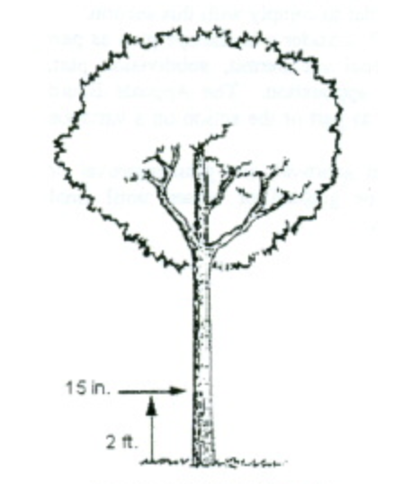
- Applicability of Landscaping and Screening Standards:
- Landscaping: Consistent with the objectives established in section 1111.06(a), landscaping shall be provided in the following areas:
- At the perimeter of sites to buffer, separate and/or screen adjacent land uses;
- At the perimeter of parking lots to shade, separate and/or screen the view of parked cars from adjacent residential uses;
- In the interior of parking lots to shade and beautify the paved surface; and
- Around the perimeter of buildings to soften, shade and enhance the appearance of structures.
- Screening: Screening shall be provided in the following areas:
- To block the view of trash dumpsters, loading areas, service courts and storage areas;
- Between residential and non-residential land uses;
- Parking lots shall be screened to minimize the view of cars from adjacent residential uses. It is not necessary to screen, but only to separate adjacent non-residential parking areas.
- Landscaping: Consistent with the objectives established in section 1111.06(a), landscaping shall be provided in the following areas:
- Procedure:
- Any person seeking a, subdivision plat approval, development plan approval or site plan approval, or any person seeking a variance or conditional use, if applicable, shall file with his application a landscaping plan prepared in a professional manner that, by plot plan and description, includes:
- The present location and size of all major trees, with a designation of major trees sought to be removed.
- The location, size and description of landscaping materials proposed to be placed on the lot in order to comply with this section.
- The location and size of any structures presently on the lot, and those proposed to be placed on the lot.
- The proposed location and description of screening proposed to be placed on the lot in order to comply with this section.
- The Planning Commission shall consider a landscape plan as part of its review of any conditional use permit, subdivision plat, development plan or site plan application. The Appeals Board shall consider a landscape plan as part of the action on a variance application.
- No variance, development plan approval, site plan approval or conditional use permit shall be granted or issued until final approval of the landscaping plan.
- Any person seeking a, subdivision plat approval, development plan approval or site plan approval, or any person seeking a variance or conditional use, if applicable, shall file with his application a landscaping plan prepared in a professional manner that, by plot plan and description, includes:
- Buffer Yards (Perimeter Lot Landscaping): The buffer yard is a designated unit of yard or open area together with any plant materials, barriers, or fences required thereon. Both the amount of land and the type and amount of landscaping specified are designated to lessen impacts between adjoining land uses. By using both distance and landscaping, the impact of such items as noise, glare, activity, dirt, and unsightly parking areas will be minimized. It is a further intent of the following provisions to provide flexibility to the property owner through the manipulation of four basic elements — distance, plant material type, plant material density, and structural or land forms.
- Location of buffer yards: Buffer yards shall be located on the side and rear lot lines of a parcel extending to the lot or parcel boundary line. Buffer Yards shall not extend into or be located within any portion of an existing street right-of-way.
- Determination of buffer yard requirements: To determine the type of buffer yard required between two adjacent parcels, the following procedure shall be followed:
- Identify the land use class of the proposed use by referring to Table 1111.06-1.
- Identify the land use class of each adjacent use by referring to Table 1111.06-2.
- Determine the buffer yard requirements for those side and rear lot lines or portion thereof on the subject parcel (i.e., the proposed use) by referring to Table 1111.06-3. Existing plant material or fences may be counted as contributing to the total buffer yard requirement. The buffer yards specified are to be provided on each lot or parcel of the proposed use, independent of adjacent uses or adjacent buffer yards.
- Should a developed use increase in intensity from a given land use class to a higher one on Table 1111.06-1 or Table 1111.06-2 (e.g., Class III to Class IV), the Planning Commission shall, during the site plan or development plan review process, determine if additional buffer yard is needed and, if so, to what extent and type.
- Buffer yard requirements are stated in terms of the width of the buffer yard and the number of plant units required per one hundred linear feet (100') of buffer yard. The requirements may be satisfied by any of the options indicated in Table 1111.06-3.
- Buffer yard requirements for nonconforming structures or sites: If a nonconforming site is unable to comply with the minimum buffer yard requirements of this Section, the applicant shall not be entitled to the permit for which application has been made unless a variance is granted. Existing paved parking areas beyond the minimum UDO requirements for number of spaces, maneuvering/access aisles or loading areas, as outlined in section 1111.07, shall be removed if necessary to provide the required buffer.
TABLE 1111.06-1: Land Use ClassificationClass I: Light Residential Agriculture Single-Family Detached Dwellings Two-Family Dwellings Class II: Office/Institutional Administrative and Business Offices Professional Offices Institutions - religious, social, cultural, educational, health and public Multi-Family Dwellings Class III: Commercial General Retail, Entertainment, Restaurants, Specialty Retail and Business Services Class IV: Industrial Manufacturing, Wholesaling, Research and Development Facilities
TABLE 1111.06-2: Buffer Yard Requirements* No buffer yard required.Proposed Land Use Class Adjacent Existing Land Use Class I II III IV I * * * * II E A C D III E C A B IV E D B A
(A, B, C, D and E indicate the required type of buffer yard, as shown on Table 3)
TABLE 1111.06-3: Buffer Yard Types: Quantity Of Plant Material1 Required number of minimum plant units per 100'.Buffer Yard Width Deciduous Trees1 Deciduous Shrubs1 Evergreens1 Berm2 Fence2 A 15' 2 — 2 10' 2 2 2 B 20' 2 — 2 15' 2 2 2 10' 2 4 4 C 25' 2 2 2 20' 2 4 2 15' 3 4 4 D 30' 2 2 2 25' 2 2 4 20' 3 4 4 * 10' 3 4 4 * E 30' 2 2 2 25' 3 4 4 20' 3 4 4 * 15' 3 4 4 *
2 Entire length of buffer yard, 3'-4' berm or 4'-6' opaque fence.
* Indicates berm or fence is required.
- Screening of Service Court, Storage Areas and Loading Dock Areas:
- For commercial, industrial, office-institutional and community service uses, all areas used for service, loading and unloading activities shall be screened along the entire rear lot line and side lot lines from the rear lot line to the building setback line, if adjacent to or abutting a residential district.
- Screening shall consist of walls, fences, natural vegetation or an acceptable combination of these elements, provided that screening must be at least seven feet (7'), and walls and fencing no more than twelve feet (12') in height. Natural vegetation shall be a variety which will attain seven feet in height within five years of planting.
- Natural vegetation screening shall have a minimum opaqueness of seventy-five percent (75%) at all times. The use of year-round vegetation, such as pines or evergreens is encouraged. Vegetation shall be planted no closer than three feet (3') to any property line.
Example of Acceptable Trash Container Screening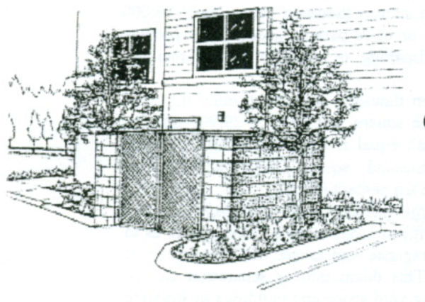
- Screening of Trash Container Receptacles:
- For commercial, community service, industrial, office-institutional and multiple family uses, all trash containers or receptacles shall be screened or enclosed. Trash containers designed to service more than one (1) residential unit or to service a non-residential structure shall be screened on all sides by walls, fences, or natural vegetation or an acceptable combination of these elements. Trash containers shall not be located in the front yard building setback and shall otherwise conform to the side and rear yard setbacks of the applicable zoning district.
- The height of such screening shall be at least six feet (6'). The maximum height of walls and fences shall not exceed ten feet (10'). Natural vegetation shall have a minimum opaqueness of seventy-five percent (75%) at all times. The use of year-round vegetation, such as pines or evergreens is encouraged. Natural vegetation shall be a variety which will attain six feet (6') in height within five (5) years of planting.
- Parking Lot Screening and Landscaping:
- Perimeter Screening. Effectively concealing vehicles within a parking area from the adjacent roadway or adjoining property requires the selective use of plant, mounding or fence material for visual separation. Located adjacent to the parking lot edge, the perimeter screening is designed to supplement required buffer yard material. The perimeter of parking areas, except those for single-family and two-family residential uses, shall be screened as follows:
- Parking areas for non-residential uses and for residential uses such as churches, schools, parks and public facilities adjacent to residentially zoned or used land shall be developed with plant, mounding or fence/wall material which conceals the view of parked cars from the residential property. The height of wall/fences located in front of the building line should be minimized with a maximum height of four feet (4'). Plant material should be used to soften and add visual interest to a wall/fence. A plant material screen shall have a minimum opaqueness of seventy-five percent (75%) at all times. The use of year round vegetation, such as pines or evergreens is encouraged.
- The separation and landscaping of the required buffer yard will provide adequate screening for all other parking lot perimeters.
- Interior Parking Area Landscaping: Landscaping within parking areas, whether ground cover or other upright plant material, is necessary not only to reduce the generation of heat and runoff, but to break up visually the expanse of paved areas. The use of parking islands or peninsulas strategically placed throughout the parking lot is one of the most effective ways to landscape parking lot interiors. The use of shade trees in these landscape areas is encouraged. Any open parking area (including loading areas) containing more than sixteen thousand square feet (16,000 sq. ft.) of area or fifty (50) or more parking spaces shall provide the following interior landscaping in addition to the required perimeter screening:
- For lots between sixteen thousand and twenty-nine thousand nine hundred ninety-nine square feet (16,000-29,999 sq. ft.), the landscaped area shall equal five percent (5%). For lots larger than thirty thousand square feet (30,000), the landscaped area shall be ten percent (10%).
- Whenever possible, large parking areas of thirty thousand square feet (30,000 sq. ft.) or larger shall be designed so as to break up their visual expanse and create the appearance of smaller parking lots. This distinction or separation can be achieved by interspersing yard space and buildings in strategic areas and by taking advantage of natural features such as slope, existing woodland or vegetation, drainage courses and retention areas.
- Landscaping in parking areas shall be dispersed throughout in peninsulas or islands. Minimum island or peninsula size shall be two-hundred square feet (200 sq. ft.), with a two foot (2') minimum distance between all trees or shrubs and the edge of pavement where vehicles overhang and a minimum width of ten feet (10').
- The Planning Commission, as part of the site plan review process, may vary the requirements for minimum and maximum size of parking islands and peninsulas if situations including, but not limited to the following, exist:
- The need to concentrate landscape areas for the purpose of stormwater detention;
- The need to relocate required landscaping on the perimeter of a parking area in the case of a small or unusually shaped lot or where additional screening is desired.
- Required plant materials for the interior of parking areas.
- One (1) deciduous tree shall be required for every three thousand square feet (3,000 sq. ft.) of parking area or for every ten (10) parking spaces.
- Where site distance or maneuvering conflicts exist, trees shall have a clear trunk of at least five feet (5') above the ground, and the remaining required landscape areas shall be planted with shrubs or groundcover not to exceed two feet in height.
- Perimeter Screening. Effectively concealing vehicles within a parking area from the adjacent roadway or adjoining property requires the selective use of plant, mounding or fence material for visual separation. Located adjacent to the parking lot edge, the perimeter screening is designed to supplement required buffer yard material. The perimeter of parking areas, except those for single-family and two-family residential uses, shall be screened as follows:
- General Landscaping For Lots and Building Foundations for Multi-Family, Commercial and/or Industrial Development (Not applicable to single-family homes): To visually soften the building mass or help define exterior spaces, the following landscaping shall be required for all lots, in addition to the landscaping for buffer yards and parking areas. All required planting shall be located in areas which do not include any buffer yard or right-of-way. If the lot consists primarily of impervious surfaces, such trees may be placed close to the building or may be used to add to required parking area landscaping. Existing plant materials which meet the requirements of this Section may be counted as contributing to the landscaping required by this Section.
- Lot Interior Landscaping: Three (3) deciduous trees shall be required for each one-hundred linear feet (100') of building perimeter of non-residential uses or per dwelling unit of single-family residential uses and one (1) deciduous tree for each multi-family unit.
- Building Foundation Planting Requirements: Foundation plantings are intended to soften building edges and screen foundations, and shall be placed within five feet (5') of the building perimeter if feasible. If the City Engineer determines that, because of site design considerations such as the location of sidewalks, plazas or service areas, this is not feasible, such plant materials may be located in planter boxes or in other areas of the site in a manner that enhances the overall landscape plan for the development.
- Five (5) shrubs shall be required per dwelling unit.
- Foundation shrubbery for non-residential uses shall be used to enhance and highlight building architecture. The use of foundation plantings is particularly important on blank walls (i.e. to window or door openings).
- Ten (10) shrubs shall be required for every one-hundred linear feet (100') of building perimeter for non-residential uses.
- Plant Material Specifications (For Buffer Yards, Landscaping and Screening): The following sections include specifications for plant materials. Alternatives to these materials which can be demonstrated to meet both the intent and requirements of this ordinance may be approved as part of a Landscape Plan.
- Deciduous Trees - Size at Planting: A minimum caliper of at least two and one-half inches (2.5") measured twenty-four inches (24") above ground level.
- Evergreen Trees - Size at Planting: A minimum of five feet (5') high and a minimum spread of three feet (3') .
- Shrubs: Shrubs shall be at least twenty-four inches (24") average height and spread at the time of planting and, where required for screening, shall form a continuous, year-round solid visual screen within five (5) years after planting.
- Groundcover and Grass:
- Groundcover - Groundcover shall be planted a minimum of eight inches (8") on center and shall be planted in such a manner so as to present a finished appearance and seventy-five percent (75%) coverage after one complete growing season. If approved as part of a Landscape Plan, groundcover may also consist of rocks, pebbles, sand, wood chips and other material.
- Grass - Grass shall be planted in species normally grown as permanent lawns in Franklin, Ohio, and may be sodded or seeded, except in swales or other areas subject to erosion, where solid sod, erosion-reducing net, or suitable mulch shall be used. Grass sod shall be clean and free of weeds and noxious pests or disease.
- Modifications and Conditions: The quantity of required plant material may be modified by the Planning Commission or by the Appeals Board when the Board determines that special conditions exist making either more or less plant material necessary.
- Maintenance and Replacement Requirements: The owner shall be responsible for the maintenance of all landscaping in good condition so as to present a healthy, neat and orderly appearance. This should be accomplished by the following standards:
- All plant growth in landscaped areas shall be controlled by pruning, trimming or other suitable methods so that plant materials do not interfere with public utilities, restrict pedestrian or vehicular access, or otherwise constitute a traffic hazard.
- All planted areas shall be maintained in a relatively weed-free condition, clear of undergrowth and free from refuse and debris.
- All trees, shrubs, ground covers and other plant materials contained on a Landscape Plan approved by the Planning Commission or Appeals Board must be replaced if they die or become unhealthy because of accidents, drainage problems, disease or other causes. Replacement plants shall conform to the size standards that govern original installation. Deciduous trees must be replaced with deciduous trees, coniferous trees must be placed with coniferous trees and shrubbery must be replaced with shrubbery. Plants intended for screening must maintain the required minimum opacity. Dead or unhealthy plants shall be replaced within the next planting season.
(Ord. 2009-14. Passed 7-6-09.)
1111.07 Off-Street Parking And Loading Requirements And Standards
- Purpose: The purpose of these requirements for off-street parking and loading facilities is to promote the orderly development of land within the City and to promote the safety of residents of the City by assuring the orderly handling of vehicles and vehicular traffic.
- General Specifications and Requirements:
- Applicability: In all districts, at any time any building, structure or use is constructed, enlarged, increased in capacity, used or occupied, including change of occupancy, there shall be provided for every use off-street parking spaces for automobiles in accordance with the provisions of this section. A Parking Plan shall be required for all uses except for single or two-family residential uses. The Parking Plan shall be submitted to Planning Commission as part of the Site Plan or Development Plan review process and to the Zoning Official as a part of the application for a Zoning Certificate. The Plan shall show the boundaries of the property, parking spaces, access driveways, circulation patterns, drainage plans and perimeter screening/landscaping, as appropriate.
- Minimum Area and Dimension Requirements: Parking spaces shall conform to the following minimum area and dimensions, exclusive of driveways and aisles, as shown on Table 1111.07-1.
- Compact Car Spaces: Excess parking spaces above the minimum required by this chapter may be designed to accommodate small cars for uses having little turnover such as apartments, general business offices or industrial plants. Commercial uses, medical offices and other high turnover uses are not permitted to designate small car spaces. The minimum width and length of such spaces shall be 8' x 17'. Approved small car spaces shall be grouped and clearly marked rather than scattered throughout the lot.
- Access: Each site shall have an access drive into the parking area with a minimum width as shown on Table 1111.07-2. All parking spaces, except those required for single- or two-family dwellings, shall have access to a public street or alley in such a manner that any vehicle leaving or entering the parking area from or into a public street or alley shall be traveling in a forward motion.
- Parking Aisles: Parking aisles adjacent to parking spaces shall contain the minimum widths shown on Table 1111.07-3.
TABLE 1111.07-1: Parking Space DimensionsParking Pattern Minimum Width (Feet) Minimum Length (Feet) Ninety degree (90°) angle parking 9 19 Sixty degree (60°) angle parking 9 19 Forty-five (45°) degree angle parking 9 19 Parallel parking 9 23
TABLE 1111.07-2: Driveway WidthParking Pattern Minimum Driveway Width (Feet) Single Family 10 Two-family 16 (combined drive) All other uses 12 (one way) 20 (two way)
TABLE 1111.07-3: Parking Aisle WidthParking Pattern Minimum Aisle Width (feet) Ninety degree (90°) angle parking 24 Sixty degree (60°) angle parking 18 (one way) Forty-five degree (45°) angle parking 12 (one way) 22 (two way) Parallel 12 (one way) 22 (two way)
- Location of Parking Spaces:
- Parking spaces for single- and two-family residential uses shall be located on the same lot as the use which is to be served.
- Parking in residential areas shall not be located off of the driveway in the front yard or side yard, except when such areas meet setback regulations and are paved with a hard or semi-hard, dust-free surface, as approved by the City Engineer.
- Except as permitted in the Downtown Districts, and in the instance of joint parking facilities authorized by section 1111.07(g), parking spaces for all nonresidential uses shall be located on the same lot as the use which is to be served.
- Parking for uses in the Commercial and Office Districts shall be located in the rear or side yards, unless parking in the front yard is approved by Planning Commission.
- Parking spaces for multiple family uses or similar residential uses shall be located not more than 250 feet from the principal use served.
- All land designated within the (DC-1) Downtown Core, (MU-1) Mixed Use, and the (RMU) Riverfront Mixed Use Districts, as identified on the Official Zoning District Map, is exempt from all off-street parking requirements.
- Required Improvements for Parking Areas:
- Paving Requirements:
- All off-street parking and loading areas including spaces, driveways, aisles, circulation drives, and other vehicular maneuvering areas shall be paved with blacktop, concrete, or pavers and shall be adequately drained, except for:
- Permitted uses located in the Agricultural District.
- All new driveways shall require an accessory use permit.
- All off-street parking and loading areas including spaces, driveways, aisles, circulation drives, and other vehicular maneuvering areas shall be paved with blacktop, concrete, or pavers and shall be adequately drained, except for:
- Lighting Requirements:
- Applicability: All off-street parking and loading areas including spaces, driveways, aisles, circulation, and other vehicle maneuvering areas shall be lighted except for:
- Permitted uses located in the Agricultural District.
- Driveways behind the front yard building setback in the single family and two-family residential districts.
- Type: All lighting shall be "full cut-off type" lighting and shall be arranged to reflect the light away from adjoining property.
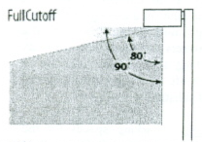
- Height:
- Freestanding lights with full cut-off fixtures shall not exceed a maximum height of 24 feet above grade.
- Illumination. The maximum illumination permitted at the property line shall be as shown in Table 1107.07-4: Illumination Levels.
- For any property which abuts an agricultural or residential district, or abuts property used for single family or two-family uses, the maximum level at the property line shall be 0.0 footcandles.
TABLE 1111.07-4: Illumination LevelsZoning District Maximum Illumination Level at the Property Line Agriculture, Residential, and Parks and Recreation Districts 0.0 footcandles Commercial, Downtown, Office, and Industrial Districts 0.50 footcandles
- For any property which abuts an agricultural or residential district, or abuts property used for single family or two-family uses, the maximum level at the property line shall be 0.0 footcandles.
Full Cut-Off Allows No light at or above 90 degrees 0% 100 cd per 1000 lamp lumens at or above 80 degrees 10% - Applicability: All off-street parking and loading areas including spaces, driveways, aisles, circulation, and other vehicle maneuvering areas shall be lighted except for:
- Paving Requirements:
- Maintenance for Required Improvements:
- The owner of a lot used for parking and loading shall maintain the parking area in good condition to be free of holes, trash and debris. The demarcation of parking spaces shall be adequately maintained either through periodic re-striping or other means.
- All lighting shall be maintained in good condition and working order and shall be illuminated between dusk and dawn.
- Traffic Control Devices:
- Entrances, exits and directional signs shall be provided where practicable, and signs shall conform to City sign regulations, outlined in section 1111.08.
- All parking areas having a capacity in excess of 10 vehicles shall be striped.
- When a parking area extends to a property line, or where the extension of a vehicle beyond the front line of the parking space would interfere with drive or aisle access, wheel blocks or other devices shall be used to prevent such extension.
- Determination of Required Spaces: In computing the number of parking spaces required by this section, the following rules shall apply:
- Where gross floor area is designated as the standard for determining parking space requirements, floor area shall be the sum of the gross horizontal area of all the floors of a non-residential building measured from the faces of the exterior walls.
- Where seating capacity is the standard for determining parking space requirements, the capacity shall mean the number of seating units installed or indicated or each 20 linear inches of benches, or pews, except where occupancy standards are set by the Ohio Building Code.
- Fractional numbers shall be increased to the next whole number.
- The parking space requirements for a use not specified in this Section shall be determined by the Appeals Board, on recommendation from the Zoning Official, if the use is substantially similar to another use for which a standard has been established.
- Joint or Collective Parking Facilities:
- Where two or more uses are provided on the same lot, the total number of spaces required shall equal or exceed the sum of the individual requirements, unless modified by Planning Commission. In computation, a fractional space shall be rounded to the next highest number.
- All required parking spaces shall be located on the same lot with the building or use served, except that where an increase in the number of spaces is required by a change or enlargement of use, or where such spaces are provided collectively or used jointly by two or more buildings or establishments, the required spaces may be located not farther than 250 feet from the building served.
- In any case where the required parking spaces are not located on the same lot with the building or use served, or where such spaces are collectively or jointly provided and used, a written agreement thereby assuring their retention for such purposes shall be properly drawn and executed by the parties concerned, approved as to form by the Director of Law, approved as to content by Planning Commission and filed with the application for a zoning certificate.
- Upon prior approval by the Planning Commission of the terms of a written agreement entered into by owners of property and the City providing for the joint use of parking spaces, two or more nonresidential uses may jointly provide and use parking spaces when their hours of operation do not substantially overlap.
- Parking Spaces for Handicapped Persons: Parking spaces for the handicapped shall meet the requirements of the Ohio Building Code and the Ohio Revised Code. Each such space may be included in the computation of required number of spaces by use.
- Required Number of Parking Spaces by Use: Parking spaces shall be provided according to the following schedule:
TABLE 1111.07-5: Required Number of Parking SpacesPrincipal Building or Use Minimum Spaces Required (Unless Specified Otherwise) Agricultural Uses Agriculture 1 space per employee on the largest shift plus 1 space per 10 employees Residential Uses Dwelling, Four Family 2 spaces per dwelling Dwelling, Live/Work 2 spaces per dwelling Dwelling, Multi-Family 5+ Units 1 space per dwelling plus 1 space per every 10 dwellings Dwelling, Row House 2 spaces per dwelling Dwelling, Single Family 2 spaces per dwelling Dwelling, Three Family 2 spaces per dwelling Dwelling, Two Family 2 spaces per dwelling Dwelling, Upper Floor 2 spaces per dwelling Elderly Housing 1 space per 6 beds plus 1 space per employee on the largest working shift Residential Facilities and Residential Treatment Facilities 1 space per every 4 residents, plus 1 space per employee on the largest working shift Public and Institutional Uses Alcohol and Drug Addiction Facilities 1 space per every 4 residents, plus 1 space per employee on the largest working shift Cemeteries N/A Educational Facilities (Pre-K through 12th Grade) 1 space per employee on the largest working shift plus 1 space per 5 students at maximum capacity Essential Services 1 space per 500 square feet of floor area Government Facilities 1 space per 500 square feet of floor area Mortuaries 1 space per 50 square feet of public floor area, 1 space per employee, plus 1 space per each business vehicle Public Parks, Open Spaces, Recreation, and Preserves, Outdoor Parking shall be provided as determined by the Planning Commission based on the submitted site plan Public Plazas, Gathering, Eating Areas N/A Public Recreation and Event Space, Indoor 1 space per 250 square feet of floor area plus 1 space per employee on the largest working shift Religious and Cultural Facilities 1 space per 4 seats at maximum capacity Secondary Education/Colleges/Universities 1 space per every 3 students plus 1 space per employee on the largest working shift Transportation or Communication Utility N/A Commercial Uses Alcohol Production and Sales 1 space per employee on the largest shift plus 1 space per 3 seats for any restaurant/taproom Assisted Living and Skilled Nursing Care 1 space per 6 beds plus 1 space per employee on the largest shift Automobile Fueling/Charging Stations 1 space per 500 square feet of floor area plus 1 space per employee on the largest working shift Automobile Sales/Rental 1 space per 800 square feet of floor area plus 1 space per 3,000 square feet of open lot area devoted to the sale and display of vehicles Automobile Service/Repair 2 spaces per service bay plus 1 space per employee on the largest working shift Automobile Washing Facility 1 space per employee on the largest working shift Bar, Lounge, Tavern 1 space per 100 square feet of seating area capacity plus 1 space per employee on the largest working shift Bed and Breakfast 2 spaces plus 1 space per employee Business Incubation 1 space per 300 square feet of floor area Business Retail 1 space per 200 square feet of floor area Business Service 1 space per 300 square feet of sales and office area, 1 space per employee on the largest working shift, plus 1 space per company or service vehicle regularly stored on the premises Clubs, Private or Membership 1 space per 50 square feet of floor area in assembly or meeting rooms plus 1 space per 200 square feet of other floor area Commercial Entertainment 1 space per 200 square feet of floor area Commercial Event Center 1 space per 3 guests plus 1 space per employee on the largest working shift Commercial Recreation/Fitness, Indoor 1 space per 250 square feet of floor area Commercial Recreation/Fitness, Outdoor Parking shall be provided as determined by the Planning Commission based on the submitted site plan Commercial Training 1 space per 3 students at maximum capacity plus 1 space per every employee on the largest working shift Day Care Center 1 space per employee on the largest working shift plus 1 space per every 5 at maximum capacity Event Venue, Indoor 1 space per 100 square feet of floor area Event Venue, Outdoor Parking shall be provided as determined by the Planning Commission based on the submitted site plan Environmental Sciences 1 space per employee on the largest working shift plus 1 space per 10 employees Farm Market 1 space per 250 square feet of floor area Financial Institution, General 1 space per 200 square feet of floor area plus 1 space per employee on the largest working shift Food Service/Catering 1 space per 250 square feet of floor area Hospitals 1 space per every 6 beds plus 1 space per employee on the largest working shift Hotels 1 space per guest room plus 1 space per employee on the largest working shift Information Technology/Data Centers 1 space per employee on the largest working shift plus 1 space per 10 employees Landing Fields N/A Makerspace 1 space per 250 square feet of floor area Medical Center/Clinic 3 spaces per treatment or examination room plus 1 space per employee on the largest working shift Medical Office 3 spaces per treatment or examination room plus 1 space per employee on the largest working shift Mixed Use The applicable parking regulations for the uses contained within the mixed use development, as dictated by this table Office 1 space per 300 square feet of floor area Office, Campus 1 space per 300 square feet of floor area Office, Co-Working 1 space per 300 square feet of floor area Personal Service 1 space per 200 square feet of floor area Restaurant, Quick Service 1 space per 50 square feet of seating area capacity plus 1 space per employee on the largest working shift Restaurant, Standard 1 space per 100 square feet of seating area capacity plus 1 space per employee on the largest working shift Retail, Convenience 1 space per 400 square feet of floor area Retail, Food/Beverage Related 1 space per 500 square feet of floor area Retail, General 1 space per 500 square feet of floor area Retail, Large Format 1 space per 500 square feet of floor area Retail, Secondhand 1 space per 500 square feet of floor area Retail, Services 1 space per employee on the largest working shift plus 1 space per 10 employees Retreat Center 1 space per 3 guests plus 1 space per employee on the largest working shift Sexually Oriented Businesses 1 space per 500 square feet of floor area Skilled Nursing Facility 1 space per 6 beds plus 1 space per employee on the largest working shift Veterinary Services 3 spaces per treatment area plus 1 space per employee on the largest working shift Industrial Uses All industrial Uses 1 space per employee on the largest working shift plus 1 space per 10 employees - Modifications: The Zoning Official may modify the requirements in Table 1111.07-5: Required Number of Parking Spaces if it is deemed appropriate based on the parking demand of the proposed use, number of typical patrons or employees, shared parking, off-street parking, alternative transportation , or other similar reasons. As part of the approval for a reduction in the number of required parking spaces, the approving body may require the applicant to reserve land on the subject property to be reserved for a future parking area.
- Administrative Approvals: The Zoning Official may approve a reduction in the number of required parking spaces, up to 25 percent for the reasons listed above.
- Board of Zoning Appeals Approvals: If an applicant requests a reduction of more than 25 percent of the required number of parking spaces, that request will be subject to the decision of the Board of Zoning Appeals.
- Required Number of Stacking Spaces:
- Applicability: Establishments which by their nature create lines of customers waiting to be served within automobiles shall provide stacking spaces that are on the same lot as the use, in addition to the required number of parking spaces per Table 1111.07-5: Required Number of Parking Spaces. The required stacking spaces shall not extend into or be within the public right-of-way, access drives, or circulation areas. Stacking spaces shall meet the requirements set forth in the following table.
TABLE 1111.07-6: Required Number of Stacking SpacesActivity Minimum Number of Required Stacking Spaces Measured From Automobile Washing Facility, Automatic 6 per lane Entrance Automobile Washing Facility, Self-Service 3 per lane Entrance Automobile Fueling Station 2 per fuel pump Pump Island Day Care Center 8 for facilities with 20 or fewer clients plus one additional stacking space for each additional 10 clients served Entrance Financial Institution or ATM 4 Teller, Window, or ATM Food and Beverage Use with Drive-Thru or Pick-Up Window 7 Pick-up Window Other Minimum of 2 per window - Dimensions: Each stacking space shall have an arear not less than 160 square feet (measured eight feet by 20 feet) exclusive of access drives and parking aisles.
- Location: Stacking spaces may not impede on-site or off-site traffic movements or movements into or out of off-street parking spaces. Stacking spaces shall also provide for safe pedestrian crossings to and from parking spaces and the building.
- Modifications: The Planning Commission may require additional stacking spaces than specified in this section for uses that have extremely high-demand use periods that cause long waiting lines, such as fast food restaurants or drive-through coffee shops. In such cases, the Zoning Official shall work with the applicant to ensure that the site plan can accommodate the anticipated intensity of demand and forward a recommendation to the Planning Commission
- Applicability: Establishments which by their nature create lines of customers waiting to be served within automobiles shall provide stacking spaces that are on the same lot as the use, in addition to the required number of parking spaces per Table 1111.07-5: Required Number of Parking Spaces. The required stacking spaces shall not extend into or be within the public right-of-way, access drives, or circulation areas. Stacking spaces shall meet the requirements set forth in the following table.
- Required Number of Loading Spaces by Use:
- Whenever the normal operation of any development requires that goods, merchandise, or equipment be routinely delivered to or shipped from that development, a sufficient off-street loading and unloading area must be provided in accordance with this Section to accommodate the delivery or shipment operations in a safe and convenient manner.
- Loading spaces shall conform to the following minimum dimensions:
- Type A space - (for semi truck vehicles) 14 feet minimum width, 55 feet minimum length, 15 feet height clearance. The space shall not inhibit service access to neighboring facilities or loading areas.
- Type B space - 12 feet minimum width, 30 feet minimum length, 15 feet height clearance, and arranged so as not to inhibit other service traffic.
- The number of loading spaces required are outlined in Table 1111.07-7 and Table 1111.07-8.
- Loading and unloading areas shall be so located and designed that the vehicles intended to use them can maneuver safely and conveniently to and from a public right-of-way, and complete the loading and unloading operations without obstructing or interfering with any public right-of-way or any parking space or parking lot aisle.
- No area allocated to loading and unloading facilities may be used to satisfy the area requirements for off-street parking, nor shall any portion of any off-street parking area be used to satisfy the area requirements for loading and unloading facilities.
- Whenever there exists a lot with one or more structures constructed before the effective date of this chapter, and a change in use that does not involve any enlargement of a structure is proposed for such lot, and the loading area requirements of this Section cannot be satisfied because there is not sufficient area available on the lot that can practicably be used for loading and unloading, the Planning Commission may modify or waive these requirements.
- A loading space may occupy all or any part of any required side or rear yard. No loading or unloading shall occur in a front yard, except for structures less than 15,000 square feetft.).
- No loading space shall be located closer than 50 feet to any residential district.
- Short term storage of pod units shall be situated on a durable, impervious surface, such as a driveway, and located within the building setback. No pod unit shall be permitted to remain longer than seven days. Units located within a commercial district shall, in addition to these standards, be located in the rear yard and screened from view by opaque landscape material or fencing.
TABLE 1111.0-7: Commercial and Industrial BuildingsGross Floor Area Number and Type of Loading Space Less than 5,000 sq. ft. 0 Equal to or greater than 5,000 sq. ft. but less than 15,000 sq. ft. One Type B Equal to or greater than 15,000 sq. ft. but less than 30,000 sq. ft. One Type A Equal to or greater than 30,000 sq. ft. One Type A and B For each additional 50,000 sq. ft. or fraction thereof One Type A
TABLE 1111.07-821: Office and Institutional Buildings (Excluding Churches)Gross Floor Area Number and Type of Loading Space Less than 20,000 sq. ft. 0 Equal to or greater than 20,000 sq. ft. but less than 100,000 sq ft. One Type A Equal to or greater than 100,000 sq. ft. but less than 350,000 sq. ft. Two Type A 350,000 sq. ft. or more Two Type A plus one for each additional 300,000 sq. ft. or fraction thereof
- Modifications and Conditions:
- Where the Planning Commission finds that strict compliance with the minimum improvement requirements provided for in this chapter results in extraordinary hardship or costs being imposed upon a particular subdivision, PUD, PRCD or other development, it may vary these improvement regulations so that substantial justice may be done and the public interest secured.
- In granting modifications of these Requirements, the Planning Commission may require such conditions as will, in its judgment, secure the objectives of the standards of requirements so varied or modified.
((Ord. 2009-14. Passed 7-6-09; Ord. 2010-22. Passed 12-6-10.)
space per treatment or examination room plus 1 space per employee on the lar7-gest working shift
1111.08 Signs
- Purpose and Intent: It is the intent of this Section to establish reasonable regulations governing the size, design, mass, distribution, and location of signs within the incorporated area of the City of Franklin, in the interest of safety and general welfare of its citizens, business concerns, and other affected sectors of the City. It is intended to protect property values, create a more attractive economic and business climate, enhance and protect the physical appearance of the City, and preserve the scenic and natural beauty of designated areas. It is further intended to reduce sign distractions and sight obstructions that may contribute to traffic accidents, reduce hazards that may be caused by signs overhanging or projecting over public rights-of-way, provide more open space, and curb the deterioration of the natural environment and enhance City development in such a way as to support and complement the land-use objectives set forth in this UDO. The specific public purposes of this Section are:
- To provide reasonable, yet appropriate, conditions for identifying goods sold or produced or services rendered in Commercial, Downtown, Office/Institutional, and Industrial Districts;
- To control the size, location, and design of permanent signs so that the appearance of such signs will be aesthetically harmonious with their surroundings;
- To eliminate any conflict that would be hazardous between business or identification signs and traffic control signs and devices;
- To ensure that signs are located and designed to maintain a safe and orderly pedestrian and vehicular environment; and
- To reduce sign clutter.
- Scope of Regulations:
- Applicability: The regulations set forth herein shall apply to and govern signs in all districts. No sign shall be erected or maintained unless it is in compliance with the regulations governing location and bulk of structures for the district in which it is located, unless such sign is otherwise specifically regulated by a conditional use provision or provisions relating to variances.
- Nonconformities: Any sign already established on the effective date of this UDO and which sign is rendered nonconforming by the provisions herein, and any sign which as a result of subsequent amendments hereto, shall be rendered nonconforming and shall be subject to the regulations of section 1111.08(m).
- Variances: Variances to this Section may be considered by the Appeals Board.
- Planned Unit Developments: Signs within Planned Unit Development (PUD) districts shall be subject to the applicable regulations of the underlying zoning district. Signs that do not meet the requirements of this section that are located within a PUD are subject to the approval of the Planning Commission.
- Permit Required:
- All permanent signs to be erected, placed, constructed or modified within the City limits, except those specifically excluded herein, shall require a permit before work is initiated. Temporary sign permit requirements are established in Section 1111.08(l).
- Sign permits shall be reviewed and approved by the Zoning Official, unless specifically stated otherwise.
- Submittal Requirements:
- General Submittal Requirements: The following general requirements shall apply:
- Each request for a Sign Permit shall include an application form, provided by the City, with the submittal;
- The name(s), address(s), and telephone numbers of the applicant(s), and the property owner(s) if other than the applicant(s) with a notarized letter of authorization from the property owner;
- Legal Description of property or portion thereof; and
- Payment of the application fee as established on the City's official fee schedule;
- The Zoning Official may request additional supporting information that in their professional judgment is necessary to fully explain the applicant's proposal. The applicant shall supply the requested additional information.
- Only complete applications shall be processed by the City. The Zoning Official or the TRC, as appropriate, shall make determination as to completeness.
- Site Plan, which shall show:
- Address and zoning classification of the subject property;
- Surrounding uses and zoning classification(s);
- The proposed sign(s) location, including distance from the public right-of-way and the property lines;
- The location of all other existing signs located on the same premises;
- The relationship of the proposed sign(s) to access drives, parking areas and buildings;
- A landscape plan that identifies all plantings to be located at the base of any ground signs; and
- A lighting plan for all internal and external light sources.
- A Sign Graphics Plan, including:
- Plans, drawn to scale, of the proposed signage, including details of fastenings, lighting and any lettering, symbols or other identification which will be on the sign;
- The dimensions, construction supports, sizes, electrical wiring and components, sign materials, and method of attachment;
- The location, size, and illumination of wall signs, ground mounted signs, and directional signs;
- Color renditions of the proposed signage; and
- Elevation drawings of ground mounted signs and/or a façade elevation (showing the height and proportions) for wall signs.
- General Submittal Requirements: The following general requirements shall apply:
- Administration:
- The Zoning Official shall regulate and enforce the requirements of this Section and shall be in charge of issuing all sign permits, both temporary and permanent unless specifically identified otherwise.
- No signs, except for municipally owned signs and signs authorized by the City Manager for community events and programs shall be placed in, on or above the public right-of-way including on utility poles. The Zoning Official or their designee may remove any sign illegally placed within the right-of-way of any road within the City.
- Measurement:
- Sign area shall include the face of all the display area of the sign not including the bracing, framing and structural supports of the sign, unless such support members are made part of the message or face of the sign or are determined by the Zoning Official to be intended solely to make the sign more visible rather than serving any aesthetic or structural purpose. For internally illuminated signs; or internally illuminated awnings, canopies or marquees, the entire lighted surface shall be considered the sign area. The lighted surface area of internally illuminated canopies, awnings or marquees is counted as signage regardless of whether it contains graphics.
- Where a sign has two or more display faces, the area of all faces of the sign shall be included in determining the area of the sign unless two display faces join back to back, are parallel to each other and not more than 24 inches apart, or form a V-angle of less than 45 degrees. For spherical signs, the sphere shall be dissected by an imaginary line through the center of the sphere and the surface area of the half sphere shall be counted as the sign face. For cubical signs, the area of all display faces shall be included in determining the area of the sign.
- The area of letters, numbers or emblems mounted on a building wall or wall extension shall be computed by enclosing such sign with the smallest single continuous perimeter around the letters, numbers or emblems and determining its area.
- The term “lot frontage” as used in calculating ground signs and monument signs shall refer to the dimension of the lot along the street. The term “building frontage” as used in calculating wall signs shall refer to the building wall dimension facing the street or parking lot.
- For structures and uses having no direct frontage on public roads, as within shopping centers, frontage shall be counted as the intersection of the building line onto adjacent drives or parking areas.
- Prohibited Signs: The following signs are prohibited within the City of Franklin:
- Billboards;
- Pole signs, except within the Highway Sign Overlay District, under the conditions outlined in Section 1109.07.
- Roof signs;
- Revolving signs;
- Inflatable signs, air activated devices, beacons, searchlights, and other similar devices;
- No permanent sign or advertising device shall contain or consist of banners, ribbons, pennants, streamers, or similar moving devices;
- Bench signs;
- Mobile or portable signs; and
- Additional prohibited temporary signs as listed in Section 1111.08(l)(11).
- Exempt Signs: The following signs are exempt from the requirements of this Chapter:
- Governmental Flags: Flags of any country, state, or unit of local government.
- Organizational Flags: Flags for private or non-profit organizations subject to such flags are limited to one per organization and such flags shall not exceed three feet in width or five feet in length. Such flags shall contain no commercial or advertising message.
- Identification Signs: Signs up to a maximum of two square feet in size and may be mounted or attached flat or parallel onto a building face of any use or may be ground mounted at a height not to exceed four feet.
- Public: Signs required or authorized for a public purpose by any law, statute, or ordinance, such signs to include traffic control devices provided that such signs contain no supplementary advertising, and any identification of display or any official court or public office notices thereof, or any flag, emblem, or insignia of any country, political unit, educational facility, or religious/cultural group.
- Memorial Signs, Markers, and Statues: Signs which are in the nature of cornerstones, commemorative tables, tablets, grave markers, headstones, statuary, remembrances of persons or events, or historical signs, provided that such signs are less than nine feet in size, not illuminated, and are non-commercial in nature. Such signs shall not be placed within a public right-of-way. Additionally, memorial markers, statues, sculptures, or similar items that commemorate historical events, persons, or locations, are exempt as long as such items are not located in the public right-of-way and do not block visibility.
- Permanent Signs: All permanent signs shall require a permit. Permitted permanent signs shall be classified into one of the 11 following types: wall signs, ground signs, residential development identification signs, menu boards, canopy/marquee/awning signs, window signs, projecting signs, directional signs, murals, manual changeable copy signs, and electronic message centers.
TABLE 1111.08-1: Permitted Permanent SignsAgricultural and Residential Zoning Districts Office Districts, Parks and Recreation District Commercial Districts Industrial Districts Downtown Districts Wall Signs P P P P P Ground Signs P P P P P Residential Development Identification Signs P Menu Boards P Canopy/Marquee/Awning Signs P P P P Window Signs P P P P Projecting Signs P P P Directional Signs P P P P P Murals P P P P Manual Changeable Copy Signs P P P P Electronic Message Centers P
P=Permitted Sign- Wall Signs
- Wall signs may be erected on a building wall or extension of a building wall which faces a street, parking lot, or service drive, and such signs may not extend more than 10 inches beyond any building setback lines.
- Wall signs shall be attached parallel to the building face and extend outward perpendicular from the building face a maximum of 10 inches, except as otherwise provided herein.
- Wall signs shall be primarily constructed out of channel cut letters or other high-quality sign construction types, as determined by the Zoning Official. Logos and graphic elements may also be incorporated into the sign as accent features.
- There is no limit to the quantity of wall signs as long as the cumulative square footage of all wall signs meets the maximum area requirements. The sign area of any proposed canopy, marquee, or permanent window signs shall be included in the overall cumulative calculation of maximum wall signage area.
TABLE 1111.08-2: Wall Sign RegulationsDistrict/Use Maximum Area Illumination/Other Nonresidential Uses Located in Agricultural and Residential Districts 2 square feet per lineal foot of building frontage (maximum 150 square feet) Externally illumination permitted Office Districts/Parks and Recreation District 2 square feet per lineal foot of building frontage (maximum 200 square feet) Internally or externally illumination permitted Commercial Districts 2 square feet per lineal foot of building frontage (maximum 250 square feet) Internally or externally illumination permitted Industrial Districts 2 square feet per lineal foot of building frontage (maximum 300 square feet) Internally or externally illumination permitted Downtown Districts (Downtown Core, Mixed Use, Riverfront Mixed Use)** 2 square feet per lineal foot of building frontage (maximum 250 square feet) Internally or externally illumination permitted. Cabinet wall signs are prohibited. Downtown Districts (Civic) 2 square feet per lineal foot of building frontage (maximum 200 square feet) Internally or externally illumination permitted **In the Transitional Neighborhood Downtown District wall signs are limited to Identification Signs
- Ground Signs
- Ground signs must be located on the same parcel to which they are an accessory use. Off-premises advertising is not permitted on ground signs.
- Ground signs may include a variety of designs including monument signs, post and panel signs, and other similar-type professionally designed signs. Ground signs do not include pole signs.
- No ground sign shall be erected so as to obstruct free access or egress from any building.
- Inside the fire limits, no ground sign shall be constructed of combustible materials, except ornamental features. Outside the fire limits, the structural frame of ground signs shall not be erected out of combustible materials.
- No person shall place or cause to be placed any ground sign within any right-of-way or within the clear sight triangle.
- Ground signs shall be anchored to a minimum depth of 32 inches.
- The base of all new ground signs shall be effectively landscaped with a single, continuous landscaped area to be maintained beneath the sign, in accordance with the following standards:
- The minimum size of the landscaped area shall be equal to the area of the ground sign (i.e., if a ground sign is proposed to be 40 square feet in size then it shall be located in a landscaped area of at least 40 square feet in size);
- The landscaped area shall include all points where sign structural supports attach to the ground;
- Where the required landscaped area adjoins a paved surface accessible to vehicular traffic, a raised planter-type area around the base of the sign is required to prevent the encroachment of vehicles; and
- The landscaped area shall include living plantings aesthetically located and maintained including flowers, shrubs, and grasses. Plants may be located in mulch beds, but the landscaped area may not be completely comprised of mulch. The use of concrete, asphalt, gravel, or any other paved surface, or hardscape in the landscaped area shall be prohibited.
TABLE 1111.08-3: Ground Sign RegulationsDistrict/Use Quantity Maximum Area Maximum Height Minimum Setbacks Illumination/Other Agricultural and Nonresidential Uses Located in Residential Districts 1 per street frontage 0.25 square feet per foot of road frontage (maximum 36 square feet) 6 feet 10 feet from right-of-way, 15 feet from side property lines, 5 feet from all driveways External illumination permitted Office Districts/Parks and Recreation District 1 per street frontage 0.25 square feet per foot of road frontage (maximum 36 square feet) 6 feet 10 feet from right-of-way, 15 feet from side property lines, 5 feet from all driveways Internally or externally illumination permitted Commercial Districts 1 per street frontage 0.5 square feet per foot of road frontage (maximum 64 square feet) 6 feet 10 feet from right-of-way, 15 feet from side property lines, 5 feet from all driveways Internally or externally illumination permitted Commercial Districts (multi-tenant developments or single users of 50,000 square feet or more) 1 per street frontage 0.5 square feet per foot of road frontage (maximum 100 square feet) 10 feet 10 feet from right-of-way, 15 feet from side property lines, 5 feet from all driveways Internally or externally illumination permitted Industrial Districts 1 per street frontage 1 square feet per foot of road frontage 8 feet 10 feet from right-of-way, 15 feet from side property lines, 5 feet from all driveways Internally or externally illumination permitted Downtown Districts** 1 per street frontage 0.25 square feet per foot of road frontage (maximum 36 square feet) 6 feet Must be located on private property and 5 feet from all driveways and side property lines External illumination only **In the Transitional Neighborhood Downtown District ground signs are not permitted
- Residential Development Identification Signs
- Ground signs may be erected at the entrance of any residential subdivision or residential development. The location, height, and other characteristics of the sign must meet the regulations of this section.
- Two ground signs are permitted per each street entrance (one sign is permitted on each side of the entrance to the subdivision or development). Ground signs shall be permanently and securely anchored to the ground and shall be flush mounted to a base, which shall be of brick, stone, or a faux alternative. Alternate ground sign designs may be presented to the Planning Commission for review and approval. Pole type signage is prohibited.
- The sign area shall be limited to 24 square feet and shall not exceed four feet in height.
- The sign area may be incorporated into a larger design features that may include columns, walls, or other similar features. The reverse sides of identification features shall be finished to match the fronts.
- Such identification features may not be located in the public right-of-way. Under no circumstances shall such feature be located in the tree lawn nor the clear sight triangle, nor impair the future utilization or expansion of public streets.
- Applications for permanent subdivision identification signs must demonstrate provisions for future maintenance and maintenance easements at the time of final platting. Written consent of the property owner of each proposed sign location shall be submitted with each permit application.
TABLE 1111.08-4: Residential Development Identification Sign RegulationsDistrict/Use Quantity Maximum Area Maximum Height Minimum Setbacks Illumination/Other Agricultural and Residential Zoning Districts 2 per street entrance into the subdivision 24 square feet 4 feet 10 feet from right-of-way External illumination permitted
- Menu Boards: Menu Boards provided such signs are oriented solely for the use of patrons utilizing the drive-thru and are not visible from adjacent property or the right-of-way. Drive-through menu board signs may include freestanding, pylon, and monument signs. One drive-through menu board sign and one preview board is permitted, but only when all of the following conditions are fulfilled: the sign is located on the property to which it refers; the sign is not visible from the public right-of-way; the sign does not exceed six feet in height; and the sign is located at least 75 feet from a Residential District or use.
TABLE 1111.08-5: Menu Board Sign RegulationsDistrict/Use Quantity Maximum Area Maximum Height Minimum Setbacks Illumination/Other Commercial Districts (uses that include a permitted drive-through) 2 per drive-through 48 square feet 6 feet 75 feet from a Residential District or use Internally or externally illumination permitted - Canopy/Marquee/Awning Sign: Canopy, marquee, and awning signs may be painted on or attached to an awning area or attached to a canopy or marquee. Such signs shall not exceed the maximum height of the principal structure when mounted on the top of the canopy. The sign area of any proposed canopy or marquee sign shall be included in the overall cumulative calculation of allowable wall signage. Awning signs shall be externally illuminated only. Marquee and canopy signs may be internally or externally illuminated.
TABLE 1111.08-6: Canopy/Marquee/Awning Sign RegulationsDistrict/Use Maximum Area Illumination/Other Office Districts/Parks and Recreation District The area of all canopy/marquee/awning signs shall be included in the overall calculation of allowable wall signage Internally or externally illumination permitted Commercial Districts The area of all canopy/marquee/awning signs shall be included in the overall calculation of allowable wall signage Internally or externally illumination permitted Industrial Districts The area of all canopy/marquee/awning signs shall be included in the overall calculation of allowable wall signage Internally or externally illumination permitted Downtown Districts (Downtown Core, Mixed Use, Riverfront Mixed Use)** The area of all canopy/marquee/awning signs shall be included in the overall calculation of allowable wall signage Internally or externally illumination permitted. Cabinet wall signs are prohibited. Downtown Districts (Civic) The area of all canopy/marquee/awning signs shall be included in the overall calculation of allowable wall signage Internally or externally illumination permitted **In the Transitional Neighborhood Downtown District canopy/marquee/awning signs are not permitted - Window Signs: The cumulative maximum area of all permanent window signs shall be included in the overall calculation of allowable wall signage and are limited to windows on the ground or first floor. A maximum of 25 percent of each window may be covered by window signs. Political jurisdictions and educational facilities are exempted from this maximum area, and their window signage does not count towards the overall calculation of allowable wall signage. Window signs shall not be lighted or illuminated.
- Projecting Signs: One projecting sign is permitted per parcel. Projecting signs shall not exceed 12 square feet in size, shall be placed not less than eight feet above the sidewalk or ground level , and shall not project more than four feet outward from the building face. Projecting signs shall be externally illuminated only.
- Directional Signs: On-site directional signs indicating points of entry or exit for a facility, off-street parking areas, circulation patterns, business or building locations, or for other similar purposes are permitted subject to the following:
- Directional signs are limited to a maximum area of nine square feet and five feet in height.
- Directional signs shall not contain advertising or commercial messaging, including logos.
TABLE 1111.08-7: Directional Sign RegulationsDistrict/Use Quantity Maximum Area Maximum Height Minimum Setbacks Illumination/Other See Table 22: Permitted Permanent Signs N/A 9 square feet 5 feet 5 feet from the public right-of-way and all property lines External illumination permitted
- Directional signs are limited to a maximum area of nine square feet and five feet in height.
- Murals: Murals that contain no advertising or commercial messaging may be permitted on any blank wall or portion of a wall per the approval of the City Manager. Murals that contain advertising or commercial messaging may be permitted per the approval of the Planning Commission. The following factors shall be considered and weighed in determining whether a mural should be approved.
- Mural Location:
- Murals shall not be located on the principal facade(s) of a building unless approved by the Planning Commission.
- Murals should not cover or detract from architectural features.
- The installation of a mural should complement and enhance the building and be incorporated architecturally into the facade.
- Murals should not be in an area which may cause undue distraction to drivers, thereby creating a safety hazard.
- Mural Design and Materials:
- The scale of the mural should be appropriate to the building and the site.
- The theme of the mural should be appropriate within the context of the surrounding area and complement the existing character.
- The name of the artist or sponsor of the mural may be incorporated into the mural but shall not exceed five percent of the design or two square feet in area, whichever is less.
- The paint utilized for the mural should be intended for exterior use, have a waterproof seal coating, and of sufficient quality which will not corrode or compromise the integrity of the surface to which it is applied.
- Reflective, neon, and fluorescent paints should not be used.
- Mural Location:
- Manual Changeable Copy: The following regulations apply to all manual changeably copy:
- Manual changeable copy shall be permitted on ground signs.
- Manual changeable copy signs shall compromise no more than two-thirds (2/3) of the total area of the sign per side.
- Ground signs containing manual changeable copy are subject to the maximum height and sign area requirements of ground signs for the zoning district in which they are located.
- In the Residential Districts and the Downtown Districts, manual changeable copy signs shall not be internally illuminated. In these three districts, the manual changeable copy signs may be externally illuminated only between 8:00 a.m. and 8:00 p.m., unless otherwise permitted by Planning Commission.
- Electronic Message Centers: The following regulations apply to all electronic message centers:
- Electronic message centers may be incorporated into ground signs subject to the approval of a conditional use permit per Section 1115.09(b).
- Ground signs containing electronic message centers are subject to the maximum height and sign area requirements of ground signs for the zoning district in which they are located.
- Electronic message centers shall be located a minimum of 250 feet from any residential use.
- Electronic message centers shall only be located on ground mounted signs and shall not exceed two-thirds (2/3) of the size of the total sign area to ensure that the electronic component is subordinate to the principal sign face in size.
- A maximum of one electronic message center is permitted per parcel or development.
- Each message on an electronic message center shall be displayed for no less than eight seconds before transitioning.
- The use of streaming or full-motion video on any electronic message center is prohibited.
- The lighting within an electronic message center shall not be permitted to strobe, flash on or off, change the intensity of illumination, or illustrate movement.
- Electronic message centers shall be equipped with automatic dimmer controls to produce a distinct illumination change from a higher illumination level to a lower illumination level between one-half hour before sunset (dusk) and one-half hour after sunrise (dawn).
- Electronic message centers shall not exceed a maximum illumination of 5,000 nits (candelas per square meter) during daylight hours and a maximum illumination of 500 nit (candelas per square meter) between dusk and dawn. The applicant shall provide a certificate of maximum illumination before a sign permit application is approved.
- Electronic message centers are prohibited in the Downtown Districts.
- Wall Signs
- Requirements Applicable to All Permanent Signs: The following general requirements shall apply for characteristics of permanent signs.
- Illumination. Illumination of signs shall be permitted in all districts, except residential districts, or as otherwise provided in this Section. Illumination shall be from a concealed or indirect light source and shall not flash, blink, fluctuate, travel, revolve, move or in any manner fail to provide constant illumination and shall not create a hazard or visibility problem or interfere with or impair vehicular movement on any street from which the sign may be viewed. Illuminated signs shall be constructed and maintained so that the source of illumination is shielded or otherwise prevented from beaming directly onto adjacent properties or streets.
- Construction. The construction of all signs, including any electrical wiring necessary for the operation of illuminated signs shall conform to the specifications of the Ohio Building Code.
- Maintenance:
- Signs shall be maintained in a safe and good condition at all times by the owner of the sign. Regular maintenance includes the repair and replacement of damaged or malfunctioning parts, repainting, cleaning, and other acts required to keep the sign in good condition.
- The maintenance of a mural shall be the responsibility of the property owner. The mural must be properly maintained to ensure that material failure (such as peeling paint) is corrected, and vandalism is removed promptly in accordance with the Property Maintenance Code.
- Property surrounding any ground mounted sign shall be maintained in a clean and sanitary condition and shall be free from weeds, rubbish, and flammable material.
- Location: All permanent signs shall be located on the site being promoted, identified, or advertised. Off premise signs are prohibited. In no case shall any part of a sign be placed in, over, or extend onto any public right-of-way, except for projecting signs on lots where no front yard exists and for publicly owned signs such as traffic control and directional signs. In no case shall any part of a sign be placed in, over or extend above the roof line of any structure.
- Maximum Number, Height and Area of Signs: In addition to placement of signs, the heights, area and number of permitted signs allowed per use or lot shall be regulated by districts and uses as listed under the regulations of this Section. The height of ground signs shall be measured from the established grade, and no mounding shall be used to increase the height of a sign.
- Joint Identification Signs:
- Joint identification signs shall be limited to wall signs or monument signs, and to premises where there are two or more uses located on a property having frontage on at least one public street.
- If the property fronts on one street, only one joint identification sign is permitted.
- A second joint identification sign is permitted if the property fronts on two streets, provided that the frontage for each street is not less than 200 lineal feet. Additionally, a second joint identification sign may be permitted in the Downtown Districts if the premises has pedestrian access open to the public from parking facilities both in the front and in the rear of the property.
- The size of a joint identification sign shall meet the size and location requirements for a commercial center sign under Table 24.
- Joint identification signs shall be limited to wall signs or monument signs, and to premises where there are two or more uses located on a property having frontage on at least one public street.
- Off-Premises Signs for Industrial and Commercial Lots with No Street Frontage: Notwithstanding any other provision of these sign regulations, a lot or parcel with an Industrial or Commercial zoning designation that has no frontage on a public street, as determined by the Zoning Official, may apply for a sign permit to erect a ground sign on an adjacent lot with street frontage, with the permission of the owner of the adjacent lot. The ground sign shall meet the size and setback requirements for the lot upon which the sign is to be erected. The off-premise sign shall not be counted toward the total allowable signage for the lot upon which it is erected.
- Street Numbers Required: An owner, occupant, or person having control of a residential, industrial, commercial, or public building shall display the numerical address of the building in Arabic numbers not less than four inches in height. Other street numbering guidelines include:
- The color of the numbers shall contrast to the color of the surface on which they are mounted, and the numbers shall be clearly visible from the street on which the building is numbered.
- The numbers shall be placed on the front of the building facing the street on which the building is numbered.
- For buildings not having entrance doors facing the street on which the buildings are numbered, numbers of all units within such building shall be placed either on the wall of the building facing the street on which the building is numbered or on a sign in compliance with this Section.
- The owner of a residential building may post additional sets of address numbers provided that one set complies with the provision of this Section.
- Whoever violates this Section or any part thereof, upon being notified in writing of such violation by the City Engineer, shall have 30 days in which to comply with the provisions of this Section. Upon expiration of the 30 days and failure to comply with the provisions of this Section within that period the owner, occupant, or person having control of a building shall be deemed in violation. Each subsequent day shall constitute a separate violation.
- Lighting: LED, neon tubing, and string lights that are being used as building accent lighting or window trimming are prohibited. String lights may be used as decoration around outdoor eating and drinking areas, parks, public spaces, or gathering areas.
- Temporary Signs and Temporary Sign Permits:
- Temporary Sign Permits: A temporary sign permit is not required for temporary signs, unless specifically stated otherwise.
- Single-Family Residential Temporary Signs: Each single-family residential property may display temporary signs per the following:
- Each parcel is limited to a maximum of three signs at any one time.
- The maximum size of each sign is six square feet.
- The maximum sign height is four feet.
- Signs shall not be illuminated.
- The display of Single-Family Residential Temporary signs shall be limited to 30 consecutive days.
- Each parcel is limited to a maximum of three signs at any one time.
- Real Estate Signs: Property or buildings for sale, rental, or lease are permitted to have a temporary sign subject to the following:
- The maximum sign area is 32 square feet.
- The maximum sign height is six feet.
- One sign is permitted per street frontage.
- Such signs may be temporary ground, wall, or window signs. Ground signs must be located a minimum of 10 feet from any public right-of-way.
- Signs shall not be illuminated.
- Signs shall be removed following the sale, rental, or lease of the building or property.
- The maximum sign area is 32 square feet.
- Community Events: Signs for community events and programs which last for a time period of 30 days or less and which are sponsored by nonprofit, public, educational, religious and charitable organizations are subject to the following:
- Signs for community events and programs which last for a time period of 30 days or less and which are sponsored by nonprofit, public, educational, religious and charitable organizations are subject to the following:
- Signs may be displayed during the event for a period of 30 days immediately preceding the commencement of the event.
- One sign may be located at the site of the event, provided it does not exceed 32 square feet in size and six feet in height.
- All off-site signs must be located on private property with the permission of the property owner and may not exceed 16 square feet not six feet in height.
- Signs shall not be illuminated, and shall not create a safety of visibility hazard, not be affixed to any public utility pole or tree or be located within a public right-of-way.
- Each sign shall be placed at a different site and shall be removed not later than 48 hours after the scheduled activity.
- Signs may be displayed during the event for a period of 30 days immediately preceding the commencement of the event.
- If the program or event is for a continuing period of time in excess of 30 days, only one sign, not larger than 10 square feet, is permitted and such sign must be located either at the site of the event or program or at the location of the sponsoring organization, unless otherwise approved by the Zoning Official.
- Signs for community events and programs which last for a time period of 30 days or less and which are sponsored by nonprofit, public, educational, religious and charitable organizations are subject to the following:
- Construction Signs: Properties or buildings that are under construction may have temporary signs that are subject to the following:
- One sign is permitted per street frontage and such signs shall be installed on the property to which they refer.
- Such signs shall be limited to 32 square feet and six feet in height and shall be placed at least 10 feet from any public right-of-way.
- In residential subdivisions that are under construction, development signs must be removed when 75 percent of the lots in the first subdivision phase have received a certificate of occupancy or the permanent subdivision sign has been erected.
- For multi-family and non-residential developments, signs must be removed when more than 50 percent of the space is rented, sold, or leased.
- Signs shall not be illuminated.
- One sign is permitted per street frontage and such signs shall be installed on the property to which they refer.
- Temporary Holiday Signs/Decorations: Signs clearly in the nature of decorations customarily associated with any national, local, or religious holiday, shall be limited to 60 days in any one year and to be displayed not more than 60 consecutive days. Such signs must meet the sign area limitations of the applicable zoning district. Such signs may be illuminated provided that safety and visibility hazards are not created.
- Banners: Professionally printed advertising banners that are a maximum size of 150 square feet are permitted provided that a temporary sign permit is obtained, they are attached at each corner, point, and/or end so as to prevent movement. Banners may be attached to ground signs within the frame, provided that they are attached at each corner, point and/or end so as to prevent movement. Only one banner is permitted per establishment. No business shall display such signs for more than 60 days within one calendar year per location. The date each sign is first displayed and the time period for which the sign will be displayed shall be legibly marked on the sign. The area of each banner shall not count toward the maximum sign area as specified in this Section.
- Temporary Window Signs: Temporary window signs that are limited in size to 25 percent of the window area in which it is placed, and which are not illuminated. Such signs may be placed only in ground floor windows where no other temporary signs are placed and be limited to only one sign per window. Such signs may be displayed not more than 120 days per calendar year. Merchandise displayed within individual store display windows does not count as signage.
- Other Types of Temporary Signs: Up to two temporary signs, which do not fall within any other category under this Section 1111.08(l) and which are not greater than eight square feet in size, may be displayed on private property, with the permission of the property owner; provided any such sign shall not be displayed for longer than 30 days in a given year. Temporary signs shall not be illuminated; and shall not create a safety or visibility hazard.
- General Restrictions for Temporary Signs:
- No temporary sign shall be mounted, attached, affixed, installed or otherwise secured by any permanent means to any land, structure or other improvement.
- Subject to the other provisions of this Chapter, temporary signs advertising or otherwise directing viewers to a particular event shall be located at the site or location of the event being promoted or at the headquarters of an event sponsor.
- The date upon which a temporary sign is first displayed shall be legibly and permanently marked on the sign.
- Prohibited Temporary Signs: The following types of temporary signs and advertising devices are prohibited.
- Flutter flags
- The use of any inflatable signs, air activated attraction devices, beacons and searchlights, except by special permit for specific events not to exceed 10 days in any 12-month period.
- Portable signs, “A” or “T” frame signs, swinger message board signs, windblown signs, or any other type of sign which can be moved from one location to another without any change in its structural components or members, including trailer signs.
- Human signs.
- Snipe signs.
- Vehicle signs.
- Flutter flags
- Signs in the Public Right-of-Way: No temporary signage shall be placed in the public right-of-way, unless specifically approved by the City Manager (regardless of whether such sign is exempt from sign permitting requirements under Section 1111.08(f) above). Temporary signs placed in the public right-of-way present an immediate distraction and hazard to traveling vehicles and pedestrians, and contribute to visual clutter, blight and litter throughout the community. In addition to other available enforcement action and penalties set forth in this Chapter, the following enforcement action and penalties shall apply to violations of this Section 1111.08(l)(12):
- The Zoning Official shall cause prompt removal of the prohibited sign from the public right-of-way. Temporary signs removed from the public right-of-way may be disposed of in the City’s discretion.
- Any person responsible for placing or maintaining a temporary sign in the public right-of-way shall be subject to the following graduated civil fines:
- For the first offense, a fine of $50.00;
- For the second offense, a fine of $100.00;
- For the third offense, a fine of $250.00; and
- For any subsequent offense, a fine of $500.00.
- For the first offense, a fine of $50.00;
- Each temporary sign placed in the public right-of-way in violation of this section shall be considered a separate offense.
- The Zoning Official shall cause prompt removal of the prohibited sign from the public right-of-way. Temporary signs removed from the public right-of-way may be disposed of in the City’s discretion.
- Temporary Sign Permits: A temporary sign permit is not required for temporary signs, unless specifically stated otherwise.
- Nonconforming Signs and Illegal Signs: The continuance of an existing sign that does not meet the regulations and requirements of this Section shall be deemed a nonconforming sign that shall terminate by abandonment, discontinuance, damage or destruction in accordance with this Section.
- Termination by Abandonment or Discontinuance:
- A sign shall be considered abandoned or discontinued:
- When the sign is associated with an abandoned or discontinued use.
- When the sign remains after the termination of a business. A business has ceased operations and terminated if it closed to the public for at least 90 consecutive days and no active building permit is on file for remodeling or reconstruction. Seasonal businesses are exempt from this determination.
- Abandonment shall be determined, based upon the above definitions, by the Zoning Official. When the Zoning Official finds, upon investigation, that a sign has been abandoned, he shall notify the owner of said sign, together with the owner of the land on which the sign is located, by certified mail, of their findings. Such notice shall advise the owner(s) that the sign has been declared abandoned and must be removed within 30 days. The owner may appeal such decision by the Zoning Official to the Appeals Board within 20 days of receipt of the notice.
- If the abandoned sign is not removed as ordered and the owner has not filed an appeal within 20 days to the Appeals Board, or if the sign is not removed within 10 days of notice to the owner of the Appeals Board's denial of the owner's appeal, the sign may be removed at the expense of the property owner. If the City is not reimbursed for such costs within 30 days, the amount thereof shall be certified to the County Auditor for collection as a special assessment against the property on which the sign is located.
- Upon a finding that the signage is abandoned, the right to maintain and use such sign shall terminate immediately.
- A sign shall be considered abandoned or discontinued:
- Termination Due to Damage, Destruction, or Relocation:
- A sign which is damaged or destroyed, by any means, to the extent of more than 50 percent of the cost of the replacement of such sign, it shall not be reconstructed except in conformity within the provisions of this UDO.
- A nonconforming sign shall not be structurally relocated unless it is brought into compliance with the provisions of the sign requirements and standards of this UDO. Should any relocation take place without being brought into compliance, the sign shall be deemed an illegal sign.
- A sign which is damaged or destroyed, by any means, to the extent of more than 50 percent of the cost of the replacement of such sign, it shall not be reconstructed except in conformity within the provisions of this UDO.
- Maintenance of Nonconforming Signs: A nonconforming sign shall be maintained as required in accordance with the following provisions:
- All signs, together with all supports, braces, guys and anchors shall be kept in repair and in proper state of preservation. The display surfaces of all signs shall be subject to periodic inspection.
- Every sign and the immediately surrounding premises shall be maintained by the owner or person in charge thereof in a clean, sanitary and inoffensive condition free and clear of all obnoxious substances, rubbish and weeds.
- Should any sign be or become unsafe or in danger of falling, the owner thereof and/or the owner of the land on which such sign is located shall proceed at once to put such sign in a safe and secure condition or shall remove the sign.
- When the Zoning Official or their designee finds, upon investigation, that a sign is unsafe or unsound structurally, he shall notify the owner of said sign, together with the owner of the land on which the sign is located, by certified mail of their findings. Such notice shall advise he owner that the sign has been declared unsafe and/or structurally unsound, and must either be repaired or removed (as determined by the Zoning Official in their discretion) with 10 days. The owner may appeal such decision by the Zoning Official to the Appeals Board within 10 days of receipt of the notice.
- If an unsafe, or structurally unsound sign is not repaired or removed as ordered by the Zoning Official, and the owner has filed an appeal within 10 days to the Appeals Board, or if the sign is not repaired or removed within 10 days of the Appeals Board's decision denying the owner's appeal, the sign may be removed by the City at the expense of the sign owner and/or underlying property owner. If the City is not immediately reimbursed for such sign removal costs, the City may pursue collection of its costs in any lawful manner.
- Termination by Abandonment or Discontinuance:
- Enforcement
- If any sign is installed, erected, constructed or maintained in violation of any provision of this section, except for nonconforming signs in compliance, the Zoning Official or their designee shall notify the owner or user thereof to comply with the provisions of this section by certified mail, personal service, or as otherwise allowed by law.
- If the owner or user fails to comply with such notice, and the owner has not requested an opinion as to the existence of the violation from the Appeals Board, or, if after a reasonable search, the owner cannot be found, the Zoning Official or their designee shall cause such graphic or such portion thereof as is constructed or maintained in violation of this Section to be taken down, the expense of which shall be paid by the owner or user.
- Unless clearly specified otherwise, the property owner will be considered to be the presumptive owner of said sign. However, nothing herein contained shall prevent the Zoning Official or their designee from adopting such precautionary measures as may seem to him necessary or advisable in case of imminent danger to place the graphic in safe condition, the expense of which shall be paid by the owner of the premises or recovered against him in the manner as further described in this section.
- No owner or person in charge, possession or control of the sign(s) shall fail to comply with the notices provided in within five days of mailing of the notice. No owner or person in charge, possession or control of permanent signs shall fail to comply with the notices provided within 21 days of mailing of the notice.
- If a violation of a provision of this section is repeated within 90 days of a previous violation of the same provision of this Section by the owner or user subject of the previous violation on the same property as the previous violation, such sign may be seized immediately and a charge assessed for removal without additional notification.
- Fees for removal shall be immediately due and payable to the City. Notice of such assessment shall be given to the owner or user by mailing such notice to the address utilized by the County Treasurer for tax billing purposes. All assessments not paid within 10 days after such mailing shall be subject to collection by the City in any lawful manner.
- The City may also collect such costs together with interest through a civil action in the appropriate court of law having jurisdiction thereof and seek such additional orders from a court of competent jurisdiction as may be necessary from time to time in order to enforce the provisions of this section.
- If any sign is installed, erected, constructed or maintained in violation of any provision of this section, except for nonconforming signs in compliance, the Zoning Official or their designee shall notify the owner or user thereof to comply with the provisions of this section by certified mail, personal service, or as otherwise allowed by law.
- Penalties
- Any person, firm, corporation, partnership, or association violating any provision of this Section or failing to obey any lawful order issued pursuant to its terms shall be charged with a minor misdemeanor offense and fined not less than $75.00. Each day during which such violation continues may be deemed a separate offense.
- An organization may be charged and found guilty of a violation of a provision of this Section under any of the following circumstances:
- The offense is committed by an officer, agent or employee of the organization acting in or on its behalf and within the scope of their office or employment.
- The offense consists of an omission to discharge a specific duty imposed by law on the organization.
- If, acting with the kind of culpability otherwise required for the commission of the offense, its commission was authorized, requested, commanded, tolerated, or performed by the board of trustees, partners, or by a high managerial officer, agent, or employee acting on behalf of the organization and within the scope of their office or employment.
- The offense is committed by an officer, agent or employee of the organization acting in or on its behalf and within the scope of their office or employment.
- (Ord. 2009-14. Passed 7-6-09; Ord. 2013-18. Passed 11-4-13; Ord. 2014-01. Passed 3-17-14; Ord. 2014-03. Passed 4-7-14; Ord. 2014-07. Passed 7-7-14; Ord. 2014-17. Passed 1-5-15; Ord. 2015-15. Passed 11-2-15; Ord. 2017-19. Passed 7-17-17.)